

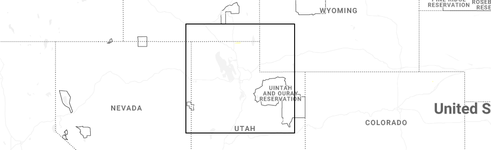
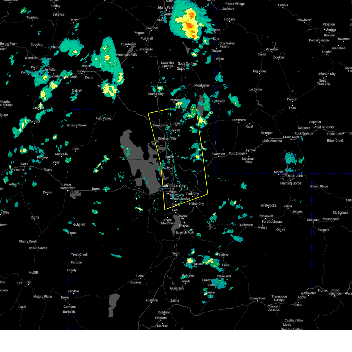
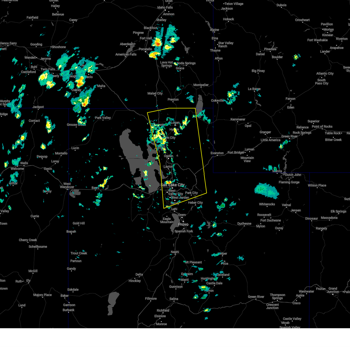
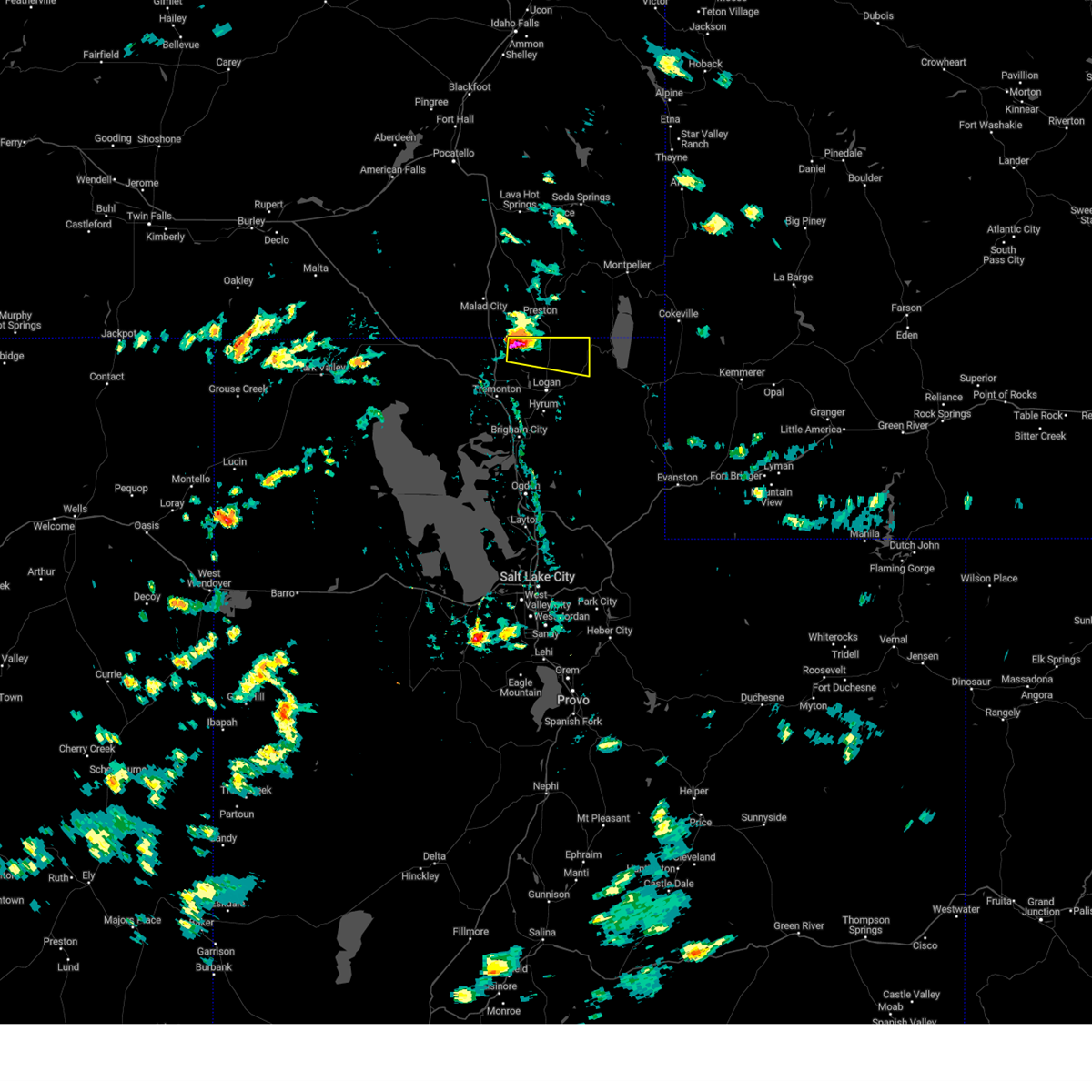
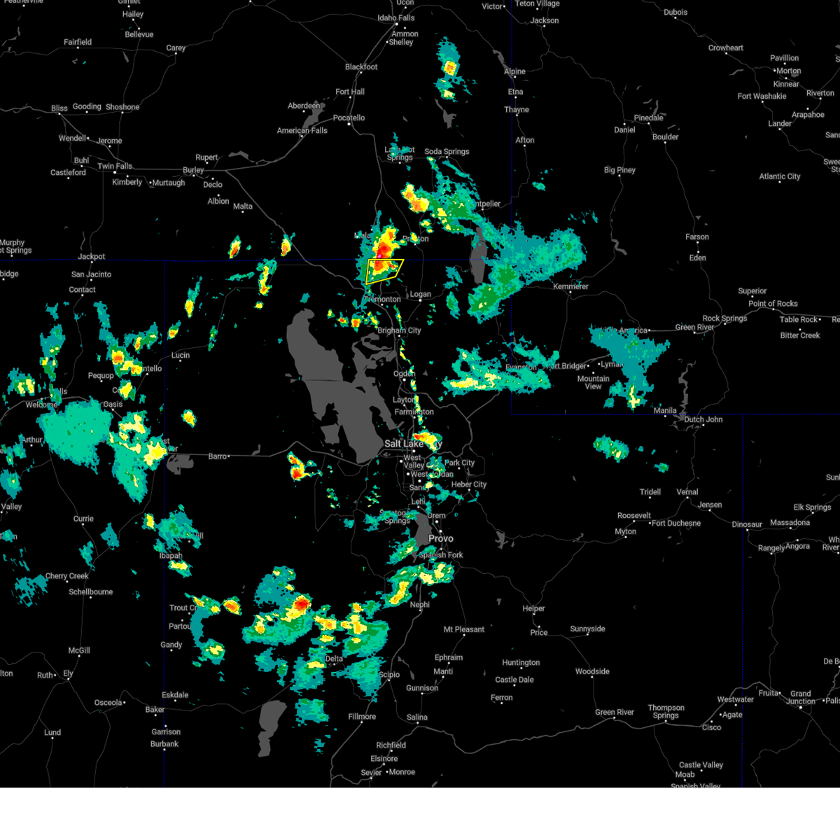
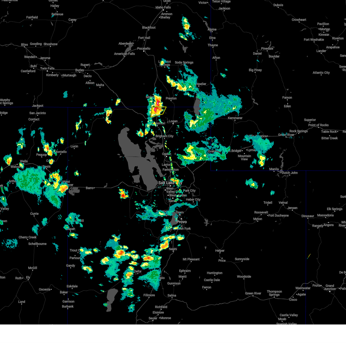
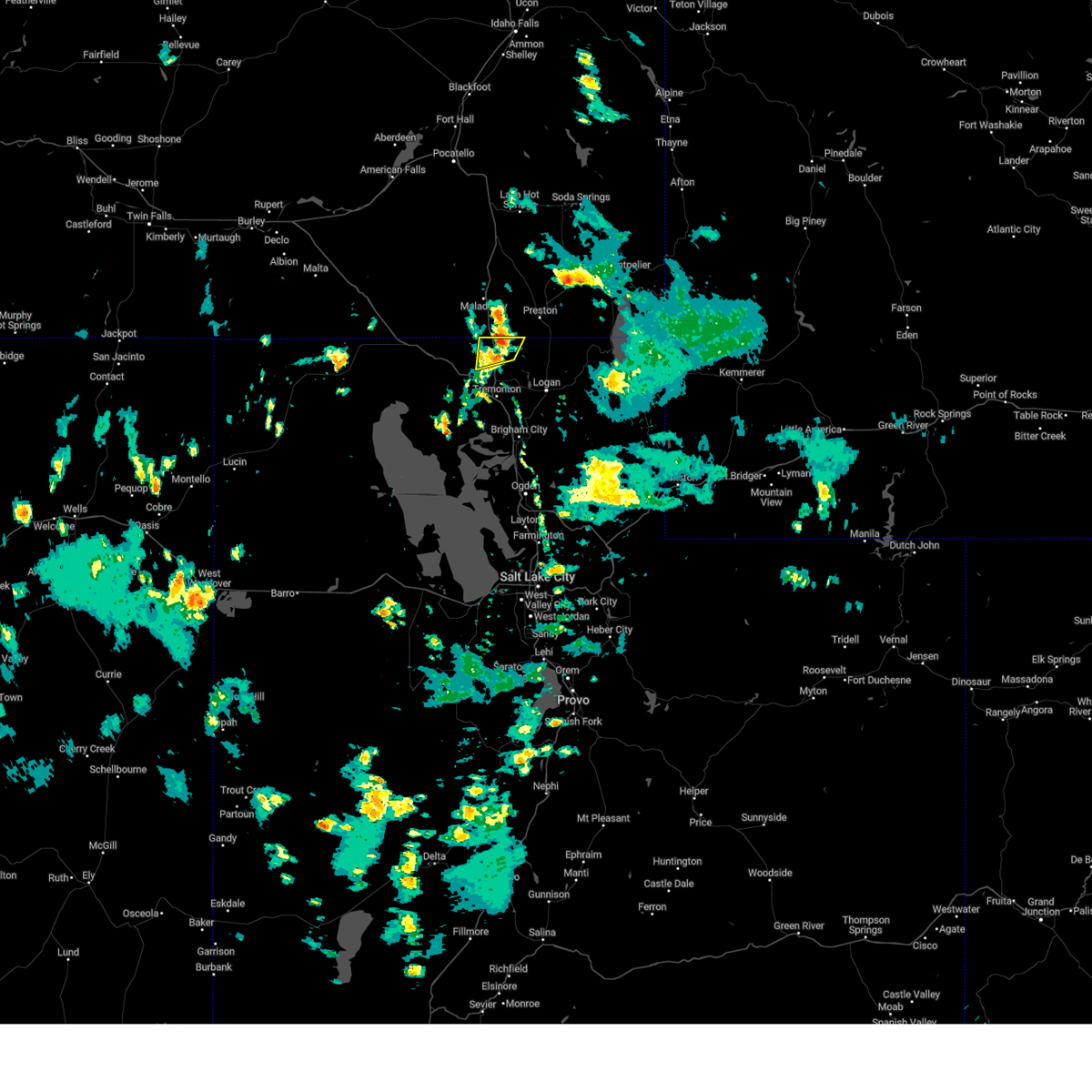
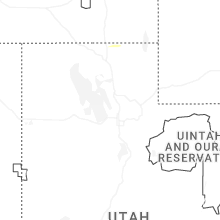
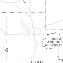
Hail Map for Clarkston, UT
The Clarkston, UT area has had 1 report of on-the-ground hail by trained spotters, and has been under severe weather warnings 3 times during the past 12 months. Doppler radar has detected hail at or near Clarkston, UT on 11 occasions, including 1 occasion during the past year.
| Name: | Clarkston, UT |
| Where Located: | 80.6 miles N of Salt Lake City, UT |
| Map: | Google Map for Clarkston, UT |
| Population: | 666 |
| Housing Units: | 233 |
| More Info: | Search Google for Clarkston, UT |
0
The Top Recent Hail Date for Clarkston, UT is Tuesday, June 9, 2026 (11th out of 11)
Hail and Wind Damage Spotted near Clarkston, UT
| Date / Time | Report Details |
|---|---|
| 5/13/2026 3:59 PM MDT |
 At 358 pm mdt, elevated thunderstorms with a history of producing gusty and erratic outflow winds to 70 mph were located along a line extending from 7 miles west of preston to 9 miles northeast of north ogden, moving northeast at 50 mph (radar indicated. logan-cache airport asos observed a wind gust of 70 mph). Hazards include 70 mph wind gusts. Expect considerable tree damage. damage is likely to mobile homes, roofs, and outbuildings. locations impacted include, ogden, layton, logan, farmington, brigham city, morgan, hill air force base, cache, roy, clearfield, kaysville, syracuse, clinton, north ogden, south ogden, smithfield, washington terrace, riverdale, hyrum, and hooper. this includes the following highways, interstate 15 between mile markers 323 and 370. interstate 84 between mile markers 82 and 103. Us route 89 between mile markers 459 and 491. At 358 pm mdt, elevated thunderstorms with a history of producing gusty and erratic outflow winds to 70 mph were located along a line extending from 7 miles west of preston to 9 miles northeast of north ogden, moving northeast at 50 mph (radar indicated. logan-cache airport asos observed a wind gust of 70 mph). Hazards include 70 mph wind gusts. Expect considerable tree damage. damage is likely to mobile homes, roofs, and outbuildings. locations impacted include, ogden, layton, logan, farmington, brigham city, morgan, hill air force base, cache, roy, clearfield, kaysville, syracuse, clinton, north ogden, south ogden, smithfield, washington terrace, riverdale, hyrum, and hooper. this includes the following highways, interstate 15 between mile markers 323 and 370. interstate 84 between mile markers 82 and 103. Us route 89 between mile markers 459 and 491.
|
| 5/13/2026 3:44 PM MDT |
 Svrslc the national weather service in salt lake city has issued a * severe thunderstorm warning for, weber county in northern utah, cache county in northern utah, northeastern box elder county in northern utah, eastern davis county in northern utah, central morgan county in northern utah, * until 430 pm mdt. * at 343 pm mdt, elevated thunderstorms with a history of producing gusty and erratic outflow winds in excess to 70 mph were located along a line extending from near plymouth to near ogden, moving northeast at 50 mph (radar indicated). Hazards include 70 mph wind gusts. Expect considerable tree damage. Damage is likely to mobile homes, roofs, and outbuildings. Svrslc the national weather service in salt lake city has issued a * severe thunderstorm warning for, weber county in northern utah, cache county in northern utah, northeastern box elder county in northern utah, eastern davis county in northern utah, central morgan county in northern utah, * until 430 pm mdt. * at 343 pm mdt, elevated thunderstorms with a history of producing gusty and erratic outflow winds in excess to 70 mph were located along a line extending from near plymouth to near ogden, moving northeast at 50 mph (radar indicated). Hazards include 70 mph wind gusts. Expect considerable tree damage. Damage is likely to mobile homes, roofs, and outbuildings.
|
| 5/13/2026 3:04 PM MDT |
 Svrslc the national weather service in salt lake city has issued a * severe thunderstorm warning for, weber county in northern utah, western cache county in northern utah, eastern box elder county in northern utah, davis county in northern utah, west central morgan county in northern utah, northeastern tooele county in northern utah, * until 345 pm mdt. * at 302 pm mdt, elevated thunderstorms with a history of producing gusty and erratic outflow winds in excess of 60 mph were located along a line extending from 15 miles east of great salt lake north of the causeway to 7 miles east of great salt lake south of the causeway, moving northeast at 45 mph (radar indicated). Hazards include 60 mph wind gusts. expect damage to roofs, siding, and trees Svrslc the national weather service in salt lake city has issued a * severe thunderstorm warning for, weber county in northern utah, western cache county in northern utah, eastern box elder county in northern utah, davis county in northern utah, west central morgan county in northern utah, northeastern tooele county in northern utah, * until 345 pm mdt. * at 302 pm mdt, elevated thunderstorms with a history of producing gusty and erratic outflow winds in excess of 60 mph were located along a line extending from 15 miles east of great salt lake north of the causeway to 7 miles east of great salt lake south of the causeway, moving northeast at 45 mph (radar indicated). Hazards include 60 mph wind gusts. expect damage to roofs, siding, and trees
|
| 5/11/2025 2:46 PM MDT |
 The storms which prompted the warning have moved out of the area. therefore, the warning has been allowed to expire. a severe thunderstorm watch remains in effect until 800 pm mdt for northern utah. The storms which prompted the warning have moved out of the area. therefore, the warning has been allowed to expire. a severe thunderstorm watch remains in effect until 800 pm mdt for northern utah.
|
| 5/11/2025 2:00 PM MDT |
 Svrslc the national weather service in salt lake city has issued a * severe thunderstorm warning for, weber county in northern utah, cache county in northern utah, northeastern box elder county in northern utah, western rich county in northern utah, northwestern wasatch county in northern utah, salt lake county in northern utah, eastern davis county in northern utah, morgan county in northern utah, western summit county in northern utah, northwestern utah county in northern utah, * until 245 pm mdt. * at 159 pm mdt, severe thunderstorms were located along a line extending from near riverside to near bluffdale, moving northeast at 40 mph. gusts up to 70 mph have been observed (radar indicated). Hazards include 70 mph wind gusts. Expect considerable tree damage. Damage is likely to mobile homes, roofs, and outbuildings. Svrslc the national weather service in salt lake city has issued a * severe thunderstorm warning for, weber county in northern utah, cache county in northern utah, northeastern box elder county in northern utah, western rich county in northern utah, northwestern wasatch county in northern utah, salt lake county in northern utah, eastern davis county in northern utah, morgan county in northern utah, western summit county in northern utah, northwestern utah county in northern utah, * until 245 pm mdt. * at 159 pm mdt, severe thunderstorms were located along a line extending from near riverside to near bluffdale, moving northeast at 40 mph. gusts up to 70 mph have been observed (radar indicated). Hazards include 70 mph wind gusts. Expect considerable tree damage. Damage is likely to mobile homes, roofs, and outbuildings.
|
| 8/9/2024 2:37 PM MDT |
 Svrslc the national weather service in salt lake city has issued a * severe thunderstorm warning for, northern cache county in northern utah, northeastern box elder county in northern utah, * until 300 pm mdt. * at 236 pm mdt, a severe thunderstorm was located near trenton, or 10 miles southwest of preston, moving east at 30 mph (radar indicated). Hazards include 60 mph wind gusts and quarter size hail. Hail damage to vehicles is expected. Expect wind damage to roofs, siding, and trees. Svrslc the national weather service in salt lake city has issued a * severe thunderstorm warning for, northern cache county in northern utah, northeastern box elder county in northern utah, * until 300 pm mdt. * at 236 pm mdt, a severe thunderstorm was located near trenton, or 10 miles southwest of preston, moving east at 30 mph (radar indicated). Hazards include 60 mph wind gusts and quarter size hail. Hail damage to vehicles is expected. Expect wind damage to roofs, siding, and trees.
|
| 3/2/2024 11:51 AM MST |
 Svrslc the national weather service in salt lake city has issued a * severe thunderstorm warning for, cache county in northern utah, northeastern box elder county in northern utah, northwestern rich county in northern utah, * until 1230 pm mst. * at 1150 am mst, a severe thunderstorm was located over trenton, or 12 miles northwest of logan, moving northeast at 60 mph (radar indicated). Hazards include 60 mph wind gusts. expect damage to roofs, siding, and trees Svrslc the national weather service in salt lake city has issued a * severe thunderstorm warning for, cache county in northern utah, northeastern box elder county in northern utah, northwestern rich county in northern utah, * until 1230 pm mst. * at 1150 am mst, a severe thunderstorm was located over trenton, or 12 miles northwest of logan, moving northeast at 60 mph (radar indicated). Hazards include 60 mph wind gusts. expect damage to roofs, siding, and trees
|
| 6/1/2023 4:28 PM MDT |
 The severe thunderstorm warning for northwestern cache and northeastern box elder counties will expire at 430 pm mdt, the storm which prompted the warning has weakened below severe limits, and no longer poses an immediate threat to life or property. therefore, the warning will be allowed to expire. however small hail, gusty winds and heavy rain are still possible with this thunderstorm. The severe thunderstorm warning for northwestern cache and northeastern box elder counties will expire at 430 pm mdt, the storm which prompted the warning has weakened below severe limits, and no longer poses an immediate threat to life or property. therefore, the warning will be allowed to expire. however small hail, gusty winds and heavy rain are still possible with this thunderstorm.
|
| 6/1/2023 4:18 PM MDT |
 At 415 pm mdt, a severe thunderstorm was located 7 miles southeast of cherry creek rest area, or 13 miles southeast of malad, moving north at 10 mph (radar indicated). Hazards include 60 mph wind gusts and quarter size hail. landspouts possible. Hail damage to vehicles is expected. expect wind damage to roofs, siding, and trees. locations impacted include, clarkston, plymouth, portage and washakie. this includes interstate 15 between mile markers 391 and 400. hail threat, radar indicated max hail size, 1. 00 in wind threat, radar indicated max wind gust, 60 mph. At 415 pm mdt, a severe thunderstorm was located 7 miles southeast of cherry creek rest area, or 13 miles southeast of malad, moving north at 10 mph (radar indicated). Hazards include 60 mph wind gusts and quarter size hail. landspouts possible. Hail damage to vehicles is expected. expect wind damage to roofs, siding, and trees. locations impacted include, clarkston, plymouth, portage and washakie. this includes interstate 15 between mile markers 391 and 400. hail threat, radar indicated max hail size, 1. 00 in wind threat, radar indicated max wind gust, 60 mph.
|
| 6/1/2023 4:08 PM MDT |
 At 407 pm mdt, a severe thunderstorm was located near clarkston, or 14 miles south of malad, moving north at 10 mph (radar indicated). Hazards include 60 mph wind gusts and quarter size hail. landspouts possible. Hail damage to vehicles is expected. Expect wind damage to roofs, siding, and trees. At 407 pm mdt, a severe thunderstorm was located near clarkston, or 14 miles south of malad, moving north at 10 mph (radar indicated). Hazards include 60 mph wind gusts and quarter size hail. landspouts possible. Hail damage to vehicles is expected. Expect wind damage to roofs, siding, and trees.
|
| 8/21/2021 6:19 PM MDT |
 At 618 pm mdt, a severe thunderstorm was located near smithfield, or 8 miles northeast of logan, moving east at 50 mph (radar indicated). Hazards include 60 mph wind gusts. Expect damage to roofs, siding, and trees. locations impacted include, logan, tremonton, cache, smithfield, hyrum, wellsville, lewiston, bear river city, clarkston, trenton, plymouth, howell, utah state university, benson, peter, riverside, north logan, providence, nibley and hyde park. this includes the following highways, interstate 15 between mile markers 371 and 394. interstate 84 between mile markers 23 and 42. us route 89 between mile markers 459 and 490. hail threat, radar indicated max hail size, <. 75 in wind threat, radar indicated max wind gust, 60 mph. At 618 pm mdt, a severe thunderstorm was located near smithfield, or 8 miles northeast of logan, moving east at 50 mph (radar indicated). Hazards include 60 mph wind gusts. Expect damage to roofs, siding, and trees. locations impacted include, logan, tremonton, cache, smithfield, hyrum, wellsville, lewiston, bear river city, clarkston, trenton, plymouth, howell, utah state university, benson, peter, riverside, north logan, providence, nibley and hyde park. this includes the following highways, interstate 15 between mile markers 371 and 394. interstate 84 between mile markers 23 and 42. us route 89 between mile markers 459 and 490. hail threat, radar indicated max hail size, <. 75 in wind threat, radar indicated max wind gust, 60 mph.
|
| 8/21/2021 5:52 PM MDT |
 At 552 pm mdt, a severe thunderstorm was located over tremonton, moving northeast at 50 mph (radar indicated). Hazards include 60 mph wind gusts. expect damage to roofs, siding, and trees At 552 pm mdt, a severe thunderstorm was located over tremonton, moving northeast at 50 mph (radar indicated). Hazards include 60 mph wind gusts. expect damage to roofs, siding, and trees
|
| 6/6/2019 5:30 PM MDT |
 At 530 pm mdt, severe thunderstorms were located along a line extending from 9 miles northwest of plymouth to north salt lake, moving east at 45 mph (radar indicated). Hazards include 60 mph wind gusts. expect damage to roofs, siding, and trees At 530 pm mdt, severe thunderstorms were located along a line extending from 9 miles northwest of plymouth to north salt lake, moving east at 45 mph (radar indicated). Hazards include 60 mph wind gusts. expect damage to roofs, siding, and trees
|
| 8/22/2018 9:57 AM MDT |
 At 944 am mdt, a severe thunderstorm was located over clarkston, or 13 miles southwest of preston, moving northeast at 45 mph. this storm will likely cross i-15 near plymouth in the next few minutes (radar indicated). Hazards include 60 mph wind gusts and half dollar size hail. Hail damage to vehicles is expected. expect wind damage to roofs, siding, and trees. Locations impacted include, cache, clarkston, trenton, plymouth, riverside, peter, benson, newton, fielding, cornish, portage and washakie. At 944 am mdt, a severe thunderstorm was located over clarkston, or 13 miles southwest of preston, moving northeast at 45 mph. this storm will likely cross i-15 near plymouth in the next few minutes (radar indicated). Hazards include 60 mph wind gusts and half dollar size hail. Hail damage to vehicles is expected. expect wind damage to roofs, siding, and trees. Locations impacted include, cache, clarkston, trenton, plymouth, riverside, peter, benson, newton, fielding, cornish, portage and washakie.
|
| 8/22/2018 9:45 AM MDT |
 At 944 am mdt, a severe thunderstorm was located over clarkston, or 13 miles southwest of preston, moving northeast at 45 mph. this storm will likely cross i-15 near plymouth in the next few minutes (radar indicated). Hazards include 60 mph wind gusts and half dollar size hail. Hail damage to vehicles is expected. expect wind damage to roofs, siding, and trees. Locations impacted include, cache, clarkston, trenton, plymouth, riverside, peter, benson, newton, fielding, cornish, portage and washakie. At 944 am mdt, a severe thunderstorm was located over clarkston, or 13 miles southwest of preston, moving northeast at 45 mph. this storm will likely cross i-15 near plymouth in the next few minutes (radar indicated). Hazards include 60 mph wind gusts and half dollar size hail. Hail damage to vehicles is expected. expect wind damage to roofs, siding, and trees. Locations impacted include, cache, clarkston, trenton, plymouth, riverside, peter, benson, newton, fielding, cornish, portage and washakie.
|
| 8/22/2018 9:28 AM MDT |
 At 925 am mdt, a severe thunderstorm was located near howell, or 15 miles northwest of tremonton near i-84, moving northeast at 50 mph (radar indicated). Hazards include 60 mph wind gusts and half dollar size hail. Hail damage to vehicles is expected. Expect wind damage to roofs, siding, and trees. At 925 am mdt, a severe thunderstorm was located near howell, or 15 miles northwest of tremonton near i-84, moving northeast at 50 mph (radar indicated). Hazards include 60 mph wind gusts and half dollar size hail. Hail damage to vehicles is expected. Expect wind damage to roofs, siding, and trees.
|
| 5/6/2017 4:09 PM MDT |
 The severe thunderstorm warning for northwestern cache and northeastern box elder counties will expire at 415 pm mdt, the storm which prompted the warning has weakened below severe limits, and no longer poses an immediate threat to life or property. therefore the warning will be allowed to expire. however gusty winds in the 40 to 50 mph range are still possible with this thunderstorm. The severe thunderstorm warning for northwestern cache and northeastern box elder counties will expire at 415 pm mdt, the storm which prompted the warning has weakened below severe limits, and no longer poses an immediate threat to life or property. therefore the warning will be allowed to expire. however gusty winds in the 40 to 50 mph range are still possible with this thunderstorm.
|
| 5/6/2017 3:57 PM MDT |
 At 355 pm mdt, doppler radar indicated a severe thunderstorm capable of producing damaging winds in excess of 60 mph. this storm was located near plymouth, or 16 miles northwest of tremonton, moving north at 40 mph. locations impacted include, tremonton, cache, clarkston, plymouth, howell, riverside, peter, garland, fielding, portage, washakie, collinston and bothwell. At 355 pm mdt, doppler radar indicated a severe thunderstorm capable of producing damaging winds in excess of 60 mph. this storm was located near plymouth, or 16 miles northwest of tremonton, moving north at 40 mph. locations impacted include, tremonton, cache, clarkston, plymouth, howell, riverside, peter, garland, fielding, portage, washakie, collinston and bothwell.
|
| 5/6/2017 3:28 PM MDT |
 At 325 pm mdt, doppler radar indicated a severe thunderstorm capable of producing damaging winds in excess of 60 mph. this storm was located 7 miles west of bear river city, or 8 miles southwest of tremonton, and moving north at 40 mph. At 325 pm mdt, doppler radar indicated a severe thunderstorm capable of producing damaging winds in excess of 60 mph. this storm was located 7 miles west of bear river city, or 8 miles southwest of tremonton, and moving north at 40 mph.
|
| 9/22/2016 4:22 PM MDT |
 At 420 pm mdt, doppler radar indicated a line of severe thunderstorms capable of producing destructive winds in excess of 70 mph. these storms were located along a line extending from near lewiston to 20 miles west of woodruff, and moving northeast at 40 mph. penny size hail may also accompany the damaging winds. At 420 pm mdt, doppler radar indicated a line of severe thunderstorms capable of producing destructive winds in excess of 70 mph. these storms were located along a line extending from near lewiston to 20 miles west of woodruff, and moving northeast at 40 mph. penny size hail may also accompany the damaging winds.
|
| 9/22/2016 4:18 PM MDT |
 At 417 pm mdt, doppler radar indicated severe thunderstorms capable of producing destructive winds in excess of 70 mph. these storms were located along a line extending from near cherry creek rest area to near mantua, moving northeast at 35 mph. penny size hail may also accompany the damaging winds. locations impacted include, logan, brigham city, tremonton, cache, north ogden, hyrum, perry, wellsville, willard, bear river city, mantua, corinne, clarkston, trenton, plymouth, riverside, peter, benson, south willard and pleasant view. At 417 pm mdt, doppler radar indicated severe thunderstorms capable of producing destructive winds in excess of 70 mph. these storms were located along a line extending from near cherry creek rest area to near mantua, moving northeast at 35 mph. penny size hail may also accompany the damaging winds. locations impacted include, logan, brigham city, tremonton, cache, north ogden, hyrum, perry, wellsville, willard, bear river city, mantua, corinne, clarkston, trenton, plymouth, riverside, peter, benson, south willard and pleasant view.
|
| 9/22/2016 3:54 PM MDT |
 At 353 pm mdt, doppler radar indicated a line of severe thunderstorms capable of producing destructive winds in excess of 70 mph. these storms were located along a line extending from 7 miles east of howell to roy, and moving northeast at 35 mph. penny size hail may also accompany the damaging winds. * this line of storms has a history of producing wind gusts up to 75 mph. At 353 pm mdt, doppler radar indicated a line of severe thunderstorms capable of producing destructive winds in excess of 70 mph. these storms were located along a line extending from 7 miles east of howell to roy, and moving northeast at 35 mph. penny size hail may also accompany the damaging winds. * this line of storms has a history of producing wind gusts up to 75 mph.
|
| 5/6/2016 4:52 PM MDT |
 At 452 pm mdt, doppler radar indicated a line of severe thunderstorms capable of producing damaging winds in excess of 60 mph. these storms stretched from near promontory point to near tremonton and were moving north at 35 mph. penny size hail may also accompany the damaging winds. these storms have a history of producing winds in excess of 60 mph! locations impacted include, tremonton, cache, bear river city, corinne, clarkston, plymouth, howell, riverside, garland, honeyville, elwood, fielding, deweyville, bear river, bothwell, penrose, thatcher, golden spike historic site, collinston and promontory. At 452 pm mdt, doppler radar indicated a line of severe thunderstorms capable of producing damaging winds in excess of 60 mph. these storms stretched from near promontory point to near tremonton and were moving north at 35 mph. penny size hail may also accompany the damaging winds. these storms have a history of producing winds in excess of 60 mph! locations impacted include, tremonton, cache, bear river city, corinne, clarkston, plymouth, howell, riverside, garland, honeyville, elwood, fielding, deweyville, bear river, bothwell, penrose, thatcher, golden spike historic site, collinston and promontory.
|
| 5/6/2016 4:32 PM MDT |
 At 430 pm mdt, doppler radar indicated a line of severe thunderstorms capable of producing damaging winds in excess of 60 mph and quarter size hail. these storms were located along a line extending from 19 miles southwest of bear river city to near corinne, and moving north at 35 mph. this line of storms has a history of producing winds in excess of 60 mph!. At 430 pm mdt, doppler radar indicated a line of severe thunderstorms capable of producing damaging winds in excess of 60 mph and quarter size hail. these storms were located along a line extending from 19 miles southwest of bear river city to near corinne, and moving north at 35 mph. this line of storms has a history of producing winds in excess of 60 mph!.
|
| 6/3/2015 9:27 PM MDT | The severe thunderstorm warning for northeastern box elder and northern cache counties will expire at 930 pm mdt, the storm which prompted the warning has weakened below severe limits, and no longer poses an immediate threat to life or property. therefore the warning will be allowed to expire. |
| 6/3/2015 8:58 PM MDT | At 858 pm mdt, doppler radar indicated a severe thunderstorm capable of producing quarter size hail and destructive winds in excess of 70 mph. this storm was located near smithfield, or 11 miles north of logan, moving northeast at 35 mph. locations impacted include, logan, cache, smithfield, hyrum, wellsville, lewiston, clarkston, trenton, plymouth, benson, riverside, peter, garden, north logan, providence, nibley, hyde park, richmond, garland and millville. |
| 6/3/2015 8:47 PM MDT | At 847 pm mdt, doppler radar indicated a severe thunderstorm capable of producing destructive winds in excess of 70 mph. this storm was located over cache, or 13 miles northwest of logan, and moving northeast at 35 mph. |
| 6/3/2015 7:41 PM MDT | At 741 pm mdt, doppler radar indicated a severe thunderstorm capable of producing large hail up to ping pong ball size and damaging winds in excess of 60 mph. this storm was located near trenton, or 11 miles southwest of preston, and moving northeast at 25 mph. |
| 6/3/2015 7:37 PM MDT | Quarter sized hail reported 0.2 miles ENE of Clarkston, UT |
| 6/3/2015 7:27 PM MDT | At 726 pm mdt, doppler radar indicated a severe thunderstorm capable of producing quarter size hail and damaging winds in excess of 60 mph. this storm was located over clarkston, or 15 miles southwest of preston, moving northeast at 25 mph. another severe thunderstorm was located near portage, moving northeast at 25 mph. locations impacted include, clarkston, trenton, plymouth, cornish, portage and washakie. |
| 6/3/2015 7:16 PM MDT | At 716 pm mdt, doppler radar indicated a severe thunderstorm capable of producing quarter size hail and damaging winds in excess of 60 mph. this storm was located near plymouth, or 16 miles north of tremonton, and moving northeast at 30 mph. |
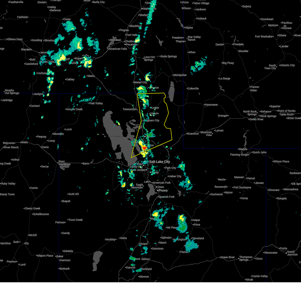
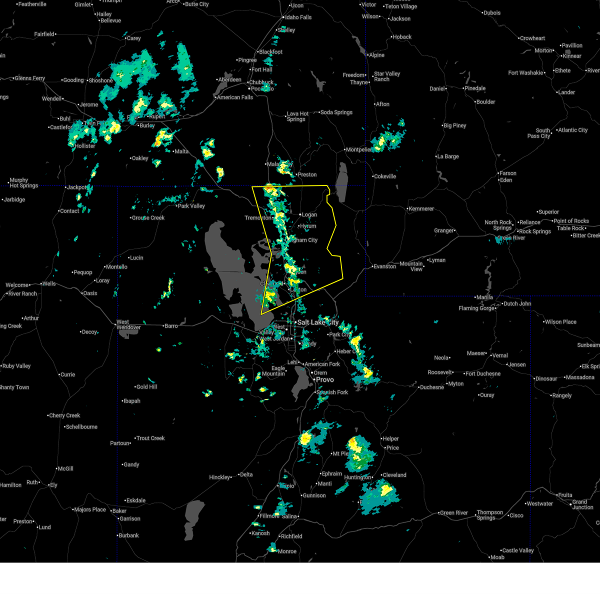
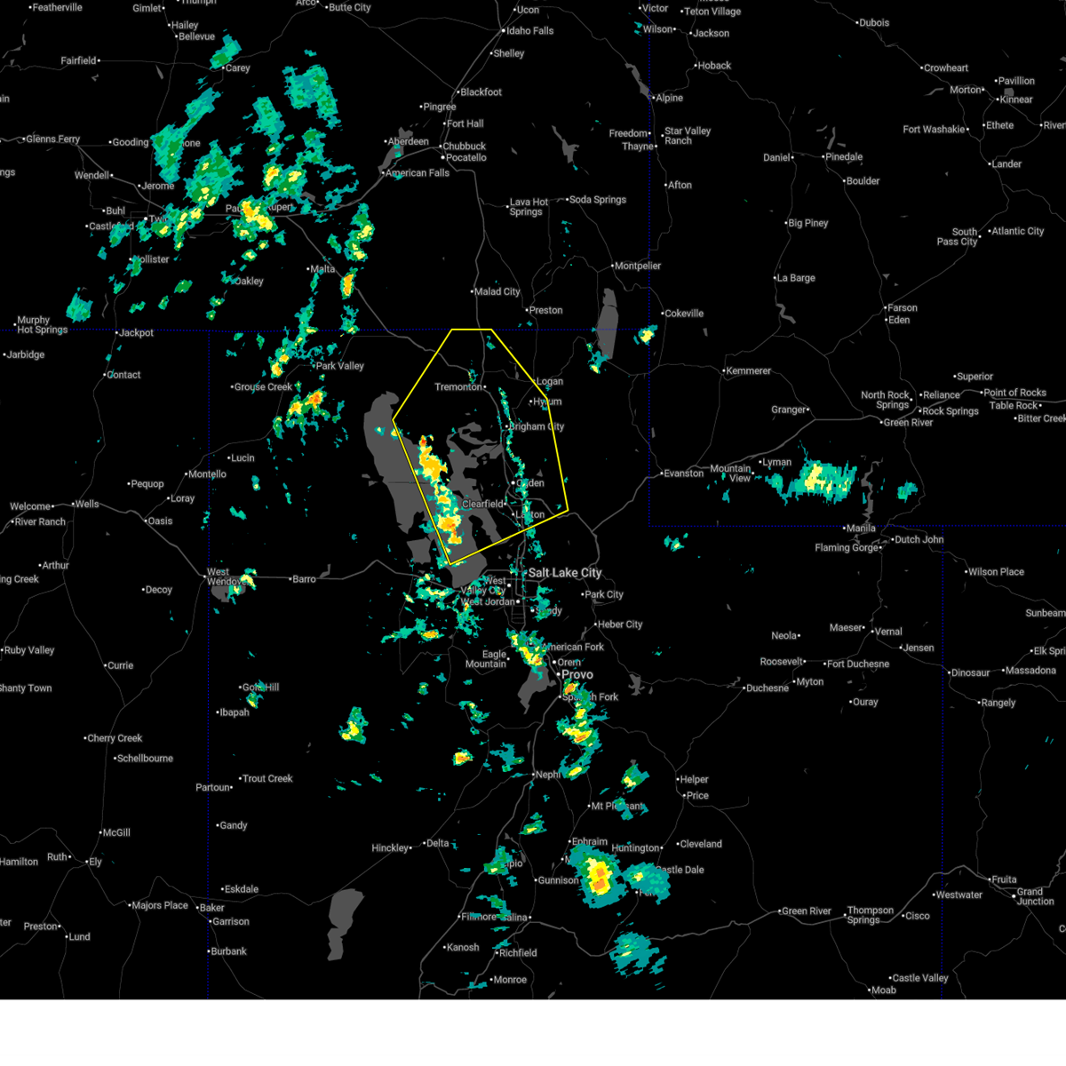
Hail Maps for Clarkston, UT


Connect with Interactive Hail Maps