

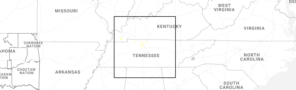
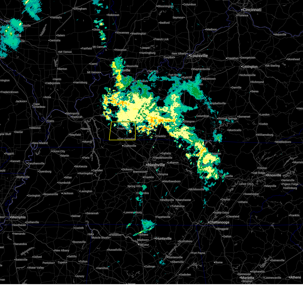
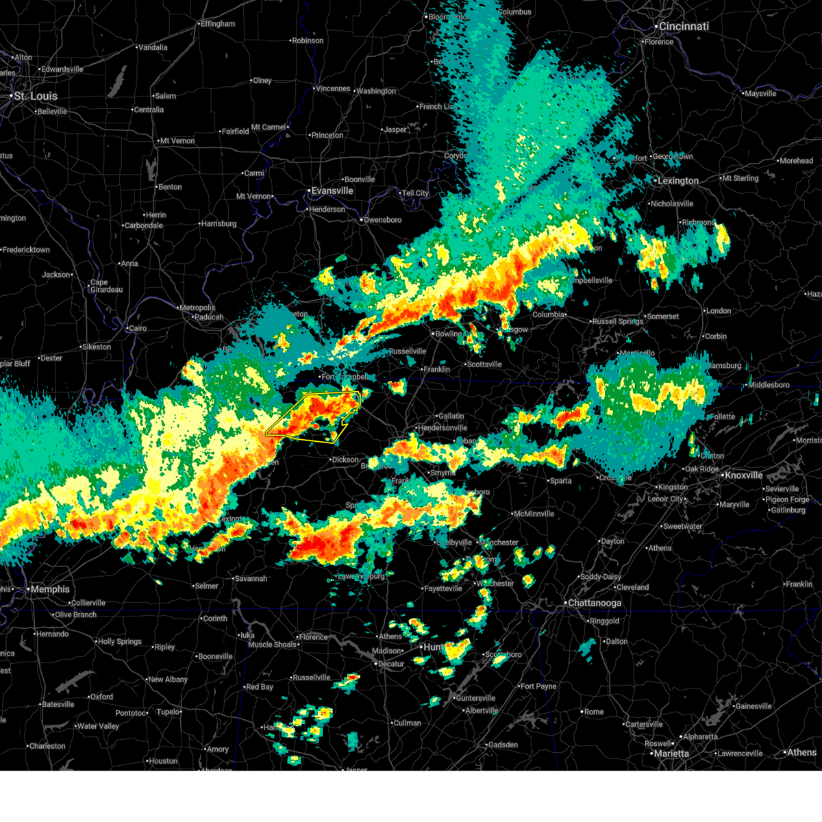
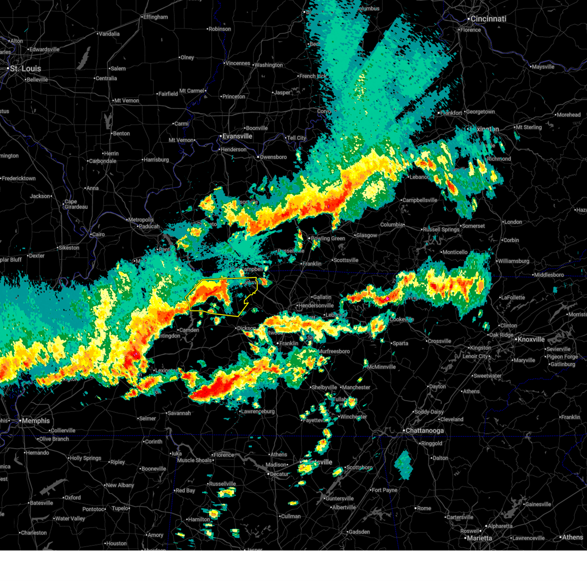
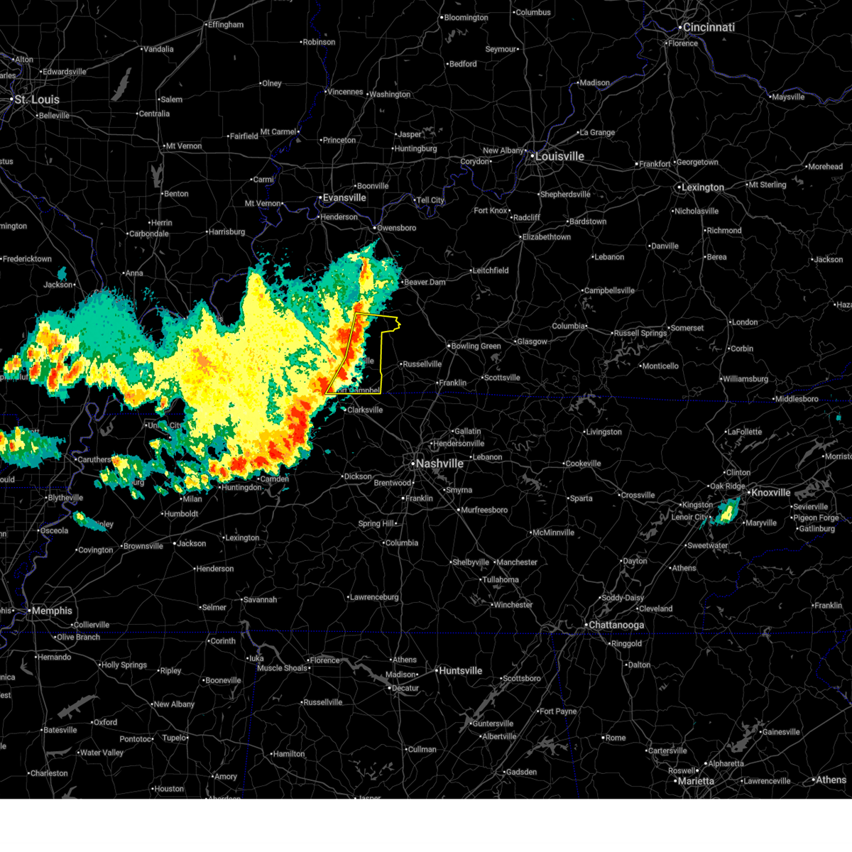
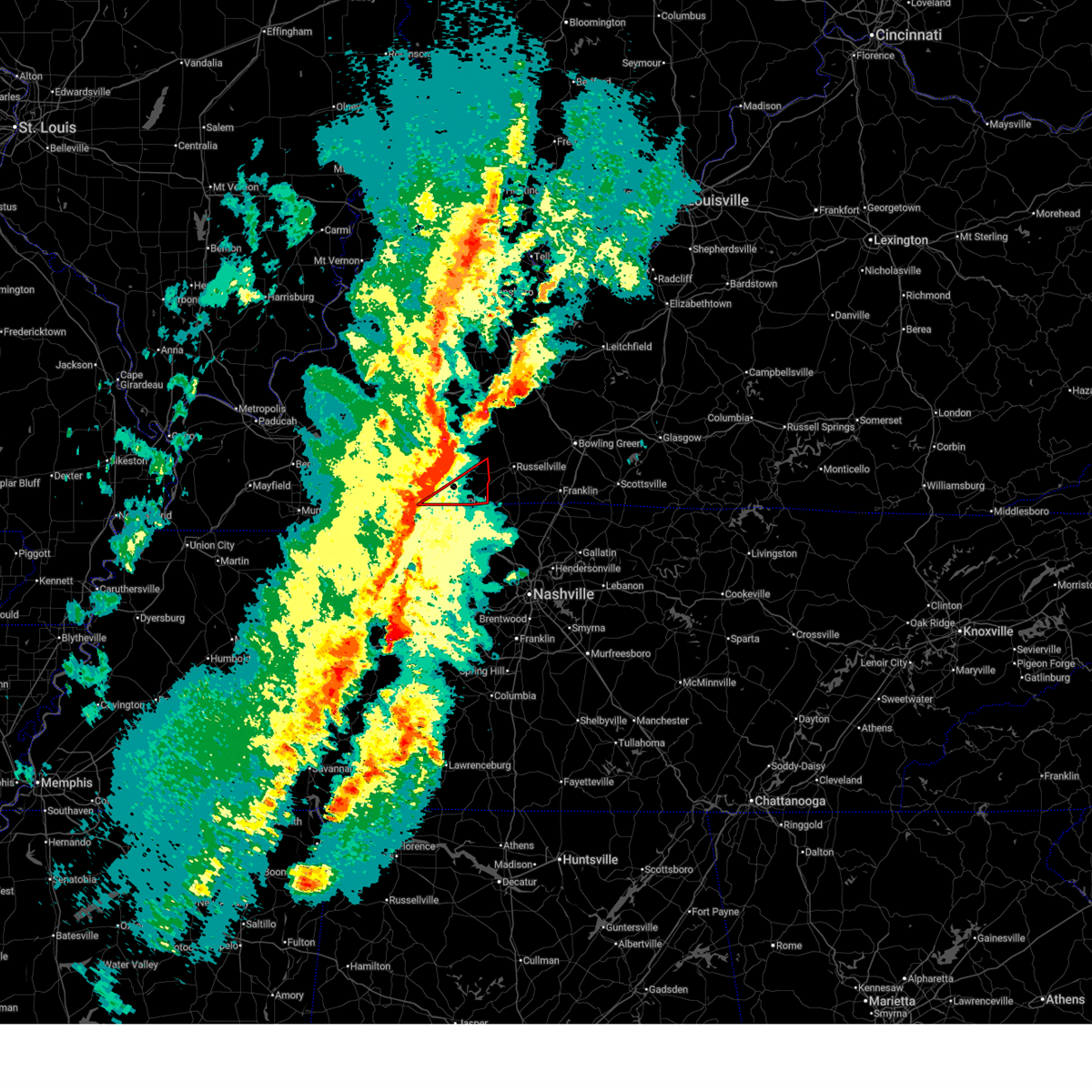
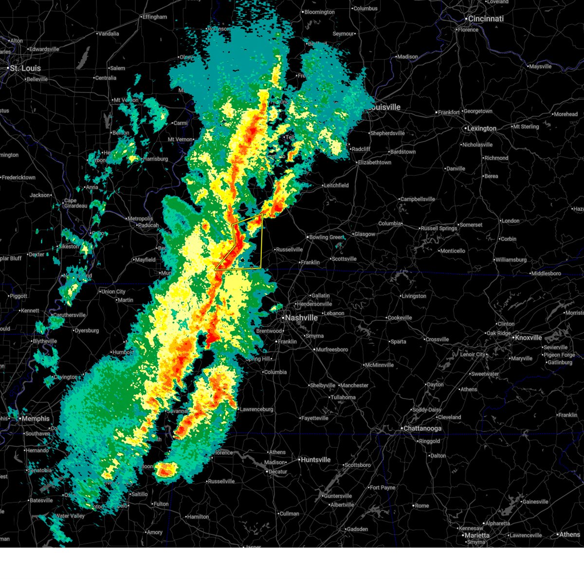
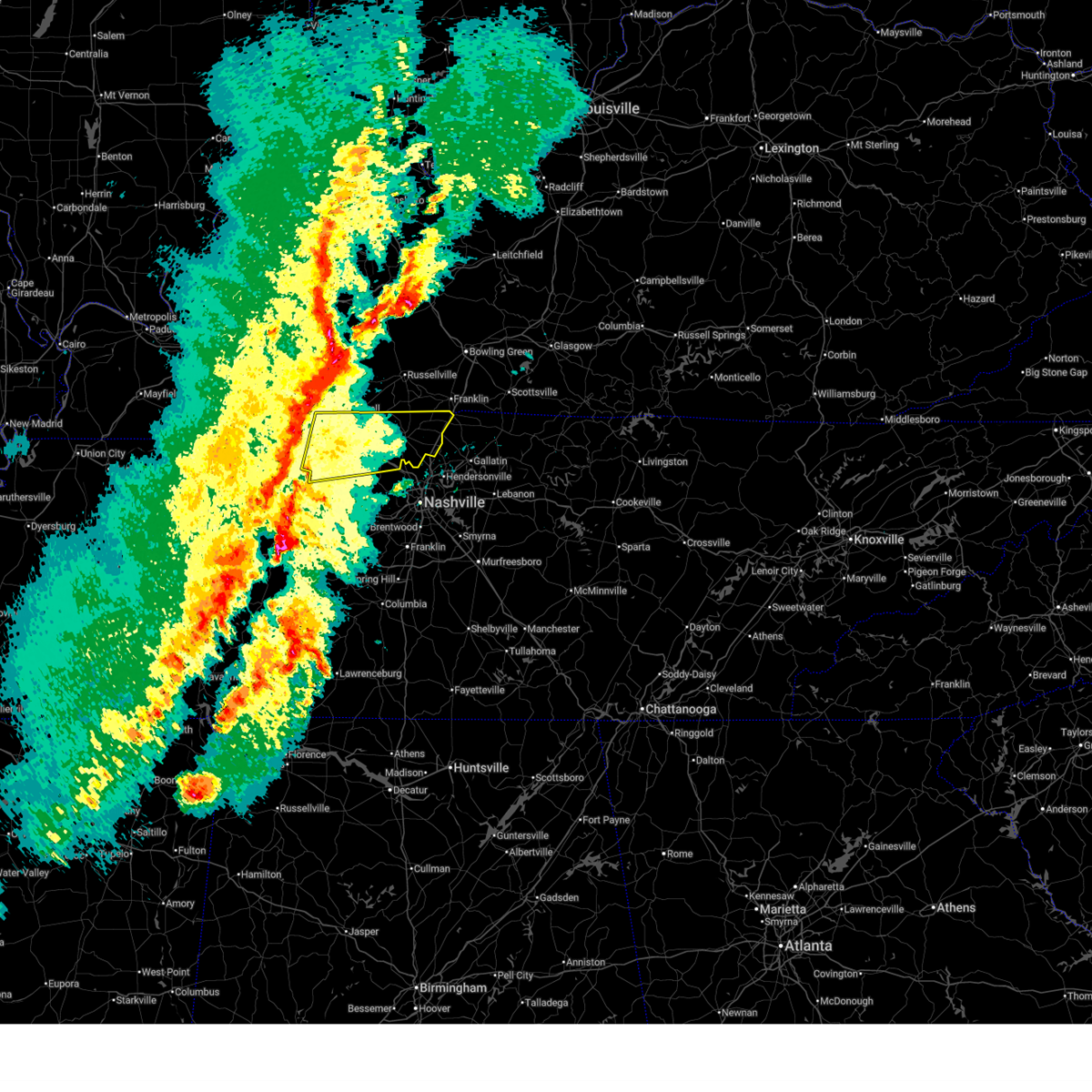
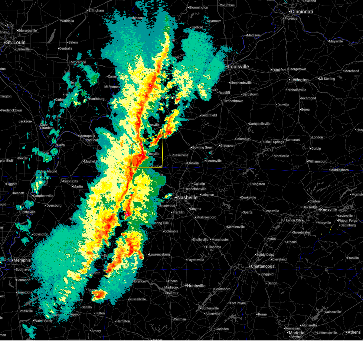
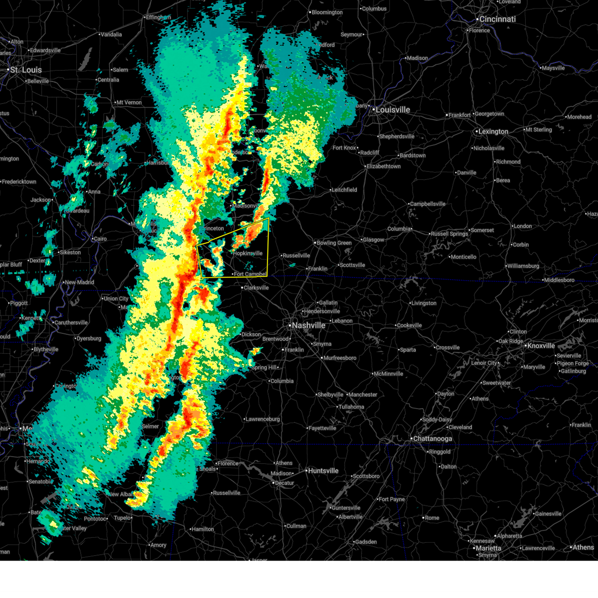
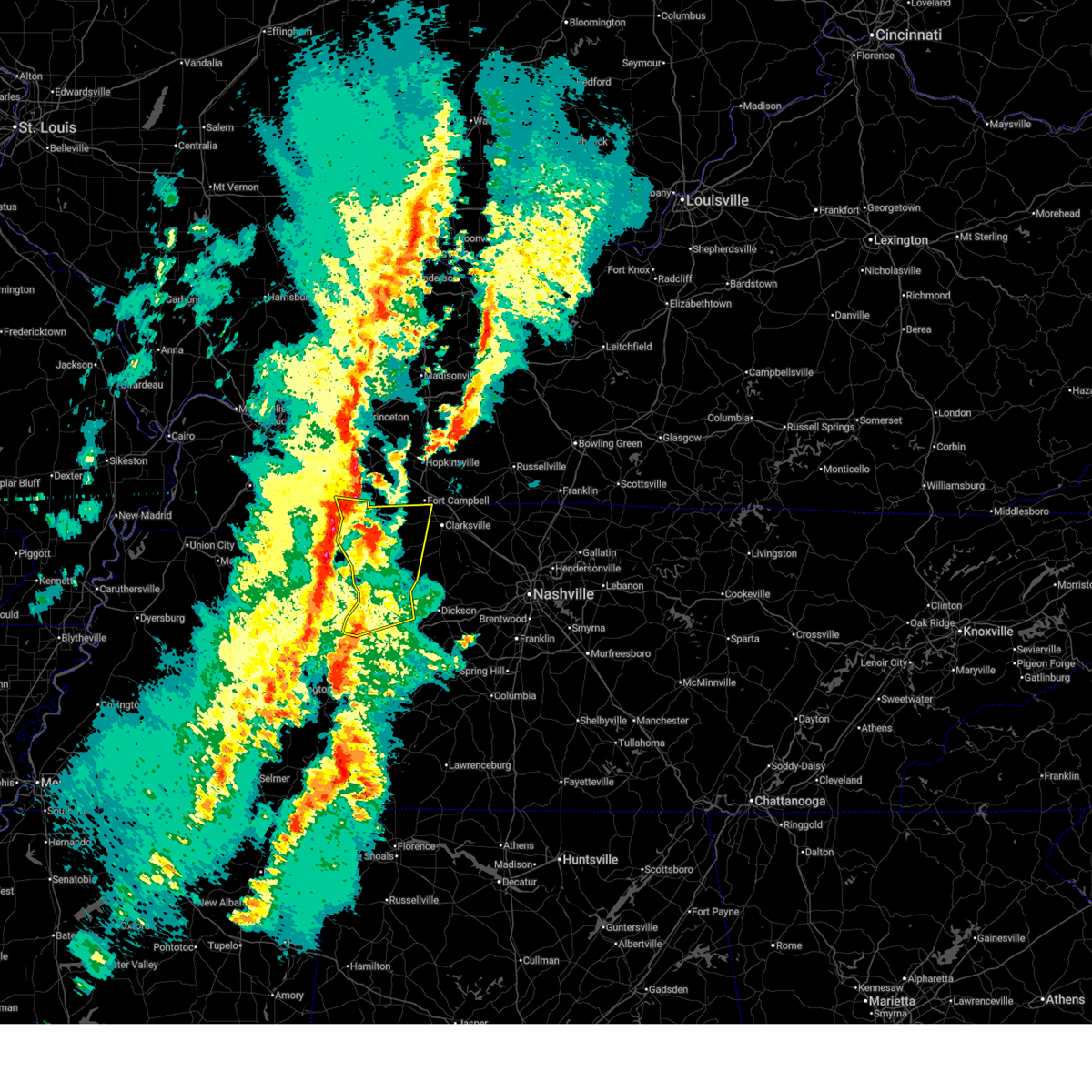
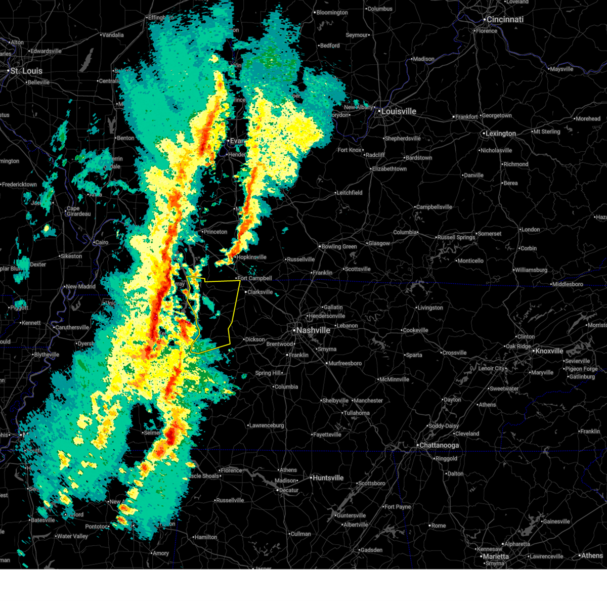
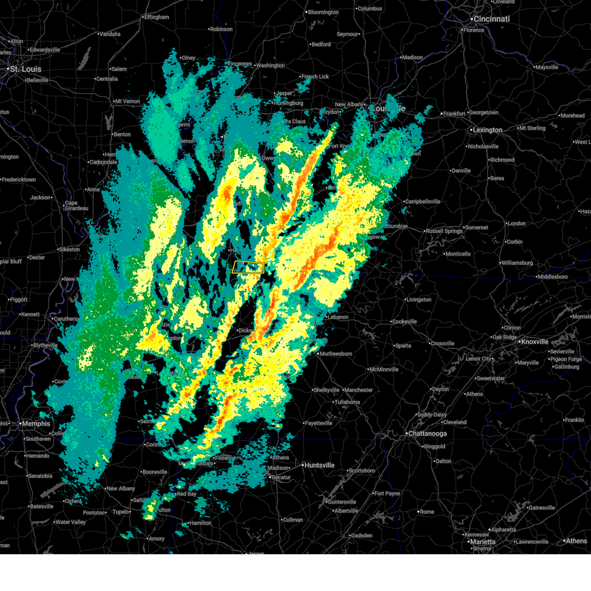
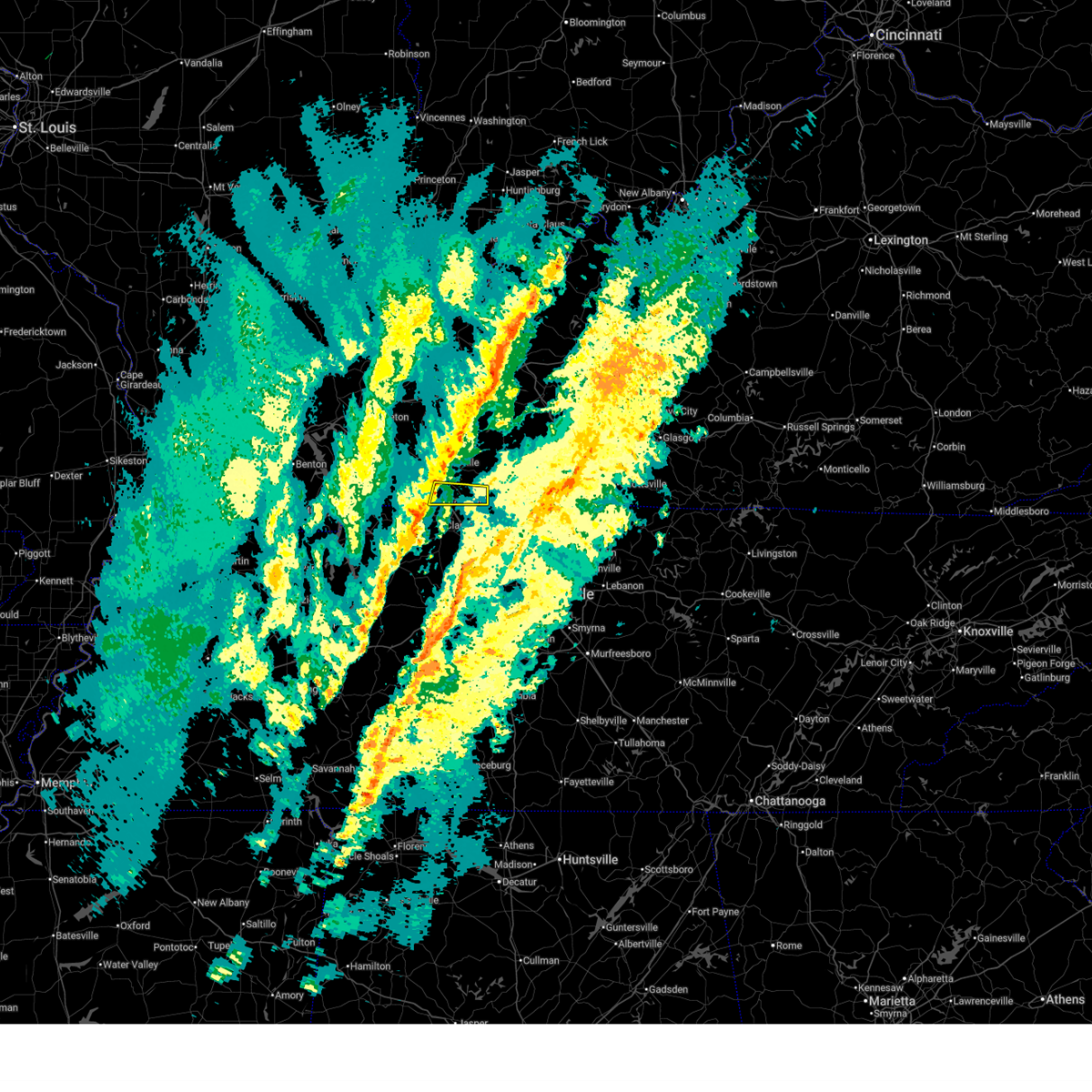
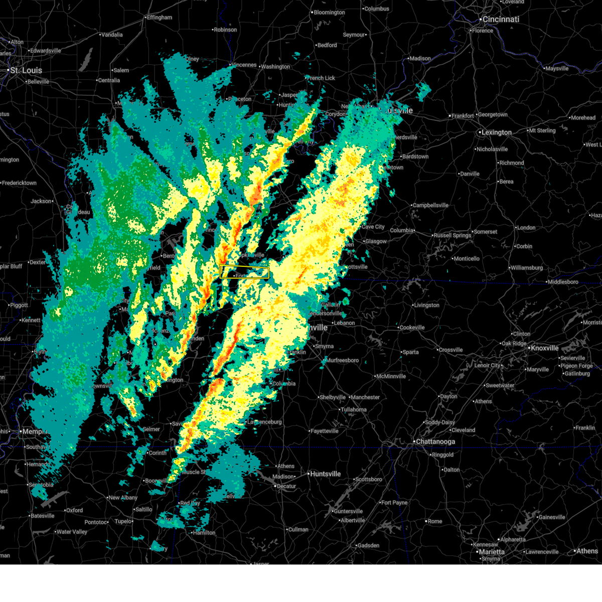
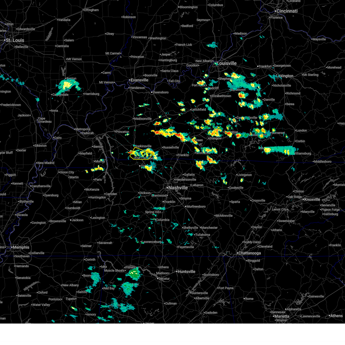
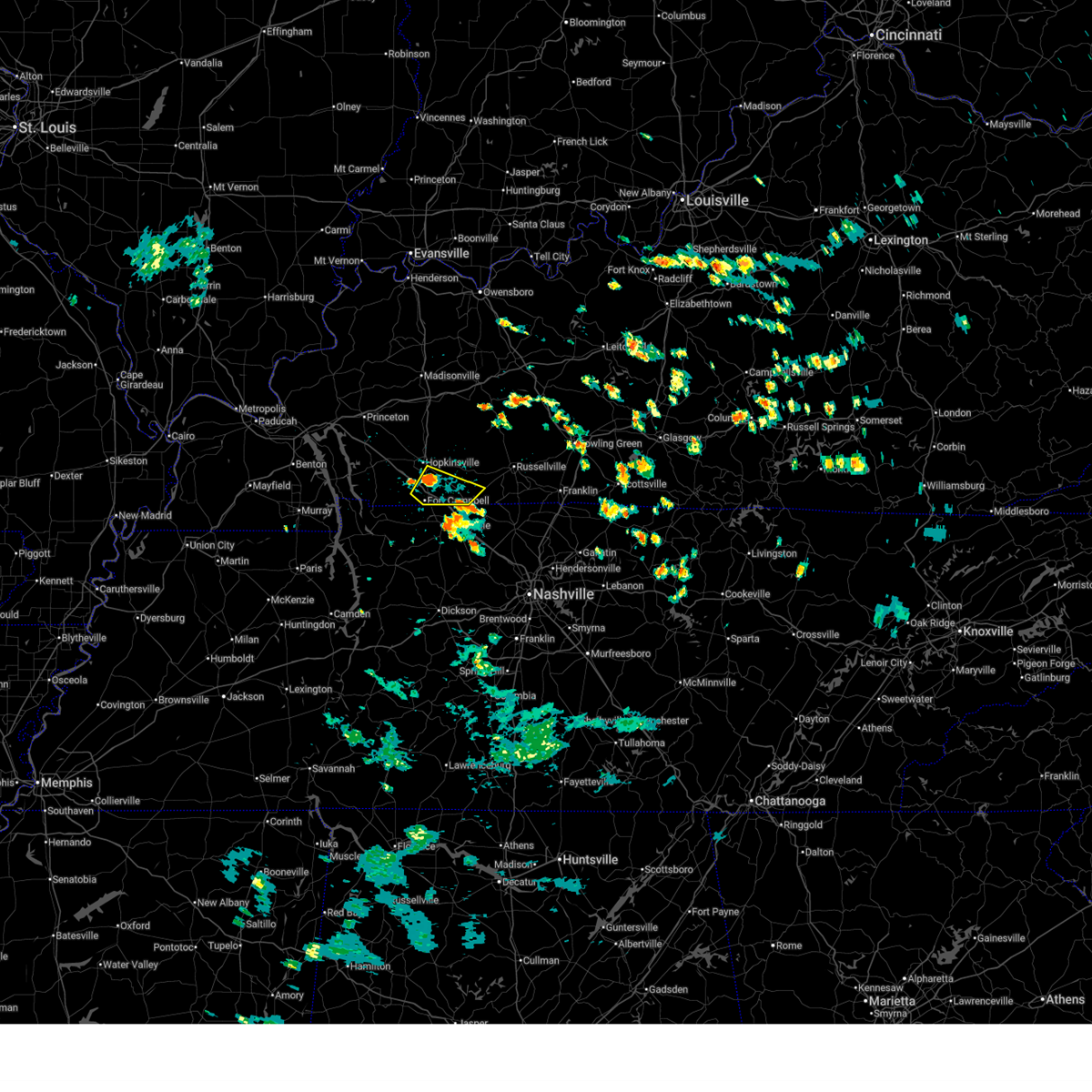
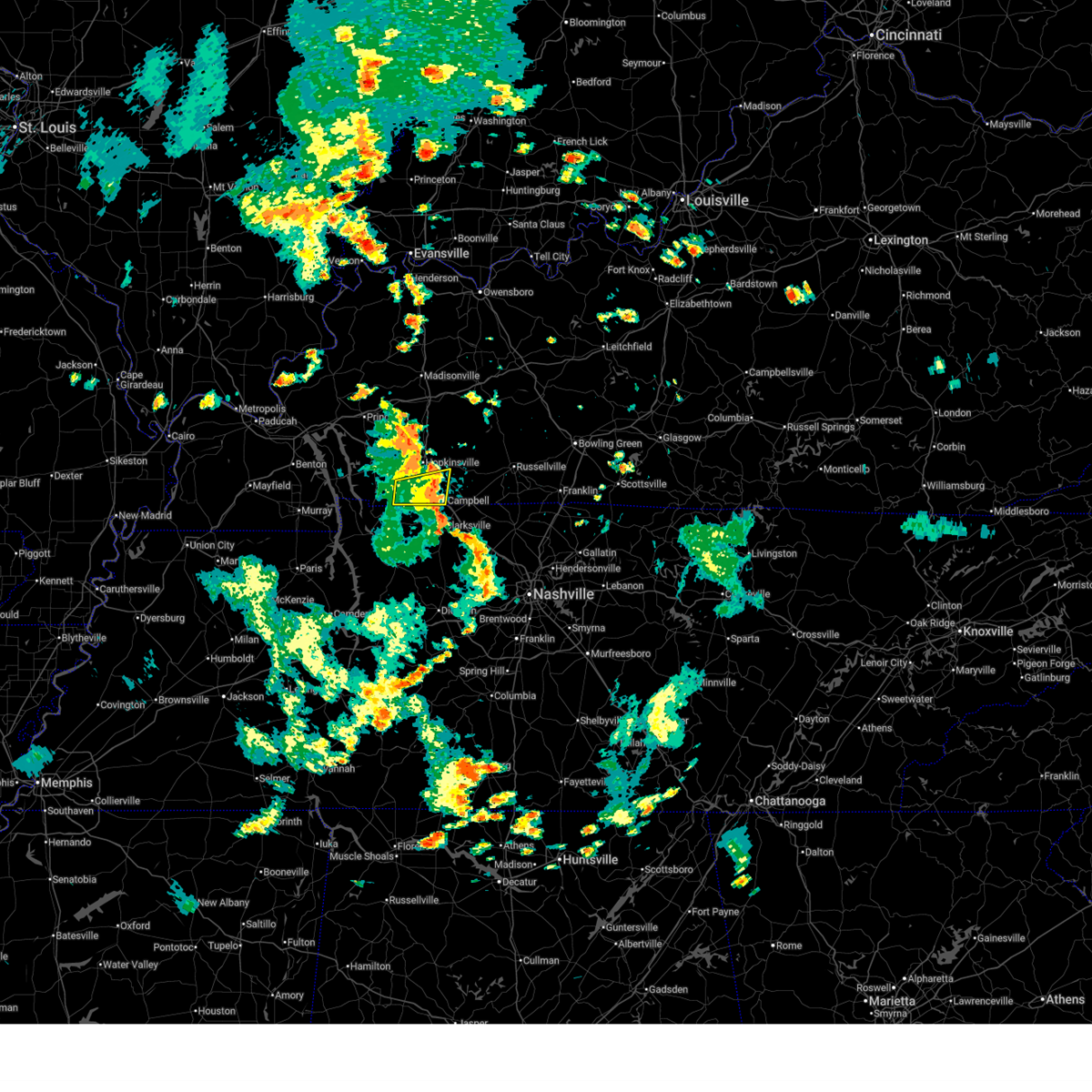
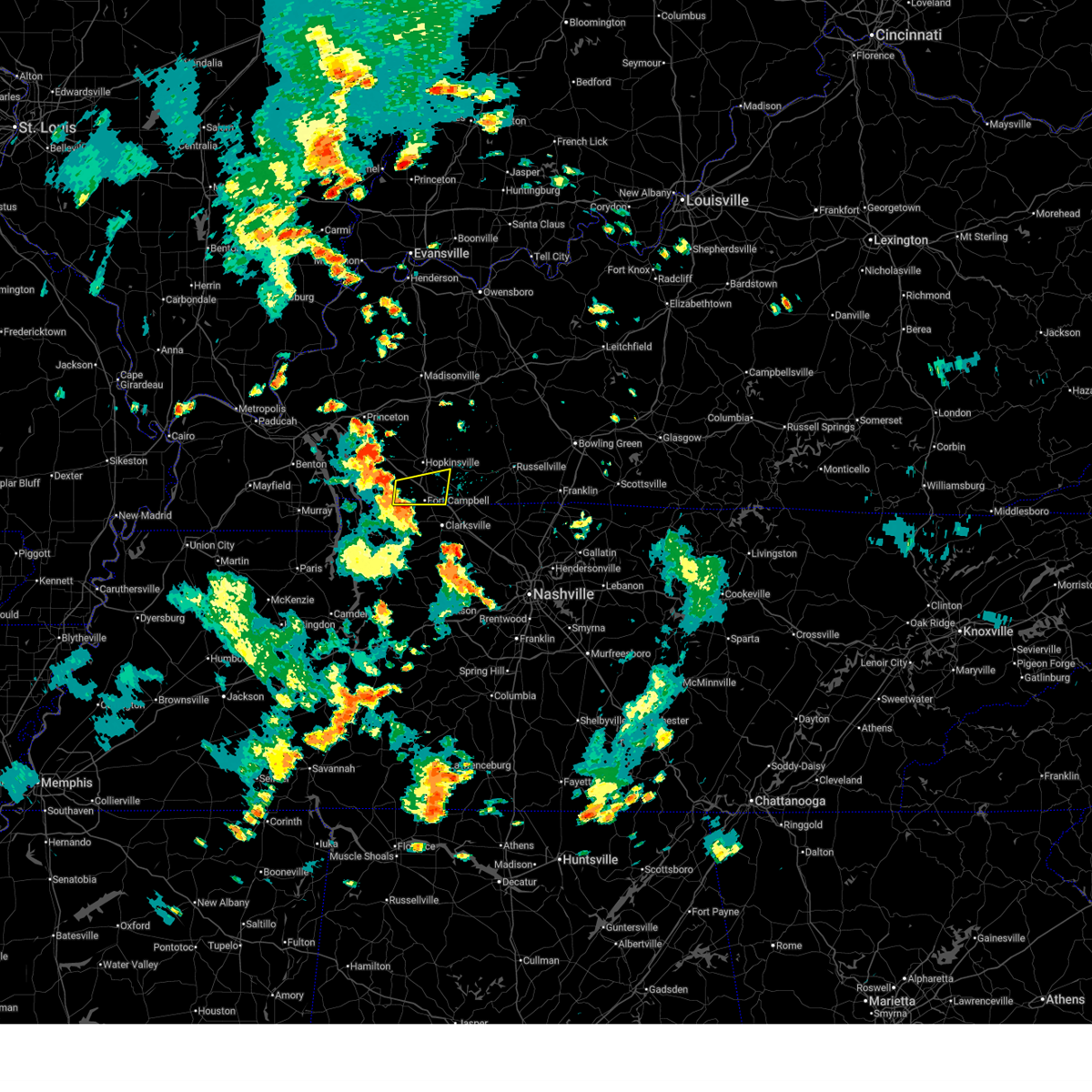
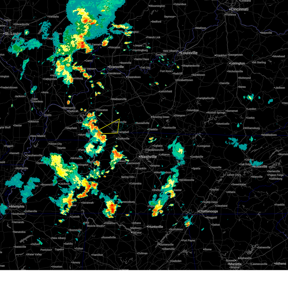
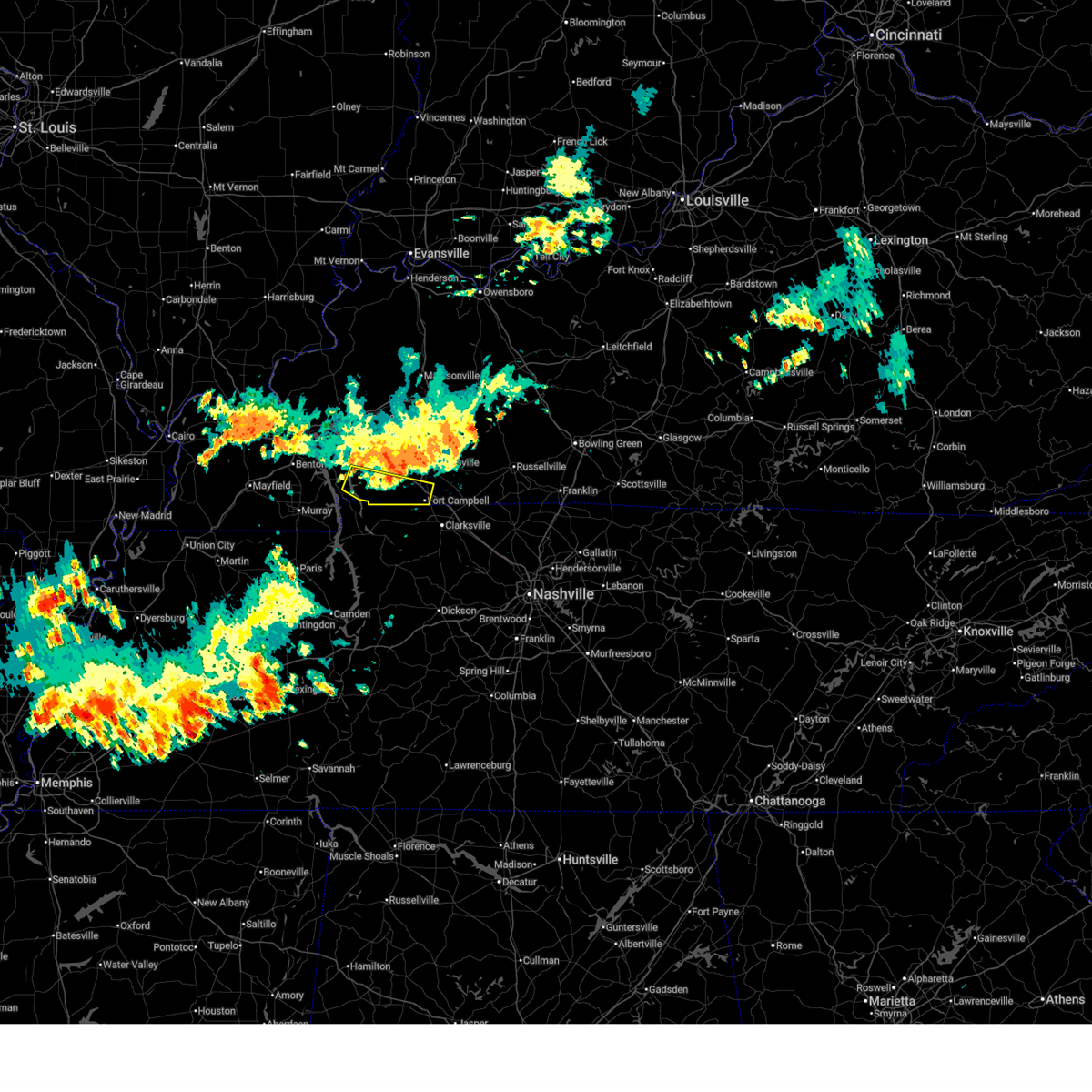
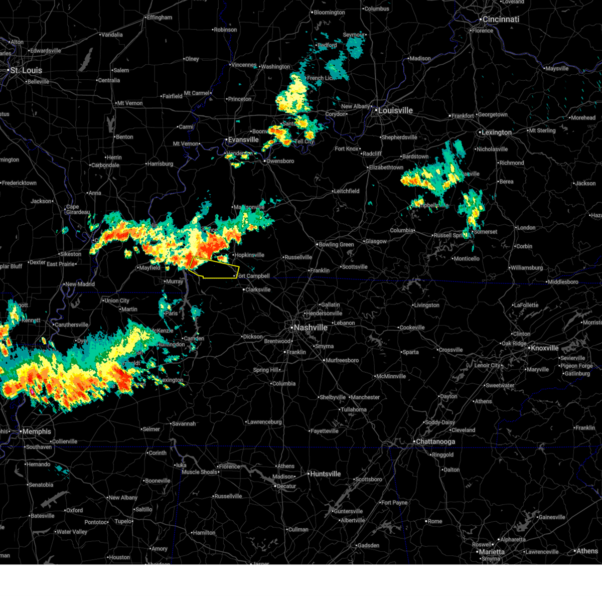
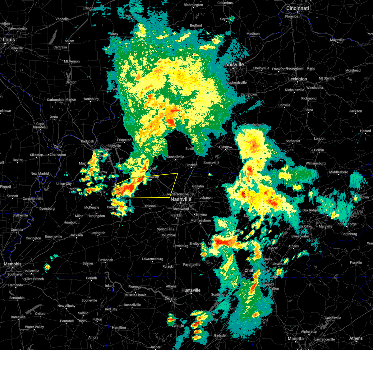
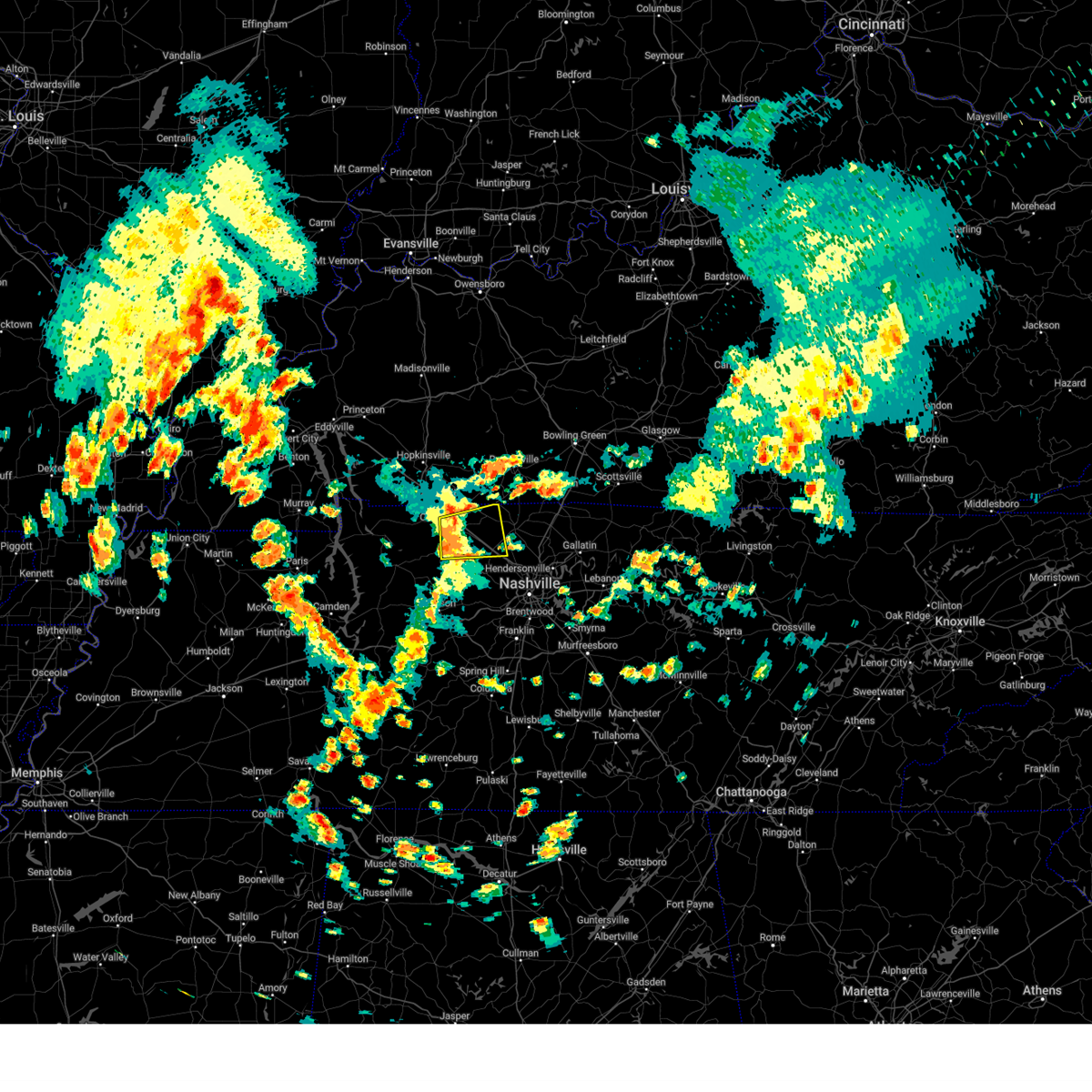
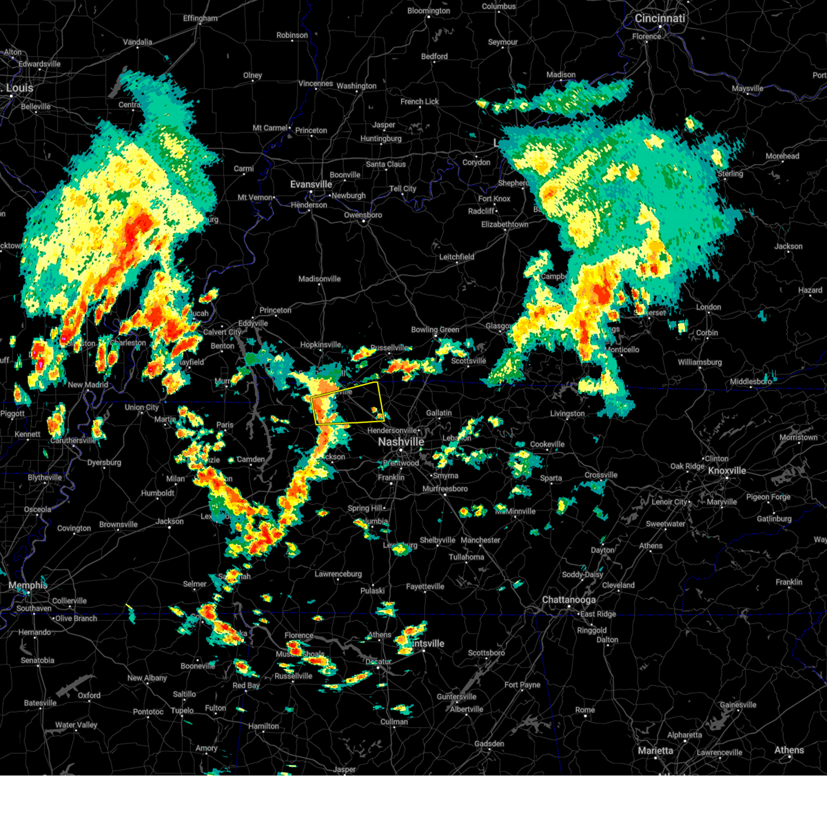
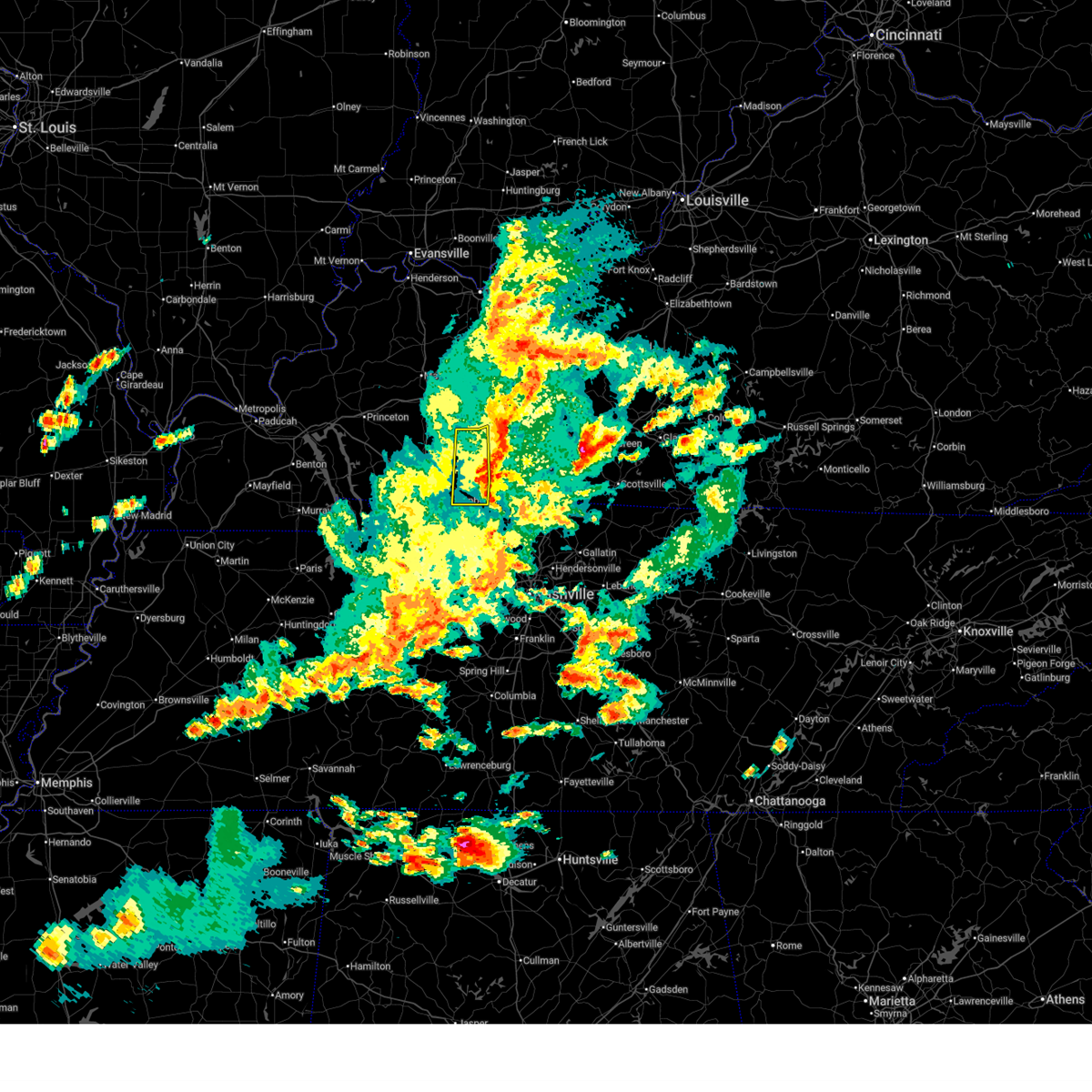
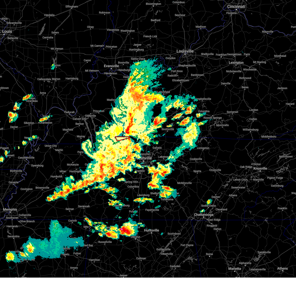
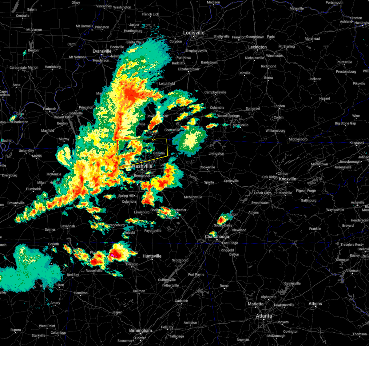
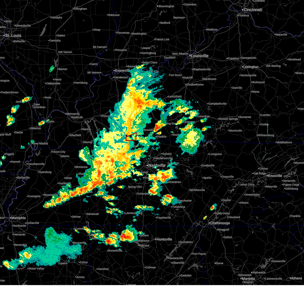
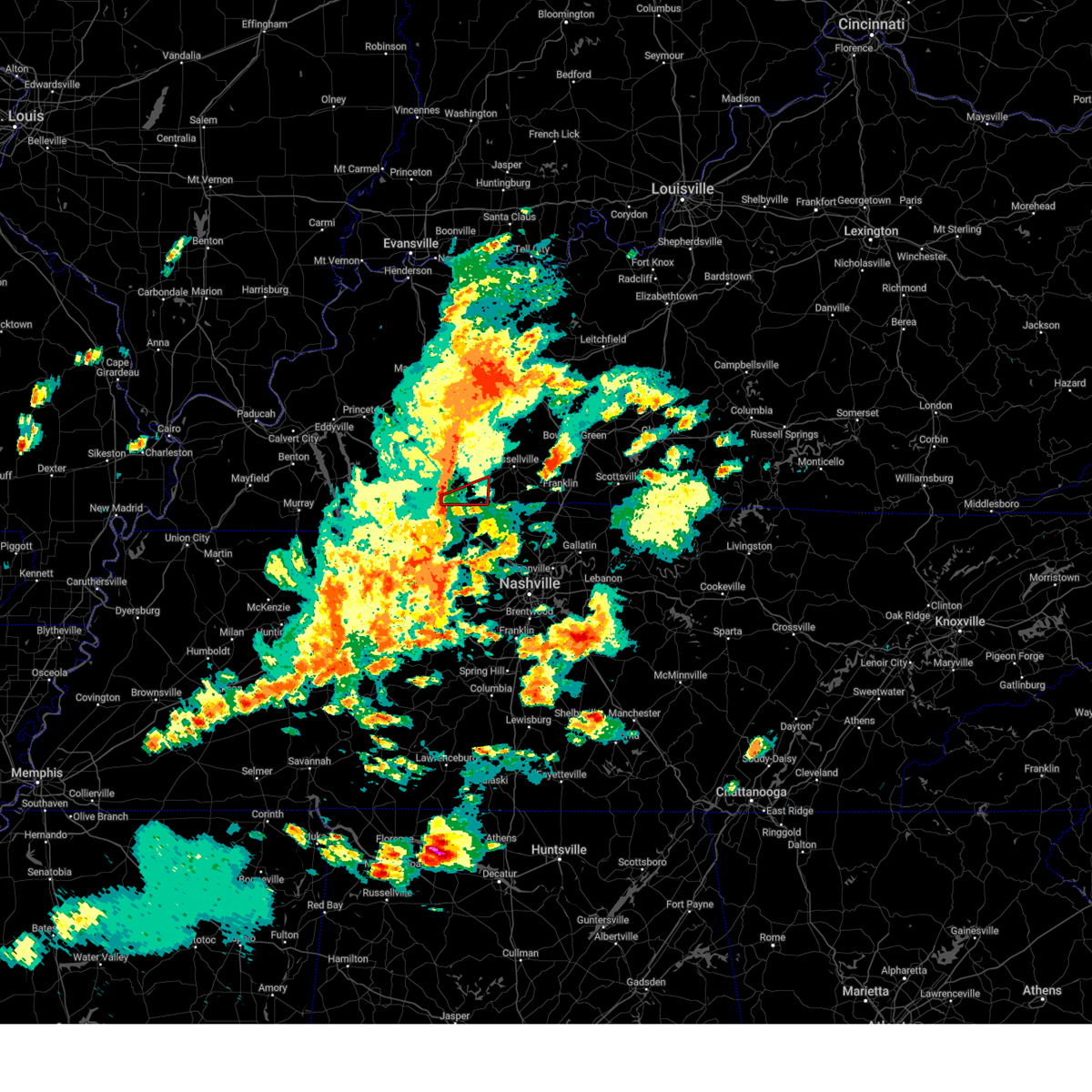
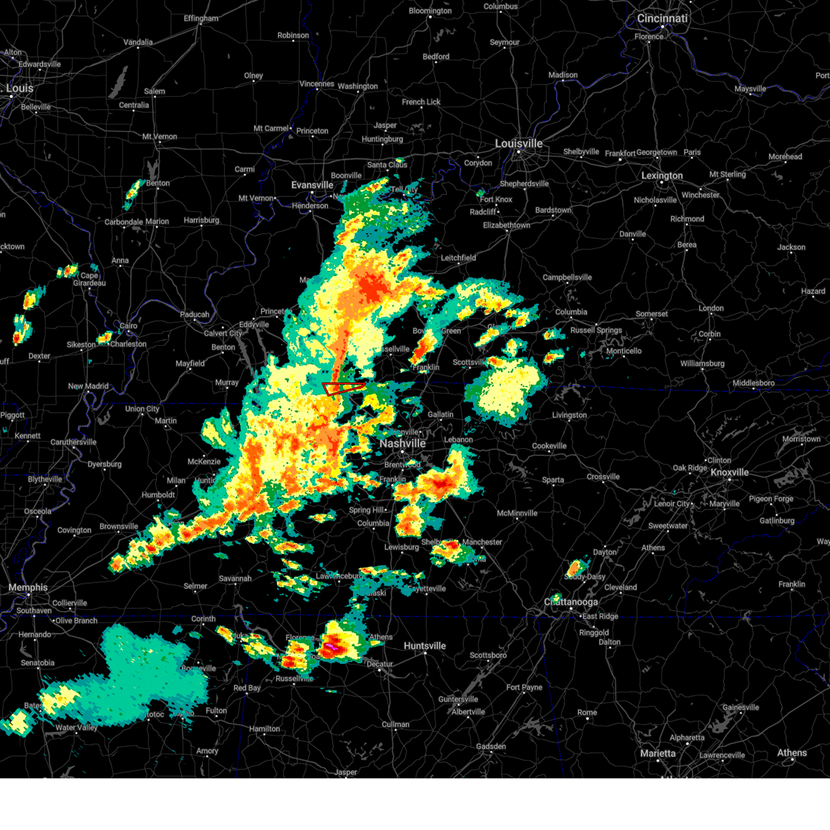
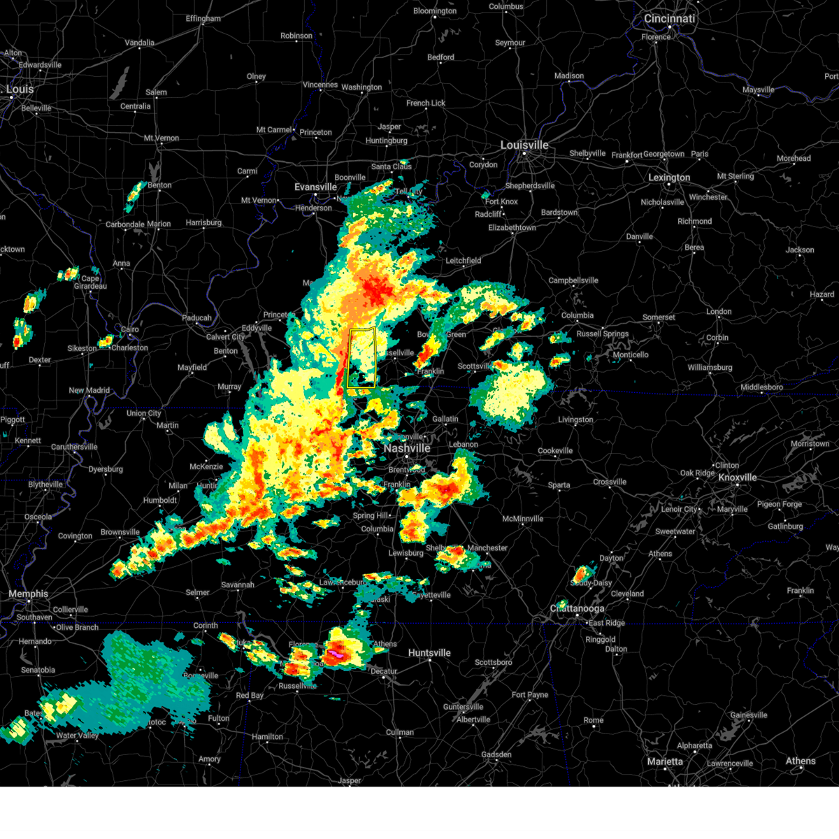
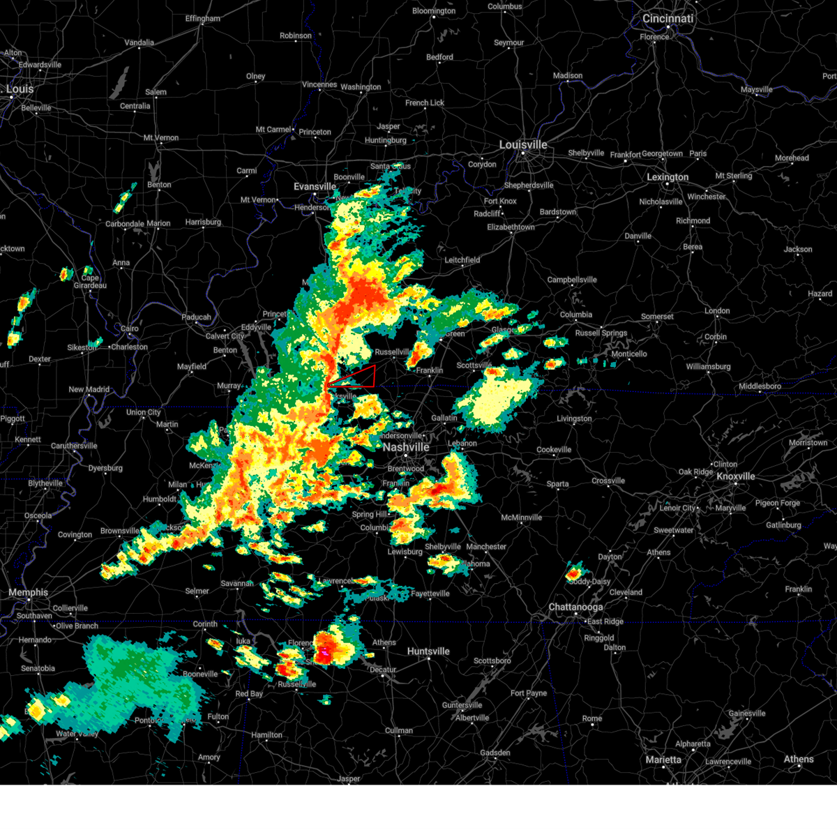
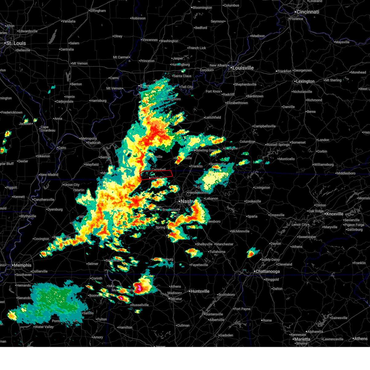
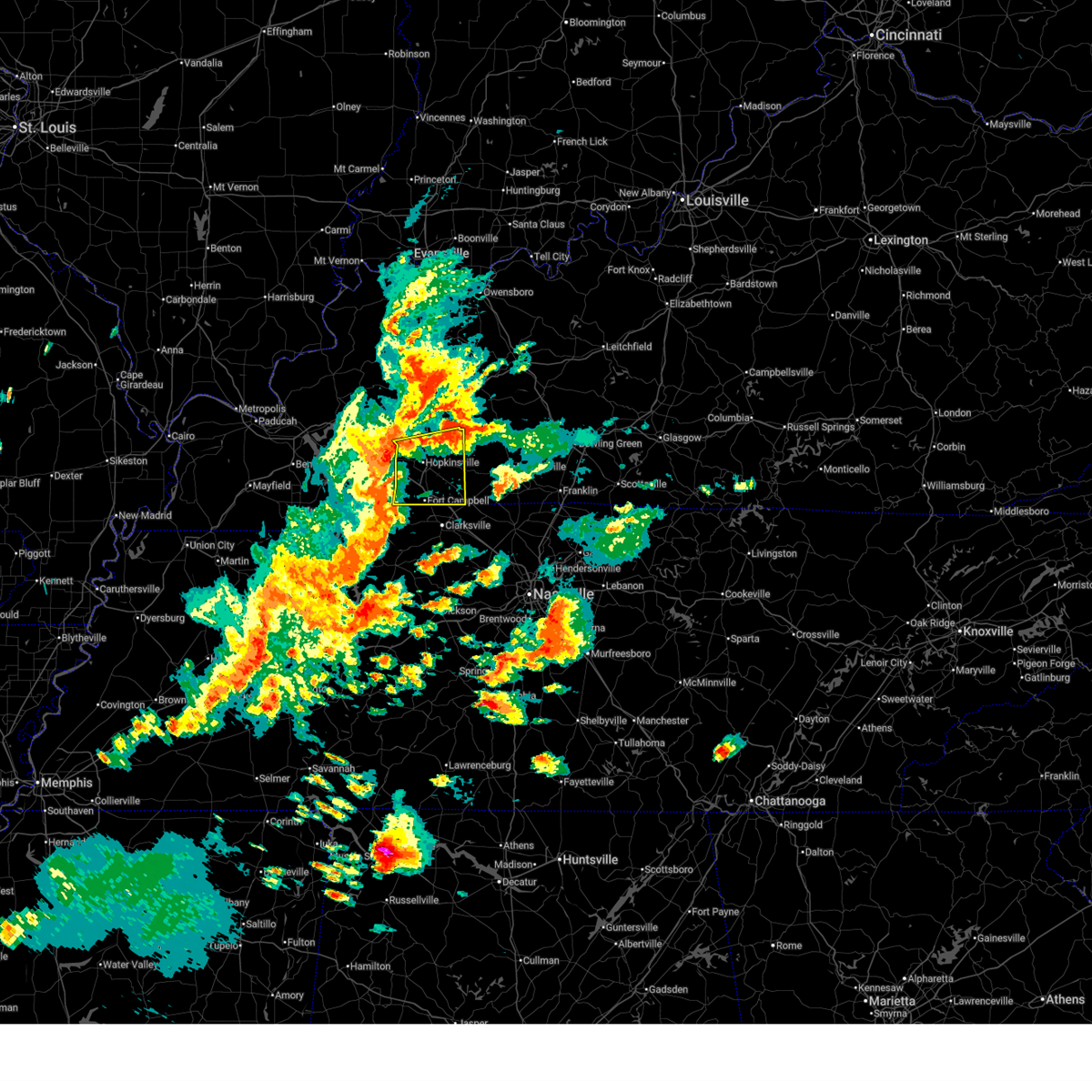
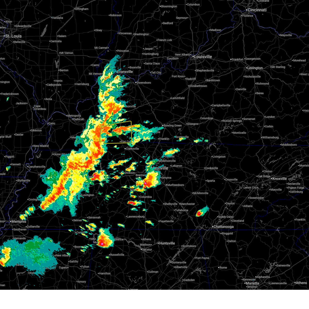
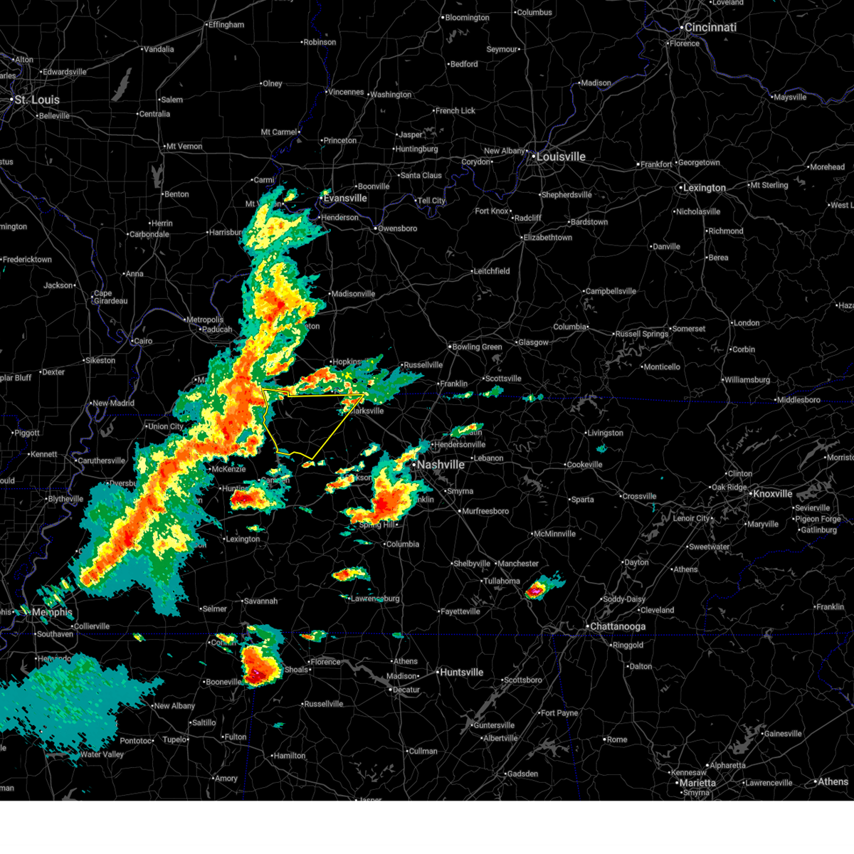
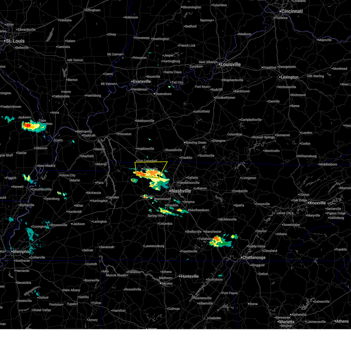
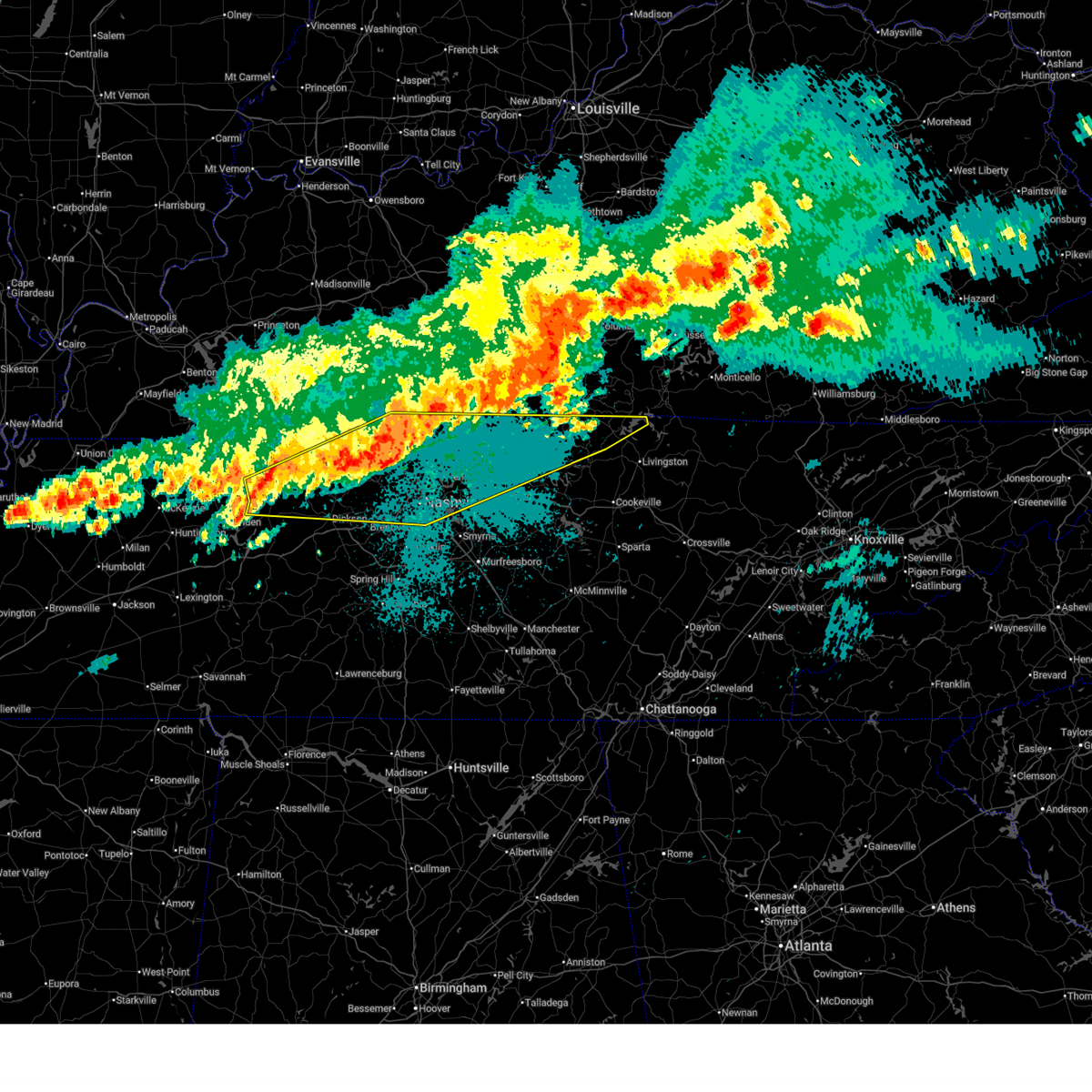
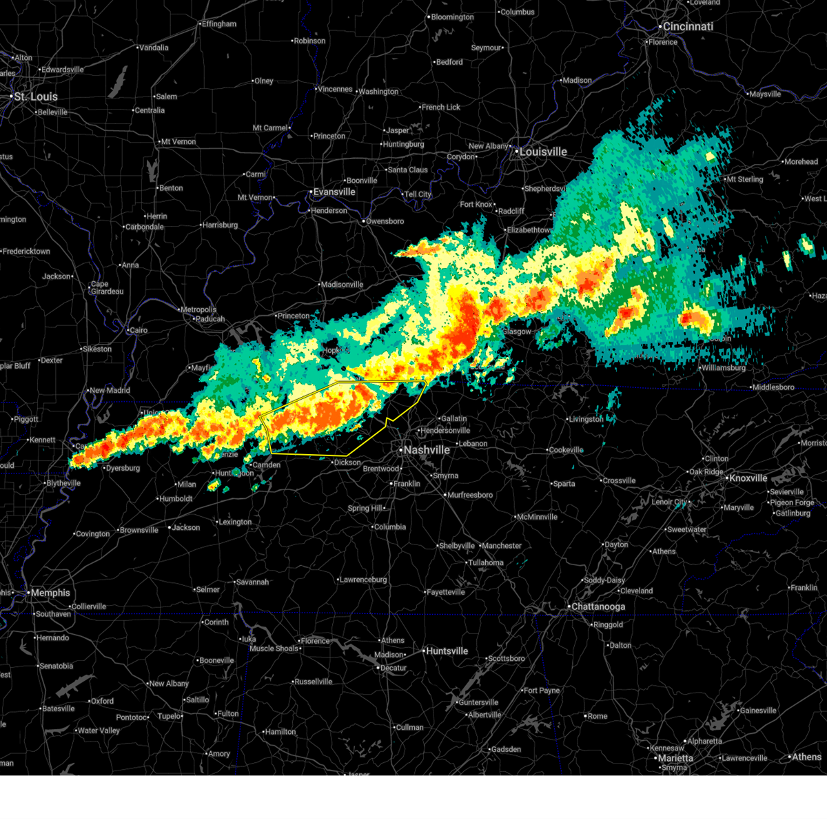
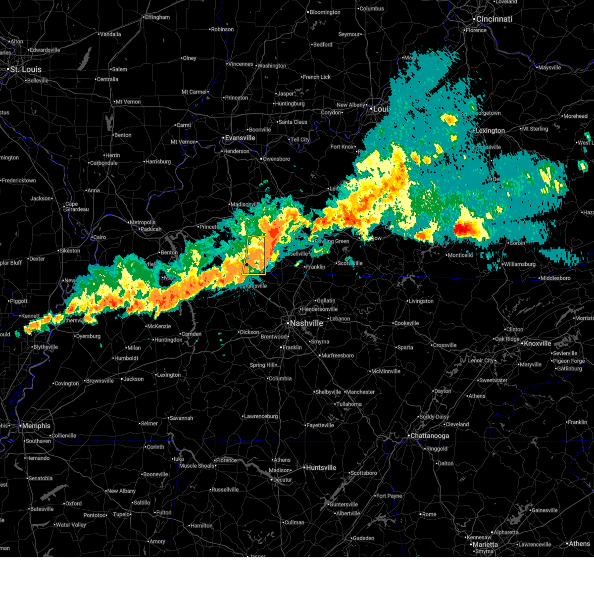
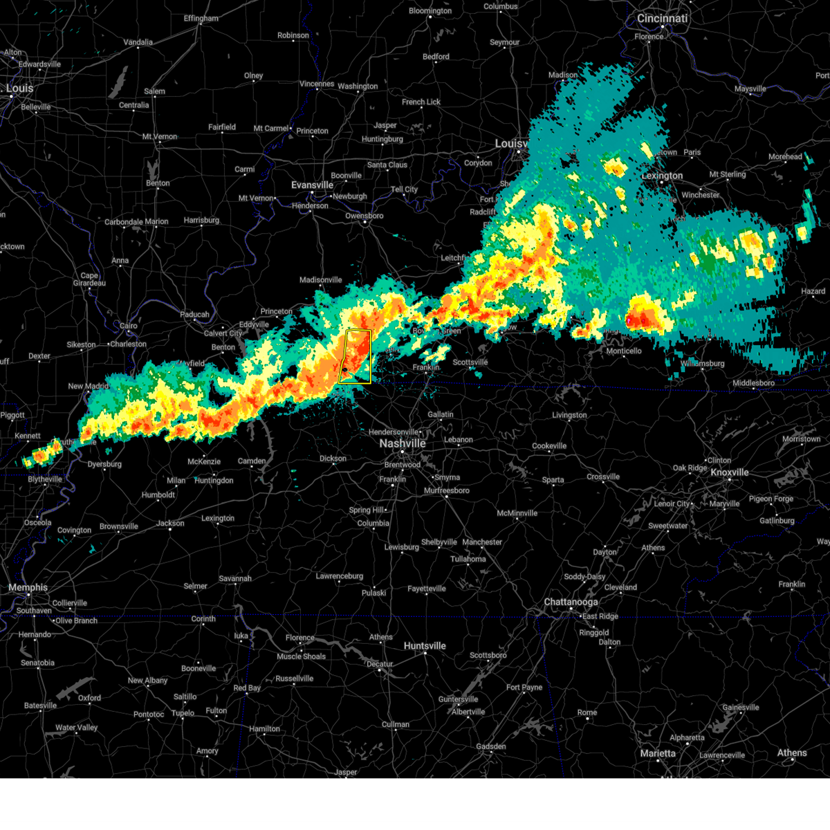
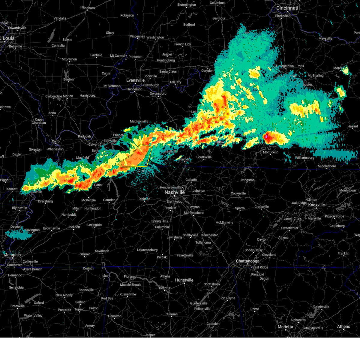
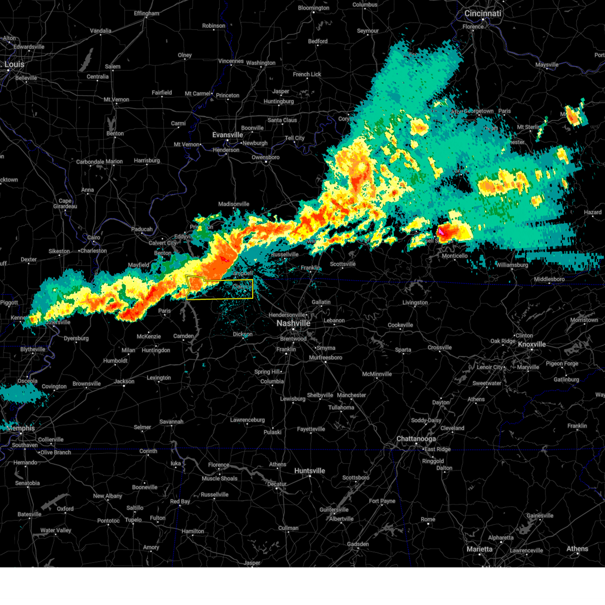
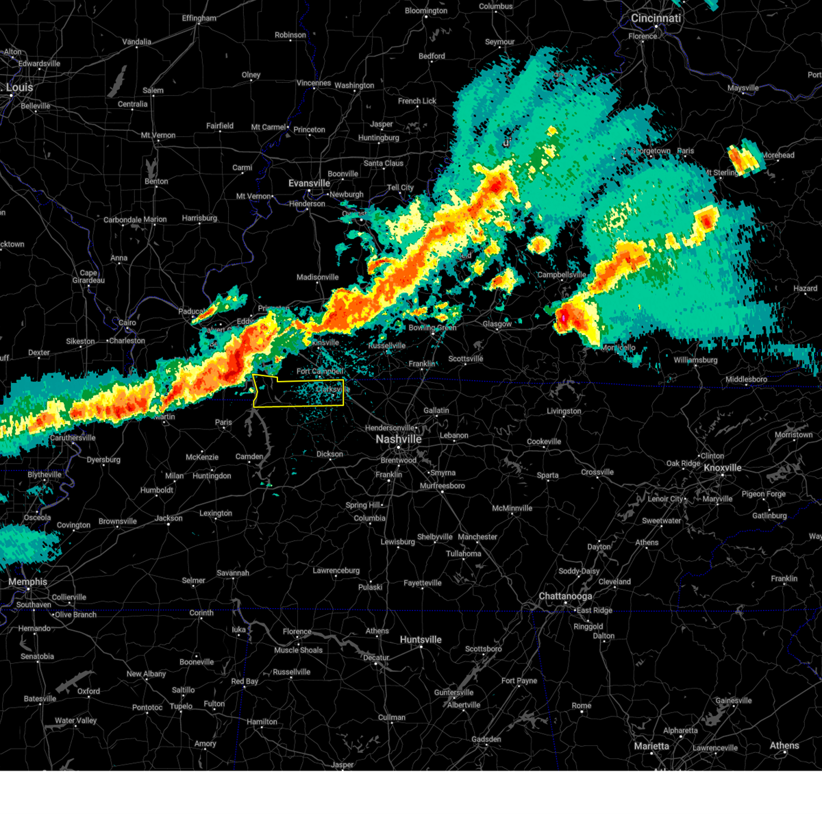
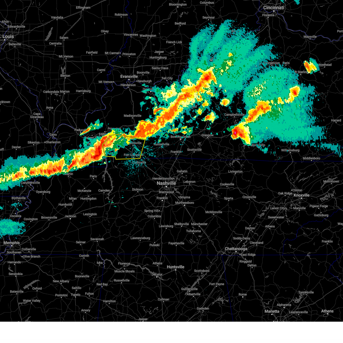
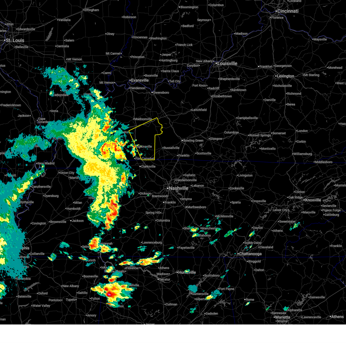
Hail Map for Clarksville, TN
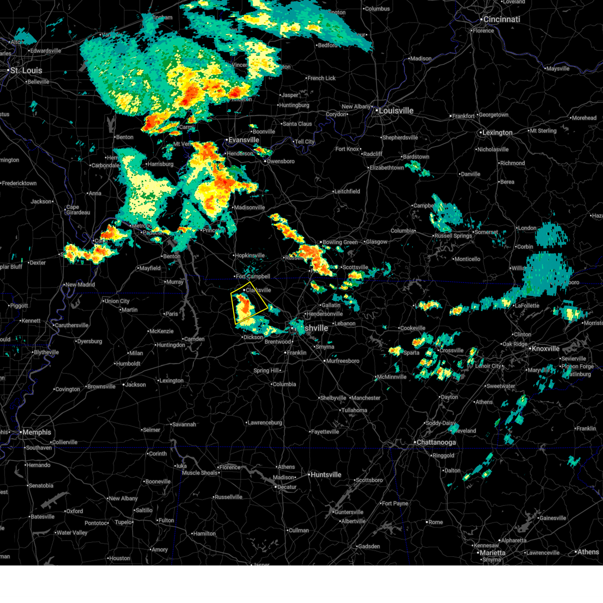
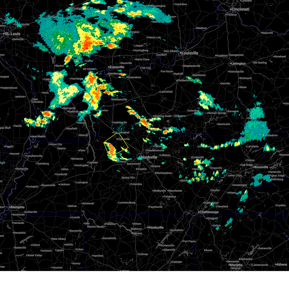
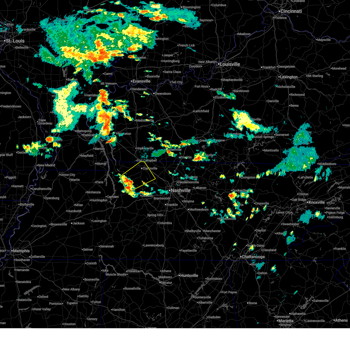
The Clarksville, TN area has had 9 reports of on-the-ground hail by trained spotters, and has been under severe weather warnings 33 times during the past 12 months. Doppler radar has detected hail at or near Clarksville, TN on 101 occasions, including 6 occasions during the past year.
| Name: | Clarksville, TN |
| Where Located: | 41 miles NW of Nashville, TN |
| Map: | Google Map for Clarksville, TN |
| Population: | 132929 |
| Housing Units: | 54815 |
| More Info: | Search Google for Clarksville, TN |
0
The Top Recent Hail Date for Clarksville, TN is Tuesday, June 9, 2026 (92nd out of 101)
Hail and Wind Damage Spotted near Clarksville, TN
| Date / Time | Report Details |
|---|---|
| 6/27/2026 2:42 PM CDT |
 At 242 pm cdt, a severe thunderstorm was located near clarksville, moving northeast at 35 mph (radar indicated). Hazards include 60 mph wind gusts and penny size hail. Expect damage to roofs, siding, and trees. locations impacted include, clarksville, vanleer, slayden, cheatham dam, palmyra, and cunningham. This includes interstate 24 between mile markers 4 and 11. At 242 pm cdt, a severe thunderstorm was located near clarksville, moving northeast at 35 mph (radar indicated). Hazards include 60 mph wind gusts and penny size hail. Expect damage to roofs, siding, and trees. locations impacted include, clarksville, vanleer, slayden, cheatham dam, palmyra, and cunningham. This includes interstate 24 between mile markers 4 and 11.
|
| 6/27/2026 2:29 PM CDT |
 At 229 pm cdt, a severe thunderstorm was located 12 miles southwest of clarksville, moving northeast at 35 mph (radar indicated). Hazards include 60 mph wind gusts and penny size hail. Expect damage to roofs, siding, and trees. locations impacted include, clarksville, vanleer, cumberland city, slayden, cheatham dam, palmyra, cunningham, and woodlawn. This includes interstate 24 between mile markers 1 and 11. At 229 pm cdt, a severe thunderstorm was located 12 miles southwest of clarksville, moving northeast at 35 mph (radar indicated). Hazards include 60 mph wind gusts and penny size hail. Expect damage to roofs, siding, and trees. locations impacted include, clarksville, vanleer, cumberland city, slayden, cheatham dam, palmyra, cunningham, and woodlawn. This includes interstate 24 between mile markers 1 and 11.
|
| 6/27/2026 2:16 PM CDT |
 Svrohx the national weather service in nashville has issued a * severe thunderstorm warning for, northwestern dickson county in middle tennessee, montgomery county in middle tennessee, southeastern stewart county in middle tennessee, northwestern cheatham county in middle tennessee, houston county in middle tennessee, northeastern humphreys county in middle tennessee, * until 300 pm cdt. * at 215 pm cdt, a severe thunderstorm was located 7 miles northeast of erin, moving northeast at 35 mph (radar indicated). Hazards include 60 mph wind gusts and penny size hail. expect damage to roofs, siding, and trees Svrohx the national weather service in nashville has issued a * severe thunderstorm warning for, northwestern dickson county in middle tennessee, montgomery county in middle tennessee, southeastern stewart county in middle tennessee, northwestern cheatham county in middle tennessee, houston county in middle tennessee, northeastern humphreys county in middle tennessee, * until 300 pm cdt. * at 215 pm cdt, a severe thunderstorm was located 7 miles northeast of erin, moving northeast at 35 mph (radar indicated). Hazards include 60 mph wind gusts and penny size hail. expect damage to roofs, siding, and trees
|
| 6/8/2026 9:59 PM CDT |
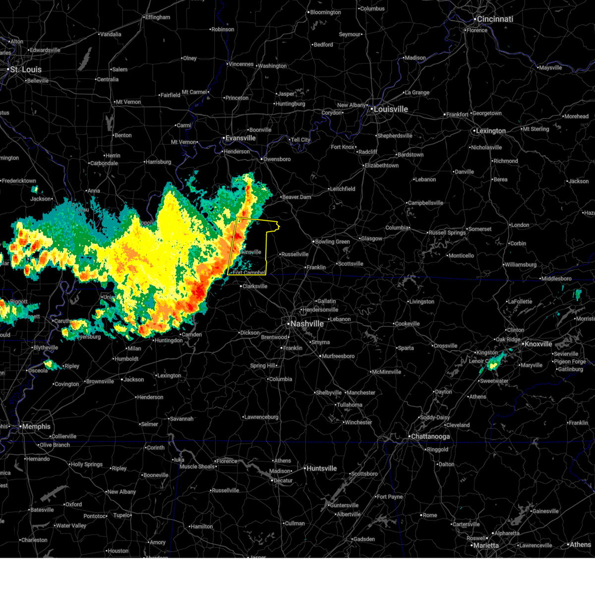
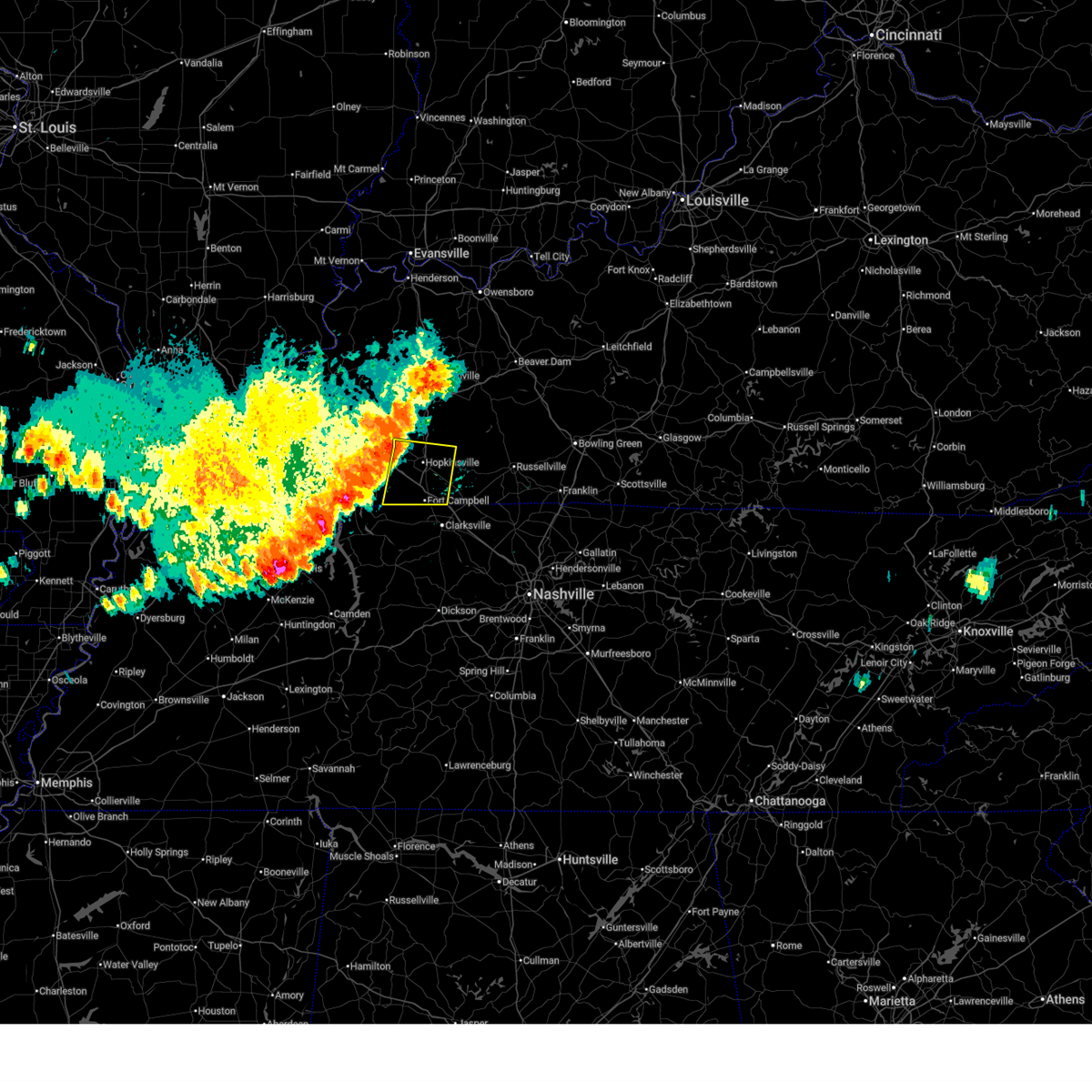
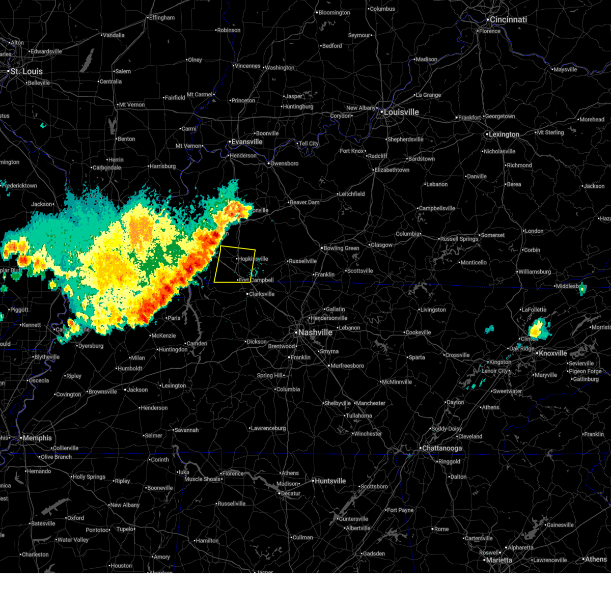
 At 959 pm cdt, a severe thunderstorm was located near elkton, moving east at 30 mph (radar indicated). Hazards include 60 mph wind gusts and quarter size hail. Hail damage to vehicles is expected. expect wind damage to roofs, siding, and trees. Locations impacted include, hopkinsville, oak grove, elkton, fort campbell, clarksville, guthrie, pembroke, trenton, allensville, and allegre. At 959 pm cdt, a severe thunderstorm was located near elkton, moving east at 30 mph (radar indicated). Hazards include 60 mph wind gusts and quarter size hail. Hail damage to vehicles is expected. expect wind damage to roofs, siding, and trees. Locations impacted include, hopkinsville, oak grove, elkton, fort campbell, clarksville, guthrie, pembroke, trenton, allensville, and allegre.
|
| 6/8/2026 9:08 PM CDT |
 Svrpah the national weather service in paducah has issued a * severe thunderstorm warning for, christian county in south central kentucky, todd county in south central kentucky, * until 1030 pm cdt. * at 908 pm cdt, a severe thunderstorm was located near hopkinsville, moving east at 25 mph (radar indicated). Hazards include 60 mph wind gusts and quarter size hail. Hail damage to vehicles is expected. Expect wind damage to roofs, siding, and trees. Svrpah the national weather service in paducah has issued a * severe thunderstorm warning for, christian county in south central kentucky, todd county in south central kentucky, * until 1030 pm cdt. * at 908 pm cdt, a severe thunderstorm was located near hopkinsville, moving east at 25 mph (radar indicated). Hazards include 60 mph wind gusts and quarter size hail. Hail damage to vehicles is expected. Expect wind damage to roofs, siding, and trees.
|
| 4/28/2026 1:50 AM CDT |
 At 150 am cdt, a severe thunderstorm was located 13 miles southwest of clarksville, moving east at 45 mph (radar indicated). Hazards include 60 mph wind gusts and quarter size hail. Hail damage to vehicles is expected. expect wind damage to roofs, siding, and trees. locations impacted include, erin, clarksville, tennessee ridge, charlotte, vanleer, cumberland city, slayden, palmyra, cunningham, and woodlawn. This includes interstate 24 between mile markers 9 and 17. At 150 am cdt, a severe thunderstorm was located 13 miles southwest of clarksville, moving east at 45 mph (radar indicated). Hazards include 60 mph wind gusts and quarter size hail. Hail damage to vehicles is expected. expect wind damage to roofs, siding, and trees. locations impacted include, erin, clarksville, tennessee ridge, charlotte, vanleer, cumberland city, slayden, palmyra, cunningham, and woodlawn. This includes interstate 24 between mile markers 9 and 17.
|
| 4/28/2026 1:31 AM CDT |
 Svrohx the national weather service in nashville has issued a * severe thunderstorm warning for, northwestern dickson county in middle tennessee, montgomery county in middle tennessee, southern stewart county in middle tennessee, houston county in middle tennessee, * until 215 am cdt. * at 131 am cdt, a severe thunderstorm was located 7 miles north of erin, moving east at 55 mph (radar indicated). Hazards include 60 mph wind gusts and quarter size hail. Hail damage to vehicles is expected. Expect wind damage to roofs, siding, and trees. Svrohx the national weather service in nashville has issued a * severe thunderstorm warning for, northwestern dickson county in middle tennessee, montgomery county in middle tennessee, southern stewart county in middle tennessee, houston county in middle tennessee, * until 215 am cdt. * at 131 am cdt, a severe thunderstorm was located 7 miles north of erin, moving east at 55 mph (radar indicated). Hazards include 60 mph wind gusts and quarter size hail. Hail damage to vehicles is expected. Expect wind damage to roofs, siding, and trees.
|
| 4/16/2026 6:34 PM CDT | Trees down... with one on power line and on fire. time estimated from rada in montgomery county TN, 5 miles E of Clarksville, TN |
| 4/16/2026 6:32 PM CDT |
 At 631 pm cdt, severe thunderstorms were located along a line extending from near greenville to near elkton to near guthrie, moving east at 40 mph (radar indicated). Hazards include 60 mph wind gusts and quarter size hail. Hail damage to vehicles is expected. expect wind damage to roofs, siding, and trees. locations impacted include, oak grove, elkton, fort campbell, clarksville, guthrie, pembroke, dunmor, weir, trenton, allensville, allegre, clifty, everett, and justice. This includes interstate 24 in kentucky between mile markers 85 and 92. At 631 pm cdt, severe thunderstorms were located along a line extending from near greenville to near elkton to near guthrie, moving east at 40 mph (radar indicated). Hazards include 60 mph wind gusts and quarter size hail. Hail damage to vehicles is expected. expect wind damage to roofs, siding, and trees. locations impacted include, oak grove, elkton, fort campbell, clarksville, guthrie, pembroke, dunmor, weir, trenton, allensville, allegre, clifty, everett, and justice. This includes interstate 24 in kentucky between mile markers 85 and 92.
|
| 4/16/2026 6:32 PM CDT |
 the severe thunderstorm warning has been cancelled and is no longer in effect the severe thunderstorm warning has been cancelled and is no longer in effect
|
| 4/16/2026 6:13 PM CDT |
 Svrpah the national weather service in paducah has issued a * severe thunderstorm warning for, southern muhlenberg county in south central kentucky, eastern christian county in south central kentucky, southeastern hopkins county in northwestern kentucky, todd county in south central kentucky, * until 700 pm cdt. * at 613 pm cdt, severe thunderstorms were located along a line extending from near graham to 8 miles north of pembroke to oak grove, moving east at 50 mph (radar indicated). Hazards include 60 mph wind gusts and quarter size hail. Hail damage to vehicles is expected. Expect wind damage to roofs, siding, and trees. Svrpah the national weather service in paducah has issued a * severe thunderstorm warning for, southern muhlenberg county in south central kentucky, eastern christian county in south central kentucky, southeastern hopkins county in northwestern kentucky, todd county in south central kentucky, * until 700 pm cdt. * at 613 pm cdt, severe thunderstorms were located along a line extending from near graham to 8 miles north of pembroke to oak grove, moving east at 50 mph (radar indicated). Hazards include 60 mph wind gusts and quarter size hail. Hail damage to vehicles is expected. Expect wind damage to roofs, siding, and trees.
|
| 4/16/2026 6:02 PM CDT |
 At 601 pm cdt, severe thunderstorms were located along a line extending from 6 miles north of hopkinsville to 8 miles northwest of fort campbell to near big rock, moving east at 45 mph (radar indicated). Hazards include 70 mph wind gusts and quarter size hail. Hail damage to vehicles is expected. expect considerable tree damage. wind damage is also likely to mobile homes, roofs, and outbuildings. locations impacted include, hopkinsville, oak grove, fort campbell, pembroke, lafayette, and herndon. this includes the following highways, interstate 24 in kentucky between mile markers 68 and 92. Pennyrile parkway between mile markers 1 and 16. At 601 pm cdt, severe thunderstorms were located along a line extending from 6 miles north of hopkinsville to 8 miles northwest of fort campbell to near big rock, moving east at 45 mph (radar indicated). Hazards include 70 mph wind gusts and quarter size hail. Hail damage to vehicles is expected. expect considerable tree damage. wind damage is also likely to mobile homes, roofs, and outbuildings. locations impacted include, hopkinsville, oak grove, fort campbell, pembroke, lafayette, and herndon. this includes the following highways, interstate 24 in kentucky between mile markers 68 and 92. Pennyrile parkway between mile markers 1 and 16.
|
| 4/16/2026 5:47 PM CDT |
 Svrpah the national weather service in paducah has issued a * severe thunderstorm warning for, christian county in south central kentucky, southeastern trigg county in western kentucky, west central todd county in south central kentucky, * until 630 pm cdt. * at 547 pm cdt, severe thunderstorms were located along a line extending from 6 miles east of cobb to near cadiz to 7 miles northwest of big rock, moving east at 40 mph (radar indicated). Hazards include 60 mph wind gusts and quarter size hail. Hail damage to vehicles is expected. Expect wind damage to roofs, siding, and trees. Svrpah the national weather service in paducah has issued a * severe thunderstorm warning for, christian county in south central kentucky, southeastern trigg county in western kentucky, west central todd county in south central kentucky, * until 630 pm cdt. * at 547 pm cdt, severe thunderstorms were located along a line extending from 6 miles east of cobb to near cadiz to 7 miles northwest of big rock, moving east at 40 mph (radar indicated). Hazards include 60 mph wind gusts and quarter size hail. Hail damage to vehicles is expected. Expect wind damage to roofs, siding, and trees.
|
| 3/15/2026 10:11 PM CDT |
 At 1011 pm cdt, severe thunderstorms were located along a line extending from 10 miles east of guthrie to near ashland city, moving east at 45 mph (radar indicated). Hazards include 70 mph wind gusts and penny size hail. Expect considerable tree damage. damage is likely to mobile homes, roofs, and outbuildings. locations impacted include, springfield, clarksville, white house, millersville, greenbrier, coopertown, ridgetop, cross plains, pleasant view, orlinda, adams, cedar hill, cheatham dam, and black jack. this includes the following highways, interstate 65 between mile markers 105 and 121. Interstate 24 between mile markers 8 and 31. At 1011 pm cdt, severe thunderstorms were located along a line extending from 10 miles east of guthrie to near ashland city, moving east at 45 mph (radar indicated). Hazards include 70 mph wind gusts and penny size hail. Expect considerable tree damage. damage is likely to mobile homes, roofs, and outbuildings. locations impacted include, springfield, clarksville, white house, millersville, greenbrier, coopertown, ridgetop, cross plains, pleasant view, orlinda, adams, cedar hill, cheatham dam, and black jack. this includes the following highways, interstate 65 between mile markers 105 and 121. Interstate 24 between mile markers 8 and 31.
|
| 3/15/2026 9:51 PM CDT |
 The storm which prompted the warning has moved out of the area. therefore, the warning will be allowed to expire. a tornado watch remains in effect until 300 am cdt for middle tennessee. to report severe weather, contact your nearest law enforcement agency. they will relay your report to the national weather service nashville. The storm which prompted the warning has moved out of the area. therefore, the warning will be allowed to expire. a tornado watch remains in effect until 300 am cdt for middle tennessee. to report severe weather, contact your nearest law enforcement agency. they will relay your report to the national weather service nashville.
|
| 3/15/2026 9:37 PM CDT |
 Torpah the national weather service in paducah has issued a * tornado warning for, southeastern christian county in south central kentucky, southern todd county in south central kentucky, * until 1030 pm cdt. * at 937 pm cdt, a severe thunderstorm capable of producing a tornado was located near oak grove, moving northeast at 50 mph (radar indicated rotation). Hazards include tornado. Flying debris will be dangerous to those caught without shelter. mobile homes will be damaged or destroyed. damage to roofs, windows, and vehicles will occur. tree damage is likely. this dangerous storm will be near, guthrie around 945 pm cdt. elkton around 950 pm cdt. other locations impacted by this tornadic thunderstorm include allensville and trenton. This includes interstate 24 in kentucky between mile markers 88 and 92. Torpah the national weather service in paducah has issued a * tornado warning for, southeastern christian county in south central kentucky, southern todd county in south central kentucky, * until 1030 pm cdt. * at 937 pm cdt, a severe thunderstorm capable of producing a tornado was located near oak grove, moving northeast at 50 mph (radar indicated rotation). Hazards include tornado. Flying debris will be dangerous to those caught without shelter. mobile homes will be damaged or destroyed. damage to roofs, windows, and vehicles will occur. tree damage is likely. this dangerous storm will be near, guthrie around 945 pm cdt. elkton around 950 pm cdt. other locations impacted by this tornadic thunderstorm include allensville and trenton. This includes interstate 24 in kentucky between mile markers 88 and 92.
|
| 3/15/2026 9:35 PM CDT |
 Torohx the national weather service in nashville has issued a * tornado warning for, northern montgomery county in middle tennessee, * until 1000 pm cdt. * at 935 pm cdt, a severe thunderstorm capable of producing a tornado was located near oak grove, moving northeast at 60 mph (radar indicated rotation). Hazards include tornado. Flying debris will be dangerous to those caught without shelter. mobile homes will be damaged or destroyed. damage to roofs, windows, and vehicles will occur. tree damage is likely. this dangerous storm will be near, clarksville around 940 pm cdt. other locations impacted by this tornadic thunderstorm include woodlawn. This includes interstate 24 between mile markers 1 and 7. Torohx the national weather service in nashville has issued a * tornado warning for, northern montgomery county in middle tennessee, * until 1000 pm cdt. * at 935 pm cdt, a severe thunderstorm capable of producing a tornado was located near oak grove, moving northeast at 60 mph (radar indicated rotation). Hazards include tornado. Flying debris will be dangerous to those caught without shelter. mobile homes will be damaged or destroyed. damage to roofs, windows, and vehicles will occur. tree damage is likely. this dangerous storm will be near, clarksville around 940 pm cdt. other locations impacted by this tornadic thunderstorm include woodlawn. This includes interstate 24 between mile markers 1 and 7.
|
| 3/15/2026 9:34 PM CDT |
 At 934 pm cdt, severe thunderstorms were located along a line extending from 6 miles west of weir to 7 miles northwest of elkton to fort campbell, moving east at 70 mph (trained weather spotters). Hazards include 70 mph wind gusts and penny size hail. Expect considerable tree damage. damage is likely to mobile homes, roofs, and outbuildings. locations impacted include, oak grove, elkton, fort campbell, guthrie, pembroke, weir, trenton, justice, allensville, allegre, everett, and clifty. this includes the following highways, interstate 24 in kentucky between mile markers 81 and 92. Pennyrile parkway near mile marker 1. At 934 pm cdt, severe thunderstorms were located along a line extending from 6 miles west of weir to 7 miles northwest of elkton to fort campbell, moving east at 70 mph (trained weather spotters). Hazards include 70 mph wind gusts and penny size hail. Expect considerable tree damage. damage is likely to mobile homes, roofs, and outbuildings. locations impacted include, oak grove, elkton, fort campbell, guthrie, pembroke, weir, trenton, justice, allensville, allegre, everett, and clifty. this includes the following highways, interstate 24 in kentucky between mile markers 81 and 92. Pennyrile parkway near mile marker 1.
|
| 3/15/2026 9:32 PM CDT |
 At 932 pm cdt, severe thunderstorms were located along a line extending from pembroke to 7 miles south of fort campbell to near mcewen, moving east at 55 mph (radar indicated). Hazards include 70 mph wind gusts and penny size hail. Expect considerable tree damage. damage is likely to mobile homes, roofs, and outbuildings. Locations impacted include, waverly, erin, clarksville, mcewen, tennessee ridge, cumberland city, indian mound, palmyra, and woodlawn. At 932 pm cdt, severe thunderstorms were located along a line extending from pembroke to 7 miles south of fort campbell to near mcewen, moving east at 55 mph (radar indicated). Hazards include 70 mph wind gusts and penny size hail. Expect considerable tree damage. damage is likely to mobile homes, roofs, and outbuildings. Locations impacted include, waverly, erin, clarksville, mcewen, tennessee ridge, cumberland city, indian mound, palmyra, and woodlawn.
|
| 3/15/2026 9:31 PM CDT |
 Svrohx the national weather service in nashville has issued a * severe thunderstorm warning for, northern dickson county in middle tennessee, montgomery county in middle tennessee, northern cheatham county in middle tennessee, robertson county in middle tennessee, * until 1030 pm cdt. * at 931 pm cdt, severe thunderstorms were located along a line extending from near fort campbell to 6 miles east of erin, moving east at 65 mph (radar indicated). Hazards include 70 mph wind gusts and quarter size hail. Hail damage to vehicles is expected. expect considerable tree damage. Wind damage is also likely to mobile homes, roofs, and outbuildings. Svrohx the national weather service in nashville has issued a * severe thunderstorm warning for, northern dickson county in middle tennessee, montgomery county in middle tennessee, northern cheatham county in middle tennessee, robertson county in middle tennessee, * until 1030 pm cdt. * at 931 pm cdt, severe thunderstorms were located along a line extending from near fort campbell to 6 miles east of erin, moving east at 65 mph (radar indicated). Hazards include 70 mph wind gusts and quarter size hail. Hail damage to vehicles is expected. expect considerable tree damage. Wind damage is also likely to mobile homes, roofs, and outbuildings.
|
| 3/15/2026 9:23 PM CDT |
 At 923 pm cdt, severe thunderstorms were located along a line extending from crofton to near hopkinsville to 7 miles southwest of fort campbell, moving east at 70 mph (trained weather spotters). Hazards include 70 mph wind gusts and penny size hail. Expect considerable tree damage. damage is likely to mobile homes, roofs, and outbuildings. locations impacted include, hopkinsville, oak grove, elkton, fort campbell, clarksville, guthrie, pembroke, crofton, weir, trenton, lafayette, justice, everett, allensville, allegre, clifty, and herndon. this includes the following highways, interstate 24 in kentucky between mile markers 71 and 92. Pennyrile parkway between mile markers 1 and 24. At 923 pm cdt, severe thunderstorms were located along a line extending from crofton to near hopkinsville to 7 miles southwest of fort campbell, moving east at 70 mph (trained weather spotters). Hazards include 70 mph wind gusts and penny size hail. Expect considerable tree damage. damage is likely to mobile homes, roofs, and outbuildings. locations impacted include, hopkinsville, oak grove, elkton, fort campbell, clarksville, guthrie, pembroke, crofton, weir, trenton, lafayette, justice, everett, allensville, allegre, clifty, and herndon. this includes the following highways, interstate 24 in kentucky between mile markers 71 and 92. Pennyrile parkway between mile markers 1 and 24.
|
| 3/15/2026 9:23 PM CDT |
 the severe thunderstorm warning has been cancelled and is no longer in effect the severe thunderstorm warning has been cancelled and is no longer in effect
|
| 3/15/2026 9:03 PM CDT |
 Svrpah the national weather service in paducah has issued a * severe thunderstorm warning for, southwestern muhlenberg county in south central kentucky, christian county in south central kentucky, eastern trigg county in western kentucky, todd county in south central kentucky, * until 1000 pm cdt. * at 903 pm cdt, severe thunderstorms were located along a line extending from near cobb to 6 miles northwest of big rock, moving east at 70 mph (radar indicated). Hazards include 60 mph wind gusts and penny size hail. expect damage to roofs, siding, and trees Svrpah the national weather service in paducah has issued a * severe thunderstorm warning for, southwestern muhlenberg county in south central kentucky, christian county in south central kentucky, eastern trigg county in western kentucky, todd county in south central kentucky, * until 1000 pm cdt. * at 903 pm cdt, severe thunderstorms were located along a line extending from near cobb to 6 miles northwest of big rock, moving east at 70 mph (radar indicated). Hazards include 60 mph wind gusts and penny size hail. expect damage to roofs, siding, and trees
|
| 3/15/2026 8:59 PM CDT |
 At 858 pm cdt, severe thunderstorms were located along a line extending from near wranglers campground to near paris landing state park to 6 miles east of vale, moving east at 60 mph (radar indicated). Hazards include 70 mph wind gusts and penny size hail. Expect considerable tree damage. damage is likely to mobile homes, roofs, and outbuildings. Locations impacted include, waverly, camden, dover, erin, clarksville, new johnsonville, mcewen, tennessee ridge, big rock, cumberland city, palmyra, woodlawn, land between the lakes, houston county airport, and indian mound. At 858 pm cdt, severe thunderstorms were located along a line extending from near wranglers campground to near paris landing state park to 6 miles east of vale, moving east at 60 mph (radar indicated). Hazards include 70 mph wind gusts and penny size hail. Expect considerable tree damage. damage is likely to mobile homes, roofs, and outbuildings. Locations impacted include, waverly, camden, dover, erin, clarksville, new johnsonville, mcewen, tennessee ridge, big rock, cumberland city, palmyra, woodlawn, land between the lakes, houston county airport, and indian mound.
|
| 3/15/2026 8:40 PM CDT |
 Svrohx the national weather service in nashville has issued a * severe thunderstorm warning for, western montgomery county in middle tennessee, stewart county in middle tennessee, houston county in middle tennessee, humphreys county in middle tennessee, * until 945 pm cdt. * at 837 pm cdt, severe thunderstorms were located along a line extending from 8 miles south of benton to 6 miles west of huntingdon, moving east at 50 mph (radar indicated). Hazards include 70 mph wind gusts and quarter size hail. Hail damage to vehicles is expected. expect considerable tree damage. Wind damage is also likely to mobile homes, roofs, and outbuildings. Svrohx the national weather service in nashville has issued a * severe thunderstorm warning for, western montgomery county in middle tennessee, stewart county in middle tennessee, houston county in middle tennessee, humphreys county in middle tennessee, * until 945 pm cdt. * at 837 pm cdt, severe thunderstorms were located along a line extending from 8 miles south of benton to 6 miles west of huntingdon, moving east at 50 mph (radar indicated). Hazards include 70 mph wind gusts and quarter size hail. Hail damage to vehicles is expected. expect considerable tree damage. Wind damage is also likely to mobile homes, roofs, and outbuildings.
|
| 12/18/2025 6:10 PM CST |
 The storm which prompted the warning has moved out of the area. therefore, the warning will be allowed to expire. The storm which prompted the warning has moved out of the area. therefore, the warning will be allowed to expire.
|
| 12/18/2025 5:48 PM CST |
 At 548 pm cst, a severe thunderstorm was located near pembroke, or near oak grove, moving east at 45 mph (radar indicated). Hazards include 60 mph wind gusts. Expect damage to roofs, siding, and trees. locations impacted include, oak grove, fort campbell, guthrie, trenton, and allensville. This includes interstate 24 in kentucky between mile markers 88 and 92. At 548 pm cst, a severe thunderstorm was located near pembroke, or near oak grove, moving east at 45 mph (radar indicated). Hazards include 60 mph wind gusts. Expect damage to roofs, siding, and trees. locations impacted include, oak grove, fort campbell, guthrie, trenton, and allensville. This includes interstate 24 in kentucky between mile markers 88 and 92.
|
| 12/18/2025 5:31 PM CST |
 Svrpah the national weather service in paducah has issued a * severe thunderstorm warning for, southern christian county in south central kentucky, southern todd county in south central kentucky, * until 615 pm cst. * at 531 pm cst, a severe thunderstorm was located near fort campbell, moving east at 45 mph (radar indicated). Hazards include 60 mph wind gusts. expect damage to roofs, siding, and trees Svrpah the national weather service in paducah has issued a * severe thunderstorm warning for, southern christian county in south central kentucky, southern todd county in south central kentucky, * until 615 pm cst. * at 531 pm cst, a severe thunderstorm was located near fort campbell, moving east at 45 mph (radar indicated). Hazards include 60 mph wind gusts. expect damage to roofs, siding, and trees
|
| 9/2/2025 1:40 PM CDT |
 The storm which prompted the warning has weakened below severe limits, and no longer poses an immediate threat to life or property. therefore, the warning will be allowed to expire. The storm which prompted the warning has weakened below severe limits, and no longer poses an immediate threat to life or property. therefore, the warning will be allowed to expire.
|
| 9/2/2025 1:05 PM CDT |
 Svrpah the national weather service in paducah has issued a * severe thunderstorm warning for, southeastern christian county in south central kentucky, southern todd county in south central kentucky, * until 145 pm cdt. * at 105 pm cdt, a severe thunderstorm was located near oak grove, moving southeast at 10 mph (radar indicated). Hazards include 60 mph wind gusts and quarter size hail. Hail damage to vehicles is expected. Expect wind damage to roofs, siding, and trees. Svrpah the national weather service in paducah has issued a * severe thunderstorm warning for, southeastern christian county in south central kentucky, southern todd county in south central kentucky, * until 145 pm cdt. * at 105 pm cdt, a severe thunderstorm was located near oak grove, moving southeast at 10 mph (radar indicated). Hazards include 60 mph wind gusts and quarter size hail. Hail damage to vehicles is expected. Expect wind damage to roofs, siding, and trees.
|
| 7/13/2025 4:55 PM CDT |
 The storm which prompted the warning has weakened below severe limits, and no longer poses an immediate threat to life or property. therefore, the warning will be allowed to expire. however, gusty winds are still possible with this thunderstorm. The storm which prompted the warning has weakened below severe limits, and no longer poses an immediate threat to life or property. therefore, the warning will be allowed to expire. however, gusty winds are still possible with this thunderstorm.
|
| 7/13/2025 4:30 PM CDT |
 At 429 pm cdt, a severe thunderstorm was located near fort campbell, moving east at 40 mph (radar indicated). Hazards include 60 mph wind gusts. Expect damage to roofs, siding, and trees. locations impacted include, oak grove, fort campbell, pembroke, lafayette, and herndon. this includes the following highways, interstate 24 in kentucky between mile markers 77 and 92. Pennyrile parkway between mile markers 1 and 4. At 429 pm cdt, a severe thunderstorm was located near fort campbell, moving east at 40 mph (radar indicated). Hazards include 60 mph wind gusts. Expect damage to roofs, siding, and trees. locations impacted include, oak grove, fort campbell, pembroke, lafayette, and herndon. this includes the following highways, interstate 24 in kentucky between mile markers 77 and 92. Pennyrile parkway between mile markers 1 and 4.
|
| 7/13/2025 4:30 PM CDT |
 the severe thunderstorm warning has been cancelled and is no longer in effect the severe thunderstorm warning has been cancelled and is no longer in effect
|
| 7/13/2025 4:13 PM CDT |
 Svrpah the national weather service in paducah has issued a * severe thunderstorm warning for, southern christian county in south central kentucky, southeastern trigg county in western kentucky, * until 500 pm cdt. * at 413 pm cdt, a severe thunderstorm was located near big rock, or 13 miles northeast of dover, moving northeast at 35 mph (radar indicated). Hazards include 60 mph wind gusts. expect damage to roofs, siding, and trees Svrpah the national weather service in paducah has issued a * severe thunderstorm warning for, southern christian county in south central kentucky, southeastern trigg county in western kentucky, * until 500 pm cdt. * at 413 pm cdt, a severe thunderstorm was located near big rock, or 13 miles northeast of dover, moving northeast at 35 mph (radar indicated). Hazards include 60 mph wind gusts. expect damage to roofs, siding, and trees
|
| 6/19/2025 1:33 AM CDT |
 the severe thunderstorm warning has been cancelled and is no longer in effect the severe thunderstorm warning has been cancelled and is no longer in effect
|
| 6/19/2025 1:12 AM CDT |
 Svrpah the national weather service in paducah has issued a * severe thunderstorm warning for, southwestern christian county in south central kentucky, southeastern trigg county in western kentucky, * until 200 am cdt. * at 111 am cdt, a severe thunderstorm was located over canton, or near wranglers campground, moving east at 40 mph (radar indicated). Hazards include 60 mph wind gusts and nickel size hail. expect damage to roofs, siding, and trees Svrpah the national weather service in paducah has issued a * severe thunderstorm warning for, southwestern christian county in south central kentucky, southeastern trigg county in western kentucky, * until 200 am cdt. * at 111 am cdt, a severe thunderstorm was located over canton, or near wranglers campground, moving east at 40 mph (radar indicated). Hazards include 60 mph wind gusts and nickel size hail. expect damage to roofs, siding, and trees
|
| 6/18/2025 7:23 PM CDT |
 Svrohx the national weather service in nashville has issued a * severe thunderstorm warning for, east central montgomery county in middle tennessee, north central cheatham county in middle tennessee, robertson county in middle tennessee, * until 800 pm cdt. * at 723 pm cdt, a severe thunderstorm was located 10 miles northwest of coopertown, or 13 miles southeast of clarksville, moving east at 25 mph (radar indicated). Hazards include 60 mph wind gusts. expect damage to roofs, siding, and trees Svrohx the national weather service in nashville has issued a * severe thunderstorm warning for, east central montgomery county in middle tennessee, north central cheatham county in middle tennessee, robertson county in middle tennessee, * until 800 pm cdt. * at 723 pm cdt, a severe thunderstorm was located 10 miles northwest of coopertown, or 13 miles southeast of clarksville, moving east at 25 mph (radar indicated). Hazards include 60 mph wind gusts. expect damage to roofs, siding, and trees
|
| 6/18/2025 7:02 PM CDT |
 Svrohx the national weather service in nashville has issued a * severe thunderstorm warning for, eastern montgomery county in middle tennessee, northwestern cheatham county in middle tennessee, northwestern robertson county in middle tennessee, * until 730 pm cdt. * at 702 pm cdt, a severe thunderstorm was located 7 miles south of clarksville, moving northeast at 35 mph (radar indicated). Hazards include 60 mph wind gusts. expect damage to roofs, siding, and trees Svrohx the national weather service in nashville has issued a * severe thunderstorm warning for, eastern montgomery county in middle tennessee, northwestern cheatham county in middle tennessee, northwestern robertson county in middle tennessee, * until 730 pm cdt. * at 702 pm cdt, a severe thunderstorm was located 7 miles south of clarksville, moving northeast at 35 mph (radar indicated). Hazards include 60 mph wind gusts. expect damage to roofs, siding, and trees
|
| 6/18/2025 6:51 PM CDT |
 Svrohx the national weather service in nashville has issued a * severe thunderstorm warning for, northwestern dickson county in middle tennessee, southern montgomery county in middle tennessee, eastern houston county in middle tennessee, northern humphreys county in middle tennessee, * until 730 pm cdt. * at 651 pm cdt, severe thunderstorms were located along a line extending from 6 miles east of erin to near waverly, moving northeast at 35 mph (radar indicated). Hazards include 60 mph wind gusts and penny size hail. expect damage to roofs, siding, and trees Svrohx the national weather service in nashville has issued a * severe thunderstorm warning for, northwestern dickson county in middle tennessee, southern montgomery county in middle tennessee, eastern houston county in middle tennessee, northern humphreys county in middle tennessee, * until 730 pm cdt. * at 651 pm cdt, severe thunderstorms were located along a line extending from 6 miles east of erin to near waverly, moving northeast at 35 mph (radar indicated). Hazards include 60 mph wind gusts and penny size hail. expect damage to roofs, siding, and trees
|
| 6/9/2025 11:00 AM CDT |
 At 1100 am cdt, severe thunderstorms were located along a line extending from 11 miles east of guthrie to 12 miles southeast of clarksville to 8 miles east of erin, moving east at 40 mph (radar indicated). Hazards include 60 mph wind gusts. Expect damage to roofs, siding, and trees. locations impacted include, clarksville, springfield, coopertown, guthrie, pleasant view, adams, cedar hill, palmyra, and cunningham. This includes interstate 24 between mile markers 1 and 25. At 1100 am cdt, severe thunderstorms were located along a line extending from 11 miles east of guthrie to 12 miles southeast of clarksville to 8 miles east of erin, moving east at 40 mph (radar indicated). Hazards include 60 mph wind gusts. Expect damage to roofs, siding, and trees. locations impacted include, clarksville, springfield, coopertown, guthrie, pleasant view, adams, cedar hill, palmyra, and cunningham. This includes interstate 24 between mile markers 1 and 25.
|
| 6/9/2025 11:00 AM CDT |
 the severe thunderstorm warning has been cancelled and is no longer in effect the severe thunderstorm warning has been cancelled and is no longer in effect
|
| 6/9/2025 10:33 AM CDT |
 Svrohx the national weather service in nashville has issued a * severe thunderstorm warning for, northwestern dickson county in middle tennessee, montgomery county in middle tennessee, southeastern stewart county in middle tennessee, houston county in middle tennessee, northwestern cheatham county in middle tennessee, western robertson county in middle tennessee, * until 1115 am cdt. * at 1032 am cdt, severe thunderstorms were located along a line extending from near clarksville to 8 miles east of erin to 8 miles southwest of tennessee ridge, moving east at 40 mph (radar indicated). Hazards include 60 mph wind gusts. expect damage to roofs, siding, and trees Svrohx the national weather service in nashville has issued a * severe thunderstorm warning for, northwestern dickson county in middle tennessee, montgomery county in middle tennessee, southeastern stewart county in middle tennessee, houston county in middle tennessee, northwestern cheatham county in middle tennessee, western robertson county in middle tennessee, * until 1115 am cdt. * at 1032 am cdt, severe thunderstorms were located along a line extending from near clarksville to 8 miles east of erin to 8 miles southwest of tennessee ridge, moving east at 40 mph (radar indicated). Hazards include 60 mph wind gusts. expect damage to roofs, siding, and trees
|
| 6/6/2025 5:40 PM CDT |
 The storm which prompted the warning has weakened below severe limits, and no longer poses an immediate threat to life or property. therefore, the warning will be allowed to expire. however, gusty winds are still possible with this thunderstorm. a tornado watch remains in effect until 800 pm cdt for middle tennessee. The storm which prompted the warning has weakened below severe limits, and no longer poses an immediate threat to life or property. therefore, the warning will be allowed to expire. however, gusty winds are still possible with this thunderstorm. a tornado watch remains in effect until 800 pm cdt for middle tennessee.
|
| 6/6/2025 5:26 PM CDT |
 the severe thunderstorm warning has been cancelled and is no longer in effect the severe thunderstorm warning has been cancelled and is no longer in effect
|
| 6/6/2025 5:26 PM CDT |
 At 526 pm cdt, a severe thunderstorm was located 10 miles south of clarksville, moving east at 45 mph (radar indicated). Hazards include 60 mph wind gusts and nickel size hail. Expect damage to roofs, siding, and trees. locations impacted include, clarksville, springfield, ashland city, coopertown, pleasant view, adams, vanleer, cedar hill, slayden, cheatham dam, palmyra, woodlawn, and cunningham. This includes interstate 24 between mile markers 6 and 29. At 526 pm cdt, a severe thunderstorm was located 10 miles south of clarksville, moving east at 45 mph (radar indicated). Hazards include 60 mph wind gusts and nickel size hail. Expect damage to roofs, siding, and trees. locations impacted include, clarksville, springfield, ashland city, coopertown, pleasant view, adams, vanleer, cedar hill, slayden, cheatham dam, palmyra, woodlawn, and cunningham. This includes interstate 24 between mile markers 6 and 29.
|
| 6/6/2025 5:10 PM CDT |
 At 509 pm cdt, a severe thunderstorm was located 10 miles northeast of erin, moving east at 45 mph (radar indicated). Hazards include 60 mph wind gusts and nickel size hail. Expect damage to roofs, siding, and trees. locations impacted include, clarksville, springfield, ashland city, dover, erin, coopertown, tennessee ridge, pleasant view, adams, vanleer, cedar hill, cumberland city, slayden, cheatham dam, palmyra, woodlawn, indian mound, and cunningham. This includes interstate 24 between mile markers 6 and 29. At 509 pm cdt, a severe thunderstorm was located 10 miles northeast of erin, moving east at 45 mph (radar indicated). Hazards include 60 mph wind gusts and nickel size hail. Expect damage to roofs, siding, and trees. locations impacted include, clarksville, springfield, ashland city, dover, erin, coopertown, tennessee ridge, pleasant view, adams, vanleer, cedar hill, cumberland city, slayden, cheatham dam, palmyra, woodlawn, indian mound, and cunningham. This includes interstate 24 between mile markers 6 and 29.
|
| 6/6/2025 5:01 PM CDT |
 Svrohx the national weather service in nashville has issued a * severe thunderstorm warning for, northern dickson county in middle tennessee, montgomery county in middle tennessee, southern stewart county in middle tennessee, houston county in middle tennessee, northern cheatham county in middle tennessee, western robertson county in middle tennessee, * until 545 pm cdt. * at 501 pm cdt, a severe thunderstorm was located near erin, moving east at 45 mph (radar indicated). Hazards include 60 mph wind gusts and nickel size hail. expect damage to roofs, siding, and trees Svrohx the national weather service in nashville has issued a * severe thunderstorm warning for, northern dickson county in middle tennessee, montgomery county in middle tennessee, southern stewart county in middle tennessee, houston county in middle tennessee, northern cheatham county in middle tennessee, western robertson county in middle tennessee, * until 545 pm cdt. * at 501 pm cdt, a severe thunderstorm was located near erin, moving east at 45 mph (radar indicated). Hazards include 60 mph wind gusts and nickel size hail. expect damage to roofs, siding, and trees
|
| 6/6/2025 2:07 PM CDT |
 At 207 pm cdt, a severe thunderstorm was located near clarksville, moving east at 40 mph (radar indicated). Hazards include 60 mph wind gusts and nickel size hail. Expect damage to roofs, siding, and trees. locations impacted include, clarksville, coopertown, pleasant view, adams, and cedar hill. This includes interstate 24 between mile markers 6 and 28. At 207 pm cdt, a severe thunderstorm was located near clarksville, moving east at 40 mph (radar indicated). Hazards include 60 mph wind gusts and nickel size hail. Expect damage to roofs, siding, and trees. locations impacted include, clarksville, coopertown, pleasant view, adams, and cedar hill. This includes interstate 24 between mile markers 6 and 28.
|
| 6/6/2025 1:51 PM CDT |
 Svrohx the national weather service in nashville has issued a * severe thunderstorm warning for, montgomery county in middle tennessee, northern cheatham county in middle tennessee, western robertson county in middle tennessee, * until 230 pm cdt. * at 150 pm cdt, a severe thunderstorm was located 9 miles southwest of clarksville, moving east at 40 mph (radar indicated). Hazards include 60 mph wind gusts and nickel size hail. expect damage to roofs, siding, and trees Svrohx the national weather service in nashville has issued a * severe thunderstorm warning for, montgomery county in middle tennessee, northern cheatham county in middle tennessee, western robertson county in middle tennessee, * until 230 pm cdt. * at 150 pm cdt, a severe thunderstorm was located 9 miles southwest of clarksville, moving east at 40 mph (radar indicated). Hazards include 60 mph wind gusts and nickel size hail. expect damage to roofs, siding, and trees
|
| 5/20/2025 5:42 PM CDT |
 The storms which prompted the warning have moved out of the area. therefore, the warning will be allowed to expire. a tornado watch remains in effect until 1000 pm cdt for south central kentucky. The storms which prompted the warning have moved out of the area. therefore, the warning will be allowed to expire. a tornado watch remains in effect until 1000 pm cdt for south central kentucky.
|
| 5/20/2025 5:32 PM CDT |
 the tornado warning has been cancelled and is no longer in effect the tornado warning has been cancelled and is no longer in effect
|
| 5/20/2025 5:31 PM CDT |
 At 531 pm cdt, a confirmed tornado was located 8 miles south of guthrie, or 9 miles east of clarksville, moving east at 50 mph (radar confirmed tornado). Hazards include damaging tornado and quarter size hail. Flying debris will be dangerous to those caught without shelter. mobile homes will be damaged or destroyed. damage to roofs, windows, and vehicles will occur. tree damage is likely. Locations impacted include, orlinda, adams, cedar hill, cross plains, springfield, and clarksville. At 531 pm cdt, a confirmed tornado was located 8 miles south of guthrie, or 9 miles east of clarksville, moving east at 50 mph (radar confirmed tornado). Hazards include damaging tornado and quarter size hail. Flying debris will be dangerous to those caught without shelter. mobile homes will be damaged or destroyed. damage to roofs, windows, and vehicles will occur. tree damage is likely. Locations impacted include, orlinda, adams, cedar hill, cross plains, springfield, and clarksville.
|
| 5/20/2025 5:30 PM CDT |
 Svrohx the national weather service in nashville has issued a * severe thunderstorm warning for, northwestern davidson county in middle tennessee, northeastern dickson county in middle tennessee, eastern montgomery county in middle tennessee, sumner county in middle tennessee, cheatham county in middle tennessee, robertson county in middle tennessee, * until 645 pm cdt. * at 530 pm cdt, severe thunderstorms were located along a line extending from elkton to ashland city, moving east at 45 mph (radar indicated). Hazards include 60 mph wind gusts and quarter size hail. Hail damage to vehicles is expected. Expect wind damage to roofs, siding, and trees. Svrohx the national weather service in nashville has issued a * severe thunderstorm warning for, northwestern davidson county in middle tennessee, northeastern dickson county in middle tennessee, eastern montgomery county in middle tennessee, sumner county in middle tennessee, cheatham county in middle tennessee, robertson county in middle tennessee, * until 645 pm cdt. * at 530 pm cdt, severe thunderstorms were located along a line extending from elkton to ashland city, moving east at 45 mph (radar indicated). Hazards include 60 mph wind gusts and quarter size hail. Hail damage to vehicles is expected. Expect wind damage to roofs, siding, and trees.
|
| 5/20/2025 5:28 PM CDT |
 the tornado warning has been cancelled and is no longer in effect the tornado warning has been cancelled and is no longer in effect
|
| 5/20/2025 5:28 PM CDT |
 At 527 pm cdt, a severe thunderstorm capable of producing a tornado was located near guthrie, or 7 miles northeast of clarksville, moving east at 45 mph (radar indicated rotation). Hazards include tornado. Flying debris will be dangerous to those caught without shelter. mobile homes will be damaged or destroyed. damage to roofs, windows, and vehicles will occur. tree damage is likely. this dangerous storm will be near, guthrie around 535 pm cdt. Other locations impacted by this tornadic thunderstorm include allensville and trenton. At 527 pm cdt, a severe thunderstorm capable of producing a tornado was located near guthrie, or 7 miles northeast of clarksville, moving east at 45 mph (radar indicated rotation). Hazards include tornado. Flying debris will be dangerous to those caught without shelter. mobile homes will be damaged or destroyed. damage to roofs, windows, and vehicles will occur. tree damage is likely. this dangerous storm will be near, guthrie around 535 pm cdt. Other locations impacted by this tornadic thunderstorm include allensville and trenton.
|
| 5/20/2025 5:26 PM CDT |
 Torohx the national weather service in nashville has issued a * tornado warning for, northeastern montgomery county in middle tennessee, northern robertson county in middle tennessee, * until 600 pm cdt. * at 526 pm cdt, a severe thunderstorm capable of producing a tornado was located 5 miles southeast of clarksville, moving east at 50 mph (radar indicated rotation). Hazards include tornado and quarter size hail. Flying debris will be dangerous to those caught without shelter. mobile homes will be damaged or destroyed. damage to roofs, windows, and vehicles will occur. Tree damage is likely. Torohx the national weather service in nashville has issued a * tornado warning for, northeastern montgomery county in middle tennessee, northern robertson county in middle tennessee, * until 600 pm cdt. * at 526 pm cdt, a severe thunderstorm capable of producing a tornado was located 5 miles southeast of clarksville, moving east at 50 mph (radar indicated rotation). Hazards include tornado and quarter size hail. Flying debris will be dangerous to those caught without shelter. mobile homes will be damaged or destroyed. damage to roofs, windows, and vehicles will occur. Tree damage is likely.
|
| 5/20/2025 5:22 PM CDT |
 At 521 pm cdt, a confirmed tornado was located near clarksville, moving east at 50 mph (weather spotters confirmed tornado). Hazards include damaging tornado. Flying debris will be dangerous to those caught without shelter. mobile homes will be damaged or destroyed. damage to roofs, windows, and vehicles will occur. tree damage is likely. this tornado will be near, guthrie around 525 pm cdt. other locations impacted by this tornadic thunderstorm include allensville and trenton. This includes interstate 24 in kentucky near mile marker 92. At 521 pm cdt, a confirmed tornado was located near clarksville, moving east at 50 mph (weather spotters confirmed tornado). Hazards include damaging tornado. Flying debris will be dangerous to those caught without shelter. mobile homes will be damaged or destroyed. damage to roofs, windows, and vehicles will occur. tree damage is likely. this tornado will be near, guthrie around 525 pm cdt. other locations impacted by this tornadic thunderstorm include allensville and trenton. This includes interstate 24 in kentucky near mile marker 92.
|
| 5/20/2025 5:19 PM CDT |
 At 518 pm cdt, a confirmed tornado was located just south of clarksville outlaw field, moving east at 50 mph (radar confirmed tornado). Hazards include damaging tornado and quarter size hail. Flying debris will be dangerous to those caught without shelter. mobile homes will be damaged or destroyed. damage to roofs, windows, and vehicles will occur. tree damage is likely. Locations impacted include, clarksville. At 518 pm cdt, a confirmed tornado was located just south of clarksville outlaw field, moving east at 50 mph (radar confirmed tornado). Hazards include damaging tornado and quarter size hail. Flying debris will be dangerous to those caught without shelter. mobile homes will be damaged or destroyed. damage to roofs, windows, and vehicles will occur. tree damage is likely. Locations impacted include, clarksville.
|
| 5/20/2025 5:19 PM CDT |
 the tornado warning has been cancelled and is no longer in effect the tornado warning has been cancelled and is no longer in effect
|
| 5/20/2025 5:19 PM CDT |
 Svrpah the national weather service in paducah has issued a * severe thunderstorm warning for, todd county in south central kentucky, * until 545 pm cdt. * at 519 pm cdt, severe thunderstorms were located along a line extending from 7 miles south of weir to 6 miles west of elkton to near oak grove, moving east at 50 mph (radar indicated). Hazards include 60 mph wind gusts and penny size hail. expect damage to roofs, siding, and trees Svrpah the national weather service in paducah has issued a * severe thunderstorm warning for, todd county in south central kentucky, * until 545 pm cdt. * at 519 pm cdt, severe thunderstorms were located along a line extending from 7 miles south of weir to 6 miles west of elkton to near oak grove, moving east at 50 mph (radar indicated). Hazards include 60 mph wind gusts and penny size hail. expect damage to roofs, siding, and trees
|
| 5/20/2025 5:15 PM CDT |
 Torpah the national weather service in paducah has issued a * tornado warning for, south central christian county in south central kentucky, southern todd county in south central kentucky, * until 545 pm cdt. * at 515 pm cdt, a severe thunderstorm capable of producing a tornado was located near clarksville, moving east at 50 mph (radar indicated rotation). Hazards include tornado. Flying debris will be dangerous to those caught without shelter. mobile homes will be damaged or destroyed. damage to roofs, windows, and vehicles will occur. tree damage is likely. this dangerous storm will be near, guthrie around 520 pm cdt. other locations impacted by this tornadic thunderstorm include allensville and trenton. This includes interstate 24 in kentucky between mile markers 90 and 92. Torpah the national weather service in paducah has issued a * tornado warning for, south central christian county in south central kentucky, southern todd county in south central kentucky, * until 545 pm cdt. * at 515 pm cdt, a severe thunderstorm capable of producing a tornado was located near clarksville, moving east at 50 mph (radar indicated rotation). Hazards include tornado. Flying debris will be dangerous to those caught without shelter. mobile homes will be damaged or destroyed. damage to roofs, windows, and vehicles will occur. tree damage is likely. this dangerous storm will be near, guthrie around 520 pm cdt. other locations impacted by this tornadic thunderstorm include allensville and trenton. This includes interstate 24 in kentucky between mile markers 90 and 92.
|
| 5/20/2025 5:11 PM CDT |
 Torohx the national weather service in nashville has issued a * tornado warning for, northern montgomery county in middle tennessee, northwestern robertson county in middle tennessee, * until 545 pm cdt. * at 511 pm cdt, a severe thunderstorm capable of producing a tornado was located near fort campbell, moving east at 45 mph (radar indicated rotation). Hazards include tornado and quarter size hail. Flying debris will be dangerous to those caught without shelter. mobile homes will be damaged or destroyed. damage to roofs, windows, and vehicles will occur. Tree damage is likely. Torohx the national weather service in nashville has issued a * tornado warning for, northern montgomery county in middle tennessee, northwestern robertson county in middle tennessee, * until 545 pm cdt. * at 511 pm cdt, a severe thunderstorm capable of producing a tornado was located near fort campbell, moving east at 45 mph (radar indicated rotation). Hazards include tornado and quarter size hail. Flying debris will be dangerous to those caught without shelter. mobile homes will be damaged or destroyed. damage to roofs, windows, and vehicles will occur. Tree damage is likely.
|
| 5/20/2025 5:03 PM CDT |
 At 503 pm cdt, severe thunderstorms were located along a line extending from hopkinsville to big rock to near tennessee ridge, moving east at 45 mph (radar indicated). Hazards include 60 mph wind gusts and quarter size hail. Hail damage to vehicles is expected. expect wind damage to roofs, siding, and trees. Locations impacted include, clarksville, erin, cumberland city, houston county airport, indian mound, palmyra, tennessee ridge, woodlawn, and dover. At 503 pm cdt, severe thunderstorms were located along a line extending from hopkinsville to big rock to near tennessee ridge, moving east at 45 mph (radar indicated). Hazards include 60 mph wind gusts and quarter size hail. Hail damage to vehicles is expected. expect wind damage to roofs, siding, and trees. Locations impacted include, clarksville, erin, cumberland city, houston county airport, indian mound, palmyra, tennessee ridge, woodlawn, and dover.
|
| 5/20/2025 5:00 PM CDT |
 the severe thunderstorm warning has been cancelled and is no longer in effect the severe thunderstorm warning has been cancelled and is no longer in effect
|
| 5/20/2025 5:00 PM CDT |
 At 500 pm cdt, severe thunderstorms were located along a line extending from 7 miles southwest of crofton to near hopkinsville to 8 miles west of fort campbell, moving east at 60 mph (radar indicated). Hazards include 70 mph wind gusts and penny size hail. Expect considerable tree damage. damage is likely to mobile homes, roofs, and outbuildings. locations impacted include, hopkinsville, oak grove, fort campbell, clarksville, pembroke, trenton, lafayette, herndon, and allegre. this includes the following highways, interstate 24 in kentucky between mile markers 71 and 92. Pennyrile parkway between mile markers 1 and 20. At 500 pm cdt, severe thunderstorms were located along a line extending from 7 miles southwest of crofton to near hopkinsville to 8 miles west of fort campbell, moving east at 60 mph (radar indicated). Hazards include 70 mph wind gusts and penny size hail. Expect considerable tree damage. damage is likely to mobile homes, roofs, and outbuildings. locations impacted include, hopkinsville, oak grove, fort campbell, clarksville, pembroke, trenton, lafayette, herndon, and allegre. this includes the following highways, interstate 24 in kentucky between mile markers 71 and 92. Pennyrile parkway between mile markers 1 and 20.
|
| 5/20/2025 4:42 PM CDT |
 Svrpah the national weather service in paducah has issued a * severe thunderstorm warning for, christian county in south central kentucky, trigg county in western kentucky, western todd county in south central kentucky, * until 530 pm cdt. * at 442 pm cdt, severe thunderstorms were located along a line extending from 6 miles northwest of cadiz to near canton to 6 miles southeast of wranglers campground, moving east at 55 mph (radar indicated). Hazards include 70 mph wind gusts and penny size hail. Expect considerable tree damage. Damage is likely to mobile homes, roofs, and outbuildings. Svrpah the national weather service in paducah has issued a * severe thunderstorm warning for, christian county in south central kentucky, trigg county in western kentucky, western todd county in south central kentucky, * until 530 pm cdt. * at 442 pm cdt, severe thunderstorms were located along a line extending from 6 miles northwest of cadiz to near canton to 6 miles southeast of wranglers campground, moving east at 55 mph (radar indicated). Hazards include 70 mph wind gusts and penny size hail. Expect considerable tree damage. Damage is likely to mobile homes, roofs, and outbuildings.
|
| 5/20/2025 4:23 PM CDT |
 Svrohx the national weather service in nashville has issued a * severe thunderstorm warning for, western montgomery county in middle tennessee, stewart county in middle tennessee, houston county in middle tennessee, * until 530 pm cdt. * at 422 pm cdt, severe thunderstorms were located along a line extending from turkey bay to paris landing state park to routon, moving east at 45 mph (radar indicated). Hazards include 60 mph wind gusts and quarter size hail. Hail damage to vehicles is expected. Expect wind damage to roofs, siding, and trees. Svrohx the national weather service in nashville has issued a * severe thunderstorm warning for, western montgomery county in middle tennessee, stewart county in middle tennessee, houston county in middle tennessee, * until 530 pm cdt. * at 422 pm cdt, severe thunderstorms were located along a line extending from turkey bay to paris landing state park to routon, moving east at 45 mph (radar indicated). Hazards include 60 mph wind gusts and quarter size hail. Hail damage to vehicles is expected. Expect wind damage to roofs, siding, and trees.
|
| 5/19/2025 5:58 PM CDT |
 Svrohx the national weather service in nashville has issued a * severe thunderstorm warning for, northeastern montgomery county in middle tennessee, north central cheatham county in middle tennessee, western robertson county in middle tennessee, * until 630 pm cdt. * at 558 pm cdt, severe thunderstorms were located along a line extending from 7 miles southwest of clarksville to near coopertown, moving north at 20 mph (radar indicated). Hazards include 60 mph wind gusts and quarter size hail. Hail damage to vehicles is expected. Expect wind damage to roofs, siding, and trees. Svrohx the national weather service in nashville has issued a * severe thunderstorm warning for, northeastern montgomery county in middle tennessee, north central cheatham county in middle tennessee, western robertson county in middle tennessee, * until 630 pm cdt. * at 558 pm cdt, severe thunderstorms were located along a line extending from 7 miles southwest of clarksville to near coopertown, moving north at 20 mph (radar indicated). Hazards include 60 mph wind gusts and quarter size hail. Hail damage to vehicles is expected. Expect wind damage to roofs, siding, and trees.
|
| 5/16/2025 10:40 PM CDT |
 Svrohx the national weather service in nashville has issued a * severe thunderstorm warning for, northern smith county in middle tennessee, southern montgomery county in middle tennessee, sumner county in middle tennessee, southeastern stewart county in middle tennessee, houston county in middle tennessee, northern wilson county in middle tennessee, cheatham county in middle tennessee, clay county in middle tennessee, northern humphreys county in middle tennessee, robertson county in middle tennessee, davidson county in middle tennessee, dickson county in middle tennessee, northern jackson county in middle tennessee, macon county in middle tennessee, trousdale county in middle tennessee, * until 1145 pm cdt. * at 1040 pm cdt, severe thunderstorms were located along a line extending from near westmoreland to near mcewen, moving east at 55 mph (radar indicated). Hazards include 60 mph wind gusts and quarter size hail. Hail damage to vehicles is expected. Expect wind damage to roofs, siding, and trees. Svrohx the national weather service in nashville has issued a * severe thunderstorm warning for, northern smith county in middle tennessee, southern montgomery county in middle tennessee, sumner county in middle tennessee, southeastern stewart county in middle tennessee, houston county in middle tennessee, northern wilson county in middle tennessee, cheatham county in middle tennessee, clay county in middle tennessee, northern humphreys county in middle tennessee, robertson county in middle tennessee, davidson county in middle tennessee, dickson county in middle tennessee, northern jackson county in middle tennessee, macon county in middle tennessee, trousdale county in middle tennessee, * until 1145 pm cdt. * at 1040 pm cdt, severe thunderstorms were located along a line extending from near westmoreland to near mcewen, moving east at 55 mph (radar indicated). Hazards include 60 mph wind gusts and quarter size hail. Hail damage to vehicles is expected. Expect wind damage to roofs, siding, and trees.
|
| 5/16/2025 10:28 PM CDT |
 At 1028 pm cdt, severe thunderstorms were located along a line extending from 11 miles northwest of portland to near tennessee ridge, moving east at 60 mph (radar indicated). Hazards include 60 mph wind gusts and quarter size hail. Hail damage to vehicles is expected. expect wind damage to roofs, siding, and trees. locations impacted include, clarksville, charlotte, black jack, palmyra, tennessee ridge, greenbrier, orlinda, erin, pleasant view, cedar hill, houston county airport, ashland city, cunningham, cumberland city, cheatham dam, adams, woodlawn, cross plains, springfield, and vanleer. this includes the following highways, interstate 65 between mile markers 109 and 121. Interstate 24 between mile markers 1 and 31. At 1028 pm cdt, severe thunderstorms were located along a line extending from 11 miles northwest of portland to near tennessee ridge, moving east at 60 mph (radar indicated). Hazards include 60 mph wind gusts and quarter size hail. Hail damage to vehicles is expected. expect wind damage to roofs, siding, and trees. locations impacted include, clarksville, charlotte, black jack, palmyra, tennessee ridge, greenbrier, orlinda, erin, pleasant view, cedar hill, houston county airport, ashland city, cunningham, cumberland city, cheatham dam, adams, woodlawn, cross plains, springfield, and vanleer. this includes the following highways, interstate 65 between mile markers 109 and 121. Interstate 24 between mile markers 1 and 31.
|
| 5/16/2025 10:10 PM CDT | Multiple reports of trees and powerlines down across the county. 1 home with a tree on it. time estimated by rada in montgomery county TN, 0.8 miles SE of Clarksville, TN |
| 5/16/2025 9:59 PM CDT |
 The storms which prompted the warning have moved out of the area. therefore, the warning will be allowed to expire. The storms which prompted the warning have moved out of the area. therefore, the warning will be allowed to expire.
|
| 5/16/2025 9:59 PM CDT |
 the severe thunderstorm warning has been cancelled and is no longer in effect the severe thunderstorm warning has been cancelled and is no longer in effect
|
| 5/16/2025 9:55 PM CDT |
 Svrohx the national weather service in nashville has issued a * severe thunderstorm warning for, northern dickson county in middle tennessee, montgomery county in middle tennessee, stewart county in middle tennessee, houston county in middle tennessee, northern cheatham county in middle tennessee, northeastern humphreys county in middle tennessee, robertson county in middle tennessee, * until 1100 pm cdt. * at 955 pm cdt, severe thunderstorms were located along a line extending from near guthrie to near routon, moving east at 60 mph (radar indicated). Hazards include 60 mph wind gusts and quarter size hail. Hail damage to vehicles is expected. Expect wind damage to roofs, siding, and trees. Svrohx the national weather service in nashville has issued a * severe thunderstorm warning for, northern dickson county in middle tennessee, montgomery county in middle tennessee, stewart county in middle tennessee, houston county in middle tennessee, northern cheatham county in middle tennessee, northeastern humphreys county in middle tennessee, robertson county in middle tennessee, * until 1100 pm cdt. * at 955 pm cdt, severe thunderstorms were located along a line extending from near guthrie to near routon, moving east at 60 mph (radar indicated). Hazards include 60 mph wind gusts and quarter size hail. Hail damage to vehicles is expected. Expect wind damage to roofs, siding, and trees.
|
| 5/16/2025 9:49 PM CDT |
 the severe thunderstorm warning has been cancelled and is no longer in effect the severe thunderstorm warning has been cancelled and is no longer in effect
|
| 5/16/2025 9:49 PM CDT |
 At 948 pm cdt, severe thunderstorms were located along a line extending from 6 miles southwest of dunmor to elkton to near oak grove, moving east at 55 mph (emergency management. at 944 pm, downed trees and powerlines were reported near hopkinsville). Hazards include 70 mph wind gusts and nickel size hail. Expect considerable tree damage. damage is likely to mobile homes, roofs, and outbuildings. these severe storms will be near, guthrie around 955 pm cdt. Other locations impacted by these severe thunderstorms include trenton, allensville, clifty, and allegre. At 948 pm cdt, severe thunderstorms were located along a line extending from 6 miles southwest of dunmor to elkton to near oak grove, moving east at 55 mph (emergency management. at 944 pm, downed trees and powerlines were reported near hopkinsville). Hazards include 70 mph wind gusts and nickel size hail. Expect considerable tree damage. damage is likely to mobile homes, roofs, and outbuildings. these severe storms will be near, guthrie around 955 pm cdt. Other locations impacted by these severe thunderstorms include trenton, allensville, clifty, and allegre.
|
| 5/16/2025 9:36 PM CDT |
 the severe thunderstorm warning has been cancelled and is no longer in effect the severe thunderstorm warning has been cancelled and is no longer in effect
|
| 5/16/2025 9:36 PM CDT |
 At 935 pm cdt, severe thunderstorms were located along a line extending from 8 miles south of weir to near hopkinsville to 6 miles west of pembroke to big rock, moving east at 65 mph (radar indicated). Hazards include 70 mph wind gusts and quarter size hail. Hail damage to vehicles is expected. expect considerable tree damage. wind damage is also likely to mobile homes, roofs, and outbuildings. locations impacted include, hopkinsville, oak grove, fort campbell, clarksville, pembroke, lafayette, and herndon. this includes the following highways, interstate 24 in kentucky between mile markers 72 and 92. Pennyrile parkway between mile markers 1 and 18. At 935 pm cdt, severe thunderstorms were located along a line extending from 8 miles south of weir to near hopkinsville to 6 miles west of pembroke to big rock, moving east at 65 mph (radar indicated). Hazards include 70 mph wind gusts and quarter size hail. Hail damage to vehicles is expected. expect considerable tree damage. wind damage is also likely to mobile homes, roofs, and outbuildings. locations impacted include, hopkinsville, oak grove, fort campbell, clarksville, pembroke, lafayette, and herndon. this includes the following highways, interstate 24 in kentucky between mile markers 72 and 92. Pennyrile parkway between mile markers 1 and 18.
|
| 5/16/2025 9:35 PM CDT |
 Svrpah the national weather service in paducah has issued a * severe thunderstorm warning for, southeastern christian county in south central kentucky, todd county in south central kentucky, * until 1015 pm cdt. * at 934 pm cdt, severe thunderstorms were located along a line extending from 8 miles southeast of crofton to 7 miles northeast of big rock, moving east at 55 mph. these are destructive storms for eastern christian and todd county! (radar indicated). Hazards include 90 mph wind gusts and nickel size hail. You are in a life-threatening situation. flying debris may be deadly to those caught without shelter. mobile homes will be heavily damaged or destroyed. homes and businesses will have substantial roof and window damage. expect extensive tree damage and power outages. severe thunderstorms will be near, oak grove, fort campbell, clarksville, and pembroke around 940 pm cdt. elkton around 945 pm cdt. guthrie around 955 pm cdt. other locations impacted by these severe thunderstorms include trenton, lafayette, allensville, clifty, herndon, and allegre. this includes the following highways, interstate 24 in kentucky between mile markers 77 and 92. Pennyrile parkway between mile markers 1 and 15. Svrpah the national weather service in paducah has issued a * severe thunderstorm warning for, southeastern christian county in south central kentucky, todd county in south central kentucky, * until 1015 pm cdt. * at 934 pm cdt, severe thunderstorms were located along a line extending from 8 miles southeast of crofton to 7 miles northeast of big rock, moving east at 55 mph. these are destructive storms for eastern christian and todd county! (radar indicated). Hazards include 90 mph wind gusts and nickel size hail. You are in a life-threatening situation. flying debris may be deadly to those caught without shelter. mobile homes will be heavily damaged or destroyed. homes and businesses will have substantial roof and window damage. expect extensive tree damage and power outages. severe thunderstorms will be near, oak grove, fort campbell, clarksville, and pembroke around 940 pm cdt. elkton around 945 pm cdt. guthrie around 955 pm cdt. other locations impacted by these severe thunderstorms include trenton, lafayette, allensville, clifty, herndon, and allegre. this includes the following highways, interstate 24 in kentucky between mile markers 77 and 92. Pennyrile parkway between mile markers 1 and 15.
|
| 5/16/2025 9:30 PM CDT |
 At 930 pm cdt, a severe thunderstorm was located 10 miles southeast of cadiz, moving east at 65 mph (radar indicated). Hazards include 70 mph wind gusts and quarter size hail. Hail damage to vehicles is expected. expect considerable tree damage. wind damage is also likely to mobile homes, roofs, and outbuildings. locations impacted include, clarksville, land between the lakes, indian mound, dover, big rock, and woodlawn. This includes interstate 24 between mile markers 1 and 5. At 930 pm cdt, a severe thunderstorm was located 10 miles southeast of cadiz, moving east at 65 mph (radar indicated). Hazards include 70 mph wind gusts and quarter size hail. Hail damage to vehicles is expected. expect considerable tree damage. wind damage is also likely to mobile homes, roofs, and outbuildings. locations impacted include, clarksville, land between the lakes, indian mound, dover, big rock, and woodlawn. This includes interstate 24 between mile markers 1 and 5.
|
| 5/16/2025 9:04 PM CDT |
 Svrohx the national weather service in nashville has issued a * severe thunderstorm warning for, northwestern montgomery county in middle tennessee, stewart county in middle tennessee, * until 1000 pm cdt. * at 904 pm cdt, a severe thunderstorm was located near murray, moving east at 65 mph (radar indicated). Hazards include 70 mph wind gusts and quarter size hail. Hail damage to vehicles is expected. expect considerable tree damage. Wind damage is also likely to mobile homes, roofs, and outbuildings. Svrohx the national weather service in nashville has issued a * severe thunderstorm warning for, northwestern montgomery county in middle tennessee, stewart county in middle tennessee, * until 1000 pm cdt. * at 904 pm cdt, a severe thunderstorm was located near murray, moving east at 65 mph (radar indicated). Hazards include 70 mph wind gusts and quarter size hail. Hail damage to vehicles is expected. expect considerable tree damage. Wind damage is also likely to mobile homes, roofs, and outbuildings.
|
| 5/16/2025 9:04 PM CDT |
 Svrpah the national weather service in paducah has issued a * severe thunderstorm warning for, christian county in south central kentucky, southeastern caldwell county in western kentucky, trigg county in western kentucky, west central todd county in south central kentucky, southeastern lyon county in western kentucky, * until 1000 pm cdt. * at 904 pm cdt, severe thunderstorms were located along a line extending from near cobb to near canton to golden pond visitors center to near murray, moving east at 65 mph (radar indicated). Hazards include 70 mph wind gusts and quarter size hail. Hail damage to vehicles is expected. expect considerable tree damage. Wind damage is also likely to mobile homes, roofs, and outbuildings. Svrpah the national weather service in paducah has issued a * severe thunderstorm warning for, christian county in south central kentucky, southeastern caldwell county in western kentucky, trigg county in western kentucky, west central todd county in south central kentucky, southeastern lyon county in western kentucky, * until 1000 pm cdt. * at 904 pm cdt, severe thunderstorms were located along a line extending from near cobb to near canton to golden pond visitors center to near murray, moving east at 65 mph (radar indicated). Hazards include 70 mph wind gusts and quarter size hail. Hail damage to vehicles is expected. expect considerable tree damage. Wind damage is also likely to mobile homes, roofs, and outbuildings.
|
| 5/2/2025 12:13 PM CDT |
 Svrpah the national weather service in paducah has issued a * severe thunderstorm warning for, muhlenberg county in south central kentucky, eastern christian county in south central kentucky, southeastern hopkins county in northwestern kentucky, todd county in south central kentucky, * until 100 pm cdt. * at 1213 pm cdt, severe thunderstorms were located along a line extending from near crofton to near pembroke to near guthrie, moving northeast at 35 mph (radar indicated). Hazards include 60 mph wind gusts and nickel size hail. expect damage to roofs, siding, and trees Svrpah the national weather service in paducah has issued a * severe thunderstorm warning for, muhlenberg county in south central kentucky, eastern christian county in south central kentucky, southeastern hopkins county in northwestern kentucky, todd county in south central kentucky, * until 100 pm cdt. * at 1213 pm cdt, severe thunderstorms were located along a line extending from near crofton to near pembroke to near guthrie, moving northeast at 35 mph (radar indicated). Hazards include 60 mph wind gusts and nickel size hail. expect damage to roofs, siding, and trees
|
| 4/10/2025 5:01 PM CDT |
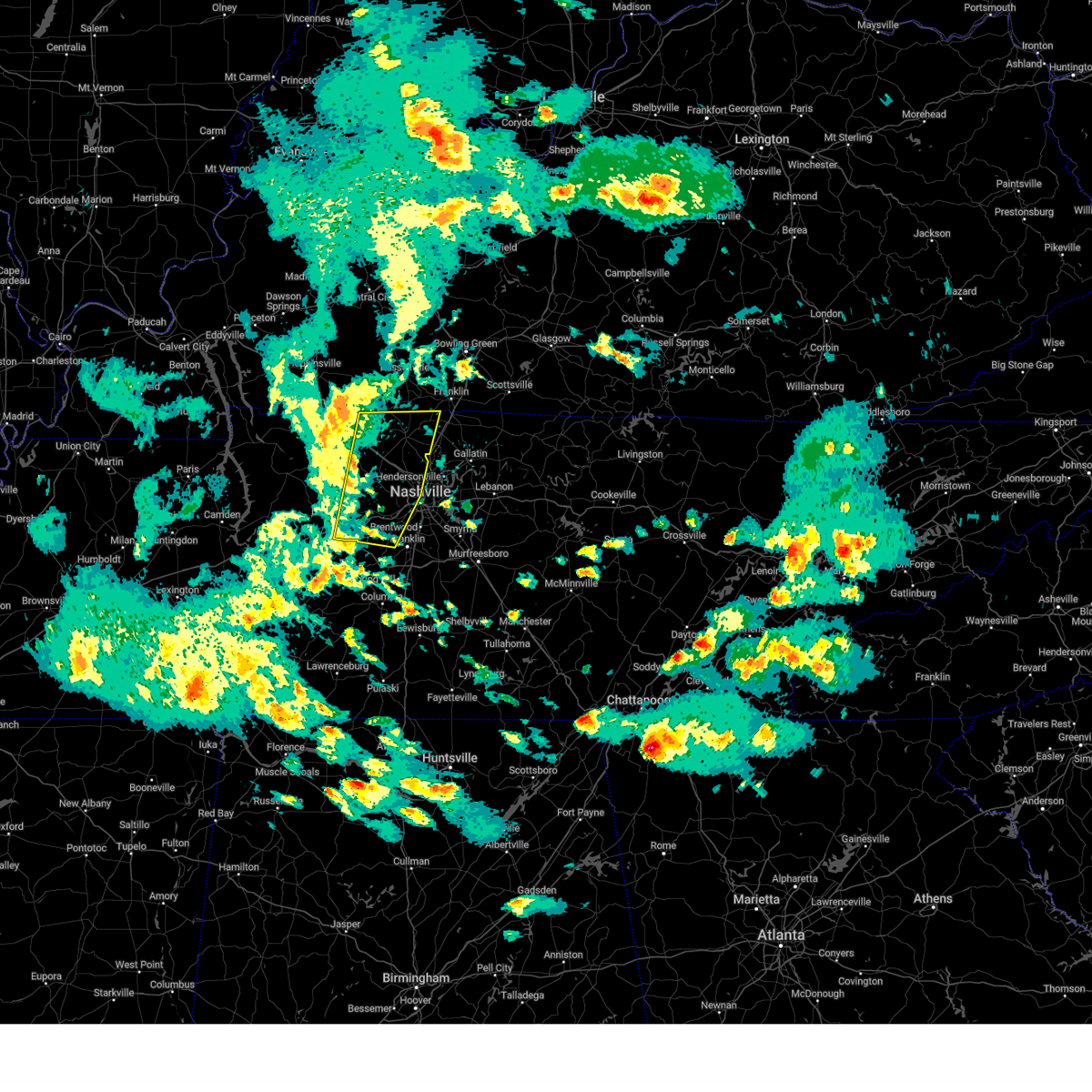 At 501 pm cdt, severe thunderstorms were located along a line extending from 8 miles south of russellville to near fairview, moving east at 45 mph (radar indicated). Hazards include 60 mph wind gusts. Expect damage to roofs, siding, and trees. locations impacted include, belle meade, natchez trace at highway 96, greenbrier, fairview, orlinda, pleasant view, cedar hill, ashland city, white bluff, ridgetop, cheatham dam, adams, bells bend, whites creek, bellevue, pegram, kingston springs, beaman park, springfield, and coopertown. this includes the following highways, interstate 40 between mile markers 172 and 207. interstate 65 between mile markers 85 and 86. interstate 24 between mile markers 11 and 44. Interstate 840 between mile markers 1 and 4. At 501 pm cdt, severe thunderstorms were located along a line extending from 8 miles south of russellville to near fairview, moving east at 45 mph (radar indicated). Hazards include 60 mph wind gusts. Expect damage to roofs, siding, and trees. locations impacted include, belle meade, natchez trace at highway 96, greenbrier, fairview, orlinda, pleasant view, cedar hill, ashland city, white bluff, ridgetop, cheatham dam, adams, bells bend, whites creek, bellevue, pegram, kingston springs, beaman park, springfield, and coopertown. this includes the following highways, interstate 40 between mile markers 172 and 207. interstate 65 between mile markers 85 and 86. interstate 24 between mile markers 11 and 44. Interstate 840 between mile markers 1 and 4.
|
| 4/10/2025 5:01 PM CDT |
 the severe thunderstorm warning has been cancelled and is no longer in effect the severe thunderstorm warning has been cancelled and is no longer in effect
|
| 4/10/2025 4:39 PM CDT |
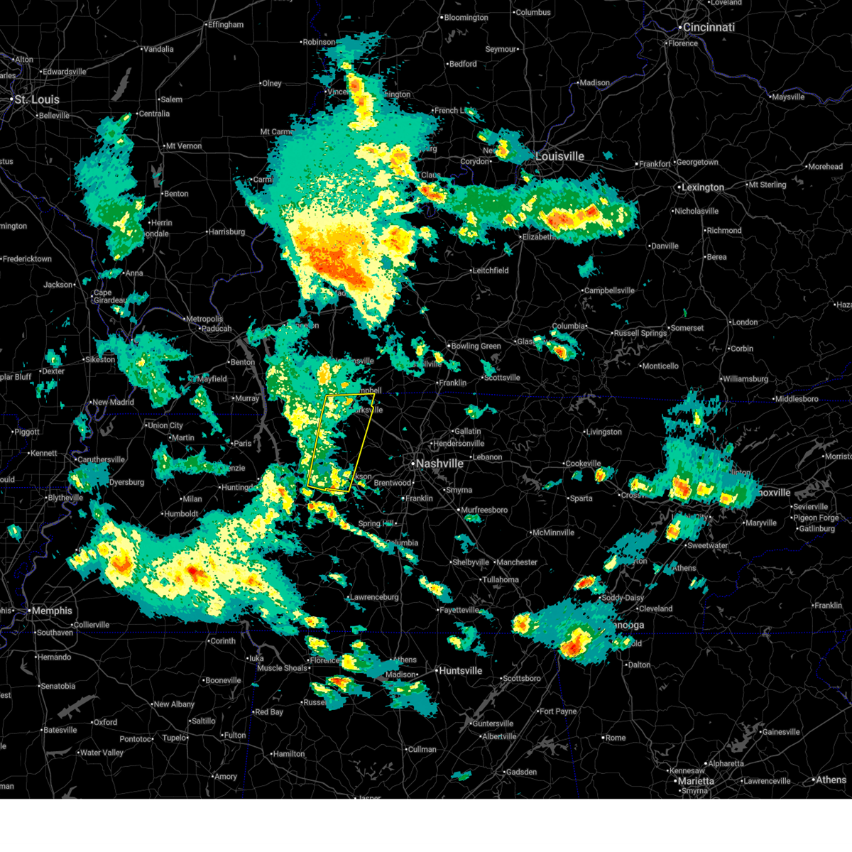 the severe thunderstorm warning has been cancelled and is no longer in effect the severe thunderstorm warning has been cancelled and is no longer in effect
|
| 4/10/2025 4:39 PM CDT |
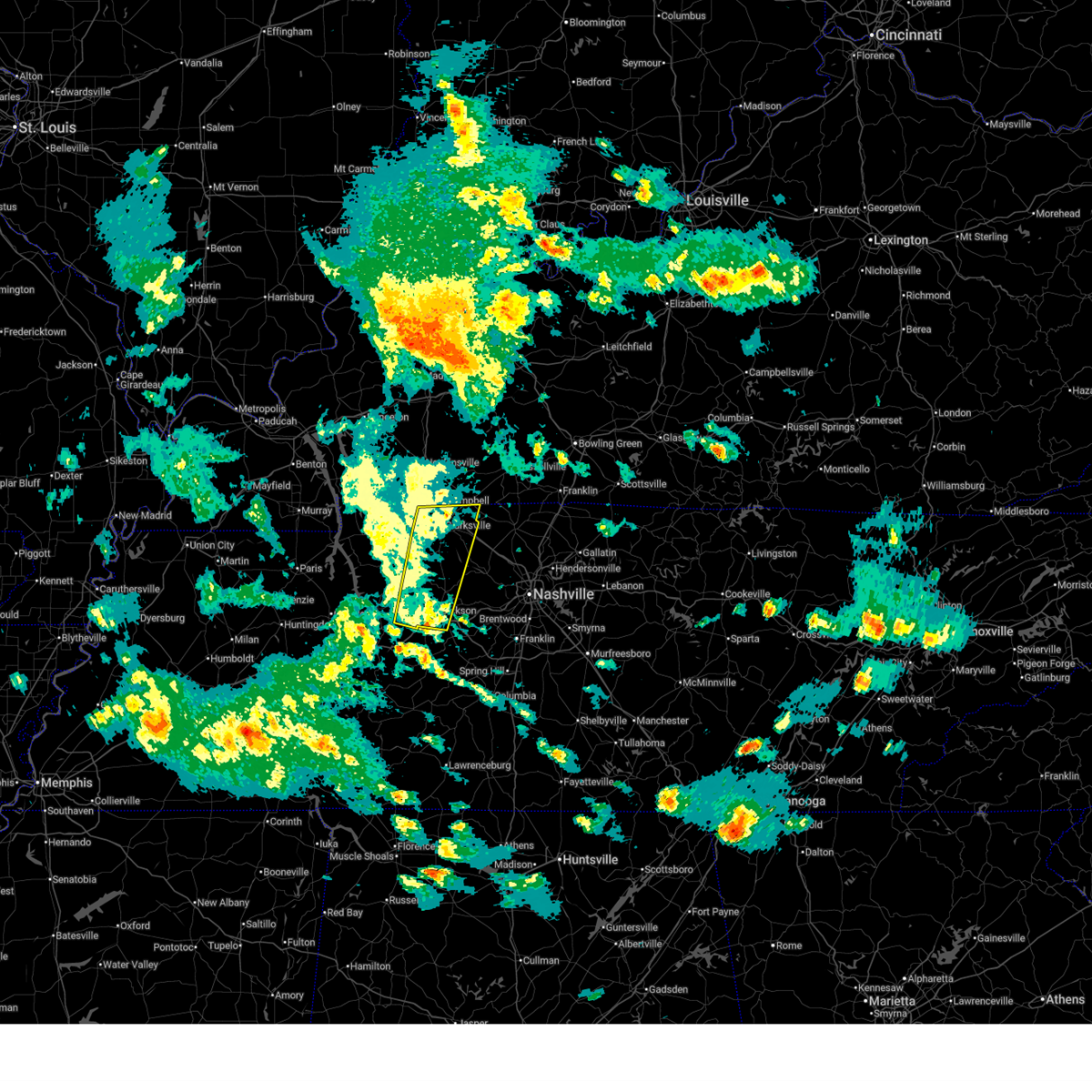 At 438 pm cdt, severe thunderstorms were located along a line extending from near clarksville to near dickson, moving east at 40 mph (radar indicated). Hazards include 60 mph wind gusts. Expect damage to roofs, siding, and trees. locations impacted include, clarksville, charlotte, cheatham dam, vanleer, mcewen, palmyra, slayden, burns, cunningham, woodlawn, and dickson. this includes the following highways, interstate 40 between mile markers 164 and 173. Interstate 24 between mile markers 1 and 16. At 438 pm cdt, severe thunderstorms were located along a line extending from near clarksville to near dickson, moving east at 40 mph (radar indicated). Hazards include 60 mph wind gusts. Expect damage to roofs, siding, and trees. locations impacted include, clarksville, charlotte, cheatham dam, vanleer, mcewen, palmyra, slayden, burns, cunningham, woodlawn, and dickson. this includes the following highways, interstate 40 between mile markers 164 and 173. Interstate 24 between mile markers 1 and 16.
|
| 4/10/2025 4:36 PM CDT |
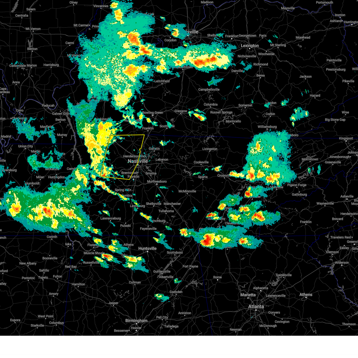 Svrohx the national weather service in nashville has issued a * severe thunderstorm warning for, western davidson county in middle tennessee, dickson county in middle tennessee, eastern montgomery county in middle tennessee, northwestern williamson county in middle tennessee, cheatham county in middle tennessee, northeastern hickman county in middle tennessee, robertson county in middle tennessee, * until 515 pm cdt. * at 434 pm cdt, severe thunderstorms were located along a line extending from near elkton to 7 miles southwest of dickson, moving east at 45 mph (radar indicated). Hazards include 60 mph wind gusts. expect damage to roofs, siding, and trees Svrohx the national weather service in nashville has issued a * severe thunderstorm warning for, western davidson county in middle tennessee, dickson county in middle tennessee, eastern montgomery county in middle tennessee, northwestern williamson county in middle tennessee, cheatham county in middle tennessee, northeastern hickman county in middle tennessee, robertson county in middle tennessee, * until 515 pm cdt. * at 434 pm cdt, severe thunderstorms were located along a line extending from near elkton to 7 miles southwest of dickson, moving east at 45 mph (radar indicated). Hazards include 60 mph wind gusts. expect damage to roofs, siding, and trees
|
| 4/10/2025 4:27 PM CDT |
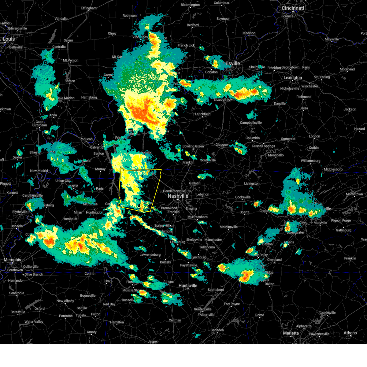 At 427 pm cdt, severe thunderstorms were located along a line extending from near fort campbell to near waverly, moving east at 30 mph (emergency management). Hazards include 60 mph wind gusts. Expect damage to roofs, siding, and trees. locations impacted include, clarksville, charlotte, cumberland city, cheatham dam, mcewen, dover, palmyra, tennessee ridge, big rock, woodlawn, erin, waverly, vanleer, houston county airport, indian mound, slayden, burns, cunningham, dickson, and camden. this includes the following highways, interstate 40 between mile markers 164 and 173. Interstate 24 between mile markers 1 and 16. At 427 pm cdt, severe thunderstorms were located along a line extending from near fort campbell to near waverly, moving east at 30 mph (emergency management). Hazards include 60 mph wind gusts. Expect damage to roofs, siding, and trees. locations impacted include, clarksville, charlotte, cumberland city, cheatham dam, mcewen, dover, palmyra, tennessee ridge, big rock, woodlawn, erin, waverly, vanleer, houston county airport, indian mound, slayden, burns, cunningham, dickson, and camden. this includes the following highways, interstate 40 between mile markers 164 and 173. Interstate 24 between mile markers 1 and 16.
|
| 4/10/2025 4:13 PM CDT | Svrohx the national weather service in nashville has issued a * severe thunderstorm warning for, dickson county in middle tennessee, montgomery county in middle tennessee, stewart county in middle tennessee, houston county in middle tennessee, northwestern cheatham county in middle tennessee, northern humphreys county in middle tennessee, * until 500 pm cdt. * at 413 pm cdt, severe thunderstorms were located along a line extending from 7 miles east of big rock to near waverly, moving east at 30 mph (radar indicated). Hazards include 60 mph wind gusts. expect damage to roofs, siding, and trees |
| 4/5/2025 4:31 PM CDT |
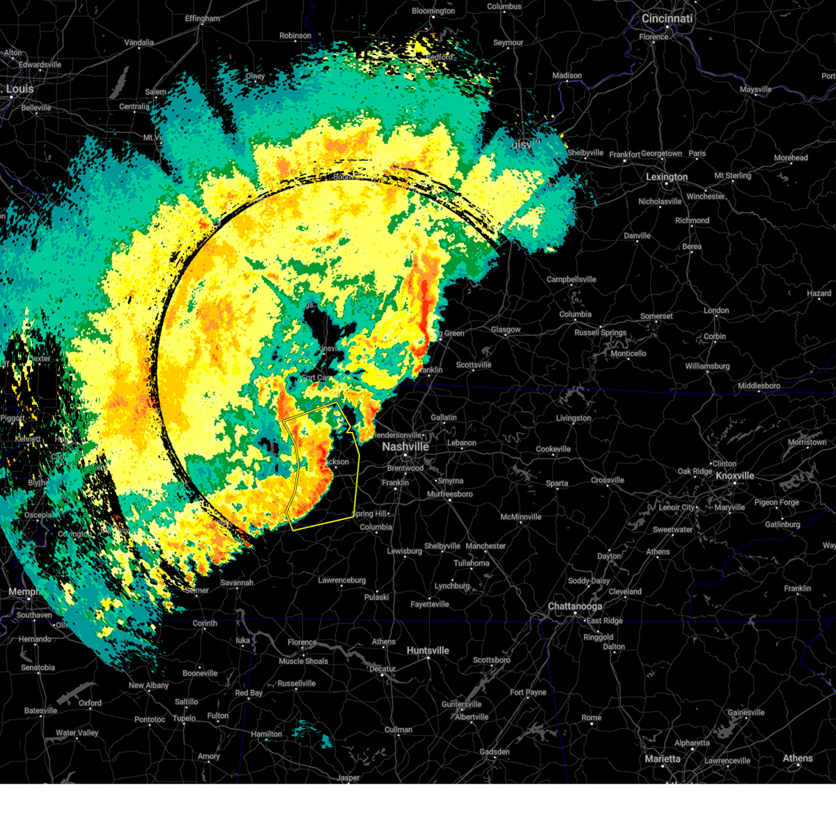 The storms which prompted the warning have moved out of the area. therefore, the warning has been allowed to expire. a tornado watch remains in effect until 900 pm cdt for middle tennessee. remember, a severe thunderstorm warning still remains in effect for dickson and hickman counties. The storms which prompted the warning have moved out of the area. therefore, the warning has been allowed to expire. a tornado watch remains in effect until 900 pm cdt for middle tennessee. remember, a severe thunderstorm warning still remains in effect for dickson and hickman counties.
|
| 4/5/2025 4:10 PM CDT |
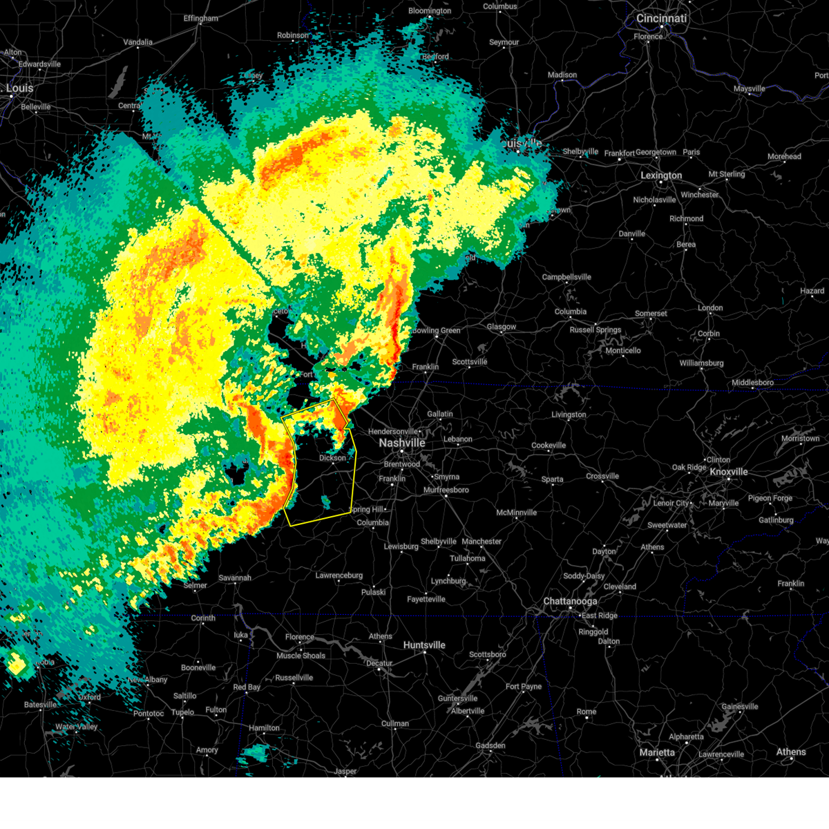 At 409 pm cdt, severe thunderstorms were located along a line extending from 6 miles east of erin to 8 miles southwest of dickson to 12 miles northeast of linden, moving east at 60 mph (radar indicated). Hazards include 60 mph wind gusts and quarter size hail. Hail damage to vehicles is expected. expect wind damage to roofs, siding, and trees. locations impacted include, charlotte, bon aqua, cumberland city, mcewen, primm springs, lyles, palmyra, tennessee ridge, bucksnort, centerville, lobelville, erin, pinewood, pleasantville, vanleer, white bluff, slayden, nunnelly, burns, and cunningham. this includes the following highways, interstate 40 between mile markers 146 and 180. Interstate 840 between mile markers 1 and 6. At 409 pm cdt, severe thunderstorms were located along a line extending from 6 miles east of erin to 8 miles southwest of dickson to 12 miles northeast of linden, moving east at 60 mph (radar indicated). Hazards include 60 mph wind gusts and quarter size hail. Hail damage to vehicles is expected. expect wind damage to roofs, siding, and trees. locations impacted include, charlotte, bon aqua, cumberland city, mcewen, primm springs, lyles, palmyra, tennessee ridge, bucksnort, centerville, lobelville, erin, pinewood, pleasantville, vanleer, white bluff, slayden, nunnelly, burns, and cunningham. this includes the following highways, interstate 40 between mile markers 146 and 180. Interstate 840 between mile markers 1 and 6.
|
| 4/5/2025 3:58 PM CDT |
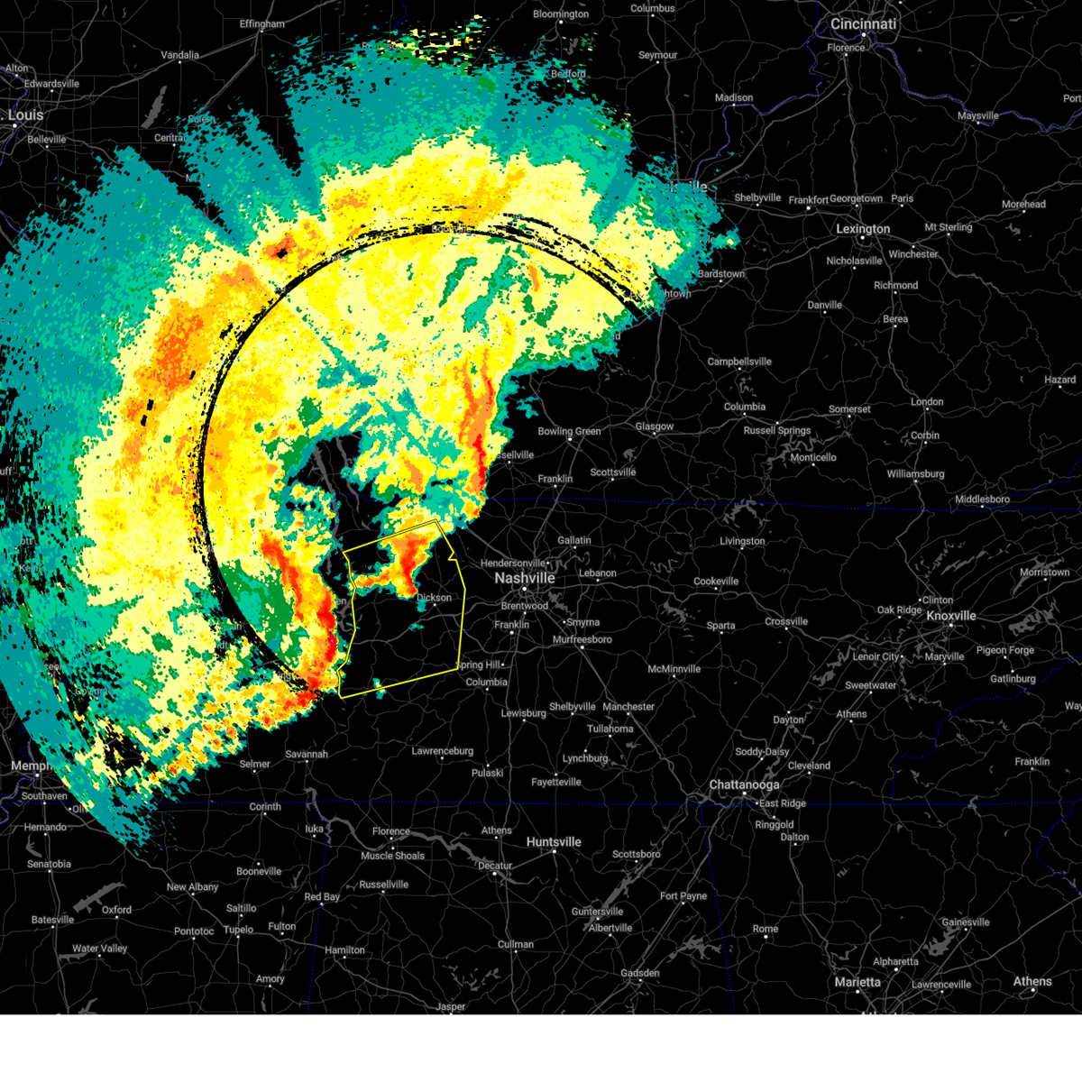 At 358 pm cdt, severe thunderstorms were located along a line extending from near erin to 6 miles east of hurricane mills to 6 miles north of linden, moving east at 65 mph (radar indicated). Hazards include 60 mph wind gusts and quarter size hail. Hail damage to vehicles is expected. expect wind damage to roofs, siding, and trees. locations impacted include, hurricane mills, charlotte, bon aqua, mcewen, primm springs, palmyra, tennessee ridge, bucksnort, erin, linden, pleasantville, houston county airport, white bluff, nunnelly, cunningham, dickson, cumberland city, lyles, i-40 near the tennessee river, and centerville. this includes the following highways, interstate 40 between mile markers 136 and 180. Interstate 840 between mile markers 1 and 6. At 358 pm cdt, severe thunderstorms were located along a line extending from near erin to 6 miles east of hurricane mills to 6 miles north of linden, moving east at 65 mph (radar indicated). Hazards include 60 mph wind gusts and quarter size hail. Hail damage to vehicles is expected. expect wind damage to roofs, siding, and trees. locations impacted include, hurricane mills, charlotte, bon aqua, mcewen, primm springs, palmyra, tennessee ridge, bucksnort, erin, linden, pleasantville, houston county airport, white bluff, nunnelly, cunningham, dickson, cumberland city, lyles, i-40 near the tennessee river, and centerville. this includes the following highways, interstate 40 between mile markers 136 and 180. Interstate 840 between mile markers 1 and 6.
|
| 4/5/2025 3:34 PM CDT |
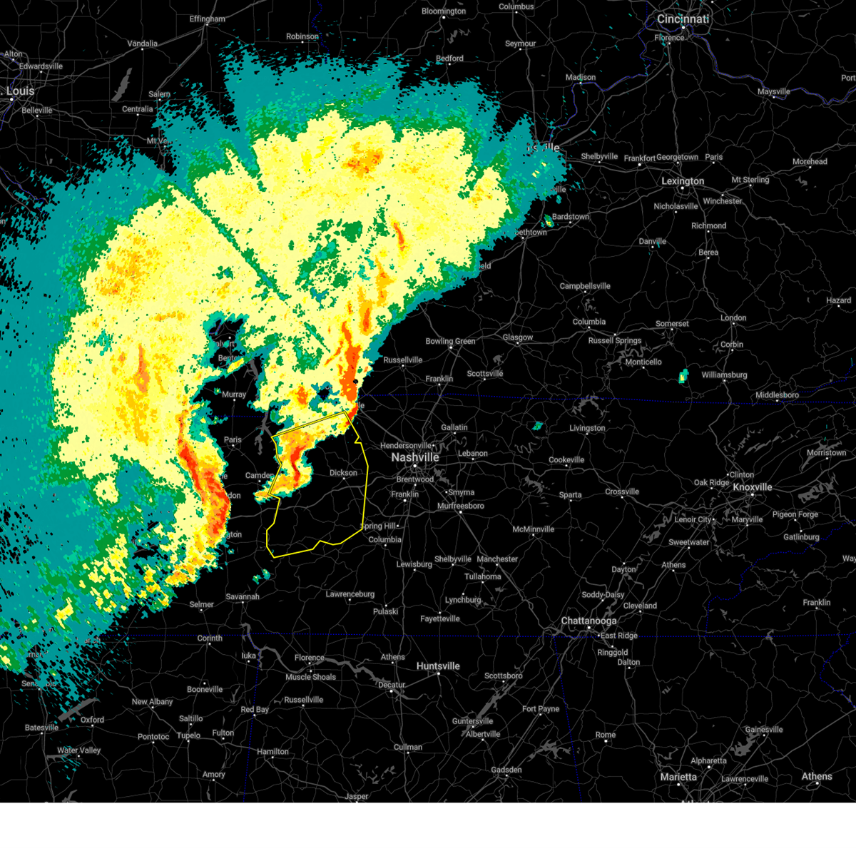 Svrohx the national weather service in nashville has issued a * severe thunderstorm warning for, dickson county in middle tennessee, southwestern montgomery county in middle tennessee, southeastern stewart county in middle tennessee, houston county in middle tennessee, perry county in middle tennessee, humphreys county in middle tennessee, hickman county in middle tennessee, * until 430 pm cdt. * at 334 pm cdt, severe thunderstorms were located along a line extending from 6 miles east of vale to 10 miles southwest of new johnsonville to decaturville, moving east at 60 mph (radar indicated). Hazards include 60 mph wind gusts and quarter size hail. Hail damage to vehicles is expected. Expect wind damage to roofs, siding, and trees. Svrohx the national weather service in nashville has issued a * severe thunderstorm warning for, dickson county in middle tennessee, southwestern montgomery county in middle tennessee, southeastern stewart county in middle tennessee, houston county in middle tennessee, perry county in middle tennessee, humphreys county in middle tennessee, hickman county in middle tennessee, * until 430 pm cdt. * at 334 pm cdt, severe thunderstorms were located along a line extending from 6 miles east of vale to 10 miles southwest of new johnsonville to decaturville, moving east at 60 mph (radar indicated). Hazards include 60 mph wind gusts and quarter size hail. Hail damage to vehicles is expected. Expect wind damage to roofs, siding, and trees.
|
| 4/5/2025 3:27 PM CDT |
 At 327 pm cdt, a severe thunderstorm was located over guthrie, or 12 miles south of elkton, moving east at 45 mph (radar indicated). Hazards include 60 mph wind gusts and penny size hail. Expect damage to roofs, siding, and trees. locations impacted include, cedar hill, adams, orlinda, and clarksville. This includes interstate 24 between mile markers 3 and 14. At 327 pm cdt, a severe thunderstorm was located over guthrie, or 12 miles south of elkton, moving east at 45 mph (radar indicated). Hazards include 60 mph wind gusts and penny size hail. Expect damage to roofs, siding, and trees. locations impacted include, cedar hill, adams, orlinda, and clarksville. This includes interstate 24 between mile markers 3 and 14.
|
| 4/5/2025 3:15 PM CDT |
 At 315 pm cdt, a severe thunderstorm was located near clarksville, moving east at 50 mph (radar indicated). Hazards include 60 mph wind gusts and penny size hail. Expect damage to roofs, siding, and trees. locations impacted include, clarksville, cedar hill, adams, orlinda, springfield, and cross plains. This includes interstate 24 between mile markers 1 and 16. At 315 pm cdt, a severe thunderstorm was located near clarksville, moving east at 50 mph (radar indicated). Hazards include 60 mph wind gusts and penny size hail. Expect damage to roofs, siding, and trees. locations impacted include, clarksville, cedar hill, adams, orlinda, springfield, and cross plains. This includes interstate 24 between mile markers 1 and 16.
|
| 4/5/2025 3:10 PM CDT |
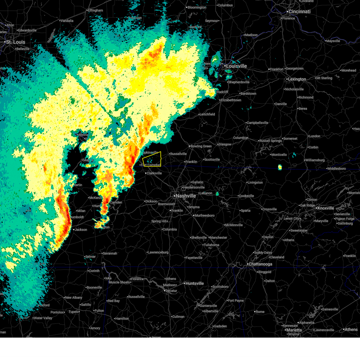 Svrpah the national weather service in paducah has issued a * severe thunderstorm warning for, southeastern christian county in south central kentucky, southern todd county in south central kentucky, * until 345 pm cdt. * at 310 pm cdt, severe thunderstorms were located along a line extending from near pembroke to near oak grove to near clarksville, moving northeast at 50 mph (radar indicated). Hazards include 60 mph wind gusts. expect damage to roofs, siding, and trees Svrpah the national weather service in paducah has issued a * severe thunderstorm warning for, southeastern christian county in south central kentucky, southern todd county in south central kentucky, * until 345 pm cdt. * at 310 pm cdt, severe thunderstorms were located along a line extending from near pembroke to near oak grove to near clarksville, moving northeast at 50 mph (radar indicated). Hazards include 60 mph wind gusts. expect damage to roofs, siding, and trees
|
| 4/5/2025 2:57 PM CDT |
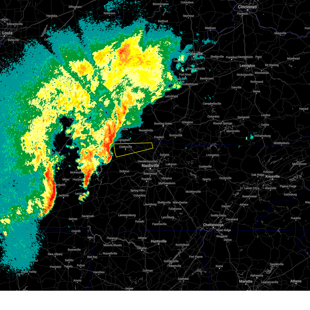 Svrohx the national weather service in nashville has issued a * severe thunderstorm warning for, montgomery county in middle tennessee, northwestern robertson county in middle tennessee, * until 400 pm cdt. * at 257 pm cdt, a severe thunderstorm was located 10 miles west of clarksville, moving east at 50 mph (radar indicated). Hazards include 60 mph wind gusts and quarter size hail. Hail damage to vehicles is expected. Expect wind damage to roofs, siding, and trees. Svrohx the national weather service in nashville has issued a * severe thunderstorm warning for, montgomery county in middle tennessee, northwestern robertson county in middle tennessee, * until 400 pm cdt. * at 257 pm cdt, a severe thunderstorm was located 10 miles west of clarksville, moving east at 50 mph (radar indicated). Hazards include 60 mph wind gusts and quarter size hail. Hail damage to vehicles is expected. Expect wind damage to roofs, siding, and trees.
|
| 4/3/2025 12:09 AM CDT | Trees and power lines down across the city of clarksville. time provided by ham in montgomery county TN, 3.9 miles W of Clarksville, TN |
| 4/3/2025 12:08 AM CDT |
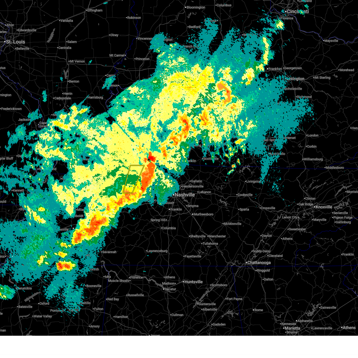 the severe thunderstorm warning has been cancelled and is no longer in effect the severe thunderstorm warning has been cancelled and is no longer in effect
|
| 4/3/2025 12:07 AM CDT |
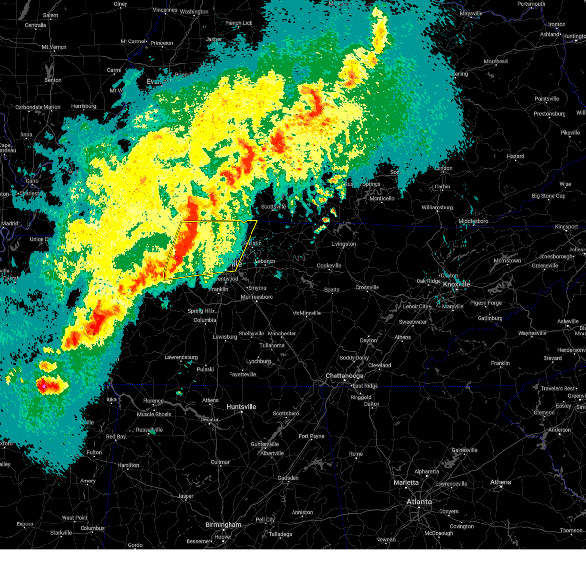 Svrohx the national weather service in nashville has issued a * severe thunderstorm warning for, central davidson county in middle tennessee, dickson county in middle tennessee, eastern montgomery county in middle tennessee, western sumner county in middle tennessee, cheatham county in middle tennessee, robertson county in middle tennessee, * until 100 am cdt. * at 1206 am cdt, severe thunderstorms were located along a line extending from near guthrie to 8 miles northwest of dickson, moving east at 50 mph (radar indicated). Hazards include 60 mph wind gusts and quarter size hail. Hail damage to vehicles is expected. Expect wind damage to roofs, siding, and trees. Svrohx the national weather service in nashville has issued a * severe thunderstorm warning for, central davidson county in middle tennessee, dickson county in middle tennessee, eastern montgomery county in middle tennessee, western sumner county in middle tennessee, cheatham county in middle tennessee, robertson county in middle tennessee, * until 100 am cdt. * at 1206 am cdt, severe thunderstorms were located along a line extending from near guthrie to 8 miles northwest of dickson, moving east at 50 mph (radar indicated). Hazards include 60 mph wind gusts and quarter size hail. Hail damage to vehicles is expected. Expect wind damage to roofs, siding, and trees.
|
| 4/2/2025 11:57 PM CDT | Several trees down. time estimated from rada in montgomery county TN, 7.3 miles WNW of Clarksville, TN |
| 4/2/2025 11:55 PM CDT |
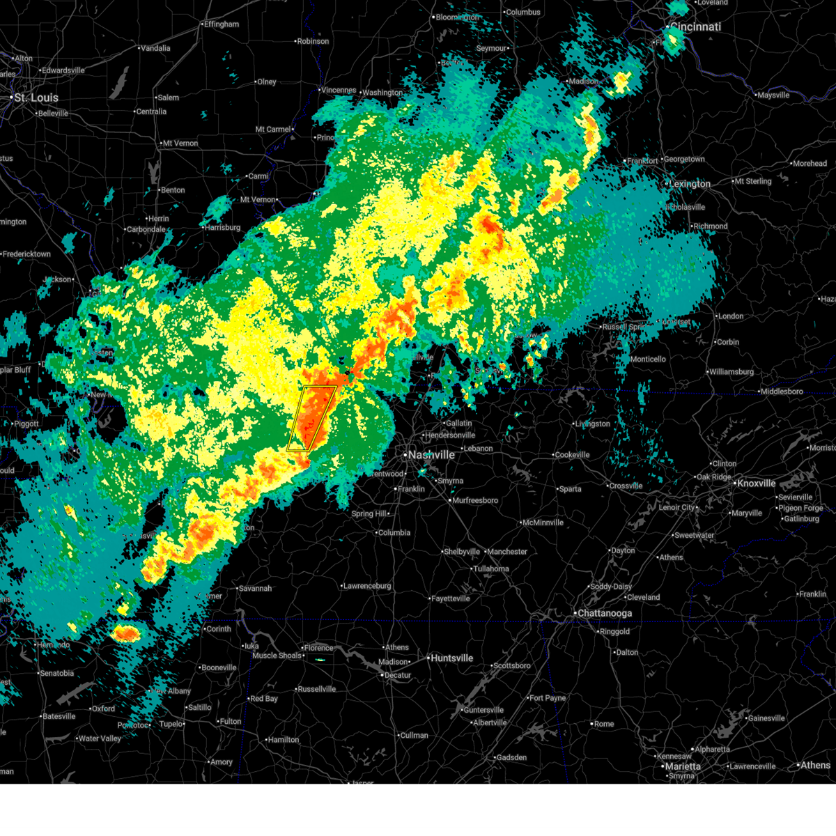 Svrohx the national weather service in nashville has issued a * severe thunderstorm warning for, western montgomery county in middle tennessee, southeastern stewart county in middle tennessee, eastern houston county in middle tennessee, north central humphreys county in middle tennessee, * until 1230 am cdt. * at 1154 pm cdt, severe thunderstorms were located along a line extending from oak grove to 6 miles southeast of erin, moving east at 50 mph (radar indicated). Hazards include 60 mph wind gusts and quarter size hail. Hail damage to vehicles is expected. Expect wind damage to roofs, siding, and trees. Svrohx the national weather service in nashville has issued a * severe thunderstorm warning for, western montgomery county in middle tennessee, southeastern stewart county in middle tennessee, eastern houston county in middle tennessee, north central humphreys county in middle tennessee, * until 1230 am cdt. * at 1154 pm cdt, severe thunderstorms were located along a line extending from oak grove to 6 miles southeast of erin, moving east at 50 mph (radar indicated). Hazards include 60 mph wind gusts and quarter size hail. Hail damage to vehicles is expected. Expect wind damage to roofs, siding, and trees.
|
| 4/2/2025 11:41 PM CDT |
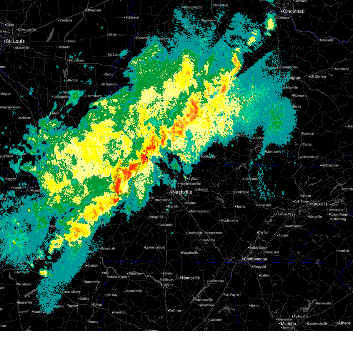 At 1140 pm cdt, severe thunderstorms were located along a line extending from oak grove to 7 miles northwest of waverly, moving east at 50 mph (radar indicated). Hazards include 60 mph wind gusts and quarter size hail. Hail damage to vehicles is expected. expect wind damage to roofs, siding, and trees. Locations impacted include, erin, cumberland city, houston county airport, indian mound, dover, tennessee ridge, big rock, woodlawn, clarksville, and camden. At 1140 pm cdt, severe thunderstorms were located along a line extending from oak grove to 7 miles northwest of waverly, moving east at 50 mph (radar indicated). Hazards include 60 mph wind gusts and quarter size hail. Hail damage to vehicles is expected. expect wind damage to roofs, siding, and trees. Locations impacted include, erin, cumberland city, houston county airport, indian mound, dover, tennessee ridge, big rock, woodlawn, clarksville, and camden.
|
| 4/2/2025 11:30 PM CDT |
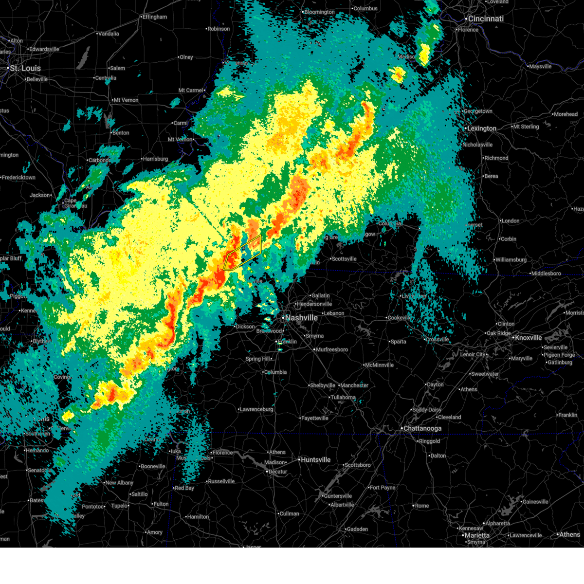 At 1130 pm cdt, severe thunderstorms were located along a line extending from 8 miles southwest of dunmor to near elkton to near oak grove, moving northeast at 45 mph (radar indicated). Hazards include 60 mph wind gusts. Expect damage to roofs, siding, and trees. locations impacted include, oak grove, trenton, fort campbell, elkton, and pembroke. This includes interstate 24 in kentucky between mile markers 83 and 91. At 1130 pm cdt, severe thunderstorms were located along a line extending from 8 miles southwest of dunmor to near elkton to near oak grove, moving northeast at 45 mph (radar indicated). Hazards include 60 mph wind gusts. Expect damage to roofs, siding, and trees. locations impacted include, oak grove, trenton, fort campbell, elkton, and pembroke. This includes interstate 24 in kentucky between mile markers 83 and 91.
|
| 4/2/2025 11:22 PM CDT |
 Svrohx the national weather service in nashville has issued a * severe thunderstorm warning for, northwestern dickson county in middle tennessee, montgomery county in middle tennessee, southeastern houston county in middle tennessee, * until 1230 am cdt. * at 1122 pm cdt, severe thunderstorms were located along a line extending from 6 miles west of fort campbell to 9 miles east of springville, moving northeast at 50 mph (radar indicated). Hazards include 60 mph wind gusts and quarter size hail. Hail damage to vehicles is expected. Expect wind damage to roofs, siding, and trees. Svrohx the national weather service in nashville has issued a * severe thunderstorm warning for, northwestern dickson county in middle tennessee, montgomery county in middle tennessee, southeastern houston county in middle tennessee, * until 1230 am cdt. * at 1122 pm cdt, severe thunderstorms were located along a line extending from 6 miles west of fort campbell to 9 miles east of springville, moving northeast at 50 mph (radar indicated). Hazards include 60 mph wind gusts and quarter size hail. Hail damage to vehicles is expected. Expect wind damage to roofs, siding, and trees.
|
| 4/2/2025 11:19 PM CDT |
 the severe thunderstorm warning has been cancelled and is no longer in effect the severe thunderstorm warning has been cancelled and is no longer in effect
|
| 4/2/2025 11:19 PM CDT |
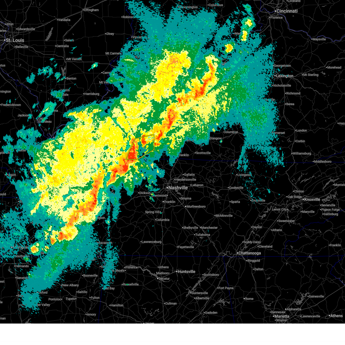 At 1119 pm cdt, severe thunderstorms were located along a line extending from 10 miles south of weir to pembroke to near fort campbell, moving northeast at 45 mph (radar indicated). Hazards include 60 mph wind gusts. Expect damage to roofs, siding, and trees. locations impacted include, fort campbell, hopkinsville, allegre, oak grove, trenton, clifty, elkton, herndon, and pembroke. this includes the following highways, interstate 24 in kentucky between mile markers 77 and 91. Pennyrile parkway between mile markers 1 and 17. At 1119 pm cdt, severe thunderstorms were located along a line extending from 10 miles south of weir to pembroke to near fort campbell, moving northeast at 45 mph (radar indicated). Hazards include 60 mph wind gusts. Expect damage to roofs, siding, and trees. locations impacted include, fort campbell, hopkinsville, allegre, oak grove, trenton, clifty, elkton, herndon, and pembroke. this includes the following highways, interstate 24 in kentucky between mile markers 77 and 91. Pennyrile parkway between mile markers 1 and 17.
|
| 4/2/2025 11:04 PM CDT |
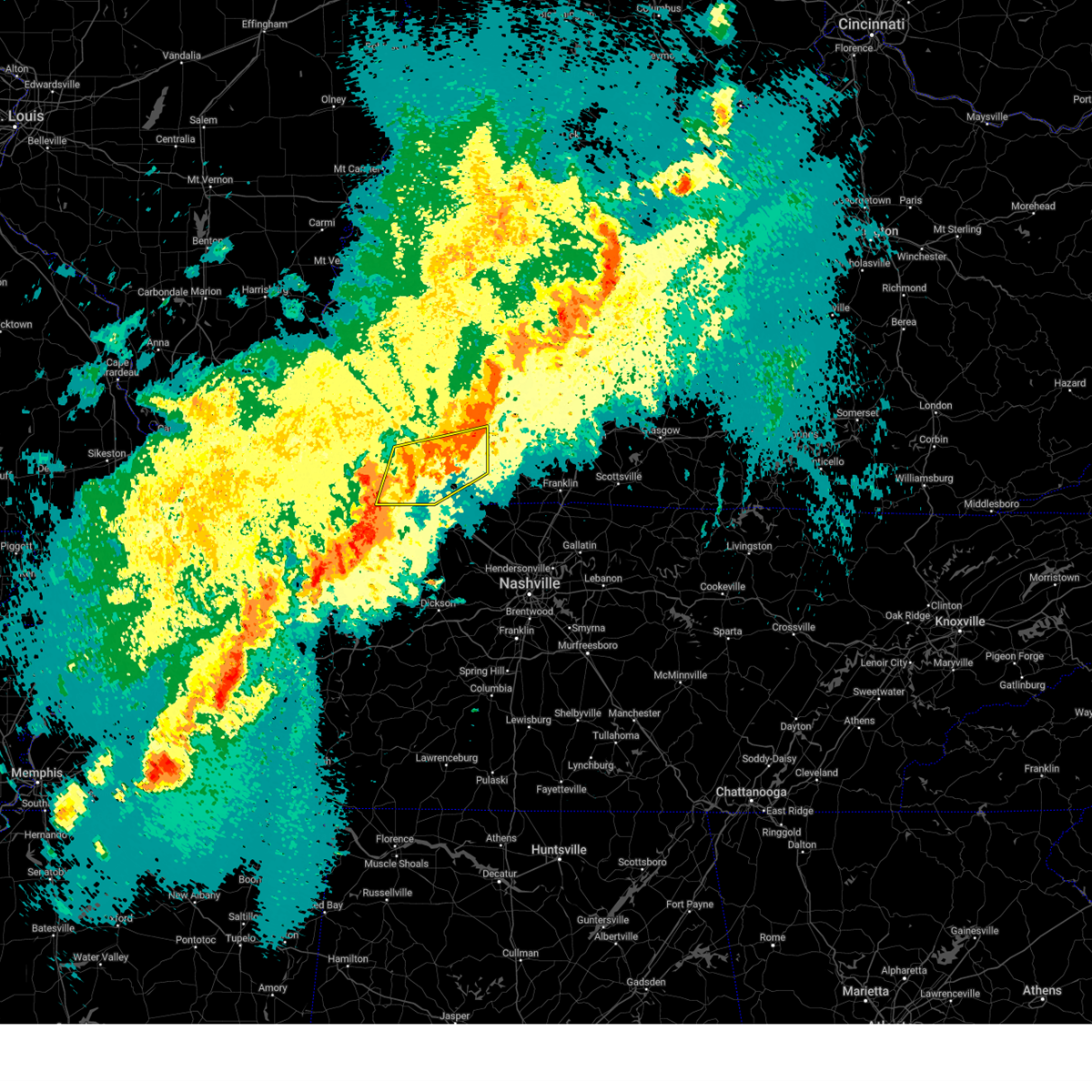 Svrpah the national weather service in paducah has issued a * severe thunderstorm warning for, christian county in south central kentucky, southeastern trigg county in western kentucky, todd county in south central kentucky, * until 1145 pm cdt. * at 1104 pm cdt, severe thunderstorms were located along a line extending from 7 miles northeast of hopkinsville to near fort campbell to near big rock, moving northeast at 45 mph (radar indicated). Hazards include 60 mph wind gusts. expect damage to roofs, siding, and trees Svrpah the national weather service in paducah has issued a * severe thunderstorm warning for, christian county in south central kentucky, southeastern trigg county in western kentucky, todd county in south central kentucky, * until 1145 pm cdt. * at 1104 pm cdt, severe thunderstorms were located along a line extending from 7 miles northeast of hopkinsville to near fort campbell to near big rock, moving northeast at 45 mph (radar indicated). Hazards include 60 mph wind gusts. expect damage to roofs, siding, and trees
|
| 4/2/2025 10:55 PM CDT |
 Svrohx the national weather service in nashville has issued a * severe thunderstorm warning for, western montgomery county in middle tennessee, stewart county in middle tennessee, houston county in middle tennessee, northwestern humphreys county in middle tennessee, * until midnight cdt. * at 1055 pm cdt, severe thunderstorms were located along a line extending from 7 miles north of big rock to 6 miles southwest of springville, moving northeast at 50 mph (radar indicated). Hazards include 60 mph wind gusts and quarter size hail. Hail damage to vehicles is expected. Expect wind damage to roofs, siding, and trees. Svrohx the national weather service in nashville has issued a * severe thunderstorm warning for, western montgomery county in middle tennessee, stewart county in middle tennessee, houston county in middle tennessee, northwestern humphreys county in middle tennessee, * until midnight cdt. * at 1055 pm cdt, severe thunderstorms were located along a line extending from 7 miles north of big rock to 6 miles southwest of springville, moving northeast at 50 mph (radar indicated). Hazards include 60 mph wind gusts and quarter size hail. Hail damage to vehicles is expected. Expect wind damage to roofs, siding, and trees.
|
| 4/2/2025 10:51 PM CDT |
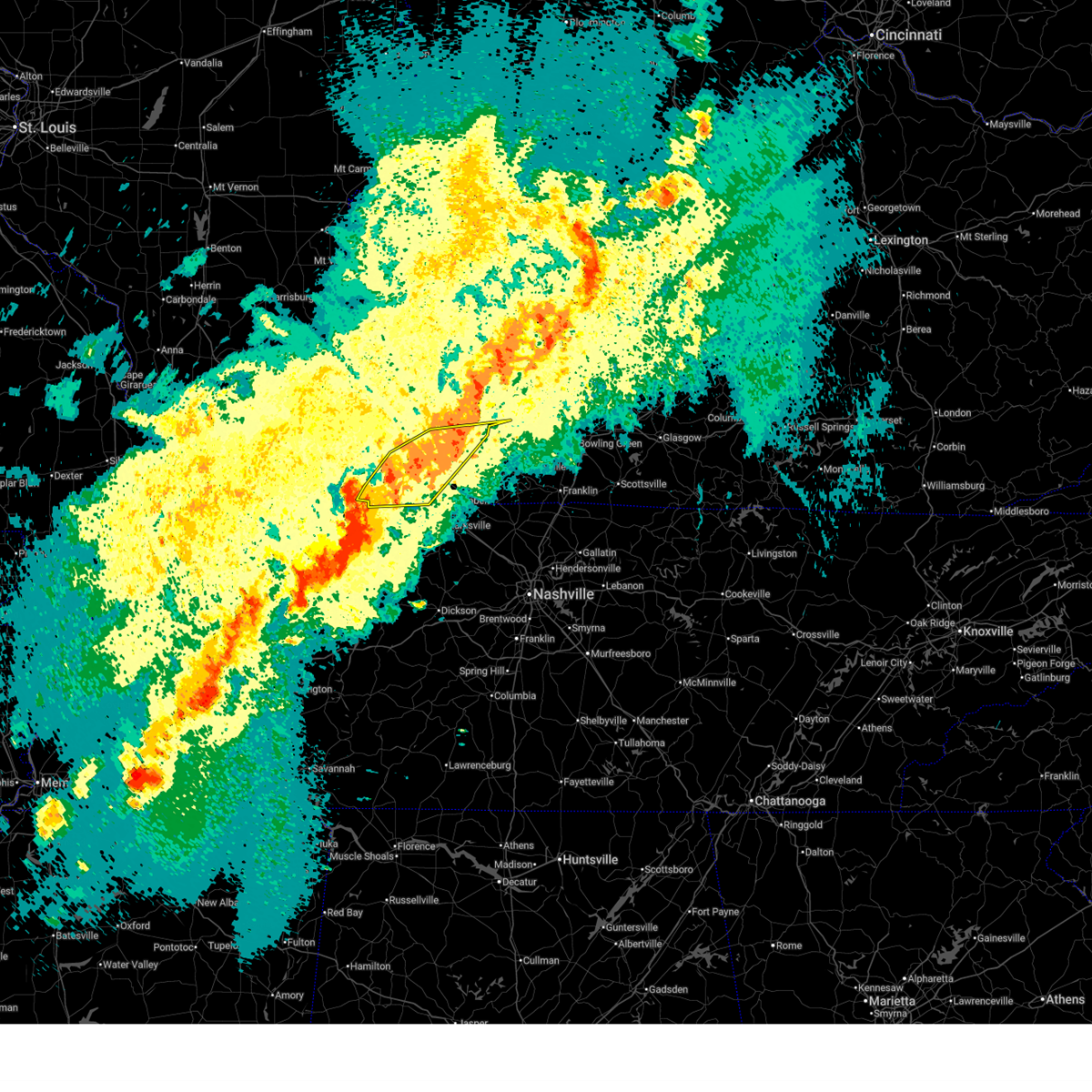 At 1051 pm cdt, severe thunderstorms were located along a line extending from near weir to 6 miles east of hopkinsville to near big rock, moving east at 45 mph (radar indicated). Hazards include 60 mph wind gusts. Expect damage to roofs, siding, and trees. locations impacted include, fort campbell, lafayette, hopkinsville, allegre, oak grove, clifty, herndon, pembroke, linton, and cadiz. this includes the following highways, interstate 24 in kentucky between mile markers 65 and 88. Pennyrile parkway between mile markers 1 and 21. At 1051 pm cdt, severe thunderstorms were located along a line extending from near weir to 6 miles east of hopkinsville to near big rock, moving east at 45 mph (radar indicated). Hazards include 60 mph wind gusts. Expect damage to roofs, siding, and trees. locations impacted include, fort campbell, lafayette, hopkinsville, allegre, oak grove, clifty, herndon, pembroke, linton, and cadiz. this includes the following highways, interstate 24 in kentucky between mile markers 65 and 88. Pennyrile parkway between mile markers 1 and 21.
|
| 4/2/2025 10:42 PM CDT |
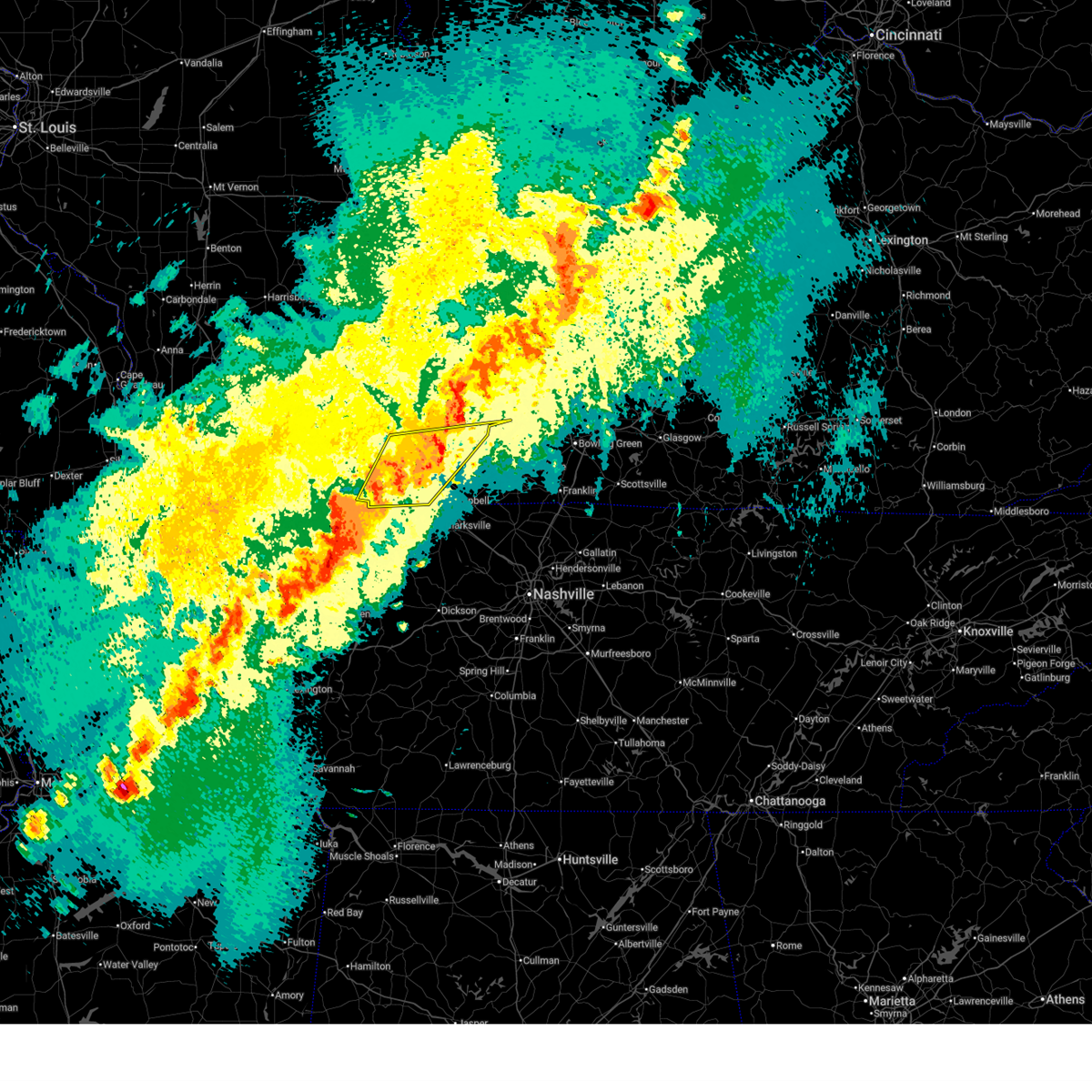 At 1042 pm cdt, severe thunderstorms were located along a line extending from 6 miles northeast of crofton to hopkinsville to big rock, moving east at 45 mph (radar indicated). Hazards include 70 mph wind gusts. Expect considerable tree damage. damage is likely to mobile homes, roofs, and outbuildings. locations impacted include, fort campbell, lafayette, hopkinsville, allegre, oak grove, linton, clifty, herndon, pembroke, and cadiz. this includes the following highways, interstate 24 in kentucky between mile markers 63 and 88. Pennyrile parkway between mile markers 1 and 21. At 1042 pm cdt, severe thunderstorms were located along a line extending from 6 miles northeast of crofton to hopkinsville to big rock, moving east at 45 mph (radar indicated). Hazards include 70 mph wind gusts. Expect considerable tree damage. damage is likely to mobile homes, roofs, and outbuildings. locations impacted include, fort campbell, lafayette, hopkinsville, allegre, oak grove, linton, clifty, herndon, pembroke, and cadiz. this includes the following highways, interstate 24 in kentucky between mile markers 63 and 88. Pennyrile parkway between mile markers 1 and 21.
|
| 4/2/2025 10:16 PM CDT |
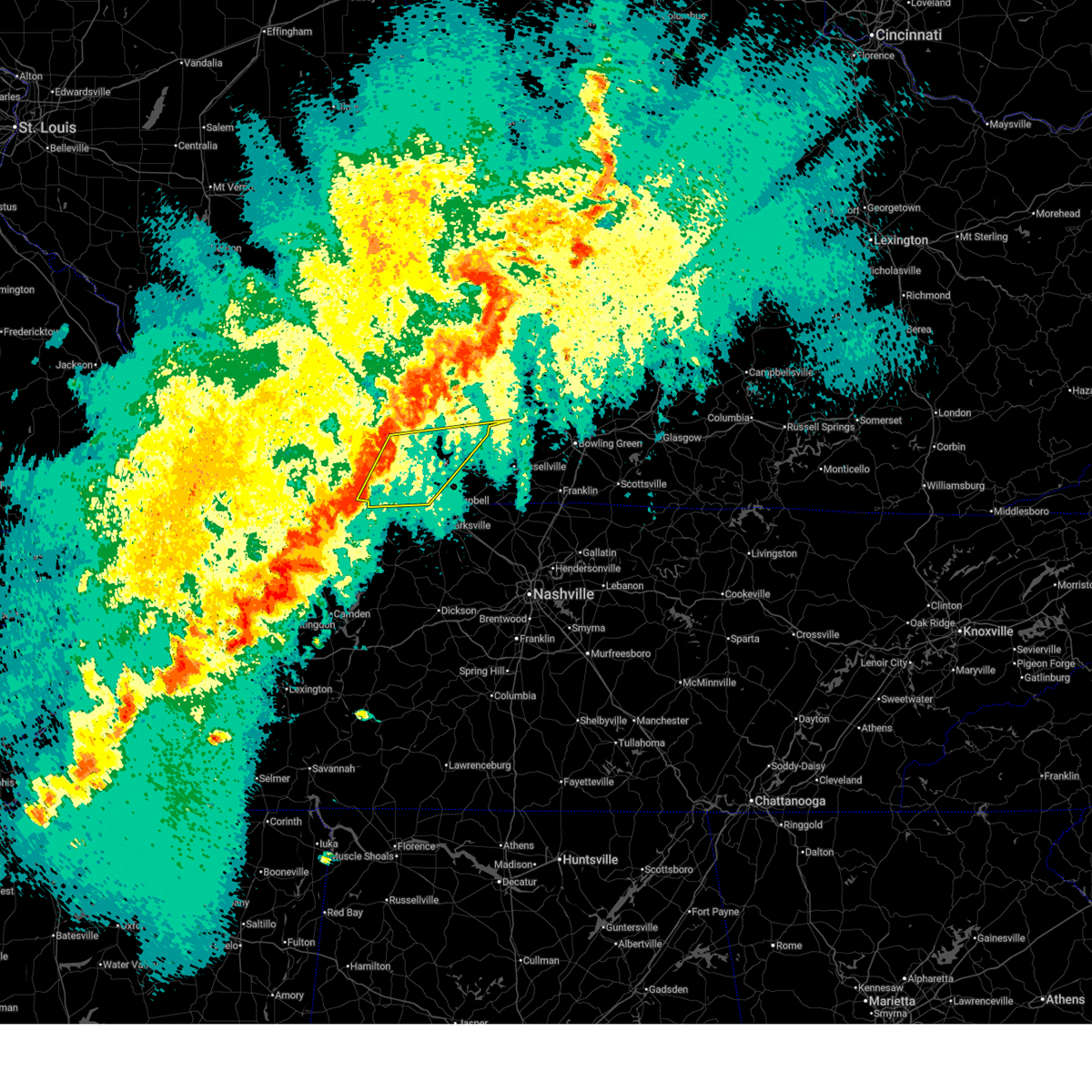 Svrpah the national weather service in paducah has issued a * severe thunderstorm warning for, southeastern muhlenberg county in south central kentucky, christian county in south central kentucky, eastern trigg county in western kentucky, northern todd county in south central kentucky, * until 1100 pm cdt. * at 1016 pm cdt, severe thunderstorms were located along a line extending from 7 miles east of cobb to 7 miles southeast of cadiz to 6 miles northeast of paris landing state park, moving east at 45 mph (radar indicated). Hazards include 60 mph wind gusts. expect damage to roofs, siding, and trees Svrpah the national weather service in paducah has issued a * severe thunderstorm warning for, southeastern muhlenberg county in south central kentucky, christian county in south central kentucky, eastern trigg county in western kentucky, northern todd county in south central kentucky, * until 1100 pm cdt. * at 1016 pm cdt, severe thunderstorms were located along a line extending from 7 miles east of cobb to 7 miles southeast of cadiz to 6 miles northeast of paris landing state park, moving east at 45 mph (radar indicated). Hazards include 60 mph wind gusts. expect damage to roofs, siding, and trees
|
| 4/2/2025 7:09 PM CDT |
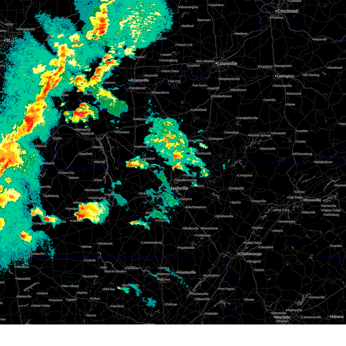 the severe thunderstorm warning has been cancelled and is no longer in effect the severe thunderstorm warning has been cancelled and is no longer in effect
|
| 4/2/2025 6:55 PM CDT |
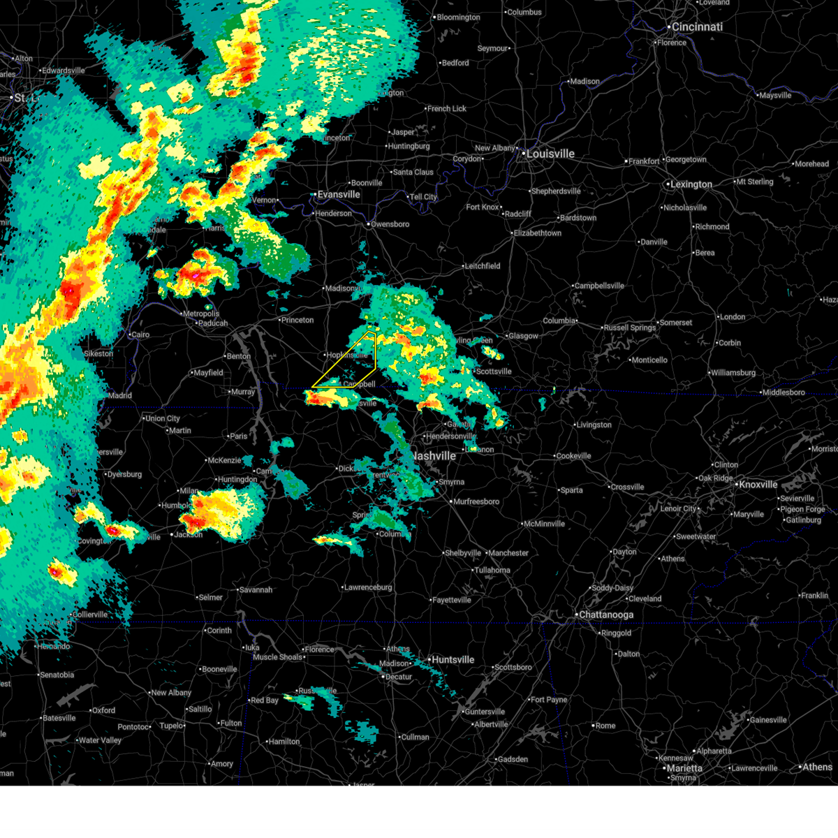 Svrpah the national weather service in paducah has issued a * severe thunderstorm warning for, southeastern christian county in south central kentucky, todd county in south central kentucky, * until 745 pm cdt. * at 655 pm cdt, a severe thunderstorm was located 7 miles southwest of fort campbell, moving northeast at 50 mph (radar indicated). Hazards include 60 mph wind gusts and quarter size hail. Hail damage to vehicles is expected. Expect wind damage to roofs, siding, and trees. Svrpah the national weather service in paducah has issued a * severe thunderstorm warning for, southeastern christian county in south central kentucky, todd county in south central kentucky, * until 745 pm cdt. * at 655 pm cdt, a severe thunderstorm was located 7 miles southwest of fort campbell, moving northeast at 50 mph (radar indicated). Hazards include 60 mph wind gusts and quarter size hail. Hail damage to vehicles is expected. Expect wind damage to roofs, siding, and trees.
|
| 4/2/2025 6:55 PM CDT |
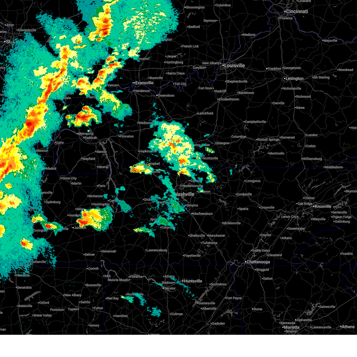 At 655 pm cdt, a severe thunderstorm was located 8 miles southwest of fort campbell, moving northeast at 45 mph (radar indicated). Hazards include 60 mph wind gusts and quarter size hail. Hail damage to vehicles is expected. expect wind damage to roofs, siding, and trees. locations impacted include, woodlawn and clarksville. This includes interstate 24 between mile markers 1 and 3. At 655 pm cdt, a severe thunderstorm was located 8 miles southwest of fort campbell, moving northeast at 45 mph (radar indicated). Hazards include 60 mph wind gusts and quarter size hail. Hail damage to vehicles is expected. expect wind damage to roofs, siding, and trees. locations impacted include, woodlawn and clarksville. This includes interstate 24 between mile markers 1 and 3.
|
| 4/2/2025 6:55 PM CDT |
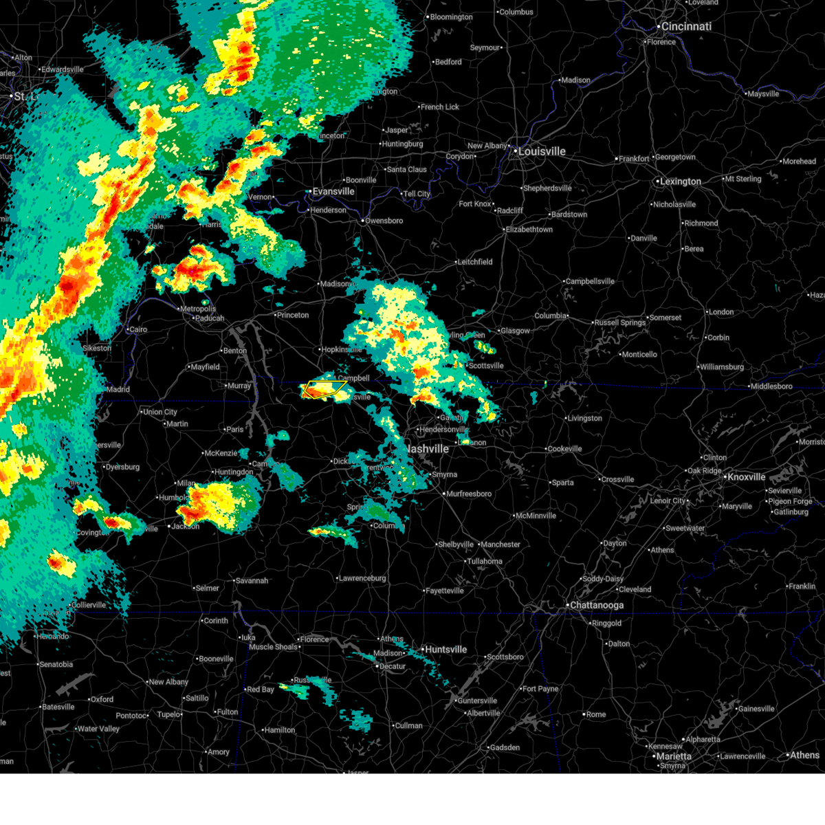 the severe thunderstorm warning has been cancelled and is no longer in effect the severe thunderstorm warning has been cancelled and is no longer in effect
|
| 4/2/2025 6:42 PM CDT |
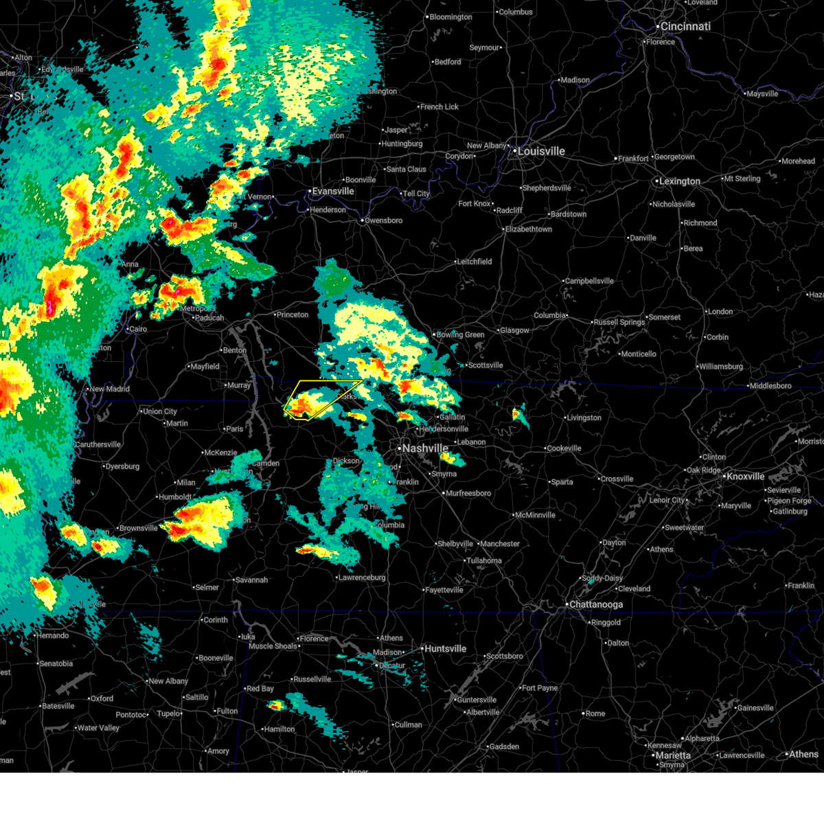 the severe thunderstorm warning has been cancelled and is no longer in effect the severe thunderstorm warning has been cancelled and is no longer in effect
|
| 4/2/2025 6:42 PM CDT |
 At 642 pm cdt, a severe thunderstorm was located 8 miles north of erin, moving northeast at 45 mph (radar indicated). Hazards include 60 mph wind gusts and quarter size hail. Hail damage to vehicles is expected. expect wind damage to roofs, siding, and trees. locations impacted include, clarksville, indian mound, palmyra, cumberland city, and woodlawn. This includes interstate 24 between mile markers 1 and 7. At 642 pm cdt, a severe thunderstorm was located 8 miles north of erin, moving northeast at 45 mph (radar indicated). Hazards include 60 mph wind gusts and quarter size hail. Hail damage to vehicles is expected. expect wind damage to roofs, siding, and trees. locations impacted include, clarksville, indian mound, palmyra, cumberland city, and woodlawn. This includes interstate 24 between mile markers 1 and 7.
|
| 4/2/2025 6:26 PM CDT |
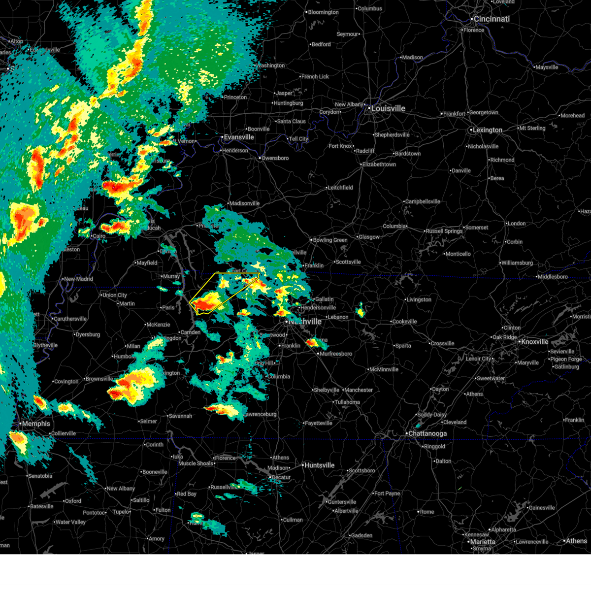 Svrohx the national weather service in nashville has issued a * severe thunderstorm warning for, montgomery county in middle tennessee, eastern stewart county in middle tennessee, northern houston county in middle tennessee, * until 730 pm cdt. * at 626 pm cdt, a severe thunderstorm was located near tennessee ridge, or near erin, moving northeast at 45 mph (radar indicated). Hazards include 60 mph wind gusts and quarter size hail. Hail damage to vehicles is expected. Expect wind damage to roofs, siding, and trees. Svrohx the national weather service in nashville has issued a * severe thunderstorm warning for, montgomery county in middle tennessee, eastern stewart county in middle tennessee, northern houston county in middle tennessee, * until 730 pm cdt. * at 626 pm cdt, a severe thunderstorm was located near tennessee ridge, or near erin, moving northeast at 45 mph (radar indicated). Hazards include 60 mph wind gusts and quarter size hail. Hail damage to vehicles is expected. Expect wind damage to roofs, siding, and trees.
|
| 3/30/2025 10:15 PM CDT |
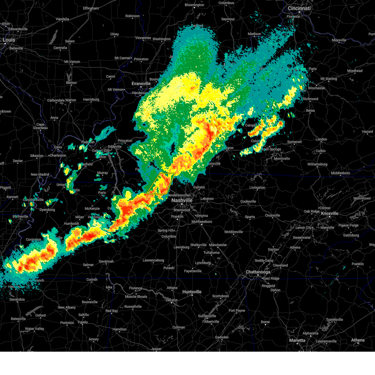 At 1015 pm cdt, severe thunderstorms were located along a line extending from 10 miles east of guthrie to 8 miles northwest of ashland city, moving east at 45 mph (radar indicated). Hazards include 60 mph wind gusts and penny size hail. Expect damage to roofs, siding, and trees. locations impacted include, pleasant view, cunningham, cedar hill, adams, cheatham dam, and clarksville. This includes interstate 24 between mile markers 7 and 23. At 1015 pm cdt, severe thunderstorms were located along a line extending from 10 miles east of guthrie to 8 miles northwest of ashland city, moving east at 45 mph (radar indicated). Hazards include 60 mph wind gusts and penny size hail. Expect damage to roofs, siding, and trees. locations impacted include, pleasant view, cunningham, cedar hill, adams, cheatham dam, and clarksville. This includes interstate 24 between mile markers 7 and 23.
|
| 3/30/2025 10:00 PM CDT |
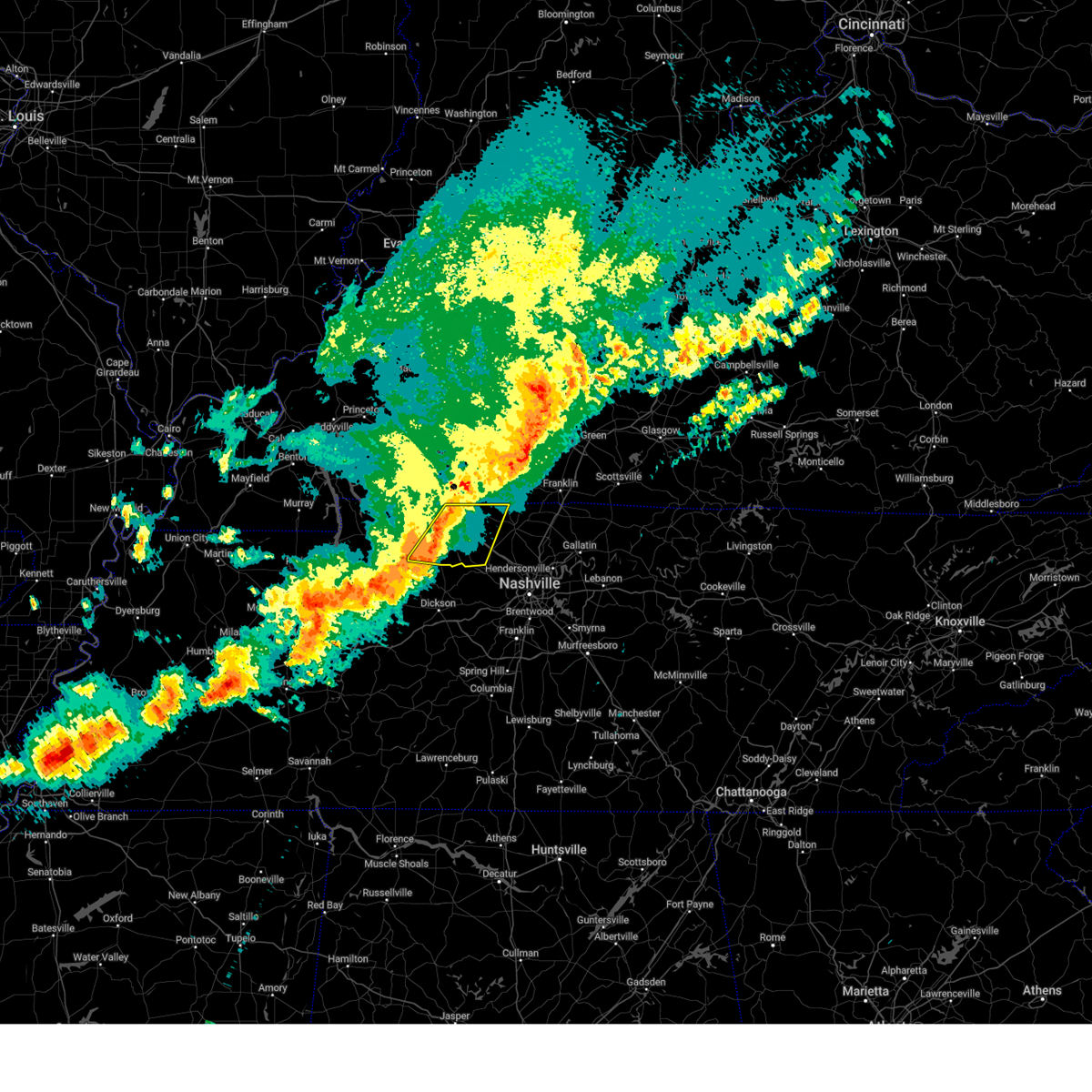 At 1000 pm cdt, severe thunderstorms were located along a line extending from near guthrie to 15 miles south of clarksville, moving east at 45 mph (radar indicated). Hazards include 60 mph wind gusts and penny size hail. Expect damage to roofs, siding, and trees. locations impacted include, clarksville, pleasant view, cedar hill, adams, palmyra, cunningham, and cheatham dam. This includes interstate 24 between mile markers 1 and 23. At 1000 pm cdt, severe thunderstorms were located along a line extending from near guthrie to 15 miles south of clarksville, moving east at 45 mph (radar indicated). Hazards include 60 mph wind gusts and penny size hail. Expect damage to roofs, siding, and trees. locations impacted include, clarksville, pleasant view, cedar hill, adams, palmyra, cunningham, and cheatham dam. This includes interstate 24 between mile markers 1 and 23.
|
| 3/30/2025 9:47 PM CDT |
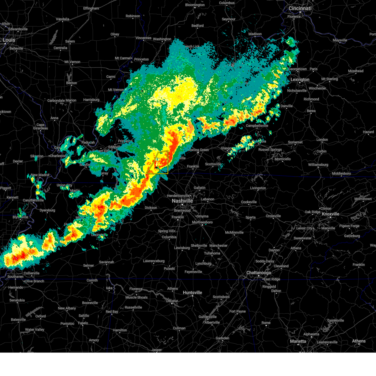 At 947 pm cdt, severe thunderstorms were located along a line extending from 10 miles south of weir to near pembroke to near fort campbell, moving east at 35 mph (radar indicated). Hazards include 60 mph wind gusts and penny size hail. Expect damage to roofs, siding, and trees. locations impacted include, allensville, allegre, oak grove, guthrie, trenton, elkton, pembroke, fort campbell, and clarksville. This includes interstate 24 in kentucky between mile markers 87 and 92. At 947 pm cdt, severe thunderstorms were located along a line extending from 10 miles south of weir to near pembroke to near fort campbell, moving east at 35 mph (radar indicated). Hazards include 60 mph wind gusts and penny size hail. Expect damage to roofs, siding, and trees. locations impacted include, allensville, allegre, oak grove, guthrie, trenton, elkton, pembroke, fort campbell, and clarksville. This includes interstate 24 in kentucky between mile markers 87 and 92.
|
| 3/30/2025 9:32 PM CDT |
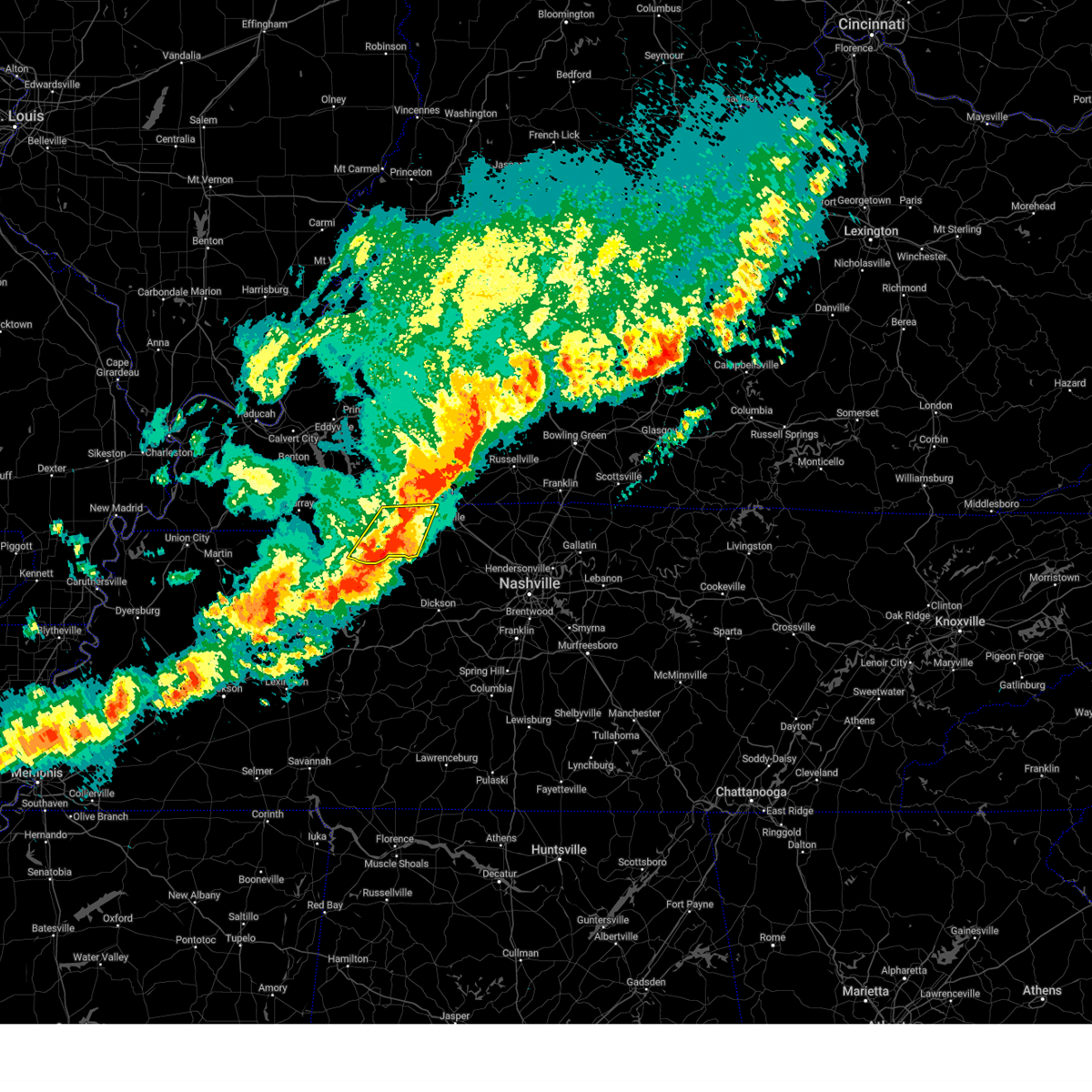 At 932 pm cdt, severe thunderstorms were located along a line extending from near fort campbell to near erin, moving east at 50 mph (radar indicated). Hazards include 60 mph wind gusts and penny size hail. Expect damage to roofs, siding, and trees. Locations impacted include, indian mound, dover, big rock, cumberland city, woodlawn, and clarksville. At 932 pm cdt, severe thunderstorms were located along a line extending from near fort campbell to near erin, moving east at 50 mph (radar indicated). Hazards include 60 mph wind gusts and penny size hail. Expect damage to roofs, siding, and trees. Locations impacted include, indian mound, dover, big rock, cumberland city, woodlawn, and clarksville.
|
| 3/30/2025 9:29 PM CDT |
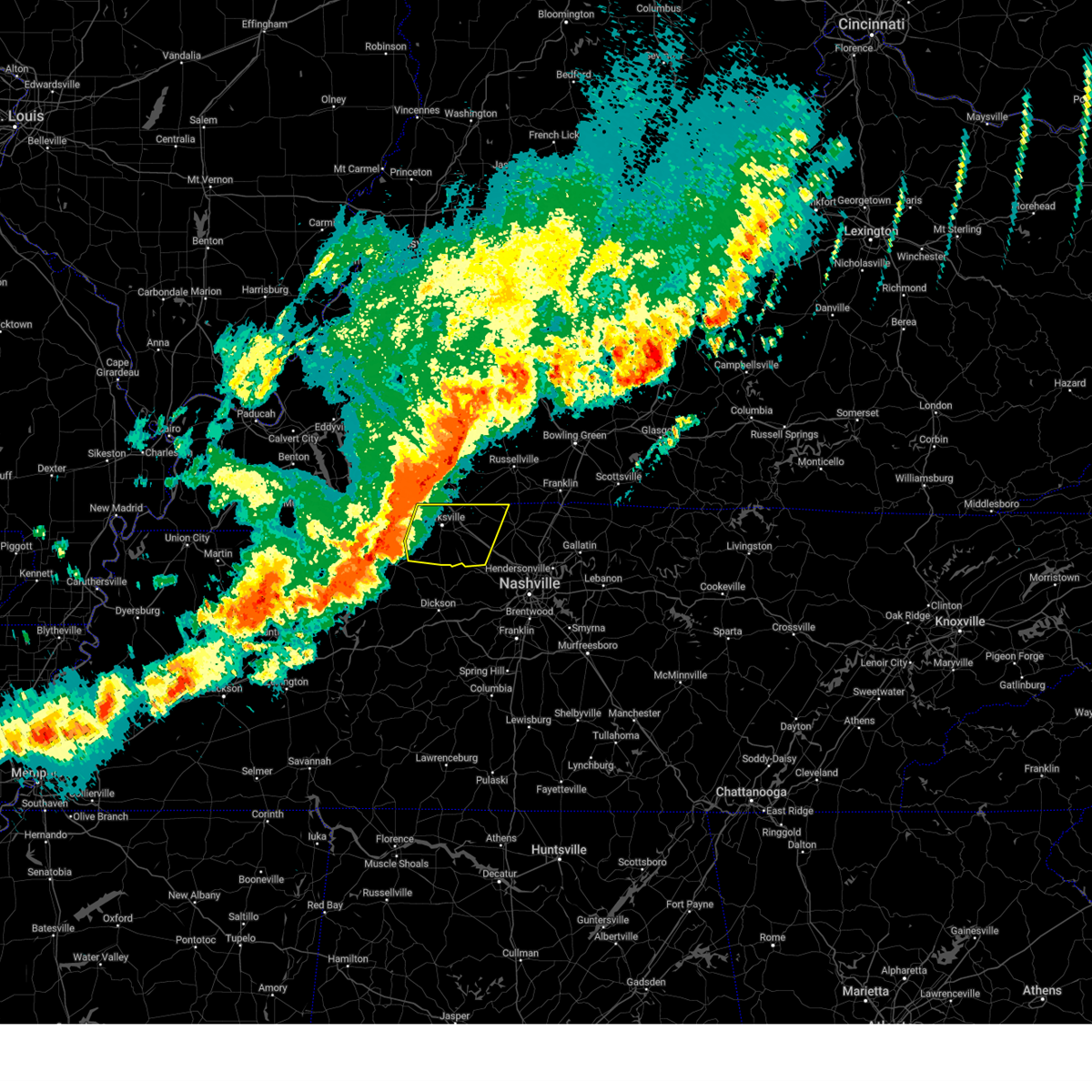 Svrohx the national weather service in nashville has issued a * severe thunderstorm warning for, montgomery county in middle tennessee, northwestern cheatham county in middle tennessee, northwestern robertson county in middle tennessee, * until 1030 pm cdt. * at 929 pm cdt, severe thunderstorms were located along a line extending from 6 miles west of fort campbell to near tennessee ridge, moving east at 45 mph (radar indicated). Hazards include 60 mph wind gusts and penny size hail. expect damage to roofs, siding, and trees Svrohx the national weather service in nashville has issued a * severe thunderstorm warning for, montgomery county in middle tennessee, northwestern cheatham county in middle tennessee, northwestern robertson county in middle tennessee, * until 1030 pm cdt. * at 929 pm cdt, severe thunderstorms were located along a line extending from 6 miles west of fort campbell to near tennessee ridge, moving east at 45 mph (radar indicated). Hazards include 60 mph wind gusts and penny size hail. expect damage to roofs, siding, and trees
|
| 3/30/2025 9:20 PM CDT |
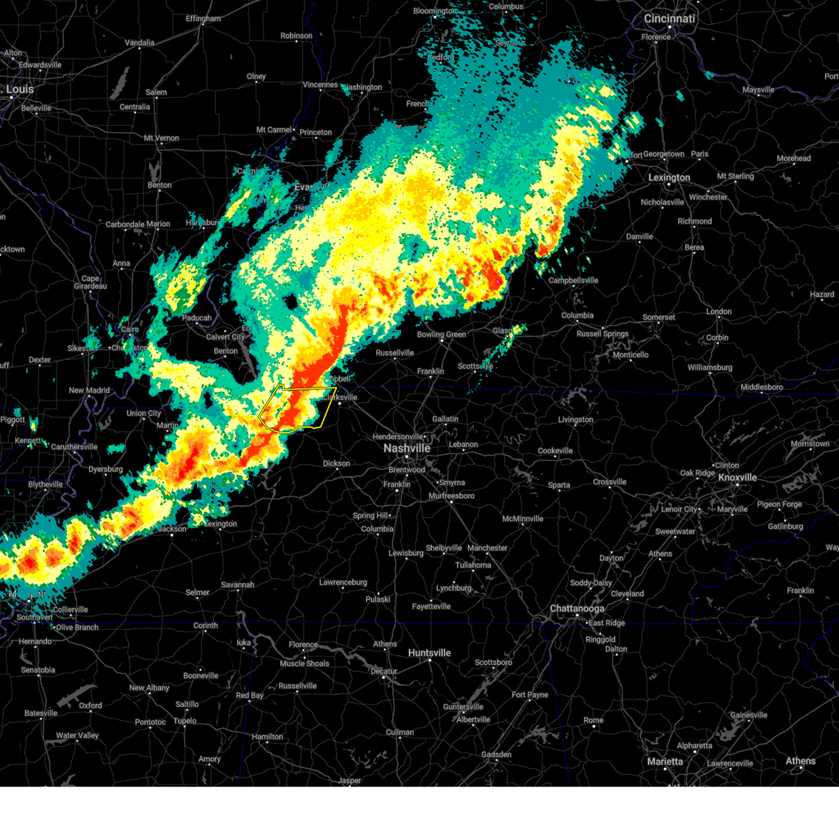 At 920 pm cdt, severe thunderstorms were located along a line extending from 8 miles east of big rock to near tennessee ridge, moving east at 50 mph (radar indicated). Hazards include 70 mph wind gusts and penny size hail. Expect considerable tree damage. damage is likely to mobile homes, roofs, and outbuildings. Locations impacted include, cumberland city, land between the lakes, indian mound, dover, big rock, woodlawn, and clarksville. At 920 pm cdt, severe thunderstorms were located along a line extending from 8 miles east of big rock to near tennessee ridge, moving east at 50 mph (radar indicated). Hazards include 70 mph wind gusts and penny size hail. Expect considerable tree damage. damage is likely to mobile homes, roofs, and outbuildings. Locations impacted include, cumberland city, land between the lakes, indian mound, dover, big rock, woodlawn, and clarksville.
|
| 3/30/2025 9:15 PM CDT |
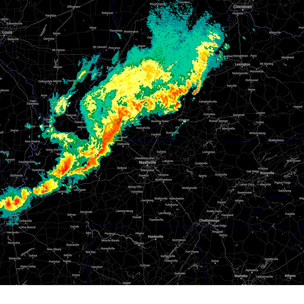 At 915 pm cdt, severe thunderstorms were located along a line extending from near cobb to 7 miles west of hopkinsville to 11 miles northeast of big rock, moving east at 55 mph (radar indicated). Hazards include 60 mph wind gusts and nickel size hail. Expect damage to roofs, siding, and trees. locations impacted include, oak grove, fort campbell, lafayette, hopkinsville, herndon, and cadiz. this includes the following highways, interstate 24 in kentucky between mile markers 64 and 89. Pennyrile parkway between mile markers 1 and 17. At 915 pm cdt, severe thunderstorms were located along a line extending from near cobb to 7 miles west of hopkinsville to 11 miles northeast of big rock, moving east at 55 mph (radar indicated). Hazards include 60 mph wind gusts and nickel size hail. Expect damage to roofs, siding, and trees. locations impacted include, oak grove, fort campbell, lafayette, hopkinsville, herndon, and cadiz. this includes the following highways, interstate 24 in kentucky between mile markers 64 and 89. Pennyrile parkway between mile markers 1 and 17.
|
| 3/30/2025 9:14 PM CDT |
 Svrpah the national weather service in paducah has issued a * severe thunderstorm warning for, southeastern christian county in south central kentucky, todd county in south central kentucky, * until 1000 pm cdt. * at 913 pm cdt, severe thunderstorms were located along a line extending from near crofton to near hopkinsville to near big rock, moving east at 60 mph (radar indicated). Hazards include 60 mph wind gusts and penny size hail. expect damage to roofs, siding, and trees Svrpah the national weather service in paducah has issued a * severe thunderstorm warning for, southeastern christian county in south central kentucky, todd county in south central kentucky, * until 1000 pm cdt. * at 913 pm cdt, severe thunderstorms were located along a line extending from near crofton to near hopkinsville to near big rock, moving east at 60 mph (radar indicated). Hazards include 60 mph wind gusts and penny size hail. expect damage to roofs, siding, and trees
|
| 3/30/2025 9:03 PM CDT |
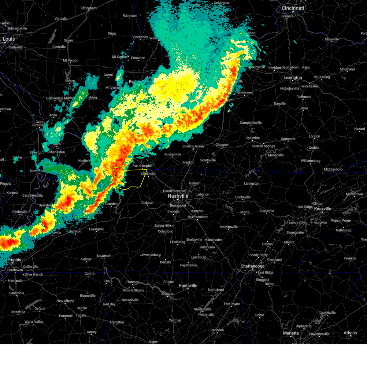 At 902 pm cdt, severe thunderstorms were located along a line extending from 8 miles southeast of wranglers campground to 6 miles southeast of paris landing state park, moving east at 50 mph (radar indicated). Hazards include 70 mph wind gusts and penny size hail. Expect considerable tree damage. damage is likely to mobile homes, roofs, and outbuildings. Locations impacted include, cumberland city, land between the lakes, indian mound, dover, big rock, woodlawn, and clarksville. At 902 pm cdt, severe thunderstorms were located along a line extending from 8 miles southeast of wranglers campground to 6 miles southeast of paris landing state park, moving east at 50 mph (radar indicated). Hazards include 70 mph wind gusts and penny size hail. Expect considerable tree damage. damage is likely to mobile homes, roofs, and outbuildings. Locations impacted include, cumberland city, land between the lakes, indian mound, dover, big rock, woodlawn, and clarksville.
|
| 3/30/2025 9:03 PM CDT |
 At 903 pm cdt, severe thunderstorms were located along a line extending from near cobb to cadiz to 9 miles east of wranglers campground, moving east at 55 mph (radar indicated). Hazards include 70 mph wind gusts and quarter size hail. Hail damage to vehicles is expected. expect considerable tree damage. wind damage is also likely to mobile homes, roofs, and outbuildings. locations impacted include, fort campbell, rockcastle, lafayette, hopkinsville, oak grove, linton, cadiz, canton, herndon, wranglers campground, and land between the lakes area. this includes the following highways, interstate 24 in kentucky between mile markers 59 and 89. Pennyrile parkway between mile markers 1 and 17. At 903 pm cdt, severe thunderstorms were located along a line extending from near cobb to cadiz to 9 miles east of wranglers campground, moving east at 55 mph (radar indicated). Hazards include 70 mph wind gusts and quarter size hail. Hail damage to vehicles is expected. expect considerable tree damage. wind damage is also likely to mobile homes, roofs, and outbuildings. locations impacted include, fort campbell, rockcastle, lafayette, hopkinsville, oak grove, linton, cadiz, canton, herndon, wranglers campground, and land between the lakes area. this includes the following highways, interstate 24 in kentucky between mile markers 59 and 89. Pennyrile parkway between mile markers 1 and 17.
|
| 3/30/2025 9:03 PM CDT |
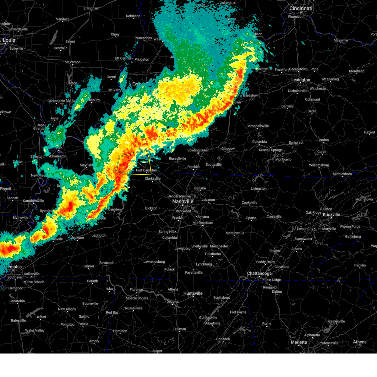 the severe thunderstorm warning has been cancelled and is no longer in effect the severe thunderstorm warning has been cancelled and is no longer in effect
|
| 3/30/2025 8:42 PM CDT |
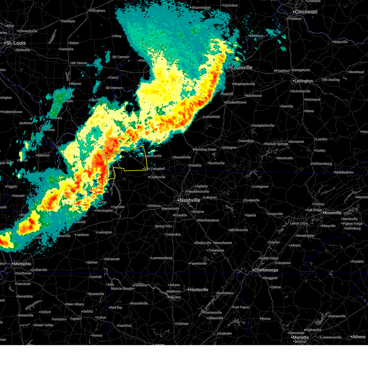 Svrpah the national weather service in paducah has issued a * severe thunderstorm warning for, eastern calloway county in western kentucky, southwestern christian county in south central kentucky, southeastern marshall county in western kentucky, trigg county in western kentucky, south central lyon county in western kentucky, * until 930 pm cdt. * at 841 pm cdt, severe thunderstorms were located along a line extending from near birmingham ferry recreation area to near turkey bay to 7 miles east of murray, moving east at 55 mph (radar indicated). Hazards include 70 mph wind gusts and quarter size hail. Hail damage to vehicles is expected. expect considerable tree damage. Wind damage is also likely to mobile homes, roofs, and outbuildings. Svrpah the national weather service in paducah has issued a * severe thunderstorm warning for, eastern calloway county in western kentucky, southwestern christian county in south central kentucky, southeastern marshall county in western kentucky, trigg county in western kentucky, south central lyon county in western kentucky, * until 930 pm cdt. * at 841 pm cdt, severe thunderstorms were located along a line extending from near birmingham ferry recreation area to near turkey bay to 7 miles east of murray, moving east at 55 mph (radar indicated). Hazards include 70 mph wind gusts and quarter size hail. Hail damage to vehicles is expected. expect considerable tree damage. Wind damage is also likely to mobile homes, roofs, and outbuildings.
|
| 3/30/2025 8:40 PM CDT |
 Svrohx the national weather service in nashville has issued a * severe thunderstorm warning for, western montgomery county in middle tennessee, stewart county in middle tennessee, * until 945 pm cdt. * at 840 pm cdt, severe thunderstorms were located along a line extending from near birmingham ferry recreation area to 8 miles southwest of turkey bay to 8 miles north of paris, moving east at 50 mph (radar indicated). Hazards include 60 mph wind gusts and penny size hail. expect damage to roofs, siding, and trees Svrohx the national weather service in nashville has issued a * severe thunderstorm warning for, western montgomery county in middle tennessee, stewart county in middle tennessee, * until 945 pm cdt. * at 840 pm cdt, severe thunderstorms were located along a line extending from near birmingham ferry recreation area to 8 miles southwest of turkey bay to 8 miles north of paris, moving east at 50 mph (radar indicated). Hazards include 60 mph wind gusts and penny size hail. expect damage to roofs, siding, and trees
|
| 3/19/2025 8:43 PM CDT |
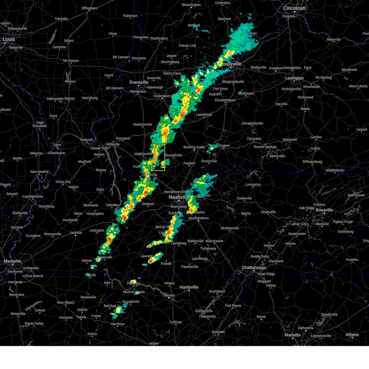 Svrpah the national weather service in paducah has issued a * severe thunderstorm warning for, todd county in south central kentucky, * until 930 pm cdt. * at 843 pm cdt, severe thunderstorms were located along a line extending from 7 miles southeast of weir to near pembroke to near clarksville, moving east at 50 mph (radar indicated). Hazards include 60 mph wind gusts. expect damage to roofs, siding, and trees Svrpah the national weather service in paducah has issued a * severe thunderstorm warning for, todd county in south central kentucky, * until 930 pm cdt. * at 843 pm cdt, severe thunderstorms were located along a line extending from 7 miles southeast of weir to near pembroke to near clarksville, moving east at 50 mph (radar indicated). Hazards include 60 mph wind gusts. expect damage to roofs, siding, and trees
|
| 3/19/2025 8:40 PM CDT | Large tree blown down and blocking kingsbury r in montgomery county TN, 3.7 miles N of Clarksville, TN |
| 2/15/2025 9:20 PM CST |
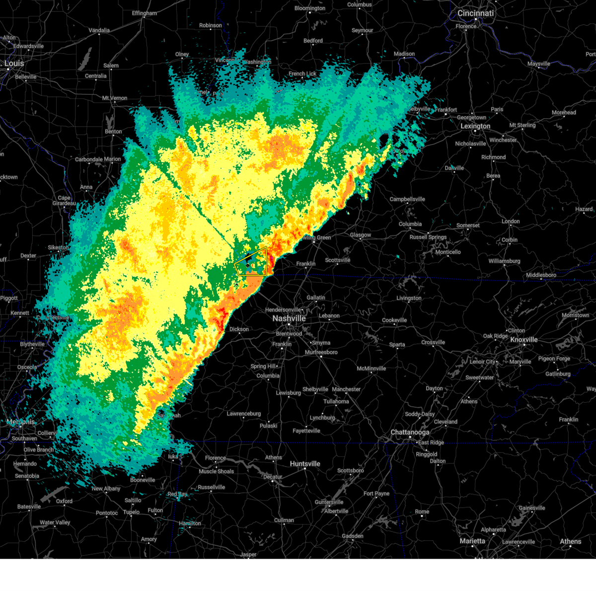 The storm which prompted the warning has moved out of the area. therefore, the warning will be allowed to expire. a tornado watch remains in effect until 100 am cst for south central kentucky. The storm which prompted the warning has moved out of the area. therefore, the warning will be allowed to expire. a tornado watch remains in effect until 100 am cst for south central kentucky.
|
| 2/15/2025 9:13 PM CST |
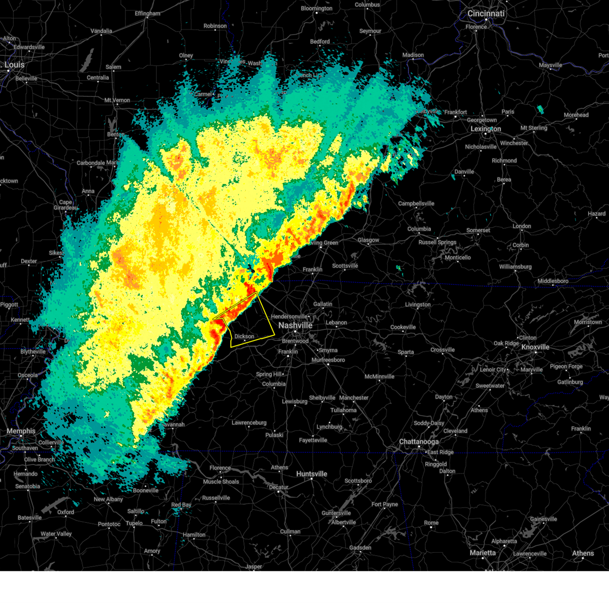 Svrohx the national weather service in nashville has issued a * severe thunderstorm warning for, dickson county in middle tennessee, southern montgomery county in middle tennessee, eastern houston county in middle tennessee, western cheatham county in middle tennessee, * until 1000 pm cst. * at 913 pm cst, a severe thunderstorm was located 7 miles north of mcewen, or 7 miles southeast of erin, moving northeast at 60 mph (radar indicated). Hazards include 60 mph wind gusts and quarter size hail. Hail damage to vehicles is expected. Expect wind damage to roofs, siding, and trees. Svrohx the national weather service in nashville has issued a * severe thunderstorm warning for, dickson county in middle tennessee, southern montgomery county in middle tennessee, eastern houston county in middle tennessee, western cheatham county in middle tennessee, * until 1000 pm cst. * at 913 pm cst, a severe thunderstorm was located 7 miles north of mcewen, or 7 miles southeast of erin, moving northeast at 60 mph (radar indicated). Hazards include 60 mph wind gusts and quarter size hail. Hail damage to vehicles is expected. Expect wind damage to roofs, siding, and trees.
|
| 2/15/2025 9:03 PM CST |
 At 903 pm cst, a severe thunderstorm was located near guthrie, or 7 miles southwest of elkton, moving northeast at 60 mph (radar indicated). Hazards include 60 mph wind gusts and quarter size hail. Hail damage to vehicles is expected. expect wind damage to roofs, siding, and trees. locations impacted include, clarksville. This includes interstate 24 between mile markers 1 and 8. At 903 pm cst, a severe thunderstorm was located near guthrie, or 7 miles southwest of elkton, moving northeast at 60 mph (radar indicated). Hazards include 60 mph wind gusts and quarter size hail. Hail damage to vehicles is expected. expect wind damage to roofs, siding, and trees. locations impacted include, clarksville. This includes interstate 24 between mile markers 1 and 8.
|
| 2/15/2025 8:57 PM CST |
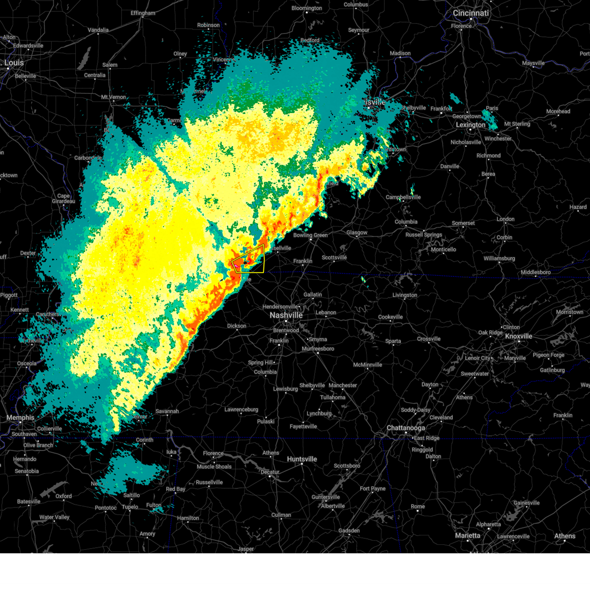 Svrpah the national weather service in paducah has issued a * severe thunderstorm warning for, southeastern christian county in south central kentucky, southern todd county in south central kentucky, * until 930 pm cst. * at 857 pm cst, a severe thunderstorm was located near oak grove, moving northeast at 65 mph (radar indicated). Hazards include 60 mph wind gusts and quarter size hail. Hail damage to vehicles is expected. Expect wind damage to roofs, siding, and trees. Svrpah the national weather service in paducah has issued a * severe thunderstorm warning for, southeastern christian county in south central kentucky, southern todd county in south central kentucky, * until 930 pm cst. * at 857 pm cst, a severe thunderstorm was located near oak grove, moving northeast at 65 mph (radar indicated). Hazards include 60 mph wind gusts and quarter size hail. Hail damage to vehicles is expected. Expect wind damage to roofs, siding, and trees.
|
| 2/15/2025 8:52 PM CST |
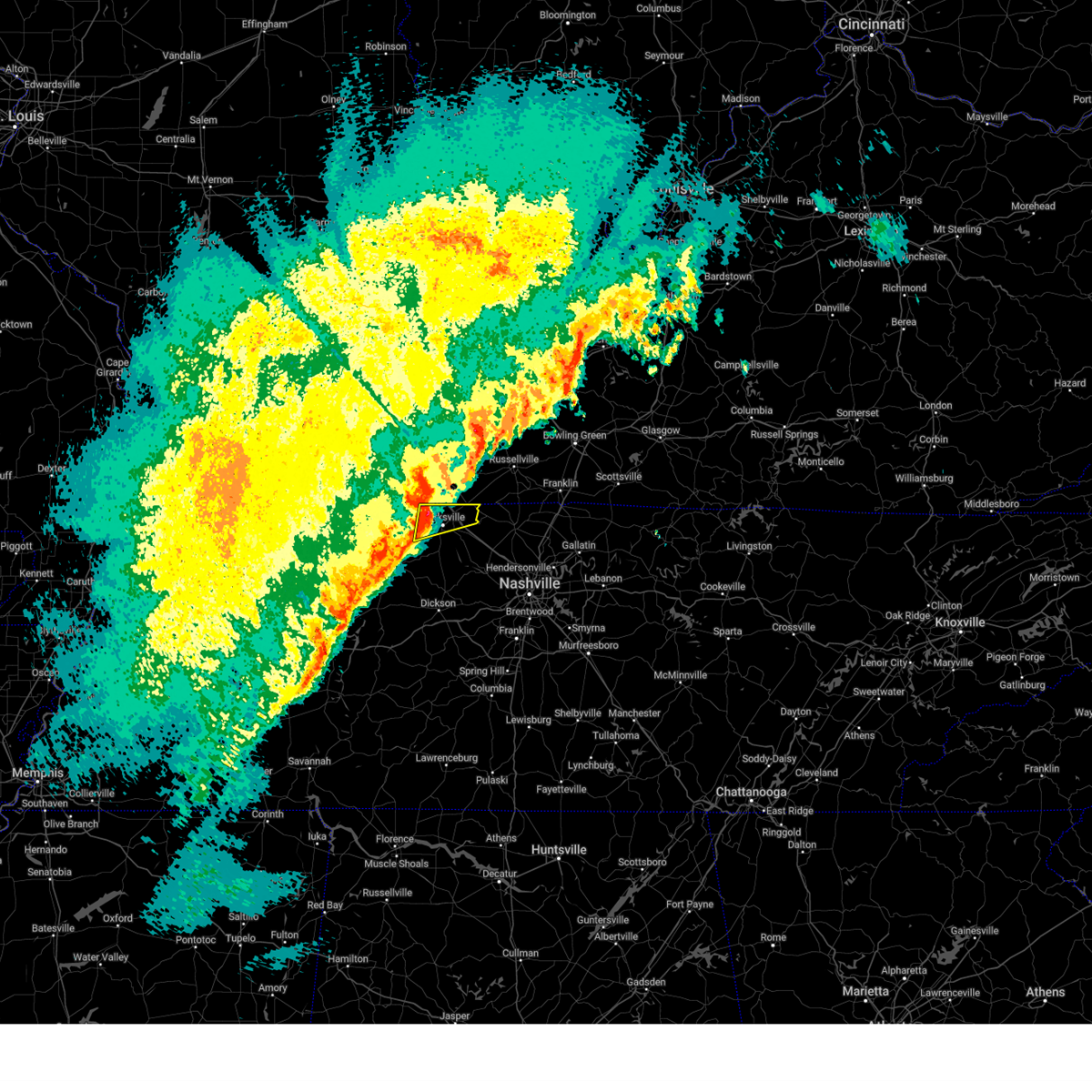 At 852 pm cst, a severe thunderstorm was located near oak grove, moving northeast at 60 mph (radar indicated). Hazards include 60 mph wind gusts and quarter size hail. Hail damage to vehicles is expected. expect wind damage to roofs, siding, and trees. locations impacted include, clarksville and woodlawn. This includes interstate 24 between mile markers 1 and 10. At 852 pm cst, a severe thunderstorm was located near oak grove, moving northeast at 60 mph (radar indicated). Hazards include 60 mph wind gusts and quarter size hail. Hail damage to vehicles is expected. expect wind damage to roofs, siding, and trees. locations impacted include, clarksville and woodlawn. This includes interstate 24 between mile markers 1 and 10.
|
| 2/15/2025 8:49 PM CST |
 At 849 pm cst, a severe thunderstorm was located over oak grove, moving northeast at 65 mph (radar indicated). Hazards include 60 mph wind gusts and penny size hail. Expect damage to roofs, siding, and trees. locations impacted include, hopkinsville, oak grove, elkton, fort campbell, clarksville, guthrie, pembroke, trenton, allensville, and allegre. this includes the following highways, interstate 24 in kentucky between mile markers 83 and 92. Pennyrile parkway near mile marker 8. At 849 pm cst, a severe thunderstorm was located over oak grove, moving northeast at 65 mph (radar indicated). Hazards include 60 mph wind gusts and penny size hail. Expect damage to roofs, siding, and trees. locations impacted include, hopkinsville, oak grove, elkton, fort campbell, clarksville, guthrie, pembroke, trenton, allensville, and allegre. this includes the following highways, interstate 24 in kentucky between mile markers 83 and 92. Pennyrile parkway near mile marker 8.
|
| 2/15/2025 8:34 PM CST |
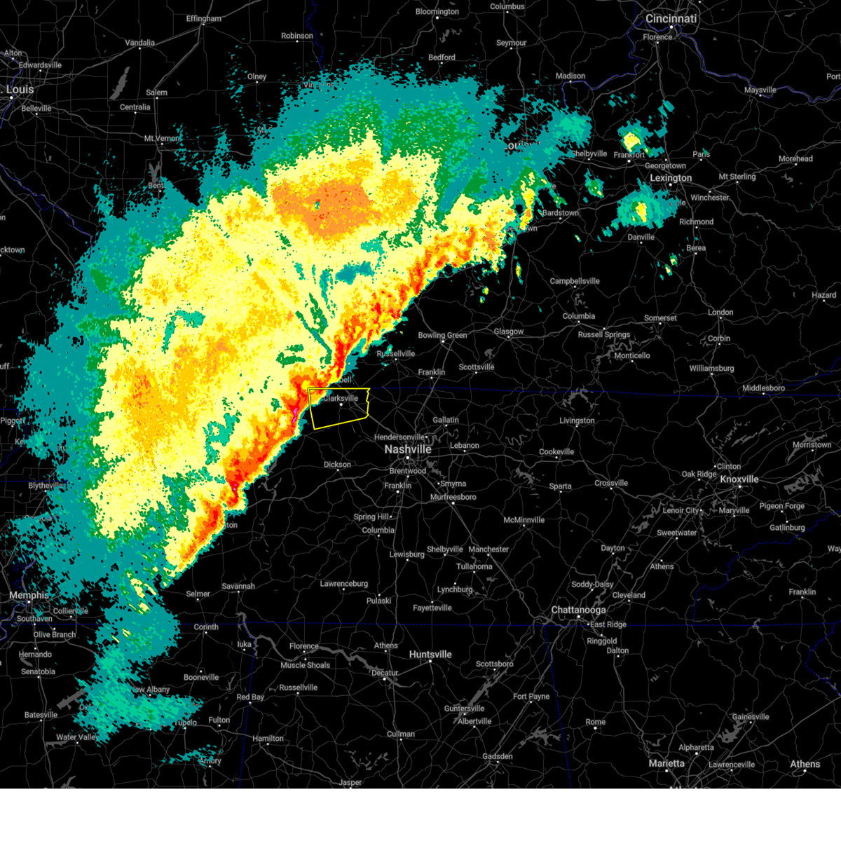 Svrohx the national weather service in nashville has issued a * severe thunderstorm warning for, montgomery county in middle tennessee, * until 915 pm cst. * at 833 pm cst, a severe thunderstorm was located 8 miles southeast of big rock, or 9 miles east of dover, moving northeast at 60 mph (radar indicated). Hazards include 60 mph wind gusts and quarter size hail. Hail damage to vehicles is expected. Expect wind damage to roofs, siding, and trees. Svrohx the national weather service in nashville has issued a * severe thunderstorm warning for, montgomery county in middle tennessee, * until 915 pm cst. * at 833 pm cst, a severe thunderstorm was located 8 miles southeast of big rock, or 9 miles east of dover, moving northeast at 60 mph (radar indicated). Hazards include 60 mph wind gusts and quarter size hail. Hail damage to vehicles is expected. Expect wind damage to roofs, siding, and trees.
|
| 2/15/2025 8:24 PM CST |
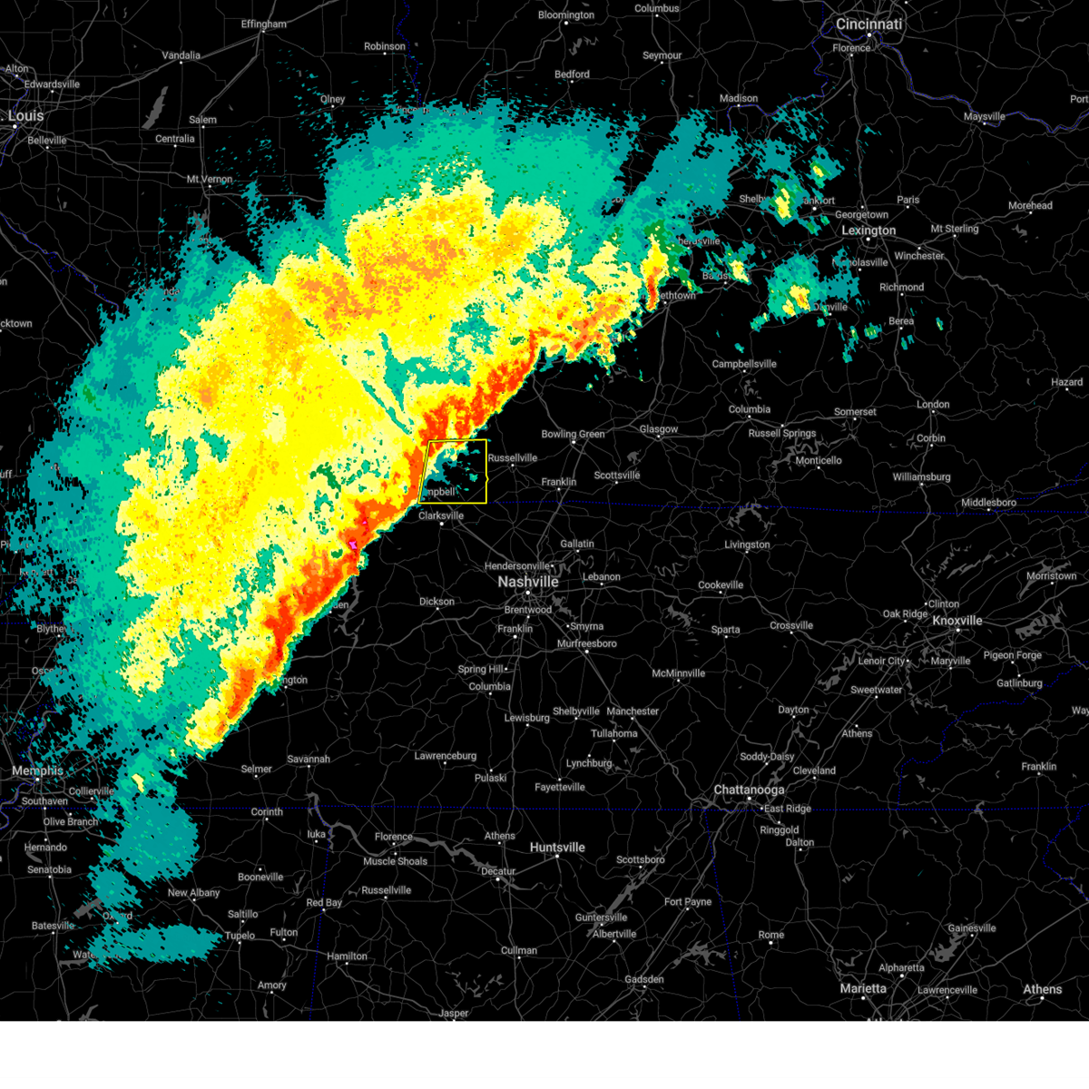 Svrpah the national weather service in paducah has issued a * severe thunderstorm warning for, southeastern christian county in south central kentucky, todd county in south central kentucky, * until 900 pm cst. * at 824 pm cst, severe thunderstorms were located along a line extending from near hopkinsville to fort campbell, moving east at 60 mph (radar indicated). Hazards include 60 mph wind gusts and penny size hail. expect damage to roofs, siding, and trees Svrpah the national weather service in paducah has issued a * severe thunderstorm warning for, southeastern christian county in south central kentucky, todd county in south central kentucky, * until 900 pm cst. * at 824 pm cst, severe thunderstorms were located along a line extending from near hopkinsville to fort campbell, moving east at 60 mph (radar indicated). Hazards include 60 mph wind gusts and penny size hail. expect damage to roofs, siding, and trees
|
| 2/15/2025 8:08 PM CST |
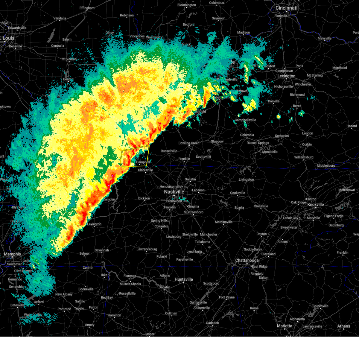 At 808 pm cst, severe thunderstorms were located along a line extending from 7 miles west of hopkinsville to 9 miles northeast of big rock, moving east at 50 mph (radar indicated). Hazards include 60 mph wind gusts and quarter size hail. Hail damage to vehicles is expected. expect wind damage to roofs, siding, and trees. locations impacted include, hopkinsville, oak grove, cadiz, fort campbell, clarksville, pembroke, lafayette, and herndon. this includes the following highways, interstate 24 in kentucky between mile markers 64 and 92. Pennyrile parkway between mile markers 1 and 15. At 808 pm cst, severe thunderstorms were located along a line extending from 7 miles west of hopkinsville to 9 miles northeast of big rock, moving east at 50 mph (radar indicated). Hazards include 60 mph wind gusts and quarter size hail. Hail damage to vehicles is expected. expect wind damage to roofs, siding, and trees. locations impacted include, hopkinsville, oak grove, cadiz, fort campbell, clarksville, pembroke, lafayette, and herndon. this includes the following highways, interstate 24 in kentucky between mile markers 64 and 92. Pennyrile parkway between mile markers 1 and 15.
|
| 2/15/2025 7:42 PM CST |
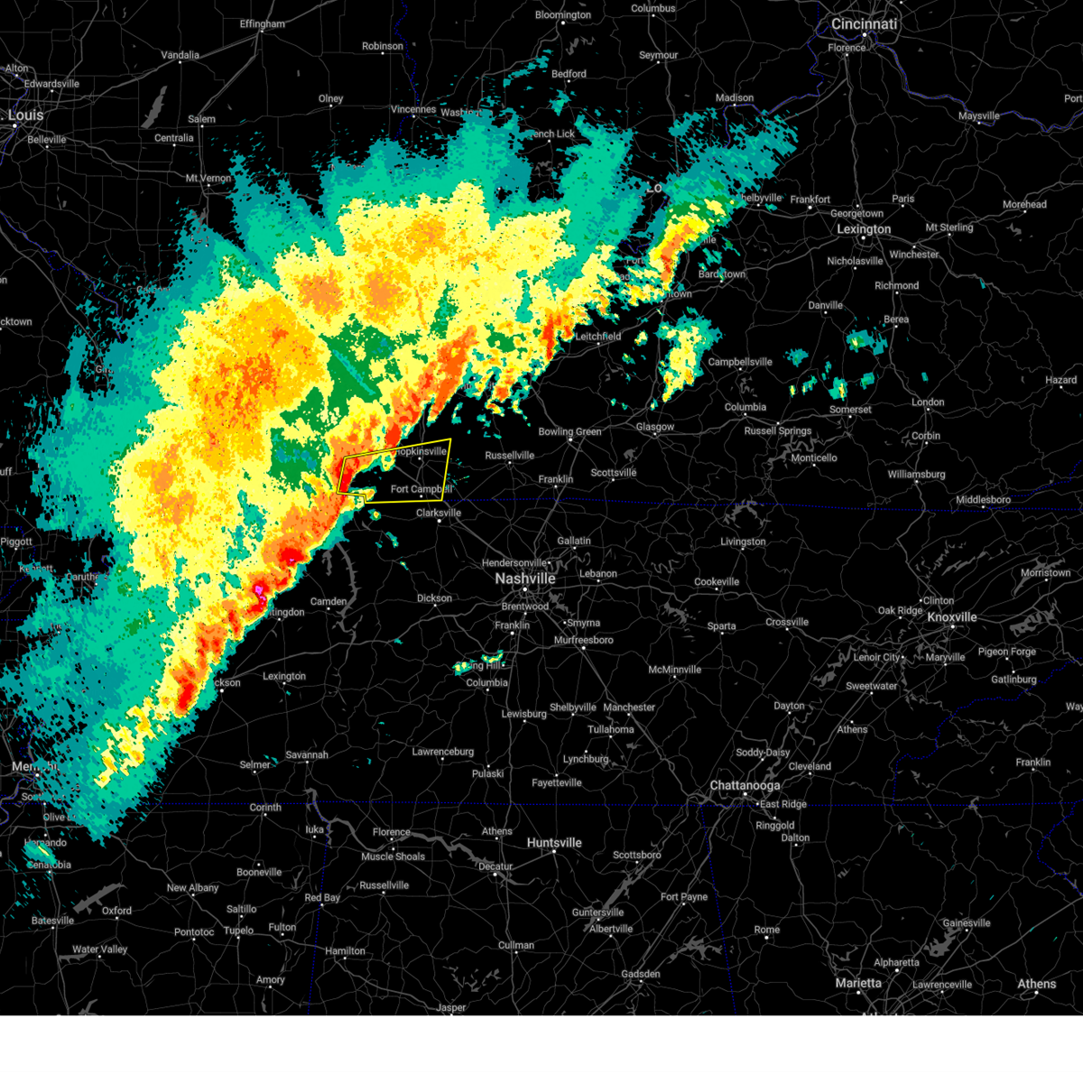 Svrpah the national weather service in paducah has issued a * severe thunderstorm warning for, southern christian county in south central kentucky, trigg county in western kentucky, * until 830 pm cst. * at 741 pm cst, severe thunderstorms were located along a line extending from canton to near wranglers campground, moving east at 55 mph (radar indicated). Hazards include 60 mph wind gusts and quarter size hail. Hail damage to vehicles is expected. Expect wind damage to roofs, siding, and trees. Svrpah the national weather service in paducah has issued a * severe thunderstorm warning for, southern christian county in south central kentucky, trigg county in western kentucky, * until 830 pm cst. * at 741 pm cst, severe thunderstorms were located along a line extending from canton to near wranglers campground, moving east at 55 mph (radar indicated). Hazards include 60 mph wind gusts and quarter size hail. Hail damage to vehicles is expected. Expect wind damage to roofs, siding, and trees.
|
| 2/6/2025 2:28 PM CST |
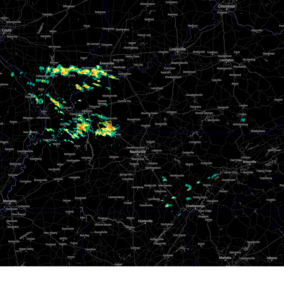 The storm which prompted the warning has moved out of the area. therefore, the warning will be allowed to expire. The storm which prompted the warning has moved out of the area. therefore, the warning will be allowed to expire.
|
| 2/6/2025 2:08 PM CST |
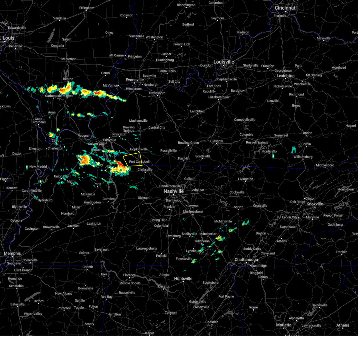 At 208 pm cst, a severe thunderstorm was located 8 miles west of fort campbell, moving east at 45 mph (radar indicated). Hazards include 60 mph wind gusts and quarter size hail. Hail damage to vehicles is expected. expect wind damage to roofs, siding, and trees. locations impacted include, hopkinsville, oak grove, fort campbell, lafayette, and herndon. this includes the following highways, interstate 24 in kentucky between mile markers 72 and 86. Pennyrile parkway between mile markers 1 and 7. At 208 pm cst, a severe thunderstorm was located 8 miles west of fort campbell, moving east at 45 mph (radar indicated). Hazards include 60 mph wind gusts and quarter size hail. Hail damage to vehicles is expected. expect wind damage to roofs, siding, and trees. locations impacted include, hopkinsville, oak grove, fort campbell, lafayette, and herndon. this includes the following highways, interstate 24 in kentucky between mile markers 72 and 86. Pennyrile parkway between mile markers 1 and 7.
|
| 2/6/2025 1:53 PM CST |
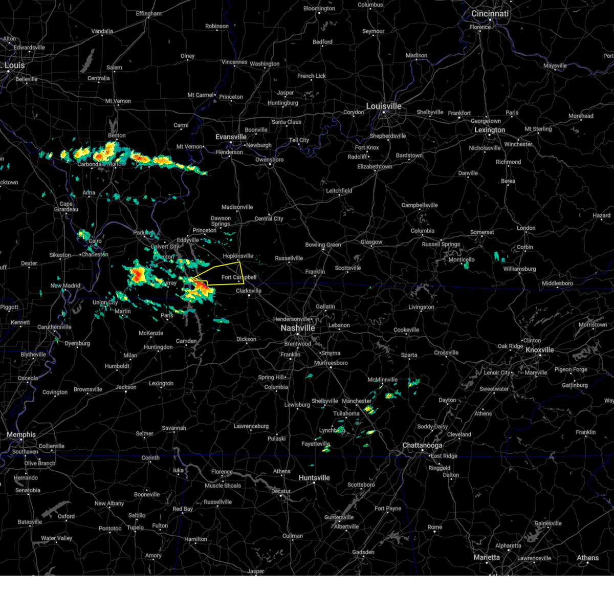 Svrpah the national weather service in paducah has issued a * severe thunderstorm warning for, southwestern christian county in south central kentucky, southeastern trigg county in western kentucky, * until 230 pm cst. * at 152 pm cst, a severe thunderstorm was located near big rock, or 11 miles north of dover, moving east at 45 mph (radar indicated). Hazards include 60 mph wind gusts and quarter size hail. Hail damage to vehicles is expected. Expect wind damage to roofs, siding, and trees. Svrpah the national weather service in paducah has issued a * severe thunderstorm warning for, southwestern christian county in south central kentucky, southeastern trigg county in western kentucky, * until 230 pm cst. * at 152 pm cst, a severe thunderstorm was located near big rock, or 11 miles north of dover, moving east at 45 mph (radar indicated). Hazards include 60 mph wind gusts and quarter size hail. Hail damage to vehicles is expected. Expect wind damage to roofs, siding, and trees.
|
| 8/17/2024 9:31 PM CDT | Facebook photos show roof damage to a building at the clarksville speedwa in montgomery county TN, 4.1 miles SSE of Clarksville, TN |
| 8/17/2024 9:30 PM CDT | Social media reports of several trees down and minor roof damage to homes in the i-24 exit 1 and tiny town road area in montgomery county TN, 5.3 miles S of Clarksville, TN |
| 8/1/2024 8:49 PM CDT |
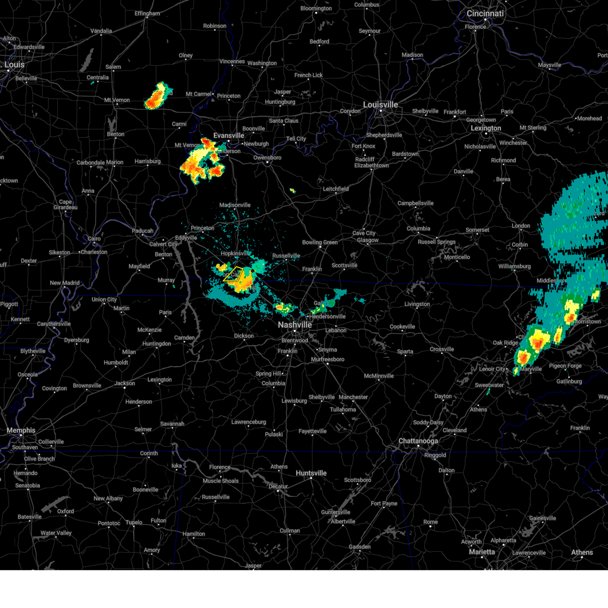 the severe thunderstorm warning has been cancelled and is no longer in effect the severe thunderstorm warning has been cancelled and is no longer in effect
|
| 8/1/2024 8:41 PM CDT |
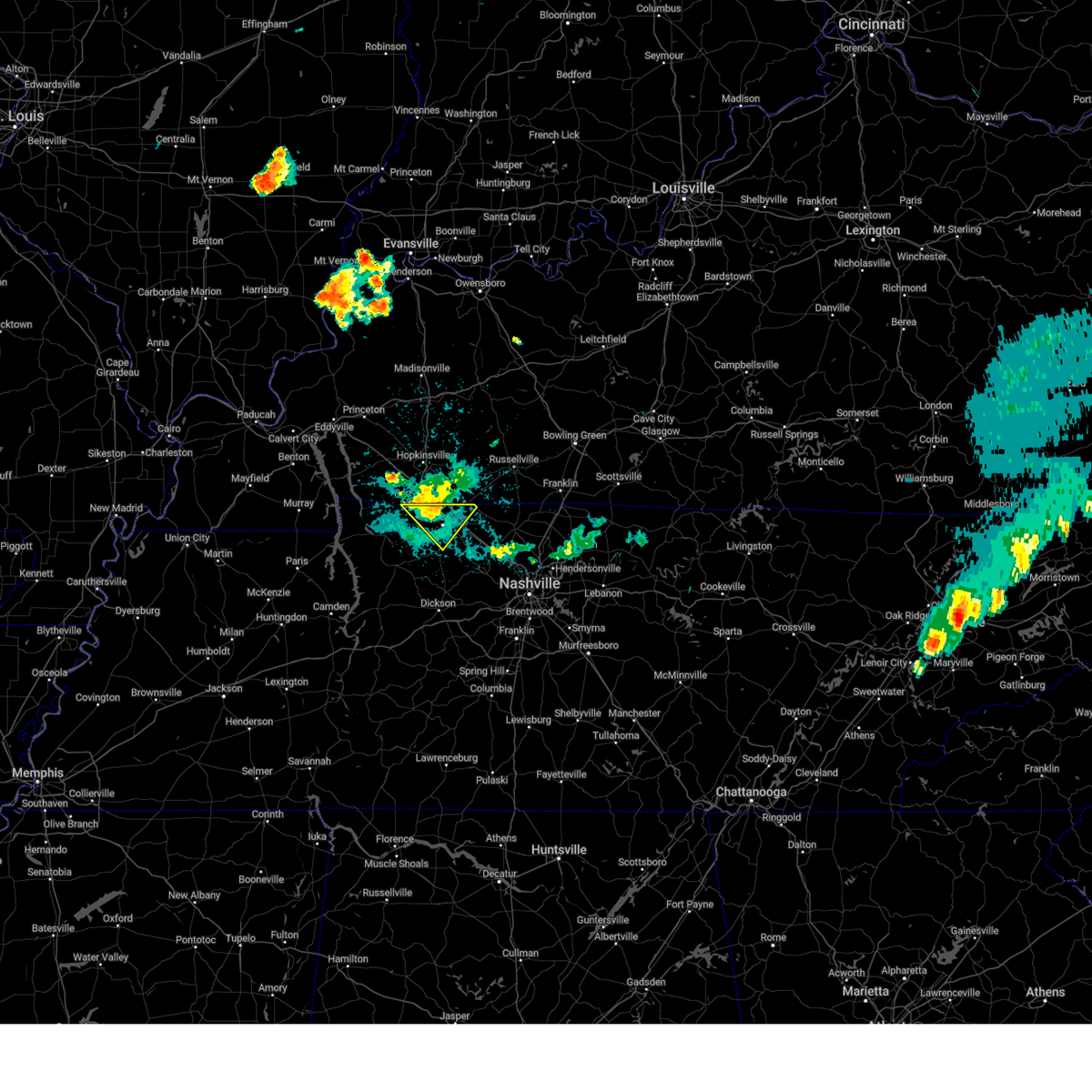 At 841 pm cdt, a severe thunderstorm was located over clarksville, moving southeast at 30 mph (radar indicated. this storm has produced measured wind gusts over 50 mph near fort campbell). Hazards include 60 mph wind gusts. Expect damage to roofs, siding, and trees. locations impacted include, clarksville and woodlawn. This includes interstate 24 between mile markers 1 and 10. At 841 pm cdt, a severe thunderstorm was located over clarksville, moving southeast at 30 mph (radar indicated. this storm has produced measured wind gusts over 50 mph near fort campbell). Hazards include 60 mph wind gusts. Expect damage to roofs, siding, and trees. locations impacted include, clarksville and woodlawn. This includes interstate 24 between mile markers 1 and 10.
|
| 8/1/2024 8:34 PM CDT |
 the severe thunderstorm warning has been cancelled and is no longer in effect the severe thunderstorm warning has been cancelled and is no longer in effect
|
| 8/1/2024 8:34 PM CDT |
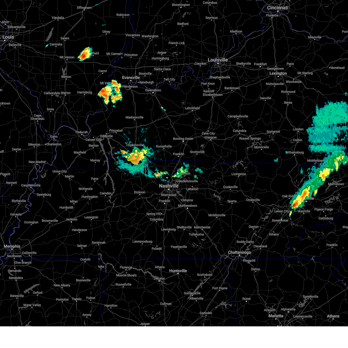 At 834 pm cdt, a severe thunderstorm was located near fort campbell, moving southeast at 20 mph (radar indicated). Hazards include 60 mph wind gusts. Expect damage to roofs, siding, and trees. locations impacted include, oak grove and fort campbell. this includes the following highways, interstate 24 in kentucky between mile markers 81 and 86. Pennyrile parkway near mile marker 1. At 834 pm cdt, a severe thunderstorm was located near fort campbell, moving southeast at 20 mph (radar indicated). Hazards include 60 mph wind gusts. Expect damage to roofs, siding, and trees. locations impacted include, oak grove and fort campbell. this includes the following highways, interstate 24 in kentucky between mile markers 81 and 86. Pennyrile parkway near mile marker 1.
|
| 8/1/2024 8:25 PM CDT |
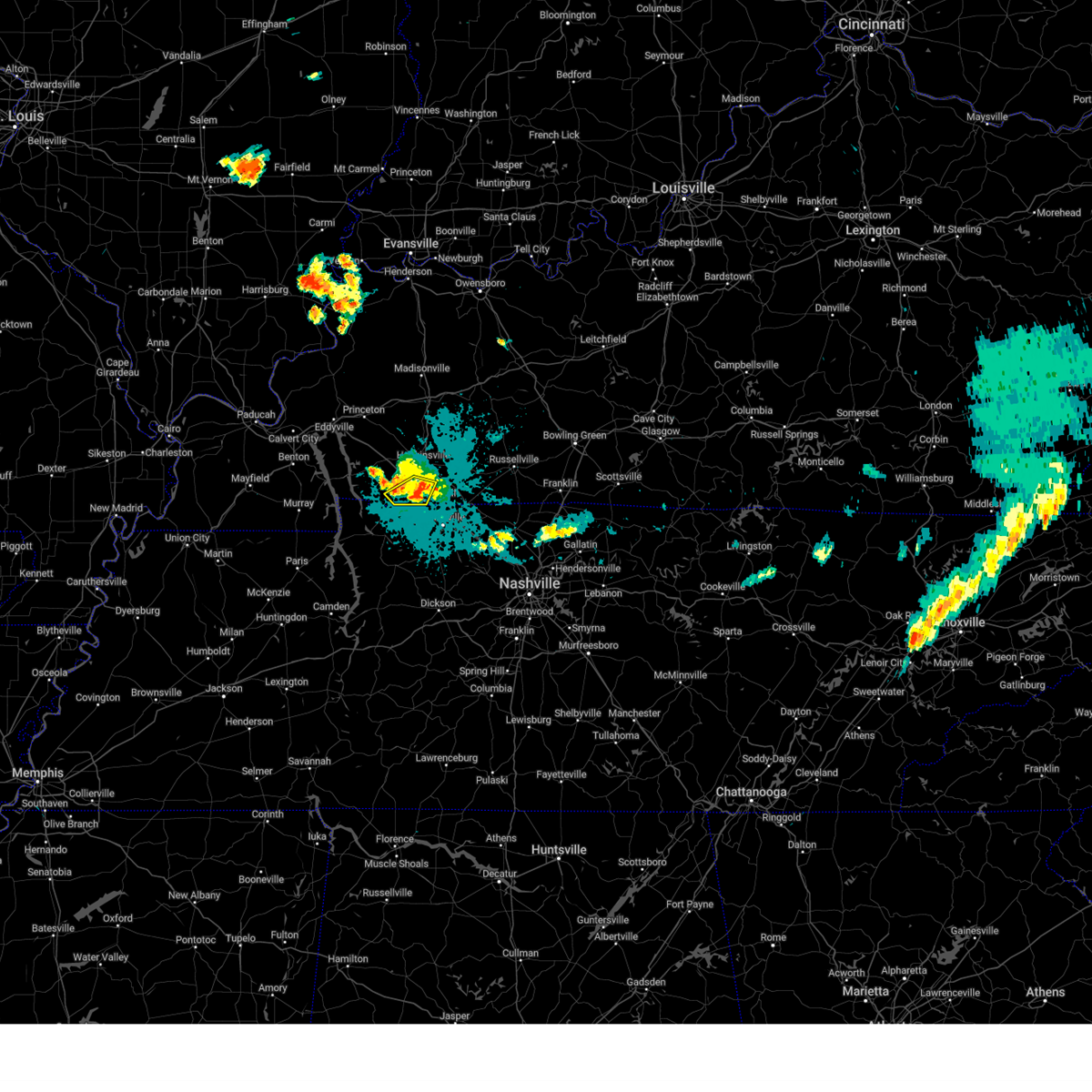 At 825 pm cdt, a severe thunderstorm was located 8 miles northwest of fort campbell, moving southeast at 20 mph (radar indicated). Hazards include 60 mph wind gusts. Expect damage to roofs, siding, and trees. locations impacted include, oak grove, fort campbell, lafayette, and herndon. this includes the following highways, interstate 24 in kentucky between mile markers 77 and 86. Pennyrile parkway between mile markers 1 and 2. At 825 pm cdt, a severe thunderstorm was located 8 miles northwest of fort campbell, moving southeast at 20 mph (radar indicated). Hazards include 60 mph wind gusts. Expect damage to roofs, siding, and trees. locations impacted include, oak grove, fort campbell, lafayette, and herndon. this includes the following highways, interstate 24 in kentucky between mile markers 77 and 86. Pennyrile parkway between mile markers 1 and 2.
|
| 8/1/2024 8:22 PM CDT |
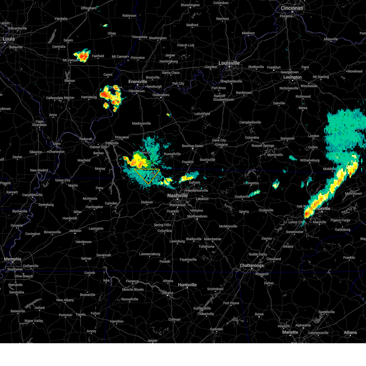 Svrohx the national weather service in nashville has issued a * severe thunderstorm warning for, northern montgomery county in middle tennessee, * until 900 pm cdt. * at 821 pm cdt, a severe thunderstorm was located over fort campbell, moving southeast at 30 mph (radar indicated). Hazards include 60 mph wind gusts. expect damage to roofs, siding, and trees Svrohx the national weather service in nashville has issued a * severe thunderstorm warning for, northern montgomery county in middle tennessee, * until 900 pm cdt. * at 821 pm cdt, a severe thunderstorm was located over fort campbell, moving southeast at 30 mph (radar indicated). Hazards include 60 mph wind gusts. expect damage to roofs, siding, and trees
|
| 8/1/2024 8:11 PM CDT |
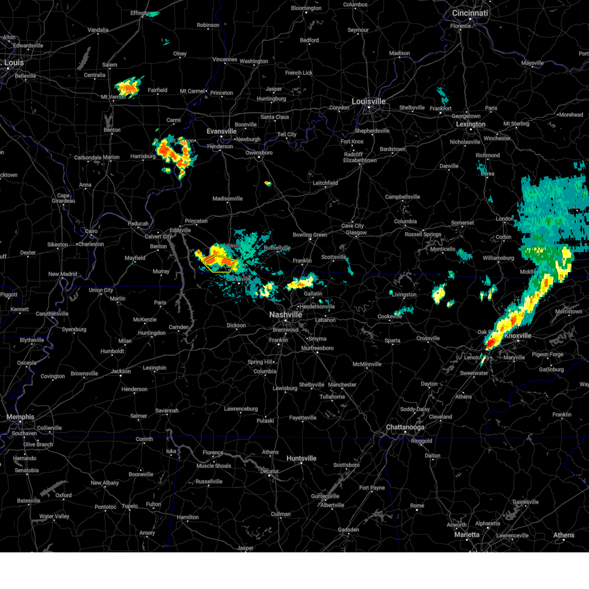 Svrpah the national weather service in paducah has issued a * severe thunderstorm warning for, southwestern christian county in south central kentucky, southeastern trigg county in western kentucky, * until 900 pm cdt. * at 811 pm cdt, a severe thunderstorm was located 10 miles southeast of cadiz, moving southeast at 20 mph (radar indicated). Hazards include 60 mph wind gusts. expect damage to roofs, siding, and trees Svrpah the national weather service in paducah has issued a * severe thunderstorm warning for, southwestern christian county in south central kentucky, southeastern trigg county in western kentucky, * until 900 pm cdt. * at 811 pm cdt, a severe thunderstorm was located 10 miles southeast of cadiz, moving southeast at 20 mph (radar indicated). Hazards include 60 mph wind gusts. expect damage to roofs, siding, and trees
|
| 7/30/2024 9:43 PM CDT |
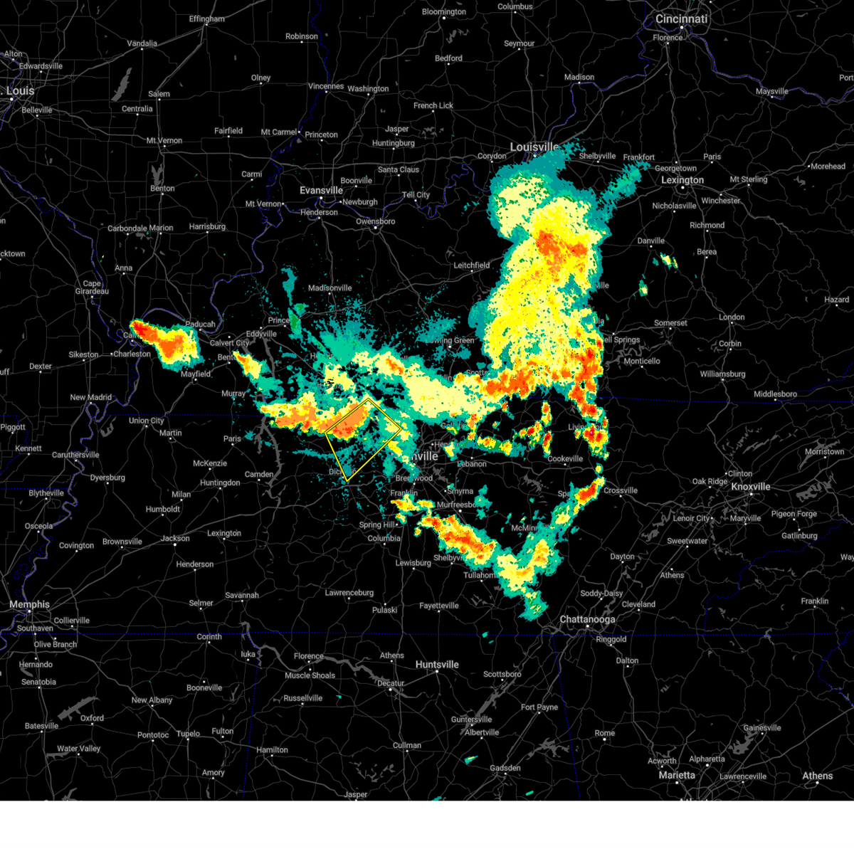 At 943 pm cdt, severe thunderstorms were located along a line extending from vanleer to adam s, moving southeast at 25 mph (radar indicated). Hazards include 70 mph wind gusts and penny size hail. Expect considerable tree damage. damage is likely to mobile homes, roofs, and outbuildings. locations impacted include, dickson, ashland city, clarksville, coopertown, burns, pleasant view, charlotte, vanleer, slayden, cheatham dam, and cunningham. This includes interstate 24 between mile markers 8 and 29. At 943 pm cdt, severe thunderstorms were located along a line extending from vanleer to adam s, moving southeast at 25 mph (radar indicated). Hazards include 70 mph wind gusts and penny size hail. Expect considerable tree damage. damage is likely to mobile homes, roofs, and outbuildings. locations impacted include, dickson, ashland city, clarksville, coopertown, burns, pleasant view, charlotte, vanleer, slayden, cheatham dam, and cunningham. This includes interstate 24 between mile markers 8 and 29.
|
| 7/30/2024 9:30 PM CDT |
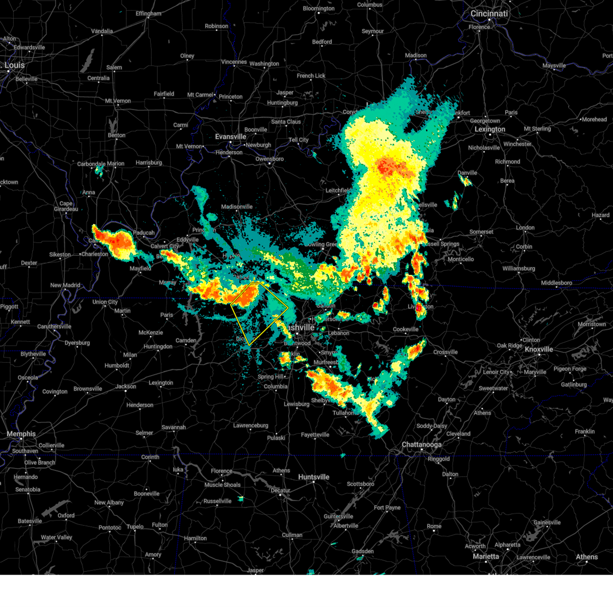 Svrohx the national weather service in nashville has issued a * severe thunderstorm warning for, northeastern dickson county in middle tennessee, montgomery county in middle tennessee, northern cheatham county in middle tennessee, southwestern robertson county in middle tennessee, * until 1000 pm cdt. * at 930 pm cdt, severe thunderstorms were located along a line extending from near guthrie to slayden, moving southeast at 25 mph (radar indicated). Hazards include 60 mph wind gusts and penny size hail. expect damage to roofs, siding, and trees Svrohx the national weather service in nashville has issued a * severe thunderstorm warning for, northeastern dickson county in middle tennessee, montgomery county in middle tennessee, northern cheatham county in middle tennessee, southwestern robertson county in middle tennessee, * until 1000 pm cdt. * at 930 pm cdt, severe thunderstorms were located along a line extending from near guthrie to slayden, moving southeast at 25 mph (radar indicated). Hazards include 60 mph wind gusts and penny size hail. expect damage to roofs, siding, and trees
|
| 7/30/2024 9:13 PM CDT |
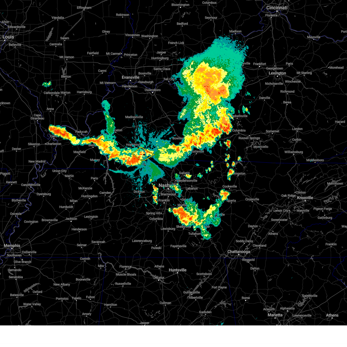 the severe thunderstorm warning has been cancelled and is no longer in effect the severe thunderstorm warning has been cancelled and is no longer in effect
|
| 7/30/2024 8:52 PM CDT |
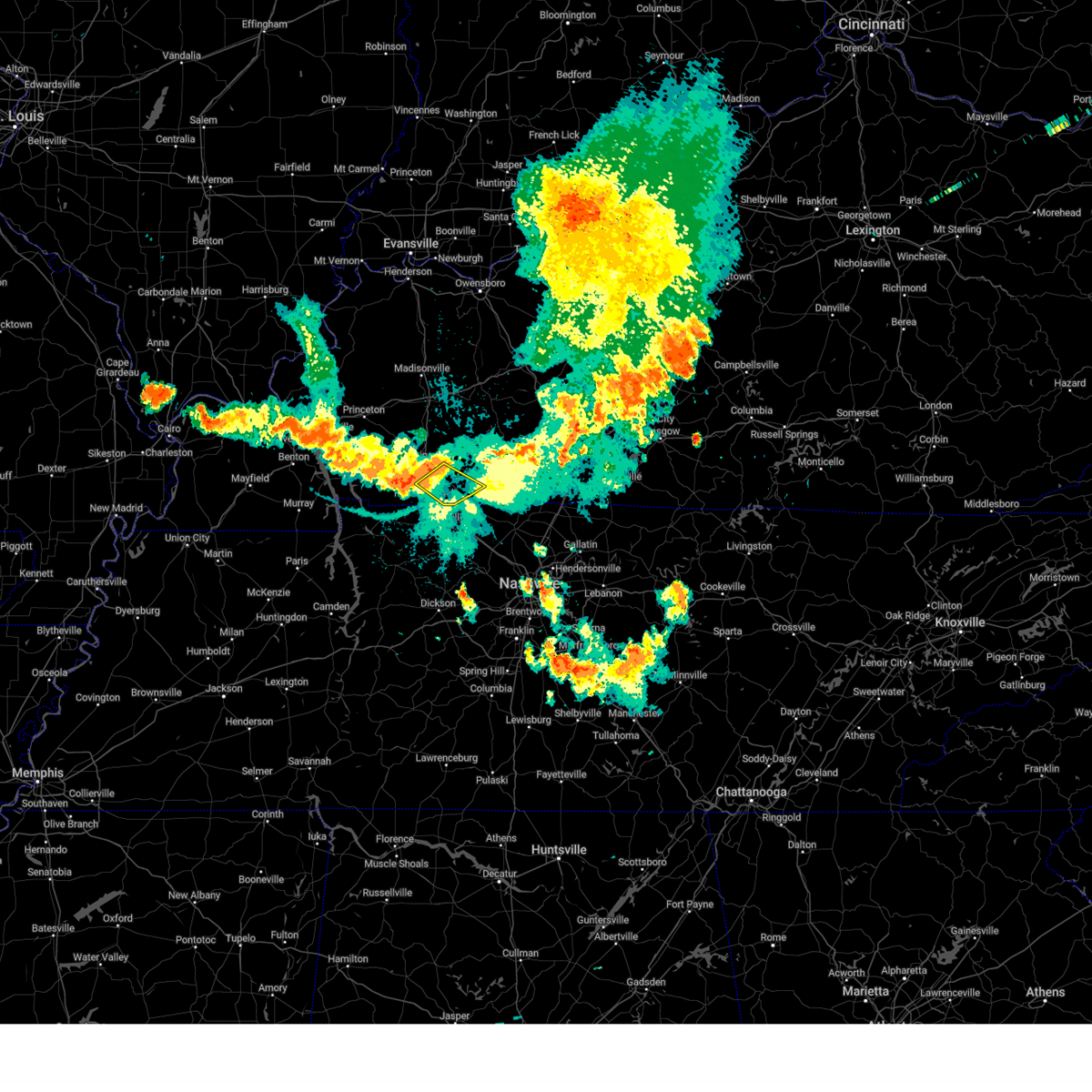 At 852 pm cdt, severe thunderstorms were located along a line extending from near pembroke to near fort campbell, moving southeast at 25 mph (public). Hazards include 60 mph wind gusts. Expect damage to roofs, siding, and trees. locations impacted include, oak grove, pembroke, and trenton. this includes the following highways, interstate 24 in kentucky between mile markers 80 and 83, and between mile markers 86 and 92. Pennyrile parkway between mile markers 1 and 2. At 852 pm cdt, severe thunderstorms were located along a line extending from near pembroke to near fort campbell, moving southeast at 25 mph (public). Hazards include 60 mph wind gusts. Expect damage to roofs, siding, and trees. locations impacted include, oak grove, pembroke, and trenton. this includes the following highways, interstate 24 in kentucky between mile markers 80 and 83, and between mile markers 86 and 92. Pennyrile parkway between mile markers 1 and 2.
|
| 7/30/2024 8:38 PM CDT |
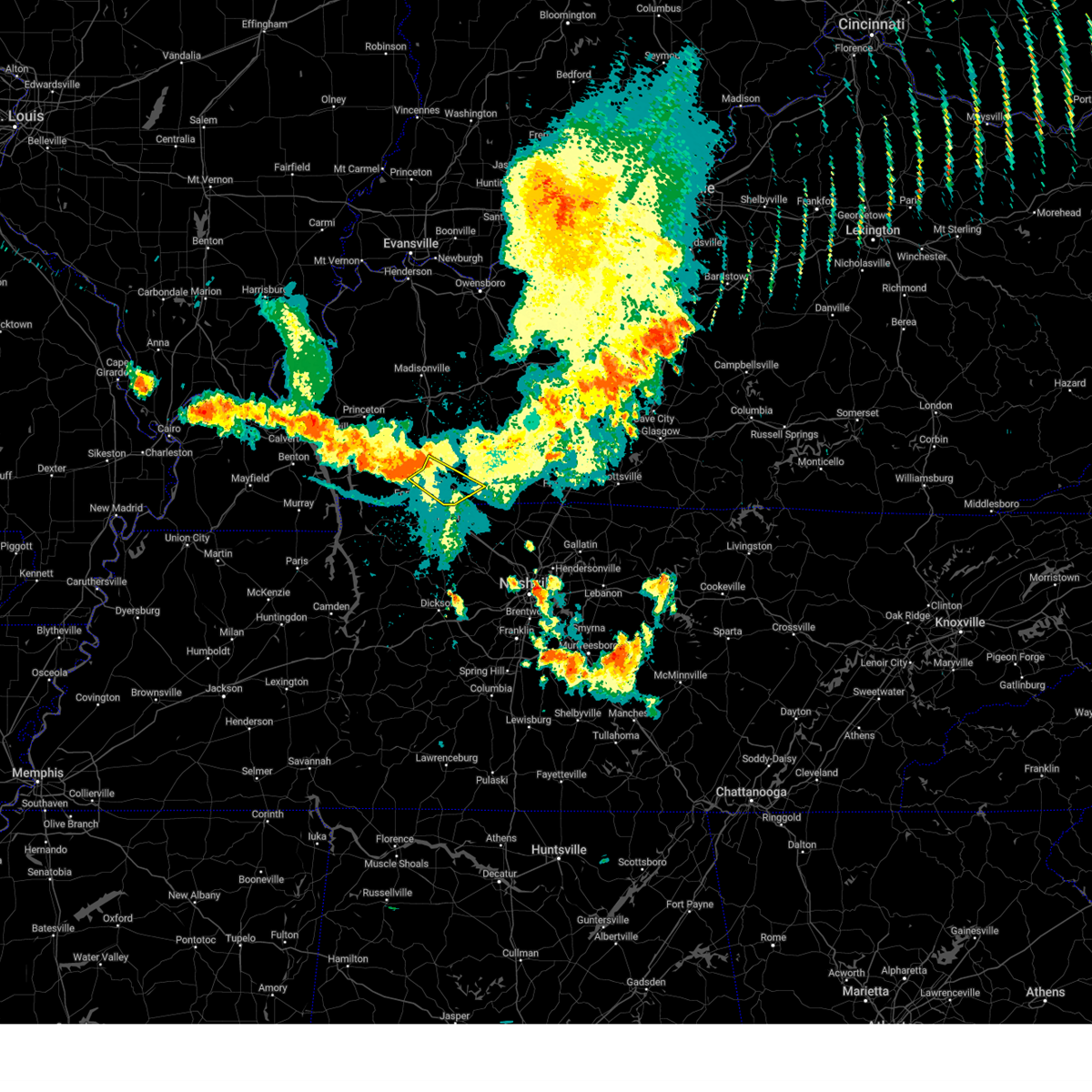 Svrpah the national weather service in paducah has issued a * severe thunderstorm warning for, southeastern christian county in south central kentucky, southern todd county in south central kentucky, * until 930 pm cdt. * at 838 pm cdt, severe thunderstorms were located along a line extending from near hopkinsville to 10 miles northwest of fort campbell, moving southeast at 25 mph (public). Hazards include 60 mph wind gusts. expect damage to roofs, siding, and trees Svrpah the national weather service in paducah has issued a * severe thunderstorm warning for, southeastern christian county in south central kentucky, southern todd county in south central kentucky, * until 930 pm cdt. * at 838 pm cdt, severe thunderstorms were located along a line extending from near hopkinsville to 10 miles northwest of fort campbell, moving southeast at 25 mph (public). Hazards include 60 mph wind gusts. expect damage to roofs, siding, and trees
|
| 7/9/2024 2:47 PM CDT |
 the tornado warning has been cancelled and is no longer in effect the tornado warning has been cancelled and is no longer in effect
|
| 7/9/2024 2:34 PM CDT |
 At 233 pm cdt, a severe thunderstorm capable of producing a tornado was located near guthrie, or 12 miles east of clarksville, moving north at 35 mph (radar indicated rotation). Hazards include tornado. Flying debris will be dangerous to those caught without shelter. mobile homes will be damaged or destroyed. damage to roofs, windows, and vehicles will occur. tree damage is likely. locations impacted include, clarksville and adams. This includes interstate 24 between mile markers 10 and 12. At 233 pm cdt, a severe thunderstorm capable of producing a tornado was located near guthrie, or 12 miles east of clarksville, moving north at 35 mph (radar indicated rotation). Hazards include tornado. Flying debris will be dangerous to those caught without shelter. mobile homes will be damaged or destroyed. damage to roofs, windows, and vehicles will occur. tree damage is likely. locations impacted include, clarksville and adams. This includes interstate 24 between mile markers 10 and 12.
|
| 7/9/2024 2:27 PM CDT |
 Torohx the national weather service in nashville has issued a * tornado warning for, northeastern montgomery county in middle tennessee, northwestern robertson county in middle tennessee, * until 300 pm cdt. * at 226 pm cdt, a severe thunderstorm capable of producing a tornado was located 8 miles south of guthrie, or 10 miles east of clarksville, moving northeast at 35 mph (radar indicated rotation). Hazards include tornado. Flying debris will be dangerous to those caught without shelter. mobile homes will be damaged or destroyed. damage to roofs, windows, and vehicles will occur. tree damage is likely. this tornadic thunderstorm will remain over mainly rural areas of northeastern montgomery and northwestern robertson counties, including the following locations, adams. This includes interstate 24 between mile markers 9 and 18. Torohx the national weather service in nashville has issued a * tornado warning for, northeastern montgomery county in middle tennessee, northwestern robertson county in middle tennessee, * until 300 pm cdt. * at 226 pm cdt, a severe thunderstorm capable of producing a tornado was located 8 miles south of guthrie, or 10 miles east of clarksville, moving northeast at 35 mph (radar indicated rotation). Hazards include tornado. Flying debris will be dangerous to those caught without shelter. mobile homes will be damaged or destroyed. damage to roofs, windows, and vehicles will occur. tree damage is likely. this tornadic thunderstorm will remain over mainly rural areas of northeastern montgomery and northwestern robertson counties, including the following locations, adams. This includes interstate 24 between mile markers 9 and 18.
|
| 7/4/2024 5:03 PM CDT |
 the severe thunderstorm warning has been cancelled and is no longer in effect the severe thunderstorm warning has been cancelled and is no longer in effect
|
| 7/4/2024 4:50 PM CDT |
 At 450 pm cdt, a severe thunderstorm was located near pembroke, or near oak grove, moving southeast at 35 mph (radar indicated). Hazards include 70 mph wind gusts. Expect considerable tree damage. damage is likely to mobile homes, roofs, and outbuildings. locations impacted include, oak grove, fort campbell, and pembroke. this includes the following highways, interstate 24 in kentucky between mile markers 84 and 88. Pennyrile parkway between mile markers 2 and 3. At 450 pm cdt, a severe thunderstorm was located near pembroke, or near oak grove, moving southeast at 35 mph (radar indicated). Hazards include 70 mph wind gusts. Expect considerable tree damage. damage is likely to mobile homes, roofs, and outbuildings. locations impacted include, oak grove, fort campbell, and pembroke. this includes the following highways, interstate 24 in kentucky between mile markers 84 and 88. Pennyrile parkway between mile markers 2 and 3.
|
| 7/4/2024 4:38 PM CDT |
 Svrpah the national weather service in paducah has issued a * severe thunderstorm warning for, southern christian county in south central kentucky, * until 515 pm cdt. * at 437 pm cdt, a severe thunderstorm was located near hopkinsville, moving southeast at 30 mph (radar indicated). Hazards include 60 mph wind gusts. expect damage to roofs, siding, and trees Svrpah the national weather service in paducah has issued a * severe thunderstorm warning for, southern christian county in south central kentucky, * until 515 pm cdt. * at 437 pm cdt, a severe thunderstorm was located near hopkinsville, moving southeast at 30 mph (radar indicated). Hazards include 60 mph wind gusts. expect damage to roofs, siding, and trees
|
| 6/26/2024 6:06 PM CDT |
 The storms which prompted the warning have weakened below severe limits, and no longer pose an immediate threat to life or property. therefore, the warning will be allowed to expire. The storms which prompted the warning have weakened below severe limits, and no longer pose an immediate threat to life or property. therefore, the warning will be allowed to expire.
|
| 6/26/2024 5:35 PM CDT |
 the severe thunderstorm warning has been cancelled and is no longer in effect the severe thunderstorm warning has been cancelled and is no longer in effect
|
| 6/26/2024 5:35 PM CDT |
 At 534 pm cdt, severe thunderstorms were located along a line extending from 12 miles east of cadiz to hopkinsville to pembroke, moving northeast at 35 mph (radar indicated). Hazards include 60 mph wind gusts. Expect damage to roofs, siding, and trees. locations impacted include, hopkinsville, oak grove, fort campbell, pembroke, and herndon. this includes the following highways, interstate 24 in kentucky between mile markers 71 and 92. Pennyrile parkway between mile markers 1 and 16. At 534 pm cdt, severe thunderstorms were located along a line extending from 12 miles east of cadiz to hopkinsville to pembroke, moving northeast at 35 mph (radar indicated). Hazards include 60 mph wind gusts. Expect damage to roofs, siding, and trees. locations impacted include, hopkinsville, oak grove, fort campbell, pembroke, and herndon. this includes the following highways, interstate 24 in kentucky between mile markers 71 and 92. Pennyrile parkway between mile markers 1 and 16.
|
| 6/26/2024 5:11 PM CDT |
 the severe thunderstorm warning has been cancelled and is no longer in effect the severe thunderstorm warning has been cancelled and is no longer in effect
|
| 6/26/2024 5:11 PM CDT |
 At 511 pm cdt, severe thunderstorms were located along a line extending from 10 miles north of big rock to 6 miles east of clarksville, moving northeast at 35 mph (radar indicated). Hazards include 60 mph wind gusts. Expect damage to roofs, siding, and trees. locations impacted include, clarksville and woodlawn. This includes interstate 24 between mile markers 1 and 12. At 511 pm cdt, severe thunderstorms were located along a line extending from 10 miles north of big rock to 6 miles east of clarksville, moving northeast at 35 mph (radar indicated). Hazards include 60 mph wind gusts. Expect damage to roofs, siding, and trees. locations impacted include, clarksville and woodlawn. This includes interstate 24 between mile markers 1 and 12.
|
| 6/26/2024 5:08 PM CDT |
 Svrpah the national weather service in paducah has issued a * severe thunderstorm warning for, christian county in south central kentucky, eastern trigg county in western kentucky, * until 615 pm cdt. * at 508 pm cdt, severe thunderstorms were located along a line extending from near wranglers campground to 10 miles north of big rock to near fort campbell, moving northeast at 35 mph (radar indicated). Hazards include 60 mph wind gusts and penny size hail. expect damage to roofs, siding, and trees Svrpah the national weather service in paducah has issued a * severe thunderstorm warning for, christian county in south central kentucky, eastern trigg county in western kentucky, * until 615 pm cdt. * at 508 pm cdt, severe thunderstorms were located along a line extending from near wranglers campground to 10 miles north of big rock to near fort campbell, moving northeast at 35 mph (radar indicated). Hazards include 60 mph wind gusts and penny size hail. expect damage to roofs, siding, and trees
|
| 6/26/2024 5:02 PM CDT |
 Svrohx the national weather service in nashville has issued a * severe thunderstorm warning for, northern montgomery county in middle tennessee, northeastern stewart county in middle tennessee, * until 530 pm cdt. * at 501 pm cdt, severe thunderstorms were located along a line extending from big rock to near clarksville, moving northeast at 35 mph (radar indicated). Hazards include 60 mph wind gusts. expect damage to roofs, siding, and trees Svrohx the national weather service in nashville has issued a * severe thunderstorm warning for, northern montgomery county in middle tennessee, northeastern stewart county in middle tennessee, * until 530 pm cdt. * at 501 pm cdt, severe thunderstorms were located along a line extending from big rock to near clarksville, moving northeast at 35 mph (radar indicated). Hazards include 60 mph wind gusts. expect damage to roofs, siding, and trees
|
| 5/26/2024 10:40 PM CDT |
 At 1040 pm cdt, severe thunderstorms were located along a line extending from adairville, kentucky to near clarksville to near paris landing state park, moving southeast at 40 mph (radar indicated). Hazards include 60 mph wind gusts and quarter size hail. Hail damage to vehicles is expected. expect wind damage to roofs, siding, and trees. locations impacted include, clarksville, springfield, dover, erin, white house, millersville, greenbrier, coopertown, ridgetop, cross plains, tennessee ridge, big rock, pleasant view, orlinda, adams, cedar hill, cumberland city, palmyra, woodlawn, and land between the lakes. this includes the following highways, interstate 65 between mile markers 105 and 121. Interstate 24 between mile markers 1 and 26. At 1040 pm cdt, severe thunderstorms were located along a line extending from adairville, kentucky to near clarksville to near paris landing state park, moving southeast at 40 mph (radar indicated). Hazards include 60 mph wind gusts and quarter size hail. Hail damage to vehicles is expected. expect wind damage to roofs, siding, and trees. locations impacted include, clarksville, springfield, dover, erin, white house, millersville, greenbrier, coopertown, ridgetop, cross plains, tennessee ridge, big rock, pleasant view, orlinda, adams, cedar hill, cumberland city, palmyra, woodlawn, and land between the lakes. this includes the following highways, interstate 65 between mile markers 105 and 121. Interstate 24 between mile markers 1 and 26.
|
| 5/26/2024 10:15 PM CDT |
 At 1015 pm cdt, severe thunderstorms were located along a line extending from 11 miles southeast of crofton to 9 miles southwest of hopkinsville to 8 miles east of murray, moving southeast at 50 mph (radar indicated). Hazards include 60 mph wind gusts and quarter size hail. Hail damage to vehicles is expected. expect wind damage to roofs, siding, and trees. locations impacted include, hopkinsville, murray, oak grove, cadiz, elkton, wranglers campground, energy lake campground, turkey bay, golden pond visitors center, fort campbell, land between the lakes area, clarksville, guthrie, pembroke, canton, dunmor, hazel, trenton, lafayette, and justice. this includes the following highways, interstate 24 in kentucky between mile markers 58 and 92. Pennyrile parkway between mile markers 1 and 21. At 1015 pm cdt, severe thunderstorms were located along a line extending from 11 miles southeast of crofton to 9 miles southwest of hopkinsville to 8 miles east of murray, moving southeast at 50 mph (radar indicated). Hazards include 60 mph wind gusts and quarter size hail. Hail damage to vehicles is expected. expect wind damage to roofs, siding, and trees. locations impacted include, hopkinsville, murray, oak grove, cadiz, elkton, wranglers campground, energy lake campground, turkey bay, golden pond visitors center, fort campbell, land between the lakes area, clarksville, guthrie, pembroke, canton, dunmor, hazel, trenton, lafayette, and justice. this includes the following highways, interstate 24 in kentucky between mile markers 58 and 92. Pennyrile parkway between mile markers 1 and 21.
|
| 5/26/2024 10:15 PM CDT |
 the severe thunderstorm warning has been cancelled and is no longer in effect the severe thunderstorm warning has been cancelled and is no longer in effect
|
| 5/26/2024 10:00 PM CDT |
 Svrohx the national weather service in nashville has issued a * severe thunderstorm warning for, montgomery county in middle tennessee, stewart county in middle tennessee, northern houston county in middle tennessee, northwestern cheatham county in middle tennessee, robertson county in middle tennessee, * until 1100 pm cdt. * at 959 pm cdt, severe thunderstorms were located along a line extending from lewisburg, kentucky to near the land between the lakes, moving southeast at 40 mph (radar indicated). Hazards include 60 mph wind gusts and quarter size hail. Hail damage to vehicles is expected. Expect wind damage to roofs, siding, and trees. Svrohx the national weather service in nashville has issued a * severe thunderstorm warning for, montgomery county in middle tennessee, stewart county in middle tennessee, northern houston county in middle tennessee, northwestern cheatham county in middle tennessee, robertson county in middle tennessee, * until 1100 pm cdt. * at 959 pm cdt, severe thunderstorms were located along a line extending from lewisburg, kentucky to near the land between the lakes, moving southeast at 40 mph (radar indicated). Hazards include 60 mph wind gusts and quarter size hail. Hail damage to vehicles is expected. Expect wind damage to roofs, siding, and trees.
|
| 5/26/2024 9:37 PM CDT |
 Svrpah the national weather service in paducah has issued a * severe thunderstorm warning for, calloway county in western kentucky, southern muhlenberg county in south central kentucky, christian county in south central kentucky, southern caldwell county in western kentucky, trigg county in western kentucky, todd county in south central kentucky, southeastern graves county in western kentucky, southeastern lyon county in western kentucky, * until 1030 pm cdt. * at 936 pm cdt, severe thunderstorms were located along a line extending from near dawson springs to near cravens bay campground to near mayfield, moving east at 85 mph (radar indicated). Hazards include 60 mph wind gusts and quarter size hail. Hail damage to vehicles is expected. Expect wind damage to roofs, siding, and trees. Svrpah the national weather service in paducah has issued a * severe thunderstorm warning for, calloway county in western kentucky, southern muhlenberg county in south central kentucky, christian county in south central kentucky, southern caldwell county in western kentucky, trigg county in western kentucky, todd county in south central kentucky, southeastern graves county in western kentucky, southeastern lyon county in western kentucky, * until 1030 pm cdt. * at 936 pm cdt, severe thunderstorms were located along a line extending from near dawson springs to near cravens bay campground to near mayfield, moving east at 85 mph (radar indicated). Hazards include 60 mph wind gusts and quarter size hail. Hail damage to vehicles is expected. Expect wind damage to roofs, siding, and trees.
|
| 5/26/2024 1:40 PM CDT |
 At 140 pm cdt, severe thunderstorms were located along a line extending from 8 miles southeast of clarksville to 12 miles north of white bluff to near mcewen, moving east at 50 mph (radar indicated). Hazards include 60 mph wind gusts and nickel size hail. Expect damage to roofs, siding, and trees. locations impacted include, springfield, dickson, ashland city, waverly, clarksville, coopertown, white bluff, kingston springs, pegram, mcewen, burns, pleasant view, charlotte, adams, vanleer, cedar hill, slayden, cheatham dam, and cunningham. this includes the following highways, interstate 40 between mile markers 161 and 181, and between mile markers 185 and 191. interstate 24 between mile markers 11 and 31. Interstate 840 between mile markers 1 and 6. At 140 pm cdt, severe thunderstorms were located along a line extending from 8 miles southeast of clarksville to 12 miles north of white bluff to near mcewen, moving east at 50 mph (radar indicated). Hazards include 60 mph wind gusts and nickel size hail. Expect damage to roofs, siding, and trees. locations impacted include, springfield, dickson, ashland city, waverly, clarksville, coopertown, white bluff, kingston springs, pegram, mcewen, burns, pleasant view, charlotte, adams, vanleer, cedar hill, slayden, cheatham dam, and cunningham. this includes the following highways, interstate 40 between mile markers 161 and 181, and between mile markers 185 and 191. interstate 24 between mile markers 11 and 31. Interstate 840 between mile markers 1 and 6.
|
| 5/26/2024 1:25 PM CDT |
 the severe thunderstorm warning has been cancelled and is no longer in effect the severe thunderstorm warning has been cancelled and is no longer in effect
|
| 5/26/2024 1:25 PM CDT |
 At 125 pm cdt, severe thunderstorms were located along a line extending from 10 miles southwest of clarksville to 9 miles east of erin to waverly, moving east at 45 mph (radar indicated). Hazards include 60 mph wind gusts and nickel size hail. Expect damage to roofs, siding, and trees. locations impacted include, clarksville, springfield, dickson, ashland city, waverly, camden, erin, coopertown, white bluff, kingston springs, pegram, new johnsonville, mcewen, burns, pleasant view, charlotte, adams, vanleer, cedar hill, and cumberland city. this includes the following highways, interstate 40 between mile markers 161 and 181, and between mile markers 185 and 191. interstate 24 between mile markers 7 and 31. Interstate 840 between mile markers 1 and 6. At 125 pm cdt, severe thunderstorms were located along a line extending from 10 miles southwest of clarksville to 9 miles east of erin to waverly, moving east at 45 mph (radar indicated). Hazards include 60 mph wind gusts and nickel size hail. Expect damage to roofs, siding, and trees. locations impacted include, clarksville, springfield, dickson, ashland city, waverly, camden, erin, coopertown, white bluff, kingston springs, pegram, new johnsonville, mcewen, burns, pleasant view, charlotte, adams, vanleer, cedar hill, and cumberland city. this includes the following highways, interstate 40 between mile markers 161 and 181, and between mile markers 185 and 191. interstate 24 between mile markers 7 and 31. Interstate 840 between mile markers 1 and 6.
|
| 5/26/2024 1:14 PM CDT |
 Svrohx the national weather service in nashville has issued a * severe thunderstorm warning for, dickson county in middle tennessee, montgomery county in middle tennessee, southeastern stewart county in middle tennessee, houston county in middle tennessee, cheatham county in middle tennessee, humphreys county in middle tennessee, northeastern hickman county in middle tennessee, western robertson county in middle tennessee, * until 215 pm cdt. * at 114 pm cdt, severe thunderstorms were located along a line extending from 11 miles northeast of tennessee ridge to near erin to near new johnsonville, moving east at 45 mph (radar indicated). Hazards include 60 mph wind gusts and nickel size hail. expect damage to roofs, siding, and trees Svrohx the national weather service in nashville has issued a * severe thunderstorm warning for, dickson county in middle tennessee, montgomery county in middle tennessee, southeastern stewart county in middle tennessee, houston county in middle tennessee, cheatham county in middle tennessee, humphreys county in middle tennessee, northeastern hickman county in middle tennessee, western robertson county in middle tennessee, * until 215 pm cdt. * at 114 pm cdt, severe thunderstorms were located along a line extending from 11 miles northeast of tennessee ridge to near erin to near new johnsonville, moving east at 45 mph (radar indicated). Hazards include 60 mph wind gusts and nickel size hail. expect damage to roofs, siding, and trees
|
| 5/26/2024 12:53 PM CDT |
 At 1253 pm cdt, a severe thunderstorm was located 8 miles southeast of clarksville, moving east at 45 mph (radar indicated). Hazards include 60 mph wind gusts and quarter size hail. Hail damage to vehicles is expected. expect wind damage to roofs, siding, and trees. locations impacted include, springfield, clarksville, white house, greenbrier, coopertown, cross plains, pleasant view, orlinda, adams, and cedar hill. this includes the following highways, interstate 65 between mile markers 106 and 117. Interstate 24 between mile markers 5 and 25. At 1253 pm cdt, a severe thunderstorm was located 8 miles southeast of clarksville, moving east at 45 mph (radar indicated). Hazards include 60 mph wind gusts and quarter size hail. Hail damage to vehicles is expected. expect wind damage to roofs, siding, and trees. locations impacted include, springfield, clarksville, white house, greenbrier, coopertown, cross plains, pleasant view, orlinda, adams, and cedar hill. this includes the following highways, interstate 65 between mile markers 106 and 117. Interstate 24 between mile markers 5 and 25.
|
| 5/26/2024 12:41 PM CDT |
 Svrohx the national weather service in nashville has issued a * severe thunderstorm warning for, eastern montgomery county in middle tennessee, northwestern cheatham county in middle tennessee, robertson county in middle tennessee, * until 115 pm cdt. * at 1241 pm cdt, a severe thunderstorm was located near clarksville, moving east at 55 mph (radar indicated). Hazards include 60 mph wind gusts and quarter size hail. Hail damage to vehicles is expected. Expect wind damage to roofs, siding, and trees. Svrohx the national weather service in nashville has issued a * severe thunderstorm warning for, eastern montgomery county in middle tennessee, northwestern cheatham county in middle tennessee, robertson county in middle tennessee, * until 115 pm cdt. * at 1241 pm cdt, a severe thunderstorm was located near clarksville, moving east at 55 mph (radar indicated). Hazards include 60 mph wind gusts and quarter size hail. Hail damage to vehicles is expected. Expect wind damage to roofs, siding, and trees.
|
| 5/26/2024 12:21 PM CDT |
 the severe thunderstorm warning has been cancelled and is no longer in effect the severe thunderstorm warning has been cancelled and is no longer in effect
|
| 5/26/2024 12:21 PM CDT |
 At 1221 pm cdt, a severe thunderstorm was located 9 miles southwest of clarksville, moving east at 50 mph (radar indicated). Hazards include 60 mph wind gusts and quarter size hail. Hail damage to vehicles is expected. expect wind damage to roofs, siding, and trees. locations impacted include, clarksville, palmyra, cunningham, and woodlawn. This includes interstate 24 between mile markers 5 and 17. At 1221 pm cdt, a severe thunderstorm was located 9 miles southwest of clarksville, moving east at 50 mph (radar indicated). Hazards include 60 mph wind gusts and quarter size hail. Hail damage to vehicles is expected. expect wind damage to roofs, siding, and trees. locations impacted include, clarksville, palmyra, cunningham, and woodlawn. This includes interstate 24 between mile markers 5 and 17.
|
| 5/26/2024 12:04 PM CDT |
 Svrohx the national weather service in nashville has issued a * severe thunderstorm warning for, montgomery county in middle tennessee, southeastern stewart county in middle tennessee, * until 1245 pm cdt. * at 1204 pm cdt, a severe thunderstorm was located 8 miles north of erin, moving east at 50 mph (radar indicated). Hazards include 60 mph wind gusts and quarter size hail. Hail damage to vehicles is expected. Expect wind damage to roofs, siding, and trees. Svrohx the national weather service in nashville has issued a * severe thunderstorm warning for, montgomery county in middle tennessee, southeastern stewart county in middle tennessee, * until 1245 pm cdt. * at 1204 pm cdt, a severe thunderstorm was located 8 miles north of erin, moving east at 50 mph (radar indicated). Hazards include 60 mph wind gusts and quarter size hail. Hail damage to vehicles is expected. Expect wind damage to roofs, siding, and trees.
|
| 5/26/2024 10:01 AM CDT |
 At 1000 am cdt, severe thunderstorms were located along a line extending from 12 miles north of portland to near white house to 9 miles southeast of clarksville, moving east at 65 mph (radar indicated). Hazards include 70 mph wind gusts and nickel size hail. Expect considerable tree damage. damage is likely to mobile homes, roofs, and outbuildings. locations impacted include, clarksville, gallatin, lebanon, springfield, ashland city, lafayette, carthage, hartsville, madison, hendersonville, mount juliet, goodlettsville, white house, millersville, greenbrier, coopertown, lakewood, westmoreland, ridgetop, and cross plains. this includes the following highways, interstate 65 between mile markers 92 and 121. Interstate 24 between mile markers 1 and 42. At 1000 am cdt, severe thunderstorms were located along a line extending from 12 miles north of portland to near white house to 9 miles southeast of clarksville, moving east at 65 mph (radar indicated). Hazards include 70 mph wind gusts and nickel size hail. Expect considerable tree damage. damage is likely to mobile homes, roofs, and outbuildings. locations impacted include, clarksville, gallatin, lebanon, springfield, ashland city, lafayette, carthage, hartsville, madison, hendersonville, mount juliet, goodlettsville, white house, millersville, greenbrier, coopertown, lakewood, westmoreland, ridgetop, and cross plains. this includes the following highways, interstate 65 between mile markers 92 and 121. Interstate 24 between mile markers 1 and 42.
|
| 5/26/2024 10:01 AM CDT |
 the severe thunderstorm warning has been cancelled and is no longer in effect the severe thunderstorm warning has been cancelled and is no longer in effect
|
| 5/26/2024 9:51 AM CDT |
 Svrohx the national weather service in nashville has issued a * severe thunderstorm warning for, smith county in middle tennessee, northern davidson county in middle tennessee, northeastern dickson county in middle tennessee, montgomery county in middle tennessee, sumner county in middle tennessee, southeastern stewart county in middle tennessee, northern wilson county in middle tennessee, northeastern houston county in middle tennessee, northern cheatham county in middle tennessee, macon county in middle tennessee, trousdale county in middle tennessee, robertson county in middle tennessee, * until 1045 am cdt. * at 951 am cdt, severe thunderstorms were located along a line extending from 12 miles north of cross plains to near coopertown to 13 miles northeast of erin, moving east at 65 mph (radar indicated). Hazards include 70 mph wind gusts and nickel size hail. Expect considerable tree damage. Damage is likely to mobile homes, roofs, and outbuildings. Svrohx the national weather service in nashville has issued a * severe thunderstorm warning for, smith county in middle tennessee, northern davidson county in middle tennessee, northeastern dickson county in middle tennessee, montgomery county in middle tennessee, sumner county in middle tennessee, southeastern stewart county in middle tennessee, northern wilson county in middle tennessee, northeastern houston county in middle tennessee, northern cheatham county in middle tennessee, macon county in middle tennessee, trousdale county in middle tennessee, robertson county in middle tennessee, * until 1045 am cdt. * at 951 am cdt, severe thunderstorms were located along a line extending from 12 miles north of cross plains to near coopertown to 13 miles northeast of erin, moving east at 65 mph (radar indicated). Hazards include 70 mph wind gusts and nickel size hail. Expect considerable tree damage. Damage is likely to mobile homes, roofs, and outbuildings.
|
| 5/26/2024 9:41 AM CDT |
 At 941 am cdt, severe thunderstorms were located along a line extending from near big rock to erin, moving east at 60 mph (radar indicated). Hazards include 70 mph wind gusts and nickel size hail. Expect considerable tree damage. damage is likely to mobile homes, roofs, and outbuildings. Locations impacted include, dover, erin, clarksville, tennessee ridge, big rock, cumberland city, slayden, indian mound, palmyra, cunningham, and woodlawn. At 941 am cdt, severe thunderstorms were located along a line extending from near big rock to erin, moving east at 60 mph (radar indicated). Hazards include 70 mph wind gusts and nickel size hail. Expect considerable tree damage. damage is likely to mobile homes, roofs, and outbuildings. Locations impacted include, dover, erin, clarksville, tennessee ridge, big rock, cumberland city, slayden, indian mound, palmyra, cunningham, and woodlawn.
|
| 5/26/2024 9:34 AM CDT |
 At 933 am cdt, severe thunderstorms were located along a line extending from 8 miles east of big rock to near tennessee ridge, moving east at 70 mph (radar indicated). Hazards include 70 mph wind gusts and nickel size hail. Expect considerable tree damage. damage is likely to mobile homes, roofs, and outbuildings. Locations impacted include, dover, erin, clarksville, tennessee ridge, big rock, cumberland city, slayden, palmyra, woodlawn, land between the lakes, houston county airport, indian mound, and cunningham. At 933 am cdt, severe thunderstorms were located along a line extending from 8 miles east of big rock to near tennessee ridge, moving east at 70 mph (radar indicated). Hazards include 70 mph wind gusts and nickel size hail. Expect considerable tree damage. damage is likely to mobile homes, roofs, and outbuildings. Locations impacted include, dover, erin, clarksville, tennessee ridge, big rock, cumberland city, slayden, palmyra, woodlawn, land between the lakes, houston county airport, indian mound, and cunningham.
|
| 5/26/2024 9:34 AM CDT |
 the severe thunderstorm warning has been cancelled and is no longer in effect the severe thunderstorm warning has been cancelled and is no longer in effect
|
| 5/26/2024 9:22 AM CDT |
 At 921 am cdt, severe thunderstorms were located along a line extending from near dover to near springville, moving east at 60 mph (radar indicated). Hazards include 70 mph wind gusts and nickel size hail. Expect considerable tree damage. damage is likely to mobile homes, roofs, and outbuildings. Locations impacted include, clarksville, dover, erin, mcewen, tennessee ridge, big rock, vanleer, cumberland city, slayden, palmyra, woodlawn, land between the lakes, houston county airport, indian mound, and cunningham. At 921 am cdt, severe thunderstorms were located along a line extending from near dover to near springville, moving east at 60 mph (radar indicated). Hazards include 70 mph wind gusts and nickel size hail. Expect considerable tree damage. damage is likely to mobile homes, roofs, and outbuildings. Locations impacted include, clarksville, dover, erin, mcewen, tennessee ridge, big rock, vanleer, cumberland city, slayden, palmyra, woodlawn, land between the lakes, houston county airport, indian mound, and cunningham.
|
| 5/26/2024 9:16 AM CDT |
 Torpah the national weather service in paducah has issued a * tornado warning for, southeastern christian county in south central kentucky, southern todd county in south central kentucky, * until 1000 am cdt. * at 916 am cdt, a severe thunderstorm capable of producing a tornado was located near trenton, or near oak grove, moving east at 65 mph (radar indicated rotation). Hazards include tornado. Flying debris will be dangerous to those caught without shelter. mobile homes will be damaged or destroyed. damage to roofs, windows, and vehicles will occur. tree damage is likely. this dangerous storm will be near, guthrie around 920 am cdt. other locations impacted by this tornadic thunderstorm include allensville and trenton. This includes interstate 24 in kentucky between mile markers 91 and 92. Torpah the national weather service in paducah has issued a * tornado warning for, southeastern christian county in south central kentucky, southern todd county in south central kentucky, * until 1000 am cdt. * at 916 am cdt, a severe thunderstorm capable of producing a tornado was located near trenton, or near oak grove, moving east at 65 mph (radar indicated rotation). Hazards include tornado. Flying debris will be dangerous to those caught without shelter. mobile homes will be damaged or destroyed. damage to roofs, windows, and vehicles will occur. tree damage is likely. this dangerous storm will be near, guthrie around 920 am cdt. other locations impacted by this tornadic thunderstorm include allensville and trenton. This includes interstate 24 in kentucky between mile markers 91 and 92.
|
| 5/26/2024 9:15 AM CDT | Delayed report. trees and powerlines down... a couple trees fell on houses and one fell on an apartment comple in montgomery county TN, 2.5 miles WSW of Clarksville, TN |
| 5/26/2024 9:10 AM CDT |
 Svrohx the national weather service in nashville has issued a * severe thunderstorm warning for, northwestern dickson county in middle tennessee, western montgomery county in middle tennessee, stewart county in middle tennessee, houston county in middle tennessee, northeastern humphreys county in middle tennessee, * until 1000 am cdt. * at 910 am cdt, severe thunderstorms were located along a line extending from near paris landing state park to near paris, moving east at 65 mph (radar indicated). Hazards include 60 mph wind gusts and nickel size hail. expect damage to roofs, siding, and trees Svrohx the national weather service in nashville has issued a * severe thunderstorm warning for, northwestern dickson county in middle tennessee, western montgomery county in middle tennessee, stewart county in middle tennessee, houston county in middle tennessee, northeastern humphreys county in middle tennessee, * until 1000 am cdt. * at 910 am cdt, severe thunderstorms were located along a line extending from near paris landing state park to near paris, moving east at 65 mph (radar indicated). Hazards include 60 mph wind gusts and nickel size hail. expect damage to roofs, siding, and trees
|
| 5/26/2024 9:04 AM CDT |
 Svrohx the national weather service in nashville has issued a * severe thunderstorm warning for, montgomery county in middle tennessee, southeastern stewart county in middle tennessee, northeastern houston county in middle tennessee, northern cheatham county in middle tennessee, robertson county in middle tennessee, * until 1000 am cdt. * at 904 am cdt, severe thunderstorms were located along a line extending from 7 miles west of fort campbell to near big rock to near paris landing state park, moving east at 60 mph (radar indicated). Hazards include 70 mph wind gusts and nickel size hail. Expect considerable tree damage. Damage is likely to mobile homes, roofs, and outbuildings. Svrohx the national weather service in nashville has issued a * severe thunderstorm warning for, montgomery county in middle tennessee, southeastern stewart county in middle tennessee, northeastern houston county in middle tennessee, northern cheatham county in middle tennessee, robertson county in middle tennessee, * until 1000 am cdt. * at 904 am cdt, severe thunderstorms were located along a line extending from 7 miles west of fort campbell to near big rock to near paris landing state park, moving east at 60 mph (radar indicated). Hazards include 70 mph wind gusts and nickel size hail. Expect considerable tree damage. Damage is likely to mobile homes, roofs, and outbuildings.
|
| 5/26/2024 8:59 AM CDT |
 At 856 am cdt, severe thunderstorms were located along a line extending from clay to near olney to 7 miles north of big rock, moving east at 70 mph. these are destructive storms for all of caldwell, trigg, hopkins, and christian counties (trained weather spotters). Hazards include 80 mph wind gusts. Flying debris will be dangerous to those caught without shelter. mobile homes will be heavily damaged. expect considerable damage to roofs, windows, and vehicles. extensive tree damage and power outages are likely. locations impacted include, owensboro, hopkinsville, madisonville, oak grove, princeton, central city, providence, dawson springs, cadiz, elkton, calhoun, fort campbell, wranglers campground, land between the lakes area, sebree, guthrie, earlington, livermore, nortonville, and clay. this includes the following highways, interstate 24 in kentucky between mile markers 50 and 92. interstate 165 between mile markers 60 and 70. interstate 69 in kentucky between mile markers 76 and 137. western kentucky parkway between mile markers 39 and 65. pennyrile parkway between mile markers 1 and 34. Audubon parkway near mile marker 23. At 856 am cdt, severe thunderstorms were located along a line extending from clay to near olney to 7 miles north of big rock, moving east at 70 mph. these are destructive storms for all of caldwell, trigg, hopkins, and christian counties (trained weather spotters). Hazards include 80 mph wind gusts. Flying debris will be dangerous to those caught without shelter. mobile homes will be heavily damaged. expect considerable damage to roofs, windows, and vehicles. extensive tree damage and power outages are likely. locations impacted include, owensboro, hopkinsville, madisonville, oak grove, princeton, central city, providence, dawson springs, cadiz, elkton, calhoun, fort campbell, wranglers campground, land between the lakes area, sebree, guthrie, earlington, livermore, nortonville, and clay. this includes the following highways, interstate 24 in kentucky between mile markers 50 and 92. interstate 165 between mile markers 60 and 70. interstate 69 in kentucky between mile markers 76 and 137. western kentucky parkway between mile markers 39 and 65. pennyrile parkway between mile markers 1 and 34. Audubon parkway near mile marker 23.
|
| 5/26/2024 8:59 AM CDT |
 the severe thunderstorm warning has been cancelled and is no longer in effect the severe thunderstorm warning has been cancelled and is no longer in effect
|
| 5/26/2024 8:51 AM CDT |
 Svrpah the national weather service in paducah has issued a * severe thunderstorm warning for, southeastern henderson county in northwestern kentucky, caldwell county in western kentucky, trigg county in western kentucky, hopkins county in northwestern kentucky, southeastern lyon county in western kentucky, daviess county in northwestern kentucky, muhlenberg county in south central kentucky, northeastern crittenden county in western kentucky, christian county in south central kentucky, mclean county in northwestern kentucky, todd county in south central kentucky, south central union county in northwestern kentucky, webster county in northwestern kentucky, * until 930 am cdt. * at 850 am cdt, severe thunderstorms were located along a line extending from 6 miles northeast of marion to farmersville to 7 miles south of wranglers campground, moving east at 65 mph (radar indicated). Hazards include 70 mph wind gusts. Expect considerable tree damage. Damage is likely to mobile homes, roofs, and outbuildings. Svrpah the national weather service in paducah has issued a * severe thunderstorm warning for, southeastern henderson county in northwestern kentucky, caldwell county in western kentucky, trigg county in western kentucky, hopkins county in northwestern kentucky, southeastern lyon county in western kentucky, daviess county in northwestern kentucky, muhlenberg county in south central kentucky, northeastern crittenden county in western kentucky, christian county in south central kentucky, mclean county in northwestern kentucky, todd county in south central kentucky, south central union county in northwestern kentucky, webster county in northwestern kentucky, * until 930 am cdt. * at 850 am cdt, severe thunderstorms were located along a line extending from 6 miles northeast of marion to farmersville to 7 miles south of wranglers campground, moving east at 65 mph (radar indicated). Hazards include 70 mph wind gusts. Expect considerable tree damage. Damage is likely to mobile homes, roofs, and outbuildings.
|
| 5/22/2024 2:27 PM CDT |
 At 227 pm cdt, severe thunderstorms were located along a line extending from 6 miles southeast of clarksville to 9 miles northwest of ashland city, moving northeast at 30 mph (radar indicated). Hazards include 60 mph wind gusts and quarter size hail. Hail damage to vehicles is expected. expect wind damage to roofs, siding, and trees. locations impacted include, ashland city, clarksville, and cheatham dam. This includes interstate 24 between mile markers 11 and 14. At 227 pm cdt, severe thunderstorms were located along a line extending from 6 miles southeast of clarksville to 9 miles northwest of ashland city, moving northeast at 30 mph (radar indicated). Hazards include 60 mph wind gusts and quarter size hail. Hail damage to vehicles is expected. expect wind damage to roofs, siding, and trees. locations impacted include, ashland city, clarksville, and cheatham dam. This includes interstate 24 between mile markers 11 and 14.
|
| 5/22/2024 2:27 PM CDT |
 the severe thunderstorm warning has been cancelled and is no longer in effect the severe thunderstorm warning has been cancelled and is no longer in effect
|
| 5/22/2024 2:01 PM CDT |
 Svrohx the national weather service in nashville has issued a * severe thunderstorm warning for, northern dickson county in middle tennessee, southeastern montgomery county in middle tennessee, northwestern cheatham county in middle tennessee, * until 245 pm cdt. * at 200 pm cdt, severe thunderstorms were located along a line extending from 13 miles southwest of clarksville to 10 miles north of dickson, moving northeast at 30 mph (radar indicated). Hazards include 60 mph wind gusts and quarter size hail. Hail damage to vehicles is expected. Expect wind damage to roofs, siding, and trees. Svrohx the national weather service in nashville has issued a * severe thunderstorm warning for, northern dickson county in middle tennessee, southeastern montgomery county in middle tennessee, northwestern cheatham county in middle tennessee, * until 245 pm cdt. * at 200 pm cdt, severe thunderstorms were located along a line extending from 13 miles southwest of clarksville to 10 miles north of dickson, moving northeast at 30 mph (radar indicated). Hazards include 60 mph wind gusts and quarter size hail. Hail damage to vehicles is expected. Expect wind damage to roofs, siding, and trees.
|
| 5/9/2024 12:46 AM CDT |
 the severe thunderstorm warning has been cancelled and is no longer in effect the severe thunderstorm warning has been cancelled and is no longer in effect
|
| 5/9/2024 12:46 AM CDT |
 At 1245 am cdt, severe thunderstorms were located along a line extending from near elkton to near guthrie to near oak grove, moving east at 45 mph (radar indicated). Hazards include 60 mph wind gusts and quarter size hail. Hail damage to vehicles is expected. expect wind damage to roofs, siding, and trees. Locations impacted include, elkton, guthrie, trenton, and allensville. At 1245 am cdt, severe thunderstorms were located along a line extending from near elkton to near guthrie to near oak grove, moving east at 45 mph (radar indicated). Hazards include 60 mph wind gusts and quarter size hail. Hail damage to vehicles is expected. expect wind damage to roofs, siding, and trees. Locations impacted include, elkton, guthrie, trenton, and allensville.
|
| 5/9/2024 12:26 AM CDT |
 At 1226 am cdt, severe thunderstorms were located along a line extending from 9 miles northwest of elkton to near pembroke to 9 miles northeast of big rock, moving east at 40 mph (radar indicated). Hazards include 60 mph wind gusts and quarter size hail. Hail damage to vehicles is expected. expect wind damage to roofs, siding, and trees. locations impacted include, oak grove, elkton, fort campbell, clarksville, guthrie, pembroke, trenton, lafayette, justice, allensville, allegre, clifty, and herndon. this includes the following highways, interstate 24 in kentucky between mile markers 76 and 92. Pennyrile parkway between mile markers 1 and 5. At 1226 am cdt, severe thunderstorms were located along a line extending from 9 miles northwest of elkton to near pembroke to 9 miles northeast of big rock, moving east at 40 mph (radar indicated). Hazards include 60 mph wind gusts and quarter size hail. Hail damage to vehicles is expected. expect wind damage to roofs, siding, and trees. locations impacted include, oak grove, elkton, fort campbell, clarksville, guthrie, pembroke, trenton, lafayette, justice, allensville, allegre, clifty, and herndon. this includes the following highways, interstate 24 in kentucky between mile markers 76 and 92. Pennyrile parkway between mile markers 1 and 5.
|
| 5/8/2024 11:54 PM CDT |
 Svrpah the national weather service in paducah has issued a * severe thunderstorm warning for, christian county in south central kentucky, todd county in south central kentucky, * until 100 am cdt. * at 1153 pm cdt, severe thunderstorms were located along a line extending from 8 miles northwest of hopkinsville to 6 miles southeast of cadiz to 7 miles southeast of wranglers campground, moving east at 40 mph (radar indicated). Hazards include 60 mph wind gusts and quarter size hail. Hail damage to vehicles is expected. Expect wind damage to roofs, siding, and trees. Svrpah the national weather service in paducah has issued a * severe thunderstorm warning for, christian county in south central kentucky, todd county in south central kentucky, * until 100 am cdt. * at 1153 pm cdt, severe thunderstorms were located along a line extending from 8 miles northwest of hopkinsville to 6 miles southeast of cadiz to 7 miles southeast of wranglers campground, moving east at 40 mph (radar indicated). Hazards include 60 mph wind gusts and quarter size hail. Hail damage to vehicles is expected. Expect wind damage to roofs, siding, and trees.
|
| 5/8/2024 10:28 PM CDT |
 The storm which prompted the warning has weakened below severe limits, and no longer poses an immediate threat to life or property. therefore, the warning will be allowed to expire. a tornado watch remains in effect until 300 am cdt for middle tennessee. The storm which prompted the warning has weakened below severe limits, and no longer poses an immediate threat to life or property. therefore, the warning will be allowed to expire. a tornado watch remains in effect until 300 am cdt for middle tennessee.
|
| 5/8/2024 10:26 PM CDT |
 The storm which prompted the warning has weakened below severe limits, and no longer poses an immediate threat to life or property. therefore, the warning will be allowed to expire. however, small hail and gusty winds are still possible with this thunderstorm. a tornado watch remains in effect until midnight cdt for south central kentucky. The storm which prompted the warning has weakened below severe limits, and no longer poses an immediate threat to life or property. therefore, the warning will be allowed to expire. however, small hail and gusty winds are still possible with this thunderstorm. a tornado watch remains in effect until midnight cdt for south central kentucky.
|
| 5/8/2024 10:12 PM CDT |
 the severe thunderstorm warning has been cancelled and is no longer in effect the severe thunderstorm warning has been cancelled and is no longer in effect
|
| 5/8/2024 10:12 PM CDT |
 At 1011 pm cdt, a severe thunderstorm was located over oak grove, moving east at 40 mph (radar indicated). Hazards include 60 mph wind gusts and quarter size hail. Hail damage to vehicles is expected. expect wind damage to roofs, siding, and trees. locations impacted include, clarksville. This includes interstate 24 between mile markers 1 and 15. At 1011 pm cdt, a severe thunderstorm was located over oak grove, moving east at 40 mph (radar indicated). Hazards include 60 mph wind gusts and quarter size hail. Hail damage to vehicles is expected. expect wind damage to roofs, siding, and trees. locations impacted include, clarksville. This includes interstate 24 between mile markers 1 and 15.
|
| 5/8/2024 10:05 PM CDT |
 the severe thunderstorm warning has been cancelled and is no longer in effect the severe thunderstorm warning has been cancelled and is no longer in effect
|
| 5/8/2024 10:05 PM CDT |
 At 1005 pm cdt, a severe thunderstorm was located over oak grove, moving east at 40 mph (radar indicated). Hazards include 60 mph wind gusts and quarter size hail. Hail damage to vehicles is expected. expect wind damage to roofs, siding, and trees. locations impacted include, oak grove, elkton, fort campbell, clarksville, guthrie, pembroke, and trenton. This includes interstate 24 in kentucky between mile markers 82 and 92. At 1005 pm cdt, a severe thunderstorm was located over oak grove, moving east at 40 mph (radar indicated). Hazards include 60 mph wind gusts and quarter size hail. Hail damage to vehicles is expected. expect wind damage to roofs, siding, and trees. locations impacted include, oak grove, elkton, fort campbell, clarksville, guthrie, pembroke, and trenton. This includes interstate 24 in kentucky between mile markers 82 and 92.
|
| 5/8/2024 9:55 PM CDT |
 Svrohx the national weather service in nashville has issued a * severe thunderstorm warning for, northern montgomery county in middle tennessee, northeastern stewart county in middle tennessee, * until 1030 pm cdt. * at 954 pm cdt, a severe thunderstorm was located 8 miles west of fort campbell, moving east at 40 mph (radar indicated). Hazards include 60 mph wind gusts and quarter size hail. Hail damage to vehicles is expected. Expect wind damage to roofs, siding, and trees. Svrohx the national weather service in nashville has issued a * severe thunderstorm warning for, northern montgomery county in middle tennessee, northeastern stewart county in middle tennessee, * until 1030 pm cdt. * at 954 pm cdt, a severe thunderstorm was located 8 miles west of fort campbell, moving east at 40 mph (radar indicated). Hazards include 60 mph wind gusts and quarter size hail. Hail damage to vehicles is expected. Expect wind damage to roofs, siding, and trees.
|
| 5/8/2024 9:47 PM CDT |
 Svrpah the national weather service in paducah has issued a * severe thunderstorm warning for, southern christian county in south central kentucky, southeastern trigg county in western kentucky, southwestern todd county in south central kentucky, * until 1030 pm cdt. * at 947 pm cdt, a severe thunderstorm was located 10 miles northwest of fort campbell, moving east at 40 mph (radar indicated). Hazards include 60 mph wind gusts and quarter size hail. Hail damage to vehicles is expected. Expect wind damage to roofs, siding, and trees. Svrpah the national weather service in paducah has issued a * severe thunderstorm warning for, southern christian county in south central kentucky, southeastern trigg county in western kentucky, southwestern todd county in south central kentucky, * until 1030 pm cdt. * at 947 pm cdt, a severe thunderstorm was located 10 miles northwest of fort campbell, moving east at 40 mph (radar indicated). Hazards include 60 mph wind gusts and quarter size hail. Hail damage to vehicles is expected. Expect wind damage to roofs, siding, and trees.
|
| 5/8/2024 4:53 PM CDT |
 At 453 pm cdt, a severe thunderstorm was located 9 miles southeast of guthrie, or 12 miles west of springfield, moving northeast at 35 mph (radar indicated). Hazards include golf ball size hail and 60 mph wind gusts. People and animals outdoors will be injured. expect hail damage to roofs, siding, windows, and vehicles. expect wind damage to roofs, siding, and trees. locations impacted include, clarksville, springfield, cross plains, orlinda, adams, and cedar hill. this includes the following highways, interstate 65 near mile marker 119. Interstate 24 between mile markers 5 and 18. At 453 pm cdt, a severe thunderstorm was located 9 miles southeast of guthrie, or 12 miles west of springfield, moving northeast at 35 mph (radar indicated). Hazards include golf ball size hail and 60 mph wind gusts. People and animals outdoors will be injured. expect hail damage to roofs, siding, windows, and vehicles. expect wind damage to roofs, siding, and trees. locations impacted include, clarksville, springfield, cross plains, orlinda, adams, and cedar hill. this includes the following highways, interstate 65 near mile marker 119. Interstate 24 between mile markers 5 and 18.
|
| 5/8/2024 4:43 PM CDT |
 The storms which prompted the warning have weakened below severe limits, and no longer pose an immediate threat to life or property. therefore, the warning will be allowed to expire. a tornado watch remains in effect until midnight cdt for south central kentucky. a tornado watch also remains in effect until midnight cdt for south central kentucky. The storms which prompted the warning have weakened below severe limits, and no longer pose an immediate threat to life or property. therefore, the warning will be allowed to expire. a tornado watch remains in effect until midnight cdt for south central kentucky. a tornado watch also remains in effect until midnight cdt for south central kentucky.
|
| 5/8/2024 4:29 PM CDT |
 Svrohx the national weather service in nashville has issued a * severe thunderstorm warning for, northeastern montgomery county in middle tennessee, northern robertson county in middle tennessee, * until 515 pm cdt. * at 428 pm cdt, a severe thunderstorm was located 7 miles southeast of clarksville, moving northeast at 40 mph (radar indicated. this storm has a history of producing apple size hail in clarksville). Hazards include 60 mph wind gusts and quarter size hail. Hail damage to vehicles is expected. Expect wind damage to roofs, siding, and trees. Svrohx the national weather service in nashville has issued a * severe thunderstorm warning for, northeastern montgomery county in middle tennessee, northern robertson county in middle tennessee, * until 515 pm cdt. * at 428 pm cdt, a severe thunderstorm was located 7 miles southeast of clarksville, moving northeast at 40 mph (radar indicated. this storm has a history of producing apple size hail in clarksville). Hazards include 60 mph wind gusts and quarter size hail. Hail damage to vehicles is expected. Expect wind damage to roofs, siding, and trees.
|
| 5/8/2024 4:20 PM CDT |
 At 420 pm cdt, a severe thunderstorm was located near clarksville, moving northeast at 35 mph (emergency management). Hazards include golf ball size hail and 60 mph wind gusts. People and animals outdoors will be injured. expect hail damage to roofs, siding, windows, and vehicles. expect wind damage to roofs, siding, and trees. locations impacted include, clarksville. This includes interstate 24 between mile markers 1 and 15. At 420 pm cdt, a severe thunderstorm was located near clarksville, moving northeast at 35 mph (emergency management). Hazards include golf ball size hail and 60 mph wind gusts. People and animals outdoors will be injured. expect hail damage to roofs, siding, windows, and vehicles. expect wind damage to roofs, siding, and trees. locations impacted include, clarksville. This includes interstate 24 between mile markers 1 and 15.
|
| 5/8/2024 4:17 PM CDT | Hen Egg sized hail reported 4.7 miles NNE of Clarksville, TN |
| 5/8/2024 4:12 PM CDT |
 The tornado threat has diminished and the tornado warning has been cancelled. however, large hail and damaging winds remain likely and a severe thunderstorm warning remains in effect for the area. a tornado watch remains in effect until 500 pm cdt for south central and western kentucky. The tornado threat has diminished and the tornado warning has been cancelled. however, large hail and damaging winds remain likely and a severe thunderstorm warning remains in effect for the area. a tornado watch remains in effect until 500 pm cdt for south central and western kentucky.
|
| 5/8/2024 4:12 PM CDT |
 the tornado warning has been cancelled and is no longer in effect the tornado warning has been cancelled and is no longer in effect
|
| 5/8/2024 4:08 PM CDT | Golf Ball sized hail reported 0.8 miles SE of Clarksville, TN |
| 5/8/2024 4:05 PM CDT |
 Svrpah the national weather service in paducah has issued a * severe thunderstorm warning for, southeastern christian county in south central kentucky, southern todd county in south central kentucky, * until 445 pm cdt. * at 404 pm cdt, severe thunderstorms were located along a line extending from oak grove to near clarksville, moving east at 40 mph (radar indicated). Hazards include two inch hail and 60 mph wind gusts. People and animals outdoors will be injured. expect hail damage to roofs, siding, windows, and vehicles. Expect wind damage to roofs, siding, and trees. Svrpah the national weather service in paducah has issued a * severe thunderstorm warning for, southeastern christian county in south central kentucky, southern todd county in south central kentucky, * until 445 pm cdt. * at 404 pm cdt, severe thunderstorms were located along a line extending from oak grove to near clarksville, moving east at 40 mph (radar indicated). Hazards include two inch hail and 60 mph wind gusts. People and animals outdoors will be injured. expect hail damage to roofs, siding, windows, and vehicles. Expect wind damage to roofs, siding, and trees.
|
| 5/8/2024 4:04 PM CDT |
 At 403 pm cdt, a severe thunderstorm was located near clarksville, moving northeast at 30 mph. this is a destructive storm for clarksville! (radar indicated). Hazards include baseball size hail and 60 mph wind gusts. People and animals outdoors will be severely injured. expect shattered windows, extensive damage to roofs, siding, and vehicles. locations impacted include, clarksville, palmyra, and woodlawn. This includes interstate 24 between mile markers 1 and 15. At 403 pm cdt, a severe thunderstorm was located near clarksville, moving northeast at 30 mph. this is a destructive storm for clarksville! (radar indicated). Hazards include baseball size hail and 60 mph wind gusts. People and animals outdoors will be severely injured. expect shattered windows, extensive damage to roofs, siding, and vehicles. locations impacted include, clarksville, palmyra, and woodlawn. This includes interstate 24 between mile markers 1 and 15.
|
| 5/8/2024 3:58 PM CDT |
 At 357 pm cdt, a severe thunderstorm was located 10 miles southwest of clarksville, moving northeast at 35 mph (radar indicated). Hazards include tennis ball size hail and 60 mph wind gusts. People and animals outdoors will be injured. expect hail damage to roofs, siding, windows, and vehicles. expect wind damage to roofs, siding, and trees. locations impacted include, clarksville, palmyra, and woodlawn. This includes interstate 24 between mile markers 1 and 15. At 357 pm cdt, a severe thunderstorm was located 10 miles southwest of clarksville, moving northeast at 35 mph (radar indicated). Hazards include tennis ball size hail and 60 mph wind gusts. People and animals outdoors will be injured. expect hail damage to roofs, siding, windows, and vehicles. expect wind damage to roofs, siding, and trees. locations impacted include, clarksville, palmyra, and woodlawn. This includes interstate 24 between mile markers 1 and 15.
|
| 5/8/2024 3:52 PM CDT |
 Svrohx the national weather service in nashville has issued a * severe thunderstorm warning for, montgomery county in middle tennessee, * until 430 pm cdt. * at 351 pm cdt, a severe thunderstorm was located 12 miles southwest of clarksville, moving northeast at 40 mph (radar indicated). Hazards include 60 mph wind gusts and quarter size hail. Hail damage to vehicles is expected. Expect wind damage to roofs, siding, and trees. Svrohx the national weather service in nashville has issued a * severe thunderstorm warning for, montgomery county in middle tennessee, * until 430 pm cdt. * at 351 pm cdt, a severe thunderstorm was located 12 miles southwest of clarksville, moving northeast at 40 mph (radar indicated). Hazards include 60 mph wind gusts and quarter size hail. Hail damage to vehicles is expected. Expect wind damage to roofs, siding, and trees.
|
| 5/8/2024 3:51 PM CDT |
 At 348 pm cdt, a severe thunderstorm capable of producing a tornado was located near big rock, or 10 miles west of fort campbell, moving east at 30 mph (radar indicated rotation). Hazards include tornado and three inch hail. spottere reported three inch hail in stewart county. Flying debris will be dangerous to those caught without shelter. mobile homes will be damaged or destroyed. damage to roofs, windows, and vehicles will occur. tree damage is likely. this dangerous storm will be near, oak grove, fort campbell, and clarksville around 355 pm cdt. pembroke around 410 pm cdt. other locations impacted by this tornadic thunderstorm include lafayette and herndon. this includes the following highways, interstate 24 in kentucky between mile markers 81 and 92. Pennyrile parkway near mile marker 1. At 348 pm cdt, a severe thunderstorm capable of producing a tornado was located near big rock, or 10 miles west of fort campbell, moving east at 30 mph (radar indicated rotation). Hazards include tornado and three inch hail. spottere reported three inch hail in stewart county. Flying debris will be dangerous to those caught without shelter. mobile homes will be damaged or destroyed. damage to roofs, windows, and vehicles will occur. tree damage is likely. this dangerous storm will be near, oak grove, fort campbell, and clarksville around 355 pm cdt. pembroke around 410 pm cdt. other locations impacted by this tornadic thunderstorm include lafayette and herndon. this includes the following highways, interstate 24 in kentucky between mile markers 81 and 92. Pennyrile parkway near mile marker 1.
|
| 5/8/2024 3:48 PM CDT |
 At 348 pm cdt, a severe thunderstorm capable of producing a tornado was located near big rock, or 11 miles southwest of fort campbell, moving east at 35 mph (radar indicated rotation). Hazards include tornado and three inch hail. Flying debris will be dangerous to those caught without shelter. mobile homes will be damaged or destroyed. damage to roofs, windows, and vehicles will occur. tree damage is likely. this dangerous storm will be near, clarksville around 400 pm cdt. Other locations impacted by this tornadic thunderstorm include indian mound and woodlawn. At 348 pm cdt, a severe thunderstorm capable of producing a tornado was located near big rock, or 11 miles southwest of fort campbell, moving east at 35 mph (radar indicated rotation). Hazards include tornado and three inch hail. Flying debris will be dangerous to those caught without shelter. mobile homes will be damaged or destroyed. damage to roofs, windows, and vehicles will occur. tree damage is likely. this dangerous storm will be near, clarksville around 400 pm cdt. Other locations impacted by this tornadic thunderstorm include indian mound and woodlawn.
|
| 5/8/2024 3:42 PM CDT |
 Torohx the national weather service in nashville has issued a * tornado warning for, northwestern montgomery county in middle tennessee, northeastern stewart county in middle tennessee, * until 430 pm cdt. * at 342 pm cdt, a severe thunderstorm capable of producing a tornado was located over big rock, or 8 miles northeast of dover, moving east at 30 mph (radar indicated rotation). Hazards include tornado and hail up to two inches in diameter. Flying debris will be dangerous to those caught without shelter. mobile homes will be damaged or destroyed. damage to roofs, windows, and vehicles will occur. tree damage is likely. this dangerous storm will be near, clarksville around 405 pm cdt. Other locations impacted by this tornadic thunderstorm include indian mound and woodlawn. Torohx the national weather service in nashville has issued a * tornado warning for, northwestern montgomery county in middle tennessee, northeastern stewart county in middle tennessee, * until 430 pm cdt. * at 342 pm cdt, a severe thunderstorm capable of producing a tornado was located over big rock, or 8 miles northeast of dover, moving east at 30 mph (radar indicated rotation). Hazards include tornado and hail up to two inches in diameter. Flying debris will be dangerous to those caught without shelter. mobile homes will be damaged or destroyed. damage to roofs, windows, and vehicles will occur. tree damage is likely. this dangerous storm will be near, clarksville around 405 pm cdt. Other locations impacted by this tornadic thunderstorm include indian mound and woodlawn.
|
| 5/8/2024 3:35 PM CDT |
 Torpah the national weather service in paducah has issued a * tornado warning for, southern christian county in south central kentucky, southeastern trigg county in western kentucky, * until 415 pm cdt. * at 335 pm cdt, a severe thunderstorm capable of producing a tornado was located over big rock, or 8 miles northeast of dover, moving east at 30 mph (radar indicated rotation). Hazards include tornado. Flying debris will be dangerous to those caught without shelter. mobile homes will be damaged or destroyed. damage to roofs, windows, and vehicles will occur. tree damage is likely. this dangerous storm will be near, fort campbell around 350 pm cdt. oak grove around 355 pm cdt. other locations impacted by this tornadic thunderstorm include lafayette and herndon. this includes the following highways, interstate 24 in kentucky between mile markers 80 and 92. Pennyrile parkway between mile markers 1 and 2. Torpah the national weather service in paducah has issued a * tornado warning for, southern christian county in south central kentucky, southeastern trigg county in western kentucky, * until 415 pm cdt. * at 335 pm cdt, a severe thunderstorm capable of producing a tornado was located over big rock, or 8 miles northeast of dover, moving east at 30 mph (radar indicated rotation). Hazards include tornado. Flying debris will be dangerous to those caught without shelter. mobile homes will be damaged or destroyed. damage to roofs, windows, and vehicles will occur. tree damage is likely. this dangerous storm will be near, fort campbell around 350 pm cdt. oak grove around 355 pm cdt. other locations impacted by this tornadic thunderstorm include lafayette and herndon. this includes the following highways, interstate 24 in kentucky between mile markers 80 and 92. Pennyrile parkway between mile markers 1 and 2.
|
| 5/8/2024 3:10 PM CDT |
 Svrpah the national weather service in paducah has issued a * severe thunderstorm warning for, southern christian county in south central kentucky, southeastern trigg county in western kentucky, * until 400 pm cdt. * at 309 pm cdt, a severe thunderstorm was located 8 miles northwest of dover, moving east at 30 mph (radar indicated). Hazards include 60 mph wind gusts and half dollar size hail. Hail damage to vehicles is expected. Expect wind damage to roofs, siding, and trees. Svrpah the national weather service in paducah has issued a * severe thunderstorm warning for, southern christian county in south central kentucky, southeastern trigg county in western kentucky, * until 400 pm cdt. * at 309 pm cdt, a severe thunderstorm was located 8 miles northwest of dover, moving east at 30 mph (radar indicated). Hazards include 60 mph wind gusts and half dollar size hail. Hail damage to vehicles is expected. Expect wind damage to roofs, siding, and trees.
|
| 5/8/2024 2:31 PM CDT |
 At 230 pm cdt, a severe thunderstorm was located 7 miles south of guthrie, or 8 miles east of clarksville, moving northeast at 30 mph (radar indicated). Hazards include 60 mph wind gusts and quarter size hail. Hail damage to vehicles is expected. expect wind damage to roofs, siding, and trees. locations impacted include, clarksville, coopertown, and pleasant view. This includes interstate 24 between mile markers 5 and 22. At 230 pm cdt, a severe thunderstorm was located 7 miles south of guthrie, or 8 miles east of clarksville, moving northeast at 30 mph (radar indicated). Hazards include 60 mph wind gusts and quarter size hail. Hail damage to vehicles is expected. expect wind damage to roofs, siding, and trees. locations impacted include, clarksville, coopertown, and pleasant view. This includes interstate 24 between mile markers 5 and 22.
|
| 5/8/2024 2:27 PM CDT |
 Svrohx the national weather service in nashville has issued a * severe thunderstorm warning for, eastern montgomery county in middle tennessee, north central cheatham county in middle tennessee, northwestern robertson county in middle tennessee, * until 315 pm cdt. * at 227 pm cdt, a severe thunderstorm was located 9 miles southeast of clarksville, moving northeast at 30 mph (radar indicated). Hazards include 60 mph wind gusts and quarter size hail. Hail damage to vehicles is expected. Expect wind damage to roofs, siding, and trees. Svrohx the national weather service in nashville has issued a * severe thunderstorm warning for, eastern montgomery county in middle tennessee, north central cheatham county in middle tennessee, northwestern robertson county in middle tennessee, * until 315 pm cdt. * at 227 pm cdt, a severe thunderstorm was located 9 miles southeast of clarksville, moving northeast at 30 mph (radar indicated). Hazards include 60 mph wind gusts and quarter size hail. Hail damage to vehicles is expected. Expect wind damage to roofs, siding, and trees.
|
| 5/8/2024 2:06 PM CDT |
 Torohx the national weather service in nashville has issued a * tornado warning for, central montgomery county in middle tennessee, northwestern cheatham county in middle tennessee, * until 230 pm cdt. * at 206 pm cdt, a severe thunderstorm capable of producing a tornado was located 10 miles south of clarksville, moving northeast at 15 mph (radar indicated rotation). Hazards include tornado and quarter size hail. Flying debris will be dangerous to those caught without shelter. mobile homes will be damaged or destroyed. damage to roofs, windows, and vehicles will occur. tree damage is likely. this dangerous storm will be near, clarksville around 210 pm cdt. other locations impacted by this tornadic thunderstorm include cunningham and palmyra. This includes interstate 24 between mile markers 4 and 17. Torohx the national weather service in nashville has issued a * tornado warning for, central montgomery county in middle tennessee, northwestern cheatham county in middle tennessee, * until 230 pm cdt. * at 206 pm cdt, a severe thunderstorm capable of producing a tornado was located 10 miles south of clarksville, moving northeast at 15 mph (radar indicated rotation). Hazards include tornado and quarter size hail. Flying debris will be dangerous to those caught without shelter. mobile homes will be damaged or destroyed. damage to roofs, windows, and vehicles will occur. tree damage is likely. this dangerous storm will be near, clarksville around 210 pm cdt. other locations impacted by this tornadic thunderstorm include cunningham and palmyra. This includes interstate 24 between mile markers 4 and 17.
|
| 5/8/2024 1:58 PM CDT |
 Svrohx the national weather service in nashville has issued a * severe thunderstorm warning for, central montgomery county in middle tennessee, northwestern cheatham county in middle tennessee, southwestern robertson county in middle tennessee, * until 245 pm cdt. * at 158 pm cdt, a severe thunderstorm was located 11 miles southwest of clarksville, moving northeast at 30 mph (radar indicated). Hazards include 60 mph wind gusts and quarter size hail. Hail damage to vehicles is expected. Expect wind damage to roofs, siding, and trees. Svrohx the national weather service in nashville has issued a * severe thunderstorm warning for, central montgomery county in middle tennessee, northwestern cheatham county in middle tennessee, southwestern robertson county in middle tennessee, * until 245 pm cdt. * at 158 pm cdt, a severe thunderstorm was located 11 miles southwest of clarksville, moving northeast at 30 mph (radar indicated). Hazards include 60 mph wind gusts and quarter size hail. Hail damage to vehicles is expected. Expect wind damage to roofs, siding, and trees.
|
| 5/8/2024 4:49 AM CDT |
 the severe thunderstorm warning has been cancelled and is no longer in effect the severe thunderstorm warning has been cancelled and is no longer in effect
|
| 5/8/2024 4:30 AM CDT |
 Svrohx the national weather service in nashville has issued a * severe thunderstorm warning for, northwestern montgomery county in middle tennessee, northeastern stewart county in middle tennessee, * until 500 am cdt. * at 429 am cdt, a severe thunderstorm was located near big rock, or 11 miles northeast of dover, moving east at 40 mph (radar indicated). Hazards include ping pong ball size hail and 60 mph wind gusts. People and animals outdoors will be injured. expect hail damage to roofs, siding, windows, and vehicles. Expect wind damage to roofs, siding, and trees. Svrohx the national weather service in nashville has issued a * severe thunderstorm warning for, northwestern montgomery county in middle tennessee, northeastern stewart county in middle tennessee, * until 500 am cdt. * at 429 am cdt, a severe thunderstorm was located near big rock, or 11 miles northeast of dover, moving east at 40 mph (radar indicated). Hazards include ping pong ball size hail and 60 mph wind gusts. People and animals outdoors will be injured. expect hail damage to roofs, siding, windows, and vehicles. Expect wind damage to roofs, siding, and trees.
|
| 4/8/2024 8:00 PM CDT |
 the severe thunderstorm warning has been cancelled and is no longer in effect the severe thunderstorm warning has been cancelled and is no longer in effect
|
| 4/8/2024 7:59 PM CDT |
 The storm which prompted the warning has weakened below severe limits, and no longer poses an immediate threat to life or property. therefore, the warning will be allowed to expire. The storm which prompted the warning has weakened below severe limits, and no longer poses an immediate threat to life or property. therefore, the warning will be allowed to expire.
|
| 4/8/2024 7:45 PM CDT |
 Svrohx the national weather service in nashville has issued a * severe thunderstorm warning for, northeastern montgomery county in middle tennessee, northwestern robertson county in middle tennessee, * until 815 pm cdt. * at 745 pm cdt, a severe thunderstorm was located near clarksville, moving northeast at 25 mph (radar indicated). Hazards include 60 mph wind gusts and quarter size hail. Hail damage to vehicles is expected. Expect wind damage to roofs, siding, and trees. Svrohx the national weather service in nashville has issued a * severe thunderstorm warning for, northeastern montgomery county in middle tennessee, northwestern robertson county in middle tennessee, * until 815 pm cdt. * at 745 pm cdt, a severe thunderstorm was located near clarksville, moving northeast at 25 mph (radar indicated). Hazards include 60 mph wind gusts and quarter size hail. Hail damage to vehicles is expected. Expect wind damage to roofs, siding, and trees.
|
| 4/8/2024 7:44 PM CDT |
 At 743 pm cdt, a severe thunderstorm was located 7 miles northwest of guthrie, or 7 miles east of oak grove, moving northeast at 45 mph. the storm just produced a 46 mph wind gust as it moved through clarksville, but has a history of large hail and damaging winds (radar indicated). Hazards include 60 mph wind gusts and quarter size hail. Hail damage to vehicles is expected. expect wind damage to roofs, siding, and trees. locations impacted include, oak grove, elkton, fort campbell, clarksville, guthrie, pembroke, trenton, and allensville. This includes interstate 24 in kentucky between mile markers 84 and 92. At 743 pm cdt, a severe thunderstorm was located 7 miles northwest of guthrie, or 7 miles east of oak grove, moving northeast at 45 mph. the storm just produced a 46 mph wind gust as it moved through clarksville, but has a history of large hail and damaging winds (radar indicated). Hazards include 60 mph wind gusts and quarter size hail. Hail damage to vehicles is expected. expect wind damage to roofs, siding, and trees. locations impacted include, oak grove, elkton, fort campbell, clarksville, guthrie, pembroke, trenton, and allensville. This includes interstate 24 in kentucky between mile markers 84 and 92.
|
| 4/8/2024 7:31 PM CDT |
 At 731 pm cdt, a severe thunderstorm was located near fort campbell, moving northeast at 30 mph (emergency management). Hazards include 60 mph wind gusts and half dollar size hail. Hail damage to vehicles is expected. expect wind damage to roofs, siding, and trees. locations impacted include, clarksville, palmyra, and woodlawn. This includes interstate 24 between mile markers 1 and 5. At 731 pm cdt, a severe thunderstorm was located near fort campbell, moving northeast at 30 mph (emergency management). Hazards include 60 mph wind gusts and half dollar size hail. Hail damage to vehicles is expected. expect wind damage to roofs, siding, and trees. locations impacted include, clarksville, palmyra, and woodlawn. This includes interstate 24 between mile markers 1 and 5.
|
| 4/8/2024 7:31 PM CDT |
 the severe thunderstorm warning has been cancelled and is no longer in effect the severe thunderstorm warning has been cancelled and is no longer in effect
|
| 4/8/2024 7:31 PM CDT |
 Svrpah the national weather service in paducah has issued a * severe thunderstorm warning for, southeastern christian county in south central kentucky, southern todd county in south central kentucky, * until 800 pm cdt. * at 731 pm cdt, a severe thunderstorm was located near oak grove, moving northeast at 45 mph (radar indicated). Hazards include 60 mph wind gusts and quarter size hail. Hail damage to vehicles is expected. Expect wind damage to roofs, siding, and trees. Svrpah the national weather service in paducah has issued a * severe thunderstorm warning for, southeastern christian county in south central kentucky, southern todd county in south central kentucky, * until 800 pm cdt. * at 731 pm cdt, a severe thunderstorm was located near oak grove, moving northeast at 45 mph (radar indicated). Hazards include 60 mph wind gusts and quarter size hail. Hail damage to vehicles is expected. Expect wind damage to roofs, siding, and trees.
|
| 4/8/2024 7:14 PM CDT |
 the severe thunderstorm warning has been cancelled and is no longer in effect the severe thunderstorm warning has been cancelled and is no longer in effect
|
| 4/8/2024 7:14 PM CDT |
 At 713 pm cdt, a severe thunderstorm was located near indian mound, or 11 miles southwest of fort campbell, moving northeast at 50 mph (public). Hazards include ping pong ball size hail and 60 mph wind gusts. People and animals outdoors will be injured. expect hail damage to roofs, siding, windows, and vehicles. expect wind damage to roofs, siding, and trees. locations impacted include, clarksville, cumberland city, indian mound, palmyra, and woodlawn. This includes interstate 24 between mile markers 1 and 5. At 713 pm cdt, a severe thunderstorm was located near indian mound, or 11 miles southwest of fort campbell, moving northeast at 50 mph (public). Hazards include ping pong ball size hail and 60 mph wind gusts. People and animals outdoors will be injured. expect hail damage to roofs, siding, windows, and vehicles. expect wind damage to roofs, siding, and trees. locations impacted include, clarksville, cumberland city, indian mound, palmyra, and woodlawn. This includes interstate 24 between mile markers 1 and 5.
|
| 4/8/2024 6:55 PM CDT |
 Svrohx the national weather service in nashville has issued a * severe thunderstorm warning for, western montgomery county in middle tennessee, stewart county in middle tennessee, houston county in middle tennessee, north central humphreys county in middle tennessee, * until 745 pm cdt. * at 654 pm cdt, a severe thunderstorm was located near tennessee ridge, moving northeast at 50 mph (public). Hazards include golf ball size hail and 70 mph wind gusts. People and animals outdoors will be injured. expect hail damage to roofs, siding, windows, and vehicles. expect considerable tree damage. Wind damage is also likely to mobile homes, roofs, and outbuildings. Svrohx the national weather service in nashville has issued a * severe thunderstorm warning for, western montgomery county in middle tennessee, stewart county in middle tennessee, houston county in middle tennessee, north central humphreys county in middle tennessee, * until 745 pm cdt. * at 654 pm cdt, a severe thunderstorm was located near tennessee ridge, moving northeast at 50 mph (public). Hazards include golf ball size hail and 70 mph wind gusts. People and animals outdoors will be injured. expect hail damage to roofs, siding, windows, and vehicles. expect considerable tree damage. Wind damage is also likely to mobile homes, roofs, and outbuildings.
|
| 3/14/2024 10:41 PM CDT |
 At 1041 pm cdt, a severe thunderstorm was located over pembroke, or 8 miles west of elkton, moving east at 45 mph (trained weather spotters). Hazards include 60 mph wind gusts. Expect damage to roofs, siding, and trees. locations impacted include, oak grove, elkton, guthrie, pembroke, and trenton. This includes interstate 24 in kentucky between mile markers 90 and 92. At 1041 pm cdt, a severe thunderstorm was located over pembroke, or 8 miles west of elkton, moving east at 45 mph (trained weather spotters). Hazards include 60 mph wind gusts. Expect damage to roofs, siding, and trees. locations impacted include, oak grove, elkton, guthrie, pembroke, and trenton. This includes interstate 24 in kentucky between mile markers 90 and 92.
|
| 3/14/2024 10:31 PM CDT |
 At 1031 pm cdt, a severe thunderstorm was located near pembroke, or near hopkinsville, moving east at 45 mph (trained weather spotters). Hazards include 70 mph wind gusts and penny size hail. Expect considerable tree damage. damage is likely to mobile homes, roofs, and outbuildings. locations impacted include, oak grove, elkton, fort campbell, clarksville, guthrie, pembroke, and trenton. this includes the following highways, interstate 24 in kentucky between mile markers 79 and 92. Pennyrile parkway between mile markers 1 and 4. At 1031 pm cdt, a severe thunderstorm was located near pembroke, or near hopkinsville, moving east at 45 mph (trained weather spotters). Hazards include 70 mph wind gusts and penny size hail. Expect considerable tree damage. damage is likely to mobile homes, roofs, and outbuildings. locations impacted include, oak grove, elkton, fort campbell, clarksville, guthrie, pembroke, and trenton. this includes the following highways, interstate 24 in kentucky between mile markers 79 and 92. Pennyrile parkway between mile markers 1 and 4.
|
| 3/14/2024 10:20 PM CDT |
 the severe thunderstorm warning has been cancelled and is no longer in effect the severe thunderstorm warning has been cancelled and is no longer in effect
|
| 3/14/2024 10:20 PM CDT |
 At 1020 pm cdt, a severe thunderstorm was located 8 miles southwest of hopkinsville, moving northeast at 40 mph (radar indicated). Hazards include 70 mph wind gusts and penny size hail. Expect considerable tree damage. damage is likely to mobile homes, roofs, and outbuildings. locations impacted include, oak grove, elkton, fort campbell, clarksville, guthrie, pembroke, trenton, lafayette, and herndon. this includes the following highways, interstate 24 in kentucky between mile markers 76 and 92. Pennyrile parkway between mile markers 1 and 4. At 1020 pm cdt, a severe thunderstorm was located 8 miles southwest of hopkinsville, moving northeast at 40 mph (radar indicated). Hazards include 70 mph wind gusts and penny size hail. Expect considerable tree damage. damage is likely to mobile homes, roofs, and outbuildings. locations impacted include, oak grove, elkton, fort campbell, clarksville, guthrie, pembroke, trenton, lafayette, and herndon. this includes the following highways, interstate 24 in kentucky between mile markers 76 and 92. Pennyrile parkway between mile markers 1 and 4.
|
| 3/14/2024 10:08 PM CDT |
 Svrpah the national weather service in paducah has issued a * severe thunderstorm warning for, southern christian county in south central kentucky, southeastern trigg county in western kentucky, southwestern todd county in south central kentucky, * until 1100 pm cdt. * at 1008 pm cdt, a severe thunderstorm was located 8 miles northeast of big rock, or 10 miles west of fort campbell, moving east at 40 mph (radar indicated). Hazards include 60 mph wind gusts and penny size hail. expect damage to roofs, siding, and trees Svrpah the national weather service in paducah has issued a * severe thunderstorm warning for, southern christian county in south central kentucky, southeastern trigg county in western kentucky, southwestern todd county in south central kentucky, * until 1100 pm cdt. * at 1008 pm cdt, a severe thunderstorm was located 8 miles northeast of big rock, or 10 miles west of fort campbell, moving east at 40 mph (radar indicated). Hazards include 60 mph wind gusts and penny size hail. expect damage to roofs, siding, and trees
|
| 12/9/2023 2:05 PM CST |
 The severe thunderstorm warning for central montgomery county will expire at 215 pm cst, the storms which prompted the warning have weakened below severe limits, and have exited the warned area. therefore, the warning will be allowed to expire. a tornado watch remains in effect until 700 pm cst for middle tennessee. The severe thunderstorm warning for central montgomery county will expire at 215 pm cst, the storms which prompted the warning have weakened below severe limits, and have exited the warned area. therefore, the warning will be allowed to expire. a tornado watch remains in effect until 700 pm cst for middle tennessee.
|
| 12/9/2023 1:59 PM CST |
 At 159 pm cst, a confirmed large and extremely dangerous tornado was located 4 miles west of guthrie, or 8 miles northeast of clarksville, moving northeast at 40 mph. this is a particularly dangerous situation. take cover now! (radar confirmed tornado). Hazards include damaging tornado. You are in a life-threatening situation. flying debris may be deadly to those caught without shelter. mobile homes will be destroyed. considerable damage to homes, businesses, and vehicles is likely and complete destruction is possible. The tornado will be near, guthrie around 205 pm cst. At 159 pm cst, a confirmed large and extremely dangerous tornado was located 4 miles west of guthrie, or 8 miles northeast of clarksville, moving northeast at 40 mph. this is a particularly dangerous situation. take cover now! (radar confirmed tornado). Hazards include damaging tornado. You are in a life-threatening situation. flying debris may be deadly to those caught without shelter. mobile homes will be destroyed. considerable damage to homes, businesses, and vehicles is likely and complete destruction is possible. The tornado will be near, guthrie around 205 pm cst.
|
| 12/9/2023 1:58 PM CST |
 At 158 pm cst, a confirmed large and extremely dangerous tornado was located just west of guthrie, or 8 miles northeast of clarksville, moving northeast at 45 mph. this is a particularly dangerous situation. take cover now! (weather spotters confirmed tornado). Hazards include damaging tornado. You are in a life-threatening situation. flying debris may be deadly to those caught without shelter. mobile homes will be destroyed. considerable damage to homes, businesses, and vehicles is likely and complete destruction is possible. The tornado will be near, guthrie around 205 pm cst. At 158 pm cst, a confirmed large and extremely dangerous tornado was located just west of guthrie, or 8 miles northeast of clarksville, moving northeast at 45 mph. this is a particularly dangerous situation. take cover now! (weather spotters confirmed tornado). Hazards include damaging tornado. You are in a life-threatening situation. flying debris may be deadly to those caught without shelter. mobile homes will be destroyed. considerable damage to homes, businesses, and vehicles is likely and complete destruction is possible. The tornado will be near, guthrie around 205 pm cst.
|
| 12/9/2023 1:56 PM CST |
 At 156 pm cst, severe thunderstorms were located along a line extending from 6 miles southeast of pembroke to 11 miles northeast of erin, moving east at 35 mph (radar indicated). Hazards include 60 mph wind gusts and penny size hail. Expect damage to roofs, siding, and trees. locations impacted include, clarksville, palmyra, and woodlawn. this includes interstate 24 between mile markers 1 and 5. hail threat, radar indicated max hail size, 0. 75 in wind threat, radar indicated max wind gust, 60 mph. At 156 pm cst, severe thunderstorms were located along a line extending from 6 miles southeast of pembroke to 11 miles northeast of erin, moving east at 35 mph (radar indicated). Hazards include 60 mph wind gusts and penny size hail. Expect damage to roofs, siding, and trees. locations impacted include, clarksville, palmyra, and woodlawn. this includes interstate 24 between mile markers 1 and 5. hail threat, radar indicated max hail size, 0. 75 in wind threat, radar indicated max wind gust, 60 mph.
|
| 12/9/2023 1:51 PM CST |
 At 151 pm cst, a confirmed large and extremely dangerous tornado was located near clarksville, moving east at 35 mph. this is a particularly dangerous situation. take cover now! (public confirmed tornado). Hazards include damaging tornado. You are in a life-threatening situation. flying debris may be deadly to those caught without shelter. mobile homes will be destroyed. considerable damage to homes, businesses, and vehicles is likely and complete destruction is possible. the tornado will be near, clarksville around 155 pm cst. This includes interstate 24 between mile markers 1 and 6. At 151 pm cst, a confirmed large and extremely dangerous tornado was located near clarksville, moving east at 35 mph. this is a particularly dangerous situation. take cover now! (public confirmed tornado). Hazards include damaging tornado. You are in a life-threatening situation. flying debris may be deadly to those caught without shelter. mobile homes will be destroyed. considerable damage to homes, businesses, and vehicles is likely and complete destruction is possible. the tornado will be near, clarksville around 155 pm cst. This includes interstate 24 between mile markers 1 and 6.
|
| 12/9/2023 1:50 PM CST |
 At 150 pm cst, a confirmed large and extremely dangerous tornado was located near clarksville, moving northeast at 45 mph. this tornado will cross interstate 24 near the kentucky tennessee line by 155 pm. this is a particularly dangerous situation. take cover now! (weather spotters confirmed tornado). Hazards include damaging tornado. You are in a life-threatening situation. flying debris may be deadly to those caught without shelter. mobile homes will be destroyed. considerable damage to homes, businesses, and vehicles is likely and complete destruction is possible. the tornado will be near, guthrie around 155 pm cst. This includes interstate 24 in kentucky between mile markers 91 and 92. At 150 pm cst, a confirmed large and extremely dangerous tornado was located near clarksville, moving northeast at 45 mph. this tornado will cross interstate 24 near the kentucky tennessee line by 155 pm. this is a particularly dangerous situation. take cover now! (weather spotters confirmed tornado). Hazards include damaging tornado. You are in a life-threatening situation. flying debris may be deadly to those caught without shelter. mobile homes will be destroyed. considerable damage to homes, businesses, and vehicles is likely and complete destruction is possible. the tornado will be near, guthrie around 155 pm cst. This includes interstate 24 in kentucky between mile markers 91 and 92.
|
| 12/9/2023 1:46 PM CST |
 At 146 pm cst, a confirmed tornado was located near clarksville, moving northeast at 35 mph (public confirmed tornado). Hazards include damaging tornado. Flying debris will be dangerous to those caught without shelter. mobile homes will be damaged or destroyed. damage to roofs, windows, and vehicles will occur. tree damage is likely. this tornado will be near, clarksville and clarksville around 150 pm cst. This includes interstate 24 between mile markers 1 and 6. At 146 pm cst, a confirmed tornado was located near clarksville, moving northeast at 35 mph (public confirmed tornado). Hazards include damaging tornado. Flying debris will be dangerous to those caught without shelter. mobile homes will be damaged or destroyed. damage to roofs, windows, and vehicles will occur. tree damage is likely. this tornado will be near, clarksville and clarksville around 150 pm cst. This includes interstate 24 between mile markers 1 and 6.
|
| 12/9/2023 1:45 PM CST |
 At 144 pm cst, severe thunderstorms were located along a line extending from near oak grove to 7 miles north of erin, moving east at 40 mph (radar indicated). Hazards include 60 mph wind gusts and penny size hail. Expect damage to roofs, siding, and trees. locations impacted include, clarksville, cumberland city, indian mound, palmyra, cunningham, and woodlawn. this includes interstate 24 between mile markers 1 and 5. hail threat, radar indicated max hail size, 0. 75 in wind threat, radar indicated max wind gust, 60 mph. At 144 pm cst, severe thunderstorms were located along a line extending from near oak grove to 7 miles north of erin, moving east at 40 mph (radar indicated). Hazards include 60 mph wind gusts and penny size hail. Expect damage to roofs, siding, and trees. locations impacted include, clarksville, cumberland city, indian mound, palmyra, cunningham, and woodlawn. this includes interstate 24 between mile markers 1 and 5. hail threat, radar indicated max hail size, 0. 75 in wind threat, radar indicated max wind gust, 60 mph.
|
| 12/9/2023 1:44 PM CST |
 At 144 pm cst, a tornado producing storm was located near clarksville, moving northeast at 45 mph (radar confirmed tornado). Hazards include damaging tornado. Flying debris will be dangerous to those caught without shelter. mobile homes will be damaged or destroyed. damage to roofs, windows, and vehicles will occur. tree damage is likely. this tornadic storm will be near, oak grove and guthrie around 150 pm cst. This includes interstate 24 in kentucky between mile markers 89 and 92. At 144 pm cst, a tornado producing storm was located near clarksville, moving northeast at 45 mph (radar confirmed tornado). Hazards include damaging tornado. Flying debris will be dangerous to those caught without shelter. mobile homes will be damaged or destroyed. damage to roofs, windows, and vehicles will occur. tree damage is likely. this tornadic storm will be near, oak grove and guthrie around 150 pm cst. This includes interstate 24 in kentucky between mile markers 89 and 92.
|
| 12/9/2023 1:43 PM CST |
 At 143 pm cst, a severe thunderstorm capable of producing a tornado was located near clarksville, moving east at 35 mph (radar indicated rotation). Hazards include tornado. Flying debris will be dangerous to those caught without shelter. mobile homes will be damaged or destroyed. damage to roofs, windows, and vehicles will occur. tree damage is likely. this dangerous storm will be near, clarksville and clarksville around 150 pm cst. This includes interstate 24 between mile markers 1 and 6. At 143 pm cst, a severe thunderstorm capable of producing a tornado was located near clarksville, moving east at 35 mph (radar indicated rotation). Hazards include tornado. Flying debris will be dangerous to those caught without shelter. mobile homes will be damaged or destroyed. damage to roofs, windows, and vehicles will occur. tree damage is likely. this dangerous storm will be near, clarksville and clarksville around 150 pm cst. This includes interstate 24 between mile markers 1 and 6.
|
| 12/9/2023 1:36 PM CST |
 At 136 pm cst, severe thunderstorms were located along a line extending from 6 miles south of hopkinsville to 8 miles southwest of fort campbell, moving northeast at 50 mph (radar indicated). Hazards include 60 mph wind gusts and quarter size hail. Hail damage to vehicles is expected. Expect wind damage to roofs, siding, and trees. At 136 pm cst, severe thunderstorms were located along a line extending from 6 miles south of hopkinsville to 8 miles southwest of fort campbell, moving northeast at 50 mph (radar indicated). Hazards include 60 mph wind gusts and quarter size hail. Hail damage to vehicles is expected. Expect wind damage to roofs, siding, and trees.
|
| 12/9/2023 1:27 PM CST |
 At 127 pm cst, severe thunderstorms were located along a line extending from 9 miles west of fort campbell to near dover, moving east at 40 mph (radar indicated). Hazards include 60 mph wind gusts and half dollar size hail. Hail damage to vehicles is expected. expect wind damage to roofs, siding, and trees. locations impacted include, hopkinsville, oak grove, fort campbell, pembroke, lafayette, and herndon. this includes the following highways, interstate 24 in kentucky between mile markers 74 and 92. Pennyrile parkway between mile markers 1 and 7. At 127 pm cst, severe thunderstorms were located along a line extending from 9 miles west of fort campbell to near dover, moving east at 40 mph (radar indicated). Hazards include 60 mph wind gusts and half dollar size hail. Hail damage to vehicles is expected. expect wind damage to roofs, siding, and trees. locations impacted include, hopkinsville, oak grove, fort campbell, pembroke, lafayette, and herndon. this includes the following highways, interstate 24 in kentucky between mile markers 74 and 92. Pennyrile parkway between mile markers 1 and 7.
|
| 12/9/2023 1:25 PM CST |
 At 125 pm cst, severe thunderstorms were located along a line extending from 11 miles northeast of big rock to near dover, moving east at 35 mph (radar indicated). Hazards include 60 mph wind gusts and penny size hail. Expect damage to roofs, siding, and trees. locations impacted include, clarksville, dover, erin, tennessee ridge, big rock, cumberland city, indian mound, palmyra, cunningham, and woodlawn. this includes interstate 24 between mile markers 1 and 5. hail threat, radar indicated max hail size, 0. 75 in wind threat, radar indicated max wind gust, 60 mph. At 125 pm cst, severe thunderstorms were located along a line extending from 11 miles northeast of big rock to near dover, moving east at 35 mph (radar indicated). Hazards include 60 mph wind gusts and penny size hail. Expect damage to roofs, siding, and trees. locations impacted include, clarksville, dover, erin, tennessee ridge, big rock, cumberland city, indian mound, palmyra, cunningham, and woodlawn. this includes interstate 24 between mile markers 1 and 5. hail threat, radar indicated max hail size, 0. 75 in wind threat, radar indicated max wind gust, 60 mph.
|
| 12/9/2023 1:13 PM CST |
 At 113 pm cst, severe thunderstorms were located along a line extending from 6 miles northwest of big rock to 6 miles southwest of dover, moving east at 35 mph (radar indicated). Hazards include 60 mph wind gusts and half dollar size hail. Hail damage to vehicles is expected. Expect wind damage to roofs, siding, and trees. At 113 pm cst, severe thunderstorms were located along a line extending from 6 miles northwest of big rock to 6 miles southwest of dover, moving east at 35 mph (radar indicated). Hazards include 60 mph wind gusts and half dollar size hail. Hail damage to vehicles is expected. Expect wind damage to roofs, siding, and trees.
|
| 12/9/2023 1:11 PM CST |
 At 111 pm cst, severe thunderstorms were located along a line extending from 8 miles north of big rock to 6 miles southeast of paris landing state park, moving east at 35 mph (radar indicated). Hazards include 60 mph wind gusts and penny size hail. expect damage to roofs, siding, and trees At 111 pm cst, severe thunderstorms were located along a line extending from 8 miles north of big rock to 6 miles southeast of paris landing state park, moving east at 35 mph (radar indicated). Hazards include 60 mph wind gusts and penny size hail. expect damage to roofs, siding, and trees
|
| 9/17/2023 6:12 PM CDT |
 At 611 pm cdt, a severe thunderstorm was located over pembroke, or 7 miles southeast of hopkinsville, moving southeast at 25 mph (trained weather spotters). Hazards include 60 mph wind gusts and quarter size hail. Hail damage to vehicles is expected. expect wind damage to roofs, siding, and trees. this severe storm will be near, oak grove, fort campbell, and pembroke around 615 pm cdt. other locations in the path of this severe thunderstorm include guthrie. this includes the following highways, interstate 24 in kentucky between mile markers 79 and 92. pennyrile parkway between mile markers 1 and 6. hail threat, observed max hail size, 1. 00 in wind threat, radar indicated max wind gust, 60 mph. At 611 pm cdt, a severe thunderstorm was located over pembroke, or 7 miles southeast of hopkinsville, moving southeast at 25 mph (trained weather spotters). Hazards include 60 mph wind gusts and quarter size hail. Hail damage to vehicles is expected. expect wind damage to roofs, siding, and trees. this severe storm will be near, oak grove, fort campbell, and pembroke around 615 pm cdt. other locations in the path of this severe thunderstorm include guthrie. this includes the following highways, interstate 24 in kentucky between mile markers 79 and 92. pennyrile parkway between mile markers 1 and 6. hail threat, observed max hail size, 1. 00 in wind threat, radar indicated max wind gust, 60 mph.
|
| 9/17/2023 5:57 PM CDT |
 At 556 pm cdt, a severe thunderstorm was located over hopkinsville, moving southeast at 25 mph (trained weather spotters reported quarter size hail). Hazards include 60 mph wind gusts and quarter size hail. Hail damage to vehicles is expected. expect wind damage to roofs, siding, and trees. this severe thunderstorm will be near, hopkinsville and pembroke around 600 pm cdt. oak grove around 605 pm cdt. fort campbell around 615 pm cdt. this includes the following highways, interstate 24 in kentucky between mile markers 80 and 92. pennyrile parkway between mile markers 1 and 16. hail threat, observed max hail size, 1. 00 in wind threat, radar indicated max wind gust, 60 mph. At 556 pm cdt, a severe thunderstorm was located over hopkinsville, moving southeast at 25 mph (trained weather spotters reported quarter size hail). Hazards include 60 mph wind gusts and quarter size hail. Hail damage to vehicles is expected. expect wind damage to roofs, siding, and trees. this severe thunderstorm will be near, hopkinsville and pembroke around 600 pm cdt. oak grove around 605 pm cdt. fort campbell around 615 pm cdt. this includes the following highways, interstate 24 in kentucky between mile markers 80 and 92. pennyrile parkway between mile markers 1 and 16. hail threat, observed max hail size, 1. 00 in wind threat, radar indicated max wind gust, 60 mph.
|
| 8/13/2023 2:45 PM CDT | Facebook report of large tree branches down in clarksvill in montgomery county TN, 0.8 miles SE of Clarksville, TN |
| 8/13/2023 2:45 PM CDT |
 At 245 pm cdt, severe thunderstorms were located along a line extending from oak grove to 9 miles north of white bluff to 9 miles northeast of centerville, moving east at 40 mph (radar indicated). Hazards include 60 mph wind gusts. Expect damage to roofs, siding, and trees. locations impacted include, clarksville, springfield, dickson, oak grove, ashland city, centerville, fort campbell, coopertown, white bluff, kingston springs, pegram, burns, guthrie, fairview, pleasant view, charlotte, adams, vanleer, cedar hill and slayden. this includes the following highways, interstate 40 between mile markers 152 and 159, and between mile markers 161 and 191. interstate 24 between mile markers 1 and 31. interstate 840 between mile markers 1 and 14. hail threat, radar indicated max hail size, <. 75 in wind threat, radar indicated max wind gust, 60 mph. At 245 pm cdt, severe thunderstorms were located along a line extending from oak grove to 9 miles north of white bluff to 9 miles northeast of centerville, moving east at 40 mph (radar indicated). Hazards include 60 mph wind gusts. Expect damage to roofs, siding, and trees. locations impacted include, clarksville, springfield, dickson, oak grove, ashland city, centerville, fort campbell, coopertown, white bluff, kingston springs, pegram, burns, guthrie, fairview, pleasant view, charlotte, adams, vanleer, cedar hill and slayden. this includes the following highways, interstate 40 between mile markers 152 and 159, and between mile markers 161 and 191. interstate 24 between mile markers 1 and 31. interstate 840 between mile markers 1 and 14. hail threat, radar indicated max hail size, <. 75 in wind threat, radar indicated max wind gust, 60 mph.
|
| 8/13/2023 2:09 PM CDT |
 At 209 pm cdt, severe thunderstorms were located along a line extending from near big rock to mcewen to hurricane mills, moving east at 50 mph (radar indicated). Hazards include 60 mph wind gusts. expect damage to roofs, siding, and trees At 209 pm cdt, severe thunderstorms were located along a line extending from near big rock to mcewen to hurricane mills, moving east at 50 mph (radar indicated). Hazards include 60 mph wind gusts. expect damage to roofs, siding, and trees
|
| 8/12/2023 10:45 AM CDT |
 At 1045 am cdt, a severe thunderstorm was located near chapmansboro, or 9 miles west of coopertown, moving east at 40 mph (radar indicated). Hazards include 60 mph wind gusts. Expect damage to roofs, siding, and trees. locations impacted include, springfield, clarksville, coopertown and pleasant view. this includes interstate 24 between mile markers 11 and 31. hail threat, radar indicated max hail size, <. 75 in wind threat, radar indicated max wind gust, 60 mph. At 1045 am cdt, a severe thunderstorm was located near chapmansboro, or 9 miles west of coopertown, moving east at 40 mph (radar indicated). Hazards include 60 mph wind gusts. Expect damage to roofs, siding, and trees. locations impacted include, springfield, clarksville, coopertown and pleasant view. this includes interstate 24 between mile markers 11 and 31. hail threat, radar indicated max hail size, <. 75 in wind threat, radar indicated max wind gust, 60 mph.
|
| 8/12/2023 10:27 AM CDT |
 At 1026 am cdt, a severe thunderstorm was located 8 miles south of clarksville, moving east at 45 mph (radar indicated). Hazards include 60 mph wind gusts. expect damage to roofs, siding, and trees At 1026 am cdt, a severe thunderstorm was located 8 miles south of clarksville, moving east at 45 mph (radar indicated). Hazards include 60 mph wind gusts. expect damage to roofs, siding, and trees
|
| 7/29/2023 8:53 PM CDT |
 At 852 pm cdt, severe thunderstorms were located along a line extending from near dunmor to 6 miles northeast of elkton to near oak grove, moving east at 45 mph (radar indicated). Hazards include 60 mph wind gusts. Expect damage to roofs, siding, and trees. locations impacted include, oak grove, elkton, guthrie, dunmor, trenton, justice, allensville and everett. this includes interstate 24 in kentucky between mile markers 91 and 92. hail threat, radar indicated max hail size, <. 75 in wind threat, radar indicated max wind gust, 60 mph. At 852 pm cdt, severe thunderstorms were located along a line extending from near dunmor to 6 miles northeast of elkton to near oak grove, moving east at 45 mph (radar indicated). Hazards include 60 mph wind gusts. Expect damage to roofs, siding, and trees. locations impacted include, oak grove, elkton, guthrie, dunmor, trenton, justice, allensville and everett. this includes interstate 24 in kentucky between mile markers 91 and 92. hail threat, radar indicated max hail size, <. 75 in wind threat, radar indicated max wind gust, 60 mph.
|
| 7/29/2023 8:36 PM CDT |
 At 835 pm cdt, severe thunderstorms were located along a line extending from near greenville to 8 miles northwest of elkton to near fort campbell, moving east at 40 mph (trained weather spotters). Hazards include 60 mph wind gusts and penny size hail. Expect damage to roofs, siding, and trees. locations impacted include, hopkinsville, oak grove, elkton, fort campbell, clarksville, guthrie, pembroke, powderly, greenville, weir, dunmor, drakesboro, trenton, justice, everett, allensville, allegre, clifty and herndon. this includes the following highways, interstate 24 in kentucky between mile markers 79 and 92. pennyrile parkway between mile markers 1 and 9. hail threat, radar indicated max hail size, 0. 75 in wind threat, observed max wind gust, 60 mph. At 835 pm cdt, severe thunderstorms were located along a line extending from near greenville to 8 miles northwest of elkton to near fort campbell, moving east at 40 mph (trained weather spotters). Hazards include 60 mph wind gusts and penny size hail. Expect damage to roofs, siding, and trees. locations impacted include, hopkinsville, oak grove, elkton, fort campbell, clarksville, guthrie, pembroke, powderly, greenville, weir, dunmor, drakesboro, trenton, justice, everett, allensville, allegre, clifty and herndon. this includes the following highways, interstate 24 in kentucky between mile markers 79 and 92. pennyrile parkway between mile markers 1 and 9. hail threat, radar indicated max hail size, 0. 75 in wind threat, observed max wind gust, 60 mph.
|
| 7/29/2023 8:14 PM CDT |
 At 814 pm cdt, severe thunderstorms were located along a line extending from near weir to 6 miles northeast of hopkinsville to 7 miles northeast of big rock, moving east at 45 mph (trained weather spotters). Hazards include 60 mph wind gusts and nickel size hail. expect damage to roofs, siding, and trees At 814 pm cdt, severe thunderstorms were located along a line extending from near weir to 6 miles northeast of hopkinsville to 7 miles northeast of big rock, moving east at 45 mph (trained weather spotters). Hazards include 60 mph wind gusts and nickel size hail. expect damage to roofs, siding, and trees
|
| 7/24/2023 5:28 PM CDT |
 At 528 pm cdt, a severe thunderstorm was located near fort campbell, moving east at 30 mph (radar indicated). Hazards include 60 mph wind gusts. expect damage to roofs, siding, and trees At 528 pm cdt, a severe thunderstorm was located near fort campbell, moving east at 30 mph (radar indicated). Hazards include 60 mph wind gusts. expect damage to roofs, siding, and trees
|
| 7/20/2023 12:51 PM CDT |
 At 1250 pm cdt, severe thunderstorms were located along a line extending from 9 miles southeast of clarksville to 11 miles east of erin, moving southeast at 35 mph (radar indicated). Hazards include 60 mph wind gusts and penny size hail. expect damage to roofs, siding, and trees At 1250 pm cdt, severe thunderstorms were located along a line extending from 9 miles southeast of clarksville to 11 miles east of erin, moving southeast at 35 mph (radar indicated). Hazards include 60 mph wind gusts and penny size hail. expect damage to roofs, siding, and trees
|
| 7/20/2023 12:31 PM CDT |
 At 1231 pm cdt, a severe thunderstorm was located near coopertown, or near springfield, moving southeast at 45 mph (radar indicated). Hazards include 70 mph wind gusts and nickel size hail. Expect considerable tree damage. damage is likely to mobile homes, roofs, and outbuildings. locations impacted include, clarksville, springfield, greenbrier, coopertown, cross plains, guthrie, pleasant view, orlinda, adams and cedar hill. this includes interstate 24 between mile markers 1 and 31. thunderstorm damage threat, considerable hail threat, radar indicated max hail size, 0. 88 in wind threat, radar indicated max wind gust, 70 mph. At 1231 pm cdt, a severe thunderstorm was located near coopertown, or near springfield, moving southeast at 45 mph (radar indicated). Hazards include 70 mph wind gusts and nickel size hail. Expect considerable tree damage. damage is likely to mobile homes, roofs, and outbuildings. locations impacted include, clarksville, springfield, greenbrier, coopertown, cross plains, guthrie, pleasant view, orlinda, adams and cedar hill. this includes interstate 24 between mile markers 1 and 31. thunderstorm damage threat, considerable hail threat, radar indicated max hail size, 0. 88 in wind threat, radar indicated max wind gust, 70 mph.
|
| 7/20/2023 12:25 PM CDT |
 The severe thunderstorm warning for western montgomery, stewart, houston and north central humphreys counties will expire at 1230 pm cdt, the storm which prompted the warning has weakened below severe limits, and no longer poses an immediate threat to life or property. therefore, the warning will be allowed to expire. however gusty winds and heavy rain are still possible with this thunderstorm. a severe thunderstorm watch remains in effect until 700 pm cdt for middle tennessee. The severe thunderstorm warning for western montgomery, stewart, houston and north central humphreys counties will expire at 1230 pm cdt, the storm which prompted the warning has weakened below severe limits, and no longer poses an immediate threat to life or property. therefore, the warning will be allowed to expire. however gusty winds and heavy rain are still possible with this thunderstorm. a severe thunderstorm watch remains in effect until 700 pm cdt for middle tennessee.
|
| 7/20/2023 12:21 PM CDT | Photo and report received via facebook of a large tree uprooted with notable tree damage along charles bell road and hartley drive. time is radar estimate in montgomery county TN, 6.1 miles WSW of Clarksville, TN |
| 7/20/2023 12:20 PM CDT | Numerous trees and power lines down across the county... especially northeastern area in montgomery county TN, 7.7 miles SW of Clarksville, TN |
| 7/20/2023 12:16 PM CDT |
 At 1216 pm cdt, a severe thunderstorm was located near guthrie, or 8 miles east of clarksville, moving southeast at 45 mph (radar indicated). Hazards include 70 mph wind gusts and nickel size hail. Expect considerable tree damage. damage is likely to mobile homes, roofs, and outbuildings. locations impacted include, clarksville, springfield, oak grove, fort campbell, greenbrier, coopertown, cross plains, guthrie, pleasant view, orlinda, adams and cedar hill. this includes interstate 24 between mile markers 1 and 31. thunderstorm damage threat, considerable hail threat, radar indicated max hail size, 0. 88 in wind threat, radar indicated max wind gust, 70 mph. At 1216 pm cdt, a severe thunderstorm was located near guthrie, or 8 miles east of clarksville, moving southeast at 45 mph (radar indicated). Hazards include 70 mph wind gusts and nickel size hail. Expect considerable tree damage. damage is likely to mobile homes, roofs, and outbuildings. locations impacted include, clarksville, springfield, oak grove, fort campbell, greenbrier, coopertown, cross plains, guthrie, pleasant view, orlinda, adams and cedar hill. this includes interstate 24 between mile markers 1 and 31. thunderstorm damage threat, considerable hail threat, radar indicated max hail size, 0. 88 in wind threat, radar indicated max wind gust, 70 mph.
|
| 7/20/2023 12:11 PM CDT |
 At 1210 pm cdt, a severe thunderstorm was located near guthrie, or near clarksville, moving southeast at 45 mph (radar indicated). Hazards include 60 mph wind gusts and nickel size hail. expect damage to roofs, siding, and trees At 1210 pm cdt, a severe thunderstorm was located near guthrie, or near clarksville, moving southeast at 45 mph (radar indicated). Hazards include 60 mph wind gusts and nickel size hail. expect damage to roofs, siding, and trees
|
| 7/20/2023 12:04 PM CDT |
 At 1204 pm cdt, a severe thunderstorm was located near guthrie, or 8 miles east of oak grove, moving southeast at 45 mph (radar indicated). Hazards include 60 mph wind gusts and quarter size hail. Hail damage to vehicles is expected. expect wind damage to roofs, siding, and trees. locations impacted include, oak grove, fort campbell, guthrie, trenton and allensville. this includes interstate 24 in kentucky between mile markers 86 and 92. hail threat, radar indicated max hail size, 1. 00 in wind threat, radar indicated max wind gust, 60 mph. At 1204 pm cdt, a severe thunderstorm was located near guthrie, or 8 miles east of oak grove, moving southeast at 45 mph (radar indicated). Hazards include 60 mph wind gusts and quarter size hail. Hail damage to vehicles is expected. expect wind damage to roofs, siding, and trees. locations impacted include, oak grove, fort campbell, guthrie, trenton and allensville. this includes interstate 24 in kentucky between mile markers 86 and 92. hail threat, radar indicated max hail size, 1. 00 in wind threat, radar indicated max wind gust, 60 mph.
|
| 7/20/2023 11:58 AM CDT |
 At 1157 am cdt, a severe thunderstorm was located near pembroke, or near oak grove, moving southeast at 45 mph (radar indicated). Hazards include 60 mph wind gusts. expect damage to roofs, siding, and trees At 1157 am cdt, a severe thunderstorm was located near pembroke, or near oak grove, moving southeast at 45 mph (radar indicated). Hazards include 60 mph wind gusts. expect damage to roofs, siding, and trees
|
| 7/20/2023 11:50 AM CDT |
 At 1150 am cdt, a severe thunderstorm was located 10 miles south of turkey bay, moving southeast at 45 mph (radar indicated). Hazards include 60 mph wind gusts and penny size hail. expect damage to roofs, siding, and trees At 1150 am cdt, a severe thunderstorm was located 10 miles south of turkey bay, moving southeast at 45 mph (radar indicated). Hazards include 60 mph wind gusts and penny size hail. expect damage to roofs, siding, and trees
|
| 7/18/2023 3:16 PM CDT |
 At 315 pm cdt, severe thunderstorms were located along a line extending from 6 miles east of guthrie to 6 miles west of ashland city to near mcewen, moving southeast at 55 mph (radar indicated). Hazards include 70 mph wind gusts and penny size hail. Expect considerable tree damage. damage is likely to mobile homes, roofs, and outbuildings. locations impacted include, springfield, dickson, ashland city, waverly, camden, erin, clarksville, coopertown, white bluff, new johnsonville, mcewen, burns, tennessee ridge, hurricane mills, pleasant view, charlotte, adams, vanleer, cedar hill and cumberland city. this includes the following highways, interstate 40 near mile marker 136. interstate 24 between mile markers 7 and 31. thunderstorm damage threat, considerable hail threat, radar indicated max hail size, 0. 75 in wind threat, radar indicated max wind gust, 70 mph. At 315 pm cdt, severe thunderstorms were located along a line extending from 6 miles east of guthrie to 6 miles west of ashland city to near mcewen, moving southeast at 55 mph (radar indicated). Hazards include 70 mph wind gusts and penny size hail. Expect considerable tree damage. damage is likely to mobile homes, roofs, and outbuildings. locations impacted include, springfield, dickson, ashland city, waverly, camden, erin, clarksville, coopertown, white bluff, new johnsonville, mcewen, burns, tennessee ridge, hurricane mills, pleasant view, charlotte, adams, vanleer, cedar hill and cumberland city. this includes the following highways, interstate 40 near mile marker 136. interstate 24 between mile markers 7 and 31. thunderstorm damage threat, considerable hail threat, radar indicated max hail size, 0. 75 in wind threat, radar indicated max wind gust, 70 mph.
|
| 7/18/2023 2:57 PM CDT |
 At 256 pm cdt, severe thunderstorms were located along a line extending from near pembroke to 13 miles south of clarksville to 8 miles northwest of waverly, moving southeast at 50 mph (radar indicated). Hazards include 70 mph wind gusts and penny size hail. Expect considerable tree damage. damage is likely to mobile homes, roofs, and outbuildings. locations impacted include, clarksville, springfield, dickson, ashland city, waverly, camden, dover, erin, coopertown, white bluff, new johnsonville, mcewen, burns, guthrie, tennessee ridge, hurricane mills, pleasant view, charlotte, adams and vanleer. this includes the following highways, interstate 40 between mile markers 134 and 136. interstate 24 between mile markers 1 and 31. thunderstorm damage threat, considerable hail threat, radar indicated max hail size, 0. 75 in wind threat, radar indicated max wind gust, 70 mph. At 256 pm cdt, severe thunderstorms were located along a line extending from near pembroke to 13 miles south of clarksville to 8 miles northwest of waverly, moving southeast at 50 mph (radar indicated). Hazards include 70 mph wind gusts and penny size hail. Expect considerable tree damage. damage is likely to mobile homes, roofs, and outbuildings. locations impacted include, clarksville, springfield, dickson, ashland city, waverly, camden, dover, erin, coopertown, white bluff, new johnsonville, mcewen, burns, guthrie, tennessee ridge, hurricane mills, pleasant view, charlotte, adams and vanleer. this includes the following highways, interstate 40 between mile markers 134 and 136. interstate 24 between mile markers 1 and 31. thunderstorm damage threat, considerable hail threat, radar indicated max hail size, 0. 75 in wind threat, radar indicated max wind gust, 70 mph.
|
| 7/18/2023 2:55 PM CDT | Trees down across clarksville including at 229 trey ct. 5...700 without powe in montgomery county TN, 1.7 miles WSW of Clarksville, TN |
| 7/18/2023 2:40 PM CDT |
 At 240 pm cdt, severe thunderstorms were located along a line extending from hopkinsville to 11 miles northeast of erin to springville, moving southeast at 50 mph (radar indicated). Hazards include 70 mph wind gusts and penny size hail. Expect considerable tree damage. Damage is likely to mobile homes, roofs, and outbuildings. At 240 pm cdt, severe thunderstorms were located along a line extending from hopkinsville to 11 miles northeast of erin to springville, moving southeast at 50 mph (radar indicated). Hazards include 70 mph wind gusts and penny size hail. Expect considerable tree damage. Damage is likely to mobile homes, roofs, and outbuildings.
|
| 7/18/2023 2:33 PM CDT |
 At 232 pm cdt, severe thunderstorms were located along a line extending from 7 miles northeast of olney to near crofton to near fort campbell to 6 miles northwest of tennessee ridge, moving east at 55 mph (trained weather spotters). Hazards include 70 mph wind gusts. Expect considerable tree damage. damage is likely to mobile homes, roofs, and outbuildings. locations impacted include, hopkinsville, oak grove, dawson springs, fort campbell, earlington, nortonville, pembroke, mortons gap, crofton, olney, st. charles, lafayette, hawkins and herndon. this includes the following highways, interstate 24 in kentucky between mile markers 70 and 92. interstate 69 in kentucky between mile markers 90 and 105. pennyrile parkway between mile markers 1 and 32. thunderstorm damage threat, considerable hail threat, radar indicated max hail size, <. 75 in wind threat, radar indicated max wind gust, 70 mph. At 232 pm cdt, severe thunderstorms were located along a line extending from 7 miles northeast of olney to near crofton to near fort campbell to 6 miles northwest of tennessee ridge, moving east at 55 mph (trained weather spotters). Hazards include 70 mph wind gusts. Expect considerable tree damage. damage is likely to mobile homes, roofs, and outbuildings. locations impacted include, hopkinsville, oak grove, dawson springs, fort campbell, earlington, nortonville, pembroke, mortons gap, crofton, olney, st. charles, lafayette, hawkins and herndon. this includes the following highways, interstate 24 in kentucky between mile markers 70 and 92. interstate 69 in kentucky between mile markers 90 and 105. pennyrile parkway between mile markers 1 and 32. thunderstorm damage threat, considerable hail threat, radar indicated max hail size, <. 75 in wind threat, radar indicated max wind gust, 70 mph.
|
| 7/18/2023 2:22 PM CDT |
 At 222 pm cdt, severe thunderstorms were located along a line extending from near olney to 6 miles northwest of hopkinsville to 6 miles northeast of big rock, moving east at 45 mph (radar indicated). Hazards include 60 mph wind gusts. expect damage to roofs, siding, and trees At 222 pm cdt, severe thunderstorms were located along a line extending from near olney to 6 miles northwest of hopkinsville to 6 miles northeast of big rock, moving east at 45 mph (radar indicated). Hazards include 60 mph wind gusts. expect damage to roofs, siding, and trees
|
| 7/18/2023 2:19 PM CDT |
 At 219 pm cdt, severe thunderstorms were located along a line extending from near creswell to near cobb to 6 miles north of big rock to near paris landing state park, moving east at 55 mph (radar indicated). Hazards include 60 mph wind gusts. Expect damage to roofs, siding, and trees. locations impacted include, hopkinsville, oak grove, princeton, dawson springs, cadiz, wranglers campground, fort campbell, land between the lakes area, clarksville, earlington, nortonville, pembroke, mortons gap, crofton, olney, creswell, farmersville, cobb, canton and fredonia. this includes the following highways, interstate 24 in kentucky between mile markers 48 and 92. interstate 69 in kentucky between mile markers 74 and 105. pennyrile parkway between mile markers 1 and 32. hail threat, radar indicated max hail size, <. 75 in wind threat, radar indicated max wind gust, 60 mph. At 219 pm cdt, severe thunderstorms were located along a line extending from near creswell to near cobb to 6 miles north of big rock to near paris landing state park, moving east at 55 mph (radar indicated). Hazards include 60 mph wind gusts. Expect damage to roofs, siding, and trees. locations impacted include, hopkinsville, oak grove, princeton, dawson springs, cadiz, wranglers campground, fort campbell, land between the lakes area, clarksville, earlington, nortonville, pembroke, mortons gap, crofton, olney, creswell, farmersville, cobb, canton and fredonia. this includes the following highways, interstate 24 in kentucky between mile markers 48 and 92. interstate 69 in kentucky between mile markers 74 and 105. pennyrile parkway between mile markers 1 and 32. hail threat, radar indicated max hail size, <. 75 in wind threat, radar indicated max wind gust, 60 mph.
|
| 7/18/2023 2:17 PM CDT |
 At 216 pm cdt, severe thunderstorms were located along a line extending from cobb to near big rock to near paris, moving southeast at 50 mph (radar indicated). Hazards include 70 mph wind gusts and penny size hail. Expect considerable tree damage. damage is likely to mobile homes, roofs, and outbuildings. locations impacted include, clarksville, waverly, dover, erin, new johnsonville, tennessee ridge, big rock, vanleer, cumberland city, slayden, palmyra, woodlawn, houston county airport, land between the lakes, indian mound and cunningham. this includes interstate 24 between mile markers 1 and 5. thunderstorm damage threat, considerable hail threat, radar indicated max hail size, 0. 75 in wind threat, radar indicated max wind gust, 70 mph. At 216 pm cdt, severe thunderstorms were located along a line extending from cobb to near big rock to near paris, moving southeast at 50 mph (radar indicated). Hazards include 70 mph wind gusts and penny size hail. Expect considerable tree damage. damage is likely to mobile homes, roofs, and outbuildings. locations impacted include, clarksville, waverly, dover, erin, new johnsonville, tennessee ridge, big rock, vanleer, cumberland city, slayden, palmyra, woodlawn, houston county airport, land between the lakes, indian mound and cunningham. this includes interstate 24 between mile markers 1 and 5. thunderstorm damage threat, considerable hail threat, radar indicated max hail size, 0. 75 in wind threat, radar indicated max wind gust, 70 mph.
|
| 7/18/2023 2:07 PM CDT |
 At 207 pm cdt, severe thunderstorms were located along a line extending from near marion to near cobb to 8 miles southeast of wranglers campground to near paris landing state park, moving east at 45 mph (radar indicated). Hazards include 60 mph wind gusts. Expect damage to roofs, siding, and trees. locations impacted include, hopkinsville, madisonville, oak grove, princeton, providence, dawson springs, cadiz, wranglers campground, fort campbell, land between the lakes area, clarksville, earlington, nortonville, clay, pembroke, mortons gap, crofton, olney, creswell and farmersville. this includes the following highways, interstate 24 in kentucky between mile markers 48 and 92. interstate 69 in kentucky between mile markers 74 and 110. western kentucky parkway near mile marker 39. pennyrile parkway between mile markers 1 and 34. hail threat, radar indicated max hail size, <. 75 in wind threat, radar indicated max wind gust, 60 mph. At 207 pm cdt, severe thunderstorms were located along a line extending from near marion to near cobb to 8 miles southeast of wranglers campground to near paris landing state park, moving east at 45 mph (radar indicated). Hazards include 60 mph wind gusts. Expect damage to roofs, siding, and trees. locations impacted include, hopkinsville, madisonville, oak grove, princeton, providence, dawson springs, cadiz, wranglers campground, fort campbell, land between the lakes area, clarksville, earlington, nortonville, clay, pembroke, mortons gap, crofton, olney, creswell and farmersville. this includes the following highways, interstate 24 in kentucky between mile markers 48 and 92. interstate 69 in kentucky between mile markers 74 and 110. western kentucky parkway near mile marker 39. pennyrile parkway between mile markers 1 and 34. hail threat, radar indicated max hail size, <. 75 in wind threat, radar indicated max wind gust, 60 mph.
|
| 7/18/2023 1:51 PM CDT |
 At 150 pm cdt, severe thunderstorms were located along a line extending from 6 miles northwest of eddyville to 8 miles west of turkey bay to near lynnville, moving southeast at 50 mph (radar indicated). Hazards include 60 mph wind gusts and nickel size hail. expect damage to roofs, siding, and trees At 150 pm cdt, severe thunderstorms were located along a line extending from 6 miles northwest of eddyville to 8 miles west of turkey bay to near lynnville, moving southeast at 50 mph (radar indicated). Hazards include 60 mph wind gusts and nickel size hail. expect damage to roofs, siding, and trees
|
| 7/18/2023 1:45 PM CDT |
 At 144 pm cdt, severe thunderstorms were located along a line extending from near rosiclare to eddyville to near turkey bay to 6 miles north of cottage grove, moving east at 55 mph (radar indicated). Hazards include 60 mph wind gusts. expect damage to roofs, siding, and trees At 144 pm cdt, severe thunderstorms were located along a line extending from near rosiclare to eddyville to near turkey bay to 6 miles north of cottage grove, moving east at 55 mph (radar indicated). Hazards include 60 mph wind gusts. expect damage to roofs, siding, and trees
|
| 7/1/2023 12:37 PM CDT | Numerous trees and powerlines down across the county. time estimated on rada in montgomery county TN, 10.8 miles NNE of Clarksville, TN |
| 7/1/2023 12:37 PM CDT |
 At 1237 pm cdt, a severe thunderstorm was located 8 miles south of clarksville, moving east at 35 mph (radar indicated). Hazards include 60 mph wind gusts and quarter size hail. Hail damage to vehicles is expected. expect wind damage to roofs, siding, and trees. locations impacted include, clarksville, coopertown, pleasant view, adams, slayden, cheatham dam, palmyra, cunningham and woodlawn. this includes interstate 24 between mile markers 1 and 24. hail threat, radar indicated max hail size, 1. 00 in wind threat, radar indicated max wind gust, 60 mph. At 1237 pm cdt, a severe thunderstorm was located 8 miles south of clarksville, moving east at 35 mph (radar indicated). Hazards include 60 mph wind gusts and quarter size hail. Hail damage to vehicles is expected. expect wind damage to roofs, siding, and trees. locations impacted include, clarksville, coopertown, pleasant view, adams, slayden, cheatham dam, palmyra, cunningham and woodlawn. this includes interstate 24 between mile markers 1 and 24. hail threat, radar indicated max hail size, 1. 00 in wind threat, radar indicated max wind gust, 60 mph.
|
| 7/1/2023 12:25 PM CDT |
 At 1225 pm cdt, a severe thunderstorm was located 10 miles southwest of clarksville, moving east at 35 mph (radar indicated). Hazards include 60 mph wind gusts and quarter size hail. Hail damage to vehicles is expected. Expect wind damage to roofs, siding, and trees. At 1225 pm cdt, a severe thunderstorm was located 10 miles southwest of clarksville, moving east at 35 mph (radar indicated). Hazards include 60 mph wind gusts and quarter size hail. Hail damage to vehicles is expected. Expect wind damage to roofs, siding, and trees.
|
| 6/29/2023 12:20 PM CDT |
 At 1220 pm cdt, a severe thunderstorm was located near pembroke, or 7 miles northeast of oak grove, moving southeast at 35 mph (radar indicated). Hazards include 60 mph wind gusts and quarter size hail. Hail damage to vehicles is expected. expect wind damage to roofs, siding, and trees. locations impacted include, oak grove, elkton, fort campbell, guthrie, trenton and allensville. this includes interstate 24 in kentucky between mile markers 89 and 92. hail threat, radar indicated max hail size, 1. 00 in wind threat, radar indicated max wind gust, 60 mph. At 1220 pm cdt, a severe thunderstorm was located near pembroke, or 7 miles northeast of oak grove, moving southeast at 35 mph (radar indicated). Hazards include 60 mph wind gusts and quarter size hail. Hail damage to vehicles is expected. expect wind damage to roofs, siding, and trees. locations impacted include, oak grove, elkton, fort campbell, guthrie, trenton and allensville. this includes interstate 24 in kentucky between mile markers 89 and 92. hail threat, radar indicated max hail size, 1. 00 in wind threat, radar indicated max wind gust, 60 mph.
|
| 6/29/2023 11:55 AM CDT |
 At 1155 am cdt, severe thunderstorms were located along a line extending from near pembroke to 8 miles southeast of elkton, moving south at 20 mph (radar indicated). Hazards include 60 mph wind gusts and quarter size hail. Hail damage to vehicles is expected. Expect wind damage to roofs, siding, and trees. At 1155 am cdt, severe thunderstorms were located along a line extending from near pembroke to 8 miles southeast of elkton, moving south at 20 mph (radar indicated). Hazards include 60 mph wind gusts and quarter size hail. Hail damage to vehicles is expected. Expect wind damage to roofs, siding, and trees.
|
| 6/29/2023 11:41 AM CDT |
 At 1141 am cdt, severe thunderstorms were located along a line extending from pembroke to 7 miles southeast of elkton, moving south at 20 mph (radar indicated). Hazards include 60 mph wind gusts and penny size hail. Expect damage to roofs, siding, and trees. locations impacted include, oak grove, elkton, guthrie, pembroke, trenton, justice and allensville. this includes interstate 24 in kentucky between mile markers 90 and 92. hail threat, radar indicated max hail size, 0. 75 in wind threat, radar indicated max wind gust, 60 mph. At 1141 am cdt, severe thunderstorms were located along a line extending from pembroke to 7 miles southeast of elkton, moving south at 20 mph (radar indicated). Hazards include 60 mph wind gusts and penny size hail. Expect damage to roofs, siding, and trees. locations impacted include, oak grove, elkton, guthrie, pembroke, trenton, justice and allensville. this includes interstate 24 in kentucky between mile markers 90 and 92. hail threat, radar indicated max hail size, 0. 75 in wind threat, radar indicated max wind gust, 60 mph.
|
| 6/29/2023 11:16 AM CDT |
 At 1115 am cdt, severe thunderstorms were located along a line extending from 11 miles north of pembroke to 9 miles northeast of elkton, moving south at 25 mph (radar indicated). Hazards include 60 mph wind gusts and penny size hail. expect damage to roofs, siding, and trees At 1115 am cdt, severe thunderstorms were located along a line extending from 11 miles north of pembroke to 9 miles northeast of elkton, moving south at 25 mph (radar indicated). Hazards include 60 mph wind gusts and penny size hail. expect damage to roofs, siding, and trees
|
| 6/11/2023 5:02 PM CDT | Photo received via facebook of tree dow in montgomery county TN, 1.9 miles NE of Clarksville, TN |
| 6/11/2023 4:49 PM CDT | Photo received via facebook of multiple trees dow in montgomery county TN, 9.5 miles E of Clarksville, TN |
| 5/7/2023 3:36 PM CDT |
 At 335 pm cdt, a severe thunderstorm was located near fort campbell, moving northeast at 20 mph (trained weather spotters. quarter sized hail was reported in pembroke at 334 pm). Hazards include 60 mph wind gusts and quarter size hail. Hail damage to vehicles is expected. expect wind damage to roofs, siding, and trees. locations impacted include, oak grove, elkton, fort campbell, clarksville, guthrie, pembroke, trenton, lafayette and herndon. this includes the following highways, interstate 24 in kentucky between mile markers 80 and 92. pennyrile parkway between mile markers 1 and 3. hail threat, radar indicated max hail size, 1. 00 in wind threat, radar indicated max wind gust, 60 mph. At 335 pm cdt, a severe thunderstorm was located near fort campbell, moving northeast at 20 mph (trained weather spotters. quarter sized hail was reported in pembroke at 334 pm). Hazards include 60 mph wind gusts and quarter size hail. Hail damage to vehicles is expected. expect wind damage to roofs, siding, and trees. locations impacted include, oak grove, elkton, fort campbell, clarksville, guthrie, pembroke, trenton, lafayette and herndon. this includes the following highways, interstate 24 in kentucky between mile markers 80 and 92. pennyrile parkway between mile markers 1 and 3. hail threat, radar indicated max hail size, 1. 00 in wind threat, radar indicated max wind gust, 60 mph.
|
| 5/7/2023 3:21 PM CDT |
 At 320 pm cdt, a severe thunderstorm was located 8 miles northeast of big rock, or 8 miles west of fort campbell, moving northeast at 20 mph (radar indicated). Hazards include 60 mph wind gusts and quarter size hail. Hail damage to vehicles is expected. Expect wind damage to roofs, siding, and trees. At 320 pm cdt, a severe thunderstorm was located 8 miles northeast of big rock, or 8 miles west of fort campbell, moving northeast at 20 mph (radar indicated). Hazards include 60 mph wind gusts and quarter size hail. Hail damage to vehicles is expected. Expect wind damage to roofs, siding, and trees.
|
| 4/5/2023 3:07 PM CDT |
 At 307 pm cdt, severe thunderstorms were located along a line extending from near central city to near weir to near oak grove, moving east at 40 mph (radar indicated). Hazards include 60 mph wind gusts. expect damage to roofs, siding, and trees At 307 pm cdt, severe thunderstorms were located along a line extending from near central city to near weir to near oak grove, moving east at 40 mph (radar indicated). Hazards include 60 mph wind gusts. expect damage to roofs, siding, and trees
|
| 3/24/2023 10:50 PM CDT |
 The severe thunderstorm warning for todd county will expire at 1100 pm cdt, the storms which prompted the warning have moved out of the area. therefore, the warning will be allowed to expire. The severe thunderstorm warning for todd county will expire at 1100 pm cdt, the storms which prompted the warning have moved out of the area. therefore, the warning will be allowed to expire.
|
| 3/24/2023 10:32 PM CDT |
 At 1032 pm cdt, severe thunderstorms were located along a line extending from 9 miles south of weir to near elkton to near guthrie, moving east at 40 mph (radar indicated). Hazards include 60 mph wind gusts. Expect damage to roofs, siding, and trees. locations impacted include, elkton and guthrie. hail threat, radar indicated max hail size, <. 75 in wind threat, radar indicated max wind gust, 60 mph. At 1032 pm cdt, severe thunderstorms were located along a line extending from 9 miles south of weir to near elkton to near guthrie, moving east at 40 mph (radar indicated). Hazards include 60 mph wind gusts. Expect damage to roofs, siding, and trees. locations impacted include, elkton and guthrie. hail threat, radar indicated max hail size, <. 75 in wind threat, radar indicated max wind gust, 60 mph.
|
| 3/24/2023 10:31 PM CDT |
 At 1030 pm cdt, severe thunderstorms were located along a line extending from 6 miles northwest of guthrie to 6 miles west of ashland city, moving northeast at 60 mph (radar indicated). Hazards include 70 mph wind gusts. Expect considerable tree damage. damage is likely to mobile homes, roofs, and outbuildings. locations impacted include, ashland city, clarksville, pleasant view, adams and cheatham dam. this includes interstate 24 between mile markers 1 and 23. thunderstorm damage threat, considerable hail threat, radar indicated max hail size, <. 75 in wind threat, radar indicated max wind gust, 70 mph. At 1030 pm cdt, severe thunderstorms were located along a line extending from 6 miles northwest of guthrie to 6 miles west of ashland city, moving northeast at 60 mph (radar indicated). Hazards include 70 mph wind gusts. Expect considerable tree damage. damage is likely to mobile homes, roofs, and outbuildings. locations impacted include, ashland city, clarksville, pleasant view, adams and cheatham dam. this includes interstate 24 between mile markers 1 and 23. thunderstorm damage threat, considerable hail threat, radar indicated max hail size, <. 75 in wind threat, radar indicated max wind gust, 70 mph.
|
| 3/24/2023 10:15 PM CDT |
 At 1014 pm cdt, severe thunderstorms were located along a line extending from 6 miles southwest of fort campbell to 8 miles northwest of dickson, moving northeast at 50 mph (radar indicated). Hazards include 60 mph wind gusts. expect damage to roofs, siding, and trees At 1014 pm cdt, severe thunderstorms were located along a line extending from 6 miles southwest of fort campbell to 8 miles northwest of dickson, moving northeast at 50 mph (radar indicated). Hazards include 60 mph wind gusts. expect damage to roofs, siding, and trees
|
| 3/24/2023 10:09 PM CDT |
 At 1009 pm cdt, severe thunderstorms were located along a line extending from 7 miles southwest of crofton to near hopkinsville to near fort campbell, moving east at 35 mph (radar indicated). Hazards include 60 mph wind gusts. Expect damage to roofs, siding, and trees. severe thunderstorms will be near, oak grove and pembroke around 1020 pm cdt. other locations in the path of these severe thunderstorms include elkton and guthrie. this includes the following highways, interstate 24 in kentucky between mile markers 77 and 92. pennyrile parkway between mile markers 1 and 19. hail threat, radar indicated max hail size, <. 75 in wind threat, radar indicated max wind gust, 60 mph. At 1009 pm cdt, severe thunderstorms were located along a line extending from 7 miles southwest of crofton to near hopkinsville to near fort campbell, moving east at 35 mph (radar indicated). Hazards include 60 mph wind gusts. Expect damage to roofs, siding, and trees. severe thunderstorms will be near, oak grove and pembroke around 1020 pm cdt. other locations in the path of these severe thunderstorms include elkton and guthrie. this includes the following highways, interstate 24 in kentucky between mile markers 77 and 92. pennyrile parkway between mile markers 1 and 19. hail threat, radar indicated max hail size, <. 75 in wind threat, radar indicated max wind gust, 60 mph.
|
| 3/3/2023 12:09 PM CST |
 At 1209 pm cst, severe thunderstorms were located along a line extending from near providence to oak grove, moving northeast at 65 mph (trained weather spotters). Hazards include 70 mph wind gusts. Expect considerable tree damage. Damage is likely to mobile homes, roofs, and outbuildings. At 1209 pm cst, severe thunderstorms were located along a line extending from near providence to oak grove, moving northeast at 65 mph (trained weather spotters). Hazards include 70 mph wind gusts. Expect considerable tree damage. Damage is likely to mobile homes, roofs, and outbuildings.
|
| 3/3/2023 11:25 AM CST |
 The severe thunderstorm warning for southeastern christian and todd counties will expire at 1130 am cst, the storms which prompted the warning have moved out of the area. therefore, the warning will be allowed to expire. a tornado watch remains in effect until 100 pm cst for south central kentucky. The severe thunderstorm warning for southeastern christian and todd counties will expire at 1130 am cst, the storms which prompted the warning have moved out of the area. therefore, the warning will be allowed to expire. a tornado watch remains in effect until 100 pm cst for south central kentucky.
|
| 3/3/2023 11:05 AM CST |
 At 1105 am cst, severe thunderstorms were located along a line extending from 6 miles northwest of elkton to near guthrie, moving northeast at 60 mph (radar indicated). Hazards include 70 mph wind gusts. Expect considerable tree damage. damage is likely to mobile homes, roofs, and outbuildings. locations impacted include, oak grove, elkton, guthrie, pembroke, trenton, justice, allensville, allegre and clifty. this includes interstate 24 in kentucky between mile markers 90 and 92. thunderstorm damage threat, considerable hail threat, radar indicated max hail size, <. 75 in wind threat, radar indicated max wind gust, 70 mph. At 1105 am cst, severe thunderstorms were located along a line extending from 6 miles northwest of elkton to near guthrie, moving northeast at 60 mph (radar indicated). Hazards include 70 mph wind gusts. Expect considerable tree damage. damage is likely to mobile homes, roofs, and outbuildings. locations impacted include, oak grove, elkton, guthrie, pembroke, trenton, justice, allensville, allegre and clifty. this includes interstate 24 in kentucky between mile markers 90 and 92. thunderstorm damage threat, considerable hail threat, radar indicated max hail size, <. 75 in wind threat, radar indicated max wind gust, 70 mph.
|
| 3/3/2023 11:04 AM CST |
 At 1103 am cst, a severe thunderstorm was located near guthrie, or near elkton, moving northeast at 65 mph (radar indicated). Hazards include 70 mph wind gusts. Expect considerable tree damage. damage is likely to mobile homes, roofs, and outbuildings. locations impacted include, clarksville. This includes interstate 24 between mile markers 1 and 8. At 1103 am cst, a severe thunderstorm was located near guthrie, or near elkton, moving northeast at 65 mph (radar indicated). Hazards include 70 mph wind gusts. Expect considerable tree damage. damage is likely to mobile homes, roofs, and outbuildings. locations impacted include, clarksville. This includes interstate 24 between mile markers 1 and 8.
|
| 3/3/2023 10:54 AM CST |
 At 1053 am cst, a severe thunderstorm was located over clarksville, moving northeast at 65 mph (radar indicated). Hazards include 70 mph wind gusts. Expect considerable tree damage. Damage is likely to mobile homes, roofs, and outbuildings. At 1053 am cst, a severe thunderstorm was located over clarksville, moving northeast at 65 mph (radar indicated). Hazards include 70 mph wind gusts. Expect considerable tree damage. Damage is likely to mobile homes, roofs, and outbuildings.
|
| 3/3/2023 10:52 AM CST |
 At 1052 am cst, a severe thunderstorm capable of producing a tornado was located over oak grove, moving northeast at 45 mph (radar indicated rotation). Hazards include tornado. Flying debris will be dangerous to those caught without shelter. mobile homes will be damaged or destroyed. damage to roofs, windows, and vehicles will occur. Tree damage is likely. At 1052 am cst, a severe thunderstorm capable of producing a tornado was located over oak grove, moving northeast at 45 mph (radar indicated rotation). Hazards include tornado. Flying debris will be dangerous to those caught without shelter. mobile homes will be damaged or destroyed. damage to roofs, windows, and vehicles will occur. Tree damage is likely.
|
| 3/3/2023 10:41 AM CST |
 At 1040 am cst, severe thunderstorms were located along a line extending from near fort campbell to 11 miles northeast of erin, moving northeast at 60 mph (radar indicated). Hazards include 70 mph wind gusts. Expect considerable tree damage. damage is likely to mobile homes, roofs, and outbuildings. locations impacted include, oak grove, elkton, fort campbell, clarksville, guthrie, pembroke, trenton, justice, allensville, allegre and clifty. this includes the following highways, interstate 24 in kentucky between mile markers 81 and 92. pennyrile parkway between mile markers 1 and 2. thunderstorm damage threat, considerable hail threat, radar indicated max hail size, <. 75 in wind threat, radar indicated max wind gust, 70 mph. At 1040 am cst, severe thunderstorms were located along a line extending from near fort campbell to 11 miles northeast of erin, moving northeast at 60 mph (radar indicated). Hazards include 70 mph wind gusts. Expect considerable tree damage. damage is likely to mobile homes, roofs, and outbuildings. locations impacted include, oak grove, elkton, fort campbell, clarksville, guthrie, pembroke, trenton, justice, allensville, allegre and clifty. this includes the following highways, interstate 24 in kentucky between mile markers 81 and 92. pennyrile parkway between mile markers 1 and 2. thunderstorm damage threat, considerable hail threat, radar indicated max hail size, <. 75 in wind threat, radar indicated max wind gust, 70 mph.
|
| 3/3/2023 10:38 AM CST |
 At 1038 am cst, severe thunderstorms were located along a line extending from near fort campbell to 10 miles northeast of erin, moving northeast at 60 mph (radar indicated). Hazards include 60 mph wind gusts. expect damage to roofs, siding, and trees At 1038 am cst, severe thunderstorms were located along a line extending from near fort campbell to 10 miles northeast of erin, moving northeast at 60 mph (radar indicated). Hazards include 60 mph wind gusts. expect damage to roofs, siding, and trees
|
| 1/3/2023 5:39 AM CST |
 At 539 am cst, a severe thunderstorm was located near guthrie, or 8 miles northeast of clarksville, moving northeast at 40 mph (radar indicated). Hazards include 60 mph wind gusts and quarter size hail. Hail damage to vehicles is expected. Expect wind damage to roofs, siding, and trees. At 539 am cst, a severe thunderstorm was located near guthrie, or 8 miles northeast of clarksville, moving northeast at 40 mph (radar indicated). Hazards include 60 mph wind gusts and quarter size hail. Hail damage to vehicles is expected. Expect wind damage to roofs, siding, and trees.
|
| 1/3/2023 4:50 AM CST |
 The severe thunderstorm warning for christian county will expire at 500 am cst, the storms which prompted the warning have moved out of the area. therefore, the warning will be allowed to expire. a tornado watch remains in effect until 1100 am cst for south central and western kentucky. The severe thunderstorm warning for christian county will expire at 500 am cst, the storms which prompted the warning have moved out of the area. therefore, the warning will be allowed to expire. a tornado watch remains in effect until 1100 am cst for south central and western kentucky.
|
| 1/3/2023 4:25 AM CST |
 At 424 am cst, severe thunderstorms were located along a line extending from 8 miles southwest of crofton to 7 miles north of big rock, moving east at 40 mph (radar indicated). Hazards include 60 mph wind gusts. Expect damage to roofs, siding, and trees. locations impacted include, crofton, hopkinsville, fort campbell, oak grove and pembroke. this includes the following highways, interstate 24 in kentucky between mile markers 71 and 91. Pennyrile parkway between mile markers 1 and 25. At 424 am cst, severe thunderstorms were located along a line extending from 8 miles southwest of crofton to 7 miles north of big rock, moving east at 40 mph (radar indicated). Hazards include 60 mph wind gusts. Expect damage to roofs, siding, and trees. locations impacted include, crofton, hopkinsville, fort campbell, oak grove and pembroke. this includes the following highways, interstate 24 in kentucky between mile markers 71 and 91. Pennyrile parkway between mile markers 1 and 25.
|
| 1/3/2023 4:12 AM CST |
 At 412 am cst, severe thunderstorms were located along a line extending from near cobb to 9 miles northwest of big rock, moving east at 40 mph (radar indicated). Hazards include 60 mph wind gusts. Expect damage to roofs, siding, and trees. severe thunderstorms will be near, crofton around 430 am cst. other locations in the path of these severe thunderstorms include hopkinsville, oak grove and fort campbell. this includes the following highways, interstate 24 in kentucky between mile markers 59 and 91. Pennyrile parkway between mile markers 1 and 25. At 412 am cst, severe thunderstorms were located along a line extending from near cobb to 9 miles northwest of big rock, moving east at 40 mph (radar indicated). Hazards include 60 mph wind gusts. Expect damage to roofs, siding, and trees. severe thunderstorms will be near, crofton around 430 am cst. other locations in the path of these severe thunderstorms include hopkinsville, oak grove and fort campbell. this includes the following highways, interstate 24 in kentucky between mile markers 59 and 91. Pennyrile parkway between mile markers 1 and 25.
|
| 1/3/2023 1:11 AM CST |
 At 111 am cst, a severe thunderstorm capable of producing a tornado was located over oak grove, moving northeast at 40 mph (radar indicated rotation). Hazards include tornado. Flying debris will be dangerous to those caught without shelter. mobile homes will be damaged or destroyed. damage to roofs, windows, and vehicles will occur. tree damage is likely. this dangerous storm will be near, pembroke around 125 am cst. other locations in the path of this tornadic thunderstorm include elkton. This includes interstate 24 in kentucky between mile markers 85 and 92. At 111 am cst, a severe thunderstorm capable of producing a tornado was located over oak grove, moving northeast at 40 mph (radar indicated rotation). Hazards include tornado. Flying debris will be dangerous to those caught without shelter. mobile homes will be damaged or destroyed. damage to roofs, windows, and vehicles will occur. tree damage is likely. this dangerous storm will be near, pembroke around 125 am cst. other locations in the path of this tornadic thunderstorm include elkton. This includes interstate 24 in kentucky between mile markers 85 and 92.
|
| 11/29/2022 5:39 PM CST |
 At 539 pm cst, a severe thunderstorm was located over guthrie, or 10 miles northeast of clarksville, moving northeast at 70 mph (radar indicated). Hazards include 60 mph wind gusts and quarter size hail. Hail damage to vehicles is expected. expect wind damage to roofs, siding, and trees. this severe thunderstorm will remain over mainly rural areas of southern todd county, including the following locations, allensville. hail threat, radar indicated max hail size, 1. 00 in wind threat, radar indicated max wind gust, 60 mph. At 539 pm cst, a severe thunderstorm was located over guthrie, or 10 miles northeast of clarksville, moving northeast at 70 mph (radar indicated). Hazards include 60 mph wind gusts and quarter size hail. Hail damage to vehicles is expected. expect wind damage to roofs, siding, and trees. this severe thunderstorm will remain over mainly rural areas of southern todd county, including the following locations, allensville. hail threat, radar indicated max hail size, 1. 00 in wind threat, radar indicated max wind gust, 60 mph.
|
| 8/2/2022 1:49 AM CDT |
 At 148 am cdt, severe thunderstorms were located along a line extending from near crofton to hopkinsville to 10 miles northwest of fort campbell, moving east at 20 mph. the initial speed of movement was incorrect (radar indicated). Hazards include 60 mph wind gusts and quarter size hail. Hail damage to vehicles is expected. Expect wind damage to roofs, siding, and trees. At 148 am cdt, severe thunderstorms were located along a line extending from near crofton to hopkinsville to 10 miles northwest of fort campbell, moving east at 20 mph. the initial speed of movement was incorrect (radar indicated). Hazards include 60 mph wind gusts and quarter size hail. Hail damage to vehicles is expected. Expect wind damage to roofs, siding, and trees.
|
| 8/2/2022 1:43 AM CDT |
 At 143 am cdt, severe thunderstorms were located along a line extending from near hopkinsville to 6 miles west of pembroke to near fort campbell, moving southeast at 105 mph (radar indicated). Hazards include 60 mph wind gusts and quarter size hail. Hail damage to vehicles is expected. expect wind damage to roofs, siding, and trees. these severe thunderstorms will remain over mainly rural areas of christian and eastern trigg counties, including the following locations, lafayette, hawkins and herndon. this includes the following highways, interstate 24 in kentucky between mile markers 64 and 92. pennyrile parkway between mile markers 1 and 28. hail threat, radar indicated max hail size, 1. 00 in wind threat, radar indicated max wind gust, 60 mph. At 143 am cdt, severe thunderstorms were located along a line extending from near hopkinsville to 6 miles west of pembroke to near fort campbell, moving southeast at 105 mph (radar indicated). Hazards include 60 mph wind gusts and quarter size hail. Hail damage to vehicles is expected. expect wind damage to roofs, siding, and trees. these severe thunderstorms will remain over mainly rural areas of christian and eastern trigg counties, including the following locations, lafayette, hawkins and herndon. this includes the following highways, interstate 24 in kentucky between mile markers 64 and 92. pennyrile parkway between mile markers 1 and 28. hail threat, radar indicated max hail size, 1. 00 in wind threat, radar indicated max wind gust, 60 mph.
|
| 7/26/2022 2:02 PM CDT |
 At 201 pm cdt, severe thunderstorms were located along a line extending from near coopertown to 14 miles south of clarksville, moving east at 25 mph (radar indicated). Hazards include 70 mph wind gusts and penny size hail. Expect considerable tree damage. damage is likely to mobile homes, roofs, and outbuildings. locations impacted include, springfield, clarksville, white house, greenbrier, coopertown, pleasant view, adams, cedar hill, cheatham dam, palmyra and cunningham. this includes the following highways, interstate 65 between mile markers 108 and 109. interstate 24 between mile markers 9 and 28. thunderstorm damage threat, considerable hail threat, radar indicated max hail size, 0. 75 in wind threat, radar indicated max wind gust, 70 mph. At 201 pm cdt, severe thunderstorms were located along a line extending from near coopertown to 14 miles south of clarksville, moving east at 25 mph (radar indicated). Hazards include 70 mph wind gusts and penny size hail. Expect considerable tree damage. damage is likely to mobile homes, roofs, and outbuildings. locations impacted include, springfield, clarksville, white house, greenbrier, coopertown, pleasant view, adams, cedar hill, cheatham dam, palmyra and cunningham. this includes the following highways, interstate 65 between mile markers 108 and 109. interstate 24 between mile markers 9 and 28. thunderstorm damage threat, considerable hail threat, radar indicated max hail size, 0. 75 in wind threat, radar indicated max wind gust, 70 mph.
|
| 7/26/2022 1:50 PM CDT | Trees reported down throughout the count in montgomery county TN, 0.8 miles SE of Clarksville, TN |
| 7/26/2022 1:47 PM CDT |
 At 147 pm cdt, severe thunderstorms were located along a line extending from 9 miles northwest of coopertown to 12 miles east of erin, moving southeast at 25 mph (radar indicated). Hazards include 60 mph wind gusts and penny size hail. expect damage to roofs, siding, and trees At 147 pm cdt, severe thunderstorms were located along a line extending from 9 miles northwest of coopertown to 12 miles east of erin, moving southeast at 25 mph (radar indicated). Hazards include 60 mph wind gusts and penny size hail. expect damage to roofs, siding, and trees
|
| 7/26/2022 1:42 PM CDT | Report of trees down. time estimated via rada in montgomery county TN, 1.9 miles S of Clarksville, TN |
| 7/26/2022 1:36 PM CDT | Report of trees down. also numerous reports of trees down through the county. time estimated via rada in montgomery county TN, 6.4 miles SW of Clarksville, TN |
| 7/26/2022 1:26 PM CDT | Corrects previous tstm wnd dmg report from 7 ene clarksville. report of trees down on guthrie highway. time estimated via rada in montgomery county TN, 6.4 miles SW of Clarksville, TN |
| 7/26/2022 1:23 PM CDT | Corrects previous tstm wnd dmg report from 2 nne clarksville. report of trees down on needmore road. time estimated via rada in montgomery county TN, 1.9 miles S of Clarksville, TN |
| 7/26/2022 1:12 PM CDT | Corrects previous tstm wnd dmg report from 5 nnw clarksville. report of trees down on tiny town road. time estimated via rada in montgomery county TN, 5.8 miles SSE of Clarksville, TN |
| 6/17/2022 9:51 AM CDT | Report from mping: 1-inch tree limbs broken; shingles blown of in montgomery county TN, 6.3 miles WNW of Clarksville, TN |
| 6/17/2022 9:35 AM CDT |
 At 935 am cdt, severe thunderstorms were located along a line extending from 10 miles west of coopertown to 11 miles southeast of clarksville to near tennessee ridge, moving southeast at 55 mph (radar indicated). Hazards include 60 mph wind gusts. expect damage to roofs, siding, and trees At 935 am cdt, severe thunderstorms were located along a line extending from 10 miles west of coopertown to 11 miles southeast of clarksville to near tennessee ridge, moving southeast at 55 mph (radar indicated). Hazards include 60 mph wind gusts. expect damage to roofs, siding, and trees
|
| 6/17/2022 9:30 AM CDT | Tspotter twitter reports of several trees down and numerous power outages in clarksvill in montgomery county TN, 0.8 miles SE of Clarksville, TN |
| 6/17/2022 9:24 AM CDT | 54 knots / 63 mph wind gust measured at clarksville outlaw field aso in montgomery county TN, 6.4 miles SE of Clarksville, TN |
| 6/17/2022 9:03 AM CDT |
 At 902 am cdt, severe thunderstorms were located along a line extending from near dunmor to 12 miles east of murray, moving southeast at 45 mph (radar indicated). Hazards include 60 mph wind gusts and penny size hail. expect damage to roofs, siding, and trees At 902 am cdt, severe thunderstorms were located along a line extending from near dunmor to 12 miles east of murray, moving southeast at 45 mph (radar indicated). Hazards include 60 mph wind gusts and penny size hail. expect damage to roofs, siding, and trees
|
| 6/17/2022 8:47 AM CDT |
 At 847 am cdt, severe thunderstorms were located along a line extending from 6 miles east of nortonville to 7 miles southeast of cobb to near land between the lakes area, moving southeast at 40 mph (radar indicated). Hazards include 60 mph wind gusts. expect damage to roofs, siding, and trees At 847 am cdt, severe thunderstorms were located along a line extending from 6 miles east of nortonville to 7 miles southeast of cobb to near land between the lakes area, moving southeast at 40 mph (radar indicated). Hazards include 60 mph wind gusts. expect damage to roofs, siding, and trees
|
| 4/13/2022 6:13 PM CDT |
 At 613 pm cdt, severe thunderstorms were located along a line extending from 11 miles south of russellville to 8 miles northwest of coopertown to near dickson, moving east at 60 mph (radar indicated). Hazards include 60 mph wind gusts. expect damage to roofs, siding, and trees At 613 pm cdt, severe thunderstorms were located along a line extending from 11 miles south of russellville to 8 miles northwest of coopertown to near dickson, moving east at 60 mph (radar indicated). Hazards include 60 mph wind gusts. expect damage to roofs, siding, and trees
|
| 4/13/2022 6:10 PM CDT | A large tree was blown down onto a hous in montgomery county TN, 0.8 miles SE of Clarksville, TN |
| 4/13/2022 5:58 PM CDT |
 At 558 pm cdt, severe thunderstorms were located along a line extending from near dunmor to near elkton to 9 miles south of clarksville to near waverly, moving east at 50 mph (radar indicated). Hazards include 60 mph wind gusts. Expect damage to roofs, siding, and trees. locations impacted include, dickson, waverly, erin, clarksville, new johnsonville, mcewen, tennessee ridge, pleasant view, charlotte, adams, vanleer, cedar hill, cumberland city, slayden, cheatham dam, palmyra, woodlawn and cunningham. this includes interstate 24 between mile markers 1 and 22. hail threat, radar indicated max hail size, <. 75 in wind threat, radar indicated max wind gust, 60 mph. At 558 pm cdt, severe thunderstorms were located along a line extending from near dunmor to near elkton to 9 miles south of clarksville to near waverly, moving east at 50 mph (radar indicated). Hazards include 60 mph wind gusts. Expect damage to roofs, siding, and trees. locations impacted include, dickson, waverly, erin, clarksville, new johnsonville, mcewen, tennessee ridge, pleasant view, charlotte, adams, vanleer, cedar hill, cumberland city, slayden, cheatham dam, palmyra, woodlawn and cunningham. this includes interstate 24 between mile markers 1 and 22. hail threat, radar indicated max hail size, <. 75 in wind threat, radar indicated max wind gust, 60 mph.
|
| 4/13/2022 5:48 PM CDT | Trees and power lines down in the st. bethlehem are in montgomery county TN, 0.8 miles SE of Clarksville, TN |
| 4/13/2022 5:29 PM CDT |
 At 529 pm cdt, severe thunderstorms were located along a line extending from near crofton to 7 miles southeast of big rock to 6 miles southeast of springville, moving east at 55 mph (radar indicated). Hazards include 60 mph wind gusts. expect damage to roofs, siding, and trees At 529 pm cdt, severe thunderstorms were located along a line extending from near crofton to 7 miles southeast of big rock to 6 miles southeast of springville, moving east at 55 mph (radar indicated). Hazards include 60 mph wind gusts. expect damage to roofs, siding, and trees
|
| 4/13/2022 5:11 PM CDT |
 At 511 pm cdt, severe thunderstorms were located along a line extending from cobb to 9 miles south of cadiz to near paris landing state park, moving east at 50 mph (radar indicated). Hazards include 60 mph wind gusts. Expect damage to roofs, siding, and trees. locations impacted include, dover, erin, clarksville, tennessee ridge, big rock, cumberland city, land between the lakes, houston county airport, indian mound and woodlawn. hail threat, radar indicated max hail size, <. 75 in wind threat, radar indicated max wind gust, 60 mph. At 511 pm cdt, severe thunderstorms were located along a line extending from cobb to 9 miles south of cadiz to near paris landing state park, moving east at 50 mph (radar indicated). Hazards include 60 mph wind gusts. Expect damage to roofs, siding, and trees. locations impacted include, dover, erin, clarksville, tennessee ridge, big rock, cumberland city, land between the lakes, houston county airport, indian mound and woodlawn. hail threat, radar indicated max hail size, <. 75 in wind threat, radar indicated max wind gust, 60 mph.
|
| 4/13/2022 5:04 PM CDT |
 At 503 pm cdt, severe thunderstorms were located along a line extending from farmersville to 7 miles northwest of cadiz to near canton, moving northeast at 65 mph (radar indicated). Hazards include 70 mph wind gusts and nickel size hail. Expect considerable tree damage. damage is likely to mobile homes, roofs, and outbuildings. severe thunderstorms will be near, cobb, olney and creswell around 510 pm cdt. providence around 520 pm cdt. other locations in the path of these severe thunderstorms include hopkinsville, madisonville, earlington, crofton, nortonville, mortons gap, graham, weir, central city, calhoun, powderly, greenville, livermore and dunmor. this includes the following highways, interstate 24 in kentucky between mile markers 46 and 92. interstate 69 in kentucky between mile markers 73 and 138. western kentucky parkway between mile markers 39 and 65. Pennyrile parkway between mile markers 1 and 34. At 503 pm cdt, severe thunderstorms were located along a line extending from farmersville to 7 miles northwest of cadiz to near canton, moving northeast at 65 mph (radar indicated). Hazards include 70 mph wind gusts and nickel size hail. Expect considerable tree damage. damage is likely to mobile homes, roofs, and outbuildings. severe thunderstorms will be near, cobb, olney and creswell around 510 pm cdt. providence around 520 pm cdt. other locations in the path of these severe thunderstorms include hopkinsville, madisonville, earlington, crofton, nortonville, mortons gap, graham, weir, central city, calhoun, powderly, greenville, livermore and dunmor. this includes the following highways, interstate 24 in kentucky between mile markers 46 and 92. interstate 69 in kentucky between mile markers 73 and 138. western kentucky parkway between mile markers 39 and 65. Pennyrile parkway between mile markers 1 and 34.
|
| 4/13/2022 4:46 PM CDT |
 At 445 pm cdt, severe thunderstorms were located along a line extending from near land between the lakes area to 8 miles east of murray to paris, moving east at 65 mph (radar indicated). Hazards include 60 mph wind gusts. expect damage to roofs, siding, and trees At 445 pm cdt, severe thunderstorms were located along a line extending from near land between the lakes area to 8 miles east of murray to paris, moving east at 65 mph (radar indicated). Hazards include 60 mph wind gusts. expect damage to roofs, siding, and trees
|
| 3/30/2022 8:19 PM CDT |
 At 819 pm cdt, severe thunderstorms were located along a line extending from 9 miles north of elkton to 9 miles south of guthrie, moving northeast at 60 mph (radar indicated). Hazards include 60 mph wind gusts. Expect damage to roofs, siding, and trees. these severe thunderstorms will remain over mainly rural areas of todd county, including the following locations, trenton, clifty, allensville and allegre. hail threat, radar indicated max hail size, <. 75 in wind threat, radar indicated max wind gust, 60 mph. At 819 pm cdt, severe thunderstorms were located along a line extending from 9 miles north of elkton to 9 miles south of guthrie, moving northeast at 60 mph (radar indicated). Hazards include 60 mph wind gusts. Expect damage to roofs, siding, and trees. these severe thunderstorms will remain over mainly rural areas of todd county, including the following locations, trenton, clifty, allensville and allegre. hail threat, radar indicated max hail size, <. 75 in wind threat, radar indicated max wind gust, 60 mph.
|
| 3/30/2022 7:50 PM CDT |
 At 749 pm cdt, severe thunderstorms were located along a line extending from near fort campbell to 9 miles northeast of mcewen, moving northeast at 60 mph (radar indicated). Hazards include 60 mph wind gusts. Expect damage to roofs, siding, and trees. severe thunderstorms will be near, oak grove and fort campbell around 755 pm cdt. pembroke around 805 pm cdt. other locations in the path of these severe thunderstorms include elkton, clarksville and guthrie. this includes the following highways, interstate 24 in kentucky between mile markers 81 and 92. pennyrile parkway between mile markers 1 and 2. hail threat, radar indicated max hail size, <. 75 in wind threat, radar indicated max wind gust, 60 mph. At 749 pm cdt, severe thunderstorms were located along a line extending from near fort campbell to 9 miles northeast of mcewen, moving northeast at 60 mph (radar indicated). Hazards include 60 mph wind gusts. Expect damage to roofs, siding, and trees. severe thunderstorms will be near, oak grove and fort campbell around 755 pm cdt. pembroke around 805 pm cdt. other locations in the path of these severe thunderstorms include elkton, clarksville and guthrie. this includes the following highways, interstate 24 in kentucky between mile markers 81 and 92. pennyrile parkway between mile markers 1 and 2. hail threat, radar indicated max hail size, <. 75 in wind threat, radar indicated max wind gust, 60 mph.
|
| 3/30/2022 7:45 PM CDT |
 At 745 pm cdt, severe thunderstorms were located along a line extending from big rock to near mcewen, moving northeast at 55 mph (radar indicated). Hazards include 60 mph wind gusts. expect damage to roofs, siding, and trees At 745 pm cdt, severe thunderstorms were located along a line extending from big rock to near mcewen, moving northeast at 55 mph (radar indicated). Hazards include 60 mph wind gusts. expect damage to roofs, siding, and trees
|
| 2/22/2022 8:45 AM CST | Report of downed large tree branches with creeks spilling over bank in montgomery county TN, 12.9 miles NNW of Clarksville, TN |
| 2/22/2022 8:34 AM CST |
 At 834 am cst, a severe thunderstorm was located 8 miles east of erin, moving east at 55 mph (radar indicated). Hazards include 60 mph wind gusts and penny size hail. expect damage to roofs, siding, and trees At 834 am cst, a severe thunderstorm was located 8 miles east of erin, moving east at 55 mph (radar indicated). Hazards include 60 mph wind gusts and penny size hail. expect damage to roofs, siding, and trees
|
| 2/22/2022 8:08 AM CST |
 At 808 am cst, severe thunderstorms were located along a line extending from near pembroke to near clarksville, moving east at 60 mph (radar indicated). Hazards include 60 mph wind gusts. Expect damage to roofs, siding, and trees. severe thunderstorms will be near, elkton and guthrie around 820 am cst. This includes interstate 24 in kentucky between mile markers 89 and 92. At 808 am cst, severe thunderstorms were located along a line extending from near pembroke to near clarksville, moving east at 60 mph (radar indicated). Hazards include 60 mph wind gusts. Expect damage to roofs, siding, and trees. severe thunderstorms will be near, elkton and guthrie around 820 am cst. This includes interstate 24 in kentucky between mile markers 89 and 92.
|
| 2/22/2022 7:41 AM CST |
 At 740 am cst, a severe thunderstorm was located near dover, moving east at 60 mph (radar indicated). Hazards include 60 mph wind gusts. expect damage to roofs, siding, and trees At 740 am cst, a severe thunderstorm was located near dover, moving east at 60 mph (radar indicated). Hazards include 60 mph wind gusts. expect damage to roofs, siding, and trees
|
| 1/1/2022 11:10 AM CST |
 At 1110 am cst, a severe thunderstorm was located 10 miles west of clarksville, moving northeast at 60 mph (radar indicated). Hazards include 60 mph wind gusts and penny size hail. expect damage to roofs, siding, and trees At 1110 am cst, a severe thunderstorm was located 10 miles west of clarksville, moving northeast at 60 mph (radar indicated). Hazards include 60 mph wind gusts and penny size hail. expect damage to roofs, siding, and trees
|
| 1/1/2022 11:08 AM CST |
 At 1107 am cst, severe thunderstorms were located along a line extending from 6 miles southeast of pembroke to near clarksville, moving northeast at 50 mph (radar indicated). Hazards include 60 mph wind gusts. Expect damage to roofs, siding, and trees. Locations impacted include, elkton. At 1107 am cst, severe thunderstorms were located along a line extending from 6 miles southeast of pembroke to near clarksville, moving northeast at 50 mph (radar indicated). Hazards include 60 mph wind gusts. Expect damage to roofs, siding, and trees. Locations impacted include, elkton.
|
| 1/1/2022 10:47 AM CST |
 At 1046 am cst, severe thunderstorms were located along a line extending from near fort campbell to 10 miles east of big rock, moving northeast at 60 mph (radar indicated). Hazards include 60 mph wind gusts. Expect damage to roofs, siding, and trees. severe thunderstorms will be near, oak grove and fort campbell around 1055 am cst. other locations in the path of these severe thunderstorms include elkton and guthrie. This includes interstate 24 in kentucky between mile markers 85 and 92. At 1046 am cst, severe thunderstorms were located along a line extending from near fort campbell to 10 miles east of big rock, moving northeast at 60 mph (radar indicated). Hazards include 60 mph wind gusts. Expect damage to roofs, siding, and trees. severe thunderstorms will be near, oak grove and fort campbell around 1055 am cst. other locations in the path of these severe thunderstorms include elkton and guthrie. This includes interstate 24 in kentucky between mile markers 85 and 92.
|
| 1/1/2022 10:37 AM CST |
 At 1037 am cst, a severe thunderstorm was located over dover, moving northeast at 55 mph (radar indicated). Hazards include 60 mph wind gusts and penny size hail. expect damage to roofs, siding, and trees At 1037 am cst, a severe thunderstorm was located over dover, moving northeast at 55 mph (radar indicated). Hazards include 60 mph wind gusts and penny size hail. expect damage to roofs, siding, and trees
|
| 1/1/2022 3:15 AM CST |
 At 315 am cst, severe thunderstorms were located along a line extending from 9 miles northeast of hopkinsville to pembroke to near fort campbell, moving northeast at 55 mph (radar indicated). Hazards include 60 mph wind gusts. expect damage to roofs, siding, and trees At 315 am cst, severe thunderstorms were located along a line extending from 9 miles northeast of hopkinsville to pembroke to near fort campbell, moving northeast at 55 mph (radar indicated). Hazards include 60 mph wind gusts. expect damage to roofs, siding, and trees
|
| 12/11/2021 12:24 AM CST | Clarksville outlaw field asos measured a peak wind gust of 53 knots / 61 mp in montgomery county TN, 6.1 miles SE of Clarksville, TN |
| 12/6/2021 4:39 AM CST |
 At 439 am cst, severe thunderstorms were located along a line extending from clarksville to erin, moving east at 55 mph (radar indicated). Hazards include 60 mph wind gusts. expect damage to roofs, siding, and trees At 439 am cst, severe thunderstorms were located along a line extending from clarksville to erin, moving east at 55 mph (radar indicated). Hazards include 60 mph wind gusts. expect damage to roofs, siding, and trees
|
| 12/6/2021 4:27 AM CST |
 At 427 am cst, severe thunderstorms were located along a line extending from near pembroke to near tennessee ridge, moving east at 55 mph (radar indicated). Hazards include 70 mph wind gusts. Expect considerable tree damage. damage is likely to mobile homes, roofs, and outbuildings. locations impacted include, erin, clarksville, tennessee ridge, cumberland city, houston county airport, indian mound, palmyra and woodlawn. This includes interstate 24 between mile markers 1 and 6. At 427 am cst, severe thunderstorms were located along a line extending from near pembroke to near tennessee ridge, moving east at 55 mph (radar indicated). Hazards include 70 mph wind gusts. Expect considerable tree damage. damage is likely to mobile homes, roofs, and outbuildings. locations impacted include, erin, clarksville, tennessee ridge, cumberland city, houston county airport, indian mound, palmyra and woodlawn. This includes interstate 24 between mile markers 1 and 6.
|
| 12/6/2021 4:10 AM CST |
 At 409 am cst, severe thunderstorms were located along a line extending from hopkinsville, kentucky to springville, moving east at 55 mph (radar indicated). Hazards include 60 mph wind gusts. Expect damage to roofs, siding, and trees. locations impacted include, dover, erin, clarksville, tennessee ridge, big rock, cumberland city, land between the lakes, houston county airport, indian mound, palmyra and woodlawn. This includes interstate 24 between mile markers 1 and 6. At 409 am cst, severe thunderstorms were located along a line extending from hopkinsville, kentucky to springville, moving east at 55 mph (radar indicated). Hazards include 60 mph wind gusts. Expect damage to roofs, siding, and trees. locations impacted include, dover, erin, clarksville, tennessee ridge, big rock, cumberland city, land between the lakes, houston county airport, indian mound, palmyra and woodlawn. This includes interstate 24 between mile markers 1 and 6.
|
| 12/6/2021 3:54 AM CST |
 At 353 am cst, severe thunderstorms were located along a line extending from cadiz, kentucky to near paris, moving east at 55 mph (radar indicated). Hazards include 60 mph wind gusts. expect damage to roofs, siding, and trees At 353 am cst, severe thunderstorms were located along a line extending from cadiz, kentucky to near paris, moving east at 55 mph (radar indicated). Hazards include 60 mph wind gusts. expect damage to roofs, siding, and trees
|
| 7/31/2021 7:32 PM CDT | A few trees down in the southeastern portion of the count in montgomery county TN, 9.1 miles NNW of Clarksville, TN |
| 7/31/2021 7:27 PM CDT |
 At 726 pm cdt, a severe thunderstorm was located 8 miles south of clarksville, moving southeast at 25 mph (radar indicated). Hazards include 60 mph wind gusts and penny size hail. expect damage to roofs, siding, and trees At 726 pm cdt, a severe thunderstorm was located 8 miles south of clarksville, moving southeast at 25 mph (radar indicated). Hazards include 60 mph wind gusts and penny size hail. expect damage to roofs, siding, and trees
|
| 6/2/2021 9:37 PM CDT |
 At 937 pm cdt, a severe thunderstorm capable of producing a tornado was located near guthrie, or 9 miles east of clarksville, moving northeast at 35 mph (radar indicated rotation). Hazards include tornado. Flying debris will be dangerous to those caught without shelter. mobile homes will be damaged or destroyed. damage to roofs, windows, and vehicles will occur. tree damage is likely. this dangerous storm will be near, guthrie around 940 pm cdt. other locations impacted by this tornadic thunderstorm include cedar hill and adams. This includes interstate 24 between mile markers 4 and 15. At 937 pm cdt, a severe thunderstorm capable of producing a tornado was located near guthrie, or 9 miles east of clarksville, moving northeast at 35 mph (radar indicated rotation). Hazards include tornado. Flying debris will be dangerous to those caught without shelter. mobile homes will be damaged or destroyed. damage to roofs, windows, and vehicles will occur. tree damage is likely. this dangerous storm will be near, guthrie around 940 pm cdt. other locations impacted by this tornadic thunderstorm include cedar hill and adams. This includes interstate 24 between mile markers 4 and 15.
|
| 6/2/2021 9:21 PM CDT |
 At 921 pm cdt, a severe thunderstorm capable of producing a tornado was located near clarksville, moving northeast at 35 mph (radar indicated rotation). Hazards include tornado. Flying debris will be dangerous to those caught without shelter. mobile homes will be damaged or destroyed. damage to roofs, windows, and vehicles will occur. tree damage is likely. this dangerous storm will be near, guthrie around 935 pm cdt. other locations impacted by this tornadic thunderstorm include cedar hill and adams. This includes interstate 24 between mile markers 3 and 16. At 921 pm cdt, a severe thunderstorm capable of producing a tornado was located near clarksville, moving northeast at 35 mph (radar indicated rotation). Hazards include tornado. Flying debris will be dangerous to those caught without shelter. mobile homes will be damaged or destroyed. damage to roofs, windows, and vehicles will occur. tree damage is likely. this dangerous storm will be near, guthrie around 935 pm cdt. other locations impacted by this tornadic thunderstorm include cedar hill and adams. This includes interstate 24 between mile markers 3 and 16.
|
| 6/2/2021 9:17 PM CDT | Tv footage shows several transformer explosions resulting in widespread power outage in montgomery county TN, 0.8 miles SE of Clarksville, TN |
| 6/2/2021 9:10 PM CDT |
 At 910 pm cdt, a severe thunderstorm was located over clarksville, moving east at 20 mph (radar indicated). Hazards include 60 mph wind gusts. expect damage to roofs, siding, and trees At 910 pm cdt, a severe thunderstorm was located over clarksville, moving east at 20 mph (radar indicated). Hazards include 60 mph wind gusts. expect damage to roofs, siding, and trees
|
| 6/2/2021 8:54 PM CDT |
 At 854 pm cdt, a severe thunderstorm was located near clarksville, moving northeast at 15 mph (radar indicated). Hazards include 60 mph wind gusts and quarter size hail. Hail damage to vehicles is expected. expect wind damage to roofs, siding, and trees. Locations impacted include, clarksville and woodlawn. At 854 pm cdt, a severe thunderstorm was located near clarksville, moving northeast at 15 mph (radar indicated). Hazards include 60 mph wind gusts and quarter size hail. Hail damage to vehicles is expected. expect wind damage to roofs, siding, and trees. Locations impacted include, clarksville and woodlawn.
|
| 6/2/2021 8:39 PM CDT |
 The national weather service in nashville has issued a * severe thunderstorm warning for. northwestern montgomery county in middle tennessee. east central stewart county in middle tennessee. until 915 pm cdt. At 838 pm cdt, a severe thunderstorm was located 9 miles southwest. The national weather service in nashville has issued a * severe thunderstorm warning for. northwestern montgomery county in middle tennessee. east central stewart county in middle tennessee. until 915 pm cdt. At 838 pm cdt, a severe thunderstorm was located 9 miles southwest.
|
| 5/6/2021 4:48 PM CDT |
 At 447 pm cdt, severe thunderstorms were located along a line extending from 10 miles east of guthrie to 9 miles northwest of dickson, moving east at 30 mph (radar indicated). Hazards include 60 mph wind gusts. Expect damage to roofs, siding, and trees. locations impacted include, springfield, ashland city, clarksville, coopertown, pleasant view, adams, vanleer, cedar hill, slayden, cheatham dam and cunningham. This includes interstate 24 between mile markers 5 and 28. At 447 pm cdt, severe thunderstorms were located along a line extending from 10 miles east of guthrie to 9 miles northwest of dickson, moving east at 30 mph (radar indicated). Hazards include 60 mph wind gusts. Expect damage to roofs, siding, and trees. locations impacted include, springfield, ashland city, clarksville, coopertown, pleasant view, adams, vanleer, cedar hill, slayden, cheatham dam and cunningham. This includes interstate 24 between mile markers 5 and 28.
|
| 5/6/2021 4:42 PM CDT | Facebook report of trees down at settlement daycar in montgomery county TN, 2.6 miles SSE of Clarksville, TN |
| 5/6/2021 4:42 PM CDT |
 The severe thunderstorm warning for todd county will expire at 445 pm cdt, the storms which prompted the warning have moved out of the area. therefore, the warning will be allowed to expire. The severe thunderstorm warning for todd county will expire at 445 pm cdt, the storms which prompted the warning have moved out of the area. therefore, the warning will be allowed to expire.
|
| 5/6/2021 4:29 PM CDT | Facebook report of trees down at settlement daycar in montgomery county TN, 2.6 miles SSE of Clarksville, TN |
| 5/6/2021 4:29 PM CDT |
 At 427 pm cdt, severe thunderstorms were located along a line extending from clifty to guthrie, moving east at 35 mph (law enforcement. trees were reported down at scattered locations around christian county between 3 and 315 pm). Hazards include 60 mph wind gusts. Expect damage to roofs, siding, and trees. Locations impacted include, elkton, guthrie, trenton, justice, allensville, allegre and clifty. At 427 pm cdt, severe thunderstorms were located along a line extending from clifty to guthrie, moving east at 35 mph (law enforcement. trees were reported down at scattered locations around christian county between 3 and 315 pm). Hazards include 60 mph wind gusts. Expect damage to roofs, siding, and trees. Locations impacted include, elkton, guthrie, trenton, justice, allensville, allegre and clifty.
|
| 5/6/2021 4:27 PM CDT |
 At 427 pm cdt, severe thunderstorms were located along a line extending from near elkton to 6 miles north of mcewen, moving east at 30 mph (radar indicated). Hazards include 60 mph wind gusts. expect damage to roofs, siding, and trees At 427 pm cdt, severe thunderstorms were located along a line extending from near elkton to 6 miles north of mcewen, moving east at 30 mph (radar indicated). Hazards include 60 mph wind gusts. expect damage to roofs, siding, and trees
|
| 5/6/2021 4:21 PM CDT |
 At 420 pm cdt, a severe thunderstorm was located 8 miles south of fort campbell, moving east at 30 mph (radar indicated). Hazards include 60 mph wind gusts. Expect damage to roofs, siding, and trees. locations impacted include, dover, clarksville, big rock, cumberland city, indian mound, palmyra, cunningham and woodlawn. This includes interstate 24 between mile markers 1 and 8. At 420 pm cdt, a severe thunderstorm was located 8 miles south of fort campbell, moving east at 30 mph (radar indicated). Hazards include 60 mph wind gusts. Expect damage to roofs, siding, and trees. locations impacted include, dover, clarksville, big rock, cumberland city, indian mound, palmyra, cunningham and woodlawn. This includes interstate 24 between mile markers 1 and 8.
|
| 5/6/2021 4:15 PM CDT |
 At 413 pm cdt, severe thunderstorms were located along a line extending from 8 miles north of elkton to near clarksville, moving east at 40 mph (law enforcement reported scattered trees blown down in christian county). Hazards include 60 mph wind gusts. Expect damage to roofs, siding, and trees. Locations impacted include, hopkinsville, oak grove, elkton, and fort campbell. At 413 pm cdt, severe thunderstorms were located along a line extending from 8 miles north of elkton to near clarksville, moving east at 40 mph (law enforcement reported scattered trees blown down in christian county). Hazards include 60 mph wind gusts. Expect damage to roofs, siding, and trees. Locations impacted include, hopkinsville, oak grove, elkton, and fort campbell.
|
| 5/6/2021 4:04 PM CDT |
 At 403 pm cdt, a severe thunderstorm was located near big rock, or 9 miles northeast of dover, moving east at 30 mph (radar indicated). Hazards include 60 mph wind gusts. expect damage to roofs, siding, and trees At 403 pm cdt, a severe thunderstorm was located near big rock, or 9 miles northeast of dover, moving east at 30 mph (radar indicated). Hazards include 60 mph wind gusts. expect damage to roofs, siding, and trees
|
| 5/6/2021 3:53 PM CDT |
 At 352 pm cdt, severe thunderstorms were located along a line extending from 7 miles east of crofton to hopkinsville, moving east at 40 mph (radar indicated). Hazards include 60 mph wind gusts and penny size hail. expect damage to roofs, siding, and trees At 352 pm cdt, severe thunderstorms were located along a line extending from 7 miles east of crofton to hopkinsville, moving east at 40 mph (radar indicated). Hazards include 60 mph wind gusts and penny size hail. expect damage to roofs, siding, and trees
|
| 5/4/2021 5:27 AM CDT |
 At 526 am cdt, severe thunderstorms were located along a line extending from guthrie to cumberland furnace, moving east at 50 mph (radar indicated). Hazards include 60 mph wind gusts and penny size hail. Expect damage to roofs, siding, and trees. locations impacted include, springfield, ashland city, clarksville, coopertown, guthrie, pleasant view, adams, cedar hill and cheatham dam. This includes interstate 24 between mile markers 3 and 29. At 526 am cdt, severe thunderstorms were located along a line extending from guthrie to cumberland furnace, moving east at 50 mph (radar indicated). Hazards include 60 mph wind gusts and penny size hail. Expect damage to roofs, siding, and trees. locations impacted include, springfield, ashland city, clarksville, coopertown, guthrie, pleasant view, adams, cedar hill and cheatham dam. This includes interstate 24 between mile markers 3 and 29.
|
| 5/4/2021 5:10 AM CDT |
 At 509 am cdt, severe thunderstorms were located along a line extending from oak grove to slayden, moving east at 50 mph (radar indicated). Hazards include 70 mph wind gusts and penny size hail. Expect considerable tree damage. damage is likely to mobile homes, roofs, and outbuildings. locations impacted include, springfield, ashland city, clarksville, coopertown, guthrie, pleasant view, adams, vanleer, cedar hill, slayden, cheatham dam, palmyra, woodlawn and cunningham. This includes interstate 24 between mile markers 1 and 29. At 509 am cdt, severe thunderstorms were located along a line extending from oak grove to slayden, moving east at 50 mph (radar indicated). Hazards include 70 mph wind gusts and penny size hail. Expect considerable tree damage. damage is likely to mobile homes, roofs, and outbuildings. locations impacted include, springfield, ashland city, clarksville, coopertown, guthrie, pleasant view, adams, vanleer, cedar hill, slayden, cheatham dam, palmyra, woodlawn and cunningham. This includes interstate 24 between mile markers 1 and 29.
|
| 5/4/2021 5:06 AM CDT |
 At 505 am cdt, severe thunderstorms were located along a line extending from 6 miles northwest of crofton to near fort campbell, moving east at 50 mph (radar indicated). Hazards include 60 mph wind gusts and penny size hail. expect damage to roofs, siding, and trees At 505 am cdt, severe thunderstorms were located along a line extending from 6 miles northwest of crofton to near fort campbell, moving east at 50 mph (radar indicated). Hazards include 60 mph wind gusts and penny size hail. expect damage to roofs, siding, and trees
|
| 5/4/2021 4:50 AM CDT |
 At 450 am cdt, severe thunderstorms were located along a line extending from 9 miles southeast of cadiz to tennessee ridge, moving east at 55 mph (radar indicated). Hazards include 60 mph wind gusts and penny size hail. expect damage to roofs, siding, and trees At 450 am cdt, severe thunderstorms were located along a line extending from 9 miles southeast of cadiz to tennessee ridge, moving east at 55 mph (radar indicated). Hazards include 60 mph wind gusts and penny size hail. expect damage to roofs, siding, and trees
|
| 1/25/2021 12:19 PM CST | Got a report from clarksville school superintendent that some teachers reported roof damage on mcgregor road after the 48 kt gust at the airpor in montgomery county TN, 0.8 miles SE of Clarksville, TN |
| 8/29/2020 5:10 PM CDT | Twitter tspotter report of a tree down over a road on hwy 12 near shady grove road by the fredonia onestop marke in montgomery county TN, 10.2 miles NW of Clarksville, TN |
| 8/28/2020 11:37 AM CDT |
 At 1137 am cdt, severe thunderstorms were located along a line extending from 7 miles east of erin to 8 miles southwest of dickson, moving northeast at 40 mph (radar indicated). Hazards include 60 mph wind gusts. expect damage to roofs, siding, and trees At 1137 am cdt, severe thunderstorms were located along a line extending from 7 miles east of erin to 8 miles southwest of dickson, moving northeast at 40 mph (radar indicated). Hazards include 60 mph wind gusts. expect damage to roofs, siding, and trees
|
| 8/12/2020 2:05 PM CDT |
 The severe thunderstorm warning for northwestern montgomery county will expire at 215 pm cdt, the storm which prompted the warning has weakened below severe limits, and no longer poses an immediate threat to life or property. therefore, the warning will be allowed to expire. however gusty winds and heavy rain are still possible with this thunderstorm. The severe thunderstorm warning for northwestern montgomery county will expire at 215 pm cdt, the storm which prompted the warning has weakened below severe limits, and no longer poses an immediate threat to life or property. therefore, the warning will be allowed to expire. however gusty winds and heavy rain are still possible with this thunderstorm.
|
| 8/12/2020 1:57 PM CDT | Twitter tspotter report of power lines down on madison street in clarksville in montgomery county TN, 0.8 miles SE of Clarksville, TN |
| 8/12/2020 1:50 PM CDT |
 At 150 pm cdt, a severe thunderstorm was located over clarksville, moving west at 10 mph (radar indicated). Hazards include 60 mph wind gusts and quarter size hail. Hail damage to vehicles is expected. Expect wind damage to roofs, siding, and trees. At 150 pm cdt, a severe thunderstorm was located over clarksville, moving west at 10 mph (radar indicated). Hazards include 60 mph wind gusts and quarter size hail. Hail damage to vehicles is expected. Expect wind damage to roofs, siding, and trees.
|
| 7/12/2020 3:52 AM CDT |
 The severe thunderstorm warning for northwestern dickson, southwestern montgomery, southeastern stewart and northeastern houston counties will expire at 400 am cdt, the storm which prompted the warning has moved out of the area. therefore, the warning will be allowed to expire. however gusty winds are still possible with this thunderstorm. The severe thunderstorm warning for northwestern dickson, southwestern montgomery, southeastern stewart and northeastern houston counties will expire at 400 am cdt, the storm which prompted the warning has moved out of the area. therefore, the warning will be allowed to expire. however gusty winds are still possible with this thunderstorm.
|
| 7/12/2020 3:25 AM CDT |
 At 325 am cdt, a severe thunderstorm was located 9 miles northeast of erin, moving east at 40 mph (radar indicated). Hazards include 60 mph wind gusts and nickel size hail. expect damage to roofs, siding, and trees At 325 am cdt, a severe thunderstorm was located 9 miles northeast of erin, moving east at 40 mph (radar indicated). Hazards include 60 mph wind gusts and nickel size hail. expect damage to roofs, siding, and trees
|
| 7/12/2020 2:59 AM CDT |
 At 259 am cdt, a severe thunderstorm was located near big rock, or 11 miles northeast of dover, moving east at 50 mph (radar indicated). Hazards include 60 mph wind gusts. expect damage to roofs, siding, and trees At 259 am cdt, a severe thunderstorm was located near big rock, or 11 miles northeast of dover, moving east at 50 mph (radar indicated). Hazards include 60 mph wind gusts. expect damage to roofs, siding, and trees
|
| 7/5/2020 4:57 PM CDT |
 At 457 pm cdt, a severe thunderstorm was located near guthrie, or 9 miles south of elkton, moving northwest at 10 mph (radar indicated). Hazards include 60 mph wind gusts and quarter size hail. Hail damage to vehicles is expected. expect wind damage to roofs, siding, and trees. Locations impacted include, guthrie and trenton. At 457 pm cdt, a severe thunderstorm was located near guthrie, or 9 miles south of elkton, moving northwest at 10 mph (radar indicated). Hazards include 60 mph wind gusts and quarter size hail. Hail damage to vehicles is expected. expect wind damage to roofs, siding, and trees. Locations impacted include, guthrie and trenton.
|
| 7/5/2020 4:44 PM CDT |
 At 443 pm cdt, a severe thunderstorm was located over guthrie, or 10 miles south of elkton, moving northwest at 15 mph (radar indicated). Hazards include 60 mph wind gusts and quarter size hail. Hail damage to vehicles is expected. Expect wind damage to roofs, siding, and trees. At 443 pm cdt, a severe thunderstorm was located over guthrie, or 10 miles south of elkton, moving northwest at 15 mph (radar indicated). Hazards include 60 mph wind gusts and quarter size hail. Hail damage to vehicles is expected. Expect wind damage to roofs, siding, and trees.
|
| 6/22/2020 3:39 PM CDT |
 The severe thunderstorm warning for southeastern christian and southern todd counties will expire at 345 pm cdt, the storm which prompted the warning will move out of the warned area. therefore, the warning will be allowed to expire. The severe thunderstorm warning for southeastern christian and southern todd counties will expire at 345 pm cdt, the storm which prompted the warning will move out of the warned area. therefore, the warning will be allowed to expire.
|
| 6/22/2020 3:27 PM CDT |
 The severe thunderstorm warning for northeastern montgomery county will expire at 330 pm cdt, the storm which prompted the warning has moved out of the area. therefore, the warning will be allowed to expire. The severe thunderstorm warning for northeastern montgomery county will expire at 330 pm cdt, the storm which prompted the warning has moved out of the area. therefore, the warning will be allowed to expire.
|
| 6/22/2020 3:19 PM CDT |
 At 319 pm cdt, a severe thunderstorm was located near oak grove, moving north at 35 mph (radar indicated). Hazards include 60 mph wind gusts. expect damage to roofs, siding, and trees At 319 pm cdt, a severe thunderstorm was located near oak grove, moving north at 35 mph (radar indicated). Hazards include 60 mph wind gusts. expect damage to roofs, siding, and trees
|
| 6/22/2020 3:11 PM CDT |
 At 310 pm cdt, a severe thunderstorm was located over clarksville, moving northeast at 30 mph (radar indicated). Hazards include 60 mph wind gusts. expect damage to roofs, siding, and trees At 310 pm cdt, a severe thunderstorm was located over clarksville, moving northeast at 30 mph (radar indicated). Hazards include 60 mph wind gusts. expect damage to roofs, siding, and trees
|
| 5/25/2020 5:44 PM CDT |
 At 543 pm cdt, severe thunderstorms were located along a line extending from 6 miles north of elkton to pembroke to near clarksville, moving north at 25 mph (radar indicated). Hazards include 60 mph wind gusts and nickel size hail. expect damage to roofs, siding, and trees At 543 pm cdt, severe thunderstorms were located along a line extending from 6 miles north of elkton to pembroke to near clarksville, moving north at 25 mph (radar indicated). Hazards include 60 mph wind gusts and nickel size hail. expect damage to roofs, siding, and trees
|
| 5/3/2020 4:20 PM CDT |
 At 420 pm cdt, severe thunderstorms were located along a line extending from clarksville to 14 miles northwest of ashland city to near white bluff, moving east at 50 mph (radar indicated). Hazards include 70 mph wind gusts and nickel size hail. Expect considerable tree damage. damage is likely to mobile homes, roofs, and outbuildings. locations impacted include, clarksville, charlotte, cunningham, cheatham dam and woodlawn. This includes interstate 24 between mile markers 1 and 15. At 420 pm cdt, severe thunderstorms were located along a line extending from clarksville to 14 miles northwest of ashland city to near white bluff, moving east at 50 mph (radar indicated). Hazards include 70 mph wind gusts and nickel size hail. Expect considerable tree damage. damage is likely to mobile homes, roofs, and outbuildings. locations impacted include, clarksville, charlotte, cunningham, cheatham dam and woodlawn. This includes interstate 24 between mile markers 1 and 15.
|
| 5/3/2020 4:18 PM CDT | Several trees down around clarksville in montgomery county TN, 0.8 miles SE of Clarksville, TN |
| 5/3/2020 4:11 PM CDT |
 At 411 pm cdt, severe thunderstorms were located along a line extending from near oak grove to 14 miles west of ashland city to near white bluff, moving east at 60 mph (radar indicated). Hazards include 70 mph wind gusts and penny size hail. Expect considerable tree damage. Damage is likely to mobile homes, roofs, and outbuildings. At 411 pm cdt, severe thunderstorms were located along a line extending from near oak grove to 14 miles west of ashland city to near white bluff, moving east at 60 mph (radar indicated). Hazards include 70 mph wind gusts and penny size hail. Expect considerable tree damage. Damage is likely to mobile homes, roofs, and outbuildings.
|
| 5/3/2020 3:44 PM CDT |
 At 343 pm cdt, severe thunderstorms were located along a line extending from 7 miles west of big rock to near tennessee ridge to near waverly, moving east at 50 mph. these are very dangerous storms (radar indicated). Hazards include 80 mph wind gusts and nickel size hail. Flying debris will be dangerous to those caught without shelter. mobile homes will be heavily damaged. expect considerable damage to roofs, windows, and vehicles. Extensive tree damage and power outages are likely. At 343 pm cdt, severe thunderstorms were located along a line extending from 7 miles west of big rock to near tennessee ridge to near waverly, moving east at 50 mph. these are very dangerous storms (radar indicated). Hazards include 80 mph wind gusts and nickel size hail. Flying debris will be dangerous to those caught without shelter. mobile homes will be heavily damaged. expect considerable damage to roofs, windows, and vehicles. Extensive tree damage and power outages are likely.
|
| 4/8/2020 9:17 PM CDT |
 At 916 pm cdt, severe thunderstorms were located along a line extending from 6 miles southeast of guthrie to 8 miles south of clarksville to 14 miles east of erin, moving east at 60 mph (radar indicated). Hazards include 60 mph wind gusts and quarter size hail. Hail damage to vehicles is expected. Expect wind damage to roofs, siding, and trees. At 916 pm cdt, severe thunderstorms were located along a line extending from 6 miles southeast of guthrie to 8 miles south of clarksville to 14 miles east of erin, moving east at 60 mph (radar indicated). Hazards include 60 mph wind gusts and quarter size hail. Hail damage to vehicles is expected. Expect wind damage to roofs, siding, and trees.
|
| 4/8/2020 9:14 PM CDT | Report of estimated wind gust of 65 mp in montgomery county TN, 0.8 miles SE of Clarksville, TN |
| 4/8/2020 9:10 PM CDT |
 At 910 pm cdt, severe thunderstorms were located along a line extending from near dunmor to near clarksville, moving east at 50 mph (radar indicated). Hazards include 60 mph wind gusts and half dollar size hail. Hail damage to vehicles is expected. expect wind damage to roofs, siding, and trees. Locations impacted include, elkton, guthrie, trenton, clifty, allensville and allegre. At 910 pm cdt, severe thunderstorms were located along a line extending from near dunmor to near clarksville, moving east at 50 mph (radar indicated). Hazards include 60 mph wind gusts and half dollar size hail. Hail damage to vehicles is expected. expect wind damage to roofs, siding, and trees. Locations impacted include, elkton, guthrie, trenton, clifty, allensville and allegre.
|
| 4/8/2020 9:06 PM CDT | Reports of trees down on rossview road and cooper creek road. time estimated via rada in montgomery county TN, 0.8 miles SE of Clarksville, TN |
| 4/8/2020 9:00 PM CDT | Report of shingles off a roof on tiny town road. time estimated via rada in montgomery county TN, 0.8 miles SE of Clarksville, TN |
| 4/8/2020 8:57 PM CDT |
 At 857 pm cdt, severe thunderstorms were located along a line extending from 7 miles northwest of elkton to near tennessee ridge, moving east at 45 mph (radar indicated). Hazards include 60 mph wind gusts and quarter size hail. Hail damage to vehicles is expected. Expect wind damage to roofs, siding, and trees. At 857 pm cdt, severe thunderstorms were located along a line extending from 7 miles northwest of elkton to near tennessee ridge, moving east at 45 mph (radar indicated). Hazards include 60 mph wind gusts and quarter size hail. Hail damage to vehicles is expected. Expect wind damage to roofs, siding, and trees.
|
| 4/8/2020 8:55 PM CDT |
 At 854 pm cdt, severe thunderstorms were located along a line extending from near weir to 7 miles southeast of big rock, moving east at 50 mph (radar indicated. quarter size hail and power outages were reported in hopkinsville). Hazards include 60 mph wind gusts and half dollar size hail. Hail damage to vehicles is expected. expect wind damage to roofs, siding, and trees. Locations impacted include, hopkinsville, oak grove, elkton, fort campbell, clarksville, guthrie, pembroke, trenton, lafayette, justice, everett, allensville, allegre, clifty and herndon. At 854 pm cdt, severe thunderstorms were located along a line extending from near weir to 7 miles southeast of big rock, moving east at 50 mph (radar indicated. quarter size hail and power outages were reported in hopkinsville). Hazards include 60 mph wind gusts and half dollar size hail. Hail damage to vehicles is expected. expect wind damage to roofs, siding, and trees. Locations impacted include, hopkinsville, oak grove, elkton, fort campbell, clarksville, guthrie, pembroke, trenton, lafayette, justice, everett, allensville, allegre, clifty and herndon.
|
| 4/8/2020 8:24 PM CDT |
 At 824 pm cdt, severe thunderstorms were located along a line extending from near cobb to near paris landing state park, moving east at 50 mph (radar indicated). Hazards include 60 mph wind gusts and half dollar size hail. Hail damage to vehicles is expected. Expect wind damage to roofs, siding, and trees. At 824 pm cdt, severe thunderstorms were located along a line extending from near cobb to near paris landing state park, moving east at 50 mph (radar indicated). Hazards include 60 mph wind gusts and half dollar size hail. Hail damage to vehicles is expected. Expect wind damage to roofs, siding, and trees.
|
| 3/28/2020 11:00 PM CDT |
 At 1059 pm cdt, severe thunderstorms were located along a line extending from cedar hill to charlotte, moving northeast at 65 mph (radar indicated). Hazards include 60 mph wind gusts. Expect damage to roofs, siding, and trees. locations impacted include, springfield, white house, greenbrier, coopertown, cross plains, pleasant view, orlinda, adams, cedar hill and cheatham dam. this includes the following highways, interstate 65 between mile markers 108 and 111. Interstate 24 between mile markers 11 and 27. At 1059 pm cdt, severe thunderstorms were located along a line extending from cedar hill to charlotte, moving northeast at 65 mph (radar indicated). Hazards include 60 mph wind gusts. Expect damage to roofs, siding, and trees. locations impacted include, springfield, white house, greenbrier, coopertown, cross plains, pleasant view, orlinda, adams, cedar hill and cheatham dam. this includes the following highways, interstate 65 between mile markers 108 and 111. Interstate 24 between mile markers 11 and 27.
|
| 3/28/2020 10:45 PM CDT |
 At 1044 pm cdt, severe thunderstorms were located along a line extending from near dunmor to 9 miles southeast of clarksville, moving northeast at 65 mph (trained weather spotters reported 60 mph wind gusts on the north side of hopkinsville around 1020 pm). Hazards include 60 mph wind gusts. Expect damage to roofs, siding, and trees. Locations impacted include, elkton, guthrie, trenton, clifty, allensville and allegre. At 1044 pm cdt, severe thunderstorms were located along a line extending from near dunmor to 9 miles southeast of clarksville, moving northeast at 65 mph (trained weather spotters reported 60 mph wind gusts on the north side of hopkinsville around 1020 pm). Hazards include 60 mph wind gusts. Expect damage to roofs, siding, and trees. Locations impacted include, elkton, guthrie, trenton, clifty, allensville and allegre.
|
| 3/28/2020 10:37 PM CDT |
 At 1037 pm cdt, severe thunderstorms were located along a line extending from near clarksville to near slayden, moving northeast at 65 mph (radar indicated). Hazards include 70 mph wind gusts. Expect considerable tree damage. Damage is likely to mobile homes, roofs, and outbuildings. At 1037 pm cdt, severe thunderstorms were located along a line extending from near clarksville to near slayden, moving northeast at 65 mph (radar indicated). Hazards include 70 mph wind gusts. Expect considerable tree damage. Damage is likely to mobile homes, roofs, and outbuildings.
|
| 3/28/2020 10:34 PM CDT | Measured 63 mph wind gust at the ckv asos in montgomery county TN, 0.8 miles SE of Clarksville, TN |
| 3/28/2020 10:34 PM CDT |
 At 1032 pm cdt, severe thunderstorms were located along a line extending from 9 miles northeast of hopkinsville to 12 miles southwest of clarksville, moving east at 40 mph (radar indicated). Hazards include 60 mph wind gusts. Expect damage to roofs, siding, and trees. Locations impacted include, hopkinsville, oak grove, elkton, fort campbell, clarksville, guthrie, pembroke, trenton, clifty. At 1032 pm cdt, severe thunderstorms were located along a line extending from 9 miles northeast of hopkinsville to 12 miles southwest of clarksville, moving east at 40 mph (radar indicated). Hazards include 60 mph wind gusts. Expect damage to roofs, siding, and trees. Locations impacted include, hopkinsville, oak grove, elkton, fort campbell, clarksville, guthrie, pembroke, trenton, clifty.
|
| 3/28/2020 10:28 PM CDT |
 At 1027 pm cdt, severe thunderstorms were located along a line extending from near fort campbell north to erin, moving northeast at 70 mph (radar indicated). Hazards include 70 mph wind gusts and penny size hail. Expect considerable tree damage. damage is likely to mobile homes, roofs, and outbuildings. locations impacted include, clarksville, erin, tennessee ridge, vanleer, cumberland city, slayden, palmyra, cunningham and woodlawn. This includes interstate 24 between mile markers 1 and 8. At 1027 pm cdt, severe thunderstorms were located along a line extending from near fort campbell north to erin, moving northeast at 70 mph (radar indicated). Hazards include 70 mph wind gusts and penny size hail. Expect considerable tree damage. damage is likely to mobile homes, roofs, and outbuildings. locations impacted include, clarksville, erin, tennessee ridge, vanleer, cumberland city, slayden, palmyra, cunningham and woodlawn. This includes interstate 24 between mile markers 1 and 8.
|
| 3/28/2020 10:16 PM CDT |
 At 1016 pm cdt, severe thunderstorms were located along a line extending from cumberland city to waverly, moving northeast at 70 mph (radar indicated). Hazards include 70 mph wind gusts and penny size hail. Expect considerable tree damage. damage is likely to mobile homes, roofs, and outbuildings. locations impacted include, clarksville, erin, tennessee ridge, vanleer, cumberland city, slayden, indian mound, palmyra, cunningham and woodlawn. This includes interstate 24 between mile markers 1 and 8. At 1016 pm cdt, severe thunderstorms were located along a line extending from cumberland city to waverly, moving northeast at 70 mph (radar indicated). Hazards include 70 mph wind gusts and penny size hail. Expect considerable tree damage. damage is likely to mobile homes, roofs, and outbuildings. locations impacted include, clarksville, erin, tennessee ridge, vanleer, cumberland city, slayden, indian mound, palmyra, cunningham and woodlawn. This includes interstate 24 between mile markers 1 and 8.
|
| 3/28/2020 10:15 PM CDT |
 At 1015 pm cdt, a severe thunderstorm was located near big rock, or 11 miles west of fort campbell north, moving northeast at 55 mph (radar indicated). Hazards include 70 mph wind gusts and penny size hail. Expect considerable tree damage. damage is likely to mobile homes, roofs, and outbuildings. Locations impacted include, dover and big rock. At 1015 pm cdt, a severe thunderstorm was located near big rock, or 11 miles west of fort campbell north, moving northeast at 55 mph (radar indicated). Hazards include 70 mph wind gusts and penny size hail. Expect considerable tree damage. damage is likely to mobile homes, roofs, and outbuildings. Locations impacted include, dover and big rock.
|
| 3/28/2020 10:12 PM CDT |
 At 1011 pm cdt, severe thunderstorms were located along a line extending from 6 miles south of crofton to 6 miles north of erin, moving northeast at 80 mph (radar indicated). Hazards include 60 mph wind gusts and penny size hail. expect damage to roofs, siding, and trees At 1011 pm cdt, severe thunderstorms were located along a line extending from 6 miles south of crofton to 6 miles north of erin, moving northeast at 80 mph (radar indicated). Hazards include 60 mph wind gusts and penny size hail. expect damage to roofs, siding, and trees
|
| 3/28/2020 10:05 PM CDT |
 At 1005 pm cdt, a severe thunderstorm was located near big rock, moving northeast at 55 mph (radar indicated). Hazards include 70 mph wind gusts and penny size hail. Expect considerable tree damage. damage is likely to mobile homes, roofs, and outbuildings. Locations impacted include, dover, big rock and land between the lakes. At 1005 pm cdt, a severe thunderstorm was located near big rock, moving northeast at 55 mph (radar indicated). Hazards include 70 mph wind gusts and penny size hail. Expect considerable tree damage. damage is likely to mobile homes, roofs, and outbuildings. Locations impacted include, dover, big rock and land between the lakes.
|
| 3/28/2020 9:58 PM CDT |
 At 958 pm cdt, severe thunderstorms were located along a line extending from springville to near camden, moving northeast at 70 mph (radar indicated). Hazards include 70 mph wind gusts and penny size hail. Expect considerable tree damage. Damage is likely to mobile homes, roofs, and outbuildings. At 958 pm cdt, severe thunderstorms were located along a line extending from springville to near camden, moving northeast at 70 mph (radar indicated). Hazards include 70 mph wind gusts and penny size hail. Expect considerable tree damage. Damage is likely to mobile homes, roofs, and outbuildings.
|
| 3/28/2020 9:43 PM CDT |
 At 943 pm cdt, a severe thunderstorm was located near paris landing state park, moving northeast at 55 mph (radar indicated). Hazards include 60 mph wind gusts and penny size hail. expect damage to roofs, siding, and trees At 943 pm cdt, a severe thunderstorm was located near paris landing state park, moving northeast at 55 mph (radar indicated). Hazards include 60 mph wind gusts and penny size hail. expect damage to roofs, siding, and trees
|
| 3/28/2020 8:24 PM CDT |
 The severe thunderstorm warning for todd county will expire at 830 pm cdt, the storm which prompted the warning has weakened below severe limits, and no longer poses an immediate threat to life or property. therefore, the warning will be allowed to expire. a tornado watch remains in effect until 200 am cdt for south central kentucky. The severe thunderstorm warning for todd county will expire at 830 pm cdt, the storm which prompted the warning has weakened below severe limits, and no longer poses an immediate threat to life or property. therefore, the warning will be allowed to expire. a tornado watch remains in effect until 200 am cdt for south central kentucky.
|
| 3/28/2020 8:12 PM CDT |
 At 811 pm cdt, a severe thunderstorm was located near elkton, moving northeast at 40 mph (radar indicated). Hazards include 60 mph wind gusts and penny size hail. Expect damage to roofs, siding, and trees. Locations impacted include, elkton, guthrie, trenton, justice and allensville. At 811 pm cdt, a severe thunderstorm was located near elkton, moving northeast at 40 mph (radar indicated). Hazards include 60 mph wind gusts and penny size hail. Expect damage to roofs, siding, and trees. Locations impacted include, elkton, guthrie, trenton, justice and allensville.
|
| 3/28/2020 7:56 PM CDT |
 At 755 pm cdt, a severe thunderstorm was located over oak grove, moving northeast at 35 mph (radar indicated). Hazards include 60 mph wind gusts and quarter size hail. Hail damage to vehicles is expected. Expect wind damage to roofs, siding, and trees. At 755 pm cdt, a severe thunderstorm was located over oak grove, moving northeast at 35 mph (radar indicated). Hazards include 60 mph wind gusts and quarter size hail. Hail damage to vehicles is expected. Expect wind damage to roofs, siding, and trees.
|
| 3/28/2020 7:39 PM CDT |
 At 739 pm cdt, a severe thunderstorm was located near fort campbell, moving northeast at 50 mph (radar indicated). Hazards include 70 mph wind gusts and half dollar size hail. Hail damage to vehicles is expected. expect considerable tree damage. wind damage is also likely to mobile homes, roofs, and outbuildings. Locations impacted include, hopkinsville, oak grove, elkton, fort campbell, pembroke, trenton, lafayette, allegre and herndon. At 739 pm cdt, a severe thunderstorm was located near fort campbell, moving northeast at 50 mph (radar indicated). Hazards include 70 mph wind gusts and half dollar size hail. Hail damage to vehicles is expected. expect considerable tree damage. wind damage is also likely to mobile homes, roofs, and outbuildings. Locations impacted include, hopkinsville, oak grove, elkton, fort campbell, pembroke, trenton, lafayette, allegre and herndon.
|
| 3/28/2020 7:33 PM CDT |
 At 733 pm cdt, a severe thunderstorm was located 8 miles northeast of big rock, or 9 miles west of fort campbell north, moving northeast at 45 mph (radar indicated). Hazards include 60 mph wind gusts and half dollar size hail. Hail damage to vehicles is expected. expect wind damage to roofs, siding, and trees. Locations impacted include, big rock and indian mound. At 733 pm cdt, a severe thunderstorm was located 8 miles northeast of big rock, or 9 miles west of fort campbell north, moving northeast at 45 mph (radar indicated). Hazards include 60 mph wind gusts and half dollar size hail. Hail damage to vehicles is expected. expect wind damage to roofs, siding, and trees. Locations impacted include, big rock and indian mound.
|
| 3/28/2020 7:25 PM CDT |
 At 725 pm cdt, a severe thunderstorm was located over big rock, or 9 miles northeast of dover, moving northeast at 50 mph (radar indicated). Hazards include golf ball size hail and 60 mph wind gusts. People and animals outdoors will be injured. expect hail damage to roofs, siding, windows, and vehicles. expect wind damage to roofs, siding, and trees. Locations impacted include, dover, big rock and indian mound. At 725 pm cdt, a severe thunderstorm was located over big rock, or 9 miles northeast of dover, moving northeast at 50 mph (radar indicated). Hazards include golf ball size hail and 60 mph wind gusts. People and animals outdoors will be injured. expect hail damage to roofs, siding, windows, and vehicles. expect wind damage to roofs, siding, and trees. Locations impacted include, dover, big rock and indian mound.
|
| 3/28/2020 7:22 PM CDT |
 At 721 pm cdt, a severe thunderstorm was located near big rock, or near dover, moving northeast at 50 mph (radar indicated). Hazards include golf ball size hail and 70 mph wind gusts. People and animals outdoors will be injured. expect hail damage to roofs, siding, windows, and vehicles. expect considerable tree damage. Wind damage is also likely to mobile homes, roofs, and outbuildings. At 721 pm cdt, a severe thunderstorm was located near big rock, or near dover, moving northeast at 50 mph (radar indicated). Hazards include golf ball size hail and 70 mph wind gusts. People and animals outdoors will be injured. expect hail damage to roofs, siding, windows, and vehicles. expect considerable tree damage. Wind damage is also likely to mobile homes, roofs, and outbuildings.
|
| 3/28/2020 7:19 PM CDT |
 At 718 pm cdt, a severe thunderstorm was located near dover, moving northeast at 50 mph (radar indicated). Hazards include ping pong ball size hail and 60 mph wind gusts. People and animals outdoors will be injured. expect hail damage to roofs, siding, windows, and vehicles. expect wind damage to roofs, siding, and trees. Locations impacted include, dover, big rock and indian mound. At 718 pm cdt, a severe thunderstorm was located near dover, moving northeast at 50 mph (radar indicated). Hazards include ping pong ball size hail and 60 mph wind gusts. People and animals outdoors will be injured. expect hail damage to roofs, siding, windows, and vehicles. expect wind damage to roofs, siding, and trees. Locations impacted include, dover, big rock and indian mound.
|
| 3/28/2020 7:14 PM CDT |
 At 713 pm cdt, a severe thunderstorm was located over dover, moving northeast at 45 mph (radar indicated). Hazards include 60 mph wind gusts and penny size hail. Expect damage to roofs, siding, and trees. Locations impacted include, dover, big rock and indian mound. At 713 pm cdt, a severe thunderstorm was located over dover, moving northeast at 45 mph (radar indicated). Hazards include 60 mph wind gusts and penny size hail. Expect damage to roofs, siding, and trees. Locations impacted include, dover, big rock and indian mound.
|
| 3/28/2020 7:06 PM CDT |
 At 705 pm cdt, a severe thunderstorm was located 7 miles east of paris landing state park, moving northeast at 45 mph (radar indicated). Hazards include 60 mph wind gusts and penny size hail. expect damage to roofs, siding, and trees At 705 pm cdt, a severe thunderstorm was located 7 miles east of paris landing state park, moving northeast at 45 mph (radar indicated). Hazards include 60 mph wind gusts and penny size hail. expect damage to roofs, siding, and trees
|
| 3/20/2020 5:03 AM CDT |
 At 503 am cdt, a severe thunderstorm was located near guthrie, or 8 miles east of oak grove, moving east at 55 mph (radar indicated). Hazards include 60 mph wind gusts and quarter size hail. Hail damage to vehicles is expected. expect wind damage to roofs, siding, and trees. Locations impacted include, elkton, guthrie, trenton and allensville. At 503 am cdt, a severe thunderstorm was located near guthrie, or 8 miles east of oak grove, moving east at 55 mph (radar indicated). Hazards include 60 mph wind gusts and quarter size hail. Hail damage to vehicles is expected. expect wind damage to roofs, siding, and trees. Locations impacted include, elkton, guthrie, trenton and allensville.
|
| 3/20/2020 4:49 AM CDT |
 At 448 am cdt, a severe thunderstorm was located over fort campbell, moving east at 55 mph (radar indicated). Hazards include 60 mph wind gusts and quarter size hail. Hail damage to vehicles is expected. Expect wind damage to roofs, siding, and trees. At 448 am cdt, a severe thunderstorm was located over fort campbell, moving east at 55 mph (radar indicated). Hazards include 60 mph wind gusts and quarter size hail. Hail damage to vehicles is expected. Expect wind damage to roofs, siding, and trees.
|
| 1/11/2020 8:08 AM CST |
 At 808 am cst, severe thunderstorms were located along a line extending from near elkton to 10 miles north of dickson, moving northeast at 60 mph (radar indicated). Hazards include 60 mph wind gusts. Expect damage to roofs, siding, and trees. locations impacted include, clarksville, springfield, ashland city, greenbrier, coopertown, pleasant view, charlotte, adams, vanleer, cedar hill, slayden, cheatham dam and cunningham. This includes interstate 24 between mile markers 1 and 31. At 808 am cst, severe thunderstorms were located along a line extending from near elkton to 10 miles north of dickson, moving northeast at 60 mph (radar indicated). Hazards include 60 mph wind gusts. Expect damage to roofs, siding, and trees. locations impacted include, clarksville, springfield, ashland city, greenbrier, coopertown, pleasant view, charlotte, adams, vanleer, cedar hill, slayden, cheatham dam and cunningham. This includes interstate 24 between mile markers 1 and 31.
|
| 1/11/2020 8:04 AM CST | Trees downed in the woodlawn area in montgomery county TN, 9.5 miles E of Clarksville, TN |
| 1/11/2020 7:40 AM CST |
 At 739 am cst, severe thunderstorms were located along a line extending from fort campbell north to near waverly, moving northeast at 40 mph (radar indicated). Hazards include 60 mph wind gusts. expect damage to roofs, siding, and trees At 739 am cst, severe thunderstorms were located along a line extending from fort campbell north to near waverly, moving northeast at 40 mph (radar indicated). Hazards include 60 mph wind gusts. expect damage to roofs, siding, and trees
|
| 1/11/2020 7:37 AM CST |
 At 737 am cst, a severe thunderstorm capable of producing a tornado was located near oak grove, moving northeast at 55 mph (radar indicated rotation). Hazards include tornado. Flying debris will be dangerous to those caught without shelter. mobile homes will be damaged or destroyed. damage to roofs, windows, and vehicles will occur. tree damage is likely. this dangerous storm will be near, pembroke around 745 am cst. Other locations impacted by this tornadic thunderstorm include lafayette and herndon. At 737 am cst, a severe thunderstorm capable of producing a tornado was located near oak grove, moving northeast at 55 mph (radar indicated rotation). Hazards include tornado. Flying debris will be dangerous to those caught without shelter. mobile homes will be damaged or destroyed. damage to roofs, windows, and vehicles will occur. tree damage is likely. this dangerous storm will be near, pembroke around 745 am cst. Other locations impacted by this tornadic thunderstorm include lafayette and herndon.
|
| 1/11/2020 7:23 AM CST |
 At 722 am cst, a severe thunderstorm capable of producing a tornado was located near big rock, or 14 miles west of fort campbell, moving northeast at 55 mph (radar indicated rotation). Hazards include tornado. Flying debris will be dangerous to those caught without shelter. mobile homes will be damaged or destroyed. damage to roofs, windows, and vehicles will occur. tree damage is likely. this dangerous storm will be near, fort campbell around 735 am cst. hopkinsville around 740 am cst. pembroke around 745 am cst. other locations impacted by this tornadic thunderstorm include lafayette and herndon. this includes the following highways, interstate 24 in kentucky between mile markers 72 and 92. Pennyrile parkway between mile markers 1 and 10. At 722 am cst, a severe thunderstorm capable of producing a tornado was located near big rock, or 14 miles west of fort campbell, moving northeast at 55 mph (radar indicated rotation). Hazards include tornado. Flying debris will be dangerous to those caught without shelter. mobile homes will be damaged or destroyed. damage to roofs, windows, and vehicles will occur. tree damage is likely. this dangerous storm will be near, fort campbell around 735 am cst. hopkinsville around 740 am cst. pembroke around 745 am cst. other locations impacted by this tornadic thunderstorm include lafayette and herndon. this includes the following highways, interstate 24 in kentucky between mile markers 72 and 92. Pennyrile parkway between mile markers 1 and 10.
|
| 1/11/2020 7:11 AM CST |
 At 710 am cst, severe thunderstorms were located along a line extending from near cadiz to near new johnsonville, moving east at 45 mph (radar indicated). Hazards include 70 mph wind gusts. Expect considerable tree damage. damage is likely to mobile homes, roofs, and outbuildings. Locations impacted include, waverly, dover, erin, new johnsonville, mcewen, tennessee ridge, big rock, cumberland city, slayden, palmyra, woodlawn, houston county airport, land between the lakes and indian mound. At 710 am cst, severe thunderstorms were located along a line extending from near cadiz to near new johnsonville, moving east at 45 mph (radar indicated). Hazards include 70 mph wind gusts. Expect considerable tree damage. damage is likely to mobile homes, roofs, and outbuildings. Locations impacted include, waverly, dover, erin, new johnsonville, mcewen, tennessee ridge, big rock, cumberland city, slayden, palmyra, woodlawn, houston county airport, land between the lakes and indian mound.
|
| 1/11/2020 6:54 AM CST |
 At 653 am cst, severe thunderstorms were located along a line extending from near land between the lakes area to near bruceton, moving east at 45 mph (radar indicated). Hazards include 60 mph wind gusts. expect damage to roofs, siding, and trees At 653 am cst, severe thunderstorms were located along a line extending from near land between the lakes area to near bruceton, moving east at 45 mph (radar indicated). Hazards include 60 mph wind gusts. expect damage to roofs, siding, and trees
|
| 10/26/2019 3:30 PM CDT | Trees and power lines were blown down near austin peay state university. spotter estimates 60 to 70 mph wind in montgomery county TN, 0.8 miles SE of Clarksville, TN |
| 10/26/2019 3:30 PM CDT | Numerous trees and power lines were blown down in the clarksville area... especially the west and north sides. also... a couple of roof damage reportes were receive in montgomery county TN, 0.8 miles SE of Clarksville, TN |
| 10/26/2019 3:15 PM CDT | Numerous trees and power lines were blown down. trees fell on roofs and cars in the area and some sheds were destroye in montgomery county TN, 0.8 miles SE of Clarksville, TN |
| 10/26/2019 3:12 PM CDT |
 The severe thunderstorm warning for montgomery and east central stewart counties will expire at 315 pm cdt, the storm which prompted the warning has moved out of the area. therefore, the warning will be allowed to expire. The severe thunderstorm warning for montgomery and east central stewart counties will expire at 315 pm cdt, the storm which prompted the warning has moved out of the area. therefore, the warning will be allowed to expire.
|
| 10/26/2019 3:10 PM CDT | Numerous trees and power lines were blown down in the clarksville area... especially the west and north sides. also... a couple of roof damage reportes were receive in montgomery county TN, 0.8 miles SE of Clarksville, TN |
| 10/26/2019 3:10 PM CDT | Trees and power lines were blown down near austin peay state university. spotter estimates 60 to 70 mph wind in montgomery county TN, 0.8 miles SE of Clarksville, TN |
| 10/26/2019 3:05 PM CDT |
 At 305 pm cdt, a severe thunderstorm was located near clarksville, moving northeast at 65 mph (radar indicated). Hazards include 60 mph wind gusts. expect damage to roofs, siding, and trees At 305 pm cdt, a severe thunderstorm was located near clarksville, moving northeast at 65 mph (radar indicated). Hazards include 60 mph wind gusts. expect damage to roofs, siding, and trees
|
| 10/26/2019 3:00 PM CDT | Large tree branch blown down... causing damage to fence. winds estimated at 70 mp in montgomery county TN, 5 miles E of Clarksville, TN |
| 10/26/2019 2:56 PM CDT |
 At 255 pm cdt, a severe thunderstorm was located 12 miles northeast of erin, moving northeast at 60 mph (radar indicated. damage has been reported from this storm throughout humphreys county). Hazards include 70 mph wind gusts. Expect considerable tree damage. damage is likely to mobile homes, roofs, and outbuildings. locations impacted include, clarksville, cumberland city, palmyra, cunningham and woodlawn. This includes interstate 24 between mile markers 1 and 10. At 255 pm cdt, a severe thunderstorm was located 12 miles northeast of erin, moving northeast at 60 mph (radar indicated. damage has been reported from this storm throughout humphreys county). Hazards include 70 mph wind gusts. Expect considerable tree damage. damage is likely to mobile homes, roofs, and outbuildings. locations impacted include, clarksville, cumberland city, palmyra, cunningham and woodlawn. This includes interstate 24 between mile markers 1 and 10.
|
| 10/26/2019 2:46 PM CDT |
 At 243 pm cdt, a severe thunderstorm was located near erin, moving northeast at 60 mph (radar indicated. damage has been reported from this storm throughout humphreys county). Hazards include 70 mph wind gusts. Expect considerable tree damage. damage is likely to mobile homes, roofs, and outbuildings. locations impacted include, clarksville, erin, tennessee ridge, cumberland city, slayden, indian mound, palmyra, cunningham and woodlawn. farmers and artisan market will also be impacted. This includes interstate 24 between mile markers 1 and 10. At 243 pm cdt, a severe thunderstorm was located near erin, moving northeast at 60 mph (radar indicated. damage has been reported from this storm throughout humphreys county). Hazards include 70 mph wind gusts. Expect considerable tree damage. damage is likely to mobile homes, roofs, and outbuildings. locations impacted include, clarksville, erin, tennessee ridge, cumberland city, slayden, indian mound, palmyra, cunningham and woodlawn. farmers and artisan market will also be impacted. This includes interstate 24 between mile markers 1 and 10.
|
| 10/26/2019 2:30 PM CDT |
 At 229 pm cdt, a severe thunderstorm was located over waverly, moving northeast at 60 mph (radar indicated). Hazards include 70 mph wind gusts. Expect considerable tree damage. Damage is likely to mobile homes, roofs, and outbuildings. At 229 pm cdt, a severe thunderstorm was located over waverly, moving northeast at 60 mph (radar indicated). Hazards include 70 mph wind gusts. Expect considerable tree damage. Damage is likely to mobile homes, roofs, and outbuildings.
|
| 8/20/2019 5:04 PM CDT |
 At 504 pm cdt, a severe thunderstorm was located 11 miles southeast of big rock, or 13 miles southwest of fort campbell north, and is nearly stationary (radar indicated). Hazards include 60 mph wind gusts. expect damage to roofs, siding, and trees At 504 pm cdt, a severe thunderstorm was located 11 miles southeast of big rock, or 13 miles southwest of fort campbell north, and is nearly stationary (radar indicated). Hazards include 60 mph wind gusts. expect damage to roofs, siding, and trees
|
| 8/20/2019 4:45 PM CDT |
 At 445 pm cdt, a severe thunderstorm was located over clarksville, moving southeast at 10 mph (radar indicated). Hazards include 60 mph wind gusts. expect damage to roofs, siding, and trees At 445 pm cdt, a severe thunderstorm was located over clarksville, moving southeast at 10 mph (radar indicated). Hazards include 60 mph wind gusts. expect damage to roofs, siding, and trees
|
| 8/6/2019 7:30 PM CDT |
 At 728 pm cdt, severe thunderstorms were located along a line extending from 6 miles southwest of russellville to fort campbell north, moving southeast at 20 mph (trained weather spotter reported trees on a mobile home just north of pembroke). Hazards include 60 mph wind gusts and nickel size hail. Expect damage to roofs, siding, and trees. Locations impacted include, hopkinsville, elkton, clarksville, guthrie, pembroke, trenton, justice, allensville and everett. At 728 pm cdt, severe thunderstorms were located along a line extending from 6 miles southwest of russellville to fort campbell north, moving southeast at 20 mph (trained weather spotter reported trees on a mobile home just north of pembroke). Hazards include 60 mph wind gusts and nickel size hail. Expect damage to roofs, siding, and trees. Locations impacted include, hopkinsville, elkton, clarksville, guthrie, pembroke, trenton, justice, allensville and everett.
|
| 8/6/2019 7:26 PM CDT |
 At 726 pm cdt, a severe thunderstorm was located near guthrie, or 11 miles south of elkton, moving southeast at 50 mph (radar indicated). Hazards include 60 mph wind gusts and penny size hail. expect damage to roofs, siding, and trees At 726 pm cdt, a severe thunderstorm was located near guthrie, or 11 miles south of elkton, moving southeast at 50 mph (radar indicated). Hazards include 60 mph wind gusts and penny size hail. expect damage to roofs, siding, and trees
|
| 8/6/2019 7:13 PM CDT |
 At 712 pm cdt, severe thunderstorms were located along a line extending from 7 miles west of russellville to 6 miles northwest of fort campbell north, moving southeast at 20 mph (radar indicated). Hazards include 60 mph wind gusts and nickel size hail. expect damage to roofs, siding, and trees At 712 pm cdt, severe thunderstorms were located along a line extending from 7 miles west of russellville to 6 miles northwest of fort campbell north, moving southeast at 20 mph (radar indicated). Hazards include 60 mph wind gusts and nickel size hail. expect damage to roofs, siding, and trees
|
| 7/16/2019 2:55 PM CDT |
 The severe thunderstorm warning for northern montgomery county will expire at 300 pm cdt, the storm which prompted the warning has weakened below severe limits, and no longer poses an immediate threat to life or property. therefore, the warning will be allowed to expire. The severe thunderstorm warning for northern montgomery county will expire at 300 pm cdt, the storm which prompted the warning has weakened below severe limits, and no longer poses an immediate threat to life or property. therefore, the warning will be allowed to expire.
|
| 7/16/2019 2:48 PM CDT |
 At 248 pm cdt, a severe thunderstorm was located near clarksville, moving northeast at 40 mph (radar indicated). Hazards include 60 mph wind gusts. Expect damage to roofs, siding, and trees. locations impacted include, clarksville and woodlawn. This includes interstate 24 between mile markers 1 and 12. At 248 pm cdt, a severe thunderstorm was located near clarksville, moving northeast at 40 mph (radar indicated). Hazards include 60 mph wind gusts. Expect damage to roofs, siding, and trees. locations impacted include, clarksville and woodlawn. This includes interstate 24 between mile markers 1 and 12.
|
| 7/16/2019 2:33 PM CDT |
 The national weather service in nashville has issued a * severe thunderstorm warning for. montgomery county in middle tennessee. east central stewart county in middle tennessee. until 300 pm cdt. At 233 pm cdt, a severe thunderstorm was located 12 miles northeast. The national weather service in nashville has issued a * severe thunderstorm warning for. montgomery county in middle tennessee. east central stewart county in middle tennessee. until 300 pm cdt. At 233 pm cdt, a severe thunderstorm was located 12 miles northeast.
|
| 6/22/2019 4:34 PM CDT | Trees down blocking whitfield road and warfield blvd in montgomery county TN, 1.2 miles S of Clarksville, TN |
| 6/22/2019 3:54 PM CDT | Trees reportedly blown down onto i-24 in montgomery county TN, 13 miles WNW of Clarksville, TN |
| 6/22/2019 3:54 PM CDT |
 At 352 pm cdt, a severe thunderstorm was located near guthrie, or 11 miles southeast of elkton, moving east at 50 mph. wind gusts up to 50 mph may still exist for up to 15 minutes after the warning expires at 4 pm (radar indicated). Hazards include 60 mph wind gusts and quarter size hail. Hail damage to vehicles is expected. expect wind damage to roofs, siding, and trees. Locations impacted include, elkton, guthrie, trenton, justice, allensville, allegre and everett. At 352 pm cdt, a severe thunderstorm was located near guthrie, or 11 miles southeast of elkton, moving east at 50 mph. wind gusts up to 50 mph may still exist for up to 15 minutes after the warning expires at 4 pm (radar indicated). Hazards include 60 mph wind gusts and quarter size hail. Hail damage to vehicles is expected. expect wind damage to roofs, siding, and trees. Locations impacted include, elkton, guthrie, trenton, justice, allensville, allegre and everett.
|
| 6/22/2019 3:45 PM CDT | Photo showed tree fell onto a house in sango in montgomery county TN, 8.1 miles WNW of Clarksville, TN |
| 6/22/2019 3:44 PM CDT |
 At 343 pm cdt, a severe thunderstorm was located over guthrie, or 10 miles south of elkton, moving east at 40 mph (radar indicated). Hazards include 60 mph wind gusts and quarter size hail. Hail damage to vehicles is expected. expect wind damage to roofs, siding, and trees. Locations impacted include, elkton, guthrie, trenton, justice, allensville, allegre and everett. At 343 pm cdt, a severe thunderstorm was located over guthrie, or 10 miles south of elkton, moving east at 40 mph (radar indicated). Hazards include 60 mph wind gusts and quarter size hail. Hail damage to vehicles is expected. expect wind damage to roofs, siding, and trees. Locations impacted include, elkton, guthrie, trenton, justice, allensville, allegre and everett.
|
| 6/22/2019 3:41 PM CDT |
 At 340 pm cdt, a severe thunderstorm was located near clarksville, moving southeast at 45 mph. a wind gust of 52 mph was measured at the clarksville airport with this storms (radar indicated). Hazards include 60 mph wind gusts. expect damage to roofs, siding, and trees At 340 pm cdt, a severe thunderstorm was located near clarksville, moving southeast at 45 mph. a wind gust of 52 mph was measured at the clarksville airport with this storms (radar indicated). Hazards include 60 mph wind gusts. expect damage to roofs, siding, and trees
|
| 6/22/2019 3:37 PM CDT | Several trees down at beachaven winery at i-24 and dunlop road in montgomery county TN, 4.8 miles WSW of Clarksville, TN |
| 6/22/2019 3:34 PM CDT | Trees down blocking whitfield road and warfield blvd in montgomery county TN, 1.2 miles S of Clarksville, TN |
| 6/22/2019 3:32 PM CDT | Several trees and power lines down across the city of clarksville in montgomery county TN, 0.8 miles SE of Clarksville, TN |
| 6/22/2019 3:28 PM CDT | Several trees down and roof damage to homes in the hazelwood subdivision in montgomery county TN, 4.7 miles S of Clarksville, TN |
| 6/22/2019 3:12 PM CDT |
 At 312 pm cdt, severe thunderstorms were located along a line extending from near hopkinsville to 8 miles west of fort campbell north, moving east at 50 mph (radar indicated). Hazards include 60 mph wind gusts and quarter size hail. Hail damage to vehicles is expected. Expect wind damage to roofs, siding, and trees. At 312 pm cdt, severe thunderstorms were located along a line extending from near hopkinsville to 8 miles west of fort campbell north, moving east at 50 mph (radar indicated). Hazards include 60 mph wind gusts and quarter size hail. Hail damage to vehicles is expected. Expect wind damage to roofs, siding, and trees.
|
| 6/21/2019 7:26 PM CDT |
 The tornado warning for southern todd county will expire at 730 pm cdt, the storm which prompted the warning has moved out of the area. therefore, the warning will be allowed to expire. a severe thunderstorm watch remains in effect until 1000 pm cdt for south central kentucky. The tornado warning for southern todd county will expire at 730 pm cdt, the storm which prompted the warning has moved out of the area. therefore, the warning will be allowed to expire. a severe thunderstorm watch remains in effect until 1000 pm cdt for south central kentucky.
|
| 6/21/2019 7:07 PM CDT |
 At 707 pm cdt, severe thunderstorms were located along a line extending from near guthrie to 10 miles southeast of clarksville to 11 miles northeast of mcewen, moving southeast at 50 mph (radar indicated). Hazards include 70 mph wind gusts and quarter size hail. Hail damage to vehicles is expected. expect considerable tree damage. wind damage is also likely to mobile homes, roofs, and outbuildings. locations impacted include, springfield, ashland city, coopertown, white bluff, pleasant view, charlotte, adams, cedar hill, slayden, cheatham dam and cunningham. This includes interstate 24 between mile markers 6 and 31. At 707 pm cdt, severe thunderstorms were located along a line extending from near guthrie to 10 miles southeast of clarksville to 11 miles northeast of mcewen, moving southeast at 50 mph (radar indicated). Hazards include 70 mph wind gusts and quarter size hail. Hail damage to vehicles is expected. expect considerable tree damage. wind damage is also likely to mobile homes, roofs, and outbuildings. locations impacted include, springfield, ashland city, coopertown, white bluff, pleasant view, charlotte, adams, cedar hill, slayden, cheatham dam and cunningham. This includes interstate 24 between mile markers 6 and 31.
|
| 6/21/2019 7:07 PM CDT |
 At 706 pm cdt, a severe thunderstorm capable of producing a tornado was located near guthrie, or 10 miles northeast of clarksville, moving east at 30 mph (radar indicated rotation). Hazards include tornado. Flying debris will be dangerous to those caught without shelter. mobile homes will be damaged or destroyed. damage to roofs, windows, and vehicles will occur. tree damage is likely. this dangerous storm will be near, guthrie around 715 pm cdt. Other locations impacted by this tornadic thunderstorm include allensville and trenton. At 706 pm cdt, a severe thunderstorm capable of producing a tornado was located near guthrie, or 10 miles northeast of clarksville, moving east at 30 mph (radar indicated rotation). Hazards include tornado. Flying debris will be dangerous to those caught without shelter. mobile homes will be damaged or destroyed. damage to roofs, windows, and vehicles will occur. tree damage is likely. this dangerous storm will be near, guthrie around 715 pm cdt. Other locations impacted by this tornadic thunderstorm include allensville and trenton.
|
| 6/21/2019 7:04 PM CDT | Trees down along wilma-rudolph blv in montgomery county TN, 0.8 miles SE of Clarksville, TN |
| 6/21/2019 6:56 PM CDT |
 At 655 pm cdt, a severe thunderstorm capable of producing a tornado was located near pembroke, or near oak grove, moving east at 30 mph (radar indicated rotation). Hazards include tornado. Flying debris will be dangerous to those caught without shelter. mobile homes will be damaged or destroyed. damage to roofs, windows, and vehicles will occur. tree damage is likely. this dangerous storm will be near, guthrie around 715 pm cdt. Other locations impacted by this tornadic thunderstorm include justice, everett, trenton and allensville. At 655 pm cdt, a severe thunderstorm capable of producing a tornado was located near pembroke, or near oak grove, moving east at 30 mph (radar indicated rotation). Hazards include tornado. Flying debris will be dangerous to those caught without shelter. mobile homes will be damaged or destroyed. damage to roofs, windows, and vehicles will occur. tree damage is likely. this dangerous storm will be near, guthrie around 715 pm cdt. Other locations impacted by this tornadic thunderstorm include justice, everett, trenton and allensville.
|
| 6/21/2019 6:56 PM CDT |
 At 656 pm cdt, severe thunderstorms were located along a line extending from near guthrie to near clarksville to near erin, moving southeast at 50 mph (radar indicated). Hazards include 60 mph wind gusts and quarter size hail. Hail damage to vehicles is expected. Expect wind damage to roofs, siding, and trees. At 656 pm cdt, severe thunderstorms were located along a line extending from near guthrie to near clarksville to near erin, moving southeast at 50 mph (radar indicated). Hazards include 60 mph wind gusts and quarter size hail. Hail damage to vehicles is expected. Expect wind damage to roofs, siding, and trees.
|
| 6/21/2019 6:33 PM CDT |
 The national weather service in paducah has issued a * severe thunderstorm warning for. christian county in south central kentucky. todd county in south central kentucky. until 730 pm cdt. At 631 pm cdt, severe thunderstorms were located along a line. The national weather service in paducah has issued a * severe thunderstorm warning for. christian county in south central kentucky. todd county in south central kentucky. until 730 pm cdt. At 631 pm cdt, severe thunderstorms were located along a line.
|
| 6/21/2019 6:32 PM CDT |
 At 632 pm cdt, severe thunderstorms were located along a line extending from 8 miles northeast of big rock to near dover to near springville, moving southeast at 45 mph (radar indicated). Hazards include 70 mph wind gusts and quarter size hail. Hail damage to vehicles is expected. expect considerable tree damage. Wind damage is also likely to mobile homes, roofs, and outbuildings. At 632 pm cdt, severe thunderstorms were located along a line extending from 8 miles northeast of big rock to near dover to near springville, moving southeast at 45 mph (radar indicated). Hazards include 70 mph wind gusts and quarter size hail. Hail damage to vehicles is expected. expect considerable tree damage. Wind damage is also likely to mobile homes, roofs, and outbuildings.
|
| 6/19/2019 6:20 PM CDT |
 The severe thunderstorm warning for northwestern dickson and south central montgomery counties will expire at 630 pm cdt, the storm which prompted the warning has moved out of the area. therefore, the warning will be allowed to expire. a severe thunderstorm watch remains in effect until 900 pm cdt for middle tennessee. to report severe weather, contact your nearest law enforcement agency. they will relay your report to the national weather service nashville. The severe thunderstorm warning for northwestern dickson and south central montgomery counties will expire at 630 pm cdt, the storm which prompted the warning has moved out of the area. therefore, the warning will be allowed to expire. a severe thunderstorm watch remains in effect until 900 pm cdt for middle tennessee. to report severe weather, contact your nearest law enforcement agency. they will relay your report to the national weather service nashville.
|
| 6/19/2019 6:06 PM CDT |
 At 605 pm cdt, a severe thunderstorm was located 14 miles south of clarksville, moving east at 30 mph (radar indicated). Hazards include 60 mph wind gusts and quarter size hail. Hail damage to vehicles is expected. expect wind damage to roofs, siding, and trees. Locations impacted include, slayden, cunningham and palmyra. At 605 pm cdt, a severe thunderstorm was located 14 miles south of clarksville, moving east at 30 mph (radar indicated). Hazards include 60 mph wind gusts and quarter size hail. Hail damage to vehicles is expected. expect wind damage to roofs, siding, and trees. Locations impacted include, slayden, cunningham and palmyra.
|
| 6/19/2019 5:50 PM CDT |
 At 550 pm cdt, a severe thunderstorm was located 10 miles east of erin, moving east at 25 mph (radar indicated). Hazards include 60 mph wind gusts and half dollar size hail. Hail damage to vehicles is expected. expect wind damage to roofs, siding, and trees. Locations impacted include, slayden, cunningham and palmyra. At 550 pm cdt, a severe thunderstorm was located 10 miles east of erin, moving east at 25 mph (radar indicated). Hazards include 60 mph wind gusts and half dollar size hail. Hail damage to vehicles is expected. expect wind damage to roofs, siding, and trees. Locations impacted include, slayden, cunningham and palmyra.
|
| 6/19/2019 5:40 PM CDT |
 At 539 pm cdt, a severe thunderstorm was located 5 miles east of erin, moving east at 25 mph (radar indicated). Hazards include 60 mph wind gusts and half dollar size hail. Hail damage to vehicles is expected. Expect wind damage to roofs, siding, and trees. At 539 pm cdt, a severe thunderstorm was located 5 miles east of erin, moving east at 25 mph (radar indicated). Hazards include 60 mph wind gusts and half dollar size hail. Hail damage to vehicles is expected. Expect wind damage to roofs, siding, and trees.
|
| 6/19/2019 5:36 PM CDT |
 At 535 pm cdt, severe thunderstorms were located along a line extending from 7 miles southeast of crofton to fort campbell north, moving east at 35 mph (radar indicated). Hazards include 60 mph wind gusts. Expect damage to roofs, siding, and trees. Locations impacted include, hopkinsville, oak grove, fort campbell north, clarksville and pembroke. At 535 pm cdt, severe thunderstorms were located along a line extending from 7 miles southeast of crofton to fort campbell north, moving east at 35 mph (radar indicated). Hazards include 60 mph wind gusts. Expect damage to roofs, siding, and trees. Locations impacted include, hopkinsville, oak grove, fort campbell north, clarksville and pembroke.
|
| 6/19/2019 5:14 PM CDT |
 At 514 pm cdt, severe thunderstorms were located along a line extending from 6 miles southeast of cobb to near big rock, moving east at 40 mph (radar indicated). Hazards include 60 mph wind gusts. expect damage to roofs, siding, and trees At 514 pm cdt, severe thunderstorms were located along a line extending from 6 miles southeast of cobb to near big rock, moving east at 40 mph (radar indicated). Hazards include 60 mph wind gusts. expect damage to roofs, siding, and trees
|
| 12/31/2018 1:46 PM CST |
 At 146 pm cst, a severe thunderstorm was located 9 miles southeast of guthrie, or 10 miles northwest of springfield, moving northeast at 70 mph (radar indicated). Hazards include 60 mph wind gusts. Expect damage to roofs, siding, and trees. locations impacted include, clarksville, adams and cedar hill. This includes interstate 24 between mile markers 10 and 17. At 146 pm cst, a severe thunderstorm was located 9 miles southeast of guthrie, or 10 miles northwest of springfield, moving northeast at 70 mph (radar indicated). Hazards include 60 mph wind gusts. Expect damage to roofs, siding, and trees. locations impacted include, clarksville, adams and cedar hill. This includes interstate 24 between mile markers 10 and 17.
|
| 12/31/2018 1:36 PM CST | Ham operator reported trees down at maccado rd. near sango. time estimated via rada in montgomery county TN, 7.3 miles WNW of Clarksville, TN |
| 12/31/2018 1:30 PM CST |
 At 130 pm cst, a severe thunderstorm was located 9 miles south of clarksville, moving northeast at 65 mph (radar indicated). Hazards include 60 mph wind gusts. expect damage to roofs, siding, and trees At 130 pm cst, a severe thunderstorm was located 9 miles south of clarksville, moving northeast at 65 mph (radar indicated). Hazards include 60 mph wind gusts. expect damage to roofs, siding, and trees
|
| 12/31/2018 1:23 PM CST | Downed tree caused extensive roof damage to a house on hickory grove boulevard in clarksvill in montgomery county TN, 0.6 miles ENE of Clarksville, TN |
| 12/31/2018 1:23 PM CST | Tree down on house on riverside drive in clarksville in montgomery county TN, 0.8 miles SE of Clarksville, TN |
| 12/31/2018 1:18 PM CST |
 At 118 pm cst, severe thunderstorms were located along a line extending from 7 miles south of weir to near oak grove, moving east at 50 mph (trained weather spotters). Hazards include 70 mph wind gusts. Expect considerable tree damage. damage is likely to mobile homes, roofs, and outbuildings. Locations impacted include, hopkinsville, oak grove, elkton, fort campbell north, clarksville, guthrie, pembroke, trenton, allensville, allegre and clifty. At 118 pm cst, severe thunderstorms were located along a line extending from 7 miles south of weir to near oak grove, moving east at 50 mph (trained weather spotters). Hazards include 70 mph wind gusts. Expect considerable tree damage. damage is likely to mobile homes, roofs, and outbuildings. Locations impacted include, hopkinsville, oak grove, elkton, fort campbell north, clarksville, guthrie, pembroke, trenton, allensville, allegre and clifty.
|
| 12/31/2018 12:49 PM CST |
 At 1248 pm cst, severe winds with showers and isolated thunder were located along a line extending from 6 miles southeast of cobb to near big rock, moving east at 55 mph (radar indicated). Hazards include 60 mph wind gusts. expect damage to roofs, siding, and trees At 1248 pm cst, severe winds with showers and isolated thunder were located along a line extending from 6 miles southeast of cobb to near big rock, moving east at 55 mph (radar indicated). Hazards include 60 mph wind gusts. expect damage to roofs, siding, and trees
|
| 11/5/2018 9:25 PM CST |
 At 923 pm cst, a severe thunderstorm capable of producing a tornado was located 14 miles south of clarksville, or near cunningham, moving northeast at 55 mph (radar indicated rotation). Hazards include tornado. Flying debris will be dangerous to those caught without shelter. mobile homes will be damaged or destroyed. damage to roofs, windows, and vehicles will occur. tree damage is likely. locations impacted include, southside, pleasant view, and cheatham dam. This includes interstate 24 between mile markers 9 and 16. At 923 pm cst, a severe thunderstorm capable of producing a tornado was located 14 miles south of clarksville, or near cunningham, moving northeast at 55 mph (radar indicated rotation). Hazards include tornado. Flying debris will be dangerous to those caught without shelter. mobile homes will be damaged or destroyed. damage to roofs, windows, and vehicles will occur. tree damage is likely. locations impacted include, southside, pleasant view, and cheatham dam. This includes interstate 24 between mile markers 9 and 16.
|
| 11/5/2018 9:18 PM CST |
 At 916 pm cst, a severe thunderstorm capable of producing a tornado was located 12 miles east of erin, or near slayden, moving northeast at 55 mph (radar indicated rotation). Hazards include tornado. Flying debris will be dangerous to those caught without shelter. mobile homes will be damaged or destroyed. damage to roofs, windows, and vehicles will occur. tree damage is likely. other locations impacted by this tornadic thunderstorm include cunningham, cheatham dam, vanleer and pleasant view. This includes interstate 24 between mile markers 9 and 16. At 916 pm cst, a severe thunderstorm capable of producing a tornado was located 12 miles east of erin, or near slayden, moving northeast at 55 mph (radar indicated rotation). Hazards include tornado. Flying debris will be dangerous to those caught without shelter. mobile homes will be damaged or destroyed. damage to roofs, windows, and vehicles will occur. tree damage is likely. other locations impacted by this tornadic thunderstorm include cunningham, cheatham dam, vanleer and pleasant view. This includes interstate 24 between mile markers 9 and 16.
|
| 9/6/2018 2:06 PM CDT |
 The severe thunderstorm warning for northeastern montgomery county will expire at 215 pm cdt, the storm which prompted the warning has moved out of the area. therefore, the warning will be allowed to expire. The severe thunderstorm warning for northeastern montgomery county will expire at 215 pm cdt, the storm which prompted the warning has moved out of the area. therefore, the warning will be allowed to expire.
|
| 9/6/2018 1:51 PM CDT |
 At 151 pm cdt, a severe thunderstorm was located near oak grove, moving north at 35 mph (radar indicated). Hazards include 60 mph wind gusts. Expect damage to roofs, siding, and trees. locations impacted include, clarksville. This includes interstate 24 between mile markers 1 and 11. At 151 pm cdt, a severe thunderstorm was located near oak grove, moving north at 35 mph (radar indicated). Hazards include 60 mph wind gusts. Expect damage to roofs, siding, and trees. locations impacted include, clarksville. This includes interstate 24 between mile markers 1 and 11.
|
| 9/6/2018 1:29 PM CDT |
 At 128 pm cdt, a severe thunderstorm was located near clarksville, moving north at 25 mph (radar indicated). Hazards include 60 mph wind gusts. expect damage to roofs, siding, and trees At 128 pm cdt, a severe thunderstorm was located near clarksville, moving north at 25 mph (radar indicated). Hazards include 60 mph wind gusts. expect damage to roofs, siding, and trees
|
| 7/5/2018 5:09 PM CDT | Report of trees and tree limbs down about 3 miles south of fort campbell. one tree fell onto a truck in the spring creek subdivisio in montgomery county TN, 11.2 miles ENE of Clarksville, TN |
| 6/28/2018 9:39 PM CDT |
 The severe thunderstorm warning for southwestern muhlenberg, christian, southeastern trigg, southeastern hopkins and todd counties will expire at 945 pm cdt, the storms which prompted the warning have weakened below severe limits, and no longer pose an immediate threat to life or property. therefore, the warning will be allowed to expire. a severe thunderstorm watch remains in effect until 100 am cdt for south central, western and northwestern kentucky. The severe thunderstorm warning for southwestern muhlenberg, christian, southeastern trigg, southeastern hopkins and todd counties will expire at 945 pm cdt, the storms which prompted the warning have weakened below severe limits, and no longer pose an immediate threat to life or property. therefore, the warning will be allowed to expire. a severe thunderstorm watch remains in effect until 100 am cdt for south central, western and northwestern kentucky.
|
| 6/28/2018 9:16 PM CDT |
 At 915 pm cdt, severe thunderstorms were located along a line extending from near graham to near pembroke to 6 miles south of big rock, moving southeast at 40 mph. these are very dangerous storms (emergency management. 80 mph winds were measured 4 miles northwest of hopkinsville). Hazards include 80 mph wind gusts. Flying debris will be dangerous to those caught without shelter. mobile homes will be heavily damaged. expect considerable damage to roofs, windows, and vehicles. extensive tree damage and power outages are likely. Locations impacted include, hopkinsville, madisonville, oak grove, elkton, fort campbell north, clarksville, guthrie, pembroke, crofton, weir, white plains, trenton, lafayette, justice, everett, allensville, allegre, clifty and herndon. At 915 pm cdt, severe thunderstorms were located along a line extending from near graham to near pembroke to 6 miles south of big rock, moving southeast at 40 mph. these are very dangerous storms (emergency management. 80 mph winds were measured 4 miles northwest of hopkinsville). Hazards include 80 mph wind gusts. Flying debris will be dangerous to those caught without shelter. mobile homes will be heavily damaged. expect considerable damage to roofs, windows, and vehicles. extensive tree damage and power outages are likely. Locations impacted include, hopkinsville, madisonville, oak grove, elkton, fort campbell north, clarksville, guthrie, pembroke, crofton, weir, white plains, trenton, lafayette, justice, everett, allensville, allegre, clifty and herndon.
|
| 6/28/2018 9:16 PM CDT |
 At 916 pm cdt, a severe thunderstorm was located 7 miles northeast of erin, moving southeast at 60 mph (radar indicated). Hazards include 60 mph wind gusts. Expect damage to roofs, siding, and trees. Locations impacted include, dover, clarksville, big rock, cumberland city, land between the lakes, indian mound, palmyra and woodlawn. At 916 pm cdt, a severe thunderstorm was located 7 miles northeast of erin, moving southeast at 60 mph (radar indicated). Hazards include 60 mph wind gusts. Expect damage to roofs, siding, and trees. Locations impacted include, dover, clarksville, big rock, cumberland city, land between the lakes, indian mound, palmyra and woodlawn.
|
| 6/28/2018 9:10 PM CDT |
 At 910 pm cdt, severe thunderstorms were located along a line extending from near graham to near pembroke to near big rock, moving southeast at 40 mph (radar indicated). Hazards include 60 mph wind gusts. Expect damage to roofs, siding, and trees. Locations impacted include, hopkinsville, madisonville, oak grove, elkton, fort campbell north, clarksville, guthrie, pembroke, crofton, weir, white plains, trenton, lafayette, justice, everett, allensville, allegre, clifty and herndon. At 910 pm cdt, severe thunderstorms were located along a line extending from near graham to near pembroke to near big rock, moving southeast at 40 mph (radar indicated). Hazards include 60 mph wind gusts. Expect damage to roofs, siding, and trees. Locations impacted include, hopkinsville, madisonville, oak grove, elkton, fort campbell north, clarksville, guthrie, pembroke, crofton, weir, white plains, trenton, lafayette, justice, everett, allensville, allegre, clifty and herndon.
|
| 6/28/2018 8:41 PM CDT |
 At 840 pm cdt, a severe thunderstorm was located near cadiz, moving southeast at 60 mph (radar indicated). Hazards include 60 mph wind gusts. expect damage to roofs, siding, and trees At 840 pm cdt, a severe thunderstorm was located near cadiz, moving southeast at 60 mph (radar indicated). Hazards include 60 mph wind gusts. expect damage to roofs, siding, and trees
|
| 6/28/2018 8:39 PM CDT |
 At 839 pm cdt, severe thunderstorms were located along a line extending from near dixon to 6 miles northeast of cobb to near land between the lakes area, moving southeast at 55 mph (radar indicated). Hazards include 60 mph wind gusts. expect damage to roofs, siding, and trees At 839 pm cdt, severe thunderstorms were located along a line extending from near dixon to 6 miles northeast of cobb to near land between the lakes area, moving southeast at 55 mph (radar indicated). Hazards include 60 mph wind gusts. expect damage to roofs, siding, and trees
|
| 6/27/2018 4:24 PM CDT | Quarter sized hail reported 0.8 miles SE of Clarksville, TN, quarter sized hail reported in clarksville. |
| 6/27/2018 4:24 PM CDT | Quarter sized hail reported 10.1 miles NW of Clarksville, TN, quarter sized hail reported in clarksville. |
| 6/26/2018 10:11 PM CDT |
 At 1010 pm cdt, a severe thunderstorm was located near clarksville, moving east at 40 mph (radar indicated). Hazards include 60 mph wind gusts. Expect damage to roofs, siding, and trees. locations impacted include, clarksville and woodlawn. This includes interstate 24 between mile markers 1 and 16. At 1010 pm cdt, a severe thunderstorm was located near clarksville, moving east at 40 mph (radar indicated). Hazards include 60 mph wind gusts. Expect damage to roofs, siding, and trees. locations impacted include, clarksville and woodlawn. This includes interstate 24 between mile markers 1 and 16.
|
| 6/26/2018 9:48 PM CDT |
 At 948 pm cdt, a severe thunderstorm was located near fort campbell north, moving east at 40 mph (radar indicated). Hazards include 60 mph wind gusts. expect damage to roofs, siding, and trees At 948 pm cdt, a severe thunderstorm was located near fort campbell north, moving east at 40 mph (radar indicated). Hazards include 60 mph wind gusts. expect damage to roofs, siding, and trees
|
| 6/26/2018 9:01 PM CDT |
 At 901 pm cdt, a severe thunderstorm was located near big rock, or 13 miles west of fort campbell north, moving east at 30 mph (radar indicated). Hazards include 60 mph wind gusts and quarter size hail. Hail damage to vehicles is expected. expect wind damage to roofs, siding, and trees. Locations impacted include, clarksville and big rock. At 901 pm cdt, a severe thunderstorm was located near big rock, or 13 miles west of fort campbell north, moving east at 30 mph (radar indicated). Hazards include 60 mph wind gusts and quarter size hail. Hail damage to vehicles is expected. expect wind damage to roofs, siding, and trees. Locations impacted include, clarksville and big rock.
|
| 6/26/2018 8:59 PM CDT |
 At 859 pm cdt, a severe thunderstorm was located 7 miles northeast of big rock, or 12 miles west of fort campbell north, moving east at 30 mph (radar indicated). Hazards include 60 mph wind gusts and quarter size hail. Hail damage to vehicles is expected. expect wind damage to roofs, siding, and trees. Locations impacted include, oak grove, fort campbell north, clarksville, lafayette and herndon. At 859 pm cdt, a severe thunderstorm was located 7 miles northeast of big rock, or 12 miles west of fort campbell north, moving east at 30 mph (radar indicated). Hazards include 60 mph wind gusts and quarter size hail. Hail damage to vehicles is expected. expect wind damage to roofs, siding, and trees. Locations impacted include, oak grove, fort campbell north, clarksville, lafayette and herndon.
|
| 6/26/2018 8:42 PM CDT |
 At 842 pm cdt, a severe thunderstorm was located near big rock, or 8 miles north of dover, moving east at 30 mph (radar indicated). Hazards include 60 mph wind gusts and quarter size hail. Hail damage to vehicles is expected. Expect wind damage to roofs, siding, and trees. At 842 pm cdt, a severe thunderstorm was located near big rock, or 8 miles north of dover, moving east at 30 mph (radar indicated). Hazards include 60 mph wind gusts and quarter size hail. Hail damage to vehicles is expected. Expect wind damage to roofs, siding, and trees.
|
| 6/26/2018 8:26 PM CDT |
 At 826 pm cdt, a severe thunderstorm was located near big rock, or 12 miles north of dover, moving east at 35 mph (radar indicated). Hazards include 60 mph wind gusts and quarter size hail. Hail damage to vehicles is expected. Expect wind damage to roofs, siding, and trees. At 826 pm cdt, a severe thunderstorm was located near big rock, or 12 miles north of dover, moving east at 35 mph (radar indicated). Hazards include 60 mph wind gusts and quarter size hail. Hail damage to vehicles is expected. Expect wind damage to roofs, siding, and trees.
|
| 6/24/2018 10:30 PM CDT |
 At 1030 pm cdt, a severe thunderstorm was located near big rock, or 12 miles west of fort campbell north, moving east at 20 mph (radar indicated). Hazards include 60 mph wind gusts and quarter size hail. Hail damage to vehicles is expected. expect wind damage to roofs, siding, and trees. Locations impacted include, woodlawn. At 1030 pm cdt, a severe thunderstorm was located near big rock, or 12 miles west of fort campbell north, moving east at 20 mph (radar indicated). Hazards include 60 mph wind gusts and quarter size hail. Hail damage to vehicles is expected. expect wind damage to roofs, siding, and trees. Locations impacted include, woodlawn.
|
| 6/24/2018 10:13 PM CDT |
 At 1013 pm cdt, a severe thunderstorm was located over big rock, or 7 miles northeast of dover, moving east at 20 mph (radar indicated). Hazards include 60 mph wind gusts and quarter size hail. Hail damage to vehicles is expected. Expect wind damage to roofs, siding, and trees. At 1013 pm cdt, a severe thunderstorm was located over big rock, or 7 miles northeast of dover, moving east at 20 mph (radar indicated). Hazards include 60 mph wind gusts and quarter size hail. Hail damage to vehicles is expected. Expect wind damage to roofs, siding, and trees.
|
| 6/24/2018 8:43 PM CDT |
 At 842 pm cdt, a severe thunderstorm was located near big rock, or 7 miles northeast of dover, moving east at 25 mph (radar indicated). Hazards include 60 mph wind gusts. expect damage to roofs, siding, and trees At 842 pm cdt, a severe thunderstorm was located near big rock, or 7 miles northeast of dover, moving east at 25 mph (radar indicated). Hazards include 60 mph wind gusts. expect damage to roofs, siding, and trees
|
| 5/27/2018 4:21 PM CDT |
 At 420 pm cdt, a severe thunderstorm was located 8 miles east of clarksville, moving southwest at 10 mph (radar indicated). Hazards include 60 mph wind gusts and quarter size hail. Hail damage to vehicles is expected. Expect wind damage to roofs, siding, and trees. At 420 pm cdt, a severe thunderstorm was located 8 miles east of clarksville, moving southwest at 10 mph (radar indicated). Hazards include 60 mph wind gusts and quarter size hail. Hail damage to vehicles is expected. Expect wind damage to roofs, siding, and trees.
|
| 5/20/2018 5:13 PM CDT |
 At 513 pm cdt, severe thunderstorms were located along a line extending from 7 miles southeast of clarksville to 7 miles east of guthrie, moving east at 5 mph (radar indicated). Hazards include 60 mph wind gusts and quarter size hail. Hail damage to vehicles is expected. Expect wind damage to roofs, siding, and trees. At 513 pm cdt, severe thunderstorms were located along a line extending from 7 miles southeast of clarksville to 7 miles east of guthrie, moving east at 5 mph (radar indicated). Hazards include 60 mph wind gusts and quarter size hail. Hail damage to vehicles is expected. Expect wind damage to roofs, siding, and trees.
|
| 5/20/2018 4:49 PM CDT |
 At 449 pm cdt, a severe thunderstorm was located 8 miles south of guthrie, or 12 miles east of clarksville, moving east at 15 mph (radar indicated). Hazards include 60 mph wind gusts and quarter size hail. Hail damage to vehicles is expected. Expect wind damage to roofs, siding, and trees. At 449 pm cdt, a severe thunderstorm was located 8 miles south of guthrie, or 12 miles east of clarksville, moving east at 15 mph (radar indicated). Hazards include 60 mph wind gusts and quarter size hail. Hail damage to vehicles is expected. Expect wind damage to roofs, siding, and trees.
|
| 5/6/2018 3:42 PM CDT |
 At 341 pm cdt, a severe thunderstorm was located near adams, or 11 miles northwest of springfield, moving southeast at 25 mph (public. at 335 pm cdt pea size hail was reported in clarksville with this storm). Hazards include 60 mph wind gusts and quarter size hail. Hail damage to vehicles is expected. expect wind damage to roofs, siding, and trees. locations impacted include, springfield, clarksville, orlinda, adams and cedar hill. This includes interstate 24 between mile markers 1 and 18. At 341 pm cdt, a severe thunderstorm was located near adams, or 11 miles northwest of springfield, moving southeast at 25 mph (public. at 335 pm cdt pea size hail was reported in clarksville with this storm). Hazards include 60 mph wind gusts and quarter size hail. Hail damage to vehicles is expected. expect wind damage to roofs, siding, and trees. locations impacted include, springfield, clarksville, orlinda, adams and cedar hill. This includes interstate 24 between mile markers 1 and 18.
|
| 5/6/2018 3:28 PM CDT |
 At 328 pm cdt, a severe thunderstorm was located near guthrie, or near elkton, moving southeast at 25 mph (radar indicated). Hazards include ping pong ball size hail and 60 mph wind gusts. People and animals outdoors will be injured. expect hail damage to roofs, siding, windows, and vehicles. Expect wind damage to roofs, siding, and trees. At 328 pm cdt, a severe thunderstorm was located near guthrie, or near elkton, moving southeast at 25 mph (radar indicated). Hazards include ping pong ball size hail and 60 mph wind gusts. People and animals outdoors will be injured. expect hail damage to roofs, siding, windows, and vehicles. Expect wind damage to roofs, siding, and trees.
|
| 5/6/2018 3:28 PM CDT |
 At 327 pm cdt, a severe thunderstorm was located near guthrie, or 9 miles south of elkton, moving southeast at 25 mph (radar indicated). Hazards include 60 mph wind gusts and quarter size hail. Hail damage to vehicles is expected. Expect wind damage to roofs, siding, and trees. At 327 pm cdt, a severe thunderstorm was located near guthrie, or 9 miles south of elkton, moving southeast at 25 mph (radar indicated). Hazards include 60 mph wind gusts and quarter size hail. Hail damage to vehicles is expected. Expect wind damage to roofs, siding, and trees.
|
| 4/3/2018 8:54 PM CDT |
 At 853 pm cdt, severe thunderstorms were located along a line extending from near clarksville to near dickson, moving east at 60 mph (radar indicated). Hazards include 60 mph wind gusts and penny size hail. expect damage to roofs, siding, and trees At 853 pm cdt, severe thunderstorms were located along a line extending from near clarksville to near dickson, moving east at 60 mph (radar indicated). Hazards include 60 mph wind gusts and penny size hail. expect damage to roofs, siding, and trees
|
| 4/3/2018 8:47 PM CDT |
 At 846 pm cdt, severe thunderstorms were located along a line extending from near fort campbell north to 8 miles southeast of mcewen, moving east at 70 mph (radar indicated). Hazards include 60 mph wind gusts and penny size hail. Expect damage to roofs, siding, and trees. locations impacted include, clarksville, dickson, burns, charlotte, vanleer, slayden, palmyra, cunningham and woodlawn. This includes interstate 24 between mile markers 1 and 9. At 846 pm cdt, severe thunderstorms were located along a line extending from near fort campbell north to 8 miles southeast of mcewen, moving east at 70 mph (radar indicated). Hazards include 60 mph wind gusts and penny size hail. Expect damage to roofs, siding, and trees. locations impacted include, clarksville, dickson, burns, charlotte, vanleer, slayden, palmyra, cunningham and woodlawn. This includes interstate 24 between mile markers 1 and 9.
|
| 4/3/2018 8:34 PM CDT |
 At 833 pm cdt, severe thunderstorms were located along a line extending from near big rock to hurricane mills, moving east at 55 mph (radar indicated). Hazards include 60 mph wind gusts and penny size hail. expect damage to roofs, siding, and trees At 833 pm cdt, severe thunderstorms were located along a line extending from near big rock to hurricane mills, moving east at 55 mph (radar indicated). Hazards include 60 mph wind gusts and penny size hail. expect damage to roofs, siding, and trees
|
| 2/24/2018 9:13 PM CST |
 At 911 pm cst, a confirmed large and extremely dangerous tornado was located over guthrie, or 10 miles northeast of clarksville, moving northeast at 55 mph. this is a particularly dangerous situation. take cover now! (radar confirmed tornado). Hazards include damaging tornado. You are in a life-threatening situation. flying debris may be deadly to those caught without shelter. mobile homes will be destroyed. considerable damage to homes, businesses, and vehicles is likely and complete destruction is possible. This tornadic thunderstorm will remain over mainly rural areas of northeastern montgomery and northwestern robertson counties, including the following locations: cedar hill and adams. At 911 pm cst, a confirmed large and extremely dangerous tornado was located over guthrie, or 10 miles northeast of clarksville, moving northeast at 55 mph. this is a particularly dangerous situation. take cover now! (radar confirmed tornado). Hazards include damaging tornado. You are in a life-threatening situation. flying debris may be deadly to those caught without shelter. mobile homes will be destroyed. considerable damage to homes, businesses, and vehicles is likely and complete destruction is possible. This tornadic thunderstorm will remain over mainly rural areas of northeastern montgomery and northwestern robertson counties, including the following locations: cedar hill and adams.
|
| 2/24/2018 9:03 PM CST | Large tree uprooted on dunbar cave roa in montgomery county TN, 3 miles SSW of Clarksville, TN |
| 2/24/2018 9:00 PM CST | Grocery store windows blown out and roof damage at austin peay state university in clarksville. austin peay/murray state game in clarksville delayed by some minor roof in montgomery county TN, 0.8 miles SE of Clarksville, TN |
| 2/24/2018 9:00 PM CST | Grocery store windows blown out and roof damage at austin peay state university in clarksville. austin peay/murray state game in clarksville delayed by some minor roof in montgomery county TN, 0.8 miles SE of Clarksville, TN |
| 2/24/2018 8:57 PM CST |
 At 856 pm cst, a confirmed large and extremely dangerous tornado was located near clarksville, moving northeast at 55 mph. this is a particularly dangerous situation. take cover now! (radar confirmed tornado). Hazards include damaging tornado. You are in a life-threatening situation. flying debris may be deadly to those caught without shelter. mobile homes will be destroyed. considerable damage to homes, businesses, and vehicles is likely and complete destruction is possible. the tornado will be near, clarksville and clarksville around 900 pm cst. Other locations impacted by this tornadic thunderstorm include cedar hill and adams. At 856 pm cst, a confirmed large and extremely dangerous tornado was located near clarksville, moving northeast at 55 mph. this is a particularly dangerous situation. take cover now! (radar confirmed tornado). Hazards include damaging tornado. You are in a life-threatening situation. flying debris may be deadly to those caught without shelter. mobile homes will be destroyed. considerable damage to homes, businesses, and vehicles is likely and complete destruction is possible. the tornado will be near, clarksville and clarksville around 900 pm cst. Other locations impacted by this tornadic thunderstorm include cedar hill and adams.
|
| 2/24/2018 8:49 PM CST |
 At 848 pm cst, severe thunderstorms were located along a line extending from crofton to near hopkinsville to oak grove, moving east at 65 mph (radar indicated). Hazards include 60 mph wind gusts. expect damage to roofs, siding, and trees At 848 pm cst, severe thunderstorms were located along a line extending from crofton to near hopkinsville to oak grove, moving east at 65 mph (radar indicated). Hazards include 60 mph wind gusts. expect damage to roofs, siding, and trees
|
| 2/24/2018 8:42 PM CST |
 At 841 pm cst, a severe thunderstorm capable of producing a tornado was located 8 miles southwest of fort campbell north, moving northeast at 55 mph (radar indicated rotation). Hazards include tornado. Flying debris will be dangerous to those caught without shelter. mobile homes will be damaged or destroyed. damage to roofs, windows, and vehicles will occur. tree damage is likely. this dangerous storm will be near, clarksville around 850 pm cst. Other locations impacted by this tornadic thunderstorm include indian mound, palmyra, slayden, cumberland city, cunningham and woodlawn. At 841 pm cst, a severe thunderstorm capable of producing a tornado was located 8 miles southwest of fort campbell north, moving northeast at 55 mph (radar indicated rotation). Hazards include tornado. Flying debris will be dangerous to those caught without shelter. mobile homes will be damaged or destroyed. damage to roofs, windows, and vehicles will occur. tree damage is likely. this dangerous storm will be near, clarksville around 850 pm cst. Other locations impacted by this tornadic thunderstorm include indian mound, palmyra, slayden, cumberland city, cunningham and woodlawn.
|
| 2/24/2018 8:31 PM CST |
 At 831 pm cst, severe thunderstorms were located along a line extending from near cobb to 8 miles east of cadiz to 8 miles northeast of big rock, moving east at 50 mph (radar indicated). Hazards include 60 mph wind gusts. expect damage to roofs, siding, and trees At 831 pm cst, severe thunderstorms were located along a line extending from near cobb to 8 miles east of cadiz to 8 miles northeast of big rock, moving east at 50 mph (radar indicated). Hazards include 60 mph wind gusts. expect damage to roofs, siding, and trees
|
| 2/24/2018 8:29 PM CST |
 At 828 pm cst, a severe thunderstorm capable of producing a tornado was located near dover, moving northeast at 55 mph (radar indicated rotation). Hazards include tornado. Flying debris will be dangerous to those caught without shelter. mobile homes will be damaged or destroyed. damage to roofs, windows, and vehicles will occur. tree damage is likely. this dangerous storm will be near, clarksville around 855 pm cst. Other locations impacted by this tornadic thunderstorm include indian mound, palmyra, slayden, cumberland city, cunningham and woodlawn. At 828 pm cst, a severe thunderstorm capable of producing a tornado was located near dover, moving northeast at 55 mph (radar indicated rotation). Hazards include tornado. Flying debris will be dangerous to those caught without shelter. mobile homes will be damaged or destroyed. damage to roofs, windows, and vehicles will occur. tree damage is likely. this dangerous storm will be near, clarksville around 855 pm cst. Other locations impacted by this tornadic thunderstorm include indian mound, palmyra, slayden, cumberland city, cunningham and woodlawn.
|
| 2/24/2018 3:08 PM CST |
 At 308 pm cst, a severe thunderstorm was located 10 miles southwest of clarksville, moving northeast at 40 mph (radar indicated). Hazards include 60 mph wind gusts and nickel size hail. expect damage to roofs, siding, and trees At 308 pm cst, a severe thunderstorm was located 10 miles southwest of clarksville, moving northeast at 40 mph (radar indicated). Hazards include 60 mph wind gusts and nickel size hail. expect damage to roofs, siding, and trees
|
| 2/24/2018 2:52 PM CST |
 At 252 pm cst, a severe thunderstorm was located near erin, moving northeast at 40 mph (radar indicated). Hazards include 60 mph wind gusts and nickel size hail. expect damage to roofs, siding, and trees At 252 pm cst, a severe thunderstorm was located near erin, moving northeast at 40 mph (radar indicated). Hazards include 60 mph wind gusts and nickel size hail. expect damage to roofs, siding, and trees
|
| 11/18/2017 4:12 PM CST |
 At 412 pm cst, severe thunderstorms were located along a line extending from cedar hill to fairview, moving east at 60 mph (radar indicated). Hazards include 70 mph wind gusts. Expect considerable tree damage. damage is likely to mobile homes, roofs, and outbuildings. Locations impacted include, franklin, springfield, dickson, ashland city, clarksville, brentwood, greenbrier, forest hills, coopertown, white bluff, belle meade, kingston springs, pegram, ridgetop, cross plains, burns, fairview, bellevue, joelton and pleasant view. At 412 pm cst, severe thunderstorms were located along a line extending from cedar hill to fairview, moving east at 60 mph (radar indicated). Hazards include 70 mph wind gusts. Expect considerable tree damage. damage is likely to mobile homes, roofs, and outbuildings. Locations impacted include, franklin, springfield, dickson, ashland city, clarksville, brentwood, greenbrier, forest hills, coopertown, white bluff, belle meade, kingston springs, pegram, ridgetop, cross plains, burns, fairview, bellevue, joelton and pleasant view.
|
| 11/18/2017 4:00 PM CST |
 At 359 pm cst, severe thunderstorms were located along a line extending from guthrie to centerville, moving east at 60 mph (radar indicated). Hazards include 70 mph wind gusts. Expect considerable tree damage. Damage is likely to mobile homes, roofs, and outbuildings. At 359 pm cst, severe thunderstorms were located along a line extending from guthrie to centerville, moving east at 60 mph (radar indicated). Hazards include 70 mph wind gusts. Expect considerable tree damage. Damage is likely to mobile homes, roofs, and outbuildings.
|
| 11/18/2017 3:49 PM CST | An 80-foot tree fell and damaged an amateur radio towe in montgomery county TN, 10.6 miles ENE of Clarksville, TN |
| 11/18/2017 3:48 PM CST |
 At 347 pm cst, severe thunderstorms were located along a line extending from near elkton to near guthrie, moving east at 55 mph (radar indicated). Hazards include 60 mph wind gusts. Expect damage to roofs, siding, and trees. Locations impacted include, elkton, guthrie, trenton and allensville. At 347 pm cst, severe thunderstorms were located along a line extending from near elkton to near guthrie, moving east at 55 mph (radar indicated). Hazards include 60 mph wind gusts. Expect damage to roofs, siding, and trees. Locations impacted include, elkton, guthrie, trenton and allensville.
|
| 11/18/2017 3:45 PM CST |
 At 345 pm cst, severe thunderstorms were located along a line extending from near fort campbell to mcewen, moving east at 55 mph (radar indicated). Hazards include 70 mph wind gusts. Expect considerable tree damage. damage is likely to mobile homes, roofs, and outbuildings. Locations impacted include, clarksville, dickson, mcewen, charlotte, vanleer, cumberland city, slayden, palmyra, cunningham and woodlawn. At 345 pm cst, severe thunderstorms were located along a line extending from near fort campbell to mcewen, moving east at 55 mph (radar indicated). Hazards include 70 mph wind gusts. Expect considerable tree damage. damage is likely to mobile homes, roofs, and outbuildings. Locations impacted include, clarksville, dickson, mcewen, charlotte, vanleer, cumberland city, slayden, palmyra, cunningham and woodlawn.
|
| 11/18/2017 3:30 PM CST |
 At 330 pm cst, severe thunderstorms were located along a line extending from near big rock to near waverly, moving east at 50 mph (radar indicated). Hazards include 70 mph wind gusts. Expect considerable tree damage. Damage is likely to mobile homes, roofs, and outbuildings. At 330 pm cst, severe thunderstorms were located along a line extending from near big rock to near waverly, moving east at 50 mph (radar indicated). Hazards include 70 mph wind gusts. Expect considerable tree damage. Damage is likely to mobile homes, roofs, and outbuildings.
|
| 11/18/2017 3:29 PM CST |
 At 329 pm cst, severe thunderstorms were located along a line extending from near pembroke to 6 miles west of fort campbell north, moving east at 60 mph (radar indicated). Hazards include 60 mph wind gusts. expect damage to roofs, siding, and trees At 329 pm cst, severe thunderstorms were located along a line extending from near pembroke to 6 miles west of fort campbell north, moving east at 60 mph (radar indicated). Hazards include 60 mph wind gusts. expect damage to roofs, siding, and trees
|
| 11/18/2017 3:21 PM CST |
 At 321 pm cst, severe thunderstorms were located along a line extending from near big rock to near tennessee ridge, moving east at 55 mph (radar indicated). Hazards include 60 mph wind gusts. Expect damage to roofs, siding, and trees. Locations impacted include, dover, erin, clarksville, tennessee ridge, big rock, cumberland city, houston county airport, indian mound and woodlawn. At 321 pm cst, severe thunderstorms were located along a line extending from near big rock to near tennessee ridge, moving east at 55 mph (radar indicated). Hazards include 60 mph wind gusts. Expect damage to roofs, siding, and trees. Locations impacted include, dover, erin, clarksville, tennessee ridge, big rock, cumberland city, houston county airport, indian mound and woodlawn.
|
| 11/18/2017 3:07 PM CST |
 At 306 pm cst, severe thunderstorms were located along a line extending from land between the lakes to near big sandy, moving east at 50 mph (radar indicated. at 405 pm, trees were reportedly blown down in calloway county, kentucky with this line of storms). Hazards include 60 mph wind gusts. expect damage to roofs, siding, and trees At 306 pm cst, severe thunderstorms were located along a line extending from land between the lakes to near big sandy, moving east at 50 mph (radar indicated. at 405 pm, trees were reportedly blown down in calloway county, kentucky with this line of storms). Hazards include 60 mph wind gusts. expect damage to roofs, siding, and trees
|
| 7/5/2017 9:09 PM CDT |
 At 909 pm cdt, a cluster of severe thunderstorms was located near dickson, moving northeast at 40 mph (radar indicated). Hazards include 60 mph wind gusts. expect damage to roofs, siding, and trees At 909 pm cdt, a cluster of severe thunderstorms was located near dickson, moving northeast at 40 mph (radar indicated). Hazards include 60 mph wind gusts. expect damage to roofs, siding, and trees
|
| 5/27/2017 8:02 PM CDT |
 At 801 pm cdt, a severe thunderstorm was located 14 miles south of clarksville, moving east at 60 mph (radar indicated). Hazards include 70 mph wind gusts and quarter size hail. Hail damage to vehicles is expected. expect considerable tree damage. wind damage is also likely to mobile homes, roofs, and outbuildings. Locations impacted include, waverly, erin, clarksville, mcewen, tennessee ridge, pleasant view, vanleer, slayden, cheatham dam and cunningham. At 801 pm cdt, a severe thunderstorm was located 14 miles south of clarksville, moving east at 60 mph (radar indicated). Hazards include 70 mph wind gusts and quarter size hail. Hail damage to vehicles is expected. expect considerable tree damage. wind damage is also likely to mobile homes, roofs, and outbuildings. Locations impacted include, waverly, erin, clarksville, mcewen, tennessee ridge, pleasant view, vanleer, slayden, cheatham dam and cunningham.
|
| 5/27/2017 7:55 PM CDT |
 At 754 pm cdt, a severe thunderstorm was located 14 miles south of clarksville, moving east at 55 mph (radar indicated). Hazards include 70 mph wind gusts and quarter size hail. Hail damage to vehicles is expected. expect considerable tree damage. wind damage is also likely to mobile homes, roofs, and outbuildings. Locations impacted include, waverly, erin, clarksville, mcewen, tennessee ridge, pleasant view, adams, vanleer, cumberland city, slayden, cheatham dam, palmyra, houston county airport and cunningham. At 754 pm cdt, a severe thunderstorm was located 14 miles south of clarksville, moving east at 55 mph (radar indicated). Hazards include 70 mph wind gusts and quarter size hail. Hail damage to vehicles is expected. expect considerable tree damage. wind damage is also likely to mobile homes, roofs, and outbuildings. Locations impacted include, waverly, erin, clarksville, mcewen, tennessee ridge, pleasant view, adams, vanleer, cumberland city, slayden, cheatham dam, palmyra, houston county airport and cunningham.
|
| 5/27/2017 7:41 PM CDT |
 At 741 pm cdt, a severe thunderstorm was located 10 miles east of erin, moving east at 45 mph (radar indicated). Hazards include 70 mph wind gusts and quarter size hail. Hail damage to vehicles is expected. expect considerable tree damage. Wind damage is also likely to mobile homes, roofs, and outbuildings. At 741 pm cdt, a severe thunderstorm was located 10 miles east of erin, moving east at 45 mph (radar indicated). Hazards include 70 mph wind gusts and quarter size hail. Hail damage to vehicles is expected. expect considerable tree damage. Wind damage is also likely to mobile homes, roofs, and outbuildings.
|
| 5/27/2017 7:32 PM CDT |
 At 732 pm cdt, severe thunderstorms were located along a line extending from near weir to 11 miles south of greenville to 7 miles northeast of pembroke to 6 miles west of fort campbell north, moving east at 75 mph (radar indicated). Hazards include 60 mph wind gusts. Expect damage to roofs, siding, and trees. Locations impacted include, hopkinsville, oak grove, elkton, fort campbell north, guthrie, pembroke, crofton, trenton, lafayette, allensville, allegre, clifty and herndon. At 732 pm cdt, severe thunderstorms were located along a line extending from near weir to 11 miles south of greenville to 7 miles northeast of pembroke to 6 miles west of fort campbell north, moving east at 75 mph (radar indicated). Hazards include 60 mph wind gusts. Expect damage to roofs, siding, and trees. Locations impacted include, hopkinsville, oak grove, elkton, fort campbell north, guthrie, pembroke, crofton, trenton, lafayette, allensville, allegre, clifty and herndon.
|
| 5/27/2017 7:22 PM CDT |
 At 721 pm cdt, a severe thunderstorm was located 7 miles northwest of dover, moving southeast at 55 mph (radar indicated). Hazards include 70 mph wind gusts and quarter size hail. Hail damage to vehicles is expected. expect considerable tree damage. Wind damage is also likely to mobile homes, roofs, and outbuildings. At 721 pm cdt, a severe thunderstorm was located 7 miles northwest of dover, moving southeast at 55 mph (radar indicated). Hazards include 70 mph wind gusts and quarter size hail. Hail damage to vehicles is expected. expect considerable tree damage. Wind damage is also likely to mobile homes, roofs, and outbuildings.
|
| 5/27/2017 7:17 PM CDT |
 At 717 pm cdt, severe thunderstorms were located along a line extending from near providence to near earlington to 8 miles southwest of crofton to 6 miles southeast of canton, moving east at 70 mph (radar indicated). Hazards include 60 mph wind gusts. Expect damage to roofs, siding, and trees. Locations impacted include, hopkinsville, oak grove, cadiz, elkton, fort campbell north, guthrie, pembroke, crofton, canton, trenton, lafayette, linton, allensville, allegre, clifty and herndon. At 717 pm cdt, severe thunderstorms were located along a line extending from near providence to near earlington to 8 miles southwest of crofton to 6 miles southeast of canton, moving east at 70 mph (radar indicated). Hazards include 60 mph wind gusts. Expect damage to roofs, siding, and trees. Locations impacted include, hopkinsville, oak grove, cadiz, elkton, fort campbell north, guthrie, pembroke, crofton, canton, trenton, lafayette, linton, allensville, allegre, clifty and herndon.
|
| 5/27/2017 7:09 PM CDT |
 At 709 pm cdt, severe thunderstorms were located along a line extending from near clay to 6 miles southeast of providence to near cobb to near canton, moving east at 70 mph (radar indicated). Hazards include 70 mph wind gusts. Expect considerable tree damage. damage is likely to mobile homes, roofs, and outbuildings. Locations impacted include, hopkinsville, madisonville, oak grove, princeton, central city, greenville, dawson springs, cadiz, elkton, fort campbell north, land between the lakes area, guthrie, earlington, nortonville, pembroke, mortons gap, crofton, powderly, graham and olney. At 709 pm cdt, severe thunderstorms were located along a line extending from near clay to 6 miles southeast of providence to near cobb to near canton, moving east at 70 mph (radar indicated). Hazards include 70 mph wind gusts. Expect considerable tree damage. damage is likely to mobile homes, roofs, and outbuildings. Locations impacted include, hopkinsville, madisonville, oak grove, princeton, central city, greenville, dawson springs, cadiz, elkton, fort campbell north, land between the lakes area, guthrie, earlington, nortonville, pembroke, mortons gap, crofton, powderly, graham and olney.
|
| 5/27/2017 7:02 PM CDT |
 At 701 pm cdt, severe thunderstorms were located along a line extending from near sturgis to near providence to near cobb to near land between the lakes area, moving east at 75 mph (radar indicated). Hazards include 70 mph wind gusts. Expect considerable tree damage. damage is likely to mobile homes, roofs, and outbuildings. Locations impacted include, hopkinsville, madisonville, oak grove, princeton, central city, greenville, marion, dawson springs, cadiz, eddyville, elkton, fort campbell north, land between the lakes area, guthrie, earlington, nortonville, pembroke, mortons gap, salem and crofton. At 701 pm cdt, severe thunderstorms were located along a line extending from near sturgis to near providence to near cobb to near land between the lakes area, moving east at 75 mph (radar indicated). Hazards include 70 mph wind gusts. Expect considerable tree damage. damage is likely to mobile homes, roofs, and outbuildings. Locations impacted include, hopkinsville, madisonville, oak grove, princeton, central city, greenville, marion, dawson springs, cadiz, eddyville, elkton, fort campbell north, land between the lakes area, guthrie, earlington, nortonville, pembroke, mortons gap, salem and crofton.
|
| 5/27/2017 6:58 PM CDT |
 At 657 pm cdt, a line of severe thunderstorm was centered at 11 miles east of erin, moving southeast at 35 mph (radar indicated). Hazards include 70 mph wind gusts and quarter size hail. Hail damage to vehicles is expected. expect considerable tree damage. Wind damage is also likely to mobile homes, roofs, and outbuildings. At 657 pm cdt, a line of severe thunderstorm was centered at 11 miles east of erin, moving southeast at 35 mph (radar indicated). Hazards include 70 mph wind gusts and quarter size hail. Hail damage to vehicles is expected. expect considerable tree damage. Wind damage is also likely to mobile homes, roofs, and outbuildings.
|
| 5/27/2017 6:40 PM CDT |
 At 638 pm cdt, severe thunderstorms were located along a line extending from 9 miles north of golconda to joy to near calvert city to near mayfield, moving east at 70 mph (radar indicated. these storms downed trees in mccracken county). Hazards include 70 mph wind gusts. Expect considerable tree damage. Damage is likely to mobile homes, roofs, and outbuildings. At 638 pm cdt, severe thunderstorms were located along a line extending from 9 miles north of golconda to joy to near calvert city to near mayfield, moving east at 70 mph (radar indicated. these storms downed trees in mccracken county). Hazards include 70 mph wind gusts. Expect considerable tree damage. Damage is likely to mobile homes, roofs, and outbuildings.
|
| 5/27/2017 6:40 PM CDT |
 At 640 pm cdt, a severe thunderstorm was located near erin, moving southeast at 30 mph (radar indicated). Hazards include 70 mph wind gusts and quarter size hail. Hail damage to vehicles is expected. expect considerable tree damage. wind damage is also likely to mobile homes, roofs, and outbuildings. Locations impacted include, waverly, erin, clarksville, mcewen, tennessee ridge, charlotte, vanleer, cumberland city, slayden, cheatham dam, palmyra, woodlawn, houston county airport, indian mound and cunningham. At 640 pm cdt, a severe thunderstorm was located near erin, moving southeast at 30 mph (radar indicated). Hazards include 70 mph wind gusts and quarter size hail. Hail damage to vehicles is expected. expect considerable tree damage. wind damage is also likely to mobile homes, roofs, and outbuildings. Locations impacted include, waverly, erin, clarksville, mcewen, tennessee ridge, charlotte, vanleer, cumberland city, slayden, cheatham dam, palmyra, woodlawn, houston county airport, indian mound and cunningham.
|
| 5/27/2017 6:31 PM CDT |
 At 631 pm cdt, a severe thunderstorm was located near erin, moving east at 55 mph (radar indicated). Hazards include 70 mph wind gusts and quarter size hail. Hail damage to vehicles is expected. expect considerable tree damage. Wind damage is also likely to mobile homes, roofs, and outbuildings. At 631 pm cdt, a severe thunderstorm was located near erin, moving east at 55 mph (radar indicated). Hazards include 70 mph wind gusts and quarter size hail. Hail damage to vehicles is expected. expect considerable tree damage. Wind damage is also likely to mobile homes, roofs, and outbuildings.
|
| 5/27/2017 6:27 PM CDT | 18-inch diameter tree on a house on backridge roa in montgomery county TN, 11 miles ENE of Clarksville, TN |
| 5/27/2017 6:19 PM CDT | Several reports of trees down throughout the count in montgomery county TN, 0.8 miles SE of Clarksville, TN |
| 5/27/2017 6:10 PM CDT |
 At 610 pm cdt, a line of severe thunderstorm was approaching clarksville, moving east at 55 mph (radar indicated). Hazards include 70 mph wind gusts and quarter size hail. Hail damage to vehicles is expected. expect considerable tree damage. Wind damage is also likely to mobile homes, roofs, and outbuildings. At 610 pm cdt, a line of severe thunderstorm was approaching clarksville, moving east at 55 mph (radar indicated). Hazards include 70 mph wind gusts and quarter size hail. Hail damage to vehicles is expected. expect considerable tree damage. Wind damage is also likely to mobile homes, roofs, and outbuildings.
|
| 5/27/2017 6:04 PM CDT |
 At 604 pm cdt, an line of severe thunderstorms was centered near dover, moving southeast at 55 mph (radar indicated). Hazards include 70 mph wind gusts and quarter size hail. Hail damage to vehicles is expected. expect considerable tree damage. Wind damage is also likely to mobile homes, roofs, and outbuildings. At 604 pm cdt, an line of severe thunderstorms was centered near dover, moving southeast at 55 mph (radar indicated). Hazards include 70 mph wind gusts and quarter size hail. Hail damage to vehicles is expected. expect considerable tree damage. Wind damage is also likely to mobile homes, roofs, and outbuildings.
|
| 5/20/2017 3:29 PM CDT |
 At 328 pm cdt, a severe thunderstorm was located near pembroke, or near hopkinsville, moving northeast at 35 mph (radar indicated). Hazards include 60 mph wind gusts and quarter size hail. Hail damage to vehicles is expected. expect wind damage to roofs, siding, and trees. Locations impacted include, hopkinsville, elkton, pembroke, trenton, clifty and allegre. At 328 pm cdt, a severe thunderstorm was located near pembroke, or near hopkinsville, moving northeast at 35 mph (radar indicated). Hazards include 60 mph wind gusts and quarter size hail. Hail damage to vehicles is expected. expect wind damage to roofs, siding, and trees. Locations impacted include, hopkinsville, elkton, pembroke, trenton, clifty and allegre.
|
| 5/20/2017 3:12 PM CDT |
 At 311 pm cdt, a severe thunderstorm was located over fort campbell north, moving northeast at 35 mph (radar indicated). Hazards include 60 mph wind gusts and quarter size hail. Hail damage to vehicles is expected. Expect wind damage to roofs, siding, and trees. At 311 pm cdt, a severe thunderstorm was located over fort campbell north, moving northeast at 35 mph (radar indicated). Hazards include 60 mph wind gusts and quarter size hail. Hail damage to vehicles is expected. Expect wind damage to roofs, siding, and trees.
|
| 5/20/2017 3:08 PM CDT |
 At 308 pm cdt, a severe thunderstorm was located over clarksville, moving northeast at 35 mph (radar indicated). Hazards include 60 mph wind gusts. expect damage to roofs, siding, and trees At 308 pm cdt, a severe thunderstorm was located over clarksville, moving northeast at 35 mph (radar indicated). Hazards include 60 mph wind gusts. expect damage to roofs, siding, and trees
|
| 3/30/2017 6:32 PM CDT |
 At 632 pm cdt, a severe thunderstorm was located near big rock, or 7 miles northeast of dover, moving northeast at 45 mph (radar indicated). Hazards include 60 mph wind gusts and penny size hail. Expect damage to roofs, siding, and trees. Locations impacted include, dover, clarksville, big rock, indian mound and woodlawn. At 632 pm cdt, a severe thunderstorm was located near big rock, or 7 miles northeast of dover, moving northeast at 45 mph (radar indicated). Hazards include 60 mph wind gusts and penny size hail. Expect damage to roofs, siding, and trees. Locations impacted include, dover, clarksville, big rock, indian mound and woodlawn.
|
| 3/30/2017 6:21 PM CDT |
 At 621 pm cdt, a severe thunderstorm was located near big rock, or 12 miles west of fort campbell north, moving northeast at 45 mph (radar indicated). Hazards include 60 mph wind gusts and penny size hail. expect damage to roofs, siding, and trees At 621 pm cdt, a severe thunderstorm was located near big rock, or 12 miles west of fort campbell north, moving northeast at 45 mph (radar indicated). Hazards include 60 mph wind gusts and penny size hail. expect damage to roofs, siding, and trees
|
| 3/27/2017 2:59 PM CDT |
 At 259 pm cdt, severe thunderstorms were located along a line extending from near fort campbell north to 8 miles northwest of waverly, moving east at 25 mph (radar indicated). Hazards include 60 mph wind gusts and quarter size hail. Hail damage to vehicles is expected. expect wind damage to roofs, siding, and trees. Locations impacted include, camden, dover, erin, clarksville, tennessee ridge, big rock, cumberland city, houston county airport, indian mound, palmyra and woodlawn. At 259 pm cdt, severe thunderstorms were located along a line extending from near fort campbell north to 8 miles northwest of waverly, moving east at 25 mph (radar indicated). Hazards include 60 mph wind gusts and quarter size hail. Hail damage to vehicles is expected. expect wind damage to roofs, siding, and trees. Locations impacted include, camden, dover, erin, clarksville, tennessee ridge, big rock, cumberland city, houston county airport, indian mound, palmyra and woodlawn.
|
| 3/27/2017 2:51 PM CDT |
 At 251 pm cdt, severe thunderstorms were located along a line extending from fort campbell north to tennessee ridge, moving east at 25 mph (radar indicated). Hazards include 60 mph wind gusts and quarter size hail. Hail damage to vehicles is expected. expect wind damage to roofs, siding, and trees. Locations impacted include, camden, dover, erin, clarksville, tennessee ridge, big rock, cumberland city, houston county airport, indian mound, palmyra and woodlawn. At 251 pm cdt, severe thunderstorms were located along a line extending from fort campbell north to tennessee ridge, moving east at 25 mph (radar indicated). Hazards include 60 mph wind gusts and quarter size hail. Hail damage to vehicles is expected. expect wind damage to roofs, siding, and trees. Locations impacted include, camden, dover, erin, clarksville, tennessee ridge, big rock, cumberland city, houston county airport, indian mound, palmyra and woodlawn.
|
| 3/27/2017 2:48 PM CDT |
 At 247 pm cdt, severe thunderstorms were located along a line extending from near mortons gap to near crofton to near hopkinsville, moving northeast at 65 mph (radar indicated). Hazards include 60 mph wind gusts and half dollar size hail. Hail damage to vehicles is expected. expect wind damage to roofs, siding, and trees. locations impacted include, hopkinsville, madisonville, oak grove, fort campbell north, earlington, nortonville, pembroke, mortons gap, crofton, white plains, st. Charles, hawkins and herndon. At 247 pm cdt, severe thunderstorms were located along a line extending from near mortons gap to near crofton to near hopkinsville, moving northeast at 65 mph (radar indicated). Hazards include 60 mph wind gusts and half dollar size hail. Hail damage to vehicles is expected. expect wind damage to roofs, siding, and trees. locations impacted include, hopkinsville, madisonville, oak grove, fort campbell north, earlington, nortonville, pembroke, mortons gap, crofton, white plains, st. Charles, hawkins and herndon.
|
| 3/27/2017 2:39 PM CDT |
 At 239 pm cdt, severe thunderstorms were located along a line extending from near big rock to near waverly, moving northeast at 25 mph (radar indicated). Hazards include 60 mph wind gusts and quarter size hail. Hail damage to vehicles is expected. Expect wind damage to roofs, siding, and trees. At 239 pm cdt, severe thunderstorms were located along a line extending from near big rock to near waverly, moving northeast at 25 mph (radar indicated). Hazards include 60 mph wind gusts and quarter size hail. Hail damage to vehicles is expected. Expect wind damage to roofs, siding, and trees.
|
| 3/27/2017 2:36 PM CDT |
 At 236 pm cdt, severe thunderstorms were located along a line extending from dawson springs to 6 miles northwest of hopkinsville to 9 miles northwest of fort campbell north, moving northeast at 55 mph (radar indicated). Hazards include 60 mph wind gusts and half dollar size hail. Hail damage to vehicles is expected. expect wind damage to roofs, siding, and trees. locations impacted include, hopkinsville, madisonville, oak grove, dawson springs, fort campbell north, earlington, nortonville, pembroke, mortons gap, crofton, cobb, white plains, st. Charles, lafayette, hawkins and herndon. At 236 pm cdt, severe thunderstorms were located along a line extending from dawson springs to 6 miles northwest of hopkinsville to 9 miles northwest of fort campbell north, moving northeast at 55 mph (radar indicated). Hazards include 60 mph wind gusts and half dollar size hail. Hail damage to vehicles is expected. expect wind damage to roofs, siding, and trees. locations impacted include, hopkinsville, madisonville, oak grove, dawson springs, fort campbell north, earlington, nortonville, pembroke, mortons gap, crofton, cobb, white plains, st. Charles, lafayette, hawkins and herndon.
|
| 3/27/2017 2:23 PM CDT |
 At 223 pm cdt, severe thunderstorms were located along a line extending from near princeton to near cadiz to near big rock, moving northeast at 65 mph (radar indicated). Hazards include 60 mph wind gusts and half dollar size hail. Hail damage to vehicles is expected. Expect wind damage to roofs, siding, and trees. At 223 pm cdt, severe thunderstorms were located along a line extending from near princeton to near cadiz to near big rock, moving northeast at 65 mph (radar indicated). Hazards include 60 mph wind gusts and half dollar size hail. Hail damage to vehicles is expected. Expect wind damage to roofs, siding, and trees.
|
| 3/9/2017 10:16 PM CST |
 At 1016 pm cst, a severe thunderstorm was located 13 miles east of erin, moving east at 55 mph (radar indicated). Hazards include 60 mph wind gusts. expect damage to roofs, siding, and trees At 1016 pm cst, a severe thunderstorm was located 13 miles east of erin, moving east at 55 mph (radar indicated). Hazards include 60 mph wind gusts. expect damage to roofs, siding, and trees
|
| 3/9/2017 10:05 PM CST |
 At 1004 pm cst, a severe thunderstorm was located 9 miles northeast of erin, moving east at 55 mph (radar indicated). Hazards include 60 mph wind gusts and quarter size hail. Hail damage to vehicles is expected. expect wind damage to roofs, siding, and trees. Locations impacted include, waverly, erin, tennessee ridge, cumberland city and indian mound. At 1004 pm cst, a severe thunderstorm was located 9 miles northeast of erin, moving east at 55 mph (radar indicated). Hazards include 60 mph wind gusts and quarter size hail. Hail damage to vehicles is expected. expect wind damage to roofs, siding, and trees. Locations impacted include, waverly, erin, tennessee ridge, cumberland city and indian mound.
|
| 3/9/2017 10:03 PM CST |
 At 1003 pm cst, a severe thunderstorm was located 7 miles east of erin, moving east at 55 mph (radar indicated). Hazards include 60 mph wind gusts and nickel size hail. expect damage to roofs, siding, and trees At 1003 pm cst, a severe thunderstorm was located 7 miles east of erin, moving east at 55 mph (radar indicated). Hazards include 60 mph wind gusts and nickel size hail. expect damage to roofs, siding, and trees
|
| 3/9/2017 9:53 PM CST |
 At 952 pm cst, a severe thunderstorm was located near dover, moving east at 55 mph (radar indicated). Hazards include 60 mph wind gusts and quarter size hail. Hail damage to vehicles is expected. Expect wind damage to roofs, siding, and trees. At 952 pm cst, a severe thunderstorm was located near dover, moving east at 55 mph (radar indicated). Hazards include 60 mph wind gusts and quarter size hail. Hail damage to vehicles is expected. Expect wind damage to roofs, siding, and trees.
|
| 3/9/2017 8:56 PM CST |
 At 856 pm cst, a severe thunderstorm was located near guthrie, or 8 miles northeast of clarksville, moving northeast at 55 mph (radar indicated). Hazards include 60 mph wind gusts and quarter size hail. Hail damage to vehicles is expected. expect wind damage to roofs, siding, and trees. Locations impacted include, clarksville. At 856 pm cst, a severe thunderstorm was located near guthrie, or 8 miles northeast of clarksville, moving northeast at 55 mph (radar indicated). Hazards include 60 mph wind gusts and quarter size hail. Hail damage to vehicles is expected. expect wind damage to roofs, siding, and trees. Locations impacted include, clarksville.
|
| 3/9/2017 8:54 PM CST | Quarter sized hail reported 1.6 miles N of Clarksville, TN, got a report of hail large enough to put a few dents in a vehicle on honrburger lane. |
| 3/9/2017 8:49 PM CST |
 At 848 pm cst, a severe thunderstorm was located over clarksville, moving northeast at 55 mph (radar indicated). Hazards include 60 mph wind gusts and quarter size hail. Hail damage to vehicles is expected. Expect wind damage to roofs, siding, and trees. At 848 pm cst, a severe thunderstorm was located over clarksville, moving northeast at 55 mph (radar indicated). Hazards include 60 mph wind gusts and quarter size hail. Hail damage to vehicles is expected. Expect wind damage to roofs, siding, and trees.
|
| 3/9/2017 8:48 PM CST | Quarter sized hail reported 0.8 miles SE of Clarksville, TN, web picture of 1 hail. time estimated from radar. |
| 3/1/2017 6:41 AM CST |
 At 641 am cst, severe thunderstorms were located along a line extending from near guthrie to 10 miles southeast of clarksville, moving east at 60 mph (radar indicated). Hazards include 60 mph wind gusts. Expect damage to roofs, siding, and trees. locations impacted include, clarksville, springfield, adams and cedar hill. A tornado watch remains in effect until 1000 am cst for middle tennessee. At 641 am cst, severe thunderstorms were located along a line extending from near guthrie to 10 miles southeast of clarksville, moving east at 60 mph (radar indicated). Hazards include 60 mph wind gusts. Expect damage to roofs, siding, and trees. locations impacted include, clarksville, springfield, adams and cedar hill. A tornado watch remains in effect until 1000 am cst for middle tennessee.
|
| 3/1/2017 6:31 AM CST | Measured by clarksville asos in montgomery county TN, 6.4 miles SE of Clarksville, TN |
| 3/1/2017 6:30 AM CST | *** 1 inj *** a large tree fell through a mobile home on riley road. a 12 year old boy was injured. other mobile homes and cars were damaged as well. time was estimated in montgomery county TN, 0.8 miles SE of Clarksville, TN |
| 3/1/2017 6:26 AM CST |
 At 626 am cst, severe thunderstorms were located along a line extending from near fort campbell north to 11 miles northeast of erin, moving east at 60 mph (radar indicated). Hazards include 60 mph wind gusts. expect damage to roofs, siding, and trees At 626 am cst, severe thunderstorms were located along a line extending from near fort campbell north to 11 miles northeast of erin, moving east at 60 mph (radar indicated). Hazards include 60 mph wind gusts. expect damage to roofs, siding, and trees
|
| 3/1/2017 6:24 AM CST |
 At 624 am cst, severe thunderstorms were located along a line extending from 8 miles east of erin to near dickson to 11 miles west of centerville, moving east at 70 mph (radar indicated). Hazards include 70 mph wind gusts. Expect considerable tree damage. Damage is likely to mobile homes, roofs, and outbuildings. At 624 am cst, severe thunderstorms were located along a line extending from 8 miles east of erin to near dickson to 11 miles west of centerville, moving east at 70 mph (radar indicated). Hazards include 70 mph wind gusts. Expect considerable tree damage. Damage is likely to mobile homes, roofs, and outbuildings.
|
| 3/1/2017 6:20 AM CST |
 At 619 am cst, severe thunderstorms were located along a line extending from near graham to near fort campbell north, moving east at 70 mph. these are very dangerous storms (radar indicated). Hazards include 80 mph wind gusts and penny size hail. Flying debris will be dangerous to those caught without shelter. mobile homes will be heavily damaged. expect considerable damage to roofs, windows, and vehicles. extensive tree damage and power outages are likely. locations impacted include, hopkinsville, oak grove, greenville, elkton, fort campbell north, guthrie, earlington, nortonville, pembroke, mortons gap, crofton, powderly, graham, dunmor, weir, white plains, drakesboro, trenton, allensville and allegre. a tornado watch remains in effect until 800 am cst for south central and northwestern kentucky. A tornado watch also remains in effect until 800 am cst for south central and northwestern kentucky. At 619 am cst, severe thunderstorms were located along a line extending from near graham to near fort campbell north, moving east at 70 mph. these are very dangerous storms (radar indicated). Hazards include 80 mph wind gusts and penny size hail. Flying debris will be dangerous to those caught without shelter. mobile homes will be heavily damaged. expect considerable damage to roofs, windows, and vehicles. extensive tree damage and power outages are likely. locations impacted include, hopkinsville, oak grove, greenville, elkton, fort campbell north, guthrie, earlington, nortonville, pembroke, mortons gap, crofton, powderly, graham, dunmor, weir, white plains, drakesboro, trenton, allensville and allegre. a tornado watch remains in effect until 800 am cst for south central and northwestern kentucky. A tornado watch also remains in effect until 800 am cst for south central and northwestern kentucky.
|
| 3/1/2017 6:17 AM CST |
 At 616 am cst, severe thunderstorms were located along a line extending from 7 miles east of big rock to near mcewen to 12 miles northeast of linden, moving east at 60 mph (radar indicated). Hazards include 70 mph wind gusts. Expect considerable tree damage. damage is likely to mobile homes, roofs, and outbuildings. locations impacted include, clarksville, dickson, waverly, centerville, dover, erin, mcewen, burns, tennessee ridge, hurricane mills, big rock, charlotte, lobelville, vanleer, cumberland city, slayden, bon aqua, palmyra, bucksnort and nunnelly. A tornado watch remains in effect until 1000 am cst for middle tennessee. At 616 am cst, severe thunderstorms were located along a line extending from 7 miles east of big rock to near mcewen to 12 miles northeast of linden, moving east at 60 mph (radar indicated). Hazards include 70 mph wind gusts. Expect considerable tree damage. damage is likely to mobile homes, roofs, and outbuildings. locations impacted include, clarksville, dickson, waverly, centerville, dover, erin, mcewen, burns, tennessee ridge, hurricane mills, big rock, charlotte, lobelville, vanleer, cumberland city, slayden, bon aqua, palmyra, bucksnort and nunnelly. A tornado watch remains in effect until 1000 am cst for middle tennessee.
|
| 3/1/2017 6:11 AM CST |
 At 611 am cst, severe thunderstorms were located along a line extending from near earlington to near big rock, moving east at 65 mph. these are very dangerous storms (radar indicated). Hazards include 80 mph wind gusts and penny size hail. Flying debris will be dangerous to those caught without shelter. mobile homes will be heavily damaged. expect considerable damage to roofs, windows, and vehicles. Extensive tree damage and power outages are likely. At 611 am cst, severe thunderstorms were located along a line extending from near earlington to near big rock, moving east at 65 mph. these are very dangerous storms (radar indicated). Hazards include 80 mph wind gusts and penny size hail. Flying debris will be dangerous to those caught without shelter. mobile homes will be heavily damaged. expect considerable damage to roofs, windows, and vehicles. Extensive tree damage and power outages are likely.
|
| 3/1/2017 5:54 AM CST |
 At 553 am cst, severe thunderstorms were located along a line extending from 10 miles north of paris landing state park to near new johnsonville to 6 miles east of natchez trace state park, moving east at 70 mph (radar indicated). Hazards include 70 mph wind gusts. Expect considerable tree damage. Damage is likely to mobile homes, roofs, and outbuildings. At 553 am cst, severe thunderstorms were located along a line extending from 10 miles north of paris landing state park to near new johnsonville to 6 miles east of natchez trace state park, moving east at 70 mph (radar indicated). Hazards include 70 mph wind gusts. Expect considerable tree damage. Damage is likely to mobile homes, roofs, and outbuildings.
|
| 12/17/2016 8:36 PM CST |
 At 836 pm cst, a severe thunderstorm was located 7 miles south of guthrie, or 8 miles east of clarksville, moving northeast at 55 mph (radar indicated). Hazards include 60 mph wind gusts and quarter size hail. Hail damage to vehicles is expected. expect wind damage to roofs, siding, and trees. locations impacted include, clarksville, adams and cedar hill. A tornado watch remains in effect until 900 pm cst for middle tennessee. At 836 pm cst, a severe thunderstorm was located 7 miles south of guthrie, or 8 miles east of clarksville, moving northeast at 55 mph (radar indicated). Hazards include 60 mph wind gusts and quarter size hail. Hail damage to vehicles is expected. expect wind damage to roofs, siding, and trees. locations impacted include, clarksville, adams and cedar hill. A tornado watch remains in effect until 900 pm cst for middle tennessee.
|
| 12/17/2016 8:25 PM CST | Power line blown down on proctor ct at proctor dr in montgomery county TN, 3.4 miles NNW of Clarksville, TN |
| 12/17/2016 8:22 PM CST |
 At 821 pm cst, a severe thunderstorm was located 7 miles southwest of clarksville, moving northeast at 55 mph (radar indicated). Hazards include 60 mph wind gusts and quarter size hail. Hail damage to vehicles is expected. Expect wind damage to roofs, siding, and trees. At 821 pm cst, a severe thunderstorm was located 7 miles southwest of clarksville, moving northeast at 55 mph (radar indicated). Hazards include 60 mph wind gusts and quarter size hail. Hail damage to vehicles is expected. Expect wind damage to roofs, siding, and trees.
|
| 11/28/2016 5:29 PM CST | Tree down on port royal road on tn/ky line in montgomery county in montgomery county TN, 9.8 miles SW of Clarksville, TN |
| 11/28/2016 5:17 PM CST | Tree down on hwy 41 south near bagwell road in montgomery county in montgomery county TN, 9.4 miles WNW of Clarksville, TN |
| 9/10/2016 3:31 PM CDT |
 At 331 pm cdt, a severe thunderstorm was located near clarksville, moving east at 40 mph (radar indicated). Hazards include 60 mph wind gusts. Expect damage to roofs. siding. and trees. locations impacted include, clarksville. Riverfest in clarksville will also be impacted. At 331 pm cdt, a severe thunderstorm was located near clarksville, moving east at 40 mph (radar indicated). Hazards include 60 mph wind gusts. Expect damage to roofs. siding. and trees. locations impacted include, clarksville. Riverfest in clarksville will also be impacted.
|
| 9/10/2016 3:18 PM CDT | Tree down on cooper creek road in western montgomery count in montgomery county TN, 6.7 miles E of Clarksville, TN |
| 9/10/2016 3:15 PM CDT |
 At 315 pm cdt, a severe thunderstorm was located over guthrie, or 8 miles south of elkton, moving east at 35 mph (radar indicated). Hazards include 60 mph wind gusts. Expect damage to roofs. siding. And trees. At 315 pm cdt, a severe thunderstorm was located over guthrie, or 8 miles south of elkton, moving east at 35 mph (radar indicated). Hazards include 60 mph wind gusts. Expect damage to roofs. siding. And trees.
|
| 9/10/2016 3:09 PM CDT |
 At 308 pm cdt, a severe thunderstorm was located near clarksville, moving east at 35 mph (radar indicated). Hazards include 60 mph wind gusts. Expect damage to roofs. siding. and trees. locations impacted include, clarksville and woodlawn. Riverfest in clarksville will also be impacted. At 308 pm cdt, a severe thunderstorm was located near clarksville, moving east at 35 mph (radar indicated). Hazards include 60 mph wind gusts. Expect damage to roofs. siding. and trees. locations impacted include, clarksville and woodlawn. Riverfest in clarksville will also be impacted.
|
| 9/10/2016 2:53 PM CDT |
 At 253 pm cdt, a severe thunderstorm was located 8 miles east of big rock, or 10 miles southwest of fort campbell north, moving east at 40 mph (radar indicated). Hazards include 60 mph wind gusts. Expect damage to roofs. siding. And trees. At 253 pm cdt, a severe thunderstorm was located 8 miles east of big rock, or 10 miles southwest of fort campbell north, moving east at 40 mph (radar indicated). Hazards include 60 mph wind gusts. Expect damage to roofs. siding. And trees.
|
| 8/3/2016 1:55 PM CDT | Wkrn-tv reported one tree down in clarksville in montgomery county TN, 0.8 miles SE of Clarksville, TN |
| 7/19/2016 3:24 PM CDT |
 The severe thunderstorm warning for central montgomery county will expire at 330 pm cdt, the storm which prompted the warning has weakened below severe limits, and no longer poses an immediate threat to life or property. therefore the warning will be allowed to expire. however gusty winds are still possible with this thunderstorm. The severe thunderstorm warning for central montgomery county will expire at 330 pm cdt, the storm which prompted the warning has weakened below severe limits, and no longer poses an immediate threat to life or property. therefore the warning will be allowed to expire. however gusty winds are still possible with this thunderstorm.
|
| 7/19/2016 3:05 PM CDT |
 At 305 pm cdt, a severe thunderstorm was located 9 miles southwest of clarksville, moving south at 15 mph (radar indicated). Hazards include 60 mph wind gusts. Expect damage to roofs. siding. and trees. Locations impacted include, clarksville, palmyra, cunningham and woodlawn. At 305 pm cdt, a severe thunderstorm was located 9 miles southwest of clarksville, moving south at 15 mph (radar indicated). Hazards include 60 mph wind gusts. Expect damage to roofs. siding. and trees. Locations impacted include, clarksville, palmyra, cunningham and woodlawn.
|
| 7/19/2016 3:03 PM CDT | Tree and power line down on denny road in clarksville in montgomery county TN, 4.9 miles NW of Clarksville, TN |
| 7/19/2016 2:53 PM CDT |
 At 253 pm cdt, a severe thunderstorm was located over fort campbell north, moving southeast at 10 mph (radar indicated). Hazards include 60 mph wind gusts and quarter size hail. Hail damage to vehicles is expected. Expect wind damage to roofs, siding, and trees. At 253 pm cdt, a severe thunderstorm was located over fort campbell north, moving southeast at 10 mph (radar indicated). Hazards include 60 mph wind gusts and quarter size hail. Hail damage to vehicles is expected. Expect wind damage to roofs, siding, and trees.
|
| 7/8/2016 8:18 PM CDT |
 At 818 pm cdt, severe thunderstorms were located along a line extending from 10 miles east of guthrie to near dickson, moving east at 55 mph (radar indicated). Hazards include 60 mph wind gusts and quarter size hail. Hail damage to vehicles is expected. expect wind damage to roofs, siding, and trees. Locations impacted include, clarksville, springfield, dickson, ashland city, coopertown, white bluff, kingston springs, pegram, burns, pleasant view, charlotte, adams, vanleer, cedar hill, slayden, cheatham dam and cunningham. At 818 pm cdt, severe thunderstorms were located along a line extending from 10 miles east of guthrie to near dickson, moving east at 55 mph (radar indicated). Hazards include 60 mph wind gusts and quarter size hail. Hail damage to vehicles is expected. expect wind damage to roofs, siding, and trees. Locations impacted include, clarksville, springfield, dickson, ashland city, coopertown, white bluff, kingston springs, pegram, burns, pleasant view, charlotte, adams, vanleer, cedar hill, slayden, cheatham dam and cunningham.
|
| 7/8/2016 8:05 PM CDT | Amatuer radio relayed report of trees down south of ft campbell with power outages in spring creek subdivisio in montgomery county TN, 0.8 miles SE of Clarksville, TN |
| 7/8/2016 8:00 PM CDT |
 At 800 pm cdt, severe thunderstorms were located along a line extending from near clarksville to near mcewen, moving east at 50 mph (radar indicated). Hazards include 60 mph wind gusts and penny size hail. Expect damage to roofs. siding. And trees. At 800 pm cdt, severe thunderstorms were located along a line extending from near clarksville to near mcewen, moving east at 50 mph (radar indicated). Hazards include 60 mph wind gusts and penny size hail. Expect damage to roofs. siding. And trees.
|
| 7/8/2016 7:56 PM CDT |
 At 756 pm cdt, severe thunderstorms were located along a line extending from 12 miles south of weir to near elkton to near guthrie, moving east at 65 mph (radar indicated). Hazards include 60 mph wind gusts. Expect damage to roofs. siding. And trees. At 756 pm cdt, severe thunderstorms were located along a line extending from 12 miles south of weir to near elkton to near guthrie, moving east at 65 mph (radar indicated). Hazards include 60 mph wind gusts. Expect damage to roofs. siding. And trees.
|
| 7/8/2016 7:56 PM CDT |
 At 756 pm cdt, severe thunderstorms were located along a line extending from near oak grove to mcewen, moving east at 45 mph (emergency management. at 750 pm cdt...numerous trees and power lines were blown down across stewart county with these storms). Hazards include 60 mph wind gusts and penny size hail. Expect damage to roofs. siding. and trees. Locations impacted include, clarksville, waverly, camden, dover, erin, new johnsonville, mcewen, tennessee ridge, hurricane mills, vanleer, cumberland city, slayden, houston county airport, indian mound, palmyra, woodlawn and cunningham. At 756 pm cdt, severe thunderstorms were located along a line extending from near oak grove to mcewen, moving east at 45 mph (emergency management. at 750 pm cdt...numerous trees and power lines were blown down across stewart county with these storms). Hazards include 60 mph wind gusts and penny size hail. Expect damage to roofs. siding. and trees. Locations impacted include, clarksville, waverly, camden, dover, erin, new johnsonville, mcewen, tennessee ridge, hurricane mills, vanleer, cumberland city, slayden, houston county airport, indian mound, palmyra, woodlawn and cunningham.
|
| 7/8/2016 7:48 PM CDT |
 At 746 pm cdt, severe thunderstorms were located along a line extending from near fort campbell to waverly, moving east at 45 mph (emergency management. at 725 pm cdt...trees and power lines were blown down on highway 232 in stewart county with these storms). Hazards include 60 mph wind gusts and penny size hail. Expect damage to roofs. siding. and trees. Locations impacted include, clarksville, waverly, camden, dover, erin, new johnsonville, mcewen, tennessee ridge, hurricane mills, big rock, vanleer, cumberland city, slayden, houston county airport, indian mound, land between the lakes, palmyra, woodlawn and cunningham. At 746 pm cdt, severe thunderstorms were located along a line extending from near fort campbell to waverly, moving east at 45 mph (emergency management. at 725 pm cdt...trees and power lines were blown down on highway 232 in stewart county with these storms). Hazards include 60 mph wind gusts and penny size hail. Expect damage to roofs. siding. and trees. Locations impacted include, clarksville, waverly, camden, dover, erin, new johnsonville, mcewen, tennessee ridge, hurricane mills, big rock, vanleer, cumberland city, slayden, houston county airport, indian mound, land between the lakes, palmyra, woodlawn and cunningham.
|
| 7/8/2016 7:38 PM CDT |
 At 737 pm cdt, severe thunderstorms were located along a line extending from near hopkinsville to 9 miles northwest of fort campbell north to near big rock, moving east at 50 mph (radar indicated). Hazards include 60 mph wind gusts. Expect damage to roofs. siding. And trees. At 737 pm cdt, severe thunderstorms were located along a line extending from near hopkinsville to 9 miles northwest of fort campbell north to near big rock, moving east at 50 mph (radar indicated). Hazards include 60 mph wind gusts. Expect damage to roofs. siding. And trees.
|
| 7/8/2016 7:34 PM CDT |
 At 733 pm cdt, severe thunderstorms were located along a line extending from big rock to waverly, moving east at 35 mph (radar indicated). Hazards include 60 mph wind gusts and penny size hail. Expect damage to roofs. siding. And trees. At 733 pm cdt, severe thunderstorms were located along a line extending from big rock to waverly, moving east at 35 mph (radar indicated). Hazards include 60 mph wind gusts and penny size hail. Expect damage to roofs. siding. And trees.
|
| 7/8/2016 7:30 PM CDT |
 At 729 pm cdt, a severe thunderstorm was located near elkton, moving southeast at 45 mph (radar indicated). Hazards include 60 mph wind gusts and quarter size hail. Hail damage to vehicles is expected. Expect wind damage to roofs, siding, and trees. At 729 pm cdt, a severe thunderstorm was located near elkton, moving southeast at 45 mph (radar indicated). Hazards include 60 mph wind gusts and quarter size hail. Hail damage to vehicles is expected. Expect wind damage to roofs, siding, and trees.
|
| 7/7/2016 2:42 PM CDT | Trees reported dow in montgomery county TN, 2.5 miles WSW of Clarksville, TN |
| 7/7/2016 2:29 PM CDT |
 At 228 pm cdt, a severe thunderstorm was located 8 miles east of guthrie, or 11 miles northwest of springfield, moving east at 45 mph (radar indicated). Hazards include 60 mph wind gusts and penny size hail. Expect damage to roofs. siding. and trees. Locations impacted include, springfield, clarksville, coopertown, cross plains, orlinda, adams and cedar hill. At 228 pm cdt, a severe thunderstorm was located 8 miles east of guthrie, or 11 miles northwest of springfield, moving east at 45 mph (radar indicated). Hazards include 60 mph wind gusts and penny size hail. Expect damage to roofs. siding. and trees. Locations impacted include, springfield, clarksville, coopertown, cross plains, orlinda, adams and cedar hill.
|
| 7/7/2016 2:14 PM CDT |
 At 214 pm cdt, a severe thunderstorm was located over guthrie, or 10 miles south of elkton, moving east at 45 mph (radar indicated). Hazards include 60 mph wind gusts and penny size hail. Expect damage to roofs. siding. And trees. At 214 pm cdt, a severe thunderstorm was located over guthrie, or 10 miles south of elkton, moving east at 45 mph (radar indicated). Hazards include 60 mph wind gusts and penny size hail. Expect damage to roofs. siding. And trees.
|
| 7/7/2016 1:49 PM CDT |
 At 148 pm cdt, severe thunderstorms were located along a line extending from 9 miles east of crofton to fort campbell north, moving east at 40 mph (radar indicated). Hazards include 60 mph wind gusts. Expect damage to roofs. siding. And trees. At 148 pm cdt, severe thunderstorms were located along a line extending from 9 miles east of crofton to fort campbell north, moving east at 40 mph (radar indicated). Hazards include 60 mph wind gusts. Expect damage to roofs. siding. And trees.
|
| 7/6/2016 4:15 PM CDT | Tree fell on a house on patty run road off peachers mill road. another tree fell near a home on dale terrace. several other trees and tree limbs down on fort cambpell a in montgomery county TN, 3.8 miles ESE of Clarksville, TN |
| 7/6/2016 3:25 PM CDT |
 At 324 pm cdt, severe thunderstorms were located along a line extending from guthrie to near dickson, moving east at 45 mph (radar indicated and law enforcement reported. at 311 pm cdt, a wind gust of 54 mph was measured at clarksville outlaw field with these storms. in addition, numerous trees have been blown down across montgomery and stewart counties with these storms). Hazards include 60 mph wind gusts and penny size hail. Expect damage to roofs. siding. and trees. Locations impacted include, clarksville, springfield, dickson, ashland city, coopertown, white bluff, kingston springs, pegram, mcewen, burns, pleasant view, charlotte, adams, vanleer, cedar hill, slayden, cheatham dam and cunningham. At 324 pm cdt, severe thunderstorms were located along a line extending from guthrie to near dickson, moving east at 45 mph (radar indicated and law enforcement reported. at 311 pm cdt, a wind gust of 54 mph was measured at clarksville outlaw field with these storms. in addition, numerous trees have been blown down across montgomery and stewart counties with these storms). Hazards include 60 mph wind gusts and penny size hail. Expect damage to roofs. siding. and trees. Locations impacted include, clarksville, springfield, dickson, ashland city, coopertown, white bluff, kingston springs, pegram, mcewen, burns, pleasant view, charlotte, adams, vanleer, cedar hill, slayden, cheatham dam and cunningham.
|
| 7/6/2016 3:18 PM CDT | Trees down across the are in montgomery county TN, 0.8 miles SE of Clarksville, TN |
| 7/6/2016 3:18 PM CDT |
 At 317 pm cdt, severe thunderstorms were located along a line extending from near elkton to to vanleer, moving east at 45 mph (radar indicated). Hazards include 60 mph wind gusts and penny size hail. Expect damage to roofs. siding. and trees. Locations impacted include, clarksville, palmyra, cunningham and woodlawn. At 317 pm cdt, severe thunderstorms were located along a line extending from near elkton to to vanleer, moving east at 45 mph (radar indicated). Hazards include 60 mph wind gusts and penny size hail. Expect damage to roofs. siding. and trees. Locations impacted include, clarksville, palmyra, cunningham and woodlawn.
|
| 7/6/2016 3:15 PM CDT | Corrected time. tree fell on a house on patty run road off peachers mill road. another tree fell near a home on dale terrace. several other trees and tree limbs down on in montgomery county TN, 3.8 miles ESE of Clarksville, TN |
| 7/6/2016 3:15 PM CDT |
 At 314 pm cdt, severe thunderstorms were located along a line extending from near oak grove to mcewen, moving east at 40 mph (radar indicated. at 300 pm cdt...numerous trees were reported down in stewart county with these storms). Hazards include 60 mph wind gusts and penny size hail. Expect damage to roofs. siding. And trees. At 314 pm cdt, severe thunderstorms were located along a line extending from near oak grove to mcewen, moving east at 40 mph (radar indicated. at 300 pm cdt...numerous trees were reported down in stewart county with these storms). Hazards include 60 mph wind gusts and penny size hail. Expect damage to roofs. siding. And trees.
|
| 7/6/2016 3:03 PM CDT |
 At 303 pm cdt, severe thunderstorms were located along a line extending from pembroke to near erin, moving east at 50 mph (radar indicated). Hazards include 60 mph wind gusts and penny size hail. Expect damage to roofs. siding. and trees. Locations impacted include, dover, clarksville, big rock, cumberland city, palmyra, woodlawn, indian mound, cunningham and land between the lakes. At 303 pm cdt, severe thunderstorms were located along a line extending from pembroke to near erin, moving east at 50 mph (radar indicated). Hazards include 60 mph wind gusts and penny size hail. Expect damage to roofs. siding. and trees. Locations impacted include, dover, clarksville, big rock, cumberland city, palmyra, woodlawn, indian mound, cunningham and land between the lakes.
|
| 7/6/2016 2:51 PM CDT |
 At 250 pm cdt, severe thunderstorms were located along a line extending from near hopkinsville to near tennessee ridge, moving east at 55 mph (radar indicated). Hazards include 60 mph wind gusts and penny size hail. Expect damage to roofs. siding. and trees. Locations impacted include, dover, clarksville, big rock, cumberland city, palmyra, woodlawn, indian mound, cunningham and land between the lakes. At 250 pm cdt, severe thunderstorms were located along a line extending from near hopkinsville to near tennessee ridge, moving east at 55 mph (radar indicated). Hazards include 60 mph wind gusts and penny size hail. Expect damage to roofs. siding. and trees. Locations impacted include, dover, clarksville, big rock, cumberland city, palmyra, woodlawn, indian mound, cunningham and land between the lakes.
|
| 7/6/2016 2:44 PM CDT |
 At 243 pm cdt, severe thunderstorms were located along a line extending from near earlington to near crofton to 6 miles northeast of big rock, moving east at 60 mph (radar indicated). Hazards include 70 mph wind gusts. Expect considerable tree damage. Damage is likely to mobile homes, roofs, and outbuildings. At 243 pm cdt, severe thunderstorms were located along a line extending from near earlington to near crofton to 6 miles northeast of big rock, moving east at 60 mph (radar indicated). Hazards include 70 mph wind gusts. Expect considerable tree damage. Damage is likely to mobile homes, roofs, and outbuildings.
|
| 7/6/2016 2:29 PM CDT |
 At 228 pm cdt, severe thunderstorms were located along a line extending from farmersville to near paris landing state park, moving east at 35 mph (radar indicated. at 215 pm cdt...a wind gust of 58 mph was measured in murray, kentucky and widespread wind damage was reported in calloway county, kentucky with these storms). Hazards include 60 mph wind gusts and penny size hail. Expect damage to roofs. siding. and trees. Locations impacted include, dover, clarksville, big rock, cumberland city, palmyra, woodlawn, indian mound, cunningham and land between the lakes. At 228 pm cdt, severe thunderstorms were located along a line extending from farmersville to near paris landing state park, moving east at 35 mph (radar indicated. at 215 pm cdt...a wind gust of 58 mph was measured in murray, kentucky and widespread wind damage was reported in calloway county, kentucky with these storms). Hazards include 60 mph wind gusts and penny size hail. Expect damage to roofs. siding. and trees. Locations impacted include, dover, clarksville, big rock, cumberland city, palmyra, woodlawn, indian mound, cunningham and land between the lakes.
|
| 7/6/2016 2:23 PM CDT |
 At 222 pm cdt, severe thunderstorms were located along a line extending from near farmersville to paris landing state park, moving east at 35 mph (radar indicated). Hazards include 60 mph wind gusts. Expect damage to roofs. siding. And trees. At 222 pm cdt, severe thunderstorms were located along a line extending from near farmersville to paris landing state park, moving east at 35 mph (radar indicated). Hazards include 60 mph wind gusts. Expect damage to roofs. siding. And trees.
|
| 7/6/2016 2:18 PM CDT |
 At 217 pm cdt, severe thunderstorms were located along a line extending from marion to near energy to 8 miles southeast of murray, moving east at 60 mph (radar indicated). Hazards include 70 mph wind gusts and penny size hail. Expect considerable tree damage. Damage is likely to mobile homes, roofs, and outbuildings. At 217 pm cdt, severe thunderstorms were located along a line extending from marion to near energy to 8 miles southeast of murray, moving east at 60 mph (radar indicated). Hazards include 70 mph wind gusts and penny size hail. Expect considerable tree damage. Damage is likely to mobile homes, roofs, and outbuildings.
|
| 6/28/2016 3:35 PM CDT | Power pole and tree branches down on madison street in clarksville in montgomery county TN, 1.7 miles WSW of Clarksville, TN |
| 6/28/2016 3:30 PM CDT | Large tree down in backyard of home in clarksville in montgomery county TN, 2.6 miles SSE of Clarksville, TN |
| 6/15/2016 3:37 PM CDT |
 At 337 pm cdt, severe thunderstorms were located along a line extending from 6 miles northwest of springfield to near coopertown, moving east at 55 mph (trained weather spotters). Hazards include 70 mph wind gusts. Expect considerable tree damage. damage is likely to mobile homes, roofs, and outbuildings. Locations impacted include, springfield, clarksville, white house, millersville, greenbrier, coopertown, ridgetop, cross plains, joelton, pleasant view, orlinda, adams, cedar hill, whites creek and black jack. At 337 pm cdt, severe thunderstorms were located along a line extending from 6 miles northwest of springfield to near coopertown, moving east at 55 mph (trained weather spotters). Hazards include 70 mph wind gusts. Expect considerable tree damage. damage is likely to mobile homes, roofs, and outbuildings. Locations impacted include, springfield, clarksville, white house, millersville, greenbrier, coopertown, ridgetop, cross plains, joelton, pleasant view, orlinda, adams, cedar hill, whites creek and black jack.
|
| 6/15/2016 3:33 PM CDT |
 At 333 pm cdt, a severe thunderstorm was located near elkton, moving east at 30 mph (trained weather spotters). Hazards include 60 mph wind gusts. Expect damage to roofs. siding. and trees. Locations impacted include, elkton, guthrie, trenton, allensville, clifty and allegre. At 333 pm cdt, a severe thunderstorm was located near elkton, moving east at 30 mph (trained weather spotters). Hazards include 60 mph wind gusts. Expect damage to roofs. siding. and trees. Locations impacted include, elkton, guthrie, trenton, allensville, clifty and allegre.
|
| 6/15/2016 3:24 PM CDT |
 At 323 pm cdt, severe thunderstorms were located along a line extending from near guthrie to 9 miles southeast of clarksville, moving east at 45 mph (emergency management). Hazards include 70 mph wind gusts. Expect considerable tree damage. Damage is likely to mobile homes, roofs, and outbuildings. At 323 pm cdt, severe thunderstorms were located along a line extending from near guthrie to 9 miles southeast of clarksville, moving east at 45 mph (emergency management). Hazards include 70 mph wind gusts. Expect considerable tree damage. Damage is likely to mobile homes, roofs, and outbuildings.
|
| 6/15/2016 3:22 PM CDT | Widespread trees and power lines down across montgomery county with up to 4000 residents without powe in montgomery county TN, 0.8 miles SE of Clarksville, TN |
| 6/15/2016 3:21 PM CDT | Image of a large tree limb down in the st. bethlehem area in montgomery county TN, 0.8 miles SE of Clarksville, TN |
| 6/15/2016 3:09 PM CDT |
 At 308 pm cdt, severe thunderstorms were located along a line extending from near clarksville to 11 miles northeast of erin, moving east at 45 mph (radar indicated). Hazards include 60 mph wind gusts. Expect damage to roofs. siding. and trees. Locations impacted include, clarksville, palmyra, indian mound, cunningham and woodlawn. At 308 pm cdt, severe thunderstorms were located along a line extending from near clarksville to 11 miles northeast of erin, moving east at 45 mph (radar indicated). Hazards include 60 mph wind gusts. Expect damage to roofs. siding. and trees. Locations impacted include, clarksville, palmyra, indian mound, cunningham and woodlawn.
|
| 6/15/2016 3:00 PM CDT |
 At 259 pm cdt, a severe thunderstorm was located near pembroke, and near hopkinsville, moving southeast at 30 mph (trained weather spotters). Hazards include 60 mph wind gusts. Expect damage to roofs. siding. And trees. At 259 pm cdt, a severe thunderstorm was located near pembroke, and near hopkinsville, moving southeast at 30 mph (trained weather spotters). Hazards include 60 mph wind gusts. Expect damage to roofs. siding. And trees.
|
| 6/15/2016 2:46 PM CDT |
 At 244 pm cdt, severe thunderstorms were located along a line extending from 10 miles northwest of fort campbell north to near big rock to near dover, moving southeast at 45 mph (radar indicated). Hazards include 60 mph wind gusts. Expect damage to roofs. siding. And trees. At 244 pm cdt, severe thunderstorms were located along a line extending from 10 miles northwest of fort campbell north to near big rock to near dover, moving southeast at 45 mph (radar indicated). Hazards include 60 mph wind gusts. Expect damage to roofs. siding. And trees.
|
| 6/15/2016 2:32 PM CDT |
 At 232 pm cdt, severe thunderstorms were located along a line extending from 9 miles northwest of hopkinsville to near big rock, moving east at 45 mph (radar indicated). Hazards include 60 mph wind gusts. Expect damage to roofs. siding. And trees. At 232 pm cdt, severe thunderstorms were located along a line extending from 9 miles northwest of hopkinsville to near big rock, moving east at 45 mph (radar indicated). Hazards include 60 mph wind gusts. Expect damage to roofs. siding. And trees.
|
| 6/3/2016 7:52 PM CDT |
 At 752 pm cdt, a severe thunderstorm was located 9 miles southwest of fort campbell north, moving east at 40 mph (radar indicated). Hazards include 60 mph wind gusts and quarter size hail. Hail damage to vehicles is expected. expect wind damage to roofs, siding, and trees. Locations impacted include, clarksville and woodlawn. At 752 pm cdt, a severe thunderstorm was located 9 miles southwest of fort campbell north, moving east at 40 mph (radar indicated). Hazards include 60 mph wind gusts and quarter size hail. Hail damage to vehicles is expected. expect wind damage to roofs, siding, and trees. Locations impacted include, clarksville and woodlawn.
|
| 6/3/2016 7:38 PM CDT |
 At 738 pm cdt, a severe thunderstorm was located 7 miles southwest of fort campbell north, moving northeast at 45 mph (radar indicated). Hazards include 60 mph wind gusts and quarter size hail. Hail damage to vehicles is expected. Expect wind damage to roofs, siding, and trees. At 738 pm cdt, a severe thunderstorm was located 7 miles southwest of fort campbell north, moving northeast at 45 mph (radar indicated). Hazards include 60 mph wind gusts and quarter size hail. Hail damage to vehicles is expected. Expect wind damage to roofs, siding, and trees.
|
| 5/10/2016 10:17 PM CDT |
 At 1016 pm cdt, a severe thunderstorm was located 10 miles south of guthrie, or 12 miles east of clarksville, moving east at 30 mph (radar indicated). Hazards include golf ball size hail. People and animals outdoors will be injured. expect damage to roofs, siding, windows, and vehicles. locations impacted include, clarksville, adams and cedar hill. A tornado watch remains in effect until 1100 pm cdt for middle tennessee. At 1016 pm cdt, a severe thunderstorm was located 10 miles south of guthrie, or 12 miles east of clarksville, moving east at 30 mph (radar indicated). Hazards include golf ball size hail. People and animals outdoors will be injured. expect damage to roofs, siding, windows, and vehicles. locations impacted include, clarksville, adams and cedar hill. A tornado watch remains in effect until 1100 pm cdt for middle tennessee.
|
| 5/10/2016 10:05 PM CDT |
 At 1005 pm cdt, a severe thunderstorm was located near clarksville, moving east at 30 mph (radar indicated). Hazards include golf ball size hail. People and animals outdoors will be injured. Expect damage to roofs, siding, windows, and vehicles. At 1005 pm cdt, a severe thunderstorm was located near clarksville, moving east at 30 mph (radar indicated). Hazards include golf ball size hail. People and animals outdoors will be injured. Expect damage to roofs, siding, windows, and vehicles.
|
| 5/10/2016 9:13 PM CDT | Golf Ball sized hail reported 5.8 miles SSE of Clarksville, TN, golfball size hail near the ky-tn line |
| 5/10/2016 9:03 PM CDT |
 At 902 pm cdt, a severe thunderstorm was located 14 miles east of erin, moving east at 40 mph (radar indicated). Hazards include 60 mph wind gusts and quarter size hail. Hail damage to vehicles is expected. expect wind damage to roofs, siding, and trees. locations impacted include, clarksville, charlotte, vanleer, slayden, palmyra and cunningham. A tornado watch remains in effect until 1100 pm cdt for central tennessee. At 902 pm cdt, a severe thunderstorm was located 14 miles east of erin, moving east at 40 mph (radar indicated). Hazards include 60 mph wind gusts and quarter size hail. Hail damage to vehicles is expected. expect wind damage to roofs, siding, and trees. locations impacted include, clarksville, charlotte, vanleer, slayden, palmyra and cunningham. A tornado watch remains in effect until 1100 pm cdt for central tennessee.
|
| 5/10/2016 8:56 PM CDT |
 The tornado warning for northeastern montgomery county will expire at 900 pm cdt, the storm which prompted the warning no longer appears capable of producing a tornado. therefore the warning will be allowed to expire. a tornado watch remains in effect until 1100 pm cdt for middle tennessee. The tornado warning for northeastern montgomery county will expire at 900 pm cdt, the storm which prompted the warning no longer appears capable of producing a tornado. therefore the warning will be allowed to expire. a tornado watch remains in effect until 1100 pm cdt for middle tennessee.
|
| 5/10/2016 8:41 PM CDT |
 At 840 pm cdt, a severe thunderstorm was located near erin, moving east at 40 mph (radar indicated). Hazards include 60 mph wind gusts and quarter size hail. Hail damage to vehicles is expected. Expect wind damage to roofs, siding, and trees. At 840 pm cdt, a severe thunderstorm was located near erin, moving east at 40 mph (radar indicated). Hazards include 60 mph wind gusts and quarter size hail. Hail damage to vehicles is expected. Expect wind damage to roofs, siding, and trees.
|
| 5/10/2016 8:28 PM CDT |
 At 828 pm cdt, a severe thunderstorm was located near oak grove, moving east at 15 mph (radar indicated). Hazards include quarter size hail. damage to vehicles is expected At 828 pm cdt, a severe thunderstorm was located near oak grove, moving east at 15 mph (radar indicated). Hazards include quarter size hail. damage to vehicles is expected
|
| 5/10/2016 8:26 PM CDT |
 At 826 pm cdt, a severe thunderstorm capable of producing a tornado was located near clarksville, moving east at 25 mph (radar indicated rotation). Hazards include tornado and quarter size hail. Flying debris will be dangerous to those caught without shelter. mobile homes will be damaged or destroyed. damage to roofs, windows, and vehicles will occur. tree damage is likely. This dangerous storm will be near, clarksville around 830 pm cdt. At 826 pm cdt, a severe thunderstorm capable of producing a tornado was located near clarksville, moving east at 25 mph (radar indicated rotation). Hazards include tornado and quarter size hail. Flying debris will be dangerous to those caught without shelter. mobile homes will be damaged or destroyed. damage to roofs, windows, and vehicles will occur. tree damage is likely. This dangerous storm will be near, clarksville around 830 pm cdt.
|
| 5/10/2016 8:20 PM CDT |
 At 820 pm cdt, a severe thunderstorm capable of producing a tornado was located near oak grove, moving east at 25 mph (radar indicated rotation). Hazards include tornado and quarter size hail. Flying debris will be dangerous to those caught without shelter. mobile homes will be damaged or destroyed. damage to roofs, windows, and vehicles will occur. tree damage is likely. This dangerous storm will be near, clarksville around 830 pm cdt. At 820 pm cdt, a severe thunderstorm capable of producing a tornado was located near oak grove, moving east at 25 mph (radar indicated rotation). Hazards include tornado and quarter size hail. Flying debris will be dangerous to those caught without shelter. mobile homes will be damaged or destroyed. damage to roofs, windows, and vehicles will occur. tree damage is likely. This dangerous storm will be near, clarksville around 830 pm cdt.
|
| 5/10/2016 8:17 PM CDT |
 At 817 pm cdt, a severe thunderstorm was located near oak grove, moving east at 40 mph (radar indicated). Hazards include quarter size hail. damage to vehicles is expected At 817 pm cdt, a severe thunderstorm was located near oak grove, moving east at 40 mph (radar indicated). Hazards include quarter size hail. damage to vehicles is expected
|
| 5/10/2016 8:15 PM CDT | Golf Ball sized hail reported 5.8 miles SSE of Clarksville, TN, golfball size hail near the ky-tn line |
| 5/10/2016 8:01 PM CDT |
 At 801 pm cdt, a severe thunderstorm capable of producing a tornado was located near fort campbell north, moving east at 35 mph (radar indicated rotation). Hazards include tornado and quarter size hail. Flying debris will be dangerous to those caught without shelter. mobile homes will be damaged or destroyed. damage to roofs, windows, and vehicles will occur. tree damage is likely. This dangerous storm will be near, clarksville around 820 pm cdt. At 801 pm cdt, a severe thunderstorm capable of producing a tornado was located near fort campbell north, moving east at 35 mph (radar indicated rotation). Hazards include tornado and quarter size hail. Flying debris will be dangerous to those caught without shelter. mobile homes will be damaged or destroyed. damage to roofs, windows, and vehicles will occur. tree damage is likely. This dangerous storm will be near, clarksville around 820 pm cdt.
|
| 5/10/2016 7:51 PM CDT |
 At 750 pm cdt, a severe thunderstorm was located 8 miles west of fort campbell north, moving east at 35 mph (radar indicated). Hazards include 60 mph wind gusts and quarter size hail. Hail damage to vehicles is expected. Expect wind damage to roofs, siding, and trees. At 750 pm cdt, a severe thunderstorm was located 8 miles west of fort campbell north, moving east at 35 mph (radar indicated). Hazards include 60 mph wind gusts and quarter size hail. Hail damage to vehicles is expected. Expect wind damage to roofs, siding, and trees.
|
| 5/10/2016 4:23 PM CDT |
 The severe thunderstorm warning for northeastern stewart and northwestern montgomery counties will expire at 430 pm cdt, the storm which prompted the warning has weakened below severe limits, and has exited the warned area. therefore the warning will be allowed to expire. The severe thunderstorm warning for northeastern stewart and northwestern montgomery counties will expire at 430 pm cdt, the storm which prompted the warning has weakened below severe limits, and has exited the warned area. therefore the warning will be allowed to expire.
|
| 5/10/2016 4:15 PM CDT |
 At 414 pm cdt, a severe thunderstorm was located over big rock, or 11 miles northeast of dover, moving northeast at 30 mph (radar indicated). Hazards include 60 mph wind gusts and quarter size hail. Hail damage to vehicles is expected. expect wind damage to roofs, siding, and trees. Locations impacted include, clarksville and big rock. At 414 pm cdt, a severe thunderstorm was located over big rock, or 11 miles northeast of dover, moving northeast at 30 mph (radar indicated). Hazards include 60 mph wind gusts and quarter size hail. Hail damage to vehicles is expected. expect wind damage to roofs, siding, and trees. Locations impacted include, clarksville and big rock.
|
| 5/10/2016 4:02 PM CDT |
 At 402 pm cdt, a severe thunderstorm was located near big rock, or 7 miles north of dover, moving northeast at 30 mph (radar indicated). Hazards include 60 mph wind gusts and quarter size hail. Hail damage to vehicles is expected. Expect wind damage to roofs, siding, and trees. At 402 pm cdt, a severe thunderstorm was located near big rock, or 7 miles north of dover, moving northeast at 30 mph (radar indicated). Hazards include 60 mph wind gusts and quarter size hail. Hail damage to vehicles is expected. Expect wind damage to roofs, siding, and trees.
|
| 5/1/2016 4:09 PM CDT |
 At 408 pm cdt, a severe thunderstorm was located 9 miles west of coopertown, or 13 miles north of ashland city, moving east at 25 mph (radar indicated). Hazards include 60 mph wind gusts and quarter size hail. Hail damage to vehicles is expected. Expect wind damage to roofs, siding, and trees. At 408 pm cdt, a severe thunderstorm was located 9 miles west of coopertown, or 13 miles north of ashland city, moving east at 25 mph (radar indicated). Hazards include 60 mph wind gusts and quarter size hail. Hail damage to vehicles is expected. Expect wind damage to roofs, siding, and trees.
|
| 5/1/2016 4:01 PM CDT |
 At 400 pm cdt, a severe thunderstorm was located 10 miles southeast of clarksville, moving east at 35 mph (radar indicated). Hazards include 60 mph wind gusts and quarter size hail. Hail damage to vehicles is expected. expect wind damage to roofs, siding, and trees. Locations impacted include, clarksville. At 400 pm cdt, a severe thunderstorm was located 10 miles southeast of clarksville, moving east at 35 mph (radar indicated). Hazards include 60 mph wind gusts and quarter size hail. Hail damage to vehicles is expected. expect wind damage to roofs, siding, and trees. Locations impacted include, clarksville.
|
| 5/1/2016 3:49 PM CDT |
 At 348 pm cdt, a severe thunderstorm was located near clarksville, moving east at 30 mph (trained weather spotters. at 345 pm...dime size hail was reported in clarksville with this storm). Hazards include 60 mph wind gusts and quarter size hail. Hail damage to vehicles is expected. expect wind damage to roofs, siding, and trees. Locations impacted include, clarksville and cunningham. At 348 pm cdt, a severe thunderstorm was located near clarksville, moving east at 30 mph (trained weather spotters. at 345 pm...dime size hail was reported in clarksville with this storm). Hazards include 60 mph wind gusts and quarter size hail. Hail damage to vehicles is expected. expect wind damage to roofs, siding, and trees. Locations impacted include, clarksville and cunningham.
|
| 5/1/2016 3:42 PM CDT |
 At 342 pm cdt, a severe thunderstorm was located 7 miles south of clarksville, moving east at 35 mph (radar indicated). Hazards include 60 mph wind gusts and quarter size hail. Hail damage to vehicles is expected. Expect wind damage to roofs, siding, and trees. At 342 pm cdt, a severe thunderstorm was located 7 miles south of clarksville, moving east at 35 mph (radar indicated). Hazards include 60 mph wind gusts and quarter size hail. Hail damage to vehicles is expected. Expect wind damage to roofs, siding, and trees.
|
| 4/27/2016 5:25 PM CDT | Tree down on elder street in clarksvill in montgomery county TN, 0.6 miles WNW of Clarksville, TN |
| 4/27/2016 5:25 PM CDT |
 At 524 pm cdt, severe thunderstorms were located along a line extending from big rock to near clarksville, moving northeast at 45 mph (radar indicated). Hazards include 60 mph wind gusts. Expect damage to roofs. siding. and trees. Locations impacted include, clarksville, palmyra, cunningham and woodlawn. At 524 pm cdt, severe thunderstorms were located along a line extending from big rock to near clarksville, moving northeast at 45 mph (radar indicated). Hazards include 60 mph wind gusts. Expect damage to roofs. siding. and trees. Locations impacted include, clarksville, palmyra, cunningham and woodlawn.
|
| 4/27/2016 5:14 PM CDT |
 At 514 pm cdt, severe thunderstorms were located along a line extending from big rock to 11 miles south of clarksville, moving northeast at 40 mph (radar indicated). Hazards include 60 mph wind gusts and penny size hail. Expect damage to roofs. siding. and trees. Locations impacted include, dover, clarksville, big rock, cumberland city, palmyra, woodlawn, indian mound and cunningham. At 514 pm cdt, severe thunderstorms were located along a line extending from big rock to 11 miles south of clarksville, moving northeast at 40 mph (radar indicated). Hazards include 60 mph wind gusts and penny size hail. Expect damage to roofs. siding. and trees. Locations impacted include, dover, clarksville, big rock, cumberland city, palmyra, woodlawn, indian mound and cunningham.
|
| 4/27/2016 4:54 PM CDT |
 At 453 pm cdt, severe thunderstorms were located along a line extending from 8 miles southwest of dover to 7 miles northeast of mcewen, moving northeast at 40 mph (radar indicated). Hazards include 60 mph wind gusts and quarter size hail. Hail damage to vehicles is expected. Expect wind damage to roofs, siding, and trees. At 453 pm cdt, severe thunderstorms were located along a line extending from 8 miles southwest of dover to 7 miles northeast of mcewen, moving northeast at 40 mph (radar indicated). Hazards include 60 mph wind gusts and quarter size hail. Hail damage to vehicles is expected. Expect wind damage to roofs, siding, and trees.
|
| 3/31/2016 4:37 PM CDT |
 At 436 pm cdt, severe thunderstorms were located along a line extending from 11 miles northwest of ashland city to near white bluff to near dickson, moving northeast at 55 mph (radar indicated). Hazards include 60 mph wind gusts and penny size hail. Expect damage to roofs. siding. And trees. At 436 pm cdt, severe thunderstorms were located along a line extending from 11 miles northwest of ashland city to near white bluff to near dickson, moving northeast at 55 mph (radar indicated). Hazards include 60 mph wind gusts and penny size hail. Expect damage to roofs. siding. And trees.
|
| 3/31/2016 3:48 PM CDT |
 At 348 pm cdt, a severe thunderstorm was located near guthrie, or 7 miles southeast of elkton, moving east at 50 mph (radar indicated). Hazards include 60 mph wind gusts. Expect damage to roofs. siding. and trees. Locations impacted include, elkton, guthrie, pembroke, trenton and allensville. At 348 pm cdt, a severe thunderstorm was located near guthrie, or 7 miles southeast of elkton, moving east at 50 mph (radar indicated). Hazards include 60 mph wind gusts. Expect damage to roofs. siding. and trees. Locations impacted include, elkton, guthrie, pembroke, trenton and allensville.
|
| 3/31/2016 3:24 PM CDT |
 At 323 pm cdt, a severe thunderstorm was located over fort campbell north, moving east at 50 mph (radar indicated). Hazards include 60 mph wind gusts. Expect damage to roofs. siding. And trees. At 323 pm cdt, a severe thunderstorm was located over fort campbell north, moving east at 50 mph (radar indicated). Hazards include 60 mph wind gusts. Expect damage to roofs. siding. And trees.
|
| 2/2/2016 4:11 PM CST |
 At 411 pm cst, a severe thunderstorm was located near elkton, moving northeast at 50 mph (radar indicated). Hazards include 60 mph wind gusts and penny size hail. Expect damage to roofs. siding and trees. locations impacted include, elkton, trenton, clifty and allegre. A tornado watch remains in effect until 700 pm cst for south central kentucky. At 411 pm cst, a severe thunderstorm was located near elkton, moving northeast at 50 mph (radar indicated). Hazards include 60 mph wind gusts and penny size hail. Expect damage to roofs. siding and trees. locations impacted include, elkton, trenton, clifty and allegre. A tornado watch remains in effect until 700 pm cst for south central kentucky.
|
| 2/2/2016 3:57 PM CST |
 At 357 pm cst, a severe thunderstorm was located near pembroke, or near oak grove, moving northeast at 50 mph (radar indicated). Hazards include 60 mph wind gusts and penny size hail. Expect damage to roofs. Siding and trees. At 357 pm cst, a severe thunderstorm was located near pembroke, or near oak grove, moving northeast at 50 mph (radar indicated). Hazards include 60 mph wind gusts and penny size hail. Expect damage to roofs. Siding and trees.
|
| 2/2/2016 3:55 PM CST | Tree down on a car in montgomery county TN, 3.4 miles W of Clarksville, TN |
| 2/2/2016 3:53 PM CST |
 The tornado warning for southern montgomery county will expire at 400 pm cst, the storm which prompted the warning has weakened below severe limits, and no longer appears capable of producing a tornado. therefore the warning will be allowed to expire. however gusty winds are still possible with this thunderstorm. a tornado watch remains in effect until 1000 pm cst for middle tennessee. The tornado warning for southern montgomery county will expire at 400 pm cst, the storm which prompted the warning has weakened below severe limits, and no longer appears capable of producing a tornado. therefore the warning will be allowed to expire. however gusty winds are still possible with this thunderstorm. a tornado watch remains in effect until 1000 pm cst for middle tennessee.
|
| 2/2/2016 3:41 PM CST |
 At 339 pm cst, a severe thunderstorm capable of producing a tornado was located 11 miles east of erin, moving northeast at 45 mph (radar indicated rotation). Hazards include tornado. Flying debris will be dangerous to those caught without shelter. mobile homes will be damaged or destroyed. damage to roofs, windows and vehicles will occur. tree damage is likely. this dangerous storm will be near, clarksville around 350 pm cst. Other locations impacted by this tornadic thunderstorm include palmyra and cunningham. At 339 pm cst, a severe thunderstorm capable of producing a tornado was located 11 miles east of erin, moving northeast at 45 mph (radar indicated rotation). Hazards include tornado. Flying debris will be dangerous to those caught without shelter. mobile homes will be damaged or destroyed. damage to roofs, windows and vehicles will occur. tree damage is likely. this dangerous storm will be near, clarksville around 350 pm cst. Other locations impacted by this tornadic thunderstorm include palmyra and cunningham.
|
| 2/2/2016 3:28 PM CST |
 At 328 pm cst, a severe thunderstorm capable of producing a tornado was located near erin, moving northeast at 60 mph (radar indicated rotation). Hazards include tornado. Flying debris will be dangerous to those caught without shelter. mobile homes will be damaged or destroyed. damage to roofs, windows and vehicles will occur. tree damage is likely. this dangerous storm will be near, clarksville around 345 pm cst. Other locations impacted by this tornadic thunderstorm include palmyra, slayden and cunningham. At 328 pm cst, a severe thunderstorm capable of producing a tornado was located near erin, moving northeast at 60 mph (radar indicated rotation). Hazards include tornado. Flying debris will be dangerous to those caught without shelter. mobile homes will be damaged or destroyed. damage to roofs, windows and vehicles will occur. tree damage is likely. this dangerous storm will be near, clarksville around 345 pm cst. Other locations impacted by this tornadic thunderstorm include palmyra, slayden and cunningham.
|
| 12/23/2015 6:50 PM CST | At 650 pm cst, a severe thunderstorm was located 12 miles north of dickson, moving northeast at 60 mph (radar indicated). Hazards include 60 mph wind gusts and penny size hail. Expect damage to roofs. Siding and trees. |
| 12/23/2015 6:10 PM CST | At 609 pm cst, severe thunderstorms were located along a line extending from 10 miles west of morgantown to near oak grove. storms were moving northeast at 50 mph (radar indicated). Hazards include 60 mph wind gusts and penny size hail. Expect damage to roofs. siding and trees. locations impacted include, hopkinsville, central city, greenville, elkton, guthrie, powderly, weir, dunmor, drakesboro, trenton, allegre, clifty, everett and allensville. A tornado watch remains in effect until 800 pm cst for south central kentucky. |
| 12/23/2015 5:55 PM CST | At 553 pm cst, a severe thunderstorm was located hopkinsville, moving east at 65 mph (spotters continue to report 60 mph winds in and around hopkinsville). Hazards include 60 mph wind gusts and penny size hail. Expect damage to roofs. Siding and trees. |
| 12/23/2015 5:46 PM CST | At 546 pm cst, severe thunderstorms were located along a line extending from 8 miles west of morgantown to 8 miles northeast of big rock, moving east at 65 mph (radar indicated). Hazards include 60 mph wind gusts and penny size hail. Expect damage to roofs. Siding and trees. |
| 12/23/2015 5:28 PM CST | The national weather service in paducah has issued a * severe thunderstorm warning for. southern christian county in south central kentucky. until 600 pm cst * at 528 pm cst. a severe thunderstorm was located 7 miles northeast of big rock. or 12 miles west of fort campbell north. Moving. |
| 10/12/2015 6:27 PM CDT | The severe thunderstorm warning for eastern stewart and montgomery counties will expire at 630 pm cdt, the storms which prompted the warning have weakened below severe limits, and no longer pose an immediate threat to life or property. therefore the warning will be allowed to expire. however gusty winds of 30 to 40 mph are still possible with these thunderstorms. |
| 10/12/2015 6:15 PM CDT |
 At 614 pm cdt, severe thunderstorms were located along a line extending from near fort campbell to dover, moving east at 50 mph (radar indicated). Hazards include 60 mph wind gusts and penny size hail. Expect damage to roofs. siding and trees. Locations impacted include, dover, clarksville, big rock, cumberland city, palmyra, woodlawn, cunningham and indian mound. At 614 pm cdt, severe thunderstorms were located along a line extending from near fort campbell to dover, moving east at 50 mph (radar indicated). Hazards include 60 mph wind gusts and penny size hail. Expect damage to roofs. siding and trees. Locations impacted include, dover, clarksville, big rock, cumberland city, palmyra, woodlawn, cunningham and indian mound.
|
| 10/12/2015 5:59 PM CDT |
 At 558 pm cdt, severe thunderstorms were located along a line extending from near big rock to near paris landing state park, moving east at 50 mph (radar indicated). Hazards include 60 mph wind gusts and quarter size hail. Hail damage to vehicles is expected. Expect wind damage to roofs, siding and trees. At 558 pm cdt, severe thunderstorms were located along a line extending from near big rock to near paris landing state park, moving east at 50 mph (radar indicated). Hazards include 60 mph wind gusts and quarter size hail. Hail damage to vehicles is expected. Expect wind damage to roofs, siding and trees.
|
| 7/7/2015 4:31 PM CDT | Trees down on ryes chapel road in southern montgomery county in montgomery county TN, 12.6 miles N of Clarksville, TN |
| 6/26/2015 3:28 PM CDT | At 327 pm cdt, a severe thunderstorm was located 7 miles northeast of big rock, or 11 miles west of fort campbell north, moving east at 25 mph (radar indicated). Hazards include 60 mph wind gusts and quarter size hail. Hail damage to vehicles is expected. expect wind damage to roofs, siding and trees. Locations impacted include, hopkinsville, oak grove, fort campbell north, pembroke, lafayette and herndon. |
| 6/26/2015 3:11 PM CDT | At 311 pm cdt, a severe thunderstorm was located near big rock, or 12 miles north of dover, moving east at 25 mph (radar indicated). Hazards include 60 mph wind gusts and quarter size hail. Hail damage to vehicles is expected. Expect wind damage to roofs, siding and trees. |
| 6/8/2015 2:48 PM CDT |
 At 245 pm cdt, a severe thunderstorm was located 7 miles northwest of big rock, and moving east at 40 mph (radar indicated). Hazards include 60 mph wind gusts. Expect damage to roofs. siding and trees. The severe thunderstorm will be near, big rock around 255 pm cdt. At 245 pm cdt, a severe thunderstorm was located 7 miles northwest of big rock, and moving east at 40 mph (radar indicated). Hazards include 60 mph wind gusts. Expect damage to roofs. siding and trees. The severe thunderstorm will be near, big rock around 255 pm cdt.
|
| 6/8/2015 2:35 PM CDT |
 At 230 pm cdt, a severe thunderstorm was located 13 miles northwest of dover, and moving east at 45 mph (radar indicated). Hazards include 60 mph wind gusts and penny size hail. Expect damage to roofs. siding and trees. The severe thunderstorm will be near, big rock around 245 pm cdt. At 230 pm cdt, a severe thunderstorm was located 13 miles northwest of dover, and moving east at 45 mph (radar indicated). Hazards include 60 mph wind gusts and penny size hail. Expect damage to roofs. siding and trees. The severe thunderstorm will be near, big rock around 245 pm cdt.
|
| 6/8/2015 1:44 PM CDT |
 At 141 pm cdt, a severe thunderstorm was located 10 miles southeast of clarksville, and moving east at 35 mph (radar indicated). Hazards include 60 mph wind gusts and quarter size hail. Hail damage to vehicles is expected. expect wind damage to roofs, siding and trees. The severe thunderstorm will affect mainly rural areas of east central montgomery, northern cheatham and southwestern robertson counties, including the following locations, pleasant view. At 141 pm cdt, a severe thunderstorm was located 10 miles southeast of clarksville, and moving east at 35 mph (radar indicated). Hazards include 60 mph wind gusts and quarter size hail. Hail damage to vehicles is expected. expect wind damage to roofs, siding and trees. The severe thunderstorm will affect mainly rural areas of east central montgomery, northern cheatham and southwestern robertson counties, including the following locations, pleasant view.
|
| 6/8/2015 1:36 PM CDT |
 At 133 pm cdt, a severe thunderstorm was located 8 miles south of clarksville, and moving east at 35 mph (radar indicated). Hazards include 60 mph wind gusts and quarter size hail. Hail damage to vehicles is expected. expect wind damage to roofs, siding and trees. The severe thunderstorm will affect mainly rural areas of east central montgomery, northern cheatham and southwestern robertson counties, including the following locations, pleasant view. At 133 pm cdt, a severe thunderstorm was located 8 miles south of clarksville, and moving east at 35 mph (radar indicated). Hazards include 60 mph wind gusts and quarter size hail. Hail damage to vehicles is expected. expect wind damage to roofs, siding and trees. The severe thunderstorm will affect mainly rural areas of east central montgomery, northern cheatham and southwestern robertson counties, including the following locations, pleasant view.
|
| 6/8/2015 1:21 PM CDT |
 At 117 pm cdt, a severe thunderstorm was located 11 miles west of springfield, and moving east at 40 mph (radar indicated). Hazards include 60 mph wind gusts and quarter size hail. Hail damage to vehicles is expected. expect wind damage to roofs, siding and trees. The severe thunderstorm will be near, springfield around 130 pm cdt. At 117 pm cdt, a severe thunderstorm was located 11 miles west of springfield, and moving east at 40 mph (radar indicated). Hazards include 60 mph wind gusts and quarter size hail. Hail damage to vehicles is expected. expect wind damage to roofs, siding and trees. The severe thunderstorm will be near, springfield around 130 pm cdt.
|
| 6/8/2015 1:04 PM CDT | Quarter sized hail reported 4.5 miles W of Clarksville, TN, quarter size hail in clarksville off of i-24 at exit 11. |
| 6/8/2015 12:56 PM CDT |
 At 1253 pm cdt, a severe thunderstorm was located near clarksville, and moving east at 40 mph (radar indicated). Hazards include 60 mph wind gusts and quarter size hail. Hail damage to vehicles is expected. expect wind damage to roofs, siding and trees. the severe thunderstorm will be near, springfield around 130 pm cdt. Other locations in the warning include adams and cedar hill. At 1253 pm cdt, a severe thunderstorm was located near clarksville, and moving east at 40 mph (radar indicated). Hazards include 60 mph wind gusts and quarter size hail. Hail damage to vehicles is expected. expect wind damage to roofs, siding and trees. the severe thunderstorm will be near, springfield around 130 pm cdt. Other locations in the warning include adams and cedar hill.
|
| 6/8/2015 12:22 PM CDT |
 At 1221 pm cdt, a severe thunderstorm was located near elkton, moving east at 50 mph (radar indicated). Hazards include 60 mph wind gusts and quarter size hail. Hail damage to vehicles is possible. expect wind damage to roofs, siding and trees. Locations impacted include, elkton, guthrie, trenton and allensville. At 1221 pm cdt, a severe thunderstorm was located near elkton, moving east at 50 mph (radar indicated). Hazards include 60 mph wind gusts and quarter size hail. Hail damage to vehicles is possible. expect wind damage to roofs, siding and trees. Locations impacted include, elkton, guthrie, trenton and allensville.
|
| 6/8/2015 12:09 PM CDT |
 The severe thunderstorm warning for northwestern montgomery and northeastern stewart counties will expire at 1215 pm cdt, the storm which prompted the warning has moved out of the warned area. however, gusty winds are still possible with this thunderstorm. The severe thunderstorm warning for northwestern montgomery and northeastern stewart counties will expire at 1215 pm cdt, the storm which prompted the warning has moved out of the warned area. however, gusty winds are still possible with this thunderstorm.
|
| 6/8/2015 12:04 PM CDT |
 At 1203 pm cdt, a severe thunderstorm was located over oak grove, moving east at 45 mph (radar indicated). Hazards include 60 mph wind gusts and quarter size hail. Hail damage to vehicles is possible. Expect wind damage to roofs, siding and trees. At 1203 pm cdt, a severe thunderstorm was located over oak grove, moving east at 45 mph (radar indicated). Hazards include 60 mph wind gusts and quarter size hail. Hail damage to vehicles is possible. Expect wind damage to roofs, siding and trees.
|
| 6/8/2015 11:50 AM CDT |
 At 1148 am cdt, a severe thunderstorm was located 8 miles west of fort campbell north, and moving east at 40 mph (radar indicated). Hazards include 60 mph wind gusts. Expect damage to roofs. siding and trees. The severe thunderstorm will affect mainly rural areas of northeastern stewart and northwestern montgomery counties. At 1148 am cdt, a severe thunderstorm was located 8 miles west of fort campbell north, and moving east at 40 mph (radar indicated). Hazards include 60 mph wind gusts. Expect damage to roofs. siding and trees. The severe thunderstorm will affect mainly rural areas of northeastern stewart and northwestern montgomery counties.
|
| 6/8/2015 11:41 AM CDT |
 At 1137 am cdt, a severe thunderstorm was located near big rock, and moving east at 40 mph (radar indicated). Hazards include 60 mph wind gusts. Expect damage to roofs. siding and trees. The severe thunderstorm will affect mainly rural areas of northeastern stewart and northwestern montgomery counties. At 1137 am cdt, a severe thunderstorm was located near big rock, and moving east at 40 mph (radar indicated). Hazards include 60 mph wind gusts. Expect damage to roofs. siding and trees. The severe thunderstorm will affect mainly rural areas of northeastern stewart and northwestern montgomery counties.
|
| 5/30/2015 5:21 PM CDT | The severe thunderstorm warning for montgomery and northwestern robertson counties will expire at 530 pm cdt, the storm which prompted the warning has moved out of the warned area. |
| 5/30/2015 5:13 PM CDT | 5 power poles snapped with power lines trapping vehicles on highway 79 north located 1 mile north of exit 4 on interstate 24. business in industrial park had 60k sq ft in montgomery county TN, 6 miles SW of Clarksville, TN |
| 5/30/2015 5:11 PM CDT | At 510 pm cdt, a severe thunderstorm was located near clarksville, and moving northeast at 25 mph (radar indicated). Hazards include 60 mph wind gusts and quarter size hail. Hail damage to vehicles is expected. expect wind damage to roofs, siding and trees. The severe thunderstorm will affect mainly rural areas of montgomery and northwestern robertson counties. |
| 10/13/2014 6:10 PM CDT | Tree down on mobile home in prewitts mobile home park in montgomery county TN, 1.9 miles S of Clarksville, TN |
| 10/13/2014 6:10 PM CDT | Tree fell and damaged roof of home in new providence area in montgomery county TN, 4.1 miles ESE of Clarksville, TN |
| 10/13/2014 6:10 PM CDT | Trees down across indian hills court at meadow circle in montgomery county TN, 4.4 miles NW of Clarksville, TN |
| 10/13/2014 6:10 PM CDT | Numerous trees down and stop sign blown over with power outages around intersection of richview road at sentinel drive. possible tornad in montgomery county TN, 4 miles NW of Clarksville, TN |
| 10/13/2014 6:10 PM CDT | Tree and power line down on trenton road. power out to over 1000 peopl in montgomery county TN, 3.4 miles SSW of Clarksville, TN |
| 10/13/2014 6:08 PM CDT | Trees and power lines down on chesterfield drive with one tree into a home. possible tornad in montgomery county TN, 4.6 miles NW of Clarksville, TN |
| 10/13/2014 5:50 PM CDT | Trees down on bucks smith road in montgomery county TN, 11.4 miles NE of Clarksville, TN |
| 8/20/2014 4:40 PM CDT | Trees and power lines blown down across the northern portions of the count in montgomery county TN, 0.8 miles SE of Clarksville, TN |
| 8/20/2014 4:32 PM CDT | Clarksville asos measured 75 mph wind gus in montgomery county TN, 0.8 miles SE of Clarksville, TN |
| 8/20/2014 4:26 PM CDT | Clarksville asos reported 71 mph wind gus in montgomery county TN, 0.8 miles SE of Clarksville, TN |
| 12/21/2013 8:19 PM CST | Storm damage reported in montgomery county TN, 0.8 miles SE of Clarksville, TN |
| 11/17/2013 5:41 PM CST | Tree down on ringgold road in clarksville in montgomery county TN, 5.5 miles SE of Clarksville, TN |
| 7/18/2013 4:38 PM CDT | Small trees blown down on green acres drive at tiny town road near outlaw field. kckv asos measured wind gust of 55 mp in montgomery county TN, 7.3 miles SE of Clarksville, TN |
| 7/18/2013 4:33 PM CDT | Trees blown down at allen road and tiny town road in montgomery county TN, 6 miles SSE of Clarksville, TN |
| 4/27/2013 7:20 PM CDT | A couple of trees were blown down in montgomery county TN, 9.6 miles E of Clarksville, TN |
| 9/7/2012 11:53 PM CDT | Power lines reported down by 911 dispatch. 3724 ashland city rd in fredonia. also down on excell rd in same are in montgomery county TN, 5.2 miles WNW of Clarksville, TN |
| 9/7/2012 11:43 PM CDT | 911 dispatch reported multiple trees down on road in the palmyra community. salem rd and seven mile ferry rd. also along hwy 4813 and ball r in montgomery county TN, 7.1 miles NE of Clarksville, TN |
| 9/7/2012 11:40 PM CDT | Tree down in city of palmyr in montgomery county TN, 11.4 miles NW of Clarksville, TN |
| 9/7/2012 11:40 PM CDT | Tree down in city of palmyr in montgomery county TN, 7.1 miles NE of Clarksville, TN |
| 8/16/2012 9:20 PM CDT | Large limbs blown dow in montgomery county TN, 0.8 miles SE of Clarksville, TN |
| 8/5/2012 7:50 PM CDT | Trees down on rossview roa in montgomery county TN, 5.6 miles W of Clarksville, TN |
| 7/20/2012 12:45 AM CDT | Numerous trees and power lines were blown down across montgomery county. 1843 customers without power at peak of storm outside of clarksville city limits per cem in montgomery county TN, 7.9 miles N of Clarksville, TN |
| 7/20/2012 12:25 AM CDT | Trees blown down on velmas way. several other trees and tree limbs blown down in and around clarksville in montgomery county TN, 5.5 miles ENE of Clarksville, TN |
| 7/20/2012 12:20 AM CDT | Tree uprooted on preston drive in montgomery county TN, 3 miles ESE of Clarksville, TN |
| 7/18/2012 5:15 PM CDT | Trees down along mount herman road and hwy 48. a tree fell on a house on vernon creek road in southsid in montgomery county TN, 7.1 miles N of Clarksville, TN |
| 7/18/2012 4:35 PM CDT | Trees down and a house struck by lightning on lewis atkins road in the indian mound communit in montgomery county TN, 7.3 miles E of Clarksville, TN |
| 7/18/2012 4:35 PM CDT | Trees down on oak glen lane in east clarksvill in montgomery county TN, 6.8 miles WNW of Clarksville, TN |
| 7/8/2012 8:30 PM CDT | Several trees were downed across the count in montgomery county TN, 0.8 miles SE of Clarksville, TN |
| 7/6/2012 2:05 PM CDT | Trees and power lines reportedly blown down in clarksville. this was the third day in a row of damage in the cit in montgomery county TN, 0.8 miles SE of Clarksville, TN |
| 7/6/2012 2:05 PM CDT | Trees and power lines blown down in clarksville including on cranklen circle. this was the third day in a row of damage in the cit in montgomery county TN, 6 miles SE of Clarksville, TN |
| 7/6/2012 2:04 PM CDT | Measured at ckv asos. pk wnd 36051/1904 in montgomery county TN, 6.4 miles SE of Clarksville, TN |
| 7/6/2012 1:36 PM CDT | Storm damage reported in montgomery county TN, 0.8 miles SE of Clarksville, TN |
| 7/6/2012 1:36 PM CDT | Measured at ckv asos. pk wnd 30058/1836 in montgomery county TN, 6.4 miles SE of Clarksville, TN |
| 7/5/2012 4:55 PM CDT | Numerous trees and power lines were blown down across clarksville. roads with trees down included paradise hill road...cumberland drive...crossland avenue...and tanglew in montgomery county TN, 0.8 miles SE of Clarksville, TN |
| 7/5/2012 4:55 PM CDT | Trees down in clarksvill in montgomery county TN, 0.8 miles SE of Clarksville, TN |
| 7/5/2012 4:55 PM CDT | Wind damage reported across austin peay university. several buildings suffered roof damage and broken windows including the sundquist science building and trahern build in montgomery county TN, 0.8 miles SE of Clarksville, TN |
| 7/5/2012 4:02 PM CDT | Numerous trees and power lines were blown down across clarksville. roads with trees down included paradise hill road...cumberland drive...crossland avenue...and tanglew in montgomery county TN, 0.8 miles SE of Clarksville, TN |
| 7/5/2012 4:02 PM CDT | Wind damage reported across austin peay university. several buildings suffered roof damage and broken windows including the sundquist science building and trahern build in montgomery county TN, 0.8 miles SE of Clarksville, TN |
| 7/4/2012 5:50 PM CDT | Fallen trees on 7 homes around post in montgomery county TN, 4.5 miles W of Clarksville, TN |
| 7/4/2012 5:22 PM CDT | Several trees downed across southern portions of the county...resulting in power outages. one home on post road recieved damage after a tree fell on i in montgomery county TN, 9.1 miles NNW of Clarksville, TN |
| 7/4/2012 5:22 PM CDT | Several trees were downed across southern portions of the county...resulting in power outages. one home at the intersection of post road and maxwell drive recieved sign in montgomery county TN, 9.1 miles NNW of Clarksville, TN |
| 7/4/2012 4:50 PM CDT | Fallen trees on 7 homes around post in montgomery county TN, 4.5 miles W of Clarksville, TN |
| 7/4/2012 4:43 PM CDT | Reports of a few trees downed across the city along with tree limbs downe in montgomery county TN, 0.8 miles SE of Clarksville, TN |
| 6/11/2012 5:19 PM CDT | Trees and power lines were downed at evans and britton springs road in the northwestern portion of the city of clarksville. power lines were also downed along madison s in montgomery county TN, 0.8 miles SE of Clarksville, TN |
| 5/29/2012 5:15 PM CDT | Trees were downed across southwestern portions of the county in and around shilo in montgomery county TN, 9.7 miles NE of Clarksville, TN |
| 5/29/2012 5:05 PM CDT | Trees blown down east of clarksvill in montgomery county TN, 9.5 miles W of Clarksville, TN |
| 5/29/2012 5:05 PM CDT | Roof blown off a building in port roya in montgomery county TN, 10.6 miles W of Clarksville, TN |
| 5/29/2012 5:00 PM CDT | Trees were downed behind the target shopping center off of dunlop lan in montgomery county TN, 0.8 miles SE of Clarksville, TN |
| 5/29/2012 5:00 PM CDT | Several one foot trees were downed along with some corn fields that were flattene in montgomery county TN, 6.9 miles SW of Clarksville, TN |
| 5/29/2012 4:50 PM CDT | Roof was blown off of allens gun shop on dover roa in montgomery county TN, 3.8 miles SE of Clarksville, TN |
| 1/1/0001 12:00 AM | A few trees and power lines were downed across the count in montgomery county TN, 0.8 miles SE of Clarksville, TN |
| 1/1/0001 12:00 AM | Public report of car port destroyed. 950 garrettsburg road in clarks in montgomery county TN, 0.8 miles SE of Clarksville, TN |
| 1/1/0001 12:00 AM | Numerous reports of trees blown down in the clarksville are in montgomery county TN, 0.8 miles SE of Clarksville, TN |
| 1/1/0001 12:00 AM | Delayed report. fort campbell weather observer reported several trees were blown down with damage to siding of homes in the tylertown subdivisio in montgomery county TN, 6 miles SSW of Clarksville, TN |
| 1/1/0001 12:00 AM | Trees down across count in montgomery county TN, 0.8 miles SE of Clarksville, TN |
| 1/1/0001 12:00 AM | Tv5 reports that a skynet sensor in clarksville measured a 60 mph peak win in montgomery county TN, 0.8 miles SE of Clarksville, TN |
| 1/1/0001 12:00 AM | Roof blown off building near intersection of madison street and memorial drive in clarksvill in montgomery county TN, 1.7 miles WSW of Clarksville, TN |
| 1/1/0001 12:00 AM | Large tree blocking hwy 41a between bagwell and durham road in montgomery county TN, 4.4 miles NW of Clarksville, TN |
| 1/1/0001 12:00 AM | Trees down across northwest portion of montgomery count in montgomery county TN, 10.6 miles E of Clarksville, TN |
| 1/1/0001 12:00 AM | Storm damage reported in montgomery county TN, 6.7 miles W of Clarksville, TN |
| 1/1/0001 12:00 AM | Roof blown off near woodlawn in montgomery county TN, 2.5 miles ESE of Clarksville, TN |
| 1/1/0001 12:00 AM | Several large trees down near exit 8 off of i-24 in montgomery county TN, 6.7 miles W of Clarksville, TN |
Hail Maps for Clarksville, TN
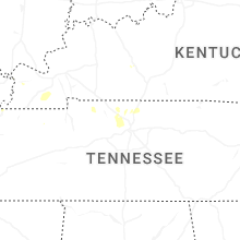
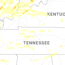
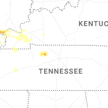
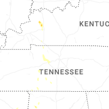
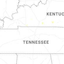
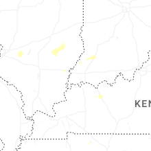


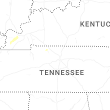

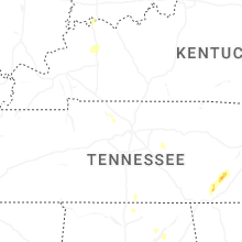


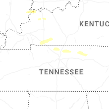


Connect with Interactive Hail Maps