

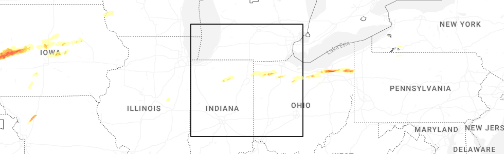
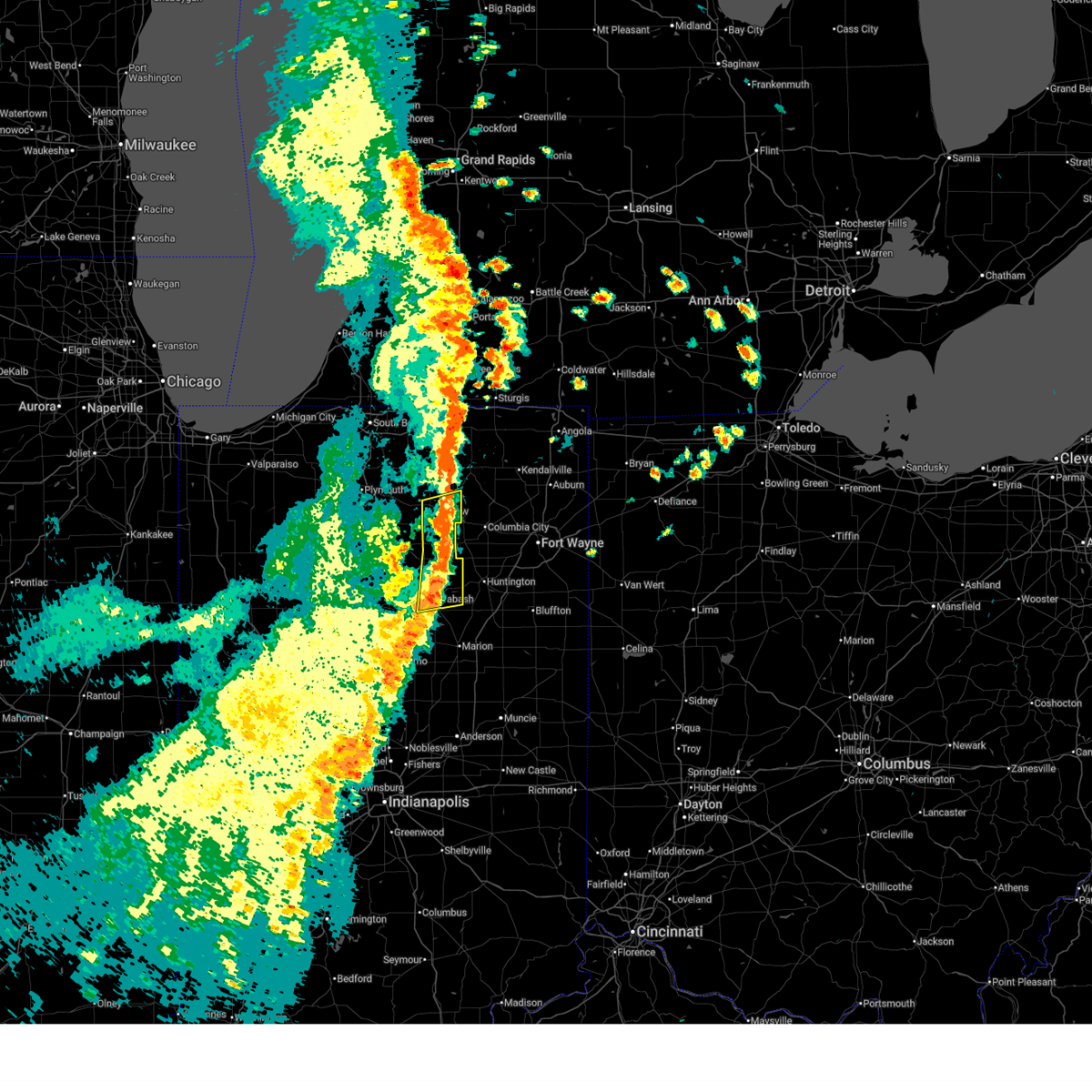
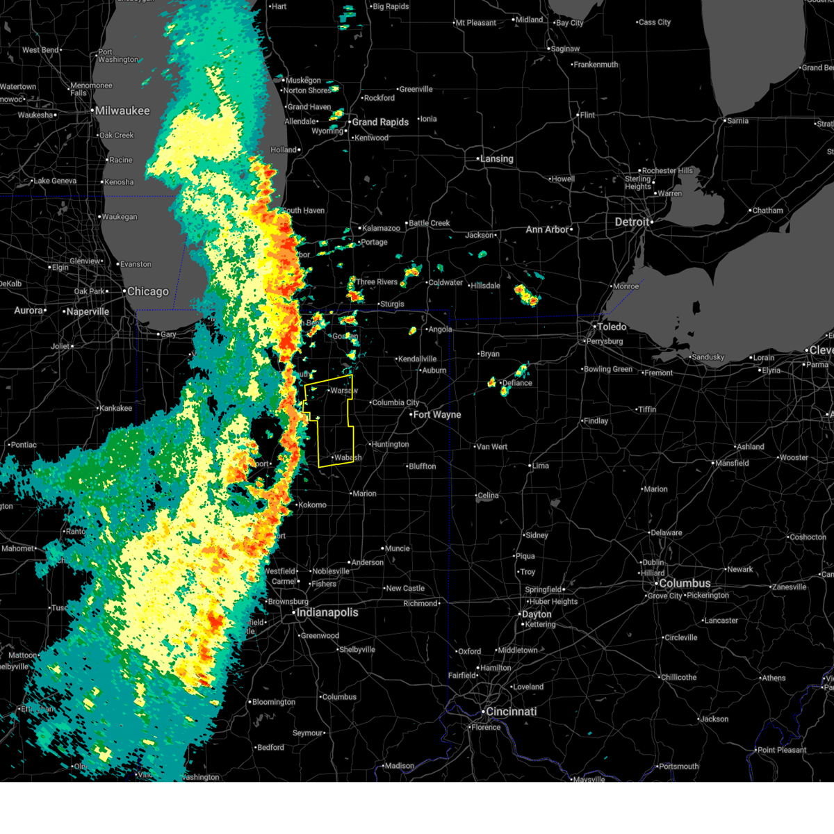
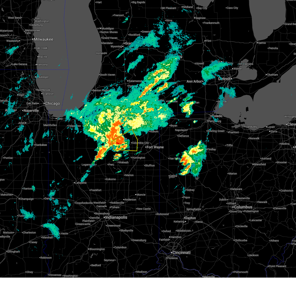
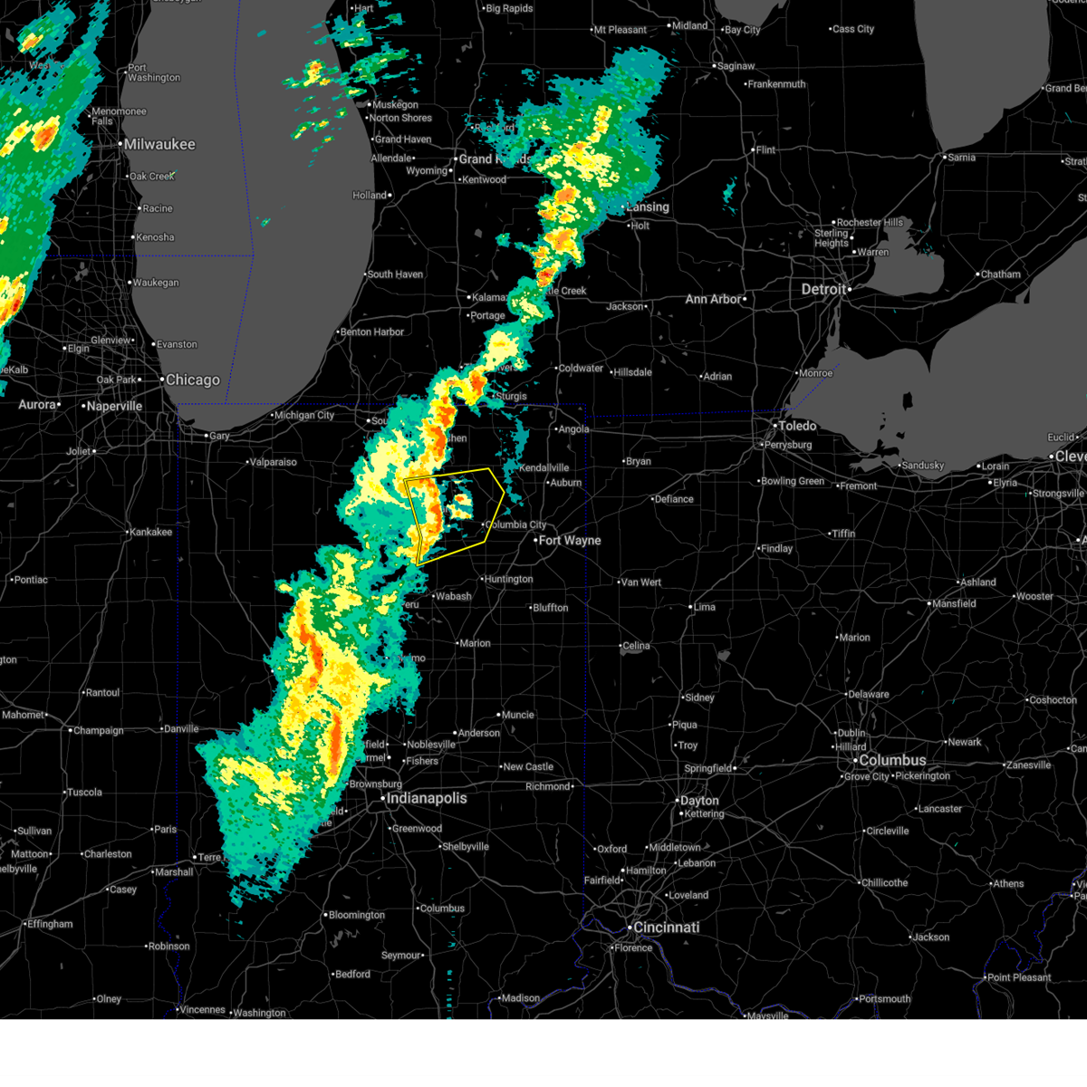
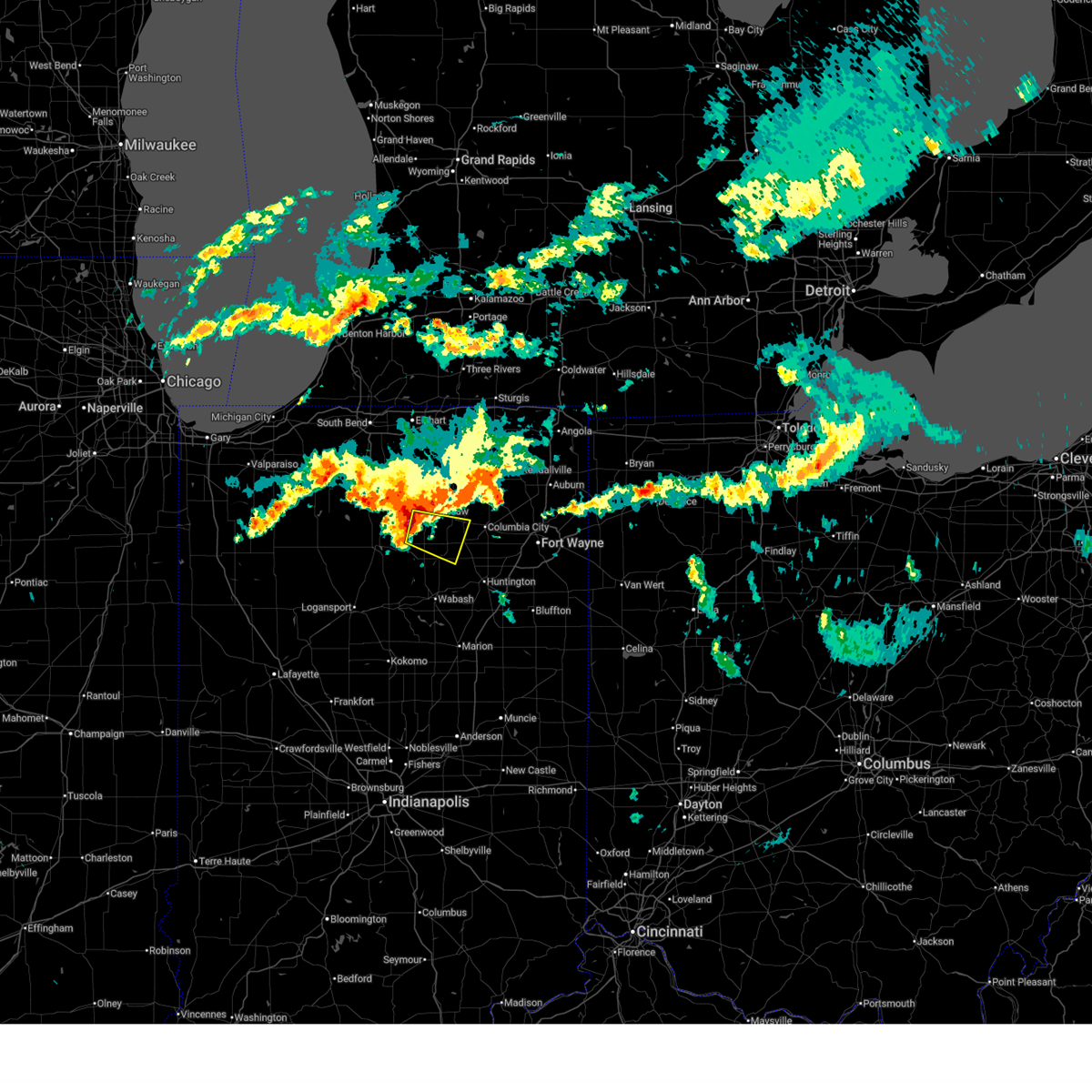
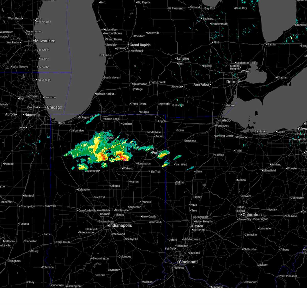
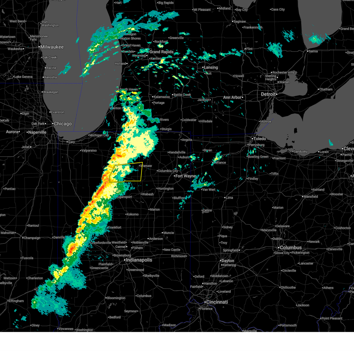
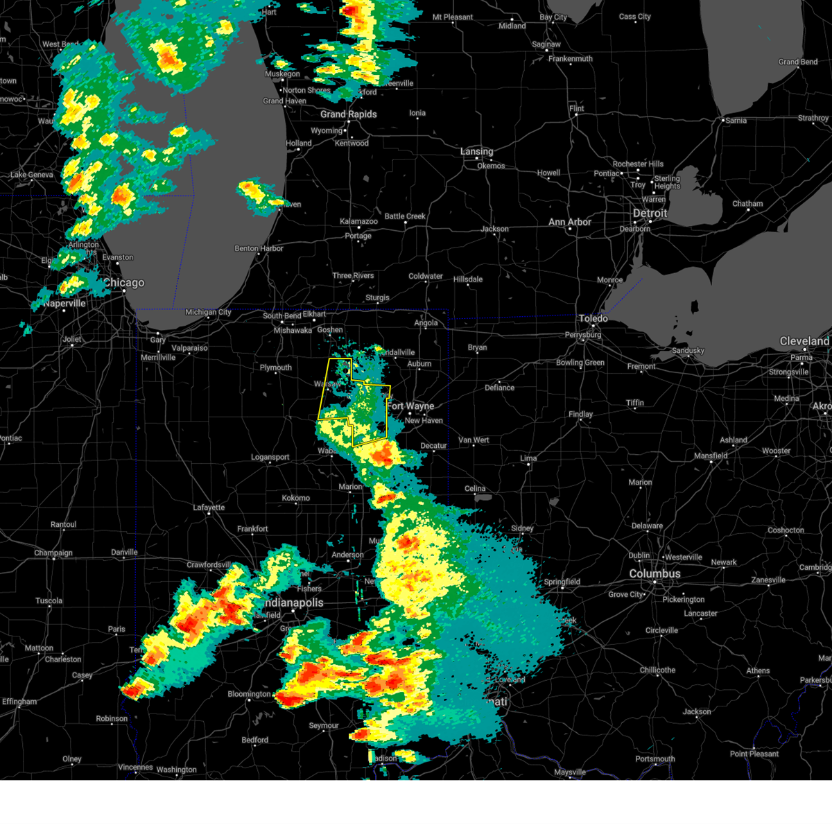
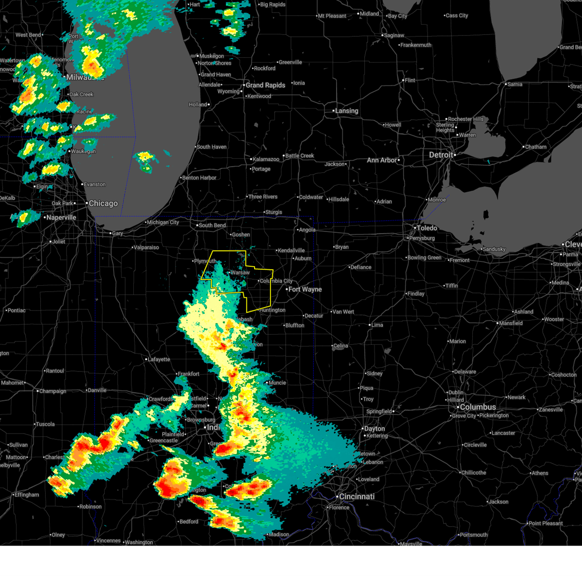
Hail Map for Claypool, IN
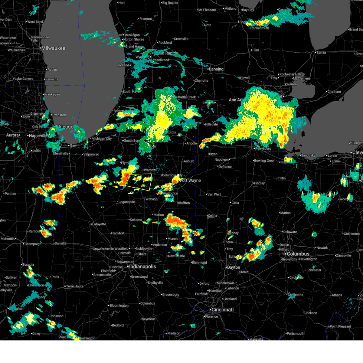
The Claypool, IN area has had 7 reports of on-the-ground hail by trained spotters, and has been under severe weather warnings 38 times during the past 12 months. Doppler radar has detected hail at or near Claypool, IN on 42 occasions, including 5 occasions during the past year.
| Name: | Claypool, IN |
| Where Located: | 41 miles W of Fort Wayne, IN |
| Map: | Google Map for Claypool, IN |
| Population: | 431 |
| Housing Units: | 176 |
| More Info: | Search Google for Claypool, IN |
5
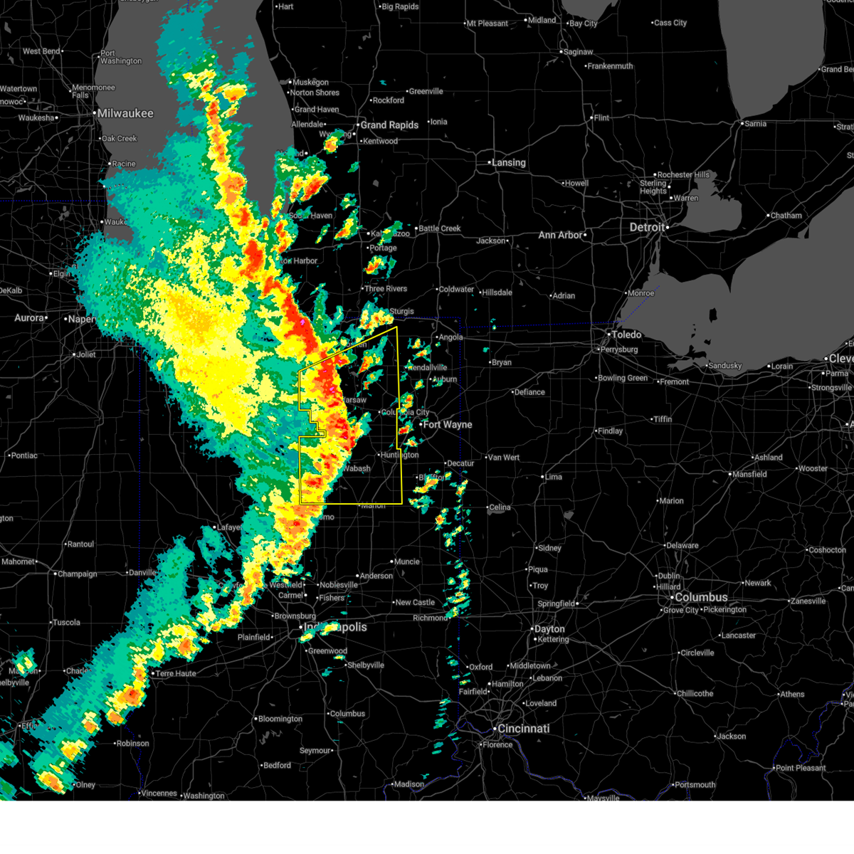
The Top Recent Hail Date for Claypool, IN is Wednesday, April 15, 2026 (2nd out of 42)
Hail and Wind Damage Spotted near Claypool, IN
| Date / Time | Report Details |
|---|---|
| 5/18/2026 2:16 PM EDT |
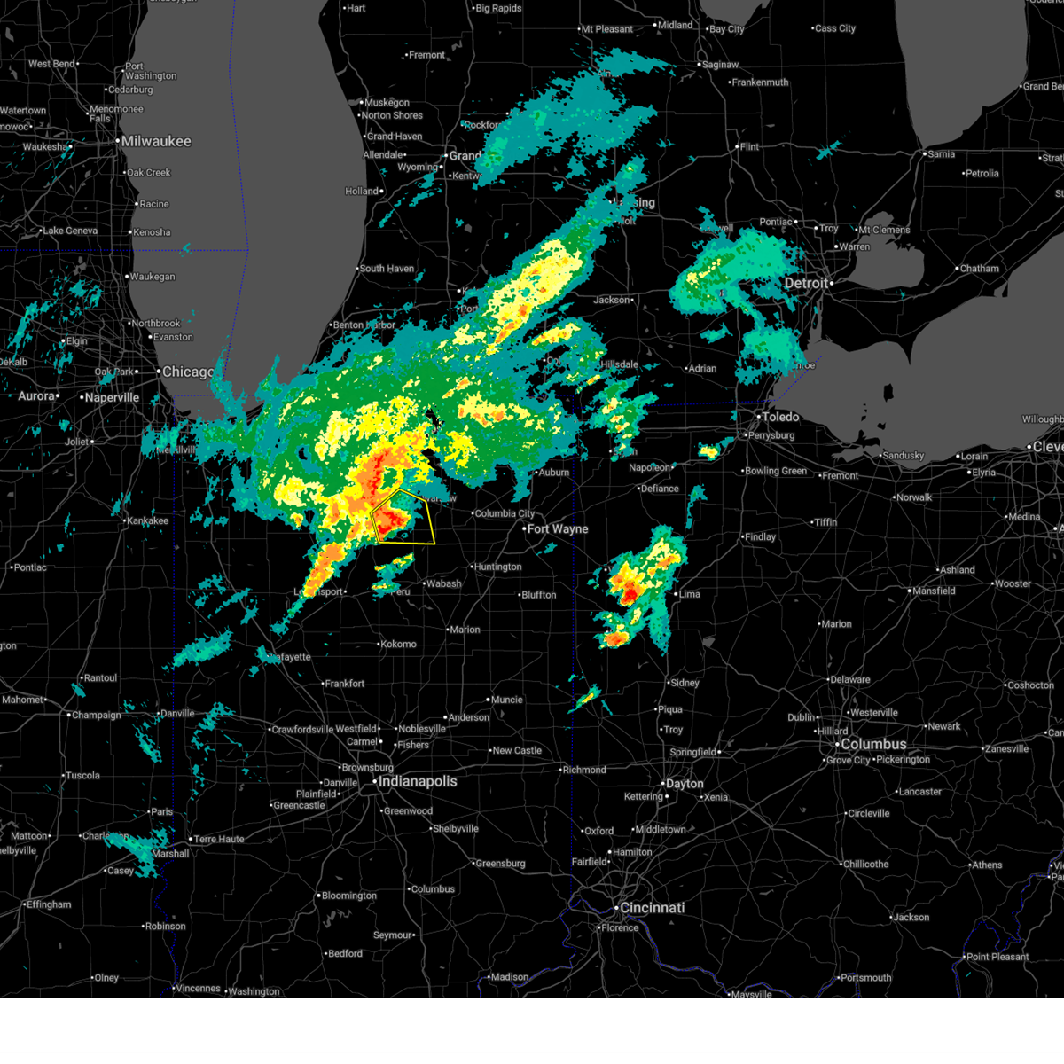
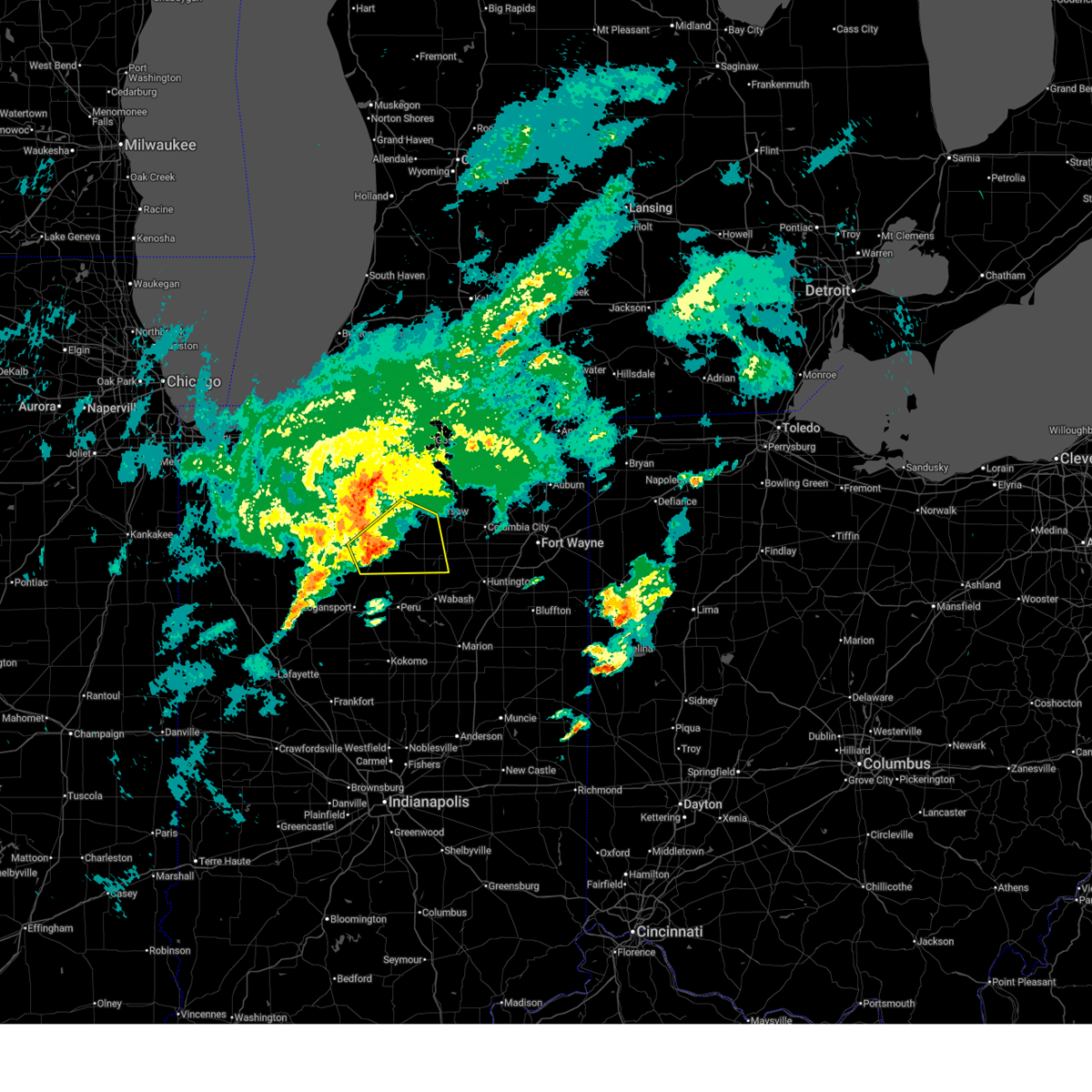
 At 216 pm edt, a severe thunderstorm was located near pierceton, or 7 miles west of columbia city, moving northeast at 45 mph (radar indicated). Hazards include 60 mph wind gusts. Expect damage to roofs, siding, and trees. Locations impacted include, warsaw, wabash, north manchester, winona lake, north webster, pierceton, silver lake, claypool, lagro, sidney, big barbee lake, ridinger lake, monoquet, richvalley, liberty mills, irish lake, ijamsville, little chapman lake, james lake, and servia. At 216 pm edt, a severe thunderstorm was located near pierceton, or 7 miles west of columbia city, moving northeast at 45 mph (radar indicated). Hazards include 60 mph wind gusts. Expect damage to roofs, siding, and trees. Locations impacted include, warsaw, wabash, north manchester, winona lake, north webster, pierceton, silver lake, claypool, lagro, sidney, big barbee lake, ridinger lake, monoquet, richvalley, liberty mills, irish lake, ijamsville, little chapman lake, james lake, and servia.
|
| 5/18/2026 1:44 PM EDT |
 Svriwx the national weather service in northern indiana has issued a * severe thunderstorm warning for, wabash county in north central indiana, kosciusko county in north central indiana, * until 230 pm edt. * at 143 pm edt, a severe thunderstorm was located near akron, or near rochester, moving northeast at 45 mph (radar indicated). Hazards include 60 mph wind gusts. expect damage to roofs, siding, and trees Svriwx the national weather service in northern indiana has issued a * severe thunderstorm warning for, wabash county in north central indiana, kosciusko county in north central indiana, * until 230 pm edt. * at 143 pm edt, a severe thunderstorm was located near akron, or near rochester, moving northeast at 45 mph (radar indicated). Hazards include 60 mph wind gusts. expect damage to roofs, siding, and trees
|
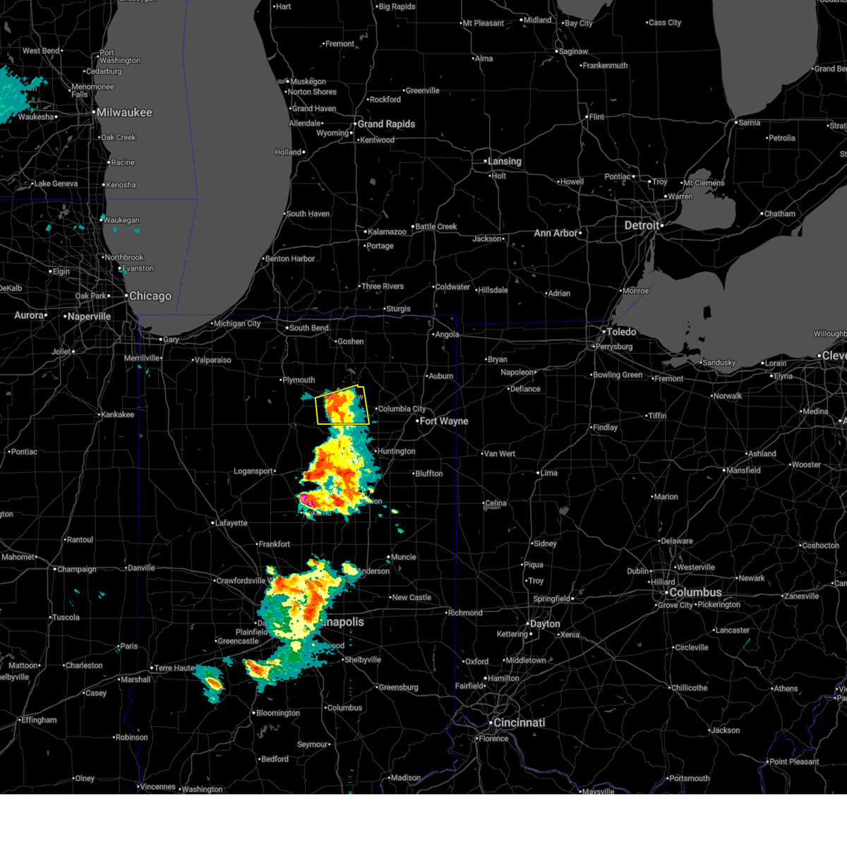
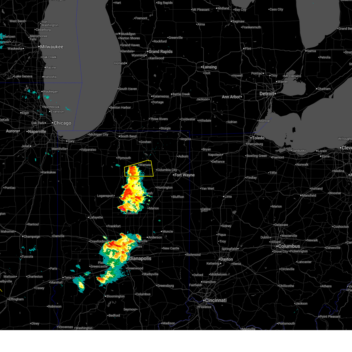
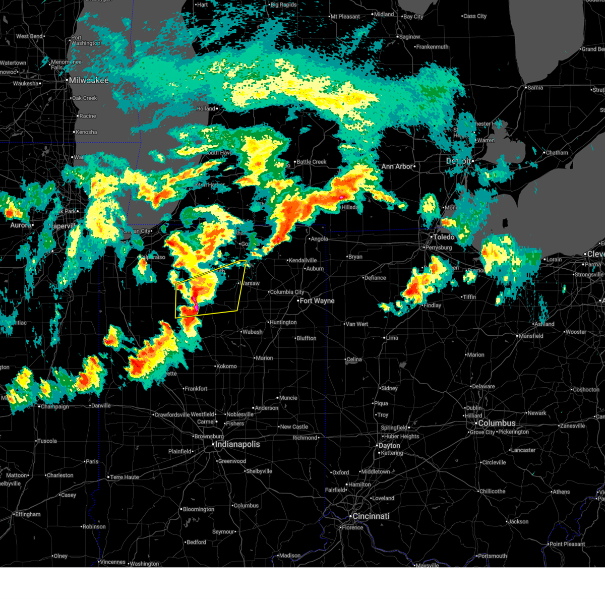
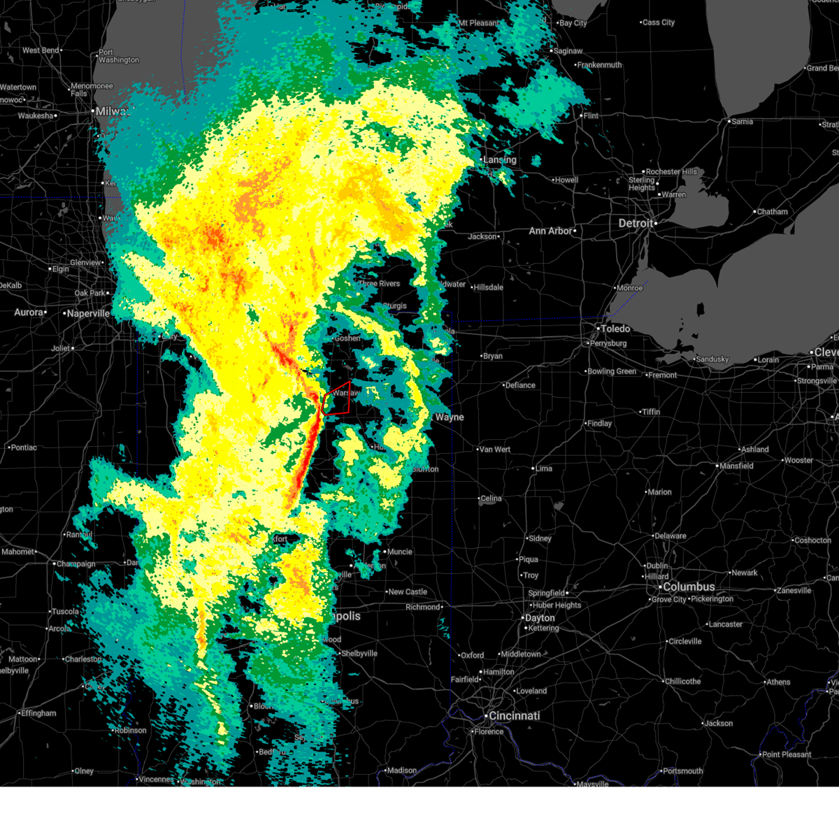
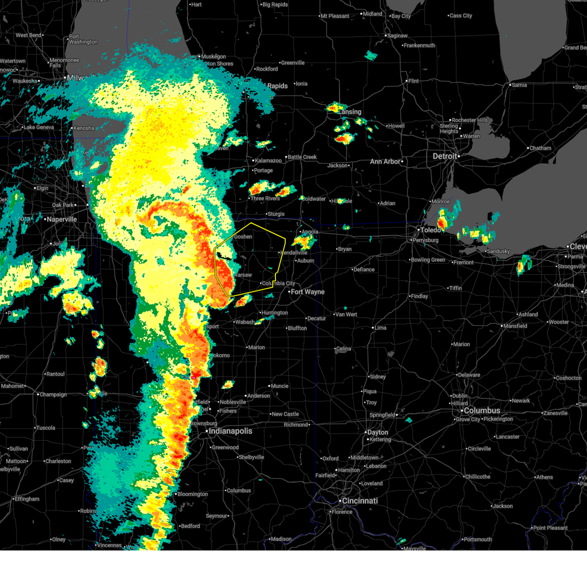
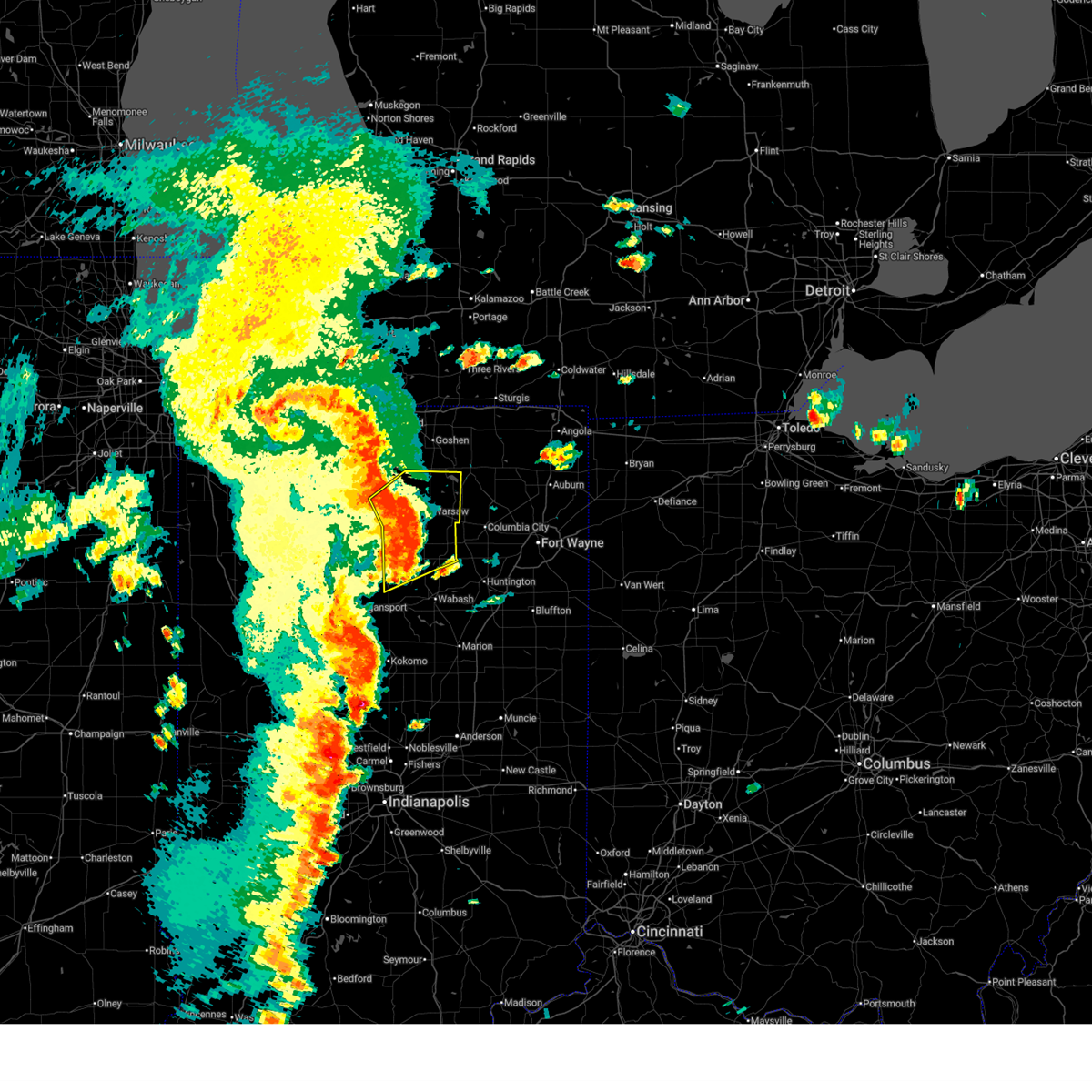
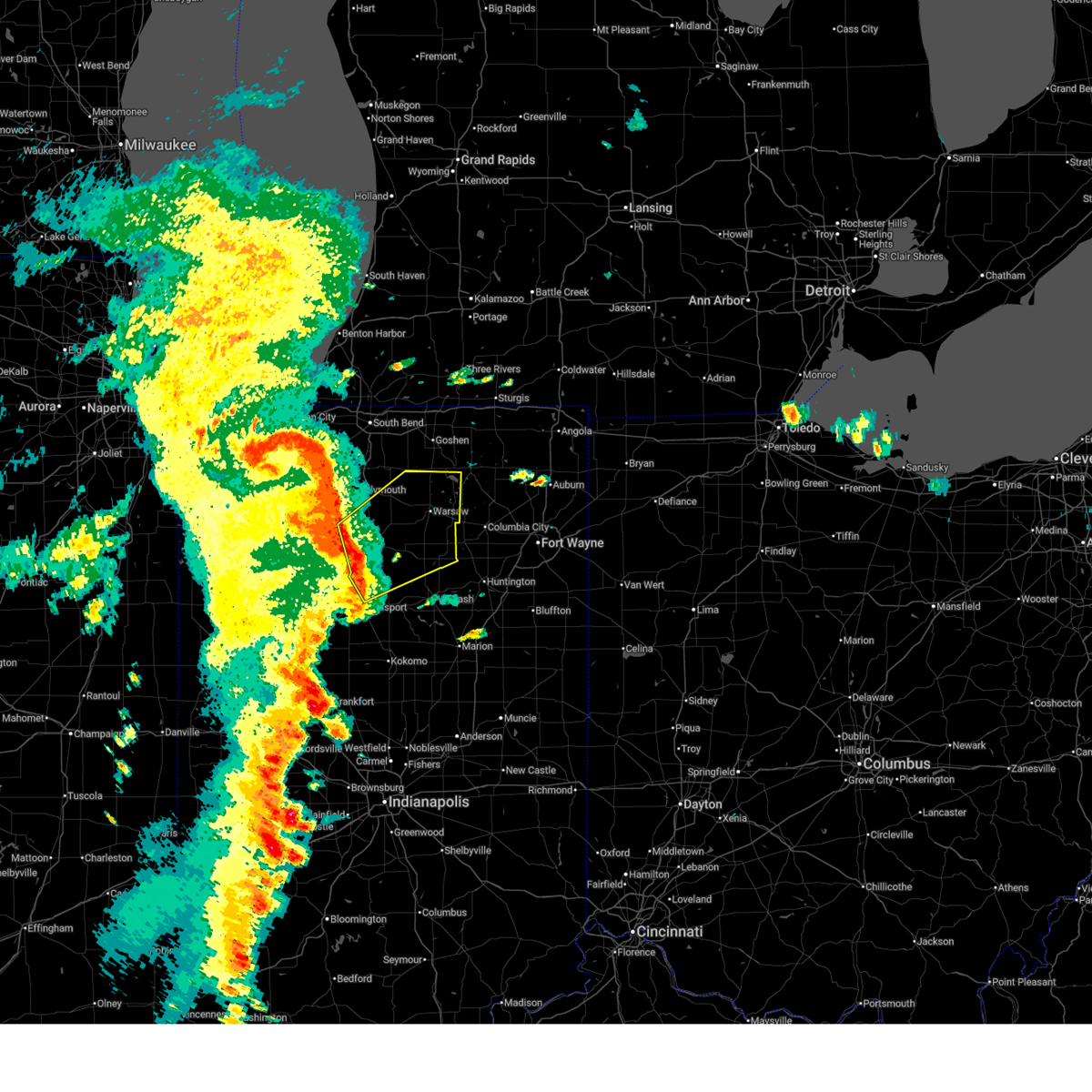
| 4/15/2026 1:55 PM EDT | Half Dollar sized hail reported 1 miles SW of Claypool, IN, hail ranging from marble to half dollar size reported on the northeast side of claypool. |
| 4/15/2026 1:54 PM EDT |
 Svriwx the national weather service in northern indiana has issued a * severe thunderstorm warning for, north central wabash county in north central indiana, southwestern noble county in northeastern indiana, whitley county in northeastern indiana, southeastern kosciusko county in north central indiana, * until 230 pm edt. * at 153 pm edt, a severe thunderstorm was located near winona lake, moving east at 55 mph (radar indicated). Hazards include 60 mph wind gusts and half dollar size hail. Hail damage to vehicles is expected. Expect wind damage to roofs, siding, and trees. Svriwx the national weather service in northern indiana has issued a * severe thunderstorm warning for, north central wabash county in north central indiana, southwestern noble county in northeastern indiana, whitley county in northeastern indiana, southeastern kosciusko county in north central indiana, * until 230 pm edt. * at 153 pm edt, a severe thunderstorm was located near winona lake, moving east at 55 mph (radar indicated). Hazards include 60 mph wind gusts and half dollar size hail. Hail damage to vehicles is expected. Expect wind damage to roofs, siding, and trees.
|
| 4/15/2026 1:52 PM EDT | Hen Egg sized hail reported 0.1 miles SW of Claypool, IN, broadcast media relayed a photo from the public of what is estimated to be between 2 and 2.25 inch hail in claypool. delayed report and time estimated by radar. |
| 4/15/2026 1:42 PM EDT |
 At 141 pm edt, a severe thunderstorm was located near mentone, or 11 miles east of rochester, moving northeast at 45 mph (radar indicated). Hazards include 60 mph wind gusts and quarter size hail. Hail damage to vehicles is expected. expect wind damage to roofs, siding, and trees. Locations impacted include, warsaw, north manchester, winona lake, akron, mentone, silver lake, claypool, burket, hoffman lake, atwood, athens, palestine, beaver dam lake, packerton, sevastopol, beaver dam, and talma. At 141 pm edt, a severe thunderstorm was located near mentone, or 11 miles east of rochester, moving northeast at 45 mph (radar indicated). Hazards include 60 mph wind gusts and quarter size hail. Hail damage to vehicles is expected. expect wind damage to roofs, siding, and trees. Locations impacted include, warsaw, north manchester, winona lake, akron, mentone, silver lake, claypool, burket, hoffman lake, atwood, athens, palestine, beaver dam lake, packerton, sevastopol, beaver dam, and talma.
|
| 4/15/2026 1:26 PM EDT |
 Svriwx the national weather service in northern indiana has issued a * severe thunderstorm warning for, northwestern wabash county in north central indiana, fulton county in north central indiana, southwestern kosciusko county in north central indiana, northwestern miami county in north central indiana, southeastern marshall county in north central indiana, * until 200 pm edt. * at 126 pm edt, a severe thunderstorm was located over rochester, moving east at 45 mph (radar indicated). Hazards include 60 mph wind gusts and quarter size hail. Hail damage to vehicles is expected. Expect wind damage to roofs, siding, and trees. Svriwx the national weather service in northern indiana has issued a * severe thunderstorm warning for, northwestern wabash county in north central indiana, fulton county in north central indiana, southwestern kosciusko county in north central indiana, northwestern miami county in north central indiana, southeastern marshall county in north central indiana, * until 200 pm edt. * at 126 pm edt, a severe thunderstorm was located over rochester, moving east at 45 mph (radar indicated). Hazards include 60 mph wind gusts and quarter size hail. Hail damage to vehicles is expected. Expect wind damage to roofs, siding, and trees.
|
| 4/14/2026 5:41 PM EDT |
 At 540 pm edt, a severe thunderstorm was located near winona lake, moving east at 35 mph (radar indicated). Hazards include 60 mph wind gusts and quarter size hail. Hail damage to vehicles is expected. expect wind damage to roofs, siding, and trees. Locations impacted include, warsaw, winona lake, south whitley, pierceton, silver lake, claypool, larwill, burket, sidney, big barbee lake, little chapman lake, ridinger lake, collamer, palestine, beaver dam lake, packerton, and wooster. At 540 pm edt, a severe thunderstorm was located near winona lake, moving east at 35 mph (radar indicated). Hazards include 60 mph wind gusts and quarter size hail. Hail damage to vehicles is expected. expect wind damage to roofs, siding, and trees. Locations impacted include, warsaw, winona lake, south whitley, pierceton, silver lake, claypool, larwill, burket, sidney, big barbee lake, little chapman lake, ridinger lake, collamer, palestine, beaver dam lake, packerton, and wooster.
|
| 4/14/2026 5:30 PM EDT |
 Svriwx the national weather service in northern indiana has issued a * severe thunderstorm warning for, western whitley county in northeastern indiana, northeastern fulton county in north central indiana, southern kosciusko county in north central indiana, southeastern marshall county in north central indiana, * until 600 pm edt. * at 529 pm edt, a severe thunderstorm was located near mentone, or 10 miles southwest of warsaw, moving east at 35 mph (radar indicated). Hazards include 60 mph wind gusts and quarter size hail. Hail damage to vehicles is expected. Expect wind damage to roofs, siding, and trees. Svriwx the national weather service in northern indiana has issued a * severe thunderstorm warning for, western whitley county in northeastern indiana, northeastern fulton county in north central indiana, southern kosciusko county in north central indiana, southeastern marshall county in north central indiana, * until 600 pm edt. * at 529 pm edt, a severe thunderstorm was located near mentone, or 10 miles southwest of warsaw, moving east at 35 mph (radar indicated). Hazards include 60 mph wind gusts and quarter size hail. Hail damage to vehicles is expected. Expect wind damage to roofs, siding, and trees.
|
| 4/2/2026 8:17 PM EDT |
 the severe thunderstorm warning has been cancelled and is no longer in effect the severe thunderstorm warning has been cancelled and is no longer in effect
|
| 4/2/2026 8:17 PM EDT |
 At 816 pm edt, severe thunderstorms were located along a line extending from near new paris to pierceton to near north manchester, moving northeast at 60 mph (radar indicated). Hazards include 60 mph wind gusts. Expect damage to roofs, siding, and trees. Locations impacted include, warsaw, columbia city, north manchester, winona lake, syracuse, tri-lakes, albion, south whitley, north webster, pierceton, etna, silver lake, leesburg, cromwell, claypool, larwill, sidney, liberty mills, lake wawasee, and little chapman lake. At 816 pm edt, severe thunderstorms were located along a line extending from near new paris to pierceton to near north manchester, moving northeast at 60 mph (radar indicated). Hazards include 60 mph wind gusts. Expect damage to roofs, siding, and trees. Locations impacted include, warsaw, columbia city, north manchester, winona lake, syracuse, tri-lakes, albion, south whitley, north webster, pierceton, etna, silver lake, leesburg, cromwell, claypool, larwill, sidney, liberty mills, lake wawasee, and little chapman lake.
|
| 4/2/2026 8:06 PM EDT |
 Svriwx the national weather service in northern indiana has issued a * severe thunderstorm warning for, northwestern wabash county in north central indiana, southwestern noble county in northeastern indiana, whitley county in northeastern indiana, east central fulton county in north central indiana, kosciusko county in north central indiana, northwestern miami county in north central indiana, southeastern marshall county in north central indiana, * until 845 pm edt. * at 806 pm edt, severe thunderstorms were located along a line extending from near nappanee to 7 miles east of mentone to 7 miles northeast of mexico, moving northeast at 65 mph (radar indicated). Hazards include 60 mph wind gusts. expect damage to roofs, siding, and trees Svriwx the national weather service in northern indiana has issued a * severe thunderstorm warning for, northwestern wabash county in north central indiana, southwestern noble county in northeastern indiana, whitley county in northeastern indiana, east central fulton county in north central indiana, kosciusko county in north central indiana, northwestern miami county in north central indiana, southeastern marshall county in north central indiana, * until 845 pm edt. * at 806 pm edt, severe thunderstorms were located along a line extending from near nappanee to 7 miles east of mentone to 7 miles northeast of mexico, moving northeast at 65 mph (radar indicated). Hazards include 60 mph wind gusts. expect damage to roofs, siding, and trees
|
| 3/31/2026 7:36 PM EDT |
 Svriwx the national weather service in northern indiana has issued a * severe thunderstorm warning for, southwestern allen county in northeastern indiana, northern wabash county in north central indiana, southern whitley county in northeastern indiana, northern huntington county in northeastern indiana, southeastern kosciusko county in north central indiana, north central wells county in northeastern indiana, * until 800 pm edt. * at 736 pm edt, a severe thunderstorm was located over north manchester, moving east at 55 mph (radar indicated). Hazards include 60 mph wind gusts and penny size hail. expect damage to roofs, siding, and trees Svriwx the national weather service in northern indiana has issued a * severe thunderstorm warning for, southwestern allen county in northeastern indiana, northern wabash county in north central indiana, southern whitley county in northeastern indiana, northern huntington county in northeastern indiana, southeastern kosciusko county in north central indiana, north central wells county in northeastern indiana, * until 800 pm edt. * at 736 pm edt, a severe thunderstorm was located over north manchester, moving east at 55 mph (radar indicated). Hazards include 60 mph wind gusts and penny size hail. expect damage to roofs, siding, and trees
|
| 3/31/2026 6:32 PM EDT |
 At 631 pm edt, a severe thunderstorm was located near pierceton, or near winona lake, moving east at 45 mph (radar indicated). Hazards include 60 mph wind gusts and quarter size hail. Hail damage to vehicles is expected. expect wind damage to roofs, siding, and trees. Locations impacted include, warsaw, north manchester, winona lake, pierceton, silver lake, claypool, larwill, sidney, packerton, collamer, and liberty mills. At 631 pm edt, a severe thunderstorm was located near pierceton, or near winona lake, moving east at 45 mph (radar indicated). Hazards include 60 mph wind gusts and quarter size hail. Hail damage to vehicles is expected. expect wind damage to roofs, siding, and trees. Locations impacted include, warsaw, north manchester, winona lake, pierceton, silver lake, claypool, larwill, sidney, packerton, collamer, and liberty mills.
|
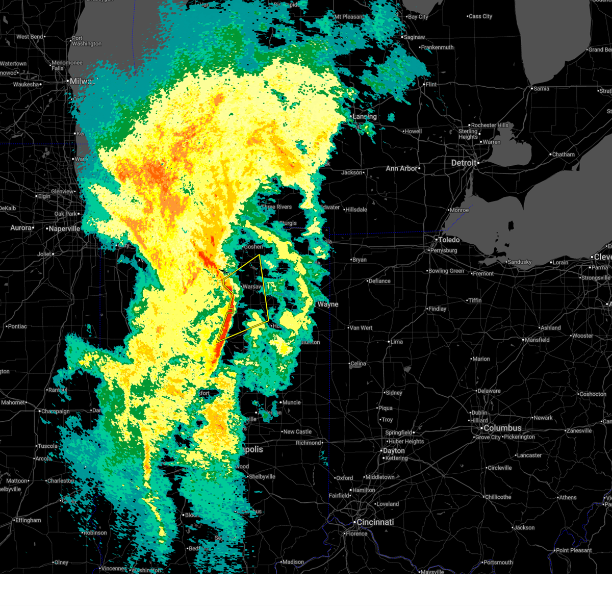
| 3/31/2026 6:25 PM EDT | Quarter sized hail reported 0.1 miles SW of Claypool, IN, photo on x shows hail up to quarter size in claypool. time estimated via radar. |
| 3/31/2026 6:24 PM EDT |
 the severe thunderstorm warning has been cancelled and is no longer in effect the severe thunderstorm warning has been cancelled and is no longer in effect
|
| 3/31/2026 6:24 PM EDT |
 At 624 pm edt, a severe thunderstorm was located near winona lake, moving east at 45 mph (radar indicated). Hazards include 60 mph wind gusts and quarter size hail. Hail damage to vehicles is expected. expect wind damage to roofs, siding, and trees. Locations impacted include, warsaw, north manchester, winona lake, pierceton, silver lake, claypool, larwill, burket, sidney, collamer, liberty mills, palestine, beaver dam lake, packerton, beaver dam, and wooster. At 624 pm edt, a severe thunderstorm was located near winona lake, moving east at 45 mph (radar indicated). Hazards include 60 mph wind gusts and quarter size hail. Hail damage to vehicles is expected. expect wind damage to roofs, siding, and trees. Locations impacted include, warsaw, north manchester, winona lake, pierceton, silver lake, claypool, larwill, burket, sidney, collamer, liberty mills, palestine, beaver dam lake, packerton, beaver dam, and wooster.
|
| 3/31/2026 6:21 PM EDT | Quarter sized hail reported 4.2 miles SE of Claypool, IN, quarter size hail at palestine lake. time estimated via radar. |
| 3/31/2026 6:20 PM EDT | Picture on facebook of large tree branches down near beaver dam lake. public report also says a barn was damaged. time estimated via rada in kosciusko county IN, 5.3 miles ENE of Claypool, IN |
| 3/31/2026 6:20 PM EDT | Quarter sized hail reported 0.1 miles SW of Claypool, IN, corrects previous hail report from claypool. time estimated from radar. |
| 3/31/2026 6:11 PM EDT |
 Svriwx the national weather service in northern indiana has issued a * severe thunderstorm warning for, northeastern wabash county in north central indiana, southwestern whitley county in northeastern indiana, northeastern fulton county in north central indiana, southern kosciusko county in north central indiana, southeastern marshall county in north central indiana, * until 645 pm edt. * at 610 pm edt, a severe thunderstorm was located over mentone, or 9 miles northeast of rochester, moving east at 45 mph (radar indicated). Hazards include 60 mph wind gusts and quarter size hail. Hail damage to vehicles is expected. Expect wind damage to roofs, siding, and trees. Svriwx the national weather service in northern indiana has issued a * severe thunderstorm warning for, northeastern wabash county in north central indiana, southwestern whitley county in northeastern indiana, northeastern fulton county in north central indiana, southern kosciusko county in north central indiana, southeastern marshall county in north central indiana, * until 645 pm edt. * at 610 pm edt, a severe thunderstorm was located over mentone, or 9 miles northeast of rochester, moving east at 45 mph (radar indicated). Hazards include 60 mph wind gusts and quarter size hail. Hail damage to vehicles is expected. Expect wind damage to roofs, siding, and trees.
|
| 3/31/2026 5:50 PM EDT | Quarter sized hail reported 0.1 miles SW of Claypool, IN, time estimated from radar. |
| 3/26/2026 6:49 PM EDT |
 the severe thunderstorm warning has been cancelled and is no longer in effect the severe thunderstorm warning has been cancelled and is no longer in effect
|
| 3/26/2026 6:49 PM EDT |
 At 649 pm edt, severe thunderstorms were located along a line extending from near akron to 8 miles southwest of north manchester, moving east at 70 mph (radar indicated). Hazards include 60 mph wind gusts and quarter size hail. Hail damage to vehicles is expected. expect wind damage to roofs, siding, and trees. Locations impacted include, huntington, columbia city, north manchester, south whitley, akron, andrews, silver lake, roann, claypool, lagro, burket, sidney, collamer, liberty mills, beaver dam lake, bippus, beaver dam, luther, peabody, and ijamsville. At 649 pm edt, severe thunderstorms were located along a line extending from near akron to 8 miles southwest of north manchester, moving east at 70 mph (radar indicated). Hazards include 60 mph wind gusts and quarter size hail. Hail damage to vehicles is expected. expect wind damage to roofs, siding, and trees. Locations impacted include, huntington, columbia city, north manchester, south whitley, akron, andrews, silver lake, roann, claypool, lagro, burket, sidney, collamer, liberty mills, beaver dam lake, bippus, beaver dam, luther, peabody, and ijamsville.
|
| 3/26/2026 6:38 PM EDT |
 The storms which prompted the warning have moved out of the area. therefore, the warning will be allowed to expire. however, small hail and gusty winds are still possible with these thunderstorms. a severe thunderstorm watch remains in effect until midnight edt/1100 pm cdt/ for north central and northwestern indiana. The storms which prompted the warning have moved out of the area. therefore, the warning will be allowed to expire. however, small hail and gusty winds are still possible with these thunderstorms. a severe thunderstorm watch remains in effect until midnight edt/1100 pm cdt/ for north central and northwestern indiana.
|
| 3/26/2026 6:37 PM EDT |
 Svriwx the national weather service in northern indiana has issued a * severe thunderstorm warning for, northern wabash county in north central indiana, southwestern whitley county in northeastern indiana, northwestern huntington county in northeastern indiana, central fulton county in north central indiana, southern kosciusko county in north central indiana, northwestern miami county in north central indiana, southeastern marshall county in north central indiana, * until 715 pm edt. * at 637 pm edt, severe thunderstorms were located along a line extending from near rochester to 8 miles southwest of akron, moving east at 70 mph (radar indicated). Hazards include 60 mph wind gusts and quarter size hail. Hail damage to vehicles is expected. Expect wind damage to roofs, siding, and trees. Svriwx the national weather service in northern indiana has issued a * severe thunderstorm warning for, northern wabash county in north central indiana, southwestern whitley county in northeastern indiana, northwestern huntington county in northeastern indiana, central fulton county in north central indiana, southern kosciusko county in north central indiana, northwestern miami county in north central indiana, southeastern marshall county in north central indiana, * until 715 pm edt. * at 637 pm edt, severe thunderstorms were located along a line extending from near rochester to 8 miles southwest of akron, moving east at 70 mph (radar indicated). Hazards include 60 mph wind gusts and quarter size hail. Hail damage to vehicles is expected. Expect wind damage to roofs, siding, and trees.
|
| 3/26/2026 6:27 PM EDT |
 At 627 pm edt/527 pm cdt/, severe thunderstorms were located along a line extending from near plymouth to 10 miles southwest of rochester, moving east at 85 mph (radar indicated). Hazards include quarter size hail. Damage to vehicles is expected. Locations impacted include, warsaw, rochester, winona lake, winamac, bourbon, argos, milford, culver, akron, mentone, walnut, tippecanoe, silver lake, kewanna, etna green, leesburg, claypool, monterey, burket, and beardstown. At 627 pm edt/527 pm cdt/, severe thunderstorms were located along a line extending from near plymouth to 10 miles southwest of rochester, moving east at 85 mph (radar indicated). Hazards include quarter size hail. Damage to vehicles is expected. Locations impacted include, warsaw, rochester, winona lake, winamac, bourbon, argos, milford, culver, akron, mentone, walnut, tippecanoe, silver lake, kewanna, etna green, leesburg, claypool, monterey, burket, and beardstown.
|
| 3/26/2026 6:15 PM EDT |
 Svriwx the national weather service in northern indiana has issued a * severe thunderstorm warning for, northwestern wabash county in north central indiana, fulton county in north central indiana, eastern pulaski county in northwestern indiana, kosciusko county in north central indiana, northwestern miami county in north central indiana, southeastern starke county in northwestern indiana, marshall county in north central indiana, * until 645 pm edt/545 pm cdt/. * at 615 pm edt/515 pm cdt/, severe thunderstorms were located along a line extending from near knox to 9 miles southwest of winamac, moving east at 85 mph (radar indicated). Hazards include quarter size hail. damage to vehicles is expected Svriwx the national weather service in northern indiana has issued a * severe thunderstorm warning for, northwestern wabash county in north central indiana, fulton county in north central indiana, eastern pulaski county in northwestern indiana, kosciusko county in north central indiana, northwestern miami county in north central indiana, southeastern starke county in northwestern indiana, marshall county in north central indiana, * until 645 pm edt/545 pm cdt/. * at 615 pm edt/515 pm cdt/, severe thunderstorms were located along a line extending from near knox to 9 miles southwest of winamac, moving east at 85 mph (radar indicated). Hazards include quarter size hail. damage to vehicles is expected
|
| 3/15/2026 10:55 PM EDT |
 The storms which prompted the warning have moved out of the area. therefore, the warning will be allowed to expire. a severe thunderstorm watch remains in effect until 200 am edt for north central and northeastern indiana. remember, a tornado warning still remains in effect for a portion of kosciusko county until 11:00 pm. The storms which prompted the warning have moved out of the area. therefore, the warning will be allowed to expire. a severe thunderstorm watch remains in effect until 200 am edt for north central and northeastern indiana. remember, a tornado warning still remains in effect for a portion of kosciusko county until 11:00 pm.
|
| 3/15/2026 10:47 PM EDT |
 At 1047 pm edt, severe thunderstorms were located along a line extending from near warsaw to near north manchester, moving northeast at 65 mph (radar indicated). Hazards include 60 mph wind gusts. Expect damage to roofs, siding, and trees. Locations impacted include, warsaw, north manchester, winona lake, syracuse, south whitley, milford, north webster, pierceton, silver lake, leesburg, erie, cromwell, roann, claypool, larwill, sidney, big barbee lake, ridinger lake, monoquet, and collamer. At 1047 pm edt, severe thunderstorms were located along a line extending from near warsaw to near north manchester, moving northeast at 65 mph (radar indicated). Hazards include 60 mph wind gusts. Expect damage to roofs, siding, and trees. Locations impacted include, warsaw, north manchester, winona lake, syracuse, south whitley, milford, north webster, pierceton, silver lake, leesburg, erie, cromwell, roann, claypool, larwill, sidney, big barbee lake, ridinger lake, monoquet, and collamer.
|
| 3/15/2026 10:38 PM EDT |
 Toriwx the national weather service in northern indiana has issued a * tornado warning for, southeastern kosciusko county in north central indiana, * until 1100 pm edt. * at 1038 pm edt, a severe thunderstorm capable of producing a tornado was located near winona lake, moving northeast at 65 mph (radar indicated rotation). Hazards include tornado. Flying debris will be dangerous to those caught without shelter. mobile homes will be damaged or destroyed. damage to roofs, windows, and vehicles will occur. tree damage is likely. this dangerous storm will be near, warsaw, winona lake, and pierceton around 1045 pm edt. Other locations impacted by this tornadic thunderstorm include big barbee lake, sechrist lake, packerton, claypool, wooster, and sidney. Toriwx the national weather service in northern indiana has issued a * tornado warning for, southeastern kosciusko county in north central indiana, * until 1100 pm edt. * at 1038 pm edt, a severe thunderstorm capable of producing a tornado was located near winona lake, moving northeast at 65 mph (radar indicated rotation). Hazards include tornado. Flying debris will be dangerous to those caught without shelter. mobile homes will be damaged or destroyed. damage to roofs, windows, and vehicles will occur. tree damage is likely. this dangerous storm will be near, warsaw, winona lake, and pierceton around 1045 pm edt. Other locations impacted by this tornadic thunderstorm include big barbee lake, sechrist lake, packerton, claypool, wooster, and sidney.
|
| 3/15/2026 10:37 PM EDT |
 At 1037 pm edt, severe thunderstorms were located along a line extending from near warsaw to 6 miles north of wabash, moving northeast at 65 mph (radar indicated). Hazards include 60 mph wind gusts. Expect damage to roofs, siding, and trees. Locations impacted include, warsaw, peru, wabash, north manchester, winona lake, syracuse, south whitley, milford, north webster, pierceton, mexico, silver lake, etna green, leesburg, erie, cromwell, denver, roann, claypool, and larwill. At 1037 pm edt, severe thunderstorms were located along a line extending from near warsaw to 6 miles north of wabash, moving northeast at 65 mph (radar indicated). Hazards include 60 mph wind gusts. Expect damage to roofs, siding, and trees. Locations impacted include, warsaw, peru, wabash, north manchester, winona lake, syracuse, south whitley, milford, north webster, pierceton, mexico, silver lake, etna green, leesburg, erie, cromwell, denver, roann, claypool, and larwill.
|
| 3/15/2026 10:37 PM EDT |
 the severe thunderstorm warning has been cancelled and is no longer in effect the severe thunderstorm warning has been cancelled and is no longer in effect
|
| 3/15/2026 10:24 PM EDT |
 Svriwx the national weather service in northern indiana has issued a * severe thunderstorm warning for, southeastern elkhart county in north central indiana, northern wabash county in north central indiana, west central noble county in northeastern indiana, western whitley county in northeastern indiana, northwestern huntington county in northeastern indiana, central fulton county in north central indiana, kosciusko county in north central indiana, northeastern cass county in north central indiana, northwestern miami county in north central indiana, southeastern marshall county in north central indiana, * until 1100 pm edt. * at 1024 pm edt, severe thunderstorms were located along a line extending from 6 miles north of rochester to near mexico, moving northeast at 65 mph (radar indicated). Hazards include 60 mph wind gusts. expect damage to roofs, siding, and trees Svriwx the national weather service in northern indiana has issued a * severe thunderstorm warning for, southeastern elkhart county in north central indiana, northern wabash county in north central indiana, west central noble county in northeastern indiana, western whitley county in northeastern indiana, northwestern huntington county in northeastern indiana, central fulton county in north central indiana, kosciusko county in north central indiana, northeastern cass county in north central indiana, northwestern miami county in north central indiana, southeastern marshall county in north central indiana, * until 1100 pm edt. * at 1024 pm edt, severe thunderstorms were located along a line extending from 6 miles north of rochester to near mexico, moving northeast at 65 mph (radar indicated). Hazards include 60 mph wind gusts. expect damage to roofs, siding, and trees
|
| 2/19/2026 5:40 AM EST |
 The severe thunderstorm which prompted the warning has weakened. therefore, the warning will be allowed to expire. however, small hail is still possible with this thunderstorm. The severe thunderstorm which prompted the warning has weakened. therefore, the warning will be allowed to expire. however, small hail is still possible with this thunderstorm.
|
| 2/19/2026 5:20 AM EST |
 Svriwx the national weather service in northern indiana has issued a * severe thunderstorm warning for, central fulton county in north central indiana, southwestern kosciusko county in north central indiana, * until 545 am est. * at 519 am est, a severe thunderstorm was located near rochester, moving northeast at 40 mph (radar indicated). Hazards include quarter size hail. damage to vehicles is expected Svriwx the national weather service in northern indiana has issued a * severe thunderstorm warning for, central fulton county in north central indiana, southwestern kosciusko county in north central indiana, * until 545 am est. * at 519 am est, a severe thunderstorm was located near rochester, moving northeast at 40 mph (radar indicated). Hazards include quarter size hail. damage to vehicles is expected
|
| 12/28/2025 7:12 PM EST |
 The storms which prompted the warning have moved out of the area. therefore, the warning will be allowed to expire. a tornado watch remains in effect until 900 pm est for north central indiana. The storms which prompted the warning have moved out of the area. therefore, the warning will be allowed to expire. a tornado watch remains in effect until 900 pm est for north central indiana.
|
| 12/28/2025 7:01 PM EST |
 the severe thunderstorm warning has been cancelled and is no longer in effect the severe thunderstorm warning has been cancelled and is no longer in effect
|
| 12/28/2025 7:01 PM EST |
 At 701 pm est, severe thunderstorms were located along a line extending from near warsaw to akron, moving east at 45 mph (radar indicated). Hazards include 60 mph wind gusts. Expect damage to roofs, siding, and trees. Locations impacted include, warsaw, winona lake, akron, silver lake, claypool, burket, beaver dam lake, disko, and palestine. At 701 pm est, severe thunderstorms were located along a line extending from near warsaw to akron, moving east at 45 mph (radar indicated). Hazards include 60 mph wind gusts. Expect damage to roofs, siding, and trees. Locations impacted include, warsaw, winona lake, akron, silver lake, claypool, burket, beaver dam lake, disko, and palestine.
|
| 12/28/2025 6:46 PM EST |
 At 646 pm est, severe thunderstorms were located along a line extending from near bourbon to near rochester, moving east at 45 mph (radar indicated). Hazards include 60 mph wind gusts. Expect damage to roofs, siding, and trees. Locations impacted include, warsaw, rochester, winona lake, akron, mentone, tippecanoe, silver lake, etna green, claypool, burket, hoffman lake, atwood, athens, palestine, beaver dam lake, old tip town, sevastopol, beaver dam, lake manitou, and disko. At 646 pm est, severe thunderstorms were located along a line extending from near bourbon to near rochester, moving east at 45 mph (radar indicated). Hazards include 60 mph wind gusts. Expect damage to roofs, siding, and trees. Locations impacted include, warsaw, rochester, winona lake, akron, mentone, tippecanoe, silver lake, etna green, claypool, burket, hoffman lake, atwood, athens, palestine, beaver dam lake, old tip town, sevastopol, beaver dam, lake manitou, and disko.
|
| 12/28/2025 6:19 PM EST |
 Svriwx the national weather service in northern indiana has issued a * severe thunderstorm warning for, northwestern wabash county in north central indiana, fulton county in north central indiana, southwestern kosciusko county in north central indiana, southeastern marshall county in north central indiana, * until 715 pm est. * at 618 pm est, severe thunderstorms were located along a line extending from culver to 7 miles north of royal center, moving east at 50 mph (radar indicated). Hazards include 60 mph wind gusts. expect damage to roofs, siding, and trees Svriwx the national weather service in northern indiana has issued a * severe thunderstorm warning for, northwestern wabash county in north central indiana, fulton county in north central indiana, southwestern kosciusko county in north central indiana, southeastern marshall county in north central indiana, * until 715 pm est. * at 618 pm est, severe thunderstorms were located along a line extending from culver to 7 miles north of royal center, moving east at 50 mph (radar indicated). Hazards include 60 mph wind gusts. expect damage to roofs, siding, and trees
|
| 7/26/2025 4:05 PM EDT |
 the severe thunderstorm warning has been cancelled and is no longer in effect the severe thunderstorm warning has been cancelled and is no longer in effect
|
| 7/26/2025 3:59 PM EDT |
 the severe thunderstorm warning has been cancelled and is no longer in effect the severe thunderstorm warning has been cancelled and is no longer in effect
|
| 7/26/2025 3:59 PM EDT |
 At 359 pm edt, severe thunderstorms were located along a line extending from near winona lake to 7 miles northwest of north manchester to 6 miles southeast of akron, moving east at 30 mph (radar indicated). Hazards include 60 mph wind gusts. Expect damage to roofs, siding, and trees. Locations impacted include, north manchester, silver lake, claypool, sidney, ijamsville, packerton, laketon, liberty mills, and disko. At 359 pm edt, severe thunderstorms were located along a line extending from near winona lake to 7 miles northwest of north manchester to 6 miles southeast of akron, moving east at 30 mph (radar indicated). Hazards include 60 mph wind gusts. Expect damage to roofs, siding, and trees. Locations impacted include, north manchester, silver lake, claypool, sidney, ijamsville, packerton, laketon, liberty mills, and disko.
|
| 7/26/2025 3:31 PM EDT |
 Svriwx the national weather service in northern indiana has issued a * severe thunderstorm warning for, northwestern wabash county in north central indiana, northeastern fulton county in north central indiana, southern kosciusko county in north central indiana, north central miami county in north central indiana, * until 430 pm edt. * at 330 pm edt, severe thunderstorms were located along a line extending from near mentone to 6 miles northwest of akron to near rochester, moving east at 25 mph (radar indicated). Hazards include 60 mph wind gusts. expect damage to roofs, siding, and trees Svriwx the national weather service in northern indiana has issued a * severe thunderstorm warning for, northwestern wabash county in north central indiana, northeastern fulton county in north central indiana, southern kosciusko county in north central indiana, north central miami county in north central indiana, * until 430 pm edt. * at 330 pm edt, severe thunderstorms were located along a line extending from near mentone to 6 miles northwest of akron to near rochester, moving east at 25 mph (radar indicated). Hazards include 60 mph wind gusts. expect damage to roofs, siding, and trees
|
| 6/18/2025 4:26 PM EDT |
 Svriwx the national weather service in northern indiana has issued a * severe thunderstorm warning for, southern elkhart county in north central indiana, noble county in northeastern indiana, whitley county in northeastern indiana, kosciusko county in north central indiana, southern lagrange county in northeastern indiana, * until 500 pm edt. * at 425 pm edt, severe thunderstorms were located along a line extending from near nappanee to warsaw to near north manchester, moving northeast at 65 mph (radar indicated). Hazards include 70 mph wind gusts. Expect considerable tree damage. Damage is likely to mobile homes, roofs, and outbuildings. Svriwx the national weather service in northern indiana has issued a * severe thunderstorm warning for, southern elkhart county in north central indiana, noble county in northeastern indiana, whitley county in northeastern indiana, kosciusko county in north central indiana, southern lagrange county in northeastern indiana, * until 500 pm edt. * at 425 pm edt, severe thunderstorms were located along a line extending from near nappanee to warsaw to near north manchester, moving northeast at 65 mph (radar indicated). Hazards include 70 mph wind gusts. Expect considerable tree damage. Damage is likely to mobile homes, roofs, and outbuildings.
|
| 6/18/2025 4:20 PM EDT |
 At 420 pm edt, severe thunderstorms were located along a line extending from near bourbon to near warsaw to near akron, moving northeast at 70 mph (radar indicated). Hazards include 70 mph wind gusts. Expect considerable tree damage. damage is likely to mobile homes, roofs, and outbuildings. Locations impacted include, warsaw, nappanee, rochester, north manchester, winona lake, syracuse, bourbon, milford, akron, north webster, pierceton, mentone, tippecanoe, silver lake, etna green, leesburg, denver, roann, claypool, and macy. At 420 pm edt, severe thunderstorms were located along a line extending from near bourbon to near warsaw to near akron, moving northeast at 70 mph (radar indicated). Hazards include 70 mph wind gusts. Expect considerable tree damage. damage is likely to mobile homes, roofs, and outbuildings. Locations impacted include, warsaw, nappanee, rochester, north manchester, winona lake, syracuse, bourbon, milford, akron, north webster, pierceton, mentone, tippecanoe, silver lake, etna green, leesburg, denver, roann, claypool, and macy.
|
| 6/18/2025 4:20 PM EDT |
 the severe thunderstorm warning has been cancelled and is no longer in effect the severe thunderstorm warning has been cancelled and is no longer in effect
|
| 6/18/2025 4:01 PM EDT |
 Svriwx the national weather service in northern indiana has issued a * severe thunderstorm warning for, northern wabash county in north central indiana, fulton county in north central indiana, kosciusko county in north central indiana, northeastern cass county in north central indiana, northwestern miami county in north central indiana, southern marshall county in north central indiana, * until 445 pm edt. * at 401 pm edt, severe thunderstorms were located along a line extending from near culver to rochester to near mexico, moving northeast at 70 mph (radar indicated). Hazards include 70 mph wind gusts. Expect considerable tree damage. Damage is likely to mobile homes, roofs, and outbuildings. Svriwx the national weather service in northern indiana has issued a * severe thunderstorm warning for, northern wabash county in north central indiana, fulton county in north central indiana, kosciusko county in north central indiana, northeastern cass county in north central indiana, northwestern miami county in north central indiana, southern marshall county in north central indiana, * until 445 pm edt. * at 401 pm edt, severe thunderstorms were located along a line extending from near culver to rochester to near mexico, moving northeast at 70 mph (radar indicated). Hazards include 70 mph wind gusts. Expect considerable tree damage. Damage is likely to mobile homes, roofs, and outbuildings.
|
| 5/16/2025 8:01 PM EDT |
 At 800 pm edt, showers and embedded thunderstorms with strong winds were affecting the warned area, moving northeast at 50 mph (radar indicated). Hazards include 60 mph wind gusts. Expect damage to roofs, siding, and trees. Locations impacted include, huntington, warsaw, columbia city, winona lake, syracuse, tri-lakes, churubusco, south whitley, milford, andrews, north webster, pierceton, roanoke, etna, silver lake, leesburg, claypool, larwill, sidney, and blue lake. At 800 pm edt, showers and embedded thunderstorms with strong winds were affecting the warned area, moving northeast at 50 mph (radar indicated). Hazards include 60 mph wind gusts. Expect damage to roofs, siding, and trees. Locations impacted include, huntington, warsaw, columbia city, winona lake, syracuse, tri-lakes, churubusco, south whitley, milford, andrews, north webster, pierceton, roanoke, etna, silver lake, leesburg, claypool, larwill, sidney, and blue lake.
|
| 5/16/2025 8:01 PM EDT |
 the severe thunderstorm warning has been cancelled and is no longer in effect the severe thunderstorm warning has been cancelled and is no longer in effect
|
| 5/16/2025 7:29 PM EDT | Tree down on s clay st at calhoon s in kosciusko county IN, 0.1 miles SW of Claypool, IN |
| 5/16/2025 7:29 PM EDT |
 Svriwx the national weather service in northern indiana has issued a * severe thunderstorm warning for, whitley county in northeastern indiana, northern huntington county in northeastern indiana, kosciusko county in north central indiana, southeastern marshall county in north central indiana, * until 815 pm edt. * at 729 pm edt, showers and embedded thunderstorms with strong winds were located along a line extending from near mentone to 6 miles east of akron to near wabash, moving northeast at 50 mph (radar indicated). Hazards include 60 mph wind gusts. expect damage to roofs, siding, and trees Svriwx the national weather service in northern indiana has issued a * severe thunderstorm warning for, whitley county in northeastern indiana, northern huntington county in northeastern indiana, kosciusko county in north central indiana, southeastern marshall county in north central indiana, * until 815 pm edt. * at 729 pm edt, showers and embedded thunderstorms with strong winds were located along a line extending from near mentone to 6 miles east of akron to near wabash, moving northeast at 50 mph (radar indicated). Hazards include 60 mph wind gusts. expect damage to roofs, siding, and trees
|
| 4/2/2025 9:19 PM EDT |
 At 919 pm edt, severe thunderstorms were located along a line extending from 6 miles northeast of akron to near argos, moving northeast at 65 mph (radar indicated). Hazards include 70 mph wind gusts. Expect considerable tree damage. damage is likely to mobile homes, roofs, and outbuildings. Locations impacted include, akron, etna green, big barbee lake, ridinger lake, monoquet, hoffman lake, leesburg, atwood, irish lake, argos, beaver dam lake, tippecanoe, winona lake, old tip town, sevastopol, tiosa, beaver dam, bourbon, burket, and talma. At 919 pm edt, severe thunderstorms were located along a line extending from 6 miles northeast of akron to near argos, moving northeast at 65 mph (radar indicated). Hazards include 70 mph wind gusts. Expect considerable tree damage. damage is likely to mobile homes, roofs, and outbuildings. Locations impacted include, akron, etna green, big barbee lake, ridinger lake, monoquet, hoffman lake, leesburg, atwood, irish lake, argos, beaver dam lake, tippecanoe, winona lake, old tip town, sevastopol, tiosa, beaver dam, bourbon, burket, and talma.
|
| 4/2/2025 9:10 PM EDT |
 Svriwx the national weather service in northern indiana has issued a * severe thunderstorm warning for, northern fulton county in north central indiana, kosciusko county in north central indiana, southeastern marshall county in north central indiana, * until 945 pm edt. * at 910 pm edt, severe thunderstorms were located along a line extending from near akron to near culver, moving northeast at 70 mph (radar indicated). Hazards include 60 mph wind gusts. expect damage to roofs, siding, and trees Svriwx the national weather service in northern indiana has issued a * severe thunderstorm warning for, northern fulton county in north central indiana, kosciusko county in north central indiana, southeastern marshall county in north central indiana, * until 945 pm edt. * at 910 pm edt, severe thunderstorms were located along a line extending from near akron to near culver, moving northeast at 70 mph (radar indicated). Hazards include 60 mph wind gusts. expect damage to roofs, siding, and trees
|
| 3/30/2025 4:50 PM EDT |
 At 450 pm edt, severe thunderstorms were located along a line extending from near nappanee to near peru, moving northeast at 65 mph (radar indicated). Hazards include 70 mph wind gusts and nickel size hail. Expect considerable tree damage. damage is likely to mobile homes, roofs, and outbuildings. locations impacted include, mcnatts, honeyville, atwood, la fontaine, macy, tri-lakes, locke, syracuse, bippus, luther, nead, bowerstown, little chapman lake, warsaw, james lake, goose lake, knapp lake, jalapa, new paris, and loon lake. This includes interstate 69 in indiana between mile markers 266 and 293. At 450 pm edt, severe thunderstorms were located along a line extending from near nappanee to near peru, moving northeast at 65 mph (radar indicated). Hazards include 70 mph wind gusts and nickel size hail. Expect considerable tree damage. damage is likely to mobile homes, roofs, and outbuildings. locations impacted include, mcnatts, honeyville, atwood, la fontaine, macy, tri-lakes, locke, syracuse, bippus, luther, nead, bowerstown, little chapman lake, warsaw, james lake, goose lake, knapp lake, jalapa, new paris, and loon lake. This includes interstate 69 in indiana between mile markers 266 and 293.
|
| 3/30/2025 4:50 PM EDT |
 the severe thunderstorm warning has been cancelled and is no longer in effect the severe thunderstorm warning has been cancelled and is no longer in effect
|
| 3/30/2025 4:33 PM EDT |
 Svriwx the national weather service in northern indiana has issued a * severe thunderstorm warning for, southern elkhart county in north central indiana, wabash county in north central indiana, noble county in northeastern indiana, northern grant county in central indiana, whitley county in northeastern indiana, huntington county in northeastern indiana, kosciusko county in north central indiana, cass county in north central indiana, southwestern lagrange county in northeastern indiana, fulton county in north central indiana, western wells county in northeastern indiana, miami county in north central indiana, marshall county in north central indiana, * until 530 pm edt. * at 433 pm edt, severe thunderstorms were located along a line extending from plymouth to near walton, moving northeast at 65 mph (radar indicated). Hazards include 70 mph wind gusts and nickel size hail. Expect considerable tree damage. Damage is likely to mobile homes, roofs, and outbuildings. Svriwx the national weather service in northern indiana has issued a * severe thunderstorm warning for, southern elkhart county in north central indiana, wabash county in north central indiana, noble county in northeastern indiana, northern grant county in central indiana, whitley county in northeastern indiana, huntington county in northeastern indiana, kosciusko county in north central indiana, cass county in north central indiana, southwestern lagrange county in northeastern indiana, fulton county in north central indiana, western wells county in northeastern indiana, miami county in north central indiana, marshall county in north central indiana, * until 530 pm edt. * at 433 pm edt, severe thunderstorms were located along a line extending from plymouth to near walton, moving northeast at 65 mph (radar indicated). Hazards include 70 mph wind gusts and nickel size hail. Expect considerable tree damage. Damage is likely to mobile homes, roofs, and outbuildings.
|
| 3/19/2025 8:06 PM EDT |
 Svriwx the national weather service in northern indiana has issued a * severe thunderstorm warning for, northwestern wabash county in north central indiana, central fulton county in north central indiana, western kosciusko county in north central indiana, northeastern cass county in north central indiana, northwestern miami county in north central indiana, southeastern marshall county in north central indiana, * until 845 pm edt. * at 805 pm edt, severe thunderstorms were located along a line extending from near rochester to 7 miles southwest of akron to near grissom afb, moving northeast at 70 mph. at 8 pm edt, power poles were reported down near the logansport airport by emergency management officials (radar indicated). Hazards include 60 mph wind gusts and nickel size hail. expect damage to roofs, siding, and trees Svriwx the national weather service in northern indiana has issued a * severe thunderstorm warning for, northwestern wabash county in north central indiana, central fulton county in north central indiana, western kosciusko county in north central indiana, northeastern cass county in north central indiana, northwestern miami county in north central indiana, southeastern marshall county in north central indiana, * until 845 pm edt. * at 805 pm edt, severe thunderstorms were located along a line extending from near rochester to 7 miles southwest of akron to near grissom afb, moving northeast at 70 mph. at 8 pm edt, power poles were reported down near the logansport airport by emergency management officials (radar indicated). Hazards include 60 mph wind gusts and nickel size hail. expect damage to roofs, siding, and trees
|
| 3/15/2025 3:56 AM EDT |
 The storms which prompted the warning have weakened below severe limits, and no longer pose an immediate threat to life or property. therefore, the warning will be allowed to expire. however, gusty winds are still possible with these thunderstorms. a severe thunderstorm watch remains in effect until 900 am edt/800 am cdt/ for north central and northwestern indiana. to report severe weather, contact your nearest law enforcement agency. they will relay your report to the national weather service northern indiana. The storms which prompted the warning have weakened below severe limits, and no longer pose an immediate threat to life or property. therefore, the warning will be allowed to expire. however, gusty winds are still possible with these thunderstorms. a severe thunderstorm watch remains in effect until 900 am edt/800 am cdt/ for north central and northwestern indiana. to report severe weather, contact your nearest law enforcement agency. they will relay your report to the national weather service northern indiana.
|
| 3/15/2025 3:37 AM EDT |
 Svriwx the national weather service in northern indiana has issued a * severe thunderstorm warning for, southwestern elkhart county in north central indiana, southeastern st. joseph county in north central indiana, fulton county in north central indiana, eastern pulaski county in northwestern indiana, kosciusko county in north central indiana, northwestern miami county in north central indiana, southeastern starke county in northwestern indiana, marshall county in north central indiana, * until 400 am edt/300 am cdt/. * at 337 am edt/237 am cdt/, severe thunderstorms were located along a line extending from culver to 8 miles northwest of rochester to royal center, moving northeast at 60 mph (radar indicated). Hazards include 60 mph wind gusts. expect damage to roofs, siding, and trees Svriwx the national weather service in northern indiana has issued a * severe thunderstorm warning for, southwestern elkhart county in north central indiana, southeastern st. joseph county in north central indiana, fulton county in north central indiana, eastern pulaski county in northwestern indiana, kosciusko county in north central indiana, northwestern miami county in north central indiana, southeastern starke county in northwestern indiana, marshall county in north central indiana, * until 400 am edt/300 am cdt/. * at 337 am edt/237 am cdt/, severe thunderstorms were located along a line extending from culver to 8 miles northwest of rochester to royal center, moving northeast at 60 mph (radar indicated). Hazards include 60 mph wind gusts. expect damage to roofs, siding, and trees
|
| 7/16/2024 12:35 AM EDT |
 At 1234 am edt, severe thunderstorms were located along a line extending from near middlebury to near millersburg to north webster to pierceton, moving northeast at 55 mph (radar indicated). Hazards include 70 mph wind gusts. Expect considerable tree damage. damage is likely to mobile homes, roofs, and outbuildings. these severe storms will be near, ligonier, white pigeon, and topeka around 1240 am edt. sturgis, lagrange, tri-lakes, albion, and rome city around 1245 am edt. kendallville around 1255 am edt. other locations impacted by these severe thunderstorms include honeyville, blue lake, klinger lake, larwill, big long lake, lake wawasee, howe, plato, little chapman lake, and mongo. This includes interstate 80 in indiana between mile markers 97 and 132. At 1234 am edt, severe thunderstorms were located along a line extending from near middlebury to near millersburg to north webster to pierceton, moving northeast at 55 mph (radar indicated). Hazards include 70 mph wind gusts. Expect considerable tree damage. damage is likely to mobile homes, roofs, and outbuildings. these severe storms will be near, ligonier, white pigeon, and topeka around 1240 am edt. sturgis, lagrange, tri-lakes, albion, and rome city around 1245 am edt. kendallville around 1255 am edt. other locations impacted by these severe thunderstorms include honeyville, blue lake, klinger lake, larwill, big long lake, lake wawasee, howe, plato, little chapman lake, and mongo. This includes interstate 80 in indiana between mile markers 97 and 132.
|
| 7/16/2024 12:19 AM EDT | Storm damage reported in kosciusko county IN, 5.2 miles E of Claypool, IN |
| 7/16/2024 12:13 AM EDT |
 Svriwx the national weather service in northern indiana has issued a * severe thunderstorm warning for, eastern elkhart county in north central indiana, noble county in northeastern indiana, whitley county in northeastern indiana, kosciusko county in north central indiana, lagrange county in northeastern indiana, southern st. joseph county in southwestern michigan, southwestern branch county in southwestern michigan, * until 100 am edt. * at 1212 am edt, severe thunderstorms were located along a line extending from near osceola to near nappanee to near mentone to near akron, moving northeast at 55 mph (radar indicated). Hazards include 70 mph wind gusts. Expect considerable tree damage. damage is likely to mobile homes, roofs, and outbuildings. severe thunderstorms will be near, goshen, warsaw, winona lake, dunlap, milford, and new paris around 1220 am edt. syracuse, middlebury, bristol, north webster, and millersburg around 1225 am edt. pierceton around 1230 am edt. ligonier, white pigeon, and topeka around 1235 am edt. sturgis, lagrange, tri-lakes, albion, and rome city around 1245 am edt. other locations impacted by these severe thunderstorms include honeyville, blue lake, klinger lake, larwill, big long lake, lake wawasee, howe, plato, little chapman lake, and mongo. This includes interstate 80 in indiana between mile markers 97 and 132. Svriwx the national weather service in northern indiana has issued a * severe thunderstorm warning for, eastern elkhart county in north central indiana, noble county in northeastern indiana, whitley county in northeastern indiana, kosciusko county in north central indiana, lagrange county in northeastern indiana, southern st. joseph county in southwestern michigan, southwestern branch county in southwestern michigan, * until 100 am edt. * at 1212 am edt, severe thunderstorms were located along a line extending from near osceola to near nappanee to near mentone to near akron, moving northeast at 55 mph (radar indicated). Hazards include 70 mph wind gusts. Expect considerable tree damage. damage is likely to mobile homes, roofs, and outbuildings. severe thunderstorms will be near, goshen, warsaw, winona lake, dunlap, milford, and new paris around 1220 am edt. syracuse, middlebury, bristol, north webster, and millersburg around 1225 am edt. pierceton around 1230 am edt. ligonier, white pigeon, and topeka around 1235 am edt. sturgis, lagrange, tri-lakes, albion, and rome city around 1245 am edt. other locations impacted by these severe thunderstorms include honeyville, blue lake, klinger lake, larwill, big long lake, lake wawasee, howe, plato, little chapman lake, and mongo. This includes interstate 80 in indiana between mile markers 97 and 132.
|
| 6/25/2024 10:15 AM EDT |
 Svriwx the national weather service in northern indiana has issued a * severe thunderstorm warning for, northeastern wabash county in north central indiana, western whitley county in northeastern indiana, southern kosciusko county in north central indiana, * until 1045 am edt. * at 1015 am edt, a severe thunderstorm was located over winona lake, moving southeast at 60 mph (radar indicated). Hazards include 60 mph wind gusts and quarter size hail. Hail damage to vehicles is expected. Expect wind damage to roofs, siding, and trees. Svriwx the national weather service in northern indiana has issued a * severe thunderstorm warning for, northeastern wabash county in north central indiana, western whitley county in northeastern indiana, southern kosciusko county in north central indiana, * until 1045 am edt. * at 1015 am edt, a severe thunderstorm was located over winona lake, moving southeast at 60 mph (radar indicated). Hazards include 60 mph wind gusts and quarter size hail. Hail damage to vehicles is expected. Expect wind damage to roofs, siding, and trees.
|
| 5/7/2024 6:04 PM EDT |
 Svriwx the national weather service in northern indiana has issued a * severe thunderstorm warning for, wabash county in north central indiana, southern whitley county in northeastern indiana, northern huntington county in northeastern indiana, southeastern kosciusko county in north central indiana, north central miami county in north central indiana, * until 630 pm edt. * at 604 pm edt, severe thunderstorms were located along a line extending from 9 miles northeast of mexico to 6 miles northeast of wabash to near huntington, moving northeast at 50 mph (radar indicated). Hazards include 60 mph wind gusts and quarter size hail. Hail damage to vehicles is expected. Expect wind damage to roofs, siding, and trees. Svriwx the national weather service in northern indiana has issued a * severe thunderstorm warning for, wabash county in north central indiana, southern whitley county in northeastern indiana, northern huntington county in northeastern indiana, southeastern kosciusko county in north central indiana, north central miami county in north central indiana, * until 630 pm edt. * at 604 pm edt, severe thunderstorms were located along a line extending from 9 miles northeast of mexico to 6 miles northeast of wabash to near huntington, moving northeast at 50 mph (radar indicated). Hazards include 60 mph wind gusts and quarter size hail. Hail damage to vehicles is expected. Expect wind damage to roofs, siding, and trees.
|
| 8/17/2023 5:15 PM EDT |
 At 515 pm edt, a severe thunderstorm was located over winona lake, moving southeast at 25 mph (radar indicated). Hazards include 60 mph wind gusts and quarter size hail. Hail damage to vehicles is expected. Expect wind damage to roofs, siding, and trees. At 515 pm edt, a severe thunderstorm was located over winona lake, moving southeast at 25 mph (radar indicated). Hazards include 60 mph wind gusts and quarter size hail. Hail damage to vehicles is expected. Expect wind damage to roofs, siding, and trees.
|
| 7/29/2023 2:20 AM EDT |
 At 220 am edt, severe thunderstorms were located along a line extending from near mentone to 6 miles west of mexico, moving east at 45 mph (radar indicated). Hazards include 60 mph wind gusts. Expect damage to roofs, siding, and trees. locations impacted include, wabash, north manchester, akron, mexico, silver lake, erie, denver, roann, claypool, sidney, chili, ijamsville, richvalley, stockdale, deedsville, packerton, laketon, gilead, and disko. hail threat, radar indicated max hail size, <. 75 in wind threat, radar indicated max wind gust, 60 mph. At 220 am edt, severe thunderstorms were located along a line extending from near mentone to 6 miles west of mexico, moving east at 45 mph (radar indicated). Hazards include 60 mph wind gusts. Expect damage to roofs, siding, and trees. locations impacted include, wabash, north manchester, akron, mexico, silver lake, erie, denver, roann, claypool, sidney, chili, ijamsville, richvalley, stockdale, deedsville, packerton, laketon, gilead, and disko. hail threat, radar indicated max hail size, <. 75 in wind threat, radar indicated max wind gust, 60 mph.
|
| 7/29/2023 1:51 AM EDT |
 At 151 am edt, severe thunderstorms were located along a line extending from near culver to near royal center, moving east at 45 mph (radar indicated). Hazards include 60 mph wind gusts. expect damage to roofs, siding, and trees At 151 am edt, severe thunderstorms were located along a line extending from near culver to near royal center, moving east at 45 mph (radar indicated). Hazards include 60 mph wind gusts. expect damage to roofs, siding, and trees
|
| 6/25/2023 3:53 PM EDT |
 At 353 pm edt, a severe thunderstorm was located near warsaw, moving northeast at 60 mph (public). Hazards include 60 mph wind gusts and half dollar size hail. Hail damage to vehicles is expected. expect wind damage to roofs, siding, and trees. locations impacted include, warsaw, winona lake, mentone, silver lake, etna green, leesburg, claypool, burket, sidney, monoquet, hoffman lake, atwood, palestine, beaver dam lake, packerton, sevastopol, clunette and beaver dam. hail threat, radar indicated max hail size, 1. 25 in wind threat, radar indicated max wind gust, 60 mph. At 353 pm edt, a severe thunderstorm was located near warsaw, moving northeast at 60 mph (public). Hazards include 60 mph wind gusts and half dollar size hail. Hail damage to vehicles is expected. expect wind damage to roofs, siding, and trees. locations impacted include, warsaw, winona lake, mentone, silver lake, etna green, leesburg, claypool, burket, sidney, monoquet, hoffman lake, atwood, palestine, beaver dam lake, packerton, sevastopol, clunette and beaver dam. hail threat, radar indicated max hail size, 1. 25 in wind threat, radar indicated max wind gust, 60 mph.
|
| 6/25/2023 3:22 PM EDT |
 At 321 pm edt, a severe thunderstorm was located near rochester, moving east at 30 mph. a 62 mph gust report was received near rochester (public). Hazards include 60 mph wind gusts and half dollar size hail. Hail damage to vehicles is expected. expect wind damage to roofs, siding, and trees. locations impacted include, warsaw, rochester, winona lake, mentone, walnut, tippecanoe, silver lake, etna green, leesburg, claypool, burket, sidney, monoquet, hoffman lake, atwood, beaver dam lake, old tip town, sevastopol, tiosa and beaver dam. hail threat, radar indicated max hail size, 1. 25 in wind threat, radar indicated max wind gust, 60 mph. At 321 pm edt, a severe thunderstorm was located near rochester, moving east at 30 mph. a 62 mph gust report was received near rochester (public). Hazards include 60 mph wind gusts and half dollar size hail. Hail damage to vehicles is expected. expect wind damage to roofs, siding, and trees. locations impacted include, warsaw, rochester, winona lake, mentone, walnut, tippecanoe, silver lake, etna green, leesburg, claypool, burket, sidney, monoquet, hoffman lake, atwood, beaver dam lake, old tip town, sevastopol, tiosa and beaver dam. hail threat, radar indicated max hail size, 1. 25 in wind threat, radar indicated max wind gust, 60 mph.
|
| 6/25/2023 3:09 PM EDT |
 At 308 pm edt, a severe thunderstorm was located over rochester, moving east at 30 mph (radar indicated). Hazards include 60 mph wind gusts and half dollar size hail. Hail damage to vehicles is expected. Expect wind damage to roofs, siding, and trees. At 308 pm edt, a severe thunderstorm was located over rochester, moving east at 30 mph (radar indicated). Hazards include 60 mph wind gusts and half dollar size hail. Hail damage to vehicles is expected. Expect wind damage to roofs, siding, and trees.
|
| 9/21/2022 9:26 AM EDT |
 The severe thunderstorm warning for southern kosciusko county will expire at 930 am edt, the storm which prompted the warning has weakened below severe limits, and no longer poses an immediate threat to life or property. therefore, the warning will be allowed to expire. The severe thunderstorm warning for southern kosciusko county will expire at 930 am edt, the storm which prompted the warning has weakened below severe limits, and no longer poses an immediate threat to life or property. therefore, the warning will be allowed to expire.
|
| 9/21/2022 9:14 AM EDT |
 At 914 am edt, a severe thunderstorm was located near winona lake, moving southeast at 25 mph (radar indicated). Hazards include 60 mph wind gusts and penny size hail. Expect damage to roofs, siding, and trees. locations impacted include, warsaw, winona lake, silver lake, claypool, burket, sidney, beaver dam lake, packerton, sevastopol and palestine. hail threat, radar indicated max hail size, 0. 75 in wind threat, radar indicated max wind gust, 60 mph. At 914 am edt, a severe thunderstorm was located near winona lake, moving southeast at 25 mph (radar indicated). Hazards include 60 mph wind gusts and penny size hail. Expect damage to roofs, siding, and trees. locations impacted include, warsaw, winona lake, silver lake, claypool, burket, sidney, beaver dam lake, packerton, sevastopol and palestine. hail threat, radar indicated max hail size, 0. 75 in wind threat, radar indicated max wind gust, 60 mph.
|
| 9/21/2022 8:52 AM EDT |
 At 852 am edt, a severe thunderstorm was located near bourbon, or 9 miles west of warsaw, moving southeast at 40 mph (radar indicated). Hazards include 60 mph wind gusts and penny size hail. expect damage to roofs, siding, and trees At 852 am edt, a severe thunderstorm was located near bourbon, or 9 miles west of warsaw, moving southeast at 40 mph (radar indicated). Hazards include 60 mph wind gusts and penny size hail. expect damage to roofs, siding, and trees
|
| 8/20/2022 9:44 PM EDT |
 At 944 pm edt, a severe thunderstorm was located near north manchester, moving northeast at 15 mph (radar indicated). Hazards include 60 mph wind gusts and quarter size hail. Hail damage to vehicles is expected. expect wind damage to roofs, siding, and trees. locations impacted include, warsaw, winona lake, pierceton, claypool, sidney, ridinger lake, packerton, disko and wooster. hail threat, radar indicated max hail size, 1. 00 in wind threat, radar indicated max wind gust, 60 mph. At 944 pm edt, a severe thunderstorm was located near north manchester, moving northeast at 15 mph (radar indicated). Hazards include 60 mph wind gusts and quarter size hail. Hail damage to vehicles is expected. expect wind damage to roofs, siding, and trees. locations impacted include, warsaw, winona lake, pierceton, claypool, sidney, ridinger lake, packerton, disko and wooster. hail threat, radar indicated max hail size, 1. 00 in wind threat, radar indicated max wind gust, 60 mph.
|
| 8/20/2022 9:28 PM EDT |
 At 928 pm edt, a severe thunderstorm was located near akron, or 8 miles northwest of north manchester, moving north at 20 mph (radar indicated). Hazards include 60 mph wind gusts. expect damage to roofs, siding, and trees At 928 pm edt, a severe thunderstorm was located near akron, or 8 miles northwest of north manchester, moving north at 20 mph (radar indicated). Hazards include 60 mph wind gusts. expect damage to roofs, siding, and trees
|
| 7/23/2022 8:14 AM EDT |
 At 813 am edt, severe thunderstorms were located along a line extending from near rome city to churubusco to 6 miles northwest of huntington, moving southeast at 35 mph (radar indicated). Hazards include 70 mph wind gusts. Expect considerable tree damage. damage is likely to mobile homes, roofs, and outbuildings. locations impacted include, fort wayne, huntington, warsaw, auburn, kendallville, columbia city, garrett, north manchester, winona lake, ligonier, tri-lakes, huntertown, avilla, albion, churubusco, south whitley, rome city, north webster, pierceton and aboite. this includes the following highways, interstate 469 near mile marker 0, between mile markers 2 and 3, and between mile markers 7 and 8, and near mile marker 30. interstate 69 in indiana near mile marker 291, and between mile markers 294 and 329. thunderstorm damage threat, considerable hail threat, radar indicated max hail size, <. 75 in wind threat, radar indicated max wind gust, 70 mph. At 813 am edt, severe thunderstorms were located along a line extending from near rome city to churubusco to 6 miles northwest of huntington, moving southeast at 35 mph (radar indicated). Hazards include 70 mph wind gusts. Expect considerable tree damage. damage is likely to mobile homes, roofs, and outbuildings. locations impacted include, fort wayne, huntington, warsaw, auburn, kendallville, columbia city, garrett, north manchester, winona lake, ligonier, tri-lakes, huntertown, avilla, albion, churubusco, south whitley, rome city, north webster, pierceton and aboite. this includes the following highways, interstate 469 near mile marker 0, between mile markers 2 and 3, and between mile markers 7 and 8, and near mile marker 30. interstate 69 in indiana near mile marker 291, and between mile markers 294 and 329. thunderstorm damage threat, considerable hail threat, radar indicated max hail size, <. 75 in wind threat, radar indicated max wind gust, 70 mph.
|
| 7/23/2022 7:53 AM EDT |
 At 753 am edt, severe thunderstorms were located along a line extending from near topeka to near tri-lakes to near north manchester, moving southeast at 40 mph (radar indicated). Hazards include 70 mph wind gusts. Expect considerable tree damage. Damage is likely to mobile homes, roofs, and outbuildings. At 753 am edt, severe thunderstorms were located along a line extending from near topeka to near tri-lakes to near north manchester, moving southeast at 40 mph (radar indicated). Hazards include 70 mph wind gusts. Expect considerable tree damage. Damage is likely to mobile homes, roofs, and outbuildings.
|
| 7/23/2022 7:25 AM EDT |
 At 725 am edt/625 am cdt/, severe thunderstorms were located along a line extending from near bourbon to near culver to near north judson, moving southeast at 20 mph (radar indicated). Hazards include 60 mph wind gusts and quarter size hail. Hail damage to vehicles is expected. Expect wind damage to roofs, siding, and trees. At 725 am edt/625 am cdt/, severe thunderstorms were located along a line extending from near bourbon to near culver to near north judson, moving southeast at 20 mph (radar indicated). Hazards include 60 mph wind gusts and quarter size hail. Hail damage to vehicles is expected. Expect wind damage to roofs, siding, and trees.
|
| 3/6/2022 2:43 AM EST |
 At 243 am est, severe thunderstorms were located along a line extending from near winona lake to 6 miles northwest of wabash to 6 miles northeast of kokomo, moving east at 65 mph (radar indicated). Hazards include 60 mph wind gusts. expect damage to roofs, siding, and trees At 243 am est, severe thunderstorms were located along a line extending from near winona lake to 6 miles northwest of wabash to 6 miles northeast of kokomo, moving east at 65 mph (radar indicated). Hazards include 60 mph wind gusts. expect damage to roofs, siding, and trees
|
| 8/12/2021 6:43 AM EDT |
 At 643 am edt, a severe thunderstorm was located near mentone, or near warsaw, moving northeast at 55 mph (radar indicated). Hazards include 70 mph wind gusts. Expect considerable tree damage. damage is likely to mobile homes, roofs, and outbuildings. locations impacted include, warsaw, winona lake, pierceton and north webster. thunderstorm damage threat, considerable hail threat, radar indicated max hail size, <. 75 in wind threat, radar indicated max wind gust, 70 mph. At 643 am edt, a severe thunderstorm was located near mentone, or near warsaw, moving northeast at 55 mph (radar indicated). Hazards include 70 mph wind gusts. Expect considerable tree damage. damage is likely to mobile homes, roofs, and outbuildings. locations impacted include, warsaw, winona lake, pierceton and north webster. thunderstorm damage threat, considerable hail threat, radar indicated max hail size, <. 75 in wind threat, radar indicated max wind gust, 70 mph.
|
| 8/12/2021 6:21 AM EDT |
 At 620 am edt, a severe thunderstorm was located 7 miles southeast of culver, or 9 miles northwest of rochester, moving northeast at 65 mph (radar indicated). Hazards include 70 mph wind gusts. Expect considerable tree damage. damage is likely to mobile homes, roofs, and outbuildings. this severe thunderstorm will be near, rochester around 625 am edt. argos around 630 am edt. mentone around 635 am edt. other locations in the path of this severe thunderstorm include warsaw, winona lake, pierceton and north webster. thunderstorm damage threat, considerable hail threat, radar indicated max hail size, <. 75 in wind threat, radar indicated max wind gust, 70 mph. At 620 am edt, a severe thunderstorm was located 7 miles southeast of culver, or 9 miles northwest of rochester, moving northeast at 65 mph (radar indicated). Hazards include 70 mph wind gusts. Expect considerable tree damage. damage is likely to mobile homes, roofs, and outbuildings. this severe thunderstorm will be near, rochester around 625 am edt. argos around 630 am edt. mentone around 635 am edt. other locations in the path of this severe thunderstorm include warsaw, winona lake, pierceton and north webster. thunderstorm damage threat, considerable hail threat, radar indicated max hail size, <. 75 in wind threat, radar indicated max wind gust, 70 mph.
|
| 8/11/2021 1:18 PM EDT |
 At 118 pm edt, severe thunderstorms were located along a line extending from near north manchester to 7 miles southeast of akron to near mexico, moving east at 55 mph (radar indicated). Hazards include 60 mph wind gusts and penny size hail. Expect damage to roofs, siding, and trees. locations impacted include, peru, rochester, north manchester, akron, mentone, mexico, denver, roann, claypool, fulton, macy, burket, nyena lake, deedsville, beaver dam lake, hoover, sevastopol, beaver dam, lake manitou and chili. hail threat, radar indicated max hail size, 0. 75 in wind threat, radar indicated max wind gust, 60 mph. At 118 pm edt, severe thunderstorms were located along a line extending from near north manchester to 7 miles southeast of akron to near mexico, moving east at 55 mph (radar indicated). Hazards include 60 mph wind gusts and penny size hail. Expect damage to roofs, siding, and trees. locations impacted include, peru, rochester, north manchester, akron, mentone, mexico, denver, roann, claypool, fulton, macy, burket, nyena lake, deedsville, beaver dam lake, hoover, sevastopol, beaver dam, lake manitou and chili. hail threat, radar indicated max hail size, 0. 75 in wind threat, radar indicated max wind gust, 60 mph.
|
| 8/11/2021 12:54 PM EDT |
 At 1253 pm edt, severe thunderstorms were located along a line extending from 6 miles south of argos to near rochester to near royal center, moving east at 45 mph (radar indicated). Hazards include 60 mph wind gusts and penny size hail. expect damage to roofs, siding, and trees At 1253 pm edt, severe thunderstorms were located along a line extending from 6 miles south of argos to near rochester to near royal center, moving east at 45 mph (radar indicated). Hazards include 60 mph wind gusts and penny size hail. expect damage to roofs, siding, and trees
|
| 8/10/2020 7:07 PM EDT |
 At 706 pm edt, severe thunderstorms were located along a line extending from near three rivers to middlebury to near syracuse to near pierceton, moving east at 45 mph (trained weather spotters have reported several trees and branches down across the area). Hazards include 70 mph wind gusts and penny size hail. Expect considerable tree damage. damage is likely to mobile homes, roofs, and outbuildings. these severe storms will be near, three rivers and centreville around 710 pm edt. ligonier and topeka around 715 pm edt. columbia city and tri-lakes around 720 pm edt. sturgis, lagrange, albion and colon around 725 pm edt. rome city around 730 pm edt. Other locations impacted by these severe thunderstorms include vandalia, honeyville, nottawa, klinger lake, donnell lake, fishers lake, larwill, leonidas, corey lake and lake wawasee. At 706 pm edt, severe thunderstorms were located along a line extending from near three rivers to middlebury to near syracuse to near pierceton, moving east at 45 mph (trained weather spotters have reported several trees and branches down across the area). Hazards include 70 mph wind gusts and penny size hail. Expect considerable tree damage. damage is likely to mobile homes, roofs, and outbuildings. these severe storms will be near, three rivers and centreville around 710 pm edt. ligonier and topeka around 715 pm edt. columbia city and tri-lakes around 720 pm edt. sturgis, lagrange, albion and colon around 725 pm edt. rome city around 730 pm edt. Other locations impacted by these severe thunderstorms include vandalia, honeyville, nottawa, klinger lake, donnell lake, fishers lake, larwill, leonidas, corey lake and lake wawasee.
|
| 8/10/2020 6:47 PM EDT |
 At 647 pm edt, severe thunderstorms were located along a line extending from near marcellus to elkhart to nappanee to near warsaw, moving east at 45 mph. these are very dangerous storms (radar indicated). Hazards include 80 mph wind gusts and quarter size hail. Flying debris will be dangerous to those caught without shelter. mobile homes will be heavily damaged. expect considerable damage to roofs, windows, and vehicles. extensive tree damage and power outages are likely. these severe storms will be near, marcellus around 650 pm edt. warsaw, winona lake, bristol and milford around 655 pm edt. goshen, three rivers and new paris around 700 pm edt. syracuse, middlebury, north webster, pierceton and millersburg around 705 pm edt. centreville around 710 pm edt. columbia city, ligonier and topeka around 715 pm edt. tri-lakes around 720 pm edt. sturgis, lagrange, albion and colon around 725 pm edt. Other locations impacted by these severe thunderstorms include honeyville, nottawa, atwood, juno lake, fishers lake, diamond lake, corey lake, howe, locke and wakelee. At 647 pm edt, severe thunderstorms were located along a line extending from near marcellus to elkhart to nappanee to near warsaw, moving east at 45 mph. these are very dangerous storms (radar indicated). Hazards include 80 mph wind gusts and quarter size hail. Flying debris will be dangerous to those caught without shelter. mobile homes will be heavily damaged. expect considerable damage to roofs, windows, and vehicles. extensive tree damage and power outages are likely. these severe storms will be near, marcellus around 650 pm edt. warsaw, winona lake, bristol and milford around 655 pm edt. goshen, three rivers and new paris around 700 pm edt. syracuse, middlebury, north webster, pierceton and millersburg around 705 pm edt. centreville around 710 pm edt. columbia city, ligonier and topeka around 715 pm edt. tri-lakes around 720 pm edt. sturgis, lagrange, albion and colon around 725 pm edt. Other locations impacted by these severe thunderstorms include honeyville, nottawa, atwood, juno lake, fishers lake, diamond lake, corey lake, howe, locke and wakelee.
|
| 8/10/2020 6:24 PM EDT |
 At 623 pm edt, severe thunderstorms were located along a line extending from near dowagiac to near south bend to near plymouth to argos, moving east at 45 mph. these are very dangerous storms (radar indicated). Hazards include 80 mph wind gusts and quarter size hail. Flying debris will be dangerous to those caught without shelter. mobile homes will be heavily damaged. expect considerable damage to roofs, windows, and vehicles. extensive tree damage and power outages are likely. severe thunderstorms will be near, mishawaka and dowagiac around 630 pm edt. bremen, granger, bourbon and cassopolis around 635 pm edt. osceola and mentone around 640 pm edt. elkhart, simonton lake, wakarusa and marcellus around 645 pm edt. nappanee and dunlap around 650 pm edt. warsaw, winona lake, bristol, milford and new paris around 655 pm edt. goshen, three rivers, syracuse and pierceton around 700 pm edt. middlebury, centreville, north webster and millersburg around 705 pm edt. This includes interstate 80 in indiana between mile markers 73 and 124. At 623 pm edt, severe thunderstorms were located along a line extending from near dowagiac to near south bend to near plymouth to argos, moving east at 45 mph. these are very dangerous storms (radar indicated). Hazards include 80 mph wind gusts and quarter size hail. Flying debris will be dangerous to those caught without shelter. mobile homes will be heavily damaged. expect considerable damage to roofs, windows, and vehicles. extensive tree damage and power outages are likely. severe thunderstorms will be near, mishawaka and dowagiac around 630 pm edt. bremen, granger, bourbon and cassopolis around 635 pm edt. osceola and mentone around 640 pm edt. elkhart, simonton lake, wakarusa and marcellus around 645 pm edt. nappanee and dunlap around 650 pm edt. warsaw, winona lake, bristol, milford and new paris around 655 pm edt. goshen, three rivers, syracuse and pierceton around 700 pm edt. middlebury, centreville, north webster and millersburg around 705 pm edt. This includes interstate 80 in indiana between mile markers 73 and 124.
|
| 6/26/2020 10:58 PM EDT |
 At 1056 pm edt, a severe thunderstorm was located over warsaw, moving east at 50 mph (radar indicated). Hazards include 70 mph wind gusts. Expect considerable tree damage. damage is likely to mobile homes, roofs, and outbuildings. Locations impacted include, warsaw, winona lake, north webster, pierceton, mentone, etna green, leesburg, claypool, burket, sidney, big barbee lake, ridinger lake, monoquet, hoffman lake, atwood, irish lake, beaver dam lake, sevastopol, beaver dam and little chapman lake. At 1056 pm edt, a severe thunderstorm was located over warsaw, moving east at 50 mph (radar indicated). Hazards include 70 mph wind gusts. Expect considerable tree damage. damage is likely to mobile homes, roofs, and outbuildings. Locations impacted include, warsaw, winona lake, north webster, pierceton, mentone, etna green, leesburg, claypool, burket, sidney, big barbee lake, ridinger lake, monoquet, hoffman lake, atwood, irish lake, beaver dam lake, sevastopol, beaver dam and little chapman lake.
|
| 6/26/2020 10:45 PM EDT |
 At 1044 pm edt, a severe thunderstorm was located over bourbon, or 10 miles south of bremen, moving east at 70 mph (radar indicated). Hazards include 70 mph wind gusts. Expect considerable tree damage. damage is likely to mobile homes, roofs, and outbuildings. Locations impacted include, warsaw, plymouth, winona lake, walkerton, bourbon, argos, culver, north webster, pierceton, mentone, koontz lake, walnut, tippecanoe, etna green, leesburg, claypool, burket, sidney, hoffman lake and atwood. At 1044 pm edt, a severe thunderstorm was located over bourbon, or 10 miles south of bremen, moving east at 70 mph (radar indicated). Hazards include 70 mph wind gusts. Expect considerable tree damage. damage is likely to mobile homes, roofs, and outbuildings. Locations impacted include, warsaw, plymouth, winona lake, walkerton, bourbon, argos, culver, north webster, pierceton, mentone, koontz lake, walnut, tippecanoe, etna green, leesburg, claypool, burket, sidney, hoffman lake and atwood.
|
| 6/26/2020 10:23 PM EDT |
 At 1023 pm edt/923 pm cdt/, a severe thunderstorm was located over hamlet, or near knox, moving east at 70 mph (radar indicated). Hazards include 70 mph wind gusts. Expect considerable tree damage. Damage is likely to mobile homes, roofs, and outbuildings. At 1023 pm edt/923 pm cdt/, a severe thunderstorm was located over hamlet, or near knox, moving east at 70 mph (radar indicated). Hazards include 70 mph wind gusts. Expect considerable tree damage. Damage is likely to mobile homes, roofs, and outbuildings.
|
| 6/10/2020 1:14 PM EDT |
 At 114 pm edt, a severe thunderstorm was located 7 miles northwest of north manchester, moving north at 60 mph (radar indicated). Hazards include 70 mph wind gusts. Expect considerable tree damage. damage is likely to mobile homes, roofs, and outbuildings. this severe thunderstorm will be near, warsaw, winona lake and pierceton around 125 pm edt. milford and north webster around 135 pm edt. syracuse around 140 pm edt. goshen, ligonier and millersburg around 145 pm edt. topeka around 150 pm edt. Other locations impacted by this severe thunderstorm include big barbee lake, ridinger lake, monoquet, leesburg, irish lake, beaver dam lake, lake wawasee, beaver dam, burket and little chapman lake. At 114 pm edt, a severe thunderstorm was located 7 miles northwest of north manchester, moving north at 60 mph (radar indicated). Hazards include 70 mph wind gusts. Expect considerable tree damage. damage is likely to mobile homes, roofs, and outbuildings. this severe thunderstorm will be near, warsaw, winona lake and pierceton around 125 pm edt. milford and north webster around 135 pm edt. syracuse around 140 pm edt. goshen, ligonier and millersburg around 145 pm edt. topeka around 150 pm edt. Other locations impacted by this severe thunderstorm include big barbee lake, ridinger lake, monoquet, leesburg, irish lake, beaver dam lake, lake wawasee, beaver dam, burket and little chapman lake.
|
| 5/27/2019 7:29 PM EDT |
 At 728 pm edt, a severe thunderstorm was located near rochester, moving east at 35 mph (radar indicated). Hazards include ping pong ball size hail. People and animals outdoors will be injured. expect damage to roofs, siding, windows, and vehicles. this severe thunderstorm will be near, rochester around 735 pm edt. akron around 750 pm edt. other locations impacted by this severe thunderstorm include beaver dam lake, sevastopol, beaver dam, lake manitou, athens, burket, disko and claypool. A tornado watch remains in effect until 1000 pm edt for north central indiana. At 728 pm edt, a severe thunderstorm was located near rochester, moving east at 35 mph (radar indicated). Hazards include ping pong ball size hail. People and animals outdoors will be injured. expect damage to roofs, siding, windows, and vehicles. this severe thunderstorm will be near, rochester around 735 pm edt. akron around 750 pm edt. other locations impacted by this severe thunderstorm include beaver dam lake, sevastopol, beaver dam, lake manitou, athens, burket, disko and claypool. A tornado watch remains in effect until 1000 pm edt for north central indiana.
|
| 5/23/2019 4:37 AM EDT |
 At 436 am edt, severe thunderstorms were located along a line extending from near warsaw to 6 miles northwest of north manchester to 11 miles east of frankfort, moving east at 65 mph (radar indicated). Hazards include 60 mph wind gusts. Expect damage to roofs, siding, and trees. Locations impacted include, marion, logansport, huntington, warsaw, peru, wabash, columbia city, rochester, north manchester, winona lake, tri-lakes, grissom afb, south whitley, sweetser, akron, andrews, walton, pierceton, mentone and swayzee. At 436 am edt, severe thunderstorms were located along a line extending from near warsaw to 6 miles northwest of north manchester to 11 miles east of frankfort, moving east at 65 mph (radar indicated). Hazards include 60 mph wind gusts. Expect damage to roofs, siding, and trees. Locations impacted include, marion, logansport, huntington, warsaw, peru, wabash, columbia city, rochester, north manchester, winona lake, tri-lakes, grissom afb, south whitley, sweetser, akron, andrews, walton, pierceton, mentone and swayzee.
|
| 5/23/2019 4:09 AM EDT |
 At 407 am edt, severe thunderstorms were located along a line extending from near culver to 9 miles northeast of royal center to 8 miles north of crawfordsville, moving east at 65 mph (radar indicated). Hazards include 70 mph wind gusts. Expect considerable tree damage. Damage is likely to mobile homes, roofs, and outbuildings. At 407 am edt, severe thunderstorms were located along a line extending from near culver to 9 miles northeast of royal center to 8 miles north of crawfordsville, moving east at 65 mph (radar indicated). Hazards include 70 mph wind gusts. Expect considerable tree damage. Damage is likely to mobile homes, roofs, and outbuildings.
|
| 7/20/2018 2:36 PM EDT | Several trees down. time estimated from rada in kosciusko county IN, 5.3 miles ENE of Claypool, IN |
| 7/20/2018 2:25 PM EDT | Several trees dow in kosciusko county IN, 3.8 miles ENE of Claypool, IN |
| 7/20/2018 2:14 PM EDT |
 At 214 pm edt, severe thunderstorms were located along a line extending from near milford to warsaw to akron, moving east at 35 mph (radar indicated). Hazards include 60 mph wind gusts and penny size hail. Expect damage to roofs, siding, and trees. locations impacted include, warsaw, winona lake, syracuse, akron, north webster, pierceton, mentone, etna green, leesburg, claypool, burket, sidney, big barbee lake, ridinger lake, monoquet, hoffman lake, atwood, irish lake, beaver dam lake and lake wawasee. A tornado watch remains in effect until 600 pm edt for north central and northeastern indiana. At 214 pm edt, severe thunderstorms were located along a line extending from near milford to warsaw to akron, moving east at 35 mph (radar indicated). Hazards include 60 mph wind gusts and penny size hail. Expect damage to roofs, siding, and trees. locations impacted include, warsaw, winona lake, syracuse, akron, north webster, pierceton, mentone, etna green, leesburg, claypool, burket, sidney, big barbee lake, ridinger lake, monoquet, hoffman lake, atwood, irish lake, beaver dam lake and lake wawasee. A tornado watch remains in effect until 600 pm edt for north central and northeastern indiana.
|
| 7/20/2018 1:57 PM EDT |
 At 156 pm edt, severe thunderstorms were located along a line extending from near bourbon to near mentone to 6 miles south of rochester, moving east at 35 mph (radar indicated). Hazards include 60 mph wind gusts and nickel size hail. expect damage to roofs, siding, and trees At 156 pm edt, severe thunderstorms were located along a line extending from near bourbon to near mentone to 6 miles south of rochester, moving east at 35 mph (radar indicated). Hazards include 60 mph wind gusts and nickel size hail. expect damage to roofs, siding, and trees
|
| 6/19/2018 4:56 PM EDT |
 At 456 pm edt, a severe thunderstorm was located near warsaw, moving east at 25 mph (radar indicated). Hazards include 60 mph wind gusts and penny size hail. Expect damage to roofs, siding, and trees. Locations impacted include, warsaw, winona lake, pierceton, mentone, claypool, burket, sidney, little chapman lake, big barbee lake, irish lake, palestine, beaver dam lake, sechrist lake, big chapman lake, packerton and wooster. At 456 pm edt, a severe thunderstorm was located near warsaw, moving east at 25 mph (radar indicated). Hazards include 60 mph wind gusts and penny size hail. Expect damage to roofs, siding, and trees. Locations impacted include, warsaw, winona lake, pierceton, mentone, claypool, burket, sidney, little chapman lake, big barbee lake, irish lake, palestine, beaver dam lake, sechrist lake, big chapman lake, packerton and wooster.
|
| 6/19/2018 4:35 PM EDT |
 At 435 pm edt, a severe thunderstorm was located over mentone, or 10 miles northeast of rochester, moving east at 25 mph (radar indicated). Hazards include 60 mph wind gusts and penny size hail. expect damage to roofs, siding, and trees At 435 pm edt, a severe thunderstorm was located over mentone, or 10 miles northeast of rochester, moving east at 25 mph (radar indicated). Hazards include 60 mph wind gusts and penny size hail. expect damage to roofs, siding, and trees
|
| 5/2/2018 9:21 PM EDT |
 At 850 pm edt, severe thunderstorms were located along a line extending from near nappanee to near warsaw, moving east at 35 mph (radar indicated). Hazards include 60 mph wind gusts. expect damage to roofs, siding, and trees At 850 pm edt, severe thunderstorms were located along a line extending from near nappanee to near warsaw, moving east at 35 mph (radar indicated). Hazards include 60 mph wind gusts. expect damage to roofs, siding, and trees
|
| 5/2/2018 9:10 PM EDT |
 The severe thunderstorm warning for western kosciusko county will expire at 915 pm edt, the warning for southwestern kosciusko county will expire at 915 pm edt. a severe thunderstorm warning remains in effect for much of the remainder of kosciusko county until 930 pm edt. stay alert for heavy rain and gsty winds. The severe thunderstorm warning for western kosciusko county will expire at 915 pm edt, the warning for southwestern kosciusko county will expire at 915 pm edt. a severe thunderstorm warning remains in effect for much of the remainder of kosciusko county until 930 pm edt. stay alert for heavy rain and gsty winds.
|
| 5/2/2018 8:55 PM EDT |
 At 854 pm edt, a severe thunderstorm was located 7 miles east of bourbon, or 7 miles northwest of warsaw, moving east at 25 mph (radar indicated). Hazards include 60 mph wind gusts. Expect damage to roofs, siding, and trees. Locations impacted include, warsaw, mentone, hoffman lake, clunette and palestine. At 854 pm edt, a severe thunderstorm was located 7 miles east of bourbon, or 7 miles northwest of warsaw, moving east at 25 mph (radar indicated). Hazards include 60 mph wind gusts. Expect damage to roofs, siding, and trees. Locations impacted include, warsaw, mentone, hoffman lake, clunette and palestine.
|
| 5/2/2018 8:50 PM EDT |
 At 850 pm edt, severe thunderstorms were located along a line extending from near nappanee to near warsaw, moving east at 35 mph (radar indicated). Hazards include 60 mph wind gusts. expect damage to roofs, siding, and trees At 850 pm edt, severe thunderstorms were located along a line extending from near nappanee to near warsaw, moving east at 35 mph (radar indicated). Hazards include 60 mph wind gusts. expect damage to roofs, siding, and trees
|
| 5/2/2018 8:33 PM EDT |
 At 832 pm edt, a severe thunderstorm was located near bourbon, or 9 miles southeast of plymouth, moving east at 25 mph (radar indicated). Hazards include 60 mph wind gusts. expect damage to roofs, siding, and trees At 832 pm edt, a severe thunderstorm was located near bourbon, or 9 miles southeast of plymouth, moving east at 25 mph (radar indicated). Hazards include 60 mph wind gusts. expect damage to roofs, siding, and trees
|
| 7/10/2017 9:51 AM EDT |
 The severe thunderstorm warning for southwestern elkhart, western whitley, kosciusko and northeastern marshall counties will expire at 1000 am edt, the storms which prompted the warning have weakened below severe limits, and no longer pose an immediate threat to life or property. therefore the warning will be allowed to expire. however gusty winds and heavy rain are still possible with these thunderstorms. very high rainfall rates have been observed with these thunderstorms that will lead to minor flooding. The severe thunderstorm warning for southwestern elkhart, western whitley, kosciusko and northeastern marshall counties will expire at 1000 am edt, the storms which prompted the warning have weakened below severe limits, and no longer pose an immediate threat to life or property. therefore the warning will be allowed to expire. however gusty winds and heavy rain are still possible with these thunderstorms. very high rainfall rates have been observed with these thunderstorms that will lead to minor flooding.
|
| 7/10/2017 9:35 AM EDT |
 At 935 am edt, severe thunderstorms were located along a line extending from near wakarusa to near milford to near winona lake to near akron, moving east at 55 mph (radar indicated). Hazards include 60 mph wind gusts. Expect damage to roofs, siding, and trees. Locations impacted include, warsaw, nappanee, winona lake, bremen, syracuse, south whitley, milford, north webster, pierceton, new paris, locke, etna green, leesburg, claypool, larwill, burket, sidney, big barbee lake, ridinger lake and monoquet. At 935 am edt, severe thunderstorms were located along a line extending from near wakarusa to near milford to near winona lake to near akron, moving east at 55 mph (radar indicated). Hazards include 60 mph wind gusts. Expect damage to roofs, siding, and trees. Locations impacted include, warsaw, nappanee, winona lake, bremen, syracuse, south whitley, milford, north webster, pierceton, new paris, locke, etna green, leesburg, claypool, larwill, burket, sidney, big barbee lake, ridinger lake and monoquet.
|
| 7/10/2017 9:20 AM EDT |
 At 920 am edt, severe thunderstorms were located along a line extending from near lakeville to near mentone to near rochester, moving east at 50 mph (radar indicated). Hazards include 60 mph wind gusts and penny size hail. expect damage to roofs, siding, and trees At 920 am edt, severe thunderstorms were located along a line extending from near lakeville to near mentone to near rochester, moving east at 50 mph (radar indicated). Hazards include 60 mph wind gusts and penny size hail. expect damage to roofs, siding, and trees
|
| 7/7/2017 11:27 AM EDT |
 At 1126 am edt, a severe thunderstorm was located over bourbon, or 9 miles southeast of bremen, moving east at 55 mph (radar indicated). Hazards include 60 mph wind gusts and nickel size hail. expect damage to roofs, siding, and trees At 1126 am edt, a severe thunderstorm was located over bourbon, or 9 miles southeast of bremen, moving east at 55 mph (radar indicated). Hazards include 60 mph wind gusts and nickel size hail. expect damage to roofs, siding, and trees
|
| 7/7/2017 11:09 AM EDT |
 At 1108 am edt, a severe thunderstorm was located near andrews, or near huntington, moving southeast at 25 mph (radar indicated). Hazards include 60 mph wind gusts and nickel size hail. torrential rainfall is expected. Expect damage to roofs, siding, and trees. Locations impacted include, huntington, north manchester, andrews, claypool, lagro, ijamsville, liberty mills, goblesville, bracken, urbana, laketon, bippus, disko and luther. At 1108 am edt, a severe thunderstorm was located near andrews, or near huntington, moving southeast at 25 mph (radar indicated). Hazards include 60 mph wind gusts and nickel size hail. torrential rainfall is expected. Expect damage to roofs, siding, and trees. Locations impacted include, huntington, north manchester, andrews, claypool, lagro, ijamsville, liberty mills, goblesville, bracken, urbana, laketon, bippus, disko and luther.
|
| 7/7/2017 10:29 AM EDT |
 The national weather service in northern indiana has issued a * severe thunderstorm warning for. northern wabash county in north central indiana. southwestern whitley county in northeastern indiana. northwestern huntington county in northeastern indiana. Southeastern kosciusko county in north central indiana. The national weather service in northern indiana has issued a * severe thunderstorm warning for. northern wabash county in north central indiana. southwestern whitley county in northeastern indiana. northwestern huntington county in northeastern indiana. Southeastern kosciusko county in north central indiana.
|
| 7/7/2017 9:44 AM EDT |
 At 943 am edt, severe thunderstorms were located along a line extending from 6 miles southeast of north webster to near pierceton to near north manchester, moving southeast at 35 mph (radar indicated). Hazards include 60 mph wind gusts and penny size hail. Expect damage to roofs, siding, and trees. locations impacted include, columbia city, south whitley, pierceton, claypool, larwill, sidney, packerton, lorane, collamer and wooster. These thunderstorms produced a 54 mph wind gust at the warsaw municipal airport at 935 am edt. At 943 am edt, severe thunderstorms were located along a line extending from 6 miles southeast of north webster to near pierceton to near north manchester, moving southeast at 35 mph (radar indicated). Hazards include 60 mph wind gusts and penny size hail. Expect damage to roofs, siding, and trees. locations impacted include, columbia city, south whitley, pierceton, claypool, larwill, sidney, packerton, lorane, collamer and wooster. These thunderstorms produced a 54 mph wind gust at the warsaw municipal airport at 935 am edt.
|
| 7/7/2017 9:30 AM EDT |
 At 929 am edt, severe thunderstorms were located along a line extending from near north webster to near pierceton to 8 miles south of winona lake, moving southeast at 35 mph (radar indicated). Hazards include 60 mph wind gusts and penny size hail. Expect damage to roofs, siding, and trees. Locations impacted include, warsaw, columbia city, winona lake, tri-lakes, south whitley, north webster, pierceton, mentone, etna, leesburg, claypool, larwill, burket, sidney, big barbee lake, ridinger lake, monoquet, lorane, collamer and big lake. At 929 am edt, severe thunderstorms were located along a line extending from near north webster to near pierceton to 8 miles south of winona lake, moving southeast at 35 mph (radar indicated). Hazards include 60 mph wind gusts and penny size hail. Expect damage to roofs, siding, and trees. Locations impacted include, warsaw, columbia city, winona lake, tri-lakes, south whitley, north webster, pierceton, mentone, etna, leesburg, claypool, larwill, burket, sidney, big barbee lake, ridinger lake, monoquet, lorane, collamer and big lake.
|
| 7/7/2017 9:11 AM EDT |
 At 911 am edt, severe thunderstorms were located along a line extending from near milford to 6 miles southeast of nappanee to mentone, moving southeast at 35 mph (radar indicated). Hazards include 60 mph wind gusts and quarter size hail. Hail damage to vehicles is expected. Expect wind damage to roofs, siding, and trees. At 911 am edt, severe thunderstorms were located along a line extending from near milford to 6 miles southeast of nappanee to mentone, moving southeast at 35 mph (radar indicated). Hazards include 60 mph wind gusts and quarter size hail. Hail damage to vehicles is expected. Expect wind damage to roofs, siding, and trees.
|
| 6/4/2017 6:01 PM EDT |
 At 559 pm edt, a severe thunderstorm was located near atwood, moving east at 30 mph (radar indicated). Hazards include 60 mph wind gusts and quarter size hail. Hail damage to vehicles is expected. expect wind damage to roofs, siding, and trees. Locations impacted include, warsaw, winona lake, north webster, pierceton, mentone, etna green, leesburg, claypool, burket, sidney, big barbee lake, little chapman lake, oswego, monoquet, hoffman lake, atwood, james lake, irish lake, palestine and sechrist lake. At 559 pm edt, a severe thunderstorm was located near atwood, moving east at 30 mph (radar indicated). Hazards include 60 mph wind gusts and quarter size hail. Hail damage to vehicles is expected. expect wind damage to roofs, siding, and trees. Locations impacted include, warsaw, winona lake, north webster, pierceton, mentone, etna green, leesburg, claypool, burket, sidney, big barbee lake, little chapman lake, oswego, monoquet, hoffman lake, atwood, james lake, irish lake, palestine and sechrist lake.
|
| 6/4/2017 5:44 PM EDT |
 At 544 pm edt, a severe thunderstorm was located near bourbon, or 10 miles west of warsaw, moving east at 30 mph (radar indicated). Hazards include 60 mph wind gusts and quarter size hail. Hail damage to vehicles is expected. Expect wind damage to roofs, siding, and trees. At 544 pm edt, a severe thunderstorm was located near bourbon, or 10 miles west of warsaw, moving east at 30 mph (radar indicated). Hazards include 60 mph wind gusts and quarter size hail. Hail damage to vehicles is expected. Expect wind damage to roofs, siding, and trees.
|
| 5/26/2017 10:14 PM EDT | Widespread wind damage reported from burket to sidney and including the claypool and silver lake areas. numerous trees and power poles blown dow in kosciusko county IN, 0.1 miles SW of Claypool, IN |
| 5/18/2017 6:00 PM EDT |
 The national weather service in northern indiana has issued a * severe thunderstorm warning for. northern wabash county in north central indiana. whitley county in northeastern indiana. southern kosciusko county in north central indiana. Until 645 pm edt. The national weather service in northern indiana has issued a * severe thunderstorm warning for. northern wabash county in north central indiana. whitley county in northeastern indiana. southern kosciusko county in north central indiana. Until 645 pm edt.
|
| 3/1/2017 2:06 AM EST |
 At 206 am est, severe thunderstorms were located along a line extending from near sturgis to near north webster to near akron, moving east at 55 mph (radar indicated). Hazards include 70 mph wind gusts and nickel size hail. Expect considerable tree damage. Damage is likely to mobile homes, roofs, and outbuildings. At 206 am est, severe thunderstorms were located along a line extending from near sturgis to near north webster to near akron, moving east at 55 mph (radar indicated). Hazards include 70 mph wind gusts and nickel size hail. Expect considerable tree damage. Damage is likely to mobile homes, roofs, and outbuildings.
|
| 11/18/2016 5:45 PM EST | A few trees came down near beaver dam lak in kosciusko county IN, 5.8 miles ENE of Claypool, IN |
| 11/18/2016 5:38 PM EST |
 At 538 pm est, severe thunderstorms were located along a line extending from near nappanee to 7 miles northwest of warsaw to near mentone, moving northeast at 70 mph. multiple reports of wind damage have been reported in fulton county (radar indicated). Hazards include 70 mph wind gusts. Expect considerable tree damage. damage is likely to mobile homes, roofs, and outbuildings. these severe storms will be near, milford around 545 pm est. syracuse and pierceton around 550 pm est. north webster around 555 pm est. Other locations impacted by these severe thunderstorms include big barbee lake, atwood, oakwood park, packerton, etna green, liberty mills, disko, sevastopol, laketon and dewart lake. At 538 pm est, severe thunderstorms were located along a line extending from near nappanee to 7 miles northwest of warsaw to near mentone, moving northeast at 70 mph. multiple reports of wind damage have been reported in fulton county (radar indicated). Hazards include 70 mph wind gusts. Expect considerable tree damage. damage is likely to mobile homes, roofs, and outbuildings. these severe storms will be near, milford around 545 pm est. syracuse and pierceton around 550 pm est. north webster around 555 pm est. Other locations impacted by these severe thunderstorms include big barbee lake, atwood, oakwood park, packerton, etna green, liberty mills, disko, sevastopol, laketon and dewart lake.
|
| 11/18/2016 5:13 PM EST |
 At 512 pm est, severe thunderstorms were located along a line extending from near culver to 10 miles east of winamac to near royal center, moving northeast at 75 mph (radar indicated). Hazards include 70 mph wind gusts. Expect considerable tree damage. damage is likely to mobile homes, roofs, and outbuildings. severe thunderstorms will be near, rochester and argos around 525 pm est. bourbon and akron around 530 pm est. mentone around 535 pm est. warsaw, winona lake, syracuse, milford and pierceton around 545 pm est. north webster around 550 pm est. Other locations impacted by these severe thunderstorms include oakwood park, liberty mills, disko, laketon, dewart lake, lake wawasee, palestine, tiosa, beaver dam lake and oswego. At 512 pm est, severe thunderstorms were located along a line extending from near culver to 10 miles east of winamac to near royal center, moving northeast at 75 mph (radar indicated). Hazards include 70 mph wind gusts. Expect considerable tree damage. damage is likely to mobile homes, roofs, and outbuildings. severe thunderstorms will be near, rochester and argos around 525 pm est. bourbon and akron around 530 pm est. mentone around 535 pm est. warsaw, winona lake, syracuse, milford and pierceton around 545 pm est. north webster around 550 pm est. Other locations impacted by these severe thunderstorms include oakwood park, liberty mills, disko, laketon, dewart lake, lake wawasee, palestine, tiosa, beaver dam lake and oswego.
|
| 7/12/2016 6:09 PM EDT |
 At 609 pm edt, a severe thunderstorm was located near mentone, or 12 miles northeast of rochester, moving northeast at 30 mph (radar indicated). Hazards include 60 mph wind gusts. Expect damage to roofs. Siding and trees. At 609 pm edt, a severe thunderstorm was located near mentone, or 12 miles northeast of rochester, moving northeast at 30 mph (radar indicated). Hazards include 60 mph wind gusts. Expect damage to roofs. Siding and trees.
|
| 6/23/2016 12:07 AM EDT |
 At 1206 am edt, severe thunderstorms were located along a line extending from near south whitley to near akron, moving southeast at 50 mph (radar indicated). Hazards include 60 mph wind gusts. Expect damage to roofs. siding and trees. these severe thunderstorms will remain over mainly rural areas of southeastern kosciusko county, including the following locations, wooster, packerton, sidney, claypool, palestine and beaver dam lake. A tornado watch remains in effect until 500 am edt for northeastern indiana. At 1206 am edt, severe thunderstorms were located along a line extending from near south whitley to near akron, moving southeast at 50 mph (radar indicated). Hazards include 60 mph wind gusts. Expect damage to roofs. siding and trees. these severe thunderstorms will remain over mainly rural areas of southeastern kosciusko county, including the following locations, wooster, packerton, sidney, claypool, palestine and beaver dam lake. A tornado watch remains in effect until 500 am edt for northeastern indiana.
|
| 6/23/2016 12:03 AM EDT | Numerous trees downed with reports of an rv destroyed and barn damag in kosciusko county IN, 0.1 miles SW of Claypool, IN |
| 6/23/2016 12:00 AM EDT |
 At 1200 am edt, a severe thunderstorm capable of producing a tornado was located near akron, or 9 miles southwest of winona lake, moving southeast at 40 mph (radar indicated rotation). Hazards include tornado. Flying debris will be dangerous to those caught without shelter. mobile homes will be damaged or destroyed. damage to roofs, windows and vehicles will occur. tree damage is likely. this dangerous storm will be near, north manchester around 1215 am edt. south whitley around 1225 am edt. Other locations impacted by this tornadic thunderstorm include packerton, collamer, sidney, claypool, beaver dam lake and liberty mills. At 1200 am edt, a severe thunderstorm capable of producing a tornado was located near akron, or 9 miles southwest of winona lake, moving southeast at 40 mph (radar indicated rotation). Hazards include tornado. Flying debris will be dangerous to those caught without shelter. mobile homes will be damaged or destroyed. damage to roofs, windows and vehicles will occur. tree damage is likely. this dangerous storm will be near, north manchester around 1215 am edt. south whitley around 1225 am edt. Other locations impacted by this tornadic thunderstorm include packerton, collamer, sidney, claypool, beaver dam lake and liberty mills.
|
| 6/22/2016 11:34 PM EDT |
 At 1133 pm edt, severe thunderstorms were located along a line extending from near nappanee to near culver, moving southeast at 50 mph (radar indicated). Hazards include 60 mph wind gusts. Expect damage to roofs. siding and trees. severe thunderstorms will be near, rochester, winona lake and mentone around 1150 pm edt. warsaw around 1155 pm edt. akron and pierceton around 1200 am edt. other locations impacted by these severe thunderstorms include big barbee lake, atwood, packerton, leiters ford, athens, burr oak, etna green, sevastopol, old tip town and james lake. A tornado watch remains in effect until 500 am edt for northern indiana. At 1133 pm edt, severe thunderstorms were located along a line extending from near nappanee to near culver, moving southeast at 50 mph (radar indicated). Hazards include 60 mph wind gusts. Expect damage to roofs. siding and trees. severe thunderstorms will be near, rochester, winona lake and mentone around 1150 pm edt. warsaw around 1155 pm edt. akron and pierceton around 1200 am edt. other locations impacted by these severe thunderstorms include big barbee lake, atwood, packerton, leiters ford, athens, burr oak, etna green, sevastopol, old tip town and james lake. A tornado watch remains in effect until 500 am edt for northern indiana.
|
| 7/18/2015 7:42 PM EDT |
 At 742 pm edt, severe thunderstorms were located along a line extending from 6 miles west of albion to near pierceton to near north manchester, moving east at 45 mph (radar indicated). Hazards include 60 mph wind gusts. Expect damage to roofs. siding and trees. locations impacted include, warsaw, columbia city, winona lake, tri-lakes, albion, churubusco, south whitley, north webster, pierceton, etna, leesburg, claypool, larwill, sidney, little chapman lake, tippecanoe lake, wilmot, bear lake, big barbee lake and wolflake. A tornado watch remains in effect until midnight edt for northeastern indiana. At 742 pm edt, severe thunderstorms were located along a line extending from 6 miles west of albion to near pierceton to near north manchester, moving east at 45 mph (radar indicated). Hazards include 60 mph wind gusts. Expect damage to roofs. siding and trees. locations impacted include, warsaw, columbia city, winona lake, tri-lakes, albion, churubusco, south whitley, north webster, pierceton, etna, leesburg, claypool, larwill, sidney, little chapman lake, tippecanoe lake, wilmot, bear lake, big barbee lake and wolflake. A tornado watch remains in effect until midnight edt for northeastern indiana.
|
| 7/18/2015 7:22 PM EDT |
 At 722 pm edt, severe thunderstorms were located along a line extending from near milford to near winona lake to near akron, moving east at 40 mph (radar indicated). Hazards include 60 mph wind gusts. Expect damage to roofs. Siding and trees. At 722 pm edt, severe thunderstorms were located along a line extending from near milford to near winona lake to near akron, moving east at 40 mph (radar indicated). Hazards include 60 mph wind gusts. Expect damage to roofs. Siding and trees.
|
| 7/18/2015 7:18 PM EDT |
 At 717 pm edt, severe thunderstorms were located along a line extending from 6 miles southwest of milford to near mentone to near akron, moving east at 45 mph (radar indicated). Hazards include 60 mph wind gusts. Expect damage to roofs. siding and trees. locations impacted include, warsaw, plymouth, rochester, winona lake, bourbon, argos, culver, mentone, walnut, tippecanoe, etna green, leesburg, claypool, burket, leiters ford, lake bruce, old tip town, hibbard, maxinkuckee and tiosa. A tornado watch remains in effect until midnight edt for northwestern indiana. At 717 pm edt, severe thunderstorms were located along a line extending from 6 miles southwest of milford to near mentone to near akron, moving east at 45 mph (radar indicated). Hazards include 60 mph wind gusts. Expect damage to roofs. siding and trees. locations impacted include, warsaw, plymouth, rochester, winona lake, bourbon, argos, culver, mentone, walnut, tippecanoe, etna green, leesburg, claypool, burket, leiters ford, lake bruce, old tip town, hibbard, maxinkuckee and tiosa. A tornado watch remains in effect until midnight edt for northwestern indiana.
|
| 7/18/2015 6:56 PM EDT |
 At 656 pm edt, severe thunderstorms were located along a line extending from plymouth to near argos to 9 miles south of culver, moving east at 30 mph (radar indicated). Hazards include 60 mph wind gusts. Expect damage to roofs. Siding and trees. At 656 pm edt, severe thunderstorms were located along a line extending from plymouth to near argos to 9 miles south of culver, moving east at 30 mph (radar indicated). Hazards include 60 mph wind gusts. Expect damage to roofs. Siding and trees.
|
| 7/13/2015 9:48 PM EDT |
 At 947 pm edt, a severe thunderstorm was located over akron, or 7 miles east of rochester, and is nearly stationary (radar indicated). Hazards include 60 mph wind gusts and quarter size hail. Hail damage to vehicles is expected. expect wind damage to roofs, siding and trees. locations impacted include, north manchester, akron, mentone, roann, claypool, macy, burket, sidney, disko, sevastopol, laketon, gilead, beaver dam lake, packerton, athens, ijamsville, beaver dam and liberty mills. A tornado watch remains in effect until 300 am edt for north central indiana. At 947 pm edt, a severe thunderstorm was located over akron, or 7 miles east of rochester, and is nearly stationary (radar indicated). Hazards include 60 mph wind gusts and quarter size hail. Hail damage to vehicles is expected. expect wind damage to roofs, siding and trees. locations impacted include, north manchester, akron, mentone, roann, claypool, macy, burket, sidney, disko, sevastopol, laketon, gilead, beaver dam lake, packerton, athens, ijamsville, beaver dam and liberty mills. A tornado watch remains in effect until 300 am edt for north central indiana.
|
| 7/13/2015 9:37 PM EDT |
 At 936 pm edt, a severe thunderstorm was located over rochester, moving east at 45 mph (radar indicated). Hazards include 60 mph wind gusts and quarter size hail. Hail damage to vehicles is expected. Expect wind damage to roofs, siding and trees. At 936 pm edt, a severe thunderstorm was located over rochester, moving east at 45 mph (radar indicated). Hazards include 60 mph wind gusts and quarter size hail. Hail damage to vehicles is expected. Expect wind damage to roofs, siding and trees.
|
| 5/30/2015 3:38 PM EDT | Quarter sized hail reported 0.1 miles SW of Claypool, IN |
| 5/30/2015 3:35 PM EDT | At 332 pm edt, a severe thunderstorm was located 7 miles southwest of winona lake, and moving northeast at 40 mph (radar indicated). Hazards include quarter size hail and 60 mph wind gusts. Hail damage to vehicles is expected. Expect wind damage to roofs, siding and trees. |
| 5/27/2015 1:15 PM EDT | At 112 pm edt, severe thunderstorms were located along a line extending from pierceton to north manchester to 6 miles south of akron, and moving east at 35 mph (radar indicated). Hazards include quarter size hail and 60 mph wind gusts. Hail damage to vehicles is expected. expect wind damage to roofs, siding and trees. severe thunderstorms will be near, tri-lakes and north manchester around 125 pm edt. columbia city around 130 pm edt. Other locations in the warning include lorane, larwill, liberty mills, laketon, ijamsville, collamer and tunker. |
| 5/27/2015 12:54 PM EDT | At 1252 pm edt, severe thunderstorms were located along a line extending from 5 miles southwest of warsaw to akron to 7 miles north of mexico, and moving east at 35 mph (radar indicated). Hazards include quarter size hail and 60 mph wind gusts. Hail damage to vehicles is expected. Expect wind damage to roofs, siding and trees. |
| 5/27/2015 12:54 PM EDT | At 1252 pm edt, severe thunderstorms were located along a line extending from 5 miles southwest of warsaw to akron to 7 miles north of mexico, and moving east at 35 mph (radar indicated). Hazards include quarter size hail and 60 mph wind gusts. Hail damage to vehicles is expected. Expect wind damage to roofs, siding and trees. |
| 1/1/0001 12:00 AM | Tree limb and power line down on cr 450 w just north of cr 600 s. time estimated from rada in kosciusko county IN, 2.5 miles SE of Claypool, IN |
Hail Maps for Claypool, IN
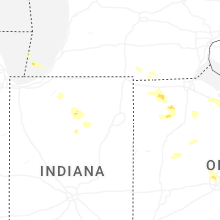
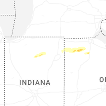
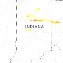
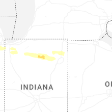


Connect with Interactive Hail Maps