

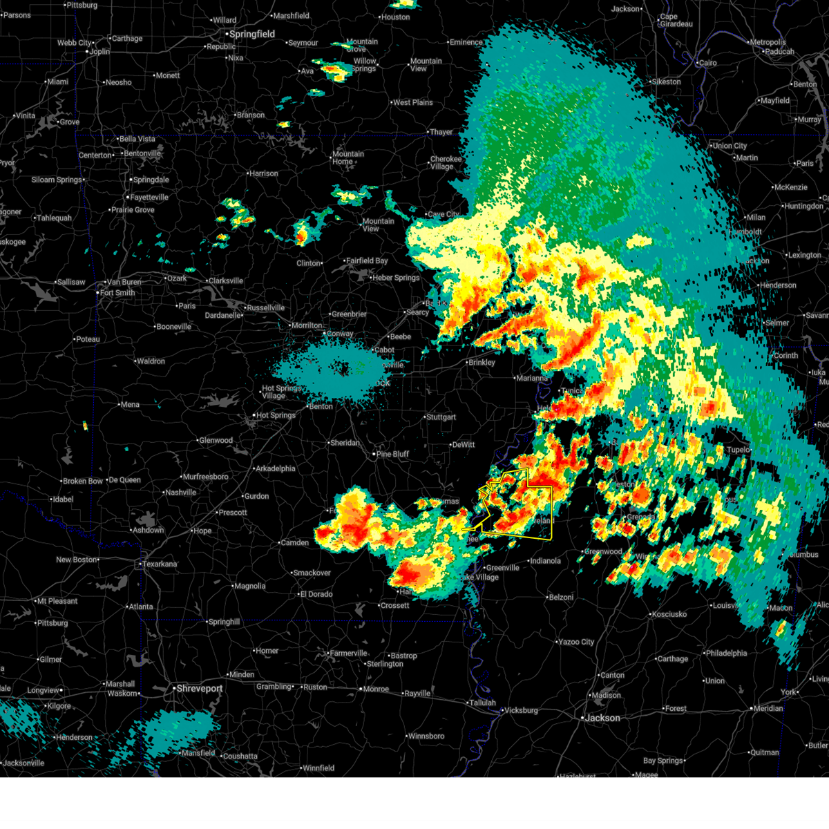
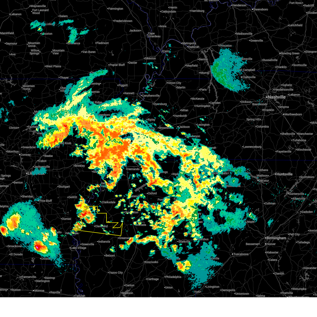
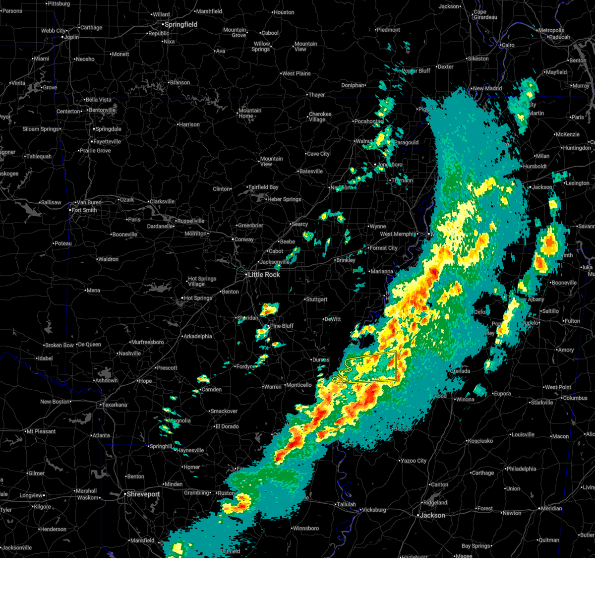
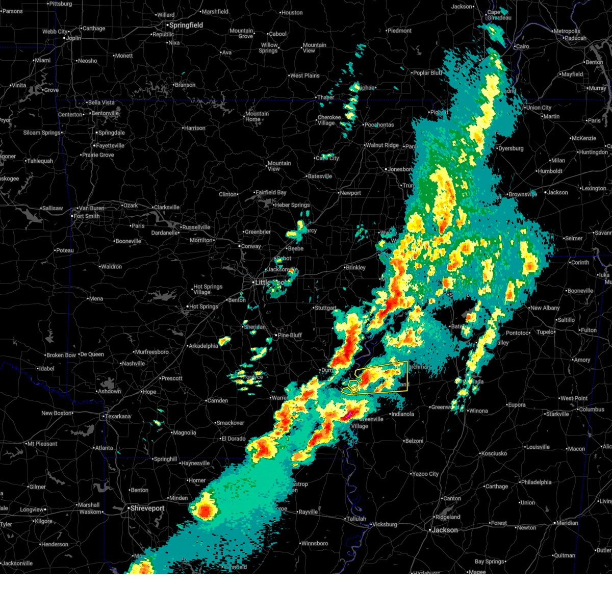
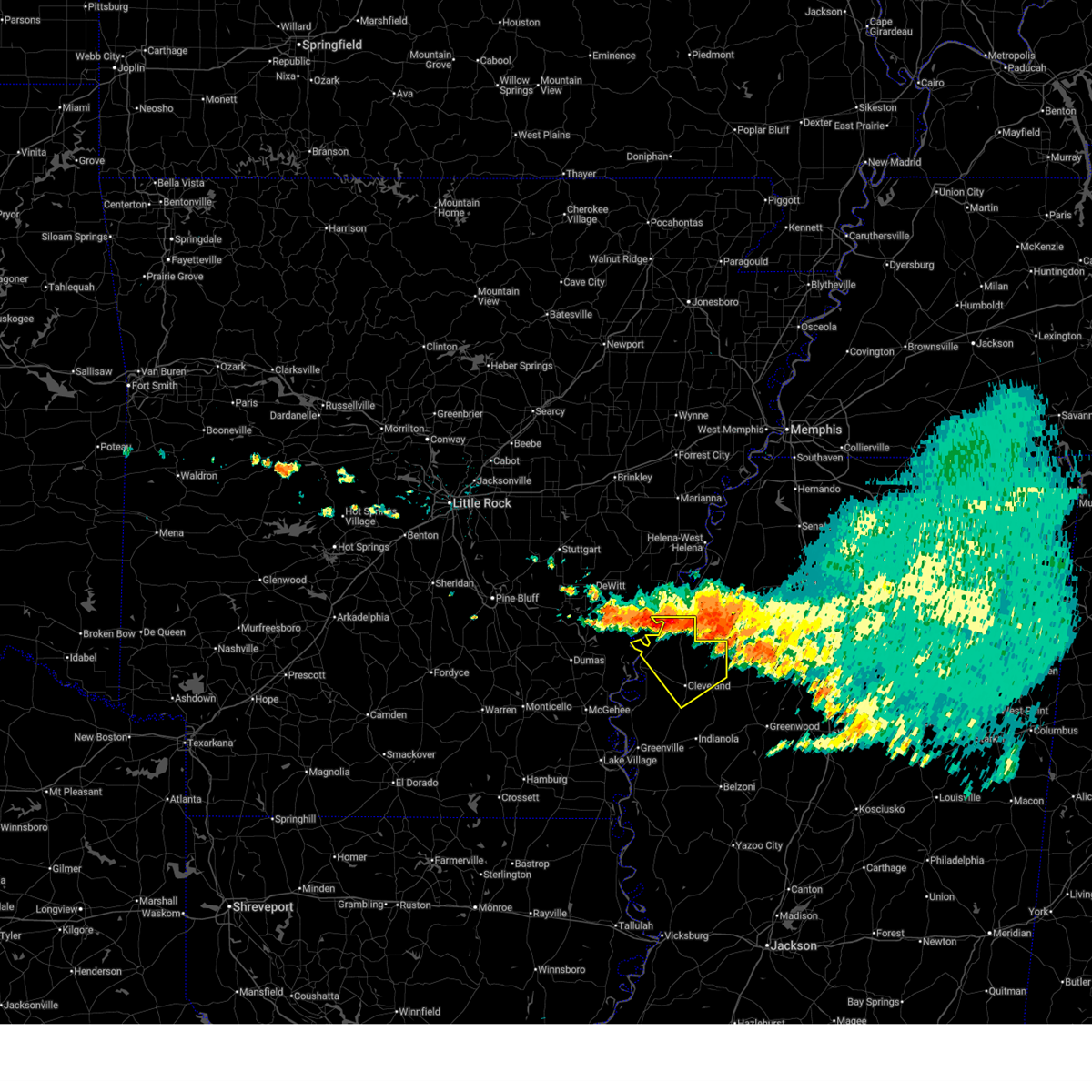
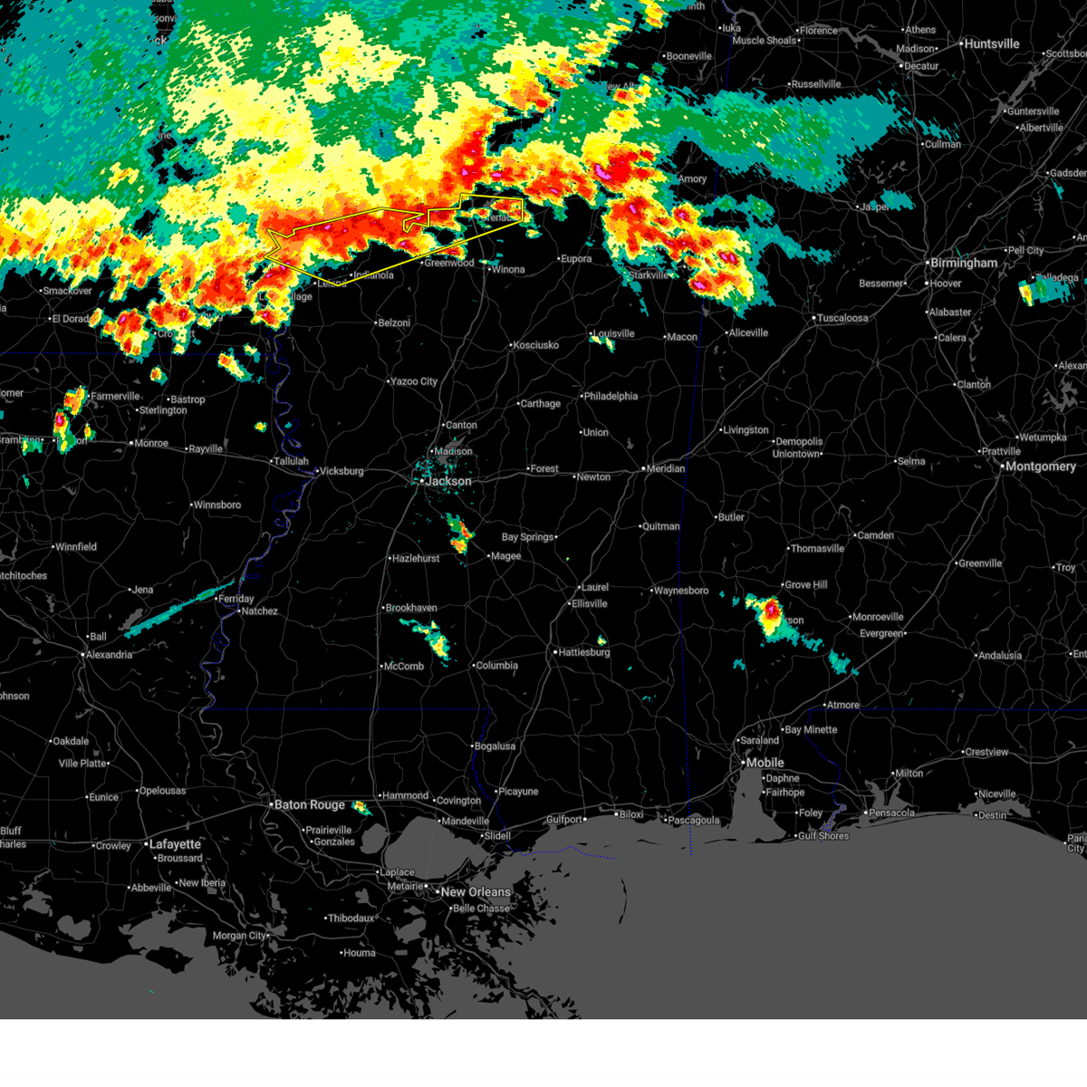
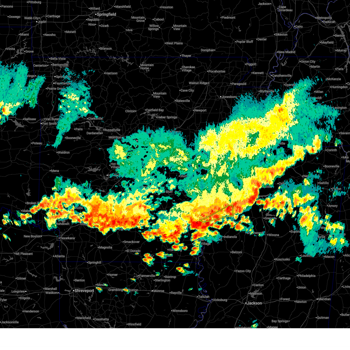
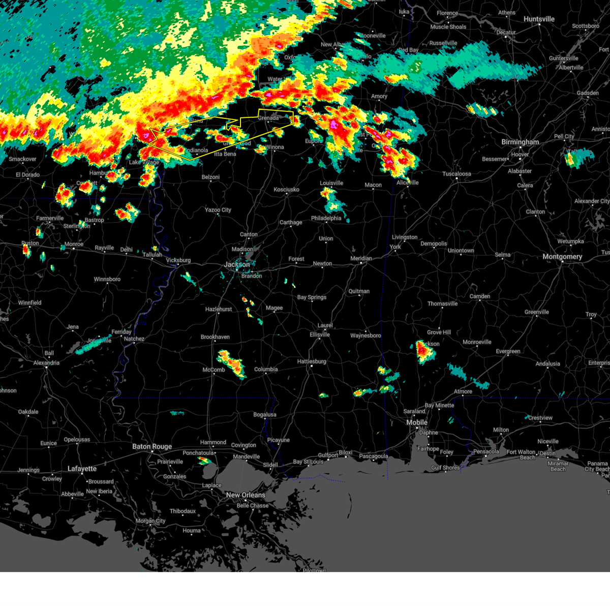
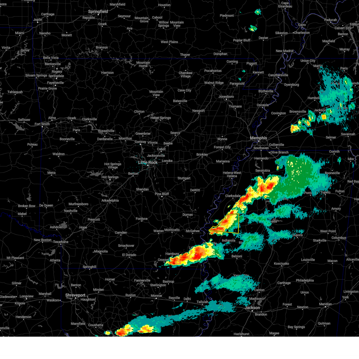
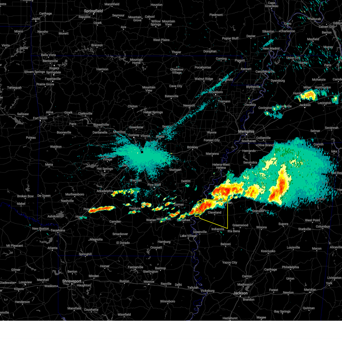
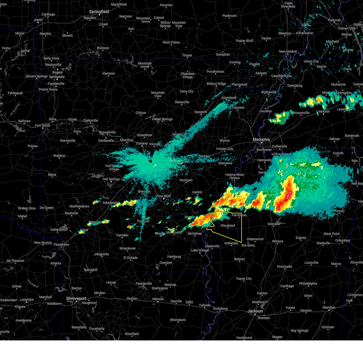
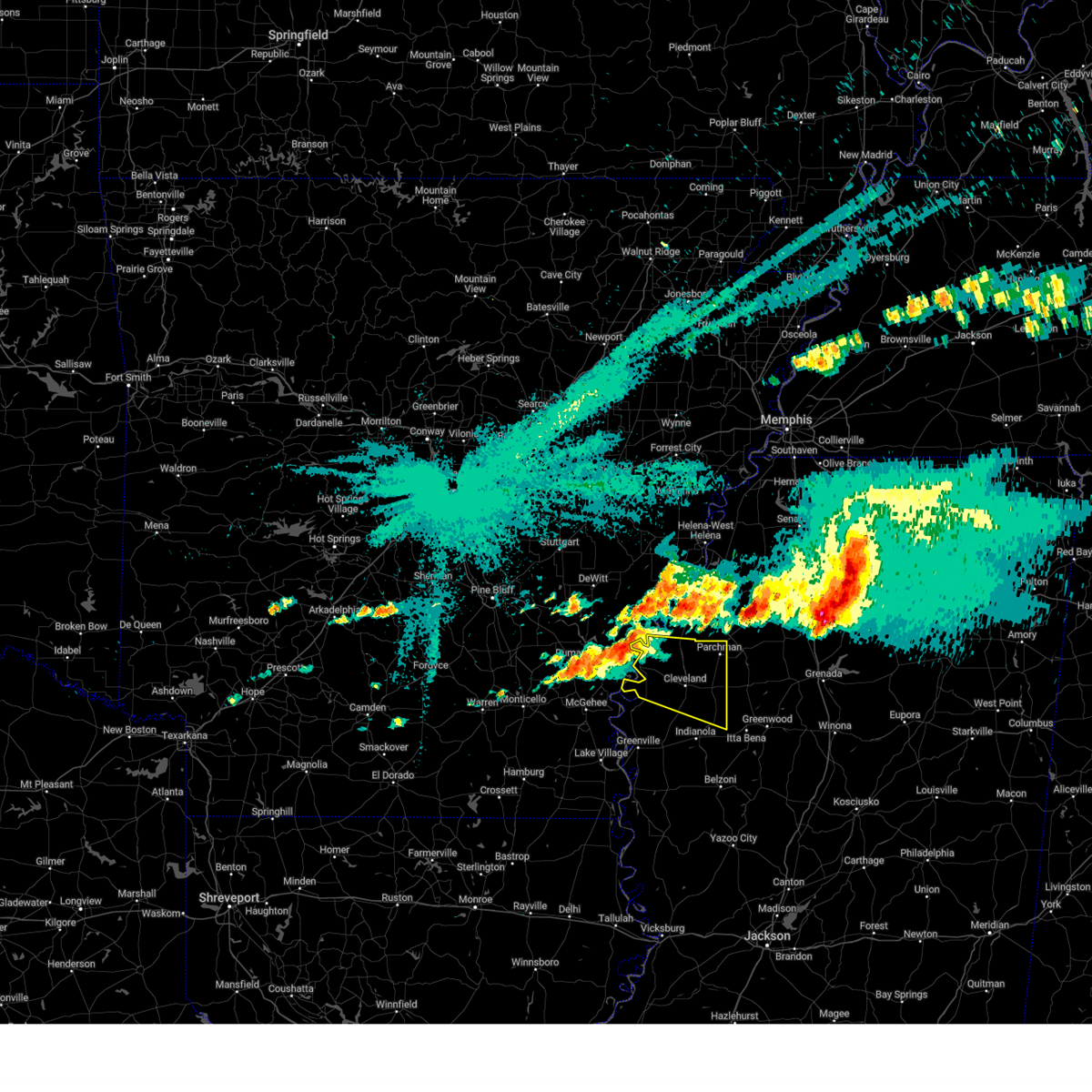
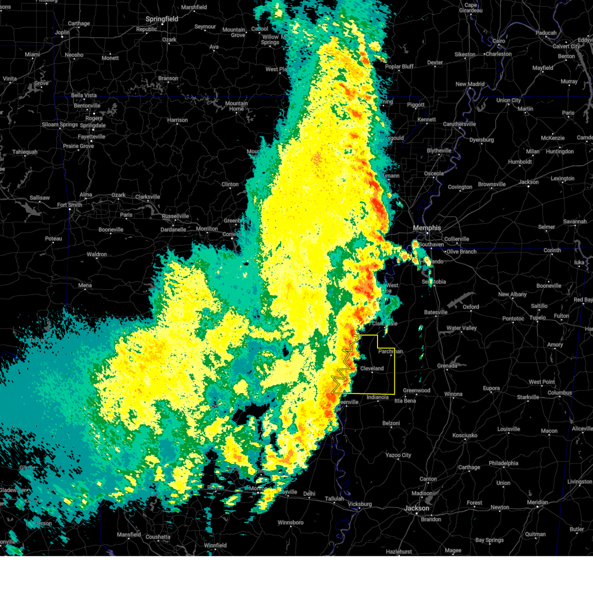
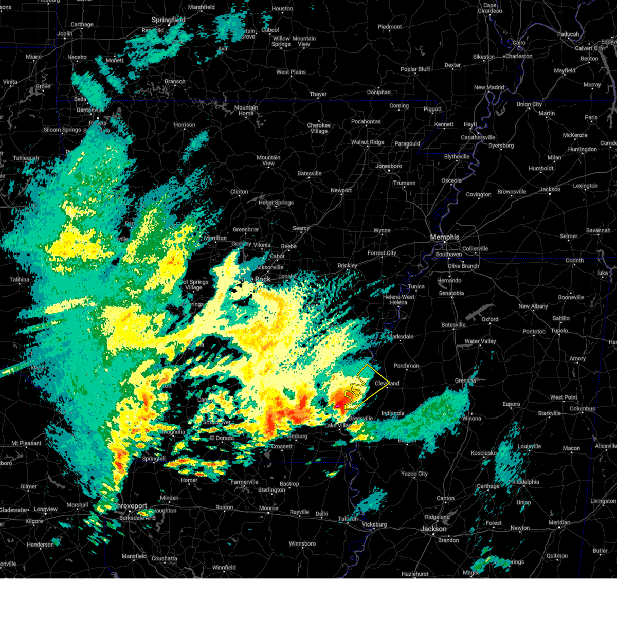
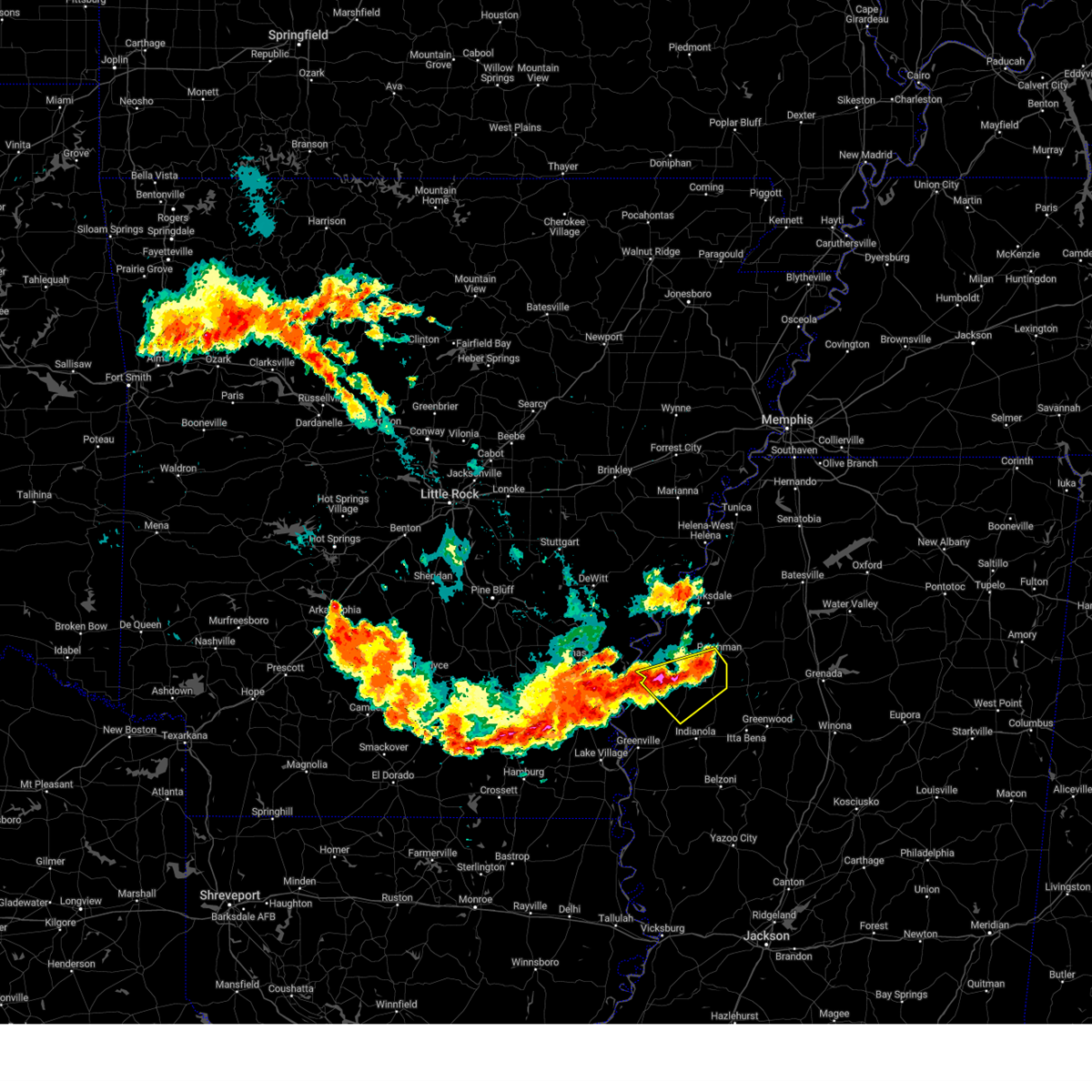
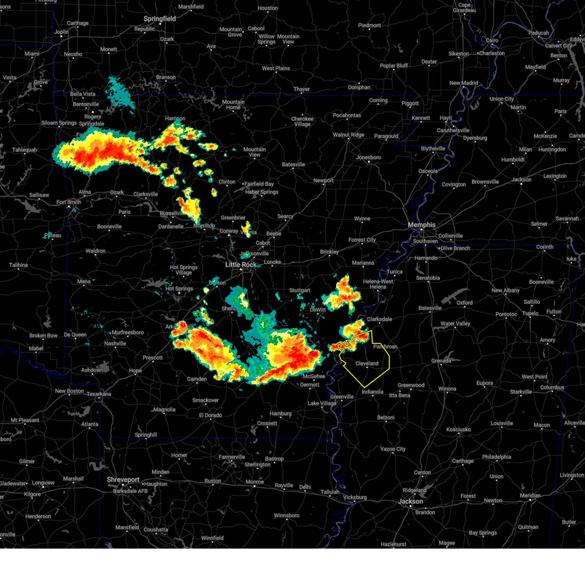
Hail Map for Cleveland, MS
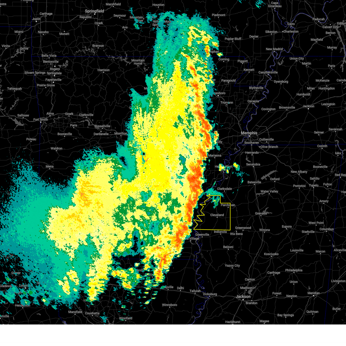
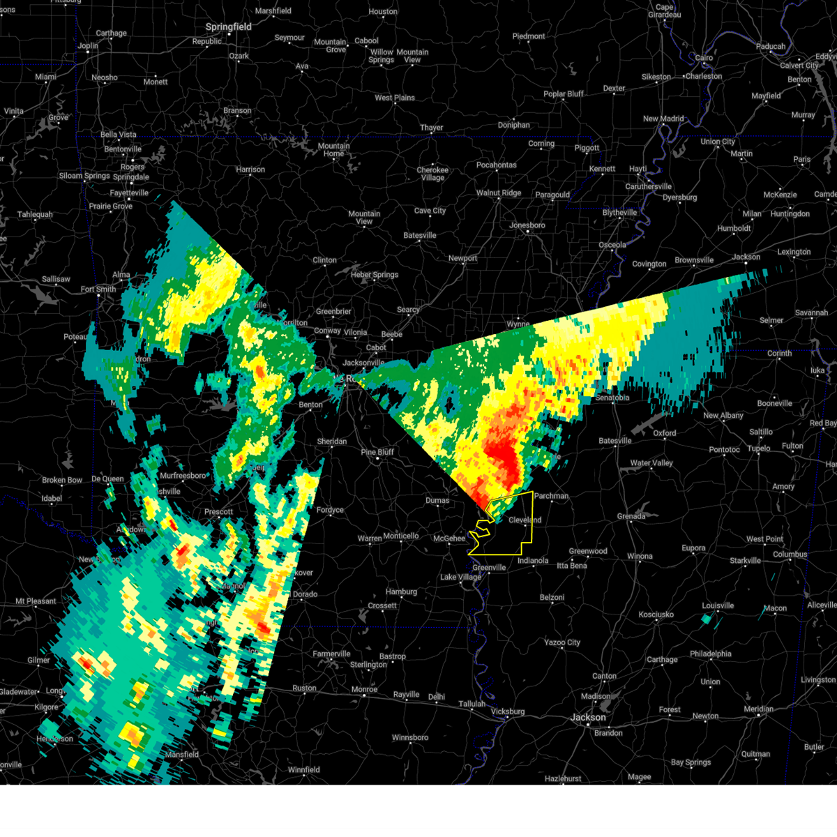
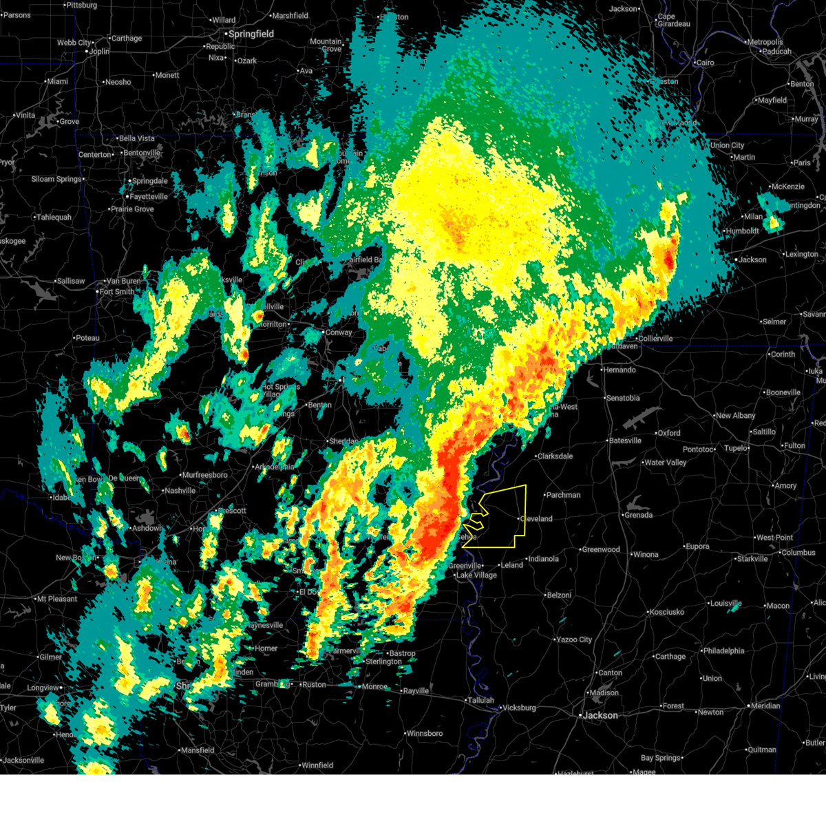
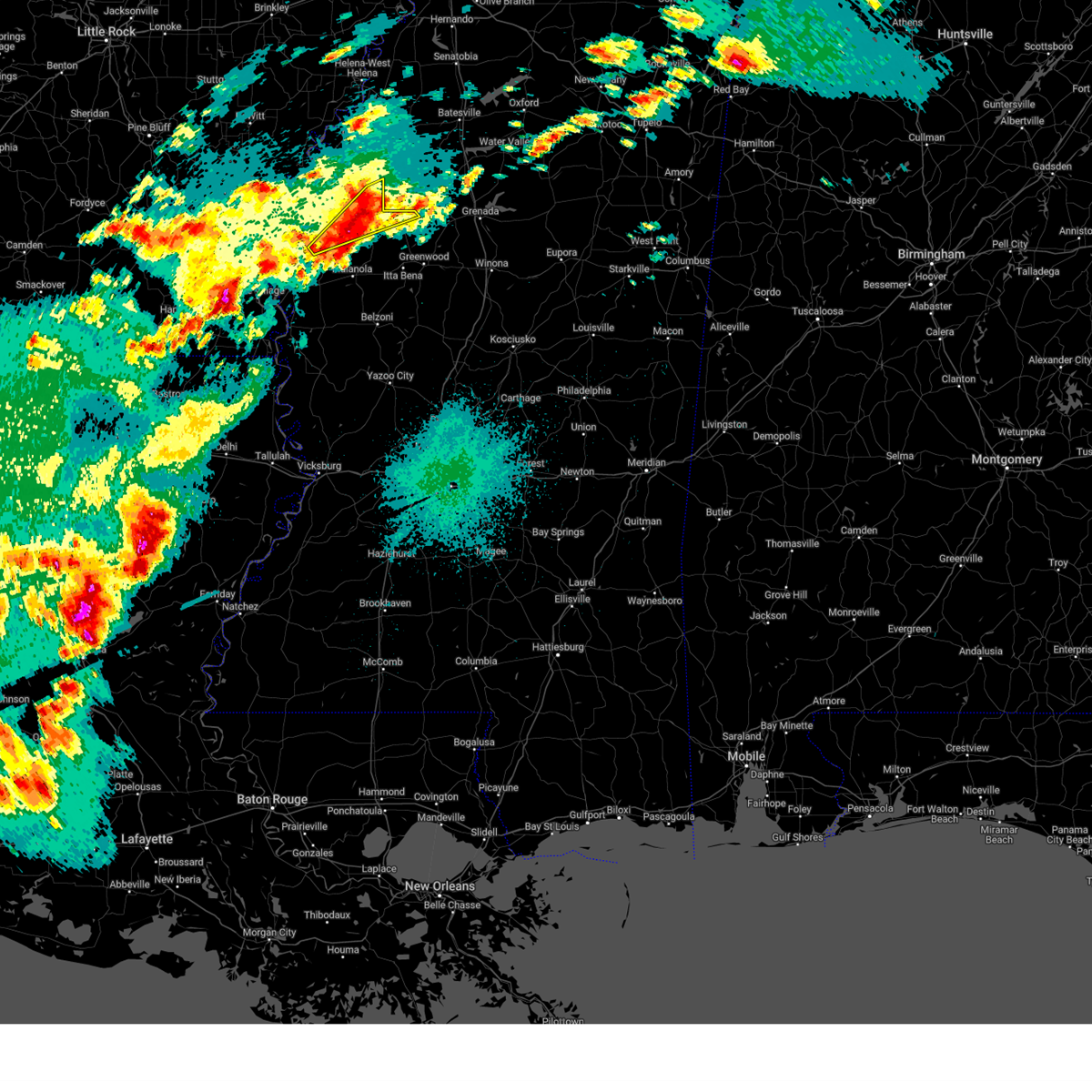
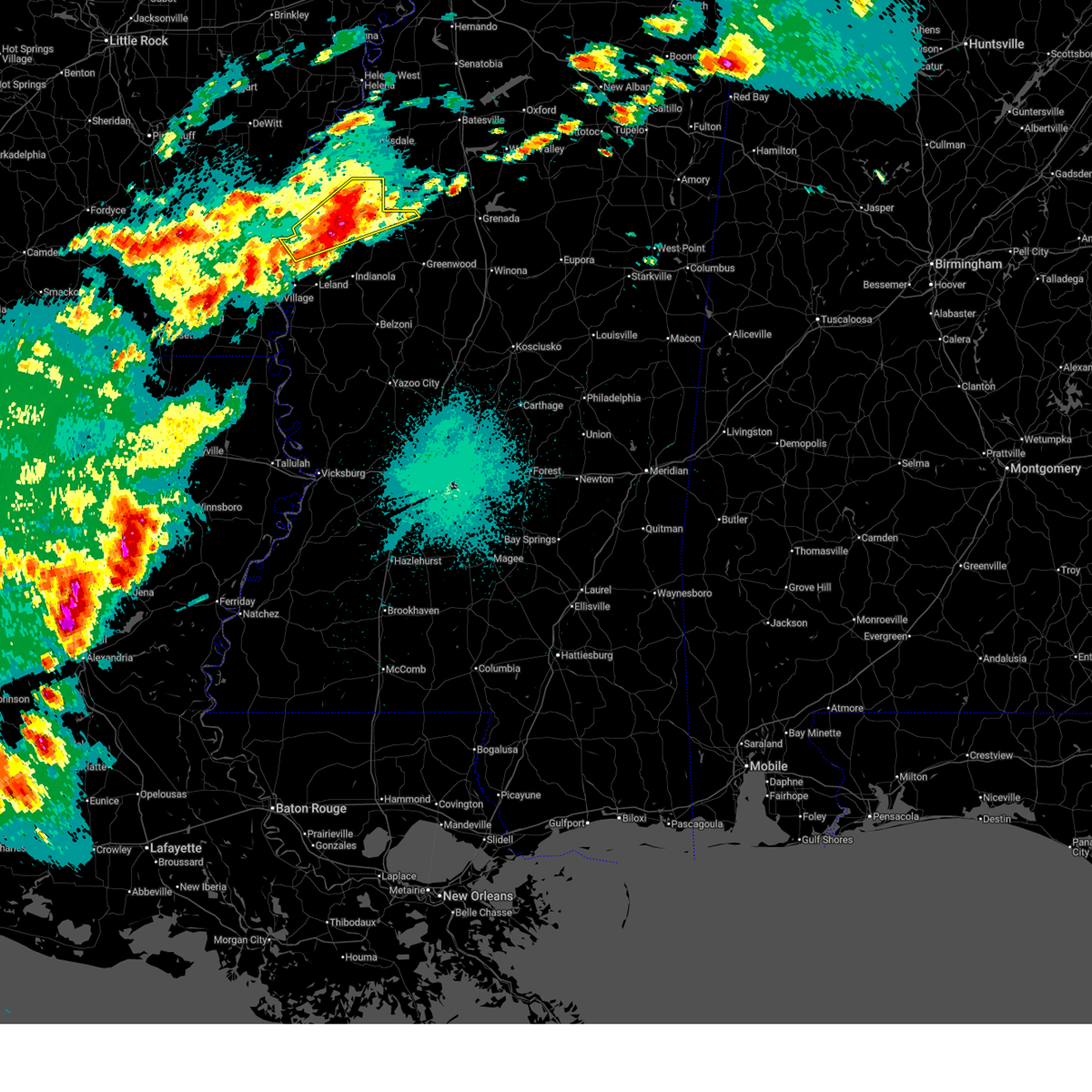
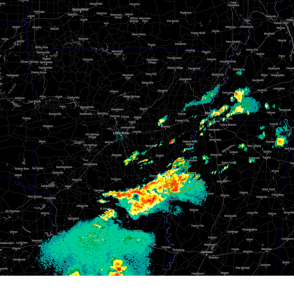
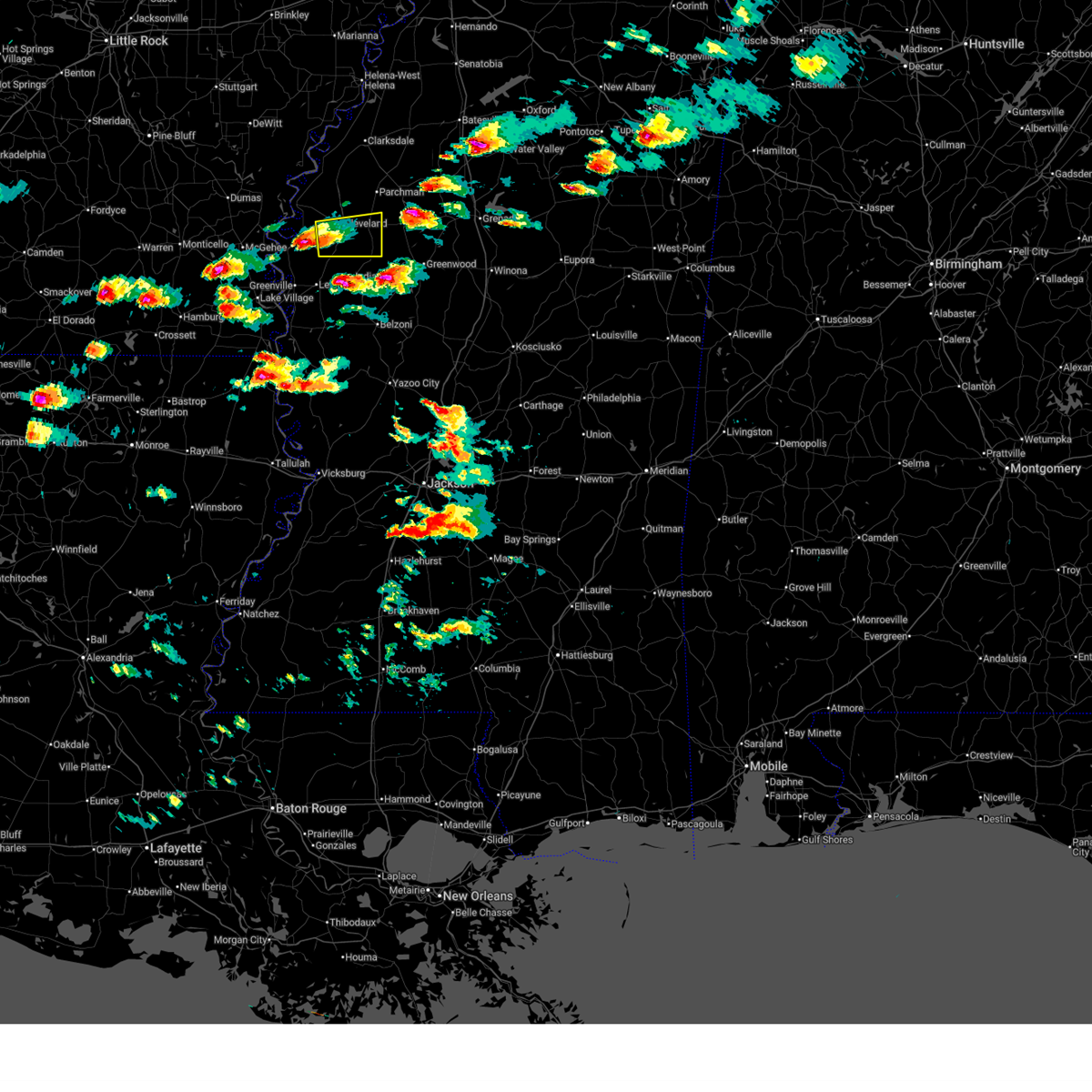
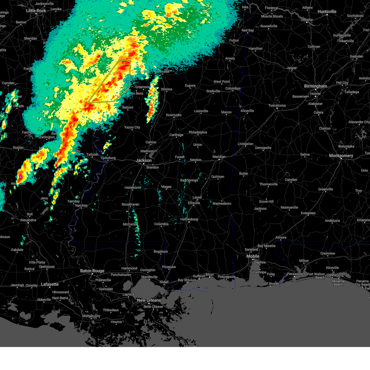
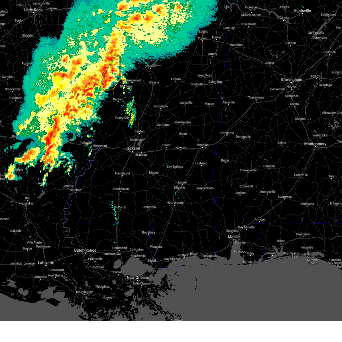
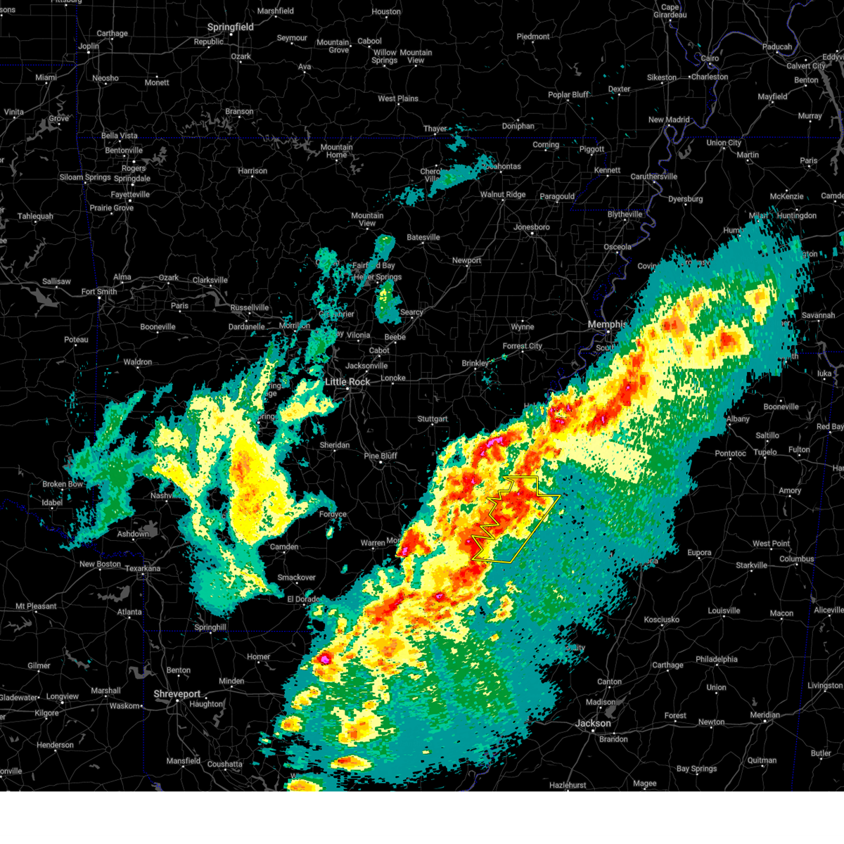
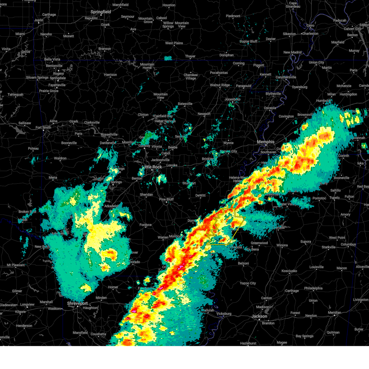
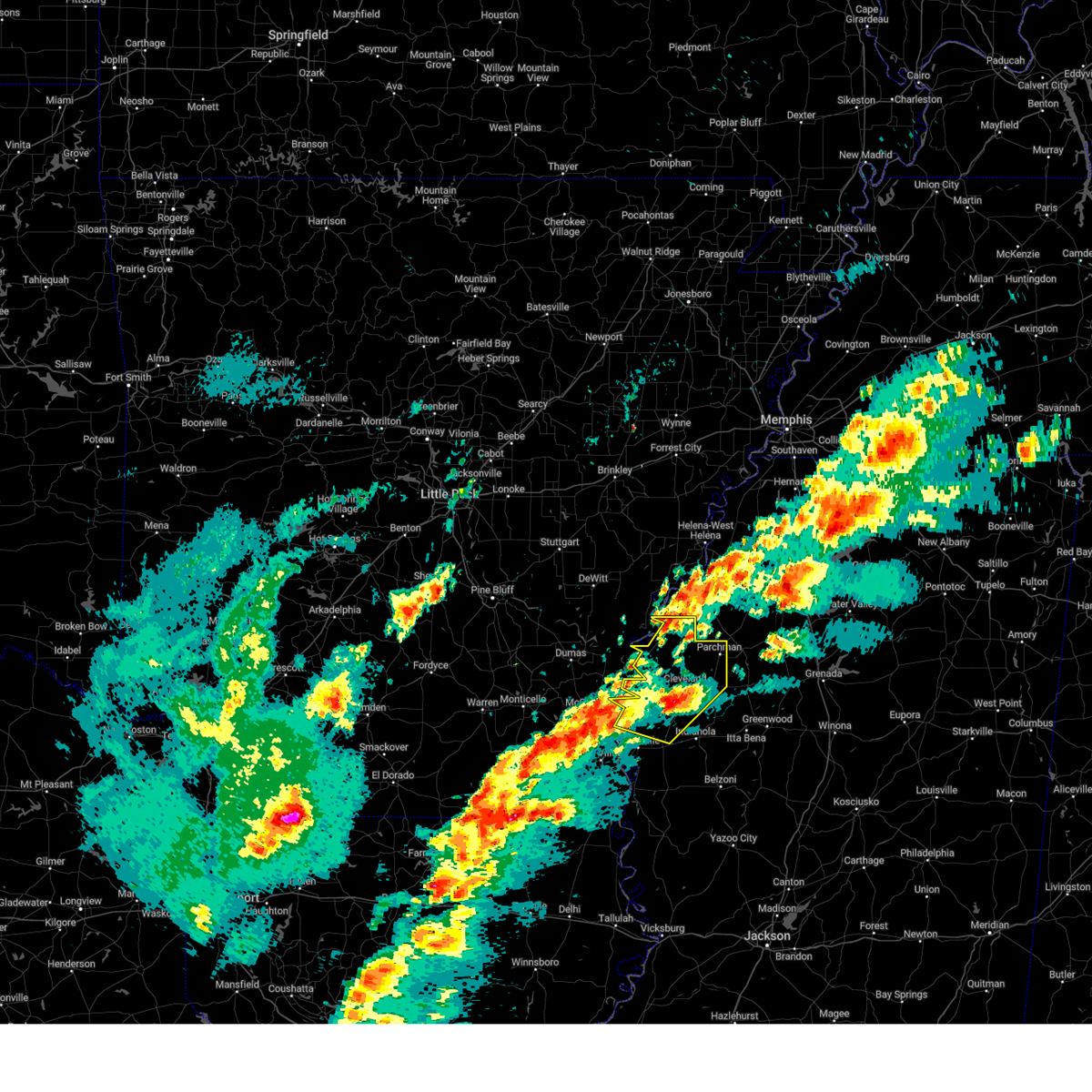
The Cleveland, MS area has had 7 reports of on-the-ground hail by trained spotters, and has been under severe weather warnings 8 times during the past 12 months. Doppler radar has detected hail at or near Cleveland, MS on 63 occasions, including 5 occasions during the past year.
| Name: | Cleveland, MS |
| Where Located: | 95.6 miles NE of Bastrop, LA |
| Map: | Google Map for Cleveland, MS |
| Population: | 12334 |
| Housing Units: | 5067 |
| More Info: | Search Google for Cleveland, MS |
0
The Top Recent Hail Date for Cleveland, MS is Sunday, May 10, 2026 (60th out of 63)
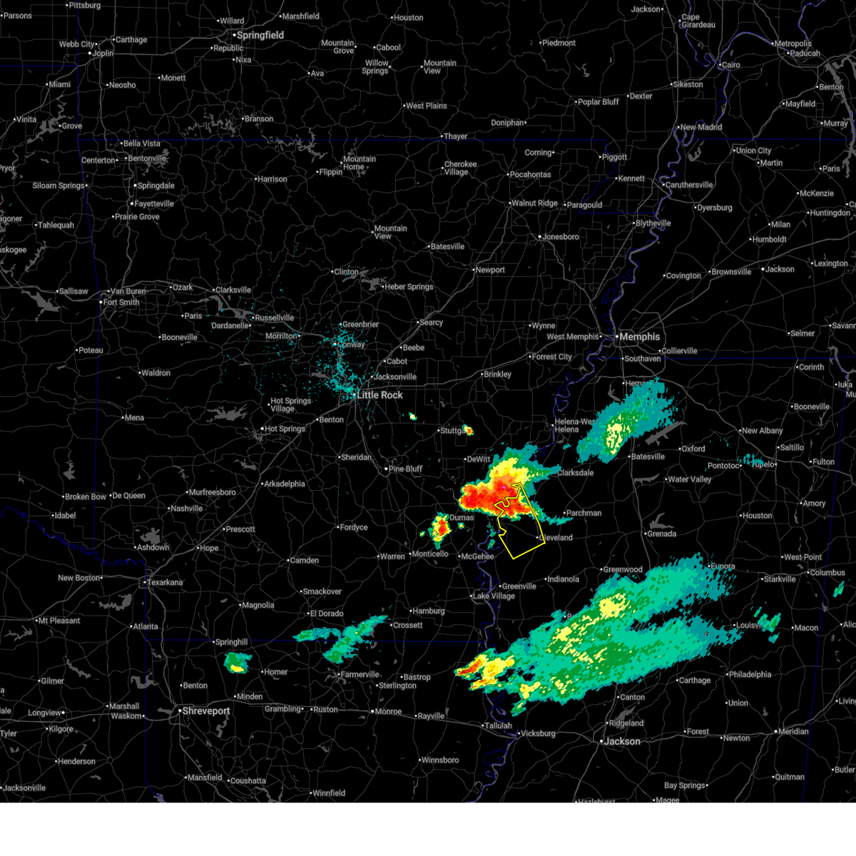
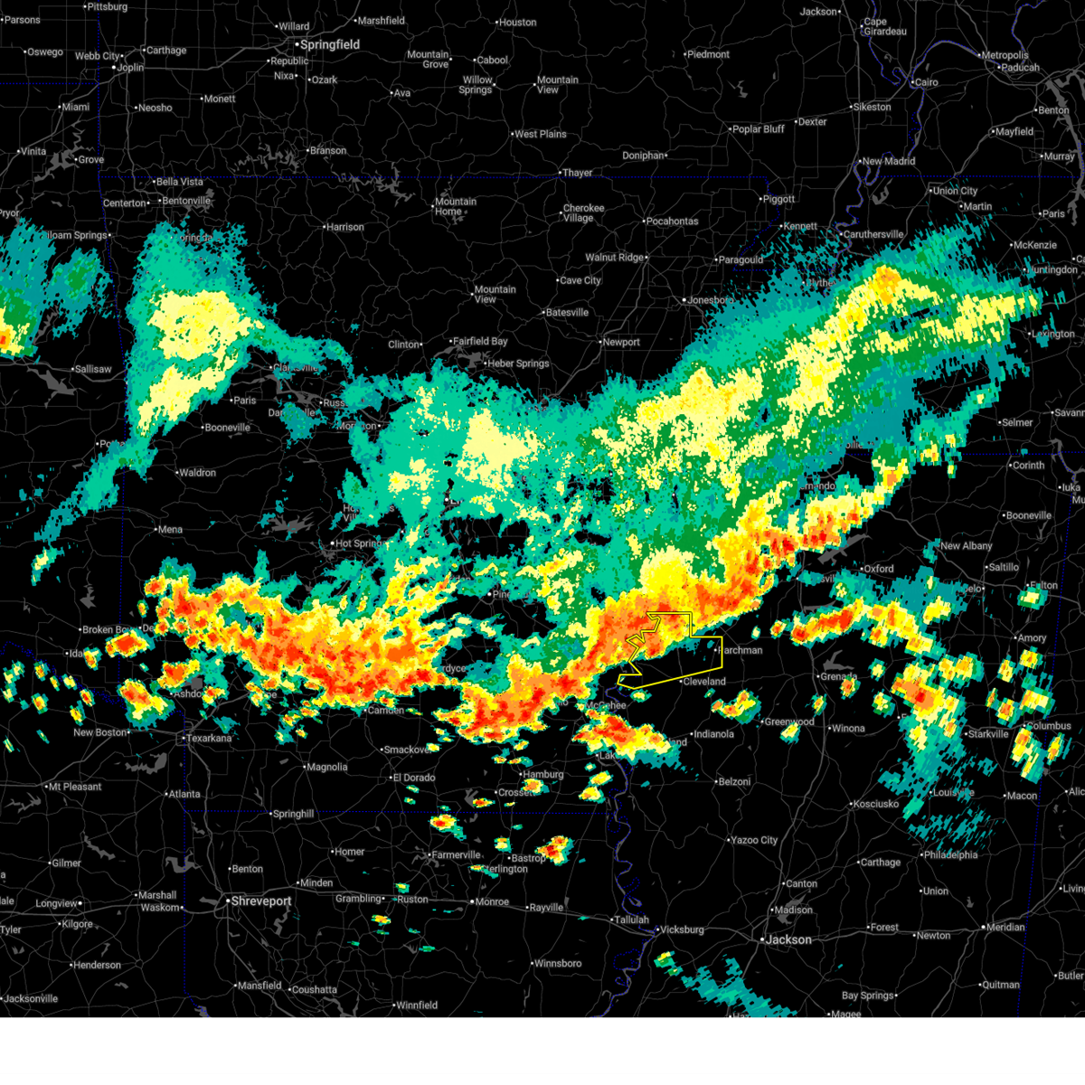
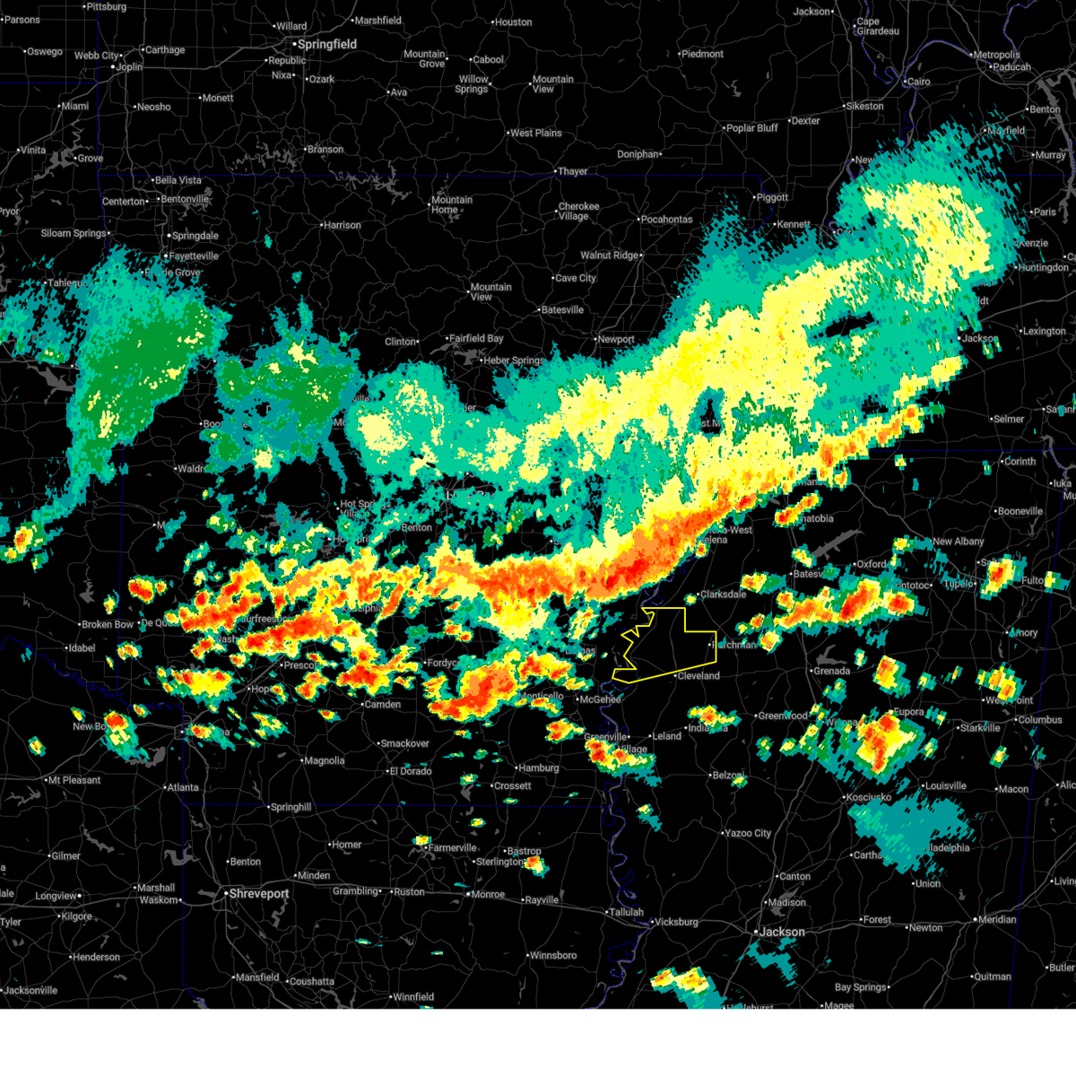
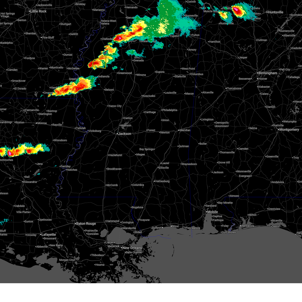
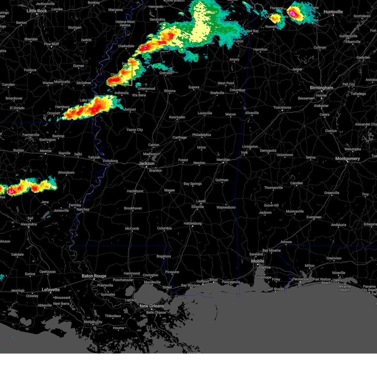
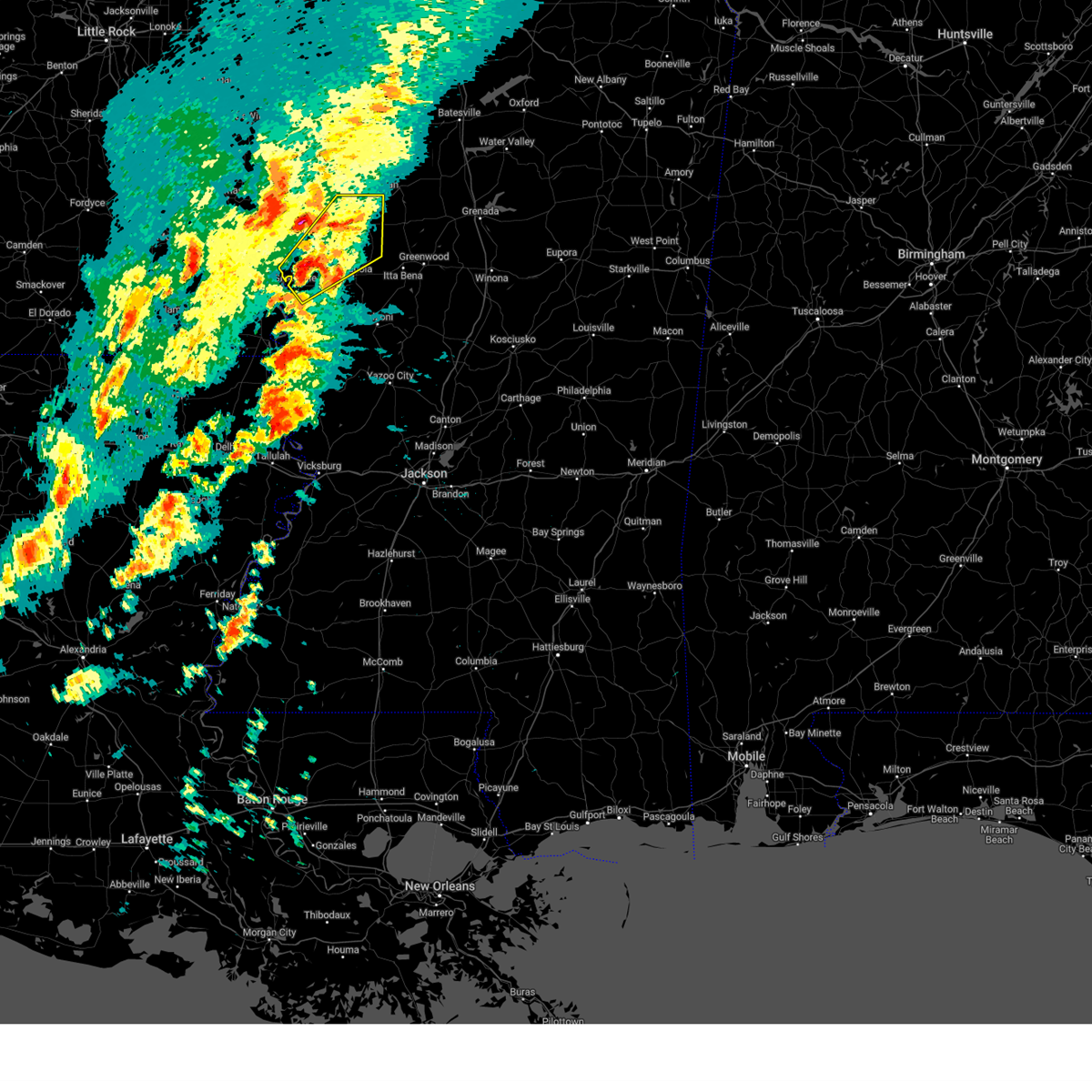
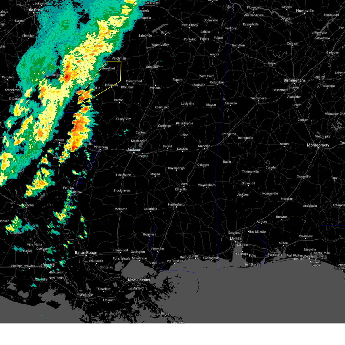
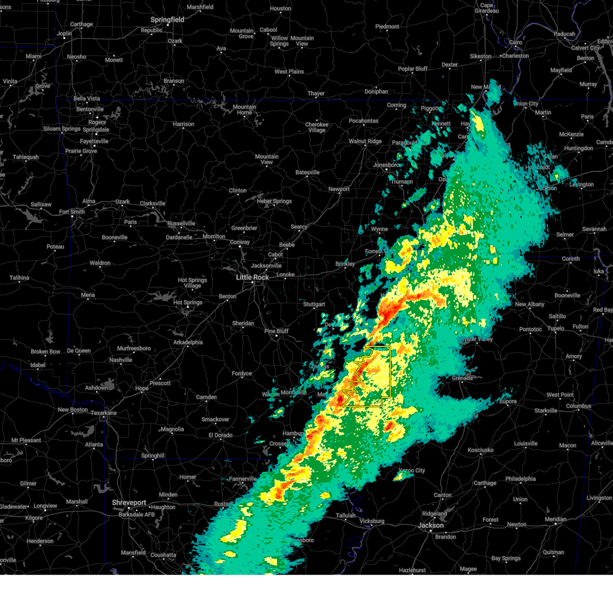
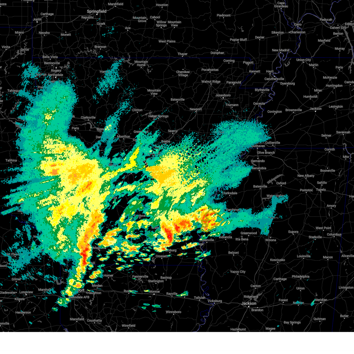
Hail and Wind Damage Spotted near Cleveland, MS
| Date / Time | Report Details |
|---|---|
| 6/22/2026 10:38 AM CDT |
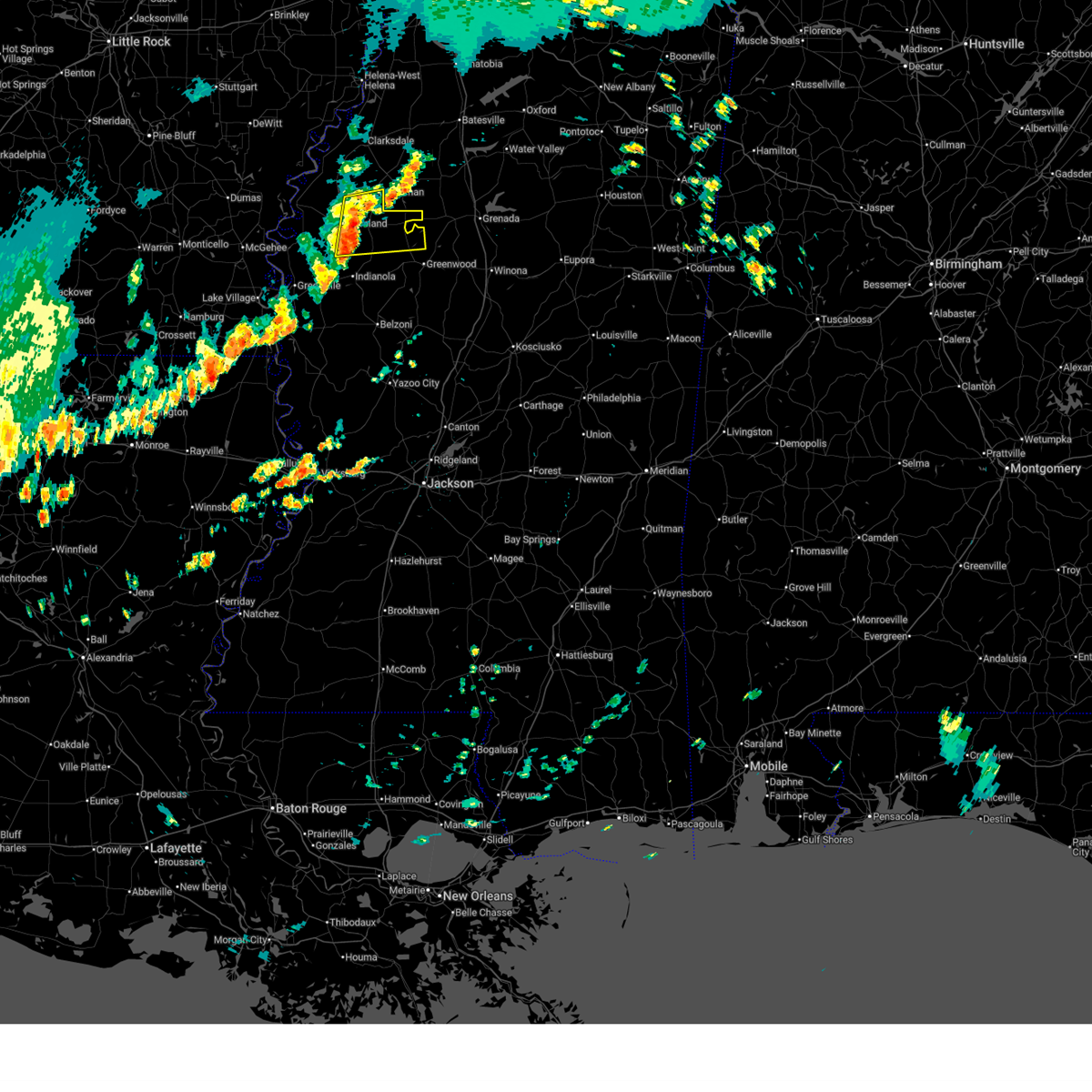 At 1038 am cdt, severe thunderstorms were located along a line extending from near renova to near shaw, moving east at 40 mph (radar indicated). Hazards include 60 mph wind gusts. Expect damage to roofs, siding, and trees. these severe storms will be near, ruleville, drew, doddsville, and blaine around 1045 am cdt. schlater around 1100 am cdt. sunnyside and minter city around 1105 am cdt. Money around 1115 am cdt. At 1038 am cdt, severe thunderstorms were located along a line extending from near renova to near shaw, moving east at 40 mph (radar indicated). Hazards include 60 mph wind gusts. Expect damage to roofs, siding, and trees. these severe storms will be near, ruleville, drew, doddsville, and blaine around 1045 am cdt. schlater around 1100 am cdt. sunnyside and minter city around 1105 am cdt. Money around 1115 am cdt.
|
| 6/22/2026 10:18 AM CDT |
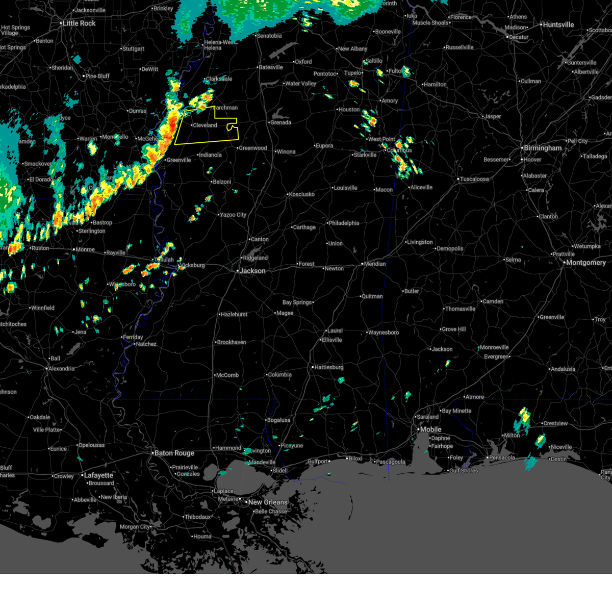 Svrjan the national weather service in jackson has issued a * severe thunderstorm warning for, central sunflower county in northwestern mississippi, northern leflore county in north central mississippi, southeastern bolivar county in northwestern mississippi, * until 1115 am cdt. * at 1018 am cdt, a severe thunderstorm was located near pace, or near cleveland, moving east at 40 mph (radar indicated). Hazards include 60 mph wind gusts. Expect damage to roofs, siding, and trees. this severe thunderstorm will be near, cleveland, renova, boyle, and merigold around 1025 am cdt. ruleville around 1030 am cdt. drew and doddsville around 1035 am cdt. schlater, sunnyside, and minter city around 1050 am cdt. Money around 1100 am cdt. Svrjan the national weather service in jackson has issued a * severe thunderstorm warning for, central sunflower county in northwestern mississippi, northern leflore county in north central mississippi, southeastern bolivar county in northwestern mississippi, * until 1115 am cdt. * at 1018 am cdt, a severe thunderstorm was located near pace, or near cleveland, moving east at 40 mph (radar indicated). Hazards include 60 mph wind gusts. Expect damage to roofs, siding, and trees. this severe thunderstorm will be near, cleveland, renova, boyle, and merigold around 1025 am cdt. ruleville around 1030 am cdt. drew and doddsville around 1035 am cdt. schlater, sunnyside, and minter city around 1050 am cdt. Money around 1100 am cdt.
|
| 6/2/2026 1:14 AM CDT |
 Svrjan the national weather service in jackson has issued a * severe thunderstorm warning for, central bolivar county in northwestern mississippi, * until 145 am cdt. * at 114 am cdt, a severe thunderstorm was located near gunnison, or 7 miles southwest of shelby, moving southeast at 45 mph (radar indicated). Hazards include 60 mph wind gusts and quarter size hail. Hail damage to vehicles is expected. expect wind damage to roofs, siding, and trees. this severe thunderstorm will be near, cleveland, renova, merigold, and pace around 120 am cdt. Boyle around 125 am cdt. Svrjan the national weather service in jackson has issued a * severe thunderstorm warning for, central bolivar county in northwestern mississippi, * until 145 am cdt. * at 114 am cdt, a severe thunderstorm was located near gunnison, or 7 miles southwest of shelby, moving southeast at 45 mph (radar indicated). Hazards include 60 mph wind gusts and quarter size hail. Hail damage to vehicles is expected. expect wind damage to roofs, siding, and trees. this severe thunderstorm will be near, cleveland, renova, merigold, and pace around 120 am cdt. Boyle around 125 am cdt.
|
| 4/28/2026 8:53 PM CDT |
 At 852 pm cdt, a severe thunderstorm was located near rome, or 10 miles east of shelby, moving east at 50 mph (radar indicated). Hazards include 60 mph wind gusts and quarter size hail. Hail damage to vehicles is expected. expect wind damage to roofs, siding, and trees. This severe storm will be near, parchman and rome around 900 pm cdt. At 852 pm cdt, a severe thunderstorm was located near rome, or 10 miles east of shelby, moving east at 50 mph (radar indicated). Hazards include 60 mph wind gusts and quarter size hail. Hail damage to vehicles is expected. expect wind damage to roofs, siding, and trees. This severe storm will be near, parchman and rome around 900 pm cdt.
|
| 4/28/2026 8:30 PM CDT |
 Svrjan the national weather service in jackson has issued a * severe thunderstorm warning for, northeastern sunflower county in northwestern mississippi, southwestern grenada county in north central mississippi, northern leflore county in north central mississippi, bolivar county in northwestern mississippi, * until 930 pm cdt. * at 829 pm cdt, a severe thunderstorm was located over gunnison, or 8 miles west of shelby, moving east at 45 mph (radar indicated). Hazards include 60 mph wind gusts and quarter size hail. Hail damage to vehicles is expected. expect wind damage to roofs, siding, and trees. this severe thunderstorm will be near, shelby, mound bayou, duncan, winstonville, and deeson around 835 pm cdt. Parchman and rome around 850 pm cdt. Svrjan the national weather service in jackson has issued a * severe thunderstorm warning for, northeastern sunflower county in northwestern mississippi, southwestern grenada county in north central mississippi, northern leflore county in north central mississippi, bolivar county in northwestern mississippi, * until 930 pm cdt. * at 829 pm cdt, a severe thunderstorm was located over gunnison, or 8 miles west of shelby, moving east at 45 mph (radar indicated). Hazards include 60 mph wind gusts and quarter size hail. Hail damage to vehicles is expected. expect wind damage to roofs, siding, and trees. this severe thunderstorm will be near, shelby, mound bayou, duncan, winstonville, and deeson around 835 pm cdt. Parchman and rome around 850 pm cdt.
|
| 3/15/2026 8:09 PM CDT |
 The storm which prompted the warning has weakened below severe limits, and has exited the warned area. therefore, the warning will be allowed to expire. a tornado watch remains in effect until 1100 pm cdt for north central and northwestern mississippi. The storm which prompted the warning has weakened below severe limits, and has exited the warned area. therefore, the warning will be allowed to expire. a tornado watch remains in effect until 1100 pm cdt for north central and northwestern mississippi.
|
| 3/15/2026 8:00 PM CDT | A few power poles were leaning along hwy in bolivar county MS, 2.6 miles ESE of Cleveland, MS |
| 3/15/2026 7:29 PM CDT |
 At 729 pm cdt, a severe thunderstorm was located over beulah, or 7 miles southeast of rosedale, moving east at 35 mph (radar indicated). Hazards include 60 mph wind gusts and quarter size hail. Hail damage to vehicles is expected. expect wind damage to roofs, siding, and trees. Locations impacted include, cleveland, ruleville, rosedale, drew, mound bayou, renova, boyle, benoit, merigold, beulah, pace, winstonville, parchman, rome, and jersey point. At 729 pm cdt, a severe thunderstorm was located over beulah, or 7 miles southeast of rosedale, moving east at 35 mph (radar indicated). Hazards include 60 mph wind gusts and quarter size hail. Hail damage to vehicles is expected. expect wind damage to roofs, siding, and trees. Locations impacted include, cleveland, ruleville, rosedale, drew, mound bayou, renova, boyle, benoit, merigold, beulah, pace, winstonville, parchman, rome, and jersey point.
|
| 3/15/2026 7:07 PM CDT |
 Svrjan the national weather service in jackson has issued a * severe thunderstorm warning for, northeastern sunflower county in northwestern mississippi, central bolivar county in northwestern mississippi, * until 815 pm cdt. * at 707 pm cdt, a severe thunderstorm was located over lucca landing, or near rohwer, moving east at 35 mph (radar indicated). Hazards include golf ball size hail and 60 mph wind gusts. People and animals outdoors will be injured. expect hail damage to roofs, siding, windows, and vehicles. expect wind damage to roofs, siding, and trees. this severe thunderstorm will be near, rosedale and beulah around 715 pm cdt. benoit around 720 pm cdt. pace around 725 pm cdt. cleveland around 735 pm cdt. mound bayou, renova, boyle, and merigold around 740 pm cdt. winstonville around 745 pm cdt. drew around 755 pm cdt. Ruleville around 800 pm cdt. Svrjan the national weather service in jackson has issued a * severe thunderstorm warning for, northeastern sunflower county in northwestern mississippi, central bolivar county in northwestern mississippi, * until 815 pm cdt. * at 707 pm cdt, a severe thunderstorm was located over lucca landing, or near rohwer, moving east at 35 mph (radar indicated). Hazards include golf ball size hail and 60 mph wind gusts. People and animals outdoors will be injured. expect hail damage to roofs, siding, windows, and vehicles. expect wind damage to roofs, siding, and trees. this severe thunderstorm will be near, rosedale and beulah around 715 pm cdt. benoit around 720 pm cdt. pace around 725 pm cdt. cleveland around 735 pm cdt. mound bayou, renova, boyle, and merigold around 740 pm cdt. winstonville around 745 pm cdt. drew around 755 pm cdt. Ruleville around 800 pm cdt.
|
| 6/19/2025 12:12 PM CDT |
 At 1212 pm cdt, a severe thunderstorm was located near drew, or 8 miles north of ruleville, moving east at 25 mph (radar indicated). Hazards include 60 mph wind gusts and quarter size hail. Hail damage to vehicles is expected. expect wind damage to roofs, siding, and trees. This severe thunderstorm will remain over mainly rural areas of southeastern bolivar county. At 1212 pm cdt, a severe thunderstorm was located near drew, or 8 miles north of ruleville, moving east at 25 mph (radar indicated). Hazards include 60 mph wind gusts and quarter size hail. Hail damage to vehicles is expected. expect wind damage to roofs, siding, and trees. This severe thunderstorm will remain over mainly rural areas of southeastern bolivar county.
|
| 6/19/2025 12:12 PM CDT |
 the severe thunderstorm warning has been cancelled and is no longer in effect the severe thunderstorm warning has been cancelled and is no longer in effect
|
| 6/19/2025 11:26 AM CDT |
 Svrjan the national weather service in jackson has issued a * severe thunderstorm warning for, northeastern sunflower county in northwestern mississippi, southeastern bolivar county in northwestern mississippi, * until 1245 pm cdt. * at 1126 am cdt, a severe thunderstorm was located near gunnison, or 7 miles west of shelby, moving east at 25 mph (radar indicated). Hazards include 60 mph wind gusts and quarter size hail. Hail damage to vehicles is expected. expect wind damage to roofs, siding, and trees. this severe thunderstorm will be near, shelby, mound bayou, and winstonville around 1130 am cdt. merigold around 1135 am cdt. cleveland around 1140 am cdt. renova around 1150 am cdt. drew around 1205 pm cdt. Ruleville and parchman around 1210 pm cdt. Svrjan the national weather service in jackson has issued a * severe thunderstorm warning for, northeastern sunflower county in northwestern mississippi, southeastern bolivar county in northwestern mississippi, * until 1245 pm cdt. * at 1126 am cdt, a severe thunderstorm was located near gunnison, or 7 miles west of shelby, moving east at 25 mph (radar indicated). Hazards include 60 mph wind gusts and quarter size hail. Hail damage to vehicles is expected. expect wind damage to roofs, siding, and trees. this severe thunderstorm will be near, shelby, mound bayou, and winstonville around 1130 am cdt. merigold around 1135 am cdt. cleveland around 1140 am cdt. renova around 1150 am cdt. drew around 1205 pm cdt. Ruleville and parchman around 1210 pm cdt.
|
| 6/19/2025 11:07 AM CDT |
 At 1107 am cdt, a severe thunderstorm was located over rome, or 15 miles northeast of ruleville, moving east at 35 mph (radar indicated). Hazards include 60 mph wind gusts and quarter size hail. Hail damage to vehicles is expected. expect wind damage to roofs, siding, and trees. This severe thunderstorm will remain over mainly rural areas of northeastern sunflower and eastern bolivar counties. At 1107 am cdt, a severe thunderstorm was located over rome, or 15 miles northeast of ruleville, moving east at 35 mph (radar indicated). Hazards include 60 mph wind gusts and quarter size hail. Hail damage to vehicles is expected. expect wind damage to roofs, siding, and trees. This severe thunderstorm will remain over mainly rural areas of northeastern sunflower and eastern bolivar counties.
|
| 6/19/2025 10:24 AM CDT |
 Svrjan the national weather service in jackson has issued a * severe thunderstorm warning for, northeastern sunflower county in northwestern mississippi, eastern bolivar county in northwestern mississippi, * until 1130 am cdt. * at 1024 am cdt, a severe thunderstorm was located over deeson, or 7 miles northwest of shelby, moving east at 35 mph (radar indicated). Hazards include 60 mph wind gusts and quarter size hail. Hail damage to vehicles is expected. expect wind damage to roofs, siding, and trees. this severe thunderstorm will be near, shelby, duncan, alligator, and winstonville around 1030 am cdt. Parchman and rome around 1050 am cdt. Svrjan the national weather service in jackson has issued a * severe thunderstorm warning for, northeastern sunflower county in northwestern mississippi, eastern bolivar county in northwestern mississippi, * until 1130 am cdt. * at 1024 am cdt, a severe thunderstorm was located over deeson, or 7 miles northwest of shelby, moving east at 35 mph (radar indicated). Hazards include 60 mph wind gusts and quarter size hail. Hail damage to vehicles is expected. expect wind damage to roofs, siding, and trees. this severe thunderstorm will be near, shelby, duncan, alligator, and winstonville around 1030 am cdt. Parchman and rome around 1050 am cdt.
|
| 5/25/2025 7:07 PM CDT |
 At 707 pm cdt, severe thunderstorms were located along a line extending from near coffeeville to near avalon to near benoit, moving southeast at 45 mph (radar indicated). Hazards include 60 mph wind gusts and quarter size hail. Hail damage to vehicles is expected. expect wind damage to roofs, siding, and trees. Locations impacted include, grenada, cleveland, indianola, ruleville, moorhead, itta bena, shaw, sunflower, elliott, boyle, holcomb, benoit, schlater, doddsville, winterville, scott, gore springs, minter city, lamont, and avalon. At 707 pm cdt, severe thunderstorms were located along a line extending from near coffeeville to near avalon to near benoit, moving southeast at 45 mph (radar indicated). Hazards include 60 mph wind gusts and quarter size hail. Hail damage to vehicles is expected. expect wind damage to roofs, siding, and trees. Locations impacted include, grenada, cleveland, indianola, ruleville, moorhead, itta bena, shaw, sunflower, elliott, boyle, holcomb, benoit, schlater, doddsville, winterville, scott, gore springs, minter city, lamont, and avalon.
|
| 5/25/2025 6:53 PM CDT | Law enforcement reported numerous trees and powerlines down in clevelan in bolivar county MS, 0.7 miles SW of Cleveland, MS |
| 5/25/2025 6:51 PM CDT |
 At 651 pm cdt, severe thunderstorms were located along a line extending from near burgess to near charleston to near benoit, moving southeast at 50 mph (radar indicated). Hazards include 60 mph wind gusts and quarter size hail. Hail damage to vehicles is expected. expect wind damage to roofs, siding, and trees. Locations impacted include, cleveland, drew, mound bayou, renova, merigold, pace, parchman, and rome. At 651 pm cdt, severe thunderstorms were located along a line extending from near burgess to near charleston to near benoit, moving southeast at 50 mph (radar indicated). Hazards include 60 mph wind gusts and quarter size hail. Hail damage to vehicles is expected. expect wind damage to roofs, siding, and trees. Locations impacted include, cleveland, drew, mound bayou, renova, merigold, pace, parchman, and rome.
|
| 5/25/2025 6:45 PM CDT | Multiple large trees and several large limbs down... with streets blocked. house fire due to lightning on n bayo in bolivar county MS, 0.7 miles SW of Cleveland, MS |
| 5/25/2025 6:40 PM CDT |
 Svrjan the national weather service in jackson has issued a * severe thunderstorm warning for, central sunflower county in northwestern mississippi, northwestern carroll county in north central mississippi, grenada county in north central mississippi, northern leflore county in north central mississippi, northeastern washington county in northwestern mississippi, southern bolivar county in northwestern mississippi, * until 800 pm cdt. * at 640 pm cdt, severe thunderstorms were located along a line extending from pope to sumner to near tillar, moving east at 50 mph (radar indicated). Hazards include 60 mph wind gusts and nickel size hail. expect damage to roofs, siding, and trees Svrjan the national weather service in jackson has issued a * severe thunderstorm warning for, central sunflower county in northwestern mississippi, northwestern carroll county in north central mississippi, grenada county in north central mississippi, northern leflore county in north central mississippi, northeastern washington county in northwestern mississippi, southern bolivar county in northwestern mississippi, * until 800 pm cdt. * at 640 pm cdt, severe thunderstorms were located along a line extending from pope to sumner to near tillar, moving east at 50 mph (radar indicated). Hazards include 60 mph wind gusts and nickel size hail. expect damage to roofs, siding, and trees
|
| 5/25/2025 6:30 PM CDT |
 At 630 pm cdt, severe thunderstorms were located along a line extending from near pleasant grove to near vance to near gunnison, moving southeast at 50 mph (radar indicated. at 624 pm, a 50 mph wind gust was measured near shelby). Hazards include 60 mph wind gusts and nickel size hail. Expect damage to roofs, siding, and trees. Locations impacted include, cleveland, shelby, rosedale, drew, mound bayou, renova, gunnison, merigold, duncan, beulah, pace, alligator, winstonville, deeson, parchman, and rome. At 630 pm cdt, severe thunderstorms were located along a line extending from near pleasant grove to near vance to near gunnison, moving southeast at 50 mph (radar indicated. at 624 pm, a 50 mph wind gust was measured near shelby). Hazards include 60 mph wind gusts and nickel size hail. Expect damage to roofs, siding, and trees. Locations impacted include, cleveland, shelby, rosedale, drew, mound bayou, renova, gunnison, merigold, duncan, beulah, pace, alligator, winstonville, deeson, parchman, and rome.
|
| 5/25/2025 6:00 PM CDT |
 Svrjan the national weather service in jackson has issued a * severe thunderstorm warning for, northeastern sunflower county in northwestern mississippi, northern bolivar county in northwestern mississippi, * until 715 pm cdt. * at 600 pm cdt, severe thunderstorms were located along a line extending from near dundee to near sherard to near merrisach lake, moving east at 40 mph (radar indicated). Hazards include 60 mph wind gusts and nickel size hail. expect damage to roofs, siding, and trees Svrjan the national weather service in jackson has issued a * severe thunderstorm warning for, northeastern sunflower county in northwestern mississippi, northern bolivar county in northwestern mississippi, * until 715 pm cdt. * at 600 pm cdt, severe thunderstorms were located along a line extending from near dundee to near sherard to near merrisach lake, moving east at 40 mph (radar indicated). Hazards include 60 mph wind gusts and nickel size hail. expect damage to roofs, siding, and trees
|
| 5/20/2025 5:39 PM CDT |
 At 539 pm cdt, a severe thunderstorm was located over ruleville, moving east at 45 mph (radar indicated). Hazards include 60 mph wind gusts and quarter size hail. Hail damage to vehicles is expected. expect wind damage to roofs, siding, and trees. This severe storm will be near, ruleville, drew, and doddsville around 545 pm cdt. At 539 pm cdt, a severe thunderstorm was located over ruleville, moving east at 45 mph (radar indicated). Hazards include 60 mph wind gusts and quarter size hail. Hail damage to vehicles is expected. expect wind damage to roofs, siding, and trees. This severe storm will be near, ruleville, drew, and doddsville around 545 pm cdt.
|
| 5/20/2025 5:26 PM CDT |
 At 526 pm cdt, severe thunderstorms were located along a line extending from near drew to boyle, moving east at 35 mph (radar indicated). Hazards include 60 mph wind gusts and quarter size hail. Hail damage to vehicles is expected. expect wind damage to roofs, siding, and trees. these severe storms will be near, cleveland, ruleville, and drew around 530 pm cdt. Doddsville around 540 pm cdt. At 526 pm cdt, severe thunderstorms were located along a line extending from near drew to boyle, moving east at 35 mph (radar indicated). Hazards include 60 mph wind gusts and quarter size hail. Hail damage to vehicles is expected. expect wind damage to roofs, siding, and trees. these severe storms will be near, cleveland, ruleville, and drew around 530 pm cdt. Doddsville around 540 pm cdt.
|
| 5/20/2025 5:16 PM CDT |
 At 516 pm cdt, severe thunderstorms were located along a line extending from near renova to near boyle, moving east at 50 mph (radar indicated). Hazards include 60 mph wind gusts and quarter size hail. Hail damage to vehicles is expected. expect wind damage to roofs, siding, and trees. these severe storms will be near, cleveland, ruleville, drew, renova, and boyle around 520 pm cdt. Doddsville around 530 pm cdt. At 516 pm cdt, severe thunderstorms were located along a line extending from near renova to near boyle, moving east at 50 mph (radar indicated). Hazards include 60 mph wind gusts and quarter size hail. Hail damage to vehicles is expected. expect wind damage to roofs, siding, and trees. these severe storms will be near, cleveland, ruleville, drew, renova, and boyle around 520 pm cdt. Doddsville around 530 pm cdt.
|
| 5/20/2025 4:57 PM CDT |
 Svrjan the national weather service in jackson has issued a * severe thunderstorm warning for, northeastern sunflower county in northwestern mississippi, southern bolivar county in northwestern mississippi, * until 600 pm cdt. * at 457 pm cdt, severe thunderstorms were located along a line extending from near pace to near beulah, moving east at 35 mph (radar indicated). Hazards include 60 mph wind gusts and quarter size hail. Hail damage to vehicles is expected. expect wind damage to roofs, siding, and trees. severe thunderstorms will be near, cleveland, mound bayou, merigold, pace, and winstonville around 505 pm cdt. renova around 510 pm cdt. boyle around 515 pm cdt. drew around 525 pm cdt. Ruleville and parchman around 530 pm cdt. Svrjan the national weather service in jackson has issued a * severe thunderstorm warning for, northeastern sunflower county in northwestern mississippi, southern bolivar county in northwestern mississippi, * until 600 pm cdt. * at 457 pm cdt, severe thunderstorms were located along a line extending from near pace to near beulah, moving east at 35 mph (radar indicated). Hazards include 60 mph wind gusts and quarter size hail. Hail damage to vehicles is expected. expect wind damage to roofs, siding, and trees. severe thunderstorms will be near, cleveland, mound bayou, merigold, pace, and winstonville around 505 pm cdt. renova around 510 pm cdt. boyle around 515 pm cdt. drew around 525 pm cdt. Ruleville and parchman around 530 pm cdt.
|
| 5/17/2025 1:53 AM CDT |
 At 152 am cdt, a severe thunderstorm was located near parchman, or 10 miles northeast of ruleville, moving east at 45 mph (radar indicated). Hazards include 60 mph wind gusts and quarter size hail. Hail damage to vehicles is expected. expect wind damage to roofs, siding, and trees. This severe thunderstorm will remain over mainly rural areas of northern sunflower and southeastern bolivar counties. At 152 am cdt, a severe thunderstorm was located near parchman, or 10 miles northeast of ruleville, moving east at 45 mph (radar indicated). Hazards include 60 mph wind gusts and quarter size hail. Hail damage to vehicles is expected. expect wind damage to roofs, siding, and trees. This severe thunderstorm will remain over mainly rural areas of northern sunflower and southeastern bolivar counties.
|
| 5/17/2025 1:49 AM CDT |
 At 147 am cdt, a severe thunderstorm was located near parchman, or 9 miles north of ruleville, moving east at 45 mph (radar indicated). Hazards include 60 mph wind gusts and quarter size hail. Hail damage to vehicles is expected. expect wind damage to roofs, siding, and trees. This severe storm will be near, drew, parchman, and rome around 150 am cdt. At 147 am cdt, a severe thunderstorm was located near parchman, or 9 miles north of ruleville, moving east at 45 mph (radar indicated). Hazards include 60 mph wind gusts and quarter size hail. Hail damage to vehicles is expected. expect wind damage to roofs, siding, and trees. This severe storm will be near, drew, parchman, and rome around 150 am cdt.
|
| 5/17/2025 1:33 AM CDT |
 At 132 am cdt, a severe thunderstorm was located over mound bayou, or near shelby, moving east at 45 mph (radar indicated). Hazards include 60 mph wind gusts and half dollar size hail. Hail damage to vehicles is expected. expect wind damage to roofs, siding, and trees. this severe storm will be near, drew and parchman around 140 am cdt. Rome around 145 am cdt. At 132 am cdt, a severe thunderstorm was located over mound bayou, or near shelby, moving east at 45 mph (radar indicated). Hazards include 60 mph wind gusts and half dollar size hail. Hail damage to vehicles is expected. expect wind damage to roofs, siding, and trees. this severe storm will be near, drew and parchman around 140 am cdt. Rome around 145 am cdt.
|
| 5/17/2025 1:17 AM CDT |
 At 117 am cdt, a severe thunderstorm was located over gunnison, or near rosedale, moving east at 45 mph (radar indicated). Hazards include 60 mph wind gusts and quarter size hail. Hail damage to vehicles is expected. expect wind damage to roofs, siding, and trees. this severe storm will be near, shelby, mound bayou, merigold, pace, and winstonville around 125 am cdt. cleveland and renova around 130 am cdt. drew and parchman around 140 am cdt. Rome around 145 am cdt. At 117 am cdt, a severe thunderstorm was located over gunnison, or near rosedale, moving east at 45 mph (radar indicated). Hazards include 60 mph wind gusts and quarter size hail. Hail damage to vehicles is expected. expect wind damage to roofs, siding, and trees. this severe storm will be near, shelby, mound bayou, merigold, pace, and winstonville around 125 am cdt. cleveland and renova around 130 am cdt. drew and parchman around 140 am cdt. Rome around 145 am cdt.
|
| 5/17/2025 1:05 AM CDT |
 Svrjan the national weather service in jackson has issued a * severe thunderstorm warning for, northern sunflower county in northwestern mississippi, bolivar county in northwestern mississippi, * until 200 am cdt. * at 104 am cdt, a severe thunderstorm was located near yancopin, or 7 miles northwest of rosedale, moving east at 45 mph (radar indicated). Hazards include 60 mph wind gusts and half dollar size hail. Hail damage to vehicles is expected. expect wind damage to roofs, siding, and trees. this severe thunderstorm will be near, rosedale and gunnison around 110 am cdt. beulah around 115 am cdt. pace and winstonville around 120 am cdt. shelby, mound bayou, and merigold around 125 am cdt. cleveland and renova around 130 am cdt. drew and parchman around 140 am cdt. ruleville around 145 am cdt. Rome around 150 am cdt. Svrjan the national weather service in jackson has issued a * severe thunderstorm warning for, northern sunflower county in northwestern mississippi, bolivar county in northwestern mississippi, * until 200 am cdt. * at 104 am cdt, a severe thunderstorm was located near yancopin, or 7 miles northwest of rosedale, moving east at 45 mph (radar indicated). Hazards include 60 mph wind gusts and half dollar size hail. Hail damage to vehicles is expected. expect wind damage to roofs, siding, and trees. this severe thunderstorm will be near, rosedale and gunnison around 110 am cdt. beulah around 115 am cdt. pace and winstonville around 120 am cdt. shelby, mound bayou, and merigold around 125 am cdt. cleveland and renova around 130 am cdt. drew and parchman around 140 am cdt. ruleville around 145 am cdt. Rome around 150 am cdt.
|
| 4/30/2025 8:53 PM CDT |
 At 852 pm cdt, severe thunderstorms were located along a line extending from 7 miles east of crumrod to pace, moving east at 40 mph (radar indicated). Hazards include 60 mph wind gusts. Expect damage to roofs, siding, and trees. these severe storms will be near, mound bayou, winstonville, duncan, merigold, shelby, cleveland, alligator, and renova around 900 pm cdt. boyle around 905 pm cdt. ruleville around 910 pm cdt. Parchman, rome, and drew around 915 pm cdt. At 852 pm cdt, severe thunderstorms were located along a line extending from 7 miles east of crumrod to pace, moving east at 40 mph (radar indicated). Hazards include 60 mph wind gusts. Expect damage to roofs, siding, and trees. these severe storms will be near, mound bayou, winstonville, duncan, merigold, shelby, cleveland, alligator, and renova around 900 pm cdt. boyle around 905 pm cdt. ruleville around 910 pm cdt. Parchman, rome, and drew around 915 pm cdt.
|
| 4/30/2025 8:17 PM CDT |
 Svrjan the national weather service in jackson has issued a * severe thunderstorm warning for, northern sunflower county in northwestern mississippi, bolivar county in northwestern mississippi, * until 915 pm cdt. * at 817 pm cdt, severe thunderstorms were located along a line extending from near st. charles to lucca landing, moving east at 60 mph (radar indicated). Hazards include 60 mph wind gusts. Expect damage to roofs, siding, and trees. severe thunderstorms will be near, rosedale around 820 pm cdt. beulah and gunnison around 825 pm cdt. deeson and pace around 830 pm cdt. shelby and cleveland around 835 pm cdt. mound bayou, winstonville, duncan, merigold, boyle, alligator, and renova around 840 pm cdt. ruleville and drew around 850 pm cdt. Parchman, doddsville, and rome around 855 pm cdt. Svrjan the national weather service in jackson has issued a * severe thunderstorm warning for, northern sunflower county in northwestern mississippi, bolivar county in northwestern mississippi, * until 915 pm cdt. * at 817 pm cdt, severe thunderstorms were located along a line extending from near st. charles to lucca landing, moving east at 60 mph (radar indicated). Hazards include 60 mph wind gusts. Expect damage to roofs, siding, and trees. severe thunderstorms will be near, rosedale around 820 pm cdt. beulah and gunnison around 825 pm cdt. deeson and pace around 830 pm cdt. shelby and cleveland around 835 pm cdt. mound bayou, winstonville, duncan, merigold, boyle, alligator, and renova around 840 pm cdt. ruleville and drew around 850 pm cdt. Parchman, doddsville, and rome around 855 pm cdt.
|
| 4/5/2025 3:17 PM CDT |
 At 317 pm cdt, severe thunderstorms were located along a line extending from arkansas city to 6 miles west of lamont to near lake village, moving northeast at 45 mph (radar indicated). Hazards include 60 mph wind gusts and quarter size hail. Hail damage to vehicles is expected. expect wind damage to roofs, siding, and trees. these severe storms will be near, lamont and scott around 325 pm cdt. benoit around 330 pm cdt. beulah around 335 pm cdt. rosedale around 340 pm cdt. pace around 345 pm cdt. cleveland around 355 pm cdt. mound bayou, winstonville, merigold, shelby, and renova around 400 pm cdt. Boyle around 405 pm cdt. At 317 pm cdt, severe thunderstorms were located along a line extending from arkansas city to 6 miles west of lamont to near lake village, moving northeast at 45 mph (radar indicated). Hazards include 60 mph wind gusts and quarter size hail. Hail damage to vehicles is expected. expect wind damage to roofs, siding, and trees. these severe storms will be near, lamont and scott around 325 pm cdt. benoit around 330 pm cdt. beulah around 335 pm cdt. rosedale around 340 pm cdt. pace around 345 pm cdt. cleveland around 355 pm cdt. mound bayou, winstonville, merigold, shelby, and renova around 400 pm cdt. Boyle around 405 pm cdt.
|
| 4/5/2025 2:30 PM CDT |
 Svrjan the national weather service in jackson has issued a * severe thunderstorm warning for, bolivar county in northwestern mississippi, * until 400 pm cdt. * at 229 pm cdt, severe thunderstorms were located along a line extending from near yancopin to near mcgehee, moving northeast at 40 mph (radar indicated). Hazards include 60 mph wind gusts and quarter size hail. Hail damage to vehicles is expected. expect wind damage to roofs, siding, and trees. severe thunderstorms will be near, rosedale around 240 pm cdt. beulah around 245 pm cdt. benoit around 250 pm cdt. pace around 300 pm cdt. winstonville and shelby around 305 pm cdt. mound bayou around 310 pm cdt. Merigold, cleveland, and renova around 315 pm cdt. Svrjan the national weather service in jackson has issued a * severe thunderstorm warning for, bolivar county in northwestern mississippi, * until 400 pm cdt. * at 229 pm cdt, severe thunderstorms were located along a line extending from near yancopin to near mcgehee, moving northeast at 40 mph (radar indicated). Hazards include 60 mph wind gusts and quarter size hail. Hail damage to vehicles is expected. expect wind damage to roofs, siding, and trees. severe thunderstorms will be near, rosedale around 240 pm cdt. beulah around 245 pm cdt. benoit around 250 pm cdt. pace around 300 pm cdt. winstonville and shelby around 305 pm cdt. mound bayou around 310 pm cdt. Merigold, cleveland, and renova around 315 pm cdt.
|
| 3/31/2025 3:04 AM CDT |
 At 304 am cdt, a severe thunderstorm was located over parchman, or 12 miles north of ruleville, moving northeast at 45 mph (radar indicated). Hazards include 60 mph wind gusts and quarter size hail. Hail damage to vehicles is expected. expect wind damage to roofs, siding, and trees. This severe storm will be near, rome around 310 am cdt. At 304 am cdt, a severe thunderstorm was located over parchman, or 12 miles north of ruleville, moving northeast at 45 mph (radar indicated). Hazards include 60 mph wind gusts and quarter size hail. Hail damage to vehicles is expected. expect wind damage to roofs, siding, and trees. This severe storm will be near, rome around 310 am cdt.
|
| 3/31/2025 2:57 AM CDT |
 At 257 am cdt, a severe thunderstorm was located near drew, or 9 miles north of ruleville, moving northeast at 45 mph (radar indicated). Hazards include 60 mph wind gusts and quarter size hail. Hail damage to vehicles is expected. expect wind damage to roofs, siding, and trees. This severe storm will be near, parchman, rome, and drew around 300 am cdt. At 257 am cdt, a severe thunderstorm was located near drew, or 9 miles north of ruleville, moving northeast at 45 mph (radar indicated). Hazards include 60 mph wind gusts and quarter size hail. Hail damage to vehicles is expected. expect wind damage to roofs, siding, and trees. This severe storm will be near, parchman, rome, and drew around 300 am cdt.
|
| 3/31/2025 2:26 AM CDT |
 Svrjan the national weather service in jackson has issued a * severe thunderstorm warning for, northern sunflower county in northwestern mississippi, northwestern leflore county in north central mississippi, bolivar county in northwestern mississippi, * until 330 am cdt. * at 226 am cdt, a severe thunderstorm was located near benoit, or 12 miles southwest of cleveland, moving northeast at 45 mph (radar indicated). Hazards include 60 mph wind gusts and quarter size hail. Hail damage to vehicles is expected. expect wind damage to roofs, siding, and trees. this severe thunderstorm will be near, pace, boyle, and cleveland around 230 am cdt. renova around 235 am cdt. merigold around 240 am cdt. mound bayou around 245 am cdt. ruleville and drew around 250 am cdt. parchman around 255 am cdt. Rome around 300 am cdt. Svrjan the national weather service in jackson has issued a * severe thunderstorm warning for, northern sunflower county in northwestern mississippi, northwestern leflore county in north central mississippi, bolivar county in northwestern mississippi, * until 330 am cdt. * at 226 am cdt, a severe thunderstorm was located near benoit, or 12 miles southwest of cleveland, moving northeast at 45 mph (radar indicated). Hazards include 60 mph wind gusts and quarter size hail. Hail damage to vehicles is expected. expect wind damage to roofs, siding, and trees. this severe thunderstorm will be near, pace, boyle, and cleveland around 230 am cdt. renova around 235 am cdt. merigold around 240 am cdt. mound bayou around 245 am cdt. ruleville and drew around 250 am cdt. parchman around 255 am cdt. Rome around 300 am cdt.
|
| 3/23/2025 6:36 PM CDT |
 Svrjan the national weather service in jackson has issued a * severe thunderstorm warning for, central sunflower county in northwestern mississippi, southeastern bolivar county in northwestern mississippi, * until 730 pm cdt. * at 635 pm cdt, a severe thunderstorm was located near benoit, or 14 miles southwest of cleveland, moving east at 30 mph (radar indicated). Hazards include 60 mph wind gusts and half dollar size hail. Hail damage to vehicles is expected. expect wind damage to roofs, siding, and trees. this severe thunderstorm will be near, shaw around 640 pm cdt. boyle and cleveland around 645 pm cdt. blaine and doddsville around 705 pm cdt. Ruleville around 710 pm cdt. Svrjan the national weather service in jackson has issued a * severe thunderstorm warning for, central sunflower county in northwestern mississippi, southeastern bolivar county in northwestern mississippi, * until 730 pm cdt. * at 635 pm cdt, a severe thunderstorm was located near benoit, or 14 miles southwest of cleveland, moving east at 30 mph (radar indicated). Hazards include 60 mph wind gusts and half dollar size hail. Hail damage to vehicles is expected. expect wind damage to roofs, siding, and trees. this severe thunderstorm will be near, shaw around 640 pm cdt. boyle and cleveland around 645 pm cdt. blaine and doddsville around 705 pm cdt. Ruleville around 710 pm cdt.
|
| 3/15/2025 9:10 AM CDT |
 Svrjan the national weather service in jackson has issued a * severe thunderstorm warning for, northeastern chicot county in southeastern arkansas, sunflower county in northwestern mississippi, northern washington county in northwestern mississippi, southeastern bolivar county in northwestern mississippi, * until 1015 am cdt. * at 910 am cdt, a severe thunderstorm was located near wayside, or 7 miles east of lake village, moving northeast at 40 mph (radar indicated). Hazards include 60 mph wind gusts and quarter size hail. Hail damage to vehicles is expected. expect wind damage to roofs, siding, and trees. this severe thunderstorm will be near, metcalfe and greenville around 915 am cdt. winterville around 920 am cdt. leland around 925 am cdt. shaw around 945 am cdt. boyle and cleveland around 950 am cdt. renova around 1000 am cdt. Merigold around 1005 am cdt. Svrjan the national weather service in jackson has issued a * severe thunderstorm warning for, northeastern chicot county in southeastern arkansas, sunflower county in northwestern mississippi, northern washington county in northwestern mississippi, southeastern bolivar county in northwestern mississippi, * until 1015 am cdt. * at 910 am cdt, a severe thunderstorm was located near wayside, or 7 miles east of lake village, moving northeast at 40 mph (radar indicated). Hazards include 60 mph wind gusts and quarter size hail. Hail damage to vehicles is expected. expect wind damage to roofs, siding, and trees. this severe thunderstorm will be near, metcalfe and greenville around 915 am cdt. winterville around 920 am cdt. leland around 925 am cdt. shaw around 945 am cdt. boyle and cleveland around 950 am cdt. renova around 1000 am cdt. Merigold around 1005 am cdt.
|
| 3/15/2025 8:34 AM CDT |
 Svrjan the national weather service in jackson has issued a * severe thunderstorm warning for, sunflower county in northwestern mississippi, northeastern washington county in northwestern mississippi, southeastern bolivar county in northwestern mississippi, * until 915 am cdt. * at 833 am cdt, severe thunderstorms were located along a line extending from near renova to near holly ridge, moving northeast at 60 mph (radar indicated). Hazards include 60 mph wind gusts and quarter size hail. Hail damage to vehicles is expected. expect wind damage to roofs, siding, and trees. severe thunderstorms will be near, boyle, indianola, and cleveland around 840 am cdt. sunflower and ruleville around 845 am cdt. parchman, blaine, doddsville, and drew around 850 am cdt. Rome around 855 am cdt. Svrjan the national weather service in jackson has issued a * severe thunderstorm warning for, sunflower county in northwestern mississippi, northeastern washington county in northwestern mississippi, southeastern bolivar county in northwestern mississippi, * until 915 am cdt. * at 833 am cdt, severe thunderstorms were located along a line extending from near renova to near holly ridge, moving northeast at 60 mph (radar indicated). Hazards include 60 mph wind gusts and quarter size hail. Hail damage to vehicles is expected. expect wind damage to roofs, siding, and trees. severe thunderstorms will be near, boyle, indianola, and cleveland around 840 am cdt. sunflower and ruleville around 845 am cdt. parchman, blaine, doddsville, and drew around 850 am cdt. Rome around 855 am cdt.
|
| 3/15/2025 7:57 AM CDT |
 Svrjan the national weather service in jackson has issued a * severe thunderstorm warning for, north central sunflower county in northwestern mississippi, north central washington county in northwestern mississippi, bolivar county in northwestern mississippi, * until 845 am cdt. * at 757 am cdt, a severe thunderstorm was located over scott, or 13 miles north of greenville, moving northeast at 55 mph (radar indicated). Hazards include 60 mph wind gusts and quarter size hail. Hail damage to vehicles is expected. expect wind damage to roofs, siding, and trees. this severe thunderstorm will be near, scott and benoit around 800 am cdt. beulah around 805 am cdt. pace around 810 am cdt. cleveland and renova around 815 am cdt. mound bayou, winstonville, and merigold around 820 am cdt. shelby around 825 am cdt. Duncan around 835 am cdt. Svrjan the national weather service in jackson has issued a * severe thunderstorm warning for, north central sunflower county in northwestern mississippi, north central washington county in northwestern mississippi, bolivar county in northwestern mississippi, * until 845 am cdt. * at 757 am cdt, a severe thunderstorm was located over scott, or 13 miles north of greenville, moving northeast at 55 mph (radar indicated). Hazards include 60 mph wind gusts and quarter size hail. Hail damage to vehicles is expected. expect wind damage to roofs, siding, and trees. this severe thunderstorm will be near, scott and benoit around 800 am cdt. beulah around 805 am cdt. pace around 810 am cdt. cleveland and renova around 815 am cdt. mound bayou, winstonville, and merigold around 820 am cdt. shelby around 825 am cdt. Duncan around 835 am cdt.
|
| 3/15/2025 7:14 AM CDT |
 Svrjan the national weather service in jackson has issued a * severe thunderstorm warning for, northern sunflower county in northwestern mississippi, bolivar county in northwestern mississippi, * until 800 am cdt. * at 712 am cdt, a severe thunderstorm was located over merigold, or 7 miles north of cleveland, moving northeast at 40 mph (radar indicated). Hazards include 60 mph wind gusts and quarter size hail. Hail damage to vehicles is expected. expect wind damage to roofs, siding, and trees. this severe thunderstorm will be near, mound bayou, winstonville, and shelby around 715 am cdt. parchman around 720 am cdt. Rome around 725 am cdt. Svrjan the national weather service in jackson has issued a * severe thunderstorm warning for, northern sunflower county in northwestern mississippi, bolivar county in northwestern mississippi, * until 800 am cdt. * at 712 am cdt, a severe thunderstorm was located over merigold, or 7 miles north of cleveland, moving northeast at 40 mph (radar indicated). Hazards include 60 mph wind gusts and quarter size hail. Hail damage to vehicles is expected. expect wind damage to roofs, siding, and trees. this severe thunderstorm will be near, mound bayou, winstonville, and shelby around 715 am cdt. parchman around 720 am cdt. Rome around 725 am cdt.
|
| 3/15/2025 7:07 AM CDT |
 the severe thunderstorm warning has been cancelled and is no longer in effect the severe thunderstorm warning has been cancelled and is no longer in effect
|
| 3/15/2025 7:07 AM CDT |
 At 706 am cdt, a severe thunderstorm was located over renova, or near cleveland, moving northeast at 30 mph (radar indicated). Hazards include 60 mph wind gusts and quarter size hail. Hail damage to vehicles is expected. expect wind damage to roofs, siding, and trees. this severe storm will be near, mound bayou, winstonville, and merigold around 710 am cdt. parchman around 720 am cdt. Rome around 725 am cdt. At 706 am cdt, a severe thunderstorm was located over renova, or near cleveland, moving northeast at 30 mph (radar indicated). Hazards include 60 mph wind gusts and quarter size hail. Hail damage to vehicles is expected. expect wind damage to roofs, siding, and trees. this severe storm will be near, mound bayou, winstonville, and merigold around 710 am cdt. parchman around 720 am cdt. Rome around 725 am cdt.
|
| 3/15/2025 6:36 AM CDT |
 At 636 am cdt, a severe thunderstorm was located near shaw, or 11 miles southwest of cleveland, moving northeast at 40 mph (radar indicated). Hazards include 60 mph wind gusts and quarter size hail. Hail damage to vehicles is expected. expect wind damage to roofs, siding, and trees. this severe storm will be near, shaw, boyle, and cleveland around 640 am cdt. renova around 645 am cdt. merigold around 650 am cdt. mound bayou around 655 am cdt. drew around 700 am cdt. winstonville around 705 am cdt. Parchman and rome around 710 am cdt. At 636 am cdt, a severe thunderstorm was located near shaw, or 11 miles southwest of cleveland, moving northeast at 40 mph (radar indicated). Hazards include 60 mph wind gusts and quarter size hail. Hail damage to vehicles is expected. expect wind damage to roofs, siding, and trees. this severe storm will be near, shaw, boyle, and cleveland around 640 am cdt. renova around 645 am cdt. merigold around 650 am cdt. mound bayou around 655 am cdt. drew around 700 am cdt. winstonville around 705 am cdt. Parchman and rome around 710 am cdt.
|
| 3/15/2025 6:21 AM CDT |
 Svrjan the national weather service in jackson has issued a * severe thunderstorm warning for, northern sunflower county in northwestern mississippi, north central washington county in northwestern mississippi, bolivar county in northwestern mississippi, * until 715 am cdt. * at 621 am cdt, a severe thunderstorm was located 8 miles northeast of metcalfe, or 8 miles north of leland, moving northeast at 40 mph (radar indicated). Hazards include 60 mph wind gusts and quarter size hail. Hail damage to vehicles is expected. expect wind damage to roofs, siding, and trees. this severe thunderstorm will be near, shaw around 625 am cdt. cleveland around 630 am cdt. boyle around 635 am cdt. renova around 640 am cdt. pace and merigold around 645 am cdt. mound bayou around 650 am cdt. winstonville around 655 am cdt. Drew around 700 am cdt. Svrjan the national weather service in jackson has issued a * severe thunderstorm warning for, northern sunflower county in northwestern mississippi, north central washington county in northwestern mississippi, bolivar county in northwestern mississippi, * until 715 am cdt. * at 621 am cdt, a severe thunderstorm was located 8 miles northeast of metcalfe, or 8 miles north of leland, moving northeast at 40 mph (radar indicated). Hazards include 60 mph wind gusts and quarter size hail. Hail damage to vehicles is expected. expect wind damage to roofs, siding, and trees. this severe thunderstorm will be near, shaw around 625 am cdt. cleveland around 630 am cdt. boyle around 635 am cdt. renova around 640 am cdt. pace and merigold around 645 am cdt. mound bayou around 650 am cdt. winstonville around 655 am cdt. Drew around 700 am cdt.
|
| 3/4/2025 12:39 PM CST |
 Svrjan the national weather service in jackson has issued a * severe thunderstorm warning for, washington county in northwestern mississippi, issaquena county in west central mississippi, sharkey county in west central mississippi, bolivar county in northwestern mississippi, * until 200 pm cst. * at 1239 pm cst, severe thunderstorms were located along a line extending from near crumrod to near lake village to near eudora to holly ridge, moving east at 30 mph (radar indicated). Hazards include 60 mph wind gusts. Expect damage to roofs, siding, and trees. severe thunderstorms will be near, rosedale, beulah, gunnison, lamont, scott, benoit, winterville, and greenville around 1245 pm cst. wayside, metcalfe, and avon around 1250 pm cst. deeson and glen allan around 1255 pm cst. pace and leland around 100 pm cst. arcola, mayersville, duncan, grace, and shelby around 105 pm cst. mound bayou, estill, hollandale, winstonville, shaw, merigold, cleveland, and alligator around 110 pm cst. panther burn, holly ridge, nitta yuma, boyle, tribbett, fitler, and renova around 115 pm cst. Anguilla, rolling fork, darlove, and delta city around 120 pm cst. Svrjan the national weather service in jackson has issued a * severe thunderstorm warning for, washington county in northwestern mississippi, issaquena county in west central mississippi, sharkey county in west central mississippi, bolivar county in northwestern mississippi, * until 200 pm cst. * at 1239 pm cst, severe thunderstorms were located along a line extending from near crumrod to near lake village to near eudora to holly ridge, moving east at 30 mph (radar indicated). Hazards include 60 mph wind gusts. Expect damage to roofs, siding, and trees. severe thunderstorms will be near, rosedale, beulah, gunnison, lamont, scott, benoit, winterville, and greenville around 1245 pm cst. wayside, metcalfe, and avon around 1250 pm cst. deeson and glen allan around 1255 pm cst. pace and leland around 100 pm cst. arcola, mayersville, duncan, grace, and shelby around 105 pm cst. mound bayou, estill, hollandale, winstonville, shaw, merigold, cleveland, and alligator around 110 pm cst. panther burn, holly ridge, nitta yuma, boyle, tribbett, fitler, and renova around 115 pm cst. Anguilla, rolling fork, darlove, and delta city around 120 pm cst.
|
| 2/15/2025 7:51 PM CST |
 The storm which prompted the warning has weakened below severe limits, and has exited the warned area. therefore, the warning will be allowed to expire. a tornado watch remains in effect until 1000 pm cst for northwestern mississippi. The storm which prompted the warning has weakened below severe limits, and has exited the warned area. therefore, the warning will be allowed to expire. a tornado watch remains in effect until 1000 pm cst for northwestern mississippi.
|
| 2/15/2025 7:48 PM CST | Peak wind gust of 58 mph measured at awos site krn in bolivar county MS, 2.1 miles ESE of Cleveland, MS |
| 2/15/2025 7:30 PM CST |
 At 728 pm cst, a severe thunderstorm was located near shaw, or 11 miles north of leland, moving northeast at 60 mph (radar indicated. at 7:18 pm, 59 mph winds was reported at greenville airport). Hazards include 60 mph wind gusts and quarter size hail. Hail damage to vehicles is expected. expect wind damage to roofs, siding, and trees. this severe storm will be near, shaw, boyle, and cleveland around 735 pm cst. ruleville and renova around 740 pm cst. Doddsville and drew around 745 pm cst. At 728 pm cst, a severe thunderstorm was located near shaw, or 11 miles north of leland, moving northeast at 60 mph (radar indicated. at 7:18 pm, 59 mph winds was reported at greenville airport). Hazards include 60 mph wind gusts and quarter size hail. Hail damage to vehicles is expected. expect wind damage to roofs, siding, and trees. this severe storm will be near, shaw, boyle, and cleveland around 735 pm cst. ruleville and renova around 740 pm cst. Doddsville and drew around 745 pm cst.
|
| 2/15/2025 7:20 PM CST |
 the severe thunderstorm warning has been cancelled and is no longer in effect the severe thunderstorm warning has been cancelled and is no longer in effect
|
| 2/15/2025 7:20 PM CST |
 At 719 pm cst, a severe thunderstorm was located over metcalfe, or near greenville, moving northeast at 60 mph (radar indicated). Hazards include 60 mph wind gusts and quarter size hail. Hail damage to vehicles is expected. expect wind damage to roofs, siding, and trees. this severe storm will be near, shaw around 725 pm cst. cleveland around 730 pm cst. boyle around 735 pm cst. ruleville and renova around 740 pm cst. Drew around 745 pm cst. At 719 pm cst, a severe thunderstorm was located over metcalfe, or near greenville, moving northeast at 60 mph (radar indicated). Hazards include 60 mph wind gusts and quarter size hail. Hail damage to vehicles is expected. expect wind damage to roofs, siding, and trees. this severe storm will be near, shaw around 725 pm cst. cleveland around 730 pm cst. boyle around 735 pm cst. ruleville and renova around 740 pm cst. Drew around 745 pm cst.
|
| 2/15/2025 7:04 PM CST |
 Svrjan the national weather service in jackson has issued a * severe thunderstorm warning for, central chicot county in southeastern arkansas, central sunflower county in northwestern mississippi, northern washington county in northwestern mississippi, southeastern bolivar county in northwestern mississippi, * until 800 pm cst. * at 704 pm cst, a severe thunderstorm was located near lake village, moving northeast at 60 mph (radar indicated). Hazards include 60 mph wind gusts and quarter size hail. Hail damage to vehicles is expected. expect wind damage to roofs, siding, and trees. this severe thunderstorm will be near, metcalfe, winterville, and greenville around 710 pm cst. lamont and leland around 715 pm cst. shaw around 725 pm cst. boyle and cleveland around 735 pm cst. ruleville and renova around 740 pm cst. Doddsville and drew around 745 pm cst. Svrjan the national weather service in jackson has issued a * severe thunderstorm warning for, central chicot county in southeastern arkansas, central sunflower county in northwestern mississippi, northern washington county in northwestern mississippi, southeastern bolivar county in northwestern mississippi, * until 800 pm cst. * at 704 pm cst, a severe thunderstorm was located near lake village, moving northeast at 60 mph (radar indicated). Hazards include 60 mph wind gusts and quarter size hail. Hail damage to vehicles is expected. expect wind damage to roofs, siding, and trees. this severe thunderstorm will be near, metcalfe, winterville, and greenville around 710 pm cst. lamont and leland around 715 pm cst. shaw around 725 pm cst. boyle and cleveland around 735 pm cst. ruleville and renova around 740 pm cst. Doddsville and drew around 745 pm cst.
|
| 1/5/2025 3:14 PM CST |
 Svrjan the national weather service in jackson has issued a * severe thunderstorm warning for, bolivar county in northwestern mississippi, * until 400 pm cst. * at 313 pm cst, a severe thunderstorm was located over jersey point, or 10 miles southeast of rohwer, moving northeast at 60 mph (radar indicated). Hazards include 60 mph wind gusts and penny size hail. Expect damage to roofs, siding, and trees. this severe thunderstorm will be near, beulah and benoit around 320 pm cst. pace around 325 pm cst. cleveland around 330 pm cst. mound bayou, winstonville, merigold, and renova around 335 pm cst. Shelby around 340 pm cst. Svrjan the national weather service in jackson has issued a * severe thunderstorm warning for, bolivar county in northwestern mississippi, * until 400 pm cst. * at 313 pm cst, a severe thunderstorm was located over jersey point, or 10 miles southeast of rohwer, moving northeast at 60 mph (radar indicated). Hazards include 60 mph wind gusts and penny size hail. Expect damage to roofs, siding, and trees. this severe thunderstorm will be near, beulah and benoit around 320 pm cst. pace around 325 pm cst. cleveland around 330 pm cst. mound bayou, winstonville, merigold, and renova around 335 pm cst. Shelby around 340 pm cst.
|
| 12/28/2024 11:25 AM CST |
 At 1125 am cst, a severe thunderstorm was located over beulah, or 7 miles southeast of rosedale, moving northeast at 40 mph (radar indicated). Hazards include 60 mph wind gusts and quarter size hail. Hail damage to vehicles is expected. expect wind damage to roofs, siding, and trees. this severe storm will be near, rosedale and pace around 1130 am cst. cleveland around 1135 am cst. Renova around 1140 am cst. At 1125 am cst, a severe thunderstorm was located over beulah, or 7 miles southeast of rosedale, moving northeast at 40 mph (radar indicated). Hazards include 60 mph wind gusts and quarter size hail. Hail damage to vehicles is expected. expect wind damage to roofs, siding, and trees. this severe storm will be near, rosedale and pace around 1130 am cst. cleveland around 1135 am cst. Renova around 1140 am cst.
|
| 12/28/2024 10:55 AM CST |
 Svrjan the national weather service in jackson has issued a * severe thunderstorm warning for, southern bolivar county in northwestern mississippi, * until noon cst. * at 1055 am cst, a severe thunderstorm was located over arkansas city, or 12 miles east of dermott, moving northeast at 40 mph (radar indicated). Hazards include two inch hail and 60 mph wind gusts. People and animals outdoors will be injured. expect hail damage to roofs, siding, windows, and vehicles. expect wind damage to roofs, siding, and trees. this severe thunderstorm will be near, scott around 1100 am cst. benoit around 1105 am cst. beulah around 1115 am cst. pace around 1125 am cst. Cleveland and renova around 1135 am cst. Svrjan the national weather service in jackson has issued a * severe thunderstorm warning for, southern bolivar county in northwestern mississippi, * until noon cst. * at 1055 am cst, a severe thunderstorm was located over arkansas city, or 12 miles east of dermott, moving northeast at 40 mph (radar indicated). Hazards include two inch hail and 60 mph wind gusts. People and animals outdoors will be injured. expect hail damage to roofs, siding, windows, and vehicles. expect wind damage to roofs, siding, and trees. this severe thunderstorm will be near, scott around 1100 am cst. benoit around 1105 am cst. beulah around 1115 am cst. pace around 1125 am cst. Cleveland and renova around 1135 am cst.
|
| 8/18/2024 7:18 PM CDT |
 At 718 pm cdt, a severe thunderstorm was located over cleveland, moving southeast at 45 mph (radar indicated). Hazards include 60 mph wind gusts and quarter size hail. Hail damage to vehicles is expected. expect wind damage to roofs, siding, and trees. Locations impacted include, cleveland, ruleville, shaw, drew, mound bayou, renova, boyle, merigold, beulah, and pace. At 718 pm cdt, a severe thunderstorm was located over cleveland, moving southeast at 45 mph (radar indicated). Hazards include 60 mph wind gusts and quarter size hail. Hail damage to vehicles is expected. expect wind damage to roofs, siding, and trees. Locations impacted include, cleveland, ruleville, shaw, drew, mound bayou, renova, boyle, merigold, beulah, and pace.
|
| 8/18/2024 6:54 PM CDT |
 Svrjan the national weather service in jackson has issued a * severe thunderstorm warning for, northern sunflower county in northwestern mississippi, bolivar county in northwestern mississippi, * until 745 pm cdt. * at 654 pm cdt, a severe thunderstorm was located over shelby, moving southeast at 45 mph (radar indicated). Hazards include 60 mph wind gusts and nickel size hail. expect damage to roofs, siding, and trees Svrjan the national weather service in jackson has issued a * severe thunderstorm warning for, northern sunflower county in northwestern mississippi, bolivar county in northwestern mississippi, * until 745 pm cdt. * at 654 pm cdt, a severe thunderstorm was located over shelby, moving southeast at 45 mph (radar indicated). Hazards include 60 mph wind gusts and nickel size hail. expect damage to roofs, siding, and trees
|
| 6/26/2024 2:42 PM CDT |
 At 241 pm cdt, a severe thunderstorm was located over doddsville, or near ruleville, moving east at 30 mph (radar indicated). Hazards include 60 mph wind gusts. Expect damage to roofs, siding, and trees. This severe thunderstorm will remain over mainly rural areas of central sunflower and southeastern bolivar counties. At 241 pm cdt, a severe thunderstorm was located over doddsville, or near ruleville, moving east at 30 mph (radar indicated). Hazards include 60 mph wind gusts. Expect damage to roofs, siding, and trees. This severe thunderstorm will remain over mainly rural areas of central sunflower and southeastern bolivar counties.
|
| 6/26/2024 2:25 PM CDT |
 Svrjan the national weather service in jackson has issued a * severe thunderstorm warning for, northern sunflower county in northwestern mississippi, bolivar county in northwestern mississippi, * until 315 pm cdt. * at 224 pm cdt, severe thunderstorms were located along a line extending from near webb to 6 miles southeast of benoit, moving east at 30 mph (radar indicated). Hazards include 60 mph wind gusts. Expect damage to roofs, siding, and trees. severe thunderstorms will be near, cleveland, ruleville, shaw, drew, and boyle around 230 pm cdt. Doddsville around 245 pm cdt. Svrjan the national weather service in jackson has issued a * severe thunderstorm warning for, northern sunflower county in northwestern mississippi, bolivar county in northwestern mississippi, * until 315 pm cdt. * at 224 pm cdt, severe thunderstorms were located along a line extending from near webb to 6 miles southeast of benoit, moving east at 30 mph (radar indicated). Hazards include 60 mph wind gusts. Expect damage to roofs, siding, and trees. severe thunderstorms will be near, cleveland, ruleville, shaw, drew, and boyle around 230 pm cdt. Doddsville around 245 pm cdt.
|
| 6/26/2024 2:09 PM CDT |
 At 209 pm cdt, severe thunderstorms were located along a line extending from near parchman to near benoit, moving east at 25 mph (radar indicated). Hazards include 60 mph wind gusts. Expect damage to roofs, siding, and trees. these severe storms will be near, cleveland, ruleville, drew, and boyle around 215 pm cdt. shaw around 220 pm cdt. doddsville around 230 pm cdt. blaine around 240 pm cdt. Sunflower around 250 pm cdt. At 209 pm cdt, severe thunderstorms were located along a line extending from near parchman to near benoit, moving east at 25 mph (radar indicated). Hazards include 60 mph wind gusts. Expect damage to roofs, siding, and trees. these severe storms will be near, cleveland, ruleville, drew, and boyle around 215 pm cdt. shaw around 220 pm cdt. doddsville around 230 pm cdt. blaine around 240 pm cdt. Sunflower around 250 pm cdt.
|
| 6/26/2024 1:38 PM CDT |
 At 138 pm cdt, severe thunderstorms were located along a line extending from near alligator to near beulah to near arkansas city, moving east at 25 mph (radar indicated). Hazards include 60 mph wind gusts. Expect damage to roofs, siding, and trees. these severe storms will be near, shelby, mound bayou, benoit, pace, winstonville, scott, and lamont around 145 pm cdt. merigold around 150 pm cdt. cleveland and renova around 155 pm cdt. boyle, parchman, and rome around 205 pm cdt. shaw and drew around 215 pm cdt. ruleville around 225 pm cdt. Doddsville around 240 pm cdt. At 138 pm cdt, severe thunderstorms were located along a line extending from near alligator to near beulah to near arkansas city, moving east at 25 mph (radar indicated). Hazards include 60 mph wind gusts. Expect damage to roofs, siding, and trees. these severe storms will be near, shelby, mound bayou, benoit, pace, winstonville, scott, and lamont around 145 pm cdt. merigold around 150 pm cdt. cleveland and renova around 155 pm cdt. boyle, parchman, and rome around 205 pm cdt. shaw and drew around 215 pm cdt. ruleville around 225 pm cdt. Doddsville around 240 pm cdt.
|
| 6/26/2024 1:04 PM CDT |
 Svrjan the national weather service in jackson has issued a * severe thunderstorm warning for, northern sunflower county in northwestern mississippi, bolivar county in northwestern mississippi, * until 230 pm cdt. * at 103 pm cdt, severe thunderstorms were located along a line extending from near sherard to lucca landing, moving east at 25 mph (radar indicated). Hazards include 60 mph wind gusts. Expect damage to roofs, siding, and trees. severe thunderstorms will be near, rosedale, gunnison, alligator, and deeson around 110 pm cdt. duncan and beulah around 115 pm cdt. shelby around 125 pm cdt. pace around 130 pm cdt. mound bayou around 140 pm cdt. merigold around 145 pm cdt. cleveland around 150 pm cdt. Boyle and rome around 200 pm cdt. Svrjan the national weather service in jackson has issued a * severe thunderstorm warning for, northern sunflower county in northwestern mississippi, bolivar county in northwestern mississippi, * until 230 pm cdt. * at 103 pm cdt, severe thunderstorms were located along a line extending from near sherard to lucca landing, moving east at 25 mph (radar indicated). Hazards include 60 mph wind gusts. Expect damage to roofs, siding, and trees. severe thunderstorms will be near, rosedale, gunnison, alligator, and deeson around 110 pm cdt. duncan and beulah around 115 pm cdt. shelby around 125 pm cdt. pace around 130 pm cdt. mound bayou around 140 pm cdt. merigold around 145 pm cdt. cleveland around 150 pm cdt. Boyle and rome around 200 pm cdt.
|
| 5/27/2024 2:13 AM CDT |
 Svrjan the national weather service in jackson has issued a * severe thunderstorm warning for, southern chicot county in southeastern arkansas, southeastern ashley county in southeastern arkansas, sunflower county in northwestern mississippi, northern leflore county in north central mississippi, washington county in northwestern mississippi, southeastern bolivar county in northwestern mississippi, * until 315 am cdt. * at 212 am cdt, severe thunderstorms were located along a line extending from winstonville to winterville to near snyder, moving east at 50 mph (radar indicated). Hazards include 60 mph wind gusts and quarter size hail. Hail damage to vehicles is expected. expect wind damage to roofs, siding, and trees. severe thunderstorms will be near, greenville, cleveland, shaw, metcalfe, renova, boyle, merigold, and winterville around 220 am cdt. leland, lake village, drew, parchman, and rome around 225 am cdt. ruleville and holly ridge around 230 am cdt. indianola, doddsville, and blaine around 235 am cdt. sunflower, wayside, and tribbett around 240 am cdt. moorhead, schlater, sunnyside, avon, and minter city around 245 am cdt. itta bena, inverness, and arcola around 250 am cdt. Estill and money around 255 am cdt. Svrjan the national weather service in jackson has issued a * severe thunderstorm warning for, southern chicot county in southeastern arkansas, southeastern ashley county in southeastern arkansas, sunflower county in northwestern mississippi, northern leflore county in north central mississippi, washington county in northwestern mississippi, southeastern bolivar county in northwestern mississippi, * until 315 am cdt. * at 212 am cdt, severe thunderstorms were located along a line extending from winstonville to winterville to near snyder, moving east at 50 mph (radar indicated). Hazards include 60 mph wind gusts and quarter size hail. Hail damage to vehicles is expected. expect wind damage to roofs, siding, and trees. severe thunderstorms will be near, greenville, cleveland, shaw, metcalfe, renova, boyle, merigold, and winterville around 220 am cdt. leland, lake village, drew, parchman, and rome around 225 am cdt. ruleville and holly ridge around 230 am cdt. indianola, doddsville, and blaine around 235 am cdt. sunflower, wayside, and tribbett around 240 am cdt. moorhead, schlater, sunnyside, avon, and minter city around 245 am cdt. itta bena, inverness, and arcola around 250 am cdt. Estill and money around 255 am cdt.
|
| 1/12/2024 6:59 AM CST |
 At 658 am cst, severe thunderstorms were located along a line extending from boyle to near wayside, moving northeast at 65 mph (radar indicated). Hazards include 60 mph wind gusts. Expect damage to roofs, siding, and trees. these severe storms will be near, greenville, cleveland, leland, ruleville, shaw, boyle, and holly ridge around 705 am cst. drew, doddsville, and tribbett around 710 am cst. indianola, sunflower, and blaine around 715 am cst. moorhead around 725 am cst. hail threat, radar indicated max hail size, <. 75 in wind threat, radar indicated max wind gust, 60 mph. At 658 am cst, severe thunderstorms were located along a line extending from boyle to near wayside, moving northeast at 65 mph (radar indicated). Hazards include 60 mph wind gusts. Expect damage to roofs, siding, and trees. these severe storms will be near, greenville, cleveland, leland, ruleville, shaw, boyle, and holly ridge around 705 am cst. drew, doddsville, and tribbett around 710 am cst. indianola, sunflower, and blaine around 715 am cst. moorhead around 725 am cst. hail threat, radar indicated max hail size, <. 75 in wind threat, radar indicated max wind gust, 60 mph.
|
| 1/12/2024 6:58 AM CST | Tree down across a roa in bolivar county MS, 2.1 miles ESE of Cleveland, MS |
| 1/12/2024 6:40 AM CST |
 At 640 am cst, a severe thunderstorm capable of producing a tornado was located over shaw, or 8 miles southwest of cleveland, moving northeast at 65 mph (radar indicated rotation). Hazards include tornado and quarter size hail. Flying debris will be dangerous to those caught without shelter. mobile homes will be damaged or destroyed. damage to roofs, windows, and vehicles will occur. tree damage is likely. this dangerous storm will be near, cleveland, ruleville, renova, and boyle around 645 am cst. drew around 650 am cst. Parchman and rome around 700 am cst. At 640 am cst, a severe thunderstorm capable of producing a tornado was located over shaw, or 8 miles southwest of cleveland, moving northeast at 65 mph (radar indicated rotation). Hazards include tornado and quarter size hail. Flying debris will be dangerous to those caught without shelter. mobile homes will be damaged or destroyed. damage to roofs, windows, and vehicles will occur. tree damage is likely. this dangerous storm will be near, cleveland, ruleville, renova, and boyle around 645 am cst. drew around 650 am cst. Parchman and rome around 700 am cst.
|
| 1/12/2024 6:27 AM CST |
 The national weather service in jackson has issued a * severe thunderstorm warning for. chicot county in southeastern arkansas. sunflower county in northwestern mississippi. washington county in northwestern mississippi. Bolivar county in northwestern mississippi. The national weather service in jackson has issued a * severe thunderstorm warning for. chicot county in southeastern arkansas. sunflower county in northwestern mississippi. washington county in northwestern mississippi. Bolivar county in northwestern mississippi.
|
| 1/12/2024 6:27 AM CST |
 At 627 am cst, severe thunderstorms were located along a line extending from near arkansas city to near portland, moving east at 75 mph (radar indicated). Hazards include 60 mph wind gusts. Expect damage to roofs, siding, and trees. severe thunderstorms will be near, greenville, lake village, metcalfe, benoit, winterville, scott, and lamont around 635 am cst. cleveland, leland, shaw, and boyle around 645 am cst. ruleville, holly ridge, and tribbett around 655 am cst. indianola, drew, doddsville, and blaine around 700 am cst. sunflower around 705 am cst. moorhead around 710 am cst. other locations impacted by these severe thunderstorms include halley. hail threat, radar indicated max hail size, <. 75 in wind threat, radar indicated max wind gust, 60 mph. At 627 am cst, severe thunderstorms were located along a line extending from near arkansas city to near portland, moving east at 75 mph (radar indicated). Hazards include 60 mph wind gusts. Expect damage to roofs, siding, and trees. severe thunderstorms will be near, greenville, lake village, metcalfe, benoit, winterville, scott, and lamont around 635 am cst. cleveland, leland, shaw, and boyle around 645 am cst. ruleville, holly ridge, and tribbett around 655 am cst. indianola, drew, doddsville, and blaine around 700 am cst. sunflower around 705 am cst. moorhead around 710 am cst. other locations impacted by these severe thunderstorms include halley. hail threat, radar indicated max hail size, <. 75 in wind threat, radar indicated max wind gust, 60 mph.
|
| 1/12/2024 6:05 AM CST |
 At 605 am cst, a severe thunderstorm was located near pace, or 8 miles southwest of shelby, moving northeast at 65 mph (radar indicated). Hazards include 60 mph wind gusts. Expect damage to roofs, siding, and trees. this severe storm will be near, cleveland, shelby, mound bayou, merigold, and winstonville around 610 am cst. duncan around 615 am cst. rome around 620 am cst. hail threat, radar indicated max hail size, <. 75 in wind threat, radar indicated max wind gust, 60 mph. At 605 am cst, a severe thunderstorm was located near pace, or 8 miles southwest of shelby, moving northeast at 65 mph (radar indicated). Hazards include 60 mph wind gusts. Expect damage to roofs, siding, and trees. this severe storm will be near, cleveland, shelby, mound bayou, merigold, and winstonville around 610 am cst. duncan around 615 am cst. rome around 620 am cst. hail threat, radar indicated max hail size, <. 75 in wind threat, radar indicated max wind gust, 60 mph.
|
| 1/12/2024 5:51 AM CST |
 At 551 am cst, a severe thunderstorm was located near benoit, or 10 miles south of rosedale, moving northeast at 65 mph (radar indicated). Hazards include 60 mph wind gusts. Expect damage to roofs, siding, and trees. this severe storm will be near, beulah and pace around 555 am cst. cleveland, mound bayou, renova, merigold, and winstonville around 600 am cst. shelby around 605 am cst. duncan around 610 am cst. rome around 620 am cst. hail threat, radar indicated max hail size, <. 75 in wind threat, radar indicated max wind gust, 60 mph. At 551 am cst, a severe thunderstorm was located near benoit, or 10 miles south of rosedale, moving northeast at 65 mph (radar indicated). Hazards include 60 mph wind gusts. Expect damage to roofs, siding, and trees. this severe storm will be near, beulah and pace around 555 am cst. cleveland, mound bayou, renova, merigold, and winstonville around 600 am cst. shelby around 605 am cst. duncan around 610 am cst. rome around 620 am cst. hail threat, radar indicated max hail size, <. 75 in wind threat, radar indicated max wind gust, 60 mph.
|
| 1/12/2024 5:31 AM CST |
 The national weather service in jackson has issued a * severe thunderstorm warning for. northern chicot county in southeastern arkansas. northeastern sunflower county in northwestern mississippi. northwestern washington county in northwestern mississippi. Bolivar county in northwestern mississippi. The national weather service in jackson has issued a * severe thunderstorm warning for. northern chicot county in southeastern arkansas. northeastern sunflower county in northwestern mississippi. northwestern washington county in northwestern mississippi. Bolivar county in northwestern mississippi.
|
| 1/12/2024 5:31 AM CST |
 At 530 am cst, a severe thunderstorm was located 7 miles north of mcmillan corner, or 8 miles east of dermott, moving northeast at 70 mph (radar indicated). Hazards include 60 mph wind gusts and nickel size hail. Expect damage to roofs, siding, and trees. this severe thunderstorm will be near, scott and lamont around 535 am cst. benoit around 540 am cst. beulah around 550 am cst. pace around 555 am cst. cleveland, mound bayou, renova, merigold, and winstonville around 600 am cst. shelby around 605 am cst. duncan around 610 am cst. rome around 620 am cst. hail threat, radar indicated max hail size, 0. 88 in wind threat, radar indicated max wind gust, 60 mph. At 530 am cst, a severe thunderstorm was located 7 miles north of mcmillan corner, or 8 miles east of dermott, moving northeast at 70 mph (radar indicated). Hazards include 60 mph wind gusts and nickel size hail. Expect damage to roofs, siding, and trees. this severe thunderstorm will be near, scott and lamont around 535 am cst. benoit around 540 am cst. beulah around 550 am cst. pace around 555 am cst. cleveland, mound bayou, renova, merigold, and winstonville around 600 am cst. shelby around 605 am cst. duncan around 610 am cst. rome around 620 am cst. hail threat, radar indicated max hail size, 0. 88 in wind threat, radar indicated max wind gust, 60 mph.
|
| 12/9/2023 4:16 PM CST | Quarter sized hail reported 6.3 miles W of Cleveland, MS, quarter size hail reported in dockery... on hwy 8... east of cleveland. |
| 6/25/2023 8:58 PM CDT |
 At 857 pm cdt, severe thunderstorms were located along a line extending from near beulah to near mcmillan corner to fountain hill, moving southeast at 50 mph (radar indicated). Hazards include 60 mph wind gusts and penny size hail. Expect damage to roofs, siding, and trees. these severe storms will be near, lake village and mcmillan corner around 905 pm cdt. cleveland, boyle and chicot junction around 915 pm cdt. shaw, avon, berlin and wayside around 920 pm cdt. parkdale around 925 pm cdt. wilmot and holly ridge around 930 pm cdt. glen allan around 935 pm cdt. other locations impacted by these severe thunderstorms include blanchton and halley. hail threat, radar indicated max hail size, 0. 75 in wind threat, radar indicated max wind gust, 60 mph. At 857 pm cdt, severe thunderstorms were located along a line extending from near beulah to near mcmillan corner to fountain hill, moving southeast at 50 mph (radar indicated). Hazards include 60 mph wind gusts and penny size hail. Expect damage to roofs, siding, and trees. these severe storms will be near, lake village and mcmillan corner around 905 pm cdt. cleveland, boyle and chicot junction around 915 pm cdt. shaw, avon, berlin and wayside around 920 pm cdt. parkdale around 925 pm cdt. wilmot and holly ridge around 930 pm cdt. glen allan around 935 pm cdt. other locations impacted by these severe thunderstorms include blanchton and halley. hail threat, radar indicated max hail size, 0. 75 in wind threat, radar indicated max wind gust, 60 mph.
|
| 6/25/2023 8:39 PM CDT |
 At 838 pm cdt, severe thunderstorms were located along a line extending from near trusten holder to near mcgehee to 6 miles southeast of warren, moving southeast at 45 mph (radar indicated). Hazards include 60 mph wind gusts and penny size hail. Expect damage to roofs, siding, and trees. severe thunderstorms will be near, dermott around 845 pm cdt. gunnison around 850 pm cdt. beulah, fountain hill and old milo around 900 pm cdt. pace and mcmillan corner around 905 pm cdt. hamburg and lake village around 910 pm cdt. cleveland and boyle around 915 pm cdt. berlin and chicot junction around 920 pm cdt. shaw and avon around 925 pm cdt. other locations impacted by these severe thunderstorms include blanchton and halley. hail threat, radar indicated max hail size, 0. 75 in wind threat, radar indicated max wind gust, 60 mph. At 838 pm cdt, severe thunderstorms were located along a line extending from near trusten holder to near mcgehee to 6 miles southeast of warren, moving southeast at 45 mph (radar indicated). Hazards include 60 mph wind gusts and penny size hail. Expect damage to roofs, siding, and trees. severe thunderstorms will be near, dermott around 845 pm cdt. gunnison around 850 pm cdt. beulah, fountain hill and old milo around 900 pm cdt. pace and mcmillan corner around 905 pm cdt. hamburg and lake village around 910 pm cdt. cleveland and boyle around 915 pm cdt. berlin and chicot junction around 920 pm cdt. shaw and avon around 925 pm cdt. other locations impacted by these severe thunderstorms include blanchton and halley. hail threat, radar indicated max hail size, 0. 75 in wind threat, radar indicated max wind gust, 60 mph.
|
| 6/25/2023 8:28 PM CDT |
 At 828 pm cdt, severe thunderstorms were located along a line extending from 6 miles northwest of charleston to near paynes to near money to near indianola, moving southeast at 60 mph (radar indicated). Hazards include 60 mph wind gusts and penny size hail. Expect damage to roofs, siding, and trees. these severe storms will be near, greenwood around 835 pm cdt. morgan city and quito around 850 pm cdt. hail threat, radar indicated max hail size, 0. 75 in wind threat, radar indicated max wind gust, 60 mph. At 828 pm cdt, severe thunderstorms were located along a line extending from 6 miles northwest of charleston to near paynes to near money to near indianola, moving southeast at 60 mph (radar indicated). Hazards include 60 mph wind gusts and penny size hail. Expect damage to roofs, siding, and trees. these severe storms will be near, greenwood around 835 pm cdt. morgan city and quito around 850 pm cdt. hail threat, radar indicated max hail size, 0. 75 in wind threat, radar indicated max wind gust, 60 mph.
|
| 6/25/2023 8:11 PM CDT |
 At 811 pm cdt, severe thunderstorms were located along a line extending from near lambert to 6 miles east of webb to minter city to near shaw, moving southeast at 55 mph (radar indicated). Hazards include 70 mph wind gusts and penny size hail. Expect considerable tree damage. damage is likely to mobile homes, roofs, and outbuildings. these severe storms will be near, minter city and sunnyside around 815 pm cdt. money around 820 pm cdt. indianola and sunflower around 825 pm cdt. moorhead around 835 pm cdt. morgan city around 845 pm cdt. thunderstorm damage threat, considerable hail threat, radar indicated max hail size, 0. 75 in wind threat, radar indicated max wind gust, 70 mph. At 811 pm cdt, severe thunderstorms were located along a line extending from near lambert to 6 miles east of webb to minter city to near shaw, moving southeast at 55 mph (radar indicated). Hazards include 70 mph wind gusts and penny size hail. Expect considerable tree damage. damage is likely to mobile homes, roofs, and outbuildings. these severe storms will be near, minter city and sunnyside around 815 pm cdt. money around 820 pm cdt. indianola and sunflower around 825 pm cdt. moorhead around 835 pm cdt. morgan city around 845 pm cdt. thunderstorm damage threat, considerable hail threat, radar indicated max hail size, 0. 75 in wind threat, radar indicated max wind gust, 70 mph.
|
| 6/25/2023 7:42 PM CDT |
 At 741 pm cdt, severe thunderstorms were located along a line extending from near friars point to near clarksdale to near duncan to near beulah, moving southeast at 50 mph (radar indicated). Hazards include 70 mph wind gusts and nickel size hail. Expect considerable tree damage. damage is likely to mobile homes, roofs, and outbuildings. these severe storms will be near, shelby around 745 pm cdt. pace around 750 pm cdt. rome around 755 pm cdt. cleveland, boyle and parchman around 800 pm cdt. shaw around 805 pm cdt. indianola and minter city 815 pm cdt. sunflower around 820 pm cdt. moorhead around 825 pm cdt. thunderstorm damage threat, considerable hail threat, radar indicated max hail size, 0. 88 in wind threat, radar indicated max wind gust, 70 mph. At 741 pm cdt, severe thunderstorms were located along a line extending from near friars point to near clarksdale to near duncan to near beulah, moving southeast at 50 mph (radar indicated). Hazards include 70 mph wind gusts and nickel size hail. Expect considerable tree damage. damage is likely to mobile homes, roofs, and outbuildings. these severe storms will be near, shelby around 745 pm cdt. pace around 750 pm cdt. rome around 755 pm cdt. cleveland, boyle and parchman around 800 pm cdt. shaw around 805 pm cdt. indianola and minter city 815 pm cdt. sunflower around 820 pm cdt. moorhead around 825 pm cdt. thunderstorm damage threat, considerable hail threat, radar indicated max hail size, 0. 88 in wind threat, radar indicated max wind gust, 70 mph.
|
| 6/25/2023 7:19 PM CDT |
 At 718 pm cdt, severe thunderstorms were located along a line extending from near marvell to near watkins corner to near crumrod to watson, moving southeast at 50 mph (radar indicated). Hazards include 70 mph wind gusts and nickel size hail. Expect considerable tree damage. damage is likely to mobile homes, roofs, and outbuildings. severe thunderstorms will be near, deeson around 735 pm cdt. duncan, beulah and alligator around 740 pm cdt. shelby and benoit around 745 pm cdt. cleveland, shaw, parchman around 800 pm cdt. indianola and sunflower around 815 pm cdt. minter city and sunnyside around 820 pm cdt. moorhead around 825 pm cdt. money around 830 pm cdt. thunderstorm damage threat, considerable hail threat, radar indicated max hail size, 0. 88 in wind threat, radar indicated max wind gust, 70 mph. At 718 pm cdt, severe thunderstorms were located along a line extending from near marvell to near watkins corner to near crumrod to watson, moving southeast at 50 mph (radar indicated). Hazards include 70 mph wind gusts and nickel size hail. Expect considerable tree damage. damage is likely to mobile homes, roofs, and outbuildings. severe thunderstorms will be near, deeson around 735 pm cdt. duncan, beulah and alligator around 740 pm cdt. shelby and benoit around 745 pm cdt. cleveland, shaw, parchman around 800 pm cdt. indianola and sunflower around 815 pm cdt. minter city and sunnyside around 820 pm cdt. moorhead around 825 pm cdt. money around 830 pm cdt. thunderstorm damage threat, considerable hail threat, radar indicated max hail size, 0. 88 in wind threat, radar indicated max wind gust, 70 mph.
|
| 6/16/2023 8:18 PM CDT |
 At 817 pm cdt, a severe thunderstorm was located near doddsville, or near ruleville, moving southeast at 30 mph (trained weather spotters. at 810 pm cdt, softball size hail was reported in cleveland). Hazards include tennis ball size hail and 60 mph wind gusts. People and animals outdoors will be injured. expect hail damage to roofs, siding, windows, and vehicles. expect wind damage to roofs, siding, and trees. locations impacted include, cleveland, mound bayou, renova, boyle, merigold, beulah and pace. thunderstorm damage threat, considerable hail threat, observed max hail size, 2. 50 in wind threat, radar indicated max wind gust, 60 mph. At 817 pm cdt, a severe thunderstorm was located near doddsville, or near ruleville, moving southeast at 30 mph (trained weather spotters. at 810 pm cdt, softball size hail was reported in cleveland). Hazards include tennis ball size hail and 60 mph wind gusts. People and animals outdoors will be injured. expect hail damage to roofs, siding, windows, and vehicles. expect wind damage to roofs, siding, and trees. locations impacted include, cleveland, mound bayou, renova, boyle, merigold, beulah and pace. thunderstorm damage threat, considerable hail threat, observed max hail size, 2. 50 in wind threat, radar indicated max wind gust, 60 mph.
|
| 6/16/2023 8:13 PM CDT | Tennis Ball sized hail reported 0.7 miles SW of Cleveland, MS, golf ball to tennis ball hail being reported around cleveland. |
| 6/16/2023 8:13 PM CDT |
 At 811 pm cdt, a severe thunderstorm was located near boyle, or near cleveland, moving southeast at 40 mph. this is a destructive storm for cleveland doddsville (trained weather spotters. at 810 pm cdt, softball size hail was reported in cleveland). Hazards include softball size hail and 60 mph wind gusts. People and animals outdoors will be severely injured. expect shattered windows, extensive damage to roofs, siding, and vehicles. this severe thunderstorm will remain over mainly rural areas of southeastern bolivar county. thunderstorm damage threat, destructive hail threat, radar indicated max hail size, 4. 00 in wind threat, radar indicated max wind gust, 60 mph. At 811 pm cdt, a severe thunderstorm was located near boyle, or near cleveland, moving southeast at 40 mph. this is a destructive storm for cleveland doddsville (trained weather spotters. at 810 pm cdt, softball size hail was reported in cleveland). Hazards include softball size hail and 60 mph wind gusts. People and animals outdoors will be severely injured. expect shattered windows, extensive damage to roofs, siding, and vehicles. this severe thunderstorm will remain over mainly rural areas of southeastern bolivar county. thunderstorm damage threat, destructive hail threat, radar indicated max hail size, 4. 00 in wind threat, radar indicated max wind gust, 60 mph.
|
| 6/16/2023 8:10 PM CDT | Grapefruit sized hail reported 0.9 miles N of Cleveland, MS, softball sized hail reported in cleveland. |
| 6/16/2023 8:10 PM CDT | Hen Egg sized hail reported 0.9 miles N of Cleveland, MS, corrects previous hail report from 1 sw cleveland. hail near two inches reported. |
| 6/16/2023 7:57 PM CDT |
 At 757 pm cdt, a severe thunderstorm was located near pace, or near cleveland, moving southeast at 35 mph (radar indicated). Hazards include golf ball size hail and 60 mph wind gusts. People and animals outdoors will be injured. expect hail damage to roofs, siding, windows, and vehicles. expect wind damage to roofs, siding, and trees. this severe storm will be near, mound bayou and merigold around 800 pm cdt. renova around 805 pm cdt. cleveland and boyle around 810 pm cdt. thunderstorm damage threat, considerable hail threat, radar indicated max hail size, 1. 75 in wind threat, radar indicated max wind gust, 60 mph. At 757 pm cdt, a severe thunderstorm was located near pace, or near cleveland, moving southeast at 35 mph (radar indicated). Hazards include golf ball size hail and 60 mph wind gusts. People and animals outdoors will be injured. expect hail damage to roofs, siding, windows, and vehicles. expect wind damage to roofs, siding, and trees. this severe storm will be near, mound bayou and merigold around 800 pm cdt. renova around 805 pm cdt. cleveland and boyle around 810 pm cdt. thunderstorm damage threat, considerable hail threat, radar indicated max hail size, 1. 75 in wind threat, radar indicated max wind gust, 60 mph.
|
| 6/16/2023 7:35 PM CDT |
 At 734 pm cdt, a severe thunderstorm was located over gunnison, or near rosedale, moving east at 30 mph (trained weather spotters. at 710 pm cdt, golf ball size hail was reported near tichnor, arkansas). Hazards include golf ball size hail and 60 mph wind gusts. People and animals outdoors will be injured. expect hail damage to roofs, siding, windows, and vehicles. expect wind damage to roofs, siding, and trees. this severe storm will be near, pace around 755 pm cdt. winstonville around 800 pm cdt. mound bayou and merigold around 805 pm cdt. renova around 810 pm cdt. thunderstorm damage threat, considerable hail threat, radar indicated max hail size, 1. 75 in wind threat, radar indicated max wind gust, 60 mph. At 734 pm cdt, a severe thunderstorm was located over gunnison, or near rosedale, moving east at 30 mph (trained weather spotters. at 710 pm cdt, golf ball size hail was reported near tichnor, arkansas). Hazards include golf ball size hail and 60 mph wind gusts. People and animals outdoors will be injured. expect hail damage to roofs, siding, windows, and vehicles. expect wind damage to roofs, siding, and trees. this severe storm will be near, pace around 755 pm cdt. winstonville around 800 pm cdt. mound bayou and merigold around 805 pm cdt. renova around 810 pm cdt. thunderstorm damage threat, considerable hail threat, radar indicated max hail size, 1. 75 in wind threat, radar indicated max wind gust, 60 mph.
|
| 6/16/2023 7:26 PM CDT |
 At 726 pm cdt, a severe thunderstorm was located near rosedale, moving southeast at 30 mph (radar indicated). Hazards include 60 mph wind gusts and half dollar size hail. Hail damage to vehicles is expected. expect wind damage to roofs, siding, and trees. this severe thunderstorm will be near, rosedale around 735 pm cdt. gunnison around 740 pm cdt. beulah around 745 pm cdt. pace and winstonville around 800 pm cdt. mound bayou around 805 pm cdt. renova and merigold around 810 pm cdt. cleveland and boyle around 815 pm cdt. hail threat, radar indicated max hail size, 1. 25 in wind threat, radar indicated max wind gust, 60 mph. At 726 pm cdt, a severe thunderstorm was located near rosedale, moving southeast at 30 mph (radar indicated). Hazards include 60 mph wind gusts and half dollar size hail. Hail damage to vehicles is expected. expect wind damage to roofs, siding, and trees. this severe thunderstorm will be near, rosedale around 735 pm cdt. gunnison around 740 pm cdt. beulah around 745 pm cdt. pace and winstonville around 800 pm cdt. mound bayou around 805 pm cdt. renova and merigold around 810 pm cdt. cleveland and boyle around 815 pm cdt. hail threat, radar indicated max hail size, 1. 25 in wind threat, radar indicated max wind gust, 60 mph.
|
| 6/11/2023 9:56 PM CDT |
 At 956 pm cdt, a severe thunderstorm was located near shaw, or 8 miles north of indianola, moving southeast at 45 mph (radar indicated). Hazards include 60 mph wind gusts and quarter size hail. Hail damage to vehicles is expected. expect wind damage to roofs, siding, and trees. this severe storm will be near, holly ridge around 1000 pm cdt. indianola and sunflower around 1005 pm cdt. hail threat, radar indicated max hail size, 1. 00 in wind threat, radar indicated max wind gust, 60 mph. At 956 pm cdt, a severe thunderstorm was located near shaw, or 8 miles north of indianola, moving southeast at 45 mph (radar indicated). Hazards include 60 mph wind gusts and quarter size hail. Hail damage to vehicles is expected. expect wind damage to roofs, siding, and trees. this severe storm will be near, holly ridge around 1000 pm cdt. indianola and sunflower around 1005 pm cdt. hail threat, radar indicated max hail size, 1. 00 in wind threat, radar indicated max wind gust, 60 mph.
|
| 6/11/2023 9:36 PM CDT |
 At 936 pm cdt, a severe thunderstorm was located near pace, or 8 miles west of cleveland, moving southeast at 45 mph (radar indicated). Hazards include 60 mph wind gusts and quarter size hail. Hail damage to vehicles is expected. expect wind damage to roofs, siding, and trees. this severe thunderstorm will be near, cleveland and boyle around 945 pm cdt. shaw around 950 pm cdt. holly ridge around 1000 pm cdt. indianola and sunflower around 1005 pm cdt. hail threat, radar indicated max hail size, 1. 00 in wind threat, radar indicated max wind gust, 60 mph. At 936 pm cdt, a severe thunderstorm was located near pace, or 8 miles west of cleveland, moving southeast at 45 mph (radar indicated). Hazards include 60 mph wind gusts and quarter size hail. Hail damage to vehicles is expected. expect wind damage to roofs, siding, and trees. this severe thunderstorm will be near, cleveland and boyle around 945 pm cdt. shaw around 950 pm cdt. holly ridge around 1000 pm cdt. indianola and sunflower around 1005 pm cdt. hail threat, radar indicated max hail size, 1. 00 in wind threat, radar indicated max wind gust, 60 mph.
|
| 6/11/2023 8:31 PM CDT |
 At 831 pm cdt, a severe thunderstorm was located over boyle, or over cleveland, moving southeast at 45 mph (radar indicated). Hazards include 60 mph wind gusts and half dollar size hail. Hail damage to vehicles is expected. expect wind damage to roofs, siding, and trees. this severe storm will be near, shaw around 840 pm cdt. hail threat, radar indicated max hail size, 1. 25 in wind threat, radar indicated max wind gust, 60 mph. At 831 pm cdt, a severe thunderstorm was located over boyle, or over cleveland, moving southeast at 45 mph (radar indicated). Hazards include 60 mph wind gusts and half dollar size hail. Hail damage to vehicles is expected. expect wind damage to roofs, siding, and trees. this severe storm will be near, shaw around 840 pm cdt. hail threat, radar indicated max hail size, 1. 25 in wind threat, radar indicated max wind gust, 60 mph.
|
| 6/11/2023 8:19 PM CDT |
 At 819 pm cdt, a severe thunderstorm was located over pace, or 9 miles northwest of cleveland, moving southeast at 45 mph (radar indicated). Hazards include ping pong ball size hail and 60 mph wind gusts. People and animals outdoors will be injured. expect hail damage to roofs, siding, windows, and vehicles. expect wind damage to roofs, siding, and trees. this severe storm will be near, renova around 830 pm cdt. cleveland and boyle around 835 pm cdt. shaw around 840 pm cdt. hail threat, radar indicated max hail size, 1. 50 in wind threat, radar indicated max wind gust, 60 mph. At 819 pm cdt, a severe thunderstorm was located over pace, or 9 miles northwest of cleveland, moving southeast at 45 mph (radar indicated). Hazards include ping pong ball size hail and 60 mph wind gusts. People and animals outdoors will be injured. expect hail damage to roofs, siding, windows, and vehicles. expect wind damage to roofs, siding, and trees. this severe storm will be near, renova around 830 pm cdt. cleveland and boyle around 835 pm cdt. shaw around 840 pm cdt. hail threat, radar indicated max hail size, 1. 50 in wind threat, radar indicated max wind gust, 60 mph.
|
| 6/11/2023 8:02 PM CDT |
 At 802 pm cdt, a severe thunderstorm was located near gunnison, or 7 miles north of rosedale, moving southeast at 45 mph (radar indicated). Hazards include 60 mph wind gusts and half dollar size hail. Hail damage to vehicles is expected. expect wind damage to roofs, siding, and trees. this severe thunderstorm will be near, gunnison around 805 pm cdt. rosedale around 810 pm cdt. beulah around 815 pm cdt. pace around 820 pm cdt. merigold around 825 pm cdt. renova around 830 pm cdt. cleveland and boyle around 835 pm cdt. shaw around 840 pm cdt. hail threat, radar indicated max hail size, 1. 25 in wind threat, radar indicated max wind gust, 60 mph. At 802 pm cdt, a severe thunderstorm was located near gunnison, or 7 miles north of rosedale, moving southeast at 45 mph (radar indicated). Hazards include 60 mph wind gusts and half dollar size hail. Hail damage to vehicles is expected. expect wind damage to roofs, siding, and trees. this severe thunderstorm will be near, gunnison around 805 pm cdt. rosedale around 810 pm cdt. beulah around 815 pm cdt. pace around 820 pm cdt. merigold around 825 pm cdt. renova around 830 pm cdt. cleveland and boyle around 835 pm cdt. shaw around 840 pm cdt. hail threat, radar indicated max hail size, 1. 25 in wind threat, radar indicated max wind gust, 60 mph.
|
| 3/24/2023 7:51 PM CDT |
 The tornado warning for southeastern bolivar county will expire at 800 pm cdt, the storm which prompted the warning has moved out of the area. therefore, the warning will be allowed to expire. however gusty winds are still possible with this thunderstorm. a tornado watch remains in effect until midnight cdt for northwestern mississippi. to report severe weather, contact your nearest law enforcement agency. they will relay your report to the national weather service jackson. The tornado warning for southeastern bolivar county will expire at 800 pm cdt, the storm which prompted the warning has moved out of the area. therefore, the warning will be allowed to expire. however gusty winds are still possible with this thunderstorm. a tornado watch remains in effect until midnight cdt for northwestern mississippi. to report severe weather, contact your nearest law enforcement agency. they will relay your report to the national weather service jackson.
|
| 3/24/2023 7:24 PM CDT |
 At 724 pm cdt, a severe thunderstorm capable of producing a tornado was located near benoit, or 10 miles northwest of shaw, moving northeast at 50 mph (radar indicated rotation). Hazards include tornado and golf ball size hail. Flying debris will be dangerous to those caught without shelter. mobile homes will be damaged or destroyed. damage to roofs, windows, and vehicles will occur. tree damage is likely. this dangerous storm will be near, cleveland, renova and boyle around 740 pm cdt. mound bayou around 745 pm cdt. Other locations impacted by this tornadic thunderstorm include winstonville, pace and merigold. At 724 pm cdt, a severe thunderstorm capable of producing a tornado was located near benoit, or 10 miles northwest of shaw, moving northeast at 50 mph (radar indicated rotation). Hazards include tornado and golf ball size hail. Flying debris will be dangerous to those caught without shelter. mobile homes will be damaged or destroyed. damage to roofs, windows, and vehicles will occur. tree damage is likely. this dangerous storm will be near, cleveland, renova and boyle around 740 pm cdt. mound bayou around 745 pm cdt. Other locations impacted by this tornadic thunderstorm include winstonville, pace and merigold.
|
| 3/24/2023 7:23 PM CDT |
 At 723 pm cdt, a severe thunderstorm capable of producing a tornado was located near benoit, or 10 miles west of shaw, moving northeast at 50 mph (radar indicated rotation). Hazards include tornado and quarter size hail. Flying debris will be dangerous to those caught without shelter. mobile homes will be damaged or destroyed. damage to roofs, windows, and vehicles will occur. tree damage is likely. this dangerous storm will be near, cleveland, renova and boyle around 740 pm cdt. mound bayou around 745 pm cdt. Other locations impacted by this tornadic thunderstorm include winstonville, pace and merigold. At 723 pm cdt, a severe thunderstorm capable of producing a tornado was located near benoit, or 10 miles west of shaw, moving northeast at 50 mph (radar indicated rotation). Hazards include tornado and quarter size hail. Flying debris will be dangerous to those caught without shelter. mobile homes will be damaged or destroyed. damage to roofs, windows, and vehicles will occur. tree damage is likely. this dangerous storm will be near, cleveland, renova and boyle around 740 pm cdt. mound bayou around 745 pm cdt. Other locations impacted by this tornadic thunderstorm include winstonville, pace and merigold.
|
| 3/24/2023 7:14 PM CDT |
 At 714 pm cdt, a severe thunderstorm capable of producing a tornado was located over scott, or 12 miles north of greenville, moving northeast at 75 mph (radar indicated rotation). Hazards include tornado and quarter size hail. Flying debris will be dangerous to those caught without shelter. mobile homes will be damaged or destroyed. damage to roofs, windows, and vehicles will occur. tree damage is likely. this dangerous storm will be near, cleveland and boyle around 730 pm cdt. mound bayou and renova around 735 pm cdt. Other locations impacted by this tornadic thunderstorm include winstonville, beulah, pace, duncan and merigold. At 714 pm cdt, a severe thunderstorm capable of producing a tornado was located over scott, or 12 miles north of greenville, moving northeast at 75 mph (radar indicated rotation). Hazards include tornado and quarter size hail. Flying debris will be dangerous to those caught without shelter. mobile homes will be damaged or destroyed. damage to roofs, windows, and vehicles will occur. tree damage is likely. this dangerous storm will be near, cleveland and boyle around 730 pm cdt. mound bayou and renova around 735 pm cdt. Other locations impacted by this tornadic thunderstorm include winstonville, beulah, pace, duncan and merigold.
|
| 3/24/2023 6:59 PM CDT |
 At 659 pm cdt, a severe thunderstorm capable of producing a tornado was located over jersey point, or 13 miles southeast of rohwer, moving northeast at 50 mph (radar indicated rotation). Hazards include tornado and quarter size hail. Flying debris will be dangerous to those caught without shelter. mobile homes will be damaged or destroyed. damage to roofs, windows, and vehicles will occur. tree damage is likely. this dangerous storm will be near, benoit around 705 pm cdt. renova around 725 pm cdt. mound bayou around 730 pm cdt. shelby around 735 pm cdt. Other locations impacted by this tornadic thunderstorm include winstonville, beulah, pace, duncan and merigold. At 659 pm cdt, a severe thunderstorm capable of producing a tornado was located over jersey point, or 13 miles southeast of rohwer, moving northeast at 50 mph (radar indicated rotation). Hazards include tornado and quarter size hail. Flying debris will be dangerous to those caught without shelter. mobile homes will be damaged or destroyed. damage to roofs, windows, and vehicles will occur. tree damage is likely. this dangerous storm will be near, benoit around 705 pm cdt. renova around 725 pm cdt. mound bayou around 730 pm cdt. shelby around 735 pm cdt. Other locations impacted by this tornadic thunderstorm include winstonville, beulah, pace, duncan and merigold.
|
| 3/24/2023 6:44 PM CDT |
 At 644 pm cdt, a severe thunderstorm was located over arkansas city, or 11 miles south of rohwer, moving northeast at 70 mph (radar indicated). Hazards include 60 mph wind gusts and penny size hail. Expect damage to roofs, siding, and trees. this severe thunderstorm will be near, scott around 650 pm cdt. benoit around 655 pm cdt. rosedale around 700 pm cdt. shelby and mound bayou around 715 pm cdt. other locations impacted by this severe thunderstorm include winstonville, beulah, pace, duncan and merigold. hail threat, radar indicated max hail size, 0. 75 in wind threat, radar indicated max wind gust, 60 mph. At 644 pm cdt, a severe thunderstorm was located over arkansas city, or 11 miles south of rohwer, moving northeast at 70 mph (radar indicated). Hazards include 60 mph wind gusts and penny size hail. Expect damage to roofs, siding, and trees. this severe thunderstorm will be near, scott around 650 pm cdt. benoit around 655 pm cdt. rosedale around 700 pm cdt. shelby and mound bayou around 715 pm cdt. other locations impacted by this severe thunderstorm include winstonville, beulah, pace, duncan and merigold. hail threat, radar indicated max hail size, 0. 75 in wind threat, radar indicated max wind gust, 60 mph.
|
| 3/12/2023 2:07 AM CDT |
 At 106 am cst, severe thunderstorms were located along a line extending from near rome to near blaine to near holly ridge, moving east at 40 mph (radar indicated). Hazards include 60 mph wind gusts and nickel size hail. Expect damage to roofs, siding, and trees. these severe storms will be near, parchman, blaine and rome around 110 am cst. moorhead around 125 am cst. other locations impacted by these severe thunderstorms include doddsville. hail threat, radar indicated max hail size, 0. 88 in wind threat, radar indicated max wind gust, 60 mph. At 106 am cst, severe thunderstorms were located along a line extending from near rome to near blaine to near holly ridge, moving east at 40 mph (radar indicated). Hazards include 60 mph wind gusts and nickel size hail. Expect damage to roofs, siding, and trees. these severe storms will be near, parchman, blaine and rome around 110 am cst. moorhead around 125 am cst. other locations impacted by these severe thunderstorms include doddsville. hail threat, radar indicated max hail size, 0. 88 in wind threat, radar indicated max wind gust, 60 mph.
|
| 3/12/2023 1:51 AM CDT |
 At 1251 am cst, severe thunderstorms were located along a line extending from 6 miles southwest of dublin to near boyle to near holly ridge, moving east at 40 mph (radar indicated). Hazards include 60 mph wind gusts and nickel size hail. Expect damage to roofs, siding, and trees. these severe storms will be near, ruleville around 100 am cst. indianola, parchman, sunflower, blaine and rome around 105 am cst. moorhead around 120 am cst. other locations impacted by these severe thunderstorms include winstonville, doddsville and merigold. hail threat, radar indicated max hail size, 0. 88 in wind threat, radar indicated max wind gust, 60 mph. At 1251 am cst, severe thunderstorms were located along a line extending from 6 miles southwest of dublin to near boyle to near holly ridge, moving east at 40 mph (radar indicated). Hazards include 60 mph wind gusts and nickel size hail. Expect damage to roofs, siding, and trees. these severe storms will be near, ruleville around 100 am cst. indianola, parchman, sunflower, blaine and rome around 105 am cst. moorhead around 120 am cst. other locations impacted by these severe thunderstorms include winstonville, doddsville and merigold. hail threat, radar indicated max hail size, 0. 88 in wind threat, radar indicated max wind gust, 60 mph.
|
| 3/12/2023 1:32 AM CDT |
 At 1231 am cst, severe thunderstorms were located along a line extending from near deeson to 7 miles northwest of shaw to winterville, moving east at 40 mph (radar indicated). Hazards include 60 mph wind gusts and nickel size hail. Expect damage to roofs, siding, and trees. severe thunderstorms will be near, shaw around 1240 am cst. cleveland and boyle around 1245 am cst. ruleville and holly ridge around 1255 am cst. parchman around 100 am cst. indianola, sunflower, blaine and rome around 105 am cst. moorhead around 115 am cst. other locations impacted by these severe thunderstorms include alligator, beulah, pace, doddsville, winstonville, duncan and merigold. hail threat, radar indicated max hail size, 0. 88 in wind threat, radar indicated max wind gust, 60 mph. At 1231 am cst, severe thunderstorms were located along a line extending from near deeson to 7 miles northwest of shaw to winterville, moving east at 40 mph (radar indicated). Hazards include 60 mph wind gusts and nickel size hail. Expect damage to roofs, siding, and trees. severe thunderstorms will be near, shaw around 1240 am cst. cleveland and boyle around 1245 am cst. ruleville and holly ridge around 1255 am cst. parchman around 100 am cst. indianola, sunflower, blaine and rome around 105 am cst. moorhead around 115 am cst. other locations impacted by these severe thunderstorms include alligator, beulah, pace, doddsville, winstonville, duncan and merigold. hail threat, radar indicated max hail size, 0. 88 in wind threat, radar indicated max wind gust, 60 mph.
|
| 3/12/2023 12:11 AM CDT |
 At 1111 pm cst, a severe thunderstorm was located near ruleville, moving east at 40 mph (radar indicated). Hazards include 60 mph wind gusts and quarter size hail. Hail damage to vehicles is expected. expect wind damage to roofs, siding, and trees. this severe storm will be near, ruleville around 1115 pm cst. other locations impacted by this severe thunderstorm include doddsville. hail threat, radar indicated max hail size, 1. 00 in wind threat, radar indicated max wind gust, 60 mph. At 1111 pm cst, a severe thunderstorm was located near ruleville, moving east at 40 mph (radar indicated). Hazards include 60 mph wind gusts and quarter size hail. Hail damage to vehicles is expected. expect wind damage to roofs, siding, and trees. this severe storm will be near, ruleville around 1115 pm cst. other locations impacted by this severe thunderstorm include doddsville. hail threat, radar indicated max hail size, 1. 00 in wind threat, radar indicated max wind gust, 60 mph.
|
| 3/11/2023 11:58 PM CDT |
 At 1058 pm cst, a severe thunderstorm was located near boyle, or near shaw, moving east at 50 mph (radar indicated). Hazards include 60 mph wind gusts and quarter size hail. Hail damage to vehicles is expected. expect wind damage to roofs, siding, and trees. this severe storm will be near, ruleville around 1115 pm cst. other locations impacted by this severe thunderstorm include doddsville. hail threat, radar indicated max hail size, 1. 00 in wind threat, radar indicated max wind gust, 60 mph. At 1058 pm cst, a severe thunderstorm was located near boyle, or near shaw, moving east at 50 mph (radar indicated). Hazards include 60 mph wind gusts and quarter size hail. Hail damage to vehicles is expected. expect wind damage to roofs, siding, and trees. this severe storm will be near, ruleville around 1115 pm cst. other locations impacted by this severe thunderstorm include doddsville. hail threat, radar indicated max hail size, 1. 00 in wind threat, radar indicated max wind gust, 60 mph.
|
| 3/11/2023 11:45 PM CDT |
 At 1045 pm cst, a severe thunderstorm was located near benoit, or 11 miles northwest of shaw, moving east at 40 mph (radar indicated). Hazards include 60 mph wind gusts and quarter size hail. Hail damage to vehicles is expected. expect wind damage to roofs, siding, and trees. this severe thunderstorm will be near, cleveland and boyle around 1105 pm cst. ruleville around 1120 pm cst. other locations impacted by this severe thunderstorm include doddsville. hail threat, radar indicated max hail size, 1. 00 in wind threat, radar indicated max wind gust, 60 mph. At 1045 pm cst, a severe thunderstorm was located near benoit, or 11 miles northwest of shaw, moving east at 40 mph (radar indicated). Hazards include 60 mph wind gusts and quarter size hail. Hail damage to vehicles is expected. expect wind damage to roofs, siding, and trees. this severe thunderstorm will be near, cleveland and boyle around 1105 pm cst. ruleville around 1120 pm cst. other locations impacted by this severe thunderstorm include doddsville. hail threat, radar indicated max hail size, 1. 00 in wind threat, radar indicated max wind gust, 60 mph.
|
| 3/1/2023 9:42 PM CST |
 At 942 pm cst, a severe thunderstorm was located over mound bayou, or near shelby, moving east at 55 mph (radar indicated). Hazards include ping pong ball size hail and 60 mph wind gusts. People and animals outdoors will be injured. expect hail damage to roofs, siding, windows, and vehicles. expect wind damage to roofs, siding, and trees. this severe storm will be near, drew and parchman around 955 pm cst. rome around 1000 pm cst. Other locations impacted by this severe thunderstorm include alligator, winstonville, beulah, pace, duncan and merigold. At 942 pm cst, a severe thunderstorm was located over mound bayou, or near shelby, moving east at 55 mph (radar indicated). Hazards include ping pong ball size hail and 60 mph wind gusts. People and animals outdoors will be injured. expect hail damage to roofs, siding, windows, and vehicles. expect wind damage to roofs, siding, and trees. this severe storm will be near, drew and parchman around 955 pm cst. rome around 1000 pm cst. Other locations impacted by this severe thunderstorm include alligator, winstonville, beulah, pace, duncan and merigold.
|
| 3/1/2023 9:18 PM CST |
 At 917 pm cst, a severe thunderstorm was located near watson, or 8 miles west of rosedale, moving east at 40 mph (radar indicated). Hazards include 70 mph wind gusts and ping pong ball size hail. People and animals outdoors will be injured. expect hail damage to roofs, siding, windows, and vehicles. expect considerable tree damage. wind damage is also likely to mobile homes, roofs, and outbuildings. this severe thunderstorm will be near, rosedale around 930 pm cst. gunnison around 935 pm cst. cleveland, mound bayou and renova around 955 pm cst. ruleville and drew around 1010 pm cst. Other locations impacted by this severe thunderstorm include alligator, winstonville, beulah, pace, duncan and merigold. At 917 pm cst, a severe thunderstorm was located near watson, or 8 miles west of rosedale, moving east at 40 mph (radar indicated). Hazards include 70 mph wind gusts and ping pong ball size hail. People and animals outdoors will be injured. expect hail damage to roofs, siding, windows, and vehicles. expect considerable tree damage. wind damage is also likely to mobile homes, roofs, and outbuildings. this severe thunderstorm will be near, rosedale around 930 pm cst. gunnison around 935 pm cst. cleveland, mound bayou and renova around 955 pm cst. ruleville and drew around 1010 pm cst. Other locations impacted by this severe thunderstorm include alligator, winstonville, beulah, pace, duncan and merigold.
|
| 1/3/2023 7:42 AM CST |
 At 742 am cst, a severe thunderstorm capable of producing a tornado was located near benoit, or 8 miles northwest of shaw, moving northeast at 70 mph (radar indicated rotation). Hazards include tornado. Flying debris will be dangerous to those caught without shelter. mobile homes will be damaged or destroyed. damage to roofs, windows, and vehicles will occur. tree damage is likely. this dangerous storm will be near, cleveland and boyle around 750 am cst. renova around 755 am cst. Other locations impacted by this tornadic thunderstorm include pace and merigold. At 742 am cst, a severe thunderstorm capable of producing a tornado was located near benoit, or 8 miles northwest of shaw, moving northeast at 70 mph (radar indicated rotation). Hazards include tornado. Flying debris will be dangerous to those caught without shelter. mobile homes will be damaged or destroyed. damage to roofs, windows, and vehicles will occur. tree damage is likely. this dangerous storm will be near, cleveland and boyle around 750 am cst. renova around 755 am cst. Other locations impacted by this tornadic thunderstorm include pace and merigold.
|
| 1/3/2023 7:29 AM CST |
 At 729 am cst, a severe thunderstorm capable of producing a tornado was located near lamont, or 11 miles northwest of greenville, moving northeast at 60 mph (radar indicated rotation). Hazards include tornado. Flying debris will be dangerous to those caught without shelter. mobile homes will be damaged or destroyed. damage to roofs, windows, and vehicles will occur. tree damage is likely. this dangerous storm will be near, benoit around 740 am cst. cleveland and boyle around 755 am cst. renova around 800 am cst. Other locations impacted by this tornadic thunderstorm include pace and merigold. At 729 am cst, a severe thunderstorm capable of producing a tornado was located near lamont, or 11 miles northwest of greenville, moving northeast at 60 mph (radar indicated rotation). Hazards include tornado. Flying debris will be dangerous to those caught without shelter. mobile homes will be damaged or destroyed. damage to roofs, windows, and vehicles will occur. tree damage is likely. this dangerous storm will be near, benoit around 740 am cst. cleveland and boyle around 755 am cst. renova around 800 am cst. Other locations impacted by this tornadic thunderstorm include pace and merigold.
|
| 1/3/2023 6:49 AM CST | A traffic light was damaged at ms hwy 8 and chrisman av in bolivar county MS, 0.7 miles SW of Cleveland, MS |
| 1/3/2023 6:08 AM CST |
 At 607 am cst, a severe thunderstorm was located over scott, or 14 miles southeast of rohwer, moving northeast at 55 mph (radar indicated). Hazards include 60 mph wind gusts. Expect damage to roofs, siding, and trees. this severe thunderstorm will be near, cleveland and boyle around 630 am cst. renova around 635 am cst. mound bayou around 640 am cst. other locations impacted by this severe thunderstorm include beulah, pace and merigold. hail threat, radar indicated max hail size, <. 75 in wind threat, radar indicated max wind gust, 60 mph. At 607 am cst, a severe thunderstorm was located over scott, or 14 miles southeast of rohwer, moving northeast at 55 mph (radar indicated). Hazards include 60 mph wind gusts. Expect damage to roofs, siding, and trees. this severe thunderstorm will be near, cleveland and boyle around 630 am cst. renova around 635 am cst. mound bayou around 640 am cst. other locations impacted by this severe thunderstorm include beulah, pace and merigold. hail threat, radar indicated max hail size, <. 75 in wind threat, radar indicated max wind gust, 60 mph.
|
| 12/13/2022 10:49 PM CST |
 At 1049 pm cst, a severe thunderstorm capable of producing a tornado was located over boyle, or near cleveland, moving northeast at 50 mph (radar indicated rotation). Hazards include tornado. Flying debris will be dangerous to those caught without shelter. mobile homes will be damaged or destroyed. damage to roofs, windows, and vehicles will occur. tree damage is likely. This tornadic thunderstorm will remain over mainly rural areas of southeastern bolivar county, including the following locations, pace. At 1049 pm cst, a severe thunderstorm capable of producing a tornado was located over boyle, or near cleveland, moving northeast at 50 mph (radar indicated rotation). Hazards include tornado. Flying debris will be dangerous to those caught without shelter. mobile homes will be damaged or destroyed. damage to roofs, windows, and vehicles will occur. tree damage is likely. This tornadic thunderstorm will remain over mainly rural areas of southeastern bolivar county, including the following locations, pace.
|
| 12/13/2022 10:38 PM CST |
 At 1038 pm cst, a severe thunderstorm capable of producing a tornado was located near benoit, or 7 miles northwest of shaw, moving northeast at 50 mph (radar indicated rotation). Hazards include tornado. Flying debris will be dangerous to those caught without shelter. mobile homes will be damaged or destroyed. damage to roofs, windows, and vehicles will occur. tree damage is likely. this dangerous storm will be near, cleveland and boyle around 1050 pm cst. Other locations impacted by this tornadic thunderstorm include pace. At 1038 pm cst, a severe thunderstorm capable of producing a tornado was located near benoit, or 7 miles northwest of shaw, moving northeast at 50 mph (radar indicated rotation). Hazards include tornado. Flying debris will be dangerous to those caught without shelter. mobile homes will be damaged or destroyed. damage to roofs, windows, and vehicles will occur. tree damage is likely. this dangerous storm will be near, cleveland and boyle around 1050 pm cst. Other locations impacted by this tornadic thunderstorm include pace.
|
| 12/13/2022 10:23 PM CST |
 At 1022 pm cst, a severe thunderstorm capable of producing a tornado was located over lamont, or 11 miles north of greenville, moving northeast at 50 mph (radar indicated rotation). Hazards include tornado. Flying debris will be dangerous to those caught without shelter. mobile homes will be damaged or destroyed. damage to roofs, windows, and vehicles will occur. tree damage is likely. this dangerous storm will be near, benoit around 1030 pm cst. shaw around 1045 pm cst. cleveland and boyle around 1050 pm cst. Other locations impacted by this tornadic thunderstorm include pace. At 1022 pm cst, a severe thunderstorm capable of producing a tornado was located over lamont, or 11 miles north of greenville, moving northeast at 50 mph (radar indicated rotation). Hazards include tornado. Flying debris will be dangerous to those caught without shelter. mobile homes will be damaged or destroyed. damage to roofs, windows, and vehicles will occur. tree damage is likely. this dangerous storm will be near, benoit around 1030 pm cst. shaw around 1045 pm cst. cleveland and boyle around 1050 pm cst. Other locations impacted by this tornadic thunderstorm include pace.
|
| 12/13/2022 9:42 PM CST |
 At 942 pm cst, a severe thunderstorm was located over shaw, moving northeast at 40 mph (radar indicated). Hazards include 60 mph wind gusts. Expect damage to roofs, siding, and trees. this severe thunderstorm will be near, shaw around 945 pm cst. cleveland and boyle around 955 pm cst. ruleville around 1005 pm cst. drew around 1015 pm cst. Other locations impacted by this severe thunderstorm include doddsville. At 942 pm cst, a severe thunderstorm was located over shaw, moving northeast at 40 mph (radar indicated). Hazards include 60 mph wind gusts. Expect damage to roofs, siding, and trees. this severe thunderstorm will be near, shaw around 945 pm cst. cleveland and boyle around 955 pm cst. ruleville around 1005 pm cst. drew around 1015 pm cst. Other locations impacted by this severe thunderstorm include doddsville.
|
| 11/29/2022 5:56 PM CST |
 At 556 pm cst, a severe thunderstorm was located over scott, or 14 miles southeast of rohwer, moving east at 50 mph (radar indicated). Hazards include 60 mph wind gusts and half dollar size hail. Hail damage to vehicles is expected. expect wind damage to roofs, siding, and trees. this severe thunderstorm will be near, benoit around 600 pm cst. cleveland and boyle around 620 pm cst. renova around 625 pm cst. ruleville around 635 pm cst. drew around 640 pm cst. parchman around 645 pm cst. other locations impacted by this severe thunderstorm include winstonville, beulah, pace and merigold. hail threat, radar indicated max hail size, 1. 25 in wind threat, radar indicated max wind gust, 60 mph. At 556 pm cst, a severe thunderstorm was located over scott, or 14 miles southeast of rohwer, moving east at 50 mph (radar indicated). Hazards include 60 mph wind gusts and half dollar size hail. Hail damage to vehicles is expected. expect wind damage to roofs, siding, and trees. this severe thunderstorm will be near, benoit around 600 pm cst. cleveland and boyle around 620 pm cst. renova around 625 pm cst. ruleville around 635 pm cst. drew around 640 pm cst. parchman around 645 pm cst. other locations impacted by this severe thunderstorm include winstonville, beulah, pace and merigold. hail threat, radar indicated max hail size, 1. 25 in wind threat, radar indicated max wind gust, 60 mph.
|
| 10/12/2022 9:46 PM CDT |
 At 945 pm cdt, a severe thunderstorm was located near trusten holder wma, or 12 miles northwest of rosedale, moving southeast at 35 mph (radar indicated). Hazards include 60 mph wind gusts and penny size hail. Expect damage to roofs, siding, and trees. this severe thunderstorm will be near, rosedale and gunnison around 1005 pm cdt. mound bayou around 1025 pm cdt. renova around 1030 pm cdt. cleveland and boyle around 1035 pm cdt. other locations impacted by this severe thunderstorm include alligator, winstonville, beulah, pace, duncan and merigold. hail threat, radar indicated max hail size, 0. 75 in wind threat, radar indicated max wind gust, 60 mph. At 945 pm cdt, a severe thunderstorm was located near trusten holder wma, or 12 miles northwest of rosedale, moving southeast at 35 mph (radar indicated). Hazards include 60 mph wind gusts and penny size hail. Expect damage to roofs, siding, and trees. this severe thunderstorm will be near, rosedale and gunnison around 1005 pm cdt. mound bayou around 1025 pm cdt. renova around 1030 pm cdt. cleveland and boyle around 1035 pm cdt. other locations impacted by this severe thunderstorm include alligator, winstonville, beulah, pace, duncan and merigold. hail threat, radar indicated max hail size, 0. 75 in wind threat, radar indicated max wind gust, 60 mph.
|
| 7/29/2022 4:58 PM CDT |
 At 458 pm cdt, a severe thunderstorm was located near renova, or near cleveland, moving northeast at 10 mph (radar indicated). Hazards include 60 mph wind gusts. Expect damage to roofs, siding, and trees. this severe storm will be near, drew around 520 pm cdt. parchman and rome around 600 pm cdt. other locations impacted by this severe thunderstorm include merigold. hail threat, radar indicated max hail size, <. 75 in wind threat, radar indicated max wind gust, 60 mph. At 458 pm cdt, a severe thunderstorm was located near renova, or near cleveland, moving northeast at 10 mph (radar indicated). Hazards include 60 mph wind gusts. Expect damage to roofs, siding, and trees. this severe storm will be near, drew around 520 pm cdt. parchman and rome around 600 pm cdt. other locations impacted by this severe thunderstorm include merigold. hail threat, radar indicated max hail size, <. 75 in wind threat, radar indicated max wind gust, 60 mph.
|
| 7/29/2022 4:46 PM CDT |
 At 446 pm cdt, a severe thunderstorm was located over renova, or near cleveland, moving northeast at 5 mph (radar indicated). Hazards include 60 mph wind gusts. Expect damage to roofs, siding, and trees. this severe thunderstorm will be near, mound bayou around 510 pm cdt. drew and parchman around 545 pm cdt. other locations impacted by this severe thunderstorm include merigold. hail threat, radar indicated max hail size, <. 75 in wind threat, radar indicated max wind gust, 60 mph. At 446 pm cdt, a severe thunderstorm was located over renova, or near cleveland, moving northeast at 5 mph (radar indicated). Hazards include 60 mph wind gusts. Expect damage to roofs, siding, and trees. this severe thunderstorm will be near, mound bayou around 510 pm cdt. drew and parchman around 545 pm cdt. other locations impacted by this severe thunderstorm include merigold. hail threat, radar indicated max hail size, <. 75 in wind threat, radar indicated max wind gust, 60 mph.
|
| 7/9/2022 6:13 PM CDT |
 At 613 pm cdt, a severe thunderstorm was located over holly ridge, or 7 miles west of indianola, moving east at 30 mph (radar indicated). Hazards include 60 mph wind gusts and quarter size hail. Hail damage to vehicles is expected. expect wind damage to roofs, siding, and trees. this severe thunderstorm will be near, indianola around 625 pm cdt. inverness around 635 pm cdt. moorhead around 640 pm cdt. swiftown around 655 pm cdt. quito around 705 pm cdt. other locations impacted by this severe thunderstorm include schlater, doddsville and morgan city. hail threat, radar indicated max hail size, 1. 00 in wind threat, radar indicated max wind gust, 60 mph. At 613 pm cdt, a severe thunderstorm was located over holly ridge, or 7 miles west of indianola, moving east at 30 mph (radar indicated). Hazards include 60 mph wind gusts and quarter size hail. Hail damage to vehicles is expected. expect wind damage to roofs, siding, and trees. this severe thunderstorm will be near, indianola around 625 pm cdt. inverness around 635 pm cdt. moorhead around 640 pm cdt. swiftown around 655 pm cdt. quito around 705 pm cdt. other locations impacted by this severe thunderstorm include schlater, doddsville and morgan city. hail threat, radar indicated max hail size, 1. 00 in wind threat, radar indicated max wind gust, 60 mph.
|
| 6/8/2022 4:09 PM CDT |
 At 409 pm cdt, severe thunderstorms were located along a line extending from near cleveland to near holly ridge to 6 miles west of eudora, moving east at 60 mph (radar indicated). Hazards include 60 mph wind gusts and penny size hail. Expect damage to roofs, siding, and trees. severe thunderstorms will be near, cleveland, boyle, holly ridge and tribbett around 415 pm cdt. indianola and ruleville around 420 pm cdt. moorhead, inverness and blaine around 425 pm cdt. glen allan around 430 pm cdt. itta bena and swiftown around 435 pm cdt. nitta yuma, money, panther burn, delta city and quito around 440 pm cdt. greenwood, anguilla and sidon around 445 pm cdt. other locations impacted by these severe thunderstorms include silver city, arcola, louise, doddsville, schlater and morgan city. hail threat, radar indicated max hail size, 0. 75 in wind threat, radar indicated max wind gust, 60 mph. At 409 pm cdt, severe thunderstorms were located along a line extending from near cleveland to near holly ridge to 6 miles west of eudora, moving east at 60 mph (radar indicated). Hazards include 60 mph wind gusts and penny size hail. Expect damage to roofs, siding, and trees. severe thunderstorms will be near, cleveland, boyle, holly ridge and tribbett around 415 pm cdt. indianola and ruleville around 420 pm cdt. moorhead, inverness and blaine around 425 pm cdt. glen allan around 430 pm cdt. itta bena and swiftown around 435 pm cdt. nitta yuma, money, panther burn, delta city and quito around 440 pm cdt. greenwood, anguilla and sidon around 445 pm cdt. other locations impacted by these severe thunderstorms include silver city, arcola, louise, doddsville, schlater and morgan city. hail threat, radar indicated max hail size, 0. 75 in wind threat, radar indicated max wind gust, 60 mph.
|
| 6/8/2022 3:33 PM CDT |
 At 333 pm cdt, a severe thunderstorm was located over mcgehee, or 9 miles southwest of rohwer, moving east at 60 mph (radar indicated). Hazards include 60 mph wind gusts and penny size hail. Expect damage to roofs, siding, and trees. this severe thunderstorm will be near, scott and lamont around 350 pm cdt. benoit around 355 pm cdt. shaw around 405 pm cdt. cleveland and boyle around 410 pm cdt. other locations impacted by this severe thunderstorm include beulah, pace and halley. hail threat, radar indicated max hail size, 0. 75 in wind threat, radar indicated max wind gust, 60 mph. At 333 pm cdt, a severe thunderstorm was located over mcgehee, or 9 miles southwest of rohwer, moving east at 60 mph (radar indicated). Hazards include 60 mph wind gusts and penny size hail. Expect damage to roofs, siding, and trees. this severe thunderstorm will be near, scott and lamont around 350 pm cdt. benoit around 355 pm cdt. shaw around 405 pm cdt. cleveland and boyle around 410 pm cdt. other locations impacted by this severe thunderstorm include beulah, pace and halley. hail threat, radar indicated max hail size, 0. 75 in wind threat, radar indicated max wind gust, 60 mph.
|
| 5/15/2022 6:37 PM CDT |
 At 637 pm cdt, severe thunderstorms were located along a line extending from near parchman to near boyle to near lamont, moving southeast at 40 mph (radar indicated). Hazards include 60 mph wind gusts. Expect damage to roofs, siding, and trees. these severe storms will be near, parchman and boyle around 640 pm cdt. shaw and drew around 645 pm cdt. other locations impacted by these severe thunderstorms include alligator, winstonville, beulah, pace, duncan and merigold. hail threat, radar indicated max hail size, <. 75 in wind threat, radar indicated max wind gust, 60 mph. At 637 pm cdt, severe thunderstorms were located along a line extending from near parchman to near boyle to near lamont, moving southeast at 40 mph (radar indicated). Hazards include 60 mph wind gusts. Expect damage to roofs, siding, and trees. these severe storms will be near, parchman and boyle around 640 pm cdt. shaw and drew around 645 pm cdt. other locations impacted by these severe thunderstorms include alligator, winstonville, beulah, pace, duncan and merigold. hail threat, radar indicated max hail size, <. 75 in wind threat, radar indicated max wind gust, 60 mph.
|
| 5/15/2022 5:50 PM CDT |
 At 549 pm cdt, severe thunderstorms were located along a line extending from near white river national wildlife refuge to near mitchellville to near mt elba, moving southeast at 45 mph (radar indicated). Hazards include 60 mph wind gusts. Expect damage to roofs, siding, and trees. severe thunderstorms will be near, gunnison and deeson around 610 pm cdt. shelby around 620 pm cdt. mound bayou around 625 pm cdt. scott, renova and benoit around 635 pm cdt. cleveland, drew, boyle and lamont around 640 pm cdt. ruleville around 645 pm cdt. other locations impacted by these severe thunderstorms include alligator, winstonville, beulah, pace, duncan and merigold. hail threat, radar indicated max hail size, <. 75 in wind threat, radar indicated max wind gust, 60 mph. At 549 pm cdt, severe thunderstorms were located along a line extending from near white river national wildlife refuge to near mitchellville to near mt elba, moving southeast at 45 mph (radar indicated). Hazards include 60 mph wind gusts. Expect damage to roofs, siding, and trees. severe thunderstorms will be near, gunnison and deeson around 610 pm cdt. shelby around 620 pm cdt. mound bayou around 625 pm cdt. scott, renova and benoit around 635 pm cdt. cleveland, drew, boyle and lamont around 640 pm cdt. ruleville around 645 pm cdt. other locations impacted by these severe thunderstorms include alligator, winstonville, beulah, pace, duncan and merigold. hail threat, radar indicated max hail size, <. 75 in wind threat, radar indicated max wind gust, 60 mph.
|
| 4/13/2022 6:14 PM CDT |
 At 614 pm cdt, severe thunderstorms were located along a line extending from parchman to greenville, moving east at 35 mph (radar indicated). Hazards include 60 mph wind gusts. Expect damage to roofs, siding, and trees. these severe storms will be near, tribbett around 635 pm cdt. other locations impacted by these severe thunderstorms include arcola and merigold. hail threat, radar indicated max hail size, <. 75 in wind threat, radar indicated max wind gust, 60 mph. At 614 pm cdt, severe thunderstorms were located along a line extending from parchman to greenville, moving east at 35 mph (radar indicated). Hazards include 60 mph wind gusts. Expect damage to roofs, siding, and trees. these severe storms will be near, tribbett around 635 pm cdt. other locations impacted by these severe thunderstorms include arcola and merigold. hail threat, radar indicated max hail size, <. 75 in wind threat, radar indicated max wind gust, 60 mph.
|
| 4/13/2022 5:30 PM CDT |
 At 530 pm cdt, severe thunderstorms were located along a line extending from near gunnison to 7 miles northeast of montrose, moving east at 35 mph (radar indicated). Hazards include 60 mph wind gusts. Expect damage to roofs, siding, and trees. severe thunderstorms will be near, gunnison and deeson around 535 pm cdt. lake village and shelby around 545 pm cdt. mound bayou around 550 pm cdt. winterville around 610 pm cdt. greenville and metcalfe around 615 pm cdt. leland around 625 pm cdt. tribbett around 635 pm cdt. other locations impacted by these severe thunderstorms include arcola, alligator, beulah, pace, winstonville, duncan, merigold and halley. hail threat, radar indicated max hail size, <. 75 in wind threat, radar indicated max wind gust, 60 mph. At 530 pm cdt, severe thunderstorms were located along a line extending from near gunnison to 7 miles northeast of montrose, moving east at 35 mph (radar indicated). Hazards include 60 mph wind gusts. Expect damage to roofs, siding, and trees. severe thunderstorms will be near, gunnison and deeson around 535 pm cdt. lake village and shelby around 545 pm cdt. mound bayou around 550 pm cdt. winterville around 610 pm cdt. greenville and metcalfe around 615 pm cdt. leland around 625 pm cdt. tribbett around 635 pm cdt. other locations impacted by these severe thunderstorms include arcola, alligator, beulah, pace, winstonville, duncan, merigold and halley. hail threat, radar indicated max hail size, <. 75 in wind threat, radar indicated max wind gust, 60 mph.
|
| 3/30/2022 3:37 PM CDT |
 At 337 pm cdt, severe thunderstorms were located along a line extending from near brickeys to clarksdale to near ruleville, moving northeast at 65 mph (radar indicated). Hazards include 60 mph wind gusts. Expect damage to roofs, siding, and trees. Locations impacted include, cleveland, shelby, mound bayou, renova, boyle, merigold, duncan, alligator and winstonville. At 337 pm cdt, severe thunderstorms were located along a line extending from near brickeys to clarksdale to near ruleville, moving northeast at 65 mph (radar indicated). Hazards include 60 mph wind gusts. Expect damage to roofs, siding, and trees. Locations impacted include, cleveland, shelby, mound bayou, renova, boyle, merigold, duncan, alligator and winstonville.
|
| 3/30/2022 3:36 PM CDT | Numerous trees and powerlines down around cleveland. several roads were blocked by trees including yale... memorial lane and leflore. roof was blown off of a buildin in bolivar county MS, 0.7 miles SW of Cleveland, MS |
| 3/30/2022 3:24 PM CDT |
 At 324 pm cdt, severe thunderstorms were located along a line extending from near lexa to near sherard to near shaw, moving northeast at 65 mph (radar indicated). Hazards include 60 mph wind gusts. Expect damage to roofs, siding, and trees. These severe thunderstorms will remain over mainly rural areas of northeastern washington and bolivar counties, including the following locations, alligator, winstonville, duncan, pace and merigold. At 324 pm cdt, severe thunderstorms were located along a line extending from near lexa to near sherard to near shaw, moving northeast at 65 mph (radar indicated). Hazards include 60 mph wind gusts. Expect damage to roofs, siding, and trees. These severe thunderstorms will remain over mainly rural areas of northeastern washington and bolivar counties, including the following locations, alligator, winstonville, duncan, pace and merigold.
|
| 3/30/2022 3:07 PM CDT |
 At 307 pm cdt, severe thunderstorms were located along a line extending from near watkins corner to near gunnison to near leland, moving northeast at 65 mph (radar indicated). Hazards include 60 mph wind gusts. Expect damage to roofs, siding, and trees. these severe storms will be near, boyle around 325 pm cdt. cleveland and renova around 330 pm cdt. Other locations impacted by these severe thunderstorms include alligator, winstonville, beulah, duncan, pace and merigold. At 307 pm cdt, severe thunderstorms were located along a line extending from near watkins corner to near gunnison to near leland, moving northeast at 65 mph (radar indicated). Hazards include 60 mph wind gusts. Expect damage to roofs, siding, and trees. these severe storms will be near, boyle around 325 pm cdt. cleveland and renova around 330 pm cdt. Other locations impacted by these severe thunderstorms include alligator, winstonville, beulah, duncan, pace and merigold.
|
| 3/30/2022 2:31 PM CDT |
 At 230 pm cdt, severe thunderstorms were located along a line extending from 7 miles southwest of merrisach lake to 6 miles north of mcmillan corner to near millikin, moving northeast at 65 mph (radar indicated). Hazards include 60 mph wind gusts. Expect damage to roofs, siding, and trees. severe thunderstorms will be near, scott around 245 pm cdt. benoit around 250 pm cdt. greenville, leland, metcalfe and gunnison around 305 pm cdt. shelby around 310 pm cdt. deeson around 315 pm cdt. shaw around 320 pm cdt. cleveland, renova and boyle around 330 pm cdt. other locations impacted by these severe thunderstorms include alligator, winstonville, beulah, duncan, pace and merigold. hail threat, radar indicated max hail size, <. 75 in wind threat, radar indicated max wind gust, 60 mph. At 230 pm cdt, severe thunderstorms were located along a line extending from 7 miles southwest of merrisach lake to 6 miles north of mcmillan corner to near millikin, moving northeast at 65 mph (radar indicated). Hazards include 60 mph wind gusts. Expect damage to roofs, siding, and trees. severe thunderstorms will be near, scott around 245 pm cdt. benoit around 250 pm cdt. greenville, leland, metcalfe and gunnison around 305 pm cdt. shelby around 310 pm cdt. deeson around 315 pm cdt. shaw around 320 pm cdt. cleveland, renova and boyle around 330 pm cdt. other locations impacted by these severe thunderstorms include alligator, winstonville, beulah, duncan, pace and merigold. hail threat, radar indicated max hail size, <. 75 in wind threat, radar indicated max wind gust, 60 mph.
|
| 12/29/2021 4:02 PM CST |
 At 401 pm cst, a severe thunderstorm was located 8 miles west of renova, or 9 miles northwest of cleveland, moving east at 45 mph (radar indicated). Hazards include 60 mph wind gusts and quarter size hail. Hail damage to vehicles is expected. expect wind damage to roofs, siding, and trees. this severe storm will be near, renova around 410 pm cst. shelby and mound bayou around 415 pm cst. drew around 425 pm cst. parchman around 430 pm cst. rome around 435 pm cst. other locations impacted by this severe thunderstorm include winstonville, beulah, pace and merigold. hail threat, radar indicated max hail size, 1. 00 in wind threat, radar indicated max wind gust, 60 mph. At 401 pm cst, a severe thunderstorm was located 8 miles west of renova, or 9 miles northwest of cleveland, moving east at 45 mph (radar indicated). Hazards include 60 mph wind gusts and quarter size hail. Hail damage to vehicles is expected. expect wind damage to roofs, siding, and trees. this severe storm will be near, renova around 410 pm cst. shelby and mound bayou around 415 pm cst. drew around 425 pm cst. parchman around 430 pm cst. rome around 435 pm cst. other locations impacted by this severe thunderstorm include winstonville, beulah, pace and merigold. hail threat, radar indicated max hail size, 1. 00 in wind threat, radar indicated max wind gust, 60 mph.
|
| 12/29/2021 3:39 PM CST |
 At 338 pm cst, a severe thunderstorm was located near jersey point, or 8 miles southeast of rohwer, moving east at 45 mph (radar indicated). Hazards include 60 mph wind gusts and quarter size hail. Hail damage to vehicles is expected. expect wind damage to roofs, siding, and trees. this severe thunderstorm will be near, benoit around 345 pm cst. rosedale around 350 pm cst. renova around 410 pm cst. shelby and mound bayou around 415 pm cst. drew around 425 pm cst. parchman around 430 pm cst. rome around 435 pm cst. other locations impacted by this severe thunderstorm include winstonville, beulah, pace and merigold. hail threat, radar indicated max hail size, 1. 00 in wind threat, radar indicated max wind gust, 60 mph. At 338 pm cst, a severe thunderstorm was located near jersey point, or 8 miles southeast of rohwer, moving east at 45 mph (radar indicated). Hazards include 60 mph wind gusts and quarter size hail. Hail damage to vehicles is expected. expect wind damage to roofs, siding, and trees. this severe thunderstorm will be near, benoit around 345 pm cst. rosedale around 350 pm cst. renova around 410 pm cst. shelby and mound bayou around 415 pm cst. drew around 425 pm cst. parchman around 430 pm cst. rome around 435 pm cst. other locations impacted by this severe thunderstorm include winstonville, beulah, pace and merigold. hail threat, radar indicated max hail size, 1. 00 in wind threat, radar indicated max wind gust, 60 mph.
|
| 6/13/2021 4:31 PM CDT |
 At 431 pm cdt, a severe thunderstorm was located near boyle, or near shaw, moving south at 25 mph (radar indicated). Hazards include 60 mph wind gusts and quarter size hail. Hail damage to vehicles is expected. expect wind damage to roofs, siding, and trees. this severe thunderstorm will be near, shaw around 440 pm cdt. holly ridge around 505 pm cdt. indianola around 510 pm cdt. inverness around 515 pm cdt. Other locations impacted by this severe thunderstorm include arcola. At 431 pm cdt, a severe thunderstorm was located near boyle, or near shaw, moving south at 25 mph (radar indicated). Hazards include 60 mph wind gusts and quarter size hail. Hail damage to vehicles is expected. expect wind damage to roofs, siding, and trees. this severe thunderstorm will be near, shaw around 440 pm cdt. holly ridge around 505 pm cdt. indianola around 510 pm cdt. inverness around 515 pm cdt. Other locations impacted by this severe thunderstorm include arcola.
|
| 6/13/2021 4:21 PM CDT |
 The severe thunderstorm warning for southwestern sunflower, northeastern washington and southeastern bolivar counties will expire at 430 pm cdt, the storm which prompted the warning has weakened below severe limits, and no longer poses an immediate threat to life or property. therefore, the warning will be allowed to expire. a severe thunderstorm watch remains in effect until 700 pm cdt for central mississippi. The severe thunderstorm warning for southwestern sunflower, northeastern washington and southeastern bolivar counties will expire at 430 pm cdt, the storm which prompted the warning has weakened below severe limits, and no longer poses an immediate threat to life or property. therefore, the warning will be allowed to expire. a severe thunderstorm watch remains in effect until 700 pm cdt for central mississippi.
|
| 6/13/2021 4:01 PM CDT |
 At 400 pm cdt, a severe thunderstorm was located near holly ridge, or near shaw, moving south at 30 mph (radar indicated). Hazards include 60 mph wind gusts and quarter size hail. Hail damage to vehicles is expected. expect wind damage to roofs, siding, and trees. this severe thunderstorm will be near, indianola and holly ridge around 410 pm cdt. tribbett around 425 pm cdt. Other locations impacted by this severe thunderstorm include arcola. At 400 pm cdt, a severe thunderstorm was located near holly ridge, or near shaw, moving south at 30 mph (radar indicated). Hazards include 60 mph wind gusts and quarter size hail. Hail damage to vehicles is expected. expect wind damage to roofs, siding, and trees. this severe thunderstorm will be near, indianola and holly ridge around 410 pm cdt. tribbett around 425 pm cdt. Other locations impacted by this severe thunderstorm include arcola.
|
| 6/8/2021 4:05 PM CDT |
 At 405 pm cdt, severe thunderstorms were located along a line extending from 6 miles northeast of shelby to near benoit, moving east at 35 mph (radar indicated). Hazards include 60 mph wind gusts. Expect damage to roofs, siding, and trees. these severe storms will be near, cleveland and boyle around 430 pm cdt. renova around 435 pm cdt. Other locations impacted by these severe thunderstorms include winstonville, pace and merigold. At 405 pm cdt, severe thunderstorms were located along a line extending from 6 miles northeast of shelby to near benoit, moving east at 35 mph (radar indicated). Hazards include 60 mph wind gusts. Expect damage to roofs, siding, and trees. these severe storms will be near, cleveland and boyle around 430 pm cdt. renova around 435 pm cdt. Other locations impacted by these severe thunderstorms include winstonville, pace and merigold.
|
| 6/8/2021 3:37 PM CDT |
 At 336 pm cdt, severe thunderstorms were located along a line extending from deeson to near jersey point, moving northeast at 45 mph (radar indicated). Hazards include 60 mph wind gusts and quarter size hail. Hail damage to vehicles is expected. expect wind damage to roofs, siding, and trees. these severe storms will be near, deeson around 340 pm cdt. rosedale around 355 pm cdt. mound bayou around 415 pm cdt. shelby around 420 pm cdt. Other locations impacted by these severe thunderstorms include alligator, winstonville, beulah, duncan, pace and merigold. At 336 pm cdt, severe thunderstorms were located along a line extending from deeson to near jersey point, moving northeast at 45 mph (radar indicated). Hazards include 60 mph wind gusts and quarter size hail. Hail damage to vehicles is expected. expect wind damage to roofs, siding, and trees. these severe storms will be near, deeson around 340 pm cdt. rosedale around 355 pm cdt. mound bayou around 415 pm cdt. shelby around 420 pm cdt. Other locations impacted by these severe thunderstorms include alligator, winstonville, beulah, duncan, pace and merigold.
|
| 6/8/2021 3:12 PM CDT |
 At 312 pm cdt, a severe thunderstorm was located over arkansas city, or 10 miles south of rohwer, moving northeast at 40 mph (radar indicated). Hazards include 60 mph wind gusts and quarter size hail. Hail damage to vehicles is expected. expect wind damage to roofs, siding, and trees. this severe thunderstorm will be near, scott around 320 pm cdt. benoit around 330 pm cdt. rosedale around 340 pm cdt. renova around 355 pm cdt. mound bayou around 400 pm cdt. shelby around 405 pm cdt. Other locations impacted by this severe thunderstorm include alligator, winstonville, beulah, duncan, pace and merigold. At 312 pm cdt, a severe thunderstorm was located over arkansas city, or 10 miles south of rohwer, moving northeast at 40 mph (radar indicated). Hazards include 60 mph wind gusts and quarter size hail. Hail damage to vehicles is expected. expect wind damage to roofs, siding, and trees. this severe thunderstorm will be near, scott around 320 pm cdt. benoit around 330 pm cdt. rosedale around 340 pm cdt. renova around 355 pm cdt. mound bayou around 400 pm cdt. shelby around 405 pm cdt. Other locations impacted by this severe thunderstorm include alligator, winstonville, beulah, duncan, pace and merigold.
|
| 6/7/2021 7:01 PM CDT |
 A severe thunderstorm warning remains in effect until 730 pm cdt for washington. bolivar and northern sharkey counties. at 701 pm cdt, severe thunderstorms were located along a line extending from near rosedale to near leland to 7 miles northeast of lake providence, moving northeast at 55 mph. hazard. 60 mph wind gusts and penny size hail. A severe thunderstorm warning remains in effect until 730 pm cdt for washington. bolivar and northern sharkey counties. at 701 pm cdt, severe thunderstorms were located along a line extending from near rosedale to near leland to 7 miles northeast of lake providence, moving northeast at 55 mph. hazard. 60 mph wind gusts and penny size hail.
|
| 6/7/2021 6:23 PM CDT |
 At 623 pm cdt, severe thunderstorms were located along a line extending from near tillar to 8 miles southeast of parkdale to near darnell, moving northeast at 50 mph (radar indicated). Hazards include 60 mph wind gusts and penny size hail. Expect damage to roofs, siding, and trees. severe thunderstorms will be near, eudora around 635 pm cdt. chicot junction around 640 pm cdt. lake providence and shelburn around 650 pm cdt. avon and wayside around 655 pm cdt. hollandale around 700 pm cdt. gunnison and estill around 705 pm cdt. rolling fork, tribbett, grace and darlove around 710 pm cdt. shelby, mound bayou, anguilla and deeson around 715 pm cdt. Other locations impacted by these severe thunderstorms include mayersville, arcola, alligator, beulah, pace, cary, halley, winstonville, duncan and merigold. At 623 pm cdt, severe thunderstorms were located along a line extending from near tillar to 8 miles southeast of parkdale to near darnell, moving northeast at 50 mph (radar indicated). Hazards include 60 mph wind gusts and penny size hail. Expect damage to roofs, siding, and trees. severe thunderstorms will be near, eudora around 635 pm cdt. chicot junction around 640 pm cdt. lake providence and shelburn around 650 pm cdt. avon and wayside around 655 pm cdt. hollandale around 700 pm cdt. gunnison and estill around 705 pm cdt. rolling fork, tribbett, grace and darlove around 710 pm cdt. shelby, mound bayou, anguilla and deeson around 715 pm cdt. Other locations impacted by these severe thunderstorms include mayersville, arcola, alligator, beulah, pace, cary, halley, winstonville, duncan and merigold.
|
| 5/4/2021 1:22 PM CDT | An awning was blown off of a gas station. reported via social medi in bolivar county MS, 0.7 miles SW of Cleveland, MS |
| 5/4/2021 1:20 PM CDT | Corrects previous tstm wnd dmg report from cleveland. 1.5 inch diameter tree limbs were down. winds were estimated at 50 mph gusting to between 60 and 65 mph. heavy rai in bolivar county MS, 0.5 miles S of Cleveland, MS |
| 5/4/2021 1:15 PM CDT | Front half of roof blown off apartment buildin in bolivar county MS, 1.5 miles NE of Cleveland, MS |
| 5/4/2021 1:15 PM CDT | A flag pole rated to around 70 mph was blown down in the cleveland area. report relayed via faceboo in bolivar county MS, 0.2 miles NNE of Cleveland, MS |
| 5/4/2021 1:14 PM CDT | A large tree was snapped and fell across north bayou road across from the country club. report with picture relayed via faceboo in bolivar county MS, 1.2 miles S of Cleveland, MS |
| 5/4/2021 1:09 PM CDT |
 At 1243 pm cdt, a severe thunderstorm was located near mcmillan corner, or 9 miles north of lake village, moving east at 35 mph (radar indicated). Hazards include 70 mph wind gusts and quarter size hail. Hail damage to vehicles is expected. expect considerable tree damage. wind damage is also likely to mobile homes, roofs, and outbuildings. this severe storm will be near, greenville, scott, metcalfe, winterville and lamont around 105 pm cdt. benoit around 115 pm cdt. shaw around 135 pm cdt. cleveland and boyle around 140 pm cdt. other locations impacted by this severe thunderstorm include winstonville, beulah, pace and merigold. A tornado watch remains in effect until 600 pm cdt for southeastern arkansas, and northwestern mississippi. At 1243 pm cdt, a severe thunderstorm was located near mcmillan corner, or 9 miles north of lake village, moving east at 35 mph (radar indicated). Hazards include 70 mph wind gusts and quarter size hail. Hail damage to vehicles is expected. expect considerable tree damage. wind damage is also likely to mobile homes, roofs, and outbuildings. this severe storm will be near, greenville, scott, metcalfe, winterville and lamont around 105 pm cdt. benoit around 115 pm cdt. shaw around 135 pm cdt. cleveland and boyle around 140 pm cdt. other locations impacted by this severe thunderstorm include winstonville, beulah, pace and merigold. A tornado watch remains in effect until 600 pm cdt for southeastern arkansas, and northwestern mississippi.
|
| 5/4/2021 1:09 PM CDT |
 At 109 pm cdt, severe thunderstorms were located along a line extending from 6 miles west of boyle to near leland, moving east at 40 mph (radar indicated). Hazards include 70 mph wind gusts and penny size hail. Expect considerable tree damage. damage is likely to mobile homes, roofs, and outbuildings. these severe storms will be near, cleveland and boyle around 115 pm cdt. renova around 120 pm cdt. shaw around 125 pm cdt. other locations impacted by these severe thunderstorms include winstonville, beulah, pace and merigold. A tornado watch remains in effect until 600 pm cdt for southeastern arkansas, and northwestern mississippi. At 109 pm cdt, severe thunderstorms were located along a line extending from 6 miles west of boyle to near leland, moving east at 40 mph (radar indicated). Hazards include 70 mph wind gusts and penny size hail. Expect considerable tree damage. damage is likely to mobile homes, roofs, and outbuildings. these severe storms will be near, cleveland and boyle around 115 pm cdt. renova around 120 pm cdt. shaw around 125 pm cdt. other locations impacted by these severe thunderstorms include winstonville, beulah, pace and merigold. A tornado watch remains in effect until 600 pm cdt for southeastern arkansas, and northwestern mississippi.
|
| 5/4/2021 12:43 PM CDT |
 At 1243 pm cdt, a severe thunderstorm was located near mcmillan corner, or 9 miles north of lake village, moving east at 35 mph (radar indicated). Hazards include 70 mph wind gusts and quarter size hail. Hail damage to vehicles is expected. expect considerable tree damage. wind damage is also likely to mobile homes, roofs, and outbuildings. this severe storm will be near, greenville, scott, metcalfe, winterville and lamont around 105 pm cdt. benoit around 115 pm cdt. shaw around 135 pm cdt. cleveland and boyle around 140 pm cdt. other locations impacted by this severe thunderstorm include winstonville, beulah, pace and merigold. A tornado watch remains in effect until 600 pm cdt for southeastern arkansas, and northwestern mississippi. At 1243 pm cdt, a severe thunderstorm was located near mcmillan corner, or 9 miles north of lake village, moving east at 35 mph (radar indicated). Hazards include 70 mph wind gusts and quarter size hail. Hail damage to vehicles is expected. expect considerable tree damage. wind damage is also likely to mobile homes, roofs, and outbuildings. this severe storm will be near, greenville, scott, metcalfe, winterville and lamont around 105 pm cdt. benoit around 115 pm cdt. shaw around 135 pm cdt. cleveland and boyle around 140 pm cdt. other locations impacted by this severe thunderstorm include winstonville, beulah, pace and merigold. A tornado watch remains in effect until 600 pm cdt for southeastern arkansas, and northwestern mississippi.
|
| 5/4/2021 12:43 PM CDT |
 At 1218 pm cdt, a severe thunderstorm was located 7 miles east of dermott, moving northeast at 35 mph (radar indicated). Hazards include 60 mph wind gusts and quarter size hail. Hail damage to vehicles is expected. expect wind damage to roofs, siding, and trees. this severe thunderstorm will be near, lamont and winterville around 1240 pm cdt. scott around 1245 pm cdt. benoit around 1255 pm cdt. cleveland and boyle around 120 pm cdt. renova around 125 pm cdt. other locations impacted by this severe thunderstorm include winstonville, beulah, pace and merigold. A tornado watch remains in effect until 600 pm cdt for southeastern arkansas, and northwestern mississippi. At 1218 pm cdt, a severe thunderstorm was located 7 miles east of dermott, moving northeast at 35 mph (radar indicated). Hazards include 60 mph wind gusts and quarter size hail. Hail damage to vehicles is expected. expect wind damage to roofs, siding, and trees. this severe thunderstorm will be near, lamont and winterville around 1240 pm cdt. scott around 1245 pm cdt. benoit around 1255 pm cdt. cleveland and boyle around 120 pm cdt. renova around 125 pm cdt. other locations impacted by this severe thunderstorm include winstonville, beulah, pace and merigold. A tornado watch remains in effect until 600 pm cdt for southeastern arkansas, and northwestern mississippi.
|
| 5/4/2021 12:18 PM CDT |
 At 1218 pm cdt, a severe thunderstorm was located 7 miles east of dermott, moving northeast at 35 mph (radar indicated). Hazards include 60 mph wind gusts and quarter size hail. Hail damage to vehicles is expected. expect wind damage to roofs, siding, and trees. this severe thunderstorm will be near, lamont and winterville around 1240 pm cdt. scott around 1245 pm cdt. benoit around 1255 pm cdt. cleveland and boyle around 120 pm cdt. renova around 125 pm cdt. other locations impacted by this severe thunderstorm include winstonville, beulah, pace and merigold. A tornado watch remains in effect until 600 pm cdt for southeastern arkansas, and northwestern mississippi. At 1218 pm cdt, a severe thunderstorm was located 7 miles east of dermott, moving northeast at 35 mph (radar indicated). Hazards include 60 mph wind gusts and quarter size hail. Hail damage to vehicles is expected. expect wind damage to roofs, siding, and trees. this severe thunderstorm will be near, lamont and winterville around 1240 pm cdt. scott around 1245 pm cdt. benoit around 1255 pm cdt. cleveland and boyle around 120 pm cdt. renova around 125 pm cdt. other locations impacted by this severe thunderstorm include winstonville, beulah, pace and merigold. A tornado watch remains in effect until 600 pm cdt for southeastern arkansas, and northwestern mississippi.
|
| 4/9/2021 6:05 PM CDT |
 At 604 pm cdt, severe thunderstorms were located along a line extending from 6 miles west of sherard to 8 miles west of rome to near boyle to near leland, moving east at 40 mph (radar indicated). Hazards include 60 mph wind gusts and penny size hail. Expect damage to roofs, siding, and trees. these severe storms will be near, parchman, rome and blaine around 615 pm cdt. ruleville and drew around 620 pm cdt. sunflower around 635 pm cdt. Other locations impacted by these severe thunderstorms include doddsville, alligator, winstonville, duncan, pace and merigold. At 604 pm cdt, severe thunderstorms were located along a line extending from 6 miles west of sherard to 8 miles west of rome to near boyle to near leland, moving east at 40 mph (radar indicated). Hazards include 60 mph wind gusts and penny size hail. Expect damage to roofs, siding, and trees. these severe storms will be near, parchman, rome and blaine around 615 pm cdt. ruleville and drew around 620 pm cdt. sunflower around 635 pm cdt. Other locations impacted by these severe thunderstorms include doddsville, alligator, winstonville, duncan, pace and merigold.
|
| 4/9/2021 6:00 PM CDT | Power line dow in bolivar county MS, 0.5 miles WNW of Cleveland, MS |
| 4/9/2021 5:48 PM CDT |
 At 548 pm cdt, severe thunderstorms were located along a line extending from near crumrod to near shelby to near shaw to near metcalfe, moving east at 40 mph (radar indicated). Hazards include 60 mph wind gusts and penny size hail. Expect damage to roofs, siding, and trees. these severe storms will be near, shelby around 555 pm cdt. cleveland, renova and boyle around 600 pm cdt. ruleville and rome around 610 pm cdt. drew around 615 pm cdt. sunflower and blaine around 630 pm cdt. Other locations impacted by these severe thunderstorms include alligator, beulah, pace, doddsville, winstonville, duncan and merigold. At 548 pm cdt, severe thunderstorms were located along a line extending from near crumrod to near shelby to near shaw to near metcalfe, moving east at 40 mph (radar indicated). Hazards include 60 mph wind gusts and penny size hail. Expect damage to roofs, siding, and trees. these severe storms will be near, shelby around 555 pm cdt. cleveland, renova and boyle around 600 pm cdt. ruleville and rome around 610 pm cdt. drew around 615 pm cdt. sunflower and blaine around 630 pm cdt. Other locations impacted by these severe thunderstorms include alligator, beulah, pace, doddsville, winstonville, duncan and merigold.
|
| 4/9/2021 4:55 PM CDT |
 At 454 pm cdt, severe thunderstorms were located along a line extending from near mills to near omega to 6 miles southwest of dermott, moving east at 45 mph (radar indicated). Hazards include 60 mph wind gusts and penny size hail. Expect damage to roofs, siding, and trees. severe thunderstorms will be near, rosedale around 520 pm cdt. scott, gunnison, lamont and winterville around 530 pm cdt. greenville, metcalfe and benoit around 535 pm cdt. shelby and mound bayou around 545 pm cdt. shaw and deeson around 550 pm cdt. parchman around 600 pm cdt. rome around 605 pm cdt. ruleville, sunflower and blaine around 610 pm cdt. Other locations impacted by these severe thunderstorms include alligator, beulah, pace, doddsville, winstonville, duncan, merigold and halley. At 454 pm cdt, severe thunderstorms were located along a line extending from near mills to near omega to 6 miles southwest of dermott, moving east at 45 mph (radar indicated). Hazards include 60 mph wind gusts and penny size hail. Expect damage to roofs, siding, and trees. severe thunderstorms will be near, rosedale around 520 pm cdt. scott, gunnison, lamont and winterville around 530 pm cdt. greenville, metcalfe and benoit around 535 pm cdt. shelby and mound bayou around 545 pm cdt. shaw and deeson around 550 pm cdt. parchman around 600 pm cdt. rome around 605 pm cdt. ruleville, sunflower and blaine around 610 pm cdt. Other locations impacted by these severe thunderstorms include alligator, beulah, pace, doddsville, winstonville, duncan, merigold and halley.
|
| 3/27/2021 11:50 PM CDT |
 At 1149 pm cdt, a severe thunderstorm was located near parchman, moving east at 55 mph (radar indicated). Hazards include 60 mph wind gusts and quarter size hail. Hail damage to vehicles is expected. expect wind damage to roofs, siding, and trees. this severe thunderstorm will remain over mainly rural areas of northeastern sunflower and bolivar counties, including the following locations, alligator, winstonville, beulah, duncan, pace and merigold. A tornado watch remains in effect until 400 am cdt for north central and northwestern mississippi. At 1149 pm cdt, a severe thunderstorm was located near parchman, moving east at 55 mph (radar indicated). Hazards include 60 mph wind gusts and quarter size hail. Hail damage to vehicles is expected. expect wind damage to roofs, siding, and trees. this severe thunderstorm will remain over mainly rural areas of northeastern sunflower and bolivar counties, including the following locations, alligator, winstonville, beulah, duncan, pace and merigold. A tornado watch remains in effect until 400 am cdt for north central and northwestern mississippi.
|
| 3/27/2021 11:47 PM CDT | Several utility poles blown over and windows blown out of a house along shaw-skene rd west of clevelan in bolivar county MS, 4.3 miles ESE of Cleveland, MS |
| 3/27/2021 11:31 PM CDT |
 At 1131 pm cdt, a severe thunderstorm capable of producing a tornado was located near rosedale, moving east at 55 mph (radar indicated rotation). Hazards include tornado and half dollar size hail. Flying debris will be dangerous to those caught without shelter. mobile homes will be damaged or destroyed. damage to roofs, windows, and vehicles will occur. tree damage is likely. this dangerous storm will be near, shelby, mound bayou and renova around 1145 pm cdt. drew around 1155 pm cdt. parchman and rome around 1200 am cdt. Other locations impacted by this tornadic thunderstorm include winstonville, beulah, pace and merigold. At 1131 pm cdt, a severe thunderstorm capable of producing a tornado was located near rosedale, moving east at 55 mph (radar indicated rotation). Hazards include tornado and half dollar size hail. Flying debris will be dangerous to those caught without shelter. mobile homes will be damaged or destroyed. damage to roofs, windows, and vehicles will occur. tree damage is likely. this dangerous storm will be near, shelby, mound bayou and renova around 1145 pm cdt. drew around 1155 pm cdt. parchman and rome around 1200 am cdt. Other locations impacted by this tornadic thunderstorm include winstonville, beulah, pace and merigold.
|
| 3/27/2021 10:59 PM CDT |
 The national weather service in jackson has issued a * severe thunderstorm warning for. northwestern chicot county in southeastern arkansas. northern sunflower county in northwestern mississippi. bolivar county in northwestern mississippi. Until midnight cdt. The national weather service in jackson has issued a * severe thunderstorm warning for. northwestern chicot county in southeastern arkansas. northern sunflower county in northwestern mississippi. bolivar county in northwestern mississippi. Until midnight cdt.
|
| 3/27/2021 10:59 PM CDT |
 At 1059 pm cdt, a severe thunderstorm was located over lucca landing, or near rohwer, moving east at 55 mph (radar indicated). Hazards include 60 mph wind gusts and quarter size hail. Hail damage to vehicles is expected. expect wind damage to roofs, siding, and trees. this severe thunderstorm will be near, benoit around 1115 pm cdt. cleveland around 1130 pm cdt. mound bayou and renova around 1135 pm cdt. drew around 1145 pm cdt. parchman and rome around 1150 pm cdt. other locations impacted by this severe thunderstorm include alligator, beulah, pace, doddsville, winstonville, duncan, merigold and halley. A tornado watch remains in effect until 400 am cdt for southeastern arkansas, and north central and northwestern mississippi. At 1059 pm cdt, a severe thunderstorm was located over lucca landing, or near rohwer, moving east at 55 mph (radar indicated). Hazards include 60 mph wind gusts and quarter size hail. Hail damage to vehicles is expected. expect wind damage to roofs, siding, and trees. this severe thunderstorm will be near, benoit around 1115 pm cdt. cleveland around 1130 pm cdt. mound bayou and renova around 1135 pm cdt. drew around 1145 pm cdt. parchman and rome around 1150 pm cdt. other locations impacted by this severe thunderstorm include alligator, beulah, pace, doddsville, winstonville, duncan, merigold and halley. A tornado watch remains in effect until 400 am cdt for southeastern arkansas, and north central and northwestern mississippi.
|
| 3/17/2021 5:43 PM CDT |
 The severe thunderstorm warning for southern bolivar county will expire at 545 pm cdt. the storm which prompted the warning has weakened below severe limits, and no longer poses an immediate threat to life or property. therefore, the warning will be allowed to expire. A tornado watch remains in effect until 700 pm cdt for southeastern. The severe thunderstorm warning for southern bolivar county will expire at 545 pm cdt. the storm which prompted the warning has weakened below severe limits, and no longer poses an immediate threat to life or property. therefore, the warning will be allowed to expire. A tornado watch remains in effect until 700 pm cdt for southeastern.
|
| 3/17/2021 5:28 PM CDT |
 At 527 pm cdt, a severe thunderstorm was located 7 miles northwest of shaw, moving northeast at 45 mph (radar indicated). Hazards include 60 mph wind gusts and quarter size hail. Hail damage to vehicles is expected. expect wind damage to roofs, siding, and trees. this severe storm will be near, cleveland and boyle around 540 pm cdt. renova around 545 pm cdt. A tornado watch remains in effect until 700 pm cdt for southeastern arkansas, and northwestern mississippi. At 527 pm cdt, a severe thunderstorm was located 7 miles northwest of shaw, moving northeast at 45 mph (radar indicated). Hazards include 60 mph wind gusts and quarter size hail. Hail damage to vehicles is expected. expect wind damage to roofs, siding, and trees. this severe storm will be near, cleveland and boyle around 540 pm cdt. renova around 545 pm cdt. A tornado watch remains in effect until 700 pm cdt for southeastern arkansas, and northwestern mississippi.
|
| 3/17/2021 5:13 PM CDT |
 At 513 pm cdt, a severe thunderstorm capable of producing a tornado was located near lamont, or 12 miles north of greenville, moving northeast at 40 mph (radar indicated rotation). Hazards include tornado and quarter size hail. Flying debris will be dangerous to those caught without shelter. mobile homes will be damaged or destroyed. damage to roofs, windows, and vehicles will occur. tree damage is likely. this dangerous storm will be near, shaw around 535 pm cdt. boyle around 540 pm cdt. cleveland and renova around 545 pm cdt. Other locations impacted by this tornadic thunderstorm include merigold. At 513 pm cdt, a severe thunderstorm capable of producing a tornado was located near lamont, or 12 miles north of greenville, moving northeast at 40 mph (radar indicated rotation). Hazards include tornado and quarter size hail. Flying debris will be dangerous to those caught without shelter. mobile homes will be damaged or destroyed. damage to roofs, windows, and vehicles will occur. tree damage is likely. this dangerous storm will be near, shaw around 535 pm cdt. boyle around 540 pm cdt. cleveland and renova around 545 pm cdt. Other locations impacted by this tornadic thunderstorm include merigold.
|
| 3/17/2021 4:56 PM CDT |
 At 456 pm cdt, a severe thunderstorm capable of producing a tornado was located 7 miles west of winterville, or 9 miles northwest of greenville, moving northeast at 45 mph (radar indicated rotation). Hazards include tornado and half dollar size hail. Flying debris will be dangerous to those caught without shelter. mobile homes will be damaged or destroyed. damage to roofs, windows, and vehicles will occur. tree damage is likely. this dangerous storm will be near, greenville, metcalfe, lamont and winterville around 505 pm cdt. scott around 510 pm cdt. benoit around 515 pm cdt. shaw around 530 pm cdt. cleveland, renova and boyle around 540 pm cdt. Other locations impacted by this tornadic thunderstorm include merigold. At 456 pm cdt, a severe thunderstorm capable of producing a tornado was located 7 miles west of winterville, or 9 miles northwest of greenville, moving northeast at 45 mph (radar indicated rotation). Hazards include tornado and half dollar size hail. Flying debris will be dangerous to those caught without shelter. mobile homes will be damaged or destroyed. damage to roofs, windows, and vehicles will occur. tree damage is likely. this dangerous storm will be near, greenville, metcalfe, lamont and winterville around 505 pm cdt. scott around 510 pm cdt. benoit around 515 pm cdt. shaw around 530 pm cdt. cleveland, renova and boyle around 540 pm cdt. Other locations impacted by this tornadic thunderstorm include merigold.
|
| 3/17/2021 4:52 PM CDT |
 At 452 pm cdt, a severe thunderstorm was located near mcmillan corner, or 8 miles north of lake village, moving northeast at 45 mph (radar indicated). Hazards include 60 mph wind gusts and quarter size hail. Hail damage to vehicles is expected. expect wind damage to roofs, siding, and trees. this severe storm will be near, greenville and winterville around 505 pm cdt. scott, metcalfe and lamont around 510 pm cdt. benoit around 520 pm cdt. shaw around 530 pm cdt. cleveland and boyle around 540 pm cdt. renova around 545 pm cdt. A tornado watch remains in effect until 700 pm cdt for southeastern arkansas, and northwestern mississippi. At 452 pm cdt, a severe thunderstorm was located near mcmillan corner, or 8 miles north of lake village, moving northeast at 45 mph (radar indicated). Hazards include 60 mph wind gusts and quarter size hail. Hail damage to vehicles is expected. expect wind damage to roofs, siding, and trees. this severe storm will be near, greenville and winterville around 505 pm cdt. scott, metcalfe and lamont around 510 pm cdt. benoit around 520 pm cdt. shaw around 530 pm cdt. cleveland and boyle around 540 pm cdt. renova around 545 pm cdt. A tornado watch remains in effect until 700 pm cdt for southeastern arkansas, and northwestern mississippi.
|
| 3/17/2021 4:45 PM CDT |
 At 445 pm cdt, a severe thunderstorm was located over mcmillan corner, or near lake village, moving northeast at 45 mph (radar indicated). Hazards include 60 mph wind gusts and quarter size hail. Hail damage to vehicles is expected. expect wind damage to roofs, siding, and trees. this severe thunderstorm will be near, greenville, metcalfe, winterville and lamont around 505 pm cdt. scott around 510 pm cdt. benoit around 515 pm cdt. shaw around 530 pm cdt. cleveland and boyle around 535 pm cdt. renova around 540 pm cdt. A tornado watch remains in effect until 700 pm cdt for southeastern arkansas, and northwestern mississippi. At 445 pm cdt, a severe thunderstorm was located over mcmillan corner, or near lake village, moving northeast at 45 mph (radar indicated). Hazards include 60 mph wind gusts and quarter size hail. Hail damage to vehicles is expected. expect wind damage to roofs, siding, and trees. this severe thunderstorm will be near, greenville, metcalfe, winterville and lamont around 505 pm cdt. scott around 510 pm cdt. benoit around 515 pm cdt. shaw around 530 pm cdt. cleveland and boyle around 535 pm cdt. renova around 540 pm cdt. A tornado watch remains in effect until 700 pm cdt for southeastern arkansas, and northwestern mississippi.
|
| 7/2/2020 8:51 PM CDT |
 The severe thunderstorm warning for central sunflower and bolivar counties will expire at 900 pm cdt, the storm which prompted the warning has weakened below severe limits, and no longer poses an immediate threat to life or property. therefore, the warning will be allowed to expire. however gusty winds are still possible with this thunderstorm. to report severe weather, contact your nearest law enforcement agency. they will relay your report to the national weather service jackson. The severe thunderstorm warning for central sunflower and bolivar counties will expire at 900 pm cdt, the storm which prompted the warning has weakened below severe limits, and no longer poses an immediate threat to life or property. therefore, the warning will be allowed to expire. however gusty winds are still possible with this thunderstorm. to report severe weather, contact your nearest law enforcement agency. they will relay your report to the national weather service jackson.
|
| 7/2/2020 8:19 PM CDT |
 At 819 pm cdt, a severe thunderstorm was located over mound bayou, or near shelby, moving south at 30 mph (radar indicated). Hazards include 60 mph wind gusts and penny size hail. Expect damage to roofs, siding, and trees. this severe thunderstorm will be near, renova around 835 pm cdt. cleveland and boyle around 845 pm cdt. shaw around 900 pm cdt. Other locations impacted by this severe thunderstorm include winstonville, beulah, pace and merigold. At 819 pm cdt, a severe thunderstorm was located over mound bayou, or near shelby, moving south at 30 mph (radar indicated). Hazards include 60 mph wind gusts and penny size hail. Expect damage to roofs, siding, and trees. this severe thunderstorm will be near, renova around 835 pm cdt. cleveland and boyle around 845 pm cdt. shaw around 900 pm cdt. Other locations impacted by this severe thunderstorm include winstonville, beulah, pace and merigold.
|
| 6/5/2020 4:42 PM CDT | Trees and power lines down throughout the county...reported by bolivar s in bolivar county MS, 0.7 miles SW of Cleveland, MS |
| 6/5/2020 4:25 PM CDT |
 At 425 pm cdt, severe thunderstorms were located along a line extending from 6 miles west of mound bayou to blaine, moving south at 30 mph (radar indicated). Hazards include 60 mph wind gusts and quarter size hail. Hail damage to vehicles is expected. expect wind damage to roofs, siding, and trees. these severe storms will be near, blaine around 430 pm cdt. sunflower around 435 pm cdt. shaw around 455 pm cdt. Other locations impacted by these severe thunderstorms include doddsville, winstonville, beulah, pace and merigold. At 425 pm cdt, severe thunderstorms were located along a line extending from 6 miles west of mound bayou to blaine, moving south at 30 mph (radar indicated). Hazards include 60 mph wind gusts and quarter size hail. Hail damage to vehicles is expected. expect wind damage to roofs, siding, and trees. these severe storms will be near, blaine around 430 pm cdt. sunflower around 435 pm cdt. shaw around 455 pm cdt. Other locations impacted by these severe thunderstorms include doddsville, winstonville, beulah, pace and merigold.
|
| 6/5/2020 4:14 PM CDT |
 At 414 pm cdt, severe thunderstorms were located along a line extending from near shelby to near ruleville, moving south at 30 mph (radar indicated). Hazards include 60 mph wind gusts and quarter size hail. Hail damage to vehicles is expected. expect wind damage to roofs, siding, and trees. these severe storms will be near, ruleville around 420 pm cdt. blaine around 425 pm cdt. sunflower and renova around 430 pm cdt. shaw around 455 pm cdt. Other locations impacted by these severe thunderstorms include doddsville, winstonville, beulah, pace and merigold. At 414 pm cdt, severe thunderstorms were located along a line extending from near shelby to near ruleville, moving south at 30 mph (radar indicated). Hazards include 60 mph wind gusts and quarter size hail. Hail damage to vehicles is expected. expect wind damage to roofs, siding, and trees. these severe storms will be near, ruleville around 420 pm cdt. blaine around 425 pm cdt. sunflower and renova around 430 pm cdt. shaw around 455 pm cdt. Other locations impacted by these severe thunderstorms include doddsville, winstonville, beulah, pace and merigold.
|
| 6/5/2020 3:47 PM CDT |
 At 347 pm cdt, severe thunderstorms were located along a line extending from 6 miles southwest of sherard to near parchman, moving south at 35 mph (radar indicated). Hazards include 70 mph wind gusts and quarter size hail. Hail damage to vehicles is expected. expect considerable tree damage. wind damage is also likely to mobile homes, roofs, and outbuildings. these severe storms will be near, parchman around 350 pm cdt. drew around 355 pm cdt. deeson around 400 pm cdt. ruleville and shelby around 405 pm cdt. mound bayou and gunnison around 415 pm cdt. blaine around 420 pm cdt. sunflower around 425 pm cdt. Other locations impacted by these severe thunderstorms include alligator, beulah, pace, doddsville, winstonville, duncan and merigold. At 347 pm cdt, severe thunderstorms were located along a line extending from 6 miles southwest of sherard to near parchman, moving south at 35 mph (radar indicated). Hazards include 70 mph wind gusts and quarter size hail. Hail damage to vehicles is expected. expect considerable tree damage. wind damage is also likely to mobile homes, roofs, and outbuildings. these severe storms will be near, parchman around 350 pm cdt. drew around 355 pm cdt. deeson around 400 pm cdt. ruleville and shelby around 405 pm cdt. mound bayou and gunnison around 415 pm cdt. blaine around 420 pm cdt. sunflower around 425 pm cdt. Other locations impacted by these severe thunderstorms include alligator, beulah, pace, doddsville, winstonville, duncan and merigold.
|
| 6/5/2020 3:27 PM CDT |
 At 327 pm cdt, a severe thunderstorm was located over tutwiler, or near parchman, moving south at 35 mph (radar indicated). Hazards include 60 mph wind gusts and quarter size hail. Hail damage to vehicles is expected. expect wind damage to roofs, siding, and trees. this severe thunderstorm will be near, rome around 330 pm cdt. parchman around 335 pm cdt. drew around 350 pm cdt. ruleville around 400 pm cdt. blaine around 415 pm cdt. sunflower around 425 pm cdt. Other locations impacted by this severe thunderstorm include alligator, beulah, pace, doddsville, winstonville, duncan and merigold. At 327 pm cdt, a severe thunderstorm was located over tutwiler, or near parchman, moving south at 35 mph (radar indicated). Hazards include 60 mph wind gusts and quarter size hail. Hail damage to vehicles is expected. expect wind damage to roofs, siding, and trees. this severe thunderstorm will be near, rome around 330 pm cdt. parchman around 335 pm cdt. drew around 350 pm cdt. ruleville around 400 pm cdt. blaine around 415 pm cdt. sunflower around 425 pm cdt. Other locations impacted by this severe thunderstorm include alligator, beulah, pace, doddsville, winstonville, duncan and merigold.
|
| 4/12/2020 9:51 PM CDT |
 The severe thunderstorm warning for bolivar county will expire at 1000 pm cdt, the storms which prompted the warning have moved out of the area. therefore, the warning will be allowed to expire. however gusty winds are still possible with these thunderstorms. a severe thunderstorm watch remains in effect until 100 am cdt for northwestern mississippi. The severe thunderstorm warning for bolivar county will expire at 1000 pm cdt, the storms which prompted the warning have moved out of the area. therefore, the warning will be allowed to expire. however gusty winds are still possible with these thunderstorms. a severe thunderstorm watch remains in effect until 100 am cdt for northwestern mississippi.
|
| 4/12/2020 9:29 PM CDT |
 At 929 pm cdt, severe thunderstorms were located along a line extending from 8 miles southwest of clarksdale to near shaw, moving east at 65 mph (radar indicated). Hazards include 70 mph wind gusts. Expect considerable tree damage. damage is likely to mobile homes, roofs, and outbuildings. These severe thunderstorms will remain over mainly rural areas of bolivar county, including the following locations, alligator, winstonville, duncan, pace and merigold. At 929 pm cdt, severe thunderstorms were located along a line extending from 8 miles southwest of clarksdale to near shaw, moving east at 65 mph (radar indicated). Hazards include 70 mph wind gusts. Expect considerable tree damage. damage is likely to mobile homes, roofs, and outbuildings. These severe thunderstorms will remain over mainly rural areas of bolivar county, including the following locations, alligator, winstonville, duncan, pace and merigold.
|
| 4/12/2020 9:25 PM CDT | Trees and power lines dow in bolivar county MS, 0.2 miles NNE of Cleveland, MS |
| 4/12/2020 9:17 PM CDT |
 At 917 pm cdt, severe thunderstorms were located along a line extending from near deeson to near benoit, moving east at 70 mph (radar indicated). Hazards include 70 mph wind gusts and quarter size hail. Hail damage to vehicles is expected. expect considerable tree damage. wind damage is also likely to mobile homes, roofs, and outbuildings. these severe storms will be near, deeson around 920 pm cdt. shaw around 925 pm cdt. cleveland, renova and boyle around 930 pm cdt. Other locations impacted by these severe thunderstorms include alligator, winstonville, beulah, duncan, pace and merigold. At 917 pm cdt, severe thunderstorms were located along a line extending from near deeson to near benoit, moving east at 70 mph (radar indicated). Hazards include 70 mph wind gusts and quarter size hail. Hail damage to vehicles is expected. expect considerable tree damage. wind damage is also likely to mobile homes, roofs, and outbuildings. these severe storms will be near, deeson around 920 pm cdt. shaw around 925 pm cdt. cleveland, renova and boyle around 930 pm cdt. Other locations impacted by these severe thunderstorms include alligator, winstonville, beulah, duncan, pace and merigold.
|
| 4/12/2020 8:46 PM CDT |
 At 846 pm cdt, severe thunderstorms were located along a line extending from 6 miles northeast of mitchellville to 9 miles north of snyder, moving east at 50 mph (radar indicated). Hazards include 70 mph wind gusts and quarter size hail. Hail damage to vehicles is expected. expect considerable tree damage. wind damage is also likely to mobile homes, roofs, and outbuildings. severe thunderstorms will be near, gunnison around 920 pm cdt. deeson around 930 pm cdt. shelby around 935 pm cdt. Other locations impacted by these severe thunderstorms include alligator, winstonville, beulah, duncan, pace and merigold. At 846 pm cdt, severe thunderstorms were located along a line extending from 6 miles northeast of mitchellville to 9 miles north of snyder, moving east at 50 mph (radar indicated). Hazards include 70 mph wind gusts and quarter size hail. Hail damage to vehicles is expected. expect considerable tree damage. wind damage is also likely to mobile homes, roofs, and outbuildings. severe thunderstorms will be near, gunnison around 920 pm cdt. deeson around 930 pm cdt. shelby around 935 pm cdt. Other locations impacted by these severe thunderstorms include alligator, winstonville, beulah, duncan, pace and merigold.
|
| 3/28/2020 9:19 PM CDT |
 At 919 pm cdt, a severe thunderstorm was located over mound bayou, or near shelby, moving northeast at 85 mph (radar indicated). Hazards include 60 mph wind gusts and quarter size hail. Hail damage to vehicles is expected. expect wind damage to roofs, siding, and trees. this severe thunderstorm will be near, parchman around 925 pm cdt. rome around 930 pm cdt. other locations impacted by this severe thunderstorm include winstonville and merigold. A tornado watch remains in effect until 200 am cdt for northwestern mississippi. At 919 pm cdt, a severe thunderstorm was located over mound bayou, or near shelby, moving northeast at 85 mph (radar indicated). Hazards include 60 mph wind gusts and quarter size hail. Hail damage to vehicles is expected. expect wind damage to roofs, siding, and trees. this severe thunderstorm will be near, parchman around 925 pm cdt. rome around 930 pm cdt. other locations impacted by this severe thunderstorm include winstonville and merigold. A tornado watch remains in effect until 200 am cdt for northwestern mississippi.
|
| 3/28/2020 7:01 PM CDT |
 At 701 pm cdt, severe thunderstorms were located along a line extending from near sherard to near deeson to near jersey point, moving northeast at 50 mph (radar indicated). Hazards include 60 mph wind gusts and quarter size hail. Hail damage to vehicles is expected. expect wind damage to roofs, siding, and trees. severe thunderstorms will be near, shelby and deeson around 705 pm cdt. renova around 730 pm cdt. mound bayou around 735 pm cdt. parchman and rome around 745 pm cdt. other locations impacted by these severe thunderstorms include alligator, winstonville, beulah, duncan, pace and merigold. A tornado watch remains in effect until 200 am cdt for north central and northwestern mississippi. At 701 pm cdt, severe thunderstorms were located along a line extending from near sherard to near deeson to near jersey point, moving northeast at 50 mph (radar indicated). Hazards include 60 mph wind gusts and quarter size hail. Hail damage to vehicles is expected. expect wind damage to roofs, siding, and trees. severe thunderstorms will be near, shelby and deeson around 705 pm cdt. renova around 730 pm cdt. mound bayou around 735 pm cdt. parchman and rome around 745 pm cdt. other locations impacted by these severe thunderstorms include alligator, winstonville, beulah, duncan, pace and merigold. A tornado watch remains in effect until 200 am cdt for north central and northwestern mississippi.
|
| 3/23/2020 12:14 AM CDT |
 At 1214 am cdt, a severe thunderstorm was located near cleveland, moving northeast at 55 mph (radar indicated). Hazards include 60 mph wind gusts and nickel size hail. Expect damage to roofs, siding, and trees. This severe thunderstorm will remain over mainly rural areas of central sunflower and southeastern bolivar counties, including the following locations, doddsville. At 1214 am cdt, a severe thunderstorm was located near cleveland, moving northeast at 55 mph (radar indicated). Hazards include 60 mph wind gusts and nickel size hail. Expect damage to roofs, siding, and trees. This severe thunderstorm will remain over mainly rural areas of central sunflower and southeastern bolivar counties, including the following locations, doddsville.
|
| 3/22/2020 11:47 PM CDT |
 At 1146 pm cdt, a severe thunderstorm was located over lamont, or 11 miles north of greenville, moving northeast at 55 mph (radar indicated). Hazards include 60 mph wind gusts and quarter size hail. Hail damage to vehicles is expected. expect wind damage to roofs, siding, and trees. this severe thunderstorm will be near, benoit around 1155 pm cdt. shaw around 1205 am cdt. cleveland and boyle around 1210 am cdt. renova around 1215 am cdt. ruleville around 1220 am cdt. Other locations impacted by this severe thunderstorm include doddsville. At 1146 pm cdt, a severe thunderstorm was located over lamont, or 11 miles north of greenville, moving northeast at 55 mph (radar indicated). Hazards include 60 mph wind gusts and quarter size hail. Hail damage to vehicles is expected. expect wind damage to roofs, siding, and trees. this severe thunderstorm will be near, benoit around 1155 pm cdt. shaw around 1205 am cdt. cleveland and boyle around 1210 am cdt. renova around 1215 am cdt. ruleville around 1220 am cdt. Other locations impacted by this severe thunderstorm include doddsville.
|
| 1/11/2020 4:10 AM CST | Trees and power lines down along hwy 61 just north of clevelan in bolivar county MS, 4 miles S of Cleveland, MS |
| 1/11/2020 4:05 AM CST |
 At 405 am cst, a severe thunderstorm capable of producing a tornado was located near renova, or near cleveland, moving northeast at 65 mph (radar indicated rotation). Hazards include tornado. Flying debris will be dangerous to those caught without shelter. mobile homes will be damaged or destroyed. damage to roofs, windows, and vehicles will occur. tree damage is likely. this dangerous storm will be near, shelby around 410 am cst. parchman around 420 am cst. rome around 425 am cst. Other locations impacted by this tornadic thunderstorm include doddsville, winstonville, pace and merigold. At 405 am cst, a severe thunderstorm capable of producing a tornado was located near renova, or near cleveland, moving northeast at 65 mph (radar indicated rotation). Hazards include tornado. Flying debris will be dangerous to those caught without shelter. mobile homes will be damaged or destroyed. damage to roofs, windows, and vehicles will occur. tree damage is likely. this dangerous storm will be near, shelby around 410 am cst. parchman around 420 am cst. rome around 425 am cst. Other locations impacted by this tornadic thunderstorm include doddsville, winstonville, pace and merigold.
|
| 1/11/2020 3:57 AM CST |
 At 357 am cst, a severe thunderstorm capable of producing a tornado was located 8 miles west of cleveland, moving northeast at 80 mph (radar indicated rotation). Hazards include tornado. Flying debris will be dangerous to those caught without shelter. mobile homes will be damaged or destroyed. damage to roofs, windows, and vehicles will occur. tree damage is likely. this dangerous storm will be near, cleveland around 400 am cst. shelby, mound bayou and renova around 405 am cst. parchman and rome around 415 am cst. Other locations impacted by this tornadic thunderstorm include doddsville, winstonville, beulah, pace and merigold. At 357 am cst, a severe thunderstorm capable of producing a tornado was located 8 miles west of cleveland, moving northeast at 80 mph (radar indicated rotation). Hazards include tornado. Flying debris will be dangerous to those caught without shelter. mobile homes will be damaged or destroyed. damage to roofs, windows, and vehicles will occur. tree damage is likely. this dangerous storm will be near, cleveland around 400 am cst. shelby, mound bayou and renova around 405 am cst. parchman and rome around 415 am cst. Other locations impacted by this tornadic thunderstorm include doddsville, winstonville, beulah, pace and merigold.
|
| 1/11/2020 3:32 AM CST |
 At 332 am cst, a severe thunderstorm capable of producing a tornado was located near mcmillan corner, or 9 miles east of dermott, moving northeast at 80 mph (radar indicated rotation). Hazards include tornado. Flying debris will be dangerous to those caught without shelter. mobile homes will be damaged or destroyed. damage to roofs, windows, and vehicles will occur. tree damage is likely. this dangerous storm will be near, lamont and winterville around 340 am cst. scott and benoit around 345 am cst. cleveland, renova and boyle around 400 am cst. mound bayou around 405 am cst. drew around 410 am cst. parchman and rome around 415 am cst. Other locations impacted by this tornadic thunderstorm include doddsville, winstonville, beulah, pace and merigold. At 332 am cst, a severe thunderstorm capable of producing a tornado was located near mcmillan corner, or 9 miles east of dermott, moving northeast at 80 mph (radar indicated rotation). Hazards include tornado. Flying debris will be dangerous to those caught without shelter. mobile homes will be damaged or destroyed. damage to roofs, windows, and vehicles will occur. tree damage is likely. this dangerous storm will be near, lamont and winterville around 340 am cst. scott and benoit around 345 am cst. cleveland, renova and boyle around 400 am cst. mound bayou around 405 am cst. drew around 410 am cst. parchman and rome around 415 am cst. Other locations impacted by this tornadic thunderstorm include doddsville, winstonville, beulah, pace and merigold.
|
| 11/30/2019 6:24 PM CST |
 At 624 pm cst, a severe thunderstorm was located near ruleville, moving northeast at 70 mph (radar indicated). Hazards include 60 mph wind gusts and quarter size hail. Hail damage to vehicles is expected. expect wind damage to roofs, siding, and trees. this severe thunderstorm will be near, drew around 630 pm cst. A tornado watch remains in effect until 1100 pm cst for north central and northwestern mississippi. At 624 pm cst, a severe thunderstorm was located near ruleville, moving northeast at 70 mph (radar indicated). Hazards include 60 mph wind gusts and quarter size hail. Hail damage to vehicles is expected. expect wind damage to roofs, siding, and trees. this severe thunderstorm will be near, drew around 630 pm cst. A tornado watch remains in effect until 1100 pm cst for north central and northwestern mississippi.
|
| 11/30/2019 4:51 PM CST |
 The severe thunderstorm warning for northeastern sunflower and bolivar counties will expire at 500 pm cst, the severe thunderstorm which prompted the warning has weakened. therefore, the warning will be allowed to expire. a tornado watch remains in effect until 700 pm cst for southeastern arkansas. a tornado watch also remains in effect until 1100 pm cst for northwestern mississippi. The severe thunderstorm warning for northeastern sunflower and bolivar counties will expire at 500 pm cst, the severe thunderstorm which prompted the warning has weakened. therefore, the warning will be allowed to expire. a tornado watch remains in effect until 700 pm cst for southeastern arkansas. a tornado watch also remains in effect until 1100 pm cst for northwestern mississippi.
|
| 11/30/2019 4:41 PM CST |
 At 440 pm cst, a severe thunderstorm was located over arkansas city, or 13 miles southeast of rohwer, moving northeast at 60 mph (radar indicated). Hazards include 60 mph wind gusts and quarter size hail. Hail damage to vehicles is expected. expect wind damage to roofs, siding, and trees. this severe storm will be near, scott around 445 pm cst. benoit around 450 pm cst. cleveland and renova around 510 pm cst. other locations impacted by this severe thunderstorm include alligator, winstonville, beulah, duncan, pace and merigold. a tornado watch remains in effect until 700 pm cst for southeastern arkansas. A tornado watch also remains in effect until 1100 pm cst for northwestern mississippi. At 440 pm cst, a severe thunderstorm was located over arkansas city, or 13 miles southeast of rohwer, moving northeast at 60 mph (radar indicated). Hazards include 60 mph wind gusts and quarter size hail. Hail damage to vehicles is expected. expect wind damage to roofs, siding, and trees. this severe storm will be near, scott around 445 pm cst. benoit around 450 pm cst. cleveland and renova around 510 pm cst. other locations impacted by this severe thunderstorm include alligator, winstonville, beulah, duncan, pace and merigold. a tornado watch remains in effect until 700 pm cst for southeastern arkansas. A tornado watch also remains in effect until 1100 pm cst for northwestern mississippi.
|
| 11/30/2019 4:14 PM CST |
 At 414 pm cst, a severe thunderstorm was located over lucca landing, or near rohwer, moving northeast at 65 mph (radar indicated). Hazards include 60 mph wind gusts and quarter size hail. Hail damage to vehicles is expected. expect wind damage to roofs, siding, and trees. this severe thunderstorm will be near, rosedale around 425 pm cst. gunnison around 435 pm cst. shelby, mound bayou and deeson around 440 pm cst. other locations impacted by this severe thunderstorm include alligator, winstonville, beulah, duncan, pace and merigold. a tornado watch remains in effect until 700 pm cst for southeastern arkansas. A tornado watch also remains in effect until 1100 pm cst for northwestern mississippi. At 414 pm cst, a severe thunderstorm was located over lucca landing, or near rohwer, moving northeast at 65 mph (radar indicated). Hazards include 60 mph wind gusts and quarter size hail. Hail damage to vehicles is expected. expect wind damage to roofs, siding, and trees. this severe thunderstorm will be near, rosedale around 425 pm cst. gunnison around 435 pm cst. shelby, mound bayou and deeson around 440 pm cst. other locations impacted by this severe thunderstorm include alligator, winstonville, beulah, duncan, pace and merigold. a tornado watch remains in effect until 700 pm cst for southeastern arkansas. A tornado watch also remains in effect until 1100 pm cst for northwestern mississippi.
|
| 6/23/2019 7:02 PM CDT |
 At 702 pm cdt, a severe thunderstorm was located near shaw, moving northeast at 25 mph (radar indicated). Hazards include 60 mph wind gusts and quarter size hail. Hail damage to vehicles is expected. expect wind damage to roofs, siding, and trees. this severe thunderstorm will be near, shaw around 710 pm cdt. boyle around 725 pm cdt. cleveland around 730 pm cdt. renova around 740 pm cdt. Other locations impacted by this severe thunderstorm include pace, doddsville and merigold. At 702 pm cdt, a severe thunderstorm was located near shaw, moving northeast at 25 mph (radar indicated). Hazards include 60 mph wind gusts and quarter size hail. Hail damage to vehicles is expected. expect wind damage to roofs, siding, and trees. this severe thunderstorm will be near, shaw around 710 pm cdt. boyle around 725 pm cdt. cleveland around 730 pm cdt. renova around 740 pm cdt. Other locations impacted by this severe thunderstorm include pace, doddsville and merigold.
|
| 6/19/2019 11:00 PM CDT |
 At 1100 pm cdt, severe thunderstorms were located along a line extending from near parchman to sunflower, moving east at 45 mph (radar indicated). Hazards include 70 mph wind gusts and quarter size hail. Hail damage to vehicles is expected. expect considerable tree damage. wind damage is also likely to mobile homes, roofs, and outbuildings. These severe thunderstorms will remain over mainly rural areas of sunflower, northern washington and eastern bolivar counties, including the following locations, doddsville, alligator, winstonville, duncan and merigold. At 1100 pm cdt, severe thunderstorms were located along a line extending from near parchman to sunflower, moving east at 45 mph (radar indicated). Hazards include 70 mph wind gusts and quarter size hail. Hail damage to vehicles is expected. expect considerable tree damage. wind damage is also likely to mobile homes, roofs, and outbuildings. These severe thunderstorms will remain over mainly rural areas of sunflower, northern washington and eastern bolivar counties, including the following locations, doddsville, alligator, winstonville, duncan and merigold.
|
| 6/19/2019 10:41 PM CDT |
 The national weather service in jackson has issued a * tornado warning for. central sunflower county in northwestern mississippi. leflore county in north central mississippi. southeastern bolivar county in northwestern mississippi. Until 1130 pm cdt. The national weather service in jackson has issued a * tornado warning for. central sunflower county in northwestern mississippi. leflore county in north central mississippi. southeastern bolivar county in northwestern mississippi. Until 1130 pm cdt.
|
| 6/19/2019 10:40 PM CDT | Trees and power lines were blown down in cleveland. sporadic trees were blown down across the count in bolivar county MS, 0.7 miles SW of Cleveland, MS |
| 6/19/2019 10:32 PM CDT |
 At 1031 pm cdt, severe thunderstorms were located along a line extending from 6 miles southeast of gunnison to 8 miles northeast of metcalfe, moving east at 60 mph (radar indicated). Hazards include 70 mph wind gusts and quarter size hail. Hail damage to vehicles is expected. expect considerable tree damage. wind damage is also likely to mobile homes, roofs, and outbuildings. these severe storms will be near, shelby around 1035 pm cdt. shaw, mound bayou, renova and holly ridge around 1040 pm cdt. indianola around 1045 pm cdt. drew, parchman and sunflower around 1050 pm cdt. moorhead around 1055 pm cdt. Other locations impacted by these severe thunderstorms include alligator, beulah, pace, doddsville, winstonville, duncan and merigold. At 1031 pm cdt, severe thunderstorms were located along a line extending from 6 miles southeast of gunnison to 8 miles northeast of metcalfe, moving east at 60 mph (radar indicated). Hazards include 70 mph wind gusts and quarter size hail. Hail damage to vehicles is expected. expect considerable tree damage. wind damage is also likely to mobile homes, roofs, and outbuildings. these severe storms will be near, shelby around 1035 pm cdt. shaw, mound bayou, renova and holly ridge around 1040 pm cdt. indianola around 1045 pm cdt. drew, parchman and sunflower around 1050 pm cdt. moorhead around 1055 pm cdt. Other locations impacted by these severe thunderstorms include alligator, beulah, pace, doddsville, winstonville, duncan and merigold.
|
| 6/19/2019 10:21 PM CDT |
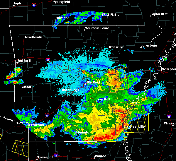 At 1021 pm cdt, severe thunderstorms were located along a line extending from 6 miles northwest of rosedale to near arkansas city, moving east at 45 mph (radar indicated). Hazards include 60 mph wind gusts and quarter size hail. Hail damage to vehicles is expected. expect wind damage to roofs, siding, and trees. these severe storms will be near, rosedale, scott and lamont around 1025 pm cdt. benoit and winterville around 1030 pm cdt. gunnison around 1035 pm cdt. deeson around 1040 pm cdt. shelby around 1045 pm cdt. shaw and mound bayou around 1050 pm cdt. indianola around 1100 pm cdt. drew around 1105 pm cdt. Other locations impacted by these severe thunderstorms include alligator, beulah, pace, doddsville, winstonville, duncan and merigold. At 1021 pm cdt, severe thunderstorms were located along a line extending from 6 miles northwest of rosedale to near arkansas city, moving east at 45 mph (radar indicated). Hazards include 60 mph wind gusts and quarter size hail. Hail damage to vehicles is expected. expect wind damage to roofs, siding, and trees. these severe storms will be near, rosedale, scott and lamont around 1025 pm cdt. benoit and winterville around 1030 pm cdt. gunnison around 1035 pm cdt. deeson around 1040 pm cdt. shelby around 1045 pm cdt. shaw and mound bayou around 1050 pm cdt. indianola around 1100 pm cdt. drew around 1105 pm cdt. Other locations impacted by these severe thunderstorms include alligator, beulah, pace, doddsville, winstonville, duncan and merigold.
|
| 6/19/2019 10:10 PM CDT |
 At 1010 pm cdt, severe thunderstorms were located along a line extending from yancopin to near arkansas city, moving east at 45 mph (radar indicated). Hazards include 60 mph wind gusts and quarter size hail. Hail damage to vehicles is expected. expect wind damage to roofs, siding, and trees. severe thunderstorms will be near, rosedale, scott, lamont and winterville around 1025 pm cdt. benoit and gunnison around 1030 pm cdt. deeson around 1040 pm cdt. shelby around 1045 pm cdt. shaw, mound bayou and holly ridge around 1050 pm cdt. indianola around 1100 pm cdt. drew and parchman around 1105 pm cdt. moorhead, sunflower, blaine and rome around 1110 pm cdt. Other locations impacted by these severe thunderstorms include alligator, beulah, pace, doddsville, winstonville, duncan and merigold. At 1010 pm cdt, severe thunderstorms were located along a line extending from yancopin to near arkansas city, moving east at 45 mph (radar indicated). Hazards include 60 mph wind gusts and quarter size hail. Hail damage to vehicles is expected. expect wind damage to roofs, siding, and trees. severe thunderstorms will be near, rosedale, scott, lamont and winterville around 1025 pm cdt. benoit and gunnison around 1030 pm cdt. deeson around 1040 pm cdt. shelby around 1045 pm cdt. shaw, mound bayou and holly ridge around 1050 pm cdt. indianola around 1100 pm cdt. drew and parchman around 1105 pm cdt. moorhead, sunflower, blaine and rome around 1110 pm cdt. Other locations impacted by these severe thunderstorms include alligator, beulah, pace, doddsville, winstonville, duncan and merigold.
|
| 6/17/2019 4:29 PM CDT |
 At 428 pm cdt, severe thunderstorms were located along a line extending from near ruleville to near benoit, moving northwest at 30 mph (radar indicated). Hazards include 60 mph wind gusts and quarter size hail. Hail damage to vehicles is expected. expect wind damage to roofs, siding, and trees. severe thunderstorms will be near, benoit around 435 pm cdt. parchman around 450 pm cdt. mound bayou around 455 pm cdt. rosedale around 500 pm cdt. shelby around 505 pm cdt. gunnison around 510 pm cdt. Other locations impacted by these severe thunderstorms include alligator, beulah, pace, doddsville, winstonville, duncan and merigold. At 428 pm cdt, severe thunderstorms were located along a line extending from near ruleville to near benoit, moving northwest at 30 mph (radar indicated). Hazards include 60 mph wind gusts and quarter size hail. Hail damage to vehicles is expected. expect wind damage to roofs, siding, and trees. severe thunderstorms will be near, benoit around 435 pm cdt. parchman around 450 pm cdt. mound bayou around 455 pm cdt. rosedale around 500 pm cdt. shelby around 505 pm cdt. gunnison around 510 pm cdt. Other locations impacted by these severe thunderstorms include alligator, beulah, pace, doddsville, winstonville, duncan and merigold.
|
| 4/7/2019 10:18 AM CDT |
 At 1018 am cdt, severe thunderstorms were located along a line extending from 6 miles southwest of sherard to near renova to near leland, moving northeast at 40 mph (radar indicated). Hazards include 60 mph wind gusts and nickel size hail. Expect damage to roofs, siding, and trees. severe thunderstorms will be near, mound bayou around 1030 am cdt. shaw around 1035 am cdt. indianola and drew around 1040 am cdt. parchman, sunflower and rome around 1050 am cdt. blaine around 1055 am cdt. ruleville around 1100 am cdt. Other locations impacted by these severe thunderstorms include doddsville, alligator, winstonville, duncan and merigold. At 1018 am cdt, severe thunderstorms were located along a line extending from 6 miles southwest of sherard to near renova to near leland, moving northeast at 40 mph (radar indicated). Hazards include 60 mph wind gusts and nickel size hail. Expect damage to roofs, siding, and trees. severe thunderstorms will be near, mound bayou around 1030 am cdt. shaw around 1035 am cdt. indianola and drew around 1040 am cdt. parchman, sunflower and rome around 1050 am cdt. blaine around 1055 am cdt. ruleville around 1100 am cdt. Other locations impacted by these severe thunderstorms include doddsville, alligator, winstonville, duncan and merigold.
|
| 4/7/2019 6:40 AM CDT |
 At 640 am cdt, severe thunderstorms were located along a line extending from near shelby to renova to near shaw, moving northeast at 50 mph (radar indicated). Hazards include 60 mph wind gusts and half dollar size hail. Hail damage to vehicles is expected. expect wind damage to roofs, siding, and trees. these severe storms will be near, shelby and mound bayou around 645 am cdt. Other locations impacted by these severe thunderstorms include winstonville, beulah, pace and merigold. At 640 am cdt, severe thunderstorms were located along a line extending from near shelby to renova to near shaw, moving northeast at 50 mph (radar indicated). Hazards include 60 mph wind gusts and half dollar size hail. Hail damage to vehicles is expected. expect wind damage to roofs, siding, and trees. these severe storms will be near, shelby and mound bayou around 645 am cdt. Other locations impacted by these severe thunderstorms include winstonville, beulah, pace and merigold.
|
| 4/7/2019 6:27 AM CDT |
 At 627 am cdt, severe thunderstorms were located along a line extending from near gunnison to 7 miles northeast of benoit to near lamont, moving northeast at 50 mph (radar indicated). Hazards include 70 mph wind gusts and half dollar size hail. Hail damage to vehicles is expected. expect considerable tree damage. wind damage is also likely to mobile homes, roofs, and outbuildings. these severe storms will be near, gunnison around 630 am cdt. renova around 640 am cdt. shelby, shaw and mound bayou around 645 am cdt. boyle around 650 am cdt. cleveland around 655 am cdt. Other locations impacted by these severe thunderstorms include winstonville, beulah, pace and merigold. At 627 am cdt, severe thunderstorms were located along a line extending from near gunnison to 7 miles northeast of benoit to near lamont, moving northeast at 50 mph (radar indicated). Hazards include 70 mph wind gusts and half dollar size hail. Hail damage to vehicles is expected. expect considerable tree damage. wind damage is also likely to mobile homes, roofs, and outbuildings. these severe storms will be near, gunnison around 630 am cdt. renova around 640 am cdt. shelby, shaw and mound bayou around 645 am cdt. boyle around 650 am cdt. cleveland around 655 am cdt. Other locations impacted by these severe thunderstorms include winstonville, beulah, pace and merigold.
|
| 4/7/2019 6:09 AM CDT |
 At 608 am cdt, severe thunderstorms were located along a line extending from near watson to near jersey point to 8 miles northeast of mcmillan corner, moving northeast at 50 mph (radar indicated). Hazards include 60 mph wind gusts and half dollar size hail. Hail damage to vehicles is expected. expect wind damage to roofs, siding, and trees. severe thunderstorms will be near, rosedale around 625 am cdt. benoit around 630 am cdt. gunnison around 635 am cdt. shaw around 640 am cdt. shelby and mound bayou around 645 am cdt. cleveland, renova and boyle around 650 am cdt. Other locations impacted by these severe thunderstorms include winstonville, beulah, pace and merigold. At 608 am cdt, severe thunderstorms were located along a line extending from near watson to near jersey point to 8 miles northeast of mcmillan corner, moving northeast at 50 mph (radar indicated). Hazards include 60 mph wind gusts and half dollar size hail. Hail damage to vehicles is expected. expect wind damage to roofs, siding, and trees. severe thunderstorms will be near, rosedale around 625 am cdt. benoit around 630 am cdt. gunnison around 635 am cdt. shaw around 640 am cdt. shelby and mound bayou around 645 am cdt. cleveland, renova and boyle around 650 am cdt. Other locations impacted by these severe thunderstorms include winstonville, beulah, pace and merigold.
|
| 3/13/2019 9:24 PM CDT |
 The severe thunderstorm warning for northeastern sunflower and northeastern bolivar counties will expire at 930 pm cdt, the severe thunderstorm which prompted the warning has moved out of the warned area. therefore, the warning will be allowed to expire. The severe thunderstorm warning for northeastern sunflower and northeastern bolivar counties will expire at 930 pm cdt, the severe thunderstorm which prompted the warning has moved out of the warned area. therefore, the warning will be allowed to expire.
|
| 3/13/2019 8:53 PM CDT |
 At 852 pm cdt, a severe thunderstorm was located over mound bayou, or near shelby, moving northeast at 65 mph (radar indicated). Hazards include 60 mph wind gusts and quarter size hail. Hail damage to vehicles is expected. expect wind damage to roofs, siding, and trees. this severe thunderstorm will be near, rome around 905 pm cdt. Other locations impacted by this severe thunderstorm include alligator, winstonville, duncan, pace and merigold. At 852 pm cdt, a severe thunderstorm was located over mound bayou, or near shelby, moving northeast at 65 mph (radar indicated). Hazards include 60 mph wind gusts and quarter size hail. Hail damage to vehicles is expected. expect wind damage to roofs, siding, and trees. this severe thunderstorm will be near, rome around 905 pm cdt. Other locations impacted by this severe thunderstorm include alligator, winstonville, duncan, pace and merigold.
|
| 3/9/2019 1:45 PM CST |
 At 145 pm cst, a severe thunderstorm was located near dermott, moving east at 70 mph (radar indicated). Hazards include 60 mph wind gusts and penny size hail. Expect damage to roofs, siding, and trees. this severe thunderstorm will be near, scott, lamont and winterville around 205 pm cst. benoit around 210 pm cst. shaw around 220 pm cst. cleveland, renova and boyle around 225 pm cst. A tornado watch remains in effect until 500 pm cst for southeastern arkansas, and northwestern mississippi. At 145 pm cst, a severe thunderstorm was located near dermott, moving east at 70 mph (radar indicated). Hazards include 60 mph wind gusts and penny size hail. Expect damage to roofs, siding, and trees. this severe thunderstorm will be near, scott, lamont and winterville around 205 pm cst. benoit around 210 pm cst. shaw around 220 pm cst. cleveland, renova and boyle around 225 pm cst. A tornado watch remains in effect until 500 pm cst for southeastern arkansas, and northwestern mississippi.
|
| 11/5/2018 8:05 PM CST |
 At 805 pm cst, a severe thunderstorm was located 8 miles west of boyle, or 8 miles west of cleveland, moving east at 45 mph (radar indicated). Hazards include 60 mph wind gusts. Expect damage to roofs, siding, and trees. this severe storm will be near, cleveland and boyle around 815 pm cst. renova around 820 pm cst. ruleville and drew around 830 pm cst. other locations impacted by this severe thunderstorm include doddsville, winstonville, beulah, pace and merigold. A tornado watch remains in effect until 1100 pm cst for north central and northwestern mississippi. At 805 pm cst, a severe thunderstorm was located 8 miles west of boyle, or 8 miles west of cleveland, moving east at 45 mph (radar indicated). Hazards include 60 mph wind gusts. Expect damage to roofs, siding, and trees. this severe storm will be near, cleveland and boyle around 815 pm cst. renova around 820 pm cst. ruleville and drew around 830 pm cst. other locations impacted by this severe thunderstorm include doddsville, winstonville, beulah, pace and merigold. A tornado watch remains in effect until 1100 pm cst for north central and northwestern mississippi.
|
| 11/5/2018 7:47 PM CST |
 At 746 pm cst, severe thunderstorms were located along a line extending from 8 miles west of dublin to near lamont, moving east at 40 mph (radar indicated). Hazards include 60 mph wind gusts. Expect damage to roofs, siding, and trees. severe thunderstorms will be near, benoit around 800 pm cst. shaw around 820 pm cst. cleveland and boyle around 825 pm cst. ruleville and renova around 830 pm cst. other locations impacted by these severe thunderstorms include alligator, beulah, pace, doddsville, winstonville, duncan and merigold. A tornado watch remains in effect until 1100 pm cst for north central and northwestern mississippi. At 746 pm cst, severe thunderstorms were located along a line extending from 8 miles west of dublin to near lamont, moving east at 40 mph (radar indicated). Hazards include 60 mph wind gusts. Expect damage to roofs, siding, and trees. severe thunderstorms will be near, benoit around 800 pm cst. shaw around 820 pm cst. cleveland and boyle around 825 pm cst. ruleville and renova around 830 pm cst. other locations impacted by these severe thunderstorms include alligator, beulah, pace, doddsville, winstonville, duncan and merigold. A tornado watch remains in effect until 1100 pm cst for north central and northwestern mississippi.
|
| 8/20/2018 5:07 PM CDT |
 At 507 pm cdt, a severe thunderstorm was located near renova, or near cleveland, moving east at 20 mph (radar indicated). Hazards include 60 mph wind gusts and quarter size hail. Hail damage to vehicles is expected. expect wind damage to roofs, siding, and trees. this severe thunderstorm will be near, drew around 530 pm cdt. parchman around 540 pm cdt. Other locations impacted by this severe thunderstorm include merigold. At 507 pm cdt, a severe thunderstorm was located near renova, or near cleveland, moving east at 20 mph (radar indicated). Hazards include 60 mph wind gusts and quarter size hail. Hail damage to vehicles is expected. expect wind damage to roofs, siding, and trees. this severe thunderstorm will be near, drew around 530 pm cdt. parchman around 540 pm cdt. Other locations impacted by this severe thunderstorm include merigold.
|
| 7/21/2018 4:45 AM CDT |
 At 444 am cdt, severe thunderstorms were located along a line extending from blaine to near shaw, moving southeast at 45 mph (radar indicated). Hazards include 60 mph wind gusts. Expect damage to roofs, siding, and trees. These severe thunderstorms will remain over mainly rural areas of northeastern sunflower and southern bolivar counties, including the following locations, beulah, pace and merigold. At 444 am cdt, severe thunderstorms were located along a line extending from blaine to near shaw, moving southeast at 45 mph (radar indicated). Hazards include 60 mph wind gusts. Expect damage to roofs, siding, and trees. These severe thunderstorms will remain over mainly rural areas of northeastern sunflower and southern bolivar counties, including the following locations, beulah, pace and merigold.
|
| 7/21/2018 4:36 AM CDT |
 At 436 am cdt, severe thunderstorms were located along a line extending from drew to boyle, moving southeast at 45 mph (radar indicated). Hazards include 60 mph wind gusts. Expect damage to roofs, siding, and trees. these severe storms will be near, ruleville around 440 am cdt. Other locations impacted by these severe thunderstorms include winstonville, beulah, pace and merigold. At 436 am cdt, severe thunderstorms were located along a line extending from drew to boyle, moving southeast at 45 mph (radar indicated). Hazards include 60 mph wind gusts. Expect damage to roofs, siding, and trees. these severe storms will be near, ruleville around 440 am cdt. Other locations impacted by these severe thunderstorms include winstonville, beulah, pace and merigold.
|
| 7/21/2018 4:35 AM CDT | Measured at cleveland asos krn in bolivar county MS, 2.1 miles ESE of Cleveland, MS |
| 7/21/2018 4:29 AM CDT |
 At 429 am cdt, severe thunderstorms were located along a line extending from near ruleville to 6 miles north of benoit, moving southeast at 50 mph (radar indicated). Hazards include 60 mph wind gusts. Expect damage to roofs, siding, and trees. these severe storms will be near, ruleville and drew around 435 am cdt. Other locations impacted by these severe thunderstorms include winstonville, beulah, duncan, pace and merigold. At 429 am cdt, severe thunderstorms were located along a line extending from near ruleville to 6 miles north of benoit, moving southeast at 50 mph (radar indicated). Hazards include 60 mph wind gusts. Expect damage to roofs, siding, and trees. these severe storms will be near, ruleville and drew around 435 am cdt. Other locations impacted by these severe thunderstorms include winstonville, beulah, duncan, pace and merigold.
|
| 7/21/2018 4:16 AM CDT |
 At 416 am cdt, a severe thunderstorm was located near deeson, or near shelby, moving southeast at 50 mph (radar indicated). Hazards include 60 mph wind gusts. Expect damage to roofs, siding, and trees. this severe storm will be near, shelby around 420 am cdt. mound bayou around 425 am cdt. cleveland and renova around 435 am cdt. drew and boyle around 440 am cdt. ruleville around 445 am cdt. Other locations impacted by this severe thunderstorm include alligator, winstonville, beulah, duncan, pace and merigold. At 416 am cdt, a severe thunderstorm was located near deeson, or near shelby, moving southeast at 50 mph (radar indicated). Hazards include 60 mph wind gusts. Expect damage to roofs, siding, and trees. this severe storm will be near, shelby around 420 am cdt. mound bayou around 425 am cdt. cleveland and renova around 435 am cdt. drew and boyle around 440 am cdt. ruleville around 445 am cdt. Other locations impacted by this severe thunderstorm include alligator, winstonville, beulah, duncan, pace and merigold.
|
| 7/21/2018 4:01 AM CDT |
 At 400 am cdt, a severe thunderstorm was located near crumrod, or near white river national wildlife refuge, moving southeast at 45 mph (radar indicated). Hazards include 60 mph wind gusts and penny size hail. Expect damage to roofs, siding, and trees. this severe thunderstorm will be near, deeson around 415 am cdt. gunnison around 420 am cdt. shelby around 425 am cdt. mound bayou around 430 am cdt. renova around 440 am cdt. cleveland and boyle around 445 am cdt. ruleville around 450 am cdt. Other locations impacted by this severe thunderstorm include alligator, winstonville, beulah, duncan, pace and merigold. At 400 am cdt, a severe thunderstorm was located near crumrod, or near white river national wildlife refuge, moving southeast at 45 mph (radar indicated). Hazards include 60 mph wind gusts and penny size hail. Expect damage to roofs, siding, and trees. this severe thunderstorm will be near, deeson around 415 am cdt. gunnison around 420 am cdt. shelby around 425 am cdt. mound bayou around 430 am cdt. renova around 440 am cdt. cleveland and boyle around 445 am cdt. ruleville around 450 am cdt. Other locations impacted by this severe thunderstorm include alligator, winstonville, beulah, duncan, pace and merigold.
|
| 7/21/2018 12:06 AM CDT |
 At 1206 am cdt, a severe thunderstorm was located near deeson, or near shelby, moving southeast at 30 mph (radar indicated). Hazards include 60 mph wind gusts and quarter size hail. Hail damage to vehicles is expected. expect wind damage to roofs, siding, and trees. this severe storm will be near, shelby around 1215 am cdt. mound bayou around 1225 am cdt. renova around 1235 am cdt. cleveland and boyle around 1245 am cdt. Other locations impacted by this severe thunderstorm include alligator, winstonville, duncan, pace and merigold. At 1206 am cdt, a severe thunderstorm was located near deeson, or near shelby, moving southeast at 30 mph (radar indicated). Hazards include 60 mph wind gusts and quarter size hail. Hail damage to vehicles is expected. expect wind damage to roofs, siding, and trees. this severe storm will be near, shelby around 1215 am cdt. mound bayou around 1225 am cdt. renova around 1235 am cdt. cleveland and boyle around 1245 am cdt. Other locations impacted by this severe thunderstorm include alligator, winstonville, duncan, pace and merigold.
|
| 7/20/2018 11:44 PM CDT |
 The national weather service in jackson has issued a * severe thunderstorm warning for. northeastern bolivar county in northwestern mississippi. until 1245 am cdt. At 1144 pm cdt, a severe thunderstorm was located over crumrod, or 7 miles southeast of white river national wildlife refuge, moving. The national weather service in jackson has issued a * severe thunderstorm warning for. northeastern bolivar county in northwestern mississippi. until 1245 am cdt. At 1144 pm cdt, a severe thunderstorm was located over crumrod, or 7 miles southeast of white river national wildlife refuge, moving.
|
| 7/20/2018 11:07 PM CDT |
 At 1107 pm cdt, a severe thunderstorm capable of producing a tornado was located over gunnison, or 8 miles west of shelby, moving southeast at 35 mph (radar indicated rotation). Hazards include tornado. Flying debris will be dangerous to those caught without shelter. mobile homes will be damaged or destroyed. damage to roofs, windows, and vehicles will occur. tree damage is likely. this dangerous storm will be near, shelby around 1115 pm cdt. mound bayou around 1125 pm cdt. cleveland, renova and boyle around 1130 pm cdt. Other locations impacted by this tornadic thunderstorm include alligator, winstonville, duncan, pace and merigold. At 1107 pm cdt, a severe thunderstorm capable of producing a tornado was located over gunnison, or 8 miles west of shelby, moving southeast at 35 mph (radar indicated rotation). Hazards include tornado. Flying debris will be dangerous to those caught without shelter. mobile homes will be damaged or destroyed. damage to roofs, windows, and vehicles will occur. tree damage is likely. this dangerous storm will be near, shelby around 1115 pm cdt. mound bayou around 1125 pm cdt. cleveland, renova and boyle around 1130 pm cdt. Other locations impacted by this tornadic thunderstorm include alligator, winstonville, duncan, pace and merigold.
|
| 7/20/2018 10:48 PM CDT |
 At 1048 pm cdt, a severe thunderstorm capable of producing a tornado was located near deeson, or 12 miles southeast of white river national wildlife refuge, moving southeast at 45 mph (radar indicated rotation). Hazards include tornado and quarter size hail. Flying debris will be dangerous to those caught without shelter. mobile homes will be damaged or destroyed. damage to roofs, windows, and vehicles will occur. tree damage is likely. this dangerous storm will be near, gunnison and deeson around 1055 pm cdt. shelby around 1105 pm cdt. mound bayou around 1110 pm cdt. renova around 1120 pm cdt. cleveland and boyle around 1125 pm cdt. Other locations impacted by this tornadic thunderstorm include alligator, winstonville, duncan, pace and merigold. At 1048 pm cdt, a severe thunderstorm capable of producing a tornado was located near deeson, or 12 miles southeast of white river national wildlife refuge, moving southeast at 45 mph (radar indicated rotation). Hazards include tornado and quarter size hail. Flying debris will be dangerous to those caught without shelter. mobile homes will be damaged or destroyed. damage to roofs, windows, and vehicles will occur. tree damage is likely. this dangerous storm will be near, gunnison and deeson around 1055 pm cdt. shelby around 1105 pm cdt. mound bayou around 1110 pm cdt. renova around 1120 pm cdt. cleveland and boyle around 1125 pm cdt. Other locations impacted by this tornadic thunderstorm include alligator, winstonville, duncan, pace and merigold.
|
| 7/20/2018 10:31 PM CDT |
 At 1031 pm cdt, a severe thunderstorm capable of producing a tornado was located over white river national wildlife refuge, moving southeast at 45 mph (radar indicated rotation). Hazards include tornado and quarter size hail. Flying debris will be dangerous to those caught without shelter. mobile homes will be damaged or destroyed. damage to roofs, windows, and vehicles will occur. tree damage is likely. this dangerous storm will be near, gunnison and deeson around 1055 pm cdt. shelby around 1105 pm cdt. mound bayou around 1110 pm cdt. renova around 1120 pm cdt. cleveland and boyle around 1125 pm cdt. Other locations impacted by this tornadic thunderstorm include alligator, winstonville, duncan, pace and merigold. At 1031 pm cdt, a severe thunderstorm capable of producing a tornado was located over white river national wildlife refuge, moving southeast at 45 mph (radar indicated rotation). Hazards include tornado and quarter size hail. Flying debris will be dangerous to those caught without shelter. mobile homes will be damaged or destroyed. damage to roofs, windows, and vehicles will occur. tree damage is likely. this dangerous storm will be near, gunnison and deeson around 1055 pm cdt. shelby around 1105 pm cdt. mound bayou around 1110 pm cdt. renova around 1120 pm cdt. cleveland and boyle around 1125 pm cdt. Other locations impacted by this tornadic thunderstorm include alligator, winstonville, duncan, pace and merigold.
|
| 7/19/2018 10:47 PM CDT |
 At 1047 pm cdt, a severe thunderstorm was located over boyle, or near cleveland, moving south at 25 mph (radar indicated). Hazards include 60 mph wind gusts and quarter size hail. Hail damage to vehicles is expected. expect wind damage to roofs, siding, and trees. This severe thunderstorm will remain over mainly rural areas of north central sunflower and southeastern bolivar counties, including the following locations, beulah, pace and merigold. At 1047 pm cdt, a severe thunderstorm was located over boyle, or near cleveland, moving south at 25 mph (radar indicated). Hazards include 60 mph wind gusts and quarter size hail. Hail damage to vehicles is expected. expect wind damage to roofs, siding, and trees. This severe thunderstorm will remain over mainly rural areas of north central sunflower and southeastern bolivar counties, including the following locations, beulah, pace and merigold.
|
| 7/19/2018 9:58 PM CDT |
 At 957 pm cdt, a severe thunderstorm was located near shelby, moving south at 25 mph (radar indicated). Hazards include 60 mph wind gusts and quarter size hail. Hail damage to vehicles is expected. expect wind damage to roofs, siding, and trees. this severe thunderstorm will be near, mound bayou around 1015 pm cdt. renova around 1030 pm cdt. cleveland and boyle around 1045 pm cdt. Other locations impacted by this severe thunderstorm include winstonville, beulah, pace and merigold. At 957 pm cdt, a severe thunderstorm was located near shelby, moving south at 25 mph (radar indicated). Hazards include 60 mph wind gusts and quarter size hail. Hail damage to vehicles is expected. expect wind damage to roofs, siding, and trees. this severe thunderstorm will be near, mound bayou around 1015 pm cdt. renova around 1030 pm cdt. cleveland and boyle around 1045 pm cdt. Other locations impacted by this severe thunderstorm include winstonville, beulah, pace and merigold.
|
| 7/6/2018 5:59 PM CDT |
 At 549 pm cdt, severe thunderstorms were located along a line extending from cleveland to near rosedale, moving southwest at 20 mph (radar indicated). Hazards include 60 mph wind gusts. Expect damage to roofs, siding, and trees. these severe storms will be near, rosedale around 600 pm cdt. shaw around 620 pm cdt. benoit around 630 pm cdt. Other locations impacted by these severe thunderstorms include beulah and pace. At 549 pm cdt, severe thunderstorms were located along a line extending from cleveland to near rosedale, moving southwest at 20 mph (radar indicated). Hazards include 60 mph wind gusts. Expect damage to roofs, siding, and trees. these severe storms will be near, rosedale around 600 pm cdt. shaw around 620 pm cdt. benoit around 630 pm cdt. Other locations impacted by these severe thunderstorms include beulah and pace.
|
| 7/6/2018 5:49 PM CDT |
 At 549 pm cdt, severe thunderstorms were located along a line extending from cleveland to near rosedale, moving southwest at 20 mph (radar indicated). Hazards include 60 mph wind gusts. Expect damage to roofs, siding, and trees. these severe storms will be near, rosedale around 600 pm cdt. shaw around 620 pm cdt. benoit around 630 pm cdt. Other locations impacted by these severe thunderstorms include beulah and pace. At 549 pm cdt, severe thunderstorms were located along a line extending from cleveland to near rosedale, moving southwest at 20 mph (radar indicated). Hazards include 60 mph wind gusts. Expect damage to roofs, siding, and trees. these severe storms will be near, rosedale around 600 pm cdt. shaw around 620 pm cdt. benoit around 630 pm cdt. Other locations impacted by these severe thunderstorms include beulah and pace.
|
| 7/6/2018 5:25 PM CDT |
 At 524 pm cdt, a severe thunderstorm was located near gunnison, or 8 miles southwest of shelby, moving southwest at 30 mph (radar indicated). Hazards include 60 mph wind gusts. Expect damage to roofs, siding, and trees. this severe thunderstorm will be near, rosedale around 540 pm cdt. benoit around 600 pm cdt. scott around 610 pm cdt. Other locations impacted by this severe thunderstorm include winstonville, beulah, pace and merigold. At 524 pm cdt, a severe thunderstorm was located near gunnison, or 8 miles southwest of shelby, moving southwest at 30 mph (radar indicated). Hazards include 60 mph wind gusts. Expect damage to roofs, siding, and trees. this severe thunderstorm will be near, rosedale around 540 pm cdt. benoit around 600 pm cdt. scott around 610 pm cdt. Other locations impacted by this severe thunderstorm include winstonville, beulah, pace and merigold.
|
| 6/3/2018 1:42 AM CDT |
 At 141 am cdt, a severe thunderstorm was located near mound bayou, or near shelby, moving southeast at 40 mph (radar indicated). Hazards include 60 mph wind gusts and half dollar size hail. Hail damage to vehicles is expected. expect wind damage to roofs, siding, and trees. this severe storm will be near, mound bayou around 145 am cdt. renova around 155 am cdt. cleveland and boyle around 200 am cdt. ruleville around 210 am cdt. Other locations impacted by this severe thunderstorm include doddsville, alligator, winstonville, duncan, pace and merigold. At 141 am cdt, a severe thunderstorm was located near mound bayou, or near shelby, moving southeast at 40 mph (radar indicated). Hazards include 60 mph wind gusts and half dollar size hail. Hail damage to vehicles is expected. expect wind damage to roofs, siding, and trees. this severe storm will be near, mound bayou around 145 am cdt. renova around 155 am cdt. cleveland and boyle around 200 am cdt. ruleville around 210 am cdt. Other locations impacted by this severe thunderstorm include doddsville, alligator, winstonville, duncan, pace and merigold.
|
| 6/3/2018 1:15 AM CDT |
 At 114 am cdt, a severe thunderstorm was located near deeson, or near shelby, moving southeast at 45 mph (radar indicated). Hazards include 60 mph wind gusts and quarter size hail. Hail damage to vehicles is expected. expect wind damage to roofs, siding, and trees. this severe thunderstorm will be near, shelby around 125 am cdt. mound bayou around 130 am cdt. renova around 140 am cdt. drew around 145 am cdt. ruleville around 150 am cdt. Other locations impacted by this severe thunderstorm include doddsville, alligator, winstonville, duncan, pace and merigold. At 114 am cdt, a severe thunderstorm was located near deeson, or near shelby, moving southeast at 45 mph (radar indicated). Hazards include 60 mph wind gusts and quarter size hail. Hail damage to vehicles is expected. expect wind damage to roofs, siding, and trees. this severe thunderstorm will be near, shelby around 125 am cdt. mound bayou around 130 am cdt. renova around 140 am cdt. drew around 145 am cdt. ruleville around 150 am cdt. Other locations impacted by this severe thunderstorm include doddsville, alligator, winstonville, duncan, pace and merigold.
|
| 4/14/2018 4:23 AM CDT |
 At 423 am cdt, a severe thunderstorm capable of producing a tornado was located over shaw, moving northeast at 45 mph (radar indicated rotation). Hazards include tornado. Flying debris will be dangerous to those caught without shelter. mobile homes will be damaged or destroyed. damage to roofs, windows, and vehicles will occur. tree damage is likely. This dangerous storm will be near, cleveland and boyle around 435 am cdt. At 423 am cdt, a severe thunderstorm capable of producing a tornado was located over shaw, moving northeast at 45 mph (radar indicated rotation). Hazards include tornado. Flying debris will be dangerous to those caught without shelter. mobile homes will be damaged or destroyed. damage to roofs, windows, and vehicles will occur. tree damage is likely. This dangerous storm will be near, cleveland and boyle around 435 am cdt.
|
| 4/14/2018 4:10 AM CDT |
 At 409 am cdt, a severe thunderstorm capable of producing a tornado was located near metcalfe, or 8 miles northwest of leland, moving northeast at 50 mph (radar indicated rotation). Hazards include tornado. Flying debris will be dangerous to those caught without shelter. mobile homes will be damaged or destroyed. damage to roofs, windows, and vehicles will occur. tree damage is likely. this dangerous storm will be near, shaw around 425 am cdt. cleveland and boyle around 430 am cdt. renova around 435 am cdt. Other locations impacted by this tornadic thunderstorm include winstonville, duncan, pace and merigold. At 409 am cdt, a severe thunderstorm capable of producing a tornado was located near metcalfe, or 8 miles northwest of leland, moving northeast at 50 mph (radar indicated rotation). Hazards include tornado. Flying debris will be dangerous to those caught without shelter. mobile homes will be damaged or destroyed. damage to roofs, windows, and vehicles will occur. tree damage is likely. this dangerous storm will be near, shaw around 425 am cdt. cleveland and boyle around 430 am cdt. renova around 435 am cdt. Other locations impacted by this tornadic thunderstorm include winstonville, duncan, pace and merigold.
|
| 4/14/2018 3:45 AM CDT |
 At 345 am cdt, a severe thunderstorm capable of producing a tornado was located over arkansas city, or 9 miles south of rohwer, moving northeast at 40 mph (radar indicated rotation). Hazards include tornado. Flying debris will be dangerous to those caught without shelter. mobile homes will be damaged or destroyed. damage to roofs, windows, and vehicles will occur. tree damage is likely. this dangerous storm will be near, scott and jersey point around 355 am cdt. benoit around 400 am cdt. rosedale around 410 am cdt. renova around 425 am cdt. mound bayou around 430 am cdt. shelby around 435 am cdt. Other locations impacted by this tornadic thunderstorm include winstonville, beulah, duncan, pace and merigold. At 345 am cdt, a severe thunderstorm capable of producing a tornado was located over arkansas city, or 9 miles south of rohwer, moving northeast at 40 mph (radar indicated rotation). Hazards include tornado. Flying debris will be dangerous to those caught without shelter. mobile homes will be damaged or destroyed. damage to roofs, windows, and vehicles will occur. tree damage is likely. this dangerous storm will be near, scott and jersey point around 355 am cdt. benoit around 400 am cdt. rosedale around 410 am cdt. renova around 425 am cdt. mound bayou around 430 am cdt. shelby around 435 am cdt. Other locations impacted by this tornadic thunderstorm include winstonville, beulah, duncan, pace and merigold.
|
| 4/3/2018 7:17 PM CDT |
 At 716 pm cdt, severe thunderstorms were located along a line extending from boyle to near hollandale, moving northeast at 55 mph (trained weather spotters. at 700 pm, a 69 mph wind gust was observed at the greenville airport). Hazards include 70 mph wind gusts. Expect considerable tree damage. damage is likely to mobile homes, roofs, and outbuildings. Locations impacted include, greenville, cleveland, leland, hollandale, shaw, metcalfe, renova, boyle, darlove, wayside, estill, tribbett, murphy, glen allan and arcola. At 716 pm cdt, severe thunderstorms were located along a line extending from boyle to near hollandale, moving northeast at 55 mph (trained weather spotters. at 700 pm, a 69 mph wind gust was observed at the greenville airport). Hazards include 70 mph wind gusts. Expect considerable tree damage. damage is likely to mobile homes, roofs, and outbuildings. Locations impacted include, greenville, cleveland, leland, hollandale, shaw, metcalfe, renova, boyle, darlove, wayside, estill, tribbett, murphy, glen allan and arcola.
|
| 4/3/2018 7:15 PM CDT | Trees down between boyle and clevelan in bolivar county MS, 1.6 miles N of Cleveland, MS |
| 4/3/2018 6:58 PM CDT |
 At 657 pm cdt, severe thunderstorms were located along a line extending from near scott to near gassoway, moving northeast at 60 mph (trained spotter. at 643 pm, a power pole was snapped along highway 65 near lake village). Hazards include 60 mph wind gusts. Expect damage to roofs, siding, and trees. Locations impacted include, greenville, cleveland, leland, hollandale, lake village, eudora, shaw, avon, scott, metcalfe, renova, boyle, benoit, darlove, wayside, lamont, estill, tribbett, chicot junction and winterville. At 657 pm cdt, severe thunderstorms were located along a line extending from near scott to near gassoway, moving northeast at 60 mph (trained spotter. at 643 pm, a power pole was snapped along highway 65 near lake village). Hazards include 60 mph wind gusts. Expect damage to roofs, siding, and trees. Locations impacted include, greenville, cleveland, leland, hollandale, lake village, eudora, shaw, avon, scott, metcalfe, renova, boyle, benoit, darlove, wayside, lamont, estill, tribbett, chicot junction and winterville.
|
| 4/3/2018 6:58 PM CDT |
 At 648 pm cdt, severe thunderstorms were located along a line extending from near dermott to near eudora, moving northeast at 55 mph (law enforcement. ashley county s.o. reported numerous trees downed across the county). Hazards include 60 mph wind gusts. Expect damage to roofs, siding, and trees. Locations impacted include, greenville, cleveland, leland, hollandale, lake village, dermott, eudora, shaw, avon, scott, metcalfe, renova, boyle, benoit, darlove, wayside, lamont, mcmillan corner, estill and tribbett. At 648 pm cdt, severe thunderstorms were located along a line extending from near dermott to near eudora, moving northeast at 55 mph (law enforcement. ashley county s.o. reported numerous trees downed across the county). Hazards include 60 mph wind gusts. Expect damage to roofs, siding, and trees. Locations impacted include, greenville, cleveland, leland, hollandale, lake village, dermott, eudora, shaw, avon, scott, metcalfe, renova, boyle, benoit, darlove, wayside, lamont, mcmillan corner, estill and tribbett.
|
| 4/3/2018 6:49 PM CDT |
 At 639 pm cdt, severe thunderstorms were located along a line extending from near dermott to near kilbourne, moving northeast at 55 mph (trained weather spotters. at 600 pm, downed trees were reported in north crossett). Hazards include 60 mph wind gusts. Expect damage to roofs, siding, and trees. Locations impacted include, greenville, cleveland, leland, hollandale, lake village, dermott, eudora, shaw, avon, scott, metcalfe, renova, boyle, benoit, darlove, wayside, lamont, mcmillan corner, estill and tribbett. At 639 pm cdt, severe thunderstorms were located along a line extending from near dermott to near kilbourne, moving northeast at 55 mph (trained weather spotters. at 600 pm, downed trees were reported in north crossett). Hazards include 60 mph wind gusts. Expect damage to roofs, siding, and trees. Locations impacted include, greenville, cleveland, leland, hollandale, lake village, dermott, eudora, shaw, avon, scott, metcalfe, renova, boyle, benoit, darlove, wayside, lamont, mcmillan corner, estill and tribbett.
|
| 4/3/2018 6:49 PM CDT |
 At 648 pm cdt, severe thunderstorms were located along a line extending from near dermott to near eudora, moving northeast at 55 mph (law enforcement. ashley county s.o. reported numerous trees downed across the county). Hazards include 60 mph wind gusts. Expect damage to roofs, siding, and trees. Locations impacted include, greenville, cleveland, leland, hollandale, lake village, dermott, eudora, shaw, avon, scott, metcalfe, renova, boyle, benoit, darlove, wayside, lamont, mcmillan corner, estill and tribbett. At 648 pm cdt, severe thunderstorms were located along a line extending from near dermott to near eudora, moving northeast at 55 mph (law enforcement. ashley county s.o. reported numerous trees downed across the county). Hazards include 60 mph wind gusts. Expect damage to roofs, siding, and trees. Locations impacted include, greenville, cleveland, leland, hollandale, lake village, dermott, eudora, shaw, avon, scott, metcalfe, renova, boyle, benoit, darlove, wayside, lamont, mcmillan corner, estill and tribbett.
|
| 4/3/2018 6:40 PM CDT |
 At 639 pm cdt, severe thunderstorms were located along a line extending from near dermott to near kilbourne, moving northeast at 55 mph (trained weather spotters. at 600 pm, downed trees were reported in north crossett). Hazards include 60 mph wind gusts. Expect damage to roofs, siding, and trees. Locations impacted include, greenville, cleveland, leland, hollandale, lake village, dermott, eudora, shaw, avon, scott, metcalfe, renova, boyle, benoit, darlove, wayside, lamont, mcmillan corner, estill and tribbett. At 639 pm cdt, severe thunderstorms were located along a line extending from near dermott to near kilbourne, moving northeast at 55 mph (trained weather spotters. at 600 pm, downed trees were reported in north crossett). Hazards include 60 mph wind gusts. Expect damage to roofs, siding, and trees. Locations impacted include, greenville, cleveland, leland, hollandale, lake village, dermott, eudora, shaw, avon, scott, metcalfe, renova, boyle, benoit, darlove, wayside, lamont, mcmillan corner, estill and tribbett.
|
| 4/3/2018 6:27 PM CDT |
 The national weather service in jackson has issued a * severe thunderstorm warning for. chicot county in southeastern arkansas. washington county in northwestern mississippi. southern bolivar county in northwestern mississippi. Until 745 pm cdt. The national weather service in jackson has issued a * severe thunderstorm warning for. chicot county in southeastern arkansas. washington county in northwestern mississippi. southern bolivar county in northwestern mississippi. Until 745 pm cdt.
|
| 3/10/2018 7:21 PM CDT |
 At 602 pm cst, a severe thunderstorm was located near boyle, or near cleveland, moving east at 20 mph (radar indicated). Hazards include 60 mph wind gusts and half dollar size hail. Hail damage to vehicles is expected. expect wind damage to roofs, siding, and trees. This severe storm will be near, cleveland, shaw and boyle around 615 pm cst. At 602 pm cst, a severe thunderstorm was located near boyle, or near cleveland, moving east at 20 mph (radar indicated). Hazards include 60 mph wind gusts and half dollar size hail. Hail damage to vehicles is expected. expect wind damage to roofs, siding, and trees. This severe storm will be near, cleveland, shaw and boyle around 615 pm cst.
|
| 3/10/2018 7:02 PM CDT |
 At 602 pm cst, a severe thunderstorm was located near boyle, or near cleveland, moving east at 20 mph (radar indicated). Hazards include 60 mph wind gusts and half dollar size hail. Hail damage to vehicles is expected. expect wind damage to roofs, siding, and trees. This severe storm will be near, cleveland, shaw and boyle around 615 pm cst. At 602 pm cst, a severe thunderstorm was located near boyle, or near cleveland, moving east at 20 mph (radar indicated). Hazards include 60 mph wind gusts and half dollar size hail. Hail damage to vehicles is expected. expect wind damage to roofs, siding, and trees. This severe storm will be near, cleveland, shaw and boyle around 615 pm cst.
|
| 3/10/2018 5:45 PM CST |
 At 545 pm cst, a severe thunderstorm was located 7 miles northeast of benoit, or 10 miles west of cleveland, moving east at 20 mph (radar indicated). Hazards include ping pong ball size hail and 60 mph wind gusts. People and animals outdoors will be injured. expect hail damage to roofs, siding, windows, and vehicles. expect wind damage to roofs, siding, and trees. this severe thunderstorm will be near, cleveland and shaw around 615 pm cst. Boyle around 620 pm cst. At 545 pm cst, a severe thunderstorm was located 7 miles northeast of benoit, or 10 miles west of cleveland, moving east at 20 mph (radar indicated). Hazards include ping pong ball size hail and 60 mph wind gusts. People and animals outdoors will be injured. expect hail damage to roofs, siding, windows, and vehicles. expect wind damage to roofs, siding, and trees. this severe thunderstorm will be near, cleveland and shaw around 615 pm cst. Boyle around 620 pm cst.
|
| 3/5/2018 5:08 PM CST |
 The severe thunderstorm warning for northern sunflower and southeastern bolivar counties will expire at 515 pm cst, the storm which prompted the warning has weakened below severe limits, and has exited the warned area. therefore, the warning will be allowed to expire. to report severe weather, contact your nearest law enforcement agency. they will relay your report to the national weather service jackson. The severe thunderstorm warning for northern sunflower and southeastern bolivar counties will expire at 515 pm cst, the storm which prompted the warning has weakened below severe limits, and has exited the warned area. therefore, the warning will be allowed to expire. to report severe weather, contact your nearest law enforcement agency. they will relay your report to the national weather service jackson.
|
| 3/5/2018 4:50 PM CST |
 At 450 pm cst, a severe thunderstorm was located near drew, moving east at 35 mph (radar indicated). Hazards include 60 mph wind gusts and quarter size hail. Hail damage to vehicles is expected. expect wind damage to roofs, siding, and trees. this severe storm will be near, drew and parchman around 455 pm cst. Other locations impacted by this severe thunderstorm include pace, doddsville and merigold. At 450 pm cst, a severe thunderstorm was located near drew, moving east at 35 mph (radar indicated). Hazards include 60 mph wind gusts and quarter size hail. Hail damage to vehicles is expected. expect wind damage to roofs, siding, and trees. this severe storm will be near, drew and parchman around 455 pm cst. Other locations impacted by this severe thunderstorm include pace, doddsville and merigold.
|
| 3/5/2018 4:27 PM CST |
 At 427 pm cst, a severe thunderstorm was located near mound bayou, or 7 miles southwest of shelby, moving east at 35 mph (radar indicated). Hazards include 60 mph wind gusts and quarter size hail. Hail damage to vehicles is expected. expect wind damage to roofs, siding, and trees. this severe thunderstorm will be near, shelby around 430 pm cst. mound bayou around 435 pm cst. renova around 440 pm cst. ruleville, drew and parchman around 455 pm cst. Other locations impacted by this severe thunderstorm include doddsville, winstonville, beulah, pace and merigold. At 427 pm cst, a severe thunderstorm was located near mound bayou, or 7 miles southwest of shelby, moving east at 35 mph (radar indicated). Hazards include 60 mph wind gusts and quarter size hail. Hail damage to vehicles is expected. expect wind damage to roofs, siding, and trees. this severe thunderstorm will be near, shelby around 430 pm cst. mound bayou around 435 pm cst. renova around 440 pm cst. ruleville, drew and parchman around 455 pm cst. Other locations impacted by this severe thunderstorm include doddsville, winstonville, beulah, pace and merigold.
|
| 7/1/2017 4:18 PM CDT | Half Dollar sized hail reported 0.7 miles ENE of Cleveland, MS, hail up to half dollar size fell along college street in cleveland. |
| 6/16/2017 5:50 PM CDT | Several trees down across bolivar count in bolivar county MS, 0.7 miles SW of Cleveland, MS |
| 6/16/2017 5:44 PM CDT |
 At 543 pm cdt, severe thunderstorms were located along a line extending from near rosedale to near boyle, moving south at 15 mph (radar indicated). Hazards include 60 mph wind gusts and quarter size hail. Hail damage to vehicles is expected. expect wind damage to roofs, siding, and trees. severe thunderstorms will be near, boyle around 550 pm cdt. shaw around 615 pm cdt. jersey point around 630 pm cdt. benoit around 635 pm cdt. scott around 645 pm cdt. Other locations impacted by these severe thunderstorms include beulah and pace. At 543 pm cdt, severe thunderstorms were located along a line extending from near rosedale to near boyle, moving south at 15 mph (radar indicated). Hazards include 60 mph wind gusts and quarter size hail. Hail damage to vehicles is expected. expect wind damage to roofs, siding, and trees. severe thunderstorms will be near, boyle around 550 pm cdt. shaw around 615 pm cdt. jersey point around 630 pm cdt. benoit around 635 pm cdt. scott around 645 pm cdt. Other locations impacted by these severe thunderstorms include beulah and pace.
|
| 4/26/2017 7:36 PM CDT |
 At 736 pm cdt, a severe thunderstorm was located near rosedale, moving north at 45 mph (radar indicated). Hazards include 60 mph wind gusts and quarter size hail. Hail damage to vehicles is expected. expect wind damage to roofs, siding, and trees. A tornado watch remains in effect until 1100 pm cdt for southeastern arkansas, and northwestern mississippi. At 736 pm cdt, a severe thunderstorm was located near rosedale, moving north at 45 mph (radar indicated). Hazards include 60 mph wind gusts and quarter size hail. Hail damage to vehicles is expected. expect wind damage to roofs, siding, and trees. A tornado watch remains in effect until 1100 pm cdt for southeastern arkansas, and northwestern mississippi.
|
| 4/26/2017 6:43 PM CDT |
 At 643 pm cdt, a severe thunderstorm was located near montrose, or 7 miles southwest of lake village, moving north at 45 mph (radar indicated). Hazards include 60 mph wind gusts and quarter size hail. Hail damage to vehicles is expected. expect wind damage to roofs, siding, and trees. this severe thunderstorm will be near, lake village around 650 pm cdt. mcmillan corner around 655 pm cdt. jersey point around 725 pm cdt. other locations impacted by this severe thunderstorm include alligator, beulah, pace, winstonville, duncan, merigold and halley. A tornado watch remains in effect until 1100 pm cdt for southeastern arkansas, and northwestern mississippi. At 643 pm cdt, a severe thunderstorm was located near montrose, or 7 miles southwest of lake village, moving north at 45 mph (radar indicated). Hazards include 60 mph wind gusts and quarter size hail. Hail damage to vehicles is expected. expect wind damage to roofs, siding, and trees. this severe thunderstorm will be near, lake village around 650 pm cdt. mcmillan corner around 655 pm cdt. jersey point around 725 pm cdt. other locations impacted by this severe thunderstorm include alligator, beulah, pace, winstonville, duncan, merigold and halley. A tornado watch remains in effect until 1100 pm cdt for southeastern arkansas, and northwestern mississippi.
|
| 4/2/2017 7:48 PM CDT | Trees and power poles down in cleveland on laughlin rd... yale street... memorial drive... and moore av in bolivar county MS, 1.6 miles N of Cleveland, MS |
| 4/2/2017 5:35 PM CDT | Roof damage to country village apartments on yale st. in bolivar county MS, 1.5 miles NE of Cleveland, MS |
| 4/2/2017 5:33 PM CDT | Trees and power poles down in cleveland on laughlin rd... yale street... memorial drive... and moore av in bolivar county MS, 1.6 miles N of Cleveland, MS |
| 4/2/2017 5:33 PM CDT | One tree had blown down on a fence in tow in bolivar county MS, 0.2 miles NNE of Cleveland, MS |
| 4/2/2017 5:20 PM CDT |
 At 519 pm cdt, severe thunderstorms were located along a line extending from near gunnison to near shaw to near estill, moving northeast at 80 mph (radar indicated). Hazards include 70 mph wind gusts. Expect considerable tree damage. damage is likely to mobile homes, roofs, and outbuildings. these severe storms will be near, cleveland, shelby, mound bayou and boyle around 525 pm cdt. other locations impacted by these severe thunderstorms include arcola, winstonville, beulah, pace and merigold. A tornado watch remains in effect until 900 pm cdt for southeastern arkansas, and northwestern mississippi. At 519 pm cdt, severe thunderstorms were located along a line extending from near gunnison to near shaw to near estill, moving northeast at 80 mph (radar indicated). Hazards include 70 mph wind gusts. Expect considerable tree damage. damage is likely to mobile homes, roofs, and outbuildings. these severe storms will be near, cleveland, shelby, mound bayou and boyle around 525 pm cdt. other locations impacted by these severe thunderstorms include arcola, winstonville, beulah, pace and merigold. A tornado watch remains in effect until 900 pm cdt for southeastern arkansas, and northwestern mississippi.
|
| 4/2/2017 4:41 PM CDT |
 At 441 pm cdt, severe thunderstorms were located along a line extending from 9 miles west of dermott to portland to 6 miles southeast of jones, moving northeast at 80 mph (radar indicated). Hazards include 70 mph wind gusts. Expect considerable tree damage. damage is likely to mobile homes, roofs, and outbuildings. severe thunderstorms will be near, dermott around 445 pm cdt. lake village, mcmillan corner and chicot junction around 450 pm cdt. gassoway and millikin around 455 pm cdt. eudora around 500 pm cdt. greenville, metcalfe, winterville, lamont and glen allan around 505 pm cdt. leland, rosedale, avon and wayside around 510 pm cdt. hollandale and estill around 515 pm cdt. shaw, mound bayou and tribbett around 520 pm cdt. other locations impacted by these severe thunderstorms include mayersville, arcola, beulah, pace, kilbourne, winstonville, merigold and halley. A tornado watch remains in effect until 900 pm cdt for southeastern arkansas, northeastern louisiana, and northwestern and west central mississippi. At 441 pm cdt, severe thunderstorms were located along a line extending from 9 miles west of dermott to portland to 6 miles southeast of jones, moving northeast at 80 mph (radar indicated). Hazards include 70 mph wind gusts. Expect considerable tree damage. damage is likely to mobile homes, roofs, and outbuildings. severe thunderstorms will be near, dermott around 445 pm cdt. lake village, mcmillan corner and chicot junction around 450 pm cdt. gassoway and millikin around 455 pm cdt. eudora around 500 pm cdt. greenville, metcalfe, winterville, lamont and glen allan around 505 pm cdt. leland, rosedale, avon and wayside around 510 pm cdt. hollandale and estill around 515 pm cdt. shaw, mound bayou and tribbett around 520 pm cdt. other locations impacted by these severe thunderstorms include mayersville, arcola, beulah, pace, kilbourne, winstonville, merigold and halley. A tornado watch remains in effect until 900 pm cdt for southeastern arkansas, northeastern louisiana, and northwestern and west central mississippi.
|
| 3/25/2017 3:10 AM CDT | Tree down on parks road near county line road on the bolivar county lin in sunflower county MS, 4 miles W of Cleveland, MS |
| 3/25/2017 2:41 AM CDT |
 At 241 am cdt, severe thunderstorms were located along a line extending from near rosedale to near leland to near avon, moving northeast at 50 mph (radar indicated). Hazards include 60 mph wind gusts and quarter size hail. Hail damage to vehicles is expected. expect wind damage to roofs, siding, and trees. severe thunderstorms will be near, rosedale around 245 am cdt. holly ridge and darlove around 250 am cdt. shaw around 300 am cdt. shelby around 305 am cdt. indianola around 310 am cdt. ruleville and sunflower around 320 am cdt. drew and blaine around 325 am cdt. Other locations impacted by these severe thunderstorms include arcola, doddsville, winstonville, beulah, pace and merigold. At 241 am cdt, severe thunderstorms were located along a line extending from near rosedale to near leland to near avon, moving northeast at 50 mph (radar indicated). Hazards include 60 mph wind gusts and quarter size hail. Hail damage to vehicles is expected. expect wind damage to roofs, siding, and trees. severe thunderstorms will be near, rosedale around 245 am cdt. holly ridge and darlove around 250 am cdt. shaw around 300 am cdt. shelby around 305 am cdt. indianola around 310 am cdt. ruleville and sunflower around 320 am cdt. drew and blaine around 325 am cdt. Other locations impacted by these severe thunderstorms include arcola, doddsville, winstonville, beulah, pace and merigold.
|
| 3/25/2017 2:05 AM CDT |
 At 204 am cdt, severe thunderstorms were located along a line extending from dermott to near eudora to near oak grove, moving northeast at 50 mph (radar indicated). Hazards include 60 mph wind gusts and nickel size hail. Expect damage to roofs, siding, and trees. severe thunderstorms will be near, avon and wayside around 225 am cdt. leland around 240 am cdt. hollandale, estill, tribbett, holly ridge and darlove around 245 am cdt. Other locations impacted by these severe thunderstorms include arcola. At 204 am cdt, severe thunderstorms were located along a line extending from dermott to near eudora to near oak grove, moving northeast at 50 mph (radar indicated). Hazards include 60 mph wind gusts and nickel size hail. Expect damage to roofs, siding, and trees. severe thunderstorms will be near, avon and wayside around 225 am cdt. leland around 240 am cdt. hollandale, estill, tribbett, holly ridge and darlove around 245 am cdt. Other locations impacted by these severe thunderstorms include arcola.
|
| 11/29/2016 3:14 PM CST |
 At 314 pm cst, a severe thunderstorm was located near shaw, moving northeast at 45 mph (radar indicated). Hazards include 60 mph wind gusts and quarter size hail. Hail damage to vehicles is expected. expect wind damage to roofs, siding, and trees. this severe storm will be near, boyle around 330 pm cst. A tornado watch remains in effect until 900 pm cst for northwestern mississippi. At 314 pm cst, a severe thunderstorm was located near shaw, moving northeast at 45 mph (radar indicated). Hazards include 60 mph wind gusts and quarter size hail. Hail damage to vehicles is expected. expect wind damage to roofs, siding, and trees. this severe storm will be near, boyle around 330 pm cst. A tornado watch remains in effect until 900 pm cst for northwestern mississippi.
|
| 11/29/2016 2:45 PM CST |
 At 245 pm cst, a severe thunderstorm was located over greenville, moving northeast at 50 mph (radar indicated). Hazards include ping pong ball size hail and 60 mph wind gusts. People and animals outdoors will be injured. expect hail damage to roofs, siding, windows, and vehicles. expect wind damage to roofs, siding, and trees. this severe thunderstorm will be near, metcalfe around 250 pm cst. leland around 255 pm cst. shaw around 310 pm cst. cleveland and boyle around 320 pm cst. A tornado watch remains in effect until 900 pm cst for southeastern arkansas, and northwestern mississippi. At 245 pm cst, a severe thunderstorm was located over greenville, moving northeast at 50 mph (radar indicated). Hazards include ping pong ball size hail and 60 mph wind gusts. People and animals outdoors will be injured. expect hail damage to roofs, siding, windows, and vehicles. expect wind damage to roofs, siding, and trees. this severe thunderstorm will be near, metcalfe around 250 pm cst. leland around 255 pm cst. shaw around 310 pm cst. cleveland and boyle around 320 pm cst. A tornado watch remains in effect until 900 pm cst for southeastern arkansas, and northwestern mississippi.
|
| 8/6/2016 2:42 PM CDT | The severe thunderstorm warning for north central washington and southern bolivar counties will expire at 245 pm cdt. the storm which prompted the warning has moved out of the area. therefore the warning will be allowed to expire. However gusty winds are still possible with this thunderstorm. |
| 8/6/2016 2:07 PM CDT |
 At 207 pm cdt, a severe thunderstorm was located over lucca landing, or near rohwer, moving southeast at 45 mph (radar indicated). Hazards include 60 mph wind gusts and quarter size hail. Hail damage to vehicles is expected. expect wind damage to roofs, siding, and trees. this severe thunderstorm will be near, jersey point around 215 pm cdt. scott around 220 pm cdt. benoit around 225 pm cdt. shaw around 245 pm cdt. Other locations impacted by this severe thunderstorm include pace and beulah. At 207 pm cdt, a severe thunderstorm was located over lucca landing, or near rohwer, moving southeast at 45 mph (radar indicated). Hazards include 60 mph wind gusts and quarter size hail. Hail damage to vehicles is expected. expect wind damage to roofs, siding, and trees. this severe thunderstorm will be near, jersey point around 215 pm cdt. scott around 220 pm cdt. benoit around 225 pm cdt. shaw around 245 pm cdt. Other locations impacted by this severe thunderstorm include pace and beulah.
|
| 7/14/2016 9:19 PM CDT |
 At 919 pm cdt, severe thunderstorms were located along a line extending from near parchman to near swiftown to 6 miles southwest of midnight, moving southeast at 55 mph (radar indicated). Hazards include 70 mph wind gusts. Expect considerable tree damage. damage is likely to mobile homes, roofs, and outbuildings. These severe thunderstorms will remain over mainly rural areas of east central washington, east central bolivar, sunflower and humphreys counties, including the following locations: doddsville and silver city. At 919 pm cdt, severe thunderstorms were located along a line extending from near parchman to near swiftown to 6 miles southwest of midnight, moving southeast at 55 mph (radar indicated). Hazards include 70 mph wind gusts. Expect considerable tree damage. damage is likely to mobile homes, roofs, and outbuildings. These severe thunderstorms will remain over mainly rural areas of east central washington, east central bolivar, sunflower and humphreys counties, including the following locations: doddsville and silver city.
|
| 7/14/2016 8:42 PM CDT |
 At 842 pm cdt, severe thunderstorms were located along a line extending from near deeson to 6 miles northeast of glen allan, moving east at 30 mph (radar indicated). Hazards include 70 mph wind gusts and quarter size hail. Hail damage to vehicles is expected. expect considerable tree damage. wind damage is also likely to mobile homes, roofs, and outbuildings. severe thunderstorms will be near, gunnison and deeson around 845 pm cdt. shelby around 855 pm cdt. estill around 900 pm cdt. darlove around 910 pm cdt. murphy around 915 pm cdt. isola around 930 pm cdt. belzoni around 940 pm cdt. Other locations impacted by these severe thunderstorms include pace, duncan, alligator, winstonville, louise, arcola, merigold, doddsville, beulah and silver city. At 842 pm cdt, severe thunderstorms were located along a line extending from near deeson to 6 miles northeast of glen allan, moving east at 30 mph (radar indicated). Hazards include 70 mph wind gusts and quarter size hail. Hail damage to vehicles is expected. expect considerable tree damage. wind damage is also likely to mobile homes, roofs, and outbuildings. severe thunderstorms will be near, gunnison and deeson around 845 pm cdt. shelby around 855 pm cdt. estill around 900 pm cdt. darlove around 910 pm cdt. murphy around 915 pm cdt. isola around 930 pm cdt. belzoni around 940 pm cdt. Other locations impacted by these severe thunderstorms include pace, duncan, alligator, winstonville, louise, arcola, merigold, doddsville, beulah and silver city.
|
| 7/14/2016 8:30 PM CDT |
 At 829 pm cdt, severe thunderstorms were located along a line extending from near gunnison to near greenville, moving southeast at 40 mph (radar indicated). Hazards include 70 mph wind gusts and quarter size hail. Hail damage to vehicles is expected. expect considerable tree damage. wind damage is also likely to mobile homes, roofs, and outbuildings. these severe storms will be near, avon and wayside around 835 pm cdt. cleveland, hollandale, renova, boyle, estill and darlove around 845 pm cdt. Other locations impacted by these severe thunderstorms include pace, duncan, alligator, winstonville, arcola, merigold, doddsville and beulah. At 829 pm cdt, severe thunderstorms were located along a line extending from near gunnison to near greenville, moving southeast at 40 mph (radar indicated). Hazards include 70 mph wind gusts and quarter size hail. Hail damage to vehicles is expected. expect considerable tree damage. wind damage is also likely to mobile homes, roofs, and outbuildings. these severe storms will be near, avon and wayside around 835 pm cdt. cleveland, hollandale, renova, boyle, estill and darlove around 845 pm cdt. Other locations impacted by these severe thunderstorms include pace, duncan, alligator, winstonville, arcola, merigold, doddsville and beulah.
|
| 7/14/2016 8:25 PM CDT | Trees were down across the count in bolivar county MS, 0.2 miles NNE of Cleveland, MS |
| 7/14/2016 8:06 PM CDT |
 At 805 pm cdt, severe thunderstorms were located along a line extending from 7 miles southwest of crumrod to near mcmillan corner, moving east at 40 mph (radar indicated). Hazards include 70 mph wind gusts. Expect considerable tree damage. damage is likely to mobile homes, roofs, and outbuildings. severe thunderstorms will be near, deeson around 820 pm cdt. greenville, shelby and metcalfe around 825 pm cdt. leland around 835 pm cdt. tribbett, holly ridge and rome around 840 pm cdt. indianola and inverness around 845 pm cdt. Other locations impacted by these severe thunderstorms include pace, duncan, alligator, winstonville, arcola, merigold, doddsville and beulah. At 805 pm cdt, severe thunderstorms were located along a line extending from 7 miles southwest of crumrod to near mcmillan corner, moving east at 40 mph (radar indicated). Hazards include 70 mph wind gusts. Expect considerable tree damage. damage is likely to mobile homes, roofs, and outbuildings. severe thunderstorms will be near, deeson around 820 pm cdt. greenville, shelby and metcalfe around 825 pm cdt. leland around 835 pm cdt. tribbett, holly ridge and rome around 840 pm cdt. indianola and inverness around 845 pm cdt. Other locations impacted by these severe thunderstorms include pace, duncan, alligator, winstonville, arcola, merigold, doddsville and beulah.
|
| 7/4/2016 7:45 PM CDT | 59mph gust measured at cleveland awos in bolivar county MS, 2.1 miles ESE of Cleveland, MS |
| 7/4/2016 7:45 PM CDT | Strong winds blew over some corn at aguzzi farms near cleveland airport. a window was also blown out at harmony lanes bowling alley in clevelan in bolivar county MS, 1.5 miles NE of Cleveland, MS |
| 7/4/2016 7:41 PM CDT |
 At 741 pm cdt, a severe thunderstorm was located over cleveland, moving east at 20 mph (radar indicated). Hazards include 60 mph wind gusts. Expect damage to roofs. siding. and trees. this severe storm will be near, renova around 745 pm cdt. ruleville around 815 pm cdt. Other locations impacted by this severe thunderstorm include merigold, winstonville and pace. At 741 pm cdt, a severe thunderstorm was located over cleveland, moving east at 20 mph (radar indicated). Hazards include 60 mph wind gusts. Expect damage to roofs. siding. and trees. this severe storm will be near, renova around 745 pm cdt. ruleville around 815 pm cdt. Other locations impacted by this severe thunderstorm include merigold, winstonville and pace.
|
| 7/4/2016 7:25 PM CDT |
 At 725 pm cdt, a severe thunderstorm was located near cleveland, moving northeast at 20 mph (radar indicated). Hazards include 60 mph wind gusts and quarter size hail. Hail damage to vehicles is expected. expect wind damage to roofs, siding, and trees. this severe thunderstorm will be near, cleveland and boyle around 740 pm cdt. renova around 745 pm cdt. mound bayou around 755 pm cdt. Other locations impacted by this severe thunderstorm include merigold, winstonville and pace. At 725 pm cdt, a severe thunderstorm was located near cleveland, moving northeast at 20 mph (radar indicated). Hazards include 60 mph wind gusts and quarter size hail. Hail damage to vehicles is expected. expect wind damage to roofs, siding, and trees. this severe thunderstorm will be near, cleveland and boyle around 740 pm cdt. renova around 745 pm cdt. mound bayou around 755 pm cdt. Other locations impacted by this severe thunderstorm include merigold, winstonville and pace.
|
| 6/17/2016 6:31 PM CDT |
 At 630 pm cdt, severe thunderstorms were located along a line extending from scott to 8 miles northeast of metcalfe to near shaw to near sunflower, moving south at 35 mph (radar indicated). Hazards include 60 mph wind gusts and quarter size hail. Hail damage to vehicles is expected. expect wind damage to roofs, siding, and trees. severe thunderstorms will be near, indianola and moorhead around 640 pm cdt. leland and holly ridge around 645 pm cdt. greenville and metcalfe around 650 pm cdt. inverness and tribbett around 655 pm cdt. isola around 705 pm cdt. belzoni, estill, wayside and darlove around 710 pm cdt. hollandale and avon around 715 pm cdt. murphy around 720 pm cdt. Other locations impacted by these severe thunderstorms include doddsville and arcola. At 630 pm cdt, severe thunderstorms were located along a line extending from scott to 8 miles northeast of metcalfe to near shaw to near sunflower, moving south at 35 mph (radar indicated). Hazards include 60 mph wind gusts and quarter size hail. Hail damage to vehicles is expected. expect wind damage to roofs, siding, and trees. severe thunderstorms will be near, indianola and moorhead around 640 pm cdt. leland and holly ridge around 645 pm cdt. greenville and metcalfe around 650 pm cdt. inverness and tribbett around 655 pm cdt. isola around 705 pm cdt. belzoni, estill, wayside and darlove around 710 pm cdt. hollandale and avon around 715 pm cdt. murphy around 720 pm cdt. Other locations impacted by these severe thunderstorms include doddsville and arcola.
|
| 6/17/2016 6:17 PM CDT | Tree down across bell st in bolivar county MS, 0.2 miles NNE of Cleveland, MS |
| 6/17/2016 5:18 PM CDT |
 At 517 pm cdt, severe thunderstorms were located along a line extending from near trusten holder w m a to mound bayou to near rome, moving southeast at 25 mph (radar indicated). Hazards include 60 mph wind gusts and quarter size hail. Hail damage to vehicles is expected. expect wind damage to roofs, siding, and trees. severe thunderstorms will be near, shelby and mound bayou around 520 pm cdt. rome around 530 pm cdt. parchman and renova around 535 pm cdt. gunnison around 545 pm cdt. cleveland, drew and boyle around 550 pm cdt. rosedale around 555 pm cdt. ruleville around 600 pm cdt. blaine around 620 pm cdt. Other locations impacted by these severe thunderstorms include pace, duncan, alligator, winstonville, merigold, doddsville and beulah. At 517 pm cdt, severe thunderstorms were located along a line extending from near trusten holder w m a to mound bayou to near rome, moving southeast at 25 mph (radar indicated). Hazards include 60 mph wind gusts and quarter size hail. Hail damage to vehicles is expected. expect wind damage to roofs, siding, and trees. severe thunderstorms will be near, shelby and mound bayou around 520 pm cdt. rome around 530 pm cdt. parchman and renova around 535 pm cdt. gunnison around 545 pm cdt. cleveland, drew and boyle around 550 pm cdt. rosedale around 555 pm cdt. ruleville around 600 pm cdt. blaine around 620 pm cdt. Other locations impacted by these severe thunderstorms include pace, duncan, alligator, winstonville, merigold, doddsville and beulah.
|
| 3/13/2016 10:12 PM CDT | Part of the tin roof pealed off of no way joses...tin was thrown across the stree in bolivar county MS, 1.2 miles E of Cleveland, MS |
| 3/13/2016 10:11 PM CDT |
 At 1011 pm cdt, a severe thunderstorm was located over renova, or over cleveland, moving northeast at 55 mph (radar indicated). Hazards include 60 mph wind gusts. Expect damage to roofs. siding and trees. this severe thunderstorm will be near, mound bayou around 1015 pm cdt. drew around 1025 pm cdt. parchman around 1030 pm cdt. rome around 1035 pm cdt. other locations impacted by this severe thunderstorm include merigold, pace and winstonville. A tornado watch remains in effect until 200 am cdt for northwestern mississippi. At 1011 pm cdt, a severe thunderstorm was located over renova, or over cleveland, moving northeast at 55 mph (radar indicated). Hazards include 60 mph wind gusts. Expect damage to roofs. siding and trees. this severe thunderstorm will be near, mound bayou around 1015 pm cdt. drew around 1025 pm cdt. parchman around 1030 pm cdt. rome around 1035 pm cdt. other locations impacted by this severe thunderstorm include merigold, pace and winstonville. A tornado watch remains in effect until 200 am cdt for northwestern mississippi.
|
| 3/13/2016 10:02 PM CDT |
 At 1002 pm cdt, a severe thunderstorm capable of producing a tornado was located 7 miles west of boyle, or 7 miles west of cleveland, moving northeast at 55 mph (radar indicated rotation). Hazards include tornado and quarter size hail. Flying debris will be dangerous to those caught without shelter. mobile homes will be damaged or destroyed. damage to roofs, windows and vehicles will occur. tree damage is likely. this dangerous storm will be near, cleveland, renova and boyle around 1010 pm cdt. mound bayou around 1015 pm cdt. Other locations impacted by this tornadic thunderstorm include merigold, beulah, pace, duncan, alligator and winstonville. At 1002 pm cdt, a severe thunderstorm capable of producing a tornado was located 7 miles west of boyle, or 7 miles west of cleveland, moving northeast at 55 mph (radar indicated rotation). Hazards include tornado and quarter size hail. Flying debris will be dangerous to those caught without shelter. mobile homes will be damaged or destroyed. damage to roofs, windows and vehicles will occur. tree damage is likely. this dangerous storm will be near, cleveland, renova and boyle around 1010 pm cdt. mound bayou around 1015 pm cdt. Other locations impacted by this tornadic thunderstorm include merigold, beulah, pace, duncan, alligator and winstonville.
|
| 3/13/2016 9:32 PM CDT |
 At 932 pm cdt, a severe thunderstorm capable of producing a tornado was located over arkansas city, or 9 miles southeast of rohwer, moving northeast at 60 mph (radar indicated rotation). Hazards include tornado and quarter size hail. Flying debris will be dangerous to those caught without shelter. mobile homes will be damaged or destroyed. damage to roofs, windows and vehicles will occur. tree damage is likely. this dangerous storm will be near, scott and jersey point around 940 pm cdt. benoit around 945 pm cdt. rosedale around 950 pm cdt. shelby, mound bayou and renova around 1005 pm cdt. Other locations impacted by this tornadic thunderstorm include merigold, beulah, pace, duncan, alligator and winstonville. At 932 pm cdt, a severe thunderstorm capable of producing a tornado was located over arkansas city, or 9 miles southeast of rohwer, moving northeast at 60 mph (radar indicated rotation). Hazards include tornado and quarter size hail. Flying debris will be dangerous to those caught without shelter. mobile homes will be damaged or destroyed. damage to roofs, windows and vehicles will occur. tree damage is likely. this dangerous storm will be near, scott and jersey point around 940 pm cdt. benoit around 945 pm cdt. rosedale around 950 pm cdt. shelby, mound bayou and renova around 1005 pm cdt. Other locations impacted by this tornadic thunderstorm include merigold, beulah, pace, duncan, alligator and winstonville.
|
| 6/24/2015 4:06 PM CDT |
 At 406 pm cdt, a severe thunderstorm was located over sunflower, or near moorhead, moving south at 25 mph (radar indicated). Hazards include 60 mph wind gusts. Expect damage to roofs. siding and trees. Locations impacted include, cleveland, ruleville, mound bayou, sunflower, renova, boyle, money, blaine, merigold, schlater and doddsville. At 406 pm cdt, a severe thunderstorm was located over sunflower, or near moorhead, moving south at 25 mph (radar indicated). Hazards include 60 mph wind gusts. Expect damage to roofs. siding and trees. Locations impacted include, cleveland, ruleville, mound bayou, sunflower, renova, boyle, money, blaine, merigold, schlater and doddsville.
|
| 6/24/2015 3:48 PM CDT |
 At 348 pm cdt, a severe thunderstorm was located near ruleville, moving south at 25 mph (radar indicated). Hazards include 60 mph wind gusts and quarter size hail. Hail damage to vehicles is expected. expect wind damage to roofs, siding and trees. Locations impacted include, cleveland, ruleville, drew, mound bayou, sunflower, renova, boyle, money, blaine, sunnyside, merigold, schlater and doddsville. At 348 pm cdt, a severe thunderstorm was located near ruleville, moving south at 25 mph (radar indicated). Hazards include 60 mph wind gusts and quarter size hail. Hail damage to vehicles is expected. expect wind damage to roofs, siding and trees. Locations impacted include, cleveland, ruleville, drew, mound bayou, sunflower, renova, boyle, money, blaine, sunnyside, merigold, schlater and doddsville.
|
| 6/24/2015 3:31 PM CDT |
 At 331 pm cdt, a severe thunderstorm was located over drew, moving south at 20 mph (radar indicated). Hazards include 60 mph wind gusts and quarter size hail. Hail damage to vehicles is expected. expect wind damage to roofs, siding and trees. this severe storm will be near, ruleville around 345 pm cdt. blaine around 405 pm cdt. sunflower around 415 pm cdt. Other locations impacted by this severe thunderstorm include merigold, doddsville and schlater. At 331 pm cdt, a severe thunderstorm was located over drew, moving south at 20 mph (radar indicated). Hazards include 60 mph wind gusts and quarter size hail. Hail damage to vehicles is expected. expect wind damage to roofs, siding and trees. this severe storm will be near, ruleville around 345 pm cdt. blaine around 405 pm cdt. sunflower around 415 pm cdt. Other locations impacted by this severe thunderstorm include merigold, doddsville and schlater.
|
| 6/24/2015 3:18 PM CDT |
 At 318 pm cdt, a severe thunderstorm was located over drew, moving southwest at 25 mph (radar indicated). Hazards include 60 mph wind gusts. Expect damage to roofs. siding and trees. this severe thunderstorm will be near, ruleville around 335 pm cdt. blaine around 350 pm cdt. sunflower around 355 pm cdt. Other locations impacted by this severe thunderstorm include merigold, doddsville and schlater. At 318 pm cdt, a severe thunderstorm was located over drew, moving southwest at 25 mph (radar indicated). Hazards include 60 mph wind gusts. Expect damage to roofs. siding and trees. this severe thunderstorm will be near, ruleville around 335 pm cdt. blaine around 350 pm cdt. sunflower around 355 pm cdt. Other locations impacted by this severe thunderstorm include merigold, doddsville and schlater.
|
| 5/24/2015 6:04 PM CDT | At 603 pm cdt, severe thunderstorms were located along a line extending from near rosedale to near holly ridge, moving northeast at 50 mph (radar indicated). Hazards include 60 mph wind gusts. Expect damage to roofs. siding and trees. these severe storms will be near, cleveland, boyle and gunnison around 615 pm cdt. other locations impacted by these severe thunderstorms include merigold, doddsville, pace, duncan, alligator and winstonville. A tornado watch remains in effect until 800 pm cdt for northwestern mississippi. |
| 5/24/2015 5:48 PM CDT | At 547 pm cdt, severe thunderstorms were located along a line extending from near rosedale to near sunflower, moving northeast at 40 mph (radar indicated). Hazards include 60 mph wind gusts. Expect damage to roofs. siding and trees. these severe storms will be near, gunnison around 555 pm cdt. ruleville and deeson around 605 pm cdt. drew around 610 pm cdt. parchman around 615 pm cdt. other locations impacted by these severe thunderstorms include pace, duncan, alligator, winstonville, merigold, doddsville and beulah. A tornado watch remains in effect until 800 pm cdt for northwestern mississippi. |
| 5/24/2015 5:23 PM CDT | At 522 pm cdt, severe thunderstorms were located along a line extending from near arkansas city to near tribbett, moving north at 45 mph (radar indicated). Hazards include 60 mph wind gusts. Expect damage to roofs. siding and trees. severe thunderstorms will be near, jersey point around 530 pm cdt. rosedale around 540 pm cdt. shaw and sunflower around 545 pm cdt. gunnison and blaine around 550 pm cdt. cleveland and boyle around 555 pm cdt. ruleville around 600 pm cdt. drew around 605 pm cdt. parchman and rome around 615 pm cdt. other locations impacted by these severe thunderstorms include pace, duncan, alligator, winstonville, merigold, doddsville and beulah. A tornado watch remains in effect until 800 pm cdt for southeastern arkansas and northwestern mississippi. |
| 5/17/2015 1:53 PM CDT | At 153 pm cdt, a severe thunderstorm was located 7 miles northeast of winterville, or 10 miles north of leland, moving northeast at 35 mph (radar indicated). Hazards include 60 mph wind gusts and quarter size hail. Hail damage to vehicles is expected. expect wind damage to roofs, siding and trees. this severe thunderstorm will be near, shaw around 210 pm cdt. cleveland and boyle around 220 pm cdt. renova around 225 pm cdt. other locations impacted by this severe thunderstorm include pace. 1. 00in. |
| 3/31/2015 3:44 PM CDT | A severe thunderstorm warning remains in effect until 430 pm cdt for southern bolivar county. at 343 pm cdt. a severe thunderstorm was located near benoit. or 9 miles south of rosedale. moving southeast at 30 mph. this is a very dangerous storm. hazard. Baseball size hail and 70 mph wind gusts. |
| 3/31/2015 3:32 PM CDT | A severe thunderstorm warning remains in effect until 430 pm cdt for southern bolivar county. at 330 pm cdt. a severe thunderstorm was located near rosedale. moving southeast at 35 mph. this is a very dangerous storm. hazard. Baseball size hail and 70 mph wind gusts. |
| 3/31/2015 3:22 PM CDT | A severe thunderstorm warning remains in effect until 430 pm cdt for southern bolivar county. at 321 pm cdt. a severe thunderstorm was located near rosedale. moving southeast at 35 mph. this is a very dangerous storm. hazard. Baseball size hail and 60 mph wind gusts. |
| 3/31/2015 3:09 PM CDT | The national weather service in jackson has issued a * severe thunderstorm warning for. southern bolivar county in northwestern mississippi. until 430 pm cdt * at 309 pm cdt. a severe thunderstorm was located over yancopin. or 9 miles northwest of rosedale. Moving southeast at 35 mph. |
| 12/21/2013 5:30 PM CST | 64mph wind gust measured at cleveland awo in bolivar county MS, 0.2 miles NNE of Cleveland, MS |
| 5/29/2013 5:05 PM CDT | Reported an estimated 50 mph winds and a branch blew off of a tree and damaged a windo in bolivar county MS, 0.2 miles NNE of Cleveland, MS |
| 1/30/2013 12:10 AM CST | Tree down on the delta state campus...a few power lines down across the count in bolivar county MS, 0.2 miles NNE of Cleveland, MS |
| 1/29/2013 11:14 PM CST | A 1 mile stretch of power poles were snapped along shaw-skene rd. hail also occurred in this area...size unknow in bolivar county MS, 2 miles NE of Cleveland, MS |
| 6/11/2012 6:05 PM CDT | Multiple trees downed around cleveland...including on memorial drive in bolivar county MS, 0.2 miles NNE of Cleveland, MS |
| 6/11/2012 6:05 PM CDT | High winds shattered glass at a business at highway 8 and bayou ave in bolivar county MS, 0.7 miles SW of Cleveland, MS |
| 1/1/0001 12:00 AM | At least 2 dozen large...old...oak trees down on the campus of delta state university in bolivar county MS, 0.2 miles NNE of Cleveland, MS |
| 1/1/0001 12:00 AM | Sign from a burger king was blown into highway 61 but the pole still stands. possible tornad in bolivar county MS, 0.2 miles NNE of Cleveland, MS |
| 1/1/0001 12:00 AM | Numerous trees on house in bolivar county MS, 0.2 miles NNE of Cleveland, MS |
| 1/1/0001 12:00 AM | 3 light poles snapped in half on mallette jones road approximately 100 yards south of highway 8. possible tornado in sunflower county MS, 4.8 miles WNW of Cleveland, MS |
| 1/1/0001 12:00 AM | 60-70 mph estimated in cleveland. power reported ou in bolivar county MS, 0.2 miles NNE of Cleveland, MS |
| 1/1/0001 12:00 AM | Two trees down on hwy 8 near the high school...reported by wabg-tv in bolivar county MS, 0.2 miles NNE of Cleveland, MS |
| 1/1/0001 12:00 AM | Quarter sized hail reported 0.2 miles NNE of Cleveland, MS |
| 1/1/0001 12:00 AM | Quarter sized hail reported 4.1 miles E of Cleveland, MS |
| 1/1/0001 12:00 AM | Trees downed...some blocking roads...and roofs damaged in the city of cleveland in bolivar county MS, 0.2 miles NNE of Cleveland, MS |
Hail Maps for Cleveland, MS
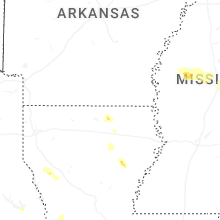
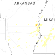
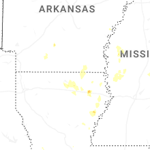
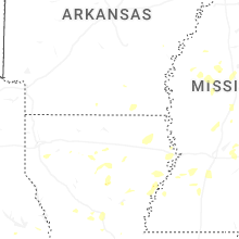
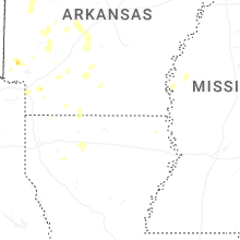
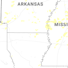

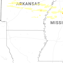


Connect with Interactive Hail Maps