

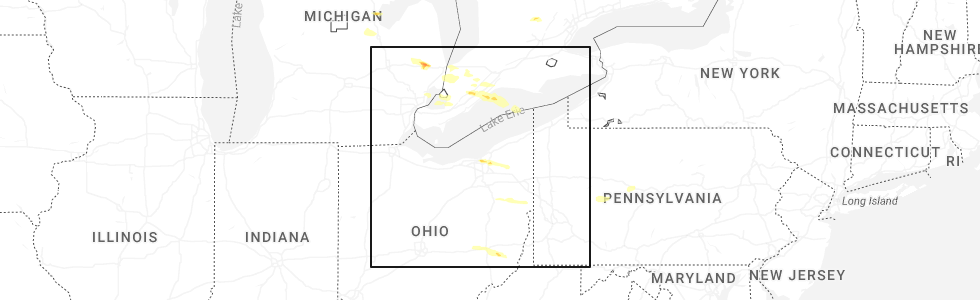
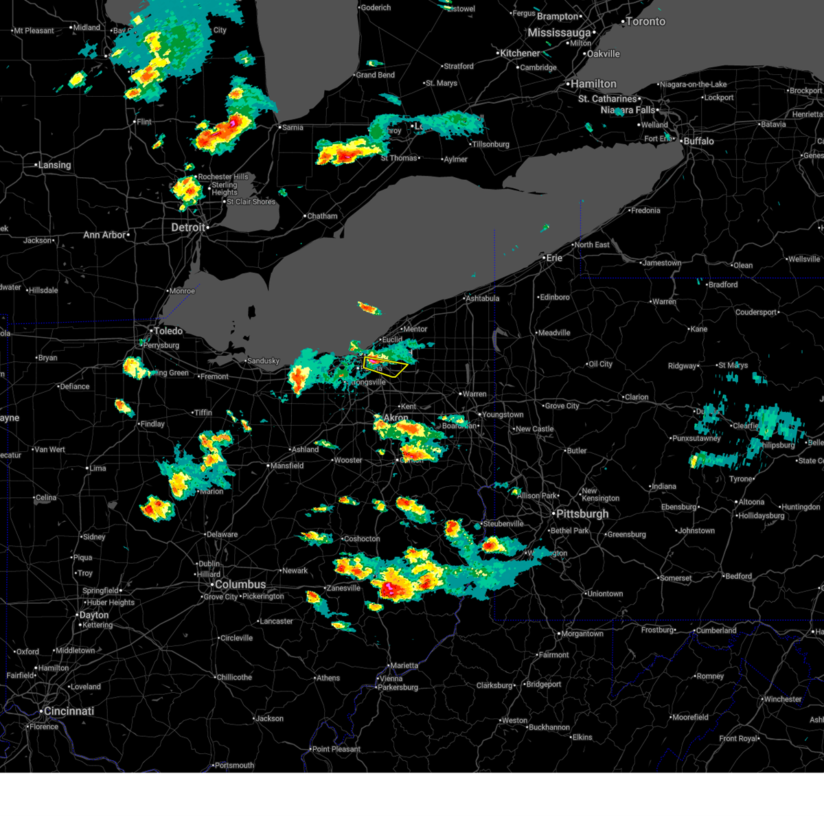
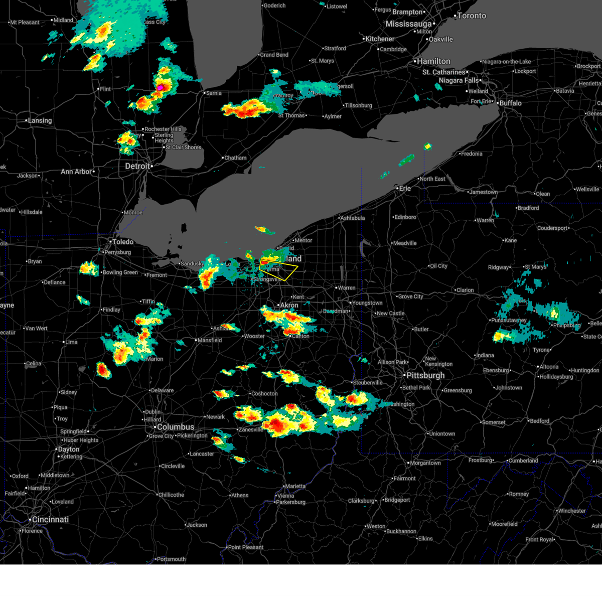
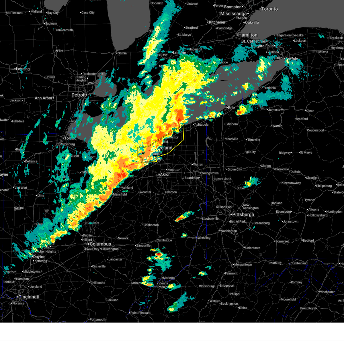
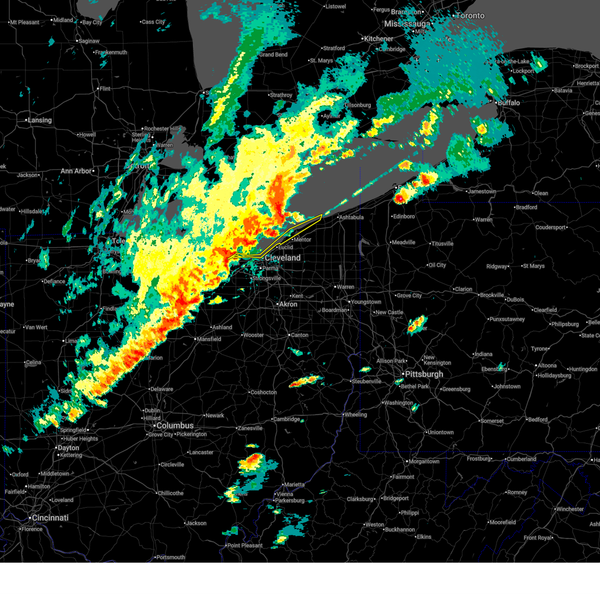
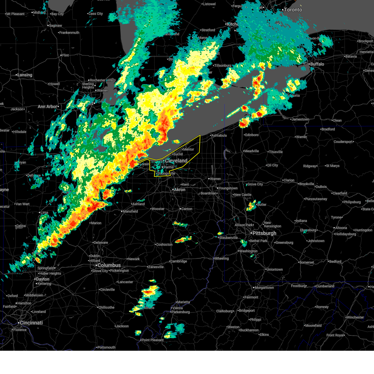
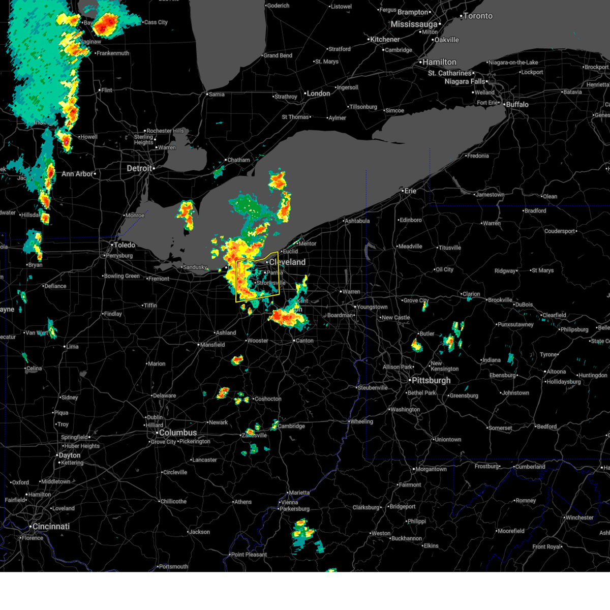
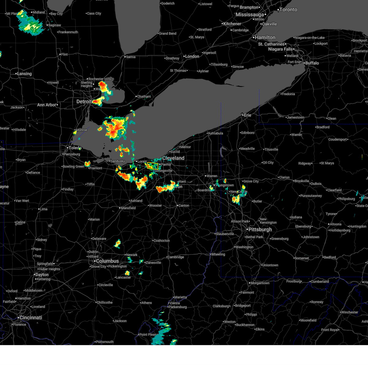
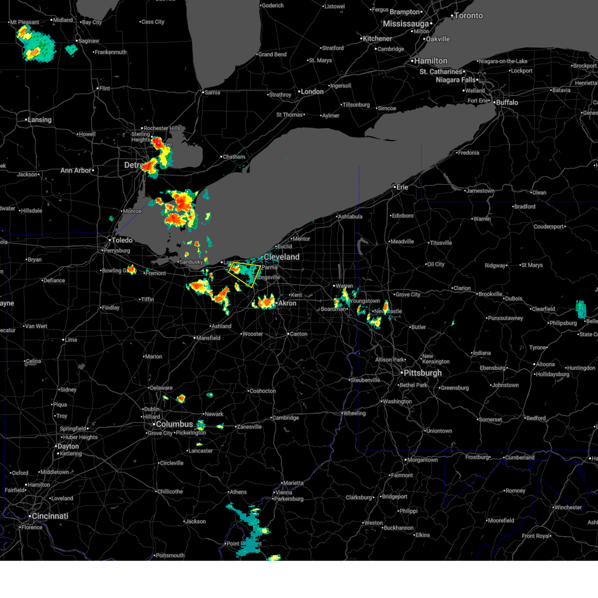
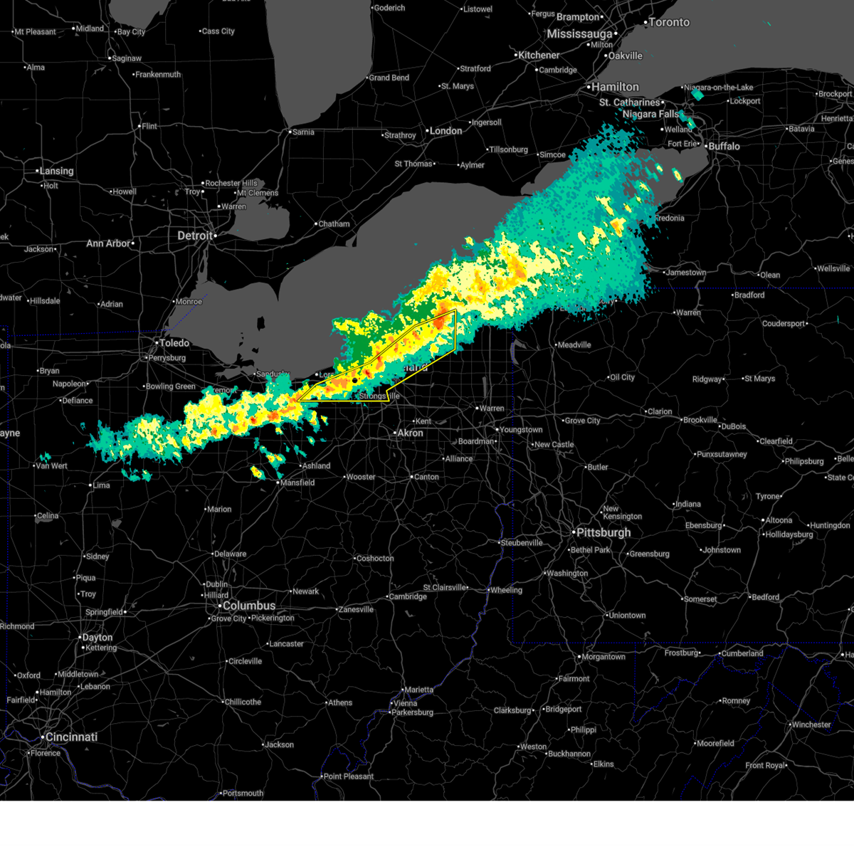
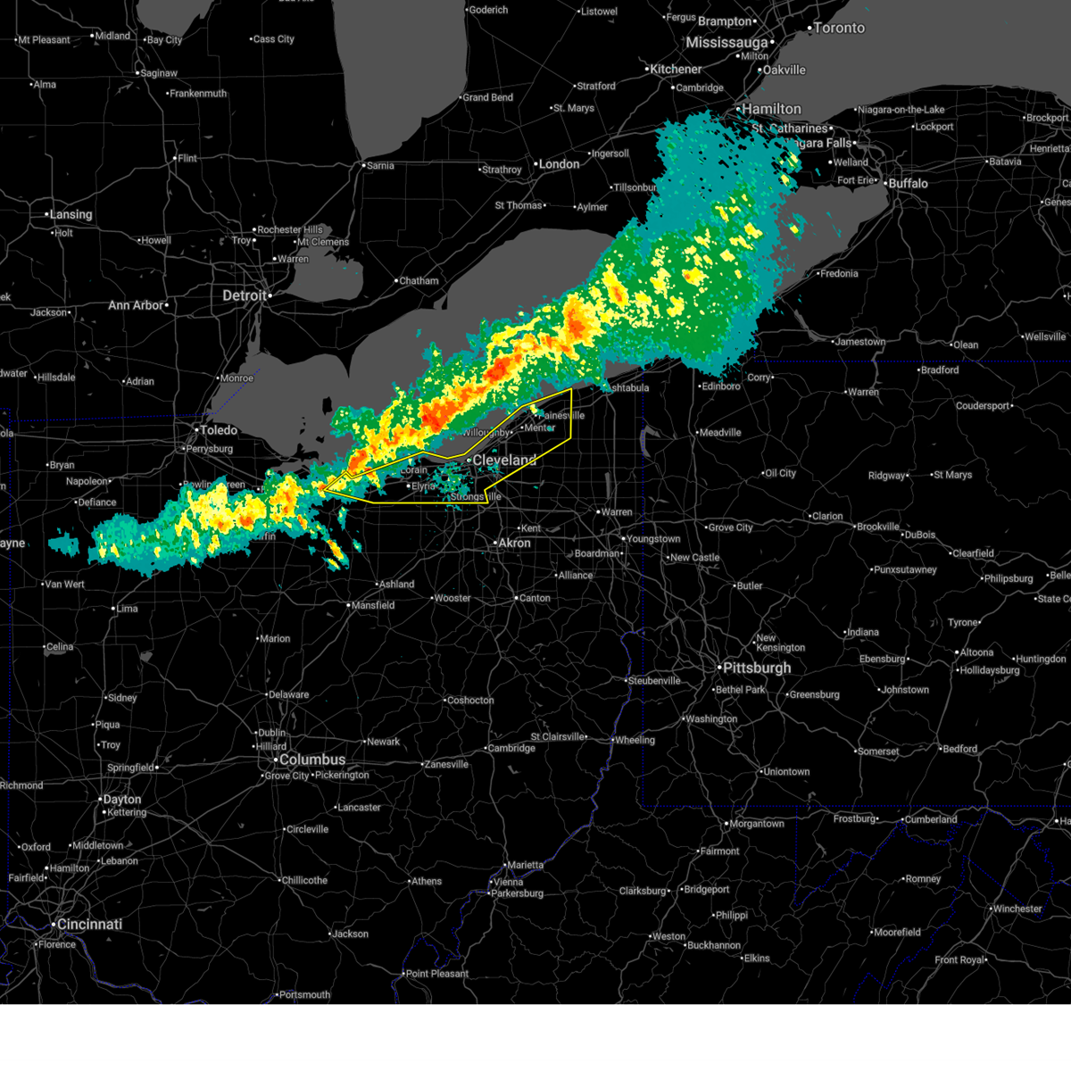
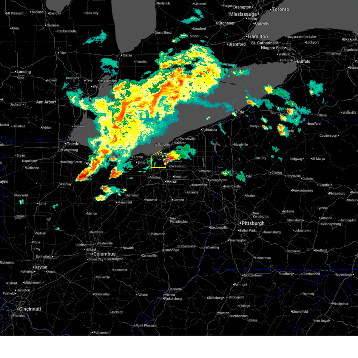
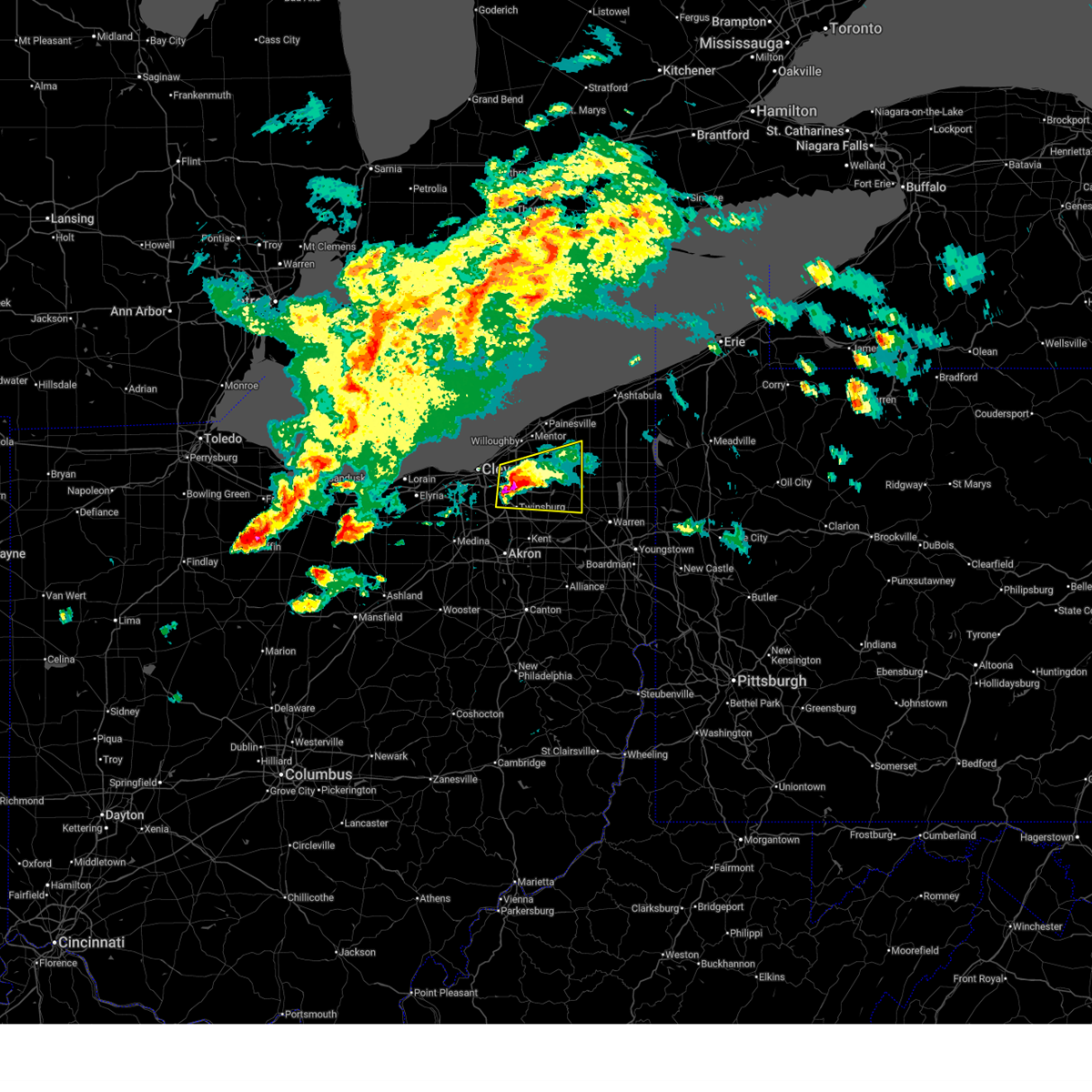
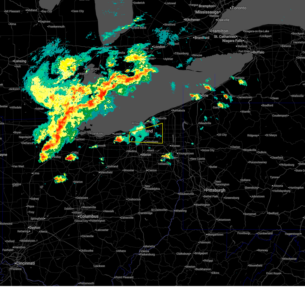
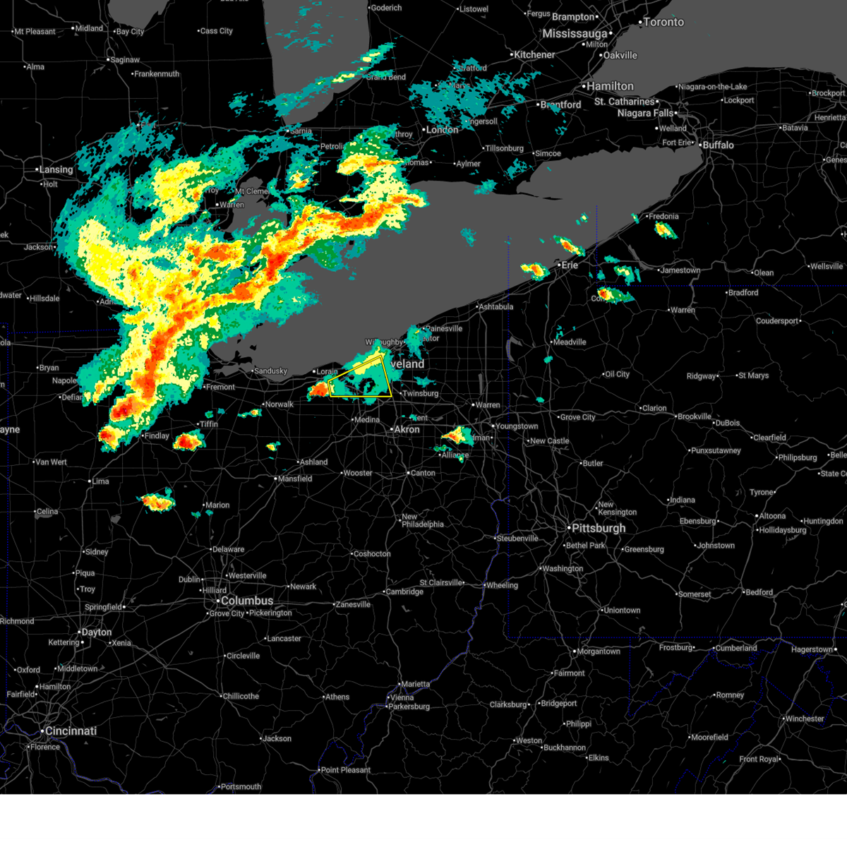
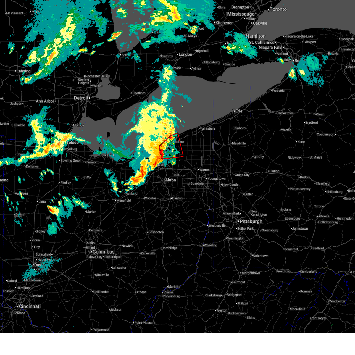
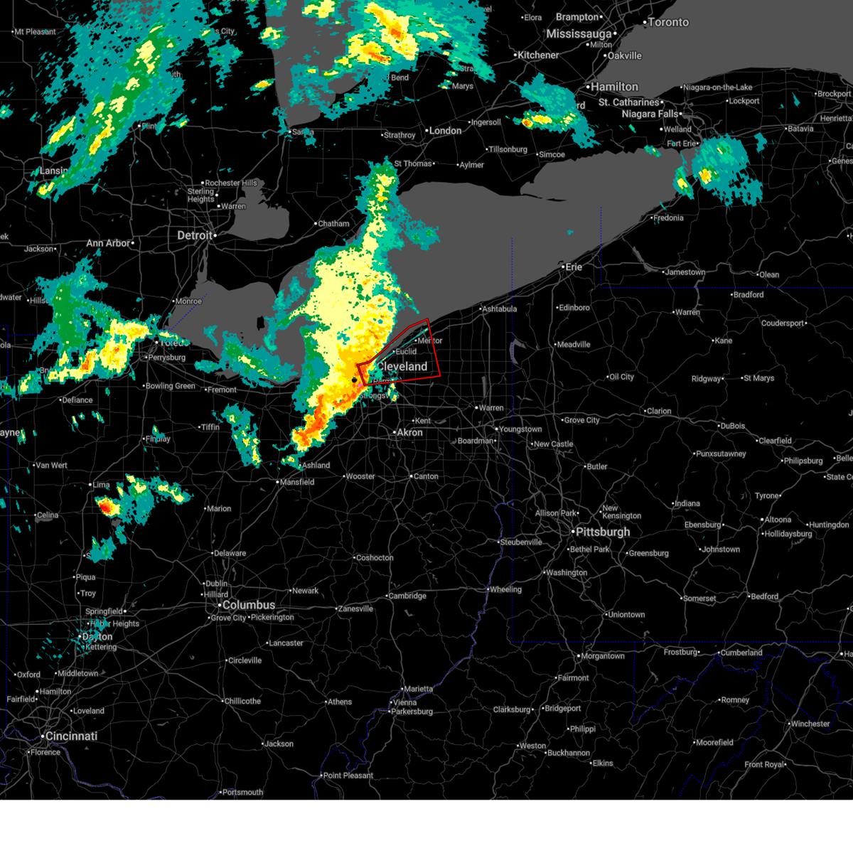
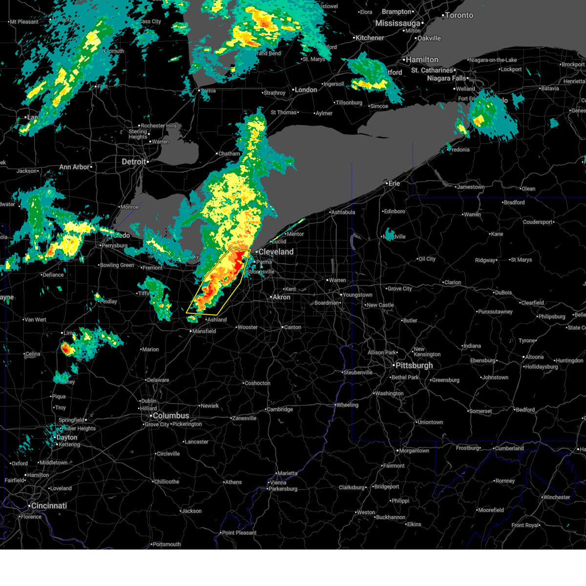
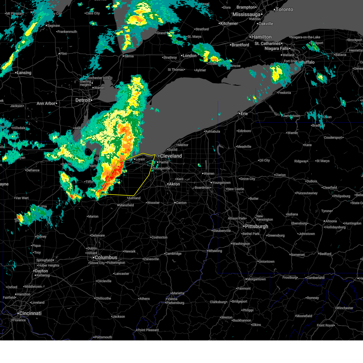
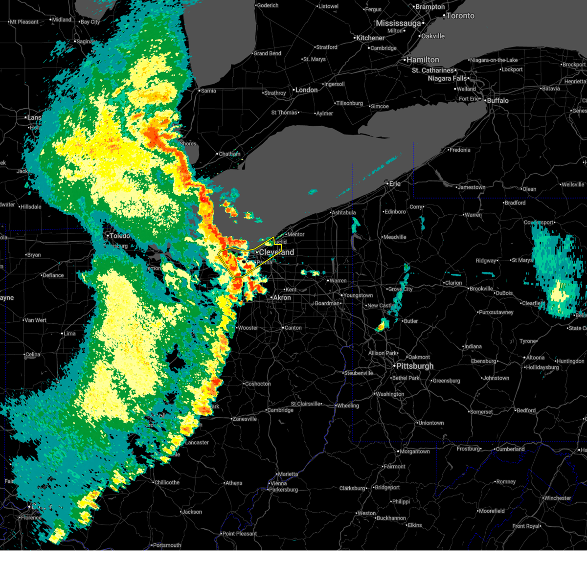
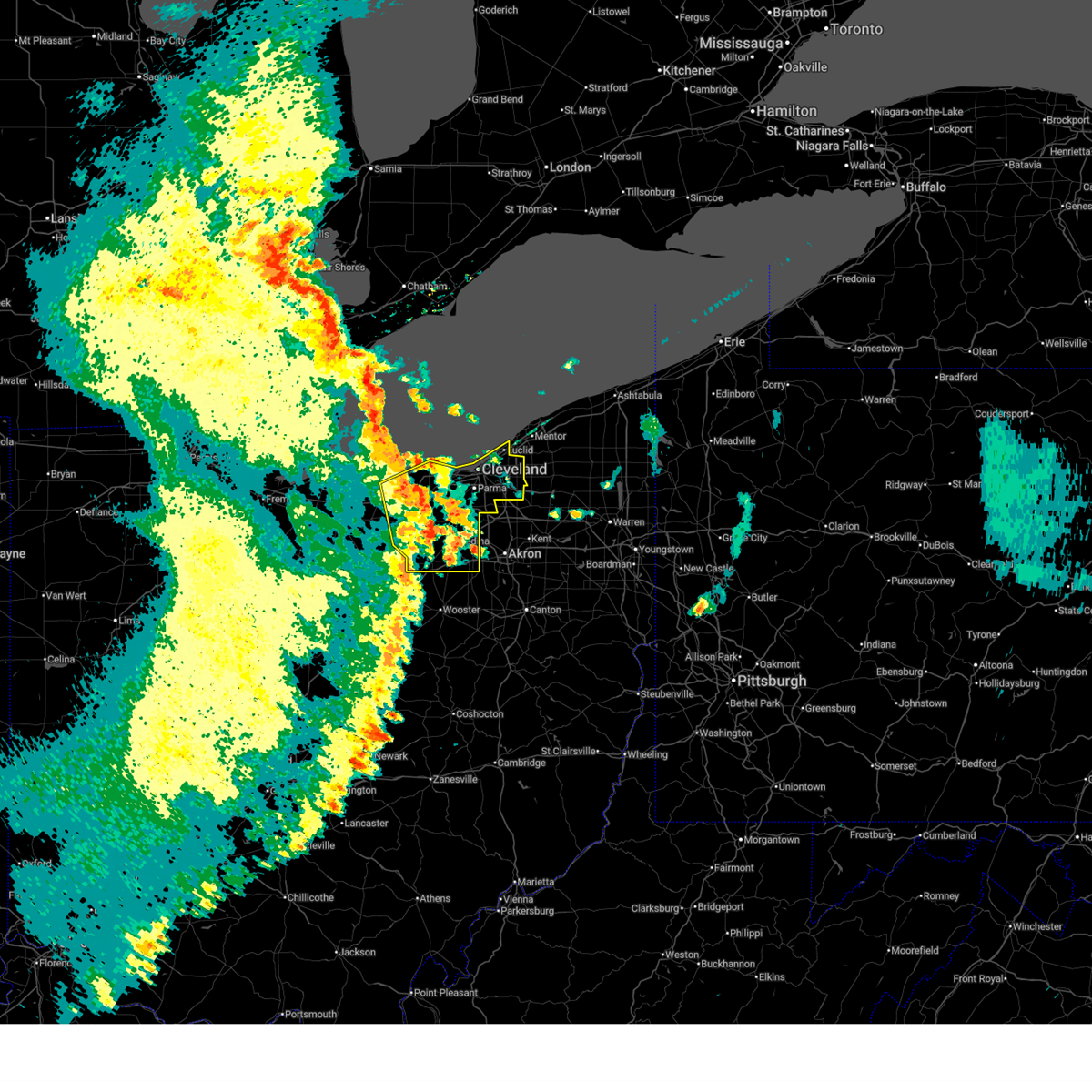
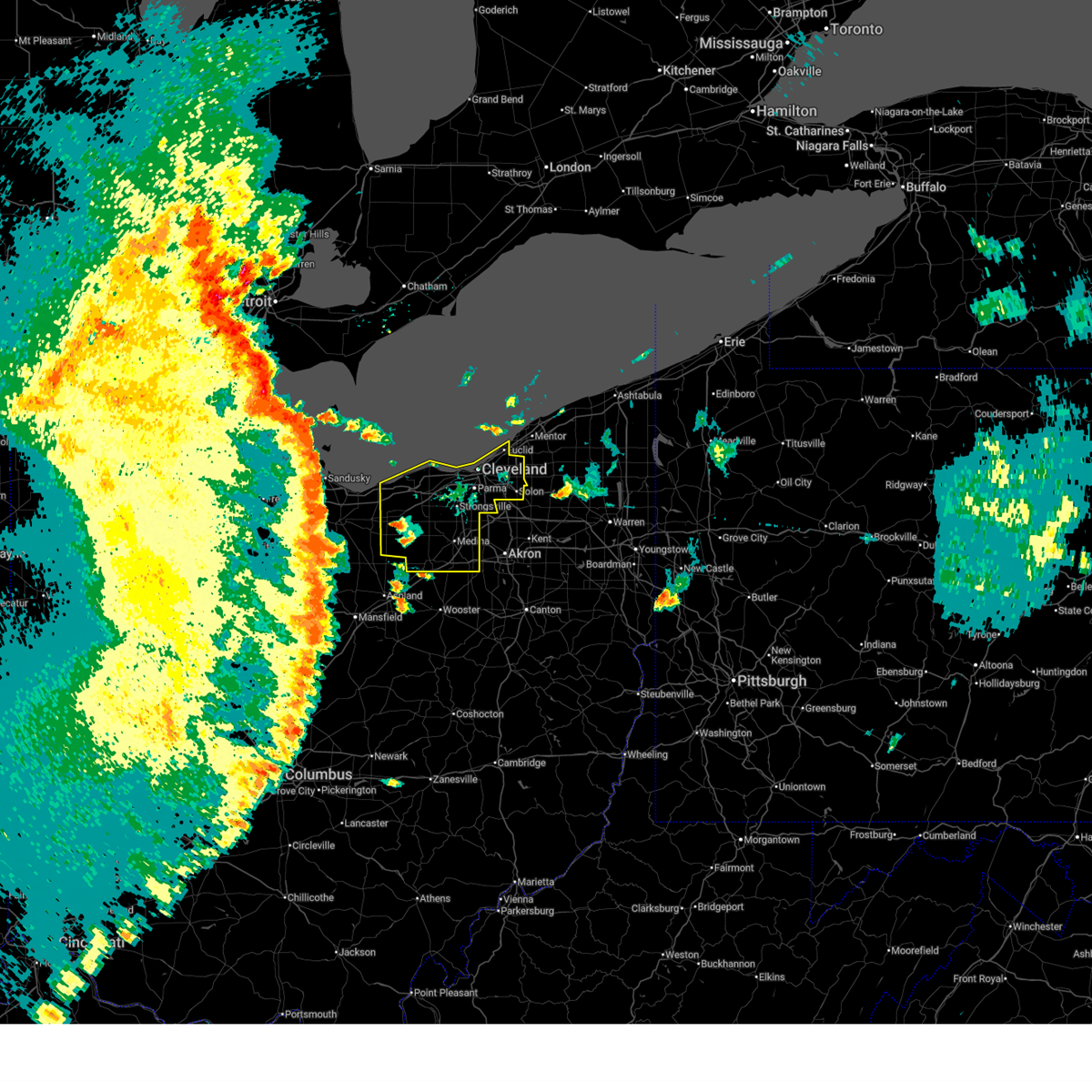
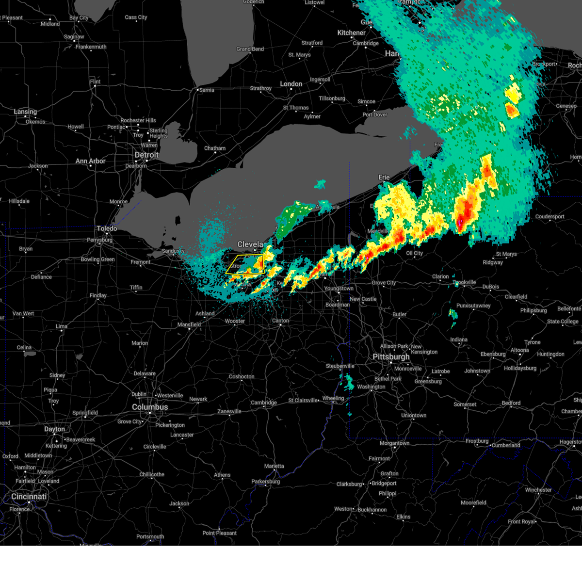
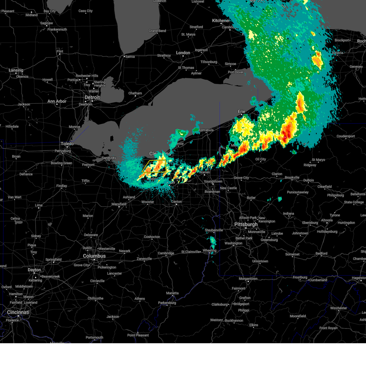
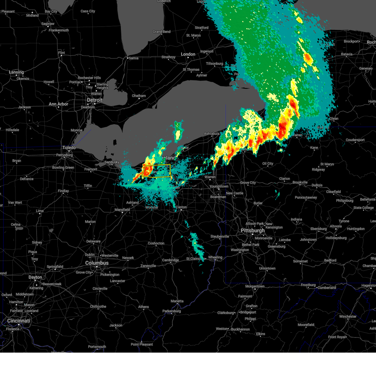
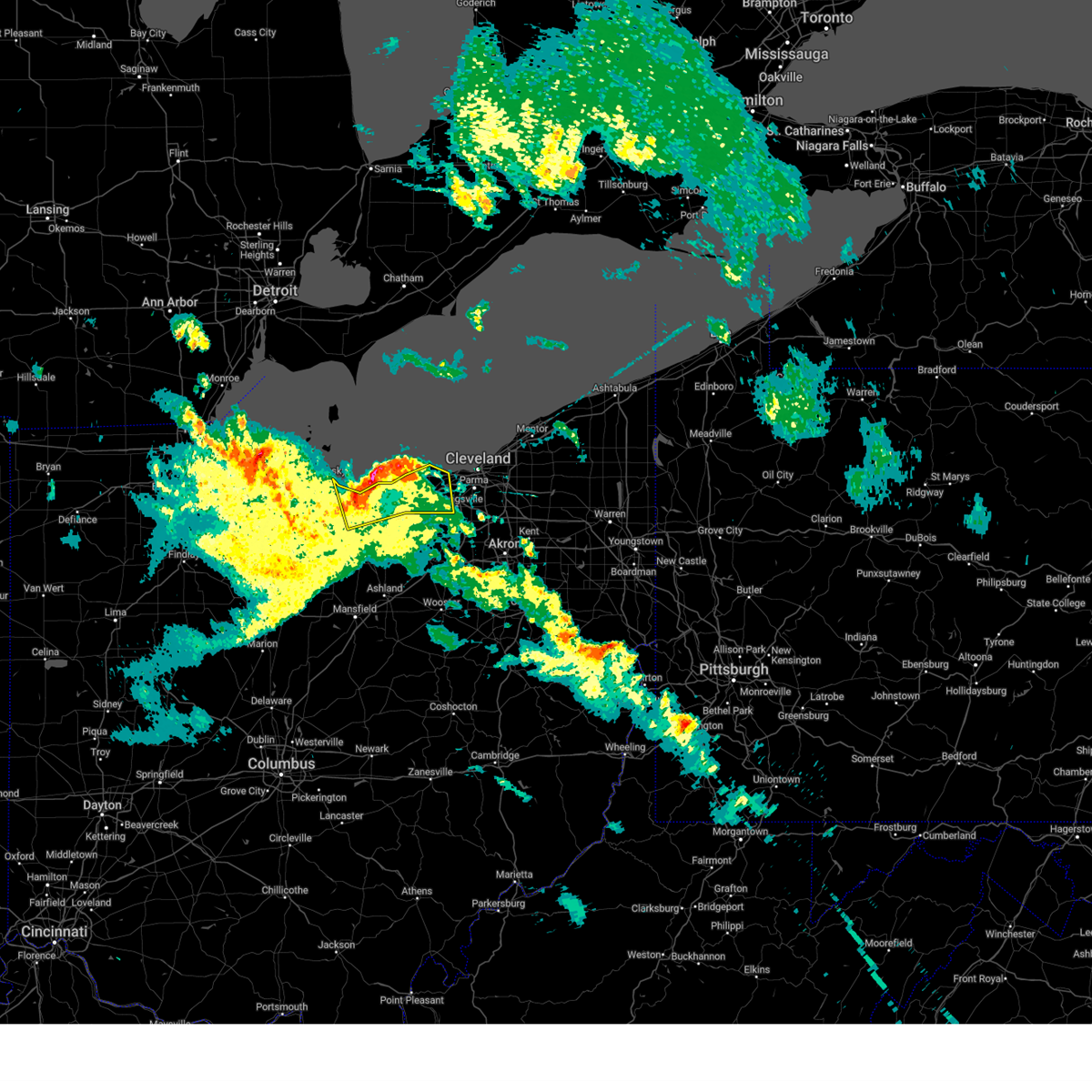
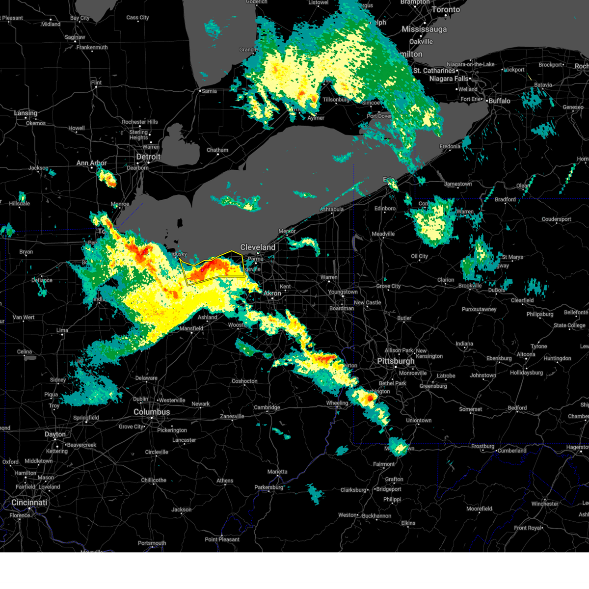
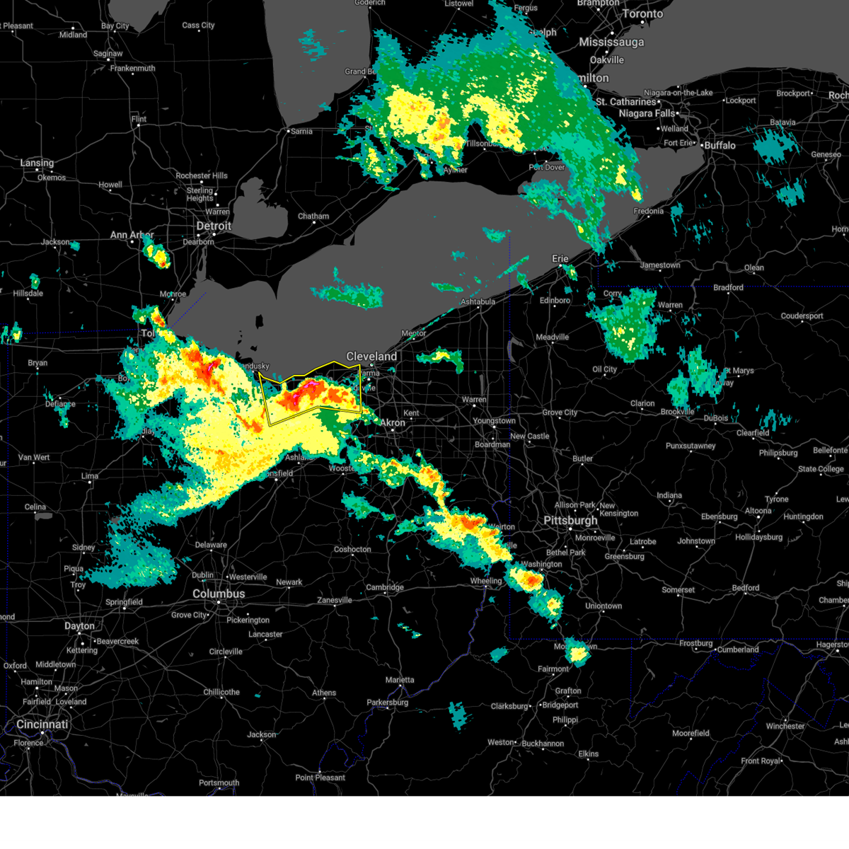
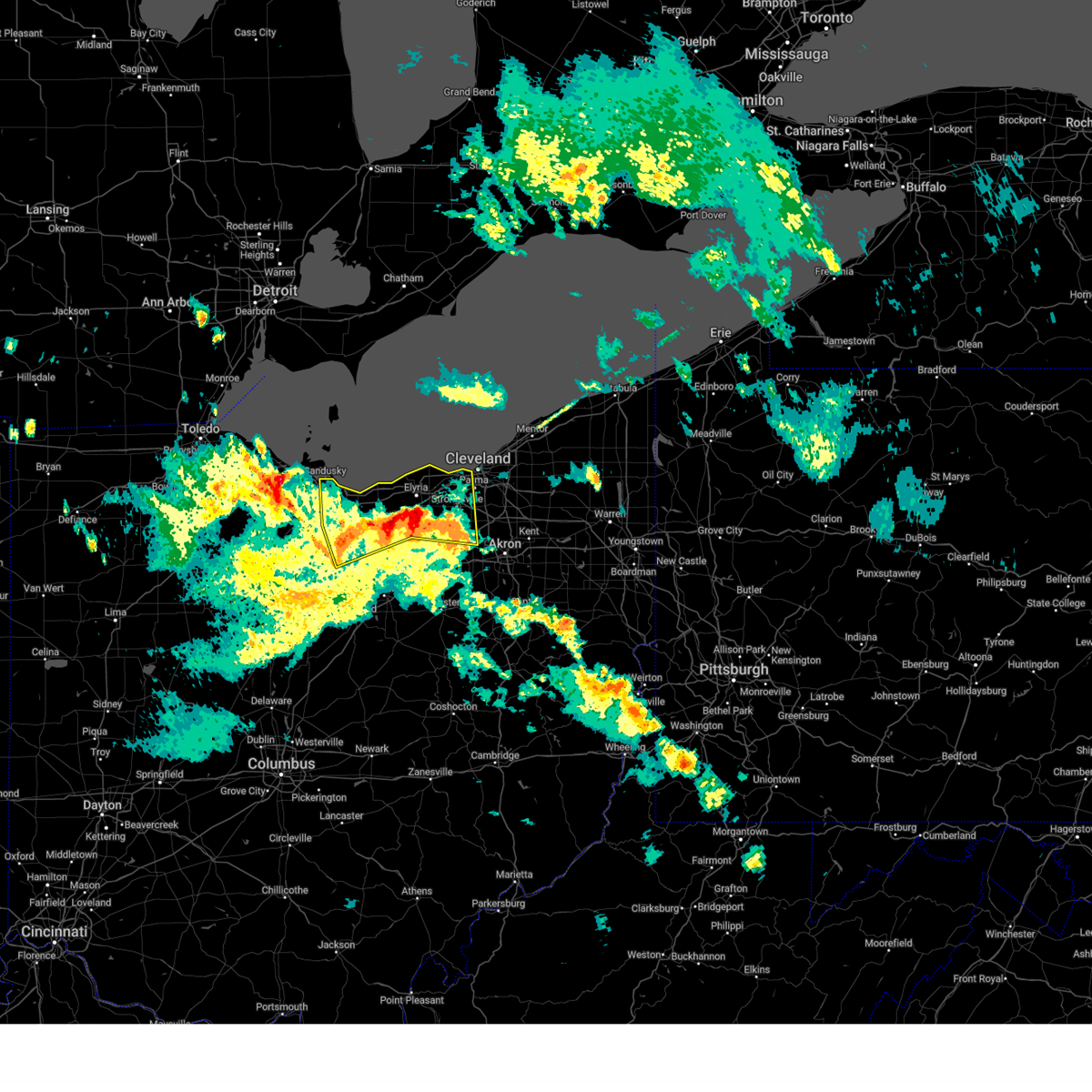
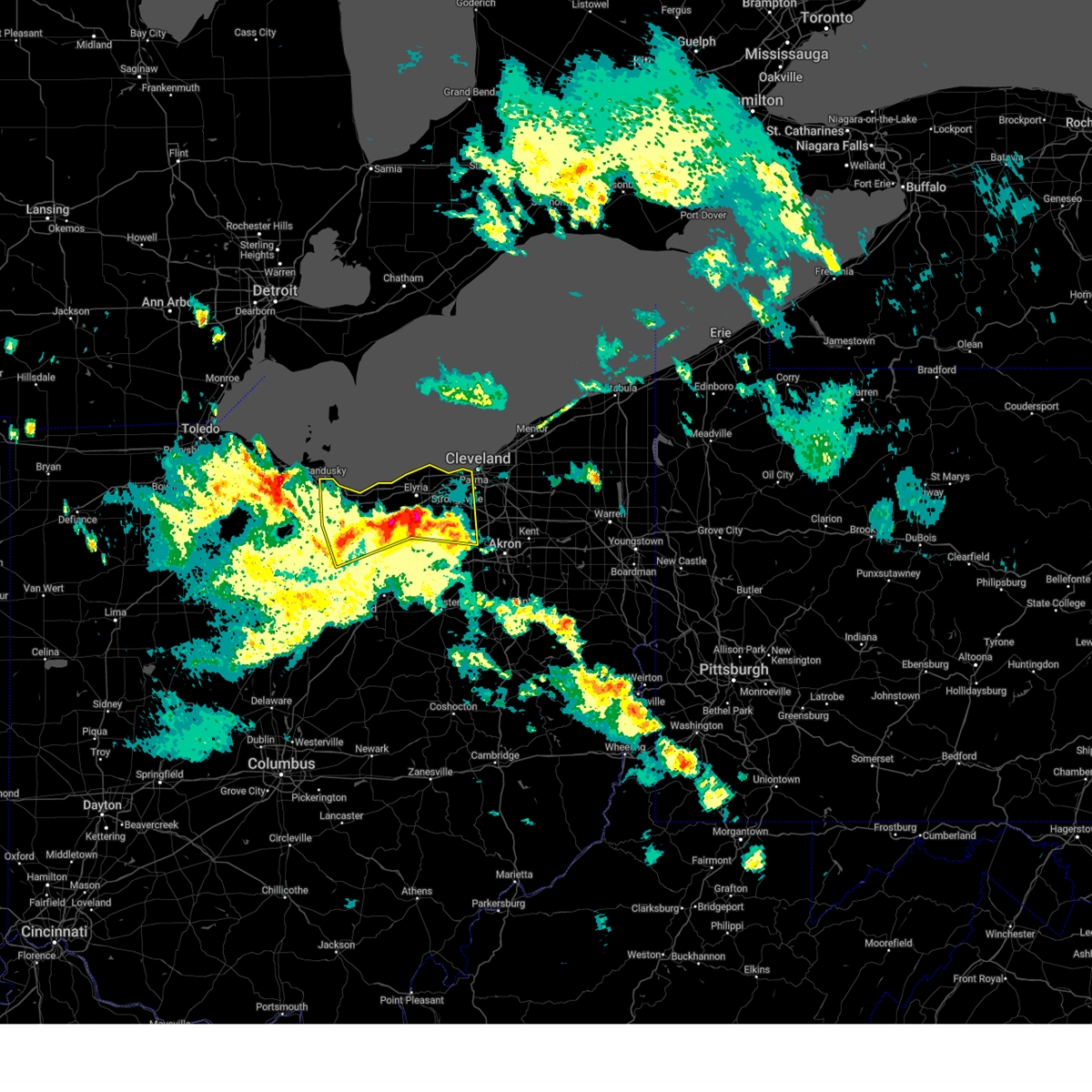
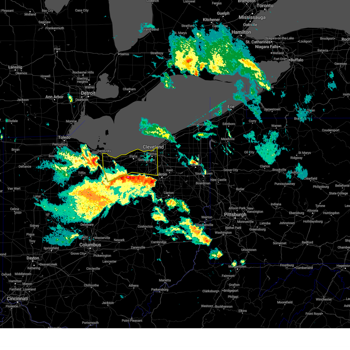
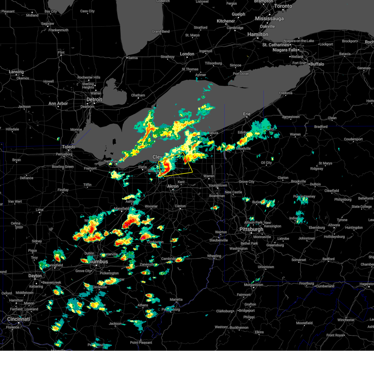
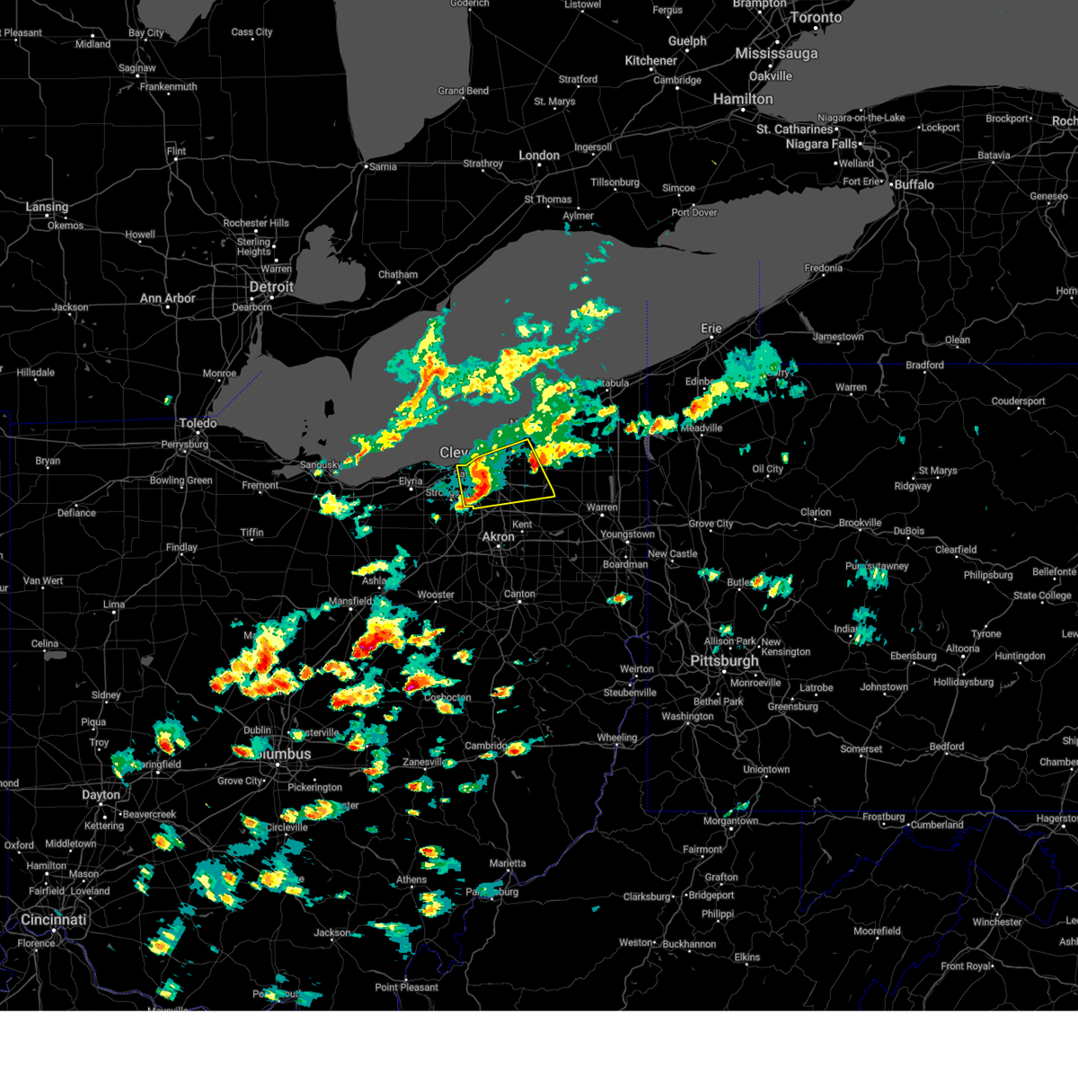
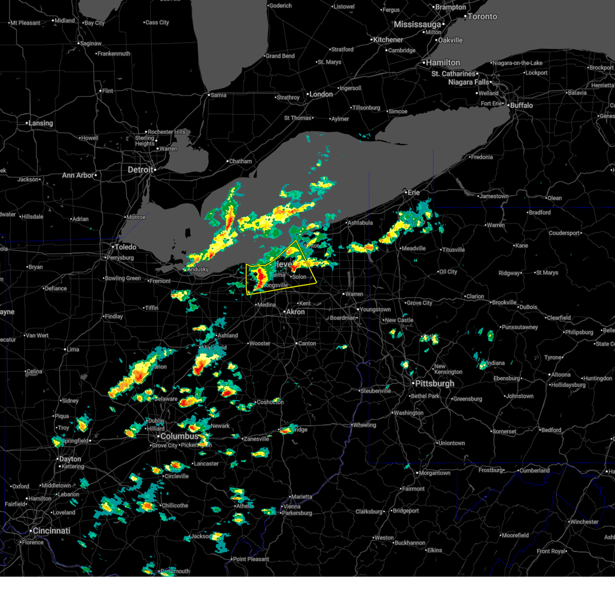
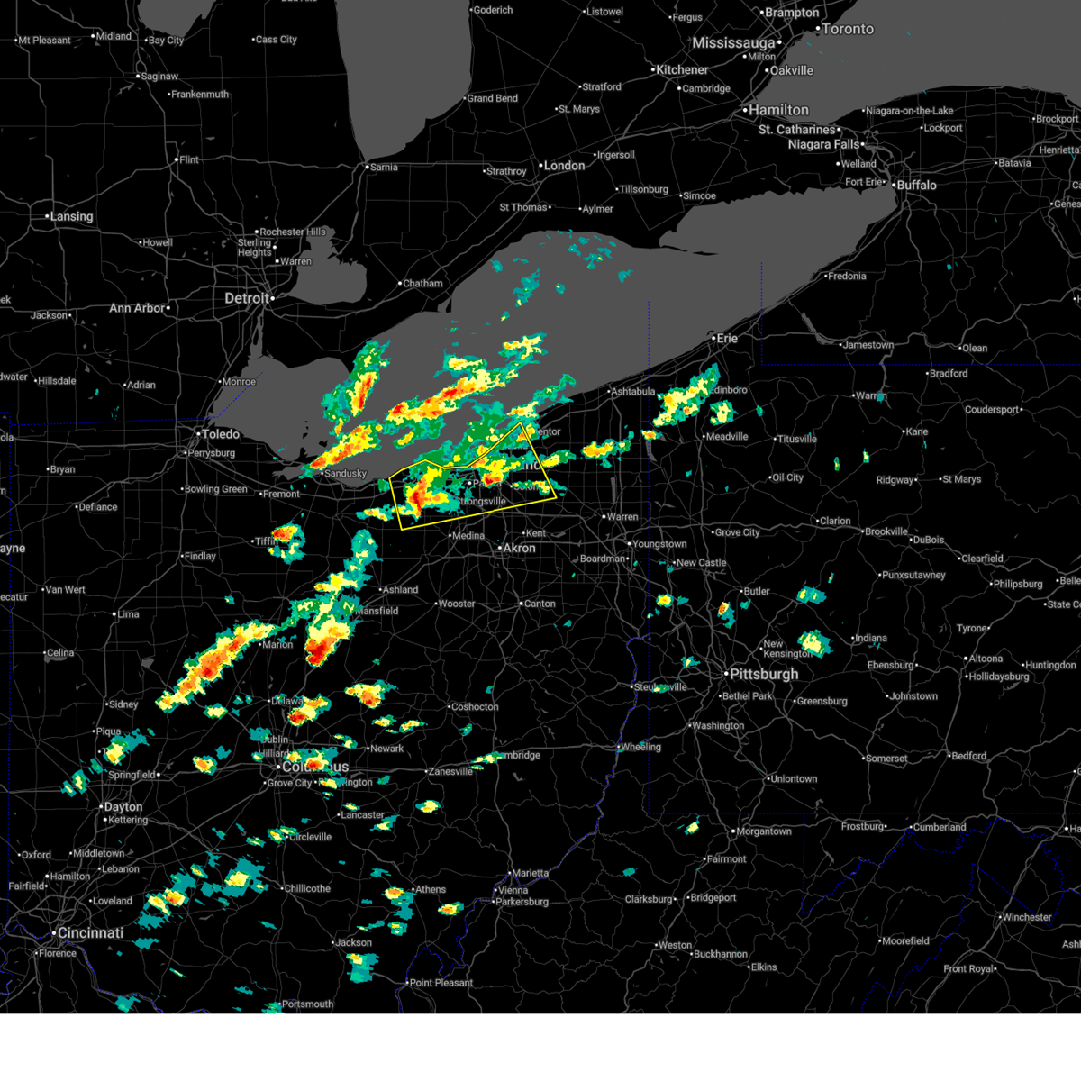
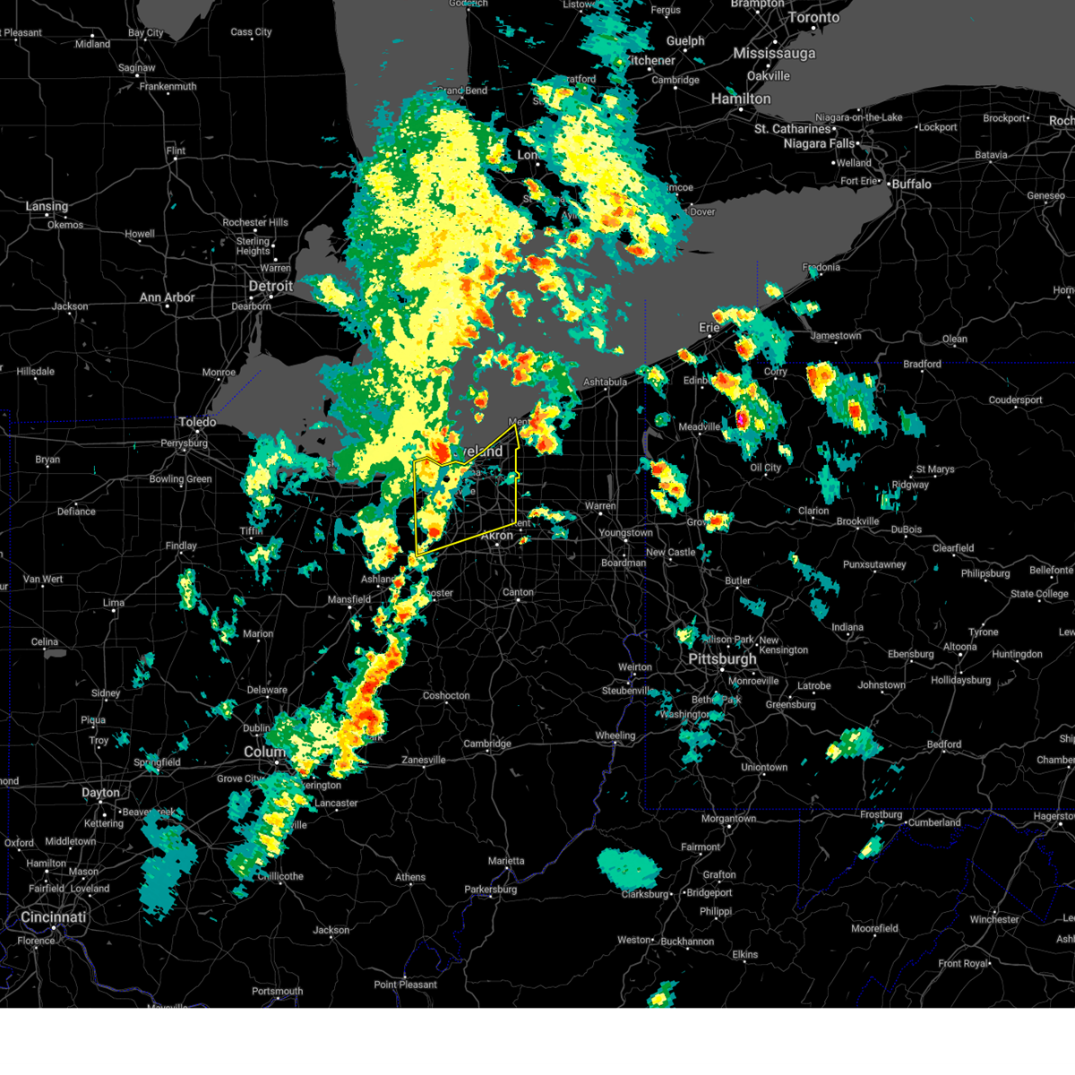
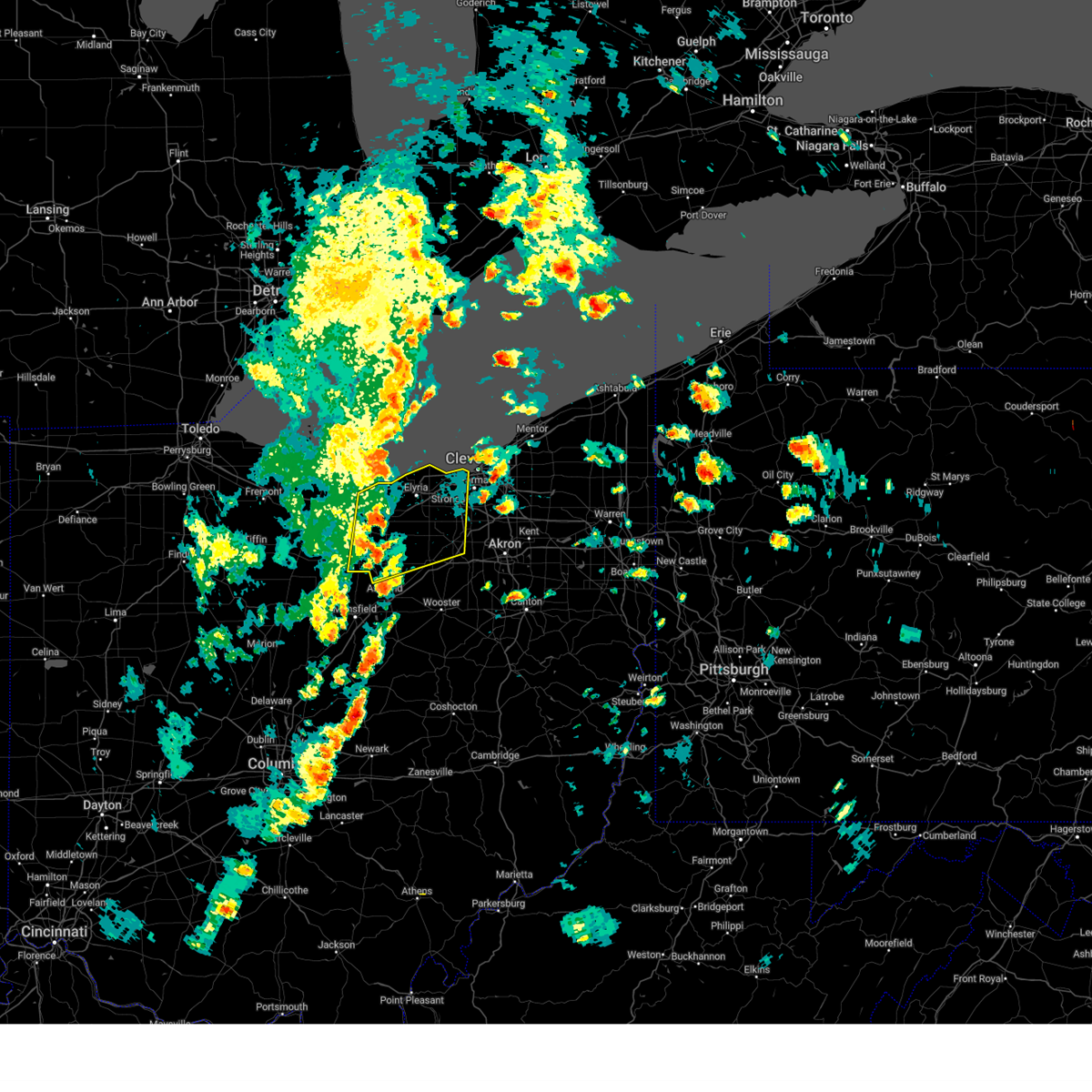
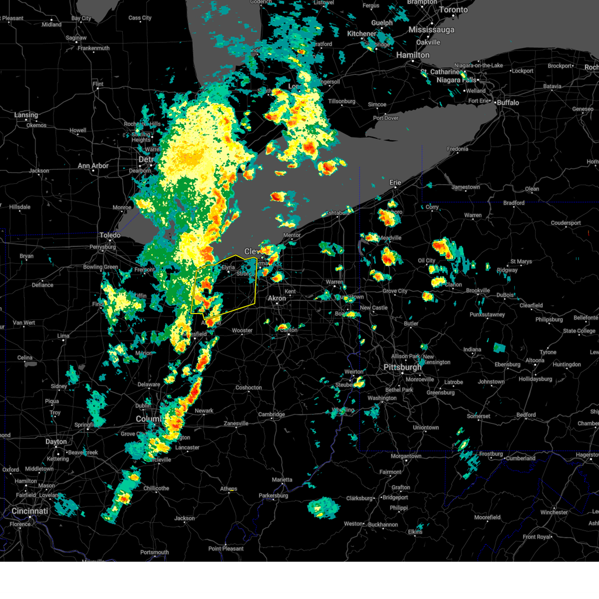
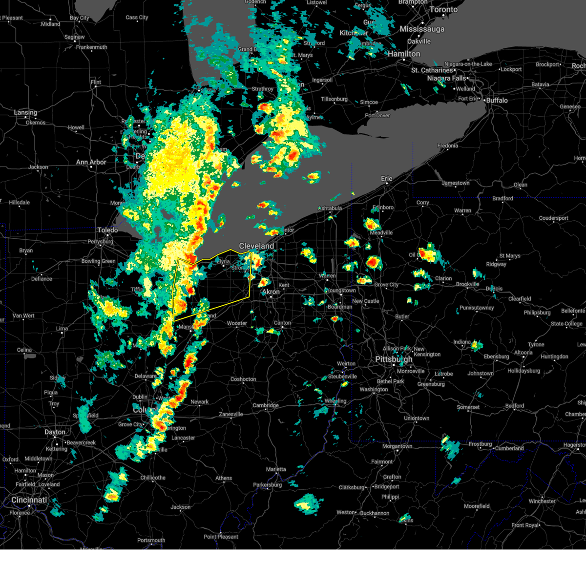
Hail Map for Cleveland, OH
The Cleveland, OH area has had 30 reports of on-the-ground hail by trained spotters, and has been under severe weather warnings 43 times during the past 12 months. Doppler radar has detected hail at or near Cleveland, OH on 63 occasions, including 4 occasions during the past year.
| Name: | Cleveland, OH |
| Where Located: | 2.5 miles S of Cleveland, OH |
| Map: | Google Map for Cleveland, OH |
| Population: | 396815 |
| Housing Units: | 207536 |
| More Info: | Search Google for Cleveland, OH |
2
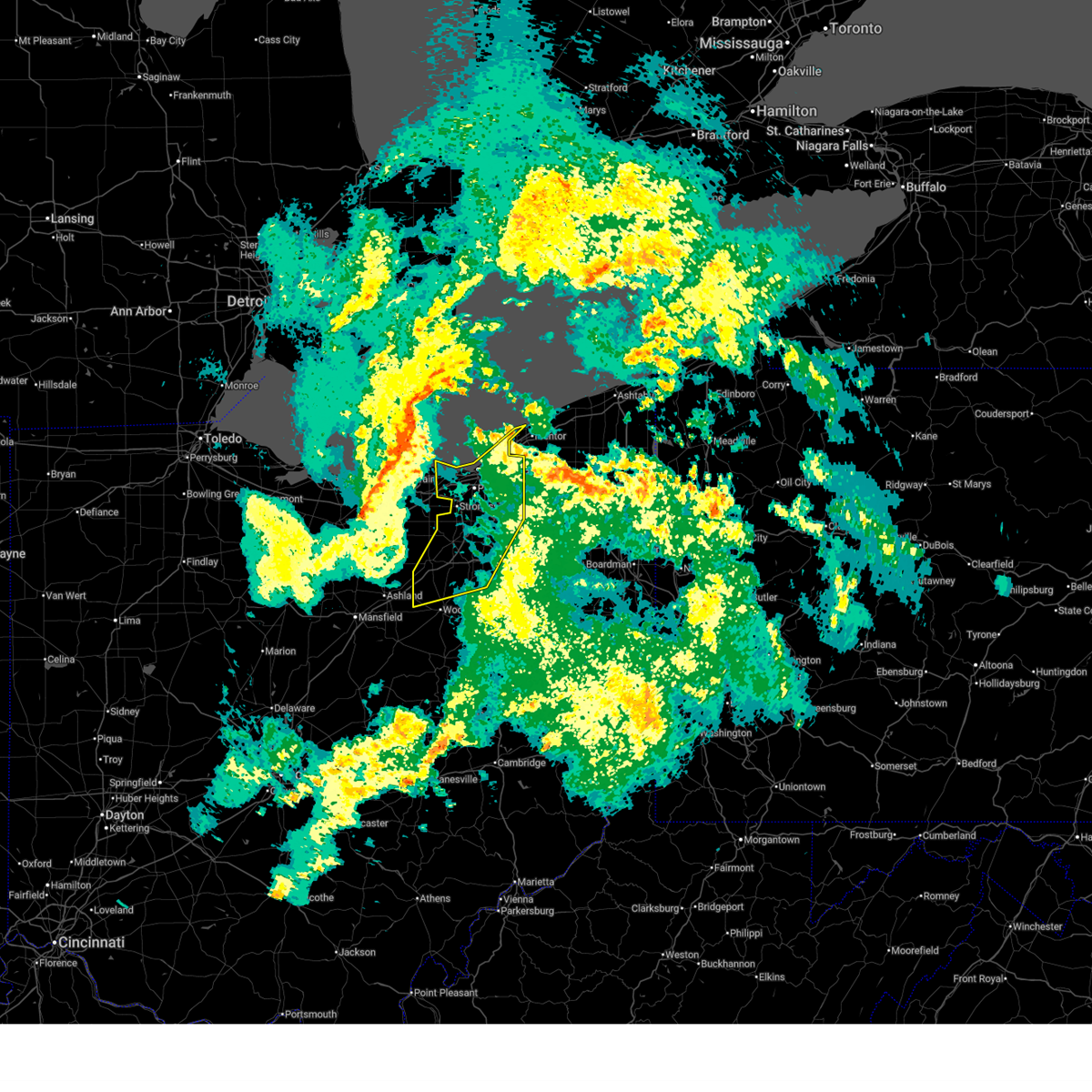
The Top Recent Hail Date for Cleveland, OH is Thursday, June 25, 2026 (3rd out of 63)
Hail and Wind Damage Spotted near Cleveland, OH
| Date / Time | Report Details |
|---|---|
| 7/3/2026 8:52 PM EDT |
 The storms which prompted the warning have moved out of the area. therefore, the warning will be allowed to expire. The storms which prompted the warning have moved out of the area. therefore, the warning will be allowed to expire.
|
| 7/3/2026 8:02 PM EDT |
 Svrcle the national weather service in cleveland has issued a * severe thunderstorm warning for, cuyahoga county in northeastern ohio, northern lorain county in north central ohio, * until 900 pm edt. * at 802 pm edt, severe thunderstorms were located along a line extending from near avon lake to near amherst, moving east at 45 mph (radar indicated). Hazards include 60 mph wind gusts. expect damage to trees and power lines Svrcle the national weather service in cleveland has issued a * severe thunderstorm warning for, cuyahoga county in northeastern ohio, northern lorain county in north central ohio, * until 900 pm edt. * at 802 pm edt, severe thunderstorms were located along a line extending from near avon lake to near amherst, moving east at 45 mph (radar indicated). Hazards include 60 mph wind gusts. expect damage to trees and power lines
|
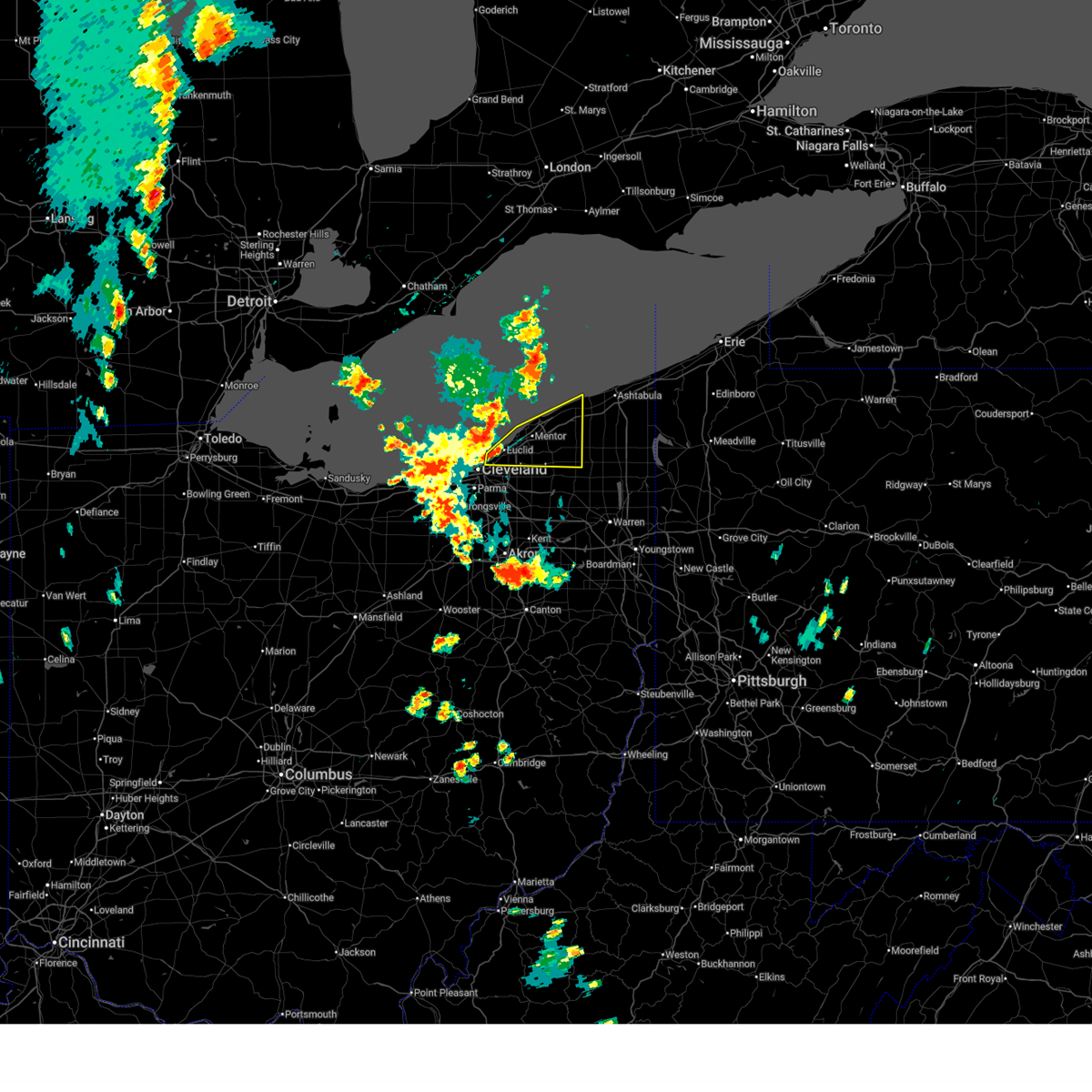
| 6/25/2026 6:06 PM EDT |
 The storm which prompted the warning has weakened below severe limits, and has exited the warned area. therefore, the warning will be allowed to expire. however, small hail and gusty winds are still possible with this thunderstorm. a severe thunderstorm watch remains in effect until 100 am edt for northeastern ohio. The storm which prompted the warning has weakened below severe limits, and has exited the warned area. therefore, the warning will be allowed to expire. however, small hail and gusty winds are still possible with this thunderstorm. a severe thunderstorm watch remains in effect until 100 am edt for northeastern ohio.
|
| 6/25/2026 5:52 PM EDT |
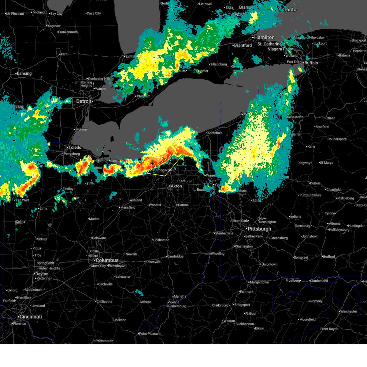
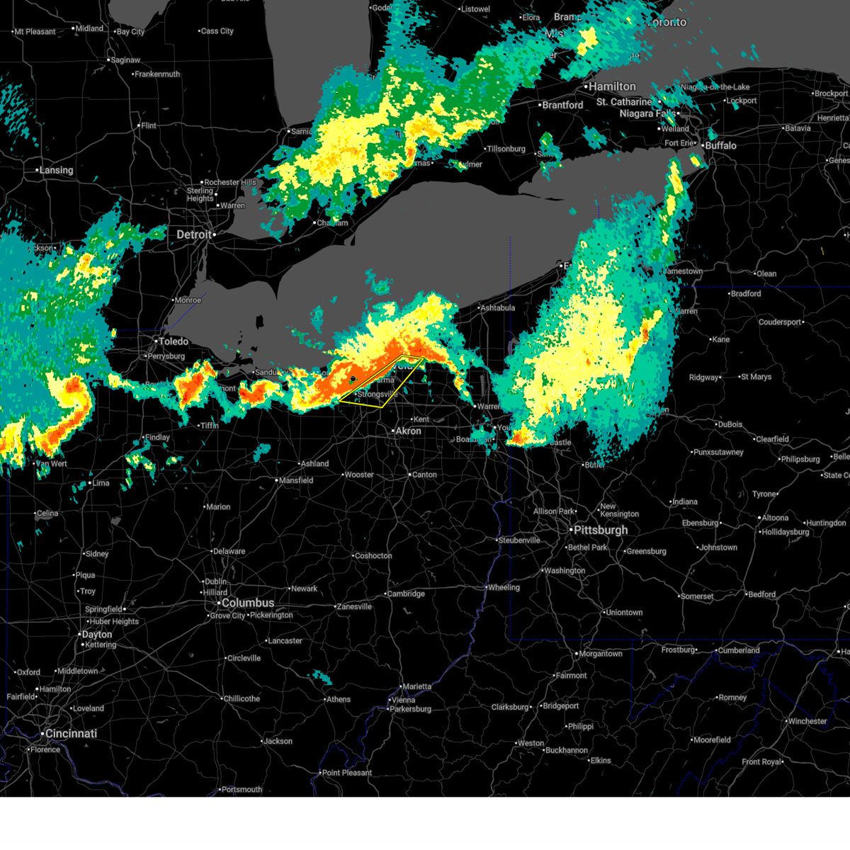
 At 551 pm edt, a severe thunderstorm was located over warrensville heights, or 9 miles southeast of cleveland, moving east at 25 mph (radar indicated). Hazards include 60 mph wind gusts and half dollar size hail. People and animals outdoors will be injured. expect hail damage to roofs, siding, windows, and vehicles. expect damage to trees and power lines. Locations impacted include, solon, warrensville heights, south russell, highland hills, garfield heights, shaker heights, maple heights, bedford, beachwood, bedford heights, chagrin falls, orange, moreland hills, walton hills, north randall, glenwillow, bentleyville, bainbridge, and warrensville heigh. At 551 pm edt, a severe thunderstorm was located over warrensville heights, or 9 miles southeast of cleveland, moving east at 25 mph (radar indicated). Hazards include 60 mph wind gusts and half dollar size hail. People and animals outdoors will be injured. expect hail damage to roofs, siding, windows, and vehicles. expect damage to trees and power lines. Locations impacted include, solon, warrensville heights, south russell, highland hills, garfield heights, shaker heights, maple heights, bedford, beachwood, bedford heights, chagrin falls, orange, moreland hills, walton hills, north randall, glenwillow, bentleyville, bainbridge, and warrensville heigh.
|
| 6/25/2026 5:39 PM EDT |
 At 538 pm edt, a severe thunderstorm was located near cleveland, moving east at 25 mph (radar indicated). Hazards include 60 mph wind gusts and half dollar size hail. People and animals outdoors will be injured. expect hail damage to roofs, siding, windows, and vehicles. expect damage to trees and power lines. Locations impacted include, cleveland, solon, warrensville heights, south russell, highland hills, garfield heights, shaker heights, maple heights, bedford, beachwood, bedford heights, independence, chagrin falls, orange, moreland hills, walton hills, newburgh heights, valley view, brooklyn heights, and north randall. At 538 pm edt, a severe thunderstorm was located near cleveland, moving east at 25 mph (radar indicated). Hazards include 60 mph wind gusts and half dollar size hail. People and animals outdoors will be injured. expect hail damage to roofs, siding, windows, and vehicles. expect damage to trees and power lines. Locations impacted include, cleveland, solon, warrensville heights, south russell, highland hills, garfield heights, shaker heights, maple heights, bedford, beachwood, bedford heights, independence, chagrin falls, orange, moreland hills, walton hills, newburgh heights, valley view, brooklyn heights, and north randall.
|
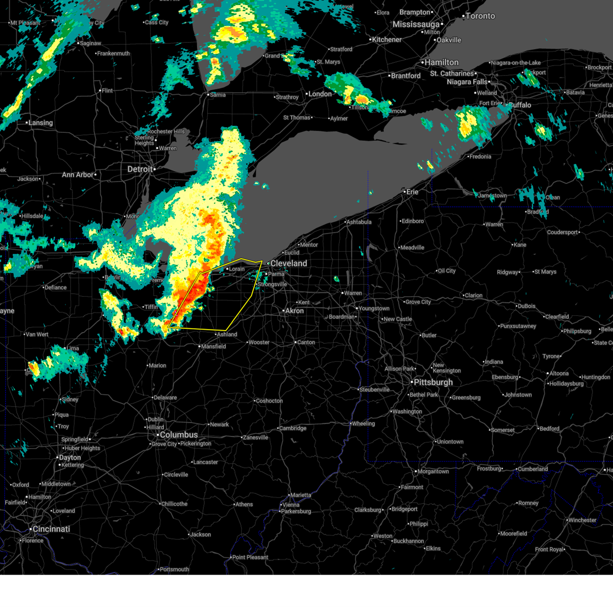
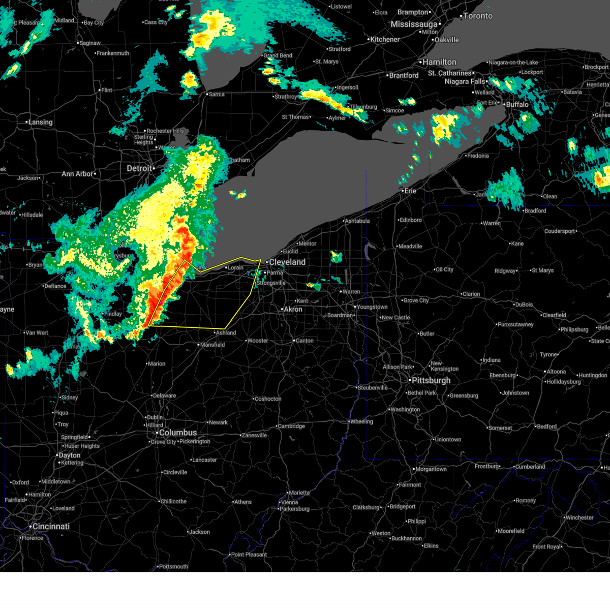
| 6/25/2026 5:38 PM EDT | Quarter sized hail reported 2.8 miles W of Cleveland, OH, report from mping: quarter (1.00 in.). |
| 6/25/2026 5:36 PM EDT | Quarter sized hail reported 2.8 miles WNW of Cleveland, OH |
| 6/25/2026 5:31 PM EDT |
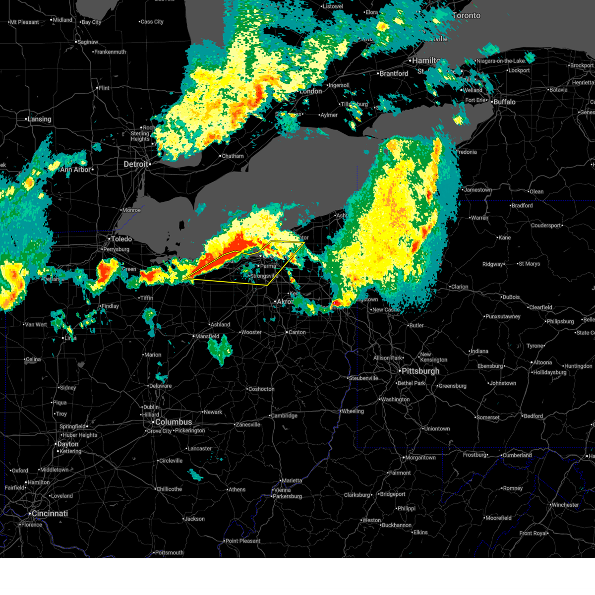
 Svrcle the national weather service in cleveland has issued a * severe thunderstorm warning for, southwestern geauga county in northeastern ohio, east central cuyahoga county in northeastern ohio, northeastern summit county in northeastern ohio, * until 615 pm edt. * at 531 pm edt, a severe thunderstorm was located over cleveland, moving east at 25 mph (radar indicated). Hazards include 60 mph wind gusts and quarter size hail. Minor damage to vehicles is possible. Expect damage to trees and power lines. Svrcle the national weather service in cleveland has issued a * severe thunderstorm warning for, southwestern geauga county in northeastern ohio, east central cuyahoga county in northeastern ohio, northeastern summit county in northeastern ohio, * until 615 pm edt. * at 531 pm edt, a severe thunderstorm was located over cleveland, moving east at 25 mph (radar indicated). Hazards include 60 mph wind gusts and quarter size hail. Minor damage to vehicles is possible. Expect damage to trees and power lines.
|
| 6/14/2026 3:51 PM EDT |
 The storms which prompted the warning have moved out of the area. therefore, the warning will be allowed to expire. however, gusty winds and heavy rain are still possible with these thunderstorms. a severe thunderstorm watch remains in effect until 900 pm edt for north central and northeastern ohio. The storms which prompted the warning have moved out of the area. therefore, the warning will be allowed to expire. however, gusty winds and heavy rain are still possible with these thunderstorms. a severe thunderstorm watch remains in effect until 900 pm edt for north central and northeastern ohio.
|
| 6/14/2026 3:34 PM EDT |
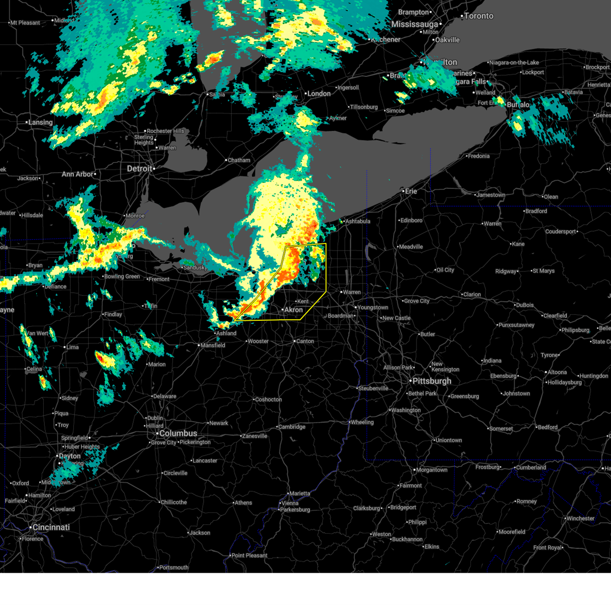
 At 334 pm edt, severe thunderstorms were located along a line extending from near painesville to 6 miles northwest of cuyahoga falls to near bellville, moving southeast at 45 mph (radar indicated). Hazards include 70 mph wind gusts. Expect considerable tree damage. damage is likely to mobile homes, roofs, and outbuildings. Locations impacted include, cleveland, painesville, willowick, chardon, fairport harbor, parma, lakewood, euclid, mentor, cleveland heights, strongsville, brunswick, westlake, north royalton, solon, willoughby, eastlake, warrensville heights, south russell, and madison. At 334 pm edt, severe thunderstorms were located along a line extending from near painesville to 6 miles northwest of cuyahoga falls to near bellville, moving southeast at 45 mph (radar indicated). Hazards include 70 mph wind gusts. Expect considerable tree damage. damage is likely to mobile homes, roofs, and outbuildings. Locations impacted include, cleveland, painesville, willowick, chardon, fairport harbor, parma, lakewood, euclid, mentor, cleveland heights, strongsville, brunswick, westlake, north royalton, solon, willoughby, eastlake, warrensville heights, south russell, and madison.
|
| 6/14/2026 3:24 PM EDT |
 At 324 pm edt, severe thunderstorms were located along a line extending from painesville to near north royalton to near mansfield, moving east at 45 mph (radar indicated). Hazards include 70 mph wind gusts. Expect considerable tree damage. damage is likely to mobile homes, roofs, and outbuildings. Locations impacted include, cleveland, painesville, willowick, chardon, fairport harbor, parma, lakewood, euclid, mentor, cleveland heights, strongsville, brunswick, westlake, north royalton, solon, willoughby, eastlake, warrensville heights, south russell, and madison. At 324 pm edt, severe thunderstorms were located along a line extending from painesville to near north royalton to near mansfield, moving east at 45 mph (radar indicated). Hazards include 70 mph wind gusts. Expect considerable tree damage. damage is likely to mobile homes, roofs, and outbuildings. Locations impacted include, cleveland, painesville, willowick, chardon, fairport harbor, parma, lakewood, euclid, mentor, cleveland heights, strongsville, brunswick, westlake, north royalton, solon, willoughby, eastlake, warrensville heights, south russell, and madison.
|
| 6/14/2026 3:15 PM EDT | Large tree limb downed by storm in cuyahoga county OH, 9.4 miles WNW of Cleveland, OH |
| 6/14/2026 3:09 PM EDT | Tree down on a ca in cuyahoga county OH, 0.9 miles SSE of Cleveland, OH |
| 6/14/2026 3:06 PM EDT | Large tree uprooted along with large limbs blocking a roa in cuyahoga county OH, 3.1 miles NE of Cleveland, OH |
| 6/14/2026 3:04 PM EDT | 2 trees dow in cuyahoga county OH, 2.9 miles S of Cleveland, OH |
| 6/14/2026 3:04 PM EDT | Asos station kbkl clevelan in cuyahoga county OH, 3.6 miles S of Cleveland, OH |
| 6/14/2026 2:56 PM EDT |
 Svrcle the national weather service in cleveland has issued a * severe thunderstorm warning for, central lake county in northeastern ohio, * until 400 pm edt. * at 256 pm edt, severe thunderstorms were located along a line extending from 31 miles north of fairport harbor to 14 miles north of timberlake to near avon lake, moving east at 40 mph (radar indicated). Hazards include 70 mph wind gusts and penny size hail. Expect considerable tree damage. Damage is likely to mobile homes, roofs, and outbuildings. Svrcle the national weather service in cleveland has issued a * severe thunderstorm warning for, central lake county in northeastern ohio, * until 400 pm edt. * at 256 pm edt, severe thunderstorms were located along a line extending from 31 miles north of fairport harbor to 14 miles north of timberlake to near avon lake, moving east at 40 mph (radar indicated). Hazards include 70 mph wind gusts and penny size hail. Expect considerable tree damage. Damage is likely to mobile homes, roofs, and outbuildings.
|
| 6/14/2026 2:49 PM EDT |
 Svrcle the national weather service in cleveland has issued a * severe thunderstorm warning for, central geauga county in northeastern ohio, cuyahoga county in northeastern ohio, lake county in northeastern ohio, * until 345 pm edt. * at 249 pm edt, severe thunderstorms were located along a line extending from 22 miles northwest of fairport harbor to 6 miles northeast of avon lake to near willard, moving southeast at 45 mph (radar indicated). Hazards include 70 mph wind gusts and penny size hail. Expect considerable tree damage. Damage is likely to mobile homes, roofs, and outbuildings. Svrcle the national weather service in cleveland has issued a * severe thunderstorm warning for, central geauga county in northeastern ohio, cuyahoga county in northeastern ohio, lake county in northeastern ohio, * until 345 pm edt. * at 249 pm edt, severe thunderstorms were located along a line extending from 22 miles northwest of fairport harbor to 6 miles northeast of avon lake to near willard, moving southeast at 45 mph (radar indicated). Hazards include 70 mph wind gusts and penny size hail. Expect considerable tree damage. Damage is likely to mobile homes, roofs, and outbuildings.
|
| 6/10/2026 9:06 PM EDT |
 Svrcle the national weather service in cleveland has issued a * severe thunderstorm warning for, northern geauga county in northeastern ohio, northeastern cuyahoga county in northeastern ohio, lake county in northeastern ohio, * until 945 pm edt. * at 906 pm edt, a severe thunderstorm was located over euclid, or near willowick, moving east at 40 mph (radar indicated). Hazards include 60 mph wind gusts and nickel size hail. expect damage to trees and power lines Svrcle the national weather service in cleveland has issued a * severe thunderstorm warning for, northern geauga county in northeastern ohio, northeastern cuyahoga county in northeastern ohio, lake county in northeastern ohio, * until 945 pm edt. * at 906 pm edt, a severe thunderstorm was located over euclid, or near willowick, moving east at 40 mph (radar indicated). Hazards include 60 mph wind gusts and nickel size hail. expect damage to trees and power lines
|
| 6/10/2026 8:50 PM EDT |
 Svrcle the national weather service in cleveland has issued a * severe thunderstorm warning for, cuyahoga county in northeastern ohio, northern medina county in northeastern ohio, northwestern summit county in northeastern ohio, northeastern lorain county in north central ohio, * until 930 pm edt. * at 850 pm edt, a severe thunderstorm was located near north ridgeville, or 8 miles east of elyria, moving east at 25 mph (radar indicated). Hazards include 60 mph wind gusts and penny size hail. expect damage to trees and power lines Svrcle the national weather service in cleveland has issued a * severe thunderstorm warning for, cuyahoga county in northeastern ohio, northern medina county in northeastern ohio, northwestern summit county in northeastern ohio, northeastern lorain county in north central ohio, * until 930 pm edt. * at 850 pm edt, a severe thunderstorm was located near north ridgeville, or 8 miles east of elyria, moving east at 25 mph (radar indicated). Hazards include 60 mph wind gusts and penny size hail. expect damage to trees and power lines
|
| 6/10/2026 7:44 PM EDT |
 At 744 pm edt, a severe thunderstorm was located near north ridgeville, or 8 miles east of elyria, moving east at 15 mph (radar indicated). Hazards include 60 mph wind gusts. Expect damage to trees and power lines. Locations impacted include, cleveland, parma, strongsville, westlake, north royalton, north olmsted, parma heights, brook park, berea, fairview park, middleburg heights, brooklyn, and olmsted falls. At 744 pm edt, a severe thunderstorm was located near north ridgeville, or 8 miles east of elyria, moving east at 15 mph (radar indicated). Hazards include 60 mph wind gusts. Expect damage to trees and power lines. Locations impacted include, cleveland, parma, strongsville, westlake, north royalton, north olmsted, parma heights, brook park, berea, fairview park, middleburg heights, brooklyn, and olmsted falls.
|
| 6/10/2026 7:44 PM EDT |
 the severe thunderstorm warning has been cancelled and is no longer in effect the severe thunderstorm warning has been cancelled and is no longer in effect
|
| 6/10/2026 7:28 PM EDT |
 Svrcle the national weather service in cleveland has issued a * severe thunderstorm warning for, southwestern cuyahoga county in northeastern ohio, north central medina county in northeastern ohio, northeastern lorain county in north central ohio, * until 815 pm edt. * at 728 pm edt, a severe thunderstorm was located over north ridgeville, or near elyria, moving east at 15 mph (radar indicated). Hazards include 60 mph wind gusts and quarter size hail. Minor damage to vehicles is possible. Expect damage to trees and power lines. Svrcle the national weather service in cleveland has issued a * severe thunderstorm warning for, southwestern cuyahoga county in northeastern ohio, north central medina county in northeastern ohio, northeastern lorain county in north central ohio, * until 815 pm edt. * at 728 pm edt, a severe thunderstorm was located over north ridgeville, or near elyria, moving east at 15 mph (radar indicated). Hazards include 60 mph wind gusts and quarter size hail. Minor damage to vehicles is possible. Expect damage to trees and power lines.
|
| 5/9/2026 6:39 PM EDT |
 At 639 pm edt, severe thunderstorms were located along a line extending from near madison to near chesterland to north ridgeville, moving east at 50 mph (radar indicated). Hazards include 60 mph wind gusts. Expect damage to trees and power lines. Locations impacted include, cleveland, elyria, painesville, willowick, chardon, fairport harbor, parma, lakewood, euclid, mentor, cleveland heights, strongsville, westlake, north royalton, north ridgeville, solon, willoughby, eastlake, warrensville heights, and grafton. At 639 pm edt, severe thunderstorms were located along a line extending from near madison to near chesterland to north ridgeville, moving east at 50 mph (radar indicated). Hazards include 60 mph wind gusts. Expect damage to trees and power lines. Locations impacted include, cleveland, elyria, painesville, willowick, chardon, fairport harbor, parma, lakewood, euclid, mentor, cleveland heights, strongsville, westlake, north royalton, north ridgeville, solon, willoughby, eastlake, warrensville heights, and grafton.
|
| 5/9/2026 6:32 PM EDT | Two telephone poles snappe in cuyahoga county OH, 6 miles NE of Cleveland, OH |
| 5/9/2026 6:08 PM EDT |
 Svrcle the national weather service in cleveland has issued a * severe thunderstorm warning for, erie county in north central ohio, central geauga county in northeastern ohio, cuyahoga county in northeastern ohio, lake county in northeastern ohio, northern lorain county in north central ohio, * until 700 pm edt. * at 607 pm edt, severe thunderstorms were located along a line extending from 18 miles northwest of fairport harbor to 14 miles north of lakewood to 6 miles west of western vermilion, moving east at 40 mph (radar indicated). Hazards include 60 mph wind gusts and penny size hail. expect damage to trees and power lines Svrcle the national weather service in cleveland has issued a * severe thunderstorm warning for, erie county in north central ohio, central geauga county in northeastern ohio, cuyahoga county in northeastern ohio, lake county in northeastern ohio, northern lorain county in north central ohio, * until 700 pm edt. * at 607 pm edt, severe thunderstorms were located along a line extending from 18 miles northwest of fairport harbor to 14 miles north of lakewood to 6 miles west of western vermilion, moving east at 40 mph (radar indicated). Hazards include 60 mph wind gusts and penny size hail. expect damage to trees and power lines
|
| 4/15/2026 6:18 PM EDT |
 At 617 pm edt, a severe thunderstorm was located over macedonia, or 14 miles southeast of cleveland, moving east at 45 mph (radar indicated). Hazards include 60 mph wind gusts and penny size hail. Expect damage to trees and power lines. Locations impacted include, cleveland, cuyahoga falls, north royalton, solon, hudson, twinsburg, streetsboro, warrensville heights, macedonia, south russell, highland hills, stow, garfield heights, shaker heights, maple heights, broadview heights, aurora, brecksville, bedford, and beachwood. At 617 pm edt, a severe thunderstorm was located over macedonia, or 14 miles southeast of cleveland, moving east at 45 mph (radar indicated). Hazards include 60 mph wind gusts and penny size hail. Expect damage to trees and power lines. Locations impacted include, cleveland, cuyahoga falls, north royalton, solon, hudson, twinsburg, streetsboro, warrensville heights, macedonia, south russell, highland hills, stow, garfield heights, shaker heights, maple heights, broadview heights, aurora, brecksville, bedford, and beachwood.
|
| 4/15/2026 5:55 PM EDT |
 At 555 pm edt, a severe thunderstorm was located near strongsville, or 10 miles north of medina, moving east at 50 mph (radar indicated). Hazards include ping pong ball size hail and 60 mph wind gusts. People and animals outdoors will be injured. expect hail damage to roofs, siding, windows, and vehicles. expect damage to trees and power lines. Locations impacted include, cleveland, medina, parma, cuyahoga falls, strongsville, brunswick, north royalton, north ridgeville, solon, hudson, twinsburg, streetsboro, warrensville heights, macedonia, grafton, south russell, highland hills, stow, north olmsted, and garfield heights. At 555 pm edt, a severe thunderstorm was located near strongsville, or 10 miles north of medina, moving east at 50 mph (radar indicated). Hazards include ping pong ball size hail and 60 mph wind gusts. People and animals outdoors will be injured. expect hail damage to roofs, siding, windows, and vehicles. expect damage to trees and power lines. Locations impacted include, cleveland, medina, parma, cuyahoga falls, strongsville, brunswick, north royalton, north ridgeville, solon, hudson, twinsburg, streetsboro, warrensville heights, macedonia, grafton, south russell, highland hills, stow, north olmsted, and garfield heights.
|
| 4/15/2026 5:42 PM EDT |
 Svrcle the national weather service in cleveland has issued a * severe thunderstorm warning for, cuyahoga county in northeastern ohio, northern medina county in northeastern ohio, northern summit county in northeastern ohio, lorain county in north central ohio, * until 630 pm edt. * at 541 pm edt, a severe thunderstorm was located near grafton, or 8 miles south of elyria, moving east at 45 mph (radar indicated). Hazards include golf ball size hail and 60 mph wind gusts. People and animals outdoors will be injured. expect hail damage to roofs, siding, windows, and vehicles. Expect damage to trees and power lines. Svrcle the national weather service in cleveland has issued a * severe thunderstorm warning for, cuyahoga county in northeastern ohio, northern medina county in northeastern ohio, northern summit county in northeastern ohio, lorain county in north central ohio, * until 630 pm edt. * at 541 pm edt, a severe thunderstorm was located near grafton, or 8 miles south of elyria, moving east at 45 mph (radar indicated). Hazards include golf ball size hail and 60 mph wind gusts. People and animals outdoors will be injured. expect hail damage to roofs, siding, windows, and vehicles. Expect damage to trees and power lines.
|
| 4/15/2026 5:08 PM EDT |
 The severe thunderstorm which prompted the warning has moved out of the warned area. therefore, the warning will be allowed to expire. a severe thunderstorm watch remains in effect until 900 pm edt for northeastern ohio. The severe thunderstorm which prompted the warning has moved out of the warned area. therefore, the warning will be allowed to expire. a severe thunderstorm watch remains in effect until 900 pm edt for northeastern ohio.
|
| 4/15/2026 5:07 PM EDT |
 At 507 pm edt, a severe thunderstorm was located over warrensville heights, or 10 miles southeast of cleveland, moving east at 50 mph (radar indicated). Hazards include tennis ball size hail and 60 mph wind gusts. People and animals outdoors will be injured. expect hail damage to roofs, siding, windows, and vehicles. expect damage to trees and power lines. Locations impacted include, cleveland, chardon, cleveland heights, solon, twinsburg, warrensville heights, macedonia, south russell, middlefield, garrettsville, burton, highland hills, chesterland, shaker heights, maple heights, south euclid, mayfield heights, aurora, lyndhurst, and university heights. At 507 pm edt, a severe thunderstorm was located over warrensville heights, or 10 miles southeast of cleveland, moving east at 50 mph (radar indicated). Hazards include tennis ball size hail and 60 mph wind gusts. People and animals outdoors will be injured. expect hail damage to roofs, siding, windows, and vehicles. expect damage to trees and power lines. Locations impacted include, cleveland, chardon, cleveland heights, solon, twinsburg, warrensville heights, macedonia, south russell, middlefield, garrettsville, burton, highland hills, chesterland, shaker heights, maple heights, south euclid, mayfield heights, aurora, lyndhurst, and university heights.
|
| 4/15/2026 4:51 PM EDT |
 Svrcle the national weather service in cleveland has issued a * severe thunderstorm warning for, northern portage county in northeastern ohio, geauga county in northeastern ohio, cuyahoga county in northeastern ohio, northeastern summit county in northeastern ohio, * until 530 pm edt. * at 451 pm edt, a severe thunderstorm was located near parma, or near cleveland, moving east at 50 mph (radar indicated). Hazards include 60 mph wind gusts and quarter size hail. Minor damage to vehicles is possible. Expect damage to trees and power lines. Svrcle the national weather service in cleveland has issued a * severe thunderstorm warning for, northern portage county in northeastern ohio, geauga county in northeastern ohio, cuyahoga county in northeastern ohio, northeastern summit county in northeastern ohio, * until 530 pm edt. * at 451 pm edt, a severe thunderstorm was located near parma, or near cleveland, moving east at 50 mph (radar indicated). Hazards include 60 mph wind gusts and quarter size hail. Minor damage to vehicles is possible. Expect damage to trees and power lines.
|
| 4/15/2026 4:48 PM EDT | Quarter sized hail reported 6.8 miles NNE of Cleveland, OH |
| 4/15/2026 4:48 PM EDT |
 At 448 pm edt, a severe thunderstorm was located over cleveland, moving east at 55 mph (radar indicated). Hazards include 60 mph wind gusts and quarter size hail. Minor damage to vehicles is possible. expect damage to trees and power lines. Locations impacted include, cleveland, parma, lakewood, cleveland heights, strongsville, north royalton, garfield heights, shaker heights, maple heights, parma heights, broadview heights, brook park, middleburg heights, brecksville, bedford, seven hills, brooklyn, independence, northfield, and walton hills. At 448 pm edt, a severe thunderstorm was located over cleveland, moving east at 55 mph (radar indicated). Hazards include 60 mph wind gusts and quarter size hail. Minor damage to vehicles is possible. expect damage to trees and power lines. Locations impacted include, cleveland, parma, lakewood, cleveland heights, strongsville, north royalton, garfield heights, shaker heights, maple heights, parma heights, broadview heights, brook park, middleburg heights, brecksville, bedford, seven hills, brooklyn, independence, northfield, and walton hills.
|
| 4/15/2026 4:47 PM EDT | Quarter sized hail reported 4.8 miles N of Cleveland, OH |
| 4/15/2026 4:31 PM EDT |
 Svrcle the national weather service in cleveland has issued a * severe thunderstorm warning for, southwestern cuyahoga county in northeastern ohio, north central summit county in northeastern ohio, east central lorain county in north central ohio, * until 515 pm edt. * at 430 pm edt, a severe thunderstorm was located near north ridgeville, or 7 miles east of elyria, moving east at 55 mph (radar indicated). Hazards include 60 mph wind gusts and quarter size hail. this storm may be rotating and has a history of producing a wall cloud. Minor damage to vehicles is possible. Expect damage to trees and power lines. Svrcle the national weather service in cleveland has issued a * severe thunderstorm warning for, southwestern cuyahoga county in northeastern ohio, north central summit county in northeastern ohio, east central lorain county in north central ohio, * until 515 pm edt. * at 430 pm edt, a severe thunderstorm was located near north ridgeville, or 7 miles east of elyria, moving east at 55 mph (radar indicated). Hazards include 60 mph wind gusts and quarter size hail. this storm may be rotating and has a history of producing a wall cloud. Minor damage to vehicles is possible. Expect damage to trees and power lines.
|
| 3/31/2026 7:41 PM EDT |
 At 741 pm edt, severe thunderstorms were located along a line extending from near chesterland to near grafton, moving east at 60 mph (radar indicated). Hazards include 60 mph wind gusts. Expect damage to trees and power lines. Locations impacted include, cleveland, parma, cleveland heights, strongsville, brunswick, north royalton, solon, twinsburg, warrensville heights, macedonia, highland hills, chesterland, garfield heights, shaker heights, maple heights, south euclid, parma heights, broadview heights, mayfield heights, and middleburg heights. At 741 pm edt, severe thunderstorms were located along a line extending from near chesterland to near grafton, moving east at 60 mph (radar indicated). Hazards include 60 mph wind gusts. Expect damage to trees and power lines. Locations impacted include, cleveland, parma, cleveland heights, strongsville, brunswick, north royalton, solon, twinsburg, warrensville heights, macedonia, highland hills, chesterland, garfield heights, shaker heights, maple heights, south euclid, parma heights, broadview heights, mayfield heights, and middleburg heights.
|
| 3/31/2026 7:41 PM EDT |
 the severe thunderstorm warning has been cancelled and is no longer in effect the severe thunderstorm warning has been cancelled and is no longer in effect
|
| 3/31/2026 7:15 PM EDT |
 Svrcle the national weather service in cleveland has issued a * severe thunderstorm warning for, erie county in north central ohio, west central geauga county in northeastern ohio, cuyahoga county in northeastern ohio, northeastern medina county in northeastern ohio, southwestern lake county in northeastern ohio, northwestern summit county in northeastern ohio, lorain county in north central ohio, * until 800 pm edt. * at 715 pm edt, severe thunderstorms were located along a line extending from 6 miles northwest of lakewood to near wakeman, moving east at 55 mph (radar indicated). Hazards include 60 mph wind gusts. expect damage to trees and power lines Svrcle the national weather service in cleveland has issued a * severe thunderstorm warning for, erie county in north central ohio, west central geauga county in northeastern ohio, cuyahoga county in northeastern ohio, northeastern medina county in northeastern ohio, southwestern lake county in northeastern ohio, northwestern summit county in northeastern ohio, lorain county in north central ohio, * until 800 pm edt. * at 715 pm edt, severe thunderstorms were located along a line extending from 6 miles northwest of lakewood to near wakeman, moving east at 55 mph (radar indicated). Hazards include 60 mph wind gusts. expect damage to trees and power lines
|
| 3/31/2026 5:49 PM EDT |
 At 548 pm edt, severe thunderstorms were located along a line extending from near chesterland to hudson to rittman, moving east at 65 mph (radar indicated). Hazards include 70 mph wind gusts and penny size hail. Expect considerable tree damage. damage is likely to mobile homes, roofs, and outbuildings. Locations impacted include, akron, medina, willowick, ravenna, chardon, cuyahoga falls, euclid, mentor, north royalton, kent, barberton, solon, willoughby, hudson, wadsworth, twinsburg, eastlake, tallmadge, streetsboro, and warrensville heights. At 548 pm edt, severe thunderstorms were located along a line extending from near chesterland to hudson to rittman, moving east at 65 mph (radar indicated). Hazards include 70 mph wind gusts and penny size hail. Expect considerable tree damage. damage is likely to mobile homes, roofs, and outbuildings. Locations impacted include, akron, medina, willowick, ravenna, chardon, cuyahoga falls, euclid, mentor, north royalton, kent, barberton, solon, willoughby, hudson, wadsworth, twinsburg, eastlake, tallmadge, streetsboro, and warrensville heights.
|
| 3/31/2026 5:49 PM EDT |
 the severe thunderstorm warning has been cancelled and is no longer in effect the severe thunderstorm warning has been cancelled and is no longer in effect
|
| 3/31/2026 5:45 PM EDT | Awos station kcg in cuyahoga county OH, 13.5 miles WSW of Cleveland, OH |
| 3/31/2026 5:41 PM EDT |
 At 540 pm edt, a severe thunderstorm capable of producing a tornado was located over highland hills, or 10 miles east of cleveland, moving east at 65 mph (radar indicated rotation). Hazards include tornado. vortices capable of producing tornadoes were located near shaker heights and bedford heights at 5:40 pm. Flying debris will be dangerous to those caught without shelter. mobile homes will be damaged or destroyed. damage to roofs, windows, and vehicles will occur. tree damage is likely. Locations impacted include, cleveland, painesville, willowick, chardon, fairport harbor, euclid, mentor, cleveland heights, solon, willoughby, eastlake, warrensville heights, south russell, burton, highland hills, timberlake, lakeline, chesterland, garfield heights, and shaker heights. At 540 pm edt, a severe thunderstorm capable of producing a tornado was located over highland hills, or 10 miles east of cleveland, moving east at 65 mph (radar indicated rotation). Hazards include tornado. vortices capable of producing tornadoes were located near shaker heights and bedford heights at 5:40 pm. Flying debris will be dangerous to those caught without shelter. mobile homes will be damaged or destroyed. damage to roofs, windows, and vehicles will occur. tree damage is likely. Locations impacted include, cleveland, painesville, willowick, chardon, fairport harbor, euclid, mentor, cleveland heights, solon, willoughby, eastlake, warrensville heights, south russell, burton, highland hills, timberlake, lakeline, chesterland, garfield heights, and shaker heights.
|
| 3/31/2026 5:36 PM EDT | Buoy station cndo1 cleveland... o in lez146 county OH, 5.7 miles SSW of Cleveland, OH |
| 3/31/2026 5:32 PM EDT | Asos station kbkl clevelan in cuyahoga county OH, 3.6 miles S of Cleveland, OH |
| 3/31/2026 5:31 PM EDT | Windows of a high rise office building at east 9th st and st. clair ave blown out due to thunderstorm wind gust in cuyahoga county OH, 2.2 miles S of Cleveland, OH |
| 3/31/2026 5:31 PM EDT |
 Torcle the national weather service in cleveland has issued a * tornado warning for, western geauga county in northeastern ohio, northeastern cuyahoga county in northeastern ohio, southwestern lake county in northeastern ohio, * until 615 pm edt. * at 531 pm edt, a severe thunderstorm capable of producing a tornado was located over cleveland, moving east at 65 mph (radar indicated rotation). Hazards include tornado. Flying debris will be dangerous to those caught without shelter. mobile homes will be damaged or destroyed. damage to roofs, windows, and vehicles will occur. tree damage is likely. this dangerous storm will be near, cleveland, euclid, cleveland heights, solon, warrensville heights, and highland hills around 535 pm edt. willowick, willoughby, eastlake, and chesterland around 540 pm edt. chardon, mentor, and south russell around 545 pm edt. Other locations impacted by this tornadic thunderstorm include waite hill, bratenahl, mentor-on-the-lake, richmond heights, parma heights, north randall, moreland hills, brooklyn, shaker heights, and warrensville heigh. Torcle the national weather service in cleveland has issued a * tornado warning for, western geauga county in northeastern ohio, northeastern cuyahoga county in northeastern ohio, southwestern lake county in northeastern ohio, * until 615 pm edt. * at 531 pm edt, a severe thunderstorm capable of producing a tornado was located over cleveland, moving east at 65 mph (radar indicated rotation). Hazards include tornado. Flying debris will be dangerous to those caught without shelter. mobile homes will be damaged or destroyed. damage to roofs, windows, and vehicles will occur. tree damage is likely. this dangerous storm will be near, cleveland, euclid, cleveland heights, solon, warrensville heights, and highland hills around 535 pm edt. willowick, willoughby, eastlake, and chesterland around 540 pm edt. chardon, mentor, and south russell around 545 pm edt. Other locations impacted by this tornadic thunderstorm include waite hill, bratenahl, mentor-on-the-lake, richmond heights, parma heights, north randall, moreland hills, brooklyn, shaker heights, and warrensville heigh.
|
| 3/31/2026 5:30 PM EDT | Large portion of roof came off an apartment building on fulton roa in cuyahoga county OH, 1.9 miles NE of Cleveland, OH |
| 3/31/2026 5:29 PM EDT | Mesonet station xcle cleveland - edgewate in lez146 county OH, 2.9 miles SE of Cleveland, OH |
| 3/31/2026 5:28 PM EDT | Tree uproote in cuyahoga county OH, 3 miles NNE of Cleveland, OH |
| 3/31/2026 5:26 PM EDT | Social media report of a large tree downed in cleveland. time estimated via rada in cuyahoga county OH, 2.1 miles NNE of Cleveland, OH |
| 3/31/2026 5:25 PM EDT |
 Svrcle the national weather service in cleveland has issued a * severe thunderstorm warning for, portage county in northeastern ohio, geauga county in northeastern ohio, cuyahoga county in northeastern ohio, medina county in northeastern ohio, southern lake county in northeastern ohio, northeastern ashland county in north central ohio, north central stark county in northeastern ohio, summit county in northeastern ohio, northern wayne county in northeastern ohio, southeastern lorain county in north central ohio, * until 615 pm edt. * at 524 pm edt, severe thunderstorms were located along a line extending from near lakewood to near brunswick to near polk, moving east at 65 mph (radar indicated). Hazards include 70 mph wind gusts and penny size hail. Expect considerable tree damage. Damage is likely to mobile homes, roofs, and outbuildings. Svrcle the national weather service in cleveland has issued a * severe thunderstorm warning for, portage county in northeastern ohio, geauga county in northeastern ohio, cuyahoga county in northeastern ohio, medina county in northeastern ohio, southern lake county in northeastern ohio, northeastern ashland county in north central ohio, north central stark county in northeastern ohio, summit county in northeastern ohio, northern wayne county in northeastern ohio, southeastern lorain county in north central ohio, * until 615 pm edt. * at 524 pm edt, severe thunderstorms were located along a line extending from near lakewood to near brunswick to near polk, moving east at 65 mph (radar indicated). Hazards include 70 mph wind gusts and penny size hail. Expect considerable tree damage. Damage is likely to mobile homes, roofs, and outbuildings.
|
| 3/31/2026 5:24 PM EDT | Asos station kcle clevelan in cuyahoga county OH, 8.8 miles ENE of Cleveland, OH |
| 3/31/2026 5:22 PM EDT |
 At 521 pm edt, severe thunderstorms were located along a line extending from 10 miles north of lakewood to near grafton to near polk, moving east at 60 mph (radar indicated). Hazards include 70 mph wind gusts and penny size hail. Expect considerable tree damage. damage is likely to mobile homes, roofs, and outbuildings. Locations impacted include, cleveland, lorain, elyria, lakewood, strongsville, westlake, north ridgeville, avon lake, grafton, wellington, new london, savannah, polk, north olmsted, avon, rocky river, brook park, berea, fairview park, and middleburg heights. At 521 pm edt, severe thunderstorms were located along a line extending from 10 miles north of lakewood to near grafton to near polk, moving east at 60 mph (radar indicated). Hazards include 70 mph wind gusts and penny size hail. Expect considerable tree damage. damage is likely to mobile homes, roofs, and outbuildings. Locations impacted include, cleveland, lorain, elyria, lakewood, strongsville, westlake, north ridgeville, avon lake, grafton, wellington, new london, savannah, polk, north olmsted, avon, rocky river, brook park, berea, fairview park, and middleburg heights.
|
| 3/31/2026 5:22 PM EDT |
 the severe thunderstorm warning has been cancelled and is no longer in effect the severe thunderstorm warning has been cancelled and is no longer in effect
|
| 3/31/2026 5:03 PM EDT |
 At 502 pm edt, severe thunderstorms were located along a line extending from 11 miles northwest of avon lake to wakeman to near plymouth, moving east at 60 mph (radar indicated). Hazards include 70 mph wind gusts and penny size hail. Expect considerable tree damage. damage is likely to mobile homes, roofs, and outbuildings. Locations impacted include, cleveland, lorain, elyria, norwalk, vermilion, western vermilion, lakewood, strongsville, westlake, north ridgeville, avon lake, amherst, grafton, willard, wellington, new london, plymouth, northern milan, milan, and wakeman. At 502 pm edt, severe thunderstorms were located along a line extending from 11 miles northwest of avon lake to wakeman to near plymouth, moving east at 60 mph (radar indicated). Hazards include 70 mph wind gusts and penny size hail. Expect considerable tree damage. damage is likely to mobile homes, roofs, and outbuildings. Locations impacted include, cleveland, lorain, elyria, norwalk, vermilion, western vermilion, lakewood, strongsville, westlake, north ridgeville, avon lake, amherst, grafton, willard, wellington, new london, plymouth, northern milan, milan, and wakeman.
|
| 3/31/2026 5:03 PM EDT |
 the severe thunderstorm warning has been cancelled and is no longer in effect the severe thunderstorm warning has been cancelled and is no longer in effect
|
| 3/31/2026 4:40 PM EDT |
 Svrcle the national weather service in cleveland has issued a * severe thunderstorm warning for, huron county in north central ohio, northern richland county in north central ohio, eastern seneca county in northwestern ohio, erie county in north central ohio, southwestern cuyahoga county in northeastern ohio, western medina county in northeastern ohio, northern ashland county in north central ohio, southeastern sandusky county in northwestern ohio, northern crawford county in north central ohio, lorain county in north central ohio, * until 530 pm edt. * at 440 pm edt, severe thunderstorms were located along a line extending from 9 miles east of kelleys island to near bellevue to near chatfield, moving east at 60 mph (radar indicated). Hazards include 70 mph wind gusts and penny size hail. Expect considerable tree damage. Damage is likely to mobile homes, roofs, and outbuildings. Svrcle the national weather service in cleveland has issued a * severe thunderstorm warning for, huron county in north central ohio, northern richland county in north central ohio, eastern seneca county in northwestern ohio, erie county in north central ohio, southwestern cuyahoga county in northeastern ohio, western medina county in northeastern ohio, northern ashland county in north central ohio, southeastern sandusky county in northwestern ohio, northern crawford county in north central ohio, lorain county in north central ohio, * until 530 pm edt. * at 440 pm edt, severe thunderstorms were located along a line extending from 9 miles east of kelleys island to near bellevue to near chatfield, moving east at 60 mph (radar indicated). Hazards include 70 mph wind gusts and penny size hail. Expect considerable tree damage. Damage is likely to mobile homes, roofs, and outbuildings.
|
| 3/11/2026 12:45 PM EDT |
 The storms which prompted the warning have weakened below severe limits, and have exited the warned area. therefore, the warning will be allowed to expire. a tornado watch remains in effect until 500 pm edt for north central and northeastern ohio. The storms which prompted the warning have weakened below severe limits, and have exited the warned area. therefore, the warning will be allowed to expire. a tornado watch remains in effect until 500 pm edt for north central and northeastern ohio.
|
| 3/11/2026 12:38 PM EDT |
 the severe thunderstorm warning has been cancelled and is no longer in effect the severe thunderstorm warning has been cancelled and is no longer in effect
|
| 3/11/2026 12:38 PM EDT |
 At 1238 pm edt, severe thunderstorms were located along a line extending from 6 miles south of perry to 6 miles northwest of garrettsville to near mogadore, moving east at 70 mph (radar indicated). Hazards include 60 mph wind gusts. Expect damage to trees and power lines. Locations impacted include, cleveland, parma, lakewood, euclid, cleveland heights, strongsville, brunswick, westlake, north royalton, solon, avon lake, hudson, twinsburg, warrensville heights, macedonia, highland hills, north olmsted, garfield heights, shaker heights, and maple heights. At 1238 pm edt, severe thunderstorms were located along a line extending from 6 miles south of perry to 6 miles northwest of garrettsville to near mogadore, moving east at 70 mph (radar indicated). Hazards include 60 mph wind gusts. Expect damage to trees and power lines. Locations impacted include, cleveland, parma, lakewood, euclid, cleveland heights, strongsville, brunswick, westlake, north royalton, solon, avon lake, hudson, twinsburg, warrensville heights, macedonia, highland hills, north olmsted, garfield heights, shaker heights, and maple heights.
|
| 3/11/2026 11:57 AM EDT |
 Svrcle the national weather service in cleveland has issued a * severe thunderstorm warning for, cuyahoga county in northeastern ohio, medina county in northeastern ohio, summit county in northeastern ohio, northern wayne county in northeastern ohio, * until 1245 pm edt. * at 1157 am edt, severe thunderstorms were located along a line extending from near avon lake to near grafton to near west salem, moving east at 70 mph (radar indicated). Hazards include 70 mph wind gusts and quarter size hail. Minor damage to vehicles is possible. expect considerable tree damage. Wind damage is also likely to mobile homes, roofs, and outbuildings. Svrcle the national weather service in cleveland has issued a * severe thunderstorm warning for, cuyahoga county in northeastern ohio, medina county in northeastern ohio, summit county in northeastern ohio, northern wayne county in northeastern ohio, * until 1245 pm edt. * at 1157 am edt, severe thunderstorms were located along a line extending from near avon lake to near grafton to near west salem, moving east at 70 mph (radar indicated). Hazards include 70 mph wind gusts and quarter size hail. Minor damage to vehicles is possible. expect considerable tree damage. Wind damage is also likely to mobile homes, roofs, and outbuildings.
|
| 6/27/2025 12:31 PM EDT | Tree downed along highland road in highland height in cuyahoga county OH, 12.4 miles WSW of Cleveland, OH |
| 6/27/2025 12:30 PM EDT | Tree downed along trebisky road in richmond height in cuyahoga county OH, 11.1 miles WSW of Cleveland, OH |
| 6/27/2025 12:25 PM EDT |
 Svrcle the national weather service in cleveland has issued a * severe thunderstorm warning for, geauga county in northeastern ohio, northeastern cuyahoga county in northeastern ohio, lake county in northeastern ohio, * until 115 pm edt. * at 1225 pm edt, a severe thunderstorm was located near highland hills, or 10 miles south of willowick, moving northeast at 40 mph (radar indicated). Hazards include 60 mph wind gusts. expect damage to trees and power lines Svrcle the national weather service in cleveland has issued a * severe thunderstorm warning for, geauga county in northeastern ohio, northeastern cuyahoga county in northeastern ohio, lake county in northeastern ohio, * until 115 pm edt. * at 1225 pm edt, a severe thunderstorm was located near highland hills, or 10 miles south of willowick, moving northeast at 40 mph (radar indicated). Hazards include 60 mph wind gusts. expect damage to trees and power lines
|
| 6/24/2025 10:34 PM EDT |
 Svrcle the national weather service in cleveland has issued a * severe thunderstorm warning for, northwestern portage county in northeastern ohio, southwestern geauga county in northeastern ohio, east central cuyahoga county in northeastern ohio, northeastern summit county in northeastern ohio, * until 1115 pm edt. * at 1034 pm edt, a severe thunderstorm was located over solon, or 11 miles east of cleveland, moving east at 20 mph (radar indicated). Hazards include 60 mph wind gusts. expect damage to trees and power lines Svrcle the national weather service in cleveland has issued a * severe thunderstorm warning for, northwestern portage county in northeastern ohio, southwestern geauga county in northeastern ohio, east central cuyahoga county in northeastern ohio, northeastern summit county in northeastern ohio, * until 1115 pm edt. * at 1034 pm edt, a severe thunderstorm was located over solon, or 11 miles east of cleveland, moving east at 20 mph (radar indicated). Hazards include 60 mph wind gusts. expect damage to trees and power lines
|
| 6/18/2025 9:36 PM EDT |
 The storms which prompted the warning have moved out of the area. therefore, the warning will be allowed to expire. a severe thunderstorm watch remains in effect until 300 am edt for northeastern ohio. The storms which prompted the warning have moved out of the area. therefore, the warning will be allowed to expire. a severe thunderstorm watch remains in effect until 300 am edt for northeastern ohio.
|
| 6/18/2025 9:20 PM EDT |
 the severe thunderstorm warning has been cancelled and is no longer in effect the severe thunderstorm warning has been cancelled and is no longer in effect
|
| 6/18/2025 9:20 PM EDT |
 At 920 pm edt, severe thunderstorms were located along a line extending from 8 miles north of lakewood to near macedonia, moving northeast at 65 mph (radar indicated). Hazards include 70 mph wind gusts. Expect considerable tree damage. damage is likely to mobile homes, roofs, and outbuildings. Locations impacted include, cleveland, parma, lakewood, euclid, cleveland heights, north royalton, solon, warrensville heights, highland hills, garfield heights, shaker heights, maple heights, south euclid, parma heights, rocky river, broadview heights, brook park, mayfield heights, east cleveland, and fairview park. At 920 pm edt, severe thunderstorms were located along a line extending from 8 miles north of lakewood to near macedonia, moving northeast at 65 mph (radar indicated). Hazards include 70 mph wind gusts. Expect considerable tree damage. damage is likely to mobile homes, roofs, and outbuildings. Locations impacted include, cleveland, parma, lakewood, euclid, cleveland heights, north royalton, solon, warrensville heights, highland hills, garfield heights, shaker heights, maple heights, south euclid, parma heights, rocky river, broadview heights, brook park, mayfield heights, east cleveland, and fairview park.
|
| 6/18/2025 9:19 PM EDT |
 Svrcle the national weather service in cleveland has issued a * severe thunderstorm warning for, geauga county in northeastern ohio, lake county in northeastern ohio, * until 1000 pm edt. * at 918 pm edt, severe thunderstorms were located along a line extending from 12 miles north of lakewood to near macedonia, moving east at 60 mph (radar indicated). Hazards include 70 mph wind gusts. Expect considerable tree damage. Damage is likely to mobile homes, roofs, and outbuildings. Svrcle the national weather service in cleveland has issued a * severe thunderstorm warning for, geauga county in northeastern ohio, lake county in northeastern ohio, * until 1000 pm edt. * at 918 pm edt, severe thunderstorms were located along a line extending from 12 miles north of lakewood to near macedonia, moving east at 60 mph (radar indicated). Hazards include 70 mph wind gusts. Expect considerable tree damage. Damage is likely to mobile homes, roofs, and outbuildings.
|
| 6/18/2025 9:14 PM EDT |
 the severe thunderstorm warning has been cancelled and is no longer in effect the severe thunderstorm warning has been cancelled and is no longer in effect
|
| 6/18/2025 9:14 PM EDT |
 At 914 pm edt, severe thunderstorms were located along a line extending from near lakewood to near north royalton, moving northeast at 60 mph (radar indicated). Hazards include 70 mph wind gusts. Expect considerable tree damage. damage is likely to mobile homes, roofs, and outbuildings. Locations impacted include, cleveland, parma, lakewood, euclid, cleveland heights, north royalton, warrensville heights, highland hills, garfield heights, shaker heights, maple heights, south euclid, parma heights, rocky river, brook park, mayfield heights, east cleveland, fairview park, middleburg heights, and lyndhurst. At 914 pm edt, severe thunderstorms were located along a line extending from near lakewood to near north royalton, moving northeast at 60 mph (radar indicated). Hazards include 70 mph wind gusts. Expect considerable tree damage. damage is likely to mobile homes, roofs, and outbuildings. Locations impacted include, cleveland, parma, lakewood, euclid, cleveland heights, north royalton, warrensville heights, highland hills, garfield heights, shaker heights, maple heights, south euclid, parma heights, rocky river, brook park, mayfield heights, east cleveland, fairview park, middleburg heights, and lyndhurst.
|
| 6/18/2025 9:12 PM EDT | 8 inch diameter tree downed on two houses in parma height in cuyahoga county OH, 7.6 miles NE of Cleveland, OH |
| 6/18/2025 8:58 PM EDT |
 Svrcle the national weather service in cleveland has issued a * severe thunderstorm warning for, cuyahoga county in northeastern ohio, northeastern lorain county in north central ohio, * until 945 pm edt. * at 858 pm edt, severe thunderstorms were located along a line extending from near avon lake to near grafton, moving northeast at 60 mph. these are destructive storms for northeast lorain and northern cuyahoga (radar indicated). Hazards include 80 mph wind gusts. Flying debris will be dangerous to those caught without shelter. mobile homes will be heavily damaged. expect considerable damage to roofs, windows, and vehicles. Extensive tree damage and power outages are likely. Svrcle the national weather service in cleveland has issued a * severe thunderstorm warning for, cuyahoga county in northeastern ohio, northeastern lorain county in north central ohio, * until 945 pm edt. * at 858 pm edt, severe thunderstorms were located along a line extending from near avon lake to near grafton, moving northeast at 60 mph. these are destructive storms for northeast lorain and northern cuyahoga (radar indicated). Hazards include 80 mph wind gusts. Flying debris will be dangerous to those caught without shelter. mobile homes will be heavily damaged. expect considerable damage to roofs, windows, and vehicles. Extensive tree damage and power outages are likely.
|
| 6/18/2025 8:54 PM EDT |
 At 854 pm edt, severe thunderstorms were located along a line extending from near lorain to 6 miles west of medina, moving northeast at 45 mph. an 81 mph wind gust was measured in the city of lorain at 8:47 pm (radar indicated). Hazards include 70 mph wind gusts. Expect considerable tree damage. damage is likely to mobile homes, roofs, and outbuildings. Locations impacted include, cleveland, lorain, elyria, medina, vermilion, parma, lakewood, euclid, cleveland heights, strongsville, brunswick, westlake, north royalton, north ridgeville, solon, avon lake, wadsworth, warrensville heights, amherst, and grafton. At 854 pm edt, severe thunderstorms were located along a line extending from near lorain to 6 miles west of medina, moving northeast at 45 mph. an 81 mph wind gust was measured in the city of lorain at 8:47 pm (radar indicated). Hazards include 70 mph wind gusts. Expect considerable tree damage. damage is likely to mobile homes, roofs, and outbuildings. Locations impacted include, cleveland, lorain, elyria, medina, vermilion, parma, lakewood, euclid, cleveland heights, strongsville, brunswick, westlake, north royalton, north ridgeville, solon, avon lake, wadsworth, warrensville heights, amherst, and grafton.
|
| 6/18/2025 8:52 PM EDT |
 At 851 pm edt, severe thunderstorms were located along a line extending from near lorain to 7 miles north of lodi, moving northeast at 45 mph. an 81 mph wind gust was measured in the city of lorain at 7:47 pm (radar indicated). Hazards include 70 mph wind gusts. Expect considerable tree damage. damage is likely to mobile homes, roofs, and outbuildings. Locations impacted include, cleveland, lorain, elyria, medina, vermilion, parma, lakewood, euclid, cleveland heights, strongsville, brunswick, westlake, north royalton, north ridgeville, solon, avon lake, wadsworth, warrensville heights, amherst, and grafton. At 851 pm edt, severe thunderstorms were located along a line extending from near lorain to 7 miles north of lodi, moving northeast at 45 mph. an 81 mph wind gust was measured in the city of lorain at 7:47 pm (radar indicated). Hazards include 70 mph wind gusts. Expect considerable tree damage. damage is likely to mobile homes, roofs, and outbuildings. Locations impacted include, cleveland, lorain, elyria, medina, vermilion, parma, lakewood, euclid, cleveland heights, strongsville, brunswick, westlake, north royalton, north ridgeville, solon, avon lake, wadsworth, warrensville heights, amherst, and grafton.
|
| 6/18/2025 8:18 PM EDT |
 Svrcle the national weather service in cleveland has issued a * severe thunderstorm warning for, cuyahoga county in northeastern ohio, medina county in northeastern ohio, lorain county in north central ohio, * until 930 pm edt. * at 818 pm edt, severe thunderstorms were located along a line extending from near kelleys island to near plymouth, moving east at 55 mph (radar indicated). Hazards include 70 mph wind gusts. Expect considerable tree damage. Damage is likely to mobile homes, roofs, and outbuildings. Svrcle the national weather service in cleveland has issued a * severe thunderstorm warning for, cuyahoga county in northeastern ohio, medina county in northeastern ohio, lorain county in north central ohio, * until 930 pm edt. * at 818 pm edt, severe thunderstorms were located along a line extending from near kelleys island to near plymouth, moving east at 55 mph (radar indicated). Hazards include 70 mph wind gusts. Expect considerable tree damage. Damage is likely to mobile homes, roofs, and outbuildings.
|
| 5/16/2025 5:50 AM EDT |
 The storm which prompted the warning has weakened below severe limits, and has exited the warned area. therefore, the warning will be allowed to expire. The storm which prompted the warning has weakened below severe limits, and has exited the warned area. therefore, the warning will be allowed to expire.
|
| 5/16/2025 5:39 AM EDT |
 At 539 am edt, a severe thunderstorm was located near parma, or 9 miles southwest of cleveland, moving east at 35 mph (radar indicated). Hazards include 60 mph wind gusts and quarter size hail. Minor damage to vehicles is possible. expect damage to trees and power lines. Locations impacted include, cleveland, parma, strongsville, brunswick, westlake, north royalton, north ridgeville, grafton, north olmsted, garfield heights, parma heights, rocky river, broadview heights, brook park, berea, fairview park, middleburg heights, brecksville, seven hills, and brooklyn. At 539 am edt, a severe thunderstorm was located near parma, or 9 miles southwest of cleveland, moving east at 35 mph (radar indicated). Hazards include 60 mph wind gusts and quarter size hail. Minor damage to vehicles is possible. expect damage to trees and power lines. Locations impacted include, cleveland, parma, strongsville, brunswick, westlake, north royalton, north ridgeville, grafton, north olmsted, garfield heights, parma heights, rocky river, broadview heights, brook park, berea, fairview park, middleburg heights, brecksville, seven hills, and brooklyn.
|
| 5/16/2025 5:17 AM EDT |
 Svrcle the national weather service in cleveland has issued a * severe thunderstorm warning for, southwestern cuyahoga county in northeastern ohio, northeastern lorain county in north central ohio, * until 600 am edt. * at 517 am edt, a severe thunderstorm was located over north ridgeville, or near elyria, moving east at 35 mph (radar indicated). Hazards include 60 mph wind gusts and quarter size hail. Minor damage to vehicles is possible. Expect damage to trees and power lines. Svrcle the national weather service in cleveland has issued a * severe thunderstorm warning for, southwestern cuyahoga county in northeastern ohio, northeastern lorain county in north central ohio, * until 600 am edt. * at 517 am edt, a severe thunderstorm was located over north ridgeville, or near elyria, moving east at 35 mph (radar indicated). Hazards include 60 mph wind gusts and quarter size hail. Minor damage to vehicles is possible. Expect damage to trees and power lines.
|
| 5/5/2025 8:37 PM EDT |
 The storms which prompted the warning have moved out of the area. therefore, the warning will be allowed to expire. The storms which prompted the warning have moved out of the area. therefore, the warning will be allowed to expire.
|
| 5/5/2025 8:27 PM EDT |
 At 826 pm edt, severe thunderstorms were located along a line extending from near north ridgeville to western vermilion to near milan, moving northwest at 30 mph (radar indicated). Hazards include 60 mph wind gusts and quarter size hail. Minor damage to vehicles is possible. expect damage to trees and power lines. Locations impacted include, lorain, elyria, sandusky, norwalk, western vermilion, vermilion, strongsville, westlake, north ridgeville, avon lake, amherst, grafton, milan, wakeman, north olmsted, avon, brook park, berea, bay village, and sheffield lake. At 826 pm edt, severe thunderstorms were located along a line extending from near north ridgeville to western vermilion to near milan, moving northwest at 30 mph (radar indicated). Hazards include 60 mph wind gusts and quarter size hail. Minor damage to vehicles is possible. expect damage to trees and power lines. Locations impacted include, lorain, elyria, sandusky, norwalk, western vermilion, vermilion, strongsville, westlake, north ridgeville, avon lake, amherst, grafton, milan, wakeman, north olmsted, avon, brook park, berea, bay village, and sheffield lake.
|
| 5/5/2025 8:27 PM EDT |
 the severe thunderstorm warning has been cancelled and is no longer in effect the severe thunderstorm warning has been cancelled and is no longer in effect
|
| 5/5/2025 8:16 PM EDT |
 At 816 pm edt, severe thunderstorms were located along a line extending from near brunswick to near vermilion to near norwalk, moving northwest at 25 mph (radar indicated). Hazards include 60 mph wind gusts and quarter size hail. Minor damage to vehicles is possible. expect damage to trees and power lines. Locations impacted include, cleveland, lorain, elyria, sandusky, norwalk, western vermilion, vermilion, lakewood, strongsville, brunswick, westlake, north ridgeville, avon lake, amherst, grafton, northern milan, milan, wakeman, north olmsted, and avon. At 816 pm edt, severe thunderstorms were located along a line extending from near brunswick to near vermilion to near norwalk, moving northwest at 25 mph (radar indicated). Hazards include 60 mph wind gusts and quarter size hail. Minor damage to vehicles is possible. expect damage to trees and power lines. Locations impacted include, cleveland, lorain, elyria, sandusky, norwalk, western vermilion, vermilion, lakewood, strongsville, brunswick, westlake, north ridgeville, avon lake, amherst, grafton, northern milan, milan, wakeman, north olmsted, and avon.
|
| 5/5/2025 8:05 PM EDT |
 the severe thunderstorm warning has been cancelled and is no longer in effect the severe thunderstorm warning has been cancelled and is no longer in effect
|
| 5/5/2025 8:05 PM EDT |
 At 804 pm edt, severe thunderstorms were located along a line extending from near medina to 7 miles north of wellington to 7 miles southeast of norwalk, moving northwest at 30 mph (radar indicated). Hazards include 60 mph wind gusts and quarter size hail. Minor damage to vehicles is possible. expect damage to trees and power lines. Locations impacted include, cleveland, lorain, elyria, medina, sandusky, norwalk, vermilion, western vermilion, parma, lakewood, strongsville, brunswick, westlake, north royalton, north ridgeville, avon lake, amherst, grafton, wellington, and new london. At 804 pm edt, severe thunderstorms were located along a line extending from near medina to 7 miles north of wellington to 7 miles southeast of norwalk, moving northwest at 30 mph (radar indicated). Hazards include 60 mph wind gusts and quarter size hail. Minor damage to vehicles is possible. expect damage to trees and power lines. Locations impacted include, cleveland, lorain, elyria, medina, sandusky, norwalk, vermilion, western vermilion, parma, lakewood, strongsville, brunswick, westlake, north royalton, north ridgeville, avon lake, amherst, grafton, wellington, and new london.
|
| 5/5/2025 7:43 PM EDT |
 Svrcle the national weather service in cleveland has issued a * severe thunderstorm warning for, huron county in north central ohio, erie county in north central ohio, southwestern cuyahoga county in northeastern ohio, northern medina county in northeastern ohio, northwestern summit county in northeastern ohio, lorain county in north central ohio, * until 845 pm edt. * at 743 pm edt, severe thunderstorms were located along a line extending from near wadsworth to 6 miles southeast of wellington to near new london, moving northwest at 25 mph (radar indicated). Hazards include 60 mph wind gusts and quarter size hail. Minor damage to vehicles is possible. Expect damage to trees and power lines. Svrcle the national weather service in cleveland has issued a * severe thunderstorm warning for, huron county in north central ohio, erie county in north central ohio, southwestern cuyahoga county in northeastern ohio, northern medina county in northeastern ohio, northwestern summit county in northeastern ohio, lorain county in north central ohio, * until 845 pm edt. * at 743 pm edt, severe thunderstorms were located along a line extending from near wadsworth to 6 miles southeast of wellington to near new london, moving northwest at 25 mph (radar indicated). Hazards include 60 mph wind gusts and quarter size hail. Minor damage to vehicles is possible. Expect damage to trees and power lines.
|
| 5/2/2025 2:44 PM EDT |
 the severe thunderstorm warning has been cancelled and is no longer in effect the severe thunderstorm warning has been cancelled and is no longer in effect
|
| 5/2/2025 2:44 PM EDT |
 At 243 pm edt, a severe thunderstorm was located near warrensville heights, or 8 miles southeast of cleveland, moving east at 40 mph (radar indicated). Hazards include 60 mph wind gusts and quarter size hail. Minor damage to vehicles is possible. expect damage to trees and power lines. Locations impacted include, cleveland, parma, lakewood, euclid, cleveland heights, north royalton, solon, twinsburg, warrensville heights, macedonia, south russell, highland hills, chesterland, garfield heights, shaker heights, maple heights, south euclid, parma heights, broadview heights, and mayfield heights. At 243 pm edt, a severe thunderstorm was located near warrensville heights, or 8 miles southeast of cleveland, moving east at 40 mph (radar indicated). Hazards include 60 mph wind gusts and quarter size hail. Minor damage to vehicles is possible. expect damage to trees and power lines. Locations impacted include, cleveland, parma, lakewood, euclid, cleveland heights, north royalton, solon, twinsburg, warrensville heights, macedonia, south russell, highland hills, chesterland, garfield heights, shaker heights, maple heights, south euclid, parma heights, broadview heights, and mayfield heights.
|
| 5/2/2025 2:29 PM EDT |
 At 228 pm edt, a severe thunderstorm was located near parma, or 8 miles southwest of cleveland, moving east at 50 mph (radar indicated). Hazards include 60 mph wind gusts and quarter size hail. Minor damage to vehicles is possible. expect damage to trees and power lines. Locations impacted include, cleveland, willowick, parma, lakewood, euclid, mentor, cleveland heights, strongsville, brunswick, westlake, north royalton, solon, willoughby, twinsburg, eastlake, warrensville heights, macedonia, south russell, highland hills, and timberlake. At 228 pm edt, a severe thunderstorm was located near parma, or 8 miles southwest of cleveland, moving east at 50 mph (radar indicated). Hazards include 60 mph wind gusts and quarter size hail. Minor damage to vehicles is possible. expect damage to trees and power lines. Locations impacted include, cleveland, willowick, parma, lakewood, euclid, mentor, cleveland heights, strongsville, brunswick, westlake, north royalton, solon, willoughby, twinsburg, eastlake, warrensville heights, macedonia, south russell, highland hills, and timberlake.
|
| 5/2/2025 2:10 PM EDT |
 Svrcle the national weather service in cleveland has issued a * severe thunderstorm warning for, northwestern portage county in northeastern ohio, southwestern geauga county in northeastern ohio, cuyahoga county in northeastern ohio, northern medina county in northeastern ohio, southwestern lake county in northeastern ohio, northern summit county in northeastern ohio, lorain county in north central ohio, * until 300 pm edt. * at 210 pm edt, a severe thunderstorm was located near elyria, moving east at 50 mph (public). Hazards include 60 mph wind gusts and quarter size hail. Minor damage to vehicles is possible. Expect damage to trees and power lines. Svrcle the national weather service in cleveland has issued a * severe thunderstorm warning for, northwestern portage county in northeastern ohio, southwestern geauga county in northeastern ohio, cuyahoga county in northeastern ohio, northern medina county in northeastern ohio, southwestern lake county in northeastern ohio, northern summit county in northeastern ohio, lorain county in north central ohio, * until 300 pm edt. * at 210 pm edt, a severe thunderstorm was located near elyria, moving east at 50 mph (public). Hazards include 60 mph wind gusts and quarter size hail. Minor damage to vehicles is possible. Expect damage to trees and power lines.
|
| 5/1/2025 4:05 PM EDT | Wall collapsed onto sidewal in cuyahoga county OH, 6.2 miles SW of Cleveland, OH |
| 5/1/2025 3:43 PM EDT | Large tree down on hous in cuyahoga county OH, 6.9 miles ENE of Cleveland, OH |
| 5/1/2025 3:41 PM EDT |
 Svrcle the national weather service in cleveland has issued a * severe thunderstorm warning for, cuyahoga county in northeastern ohio, medina county in northeastern ohio, southwestern lake county in northeastern ohio, northern summit county in northeastern ohio, northeastern lorain county in north central ohio, * until 415 pm edt. * at 340 pm edt, severe thunderstorms were located along a line extending from westlake to near strongsville to near lodi, moving northeast at 55 mph (radar indicated). Hazards include 60 mph wind gusts. expect damage to trees and power lines Svrcle the national weather service in cleveland has issued a * severe thunderstorm warning for, cuyahoga county in northeastern ohio, medina county in northeastern ohio, southwestern lake county in northeastern ohio, northern summit county in northeastern ohio, northeastern lorain county in north central ohio, * until 415 pm edt. * at 340 pm edt, severe thunderstorms were located along a line extending from westlake to near strongsville to near lodi, moving northeast at 55 mph (radar indicated). Hazards include 60 mph wind gusts. expect damage to trees and power lines
|
| 5/1/2025 3:28 PM EDT | Half Dollar sized hail reported 12.4 miles WSW of Cleveland, OH |
| 5/1/2025 3:28 PM EDT |
 At 328 pm edt, severe thunderstorms were located along a line extending from near lorain to near west salem, moving northeast at 45 mph (radar indicated). Hazards include 60 mph wind gusts. Expect damage to trees and power lines. Locations impacted include, cleveland, lorain, elyria, medina, vermilion, parma, lakewood, strongsville, brunswick, westlake, north royalton, north ridgeville, avon lake, amherst, grafton, wellington, lodi, chippewa lake, north olmsted, and avon. At 328 pm edt, severe thunderstorms were located along a line extending from near lorain to near west salem, moving northeast at 45 mph (radar indicated). Hazards include 60 mph wind gusts. Expect damage to trees and power lines. Locations impacted include, cleveland, lorain, elyria, medina, vermilion, parma, lakewood, strongsville, brunswick, westlake, north royalton, north ridgeville, avon lake, amherst, grafton, wellington, lodi, chippewa lake, north olmsted, and avon.
|
| 5/1/2025 3:28 PM EDT |
 the severe thunderstorm warning has been cancelled and is no longer in effect the severe thunderstorm warning has been cancelled and is no longer in effect
|
| 5/1/2025 3:23 PM EDT | Quarter sized hail reported 13.6 miles WSW of Cleveland, OH, a number of pea sized stones with a few as large as quarter sized. |
| 5/1/2025 3:22 PM EDT |
 the severe thunderstorm warning has been cancelled and is no longer in effect the severe thunderstorm warning has been cancelled and is no longer in effect
|
| 5/1/2025 3:22 PM EDT |
 At 321 pm edt, a severe thunderstorm was located near euclid and another severe storm was located near solon, moving northeast at 45 mph (radar indicated, although quarter size hail was reported in the bedford heights area recently). Hazards include 60 mph wind gusts and quarter size hail. Minor damage to vehicles is possible. expect damage to trees and power lines. Locations impacted include, cleveland, painesville, willowick, chardon, fairport harbor, euclid, mentor, cleveland heights, solon, willoughby, eastlake, warrensville heights, south russell, madison, perry, burton, highland hills, timberlake, lakeline, and chesterland. At 321 pm edt, a severe thunderstorm was located near euclid and another severe storm was located near solon, moving northeast at 45 mph (radar indicated, although quarter size hail was reported in the bedford heights area recently). Hazards include 60 mph wind gusts and quarter size hail. Minor damage to vehicles is possible. expect damage to trees and power lines. Locations impacted include, cleveland, painesville, willowick, chardon, fairport harbor, euclid, mentor, cleveland heights, solon, willoughby, eastlake, warrensville heights, south russell, madison, perry, burton, highland hills, timberlake, lakeline, and chesterland.
|
| 5/1/2025 3:19 PM EDT | Half Dollar sized hail reported 11.1 miles WSW of Cleveland, OH, public report on social media. |
| 5/1/2025 3:14 PM EDT | Quarter sized hail reported 8.2 miles WSW of Cleveland, OH |
| 5/1/2025 3:13 PM EDT |
 Svrcle the national weather service in cleveland has issued a * severe thunderstorm warning for, geauga county in northeastern ohio, eastern cuyahoga county in northeastern ohio, lake county in northeastern ohio, northeastern summit county in northeastern ohio, * until 400 pm edt. * at 313 pm edt, a severe thunderstorm was located over cleveland heights, or 8 miles east of cleveland, moving northeast at 45 mph (radar indicated). Hazards include 60 mph wind gusts and quarter size hail. Minor damage to vehicles is possible. Expect damage to trees and power lines. Svrcle the national weather service in cleveland has issued a * severe thunderstorm warning for, geauga county in northeastern ohio, eastern cuyahoga county in northeastern ohio, lake county in northeastern ohio, northeastern summit county in northeastern ohio, * until 400 pm edt. * at 313 pm edt, a severe thunderstorm was located over cleveland heights, or 8 miles east of cleveland, moving northeast at 45 mph (radar indicated). Hazards include 60 mph wind gusts and quarter size hail. Minor damage to vehicles is possible. Expect damage to trees and power lines.
|
| 5/1/2025 3:10 PM EDT |
 At 309 pm edt, a severe thunderstorm was located near wakeman and another severe storm was located near new london, moving northeast at 60 mph (radar indicated). Hazards include 60 mph wind gusts. Expect damage to trees and power lines. Locations impacted include, cleveland, lorain, elyria, medina, vermilion, western vermilion, parma, lakewood, strongsville, brunswick, westlake, north royalton, north ridgeville, avon lake, amherst, grafton, wellington, lodi, new london, and wakeman. At 309 pm edt, a severe thunderstorm was located near wakeman and another severe storm was located near new london, moving northeast at 60 mph (radar indicated). Hazards include 60 mph wind gusts. Expect damage to trees and power lines. Locations impacted include, cleveland, lorain, elyria, medina, vermilion, western vermilion, parma, lakewood, strongsville, brunswick, westlake, north royalton, north ridgeville, avon lake, amherst, grafton, wellington, lodi, new london, and wakeman.
|
| 5/1/2025 3:10 PM EDT |
 the severe thunderstorm warning has been cancelled and is no longer in effect the severe thunderstorm warning has been cancelled and is no longer in effect
|
| 5/1/2025 2:56 PM EDT |
 Svrcle the national weather service in cleveland has issued a * severe thunderstorm warning for, huron county in north central ohio, northwestern richland county in north central ohio, erie county in north central ohio, southwestern cuyahoga county in northeastern ohio, medina county in northeastern ohio, northern ashland county in north central ohio, lorain county in north central ohio, * until 345 pm edt. * at 255 pm edt, severe thunderstorms were located along a line extending from 11 miles east of kelleys island to 7 miles west of new london to near shelby, moving northeast at 50 mph (radar indicated). Hazards include 60 mph wind gusts. expect damage to trees and power lines Svrcle the national weather service in cleveland has issued a * severe thunderstorm warning for, huron county in north central ohio, northwestern richland county in north central ohio, erie county in north central ohio, southwestern cuyahoga county in northeastern ohio, medina county in northeastern ohio, northern ashland county in north central ohio, lorain county in north central ohio, * until 345 pm edt. * at 255 pm edt, severe thunderstorms were located along a line extending from 11 miles east of kelleys island to 7 miles west of new london to near shelby, moving northeast at 50 mph (radar indicated). Hazards include 60 mph wind gusts. expect damage to trees and power lines
|
| 3/16/2025 12:05 PM EDT | Tree down and railing to second story balcony damaged. time estimated via rada in cuyahoga county OH, 7.1 miles SW of Cleveland, OH |
| 3/16/2025 12:01 PM EDT |
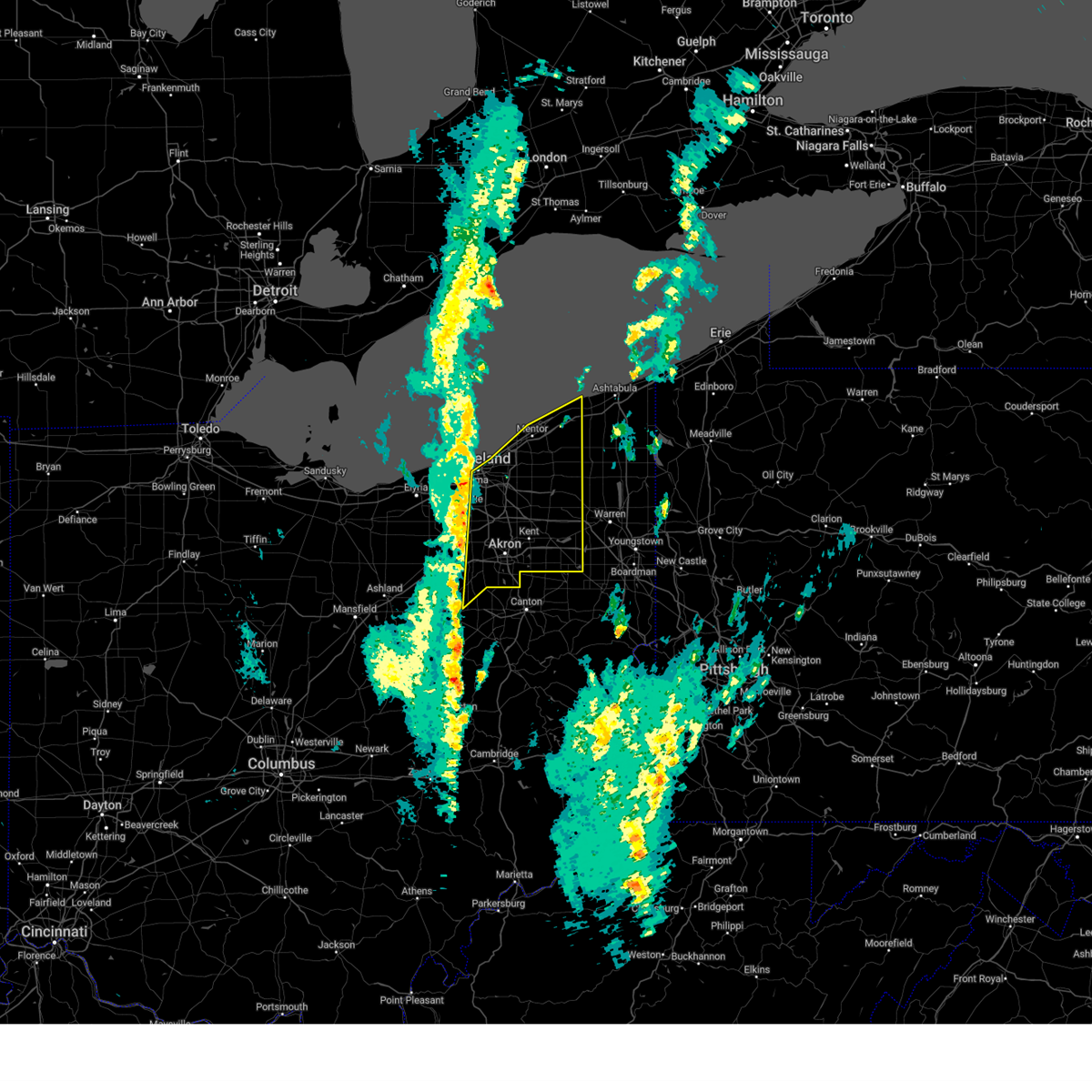 Svrcle the national weather service in cleveland has issued a * severe thunderstorm warning for, portage county in northeastern ohio, geauga county in northeastern ohio, cuyahoga county in northeastern ohio, eastern medina county in northeastern ohio, lake county in northeastern ohio, summit county in northeastern ohio, northeastern wayne county in northeastern ohio, * until 100 pm edt. * at 1201 pm edt, severe thunderstorms were located along a line extending from 6 miles north of cleveland to parma to 6 miles southeast of brunswick, moving northeast at 70 mph (radar indicated). Hazards include 60 mph wind gusts. expect damage to trees and power lines Svrcle the national weather service in cleveland has issued a * severe thunderstorm warning for, portage county in northeastern ohio, geauga county in northeastern ohio, cuyahoga county in northeastern ohio, eastern medina county in northeastern ohio, lake county in northeastern ohio, summit county in northeastern ohio, northeastern wayne county in northeastern ohio, * until 100 pm edt. * at 1201 pm edt, severe thunderstorms were located along a line extending from 6 miles north of cleveland to parma to 6 miles southeast of brunswick, moving northeast at 70 mph (radar indicated). Hazards include 60 mph wind gusts. expect damage to trees and power lines
|
| 9/24/2024 9:36 PM EDT |
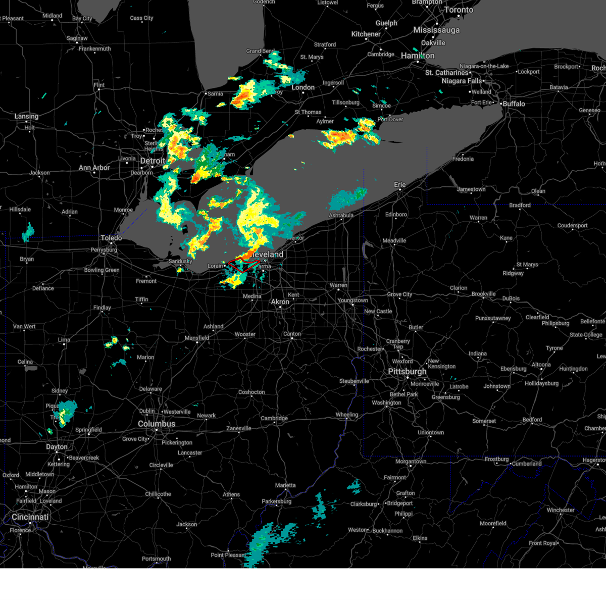 The storm which prompted the warning has weakened below severe limits. therefore, the warning will be allowed to expire. The storm which prompted the warning has weakened below severe limits. therefore, the warning will be allowed to expire.
|
| 9/24/2024 9:15 PM EDT |
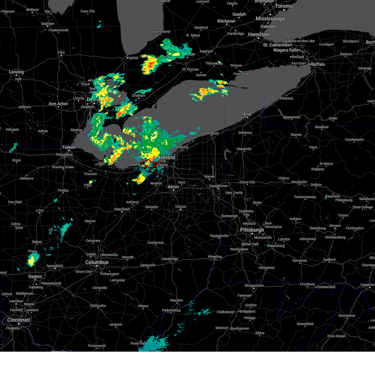 Torcle the national weather service in cleveland has issued a * tornado warning for, west central cuyahoga county in northeastern ohio, northeastern lorain county in north central ohio, * until 945 pm edt. * at 915 pm edt, a severe thunderstorm capable of producing a tornado was located over avon lake, or 8 miles northeast of elyria, moving northeast at 20 mph (radar indicated rotation). Hazards include tornado. Flying debris will be dangerous to those caught without shelter. mobile homes will be damaged or destroyed. damage to roofs, windows, and vehicles will occur. Tree damage is likely. Torcle the national weather service in cleveland has issued a * tornado warning for, west central cuyahoga county in northeastern ohio, northeastern lorain county in north central ohio, * until 945 pm edt. * at 915 pm edt, a severe thunderstorm capable of producing a tornado was located over avon lake, or 8 miles northeast of elyria, moving northeast at 20 mph (radar indicated rotation). Hazards include tornado. Flying debris will be dangerous to those caught without shelter. mobile homes will be damaged or destroyed. damage to roofs, windows, and vehicles will occur. Tree damage is likely.
|
| 9/24/2024 9:07 PM EDT |
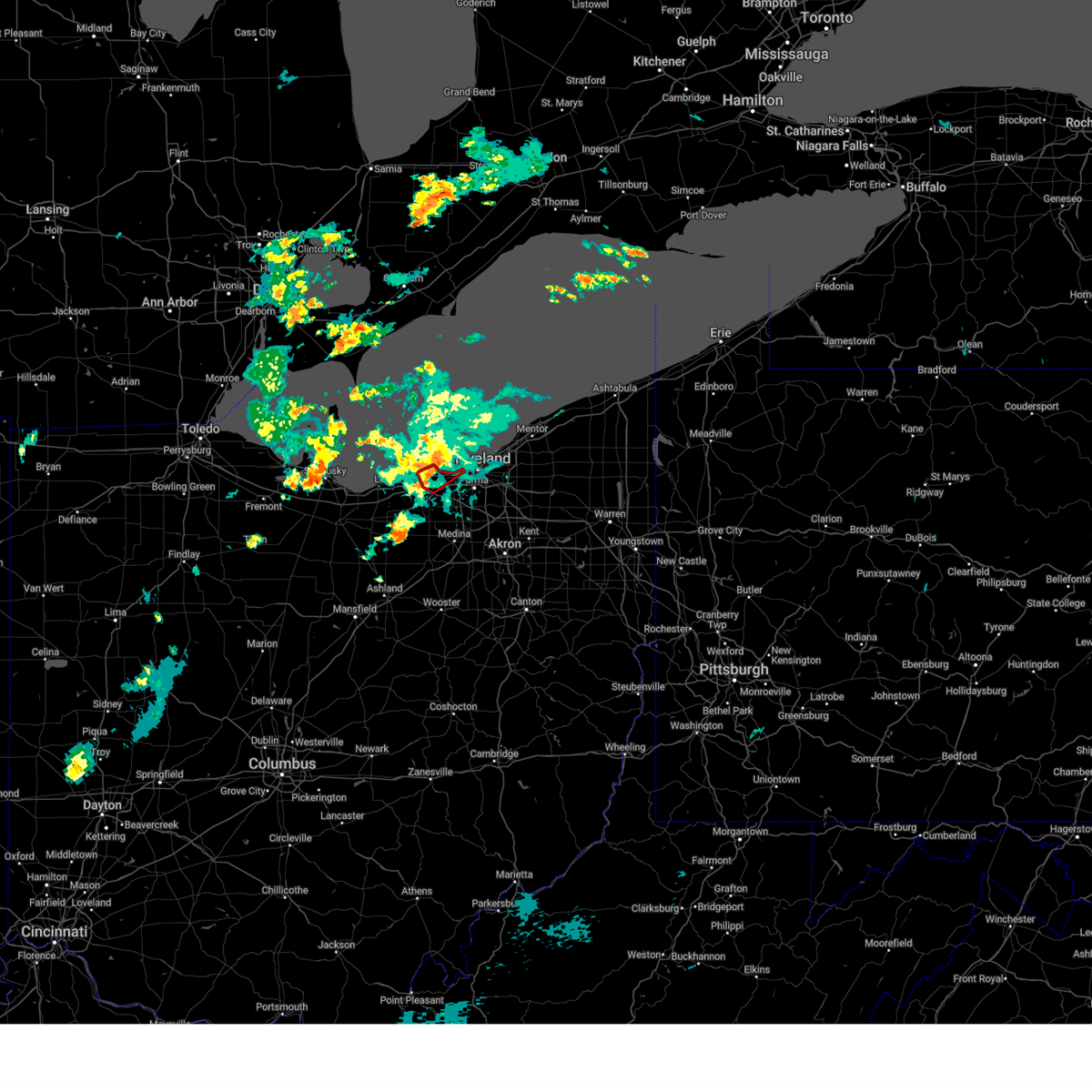 At 906 pm edt, a severe thunderstorm capable of producing a tornado was located near avon lake, or near elyria, moving northeast at 25 mph (radar indicated rotation). Hazards include tornado. Flying debris will be dangerous to those caught without shelter. mobile homes will be damaged or destroyed. damage to roofs, windows, and vehicles will occur. tree damage is likely. Locations impacted include, lakewood, westlake, north ridgeville, avon lake, north olmsted, avon, rocky river, fairview park, bay village, sheffield lake, and sheffield. At 906 pm edt, a severe thunderstorm capable of producing a tornado was located near avon lake, or near elyria, moving northeast at 25 mph (radar indicated rotation). Hazards include tornado. Flying debris will be dangerous to those caught without shelter. mobile homes will be damaged or destroyed. damage to roofs, windows, and vehicles will occur. tree damage is likely. Locations impacted include, lakewood, westlake, north ridgeville, avon lake, north olmsted, avon, rocky river, fairview park, bay village, sheffield lake, and sheffield.
|
| 9/24/2024 8:53 PM EDT |
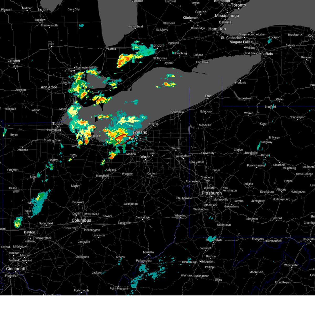 At 853 pm edt, a severe thunderstorm capable of producing a tornado was located over elyria, moving northeast at 25 mph (radar indicated rotation). Hazards include tornado. Flying debris will be dangerous to those caught without shelter. mobile homes will be damaged or destroyed. damage to roofs, windows, and vehicles will occur. tree damage is likely. Locations impacted include, lorain, elyria, lakewood, westlake, north ridgeville, avon lake, amherst, north olmsted, avon, rocky river, fairview park, bay village, sheffield lake, and sheffield. At 853 pm edt, a severe thunderstorm capable of producing a tornado was located over elyria, moving northeast at 25 mph (radar indicated rotation). Hazards include tornado. Flying debris will be dangerous to those caught without shelter. mobile homes will be damaged or destroyed. damage to roofs, windows, and vehicles will occur. tree damage is likely. Locations impacted include, lorain, elyria, lakewood, westlake, north ridgeville, avon lake, amherst, north olmsted, avon, rocky river, fairview park, bay village, sheffield lake, and sheffield.
|
| 9/24/2024 8:42 PM EDT |
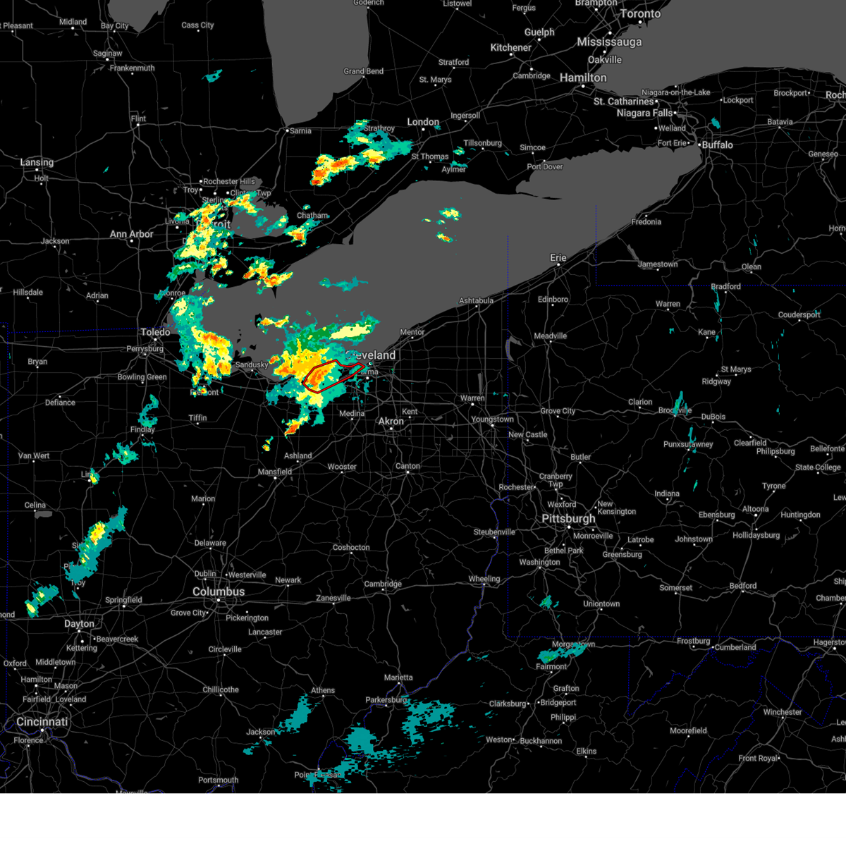 At 841 pm edt, a severe thunderstorm capable of producing a tornado was located over elyria, moving northeast at 25 mph (radar indicated rotation). Hazards include tornado. Flying debris will be dangerous to those caught without shelter. mobile homes will be damaged or destroyed. damage to roofs, windows, and vehicles will occur. tree damage is likely. Locations impacted include, cleveland, lorain, elyria, lakewood, westlake, north ridgeville, avon lake, amherst, north olmsted, avon, rocky river, fairview park, bay village, sheffield lake, sheffield, and south amherst. At 841 pm edt, a severe thunderstorm capable of producing a tornado was located over elyria, moving northeast at 25 mph (radar indicated rotation). Hazards include tornado. Flying debris will be dangerous to those caught without shelter. mobile homes will be damaged or destroyed. damage to roofs, windows, and vehicles will occur. tree damage is likely. Locations impacted include, cleveland, lorain, elyria, lakewood, westlake, north ridgeville, avon lake, amherst, north olmsted, avon, rocky river, fairview park, bay village, sheffield lake, sheffield, and south amherst.
|
| 9/24/2024 8:29 PM EDT |
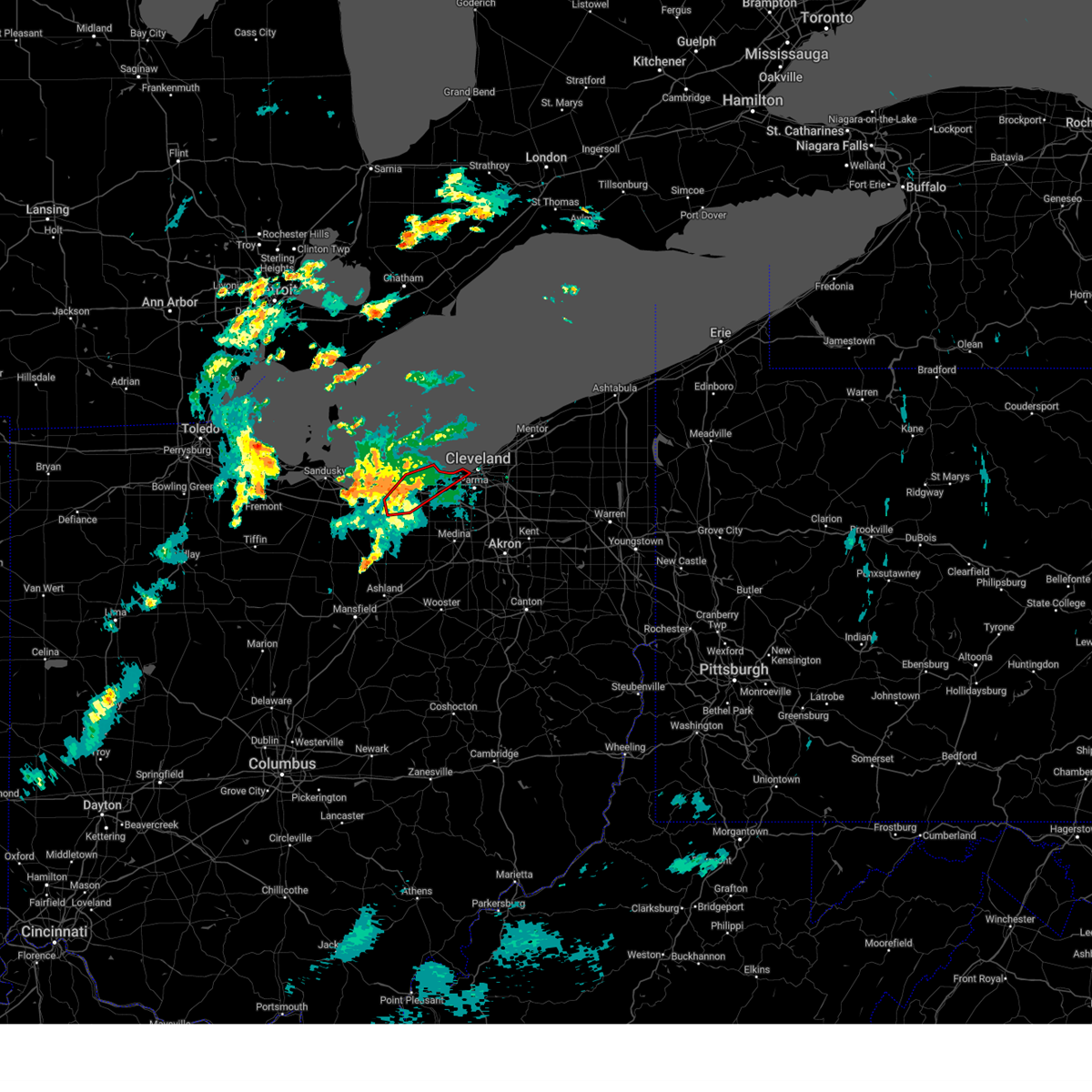 Torcle the national weather service in cleveland has issued a * tornado warning for, west central cuyahoga county in northeastern ohio, northern lorain county in north central ohio, * until 915 pm edt. * at 828 pm edt, a severe thunderstorm capable of producing a tornado was located near amherst, or 7 miles southeast of vermilion, moving northeast at 20 mph (radar indicated rotation). Hazards include tornado. Flying debris will be dangerous to those caught without shelter. mobile homes will be damaged or destroyed. damage to roofs, windows, and vehicles will occur. Tree damage is likely. Torcle the national weather service in cleveland has issued a * tornado warning for, west central cuyahoga county in northeastern ohio, northern lorain county in north central ohio, * until 915 pm edt. * at 828 pm edt, a severe thunderstorm capable of producing a tornado was located near amherst, or 7 miles southeast of vermilion, moving northeast at 20 mph (radar indicated rotation). Hazards include tornado. Flying debris will be dangerous to those caught without shelter. mobile homes will be damaged or destroyed. damage to roofs, windows, and vehicles will occur. Tree damage is likely.
|
| 8/31/2024 12:10 AM EDT |
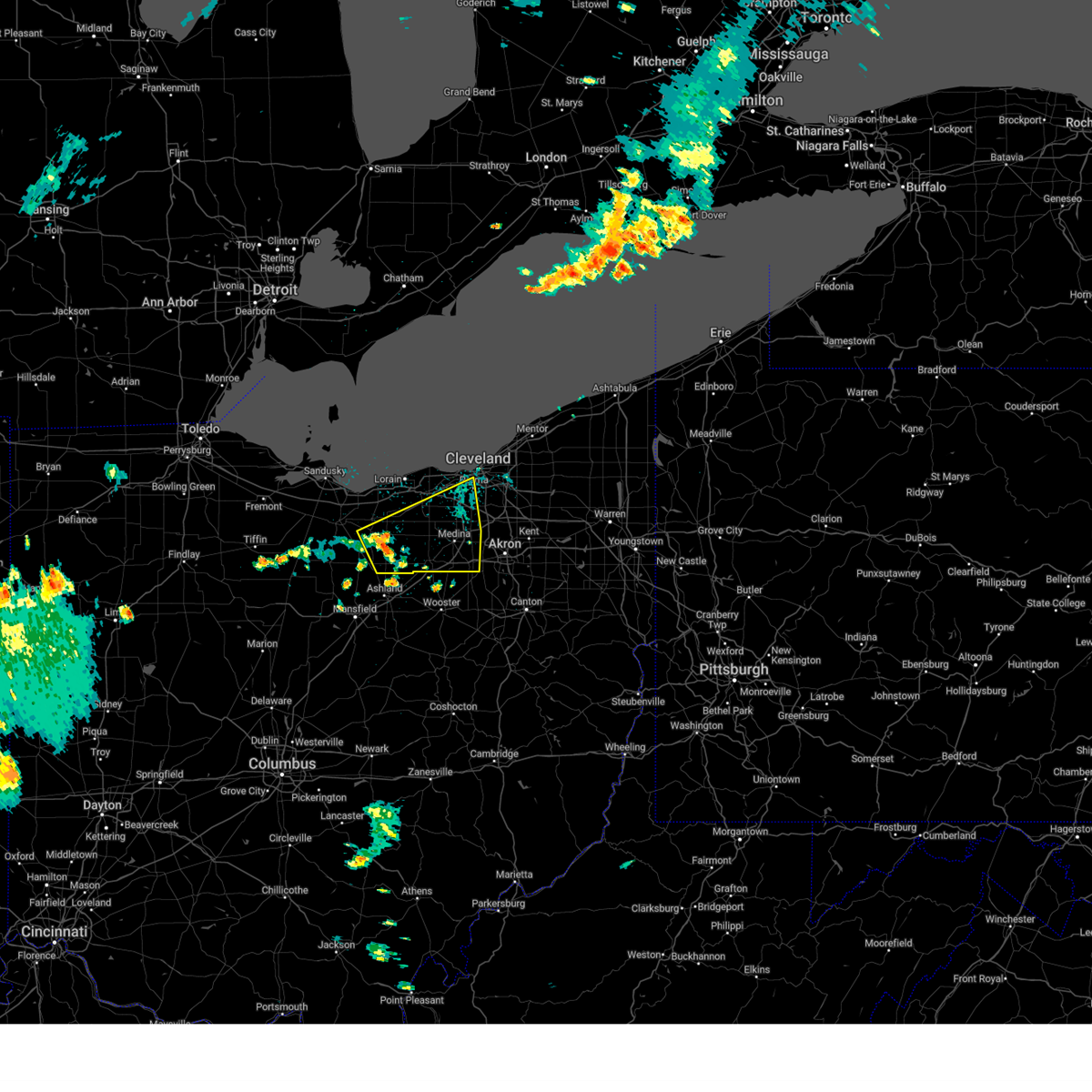 Svrcle the national weather service in cleveland has issued a * severe thunderstorm warning for, east central huron county in north central ohio, southwestern cuyahoga county in northeastern ohio, medina county in northeastern ohio, northeastern ashland county in north central ohio, southern lorain county in north central ohio, * until 100 am edt. * at 1210 am edt, a severe thunderstorm was located near wellington, or 17 miles north of ashland, moving east at 40 mph (radar indicated). Hazards include 60 mph wind gusts and penny size hail. expect damage to trees and power lines Svrcle the national weather service in cleveland has issued a * severe thunderstorm warning for, east central huron county in north central ohio, southwestern cuyahoga county in northeastern ohio, medina county in northeastern ohio, northeastern ashland county in north central ohio, southern lorain county in north central ohio, * until 100 am edt. * at 1210 am edt, a severe thunderstorm was located near wellington, or 17 miles north of ashland, moving east at 40 mph (radar indicated). Hazards include 60 mph wind gusts and penny size hail. expect damage to trees and power lines
|
| 8/27/2024 7:52 PM EDT |
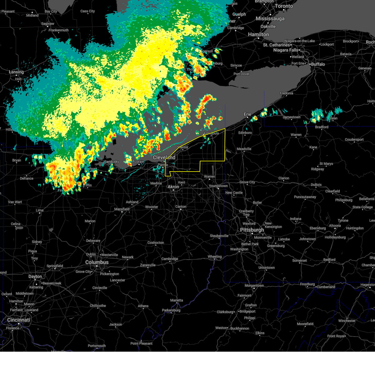 Svrcle the national weather service in cleveland has issued a * severe thunderstorm warning for, geauga county in northeastern ohio, eastern cuyahoga county in northeastern ohio, lake county in northeastern ohio, ashtabula county in northeastern ohio, * until 845 pm edt. * at 752 pm edt, severe thunderstorms were located along a line extending from 19 miles northwest of geneva-on-the-lake to near fairport harbor to 10 miles north of lakewood, moving east at 50 mph (radar indicated). Hazards include 60 mph wind gusts. expect damage to trees and power lines Svrcle the national weather service in cleveland has issued a * severe thunderstorm warning for, geauga county in northeastern ohio, eastern cuyahoga county in northeastern ohio, lake county in northeastern ohio, ashtabula county in northeastern ohio, * until 845 pm edt. * at 752 pm edt, severe thunderstorms were located along a line extending from 19 miles northwest of geneva-on-the-lake to near fairport harbor to 10 miles north of lakewood, moving east at 50 mph (radar indicated). Hazards include 60 mph wind gusts. expect damage to trees and power lines
|
| 8/27/2024 7:34 PM EDT |
 Svrcle the national weather service in cleveland has issued a * severe thunderstorm warning for, huron county in north central ohio, seneca county in northwestern ohio, erie county in north central ohio, southwestern cuyahoga county in northeastern ohio, southern sandusky county in northwestern ohio, southern wood county in northwestern ohio, hancock county in northwestern ohio, lorain county in north central ohio, * until 815 pm edt. * at 733 pm edt, severe thunderstorm outflow winds were located along a line extending from near western vermilion to near green springs to mccomb, moving southeast at 45 mph (radar indicated). Hazards include 60 mph wind gusts. expect damage to trees and power lines Svrcle the national weather service in cleveland has issued a * severe thunderstorm warning for, huron county in north central ohio, seneca county in northwestern ohio, erie county in north central ohio, southwestern cuyahoga county in northeastern ohio, southern sandusky county in northwestern ohio, southern wood county in northwestern ohio, hancock county in northwestern ohio, lorain county in north central ohio, * until 815 pm edt. * at 733 pm edt, severe thunderstorm outflow winds were located along a line extending from near western vermilion to near green springs to mccomb, moving southeast at 45 mph (radar indicated). Hazards include 60 mph wind gusts. expect damage to trees and power lines
|
| 8/17/2024 7:32 PM EDT | Tree and wires down. time estimated via rada in cuyahoga county OH, 10.3 miles WSW of Cleveland, OH |
| 8/17/2024 7:00 PM EDT | A couple of tree limbs downed in parm in cuyahoga county OH, 6.4 miles NNE of Cleveland, OH |
| 8/6/2024 5:07 PM EDT |
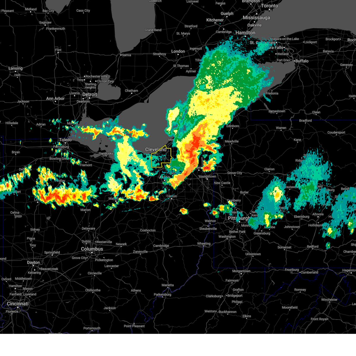 The storm which prompted the warning has moved out of the area. therefore, the warning will be allowed to expire. a severe thunderstorm watch remains in effect until 700 pm edt for northeastern ohio. The storm which prompted the warning has moved out of the area. therefore, the warning will be allowed to expire. a severe thunderstorm watch remains in effect until 700 pm edt for northeastern ohio.
|
| 8/6/2024 4:35 PM EDT |
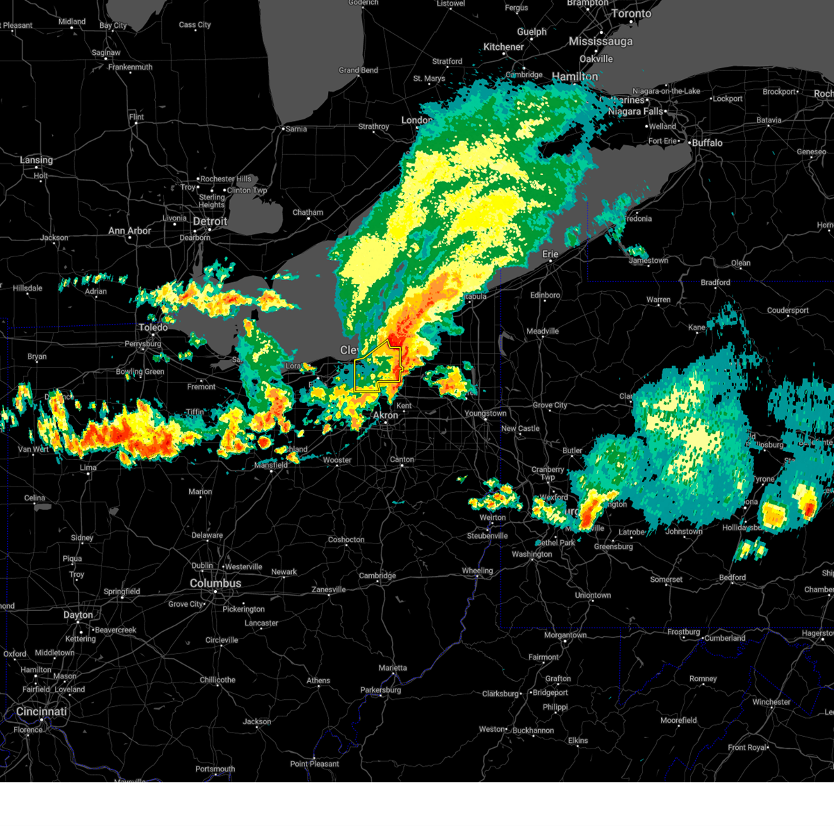 Svrcle the national weather service in cleveland has issued a * severe thunderstorm warning for, cuyahoga county in northeastern ohio, * until 515 pm edt. * at 435 pm edt, a severe thunderstorm was located over warrensville heights, or near cleveland, moving east at 45 mph (trained weather spotters. damaging winds are continuing behind the main line of thunderstorms). Hazards include 60 mph wind gusts. expect damage to trees and power lines Svrcle the national weather service in cleveland has issued a * severe thunderstorm warning for, cuyahoga county in northeastern ohio, * until 515 pm edt. * at 435 pm edt, a severe thunderstorm was located over warrensville heights, or near cleveland, moving east at 45 mph (trained weather spotters. damaging winds are continuing behind the main line of thunderstorms). Hazards include 60 mph wind gusts. expect damage to trees and power lines
|
| 8/6/2024 4:24 PM EDT | Corrects previous non-tstm wnd gst report from 2 wsw bratenahl. buoy station cndo1 cleveland... o in lez146 county OH, 5.7 miles SSW of Cleveland, OH |
| 8/6/2024 4:22 PM EDT | Tree limbs down and metal bleacher wall substantially ben in cuyahoga county OH, 6.2 miles NNE of Cleveland, OH |
| 8/6/2024 4:20 PM EDT |
 The storm which prompted the warning has moved out of the area. therefore, the warning will be allowed to expire. however, heavy rain is still possible with this thunderstorm. a severe thunderstorm watch remains in effect until 700 pm edt for northeastern ohio. The storm which prompted the warning has moved out of the area. therefore, the warning will be allowed to expire. however, heavy rain is still possible with this thunderstorm. a severe thunderstorm watch remains in effect until 700 pm edt for northeastern ohio.
|
| 8/6/2024 4:19 PM EDT | Asos station kbkl clevelan in cuyahoga county OH, 3.6 miles S of Cleveland, OH |
| 8/6/2024 4:18 PM EDT |
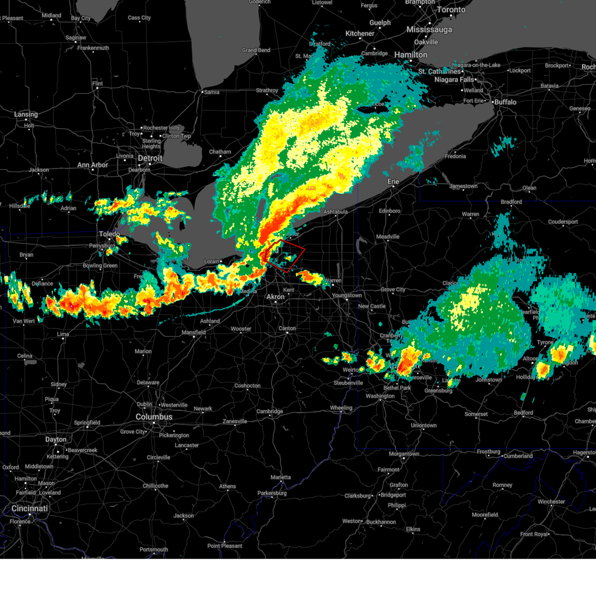 Torcle the national weather service in cleveland has issued a * tornado warning for, southwestern geauga county in northeastern ohio, northeastern cuyahoga county in northeastern ohio, southwestern lake county in northeastern ohio, * until 500 pm edt. * at 418 pm edt, severe thunderstorms capable of producing both tornadoes and extensive straight line wind damage were located near euclid, or 8 miles west of willowick, moving southeast at 25 mph (radar indicated rotation). Hazards include tornado. Flying debris will be dangerous to those caught without shelter. mobile homes will be damaged or destroyed. damage to roofs, windows, and vehicles will occur. tree damage is likely. these dangerous storms will be near, cleveland, euclid, and cleveland heights around 425 pm edt. chesterland around 440 pm edt. Other locations impacted by this tornadic thunderstorm include waite hill, bratenahl, richmond heights, north randall, moreland hills, warrensville heigh, shaker heights, bentleyville, orange, and highland heights. Torcle the national weather service in cleveland has issued a * tornado warning for, southwestern geauga county in northeastern ohio, northeastern cuyahoga county in northeastern ohio, southwestern lake county in northeastern ohio, * until 500 pm edt. * at 418 pm edt, severe thunderstorms capable of producing both tornadoes and extensive straight line wind damage were located near euclid, or 8 miles west of willowick, moving southeast at 25 mph (radar indicated rotation). Hazards include tornado. Flying debris will be dangerous to those caught without shelter. mobile homes will be damaged or destroyed. damage to roofs, windows, and vehicles will occur. tree damage is likely. these dangerous storms will be near, cleveland, euclid, and cleveland heights around 425 pm edt. chesterland around 440 pm edt. Other locations impacted by this tornadic thunderstorm include waite hill, bratenahl, richmond heights, north randall, moreland hills, warrensville heigh, shaker heights, bentleyville, orange, and highland heights.
|
| 8/6/2024 4:16 PM EDT | Multiple large roof tiles removed and debris scattered. large portion of the roof appears to have fallen of in cuyahoga county OH, 9.4 miles ENE of Cleveland, OH |
| 8/6/2024 4:14 PM EDT | Mesonet station xcle cleveland - edgewate in lez146 county OH, 2.9 miles SE of Cleveland, OH |
| 8/6/2024 4:13 PM EDT | Asos station kcle clevelan in cuyahoga county OH, 8.8 miles ENE of Cleveland, OH |
| 8/6/2024 4:11 PM EDT |
 At 411 pm edt, a confirmed tornado was located over parma, or near cleveland, moving southeast at 35 mph (radar confirmed tornado). Hazards include damaging tornado. Flying debris will be dangerous to those caught without shelter. mobile homes will be damaged or destroyed. damage to roofs, windows, and vehicles will occur. tree damage is likely. this tornado will be near, cleveland, parma, and north royalton around 415 pm edt. Other locations impacted by this tornadic thunderstorm include newburgh heights, cuyahoga heights, parma heights, brooklyn, brooklyn heights, seven hills, middleburg heights, broadview heights, independence, and brook park. At 411 pm edt, a confirmed tornado was located over parma, or near cleveland, moving southeast at 35 mph (radar confirmed tornado). Hazards include damaging tornado. Flying debris will be dangerous to those caught without shelter. mobile homes will be damaged or destroyed. damage to roofs, windows, and vehicles will occur. tree damage is likely. this tornado will be near, cleveland, parma, and north royalton around 415 pm edt. Other locations impacted by this tornadic thunderstorm include newburgh heights, cuyahoga heights, parma heights, brooklyn, brooklyn heights, seven hills, middleburg heights, broadview heights, independence, and brook park.
|
| 8/6/2024 4:10 PM EDT | Asos station kbkl clevelan in cuyahoga county OH, 3.6 miles S of Cleveland, OH |
| 8/6/2024 4:09 PM EDT | Corrects previous non-tstm wnd gst report from 2 wsw cleveland. mesonet station xcle cleveland - edgewate in lez146 county OH, 2.9 miles SE of Cleveland, OH |
| 8/6/2024 4:09 PM EDT |
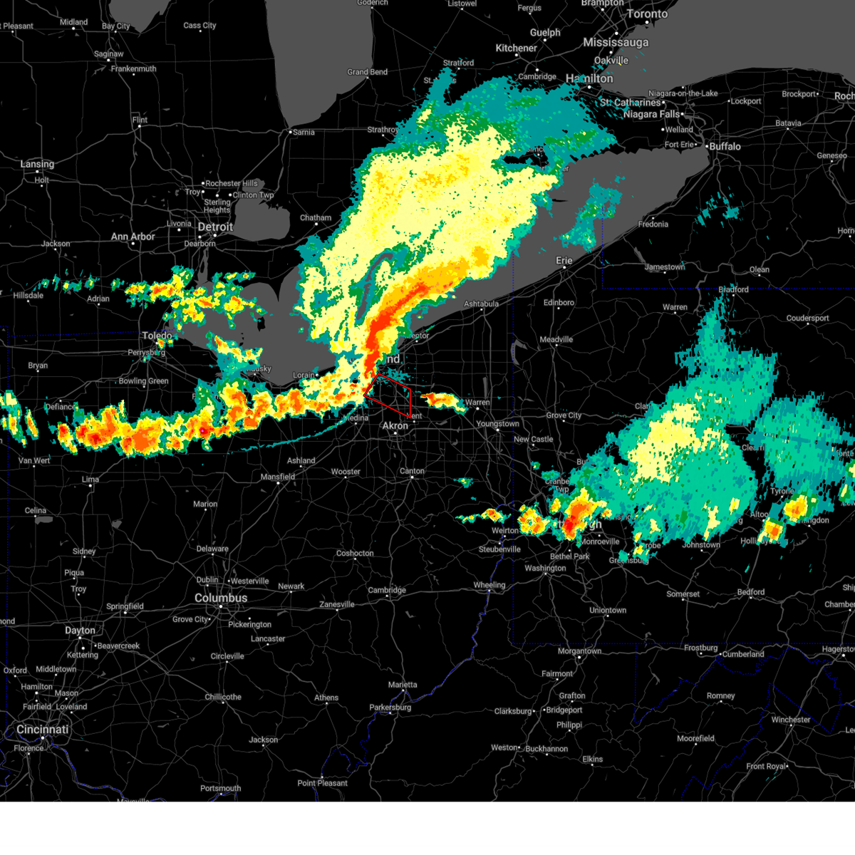 Torcle the national weather service in cleveland has issued a * tornado warning for, southeastern cuyahoga county in northeastern ohio, northern summit county in northeastern ohio, * until 445 pm edt. * at 409 pm edt, a tornado producing storm was located over parma, or 7 miles south of cleveland, moving southeast at 40 mph (radar confirmed tornado). Hazards include damaging tornado. Flying debris will be dangerous to those caught without shelter. mobile homes will be damaged or destroyed. damage to roofs, windows, and vehicles will occur. tree damage is likely. this tornadic storm will be near, macedonia around 415 pm edt. hudson and twinsburg around 420 pm edt. streetsboro around 430 pm edt. Other locations impacted by this tornadic thunderstorm include glenwillow, independence, valley view, brooklyn heights, seven hills, newburgh heights, cuyahoga heights, walton hills, broadview heights, and garfield heights. Torcle the national weather service in cleveland has issued a * tornado warning for, southeastern cuyahoga county in northeastern ohio, northern summit county in northeastern ohio, * until 445 pm edt. * at 409 pm edt, a tornado producing storm was located over parma, or 7 miles south of cleveland, moving southeast at 40 mph (radar confirmed tornado). Hazards include damaging tornado. Flying debris will be dangerous to those caught without shelter. mobile homes will be damaged or destroyed. damage to roofs, windows, and vehicles will occur. tree damage is likely. this tornadic storm will be near, macedonia around 415 pm edt. hudson and twinsburg around 420 pm edt. streetsboro around 430 pm edt. Other locations impacted by this tornadic thunderstorm include glenwillow, independence, valley view, brooklyn heights, seven hills, newburgh heights, cuyahoga heights, walton hills, broadview heights, and garfield heights.
|
| 8/6/2024 4:05 PM EDT | Numerous powerlines and poles dow in cuyahoga county OH, 6.6 miles NNE of Cleveland, OH |
| 8/6/2024 4:04 PM EDT | Numerous large tree limbs snapped off in parma heights near fernhurst avenue and rossly in cuyahoga county OH, 7 miles NE of Cleveland, OH |
| 8/6/2024 4:03 PM EDT | Large tree down across roadway at w. 152 & lorain av in cuyahoga county OH, 5.7 miles ENE of Cleveland, OH |
| 8/6/2024 4:02 PM EDT | Numerous power poles downed on 130th street in parma. several large trees limbs downe in cuyahoga county OH, 9 miles NE of Cleveland, OH |
| 8/6/2024 4:02 PM EDT |
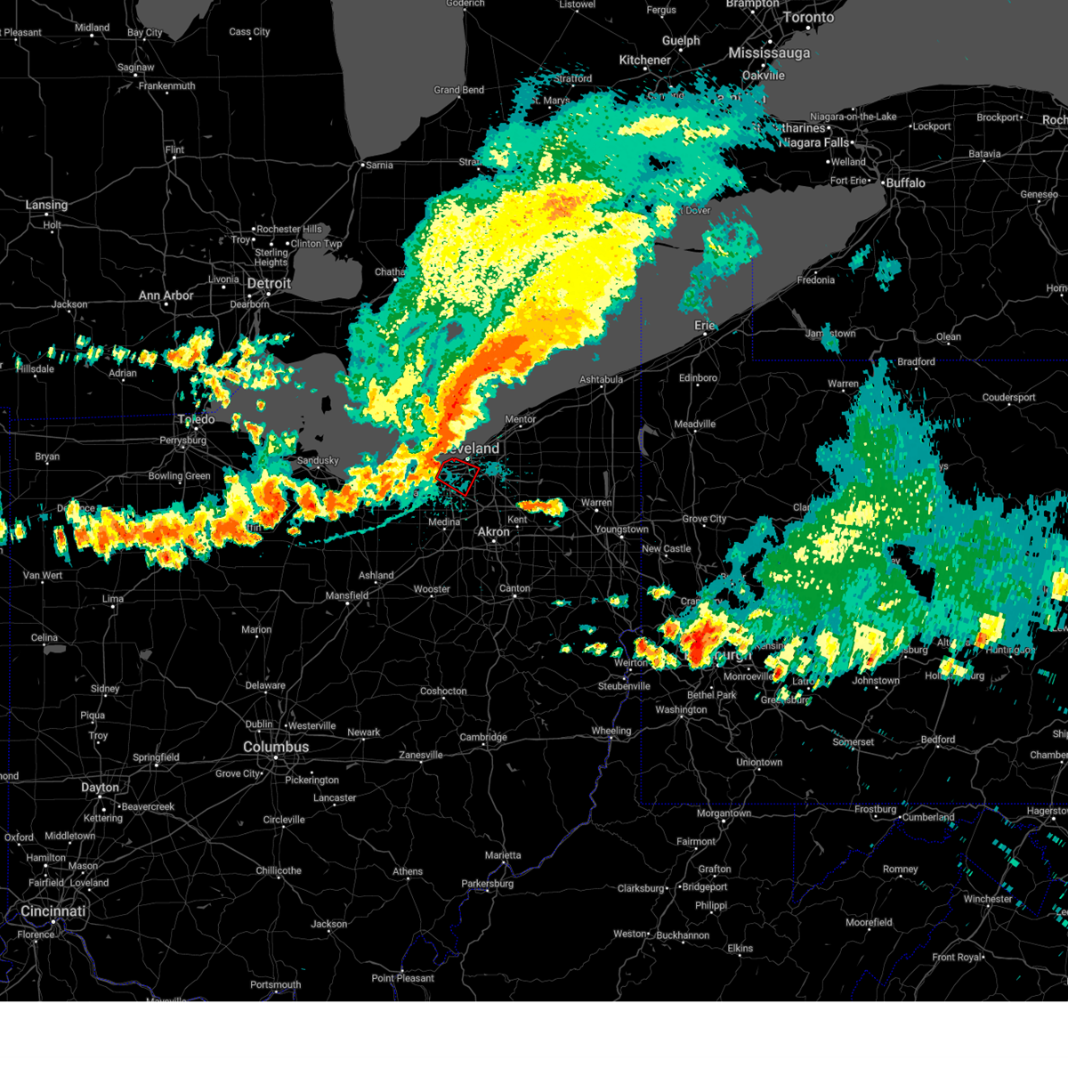 At 402 pm edt, a severe thunderstorm capable of producing a tornado was located near lakewood, or 8 miles west of cleveland, moving southeast at 35 mph (radar indicated rotation). Hazards include tornado. Flying debris will be dangerous to those caught without shelter. mobile homes will be damaged or destroyed. damage to roofs, windows, and vehicles will occur. tree damage is likely. this dangerous storm will be near, cleveland and parma around 410 pm edt. north royalton around 415 pm edt. Other locations impacted by this tornadic thunderstorm include parma heights, linndale, brooklyn, brooklyn heights, seven hills, rocky river, brook park, newburgh heights, cuyahoga heights, and middleburg heights. At 402 pm edt, a severe thunderstorm capable of producing a tornado was located near lakewood, or 8 miles west of cleveland, moving southeast at 35 mph (radar indicated rotation). Hazards include tornado. Flying debris will be dangerous to those caught without shelter. mobile homes will be damaged or destroyed. damage to roofs, windows, and vehicles will occur. tree damage is likely. this dangerous storm will be near, cleveland and parma around 410 pm edt. north royalton around 415 pm edt. Other locations impacted by this tornadic thunderstorm include parma heights, linndale, brooklyn, brooklyn heights, seven hills, rocky river, brook park, newburgh heights, cuyahoga heights, and middleburg heights.
|
| 8/6/2024 3:54 PM EDT | Plastic shed blown apart... 6 inch tree down on wire in cuyahoga county OH, 8.9 miles ENE of Cleveland, OH |
| 8/6/2024 3:54 PM EDT |
 At 353 pm edt, a severe thunderstorm capable of producing a tornado was located over westlake, or 11 miles northeast of elyria, moving southeast at 35 mph (radar indicated rotation). Hazards include tornado. Flying debris will be dangerous to those caught without shelter. mobile homes will be damaged or destroyed. damage to roofs, windows, and vehicles will occur. tree damage is likely. this dangerous storm will be near, cleveland, lakewood, and westlake around 400 pm edt. parma around 405 pm edt. north royalton around 415 pm edt. Other locations impacted by this tornadic thunderstorm include north olmsted, parma heights, linndale, brooklyn, brooklyn heights, seven hills, rocky river, brook park, newburgh heights, and cuyahoga heights. At 353 pm edt, a severe thunderstorm capable of producing a tornado was located over westlake, or 11 miles northeast of elyria, moving southeast at 35 mph (radar indicated rotation). Hazards include tornado. Flying debris will be dangerous to those caught without shelter. mobile homes will be damaged or destroyed. damage to roofs, windows, and vehicles will occur. tree damage is likely. this dangerous storm will be near, cleveland, lakewood, and westlake around 400 pm edt. parma around 405 pm edt. north royalton around 415 pm edt. Other locations impacted by this tornadic thunderstorm include north olmsted, parma heights, linndale, brooklyn, brooklyn heights, seven hills, rocky river, brook park, newburgh heights, and cuyahoga heights.
|
| 8/6/2024 3:54 PM EDT |
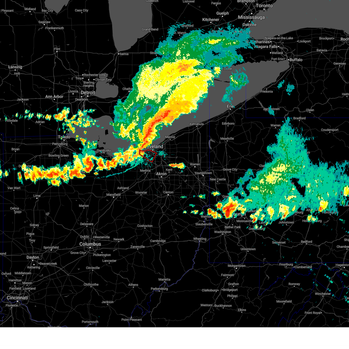 the tornado warning has been cancelled and is no longer in effect the tornado warning has been cancelled and is no longer in effect
|
| 8/6/2024 3:43 PM EDT |
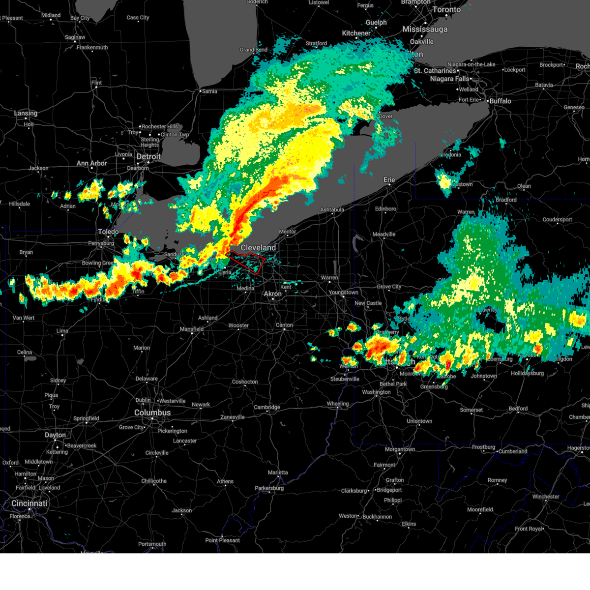 Torcle the national weather service in cleveland has issued a * tornado warning for, southwestern cuyahoga county in northeastern ohio, northeastern lorain county in north central ohio, * until 430 pm edt. * at 343 pm edt, a severe thunderstorm capable of producing a tornado was located over avon lake, or 9 miles northeast of lorain, moving southeast at 35 mph (radar indicated rotation). Hazards include tornado. Flying debris will be dangerous to those caught without shelter. mobile homes will be damaged or destroyed. damage to roofs, windows, and vehicles will occur. tree damage is likely. this dangerous storm will be near, westlake and avon lake around 350 pm edt. cleveland and lakewood around 355 pm edt. parma around 405 pm edt. north royalton around 415 pm edt. Other locations impacted by this tornadic thunderstorm include north olmsted, parma heights, linndale, brooklyn, brooklyn heights, seven hills, rocky river, brook park, newburgh heights, and cuyahoga heights. Torcle the national weather service in cleveland has issued a * tornado warning for, southwestern cuyahoga county in northeastern ohio, northeastern lorain county in north central ohio, * until 430 pm edt. * at 343 pm edt, a severe thunderstorm capable of producing a tornado was located over avon lake, or 9 miles northeast of lorain, moving southeast at 35 mph (radar indicated rotation). Hazards include tornado. Flying debris will be dangerous to those caught without shelter. mobile homes will be damaged or destroyed. damage to roofs, windows, and vehicles will occur. tree damage is likely. this dangerous storm will be near, westlake and avon lake around 350 pm edt. cleveland and lakewood around 355 pm edt. parma around 405 pm edt. north royalton around 415 pm edt. Other locations impacted by this tornadic thunderstorm include north olmsted, parma heights, linndale, brooklyn, brooklyn heights, seven hills, rocky river, brook park, newburgh heights, and cuyahoga heights.
|
| 8/6/2024 3:28 PM EDT |
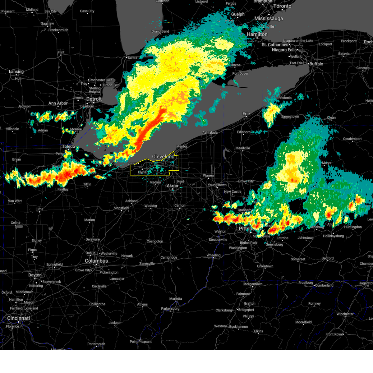 Svrcle the national weather service in cleveland has issued a * severe thunderstorm warning for, cuyahoga county in northeastern ohio, northern lorain county in north central ohio, * until 430 pm edt. * at 328 pm edt, severe thunderstorms were located along a line extending from 32 miles northwest of lakeline to 12 miles north of avon lake to western vermilion, moving southeast at 60 mph (radar indicated). Hazards include 70 mph wind gusts. Expect considerable tree damage. Damage is likely to mobile homes, roofs, and outbuildings. Svrcle the national weather service in cleveland has issued a * severe thunderstorm warning for, cuyahoga county in northeastern ohio, northern lorain county in north central ohio, * until 430 pm edt. * at 328 pm edt, severe thunderstorms were located along a line extending from 32 miles northwest of lakeline to 12 miles north of avon lake to western vermilion, moving southeast at 60 mph (radar indicated). Hazards include 70 mph wind gusts. Expect considerable tree damage. Damage is likely to mobile homes, roofs, and outbuildings.
|
| 7/24/2024 2:34 PM EDT |
 the severe thunderstorm warning has been cancelled and is no longer in effect the severe thunderstorm warning has been cancelled and is no longer in effect
|
| 7/24/2024 2:16 PM EDT |
 Svrcle the national weather service in cleveland has issued a * severe thunderstorm warning for, northeastern cuyahoga county in northeastern ohio, southwestern lake county in northeastern ohio, * until 300 pm edt. * at 215 pm edt, a severe thunderstorm was located near cleveland, moving east at 20 mph (radar indicated). Hazards include 60 mph wind gusts and quarter size hail. Minor damage to vehicles is possible. Expect damage to trees and power lines. Svrcle the national weather service in cleveland has issued a * severe thunderstorm warning for, northeastern cuyahoga county in northeastern ohio, southwestern lake county in northeastern ohio, * until 300 pm edt. * at 215 pm edt, a severe thunderstorm was located near cleveland, moving east at 20 mph (radar indicated). Hazards include 60 mph wind gusts and quarter size hail. Minor damage to vehicles is possible. Expect damage to trees and power lines.
|
| 6/29/2024 12:09 PM EDT |
 At 1209 pm edt, a severe thunderstorm was located over macedonia, or 12 miles southeast of cleveland, moving east at 45 mph (radar indicated). Hazards include 60 mph wind gusts. Expect damage to trees and power lines. Locations impacted include, cleveland, ravenna, cuyahoga falls, kent, solon, hudson, twinsburg, streetsboro, warrensville heights, macedonia, south russell, middlefield, garrettsville, burton, highland hills, mantua, stow, garfield heights, shaker heights, and maple heights. At 1209 pm edt, a severe thunderstorm was located over macedonia, or 12 miles southeast of cleveland, moving east at 45 mph (radar indicated). Hazards include 60 mph wind gusts. Expect damage to trees and power lines. Locations impacted include, cleveland, ravenna, cuyahoga falls, kent, solon, hudson, twinsburg, streetsboro, warrensville heights, macedonia, south russell, middlefield, garrettsville, burton, highland hills, mantua, stow, garfield heights, shaker heights, and maple heights.
|
| 6/29/2024 12:09 PM EDT |
 the severe thunderstorm warning has been cancelled and is no longer in effect the severe thunderstorm warning has been cancelled and is no longer in effect
|
| 6/29/2024 11:59 AM EDT |
 Svrcle the national weather service in cleveland has issued a * severe thunderstorm warning for, northern portage county in northeastern ohio, southern geauga county in northeastern ohio, southeastern cuyahoga county in northeastern ohio, northeastern medina county in northeastern ohio, northern summit county in northeastern ohio, * until 100 pm edt. * at 1159 am edt, a severe thunderstorm was located near north royalton, or 10 miles south of cleveland, moving east at 45 mph (radar indicated). Hazards include 60 mph wind gusts. expect damage to trees and power lines Svrcle the national weather service in cleveland has issued a * severe thunderstorm warning for, northern portage county in northeastern ohio, southern geauga county in northeastern ohio, southeastern cuyahoga county in northeastern ohio, northeastern medina county in northeastern ohio, northern summit county in northeastern ohio, * until 100 pm edt. * at 1159 am edt, a severe thunderstorm was located near north royalton, or 10 miles south of cleveland, moving east at 45 mph (radar indicated). Hazards include 60 mph wind gusts. expect damage to trees and power lines
|
| 6/23/2024 3:27 PM EDT |
 Svrcle the national weather service in cleveland has issued a * severe thunderstorm warning for, northern portage county in northeastern ohio, southern geauga county in northeastern ohio, southeastern cuyahoga county in northeastern ohio, northern summit county in northeastern ohio, * until 415 pm edt. * at 327 pm edt, severe thunderstorms were located along a line extending from near highland hills to near solon to near macedonia, moving east at 35 mph (radar indicated). Hazards include 60 mph wind gusts. expect damage to trees and power lines Svrcle the national weather service in cleveland has issued a * severe thunderstorm warning for, northern portage county in northeastern ohio, southern geauga county in northeastern ohio, southeastern cuyahoga county in northeastern ohio, northern summit county in northeastern ohio, * until 415 pm edt. * at 327 pm edt, severe thunderstorms were located along a line extending from near highland hills to near solon to near macedonia, moving east at 35 mph (radar indicated). Hazards include 60 mph wind gusts. expect damage to trees and power lines
|
| 6/18/2024 2:39 PM EDT |
 The storm which prompted the warning has weakened below severe limits, and no longer poses an immediate threat to life or property. therefore, the warning will be allowed to expire. however, gusty winds and heavy rain are still possible with this thunderstorm and additional storms are moving in from the southwest. stay tuned for potential new warnings. The storm which prompted the warning has weakened below severe limits, and no longer poses an immediate threat to life or property. therefore, the warning will be allowed to expire. however, gusty winds and heavy rain are still possible with this thunderstorm and additional storms are moving in from the southwest. stay tuned for potential new warnings.
|
| 6/18/2024 2:20 PM EDT | Asos station kbkl clevelan in cuyahoga county OH, 3.6 miles S of Cleveland, OH |
| 6/18/2024 1:54 PM EDT |
 Svrcle the national weather service in cleveland has issued a * severe thunderstorm warning for, southwestern cuyahoga county in northeastern ohio, north central medina county in northeastern ohio, northeastern lorain county in north central ohio, * until 245 pm edt. * at 154 pm edt, a severe thunderstorm was located near north olmsted, or 10 miles east of elyria, moving northeast at 15 mph (radar indicated). Hazards include 60 mph wind gusts and quarter size hail. Minor damage to vehicles is possible. Expect damage to trees and power lines. Svrcle the national weather service in cleveland has issued a * severe thunderstorm warning for, southwestern cuyahoga county in northeastern ohio, north central medina county in northeastern ohio, northeastern lorain county in north central ohio, * until 245 pm edt. * at 154 pm edt, a severe thunderstorm was located near north olmsted, or 10 miles east of elyria, moving northeast at 15 mph (radar indicated). Hazards include 60 mph wind gusts and quarter size hail. Minor damage to vehicles is possible. Expect damage to trees and power lines.
|
| 5/26/2024 7:46 PM EDT |
 the severe thunderstorm warning has been cancelled and is no longer in effect the severe thunderstorm warning has been cancelled and is no longer in effect
|
| 5/26/2024 7:46 PM EDT |
 At 745 pm edt, severe thunderstorms were located along a line extending from near garrettsville to 8 miles north of cleveland, moving northeast at 50 mph (radar indicated). Hazards include 60 mph wind gusts. Expect damage to trees and power lines. Locations impacted include, cleveland, painesville, willowick, chardon, euclid, mentor, cleveland heights, solon, willoughby, eastlake, streetsboro, south russell, middlefield, burton, timberlake, lakeline, chesterland, shaker heights, south euclid, and mayfield heights. At 745 pm edt, severe thunderstorms were located along a line extending from near garrettsville to 8 miles north of cleveland, moving northeast at 50 mph (radar indicated). Hazards include 60 mph wind gusts. Expect damage to trees and power lines. Locations impacted include, cleveland, painesville, willowick, chardon, euclid, mentor, cleveland heights, solon, willoughby, eastlake, streetsboro, south russell, middlefield, burton, timberlake, lakeline, chesterland, shaker heights, south euclid, and mayfield heights.
|
| 5/26/2024 7:26 PM EDT |
 Svrcle the national weather service in cleveland has issued a * severe thunderstorm warning for, northwestern portage county in northeastern ohio, geauga county in northeastern ohio, cuyahoga county in northeastern ohio, southwestern lake county in northeastern ohio, northeastern summit county in northeastern ohio, northeastern lorain county in north central ohio, * until 815 pm edt. * at 725 pm edt, severe thunderstorms were located along a line extending from near hudson to avon lake, moving northeast at 40 mph (radar indicated). Hazards include 60 mph wind gusts. expect damage to trees and power lines Svrcle the national weather service in cleveland has issued a * severe thunderstorm warning for, northwestern portage county in northeastern ohio, geauga county in northeastern ohio, cuyahoga county in northeastern ohio, southwestern lake county in northeastern ohio, northeastern summit county in northeastern ohio, northeastern lorain county in north central ohio, * until 815 pm edt. * at 725 pm edt, severe thunderstorms were located along a line extending from near hudson to avon lake, moving northeast at 40 mph (radar indicated). Hazards include 60 mph wind gusts. expect damage to trees and power lines
|
| 5/22/2024 10:28 PM EDT |
 The storms which prompted the warning have weakened below severe limits, and have exited the warned area. therefore, the warning will be allowed to expire. however, gusty winds are still possible with these thunderstorms. The storms which prompted the warning have weakened below severe limits, and have exited the warned area. therefore, the warning will be allowed to expire. however, gusty winds are still possible with these thunderstorms.
|
| 5/22/2024 10:08 PM EDT |
 the severe thunderstorm warning has been cancelled and is no longer in effect the severe thunderstorm warning has been cancelled and is no longer in effect
|
| 5/22/2024 10:08 PM EDT |
 At 1008 pm edt, severe thunderstorms were located along a line extending from near cleveland heights to hudson, moving east at 40 mph (radar indicated). Hazards include 60 mph wind gusts. Expect damage to trees and power lines. Locations impacted include, cleveland, chardon, cuyahoga falls, cleveland heights, solon, hudson, twinsburg, streetsboro, warrensville heights, macedonia, south russell, middlefield, garrettsville, burton, highland hills, mantua, chesterland, stow, garfield heights, and shaker heights. At 1008 pm edt, severe thunderstorms were located along a line extending from near cleveland heights to hudson, moving east at 40 mph (radar indicated). Hazards include 60 mph wind gusts. Expect damage to trees and power lines. Locations impacted include, cleveland, chardon, cuyahoga falls, cleveland heights, solon, hudson, twinsburg, streetsboro, warrensville heights, macedonia, south russell, middlefield, garrettsville, burton, highland hills, mantua, chesterland, stow, garfield heights, and shaker heights.
|
| 5/22/2024 10:03 PM EDT | Trees and wires dow in cuyahoga county OH, 2.1 miles NW of Cleveland, OH |
| 5/22/2024 9:49 PM EDT |
 At 948 pm edt, a severe thunderstorm was located over north royalton, or 11 miles southwest of cleveland, moving east at 45 mph (radar indicated). Hazards include 60 mph wind gusts and penny size hail. Expect damage to trees and power lines. Locations impacted include, cleveland, parma, strongsville, brunswick, north royalton, parma heights, broadview heights, brook park, berea, middleburg heights, brecksville, seven hills, olmsted falls, hinckley, independence, and brooklyn heights. At 948 pm edt, a severe thunderstorm was located over north royalton, or 11 miles southwest of cleveland, moving east at 45 mph (radar indicated). Hazards include 60 mph wind gusts and penny size hail. Expect damage to trees and power lines. Locations impacted include, cleveland, parma, strongsville, brunswick, north royalton, parma heights, broadview heights, brook park, berea, middleburg heights, brecksville, seven hills, olmsted falls, hinckley, independence, and brooklyn heights.
|
| 5/22/2024 9:49 PM EDT |
 the severe thunderstorm warning has been cancelled and is no longer in effect the severe thunderstorm warning has been cancelled and is no longer in effect
|
| 5/22/2024 9:47 PM EDT |
 Svrcle the national weather service in cleveland has issued a * severe thunderstorm warning for, northern portage county in northeastern ohio, geauga county in northeastern ohio, cuyahoga county in northeastern ohio, northeastern medina county in northeastern ohio, southeastern lake county in northeastern ohio, northern summit county in northeastern ohio, * until 1030 pm edt. * at 947 pm edt, a severe thunderstorm was located over north royalton, or 10 miles south of cleveland, moving east at 55 mph (radar indicated). Hazards include 60 mph wind gusts and penny size hail. expect damage to trees and power lines Svrcle the national weather service in cleveland has issued a * severe thunderstorm warning for, northern portage county in northeastern ohio, geauga county in northeastern ohio, cuyahoga county in northeastern ohio, northeastern medina county in northeastern ohio, southeastern lake county in northeastern ohio, northern summit county in northeastern ohio, * until 1030 pm edt. * at 947 pm edt, a severe thunderstorm was located over north royalton, or 10 miles south of cleveland, moving east at 55 mph (radar indicated). Hazards include 60 mph wind gusts and penny size hail. expect damage to trees and power lines
|
| 5/22/2024 9:31 PM EDT |
 the severe thunderstorm warning has been cancelled and is no longer in effect the severe thunderstorm warning has been cancelled and is no longer in effect
|
| 5/22/2024 9:31 PM EDT |
 At 931 pm edt, a severe thunderstorm was located over grafton, or 7 miles southeast of elyria, moving northeast at 55 mph (radar indicated). Hazards include 60 mph wind gusts and quarter size hail. Minor damage to vehicles is possible. expect damage to trees and power lines. Locations impacted include, cleveland, elyria, parma, strongsville, brunswick, north royalton, north ridgeville, grafton, north olmsted, parma heights, broadview heights, brook park, berea, middleburg heights, brecksville, seven hills, olmsted falls, eaton, hinckley, and independence. At 931 pm edt, a severe thunderstorm was located over grafton, or 7 miles southeast of elyria, moving northeast at 55 mph (radar indicated). Hazards include 60 mph wind gusts and quarter size hail. Minor damage to vehicles is possible. expect damage to trees and power lines. Locations impacted include, cleveland, elyria, parma, strongsville, brunswick, north royalton, north ridgeville, grafton, north olmsted, parma heights, broadview heights, brook park, berea, middleburg heights, brecksville, seven hills, olmsted falls, eaton, hinckley, and independence.
|
| 5/22/2024 9:15 PM EDT |
 Svrcle the national weather service in cleveland has issued a * severe thunderstorm warning for, east central huron county in north central ohio, southwestern cuyahoga county in northeastern ohio, northern medina county in northeastern ohio, lorain county in north central ohio, * until 1000 pm edt. * at 914 pm edt, a severe thunderstorm was located near wellington, or 14 miles south of vermilion, moving east at 50 mph (radar indicated). Hazards include 60 mph wind gusts and quarter size hail. Minor damage to vehicles is possible. Expect damage to trees and power lines. Svrcle the national weather service in cleveland has issued a * severe thunderstorm warning for, east central huron county in north central ohio, southwestern cuyahoga county in northeastern ohio, northern medina county in northeastern ohio, lorain county in north central ohio, * until 1000 pm edt. * at 914 pm edt, a severe thunderstorm was located near wellington, or 14 miles south of vermilion, moving east at 50 mph (radar indicated). Hazards include 60 mph wind gusts and quarter size hail. Minor damage to vehicles is possible. Expect damage to trees and power lines.
|
| 5/22/2024 8:55 PM EDT |
 Svrcle the national weather service in cleveland has issued a * severe thunderstorm warning for, cuyahoga county in northeastern ohio, northeastern lorain county in north central ohio, * until 945 pm edt. * at 855 pm edt, a severe thunderstorm was located over north ridgeville, or near elyria, moving northeast at 40 mph (radar indicated). Hazards include 60 mph wind gusts and quarter size hail. Minor damage to vehicles is possible. Expect damage to trees and power lines. Svrcle the national weather service in cleveland has issued a * severe thunderstorm warning for, cuyahoga county in northeastern ohio, northeastern lorain county in north central ohio, * until 945 pm edt. * at 855 pm edt, a severe thunderstorm was located over north ridgeville, or near elyria, moving northeast at 40 mph (radar indicated). Hazards include 60 mph wind gusts and quarter size hail. Minor damage to vehicles is possible. Expect damage to trees and power lines.
|
| 4/17/2024 6:06 PM EDT | Asos station kbkl clevelan in cuyahoga county OH, 3.6 miles S of Cleveland, OH |
| 3/14/2024 10:50 PM EDT |
 Svrcle the national weather service in cleveland has issued a * severe thunderstorm warning for, northern geauga county in northeastern ohio, northeastern cuyahoga county in northeastern ohio, lake county in northeastern ohio, * until 1130 pm edt. * at 1049 pm edt, a severe thunderstorm was located near euclid, or near willowick, moving east at 50 mph (radar indicated). Hazards include half dollar size hail. People and animals outdoors will be injured. Expect damage to roofs, siding, windows, and vehicles. Svrcle the national weather service in cleveland has issued a * severe thunderstorm warning for, northern geauga county in northeastern ohio, northeastern cuyahoga county in northeastern ohio, lake county in northeastern ohio, * until 1130 pm edt. * at 1049 pm edt, a severe thunderstorm was located near euclid, or near willowick, moving east at 50 mph (radar indicated). Hazards include half dollar size hail. People and animals outdoors will be injured. Expect damage to roofs, siding, windows, and vehicles.
|
| 8/25/2023 12:15 AM EDT |
 At 1214 am edt, severe thunderstorms were located along a line extending from solon to 6 miles west of lodi, moving southeast at 55 mph (radar indicated). Hazards include 70 mph wind gusts. Expect considerable tree damage. damage is likely to mobile homes, roofs, and outbuildings. Locations impacted include, cleveland, akron, medina, parma, cuyahoga falls, strongsville, brunswick, north royalton, solon, hudson, wadsworth, twinsburg, streetsboro, warrensville heights, macedonia, rittman, wellington, lodi, creston and highland hills. At 1214 am edt, severe thunderstorms were located along a line extending from solon to 6 miles west of lodi, moving southeast at 55 mph (radar indicated). Hazards include 70 mph wind gusts. Expect considerable tree damage. damage is likely to mobile homes, roofs, and outbuildings. Locations impacted include, cleveland, akron, medina, parma, cuyahoga falls, strongsville, brunswick, north royalton, solon, hudson, wadsworth, twinsburg, streetsboro, warrensville heights, macedonia, rittman, wellington, lodi, creston and highland hills.
|
| 8/25/2023 12:07 AM EDT | Report from mping: 3-inch tree limbs broken; power poles broken. time adjusted via rada in cuyahoga county OH, 10.1 miles WNW of Cleveland, OH |
| 8/25/2023 12:07 AM EDT | Significant tree damage on vallevista dr in mayfield heights. numerous large trees are dow in cuyahoga county OH, 13.1 miles WSW of Cleveland, OH |
| 8/25/2023 12:06 AM EDT |
 At 1206 am edt, a severe thunderstorm capable of producing a tornado was located over highland hills, or 7 miles east of cleveland, moving east at 60 mph (radar indicated rotation). Hazards include tornado. Flying debris will be dangerous to those caught without shelter. mobile homes will be damaged or destroyed. damage to roofs, windows, and vehicles will occur. tree damage is likely. this dangerous storm will be near, solon and macedonia around 1210 am edt. south russell around 1215 am edt. streetsboro around 1220 am edt. mantua around 1225 am edt. garrettsville and west farmington around 1235 am edt. newton falls and bristolville around 1240 am edt. Other locations impacted by this tornadic thunderstorm include north randall, valley view, shaker heights, bentleyville, orange, seven hills, highland heights, aurora, south euclid, bainbridge, aquilla, hunting valley, lyndhurst, glenwillow, wayland, university heights, turnpike interchange, kirtland, garfield heights and claridon. At 1206 am edt, a severe thunderstorm capable of producing a tornado was located over highland hills, or 7 miles east of cleveland, moving east at 60 mph (radar indicated rotation). Hazards include tornado. Flying debris will be dangerous to those caught without shelter. mobile homes will be damaged or destroyed. damage to roofs, windows, and vehicles will occur. tree damage is likely. this dangerous storm will be near, solon and macedonia around 1210 am edt. south russell around 1215 am edt. streetsboro around 1220 am edt. mantua around 1225 am edt. garrettsville and west farmington around 1235 am edt. newton falls and bristolville around 1240 am edt. Other locations impacted by this tornadic thunderstorm include north randall, valley view, shaker heights, bentleyville, orange, seven hills, highland heights, aurora, south euclid, bainbridge, aquilla, hunting valley, lyndhurst, glenwillow, wayland, university heights, turnpike interchange, kirtland, garfield heights and claridon.
|
| 8/25/2023 12:05 AM EDT | 75 mph wind gust measured at burke airpor in cuyahoga county OH, 2.9 miles S of Cleveland, OH |
| 8/25/2023 12:05 AM EDT | One of the coverings on the greenhouses at ohio city farm blew of in cuyahoga county OH, 1.6 miles SSE of Cleveland, OH |
| 8/24/2023 11:59 PM EDT | Asos station kbkl cleveland reported a 65 kt wind gus in cuyahoga county OH, 3.6 miles S of Cleveland, OH |
| 8/24/2023 11:58 PM EDT | Roof and steeple damage at the new life at calvary churc in cuyahoga county OH, 3.9 miles SW of Cleveland, OH |
| 8/24/2023 11:58 PM EDT | Large tree fell on the dunham tavern museum causing roof damag in cuyahoga county OH, 3.5 miles SW of Cleveland, OH |
| 8/24/2023 11:57 PM EDT |
 At 1157 pm edt, a severe thunderstorm capable of producing a tornado was located over cleveland, moving east at 60 mph (radar indicated rotation). Hazards include tornado. Flying debris will be dangerous to those caught without shelter. mobile homes will be damaged or destroyed. damage to roofs, windows, and vehicles will occur. tree damage is likely. this dangerous storm will be near, warrensville heights and highland hills around 1205 am edt. solon and macedonia around 1210 am edt. south russell around 1215 am edt. streetsboro around 1220 am edt. mantua around 1225 am edt. garrettsville around 1230 am edt. Other locations impacted by this tornadic thunderstorm include north randall, valley view, shaker heights, bentleyville, orange, seven hills, highland heights, aurora, south euclid, bainbridge, aquilla, hunting valley, lyndhurst, glenwillow, wayland, university heights, brooklyn heights, turnpike interchange, kirtland and wickliffe. At 1157 pm edt, a severe thunderstorm capable of producing a tornado was located over cleveland, moving east at 60 mph (radar indicated rotation). Hazards include tornado. Flying debris will be dangerous to those caught without shelter. mobile homes will be damaged or destroyed. damage to roofs, windows, and vehicles will occur. tree damage is likely. this dangerous storm will be near, warrensville heights and highland hills around 1205 am edt. solon and macedonia around 1210 am edt. south russell around 1215 am edt. streetsboro around 1220 am edt. mantua around 1225 am edt. garrettsville around 1230 am edt. Other locations impacted by this tornadic thunderstorm include north randall, valley view, shaker heights, bentleyville, orange, seven hills, highland heights, aurora, south euclid, bainbridge, aquilla, hunting valley, lyndhurst, glenwillow, wayland, university heights, brooklyn heights, turnpike interchange, kirtland and wickliffe.
|
| 8/24/2023 11:34 PM EDT |
 At 1133 pm edt, severe thunderstorms were located along a line extending from 16 miles north of avon lake to 8 miles southeast of kelleys island, moving southeast at 65 mph (radar indicated). Hazards include 70 mph wind gusts. Expect considerable tree damage. Damage is likely to mobile homes, roofs, and outbuildings. At 1133 pm edt, severe thunderstorms were located along a line extending from 16 miles north of avon lake to 8 miles southeast of kelleys island, moving southeast at 65 mph (radar indicated). Hazards include 70 mph wind gusts. Expect considerable tree damage. Damage is likely to mobile homes, roofs, and outbuildings.
|
| 8/23/2023 9:24 PM EDT |
 The severe thunderstorm warning for erie, west central cuyahoga and northern lorain counties will expire at 930 pm edt, the storms which prompted the warning have moved out of the area. therefore, the warning will be allowed to expire. however heavy rain is still possible with these thunderstorms. a severe thunderstorm remains in effect for southern lorain county until 1000 pm. The severe thunderstorm warning for erie, west central cuyahoga and northern lorain counties will expire at 930 pm edt, the storms which prompted the warning have moved out of the area. therefore, the warning will be allowed to expire. however heavy rain is still possible with these thunderstorms. a severe thunderstorm remains in effect for southern lorain county until 1000 pm.
|
| 8/23/2023 8:24 PM EDT |
 At 824 pm edt, severe thunderstorms were located along a line extending from 13 miles northwest of lorain to 8 miles northeast of avon lake, moving southwest at 30 mph (radar indicated). Hazards include golf ball size hail and 60 mph wind gusts. People and animals outdoors will be injured. expect hail damage to roofs, siding, windows, and vehicles. Expect damage to trees and power lines. At 824 pm edt, severe thunderstorms were located along a line extending from 13 miles northwest of lorain to 8 miles northeast of avon lake, moving southwest at 30 mph (radar indicated). Hazards include golf ball size hail and 60 mph wind gusts. People and animals outdoors will be injured. expect hail damage to roofs, siding, windows, and vehicles. Expect damage to trees and power lines.
|
| 8/15/2023 6:55 PM EDT | Waterspout just offshore of downtown clevelan in lez146 county OH, 2.9 miles ESE of Cleveland, OH |
| 8/12/2023 2:29 PM EDT |
 At 228 pm edt, severe thunderstorms were located along a line extending from avon lake to near grafton, moving east at 45 mph (radar indicated). Hazards include 60 mph wind gusts and penny size hail. Expect damage to trees and power lines. locations impacted include, cleveland, lorain, elyria, medina, parma, lakewood, strongsville, brunswick, westlake, north royalton, north ridgeville, avon lake, amherst, grafton, wellington, north olmsted, avon, parma heights, rocky river and broadview heights. hail threat, radar indicated max hail size, 0. 75 in wind threat, radar indicated max wind gust, 60 mph. At 228 pm edt, severe thunderstorms were located along a line extending from avon lake to near grafton, moving east at 45 mph (radar indicated). Hazards include 60 mph wind gusts and penny size hail. Expect damage to trees and power lines. locations impacted include, cleveland, lorain, elyria, medina, parma, lakewood, strongsville, brunswick, westlake, north royalton, north ridgeville, avon lake, amherst, grafton, wellington, north olmsted, avon, parma heights, rocky river and broadview heights. hail threat, radar indicated max hail size, 0. 75 in wind threat, radar indicated max wind gust, 60 mph.
|
| 8/12/2023 2:10 PM EDT |
 At 210 pm edt, severe thunderstorms were located along a line extending from near amherst to near wellington, moving east at 45 mph (radar indicated). Hazards include 60 mph wind gusts and penny size hail. expect damage to trees and power lines At 210 pm edt, severe thunderstorms were located along a line extending from near amherst to near wellington, moving east at 45 mph (radar indicated). Hazards include 60 mph wind gusts and penny size hail. expect damage to trees and power lines
|
| 8/12/2023 1:24 PM EDT |
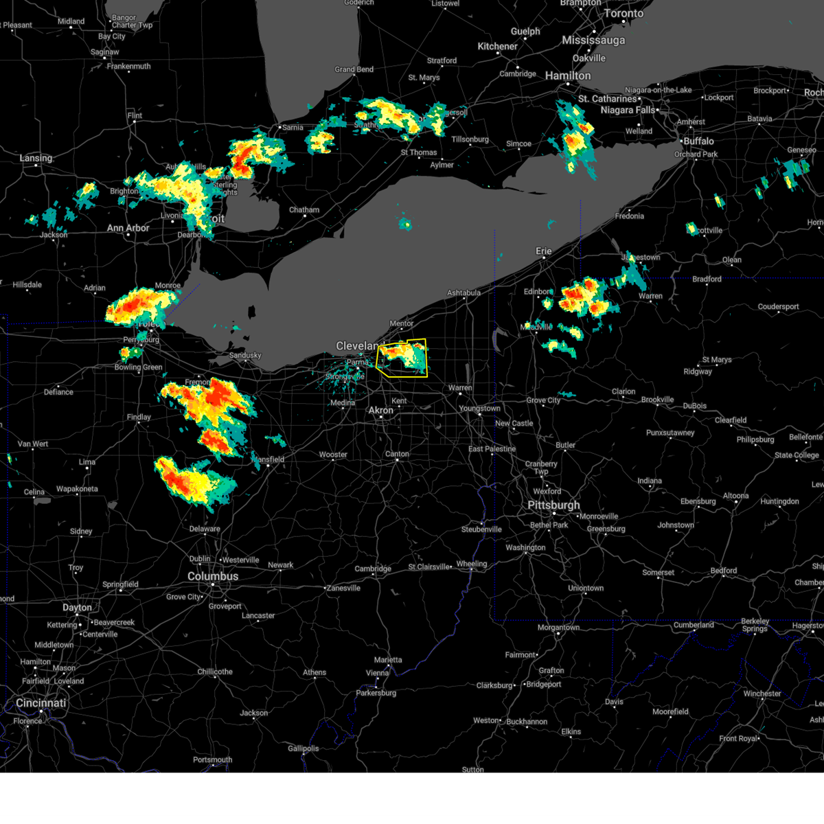 The severe thunderstorm warning for southwestern geauga and northeastern cuyahoga counties will expire at 130 pm edt, the storm which prompted the warning has weakened below severe limits, and no longer poses an immediate threat to life or property. therefore, the warning will be allowed to expire. however gusty winds are still possible with this thunderstorm. a tornado watch remains in effect until 900 pm edt for northeastern ohio. The severe thunderstorm warning for southwestern geauga and northeastern cuyahoga counties will expire at 130 pm edt, the storm which prompted the warning has weakened below severe limits, and no longer poses an immediate threat to life or property. therefore, the warning will be allowed to expire. however gusty winds are still possible with this thunderstorm. a tornado watch remains in effect until 900 pm edt for northeastern ohio.
|
| 8/12/2023 1:10 PM EDT |
 At 109 pm edt, a severe thunderstorm was located near cleveland heights and lyndhurst, or 8 miles south of willowick, moving east at 25 mph (radar indicated). Hazards include 60 mph wind gusts and penny size hail. Expect damage to trees and power lines. locations impacted include, chardon, euclid, cleveland heights, solon, warrensville heights, south russell, burton, highland hills, chesterland, shaker heights, maple heights, south euclid, mayfield heights, lyndhurst, university heights, bedford, beachwood, bedford heights, richmond heights and highland heights. hail threat, radar indicated max hail size, 0. 75 in wind threat, radar indicated max wind gust, 60 mph. At 109 pm edt, a severe thunderstorm was located near cleveland heights and lyndhurst, or 8 miles south of willowick, moving east at 25 mph (radar indicated). Hazards include 60 mph wind gusts and penny size hail. Expect damage to trees and power lines. locations impacted include, chardon, euclid, cleveland heights, solon, warrensville heights, south russell, burton, highland hills, chesterland, shaker heights, maple heights, south euclid, mayfield heights, lyndhurst, university heights, bedford, beachwood, bedford heights, richmond heights and highland heights. hail threat, radar indicated max hail size, 0. 75 in wind threat, radar indicated max wind gust, 60 mph.
|
| 8/12/2023 12:50 PM EDT | Numerous trees down in and around cleveland heights. time estimated from rada in cuyahoga county OH, 8.2 miles WSW of Cleveland, OH |
| 8/12/2023 12:50 PM EDT |
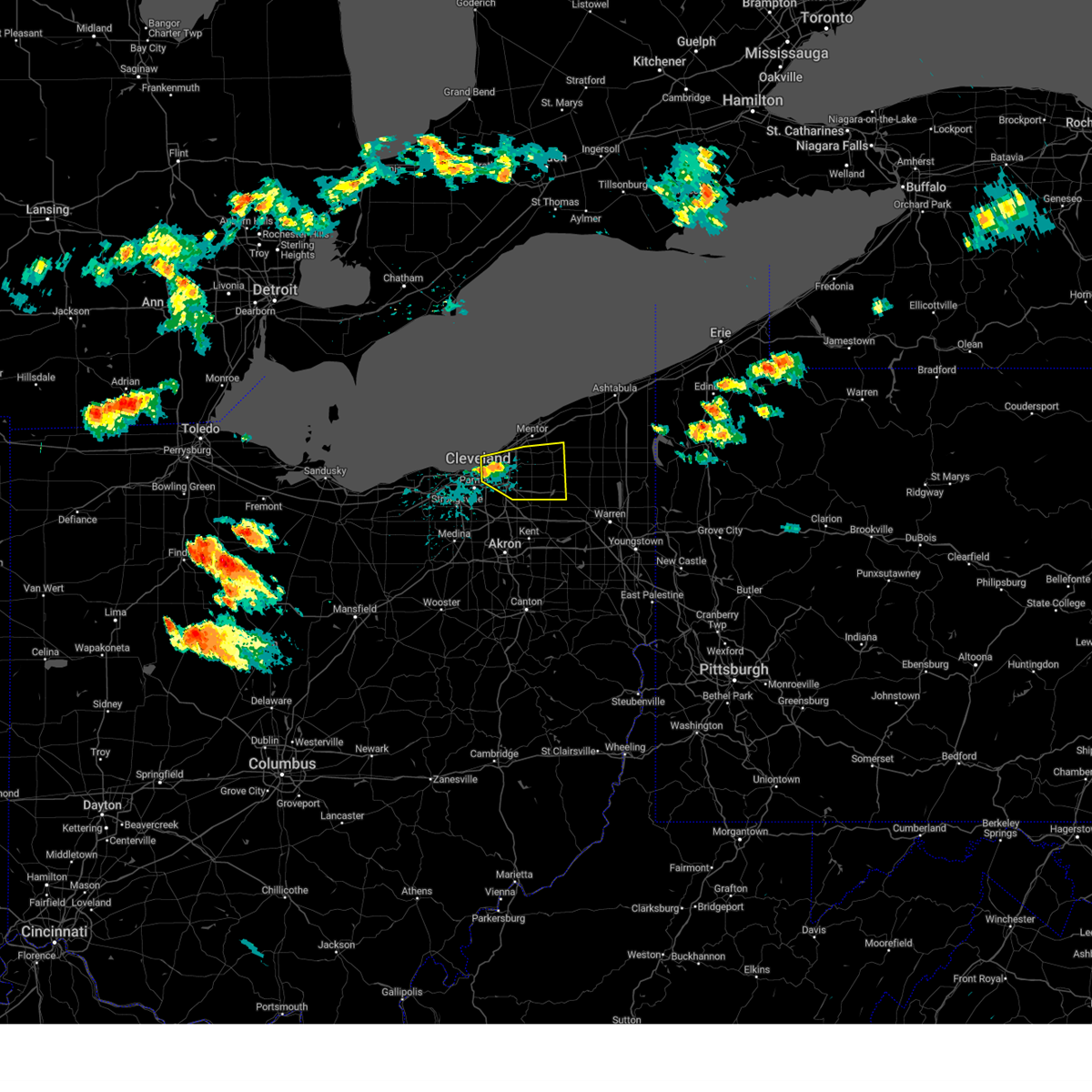 At 1250 pm edt, a severe thunderstorm was located over cleveland heights, or near cleveland, moving east at 35 mph (radar indicated). Hazards include 60 mph wind gusts and quarter size hail. Minor damage to vehicles is possible. Expect damage to trees and power lines. At 1250 pm edt, a severe thunderstorm was located over cleveland heights, or near cleveland, moving east at 35 mph (radar indicated). Hazards include 60 mph wind gusts and quarter size hail. Minor damage to vehicles is possible. Expect damage to trees and power lines.
|
| 7/26/2023 6:36 PM EDT |
 At 636 pm edt, severe thunderstorms were located along a line extending from near cleveland heights to near brunswick to near chippewa lake, moving east at 50 mph (radar indicated). Hazards include 60 mph wind gusts. Expect damage to trees and power lines. locations impacted include, cleveland, akron, medina, parma, lakewood, cuyahoga falls, euclid, cleveland heights, strongsville, brunswick, north royalton, north ridgeville, kent, solon, hudson, wadsworth, twinsburg, tallmadge, streetsboro and warrensville heights. hail threat, radar indicated max hail size, <. 75 in wind threat, radar indicated max wind gust, 60 mph. At 636 pm edt, severe thunderstorms were located along a line extending from near cleveland heights to near brunswick to near chippewa lake, moving east at 50 mph (radar indicated). Hazards include 60 mph wind gusts. Expect damage to trees and power lines. locations impacted include, cleveland, akron, medina, parma, lakewood, cuyahoga falls, euclid, cleveland heights, strongsville, brunswick, north royalton, north ridgeville, kent, solon, hudson, wadsworth, twinsburg, tallmadge, streetsboro and warrensville heights. hail threat, radar indicated max hail size, <. 75 in wind threat, radar indicated max wind gust, 60 mph.
|
| 7/26/2023 6:14 PM EDT |
 At 613 pm edt, severe thunderstorms were located along a line extending from 8 miles northeast of lakewood to near brunswick to near wellington, moving east at 25 mph (radar indicated). Hazards include 60 mph wind gusts and penny size hail. Expect damage to trees and power lines. locations impacted include, cleveland, akron, lorain, elyria, medina, parma, lakewood, cuyahoga falls, euclid, cleveland heights, strongsville, brunswick, westlake, north royalton, north ridgeville, kent, solon, avon lake, hudson and wadsworth. hail threat, radar indicated max hail size, 0. 75 in wind threat, radar indicated max wind gust, 60 mph. At 613 pm edt, severe thunderstorms were located along a line extending from 8 miles northeast of lakewood to near brunswick to near wellington, moving east at 25 mph (radar indicated). Hazards include 60 mph wind gusts and penny size hail. Expect damage to trees and power lines. locations impacted include, cleveland, akron, lorain, elyria, medina, parma, lakewood, cuyahoga falls, euclid, cleveland heights, strongsville, brunswick, westlake, north royalton, north ridgeville, kent, solon, avon lake, hudson and wadsworth. hail threat, radar indicated max hail size, 0. 75 in wind threat, radar indicated max wind gust, 60 mph.
|
| 7/26/2023 6:07 PM EDT |
 At 607 pm edt, severe thunderstorms were located along a line extending from 8 miles north of lakewood to near grafton to near wellington, moving east at 35 mph (radar indicated). Hazards include 60 mph wind gusts and penny size hail. Expect damage to trees and power lines. locations impacted include, cleveland, akron, lorain, elyria, medina, vermilion, parma, lakewood, cuyahoga falls, euclid, cleveland heights, strongsville, brunswick, westlake, north royalton, north ridgeville, kent, solon, avon lake and hudson. hail threat, radar indicated max hail size, 0. 75 in wind threat, radar indicated max wind gust, 60 mph. At 607 pm edt, severe thunderstorms were located along a line extending from 8 miles north of lakewood to near grafton to near wellington, moving east at 35 mph (radar indicated). Hazards include 60 mph wind gusts and penny size hail. Expect damage to trees and power lines. locations impacted include, cleveland, akron, lorain, elyria, medina, vermilion, parma, lakewood, cuyahoga falls, euclid, cleveland heights, strongsville, brunswick, westlake, north royalton, north ridgeville, kent, solon, avon lake and hudson. hail threat, radar indicated max hail size, 0. 75 in wind threat, radar indicated max wind gust, 60 mph.
|
| 7/26/2023 5:56 PM EDT |
 At 555 pm edt, severe thunderstorms were located along a line extending from 10 miles north of lakewood to near grafton to near wellington, moving east-northeast at 40 mph (radar indicated). Hazards include 60 mph wind gusts and penny size hail. expect damage to trees and power lines At 555 pm edt, severe thunderstorms were located along a line extending from 10 miles north of lakewood to near grafton to near wellington, moving east-northeast at 40 mph (radar indicated). Hazards include 60 mph wind gusts and penny size hail. expect damage to trees and power lines
|
| 7/26/2023 5:08 PM EDT | Tree down on n park drive in fairview park. report via social media. time estimated via rada in cuyahoga county OH, 8.9 miles ENE of Cleveland, OH |
| 7/26/2023 4:45 PM EDT |
 At 444 pm edt, a severe thunderstorm was located 8 miles north of lorain, moving east at 55 mph (radar indicated). Hazards include 70 mph wind gusts and penny size hail. Expect considerable tree damage. Damage is likely to mobile homes, roofs, and outbuildings. At 444 pm edt, a severe thunderstorm was located 8 miles north of lorain, moving east at 55 mph (radar indicated). Hazards include 70 mph wind gusts and penny size hail. Expect considerable tree damage. Damage is likely to mobile homes, roofs, and outbuildings.
|
| 7/23/2023 8:05 PM EDT |
 At 805 pm edt, a severe thunderstorm was located near parma, or near cleveland, moving northeast at 20 mph (radar indicated). Hazards include 60 mph wind gusts and penny size hail. expect damage to trees and power lines At 805 pm edt, a severe thunderstorm was located near parma, or near cleveland, moving northeast at 20 mph (radar indicated). Hazards include 60 mph wind gusts and penny size hail. expect damage to trees and power lines
|
| 7/20/2023 8:21 PM EDT | Three cars submerged in water at w117 and berea r in cuyahoga county OH, 4 miles E of Cleveland, OH |
| 7/20/2023 7:49 PM EDT | Quarter sized hail reported 6.8 miles N of Cleveland, OH |
| 7/20/2023 7:40 PM EDT | Quarter sized hail reported 6.8 miles N of Cleveland, OH, corrects previous hail report from 1 ese parma. |
| 7/20/2023 7:38 PM EDT |
 At 737 pm edt, severe thunderstorms were located along a line extending from near garrettsville to 6 miles northwest of cuyahoga falls to near wellington, moving southeast at 25 mph (radar indicated). Hazards include 60 mph wind gusts and quarter size hail. Minor damage to vehicles is possible. expect damage to trees and power lines. locations impacted include, cleveland, akron, elyria, medina, ravenna, parma, cuyahoga falls, strongsville, brunswick, westlake, north royalton, north ridgeville, kent, solon, hudson, wadsworth, twinsburg, tallmadge, streetsboro and warrensville heights. hail threat, radar indicated max hail size, 1. 00 in wind threat, radar indicated max wind gust, 60 mph. At 737 pm edt, severe thunderstorms were located along a line extending from near garrettsville to 6 miles northwest of cuyahoga falls to near wellington, moving southeast at 25 mph (radar indicated). Hazards include 60 mph wind gusts and quarter size hail. Minor damage to vehicles is possible. expect damage to trees and power lines. locations impacted include, cleveland, akron, elyria, medina, ravenna, parma, cuyahoga falls, strongsville, brunswick, westlake, north royalton, north ridgeville, kent, solon, hudson, wadsworth, twinsburg, tallmadge, streetsboro and warrensville heights. hail threat, radar indicated max hail size, 1. 00 in wind threat, radar indicated max wind gust, 60 mph.
|
| 7/20/2023 7:20 PM EDT | Large tree branch on west 54t in cuyahoga county OH, 4.9 miles NNE of Cleveland, OH |
| 7/20/2023 7:20 PM EDT | Ping Pong Ball sized hail reported 4.7 miles NNE of Cleveland, OH, retired nws employee reports 1 and a half inch hail in parma. |
| 7/20/2023 7:18 PM EDT | Golf Ball sized hail reported 6.8 miles NNE of Cleveland, OH, quarter to golf ball-sized hail in parma and parma heights. |
| 7/20/2023 7:18 PM EDT | Mesonet station xcle cleveland - edgewate in lez146 county OH, 2.9 miles SE of Cleveland, OH |
| 7/20/2023 6:59 PM EDT |
 At 659 pm edt, severe thunderstorms were located along a line extending from near burton to parma to near vermilion, moving southeast at 30 mph (radar indicated). Hazards include 70 mph wind gusts and quarter size hail. Minor damage to vehicles is possible. expect considerable tree damage. Wind damage is also likely to mobile homes, roofs, and outbuildings. At 659 pm edt, severe thunderstorms were located along a line extending from near burton to parma to near vermilion, moving southeast at 30 mph (radar indicated). Hazards include 70 mph wind gusts and quarter size hail. Minor damage to vehicles is possible. expect considerable tree damage. Wind damage is also likely to mobile homes, roofs, and outbuildings.
|
| 7/20/2023 6:51 PM EDT |
 At 650 pm edt, severe thunderstorms were located along a line extending from north kingsville to 6 miles east of chardon to highland hills, moving southwest at 10 mph (radar indicated). Hazards include 70 mph wind gusts and quarter size hail. Minor damage to vehicles is possible. expect considerable tree damage. wind damage is also likely to mobile homes, roofs, and outbuildings. locations impacted include, cleveland, painesville, ashtabula, willowick, conneaut, chardon, fairport harbor, geneva-on-the-lake, euclid, mentor, cleveland heights, solon, willoughby, twinsburg, eastlake, warrensville heights, macedonia, geneva, south russell and madison. thunderstorm damage threat, considerable hail threat, radar indicated max hail size, 1. 00 in wind threat, radar indicated max wind gust, 70 mph. At 650 pm edt, severe thunderstorms were located along a line extending from north kingsville to 6 miles east of chardon to highland hills, moving southwest at 10 mph (radar indicated). Hazards include 70 mph wind gusts and quarter size hail. Minor damage to vehicles is possible. expect considerable tree damage. wind damage is also likely to mobile homes, roofs, and outbuildings. locations impacted include, cleveland, painesville, ashtabula, willowick, conneaut, chardon, fairport harbor, geneva-on-the-lake, euclid, mentor, cleveland heights, solon, willoughby, twinsburg, eastlake, warrensville heights, macedonia, geneva, south russell and madison. thunderstorm damage threat, considerable hail threat, radar indicated max hail size, 1. 00 in wind threat, radar indicated max wind gust, 70 mph.
|
| 7/20/2023 6:51 PM EDT |
 At 650 pm edt, severe thunderstorms were located along a line extending from near cleveland to near north ridgeville to near vermilion, moving south at 30 mph (radar indicated). Hazards include 70 mph wind gusts and quarter size hail. Minor damage to vehicles is possible. expect considerable tree damage. wind damage is also likely to mobile homes, roofs, and outbuildings. locations impacted include, cleveland, lorain, elyria, vermilion, western vermilion, parma, lakewood, strongsville, brunswick, westlake, north royalton, north ridgeville, avon lake, amherst, grafton, north olmsted, garfield heights, maple heights, avon and parma heights. thunderstorm damage threat, considerable hail threat, radar indicated max hail size, 1. 00 in wind threat, radar indicated max wind gust, 70 mph. At 650 pm edt, severe thunderstorms were located along a line extending from near cleveland to near north ridgeville to near vermilion, moving south at 30 mph (radar indicated). Hazards include 70 mph wind gusts and quarter size hail. Minor damage to vehicles is possible. expect considerable tree damage. wind damage is also likely to mobile homes, roofs, and outbuildings. locations impacted include, cleveland, lorain, elyria, vermilion, western vermilion, parma, lakewood, strongsville, brunswick, westlake, north royalton, north ridgeville, avon lake, amherst, grafton, north olmsted, garfield heights, maple heights, avon and parma heights. thunderstorm damage threat, considerable hail threat, radar indicated max hail size, 1. 00 in wind threat, radar indicated max wind gust, 70 mph.
|
| 7/20/2023 6:12 PM EDT |
 At 611 pm edt, severe thunderstorms were located along a line extending from 10 miles north of lakewood to 9 miles northwest of avon lake to 8 miles northwest of western vermilion, moving south at 40 mph (radar indicated). Hazards include 70 mph wind gusts and quarter size hail. Minor damage to vehicles is possible. expect considerable tree damage. Wind damage is also likely to mobile homes, roofs, and outbuildings. At 611 pm edt, severe thunderstorms were located along a line extending from 10 miles north of lakewood to 9 miles northwest of avon lake to 8 miles northwest of western vermilion, moving south at 40 mph (radar indicated). Hazards include 70 mph wind gusts and quarter size hail. Minor damage to vehicles is possible. expect considerable tree damage. Wind damage is also likely to mobile homes, roofs, and outbuildings.
|
| 7/20/2023 5:58 PM EDT |
 At 557 pm edt, severe thunderstorms were located along a line extending from 19 miles north of ashtabula to 6 miles northwest of fairport harbor to 15 miles northwest of euclid, moving southeast at 45 mph (radar indicated). Hazards include 70 mph wind gusts and quarter size hail. Minor damage to vehicles is possible. expect considerable tree damage. Wind damage is also likely to mobile homes, roofs, and outbuildings. At 557 pm edt, severe thunderstorms were located along a line extending from 19 miles north of ashtabula to 6 miles northwest of fairport harbor to 15 miles northwest of euclid, moving southeast at 45 mph (radar indicated). Hazards include 70 mph wind gusts and quarter size hail. Minor damage to vehicles is possible. expect considerable tree damage. Wind damage is also likely to mobile homes, roofs, and outbuildings.
|
| 7/2/2023 9:14 PM EDT | Awos station kcgf clevlnd cuyahog in cuyahoga county OH, 13.5 miles WSW of Cleveland, OH |
| 7/2/2023 9:08 PM EDT |
 At 907 pm edt, a severe thunderstorm was located near south russell, or 11 miles southwest of chardon, moving east at 30 mph (radar indicated). Hazards include 60 mph wind gusts. Expect damage to trees and power lines. locations impacted include, cleveland, willowick, chardon, euclid, mentor, cleveland heights, solon, willoughby, eastlake, streetsboro, warrensville heights, south russell, highland hills, timberlake, lakeline, chesterland, garfield heights, shaker heights, maple heights and south euclid. hail threat, radar indicated max hail size, <. 75 in wind threat, radar indicated max wind gust, 60 mph. At 907 pm edt, a severe thunderstorm was located near south russell, or 11 miles southwest of chardon, moving east at 30 mph (radar indicated). Hazards include 60 mph wind gusts. Expect damage to trees and power lines. locations impacted include, cleveland, willowick, chardon, euclid, mentor, cleveland heights, solon, willoughby, eastlake, streetsboro, warrensville heights, south russell, highland hills, timberlake, lakeline, chesterland, garfield heights, shaker heights, maple heights and south euclid. hail threat, radar indicated max hail size, <. 75 in wind threat, radar indicated max wind gust, 60 mph.
|
| 7/2/2023 8:32 PM EDT |
 At 831 pm edt, a severe thunderstorm was located near cleveland, moving east at 30 mph (radar indicated). Hazards include 60 mph wind gusts. expect damage to trees and power lines At 831 pm edt, a severe thunderstorm was located near cleveland, moving east at 30 mph (radar indicated). Hazards include 60 mph wind gusts. expect damage to trees and power lines
|
| 4/1/2023 12:45 PM EDT |
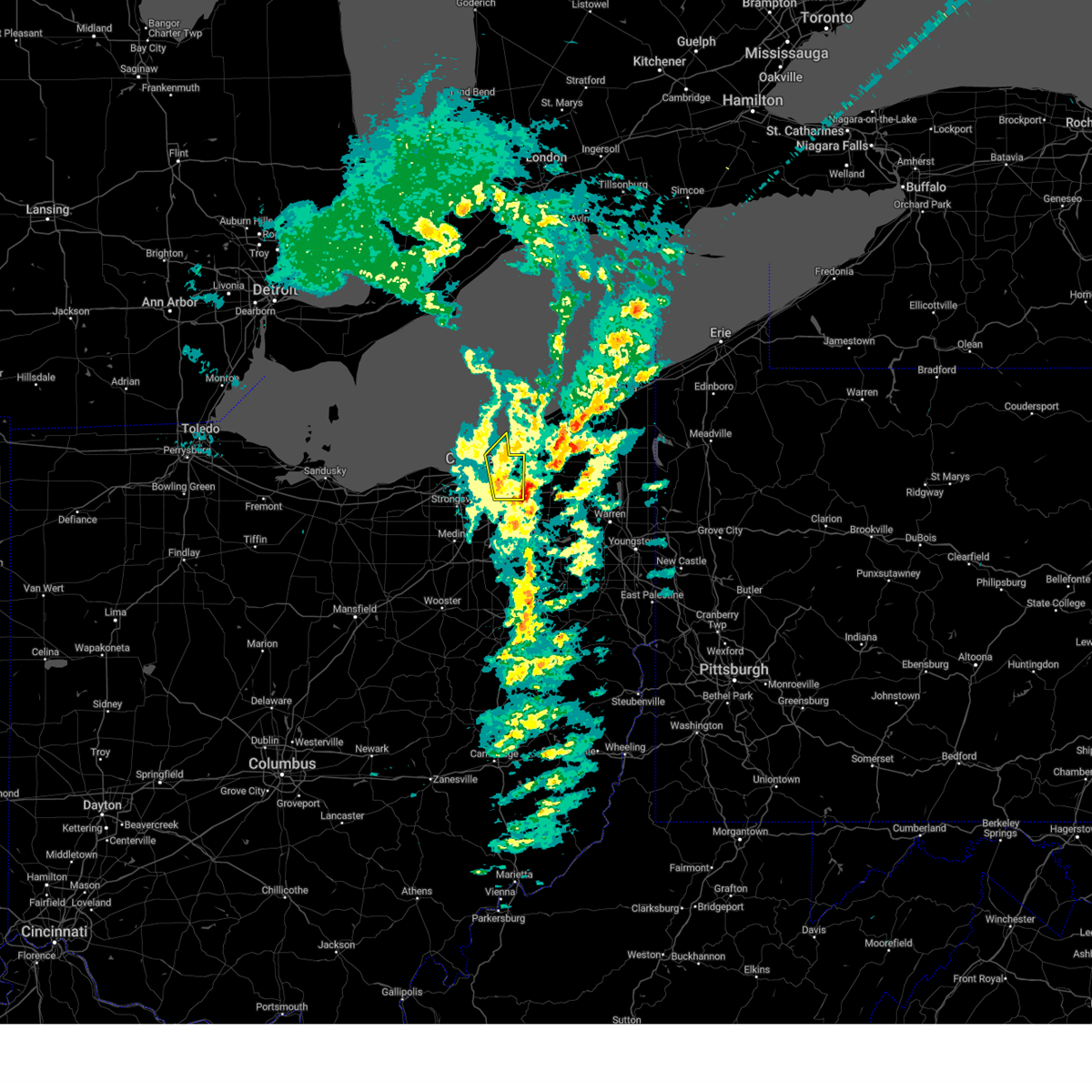 At 1245 pm edt, severe thunderstorms were located along a line extending from near euclid to near macedonia, moving northeast at 60 mph (several reports of damaging wind across cuyahoga county and measured gusts over 60 mph at burke lakefront airport). Hazards include 70 mph wind gusts and penny size hail. Expect considerable tree damage. Damage is likely to mobile homes, roofs, and outbuildings. At 1245 pm edt, severe thunderstorms were located along a line extending from near euclid to near macedonia, moving northeast at 60 mph (several reports of damaging wind across cuyahoga county and measured gusts over 60 mph at burke lakefront airport). Hazards include 70 mph wind gusts and penny size hail. Expect considerable tree damage. Damage is likely to mobile homes, roofs, and outbuildings.
|
| 4/1/2023 12:39 PM EDT | Asos station kbkl clevelan in cuyahoga county OH, 3.6 miles S of Cleveland, OH |
| 4/1/2023 12:18 PM EDT |
 At 1217 pm edt, severe thunderstorms were located along a line extending from 6 miles north of cleveland to near lodi, moving east at 60 mph. additional thunderstorms are developing ahead of this line across cuyahoga county (law enforcement. numerous trees were downed in northern ashland county. lorain county airport gusted to 61 mph). Hazards include 70 mph wind gusts and penny size hail. Expect considerable tree damage. damage is likely to mobile homes, roofs, and outbuildings. locations impacted include, cleveland, medina, parma, lakewood, euclid, cleveland heights, strongsville, brunswick, westlake, north royalton, solon, wadsworth, warrensville heights, rittman, lodi, highland hills, chippewa lake, north olmsted, garfield heights and shaker heights. thunderstorm damage threat, considerable hail threat, radar indicated max hail size, 0. 75 in wind threat, observed max wind gust, 70 mph. At 1217 pm edt, severe thunderstorms were located along a line extending from 6 miles north of cleveland to near lodi, moving east at 60 mph. additional thunderstorms are developing ahead of this line across cuyahoga county (law enforcement. numerous trees were downed in northern ashland county. lorain county airport gusted to 61 mph). Hazards include 70 mph wind gusts and penny size hail. Expect considerable tree damage. damage is likely to mobile homes, roofs, and outbuildings. locations impacted include, cleveland, medina, parma, lakewood, euclid, cleveland heights, strongsville, brunswick, westlake, north royalton, solon, wadsworth, warrensville heights, rittman, lodi, highland hills, chippewa lake, north olmsted, garfield heights and shaker heights. thunderstorm damage threat, considerable hail threat, radar indicated max hail size, 0. 75 in wind threat, observed max wind gust, 70 mph.
|
| 4/1/2023 11:59 AM EDT |
 At 1158 am edt, severe thunderstorms were located along a line extending from avon lake to near savannah, moving northeast at 55 mph. strong wind gusts in excess of 50 mph will continue even after the rain exits (public reported. there have been several measured wind gusts in excess of 60 mph and reports of down trees and power-lines with this line of thunderstorms). Hazards include 60 mph wind gusts and penny size hail. expect damage to trees and power lines At 1158 am edt, severe thunderstorms were located along a line extending from avon lake to near savannah, moving northeast at 55 mph. strong wind gusts in excess of 50 mph will continue even after the rain exits (public reported. there have been several measured wind gusts in excess of 60 mph and reports of down trees and power-lines with this line of thunderstorms). Hazards include 60 mph wind gusts and penny size hail. expect damage to trees and power lines
|
| 4/1/2023 2:41 AM EDT | Asos station kbkl cleveland measured a 61 kt marine thunderstorm wind gus in cuyahoga county OH, 3.6 miles S of Cleveland, OH |
| 4/1/2023 2:41 AM EDT | Asos station kbkl cleveland measured a 61 kt marine thunderstorm wind gus in cuyahoga county OH, 3.6 miles S of Cleveland, OH |
| 3/25/2023 1:46 PM EDT | Mesonet station dw7394 parm in cuyahoga county OH, 6.8 miles N of Cleveland, OH |
| 3/25/2023 1:44 PM EDT |
 At 144 pm edt, severe thunderstorms were located along a line extending from cleveland heights to near macedonia, moving east at 55 mph (radar indicated). Hazards include 70 mph wind gusts. Expect considerable tree damage. Damage is likely to mobile homes, roofs, and outbuildings. At 144 pm edt, severe thunderstorms were located along a line extending from cleveland heights to near macedonia, moving east at 55 mph (radar indicated). Hazards include 70 mph wind gusts. Expect considerable tree damage. Damage is likely to mobile homes, roofs, and outbuildings.
|
| 3/25/2023 1:41 PM EDT | 63 mph wind measured by trained spotte in cuyahoga county OH, 6.1 miles N of Cleveland, OH |
| 3/25/2023 1:40 PM EDT | Wires down... tree down against wires... arcing/sparkin in cuyahoga county OH, 5.7 miles NNE of Cleveland, OH |
| 1/19/2023 6:58 PM EST | Tree down and blocking the road at clarendon and lee road in cuyahoga county OH, 6.6 miles WSW of Cleveland, OH |
| 1/19/2023 6:58 PM EST | Tree down across ardmor in cuyahoga county OH, 8.7 miles WSW of Cleveland, OH |
| 1/19/2023 6:58 PM EST | Tree and wires down on rydalmount roa in cuyahoga county OH, 7.8 miles WSW of Cleveland, OH |
| 1/19/2023 6:58 PM EST |
 At 656 pm est, a severe thunderstorm was located over highland hills, or near cleveland, moving east at 50 mph (radar indicated). Hazards include 60 mph wind gusts. expect damage to trees and power lines At 656 pm est, a severe thunderstorm was located over highland hills, or near cleveland, moving east at 50 mph (radar indicated). Hazards include 60 mph wind gusts. expect damage to trees and power lines
|
| 1/19/2023 6:56 PM EST | Very large tree down across edgepark driv in cuyahoga county OH, 5.9 miles NW of Cleveland, OH |
| 1/19/2023 6:38 PM EST |
 At 637 pm est, severe thunderstorms were located along a line extending from 9 miles north of avon lake to near strongsville to near wooster, moving east at 45 mph (radar indicated). Hazards include 60 mph wind gusts. Expect damage to trees and power lines. locations impacted include, cleveland, akron, elyria, medina, parma, lakewood, cuyahoga falls, euclid, cleveland heights, strongsville, brunswick, westlake, north royalton, north ridgeville, kent, solon, avon lake, hudson, twinsburg and tallmadge. hail threat, radar indicated max hail size, <. 75 in wind threat, radar indicated max wind gust, 60 mph. At 637 pm est, severe thunderstorms were located along a line extending from 9 miles north of avon lake to near strongsville to near wooster, moving east at 45 mph (radar indicated). Hazards include 60 mph wind gusts. Expect damage to trees and power lines. locations impacted include, cleveland, akron, elyria, medina, parma, lakewood, cuyahoga falls, euclid, cleveland heights, strongsville, brunswick, westlake, north royalton, north ridgeville, kent, solon, avon lake, hudson, twinsburg and tallmadge. hail threat, radar indicated max hail size, <. 75 in wind threat, radar indicated max wind gust, 60 mph.
|
| 1/19/2023 6:24 PM EST |
 At 622 pm est, severe thunderstorms were located along a line extending from 9 miles north of lorain to grafton to 6 miles northwest of shreve, moving east at 60 mph (radar indicated). Hazards include 60 mph wind gusts. Expect damage to trees and power lines. locations impacted include, cleveland, akron, lorain, elyria, medina, vermilion, western vermilion, parma, lakewood, cuyahoga falls, euclid, cleveland heights, strongsville, brunswick, westlake, north royalton, north ridgeville, kent, solon and avon lake. hail threat, radar indicated max hail size, <. 75 in wind threat, radar indicated max wind gust, 60 mph. At 622 pm est, severe thunderstorms were located along a line extending from 9 miles north of lorain to grafton to 6 miles northwest of shreve, moving east at 60 mph (radar indicated). Hazards include 60 mph wind gusts. Expect damage to trees and power lines. locations impacted include, cleveland, akron, lorain, elyria, medina, vermilion, western vermilion, parma, lakewood, cuyahoga falls, euclid, cleveland heights, strongsville, brunswick, westlake, north royalton, north ridgeville, kent, solon and avon lake. hail threat, radar indicated max hail size, <. 75 in wind threat, radar indicated max wind gust, 60 mph.
|
| 1/19/2023 6:05 PM EST |
 At 605 pm est, severe thunderstorms were located along a line extending from 9 miles northwest of western vermilion to near wellington to near bellville, moving east at 60 mph (radar indicated). Hazards include 60 mph wind gusts. expect damage to trees and power lines At 605 pm est, severe thunderstorms were located along a line extending from 9 miles northwest of western vermilion to near wellington to near bellville, moving east at 60 mph (radar indicated). Hazards include 60 mph wind gusts. expect damage to trees and power lines
|
| 8/8/2022 8:12 PM EDT |
 The severe thunderstorm warning for northwestern portage, geauga, northeastern medina, cuyahoga, lake, northern summit, central lorain and southwestern ashtabula counties will expire at 815 pm edt, the storms which prompted the warning have weakened below severe limits, and no longer pose an immediate threat to life or property. therefore, the warning will be allowed to expire. The severe thunderstorm warning for northwestern portage, geauga, northeastern medina, cuyahoga, lake, northern summit, central lorain and southwestern ashtabula counties will expire at 815 pm edt, the storms which prompted the warning have weakened below severe limits, and no longer pose an immediate threat to life or property. therefore, the warning will be allowed to expire.
|
| 8/8/2022 8:06 PM EDT |
 At 806 pm edt, severe thunderstorms were located along a line extending from 6 miles southeast of perry to near highland hills to near wellington, moving southeast at 40 mph (radar indicated). Hazards include 60 mph wind gusts. Expect damage to trees and power lines. locations impacted include, cleveland, lorain, elyria, painesville, willowick, chardon, fairport harbor, parma, lakewood, euclid, mentor, cleveland heights, strongsville, brunswick, westlake, north royalton, north ridgeville, solon, avon lake and willoughby. hail threat, radar indicated max hail size, <. 75 in wind threat, radar indicated max wind gust, 60 mph. At 806 pm edt, severe thunderstorms were located along a line extending from 6 miles southeast of perry to near highland hills to near wellington, moving southeast at 40 mph (radar indicated). Hazards include 60 mph wind gusts. Expect damage to trees and power lines. locations impacted include, cleveland, lorain, elyria, painesville, willowick, chardon, fairport harbor, parma, lakewood, euclid, mentor, cleveland heights, strongsville, brunswick, westlake, north royalton, north ridgeville, solon, avon lake and willoughby. hail threat, radar indicated max hail size, <. 75 in wind threat, radar indicated max wind gust, 60 mph.
|
| 8/8/2022 7:47 PM EDT |
 At 747 pm edt, severe thunderstorms were located along a line extending from near fairport harbor to near euclid to near vermilion, moving southeast at 35 mph (radar indicated). Hazards include 60 mph wind gusts. Expect damage to trees and power lines. locations impacted include, cleveland, lorain, elyria, painesville, willowick, vermilion, western vermilion, chardon, fairport harbor, parma, lakewood, euclid, mentor, cleveland heights, strongsville, brunswick, westlake, north royalton, north ridgeville and solon. hail threat, radar indicated max hail size, <. 75 in wind threat, radar indicated max wind gust, 60 mph. At 747 pm edt, severe thunderstorms were located along a line extending from near fairport harbor to near euclid to near vermilion, moving southeast at 35 mph (radar indicated). Hazards include 60 mph wind gusts. Expect damage to trees and power lines. locations impacted include, cleveland, lorain, elyria, painesville, willowick, vermilion, western vermilion, chardon, fairport harbor, parma, lakewood, euclid, mentor, cleveland heights, strongsville, brunswick, westlake, north royalton, north ridgeville and solon. hail threat, radar indicated max hail size, <. 75 in wind threat, radar indicated max wind gust, 60 mph.
|
| 8/8/2022 7:25 PM EDT |
 At 725 pm edt, severe thunderstorms were located along a line extending from 16 miles northwest of timberlake to 6 miles northwest of euclid to 6 miles northeast of milan, moving southeast at 35 mph (radar indicated). Hazards include 60 mph wind gusts. expect damage to trees and power lines At 725 pm edt, severe thunderstorms were located along a line extending from 16 miles northwest of timberlake to 6 miles northwest of euclid to 6 miles northeast of milan, moving southeast at 35 mph (radar indicated). Hazards include 60 mph wind gusts. expect damage to trees and power lines
|
| 7/24/2022 11:53 PM EDT |
 At 1152 pm edt, a severe thunderstorm was located near chesterland, or 10 miles southeast of willowick, moving east at 35 mph (radar indicated). Hazards include 70 mph wind gusts. Expect considerable tree damage. damage is likely to mobile homes, roofs, and outbuildings. locations impacted include, cleveland, chardon, cleveland heights, solon, warrensville heights, south russell, middlefield, burton, highland hills, chesterland, garfield heights, shaker heights, maple heights, south euclid, mayfield heights, lyndhurst, university heights, bedford, beachwood and bedford heights. thunderstorm damage threat, considerable hail threat, radar indicated max hail size, <. 75 in wind threat, radar indicated max wind gust, 70 mph. At 1152 pm edt, a severe thunderstorm was located near chesterland, or 10 miles southeast of willowick, moving east at 35 mph (radar indicated). Hazards include 70 mph wind gusts. Expect considerable tree damage. damage is likely to mobile homes, roofs, and outbuildings. locations impacted include, cleveland, chardon, cleveland heights, solon, warrensville heights, south russell, middlefield, burton, highland hills, chesterland, garfield heights, shaker heights, maple heights, south euclid, mayfield heights, lyndhurst, university heights, bedford, beachwood and bedford heights. thunderstorm damage threat, considerable hail threat, radar indicated max hail size, <. 75 in wind threat, radar indicated max wind gust, 70 mph.
|
| 7/24/2022 11:48 PM EDT |
 At 1148 pm edt, severe thunderstorms were located along a line extending from near chesterland to near solon to near parma, moving east at 35 mph (radar indicated). Hazards include 60 mph wind gusts. expect damage to trees and power lines At 1148 pm edt, severe thunderstorms were located along a line extending from near chesterland to near solon to near parma, moving east at 35 mph (radar indicated). Hazards include 60 mph wind gusts. expect damage to trees and power lines
|
| 7/24/2022 11:28 PM EDT |
 At 1127 pm edt, severe thunderstorms were located along a line extending from near cleveland to near wellington, moving east at 55 mph (radar indicated). Hazards include 60 mph wind gusts. Expect damage to trees and power lines. locations impacted include, cleveland, elyria, parma, lakewood, strongsville, brunswick, westlake, north royalton, north ridgeville, grafton, north olmsted, avon, parma heights, rocky river, broadview heights, brook park, berea, fairview park, middleburg heights and bay village. hail threat, radar indicated max hail size, <. 75 in wind threat, radar indicated max wind gust, 60 mph. At 1127 pm edt, severe thunderstorms were located along a line extending from near cleveland to near wellington, moving east at 55 mph (radar indicated). Hazards include 60 mph wind gusts. Expect damage to trees and power lines. locations impacted include, cleveland, elyria, parma, lakewood, strongsville, brunswick, westlake, north royalton, north ridgeville, grafton, north olmsted, avon, parma heights, rocky river, broadview heights, brook park, berea, fairview park, middleburg heights and bay village. hail threat, radar indicated max hail size, <. 75 in wind threat, radar indicated max wind gust, 60 mph.
|
| 7/24/2022 10:56 PM EDT |
 At 1056 pm edt, severe thunderstorms were located along a line extending from near lorain to 6 miles north of willard, moving east at 55 mph (radar indicated). Hazards include 60 mph wind gusts. expect damage to trees and power lines At 1056 pm edt, severe thunderstorms were located along a line extending from near lorain to 6 miles north of willard, moving east at 55 mph (radar indicated). Hazards include 60 mph wind gusts. expect damage to trees and power lines
|
| 7/20/2022 8:08 PM EDT |
 At 807 pm edt, severe thunderstorms were located along a line extending from near independence to 6 miles southwest of macedonia to 8 miles west of cuyahoga falls, moving east at 40 mph (radar indicated). Hazards include 60 mph wind gusts. Expect damage to trees and power lines. locations impacted include, cleveland, akron, parma, cuyahoga falls, kent, solon, hudson, twinsburg, tallmadge, streetsboro, warrensville heights, macedonia, south russell, highland hills, stow, garfield heights, maple heights, broadview heights, aurora and brecksville. hail threat, radar indicated max hail size, <. 75 in wind threat, radar indicated max wind gust, 60 mph. At 807 pm edt, severe thunderstorms were located along a line extending from near independence to 6 miles southwest of macedonia to 8 miles west of cuyahoga falls, moving east at 40 mph (radar indicated). Hazards include 60 mph wind gusts. Expect damage to trees and power lines. locations impacted include, cleveland, akron, parma, cuyahoga falls, kent, solon, hudson, twinsburg, tallmadge, streetsboro, warrensville heights, macedonia, south russell, highland hills, stow, garfield heights, maple heights, broadview heights, aurora and brecksville. hail threat, radar indicated max hail size, <. 75 in wind threat, radar indicated max wind gust, 60 mph.
|
| 7/20/2022 7:53 PM EDT |
 At 753 pm edt, severe thunderstorms were located along a line extending from strongsville to brunswick to medina, moving east at 35 mph (radar indicated). Hazards include 60 mph wind gusts. expect damage to trees and power lines At 753 pm edt, severe thunderstorms were located along a line extending from strongsville to brunswick to medina, moving east at 35 mph (radar indicated). Hazards include 60 mph wind gusts. expect damage to trees and power lines
|
| 7/20/2022 7:34 PM EDT |
 At 734 pm edt, a severe thunderstorm was located over euclid, or near willowick, moving east at 30 mph (radar indicated). Hazards include 60 mph wind gusts. Expect damage to trees and power lines. locations impacted include, cleveland, painesville, willowick, chardon, fairport harbor, euclid, mentor, cleveland heights, willoughby, eastlake, madison, timberlake, lakeline, south euclid, east cleveland, lyndhurst, wickliffe, richmond heights, willoughby hills and highland heights. hail threat, radar indicated max hail size, <. 75 in wind threat, radar indicated max wind gust, 60 mph. At 734 pm edt, a severe thunderstorm was located over euclid, or near willowick, moving east at 30 mph (radar indicated). Hazards include 60 mph wind gusts. Expect damage to trees and power lines. locations impacted include, cleveland, painesville, willowick, chardon, fairport harbor, euclid, mentor, cleveland heights, willoughby, eastlake, madison, timberlake, lakeline, south euclid, east cleveland, lyndhurst, wickliffe, richmond heights, willoughby hills and highland heights. hail threat, radar indicated max hail size, <. 75 in wind threat, radar indicated max wind gust, 60 mph.
|
| 7/20/2022 6:57 PM EDT |
 At 657 pm edt, a severe thunderstorm was located 8 miles north of lakewood, or 10 miles northwest of cleveland, moving east at 45 mph (radar indicated). Hazards include 60 mph wind gusts and penny size hail. expect damage to trees and power lines At 657 pm edt, a severe thunderstorm was located 8 miles north of lakewood, or 10 miles northwest of cleveland, moving east at 45 mph (radar indicated). Hazards include 60 mph wind gusts and penny size hail. expect damage to trees and power lines
|
| 6/1/2022 5:22 PM EDT |
 At 522 pm edt, a severe thunderstorm was located near north royalton, or 13 miles south of cleveland, moving east at 40 mph (radar indicated). Hazards include 60 mph wind gusts and quarter size hail. Minor damage to vehicles is possible. Expect damage to trees and power lines. At 522 pm edt, a severe thunderstorm was located near north royalton, or 13 miles south of cleveland, moving east at 40 mph (radar indicated). Hazards include 60 mph wind gusts and quarter size hail. Minor damage to vehicles is possible. Expect damage to trees and power lines.
|
| 6/1/2022 5:13 PM EDT |
 At 513 pm edt, a severe thunderstorm was located near parma, or 10 miles southwest of cleveland, moving east at 35 mph (radar indicated). Hazards include 60 mph wind gusts. Expect damage to trees and power lines. locations impacted include, cleveland, parma, lakewood, strongsville, brunswick, westlake, north royalton, north olmsted, garfield heights, parma heights, rocky river, broadview heights, brook park, berea, fairview park, middleburg heights, bay village, brecksville, seven hills and brooklyn. hail threat, radar indicated max hail size, <. 75 in wind threat, radar indicated max wind gust, 60 mph. At 513 pm edt, a severe thunderstorm was located near parma, or 10 miles southwest of cleveland, moving east at 35 mph (radar indicated). Hazards include 60 mph wind gusts. Expect damage to trees and power lines. locations impacted include, cleveland, parma, lakewood, strongsville, brunswick, westlake, north royalton, north olmsted, garfield heights, parma heights, rocky river, broadview heights, brook park, berea, fairview park, middleburg heights, bay village, brecksville, seven hills and brooklyn. hail threat, radar indicated max hail size, <. 75 in wind threat, radar indicated max wind gust, 60 mph.
|
| 6/1/2022 5:00 PM EDT |
 At 459 pm edt, a severe thunderstorm was located near westlake, or 8 miles east of elyria, moving east at 50 mph (radar indicated). Hazards include 70 mph wind gusts and nickel size hail. Expect considerable tree damage. damage is likely to mobile homes, roofs, and outbuildings. locations impacted include, cleveland, elyria, parma, lakewood, strongsville, brunswick, westlake, north royalton, north ridgeville, avon lake, grafton, north olmsted, garfield heights, avon, parma heights, rocky river, broadview heights, brook park, berea and fairview park. thunderstorm damage threat, considerable hail threat, radar indicated max hail size, 0. 88 in wind threat, radar indicated max wind gust, 70 mph. At 459 pm edt, a severe thunderstorm was located near westlake, or 8 miles east of elyria, moving east at 50 mph (radar indicated). Hazards include 70 mph wind gusts and nickel size hail. Expect considerable tree damage. damage is likely to mobile homes, roofs, and outbuildings. locations impacted include, cleveland, elyria, parma, lakewood, strongsville, brunswick, westlake, north royalton, north ridgeville, avon lake, grafton, north olmsted, garfield heights, avon, parma heights, rocky river, broadview heights, brook park, berea and fairview park. thunderstorm damage threat, considerable hail threat, radar indicated max hail size, 0. 88 in wind threat, radar indicated max wind gust, 70 mph.
|
| 6/1/2022 4:49 PM EDT |
 At 449 pm edt, a severe thunderstorm was located over elyria, moving east at 35 mph (radar indicated). Hazards include 70 mph wind gusts and nickel size hail. Expect considerable tree damage. damage is likely to mobile homes, roofs, and outbuildings. locations impacted include, cleveland, lorain, elyria, parma, lakewood, strongsville, brunswick, westlake, north royalton, north ridgeville, avon lake, amherst, grafton, north olmsted, garfield heights, avon, parma heights, rocky river, broadview heights and brook park. thunderstorm damage threat, considerable hail threat, radar indicated max hail size, 0. 88 in wind threat, radar indicated max wind gust, 70 mph. At 449 pm edt, a severe thunderstorm was located over elyria, moving east at 35 mph (radar indicated). Hazards include 70 mph wind gusts and nickel size hail. Expect considerable tree damage. damage is likely to mobile homes, roofs, and outbuildings. locations impacted include, cleveland, lorain, elyria, parma, lakewood, strongsville, brunswick, westlake, north royalton, north ridgeville, avon lake, amherst, grafton, north olmsted, garfield heights, avon, parma heights, rocky river, broadview heights and brook park. thunderstorm damage threat, considerable hail threat, radar indicated max hail size, 0. 88 in wind threat, radar indicated max wind gust, 70 mph.
|
| 6/1/2022 4:40 PM EDT |
 At 440 pm edt, a severe thunderstorm was located over lorain, moving east at 40 mph (radar indicated). Hazards include 70 mph wind gusts and penny size hail. Expect considerable tree damage. Damage is likely to mobile homes, roofs, and outbuildings. At 440 pm edt, a severe thunderstorm was located over lorain, moving east at 40 mph (radar indicated). Hazards include 70 mph wind gusts and penny size hail. Expect considerable tree damage. Damage is likely to mobile homes, roofs, and outbuildings.
|
| 5/3/2022 7:42 PM EDT |
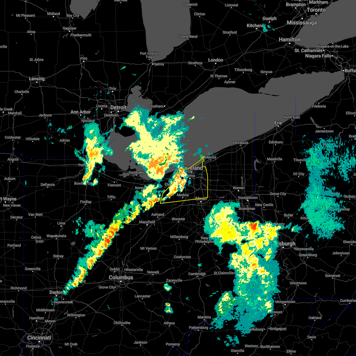 At 742 pm edt, severe thunderstorms were located along a line extending from near lakewood to near strongsville to near wellington, moving northeast at 25 mph (radar indicated). Hazards include 60 mph wind gusts. Expect damage to trees and power lines. locations impacted include, cleveland, akron, medina, willowick, parma, lakewood, cuyahoga falls, euclid, cleveland heights, strongsville, brunswick, westlake, north royalton, north ridgeville, kent, solon, hudson, twinsburg, streetsboro and warrensville heights. hail threat, radar indicated max hail size, <. 75 in wind threat, radar indicated max wind gust, 60 mph. At 742 pm edt, severe thunderstorms were located along a line extending from near lakewood to near strongsville to near wellington, moving northeast at 25 mph (radar indicated). Hazards include 60 mph wind gusts. Expect damage to trees and power lines. locations impacted include, cleveland, akron, medina, willowick, parma, lakewood, cuyahoga falls, euclid, cleveland heights, strongsville, brunswick, westlake, north royalton, north ridgeville, kent, solon, hudson, twinsburg, streetsboro and warrensville heights. hail threat, radar indicated max hail size, <. 75 in wind threat, radar indicated max wind gust, 60 mph.
|
| 5/3/2022 7:24 PM EDT |
 At 724 pm edt, severe thunderstorms were located along a line extending from 12 miles north of lorain to near north ridgeville to near new london, moving northeast at 45 mph (radar indicated). Hazards include 60 mph wind gusts and quarter size hail. Minor damage to vehicles is possible. Expect damage to trees and power lines. At 724 pm edt, severe thunderstorms were located along a line extending from 12 miles north of lorain to near north ridgeville to near new london, moving northeast at 45 mph (radar indicated). Hazards include 60 mph wind gusts and quarter size hail. Minor damage to vehicles is possible. Expect damage to trees and power lines.
|
| 5/3/2022 7:11 PM EDT |
 At 711 pm edt, severe thunderstorms were located along a line extending from near vermilion to 6 miles south of amherst to near new london, moving northeast at 55 mph (radar indicated). Hazards include 70 mph wind gusts and quarter size hail. Minor damage to vehicles is possible. expect considerable tree damage. wind damage is also likely to mobile homes, roofs, and outbuildings. locations impacted include, cleveland, lorain, elyria, medina, sandusky, norwalk, vermilion, western vermilion, strongsville, brunswick, westlake, north ridgeville, avon lake, amherst, grafton, rittman, wellington, lodi, new london and creston. thunderstorm damage threat, considerable hail threat, radar indicated max hail size, 1. 00 in wind threat, radar indicated max wind gust, 70 mph. At 711 pm edt, severe thunderstorms were located along a line extending from near vermilion to 6 miles south of amherst to near new london, moving northeast at 55 mph (radar indicated). Hazards include 70 mph wind gusts and quarter size hail. Minor damage to vehicles is possible. expect considerable tree damage. wind damage is also likely to mobile homes, roofs, and outbuildings. locations impacted include, cleveland, lorain, elyria, medina, sandusky, norwalk, vermilion, western vermilion, strongsville, brunswick, westlake, north ridgeville, avon lake, amherst, grafton, rittman, wellington, lodi, new london and creston. thunderstorm damage threat, considerable hail threat, radar indicated max hail size, 1. 00 in wind threat, radar indicated max wind gust, 70 mph.
|
| 5/3/2022 6:49 PM EDT |
 At 649 pm edt, severe thunderstorms were located along a line extending from near northern milan to near norwalk to near willard, moving northeast at 55 mph (radar indicated). Hazards include 70 mph wind gusts and quarter size hail. Minor damage to vehicles is possible. expect considerable tree damage. Wind damage is also likely to mobile homes, roofs, and outbuildings. At 649 pm edt, severe thunderstorms were located along a line extending from near northern milan to near norwalk to near willard, moving northeast at 55 mph (radar indicated). Hazards include 70 mph wind gusts and quarter size hail. Minor damage to vehicles is possible. expect considerable tree damage. Wind damage is also likely to mobile homes, roofs, and outbuildings.
|
| 4/25/2022 2:58 PM EDT |
 At 258 pm edt, a severe thunderstorm was located near highland hills, or 12 miles east of cleveland, moving northeast at 55 mph (radar indicated). Hazards include 60 mph wind gusts. expect damage to trees and power lines At 258 pm edt, a severe thunderstorm was located near highland hills, or 12 miles east of cleveland, moving northeast at 55 mph (radar indicated). Hazards include 60 mph wind gusts. expect damage to trees and power lines
|
| 4/25/2022 2:40 PM EDT |
 At 240 pm edt, a severe thunderstorm was located over cleveland, moving northeast at 55 mph (radar indicated). Hazards include 60 mph wind gusts. Expect damage to trees and power lines. locations impacted include, cleveland, willowick, parma, lakewood, euclid, cleveland heights, north royalton, solon, willoughby, eastlake, warrensville heights, highland hills, lakeline, garfield heights, shaker heights, maple heights, south euclid, parma heights, rocky river and broadview heights. hail threat, radar indicated max hail size, <. 75 in wind threat, radar indicated max wind gust, 60 mph. At 240 pm edt, a severe thunderstorm was located over cleveland, moving northeast at 55 mph (radar indicated). Hazards include 60 mph wind gusts. Expect damage to trees and power lines. locations impacted include, cleveland, willowick, parma, lakewood, euclid, cleveland heights, north royalton, solon, willoughby, eastlake, warrensville heights, highland hills, lakeline, garfield heights, shaker heights, maple heights, south euclid, parma heights, rocky river and broadview heights. hail threat, radar indicated max hail size, <. 75 in wind threat, radar indicated max wind gust, 60 mph.
|
| 4/25/2022 2:22 PM EDT |
 At 222 pm edt, a severe thunderstorm was located near grafton, or 7 miles southeast of elyria, moving northeast at 40 mph (radar indicated). Hazards include 60 mph wind gusts. expect damage to trees and power lines At 222 pm edt, a severe thunderstorm was located near grafton, or 7 miles southeast of elyria, moving northeast at 40 mph (radar indicated). Hazards include 60 mph wind gusts. expect damage to trees and power lines
|
| 9/15/2021 1:46 AM EDT |
 At 146 am edt, severe thunderstorms were located along a line extending from near south russell to near cuyahoga falls, moving east at 40 mph (radar indicated). Hazards include 60 mph wind gusts and penny size hail. Expect damage to trees and power lines. locations impacted include, cleveland, akron, willowick, ravenna, chardon, parma, cuyahoga falls, euclid, mentor, cleveland heights, strongsville, brunswick, north royalton, kent, solon, willoughby, hudson, twinsburg, eastlake and tallmadge. hail threat, radar indicated max hail size, 0. 75 in wind threat, radar indicated max wind gust, 60 mph. At 146 am edt, severe thunderstorms were located along a line extending from near south russell to near cuyahoga falls, moving east at 40 mph (radar indicated). Hazards include 60 mph wind gusts and penny size hail. Expect damage to trees and power lines. locations impacted include, cleveland, akron, willowick, ravenna, chardon, parma, cuyahoga falls, euclid, mentor, cleveland heights, strongsville, brunswick, north royalton, kent, solon, willoughby, hudson, twinsburg, eastlake and tallmadge. hail threat, radar indicated max hail size, 0. 75 in wind threat, radar indicated max wind gust, 60 mph.
|
| 9/15/2021 1:04 AM EDT |
 At 103 am edt, severe thunderstorms were located along a line extending from near lakewood to grafton, moving east at 40 mph (radar indicated). Hazards include 60 mph wind gusts. expect damage to trees and power lines At 103 am edt, severe thunderstorms were located along a line extending from near lakewood to grafton, moving east at 40 mph (radar indicated). Hazards include 60 mph wind gusts. expect damage to trees and power lines
|
| 8/12/2021 10:28 AM EDT |
 At 1028 am edt, severe thunderstorms were located along a line extending from near highland hills to solon to near cuyahoga falls, moving east at 45 mph (radar indicated). Hazards include 60 mph wind gusts. expect damage to trees and power lines At 1028 am edt, severe thunderstorms were located along a line extending from near highland hills to solon to near cuyahoga falls, moving east at 45 mph (radar indicated). Hazards include 60 mph wind gusts. expect damage to trees and power lines
|
| 8/11/2021 5:59 PM EDT |
 At 558 pm edt, a line of severe thunderstorms was located near south russell to bedford, moving east at 45 mph (radar indicated). Hazards include 70 mph wind gusts and penny size hail. Expect considerable tree damage. damage is likely to mobile homes, roofs, and outbuildings. locations impacted include, cleveland, parma, euclid, cleveland heights, north royalton, solon, hudson, twinsburg, warrensville heights, macedonia, south russell, highland hills, chesterland, garfield heights, shaker heights, maple heights, south euclid, parma heights, broadview heights and mayfield heights. thunderstorm damage threat, considerable hail threat, radar indicated max hail size, 0. 75 in wind threat, radar indicated max wind gust, 70 mph. At 558 pm edt, a line of severe thunderstorms was located near south russell to bedford, moving east at 45 mph (radar indicated). Hazards include 70 mph wind gusts and penny size hail. Expect considerable tree damage. damage is likely to mobile homes, roofs, and outbuildings. locations impacted include, cleveland, parma, euclid, cleveland heights, north royalton, solon, hudson, twinsburg, warrensville heights, macedonia, south russell, highland hills, chesterland, garfield heights, shaker heights, maple heights, south euclid, parma heights, broadview heights and mayfield heights. thunderstorm damage threat, considerable hail threat, radar indicated max hail size, 0. 75 in wind threat, radar indicated max wind gust, 70 mph.
|
| 8/11/2021 5:33 PM EDT | Many tree limbs and several whole trees down in shaker heights. time estimated via rada in cuyahoga county OH, 6.4 miles W of Cleveland, OH |
| 8/11/2021 5:33 PM EDT |
 At 533 pm edt, a severe thunderstorm was located over warrensville heights, or 9 miles southeast of cleveland, moving east at 45 mph. this is a destructive storm for cuyahoga county (radar indicated). Hazards include 80 mph wind gusts and penny size hail. Flying debris will be dangerous to those caught without shelter. mobile homes will be heavily damaged. expect considerable damage to roofs, windows, and vehicles. extensive tree damage and power outages are likely. locations impacted include, cleveland, painesville, willowick, fairport harbor, parma, lakewood, euclid, mentor, cleveland heights, strongsville, brunswick, north royalton, solon, willoughby, twinsburg, eastlake, warrensville heights, macedonia, south russell and highland hills. thunderstorm damage threat, destructive hail threat, radar indicated max hail size, 0. 75 in wind threat, radar indicated max wind gust, 80 mph. At 533 pm edt, a severe thunderstorm was located over warrensville heights, or 9 miles southeast of cleveland, moving east at 45 mph. this is a destructive storm for cuyahoga county (radar indicated). Hazards include 80 mph wind gusts and penny size hail. Flying debris will be dangerous to those caught without shelter. mobile homes will be heavily damaged. expect considerable damage to roofs, windows, and vehicles. extensive tree damage and power outages are likely. locations impacted include, cleveland, painesville, willowick, fairport harbor, parma, lakewood, euclid, mentor, cleveland heights, strongsville, brunswick, north royalton, solon, willoughby, twinsburg, eastlake, warrensville heights, macedonia, south russell and highland hills. thunderstorm damage threat, destructive hail threat, radar indicated max hail size, 0. 75 in wind threat, radar indicated max wind gust, 80 mph.
|
| 8/11/2021 5:25 PM EDT | Large tree snappe in cuyahoga county OH, 10.2 miles WSW of Cleveland, OH |
| 8/11/2021 5:23 PM EDT | Large tree fell onto vehicle on hanna lan in cuyahoga county OH, 7.1 miles SW of Cleveland, OH |
| 8/11/2021 5:23 PM EDT | Large tree uprooted which clipped a corner of a hous in cuyahoga county OH, 6.4 miles NNE of Cleveland, OH |
| 8/11/2021 5:20 PM EDT |
 At 519 pm edt, a severe thunderstorm was located near strongsville, or 12 miles east of elyria, moving east at 50 mph. this is a destructive storm for northern cuyahoga and northeastern lorain counties (radar indicated). Hazards include 80 mph wind gusts and penny size hail. Flying debris will be dangerous to those caught without shelter. mobile homes will be heavily damaged. expect considerable damage to roofs, windows, and vehicles. extensive tree damage and power outages are likely. locations impacted include, cleveland, lorain, elyria, medina, vermilion, western vermilion, lakewood, strongsville, brunswick, westlake, north ridgeville, avon lake, amherst, grafton, wellington, lodi, creston, chippewa lake, north olmsted and avon. thunderstorm damage threat, destructive hail threat, radar indicated max hail size, 0. 75 in wind threat, radar indicated max wind gust, 80 mph. At 519 pm edt, a severe thunderstorm was located near strongsville, or 12 miles east of elyria, moving east at 50 mph. this is a destructive storm for northern cuyahoga and northeastern lorain counties (radar indicated). Hazards include 80 mph wind gusts and penny size hail. Flying debris will be dangerous to those caught without shelter. mobile homes will be heavily damaged. expect considerable damage to roofs, windows, and vehicles. extensive tree damage and power outages are likely. locations impacted include, cleveland, lorain, elyria, medina, vermilion, western vermilion, lakewood, strongsville, brunswick, westlake, north ridgeville, avon lake, amherst, grafton, wellington, lodi, creston, chippewa lake, north olmsted and avon. thunderstorm damage threat, destructive hail threat, radar indicated max hail size, 0. 75 in wind threat, radar indicated max wind gust, 80 mph.
|
| 8/11/2021 5:19 PM EDT | Corrects previous non-tstm wnd gst report from 3 wnw cleveland. mesonet station xcle cleveland - edgewater. 56 knot peak win in lez146 county OH, 2.9 miles SE of Cleveland, OH |
| 8/11/2021 5:18 PM EDT | Power poles snapped in half and lines down on west 13 in cuyahoga county OH, 5.2 miles ENE of Cleveland, OH |
| 8/11/2021 5:18 PM EDT | Multiple trees snapped and a roof torn off a warehouse in gordon squar in cuyahoga county OH, 2.1 miles ESE of Cleveland, OH |
| 8/11/2021 5:17 PM EDT |
 At 517 pm edt, a severe thunderstorm was located near parma, or near cleveland, moving east at 45 mph (radar indicated). Hazards include 70 mph wind gusts and penny size hail. Expect considerable tree damage. Damage is likely to mobile homes, roofs, and outbuildings. At 517 pm edt, a severe thunderstorm was located near parma, or near cleveland, moving east at 45 mph (radar indicated). Hazards include 70 mph wind gusts and penny size hail. Expect considerable tree damage. Damage is likely to mobile homes, roofs, and outbuildings.
|
| 8/11/2021 5:10 PM EDT | Mesonet station xcle cleveland - edgewater. 50 knot peak win in lez146 county OH, 2.9 miles SE of Cleveland, OH |
| 8/11/2021 5:07 PM EDT |
 At 506 pm edt, a severe thunderstorm was located over elyria, moving east at 50 mph. this is a destructive storm for northern lorain and northwestern cuyahoga counties (radar indicated). Hazards include 80 mph wind gusts and penny size hail. Flying debris will be dangerous to those caught without shelter. mobile homes will be heavily damaged. expect considerable damage to roofs, windows, and vehicles. extensive tree damage and power outages are likely. locations impacted include, cleveland, lorain, elyria, medina, vermilion, western vermilion, lakewood, strongsville, brunswick, westlake, north ridgeville, avon lake, amherst, grafton, wellington, lodi, new london, creston, wakeman and chippewa lake. thunderstorm damage threat, destructive hail threat, radar indicated max hail size, 0. 75 in wind threat, radar indicated max wind gust, 80 mph. At 506 pm edt, a severe thunderstorm was located over elyria, moving east at 50 mph. this is a destructive storm for northern lorain and northwestern cuyahoga counties (radar indicated). Hazards include 80 mph wind gusts and penny size hail. Flying debris will be dangerous to those caught without shelter. mobile homes will be heavily damaged. expect considerable damage to roofs, windows, and vehicles. extensive tree damage and power outages are likely. locations impacted include, cleveland, lorain, elyria, medina, vermilion, western vermilion, lakewood, strongsville, brunswick, westlake, north ridgeville, avon lake, amherst, grafton, wellington, lodi, new london, creston, wakeman and chippewa lake. thunderstorm damage threat, destructive hail threat, radar indicated max hail size, 0. 75 in wind threat, radar indicated max wind gust, 80 mph.
|
| 8/11/2021 4:39 PM EDT |
 At 439 pm edt, a severe thunderstorm was located near northern milan, or 8 miles southwest of western vermilion, moving east at 50 mph (radar indicated). Hazards include 70 mph wind gusts and penny size hail. Expect considerable tree damage. Damage is likely to mobile homes, roofs, and outbuildings. At 439 pm edt, a severe thunderstorm was located near northern milan, or 8 miles southwest of western vermilion, moving east at 50 mph (radar indicated). Hazards include 70 mph wind gusts and penny size hail. Expect considerable tree damage. Damage is likely to mobile homes, roofs, and outbuildings.
|
| 8/11/2021 4:33 PM EDT | Tree fell on a truc in cuyahoga county OH, 2.6 miles ESE of Cleveland, OH |
| 7/7/2021 6:00 PM EDT | Tree fell on house and car in old brookly in cuyahoga county OH, 2.1 miles NNE of Cleveland, OH |
| 7/7/2021 4:40 PM EDT | Several tree down 2100 kenneth avenue reported on social medi in cuyahoga county OH, 1.3 miles NNE of Cleveland, OH |
| 7/7/2021 4:35 PM EDT |
 The severe thunderstorm warning for northern cuyahoga county will expire at 445 pm edt, the storms which prompted the warning have weakened below severe limits, and have exited the warned area. therefore, the warning will be allowed to expire. however heavy rain is still possible with these thunderstorms. a severe thunderstorm watch remains in effect until 900 pm edt for northeastern ohio. to report severe weather, contact your nearest law enforcement agency. they will relay your report to the national weather service cleveland. The severe thunderstorm warning for northern cuyahoga county will expire at 445 pm edt, the storms which prompted the warning have weakened below severe limits, and have exited the warned area. therefore, the warning will be allowed to expire. however heavy rain is still possible with these thunderstorms. a severe thunderstorm watch remains in effect until 900 pm edt for northeastern ohio. to report severe weather, contact your nearest law enforcement agency. they will relay your report to the national weather service cleveland.
|
| 7/7/2021 4:12 PM EDT |
 At 411 pm edt, severe thunderstorms were located along a line extending from near lakewood to near cleveland to near highland hills, moving northeast at 30 mph (radar indicated). Hazards include 60 mph wind gusts. Expect damage to trees and power lines. Locations impacted include, cleveland, parma, lakewood, euclid, cleveland heights, solon, warrensville heights, highland hills, garfield heights, shaker heights, maple heights, south euclid, rocky river, mayfield heights, east cleveland, lyndhurst, university heights, bedford, beachwood and seven hills. At 411 pm edt, severe thunderstorms were located along a line extending from near lakewood to near cleveland to near highland hills, moving northeast at 30 mph (radar indicated). Hazards include 60 mph wind gusts. Expect damage to trees and power lines. Locations impacted include, cleveland, parma, lakewood, euclid, cleveland heights, solon, warrensville heights, highland hills, garfield heights, shaker heights, maple heights, south euclid, rocky river, mayfield heights, east cleveland, lyndhurst, university heights, bedford, beachwood and seven hills.
|
| 7/7/2021 4:00 PM EDT | Corrects time from previous tstm wnd dmg report from 2 e brooklyn. tree fell on house and car in old brookly in cuyahoga county OH, 2.1 miles NNE of Cleveland, OH |
| 7/7/2021 3:59 PM EDT | Corrects previous time for tstm wnd dmg report from 2 w newburgh heights. several tree down 2100 kenneth avenue reported on social medi in cuyahoga county OH, 1.3 miles NNE of Cleveland, OH |
| 7/7/2021 3:59 PM EDT | Corrects previous time for tstm wnd dmg report from 2 w newburgh heights. several tree down 2100 kenneth avenue reported on social medi in cuyahoga county OH, 1.3 miles NNE of Cleveland, OH |
| 7/7/2021 3:59 PM EDT | Tree down on birch ln reported on social medi in cuyahoga county OH, 1.9 miles N of Cleveland, OH |
| 7/7/2021 3:44 PM EDT |
 At 343 pm edt, severe thunderstorms were located along a line extending from lorain to near north ridgeville to north royalton, moving northeast at 25 mph (radar indicated). Hazards include 60 mph wind gusts. expect damage to trees and power lines At 343 pm edt, severe thunderstorms were located along a line extending from lorain to near north ridgeville to north royalton, moving northeast at 25 mph (radar indicated). Hazards include 60 mph wind gusts. expect damage to trees and power lines
|
| 6/21/2021 1:06 PM EDT |
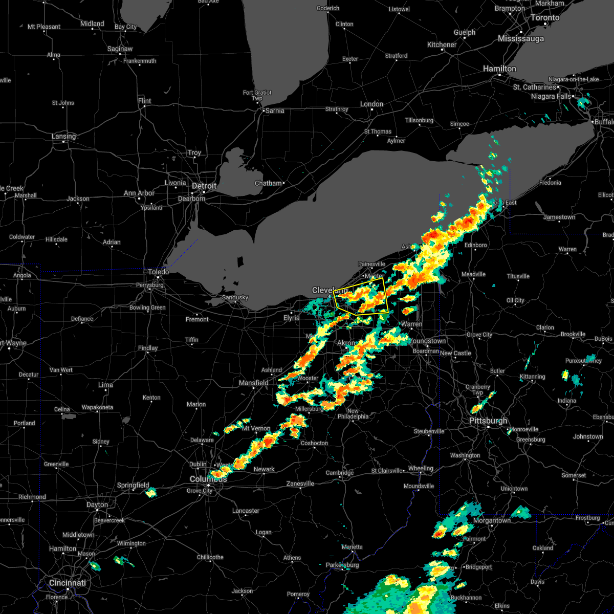 At 106 pm edt, a severe thunderstorm was located near highland hills, or 10 miles south of willowick, moving east at 45 mph (radar indicated). Hazards include 60 mph wind gusts. Expect damage to trees and power lines. Locations impacted include, cleveland, chardon, euclid, cleveland heights, solon, warrensville heights, south russell, middlefield, burton, highland hills, chesterland, garfield heights, shaker heights, maple heights, south euclid, mayfield heights, east cleveland, lyndhurst, university heights and bedford. At 106 pm edt, a severe thunderstorm was located near highland hills, or 10 miles south of willowick, moving east at 45 mph (radar indicated). Hazards include 60 mph wind gusts. Expect damage to trees and power lines. Locations impacted include, cleveland, chardon, euclid, cleveland heights, solon, warrensville heights, south russell, middlefield, burton, highland hills, chesterland, garfield heights, shaker heights, maple heights, south euclid, mayfield heights, east cleveland, lyndhurst, university heights and bedford.
|
| 6/21/2021 12:52 PM EDT |
 At 1252 pm edt, a severe thunderstorm was located over cleveland, moving east at 45 mph (radar indicated). Hazards include 60 mph wind gusts and quarter size hail. Minor damage to vehicles is possible. Expect damage to trees and power lines. At 1252 pm edt, a severe thunderstorm was located over cleveland, moving east at 45 mph (radar indicated). Hazards include 60 mph wind gusts and quarter size hail. Minor damage to vehicles is possible. Expect damage to trees and power lines.
|
| 6/21/2021 12:50 PM EDT | Large branch and power lines dow in cuyahoga county OH, 3 miles NNE of Cleveland, OH |
| 6/21/2021 6:33 AM EDT |
 At 633 am edt, severe thunderstorms were located along a line extending from near cleveland heights to near macedonia, moving east at 60 mph (radar indicated). Hazards include 60 mph wind gusts. Expect damage to trees and power lines. Locations impacted include, cleveland, parma, euclid, cleveland heights, strongsville, brunswick, north royalton, solon, warrensville heights, highland hills, garfield heights, shaker heights, maple heights, south euclid, parma heights, broadview heights, mayfield heights, east cleveland, middleburg heights and lyndhurst. At 633 am edt, severe thunderstorms were located along a line extending from near cleveland heights to near macedonia, moving east at 60 mph (radar indicated). Hazards include 60 mph wind gusts. Expect damage to trees and power lines. Locations impacted include, cleveland, parma, euclid, cleveland heights, strongsville, brunswick, north royalton, solon, warrensville heights, highland hills, garfield heights, shaker heights, maple heights, south euclid, parma heights, broadview heights, mayfield heights, east cleveland, middleburg heights and lyndhurst.
|
| 6/21/2021 6:14 AM EDT |
 At 613 am edt, severe thunderstorms were located along a line extending from lakewood to near strongsville, moving east at 50 mph (radar indicated). Hazards include 60 mph wind gusts. Expect damage to trees and power lines. Locations impacted include, cleveland, elyria, parma, lakewood, euclid, cleveland heights, strongsville, brunswick, westlake, north royalton, north ridgeville, solon, avon lake, warrensville heights, grafton, highland hills, north olmsted, garfield heights, shaker heights and maple heights. At 613 am edt, severe thunderstorms were located along a line extending from lakewood to near strongsville, moving east at 50 mph (radar indicated). Hazards include 60 mph wind gusts. Expect damage to trees and power lines. Locations impacted include, cleveland, elyria, parma, lakewood, euclid, cleveland heights, strongsville, brunswick, westlake, north royalton, north ridgeville, solon, avon lake, warrensville heights, grafton, highland hills, north olmsted, garfield heights, shaker heights and maple heights.
|
| 6/21/2021 5:38 AM EDT |
 At 538 am edt, severe thunderstorms were located along a line extending from near western vermilion to near milan, moving east at 55 mph (radar indicated). Hazards include 60 mph wind gusts. expect damage to trees and power lines At 538 am edt, severe thunderstorms were located along a line extending from near western vermilion to near milan, moving east at 55 mph (radar indicated). Hazards include 60 mph wind gusts. expect damage to trees and power lines
|
| 11/15/2020 1:10 PM EST | Multiple trees down... including one partially blocking shaker blv in cuyahoga county OH, 7 miles W of Cleveland, OH |
| 11/15/2020 1:07 PM EST | Storm damage reported in cuyahoga county OH, 5.9 miles NW of Cleveland, OH |
| 11/15/2020 1:01 PM EST | Roof damage to valley forge high schoo in cuyahoga county OH, 7.6 miles NNE of Cleveland, OH |
| 11/15/2020 12:59 PM EST | Asos station kbkl clevelan in cuyahoga county OH, 3.6 miles S of Cleveland, OH |
| 11/15/2020 12:58 PM EST |
 At 1258 pm est, severe thunderstorms were located along a line extending from near westlake to 10 miles east of utica, moving east at 55 mph (radar indicated). Hazards include 70 mph wind gusts. Expect considerable tree damage. damage is likely to mobile homes, roofs, and outbuildings. Locations impacted include, cleveland, akron, canton, painesville, willowick, ravenna, chardon, fairport harbor, millersburg, cuyahoga falls, euclid, mentor, cleveland heights, massillon, kent, barberton, green, solon, alliance and willoughby. At 1258 pm est, severe thunderstorms were located along a line extending from near westlake to 10 miles east of utica, moving east at 55 mph (radar indicated). Hazards include 70 mph wind gusts. Expect considerable tree damage. damage is likely to mobile homes, roofs, and outbuildings. Locations impacted include, cleveland, akron, canton, painesville, willowick, ravenna, chardon, fairport harbor, millersburg, cuyahoga falls, euclid, mentor, cleveland heights, massillon, kent, barberton, green, solon, alliance and willoughby.
|
| 11/15/2020 12:57 PM EST |
 At 1256 pm est, severe thunderstorms were located along a line extending from 11 miles north of avon lake to 7 miles southwest of loudonville, moving east at 50 mph. at 12:53 pm, cleveland hopkins airport reported a 62 knot wind gust (radar indicated). Hazards include 70 mph wind gusts. Expect considerable tree damage. damage is likely to mobile homes, roofs, and outbuildings. Locations impacted include, cleveland, medina, wooster, millersburg, parma, lakewood, strongsville, brunswick, westlake, north royalton, north ridgeville, avon lake, wadsworth, grafton, rittman, lodi, creston, shreve, west salem and killbuck. At 1256 pm est, severe thunderstorms were located along a line extending from 11 miles north of avon lake to 7 miles southwest of loudonville, moving east at 50 mph. at 12:53 pm, cleveland hopkins airport reported a 62 knot wind gust (radar indicated). Hazards include 70 mph wind gusts. Expect considerable tree damage. damage is likely to mobile homes, roofs, and outbuildings. Locations impacted include, cleveland, medina, wooster, millersburg, parma, lakewood, strongsville, brunswick, westlake, north royalton, north ridgeville, avon lake, wadsworth, grafton, rittman, lodi, creston, shreve, west salem and killbuck.
|
| 11/15/2020 12:54 PM EST |
 At 1254 pm est, severe thunderstorms were located along a line extending from 12 miles north of lakewood to near loudonville, moving east at 50 mph (radar indicated). Hazards include 60 mph wind gusts. Expect damage to trees and power lines. Locations impacted include, cleveland, medina, wooster, millersburg, parma, lakewood, strongsville, brunswick, westlake, north royalton, north ridgeville, avon lake, wadsworth, grafton, rittman, lodi, creston, shreve, west salem and killbuck. At 1254 pm est, severe thunderstorms were located along a line extending from 12 miles north of lakewood to near loudonville, moving east at 50 mph (radar indicated). Hazards include 60 mph wind gusts. Expect damage to trees and power lines. Locations impacted include, cleveland, medina, wooster, millersburg, parma, lakewood, strongsville, brunswick, westlake, north royalton, north ridgeville, avon lake, wadsworth, grafton, rittman, lodi, creston, shreve, west salem and killbuck.
|
| 11/15/2020 12:51 PM EST |
 At 1251 pm est, severe thunderstorms were located along a line extending from near westlake to 10 miles east of utica, moving east at 55 mph (radar indicated). Hazards include 60 mph wind gusts. expect damage to trees and power lines At 1251 pm est, severe thunderstorms were located along a line extending from near westlake to 10 miles east of utica, moving east at 55 mph (radar indicated). Hazards include 60 mph wind gusts. expect damage to trees and power lines
|
| 11/15/2020 12:50 PM EST | Asos station kcle clevelan in cuyahoga county OH, 8.8 miles ENE of Cleveland, OH |
| 11/15/2020 12:46 PM EST |
 At 1244 pm est, severe thunderstorms were located along a line extending from 10 miles north of avon lake to 8 miles northwest of danville, moving east at 50 mph (radar indicated). Hazards include 60 mph wind gusts. Expect damage to trees and power lines. Locations impacted include, cleveland, lorain, elyria, medina, wooster, ashland, millersburg, parma, lakewood, strongsville, brunswick, westlake, north royalton, north ridgeville, avon lake, wadsworth, grafton, rittman, wellington and lodi. At 1244 pm est, severe thunderstorms were located along a line extending from 10 miles north of avon lake to 8 miles northwest of danville, moving east at 50 mph (radar indicated). Hazards include 60 mph wind gusts. Expect damage to trees and power lines. Locations impacted include, cleveland, lorain, elyria, medina, wooster, ashland, millersburg, parma, lakewood, strongsville, brunswick, westlake, north royalton, north ridgeville, avon lake, wadsworth, grafton, rittman, wellington and lodi.
|
| 11/15/2020 12:19 PM EST |
 At 1219 pm est, severe thunderstorms were located along a line extending from 11 miles north of vermilion to near chesterville, moving east at 50 mph (radar indicated). Hazards include 60 mph wind gusts. expect damage to trees and power lines At 1219 pm est, severe thunderstorms were located along a line extending from 11 miles north of vermilion to near chesterville, moving east at 50 mph (radar indicated). Hazards include 60 mph wind gusts. expect damage to trees and power lines
|
| 10/23/2020 7:42 PM EDT | Tree down on wires. time estimated from rada in cuyahoga county OH, 11.6 miles WSW of Cleveland, OH |
| 10/23/2020 7:40 PM EDT |
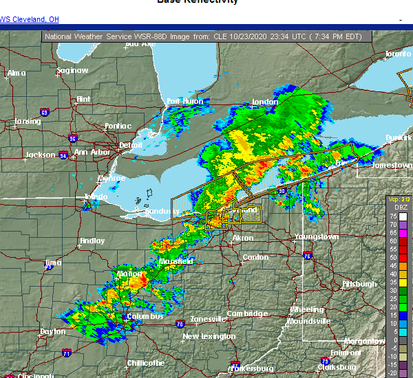 At 740 pm edt, a severe thunderstorm was located near highland hills, or 9 miles south of willowick, moving northeast at 50 mph (radar indicated). Hazards include 60 mph wind gusts and penny size hail. expect damage to trees and power lines At 740 pm edt, a severe thunderstorm was located near highland hills, or 9 miles south of willowick, moving northeast at 50 mph (radar indicated). Hazards include 60 mph wind gusts and penny size hail. expect damage to trees and power lines
|
| 10/23/2020 7:37 PM EDT | Road closed due to large tree across the road. time estimated via rada in cuyahoga county OH, 5.3 miles WSW of Cleveland, OH |
| 10/23/2020 7:32 PM EDT |
 At 731 pm edt, severe thunderstorms were located along a line extending from 8 miles west of lakeline to cleveland to strongsville, moving east at 50 mph (radar indicated). Hazards include 60 mph wind gusts and penny size hail. Expect damage to trees and power lines. Locations impacted include, cleveland, parma, lakewood, euclid, cleveland heights, strongsville, brunswick, north royalton, solon, eastlake, warrensville heights, highland hills, timberlake, lakeline, garfield heights, shaker heights, maple heights, south euclid, parma heights and rocky river. At 731 pm edt, severe thunderstorms were located along a line extending from 8 miles west of lakeline to cleveland to strongsville, moving east at 50 mph (radar indicated). Hazards include 60 mph wind gusts and penny size hail. Expect damage to trees and power lines. Locations impacted include, cleveland, parma, lakewood, euclid, cleveland heights, strongsville, brunswick, north royalton, solon, eastlake, warrensville heights, highland hills, timberlake, lakeline, garfield heights, shaker heights, maple heights, south euclid, parma heights and rocky river.
|
| 10/23/2020 7:25 PM EDT | 51 knot peak wind. mesonet station xcle cleveland - edgewate in lez146 county OH, 2.9 miles SE of Cleveland, OH |
| 10/23/2020 7:24 PM EDT |
 At 723 pm edt, severe thunderstorms were located along a line extending from 9 miles northwest of euclid to near lakewood to near strongsville, moving northeast at 50 mph (radar indicated). Hazards include 60 mph wind gusts and penny size hail. Expect damage to trees and power lines. Locations impacted include, cleveland, parma, lakewood, euclid, cleveland heights, strongsville, brunswick, westlake, north royalton, north ridgeville, solon, eastlake, warrensville heights, grafton, highland hills, timberlake, lakeline, north olmsted, garfield heights and shaker heights. At 723 pm edt, severe thunderstorms were located along a line extending from 9 miles northwest of euclid to near lakewood to near strongsville, moving northeast at 50 mph (radar indicated). Hazards include 60 mph wind gusts and penny size hail. Expect damage to trees and power lines. Locations impacted include, cleveland, parma, lakewood, euclid, cleveland heights, strongsville, brunswick, westlake, north royalton, north ridgeville, solon, eastlake, warrensville heights, grafton, highland hills, timberlake, lakeline, north olmsted, garfield heights and shaker heights.
|
| 10/23/2020 7:05 PM EDT |
 At 705 pm edt, severe thunderstorms were located along a line extending from 12 miles northwest of avon lake to near elyria to near wellington, moving east at 50 mph (radar indicated). Hazards include 70 mph wind gusts and penny size hail. Expect considerable tree damage. Damage is likely to mobile homes, roofs, and outbuildings. At 705 pm edt, severe thunderstorms were located along a line extending from 12 miles northwest of avon lake to near elyria to near wellington, moving east at 50 mph (radar indicated). Hazards include 70 mph wind gusts and penny size hail. Expect considerable tree damage. Damage is likely to mobile homes, roofs, and outbuildings.
|
| 10/23/2020 6:44 PM EDT |
 At 644 pm edt, a severe thunderstorm was located over cleveland, moving northeast at 35 mph (radar indicated). Hazards include 60 mph wind gusts and quarter size hail. Minor damage to vehicles is possible. Expect damage to trees and power lines. At 644 pm edt, a severe thunderstorm was located over cleveland, moving northeast at 35 mph (radar indicated). Hazards include 60 mph wind gusts and quarter size hail. Minor damage to vehicles is possible. Expect damage to trees and power lines.
|
| 10/23/2020 6:39 PM EDT |
 The severe thunderstorm warning for southwestern geauga, northeastern cuyahoga and southwestern lake counties will expire at 645 pm edt, the storm which prompted the warning has weakened below severe limits, and no longer poses an immediate threat to life or property. therefore, the warning will be allowed to expire. however gusty winds are likely with the line of approaching storms. The severe thunderstorm warning for southwestern geauga, northeastern cuyahoga and southwestern lake counties will expire at 645 pm edt, the storm which prompted the warning has weakened below severe limits, and no longer poses an immediate threat to life or property. therefore, the warning will be allowed to expire. however gusty winds are likely with the line of approaching storms.
|
| 10/23/2020 6:37 PM EDT |
 At 636 pm edt, a severe thunderstorm was located over lakewood, or near cleveland, moving northeast at 35 mph (radar indicated. a nws employee reported quarter-size hail in lakewood). Hazards include 60 mph wind gusts and quarter size hail. Minor damage to vehicles is possible. expect damage to trees and power lines. Locations impacted include, cleveland, lakewood, westlake, north olmsted, rocky river, brook park, east cleveland, fairview park, bay village, brooklyn and linndale. At 636 pm edt, a severe thunderstorm was located over lakewood, or near cleveland, moving northeast at 35 mph (radar indicated. a nws employee reported quarter-size hail in lakewood). Hazards include 60 mph wind gusts and quarter size hail. Minor damage to vehicles is possible. expect damage to trees and power lines. Locations impacted include, cleveland, lakewood, westlake, north olmsted, rocky river, brook park, east cleveland, fairview park, bay village, brooklyn and linndale.
|
| 10/23/2020 6:27 PM EDT | Trees down at w 210th st and lorain rd and on w 229th st south of lorain r in cuyahoga county OH, 8.2 miles E of Cleveland, OH |
| 10/23/2020 6:27 PM EDT |
 At 627 pm edt, a severe thunderstorm was located near lakewood, or 9 miles southwest of cleveland, moving northeast at 40 mph (radar indicated). Hazards include 60 mph wind gusts and quarter size hail. Minor damage to vehicles is possible. expect damage to trees and power lines. Locations impacted include, cleveland, parma, lakewood, cleveland heights, strongsville, westlake, north royalton, north ridgeville, north olmsted, garfield heights, shaker heights, avon, parma heights, rocky river, brook park, berea, east cleveland, fairview park, middleburg heights and bay village. At 627 pm edt, a severe thunderstorm was located near lakewood, or 9 miles southwest of cleveland, moving northeast at 40 mph (radar indicated). Hazards include 60 mph wind gusts and quarter size hail. Minor damage to vehicles is possible. expect damage to trees and power lines. Locations impacted include, cleveland, parma, lakewood, cleveland heights, strongsville, westlake, north royalton, north ridgeville, north olmsted, garfield heights, shaker heights, avon, parma heights, rocky river, brook park, berea, east cleveland, fairview park, middleburg heights and bay village.
|
| 10/23/2020 6:19 PM EDT |
 At 619 pm edt, a severe thunderstorm was located near westlake, or 10 miles east of elyria, moving northeast at 40 mph (radar indicated). Hazards include 60 mph wind gusts and quarter size hail. Minor damage to vehicles is possible. Expect damage to trees and power lines. At 619 pm edt, a severe thunderstorm was located near westlake, or 10 miles east of elyria, moving northeast at 40 mph (radar indicated). Hazards include 60 mph wind gusts and quarter size hail. Minor damage to vehicles is possible. Expect damage to trees and power lines.
|
| 10/23/2020 6:10 PM EDT |
 At 609 pm edt, a severe thunderstorm was located over warrensville heights, or 10 miles southeast of cleveland, moving northeast at 35 mph (radar indicated). Hazards include 60 mph wind gusts and quarter size hail. Minor damage to vehicles is possible. Expect damage to trees and power lines. At 609 pm edt, a severe thunderstorm was located over warrensville heights, or 10 miles southeast of cleveland, moving northeast at 35 mph (radar indicated). Hazards include 60 mph wind gusts and quarter size hail. Minor damage to vehicles is possible. Expect damage to trees and power lines.
|
| 8/28/2020 4:21 PM EDT |
 The severe thunderstorm warning for cuyahoga and northeastern lorain counties will expire at 430 pm edt, the storm which prompted the warning has weakened below severe limits, and no longer poses an immediate threat to life or property. therefore, the warning will be allowed to expire. however heavy rain is still possible with this thunderstorm. The severe thunderstorm warning for cuyahoga and northeastern lorain counties will expire at 430 pm edt, the storm which prompted the warning has weakened below severe limits, and no longer poses an immediate threat to life or property. therefore, the warning will be allowed to expire. however heavy rain is still possible with this thunderstorm.
|
| 8/28/2020 4:10 PM EDT |
 At 410 pm edt, a severe thunderstorm was located near cleveland heights, or near cleveland, moving northeast at 35 mph (radar indicated). Hazards include 60 mph wind gusts. Expect damage to trees and power lines. Locations impacted include, cleveland, elyria, parma, lakewood, euclid, cleveland heights, westlake, north royalton, north ridgeville, solon, warrensville heights, highland hills, north olmsted, garfield heights, shaker heights, maple heights, south euclid, avon, parma heights and rocky river. At 410 pm edt, a severe thunderstorm was located near cleveland heights, or near cleveland, moving northeast at 35 mph (radar indicated). Hazards include 60 mph wind gusts. Expect damage to trees and power lines. Locations impacted include, cleveland, elyria, parma, lakewood, euclid, cleveland heights, westlake, north royalton, north ridgeville, solon, warrensville heights, highland hills, north olmsted, garfield heights, shaker heights, maple heights, south euclid, avon, parma heights and rocky river.
|
| 8/28/2020 3:56 PM EDT |
 At 355 pm edt, a severe thunderstorm was located over parma, or 8 miles south of cleveland, moving northeast at 35 mph (radar indicated). Hazards include 60 mph wind gusts and penny size hail. Expect damage to trees and power lines. Locations impacted include, cleveland, elyria, parma, lakewood, euclid, cleveland heights, strongsville, westlake, north royalton, north ridgeville, solon, warrensville heights, grafton, highland hills, north olmsted, garfield heights, shaker heights, maple heights, south euclid and avon. At 355 pm edt, a severe thunderstorm was located over parma, or 8 miles south of cleveland, moving northeast at 35 mph (radar indicated). Hazards include 60 mph wind gusts and penny size hail. Expect damage to trees and power lines. Locations impacted include, cleveland, elyria, parma, lakewood, euclid, cleveland heights, strongsville, westlake, north royalton, north ridgeville, solon, warrensville heights, grafton, highland hills, north olmsted, garfield heights, shaker heights, maple heights, south euclid and avon.
|
| 8/28/2020 3:41 PM EDT |
 At 341 pm edt, a severe thunderstorm was located over strongsville, or 11 miles north of medina, moving northeast at 35 mph (radar indicated). Hazards include 60 mph wind gusts and quarter size hail. Minor damage to vehicles is possible. expect damage to trees and power lines. Locations impacted include, cleveland, elyria, medina, parma, lakewood, euclid, cleveland heights, strongsville, brunswick, westlake, north royalton, north ridgeville, solon, warrensville heights, grafton, highland hills, north olmsted, garfield heights, shaker heights and maple heights. At 341 pm edt, a severe thunderstorm was located over strongsville, or 11 miles north of medina, moving northeast at 35 mph (radar indicated). Hazards include 60 mph wind gusts and quarter size hail. Minor damage to vehicles is possible. expect damage to trees and power lines. Locations impacted include, cleveland, elyria, medina, parma, lakewood, euclid, cleveland heights, strongsville, brunswick, westlake, north royalton, north ridgeville, solon, warrensville heights, grafton, highland hills, north olmsted, garfield heights, shaker heights and maple heights.
|
| 8/28/2020 3:26 PM EDT |
 At 326 pm edt, a severe thunderstorm was located near grafton, or 7 miles northwest of medina, moving northeast at 35 mph (radar indicated). Hazards include 60 mph wind gusts and quarter size hail. Minor damage to vehicles is possible. Expect damage to trees and power lines. At 326 pm edt, a severe thunderstorm was located near grafton, or 7 miles northwest of medina, moving northeast at 35 mph (radar indicated). Hazards include 60 mph wind gusts and quarter size hail. Minor damage to vehicles is possible. Expect damage to trees and power lines.
|
| 7/27/2020 4:36 PM EDT |
 The severe thunderstorm warning for central cuyahoga county will expire at 445 pm edt, the storm which prompted the warning has weakened below severe limits, and has exited the warned area. therefore, the warning will be allowed to expire. however heavy rain is still possible with this thunderstorm. The severe thunderstorm warning for central cuyahoga county will expire at 445 pm edt, the storm which prompted the warning has weakened below severe limits, and has exited the warned area. therefore, the warning will be allowed to expire. however heavy rain is still possible with this thunderstorm.
|
| 7/27/2020 4:25 PM EDT |
 At 425 pm edt, a severe thunderstorm was located over lakewood, or near cleveland, moving east at 20 mph (radar indicated). Hazards include 60 mph wind gusts. Expect damage to trees and power lines. Locations impacted include, cleveland, parma, lakewood, garfield heights, parma heights, brook park, seven hills, brooklyn, independence, newburgh heights, valley view, brooklyn heights, cuyahoga heights and linndale. At 425 pm edt, a severe thunderstorm was located over lakewood, or near cleveland, moving east at 20 mph (radar indicated). Hazards include 60 mph wind gusts. Expect damage to trees and power lines. Locations impacted include, cleveland, parma, lakewood, garfield heights, parma heights, brook park, seven hills, brooklyn, independence, newburgh heights, valley view, brooklyn heights, cuyahoga heights and linndale.
|
| 7/27/2020 3:55 PM EDT |
 At 355 pm edt, a severe thunderstorm was located over north ridgeville, or near elyria, moving east at 20 mph (radar indicated). Hazards include 60 mph wind gusts. expect damage to trees and power lines At 355 pm edt, a severe thunderstorm was located over north ridgeville, or near elyria, moving east at 20 mph (radar indicated). Hazards include 60 mph wind gusts. expect damage to trees and power lines
|
| 7/19/2020 5:43 PM EDT |
 At 541 pm edt, severe thunderstorms were located along a line extending from cleveland to near parma to near macedonia to hinckley, moving east at 50 mph (radar indicated). Hazards include 60 mph wind gusts. Expect damage to trees and power lines. Locations impacted include, cleveland, parma, lakewood, cuyahoga falls, euclid, cleveland heights, strongsville, brunswick, north royalton, solon, hudson, twinsburg, warrensville heights, macedonia, highland hills, stow, garfield heights, shaker heights and maple heights. At 541 pm edt, severe thunderstorms were located along a line extending from cleveland to near parma to near macedonia to hinckley, moving east at 50 mph (radar indicated). Hazards include 60 mph wind gusts. Expect damage to trees and power lines. Locations impacted include, cleveland, parma, lakewood, cuyahoga falls, euclid, cleveland heights, strongsville, brunswick, north royalton, solon, hudson, twinsburg, warrensville heights, macedonia, highland hills, stow, garfield heights, shaker heights and maple heights.
|
| 7/19/2020 5:18 PM EDT |
 At 517 pm edt, severe thunderstorms were located along a line extending from near avon lake to north ridgeville to grafton, moving east at 50 mph (radar indicated). Hazards include 60 mph wind gusts. expect damage to trees and power lines At 517 pm edt, severe thunderstorms were located along a line extending from near avon lake to north ridgeville to grafton, moving east at 50 mph (radar indicated). Hazards include 60 mph wind gusts. expect damage to trees and power lines
|
| 6/27/2020 12:23 AM EDT |
 At 1222 am edt, a severe thunderstorm was located over warrensville heights, or 10 miles southeast of cleveland, moving southeast at 30 mph (radar indicated). Hazards include 70 mph wind gusts and quarter size hail. Minor damage to vehicles is possible. expect considerable tree damage. Wind damage is also likely to mobile homes, roofs, and outbuildings. At 1222 am edt, a severe thunderstorm was located over warrensville heights, or 10 miles southeast of cleveland, moving southeast at 30 mph (radar indicated). Hazards include 70 mph wind gusts and quarter size hail. Minor damage to vehicles is possible. expect considerable tree damage. Wind damage is also likely to mobile homes, roofs, and outbuildings.
|
| 6/27/2020 12:11 AM EDT |
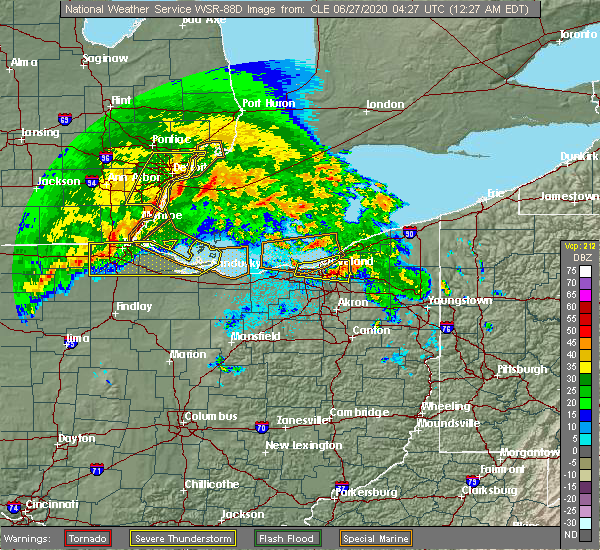 At 1211 am edt, a severe thunderstorm was located near cleveland heights, or near cleveland, moving east at 30 mph (radar indicated). Hazards include 60 mph wind gusts and quarter size hail. Minor damage to vehicles is possible. expect damage to trees and power lines. Locations impacted include, cleveland, parma, euclid, cleveland heights, solon, warrensville heights, highland hills, garfield heights, shaker heights, maple heights, south euclid, parma heights, mayfield heights, east cleveland, lyndhurst, university heights, bedford, wickliffe, beachwood and seven hills. At 1211 am edt, a severe thunderstorm was located near cleveland heights, or near cleveland, moving east at 30 mph (radar indicated). Hazards include 60 mph wind gusts and quarter size hail. Minor damage to vehicles is possible. expect damage to trees and power lines. Locations impacted include, cleveland, parma, euclid, cleveland heights, solon, warrensville heights, highland hills, garfield heights, shaker heights, maple heights, south euclid, parma heights, mayfield heights, east cleveland, lyndhurst, university heights, bedford, wickliffe, beachwood and seven hills.
|
| 6/26/2020 11:53 PM EDT |
 A severe thunderstorm warning remains in effect until 1230 am edt for cuyahoga county. at 1152 pm edt, a severe thunderstorm was located near lakewood, or near cleveland, moving east at 30 mph. hazard. 60 mph wind gusts and quarter size hail. source. Radar indicated. A severe thunderstorm warning remains in effect until 1230 am edt for cuyahoga county. at 1152 pm edt, a severe thunderstorm was located near lakewood, or near cleveland, moving east at 30 mph. hazard. 60 mph wind gusts and quarter size hail. source. Radar indicated.
|
| 6/26/2020 11:23 PM EDT |
 At 1123 pm edt, a severe thunderstorm was located 7 miles northwest of avon lake, or 9 miles northeast of lorain, moving east at 30 mph (radar indicated). Hazards include 70 mph wind gusts and half dollar size hail. People and animals outdoors will be injured. expect hail damage to roofs, siding, windows, and vehicles. expect considerable tree damage. Wind damage is also likely to mobile homes, roofs, and outbuildings. At 1123 pm edt, a severe thunderstorm was located 7 miles northwest of avon lake, or 9 miles northeast of lorain, moving east at 30 mph (radar indicated). Hazards include 70 mph wind gusts and half dollar size hail. People and animals outdoors will be injured. expect hail damage to roofs, siding, windows, and vehicles. expect considerable tree damage. Wind damage is also likely to mobile homes, roofs, and outbuildings.
|
| 6/10/2020 8:28 PM EDT |
 The severe thunderstorm warning for cuyahoga county will expire at 830 pm edt, the storm which prompted the warning has weakened below severe limits, and no longer poses an immediate threat to life or property. therefore, the warning will be allowed to expire. however gusty winds are still possible with this thunderstorm. a severe thunderstorm watch remains in effect until 1000 pm edt for northeastern ohio. a severe thunderstorm watch also remains in effect until 100 am edt for northeastern ohio. The severe thunderstorm warning for cuyahoga county will expire at 830 pm edt, the storm which prompted the warning has weakened below severe limits, and no longer poses an immediate threat to life or property. therefore, the warning will be allowed to expire. however gusty winds are still possible with this thunderstorm. a severe thunderstorm watch remains in effect until 1000 pm edt for northeastern ohio. a severe thunderstorm watch also remains in effect until 100 am edt for northeastern ohio.
|
| 6/10/2020 8:17 PM EDT |
 At 816 pm edt, a severe thunderstorm was located over fairport harbor, moving northeast at 60 mph (radar indicated). Hazards include 60 mph wind gusts. Expect damage to trees and power lines. Locations impacted include, cleveland, parma, lakewood, euclid, cleveland heights, strongsville, north royalton, solon, warrensville heights, highland hills, garfield heights, shaker heights, maple heights, south euclid, parma heights, rocky river, broadview heights, brook park, mayfield heights and east cleveland. At 816 pm edt, a severe thunderstorm was located over fairport harbor, moving northeast at 60 mph (radar indicated). Hazards include 60 mph wind gusts. Expect damage to trees and power lines. Locations impacted include, cleveland, parma, lakewood, euclid, cleveland heights, strongsville, north royalton, solon, warrensville heights, highland hills, garfield heights, shaker heights, maple heights, south euclid, parma heights, rocky river, broadview heights, brook park, mayfield heights and east cleveland.
|
| 6/10/2020 8:03 PM EDT | Several trees dow in cuyahoga county OH, 7 miles WSW of Cleveland, OH |
| 6/10/2020 7:55 PM EDT |
 At 755 pm edt, severe thunderstorms were located along a line extending from 8 miles northwest of lakeline to near parma, moving northeast at 55 mph (radar indicated). Hazards include 70 mph wind gusts and penny size hail. Expect considerable tree damage. Damage is likely to mobile homes, roofs, and outbuildings. At 755 pm edt, severe thunderstorms were located along a line extending from 8 miles northwest of lakeline to near parma, moving northeast at 55 mph (radar indicated). Hazards include 70 mph wind gusts and penny size hail. Expect considerable tree damage. Damage is likely to mobile homes, roofs, and outbuildings.
|
| 6/10/2020 7:54 PM EDT |
 At 753 pm edt, a severe thunderstorm was located near cleveland, moving northeast at 50 mph (radar indicated). Hazards include 70 mph wind gusts and nickel size hail. Expect considerable tree damage. damage is likely to mobile homes, roofs, and outbuildings. Locations impacted include, cleveland, parma, lakewood, euclid, cleveland heights, strongsville, brunswick, westlake, north royalton, solon, warrensville heights, highland hills, north olmsted, garfield heights, shaker heights, maple heights, south euclid, parma heights, rocky river and broadview heights. At 753 pm edt, a severe thunderstorm was located near cleveland, moving northeast at 50 mph (radar indicated). Hazards include 70 mph wind gusts and nickel size hail. Expect considerable tree damage. damage is likely to mobile homes, roofs, and outbuildings. Locations impacted include, cleveland, parma, lakewood, euclid, cleveland heights, strongsville, brunswick, westlake, north royalton, solon, warrensville heights, highland hills, north olmsted, garfield heights, shaker heights, maple heights, south euclid, parma heights, rocky river and broadview heights.
|
| 6/10/2020 7:23 PM EDT |
 At 722 pm edt, a severe thunderstorm was located near grafton, or near elyria, moving northeast at 60 mph (radar indicated). Hazards include 70 mph wind gusts and nickel size hail. Expect considerable tree damage. Damage is likely to mobile homes, roofs, and outbuildings. At 722 pm edt, a severe thunderstorm was located near grafton, or near elyria, moving northeast at 60 mph (radar indicated). Hazards include 70 mph wind gusts and nickel size hail. Expect considerable tree damage. Damage is likely to mobile homes, roofs, and outbuildings.
|
| 5/14/2020 6:41 PM EDT |
 The severe thunderstorm warning for southwestern cuyahoga county will expire at 645 pm edt, the storms which prompted the warning have weakened below severe limits, and no longer pose an immediate threat to life or property. therefore, the warning will be allowed to expire. however gusty winds are still possible with these thunderstorms. The severe thunderstorm warning for southwestern cuyahoga county will expire at 645 pm edt, the storms which prompted the warning have weakened below severe limits, and no longer pose an immediate threat to life or property. therefore, the warning will be allowed to expire. however gusty winds are still possible with these thunderstorms.
|
| 5/14/2020 6:32 PM EDT |
 At 631 pm edt, severe thunderstorms were located along a line extending from near lakewood to near parma to north royalton, moving northeast at 50 mph (radar indicated). Hazards include 60 mph wind gusts. Expect damage to trees and power lines. Locations impacted include, cleveland, parma, lakewood, strongsville, westlake, north royalton, north olmsted, garfield heights, parma heights, rocky river, broadview heights, brook park, berea, fairview park, middleburg heights, bay village, brecksville, seven hills, brooklyn and olmsted falls. At 631 pm edt, severe thunderstorms were located along a line extending from near lakewood to near parma to north royalton, moving northeast at 50 mph (radar indicated). Hazards include 60 mph wind gusts. Expect damage to trees and power lines. Locations impacted include, cleveland, parma, lakewood, strongsville, westlake, north royalton, north olmsted, garfield heights, parma heights, rocky river, broadview heights, brook park, berea, fairview park, middleburg heights, bay village, brecksville, seven hills, brooklyn and olmsted falls.
|
| 5/14/2020 6:12 PM EDT |
 At 611 pm edt, severe thunderstorms were located along a line extending from near north ridgeville to near grafton to 8 miles east of wellington, moving northeast at 45 mph. the strongest portion of this line is in southeast lorain county, south of grafton (radar indicated). Hazards include 60 mph wind gusts. Expect damage to trees and power lines. Locations impacted include, cleveland, lorain, elyria, parma, lakewood, strongsville, westlake, north royalton, north ridgeville, avon lake, grafton, north olmsted, garfield heights, avon, parma heights, rocky river, broadview heights, brook park, berea and fairview park. At 611 pm edt, severe thunderstorms were located along a line extending from near north ridgeville to near grafton to 8 miles east of wellington, moving northeast at 45 mph. the strongest portion of this line is in southeast lorain county, south of grafton (radar indicated). Hazards include 60 mph wind gusts. Expect damage to trees and power lines. Locations impacted include, cleveland, lorain, elyria, parma, lakewood, strongsville, westlake, north royalton, north ridgeville, avon lake, grafton, north olmsted, garfield heights, avon, parma heights, rocky river, broadview heights, brook park, berea and fairview park.
|
| 5/14/2020 5:57 PM EDT |
 At 555 pm edt, severe thunderstorms were located along a line extending from near kipton to near rochester, moving east at 40 mph. another storm was located near grafton, also moving east at 40 mph (radar indicated). Hazards include 60 mph wind gusts and penny size hail. Expect damage to trees and power lines. Locations impacted include, cleveland, lorain, elyria, western vermilion, vermilion, parma, lakewood, strongsville, westlake, north royalton, north ridgeville, avon lake, amherst, grafton, wellington, north olmsted, garfield heights, avon, parma heights and rocky river. At 555 pm edt, severe thunderstorms were located along a line extending from near kipton to near rochester, moving east at 40 mph. another storm was located near grafton, also moving east at 40 mph (radar indicated). Hazards include 60 mph wind gusts and penny size hail. Expect damage to trees and power lines. Locations impacted include, cleveland, lorain, elyria, western vermilion, vermilion, parma, lakewood, strongsville, westlake, north royalton, north ridgeville, avon lake, amherst, grafton, wellington, north olmsted, garfield heights, avon, parma heights and rocky river.
|
| 5/14/2020 5:37 PM EDT |
 At 537 pm edt, a severe thunderstorm was located near amherst, or near elyria, moving northeast at 55 mph (radar indicated). Hazards include 60 mph wind gusts. expect damage to trees and power lines At 537 pm edt, a severe thunderstorm was located near amherst, or near elyria, moving northeast at 55 mph (radar indicated). Hazards include 60 mph wind gusts. expect damage to trees and power lines
|
| 4/7/2020 11:34 PM EDT |
 At 1134 pm edt, severe thunderstorms were located along a line extending from highland hills to 7 miles west of medina to 6 miles southwest of wakeman, moving southeast at 70 mph (radar indicated). Hazards include 70 mph wind gusts and quarter size hail. Minor damage to vehicles is possible. expect considerable tree damage. wind damage is also likely to mobile homes, roofs, and outbuildings. Locations impacted include, cleveland, akron, lorain, elyria, medina, ravenna, vermilion, parma, lakewood, cuyahoga falls, euclid, cleveland heights, strongsville, brunswick, westlake, north royalton, north ridgeville, kent, barberton and solon. At 1134 pm edt, severe thunderstorms were located along a line extending from highland hills to 7 miles west of medina to 6 miles southwest of wakeman, moving southeast at 70 mph (radar indicated). Hazards include 70 mph wind gusts and quarter size hail. Minor damage to vehicles is possible. expect considerable tree damage. wind damage is also likely to mobile homes, roofs, and outbuildings. Locations impacted include, cleveland, akron, lorain, elyria, medina, ravenna, vermilion, parma, lakewood, cuyahoga falls, euclid, cleveland heights, strongsville, brunswick, westlake, north royalton, north ridgeville, kent, barberton and solon.
|
| 4/7/2020 11:18 PM EDT |
 At 1118 pm edt, a severe thunderstorm was located near south russell, or 15 miles southwest of chardon, moving east at 45 mph (radar indicated). Hazards include two inch hail and 60 mph wind gusts. People and animals outdoors will be injured. expect hail damage to roofs, siding, windows, and vehicles. expect damage to trees and power lines. Locations impacted include, cleveland, parma, cleveland heights, north royalton, solon, twinsburg, streetsboro, warrensville heights, macedonia, south russell, middlefield, garrettsville, burton, highland hills, mantua, garfield heights, shaker heights, maple heights, south euclid and parma heights. At 1118 pm edt, a severe thunderstorm was located near south russell, or 15 miles southwest of chardon, moving east at 45 mph (radar indicated). Hazards include two inch hail and 60 mph wind gusts. People and animals outdoors will be injured. expect hail damage to roofs, siding, windows, and vehicles. expect damage to trees and power lines. Locations impacted include, cleveland, parma, cleveland heights, north royalton, solon, twinsburg, streetsboro, warrensville heights, macedonia, south russell, middlefield, garrettsville, burton, highland hills, mantua, garfield heights, shaker heights, maple heights, south euclid and parma heights.
|
| 4/7/2020 11:17 PM EDT |
 At 1117 pm edt, severe thunderstorms were located along a line extending from 6 miles north of cleveland to 6 miles south of amherst to near northern milan, moving south at 50 mph (trained weather spotters reported half dollar size hail in avon recently). Hazards include 70 mph wind gusts and half dollar size hail. People and animals outdoors will be injured. expect hail damage to roofs, siding, windows, and vehicles. expect considerable tree damage. wind damage is also likely to mobile homes, roofs, and outbuildings. Locations impacted include, cleveland, akron, lorain, elyria, medina, sandusky, ravenna, western vermilion, vermilion, parma, lakewood, cuyahoga falls, euclid, cleveland heights, strongsville, brunswick, westlake, north royalton, north ridgeville and kent. At 1117 pm edt, severe thunderstorms were located along a line extending from 6 miles north of cleveland to 6 miles south of amherst to near northern milan, moving south at 50 mph (trained weather spotters reported half dollar size hail in avon recently). Hazards include 70 mph wind gusts and half dollar size hail. People and animals outdoors will be injured. expect hail damage to roofs, siding, windows, and vehicles. expect considerable tree damage. wind damage is also likely to mobile homes, roofs, and outbuildings. Locations impacted include, cleveland, akron, lorain, elyria, medina, sandusky, ravenna, western vermilion, vermilion, parma, lakewood, cuyahoga falls, euclid, cleveland heights, strongsville, brunswick, westlake, north royalton, north ridgeville and kent.
|
| 4/7/2020 11:12 PM EDT | Hen Egg sized hail reported 2.8 miles WNW of Cleveland, OH, 1.5 to 2 inch hail in slavic village in cleveland... near fleet ave and e 65th. |
| 4/7/2020 11:12 PM EDT |
 At 1112 pm edt, severe thunderstorms were located along a line extending from 11 miles north of conneaut to 9 miles northwest of euclid, moving southeast at 60 mph (radar indicated). Hazards include 60 mph wind gusts and quarter size hail. Minor damage to vehicles is possible. Expect damage to trees and power lines. At 1112 pm edt, severe thunderstorms were located along a line extending from 11 miles north of conneaut to 9 miles northwest of euclid, moving southeast at 60 mph (radar indicated). Hazards include 60 mph wind gusts and quarter size hail. Minor damage to vehicles is possible. Expect damage to trees and power lines.
|
| 4/7/2020 11:01 PM EDT |
 At 1100 pm edt, severe thunderstorms were located along a line extending from 16 miles northwest of lakeline to near lorain to 7 miles east of sandusky, moving southeast at 55 mph (radar indicated). Hazards include 60 mph wind gusts and quarter size hail. Minor damage to vehicles is possible. Expect damage to trees and power lines. At 1100 pm edt, severe thunderstorms were located along a line extending from 16 miles northwest of lakeline to near lorain to 7 miles east of sandusky, moving southeast at 55 mph (radar indicated). Hazards include 60 mph wind gusts and quarter size hail. Minor damage to vehicles is possible. Expect damage to trees and power lines.
|
| 4/7/2020 10:59 PM EDT | Quarter sized hail reported 2.1 miles NNE of Cleveland, OH, nickel to quarter size hail reported in old brooklyn. |
| 4/7/2020 10:57 PM EDT |
 At 1056 pm edt, a severe thunderstorm was located near parma, or near cleveland, moving east at 45 mph (radar indicated). Hazards include 60 mph wind gusts and quarter size hail. Minor damage to vehicles is possible. Expect damage to trees and power lines. At 1056 pm edt, a severe thunderstorm was located near parma, or near cleveland, moving east at 45 mph (radar indicated). Hazards include 60 mph wind gusts and quarter size hail. Minor damage to vehicles is possible. Expect damage to trees and power lines.
|
| 9/13/2019 9:07 PM EDT | Numerous trees and power lines down throughout the cit in cuyahoga county OH, 6.4 miles W of Cleveland, OH |
| 9/13/2019 8:55 PM EDT |
 At 854 pm edt, a severe thunderstorm was located over chesterland, or 7 miles southwest of chardon, moving east at 55 mph (radar indicated. downed trees were recently reported in shaker heights). Hazards include 70 mph wind gusts and penny size hail. Expect considerable tree damage. damage is likely to mobile homes, roofs, and outbuildings. Locations impacted include, cleveland, willowick, chardon, euclid, mentor, cleveland heights, solon, willoughby, eastlake, warrensville heights, cortland, south russell, middlefield, north bloomfield, orwell, burton, highland hills, timberlake, west farmington and lakeline. At 854 pm edt, a severe thunderstorm was located over chesterland, or 7 miles southwest of chardon, moving east at 55 mph (radar indicated. downed trees were recently reported in shaker heights). Hazards include 70 mph wind gusts and penny size hail. Expect considerable tree damage. damage is likely to mobile homes, roofs, and outbuildings. Locations impacted include, cleveland, willowick, chardon, euclid, mentor, cleveland heights, solon, willoughby, eastlake, warrensville heights, cortland, south russell, middlefield, north bloomfield, orwell, burton, highland hills, timberlake, west farmington and lakeline.
|
| 9/13/2019 8:45 PM EDT | Trees snapped and uproote in cuyahoga county OH, 8.2 miles WSW of Cleveland, OH |
| 9/13/2019 8:35 PM EDT | Tree fell on to a hous in cuyahoga county OH, 11.6 miles WSW of Cleveland, OH |
| 9/13/2019 8:35 PM EDT |
 At 835 pm edt, a severe thunderstorm was located near highland hills, or 10 miles south of willowick, moving east at 55 mph (radar indicated). Hazards include 70 mph wind gusts and penny size hail. Expect considerable tree damage. Damage is likely to mobile homes, roofs, and outbuildings. At 835 pm edt, a severe thunderstorm was located near highland hills, or 10 miles south of willowick, moving east at 55 mph (radar indicated). Hazards include 70 mph wind gusts and penny size hail. Expect considerable tree damage. Damage is likely to mobile homes, roofs, and outbuildings.
|
| 9/13/2019 8:29 PM EDT | Corrects previous tstm wnd dmg report from shaker heights. numerous trees and power lines down throughout the cit in cuyahoga county OH, 6.4 miles W of Cleveland, OH |
| 9/13/2019 8:21 PM EDT |
 At 820 pm edt, severe thunderstorms were located along a line extending from 15 miles northwest of fairport harbor to painesville to near cleveland, moving east at 45 mph (radar indicated). Hazards include 70 mph wind gusts and penny size hail. Expect considerable tree damage. damage is likely to mobile homes, roofs, and outbuildings. Locations impacted include, cleveland, painesville, willowick, chardon, fairport harbor, geneva-on-the-lake, euclid, mentor, cleveland heights, willoughby, eastlake, madison, perry, timberlake, lakeline, chesterland, south euclid, mayfield heights, east cleveland and lyndhurst. At 820 pm edt, severe thunderstorms were located along a line extending from 15 miles northwest of fairport harbor to painesville to near cleveland, moving east at 45 mph (radar indicated). Hazards include 70 mph wind gusts and penny size hail. Expect considerable tree damage. damage is likely to mobile homes, roofs, and outbuildings. Locations impacted include, cleveland, painesville, willowick, chardon, fairport harbor, geneva-on-the-lake, euclid, mentor, cleveland heights, willoughby, eastlake, madison, perry, timberlake, lakeline, chesterland, south euclid, mayfield heights, east cleveland and lyndhurst.
|
| 9/13/2019 8:08 PM EDT |
 At 748 pm edt, severe thunderstorms were located along a line extending from 10 miles northwest of cleveland to near grafton, moving east at 45 mph. these are very dangerous storms (radar indicated). Hazards include 80 mph wind gusts and penny size hail. Flying debris will be dangerous to those caught without shelter. mobile homes will be heavily damaged. expect considerable damage to roofs, windows, and vehicles. extensive tree damage and power outages are likely. Locations impacted include, cleveland, lorain, elyria, willowick, parma, lakewood, euclid, cleveland heights, strongsville, brunswick, westlake, north royalton, north ridgeville, solon, avon lake, willoughby, hudson, twinsburg, eastlake and warrensville heights. At 748 pm edt, severe thunderstorms were located along a line extending from 10 miles northwest of cleveland to near grafton, moving east at 45 mph. these are very dangerous storms (radar indicated). Hazards include 80 mph wind gusts and penny size hail. Flying debris will be dangerous to those caught without shelter. mobile homes will be heavily damaged. expect considerable damage to roofs, windows, and vehicles. extensive tree damage and power outages are likely. Locations impacted include, cleveland, lorain, elyria, willowick, parma, lakewood, euclid, cleveland heights, strongsville, brunswick, westlake, north royalton, north ridgeville, solon, avon lake, willoughby, hudson, twinsburg, eastlake and warrensville heights.
|
| 9/13/2019 8:03 PM EDT |
 At 802 pm edt, severe thunderstorms were located along a line extending from 22 miles northwest of fairport harbor to near lakeline to near westlake, moving east at 45 mph (radar indicated). Hazards include 60 mph wind gusts and penny size hail. expect damage to trees and power lines At 802 pm edt, severe thunderstorms were located along a line extending from 22 miles northwest of fairport harbor to near lakeline to near westlake, moving east at 45 mph (radar indicated). Hazards include 60 mph wind gusts and penny size hail. expect damage to trees and power lines
|
| 9/13/2019 7:49 PM EDT |
 At 748 pm edt, severe thunderstorms were located along a line extending from 10 miles northwest of cleveland to near grafton, moving east at 45 mph. these are very dangerous storms (radar indicated). Hazards include 80 mph wind gusts and penny size hail. Flying debris will be dangerous to those caught without shelter. mobile homes will be heavily damaged. expect considerable damage to roofs, windows, and vehicles. extensive tree damage and power outages are likely. Locations impacted include, cleveland, lorain, elyria, willowick, parma, lakewood, euclid, cleveland heights, strongsville, brunswick, westlake, north royalton, north ridgeville, solon, avon lake, willoughby, hudson, twinsburg, eastlake and warrensville heights. At 748 pm edt, severe thunderstorms were located along a line extending from 10 miles northwest of cleveland to near grafton, moving east at 45 mph. these are very dangerous storms (radar indicated). Hazards include 80 mph wind gusts and penny size hail. Flying debris will be dangerous to those caught without shelter. mobile homes will be heavily damaged. expect considerable damage to roofs, windows, and vehicles. extensive tree damage and power outages are likely. Locations impacted include, cleveland, lorain, elyria, willowick, parma, lakewood, euclid, cleveland heights, strongsville, brunswick, westlake, north royalton, north ridgeville, solon, avon lake, willoughby, hudson, twinsburg, eastlake and warrensville heights.
|
| 9/13/2019 7:31 PM EDT |
 At 730 pm edt, severe thunderstorms were located along a line extending from 10 miles north of avon lake to 6 miles northeast of wakeman, moving east at 50 mph (radar indicated). Hazards include 70 mph wind gusts and penny size hail. Expect considerable tree damage. Damage is likely to mobile homes, roofs, and outbuildings. At 730 pm edt, severe thunderstorms were located along a line extending from 10 miles north of avon lake to 6 miles northeast of wakeman, moving east at 50 mph (radar indicated). Hazards include 70 mph wind gusts and penny size hail. Expect considerable tree damage. Damage is likely to mobile homes, roofs, and outbuildings.
|
| 9/11/2019 5:21 PM EDT |
 At 520 pm edt, a severe thunderstorm was located over chesterland, or 8 miles southeast of willowick, moving east at 35 mph (radar indicated). Hazards include 60 mph wind gusts and nickel size hail. expect damage to trees and power lines At 520 pm edt, a severe thunderstorm was located over chesterland, or 8 miles southeast of willowick, moving east at 35 mph (radar indicated). Hazards include 60 mph wind gusts and nickel size hail. expect damage to trees and power lines
|
| 8/18/2019 6:16 AM EDT |
 At 616 am edt, severe thunderstorms were located along a line extending from near euclid to near macedonia, moving east at 50 mph (radar indicated). Hazards include 60 mph wind gusts. Expect damage to trees and power lines. Locations impacted include, cleveland, parma, euclid, cleveland heights, solon, hudson, twinsburg, warrensville heights, macedonia, highland hills, garfield heights, shaker heights, maple heights, south euclid, broadview heights, mayfield heights, east cleveland, lyndhurst, brecksville and university heights. At 616 am edt, severe thunderstorms were located along a line extending from near euclid to near macedonia, moving east at 50 mph (radar indicated). Hazards include 60 mph wind gusts. Expect damage to trees and power lines. Locations impacted include, cleveland, parma, euclid, cleveland heights, solon, hudson, twinsburg, warrensville heights, macedonia, highland hills, garfield heights, shaker heights, maple heights, south euclid, broadview heights, mayfield heights, east cleveland, lyndhurst, brecksville and university heights.
|
| 8/18/2019 6:05 AM EDT | A large tree was blown down onto an exterior garage on haverhill ave near parm in cuyahoga county OH, 4.9 miles NNE of Cleveland, OH |
| 8/18/2019 5:55 AM EDT |
 At 554 am edt, severe thunderstorms were located along a line extending from near westlake to near brunswick, moving northeast at 40 mph (radar indicated). Hazards include 60 mph wind gusts. expect damage to trees and power lines At 554 am edt, severe thunderstorms were located along a line extending from near westlake to near brunswick, moving northeast at 40 mph (radar indicated). Hazards include 60 mph wind gusts. expect damage to trees and power lines
|
| 8/15/2019 3:37 PM EDT |
 At 336 pm edt, a severe thunderstorm was located near highland hills, or 9 miles south of willowick, moving northeast at 20 mph (radar indicated). Hazards include 60 mph wind gusts and quarter size hail. Minor damage to vehicles is possible. Expect damage to trees and power lines. At 336 pm edt, a severe thunderstorm was located near highland hills, or 9 miles south of willowick, moving northeast at 20 mph (radar indicated). Hazards include 60 mph wind gusts and quarter size hail. Minor damage to vehicles is possible. Expect damage to trees and power lines.
|
| 8/15/2019 3:26 PM EDT |
 At 326 pm edt, a severe thunderstorm was located over highland hills, or 10 miles east of cleveland, moving northeast at 25 mph (radar indicated). Hazards include 60 mph wind gusts and quarter size hail. Minor damage to vehicles is possible. expect damage to trees and power lines. Locations impacted include, cleveland, euclid, cleveland heights, solon, warrensville heights, south russell, highland hills, garfield heights, shaker heights, maple heights, south euclid, mayfield heights, east cleveland, lyndhurst, university heights, bedford, beachwood, bedford heights, richmond heights and highland heights. At 326 pm edt, a severe thunderstorm was located over highland hills, or 10 miles east of cleveland, moving northeast at 25 mph (radar indicated). Hazards include 60 mph wind gusts and quarter size hail. Minor damage to vehicles is possible. expect damage to trees and power lines. Locations impacted include, cleveland, euclid, cleveland heights, solon, warrensville heights, south russell, highland hills, garfield heights, shaker heights, maple heights, south euclid, mayfield heights, east cleveland, lyndhurst, university heights, bedford, beachwood, bedford heights, richmond heights and highland heights.
|
| 8/15/2019 3:12 PM EDT |
 At 311 pm edt, a severe thunderstorm was located near warrensville heights, or 9 miles southeast of cleveland, moving northeast at 20 mph (radar indicated). Hazards include 60 mph wind gusts and penny size hail. Expect damage to trees and power lines. Locations impacted include, cleveland, parma, euclid, cleveland heights, solon, twinsburg, warrensville heights, macedonia, south russell, highland hills, garfield heights, shaker heights, maple heights, south euclid, broadview heights, mayfield heights, east cleveland, lyndhurst, brecksville and university heights. At 311 pm edt, a severe thunderstorm was located near warrensville heights, or 9 miles southeast of cleveland, moving northeast at 20 mph (radar indicated). Hazards include 60 mph wind gusts and penny size hail. Expect damage to trees and power lines. Locations impacted include, cleveland, parma, euclid, cleveland heights, solon, twinsburg, warrensville heights, macedonia, south russell, highland hills, garfield heights, shaker heights, maple heights, south euclid, broadview heights, mayfield heights, east cleveland, lyndhurst, brecksville and university heights.
|
| 8/15/2019 2:55 PM EDT |
 At 255 pm edt, a severe thunderstorm was located over north royalton, or 11 miles south of cleveland, moving northeast at 20 mph (radar indicated). Hazards include 60 mph wind gusts and quarter size hail. Minor damage to vehicles is possible. Expect damage to trees and power lines. At 255 pm edt, a severe thunderstorm was located over north royalton, or 11 miles south of cleveland, moving northeast at 20 mph (radar indicated). Hazards include 60 mph wind gusts and quarter size hail. Minor damage to vehicles is possible. Expect damage to trees and power lines.
|
| 8/6/2019 1:48 PM EDT | Large limbs and some trees dow in cuyahoga county OH, 11.1 miles W of Cleveland, OH |
| 8/6/2019 1:48 PM EDT |
 At 148 pm edt, a severe thunderstorm was located near parma, or near cleveland, moving east at 20 mph (radar indicated). Hazards include 60 mph wind gusts. Expect damage to trees and power lines. Locations impacted include, cleveland, parma, lakewood, north royalton, garfield heights, parma heights, broadview heights, brook park, brecksville, seven hills, brooklyn, independence, newburgh heights, valley view, brooklyn heights, cuyahoga heights and linndale. At 148 pm edt, a severe thunderstorm was located near parma, or near cleveland, moving east at 20 mph (radar indicated). Hazards include 60 mph wind gusts. Expect damage to trees and power lines. Locations impacted include, cleveland, parma, lakewood, north royalton, garfield heights, parma heights, broadview heights, brook park, brecksville, seven hills, brooklyn, independence, newburgh heights, valley view, brooklyn heights, cuyahoga heights and linndale.
|
| 8/6/2019 1:47 PM EDT |
 At 147 pm edt, severe thunderstorms were located along a line extending from near cleveland heights to solon, moving northeast at 25 mph (radar indicated). Hazards include 60 mph wind gusts. expect damage to trees and power lines At 147 pm edt, severe thunderstorms were located along a line extending from near cleveland heights to solon, moving northeast at 25 mph (radar indicated). Hazards include 60 mph wind gusts. expect damage to trees and power lines
|
| 8/6/2019 1:45 PM EDT | Multiple trees down throughout pepper pik in cuyahoga county OH, 12.1 miles W of Cleveland, OH |
| 8/6/2019 1:27 PM EDT |
 At 127 pm edt, a severe thunderstorm was located near westlake, or 11 miles southwest of cleveland, moving east at 20 mph (radar indicated). Hazards include 60 mph wind gusts. Expect damage to trees and power lines. Locations impacted include, cleveland, parma, lakewood, strongsville, westlake, north royalton, north olmsted, garfield heights, parma heights, rocky river, broadview heights, brook park, berea, fairview park, middleburg heights, bay village, brecksville, seven hills, brooklyn and olmsted falls. At 127 pm edt, a severe thunderstorm was located near westlake, or 11 miles southwest of cleveland, moving east at 20 mph (radar indicated). Hazards include 60 mph wind gusts. Expect damage to trees and power lines. Locations impacted include, cleveland, parma, lakewood, strongsville, westlake, north royalton, north olmsted, garfield heights, parma heights, rocky river, broadview heights, brook park, berea, fairview park, middleburg heights, bay village, brecksville, seven hills, brooklyn and olmsted falls.
|
| 8/6/2019 1:13 PM EDT |
 At 113 pm edt, a severe thunderstorm was located near north ridgeville, or 7 miles east of elyria, moving east at 20 mph (radar indicated). Hazards include 60 mph wind gusts. expect damage to trees and power lines At 113 pm edt, a severe thunderstorm was located near north ridgeville, or 7 miles east of elyria, moving east at 20 mph (radar indicated). Hazards include 60 mph wind gusts. expect damage to trees and power lines
|
| 7/15/2019 9:04 PM EDT | Large tree down. time estimated by rada in cuyahoga county OH, 5.6 miles E of Cleveland, OH |
| 7/2/2019 11:08 PM EDT |
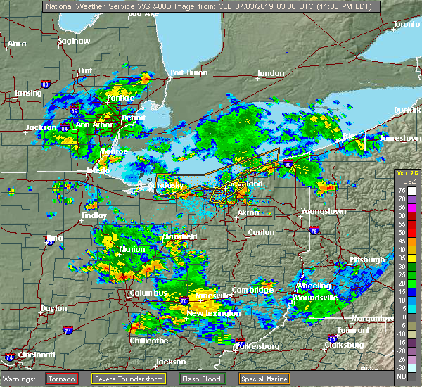 The severe thunderstorm warning for northeastern cuyahoga county will expire at 1115 pm edt, the storms which prompted the warning have weakened below severe limits, and have exited the warned area. therefore, the warning will be allowed to expire. however gusty winds are still possible with these thunderstorms. to report severe weather, contact your nearest law enforcement agency. they will relay your report to the national weather service cleveland. The severe thunderstorm warning for northeastern cuyahoga county will expire at 1115 pm edt, the storms which prompted the warning have weakened below severe limits, and have exited the warned area. therefore, the warning will be allowed to expire. however gusty winds are still possible with these thunderstorms. to report severe weather, contact your nearest law enforcement agency. they will relay your report to the national weather service cleveland.
|
| 7/2/2019 11:03 PM EDT |
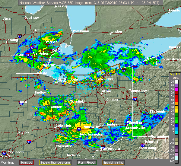 At 1103 pm edt, severe thunderstorms were located along a line extending from near highland hills to near parma, moving east at 45 mph (radar indicated). Hazards include 60 mph wind gusts. Expect damage to trees and power lines. Locations impacted include, cleveland, euclid, cleveland heights, warrensville heights, highland hills, garfield heights, shaker heights, maple heights, south euclid, mayfield heights, east cleveland, lyndhurst, university heights, wickliffe, beachwood, seven hills, richmond heights, willoughby hills, highland heights and independence. At 1103 pm edt, severe thunderstorms were located along a line extending from near highland hills to near parma, moving east at 45 mph (radar indicated). Hazards include 60 mph wind gusts. Expect damage to trees and power lines. Locations impacted include, cleveland, euclid, cleveland heights, warrensville heights, highland hills, garfield heights, shaker heights, maple heights, south euclid, mayfield heights, east cleveland, lyndhurst, university heights, wickliffe, beachwood, seven hills, richmond heights, willoughby hills, highland heights and independence.
|
| 7/2/2019 10:54 PM EDT |
 At 1054 pm edt, severe thunderstorms were located along a line extending from cleveland heights to near strongsville, moving east at 60 mph (radar indicated. a 51 mph wind gust was recently measured near edgewater beach). Hazards include 60 mph wind gusts. Expect damage to trees and power lines. Locations impacted include, cleveland, parma, lakewood, euclid, cleveland heights, strongsville, north royalton, warrensville heights, highland hills, garfield heights, shaker heights, maple heights, south euclid, parma heights, broadview heights, brook park, mayfield heights, berea, east cleveland and middleburg heights. At 1054 pm edt, severe thunderstorms were located along a line extending from cleveland heights to near strongsville, moving east at 60 mph (radar indicated. a 51 mph wind gust was recently measured near edgewater beach). Hazards include 60 mph wind gusts. Expect damage to trees and power lines. Locations impacted include, cleveland, parma, lakewood, euclid, cleveland heights, strongsville, north royalton, warrensville heights, highland hills, garfield heights, shaker heights, maple heights, south euclid, parma heights, broadview heights, brook park, mayfield heights, berea, east cleveland and middleburg heights.
|
| 7/2/2019 10:35 PM EDT |
 At 1034 pm edt, severe thunderstorms were located along a line extending from near lakewood to lorain, moving southeast at 65 mph (radar indicated). Hazards include 70 mph wind gusts and penny size hail. Expect considerable tree damage. damage is likely to mobile homes, roofs, and outbuildings. Locations impacted include, cleveland, lorain, elyria, vermilion, western vermilion, parma, lakewood, euclid, cleveland heights, strongsville, westlake, north royalton, north ridgeville, avon lake, warrensville heights, amherst, grafton, highland hills, north olmsted and garfield heights. At 1034 pm edt, severe thunderstorms were located along a line extending from near lakewood to lorain, moving southeast at 65 mph (radar indicated). Hazards include 70 mph wind gusts and penny size hail. Expect considerable tree damage. damage is likely to mobile homes, roofs, and outbuildings. Locations impacted include, cleveland, lorain, elyria, vermilion, western vermilion, parma, lakewood, euclid, cleveland heights, strongsville, westlake, north royalton, north ridgeville, avon lake, warrensville heights, amherst, grafton, highland hills, north olmsted and garfield heights.
|
| 7/2/2019 10:22 PM EDT |
 At 1021 pm edt, severe thunderstorms were located along a line extending from 9 miles north of avon lake to 8 miles north of western vermilion, moving southeast at 30 mph (radar indicated). Hazards include 60 mph wind gusts and penny size hail. expect damage to trees and power lines At 1021 pm edt, severe thunderstorms were located along a line extending from 9 miles north of avon lake to 8 miles north of western vermilion, moving southeast at 30 mph (radar indicated). Hazards include 60 mph wind gusts and penny size hail. expect damage to trees and power lines
|
| 7/2/2019 5:06 PM EDT |
 At 505 pm edt, severe thunderstorms were located along a line extending from near westlake to near west salem, moving east at 35 mph (radar indicated). Hazards include 70 mph wind gusts and quarter size hail. Minor damage to vehicles is possible. expect considerable tree damage. wind damage is also likely to mobile homes, roofs, and outbuildings. Locations impacted include, cleveland, elyria, medina, parma, lakewood, strongsville, brunswick, westlake, north royalton, north ridgeville, avon lake, wadsworth, grafton, rittman, lodi, creston, chippewa lake, polk, north olmsted and avon. At 505 pm edt, severe thunderstorms were located along a line extending from near westlake to near west salem, moving east at 35 mph (radar indicated). Hazards include 70 mph wind gusts and quarter size hail. Minor damage to vehicles is possible. expect considerable tree damage. wind damage is also likely to mobile homes, roofs, and outbuildings. Locations impacted include, cleveland, elyria, medina, parma, lakewood, strongsville, brunswick, westlake, north royalton, north ridgeville, avon lake, wadsworth, grafton, rittman, lodi, creston, chippewa lake, polk, north olmsted and avon.
|
| 7/2/2019 4:47 PM EDT |
 At 447 pm edt, severe thunderstorms were located along a line extending from near north ridgeville to near polk, moving southeast at 35 mph (radar indicated). Hazards include 70 mph wind gusts and quarter size hail. Minor damage to vehicles is possible. expect considerable tree damage. wind damage is also likely to mobile homes, roofs, and outbuildings. Locations impacted include, cleveland, lorain, elyria, medina, vermilion, parma, lakewood, strongsville, brunswick, westlake, north royalton, north ridgeville, avon lake, wadsworth, amherst, grafton, rittman, wellington, lodi and creston. At 447 pm edt, severe thunderstorms were located along a line extending from near north ridgeville to near polk, moving southeast at 35 mph (radar indicated). Hazards include 70 mph wind gusts and quarter size hail. Minor damage to vehicles is possible. expect considerable tree damage. wind damage is also likely to mobile homes, roofs, and outbuildings. Locations impacted include, cleveland, lorain, elyria, medina, vermilion, parma, lakewood, strongsville, brunswick, westlake, north royalton, north ridgeville, avon lake, wadsworth, amherst, grafton, rittman, wellington, lodi and creston.
|
| 7/2/2019 4:10 PM EDT |
 At 410 pm edt, severe thunderstorms were located along a line extending from 10 miles northwest of vermilion to 6 miles northeast of willard, moving east at 35 mph (radar indicated). Hazards include 70 mph wind gusts and quarter size hail. Minor damage to vehicles is possible. expect considerable tree damage. Wind damage is also likely to mobile homes, roofs, and outbuildings. At 410 pm edt, severe thunderstorms were located along a line extending from 10 miles northwest of vermilion to 6 miles northeast of willard, moving east at 35 mph (radar indicated). Hazards include 70 mph wind gusts and quarter size hail. Minor damage to vehicles is possible. expect considerable tree damage. Wind damage is also likely to mobile homes, roofs, and outbuildings.
|
| 6/28/2019 7:30 PM EDT | Thunderstorm wind gust 68 mph/59 knot in cuyahoga county OH, 3.6 miles S of Cleveland, OH |
| 5/30/2019 5:24 PM EDT |
 At 524 pm edt, severe thunderstorms were located along a line extending from near cleveland to near north royalton, moving east at 45 mph (radar indicated). Hazards include 60 mph wind gusts. Expect damage to trees and power lines. Locations impacted include, cleveland, parma, north royalton, solon, warrensville heights, highland hills, garfield heights, shaker heights, maple heights, broadview heights, brecksville, bedford, beachwood, seven hills, bedford heights, independence, pepper pike, chagrin falls, northfield and orange. At 524 pm edt, severe thunderstorms were located along a line extending from near cleveland to near north royalton, moving east at 45 mph (radar indicated). Hazards include 60 mph wind gusts. Expect damage to trees and power lines. Locations impacted include, cleveland, parma, north royalton, solon, warrensville heights, highland hills, garfield heights, shaker heights, maple heights, broadview heights, brecksville, bedford, beachwood, seven hills, bedford heights, independence, pepper pike, chagrin falls, northfield and orange.
|
| 5/30/2019 4:59 PM EDT |
 At 458 pm edt, severe thunderstorms were located along a line extending from near avon lake to near north ridgeville, moving east at 45 mph (radar indicated). Hazards include 60 mph wind gusts. expect damage to trees and power lines At 458 pm edt, severe thunderstorms were located along a line extending from near avon lake to near north ridgeville, moving east at 45 mph (radar indicated). Hazards include 60 mph wind gusts. expect damage to trees and power lines
|
| 5/28/2019 6:57 PM EDT |
 At 657 pm edt, a severe thunderstorm was located over avon lake, or 7 miles northeast of elyria, moving east at 50 mph (radar indicated). Hazards include 60 mph wind gusts and quarter size hail. Minor damage to vehicles is possible. Expect damage to trees and power lines. At 657 pm edt, a severe thunderstorm was located over avon lake, or 7 miles northeast of elyria, moving east at 50 mph (radar indicated). Hazards include 60 mph wind gusts and quarter size hail. Minor damage to vehicles is possible. Expect damage to trees and power lines.
|
| 5/23/2019 8:40 AM EDT |
 At 839 am edt, severe thunderstorms were located along a line extending from near twinsburg to 6 miles northwest of mount eaton, moving east at 60 mph (radar indicated). Hazards include 60 mph wind gusts. Expect damage to trees and power lines. Locations impacted include, cleveland, akron, canton, wooster, painesville, willowick, millersburg, cuyahoga falls, euclid, mentor, cleveland heights, massillon, kent, barberton, green, solon, willoughby, hudson, wadsworth and twinsburg. At 839 am edt, severe thunderstorms were located along a line extending from near twinsburg to 6 miles northwest of mount eaton, moving east at 60 mph (radar indicated). Hazards include 60 mph wind gusts. Expect damage to trees and power lines. Locations impacted include, cleveland, akron, canton, wooster, painesville, willowick, millersburg, cuyahoga falls, euclid, mentor, cleveland heights, massillon, kent, barberton, green, solon, willoughby, hudson, wadsworth and twinsburg.
|
| 5/23/2019 8:32 AM EDT |
 At 832 am edt, severe thunderstorms were located along a line extending from near macedonia to near wooster, moving east at 45 mph (radar indicated). Hazards include 60 mph wind gusts. Expect damage to trees and power lines. Locations impacted include, cleveland, akron, canton, medina, wooster, painesville, mount vernon, willowick, millersburg, parma, cuyahoga falls, euclid, mentor, cleveland heights, strongsville, brunswick, massillon, north royalton, kent and barberton. At 832 am edt, severe thunderstorms were located along a line extending from near macedonia to near wooster, moving east at 45 mph (radar indicated). Hazards include 60 mph wind gusts. Expect damage to trees and power lines. Locations impacted include, cleveland, akron, canton, medina, wooster, painesville, mount vernon, willowick, millersburg, parma, cuyahoga falls, euclid, mentor, cleveland heights, strongsville, brunswick, massillon, north royalton, kent and barberton.
|
| 5/23/2019 8:30 AM EDT | Storm damage reported in cuyahoga county OH, 12.7 miles SW of Cleveland, OH |
| 5/23/2019 8:30 AM EDT | Large tree down on oakland dr. and edsel d in cuyahoga county OH, 10.9 miles WSW of Cleveland, OH |
| 5/23/2019 8:19 AM EDT |
 At 819 am edt, severe thunderstorms were located along a line extending from near north royalton to near shreve, moving east at 45 mph (radar indicated). Hazards include 60 mph wind gusts. Expect damage to trees and power lines. Locations impacted include, cleveland, akron, canton, medina, wooster, painesville, mount vernon, willowick, millersburg, parma, lakewood, cuyahoga falls, euclid, mentor, cleveland heights, strongsville, brunswick, westlake, massillon and north royalton. At 819 am edt, severe thunderstorms were located along a line extending from near north royalton to near shreve, moving east at 45 mph (radar indicated). Hazards include 60 mph wind gusts. Expect damage to trees and power lines. Locations impacted include, cleveland, akron, canton, medina, wooster, painesville, mount vernon, willowick, millersburg, parma, lakewood, cuyahoga falls, euclid, mentor, cleveland heights, strongsville, brunswick, westlake, massillon and north royalton.
|
| 5/23/2019 8:17 AM EDT |
 At 817 am edt, severe thunderstorms were located along a line extending from near north royalton to near shreve, moving east at 45 mph (radar indicated). Hazards include 60 mph wind gusts. expect damage to trees and power lines At 817 am edt, severe thunderstorms were located along a line extending from near north royalton to near shreve, moving east at 45 mph (radar indicated). Hazards include 60 mph wind gusts. expect damage to trees and power lines
|
| 4/14/2019 6:12 PM EDT |
 At 612 pm edt, a severe thunderstorm was located near euclid, or near willowick, moving east at 50 mph (radar indicated). Hazards include 60 mph wind gusts and penny size hail. Expect damage to trees and power lines. Locations impacted include, cleveland, painesville, willowick, fairport harbor, euclid, mentor, cleveland heights, solon, willoughby, eastlake, warrensville heights, south russell, highland hills, timberlake, lakeline, chesterland, garfield heights, shaker heights, maple heights and south euclid. At 612 pm edt, a severe thunderstorm was located near euclid, or near willowick, moving east at 50 mph (radar indicated). Hazards include 60 mph wind gusts and penny size hail. Expect damage to trees and power lines. Locations impacted include, cleveland, painesville, willowick, fairport harbor, euclid, mentor, cleveland heights, solon, willoughby, eastlake, warrensville heights, south russell, highland hills, timberlake, lakeline, chesterland, garfield heights, shaker heights, maple heights and south euclid.
|
| 4/14/2019 6:03 PM EDT |
 At 603 pm edt, a severe thunderstorm was located over cleveland heights, or near cleveland, moving northeast at 55 mph (radar indicated). Hazards include 60 mph wind gusts and penny size hail. Expect damage to trees and power lines. Locations impacted include, cleveland, painesville, willowick, fairport harbor, euclid, mentor, cleveland heights, solon, willoughby, eastlake, warrensville heights, south russell, highland hills, timberlake, lakeline, chesterland, garfield heights, shaker heights, maple heights and south euclid. At 603 pm edt, a severe thunderstorm was located over cleveland heights, or near cleveland, moving northeast at 55 mph (radar indicated). Hazards include 60 mph wind gusts and penny size hail. Expect damage to trees and power lines. Locations impacted include, cleveland, painesville, willowick, fairport harbor, euclid, mentor, cleveland heights, solon, willoughby, eastlake, warrensville heights, south russell, highland hills, timberlake, lakeline, chesterland, garfield heights, shaker heights, maple heights and south euclid.
|
| 4/14/2019 5:51 PM EDT |
 At 551 pm edt, a severe thunderstorm was located over lakewood, or near cleveland, moving east at 55 mph (radar indicated). Hazards include 60 mph wind gusts and penny size hail. expect damage to trees and power lines At 551 pm edt, a severe thunderstorm was located over lakewood, or near cleveland, moving east at 55 mph (radar indicated). Hazards include 60 mph wind gusts and penny size hail. expect damage to trees and power lines
|
| 4/14/2019 5:48 PM EDT |
 At 548 pm edt, a severe thunderstorm was located near lakewood, or 9 miles southwest of cleveland, moving northeast at 60 mph (radar indicated). Hazards include 60 mph wind gusts and penny size hail. Expect damage to trees and power lines. Locations impacted include, cleveland, parma, strongsville, westlake, north royalton, north ridgeville, north olmsted, avon, parma heights, broadview heights, brook park, berea, fairview park, middleburg heights, brooklyn and olmsted falls. At 548 pm edt, a severe thunderstorm was located near lakewood, or 9 miles southwest of cleveland, moving northeast at 60 mph (radar indicated). Hazards include 60 mph wind gusts and penny size hail. Expect damage to trees and power lines. Locations impacted include, cleveland, parma, strongsville, westlake, north royalton, north ridgeville, north olmsted, avon, parma heights, broadview heights, brook park, berea, fairview park, middleburg heights, brooklyn and olmsted falls.
|
| 4/14/2019 5:35 PM EDT |
 At 535 pm edt, a severe thunderstorm was located near grafton, or 10 miles northwest of medina, moving northeast at 50 mph (radar indicated). Hazards include 60 mph wind gusts and penny size hail. expect damage to trees and power lines At 535 pm edt, a severe thunderstorm was located near grafton, or 10 miles northwest of medina, moving northeast at 50 mph (radar indicated). Hazards include 60 mph wind gusts and penny size hail. expect damage to trees and power lines
|
| 1/8/2019 4:21 PM EST |
 At 420 pm est, a severe thunderstorm was located near mantua, or 12 miles north of ravenna, moving east at 60 mph (radar indicated). Hazards include 60 mph wind gusts and quarter size hail. Minor damage to vehicles is possible. expect damage to trees and power lines. Locations impacted include, cleveland, parma, lakewood, euclid, cleveland heights, strongsville, north royalton, solon, hudson, twinsburg, warrensville heights, macedonia, highland hills, garfield heights, shaker heights, maple heights, south euclid, parma heights, rocky river and broadview heights. At 420 pm est, a severe thunderstorm was located near mantua, or 12 miles north of ravenna, moving east at 60 mph (radar indicated). Hazards include 60 mph wind gusts and quarter size hail. Minor damage to vehicles is possible. expect damage to trees and power lines. Locations impacted include, cleveland, parma, lakewood, euclid, cleveland heights, strongsville, north royalton, solon, hudson, twinsburg, warrensville heights, macedonia, highland hills, garfield heights, shaker heights, maple heights, south euclid, parma heights, rocky river and broadview heights.
|
| 1/8/2019 3:44 PM EST |
 At 344 pm est, a severe thunderstorm was located over grafton, or 8 miles southeast of elyria, moving east at 45 mph (radar indicated). Hazards include 60 mph wind gusts and quarter size hail. Minor damage to vehicles is possible. Expect damage to trees and power lines. At 344 pm est, a severe thunderstorm was located over grafton, or 8 miles southeast of elyria, moving east at 45 mph (radar indicated). Hazards include 60 mph wind gusts and quarter size hail. Minor damage to vehicles is possible. Expect damage to trees and power lines.
|
| 1/8/2019 3:26 PM EST | Half Dollar sized hail reported 13.1 miles SW of Cleveland, OH |
| 1/8/2019 3:22 PM EST |
 At 321 pm est, severe thunderstorms were located along a line extending from elyria to near wellington, moving east at 20 mph (emergency management). Hazards include 60 mph wind gusts and quarter size hail. Minor damage to vehicles is possible. Expect damage to trees and power lines. At 321 pm est, severe thunderstorms were located along a line extending from elyria to near wellington, moving east at 20 mph (emergency management). Hazards include 60 mph wind gusts and quarter size hail. Minor damage to vehicles is possible. Expect damage to trees and power lines.
|
| 12/2/2018 6:12 PM EST | Large tree down on hillsdale road and warrensdale center rd. time is radar estimate in cuyahoga county OH, 8.5 miles WSW of Cleveland, OH |
| 10/20/2018 5:05 PM EDT |
 The severe thunderstorm warning for cuyahoga county will expire at 515 pm edt, the storm which prompted the warning has weakened below severe limits, and has exited the warned area. therefore, the warning will be allowed to expire. The severe thunderstorm warning for cuyahoga county will expire at 515 pm edt, the storm which prompted the warning has weakened below severe limits, and has exited the warned area. therefore, the warning will be allowed to expire.
|
| 10/20/2018 4:39 PM EDT |
 At 439 pm edt, strong winds from a thunderstorm outflow were located near parma, or near cleveland, moving east at 45 mph (radar indicated). Hazards include 60 mph wind gusts. Expect damage to trees and power lines. Locations impacted include, cleveland, parma, lakewood, euclid, cleveland heights, strongsville, westlake, north royalton, solon, warrensville heights, highland hills, north olmsted, garfield heights, shaker heights, maple heights, south euclid, parma heights, rocky river, broadview heights and brook park. At 439 pm edt, strong winds from a thunderstorm outflow were located near parma, or near cleveland, moving east at 45 mph (radar indicated). Hazards include 60 mph wind gusts. Expect damage to trees and power lines. Locations impacted include, cleveland, parma, lakewood, euclid, cleveland heights, strongsville, westlake, north royalton, solon, warrensville heights, highland hills, north olmsted, garfield heights, shaker heights, maple heights, south euclid, parma heights, rocky river, broadview heights and brook park.
|
| 10/20/2018 4:31 PM EDT | Asos station cle... cleveland... o in cuyahoga county OH, 9.1 miles ENE of Cleveland, OH |
| 10/20/2018 4:21 PM EDT |
 At 420 pm edt, strong winds from a thunderstorm outflow were located over westlake, or 7 miles northeast of elyria, moving east at 45 mph (radar indicated). Hazards include 70 mph wind gusts. Expect considerable tree damage. Damage is likely to mobile homes, roofs, and outbuildings. At 420 pm edt, strong winds from a thunderstorm outflow were located over westlake, or 7 miles northeast of elyria, moving east at 45 mph (radar indicated). Hazards include 70 mph wind gusts. Expect considerable tree damage. Damage is likely to mobile homes, roofs, and outbuildings.
|
| 9/21/2018 4:33 PM EDT |
 A severe thunderstorm warning remains in effect until 515 pm edt for geauga. northeastern cuyahoga and lake counties. at 433 pm edt, a severe thunderstorm was located near cleveland heights, or near willowick, moving east at 40 mph. hazard. 60 mph wind gusts. source. Radar indicated. A severe thunderstorm warning remains in effect until 515 pm edt for geauga. northeastern cuyahoga and lake counties. at 433 pm edt, a severe thunderstorm was located near cleveland heights, or near willowick, moving east at 40 mph. hazard. 60 mph wind gusts. source. Radar indicated.
|
| 9/21/2018 4:25 PM EDT | Pine tree snapped at about the midway point on wyatt rd. near forest hill par in cuyahoga county OH, 7.3 miles SW of Cleveland, OH |
| 9/21/2018 4:24 PM EDT | Tree down at e98 and parkgate in cuyahoga county OH, 5.7 miles SW of Cleveland, OH |
| 9/21/2018 4:24 PM EDT |
 The national weather service in cleveland has issued a * severe thunderstorm warning for. geauga county in northeastern ohio. eastern cuyahoga county in northeastern ohio. lake county in northeastern ohio. Until 515 pm edt. The national weather service in cleveland has issued a * severe thunderstorm warning for. geauga county in northeastern ohio. eastern cuyahoga county in northeastern ohio. lake county in northeastern ohio. Until 515 pm edt.
|
| 9/21/2018 4:06 PM EDT | Tree down on rocky river rd. blocking both lanes. reported via twitter and time is radar estimate in cuyahoga county OH, 6.9 miles ENE of Cleveland, OH |
| 9/21/2018 4:06 PM EDT | Trees down at virginia rd and virginia... and w223 and lorain. reported via twitte in cuyahoga county OH, 8.4 miles ENE of Cleveland, OH |
| 9/20/2018 2:26 PM EDT |
 At 226 pm edt, a severe thunderstorm was located over strongsville, or 11 miles north of medina, moving southeast at 15 mph (radar indicated). Hazards include 60 mph wind gusts and quarter size hail. Minor damage to vehicles is possible. Expect damage to trees and power lines. At 226 pm edt, a severe thunderstorm was located over strongsville, or 11 miles north of medina, moving southeast at 15 mph (radar indicated). Hazards include 60 mph wind gusts and quarter size hail. Minor damage to vehicles is possible. Expect damage to trees and power lines.
|
| 9/5/2018 7:05 PM EDT |
 At 649 pm edt, a severe thunderstorm was located near parma, or near cleveland, moving northeast at 20 mph (radar indicated). Hazards include 60 mph wind gusts and penny size hail. expect damage to trees and power lines At 649 pm edt, a severe thunderstorm was located near parma, or near cleveland, moving northeast at 20 mph (radar indicated). Hazards include 60 mph wind gusts and penny size hail. expect damage to trees and power lines
|
| 9/5/2018 6:49 PM EDT |
 At 649 pm edt, a severe thunderstorm was located near parma, or near cleveland, moving northeast at 20 mph (radar indicated). Hazards include 60 mph wind gusts and penny size hail. expect damage to trees and power lines At 649 pm edt, a severe thunderstorm was located near parma, or near cleveland, moving northeast at 20 mph (radar indicated). Hazards include 60 mph wind gusts and penny size hail. expect damage to trees and power lines
|
| 9/5/2018 6:47 PM EDT | Trees and power lines reported down at west 11th street and panna lane and on west 12th street. report relayed via social medi in cuyahoga county OH, 2.6 miles N of Cleveland, OH |
| 9/5/2018 6:46 PM EDT | Roof damage to a commerical structure on broadview road... south of brookpark road. report relayed via social medi in cuyahoga county OH, 3.3 miles N of Cleveland, OH |
| 9/5/2018 6:37 PM EDT |
 At 636 pm edt, a severe thunderstorm was located over westlake, or 11 miles west of cleveland, moving northeast at 15 mph (radar indicated). Hazards include 60 mph wind gusts and quarter size hail. Minor damage to vehicles is possible. Expect damage to trees and power lines. At 636 pm edt, a severe thunderstorm was located over westlake, or 11 miles west of cleveland, moving northeast at 15 mph (radar indicated). Hazards include 60 mph wind gusts and quarter size hail. Minor damage to vehicles is possible. Expect damage to trees and power lines.
|
| 8/29/2018 3:23 PM EDT |
 At 323 pm edt, a severe thunderstorm was located over north royalton, or 12 miles northeast of medina, moving southeast at 30 mph (radar indicated). Hazards include 60 mph wind gusts and quarter size hail. Minor damage to vehicles is possible. Expect damage to trees and power lines. At 323 pm edt, a severe thunderstorm was located over north royalton, or 12 miles northeast of medina, moving southeast at 30 mph (radar indicated). Hazards include 60 mph wind gusts and quarter size hail. Minor damage to vehicles is possible. Expect damage to trees and power lines.
|
| 8/7/2018 12:06 AM EDT |
 At 1205 am edt, a severe thunderstorm was located over north royalton, or 13 miles south of cleveland, moving east at 15 mph (radar indicated). Hazards include 60 mph wind gusts. Expect damage to trees and power lines. Locations impacted include, strongsville, westlake, north royalton, solon, warrensville heights, highland hills, north olmsted, garfield heights, shaker heights, maple heights, south euclid, parma heights, rocky river, broadview heights and brook park. At 1205 am edt, a severe thunderstorm was located over north royalton, or 13 miles south of cleveland, moving east at 15 mph (radar indicated). Hazards include 60 mph wind gusts. Expect damage to trees and power lines. Locations impacted include, strongsville, westlake, north royalton, solon, warrensville heights, highland hills, north olmsted, garfield heights, shaker heights, maple heights, south euclid, parma heights, rocky river, broadview heights and brook park.
|
| 8/6/2018 11:55 PM EDT |
 At 1133 pm edt, severe thunderstorms were located along a line extending from near euclid to near cleveland to strongsville to 7 miles west of grafton, moving east at 30 mph. reports from east of lorain to near sheffield lake indicate some tree damage has occured with this storm (radar indicated). Hazards include 60 mph wind gusts. Expect damage to trees and power lines. Locations impacted include, cleveland, lorain, elyria, parma, lakewood, euclid, cleveland heights, strongsville, westlake, north royalton, north ridgeville, solon, avon lake, warrensville heights, grafton, highland hills, north olmsted, garfield heights, shaker heights and maple heights. At 1133 pm edt, severe thunderstorms were located along a line extending from near euclid to near cleveland to strongsville to 7 miles west of grafton, moving east at 30 mph. reports from east of lorain to near sheffield lake indicate some tree damage has occured with this storm (radar indicated). Hazards include 60 mph wind gusts. Expect damage to trees and power lines. Locations impacted include, cleveland, lorain, elyria, parma, lakewood, euclid, cleveland heights, strongsville, westlake, north royalton, north ridgeville, solon, avon lake, warrensville heights, grafton, highland hills, north olmsted, garfield heights, shaker heights and maple heights.
|
| 8/6/2018 11:50 PM EDT | Picture from social media report shows a couple pine trees blown down. one tree fell on gates mill blvd. time was estimate in cuyahoga county OH, 12.8 miles W of Cleveland, OH |
| 8/6/2018 11:40 PM EDT | A picture from social media showed large tree limb blown down and blocking road near 2000 e 31st stree in cuyahoga county OH, 3.1 miles SSW of Cleveland, OH |
| 8/6/2018 11:34 PM EDT |
 At 1133 pm edt, severe thunderstorms were located along a line extending from near euclid to near cleveland to strongsville to 7 miles west of grafton, moving east at 30 mph. reports from east of lorain to near sheffield lake indicate some tree damage has occured with this storm (radar indicated). Hazards include 60 mph wind gusts. Expect damage to trees and power lines. Locations impacted include, cleveland, lorain, elyria, parma, lakewood, euclid, cleveland heights, strongsville, westlake, north royalton, north ridgeville, solon, avon lake, warrensville heights, grafton, highland hills, north olmsted, garfield heights, shaker heights and maple heights. At 1133 pm edt, severe thunderstorms were located along a line extending from near euclid to near cleveland to strongsville to 7 miles west of grafton, moving east at 30 mph. reports from east of lorain to near sheffield lake indicate some tree damage has occured with this storm (radar indicated). Hazards include 60 mph wind gusts. Expect damage to trees and power lines. Locations impacted include, cleveland, lorain, elyria, parma, lakewood, euclid, cleveland heights, strongsville, westlake, north royalton, north ridgeville, solon, avon lake, warrensville heights, grafton, highland hills, north olmsted, garfield heights, shaker heights and maple heights.
|
| 8/6/2018 11:09 PM EDT |
 At 1108 pm edt, severe thunderstorms were located along a line extending from 9 miles northwest of cleveland to near lakewood to near elyria, moving east at 30 mph (radar indicated). Hazards include 60 mph wind gusts. expect damage to trees and power lines At 1108 pm edt, severe thunderstorms were located along a line extending from 9 miles northwest of cleveland to near lakewood to near elyria, moving east at 30 mph (radar indicated). Hazards include 60 mph wind gusts. expect damage to trees and power lines
|
| 8/6/2018 4:15 PM EDT | Storm damage reported in cuyahoga county OH, 13.1 miles WSW of Cleveland, OH |
| 7/26/2018 6:14 PM EDT |
 At 614 pm edt, a severe thunderstorm was located over chesterland, or 8 miles southeast of willowick, moving east at 45 mph (radar indicated). Hazards include 60 mph wind gusts and quarter size hail. Minor damage to vehicles is possible. expect damage to trees and power lines. Locations impacted include, cleveland, euclid, cleveland heights, solon, warrensville heights, highland hills, shaker heights, south euclid, mayfield heights, east cleveland, lyndhurst, university heights, wickliffe, beachwood, richmond heights, willoughby hills, highland heights, pepper pike, chagrin falls and mayfield. At 614 pm edt, a severe thunderstorm was located over chesterland, or 8 miles southeast of willowick, moving east at 45 mph (radar indicated). Hazards include 60 mph wind gusts and quarter size hail. Minor damage to vehicles is possible. expect damage to trees and power lines. Locations impacted include, cleveland, euclid, cleveland heights, solon, warrensville heights, highland hills, shaker heights, south euclid, mayfield heights, east cleveland, lyndhurst, university heights, wickliffe, beachwood, richmond heights, willoughby hills, highland heights, pepper pike, chagrin falls and mayfield.
|
| 7/26/2018 5:49 PM EDT |
 At 548 pm edt, a severe thunderstorm was located near cleveland, moving east at 40 mph (radar indicated). Hazards include 60 mph wind gusts and quarter size hail. Minor damage to vehicles is possible. Expect damage to trees and power lines. At 548 pm edt, a severe thunderstorm was located near cleveland, moving east at 40 mph (radar indicated). Hazards include 60 mph wind gusts and quarter size hail. Minor damage to vehicles is possible. Expect damage to trees and power lines.
|
| 7/23/2018 8:39 PM EDT |
 At 839 pm edt, a severe thunderstorm was located over strongsville, or 11 miles north of medina, moving north at 15 mph (radar indicated). Hazards include 60 mph wind gusts and quarter size hail. Minor damage to vehicles is possible. expect damage to trees and power lines. Locations impacted include, cleveland, parma, lakewood, strongsville, brunswick, westlake, north royalton, north ridgeville, north olmsted, parma heights, rocky river, broadview heights, brook park, berea, fairview park, middleburg heights, bay village, brooklyn, olmsted falls and hinckley. At 839 pm edt, a severe thunderstorm was located over strongsville, or 11 miles north of medina, moving north at 15 mph (radar indicated). Hazards include 60 mph wind gusts and quarter size hail. Minor damage to vehicles is possible. expect damage to trees and power lines. Locations impacted include, cleveland, parma, lakewood, strongsville, brunswick, westlake, north royalton, north ridgeville, north olmsted, parma heights, rocky river, broadview heights, brook park, berea, fairview park, middleburg heights, bay village, brooklyn, olmsted falls and hinckley.
|
| 7/23/2018 8:19 PM EDT |
 At 819 pm edt, a severe thunderstorm was located near brunswick, or 7 miles northeast of medina, moving northwest at 25 mph (radar indicated). Hazards include 60 mph wind gusts and quarter size hail. Minor damage to vehicles is possible. Expect damage to trees and power lines. At 819 pm edt, a severe thunderstorm was located near brunswick, or 7 miles northeast of medina, moving northwest at 25 mph (radar indicated). Hazards include 60 mph wind gusts and quarter size hail. Minor damage to vehicles is possible. Expect damage to trees and power lines.
|
| 7/5/2018 4:26 PM EDT |
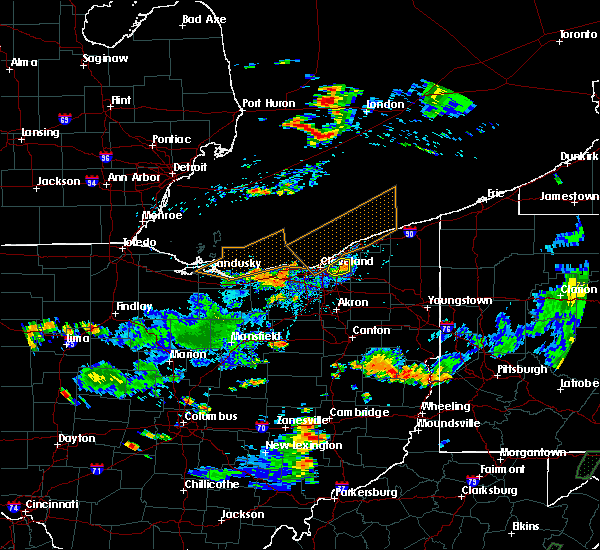 The severe thunderstorm warning for east central cuyahoga county will expire at 430 pm edt, the storm which prompted the warning has weakened below severe limits, and no longer poses an immediate threat to life or property. therefore, the warning will be allowed to expire. to report severe weather, contact your nearest law enforcement agency. they will relay your report to the national weather service cleveland. The severe thunderstorm warning for east central cuyahoga county will expire at 430 pm edt, the storm which prompted the warning has weakened below severe limits, and no longer poses an immediate threat to life or property. therefore, the warning will be allowed to expire. to report severe weather, contact your nearest law enforcement agency. they will relay your report to the national weather service cleveland.
|
| 7/5/2018 4:15 PM EDT |
 At 415 pm edt, a severe thunderstorm was located near highland hills, or 9 miles south of willowick, moving east at 25 mph (radar indicated). Hazards include 60 mph wind gusts. Expect damage to trees and power lines. Locations impacted include, cleveland, cleveland heights, solon, warrensville heights, highland hills, shaker heights, maple heights, south euclid, mayfield heights, lyndhurst, university heights, beachwood, bedford heights, richmond heights, highland heights, pepper pike, mayfield, orange, moreland hills and gates mills. At 415 pm edt, a severe thunderstorm was located near highland hills, or 9 miles south of willowick, moving east at 25 mph (radar indicated). Hazards include 60 mph wind gusts. Expect damage to trees and power lines. Locations impacted include, cleveland, cleveland heights, solon, warrensville heights, highland hills, shaker heights, maple heights, south euclid, mayfield heights, lyndhurst, university heights, beachwood, bedford heights, richmond heights, highland heights, pepper pike, mayfield, orange, moreland hills and gates mills.
|
| 7/5/2018 4:02 PM EDT |
 At 341 pm edt, a severe thunderstorm was located over lakewood, or near cleveland, moving northeast at 30 mph. another thunderstorm was located near strongsville moving east at 30 mph. (radar indicated). Hazards include 60 mph wind gusts and quarter size hail. Minor damage to vehicles is possible. Expect damage to trees and power lines. At 341 pm edt, a severe thunderstorm was located over lakewood, or near cleveland, moving northeast at 30 mph. another thunderstorm was located near strongsville moving east at 30 mph. (radar indicated). Hazards include 60 mph wind gusts and quarter size hail. Minor damage to vehicles is possible. Expect damage to trees and power lines.
|
| 7/5/2018 3:43 PM EDT | Tree down on ca in cuyahoga county OH, 4 miles E of Cleveland, OH |
| 7/5/2018 3:42 PM EDT |
 At 341 pm edt, a severe thunderstorm was located over lakewood, or near cleveland, moving northeast at 30 mph. another thunderstorm was located near strongsville moving east at 30 mph. (radar indicated). Hazards include 60 mph wind gusts and quarter size hail. Minor damage to vehicles is possible. Expect damage to trees and power lines. At 341 pm edt, a severe thunderstorm was located over lakewood, or near cleveland, moving northeast at 30 mph. another thunderstorm was located near strongsville moving east at 30 mph. (radar indicated). Hazards include 60 mph wind gusts and quarter size hail. Minor damage to vehicles is possible. Expect damage to trees and power lines.
|
| 5/31/2018 4:39 PM EDT |
 At 439 pm edt, a severe thunderstorm was located near warrensville heights, or 10 miles southeast of cleveland, moving east at 25 mph (radar indicated). Hazards include 60 mph wind gusts. expect damage to trees and power lines At 439 pm edt, a severe thunderstorm was located near warrensville heights, or 10 miles southeast of cleveland, moving east at 25 mph (radar indicated). Hazards include 60 mph wind gusts. expect damage to trees and power lines
|
| 5/22/2018 2:31 PM EDT |
 At 229 pm edt, a severe thunderstorm was located near richfield, or 10 miles north of akron, moving east at 35 mph. damaging winds will sweep through peninsula and hudson by 245 pm (radar indicated). Hazards include 70 mph wind gusts and quarter size hail. Minor damage to vehicles is possible. expect considerable tree damage. wind damage is also likely to mobile homes, roofs, and outbuildings. Locations impacted include, akron, medina, parma, cuyahoga falls, strongsville, brunswick, north royalton, kent, barberton, solon, hudson, wadsworth, twinsburg, tallmadge, streetsboro, warrensville heights, macedonia, rittman, mogadore and south russell. At 229 pm edt, a severe thunderstorm was located near richfield, or 10 miles north of akron, moving east at 35 mph. damaging winds will sweep through peninsula and hudson by 245 pm (radar indicated). Hazards include 70 mph wind gusts and quarter size hail. Minor damage to vehicles is possible. expect considerable tree damage. wind damage is also likely to mobile homes, roofs, and outbuildings. Locations impacted include, akron, medina, parma, cuyahoga falls, strongsville, brunswick, north royalton, kent, barberton, solon, hudson, wadsworth, twinsburg, tallmadge, streetsboro, warrensville heights, macedonia, rittman, mogadore and south russell.
|
| 5/22/2018 2:25 PM EDT |
 At 223 pm edt, a severe thunderstorm was located near cuyahoga falls, or 11 miles north of akron, moving east at 35 mph (radar indicated. quarter sized hail was reported in north royalton with this storm). Hazards include 60 mph wind gusts and quarter size hail. Minor damage to vehicles is possible. expect damage to trees and power lines. torrential rainfall is also occurring with this storm. Locations impacted include, akron, medina, parma, cuyahoga falls, strongsville, brunswick, north royalton, kent, barberton, solon, hudson, wadsworth, twinsburg, tallmadge, streetsboro, warrensville heights, macedonia, rittman, mogadore and south russell. At 223 pm edt, a severe thunderstorm was located near cuyahoga falls, or 11 miles north of akron, moving east at 35 mph (radar indicated. quarter sized hail was reported in north royalton with this storm). Hazards include 60 mph wind gusts and quarter size hail. Minor damage to vehicles is possible. expect damage to trees and power lines. torrential rainfall is also occurring with this storm. Locations impacted include, akron, medina, parma, cuyahoga falls, strongsville, brunswick, north royalton, kent, barberton, solon, hudson, wadsworth, twinsburg, tallmadge, streetsboro, warrensville heights, macedonia, rittman, mogadore and south russell.
|
| 5/22/2018 2:12 PM EDT |
 At 212 pm edt, a severe thunderstorm was located near brunswick, or 9 miles northeast of medina, moving southeast at 35 mph (radar indicated). Hazards include 60 mph wind gusts and quarter size hail. Minor damage to vehicles is possible. Expect damage to trees and power lines. At 212 pm edt, a severe thunderstorm was located near brunswick, or 9 miles northeast of medina, moving southeast at 35 mph (radar indicated). Hazards include 60 mph wind gusts and quarter size hail. Minor damage to vehicles is possible. Expect damage to trees and power lines.
|
| 5/22/2018 1:48 PM EDT |
 At 148 pm edt, a severe thunderstorm was located near parma, or 9 miles southwest of cleveland, moving east at 25 mph (radar indicated). Hazards include 60 mph wind gusts and quarter size hail. Minor damage to vehicles is possible. expect damage to trees and power lines. Locations impacted include, cleveland, parma, lakewood, euclid, cleveland heights, strongsville, brunswick, westlake, north royalton, north ridgeville, solon, avon lake, warrensville heights, south russell, highland hills, north olmsted, garfield heights, shaker heights, maple heights and south euclid. At 148 pm edt, a severe thunderstorm was located near parma, or 9 miles southwest of cleveland, moving east at 25 mph (radar indicated). Hazards include 60 mph wind gusts and quarter size hail. Minor damage to vehicles is possible. expect damage to trees and power lines. Locations impacted include, cleveland, parma, lakewood, euclid, cleveland heights, strongsville, brunswick, westlake, north royalton, north ridgeville, solon, avon lake, warrensville heights, south russell, highland hills, north olmsted, garfield heights, shaker heights, maple heights and south euclid.
|
| 5/22/2018 1:23 PM EDT |
 At 123 pm edt, a severe thunderstorm was located over westlake, or 10 miles west of cleveland, moving northeast at 55 mph (radar indicated). Hazards include 60 mph wind gusts and quarter size hail. Minor damage to vehicles is possible. Expect damage to trees and power lines. At 123 pm edt, a severe thunderstorm was located over westlake, or 10 miles west of cleveland, moving northeast at 55 mph (radar indicated). Hazards include 60 mph wind gusts and quarter size hail. Minor damage to vehicles is possible. Expect damage to trees and power lines.
|
| 11/5/2017 7:09 PM EDT |
 At 608 pm est, a severe thunderstorm was located near macedonia, or 14 miles southeast of cleveland, moving east at 65 mph. this is a very dangerous storm (radar indicated). Hazards include 80 mph wind gusts and quarter size hail. Flying debris will be dangerous to those caught without shelter. mobile homes will be heavily damaged. expect considerable damage to roofs, windows, and vehicles. extensive tree damage and power outages are likely. locations impacted include, cleveland, parma, cleveland heights, north royalton, solon, warrensville heights, south russell, highland hills, garfield heights, shaker heights, maple heights, south euclid, broadview heights, mayfield heights, lyndhurst, brecksville, university heights, bedford, beachwood and seven hills. A tornado watch remains in effect until 700 pm est for northeastern ohio. At 608 pm est, a severe thunderstorm was located near macedonia, or 14 miles southeast of cleveland, moving east at 65 mph. this is a very dangerous storm (radar indicated). Hazards include 80 mph wind gusts and quarter size hail. Flying debris will be dangerous to those caught without shelter. mobile homes will be heavily damaged. expect considerable damage to roofs, windows, and vehicles. extensive tree damage and power outages are likely. locations impacted include, cleveland, parma, cleveland heights, north royalton, solon, warrensville heights, south russell, highland hills, garfield heights, shaker heights, maple heights, south euclid, broadview heights, mayfield heights, lyndhurst, brecksville, university heights, bedford, beachwood and seven hills. A tornado watch remains in effect until 700 pm est for northeastern ohio.
|
| 11/5/2017 7:03 PM EDT |
 At 602 pm est, a severe thunderstorm was located over north royalton, or 14 miles south of cleveland, moving east at 70 mph (radar indicated). Hazards include 70 mph wind gusts and quarter size hail. Minor damage to vehicles is possible. expect considerable tree damage. Wind damage is also likely to mobile homes, roofs, and outbuildings. At 602 pm est, a severe thunderstorm was located over north royalton, or 14 miles south of cleveland, moving east at 70 mph (radar indicated). Hazards include 70 mph wind gusts and quarter size hail. Minor damage to vehicles is possible. expect considerable tree damage. Wind damage is also likely to mobile homes, roofs, and outbuildings.
|
| 11/5/2017 7:01 PM EDT |
 At 600 pm est, a severe thunderstorm was located over parma, or 9 miles south of cleveland, moving east at 65 mph (radar indicated). Hazards include 70 mph wind gusts. Expect considerable tree damage. damage is likely to mobile homes, roofs, and outbuildings. locations impacted include, cleveland, medina, parma, lakewood, strongsville, brunswick, westlake, north royalton, north ridgeville, avon lake, wadsworth, grafton, rittman, lodi, creston, chippewa lake, north olmsted, avon, parma heights and rocky river. A tornado watch remains in effect until 700 pm est for north central and northeastern ohio. At 600 pm est, a severe thunderstorm was located over parma, or 9 miles south of cleveland, moving east at 65 mph (radar indicated). Hazards include 70 mph wind gusts. Expect considerable tree damage. damage is likely to mobile homes, roofs, and outbuildings. locations impacted include, cleveland, medina, parma, lakewood, strongsville, brunswick, westlake, north royalton, north ridgeville, avon lake, wadsworth, grafton, rittman, lodi, creston, chippewa lake, north olmsted, avon, parma heights and rocky river. A tornado watch remains in effect until 700 pm est for north central and northeastern ohio.
|
| 11/5/2017 6:57 PM EDT |
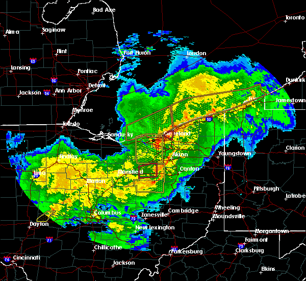 At 557 pm est, a severe thunderstorm capable of producing a tornado was located near cleveland heights, or near cleveland, moving east at 25 mph (radar indicated rotation). Hazards include tornado. Flying debris will be dangerous to those caught without shelter. mobile homes will be damaged or destroyed. damage to roofs, windows, and vehicles will occur. tree damage is likely. this dangerous storm will be near, cleveland heights, warrensville heights and highland hills around 605 pm est. euclid around 615 pm est. Other locations impacted by this tornadic thunderstorm include bratenahl, lyndhurst, south euclid, richmond heights, east cleveland, beachwood, university heights, shaker heights and north randall. At 557 pm est, a severe thunderstorm capable of producing a tornado was located near cleveland heights, or near cleveland, moving east at 25 mph (radar indicated rotation). Hazards include tornado. Flying debris will be dangerous to those caught without shelter. mobile homes will be damaged or destroyed. damage to roofs, windows, and vehicles will occur. tree damage is likely. this dangerous storm will be near, cleveland heights, warrensville heights and highland hills around 605 pm est. euclid around 615 pm est. Other locations impacted by this tornadic thunderstorm include bratenahl, lyndhurst, south euclid, richmond heights, east cleveland, beachwood, university heights, shaker heights and north randall.
|
| 11/5/2017 6:51 PM EDT |
 At 551 pm est, a severe thunderstorm capable of producing a tornado was located over near cleveland, moving east at 25 mph (radar indicated rotation). Hazards include tornado. Flying debris will be dangerous to those caught without shelter. mobile homes will be damaged or destroyed. damage to roofs, windows, and vehicles will occur. tree damage is likely. this dangerous storm will be near, cleveland heights, warrensville heights and highland hills around 605 pm est. euclid around 615 pm est. Other locations impacted by this tornadic thunderstorm include bratenahl, lyndhurst, south euclid, richmond heights, east cleveland, beachwood, university heights, shaker heights and north randall. At 551 pm est, a severe thunderstorm capable of producing a tornado was located over near cleveland, moving east at 25 mph (radar indicated rotation). Hazards include tornado. Flying debris will be dangerous to those caught without shelter. mobile homes will be damaged or destroyed. damage to roofs, windows, and vehicles will occur. tree damage is likely. this dangerous storm will be near, cleveland heights, warrensville heights and highland hills around 605 pm est. euclid around 615 pm est. Other locations impacted by this tornadic thunderstorm include bratenahl, lyndhurst, south euclid, richmond heights, east cleveland, beachwood, university heights, shaker heights and north randall.
|
| 11/5/2017 6:31 PM EDT |
 At 530 pm est, severe thunderstorms were located along a line extending from near avon lake to near lodi, moving northeast at 100 mph (radar indicated). Hazards include 70 mph wind gusts. Expect considerable tree damage. Damage is likely to mobile homes, roofs, and outbuildings. At 530 pm est, severe thunderstorms were located along a line extending from near avon lake to near lodi, moving northeast at 100 mph (radar indicated). Hazards include 70 mph wind gusts. Expect considerable tree damage. Damage is likely to mobile homes, roofs, and outbuildings.
|
| 7/7/2017 7:48 AM EDT |
 At 748 am edt, severe thunderstorms were located along a line extending from 8 miles west of euclid to cleveland to near strongsville to near grafton, moving east at 30 mph (radar indicated). Hazards include 60 mph wind gusts. Expect damage to trees and power lines. Locations impacted include, cleveland, parma, euclid, cleveland heights, strongsville, north royalton, solon, warrensville heights, south russell, highland hills, garfield heights, shaker heights, maple heights, south euclid, parma heights, broadview heights, brook park, mayfield heights, berea and east cleveland. At 748 am edt, severe thunderstorms were located along a line extending from 8 miles west of euclid to cleveland to near strongsville to near grafton, moving east at 30 mph (radar indicated). Hazards include 60 mph wind gusts. Expect damage to trees and power lines. Locations impacted include, cleveland, parma, euclid, cleveland heights, strongsville, north royalton, solon, warrensville heights, south russell, highland hills, garfield heights, shaker heights, maple heights, south euclid, parma heights, broadview heights, brook park, mayfield heights, berea and east cleveland.
|
| 7/7/2017 7:23 AM EDT |
 At 723 am edt, severe thunderstorms were located along a line extending from 13 miles north of lakewood to near avon lake to elyria to 8 miles south of amherst, moving east at 45 mph (radar indicated). Hazards include 60 mph wind gusts. Expect damage to trees and power lines. Locations impacted include, cleveland, lorain, elyria, vermilion, parma, lakewood, euclid, cleveland heights, strongsville, westlake, north royalton, north ridgeville, solon, avon lake, warrensville heights, amherst, grafton, south russell, highland hills and north olmsted. At 723 am edt, severe thunderstorms were located along a line extending from 13 miles north of lakewood to near avon lake to elyria to 8 miles south of amherst, moving east at 45 mph (radar indicated). Hazards include 60 mph wind gusts. Expect damage to trees and power lines. Locations impacted include, cleveland, lorain, elyria, vermilion, parma, lakewood, euclid, cleveland heights, strongsville, westlake, north royalton, north ridgeville, solon, avon lake, warrensville heights, amherst, grafton, south russell, highland hills and north olmsted.
|
| 7/7/2017 7:08 AM EDT |
 At 708 am edt, severe thunderstorms were located along a line extending from 16 miles north of avon lake to 10 miles north of lorain to near western vermilion, moving east at 30 mph (radar indicated). Hazards include 70 mph wind gusts. Expect considerable tree damage. Damage is likely to mobile homes, roofs, and outbuildings. At 708 am edt, severe thunderstorms were located along a line extending from 16 miles north of avon lake to 10 miles north of lorain to near western vermilion, moving east at 30 mph (radar indicated). Hazards include 70 mph wind gusts. Expect considerable tree damage. Damage is likely to mobile homes, roofs, and outbuildings.
|
| 6/19/2017 4:58 PM EDT |
 At 458 pm edt, a severe thunderstorm was located near avon lake, or near lorain, moving east at 45 mph (radar indicated). Hazards include 60 mph wind gusts and penny size hail. expect damage to trees and power lines At 458 pm edt, a severe thunderstorm was located near avon lake, or near lorain, moving east at 45 mph (radar indicated). Hazards include 60 mph wind gusts and penny size hail. expect damage to trees and power lines
|
| 5/30/2017 12:27 AM EDT |
 The severe thunderstorm warning for eastern cuyahoga county will expire at 1230 am edt, the storm which prompted the warning has weakened below severe limits, and has moved east of cuyahoga county. therefore, the warning will be allowed to expire. The severe thunderstorm warning for eastern cuyahoga county will expire at 1230 am edt, the storm which prompted the warning has weakened below severe limits, and has moved east of cuyahoga county. therefore, the warning will be allowed to expire.
|
| 5/30/2017 12:11 AM EDT |
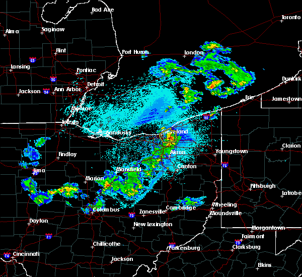 At 1210 am edt, a severe thunderstorm was located over warrensville heights, or 12 miles southeast of cleveland, moving east at 40 mph (radar indicated). Hazards include 60 mph wind gusts and quarter size hail. Minor damage to vehicles is possible. expect damage to trees and power lines. Locations impacted include, cleveland, euclid, cleveland heights, solon, warrensville heights, highland hills, garfield heights, shaker heights, maple heights, south euclid, mayfield heights, east cleveland, lyndhurst, brecksville, university heights, bedford, beachwood, bedford heights and richmond heights. At 1210 am edt, a severe thunderstorm was located over warrensville heights, or 12 miles southeast of cleveland, moving east at 40 mph (radar indicated). Hazards include 60 mph wind gusts and quarter size hail. Minor damage to vehicles is possible. expect damage to trees and power lines. Locations impacted include, cleveland, euclid, cleveland heights, solon, warrensville heights, highland hills, garfield heights, shaker heights, maple heights, south euclid, mayfield heights, east cleveland, lyndhurst, brecksville, university heights, bedford, beachwood, bedford heights and richmond heights.
|
| 5/29/2017 11:40 PM EDT |
 At 1140 pm edt, a severe thunderstorm was located near strongsville, or 9 miles east of elyria, moving northeast at 55 mph (radar indicated). Hazards include 60 mph wind gusts and quarter size hail. Minor damage to vehicles is possible. Expect damage to trees and power lines. At 1140 pm edt, a severe thunderstorm was located near strongsville, or 9 miles east of elyria, moving northeast at 55 mph (radar indicated). Hazards include 60 mph wind gusts and quarter size hail. Minor damage to vehicles is possible. Expect damage to trees and power lines.
|
| 5/28/2017 6:33 PM EDT |
 At 631 pm edt, a severe thunderstorm was located near hudson, or 11 miles northwest of ravenna, moving east at 30 mph. an additional area of strong winds was located over southwestern lake county (radar indicated). Hazards include 60 mph wind gusts. Expect damage to trees and power lines. Locations impacted include, willowick, cuyahoga falls, euclid, mentor, solon, willoughby, hudson, twinsburg, eastlake, warrensville heights, macedonia, south russell, highland hills, timberlake, lakeline, stow, garfield heights, shaker heights and maple heights. At 631 pm edt, a severe thunderstorm was located near hudson, or 11 miles northwest of ravenna, moving east at 30 mph. an additional area of strong winds was located over southwestern lake county (radar indicated). Hazards include 60 mph wind gusts. Expect damage to trees and power lines. Locations impacted include, willowick, cuyahoga falls, euclid, mentor, solon, willoughby, hudson, twinsburg, eastlake, warrensville heights, macedonia, south russell, highland hills, timberlake, lakeline, stow, garfield heights, shaker heights and maple heights.
|
| 5/28/2017 6:16 PM EDT |
 At 616 pm edt, a severe thunderstorm was located near macedonia, or 14 miles southeast of cleveland, moving northeast at 30 mph (radar indicated). Hazards include 60 mph wind gusts and quarter size hail. Minor damage to vehicles is possible. Expect damage to trees and power lines. At 616 pm edt, a severe thunderstorm was located near macedonia, or 14 miles southeast of cleveland, moving northeast at 30 mph (radar indicated). Hazards include 60 mph wind gusts and quarter size hail. Minor damage to vehicles is possible. Expect damage to trees and power lines.
|
| 3/30/2017 10:59 PM EDT |
 At 1058 pm edt, a severe thunderstorm was located over timberlake, or near willowick, moving northeast at 60 mph (radar indicated. locations impacted include, painesville, willowick, fairport harbor, euclid, mentor, willoughby, eastlake, perry, timberlake, lakeline, wickliffe, willoughby hills, highland heights, mentor-on-the-lake, kirtland, mayfield, gates mills, north perry, kirtland hills and waite hill). Hazards include quarter size hail. At 1058 pm edt, a severe thunderstorm was located over timberlake, or near willowick, moving northeast at 60 mph (radar indicated. locations impacted include, painesville, willowick, fairport harbor, euclid, mentor, willoughby, eastlake, perry, timberlake, lakeline, wickliffe, willoughby hills, highland heights, mentor-on-the-lake, kirtland, mayfield, gates mills, north perry, kirtland hills and waite hill). Hazards include quarter size hail.
|
| 3/30/2017 10:49 PM EDT |
 At 1048 pm edt, a severe thunderstorm was located over euclid, or over willowick, moving northeast at 45 mph (radar indicated). Hazards include quarter size hail. damage to vehicles is expected At 1048 pm edt, a severe thunderstorm was located over euclid, or over willowick, moving northeast at 45 mph (radar indicated). Hazards include quarter size hail. damage to vehicles is expected
|
| 3/30/2017 10:31 PM EDT | Half Dollar sized hail reported 4 miles NE of Cleveland, OH |
| 3/30/2017 10:30 PM EDT | Quarter sized hail reported 6.4 miles NNE of Cleveland, OH |
| 3/1/2017 5:36 AM EST |
 At 535 am est, severe thunderstorms capable of producing both tornadoes and extensive straight line wind damage were located over warrensville heights, or 8 miles southeast of cleveland, moving southeast at 40 mph (radar indicated rotation). Hazards include tornado. Flying debris will be dangerous to those caught without shelter. mobile homes will be damaged or destroyed. damage to roofs, windows, and vehicles will occur. tree damage is likely. these dangerous storms will be near, macedonia around 540 am est. solon around 545 am est. twinsburg around 550 am est. Other locations impacted by this tornadic thunderstorm include north randall, valley view, bentleyville, orange, seven hills, peninsula, glenwillow, broadview heights, garfield heights and boston heights. At 535 am est, severe thunderstorms capable of producing both tornadoes and extensive straight line wind damage were located over warrensville heights, or 8 miles southeast of cleveland, moving southeast at 40 mph (radar indicated rotation). Hazards include tornado. Flying debris will be dangerous to those caught without shelter. mobile homes will be damaged or destroyed. damage to roofs, windows, and vehicles will occur. tree damage is likely. these dangerous storms will be near, macedonia around 540 am est. solon around 545 am est. twinsburg around 550 am est. Other locations impacted by this tornadic thunderstorm include north randall, valley view, bentleyville, orange, seven hills, peninsula, glenwillow, broadview heights, garfield heights and boston heights.
|
| 3/1/2017 5:28 AM EST |
 At 528 am est, severe thunderstorms were located along a line extending from fairport harbor to near cleveland to 7 miles east of wellington, moving east at 60 mph (radar indicated). Hazards include 60 mph wind gusts and quarter size hail. Hail damage to vehicles is expected. expect wind damage to roofs, siding, and trees. Locations impacted include, cleveland, painesville, willowick, chardon, fairport harbor, parma, lakewood, euclid, mentor, cleveland heights, strongsville, north royalton, solon, willoughby, twinsburg, eastlake, warrensville heights, macedonia, grafton and south russell. At 528 am est, severe thunderstorms were located along a line extending from fairport harbor to near cleveland to 7 miles east of wellington, moving east at 60 mph (radar indicated). Hazards include 60 mph wind gusts and quarter size hail. Hail damage to vehicles is expected. expect wind damage to roofs, siding, and trees. Locations impacted include, cleveland, painesville, willowick, chardon, fairport harbor, parma, lakewood, euclid, mentor, cleveland heights, strongsville, north royalton, solon, willoughby, twinsburg, eastlake, warrensville heights, macedonia, grafton and south russell.
|
| 3/1/2017 5:09 AM EST |
 At 509 am est, severe thunderstorms were located along a line extending from 10 miles northwest of timberlake to near westlake, moving east at 55 mph (radar indicated). Hazards include 60 mph wind gusts and quarter size hail. Hail damage to vehicles is expected. Expect wind damage to roofs, siding, and trees. At 509 am est, severe thunderstorms were located along a line extending from 10 miles northwest of timberlake to near westlake, moving east at 55 mph (radar indicated). Hazards include 60 mph wind gusts and quarter size hail. Hail damage to vehicles is expected. Expect wind damage to roofs, siding, and trees.
|
| 3/1/2017 2:10 AM EST |
 At 209 am est, severe thunderstorms were located along a line extending from near cleveland heights to near middlefield to near newton falls, moving east at 80 mph (radar indicated). Hazards include 70 mph wind gusts. Expect considerable tree damage. Damage is likely to mobile homes, roofs, and outbuildings. At 209 am est, severe thunderstorms were located along a line extending from near cleveland heights to near middlefield to near newton falls, moving east at 80 mph (radar indicated). Hazards include 70 mph wind gusts. Expect considerable tree damage. Damage is likely to mobile homes, roofs, and outbuildings.
|
| 3/1/2017 1:51 AM EST | Storm damage reported in cuyahoga county OH, 9.1 miles ENE of Cleveland, OH |
| 3/1/2017 1:15 AM EST |
 At 115 am est, severe thunderstorms were located along a line extending from norwalk to near medina to rittman to 7 miles west of wooster, moving east at 95 mph (radar indicated). Hazards include 70 mph wind gusts and quarter size hail. Hail damage to vehicles is expected. expect considerable tree damage. Wind damage is also likely to mobile homes, roofs, and outbuildings. At 115 am est, severe thunderstorms were located along a line extending from norwalk to near medina to rittman to 7 miles west of wooster, moving east at 95 mph (radar indicated). Hazards include 70 mph wind gusts and quarter size hail. Hail damage to vehicles is expected. expect considerable tree damage. Wind damage is also likely to mobile homes, roofs, and outbuildings.
|
| 9/10/2016 5:24 PM EDT |
 At 522 pm edt, severe thunderstorms were located along a line extending from 8 miles north of fairport harbor to warrensville heights, moving northeast at 40 mph. wind gusts to 54 mph have been reported when the storms passed over cleveland hopkins airport (radar indicated). Hazards include 60 mph wind gusts and nickel size hail. Expect damage to roofs. siding and trees. Locations impacted include, cleveland, painesville, willowick, chardon, fairport harbor, geneva-on-the-lake, parma, euclid, mentor, cleveland heights, north royalton, solon, willoughby, twinsburg, eastlake, warrensville heights, macedonia, south russell, madison and middlefield. At 522 pm edt, severe thunderstorms were located along a line extending from 8 miles north of fairport harbor to warrensville heights, moving northeast at 40 mph. wind gusts to 54 mph have been reported when the storms passed over cleveland hopkins airport (radar indicated). Hazards include 60 mph wind gusts and nickel size hail. Expect damage to roofs. siding and trees. Locations impacted include, cleveland, painesville, willowick, chardon, fairport harbor, geneva-on-the-lake, parma, euclid, mentor, cleveland heights, north royalton, solon, willoughby, twinsburg, eastlake, warrensville heights, macedonia, south russell, madison and middlefield.
|
| 9/10/2016 4:55 PM EDT |
 At 454 pm edt, severe thunderstorms were located along a line extending from 8 miles northwest of lakeline to strongsville, moving northeast at 40 mph (radar indicated). Hazards include 60 mph wind gusts and nickel size hail. Expect damage to roofs. Siding and trees. At 454 pm edt, severe thunderstorms were located along a line extending from 8 miles northwest of lakeline to strongsville, moving northeast at 40 mph (radar indicated). Hazards include 60 mph wind gusts and nickel size hail. Expect damage to roofs. Siding and trees.
|
| 9/10/2016 4:35 PM EDT |
 At 412 pm edt, severe thunderstorms were located along a line extending from lorain to near wellington, moving northeast at 45 mph (radar indicated). Hazards include 60 mph wind gusts and quarter size hail. Hail damage to vehicles is expected. Expect wind damage to roofs, siding and trees. At 412 pm edt, severe thunderstorms were located along a line extending from lorain to near wellington, moving northeast at 45 mph (radar indicated). Hazards include 60 mph wind gusts and quarter size hail. Hail damage to vehicles is expected. Expect wind damage to roofs, siding and trees.
|
| 9/10/2016 4:12 PM EDT |
 At 412 pm edt, severe thunderstorms were located along a line extending from lorain to near wellington, moving northeast at 45 mph (radar indicated). Hazards include 60 mph wind gusts and quarter size hail. Hail damage to vehicles is expected. Expect wind damage to roofs, siding and trees. At 412 pm edt, severe thunderstorms were located along a line extending from lorain to near wellington, moving northeast at 45 mph (radar indicated). Hazards include 60 mph wind gusts and quarter size hail. Hail damage to vehicles is expected. Expect wind damage to roofs, siding and trees.
|
| 8/11/2016 4:53 PM EDT |
 At 453 pm edt, a severe thunderstorm was located over lakewood, or near cleveland, moving east at 25 mph (radar indicated). Hazards include 60 mph wind gusts and penny size hail. Expect damage to roofs. siding and trees. Locations impacted include, cleveland, parma, lakewood, euclid, cleveland heights, strongsville, north royalton, solon, warrensville heights, highland hills, garfield heights, shaker heights, maple heights, south euclid, parma heights, rocky river, broadview heights, brook park, mayfield heights and east cleveland. At 453 pm edt, a severe thunderstorm was located over lakewood, or near cleveland, moving east at 25 mph (radar indicated). Hazards include 60 mph wind gusts and penny size hail. Expect damage to roofs. siding and trees. Locations impacted include, cleveland, parma, lakewood, euclid, cleveland heights, strongsville, north royalton, solon, warrensville heights, highland hills, garfield heights, shaker heights, maple heights, south euclid, parma heights, rocky river, broadview heights, brook park, mayfield heights and east cleveland.
|
| 8/11/2016 4:30 PM EDT |
 At 430 pm edt, a severe thunderstorm was located over westlake, or 9 miles northeast of elyria, moving east at 25 mph (radar indicated). Hazards include 60 mph wind gusts and penny size hail. Expect damage to roofs. Siding and trees. At 430 pm edt, a severe thunderstorm was located over westlake, or 9 miles northeast of elyria, moving east at 25 mph (radar indicated). Hazards include 60 mph wind gusts and penny size hail. Expect damage to roofs. Siding and trees.
|
| 8/9/2016 10:39 PM EDT |
 The severe thunderstorm warning for lake and northern geauga counties will expire at 1045 pm edt, the storms which prompted the warning have weakened below severe limits, and no longer pose an immediate threat to life or property. therefore the warning will be allowed to expire. The severe thunderstorm warning for lake and northern geauga counties will expire at 1045 pm edt, the storms which prompted the warning have weakened below severe limits, and no longer pose an immediate threat to life or property. therefore the warning will be allowed to expire.
|
| 8/9/2016 10:18 PM EDT |
 At 1017 pm edt, severe thunderstorms were located along a line extending from near timberlake to near chardon, moving east at 40 mph (radar indicated). Hazards include 60 mph wind gusts and quarter size hail. Hail damage to vehicles is expected. expect wind damage to roofs, siding and trees. Locations impacted include, painesville, willowick, chardon, fairport harbor, mentor, willoughby, eastlake, madison, perry, timberlake, lakeline, chesterland, wickliffe, willoughby hills, highland heights, mentor-on-the-lake, kirtland, chagrin falls, mayfield and gates mills. At 1017 pm edt, severe thunderstorms were located along a line extending from near timberlake to near chardon, moving east at 40 mph (radar indicated). Hazards include 60 mph wind gusts and quarter size hail. Hail damage to vehicles is expected. expect wind damage to roofs, siding and trees. Locations impacted include, painesville, willowick, chardon, fairport harbor, mentor, willoughby, eastlake, madison, perry, timberlake, lakeline, chesterland, wickliffe, willoughby hills, highland heights, mentor-on-the-lake, kirtland, chagrin falls, mayfield and gates mills.
|
| 8/9/2016 10:10 PM EDT | Cuyahoga county airport. kcgf in cuyahoga county OH, 12.9 miles WSW of Cleveland, OH |
| 8/9/2016 10:10 PM EDT | Multiple trees dow in cuyahoga county OH, 3 miles NW of Cleveland, OH |
| 8/9/2016 10:10 PM EDT | Cuyahoga county airport. kcgf in cuyahoga county OH, 12.3 miles WSW of Cleveland, OH |
| 8/9/2016 10:10 PM EDT | Multiple trees dow in cuyahoga county OH, 7.5 miles WSW of Cleveland, OH |
| 8/9/2016 9:55 PM EDT |
 At 955 pm edt, severe thunderstorms were located along a line extending from 6 miles north of cleveland to near solon, moving northeast at 40 mph (radar indicated). Hazards include 60 mph wind gusts and quarter size hail. Hail damage to vehicles is expected. Expect wind damage to roofs, siding and trees. At 955 pm edt, severe thunderstorms were located along a line extending from 6 miles north of cleveland to near solon, moving northeast at 40 mph (radar indicated). Hazards include 60 mph wind gusts and quarter size hail. Hail damage to vehicles is expected. Expect wind damage to roofs, siding and trees.
|
| 7/18/2016 5:34 AM EDT |
 At 533 am edt, a severe thunderstorm was located over lorain, moving east at 40 mph (radar indicated). Hazards include 60 mph wind gusts. Expect damage to roofs. Siding and trees. At 533 am edt, a severe thunderstorm was located over lorain, moving east at 40 mph (radar indicated). Hazards include 60 mph wind gusts. Expect damage to roofs. Siding and trees.
|
| 7/13/2016 10:16 PM EDT |
 At 1016 pm edt, severe thunderstorms were located along a line extending from near cleveland heights to near massillon, moving southeast at 30 mph (radar indicated). Hazards include 60 mph wind gusts. Expect damage to roofs. Siding and trees. At 1016 pm edt, severe thunderstorms were located along a line extending from near cleveland heights to near massillon, moving southeast at 30 mph (radar indicated). Hazards include 60 mph wind gusts. Expect damage to roofs. Siding and trees.
|
| 6/16/2016 1:21 PM EDT |
 At 121 pm edt, severe thunderstorms were located along a line extending from near macedonia to near cuyahoga falls to near wadsworth, moving east at 30 mph (radar indicated). Hazards include 60 mph wind gusts and quarter size hail. Hail damage to vehicles is expected. Expect wind damage to roofs, siding and trees. At 121 pm edt, severe thunderstorms were located along a line extending from near macedonia to near cuyahoga falls to near wadsworth, moving east at 30 mph (radar indicated). Hazards include 60 mph wind gusts and quarter size hail. Hail damage to vehicles is expected. Expect wind damage to roofs, siding and trees.
|
| 6/5/2016 3:31 PM EDT |
 At 330 pm edt, severe thunderstorms were located along a line extending from near highland hills to near wadsworth, moving east at 45 mph (radar indicated). Hazards include 60 mph wind gusts and quarter size hail. Hail damage to vehicles is expected. Expect wind damage to roofs, siding and trees. At 330 pm edt, severe thunderstorms were located along a line extending from near highland hills to near wadsworth, moving east at 45 mph (radar indicated). Hazards include 60 mph wind gusts and quarter size hail. Hail damage to vehicles is expected. Expect wind damage to roofs, siding and trees.
|
| 6/5/2016 3:16 PM EDT |
 At 315 pm edt, a severe thunderstorm was located near parma, or near cleveland, moving northeast at 45 mph. in addition, another another severe thunderstorm was located near lorain, moving east at 45 mph (radar indicated). Hazards include 60 mph wind gusts and quarter size hail. Hail damage to vehicles is expected. expect wind damage to roofs, siding and trees. Locations impacted include, cleveland, lorain, elyria, willowick, parma, lakewood, euclid, mentor, cleveland heights, strongsville, westlake, north royalton, north ridgeville, solon, avon lake, willoughby, eastlake, warrensville heights, amherst and grafton. At 315 pm edt, a severe thunderstorm was located near parma, or near cleveland, moving northeast at 45 mph. in addition, another another severe thunderstorm was located near lorain, moving east at 45 mph (radar indicated). Hazards include 60 mph wind gusts and quarter size hail. Hail damage to vehicles is expected. expect wind damage to roofs, siding and trees. Locations impacted include, cleveland, lorain, elyria, willowick, parma, lakewood, euclid, mentor, cleveland heights, strongsville, westlake, north royalton, north ridgeville, solon, avon lake, willoughby, eastlake, warrensville heights, amherst and grafton.
|
| 6/5/2016 2:52 PM EDT |
 At 252 pm edt, severe thunderstorms were located along a line extending from near timberlake to near grafton, moving east at 50 mph (radar indicated). Hazards include 60 mph wind gusts and quarter size hail. Hail damage to vehicles is expected. Expect wind damage to roofs, siding and trees. At 252 pm edt, severe thunderstorms were located along a line extending from near timberlake to near grafton, moving east at 50 mph (radar indicated). Hazards include 60 mph wind gusts and quarter size hail. Hail damage to vehicles is expected. Expect wind damage to roofs, siding and trees.
|
| 5/29/2016 9:08 PM EDT |
 At 906 pm edt, a severe thunderstorm was located from near berea to near the lake erie shoreline, moving east at 25 mph (radar indicated). Hazards include 60 mph wind gusts. Expect damage to roofs. siding. and trees. Locations impacted include, cleveland, parma, lakewood, strongsville, north royalton, north olmsted, parma heights, rocky river, broadview heights, brook park, berea, fairview park, middleburg heights, brooklyn, olmsted falls and linndale. At 906 pm edt, a severe thunderstorm was located from near berea to near the lake erie shoreline, moving east at 25 mph (radar indicated). Hazards include 60 mph wind gusts. Expect damage to roofs. siding. and trees. Locations impacted include, cleveland, parma, lakewood, strongsville, north royalton, north olmsted, parma heights, rocky river, broadview heights, brook park, berea, fairview park, middleburg heights, brooklyn, olmsted falls and linndale.
|
| 5/29/2016 8:41 PM EDT |
 At 841 pm edt, a severe thunderstorm was located over westlake, or 9 miles northeast of elyria, moving east at 15 mph (radar indicated). Hazards include 60 mph wind gusts. Expect damage to roofs. siding. And trees. At 841 pm edt, a severe thunderstorm was located over westlake, or 9 miles northeast of elyria, moving east at 15 mph (radar indicated). Hazards include 60 mph wind gusts. Expect damage to roofs. siding. And trees.
|
| 8/3/2015 8:30 PM EDT |
 At 830 pm edt, a severe thunderstorm was located over cleveland heights, or 8 miles southwest of willowick, moving east at 40 mph (radar indicated). Hazards include 60 mph wind gusts and quarter size hail. Hail damage to vehicles is expected. Expect wind damage to roofs, siding and trees. At 830 pm edt, a severe thunderstorm was located over cleveland heights, or 8 miles southwest of willowick, moving east at 40 mph (radar indicated). Hazards include 60 mph wind gusts and quarter size hail. Hail damage to vehicles is expected. Expect wind damage to roofs, siding and trees.
|
| 7/14/2015 1:29 PM EDT |
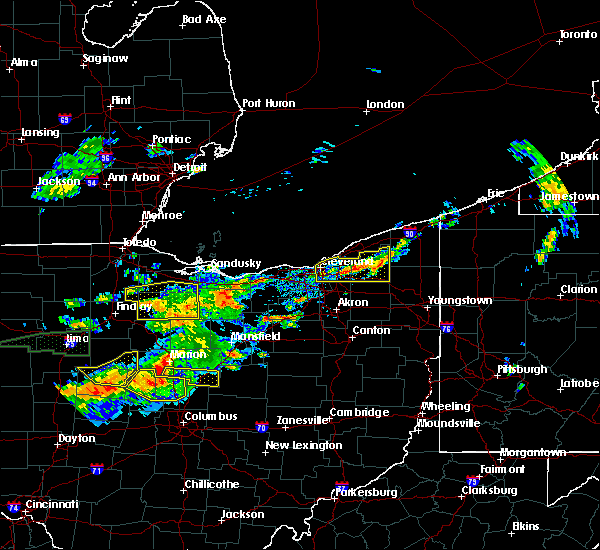 At 129 pm edt, a severe thunderstorm was located near south russell, or 8 miles southwest of chardon, moving east at 25 mph (radar indicated). Hazards include 60 mph wind gusts and quarter size hail. Hail damage to vehicles is expected. expect wind damage to roofs, siding and trees. Locations impacted include, cleveland, chardon, parma, cleveland heights, solon, warrensville heights, south russell, middlefield, burton, highland hills, chesterland, garfield heights, shaker heights, maple heights, south euclid, broadview heights, mayfield heights, lyndhurst, university heights and bedford. At 129 pm edt, a severe thunderstorm was located near south russell, or 8 miles southwest of chardon, moving east at 25 mph (radar indicated). Hazards include 60 mph wind gusts and quarter size hail. Hail damage to vehicles is expected. expect wind damage to roofs, siding and trees. Locations impacted include, cleveland, chardon, parma, cleveland heights, solon, warrensville heights, south russell, middlefield, burton, highland hills, chesterland, garfield heights, shaker heights, maple heights, south euclid, broadview heights, mayfield heights, lyndhurst, university heights and bedford.
|
| 7/14/2015 1:02 PM EDT |
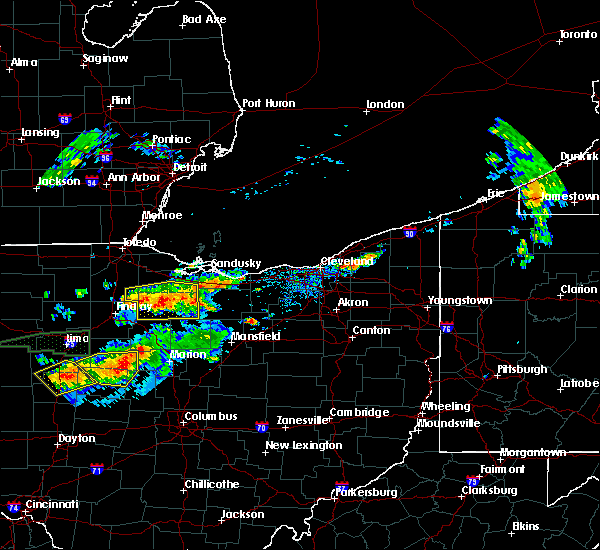 At 102 pm edt, a severe thunderstorm was located near highland hills, or 9 miles south of willowick, moving east at 15 mph (radar indicated). Hazards include 60 mph wind gusts and quarter size hail. Hail damage to vehicles is expected. Expect wind damage to roofs, siding and trees. At 102 pm edt, a severe thunderstorm was located near highland hills, or 9 miles south of willowick, moving east at 15 mph (radar indicated). Hazards include 60 mph wind gusts and quarter size hail. Hail damage to vehicles is expected. Expect wind damage to roofs, siding and trees.
|
| 6/23/2015 5:28 AM EDT |
 At 527 am edt, a severe thunderstorm was located over avon lake, or 8 miles northeast of lorain, moving east at 40 mph (radar indicated). Hazards include 70 mph wind gusts. Expect considerable tree damage. Damage is likely to mobile homes, roofs and outbuildings. At 527 am edt, a severe thunderstorm was located over avon lake, or 8 miles northeast of lorain, moving east at 40 mph (radar indicated). Hazards include 70 mph wind gusts. Expect considerable tree damage. Damage is likely to mobile homes, roofs and outbuildings.
|
| 6/23/2015 4:34 AM EDT |
 At 433 am edt, severe thunderstorms were located along a line extending from near orwell to south russell to near north ridgeville, moving east at 50 mph (radar indicated). Hazards include 60 mph wind gusts. Expect considerable tree damage. damage is likely to mobile homes, roofs and outbuildings. Locations impacted include, cleveland, parma, lakewood, euclid, cleveland heights, strongsville, brunswick, westlake, north royalton, solon, warrensville heights, highland hills, north olmsted, garfield heights, shaker heights, maple heights, south euclid, parma heights, rocky river and broadview heights. At 433 am edt, severe thunderstorms were located along a line extending from near orwell to south russell to near north ridgeville, moving east at 50 mph (radar indicated). Hazards include 60 mph wind gusts. Expect considerable tree damage. damage is likely to mobile homes, roofs and outbuildings. Locations impacted include, cleveland, parma, lakewood, euclid, cleveland heights, strongsville, brunswick, westlake, north royalton, solon, warrensville heights, highland hills, north olmsted, garfield heights, shaker heights, maple heights, south euclid, parma heights, rocky river and broadview heights.
|
| 6/23/2015 4:25 AM EDT |
 At 423 am edt, severe thunderstorms were located along a line extending from near chardon to near warrensville heights to near amherst, moving east at 50 mph. a 52 mph wind gust has been measured at burke lakefront airport in downtown cleveland (radar indicated). Hazards include 70 mph wind gusts. Expect considerable tree damage. damage is likely to mobile homes, roofs and outbuildings. Locations impacted include, cleveland, lorain, elyria, vermilion, parma, lakewood, euclid, cleveland heights, strongsville, brunswick, westlake, north royalton, north ridgeville, solon, avon lake, warrensville heights, amherst, grafton, highland hills and north olmsted. At 423 am edt, severe thunderstorms were located along a line extending from near chardon to near warrensville heights to near amherst, moving east at 50 mph. a 52 mph wind gust has been measured at burke lakefront airport in downtown cleveland (radar indicated). Hazards include 70 mph wind gusts. Expect considerable tree damage. damage is likely to mobile homes, roofs and outbuildings. Locations impacted include, cleveland, lorain, elyria, vermilion, parma, lakewood, euclid, cleveland heights, strongsville, brunswick, westlake, north royalton, north ridgeville, solon, avon lake, warrensville heights, amherst, grafton, highland hills and north olmsted.
|
| 6/23/2015 3:56 AM EDT |
 At 355 am edt, severe thunderstorms were located along a line extending from near mentor to near cleveland to near vermilion, moving east at 80 mph (radar indicated). Hazards include 70 mph wind gusts. Expect considerable tree damage. Damage is likely to mobile homes, roofs and outbuildings. At 355 am edt, severe thunderstorms were located along a line extending from near mentor to near cleveland to near vermilion, moving east at 80 mph (radar indicated). Hazards include 70 mph wind gusts. Expect considerable tree damage. Damage is likely to mobile homes, roofs and outbuildings.
|
| 6/22/2015 5:56 PM EDT |
 At 553 pm edt, several strong to severe thunderstorms were located from eastern lorain county across cuyahoga county moving east at 45 mph (radar indicated). Hazards include 60 mph wind gusts and quarter size hail. Hail damage to vehicles is expected. expect wind damage to roofs, siding and trees. Locations impacted include, cleveland, lorain, elyria, parma, lakewood, euclid, cleveland heights, strongsville, brunswick, westlake, north royalton, north ridgeville, solon, avon lake, warrensville heights, amherst, grafton, highland hills, north olmsted and garfield heights. At 553 pm edt, several strong to severe thunderstorms were located from eastern lorain county across cuyahoga county moving east at 45 mph (radar indicated). Hazards include 60 mph wind gusts and quarter size hail. Hail damage to vehicles is expected. expect wind damage to roofs, siding and trees. Locations impacted include, cleveland, lorain, elyria, parma, lakewood, euclid, cleveland heights, strongsville, brunswick, westlake, north royalton, north ridgeville, solon, avon lake, warrensville heights, amherst, grafton, highland hills, north olmsted and garfield heights.
|
| 6/22/2015 5:26 PM EDT |
 At 526 pm edt, a severe thunderstorm was located over amherst, or near lorain, moving east at 45 mph (radar indicated). Hazards include 60 mph wind gusts and quarter size hail. Hail damage to vehicles is expected. Expect wind damage to roofs, siding and trees. At 526 pm edt, a severe thunderstorm was located over amherst, or near lorain, moving east at 45 mph (radar indicated). Hazards include 60 mph wind gusts and quarter size hail. Hail damage to vehicles is expected. Expect wind damage to roofs, siding and trees.
|
| 5/30/2015 7:15 PM EDT | At 715 pm edt, a severe thunderstorm was located near chesterland, or 12 miles west of chardon, moving northeast at 30 mph (radar indicated). Hazards include 60 mph wind gusts and penny size hail. Expect damage to roofs. siding and trees. Locations impacted include, euclid, cleveland heights, solon, willoughby, eastlake, warrensville heights, south russell, highland hills, timberlake, lakeline, chesterland, garfield heights, shaker heights, maple heights, south euclid, mayfield heights, east cleveland, lyndhurst, university heights and bedford. |
| 5/30/2015 6:59 PM EDT | Quarter sized hail reported 5.9 miles NW of Cleveland, OH |
| 5/30/2015 6:56 PM EDT | At 656 pm edt, a severe thunderstorm was located near warrensville heights, or 22 miles southwest of chardon, moving northeast at 30 mph (radar indicated). Hazards include 60 mph wind gusts and penny size hail. Expect damage to roofs. Siding and trees. |
| 5/30/2015 6:00 PM EDT | At 558 pm edt, a severe thunderstorm was located near macedonia, or 18 miles north of akron, moving east at 15 mph. another severe thunderstorm was located near cuyahoga heights and was also moving east at 15 mph (radar indicated). Hazards include 60 mph wind gusts and nickel size hail. Expect damage to roofs. Siding and trees. |
| 5/30/2015 5:25 PM EDT | At 524 pm edt, a severe thunderstorm was located near cleveland heights, moving northeast at 30 mph (trained weather spotters). Hazards include 60 mph wind gusts and penny size hail. Expect damage to roofs. siding and trees. Locations impacted include, parma, euclid, cleveland heights, shaker heights, south euclid, mayfield heights, east cleveland, lyndhurst, university heights, wickliffe, beachwood, seven hills, brooklyn, richmond heights, willoughby hills, highland heights, mayfield, gates mills, newburgh heights and brooklyn heights. |
| 5/30/2015 5:20 PM EDT | At 520 pm edt, a severe thunderstorm was located near lakewood, or 22 miles east of elyria, moving northeast at 25 mph (radar indicated). Hazards include 60 mph wind gusts and nickel size hail. Expect damage to roofs. Siding and trees. |
| 5/27/2015 6:08 PM EDT | The severe thunderstorm warning for southwestern cuyahoga and northern lorain counties will expire at 615 pm edt, the storm which prompted the warning has weakened below severe limits, and no longer pose an immediate threat to life or property. therefore the warning will be allowed to expire. a severe thunderstorm watch remains in effect until 700 pm edt for north central ohio. |
| 5/27/2015 5:42 PM EDT | At 542 pm edt, a severe thunderstorm was located near north ridgeville, or near elyria, moving east at 25 mph (radar indicated). Hazards include 60 mph wind gusts and penny size hail. Expect damage to roofs. Siding and trees. |
| 5/11/2015 7:16 PM EDT | At 705 pm edt, a severe thunderstorm was located near solon, and moving east at 50 mph (radar indicated). Hazards include 60 mph wind gusts. Expect damage to roofs. siding and trees. locations impacted include, , <. 75in. |
| 5/11/2015 6:48 PM EDT | At 647 pm edt, a severe thunderstorm was located 6 miles east of north royalton, and moving east at 50 mph (radar indicated). Hazards include 60 mph wind gusts. Expect damage to roofs. Siding and trees. |
| 7/23/2013 2:35 PM EDT | Quarter sized hail reported 7.5 miles WSW of Cleveland, OH, quarter size hail. |
| 7/23/2013 2:34 PM EDT | Quarter sized hail reported 1.1 miles SW of Cleveland, OH, pea to quarter size hail near downtown. |
| 7/23/2013 2:23 PM EDT | Quarter sized hail reported 1.1 miles SW of Cleveland, OH |
| 7/23/2013 2:15 PM EDT | Quarter sized hail reported 1.1 miles SW of Cleveland, OH |
| 7/20/2013 3:35 AM EDT | Damage to gymnasium at ursuline college. also had trees down. time estimaed from rada in cuyahoga county OH, 12.1 miles W of Cleveland, OH |
| 7/10/2013 3:41 PM EDT | Storm damage reported in cuyahoga county OH, 1.1 miles SW of Cleveland, OH |
| 7/10/2013 3:41 PM EDT | Wall blew out at tower city rta station and part of roof of cleveland city hall blown off and or damage in cuyahoga county OH, 1.1 miles SW of Cleveland, OH |
| 7/10/2013 2:30 PM EDT | Quarter sized hail reported 8.9 miles WNW of Cleveland, OH |
| 7/10/2013 2:25 PM EDT | Quarter sized hail reported 12.1 miles W of Cleveland, OH |
| 7/10/2013 2:22 PM EDT | Quarter sized hail reported 9.2 miles WNW of Cleveland, OH |
| 6/25/2013 4:00 PM EDT | Tree down on a house on west side of clevelan in cuyahoga county OH, 1.1 miles SW of Cleveland, OH |
| 6/25/2013 3:52 PM EDT | Storm damage reported in cuyahoga county OH, 1.1 miles SW of Cleveland, OH |
| 5/10/2013 2:22 PM EDT | Quarter sized hail reported 6.1 miles SW of Cleveland, OH, quarter size hail at south euclid road and green road. |
| 7/26/2012 6:52 PM EDT | Several trees dow in cuyahoga county OH, 5.4 miles W of Cleveland, OH |
| 1/1/0001 12:00 AM | Numerous trees and limbs down along shoreway...lake avenue...85th and yacht clu in cuyahoga county OH, 1.1 miles SW of Cleveland, OH |
| 1/1/0001 12:00 AM | Quarter sized hail reported 1.1 miles SW of Cleveland, OH, public reported quarter size hail. |
| 1/1/0001 12:00 AM | Quarter sized hail reported 1.1 miles SW of Cleveland, OH |
| 1/1/0001 12:00 AM | Quarter sized hail reported 1.1 miles SW of Cleveland, OH |
| 1/1/0001 12:00 AM | A few trees down in cuyahoga county OH, 3.9 miles WSW of Cleveland, OH |
| 1/1/0001 12:00 AM | Numerous trees down throughout cuyahoga count in cuyahoga county OH, 1.1 miles SW of Cleveland, OH |
| 1/1/0001 12:00 AM | Large branches broke in cuyahoga county OH, 1.1 miles SW of Cleveland, OH |
| 1/1/0001 12:00 AM | Quarter sized hail reported 1.1 miles SW of Cleveland, OH |
Hail Maps for Cleveland, OH
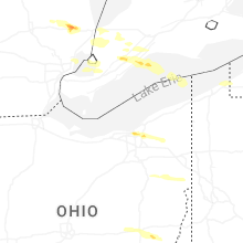
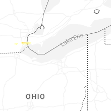
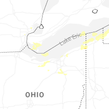
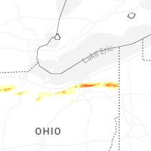
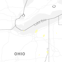
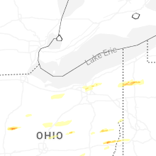
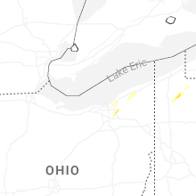


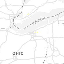


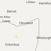


Connect with Interactive Hail Maps