

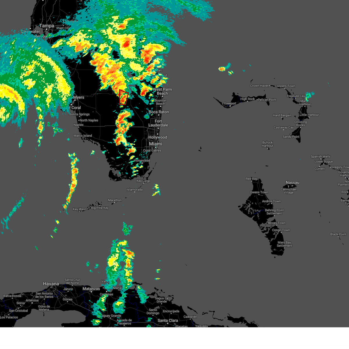
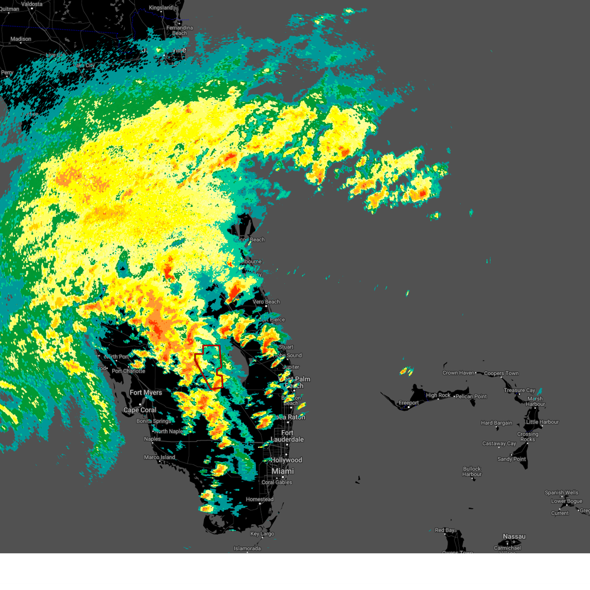
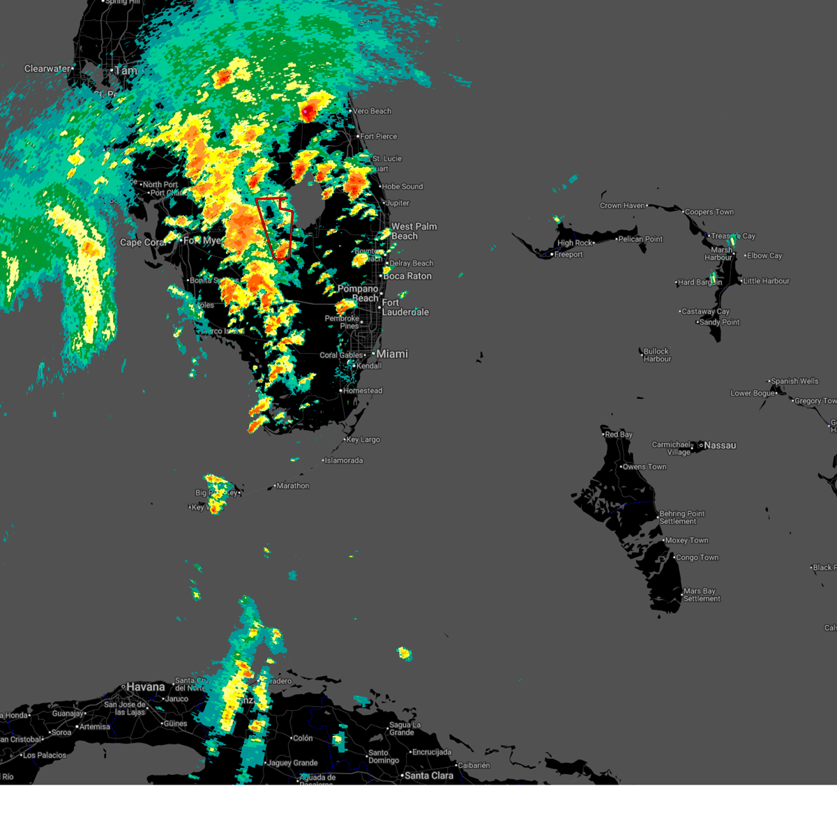
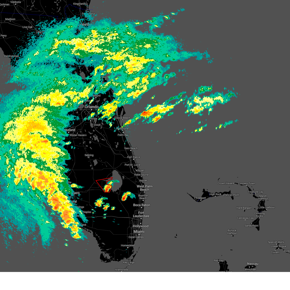
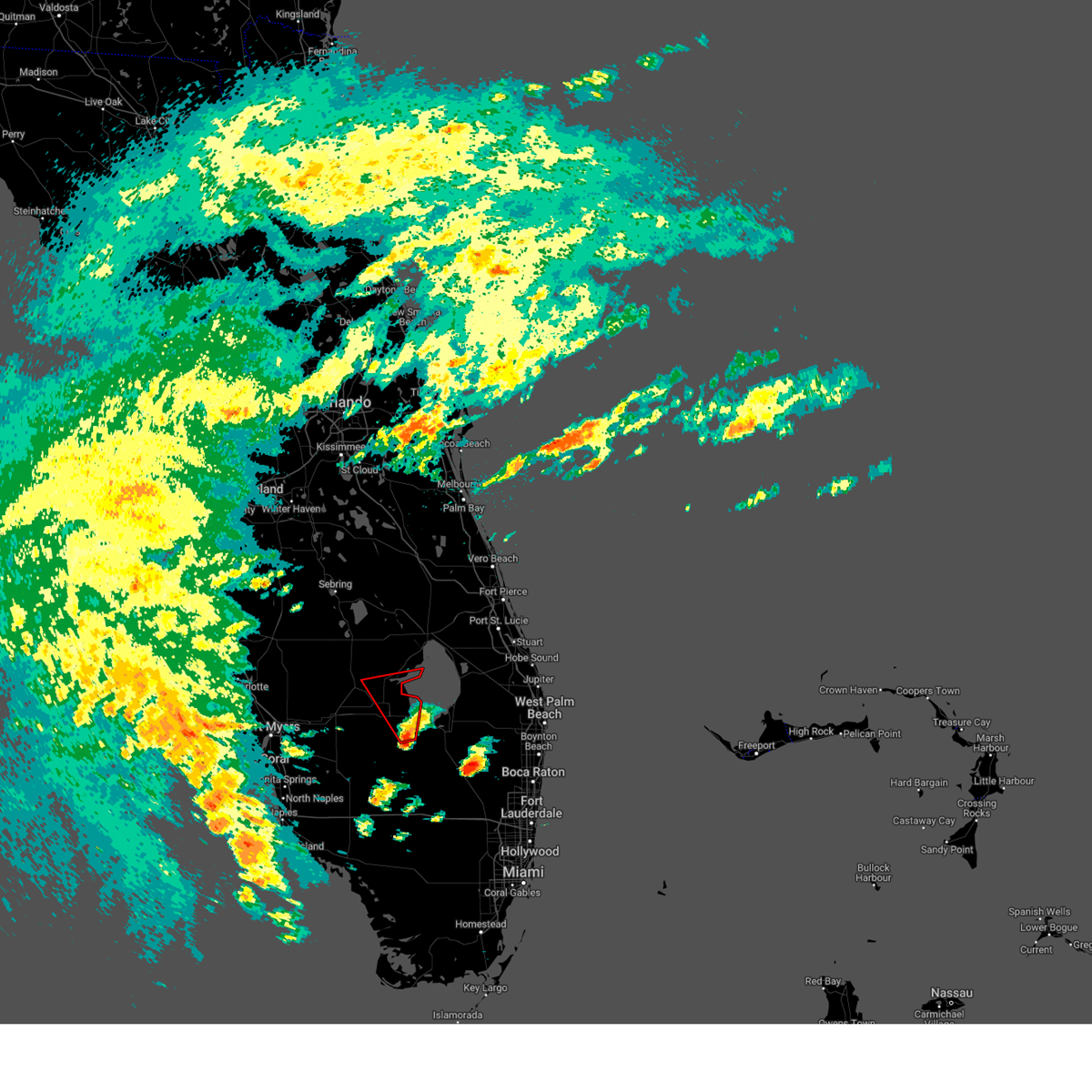
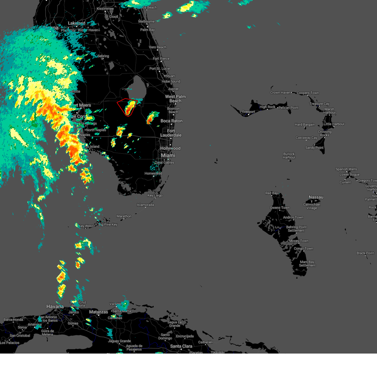
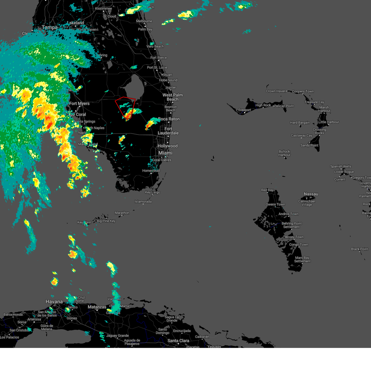
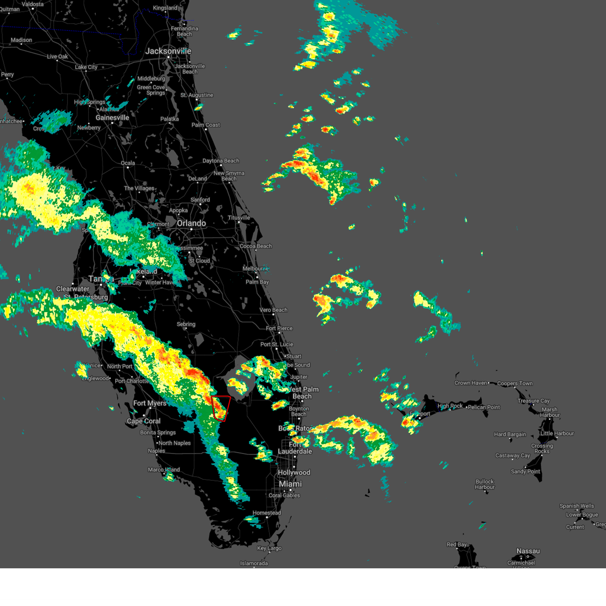
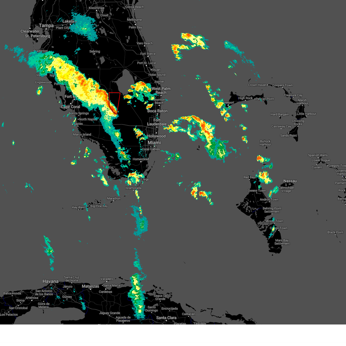
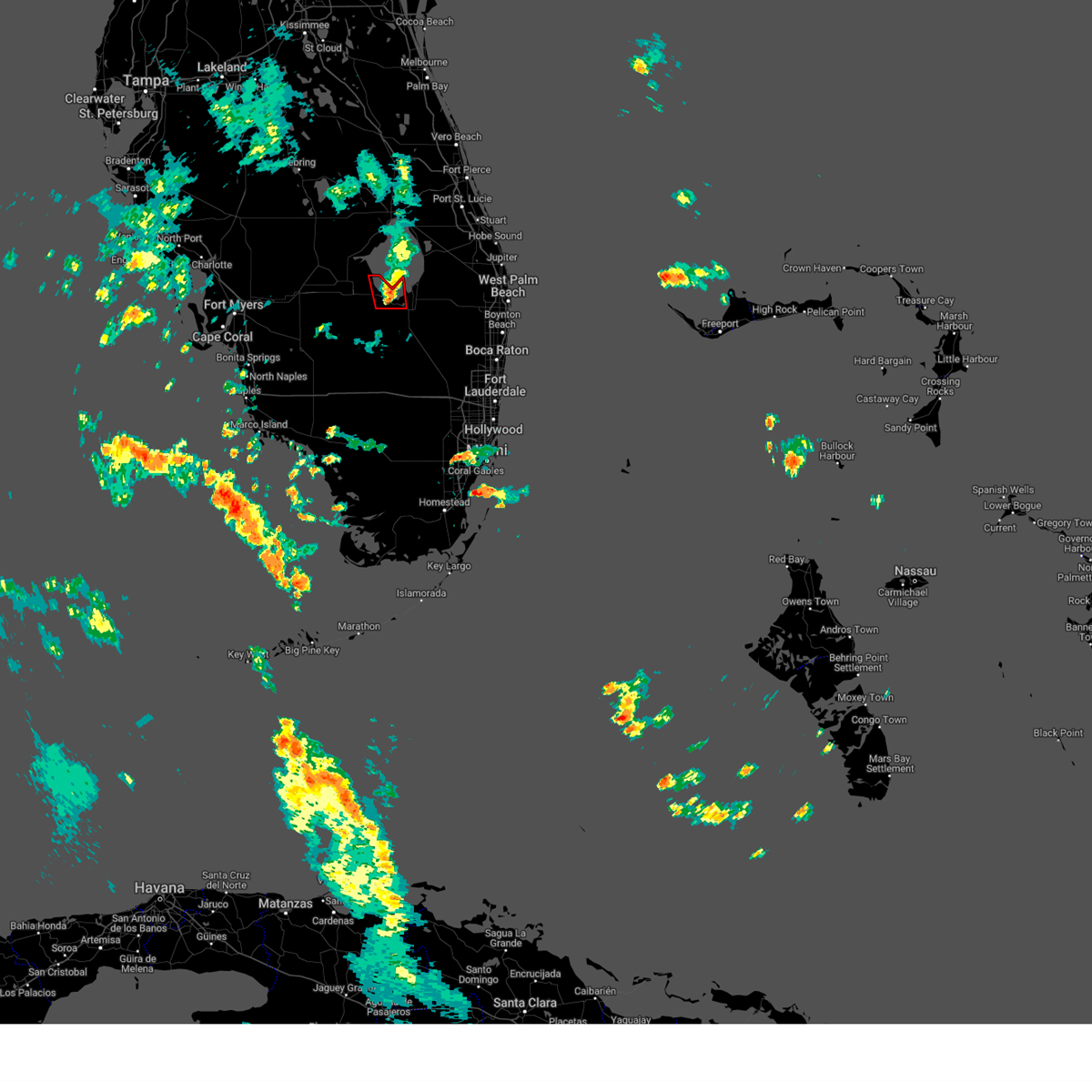
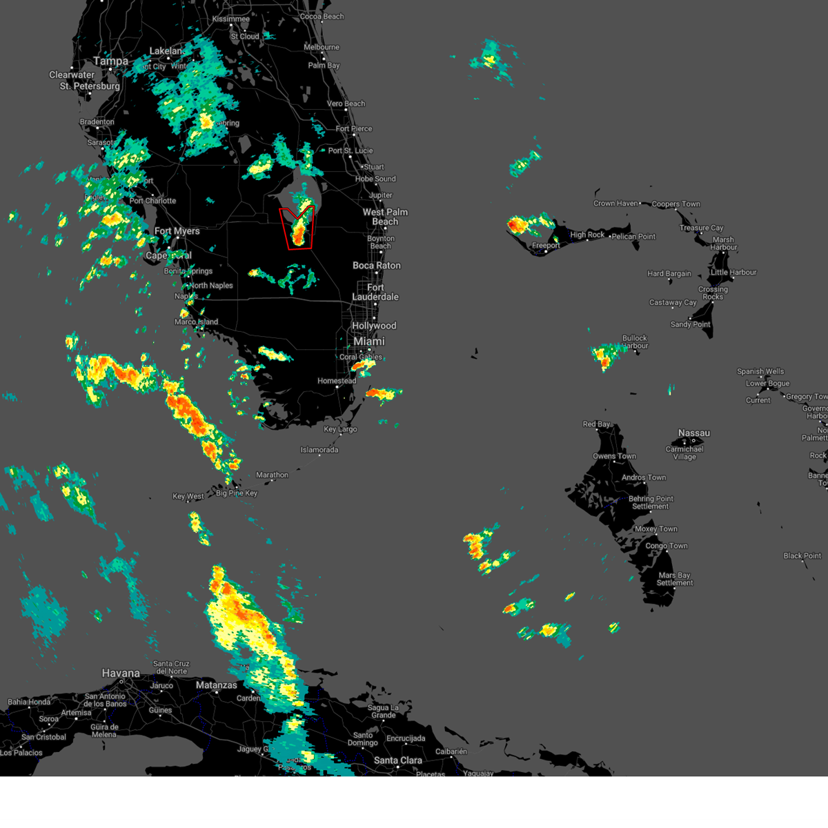
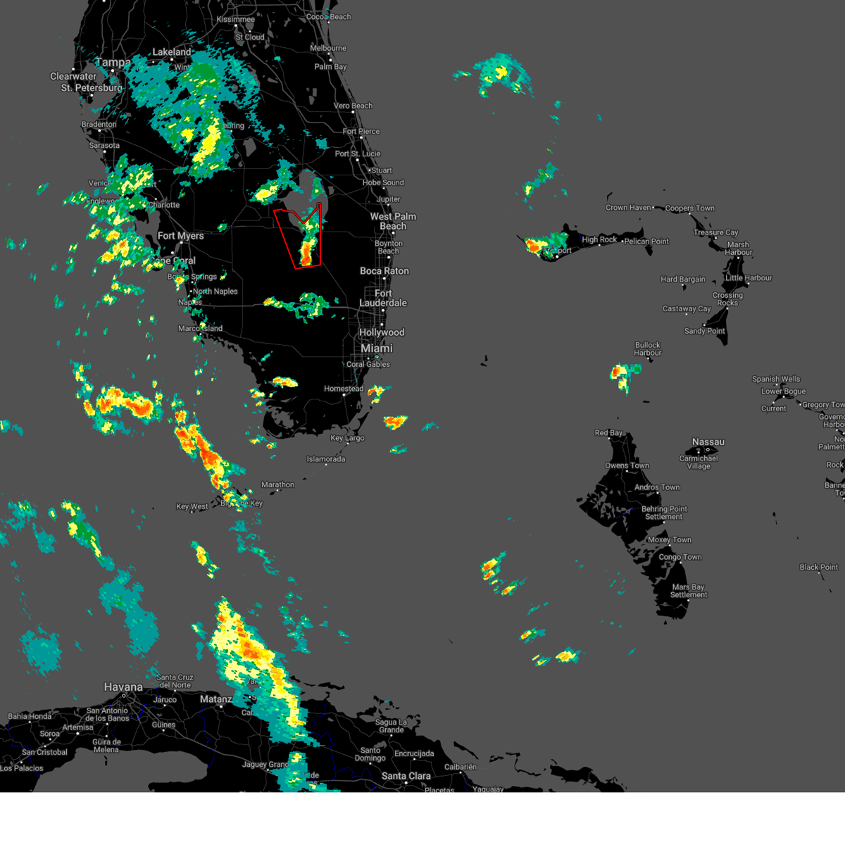
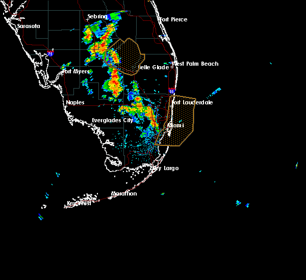
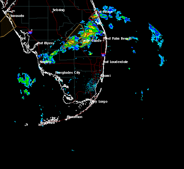
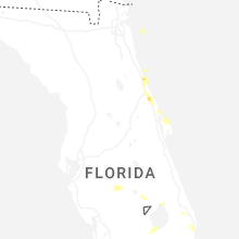
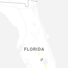
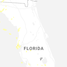
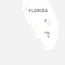
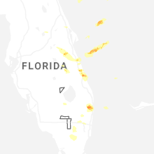
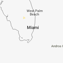
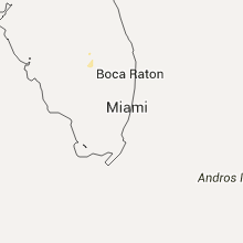
Hail Map for Clewiston, FL
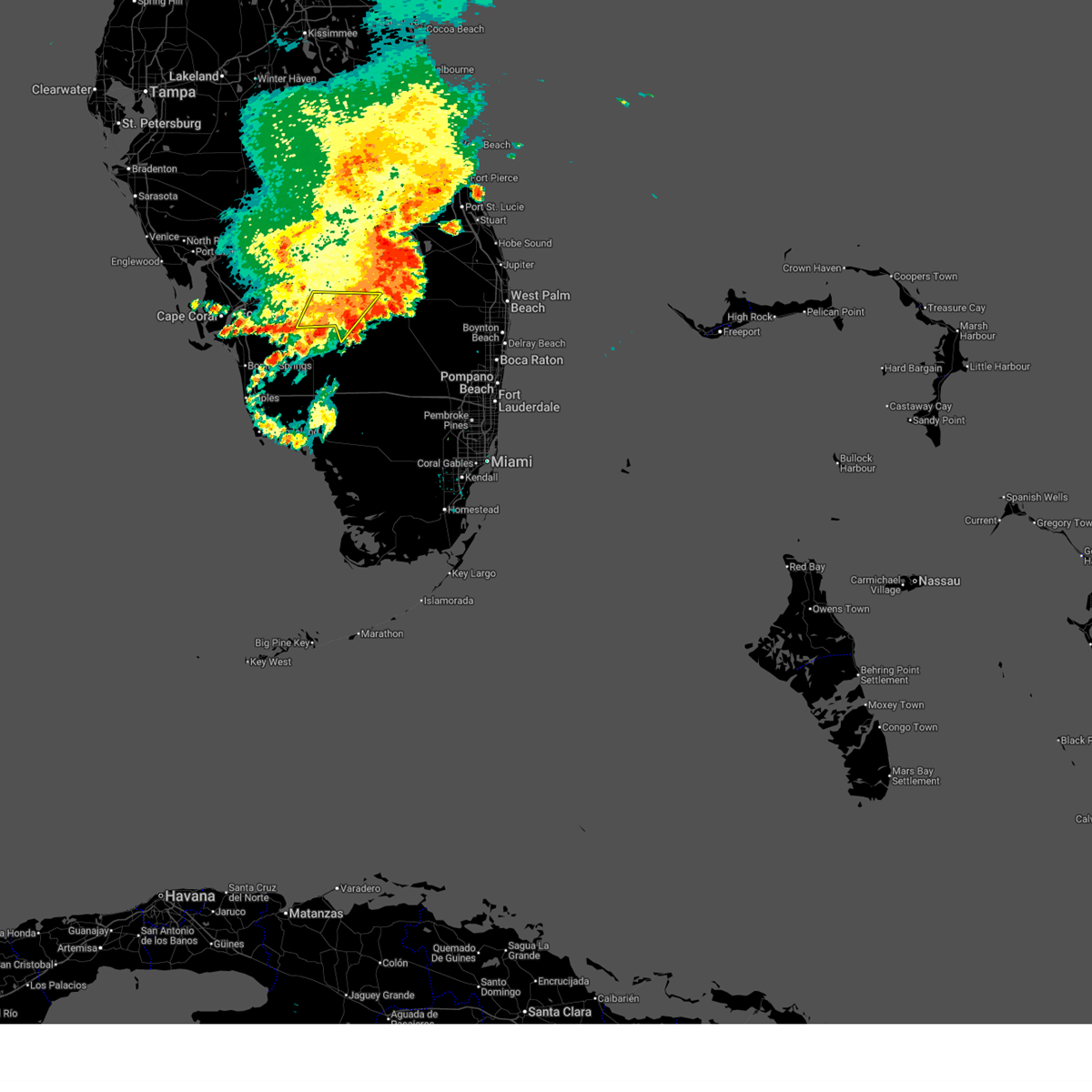
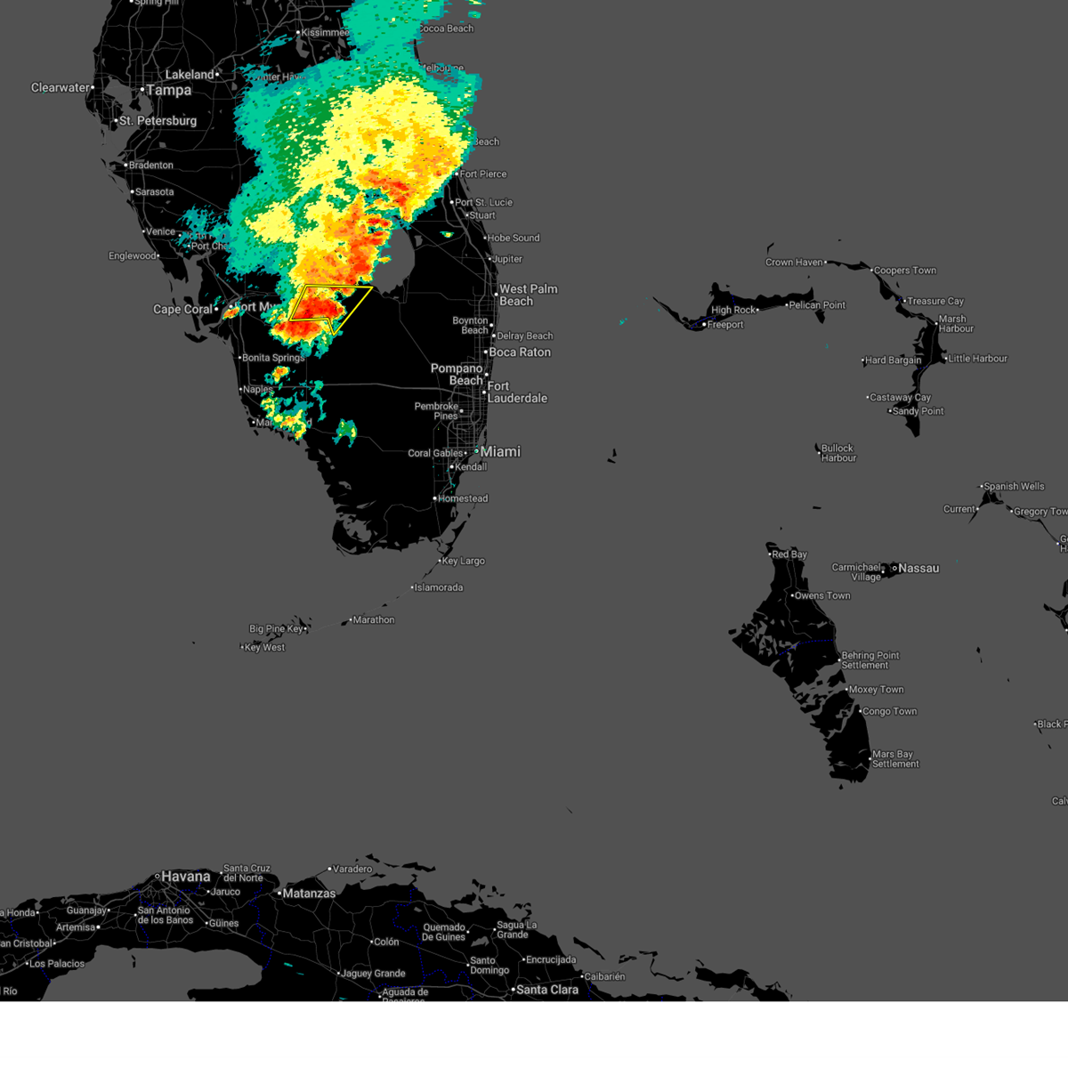
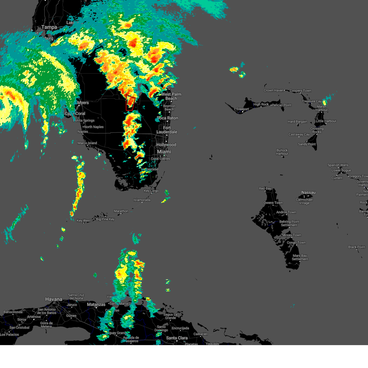
The Clewiston, FL area has had 4 reports of on-the-ground hail by trained spotters, and has been under severe weather warnings 0 times during the past 12 months. Doppler radar has detected hail at or near Clewiston, FL on 38 occasions, including 4 occasions during the past year.
| Name: | Clewiston, FL |
| Where Located: | 50.6 miles SW of Port Saint Lucie, FL |
| Map: | Google Map for Clewiston, FL |
| Population: | 7155 |
| Housing Units: | 2684 |
| More Info: | Search Google for Clewiston, FL |
5
The Top Recent Hail Date for Clewiston, FL is Tuesday, June 23, 2026 (7th out of 38)
Hail and Wind Damage Spotted near Clewiston, FL
| Date / Time | Report Details |
|---|---|
| 6/28/2025 7:31 PM EDT |
 the severe thunderstorm warning has been cancelled and is no longer in effect the severe thunderstorm warning has been cancelled and is no longer in effect
|
| 6/28/2025 6:56 PM EDT |
 Svrmfl the national weather service in miami has issued a * severe thunderstorm warning for, northern hendry county in southern florida, southwestern glades county in southern florida, * until 745 pm edt. * at 656 pm edt, a severe thunderstorm was located 9 miles west of devils garden, or 11 miles west of montura, moving southeast at 15 mph (radar indicated). Hazards include 60 mph wind gusts and penny size hail. damage to roofs, siding, and trees possible Svrmfl the national weather service in miami has issued a * severe thunderstorm warning for, northern hendry county in southern florida, southwestern glades county in southern florida, * until 745 pm edt. * at 656 pm edt, a severe thunderstorm was located 9 miles west of devils garden, or 11 miles west of montura, moving southeast at 15 mph (radar indicated). Hazards include 60 mph wind gusts and penny size hail. damage to roofs, siding, and trees possible
|
| 5/6/2025 6:30 PM EDT | Ping Pong Ball sized hail reported 18.9 miles E of Clewiston, FL, a member of the broadcast media relayed a viewer report of ping pong ball sized hail in pioneer plantation. |
| 10/9/2024 3:04 PM EDT |
 the tornado warning has been cancelled and is no longer in effect the tornado warning has been cancelled and is no longer in effect
|
| 10/9/2024 2:51 PM EDT |
 Tormfl the national weather service in miami has issued a * tornado warning for, northeastern hendry county in southern florida, west central palm beach county in southeastern florida, * until 315 pm edt. * at 251 pm edt, a severe thunderstorm capable of producing a tornado was located near lake harbor, moving north at 45 mph (radar indicated rotation). Hazards include tornado. Flying debris will be dangerous to those caught without shelter. mobile homes will be damaged or destroyed. damage to roofs, windows, and vehicles will occur. Tree damage is likely. Tormfl the national weather service in miami has issued a * tornado warning for, northeastern hendry county in southern florida, west central palm beach county in southeastern florida, * until 315 pm edt. * at 251 pm edt, a severe thunderstorm capable of producing a tornado was located near lake harbor, moving north at 45 mph (radar indicated rotation). Hazards include tornado. Flying debris will be dangerous to those caught without shelter. mobile homes will be damaged or destroyed. damage to roofs, windows, and vehicles will occur. Tree damage is likely.
|
| 10/9/2024 2:13 PM EDT |
 Tormfl the national weather service in miami has issued a * tornado warning for, northern hendry county in southern florida, eastern glades county in southern florida, * until 245 pm edt. * at 213 pm edt, a severe thunderstorm capable of producing a tornado was located near moore haven, moving north at 45 mph (radar indicated rotation). Hazards include tornado. Flying debris will be dangerous to those caught without shelter. mobile homes will be damaged or destroyed. damage to roofs, windows, and vehicles will occur. Tree damage is likely. Tormfl the national weather service in miami has issued a * tornado warning for, northern hendry county in southern florida, eastern glades county in southern florida, * until 245 pm edt. * at 213 pm edt, a severe thunderstorm capable of producing a tornado was located near moore haven, moving north at 45 mph (radar indicated rotation). Hazards include tornado. Flying debris will be dangerous to those caught without shelter. mobile homes will be damaged or destroyed. damage to roofs, windows, and vehicles will occur. Tree damage is likely.
|
| 10/9/2024 1:51 PM EDT |
 Tormfl the national weather service in miami has issued a * tornado warning for, northeastern hendry county in southern florida, south central glades county in southern florida, * until 215 pm edt. * at 151 pm edt, a severe thunderstorm capable of producing a tornado was located 9 miles southeast of devils garden, or 9 miles southeast of montura, moving north at 45 mph (radar indicated rotation). Hazards include tornado. Flying debris will be dangerous to those caught without shelter. mobile homes will be damaged or destroyed. damage to roofs, windows, and vehicles will occur. Tree damage is likely. Tormfl the national weather service in miami has issued a * tornado warning for, northeastern hendry county in southern florida, south central glades county in southern florida, * until 215 pm edt. * at 151 pm edt, a severe thunderstorm capable of producing a tornado was located 9 miles southeast of devils garden, or 9 miles southeast of montura, moving north at 45 mph (radar indicated rotation). Hazards include tornado. Flying debris will be dangerous to those caught without shelter. mobile homes will be damaged or destroyed. damage to roofs, windows, and vehicles will occur. Tree damage is likely.
|
| 10/9/2024 11:10 AM EDT |
 At 1110 am edt, a confirmed large and dangerous tornado was located near clewiston, moving north at 30 mph. this is a particularly dangerous situation. take cover now! (weather spotters confirmed tornado). Hazards include damaging tornado. You are in a life-threatening situation. flying debris may be deadly to those caught without shelter. mobile homes will be destroyed. considerable damage to homes, businesses, and vehicles is likely and complete destruction is possible. Locations impacted include, clewiston, moore haven, lakeport, and harlem. At 1110 am edt, a confirmed large and dangerous tornado was located near clewiston, moving north at 30 mph. this is a particularly dangerous situation. take cover now! (weather spotters confirmed tornado). Hazards include damaging tornado. You are in a life-threatening situation. flying debris may be deadly to those caught without shelter. mobile homes will be destroyed. considerable damage to homes, businesses, and vehicles is likely and complete destruction is possible. Locations impacted include, clewiston, moore haven, lakeport, and harlem.
|
| 10/9/2024 10:55 AM EDT |
 Tormfl the national weather service in miami has issued a * tornado warning for, northeastern hendry county in southern florida, southeastern glades county in southern florida, * until 1130 am edt. * at 1055 am edt, a severe thunderstorm capable of producing a tornado was located near clewiston, moving north at 30 mph (radar indicated rotation). Hazards include tornado. Flying debris will be dangerous to those caught without shelter. mobile homes will be damaged or destroyed. damage to roofs, windows, and vehicles will occur. Tree damage is likely. Tormfl the national weather service in miami has issued a * tornado warning for, northeastern hendry county in southern florida, southeastern glades county in southern florida, * until 1130 am edt. * at 1055 am edt, a severe thunderstorm capable of producing a tornado was located near clewiston, moving north at 30 mph (radar indicated rotation). Hazards include tornado. Flying debris will be dangerous to those caught without shelter. mobile homes will be damaged or destroyed. damage to roofs, windows, and vehicles will occur. Tree damage is likely.
|
| 10/9/2024 10:43 AM EDT |
 At 1043 am edt, a confirmed tornado was located 9 miles southeast of montura, moving north at 30 mph (weather spotters confirmed tornado). Hazards include damaging tornado. Flying debris will be dangerous to those caught without shelter. mobile homes will be damaged or destroyed. damage to roofs, windows, and vehicles will occur. tree damage is likely. Locations impacted include, clewiston, montura, and harlem. At 1043 am edt, a confirmed tornado was located 9 miles southeast of montura, moving north at 30 mph (weather spotters confirmed tornado). Hazards include damaging tornado. Flying debris will be dangerous to those caught without shelter. mobile homes will be damaged or destroyed. damage to roofs, windows, and vehicles will occur. tree damage is likely. Locations impacted include, clewiston, montura, and harlem.
|
| 10/9/2024 10:26 AM EDT |
 Tormfl the national weather service in miami has issued a * tornado warning for, northeastern hendry county in southern florida, west central palm beach county in southeastern florida, southern glades county in southern florida, * until 1100 am edt. * at 1026 am edt, a severe thunderstorm capable of producing a tornado was located 7 miles northwest of rotenberger wildlife refuge, or 15 miles southeast of montura, moving north at 30 mph (radar indicated rotation). Hazards include tornado. Flying debris will be dangerous to those caught without shelter. mobile homes will be damaged or destroyed. damage to roofs, windows, and vehicles will occur. Tree damage is likely. Tormfl the national weather service in miami has issued a * tornado warning for, northeastern hendry county in southern florida, west central palm beach county in southeastern florida, southern glades county in southern florida, * until 1100 am edt. * at 1026 am edt, a severe thunderstorm capable of producing a tornado was located 7 miles northwest of rotenberger wildlife refuge, or 15 miles southeast of montura, moving north at 30 mph (radar indicated rotation). Hazards include tornado. Flying debris will be dangerous to those caught without shelter. mobile homes will be damaged or destroyed. damage to roofs, windows, and vehicles will occur. Tree damage is likely.
|
| 9/26/2024 8:06 AM EDT |
 At 805 am edt, severe thunderstorms capable of producing tornadoes were located along a line extending from near montura to 7 miles southeast of devils garden, moving north at 50 mph (radar indicated rotation). Hazards include tornado. Flying debris will be dangerous to those caught without shelter. mobile homes will be damaged or destroyed. damage to roofs, windows, and vehicles will occur. tree damage is likely. Locations impacted include, clewiston, montura, and harlem. At 805 am edt, severe thunderstorms capable of producing tornadoes were located along a line extending from near montura to 7 miles southeast of devils garden, moving north at 50 mph (radar indicated rotation). Hazards include tornado. Flying debris will be dangerous to those caught without shelter. mobile homes will be damaged or destroyed. damage to roofs, windows, and vehicles will occur. tree damage is likely. Locations impacted include, clewiston, montura, and harlem.
|
| 9/26/2024 7:55 AM EDT |
 Tormfl the national weather service in miami has issued a * tornado warning for, northeastern hendry county in southern florida, * until 815 am edt. * at 755 am edt, severe thunderstorms capable of producing a tornado were located along a line extending from devils garden to 10 miles north of big cypress seminole reservation, moving north at 50 mph (radar indicated rotation). Hazards include tornado. Flying debris will be dangerous to those caught without shelter. mobile homes will be damaged or destroyed. damage to roofs, windows, and vehicles will occur. Tree damage is likely. Tormfl the national weather service in miami has issued a * tornado warning for, northeastern hendry county in southern florida, * until 815 am edt. * at 755 am edt, severe thunderstorms capable of producing a tornado were located along a line extending from devils garden to 10 miles north of big cypress seminole reservation, moving north at 50 mph (radar indicated rotation). Hazards include tornado. Flying debris will be dangerous to those caught without shelter. mobile homes will be damaged or destroyed. damage to roofs, windows, and vehicles will occur. Tree damage is likely.
|
| 9/26/2024 3:57 AM EDT |
 The storm which prompted the warning has moved out of the area. therefore, the warning will be allowed to expire. however, gusty winds and heavy rain are still possible with this thunderstorm. The storm which prompted the warning has moved out of the area. therefore, the warning will be allowed to expire. however, gusty winds and heavy rain are still possible with this thunderstorm.
|
| 9/26/2024 3:54 AM EDT |
 At 354 am edt, a severe thunderstorm capable of producing a tornado was located near lake harbor, moving north at 35 mph (radar indicated rotation). Hazards include tornado. Flying debris will be dangerous to those caught without shelter. mobile homes will be damaged or destroyed. damage to roofs, windows, and vehicles will occur. tree damage is likely. Locations impacted include, clewiston, south bay, lake harbor, and harlem. At 354 am edt, a severe thunderstorm capable of producing a tornado was located near lake harbor, moving north at 35 mph (radar indicated rotation). Hazards include tornado. Flying debris will be dangerous to those caught without shelter. mobile homes will be damaged or destroyed. damage to roofs, windows, and vehicles will occur. tree damage is likely. Locations impacted include, clewiston, south bay, lake harbor, and harlem.
|
| 9/26/2024 3:42 AM EDT |
 At 341 am edt, a severe thunderstorm capable of producing a tornado was located near lake harbor, moving north at 35 mph (radar indicated rotation). Hazards include tornado. Flying debris will be dangerous to those caught without shelter. mobile homes will be damaged or destroyed. damage to roofs, windows, and vehicles will occur. tree damage is likely. Locations impacted include, belle glade, clewiston, pahokee, south bay, lake harbor, okeelanta, and harlem. At 341 am edt, a severe thunderstorm capable of producing a tornado was located near lake harbor, moving north at 35 mph (radar indicated rotation). Hazards include tornado. Flying debris will be dangerous to those caught without shelter. mobile homes will be damaged or destroyed. damage to roofs, windows, and vehicles will occur. tree damage is likely. Locations impacted include, belle glade, clewiston, pahokee, south bay, lake harbor, okeelanta, and harlem.
|
| 9/26/2024 3:31 AM EDT |
 At 330 am edt, a severe thunderstorm capable of producing a tornado was located 7 miles southwest of okeelanta, or 10 miles south of lake harbor, moving north at 40 mph (radar indicated rotation). Hazards include tornado. Flying debris will be dangerous to those caught without shelter. mobile homes will be damaged or destroyed. damage to roofs, windows, and vehicles will occur. tree damage is likely. Locations impacted include, belle glade, clewiston, pahokee, south bay, lake harbor, okeelanta, belle glade camp, and harlem. At 330 am edt, a severe thunderstorm capable of producing a tornado was located 7 miles southwest of okeelanta, or 10 miles south of lake harbor, moving north at 40 mph (radar indicated rotation). Hazards include tornado. Flying debris will be dangerous to those caught without shelter. mobile homes will be damaged or destroyed. damage to roofs, windows, and vehicles will occur. tree damage is likely. Locations impacted include, belle glade, clewiston, pahokee, south bay, lake harbor, okeelanta, belle glade camp, and harlem.
|
| 9/26/2024 3:19 AM EDT |
 Tormfl the national weather service in miami has issued a * tornado warning for, northeastern hendry county in southern florida, western palm beach county in southeastern florida, southern glades county in southern florida, * until 400 am edt. * at 319 am edt, a severe thunderstorm capable of producing a tornado was located near rotenberger wildlife refuge, or 17 miles south of south bay, moving north at 40 mph (radar indicated rotation). Hazards include tornado. Flying debris will be dangerous to those caught without shelter. mobile homes will be damaged or destroyed. damage to roofs, windows, and vehicles will occur. Tree damage is likely. Tormfl the national weather service in miami has issued a * tornado warning for, northeastern hendry county in southern florida, western palm beach county in southeastern florida, southern glades county in southern florida, * until 400 am edt. * at 319 am edt, a severe thunderstorm capable of producing a tornado was located near rotenberger wildlife refuge, or 17 miles south of south bay, moving north at 40 mph (radar indicated rotation). Hazards include tornado. Flying debris will be dangerous to those caught without shelter. mobile homes will be damaged or destroyed. damage to roofs, windows, and vehicles will occur. Tree damage is likely.
|
| 8/2/2024 3:15 PM EDT | Report from hendry county emergency manager of minor damage to a metal roof in montura... as well as minor damage to a nearby metal fenc in hendry county FL, 12.5 miles NE of Clewiston, FL |
| 6/4/2023 9:36 PM EDT |
 At 935 pm edt, a severe thunderstorm was located over devils garden, or near montura, moving southeast at 10 mph (radar indicated). Hazards include 70 mph wind gusts and half dollar size hail. Hail damage to vehicles is expected. expect considerable tree damage. wind damage is also likely to mobile homes, roofs, and outbuildings. Locations impacted include, clewiston, montura, devils garden and harlem. At 935 pm edt, a severe thunderstorm was located over devils garden, or near montura, moving southeast at 10 mph (radar indicated). Hazards include 70 mph wind gusts and half dollar size hail. Hail damage to vehicles is expected. expect considerable tree damage. wind damage is also likely to mobile homes, roofs, and outbuildings. Locations impacted include, clewiston, montura, devils garden and harlem.
|
| 6/4/2023 9:20 PM EDT |
 At 920 pm edt, a severe thunderstorm was located near montura, moving east at 15 mph (radar indicated). Hazards include 70 mph wind gusts and half dollar size hail. Hail damage to vehicles is expected. expect considerable tree damage. wind damage is also likely to mobile homes, roofs, and outbuildings. Locations impacted include, clewiston, montura, devils garden and harlem. At 920 pm edt, a severe thunderstorm was located near montura, moving east at 15 mph (radar indicated). Hazards include 70 mph wind gusts and half dollar size hail. Hail damage to vehicles is expected. expect considerable tree damage. wind damage is also likely to mobile homes, roofs, and outbuildings. Locations impacted include, clewiston, montura, devils garden and harlem.
|
| 6/4/2023 9:15 PM EDT |
 At 914 pm edt, a severe thunderstorm was located near montura, moving east at 15 mph (radar indicated). Hazards include 60 mph wind gusts and quarter size hail. Hail damage to vehicles is expected. Expect wind damage to roofs, siding, and trees. At 914 pm edt, a severe thunderstorm was located near montura, moving east at 15 mph (radar indicated). Hazards include 60 mph wind gusts and quarter size hail. Hail damage to vehicles is expected. Expect wind damage to roofs, siding, and trees.
|
| 5/24/2023 4:30 PM EDT | Hendry county em advises of a local storm report in clewiston. caller states that roof damage occurred at clewiston nursing and rehabilitation center due to thunderstor in hendry county FL, 0.1 miles E of Clewiston, FL |
| 5/24/2023 4:00 PM EDT | Broadcast meteorologist shared via social media... several trees down on the street as well as fence damage in northern clewiston near ponce de leon avenue. radar estim in hendry county FL, 0.7 miles SSE of Clewiston, FL |
| 5/24/2023 3:54 PM EDT | Metal donation clothing box blown into w c owen avenue in clewiston as a strong thunderstorm moved through the area. radar estimated time of 3:54p in hendry county FL, 0.7 miles SSE of Clewiston, FL |
| 4/30/2023 8:31 AM EDT |
 At 831 am edt, a severe thunderstorm was located 9 miles southwest of lake harbor, moving northeast at 45 mph (radar indicated). Hazards include 60 mph wind gusts and penny size hail. expect damage to roofs, siding, and trees At 831 am edt, a severe thunderstorm was located 9 miles southwest of lake harbor, moving northeast at 45 mph (radar indicated). Hazards include 60 mph wind gusts and penny size hail. expect damage to roofs, siding, and trees
|
| 4/30/2023 8:06 AM EDT |
 At 805 am edt, severe thunderstorms were located along a line extending from montura to 7 miles east of ave maria, moving northeast at 55 mph (radar indicated). Hazards include 60 mph wind gusts. expect damage to roofs, siding, and trees At 805 am edt, severe thunderstorms were located along a line extending from montura to 7 miles east of ave maria, moving northeast at 55 mph (radar indicated). Hazards include 60 mph wind gusts. expect damage to roofs, siding, and trees
|
| 5/29/2022 5:04 PM EDT |
 At 503 pm edt, a severe thunderstorm was located near montura, moving northwest at 10 mph (radar indicated). Hazards include 60 mph wind gusts and quarter size hail. Hail damage to vehicles is expected. expect wind damage to roofs, siding, and trees. locations impacted include, clewiston, montura and harlem. hail threat, radar indicated max hail size, 1. 00 in wind threat, radar indicated max wind gust, 60 mph. At 503 pm edt, a severe thunderstorm was located near montura, moving northwest at 10 mph (radar indicated). Hazards include 60 mph wind gusts and quarter size hail. Hail damage to vehicles is expected. expect wind damage to roofs, siding, and trees. locations impacted include, clewiston, montura and harlem. hail threat, radar indicated max hail size, 1. 00 in wind threat, radar indicated max wind gust, 60 mph.
|
| 5/29/2022 4:48 PM EDT |
 At 448 pm edt, a severe thunderstorm was located near montura, moving northwest at 10 mph (radar indicated). Hazards include 60 mph wind gusts and quarter size hail. Hail damage to vehicles is expected. Expect wind damage to roofs, siding, and trees. At 448 pm edt, a severe thunderstorm was located near montura, moving northwest at 10 mph (radar indicated). Hazards include 60 mph wind gusts and quarter size hail. Hail damage to vehicles is expected. Expect wind damage to roofs, siding, and trees.
|
| 1/16/2022 11:13 AM EST |
 At 1113 am est, a severe thunderstorm capable of producing a tornado was located near lake harbor, moving northeast at 35 mph (radar indicated rotation). Hazards include tornado. Flying debris will be dangerous to those caught without shelter. mobile homes will be damaged or destroyed. damage to roofs, windows, and vehicles will occur. tree damage is likely. this dangerous storm will be near, lake harbor around 1125 am est. south bay around 1130 am est. belle glade camp around 1135 am est. belle glade around 1140 am est. pahokee, canal point and fremd village-padgett island around 1145 am est. Other locations impacted by this tornadic thunderstorm include harlem. At 1113 am est, a severe thunderstorm capable of producing a tornado was located near lake harbor, moving northeast at 35 mph (radar indicated rotation). Hazards include tornado. Flying debris will be dangerous to those caught without shelter. mobile homes will be damaged or destroyed. damage to roofs, windows, and vehicles will occur. tree damage is likely. this dangerous storm will be near, lake harbor around 1125 am est. south bay around 1130 am est. belle glade camp around 1135 am est. belle glade around 1140 am est. pahokee, canal point and fremd village-padgett island around 1145 am est. Other locations impacted by this tornadic thunderstorm include harlem.
|
| 1/16/2022 10:58 AM EST |
 At 1058 am est, severe thunderstorms were located along a line extending from near montura to 7 miles southeast of ave maria, moving northeast at 35 mph (radar indicated). Hazards include 60 mph wind gusts. expect damage to roofs, siding, and trees At 1058 am est, severe thunderstorms were located along a line extending from near montura to 7 miles southeast of ave maria, moving northeast at 35 mph (radar indicated). Hazards include 60 mph wind gusts. expect damage to roofs, siding, and trees
|
| 10/9/2021 2:00 PM EDT | Hendry county em reports damage in clewiston due to high wind gusts. a nursing home had minor damage with no injuries or evacuations needed. between 4 and 5 homes also in hendry county FL, 0.1 miles E of Clewiston, FL |
| 10/9/2021 2:00 PM EDT | Fdem/hendry county emergency management reported that a shed was tipped over/damaged and shopping carts were tossed into the front of a grocery store located on berner in hendry county FL, 0.8 miles E of Clewiston, FL |
| 7/31/2021 7:35 PM EDT |
 The severe thunderstorm warning for northeastern hendry, western palm beach and southeastern glades counties will expire at 745 pm edt, the storm which prompted the warning has moved out of the area. therefore, the warning will be allowed to expire. to report severe weather, contact your nearest law enforcement agency. they will relay your report to the national weather service miami. The severe thunderstorm warning for northeastern hendry, western palm beach and southeastern glades counties will expire at 745 pm edt, the storm which prompted the warning has moved out of the area. therefore, the warning will be allowed to expire. to report severe weather, contact your nearest law enforcement agency. they will relay your report to the national weather service miami.
|
| 7/31/2021 7:21 PM EDT |
 At 721 pm edt, a severe thunderstorm was located over clewiston, moving north at 15 mph (radar indicated). Hazards include 60 mph wind gusts and quarter size hail. Hail damage to vehicles is expected. expect wind damage to roofs, siding, and trees. Locations impacted include, clewiston, lake harbor and harlem. At 721 pm edt, a severe thunderstorm was located over clewiston, moving north at 15 mph (radar indicated). Hazards include 60 mph wind gusts and quarter size hail. Hail damage to vehicles is expected. expect wind damage to roofs, siding, and trees. Locations impacted include, clewiston, lake harbor and harlem.
|
| 7/31/2021 7:05 PM EDT |
 At 705 pm edt, a severe thunderstorm was located over clewiston, moving north at 15 mph (radar indicated). Hazards include 60 mph wind gusts and quarter size hail. Hail damage to vehicles is expected. Expect wind damage to roofs, siding, and trees. At 705 pm edt, a severe thunderstorm was located over clewiston, moving north at 15 mph (radar indicated). Hazards include 60 mph wind gusts and quarter size hail. Hail damage to vehicles is expected. Expect wind damage to roofs, siding, and trees.
|
| 7/12/2021 11:27 AM EDT |
 At 1127 am edt, a severe thunderstorm was located near lake harbor, moving northwest at 25 mph (radar indicated). Hazards include 60 mph wind gusts. expect damage to roofs, siding, and trees At 1127 am edt, a severe thunderstorm was located near lake harbor, moving northwest at 25 mph (radar indicated). Hazards include 60 mph wind gusts. expect damage to roofs, siding, and trees
|
| 7/6/2021 4:19 AM EDT |
 At 419 am edt, a severe thunderstorm capable of producing a tornado was located 7 miles southwest of lake harbor, moving northwest at 20 mph (radar indicated rotation). Hazards include tornado. Flying debris will be dangerous to those caught without shelter. mobile homes will be damaged or destroyed. damage to roofs, windows, and vehicles will occur. Tree damage is likely. At 419 am edt, a severe thunderstorm capable of producing a tornado was located 7 miles southwest of lake harbor, moving northwest at 20 mph (radar indicated rotation). Hazards include tornado. Flying debris will be dangerous to those caught without shelter. mobile homes will be damaged or destroyed. damage to roofs, windows, and vehicles will occur. Tree damage is likely.
|
| 7/1/2021 2:57 PM EDT |
 At 257 pm edt, a severe thunderstorm was located near montura, moving north at 5 mph (radar indicated). Hazards include 60 mph wind gusts. Expect damage to roofs, siding, and trees. Locations impacted include, clewiston, montura, devils garden, lake hicpochee and harlem. At 257 pm edt, a severe thunderstorm was located near montura, moving north at 5 mph (radar indicated). Hazards include 60 mph wind gusts. Expect damage to roofs, siding, and trees. Locations impacted include, clewiston, montura, devils garden, lake hicpochee and harlem.
|
| 7/1/2021 2:43 PM EDT |
 At 243 pm edt, a severe thunderstorm was located near montura, moving north at 5 mph (radar indicated). Hazards include 60 mph wind gusts and penny size hail. expect damage to roofs, siding, and trees At 243 pm edt, a severe thunderstorm was located near montura, moving north at 5 mph (radar indicated). Hazards include 60 mph wind gusts and penny size hail. expect damage to roofs, siding, and trees
|
| 8/19/2020 2:07 PM EDT |
 At 207 pm edt, a severe thunderstorm was located near clewiston, moving northeast at 20 mph (radar indicated). Hazards include 60 mph wind gusts. expect damage to roofs, siding, and trees At 207 pm edt, a severe thunderstorm was located near clewiston, moving northeast at 20 mph (radar indicated). Hazards include 60 mph wind gusts. expect damage to roofs, siding, and trees
|
| 7/26/2020 4:38 PM EDT |
 The severe thunderstorm warning for northern hendry, northwestern palm beach and south central glades counties will expire at 445 pm edt, the storms which prompted the warning have moved out of the area. therefore, the warning will be allowed to expire. The severe thunderstorm warning for northern hendry, northwestern palm beach and south central glades counties will expire at 445 pm edt, the storms which prompted the warning have moved out of the area. therefore, the warning will be allowed to expire.
|
| 7/26/2020 4:12 PM EDT |
 At 412 pm edt, severe thunderstorms were located along a line extending from labelle to near moore haven to clewiston, moving north at 20 mph (radar indicated). Hazards include 60 mph wind gusts and quarter size hail. Hail damage to vehicles is expected. expect wind damage to roofs, siding, and trees. Locations impacted include, clewiston, labelle, moore haven, montura and port la belle. At 412 pm edt, severe thunderstorms were located along a line extending from labelle to near moore haven to clewiston, moving north at 20 mph (radar indicated). Hazards include 60 mph wind gusts and quarter size hail. Hail damage to vehicles is expected. expect wind damage to roofs, siding, and trees. Locations impacted include, clewiston, labelle, moore haven, montura and port la belle.
|
| 7/26/2020 3:43 PM EDT |
 At 342 pm edt, severe thunderstorms were located along a line extending from 7 miles northeast of felda to 8 miles west of montura to devils garden, moving north at 10 mph (radar indicated). Hazards include 60 mph wind gusts and quarter size hail. Hail damage to vehicles is expected. Expect wind damage to roofs, siding, and trees. At 342 pm edt, severe thunderstorms were located along a line extending from 7 miles northeast of felda to 8 miles west of montura to devils garden, moving north at 10 mph (radar indicated). Hazards include 60 mph wind gusts and quarter size hail. Hail damage to vehicles is expected. Expect wind damage to roofs, siding, and trees.
|
| 6/22/2020 7:04 PM EDT |
 At 703 pm edt, a severe thunderstorm was located over south bay, moving north at 25 mph (radar indicated). Hazards include 60 mph wind gusts and half dollar size hail. Hail damage to vehicles is expected. expect wind damage to roofs, siding, and trees. Locations impacted include, belle glade, clewiston, south bay, lake harbor and okeelanta. At 703 pm edt, a severe thunderstorm was located over south bay, moving north at 25 mph (radar indicated). Hazards include 60 mph wind gusts and half dollar size hail. Hail damage to vehicles is expected. expect wind damage to roofs, siding, and trees. Locations impacted include, belle glade, clewiston, south bay, lake harbor and okeelanta.
|
| 6/22/2020 6:39 PM EDT |
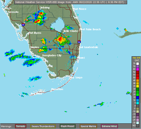 At 639 pm edt, a severe thunderstorm was located near holey land wildlife refuge, or 10 miles south of south bay, moving north at 25 mph (radar indicated). Hazards include 60 mph wind gusts and half dollar size hail. Hail damage to vehicles is expected. Expect wind damage to roofs, siding, and trees. At 639 pm edt, a severe thunderstorm was located near holey land wildlife refuge, or 10 miles south of south bay, moving north at 25 mph (radar indicated). Hazards include 60 mph wind gusts and half dollar size hail. Hail damage to vehicles is expected. Expect wind damage to roofs, siding, and trees.
|
| 5/27/2020 1:55 PM EDT |
 At 155 pm edt, severe thunderstorms were located along a line extending from near clewiston to 8 miles southwest of lake harbor to near big cypress seminole reservation, moving east at 10 mph (radar indicated). Hazards include 60 mph wind gusts. expect damage to roofs, siding, and trees At 155 pm edt, severe thunderstorms were located along a line extending from near clewiston to 8 miles southwest of lake harbor to near big cypress seminole reservation, moving east at 10 mph (radar indicated). Hazards include 60 mph wind gusts. expect damage to roofs, siding, and trees
|
| 5/21/2020 4:54 PM EDT |
 The severe thunderstorm warning for central collier, hendry and glades counties will expire at 500 pm edt, the storms which prompted the warning have weakened below severe limits, and no longer pose an immediate threat to life or property. therefore, the warning will be allowed to expire. however gusty winds and heavy rain are still possible with these thunderstorms. The severe thunderstorm warning for central collier, hendry and glades counties will expire at 500 pm edt, the storms which prompted the warning have weakened below severe limits, and no longer pose an immediate threat to life or property. therefore, the warning will be allowed to expire. however gusty winds and heavy rain are still possible with these thunderstorms.
|
| 5/21/2020 4:39 PM EDT |
 At 439 pm edt, severe thunderstorms were located along a line extending from near lakeport to near ortona to ave maria, moving west at 20 mph (radar indicated). Hazards include 60 mph wind gusts and quarter size hail. Hail damage to vehicles is expected. expect wind damage to roofs, siding, and trees. Locations impacted include, clewiston, labelle, moore haven, lakeport and palmdale. At 439 pm edt, severe thunderstorms were located along a line extending from near lakeport to near ortona to ave maria, moving west at 20 mph (radar indicated). Hazards include 60 mph wind gusts and quarter size hail. Hail damage to vehicles is expected. expect wind damage to roofs, siding, and trees. Locations impacted include, clewiston, labelle, moore haven, lakeport and palmdale.
|
| 5/21/2020 4:18 PM EDT |
 At 418 pm edt, severe thunderstorms were located along a line extending from lakeport to near moore haven to near hendry correctional to 9 miles north of big cypress national preserve, moving west at 5 mph (radar indicated). Hazards include 60 mph wind gusts and quarter size hail. Hail damage to vehicles is expected. expect wind damage to roofs, siding, and trees. Locations impacted include, clewiston, labelle, moore haven, lakeport and palmdale. At 418 pm edt, severe thunderstorms were located along a line extending from lakeport to near moore haven to near hendry correctional to 9 miles north of big cypress national preserve, moving west at 5 mph (radar indicated). Hazards include 60 mph wind gusts and quarter size hail. Hail damage to vehicles is expected. expect wind damage to roofs, siding, and trees. Locations impacted include, clewiston, labelle, moore haven, lakeport and palmdale.
|
| 5/21/2020 3:57 PM EDT |
 At 356 pm edt, severe thunderstorms were located along a line extending from 7 miles west of brighton seminole reservation to near moore haven to 6 miles east of hendry correctional to near big cypress national preserve, moving west at 15 mph (radar indicated). Hazards include 60 mph wind gusts and quarter size hail. Hail damage to vehicles is expected. Expect wind damage to roofs, siding, and trees. At 356 pm edt, severe thunderstorms were located along a line extending from 7 miles west of brighton seminole reservation to near moore haven to 6 miles east of hendry correctional to near big cypress national preserve, moving west at 15 mph (radar indicated). Hazards include 60 mph wind gusts and quarter size hail. Hail damage to vehicles is expected. Expect wind damage to roofs, siding, and trees.
|
| 10/19/2019 4:41 PM EDT |
 At 440 pm edt, a severe thunderstorm was located near clewiston, moving northeast at 30 mph (radar indicated). Hazards include 60 mph wind gusts. Expect damage to roofs, siding, and trees. Locations impacted include, clewiston and harlem. At 440 pm edt, a severe thunderstorm was located near clewiston, moving northeast at 30 mph (radar indicated). Hazards include 60 mph wind gusts. Expect damage to roofs, siding, and trees. Locations impacted include, clewiston and harlem.
|
| 10/19/2019 4:21 PM EDT |
 At 421 pm edt, a severe thunderstorm was located over montura, moving northeast at 35 mph (radar indicated). Hazards include 60 mph wind gusts. expect damage to roofs, siding, and trees At 421 pm edt, a severe thunderstorm was located over montura, moving northeast at 35 mph (radar indicated). Hazards include 60 mph wind gusts. expect damage to roofs, siding, and trees
|
| 3/23/2017 4:22 PM EDT | Quarter sized hail reported 30.4 miles NNE of Clewiston, FL, dime to quarter size hail reported on w boundary rd |
| 1/23/2017 12:25 AM EST |
 At 1225 am est, severe thunderstorms were located along a line extending from near clewiston to 8 miles southwest of devils garden, moving east at 30 mph (radar indicated). Hazards include 60 mph wind gusts. expect damage to roofs, siding, and trees At 1225 am est, severe thunderstorms were located along a line extending from near clewiston to 8 miles southwest of devils garden, moving east at 30 mph (radar indicated). Hazards include 60 mph wind gusts. expect damage to roofs, siding, and trees
|
| 1/17/2016 6:41 AM EST | The tornado warning for northwestern palm beach, southeastern glades and northeastern hendry counties will expire at 645 am est, the storm which prompted the warning has weakened below severe limits, and no longer appears capable of producing a tornado. therefore the warning will be allowed to expire. however gusty winds of 45 to 55 mph are still possible with this thunderstorm and therefore a significant weather advisory remains in effect. a tornado watch remains in effect until 800 am est for southeastern florida. |
| 1/17/2016 6:24 AM EST |
 A tornado warning remains in effect until 645 am est for northwestern palm beach. southeastern glades and northeastern hendry counties. at 624 am est. a severe thunderstorm capable of producing a tornado was located near clewiston. moving northeast at 65 mph. hazard. Tornado. A tornado warning remains in effect until 645 am est for northwestern palm beach. southeastern glades and northeastern hendry counties. at 624 am est. a severe thunderstorm capable of producing a tornado was located near clewiston. moving northeast at 65 mph. hazard. Tornado.
|
| 1/17/2016 6:12 AM EST |
 At 611 am est, a severe thunderstorm capable of producing a tornado was located near montura, moving northeast at 65 mph (radar indicated rotation). Hazards include tornado. Flying debris will be dangerous to those caught without shelter. mobile homes will be damaged or destroyed. damage to roofs, windows and vehicles will occur. Tree damage is likely. At 611 am est, a severe thunderstorm capable of producing a tornado was located near montura, moving northeast at 65 mph (radar indicated rotation). Hazards include tornado. Flying debris will be dangerous to those caught without shelter. mobile homes will be damaged or destroyed. damage to roofs, windows and vehicles will occur. Tree damage is likely.
|
| 1/15/2016 12:11 PM EST |
 The tornado warning for northwestern collier, glades and northern hendry counties will expire at 1215 pm est, the line of storms which prompted the warning have weakened below severe limits, and no longer appears capable of producing a tornado. therefore the warning will be allowed to expire. however gusty winds up to 50 mph are still possible with these thunderstorms. a tornado watch remains in effect until 500 pm est for southwestern florida. The tornado warning for northwestern collier, glades and northern hendry counties will expire at 1215 pm est, the line of storms which prompted the warning have weakened below severe limits, and no longer appears capable of producing a tornado. therefore the warning will be allowed to expire. however gusty winds up to 50 mph are still possible with these thunderstorms. a tornado watch remains in effect until 500 pm est for southwestern florida.
|
| 1/15/2016 11:47 AM EST |
 At 1145 am est, a severe thunderstorm capable of producing a tornado was located near charleston park, or 7 miles northeast of lehigh acres. an additional severe thunderstorm was located 5 miles northeast of muse, both moving northeast at 40 mph (radar indicated rotation). Hazards include tornado. Flying debris will be dangerous to those caught without shelter. mobile homes will be damaged or destroyed. damage to roofs, windows and vehicles will occur. tree damage is likely. Locations impacted include, clewiston, labelle, moore haven, immokalee and lakeport. At 1145 am est, a severe thunderstorm capable of producing a tornado was located near charleston park, or 7 miles northeast of lehigh acres. an additional severe thunderstorm was located 5 miles northeast of muse, both moving northeast at 40 mph (radar indicated rotation). Hazards include tornado. Flying debris will be dangerous to those caught without shelter. mobile homes will be damaged or destroyed. damage to roofs, windows and vehicles will occur. tree damage is likely. Locations impacted include, clewiston, labelle, moore haven, immokalee and lakeport.
|
| 1/15/2016 11:30 AM EST |
 At 1127 am est, a severe thunderstorm capable of producing a tornado was located near lehigh acres, moving northeast at 25 mph. there are additional storms in the warning area that are capable of producing tornadoes (radar indicated rotation). Hazards include tornado. Flying debris will be dangerous to those caught without shelter. mobile homes will be damaged or destroyed. damage to roofs, windows and vehicles will occur. Tree damage is likely. At 1127 am est, a severe thunderstorm capable of producing a tornado was located near lehigh acres, moving northeast at 25 mph. there are additional storms in the warning area that are capable of producing tornadoes (radar indicated rotation). Hazards include tornado. Flying debris will be dangerous to those caught without shelter. mobile homes will be damaged or destroyed. damage to roofs, windows and vehicles will occur. Tree damage is likely.
|
| 6/15/2012 5:48 PM EDT | Baseball sized hail reported 23.6 miles NNE of Clewiston, FL, baseball sized hail reported near sr 833 and sr 846 in hendry county. |
| 5/18/2012 4:35 PM EDT | A severe thunderstorm and possible tornado snapped several trees and downed at least 6 powerline poles near the intersection of old u.s. highway 27 and hookers point ro in hendry county FL, 0.1 miles E of Clewiston, FL |
| 1/1/0001 12:00 AM | An oak and palm trees were reported down along highway 27 near the tropical market in clewisto in hendry county FL, 0.1 miles E of Clewiston, FL |
| 1/1/0001 12:00 AM | Quarter sized hail reported 3.1 miles NW of Clewiston, FL |
| 1/1/0001 12:00 AM | Winds from a thunderstorm damaged 2 sheds just west of clewiston. the damage was to the siding of the she in hendry county FL, 0.8 miles E of Clewiston, FL |
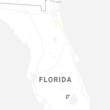
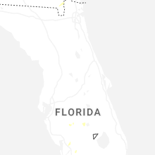
Hail Maps for Clewiston, FL


Connect with Interactive Hail Maps