

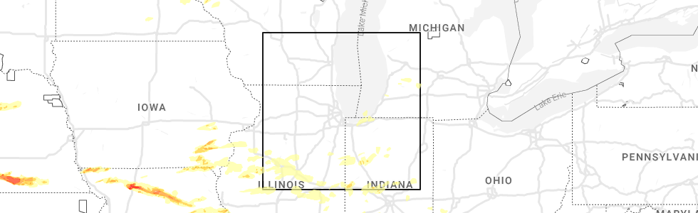
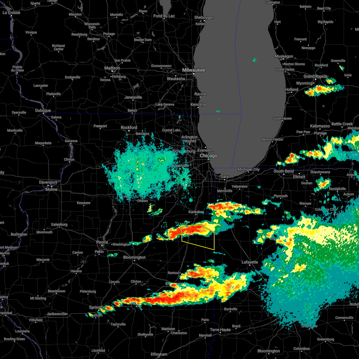
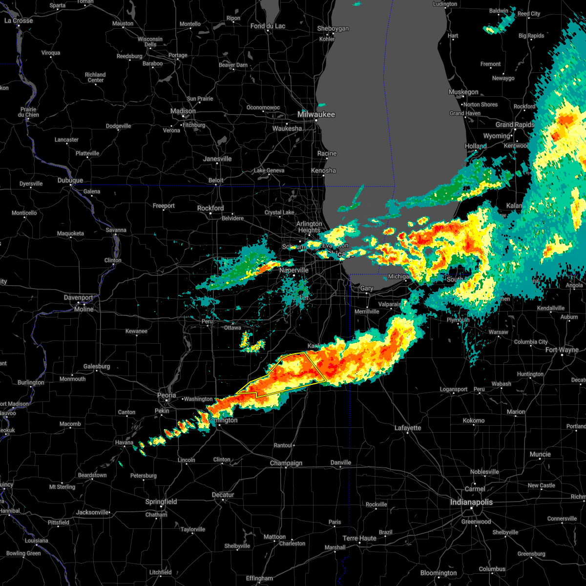
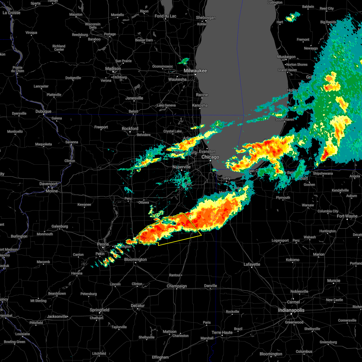
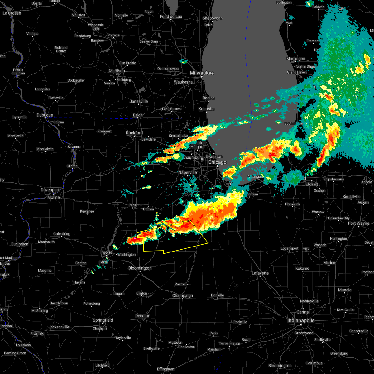
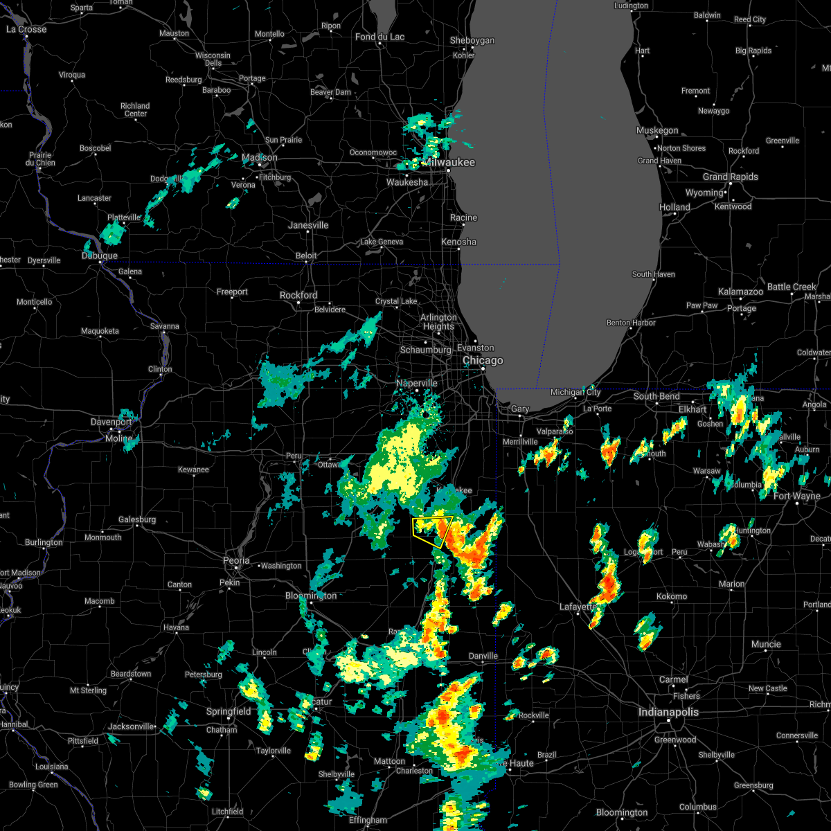
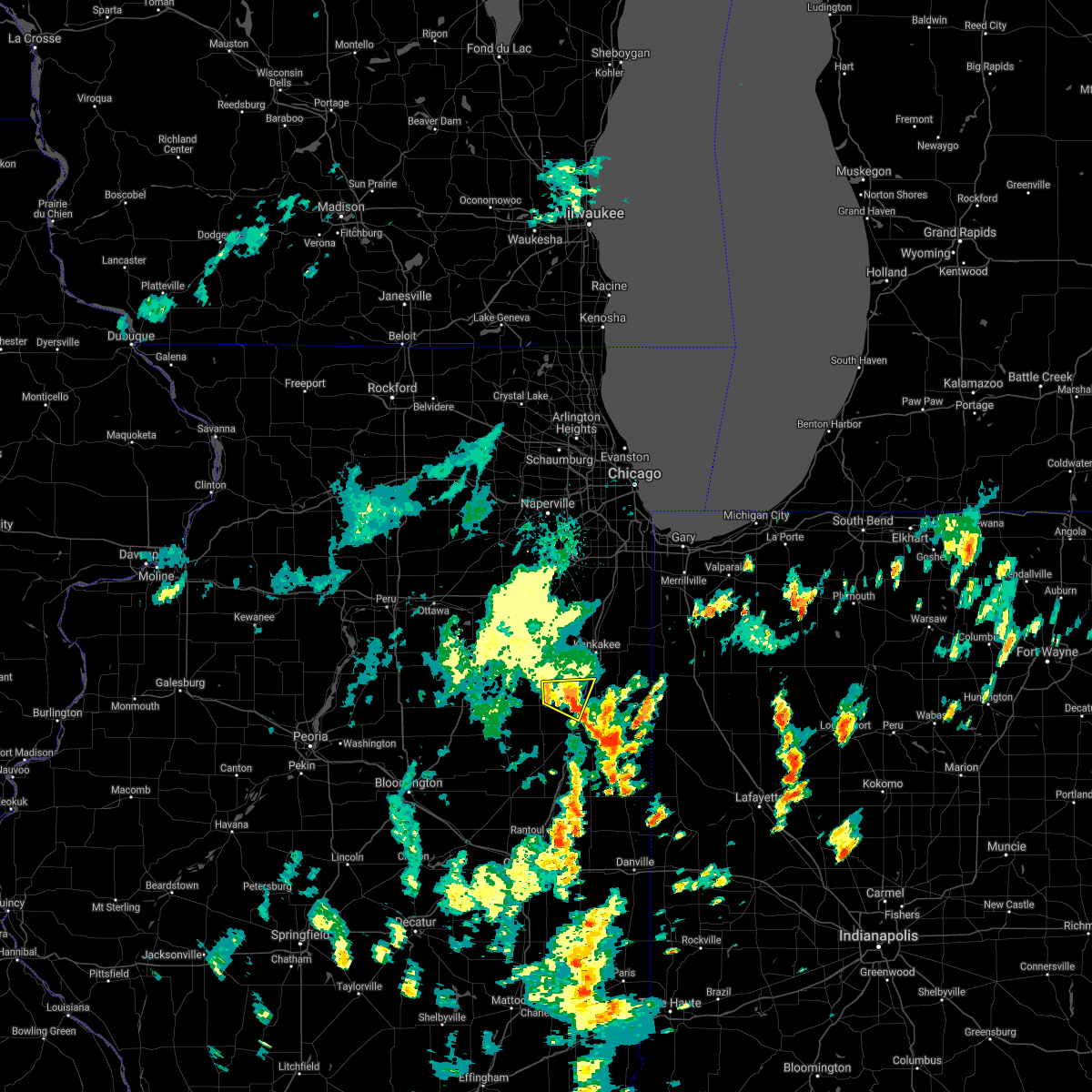
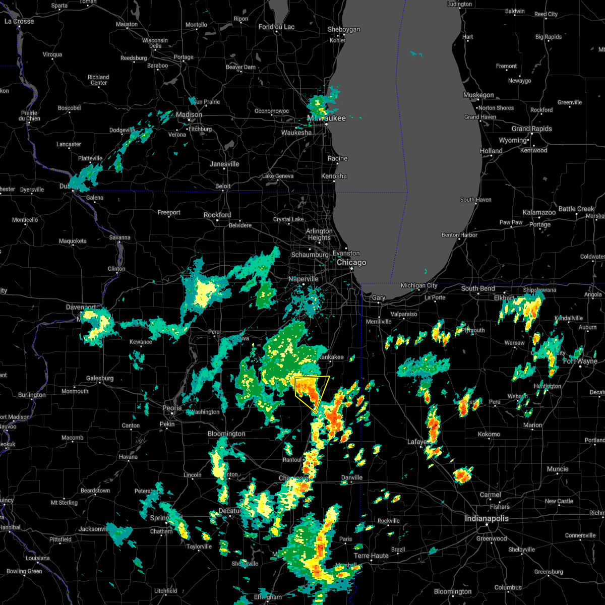
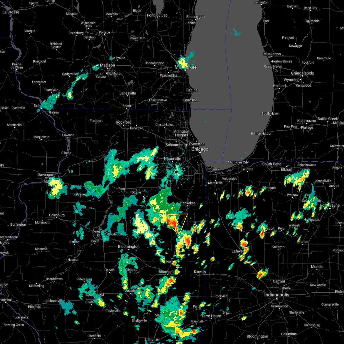
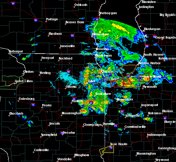
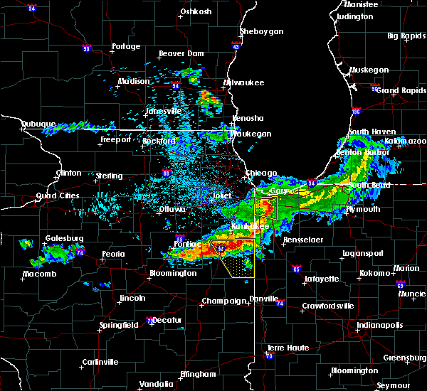
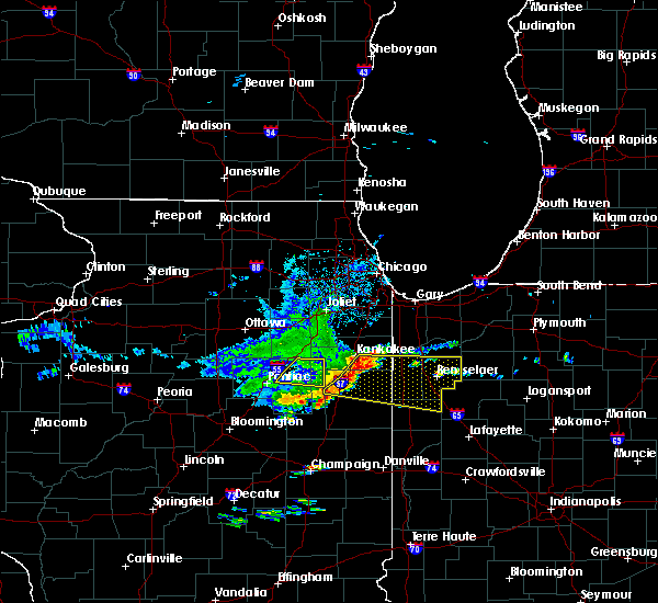
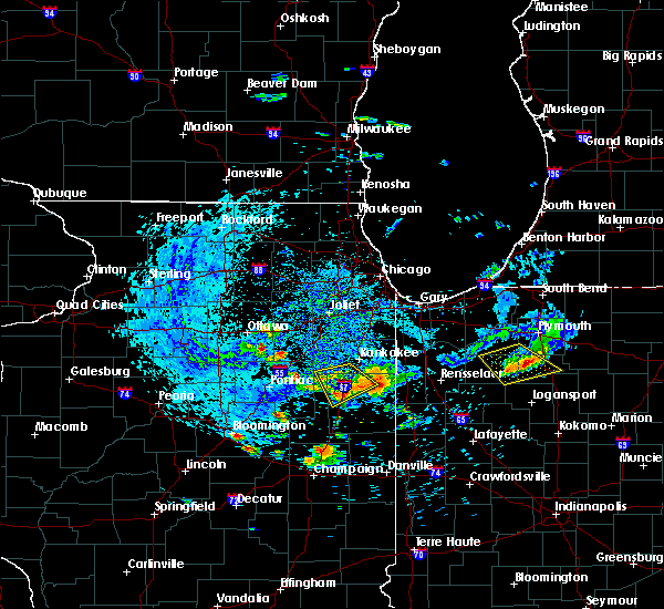
Hail Map for Clifton, IL
The Clifton, IL area has had 2 reports of on-the-ground hail by trained spotters, and has been under severe weather warnings 8 times during the past 12 months. Doppler radar has detected hail at or near Clifton, IL on 51 occasions, including 1 occasion during the past year.
| Name: | Clifton, IL |
| Where Located: | 67.3 miles SSW of Chicago, IL |
| Map: | Google Map for Clifton, IL |
| Population: | 1468 |
| Housing Units: | 569 |
| More Info: | Search Google for Clifton, IL |
1
The Top Recent Hail Date for Clifton, IL is Saturday, May 6, 2023 (15th out of 51)
Hail and Wind Damage Spotted near Clifton, IL
| Date / Time | Report Details |
|---|---|
| 6/29/2023 2:26 PM CDT |
 The severe thunderstorm warning for southeastern kankakee and iroquois counties will expire at 230 pm cdt, the storms which prompted the warning have weakened, and the strongest winds are exiting the warned area. therefore, the warning will be allowed to expire. however gusty winds, heavy rain, and lightning will still occur with the thunderstorms over the area. to report severe weather, contact your nearest law enforcement agency. they will relay your report to the national weather service chicago. a severe thunderstorm watch remains in effect until 500 pm cdt for northeastern and east central illinois. The severe thunderstorm warning for southeastern kankakee and iroquois counties will expire at 230 pm cdt, the storms which prompted the warning have weakened, and the strongest winds are exiting the warned area. therefore, the warning will be allowed to expire. however gusty winds, heavy rain, and lightning will still occur with the thunderstorms over the area. to report severe weather, contact your nearest law enforcement agency. they will relay your report to the national weather service chicago. a severe thunderstorm watch remains in effect until 500 pm cdt for northeastern and east central illinois.
|
| 6/29/2023 2:05 PM CDT |
 At 205 pm cdt, severe thunderstorms were located along a line extending from bourbonnais to near martinton to near watseka to near stockland to 6 miles west of boswell, moving east northeast at 55 mph (radar indicated). Hazards include 60 mph wind gusts. Expect damage to roofs, siding, and trees. locations impacted include, kankakee, bourbonnais, bradley, watseka, momence, clifton, milford, limestone, st. anne, sheldon, chebanse, ashkum, aroma park, hopkins park, martinton, stockland, crescent city, sun river terrace, bonfield and beaverville. this includes, kankakee community college, kankakee county fairgrounds and speedway, and olivet nazarine university. Including the following interstate, i-57 between mile markers 293 and 318. At 205 pm cdt, severe thunderstorms were located along a line extending from bourbonnais to near martinton to near watseka to near stockland to 6 miles west of boswell, moving east northeast at 55 mph (radar indicated). Hazards include 60 mph wind gusts. Expect damage to roofs, siding, and trees. locations impacted include, kankakee, bourbonnais, bradley, watseka, momence, clifton, milford, limestone, st. anne, sheldon, chebanse, ashkum, aroma park, hopkins park, martinton, stockland, crescent city, sun river terrace, bonfield and beaverville. this includes, kankakee community college, kankakee county fairgrounds and speedway, and olivet nazarine university. Including the following interstate, i-57 between mile markers 293 and 318.
|
| 6/29/2023 1:44 PM CDT |
 At 143 pm cdt, severe thunderstorms were located along a line extending from herscher to near gilman to cissna park to near hoopeston, moving east northeast at 55 mph (radar indicated). Hazards include 60 mph wind gusts. Expect damage to roofs, siding, and trees. locations impacted include, kankakee, bourbonnais, bradley, watseka, momence, gilman, herscher, clifton, milford, limestone, onarga, st. anne, sheldon, chebanse, cissna park, ashkum, aroma park, hopkins park, buckley and martinton. this includes, kankakee community college, kankakee county fairgrounds and speedway, and olivet nazarine university. Including the following interstate, i-57 between mile markers 264 and 318. At 143 pm cdt, severe thunderstorms were located along a line extending from herscher to near gilman to cissna park to near hoopeston, moving east northeast at 55 mph (radar indicated). Hazards include 60 mph wind gusts. Expect damage to roofs, siding, and trees. locations impacted include, kankakee, bourbonnais, bradley, watseka, momence, gilman, herscher, clifton, milford, limestone, onarga, st. anne, sheldon, chebanse, cissna park, ashkum, aroma park, hopkins park, buckley and martinton. this includes, kankakee community college, kankakee county fairgrounds and speedway, and olivet nazarine university. Including the following interstate, i-57 between mile markers 264 and 318.
|
| 6/29/2023 1:24 PM CDT | At 123 pm cdt, severe thunderstorms were located along a line extending from near saunemin to 9 miles northwest of paxton to near urbana, moving east at 45 mph (radar indicated). Hazards include 60 mph wind gusts. expect damage to roofs, siding, and trees |
| 5/7/2023 10:24 PM CDT |
 At 1023 pm cdt, severe thunderstorms were located along a line extending from near ashkum to near onarga to 6 miles south of piper city, moving southeast at 30 mph (radar indicated). Hazards include 60 mph wind gusts and quarter size hail. Hail damage to vehicles is expected. expect wind damage to roofs, siding, and trees. these severe storms will be near, martinton around 1035 pm cdt. watseka around 1040 pm cdt. buckley around 1045 pm cdt. sheldon around 1055 pm cdt. milford and cissna park around 1100 pm cdt. other locations impacted by these severe thunderstorms include papineau, thawville, donovan, loda, claytonville, crescent city, roberts, clarence, woodland and iroquois. including the following interstate, i-57 between mile markers 258 and 301. hail threat, radar indicated max hail size, 1. 00 in wind threat, radar indicated max wind gust, 60 mph. At 1023 pm cdt, severe thunderstorms were located along a line extending from near ashkum to near onarga to 6 miles south of piper city, moving southeast at 30 mph (radar indicated). Hazards include 60 mph wind gusts and quarter size hail. Hail damage to vehicles is expected. expect wind damage to roofs, siding, and trees. these severe storms will be near, martinton around 1035 pm cdt. watseka around 1040 pm cdt. buckley around 1045 pm cdt. sheldon around 1055 pm cdt. milford and cissna park around 1100 pm cdt. other locations impacted by these severe thunderstorms include papineau, thawville, donovan, loda, claytonville, crescent city, roberts, clarence, woodland and iroquois. including the following interstate, i-57 between mile markers 258 and 301. hail threat, radar indicated max hail size, 1. 00 in wind threat, radar indicated max wind gust, 60 mph.
|
| 5/7/2023 10:03 PM CDT |
 At 1003 pm cdt, severe thunderstorms were located along a line extending from st. anne to 6 miles west of watseka to 6 miles southwest of paxton, moving east at 40 mph (radar indicated). Hazards include 60 mph wind gusts. Expect damage to roofs, siding, and trees. these severe storms will be near, watseka and martinton around 1010 pm cdt. sheldon around 1025 pm cdt. other locations impacted by these severe thunderstorms include melvin, papineau, campus, thawville, donovan, loda, claytonville, crescent city, sibley and roberts. including the following interstate, i-57 between mile markers 258 and 301. hail threat, radar indicated max hail size, <. 75 in wind threat, radar indicated max wind gust, 60 mph. At 1003 pm cdt, severe thunderstorms were located along a line extending from st. anne to 6 miles west of watseka to 6 miles southwest of paxton, moving east at 40 mph (radar indicated). Hazards include 60 mph wind gusts. Expect damage to roofs, siding, and trees. these severe storms will be near, watseka and martinton around 1010 pm cdt. sheldon around 1025 pm cdt. other locations impacted by these severe thunderstorms include melvin, papineau, campus, thawville, donovan, loda, claytonville, crescent city, sibley and roberts. including the following interstate, i-57 between mile markers 258 and 301. hail threat, radar indicated max hail size, <. 75 in wind threat, radar indicated max wind gust, 60 mph.
|
| 5/7/2023 9:42 PM CDT |
 At 941 pm cdt, severe thunderstorms were located along a line extending from near bourbonnais to near piper city to 6 miles southeast of colfax, moving east at 40 mph (radar indicated). Hazards include 60 mph wind gusts. Expect damage to roofs, siding, and trees. these severe storms will be near, bourbonnais, bradley and limestone around 945 pm cdt. kankakee, gilman and aroma park around 950 pm cdt. onarga and ashkum around 955 pm cdt. momence and st. anne around 1000 pm cdt. hopkins park around 1005 pm cdt. watseka around 1010 pm cdt. paxton around 1015 pm cdt. sheldon around 1025 pm cdt. other locations impacted by these severe thunderstorms include melvin, papineau, loda, claytonville, crescent city, irwin, clarence, woodland, cabery and south wilmington. including the following interstate, i-57 between mile markers 258 and 318. hail threat, radar indicated max hail size, <. 75 in wind threat, radar indicated max wind gust, 60 mph. At 941 pm cdt, severe thunderstorms were located along a line extending from near bourbonnais to near piper city to 6 miles southeast of colfax, moving east at 40 mph (radar indicated). Hazards include 60 mph wind gusts. Expect damage to roofs, siding, and trees. these severe storms will be near, bourbonnais, bradley and limestone around 945 pm cdt. kankakee, gilman and aroma park around 950 pm cdt. onarga and ashkum around 955 pm cdt. momence and st. anne around 1000 pm cdt. hopkins park around 1005 pm cdt. watseka around 1010 pm cdt. paxton around 1015 pm cdt. sheldon around 1025 pm cdt. other locations impacted by these severe thunderstorms include melvin, papineau, loda, claytonville, crescent city, irwin, clarence, woodland, cabery and south wilmington. including the following interstate, i-57 between mile markers 258 and 318. hail threat, radar indicated max hail size, <. 75 in wind threat, radar indicated max wind gust, 60 mph.
|
| 5/7/2023 9:16 PM CDT |
 At 914 pm cdt, severe thunderstorms were located along a line extending from near braceville to saunemin to near lexington, moving east at 40 mph. another, nearly stationary severe thunderstorm was located near st. anne and hopkins park (radar indicated). Hazards include 60 mph wind gusts and quarter size hail. Hail damage to vehicles is expected. expect wind damage to roofs, siding, and trees. severe thunderstorms will be near, chatsworth and cullom around 925 pm cdt. limestone and piper city around 935 pm cdt. kankakee, bourbonnais, bradley and gibson city around 945 pm cdt. gilman, onarga, ashkum and aroma park around 950 pm cdt. momence and st. anne around 1000 pm cdt. hopkins park around 1005 pm cdt. watseka, paxton and buckley around 1010 pm cdt. milford around 1015 pm cdt. including the following interstate, i-57 between mile markers 258 and 318. hail threat, radar indicated max hail size, 1. 00 in wind threat, radar indicated max wind gust, 60 mph. At 914 pm cdt, severe thunderstorms were located along a line extending from near braceville to saunemin to near lexington, moving east at 40 mph. another, nearly stationary severe thunderstorm was located near st. anne and hopkins park (radar indicated). Hazards include 60 mph wind gusts and quarter size hail. Hail damage to vehicles is expected. expect wind damage to roofs, siding, and trees. severe thunderstorms will be near, chatsworth and cullom around 925 pm cdt. limestone and piper city around 935 pm cdt. kankakee, bourbonnais, bradley and gibson city around 945 pm cdt. gilman, onarga, ashkum and aroma park around 950 pm cdt. momence and st. anne around 1000 pm cdt. hopkins park around 1005 pm cdt. watseka, paxton and buckley around 1010 pm cdt. milford around 1015 pm cdt. including the following interstate, i-57 between mile markers 258 and 318. hail threat, radar indicated max hail size, 1. 00 in wind threat, radar indicated max wind gust, 60 mph.
|
| 8/29/2022 1:33 PM CDT | Tree downed and several branches downed on a farm near clifton. location approximate. time estimated by radar. relayed via broadcast medi in iroquois county IL, 0.5 miles NE of Clifton, IL |
| 8/29/2022 1:33 PM CDT | At 132 pm cdt, severe thunderstorms were located along a line extending from ford heights to near ashkum, moving east at 45 mph (radar indicated). Hazards include 70 mph wind gusts and nickel size hail. Expect considerable tree damage. damage is likely to mobile homes, roofs, and outbuildings. locations impacted include, orland park, tinley park, calumet city, chicago heights, lansing, oak forest, kankakee, harvey, new lenox, dolton, park forest, homewood, matteson, mokena, bourbonnais, frankfort, bradley, steger, manteno and peotone. this includes, first midwest bank amphitheatre, governors state university, kankakee community college, kankakee county fairgrounds and speedway, kankakee river state park, olivet nazarine university, prairie state college, south suburban college, and will county fairgrounds. including the following interstates, i-57 near mile marker 295, and between mile markers 298 and 349. i-80 between mile markers 145 and 155. i-94 between mile markers 73 and 74. i-294 between mile markers 73 and 74. thunderstorm damage threat, considerable hail threat, radar indicated max hail size, 0. 88 in wind threat, radar indicated max wind gust, 70 mph. |
| 8/29/2022 1:25 PM CDT | At 124 pm cdt, severe thunderstorms were located along a line extending from near bradley to near limestone to 7 miles northeast of piper city, moving east at 55 mph (radar indicated). Hazards include 70 mph wind gusts. Expect considerable tree damage. Damage is likely to mobile homes, roofs, and outbuildings. |
| 8/29/2022 1:25 PM CDT | At 124 pm cdt, severe thunderstorms were located along a line extending from near bradley to near limestone to 7 miles northeast of piper city, moving east at 55 mph (radar indicated). Hazards include 70 mph wind gusts. Expect considerable tree damage. Damage is likely to mobile homes, roofs, and outbuildings. |
| 8/29/2022 1:18 PM CDT | At 118 pm cdt, severe thunderstorms were located along a line extending from frankfort square to near cullom, moving east at 55 mph (radar indicated). Hazards include 70 mph wind gusts and nickel size hail. Expect considerable tree damage. damage is likely to mobile homes, roofs, and outbuildings. locations impacted include, joliet, orland park, tinley park, romeoville, calumet city, chicago heights, lansing, oak forest, kankakee, harvey, lockport, new lenox, homer glen, dolton, park forest, homewood, matteson, mokena, bourbonnais and frankfort. this includes, university of st. Francis, chicagoland speedway route 66 raceway, first midwest bank amphitheatre, governors state university, joliet junior college, joliet slammers baseball, kankakee community college, kankakee county fairgrounds and speedway, kankakee river state park, lewis university, olivet nazarine university, prairie state college, south suburban college, will county fairgrounds, and north central college. |
| 8/29/2022 1:10 PM CDT | At 110 pm cdt, severe thunderstorms were located along a line extending from near new lenox to near saunemin, moving east at 50 mph (radar indicated). Hazards include 60 mph wind gusts and nickel size hail. Expect damage to roofs, siding, and trees. locations impacted include, joliet, orland park, tinley park, romeoville, plainfield, calumet city, chicago heights, lansing, oak forest, kankakee, harvey, lockport, new lenox, homer glen, dolton, park forest, homewood, matteson, mokena and bourbonnais. this includes, university of st. Francis, channahon state park, chicagoland speedway route 66 raceway, first midwest bank amphitheatre, governors state university, joliet junior college, joliet slammers baseball, kankakee community college, kankakee county fairgrounds and speedway, kankakee river state park, lewis university, olivet nazarine university, prairie state college, south suburban college, will county fairgrounds, and north central college. |
| 8/29/2022 12:59 PM CDT | At 1259 pm cdt, severe thunderstorms were located along a line extending from near shorewood to near odell, moving east at 50 mph (radar indicated). Hazards include 60 mph wind gusts and nickel size hail. Expect damage to roofs, siding, and trees. locations impacted include, joliet, orland park, tinley park, romeoville, plainfield, calumet city, chicago heights, lansing, oak forest, kankakee, harvey, lockport, new lenox, homer glen, dolton, park forest, homewood, matteson, mokena and bourbonnais. this includes, university of st. Francis, channahon state park, chicagoland speedway route 66 raceway, first midwest bank amphitheatre, governors state university, joliet junior college, joliet slammers baseball, kankakee community college, kankakee county fairgrounds and speedway, kankakee river state park, lewis university, olivet nazarine university, prairie state college, south suburban college, will county fairgrounds, and north central college. |
| 8/29/2022 12:44 PM CDT | At 1243 pm cdt, severe thunderstorms were located along a line extending from near yorkville to near cornell, moving east at 50 mph (radar indicated). Hazards include 60 mph wind gusts and nickel size hail. expect damage to roofs, siding, and trees |
| 8/3/2022 2:50 PM CDT |
 At 249 pm cdt, severe thunderstorms were located along a line extending from near lowell to near martinton to 6 miles west of paxton, moving east at 20 mph (radar indicated). Hazards include 60 mph wind gusts. Expect damage to roofs, siding, and trees. locations impacted include, kankakee, lowell, gibson city, momence, gilman, clifton, chatsworth, onarga, grant park, st. anne, chebanse, piper city, ashkum, aroma park, hopkins park, martinton, crescent city, danforth, sun river terrace and melvin. this includes, kankakee community college and kankakee county fairgrounds and speedway. including the following interstate, i-57 between mile markers 271 and 311. hail threat, radar indicated max hail size, <. 75 in wind threat, radar indicated max wind gust, 60 mph. At 249 pm cdt, severe thunderstorms were located along a line extending from near lowell to near martinton to 6 miles west of paxton, moving east at 20 mph (radar indicated). Hazards include 60 mph wind gusts. Expect damage to roofs, siding, and trees. locations impacted include, kankakee, lowell, gibson city, momence, gilman, clifton, chatsworth, onarga, grant park, st. anne, chebanse, piper city, ashkum, aroma park, hopkins park, martinton, crescent city, danforth, sun river terrace and melvin. this includes, kankakee community college and kankakee county fairgrounds and speedway. including the following interstate, i-57 between mile markers 271 and 311. hail threat, radar indicated max hail size, <. 75 in wind threat, radar indicated max wind gust, 60 mph.
|
| 8/3/2022 2:14 PM CDT | Private weather station in clifton reported 65 mph gus in iroquois county IL, 0.4 miles NNW of Clifton, IL |
| 8/3/2022 1:56 PM CDT |
 At 155 pm cdt, severe thunderstorms were located along a line extending from near manteno to 8 miles west of ashkum to near saybrook, moving east at 20 mph (radar indicated). Hazards include 60 mph wind gusts and quarter size hail. Hail damage to vehicles is expected. Expect wind damage to roofs, siding, and trees. At 155 pm cdt, severe thunderstorms were located along a line extending from near manteno to 8 miles west of ashkum to near saybrook, moving east at 20 mph (radar indicated). Hazards include 60 mph wind gusts and quarter size hail. Hail damage to vehicles is expected. Expect wind damage to roofs, siding, and trees.
|
| 4/30/2022 7:57 PM CDT |
 At 757 pm cdt, a severe thunderstorm was located over ashkum, or near clifton, moving northeast at 35 mph (radar indicated). Hazards include 60 mph wind gusts and quarter size hail. Hail damage to vehicles is expected. expect wind damage to roofs, siding, and trees. locations impacted include, kankakee, momence, gilman, clifton, st. anne, chebanse, ashkum, aroma park, hopkins park, martinton, danforth, sun river terrace, beaverville, donovan, sammons point and papineau. this includes, kankakee county fairgrounds and speedway. including the following interstate, i-57 between mile markers 286 and 310. hail threat, radar indicated max hail size, 1. 00 in wind threat, radar indicated max wind gust, 60 mph. At 757 pm cdt, a severe thunderstorm was located over ashkum, or near clifton, moving northeast at 35 mph (radar indicated). Hazards include 60 mph wind gusts and quarter size hail. Hail damage to vehicles is expected. expect wind damage to roofs, siding, and trees. locations impacted include, kankakee, momence, gilman, clifton, st. anne, chebanse, ashkum, aroma park, hopkins park, martinton, danforth, sun river terrace, beaverville, donovan, sammons point and papineau. this includes, kankakee county fairgrounds and speedway. including the following interstate, i-57 between mile markers 286 and 310. hail threat, radar indicated max hail size, 1. 00 in wind threat, radar indicated max wind gust, 60 mph.
|
| 4/30/2022 7:41 PM CDT |
 At 741 pm cdt, a severe thunderstorm was located near piper city, or near gilman, moving northeast at 35 mph (radar indicated). Hazards include 60 mph wind gusts and quarter size hail. the strongest part of the storm is moving toward ashkim, danforth, and gilman. Hail damage to vehicles is expected. Expect wind damage to roofs, siding, and trees. At 741 pm cdt, a severe thunderstorm was located near piper city, or near gilman, moving northeast at 35 mph (radar indicated). Hazards include 60 mph wind gusts and quarter size hail. the strongest part of the storm is moving toward ashkim, danforth, and gilman. Hail damage to vehicles is expected. Expect wind damage to roofs, siding, and trees.
|
| 9/7/2021 7:18 PM CDT |
 At 718 pm cdt, a severe thunderstorm was located near ashkum, or 7 miles northwest of watseka, moving southeast at 35 mph (radar indicated). Hazards include 60 mph wind gusts and quarter size hail. Hail damage to vehicles is expected. expect wind damage to roofs, siding, and trees. Locations impacted include, watseka, gilman, clifton, sheldon, ashkum, martinton, crescent city, danforth, woodland, donovan and iroquois. At 718 pm cdt, a severe thunderstorm was located near ashkum, or 7 miles northwest of watseka, moving southeast at 35 mph (radar indicated). Hazards include 60 mph wind gusts and quarter size hail. Hail damage to vehicles is expected. expect wind damage to roofs, siding, and trees. Locations impacted include, watseka, gilman, clifton, sheldon, ashkum, martinton, crescent city, danforth, woodland, donovan and iroquois.
|
| 9/7/2021 7:04 PM CDT |
 At 704 pm cdt, a severe thunderstorm was located over ashkum, or near clifton, moving southeast at 35 mph (radar indicated). Hazards include 60 mph wind gusts and quarter size hail. Hail damage to vehicles is expected. Expect wind damage to roofs, siding, and trees. At 704 pm cdt, a severe thunderstorm was located over ashkum, or near clifton, moving southeast at 35 mph (radar indicated). Hazards include 60 mph wind gusts and quarter size hail. Hail damage to vehicles is expected. Expect wind damage to roofs, siding, and trees.
|
| 9/7/2021 4:46 PM CDT |
 At 446 pm cdt, severe thunderstorms were located along a line extending from near clifton to near chenoa, moving southeast at 35 mph (radar indicated). Hazards include 60 mph wind gusts and quarter size hail. Hail damage to vehicles is expected. expect wind damage to roofs, siding, and trees. locations impacted include, fairbury, herscher, clifton, chenoa, forrest, ashkum, cullom, saunemin, danforth, buckingham, cabery, kempton, campus, emington and stelle. hail threat, radar indicated max hail size, 1. 00 in wind threat, radar indicated max wind gust, 60 mph. At 446 pm cdt, severe thunderstorms were located along a line extending from near clifton to near chenoa, moving southeast at 35 mph (radar indicated). Hazards include 60 mph wind gusts and quarter size hail. Hail damage to vehicles is expected. expect wind damage to roofs, siding, and trees. locations impacted include, fairbury, herscher, clifton, chenoa, forrest, ashkum, cullom, saunemin, danforth, buckingham, cabery, kempton, campus, emington and stelle. hail threat, radar indicated max hail size, 1. 00 in wind threat, radar indicated max wind gust, 60 mph.
|
| 9/7/2021 4:24 PM CDT |
 At 424 pm cdt, severe thunderstorms were located along a line extending from near herscher to near flanagan, moving southeast at 35 mph (radar indicated). Hazards include 60 mph wind gusts and quarter size hail. Hail damage to vehicles is expected. expect wind damage to roofs, siding, and trees. locations impacted include, pontiac, dwight, fairbury, herscher, clifton, gridley, forrest, flanagan, odell, ashkum, cullom, cornell, saunemin, danforth, buckingham, cabery, kempton, campus, reddick and emington. hail threat, radar indicated max hail size, 1. 00 in wind threat, radar indicated max wind gust, 60 mph. At 424 pm cdt, severe thunderstorms were located along a line extending from near herscher to near flanagan, moving southeast at 35 mph (radar indicated). Hazards include 60 mph wind gusts and quarter size hail. Hail damage to vehicles is expected. expect wind damage to roofs, siding, and trees. locations impacted include, pontiac, dwight, fairbury, herscher, clifton, gridley, forrest, flanagan, odell, ashkum, cullom, cornell, saunemin, danforth, buckingham, cabery, kempton, campus, reddick and emington. hail threat, radar indicated max hail size, 1. 00 in wind threat, radar indicated max wind gust, 60 mph.
|
| 9/7/2021 4:06 PM CDT |
 At 406 pm cdt, severe thunderstorms were located along a line extending from 6 miles west of herscher to near minonk, moving southeast at 35 mph (radar indicated). Hazards include 60 mph wind gusts and quarter size hail. Hail damage to vehicles is expected. Expect wind damage to roofs, siding, and trees. At 406 pm cdt, severe thunderstorms were located along a line extending from 6 miles west of herscher to near minonk, moving southeast at 35 mph (radar indicated). Hazards include 60 mph wind gusts and quarter size hail. Hail damage to vehicles is expected. Expect wind damage to roofs, siding, and trees.
|
| 8/12/2021 2:13 AM CDT |
 At 212 am cdt, severe thunderstorms were located along a line extending from braidwood to near herscher to near pontiac, moving east at 40 mph (radar indicated). Hazards include 60 mph wind gusts and nickel size hail. expect damage to roofs, siding, and trees At 212 am cdt, severe thunderstorms were located along a line extending from braidwood to near herscher to near pontiac, moving east at 40 mph (radar indicated). Hazards include 60 mph wind gusts and nickel size hail. expect damage to roofs, siding, and trees
|
| 7/12/2021 2:56 PM CDT |
 The severe thunderstorm warning for northern ford and northwestern iroquois counties will expire at 300 pm cdt, the storms which prompted the warning have moved out of the area. therefore, the warning will be allowed to expire. remember, a tornado warning still remains in effect for iroquois county near ashkum until 315 pm cdt. The severe thunderstorm warning for northern ford and northwestern iroquois counties will expire at 300 pm cdt, the storms which prompted the warning have moved out of the area. therefore, the warning will be allowed to expire. remember, a tornado warning still remains in effect for iroquois county near ashkum until 315 pm cdt.
|
| 7/12/2021 2:46 PM CDT |
 At 246 pm cdt, severe thunderstorms were located along a line extending from 6 miles northeast of cullom to near clifton to near gilman, moving northeast at 15 mph (radar indicated). Hazards include 60 mph wind gusts. Expect damage to roofs, siding, and trees. Locations impacted include, clifton, chebanse, ashkum, danforth and stelle. At 246 pm cdt, severe thunderstorms were located along a line extending from 6 miles northeast of cullom to near clifton to near gilman, moving northeast at 15 mph (radar indicated). Hazards include 60 mph wind gusts. Expect damage to roofs, siding, and trees. Locations impacted include, clifton, chebanse, ashkum, danforth and stelle.
|
| 7/12/2021 2:28 PM CDT |
 At 227 pm cdt, severe thunderstorms were located along a line extending from near cullom to 6 miles west of ashkum to gilman, moving northeast at 20 mph (radar indicated). Hazards include 60 mph wind gusts. Expect damage to roofs, siding, and trees. Locations impacted include, gilman, clifton, onarga, chebanse, ashkum, danforth, kempton and stelle. At 227 pm cdt, severe thunderstorms were located along a line extending from near cullom to 6 miles west of ashkum to gilman, moving northeast at 20 mph (radar indicated). Hazards include 60 mph wind gusts. Expect damage to roofs, siding, and trees. Locations impacted include, gilman, clifton, onarga, chebanse, ashkum, danforth, kempton and stelle.
|
| 7/12/2021 2:11 PM CDT |
 At 210 pm cdt, severe thunderstorms were located along a line extending from cullom to near gilman, moving northeast at 15 mph (radar indicated). Hazards include 60 mph wind gusts. expect damage to roofs, siding, and trees At 210 pm cdt, severe thunderstorms were located along a line extending from cullom to near gilman, moving northeast at 15 mph (radar indicated). Hazards include 60 mph wind gusts. expect damage to roofs, siding, and trees
|
| 6/26/2021 5:12 PM CDT |
 At 512 pm cdt, severe thunderstorms were located along a line extending from near beecher to near grant park to near aroma park to martinton to near gibson city, moving northeast at 55 mph (radar indicated). Hazards include 70 mph wind gusts. Expect considerable tree damage. damage is likely to mobile homes, roofs, and outbuildings. Locations impacted include, kankakee, park forest, bourbonnais, bradley, steger, manteno, watseka, paxton, peotone, gibson city, momence, gilman, clifton, milford, crete, university park, monee, beecher, limestone and onarga. At 512 pm cdt, severe thunderstorms were located along a line extending from near beecher to near grant park to near aroma park to martinton to near gibson city, moving northeast at 55 mph (radar indicated). Hazards include 70 mph wind gusts. Expect considerable tree damage. damage is likely to mobile homes, roofs, and outbuildings. Locations impacted include, kankakee, park forest, bourbonnais, bradley, steger, manteno, watseka, paxton, peotone, gibson city, momence, gilman, clifton, milford, crete, university park, monee, beecher, limestone and onarga.
|
| 6/26/2021 4:49 PM CDT |
 At 449 pm cdt, severe thunderstorms were located along a line extending from manteno to 7 miles east of cullom to near piper city to farmer city, moving northeast at 45 mph (radar indicated). Hazards include 70 mph wind gusts. Expect considerable tree damage. Damage is likely to mobile homes, roofs, and outbuildings. At 449 pm cdt, severe thunderstorms were located along a line extending from manteno to 7 miles east of cullom to near piper city to farmer city, moving northeast at 45 mph (radar indicated). Hazards include 70 mph wind gusts. Expect considerable tree damage. Damage is likely to mobile homes, roofs, and outbuildings.
|
| 6/26/2021 4:36 PM CDT |
 At 436 pm cdt, severe thunderstorms were located along a line extending from cullom to near chatsworth to near gibson city, moving northeast at 45 mph (radar indicated). Hazards include 70 mph wind gusts. Expect considerable tree damage. damage is likely to mobile homes, roofs, and outbuildings. Locations impacted include, fairbury, gibson city, clifton, chatsworth, forrest, chebanse, piper city, ashkum, cullom, saunemin, danforth, melvin, roberts, elliott, sibley, thawville, kempton, emington, stelle and strawn. At 436 pm cdt, severe thunderstorms were located along a line extending from cullom to near chatsworth to near gibson city, moving northeast at 45 mph (radar indicated). Hazards include 70 mph wind gusts. Expect considerable tree damage. damage is likely to mobile homes, roofs, and outbuildings. Locations impacted include, fairbury, gibson city, clifton, chatsworth, forrest, chebanse, piper city, ashkum, cullom, saunemin, danforth, melvin, roberts, elliott, sibley, thawville, kempton, emington, stelle and strawn.
|
| 6/26/2021 4:13 PM CDT |
 At 412 pm cdt, severe thunderstorms were located along a line extending from near fairbury to 8 miles northeast of colfax to 6 miles southeast of cooksville, moving northeast at 60 mph (radar indicated). Hazards include 70 mph wind gusts. Expect considerable tree damage. Damage is likely to mobile homes, roofs, and outbuildings. At 412 pm cdt, severe thunderstorms were located along a line extending from near fairbury to 8 miles northeast of colfax to 6 miles southeast of cooksville, moving northeast at 60 mph (radar indicated). Hazards include 70 mph wind gusts. Expect considerable tree damage. Damage is likely to mobile homes, roofs, and outbuildings.
|
| 6/12/2021 5:24 PM CDT |
 At 524 pm cdt, a severe thunderstorm was located near ashkum, or 7 miles northwest of gilman, moving southeast at 20 mph (radar indicated). Hazards include 70 mph wind gusts and half dollar size hail. Hail damage to vehicles is expected. expect considerable tree damage. wind damage is also likely to mobile homes, roofs, and outbuildings. Locations impacted include, watseka, gilman, clifton, onarga, piper city, ashkum, crescent city, danforth, roberts, woodland and thawville. At 524 pm cdt, a severe thunderstorm was located near ashkum, or 7 miles northwest of gilman, moving southeast at 20 mph (radar indicated). Hazards include 70 mph wind gusts and half dollar size hail. Hail damage to vehicles is expected. expect considerable tree damage. wind damage is also likely to mobile homes, roofs, and outbuildings. Locations impacted include, watseka, gilman, clifton, onarga, piper city, ashkum, crescent city, danforth, roberts, woodland and thawville.
|
| 6/12/2021 5:11 PM CDT |
 At 511 pm cdt, a severe thunderstorm was located 7 miles northwest of ashkum, or 7 miles west of clifton, moving southeast at 15 mph (radar indicated). Hazards include 60 mph wind gusts and quarter size hail. Hail damage to vehicles is expected. Expect wind damage to roofs, siding, and trees. At 511 pm cdt, a severe thunderstorm was located 7 miles northwest of ashkum, or 7 miles west of clifton, moving southeast at 15 mph (radar indicated). Hazards include 60 mph wind gusts and quarter size hail. Hail damage to vehicles is expected. Expect wind damage to roofs, siding, and trees.
|
| 8/29/2020 1:48 AM EDT |
 At 1247 am cdt/147 am edt/, severe thunderstorms were located along a line extending from morocco to sheldon to near gilman, moving southeast at 40 mph (radar indicated). Hazards include 60 mph wind gusts. Expect damage to roofs, siding, and trees. Locations impacted include, watseka, fowler, gilman, kentland, clifton, milford, otterbein, remington, morocco, onarga, oxford, sheldon, goodland, brook, cissna park, boswell, ashkum, martinton, earl park and stockland. At 1247 am cdt/147 am edt/, severe thunderstorms were located along a line extending from morocco to sheldon to near gilman, moving southeast at 40 mph (radar indicated). Hazards include 60 mph wind gusts. Expect damage to roofs, siding, and trees. Locations impacted include, watseka, fowler, gilman, kentland, clifton, milford, otterbein, remington, morocco, onarga, oxford, sheldon, goodland, brook, cissna park, boswell, ashkum, martinton, earl park and stockland.
|
| 8/29/2020 1:35 AM EDT |
 At 1235 am cdt/135 am edt/, severe thunderstorms were located along a line extending from near hopkins park to near martinton to near cullom, moving southeast at 40 mph (radar indicated). Hazards include 60 mph wind gusts and penny size hail. expect damage to roofs, siding, and trees At 1235 am cdt/135 am edt/, severe thunderstorms were located along a line extending from near hopkins park to near martinton to near cullom, moving southeast at 40 mph (radar indicated). Hazards include 60 mph wind gusts and penny size hail. expect damage to roofs, siding, and trees
|
| 8/10/2020 4:19 PM CDT |
 At 419 pm cdt, severe thunderstorms were located along a line extending from near kentland to near rossville to st. joseph, moving southeast at 60 mph (radar indicated). Hazards include 60 mph wind gusts. Expect damage to roofs, siding, and trees. Locations impacted include, watseka, paxton, gibson city, gilman, clifton, milford, onarga, sheldon, cissna park, ashkum, buckley, martinton, stockland, crescent city, danforth, loda, beaverville, roberts, woodland and donovan. At 419 pm cdt, severe thunderstorms were located along a line extending from near kentland to near rossville to st. joseph, moving southeast at 60 mph (radar indicated). Hazards include 60 mph wind gusts. Expect damage to roofs, siding, and trees. Locations impacted include, watseka, paxton, gibson city, gilman, clifton, milford, onarga, sheldon, cissna park, ashkum, buckley, martinton, stockland, crescent city, danforth, loda, beaverville, roberts, woodland and donovan.
|
| 8/10/2020 3:50 PM CDT |
 At 350 pm cdt, severe thunderstorms were located along a line extending from near chebanse to near buckley to near farmer city, moving southeast at 60 mph (radar indicated). Hazards include 60 mph wind gusts. Expect damage to roofs, siding, and trees. Locations impacted include, watseka, paxton, gibson city, gilman, clifton, milford, onarga, sheldon, chebanse, cissna park, piper city, ashkum, buckley, martinton, stockland, crescent city, danforth, melvin, loda and beaverville. At 350 pm cdt, severe thunderstorms were located along a line extending from near chebanse to near buckley to near farmer city, moving southeast at 60 mph (radar indicated). Hazards include 60 mph wind gusts. Expect damage to roofs, siding, and trees. Locations impacted include, watseka, paxton, gibson city, gilman, clifton, milford, onarga, sheldon, chebanse, cissna park, piper city, ashkum, buckley, martinton, stockland, crescent city, danforth, melvin, loda and beaverville.
|
| 8/10/2020 3:25 PM CDT |
 At 325 pm cdt, severe thunderstorms were located along a line extending from near gardner to fairbury to bloomington, moving southeast at 60 mph (radar indicated). Hazards include 60 mph wind gusts. expect damage to roofs, siding, and trees At 325 pm cdt, severe thunderstorms were located along a line extending from near gardner to fairbury to bloomington, moving southeast at 60 mph (radar indicated). Hazards include 60 mph wind gusts. expect damage to roofs, siding, and trees
|
| 7/11/2020 10:39 PM CDT |
 At 1037 pm cdt/1137 pm edt/, severe thunderstorms were located along a line extending from university park to hoopeston, moving east at 40 mph. a personal weather station reported 68 mph winds near cissna park in south central iroquois county, though no reports of damage have been received yet (radar indicated). Hazards include 60 mph wind gusts. Expect damage to roofs, siding, and trees. Locations impacted include, merrillville, valparaiso, schererville, hobart, kankakee, crown point, park forest, mokena, bourbonnais, frankfort, bradley, cedar lake, steger, lowell, manteno, rensselaer, watseka, peotone, demotte and hebron. At 1037 pm cdt/1137 pm edt/, severe thunderstorms were located along a line extending from university park to hoopeston, moving east at 40 mph. a personal weather station reported 68 mph winds near cissna park in south central iroquois county, though no reports of damage have been received yet (radar indicated). Hazards include 60 mph wind gusts. Expect damage to roofs, siding, and trees. Locations impacted include, merrillville, valparaiso, schererville, hobart, kankakee, crown point, park forest, mokena, bourbonnais, frankfort, bradley, cedar lake, steger, lowell, manteno, rensselaer, watseka, peotone, demotte and hebron.
|
| 7/11/2020 10:08 PM CDT |
 At 1006 pm cdt/1106 pm edt/, severe thunderstorms were located along a line extending from near frankfort to near cissna park, moving east at 45 mph. winds to 60 mph were reported in braidwood and to 68 mph in saunemim with this line of storms (radar indicated). Hazards include 60 mph wind gusts. expect damage to roofs, siding, and trees At 1006 pm cdt/1106 pm edt/, severe thunderstorms were located along a line extending from near frankfort to near cissna park, moving east at 45 mph. winds to 60 mph were reported in braidwood and to 68 mph in saunemim with this line of storms (radar indicated). Hazards include 60 mph wind gusts. expect damage to roofs, siding, and trees
|
| 7/11/2020 1:21 PM CDT |
 At 121 pm cdt, severe thunderstorms were located along a line extending from near hopkins park to near clifton, moving southeast at 40 mph (radar indicated). Hazards include 60 mph wind gusts and quarter size hail. Hail damage to vehicles is expected. expect wind damage to roofs, siding, and trees. locations impacted include, clifton, st. Anne, chebanse, ashkum, hopkins park, martinton, beaverville, donovan, papineau and iroquois. At 121 pm cdt, severe thunderstorms were located along a line extending from near hopkins park to near clifton, moving southeast at 40 mph (radar indicated). Hazards include 60 mph wind gusts and quarter size hail. Hail damage to vehicles is expected. expect wind damage to roofs, siding, and trees. locations impacted include, clifton, st. Anne, chebanse, ashkum, hopkins park, martinton, beaverville, donovan, papineau and iroquois.
|
| 7/11/2020 1:04 PM CDT |
 At 104 pm cdt, severe thunderstorms were located along a line extending from kankakee to near herscher, moving southeast at 40 mph (radar indicated). Hazards include 60 mph wind gusts. Expect damage to roofs, siding, and trees. locations impacted include, kankakee, bourbonnais, bradley, momence, herscher, clifton, limestone, st. Anne, chebanse, ashkum, aroma park, hopkins park, martinton, sun river terrace, beaverville, donovan, sammons point, papineau, iroquois and irwin. At 104 pm cdt, severe thunderstorms were located along a line extending from kankakee to near herscher, moving southeast at 40 mph (radar indicated). Hazards include 60 mph wind gusts. Expect damage to roofs, siding, and trees. locations impacted include, kankakee, bourbonnais, bradley, momence, herscher, clifton, limestone, st. Anne, chebanse, ashkum, aroma park, hopkins park, martinton, sun river terrace, beaverville, donovan, sammons point, papineau, iroquois and irwin.
|
| 7/11/2020 12:54 PM CDT |
 At 1254 pm cdt, severe thunderstorms were located along a line extending from bourbonnais to near herscher, moving southeast at 40 mph (radar indicated). Hazards include 60 mph wind gusts. expect damage to roofs, siding, and trees At 1254 pm cdt, severe thunderstorms were located along a line extending from bourbonnais to near herscher, moving southeast at 40 mph (radar indicated). Hazards include 60 mph wind gusts. expect damage to roofs, siding, and trees
|
| 6/27/2020 4:49 PM CDT | Trees downed and split in hal in iroquois county IL, 8.7 miles ESE of Clifton, IL |
| 4/8/2020 5:24 PM CDT | Delayed report. a portion of roof removed on a farm shed and downed tree in iroquois county IL, 9.2 miles E of Clifton, IL |
| 6/30/2019 3:38 PM CDT |
 At 335 pm cdt, severe thunderstorms were located along a line extending from hopkins park to near onarga, moving south at 15 mph (radar indicated). Hazards include 70 mph wind gusts. Expect considerable tree damage. damage is likely to mobile homes, roofs, and outbuildings. locations impacted include, kankakee, watseka, gilman, clifton, onarga, st. Anne, chebanse, ashkum, aroma park, hopkins park, crescent city, danforth, martinton, beaverville, donovan, thawville, papineau and iroquois. At 335 pm cdt, severe thunderstorms were located along a line extending from hopkins park to near onarga, moving south at 15 mph (radar indicated). Hazards include 70 mph wind gusts. Expect considerable tree damage. damage is likely to mobile homes, roofs, and outbuildings. locations impacted include, kankakee, watseka, gilman, clifton, onarga, st. Anne, chebanse, ashkum, aroma park, hopkins park, crescent city, danforth, martinton, beaverville, donovan, thawville, papineau and iroquois.
|
| 6/30/2019 3:01 PM CDT |
 At 300 pm cdt, severe thunderstorms were located along a line extending from momence to st. anne to near clifton to 7 miles west of ashkum, moving southeast at 40 mph. these are very dangerous storms (radar indicated). Hazards include 80 mph wind gusts. Flying debris will be dangerous to those caught without shelter. mobile homes will be heavily damaged. expect considerable damage to roofs, windows, and vehicles. Extensive tree damage and power outages are likely. At 300 pm cdt, severe thunderstorms were located along a line extending from momence to st. anne to near clifton to 7 miles west of ashkum, moving southeast at 40 mph. these are very dangerous storms (radar indicated). Hazards include 80 mph wind gusts. Flying debris will be dangerous to those caught without shelter. mobile homes will be heavily damaged. expect considerable damage to roofs, windows, and vehicles. Extensive tree damage and power outages are likely.
|
| 5/27/2019 5:38 PM CDT |
 At 538 pm cdt, a severe thunderstorm was located over ashkum, or 11 miles northwest of watseka, moving east at 45 mph (radar indicated). Hazards include 60 mph wind gusts and penny size hail. Expect damage to roofs, siding, and trees. Locations impacted include, watseka, clifton, ashkum, crescent city, danforth, martinton, beaverville, donovan and papineau. At 538 pm cdt, a severe thunderstorm was located over ashkum, or 11 miles northwest of watseka, moving east at 45 mph (radar indicated). Hazards include 60 mph wind gusts and penny size hail. Expect damage to roofs, siding, and trees. Locations impacted include, watseka, clifton, ashkum, crescent city, danforth, martinton, beaverville, donovan and papineau.
|
| 5/27/2019 5:24 PM CDT |
 At 524 pm cdt, a severe thunderstorm was located 7 miles west of ashkum, or 9 miles northeast of piper city, moving east at 45 mph (radar indicated). Hazards include 60 mph wind gusts and quarter size hail. Hail damage to vehicles is expected. Expect wind damage to roofs, siding, and trees. At 524 pm cdt, a severe thunderstorm was located 7 miles west of ashkum, or 9 miles northeast of piper city, moving east at 45 mph (radar indicated). Hazards include 60 mph wind gusts and quarter size hail. Hail damage to vehicles is expected. Expect wind damage to roofs, siding, and trees.
|
| 5/23/2019 2:14 AM CDT |
 At 212 am cdt/312 am edt/, severe thunderstorms were located along a line extending from near kankakee to hopkins park to near morocco to near dunnington, moving northeast at 70 mph. at 2:04 am an 83 mph wind gust was measured in watseka. these are very dangerous storms (radar indicated). Hazards include 80 mph wind gusts and nickel size hail. Flying debris will be dangerous to those caught without shelter. mobile homes will be heavily damaged. expect considerable damage to roofs, windows, and vehicles. extensive tree damage and power outages are likely. locations impacted include, merrillville, schererville, kankakee, crown point, bourbonnais, bradley, st. John, cedar lake, lowell, manteno, rensselaer, watseka, peotone, de motte, hebron, momence, fowler, kentland, morocco and stockland. At 212 am cdt/312 am edt/, severe thunderstorms were located along a line extending from near kankakee to hopkins park to near morocco to near dunnington, moving northeast at 70 mph. at 2:04 am an 83 mph wind gust was measured in watseka. these are very dangerous storms (radar indicated). Hazards include 80 mph wind gusts and nickel size hail. Flying debris will be dangerous to those caught without shelter. mobile homes will be heavily damaged. expect considerable damage to roofs, windows, and vehicles. extensive tree damage and power outages are likely. locations impacted include, merrillville, schererville, kankakee, crown point, bourbonnais, bradley, st. John, cedar lake, lowell, manteno, rensselaer, watseka, peotone, de motte, hebron, momence, fowler, kentland, morocco and stockland.
|
| 5/23/2019 1:56 AM CDT |
 At 155 am cdt, severe thunderstorms were located along a line extending from near herscher to near ashkum to near claytonville to near gifford, moving northeast at 65 mph (radar indicated). Hazards include 70 mph wind gusts and nickel size hail. Expect considerable tree damage. damage is likely to mobile homes, roofs, and outbuildings. Locations impacted include, watseka, paxton, piper city, claytonville, gilman, clifton, onarga, milford, forrest, chatsworth, chebanse, cissna park, ashkum, buckley, cullom, crescent city, danforth, saunemin, loda and martinton. At 155 am cdt, severe thunderstorms were located along a line extending from near herscher to near ashkum to near claytonville to near gifford, moving northeast at 65 mph (radar indicated). Hazards include 70 mph wind gusts and nickel size hail. Expect considerable tree damage. damage is likely to mobile homes, roofs, and outbuildings. Locations impacted include, watseka, paxton, piper city, claytonville, gilman, clifton, onarga, milford, forrest, chatsworth, chebanse, cissna park, ashkum, buckley, cullom, crescent city, danforth, saunemin, loda and martinton.
|
| 5/23/2019 1:54 AM CDT |
 At 154 am cdt/254 am edt/, severe thunderstorms were located along a line extending from 8 miles north of cullom to clifton to 6 miles west of watseka to near rankin, moving northeast at 70 mph (radar indicated). Hazards include 70 mph wind gusts and nickel size hail. localized wind gusts to 80 mph will be possible with these storms. Expect considerable tree damage. Damage is likely to mobile homes, roofs, and outbuildings. At 154 am cdt/254 am edt/, severe thunderstorms were located along a line extending from 8 miles north of cullom to clifton to 6 miles west of watseka to near rankin, moving northeast at 70 mph (radar indicated). Hazards include 70 mph wind gusts and nickel size hail. localized wind gusts to 80 mph will be possible with these storms. Expect considerable tree damage. Damage is likely to mobile homes, roofs, and outbuildings.
|
| 5/23/2019 1:43 AM CDT |
 At 143 am cdt, severe thunderstorms were located along a line extending from 7 miles northwest of cullom to near piper city to near buckley to near thomasboro, moving northeast at 70 mph. in addition, brief tornado spin ups will be possible with this line of thunderstorms. these are very dangerous storms (radar indicated). Hazards include 80 mph wind gusts and nickel size hail. Flying debris will be dangerous to those caught without shelter. mobile homes will be heavily damaged. expect considerable damage to roofs, windows, and vehicles. extensive tree damage and power outages are likely. Locations impacted include, pontiac, watseka, paxton, fairbury, gibson city, piper city, claytonville, gilman, clifton, onarga, milford, forrest, chatsworth, chebanse, odell, cissna park, ashkum, buckley, cullom and gibson. At 143 am cdt, severe thunderstorms were located along a line extending from 7 miles northwest of cullom to near piper city to near buckley to near thomasboro, moving northeast at 70 mph. in addition, brief tornado spin ups will be possible with this line of thunderstorms. these are very dangerous storms (radar indicated). Hazards include 80 mph wind gusts and nickel size hail. Flying debris will be dangerous to those caught without shelter. mobile homes will be heavily damaged. expect considerable damage to roofs, windows, and vehicles. extensive tree damage and power outages are likely. Locations impacted include, pontiac, watseka, paxton, fairbury, gibson city, piper city, claytonville, gilman, clifton, onarga, milford, forrest, chatsworth, chebanse, odell, cissna park, ashkum, buckley, cullom and gibson.
|
| 5/23/2019 1:29 AM CDT |
 At 112 am cdt, severe thunderstorms were located along a line extending from near towanda to near cooksville to farmer city to near argenta, moving northeast at 65 mph. another thunderstorm, capable of producing a tornado, was located just northwest of chatsworth (radar indicated). Hazards include 70 mph wind gusts and nickel size hail. Expect considerable tree damage. Damage is likely to mobile homes, roofs, and outbuildings. At 112 am cdt, severe thunderstorms were located along a line extending from near towanda to near cooksville to farmer city to near argenta, moving northeast at 65 mph. another thunderstorm, capable of producing a tornado, was located just northwest of chatsworth (radar indicated). Hazards include 70 mph wind gusts and nickel size hail. Expect considerable tree damage. Damage is likely to mobile homes, roofs, and outbuildings.
|
| 5/23/2019 1:12 AM CDT |
 At 112 am cdt, severe thunderstorms were located along a line extending from near towanda to near cooksville to farmer city to near argenta, moving northeast at 65 mph. another thunderstorm, capable of producing a tornado, was located just northwest of chatsworth (radar indicated). Hazards include 70 mph wind gusts and nickel size hail. Expect considerable tree damage. Damage is likely to mobile homes, roofs, and outbuildings. At 112 am cdt, severe thunderstorms were located along a line extending from near towanda to near cooksville to farmer city to near argenta, moving northeast at 65 mph. another thunderstorm, capable of producing a tornado, was located just northwest of chatsworth (radar indicated). Hazards include 70 mph wind gusts and nickel size hail. Expect considerable tree damage. Damage is likely to mobile homes, roofs, and outbuildings.
|
| 5/16/2019 1:47 PM CDT |
 At 146 pm cdt, a severe thunderstorm was located 8 miles north of watseka, moving southeast at 40 mph (radar indicated). Hazards include 60 mph wind gusts and quarter size hail. Hail damage to vehicles is expected. expect wind damage to roofs, siding, and trees. Locations impacted include, watseka, stockland, claytonville, gilman, clifton, milford, sheldon, chebanse, ashkum, crescent city, danforth, martinton, beaverville, woodland, donovan, wellington, papineau and iroquois. At 146 pm cdt, a severe thunderstorm was located 8 miles north of watseka, moving southeast at 40 mph (radar indicated). Hazards include 60 mph wind gusts and quarter size hail. Hail damage to vehicles is expected. expect wind damage to roofs, siding, and trees. Locations impacted include, watseka, stockland, claytonville, gilman, clifton, milford, sheldon, chebanse, ashkum, crescent city, danforth, martinton, beaverville, woodland, donovan, wellington, papineau and iroquois.
|
| 5/16/2019 1:29 PM CDT |
 At 129 pm cdt, a severe thunderstorm was located over chebanse, or near kankakee, moving southeast at 40 mph (radar indicated). Hazards include 60 mph wind gusts and quarter size hail. Hail damage to vehicles is expected. Expect wind damage to roofs, siding, and trees. At 129 pm cdt, a severe thunderstorm was located over chebanse, or near kankakee, moving southeast at 40 mph (radar indicated). Hazards include 60 mph wind gusts and quarter size hail. Hail damage to vehicles is expected. Expect wind damage to roofs, siding, and trees.
|
| 3/14/2019 1:15 PM CDT | Iroquois county emergency management reports barn destroyed by high winds. time estimated by rada in iroquois county IL, 2.5 miles SSW of Clifton, IL |
| 3/14/2019 1:14 PM CDT |
 At 114 pm cdt, a severe thunderstorm was located near chebanse, or 9 miles south of kankakee, moving northeast at 55 mph. a report of quarter size hail was received in ashkum with this storm (trained weather spotters). Hazards include 60 mph wind gusts and quarter size hail. Hail damage to vehicles is expected. expect wind damage to roofs, siding, and trees. locations impacted include, kankakee, momence, clifton, grant park, st. anne, chebanse, aroma park, hopkins park, sun river terrace, martinton, beaverville and papineau. A tornado watch remains in effect until 500 pm cdt for northeastern and east central illinois. At 114 pm cdt, a severe thunderstorm was located near chebanse, or 9 miles south of kankakee, moving northeast at 55 mph. a report of quarter size hail was received in ashkum with this storm (trained weather spotters). Hazards include 60 mph wind gusts and quarter size hail. Hail damage to vehicles is expected. expect wind damage to roofs, siding, and trees. locations impacted include, kankakee, momence, clifton, grant park, st. anne, chebanse, aroma park, hopkins park, sun river terrace, martinton, beaverville and papineau. A tornado watch remains in effect until 500 pm cdt for northeastern and east central illinois.
|
| 3/14/2019 1:10 PM CDT | Iroquois county emergency management reports roof damage to a residence in clifton. time estimated by rada in iroquois county IL, 0.5 miles NE of Clifton, IL |
| 3/14/2019 1:07 PM CDT |
 At 106 pm cdt, a severe thunderstorm was located over ashkum, or 13 miles northwest of watseka, moving northeast at 55 mph (radar indicated). Hazards include 60 mph wind gusts and quarter size hail. Hail damage to vehicles is expected. Expect wind damage to roofs, siding, and trees. At 106 pm cdt, a severe thunderstorm was located over ashkum, or 13 miles northwest of watseka, moving northeast at 55 mph (radar indicated). Hazards include 60 mph wind gusts and quarter size hail. Hail damage to vehicles is expected. Expect wind damage to roofs, siding, and trees.
|
| 5/13/2018 5:35 PM CDT |
 At 534 pm cdt, severe thunderstorms were located along a line extending from aroma park to clifton to 7 miles northwest of gilman, moving east at 55 mph (radar indicated). Hazards include 70 mph wind gusts. Expect considerable tree damage. damage is likely to mobile homes, roofs, and outbuildings. severe thunderstorms will be near, st. anne and aroma park around 540 pm cdt. hopkins park around 545 pm cdt. watseka, conrad, enos and lake village around 555 pm cdt. morocco and beaver city around 700 pm edt. fair oaks, pembroke, sheldon and brook around 705 pm edt. kentland, surrey and raub around 710 pm edt. rensselaer, perkins, gifford and collegeville around 715 pm edt. moody, percy junction, wadena, pleasant ridge and goodland around 720 pm edt. Other locations impacted by these severe thunderstorms include papineau, martinton, donovan, crescent city, iroquois, mount ayr, beaverville, sun river terrace, danforth and earl park. At 534 pm cdt, severe thunderstorms were located along a line extending from aroma park to clifton to 7 miles northwest of gilman, moving east at 55 mph (radar indicated). Hazards include 70 mph wind gusts. Expect considerable tree damage. damage is likely to mobile homes, roofs, and outbuildings. severe thunderstorms will be near, st. anne and aroma park around 540 pm cdt. hopkins park around 545 pm cdt. watseka, conrad, enos and lake village around 555 pm cdt. morocco and beaver city around 700 pm edt. fair oaks, pembroke, sheldon and brook around 705 pm edt. kentland, surrey and raub around 710 pm edt. rensselaer, perkins, gifford and collegeville around 715 pm edt. moody, percy junction, wadena, pleasant ridge and goodland around 720 pm edt. Other locations impacted by these severe thunderstorms include papineau, martinton, donovan, crescent city, iroquois, mount ayr, beaverville, sun river terrace, danforth and earl park.
|
| 5/9/2018 6:14 PM CDT |
 At 614 pm cdt, severe thunderstorms were located along a line extending from chebanse to near piper city, moving northeast at 45 mph (radar indicated). Hazards include 70 mph wind gusts and quarter size hail. Hail damage to vehicles is expected. expect considerable tree damage. wind damage is also likely to mobile homes, roofs, and outbuildings. Locations impacted include, piper city, clifton, chatsworth, chebanse, ashkum and danforth. At 614 pm cdt, severe thunderstorms were located along a line extending from chebanse to near piper city, moving northeast at 45 mph (radar indicated). Hazards include 70 mph wind gusts and quarter size hail. Hail damage to vehicles is expected. expect considerable tree damage. wind damage is also likely to mobile homes, roofs, and outbuildings. Locations impacted include, piper city, clifton, chatsworth, chebanse, ashkum and danforth.
|
| 5/9/2018 6:04 PM CDT |
 At 604 pm cdt, a severe thunderstorm was located near piper city, moving northeast at 40 mph (radar indicated). Hazards include 70 mph wind gusts and quarter size hail. Hail damage to vehicles is expected. expect considerable tree damage. wind damage is also likely to mobile homes, roofs, and outbuildings. Locations impacted include, piper city, clifton, forrest, chatsworth, chebanse, ashkum, cullom and danforth. At 604 pm cdt, a severe thunderstorm was located near piper city, moving northeast at 40 mph (radar indicated). Hazards include 70 mph wind gusts and quarter size hail. Hail damage to vehicles is expected. expect considerable tree damage. wind damage is also likely to mobile homes, roofs, and outbuildings. Locations impacted include, piper city, clifton, forrest, chatsworth, chebanse, ashkum, cullom and danforth.
|
| 5/9/2018 5:52 PM CDT |
 At 551 pm cdt, a severe thunderstorm was located near chatsworth, or 8 miles west of piper city, moving northeast at 45 mph (radar indicated). Hazards include 60 mph wind gusts and quarter size hail. Hail damage to vehicles is expected. Expect wind damage to roofs, siding, and trees. At 551 pm cdt, a severe thunderstorm was located near chatsworth, or 8 miles west of piper city, moving northeast at 45 mph (radar indicated). Hazards include 60 mph wind gusts and quarter size hail. Hail damage to vehicles is expected. Expect wind damage to roofs, siding, and trees.
|
| 7/23/2017 7:02 PM CDT |
 At 701 pm cdt, a severe thunderstorm was located near watseka, moving southeast at 30 mph (radar indicated). Hazards include 60 mph wind gusts and quarter size hail. Hail damage to vehicles is expected. expect wind damage to roofs, siding, and trees. Locations impacted include, gilman, clifton, chebanse, ashkum, danforth and martinton. At 701 pm cdt, a severe thunderstorm was located near watseka, moving southeast at 30 mph (radar indicated). Hazards include 60 mph wind gusts and quarter size hail. Hail damage to vehicles is expected. expect wind damage to roofs, siding, and trees. Locations impacted include, gilman, clifton, chebanse, ashkum, danforth and martinton.
|
| 7/23/2017 6:50 PM CDT |
 At 650 pm cdt, a severe thunderstorm was located 7 miles east of clifton, or 10 miles north of watseka, moving southeast at 35 mph (radar indicated). Hazards include 60 mph wind gusts and quarter size hail. Hail damage to vehicles is expected. expect wind damage to roofs, siding, and trees. Locations impacted include, gilman, herscher, clifton, chebanse, ashkum, danforth, martinton, cabery and irwin. At 650 pm cdt, a severe thunderstorm was located 7 miles east of clifton, or 10 miles north of watseka, moving southeast at 35 mph (radar indicated). Hazards include 60 mph wind gusts and quarter size hail. Hail damage to vehicles is expected. expect wind damage to roofs, siding, and trees. Locations impacted include, gilman, herscher, clifton, chebanse, ashkum, danforth, martinton, cabery and irwin.
|
| 7/23/2017 6:35 PM CDT |
 At 635 pm cdt, a severe thunderstorm was located near herscher, or 15 miles southwest of kankakee, moving southeast at 30 mph (radar indicated). Hazards include 60 mph wind gusts and quarter size hail. Hail damage to vehicles is expected. Expect wind damage to roofs, siding, and trees. At 635 pm cdt, a severe thunderstorm was located near herscher, or 15 miles southwest of kankakee, moving southeast at 30 mph (radar indicated). Hazards include 60 mph wind gusts and quarter size hail. Hail damage to vehicles is expected. Expect wind damage to roofs, siding, and trees.
|
| 7/21/2017 8:38 PM CDT |
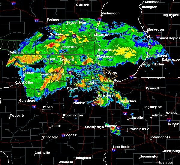 At 837 pm cdt, a severe thunderstorm was located over chebanse, or 8 miles south of kankakee, moving east at 20 mph (radar indicated). Hazards include 60 mph wind gusts and quarter size hail. Hail damage to vehicles is expected. expect wind damage to roofs, siding, and trees. Locations impacted include, kankakee, clifton, chebanse and aroma park. At 837 pm cdt, a severe thunderstorm was located over chebanse, or 8 miles south of kankakee, moving east at 20 mph (radar indicated). Hazards include 60 mph wind gusts and quarter size hail. Hail damage to vehicles is expected. expect wind damage to roofs, siding, and trees. Locations impacted include, kankakee, clifton, chebanse and aroma park.
|
| 7/21/2017 8:36 PM CDT |
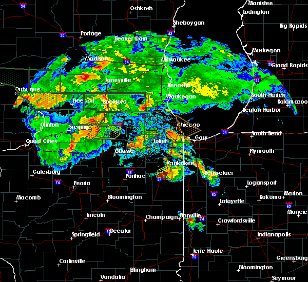 At 836 pm cdt, a severe thunderstorm capable of producing a tornado was located over chebanse, or 10 miles south of kankakee, moving east at 10 mph (radar indicated rotation). Hazards include tornado and quarter size hail. Flying debris will be dangerous to those caught without shelter. mobile homes will be damaged or destroyed. damage to roofs, windows, and vehicles will occur. tree damage is likely. This tornadic thunderstorm will remain over mainly rural areas of north central iroquois county. At 836 pm cdt, a severe thunderstorm capable of producing a tornado was located over chebanse, or 10 miles south of kankakee, moving east at 10 mph (radar indicated rotation). Hazards include tornado and quarter size hail. Flying debris will be dangerous to those caught without shelter. mobile homes will be damaged or destroyed. damage to roofs, windows, and vehicles will occur. tree damage is likely. This tornadic thunderstorm will remain over mainly rural areas of north central iroquois county.
|
| 7/21/2017 8:27 PM CDT |
 At 827 pm cdt, a severe thunderstorm was located over chebanse, or near kankakee, moving east at 25 mph (radar indicated). Hazards include 60 mph wind gusts and quarter size hail. Hail damage to vehicles is expected. expect wind damage to roofs, siding, and trees. Locations impacted include, kankakee, clifton, chebanse, aroma park and irwin. At 827 pm cdt, a severe thunderstorm was located over chebanse, or near kankakee, moving east at 25 mph (radar indicated). Hazards include 60 mph wind gusts and quarter size hail. Hail damage to vehicles is expected. expect wind damage to roofs, siding, and trees. Locations impacted include, kankakee, clifton, chebanse, aroma park and irwin.
|
| 7/21/2017 8:26 PM CDT |
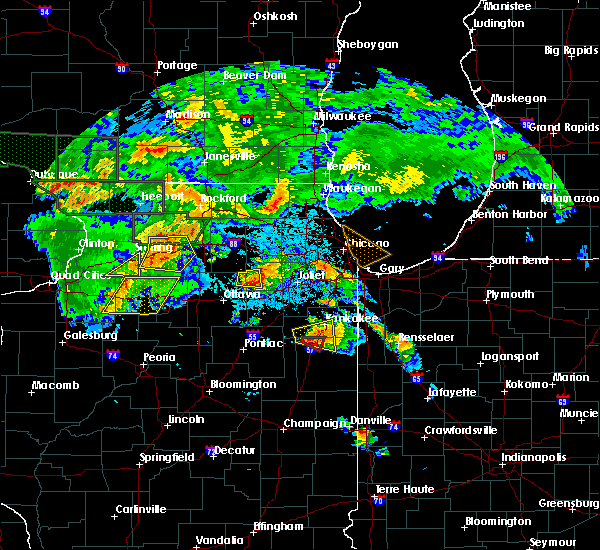 At 825 pm cdt, a severe thunderstorm capable of producing a tornado was located near clifton, or 11 miles southwest of kankakee, moving east at 10 mph (law enforcement reported a funnel cloud). Hazards include tornado and quarter size hail. Flying debris will be dangerous to those caught without shelter. mobile homes will be damaged or destroyed. damage to roofs, windows, and vehicles will occur. tree damage is likely. This dangerous storm will be near, clifton around 840 pm cdt. At 825 pm cdt, a severe thunderstorm capable of producing a tornado was located near clifton, or 11 miles southwest of kankakee, moving east at 10 mph (law enforcement reported a funnel cloud). Hazards include tornado and quarter size hail. Flying debris will be dangerous to those caught without shelter. mobile homes will be damaged or destroyed. damage to roofs, windows, and vehicles will occur. tree damage is likely. This dangerous storm will be near, clifton around 840 pm cdt.
|
| 7/21/2017 8:16 PM CDT |
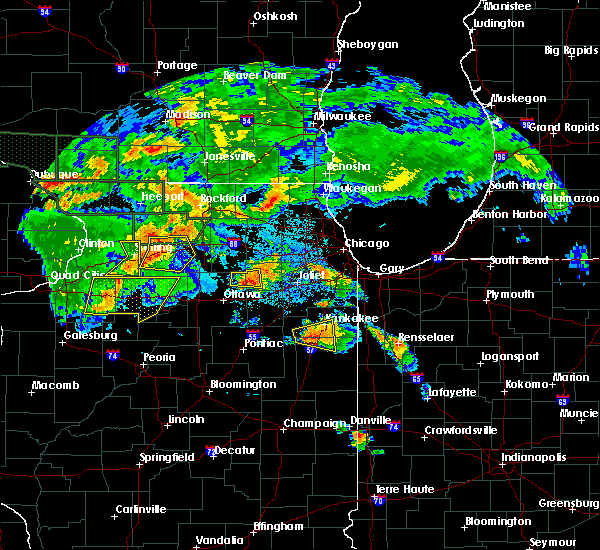 At 816 pm cdt, a severe thunderstorm capable of producing a tornado was located near clifton, or 12 miles southwest of kankakee, moving east at 10 mph (radar indicated rotation). Hazards include tornado. Flying debris will be dangerous to those caught without shelter. mobile homes will be damaged or destroyed. damage to roofs, windows, and vehicles will occur. tree damage is likely. this dangerous storm will be near, clifton and chebanse around 840 pm cdt. Including the following interstate, i-57 between mile markers 295 and 301. At 816 pm cdt, a severe thunderstorm capable of producing a tornado was located near clifton, or 12 miles southwest of kankakee, moving east at 10 mph (radar indicated rotation). Hazards include tornado. Flying debris will be dangerous to those caught without shelter. mobile homes will be damaged or destroyed. damage to roofs, windows, and vehicles will occur. tree damage is likely. this dangerous storm will be near, clifton and chebanse around 840 pm cdt. Including the following interstate, i-57 between mile markers 295 and 301.
|
| 7/21/2017 7:58 PM CDT |
 At 758 pm cdt, a severe thunderstorm was located near herscher, or 10 miles southwest of kankakee, moving east at 20 mph (radar indicated). Hazards include 60 mph wind gusts and quarter size hail. Hail damage to vehicles is expected. Expect wind damage to roofs, siding, and trees. At 758 pm cdt, a severe thunderstorm was located near herscher, or 10 miles southwest of kankakee, moving east at 20 mph (radar indicated). Hazards include 60 mph wind gusts and quarter size hail. Hail damage to vehicles is expected. Expect wind damage to roofs, siding, and trees.
|
| 6/14/2017 5:39 PM CDT |
 At 539 pm cdt, a severe thunderstorm was located near onarga, or near piper city, moving northeast at 30 mph (radar indicated). Hazards include 60 mph wind gusts and quarter size hail. Hail damage to vehicles is expected. expect wind damage to roofs, siding, and trees. Locations impacted include, watseka, piper city, gilman, clifton, onarga, chebanse, ashkum, crescent city, danforth, martinton, roberts, beaverville, donovan, thawville and papineau. At 539 pm cdt, a severe thunderstorm was located near onarga, or near piper city, moving northeast at 30 mph (radar indicated). Hazards include 60 mph wind gusts and quarter size hail. Hail damage to vehicles is expected. expect wind damage to roofs, siding, and trees. Locations impacted include, watseka, piper city, gilman, clifton, onarga, chebanse, ashkum, crescent city, danforth, martinton, roberts, beaverville, donovan, thawville and papineau.
|
| 6/14/2017 5:23 PM CDT |
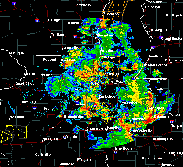 At 523 pm cdt, a severe thunderstorm was located 7 miles south of piper city, moving northeast at 30 mph (radar indicated). Hazards include 60 mph wind gusts and quarter size hail. Hail damage to vehicles is expected. Expect wind damage to roofs, siding, and trees. At 523 pm cdt, a severe thunderstorm was located 7 miles south of piper city, moving northeast at 30 mph (radar indicated). Hazards include 60 mph wind gusts and quarter size hail. Hail damage to vehicles is expected. Expect wind damage to roofs, siding, and trees.
|
| 6/14/2017 3:16 PM CDT |
 At 316 pm cdt, a severe thunderstorm was located near clifton, or 11 miles northwest of watseka, moving northeast at 20 mph (radar indicated). Hazards include quarter size hail. Damage to vehicles is expected. Locations impacted include, gilman, clifton, ashkum and danforth. At 316 pm cdt, a severe thunderstorm was located near clifton, or 11 miles northwest of watseka, moving northeast at 20 mph (radar indicated). Hazards include quarter size hail. Damage to vehicles is expected. Locations impacted include, gilman, clifton, ashkum and danforth.
|
| 6/14/2017 3:00 PM CDT |
 At 300 pm cdt, a severe thunderstorm was located over ashkum, or 12 miles northwest of watseka, moving northeast at 25 mph (radar indicated). Hazards include quarter size hail. Damage to vehicles is expected. Locations impacted include, gilman, clifton, ashkum and danforth. At 300 pm cdt, a severe thunderstorm was located over ashkum, or 12 miles northwest of watseka, moving northeast at 25 mph (radar indicated). Hazards include quarter size hail. Damage to vehicles is expected. Locations impacted include, gilman, clifton, ashkum and danforth.
|
| 6/14/2017 2:50 PM CDT |
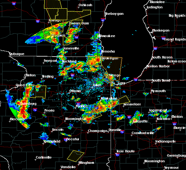 At 250 pm cdt, a severe thunderstorm was located near gilman, or 7 miles northeast of piper city, moving northeast at 20 mph (radar indicated). Hazards include quarter size hail. damage to vehicles is expected At 250 pm cdt, a severe thunderstorm was located near gilman, or 7 miles northeast of piper city, moving northeast at 20 mph (radar indicated). Hazards include quarter size hail. damage to vehicles is expected
|
| 3/7/2017 1:27 AM CST |
 At 127 am cst, severe thunderstorms were located along a line extending from near herscher to near gibson city, moving east at 65 mph (radar indicated). Hazards include 60 mph wind gusts. Expect damage to roofs, siding, and trees. these severe storms will be near, bourbonnais, chebanse and aroma park around 135 am cst. kankakee and bradley around 140 am cst. momence, hopkins park and buckley around 145 am cst. grant park and cissna park around 150 am cst. claytonville around 155 am cst. Stockland and milford around 200 am cst. At 127 am cst, severe thunderstorms were located along a line extending from near herscher to near gibson city, moving east at 65 mph (radar indicated). Hazards include 60 mph wind gusts. Expect damage to roofs, siding, and trees. these severe storms will be near, bourbonnais, chebanse and aroma park around 135 am cst. kankakee and bradley around 140 am cst. momence, hopkins park and buckley around 145 am cst. grant park and cissna park around 150 am cst. claytonville around 155 am cst. Stockland and milford around 200 am cst.
|
| 3/7/2017 1:08 AM CST |
 At 108 am cst, severe thunderstorms were located along a line extending from 7 miles north of cullom to 6 miles north of mansfield, moving east at 70 mph (radar indicated). Hazards include 60 mph wind gusts. Expect damage to roofs, siding, and trees. severe thunderstorms will be near, herscher around 115 am cst. bourbonnais and chebanse around 125 am cst. kankakee, bradley, paxton, st. anne and aroma park around 130 am cst. momence and hopkins park around 135 am cst. grant park and cissna park around 140 am cst. claytonville around 145 am cst. milford around 150 am cst. stockland around 155 am cst. Including the following interstate, i-57 between mile markers 258 and 316. At 108 am cst, severe thunderstorms were located along a line extending from 7 miles north of cullom to 6 miles north of mansfield, moving east at 70 mph (radar indicated). Hazards include 60 mph wind gusts. Expect damage to roofs, siding, and trees. severe thunderstorms will be near, herscher around 115 am cst. bourbonnais and chebanse around 125 am cst. kankakee, bradley, paxton, st. anne and aroma park around 130 am cst. momence and hopkins park around 135 am cst. grant park and cissna park around 140 am cst. claytonville around 145 am cst. milford around 150 am cst. stockland around 155 am cst. Including the following interstate, i-57 between mile markers 258 and 316.
|
| 7/13/2016 6:18 PM CDT |
 At 618 pm cdt, severe thunderstorms were located along a line extending from near dwight to near sheldon, moving northeast at 45 mph (radar indicated). Hazards include 60 mph wind gusts and quarter size hail. Hail damage to vehicles is expected. expect wind damage to roofs, siding, and trees. locations impacted include, kankakee, watseka, stockland, claytonville, gilman, herscher, clifton, onarga, milford, st. anne, sheldon, chebanse, cissna park, ashkum, aroma park, hopkins park, crescent city, danforth, martinton and beaverville. this includes, kankakee community college and kankakee county fairgrounds and speedway. Including the following interstate, i-57 between mile markers 275 and 311. At 618 pm cdt, severe thunderstorms were located along a line extending from near dwight to near sheldon, moving northeast at 45 mph (radar indicated). Hazards include 60 mph wind gusts and quarter size hail. Hail damage to vehicles is expected. expect wind damage to roofs, siding, and trees. locations impacted include, kankakee, watseka, stockland, claytonville, gilman, herscher, clifton, onarga, milford, st. anne, sheldon, chebanse, cissna park, ashkum, aroma park, hopkins park, crescent city, danforth, martinton and beaverville. this includes, kankakee community college and kankakee county fairgrounds and speedway. Including the following interstate, i-57 between mile markers 275 and 311.
|
| 7/13/2016 6:04 PM CDT |
 At 604 pm cdt, severe thunderstorms were located along a line extending from 8 miles west of cullom to near cissna park, moving northeast at 60 mph (radar indicated). Hazards include 60 mph wind gusts and quarter size hail. Hail damage to vehicles is expected. expect wind damage to roofs, siding, and trees. locations impacted include, kankakee, watseka, paxton, dwight, fairbury, piper city, stockland, claytonville, gilman, herscher, clifton, onarga, milford, st. anne, forrest, chatsworth, sheldon, chebanse, odell and cissna park. this includes, kankakee community college and kankakee county fairgrounds and speedway. including the following interstates, i-55 between mile markers 203 and 218. I-57 between mile markers 258 and 311. At 604 pm cdt, severe thunderstorms were located along a line extending from 8 miles west of cullom to near cissna park, moving northeast at 60 mph (radar indicated). Hazards include 60 mph wind gusts and quarter size hail. Hail damage to vehicles is expected. expect wind damage to roofs, siding, and trees. locations impacted include, kankakee, watseka, paxton, dwight, fairbury, piper city, stockland, claytonville, gilman, herscher, clifton, onarga, milford, st. anne, forrest, chatsworth, sheldon, chebanse, odell and cissna park. this includes, kankakee community college and kankakee county fairgrounds and speedway. including the following interstates, i-55 between mile markers 203 and 218. I-57 between mile markers 258 and 311.
|
| 7/13/2016 5:51 PM CDT |
 At 551 pm cdt, severe thunderstorms were located along a line extending from near lexington to near cissna park, moving northeast at 55 mph. an additional line of severe thunderstorms near pontiac were moving east into the area (radar indicated). Hazards include 60 mph wind gusts and quarter size hail. Hail damage to vehicles is expected. expect wind damage to roofs, siding, and trees. locations impacted include, kankakee, watseka, paxton, dwight, fairbury, gibson city, piper city, stockland, claytonville, gilman, herscher, clifton, onarga, milford, st. anne, forrest, chatsworth, sheldon, chebanse and odell. this includes, kankakee community college and kankakee county fairgrounds and speedway. including the following interstates, i-55 between mile markers 203 and 218. I-57 between mile markers 258 and 311. At 551 pm cdt, severe thunderstorms were located along a line extending from near lexington to near cissna park, moving northeast at 55 mph. an additional line of severe thunderstorms near pontiac were moving east into the area (radar indicated). Hazards include 60 mph wind gusts and quarter size hail. Hail damage to vehicles is expected. expect wind damage to roofs, siding, and trees. locations impacted include, kankakee, watseka, paxton, dwight, fairbury, gibson city, piper city, stockland, claytonville, gilman, herscher, clifton, onarga, milford, st. anne, forrest, chatsworth, sheldon, chebanse and odell. this includes, kankakee community college and kankakee county fairgrounds and speedway. including the following interstates, i-55 between mile markers 203 and 218. I-57 between mile markers 258 and 311.
|
| 7/13/2016 5:37 PM CDT |
 At 536 pm cdt, severe thunderstorms were located along a line extending from near hudson to 6 miles northwest of rantoul, moving northeast at 40 mph. an additional line of severe storms was near interstate 39 moving east at 40 mph (radar indicated). Hazards include 60 mph wind gusts and quarter size hail. Hail damage to vehicles is expected. Expect wind damage to roofs, siding, and trees. At 536 pm cdt, severe thunderstorms were located along a line extending from near hudson to 6 miles northwest of rantoul, moving northeast at 40 mph. an additional line of severe storms was near interstate 39 moving east at 40 mph (radar indicated). Hazards include 60 mph wind gusts and quarter size hail. Hail damage to vehicles is expected. Expect wind damage to roofs, siding, and trees.
|
| 6/23/2016 12:27 AM CDT |
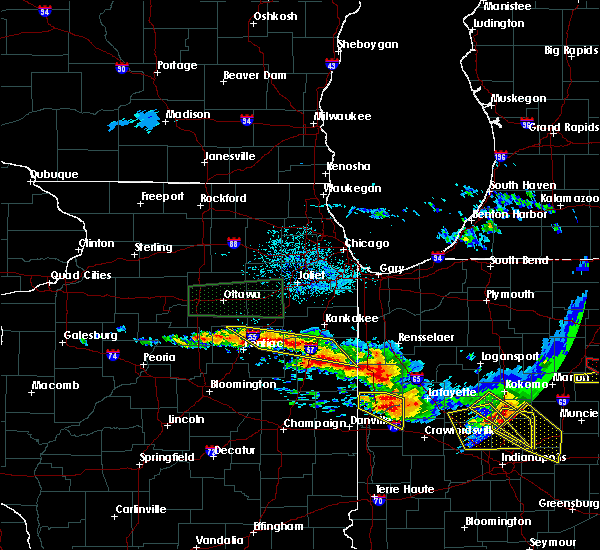 At 1226 am cdt, severe thunderstorms were located along a line extending from 6 miles southeast of clifton to 7 miles west of odell, moving southeast at 25 mph (radar indicated). Hazards include 60 mph wind gusts and quarter size hail. Hail damage to vehicles is expected. expect wind damage to roofs, siding, and trees. locations impacted include, watseka, dwight, clifton, chebanse, odell, ashkum, cullom, danforth, saunemin, martinton, buckingham, cabery, kempton, campus and emington. including the following interstates, i-55 between mile markers 206 and 216. i-57 between mile markers 288 and 302. A tornado watch remains in effect until 100 am cdt for northeastern illinois. At 1226 am cdt, severe thunderstorms were located along a line extending from 6 miles southeast of clifton to 7 miles west of odell, moving southeast at 25 mph (radar indicated). Hazards include 60 mph wind gusts and quarter size hail. Hail damage to vehicles is expected. expect wind damage to roofs, siding, and trees. locations impacted include, watseka, dwight, clifton, chebanse, odell, ashkum, cullom, danforth, saunemin, martinton, buckingham, cabery, kempton, campus and emington. including the following interstates, i-55 between mile markers 206 and 216. i-57 between mile markers 288 and 302. A tornado watch remains in effect until 100 am cdt for northeastern illinois.
|
| 6/23/2016 12:08 AM CDT |
 At 1208 am cdt, severe thunderstorms were located along a line extending from near watseka to odell, moving southeast at 45 mph (radar indicated). Hazards include 60 mph wind gusts and quarter size hail. Hail damage to vehicles is expected. expect wind damage to roofs, siding, and trees. locations impacted include, watseka, dwight, clifton, chebanse, odell, ashkum, cullom, danforth, saunemin, martinton, buckingham, cabery, kempton, campus and emington. including the following interstates, i-55 between mile markers 206 and 216. i-57 between mile markers 288 and 302. A tornado watch remains in effect until 100 am cdt for northeastern illinois. At 1208 am cdt, severe thunderstorms were located along a line extending from near watseka to odell, moving southeast at 45 mph (radar indicated). Hazards include 60 mph wind gusts and quarter size hail. Hail damage to vehicles is expected. expect wind damage to roofs, siding, and trees. locations impacted include, watseka, dwight, clifton, chebanse, odell, ashkum, cullom, danforth, saunemin, martinton, buckingham, cabery, kempton, campus and emington. including the following interstates, i-55 between mile markers 206 and 216. i-57 between mile markers 288 and 302. A tornado watch remains in effect until 100 am cdt for northeastern illinois.
|
| 6/22/2016 11:53 PM CDT |
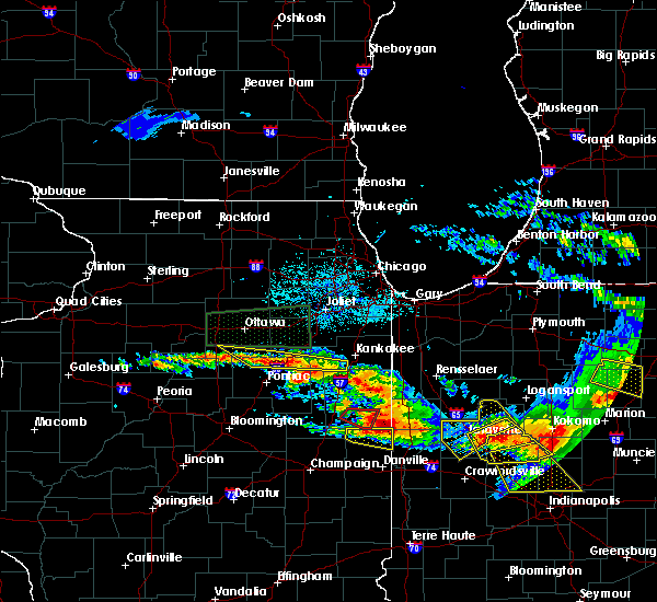 At 1152 pm cdt, severe thunderstorms were located along a line extending from near ashkum to near streator, moving southeast at 50 mph (radar indicated). Hazards include 60 mph wind gusts and quarter size hail. Hail damage to vehicles is expected. Expect wind damage to roofs, siding, and trees. At 1152 pm cdt, severe thunderstorms were located along a line extending from near ashkum to near streator, moving southeast at 50 mph (radar indicated). Hazards include 60 mph wind gusts and quarter size hail. Hail damage to vehicles is expected. Expect wind damage to roofs, siding, and trees.
|
| 6/22/2016 10:23 PM CDT |
 At 1021 pm cdt/1121 pm edt/, severe thunderstorms were located along a line extending from near rensselaer to ashkum, moving southeast at 45 mph. radar indicated rotation is indicated just east of ashkum and clifton. these are very dangerous storms (radar indicated). Hazards include 80 mph wind gusts and nickel size hail. Flying debris will be dangerous to those caught without shelter. mobile homes will be heavily damaged. expect considerable damage to roofs, windows, and vehicles. extensive tree damage and power outages are likely. these severe storms will be near, rensselaer, pleasant ridge, surrey and collegeville around 1025 pm cdt. mccoysburg around 1030 pm cdt. watseka around 1040 pm cdt. sheldon around 1050 pm cdt. raub around 1055 pm cdt. kentland and perkins around 1200 am edt. other locations impacted by these severe thunderstorms include papineau, danforth, iroquois, beaverville, crescent city, donovan, martinton, mount ayr and woodland. this includes, us 41 dragway. including the following interstates, i-57 between mile markers 281 and 301. indiana i-65 between mile markers 200 and 222. A tornado watch remains in effect until 100 am cdt/200 am edt/ for northeastern illinois, and northwestern indiana. At 1021 pm cdt/1121 pm edt/, severe thunderstorms were located along a line extending from near rensselaer to ashkum, moving southeast at 45 mph. radar indicated rotation is indicated just east of ashkum and clifton. these are very dangerous storms (radar indicated). Hazards include 80 mph wind gusts and nickel size hail. Flying debris will be dangerous to those caught without shelter. mobile homes will be heavily damaged. expect considerable damage to roofs, windows, and vehicles. extensive tree damage and power outages are likely. these severe storms will be near, rensselaer, pleasant ridge, surrey and collegeville around 1025 pm cdt. mccoysburg around 1030 pm cdt. watseka around 1040 pm cdt. sheldon around 1050 pm cdt. raub around 1055 pm cdt. kentland and perkins around 1200 am edt. other locations impacted by these severe thunderstorms include papineau, danforth, iroquois, beaverville, crescent city, donovan, martinton, mount ayr and woodland. this includes, us 41 dragway. including the following interstates, i-57 between mile markers 281 and 301. indiana i-65 between mile markers 200 and 222. A tornado watch remains in effect until 100 am cdt/200 am edt/ for northeastern illinois, and northwestern indiana.
|
| 6/22/2016 10:23 PM CDT |
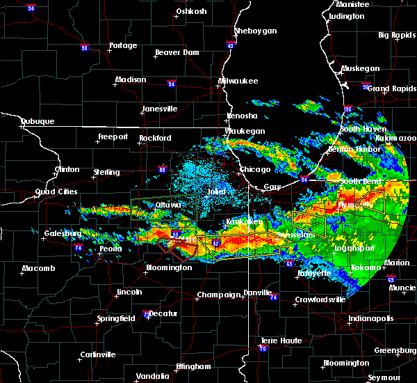 At 1021 pm cdt/1121 pm edt/, severe thunderstorms were located along a line extending from near rensselaer to ashkum, moving southeast at 45 mph. radar indicated rotation is indicated just east of ashkum and clifton. these are very dangerous storms (radar indicated). Hazards include 80 mph wind gusts and nickel size hail. Flying debris will be dangerous to those caught without shelter. mobile homes will be heavily damaged. expect considerable damage to roofs, windows, and vehicles. extensive tree damage and power outages are likely. these severe storms will be near, rensselaer, pleasant ridge, surrey and collegeville around 1025 pm cdt. mccoysburg around 1030 pm cdt. watseka around 1040 pm cdt. sheldon around 1050 pm cdt. raub around 1055 pm cdt. kentland and perkins around 1200 am edt. other locations impacted by these severe thunderstorms include papineau, danforth, iroquois, beaverville, crescent city, donovan, martinton, mount ayr and woodland. this includes, us 41 dragway. including the following interstates, i-57 between mile markers 281 and 301. indiana i-65 between mile markers 200 and 222. A tornado watch remains in effect until 100 am cdt/200 am edt/ for northeastern illinois, and northwestern indiana. At 1021 pm cdt/1121 pm edt/, severe thunderstorms were located along a line extending from near rensselaer to ashkum, moving southeast at 45 mph. radar indicated rotation is indicated just east of ashkum and clifton. these are very dangerous storms (radar indicated). Hazards include 80 mph wind gusts and nickel size hail. Flying debris will be dangerous to those caught without shelter. mobile homes will be heavily damaged. expect considerable damage to roofs, windows, and vehicles. extensive tree damage and power outages are likely. these severe storms will be near, rensselaer, pleasant ridge, surrey and collegeville around 1025 pm cdt. mccoysburg around 1030 pm cdt. watseka around 1040 pm cdt. sheldon around 1050 pm cdt. raub around 1055 pm cdt. kentland and perkins around 1200 am edt. other locations impacted by these severe thunderstorms include papineau, danforth, iroquois, beaverville, crescent city, donovan, martinton, mount ayr and woodland. this includes, us 41 dragway. including the following interstates, i-57 between mile markers 281 and 301. indiana i-65 between mile markers 200 and 222. A tornado watch remains in effect until 100 am cdt/200 am edt/ for northeastern illinois, and northwestern indiana.
|
| 6/22/2016 10:15 PM CDT |
 At 1014 pm cdt/1114 pm edt/, severe thunderstorms were located along a line extending from surrey to 8 miles west of ashkum, moving southeast at 40 mph (radar indicated). Hazards include 70 mph wind gusts and nickel size hail. Expect considerable tree damage. damage is likely to mobile homes, roofs, and outbuildings. these severe storms will be near, rensselaer, surrey and collegeville around 1020 pm cdt. pleasant ridge around 1025 pm cdt. mccoysburg and onarga around 1030 pm cdt. watseka around 1045 pm cdt. other locations impacted by these severe thunderstorms include papineau, danforth, iroquois, beaverville, crescent city, donovan, martinton, mount ayr and woodland. this includes, us 41 dragway. including the following interstates, i-57 between mile markers 281 and 301. indiana i-65 between mile markers 200 and 222. A tornado watch remains in effect until 100 am cdt/200 am edt/ for northeastern illinois, and northwestern indiana. At 1014 pm cdt/1114 pm edt/, severe thunderstorms were located along a line extending from surrey to 8 miles west of ashkum, moving southeast at 40 mph (radar indicated). Hazards include 70 mph wind gusts and nickel size hail. Expect considerable tree damage. damage is likely to mobile homes, roofs, and outbuildings. these severe storms will be near, rensselaer, surrey and collegeville around 1020 pm cdt. pleasant ridge around 1025 pm cdt. mccoysburg and onarga around 1030 pm cdt. watseka around 1045 pm cdt. other locations impacted by these severe thunderstorms include papineau, danforth, iroquois, beaverville, crescent city, donovan, martinton, mount ayr and woodland. this includes, us 41 dragway. including the following interstates, i-57 between mile markers 281 and 301. indiana i-65 between mile markers 200 and 222. A tornado watch remains in effect until 100 am cdt/200 am edt/ for northeastern illinois, and northwestern indiana.
|
| 6/22/2016 10:15 PM CDT |
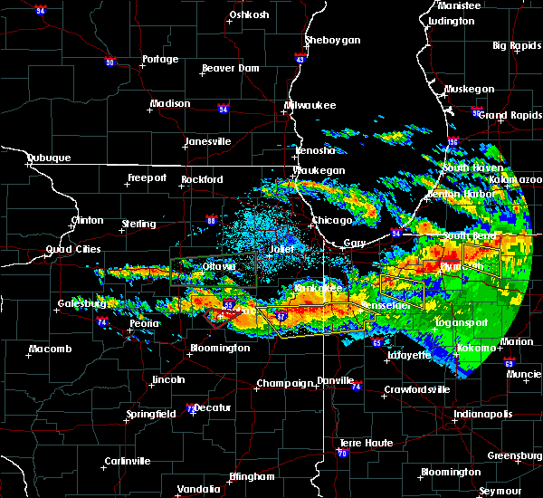 At 1014 pm cdt/1114 pm edt/, severe thunderstorms were located along a line extending from surrey to 8 miles west of ashkum, moving southeast at 40 mph (radar indicated). Hazards include 70 mph wind gusts and nickel size hail. Expect considerable tree damage. damage is likely to mobile homes, roofs, and outbuildings. these severe storms will be near, rensselaer, surrey and collegeville around 1020 pm cdt. pleasant ridge around 1025 pm cdt. mccoysburg and onarga around 1030 pm cdt. watseka around 1045 pm cdt. other locations impacted by these severe thunderstorms include papineau, danforth, iroquois, beaverville, crescent city, donovan, martinton, mount ayr and woodland. this includes, us 41 dragway. including the following interstates, i-57 between mile markers 281 and 301. indiana i-65 between mile markers 200 and 222. A tornado watch remains in effect until 100 am cdt/200 am edt/ for northeastern illinois, and northwestern indiana. At 1014 pm cdt/1114 pm edt/, severe thunderstorms were located along a line extending from surrey to 8 miles west of ashkum, moving southeast at 40 mph (radar indicated). Hazards include 70 mph wind gusts and nickel size hail. Expect considerable tree damage. damage is likely to mobile homes, roofs, and outbuildings. these severe storms will be near, rensselaer, surrey and collegeville around 1020 pm cdt. pleasant ridge around 1025 pm cdt. mccoysburg and onarga around 1030 pm cdt. watseka around 1045 pm cdt. other locations impacted by these severe thunderstorms include papineau, danforth, iroquois, beaverville, crescent city, donovan, martinton, mount ayr and woodland. this includes, us 41 dragway. including the following interstates, i-57 between mile markers 281 and 301. indiana i-65 between mile markers 200 and 222. A tornado watch remains in effect until 100 am cdt/200 am edt/ for northeastern illinois, and northwestern indiana.
|
| 6/22/2016 10:04 PM CDT |
 At 1003 pm cdt/1103 pm edt/, severe thunderstorms were located along a line extending from near fair oaks to near cullom, moving southeast at 40 mph (radar indicated). Hazards include 60 mph wind gusts and nickel size hail. Expect damage to roofs. siding. and trees. severe thunderstorms will be near, surrey around 1010 pm cdt. rensselaer around 1015 pm cdt. collegeville around 1020 pm cdt. pleasant ridge and ashkum around 1025 pm cdt. mccoysburg, gilman and onarga around 1030 pm cdt. watseka around 1045 pm cdt. other locations impacted by these severe thunderstorms include papineau, danforth, iroquois, beaverville, crescent city, donovan, martinton, mount ayr and woodland. A tornado watch remains in effect until 100 am cdt/200 am edt/ for northeastern illinois, and northwestern indiana. At 1003 pm cdt/1103 pm edt/, severe thunderstorms were located along a line extending from near fair oaks to near cullom, moving southeast at 40 mph (radar indicated). Hazards include 60 mph wind gusts and nickel size hail. Expect damage to roofs. siding. and trees. severe thunderstorms will be near, surrey around 1010 pm cdt. rensselaer around 1015 pm cdt. collegeville around 1020 pm cdt. pleasant ridge and ashkum around 1025 pm cdt. mccoysburg, gilman and onarga around 1030 pm cdt. watseka around 1045 pm cdt. other locations impacted by these severe thunderstorms include papineau, danforth, iroquois, beaverville, crescent city, donovan, martinton, mount ayr and woodland. A tornado watch remains in effect until 100 am cdt/200 am edt/ for northeastern illinois, and northwestern indiana.
|
| 6/22/2016 10:04 PM CDT |
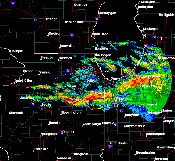 At 1003 pm cdt/1103 pm edt/, severe thunderstorms were located along a line extending from near fair oaks to near cullom, moving southeast at 40 mph (radar indicated). Hazards include 60 mph wind gusts and nickel size hail. Expect damage to roofs. siding. and trees. severe thunderstorms will be near, surrey around 1010 pm cdt. rensselaer around 1015 pm cdt. collegeville around 1020 pm cdt. pleasant ridge and ashkum around 1025 pm cdt. mccoysburg, gilman and onarga around 1030 pm cdt. watseka around 1045 pm cdt. other locations impacted by these severe thunderstorms include papineau, danforth, iroquois, beaverville, crescent city, donovan, martinton, mount ayr and woodland. A tornado watch remains in effect until 100 am cdt/200 am edt/ for northeastern illinois, and northwestern indiana. At 1003 pm cdt/1103 pm edt/, severe thunderstorms were located along a line extending from near fair oaks to near cullom, moving southeast at 40 mph (radar indicated). Hazards include 60 mph wind gusts and nickel size hail. Expect damage to roofs. siding. and trees. severe thunderstorms will be near, surrey around 1010 pm cdt. rensselaer around 1015 pm cdt. collegeville around 1020 pm cdt. pleasant ridge and ashkum around 1025 pm cdt. mccoysburg, gilman and onarga around 1030 pm cdt. watseka around 1045 pm cdt. other locations impacted by these severe thunderstorms include papineau, danforth, iroquois, beaverville, crescent city, donovan, martinton, mount ayr and woodland. A tornado watch remains in effect until 100 am cdt/200 am edt/ for northeastern illinois, and northwestern indiana.
|
| 3/15/2016 10:22 PM CDT |
 At 1021 pm cdt, a severe thunderstorm capable of producing a tornado was located near clifton, or 12 miles northwest of watseka, moving northeast at 30 mph (radar indicated rotation). Hazards include tornado and quarter size hail. Flying debris will be dangerous to those caught without shelter. mobile homes will be damaged or destroyed. damage to roofs, windows, and vehicles will occur. tree damage is likely. this dangerous storm will be near, st. anne and aroma park around 1045 pm cdt. Other locations impacted by this tornadic thunderstorm include papineau and beaverville. At 1021 pm cdt, a severe thunderstorm capable of producing a tornado was located near clifton, or 12 miles northwest of watseka, moving northeast at 30 mph (radar indicated rotation). Hazards include tornado and quarter size hail. Flying debris will be dangerous to those caught without shelter. mobile homes will be damaged or destroyed. damage to roofs, windows, and vehicles will occur. tree damage is likely. this dangerous storm will be near, st. anne and aroma park around 1045 pm cdt. Other locations impacted by this tornadic thunderstorm include papineau and beaverville.
|
| 3/15/2016 10:13 PM CDT |
 At 1013 pm cdt, a severe thunderstorm was located near chebanse, or 11 miles south of kankakee, moving northeast at 50 mph (radar indicated). Hazards include ping pong ball size hail and 60 mph wind gusts. People and animals outdoors will be injured. expect hail damage to roofs, siding, windows, and vehicles. expect wind damage to roofs, siding, and trees. locations impacted include, clifton, st. anne, ashkum, aroma park, hopkins park, sun river terrace, martinton, beaverville, donovan and papineau. Including the following interstate, i-57 between mile markers 291 and 300. At 1013 pm cdt, a severe thunderstorm was located near chebanse, or 11 miles south of kankakee, moving northeast at 50 mph (radar indicated). Hazards include ping pong ball size hail and 60 mph wind gusts. People and animals outdoors will be injured. expect hail damage to roofs, siding, windows, and vehicles. expect wind damage to roofs, siding, and trees. locations impacted include, clifton, st. anne, ashkum, aroma park, hopkins park, sun river terrace, martinton, beaverville, donovan and papineau. Including the following interstate, i-57 between mile markers 291 and 300.
|
| 3/15/2016 10:02 PM CDT |
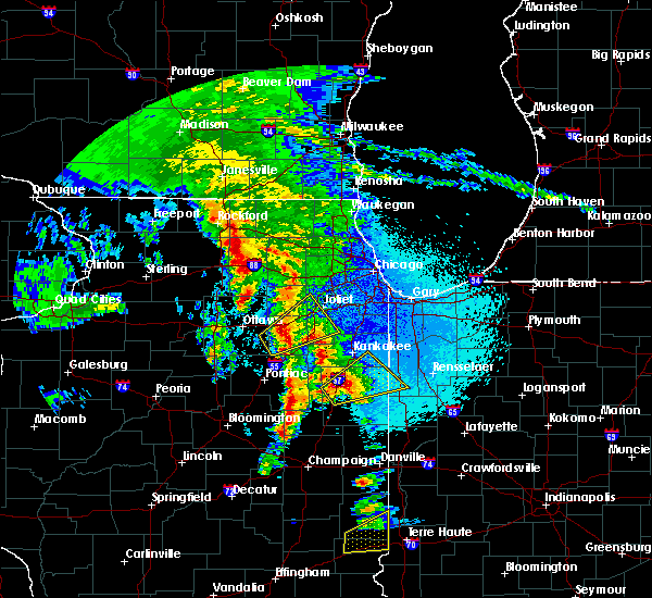 At 1002 pm cdt, a severe thunderstorm was located 7 miles northwest of watseka, moving northeast at 60 mph (radar indicated). Hazards include ping pong ball size hail and 60 mph wind gusts. People and animals outdoors will be injured. expect hail damage to roofs, siding, windows, and vehicles. expect wind damage to roofs, siding, and trees. locations impacted include, watseka, gilman, clifton, onarga, st. anne, sheldon, ashkum, aroma park, hopkins park, crescent city, danforth, sun river terrace, martinton, beaverville, donovan, papineau and iroquois. Including the following interstate, i-57 between mile markers 279 and 300. At 1002 pm cdt, a severe thunderstorm was located 7 miles northwest of watseka, moving northeast at 60 mph (radar indicated). Hazards include ping pong ball size hail and 60 mph wind gusts. People and animals outdoors will be injured. expect hail damage to roofs, siding, windows, and vehicles. expect wind damage to roofs, siding, and trees. locations impacted include, watseka, gilman, clifton, onarga, st. anne, sheldon, ashkum, aroma park, hopkins park, crescent city, danforth, sun river terrace, martinton, beaverville, donovan, papineau and iroquois. Including the following interstate, i-57 between mile markers 279 and 300.
|
| 3/15/2016 9:52 PM CDT |
 At 952 pm cdt, a severe thunderstorm was located over gilman, or 11 miles east of piper city, moving northeast at 60 mph (radar indicated). Hazards include 60 mph wind gusts and quarter size hail. Hail damage to vehicles is expected. Expect wind damage to roofs, siding, and trees. At 952 pm cdt, a severe thunderstorm was located over gilman, or 11 miles east of piper city, moving northeast at 60 mph (radar indicated). Hazards include 60 mph wind gusts and quarter size hail. Hail damage to vehicles is expected. Expect wind damage to roofs, siding, and trees.
|
| 7/13/2015 8:04 PM CDT |
 At 802 pm cdt, a severe thunderstorm was located over aroma park, or near kankakee, moving southeast at 35 mph. this is a new severe thunderstorm. the previous storm has weakened near papineau and was no longer severe (radar indicated). Hazards include 60 mph wind gusts and quarter size hail. Hail damage to vehicles is expected. expect wind damage to roofs, siding and trees. locations impacted include, kankakee, clifton, st. anne, chebanse, aroma park and irwin. this includes, kankakee county fairgrounds and speedway. including the following interstate, i-57 between mile markers 297 and 309. A tornado watch remains in effect until 1100 pm cdt for northeastern illinois. At 802 pm cdt, a severe thunderstorm was located over aroma park, or near kankakee, moving southeast at 35 mph. this is a new severe thunderstorm. the previous storm has weakened near papineau and was no longer severe (radar indicated). Hazards include 60 mph wind gusts and quarter size hail. Hail damage to vehicles is expected. expect wind damage to roofs, siding and trees. locations impacted include, kankakee, clifton, st. anne, chebanse, aroma park and irwin. this includes, kankakee county fairgrounds and speedway. including the following interstate, i-57 between mile markers 297 and 309. A tornado watch remains in effect until 1100 pm cdt for northeastern illinois.
|
| 7/13/2015 7:41 PM CDT |
 At 740 pm cdt, a severe thunderstorm was located over chebanse, or 8 miles southwest of kankakee, moving east at 25 mph (radar indicated). Hazards include 60 mph wind gusts and half dollar size hail. Hail damage to vehicles is expected. expect wind damage to roofs, siding and trees. locations impacted include, kankakee, clifton, st. anne, chebanse, aroma park and irwin. this includes, kankakee county fairgrounds and speedway. including the following interstate, i-57 between mile markers 295 and 309. A tornado watch remains in effect until 1100 pm cdt for northeastern illinois. At 740 pm cdt, a severe thunderstorm was located over chebanse, or 8 miles southwest of kankakee, moving east at 25 mph (radar indicated). Hazards include 60 mph wind gusts and half dollar size hail. Hail damage to vehicles is expected. expect wind damage to roofs, siding and trees. locations impacted include, kankakee, clifton, st. anne, chebanse, aroma park and irwin. this includes, kankakee county fairgrounds and speedway. including the following interstate, i-57 between mile markers 295 and 309. A tornado watch remains in effect until 1100 pm cdt for northeastern illinois.
|
| 7/13/2015 7:22 PM CDT |
 At 722 pm cdt, a severe thunderstorm was located over herscher, or 13 miles southwest of kankakee, moving southeast at 20 mph (radar indicated). Hazards include golf ball size hail and 70 mph wind gusts. People and animals outdoors will be injured. expect hail damage to roofs, siding, windows and vehicles. expect considerable tree damage. Wind damage is also likely to mobile homes, roofs and outbuildings. At 722 pm cdt, a severe thunderstorm was located over herscher, or 13 miles southwest of kankakee, moving southeast at 20 mph (radar indicated). Hazards include golf ball size hail and 70 mph wind gusts. People and animals outdoors will be injured. expect hail damage to roofs, siding, windows and vehicles. expect considerable tree damage. Wind damage is also likely to mobile homes, roofs and outbuildings.
|
| 6/22/2015 11:51 PM CDT |
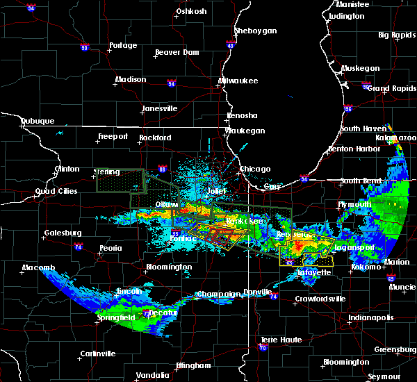 At 1150 pm cdt, a confirmed tornado was located near chebanse, or 9 miles southwest of kankakee, moving east at 25 mph (law enforcement confirmed tornado). Hazards include damaging tornado. Flying debris will be dangerous to those caught without shelter. mobile homes will be damaged or destroyed. damage to roofs, windows and vehicles will occur. tree damage is likely. this tornado will be near, clifton and chebanse around 1200 am cdt. aroma park around 1210 am cdt. this includes, kankakee county fairgrounds and speedway. Including the following interstate, i-57 between mile markers 294 and 306. At 1150 pm cdt, a confirmed tornado was located near chebanse, or 9 miles southwest of kankakee, moving east at 25 mph (law enforcement confirmed tornado). Hazards include damaging tornado. Flying debris will be dangerous to those caught without shelter. mobile homes will be damaged or destroyed. damage to roofs, windows and vehicles will occur. tree damage is likely. this tornado will be near, clifton and chebanse around 1200 am cdt. aroma park around 1210 am cdt. this includes, kankakee county fairgrounds and speedway. Including the following interstate, i-57 between mile markers 294 and 306.
|
| 6/22/2015 11:43 PM CDT |
 At 1143 pm cdt, a severe thunderstorm capable of producing a tornado was located near herscher, or 11 miles southwest of kankakee, moving east at 25 mph (radar indicated rotation). Hazards include tornado. Flying debris will be dangerous to those caught without shelter. mobile homes will be damaged or destroyed. damage to roofs, windows and vehicles will occur. tree damage is likely. this dangerous storm will be near, clifton and chebanse around 1200 am cdt. aroma park around 1210 am cdt. this includes, kankakee county fairgrounds and speedway. Including the following interstate, i-57 between mile markers 294 and 306. At 1143 pm cdt, a severe thunderstorm capable of producing a tornado was located near herscher, or 11 miles southwest of kankakee, moving east at 25 mph (radar indicated rotation). Hazards include tornado. Flying debris will be dangerous to those caught without shelter. mobile homes will be damaged or destroyed. damage to roofs, windows and vehicles will occur. tree damage is likely. this dangerous storm will be near, clifton and chebanse around 1200 am cdt. aroma park around 1210 am cdt. this includes, kankakee county fairgrounds and speedway. Including the following interstate, i-57 between mile markers 294 and 306.
|
| 6/22/2015 11:32 PM CDT |
 At 1131 pm cdt, a severe thunderstorm was located over herscher, or 14 miles southwest of kankakee, moving east at 35 mph (radar indicated). Hazards include 60 mph wind gusts and quarter size hail. Hail damage to vehicles is expected. expect wind damage to roofs, siding and trees. this severe storm will be near, clifton, chebanse and ashkum around 1150 pm cdt. st. anne around 1200 am cdt. other locations impacted by this severe thunderstorm include cabery, papineau, reddick, irwin, union hill, beaverville, campus, martinton and buckingham. this includes, kankakee county fairgrounds and speedway. including the following interstate, i-57 between mile markers 291 and 310. a tornado watch remains in effect until 100 am cdt for northeastern illinois. A tornado watch also remains in effect until 200 am cdt for northeastern illinois. At 1131 pm cdt, a severe thunderstorm was located over herscher, or 14 miles southwest of kankakee, moving east at 35 mph (radar indicated). Hazards include 60 mph wind gusts and quarter size hail. Hail damage to vehicles is expected. expect wind damage to roofs, siding and trees. this severe storm will be near, clifton, chebanse and ashkum around 1150 pm cdt. st. anne around 1200 am cdt. other locations impacted by this severe thunderstorm include cabery, papineau, reddick, irwin, union hill, beaverville, campus, martinton and buckingham. this includes, kankakee county fairgrounds and speedway. including the following interstate, i-57 between mile markers 291 and 310. a tornado watch remains in effect until 100 am cdt for northeastern illinois. A tornado watch also remains in effect until 200 am cdt for northeastern illinois.
|
| 6/22/2015 11:17 PM CDT |
 At 1116 pm cdt, a severe thunderstorm was located near herscher, or 14 miles west of bourbonnais, moving east at 40 mph (radar indicated). Hazards include 60 mph wind gusts and quarter size hail. Hail damage to vehicles is expected. expect wind damage to roofs, siding and trees. this severe thunderstorm will be near, herscher around 1120 pm cdt. clifton and chebanse around 1135 pm cdt. aroma park around 1140 pm cdt. st. anne around 1150 pm cdt. other locations impacted by this severe thunderstorm include cabery, papineau, reddick, irwin, union hill, beaverville, campus, martinton and buckingham. a tornado watch remains in effect until 100 am cdt for northeastern illinois. A tornado watch also remains in effect until 200 am cdt for northeastern illinois. At 1116 pm cdt, a severe thunderstorm was located near herscher, or 14 miles west of bourbonnais, moving east at 40 mph (radar indicated). Hazards include 60 mph wind gusts and quarter size hail. Hail damage to vehicles is expected. expect wind damage to roofs, siding and trees. this severe thunderstorm will be near, herscher around 1120 pm cdt. clifton and chebanse around 1135 pm cdt. aroma park around 1140 pm cdt. st. anne around 1150 pm cdt. other locations impacted by this severe thunderstorm include cabery, papineau, reddick, irwin, union hill, beaverville, campus, martinton and buckingham. a tornado watch remains in effect until 100 am cdt for northeastern illinois. A tornado watch also remains in effect until 200 am cdt for northeastern illinois.
|
| 6/20/2015 11:21 PM CDT |
 At 1121 pm cdt, severe thunderstorms were located along a line extending from near watseka to near milford to near potomac, moving east at 50 mph (radar indicated). Hazards include 70 mph wind gusts. Expect considerable tree damage. damage is likely to mobile homes, roofs and outbuildings. locations impacted include, watseka, paxton, stockland, claytonville, gilman, clifton, onarga, milford, sheldon, cissna park, ashkum, buckley, crescent city, danforth, loda, martinton, roberts, beaverville, woodland and donovan. Including the following interstate, i-57 between mile markers 258 and 298. At 1121 pm cdt, severe thunderstorms were located along a line extending from near watseka to near milford to near potomac, moving east at 50 mph (radar indicated). Hazards include 70 mph wind gusts. Expect considerable tree damage. damage is likely to mobile homes, roofs and outbuildings. locations impacted include, watseka, paxton, stockland, claytonville, gilman, clifton, onarga, milford, sheldon, cissna park, ashkum, buckley, crescent city, danforth, loda, martinton, roberts, beaverville, woodland and donovan. Including the following interstate, i-57 between mile markers 258 and 298.
|
| 6/20/2015 11:21 PM CDT |
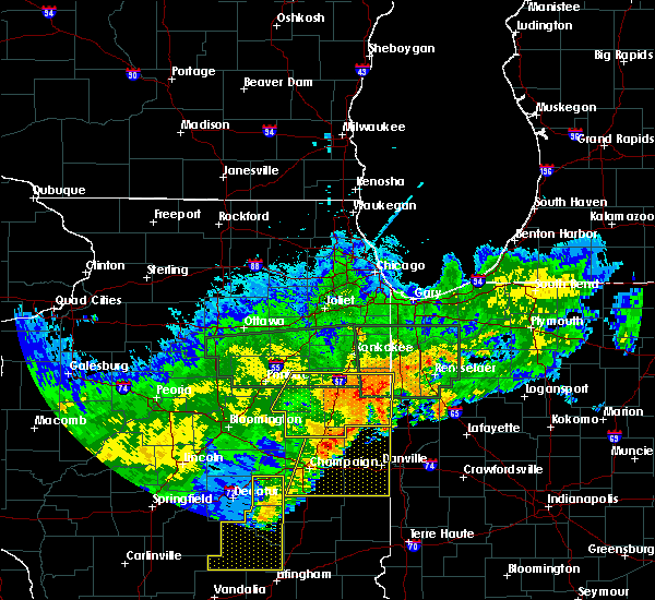 At 1121 pm cdt, severe thunderstorms were located along a line extending from near watseka to near milford to near potomac, moving east at 50 mph (radar indicated). Hazards include 70 mph wind gusts. Expect considerable tree damage. damage is likely to mobile homes, roofs and outbuildings. locations impacted include, watseka, paxton, stockland, claytonville, gilman, clifton, onarga, milford, sheldon, cissna park, ashkum, buckley, crescent city, danforth, loda, martinton, roberts, beaverville, woodland and donovan. Including the following interstate, i-57 between mile markers 258 and 298. At 1121 pm cdt, severe thunderstorms were located along a line extending from near watseka to near milford to near potomac, moving east at 50 mph (radar indicated). Hazards include 70 mph wind gusts. Expect considerable tree damage. damage is likely to mobile homes, roofs and outbuildings. locations impacted include, watseka, paxton, stockland, claytonville, gilman, clifton, onarga, milford, sheldon, cissna park, ashkum, buckley, crescent city, danforth, loda, martinton, roberts, beaverville, woodland and donovan. Including the following interstate, i-57 between mile markers 258 and 298.
|
| 6/20/2015 11:01 PM CDT |
 At 1101 pm cdt, severe thunderstorms were located along a line extending from near clifton to near rantoul, moving east at 50 mph (radar indicated). Hazards include 60 mph wind gusts. Expect damage to roofs. siding and trees. locations impacted include, watseka, paxton, gibson city, piper city, stockland, claytonville, gilman, clifton, onarga, milford, chatsworth, sheldon, cissna park, ashkum, buckley, cullom, gibson, crescent city, danforth and melvin. Including the following interstate, i-57 between mile markers 258 and 298. At 1101 pm cdt, severe thunderstorms were located along a line extending from near clifton to near rantoul, moving east at 50 mph (radar indicated). Hazards include 60 mph wind gusts. Expect damage to roofs. siding and trees. locations impacted include, watseka, paxton, gibson city, piper city, stockland, claytonville, gilman, clifton, onarga, milford, chatsworth, sheldon, cissna park, ashkum, buckley, cullom, gibson, crescent city, danforth and melvin. Including the following interstate, i-57 between mile markers 258 and 298.
|
| 6/20/2015 10:46 PM CDT |
 At 1045 pm cdt, severe thunderstorms were located along a line extending from piper city to near de land, moving east at 50 mph (radar indicated). Hazards include 60 mph wind gusts. Expect damage to roofs. Siding and trees. At 1045 pm cdt, severe thunderstorms were located along a line extending from piper city to near de land, moving east at 50 mph (radar indicated). Hazards include 60 mph wind gusts. Expect damage to roofs. Siding and trees.
|
| 6/7/2015 5:29 PM CDT | At 528 pm cdt, severe thunderstorms were located along a line extending from near st. anne to near piper city, moving east at 35 mph (radar indicated). Hazards include 60 mph wind gusts and quarter size hail. Hail damage to vehicles is expected. expect wind damage to roofs, siding and trees. these severe storms will be near, clifton around 545 pm cdt. other locations impacted by these severe thunderstorms include martinton, papineau, donovan, beaverville and danforth. Including the following interstate, i-57 between mile markers 288 and 301. |
| 6/7/2015 5:14 PM CDT | At 514 pm cdt, a severe thunderstorm was located 8 miles west of ashkum, or 11 miles northeast of piper city, moving east at 50 mph (radar indicated). Hazards include 60 mph wind gusts and quarter size hail. Hail damage to vehicles is expected. expect wind damage to roofs, siding and trees. this severe thunderstorm will be near, clifton and ashkum around 525 pm cdt. chebanse around 530 pm cdt. other locations impacted by this severe thunderstorm include martinton, papineau, danforth, kempton, donovan and beaverville. Including the following interstate, i-57 between mile markers 287 and 301. |
| 6/21/2014 4:20 PM CDT | In town - numerous trees and power/utility lines down. 2 miles south of town a shed was demolishe in iroquois county IL, 0.4 miles SSW of Clifton, IL |
| 5/6/2012 3:35 PM CDT | Baseball sized hail reported 0.4 miles SSW of Clifton, IL, em relayed a public report of baseball size hail. |
| 1/1/0001 12:00 AM | Hen Egg sized hail reported 2.2 miles SE of Clifton, IL, hail fell for 20 minutes. windows on farm buildings shattered and vegetation damaged. 900e rd and 3100 n rd. |
| 1/1/0001 12:00 AM | 12 inch tree split in half. 900e rd and 3100 n r in iroquois county IL, 2.2 miles SE of Clifton, IL |
Hail Maps for Clifton, IL


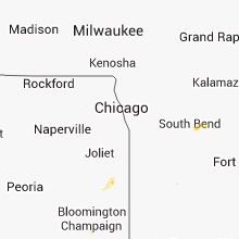


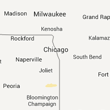


Connect with Interactive Hail Maps