

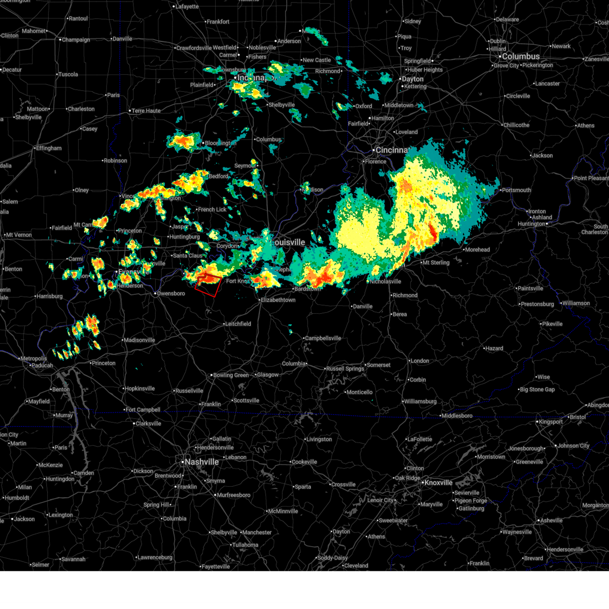
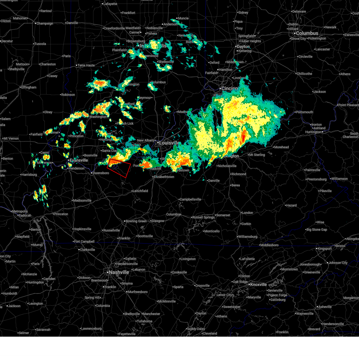
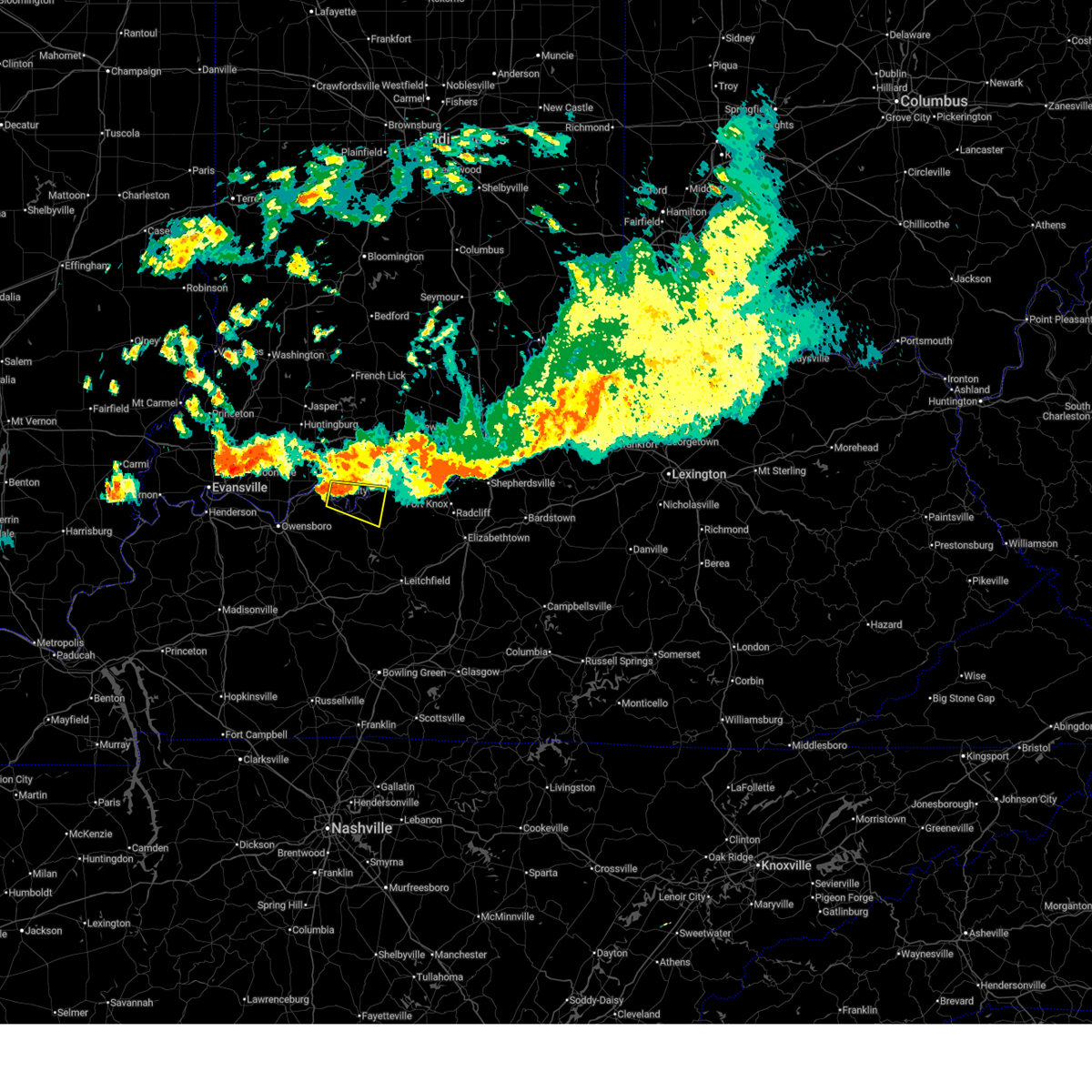
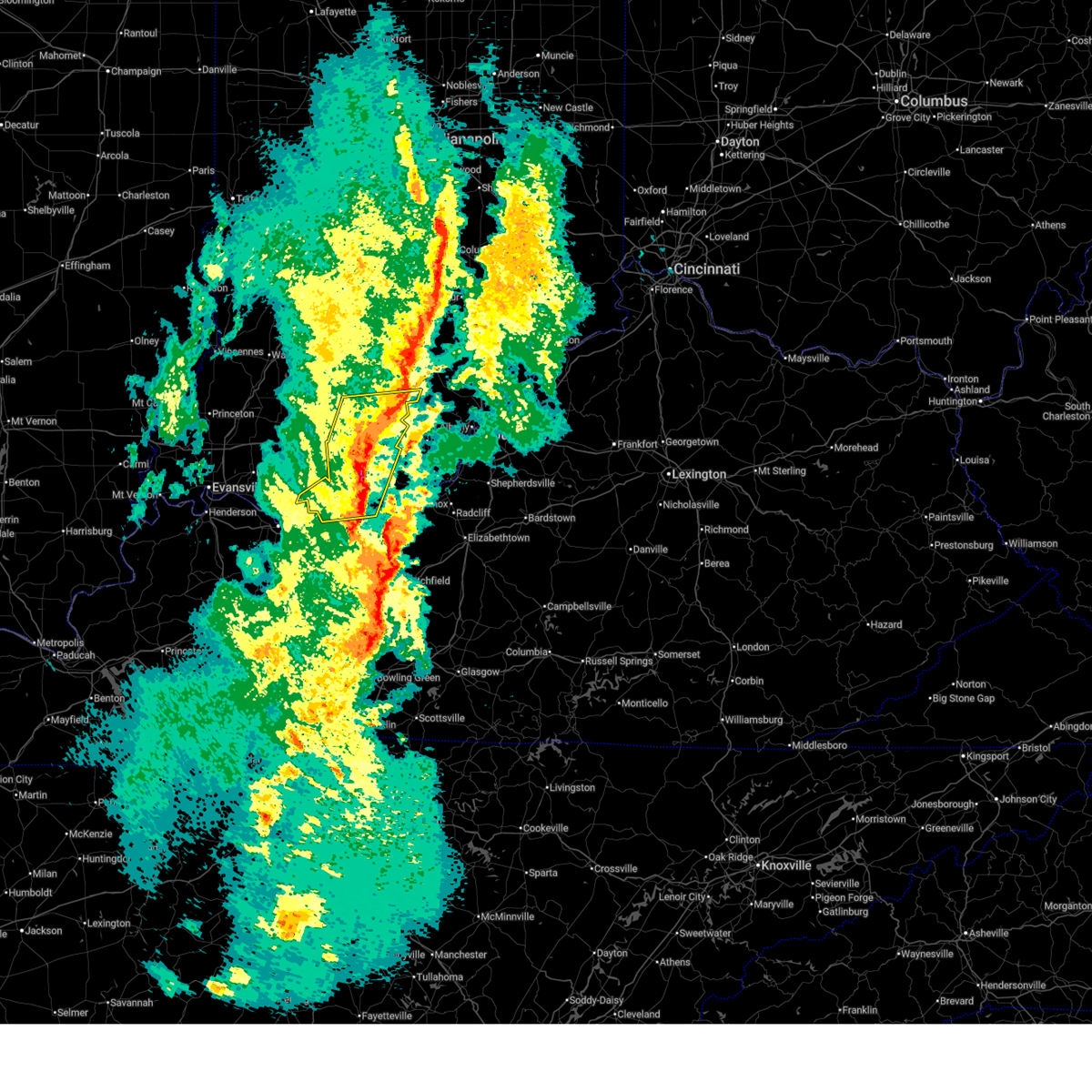
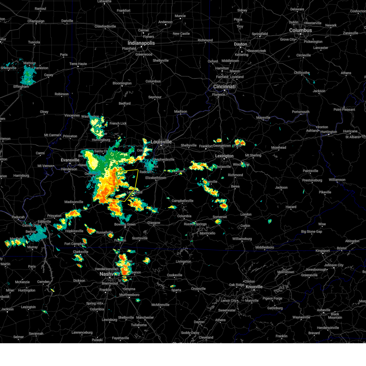
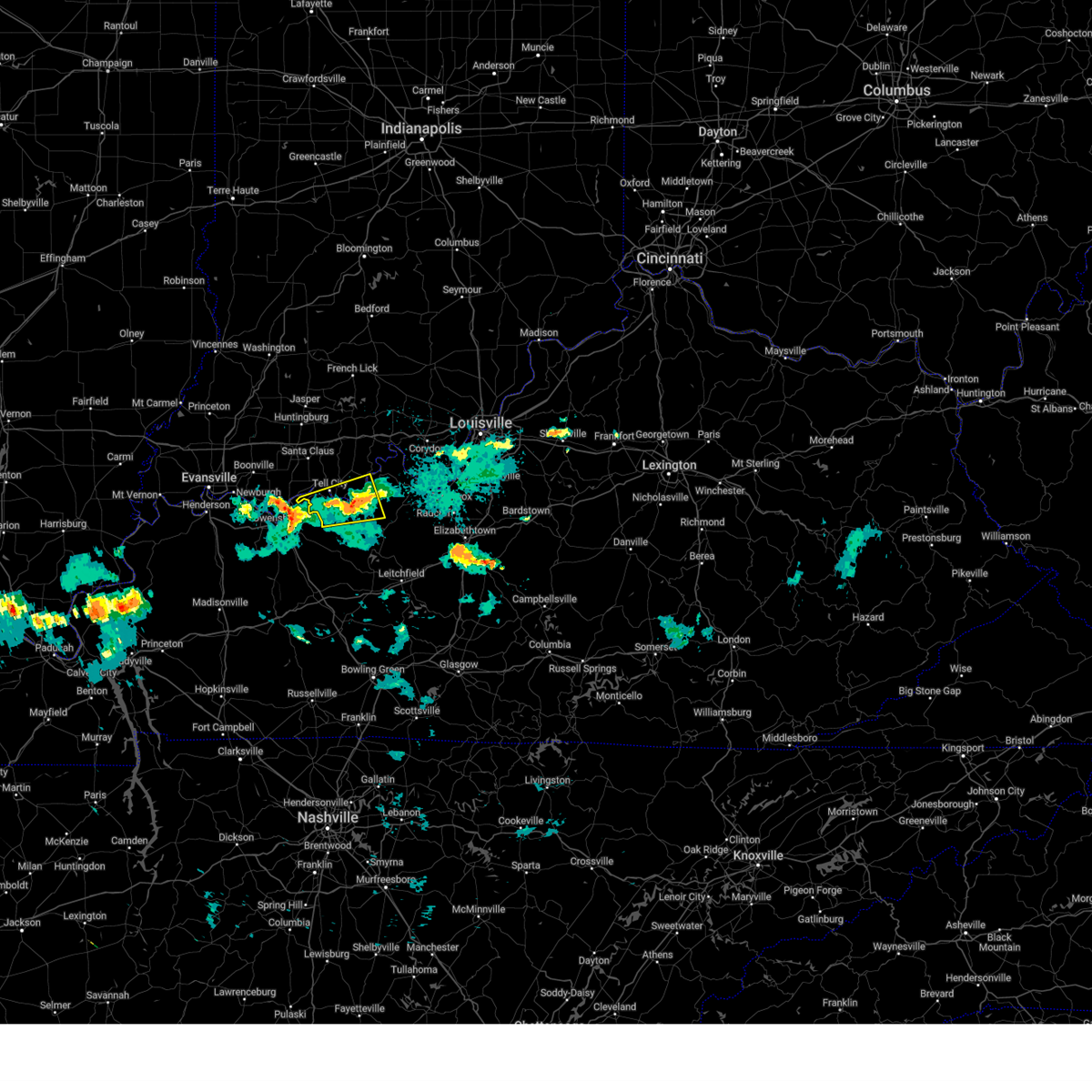
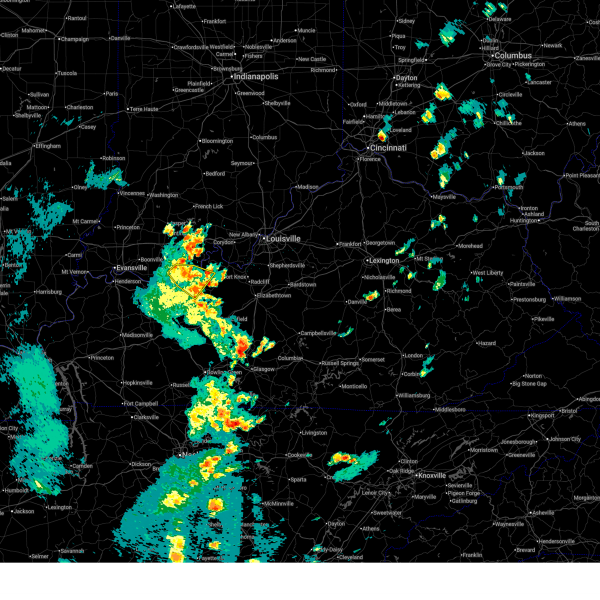
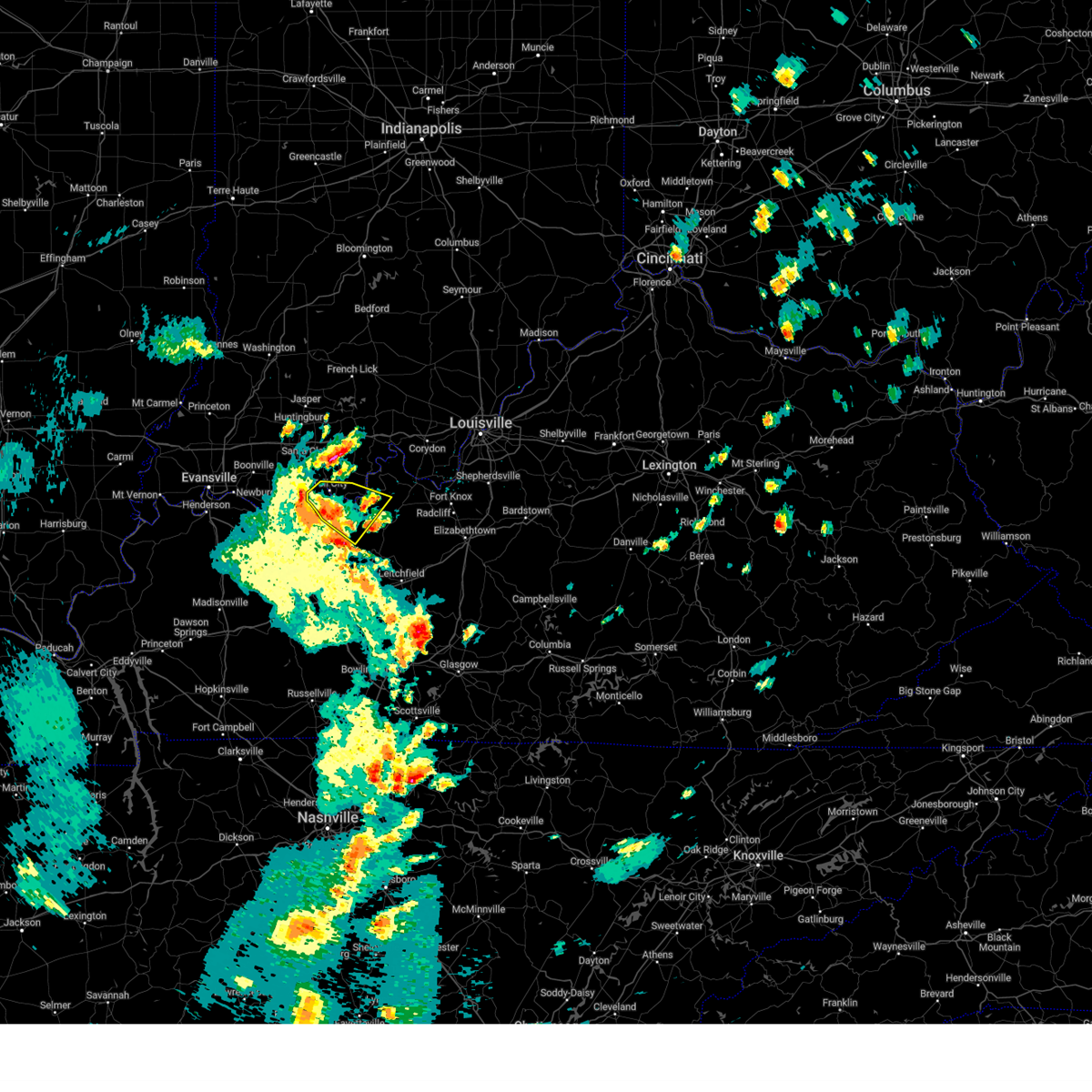
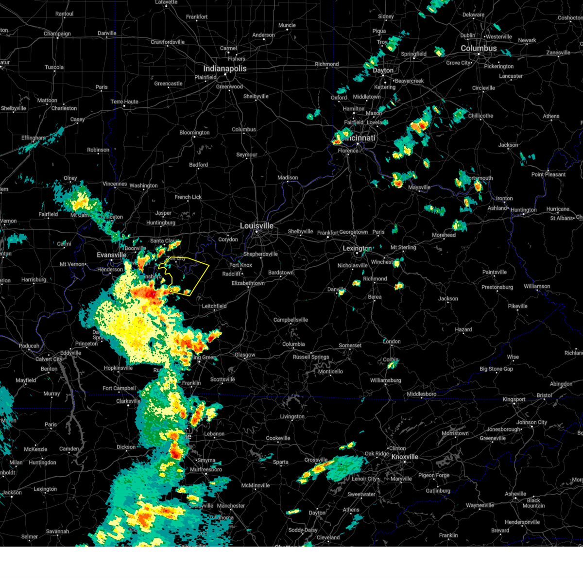
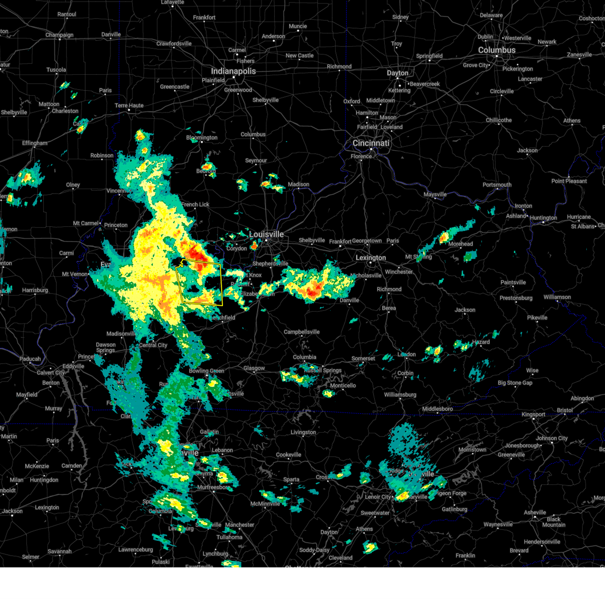
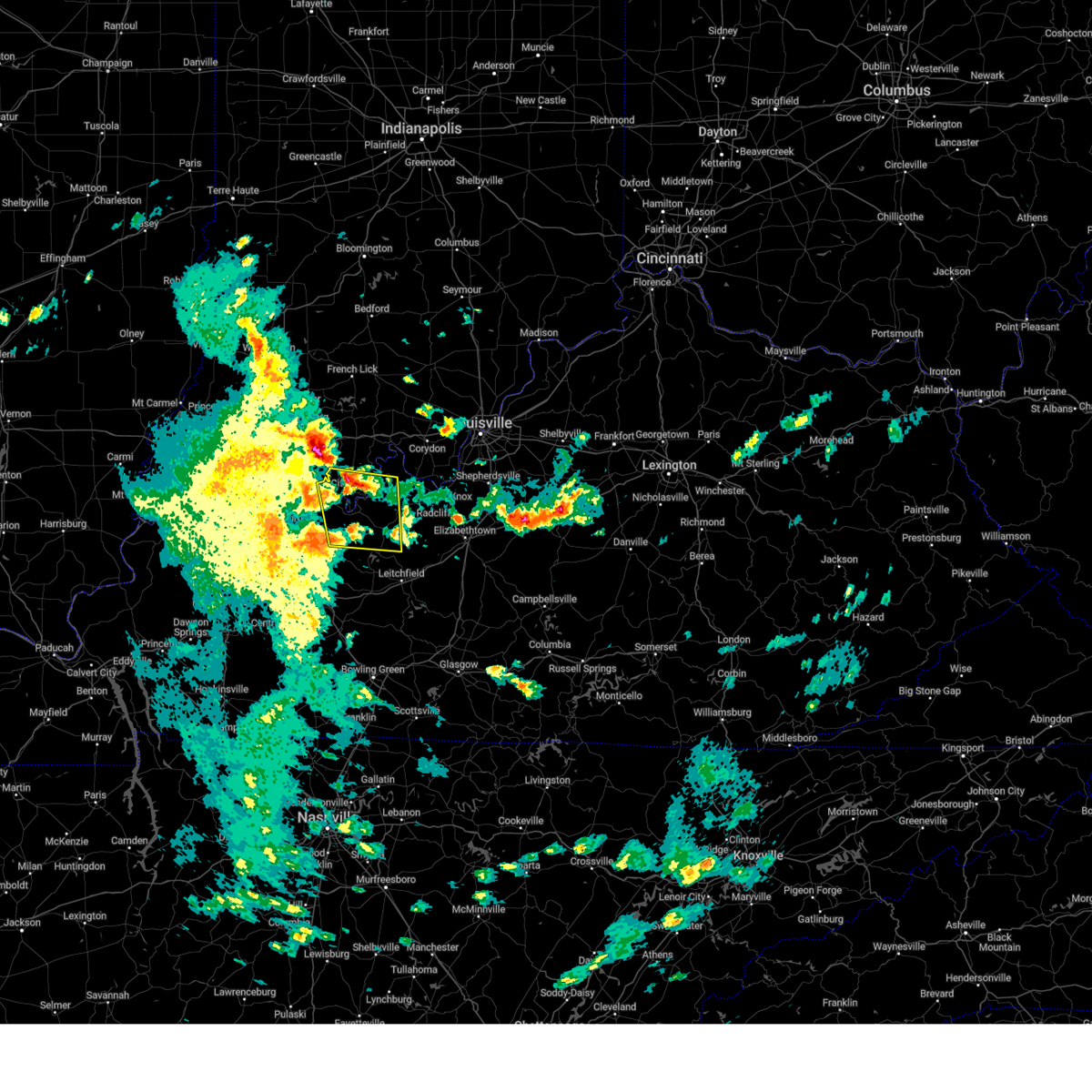
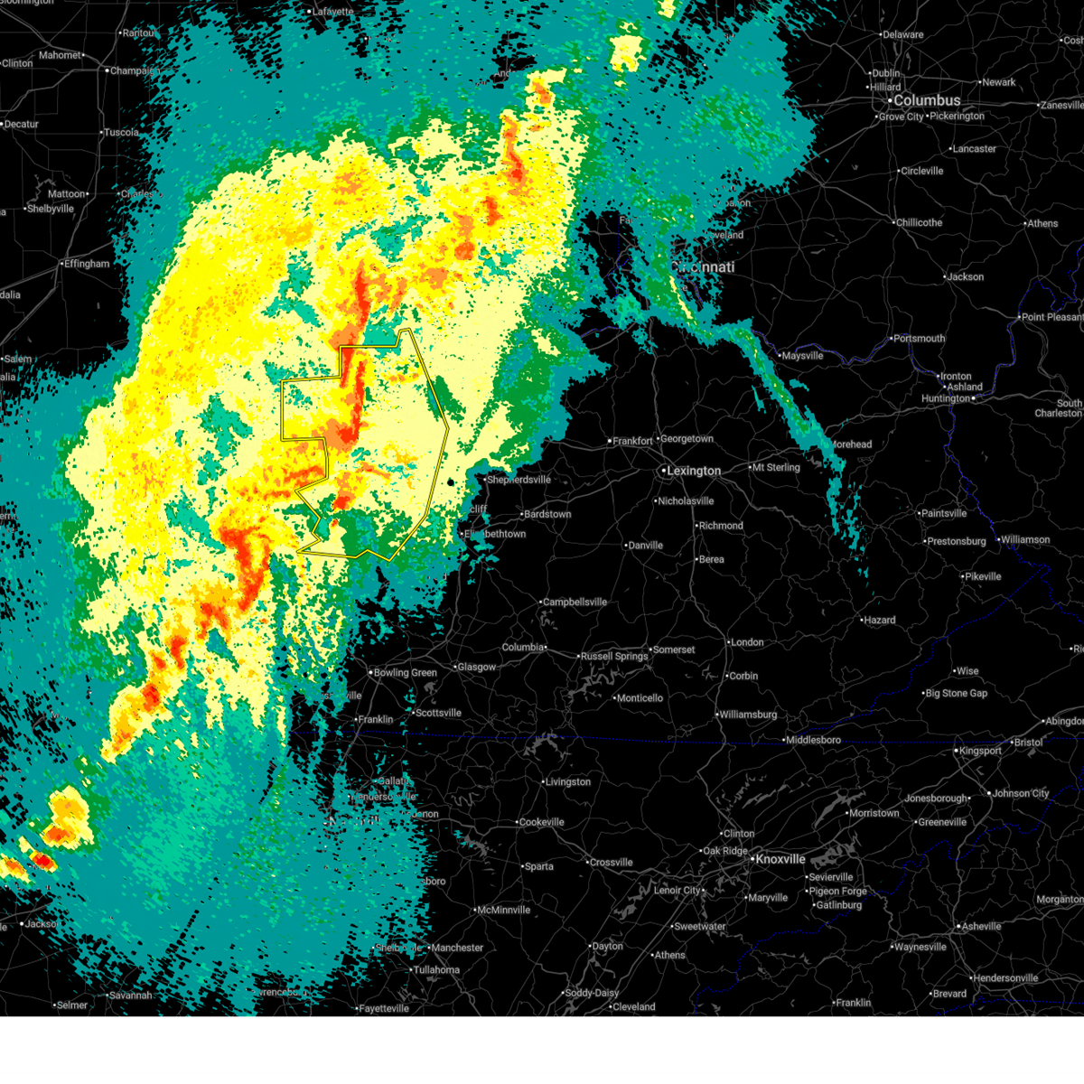
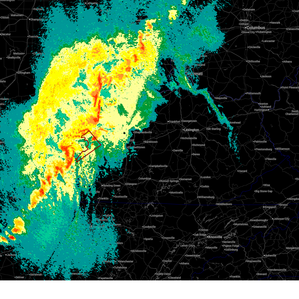
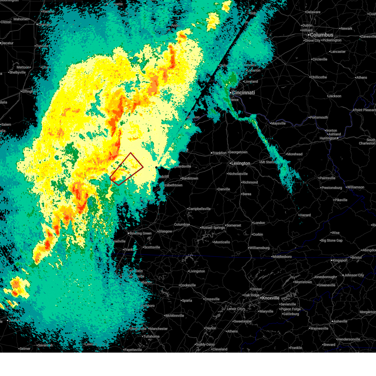
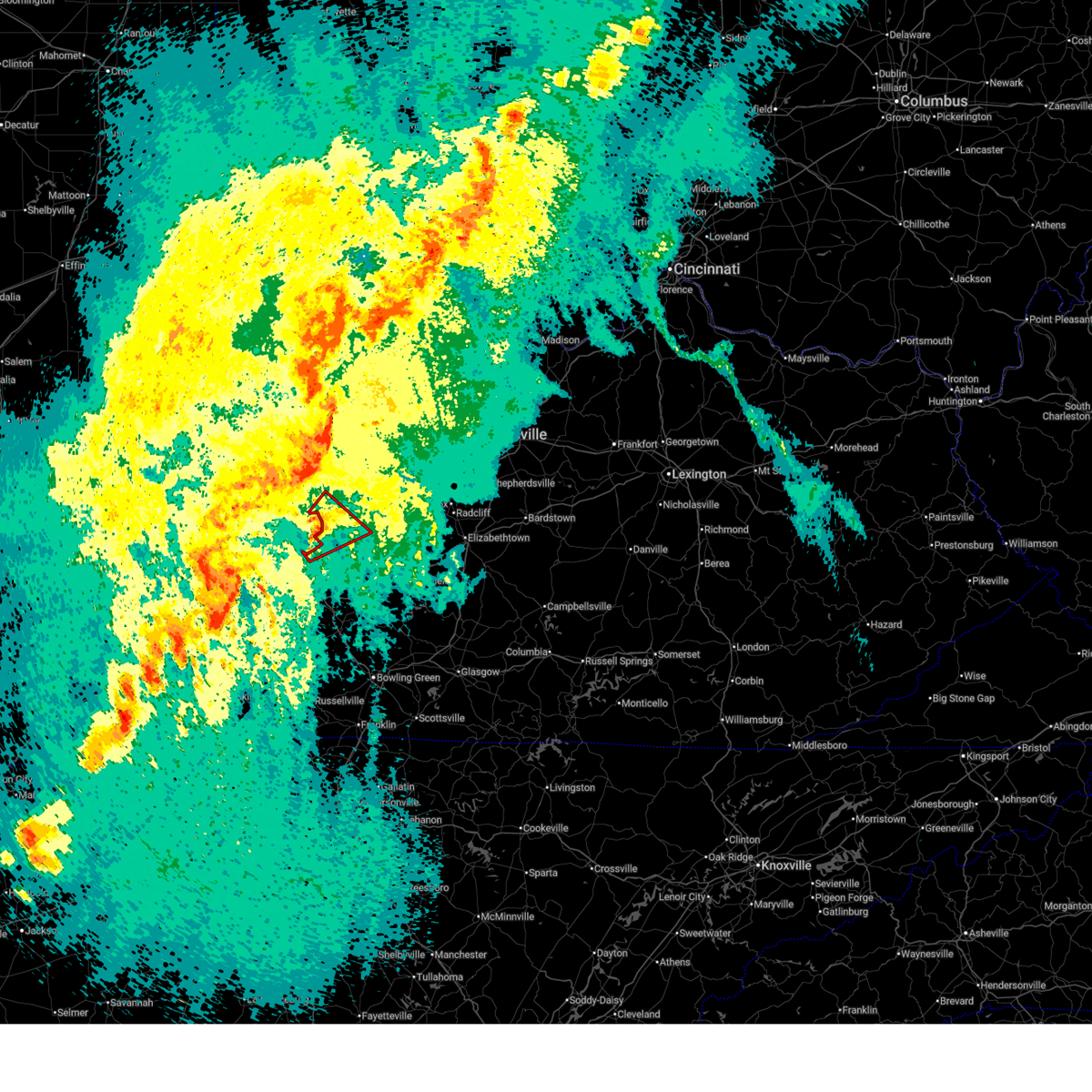
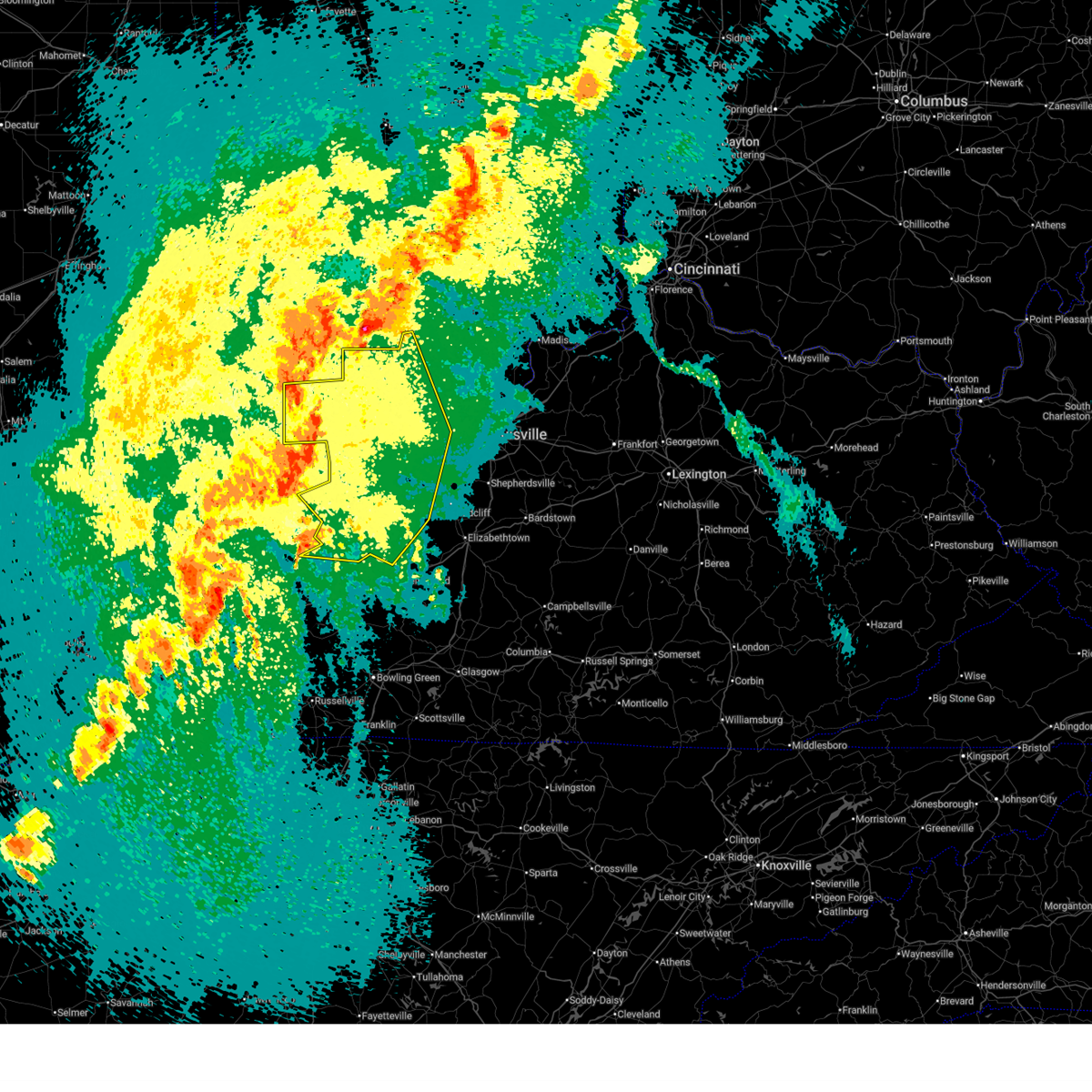
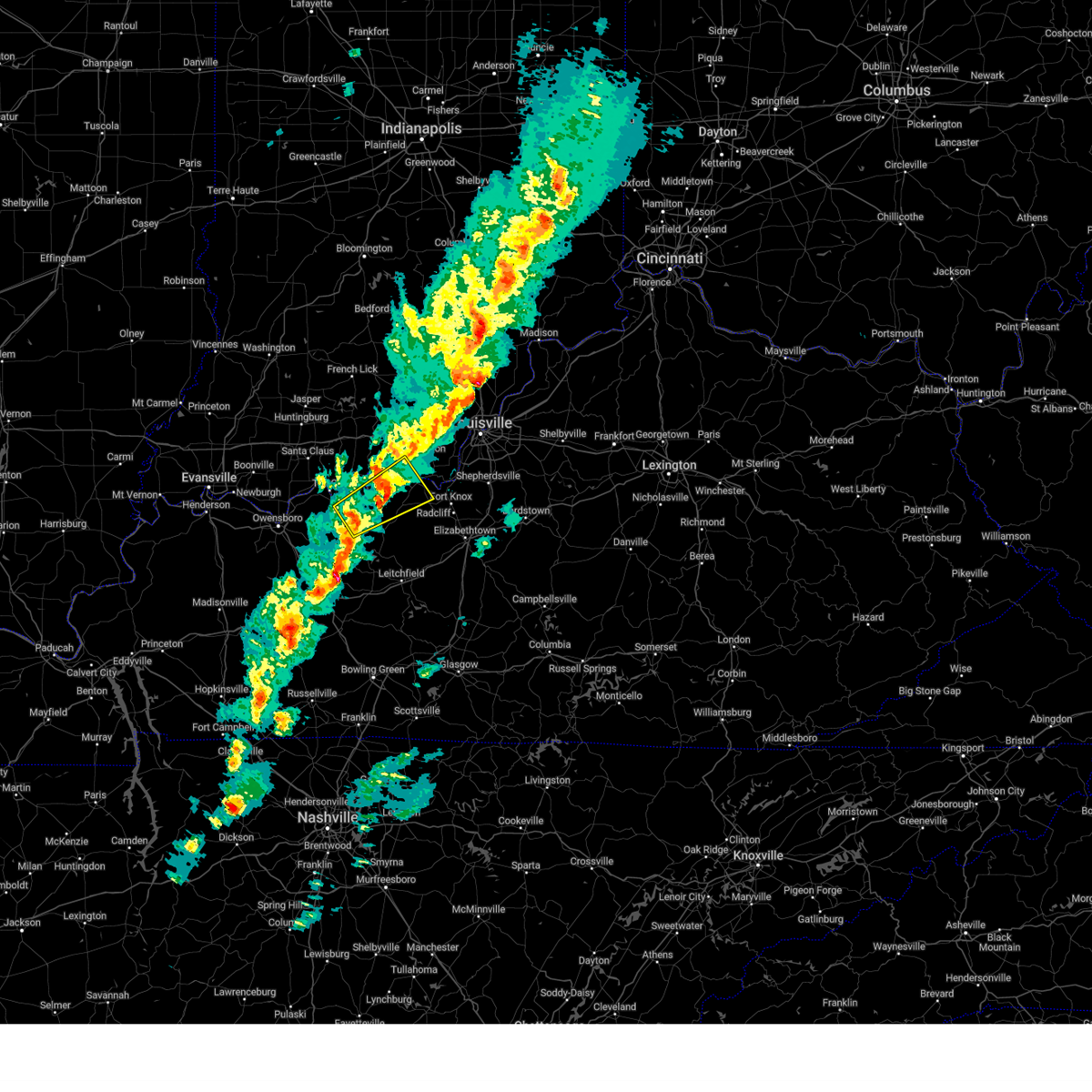
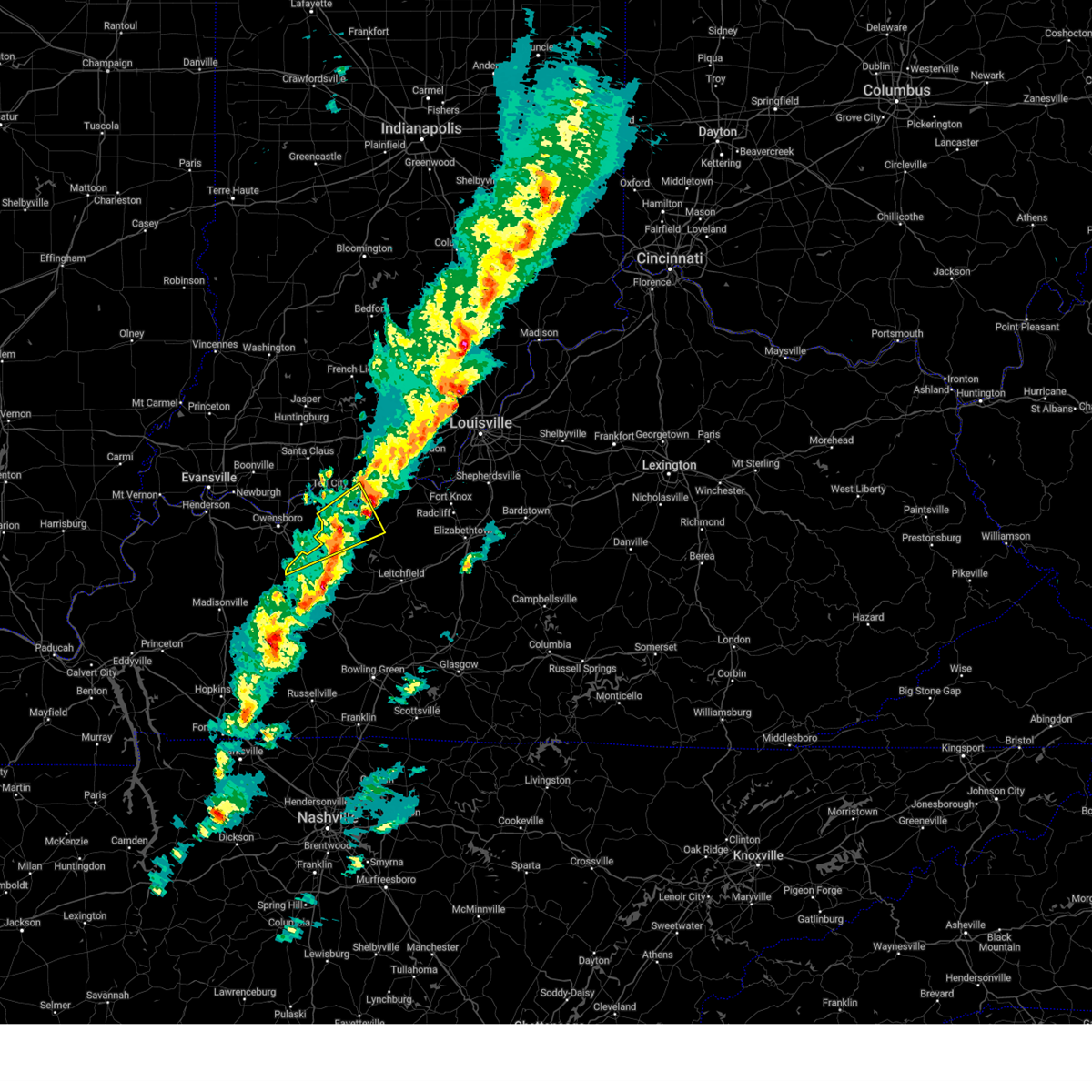
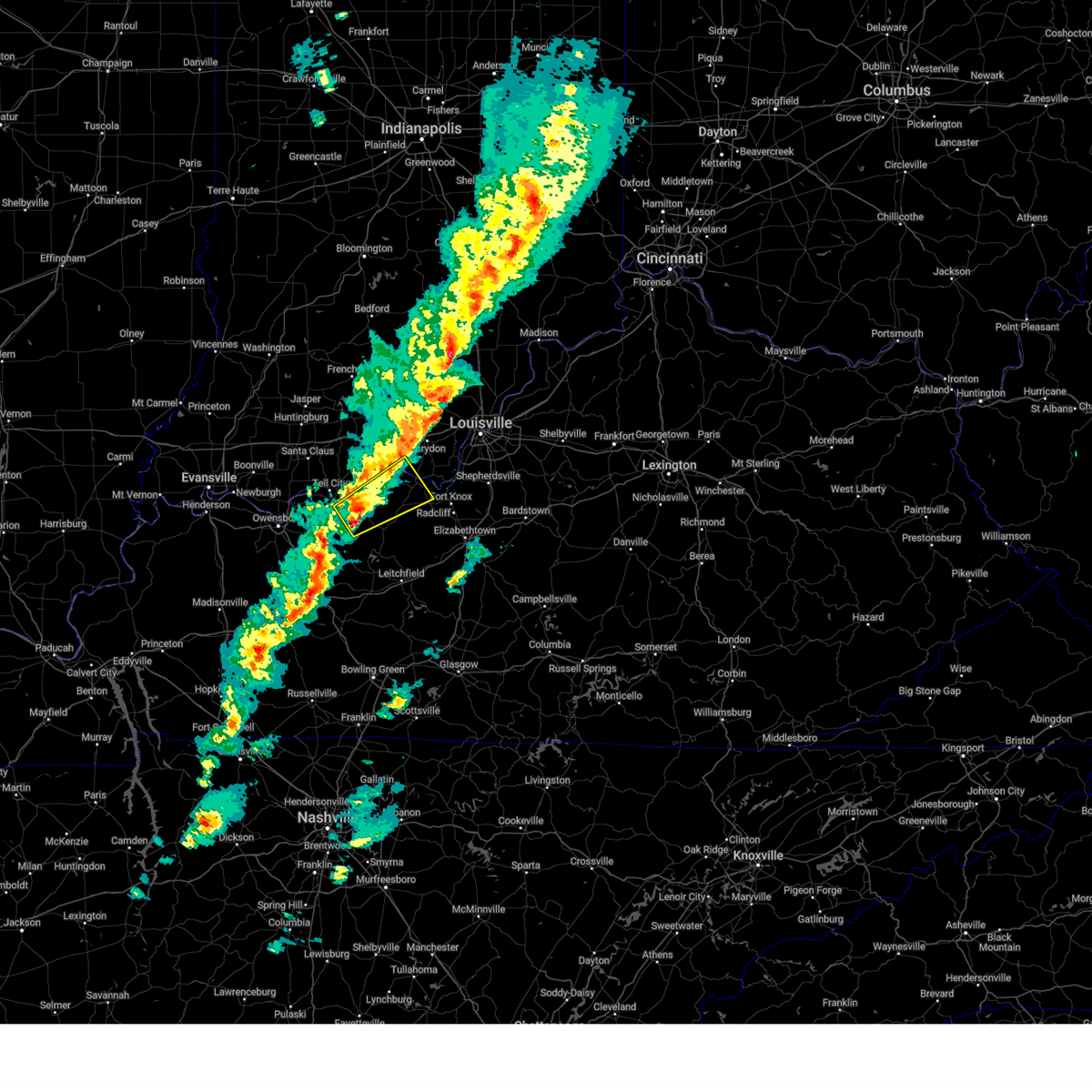
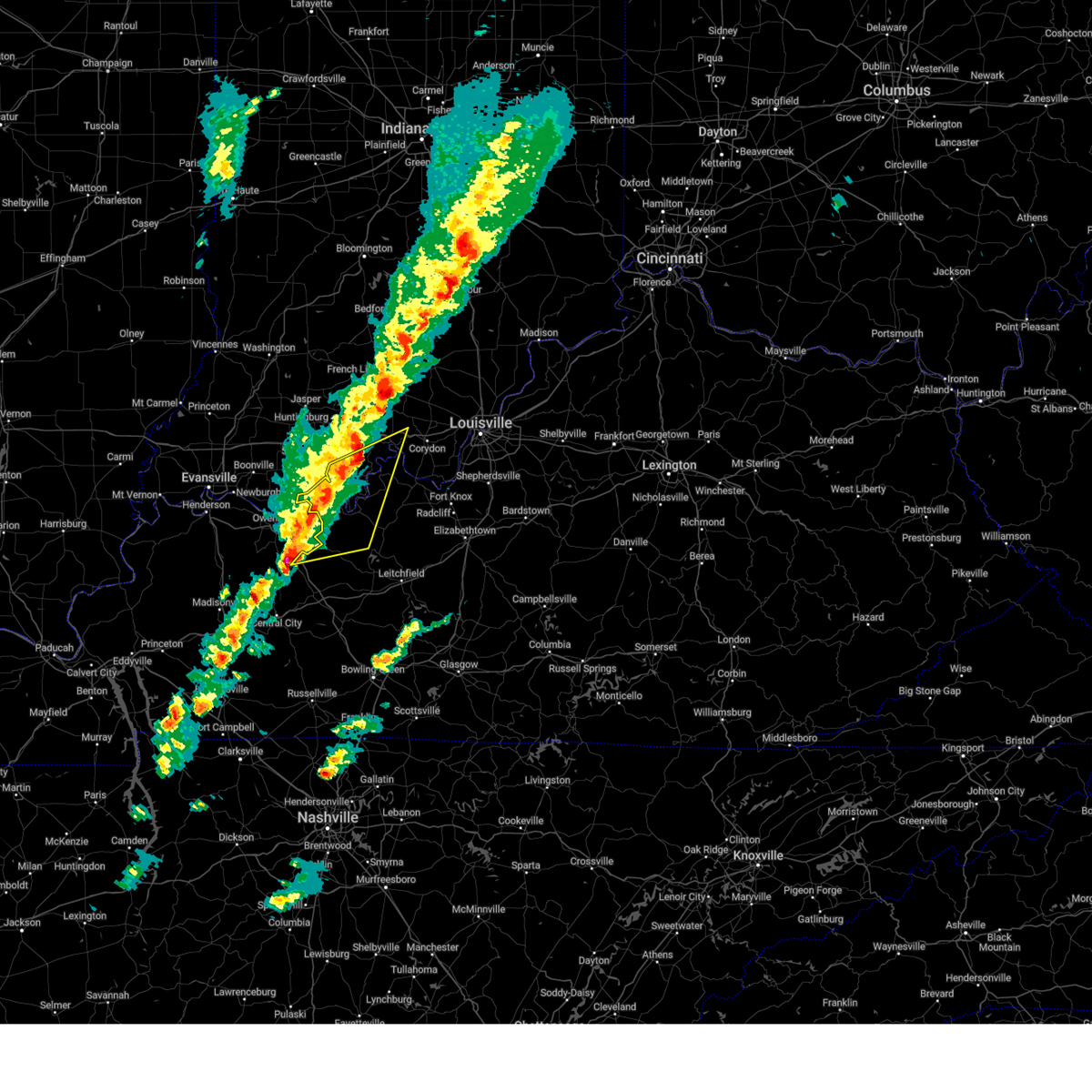
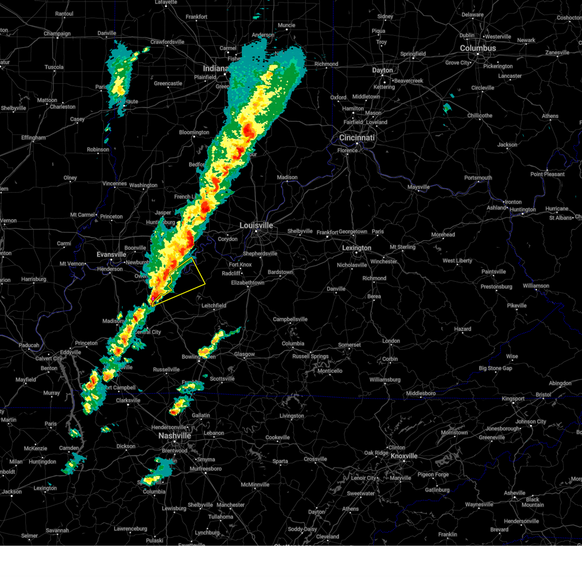
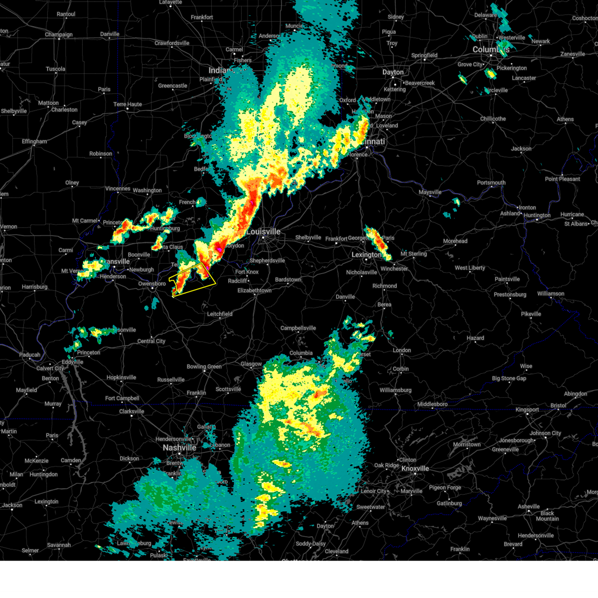
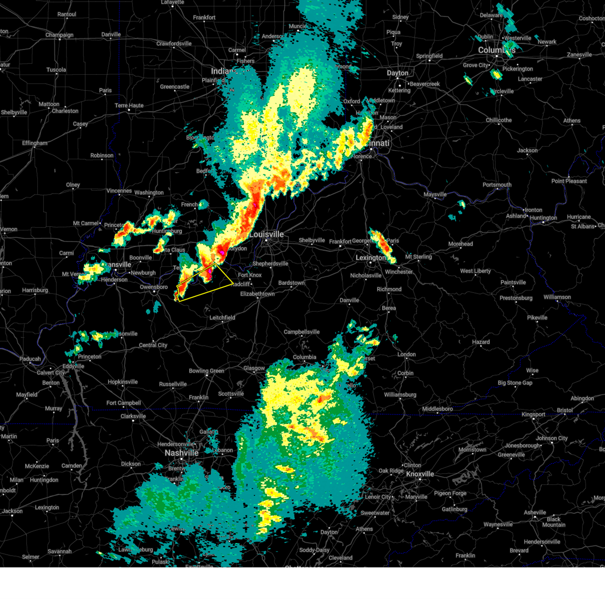
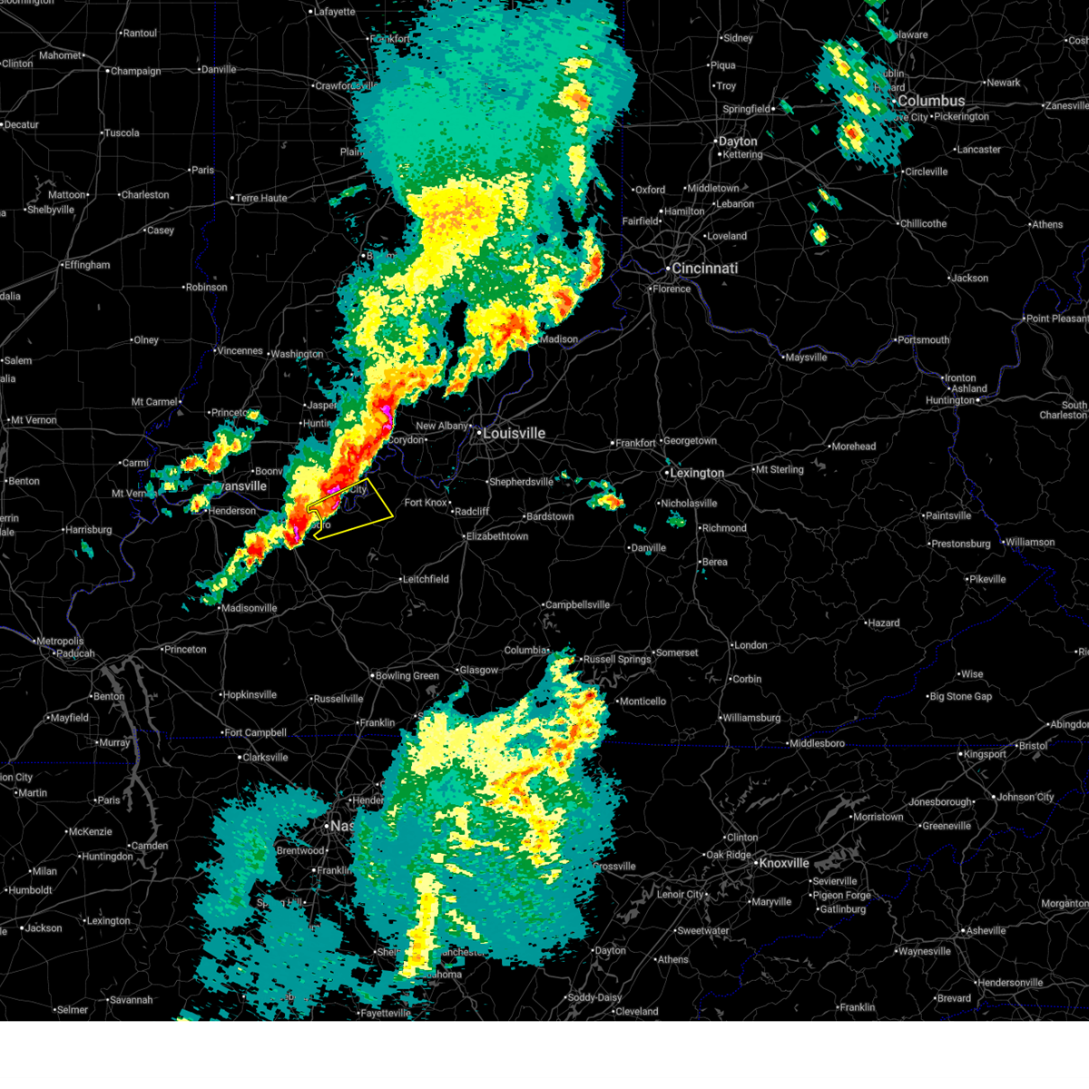
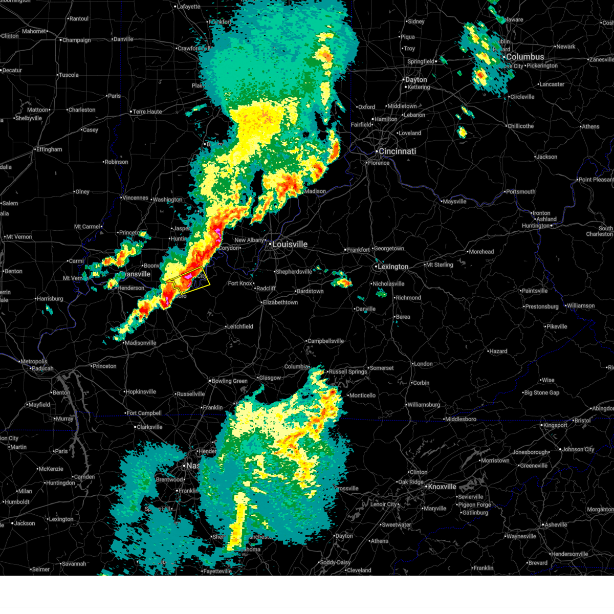
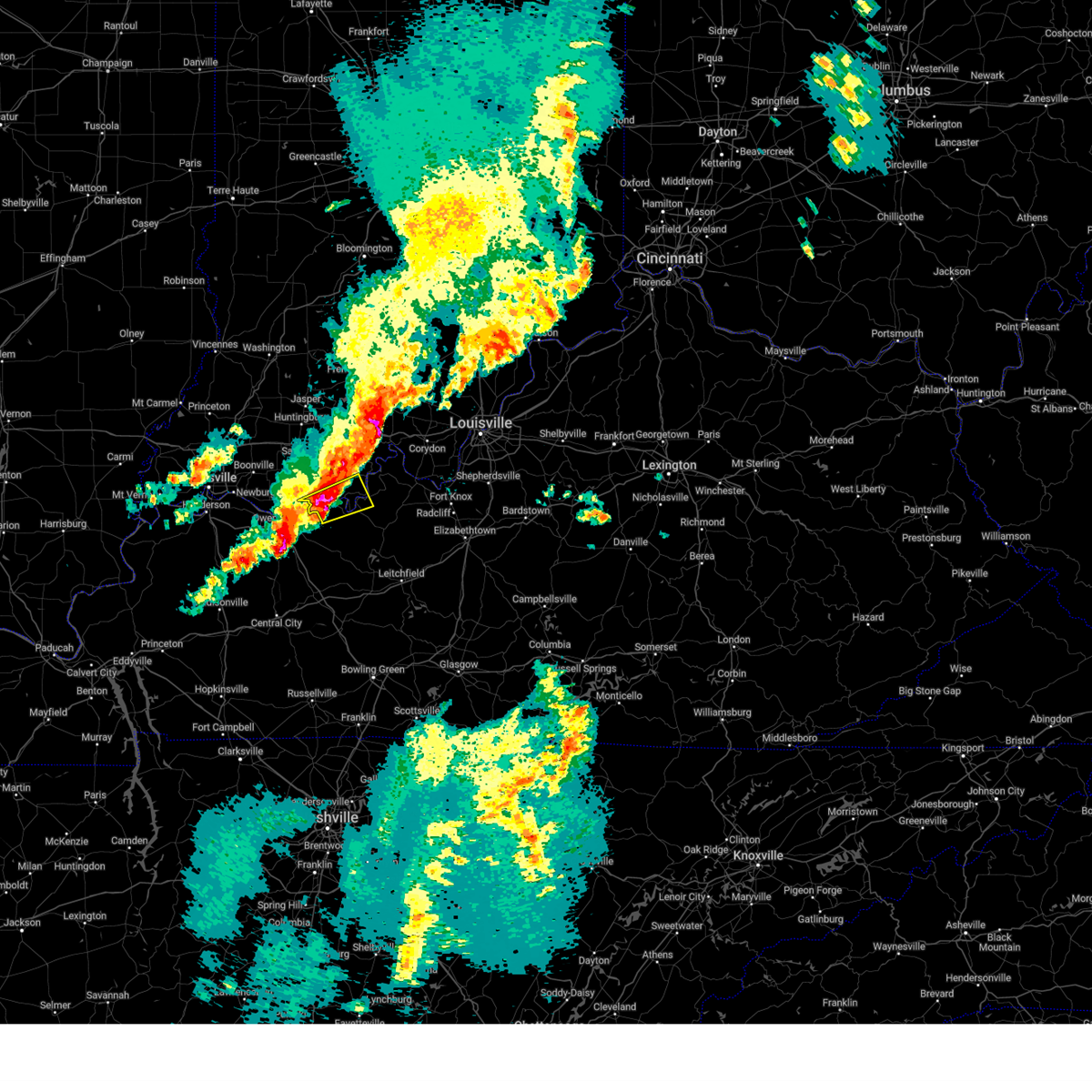
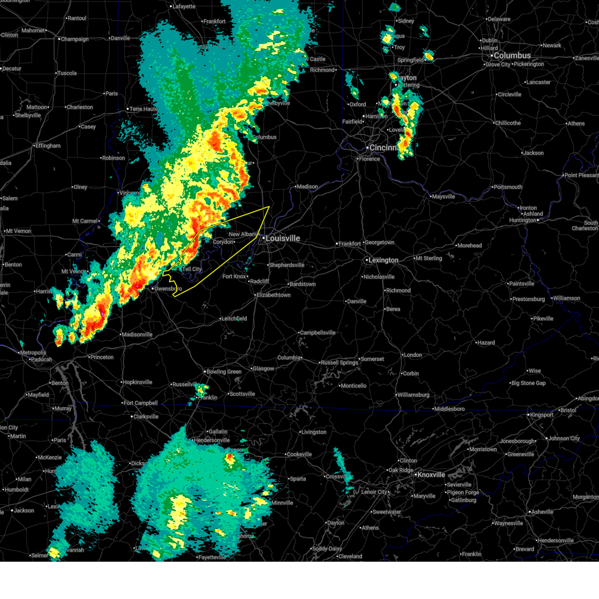
Hail Map for Cloverport, KY
The Cloverport, KY area has had 3 reports of on-the-ground hail by trained spotters, and has been under severe weather warnings 7 times during the past 12 months. Doppler radar has detected hail at or near Cloverport, KY on 70 occasions, including 1 occasion during the past year.
| Name: | Cloverport, KY |
| Where Located: | 50.9 miles WSW of Louisville, KY |
| Map: | Google Map for Cloverport, KY |
| Population: | 1152 |
| Housing Units: | 569 |
| More Info: | Search Google for Cloverport, KY |
0
The Top Recent Hail Date for Cloverport, KY is Sunday, September 21, 2025 (66th out of 70)
Hail and Wind Damage Spotted near Cloverport, KY
| Date / Time | Report Details |
|---|---|
| 6/22/2026 12:09 AM CDT |
 At 1209 am cdt, a severe thunderstorm capable of producing a tornado was located 7 miles northwest of hardinsburg, moving east at 30 mph (radar indicated rotation). Hazards include tornado and quarter size hail. Flying debris will be dangerous to those caught without shelter. mobile homes will be damaged or destroyed. damage to roofs, windows, and vehicles will occur. tree damage is likely. this dangerous storm will be near, hardinsburg around 1215 am cdt. Other locations impacted by this tornadic thunderstorm include webster, cloverport, mystic, sample, lodiburg, clifton mills, holt, harned, stephensport, and union star. At 1209 am cdt, a severe thunderstorm capable of producing a tornado was located 7 miles northwest of hardinsburg, moving east at 30 mph (radar indicated rotation). Hazards include tornado and quarter size hail. Flying debris will be dangerous to those caught without shelter. mobile homes will be damaged or destroyed. damage to roofs, windows, and vehicles will occur. tree damage is likely. this dangerous storm will be near, hardinsburg around 1215 am cdt. Other locations impacted by this tornadic thunderstorm include webster, cloverport, mystic, sample, lodiburg, clifton mills, holt, harned, stephensport, and union star.
|
| 6/21/2026 11:50 PM CDT |
 Torlmk the national weather service in louisville has issued a * tornado warning for, southern perry county in south central indiana, northeastern hancock county in central kentucky, northwestern breckinridge county in central kentucky, * until 1230 am cdt. * at 1150 pm cdt, a severe thunderstorm capable of producing a tornado was located over hawesville, moving east at 30 mph (radar indicated rotation). Hazards include tornado and quarter size hail. Flying debris will be dangerous to those caught without shelter. mobile homes will be damaged or destroyed. damage to roofs, windows, and vehicles will occur. tree damage is likely. this dangerous storm will be near, hardinsburg around 1215 am cdt. Other locations impacted by this tornadic thunderstorm include mystic, skillman, sample, fenn haven, dodd, clifton mills, tobinsport, kingswood, holt, and sunny corner. Torlmk the national weather service in louisville has issued a * tornado warning for, southern perry county in south central indiana, northeastern hancock county in central kentucky, northwestern breckinridge county in central kentucky, * until 1230 am cdt. * at 1150 pm cdt, a severe thunderstorm capable of producing a tornado was located over hawesville, moving east at 30 mph (radar indicated rotation). Hazards include tornado and quarter size hail. Flying debris will be dangerous to those caught without shelter. mobile homes will be damaged or destroyed. damage to roofs, windows, and vehicles will occur. tree damage is likely. this dangerous storm will be near, hardinsburg around 1215 am cdt. Other locations impacted by this tornadic thunderstorm include mystic, skillman, sample, fenn haven, dodd, clifton mills, tobinsport, kingswood, holt, and sunny corner.
|
| 6/21/2026 10:34 PM CDT |
 Svrlmk the national weather service in louisville has issued a * severe thunderstorm warning for, southern perry county in south central indiana, northeastern hancock county in central kentucky, northwestern breckinridge county in central kentucky, * until 1100 pm cdt. * at 1034 pm cdt, a severe thunderstorm was located near hawesville, moving east at 30 mph (radar indicated). Hazards include 60 mph wind gusts and penny size hail. expect damage to roofs, siding, and trees Svrlmk the national weather service in louisville has issued a * severe thunderstorm warning for, southern perry county in south central indiana, northeastern hancock county in central kentucky, northwestern breckinridge county in central kentucky, * until 1100 pm cdt. * at 1034 pm cdt, a severe thunderstorm was located near hawesville, moving east at 30 mph (radar indicated). Hazards include 60 mph wind gusts and penny size hail. expect damage to roofs, siding, and trees
|
| 3/15/2026 10:19 PM CDT |
 The storms which prompted the warning have moved out of the area. therefore, the warning has been allowed to expire. a tornado watch remains in effect until 300 am edt/200 am cdt/ for south central indiana, and central kentucky. The storms which prompted the warning have moved out of the area. therefore, the warning has been allowed to expire. a tornado watch remains in effect until 300 am edt/200 am cdt/ for south central indiana, and central kentucky.
|
| 3/15/2026 11:13 PM EDT |
 Svrlmk the national weather service in louisville has issued a * severe thunderstorm warning for, harrison county in south central indiana, southeastern crawford county in south central indiana, central perry county in south central indiana, southwestern floyd county in south central indiana, meade county in central kentucky, southeastern hancock county in central kentucky, breckinridge county in central kentucky, northwestern hardin county in central kentucky, north central ohio county in central kentucky, * until midnight edt/1100 pm cdt/. * at 1112 pm edt/1012 pm cdt/, severe thunderstorms were located along a line extending from 12 miles southwest of english to 7 miles east of tell city to 7 miles east of whitesville, moving east at 55 mph (radar indicated). Hazards include 60 mph wind gusts. expect damage to roofs, siding, and trees Svrlmk the national weather service in louisville has issued a * severe thunderstorm warning for, harrison county in south central indiana, southeastern crawford county in south central indiana, central perry county in south central indiana, southwestern floyd county in south central indiana, meade county in central kentucky, southeastern hancock county in central kentucky, breckinridge county in central kentucky, northwestern hardin county in central kentucky, north central ohio county in central kentucky, * until midnight edt/1100 pm cdt/. * at 1112 pm edt/1012 pm cdt/, severe thunderstorms were located along a line extending from 12 miles southwest of english to 7 miles east of tell city to 7 miles east of whitesville, moving east at 55 mph (radar indicated). Hazards include 60 mph wind gusts. expect damage to roofs, siding, and trees
|
| 3/15/2026 10:00 PM CDT |
 At 1100 pm edt/1000 pm cdt/, severe thunderstorms were located along a line extending from 8 miles northwest of english to 6 miles west of hawesville, moving east at 50 mph (radar indicated). Hazards include 60 mph wind gusts. Expect damage to roofs, siding, and trees. Locations impacted include, tell city, hawesville, english, carefree town, mount pleasant, lewisport, cannelton, cloverport, marengo, and milltown. At 1100 pm edt/1000 pm cdt/, severe thunderstorms were located along a line extending from 8 miles northwest of english to 6 miles west of hawesville, moving east at 50 mph (radar indicated). Hazards include 60 mph wind gusts. Expect damage to roofs, siding, and trees. Locations impacted include, tell city, hawesville, english, carefree town, mount pleasant, lewisport, cannelton, cloverport, marengo, and milltown.
|
| 3/15/2026 9:38 PM CDT |
 Svrlmk the national weather service in louisville has issued a * severe thunderstorm warning for, southeastern dubois county in south central indiana, crawford county in south central indiana, perry county in south central indiana, southern orange county in south central indiana, southwestern washington county in south central indiana, northwestern meade county in central kentucky, hancock county in central kentucky, northwestern breckinridge county in central kentucky, * until 1115 pm edt/1015 pm cdt/. * at 1038 pm edt/938 pm cdt/, severe thunderstorms were located along a line extending from near jasper to near eureka, moving east at 50 mph (radar indicated). Hazards include 60 mph wind gusts. expect damage to roofs, siding, and trees Svrlmk the national weather service in louisville has issued a * severe thunderstorm warning for, southeastern dubois county in south central indiana, crawford county in south central indiana, perry county in south central indiana, southern orange county in south central indiana, southwestern washington county in south central indiana, northwestern meade county in central kentucky, hancock county in central kentucky, northwestern breckinridge county in central kentucky, * until 1115 pm edt/1015 pm cdt/. * at 1038 pm edt/938 pm cdt/, severe thunderstorms were located along a line extending from near jasper to near eureka, moving east at 50 mph (radar indicated). Hazards include 60 mph wind gusts. expect damage to roofs, siding, and trees
|
| 6/6/2025 11:23 AM CDT |
 At 1122 am cdt, severe thunderstorms were located along a line extending from near hardinsburg to 16 miles east of whitesville to 10 miles east of hartford, moving east at 40 mph (radar indicated). Hazards include 60 mph wind gusts and penny size hail. Expect damage to roofs, siding, and trees. Locations impacted include, hardinsburg, cloverport, caneyville, concord, mcquady, steff, se ree, shreve, buras, and do stop. At 1122 am cdt, severe thunderstorms were located along a line extending from near hardinsburg to 16 miles east of whitesville to 10 miles east of hartford, moving east at 40 mph (radar indicated). Hazards include 60 mph wind gusts and penny size hail. Expect damage to roofs, siding, and trees. Locations impacted include, hardinsburg, cloverport, caneyville, concord, mcquady, steff, se ree, shreve, buras, and do stop.
|
| 6/6/2025 11:13 AM CDT |
 Svrlmk the national weather service in louisville has issued a * severe thunderstorm warning for, western grayson county in central kentucky, breckinridge county in central kentucky, east central ohio county in central kentucky, * until 1145 am cdt. * at 1112 am cdt, severe thunderstorms were located along a line extending from 8 miles southeast of hawesville to 10 miles southeast of whitesville to near hartford, moving east at 40 mph (radar indicated). Hazards include 60 mph wind gusts and penny size hail. expect damage to roofs, siding, and trees Svrlmk the national weather service in louisville has issued a * severe thunderstorm warning for, western grayson county in central kentucky, breckinridge county in central kentucky, east central ohio county in central kentucky, * until 1145 am cdt. * at 1112 am cdt, severe thunderstorms were located along a line extending from 8 miles southeast of hawesville to 10 miles southeast of whitesville to near hartford, moving east at 40 mph (radar indicated). Hazards include 60 mph wind gusts and penny size hail. expect damage to roofs, siding, and trees
|
| 5/16/2025 8:43 PM CDT |
 Svrlmk the national weather service in louisville has issued a * severe thunderstorm warning for, southeastern meade county in central kentucky, southeastern hancock county in central kentucky, northern grayson county in central kentucky, breckinridge county in central kentucky, southwestern hardin county in central kentucky, northeastern ohio county in central kentucky, * until 1030 pm edt/930 pm cdt/. * at 943 pm edt/843 pm cdt/, a severe thunderstorm was located 11 miles southeast of hawesville, moving east at 45 mph (radar indicated). Hazards include 60 mph wind gusts and quarter size hail. Hail damage to vehicles is expected. Expect wind damage to roofs, siding, and trees. Svrlmk the national weather service in louisville has issued a * severe thunderstorm warning for, southeastern meade county in central kentucky, southeastern hancock county in central kentucky, northern grayson county in central kentucky, breckinridge county in central kentucky, southwestern hardin county in central kentucky, northeastern ohio county in central kentucky, * until 1030 pm edt/930 pm cdt/. * at 943 pm edt/843 pm cdt/, a severe thunderstorm was located 11 miles southeast of hawesville, moving east at 45 mph (radar indicated). Hazards include 60 mph wind gusts and quarter size hail. Hail damage to vehicles is expected. Expect wind damage to roofs, siding, and trees.
|
| 5/16/2025 8:08 PM CDT |
 Svrlmk the national weather service in louisville has issued a * severe thunderstorm warning for, southern perry county in south central indiana, hancock county in central kentucky, western breckinridge county in central kentucky, northeastern ohio county in central kentucky, * until 845 pm cdt. * at 808 pm cdt, a severe thunderstorm was located near stanley, moving east at 65 mph (radar indicated). Hazards include ping pong ball size hail and 60 mph wind gusts. People and animals outdoors will be injured. expect hail damage to roofs, siding, windows, and vehicles. Expect wind damage to roofs, siding, and trees. Svrlmk the national weather service in louisville has issued a * severe thunderstorm warning for, southern perry county in south central indiana, hancock county in central kentucky, western breckinridge county in central kentucky, northeastern ohio county in central kentucky, * until 845 pm cdt. * at 808 pm cdt, a severe thunderstorm was located near stanley, moving east at 65 mph (radar indicated). Hazards include ping pong ball size hail and 60 mph wind gusts. People and animals outdoors will be injured. expect hail damage to roofs, siding, windows, and vehicles. Expect wind damage to roofs, siding, and trees.
|
| 5/16/2025 4:23 AM CDT |
 The storm which prompted the warning has weakened below severe limits, and has exited the warned area. therefore, the warning has been allowed to expire. a severe thunderstorm watch remains in effect until 900 am cdt for south central indiana, and central kentucky. The storm which prompted the warning has weakened below severe limits, and has exited the warned area. therefore, the warning has been allowed to expire. a severe thunderstorm watch remains in effect until 900 am cdt for south central indiana, and central kentucky.
|
| 5/16/2025 3:48 AM CDT |
 Svrlmk the national weather service in louisville has issued a * severe thunderstorm warning for, southern perry county in south central indiana, hancock county in central kentucky, northwestern breckinridge county in central kentucky, * until 415 am cdt. * at 348 am cdt, a severe thunderstorm was located near knottsville, moving east at 60 mph (radar indicated). Hazards include 60 mph wind gusts and nickel size hail. expect damage to roofs, siding, and trees Svrlmk the national weather service in louisville has issued a * severe thunderstorm warning for, southern perry county in south central indiana, hancock county in central kentucky, northwestern breckinridge county in central kentucky, * until 415 am cdt. * at 348 am cdt, a severe thunderstorm was located near knottsville, moving east at 60 mph (radar indicated). Hazards include 60 mph wind gusts and nickel size hail. expect damage to roofs, siding, and trees
|
| 5/2/2025 2:00 PM CDT |
 The storms which prompted the warning have weakened below severe limits, and no longer pose an immediate threat to life or property. therefore, the warning has been allowed to expire. however, gusty winds and heavy rain are still possible with these thunderstorms. a severe thunderstorm watch remains in effect until 800 pm cdt for south central indiana, and central kentucky. to report severe weather, contact your nearest law enforcement agency. they will relay your report to the national weather service louisville. The storms which prompted the warning have weakened below severe limits, and no longer pose an immediate threat to life or property. therefore, the warning has been allowed to expire. however, gusty winds and heavy rain are still possible with these thunderstorms. a severe thunderstorm watch remains in effect until 800 pm cdt for south central indiana, and central kentucky. to report severe weather, contact your nearest law enforcement agency. they will relay your report to the national weather service louisville.
|
| 5/2/2025 1:45 PM CDT |
 At 145 pm cdt, severe thunderstorms were located along a line extending from 6 miles southeast of grandview to near hawesville to near hardinsburg, moving northeast at 30 mph (radar indicated). Hazards include 60 mph wind gusts and quarter size hail. Hail damage to vehicles is expected. expect wind damage to roofs, siding, and trees. Locations impacted include, tell city, hawesville, lewisport, cannelton, cloverport, troy, mystic, skillman, goering, and dodd. At 145 pm cdt, severe thunderstorms were located along a line extending from 6 miles southeast of grandview to near hawesville to near hardinsburg, moving northeast at 30 mph (radar indicated). Hazards include 60 mph wind gusts and quarter size hail. Hail damage to vehicles is expected. expect wind damage to roofs, siding, and trees. Locations impacted include, tell city, hawesville, lewisport, cannelton, cloverport, troy, mystic, skillman, goering, and dodd.
|
| 5/2/2025 1:45 PM CDT |
 the severe thunderstorm warning has been cancelled and is no longer in effect the severe thunderstorm warning has been cancelled and is no longer in effect
|
| 5/2/2025 1:17 PM CDT |
 Svrlmk the national weather service in louisville has issued a * severe thunderstorm warning for, southern perry county in south central indiana, hancock county in central kentucky, western breckinridge county in central kentucky, northeastern ohio county in central kentucky, * until 200 pm cdt. * at 117 pm cdt, severe thunderstorms were located along a line extending from near owensboro to near whitesville to 11 miles southwest of hardinsburg, moving northeast at 30 mph (radar indicated). Hazards include 60 mph wind gusts and quarter size hail. Hail damage to vehicles is expected. Expect wind damage to roofs, siding, and trees. Svrlmk the national weather service in louisville has issued a * severe thunderstorm warning for, southern perry county in south central indiana, hancock county in central kentucky, western breckinridge county in central kentucky, northeastern ohio county in central kentucky, * until 200 pm cdt. * at 117 pm cdt, severe thunderstorms were located along a line extending from near owensboro to near whitesville to 11 miles southwest of hardinsburg, moving northeast at 30 mph (radar indicated). Hazards include 60 mph wind gusts and quarter size hail. Hail damage to vehicles is expected. Expect wind damage to roofs, siding, and trees.
|
| 4/10/2025 5:12 PM CDT |
 The storms which prompted the warning have weakened below severe limits, and no longer pose an immediate threat to life or property. therefore, the warning will be allowed to expire. however, gusty winds are still possible with these thunderstorms. a severe thunderstorm watch remains in effect until 1000 pm edt/900 pm cdt/ for central kentucky. The storms which prompted the warning have weakened below severe limits, and no longer pose an immediate threat to life or property. therefore, the warning will be allowed to expire. however, gusty winds are still possible with these thunderstorms. a severe thunderstorm watch remains in effect until 1000 pm edt/900 pm cdt/ for central kentucky.
|
| 4/10/2025 4:46 PM CDT |
 Svrlmk the national weather service in louisville has issued a * severe thunderstorm warning for, southern perry county in south central indiana, west central meade county in central kentucky, hancock county in central kentucky, breckinridge county in central kentucky, northeastern ohio county in central kentucky, * until 615 pm edt/515 pm cdt/. * at 546 pm edt/446 pm cdt/, severe thunderstorms were located along a line extending from 13 miles southwest of english to 12 miles southwest of hardinsburg, moving east at 35 mph (radar indicated). Hazards include 60 mph wind gusts and quarter size hail. Hail damage to vehicles is expected. Expect wind damage to roofs, siding, and trees. Svrlmk the national weather service in louisville has issued a * severe thunderstorm warning for, southern perry county in south central indiana, west central meade county in central kentucky, hancock county in central kentucky, breckinridge county in central kentucky, northeastern ohio county in central kentucky, * until 615 pm edt/515 pm cdt/. * at 546 pm edt/446 pm cdt/, severe thunderstorms were located along a line extending from 13 miles southwest of english to 12 miles southwest of hardinsburg, moving east at 35 mph (radar indicated). Hazards include 60 mph wind gusts and quarter size hail. Hail damage to vehicles is expected. Expect wind damage to roofs, siding, and trees.
|
| 4/2/2025 10:35 PM CDT |
 The storm which prompted the warning has moved out of the area. therefore, the warning will be allowed to expire. a tornado watch remains in effect until 100 am cdt for south central indiana, and central kentucky. The storm which prompted the warning has moved out of the area. therefore, the warning will be allowed to expire. a tornado watch remains in effect until 100 am cdt for south central indiana, and central kentucky.
|
| 4/2/2025 10:33 PM CDT |
 At 1033 pm cdt, a severe thunderstorm capable of producing a tornado was located over hawesville, moving northeast at 60 mph (radar indicated rotation). Hazards include tornado. Flying debris will be dangerous to those caught without shelter. mobile homes will be damaged or destroyed. damage to roofs, windows, and vehicles will occur. tree damage is likely. This tornadic thunderstorm will remain over mainly rural areas of southwestern perry, eastern hancock, west central breckinridge and northeastern ohio counties, including the following locations, skillman, fenn haven, victoria crossroads, tobinsport, patesville, sunny corner, tar fork, cannelton, cloverport, and cabot. At 1033 pm cdt, a severe thunderstorm capable of producing a tornado was located over hawesville, moving northeast at 60 mph (radar indicated rotation). Hazards include tornado. Flying debris will be dangerous to those caught without shelter. mobile homes will be damaged or destroyed. damage to roofs, windows, and vehicles will occur. tree damage is likely. This tornadic thunderstorm will remain over mainly rural areas of southwestern perry, eastern hancock, west central breckinridge and northeastern ohio counties, including the following locations, skillman, fenn haven, victoria crossroads, tobinsport, patesville, sunny corner, tar fork, cannelton, cloverport, and cabot.
|
| 4/2/2025 10:31 PM CDT |
 Torlmk the national weather service in louisville has issued a * tornado warning for, south central harrison county in south central indiana, south central perry county in south central indiana, southern meade county in central kentucky, southeastern hancock county in central kentucky, breckinridge county in central kentucky, northeastern ohio county in central kentucky, * until midnight edt/1100 pm cdt/. * at 1131 pm edt/1031 pm cdt/, a severe thunderstorm capable of producing a tornado was located 11 miles east of whitesville, moving east at 75 mph (radar indicated rotation). Hazards include tornado. Flying debris will be dangerous to those caught without shelter. mobile homes will be damaged or destroyed. damage to roofs, windows, and vehicles will occur. tree damage is likely. this dangerous storm will be near, hardinsburg around 1035 pm cdt. Other locations impacted by this tornadic thunderstorm include mcquady, frymire, big spring, buck grove, tar fork, kirk, vanzant, rockvale, bewleyville, and basin spring. Torlmk the national weather service in louisville has issued a * tornado warning for, south central harrison county in south central indiana, south central perry county in south central indiana, southern meade county in central kentucky, southeastern hancock county in central kentucky, breckinridge county in central kentucky, northeastern ohio county in central kentucky, * until midnight edt/1100 pm cdt/. * at 1131 pm edt/1031 pm cdt/, a severe thunderstorm capable of producing a tornado was located 11 miles east of whitesville, moving east at 75 mph (radar indicated rotation). Hazards include tornado. Flying debris will be dangerous to those caught without shelter. mobile homes will be damaged or destroyed. damage to roofs, windows, and vehicles will occur. tree damage is likely. this dangerous storm will be near, hardinsburg around 1035 pm cdt. Other locations impacted by this tornadic thunderstorm include mcquady, frymire, big spring, buck grove, tar fork, kirk, vanzant, rockvale, bewleyville, and basin spring.
|
| 4/2/2025 10:26 PM CDT |
 the severe thunderstorm warning has been cancelled and is no longer in effect the severe thunderstorm warning has been cancelled and is no longer in effect
|
| 4/2/2025 10:26 PM CDT |
 At 1026 pm cdt, a severe thunderstorm capable of producing a tornado was located near knottsville, moving northeast at 60 mph (radar indicated rotation). Hazards include tornado. Flying debris will be dangerous to those caught without shelter. mobile homes will be damaged or destroyed. damage to roofs, windows, and vehicles will occur. tree damage is likely. this dangerous storm will be near, tell city and hawesville around 1030 pm cdt. Other locations impacted by this tornadic thunderstorm include taffy, skillman, goering, ralph, pellville, lewisport, magan, tobinsport, sunny corner, and tar fork. At 1026 pm cdt, a severe thunderstorm capable of producing a tornado was located near knottsville, moving northeast at 60 mph (radar indicated rotation). Hazards include tornado. Flying debris will be dangerous to those caught without shelter. mobile homes will be damaged or destroyed. damage to roofs, windows, and vehicles will occur. tree damage is likely. this dangerous storm will be near, tell city and hawesville around 1030 pm cdt. Other locations impacted by this tornadic thunderstorm include taffy, skillman, goering, ralph, pellville, lewisport, magan, tobinsport, sunny corner, and tar fork.
|
| 4/2/2025 10:26 PM CDT |
 At 1125 pm edt/1025 pm cdt/, severe thunderstorms were located along a line extending from brownstown to 13 miles north of corydon to 8 miles northeast of hardinsburg, moving east at 60 mph (radar indicated). Hazards include 60 mph wind gusts. Expect damage to roofs, siding, and trees. Locations impacted include, tell city, salem, corydon, brandenburg, hardinsburg, hawesville, english, carefree town, mount pleasant, and webster. At 1125 pm edt/1025 pm cdt/, severe thunderstorms were located along a line extending from brownstown to 13 miles north of corydon to 8 miles northeast of hardinsburg, moving east at 60 mph (radar indicated). Hazards include 60 mph wind gusts. Expect damage to roofs, siding, and trees. Locations impacted include, tell city, salem, corydon, brandenburg, hardinsburg, hawesville, english, carefree town, mount pleasant, and webster.
|
| 4/2/2025 10:05 PM CDT |
 The storm which prompted the warning has moved out of the area. therefore, the warning has been allowed to expire. a tornado watch remains in effect until 100 am cdt for south central indiana, and central kentucky. remember, a tornado warning still remains in effect for hancock and breckinridge counties. The storm which prompted the warning has moved out of the area. therefore, the warning has been allowed to expire. a tornado watch remains in effect until 100 am cdt for south central indiana, and central kentucky. remember, a tornado warning still remains in effect for hancock and breckinridge counties.
|
| 4/2/2025 10:00 PM CDT |
 The storms which prompted the warning have moved out of the area. therefore, the warning will be allowed to expire. however, gusty winds and heavy rain are still possible with these thunderstorms. a tornado watch remains in effect until 200 am edt/100 am cdt/ for south central indiana, and central kentucky. to report severe weather, contact your nearest law enforcement agency. they will relay your report to the national weather service louisville. remember, a severe thunderstorm warning still remains in effect. The storms which prompted the warning have moved out of the area. therefore, the warning will be allowed to expire. however, gusty winds and heavy rain are still possible with these thunderstorms. a tornado watch remains in effect until 200 am edt/100 am cdt/ for south central indiana, and central kentucky. to report severe weather, contact your nearest law enforcement agency. they will relay your report to the national weather service louisville. remember, a severe thunderstorm warning still remains in effect.
|
| 4/2/2025 9:58 PM CDT |
 Torlmk the national weather service in louisville has issued a * tornado warning for, southwestern perry county in south central indiana, hancock county in central kentucky, west central breckinridge county in central kentucky, northern ohio county in central kentucky, * until 1045 pm cdt. * at 958 pm cdt, a severe thunderstorm capable of producing a tornado was located over calhoun, moving northeast at 60 mph (radar indicated rotation). Hazards include tornado. Flying debris will be dangerous to those caught without shelter. mobile homes will be damaged or destroyed. damage to roofs, windows, and vehicles will occur. tree damage is likely. this dangerous storm will be near, tell city and hawesville around 1030 pm cdt. Other locations impacted by this tornadic thunderstorm include taffy, skillman, goering, ralph, pellville, lewisport, magan, tobinsport, sunny corner, and tar fork. Torlmk the national weather service in louisville has issued a * tornado warning for, southwestern perry county in south central indiana, hancock county in central kentucky, west central breckinridge county in central kentucky, northern ohio county in central kentucky, * until 1045 pm cdt. * at 958 pm cdt, a severe thunderstorm capable of producing a tornado was located over calhoun, moving northeast at 60 mph (radar indicated rotation). Hazards include tornado. Flying debris will be dangerous to those caught without shelter. mobile homes will be damaged or destroyed. damage to roofs, windows, and vehicles will occur. tree damage is likely. this dangerous storm will be near, tell city and hawesville around 1030 pm cdt. Other locations impacted by this tornadic thunderstorm include taffy, skillman, goering, ralph, pellville, lewisport, magan, tobinsport, sunny corner, and tar fork.
|
| 4/2/2025 9:58 PM CDT |
 Svrlmk the national weather service in louisville has issued a * severe thunderstorm warning for, harrison county in south central indiana, northwestern clark county in south central indiana, crawford county in south central indiana, perry county in south central indiana, floyd county in south central indiana, orange county in south central indiana, washington county in south central indiana, meade county in central kentucky, hancock county in central kentucky, breckinridge county in central kentucky, northeastern ohio county in central kentucky, * until midnight edt/1100 pm cdt/. * at 1058 pm edt/958 pm cdt/, severe thunderstorms were located along a line extending from 10 miles south of bedford to 7 miles southwest of english to near whitesville, moving northeast at 55 mph (radar indicated). Hazards include 60 mph wind gusts. expect damage to roofs, siding, and trees Svrlmk the national weather service in louisville has issued a * severe thunderstorm warning for, harrison county in south central indiana, northwestern clark county in south central indiana, crawford county in south central indiana, perry county in south central indiana, floyd county in south central indiana, orange county in south central indiana, washington county in south central indiana, meade county in central kentucky, hancock county in central kentucky, breckinridge county in central kentucky, northeastern ohio county in central kentucky, * until midnight edt/1100 pm cdt/. * at 1058 pm edt/958 pm cdt/, severe thunderstorms were located along a line extending from 10 miles south of bedford to 7 miles southwest of english to near whitesville, moving northeast at 55 mph (radar indicated). Hazards include 60 mph wind gusts. expect damage to roofs, siding, and trees
|
| 4/2/2025 9:52 PM CDT |
 Torlmk the national weather service in louisville has issued a * tornado warning for, south central crawford county in south central indiana, southeastern perry county in south central indiana, northwestern meade county in central kentucky, southeastern hancock county in central kentucky, northwestern breckinridge county in central kentucky, * until 1130 pm edt/1030 pm cdt/. * at 1052 pm edt/952 pm cdt/, a severe thunderstorm capable of producing a tornado was located 7 miles northeast of whitesville, moving northeast at 60 mph (radar indicated rotation). Hazards include tornado. Flying debris will be dangerous to those caught without shelter. mobile homes will be damaged or destroyed. damage to roofs, windows, and vehicles will occur. tree damage is likely. This tornadic thunderstorm will remain over mainly rural areas of south central crawford, southeastern perry, northwestern meade, southeastern hancock and northwestern breckinridge counties, including the following locations, roberta, mystic, raymond, frymire, skillman, goering, gerald, dodd, andyville, and tobinsport. Torlmk the national weather service in louisville has issued a * tornado warning for, south central crawford county in south central indiana, southeastern perry county in south central indiana, northwestern meade county in central kentucky, southeastern hancock county in central kentucky, northwestern breckinridge county in central kentucky, * until 1130 pm edt/1030 pm cdt/. * at 1052 pm edt/952 pm cdt/, a severe thunderstorm capable of producing a tornado was located 7 miles northeast of whitesville, moving northeast at 60 mph (radar indicated rotation). Hazards include tornado. Flying debris will be dangerous to those caught without shelter. mobile homes will be damaged or destroyed. damage to roofs, windows, and vehicles will occur. tree damage is likely. This tornadic thunderstorm will remain over mainly rural areas of south central crawford, southeastern perry, northwestern meade, southeastern hancock and northwestern breckinridge counties, including the following locations, roberta, mystic, raymond, frymire, skillman, goering, gerald, dodd, andyville, and tobinsport.
|
| 4/2/2025 9:46 PM CDT |
 At 946 pm cdt, a severe thunderstorm capable of producing a tornado was located over whitesville, moving northeast at 70 mph (radar indicated rotation). Hazards include tornado. Flying debris will be dangerous to those caught without shelter. mobile homes will be damaged or destroyed. damage to roofs, windows, and vehicles will occur. tree damage is likely. Locations impacted include, hawesville, cannelton, cloverport, petri, goering, ralph, pellville, deanefield, victoria crossroads, and floral. At 946 pm cdt, a severe thunderstorm capable of producing a tornado was located over whitesville, moving northeast at 70 mph (radar indicated rotation). Hazards include tornado. Flying debris will be dangerous to those caught without shelter. mobile homes will be damaged or destroyed. damage to roofs, windows, and vehicles will occur. tree damage is likely. Locations impacted include, hawesville, cannelton, cloverport, petri, goering, ralph, pellville, deanefield, victoria crossroads, and floral.
|
| 4/2/2025 9:37 PM CDT |
 At 1037 pm edt/937 pm cdt/, severe thunderstorms were located along a line extending from 11 miles southwest of shoals to 10 miles northeast of santa claus to grandview, moving northeast at 60 mph (radar indicated). Hazards include 70 mph wind gusts and nickel size hail. Expect considerable tree damage. damage is likely to mobile homes, roofs, and outbuildings. Locations impacted include, jasper, tell city, paoli, corydon, brandenburg, hardinsburg, hawesville, english, carefree town, and mount pleasant. At 1037 pm edt/937 pm cdt/, severe thunderstorms were located along a line extending from 11 miles southwest of shoals to 10 miles northeast of santa claus to grandview, moving northeast at 60 mph (radar indicated). Hazards include 70 mph wind gusts and nickel size hail. Expect considerable tree damage. damage is likely to mobile homes, roofs, and outbuildings. Locations impacted include, jasper, tell city, paoli, corydon, brandenburg, hardinsburg, hawesville, english, carefree town, and mount pleasant.
|
| 4/2/2025 9:35 PM CDT |
 Torlmk the national weather service in louisville has issued a * tornado warning for, hancock county in central kentucky, west central breckinridge county in central kentucky, northern ohio county in central kentucky, * until 1000 pm cdt. * at 935 pm cdt, a severe thunderstorm capable of producing a tornado was located 8 miles southeast of masonville, moving northeast at 60 mph (radar indicated rotation). Hazards include tornado. Flying debris will be dangerous to those caught without shelter. mobile homes will be damaged or destroyed. damage to roofs, windows, and vehicles will occur. tree damage is likely. This tornadic thunderstorm will remain over mainly rural areas of hancock, west central breckinridge and northern ohio counties, including the following locations, taffy, goering, ralph, pellville, magan, sunny corner, tar fork, cabot, heflin, and pleasant ridge. Torlmk the national weather service in louisville has issued a * tornado warning for, hancock county in central kentucky, west central breckinridge county in central kentucky, northern ohio county in central kentucky, * until 1000 pm cdt. * at 935 pm cdt, a severe thunderstorm capable of producing a tornado was located 8 miles southeast of masonville, moving northeast at 60 mph (radar indicated rotation). Hazards include tornado. Flying debris will be dangerous to those caught without shelter. mobile homes will be damaged or destroyed. damage to roofs, windows, and vehicles will occur. tree damage is likely. This tornadic thunderstorm will remain over mainly rural areas of hancock, west central breckinridge and northern ohio counties, including the following locations, taffy, goering, ralph, pellville, magan, sunny corner, tar fork, cabot, heflin, and pleasant ridge.
|
| 4/2/2025 9:19 PM CDT |
 Svrlmk the national weather service in louisville has issued a * severe thunderstorm warning for, harrison county in south central indiana, dubois county in south central indiana, crawford county in south central indiana, perry county in south central indiana, orange county in south central indiana, western washington county in south central indiana, meade county in central kentucky, hancock county in central kentucky, breckinridge county in central kentucky, northeastern ohio county in central kentucky, * until 1100 pm edt/1000 pm cdt/. * at 1018 pm edt/918 pm cdt/, severe thunderstorms were located along a line extending from near petersburg to near folsomville to stanley, moving northeast at 75 mph (radar indicated). Hazards include 70 mph wind gusts and nickel size hail. Expect considerable tree damage. Damage is likely to mobile homes, roofs, and outbuildings. Svrlmk the national weather service in louisville has issued a * severe thunderstorm warning for, harrison county in south central indiana, dubois county in south central indiana, crawford county in south central indiana, perry county in south central indiana, orange county in south central indiana, western washington county in south central indiana, meade county in central kentucky, hancock county in central kentucky, breckinridge county in central kentucky, northeastern ohio county in central kentucky, * until 1100 pm edt/1000 pm cdt/. * at 1018 pm edt/918 pm cdt/, severe thunderstorms were located along a line extending from near petersburg to near folsomville to stanley, moving northeast at 75 mph (radar indicated). Hazards include 70 mph wind gusts and nickel size hail. Expect considerable tree damage. Damage is likely to mobile homes, roofs, and outbuildings.
|
| 3/30/2025 8:03 PM CDT |
 At 903 pm edt/803 pm cdt/, severe thunderstorms were located along a line extending from 12 miles northeast of tell city to near hawesville, moving east at 65 mph (radar indicated). Hazards include 60 mph wind gusts and nickel size hail. Expect damage to roofs, siding, and trees. Locations impacted include, hardinsburg, mount pleasant, webster, cannelton, cloverport, leopold, alton, mcquady, frymire, and skillman. At 903 pm edt/803 pm cdt/, severe thunderstorms were located along a line extending from 12 miles northeast of tell city to near hawesville, moving east at 65 mph (radar indicated). Hazards include 60 mph wind gusts and nickel size hail. Expect damage to roofs, siding, and trees. Locations impacted include, hardinsburg, mount pleasant, webster, cannelton, cloverport, leopold, alton, mcquady, frymire, and skillman.
|
| 3/30/2025 7:47 PM CDT |
 Svrlmk the national weather service in louisville has issued a * severe thunderstorm warning for, southern crawford county in south central indiana, perry county in south central indiana, northwestern meade county in central kentucky, hancock county in central kentucky, central breckinridge county in central kentucky, * until 915 pm edt/815 pm cdt/. * at 846 pm edt/746 pm cdt/, severe thunderstorms were located along a line extending from near santa claus to near grandview, moving east at 70 mph (radar indicated). Hazards include 70 mph wind gusts. Expect considerable tree damage. Damage is likely to mobile homes, roofs, and outbuildings. Svrlmk the national weather service in louisville has issued a * severe thunderstorm warning for, southern crawford county in south central indiana, perry county in south central indiana, northwestern meade county in central kentucky, hancock county in central kentucky, central breckinridge county in central kentucky, * until 915 pm edt/815 pm cdt/. * at 846 pm edt/746 pm cdt/, severe thunderstorms were located along a line extending from near santa claus to near grandview, moving east at 70 mph (radar indicated). Hazards include 70 mph wind gusts. Expect considerable tree damage. Damage is likely to mobile homes, roofs, and outbuildings.
|
| 3/19/2025 8:42 PM CDT |
 At 941 pm edt/841 pm cdt/, a severe thunderstorm was located 9 miles west of brandenburg, moving northeast at 50 mph (radar indicated). Hazards include 60 mph wind gusts and quarter size hail. Hail damage to vehicles is expected. expect wind damage to roofs, siding, and trees. Locations impacted include, brandenburg, hardinsburg, webster, irvington, cloverport, ekron, mauckport, new amsterdam, guston, and mystic. At 941 pm edt/841 pm cdt/, a severe thunderstorm was located 9 miles west of brandenburg, moving northeast at 50 mph (radar indicated). Hazards include 60 mph wind gusts and quarter size hail. Hail damage to vehicles is expected. expect wind damage to roofs, siding, and trees. Locations impacted include, brandenburg, hardinsburg, webster, irvington, cloverport, ekron, mauckport, new amsterdam, guston, and mystic.
|
| 3/19/2025 8:29 PM CDT |
 The storm which prompted the warning has moved out of the area. therefore, the warning will be allowed to expire. a tornado watch remains in effect until 1100 pm cdt for south central indiana, and central kentucky. The storm which prompted the warning has moved out of the area. therefore, the warning will be allowed to expire. a tornado watch remains in effect until 1100 pm cdt for south central indiana, and central kentucky.
|
| 3/19/2025 8:26 PM CDT |
 Svrlmk the national weather service in louisville has issued a * severe thunderstorm warning for, southwestern harrison county in south central indiana, southeastern perry county in south central indiana, central meade county in central kentucky, east central hancock county in central kentucky, central breckinridge county in central kentucky, * until 1000 pm edt/900 pm cdt/. * at 925 pm edt/825 pm cdt/, a severe thunderstorm was located 7 miles northwest of hardinsburg, moving northeast at 50 mph (radar indicated). Hazards include 60 mph wind gusts and quarter size hail. Hail damage to vehicles is expected. Expect wind damage to roofs, siding, and trees. Svrlmk the national weather service in louisville has issued a * severe thunderstorm warning for, southwestern harrison county in south central indiana, southeastern perry county in south central indiana, central meade county in central kentucky, east central hancock county in central kentucky, central breckinridge county in central kentucky, * until 1000 pm edt/900 pm cdt/. * at 925 pm edt/825 pm cdt/, a severe thunderstorm was located 7 miles northwest of hardinsburg, moving northeast at 50 mph (radar indicated). Hazards include 60 mph wind gusts and quarter size hail. Hail damage to vehicles is expected. Expect wind damage to roofs, siding, and trees.
|
| 3/19/2025 8:01 PM CDT |
 The storms which prompted the warning have weakened below severe limits, and no longer pose an immediate threat to life or property. therefore, the warning has been allowed to expire. a new severe thunderstorm warning has replaced the old warning. a tornado watch remains in effect until midnight edt/1100 pm cdt/ for south central indiana, and central kentucky. to report severe weather, contact your nearest law enforcement agency. they will relay your report to the national weather service louisville. The storms which prompted the warning have weakened below severe limits, and no longer pose an immediate threat to life or property. therefore, the warning has been allowed to expire. a new severe thunderstorm warning has replaced the old warning. a tornado watch remains in effect until midnight edt/1100 pm cdt/ for south central indiana, and central kentucky. to report severe weather, contact your nearest law enforcement agency. they will relay your report to the national weather service louisville.
|
| 3/19/2025 7:59 PM CDT |
 Svrlmk the national weather service in louisville has issued a * severe thunderstorm warning for, south central perry county in south central indiana, southeastern hancock county in central kentucky, west central breckinridge county in central kentucky, northern ohio county in central kentucky, * until 830 pm cdt. * at 759 pm cdt, a severe thunderstorm was located near whitesville, moving northeast at 60 mph (radar indicated). Hazards include 60 mph wind gusts and quarter size hail. Hail damage to vehicles is expected. Expect wind damage to roofs, siding, and trees. Svrlmk the national weather service in louisville has issued a * severe thunderstorm warning for, south central perry county in south central indiana, southeastern hancock county in central kentucky, west central breckinridge county in central kentucky, northern ohio county in central kentucky, * until 830 pm cdt. * at 759 pm cdt, a severe thunderstorm was located near whitesville, moving northeast at 60 mph (radar indicated). Hazards include 60 mph wind gusts and quarter size hail. Hail damage to vehicles is expected. Expect wind damage to roofs, siding, and trees.
|
| 3/19/2025 7:24 PM CDT |
 Svrlmk the national weather service in louisville has issued a * severe thunderstorm warning for, west central harrison county in south central indiana, southeastern crawford county in south central indiana, perry county in south central indiana, northwestern meade county in central kentucky, hancock county in central kentucky, western breckinridge county in central kentucky, northern ohio county in central kentucky, * until 900 pm edt/800 pm cdt/. * at 824 pm edt/724 pm cdt/, severe thunderstorms were located along a line extending from near grandview to near calhoun, moving northeast at 70 mph (radar indicated). Hazards include 60 mph wind gusts and penny size hail. expect damage to roofs, siding, and trees Svrlmk the national weather service in louisville has issued a * severe thunderstorm warning for, west central harrison county in south central indiana, southeastern crawford county in south central indiana, perry county in south central indiana, northwestern meade county in central kentucky, hancock county in central kentucky, western breckinridge county in central kentucky, northern ohio county in central kentucky, * until 900 pm edt/800 pm cdt/. * at 824 pm edt/724 pm cdt/, severe thunderstorms were located along a line extending from near grandview to near calhoun, moving northeast at 70 mph (radar indicated). Hazards include 60 mph wind gusts and penny size hail. expect damage to roofs, siding, and trees
|
| 3/15/2025 6:23 AM CDT |
 The storm which prompted the warning has weakened below severe limits, and no longer poses an immediate threat to life or property. therefore, the warning will be allowed to expire. a tornado watch remains in effect until 1000 am edt/900 am cdt/ for south central indiana, and central kentucky. to report severe weather, contact your nearest law enforcement agency. they will relay your report to the national weather service louisville. The storm which prompted the warning has weakened below severe limits, and no longer poses an immediate threat to life or property. therefore, the warning will be allowed to expire. a tornado watch remains in effect until 1000 am edt/900 am cdt/ for south central indiana, and central kentucky. to report severe weather, contact your nearest law enforcement agency. they will relay your report to the national weather service louisville.
|
| 3/15/2025 6:09 AM CDT |
 the severe thunderstorm warning has been cancelled and is no longer in effect the severe thunderstorm warning has been cancelled and is no longer in effect
|
| 3/15/2025 6:09 AM CDT |
 At 709 am edt/609 am cdt/, a severe thunderstorm was located near hardinsburg, moving northeast at 60 mph (radar indicated). Hazards include 60 mph wind gusts and quarter size hail. Hail damage to vehicles is expected. expect wind damage to roofs, siding, and trees. Locations impacted include, hardinsburg, webster, irvington, cloverport, guston, mystic, raymond, frymire, sample, and clifton mills. At 709 am edt/609 am cdt/, a severe thunderstorm was located near hardinsburg, moving northeast at 60 mph (radar indicated). Hazards include 60 mph wind gusts and quarter size hail. Hail damage to vehicles is expected. expect wind damage to roofs, siding, and trees. Locations impacted include, hardinsburg, webster, irvington, cloverport, guston, mystic, raymond, frymire, sample, and clifton mills.
|
| 3/15/2025 5:59 AM CDT |
 The storm which prompted the warning has moved out of the area. therefore, the warning will be allowed to expire. a tornado watch remains in effect until 900 am cdt for south central indiana, and central kentucky. The storm which prompted the warning has moved out of the area. therefore, the warning will be allowed to expire. a tornado watch remains in effect until 900 am cdt for south central indiana, and central kentucky.
|
| 3/15/2025 5:58 AM CDT |
 Svrlmk the national weather service in louisville has issued a * severe thunderstorm warning for, southeastern perry county in south central indiana, southwestern meade county in central kentucky, southeastern hancock county in central kentucky, central breckinridge county in central kentucky, northern ohio county in central kentucky, * until 730 am edt/630 am cdt/. * at 658 am edt/558 am cdt/, a severe thunderstorm was located 9 miles south of hawesville, moving northeast at 60 mph (radar indicated). Hazards include 60 mph wind gusts and quarter size hail. Hail damage to vehicles is expected. Expect wind damage to roofs, siding, and trees. Svrlmk the national weather service in louisville has issued a * severe thunderstorm warning for, southeastern perry county in south central indiana, southwestern meade county in central kentucky, southeastern hancock county in central kentucky, central breckinridge county in central kentucky, northern ohio county in central kentucky, * until 730 am edt/630 am cdt/. * at 658 am edt/558 am cdt/, a severe thunderstorm was located 9 miles south of hawesville, moving northeast at 60 mph (radar indicated). Hazards include 60 mph wind gusts and quarter size hail. Hail damage to vehicles is expected. Expect wind damage to roofs, siding, and trees.
|
| 3/15/2025 5:27 AM CDT |
 Svrlmk the national weather service in louisville has issued a * severe thunderstorm warning for, southern perry county in south central indiana, hancock county in central kentucky, northwestern breckinridge county in central kentucky, northern ohio county in central kentucky, * until 600 am cdt. * at 527 am cdt, a severe thunderstorm was located over knottsville, moving east at 60 mph (radar indicated). Hazards include 60 mph wind gusts and half dollar size hail. Hail damage to vehicles is expected. Expect wind damage to roofs, siding, and trees. Svrlmk the national weather service in louisville has issued a * severe thunderstorm warning for, southern perry county in south central indiana, hancock county in central kentucky, northwestern breckinridge county in central kentucky, northern ohio county in central kentucky, * until 600 am cdt. * at 527 am cdt, a severe thunderstorm was located over knottsville, moving east at 60 mph (radar indicated). Hazards include 60 mph wind gusts and half dollar size hail. Hail damage to vehicles is expected. Expect wind damage to roofs, siding, and trees.
|
| 3/15/2025 5:25 AM CDT |
 The storm which prompted the warning has moved out of the area. therefore, the warning will be allowed to expire. a tornado watch remains in effect until 900 am cdt for south central indiana, and central kentucky. The storm which prompted the warning has moved out of the area. therefore, the warning will be allowed to expire. a tornado watch remains in effect until 900 am cdt for south central indiana, and central kentucky.
|
| 3/15/2025 5:18 AM CDT |
 At 517 am cdt, a severe thunderstorm was located near hawesville, moving east at 60 mph (radar indicated). Hazards include golf ball size hail and 70 mph wind gusts. People and animals outdoors will be injured. expect hail damage to roofs, siding, windows, and vehicles. expect considerable tree damage. wind damage is also likely to mobile homes, roofs, and outbuildings. Locations impacted include, tell city, hawesville, lewisport, cannelton, cloverport, petri, skillman, goering, adair, and lilly dale. At 517 am cdt, a severe thunderstorm was located near hawesville, moving east at 60 mph (radar indicated). Hazards include golf ball size hail and 70 mph wind gusts. People and animals outdoors will be injured. expect hail damage to roofs, siding, windows, and vehicles. expect considerable tree damage. wind damage is also likely to mobile homes, roofs, and outbuildings. Locations impacted include, tell city, hawesville, lewisport, cannelton, cloverport, petri, skillman, goering, adair, and lilly dale.
|
| 3/15/2025 5:01 AM CDT |
 Svrlmk the national weather service in louisville has issued a * severe thunderstorm warning for, southwestern perry county in south central indiana, hancock county in central kentucky, west central breckinridge county in central kentucky, * until 530 am cdt. * at 500 am cdt, a severe thunderstorm was located near knottsville, moving east at 60 mph (radar indicated). Hazards include two inch hail and 70 mph wind gusts. People and animals outdoors will be injured. expect hail damage to roofs, siding, windows, and vehicles. expect considerable tree damage. Wind damage is also likely to mobile homes, roofs, and outbuildings. Svrlmk the national weather service in louisville has issued a * severe thunderstorm warning for, southwestern perry county in south central indiana, hancock county in central kentucky, west central breckinridge county in central kentucky, * until 530 am cdt. * at 500 am cdt, a severe thunderstorm was located near knottsville, moving east at 60 mph (radar indicated). Hazards include two inch hail and 70 mph wind gusts. People and animals outdoors will be injured. expect hail damage to roofs, siding, windows, and vehicles. expect considerable tree damage. Wind damage is also likely to mobile homes, roofs, and outbuildings.
|
| 3/15/2025 4:51 AM CDT |
 The storms which prompted the warning have weakened. more storms will approach the region from the southwest in the next 20 to 30 minutes, which will likely lead to another issued severe thunderstorm warning. a tornado watch remains in effect until 1000 am edt/900 am cdt/ for south central indiana, and central kentucky. The storms which prompted the warning have weakened. more storms will approach the region from the southwest in the next 20 to 30 minutes, which will likely lead to another issued severe thunderstorm warning. a tornado watch remains in effect until 1000 am edt/900 am cdt/ for south central indiana, and central kentucky.
|
| 3/15/2025 4:29 AM CDT |
 The storms which prompted the warning have moved out of the area. therefore, the warning will be allowed to expire. a tornado watch remains in effect until 1000 am edt/900 am cdt/ for south central indiana, and central kentucky. remember, a severe thunderstorm warning still remains in effect for crawford, perry, hancock, breckinridge, and ohio counties. The storms which prompted the warning have moved out of the area. therefore, the warning will be allowed to expire. a tornado watch remains in effect until 1000 am edt/900 am cdt/ for south central indiana, and central kentucky. remember, a severe thunderstorm warning still remains in effect for crawford, perry, hancock, breckinridge, and ohio counties.
|
| 3/15/2025 4:20 AM CDT |
 Svrlmk the national weather service in louisville has issued a * severe thunderstorm warning for, harrison county in south central indiana, northwestern clark county in south central indiana, crawford county in south central indiana, perry county in south central indiana, floyd county in south central indiana, south central washington county in south central indiana, northwestern meade county in central kentucky, hancock county in central kentucky, northwestern breckinridge county in central kentucky, northern ohio county in central kentucky, * until 600 am edt/500 am cdt/. * at 520 am edt/420 am cdt/, severe thunderstorms were located along a line extending from near english to 13 miles northeast of tell city to near st. joseph, moving east at 60 mph (radar indicated). Hazards include 60 mph wind gusts and quarter size hail. Hail damage to vehicles is expected. Expect wind damage to roofs, siding, and trees. Svrlmk the national weather service in louisville has issued a * severe thunderstorm warning for, harrison county in south central indiana, northwestern clark county in south central indiana, crawford county in south central indiana, perry county in south central indiana, floyd county in south central indiana, south central washington county in south central indiana, northwestern meade county in central kentucky, hancock county in central kentucky, northwestern breckinridge county in central kentucky, northern ohio county in central kentucky, * until 600 am edt/500 am cdt/. * at 520 am edt/420 am cdt/, severe thunderstorms were located along a line extending from near english to 13 miles northeast of tell city to near st. joseph, moving east at 60 mph (radar indicated). Hazards include 60 mph wind gusts and quarter size hail. Hail damage to vehicles is expected. Expect wind damage to roofs, siding, and trees.
|
| 3/15/2025 3:58 AM CDT |
 At 457 am edt/357 am cdt/, severe thunderstorms were located along a line extending from 8 miles northeast of dale to owensboro to 7 miles south of sebree, moving east at 50 mph (radar indicated). Hazards include 60 mph wind gusts and quarter size hail. Hail damage to vehicles is expected. expect wind damage to roofs, siding, and trees. Locations impacted include, tell city, hawesville, mount pleasant, lewisport, cannelton, cloverport, leopold, troy, ranger, and skillman. At 457 am edt/357 am cdt/, severe thunderstorms were located along a line extending from 8 miles northeast of dale to owensboro to 7 miles south of sebree, moving east at 50 mph (radar indicated). Hazards include 60 mph wind gusts and quarter size hail. Hail damage to vehicles is expected. expect wind damage to roofs, siding, and trees. Locations impacted include, tell city, hawesville, mount pleasant, lewisport, cannelton, cloverport, leopold, troy, ranger, and skillman.
|
| 3/15/2025 3:51 AM CDT |
 Svrlmk the national weather service in louisville has issued a * severe thunderstorm warning for, south central crawford county in south central indiana, perry county in south central indiana, hancock county in central kentucky, northwestern breckinridge county in central kentucky, northern ohio county in central kentucky, * until 530 am edt/430 am cdt/. * at 451 am edt/351 am cdt/, severe thunderstorms were located along a line extending from near dale to owensboro to 7 miles east of dixon, moving east at 50 mph (radar indicated). Hazards include 60 mph wind gusts and quarter size hail. Hail damage to vehicles is expected. Expect wind damage to roofs, siding, and trees. Svrlmk the national weather service in louisville has issued a * severe thunderstorm warning for, south central crawford county in south central indiana, perry county in south central indiana, hancock county in central kentucky, northwestern breckinridge county in central kentucky, northern ohio county in central kentucky, * until 530 am edt/430 am cdt/. * at 451 am edt/351 am cdt/, severe thunderstorms were located along a line extending from near dale to owensboro to 7 miles east of dixon, moving east at 50 mph (radar indicated). Hazards include 60 mph wind gusts and quarter size hail. Hail damage to vehicles is expected. Expect wind damage to roofs, siding, and trees.
|
| 7/30/2024 8:24 PM EDT |
 Svrlmk the national weather service in louisville has issued a * severe thunderstorm warning for, southwestern harrison county in south central indiana, southeastern perry county in south central indiana, meade county in central kentucky, breckinridge county in central kentucky, * until 900 pm edt/800 pm cdt/. * at 823 pm edt/723 pm cdt/, severe thunderstorms were located along a line extending from 8 miles southwest of carefree town to 8 miles southeast of hawesville, moving east at 50 mph (radar indicated). Hazards include 60 mph wind gusts. expect damage to roofs, siding, and trees Svrlmk the national weather service in louisville has issued a * severe thunderstorm warning for, southwestern harrison county in south central indiana, southeastern perry county in south central indiana, meade county in central kentucky, breckinridge county in central kentucky, * until 900 pm edt/800 pm cdt/. * at 823 pm edt/723 pm cdt/, severe thunderstorms were located along a line extending from 8 miles southwest of carefree town to 8 miles southeast of hawesville, moving east at 50 mph (radar indicated). Hazards include 60 mph wind gusts. expect damage to roofs, siding, and trees
|
| 7/30/2024 6:59 PM CDT |
 Svrlmk the national weather service in louisville has issued a * severe thunderstorm warning for, southern crawford county in south central indiana, perry county in south central indiana, hancock county in central kentucky, * until 830 pm edt/730 pm cdt/. * at 758 pm edt/658 pm cdt/, severe thunderstorms were located along a line extending from 14 miles east of dale to 6 miles southeast of santa claus to near rockport, moving east at 45 mph (radar indicated). Hazards include 60 mph wind gusts. expect damage to roofs, siding, and trees Svrlmk the national weather service in louisville has issued a * severe thunderstorm warning for, southern crawford county in south central indiana, perry county in south central indiana, hancock county in central kentucky, * until 830 pm edt/730 pm cdt/. * at 758 pm edt/658 pm cdt/, severe thunderstorms were located along a line extending from 14 miles east of dale to 6 miles southeast of santa claus to near rockport, moving east at 45 mph (radar indicated). Hazards include 60 mph wind gusts. expect damage to roofs, siding, and trees
|
| 7/30/2024 1:04 PM EDT |
 Svrlmk the national weather service in louisville has issued a * severe thunderstorm warning for, harrison county in south central indiana, west central clark county in south central indiana, eastern crawford county in south central indiana, southeastern perry county in south central indiana, western floyd county in south central indiana, southwestern washington county in south central indiana, meade county in central kentucky, central breckinridge county in central kentucky, * until 130 pm edt/1230 pm cdt/. * at 103 pm edt/1203 pm cdt/, a severe thunderstorm was located 12 miles south of carefree town, moving east at 50 mph (radar indicated). Hazards include 60 mph wind gusts. expect damage to roofs, siding, and trees Svrlmk the national weather service in louisville has issued a * severe thunderstorm warning for, harrison county in south central indiana, west central clark county in south central indiana, eastern crawford county in south central indiana, southeastern perry county in south central indiana, western floyd county in south central indiana, southwestern washington county in south central indiana, meade county in central kentucky, central breckinridge county in central kentucky, * until 130 pm edt/1230 pm cdt/. * at 103 pm edt/1203 pm cdt/, a severe thunderstorm was located 12 miles south of carefree town, moving east at 50 mph (radar indicated). Hazards include 60 mph wind gusts. expect damage to roofs, siding, and trees
|
| 5/26/2024 9:45 PM CDT |
 the severe thunderstorm warning has been cancelled and is no longer in effect the severe thunderstorm warning has been cancelled and is no longer in effect
|
| 5/26/2024 9:45 PM CDT |
 At 1045 pm edt/945 pm cdt/, severe thunderstorms were located along a line extending from 12 miles southwest of carefree town to 7 miles northwest of hardinsburg to 6 miles east of whitesville, moving east at 55 mph (radar indicated). Hazards include 60 mph wind gusts and penny size hail. Expect damage to roofs, siding, and trees. Locations impacted include, hardinsburg, webster, cloverport, alton, roberta, mystic, raymond, frymire, andyville, and holt. At 1045 pm edt/945 pm cdt/, severe thunderstorms were located along a line extending from 12 miles southwest of carefree town to 7 miles northwest of hardinsburg to 6 miles east of whitesville, moving east at 55 mph (radar indicated). Hazards include 60 mph wind gusts and penny size hail. Expect damage to roofs, siding, and trees. Locations impacted include, hardinsburg, webster, cloverport, alton, roberta, mystic, raymond, frymire, andyville, and holt.
|
| 5/26/2024 9:35 PM CDT | Power outages reported in cloverpor in breckinridge county KY, 0.3 miles ESE of Cloverport, KY |
| 5/26/2024 9:14 PM CDT |
 Svrlmk the national weather service in louisville has issued a * severe thunderstorm warning for, southeastern crawford county in south central indiana, perry county in south central indiana, northwestern meade county in central kentucky, hancock county in central kentucky, northwestern breckinridge county in central kentucky, northeastern ohio county in central kentucky, * until 1100 pm edt/1000 pm cdt/. * at 1014 pm edt/914 pm cdt/, severe thunderstorms were located along a line extending from 6 miles southwest of santa claus to near owensboro to near calhoun, moving east at 55 mph (radar indicated). Hazards include 60 mph wind gusts and quarter size hail. Hail damage to vehicles is expected. Expect wind damage to roofs, siding, and trees. Svrlmk the national weather service in louisville has issued a * severe thunderstorm warning for, southeastern crawford county in south central indiana, perry county in south central indiana, northwestern meade county in central kentucky, hancock county in central kentucky, northwestern breckinridge county in central kentucky, northeastern ohio county in central kentucky, * until 1100 pm edt/1000 pm cdt/. * at 1014 pm edt/914 pm cdt/, severe thunderstorms were located along a line extending from 6 miles southwest of santa claus to near owensboro to near calhoun, moving east at 55 mph (radar indicated). Hazards include 60 mph wind gusts and quarter size hail. Hail damage to vehicles is expected. Expect wind damage to roofs, siding, and trees.
|
| 5/26/2024 10:02 AM CDT |
 At 1001 am cdt, a severe thunderstorm was located 10 miles southwest of hardinsburg, moving northeast at 60 mph (radar indicated). Hazards include 60 mph wind gusts. Expect damage to roofs, siding, and trees. Locations impacted include, hardinsburg, cloverport, fordsville, mcquady, goering, pellville, tobinsport, sunny corner, tar fork, and cabot. At 1001 am cdt, a severe thunderstorm was located 10 miles southwest of hardinsburg, moving northeast at 60 mph (radar indicated). Hazards include 60 mph wind gusts. Expect damage to roofs, siding, and trees. Locations impacted include, hardinsburg, cloverport, fordsville, mcquady, goering, pellville, tobinsport, sunny corner, tar fork, and cabot.
|
| 5/26/2024 9:42 AM CDT |
 Svrlmk the national weather service in louisville has issued a * severe thunderstorm warning for, south central perry county in south central indiana, southeastern hancock county in central kentucky, north central grayson county in central kentucky, southwestern breckinridge county in central kentucky, northeastern ohio county in central kentucky, * until 1015 am cdt. * at 941 am cdt, a severe thunderstorm was located near hartford, moving northeast at 55 mph (radar indicated). Hazards include 70 mph wind gusts. Expect considerable tree damage. Damage is likely to mobile homes, roofs, and outbuildings. Svrlmk the national weather service in louisville has issued a * severe thunderstorm warning for, south central perry county in south central indiana, southeastern hancock county in central kentucky, north central grayson county in central kentucky, southwestern breckinridge county in central kentucky, northeastern ohio county in central kentucky, * until 1015 am cdt. * at 941 am cdt, a severe thunderstorm was located near hartford, moving northeast at 55 mph (radar indicated). Hazards include 70 mph wind gusts. Expect considerable tree damage. Damage is likely to mobile homes, roofs, and outbuildings.
|
| 4/2/2024 5:13 PM EDT |
 Svrlmk the national weather service in louisville has issued a * severe thunderstorm warning for, southern perry county in south central indiana, northwestern meade county in central kentucky, central hancock county in central kentucky, northwestern breckinridge county in central kentucky, * until 545 pm edt/445 pm cdt/. * at 513 pm edt/413 pm cdt/, a severe thunderstorm was located near tell city, moving northeast at 70 mph (radar indicated). Hazards include 60 mph wind gusts and penny size hail. expect damage to roofs, siding, and trees Svrlmk the national weather service in louisville has issued a * severe thunderstorm warning for, southern perry county in south central indiana, northwestern meade county in central kentucky, central hancock county in central kentucky, northwestern breckinridge county in central kentucky, * until 545 pm edt/445 pm cdt/. * at 513 pm edt/413 pm cdt/, a severe thunderstorm was located near tell city, moving northeast at 70 mph (radar indicated). Hazards include 60 mph wind gusts and penny size hail. expect damage to roofs, siding, and trees
|
| 4/2/2024 6:47 AM CDT |
 At 647 am cdt, severe thunderstorms were located along a line extending from 16 miles southwest of carefree town to near tell city to near knottsville, moving east at 55 mph (radar indicated). Hazards include 60 mph wind gusts. Expect damage to roofs, siding, and trees. Locations impacted include, tell city, hawesville, cannelton, cloverport, fordsville, mystic, skillman, goering, ralph, and pellville. At 647 am cdt, severe thunderstorms were located along a line extending from 16 miles southwest of carefree town to near tell city to near knottsville, moving east at 55 mph (radar indicated). Hazards include 60 mph wind gusts. Expect damage to roofs, siding, and trees. Locations impacted include, tell city, hawesville, cannelton, cloverport, fordsville, mystic, skillman, goering, ralph, and pellville.
|
| 4/2/2024 6:21 AM CDT |
 Svrlmk the national weather service in louisville has issued a * severe thunderstorm warning for, southern perry county in south central indiana, hancock county in central kentucky, northwestern breckinridge county in central kentucky, northeastern ohio county in central kentucky, * until 700 am cdt. * at 621 am cdt, severe thunderstorms were located along a line extending from 6 miles north of grandview to near rockport to near st. joseph, moving east at 55 mph (radar indicated). Hazards include 70 mph wind gusts and penny size hail. Expect considerable tree damage. Damage is likely to mobile homes, roofs, and outbuildings. Svrlmk the national weather service in louisville has issued a * severe thunderstorm warning for, southern perry county in south central indiana, hancock county in central kentucky, northwestern breckinridge county in central kentucky, northeastern ohio county in central kentucky, * until 700 am cdt. * at 621 am cdt, severe thunderstorms were located along a line extending from 6 miles north of grandview to near rockport to near st. joseph, moving east at 55 mph (radar indicated). Hazards include 70 mph wind gusts and penny size hail. Expect considerable tree damage. Damage is likely to mobile homes, roofs, and outbuildings.
|
| 3/6/2024 10:06 AM EST |
 Torlmk the national weather service in louisville has issued a * this is a test message. tornado warning for, meade county in central kentucky, larue county in central kentucky, jessamine county in central kentucky, nicholas county in central kentucky, adair county in south central kentucky, bourbon county in central kentucky, warren county in south central kentucky, cumberland county in south central kentucky, henry county in central kentucky, russell county in south central kentucky, taylor county in central kentucky, jefferson county in central kentucky, hardin county in central kentucky, spencer county in central kentucky, scott county in central kentucky, hancock county in central kentucky, trimble county in central kentucky, monroe county in south central kentucky, metcalfe county in south central kentucky, shelby county in central kentucky, logan county in south central kentucky, nelson county in central kentucky, anderson county in central kentucky, clark county in central kentucky, marion county in central kentucky, simpson county in south central kentucky, grayson county in central kentucky, casey county in central kentucky, franklin county in central kentucky, edmonson county in south central kentucky, lincoln county in central kentucky, woodford county in central kentucky, butler county in south central kentucky, madison county in central kentucky, barren county in south central kentucky, ohio county in central kentucky, oldham county in central kentucky, garrard county in central kentucky, hart county in central kentucky, bullitt county in central kentucky, harrison county in central kentucky, mercer county in central kentucky, clinton county in south central kentucky, green county in central kentucky, allen county in south central kentucky, washington county in central kentucky, boyle county in central kentucky, breckinridge county in central kentucky, fayette county in central kentucky, * this is a test message. until 1030 am est/930 am cst/. * this is a test message. Torlmk the national weather service in louisville has issued a * this is a test message. tornado warning for, meade county in central kentucky, larue county in central kentucky, jessamine county in central kentucky, nicholas county in central kentucky, adair county in south central kentucky, bourbon county in central kentucky, warren county in south central kentucky, cumberland county in south central kentucky, henry county in central kentucky, russell county in south central kentucky, taylor county in central kentucky, jefferson county in central kentucky, hardin county in central kentucky, spencer county in central kentucky, scott county in central kentucky, hancock county in central kentucky, trimble county in central kentucky, monroe county in south central kentucky, metcalfe county in south central kentucky, shelby county in central kentucky, logan county in south central kentucky, nelson county in central kentucky, anderson county in central kentucky, clark county in central kentucky, marion county in central kentucky, simpson county in south central kentucky, grayson county in central kentucky, casey county in central kentucky, franklin county in central kentucky, edmonson county in south central kentucky, lincoln county in central kentucky, woodford county in central kentucky, butler county in south central kentucky, madison county in central kentucky, barren county in south central kentucky, ohio county in central kentucky, oldham county in central kentucky, garrard county in central kentucky, hart county in central kentucky, bullitt county in central kentucky, harrison county in central kentucky, mercer county in central kentucky, clinton county in south central kentucky, green county in central kentucky, allen county in south central kentucky, washington county in central kentucky, boyle county in central kentucky, breckinridge county in central kentucky, fayette county in central kentucky, * this is a test message. until 1030 am est/930 am cst/. * this is a test message.
|
| 2/28/2024 3:23 AM CST | Tree down on highway 105 near cloverpor in breckinridge county KY, 0.3 miles ESE of Cloverport, KY |
| 2/28/2024 2:23 AM CST | Corrects previous tstm wnd dmg report time from cloverport. tree down on highway 10 in breckinridge county KY, 0.3 miles ESE of Cloverport, KY |
| 2/28/2024 2:18 AM CST |
 At 218 am cst, a severe thunderstorm was located 9 miles southeast of hawesville, moving east at 55 mph (radar indicated). Hazards include golf ball size hail and 70 mph wind gusts. People and animals outdoors will be injured. expect hail damage to roofs, siding, windows, and vehicles. expect considerable tree damage. wind damage is also likely to mobile homes, roofs, and outbuildings. Locations impacted include, hardinsburg, webster, irvington, cloverport, mystic, garfield, tobinsport, sunny corner, kirk, and bewleyville. At 218 am cst, a severe thunderstorm was located 9 miles southeast of hawesville, moving east at 55 mph (radar indicated). Hazards include golf ball size hail and 70 mph wind gusts. People and animals outdoors will be injured. expect hail damage to roofs, siding, windows, and vehicles. expect considerable tree damage. wind damage is also likely to mobile homes, roofs, and outbuildings. Locations impacted include, hardinsburg, webster, irvington, cloverport, mystic, garfield, tobinsport, sunny corner, kirk, and bewleyville.
|
| 2/28/2024 2:09 AM CST |
 At 209 am cst, a severe thunderstorm was located near knottsville, moving east at 55 mph (radar indicated). Hazards include 60 mph wind gusts and quarter size hail. Hail damage to vehicles is expected. expect wind damage to roofs, siding, and trees. Locations impacted include, hardinsburg, hawesville, webster, cannelton, irvington, cloverport, mcquady, skillman, goering, and se ree. At 209 am cst, a severe thunderstorm was located near knottsville, moving east at 55 mph (radar indicated). Hazards include 60 mph wind gusts and quarter size hail. Hail damage to vehicles is expected. expect wind damage to roofs, siding, and trees. Locations impacted include, hardinsburg, hawesville, webster, cannelton, irvington, cloverport, mcquady, skillman, goering, and se ree.
|
| 2/28/2024 2:06 AM CST |
 Svrlmk the national weather service in louisville has issued a * severe thunderstorm warning for, southeastern perry county in south central indiana, hancock county in central kentucky, breckinridge county in central kentucky, northeastern ohio county in central kentucky, * until 245 am cst. * at 206 am cst, a severe thunderstorm was located over knottsville, moving east at 55 mph (radar indicated). Hazards include 60 mph wind gusts and quarter size hail. Hail damage to vehicles is expected. Expect wind damage to roofs, siding, and trees. Svrlmk the national weather service in louisville has issued a * severe thunderstorm warning for, southeastern perry county in south central indiana, hancock county in central kentucky, breckinridge county in central kentucky, northeastern ohio county in central kentucky, * until 245 am cst. * at 206 am cst, a severe thunderstorm was located over knottsville, moving east at 55 mph (radar indicated). Hazards include 60 mph wind gusts and quarter size hail. Hail damage to vehicles is expected. Expect wind damage to roofs, siding, and trees.
|
| 9/27/2023 11:19 PM CDT |
 At 1118 pm cdt, a severe thunderstorm was located 10 miles west of hardinsburg, moving east at 35 mph (radar indicated). Hazards include 60 mph wind gusts and quarter size hail. Hail damage to vehicles is expected. expect wind damage to roofs, siding, and trees. locations impacted include, hardinsburg, cloverport, tar fork, mcquady, mystic, cabot, kirk, sample, victoria crossroads and mattingly. hail threat, observed max hail size, 1. 00 in wind threat, radar indicated max wind gust, 60 mph. At 1118 pm cdt, a severe thunderstorm was located 10 miles west of hardinsburg, moving east at 35 mph (radar indicated). Hazards include 60 mph wind gusts and quarter size hail. Hail damage to vehicles is expected. expect wind damage to roofs, siding, and trees. locations impacted include, hardinsburg, cloverport, tar fork, mcquady, mystic, cabot, kirk, sample, victoria crossroads and mattingly. hail threat, observed max hail size, 1. 00 in wind threat, radar indicated max wind gust, 60 mph.
|
| 9/27/2023 10:56 PM CDT |
 At 1056 pm cdt, a severe thunderstorm was located over whitesville, moving east at 35 mph (radar indicated). Hazards include 60 mph wind gusts and quarter size hail. Hail damage to vehicles is expected. Expect wind damage to roofs, siding, and trees. At 1056 pm cdt, a severe thunderstorm was located over whitesville, moving east at 35 mph (radar indicated). Hazards include 60 mph wind gusts and quarter size hail. Hail damage to vehicles is expected. Expect wind damage to roofs, siding, and trees.
|
| 9/27/2023 9:58 PM CDT |
 At 958 pm cdt, severe thunderstorms were located along a line extending from near hawesville to near whitesville, moving southeast at 25 mph (radar indicated). Hazards include 60 mph wind gusts and quarter size hail. Hail damage to vehicles is expected. Expect wind damage to roofs, siding, and trees. At 958 pm cdt, severe thunderstorms were located along a line extending from near hawesville to near whitesville, moving southeast at 25 mph (radar indicated). Hazards include 60 mph wind gusts and quarter size hail. Hail damage to vehicles is expected. Expect wind damage to roofs, siding, and trees.
|
| 9/27/2023 9:44 PM CDT |
 At 944 pm cdt, severe thunderstorms were located along a line extending from hawesville to near knottsville, moving southeast at 25 mph (radar indicated). Hazards include 60 mph wind gusts and quarter size hail. Hail damage to vehicles is expected. expect wind damage to roofs, siding, and trees. locations impacted include, tell city, hawesville, lewisport, cannelton, cloverport, skillman, goering, pellville, dodd and tobinsport. hail threat, radar indicated max hail size, 1. 00 in wind threat, radar indicated max wind gust, 60 mph. At 944 pm cdt, severe thunderstorms were located along a line extending from hawesville to near knottsville, moving southeast at 25 mph (radar indicated). Hazards include 60 mph wind gusts and quarter size hail. Hail damage to vehicles is expected. expect wind damage to roofs, siding, and trees. locations impacted include, tell city, hawesville, lewisport, cannelton, cloverport, skillman, goering, pellville, dodd and tobinsport. hail threat, radar indicated max hail size, 1. 00 in wind threat, radar indicated max wind gust, 60 mph.
|
| 9/27/2023 9:27 PM CDT |
 At 927 pm cdt, severe thunderstorms were located along a line extending from near tell city to near rockport, moving southeast at 25 mph (radar indicated). Hazards include 60 mph wind gusts and quarter size hail. Hail damage to vehicles is expected. Expect wind damage to roofs, siding, and trees. At 927 pm cdt, severe thunderstorms were located along a line extending from near tell city to near rockport, moving southeast at 25 mph (radar indicated). Hazards include 60 mph wind gusts and quarter size hail. Hail damage to vehicles is expected. Expect wind damage to roofs, siding, and trees.
|
| 7/29/2023 9:24 PM CDT |
 At 1024 pm edt/924 pm cdt/, severe thunderstorms were located along a line extending from 11 miles northeast of santa claus to 11 miles northeast of tell city to near hardinsburg, moving east at 35 mph (radar indicated). Hazards include 60 mph wind gusts. Expect damage to roofs, siding, and trees. locations impacted include, corydon, brandenburg, hardinsburg, carefree town, mount pleasant, webster, irvington, cloverport, leopold and leavenworth. hail threat, radar indicated max hail size, <. 75 in wind threat, radar indicated max wind gust, 60 mph. At 1024 pm edt/924 pm cdt/, severe thunderstorms were located along a line extending from 11 miles northeast of santa claus to 11 miles northeast of tell city to near hardinsburg, moving east at 35 mph (radar indicated). Hazards include 60 mph wind gusts. Expect damage to roofs, siding, and trees. locations impacted include, corydon, brandenburg, hardinsburg, carefree town, mount pleasant, webster, irvington, cloverport, leopold and leavenworth. hail threat, radar indicated max hail size, <. 75 in wind threat, radar indicated max wind gust, 60 mph.
|
| 7/29/2023 9:12 PM CDT |
 At 1012 pm edt/912 pm cdt/, severe thunderstorms were located along a line extending from 9 miles southeast of jasper to 11 miles northeast of tell city to 6 miles east of hawesville, moving east at 35 mph (radar indicated). Hazards include 60 mph wind gusts. expect damage to roofs, siding, and trees At 1012 pm edt/912 pm cdt/, severe thunderstorms were located along a line extending from 9 miles southeast of jasper to 11 miles northeast of tell city to 6 miles east of hawesville, moving east at 35 mph (radar indicated). Hazards include 60 mph wind gusts. expect damage to roofs, siding, and trees
|
| 7/24/2023 5:40 PM CDT |
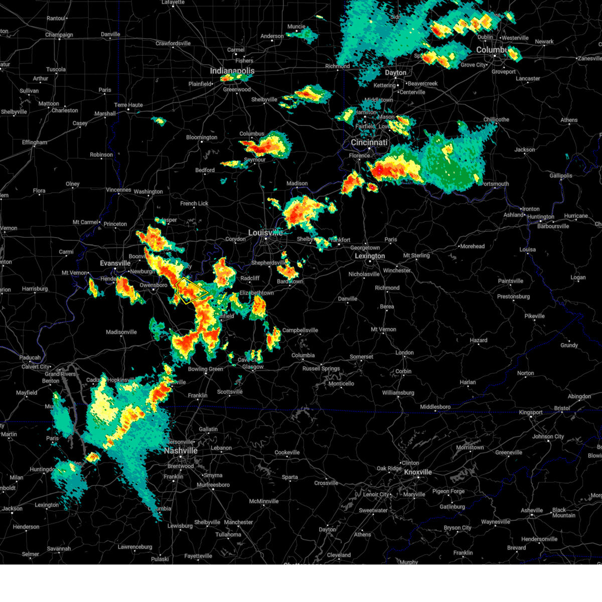 The severe thunderstorm warning for southeastern hancock, west central breckinridge and northeastern ohio counties will expire at 545 pm cdt, the storm which prompted the warning has weakened below severe limits, and no longer poses an immediate threat to life or property. therefore, the warning will be allowed to expire. however, small hail, gusty winds and heavy rain are still possible with this thunderstorm. a severe thunderstorm watch remains in effect until 900 pm cdt for south central indiana, and central kentucky. The severe thunderstorm warning for southeastern hancock, west central breckinridge and northeastern ohio counties will expire at 545 pm cdt, the storm which prompted the warning has weakened below severe limits, and no longer poses an immediate threat to life or property. therefore, the warning will be allowed to expire. however, small hail, gusty winds and heavy rain are still possible with this thunderstorm. a severe thunderstorm watch remains in effect until 900 pm cdt for south central indiana, and central kentucky.
|
| 7/24/2023 5:17 PM CDT |
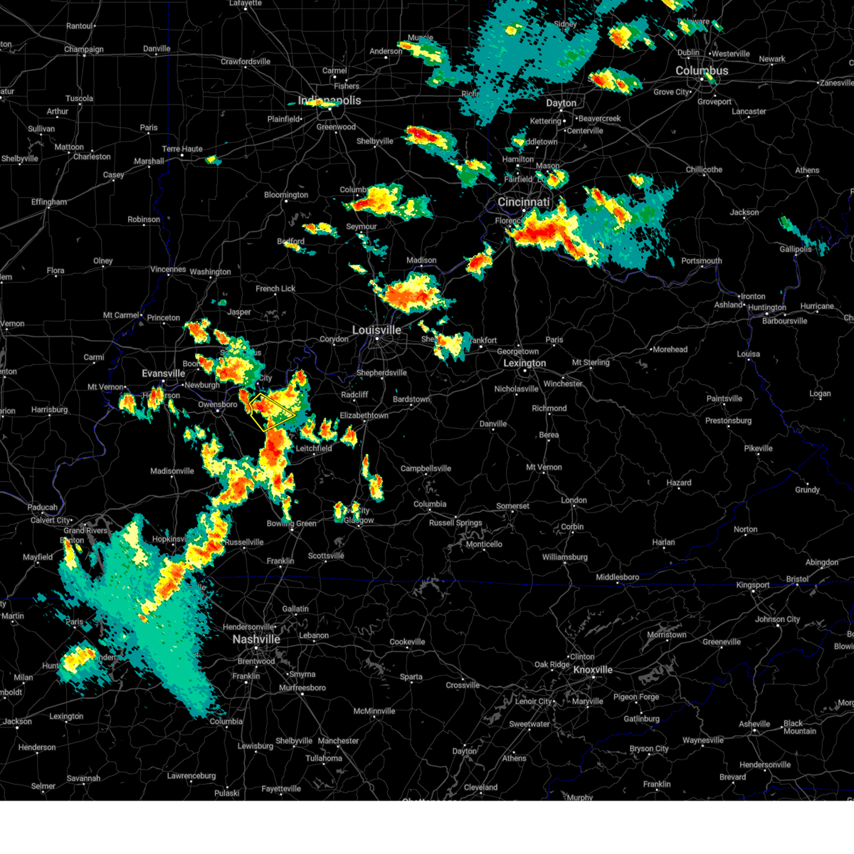 At 517 pm cdt, a severe thunderstorm was located 8 miles south of hawesville, moving southeast at 20 mph (radar indicated). Hazards include 60 mph wind gusts and penny size hail. expect damage to roofs, siding, and trees At 517 pm cdt, a severe thunderstorm was located 8 miles south of hawesville, moving southeast at 20 mph (radar indicated). Hazards include 60 mph wind gusts and penny size hail. expect damage to roofs, siding, and trees
|
| 7/2/2023 1:01 PM CDT |
 At 100 pm cdt, a severe thunderstorm was located near hawesville, moving northeast at 25 mph (radar indicated). Hazards include 60 mph wind gusts and quarter size hail. Hail damage to vehicles is expected. expect wind damage to roofs, siding, and trees. locations impacted include, cannelton, cloverport, skillman, deanefield, dodd, victoria crossroads, tobinsport, sunny corner, lauer and tar fork. hail threat, radar indicated max hail size, 1. 00 in wind threat, radar indicated max wind gust, 60 mph. At 100 pm cdt, a severe thunderstorm was located near hawesville, moving northeast at 25 mph (radar indicated). Hazards include 60 mph wind gusts and quarter size hail. Hail damage to vehicles is expected. expect wind damage to roofs, siding, and trees. locations impacted include, cannelton, cloverport, skillman, deanefield, dodd, victoria crossroads, tobinsport, sunny corner, lauer and tar fork. hail threat, radar indicated max hail size, 1. 00 in wind threat, radar indicated max wind gust, 60 mph.
|
| 7/2/2023 12:45 PM CDT |
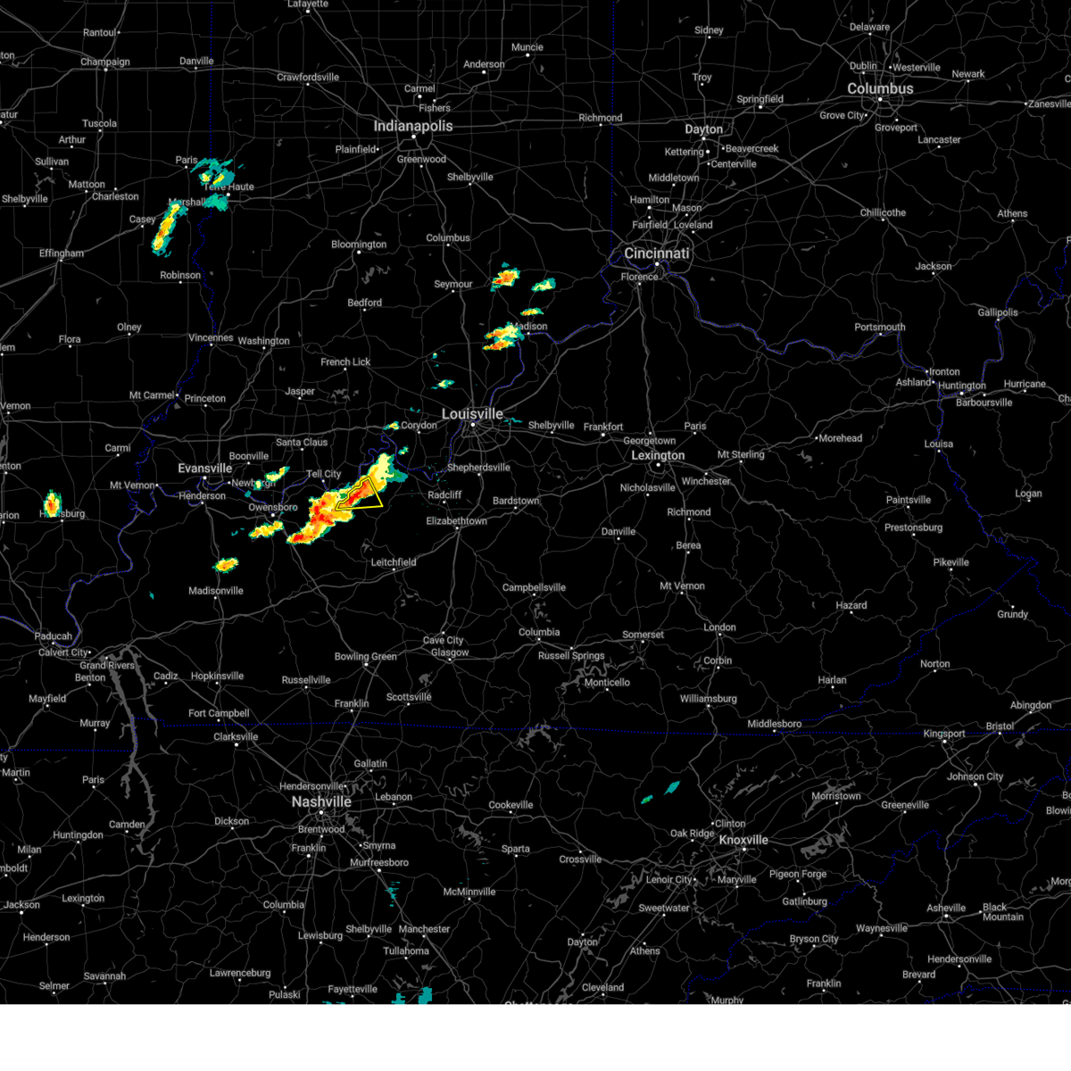 At 1244 pm cdt, a severe thunderstorm was located 8 miles north of hardinsburg, moving east at 30 mph (radar indicated). Hazards include ping pong ball size hail and 60 mph wind gusts. People and animals outdoors will be injured. expect hail damage to roofs, siding, windows, and vehicles. expect wind damage to roofs, siding, and trees. locations impacted include, cloverport, mystic, sample, union star, ammons, stephensport and rome. hail threat, radar indicated max hail size, 1. 50 in wind threat, radar indicated max wind gust, 60 mph. At 1244 pm cdt, a severe thunderstorm was located 8 miles north of hardinsburg, moving east at 30 mph (radar indicated). Hazards include ping pong ball size hail and 60 mph wind gusts. People and animals outdoors will be injured. expect hail damage to roofs, siding, windows, and vehicles. expect wind damage to roofs, siding, and trees. locations impacted include, cloverport, mystic, sample, union star, ammons, stephensport and rome. hail threat, radar indicated max hail size, 1. 50 in wind threat, radar indicated max wind gust, 60 mph.
|
| 7/2/2023 12:32 PM CDT |
 At 1232 pm cdt, a severe thunderstorm was located over knottsville, moving northeast at 25 mph (radar indicated). Hazards include 60 mph wind gusts and quarter size hail. Hail damage to vehicles is expected. Expect wind damage to roofs, siding, and trees. At 1232 pm cdt, a severe thunderstorm was located over knottsville, moving northeast at 25 mph (radar indicated). Hazards include 60 mph wind gusts and quarter size hail. Hail damage to vehicles is expected. Expect wind damage to roofs, siding, and trees.
|
| 7/2/2023 12:29 PM CDT | Quarter sized hail reported 0.8 miles SSE of Cloverport, KY |
| 7/2/2023 12:16 PM CDT |
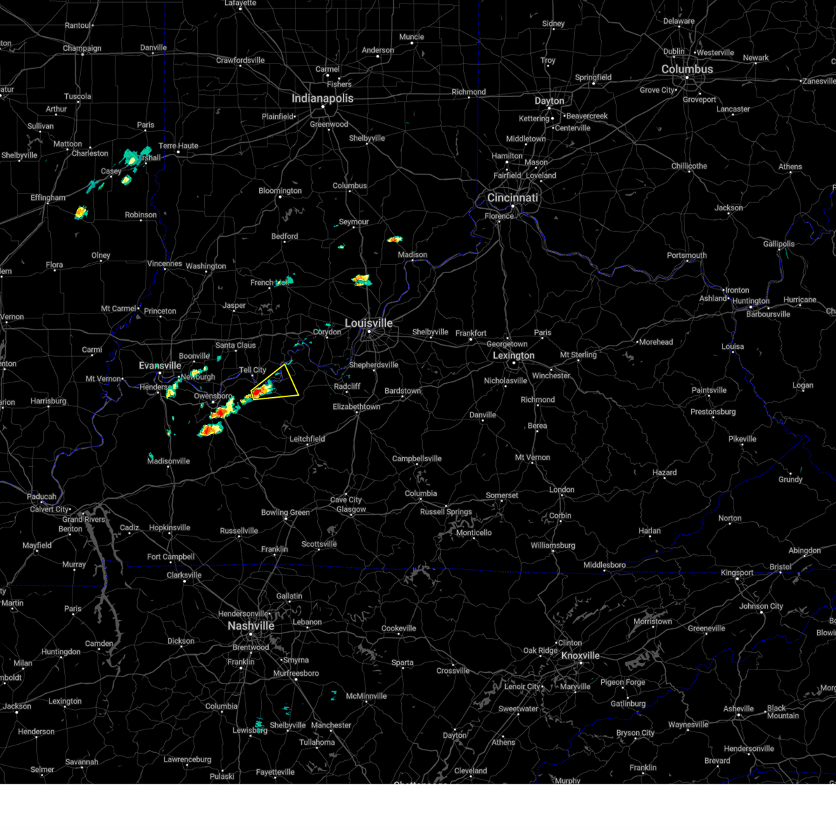 At 1215 pm cdt, a severe thunderstorm was located near hawesville, moving east at 30 mph (radar indicated). Hazards include ping pong ball size hail and 60 mph wind gusts. People and animals outdoors will be injured. expect hail damage to roofs, siding, windows, and vehicles. Expect wind damage to roofs, siding, and trees. At 1215 pm cdt, a severe thunderstorm was located near hawesville, moving east at 30 mph (radar indicated). Hazards include ping pong ball size hail and 60 mph wind gusts. People and animals outdoors will be injured. expect hail damage to roofs, siding, windows, and vehicles. Expect wind damage to roofs, siding, and trees.
|
| 7/2/2023 12:16 PM CDT |
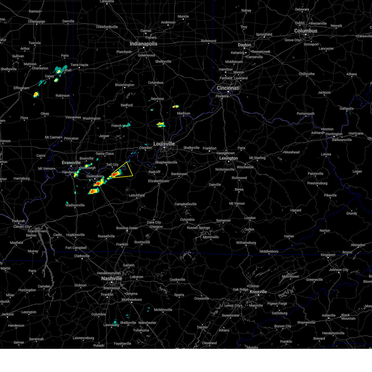 At 1215 pm cdt, a severe thunderstorm was located near hawesville, moving east at 30 mph (radar indicated). Hazards include ping pong ball size hail and 60 mph wind gusts. People and animals outdoors will be injured. expect hail damage to roofs, siding, windows, and vehicles. Expect wind damage to roofs, siding, and trees. At 1215 pm cdt, a severe thunderstorm was located near hawesville, moving east at 30 mph (radar indicated). Hazards include ping pong ball size hail and 60 mph wind gusts. People and animals outdoors will be injured. expect hail damage to roofs, siding, windows, and vehicles. Expect wind damage to roofs, siding, and trees.
|
| 6/29/2023 8:15 PM CDT |
 At 813 pm cdt, a severe thunderstorm was located near patesville, moving southeast at 45 mph (radar indicated). Hazards include 60 mph wind gusts and quarter size hail. Hail damage to vehicles is expected. Expect wind damage to roofs, siding, and trees. At 813 pm cdt, a severe thunderstorm was located near patesville, moving southeast at 45 mph (radar indicated). Hazards include 60 mph wind gusts and quarter size hail. Hail damage to vehicles is expected. Expect wind damage to roofs, siding, and trees.
|
| 6/29/2023 4:57 PM EDT |
 The severe thunderstorm warning for harrison, southeastern perry, northwestern meade, east central hancock and northwestern breckinridge counties will expire at 500 pm edt/400 pm cdt/, the storms which prompted the warning have moved out of the area. therefore, the warning will be allowed to expire. a severe thunderstorm watch remains in effect until 800 pm edt/700 pm cdt/ for south central indiana. a severe thunderstorm watch also remains in effect until 900 pm edt/800 pm cdt/ for south central indiana, and central kentucky. The severe thunderstorm warning for harrison, southeastern perry, northwestern meade, east central hancock and northwestern breckinridge counties will expire at 500 pm edt/400 pm cdt/, the storms which prompted the warning have moved out of the area. therefore, the warning will be allowed to expire. a severe thunderstorm watch remains in effect until 800 pm edt/700 pm cdt/ for south central indiana. a severe thunderstorm watch also remains in effect until 900 pm edt/800 pm cdt/ for south central indiana, and central kentucky.
|
| 6/29/2023 4:51 PM EDT |
 At 451 pm edt/351 pm cdt/, severe thunderstorms were located along a line extending from near corydon to 7 miles east of whitesville, moving southeast at 55 mph (radar indicated). Hazards include 60 mph wind gusts. Expect damage to roofs, siding, and trees. locations impacted include, corydon, hawesville, cannelton, cloverport, lanesville, crandall, new middletown, mauckport, new amsterdam and frymire. hail threat, radar indicated max hail size, <. 75 in wind threat, radar indicated max wind gust, 60 mph. At 451 pm edt/351 pm cdt/, severe thunderstorms were located along a line extending from near corydon to 7 miles east of whitesville, moving southeast at 55 mph (radar indicated). Hazards include 60 mph wind gusts. Expect damage to roofs, siding, and trees. locations impacted include, corydon, hawesville, cannelton, cloverport, lanesville, crandall, new middletown, mauckport, new amsterdam and frymire. hail threat, radar indicated max hail size, <. 75 in wind threat, radar indicated max wind gust, 60 mph.
|
| 6/29/2023 3:25 PM CDT |
 At 425 pm edt/325 pm cdt/, severe thunderstorms were located along a line extending from 7 miles northeast of english to near grandview, moving southeast at 55 mph (trained weather spotters). Hazards include 60 mph wind gusts and penny size hail. Expect damage to roofs, siding, and trees. locations impacted include, tell city, corydon, hawesville, carefree town, mount pleasant, lewisport, cannelton, cloverport, palmyra and marengo. hail threat, radar indicated max hail size, 0. 75 in wind threat, observed max wind gust, 60 mph. At 425 pm edt/325 pm cdt/, severe thunderstorms were located along a line extending from 7 miles northeast of english to near grandview, moving southeast at 55 mph (trained weather spotters). Hazards include 60 mph wind gusts and penny size hail. Expect damage to roofs, siding, and trees. locations impacted include, tell city, corydon, hawesville, carefree town, mount pleasant, lewisport, cannelton, cloverport, palmyra and marengo. hail threat, radar indicated max hail size, 0. 75 in wind threat, observed max wind gust, 60 mph.
|
| 6/29/2023 3:13 PM CDT |
 At 412 pm edt/312 pm cdt/, severe thunderstorms were located along a line extending from near paoli to near folsomville, moving southeast at 55 mph (radar indicated). Hazards include 60 mph wind gusts and penny size hail. expect damage to roofs, siding, and trees At 412 pm edt/312 pm cdt/, severe thunderstorms were located along a line extending from near paoli to near folsomville, moving southeast at 55 mph (radar indicated). Hazards include 60 mph wind gusts and penny size hail. expect damage to roofs, siding, and trees
|
| 6/29/2023 8:56 AM CDT |
 At 853 am cdt, a severe thunderstorm was located near grandview, moving southeast at 25 mph (radar indicated). Hazards include 70 mph wind gusts and half dollar size hail. Hail damage to vehicles is expected. expect considerable tree damage. wind damage is also likely to mobile homes, roofs, and outbuildings. locations impacted include, tell city, hawesville, lewisport, cannelton, cloverport, troy, skillman, goering, pellville and dodd. thunderstorm damage threat, considerable hail threat, radar indicated max hail size, 1. 25 in wind threat, radar indicated max wind gust, 70 mph. At 853 am cdt, a severe thunderstorm was located near grandview, moving southeast at 25 mph (radar indicated). Hazards include 70 mph wind gusts and half dollar size hail. Hail damage to vehicles is expected. expect considerable tree damage. wind damage is also likely to mobile homes, roofs, and outbuildings. locations impacted include, tell city, hawesville, lewisport, cannelton, cloverport, troy, skillman, goering, pellville and dodd. thunderstorm damage threat, considerable hail threat, radar indicated max hail size, 1. 25 in wind threat, radar indicated max wind gust, 70 mph.
|
| 6/29/2023 8:39 AM CDT |
 At 838 am cdt, a severe thunderstorm was located near grandview, moving southeast at 30 mph (radar indicated). Hazards include 60 mph wind gusts and half dollar size hail. Hail damage to vehicles is expected. Expect wind damage to roofs, siding, and trees. At 838 am cdt, a severe thunderstorm was located near grandview, moving southeast at 30 mph (radar indicated). Hazards include 60 mph wind gusts and half dollar size hail. Hail damage to vehicles is expected. Expect wind damage to roofs, siding, and trees.
|
| 6/25/2023 8:56 PM CDT |
 At 856 pm cdt, severe thunderstorms were located along a line extending from near tell city to near owensboro, moving east at 30 mph (radar indicated). Hazards include quarter size hail. damage to vehicles is expected At 856 pm cdt, severe thunderstorms were located along a line extending from near tell city to near owensboro, moving east at 30 mph (radar indicated). Hazards include quarter size hail. damage to vehicles is expected
|
| 4/5/2023 3:28 PM CDT |
 The severe thunderstorm warning for perry, hancock, western breckinridge and northeastern ohio counties will expire at 330 pm cdt, the storms which prompted the warning have moved out of the area. therefore, the warning will be allowed to expire. however gusty winds are still possible with these thunderstorms. a tornado watch remains in effect until 400 pm cdt for south central indiana, and central kentucky. a severe thunderstorm watch remains in effect until 900 pm cdt for central kentucky. to report severe weather, contact your nearest law enforcement agency. they will relay your report to the national weather service louisville. remember, a severe thunderstorm warning still remains in effect for breckinridge county in kentucky and eastern perry county in indiana. The severe thunderstorm warning for perry, hancock, western breckinridge and northeastern ohio counties will expire at 330 pm cdt, the storms which prompted the warning have moved out of the area. therefore, the warning will be allowed to expire. however gusty winds are still possible with these thunderstorms. a tornado watch remains in effect until 400 pm cdt for south central indiana, and central kentucky. a severe thunderstorm watch remains in effect until 900 pm cdt for central kentucky. to report severe weather, contact your nearest law enforcement agency. they will relay your report to the national weather service louisville. remember, a severe thunderstorm warning still remains in effect for breckinridge county in kentucky and eastern perry county in indiana.
|
| 4/5/2023 3:23 PM CDT | Large tree reported down on a house in stephensport. time estimated from rada in breckinridge county KY, 8.2 miles SW of Cloverport, KY |
| 4/5/2023 2:59 PM CDT |
 At 258 pm cdt, severe thunderstorms were located along a line extending from near santa claus to near masonville, moving east at 45 mph (radar indicated). Hazards include 60 mph wind gusts. Expect damage to roofs, siding, and trees. These severe thunderstorms will remain over mainly rural areas of perry, hancock, western breckinridge and northeastern ohio counties, including the following locations, ranger, mcquady, skillman, goering, gerald, tar fork, rome, arrington corner, dexter and mattingly. At 258 pm cdt, severe thunderstorms were located along a line extending from near santa claus to near masonville, moving east at 45 mph (radar indicated). Hazards include 60 mph wind gusts. Expect damage to roofs, siding, and trees. These severe thunderstorms will remain over mainly rural areas of perry, hancock, western breckinridge and northeastern ohio counties, including the following locations, ranger, mcquady, skillman, goering, gerald, tar fork, rome, arrington corner, dexter and mattingly.
|
| 3/3/2023 1:13 PM CST |
 At 213 pm est/113 pm cst/, severe thunderstorms were located along a line extending from tell city to 9 miles southwest of leitchfield, moving northeast at 70 mph (radar indicated). Hazards include 70 mph wind gusts. Expect considerable tree damage. damage is likely to mobile homes, roofs, and outbuildings. Locations impacted include, tell city, leitchfield, hardinsburg, hawesville, webster, cannelton, irvington, cloverport, clarkson and leopold. At 213 pm est/113 pm cst/, severe thunderstorms were located along a line extending from tell city to 9 miles southwest of leitchfield, moving northeast at 70 mph (radar indicated). Hazards include 70 mph wind gusts. Expect considerable tree damage. damage is likely to mobile homes, roofs, and outbuildings. Locations impacted include, tell city, leitchfield, hardinsburg, hawesville, webster, cannelton, irvington, cloverport, clarkson and leopold.
|
| 3/3/2023 1:02 PM CST |
 At 201 pm est/101 pm cst/, severe thunderstorms were located along a line extending from near hawesville to 6 miles east of morgantown, moving northeast at 75 mph. these are destructive storms! (radar indicated). Hazards include 80 mph wind gusts. Flying debris will be dangerous to those caught without shelter. mobile homes will be heavily damaged. expect considerable damage to roofs, windows, and vehicles. extensive tree damage and power outages are likely. Locations impacted include, tell city, hawesville and leitchfield. At 201 pm est/101 pm cst/, severe thunderstorms were located along a line extending from near hawesville to 6 miles east of morgantown, moving northeast at 75 mph. these are destructive storms! (radar indicated). Hazards include 80 mph wind gusts. Flying debris will be dangerous to those caught without shelter. mobile homes will be heavily damaged. expect considerable damage to roofs, windows, and vehicles. extensive tree damage and power outages are likely. Locations impacted include, tell city, hawesville and leitchfield.
|
| 3/3/2023 12:40 PM CST |
 At 140 pm est/1240 pm cst/, severe thunderstorms were located along a line extending from 6 miles north of livermore to near russellville, moving northeast at 80 mph. these are destructive storms! (radar indicated). Hazards include 80 mph wind gusts. Flying debris will be dangerous to those caught without shelter. mobile homes will be heavily damaged. expect considerable damage to roofs, windows, and vehicles. extensive tree damage and power outages are likely. severe thunderstorms will be near, morgantown and hawesville around 100 pm cst. other locations in the path of these severe thunderstorms include tell city and leitchfield. thunderstorm damage threat, destructive hail threat, radar indicated max hail size, <. 75 in wind threat, radar indicated max wind gust, 80 mph. At 140 pm est/1240 pm cst/, severe thunderstorms were located along a line extending from 6 miles north of livermore to near russellville, moving northeast at 80 mph. these are destructive storms! (radar indicated). Hazards include 80 mph wind gusts. Flying debris will be dangerous to those caught without shelter. mobile homes will be heavily damaged. expect considerable damage to roofs, windows, and vehicles. extensive tree damage and power outages are likely. severe thunderstorms will be near, morgantown and hawesville around 100 pm cst. other locations in the path of these severe thunderstorms include tell city and leitchfield. thunderstorm damage threat, destructive hail threat, radar indicated max hail size, <. 75 in wind threat, radar indicated max wind gust, 80 mph.
|
| 3/3/2023 11:41 AM CST |
 At 1140 am cst, a severe thunderstorm capable of producing a tornado was located 8 miles east of hartford, moving northeast at 75 mph (radar indicated rotation). Hazards include tornado. Flying debris will be dangerous to those caught without shelter. mobile homes will be damaged or destroyed. damage to roofs, windows, and vehicles will occur. tree damage is likely. This tornadic thunderstorm will remain over mainly rural areas of southeastern hancock, southwestern breckinridge and northeastern ohio counties, including the following locations, mcquady, shreve, magan, tar fork, jingo, cabot, rosine, vanzant, ellmitch and sulphur springs. At 1140 am cst, a severe thunderstorm capable of producing a tornado was located 8 miles east of hartford, moving northeast at 75 mph (radar indicated rotation). Hazards include tornado. Flying debris will be dangerous to those caught without shelter. mobile homes will be damaged or destroyed. damage to roofs, windows, and vehicles will occur. tree damage is likely. This tornadic thunderstorm will remain over mainly rural areas of southeastern hancock, southwestern breckinridge and northeastern ohio counties, including the following locations, mcquady, shreve, magan, tar fork, jingo, cabot, rosine, vanzant, ellmitch and sulphur springs.
|
| 3/3/2023 11:25 AM CST |
 At 1125 am cst, severe thunderstorms capable of producing both tornadoes and extensive straight line wind damage were located 10 miles east of central city, moving northeast at 85 mph (radar indicated rotation). Hazards include tornado. Flying debris will be dangerous to those caught without shelter. mobile homes will be damaged or destroyed. damage to roofs, windows, and vehicles will occur. tree damage is likely. These dangerous storms will be near, hartford around 1135 am cst. At 1125 am cst, severe thunderstorms capable of producing both tornadoes and extensive straight line wind damage were located 10 miles east of central city, moving northeast at 85 mph (radar indicated rotation). Hazards include tornado. Flying debris will be dangerous to those caught without shelter. mobile homes will be damaged or destroyed. damage to roofs, windows, and vehicles will occur. tree damage is likely. These dangerous storms will be near, hartford around 1135 am cst.
|
| 1/12/2023 4:56 AM CST |
 At 456 am cst, severe thunderstorms were located along a line extending from near eureka to near masonville to near livermore to near graham, moving northeast at 70 mph (radar indicated). Hazards include 60 mph wind gusts. Expect damage to roofs, siding, and trees. Severe thunderstorms will be near, tell city, hartford and hawesville around 515 am cst. At 456 am cst, severe thunderstorms were located along a line extending from near eureka to near masonville to near livermore to near graham, moving northeast at 70 mph (radar indicated). Hazards include 60 mph wind gusts. Expect damage to roofs, siding, and trees. Severe thunderstorms will be near, tell city, hartford and hawesville around 515 am cst.
|
| 6/17/2022 8:58 AM CDT |
 The severe thunderstorm warning for southern perry, hancock, western breckinridge and northeastern ohio counties will expire at 900 am cdt, the storms which prompted the warning have weakened below severe limits, and no longer pose an immediate threat to life or property. therefore, the warning will be allowed to expire. a severe thunderstorm watch remains in effect until 1100 am cdt for south central indiana, and central kentucky. The severe thunderstorm warning for southern perry, hancock, western breckinridge and northeastern ohio counties will expire at 900 am cdt, the storms which prompted the warning have weakened below severe limits, and no longer pose an immediate threat to life or property. therefore, the warning will be allowed to expire. a severe thunderstorm watch remains in effect until 1100 am cdt for south central indiana, and central kentucky.
|
| 6/17/2022 8:50 AM CDT |
 At 850 am cdt, severe thunderstorms were located along a line extending from 12 miles west of brandenburg to 9 miles southeast of whitesville, moving east at 45 mph (radar indicated). Hazards include 60 mph wind gusts. Expect damage to roofs, siding, and trees. locations impacted include, tell city, hawesville, cannelton, cloverport, fordsville, frymire, skillman, goering, ralph and gerald. hail threat, radar indicated max hail size, <. 75 in wind threat, radar indicated max wind gust, 60 mph. At 850 am cdt, severe thunderstorms were located along a line extending from 12 miles west of brandenburg to 9 miles southeast of whitesville, moving east at 45 mph (radar indicated). Hazards include 60 mph wind gusts. Expect damage to roofs, siding, and trees. locations impacted include, tell city, hawesville, cannelton, cloverport, fordsville, frymire, skillman, goering, ralph and gerald. hail threat, radar indicated max hail size, <. 75 in wind threat, radar indicated max wind gust, 60 mph.
|
| 6/17/2022 8:14 AM CDT |
 At 813 am cdt, severe thunderstorms were located along a line extending from santa claus to near st. joseph, moving east at 45 mph (radar indicated). Hazards include 60 mph wind gusts. Expect damage to roofs, siding, and trees. these severe thunderstorms will remain over mainly rural areas of southern perry, hancock, western breckinridge and northeastern ohio counties, including the following locations, frymire, skillman, goering, ralph, gerald, tar fork, rome, vanzant, ellmitch and arrington corner. hail threat, radar indicated max hail size, <. 75 in wind threat, radar indicated max wind gust, 60 mph. At 813 am cdt, severe thunderstorms were located along a line extending from santa claus to near st. joseph, moving east at 45 mph (radar indicated). Hazards include 60 mph wind gusts. Expect damage to roofs, siding, and trees. these severe thunderstorms will remain over mainly rural areas of southern perry, hancock, western breckinridge and northeastern ohio counties, including the following locations, frymire, skillman, goering, ralph, gerald, tar fork, rome, vanzant, ellmitch and arrington corner. hail threat, radar indicated max hail size, <. 75 in wind threat, radar indicated max wind gust, 60 mph.
|
| 5/19/2022 5:02 PM CDT |
 At 502 pm cdt, a severe thunderstorm was located near hardinsburg, moving northeast at 30 mph (radar indicated). Hazards include 60 mph wind gusts and half dollar size hail. Hail damage to vehicles is expected. expect wind damage to roofs, siding, and trees. this severe thunderstorm will be near, hardinsburg around 515 pm cdt. hail threat, radar indicated max hail size, 1. 25 in wind threat, radar indicated max wind gust, 60 mph. At 502 pm cdt, a severe thunderstorm was located near hardinsburg, moving northeast at 30 mph (radar indicated). Hazards include 60 mph wind gusts and half dollar size hail. Hail damage to vehicles is expected. expect wind damage to roofs, siding, and trees. this severe thunderstorm will be near, hardinsburg around 515 pm cdt. hail threat, radar indicated max hail size, 1. 25 in wind threat, radar indicated max wind gust, 60 mph.
|
| 5/19/2022 1:58 PM CDT |
 At 158 pm cdt, a severe thunderstorm was located 8 miles southeast of hawesville, moving northeast at 20 mph (radar indicated). Hazards include 60 mph wind gusts and penny size hail. Expect damage to roofs, siding, and trees. Locations impacted include, hardinsburg, cloverport, mystic, skillman, sample, gerald, dodd, tobinsport, clifton mills and holt. At 158 pm cdt, a severe thunderstorm was located 8 miles southeast of hawesville, moving northeast at 20 mph (radar indicated). Hazards include 60 mph wind gusts and penny size hail. Expect damage to roofs, siding, and trees. Locations impacted include, hardinsburg, cloverport, mystic, skillman, sample, gerald, dodd, tobinsport, clifton mills and holt.
|
| 5/19/2022 1:44 PM CDT |
 At 144 pm cdt, a severe thunderstorm was located 8 miles southeast of hawesville, moving northeast at 20 mph (radar indicated). Hazards include 70 mph wind gusts and half dollar size hail. Hail damage to vehicles is expected. expect considerable tree damage. Wind damage is also likely to mobile homes, roofs, and outbuildings. At 144 pm cdt, a severe thunderstorm was located 8 miles southeast of hawesville, moving northeast at 20 mph (radar indicated). Hazards include 70 mph wind gusts and half dollar size hail. Hail damage to vehicles is expected. expect considerable tree damage. Wind damage is also likely to mobile homes, roofs, and outbuildings.
|
| 12/10/2021 11:32 PM CST | Report of large tree down in cloverport on 10 in breckinridge county KY, 0.3 miles ESE of Cloverport, KY |
| 7/10/2021 5:00 PM CDT |
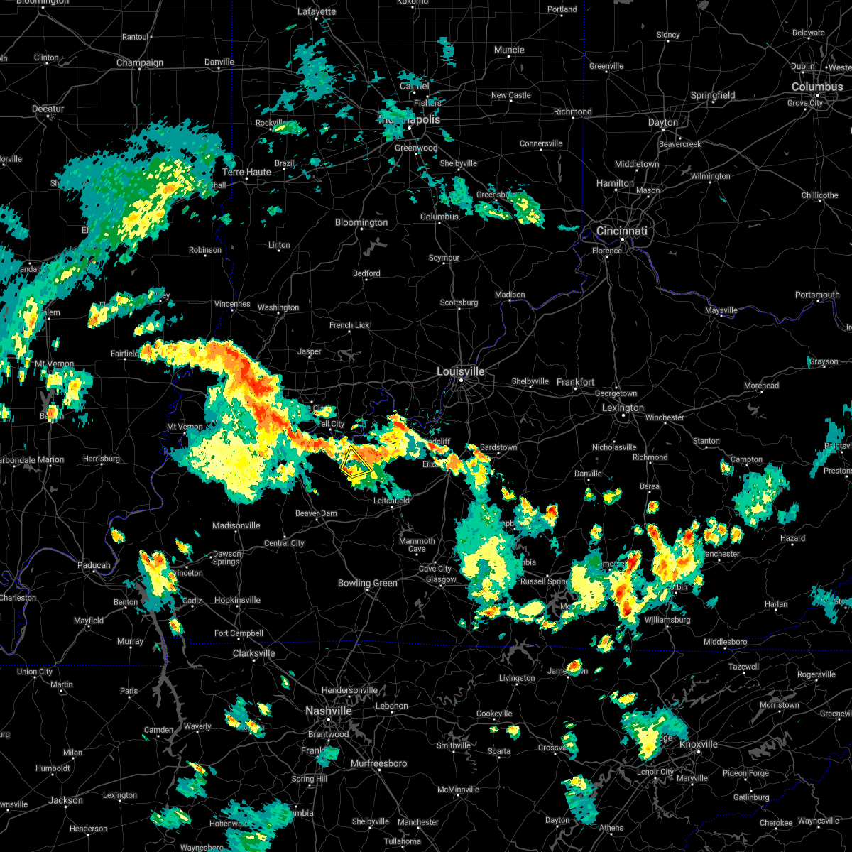 At 500 pm cdt, a severe thunderstorm was located 8 miles southwest of hardinsburg, moving northeast at 25 mph (radar indicated). Hazards include 60 mph wind gusts and penny size hail. Expect damage to roofs, siding, and trees. Locations impacted include, cloverport, tar fork, mcquady, kirk and mattingly. At 500 pm cdt, a severe thunderstorm was located 8 miles southwest of hardinsburg, moving northeast at 25 mph (radar indicated). Hazards include 60 mph wind gusts and penny size hail. Expect damage to roofs, siding, and trees. Locations impacted include, cloverport, tar fork, mcquady, kirk and mattingly.
|
| 7/10/2021 4:39 PM CDT |
 At 439 pm cdt, a severe thunderstorm was located 9 miles east of whitesville, moving northeast at 25 mph (radar indicated). Hazards include 60 mph wind gusts and penny size hail. Expect damage to roofs, siding, and trees. This severe thunderstorm will remain over mainly rural areas of southeastern hancock, southwestern breckinridge and northeastern ohio counties, including the following locations, tar fork, mcquady, cabot, kirk, vanzant, ellmitch, easton, askin, fordsville and victoria crossroads. At 439 pm cdt, a severe thunderstorm was located 9 miles east of whitesville, moving northeast at 25 mph (radar indicated). Hazards include 60 mph wind gusts and penny size hail. Expect damage to roofs, siding, and trees. This severe thunderstorm will remain over mainly rural areas of southeastern hancock, southwestern breckinridge and northeastern ohio counties, including the following locations, tar fork, mcquady, cabot, kirk, vanzant, ellmitch, easton, askin, fordsville and victoria crossroads.
|
| 10/26/2019 4:22 PM CDT |
 At 520 pm edt/420 pm cdt/, severe thunderstorms were located along a line extending from near grandview to near hardinsburg, moving north at 70 mph (radar indicated). Hazards include 65 mph wind gusts. expect damage to roofs, siding, and trees At 520 pm edt/420 pm cdt/, severe thunderstorms were located along a line extending from near grandview to near hardinsburg, moving north at 70 mph (radar indicated). Hazards include 65 mph wind gusts. expect damage to roofs, siding, and trees
|
| 10/26/2019 4:22 PM CDT |
 At 421 pm cdt, thunderstorms located along a line extending from 6 miles east of knottsville to 7 miles southwest of hardinsburg to 11 miles northwest of leitchfield, moving northeast at 60 mph (kentucky mesonet). Hazards include 60 mph wind gusts. Expect damage to roofs, siding, and trees. Locations impacted include, hardinsburg, hawesville, cloverport, concord, mcquady, goering, se ree, westview, pellville and buras. At 421 pm cdt, thunderstorms located along a line extending from 6 miles east of knottsville to 7 miles southwest of hardinsburg to 11 miles northwest of leitchfield, moving northeast at 60 mph (kentucky mesonet). Hazards include 60 mph wind gusts. Expect damage to roofs, siding, and trees. Locations impacted include, hardinsburg, hawesville, cloverport, concord, mcquady, goering, se ree, westview, pellville and buras.
|
| 10/26/2019 4:22 PM CDT |
 At 520 pm edt/420 pm cdt/, severe thunderstorms were located along a line extending from near grandview to near hardinsburg, moving north at 70 mph (radar indicated). Hazards include 65 mph wind gusts. expect damage to roofs, siding, and trees At 520 pm edt/420 pm cdt/, severe thunderstorms were located along a line extending from near grandview to near hardinsburg, moving north at 70 mph (radar indicated). Hazards include 65 mph wind gusts. expect damage to roofs, siding, and trees
|
| 10/26/2019 4:05 PM CDT |
 At 404 pm cdt, severe thunderstorms were located along a line extending from 7 miles southeast of masonville to 10 miles northeast of hartford to 13 miles north of morgantown, moving northeast at 60 mph (kentucky mesonet). Hazards include 60 mph wind gusts. expect damage to roofs, siding, and trees At 404 pm cdt, severe thunderstorms were located along a line extending from 7 miles southeast of masonville to 10 miles northeast of hartford to 13 miles north of morgantown, moving northeast at 60 mph (kentucky mesonet). Hazards include 60 mph wind gusts. expect damage to roofs, siding, and trees
|
| 8/20/2019 2:52 PM CDT |
 At 351 pm edt/251 pm cdt/, a severe thunderstorm was located near english, moving southeast at 35 mph (radar indicated). Hazards include 60 mph wind gusts. expect damage to roofs, siding, and trees At 351 pm edt/251 pm cdt/, a severe thunderstorm was located near english, moving southeast at 35 mph (radar indicated). Hazards include 60 mph wind gusts. expect damage to roofs, siding, and trees
|
| 8/20/2019 2:52 PM CDT |
 The national weather service in louisville has issued a * severe thunderstorm warning for. northwestern harrison county in south central indiana. eastern crawford county in south central indiana. perry county in south central indiana. Northwestern meade county in central kentucky. The national weather service in louisville has issued a * severe thunderstorm warning for. northwestern harrison county in south central indiana. eastern crawford county in south central indiana. perry county in south central indiana. Northwestern meade county in central kentucky.
|
| 6/30/2019 7:41 PM CDT | Tree down in the 200 block of 7th s in breckinridge county KY, 0.3 miles ESE of Cloverport, KY |
| 6/30/2019 7:41 PM CDT | Large cedar tree down on hwy 60 near ky 14 in breckinridge county KY, 0.8 miles E of Cloverport, KY |
| 6/30/2019 7:40 PM CDT | Tree on house in cloverport with electric lines downed as a resul in breckinridge county KY, 0.3 miles ESE of Cloverport, KY |
| 6/30/2019 7:37 PM CDT | Trees down around stephensbur in breckinridge county KY, 7.6 miles SW of Cloverport, KY |
| 6/23/2019 7:23 PM CDT |
 The severe thunderstorm warning for southern perry, central meade, eastern hancock, grayson, west central hardin and breckinridge counties will expire at 830 pm edt/730 pm cdt/, the storms which prompted the warning have weakened below severe limits, and no longer pose an immediate threat to life or property. therefore, the warning will be allowed to expire. however gusty winds and heavy rain are still possible with these thunderstorms. report severe weather to local law enforcement, post your report to the national weather service louisville facebook page, or tweet your report using hashtag l, m, k, spotter. The severe thunderstorm warning for southern perry, central meade, eastern hancock, grayson, west central hardin and breckinridge counties will expire at 830 pm edt/730 pm cdt/, the storms which prompted the warning have weakened below severe limits, and no longer pose an immediate threat to life or property. therefore, the warning will be allowed to expire. however gusty winds and heavy rain are still possible with these thunderstorms. report severe weather to local law enforcement, post your report to the national weather service louisville facebook page, or tweet your report using hashtag l, m, k, spotter.
|
| 6/23/2019 6:53 PM CDT |
 At 753 pm edt/653 pm cdt/, severe thunderstorms were located along a line extending from near knottsville to 6 miles east of whitesville to 10 miles east of hartford to 9 miles northwest of morgantown, moving northeast at 55 mph (radar indicated). Hazards include 60 mph wind gusts. expect damage to roofs, siding, and trees At 753 pm edt/653 pm cdt/, severe thunderstorms were located along a line extending from near knottsville to 6 miles east of whitesville to 10 miles east of hartford to 9 miles northwest of morgantown, moving northeast at 55 mph (radar indicated). Hazards include 60 mph wind gusts. expect damage to roofs, siding, and trees
|
| 6/23/2019 3:56 PM EDT |
 At 356 pm edt/256 pm cdt/, severe thunderstorms were located along a line extending from near carefree town to 7 miles west of hardinsburg, moving east at 30 mph (radar indicated). Hazards include 70 mph wind gusts and quarter size hail. Hail damage to vehicles is expected. expect considerable tree damage. Wind damage is also likely to mobile homes, roofs, and outbuildings. At 356 pm edt/256 pm cdt/, severe thunderstorms were located along a line extending from near carefree town to 7 miles west of hardinsburg, moving east at 30 mph (radar indicated). Hazards include 70 mph wind gusts and quarter size hail. Hail damage to vehicles is expected. expect considerable tree damage. Wind damage is also likely to mobile homes, roofs, and outbuildings.
|
| 6/23/2019 2:51 PM CDT |
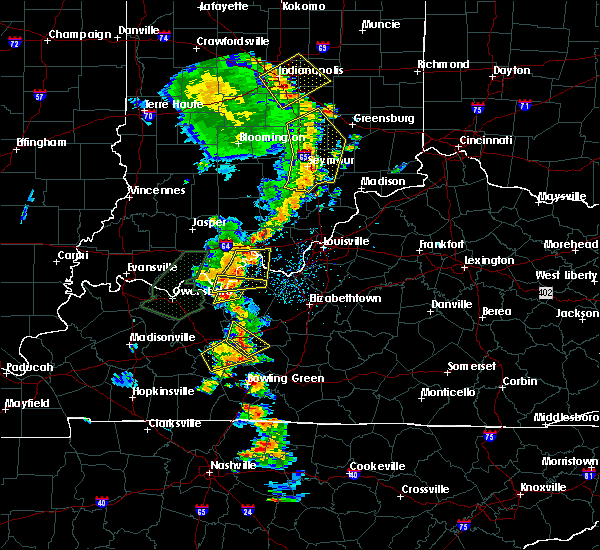 At 251 pm cdt, a severe thunderstorm was located 9 miles southeast of hawesville, moving northeast at 35 mph (radar indicated). Hazards include 60 mph wind gusts and quarter size hail. Hail damage to vehicles is expected. Expect wind damage to roofs, siding, and trees. At 251 pm cdt, a severe thunderstorm was located 9 miles southeast of hawesville, moving northeast at 35 mph (radar indicated). Hazards include 60 mph wind gusts and quarter size hail. Hail damage to vehicles is expected. Expect wind damage to roofs, siding, and trees.
|
| 6/23/2019 2:46 PM CDT |
 At 345 pm edt/245 pm cdt/, a severe thunderstorm was located 7 miles northeast of hawesville, moving east at 50 mph (radar indicated). Hazards include 60 mph wind gusts and quarter size hail. Hail damage to vehicles is expected. Expect wind damage to roofs, siding, and trees. At 345 pm edt/245 pm cdt/, a severe thunderstorm was located 7 miles northeast of hawesville, moving east at 50 mph (radar indicated). Hazards include 60 mph wind gusts and quarter size hail. Hail damage to vehicles is expected. Expect wind damage to roofs, siding, and trees.
|
| 6/21/2019 6:02 PM CDT |
 At 702 pm edt/602 pm cdt/, severe thunderstorms were located along a line extending from 11 miles west of brandenburg to near livermore, moving east at 25 mph (radar indicated). Hazards include 60 mph wind gusts. Expect damage to roofs, siding, and trees. Locations impacted include, hartford, cloverport, fordsville, centertown, frymire, ralph, tar fork, rome, pleasant ridge and heflin. At 702 pm edt/602 pm cdt/, severe thunderstorms were located along a line extending from 11 miles west of brandenburg to near livermore, moving east at 25 mph (radar indicated). Hazards include 60 mph wind gusts. Expect damage to roofs, siding, and trees. Locations impacted include, hartford, cloverport, fordsville, centertown, frymire, ralph, tar fork, rome, pleasant ridge and heflin.
|
| 6/21/2019 5:54 PM CDT | Tree down across state route 1700. time estimated from rada in hancock county KY, 5.6 miles NNE of Cloverport, KY |
| 6/21/2019 5:52 PM CDT |
 At 652 pm edt/552 pm cdt/, severe thunderstorms were located along a line extending from 15 miles west of brandenburg to livermore, moving east at 25 mph (radar indicated). Hazards include 60 mph wind gusts. Expect damage to roofs, siding, and trees. Locations impacted include, tell city, hartford, hawesville, cannelton, cloverport, fordsville, centertown, frymire, skillman and goering. At 652 pm edt/552 pm cdt/, severe thunderstorms were located along a line extending from 15 miles west of brandenburg to livermore, moving east at 25 mph (radar indicated). Hazards include 60 mph wind gusts. Expect damage to roofs, siding, and trees. Locations impacted include, tell city, hartford, hawesville, cannelton, cloverport, fordsville, centertown, frymire, skillman and goering.
|
| 6/21/2019 5:36 PM CDT |
 At 635 pm edt/535 pm cdt/, severe thunderstorms were located along a line extending from 11 miles northeast of tell city to calhoun, moving east at 25 mph (radar indicated). Hazards include 60 mph wind gusts. expect damage to roofs, siding, and trees At 635 pm edt/535 pm cdt/, severe thunderstorms were located along a line extending from 11 miles northeast of tell city to calhoun, moving east at 25 mph (radar indicated). Hazards include 60 mph wind gusts. expect damage to roofs, siding, and trees
|
| 12/31/2018 2:07 PM CST | Trees dow in breckinridge county KY, 8 miles SW of Cloverport, KY |
| 12/31/2018 2:01 PM CST |
 At 301 pm est/201 pm cst/, a severe thunderstorm was located 8 miles east of hawesville, moving northeast at 55 mph (radar indicated). Hazards include 70 mph wind gusts. Expect considerable tree damage. Damage is likely to mobile homes, roofs, and outbuildings. At 301 pm est/201 pm cst/, a severe thunderstorm was located 8 miles east of hawesville, moving northeast at 55 mph (radar indicated). Hazards include 70 mph wind gusts. Expect considerable tree damage. Damage is likely to mobile homes, roofs, and outbuildings.
|
| 12/31/2018 1:55 PM CST | Trees dow in breckinridge county KY, 0.3 miles ESE of Cloverport, KY |
| 8/15/2018 6:39 PM CDT |
 At 738 pm edt/638 pm cdt/, severe thunderstorms were located along a line extending from near new albany to 16 miles east of hardinsburg, moving northeast at 35 mph (trained weather spotters. at 723 pm a trained spotter reported observing a brief funnel cloud south of fordsville). Hazards include 60 mph wind gusts. Expect damage to roofs, siding, and trees. Locations impacted include, corydon, brandenburg, hardinsburg, webster, irvington, cloverport, fordsville, mauckport, new amsterdam and mcquady. At 738 pm edt/638 pm cdt/, severe thunderstorms were located along a line extending from near new albany to 16 miles east of hardinsburg, moving northeast at 35 mph (trained weather spotters. at 723 pm a trained spotter reported observing a brief funnel cloud south of fordsville). Hazards include 60 mph wind gusts. Expect damage to roofs, siding, and trees. Locations impacted include, corydon, brandenburg, hardinsburg, webster, irvington, cloverport, fordsville, mauckport, new amsterdam and mcquady.
|
| 8/15/2018 6:27 PM CDT |
 At 727 pm edt/627 pm cdt/, severe thunderstorms were located along a line extending from 10 miles south of carefree town to 12 miles southeast of whitesville, moving northeast at 35 mph (radar indicated). Hazards include 60 mph wind gusts. Expect damage to roofs, siding, and trees. Locations impacted include, corydon, brandenburg, hardinsburg, webster, irvington, cloverport, fordsville, mauckport, new amsterdam and mcquady. At 727 pm edt/627 pm cdt/, severe thunderstorms were located along a line extending from 10 miles south of carefree town to 12 miles southeast of whitesville, moving northeast at 35 mph (radar indicated). Hazards include 60 mph wind gusts. Expect damage to roofs, siding, and trees. Locations impacted include, corydon, brandenburg, hardinsburg, webster, irvington, cloverport, fordsville, mauckport, new amsterdam and mcquady.
|
| 8/15/2018 6:09 PM CDT |
 The national weather service in louisville has issued a * severe thunderstorm warning for. southwestern harrison county in south central indiana. southern perry county in south central indiana. western meade county in central kentucky. Eastern hancock county in central kentucky. The national weather service in louisville has issued a * severe thunderstorm warning for. southwestern harrison county in south central indiana. southern perry county in south central indiana. western meade county in central kentucky. Eastern hancock county in central kentucky.
|
| 8/15/2018 6:09 PM CDT |
 At 709 pm edt/609 pm cdt/, severe thunderstorms were located along a line extending from 11 miles northeast of tell city to 11 miles southeast of whitesville, moving east at 40 mph (radar indicated). Hazards include 70 mph wind gusts. Expect considerable tree damage. Damage is likely to mobile homes, roofs, and outbuildings. At 709 pm edt/609 pm cdt/, severe thunderstorms were located along a line extending from 11 miles northeast of tell city to 11 miles southeast of whitesville, moving east at 40 mph (radar indicated). Hazards include 70 mph wind gusts. Expect considerable tree damage. Damage is likely to mobile homes, roofs, and outbuildings.
|
| 7/20/2018 9:56 PM CDT |
 At 1055 pm edt/955 pm cdt/, severe thunderstorms were located along a line extending from 8 miles east of hawesville to 11 miles east of hardinsburg to 10 miles north of elizabethtown to near shepherdsville, moving east at 40 mph (radar indicated). Hazards include 70 mph wind gusts and quarter size hail. Hail damage to vehicles is expected. expect considerable tree damage. wind damage is also likely to mobile homes, roofs, and outbuildings. locations impacted include, shepherdsville, hardinsburg, radcliff, vine grove, lebanon junction, irvington, cloverport, muldraugh, west point and ekron. A tornado watch remains in effect until 300 am edt/200 am cdt/ for central kentucky. At 1055 pm edt/955 pm cdt/, severe thunderstorms were located along a line extending from 8 miles east of hawesville to 11 miles east of hardinsburg to 10 miles north of elizabethtown to near shepherdsville, moving east at 40 mph (radar indicated). Hazards include 70 mph wind gusts and quarter size hail. Hail damage to vehicles is expected. expect considerable tree damage. wind damage is also likely to mobile homes, roofs, and outbuildings. locations impacted include, shepherdsville, hardinsburg, radcliff, vine grove, lebanon junction, irvington, cloverport, muldraugh, west point and ekron. A tornado watch remains in effect until 300 am edt/200 am cdt/ for central kentucky.
|
| 7/20/2018 9:40 PM CDT |
 At 1040 pm edt/940 pm cdt/, severe thunderstorms were located along a line extending from near tell city to 7 miles northwest of hardinsburg to 7 miles south of brandenburg to 9 miles southwest of valley station, moving east at 35 mph (radar indicated). Hazards include 60 mph wind gusts and quarter size hail. Hail damage to vehicles is expected. Expect wind damage to roofs, siding, and trees. At 1040 pm edt/940 pm cdt/, severe thunderstorms were located along a line extending from near tell city to 7 miles northwest of hardinsburg to 7 miles south of brandenburg to 9 miles southwest of valley station, moving east at 35 mph (radar indicated). Hazards include 60 mph wind gusts and quarter size hail. Hail damage to vehicles is expected. Expect wind damage to roofs, siding, and trees.
|
| 7/20/2018 9:13 PM CDT |
 At 913 pm cdt, a severe thunderstorm was located near tell city, moving southeast at 45 mph (radar indicated). Hazards include 60 mph wind gusts and quarter size hail. Hail damage to vehicles is expected. Expect wind damage to roofs, siding, and trees. At 913 pm cdt, a severe thunderstorm was located near tell city, moving southeast at 45 mph (radar indicated). Hazards include 60 mph wind gusts and quarter size hail. Hail damage to vehicles is expected. Expect wind damage to roofs, siding, and trees.
|
| 6/26/2018 7:46 PM CDT |
 At 746 pm cdt, severe thunderstorms were located along a line extending from near grandview to 11 miles east of whitesville to 10 miles south of hartford, moving east at 45 mph (radar indicated). Hazards include 60 mph wind gusts. expect damage to roofs, siding, and trees At 746 pm cdt, severe thunderstorms were located along a line extending from near grandview to 11 miles east of whitesville to 10 miles south of hartford, moving east at 45 mph (radar indicated). Hazards include 60 mph wind gusts. expect damage to roofs, siding, and trees
|
| 6/26/2018 11:56 AM CDT |
 The severe thunderstorm warning for southeastern perry, northwestern grayson and western breckinridge counties will expire at noon cdt, the storms which prompted the warning have moved out of the area. therefore the warning will be allowed to expire. a severe thunderstorm watch remains in effect until 300 pm cdt for south central indiana, and central kentucky. report severe weather to local law enforcement, post your report to the national weather service louisville facebook page, or tweet your report using hashtag l, m, k, spotter. The severe thunderstorm warning for southeastern perry, northwestern grayson and western breckinridge counties will expire at noon cdt, the storms which prompted the warning have moved out of the area. therefore the warning will be allowed to expire. a severe thunderstorm watch remains in effect until 300 pm cdt for south central indiana, and central kentucky. report severe weather to local law enforcement, post your report to the national weather service louisville facebook page, or tweet your report using hashtag l, m, k, spotter.
|
| 6/26/2018 11:49 AM CDT | Tree down on state road 319 in breckinridge county KY, 1.9 miles E of Cloverport, KY |
| 6/26/2018 11:49 AM CDT |
 At 1149 am cdt, severe thunderstorms were located along a line extending from 9 miles east of tell city to near hardinsburg to 13 miles southwest of leitchfield, moving east at 55 mph (radar indicated). Hazards include 60 mph wind gusts. Expect damage to roofs, siding, and trees. Locations impacted include, hardinsburg, cloverport, caneyville, concord, mcquady, steff, westview, tousey, do stop and tobinsport. At 1149 am cdt, severe thunderstorms were located along a line extending from 9 miles east of tell city to near hardinsburg to 13 miles southwest of leitchfield, moving east at 55 mph (radar indicated). Hazards include 60 mph wind gusts. Expect damage to roofs, siding, and trees. Locations impacted include, hardinsburg, cloverport, caneyville, concord, mcquady, steff, westview, tousey, do stop and tobinsport.
|
| 6/26/2018 11:29 AM CDT |
 At 1129 am cdt, severe thunderstorms were located along a line extending from near grandview to near whitesville to 10 miles southeast of hartford, moving east at 55 mph (radar indicated). Hazards include 60 mph wind gusts. expect damage to roofs, siding, and trees At 1129 am cdt, severe thunderstorms were located along a line extending from near grandview to near whitesville to 10 miles southeast of hartford, moving east at 55 mph (radar indicated). Hazards include 60 mph wind gusts. expect damage to roofs, siding, and trees
|
| 6/12/2018 6:26 PM CDT |
 At 626 pm cdt, severe thunderstorms were located along a line extending from 7 miles southeast of hawesville to near whitesville, moving east at 15 mph (radar indicated). Hazards include 60 mph wind gusts and nickel size hail. Expect damage to roofs, siding, and trees. Locations impacted include, hartford, cloverport, fordsville, taffy, goering, ralph, magan, tar fork, jingo and cabot. At 626 pm cdt, severe thunderstorms were located along a line extending from 7 miles southeast of hawesville to near whitesville, moving east at 15 mph (radar indicated). Hazards include 60 mph wind gusts and nickel size hail. Expect damage to roofs, siding, and trees. Locations impacted include, hartford, cloverport, fordsville, taffy, goering, ralph, magan, tar fork, jingo and cabot.
|
| 6/12/2018 6:10 PM CDT |
 At 609 pm cdt, severe thunderstorms were located along a line extending from near whitesville to near livermore, moving northeast at 20 mph (radar indicated). Hazards include 60 mph wind gusts and nickel size hail. expect damage to roofs, siding, and trees At 609 pm cdt, severe thunderstorms were located along a line extending from near whitesville to near livermore, moving northeast at 20 mph (radar indicated). Hazards include 60 mph wind gusts and nickel size hail. expect damage to roofs, siding, and trees
|
| 6/11/2018 5:19 PM CDT |
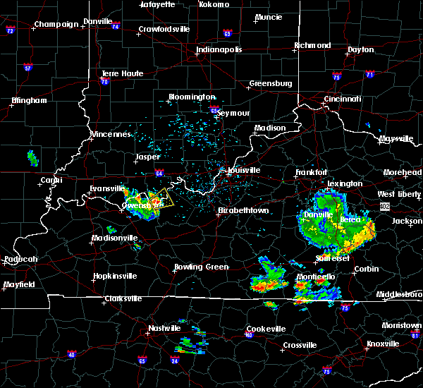 At 519 pm cdt, a severe thunderstorm was located 7 miles east of hawesville, moving northeast at 25 mph (radar indicated). Hazards include 60 mph wind gusts and penny size hail. Expect damage to roofs, siding, and trees. Locations impacted include, cannelton, cloverport, skillman, sample, gerald, dodd, tobinsport, holt, sunny corner and lauer. At 519 pm cdt, a severe thunderstorm was located 7 miles east of hawesville, moving northeast at 25 mph (radar indicated). Hazards include 60 mph wind gusts and penny size hail. Expect damage to roofs, siding, and trees. Locations impacted include, cannelton, cloverport, skillman, sample, gerald, dodd, tobinsport, holt, sunny corner and lauer.
|
| 6/11/2018 5:04 PM CDT |
 At 503 pm cdt, a severe thunderstorm was located near hawesville, moving northeast at 25 mph (radar indicated). Hazards include 60 mph wind gusts and penny size hail. expect damage to roofs, siding, and trees At 503 pm cdt, a severe thunderstorm was located near hawesville, moving northeast at 25 mph (radar indicated). Hazards include 60 mph wind gusts and penny size hail. expect damage to roofs, siding, and trees
|
| 5/31/2018 12:40 PM CDT |
 At 138 pm edt/1238 pm cdt/, severe thunderstorms were located along a line extending from 14 miles southwest of carefree town to 8 miles east of whitesville, moving east at 60 mph (radar indicated). Hazards include 70 mph wind gusts. Expect considerable tree damage. damage is likely to mobile homes, roofs, and outbuildings. Locations impacted include, tell city, hawesville, mount pleasant, lewisport, cannelton, cloverport, leopold, troy, leavenworth and alton. At 138 pm edt/1238 pm cdt/, severe thunderstorms were located along a line extending from 14 miles southwest of carefree town to 8 miles east of whitesville, moving east at 60 mph (radar indicated). Hazards include 70 mph wind gusts. Expect considerable tree damage. damage is likely to mobile homes, roofs, and outbuildings. Locations impacted include, tell city, hawesville, mount pleasant, lewisport, cannelton, cloverport, leopold, troy, leavenworth and alton.
|
| 5/31/2018 12:25 PM CDT |
 At 123 pm edt/1223 pm cdt/, severe thunderstorms were located along a line extending from 6 miles southeast of holiday world to near masonville, moving east at 45 mph (radar indicated). Hazards include 70 mph wind gusts. Expect considerable tree damage. damage is likely to mobile homes, roofs, and outbuildings. Locations impacted include, tell city, hawesville, mount pleasant, lewisport, cannelton, cloverport, leopold, fordsville, troy and leavenworth. At 123 pm edt/1223 pm cdt/, severe thunderstorms were located along a line extending from 6 miles southeast of holiday world to near masonville, moving east at 45 mph (radar indicated). Hazards include 70 mph wind gusts. Expect considerable tree damage. damage is likely to mobile homes, roofs, and outbuildings. Locations impacted include, tell city, hawesville, mount pleasant, lewisport, cannelton, cloverport, leopold, fordsville, troy and leavenworth.
|
| 5/31/2018 12:16 PM CDT |
 At 115 pm edt/1215 pm cdt/, severe thunderstorms were located along a line extending from near holiday world to 6 miles north of livermore, moving east at 45 mph (radar indicated). Hazards include 60 mph wind gusts. expect damage to roofs, siding, and trees At 115 pm edt/1215 pm cdt/, severe thunderstorms were located along a line extending from near holiday world to 6 miles north of livermore, moving east at 45 mph (radar indicated). Hazards include 60 mph wind gusts. expect damage to roofs, siding, and trees
|
| 5/27/2018 3:59 PM CDT |
 At 359 pm cdt, a severe thunderstorm was located near hawesville, moving southwest at 20 mph (radar indicated). Hazards include 60 mph wind gusts and quarter size hail. Hail damage to vehicles is expected. expect wind damage to roofs, siding, and trees. Locations impacted include, tell city, cannelton, cloverport, skillman, dodd, tobinsport, holt, sunny corner, lauer and rome. At 359 pm cdt, a severe thunderstorm was located near hawesville, moving southwest at 20 mph (radar indicated). Hazards include 60 mph wind gusts and quarter size hail. Hail damage to vehicles is expected. expect wind damage to roofs, siding, and trees. Locations impacted include, tell city, cannelton, cloverport, skillman, dodd, tobinsport, holt, sunny corner, lauer and rome.
|
| 5/27/2018 3:49 PM CDT | Trees down... one on a house and another blocking a road. no injurie in breckinridge county KY, 0.3 miles ESE of Cloverport, KY |
| 5/27/2018 3:43 PM CDT |
 At 343 pm cdt, a severe thunderstorm was located 10 miles east of hawesville, moving southwest at 20 mph (radar indicated). Hazards include 60 mph wind gusts and quarter size hail. Hail damage to vehicles is expected. Expect wind damage to roofs, siding, and trees. At 343 pm cdt, a severe thunderstorm was located 10 miles east of hawesville, moving southwest at 20 mph (radar indicated). Hazards include 60 mph wind gusts and quarter size hail. Hail damage to vehicles is expected. Expect wind damage to roofs, siding, and trees.
|
| 5/27/2018 3:43 PM CDT |
 The national weather service in louisville has issued a * severe thunderstorm warning for. southern perry county in south central indiana. northeastern hancock county in central kentucky. northwestern breckinridge county in central kentucky. Until 415 pm cdt. The national weather service in louisville has issued a * severe thunderstorm warning for. southern perry county in south central indiana. northeastern hancock county in central kentucky. northwestern breckinridge county in central kentucky. Until 415 pm cdt.
|
| 4/3/2018 8:20 PM CDT |
 At 820 pm cdt, a severe thunderstorm was located near knottsville, moving east at 60 mph (radar indicated). Hazards include 60 mph wind gusts and quarter size hail. Hail damage to vehicles is expected. Expect wind damage to roofs, siding, and trees. At 820 pm cdt, a severe thunderstorm was located near knottsville, moving east at 60 mph (radar indicated). Hazards include 60 mph wind gusts and quarter size hail. Hail damage to vehicles is expected. Expect wind damage to roofs, siding, and trees.
|
| 5/27/2017 6:35 PM CDT |
 At 734 pm edt/634 pm cdt/, severe thunderstorms were located along a line extending from hardinsburg to near masonville, moving northeast at 30 mph (radar indicated). Hazards include 60 mph wind gusts and quarter size hail. Hail damage to vehicles is expected. Expect wind damage to roofs, siding, and trees. At 734 pm edt/634 pm cdt/, severe thunderstorms were located along a line extending from hardinsburg to near masonville, moving northeast at 30 mph (radar indicated). Hazards include 60 mph wind gusts and quarter size hail. Hail damage to vehicles is expected. Expect wind damage to roofs, siding, and trees.
|
| 4/5/2017 2:37 PM CDT |
 At 337 pm edt/237 pm cdt/, a severe thunderstorm was located near hawesville, moving northeast at 45 mph (radar indicated). Hazards include 60 mph wind gusts and quarter size hail. Hail damage to vehicles is expected. Expect wind damage to roofs, siding, and trees. At 337 pm edt/237 pm cdt/, a severe thunderstorm was located near hawesville, moving northeast at 45 mph (radar indicated). Hazards include 60 mph wind gusts and quarter size hail. Hail damage to vehicles is expected. Expect wind damage to roofs, siding, and trees.
|
| 3/27/2017 4:38 PM CDT |
 At 538 pm edt/438 pm cdt/, severe thunderstorms were located along a line extending from 9 miles north of hardinsburg to 10 miles southwest of brandenburg to 12 miles northeast of leitchfield, moving northeast at 45 mph (radar indicated). Hazards include 60 mph wind gusts and quarter size hail. Hail damage to vehicles is expected. expect wind damage to roofs, siding, and trees. Locations impacted include, leitchfield, hardinsburg, webster, irvington, cloverport, caneyville, fordsville, concord, mcquady and dyer. At 538 pm edt/438 pm cdt/, severe thunderstorms were located along a line extending from 9 miles north of hardinsburg to 10 miles southwest of brandenburg to 12 miles northeast of leitchfield, moving northeast at 45 mph (radar indicated). Hazards include 60 mph wind gusts and quarter size hail. Hail damage to vehicles is expected. expect wind damage to roofs, siding, and trees. Locations impacted include, leitchfield, hardinsburg, webster, irvington, cloverport, caneyville, fordsville, concord, mcquady and dyer.
|
| 3/27/2017 3:58 PM CDT |
 At 458 pm edt/358 pm cdt/, severe thunderstorms were located along a line extending from near whitesville to 13 miles southeast of knottsville to 12 miles northeast of morgantown, moving northeast at 50 mph (radar indicated). Hazards include 60 mph wind gusts and quarter size hail. Hail damage to vehicles is expected. Expect wind damage to roofs, siding, and trees. At 458 pm edt/358 pm cdt/, severe thunderstorms were located along a line extending from near whitesville to 13 miles southeast of knottsville to 12 miles northeast of morgantown, moving northeast at 50 mph (radar indicated). Hazards include 60 mph wind gusts and quarter size hail. Hail damage to vehicles is expected. Expect wind damage to roofs, siding, and trees.
|
| 3/1/2017 5:32 AM CST |
 At 632 am est/532 am cst/, severe thunderstorms were located along a line extending from 7 miles northeast of brandenburg to near livermore, moving southeast at 30 mph (radar indicated). Hazards include 60 mph wind gusts. expect damage to roofs, siding, and trees At 632 am est/532 am cst/, severe thunderstorms were located along a line extending from 7 miles northeast of brandenburg to near livermore, moving southeast at 30 mph (radar indicated). Hazards include 60 mph wind gusts. expect damage to roofs, siding, and trees
|
| 3/1/2017 1:04 AM CST |
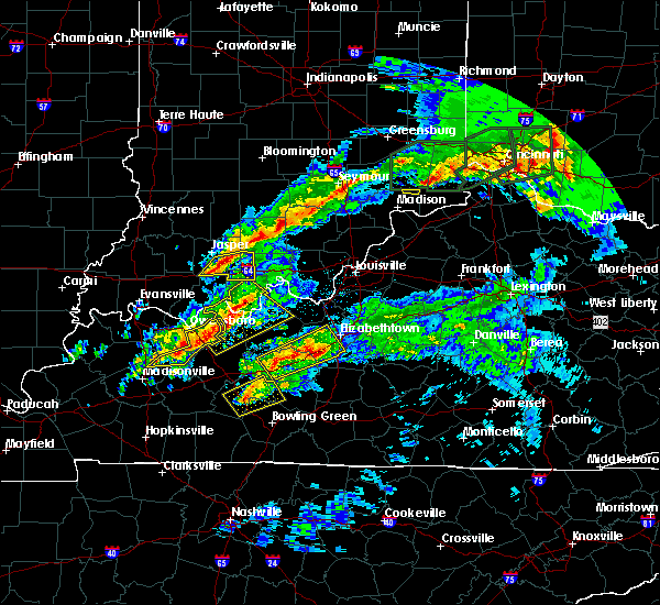 At 103 am cst, a severe thunderstorm was located near hawesville, moving northeast at 45 mph (radar indicated). Hazards include 60 mph wind gusts and quarter size hail. Hail damage to vehicles is expected. expect wind damage to roofs, siding, and trees. locations impacted include, tell city, hardinsburg, hawesville, webster, lewisport, cannelton, irvington, cloverport, leopold and fordsville. A tornado watch remains in effect until 400 am cst for south central indiana, and central kentucky. At 103 am cst, a severe thunderstorm was located near hawesville, moving northeast at 45 mph (radar indicated). Hazards include 60 mph wind gusts and quarter size hail. Hail damage to vehicles is expected. expect wind damage to roofs, siding, and trees. locations impacted include, tell city, hardinsburg, hawesville, webster, lewisport, cannelton, irvington, cloverport, leopold and fordsville. A tornado watch remains in effect until 400 am cst for south central indiana, and central kentucky.
|
| 3/1/2017 12:49 AM CST |
 At 1249 am cst, a severe thunderstorm was located near knottsville, moving northeast at 40 mph (radar indicated). Hazards include 60 mph wind gusts and quarter size hail. Hail damage to vehicles is expected. Expect wind damage to roofs, siding, and trees. At 1249 am cst, a severe thunderstorm was located near knottsville, moving northeast at 40 mph (radar indicated). Hazards include 60 mph wind gusts and quarter size hail. Hail damage to vehicles is expected. Expect wind damage to roofs, siding, and trees.
|
| 2/28/2017 7:13 AM CST |
 The severe thunderstorm warning for southern meade, southeastern hancock, central breckinridge and northeastern ohio counties will expire at 815 am est/715 am cst/, the storm which prompted the warning has weakened below severe limits, and no longer pose an immediate threat to life or property. therefore the warning will be allowed to expire. however small hail is still possible with this thunderstorm. report severe weather to local law enforcement, post your report to the national weather service louisville facebook page, or tweet your report using hashtag l, m, k, spotter. The severe thunderstorm warning for southern meade, southeastern hancock, central breckinridge and northeastern ohio counties will expire at 815 am est/715 am cst/, the storm which prompted the warning has weakened below severe limits, and no longer pose an immediate threat to life or property. therefore the warning will be allowed to expire. however small hail is still possible with this thunderstorm. report severe weather to local law enforcement, post your report to the national weather service louisville facebook page, or tweet your report using hashtag l, m, k, spotter.
|
| 2/28/2017 7:05 AM CST |
 At 804 am est/704 am cst/, a severe thunderstorm was located near hardinsburg, moving east at 50 mph (radar indicated). Hazards include quarter size hail. Damage to vehicles is expected. Locations impacted include, brandenburg, hardinsburg, webster, irvington, cloverport, fordsville, ekron, guston, mcquady and mystic. At 804 am est/704 am cst/, a severe thunderstorm was located near hardinsburg, moving east at 50 mph (radar indicated). Hazards include quarter size hail. Damage to vehicles is expected. Locations impacted include, brandenburg, hardinsburg, webster, irvington, cloverport, fordsville, ekron, guston, mcquady and mystic.
|
| 2/28/2017 6:47 AM CST |
 At 747 am est/647 am cst/, a severe thunderstorm was located 8 miles west of hardinsburg, moving east at 55 mph (radar indicated). Hazards include quarter size hail. damage to vehicles is expected At 747 am est/647 am cst/, a severe thunderstorm was located 8 miles west of hardinsburg, moving east at 55 mph (radar indicated). Hazards include quarter size hail. damage to vehicles is expected
|
| 12/17/2016 4:46 PM EST |
 At 446 pm est/346 pm cst/, a severe thunderstorm was located near hawesville, moving northeast at 45 mph (radar indicated). Hazards include 60 mph wind gusts. expect damage to roofs, siding, and trees At 446 pm est/346 pm cst/, a severe thunderstorm was located near hawesville, moving northeast at 45 mph (radar indicated). Hazards include 60 mph wind gusts. expect damage to roofs, siding, and trees
|
| 12/17/2016 3:35 PM CST |
 At 335 pm cst, a severe thunderstorm was located near hawesville, moving east at 60 mph (radar indicated). Hazards include 60 mph wind gusts. Expect damage to roofs, siding, and trees. locations impacted include, tell city, hawesville, lewisport, cannelton, cloverport, arrington corner, chambers, tobinsport, weberstown and patesville. A tornado watch remains in effect until 900 pm cst for south central indiana, and central kentucky. At 335 pm cst, a severe thunderstorm was located near hawesville, moving east at 60 mph (radar indicated). Hazards include 60 mph wind gusts. Expect damage to roofs, siding, and trees. locations impacted include, tell city, hawesville, lewisport, cannelton, cloverport, arrington corner, chambers, tobinsport, weberstown and patesville. A tornado watch remains in effect until 900 pm cst for south central indiana, and central kentucky.
|
| 12/17/2016 3:22 PM CST |
 At 322 pm cst, a severe thunderstorm was located near knottsville, moving east at 60 mph (radar indicated). Hazards include 60 mph wind gusts and quarter size hail. Hail damage to vehicles is expected. Expect wind damage to roofs, siding, and trees. At 322 pm cst, a severe thunderstorm was located near knottsville, moving east at 60 mph (radar indicated). Hazards include 60 mph wind gusts and quarter size hail. Hail damage to vehicles is expected. Expect wind damage to roofs, siding, and trees.
|
| 12/17/2016 1:58 PM CST |
 At 158 pm cst, a severe thunderstorm was located 8 miles east of hawesville, moving east at 45 mph (radar indicated). Hazards include 60 mph wind gusts. expect damage to roofs, siding, and trees At 158 pm cst, a severe thunderstorm was located 8 miles east of hawesville, moving east at 45 mph (radar indicated). Hazards include 60 mph wind gusts. expect damage to roofs, siding, and trees
|
| 12/17/2016 1:45 PM CST |
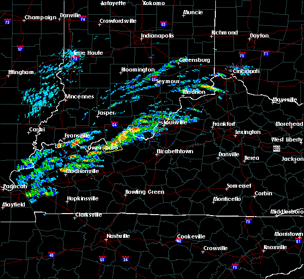 At 145 pm cst, a severe thunderstorm was located near hawesville, moving east at 45 mph (radar indicated). Hazards include 60 mph wind gusts. expect damage to roofs, siding, and trees At 145 pm cst, a severe thunderstorm was located near hawesville, moving east at 45 mph (radar indicated). Hazards include 60 mph wind gusts. expect damage to roofs, siding, and trees
|
| 9/10/2016 2:00 PM CDT |
 At 300 pm edt/200 pm cdt/, severe thunderstorms were located along a line extending from 11 miles southwest of carefree town to near knottsville, moving east at 20 mph (radar indicated). Hazards include 60 mph wind gusts. Expect damage to roofs. siding. And trees. At 300 pm edt/200 pm cdt/, severe thunderstorms were located along a line extending from 11 miles southwest of carefree town to near knottsville, moving east at 20 mph (radar indicated). Hazards include 60 mph wind gusts. Expect damage to roofs. siding. And trees.
|
| 8/5/2016 2:05 PM CDT | Trees down around victoria crossroad in hancock county KY, 6.2 miles NNE of Cloverport, KY |
| 8/5/2016 2:01 PM CDT |
 At 200 pm cdt, a severe thunderstorm was located 10 miles west of hardinsburg, moving southeast at 30 mph (radar indicated). Hazards include 60 mph wind gusts. Expect damage to roofs. siding. And trees. At 200 pm cdt, a severe thunderstorm was located 10 miles west of hardinsburg, moving southeast at 30 mph (radar indicated). Hazards include 60 mph wind gusts. Expect damage to roofs. siding. And trees.
|
| 7/8/2016 8:25 AM CDT |
 At 824 am cdt, a severe thunderstorm was located over hawesville, moving east at 45 mph (radar indicated). Hazards include 70 mph wind gusts. Expect considerable tree damage. Damage is likely to mobile homes, roofs, and outbuildings. At 824 am cdt, a severe thunderstorm was located over hawesville, moving east at 45 mph (radar indicated). Hazards include 70 mph wind gusts. Expect considerable tree damage. Damage is likely to mobile homes, roofs, and outbuildings.
|
| 7/7/2016 2:47 PM CDT |
 At 346 pm edt/246 pm cdt/, severe thunderstorms were located along a line extending from 14 miles southwest of english to 11 miles east of whitesville, moving east at 45 mph (trained weather spotters reported trees and power lines down near lewisport with these storms!). Hazards include 70 mph wind gusts. Expect considerable tree damage. damage is likely to mobile homes, roofs, and outbuildings. Locations impacted include, tell city, hardinsburg, hawesville, , mount pleasant, webster, ferdinand, lewisport, cannelton and cloverport. At 346 pm edt/246 pm cdt/, severe thunderstorms were located along a line extending from 14 miles southwest of english to 11 miles east of whitesville, moving east at 45 mph (trained weather spotters reported trees and power lines down near lewisport with these storms!). Hazards include 70 mph wind gusts. Expect considerable tree damage. damage is likely to mobile homes, roofs, and outbuildings. Locations impacted include, tell city, hardinsburg, hawesville, , mount pleasant, webster, ferdinand, lewisport, cannelton and cloverport.
|
| 7/7/2016 2:28 PM CDT |
 At 327 pm edt/227 pm cdt/, severe thunderstorms were located along a line extending from near dale to near whitesville, moving east at 45 mph. the strongest winds were heading for tell city and hawesville (radar indicated). Hazards include 70 mph wind gusts. Expect considerable tree damage. damage is likely to mobile homes, roofs, and outbuildings. Locations impacted include, tell city, hardinsburg, hawesville, carefree town, mount pleasant, webster, ferdinand, lewisport, cannelton and cloverport. At 327 pm edt/227 pm cdt/, severe thunderstorms were located along a line extending from near dale to near whitesville, moving east at 45 mph. the strongest winds were heading for tell city and hawesville (radar indicated). Hazards include 70 mph wind gusts. Expect considerable tree damage. damage is likely to mobile homes, roofs, and outbuildings. Locations impacted include, tell city, hardinsburg, hawesville, carefree town, mount pleasant, webster, ferdinand, lewisport, cannelton and cloverport.
|
| 7/7/2016 2:20 PM CDT |
 At 319 pm edt/219 pm cdt/, severe thunderstorms were located along a line extending from near dale to near masonville, moving east at 45 mph (radar indicated). Hazards include 70 mph wind gusts and penny size hail. Expect considerable tree damage. Damage is likely to mobile homes, roofs, and outbuildings. At 319 pm edt/219 pm cdt/, severe thunderstorms were located along a line extending from near dale to near masonville, moving east at 45 mph (radar indicated). Hazards include 70 mph wind gusts and penny size hail. Expect considerable tree damage. Damage is likely to mobile homes, roofs, and outbuildings.
|
| 5/10/2016 1:28 PM CDT |
 At 228 pm edt/128 pm cdt/, a severe thunderstorm was located near whitesville, moving east at 40 mph (radar indicated). Hazards include two inch hail and 60 mph wind gusts. People and animals outdoors will be injured. expect hail damage to roofs, siding, windows, and vehicles. Expect wind damage to roofs, siding, and trees. At 228 pm edt/128 pm cdt/, a severe thunderstorm was located near whitesville, moving east at 40 mph (radar indicated). Hazards include two inch hail and 60 mph wind gusts. People and animals outdoors will be injured. expect hail damage to roofs, siding, windows, and vehicles. Expect wind damage to roofs, siding, and trees.
|
| 5/7/2016 8:48 PM EDT |
 At 847 pm edt/747 pm cdt/, severe thunderstorms were located along a line extending from 9 miles north of paoli to 6 miles southwest of english to 9 miles southeast of whitesville, moving east at 40 mph (trained weather spotters. this line of storms has produced wind damage and 60 mph gusts across dubois county indiana). Hazards include 60 mph wind gusts and quarter size hail. Hail damage to vehicles is expected. Expect wind damage to roofs, siding, and trees. At 847 pm edt/747 pm cdt/, severe thunderstorms were located along a line extending from 9 miles north of paoli to 6 miles southwest of english to 9 miles southeast of whitesville, moving east at 40 mph (trained weather spotters. this line of storms has produced wind damage and 60 mph gusts across dubois county indiana). Hazards include 60 mph wind gusts and quarter size hail. Hail damage to vehicles is expected. Expect wind damage to roofs, siding, and trees.
|
| 5/7/2016 7:42 PM CDT |
 At 842 pm edt/742 pm cdt/, severe thunderstorms were located along a line extending from 9 miles north of jasper to 7 miles north of hartford, moving southeast at 60 mph (trained weather spotters. wind gusts estimated near 60 mph were reported near ireland). Hazards include 60 mph wind gusts and quarter size hail. Hail damage to vehicles is expected. expect wind damage to roofs, siding, and trees. Locations impacted include, jasper, tell city, hawesville, huntingburg, ferdinand, french lick, lewisport, cannelton, cloverport and leopold. At 842 pm edt/742 pm cdt/, severe thunderstorms were located along a line extending from 9 miles north of jasper to 7 miles north of hartford, moving southeast at 60 mph (trained weather spotters. wind gusts estimated near 60 mph were reported near ireland). Hazards include 60 mph wind gusts and quarter size hail. Hail damage to vehicles is expected. expect wind damage to roofs, siding, and trees. Locations impacted include, jasper, tell city, hawesville, huntingburg, ferdinand, french lick, lewisport, cannelton, cloverport and leopold.
|
| 5/7/2016 7:22 PM CDT |
 At 821 pm edt/721 pm cdt/, severe thunderstorms were located along a line extending from near washington to near masonville, moving southeast at 60 mph. these storms have a history of producing wind damage (radar indicated). Hazards include 60 mph wind gusts and quarter size hail. Hail damage to vehicles is expected. Expect wind damage to roofs, siding, and trees. At 821 pm edt/721 pm cdt/, severe thunderstorms were located along a line extending from near washington to near masonville, moving southeast at 60 mph. these storms have a history of producing wind damage (radar indicated). Hazards include 60 mph wind gusts and quarter size hail. Hail damage to vehicles is expected. Expect wind damage to roofs, siding, and trees.
|
| 4/27/2016 7:38 PM CDT | Areas of cloverport are without powe in breckinridge county KY, 0.3 miles ESE of Cloverport, KY |
| 4/27/2016 7:19 PM CDT |
 At 819 pm edt/719 pm cdt/, a severe thunderstorm was located 8 miles north of hardinsburg, moving northeast at 35 mph (radar indicated). Hazards include 60 mph wind gusts and quarter size hail. Hail damage to vehicles is expected. expect wind damage to roofs, siding, and trees. locations impacted include, tell city, brandenburg, hardinsburg, hawesville, webster, lewisport, cannelton, irvington, cloverport and troy. A tornado watch remains in effect until midnight edt/1100 pm cdt/ for south central indiana, and central kentucky. At 819 pm edt/719 pm cdt/, a severe thunderstorm was located 8 miles north of hardinsburg, moving northeast at 35 mph (radar indicated). Hazards include 60 mph wind gusts and quarter size hail. Hail damage to vehicles is expected. expect wind damage to roofs, siding, and trees. locations impacted include, tell city, brandenburg, hardinsburg, hawesville, webster, lewisport, cannelton, irvington, cloverport and troy. A tornado watch remains in effect until midnight edt/1100 pm cdt/ for south central indiana, and central kentucky.
|
| 4/27/2016 6:52 PM CDT |
 At 751 pm edt/651 pm cdt/, a severe thunderstorm was located 8 miles northeast of whitesville, moving northeast at 35 mph (radar indicated). Hazards include 70 mph wind gusts and quarter size hail. Hail damage to vehicles is expected. expect considerable tree damage. Wind damage is also likely to mobile homes, roofs, and outbuildings. At 751 pm edt/651 pm cdt/, a severe thunderstorm was located 8 miles northeast of whitesville, moving northeast at 35 mph (radar indicated). Hazards include 70 mph wind gusts and quarter size hail. Hail damage to vehicles is expected. expect considerable tree damage. Wind damage is also likely to mobile homes, roofs, and outbuildings.
|
| 4/27/2016 6:44 PM CDT |
 At 643 pm cdt, a severe thunderstorm was located 9 miles west of hardinsburg, moving northeast at 35 mph (radar indicated). Hazards include 60 mph wind gusts and quarter size hail. Hail damage to vehicles is expected. expect wind damage to roofs, siding, and trees. locations impacted include, hartford, hardinsburg, cloverport, fordsville, centertown, arrington corner, askin, deanefield, narrows and tobinsport. A tornado watch remains in effect until 1100 pm cdt for south central indiana, and central kentucky. At 643 pm cdt, a severe thunderstorm was located 9 miles west of hardinsburg, moving northeast at 35 mph (radar indicated). Hazards include 60 mph wind gusts and quarter size hail. Hail damage to vehicles is expected. expect wind damage to roofs, siding, and trees. locations impacted include, hartford, hardinsburg, cloverport, fordsville, centertown, arrington corner, askin, deanefield, narrows and tobinsport. A tornado watch remains in effect until 1100 pm cdt for south central indiana, and central kentucky.
|
| 4/27/2016 6:16 PM CDT |
 At 615 pm cdt, a severe thunderstorm was located near whitesville, moving northeast at 35 mph (radar indicated). Hazards include 60 mph wind gusts and quarter size hail. Hail damage to vehicles is expected. Expect wind damage to roofs, siding, and trees. At 615 pm cdt, a severe thunderstorm was located near whitesville, moving northeast at 35 mph (radar indicated). Hazards include 60 mph wind gusts and quarter size hail. Hail damage to vehicles is expected. Expect wind damage to roofs, siding, and trees.
|
| 4/26/2016 7:23 PM CDT |
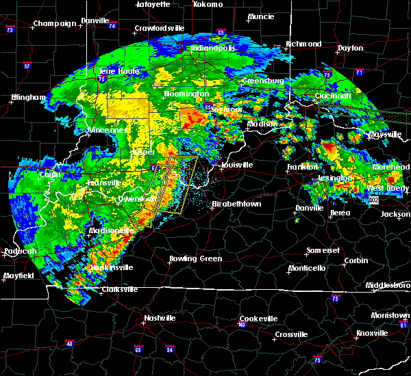 At 822 pm edt/722 pm cdt/, severe thunderstorms were located along a line extending from near english to 9 miles east of hartford, moving east at 25 mph (law enforcement). Hazards include 60 mph wind gusts and quarter size hail. Hail damage to vehicles is expected. expect wind damage to roofs, siding, and trees. Locations impacted include, hawesville, mount pleasant, cannelton, cloverport, leopold, fordsville, arrington corner, sulphur, lilly dale and oriole. At 822 pm edt/722 pm cdt/, severe thunderstorms were located along a line extending from near english to 9 miles east of hartford, moving east at 25 mph (law enforcement). Hazards include 60 mph wind gusts and quarter size hail. Hail damage to vehicles is expected. expect wind damage to roofs, siding, and trees. Locations impacted include, hawesville, mount pleasant, cannelton, cloverport, leopold, fordsville, arrington corner, sulphur, lilly dale and oriole.
|
| 4/26/2016 7:11 PM CDT |
 At 811 pm edt/711 pm cdt/, severe thunderstorms were located along a line extending from 6 miles southwest of english to near hartford, moving east at 25 mph. perry county reported multiple power outages and trees down across the county (law enforcement). Hazards include 60 mph wind gusts and quarter size hail. Hail damage to vehicles is expected. expect wind damage to roofs, siding, and trees. Locations impacted include, tell city, hawesville, mount pleasant, lewisport, cannelton, cloverport, leopold, fordsville, birdseye and troy. At 811 pm edt/711 pm cdt/, severe thunderstorms were located along a line extending from 6 miles southwest of english to near hartford, moving east at 25 mph. perry county reported multiple power outages and trees down across the county (law enforcement). Hazards include 60 mph wind gusts and quarter size hail. Hail damage to vehicles is expected. expect wind damage to roofs, siding, and trees. Locations impacted include, tell city, hawesville, mount pleasant, lewisport, cannelton, cloverport, leopold, fordsville, birdseye and troy.
|
| 4/26/2016 6:36 PM CDT |
 At 736 pm edt/636 pm cdt/, severe thunderstorms were located along a line extending from 6 miles southeast of jasper to near livermore, moving east at 30 mph (trained weather spotters). Hazards include 60 mph wind gusts and quarter size hail. Hail damage to vehicles is expected. expect wind damage to roofs, siding, and trees. Locations impacted include, tell city, hawesville, mount pleasant, lewisport, cannelton, cloverport, leopold, fordsville, birdseye and troy. At 736 pm edt/636 pm cdt/, severe thunderstorms were located along a line extending from 6 miles southeast of jasper to near livermore, moving east at 30 mph (trained weather spotters). Hazards include 60 mph wind gusts and quarter size hail. Hail damage to vehicles is expected. expect wind damage to roofs, siding, and trees. Locations impacted include, tell city, hawesville, mount pleasant, lewisport, cannelton, cloverport, leopold, fordsville, birdseye and troy.
|
| 4/26/2016 6:25 PM CDT |
 At 723 pm edt/623 pm cdt/, severe thunderstorms were located along a line extending from 6 miles southwest of jasper to calhoun, moving east at 30 mph. these storms have a history of producing damaging winds (trained weather spotters). Hazards include 60 mph wind gusts and quarter size hail. Hail damage to vehicles is expected. Expect wind damage to roofs, siding, and trees. At 723 pm edt/623 pm cdt/, severe thunderstorms were located along a line extending from 6 miles southwest of jasper to calhoun, moving east at 30 mph. these storms have a history of producing damaging winds (trained weather spotters). Hazards include 60 mph wind gusts and quarter size hail. Hail damage to vehicles is expected. Expect wind damage to roofs, siding, and trees.
|
| 3/31/2016 2:30 PM CDT |
 At 329 pm edt/229 pm cdt/, a severe thunderstorm was located 8 miles southeast of hawesville, moving northeast at 70 mph (radar indicated). Hazards include 70 mph wind gusts. Expect considerable tree damage. damage is likely to mobile homes, roofs, and outbuildings. Locations impacted include, hardinsburg, hawesville, webster, cannelton, irvington, cloverport, ekron, hillgrove, arrington corner and payneville. At 329 pm edt/229 pm cdt/, a severe thunderstorm was located 8 miles southeast of hawesville, moving northeast at 70 mph (radar indicated). Hazards include 70 mph wind gusts. Expect considerable tree damage. damage is likely to mobile homes, roofs, and outbuildings. Locations impacted include, hardinsburg, hawesville, webster, cannelton, irvington, cloverport, ekron, hillgrove, arrington corner and payneville.
|
| 3/31/2016 2:25 PM CDT | Tree down across highway 1700 near quisenberry roa in hancock county KY, 6.2 miles ENE of Cloverport, KY |
| 3/31/2016 2:24 PM CDT |
 At 323 pm edt/223 pm cdt/, a severe thunderstorm was located 8 miles east of knottsville, moving northeast at 60 mph (radar indicated). Hazards include 60 mph wind gusts. Expect damage to roofs. siding. And trees. At 323 pm edt/223 pm cdt/, a severe thunderstorm was located 8 miles east of knottsville, moving northeast at 60 mph (radar indicated). Hazards include 60 mph wind gusts. Expect damage to roofs. siding. And trees.
|
| 12/28/2015 3:48 PM CST |
 At 347 pm cst, a severe thunderstorm was located 12 miles southeast of whitesville, moving northeast at 55 mph (radar indicated). Hazards include 60 mph wind gusts. Expect damage to roofs. Siding and trees. At 347 pm cst, a severe thunderstorm was located 12 miles southeast of whitesville, moving northeast at 55 mph (radar indicated). Hazards include 60 mph wind gusts. Expect damage to roofs. Siding and trees.
|
| 12/23/2015 5:12 PM CST | The severe thunderstorm warning for southern perry, northern breckinridge and hancock counties will expire at 515 pm cst, this warning has been replaced with a new severe thunderstorm warning which is in effect until 545 pm cst. a tornado watch remains in effect until 800 pm cst for south central indiana and central kentucky. |
| 12/23/2015 5:12 PM CST | The severe thunderstorm warning for southern perry, northern breckinridge and hancock counties will expire at 515 pm cst, this warning has been replaced with a new severe thunderstorm warning which is in effect until 545 pm cst. a tornado watch remains in effect until 800 pm cst for south central indiana and central kentucky. |
| 12/23/2015 5:02 PM CST | At 502 pm cst, a severe thunderstorm was located near hawesville, moving northeast at 60 mph (radar indicated). Hazards include 60 mph wind gusts and quarter size hail. Hail damage to vehicles is expected. expect wind damage to roofs, siding and trees. locations impacted include, tell city, hardinsburg, hawesville, webster, lewisport, cannelton, irvington, cloverport, troy, arrington corner, lilly dale, dodd, pellville, gatchel, union star, gerald, hardingrove, fenn haven, adair and sample. A tornado watch remains in effect until 800 pm cst for south central indiana and central kentucky. |
| 12/23/2015 5:02 PM CST | At 502 pm cst, a severe thunderstorm was located near hawesville, moving northeast at 60 mph (radar indicated). Hazards include 60 mph wind gusts and quarter size hail. Hail damage to vehicles is expected. expect wind damage to roofs, siding and trees. locations impacted include, tell city, hardinsburg, hawesville, webster, lewisport, cannelton, irvington, cloverport, troy, arrington corner, lilly dale, dodd, pellville, gatchel, union star, gerald, hardingrove, fenn haven, adair and sample. A tornado watch remains in effect until 800 pm cst for south central indiana and central kentucky. |
| 12/23/2015 4:50 PM CST | At 450 pm cst, a severe thunderstorm was located over knottsville, moving northeast at 70 mph (radar indicated). Hazards include 60 mph wind gusts and quarter size hail. Hail damage to vehicles is expected. Expect wind damage to roofs, siding and trees. |
| 12/23/2015 4:50 PM CST | At 450 pm cst, a severe thunderstorm was located over knottsville, moving northeast at 70 mph (radar indicated). Hazards include 60 mph wind gusts and quarter size hail. Hail damage to vehicles is expected. Expect wind damage to roofs, siding and trees. |
| 7/20/2015 8:43 PM CDT |
 At 842 pm cdt, a severe thunderstorm was located 6 miles west of hawesville, and moving east at 30 mph (radar indicated). Hazards include 60 mph wind gusts. Expect damage to roofs. Siding and trees. At 842 pm cdt, a severe thunderstorm was located 6 miles west of hawesville, and moving east at 30 mph (radar indicated). Hazards include 60 mph wind gusts. Expect damage to roofs. Siding and trees.
|
| 6/26/2015 3:23 PM CDT | At 320 pm cdt, a severe thunderstorm was located near hardinsburg, and moving northeast at 40 mph (radar indicated). Hazards include 60 mph wind gusts and penny size hail. Expect damage to roofs. siding and trees. Locations impacted include, harned, holt, locust hill, hardingrove, woodrow, stephensport, mystic, sample, rome and garfield. |
| 6/26/2015 3:23 PM CDT | At 320 pm cdt, a severe thunderstorm was located near hardinsburg, and moving northeast at 40 mph (radar indicated). Hazards include 60 mph wind gusts and penny size hail. Expect damage to roofs. siding and trees. Locations impacted include, harned, holt, locust hill, hardingrove, woodrow, stephensport, mystic, sample, rome and garfield. |
| 6/26/2015 2:59 PM CDT | At 259 pm cdt, a severe thunderstorm was located 8 miles east of whitesville, and moving northeast at 40 mph (radar indicated). Hazards include 60 mph wind gusts and penny size hail. Expect damage to roofs. Siding and trees. |
| 6/26/2015 2:59 PM CDT | At 259 pm cdt, a severe thunderstorm was located 8 miles east of whitesville, and moving northeast at 40 mph (radar indicated). Hazards include 60 mph wind gusts and penny size hail. Expect damage to roofs. Siding and trees. |
| 4/25/2015 6:05 PM CDT | At 604 pm cdt, a severe thunderstorm was located near hardinsburg, and moving east at 30 mph (radar indicated). Hazards include 60 mph wind gusts and quarter size hail. Hail damage to vehicles is expected. expect wind damage to roofs, siding and trees. locations impacted include, mystic, harned, lodiburg, clifton mills, raymond, garfield, hensley, webster, woodrow, basin spring, graysville, irvington, rosetta, bewleyville, corners, high plains, big spring and high plains corner. 1. 00in. |
| 4/25/2015 5:44 PM CDT | At 541 pm cdt, a severe thunderstorm was located 8 miles southeast of hawesville, and moving east at 30 mph (radar indicated). Hazards include 60 mph wind gusts and quarter size hail. Hail damage to vehicles is expected. Expect wind damage to roofs, siding and trees. |
| 4/2/2015 2:09 PM CDT | The national weather service in louisville has issued a * severe thunderstorm warning for. northern breckinridge county in north central kentucky. southeastern hancock county in northwest kentucky. until 240 pm cdt * at 208 pm cdt. A severe thunderstorm was located 10 miles. |
| 10/31/2013 10:04 PM CDT | The state police had to remove a tree from a roadway near the hancock and breckinridge county lin in hancock county KY, 3 miles E of Cloverport, KY |
| 6/26/2013 8:47 PM CDT | Two electric poles snapped on hillside dr in breckinridge county KY, 0.3 miles ESE of Cloverport, KY |
| 6/26/2013 8:45 PM CDT | Power lines and trees down on ky 14 in breckinridge county KY, 7.6 miles SW of Cloverport, KY |
| 7/1/2012 6:40 PM CDT | Tree down on a power line in breckinridge county KY, 0.3 miles ESE of Cloverport, KY |
| 1/1/0001 12:00 AM | Two trees were downed across roads in the county. one large tree fell across holt road 2 miles east of cloversport. the other fell just west of hardinsburg near the int in breckinridge county KY, 1.9 miles W of Cloverport, KY |
| 1/1/0001 12:00 AM | Several trees down near cloverport in breckinridge county KY, 0.3 miles ESE of Cloverport, KY |
| 1/1/0001 12:00 AM | A tree was reported down on highway 144 e in patesville. also...another tree was reported down along state road 2181 between pelleville and hawesvill in hancock county KY, 6.2 miles ENE of Cloverport, KY |
| 1/1/0001 12:00 AM | Quarter sized hail reported 0.3 miles ESE of Cloverport, KY, nickel to quarter size hail reported |
| 4/26/2011 11:26 PM CDT | Quarter sized hail reported 0.3 miles ESE of Cloverport, KY |
| 1/1/0001 12:00 AM | Storm damage reported in perry county IN, 8.7 miles SW of Cloverport, KY |
Hail Maps for Cloverport, KY
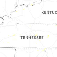


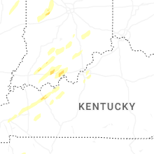


Connect with Interactive Hail Maps