

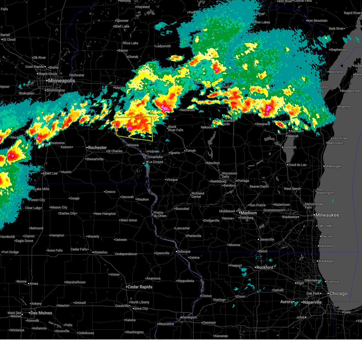
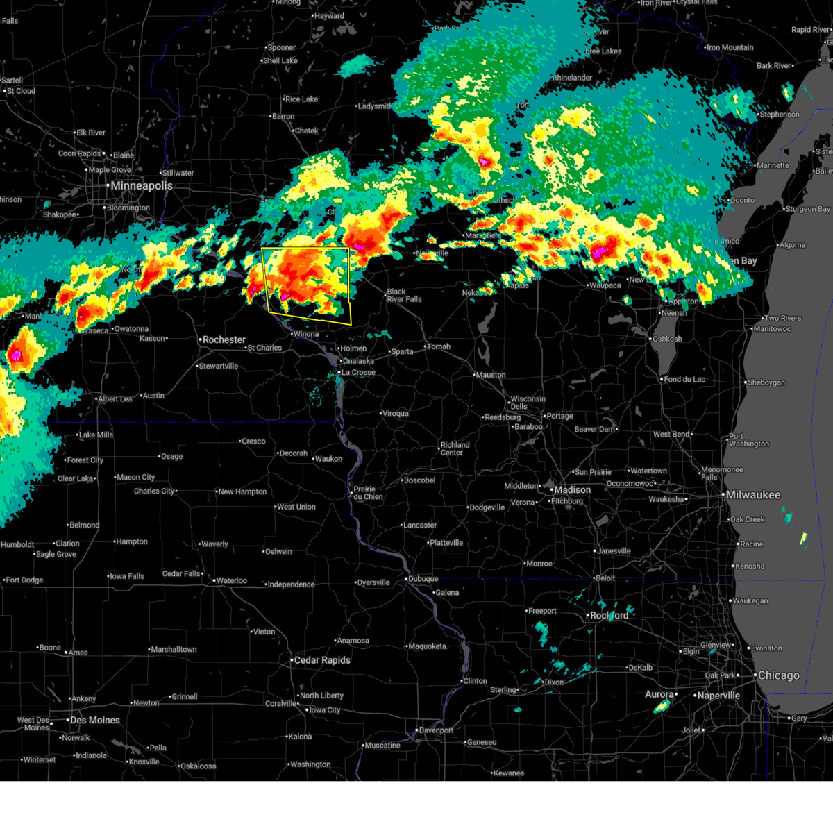
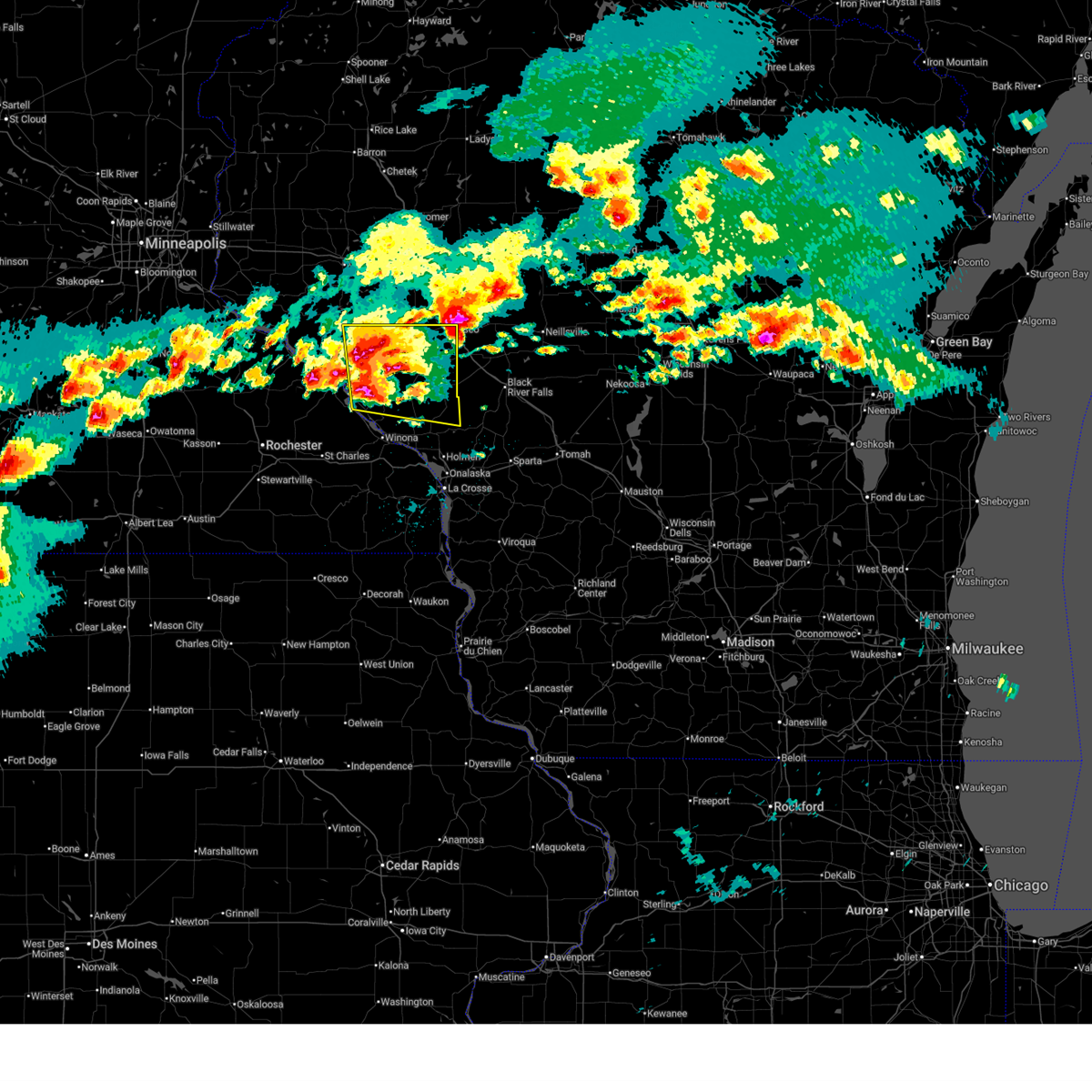
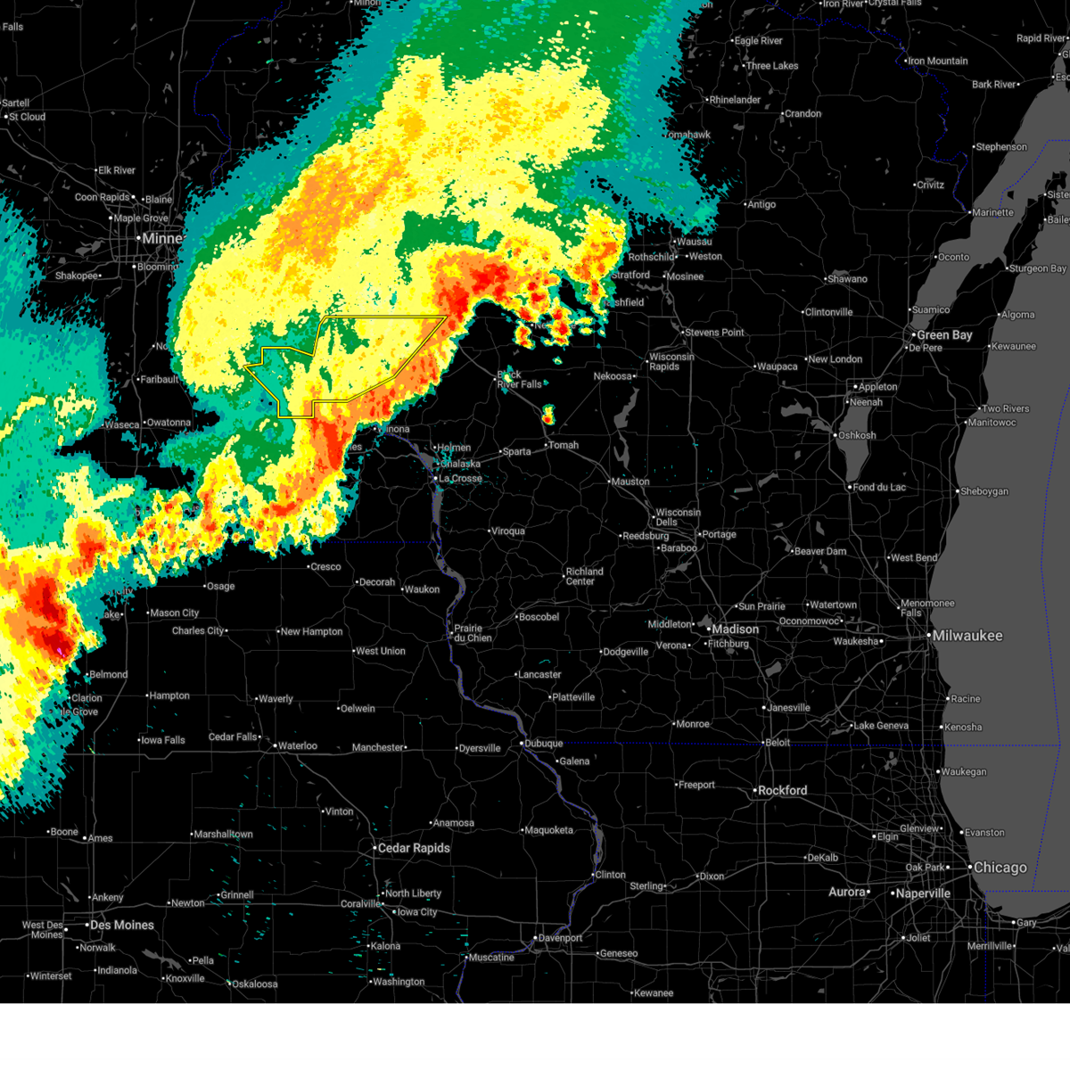
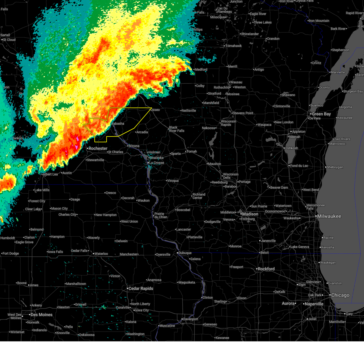
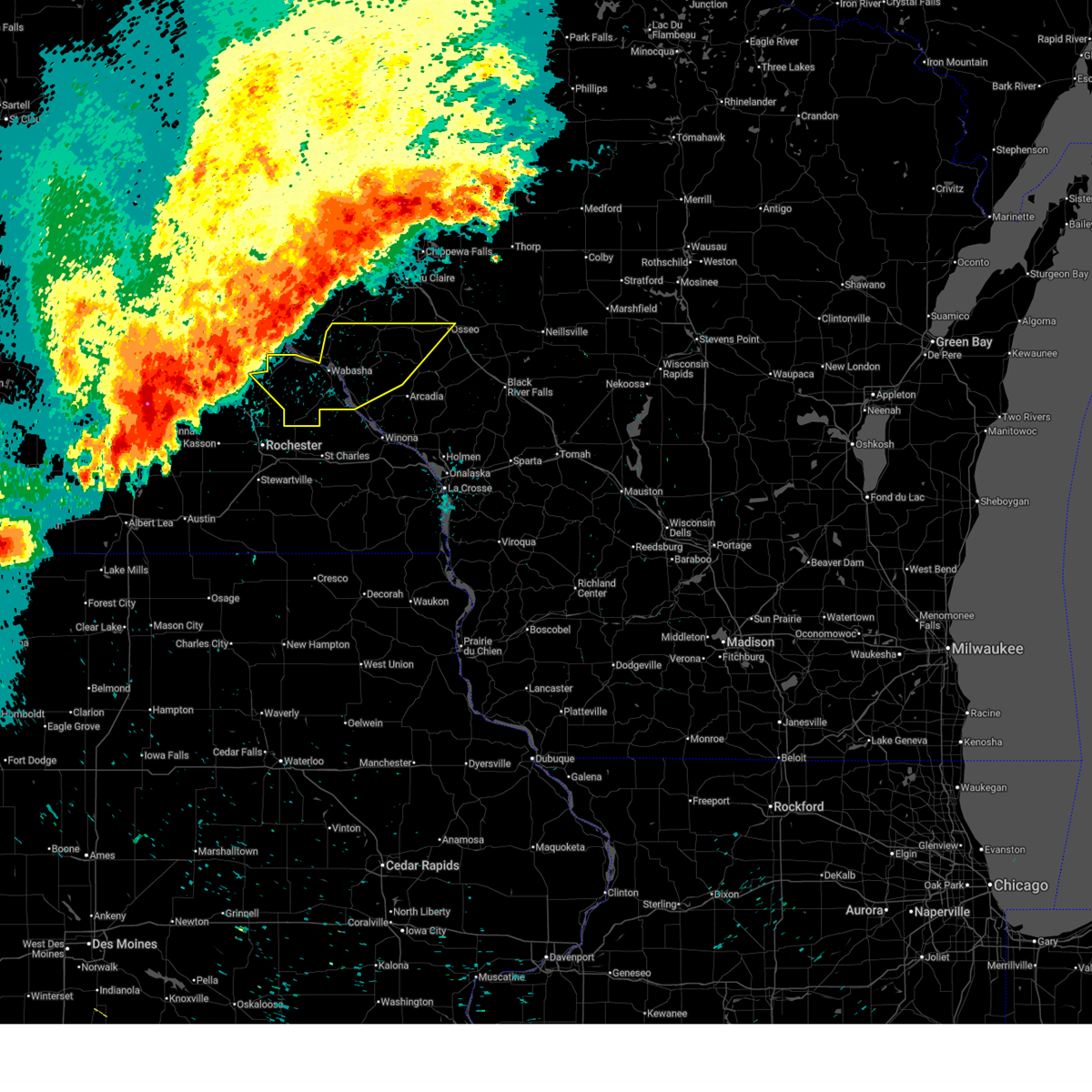
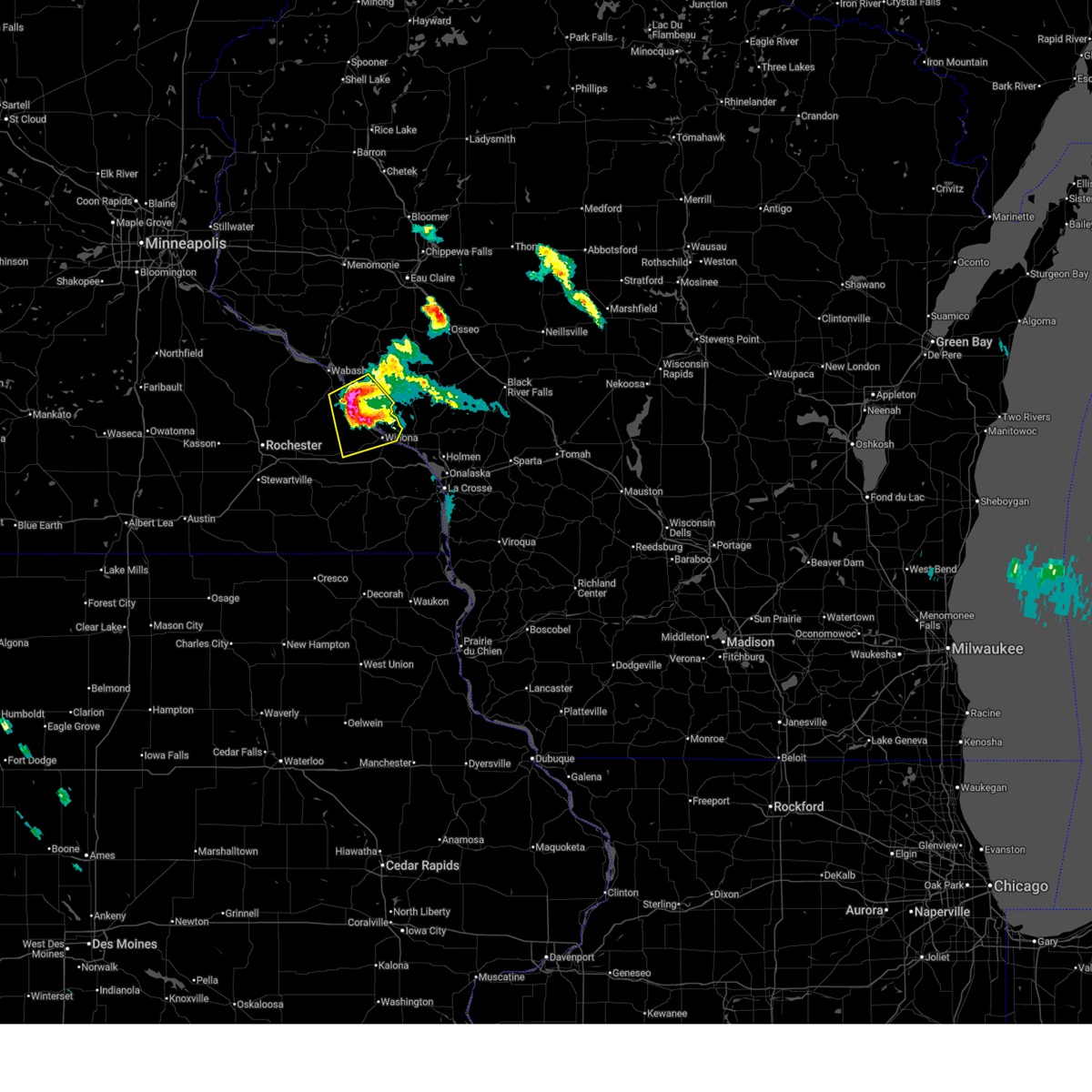
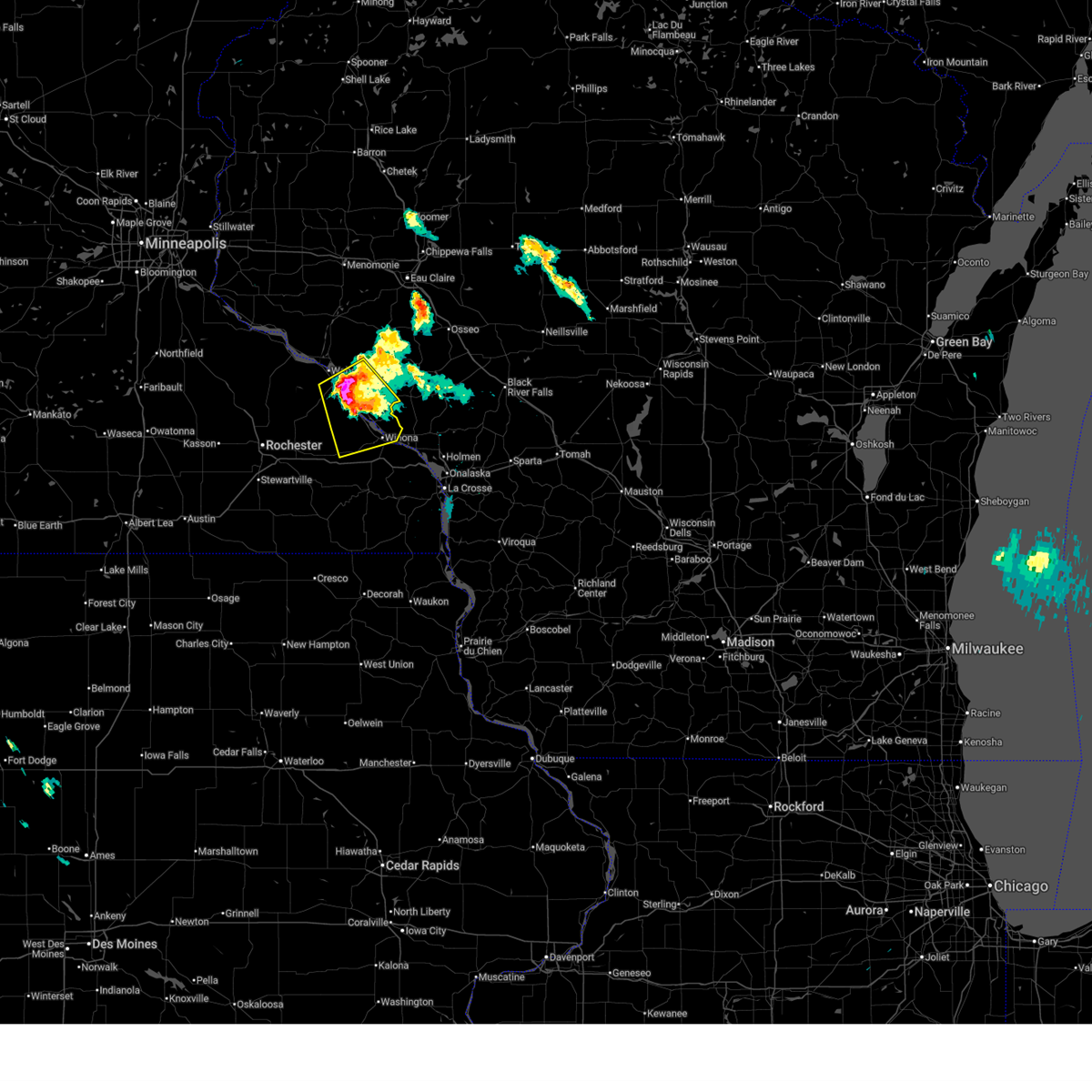
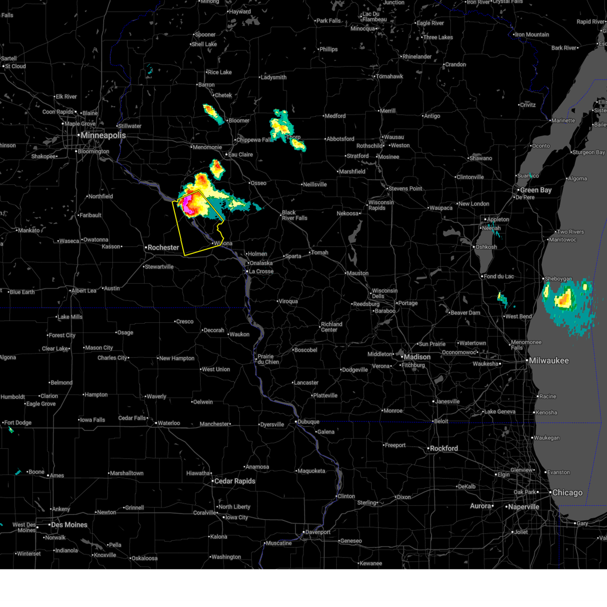
Hail Map for Cochrane, WI
The Cochrane, WI area has had 9 reports of on-the-ground hail by trained spotters, and has been under severe weather warnings 10 times during the past 12 months. Doppler radar has detected hail at or near Cochrane, WI on 52 occasions, including 4 occasions during the past year.
| Name: | Cochrane, WI |
| Where Located: | 40.8 miles NW of La Crosse, WI |
| Map: | Google Map for Cochrane, WI |
| Population: | 450 |
| Housing Units: | 234 |
| More Info: | Search Google for Cochrane, WI |
0
The Top Recent Hail Date for Cochrane, WI is Friday, June 5, 2026 (33rd out of 52)
Hail and Wind Damage Spotted near Cochrane, WI
| Date / Time | Report Details |
|---|---|
| 6/19/2026 7:57 PM CDT | Trees and power lines down south of waumande in buffalo county WI, 7.4 miles SW of Cochrane, WI |
| 6/10/2026 5:40 PM CDT | Pole barn damaged and a couple trees downe in buffalo county WI, 13 miles SW of Cochrane, WI |
| 6/10/2026 5:05 PM CDT |
 Svrarx the national weather service in la crosse has issued a * severe thunderstorm warning for, northwestern winona county in southeastern minnesota, east central olmsted county in southeastern minnesota, southeastern wabasha county in southeastern minnesota, southeastern buffalo county in west central wisconsin, * until 600 pm cdt. * at 504 pm cdt, a severe thunderstorm was located near eyota, or 15 miles east of rochester, moving east at 30 mph (trained weather spotters). Hazards include ping pong ball size hail and 60 mph wind gusts. People and animals outdoors will be injured. expect hail damage to roofs, siding, windows, and vehicles. expect wind damage to roofs, siding, and trees. this severe thunderstorm will be near, altura around 520 pm cdt. rollingstone around 530 pm cdt. goodview around 540 pm cdt. winona and fountain city around 545 pm cdt. other locations impacted by this severe thunderstorm include whitewater state park, weaver, czechville, merrick state park, lock and dam 5 a, county roads 9 and 10, and elba. This includes interstate 90 in minnesota between mile markers 224 and 234, and between mile markers 252 and 255. Svrarx the national weather service in la crosse has issued a * severe thunderstorm warning for, northwestern winona county in southeastern minnesota, east central olmsted county in southeastern minnesota, southeastern wabasha county in southeastern minnesota, southeastern buffalo county in west central wisconsin, * until 600 pm cdt. * at 504 pm cdt, a severe thunderstorm was located near eyota, or 15 miles east of rochester, moving east at 30 mph (trained weather spotters). Hazards include ping pong ball size hail and 60 mph wind gusts. People and animals outdoors will be injured. expect hail damage to roofs, siding, windows, and vehicles. expect wind damage to roofs, siding, and trees. this severe thunderstorm will be near, altura around 520 pm cdt. rollingstone around 530 pm cdt. goodview around 540 pm cdt. winona and fountain city around 545 pm cdt. other locations impacted by this severe thunderstorm include whitewater state park, weaver, czechville, merrick state park, lock and dam 5 a, county roads 9 and 10, and elba. This includes interstate 90 in minnesota between mile markers 224 and 234, and between mile markers 252 and 255.
|
| 6/5/2026 7:08 PM CDT | Also nickel size hai in buffalo county WI, 9.6 miles SW of Cochrane, WI |
| 4/17/2026 3:19 PM CDT |
 At 319 pm cdt, severe thunderstorms capable of producing tornadoes were located along a line extending from near wabasha to buffalo city to lewiston, moving east at 45 mph (radar indicated rotation. these storms have a history of producing tornadoes and the storms appear to be strengthening!). Hazards include tornado and quarter size hail. Flying debris will be dangerous to those caught without shelter. mobile homes will be damaged or destroyed. damage to roofs, windows, and vehicles will occur. tree damage is likely. these dangerous storms will be near, winona, alma, goodview, fountain city, and stockton around 325 pm cdt. arcadia around 340 pm cdt. Other locations impacted by these tornadic storms include pioneer campground, merrick state park, czechville, lock and dam 5 a, dodge, perrot state park, and cream. At 319 pm cdt, severe thunderstorms capable of producing tornadoes were located along a line extending from near wabasha to buffalo city to lewiston, moving east at 45 mph (radar indicated rotation. these storms have a history of producing tornadoes and the storms appear to be strengthening!). Hazards include tornado and quarter size hail. Flying debris will be dangerous to those caught without shelter. mobile homes will be damaged or destroyed. damage to roofs, windows, and vehicles will occur. tree damage is likely. these dangerous storms will be near, winona, alma, goodview, fountain city, and stockton around 325 pm cdt. arcadia around 340 pm cdt. Other locations impacted by these tornadic storms include pioneer campground, merrick state park, czechville, lock and dam 5 a, dodge, perrot state park, and cream.
|
| 4/17/2026 3:07 PM CDT |
 Torarx the national weather service in la crosse has issued a * tornado warning for, western winona county in southeastern minnesota, northeastern wabasha county in southeastern minnesota, buffalo county in west central wisconsin, southwestern trempealeau county in west central wisconsin, * until 345 pm cdt. * at 306 pm cdt, severe thunderstorms capable of producing a tornado were located along a line extending from 6 miles west of kellogg to 6 miles northwest of altura to near st. charles, moving northeast at 45 mph (radar indicated rotation. this storm complex has had a history of producing multiple tornadoes at once). Hazards include tornado and quarter size hail. Flying debris will be dangerous to those caught without shelter. mobile homes will be damaged or destroyed. damage to roofs, windows, and vehicles will occur. tree damage is likely. these dangerous storms will be near, wabasha, lewiston, buffalo city, altura, and kellogg around 310 pm cdt. alma, buffalo, stockton, and rollingstone around 315 pm cdt. goodview and fountain city around 320 pm cdt. winona around 325 pm cdt. modena around 330 pm cdt. arcadia around 335 pm cdt. other locations impacted by these tornadic storms include pioneer campground, merrick state park, czechville, lock and dam 5 a, dodge, county roads 6 and 33, and perrot state park. This includes interstate 90 in minnesota between mile markers 236 and 248. Torarx the national weather service in la crosse has issued a * tornado warning for, western winona county in southeastern minnesota, northeastern wabasha county in southeastern minnesota, buffalo county in west central wisconsin, southwestern trempealeau county in west central wisconsin, * until 345 pm cdt. * at 306 pm cdt, severe thunderstorms capable of producing a tornado were located along a line extending from 6 miles west of kellogg to 6 miles northwest of altura to near st. charles, moving northeast at 45 mph (radar indicated rotation. this storm complex has had a history of producing multiple tornadoes at once). Hazards include tornado and quarter size hail. Flying debris will be dangerous to those caught without shelter. mobile homes will be damaged or destroyed. damage to roofs, windows, and vehicles will occur. tree damage is likely. these dangerous storms will be near, wabasha, lewiston, buffalo city, altura, and kellogg around 310 pm cdt. alma, buffalo, stockton, and rollingstone around 315 pm cdt. goodview and fountain city around 320 pm cdt. winona around 325 pm cdt. modena around 330 pm cdt. arcadia around 335 pm cdt. other locations impacted by these tornadic storms include pioneer campground, merrick state park, czechville, lock and dam 5 a, dodge, county roads 6 and 33, and perrot state park. This includes interstate 90 in minnesota between mile markers 236 and 248.
|
| 4/13/2026 7:16 PM CDT |
 At 715 pm cdt, a severe thunderstorm was located near arcadia, moving east at 25 mph (radar indicated). Hazards include 60 mph wind gusts and half dollar size hail. Hail damage to vehicles is expected. expect wind damage to roofs, siding, and trees. this severe storm will be near, arcadia and independence around 720 pm cdt. whitehall around 730 pm cdt. blair around 735 pm cdt. Other locations impacted by this severe thunderstorm include czechville, beach corners, cream, highway 88 and county o, county roads f and k k, tamarack, and the borst valley area. At 715 pm cdt, a severe thunderstorm was located near arcadia, moving east at 25 mph (radar indicated). Hazards include 60 mph wind gusts and half dollar size hail. Hail damage to vehicles is expected. expect wind damage to roofs, siding, and trees. this severe storm will be near, arcadia and independence around 720 pm cdt. whitehall around 730 pm cdt. blair around 735 pm cdt. Other locations impacted by this severe thunderstorm include czechville, beach corners, cream, highway 88 and county o, county roads f and k k, tamarack, and the borst valley area.
|
| 4/13/2026 7:08 PM CDT |
 At 708 pm cdt, a severe thunderstorm was located near arcadia, moving east at 20 mph (radar indicated). Hazards include golf ball size hail and 60 mph wind gusts. People and animals outdoors will be injured. expect hail damage to roofs, siding, windows, and vehicles. expect wind damage to roofs, siding, and trees. this severe storm will be near, arcadia around 715 pm cdt. blair around 750 pm cdt. Other locations impacted by this severe thunderstorm include czechville, beach corners, cream, highway 88 and county o, county roads f and k k, tamarack, and the borst valley area. At 708 pm cdt, a severe thunderstorm was located near arcadia, moving east at 20 mph (radar indicated). Hazards include golf ball size hail and 60 mph wind gusts. People and animals outdoors will be injured. expect hail damage to roofs, siding, windows, and vehicles. expect wind damage to roofs, siding, and trees. this severe storm will be near, arcadia around 715 pm cdt. blair around 750 pm cdt. Other locations impacted by this severe thunderstorm include czechville, beach corners, cream, highway 88 and county o, county roads f and k k, tamarack, and the borst valley area.
|
| 4/13/2026 7:03 PM CDT | Tea Cup sized hail reported 9 miles SW of Cochrane, WI, report made at 713pm after hail core had passed this location. time of hailfall estimated from radar. |
| 4/13/2026 6:59 PM CDT |
 At 658 pm cdt, severe thunderstorms were located along a line extending from near mondovi to 7 miles east of buffalo city, moving east at 15 mph (radar indicated). Hazards include ping pong ball size hail and 60 mph wind gusts. People and animals outdoors will be injured. expect hail damage to roofs, siding, windows, and vehicles. expect wind damage to roofs, siding, and trees. these severe storms will be near, arcadia around 720 pm cdt. independence around 735 pm cdt. strum around 745 pm cdt. whitehall around 750 pm cdt. other locations impacted by these severe thunderstorms include czechville, beach corners, cream, mondovi airfield, chimney rock, highway 88 and county o, and county roads f and k k. This includes interstate 94 between mile markers 88 and 91. At 658 pm cdt, severe thunderstorms were located along a line extending from near mondovi to 7 miles east of buffalo city, moving east at 15 mph (radar indicated). Hazards include ping pong ball size hail and 60 mph wind gusts. People and animals outdoors will be injured. expect hail damage to roofs, siding, windows, and vehicles. expect wind damage to roofs, siding, and trees. these severe storms will be near, arcadia around 720 pm cdt. independence around 735 pm cdt. strum around 745 pm cdt. whitehall around 750 pm cdt. other locations impacted by these severe thunderstorms include czechville, beach corners, cream, mondovi airfield, chimney rock, highway 88 and county o, and county roads f and k k. This includes interstate 94 between mile markers 88 and 91.
|
| 4/13/2026 6:49 PM CDT |
 Svrarx the national weather service in la crosse has issued a * severe thunderstorm warning for, buffalo county in west central wisconsin, trempealeau county in west central wisconsin, * until 800 pm cdt. * at 648 pm cdt, severe thunderstorms were located along a line extending from near mondovi to near buffalo city, moving east at 15 mph (radar indicated). Hazards include 60 mph wind gusts and quarter size hail. Hail damage to vehicles is expected. expect wind damage to roofs, siding, and trees. severe thunderstorms will be near, mondovi around 655 pm cdt. arcadia around 725 pm cdt. other locations impacted by these severe thunderstorms include czechville, beach corners, cream, mondovi airfield, chimney rock, highway 88 and county o, and county roads f and k k. This includes interstate 94 between mile markers 88 and 91. Svrarx the national weather service in la crosse has issued a * severe thunderstorm warning for, buffalo county in west central wisconsin, trempealeau county in west central wisconsin, * until 800 pm cdt. * at 648 pm cdt, severe thunderstorms were located along a line extending from near mondovi to near buffalo city, moving east at 15 mph (radar indicated). Hazards include 60 mph wind gusts and quarter size hail. Hail damage to vehicles is expected. expect wind damage to roofs, siding, and trees. severe thunderstorms will be near, mondovi around 655 pm cdt. arcadia around 725 pm cdt. other locations impacted by these severe thunderstorms include czechville, beach corners, cream, mondovi airfield, chimney rock, highway 88 and county o, and county roads f and k k. This includes interstate 94 between mile markers 88 and 91.
|
| 7/28/2025 11:49 PM CDT |
 the severe thunderstorm warning has been cancelled and is no longer in effect the severe thunderstorm warning has been cancelled and is no longer in effect
|
| 7/28/2025 11:10 PM CDT |
 At 1109 pm cdt, severe thunderstorms were located along a line extending from 10 miles north of mondovi to 6 miles west of modena to 6 miles northwest of plainview, moving east at 45 mph. 68 mph winds were reported in lake city (radar indicated). Hazards include 70 mph wind gusts. Expect considerable tree damage. damage is likely to mobile homes, roofs, and outbuildings. locations impacted include, mondovi, wabasha, alma, plainview, kellogg, modena, buffalo city, buffalo, strum and osseo. This includes interstate 94 near mile marker 88. At 1109 pm cdt, severe thunderstorms were located along a line extending from 10 miles north of mondovi to 6 miles west of modena to 6 miles northwest of plainview, moving east at 45 mph. 68 mph winds were reported in lake city (radar indicated). Hazards include 70 mph wind gusts. Expect considerable tree damage. damage is likely to mobile homes, roofs, and outbuildings. locations impacted include, mondovi, wabasha, alma, plainview, kellogg, modena, buffalo city, buffalo, strum and osseo. This includes interstate 94 near mile marker 88.
|
| 7/28/2025 10:48 PM CDT |
 Svrarx the national weather service in la crosse has issued a * severe thunderstorm warning for, wabasha county in southeastern minnesota, buffalo county in west central wisconsin, northwestern trempealeau county in west central wisconsin, * until midnight cdt. * at 1048 pm cdt, severe thunderstorms were located along a line extending from 6 miles south of menomonie to near plum city to 6 miles east of goodhue, moving southeast at 35 mph (radar indicated). Hazards include 70 mph wind gusts. Expect considerable tree damage. damage is likely to mobile homes, roofs, and outbuildings. severe thunderstorms will be near, wabasha around 1110 pm cdt. mondovi and alma around 1115 pm cdt. kellogg and modena around 1120 pm cdt. buffalo and buffalo city around 1135 pm cdt. strum around 1140 pm cdt. osseo around 1145 pm cdt. This includes interstate 94 near mile marker 88. Svrarx the national weather service in la crosse has issued a * severe thunderstorm warning for, wabasha county in southeastern minnesota, buffalo county in west central wisconsin, northwestern trempealeau county in west central wisconsin, * until midnight cdt. * at 1048 pm cdt, severe thunderstorms were located along a line extending from 6 miles south of menomonie to near plum city to 6 miles east of goodhue, moving southeast at 35 mph (radar indicated). Hazards include 70 mph wind gusts. Expect considerable tree damage. damage is likely to mobile homes, roofs, and outbuildings. severe thunderstorms will be near, wabasha around 1110 pm cdt. mondovi and alma around 1115 pm cdt. kellogg and modena around 1120 pm cdt. buffalo and buffalo city around 1135 pm cdt. strum around 1140 pm cdt. osseo around 1145 pm cdt. This includes interstate 94 near mile marker 88.
|
| 6/19/2025 9:39 PM CDT |
 At 938 pm cdt, a severe thunderstorm was located over rollingstone, or near winona, moving southeast at 30 mph (radar indicated). Hazards include 60 mph wind gusts and quarter size hail. Hail damage to vehicles is expected. expect wind damage to roofs, siding, and trees. this severe storm will be near, winona, goodview, and stockton around 945 pm cdt. Other locations impacted by this severe thunderstorm include waumandee, weaver, czechville, merrick state park, highway 95 and county g, lock and dam 5 a, and dodge. At 938 pm cdt, a severe thunderstorm was located over rollingstone, or near winona, moving southeast at 30 mph (radar indicated). Hazards include 60 mph wind gusts and quarter size hail. Hail damage to vehicles is expected. expect wind damage to roofs, siding, and trees. this severe storm will be near, winona, goodview, and stockton around 945 pm cdt. Other locations impacted by this severe thunderstorm include waumandee, weaver, czechville, merrick state park, highway 95 and county g, lock and dam 5 a, and dodge.
|
| 6/19/2025 9:28 PM CDT |
 At 927 pm cdt, a severe thunderstorm was located near buffalo city, or 11 miles northwest of winona, moving southeast at 30 mph (radar indicated). Hazards include 60 mph wind gusts and half dollar size hail. Hail damage to vehicles is expected. expect wind damage to roofs, siding, and trees. this severe storm will be near, winona, goodview, fountain city, and rollingstone around 935 pm cdt. stockton around 940 pm cdt. Other locations impacted by this severe thunderstorm include pioneer campground, czechville, merrick state park, lock and dam 5 a, dodge, cream, and highway 88 and county o. At 927 pm cdt, a severe thunderstorm was located near buffalo city, or 11 miles northwest of winona, moving southeast at 30 mph (radar indicated). Hazards include 60 mph wind gusts and half dollar size hail. Hail damage to vehicles is expected. expect wind damage to roofs, siding, and trees. this severe storm will be near, winona, goodview, fountain city, and rollingstone around 935 pm cdt. stockton around 940 pm cdt. Other locations impacted by this severe thunderstorm include pioneer campground, czechville, merrick state park, lock and dam 5 a, dodge, cream, and highway 88 and county o.
|
| 6/19/2025 9:09 PM CDT |
 Svrarx the national weather service in la crosse has issued a * severe thunderstorm warning for, northwestern winona county in southeastern minnesota, northeastern wabasha county in southeastern minnesota, central buffalo county in west central wisconsin, * until 1000 pm cdt. * at 908 pm cdt, a severe thunderstorm was located near alma, moving southeast at 40 mph (public). Hazards include ping pong ball size hail and 60 mph wind gusts. People and animals outdoors will be injured. expect hail damage to roofs, siding, windows, and vehicles. expect wind damage to roofs, siding, and trees. this severe thunderstorm will be near, buffalo and buffalo city around 915 pm cdt. winona, fountain city, and rollingstone around 925 pm cdt. goodview and stockton around 930 pm cdt. Other locations impacted by this severe thunderstorm include pioneer campground, czechville, merrick state park, lock and dam 5 a, dodge, cream, and highway 88 and county o. Svrarx the national weather service in la crosse has issued a * severe thunderstorm warning for, northwestern winona county in southeastern minnesota, northeastern wabasha county in southeastern minnesota, central buffalo county in west central wisconsin, * until 1000 pm cdt. * at 908 pm cdt, a severe thunderstorm was located near alma, moving southeast at 40 mph (public). Hazards include ping pong ball size hail and 60 mph wind gusts. People and animals outdoors will be injured. expect hail damage to roofs, siding, windows, and vehicles. expect wind damage to roofs, siding, and trees. this severe thunderstorm will be near, buffalo and buffalo city around 915 pm cdt. winona, fountain city, and rollingstone around 925 pm cdt. goodview and stockton around 930 pm cdt. Other locations impacted by this severe thunderstorm include pioneer campground, czechville, merrick state park, lock and dam 5 a, dodge, cream, and highway 88 and county o.
|
| 4/28/2025 7:18 PM CDT |
 Svrarx the national weather service in la crosse has issued a * severe thunderstorm warning for, northeastern wabasha county in southeastern minnesota, buffalo county in west central wisconsin, * until 800 pm cdt. * at 718 pm cdt, a severe thunderstorm was located near kellogg, or near wabasha, moving east at 50 mph (radar indicated). Hazards include 60 mph wind gusts and quarter size hail. Hail damage to vehicles is expected. expect wind damage to roofs, siding, and trees. this severe thunderstorm will be near, alma, kellogg, and wabasha around 725 pm cdt. Other locations impacted by this severe thunderstorm include pioneer campground, cream, mondovi airfield, highway 88 and county o, county roads f and k k, rattlesnake ridge, and state road 42 and county 14. Svrarx the national weather service in la crosse has issued a * severe thunderstorm warning for, northeastern wabasha county in southeastern minnesota, buffalo county in west central wisconsin, * until 800 pm cdt. * at 718 pm cdt, a severe thunderstorm was located near kellogg, or near wabasha, moving east at 50 mph (radar indicated). Hazards include 60 mph wind gusts and quarter size hail. Hail damage to vehicles is expected. expect wind damage to roofs, siding, and trees. this severe thunderstorm will be near, alma, kellogg, and wabasha around 725 pm cdt. Other locations impacted by this severe thunderstorm include pioneer campground, cream, mondovi airfield, highway 88 and county o, county roads f and k k, rattlesnake ridge, and state road 42 and county 14.
|
| 7/13/2024 5:12 PM CDT |
 Svrarx the national weather service in la crosse has issued a * severe thunderstorm warning for, western winona county in southeastern minnesota, east central wabasha county in southeastern minnesota, southeastern buffalo county in west central wisconsin, * until 600 pm cdt. * at 512 pm cdt, a severe thunderstorm was located near rollingstone, or 13 miles northwest of winona, moving east at 25 mph (radar indicated). Hazards include ping pong ball size hail and 60 mph wind gusts. People and animals outdoors will be injured. expect hail damage to roofs, siding, windows, and vehicles. expect wind damage to roofs, siding, and trees. this severe thunderstorm will be near, rollingstone around 515 pm cdt. winona, goodview, and fountain city around 525 pm cdt. other locations impacted by this severe thunderstorm include weaver, czechville, merrick state park, lock and dam 5 a, dodge, elba, and wyattville. This includes interstate 90 in minnesota between mile markers 247 and 257. Svrarx the national weather service in la crosse has issued a * severe thunderstorm warning for, western winona county in southeastern minnesota, east central wabasha county in southeastern minnesota, southeastern buffalo county in west central wisconsin, * until 600 pm cdt. * at 512 pm cdt, a severe thunderstorm was located near rollingstone, or 13 miles northwest of winona, moving east at 25 mph (radar indicated). Hazards include ping pong ball size hail and 60 mph wind gusts. People and animals outdoors will be injured. expect hail damage to roofs, siding, windows, and vehicles. expect wind damage to roofs, siding, and trees. this severe thunderstorm will be near, rollingstone around 515 pm cdt. winona, goodview, and fountain city around 525 pm cdt. other locations impacted by this severe thunderstorm include weaver, czechville, merrick state park, lock and dam 5 a, dodge, elba, and wyattville. This includes interstate 90 in minnesota between mile markers 247 and 257.
|
| 7/13/2024 4:45 PM CDT |
 At 445 pm cdt, a severe thunderstorm was located near plainview, or 13 miles southwest of alma, moving east at 30 mph (radar indicated). Hazards include ping pong ball size hail and 60 mph wind gusts. People and animals outdoors will be injured. expect hail damage to roofs, siding, windows, and vehicles. expect wind damage to roofs, siding, and trees. this severe storm will be near, altura around 455 pm cdt. rollingstone around 500 pm cdt. winona, goodview, and fountain city around 510 pm cdt. stockton around 515 pm cdt. Other locations impacted by this severe thunderstorm include weaver, czechville, merrick state park, highway 95 and county g, west newton, elba, and highway 88 and county o. At 445 pm cdt, a severe thunderstorm was located near plainview, or 13 miles southwest of alma, moving east at 30 mph (radar indicated). Hazards include ping pong ball size hail and 60 mph wind gusts. People and animals outdoors will be injured. expect hail damage to roofs, siding, windows, and vehicles. expect wind damage to roofs, siding, and trees. this severe storm will be near, altura around 455 pm cdt. rollingstone around 500 pm cdt. winona, goodview, and fountain city around 510 pm cdt. stockton around 515 pm cdt. Other locations impacted by this severe thunderstorm include weaver, czechville, merrick state park, highway 95 and county g, west newton, elba, and highway 88 and county o.
|
| 7/13/2024 4:34 PM CDT |
 Svrarx the national weather service in la crosse has issued a * severe thunderstorm warning for, northwestern winona county in southeastern minnesota, southeastern wabasha county in southeastern minnesota, southeastern buffalo county in west central wisconsin, * until 515 pm cdt. * at 434 pm cdt, a severe thunderstorm was located over plainview, or 13 miles south of wabasha, moving east at 30 mph (radar indicated). Hazards include 60 mph wind gusts and quarter size hail. Hail damage to vehicles is expected. expect wind damage to roofs, siding, and trees. this severe thunderstorm will be near, altura around 455 pm cdt. rollingstone around 500 pm cdt. Other locations impacted by this severe thunderstorm include weaver, czechville, merrick state park, highway 95 and county g, west newton, elba, and conception. Svrarx the national weather service in la crosse has issued a * severe thunderstorm warning for, northwestern winona county in southeastern minnesota, southeastern wabasha county in southeastern minnesota, southeastern buffalo county in west central wisconsin, * until 515 pm cdt. * at 434 pm cdt, a severe thunderstorm was located over plainview, or 13 miles south of wabasha, moving east at 30 mph (radar indicated). Hazards include 60 mph wind gusts and quarter size hail. Hail damage to vehicles is expected. expect wind damage to roofs, siding, and trees. this severe thunderstorm will be near, altura around 455 pm cdt. rollingstone around 500 pm cdt. Other locations impacted by this severe thunderstorm include weaver, czechville, merrick state park, highway 95 and county g, west newton, elba, and conception.
|
| 7/13/2024 4:09 PM CDT |
 The storm which prompted the warning is moving out of the area. therefore, the warning will be allowed to expire. however, gusty winds are still possible with this thunderstorm. a severe thunderstorm watch remains in effect until 1000 pm cdt for southeastern minnesota, and west central wisconsin. The storm which prompted the warning is moving out of the area. therefore, the warning will be allowed to expire. however, gusty winds are still possible with this thunderstorm. a severe thunderstorm watch remains in effect until 1000 pm cdt for southeastern minnesota, and west central wisconsin.
|
| 7/13/2024 3:52 PM CDT |
 At 352 pm cdt, a severe thunderstorm was located 9 miles northwest of arcadia, moving southeast at 40 mph (radar indicated). Hazards include 70 mph wind gusts and half dollar size hail. Hail damage to vehicles is expected. expect considerable tree damage. wind damage is also likely to mobile homes, roofs, and outbuildings. Locations impacted include, wabasha, alma, buffalo, buffalo city, kellogg, modena, cochrane, gilmanton, west newton, minneiska, pioneer campground, cream, mondovi airfield, lock and dam 4, herold, highways 37 and 35, tell, and praag. At 352 pm cdt, a severe thunderstorm was located 9 miles northwest of arcadia, moving southeast at 40 mph (radar indicated). Hazards include 70 mph wind gusts and half dollar size hail. Hail damage to vehicles is expected. expect considerable tree damage. wind damage is also likely to mobile homes, roofs, and outbuildings. Locations impacted include, wabasha, alma, buffalo, buffalo city, kellogg, modena, cochrane, gilmanton, west newton, minneiska, pioneer campground, cream, mondovi airfield, lock and dam 4, herold, highways 37 and 35, tell, and praag.
|
| 7/13/2024 3:36 PM CDT |
 At 336 pm cdt, a severe thunderstorm was located near modena, or near alma, moving southeast at 40 mph (radar indicated). Hazards include 70 mph wind gusts and half dollar size hail. Hail damage to vehicles is expected. expect considerable tree damage. wind damage is also likely to mobile homes, roofs, and outbuildings. This severe thunderstorm will remain over mainly rural areas of northeastern wabasha and buffalo counties, including the following locations, gilmanton, nelson, pioneer campground, maxville, west newton, cream, and mondovi airfield. At 336 pm cdt, a severe thunderstorm was located near modena, or near alma, moving southeast at 40 mph (radar indicated). Hazards include 70 mph wind gusts and half dollar size hail. Hail damage to vehicles is expected. expect considerable tree damage. wind damage is also likely to mobile homes, roofs, and outbuildings. This severe thunderstorm will remain over mainly rural areas of northeastern wabasha and buffalo counties, including the following locations, gilmanton, nelson, pioneer campground, maxville, west newton, cream, and mondovi airfield.
|
| 7/13/2024 3:23 PM CDT |
 At 322 pm cdt, a severe thunderstorm was located near wabasha, moving southeast at 40 mph (radar indicated). Hazards include 70 mph wind gusts and quarter size hail. Hail damage to vehicles is expected. expect considerable tree damage. wind damage is also likely to mobile homes, roofs, and outbuildings. this severe storm will be near, alma around 330 pm cdt. Other locations impacted by this severe thunderstorm include gilmanton, nelson, pioneer campground, maxville, west newton, cream, and mondovi airfield. At 322 pm cdt, a severe thunderstorm was located near wabasha, moving southeast at 40 mph (radar indicated). Hazards include 70 mph wind gusts and quarter size hail. Hail damage to vehicles is expected. expect considerable tree damage. wind damage is also likely to mobile homes, roofs, and outbuildings. this severe storm will be near, alma around 330 pm cdt. Other locations impacted by this severe thunderstorm include gilmanton, nelson, pioneer campground, maxville, west newton, cream, and mondovi airfield.
|
| 7/13/2024 3:07 PM CDT |
 Svrarx the national weather service in la crosse has issued a * severe thunderstorm warning for, northeastern wabasha county in southeastern minnesota, buffalo county in west central wisconsin, * until 415 pm cdt. * at 307 pm cdt, a severe thunderstorm was located over stockholm, or 13 miles northwest of wabasha, moving southeast at 40 mph (radar indicated). Hazards include 60 mph wind gusts and quarter size hail. Hail damage to vehicles is expected. expect wind damage to roofs, siding, and trees. this severe thunderstorm will be near, alma around 330 pm cdt. Other locations impacted by this severe thunderstorm include gilmanton, nelson, pioneer campground, maxville, west newton, cream, and mondovi airfield. Svrarx the national weather service in la crosse has issued a * severe thunderstorm warning for, northeastern wabasha county in southeastern minnesota, buffalo county in west central wisconsin, * until 415 pm cdt. * at 307 pm cdt, a severe thunderstorm was located over stockholm, or 13 miles northwest of wabasha, moving southeast at 40 mph (radar indicated). Hazards include 60 mph wind gusts and quarter size hail. Hail damage to vehicles is expected. expect wind damage to roofs, siding, and trees. this severe thunderstorm will be near, alma around 330 pm cdt. Other locations impacted by this severe thunderstorm include gilmanton, nelson, pioneer campground, maxville, west newton, cream, and mondovi airfield.
|
| 6/17/2024 6:56 AM CDT |
 Svrarx the national weather service in la crosse has issued a * severe thunderstorm warning for, buffalo county in west central wisconsin, * until 745 am cdt. * at 656 am cdt, severe thunderstorms were located along a line extending from near frontenac to near kellogg to near altura, moving northeast at 45 mph (trained weather spotters). Hazards include 60 mph wind gusts. Expect damage to roofs, siding, and trees. severe thunderstorms will be near, wabasha, alma, buffalo, and buffalo city around 700 am cdt. fountain city around 710 am cdt. modena around 715 am cdt. mondovi around 725 am cdt. Other locations impacted by these severe thunderstorms include gilmanton, nelson, waumandee, maxville, montana, merrick state park, and czechville. Svrarx the national weather service in la crosse has issued a * severe thunderstorm warning for, buffalo county in west central wisconsin, * until 745 am cdt. * at 656 am cdt, severe thunderstorms were located along a line extending from near frontenac to near kellogg to near altura, moving northeast at 45 mph (trained weather spotters). Hazards include 60 mph wind gusts. Expect damage to roofs, siding, and trees. severe thunderstorms will be near, wabasha, alma, buffalo, and buffalo city around 700 am cdt. fountain city around 710 am cdt. modena around 715 am cdt. mondovi around 725 am cdt. Other locations impacted by these severe thunderstorms include gilmanton, nelson, waumandee, maxville, montana, merrick state park, and czechville.
|
| 6/5/2024 2:30 PM CDT |
 Svrarx the national weather service in la crosse has issued a * severe thunderstorm warning for, east central buffalo county in west central wisconsin, central trempealeau county in west central wisconsin, * until 315 pm cdt. * at 229 pm cdt, a severe thunderstorm was located 10 miles southeast of modena, or 10 miles northwest of arcadia, moving east at 50 mph (automated weather stations. a gust of 64 mph was measured near kellogg. mn). Hazards include 60 mph wind gusts. Expect damage to roofs, siding, and trees. this severe thunderstorm will be near, arcadia around 235 pm cdt. blair around 250 pm cdt. Other locations impacted by this severe thunderstorm include highway 95 and county d, waumandee, montana, highway 95 and county g, beach corners, cream, and highway 88 and county o. Svrarx the national weather service in la crosse has issued a * severe thunderstorm warning for, east central buffalo county in west central wisconsin, central trempealeau county in west central wisconsin, * until 315 pm cdt. * at 229 pm cdt, a severe thunderstorm was located 10 miles southeast of modena, or 10 miles northwest of arcadia, moving east at 50 mph (automated weather stations. a gust of 64 mph was measured near kellogg. mn). Hazards include 60 mph wind gusts. Expect damage to roofs, siding, and trees. this severe thunderstorm will be near, arcadia around 235 pm cdt. blair around 250 pm cdt. Other locations impacted by this severe thunderstorm include highway 95 and county d, waumandee, montana, highway 95 and county g, beach corners, cream, and highway 88 and county o.
|
| 5/21/2024 6:20 PM CDT |
 the tornado warning has been cancelled and is no longer in effect the tornado warning has been cancelled and is no longer in effect
|
| 5/21/2024 6:20 PM CDT |
 At 620 pm cdt, a severe squall line capable of producing both tornadoes and extensive straight line wind damage was located along a line extending from near alma to near fountain city to near rushford, moving east at 65 mph (radar indicated rotation). Hazards include tornado. Flying debris will be dangerous to those caught without shelter. mobile homes will be damaged or destroyed. damage to roofs, windows, and vehicles will occur. tree damage is likely. these dangerous storms will be near, winona around 625 pm cdt. arcadia around 630 pm cdt. other locations impacted by these tornadic storms include gilmanton, waumandee, montana, merrick state park, czechville, highway 95 and county g, and lock and dam 5 a. This includes interstate 90 in minnesota between mile markers 252 and 258. At 620 pm cdt, a severe squall line capable of producing both tornadoes and extensive straight line wind damage was located along a line extending from near alma to near fountain city to near rushford, moving east at 65 mph (radar indicated rotation). Hazards include tornado. Flying debris will be dangerous to those caught without shelter. mobile homes will be damaged or destroyed. damage to roofs, windows, and vehicles will occur. tree damage is likely. these dangerous storms will be near, winona around 625 pm cdt. arcadia around 630 pm cdt. other locations impacted by these tornadic storms include gilmanton, waumandee, montana, merrick state park, czechville, highway 95 and county g, and lock and dam 5 a. This includes interstate 90 in minnesota between mile markers 252 and 258.
|
| 5/21/2024 6:16 PM CDT |
 Torarx the national weather service in la crosse has issued a * tornado warning for, central winona county in southeastern minnesota, east central wabasha county in southeastern minnesota, buffalo county in west central wisconsin, southwestern trempealeau county in west central wisconsin, * until 645 pm cdt. * at 615 pm cdt, severe thunderstorms capable of producing both tornadoes and extensive straight line wind damage were located along a line extending from near alma to near fountain city to near rushford, moving northeast at 65 mph (radar indicated rotation. a confirmed tornado is near rollingstone, minnesota). Hazards include tornado. Flying debris will be dangerous to those caught without shelter. mobile homes will be damaged or destroyed. damage to roofs, windows, and vehicles will occur. tree damage is likely. these dangerous storms will be near, winona, alma, goodview, and fountain city around 620 pm cdt. arcadia and modena around 625 pm cdt. other locations impacted by these tornadic storms include pioneer campground, merrick state park, czechville, lock and dam 5 a, dodge, wyattville, and cream. This includes interstate 90 in minnesota between mile markers 246 and 258. Torarx the national weather service in la crosse has issued a * tornado warning for, central winona county in southeastern minnesota, east central wabasha county in southeastern minnesota, buffalo county in west central wisconsin, southwestern trempealeau county in west central wisconsin, * until 645 pm cdt. * at 615 pm cdt, severe thunderstorms capable of producing both tornadoes and extensive straight line wind damage were located along a line extending from near alma to near fountain city to near rushford, moving northeast at 65 mph (radar indicated rotation. a confirmed tornado is near rollingstone, minnesota). Hazards include tornado. Flying debris will be dangerous to those caught without shelter. mobile homes will be damaged or destroyed. damage to roofs, windows, and vehicles will occur. tree damage is likely. these dangerous storms will be near, winona, alma, goodview, and fountain city around 620 pm cdt. arcadia and modena around 625 pm cdt. other locations impacted by these tornadic storms include pioneer campground, merrick state park, czechville, lock and dam 5 a, dodge, wyattville, and cream. This includes interstate 90 in minnesota between mile markers 246 and 258.
|
| 5/21/2024 6:15 PM CDT | Main barn and heifer barn of a farmstead destroyed. trees snapped. possible tornado damag in buffalo county WI, 2.9 miles SW of Cochrane, WI |
| 5/21/2024 6:09 PM CDT |
 Svrarx the national weather service in la crosse has issued a * severe thunderstorm warning for, buffalo county in west central wisconsin, la crosse county in west central wisconsin, western jackson county in west central wisconsin, northwestern monroe county in west central wisconsin, trempealeau county in west central wisconsin, * until 715 pm cdt. * at 609 pm cdt, severe thunderstorms were located along a line extending from near plainview to near rollingstone to near rushford to near mabel, moving northeast at 70 mph (radar indicated). Hazards include 70 mph wind gusts and penny size hail. Expect considerable tree damage. damage is likely to mobile homes, roofs, and outbuildings. severe thunderstorms will be near, winona, alma, buffalo, buffalo city, and fountain city around 615 pm cdt. arcadia and trempealeau around 625 pm cdt. galesville, independence, dakota, and brice prairie around 630 pm cdt. La crosse, whitehall, onalaska, holmen, la crosse airport, and french island around 635 pm cdt. Svrarx the national weather service in la crosse has issued a * severe thunderstorm warning for, buffalo county in west central wisconsin, la crosse county in west central wisconsin, western jackson county in west central wisconsin, northwestern monroe county in west central wisconsin, trempealeau county in west central wisconsin, * until 715 pm cdt. * at 609 pm cdt, severe thunderstorms were located along a line extending from near plainview to near rollingstone to near rushford to near mabel, moving northeast at 70 mph (radar indicated). Hazards include 70 mph wind gusts and penny size hail. Expect considerable tree damage. damage is likely to mobile homes, roofs, and outbuildings. severe thunderstorms will be near, winona, alma, buffalo, buffalo city, and fountain city around 615 pm cdt. arcadia and trempealeau around 625 pm cdt. galesville, independence, dakota, and brice prairie around 630 pm cdt. La crosse, whitehall, onalaska, holmen, la crosse airport, and french island around 635 pm cdt.
|
| 8/11/2023 8:05 PM CDT | Buffalo cty sheriffs office passed along power line dow in buffalo county WI, 6.2 miles SW of Cochrane, WI |
| 8/11/2023 7:16 PM CDT |
 At 716 pm cdt, a severe thunderstorm was located near rollingstone, or 10 miles northwest of winona, moving southeast at 55 mph (radar indicated). Hazards include 60 mph wind gusts and penny size hail. Expect damage to roofs, siding, and trees. this severe storm will be near, fountain city around 720 pm cdt. winona around 725 pm cdt. other locations impacted by this severe thunderstorm include whitewater state park, weaver, merrick state park, czechville, county roads 79 and 2, elba and conception. hail threat, radar indicated max hail size, 0. 75 in wind threat, radar indicated max wind gust, 60 mph. At 716 pm cdt, a severe thunderstorm was located near rollingstone, or 10 miles northwest of winona, moving southeast at 55 mph (radar indicated). Hazards include 60 mph wind gusts and penny size hail. Expect damage to roofs, siding, and trees. this severe storm will be near, fountain city around 720 pm cdt. winona around 725 pm cdt. other locations impacted by this severe thunderstorm include whitewater state park, weaver, merrick state park, czechville, county roads 79 and 2, elba and conception. hail threat, radar indicated max hail size, 0. 75 in wind threat, radar indicated max wind gust, 60 mph.
|
| 8/11/2023 7:00 PM CDT |
 At 659 pm cdt, a severe thunderstorm was located near kellogg, or 7 miles southwest of wabasha, moving southeast at 55 mph (radar indicated). Hazards include 60 mph wind gusts and half dollar size hail. Hail damage to vehicles is expected. expect wind damage to roofs, siding, and trees. this severe thunderstorm will be near, buffalo and buffalo city around 710 pm cdt. altura around 715 pm cdt. fountain city and rollingstone around 720 pm cdt. winona around 725 pm cdt. other locations impacted by this severe thunderstorm include south troy, whitewater state park, merrick state park, czechville, rattelsnake point, potsdam and whitman. hail threat, radar indicated max hail size, 1. 25 in wind threat, radar indicated max wind gust, 60 mph. At 659 pm cdt, a severe thunderstorm was located near kellogg, or 7 miles southwest of wabasha, moving southeast at 55 mph (radar indicated). Hazards include 60 mph wind gusts and half dollar size hail. Hail damage to vehicles is expected. expect wind damage to roofs, siding, and trees. this severe thunderstorm will be near, buffalo and buffalo city around 710 pm cdt. altura around 715 pm cdt. fountain city and rollingstone around 720 pm cdt. winona around 725 pm cdt. other locations impacted by this severe thunderstorm include south troy, whitewater state park, merrick state park, czechville, rattelsnake point, potsdam and whitman. hail threat, radar indicated max hail size, 1. 25 in wind threat, radar indicated max wind gust, 60 mph.
|
| 8/11/2023 6:55 PM CDT |
 At 654 pm cdt, a severe thunderstorm was located near alma, moving southeast at 50 mph. this is a destructive storm for buffalo and trempealeau counties (radar indicated). Hazards include 80 mph wind gusts and two inch hail. Flying debris will be dangerous to those caught without shelter. mobile homes will be heavily damaged. expect considerable damage to roofs, windows, and vehicles. extensive tree damage and power outages are likely. this severe storm will be near, arcadia around 720 pm cdt. other locations impacted by this severe thunderstorm include pioneer campground, czechville, cream, highway 88 and county o, county roads f and k k, maple springs and urne. people attending ashley for the arts in arcadia should seek safe shelter immediately! thunderstorm damage threat, destructive hail threat, radar indicated max hail size, 2. 00 in wind threat, radar indicated max wind gust, 80 mph. At 654 pm cdt, a severe thunderstorm was located near alma, moving southeast at 50 mph. this is a destructive storm for buffalo and trempealeau counties (radar indicated). Hazards include 80 mph wind gusts and two inch hail. Flying debris will be dangerous to those caught without shelter. mobile homes will be heavily damaged. expect considerable damage to roofs, windows, and vehicles. extensive tree damage and power outages are likely. this severe storm will be near, arcadia around 720 pm cdt. other locations impacted by this severe thunderstorm include pioneer campground, czechville, cream, highway 88 and county o, county roads f and k k, maple springs and urne. people attending ashley for the arts in arcadia should seek safe shelter immediately! thunderstorm damage threat, destructive hail threat, radar indicated max hail size, 2. 00 in wind threat, radar indicated max wind gust, 80 mph.
|
| 8/11/2023 6:37 PM CDT |
 At 635 pm cdt, a severe thunderstorm was located near pepin, or 11 miles northwest of wabasha, moving southeast at 50 mph. this is a destructive storm for buffalo and trempealeau counties (radar indicated). Hazards include 80 mph wind gusts and tennis ball size hail. Flying debris will be dangerous to those caught without shelter. mobile homes will be heavily damaged. expect considerable damage to roofs, windows, and vehicles. extensive tree damage and power outages are likely. this severe thunderstorm will be near, wabasha around 645 pm cdt. modena around 655 pm cdt. alma around 700 pm cdt. arcadia around 715 pm cdt. other locations impacted by this severe thunderstorm include pioneer campground, czechville, cream, highway 88 and county o, county roads f and k k, maple springs and urne. people attending ashley for the arts in arcadia should seek safe shelter immediately! thunderstorm damage threat, destructive hail threat, radar indicated max hail size, 2. 50 in wind threat, radar indicated max wind gust, 80 mph. At 635 pm cdt, a severe thunderstorm was located near pepin, or 11 miles northwest of wabasha, moving southeast at 50 mph. this is a destructive storm for buffalo and trempealeau counties (radar indicated). Hazards include 80 mph wind gusts and tennis ball size hail. Flying debris will be dangerous to those caught without shelter. mobile homes will be heavily damaged. expect considerable damage to roofs, windows, and vehicles. extensive tree damage and power outages are likely. this severe thunderstorm will be near, wabasha around 645 pm cdt. modena around 655 pm cdt. alma around 700 pm cdt. arcadia around 715 pm cdt. other locations impacted by this severe thunderstorm include pioneer campground, czechville, cream, highway 88 and county o, county roads f and k k, maple springs and urne. people attending ashley for the arts in arcadia should seek safe shelter immediately! thunderstorm damage threat, destructive hail threat, radar indicated max hail size, 2. 50 in wind threat, radar indicated max wind gust, 80 mph.
|
| 7/28/2023 6:47 PM CDT |
 At 646 pm cdt, a severe thunderstorm was located near buffalo city, or 8 miles southeast of alma, moving southeast at 30 mph (radar indicated). Hazards include two inch hail and 60 mph wind gusts. People and animals outdoors will be injured. expect hail damage to roofs, siding, windows, and vehicles. expect wind damage to roofs, siding, and trees. this severe storm will be near, rollingstone around 700 pm cdt. fountain city around 705 pm cdt. winona around 710 pm cdt. goodview around 715 pm cdt. other locations impacted by this severe thunderstorm include waumandee, montana, weaver, merrick state park, czechville, highway 95 and county g and lock and dam 5 a. thunderstorm damage threat, considerable hail threat, radar indicated max hail size, 2. 00 in wind threat, radar indicated max wind gust, 60 mph. At 646 pm cdt, a severe thunderstorm was located near buffalo city, or 8 miles southeast of alma, moving southeast at 30 mph (radar indicated). Hazards include two inch hail and 60 mph wind gusts. People and animals outdoors will be injured. expect hail damage to roofs, siding, windows, and vehicles. expect wind damage to roofs, siding, and trees. this severe storm will be near, rollingstone around 700 pm cdt. fountain city around 705 pm cdt. winona around 710 pm cdt. goodview around 715 pm cdt. other locations impacted by this severe thunderstorm include waumandee, montana, weaver, merrick state park, czechville, highway 95 and county g and lock and dam 5 a. thunderstorm damage threat, considerable hail threat, radar indicated max hail size, 2. 00 in wind threat, radar indicated max wind gust, 60 mph.
|
| 7/28/2023 6:26 PM CDT |
 At 626 pm cdt, a severe thunderstorm was located over alma, moving southeast at 25 mph (radar indicated). Hazards include 60 mph wind gusts and quarter size hail. Hail damage to vehicles is expected. expect wind damage to roofs, siding, and trees. this severe thunderstorm will be near, buffalo city around 640 pm cdt. buffalo around 645 pm cdt. rollingstone around 700 pm cdt. fountain city around 705 pm cdt. winona and goodview around 710 pm cdt. other locations impacted by this severe thunderstorm include pioneer campground, merrick state park, czechville, lock and dam 5 a, dodge, cream and highway 88 and county o. hail threat, radar indicated max hail size, 1. 00 in wind threat, radar indicated max wind gust, 60 mph. At 626 pm cdt, a severe thunderstorm was located over alma, moving southeast at 25 mph (radar indicated). Hazards include 60 mph wind gusts and quarter size hail. Hail damage to vehicles is expected. expect wind damage to roofs, siding, and trees. this severe thunderstorm will be near, buffalo city around 640 pm cdt. buffalo around 645 pm cdt. rollingstone around 700 pm cdt. fountain city around 705 pm cdt. winona and goodview around 710 pm cdt. other locations impacted by this severe thunderstorm include pioneer campground, merrick state park, czechville, lock and dam 5 a, dodge, cream and highway 88 and county o. hail threat, radar indicated max hail size, 1. 00 in wind threat, radar indicated max wind gust, 60 mph.
|
| 7/13/2023 11:36 PM CDT |
 At 1136 pm cdt, a severe thunderstorm was located near altura, or 13 miles south of alma, moving east at 35 mph (law enforcement). Hazards include golf ball size hail. People and animals outdoors will be injured. expect damage to roofs, siding, windows, and vehicles. this severe storm will be near, buffalo and buffalo city around 1140 pm cdt. rollingstone around 1150 pm cdt. other locations impacted by this severe thunderstorm include weaver, merrick state park, czechville, elba, conception, highway 88 and county o and whitman. thunderstorm damage threat, considerable hail threat, observed max hail size, 1. 75 in wind threat, radar indicated max wind gust, <50 mph. At 1136 pm cdt, a severe thunderstorm was located near altura, or 13 miles south of alma, moving east at 35 mph (law enforcement). Hazards include golf ball size hail. People and animals outdoors will be injured. expect damage to roofs, siding, windows, and vehicles. this severe storm will be near, buffalo and buffalo city around 1140 pm cdt. rollingstone around 1150 pm cdt. other locations impacted by this severe thunderstorm include weaver, merrick state park, czechville, elba, conception, highway 88 and county o and whitman. thunderstorm damage threat, considerable hail threat, observed max hail size, 1. 75 in wind threat, radar indicated max wind gust, <50 mph.
|
| 7/13/2023 11:33 PM CDT |
 At 1132 pm cdt, a severe thunderstorm was located 7 miles northwest of altura, or 13 miles south of alma, moving southeast at 35 mph (radar indicated). Hazards include ping pong ball size hail. People and animals outdoors will be injured. expect damage to roofs, siding, windows, and vehicles. this severe storm will be near, buffalo and altura around 1140 pm cdt. rollingstone around 1150 pm cdt. other locations impacted by this severe thunderstorm include weaver, merrick state park, czechville, west newton, elba, conception and highway 88 and county o. hail threat, radar indicated max hail size, 1. 50 in wind threat, radar indicated max wind gust, <50 mph. At 1132 pm cdt, a severe thunderstorm was located 7 miles northwest of altura, or 13 miles south of alma, moving southeast at 35 mph (radar indicated). Hazards include ping pong ball size hail. People and animals outdoors will be injured. expect damage to roofs, siding, windows, and vehicles. this severe storm will be near, buffalo and altura around 1140 pm cdt. rollingstone around 1150 pm cdt. other locations impacted by this severe thunderstorm include weaver, merrick state park, czechville, west newton, elba, conception and highway 88 and county o. hail threat, radar indicated max hail size, 1. 50 in wind threat, radar indicated max wind gust, <50 mph.
|
| 7/13/2023 11:18 PM CDT |
 At 1118 pm cdt, a severe thunderstorm was located over plainview, or 12 miles south of wabasha, moving east at 35 mph (radar indicated). Hazards include quarter size hail. Damage to vehicles is expected. this severe thunderstorm will be near, buffalo and buffalo city around 1135 pm cdt. altura around 1140 pm cdt. rollingstone around 1145 pm cdt. other locations impacted by this severe thunderstorm include weaver, merrick state park, czechville, west newton, elba, conception and highway 88 and county o. hail threat, radar indicated max hail size, 1. 00 in wind threat, radar indicated max wind gust, <50 mph. At 1118 pm cdt, a severe thunderstorm was located over plainview, or 12 miles south of wabasha, moving east at 35 mph (radar indicated). Hazards include quarter size hail. Damage to vehicles is expected. this severe thunderstorm will be near, buffalo and buffalo city around 1135 pm cdt. altura around 1140 pm cdt. rollingstone around 1145 pm cdt. other locations impacted by this severe thunderstorm include weaver, merrick state park, czechville, west newton, elba, conception and highway 88 and county o. hail threat, radar indicated max hail size, 1. 00 in wind threat, radar indicated max wind gust, <50 mph.
|
| 5/11/2022 11:09 AM CDT |
 At 1108 am cdt, a severe thunderstorm was located 7 miles southeast of modena, or 11 miles south of mondovi, moving northeast at 30 mph (public. quarter sized hail was reported near kellogg, mn). Hazards include golf ball size hail. People and animals outdoors will be injured. expect damage to roofs, siding, windows, and vehicles. locations impacted include, alma, buffalo city, waumandee, cochrane, montana, cream, highway 88 and county o, highway 95 and county c, lock and dam 4, herold, highways 37 and 35, praag and lookout. thunderstorm damage threat, considerable hail threat, observed max hail size, 1. 75 in wind threat, radar indicated max wind gust, <50 mph. At 1108 am cdt, a severe thunderstorm was located 7 miles southeast of modena, or 11 miles south of mondovi, moving northeast at 30 mph (public. quarter sized hail was reported near kellogg, mn). Hazards include golf ball size hail. People and animals outdoors will be injured. expect damage to roofs, siding, windows, and vehicles. locations impacted include, alma, buffalo city, waumandee, cochrane, montana, cream, highway 88 and county o, highway 95 and county c, lock and dam 4, herold, highways 37 and 35, praag and lookout. thunderstorm damage threat, considerable hail threat, observed max hail size, 1. 75 in wind threat, radar indicated max wind gust, <50 mph.
|
| 5/11/2022 10:56 AM CDT | Quarter sized hail reported 6.2 miles SE of Cochrane, WI, reported at dairyland power co operative. |
| 5/11/2022 10:37 AM CDT |
 At 1037 am cdt, a severe thunderstorm was located over alma, moving northeast at 30 mph (public). Hazards include two inch hail. People and animals outdoors will be injured. expect damage to roofs, siding, windows, and vehicles. this severe thunderstorm will remain over mainly rural areas of east central wabasha and east central buffalo counties, including the following locations, pioneer campground, waumandee, montana, czechville, highway 95 and county g, west newton and cream. thunderstorm damage threat, considerable hail threat, observed max hail size, 2. 00 in wind threat, radar indicated max wind gust, <50 mph. At 1037 am cdt, a severe thunderstorm was located over alma, moving northeast at 30 mph (public). Hazards include two inch hail. People and animals outdoors will be injured. expect damage to roofs, siding, windows, and vehicles. this severe thunderstorm will remain over mainly rural areas of east central wabasha and east central buffalo counties, including the following locations, pioneer campground, waumandee, montana, czechville, highway 95 and county g, west newton and cream. thunderstorm damage threat, considerable hail threat, observed max hail size, 2. 00 in wind threat, radar indicated max wind gust, <50 mph.
|
| 5/9/2022 8:45 PM CDT |
 At 845 pm cdt, severe thunderstorms were located along a line extending from 8 miles west of independence to lewiston, moving northeast at 45 mph (radar indicated). Hazards include 60 mph wind gusts and nickel size hail. Expect damage to roofs, siding, and trees. these severe storms will be near, independence around 855 pm cdt. whitehall and fountain city around 900 pm cdt. arcadia and galesville around 920 pm cdt. other locations impacted by these severe thunderstorms include czechville, merrick state park, lock and dam 5 a, dodge, cream, highway 88 and county o and whitman. hail threat, radar indicated max hail size, 0. 88 in wind threat, radar indicated max wind gust, 60 mph. At 845 pm cdt, severe thunderstorms were located along a line extending from 8 miles west of independence to lewiston, moving northeast at 45 mph (radar indicated). Hazards include 60 mph wind gusts and nickel size hail. Expect damage to roofs, siding, and trees. these severe storms will be near, independence around 855 pm cdt. whitehall and fountain city around 900 pm cdt. arcadia and galesville around 920 pm cdt. other locations impacted by these severe thunderstorms include czechville, merrick state park, lock and dam 5 a, dodge, cream, highway 88 and county o and whitman. hail threat, radar indicated max hail size, 0. 88 in wind threat, radar indicated max wind gust, 60 mph.
|
| 5/9/2022 8:29 PM CDT |
 At 829 pm cdt, a severe thunderstorm was located near altura, or 14 miles west of winona, moving northeast at 40 mph (radar indicated). Hazards include 60 mph wind gusts and nickel size hail. Expect damage to roofs, siding, and trees. this severe thunderstorm will be near, rollingstone around 835 pm cdt. buffalo and buffalo city around 840 pm cdt. fountain city around 845 pm cdt. arcadia around 905 pm cdt. independence around 915 pm cdt. whitehall around 920 pm cdt. other locations impacted by this severe thunderstorm include whitewater state park, czechville, merrick state park, lock and dam 5 a, county roads 9 and 10, dodge and cream. this includes interstate 90 in minnesota between mile markers 227 and 231. hail threat, radar indicated max hail size, 0. 88 in wind threat, radar indicated max wind gust, 60 mph. At 829 pm cdt, a severe thunderstorm was located near altura, or 14 miles west of winona, moving northeast at 40 mph (radar indicated). Hazards include 60 mph wind gusts and nickel size hail. Expect damage to roofs, siding, and trees. this severe thunderstorm will be near, rollingstone around 835 pm cdt. buffalo and buffalo city around 840 pm cdt. fountain city around 845 pm cdt. arcadia around 905 pm cdt. independence around 915 pm cdt. whitehall around 920 pm cdt. other locations impacted by this severe thunderstorm include whitewater state park, czechville, merrick state park, lock and dam 5 a, county roads 9 and 10, dodge and cream. this includes interstate 90 in minnesota between mile markers 227 and 231. hail threat, radar indicated max hail size, 0. 88 in wind threat, radar indicated max wind gust, 60 mph.
|
| 5/9/2022 8:18 PM CDT |
 At 818 pm cdt, severe thunderstorms were located along a line extending from 6 miles north of strum to near altura, moving east at 60 mph (radar indicated). Hazards include 60 mph wind gusts and quarter size hail. Hail damage to vehicles is expected. expect wind damage to roofs, siding, and trees. severe thunderstorms will be near, osseo around 825 pm cdt. arcadia around 845 pm cdt. independence around 850 pm cdt. whitehall around 855 pm cdt. blair and greenwood around 900 pm cdt. other locations impacted by these severe thunderstorms include highway 73 and 98, wildcat mound, tioga, highway 10 and bald peak road, york, cream and chimney rock. This includes interstate 94 between mile markers 88 and 114. At 818 pm cdt, severe thunderstorms were located along a line extending from 6 miles north of strum to near altura, moving east at 60 mph (radar indicated). Hazards include 60 mph wind gusts and quarter size hail. Hail damage to vehicles is expected. expect wind damage to roofs, siding, and trees. severe thunderstorms will be near, osseo around 825 pm cdt. arcadia around 845 pm cdt. independence around 850 pm cdt. whitehall around 855 pm cdt. blair and greenwood around 900 pm cdt. other locations impacted by these severe thunderstorms include highway 73 and 98, wildcat mound, tioga, highway 10 and bald peak road, york, cream and chimney rock. This includes interstate 94 between mile markers 88 and 114.
|
| 5/9/2022 8:04 PM CDT |
 At 802 pm cdt, severe thunderstorms were located along a line extending from kellogg to 6 miles south of eyota, moving northeast at 45 mph (radar indicated. at 754 pm, the rochester airport reported a wind gust of 76 mph). Hazards include 75 mph wind gusts and quarter size hail. Hail damage to vehicles is expected. expect considerable tree damage. wind damage is also likely to mobile homes, roofs, and outbuildings. these severe storms will be near, wabasha and kellogg around 805 pm cdt. alma and buffalo city around 810 pm cdt. st. charles around 820 pm cdt. modena around 825 pm cdt. lewiston and altura around 830 pm cdt. rollingstone around 840 pm cdt. other locations impacted by these severe thunderstorms include pioneer campground, county roads 9 and 10, cream, mondovi airfield, highway 88 and county o, county roads 28 and 31 and utica. this includes interstate 90 in minnesota between mile markers 206 and 243. thunderstorm damage threat, considerable hail threat, radar indicated max hail size, 1. 00 in wind threat, observed max wind gust, 70 mph. At 802 pm cdt, severe thunderstorms were located along a line extending from kellogg to 6 miles south of eyota, moving northeast at 45 mph (radar indicated. at 754 pm, the rochester airport reported a wind gust of 76 mph). Hazards include 75 mph wind gusts and quarter size hail. Hail damage to vehicles is expected. expect considerable tree damage. wind damage is also likely to mobile homes, roofs, and outbuildings. these severe storms will be near, wabasha and kellogg around 805 pm cdt. alma and buffalo city around 810 pm cdt. st. charles around 820 pm cdt. modena around 825 pm cdt. lewiston and altura around 830 pm cdt. rollingstone around 840 pm cdt. other locations impacted by these severe thunderstorms include pioneer campground, county roads 9 and 10, cream, mondovi airfield, highway 88 and county o, county roads 28 and 31 and utica. this includes interstate 90 in minnesota between mile markers 206 and 243. thunderstorm damage threat, considerable hail threat, radar indicated max hail size, 1. 00 in wind threat, observed max wind gust, 70 mph.
|
| 5/9/2022 7:34 PM CDT |
 At 734 pm cdt, severe thunderstorms were located along a line extending from 7 miles northwest of elgin to 6 miles north of grand meadow, moving northeast at 45 mph (radar indicated). Hazards include 60 mph wind gusts and quarter size hail. Hail damage to vehicles is expected. expect wind damage to roofs, siding, and trees. severe thunderstorms will be near, elgin around 740 pm cdt. plainview around 745 pm cdt. wabasha and kellogg around 800 pm cdt. chatfield, eyota and buffalo city around 805 pm cdt. alma and dover around 810 pm cdt. st. charles around 815 pm cdt. modena around 820 pm cdt. lewiston, rollingstone and altura around 830 pm cdt. other locations impacted by these severe thunderstorms include south troy, pioneer campground, county roads 9 and 10, potsdam, cream, mondovi airfield and highway 88 and county o. this includes interstate 90 in minnesota between mile markers 205 and 243. hail threat, radar indicated max hail size, 1. 00 in wind threat, radar indicated max wind gust, 60 mph. At 734 pm cdt, severe thunderstorms were located along a line extending from 7 miles northwest of elgin to 6 miles north of grand meadow, moving northeast at 45 mph (radar indicated). Hazards include 60 mph wind gusts and quarter size hail. Hail damage to vehicles is expected. expect wind damage to roofs, siding, and trees. severe thunderstorms will be near, elgin around 740 pm cdt. plainview around 745 pm cdt. wabasha and kellogg around 800 pm cdt. chatfield, eyota and buffalo city around 805 pm cdt. alma and dover around 810 pm cdt. st. charles around 815 pm cdt. modena around 820 pm cdt. lewiston, rollingstone and altura around 830 pm cdt. other locations impacted by these severe thunderstorms include south troy, pioneer campground, county roads 9 and 10, potsdam, cream, mondovi airfield and highway 88 and county o. this includes interstate 90 in minnesota between mile markers 205 and 243. hail threat, radar indicated max hail size, 1. 00 in wind threat, radar indicated max wind gust, 60 mph.
|
| 12/15/2021 8:45 PM CST | Reports of few trees down in tow in buffalo county WI, 1.1 miles ESE of Cochrane, WI |
| 6/17/2021 10:22 PM CDT |
 At 1022 pm cdt, a severe thunderstorm was located over plainview, or 13 miles south of wabasha, moving east at 50 mph (radar indicated). Hazards include golf ball size hail and 60 mph wind gusts. People and animals outdoors will be injured. expect hail damage to roofs, siding, windows, and vehicles. expect wind damage to roofs, siding, and trees. this severe thunderstorm will be near, buffalo and altura around 1035 pm cdt. lewiston and rollingstone around 1040 pm cdt. fountain city and stockton around 1045 pm cdt. winona and goodview around 1050 pm cdt. trempealeau around 1105 pm cdt. other locations impacted by this severe thunderstorm include czechville, merrick state park, lock and dam 5 a, camp decorah, dodge, perrot state park and ridgeway. This includes interstate 90 in minnesota between mile markers 248 and 264. At 1022 pm cdt, a severe thunderstorm was located over plainview, or 13 miles south of wabasha, moving east at 50 mph (radar indicated). Hazards include golf ball size hail and 60 mph wind gusts. People and animals outdoors will be injured. expect hail damage to roofs, siding, windows, and vehicles. expect wind damage to roofs, siding, and trees. this severe thunderstorm will be near, buffalo and altura around 1035 pm cdt. lewiston and rollingstone around 1040 pm cdt. fountain city and stockton around 1045 pm cdt. winona and goodview around 1050 pm cdt. trempealeau around 1105 pm cdt. other locations impacted by this severe thunderstorm include czechville, merrick state park, lock and dam 5 a, camp decorah, dodge, perrot state park and ridgeway. This includes interstate 90 in minnesota between mile markers 248 and 264.
|
| 6/17/2021 9:51 PM CDT |
 The severe thunderstorm warning for southern buffalo county will expire at 1000 pm cdt, the storm which prompted the warning has moved out of the area. therefore, the warning will be allowed to expire. a severe thunderstorm watch remains in effect until 1000 pm cdt for southeastern minnesota, and west central wisconsin. The severe thunderstorm warning for southern buffalo county will expire at 1000 pm cdt, the storm which prompted the warning has moved out of the area. therefore, the warning will be allowed to expire. a severe thunderstorm watch remains in effect until 1000 pm cdt for southeastern minnesota, and west central wisconsin.
|
| 6/17/2021 9:41 PM CDT |
 At 941 pm cdt, a severe thunderstorm was located near fountain city, or near winona, moving east at 45 mph (trained weather spotters). Hazards include ping pong ball size hail. People and animals outdoors will be injured. expect damage to roofs, siding, windows, and vehicles. Locations impacted include, winona, wabasha, alma, buffalo, buffalo city, fountain city, dodge, waumandee, cochrane, czechville, merrick state park, highway 95 and county g, cream, marshland, highway 88 and county o, highway 95 and county c, lock and dam 4, herold, highways 37 and 35 and bluff siding. At 941 pm cdt, a severe thunderstorm was located near fountain city, or near winona, moving east at 45 mph (trained weather spotters). Hazards include ping pong ball size hail. People and animals outdoors will be injured. expect damage to roofs, siding, windows, and vehicles. Locations impacted include, winona, wabasha, alma, buffalo, buffalo city, fountain city, dodge, waumandee, cochrane, czechville, merrick state park, highway 95 and county g, cream, marshland, highway 88 and county o, highway 95 and county c, lock and dam 4, herold, highways 37 and 35 and bluff siding.
|
| 6/17/2021 9:37 PM CDT |
 At 936 pm cdt, a severe thunderstorm was located over fountain city, or near winona, moving southeast at 45 mph (trained weather spotters). Hazards include ping pong ball size hail. People and animals outdoors will be injured. expect damage to roofs, siding, windows, and vehicles. Locations impacted include, winona, wabasha, alma, buffalo, goodview, buffalo city, fountain city, dodge, waumandee, cochrane, minnesota city, minneiska, czechville, merrick state park, lock and dam 5 a, cream, highway 88 and county o, whitman, bluff siding and highway 95 and county g. At 936 pm cdt, a severe thunderstorm was located over fountain city, or near winona, moving southeast at 45 mph (trained weather spotters). Hazards include ping pong ball size hail. People and animals outdoors will be injured. expect damage to roofs, siding, windows, and vehicles. Locations impacted include, winona, wabasha, alma, buffalo, goodview, buffalo city, fountain city, dodge, waumandee, cochrane, minnesota city, minneiska, czechville, merrick state park, lock and dam 5 a, cream, highway 88 and county o, whitman, bluff siding and highway 95 and county g.
|
| 6/17/2021 9:31 PM CDT |
 At 931 pm cdt, a severe thunderstorm was located near alma, moving east at 55 mph (trained weather spotters). Hazards include golf ball size hail. People and animals outdoors will be injured. expect damage to roofs, siding, windows, and vehicles. This severe thunderstorm will remain over mainly rural areas of north central winona and southern buffalo counties, including the following locations, waumandee, czechville, merrick state park, highway 95 and county g, lock and dam 5 a, dodge and cream. At 931 pm cdt, a severe thunderstorm was located near alma, moving east at 55 mph (trained weather spotters). Hazards include golf ball size hail. People and animals outdoors will be injured. expect damage to roofs, siding, windows, and vehicles. This severe thunderstorm will remain over mainly rural areas of north central winona and southern buffalo counties, including the following locations, waumandee, czechville, merrick state park, highway 95 and county g, lock and dam 5 a, dodge and cream.
|
| 6/17/2021 9:09 PM CDT |
 At 909 pm cdt, a severe thunderstorm was located over kellogg, or near alma, moving east at 45 mph (trained weather spotters). Hazards include tennis ball size hail. People and animals outdoors will be injured. expect damage to roofs, siding, windows, and vehicles. this severe thunderstorm will be near, buffalo and buffalo city around 915 pm cdt. fountain city around 930 pm cdt. Other locations impacted by this severe thunderstorm include waumandee, czechville, merrick state park, highway 95 and county g, lock and dam 5 a, dodge and cream. At 909 pm cdt, a severe thunderstorm was located over kellogg, or near alma, moving east at 45 mph (trained weather spotters). Hazards include tennis ball size hail. People and animals outdoors will be injured. expect damage to roofs, siding, windows, and vehicles. this severe thunderstorm will be near, buffalo and buffalo city around 915 pm cdt. fountain city around 930 pm cdt. Other locations impacted by this severe thunderstorm include waumandee, czechville, merrick state park, highway 95 and county g, lock and dam 5 a, dodge and cream.
|
| 6/17/2021 9:05 PM CDT |
 At 905 pm cdt, a severe thunderstorm was located near fountain city, or near arcadia, moving east at 45 mph (trained weather spotters). Hazards include tennis ball size hail. People and animals outdoors will be injured. expect damage to roofs, siding, windows, and vehicles. Locations impacted include, winona, alma, buffalo, goodview, buffalo city, fountain city, rollingstone, dodge, waumandee, cochrane, minnesota city, minneiska, czechville, merrick state park, lock and dam 5 a, cream, highway 88 and county o, whitman, bluff siding and highway 95 and county g. At 905 pm cdt, a severe thunderstorm was located near fountain city, or near arcadia, moving east at 45 mph (trained weather spotters). Hazards include tennis ball size hail. People and animals outdoors will be injured. expect damage to roofs, siding, windows, and vehicles. Locations impacted include, winona, alma, buffalo, goodview, buffalo city, fountain city, rollingstone, dodge, waumandee, cochrane, minnesota city, minneiska, czechville, merrick state park, lock and dam 5 a, cream, highway 88 and county o, whitman, bluff siding and highway 95 and county g.
|
| 6/17/2021 9:00 PM CDT | Tennis Ball sized hail reported 1.4 miles SE of Cochrane, WI |
| 6/17/2021 8:58 PM CDT |
 At 858 pm cdt, a severe thunderstorm was located near fountain city, or 9 miles north of winona, moving east at 45 mph (trained weather spotters). Hazards include tennis ball size hail. People and animals outdoors will be injured. expect damage to roofs, siding, windows, and vehicles. This severe thunderstorm will remain over mainly rural areas of northwestern winona and southern buffalo counties, including the following locations, waumandee, czechville, merrick state park, highway 95 and county g, lock and dam 5 a, dodge and cream. At 858 pm cdt, a severe thunderstorm was located near fountain city, or 9 miles north of winona, moving east at 45 mph (trained weather spotters). Hazards include tennis ball size hail. People and animals outdoors will be injured. expect damage to roofs, siding, windows, and vehicles. This severe thunderstorm will remain over mainly rural areas of northwestern winona and southern buffalo counties, including the following locations, waumandee, czechville, merrick state park, highway 95 and county g, lock and dam 5 a, dodge and cream.
|
| 6/17/2021 8:55 PM CDT | Tennis Ball sized hail reported 0.6 miles NW of Cochrane, WI |
| 6/17/2021 8:50 PM CDT |
 At 849 pm cdt, a severe thunderstorm was located over buffalo city, or 9 miles southeast of alma, moving east at 40 mph (trained weather spotters). Hazards include tennis ball size hail. People and animals outdoors will be injured. expect damage to roofs, siding, windows, and vehicles. this severe storm will be near, fountain city around 900 pm cdt. winona and goodview around 905 pm cdt. Other locations impacted by this severe thunderstorm include waumandee, czechville, merrick state park, highway 95 and county g, lock and dam 5 a, dodge and cream. At 849 pm cdt, a severe thunderstorm was located over buffalo city, or 9 miles southeast of alma, moving east at 40 mph (trained weather spotters). Hazards include tennis ball size hail. People and animals outdoors will be injured. expect damage to roofs, siding, windows, and vehicles. this severe storm will be near, fountain city around 900 pm cdt. winona and goodview around 905 pm cdt. Other locations impacted by this severe thunderstorm include waumandee, czechville, merrick state park, highway 95 and county g, lock and dam 5 a, dodge and cream.
|
| 6/17/2021 8:48 PM CDT | Golf Ball sized hail reported 1.6 miles ENE of Cochrane, WI, time estimated. |
| 6/17/2021 8:44 PM CDT |
 At 843 pm cdt, a severe thunderstorm was located over buffalo city, or near alma, moving east at 45 mph (trained weather spotters). Hazards include tennis ball size hail. People and animals outdoors will be injured. expect damage to roofs, siding, windows, and vehicles. this severe storm will be near, fountain city around 855 pm cdt. Other locations impacted by this severe thunderstorm include waumandee, czechville, merrick state park, highway 95 and county g, lock and dam 5 a, dodge and cream. At 843 pm cdt, a severe thunderstorm was located over buffalo city, or near alma, moving east at 45 mph (trained weather spotters). Hazards include tennis ball size hail. People and animals outdoors will be injured. expect damage to roofs, siding, windows, and vehicles. this severe storm will be near, fountain city around 855 pm cdt. Other locations impacted by this severe thunderstorm include waumandee, czechville, merrick state park, highway 95 and county g, lock and dam 5 a, dodge and cream.
|
| 5/25/2021 4:45 PM CDT | Trees blown down in buffalo county WI, 1.6 miles ENE of Cochrane, WI |
| 5/15/2021 6:58 PM CDT |
 At 658 pm cdt, a severe thunderstorm was located over wabasha, moving southeast at 20 mph (radar indicated). Hazards include half dollar size hail. Damage to vehicles is expected. this severe thunderstorm will be near, wabasha around 705 pm cdt. kellogg around 720 pm cdt. alma around 730 pm cdt. buffalo city around 740 pm cdt. buffalo around 745 pm cdt. Other locations impacted by this severe thunderstorm include nelson, pioneer campground, weaver, west newton, zumbro bottoms campground, conception and misha mokwa. At 658 pm cdt, a severe thunderstorm was located over wabasha, moving southeast at 20 mph (radar indicated). Hazards include half dollar size hail. Damage to vehicles is expected. this severe thunderstorm will be near, wabasha around 705 pm cdt. kellogg around 720 pm cdt. alma around 730 pm cdt. buffalo city around 740 pm cdt. buffalo around 745 pm cdt. Other locations impacted by this severe thunderstorm include nelson, pioneer campground, weaver, west newton, zumbro bottoms campground, conception and misha mokwa.
|
| 5/15/2021 6:58 PM CDT |
 The national weather service in la crosse has issued a * severe thunderstorm warning for. northeastern wabasha county in southeastern minnesota. northwestern buffalo county in west central wisconsin. until 745 pm cdt. At 658 pm cdt, a severe thunderstorm was located over wabasha,. The national weather service in la crosse has issued a * severe thunderstorm warning for. northeastern wabasha county in southeastern minnesota. northwestern buffalo county in west central wisconsin. until 745 pm cdt. At 658 pm cdt, a severe thunderstorm was located over wabasha,.
|
| 8/10/2020 6:03 AM CDT |
 At 602 am cdt, severe thunderstorms were located along a line extending from 7 miles west of arcadia to fountain city to near lewiston, moving east at 40 mph (radar indicated). Hazards include 60 mph wind gusts and quarter size hail. Hail damage to vehicles is expected. expect wind damage to roofs, siding, and trees. these severe storms will be near, winona around 605 am cdt. Other locations impacted by these severe thunderstorms include waumandee, montana, merrick state park, czechville, highway 95 and county g, lock and dam 5 a and dodge. At 602 am cdt, severe thunderstorms were located along a line extending from 7 miles west of arcadia to fountain city to near lewiston, moving east at 40 mph (radar indicated). Hazards include 60 mph wind gusts and quarter size hail. Hail damage to vehicles is expected. expect wind damage to roofs, siding, and trees. these severe storms will be near, winona around 605 am cdt. Other locations impacted by these severe thunderstorms include waumandee, montana, merrick state park, czechville, highway 95 and county g, lock and dam 5 a and dodge.
|
| 8/10/2020 5:21 AM CDT |
 At 520 am cdt, severe thunderstorms were located along a line extending from wabasha to 6 miles north of plainview to near elgin, moving east at 30 mph (radar indicated). Hazards include 60 mph wind gusts and quarter size hail. Hail damage to vehicles is expected. expect wind damage to roofs, siding, and trees. severe thunderstorms will be near, wabasha around 525 am cdt. kellogg around 540 am cdt. alma, buffalo city and modena around 550 am cdt. buffalo and altura around 555 am cdt. rollingstone around 610 am cdt. goodview and fountain city around 615 am cdt. winona around 620 am cdt. Other locations impacted by these severe thunderstorms include whitewater state park, pioneer campground, merrick state park, czechville, lock and dam 5 a, county roads 9 and 10 and dodge. At 520 am cdt, severe thunderstorms were located along a line extending from wabasha to 6 miles north of plainview to near elgin, moving east at 30 mph (radar indicated). Hazards include 60 mph wind gusts and quarter size hail. Hail damage to vehicles is expected. expect wind damage to roofs, siding, and trees. severe thunderstorms will be near, wabasha around 525 am cdt. kellogg around 540 am cdt. alma, buffalo city and modena around 550 am cdt. buffalo and altura around 555 am cdt. rollingstone around 610 am cdt. goodview and fountain city around 615 am cdt. winona around 620 am cdt. Other locations impacted by these severe thunderstorms include whitewater state park, pioneer campground, merrick state park, czechville, lock and dam 5 a, county roads 9 and 10 and dodge.
|
| 9/24/2019 8:44 PM CDT |
 At 844 pm cdt, a severe thunderstorm was located 7 miles west of independence, or 10 miles north of arcadia, moving northeast at 50 mph (radar indicated). Hazards include 60 mph wind gusts. Expect damage to roofs, siding, and trees. Locations impacted include, mondovi, buffalo city, waumandee, cochrane, gilmanton, montana, minneiska, mondovi airfield, highway 88 and county o, lookout and highway 95 and county c. At 844 pm cdt, a severe thunderstorm was located 7 miles west of independence, or 10 miles north of arcadia, moving northeast at 50 mph (radar indicated). Hazards include 60 mph wind gusts. Expect damage to roofs, siding, and trees. Locations impacted include, mondovi, buffalo city, waumandee, cochrane, gilmanton, montana, minneiska, mondovi airfield, highway 88 and county o, lookout and highway 95 and county c.
|
| 9/24/2019 8:32 PM CDT |
 At 831 pm cdt, a severe thunderstorm was located 7 miles northeast of buffalo city, or 8 miles east of alma, moving east at 50 mph. there could be local areas of strong winds across central buffalo county (radar indicated). Hazards include 60 mph wind gusts. Expect damage to roofs, siding, and trees. This severe thunderstorm will remain over mainly rural areas of buffalo county, including the following locations, gilmanton, waumandee, montana, cream, mondovi airfield, highway 88 and county o and county roads f and k k. At 831 pm cdt, a severe thunderstorm was located 7 miles northeast of buffalo city, or 8 miles east of alma, moving east at 50 mph. there could be local areas of strong winds across central buffalo county (radar indicated). Hazards include 60 mph wind gusts. Expect damage to roofs, siding, and trees. This severe thunderstorm will remain over mainly rural areas of buffalo county, including the following locations, gilmanton, waumandee, montana, cream, mondovi airfield, highway 88 and county o and county roads f and k k.
|
| 9/24/2019 8:24 PM CDT | Several trees blown down along county rd in buffalo county WI, 6.8 miles SSE of Cochrane, WI |
| 9/24/2019 8:11 PM CDT |
 At 810 pm cdt, a severe thunderstorm was approaching western wisconsin, near wabasha, moving northeast at 50 mph (trained weather spotters). Hazards include 70 mph wind gusts. Expect considerable tree damage. damage is likely to mobile homes, roofs, and outbuildings. this severe thunderstorm will be near, wabasha around 820 pm cdt. alma around 825 pm cdt. modena around 835 pm cdt. mondovi around 845 pm cdt. Other locations impacted by this severe thunderstorm include gilmanton, nelson, waumandee, maxville, montana, cream and mondovi airfield. At 810 pm cdt, a severe thunderstorm was approaching western wisconsin, near wabasha, moving northeast at 50 mph (trained weather spotters). Hazards include 70 mph wind gusts. Expect considerable tree damage. damage is likely to mobile homes, roofs, and outbuildings. this severe thunderstorm will be near, wabasha around 820 pm cdt. alma around 825 pm cdt. modena around 835 pm cdt. mondovi around 845 pm cdt. Other locations impacted by this severe thunderstorm include gilmanton, nelson, waumandee, maxville, montana, cream and mondovi airfield.
|
| 8/13/2019 7:52 PM CDT |
 At 751 pm cdt, a severe thunderstorm was located over rollingstone, or 7 miles west of winona, moving southeast at 25 mph (radar indicated). Hazards include 60 mph wind gusts and quarter size hail. Hail damage to vehicles is expected. expect wind damage to roofs, siding, and trees. this severe storm will be near, goodview, fountain city and stockton around 755 pm cdt. winona around 800 pm cdt. Other locations impacted by this severe thunderstorm include merrick state park, czechville, lock and dam 5 a, wyattville, whitman, county roads 28 and 31 and lock and dam 5. At 751 pm cdt, a severe thunderstorm was located over rollingstone, or 7 miles west of winona, moving southeast at 25 mph (radar indicated). Hazards include 60 mph wind gusts and quarter size hail. Hail damage to vehicles is expected. expect wind damage to roofs, siding, and trees. this severe storm will be near, goodview, fountain city and stockton around 755 pm cdt. winona around 800 pm cdt. Other locations impacted by this severe thunderstorm include merrick state park, czechville, lock and dam 5 a, wyattville, whitman, county roads 28 and 31 and lock and dam 5.
|
| 8/13/2019 7:26 PM CDT |
 At 725 pm cdt, a severe thunderstorm was located near buffalo, or 9 miles south of alma, moving southeast at 30 mph (radar indicated). Hazards include 60 mph wind gusts and quarter size hail. Hail damage to vehicles is expected. expect wind damage to roofs, siding, and trees. this severe thunderstorm will be near, buffalo and buffalo city around 730 pm cdt. altura around 740 pm cdt. rollingstone around 745 pm cdt. fountain city around 750 pm cdt. goodview, lewiston and stockton around 755 pm cdt. winona around 800 pm cdt. Other locations impacted by this severe thunderstorm include weaver, merrick state park, czechville, lock and dam 5 a, west newton, elba and wyattville. At 725 pm cdt, a severe thunderstorm was located near buffalo, or 9 miles south of alma, moving southeast at 30 mph (radar indicated). Hazards include 60 mph wind gusts and quarter size hail. Hail damage to vehicles is expected. expect wind damage to roofs, siding, and trees. this severe thunderstorm will be near, buffalo and buffalo city around 730 pm cdt. altura around 740 pm cdt. rollingstone around 745 pm cdt. fountain city around 750 pm cdt. goodview, lewiston and stockton around 755 pm cdt. winona around 800 pm cdt. Other locations impacted by this severe thunderstorm include weaver, merrick state park, czechville, lock and dam 5 a, west newton, elba and wyattville.
|
| 8/5/2019 5:07 PM CDT |
 At 507 pm cdt, a severe thunderstorm was located 7 miles northeast of buffalo city, or 8 miles east of alma, moving southeast at 15 mph (trained weather spotters. hail to the size of golf balls or even slightly larger has been reported near cream). Hazards include golf ball size hail. People and animals outdoors will be injured. expect damage to roofs, siding, windows, and vehicles. this severe thunderstorm will be near, arcadia around 555 pm cdt. Other locations impacted by this severe thunderstorm include highway 95 and county d, waumandee, czechville, highway 95 and county g, dodge, cream and highway 88 and county o. At 507 pm cdt, a severe thunderstorm was located 7 miles northeast of buffalo city, or 8 miles east of alma, moving southeast at 15 mph (trained weather spotters. hail to the size of golf balls or even slightly larger has been reported near cream). Hazards include golf ball size hail. People and animals outdoors will be injured. expect damage to roofs, siding, windows, and vehicles. this severe thunderstorm will be near, arcadia around 555 pm cdt. Other locations impacted by this severe thunderstorm include highway 95 and county d, waumandee, czechville, highway 95 and county g, dodge, cream and highway 88 and county o.
|
| 7/20/2019 12:10 PM CDT |
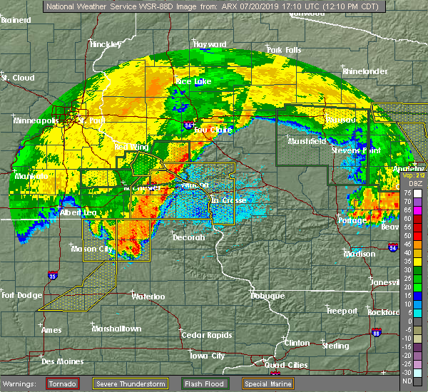 At 1210 pm cdt, severe thunderstorms were located along a line extending from near independence to near canton, moving east at 50 mph (radar indicated). Hazards include 60 mph wind gusts. expect damage to roofs, siding, and trees At 1210 pm cdt, severe thunderstorms were located along a line extending from near independence to near canton, moving east at 50 mph (radar indicated). Hazards include 60 mph wind gusts. expect damage to roofs, siding, and trees
|
| 7/20/2019 9:28 AM CDT |
 The severe thunderstorm warning for olmsted, wabasha and northwestern trempealeau counties will expire at 930 am cdt, the storms which prompted the warning have moved out of the area. therefore, the warning will be allowed to expire. a severe thunderstorm watch remains in effect until 400 pm cdt for southeastern minnesota, and west central wisconsin. The severe thunderstorm warning for olmsted, wabasha and northwestern trempealeau counties will expire at 930 am cdt, the storms which prompted the warning have moved out of the area. therefore, the warning will be allowed to expire. a severe thunderstorm watch remains in effect until 400 pm cdt for southeastern minnesota, and west central wisconsin.
|
| 7/20/2019 9:28 AM CDT |
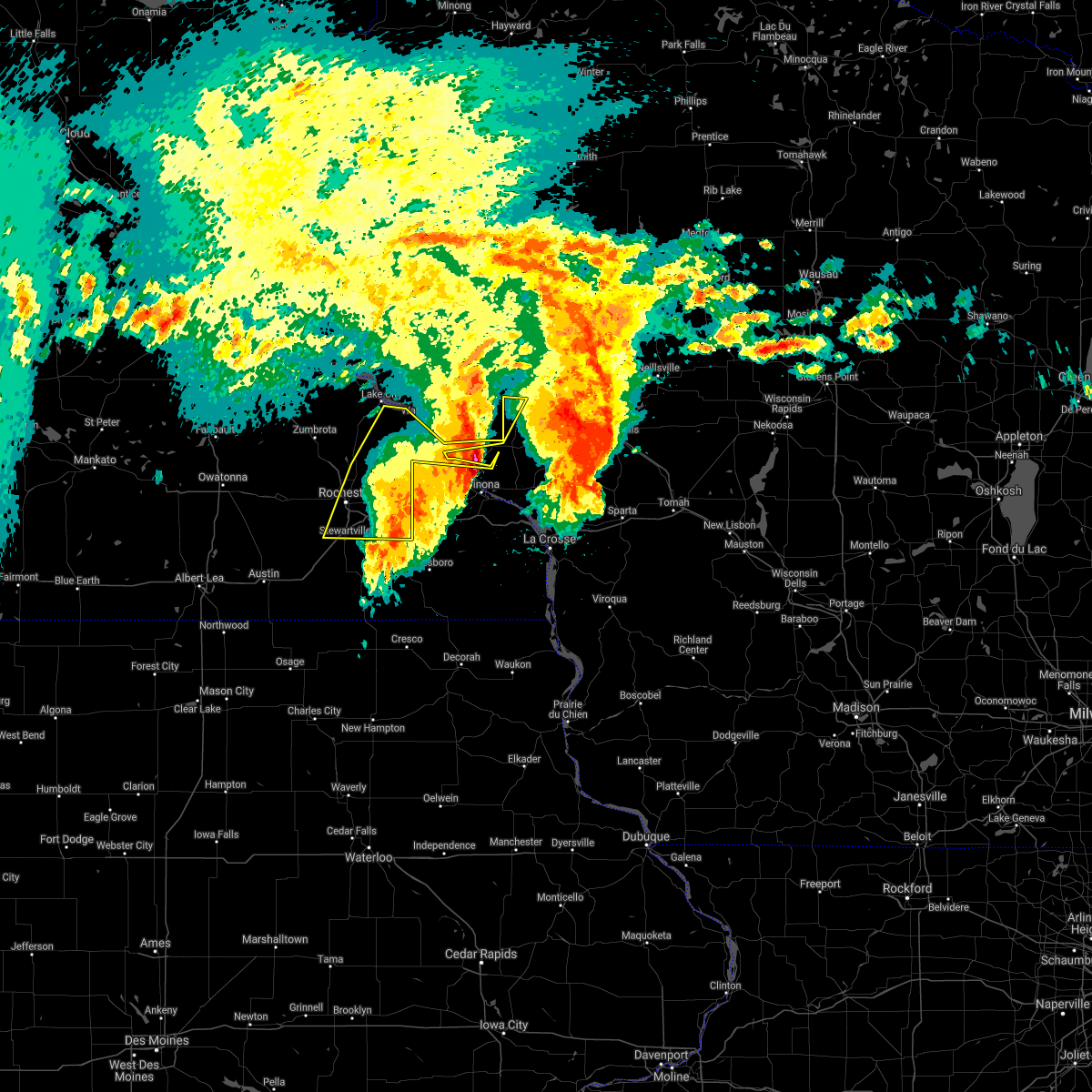 The severe thunderstorm warning for olmsted, wabasha and northwestern trempealeau counties will expire at 930 am cdt, the storms which prompted the warning have moved out of the area. therefore, the warning will be allowed to expire. a severe thunderstorm watch remains in effect until 400 pm cdt for southeastern minnesota, and west central wisconsin. The severe thunderstorm warning for olmsted, wabasha and northwestern trempealeau counties will expire at 930 am cdt, the storms which prompted the warning have moved out of the area. therefore, the warning will be allowed to expire. a severe thunderstorm watch remains in effect until 400 pm cdt for southeastern minnesota, and west central wisconsin.
|
| 7/20/2019 9:20 AM CDT |
 At 919 am cdt, severe thunderstorms were located along a line extending from 7 miles northeast of wabasha to near altura to chatfield, moving east at 50 mph (radar indicated). Hazards include 60 mph wind gusts. Expect damage to roofs, siding, and trees. severe thunderstorms will be near, lewiston around 925 am cdt. fountain city, stockton, rollingstone and modena around 930 am cdt. winona and goodview around 935 am cdt. dakota around 955 am cdt. Other locations impacted by these severe thunderstorms include pioneer campground, merrick state park, cream, i 90 exit 257, highway 88 and county o, ridgeway and county roads 28 and 31. At 919 am cdt, severe thunderstorms were located along a line extending from 7 miles northeast of wabasha to near altura to chatfield, moving east at 50 mph (radar indicated). Hazards include 60 mph wind gusts. Expect damage to roofs, siding, and trees. severe thunderstorms will be near, lewiston around 925 am cdt. fountain city, stockton, rollingstone and modena around 930 am cdt. winona and goodview around 935 am cdt. dakota around 955 am cdt. Other locations impacted by these severe thunderstorms include pioneer campground, merrick state park, cream, i 90 exit 257, highway 88 and county o, ridgeway and county roads 28 and 31.
|
| 7/20/2019 9:14 AM CDT |
 At 914 am cdt, severe thunderstorms were located along a line extending from near wabasha to 6 miles north of dover to 6 miles north of spring valley, moving east at 45 mph (trained weather spotters). Hazards include 60 mph wind gusts. Expect damage to roofs, siding, and trees. these severe storms will be near, kellogg around 920 am cdt. Other locations impacted by these severe thunderstorms include south troy, czechville, county roads 9 and 10, i 90 exit 218, potsdam, west albany and rochester airport. At 914 am cdt, severe thunderstorms were located along a line extending from near wabasha to 6 miles north of dover to 6 miles north of spring valley, moving east at 45 mph (trained weather spotters). Hazards include 60 mph wind gusts. Expect damage to roofs, siding, and trees. these severe storms will be near, kellogg around 920 am cdt. Other locations impacted by these severe thunderstorms include south troy, czechville, county roads 9 and 10, i 90 exit 218, potsdam, west albany and rochester airport.
|
| 7/20/2019 9:05 AM CDT |
 At 904 am cdt, severe thunderstorms were located along a line extending from pepin to near elgin to near stewartville, moving east at 50 mph (trained weather spotters). Hazards include 60 mph wind gusts. Expect damage to roofs, siding, and trees. these severe storms will be near, wabasha, plainview and dover around 910 am cdt. kellogg around 915 am cdt. chatfield around 920 am cdt. Other locations impacted by these severe thunderstorms include south troy, county roads 9 and 10, i 90 exit 218, potsdam, county roads 6 and 15, hidden meadows r v park and rock dell. At 904 am cdt, severe thunderstorms were located along a line extending from pepin to near elgin to near stewartville, moving east at 50 mph (trained weather spotters). Hazards include 60 mph wind gusts. Expect damage to roofs, siding, and trees. these severe storms will be near, wabasha, plainview and dover around 910 am cdt. kellogg around 915 am cdt. chatfield around 920 am cdt. Other locations impacted by these severe thunderstorms include south troy, county roads 9 and 10, i 90 exit 218, potsdam, county roads 6 and 15, hidden meadows r v park and rock dell.
|
| 7/20/2019 8:57 AM CDT |
 At 856 am cdt, severe thunderstorms were located along a line extending from near stockholm to near rochester to 7 miles southwest of stewartville, moving east at 55 mph. at 854 am, a spotter reported estimated 60 mph wind gusts in northwest rochester (trained weather spotters). Hazards include 60 mph wind gusts. Expect damage to roofs, siding, and trees. these severe storms will be near, eyota and elgin around 905 am cdt. wabasha, dover and kellogg around 910 am cdt. chatfield around 920 am cdt. Other locations impacted by these severe thunderstorms include south troy, county roads 9 and 10, i 90 exit 218, potsdam, county roads 6 and 15, hidden meadows r v park and rock dell. At 856 am cdt, severe thunderstorms were located along a line extending from near stockholm to near rochester to 7 miles southwest of stewartville, moving east at 55 mph. at 854 am, a spotter reported estimated 60 mph wind gusts in northwest rochester (trained weather spotters). Hazards include 60 mph wind gusts. Expect damage to roofs, siding, and trees. these severe storms will be near, eyota and elgin around 905 am cdt. wabasha, dover and kellogg around 910 am cdt. chatfield around 920 am cdt. Other locations impacted by these severe thunderstorms include south troy, county roads 9 and 10, i 90 exit 218, potsdam, county roads 6 and 15, hidden meadows r v park and rock dell.
|
| 7/20/2019 8:53 AM CDT |
 At 852 am cdt, severe thunderstorms were located along a line extending from near pepin to rochester to 7 miles southeast of hayfield, moving east at 45 mph (radar indicated). Hazards include 60 mph wind gusts. Expect damage to roofs, siding, and trees. these severe storms will be near, wabasha around 905 am cdt. stewartville, eyota and kellogg around 910 am cdt. dover around 920 am cdt. chatfield around 925 am cdt. Other locations impacted by these severe thunderstorms include south troy, county roads 9 and 10, i 90 exit 218, potsdam, county roads 6 and 15, hidden meadows r v park and rock dell. At 852 am cdt, severe thunderstorms were located along a line extending from near pepin to rochester to 7 miles southeast of hayfield, moving east at 45 mph (radar indicated). Hazards include 60 mph wind gusts. Expect damage to roofs, siding, and trees. these severe storms will be near, wabasha around 905 am cdt. stewartville, eyota and kellogg around 910 am cdt. dover around 920 am cdt. chatfield around 925 am cdt. Other locations impacted by these severe thunderstorms include south troy, county roads 9 and 10, i 90 exit 218, potsdam, county roads 6 and 15, hidden meadows r v park and rock dell.
|
| 7/20/2019 8:43 AM CDT |
 At 843 am cdt, severe thunderstorms were located along a line extending from near frontenac to byron to near hayfield, moving east at 45 mph (radar indicated). Hazards include 60 mph wind gusts. Expect damage to roofs, siding, and trees. severe thunderstorms will be near, rochester around 855 am cdt. wabasha and stewartville around 905 am cdt. eyota and kellogg around 910 am cdt. dover around 915 am cdt. chatfield around 925 am cdt. Other locations impacted by these severe thunderstorms include south troy, county roads 9 and 10, i 90 exit 218, potsdam, county roads 6 and 15, hidden meadows r v park and rock dell. At 843 am cdt, severe thunderstorms were located along a line extending from near frontenac to byron to near hayfield, moving east at 45 mph (radar indicated). Hazards include 60 mph wind gusts. Expect damage to roofs, siding, and trees. severe thunderstorms will be near, rochester around 855 am cdt. wabasha and stewartville around 905 am cdt. eyota and kellogg around 910 am cdt. dover around 915 am cdt. chatfield around 925 am cdt. Other locations impacted by these severe thunderstorms include south troy, county roads 9 and 10, i 90 exit 218, potsdam, county roads 6 and 15, hidden meadows r v park and rock dell.
|
| 7/20/2019 8:30 AM CDT |
 At 830 am cdt, severe thunderstorms were located along a line extending from near alma to 6 miles east of buffalo city to near rollingstone, moving east at 35 mph (radar indicated). Hazards include 60 mph wind gusts. Expect damage to roofs, siding, and trees. these severe storms will be near, winona around 835 am cdt. Other locations impacted by these severe thunderstorms include pioneer campground, merrick state park, czechville, lock and dam 5 a, dodge, cream and highway 88 and county o. At 830 am cdt, severe thunderstorms were located along a line extending from near alma to 6 miles east of buffalo city to near rollingstone, moving east at 35 mph (radar indicated). Hazards include 60 mph wind gusts. Expect damage to roofs, siding, and trees. these severe storms will be near, winona around 835 am cdt. Other locations impacted by these severe thunderstorms include pioneer campground, merrick state park, czechville, lock and dam 5 a, dodge, cream and highway 88 and county o.
|
| 7/20/2019 8:21 AM CDT |
 At 820 am cdt, severe thunderstorms were located along a line extending from near alma to near buffalo city to near altura, moving east at 35 mph (radar indicated). Hazards include 60 mph wind gusts. Expect damage to roofs, siding, and trees. these severe storms will be near, winona, goodview and fountain city around 835 am cdt. Other locations impacted by these severe thunderstorms include whitewater state park, pioneer campground, merrick state park, czechville, lock and dam 5 a, dodge and cream. At 820 am cdt, severe thunderstorms were located along a line extending from near alma to near buffalo city to near altura, moving east at 35 mph (radar indicated). Hazards include 60 mph wind gusts. Expect damage to roofs, siding, and trees. these severe storms will be near, winona, goodview and fountain city around 835 am cdt. Other locations impacted by these severe thunderstorms include whitewater state park, pioneer campground, merrick state park, czechville, lock and dam 5 a, dodge and cream.
|
| 7/20/2019 8:11 AM CDT |
 At 811 am cdt, severe thunderstorms were located along a line extending from kellogg to near buffalo to near altura, moving east at 30 mph (radar indicated). Hazards include 60 mph wind gusts. Expect damage to roofs, siding, and trees. these severe storms will be near, alma, buffalo and buffalo city around 820 am cdt. rollingstone around 825 am cdt. winona, goodview and fountain city around 835 am cdt. Other locations impacted by these severe thunderstorms include whitewater state park, pioneer campground, merrick state park, czechville, lock and dam 5 a, dodge and cream. At 811 am cdt, severe thunderstorms were located along a line extending from kellogg to near buffalo to near altura, moving east at 30 mph (radar indicated). Hazards include 60 mph wind gusts. Expect damage to roofs, siding, and trees. these severe storms will be near, alma, buffalo and buffalo city around 820 am cdt. rollingstone around 825 am cdt. winona, goodview and fountain city around 835 am cdt. Other locations impacted by these severe thunderstorms include whitewater state park, pioneer campground, merrick state park, czechville, lock and dam 5 a, dodge and cream.
|
| 7/20/2019 7:59 AM CDT |
 At 758 am cdt, severe thunderstorms were located along a line extending from 6 miles northeast of plainview to 6 miles north of st. charles, moving east at 20 mph (radar indicated). Hazards include 60 mph wind gusts. Expect damage to roofs, siding, and trees. severe thunderstorms will be near, kellogg around 815 am cdt. altura around 820 am cdt. buffalo and buffalo city around 825 am cdt. alma around 830 am cdt. stockton and rollingstone around 835 am cdt. winona, goodview and fountain city around 845 am cdt. Other locations impacted by these severe thunderstorms include whitewater state park, pioneer campground, merrick state park, czechville, lock and dam 5 a, dodge and cream. At 758 am cdt, severe thunderstorms were located along a line extending from 6 miles northeast of plainview to 6 miles north of st. charles, moving east at 20 mph (radar indicated). Hazards include 60 mph wind gusts. Expect damage to roofs, siding, and trees. severe thunderstorms will be near, kellogg around 815 am cdt. altura around 820 am cdt. buffalo and buffalo city around 825 am cdt. alma around 830 am cdt. stockton and rollingstone around 835 am cdt. winona, goodview and fountain city around 845 am cdt. Other locations impacted by these severe thunderstorms include whitewater state park, pioneer campground, merrick state park, czechville, lock and dam 5 a, dodge and cream.
|
| 7/15/2019 9:21 PM CDT |
 The severe thunderstorm warning for east central wabasha and northern buffalo counties will expire at 930 pm cdt, the storms which prompted the warning have moved out of the area. therefore, the warning will be allowed to expire. The severe thunderstorm warning for east central wabasha and northern buffalo counties will expire at 930 pm cdt, the storms which prompted the warning have moved out of the area. therefore, the warning will be allowed to expire.
|
| 7/15/2019 9:10 PM CDT |
 At 909 pm cdt, severe thunderstorms were located along a line extending from near mondovi to near buffalo city, moving east at 35 mph (radar indicated). Hazards include 60 mph wind gusts and penny size hail. Expect damage to roofs, siding, and trees. These severe thunderstorms will remain over mainly rural areas of east central wabasha and northern buffalo counties, including the following locations, gilmanton, pioneer campground, west newton, cream, highway 88 and county o, county roads f and k k and lock and dam 4. At 909 pm cdt, severe thunderstorms were located along a line extending from near mondovi to near buffalo city, moving east at 35 mph (radar indicated). Hazards include 60 mph wind gusts and penny size hail. Expect damage to roofs, siding, and trees. These severe thunderstorms will remain over mainly rural areas of east central wabasha and northern buffalo counties, including the following locations, gilmanton, pioneer campground, west newton, cream, highway 88 and county o, county roads f and k k and lock and dam 4.
|
| 7/15/2019 8:46 PM CDT |
 At 845 pm cdt, severe thunderstorms were located along a line extending from near durand to near wabasha, moving southeast at 30 mph (radar indicated). Hazards include 60 mph wind gusts and penny size hail. Expect damage to roofs, siding, and trees. severe thunderstorms will be near, wabasha around 850 pm cdt. kellogg around 855 pm cdt. alma around 905 pm cdt. buffalo city and modena around 910 pm cdt. mondovi and buffalo around 915 pm cdt. Other locations impacted by these severe thunderstorms include pioneer campground, cream, rattlesnake ridge, theilman and maple springs. At 845 pm cdt, severe thunderstorms were located along a line extending from near durand to near wabasha, moving southeast at 30 mph (radar indicated). Hazards include 60 mph wind gusts and penny size hail. Expect damage to roofs, siding, and trees. severe thunderstorms will be near, wabasha around 850 pm cdt. kellogg around 855 pm cdt. alma around 905 pm cdt. buffalo city and modena around 910 pm cdt. mondovi and buffalo around 915 pm cdt. Other locations impacted by these severe thunderstorms include pioneer campground, cream, rattlesnake ridge, theilman and maple springs.
|
| 6/4/2019 6:52 PM CDT |
 The severe thunderstorm warning for northwestern winona, eastern wabasha and western buffalo counties will expire at 700 pm cdt, the storms which prompted the warning have moved out of the area. therefore, the warning will be allowed to expire. however gusty winds are still possible with these thunderstorms. a severe thunderstorm watch remains in effect until 1100 pm cdt for southeastern minnesota, and west central wisconsin. severe thunderstorm warnings still remain in effect for much of southern winona county. The severe thunderstorm warning for northwestern winona, eastern wabasha and western buffalo counties will expire at 700 pm cdt, the storms which prompted the warning have moved out of the area. therefore, the warning will be allowed to expire. however gusty winds are still possible with these thunderstorms. a severe thunderstorm watch remains in effect until 1100 pm cdt for southeastern minnesota, and west central wisconsin. severe thunderstorm warnings still remain in effect for much of southern winona county.
|
| 6/4/2019 6:26 PM CDT |
 At 626 pm cdt, severe thunderstorms were located along a line extending from near modena to near altura, moving east at 35 mph (radar indicated). Hazards include 60 mph wind gusts and quarter size hail. Hail damage to vehicles is expected. expect wind damage to roofs, siding, and trees. these severe storms will be near, fountain city around 640 pm cdt. Other locations impacted by these severe thunderstorms include pioneer campground, merrick state park, czechville, cream, highway 88 and county o, whitman and county roads 28 and 31. At 626 pm cdt, severe thunderstorms were located along a line extending from near modena to near altura, moving east at 35 mph (radar indicated). Hazards include 60 mph wind gusts and quarter size hail. Hail damage to vehicles is expected. expect wind damage to roofs, siding, and trees. these severe storms will be near, fountain city around 640 pm cdt. Other locations impacted by these severe thunderstorms include pioneer campground, merrick state park, czechville, cream, highway 88 and county o, whitman and county roads 28 and 31.
|
| 6/4/2019 5:58 PM CDT |
 At 557 pm cdt, severe thunderstorms were located along a line extending from near plum city to near elgin, moving east at 45 mph (radar indicated). Hazards include ping pong ball size hail and 60 mph wind gusts. People and animals outdoors will be injured. expect hail damage to roofs, siding, windows, and vehicles. expect wind damage to roofs, siding, and trees. severe thunderstorms will be near, buffalo and modena around 620 pm cdt. fountain city around 630 pm cdt. Other locations impacted by these severe thunderstorms include pioneer campground, merrick state park, cream, highway 88 and county o, county roads 28 and 31, county roads f and k k and rattlesnake ridge. At 557 pm cdt, severe thunderstorms were located along a line extending from near plum city to near elgin, moving east at 45 mph (radar indicated). Hazards include ping pong ball size hail and 60 mph wind gusts. People and animals outdoors will be injured. expect hail damage to roofs, siding, windows, and vehicles. expect wind damage to roofs, siding, and trees. severe thunderstorms will be near, buffalo and modena around 620 pm cdt. fountain city around 630 pm cdt. Other locations impacted by these severe thunderstorms include pioneer campground, merrick state park, cream, highway 88 and county o, county roads 28 and 31, county roads f and k k and rattlesnake ridge.
|
| 9/20/2018 7:47 PM CDT |
 At 745 pm cdt, severe thunderstorms were located along a line extending from 6 miles southeast of durand to near eyota, moving east at 65 mph (trained weather spotters. the rochester airport, spotters, and the top of the mayo clinic reported 35 to 50 mph wind gusts between 715 to 745 pm). Hazards include 60 mph wind gusts. Expect damage to roofs, siding, and trees. these severe storms will be near, mondovi and modena around 750 pm cdt. rollingstone around 800 pm cdt. other locations impacted by these severe thunderstorms include saratoga, viola, cochrane, gilmanton and west newton. A tornado watch remains in effect until midnight cdt for southeastern minnesota, and west central wisconsin. At 745 pm cdt, severe thunderstorms were located along a line extending from 6 miles southeast of durand to near eyota, moving east at 65 mph (trained weather spotters. the rochester airport, spotters, and the top of the mayo clinic reported 35 to 50 mph wind gusts between 715 to 745 pm). Hazards include 60 mph wind gusts. Expect damage to roofs, siding, and trees. these severe storms will be near, mondovi and modena around 750 pm cdt. rollingstone around 800 pm cdt. other locations impacted by these severe thunderstorms include saratoga, viola, cochrane, gilmanton and west newton. A tornado watch remains in effect until midnight cdt for southeastern minnesota, and west central wisconsin.
|
| 9/20/2018 7:47 PM CDT |
 At 721 pm cdt, severe thunderstorms were located along a line extending from near red wing to austin, moving northeast at 65 mph (trained weather spotters. these storms have a history of localized damaging winds to 70 mph and brief tornadoes). Hazards include 70 mph wind gusts. Expect considerable tree damage. damage is likely to mobile homes, roofs, and outbuildings. these severe storms will be near, rochester around 735 pm cdt. chatfield and eyota around 745 pm cdt. mondovi and dover around 750 pm cdt. st. charles around 755 pm cdt. lewiston, altura and rollingstone around 800 pm cdt. other locations impacted by these severe thunderstorms include marion, pleasant grove, saratoga, viola and cochrane. A tornado watch remains in effect until midnight cdt for southeastern minnesota, and west central wisconsin. At 721 pm cdt, severe thunderstorms were located along a line extending from near red wing to austin, moving northeast at 65 mph (trained weather spotters. these storms have a history of localized damaging winds to 70 mph and brief tornadoes). Hazards include 70 mph wind gusts. Expect considerable tree damage. damage is likely to mobile homes, roofs, and outbuildings. these severe storms will be near, rochester around 735 pm cdt. chatfield and eyota around 745 pm cdt. mondovi and dover around 750 pm cdt. st. charles around 755 pm cdt. lewiston, altura and rollingstone around 800 pm cdt. other locations impacted by these severe thunderstorms include marion, pleasant grove, saratoga, viola and cochrane. A tornado watch remains in effect until midnight cdt for southeastern minnesota, and west central wisconsin.
|
| 9/20/2018 7:42 PM CDT |
 At 721 pm cdt, severe thunderstorms were located along a line extending from near red wing to austin, moving northeast at 65 mph (trained weather spotters. these storms have a history of localized damaging winds to 70 mph and brief tornadoes). Hazards include 70 mph wind gusts. Expect considerable tree damage. damage is likely to mobile homes, roofs, and outbuildings. these severe storms will be near, rochester around 735 pm cdt. chatfield and eyota around 745 pm cdt. mondovi and dover around 750 pm cdt. st. charles around 755 pm cdt. lewiston, altura and rollingstone around 800 pm cdt. other locations impacted by these severe thunderstorms include marion, pleasant grove, saratoga, viola and cochrane. A tornado watch remains in effect until midnight cdt for southeastern minnesota, and west central wisconsin. At 721 pm cdt, severe thunderstorms were located along a line extending from near red wing to austin, moving northeast at 65 mph (trained weather spotters. these storms have a history of localized damaging winds to 70 mph and brief tornadoes). Hazards include 70 mph wind gusts. Expect considerable tree damage. damage is likely to mobile homes, roofs, and outbuildings. these severe storms will be near, rochester around 735 pm cdt. chatfield and eyota around 745 pm cdt. mondovi and dover around 750 pm cdt. st. charles around 755 pm cdt. lewiston, altura and rollingstone around 800 pm cdt. other locations impacted by these severe thunderstorms include marion, pleasant grove, saratoga, viola and cochrane. A tornado watch remains in effect until midnight cdt for southeastern minnesota, and west central wisconsin.
|
| 9/20/2018 7:32 PM CDT |
 At 729 pm cdt, severe thunderstorms were located along a line extending from near stockholm to near stewartville, moving northeast at 75 mph (trained weather spotters have reported trees down in cannon falls). Hazards include 70 mph wind gusts. Expect considerable tree damage. damage is likely to mobile homes, roofs, and outbuildings. these severe storms will be near, dover and elgin around 745 pm cdt. mondovi, st. charles and plainview around 750 pm cdt. altura and lewiston around 755 pm cdt. alma, rollingstone, buffalo and buffalo city around 800 pm cdt. the most severe winds near 70 mph and possible tornadoes are more likely in northern wabasha and northern buffalo county. other locations impacted by these severe thunderstorms include marion, pleasant grove, saratoga, viola and cochrane. A tornado watch remains in effect until midnight cdt for southeastern minnesota, and west central wisconsin. At 729 pm cdt, severe thunderstorms were located along a line extending from near stockholm to near stewartville, moving northeast at 75 mph (trained weather spotters have reported trees down in cannon falls). Hazards include 70 mph wind gusts. Expect considerable tree damage. damage is likely to mobile homes, roofs, and outbuildings. these severe storms will be near, dover and elgin around 745 pm cdt. mondovi, st. charles and plainview around 750 pm cdt. altura and lewiston around 755 pm cdt. alma, rollingstone, buffalo and buffalo city around 800 pm cdt. the most severe winds near 70 mph and possible tornadoes are more likely in northern wabasha and northern buffalo county. other locations impacted by these severe thunderstorms include marion, pleasant grove, saratoga, viola and cochrane. A tornado watch remains in effect until midnight cdt for southeastern minnesota, and west central wisconsin.
|
| 9/20/2018 7:32 PM CDT |
 At 721 pm cdt, severe thunderstorms were located along a line extending from near red wing to austin, moving northeast at 65 mph (trained weather spotters. these storms have a history of localized damaging winds to 70 mph and brief tornadoes). Hazards include 70 mph wind gusts. Expect considerable tree damage. damage is likely to mobile homes, roofs, and outbuildings. these severe storms will be near, rochester around 735 pm cdt. chatfield and eyota around 745 pm cdt. mondovi and dover around 750 pm cdt. st. charles around 755 pm cdt. lewiston, altura and rollingstone around 800 pm cdt. other locations impacted by these severe thunderstorms include marion, pleasant grove, saratoga, viola and cochrane. A tornado watch remains in effect until midnight cdt for southeastern minnesota, and west central wisconsin. At 721 pm cdt, severe thunderstorms were located along a line extending from near red wing to austin, moving northeast at 65 mph (trained weather spotters. these storms have a history of localized damaging winds to 70 mph and brief tornadoes). Hazards include 70 mph wind gusts. Expect considerable tree damage. damage is likely to mobile homes, roofs, and outbuildings. these severe storms will be near, rochester around 735 pm cdt. chatfield and eyota around 745 pm cdt. mondovi and dover around 750 pm cdt. st. charles around 755 pm cdt. lewiston, altura and rollingstone around 800 pm cdt. other locations impacted by these severe thunderstorms include marion, pleasant grove, saratoga, viola and cochrane. A tornado watch remains in effect until midnight cdt for southeastern minnesota, and west central wisconsin.
|
| 9/20/2018 7:23 PM CDT |
 At 721 pm cdt, severe thunderstorms were located along a line extending from near red wing to austin, moving northeast at 65 mph (trained weather spotters. these storms have a history of localized damaging winds to 70 mph and brief tornadoes). Hazards include 70 mph wind gusts. Expect considerable tree damage. damage is likely to mobile homes, roofs, and outbuildings. these severe storms will be near, rochester around 735 pm cdt. chatfield and eyota around 745 pm cdt. mondovi and dover around 750 pm cdt. st. charles around 755 pm cdt. lewiston, altura and rollingstone around 800 pm cdt. other locations impacted by these severe thunderstorms include marion, pleasant grove, saratoga, viola and cochrane. A tornado watch remains in effect until midnight cdt for southeastern minnesota, and west central wisconsin. At 721 pm cdt, severe thunderstorms were located along a line extending from near red wing to austin, moving northeast at 65 mph (trained weather spotters. these storms have a history of localized damaging winds to 70 mph and brief tornadoes). Hazards include 70 mph wind gusts. Expect considerable tree damage. damage is likely to mobile homes, roofs, and outbuildings. these severe storms will be near, rochester around 735 pm cdt. chatfield and eyota around 745 pm cdt. mondovi and dover around 750 pm cdt. st. charles around 755 pm cdt. lewiston, altura and rollingstone around 800 pm cdt. other locations impacted by these severe thunderstorms include marion, pleasant grove, saratoga, viola and cochrane. A tornado watch remains in effect until midnight cdt for southeastern minnesota, and west central wisconsin.
|
| 9/20/2018 7:04 PM CDT |
 The national weather service in la crosse has issued a * severe thunderstorm warning for. western winona county in southeastern minnesota. eastern olmsted county in southeastern minnesota. wabasha county in southeastern minnesota. Western buffalo county in west central wisconsin. The national weather service in la crosse has issued a * severe thunderstorm warning for. western winona county in southeastern minnesota. eastern olmsted county in southeastern minnesota. wabasha county in southeastern minnesota. Western buffalo county in west central wisconsin.
|
| 9/20/2018 7:04 PM CDT |
 At 702 pm cdt, severe thunderstorms were located along a line extending from near goodhue to near london, moving east at 70 mph (trained weather spotters and law enforcement have reported wind damage, wind gusts to 70 mph, and brief tornadoes with this line of storms). Hazards include 70 mph wind gusts. Expect considerable tree damage. damage is likely to mobile homes, roofs, and outbuildings. severe thunderstorms will be near, mazeppa around 710 pm cdt. wabasha around 730 pm cdt. modena around 740 pm cdt. mondovi around 750 pm cdt. other locations impacted by these severe thunderstorms include marion, pleasant grove, saratoga, viola and cochrane. A tornado watch remains in effect until midnight cdt for southeastern minnesota, and west central wisconsin. At 702 pm cdt, severe thunderstorms were located along a line extending from near goodhue to near london, moving east at 70 mph (trained weather spotters and law enforcement have reported wind damage, wind gusts to 70 mph, and brief tornadoes with this line of storms). Hazards include 70 mph wind gusts. Expect considerable tree damage. damage is likely to mobile homes, roofs, and outbuildings. severe thunderstorms will be near, mazeppa around 710 pm cdt. wabasha around 730 pm cdt. modena around 740 pm cdt. mondovi around 750 pm cdt. other locations impacted by these severe thunderstorms include marion, pleasant grove, saratoga, viola and cochrane. A tornado watch remains in effect until midnight cdt for southeastern minnesota, and west central wisconsin.
|
| 8/27/2018 6:29 PM CDT |
 At 627 pm cdt, severe thunderstorms were located along a line extending from near menomonie to buffalo city to near chatfield, moving northeast at 55 mph. these storms have a history of 40 to 55 mph wind gusts (radar indicated). Hazards include 60 mph wind gusts. Expect damage to roofs, siding, and trees. these severe storms will be near, arcadia around 645 pm cdt. lewiston around 650 pm cdt. independence around 655 pm cdt. whitehall, stockton and blair around 700 pm cdt. Other locations impacted by these severe thunderstorms include dodge, franklin, new hartford, york and eleva. At 627 pm cdt, severe thunderstorms were located along a line extending from near menomonie to buffalo city to near chatfield, moving northeast at 55 mph. these storms have a history of 40 to 55 mph wind gusts (radar indicated). Hazards include 60 mph wind gusts. Expect damage to roofs, siding, and trees. these severe storms will be near, arcadia around 645 pm cdt. lewiston around 650 pm cdt. independence around 655 pm cdt. whitehall, stockton and blair around 700 pm cdt. Other locations impacted by these severe thunderstorms include dodge, franklin, new hartford, york and eleva.
|
| 8/27/2018 6:29 PM CDT |
 At 606 pm cdt, severe thunderstorms were located along a line extending from near elmwood to near plainview to near stewartville, moving northeast at 60 mph (radar indicated). Hazards include 60 mph wind gusts. Expect damage to roofs, siding, and trees. severe thunderstorms will be near, buffalo and buffalo city around 625 pm cdt. arcadia and lewiston around 640 pm cdt. stockton and rollingstone around 645 pm cdt. winona, independence, goodview and fountain city around 650 pm cdt. Other locations impacted by these severe thunderstorms include dodge, franklin, new hartford, york and eleva. At 606 pm cdt, severe thunderstorms were located along a line extending from near elmwood to near plainview to near stewartville, moving northeast at 60 mph (radar indicated). Hazards include 60 mph wind gusts. Expect damage to roofs, siding, and trees. severe thunderstorms will be near, buffalo and buffalo city around 625 pm cdt. arcadia and lewiston around 640 pm cdt. stockton and rollingstone around 645 pm cdt. winona, independence, goodview and fountain city around 650 pm cdt. Other locations impacted by these severe thunderstorms include dodge, franklin, new hartford, york and eleva.
|
| 8/27/2018 6:07 PM CDT |
 At 606 pm cdt, severe thunderstorms were located along a line extending from near elmwood to near plainview to near stewartville, moving northeast at 60 mph (radar indicated). Hazards include 60 mph wind gusts. Expect damage to roofs, siding, and trees. severe thunderstorms will be near, buffalo and buffalo city around 625 pm cdt. arcadia and lewiston around 640 pm cdt. stockton and rollingstone around 645 pm cdt. winona, independence, goodview and fountain city around 650 pm cdt. Other locations impacted by these severe thunderstorms include dodge, franklin, new hartford, york and eleva. At 606 pm cdt, severe thunderstorms were located along a line extending from near elmwood to near plainview to near stewartville, moving northeast at 60 mph (radar indicated). Hazards include 60 mph wind gusts. Expect damage to roofs, siding, and trees. severe thunderstorms will be near, buffalo and buffalo city around 625 pm cdt. arcadia and lewiston around 640 pm cdt. stockton and rollingstone around 645 pm cdt. winona, independence, goodview and fountain city around 650 pm cdt. Other locations impacted by these severe thunderstorms include dodge, franklin, new hartford, york and eleva.
|
| 7/12/2018 9:20 PM CDT |
 At 919 pm cdt, severe thunderstorms were located along a line extending from near mondovi to near buffalo city, moving east at 45 mph (radar indicated). Hazards include 60 mph wind gusts. Expect damage to roofs, siding, and trees. these severe storms will be near, mondovi around 925 pm cdt. Other locations impacted by these severe thunderstorms include waumandee, cochrane, gilmanton, west newton and montana. At 919 pm cdt, severe thunderstorms were located along a line extending from near mondovi to near buffalo city, moving east at 45 mph (radar indicated). Hazards include 60 mph wind gusts. Expect damage to roofs, siding, and trees. these severe storms will be near, mondovi around 925 pm cdt. Other locations impacted by these severe thunderstorms include waumandee, cochrane, gilmanton, west newton and montana.
|
| 7/12/2018 9:15 PM CDT |
 At 915 pm cdt, severe thunderstorms were located along a line extending from near modena to near buffalo, moving east at 45 mph (radar indicated). Hazards include 60 mph wind gusts. Expect damage to roofs, siding, and trees. these severe storms will be near, mondovi and fountain city around 925 pm cdt. Other locations impacted by these severe thunderstorms include waumandee, cochrane, gilmanton, west newton and montana. At 915 pm cdt, severe thunderstorms were located along a line extending from near modena to near buffalo, moving east at 45 mph (radar indicated). Hazards include 60 mph wind gusts. Expect damage to roofs, siding, and trees. these severe storms will be near, mondovi and fountain city around 925 pm cdt. Other locations impacted by these severe thunderstorms include waumandee, cochrane, gilmanton, west newton and montana.
|
| 7/12/2018 9:11 PM CDT |
 At 911 pm cdt, severe thunderstorms were located along a line extending from near modena to near buffalo, moving east at 45 mph (radar indicated). Hazards include 60 mph wind gusts. Expect damage to roofs, siding, and trees. these severe storms will be near, modena around 915 pm cdt. fountain city around 920 pm cdt. mondovi around 925 pm cdt. Other locations impacted by these severe thunderstorms include waumandee, cochrane, gilmanton, west newton and nelson. At 911 pm cdt, severe thunderstorms were located along a line extending from near modena to near buffalo, moving east at 45 mph (radar indicated). Hazards include 60 mph wind gusts. Expect damage to roofs, siding, and trees. these severe storms will be near, modena around 915 pm cdt. fountain city around 920 pm cdt. mondovi around 925 pm cdt. Other locations impacted by these severe thunderstorms include waumandee, cochrane, gilmanton, west newton and nelson.
|
| 7/12/2018 9:05 PM CDT |
 At 905 pm cdt, severe thunderstorms were located along a line extending from 7 miles northwest of modena to near buffalo, moving east at 35 mph (radar indicated). Hazards include 60 mph wind gusts. Expect damage to roofs, siding, and trees. these severe storms will be near, modena around 915 pm cdt. fountain city around 920 pm cdt. mondovi around 925 pm cdt. Other locations impacted by these severe thunderstorms include waumandee, cochrane, gilmanton, west newton and nelson. At 905 pm cdt, severe thunderstorms were located along a line extending from 7 miles northwest of modena to near buffalo, moving east at 35 mph (radar indicated). Hazards include 60 mph wind gusts. Expect damage to roofs, siding, and trees. these severe storms will be near, modena around 915 pm cdt. fountain city around 920 pm cdt. mondovi around 925 pm cdt. Other locations impacted by these severe thunderstorms include waumandee, cochrane, gilmanton, west newton and nelson.
|
| 7/12/2018 8:57 PM CDT |
 At 856 pm cdt, severe thunderstorms were located along a line extending from near durand to near st. charles, moving east at 45 mph (radar indicated). Hazards include 60 mph wind gusts. Expect damage to roofs, siding, and trees. these severe storms will be near, modena and buffalo around 910 pm cdt. mondovi and fountain city around 920 pm cdt. Other locations impacted by these severe thunderstorms include waumandee, cochrane, gilmanton, west newton and west albany. At 856 pm cdt, severe thunderstorms were located along a line extending from near durand to near st. charles, moving east at 45 mph (radar indicated). Hazards include 60 mph wind gusts. Expect damage to roofs, siding, and trees. these severe storms will be near, modena and buffalo around 910 pm cdt. mondovi and fountain city around 920 pm cdt. Other locations impacted by these severe thunderstorms include waumandee, cochrane, gilmanton, west newton and west albany.
|
| 7/12/2018 8:49 PM CDT |
 At 849 pm cdt, severe thunderstorms were located along a line extending from 7 miles southeast of plum city to near dover, moving east at 45 mph (radar indicated). Hazards include 60 mph wind gusts. Expect damage to roofs, siding, and trees. severe thunderstorms will be near, wabasha around 855 pm cdt. modena and buffalo around 910 pm cdt. mondovi and fountain city around 920 pm cdt. Other locations impacted by these severe thunderstorms include waumandee, cochrane, gilmanton, west newton and west albany. At 849 pm cdt, severe thunderstorms were located along a line extending from 7 miles southeast of plum city to near dover, moving east at 45 mph (radar indicated). Hazards include 60 mph wind gusts. Expect damage to roofs, siding, and trees. severe thunderstorms will be near, wabasha around 855 pm cdt. modena and buffalo around 910 pm cdt. mondovi and fountain city around 920 pm cdt. Other locations impacted by these severe thunderstorms include waumandee, cochrane, gilmanton, west newton and west albany.
|
| 7/12/2018 8:20 PM CDT |
 At 818 pm cdt, severe thunderstorms were located along a line extending from near humbird to 6 miles northwest of galesville, moving east at 35 mph (radar indicated). Hazards include 60 mph wind gusts. Expect damage to roofs, siding, and trees. these severe storms will be near, humbird and hatfield around 825 pm cdt. neillsville and shortville around 830 pm cdt. these storms have a history of producing wind damage. at 724 pm, this line blew down trees near mondovi. Other locations impacted by these severe thunderstorms include franklin, york, irving, northfield and merrillan. At 818 pm cdt, severe thunderstorms were located along a line extending from near humbird to 6 miles northwest of galesville, moving east at 35 mph (radar indicated). Hazards include 60 mph wind gusts. Expect damage to roofs, siding, and trees. these severe storms will be near, humbird and hatfield around 825 pm cdt. neillsville and shortville around 830 pm cdt. these storms have a history of producing wind damage. at 724 pm, this line blew down trees near mondovi. Other locations impacted by these severe thunderstorms include franklin, york, irving, northfield and merrillan.
|
| 7/12/2018 8:12 PM CDT |
 At 812 pm cdt, severe thunderstorms were located along a line extending from near price to 6 miles southwest of arcadia, moving east at 35 mph (radar indicated). Hazards include 60 mph wind gusts. Expect damage to roofs, siding, and trees. these severe storms will be near, price around 815 pm cdt. humbird around 820 pm cdt. neillsville, hatfield, north bend and blair around 830 pm cdt. Other locations impacted by these severe thunderstorms include franklin, york, irving, northfield and merrillan. At 812 pm cdt, severe thunderstorms were located along a line extending from near price to 6 miles southwest of arcadia, moving east at 35 mph (radar indicated). Hazards include 60 mph wind gusts. Expect damage to roofs, siding, and trees. these severe storms will be near, price around 815 pm cdt. humbird around 820 pm cdt. neillsville, hatfield, north bend and blair around 830 pm cdt. Other locations impacted by these severe thunderstorms include franklin, york, irving, northfield and merrillan.
|
| 7/12/2018 8:01 PM CDT |
 At 800 pm cdt, severe thunderstorms were located along a line extending from price to near fountain city, moving east at 35 mph (radar indicated). Hazards include 60 mph wind gusts. Expect damage to roofs, siding, and trees. these severe storms will be near, price and osseo around 805 pm cdt. humbird around 810 pm cdt. hatfield around 820 pm cdt. neillsville and blair around 825 pm cdt. shortville and north bend around 830 pm cdt. Other locations impacted by these severe thunderstorms include franklin, york, irving, northfield and merrillan. At 800 pm cdt, severe thunderstorms were located along a line extending from price to near fountain city, moving east at 35 mph (radar indicated). Hazards include 60 mph wind gusts. Expect damage to roofs, siding, and trees. these severe storms will be near, price and osseo around 805 pm cdt. humbird around 810 pm cdt. hatfield around 820 pm cdt. neillsville and blair around 825 pm cdt. shortville and north bend around 830 pm cdt. Other locations impacted by these severe thunderstorms include franklin, york, irving, northfield and merrillan.
|
| 7/12/2018 7:50 PM CDT |
 At 749 pm cdt, severe thunderstorms were located along a line extending from osseo to near buffalo city, moving east at 35 mph (radar indicated). Hazards include 60 mph wind gusts. Expect damage to roofs, siding, and trees. these severe storms will be near, osseo around 755 pm cdt. price around 800 pm cdt. arcadia and humbird around 815 pm cdt. neillsville, black river falls, hatfield and north bend around 830 pm cdt. Other locations impacted by these severe thunderstorms include franklin, york, irving, northfield and merrillan. At 749 pm cdt, severe thunderstorms were located along a line extending from osseo to near buffalo city, moving east at 35 mph (radar indicated). Hazards include 60 mph wind gusts. Expect damage to roofs, siding, and trees. these severe storms will be near, osseo around 755 pm cdt. price around 800 pm cdt. arcadia and humbird around 815 pm cdt. neillsville, black river falls, hatfield and north bend around 830 pm cdt. Other locations impacted by these severe thunderstorms include franklin, york, irving, northfield and merrillan.
|
| 7/12/2018 7:38 PM CDT |
 At 737 pm cdt, severe thunderstorms were located along a line extending from near osseo to 7 miles east of buffalo city, moving east at 45 mph (radar indicated). Hazards include 60 mph wind gusts. Expect damage to roofs, siding, and trees. severe thunderstorms will be near, price and osseo around 745 pm cdt. humbird around 755 pm cdt. hatfield and blair around 800 pm cdt. neillsville and north bend around 805 pm cdt. shortville around 810 pm cdt. millston around 825 pm cdt. Other locations impacted by these severe thunderstorms include franklin, york, irving, northfield and merrillan. At 737 pm cdt, severe thunderstorms were located along a line extending from near osseo to 7 miles east of buffalo city, moving east at 45 mph (radar indicated). Hazards include 60 mph wind gusts. Expect damage to roofs, siding, and trees. severe thunderstorms will be near, price and osseo around 745 pm cdt. humbird around 755 pm cdt. hatfield and blair around 800 pm cdt. neillsville and north bend around 805 pm cdt. shortville around 810 pm cdt. millston around 825 pm cdt. Other locations impacted by these severe thunderstorms include franklin, york, irving, northfield and merrillan.
|
| 7/19/2017 11:35 PM CDT | Power line down. time estimated from rada in buffalo county WI, 6.8 miles SSE of Cochrane, WI |
| 7/6/2017 6:59 PM CDT |
 At 651 pm cdt, a severe thunderstorm was located near buffalo city, or 11 miles southeast of alma, moving southeast at 15 mph. this storm has strengthened and is now capable of producing golf ball sized hail (radar indicated). Hazards include golf ball size hail. People and animals outdoors will be injured. expect damage to roofs, siding, windows, and vehicles. Locations impacted include, arcadia, alma, buffalo, buffalo city, fountain city, dodge, waumandee, cochrane, merrick state park, cream, highway 88 and county o, highway 95 and county g, highway 95 and county c, herold, czechville, bluff siding, and marshland. At 651 pm cdt, a severe thunderstorm was located near buffalo city, or 11 miles southeast of alma, moving southeast at 15 mph. this storm has strengthened and is now capable of producing golf ball sized hail (radar indicated). Hazards include golf ball size hail. People and animals outdoors will be injured. expect damage to roofs, siding, windows, and vehicles. Locations impacted include, arcadia, alma, buffalo, buffalo city, fountain city, dodge, waumandee, cochrane, merrick state park, cream, highway 88 and county o, highway 95 and county g, highway 95 and county c, herold, czechville, bluff siding, and marshland.
|
| 7/6/2017 6:52 PM CDT |
 At 651 pm cdt, a severe thunderstorm was located near buffalo city, or 11 miles southeast of alma, moving southeast at 15 mph. this storm has strengthened and is now capable of producing golf ball sized hail (radar indicated). Hazards include golf ball size hail. People and animals outdoors will be injured. expect damage to roofs, siding, windows, and vehicles. Locations impacted include, arcadia, alma, buffalo, buffalo city, fountain city, dodge, waumandee, cochrane, merrick state park, cream, highway 88 and county o, highway 95 and county g, highway 95 and county c, herold, czechville, bluff siding, and marshland. At 651 pm cdt, a severe thunderstorm was located near buffalo city, or 11 miles southeast of alma, moving southeast at 15 mph. this storm has strengthened and is now capable of producing golf ball sized hail (radar indicated). Hazards include golf ball size hail. People and animals outdoors will be injured. expect damage to roofs, siding, windows, and vehicles. Locations impacted include, arcadia, alma, buffalo, buffalo city, fountain city, dodge, waumandee, cochrane, merrick state park, cream, highway 88 and county o, highway 95 and county g, highway 95 and county c, herold, czechville, bluff siding, and marshland.
|
| 7/6/2017 6:51 PM CDT | Golf Ball sized hail reported 0.3 miles SSE of Cochrane, WI, law enforcement reported golf ball size hail near the city of cochrane |
| 7/6/2017 6:44 PM CDT |
 At 643 pm cdt, a severe thunderstorm was located over buffalo city, or 9 miles southeast of alma, moving southeast at 15 mph (radar indicated). Hazards include half dollar size hail. damage to vehicles is expected At 643 pm cdt, a severe thunderstorm was located over buffalo city, or 9 miles southeast of alma, moving southeast at 15 mph (radar indicated). Hazards include half dollar size hail. damage to vehicles is expected
|
| 6/16/2017 6:30 PM CDT | Ping Pong Ball sized hail reported 11.5 miles SW of Cochrane, WI, lots of crop damage reported. |
| 6/16/2017 6:09 PM CDT |
 At 609 pm cdt, a severe thunderstorm was located near buffalo city, or 11 miles southeast of alma, moving east at 30 mph (radar indicated). Hazards include quarter size hail. Damage to vehicles is expected. Locations impacted include, buffalo, buffalo city, waumandee, cochrane, montana, czechville, highway 88 and county o, highway 95 and county c and lock and dam 5. At 609 pm cdt, a severe thunderstorm was located near buffalo city, or 11 miles southeast of alma, moving east at 30 mph (radar indicated). Hazards include quarter size hail. Damage to vehicles is expected. Locations impacted include, buffalo, buffalo city, waumandee, cochrane, montana, czechville, highway 88 and county o, highway 95 and county c and lock and dam 5.
|
| 6/16/2017 6:00 PM CDT | Half Dollar sized hail reported 1 miles WSW of Cochrane, WI |
| 6/16/2017 5:58 PM CDT |
 At 558 pm cdt, a severe thunderstorm was located near buffalo, or 10 miles south of alma, moving east at 30 mph (radar indicated). Hazards include golf ball size hail. People and animals outdoors will be injured. expect damage to roofs, siding, windows, and vehicles. This severe thunderstorm will remain over mainly rural areas of northwestern winona, east central wabasha and southeastern buffalo counties, including the following locations: waumandee, cochrane, montana, minneiska and beaver. At 558 pm cdt, a severe thunderstorm was located near buffalo, or 10 miles south of alma, moving east at 30 mph (radar indicated). Hazards include golf ball size hail. People and animals outdoors will be injured. expect damage to roofs, siding, windows, and vehicles. This severe thunderstorm will remain over mainly rural areas of northwestern winona, east central wabasha and southeastern buffalo counties, including the following locations: waumandee, cochrane, montana, minneiska and beaver.
|
| 6/16/2017 5:55 PM CDT |
 At 555 pm cdt, a severe thunderstorm was located near buffalo, or 11 miles south of alma, moving east at 30 mph (radar indicated). Hazards include quarter size hail. Damage to vehicles is expected. this severe storm will be near, buffalo and buffalo city around 600 pm cdt. Other locations impacted by this severe thunderstorm include waumandee, cochrane, montana, minneiska and beaver. At 555 pm cdt, a severe thunderstorm was located near buffalo, or 11 miles south of alma, moving east at 30 mph (radar indicated). Hazards include quarter size hail. Damage to vehicles is expected. this severe storm will be near, buffalo and buffalo city around 600 pm cdt. Other locations impacted by this severe thunderstorm include waumandee, cochrane, montana, minneiska and beaver.
|
| 6/16/2017 5:50 PM CDT |
 At 548 pm cdt, a severe thunderstorm was located near altura, or 12 miles south of alma, moving east at 30 mph (radar indicated). Hazards include quarter size hail. Damage to vehicles is expected. this severe thunderstorm will be near, buffalo and buffalo city around 600 pm cdt. Other locations impacted by this severe thunderstorm include waumandee, cochrane, montana, minneiska and beaver. At 548 pm cdt, a severe thunderstorm was located near altura, or 12 miles south of alma, moving east at 30 mph (radar indicated). Hazards include quarter size hail. Damage to vehicles is expected. this severe thunderstorm will be near, buffalo and buffalo city around 600 pm cdt. Other locations impacted by this severe thunderstorm include waumandee, cochrane, montana, minneiska and beaver.
|
| 5/17/2017 7:49 PM CDT |
 At 749 pm cdt, severe thunderstorms were located along a line extending from mazeppa to near buffalo city to near dakota, moving north at 30 mph (radar indicated). Hazards include 70 mph wind gusts. Expect considerable tree damage. damage is likely to mobile homes, roofs, and outbuildings. these severe storms will be near, alma, buffalo city, buffalo and kellogg around 755 pm cdt. wabasha around 800 pm cdt. modena around 810 pm cdt. galesville around 820 pm cdt. mondovi, arcadia and blair around 830 pm cdt. other locations impacted by these severe thunderstorms include dodge, eleva, ettrick, waumandee and cochrane. A tornado watch remains in effect until 1100 pm cdt for southeastern minnesota, and west central wisconsin. At 749 pm cdt, severe thunderstorms were located along a line extending from mazeppa to near buffalo city to near dakota, moving north at 30 mph (radar indicated). Hazards include 70 mph wind gusts. Expect considerable tree damage. damage is likely to mobile homes, roofs, and outbuildings. these severe storms will be near, alma, buffalo city, buffalo and kellogg around 755 pm cdt. wabasha around 800 pm cdt. modena around 810 pm cdt. galesville around 820 pm cdt. mondovi, arcadia and blair around 830 pm cdt. other locations impacted by these severe thunderstorms include dodge, eleva, ettrick, waumandee and cochrane. A tornado watch remains in effect until 1100 pm cdt for southeastern minnesota, and west central wisconsin.
|
| 5/17/2017 7:31 PM CDT |
 At 731 pm cdt, severe thunderstorms were located along a line extending from near pine island to near buffalo to near hokah, moving north at 60 mph (radar indicated). Hazards include 70 mph wind gusts. Expect considerable tree damage. damage is likely to mobile homes, roofs, and outbuildings. severe thunderstorms will be near, winona, buffalo and fountain city around 735 pm cdt. alma, buffalo city and kellogg around 740 pm cdt. modena and trempealeau around 750 pm cdt. galesville around 755 pm cdt. mondovi around 800 pm cdt. blair around 810 pm cdt. other locations impacted by these severe thunderstorms include dodge, eleva, ettrick, waumandee and cochrane. A tornado watch remains in effect until 1100 pm cdt for southeastern minnesota, and west central wisconsin. At 731 pm cdt, severe thunderstorms were located along a line extending from near pine island to near buffalo to near hokah, moving north at 60 mph (radar indicated). Hazards include 70 mph wind gusts. Expect considerable tree damage. damage is likely to mobile homes, roofs, and outbuildings. severe thunderstorms will be near, winona, buffalo and fountain city around 735 pm cdt. alma, buffalo city and kellogg around 740 pm cdt. modena and trempealeau around 750 pm cdt. galesville around 755 pm cdt. mondovi around 800 pm cdt. blair around 810 pm cdt. other locations impacted by these severe thunderstorms include dodge, eleva, ettrick, waumandee and cochrane. A tornado watch remains in effect until 1100 pm cdt for southeastern minnesota, and west central wisconsin.
|
| 5/17/2017 4:54 PM CDT |
 At 454 pm cdt, a severe thunderstorm was located near buffalo city, or 11 miles southeast of alma, moving northeast at 35 mph (radar indicated). Hazards include 60 mph wind gusts and quarter size hail. Hail damage to vehicles is expected. expect wind damage to roofs, siding, and trees. this severe thunderstorm will remain over mainly rural areas of eastern buffalo county, including the following locations: waumandee, cochrane, gilmanton, montana and merrick state park. A tornado watch remains in effect until 1100 pm cdt for southeastern minnesota, and west central wisconsin. At 454 pm cdt, a severe thunderstorm was located near buffalo city, or 11 miles southeast of alma, moving northeast at 35 mph (radar indicated). Hazards include 60 mph wind gusts and quarter size hail. Hail damage to vehicles is expected. expect wind damage to roofs, siding, and trees. this severe thunderstorm will remain over mainly rural areas of eastern buffalo county, including the following locations: waumandee, cochrane, gilmanton, montana and merrick state park. A tornado watch remains in effect until 1100 pm cdt for southeastern minnesota, and west central wisconsin.
|
| 5/17/2017 4:42 PM CDT |
 At 442 pm cdt, a severe thunderstorm was located near buffalo city, or 8 miles southeast of alma, moving northeast at 40 mph (radar indicated). Hazards include 60 mph wind gusts and quarter size hail. Hail damage to vehicles is expected. expect wind damage to roofs, siding, and trees. this severe storm will be near, mondovi around 515 pm cdt. other locations impacted by this severe thunderstorm include waumandee, cochrane, gilmanton, montana and minneiska. A tornado watch remains in effect until 1100 pm cdt for southeastern minnesota, and west central wisconsin. At 442 pm cdt, a severe thunderstorm was located near buffalo city, or 8 miles southeast of alma, moving northeast at 40 mph (radar indicated). Hazards include 60 mph wind gusts and quarter size hail. Hail damage to vehicles is expected. expect wind damage to roofs, siding, and trees. this severe storm will be near, mondovi around 515 pm cdt. other locations impacted by this severe thunderstorm include waumandee, cochrane, gilmanton, montana and minneiska. A tornado watch remains in effect until 1100 pm cdt for southeastern minnesota, and west central wisconsin.
|
| 5/17/2017 4:29 PM CDT |
 At 428 pm cdt, a severe thunderstorm was located near rollingstone, or 12 miles northwest of winona, moving northeast at 40 mph (radar indicated). Hazards include 60 mph wind gusts and quarter size hail. Hail damage to vehicles is expected. expect wind damage to roofs, siding, and trees. this severe thunderstorm will be near, fountain city around 435 pm cdt. buffalo and buffalo city around 440 pm cdt. mondovi around 515 pm cdt. other locations impacted by this severe thunderstorm include waumandee, cochrane, gilmanton, montana and minnesota city. A tornado watch remains in effect until 1100 pm cdt for southeastern minnesota, and west central wisconsin. At 428 pm cdt, a severe thunderstorm was located near rollingstone, or 12 miles northwest of winona, moving northeast at 40 mph (radar indicated). Hazards include 60 mph wind gusts and quarter size hail. Hail damage to vehicles is expected. expect wind damage to roofs, siding, and trees. this severe thunderstorm will be near, fountain city around 435 pm cdt. buffalo and buffalo city around 440 pm cdt. mondovi around 515 pm cdt. other locations impacted by this severe thunderstorm include waumandee, cochrane, gilmanton, montana and minnesota city. A tornado watch remains in effect until 1100 pm cdt for southeastern minnesota, and west central wisconsin.
|
| 4/9/2017 11:04 PM CDT |
 At 1103 pm cdt, a severe thunderstorm was located over buffalo, or 9 miles south of alma, moving northeast at 55 mph (radar indicated). Hazards include quarter size hail. damage to vehicles is expected At 1103 pm cdt, a severe thunderstorm was located over buffalo, or 9 miles south of alma, moving northeast at 55 mph (radar indicated). Hazards include quarter size hail. damage to vehicles is expected
|
| 4/9/2017 10:44 PM CDT |
 At 1043 pm cdt, a severe thunderstorm was located near arcadia, moving northeast at 30 mph (radar indicated). Hazards include ping pong ball size hail. People and animals outdoors will be injured. Expect damage to roofs, siding, windows, and vehicles. At 1043 pm cdt, a severe thunderstorm was located near arcadia, moving northeast at 30 mph (radar indicated). Hazards include ping pong ball size hail. People and animals outdoors will be injured. Expect damage to roofs, siding, windows, and vehicles.
|
| 4/9/2017 10:30 PM CDT |
 At 1029 pm cdt, a severe thunderstorm was located near buffalo city, or 10 miles southeast of alma, moving northeast at 30 mph (trained weather spotters). Hazards include golf ball size hail was reported just east of cochrane. People and animals outdoors will be injured. Expect damage to roofs, siding, windows, and vehicles. At 1029 pm cdt, a severe thunderstorm was located near buffalo city, or 10 miles southeast of alma, moving northeast at 30 mph (trained weather spotters). Hazards include golf ball size hail was reported just east of cochrane. People and animals outdoors will be injured. Expect damage to roofs, siding, windows, and vehicles.
|
| 4/9/2017 10:23 PM CDT |
 At 1023 pm cdt, a severe thunderstorm was located near buffalo city, or 10 miles southeast of alma, moving northeast at 30 mph (radar indicated). Hazards include ping pong ball size hail. People and animals outdoors will be injured. expect damage to roofs, siding, windows, and vehicles. This severe thunderstorm will remain over mainly rural areas of buffalo county, including the following locations: dodge, waumandee, cochrane, gilmanton and nelson. At 1023 pm cdt, a severe thunderstorm was located near buffalo city, or 10 miles southeast of alma, moving northeast at 30 mph (radar indicated). Hazards include ping pong ball size hail. People and animals outdoors will be injured. expect damage to roofs, siding, windows, and vehicles. This severe thunderstorm will remain over mainly rural areas of buffalo county, including the following locations: dodge, waumandee, cochrane, gilmanton and nelson.
|
| 4/9/2017 10:15 PM CDT | Golf Ball sized hail reported 1.9 miles W of Cochrane, WI, time estimated from radar. |
| 4/9/2017 10:11 PM CDT |
 At 1011 pm cdt, a severe thunderstorm was located near buffalo, or 9 miles south of alma, moving northeast at 25 mph (radar indicated). Hazards include quarter size hail. Damage to vehicles is expected. this severe thunderstorm will be near, buffalo around 1015 pm cdt. alma, winona and buffalo city around 1020 pm cdt. fountain city around 1025 pm cdt. Other locations impacted by this severe thunderstorm include dodge, waumandee, cochrane, gilmanton and nelson. At 1011 pm cdt, a severe thunderstorm was located near buffalo, or 9 miles south of alma, moving northeast at 25 mph (radar indicated). Hazards include quarter size hail. Damage to vehicles is expected. this severe thunderstorm will be near, buffalo around 1015 pm cdt. alma, winona and buffalo city around 1020 pm cdt. fountain city around 1025 pm cdt. Other locations impacted by this severe thunderstorm include dodge, waumandee, cochrane, gilmanton and nelson.
|
| 3/6/2017 7:04 PM CST |
 At 704 pm cst, severe thunderstorms were located along a line extending from near durand to near plainview, moving northeast at 45 mph (radar indicated). Hazards include 60 mph wind gusts. Expect damage to roofs, siding, and trees. these severe storms will be near, mondovi and modena around 730 pm cst. other locations impacted by these severe thunderstorms include waumandee, cochrane, gilmanton, nelson and maxville. A tornado watch remains in effect until 1000 pm cst for southeastern minnesota, and west central wisconsin. At 704 pm cst, severe thunderstorms were located along a line extending from near durand to near plainview, moving northeast at 45 mph (radar indicated). Hazards include 60 mph wind gusts. Expect damage to roofs, siding, and trees. these severe storms will be near, mondovi and modena around 730 pm cst. other locations impacted by these severe thunderstorms include waumandee, cochrane, gilmanton, nelson and maxville. A tornado watch remains in effect until 1000 pm cst for southeastern minnesota, and west central wisconsin.
|
| 3/6/2017 6:47 PM CST |
 At 647 pm cst, severe thunderstorms were located along a line extending from near frontenac to plainview, moving northeast at 65 mph (radar indicated). Hazards include 60 mph wind gusts. Expect damage to roofs, siding, and trees. severe thunderstorms will be near, wabasha, buffalo city and buffalo around 700 pm cst. alma around 705 pm cst. modena around 710 pm cst. mondovi around 720 pm cst. other locations impacted by these severe thunderstorms include waumandee, cochrane, gilmanton, nelson and maxville. A tornado watch remains in effect until 1000 pm cst for southeastern minnesota, and west central wisconsin. At 647 pm cst, severe thunderstorms were located along a line extending from near frontenac to plainview, moving northeast at 65 mph (radar indicated). Hazards include 60 mph wind gusts. Expect damage to roofs, siding, and trees. severe thunderstorms will be near, wabasha, buffalo city and buffalo around 700 pm cst. alma around 705 pm cst. modena around 710 pm cst. mondovi around 720 pm cst. other locations impacted by these severe thunderstorms include waumandee, cochrane, gilmanton, nelson and maxville. A tornado watch remains in effect until 1000 pm cst for southeastern minnesota, and west central wisconsin.
|
| 7/5/2016 9:22 PM CDT |
 At 922 pm cdt, severe thunderstorms were located along a line extending from near mondovi to near fountain city to 6 miles south of st. charles, moving east at 55 mph (radar indicated). Hazards include 60 mph wind gusts. Expect damage to roofs. siding. And trees. At 922 pm cdt, severe thunderstorms were located along a line extending from near mondovi to near fountain city to 6 miles south of st. charles, moving east at 55 mph (radar indicated). Hazards include 60 mph wind gusts. Expect damage to roofs. siding. And trees.
|
| 7/5/2016 9:13 PM CDT |
 At 913 pm cdt, severe thunderstorms were located along a line extending from near mondovi to near buffalo city to chatfield, moving east at 55 mph (radar indicated). Hazards include 60 mph wind gusts. Expect damage to roofs. siding. And trees. At 913 pm cdt, severe thunderstorms were located along a line extending from near mondovi to near buffalo city to chatfield, moving east at 55 mph (radar indicated). Hazards include 60 mph wind gusts. Expect damage to roofs. siding. And trees.
|
| 7/5/2016 9:02 PM CDT |
 At 902 pm cdt, severe thunderstorms were located along a line extending from near osseo to near eyota, moving east at 55 mph (radar indicated). Hazards include 60 mph wind gusts. Expect damage to roofs. siding. and trees. these severe storms will be near, osseo around 910 pm cdt. stockton and rollingstone around 925 pm cdt. winona, goodview and fountain city around 930 pm cdt. trempealeau, dakota and galesville around 945 pm cdt. Other locations impacted by these severe thunderstorms include dodge, new hartford, wilson, saratoga and ettrick. At 902 pm cdt, severe thunderstorms were located along a line extending from near osseo to near eyota, moving east at 55 mph (radar indicated). Hazards include 60 mph wind gusts. Expect damage to roofs. siding. and trees. these severe storms will be near, osseo around 910 pm cdt. stockton and rollingstone around 925 pm cdt. winona, goodview and fountain city around 930 pm cdt. trempealeau, dakota and galesville around 945 pm cdt. Other locations impacted by these severe thunderstorms include dodge, new hartford, wilson, saratoga and ettrick.
|
| 7/5/2016 9:00 PM CDT |
 At 859 pm cdt, severe thunderstorms were located along a line extending from 9 miles north of mondovi to near chatfield, moving east at 55 mph (radar indicated). Hazards include 60 mph wind gusts. Expect damage to roofs. siding. And trees. At 859 pm cdt, severe thunderstorms were located along a line extending from 9 miles north of mondovi to near chatfield, moving east at 55 mph (radar indicated). Hazards include 60 mph wind gusts. Expect damage to roofs. siding. And trees.
|
| 7/5/2016 8:53 PM CDT |
 At 852 pm cdt, severe thunderstorms were located along a line extending from near altoona to 7 miles south of durand, moving east at 55 mph (trained weather spotters). Hazards include 60 mph wind gusts. Expect damage to roofs. siding. and trees. These severe thunderstorms will remain over mainly rural areas of northwestern trempealeau and buffalo counties, including the following locations: eleva, waumandee, cochrane, gilmanton and nelson. At 852 pm cdt, severe thunderstorms were located along a line extending from near altoona to 7 miles south of durand, moving east at 55 mph (trained weather spotters). Hazards include 60 mph wind gusts. Expect damage to roofs. siding. and trees. These severe thunderstorms will remain over mainly rural areas of northwestern trempealeau and buffalo counties, including the following locations: eleva, waumandee, cochrane, gilmanton and nelson.
|
| 7/5/2016 8:49 PM CDT |
 At 849 pm cdt, severe thunderstorms were located along a line extending from near strum to near rochester, moving east at 65 mph (radar indicated). Hazards include 60 mph wind gusts. Expect damage to roofs. siding. and trees. severe thunderstorms will be near, osseo around 900 pm cdt. st. charles around 905 pm cdt. lewiston and altura around 915 pm cdt. stockton and rollingstone around 920 pm cdt. Other locations impacted by these severe thunderstorms include dodge, new hartford, wilson, saratoga and ettrick. At 849 pm cdt, severe thunderstorms were located along a line extending from near strum to near rochester, moving east at 65 mph (radar indicated). Hazards include 60 mph wind gusts. Expect damage to roofs. siding. and trees. severe thunderstorms will be near, osseo around 900 pm cdt. st. charles around 905 pm cdt. lewiston and altura around 915 pm cdt. stockton and rollingstone around 920 pm cdt. Other locations impacted by these severe thunderstorms include dodge, new hartford, wilson, saratoga and ettrick.
|
| 7/5/2016 8:34 PM CDT |
 At 834 pm cdt, severe thunderstorms were located along a line extending from 10 miles southwest of elk mound to near stockholm, moving east at 55 mph (radar indicated). Hazards include 60 mph wind gusts. Expect damage to roofs. siding. and trees. these severe storms will be near, modena around 855 pm cdt. mondovi around 900 pm cdt. Other locations impacted by these severe thunderstorms include eleva, waumandee, cochrane, gilmanton and nelson. At 834 pm cdt, severe thunderstorms were located along a line extending from 10 miles southwest of elk mound to near stockholm, moving east at 55 mph (radar indicated). Hazards include 60 mph wind gusts. Expect damage to roofs. siding. and trees. these severe storms will be near, modena around 855 pm cdt. mondovi around 900 pm cdt. Other locations impacted by these severe thunderstorms include eleva, waumandee, cochrane, gilmanton and nelson.
|
| 7/5/2016 8:22 PM CDT |
 At 819 pm cdt, severe thunderstorms were located along a line extending from near elmwood to near red wing, moving east at 55 mph (off duty national weather service employee). Hazards include 60 mph wind gusts. Expect damage to roofs. siding. and trees. severe thunderstorms will be near, wabasha around 845 pm cdt. modena around 855 pm cdt. mondovi around 900 pm cdt. Other locations impacted by these severe thunderstorms include eleva, waumandee, cochrane, gilmanton and nelson. At 819 pm cdt, severe thunderstorms were located along a line extending from near elmwood to near red wing, moving east at 55 mph (off duty national weather service employee). Hazards include 60 mph wind gusts. Expect damage to roofs. siding. and trees. severe thunderstorms will be near, wabasha around 845 pm cdt. modena around 855 pm cdt. mondovi around 900 pm cdt. Other locations impacted by these severe thunderstorms include eleva, waumandee, cochrane, gilmanton and nelson.
|
| 7/18/2015 2:28 AM CDT |
 At 227 am cdt, severe thunderstorms were located along a line extending from near strum to near chatfield, moving east at 45 mph (radar indicated). Hazards include 60 mph wind gusts. Expect damage to roofs. siding and trees. these severe storms will be near, strum around 235 am cdt. osseo around 240 am cdt. lewiston around 245 am cdt. Other locations impacted by these severe thunderstorms include dodge, winona, eleva, wilson, saratoga and waumandee. At 227 am cdt, severe thunderstorms were located along a line extending from near strum to near chatfield, moving east at 45 mph (radar indicated). Hazards include 60 mph wind gusts. Expect damage to roofs. siding and trees. these severe storms will be near, strum around 235 am cdt. osseo around 240 am cdt. lewiston around 245 am cdt. Other locations impacted by these severe thunderstorms include dodge, winona, eleva, wilson, saratoga and waumandee.
|
| 7/18/2015 2:16 AM CDT |
 At 216 am cdt, severe thunderstorms were located along a line extending from mondovi to near stewartville, moving east at 45 mph (radar indicated). Hazards include 60 mph wind gusts. Expect damage to roofs. siding and trees. these severe storms will be near, mondovi around 220 am cdt. dover around 230 am cdt. Other locations impacted by these severe thunderstorms include marion, high forest, pleasant grove, rock dell and viola. At 216 am cdt, severe thunderstorms were located along a line extending from mondovi to near stewartville, moving east at 45 mph (radar indicated). Hazards include 60 mph wind gusts. Expect damage to roofs. siding and trees. these severe storms will be near, mondovi around 220 am cdt. dover around 230 am cdt. Other locations impacted by these severe thunderstorms include marion, high forest, pleasant grove, rock dell and viola.
|
| 7/18/2015 2:06 AM CDT |
 At 205 am cdt, severe thunderstorms were located along a line extending from 8 miles north of mondovi to near stewartville, moving east at 40 mph (radar indicated). Hazards include 60 mph wind gusts. Expect damage to roofs. siding and trees. severe thunderstorms will be near, st. charles and strum around 230 am cdt. osseo around 240 am cdt. lewiston around 245 am cdt. stockton and winona around 250 am cdt. Other locations impacted by these severe thunderstorms include arcadia, dodge, eleva, wilson, saratoga and waumandee. At 205 am cdt, severe thunderstorms were located along a line extending from 8 miles north of mondovi to near stewartville, moving east at 40 mph (radar indicated). Hazards include 60 mph wind gusts. Expect damage to roofs. siding and trees. severe thunderstorms will be near, st. charles and strum around 230 am cdt. osseo around 240 am cdt. lewiston around 245 am cdt. stockton and winona around 250 am cdt. Other locations impacted by these severe thunderstorms include arcadia, dodge, eleva, wilson, saratoga and waumandee.
|
| 7/18/2015 2:00 AM CDT |
 At 159 am cdt, severe thunderstorms were located along a line extending from 6 miles southeast of durand to the rochester airport, moving east at 50 mph (radar indicated). Hazards include 60 mph wind gusts. Expect damage to roofs. siding and trees. these severe storms will be near, modena around 205 am cdt. mondovi around 210 am cdt. eyota around 220 am cdt. chatfield around 225 am cdt. dover around 230 am cdt. other locations impacted by these severe thunderstorms include marion, high forest, pleasant grove, douglas and rock dell. Note that a tornado warning remains in effect for northeastern wabasha county until 230 am cdt. At 159 am cdt, severe thunderstorms were located along a line extending from 6 miles southeast of durand to the rochester airport, moving east at 50 mph (radar indicated). Hazards include 60 mph wind gusts. Expect damage to roofs. siding and trees. these severe storms will be near, modena around 205 am cdt. mondovi around 210 am cdt. eyota around 220 am cdt. chatfield around 225 am cdt. dover around 230 am cdt. other locations impacted by these severe thunderstorms include marion, high forest, pleasant grove, douglas and rock dell. Note that a tornado warning remains in effect for northeastern wabasha county until 230 am cdt.
|
| 7/18/2015 1:40 AM CDT |
 At 139 am cdt, severe thunderstorms were located along a line extending from near maiden rock to near blooming prairie, moving east at 45 mph (radar indicated). Hazards include 70 mph wind gusts. Expect considerable tree damage. damage is likely to mobile homes, roofs and outbuildings. these severe storms will be near, wabasha around 150 am cdt. modena and rochester around 205 am cdt. mondovi and stewartville around 210 am cdt. Other locations impacted by these severe thunderstorms include marion, high forest, pleasant grove, douglas and rock dell. At 139 am cdt, severe thunderstorms were located along a line extending from near maiden rock to near blooming prairie, moving east at 45 mph (radar indicated). Hazards include 70 mph wind gusts. Expect considerable tree damage. damage is likely to mobile homes, roofs and outbuildings. these severe storms will be near, wabasha around 150 am cdt. modena and rochester around 205 am cdt. mondovi and stewartville around 210 am cdt. Other locations impacted by these severe thunderstorms include marion, high forest, pleasant grove, douglas and rock dell.
|
| 7/18/2015 1:23 AM CDT |
 At 120 am cdt, severe thunderstorms were located along a line extending from 8 miles northeast of ellsworth to near waseca, moving east at 45 mph (radar indicated). Hazards include 70 mph wind gusts. Expect considerable tree damage. damage is likely to mobile homes, roofs and outbuildings. severe thunderstorms will be near, lake city and pine island around 145 am cdt. rochester around 150 am cdt. stewartville and alma around 205 am cdt. mondovi around 210 am cdt. chatfield around 225 am cdt. Other locations impacted by these severe thunderstorms include marion, wabasha, pleasant grove, douglas and rock dell. At 120 am cdt, severe thunderstorms were located along a line extending from 8 miles northeast of ellsworth to near waseca, moving east at 45 mph (radar indicated). Hazards include 70 mph wind gusts. Expect considerable tree damage. damage is likely to mobile homes, roofs and outbuildings. severe thunderstorms will be near, lake city and pine island around 145 am cdt. rochester around 150 am cdt. stewartville and alma around 205 am cdt. mondovi around 210 am cdt. chatfield around 225 am cdt. Other locations impacted by these severe thunderstorms include marion, wabasha, pleasant grove, douglas and rock dell.
|
| 7/13/2015 3:14 PM CDT |
 At 314 pm cdt, a severe thunderstorm was located near buffalo city, or 11 miles southeast of alma, moving southeast at 20 mph (radar indicated). Hazards include 60 mph wind gusts and quarter size hail. Hail damage to vehicles is expected. expect wind damage to roofs, siding and trees. this severe thunderstorm will be near, fountain city around 325 pm cdt. winona around 335 pm cdt. trempealeau and galesville around 410 pm cdt. Other locations impacted by this severe thunderstorm include dodge, cochrane, czechville, bluff siding and marshland. At 314 pm cdt, a severe thunderstorm was located near buffalo city, or 11 miles southeast of alma, moving southeast at 20 mph (radar indicated). Hazards include 60 mph wind gusts and quarter size hail. Hail damage to vehicles is expected. expect wind damage to roofs, siding and trees. this severe thunderstorm will be near, fountain city around 325 pm cdt. winona around 335 pm cdt. trempealeau and galesville around 410 pm cdt. Other locations impacted by this severe thunderstorm include dodge, cochrane, czechville, bluff siding and marshland.
|
Hail Maps for Cochrane, WI
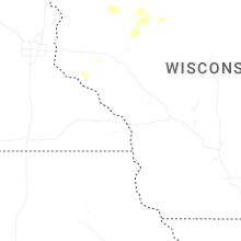


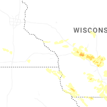

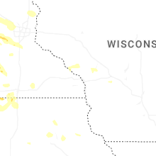


Connect with Interactive Hail Maps