

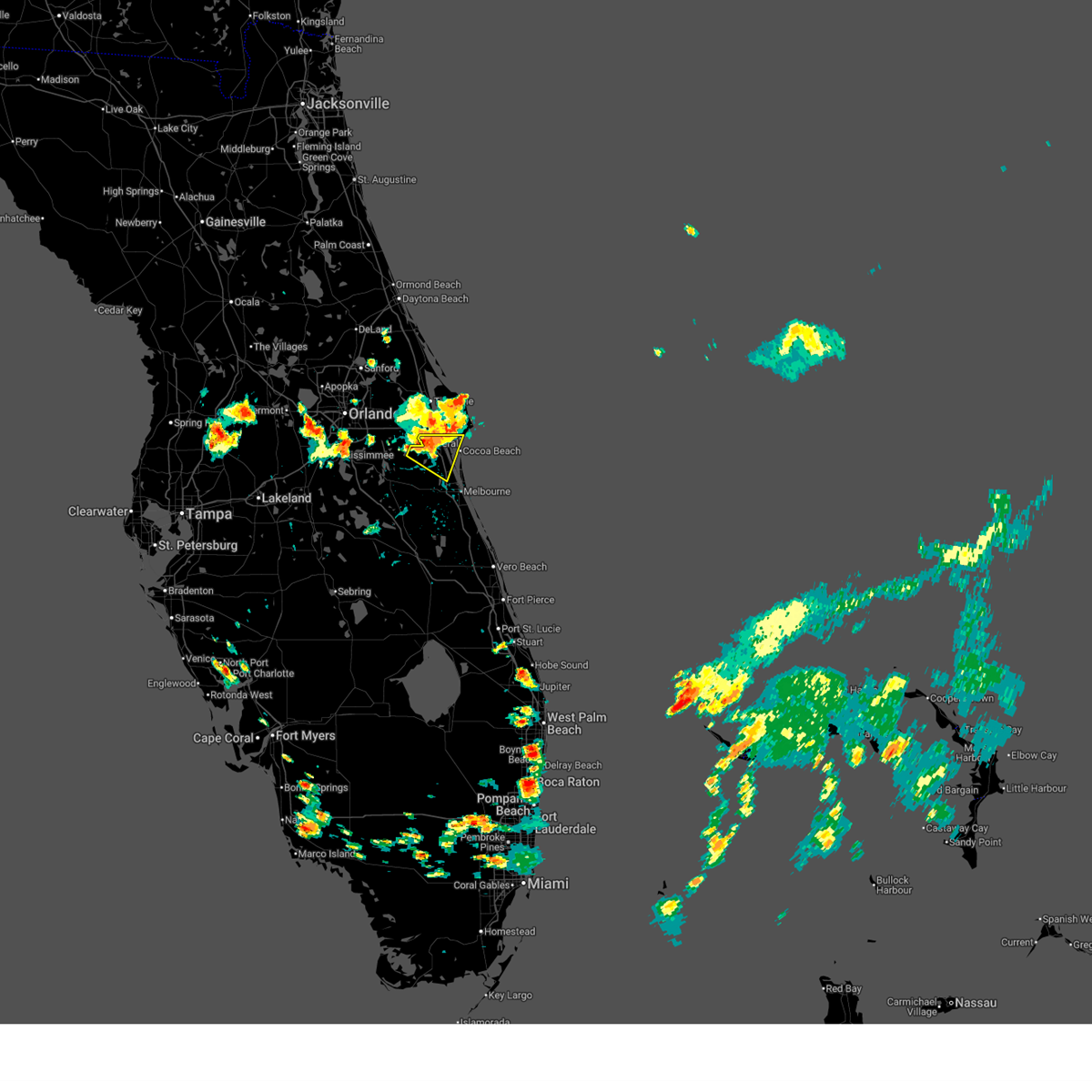
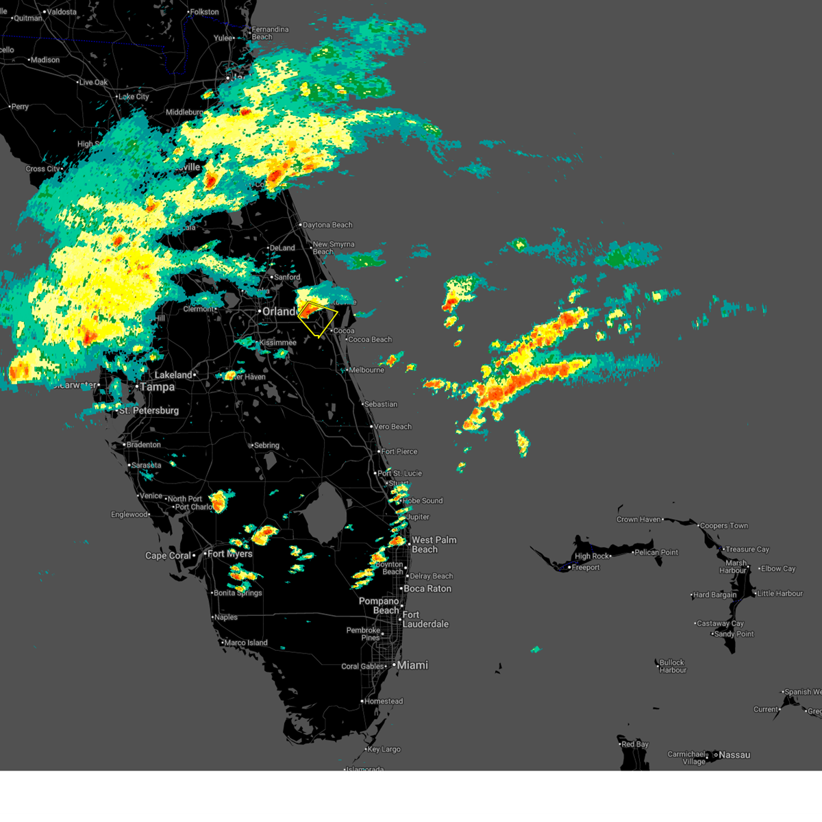
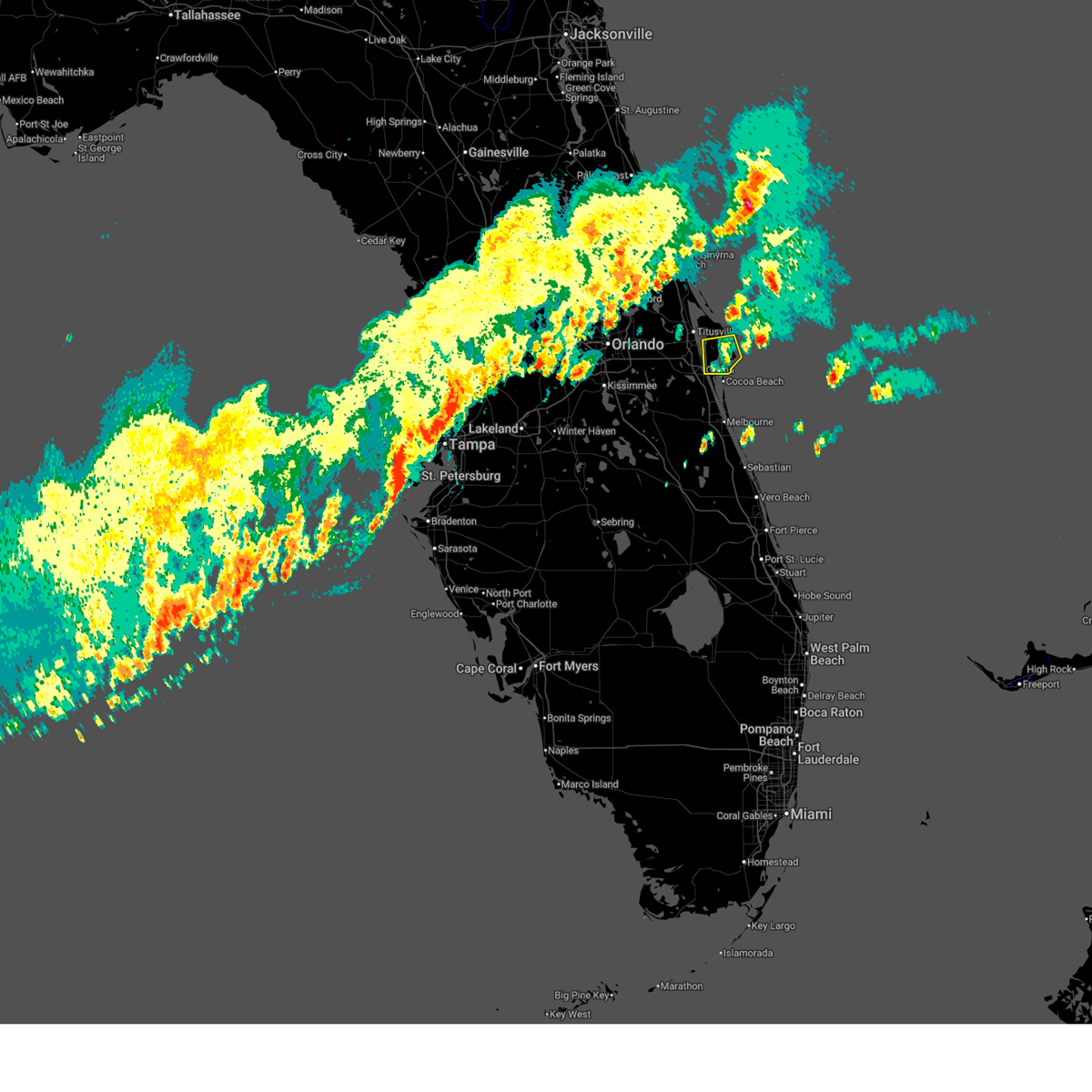
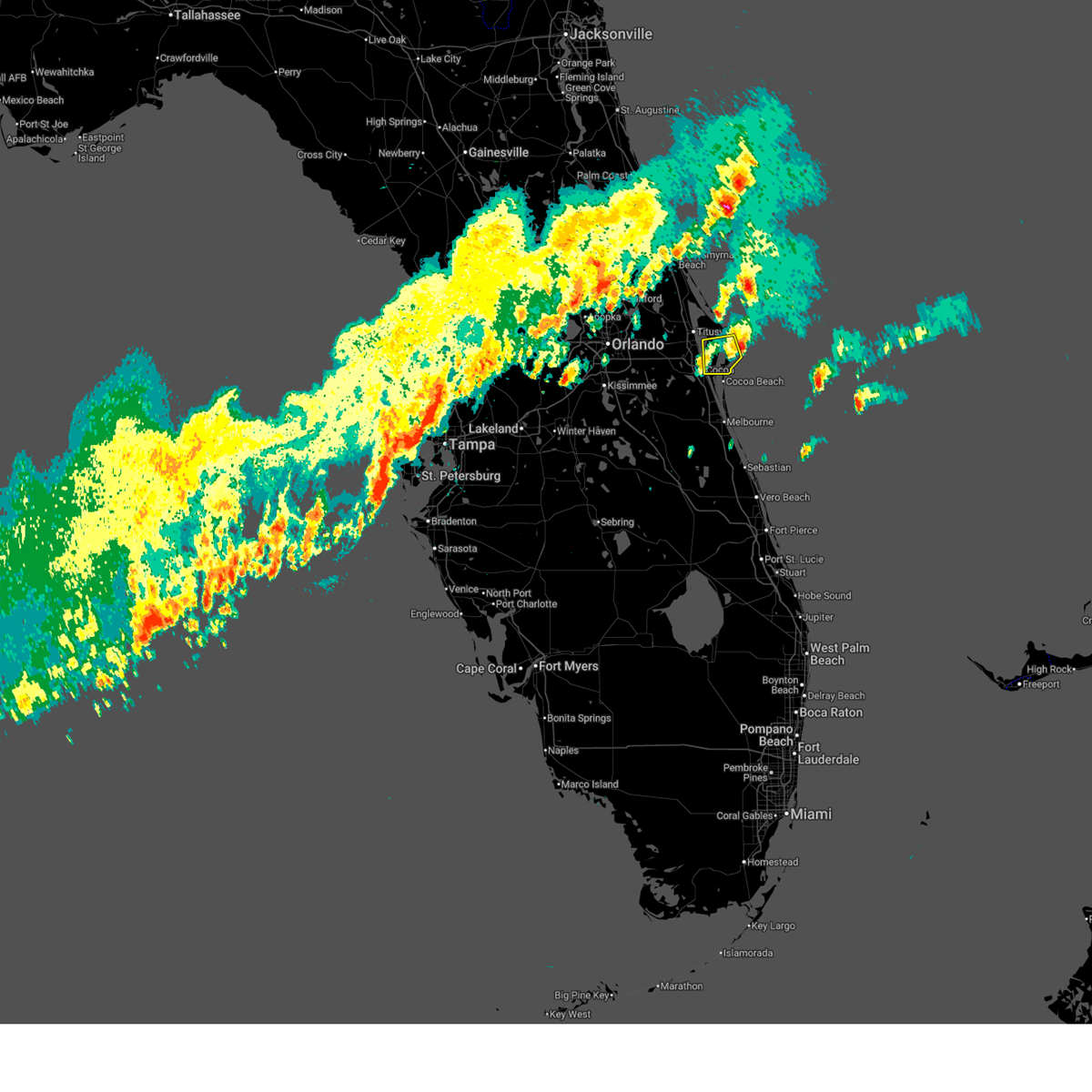
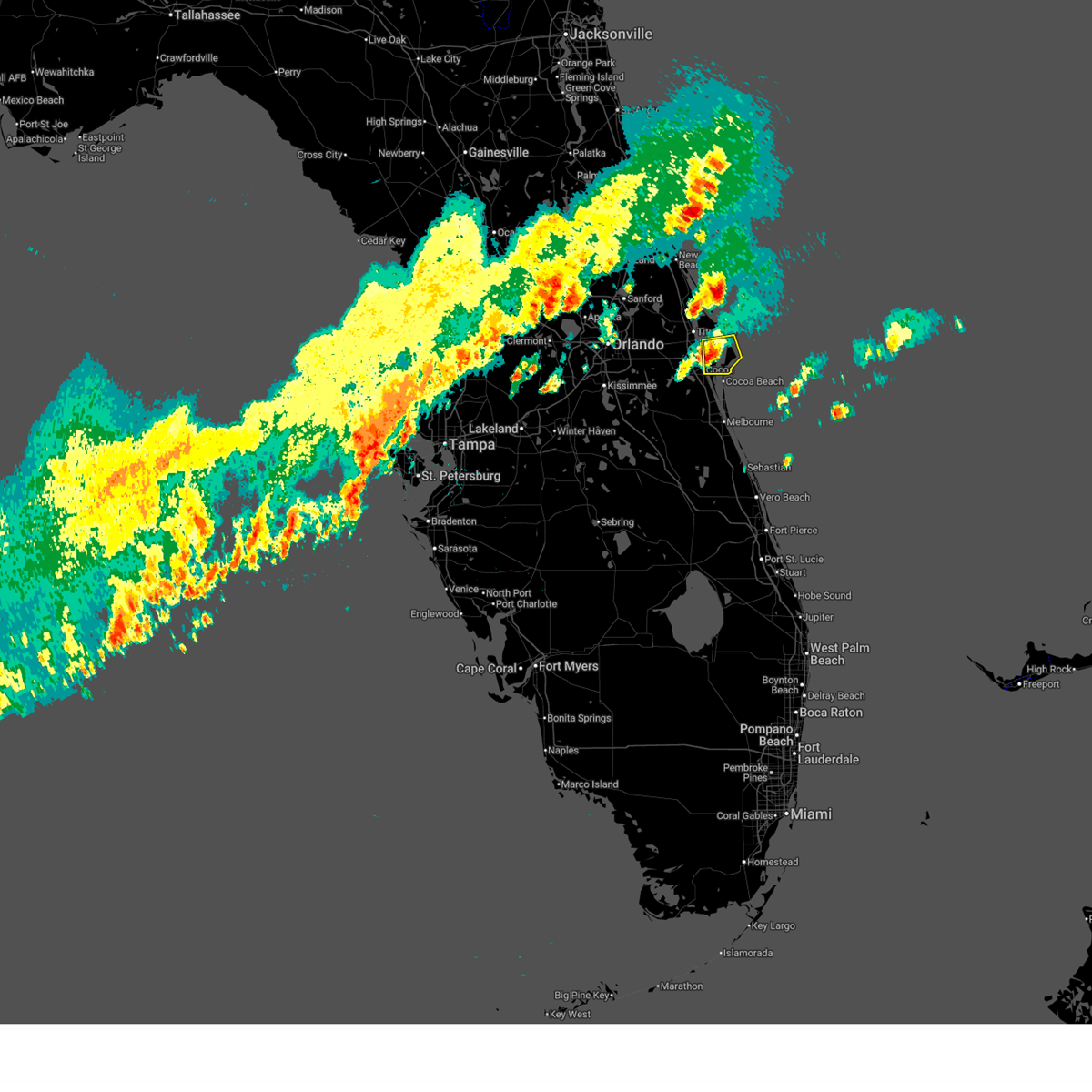
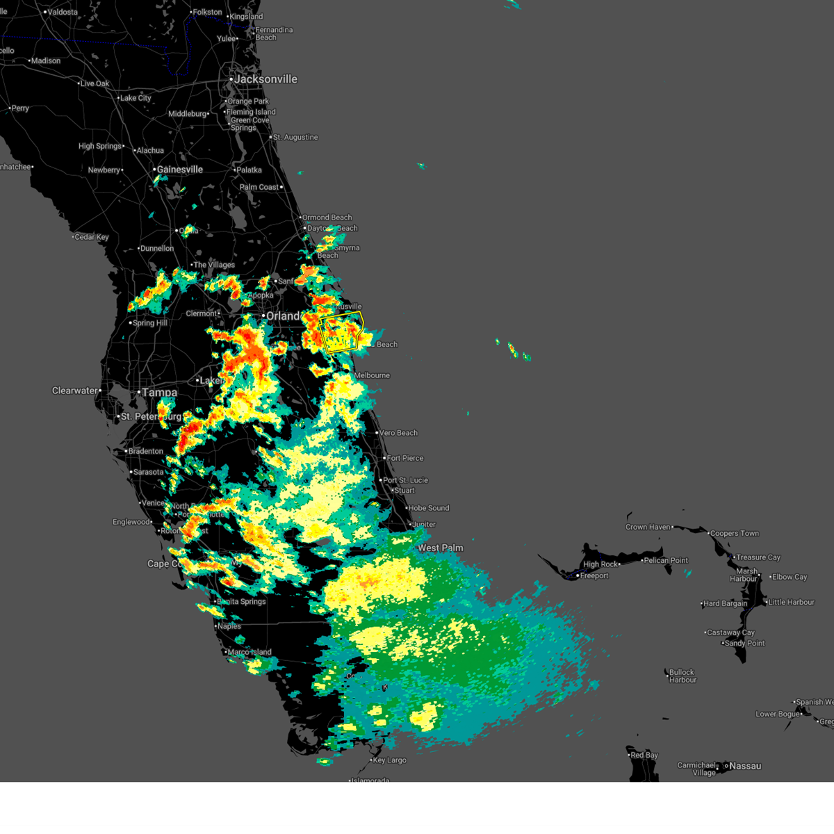
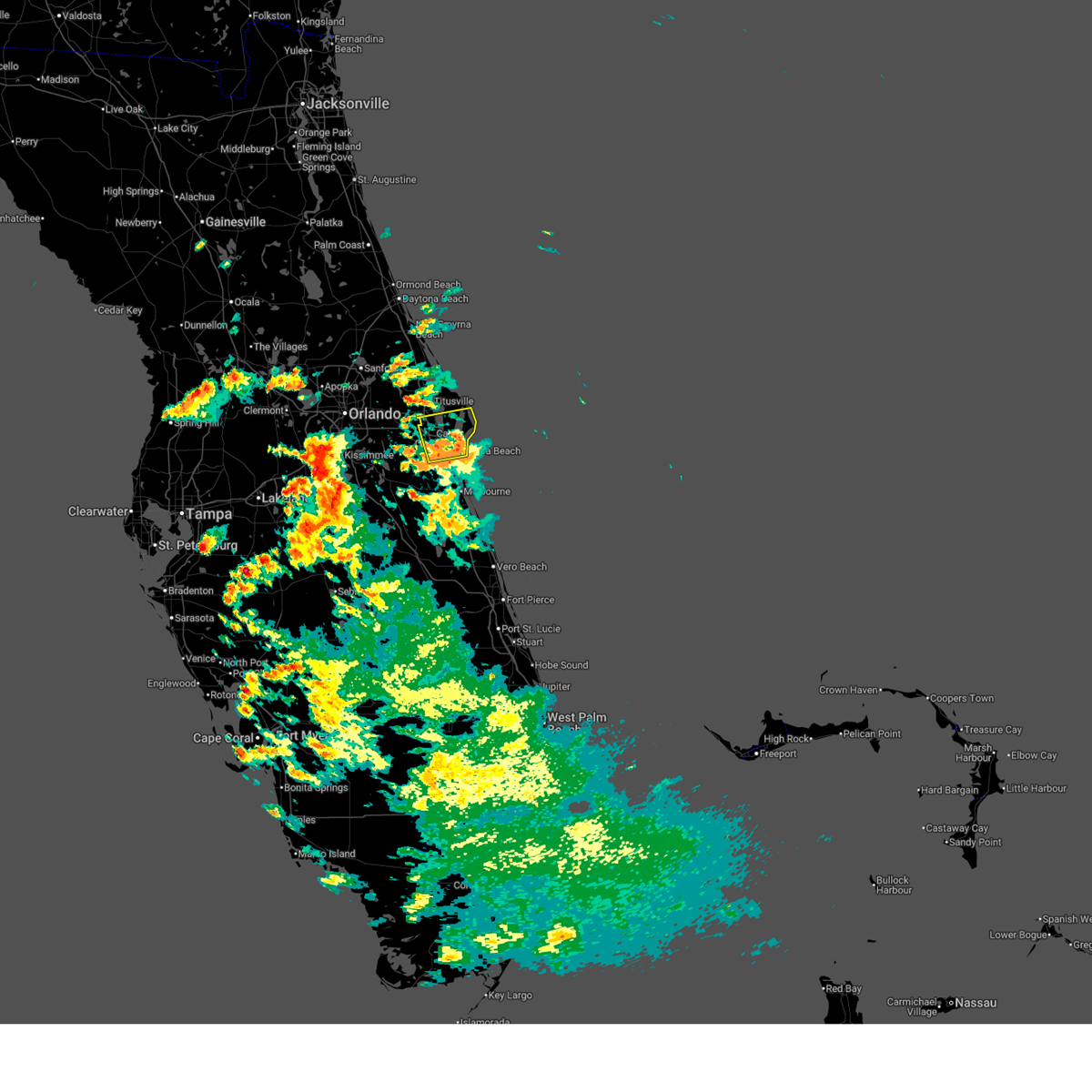
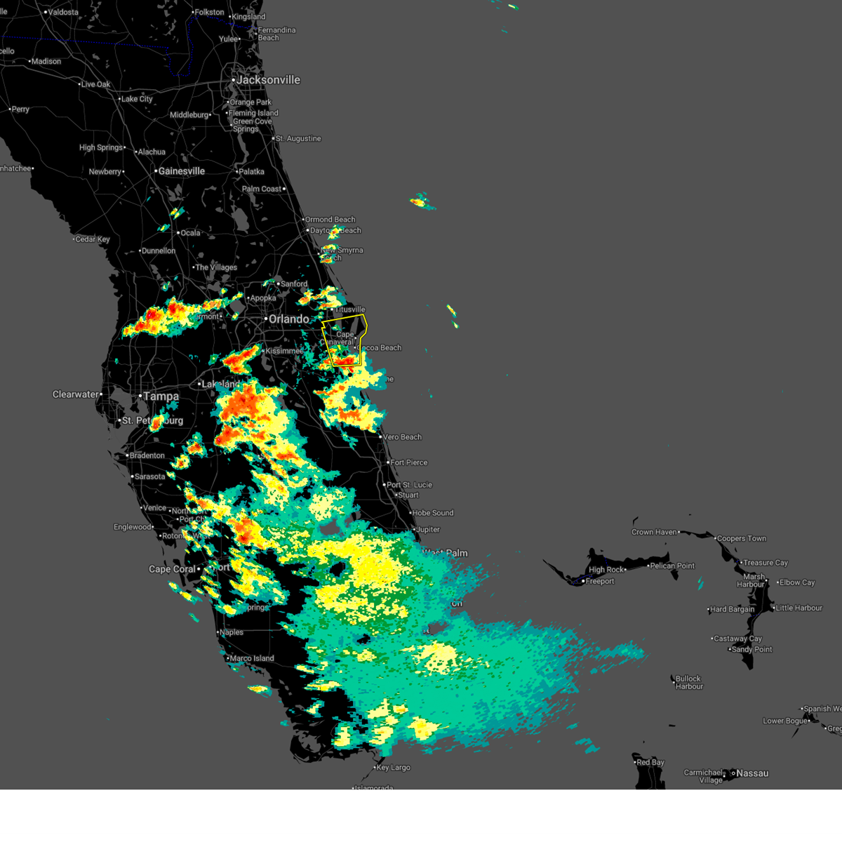
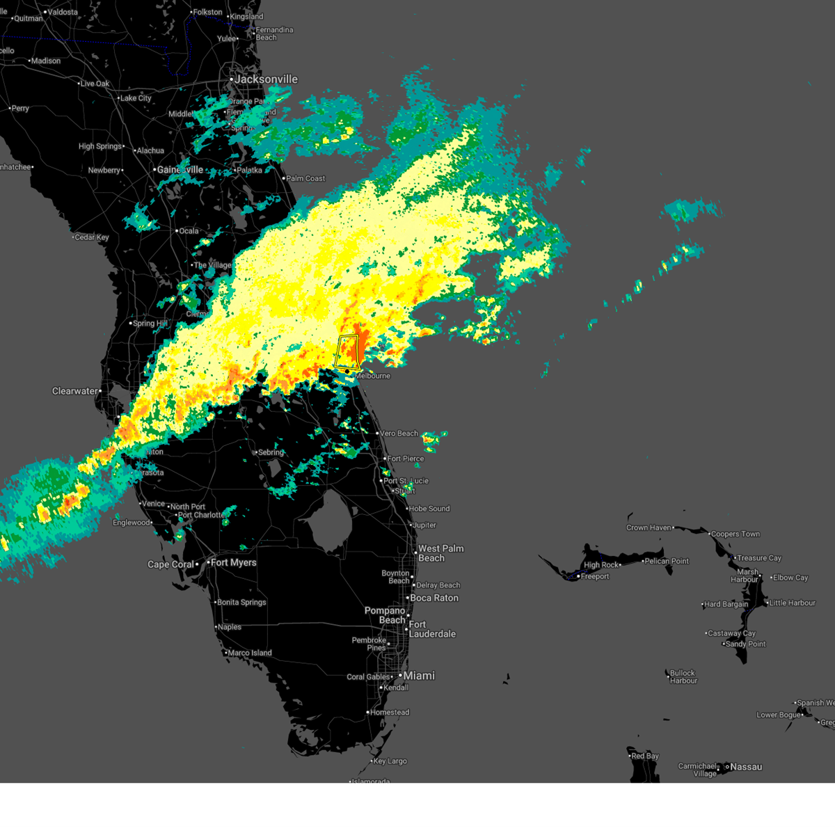
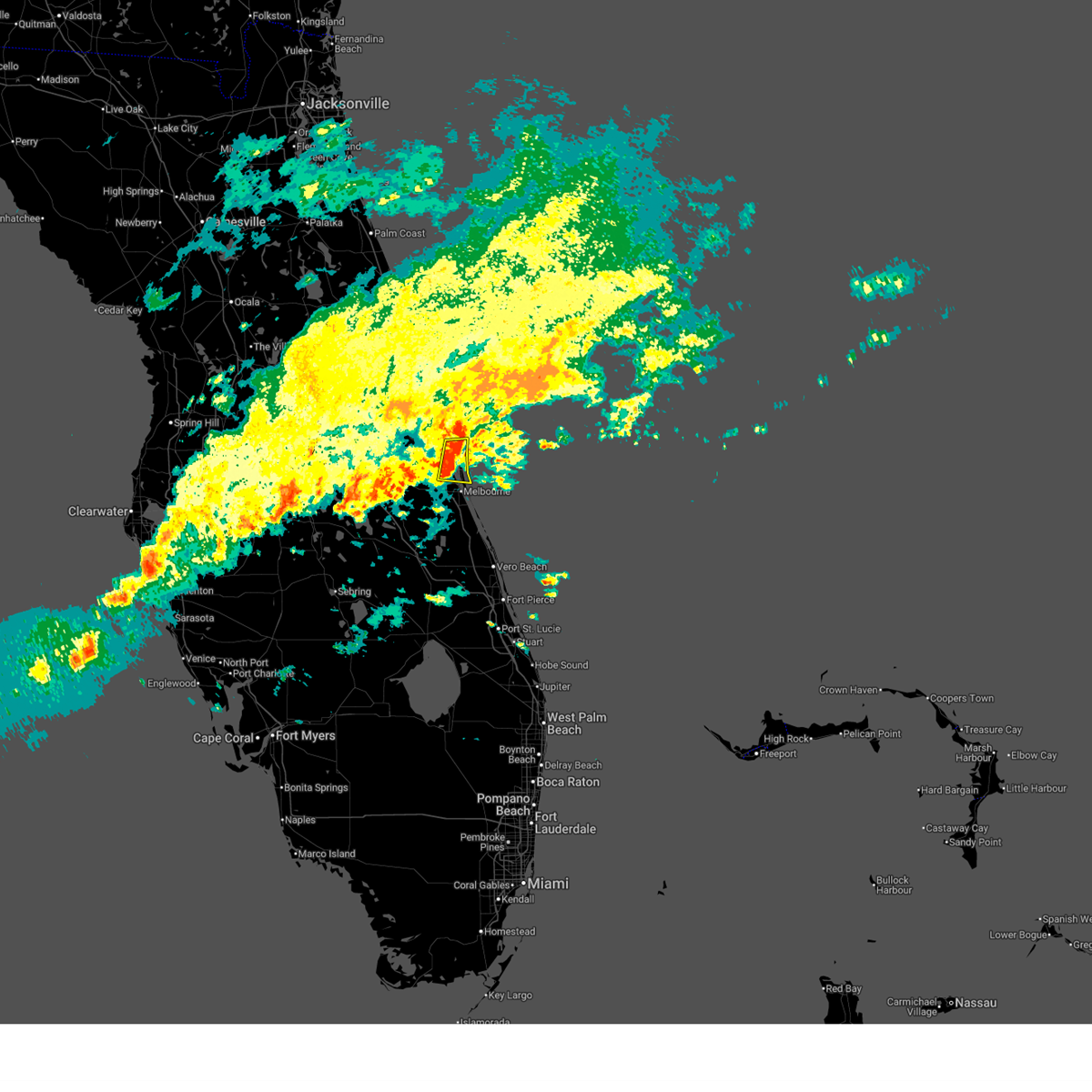
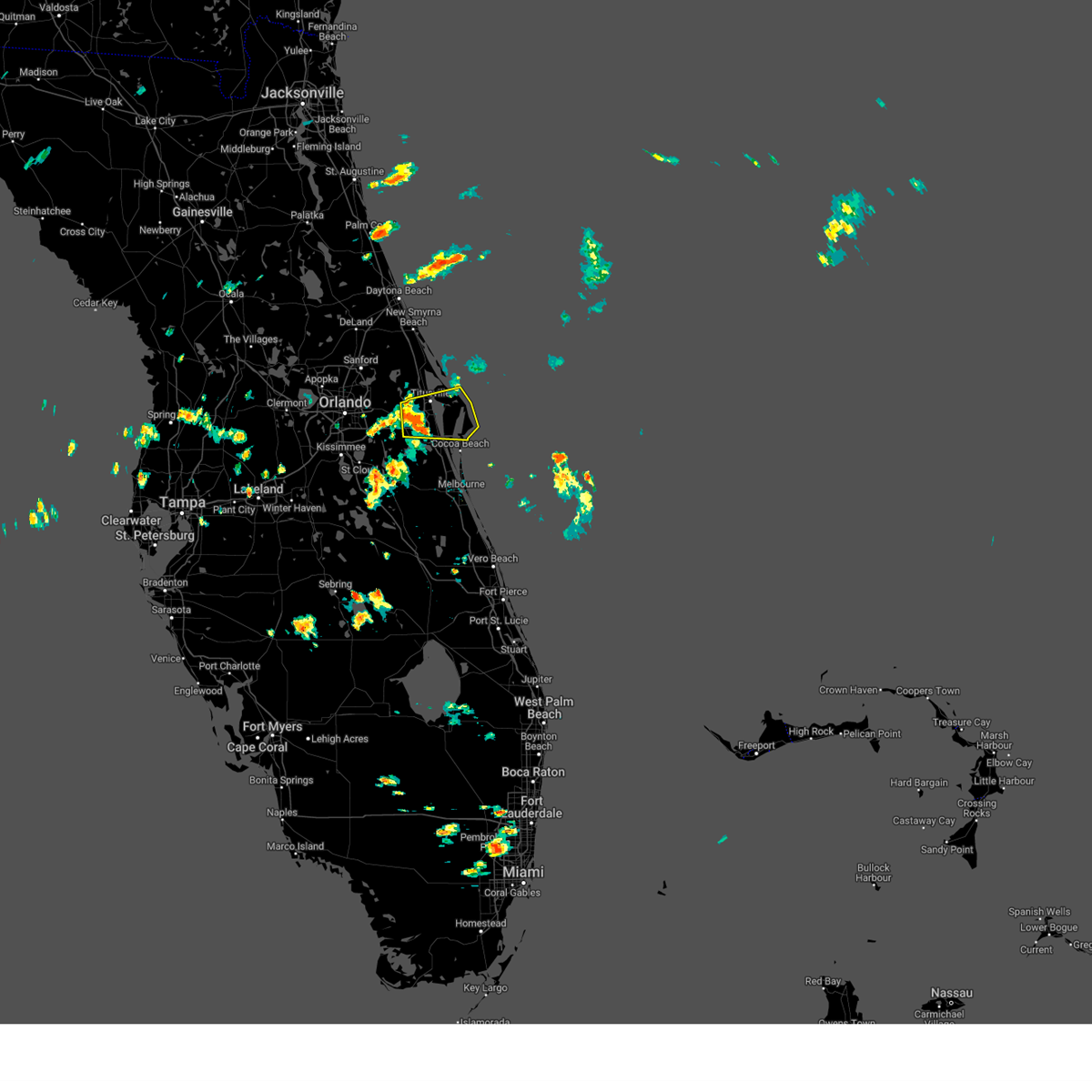
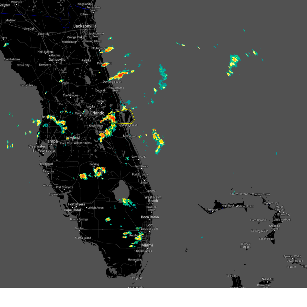
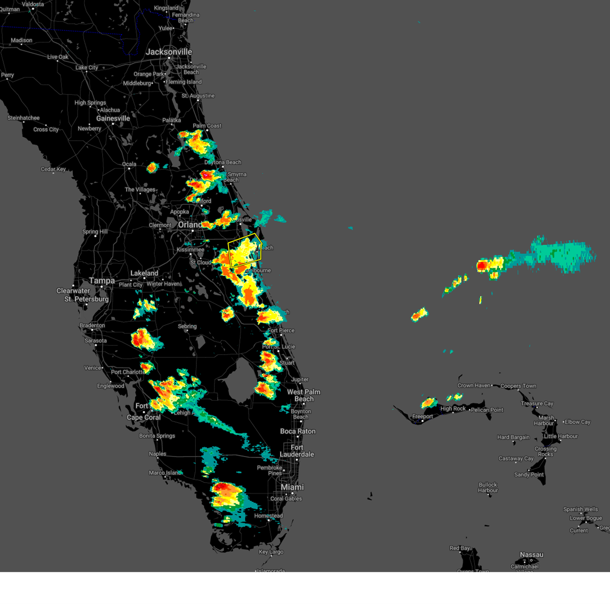
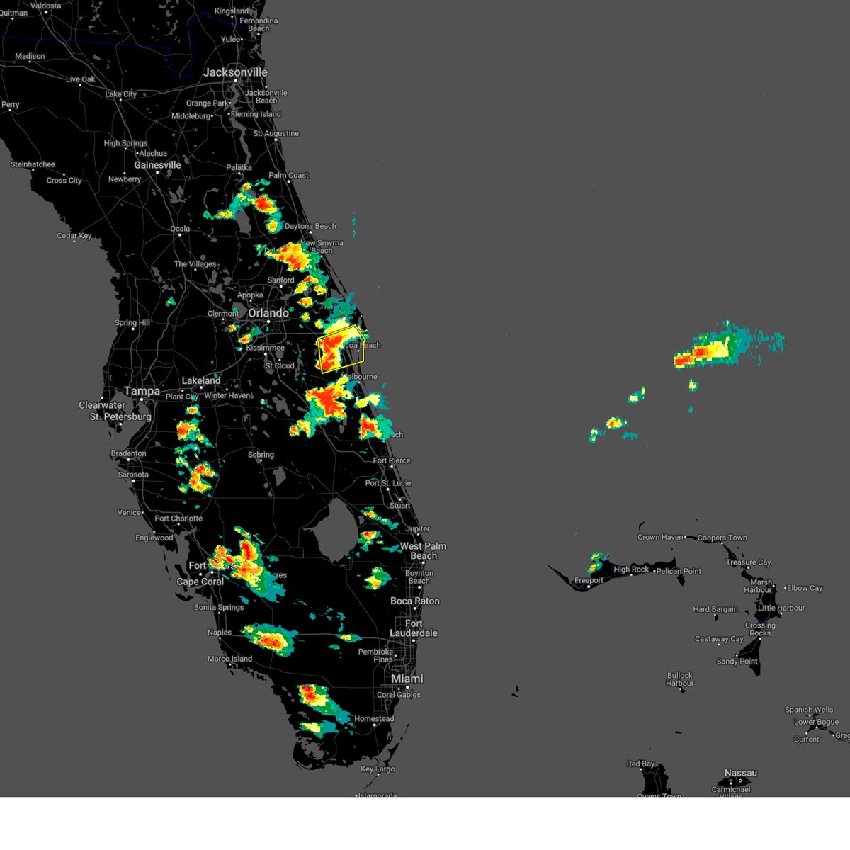
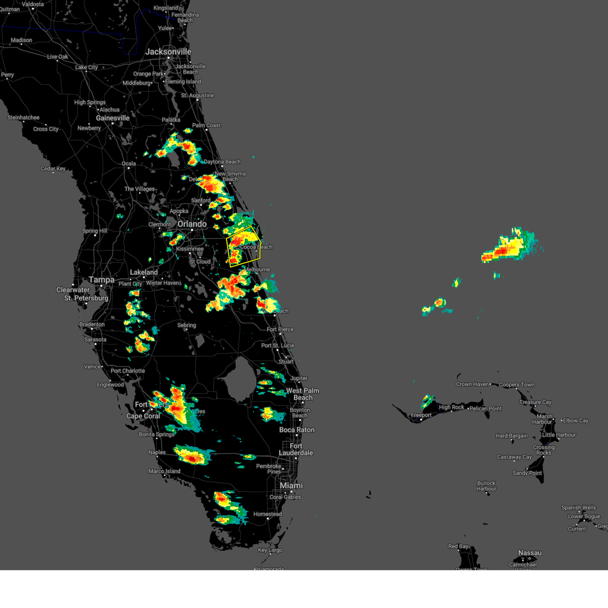
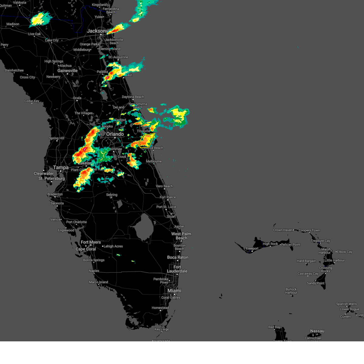
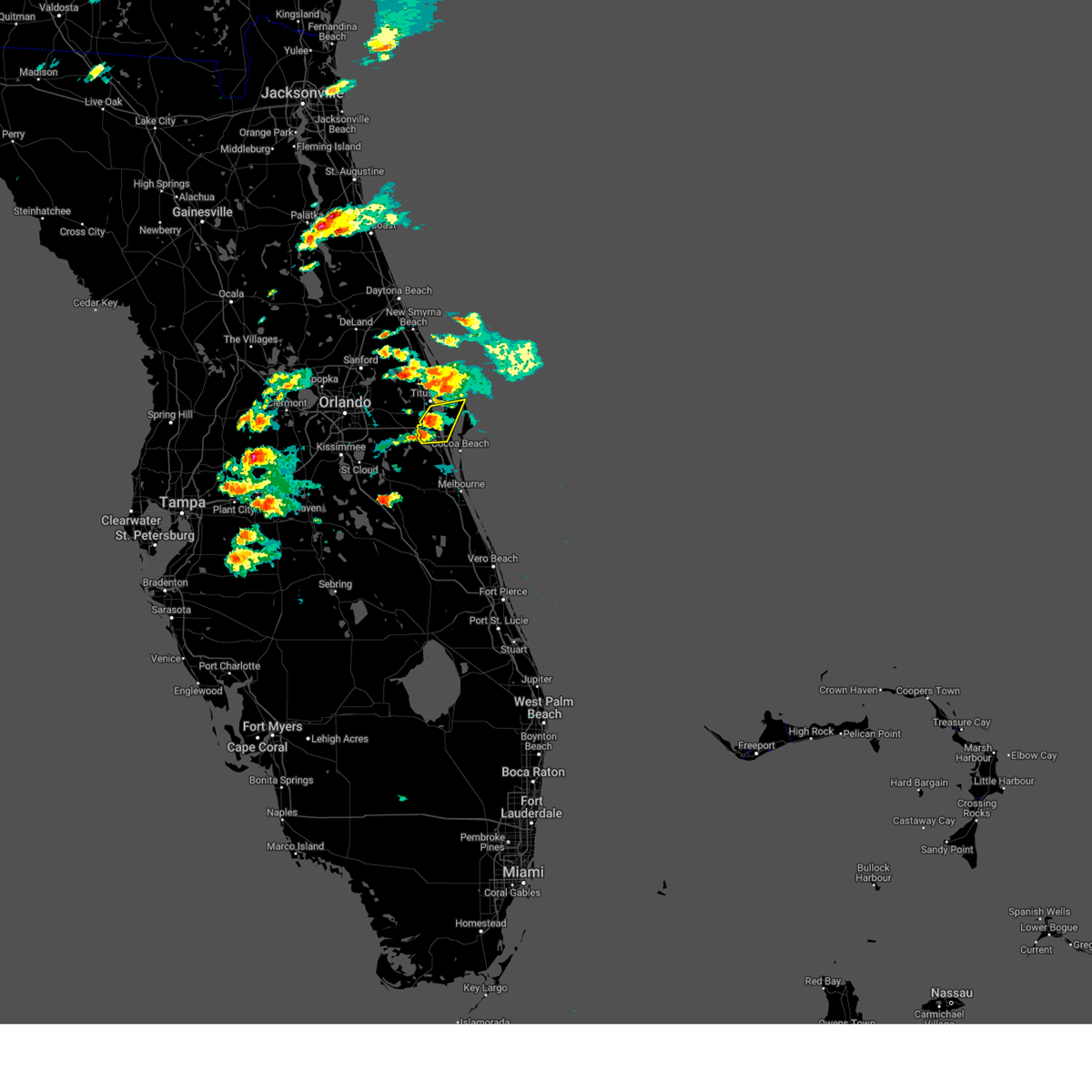
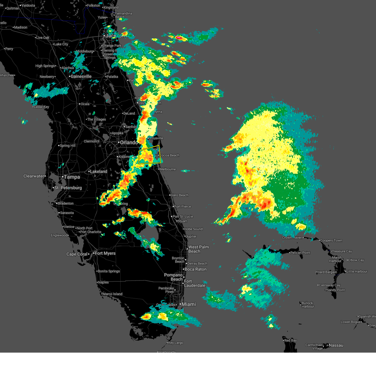
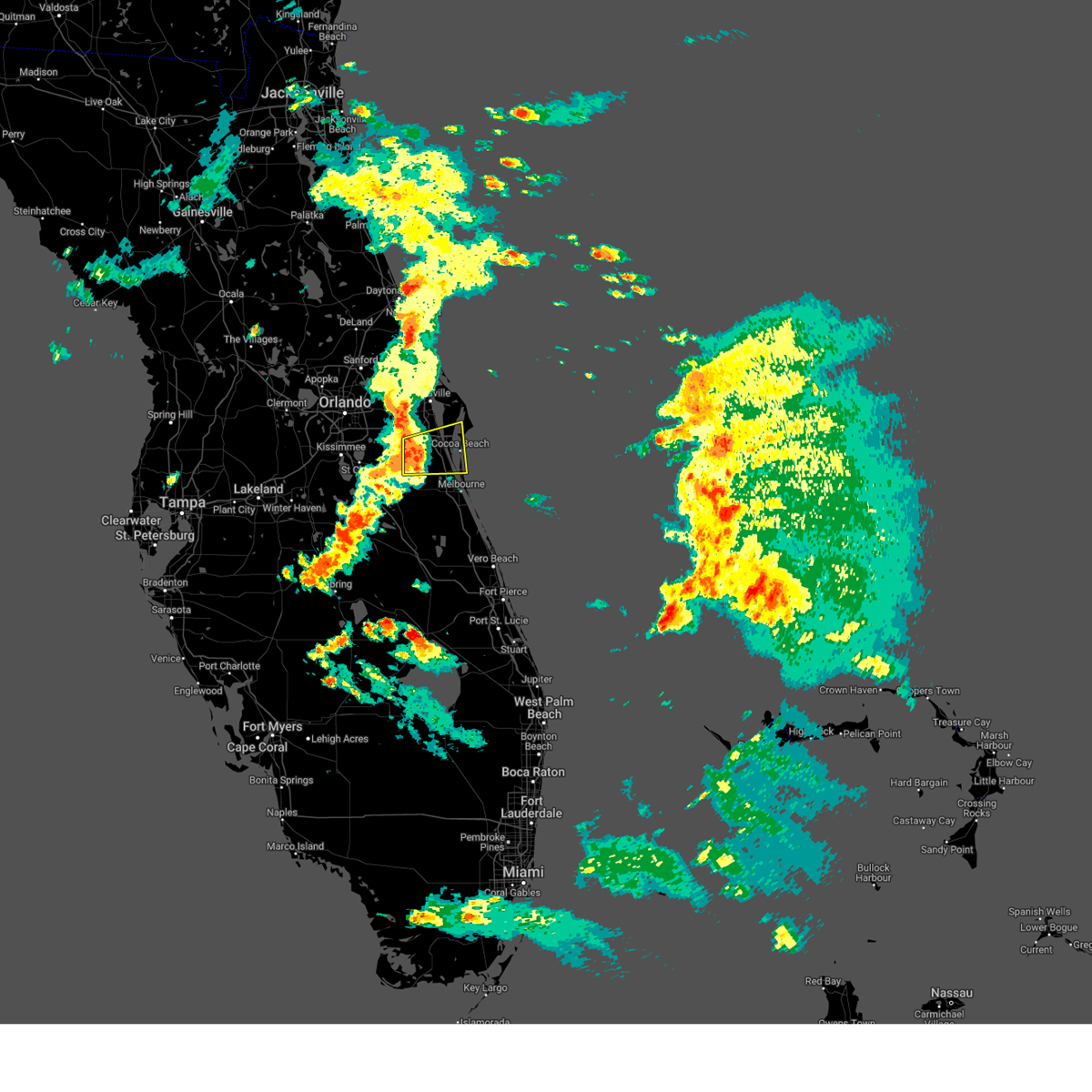
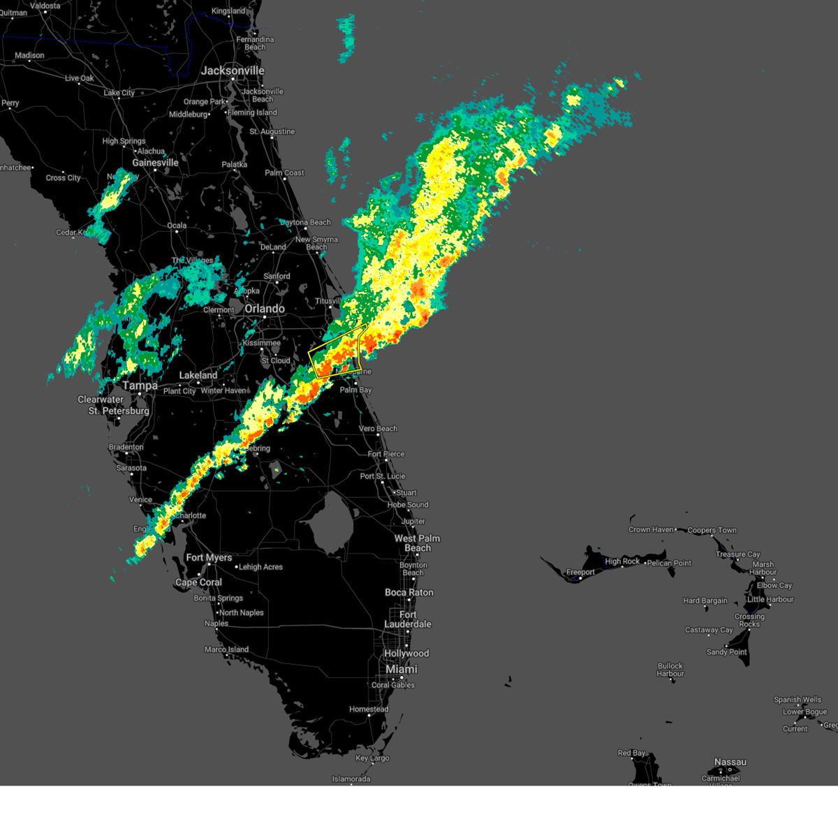
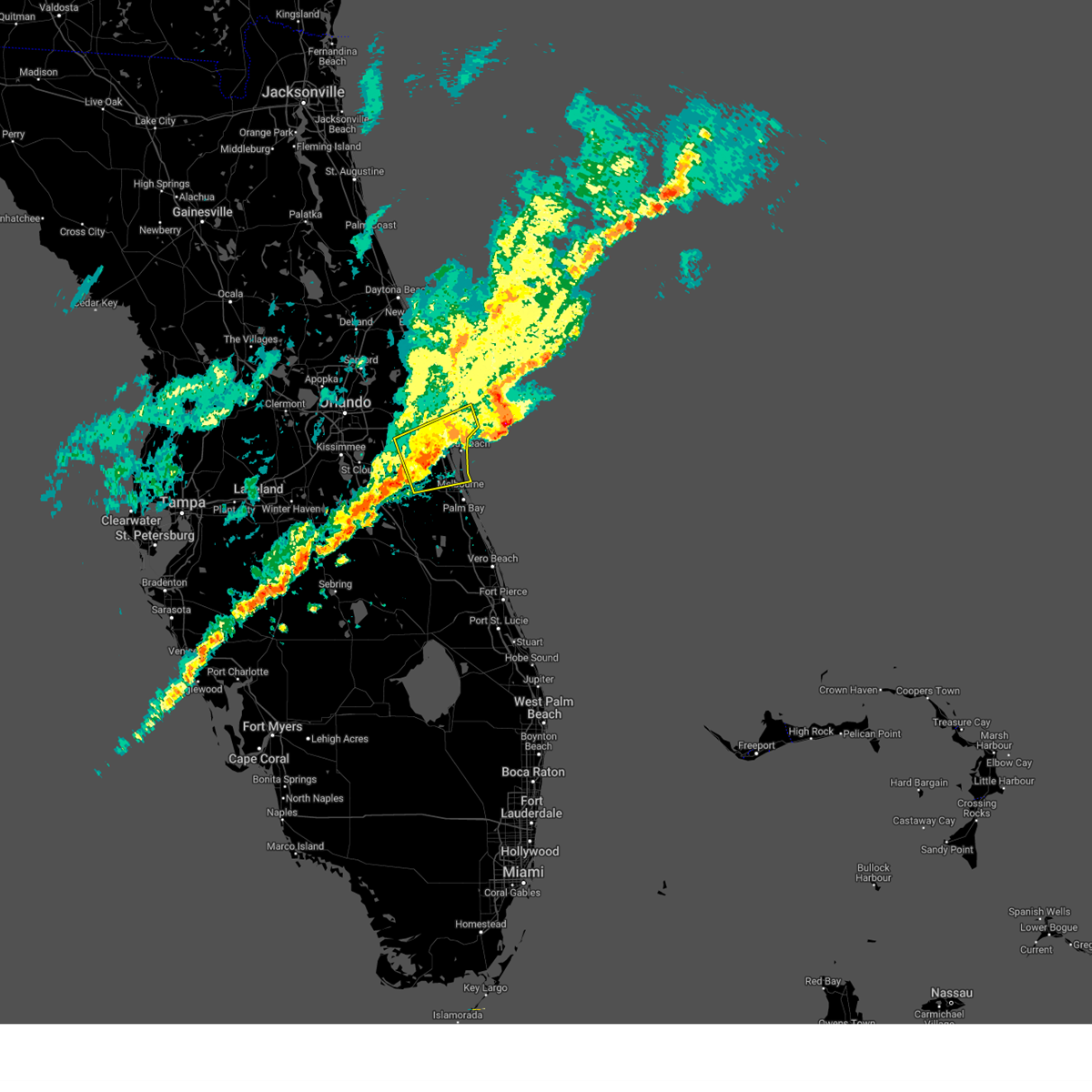
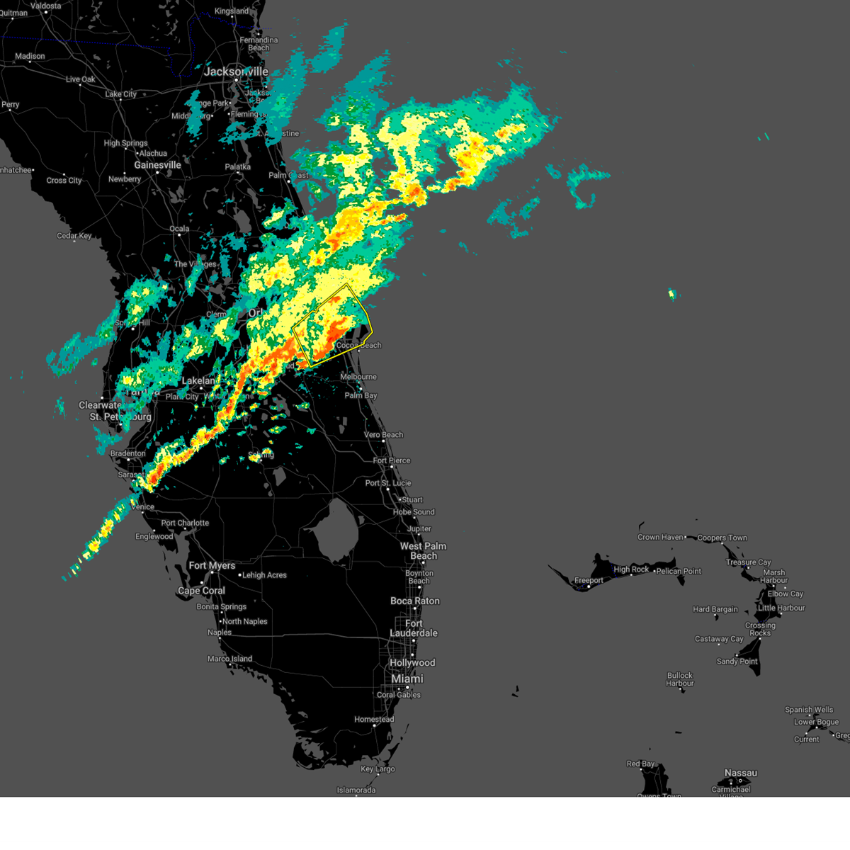
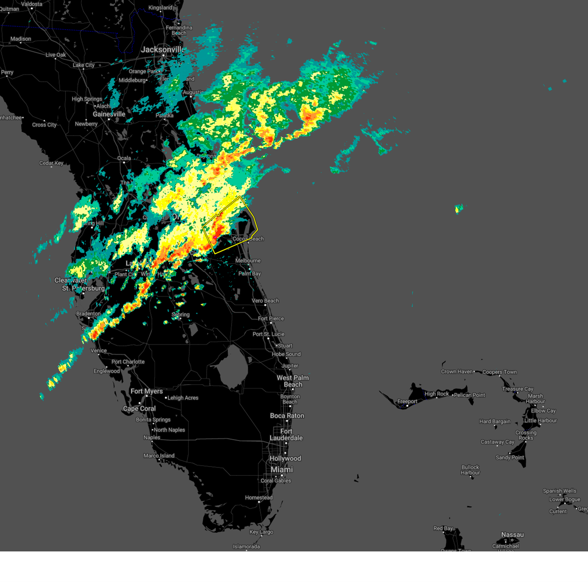
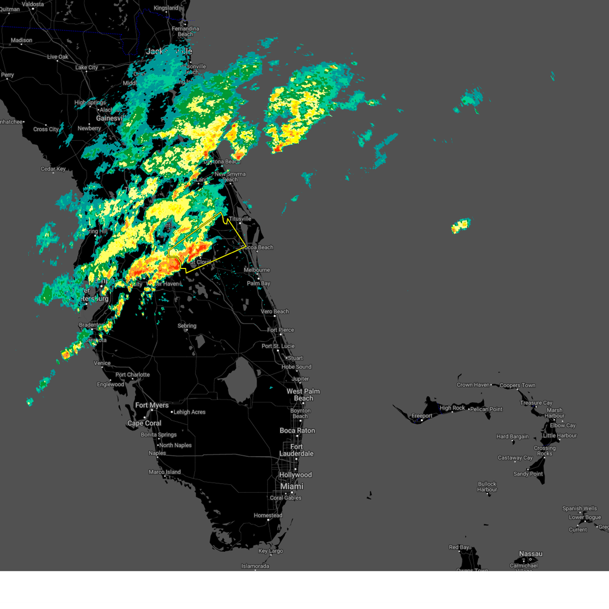
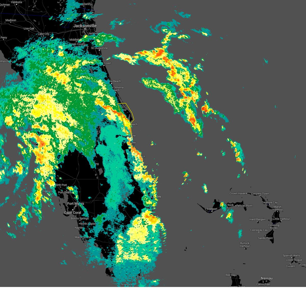
Hail Map for Cocoa, FL
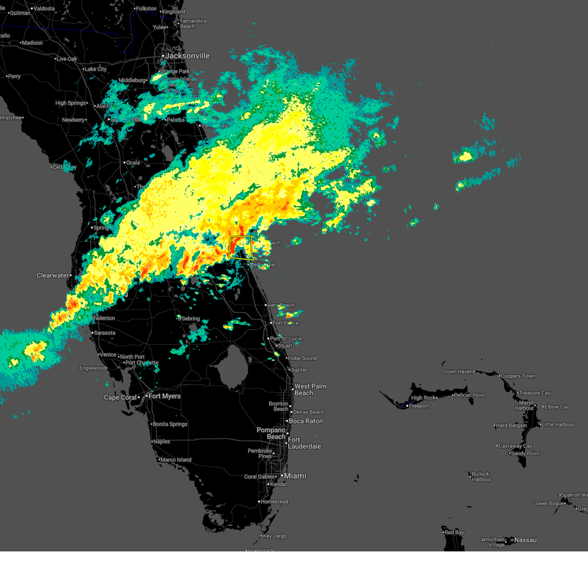
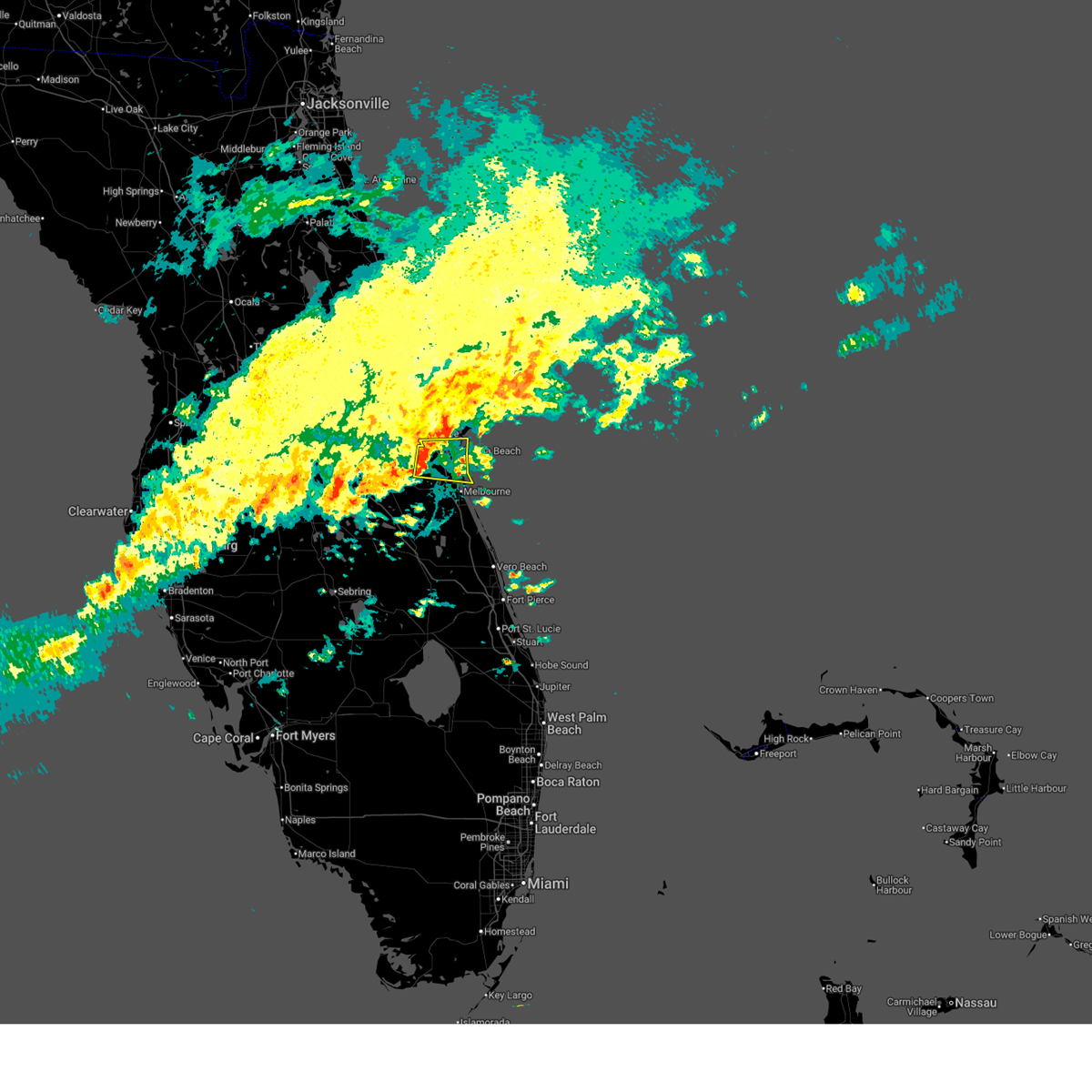
The Cocoa, FL area has had 13 reports of on-the-ground hail by trained spotters, and has been under severe weather warnings 21 times during the past 12 months. Doppler radar has detected hail at or near Cocoa, FL on 66 occasions, including 5 occasions during the past year.
| Name: | Cocoa, FL |
| Where Located: | 38.5 miles ESE of Orlando, FL |
| Map: | Google Map for Cocoa, FL |
| Population: | 17140 |
| Housing Units: | 8603 |
| More Info: | Search Google for Cocoa, FL |
1
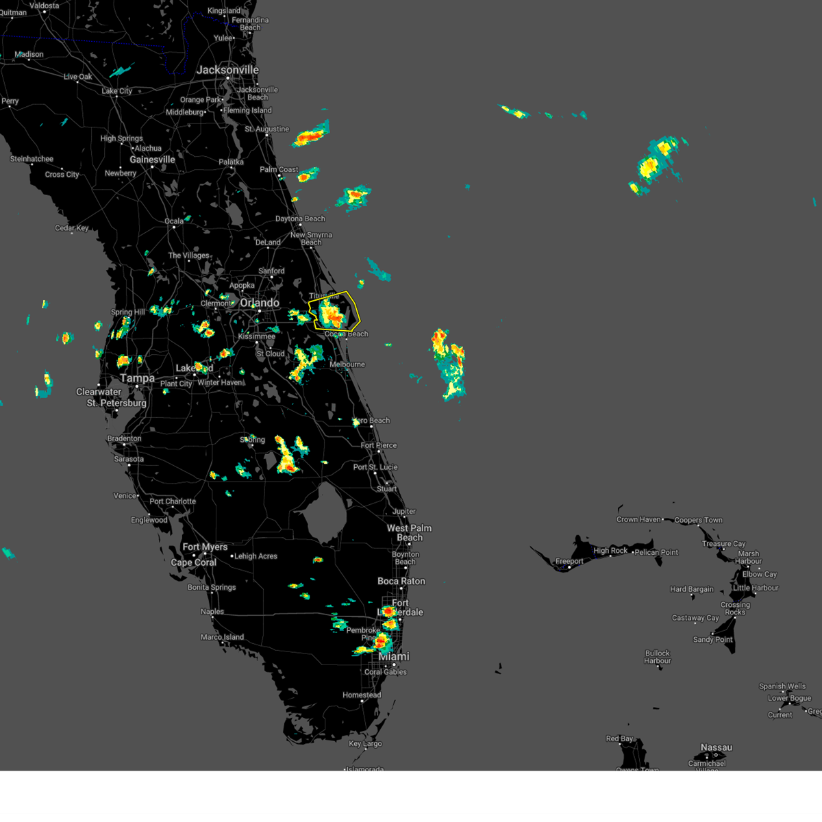
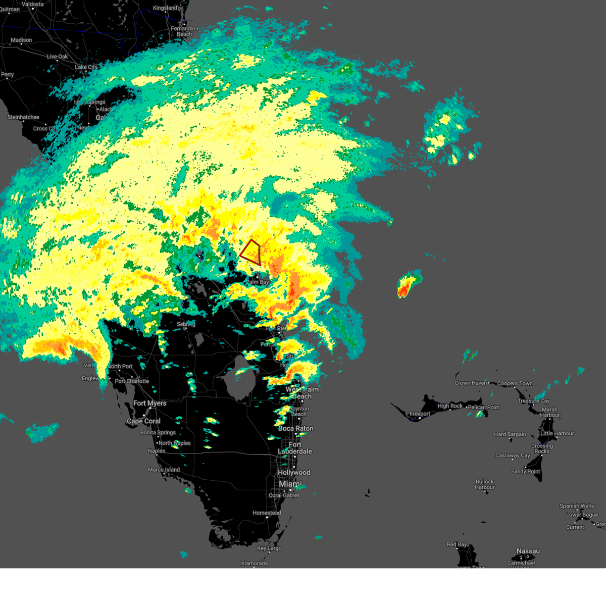
The Top Recent Hail Date for Cocoa, FL is Friday, June 19, 2026 (12th out of 66)

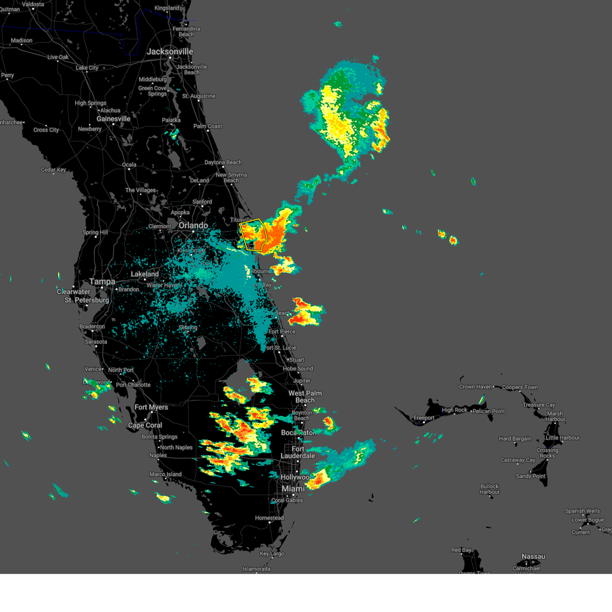
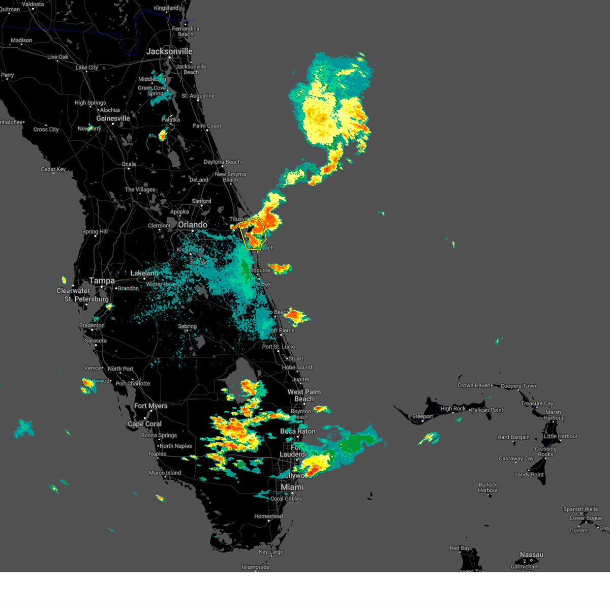
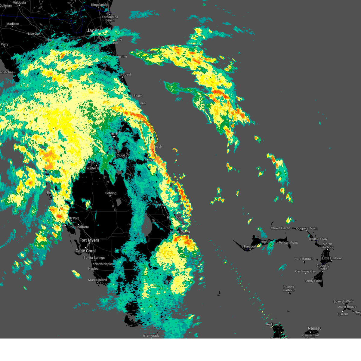
Hail and Wind Damage Spotted near Cocoa, FL
| Date / Time | Report Details |
|---|---|
| 6/24/2026 2:17 PM EDT |
 At 217 pm edt, a severe thunderstorm was located over rockledge, moving east at 20 mph (radar indicated). Hazards include 60 mph wind gusts and penny size hail. Expect damage to roofs, siding, and trees. Locations impacted include, rockledge, cocoa, cocoa beach, cape canaveral, and merritt island. At 217 pm edt, a severe thunderstorm was located over rockledge, moving east at 20 mph (radar indicated). Hazards include 60 mph wind gusts and penny size hail. Expect damage to roofs, siding, and trees. Locations impacted include, rockledge, cocoa, cocoa beach, cape canaveral, and merritt island.
|
| 6/24/2026 2:01 PM EDT |
 Svrmlb the national weather service in melbourne has issued a * severe thunderstorm warning for, central brevard county in east central florida, northeastern osceola county in east central florida, * until 245 pm edt. * at 201 pm edt, a severe thunderstorm was located over lone cabbage fish camp, moving east at 20 mph (radar indicated). Hazards include 60 mph wind gusts and penny size hail. expect damage to roofs, siding, and trees Svrmlb the national weather service in melbourne has issued a * severe thunderstorm warning for, central brevard county in east central florida, northeastern osceola county in east central florida, * until 245 pm edt. * at 201 pm edt, a severe thunderstorm was located over lone cabbage fish camp, moving east at 20 mph (radar indicated). Hazards include 60 mph wind gusts and penny size hail. expect damage to roofs, siding, and trees
|
| 5/12/2026 2:01 PM EDT |
 At 201 pm edt, a severe thunderstorm was located over port saint john, moving southeast at 15 mph (radar indicated). Hazards include 60 mph wind gusts and quarter size hail. Hail damage to vehicles is expected. expect wind damage to roofs, siding, and trees. Locations impacted include, titusville, port saint john, titusville airport, sharpes, and bellwood. At 201 pm edt, a severe thunderstorm was located over port saint john, moving southeast at 15 mph (radar indicated). Hazards include 60 mph wind gusts and quarter size hail. Hail damage to vehicles is expected. expect wind damage to roofs, siding, and trees. Locations impacted include, titusville, port saint john, titusville airport, sharpes, and bellwood.
|
| 5/12/2026 1:48 PM EDT |
 At 147 pm edt, a severe thunderstorm was located near titusville airport, moving east at 15 mph (radar indicated). Hazards include 60 mph wind gusts and quarter size hail. Hail damage to vehicles is expected. expect wind damage to roofs, siding, and trees. Locations impacted include, titusville, port saint john, titusville airport, sharpes, and canaveral groves. At 147 pm edt, a severe thunderstorm was located near titusville airport, moving east at 15 mph (radar indicated). Hazards include 60 mph wind gusts and quarter size hail. Hail damage to vehicles is expected. expect wind damage to roofs, siding, and trees. Locations impacted include, titusville, port saint john, titusville airport, sharpes, and canaveral groves.
|
| 5/12/2026 1:27 PM EDT |
 Svrmlb the national weather service in melbourne has issued a * severe thunderstorm warning for, northwestern brevard county in east central florida, southeastern orange county in east central florida, * until 215 pm edt. * at 126 pm edt, a severe thunderstorm was located over christmas, moving southeast at 15 mph (radar indicated). Hazards include 60 mph wind gusts and quarter size hail. Hail damage to vehicles is expected. Expect wind damage to roofs, siding, and trees. Svrmlb the national weather service in melbourne has issued a * severe thunderstorm warning for, northwestern brevard county in east central florida, southeastern orange county in east central florida, * until 215 pm edt. * at 126 pm edt, a severe thunderstorm was located over christmas, moving southeast at 15 mph (radar indicated). Hazards include 60 mph wind gusts and quarter size hail. Hail damage to vehicles is expected. Expect wind damage to roofs, siding, and trees.
|
| 5/2/2026 3:11 PM EDT |
 The storm which prompted the warning has weakened below severe limits, and has exited the warned area. therefore, the warning will be allowed to expire. a tornado watch remains in effect until 600 pm edt for east central florida. The storm which prompted the warning has weakened below severe limits, and has exited the warned area. therefore, the warning will be allowed to expire. a tornado watch remains in effect until 600 pm edt for east central florida.
|
| 5/2/2026 2:56 PM EDT |
 At 255 pm edt, a severe thunderstorm was located near port canaveral, moving east at 30 mph (radar indicated). Hazards include 60 mph wind gusts. Expect damage to roofs, siding, and trees. Locations impacted include, cocoa, cocoa beach, cape canaveral, port canaveral, and sharpes. At 255 pm edt, a severe thunderstorm was located near port canaveral, moving east at 30 mph (radar indicated). Hazards include 60 mph wind gusts. Expect damage to roofs, siding, and trees. Locations impacted include, cocoa, cocoa beach, cape canaveral, port canaveral, and sharpes.
|
| 5/2/2026 2:46 PM EDT |
 Svrmlb the national weather service in melbourne has issued a * severe thunderstorm warning for, northeastern brevard county in east central florida, * until 315 pm edt. * at 245 pm edt, a severe thunderstorm was located near port canaveral, moving east at 30 mph (radar indicated). Hazards include 60 mph wind gusts. expect damage to roofs, siding, and trees Svrmlb the national weather service in melbourne has issued a * severe thunderstorm warning for, northeastern brevard county in east central florida, * until 315 pm edt. * at 245 pm edt, a severe thunderstorm was located near port canaveral, moving east at 30 mph (radar indicated). Hazards include 60 mph wind gusts. expect damage to roofs, siding, and trees
|
| 3/15/2026 4:51 PM EDT |
 The storm which prompted the warning has weakened below severe limits, and no longer poses an immediate threat to life or property. therefore, the warning will be allowed to expire. however gusty winds are still possible with this thunderstorm. The storm which prompted the warning has weakened below severe limits, and no longer poses an immediate threat to life or property. therefore, the warning will be allowed to expire. however gusty winds are still possible with this thunderstorm.
|
| 3/15/2026 4:32 PM EDT |
 At 432 pm edt, a severe thunderstorm was located over cocoa, moving north at 30 mph (radar indicated). Hazards include 60 mph wind gusts. Expect damage to roofs, siding, and trees. Locations impacted include, titusville, rockledge, cocoa, cocoa beach, and cape canaveral. At 432 pm edt, a severe thunderstorm was located over cocoa, moving north at 30 mph (radar indicated). Hazards include 60 mph wind gusts. Expect damage to roofs, siding, and trees. Locations impacted include, titusville, rockledge, cocoa, cocoa beach, and cape canaveral.
|
| 3/15/2026 4:13 PM EDT |
 Svrmlb the national weather service in melbourne has issued a * severe thunderstorm warning for, central brevard county in east central florida, * until 500 pm edt. * at 413 pm edt, a severe thunderstorm was located over viera, or near merritt island, moving north at 30 mph (radar indicated). Hazards include 60 mph wind gusts and penny size hail. expect damage to roofs, siding, and trees Svrmlb the national weather service in melbourne has issued a * severe thunderstorm warning for, central brevard county in east central florida, * until 500 pm edt. * at 413 pm edt, a severe thunderstorm was located over viera, or near merritt island, moving north at 30 mph (radar indicated). Hazards include 60 mph wind gusts and penny size hail. expect damage to roofs, siding, and trees
|
| 12/7/2025 8:27 PM EST |
 The severe thunderstorm which prompted the warning has moved out of the warned area. therefore, the warning will be allowed to expire. The severe thunderstorm which prompted the warning has moved out of the warned area. therefore, the warning will be allowed to expire.
|
| 12/7/2025 8:15 PM EST |
 At 814 pm est, a severe thunderstorm was located over cocoa beach, moving east at 35 mph (radar indicated). Hazards include 60 mph wind gusts. Expect damage to roofs, siding, and trees. Locations impacted include, melbourne, rockledge, cocoa beach, satellite beach, and cape canaveral. At 814 pm est, a severe thunderstorm was located over cocoa beach, moving east at 35 mph (radar indicated). Hazards include 60 mph wind gusts. Expect damage to roofs, siding, and trees. Locations impacted include, melbourne, rockledge, cocoa beach, satellite beach, and cape canaveral.
|
| 12/7/2025 8:04 PM EST |
 At 804 pm est, a severe thunderstorm was located over rockledge, moving east at 30 mph (radar indicated). Hazards include 60 mph wind gusts. Expect damage to roofs, siding, and trees. Locations impacted include, melbourne, rockledge, cocoa, cocoa beach, and satellite beach. At 804 pm est, a severe thunderstorm was located over rockledge, moving east at 30 mph (radar indicated). Hazards include 60 mph wind gusts. Expect damage to roofs, siding, and trees. Locations impacted include, melbourne, rockledge, cocoa, cocoa beach, and satellite beach.
|
| 12/7/2025 8:04 PM EST |
 the severe thunderstorm warning has been cancelled and is no longer in effect the severe thunderstorm warning has been cancelled and is no longer in effect
|
| 12/7/2025 7:55 PM EST |
 Svrmlb the national weather service in melbourne has issued a * severe thunderstorm warning for, central brevard county in east central florida, northeastern osceola county in east central florida, * until 830 pm est. * at 755 pm est, a severe thunderstorm was located near rockledge, moving east at 35 mph (radar indicated). Hazards include 60 mph wind gusts. expect damage to roofs, siding, and trees Svrmlb the national weather service in melbourne has issued a * severe thunderstorm warning for, central brevard county in east central florida, northeastern osceola county in east central florida, * until 830 pm est. * at 755 pm est, a severe thunderstorm was located near rockledge, moving east at 35 mph (radar indicated). Hazards include 60 mph wind gusts. expect damage to roofs, siding, and trees
|
| 10/27/2025 5:37 PM EDT | The storm which prompted the warning has weakened below severe limits, and no longer poses an immediate threat to life or property. therefore, the warning will be allowed to expire. |
| 10/27/2025 5:19 PM EDT | Svrmlb the national weather service in melbourne has issued a * severe thunderstorm warning for, northwestern brevard county in east central florida, southeastern orange county in east central florida, * until 545 pm edt. * at 518 pm edt, a severe thunderstorm was located over wedgefield, moving east at 25 mph (radar indicated). Hazards include 60 mph wind gusts. expect damage to roofs, siding, and trees |
| 10/26/2025 10:15 PM EDT | the tornado warning has been cancelled and is no longer in effect |
| 10/26/2025 9:59 PM EDT | Tormlb the national weather service in melbourne has issued a * tornado warning for, central brevard county in east central florida, * until 1030 pm edt. * at 958 pm edt, a severe thunderstorm capable of producing a tornado was located near sharpes, moving west at 10 mph (radar indicated rotation). Hazards include tornado. Flying debris will be dangerous to those caught without shelter. mobile homes will be damaged or destroyed. damage to roofs, windows, and vehicles will occur. tree damage is likely. this dangerous storm will be near, cocoa, sharpes, and merritt island around 1000 pm edt. Port saint john around 1010 pm edt. |
| 10/26/2025 9:23 PM EDT | Svrmlb the national weather service in melbourne has issued a * severe thunderstorm warning for, northeastern brevard county in east central florida, * until 1015 pm edt. * at 923 pm edt, a severe thunderstorm was located near cape canaveral, moving east at 5 mph (radar indicated). Hazards include 60 mph wind gusts and penny size hail. expect damage to roofs, siding, and trees |
| 5/30/2025 5:03 PM EDT |
 the severe thunderstorm warning has been cancelled and is no longer in effect the severe thunderstorm warning has been cancelled and is no longer in effect
|
| 5/30/2025 4:56 PM EDT |
 the severe thunderstorm warning has been cancelled and is no longer in effect the severe thunderstorm warning has been cancelled and is no longer in effect
|
| 5/30/2025 4:56 PM EDT |
 At 455 pm edt, a severe thunderstorm was located over titusville airport, moving east at 35 mph (radar indicated). Hazards include 60 mph wind gusts. Expect damage to roofs, siding, and trees. Locations impacted include, titusville, cocoa, cape canaveral, port saint john, and titusville airport. At 455 pm edt, a severe thunderstorm was located over titusville airport, moving east at 35 mph (radar indicated). Hazards include 60 mph wind gusts. Expect damage to roofs, siding, and trees. Locations impacted include, titusville, cocoa, cape canaveral, port saint john, and titusville airport.
|
| 5/30/2025 4:49 PM EDT |
 At 449 pm edt, a severe thunderstorm was located near titusville airport, moving east at 35 mph (radar indicated). Hazards include 60 mph wind gusts. Expect damage to roofs, siding, and trees. Locations impacted include, titusville, cocoa, cape canaveral, port saint john, and christmas. At 449 pm edt, a severe thunderstorm was located near titusville airport, moving east at 35 mph (radar indicated). Hazards include 60 mph wind gusts. Expect damage to roofs, siding, and trees. Locations impacted include, titusville, cocoa, cape canaveral, port saint john, and christmas.
|
| 5/30/2025 4:35 PM EDT |
 Svrmlb the national weather service in melbourne has issued a * severe thunderstorm warning for, northern brevard county in east central florida, southeastern orange county in east central florida, * until 515 pm edt. * at 435 pm edt, a severe thunderstorm was located over christmas, moving east at 35 mph (radar indicated). Hazards include 60 mph wind gusts. expect damage to roofs, siding, and trees Svrmlb the national weather service in melbourne has issued a * severe thunderstorm warning for, northern brevard county in east central florida, southeastern orange county in east central florida, * until 515 pm edt. * at 435 pm edt, a severe thunderstorm was located over christmas, moving east at 35 mph (radar indicated). Hazards include 60 mph wind gusts. expect damage to roofs, siding, and trees
|
| 5/24/2025 4:29 PM EDT |
 The severe thunderstorm which prompted the warning has weakened. therefore, the warning will be allowed to expire. however small hail and gusty winds are still possible with this thunderstorm. The severe thunderstorm which prompted the warning has weakened. therefore, the warning will be allowed to expire. however small hail and gusty winds are still possible with this thunderstorm.
|
| 5/24/2025 4:03 PM EDT |
 At 402 pm edt, a severe thunderstorm was located over canaveral groves, or near lone cabbage fish camp, and is nearly stationary (radar indicated). Hazards include 60 mph wind gusts and quarter size hail. Hail damage to vehicles is expected. expect wind damage to roofs, siding, and trees. Locations impacted include, rockledge, cocoa, cocoa beach, cape canaveral, and merritt island. At 402 pm edt, a severe thunderstorm was located over canaveral groves, or near lone cabbage fish camp, and is nearly stationary (radar indicated). Hazards include 60 mph wind gusts and quarter size hail. Hail damage to vehicles is expected. expect wind damage to roofs, siding, and trees. Locations impacted include, rockledge, cocoa, cocoa beach, cape canaveral, and merritt island.
|
| 5/24/2025 3:52 PM EDT | Quarter sized hail reported 3 miles E of Cocoa, FL, [delayed] report and subsequent photo indicates quarter size hail fell near adamson creek in cocoa. |
| 5/24/2025 3:45 PM EDT |
 Svrmlb the national weather service in melbourne has issued a * severe thunderstorm warning for, central brevard county in east central florida, southeastern orange county in east central florida, northeastern osceola county in east central florida, * until 430 pm edt. * at 345 pm edt, a severe thunderstorm was located over canaveral groves, or near lone cabbage fish camp, and is nearly stationary (radar indicated). Hazards include 60 mph wind gusts and quarter size hail. Hail damage to vehicles is expected. Expect wind damage to roofs, siding, and trees. Svrmlb the national weather service in melbourne has issued a * severe thunderstorm warning for, central brevard county in east central florida, southeastern orange county in east central florida, northeastern osceola county in east central florida, * until 430 pm edt. * at 345 pm edt, a severe thunderstorm was located over canaveral groves, or near lone cabbage fish camp, and is nearly stationary (radar indicated). Hazards include 60 mph wind gusts and quarter size hail. Hail damage to vehicles is expected. Expect wind damage to roofs, siding, and trees.
|
| 5/9/2025 6:14 PM EDT |
 the severe thunderstorm warning has been cancelled and is no longer in effect the severe thunderstorm warning has been cancelled and is no longer in effect
|
| 5/9/2025 5:45 PM EDT |
 Svrmlb the national weather service in melbourne has issued a * severe thunderstorm warning for, northwestern brevard county in east central florida, * until 630 pm edt. * at 544 pm edt, severe thunderstorms were located along a line extending from titusville airport to near port saint john to near lone cabbage fish camp, moving northeast at 15 mph (radar indicated). Hazards include 60 mph wind gusts and quarter size hail. Hail damage to vehicles is expected. Expect wind damage to roofs, siding, and trees. Svrmlb the national weather service in melbourne has issued a * severe thunderstorm warning for, northwestern brevard county in east central florida, * until 630 pm edt. * at 544 pm edt, severe thunderstorms were located along a line extending from titusville airport to near port saint john to near lone cabbage fish camp, moving northeast at 15 mph (radar indicated). Hazards include 60 mph wind gusts and quarter size hail. Hail damage to vehicles is expected. Expect wind damage to roofs, siding, and trees.
|
| 3/30/2025 7:24 PM EDT |
 The storm which prompted the warning has weakened below severe limits, and no longer poses an immediate threat to life or property. therefore, the warning will be allowed to expire. however gusty winds are still possible with this thunderstorm. The storm which prompted the warning has weakened below severe limits, and no longer poses an immediate threat to life or property. therefore, the warning will be allowed to expire. however gusty winds are still possible with this thunderstorm.
|
| 3/30/2025 7:04 PM EDT |
 Svrmlb the national weather service in melbourne has issued a * severe thunderstorm warning for, central brevard county in east central florida, southeastern orange county in east central florida, northeastern osceola county in east central florida, * until 730 pm edt. * at 703 pm edt, a severe thunderstorm was located near lone cabbage fish camp, moving east at 35 mph (radar indicated). Hazards include 60 mph wind gusts. expect damage to roofs, siding, and trees Svrmlb the national weather service in melbourne has issued a * severe thunderstorm warning for, central brevard county in east central florida, southeastern orange county in east central florida, northeastern osceola county in east central florida, * until 730 pm edt. * at 703 pm edt, a severe thunderstorm was located near lone cabbage fish camp, moving east at 35 mph (radar indicated). Hazards include 60 mph wind gusts. expect damage to roofs, siding, and trees
|
| 1/19/2025 2:28 PM EST |
 the severe thunderstorm warning has been cancelled and is no longer in effect the severe thunderstorm warning has been cancelled and is no longer in effect
|
| 1/19/2025 2:28 PM EST |
 At 227 pm est, a severe thunderstorm was located near patrick air force base, moving east at 35 mph (radar indicated). Hazards include 60 mph wind gusts and penny size hail. Expect damage to roofs, siding, and trees. Locations impacted include, melbourne, rockledge, cocoa, cocoa beach, and satellite beach. At 227 pm est, a severe thunderstorm was located near patrick air force base, moving east at 35 mph (radar indicated). Hazards include 60 mph wind gusts and penny size hail. Expect damage to roofs, siding, and trees. Locations impacted include, melbourne, rockledge, cocoa, cocoa beach, and satellite beach.
|
| 1/19/2025 2:00 PM EST |
 Svrmlb the national weather service in melbourne has issued a * severe thunderstorm warning for, central brevard county in east central florida, southeastern orange county in east central florida, northeastern osceola county in east central florida, * until 245 pm est. * at 200 pm est, a severe thunderstorm was located near viera, or near rockledge, moving east at 35 mph (radar indicated). Hazards include 60 mph wind gusts and penny size hail. expect damage to roofs, siding, and trees Svrmlb the national weather service in melbourne has issued a * severe thunderstorm warning for, central brevard county in east central florida, southeastern orange county in east central florida, northeastern osceola county in east central florida, * until 245 pm est. * at 200 pm est, a severe thunderstorm was located near viera, or near rockledge, moving east at 35 mph (radar indicated). Hazards include 60 mph wind gusts and penny size hail. expect damage to roofs, siding, and trees
|
| 1/19/2025 1:25 PM EST |
 At 125 pm est, a severe thunderstorm was located over sharpes, moving northeast at 50 mph (radar indicated). Hazards include 60 mph wind gusts and nickel size hail. Expect damage to roofs, siding, and trees. Locations impacted include, titusville, rockledge, cocoa, cocoa beach, and cape canaveral. At 125 pm est, a severe thunderstorm was located over sharpes, moving northeast at 50 mph (radar indicated). Hazards include 60 mph wind gusts and nickel size hail. Expect damage to roofs, siding, and trees. Locations impacted include, titusville, rockledge, cocoa, cocoa beach, and cape canaveral.
|
| 1/19/2025 1:24 PM EST | Quarter sized hail reported 3.7 miles SE of Cocoa, FL, an nws employee measured one inch hail near i-95 and sr-528. |
| 1/19/2025 1:24 PM EST | An nws employee reported 60 mph winds near i-95 and sr-52 in brevard county FL, 3.7 miles SE of Cocoa, FL |
| 1/19/2025 1:15 PM EST | [delayed report] wind damage reported at maplewood village mobile home park. some homes had carports ripped off and siding damag in brevard county FL, 2.2 miles NE of Cocoa, FL |
| 1/19/2025 1:07 PM EST |
 Svrmlb the national weather service in melbourne has issued a * severe thunderstorm warning for, northern brevard county in east central florida, southeastern orange county in east central florida, northeastern osceola county in east central florida, * until 145 pm est. * at 107 pm est, a severe thunderstorm was located 7 miles west of lone cabbage fish camp, moving northeast at 50 mph (radar indicated). Hazards include 60 mph wind gusts and nickel size hail. expect damage to roofs, siding, and trees Svrmlb the national weather service in melbourne has issued a * severe thunderstorm warning for, northern brevard county in east central florida, southeastern orange county in east central florida, northeastern osceola county in east central florida, * until 145 pm est. * at 107 pm est, a severe thunderstorm was located 7 miles west of lone cabbage fish camp, moving northeast at 50 mph (radar indicated). Hazards include 60 mph wind gusts and nickel size hail. expect damage to roofs, siding, and trees
|
| 1/19/2025 12:42 PM EST |
 Svrmlb the national weather service in melbourne has issued a * severe thunderstorm warning for, southeastern seminole county in east central florida, west central brevard county in east central florida, southern orange county in east central florida, northern osceola county in east central florida, * until 130 pm est. * at 1242 pm est, a severe thunderstorm was located over campbell, or near west lake toho, moving northeast at 55 mph (radar indicated). Hazards include 60 mph wind gusts. expect damage to roofs, siding, and trees Svrmlb the national weather service in melbourne has issued a * severe thunderstorm warning for, southeastern seminole county in east central florida, west central brevard county in east central florida, southern orange county in east central florida, northern osceola county in east central florida, * until 130 pm est. * at 1242 pm est, a severe thunderstorm was located over campbell, or near west lake toho, moving northeast at 55 mph (radar indicated). Hazards include 60 mph wind gusts. expect damage to roofs, siding, and trees
|
| 10/9/2024 5:51 PM EDT |
 Tormlb the national weather service in melbourne has issued a * tornado warning for, central brevard county in east central florida, * until 615 pm edt. * at 551 pm edt, a severe thunderstorm capable of producing a tornado was located over cocoa beach, moving northwest at 40 mph (radar indicated rotation). Hazards include tornado. Flying debris will be dangerous to those caught without shelter. mobile homes will be damaged or destroyed. damage to roofs, windows, and vehicles will occur. tree damage is likely. this dangerous storm will be near, rockledge, cocoa, and cocoa beach around 600 pm edt. port saint john and canaveral groves around 610 pm edt. Other locations impacted by this tornadic thunderstorm include bellwood. Tormlb the national weather service in melbourne has issued a * tornado warning for, central brevard county in east central florida, * until 615 pm edt. * at 551 pm edt, a severe thunderstorm capable of producing a tornado was located over cocoa beach, moving northwest at 40 mph (radar indicated rotation). Hazards include tornado. Flying debris will be dangerous to those caught without shelter. mobile homes will be damaged or destroyed. damage to roofs, windows, and vehicles will occur. tree damage is likely. this dangerous storm will be near, rockledge, cocoa, and cocoa beach around 600 pm edt. port saint john and canaveral groves around 610 pm edt. Other locations impacted by this tornadic thunderstorm include bellwood.
|
| 10/9/2024 5:44 PM EDT |
 The storm which prompted the warning has weakened below severe limits, and no longer appears capable of producing a tornado. therefore, the warning will be allowed to expire. a tornado watch remains in effect until 900 pm edt for east central florida. The storm which prompted the warning has weakened below severe limits, and no longer appears capable of producing a tornado. therefore, the warning will be allowed to expire. a tornado watch remains in effect until 900 pm edt for east central florida.
|
| 10/9/2024 5:26 PM EDT |
 Tormlb the national weather service in melbourne has issued a * tornado warning for, central brevard county in east central florida, * until 545 pm edt. * at 525 pm edt, a severe thunderstorm capable of producing a tornado was located near patrick air force base, moving northwest at 40 mph (radar indicated rotation). Hazards include tornado. Flying debris will be dangerous to those caught without shelter. mobile homes will be damaged or destroyed. damage to roofs, windows, and vehicles will occur. tree damage is likely. this dangerous storm will be near, rockledge, cocoa beach, and satellite beach around 530 pm edt. cocoa and viera around 540 pm edt. Other locations impacted by this tornadic thunderstorm include space coast stadium. Tormlb the national weather service in melbourne has issued a * tornado warning for, central brevard county in east central florida, * until 545 pm edt. * at 525 pm edt, a severe thunderstorm capable of producing a tornado was located near patrick air force base, moving northwest at 40 mph (radar indicated rotation). Hazards include tornado. Flying debris will be dangerous to those caught without shelter. mobile homes will be damaged or destroyed. damage to roofs, windows, and vehicles will occur. tree damage is likely. this dangerous storm will be near, rockledge, cocoa beach, and satellite beach around 530 pm edt. cocoa and viera around 540 pm edt. Other locations impacted by this tornadic thunderstorm include space coast stadium.
|
| 9/18/2024 9:22 PM EDT |
 The storm which prompted the warning has weakened below severe limits, and has exited the warned area. therefore, the warning will be allowed to expire. The storm which prompted the warning has weakened below severe limits, and has exited the warned area. therefore, the warning will be allowed to expire.
|
| 9/18/2024 8:57 PM EDT |
 Svrmlb the national weather service in melbourne has issued a * severe thunderstorm warning for, northeastern brevard county in east central florida, * until 930 pm edt. * at 857 pm edt, a severe thunderstorm was located near sharpes, moving northeast at 5 mph (radar indicated). Hazards include 60 mph wind gusts and penny size hail. expect damage to roofs, siding, and trees Svrmlb the national weather service in melbourne has issued a * severe thunderstorm warning for, northeastern brevard county in east central florida, * until 930 pm edt. * at 857 pm edt, a severe thunderstorm was located near sharpes, moving northeast at 5 mph (radar indicated). Hazards include 60 mph wind gusts and penny size hail. expect damage to roofs, siding, and trees
|
| 8/4/2024 7:27 PM EDT |
 At 727 pm edt, a severe thunderstorm was located over jetty park, or over port canaveral, moving north at 30 mph (radar indicated). Hazards include 60 mph wind gusts. Expect damage to roofs, siding, and trees. Locations impacted include, melbourne, titusville, rockledge, cocoa, and cocoa beach. At 727 pm edt, a severe thunderstorm was located over jetty park, or over port canaveral, moving north at 30 mph (radar indicated). Hazards include 60 mph wind gusts. Expect damage to roofs, siding, and trees. Locations impacted include, melbourne, titusville, rockledge, cocoa, and cocoa beach.
|
| 8/4/2024 7:02 PM EDT |
 Svrmlb the national weather service in melbourne has issued a * severe thunderstorm warning for, northeastern brevard county in east central florida, * until 745 pm edt. * at 702 pm edt, a severe thunderstorm was located over south patrick shores, or over satellite beach, moving north at 30 mph (radar indicated). Hazards include 60 mph wind gusts. expect damage to roofs, siding, and trees Svrmlb the national weather service in melbourne has issued a * severe thunderstorm warning for, northeastern brevard county in east central florida, * until 745 pm edt. * at 702 pm edt, a severe thunderstorm was located over south patrick shores, or over satellite beach, moving north at 30 mph (radar indicated). Hazards include 60 mph wind gusts. expect damage to roofs, siding, and trees
|
| 8/4/2024 6:35 PM EDT | Damage to five rvs in the sonrise palm rv park and a few toppled trees in the are in brevard county FL, 2.3 miles NNE of Cocoa, FL |
| 5/25/2024 5:05 PM EDT |
 the severe thunderstorm warning has been cancelled and is no longer in effect the severe thunderstorm warning has been cancelled and is no longer in effect
|
| 5/25/2024 4:28 PM EDT |
 Svrmlb the national weather service in melbourne has issued a * severe thunderstorm warning for, central brevard county in east central florida, * until 515 pm edt. * at 428 pm edt, a severe thunderstorm was located over sharpes, moving southeast at 15 mph (radar indicated). Hazards include 60 mph wind gusts and quarter size hail. Hail damage to vehicles is expected. Expect wind damage to roofs, siding, and trees. Svrmlb the national weather service in melbourne has issued a * severe thunderstorm warning for, central brevard county in east central florida, * until 515 pm edt. * at 428 pm edt, a severe thunderstorm was located over sharpes, moving southeast at 15 mph (radar indicated). Hazards include 60 mph wind gusts and quarter size hail. Hail damage to vehicles is expected. Expect wind damage to roofs, siding, and trees.
|
| 5/25/2024 4:03 PM EDT |
 Svrmlb the national weather service in melbourne has issued a * severe thunderstorm warning for, west central brevard county in east central florida, * until 445 pm edt. * at 402 pm edt, a severe thunderstorm was located over titusville airport, moving southeast at 10 mph (radar indicated). Hazards include 60 mph wind gusts and quarter size hail. Hail damage to vehicles is expected. Expect wind damage to roofs, siding, and trees. Svrmlb the national weather service in melbourne has issued a * severe thunderstorm warning for, west central brevard county in east central florida, * until 445 pm edt. * at 402 pm edt, a severe thunderstorm was located over titusville airport, moving southeast at 10 mph (radar indicated). Hazards include 60 mph wind gusts and quarter size hail. Hail damage to vehicles is expected. Expect wind damage to roofs, siding, and trees.
|
| 2/4/2024 9:04 PM EST |
 At 902 pm est, severe thunderstorms were located along a line extending from klondike beach to titusville airport to near viera, moving northeast at 40 mph (radar indicated). Hazards include 60 mph wind gusts and quarter size hail. Hail damage to vehicles is expected. expect wind damage to roofs, siding, and trees. locations impacted include, melbourne, titusville, rockledge, cocoa, and cocoa beach. hail threat, radar indicated max hail size, 1. 00 in wind threat, radar indicated max wind gust, 60 mph. At 902 pm est, severe thunderstorms were located along a line extending from klondike beach to titusville airport to near viera, moving northeast at 40 mph (radar indicated). Hazards include 60 mph wind gusts and quarter size hail. Hail damage to vehicles is expected. expect wind damage to roofs, siding, and trees. locations impacted include, melbourne, titusville, rockledge, cocoa, and cocoa beach. hail threat, radar indicated max hail size, 1. 00 in wind threat, radar indicated max wind gust, 60 mph.
|
| 2/4/2024 8:44 PM EST |
 At 844 pm est, severe thunderstorms were located along a line extending from near mims to near canaveral groves to 7 miles east of holopaw, moving northeast at 40 mph (radar indicated). Hazards include 60 mph wind gusts and quarter size hail. Hail damage to vehicles is expected. Expect wind damage to roofs, siding, and trees. At 844 pm est, severe thunderstorms were located along a line extending from near mims to near canaveral groves to 7 miles east of holopaw, moving northeast at 40 mph (radar indicated). Hazards include 60 mph wind gusts and quarter size hail. Hail damage to vehicles is expected. Expect wind damage to roofs, siding, and trees.
|
| 1/9/2024 6:48 PM EST |
 A severe thunderstorm warning remains in effect until 715 pm est for northwestern brevard and southeastern orange counties. at 648 pm est, severe thunderstorms were located along a line extending from 19 miles northeast of bethune beach to 10 miles east of apollo beach to near mims, moving northeast at 65 mph. hazard. 60 mph wind gusts. A severe thunderstorm warning remains in effect until 715 pm est for northwestern brevard and southeastern orange counties. at 648 pm est, severe thunderstorms were located along a line extending from 19 miles northeast of bethune beach to 10 miles east of apollo beach to near mims, moving northeast at 65 mph. hazard. 60 mph wind gusts.
|
| 1/9/2024 6:24 PM EST |
 The national weather service in melbourne has issued a * severe thunderstorm warning for. southeastern seminole county in east central florida. northwestern brevard county in east central florida. southeastern orange county in east central florida. Southeastern volusia county in east central florida. The national weather service in melbourne has issued a * severe thunderstorm warning for. southeastern seminole county in east central florida. northwestern brevard county in east central florida. southeastern orange county in east central florida. Southeastern volusia county in east central florida.
|
| 10/11/2023 5:08 PM EDT |
 At 507 pm edt, a severe thunderstorm capable of producing a tornado was located over canaveral groves, or just east of lone cabbage fish camp, moving east-northeast at 10 mph (radar indicated rotation). Hazards include tornado. Flying debris will be dangerous to those caught without shelter. mobile homes will be damaged or destroyed. damage to roofs, windows, and vehicles will occur. tree damage is likely. Locations impacted include, canaveral groves and canaveral acres. At 507 pm edt, a severe thunderstorm capable of producing a tornado was located over canaveral groves, or just east of lone cabbage fish camp, moving east-northeast at 10 mph (radar indicated rotation). Hazards include tornado. Flying debris will be dangerous to those caught without shelter. mobile homes will be damaged or destroyed. damage to roofs, windows, and vehicles will occur. tree damage is likely. Locations impacted include, canaveral groves and canaveral acres.
|
| 10/11/2023 4:52 PM EDT |
 At 451 pm edt, a severe thunderstorm capable of producing a tornado was located over lone cabbage fish camp, moving northeast at 15 mph. an off duty meteorologist reported a funnel cloud with this storm (weather spotters reported funnel cloud). Hazards include tornado. Flying debris will be dangerous to those caught without shelter. mobile homes will be damaged or destroyed. damage to roofs, windows, and vehicles will occur. tree damage is likely. this dangerous storm will be near, canaveral groves around 500 pm edt. Other locations impacted by this tornadic thunderstorm include canaveral acres. At 451 pm edt, a severe thunderstorm capable of producing a tornado was located over lone cabbage fish camp, moving northeast at 15 mph. an off duty meteorologist reported a funnel cloud with this storm (weather spotters reported funnel cloud). Hazards include tornado. Flying debris will be dangerous to those caught without shelter. mobile homes will be damaged or destroyed. damage to roofs, windows, and vehicles will occur. tree damage is likely. this dangerous storm will be near, canaveral groves around 500 pm edt. Other locations impacted by this tornadic thunderstorm include canaveral acres.
|
| 8/29/2023 5:52 PM EDT |
 The severe thunderstorm warning for southern brevard and northeastern osceola counties will expire at 600 pm edt, the storm which prompted the warning has moved out of the area. therefore, the warning will be allowed to expire. The severe thunderstorm warning for southern brevard and northeastern osceola counties will expire at 600 pm edt, the storm which prompted the warning has moved out of the area. therefore, the warning will be allowed to expire.
|
| 8/29/2023 5:15 PM EDT |
 At 515 pm edt, a severe thunderstorm was located over west melbourne, or near melbourne, moving north at 25 mph (radar indicated). Hazards include 60 mph wind gusts. expect damage to roofs, siding, and trees At 515 pm edt, a severe thunderstorm was located over west melbourne, or near melbourne, moving north at 25 mph (radar indicated). Hazards include 60 mph wind gusts. expect damage to roofs, siding, and trees
|
| 8/15/2023 7:57 PM EDT |
 At 757 pm edt, a severe thunderstorm was located near titusville airport, moving northeast at 15 mph (radar indicated). Hazards include 60 mph wind gusts. Expect damage to roofs, siding, and trees. locations impacted include, titusville, sharpes, port saint john, mims, and titusville airport. hail threat, radar indicated max hail size, <. 75 in wind threat, radar indicated max wind gust, 60 mph. At 757 pm edt, a severe thunderstorm was located near titusville airport, moving northeast at 15 mph (radar indicated). Hazards include 60 mph wind gusts. Expect damage to roofs, siding, and trees. locations impacted include, titusville, sharpes, port saint john, mims, and titusville airport. hail threat, radar indicated max hail size, <. 75 in wind threat, radar indicated max wind gust, 60 mph.
|
| 8/15/2023 7:39 PM EDT |
 At 739 pm edt, a severe thunderstorm was located near christmas, moving northeast at 15 mph (radar indicated). Hazards include 60 mph wind gusts. expect damage to roofs, siding, and trees At 739 pm edt, a severe thunderstorm was located near christmas, moving northeast at 15 mph (radar indicated). Hazards include 60 mph wind gusts. expect damage to roofs, siding, and trees
|
| 7/31/2023 4:48 PM EDT |
 At 448 pm edt, severe thunderstorms were located along a line extending from titusville to palm bay moving east at 25 mph (radar indicated). Hazards include 60 mph wind gusts. Expect damage to roofs, siding, and trees. locations impacted include, palm bay, melbourne, titusville, rockledge, and cocoa. hail threat, radar indicated max hail size, <. 75 in wind threat, radar indicated max wind gust, 60 mph. At 448 pm edt, severe thunderstorms were located along a line extending from titusville to palm bay moving east at 25 mph (radar indicated). Hazards include 60 mph wind gusts. Expect damage to roofs, siding, and trees. locations impacted include, palm bay, melbourne, titusville, rockledge, and cocoa. hail threat, radar indicated max hail size, <. 75 in wind threat, radar indicated max wind gust, 60 mph.
|
| 7/31/2023 4:23 PM EDT |
 At 422 pm edt, severe thunderstorms were located along a line extending from titusville to near camp holly fish camp, moving east at 30 mph (radar indicated). Hazards include 60 mph wind gusts. expect damage to roofs, siding, and trees At 422 pm edt, severe thunderstorms were located along a line extending from titusville to near camp holly fish camp, moving east at 30 mph (radar indicated). Hazards include 60 mph wind gusts. expect damage to roofs, siding, and trees
|
| 6/23/2023 6:23 PM EDT |
 At 623 pm edt, a severe thunderstorm was located near camp holly fish camp, moving northeast at 25 mph (radar indicated). Hazards include 60 mph wind gusts and quarter size hail. Hail damage to vehicles is expected. Expect wind damage to roofs, siding, and trees. At 623 pm edt, a severe thunderstorm was located near camp holly fish camp, moving northeast at 25 mph (radar indicated). Hazards include 60 mph wind gusts and quarter size hail. Hail damage to vehicles is expected. Expect wind damage to roofs, siding, and trees.
|
| 6/22/2023 4:16 PM EDT |
 At 415 pm edt, a severe thunderstorm was located over port canaveral, moving northeast at 40 mph (radar indicated). Hazards include 60 mph wind gusts. Expect damage to roofs, siding, and trees. locations impacted include, titusville, rockledge, cocoa, cocoa beach and cape canaveral. hail threat, radar indicated max hail size, <. 75 in wind threat, radar indicated max wind gust, 60 mph. At 415 pm edt, a severe thunderstorm was located over port canaveral, moving northeast at 40 mph (radar indicated). Hazards include 60 mph wind gusts. Expect damage to roofs, siding, and trees. locations impacted include, titusville, rockledge, cocoa, cocoa beach and cape canaveral. hail threat, radar indicated max hail size, <. 75 in wind threat, radar indicated max wind gust, 60 mph.
|
| 6/22/2023 3:51 PM EDT |
 At 351 pm edt, a severe thunderstorm was located near lone cabbage fish camp, moving northeast at 40 mph (radar indicated). Hazards include 60 mph wind gusts. expect damage to roofs, siding, and trees At 351 pm edt, a severe thunderstorm was located near lone cabbage fish camp, moving northeast at 40 mph (radar indicated). Hazards include 60 mph wind gusts. expect damage to roofs, siding, and trees
|
| 6/22/2023 3:30 PM EDT |
 At 330 pm edt, a severe thunderstorm was located near harmony, or near holopaw, moving northeast at 35 mph (radar indicated). Hazards include 60 mph wind gusts. expect damage to roofs, siding, and trees At 330 pm edt, a severe thunderstorm was located near harmony, or near holopaw, moving northeast at 35 mph (radar indicated). Hazards include 60 mph wind gusts. expect damage to roofs, siding, and trees
|
| 6/20/2023 1:51 PM EDT |
 The severe thunderstorm warning for northern brevard and east central volusia counties will expire at 200 pm edt, the storms which prompted the warning have moved out of the area. therefore, the warning will be allowed to expire. however gusty winds are still possible with these thunderstorms. The severe thunderstorm warning for northern brevard and east central volusia counties will expire at 200 pm edt, the storms which prompted the warning have moved out of the area. therefore, the warning will be allowed to expire. however gusty winds are still possible with these thunderstorms.
|
| 6/20/2023 1:41 PM EDT |
 The severe thunderstorm warning for southern brevard and northeastern osceola counties will expire at 145 pm edt, the storm which prompted the warning has weakened below severe limits, and no longer poses an immediate threat to life or property. therefore, the warning will be allowed to expire. however gusty winds are still possible with this thunderstorm. The severe thunderstorm warning for southern brevard and northeastern osceola counties will expire at 145 pm edt, the storm which prompted the warning has weakened below severe limits, and no longer poses an immediate threat to life or property. therefore, the warning will be allowed to expire. however gusty winds are still possible with this thunderstorm.
|
| 6/20/2023 1:41 PM EDT |
 At 140 pm edt, severe thunderstorms were located along a line extending from near apollo beach to merritt island wildlife refuge to near cape canaveral, moving east at 40 mph (radar indicated). Hazards include 60 mph wind gusts. Expect damage to roofs, siding, and trees. locations impacted include, titusville, rockledge, cocoa, cocoa beach and cape canaveral. hail threat, radar indicated max hail size, <. 75 in wind threat, radar indicated max wind gust, 60 mph. At 140 pm edt, severe thunderstorms were located along a line extending from near apollo beach to merritt island wildlife refuge to near cape canaveral, moving east at 40 mph (radar indicated). Hazards include 60 mph wind gusts. Expect damage to roofs, siding, and trees. locations impacted include, titusville, rockledge, cocoa, cocoa beach and cape canaveral. hail threat, radar indicated max hail size, <. 75 in wind threat, radar indicated max wind gust, 60 mph.
|
| 6/20/2023 1:16 PM EDT |
 At 113 pm edt, severe thunderstorms were located along a line extending from maytown to near christmas to near lone cabbage fish camp, moving east at 40 mph (radar indicated). Hazards include 60 mph wind gusts. expect damage to roofs, siding, and trees At 113 pm edt, severe thunderstorms were located along a line extending from maytown to near christmas to near lone cabbage fish camp, moving east at 40 mph (radar indicated). Hazards include 60 mph wind gusts. expect damage to roofs, siding, and trees
|
| 6/20/2023 1:03 PM EDT |
 At 103 pm edt, a severe thunderstorm was located near camp holly fish camp, moving northeast at 35 mph (radar indicated). Hazards include 60 mph wind gusts. expect damage to roofs, siding, and trees At 103 pm edt, a severe thunderstorm was located near camp holly fish camp, moving northeast at 35 mph (radar indicated). Hazards include 60 mph wind gusts. expect damage to roofs, siding, and trees
|
| 6/19/2023 9:42 PM EDT |
 At 940 pm edt, severe thunderstorms were located along a line extending from near sharpes to near lone cabbage fish camp to kenansville, moving east at 35 mph (radar indicated). Hazards include 70 mph wind gusts and quarter size hail. Hail damage to vehicles is expected. expect considerable tree damage. Wind damage is also likely to mobile homes, roofs, and outbuildings. At 940 pm edt, severe thunderstorms were located along a line extending from near sharpes to near lone cabbage fish camp to kenansville, moving east at 35 mph (radar indicated). Hazards include 70 mph wind gusts and quarter size hail. Hail damage to vehicles is expected. expect considerable tree damage. Wind damage is also likely to mobile homes, roofs, and outbuildings.
|
| 6/19/2023 9:26 PM EDT |
 At 925 pm edt, severe thunderstorms were located along a line extending from near wedgefield to near holopaw to 9 miles northwest of lake marian, moving east at 30 mph (radar indicated). Hazards include 70 mph wind gusts and quarter size hail. Hail damage to vehicles is expected. expect considerable tree damage. wind damage is also likely to mobile homes, roofs, and outbuildings. Locations impacted include, palm bay, rockledge, cocoa, camp holly fish camp and lone cabbage fish camp. At 925 pm edt, severe thunderstorms were located along a line extending from near wedgefield to near holopaw to 9 miles northwest of lake marian, moving east at 30 mph (radar indicated). Hazards include 70 mph wind gusts and quarter size hail. Hail damage to vehicles is expected. expect considerable tree damage. wind damage is also likely to mobile homes, roofs, and outbuildings. Locations impacted include, palm bay, rockledge, cocoa, camp holly fish camp and lone cabbage fish camp.
|
| 6/19/2023 9:19 PM EDT |
 At 917 pm edt, severe thunderstorms were located along a line extending from near apollo beach to near titusville airport to just east of wedgefield, moving east at 25 mph (radar indicated). Hazards include 70 mph wind gusts and quarter size hail. Hail damage to vehicles is expected. expect considerable tree damage. wind damage is also likely to mobile homes, roofs, and outbuildings. Locations impacted include, titusville, wedgefield, oak hill, port saint john and christmas. At 917 pm edt, severe thunderstorms were located along a line extending from near apollo beach to near titusville airport to just east of wedgefield, moving east at 25 mph (radar indicated). Hazards include 70 mph wind gusts and quarter size hail. Hail damage to vehicles is expected. expect considerable tree damage. wind damage is also likely to mobile homes, roofs, and outbuildings. Locations impacted include, titusville, wedgefield, oak hill, port saint john and christmas.
|
| 6/19/2023 9:11 PM EDT |
 At 911 pm edt, severe thunderstorms were located along a line extending from near wedgefield to near lake hart to harmony to 9 miles southwest of holopaw, moving east at 35 mph (radar indicated). Hazards include 70 mph wind gusts and quarter size hail. Hail damage to vehicles is expected. expect considerable tree damage. Wind damage is also likely to mobile homes, roofs, and outbuildings. At 911 pm edt, severe thunderstorms were located along a line extending from near wedgefield to near lake hart to harmony to 9 miles southwest of holopaw, moving east at 35 mph (radar indicated). Hazards include 70 mph wind gusts and quarter size hail. Hail damage to vehicles is expected. expect considerable tree damage. Wind damage is also likely to mobile homes, roofs, and outbuildings.
|
| 6/19/2023 9:03 PM EDT |
 At 902 pm edt, severe thunderstorms were located along a line extending from near oak hill to near christmas, moving east at 30 mph (radar indicated). Hazards include 60 mph wind gusts and quarter size hail. Hail damage to vehicles is expected. Expect wind damage to roofs, siding, and trees. At 902 pm edt, severe thunderstorms were located along a line extending from near oak hill to near christmas, moving east at 30 mph (radar indicated). Hazards include 60 mph wind gusts and quarter size hail. Hail damage to vehicles is expected. Expect wind damage to roofs, siding, and trees.
|
| 6/17/2023 11:34 AM EDT |
 At 1133 am edt, a severe thunderstorm was located along i-95 from viera to the saint johns parkway moving east at 25 mph (radar indicated). Hazards include 60 mph wind gusts. Expect damage to roofs, siding, and trees. locations impacted include, palm bay, west melbourne, rockledge. hail threat, radar indicated max hail size, <. 75 in wind threat, radar indicated max wind gust, 60 mph. At 1133 am edt, a severe thunderstorm was located along i-95 from viera to the saint johns parkway moving east at 25 mph (radar indicated). Hazards include 60 mph wind gusts. Expect damage to roofs, siding, and trees. locations impacted include, palm bay, west melbourne, rockledge. hail threat, radar indicated max hail size, <. 75 in wind threat, radar indicated max wind gust, 60 mph.
|
| 6/17/2023 11:21 AM EDT |
 At 1121 am edt, a severe thunderstorm was located near camp holly fish camp, moving east at 25 mph (radar indicated). Hazards include 60 mph wind gusts. expect damage to roofs, siding, and trees At 1121 am edt, a severe thunderstorm was located near camp holly fish camp, moving east at 25 mph (radar indicated). Hazards include 60 mph wind gusts. expect damage to roofs, siding, and trees
|
| 6/16/2023 3:38 PM EDT |
 At 337 pm edt, a severe thunderstorm was located near wedgefield, moving east at 45 mph (radar indicated). Hazards include 60 mph wind gusts. expect damage to roofs, siding, and trees At 337 pm edt, a severe thunderstorm was located near wedgefield, moving east at 45 mph (radar indicated). Hazards include 60 mph wind gusts. expect damage to roofs, siding, and trees
|
| 5/17/2023 6:23 PM EDT |
 At 622 pm edt, a severe thunderstorm was located near sharpes, moving east at 10 mph (radar indicated). Hazards include 60 mph wind gusts. expect damage to roofs, siding, and trees At 622 pm edt, a severe thunderstorm was located near sharpes, moving east at 10 mph (radar indicated). Hazards include 60 mph wind gusts. expect damage to roofs, siding, and trees
|
| 4/30/2023 7:55 AM EDT |
 The severe thunderstorm warning for northern brevard, southeastern orange and northeastern osceola counties will expire at 800 am edt, the storm which prompted the warning has weakened below severe limits, and has exited the warned area. therefore, the warning will be allowed to expire. a tornado watch remains in effect until 200 pm edt for east central florida. The severe thunderstorm warning for northern brevard, southeastern orange and northeastern osceola counties will expire at 800 am edt, the storm which prompted the warning has weakened below severe limits, and has exited the warned area. therefore, the warning will be allowed to expire. a tornado watch remains in effect until 200 pm edt for east central florida.
|
| 4/30/2023 7:52 AM EDT |
 At 752 am edt, a severe thunderstorm capable of producing a tornado was located 10 miles northeast of port canaveral, moving northeast at 60 mph (radar indicated rotation). Hazards include tornado. Flying debris will be dangerous to those caught without shelter. mobile homes will be damaged or destroyed. damage to roofs, windows, and vehicles will occur. tree damage is likely. This tornadic thunderstorm will remain over mainly rural areas of northeastern brevard county. At 752 am edt, a severe thunderstorm capable of producing a tornado was located 10 miles northeast of port canaveral, moving northeast at 60 mph (radar indicated rotation). Hazards include tornado. Flying debris will be dangerous to those caught without shelter. mobile homes will be damaged or destroyed. damage to roofs, windows, and vehicles will occur. tree damage is likely. This tornadic thunderstorm will remain over mainly rural areas of northeastern brevard county.
|
| 4/30/2023 7:39 AM EDT |
 At 738 am edt, a severe thunderstorm was located near port canaveral, moving northeast at 65 mph (radar indicated). Hazards include 60 mph wind gusts and penny size hail. Expect damage to roofs, siding, and trees. Locations impacted include, melbourne, titusville, rockledge, cocoa and cocoa beach. At 738 am edt, a severe thunderstorm was located near port canaveral, moving northeast at 65 mph (radar indicated). Hazards include 60 mph wind gusts and penny size hail. Expect damage to roofs, siding, and trees. Locations impacted include, melbourne, titusville, rockledge, cocoa and cocoa beach.
|
| 4/30/2023 7:31 AM EDT |
 At 730 am edt, a severe thunderstorm capable of producing a tornado was located over rockledge, moving northeast at 60 mph (radar indicated rotation). Hazards include tornado. Flying debris will be dangerous to those caught without shelter. mobile homes will be damaged or destroyed. damage to roofs, windows, and vehicles will occur. tree damage is likely. this dangerous storm will be near, cape canaveral, port canaveral and jetty park around 740 am edt. Other locations impacted by this tornadic thunderstorm include canaveral acres. At 730 am edt, a severe thunderstorm capable of producing a tornado was located over rockledge, moving northeast at 60 mph (radar indicated rotation). Hazards include tornado. Flying debris will be dangerous to those caught without shelter. mobile homes will be damaged or destroyed. damage to roofs, windows, and vehicles will occur. tree damage is likely. this dangerous storm will be near, cape canaveral, port canaveral and jetty park around 740 am edt. Other locations impacted by this tornadic thunderstorm include canaveral acres.
|
| 4/30/2023 7:11 AM EDT |
 At 711 am edt, a severe thunderstorm was located near holopaw, moving northeast at 65 mph (radar indicated). Hazards include 60 mph wind gusts and penny size hail. expect damage to roofs, siding, and trees At 711 am edt, a severe thunderstorm was located near holopaw, moving northeast at 65 mph (radar indicated). Hazards include 60 mph wind gusts and penny size hail. expect damage to roofs, siding, and trees
|
| 4/29/2023 4:10 PM EDT |
 At 410 pm edt, a severe thunderstorm was located over sharpes, moving north at 25 mph (radar indicated). Hazards include ping pong ball size hail and 60 mph wind gusts. People and animals outdoors will be injured. expect hail damage to roofs, siding, windows, and vehicles. Expect wind damage to roofs, siding, and trees. At 410 pm edt, a severe thunderstorm was located over sharpes, moving north at 25 mph (radar indicated). Hazards include ping pong ball size hail and 60 mph wind gusts. People and animals outdoors will be injured. expect hail damage to roofs, siding, windows, and vehicles. Expect wind damage to roofs, siding, and trees.
|
| 4/29/2023 4:08 PM EDT | Hen Egg sized hail reported 1.9 miles SW of Cocoa, FL, ussf personnel reported and provided pictures of hail up to two inches near the hwy 528 and us-1 interchange. time estimated via radar. |
| 4/29/2023 4:07 PM EDT | Half Dollar sized hail reported 1.6 miles SSW of Cocoa, FL, report of hail up to one and one quarter inch near the hwy 528 and industry road interchange. |
| 4/29/2023 3:58 PM EDT |
 At 358 pm edt, a severe thunderstorm was located over cocoa, moving northeast at 25 mph (radar indicated). Hazards include 60 mph wind gusts and quarter size hail. Hail damage to vehicles is expected. expect wind damage to roofs, siding, and trees. Locations impacted include, melbourne, titusville, rockledge, cocoa and cocoa beach. At 358 pm edt, a severe thunderstorm was located over cocoa, moving northeast at 25 mph (radar indicated). Hazards include 60 mph wind gusts and quarter size hail. Hail damage to vehicles is expected. expect wind damage to roofs, siding, and trees. Locations impacted include, melbourne, titusville, rockledge, cocoa and cocoa beach.
|
| 4/29/2023 3:37 PM EDT |
 At 337 pm edt, a severe thunderstorm was located 7 miles west of viera, or 8 miles southwest of rockledge, moving northeast at 35 mph (radar indicated). Hazards include 60 mph wind gusts and quarter size hail. Hail damage to vehicles is expected. Expect wind damage to roofs, siding, and trees. At 337 pm edt, a severe thunderstorm was located 7 miles west of viera, or 8 miles southwest of rockledge, moving northeast at 35 mph (radar indicated). Hazards include 60 mph wind gusts and quarter size hail. Hail damage to vehicles is expected. Expect wind damage to roofs, siding, and trees.
|
| 4/27/2023 7:11 PM EDT |
 At 711 pm edt, a severe thunderstorm capable of producing a tornado was located over cape canaveral, moving northeast at 20 mph (radar indicated rotation). Hazards include tornado and quarter size hail. Flying debris will be dangerous to those caught without shelter. mobile homes will be damaged or destroyed. damage to roofs, windows, and vehicles will occur. tree damage is likely. This dangerous storm will be near, port canaveral and jetty park around 720 pm edt. At 711 pm edt, a severe thunderstorm capable of producing a tornado was located over cape canaveral, moving northeast at 20 mph (radar indicated rotation). Hazards include tornado and quarter size hail. Flying debris will be dangerous to those caught without shelter. mobile homes will be damaged or destroyed. damage to roofs, windows, and vehicles will occur. tree damage is likely. This dangerous storm will be near, port canaveral and jetty park around 720 pm edt.
|
| 4/27/2023 6:57 PM EDT |
 At 656 pm edt, a severe thunderstorm capable of producing a tornado was located over rockledge, moving northeast at 15 mph (radar indicated rotation). Hazards include tornado and quarter size hail. Flying debris will be dangerous to those caught without shelter. mobile homes will be damaged or destroyed. damage to roofs, windows, and vehicles will occur. tree damage is likely. This dangerous storm will be near, cape canaveral, port canaveral and jetty park around 730 pm edt. At 656 pm edt, a severe thunderstorm capable of producing a tornado was located over rockledge, moving northeast at 15 mph (radar indicated rotation). Hazards include tornado and quarter size hail. Flying debris will be dangerous to those caught without shelter. mobile homes will be damaged or destroyed. damage to roofs, windows, and vehicles will occur. tree damage is likely. This dangerous storm will be near, cape canaveral, port canaveral and jetty park around 730 pm edt.
|
| 4/27/2023 6:53 PM EDT |
 At 652 pm edt, a severe thunderstorm capable of producing a tornado was located over cocoa, moving northeast at 20 mph (radar indicated rotation). Hazards include tornado and quarter size hail. Flying debris will be dangerous to those caught without shelter. mobile homes will be damaged or destroyed. damage to roofs, windows, and vehicles will occur. tree damage is likely. this dangerous storm will be near, cape canaveral, port canaveral and jetty park around 710 pm edt. Other locations impacted by this tornadic thunderstorm include georgiana. At 652 pm edt, a severe thunderstorm capable of producing a tornado was located over cocoa, moving northeast at 20 mph (radar indicated rotation). Hazards include tornado and quarter size hail. Flying debris will be dangerous to those caught without shelter. mobile homes will be damaged or destroyed. damage to roofs, windows, and vehicles will occur. tree damage is likely. this dangerous storm will be near, cape canaveral, port canaveral and jetty park around 710 pm edt. Other locations impacted by this tornadic thunderstorm include georgiana.
|
| 4/27/2023 6:40 PM EDT |
 At 638 pm edt, a severe thunderstorm capable of producing a tornado was located near rockledge, moving east at 20 mph (weather spotters reported a funnel cloud. at 631 pm, spotters reported a funnel cloud west of viera). Hazards include tornado and quarter size hail. Flying debris will be dangerous to those caught without shelter. mobile homes will be damaged or destroyed. damage to roofs, windows, and vehicles will occur. tree damage is likely. this dangerous storm will be near, rockledge and cocoa around 650 pm edt. cape canaveral, port canaveral and merritt island around 710 pm edt. Other locations impacted by this tornadic thunderstorm include georgiana. At 638 pm edt, a severe thunderstorm capable of producing a tornado was located near rockledge, moving east at 20 mph (weather spotters reported a funnel cloud. at 631 pm, spotters reported a funnel cloud west of viera). Hazards include tornado and quarter size hail. Flying debris will be dangerous to those caught without shelter. mobile homes will be damaged or destroyed. damage to roofs, windows, and vehicles will occur. tree damage is likely. this dangerous storm will be near, rockledge and cocoa around 650 pm edt. cape canaveral, port canaveral and merritt island around 710 pm edt. Other locations impacted by this tornadic thunderstorm include georgiana.
|
| 4/27/2023 6:31 PM EDT |
 At 631 pm edt, a severe thunderstorm capable of producing a tornado was located over canaveral groves, or over cocoa, moving northeast at 30 mph (radar indicated rotation). Hazards include tornado and quarter size hail. Flying debris will be dangerous to those caught without shelter. mobile homes will be damaged or destroyed. damage to roofs, windows, and vehicles will occur. tree damage is likely. this dangerous storm will be near, merritt island around 650 pm edt. cape canaveral, port canaveral and jetty park around 700 pm edt. Other locations impacted by this tornadic thunderstorm include georgiana. At 631 pm edt, a severe thunderstorm capable of producing a tornado was located over canaveral groves, or over cocoa, moving northeast at 30 mph (radar indicated rotation). Hazards include tornado and quarter size hail. Flying debris will be dangerous to those caught without shelter. mobile homes will be damaged or destroyed. damage to roofs, windows, and vehicles will occur. tree damage is likely. this dangerous storm will be near, merritt island around 650 pm edt. cape canaveral, port canaveral and jetty park around 700 pm edt. Other locations impacted by this tornadic thunderstorm include georgiana.
|
| 4/27/2023 6:30 PM EDT | Quarter sized hail reported 3.1 miles ESE of Cocoa, FL, spotter reports quarter sized hail in cocoa near adamson rd |
| 4/27/2023 6:28 PM EDT |
 At 627 pm edt, a severe thunderstorm was located over lone cabbage fish camp, moving northeast at 20 mph (radar indicated). Hazards include 60 mph wind gusts and quarter size hail. Hail damage to vehicles is expected. expect wind damage to roofs, siding, and trees. locations impacted include, rockledge, cocoa, merritt island, sharpes and canaveral groves. hail threat, radar indicated max hail size, 1. 00 in wind threat, radar indicated max wind gust, 60 mph. At 627 pm edt, a severe thunderstorm was located over lone cabbage fish camp, moving northeast at 20 mph (radar indicated). Hazards include 60 mph wind gusts and quarter size hail. Hail damage to vehicles is expected. expect wind damage to roofs, siding, and trees. locations impacted include, rockledge, cocoa, merritt island, sharpes and canaveral groves. hail threat, radar indicated max hail size, 1. 00 in wind threat, radar indicated max wind gust, 60 mph.
|
| 4/27/2023 6:04 PM EDT |
 At 604 pm edt, a severe thunderstorm was located 7 miles southwest of lone cabbage fish camp, moving northeast at 20 mph (radar indicated). Hazards include 60 mph wind gusts and quarter size hail. Hail damage to vehicles is expected. Expect wind damage to roofs, siding, and trees. At 604 pm edt, a severe thunderstorm was located 7 miles southwest of lone cabbage fish camp, moving northeast at 20 mph (radar indicated). Hazards include 60 mph wind gusts and quarter size hail. Hail damage to vehicles is expected. Expect wind damage to roofs, siding, and trees.
|
| 4/26/2023 6:23 PM EDT |
 The severe thunderstorm warning for west central brevard and southeastern orange counties will expire at 630 pm edt, the storm which prompted the warning has weakened below severe limits, and no longer poses an immediate threat to life or property. therefore, the warning will be allowed to expire. however heavy rain is still possible with this thunderstorm. a severe thunderstorm watch remains in effect until 900 pm edt for east central florida. The severe thunderstorm warning for west central brevard and southeastern orange counties will expire at 630 pm edt, the storm which prompted the warning has weakened below severe limits, and no longer poses an immediate threat to life or property. therefore, the warning will be allowed to expire. however heavy rain is still possible with this thunderstorm. a severe thunderstorm watch remains in effect until 900 pm edt for east central florida.
|
| 4/26/2023 6:09 PM EDT |
 At 608 pm edt, a severe thunderstorm was located over canaveral groves, or near lone cabbage fish camp, moving southeast at 20 mph (trained weather spotters. at 604 pm trained weather spotters reported pea-sized hail near canaveral groves). Hazards include 60 mph wind gusts and quarter size hail. Hail damage to vehicles is expected. expect wind damage to roofs, siding, and trees. locations impacted include, rockledge, cocoa, cocoa beach, sharpes and lone cabbage fish camp. hail threat, observed max hail size, 1. 00 in wind threat, radar indicated max wind gust, 60 mph. At 608 pm edt, a severe thunderstorm was located over canaveral groves, or near lone cabbage fish camp, moving southeast at 20 mph (trained weather spotters. at 604 pm trained weather spotters reported pea-sized hail near canaveral groves). Hazards include 60 mph wind gusts and quarter size hail. Hail damage to vehicles is expected. expect wind damage to roofs, siding, and trees. locations impacted include, rockledge, cocoa, cocoa beach, sharpes and lone cabbage fish camp. hail threat, observed max hail size, 1. 00 in wind threat, radar indicated max wind gust, 60 mph.
|
| 4/26/2023 5:52 PM EDT |
 At 551 pm edt, a severe thunderstorm was located near canaveral groves, or near lone cabbage fish camp, moving southeast at 20 mph (radar indicated). Hazards include 60 mph wind gusts and half dollar size hail. Hail damage to vehicles is expected. Expect wind damage to roofs, siding, and trees. At 551 pm edt, a severe thunderstorm was located near canaveral groves, or near lone cabbage fish camp, moving southeast at 20 mph (radar indicated). Hazards include 60 mph wind gusts and half dollar size hail. Hail damage to vehicles is expected. Expect wind damage to roofs, siding, and trees.
|
| 4/24/2023 2:43 PM EDT |
 The severe thunderstorm warning for west central brevard county will expire at 245 pm edt, the storm which prompted the warning has weakened below severe limits, and no longer poses an immediate threat to life or property. therefore, the warning will be allowed to expire. however small hail, gusty winds and heavy rain are still possible with this thunderstorm. a severe thunderstorm watch remains in effect until 800 pm edt for east central florida. The severe thunderstorm warning for west central brevard county will expire at 245 pm edt, the storm which prompted the warning has weakened below severe limits, and no longer poses an immediate threat to life or property. therefore, the warning will be allowed to expire. however small hail, gusty winds and heavy rain are still possible with this thunderstorm. a severe thunderstorm watch remains in effect until 800 pm edt for east central florida.
|
| 4/24/2023 2:37 PM EDT |
 At 236 pm edt, a severe thunderstorm was located over canaveral groves, or near sharpes, and is nearly stationary (radar indicated). Hazards include 60 mph wind gusts and quarter size hail. Hail damage to vehicles is expected. expect wind damage to roofs, siding, and trees. Locations impacted include, cocoa, sharpes, port saint john, canaveral groves and canaveral acres. At 236 pm edt, a severe thunderstorm was located over canaveral groves, or near sharpes, and is nearly stationary (radar indicated). Hazards include 60 mph wind gusts and quarter size hail. Hail damage to vehicles is expected. expect wind damage to roofs, siding, and trees. Locations impacted include, cocoa, sharpes, port saint john, canaveral groves and canaveral acres.
|
| 4/24/2023 2:26 PM EDT |
 At 226 pm edt, a severe thunderstorm was located over canaveral groves, or near port saint john, moving southeast at 5 mph (radar indicated). Hazards include 60 mph wind gusts and quarter size hail. Hail damage to vehicles is expected. expect wind damage to roofs, siding, and trees. Locations impacted include, cocoa, sharpes, port saint john, canaveral groves and canaveral acres. At 226 pm edt, a severe thunderstorm was located over canaveral groves, or near port saint john, moving southeast at 5 mph (radar indicated). Hazards include 60 mph wind gusts and quarter size hail. Hail damage to vehicles is expected. expect wind damage to roofs, siding, and trees. Locations impacted include, cocoa, sharpes, port saint john, canaveral groves and canaveral acres.
|
| 4/24/2023 2:13 PM EDT |
 At 212 pm edt, a severe thunderstorm was located near canaveral groves, or near port saint john, moving southeast at 5 mph (radar indicated). Hazards include 60 mph wind gusts and quarter size hail. Hail damage to vehicles is expected. Expect wind damage to roofs, siding, and trees. At 212 pm edt, a severe thunderstorm was located near canaveral groves, or near port saint john, moving southeast at 5 mph (radar indicated). Hazards include 60 mph wind gusts and quarter size hail. Hail damage to vehicles is expected. Expect wind damage to roofs, siding, and trees.
|
| 6/18/2022 4:09 PM EDT |
 The severe thunderstorm warning for west central brevard and northeastern osceola counties will expire at 415 pm edt, the storm which prompted the warning has weakened below severe limits, and no longer poses an immediate threat to life or property. therefore, the warning will be allowed to expire. however gusty winds are still possible with this thunderstorm. a severe thunderstorm watch remains in effect until 800 pm edt for east central florida. The severe thunderstorm warning for west central brevard and northeastern osceola counties will expire at 415 pm edt, the storm which prompted the warning has weakened below severe limits, and no longer poses an immediate threat to life or property. therefore, the warning will be allowed to expire. however gusty winds are still possible with this thunderstorm. a severe thunderstorm watch remains in effect until 800 pm edt for east central florida.
|
| 6/18/2022 3:51 PM EDT |
 At 351 pm edt, a severe thunderstorm was located near lone cabbage fish camp, and is nearly stationary (radar indicated). Hazards include 60 mph wind gusts and quarter size hail. Hail damage to vehicles is expected. Expect wind damage to roofs, siding, and trees. At 351 pm edt, a severe thunderstorm was located near lone cabbage fish camp, and is nearly stationary (radar indicated). Hazards include 60 mph wind gusts and quarter size hail. Hail damage to vehicles is expected. Expect wind damage to roofs, siding, and trees.
|
| 6/6/2022 5:41 PM EDT |
 At 540 pm edt, a severe thunderstorm was located near kennedy space center, or near playalinda beach, moving east at 15 mph. numerous wind gust of 55 to 60 mph have been observed across merritt island from kennedy space center to the tip of the cape (radar indicated). Hazards include 60 mph wind gusts. Expect damage to roofs, siding, and trees. locations impacted include, cocoa, cocoa beach, cape canaveral, port canaveral and playalinda beach. hail threat, radar indicated max hail size, <. 75 in wind threat, radar indicated max wind gust, 60 mph. At 540 pm edt, a severe thunderstorm was located near kennedy space center, or near playalinda beach, moving east at 15 mph. numerous wind gust of 55 to 60 mph have been observed across merritt island from kennedy space center to the tip of the cape (radar indicated). Hazards include 60 mph wind gusts. Expect damage to roofs, siding, and trees. locations impacted include, cocoa, cocoa beach, cape canaveral, port canaveral and playalinda beach. hail threat, radar indicated max hail size, <. 75 in wind threat, radar indicated max wind gust, 60 mph.
|
| 6/6/2022 5:16 PM EDT |
 At 515 pm edt, a severe thunderstorm was located from over kennedy space center to port saint john, moving east at 15 mph (radar indicated). Hazards include 60 mph wind gusts. expect damage to roofs, siding, and trees At 515 pm edt, a severe thunderstorm was located from over kennedy space center to port saint john, moving east at 15 mph (radar indicated). Hazards include 60 mph wind gusts. expect damage to roofs, siding, and trees
|
| 5/15/2022 3:25 PM EDT |
 The severe thunderstorm warning for central brevard county will expire at 330 pm edt, the storm which prompted the warning has weakened below severe limits, and no longer poses an immediate threat to life or property. therefore, the warning will be allowed to expire. however small hail is still possible with this thunderstorm. remember, a severe thunderstorm warning still remains in effect for central brevard county until 330 pm!. The severe thunderstorm warning for central brevard county will expire at 330 pm edt, the storm which prompted the warning has weakened below severe limits, and no longer poses an immediate threat to life or property. therefore, the warning will be allowed to expire. however small hail is still possible with this thunderstorm. remember, a severe thunderstorm warning still remains in effect for central brevard county until 330 pm!.
|
| 5/15/2022 2:59 PM EDT |
 At 259 pm edt, a severe thunderstorm was located near viera, or near rockledge, moving east at 15 mph (radar indicated). Hazards include quarter size hail. damage to vehicles is expected At 259 pm edt, a severe thunderstorm was located near viera, or near rockledge, moving east at 15 mph (radar indicated). Hazards include quarter size hail. damage to vehicles is expected
|
| 9/7/2021 6:00 PM EDT |
 At 543 pm edt, a severe thunderstorm was located near canaveral groves, or near lone cabbage fish camp, moving south at 15 mph (radar indicated). Hazards include 60 mph wind gusts and quarter size hail. Hail damage to vehicles is expected. Expect wind damage to roofs, siding, and trees. At 543 pm edt, a severe thunderstorm was located near canaveral groves, or near lone cabbage fish camp, moving south at 15 mph (radar indicated). Hazards include 60 mph wind gusts and quarter size hail. Hail damage to vehicles is expected. Expect wind damage to roofs, siding, and trees.
|
| 9/7/2021 5:43 PM EDT |
 At 543 pm edt, a severe thunderstorm was located near canaveral groves, or near lone cabbage fish camp, moving south at 15 mph (radar indicated). Hazards include 60 mph wind gusts and quarter size hail. Hail damage to vehicles is expected. Expect wind damage to roofs, siding, and trees. At 543 pm edt, a severe thunderstorm was located near canaveral groves, or near lone cabbage fish camp, moving south at 15 mph (radar indicated). Hazards include 60 mph wind gusts and quarter size hail. Hail damage to vehicles is expected. Expect wind damage to roofs, siding, and trees.
|
| 8/21/2021 5:36 PM EDT |
 The severe thunderstorm warning for west central brevard county will expire at 545 pm edt, the storm which prompted the warning has weakened below severe limits, and no longer poses an immediate threat to life or property. therefore, the warning will be allowed to expire. however gusty winds and heavy rain are still possible with this thunderstorm. to report severe weather, contact your nearest law enforcement agency. they will relay your report to the national weather service melbourne. The severe thunderstorm warning for west central brevard county will expire at 545 pm edt, the storm which prompted the warning has weakened below severe limits, and no longer poses an immediate threat to life or property. therefore, the warning will be allowed to expire. however gusty winds and heavy rain are still possible with this thunderstorm. to report severe weather, contact your nearest law enforcement agency. they will relay your report to the national weather service melbourne.
|
| 8/21/2021 5:23 PM EDT |
 At 523 pm edt, a severe thunderstorm was located over canaveral groves, and is nearly stationary (radar indicated). Hazards include 60 mph wind gusts and nickel size hail. Expect damage to roofs, siding, and trees. locations impacted include, cocoa, canaveral groves and canaveral acres. hail threat, radar indicated max hail size, 0. 88 in wind threat, radar indicated max wind gust, 60 mph. At 523 pm edt, a severe thunderstorm was located over canaveral groves, and is nearly stationary (radar indicated). Hazards include 60 mph wind gusts and nickel size hail. Expect damage to roofs, siding, and trees. locations impacted include, cocoa, canaveral groves and canaveral acres. hail threat, radar indicated max hail size, 0. 88 in wind threat, radar indicated max wind gust, 60 mph.
|
| 8/21/2021 5:14 PM EDT |
 At 514 pm edt, a severe thunderstorm was located over canaveral groves, or over lone cabbage fish camp, and is nearly stationary (radar indicated). Hazards include 60 mph wind gusts and quarter size hail. Hail damage to vehicles is expected. expect wind damage to roofs, siding, and trees. locations impacted include, rockledge, cocoa, lone cabbage fish camp, canaveral groves and canaveral acres. hail threat, radar indicated max hail size, 1. 00 in wind threat, radar indicated max wind gust, 60 mph. At 514 pm edt, a severe thunderstorm was located over canaveral groves, or over lone cabbage fish camp, and is nearly stationary (radar indicated). Hazards include 60 mph wind gusts and quarter size hail. Hail damage to vehicles is expected. expect wind damage to roofs, siding, and trees. locations impacted include, rockledge, cocoa, lone cabbage fish camp, canaveral groves and canaveral acres. hail threat, radar indicated max hail size, 1. 00 in wind threat, radar indicated max wind gust, 60 mph.
|
| 8/21/2021 5:04 PM EDT |
 At 504 pm edt, a severe thunderstorm was located over lone cabbage fish camp, or just south of canaveral groves, and is nearly stationary (radar indicated). Hazards include 60 mph wind gusts and quarter size hail. Hail damage to vehicles is expected. Expect wind damage to roofs, siding, and trees. At 504 pm edt, a severe thunderstorm was located over lone cabbage fish camp, or just south of canaveral groves, and is nearly stationary (radar indicated). Hazards include 60 mph wind gusts and quarter size hail. Hail damage to vehicles is expected. Expect wind damage to roofs, siding, and trees.
|
| 8/2/2021 4:06 PM EDT |
 The severe thunderstorm warning for central brevard county will expire at 415 pm edt, the storm which prompted the warning has weakened below severe limits, and no longer poses an immediate threat to life or property. therefore, the warning will be allowed to expire. however gusty winds and heavy rain are still possible with this thunderstorm. The severe thunderstorm warning for central brevard county will expire at 415 pm edt, the storm which prompted the warning has weakened below severe limits, and no longer poses an immediate threat to life or property. therefore, the warning will be allowed to expire. however gusty winds and heavy rain are still possible with this thunderstorm.
|
| 8/2/2021 3:30 PM EDT |
 At 329 pm edt, a severe thunderstorm was located near rockledge, moving east at 20 mph (radar indicated). Hazards include 60 mph wind gusts. expect damage to roofs, siding, and trees At 329 pm edt, a severe thunderstorm was located near rockledge, moving east at 20 mph (radar indicated). Hazards include 60 mph wind gusts. expect damage to roofs, siding, and trees
|
| 8/2/2021 3:14 PM EDT |
 At 313 pm edt, a severe thunderstorm was located near lone cabbage fish camp, moving east at 20 mph (radar indicated). Hazards include 60 mph wind gusts. expect damage to roofs, siding, and trees At 313 pm edt, a severe thunderstorm was located near lone cabbage fish camp, moving east at 20 mph (radar indicated). Hazards include 60 mph wind gusts. expect damage to roofs, siding, and trees
|
| 6/13/2021 3:13 PM EDT |
 The severe thunderstorm warning for central brevard county will expire at 315 pm edt, the storm which prompted the warning has weakened below severe limits, and has exited the warned area. therefore, the warning will be allowed to expire. however heavy rain is still possible with this thunderstorm. The severe thunderstorm warning for central brevard county will expire at 315 pm edt, the storm which prompted the warning has weakened below severe limits, and has exited the warned area. therefore, the warning will be allowed to expire. however heavy rain is still possible with this thunderstorm.
|
| 6/13/2021 2:35 PM EDT | Cocoa fd reported roof damage to several homes along cocoa bay blvd.... in coco in brevard county FL, 0.1 miles S of Cocoa, FL |
| 6/13/2021 2:35 PM EDT |
 At 234 pm edt, a severe thunderstorm was located over rockledge, moving east at 20 mph (radar indicated). Hazards include 60 mph wind gusts. expect damage to roofs, siding, and trees At 234 pm edt, a severe thunderstorm was located over rockledge, moving east at 20 mph (radar indicated). Hazards include 60 mph wind gusts. expect damage to roofs, siding, and trees
|
| 2/19/2021 2:39 PM EST |
 At 238 pm est, a severe thunderstorm was located over merritt island, moving northeast at 30 mph (radar indicated). Hazards include 60 mph wind gusts. Expect damage to roofs, siding, and trees. Locations impacted include, rockledge, cocoa, cocoa beach, cape canaveral and merritt island. At 238 pm est, a severe thunderstorm was located over merritt island, moving northeast at 30 mph (radar indicated). Hazards include 60 mph wind gusts. Expect damage to roofs, siding, and trees. Locations impacted include, rockledge, cocoa, cocoa beach, cape canaveral and merritt island.
|
| 2/19/2021 2:25 PM EST |
 At 225 pm est, a severe thunderstorm was located near cocoa, moving northeast at 30 mph (radar indicated). Hazards include 60 mph wind gusts. expect damage to roofs, siding, and trees At 225 pm est, a severe thunderstorm was located near cocoa, moving northeast at 30 mph (radar indicated). Hazards include 60 mph wind gusts. expect damage to roofs, siding, and trees
|
| 8/18/2020 4:43 PM EDT |
 At 443 pm edt, a severe thunderstorm was located over suntree, or over patrick air force base, moving east at 15 mph (radar indicated). Hazards include 60 mph wind gusts and nickel size hail. expect damage to roofs, siding, and trees At 443 pm edt, a severe thunderstorm was located over suntree, or over patrick air force base, moving east at 15 mph (radar indicated). Hazards include 60 mph wind gusts and nickel size hail. expect damage to roofs, siding, and trees
|
| 8/15/2020 6:56 PM EDT |
 The severe thunderstorm warning for central brevard county will expire at 700 pm edt, the storm which prompted the warning has moved out of the area. therefore, the warning will be allowed to expire. The severe thunderstorm warning for central brevard county will expire at 700 pm edt, the storm which prompted the warning has moved out of the area. therefore, the warning will be allowed to expire.
|
| 8/15/2020 6:10 PM EDT |
 At 609 pm edt, a severe thunderstorm was located near viera, or near rockledge, moving northeast at 15 mph (radar indicated). Hazards include 60 mph wind gusts. expect damage to roofs, siding, and trees At 609 pm edt, a severe thunderstorm was located near viera, or near rockledge, moving northeast at 15 mph (radar indicated). Hazards include 60 mph wind gusts. expect damage to roofs, siding, and trees
|
| 7/6/2020 5:09 PM EDT |
 At 508 pm edt, a severe thunderstorm was located near kennedy space center, or 7 miles north of port canaveral, moving east at 30 mph (radar indicated). Hazards include 60 mph wind gusts. Expect damage to roofs, siding, and trees. Locations impacted include, titusville, cocoa, cocoa beach, cape canaveral and merritt island. At 508 pm edt, a severe thunderstorm was located near kennedy space center, or 7 miles north of port canaveral, moving east at 30 mph (radar indicated). Hazards include 60 mph wind gusts. Expect damage to roofs, siding, and trees. Locations impacted include, titusville, cocoa, cocoa beach, cape canaveral and merritt island.
|
| 7/6/2020 4:44 PM EDT |
 At 444 pm edt, a severe thunderstorm was located over sharpes, moving northeast at 30 mph (radar indicated). Hazards include 60 mph wind gusts. expect damage to roofs, siding, and trees At 444 pm edt, a severe thunderstorm was located over sharpes, moving northeast at 30 mph (radar indicated). Hazards include 60 mph wind gusts. expect damage to roofs, siding, and trees
|
| 7/5/2020 4:22 PM EDT |
 The severe thunderstorm warning for central brevard county will expire at 430 pm edt, the storm which prompted the warning has weakened below severe limits, and no longer poses an immediate threat to life or property. therefore, the warning will be allowed to expire. however, frequent lightning, gusty winds and heavy rain are still possible with this thunderstorm. The severe thunderstorm warning for central brevard county will expire at 430 pm edt, the storm which prompted the warning has weakened below severe limits, and no longer poses an immediate threat to life or property. therefore, the warning will be allowed to expire. however, frequent lightning, gusty winds and heavy rain are still possible with this thunderstorm.
|
| 7/5/2020 3:57 PM EDT |
 At 357 pm edt, a severe thunderstorm was located over rockledge, moving east at 5 mph (radar indicated). Hazards include 60 mph wind gusts and penny size hail. expect damage to roofs, siding, and trees At 357 pm edt, a severe thunderstorm was located over rockledge, moving east at 5 mph (radar indicated). Hazards include 60 mph wind gusts and penny size hail. expect damage to roofs, siding, and trees
|
| 7/4/2020 5:39 PM EDT |
 At 521 pm edt, a severe thunderstorm was located over cape canaveral, moving east at 25 mph (radar indicated). Hazards include 60 mph wind gusts. expect damage to roofs, siding, and trees At 521 pm edt, a severe thunderstorm was located over cape canaveral, moving east at 25 mph (radar indicated). Hazards include 60 mph wind gusts. expect damage to roofs, siding, and trees
|
| 7/4/2020 5:22 PM EDT |
 At 521 pm edt, a severe thunderstorm was located over cape canaveral, moving east at 25 mph (radar indicated). Hazards include 60 mph wind gusts. expect damage to roofs, siding, and trees At 521 pm edt, a severe thunderstorm was located over cape canaveral, moving east at 25 mph (radar indicated). Hazards include 60 mph wind gusts. expect damage to roofs, siding, and trees
|
| 6/25/2020 2:34 PM EDT |
 At 234 pm edt, a severe thunderstorm was located over space coast airport, and is nearly stationary (radar indicated). Hazards include 60 mph wind gusts and quarter size hail. Hail damage to vehicles is expected. Expect wind damage to roofs, siding, and trees. At 234 pm edt, a severe thunderstorm was located over space coast airport, and is nearly stationary (radar indicated). Hazards include 60 mph wind gusts and quarter size hail. Hail damage to vehicles is expected. Expect wind damage to roofs, siding, and trees.
|
| 4/24/2020 7:29 AM EDT |
 At 724 am edt, severe thunderstorms were located along a line extending from playalinda beach to near merritt island to 9 miles northwest of camp holly fish camp to near holopaw, moving northeast at 50 mph. several wind gusts up to around 60 mph have been reported around cape canaveral (radar indicated). Hazards include 65 mph wind gusts. Expect damage to roofs, siding, and trees. These severe storms will be near, cape canaveral, playalinda beach, cocoa beach, and rockledge through 740 am edt. At 724 am edt, severe thunderstorms were located along a line extending from playalinda beach to near merritt island to 9 miles northwest of camp holly fish camp to near holopaw, moving northeast at 50 mph. several wind gusts up to around 60 mph have been reported around cape canaveral (radar indicated). Hazards include 65 mph wind gusts. Expect damage to roofs, siding, and trees. These severe storms will be near, cape canaveral, playalinda beach, cocoa beach, and rockledge through 740 am edt.
|
| 4/24/2020 7:07 AM EDT |
 At 707 am edt, severe thunderstorms were located along a line extending from space coast airport to near lone cabbage fish camp to near holopaw to 8 miles northeast of lake kissimmee, moving northeast at 50 mph (radar indicated). Hazards include 60 mph wind gusts. expect damage to roofs, siding, and trees At 707 am edt, severe thunderstorms were located along a line extending from space coast airport to near lone cabbage fish camp to near holopaw to 8 miles northeast of lake kissimmee, moving northeast at 50 mph (radar indicated). Hazards include 60 mph wind gusts. expect damage to roofs, siding, and trees
|
| 2/26/2020 5:09 PM EST |
 The severe thunderstorm warning for east central brevard county will expire at 515 pm est, the storm which prompted the warning has weakened below severe limits, and no longer poses an immediate threat to life or property. therefore, the warning will be allowed to expire. however gusty winds and heavy rain are still possible with this thunderstorm. to report severe weather, contact your nearest law enforcement agency. they will relay your report to the national weather service melbourne. The severe thunderstorm warning for east central brevard county will expire at 515 pm est, the storm which prompted the warning has weakened below severe limits, and no longer poses an immediate threat to life or property. therefore, the warning will be allowed to expire. however gusty winds and heavy rain are still possible with this thunderstorm. to report severe weather, contact your nearest law enforcement agency. they will relay your report to the national weather service melbourne.
|
| 2/26/2020 4:56 PM EST |
 At 456 pm est, a severe thunderstorm was located over cocoa beach, moving northeast at 40 mph (radar indicated). Hazards include quarter size hail. Damage to vehicles is expected. Locations impacted include, rockledge, cocoa, cocoa beach, cape canaveral and merritt island. At 456 pm est, a severe thunderstorm was located over cocoa beach, moving northeast at 40 mph (radar indicated). Hazards include quarter size hail. Damage to vehicles is expected. Locations impacted include, rockledge, cocoa, cocoa beach, cape canaveral and merritt island.
|
| 2/26/2020 4:46 PM EST |
 At 445 pm est, a severe thunderstorm was located over cocoa beach, moving northeast at 35 mph (radar indicated). Hazards include 60 mph wind gusts and quarter size hail. Hail damage to vehicles is expected. Expect wind damage to roofs, siding, and trees. At 445 pm est, a severe thunderstorm was located over cocoa beach, moving northeast at 35 mph (radar indicated). Hazards include 60 mph wind gusts and quarter size hail. Hail damage to vehicles is expected. Expect wind damage to roofs, siding, and trees.
|
| 2/7/2020 1:15 AM EST |
 At 113 am est, strong to severe thunderstorms were located along a line extending from haulover canal to near camp holly fish camp, moving east at 40 mph (radar indicated). Hazards include 60 mph wind gusts. Expect damage to roofs, siding, and trees. Locations impacted include, palm bay, melbourne, titusville, rockledge and cocoa. At 113 am est, strong to severe thunderstorms were located along a line extending from haulover canal to near camp holly fish camp, moving east at 40 mph (radar indicated). Hazards include 60 mph wind gusts. Expect damage to roofs, siding, and trees. Locations impacted include, palm bay, melbourne, titusville, rockledge and cocoa.
|
| 2/7/2020 12:54 AM EST |
 At 1253 am est, strong to severe thunderstorms were located along a line extending from edgewater to christmas and lake kissimmee, moving east at 40 mph (radar indicated). Hazards include 60 mph wind gusts. expect damage to roofs, siding, and trees At 1253 am est, strong to severe thunderstorms were located along a line extending from edgewater to christmas and lake kissimmee, moving east at 40 mph (radar indicated). Hazards include 60 mph wind gusts. expect damage to roofs, siding, and trees
|
| 6/23/2019 3:30 PM EDT |
 At 329 pm edt, a severe thunderstorm was located near port saint john, moving south at 15 mph. this storm is moving across interstate 95 south of state road 407 (radar indicated). Hazards include 60 mph wind gusts and nickel size hail. Expect damage to roofs, siding, and trees. Locations impacted include, titusville, rockledge, cocoa, cocoa beach and merritt island. At 329 pm edt, a severe thunderstorm was located near port saint john, moving south at 15 mph. this storm is moving across interstate 95 south of state road 407 (radar indicated). Hazards include 60 mph wind gusts and nickel size hail. Expect damage to roofs, siding, and trees. Locations impacted include, titusville, rockledge, cocoa, cocoa beach and merritt island.
|
| 6/23/2019 3:19 PM EDT |
 At 318 pm edt, a severe thunderstorm was located west of the space coast airport, moving south at 15 mph (radar indicated). Hazards include 60 mph wind gusts and nickel size hail. expect damage to roofs, siding, and trees At 318 pm edt, a severe thunderstorm was located west of the space coast airport, moving south at 15 mph (radar indicated). Hazards include 60 mph wind gusts and nickel size hail. expect damage to roofs, siding, and trees
|
| 6/19/2019 4:36 PM EDT |
 A severe thunderstorm warning remains in effect until 500 pm edt for northern brevard and northeastern osceola counties. at 436 pm edt, a severe thunderstorm was located over sharpes, moving east at 30 mph. hazard. 60 mph wind gusts. source. Radar indicated. A severe thunderstorm warning remains in effect until 500 pm edt for northern brevard and northeastern osceola counties. at 436 pm edt, a severe thunderstorm was located over sharpes, moving east at 30 mph. hazard. 60 mph wind gusts. source. Radar indicated.
|
| 6/19/2019 4:07 PM EDT |
 At 407 pm edt, a severe thunderstorm was located 7 miles west of lone cabbage fish camp, moving east at 35 mph (radar indicated). Hazards include 60 mph wind gusts. Expect damage to roofs, siding, and trees. Locations impacted include, orlando, titusville, rockledge, cocoa and cocoa beach. At 407 pm edt, a severe thunderstorm was located 7 miles west of lone cabbage fish camp, moving east at 35 mph (radar indicated). Hazards include 60 mph wind gusts. Expect damage to roofs, siding, and trees. Locations impacted include, orlando, titusville, rockledge, cocoa and cocoa beach.
|
| 6/19/2019 3:53 PM EDT |
 At 353 pm edt, a severe thunderstorm was located near narcoossee, moving east at 30 mph (radar indicated). Hazards include 60 mph wind gusts. expect damage to roofs, siding, and trees At 353 pm edt, a severe thunderstorm was located near narcoossee, moving east at 30 mph (radar indicated). Hazards include 60 mph wind gusts. expect damage to roofs, siding, and trees
|
| 6/12/2019 3:09 PM EDT |
 At 308 pm edt, severe thunderstorms were located along a line extending from 6 miles northwest of port canaveral to near west melbourne, moving northeast at 30 mph (radar indicated). Hazards include 70 mph wind gusts and nickel size hail. Expect considerable tree damage. damage is likely to mobile homes, roofs, and outbuildings. Locations impacted include, palm bay, melbourne, rockledge, cocoa and cocoa beach. At 308 pm edt, severe thunderstorms were located along a line extending from 6 miles northwest of port canaveral to near west melbourne, moving northeast at 30 mph (radar indicated). Hazards include 70 mph wind gusts and nickel size hail. Expect considerable tree damage. damage is likely to mobile homes, roofs, and outbuildings. Locations impacted include, palm bay, melbourne, rockledge, cocoa and cocoa beach.
|
| 6/12/2019 3:01 PM EDT |
 At 300 pm edt, severe thunderstorms were located along a line extending from 6 miles northeast of sharpes to near camp holly fish camp, moving northeast at 30 mph (radar indicated). Hazards include 70 mph wind gusts and nickel size hail. Expect considerable tree damage. damage is likely to mobile homes, roofs, and outbuildings. Locations impacted include, palm bay, palm shores, melbourne, rockledge, cocoa and cocoa beach. At 300 pm edt, severe thunderstorms were located along a line extending from 6 miles northeast of sharpes to near camp holly fish camp, moving northeast at 30 mph (radar indicated). Hazards include 70 mph wind gusts and nickel size hail. Expect considerable tree damage. damage is likely to mobile homes, roofs, and outbuildings. Locations impacted include, palm bay, palm shores, melbourne, rockledge, cocoa and cocoa beach.
|
| 6/12/2019 2:43 PM EDT |
 At 243 pm edt, a line of severe thunderstorms from near lone cabbage fish camp to deer park was moving northeast at 30 mph (radar indicated). Hazards include 60 mph wind gusts and nickel size hail. expect damage to roofs, siding, and trees At 243 pm edt, a line of severe thunderstorms from near lone cabbage fish camp to deer park was moving northeast at 30 mph (radar indicated). Hazards include 60 mph wind gusts and nickel size hail. expect damage to roofs, siding, and trees
|
| 5/5/2019 2:39 PM EDT |
 At 239 pm edt, a severe thunderstorm was located over titusville, moving northeast at 45 mph (radar indicated). Hazards include 60 mph wind gusts and quarter size hail. Hail damage to vehicles is expected. Expect wind damage to roofs, siding, and trees. At 239 pm edt, a severe thunderstorm was located over titusville, moving northeast at 45 mph (radar indicated). Hazards include 60 mph wind gusts and quarter size hail. Hail damage to vehicles is expected. Expect wind damage to roofs, siding, and trees.
|
| 5/4/2019 5:45 PM EDT |
 At 544 pm edt, a severe thunderstorm was located over patrick air force base, moving east at 15 mph. at 542 pm edt a wind gust of 59 mph was recorded in south cocoa beach (radar indicated). Hazards include 60 mph wind gusts. Expect damage to roofs, siding, and trees. Locations impacted include, melbourne, rockledge, cocoa, cocoa beach and satellite beach. At 544 pm edt, a severe thunderstorm was located over patrick air force base, moving east at 15 mph. at 542 pm edt a wind gust of 59 mph was recorded in south cocoa beach (radar indicated). Hazards include 60 mph wind gusts. Expect damage to roofs, siding, and trees. Locations impacted include, melbourne, rockledge, cocoa, cocoa beach and satellite beach.
|
| 5/4/2019 5:32 PM EDT |
 At 532 pm edt, a severe thunderstorm was located over suntree, or near patrick air force base, moving east at 15 mph (radar indicated). Hazards include 60 mph wind gusts. expect damage to roofs, siding, and trees At 532 pm edt, a severe thunderstorm was located over suntree, or near patrick air force base, moving east at 15 mph (radar indicated). Hazards include 60 mph wind gusts. expect damage to roofs, siding, and trees
|
| 3/27/2019 10:11 AM EDT |
 At 1011 am edt, a severe thunderstorm was located over rockledge, moving southeast at 15 mph (radar indicated). Hazards include 60 mph wind gusts and quarter size hail. Hail damage to vehicles is expected. Expect wind damage to roofs, siding, and trees. At 1011 am edt, a severe thunderstorm was located over rockledge, moving southeast at 15 mph (radar indicated). Hazards include 60 mph wind gusts and quarter size hail. Hail damage to vehicles is expected. Expect wind damage to roofs, siding, and trees.
|
| 3/27/2019 9:13 AM EDT |
 At 913 am edt, a severe thunderstorm was located 7 miles northwest of canaveral groves, or 7 miles southeast of christmas, moving southeast at 15 mph (radar indicated). Hazards include quarter size hail. damage to vehicles is expected At 913 am edt, a severe thunderstorm was located 7 miles northwest of canaveral groves, or 7 miles southeast of christmas, moving southeast at 15 mph (radar indicated). Hazards include quarter size hail. damage to vehicles is expected
|
| 3/27/2019 9:00 AM EDT | Golf Ball sized hail reported 0.9 miles NE of Cocoa, FL, hail up to golf ball size off range road in cocoa. |
| 3/27/2019 8:59 AM EDT | Quarter sized hail reported 1.9 miles SW of Cocoa, FL, hail up to an inch in cocoa. |
| 3/27/2019 8:59 AM EDT |
 At 859 am edt, a severe thunderstorm was located over cocoa, moving southeast at 15 mph (radar indicated). Hazards include ping pong ball size hail and 60 mph wind gusts. People and animals outdoors will be injured. expect hail damage to roofs, siding, windows, and vehicles. expect wind damage to roofs, siding, and trees. Locations impacted include, melbourne, rockledge, cocoa, cocoa beach and satellite beach. At 859 am edt, a severe thunderstorm was located over cocoa, moving southeast at 15 mph (radar indicated). Hazards include ping pong ball size hail and 60 mph wind gusts. People and animals outdoors will be injured. expect hail damage to roofs, siding, windows, and vehicles. expect wind damage to roofs, siding, and trees. Locations impacted include, melbourne, rockledge, cocoa, cocoa beach and satellite beach.
|
| 3/27/2019 8:55 AM EDT | Golf Ball sized hail reported 0.9 miles NW of Cocoa, FL, hail up to golf ball size in cocoa. |
| 3/27/2019 8:52 AM EDT | Quarter sized hail reported 1.4 miles NNE of Cocoa, FL |
| 3/27/2019 8:45 AM EDT |
 At 845 am edt, a severe thunderstorm was located over sharpes, moving southeast at 15 mph (radar indicated). Hazards include half dollar size hail. damage to vehicles is expected At 845 am edt, a severe thunderstorm was located over sharpes, moving southeast at 15 mph (radar indicated). Hazards include half dollar size hail. damage to vehicles is expected
|
| 3/27/2019 8:21 AM EDT |
 At 821 am edt, a severe thunderstorm was located near canaveral groves, moving southeast at 5 mph (radar indicated). Hazards include quarter size hail. damage to vehicles is expected At 821 am edt, a severe thunderstorm was located near canaveral groves, moving southeast at 5 mph (radar indicated). Hazards include quarter size hail. damage to vehicles is expected
|
| 12/20/2018 2:25 PM EST |
 At 225 pm est, a severe thunderstorm was located near titusville airport, moving northeast at 45 mph (radar indicated). Hazards include 60 mph wind gusts. expect damage to roofs, siding, and trees At 225 pm est, a severe thunderstorm was located near titusville airport, moving northeast at 45 mph (radar indicated). Hazards include 60 mph wind gusts. expect damage to roofs, siding, and trees
|
| 12/20/2018 12:24 PM EST |
 The severe thunderstorm warning for southeastern seminole, northern brevard, southeastern orange, southeastern volusia and northern osceola counties will expire at 1230 pm est, the storms which prompted the warning will be moving offshore, and will no longer pose an immediate threat to life or property. therefore, the warning will be allowed to expireas scheduled for now. a tornado watch remains in effect until 400 pm est for east central florida. The severe thunderstorm warning for southeastern seminole, northern brevard, southeastern orange, southeastern volusia and northern osceola counties will expire at 1230 pm est, the storms which prompted the warning will be moving offshore, and will no longer pose an immediate threat to life or property. therefore, the warning will be allowed to expireas scheduled for now. a tornado watch remains in effect until 400 pm est for east central florida.
|
| 12/20/2018 11:35 AM EST |
 At 1133 am est, severe thunderstorms were located along a line extending from near geneva to 7 miles southeast of poinciana, moving northeast at 40 mph (radar indicated). Hazards include 70 mph wind gusts. Expect considerable tree damage. Damage is likely to mobile homes, roofs, and outbuildings. At 1133 am est, severe thunderstorms were located along a line extending from near geneva to 7 miles southeast of poinciana, moving northeast at 40 mph (radar indicated). Hazards include 70 mph wind gusts. Expect considerable tree damage. Damage is likely to mobile homes, roofs, and outbuildings.
|
| 11/2/2018 5:57 PM EDT |
 At 556 pm edt, a line of strong to severe thunderstorms was located from daytona beach to apollo beach, to titusville, to cocoa beach, moving northeast at 45 mph (radar indicated). Hazards include 60 mph wind gusts. Expect damage to roofs, siding, and trees. Locations impacted include, daytona beach, port orange, titusville, ormond beach and rockledge. At 556 pm edt, a line of strong to severe thunderstorms was located from daytona beach to apollo beach, to titusville, to cocoa beach, moving northeast at 45 mph (radar indicated). Hazards include 60 mph wind gusts. Expect damage to roofs, siding, and trees. Locations impacted include, daytona beach, port orange, titusville, ormond beach and rockledge.
|
| 11/2/2018 5:45 PM EDT |
 At 543 pm edt, a line of severe thunderstorm was located from deland to mims, to cocoa, moving northeast at 45 mph (radar indicated). Hazards include 60 mph wind gusts. Expect damage to roofs, siding, and trees. Locations impacted include, deltona, daytona beach, ormond beach, mims, titusville, port saint john, and cocoa. At 543 pm edt, a line of severe thunderstorm was located from deland to mims, to cocoa, moving northeast at 45 mph (radar indicated). Hazards include 60 mph wind gusts. Expect damage to roofs, siding, and trees. Locations impacted include, deltona, daytona beach, ormond beach, mims, titusville, port saint john, and cocoa.
|
| 11/2/2018 5:33 PM EDT |
 At 533 pm edt, a line of severe thunderstorms was located from deland, to deltona, to east of sanford, to christmas, to northeastern osceola county, moving northeast at 45 mph (radar indicated). Hazards include 60 mph wind gusts. expect damage to roofs, siding, and trees At 533 pm edt, a line of severe thunderstorms was located from deland, to deltona, to east of sanford, to christmas, to northeastern osceola county, moving northeast at 45 mph (radar indicated). Hazards include 60 mph wind gusts. expect damage to roofs, siding, and trees
|
| 7/17/2018 6:39 PM EDT | Brevard county emergency management reports a fallen tree at the 1700 block of lake drive in cocoa. time estimated via rada in brevard county FL, 1.5 miles NNW of Cocoa, FL |
| 7/17/2018 6:34 PM EDT | Cocoa police report a fallen tree near the intersection of pinyon drive and sr-524. time estimated via rada in brevard county FL, 1 miles SE of Cocoa, FL |
| 7/17/2018 6:30 PM EDT |
 At 630 pm edt, a severe thunderstorm was located over lone cabbage fish camp, moving northeast at 15 mph (radar indicated). Hazards include 60 mph wind gusts. expect damage to roofs, siding, and trees At 630 pm edt, a severe thunderstorm was located over lone cabbage fish camp, moving northeast at 15 mph (radar indicated). Hazards include 60 mph wind gusts. expect damage to roofs, siding, and trees
|
| 6/27/2018 4:43 PM EDT |
 At 442 pm edt, a severe thunderstorm was located over port saint john, moving southeast at 15 mph (radar indicated). Hazards include 60 mph wind gusts. Expect damage to roofs, siding, and trees. Locations impacted include, titusville, rockledge, cocoa, cocoa beach and merritt island. At 442 pm edt, a severe thunderstorm was located over port saint john, moving southeast at 15 mph (radar indicated). Hazards include 60 mph wind gusts. Expect damage to roofs, siding, and trees. Locations impacted include, titusville, rockledge, cocoa, cocoa beach and merritt island.
|
| 6/27/2018 4:24 PM EDT |
 At 424 pm edt, a severe thunderstorm was located over titusville airport, moving southeast at 15 mph (radar indicated). Hazards include 60 mph wind gusts and nickel size hail. expect damage to roofs, siding, and trees At 424 pm edt, a severe thunderstorm was located over titusville airport, moving southeast at 15 mph (radar indicated). Hazards include 60 mph wind gusts and nickel size hail. expect damage to roofs, siding, and trees
|
| 6/14/2018 8:10 PM EDT |
 The severe thunderstorm warning for central brevard. southeastern orange and northeastern osceola counties will expire at 815 pm edt. the storm which prompted the warning has weakened below severe limits, and no longer poses an immediate threat to life or property. therefore, the warning will be allowed to expire. However gusty winds and heavy rain are still possible with this thunderstorm. The severe thunderstorm warning for central brevard. southeastern orange and northeastern osceola counties will expire at 815 pm edt. the storm which prompted the warning has weakened below severe limits, and no longer poses an immediate threat to life or property. therefore, the warning will be allowed to expire. However gusty winds and heavy rain are still possible with this thunderstorm.
|
| 6/14/2018 7:46 PM EDT |
 At 745 pm edt, a severe thunderstorm was located over sharpes, moving east at 15 mph. the strongest part of this storm is moving over canaveral groves, cocoa, and rockledge, this storm will continue east across the intracoastal waters (radar indicated). Hazards include 60 mph wind gusts and quarter size hail. Hail damage to vehicles is expected. expect wind damage to roofs, siding, and trees. Locations impacted include, titusville, rockledge, cocoa, cocoa beach and cape canaveral. At 745 pm edt, a severe thunderstorm was located over sharpes, moving east at 15 mph. the strongest part of this storm is moving over canaveral groves, cocoa, and rockledge, this storm will continue east across the intracoastal waters (radar indicated). Hazards include 60 mph wind gusts and quarter size hail. Hail damage to vehicles is expected. expect wind damage to roofs, siding, and trees. Locations impacted include, titusville, rockledge, cocoa, cocoa beach and cape canaveral.
|
| 6/14/2018 7:21 PM EDT |
 The national weather service in melbourne has issued a * severe thunderstorm warning for. central brevard county in florida. southeastern orange county in east central florida. northeastern osceola county in east central florida. Until 815 pm edt. The national weather service in melbourne has issued a * severe thunderstorm warning for. central brevard county in florida. southeastern orange county in east central florida. northeastern osceola county in east central florida. Until 815 pm edt.
|
| 6/8/2018 7:09 PM EDT |
 The severe thunderstorm warning for north-central brevard county will expire at 715 pm edt, the storms which prompted the warning have moved out of the area. therefore, the warning will be allowed to expire. however gusty winds and heavy rain are still possible with these thunderstorms as they push off the coast where a special marine warning continues. The severe thunderstorm warning for north-central brevard county will expire at 715 pm edt, the storms which prompted the warning have moved out of the area. therefore, the warning will be allowed to expire. however gusty winds and heavy rain are still possible with these thunderstorms as they push off the coast where a special marine warning continues.
|
| 6/8/2018 6:41 PM EDT |
 At 641 pm edt, severe thunderstorms were located along a line extending from merritt island wildlife refuge to 9 miles northeast of port canaveral to viera, moving east at 20 mph (radar indicated). Hazards include 60 mph wind gusts. expect damage to roofs, siding, and trees At 641 pm edt, severe thunderstorms were located along a line extending from merritt island wildlife refuge to 9 miles northeast of port canaveral to viera, moving east at 20 mph (radar indicated). Hazards include 60 mph wind gusts. expect damage to roofs, siding, and trees
|
| 6/8/2018 6:15 PM EDT |
 At 615 pm edt, a severe thunderstorm was located over sharpes, moving east at 15 mph (radar indicated). Hazards include 60 mph wind gusts and penny size hail. expect damage to roofs, siding, and trees At 615 pm edt, a severe thunderstorm was located over sharpes, moving east at 15 mph (radar indicated). Hazards include 60 mph wind gusts and penny size hail. expect damage to roofs, siding, and trees
|
| 6/7/2018 7:35 PM EDT |
 At 735 pm edt, a severe thunderstorm was located over cocoa, moving southeast at 20 mph (radar indicated). Hazards include 60 mph wind gusts. expect damage to roofs, siding, and trees At 735 pm edt, a severe thunderstorm was located over cocoa, moving southeast at 20 mph (radar indicated). Hazards include 60 mph wind gusts. expect damage to roofs, siding, and trees
|
| 6/6/2018 11:46 AM EDT |
 At 1145 am edt, a severe thunderstorm was located 7 miles north of port canaveral, moving east at 20 mph (radar indicated). Hazards include 60 mph wind gusts. expect damage to roofs, siding, and trees At 1145 am edt, a severe thunderstorm was located 7 miles north of port canaveral, moving east at 20 mph (radar indicated). Hazards include 60 mph wind gusts. expect damage to roofs, siding, and trees
|
| 6/5/2018 4:23 PM EDT |
 The severe thunderstorm warning for central brevard county will expire at 430 pm edt, the storms which prompted the warning have moved out of the area. therefore, the warning will be allowed to expire. however gusty winds and heavy rain are still possible with these thunderstorms. The severe thunderstorm warning for central brevard county will expire at 430 pm edt, the storms which prompted the warning have moved out of the area. therefore, the warning will be allowed to expire. however gusty winds and heavy rain are still possible with these thunderstorms.
|
| 6/5/2018 4:06 PM EDT |
 At 405 pm edt, severe thunderstorms were located along a line extending from viera to near melbourne, moving east at 40 mph (radar indicated). Hazards include 60 mph wind gusts and penny size hail. Expect damage to roofs, siding, and trees. Locations impacted include, melbourne, rockledge, cocoa, cocoa beach, patrick air force base, satellite beach, indialantic, indian harbour beach, and merritt island. At 405 pm edt, severe thunderstorms were located along a line extending from viera to near melbourne, moving east at 40 mph (radar indicated). Hazards include 60 mph wind gusts and penny size hail. Expect damage to roofs, siding, and trees. Locations impacted include, melbourne, rockledge, cocoa, cocoa beach, patrick air force base, satellite beach, indialantic, indian harbour beach, and merritt island.
|
| 6/5/2018 3:51 PM EDT |
 At 351 pm edt, severe thunderstorms were located along a line extending from 7 miles southwest of lone cabbage fish camp to near camp holly fish camp, moving east at 30 mph (radar indicated). Hazards include 60 mph wind gusts and quarter size hail. Hail damage to vehicles is expected. Expect wind damage to roofs, siding, and trees. At 351 pm edt, severe thunderstorms were located along a line extending from 7 miles southwest of lone cabbage fish camp to near camp holly fish camp, moving east at 30 mph (radar indicated). Hazards include 60 mph wind gusts and quarter size hail. Hail damage to vehicles is expected. Expect wind damage to roofs, siding, and trees.
|
| 6/4/2018 4:09 PM EDT |
 At 409 pm edt, a severe thunderstorm was located near port canaveral, moving southeast at 20 mph (radar indicated). Hazards include 60 mph wind gusts and quarter size hail. Hail damage to vehicles is expected. expect wind damage to roofs, siding, and trees. Locations impacted include, cape canaveral and merritt island. At 409 pm edt, a severe thunderstorm was located near port canaveral, moving southeast at 20 mph (radar indicated). Hazards include 60 mph wind gusts and quarter size hail. Hail damage to vehicles is expected. expect wind damage to roofs, siding, and trees. Locations impacted include, cape canaveral and merritt island.
|
| 6/4/2018 3:47 PM EDT |
 At 346 pm edt, national weather service meteorologists were tracking a severe thunderstorm located over merritt island wildlife refuge, moving southeast at 20 mph (radar indicated). Hazards include 60 mph wind gusts and quarter size hail. Hail damage to vehicles is expected. Expect wind damage to roofs, siding, and trees. At 346 pm edt, national weather service meteorologists were tracking a severe thunderstorm located over merritt island wildlife refuge, moving southeast at 20 mph (radar indicated). Hazards include 60 mph wind gusts and quarter size hail. Hail damage to vehicles is expected. Expect wind damage to roofs, siding, and trees.
|
| 3/20/2018 4:26 PM EDT |
 The severe thunderstorm warning for northeastern brevard county will expire at 430 pm edt, the storm which prompted the warning has pushed off the coast near port canaveral and into the nearshore atlantic waters. therefore the warning for central brevard county will be allowed to expire. however gusty winds and heavy rain are still possible with this thunderstorm. a tornado watch remains in effect until 700 pm edt for florida. The severe thunderstorm warning for northeastern brevard county will expire at 430 pm edt, the storm which prompted the warning has pushed off the coast near port canaveral and into the nearshore atlantic waters. therefore the warning for central brevard county will be allowed to expire. however gusty winds and heavy rain are still possible with this thunderstorm. a tornado watch remains in effect until 700 pm edt for florida.
|
| 3/20/2018 4:16 PM EDT |
 At 413 pm edt, a severe thunderstorm was located over central brevard county over merritt island, port canaveral, and cape canaveral moving east at 45 mph. hail up to the size of half dollars was recently reported in merritt island (surface observations and trained weather spotters). Hazards include 70 mph wind gusts and half dollar size hail. Expect hail and wind damage to roofs, siding, and trees. locations impacted include, merritt island, port canaveral, and cape canaveral. A tornado watch remains in effect until 700 pm edt for florida. At 413 pm edt, a severe thunderstorm was located over central brevard county over merritt island, port canaveral, and cape canaveral moving east at 45 mph. hail up to the size of half dollars was recently reported in merritt island (surface observations and trained weather spotters). Hazards include 70 mph wind gusts and half dollar size hail. Expect hail and wind damage to roofs, siding, and trees. locations impacted include, merritt island, port canaveral, and cape canaveral. A tornado watch remains in effect until 700 pm edt for florida.
|
| 3/20/2018 4:06 PM EDT | Ping Pong Ball sized hail reported 4.3 miles SE of Cocoa, FL, report from usaf meteorologist... along tangelo ave about 1/4 mile east of i-95 in canaveral groves. |
| 3/20/2018 4:01 PM EDT |
 At 359 pm edt, a cluster of severe thunderstorms was located over central brevard county, moving east at 45 mph. hail up to the size of quarters was recently reported by a trained storm spotter in canaveral groves (radar indicated). Hazards include 70 mph wind gusts and quarter size hail. Hail damage to vehicles is expected. expect wind damage to roofs, siding, and trees. locations impacted include, titusville, rockledge, cocoa, cocoa beach and cape canaveral. A tornado watch remains in effect until 700 pm edt for east central florida. At 359 pm edt, a cluster of severe thunderstorms was located over central brevard county, moving east at 45 mph. hail up to the size of quarters was recently reported by a trained storm spotter in canaveral groves (radar indicated). Hazards include 70 mph wind gusts and quarter size hail. Hail damage to vehicles is expected. expect wind damage to roofs, siding, and trees. locations impacted include, titusville, rockledge, cocoa, cocoa beach and cape canaveral. A tornado watch remains in effect until 700 pm edt for east central florida.
|
| 3/20/2018 3:42 PM EDT |
 At 341 pm edt, a severe thunderstorm was located near titusville airport, moving east at 45 mph (radar indicated). Hazards include 60 mph wind gusts and quarter size hail. Hail damage to vehicles is expected. Expect wind damage to roofs, siding, and trees. At 341 pm edt, a severe thunderstorm was located near titusville airport, moving east at 45 mph (radar indicated). Hazards include 60 mph wind gusts and quarter size hail. Hail damage to vehicles is expected. Expect wind damage to roofs, siding, and trees.
|
| 10/1/2017 8:51 PM EDT |
 At 850 pm edt, a severe thunderstorm capable of producing a tornado was located near cocoa beach, moving northwest at 20 mph (radar indicated rotation). Hazards include tornado. Flying debris will be dangerous to those caught without shelter. mobile homes will be damaged or destroyed. damage to roofs, windows, and vehicles will occur. tree damage is likely. this dangerous storm will be near, rockledge around 910 pm edt. Other locations impacted by this tornadic thunderstorm include georgiana. At 850 pm edt, a severe thunderstorm capable of producing a tornado was located near cocoa beach, moving northwest at 20 mph (radar indicated rotation). Hazards include tornado. Flying debris will be dangerous to those caught without shelter. mobile homes will be damaged or destroyed. damage to roofs, windows, and vehicles will occur. tree damage is likely. this dangerous storm will be near, rockledge around 910 pm edt. Other locations impacted by this tornadic thunderstorm include georgiana.
|
| 9/10/2017 10:21 PM EDT |
 At 1020 pm edt, a severe thunderstorm capable of producing a tornado was located over cape canaveral, moving northwest at 90 mph (radar indicated rotation). Hazards include tornado. Flying debris will be dangerous to those caught without shelter. mobile homes will be damaged or destroyed. damage to roofs, windows, and vehicles will occur. Tree damage is likely. At 1020 pm edt, a severe thunderstorm capable of producing a tornado was located over cape canaveral, moving northwest at 90 mph (radar indicated rotation). Hazards include tornado. Flying debris will be dangerous to those caught without shelter. mobile homes will be damaged or destroyed. damage to roofs, windows, and vehicles will occur. Tree damage is likely.
|
| 9/10/2017 9:01 PM EDT |
 At 900 pm edt, a severe thunderstorm capable of producing a tornado was located near satellite beach, moving northwest at 80 mph (radar indicated rotation). Hazards include tornado. Flying debris will be dangerous to those caught without shelter. mobile homes will be damaged or destroyed. damage to roofs, windows, and vehicles will occur. Tree damage is likely. At 900 pm edt, a severe thunderstorm capable of producing a tornado was located near satellite beach, moving northwest at 80 mph (radar indicated rotation). Hazards include tornado. Flying debris will be dangerous to those caught without shelter. mobile homes will be damaged or destroyed. damage to roofs, windows, and vehicles will occur. Tree damage is likely.
|
| 9/10/2017 5:52 PM EDT |
 At 552 pm edt, a severe thunderstorm capable of producing a tornado was located over sebastian inlet, moving northwest at 60 mph (radar indicated rotation). Hazards include tornado. Flying debris will be dangerous to those caught without shelter. mobile homes will be damaged or destroyed. damage to roofs, windows, and vehicles will occur. Tree damage is likely. At 552 pm edt, a severe thunderstorm capable of producing a tornado was located over sebastian inlet, moving northwest at 60 mph (radar indicated rotation). Hazards include tornado. Flying debris will be dangerous to those caught without shelter. mobile homes will be damaged or destroyed. damage to roofs, windows, and vehicles will occur. Tree damage is likely.
|
| 9/10/2017 3:38 PM EDT |
 The tornado warning for central brevard county will expire at 345 pm edt, the storm which prompted the warning has weakened below severe limits, and no longer appears capable of producing a tornado. therefore the warning will be allowed to expire. however strong winds and heavy rain are still expected as hurricane irma lifts north. a tornado watch remains in effect until midnight edt for east central florida. The tornado warning for central brevard county will expire at 345 pm edt, the storm which prompted the warning has weakened below severe limits, and no longer appears capable of producing a tornado. therefore the warning will be allowed to expire. however strong winds and heavy rain are still expected as hurricane irma lifts north. a tornado watch remains in effect until midnight edt for east central florida.
|
| 9/10/2017 3:15 PM EDT |
 At 314 pm edt, a severe thunderstorm capable of producing a tornado was located over patrick air force base, moving northwest at 40 mph (radar indicated rotation). Hazards include tornado. Flying debris will be dangerous to those caught without shelter. mobile homes will be damaged or destroyed. damage to roofs, windows, and vehicles will occur. tree damage is likely. this dangerous storm will be near, viera around 320 pm edt. rockledge and cocoa around 330 pm edt. lone cabbage fish camp and canaveral groves around 340 pm edt. Other locations impacted by this tornadic thunderstorm include pineda. At 314 pm edt, a severe thunderstorm capable of producing a tornado was located over patrick air force base, moving northwest at 40 mph (radar indicated rotation). Hazards include tornado. Flying debris will be dangerous to those caught without shelter. mobile homes will be damaged or destroyed. damage to roofs, windows, and vehicles will occur. tree damage is likely. this dangerous storm will be near, viera around 320 pm edt. rockledge and cocoa around 330 pm edt. lone cabbage fish camp and canaveral groves around 340 pm edt. Other locations impacted by this tornadic thunderstorm include pineda.
|
| 9/10/2017 2:59 PM EDT |
 At 257 pm edt, a severe thunderstorm capable of producing a tornado was located near port canaveral, moving west at 35 mph. another tornadic waterspout was 12 miles southeast of patrick air force base, moving northwest at 40 mph (radar indicated rotation). Hazards include tornado. Flying debris will be dangerous to those caught without shelter. mobile homes will be damaged or destroyed. damage to roofs, windows, and vehicles will occur. tree damage is likely. This tornadic thunderstorm will remain over mainly rural areas of brevard county, including the following locations: eau gallie. At 257 pm edt, a severe thunderstorm capable of producing a tornado was located near port canaveral, moving west at 35 mph. another tornadic waterspout was 12 miles southeast of patrick air force base, moving northwest at 40 mph (radar indicated rotation). Hazards include tornado. Flying debris will be dangerous to those caught without shelter. mobile homes will be damaged or destroyed. damage to roofs, windows, and vehicles will occur. tree damage is likely. This tornadic thunderstorm will remain over mainly rural areas of brevard county, including the following locations: eau gallie.
|
| 9/10/2017 2:37 PM EDT |
 At 236 pm edt, a severe thunderstorm capable of producing a tornado was located 8 miles east of port canaveral, moving northwest at 40 mph. additional rotating cells offshore central and southern brevard will race onshore and will be capable of producing a tornado (radar indicated rotation). Hazards include tornado. Flying debris will be dangerous to those caught without shelter. mobile homes will be damaged or destroyed. damage to roofs, windows, and vehicles will occur. tree damage is likely. This dangerous storm will be near, titusville around 310 pm edt. At 236 pm edt, a severe thunderstorm capable of producing a tornado was located 8 miles east of port canaveral, moving northwest at 40 mph. additional rotating cells offshore central and southern brevard will race onshore and will be capable of producing a tornado (radar indicated rotation). Hazards include tornado. Flying debris will be dangerous to those caught without shelter. mobile homes will be damaged or destroyed. damage to roofs, windows, and vehicles will occur. tree damage is likely. This dangerous storm will be near, titusville around 310 pm edt.
|
| 9/2/2017 4:51 PM EDT |
 The severe thunderstorm warning for central brevard county will expire at 500 pm edt, the storm which prompted the warning has weakened below severe limits, and no longer poses an immediate threat to life or property. therefore the warning will be allowed to expire. however gusty winds and heavy rain are still possible with this thunderstorm. The severe thunderstorm warning for central brevard county will expire at 500 pm edt, the storm which prompted the warning has weakened below severe limits, and no longer poses an immediate threat to life or property. therefore the warning will be allowed to expire. however gusty winds and heavy rain are still possible with this thunderstorm.
|
| 9/2/2017 4:32 PM EDT |
 At 432 pm edt, a severe thunderstorm was located over rockledge, moving north at 5 to 10 mph (radar indicated). Hazards include 60 mph wind gusts and penny size hail. Expect damage to roofs, siding, and trees. Locations impacted include, rockledge, cocoa, cocoa beach, cape canaveral and merritt island. At 432 pm edt, a severe thunderstorm was located over rockledge, moving north at 5 to 10 mph (radar indicated). Hazards include 60 mph wind gusts and penny size hail. Expect damage to roofs, siding, and trees. Locations impacted include, rockledge, cocoa, cocoa beach, cape canaveral and merritt island.
|
| 9/2/2017 4:16 PM EDT |
 At 415 pm edt, a severe thunderstorm was located over viera, or near rockledge, moving north at 10 mph (radar indicated). Hazards include 60 mph wind gusts and penny size hail. expect damage to roofs, siding, and trees At 415 pm edt, a severe thunderstorm was located over viera, or near rockledge, moving north at 10 mph (radar indicated). Hazards include 60 mph wind gusts and penny size hail. expect damage to roofs, siding, and trees
|
| 8/18/2017 7:04 PM EDT |
 At 701 pm edt, a thunderstorm capable of producing a tornado was located over rockledge, moving east at 10 to 15 mph. brevard fire and rescue reported damage to two roofs from a brief touchdown of a funnel on buckingham court in the rockledge area (radar indicated rotation). Hazards include tornado. Expect damage to mobile homes, roofs, and vehicles. Locations impacted include, rockledge and merritt island. At 701 pm edt, a thunderstorm capable of producing a tornado was located over rockledge, moving east at 10 to 15 mph. brevard fire and rescue reported damage to two roofs from a brief touchdown of a funnel on buckingham court in the rockledge area (radar indicated rotation). Hazards include tornado. Expect damage to mobile homes, roofs, and vehicles. Locations impacted include, rockledge and merritt island.
|
| 8/18/2017 6:59 PM EDT |
 At 655 pm edt, a thunderstorm capable of producing a tornado was located near rockledge, moving northeast at 15 to 20 mph. the national weather service in melbourne has recieved an unconfirmed report of a brief funnel touchdown in the rockledge area from a spotter. the storm spotter reported swirling above his location with debris, bark and palm leaves falling. the environment today supports the development of brief funnels along storms developing on thunderstorm out flow boundaries (radar indicated rotation). Hazards include tornado. Expect damage to mobile homes, roofs, and vehicles. Locations impacted include, rockledge and merritt island,. At 655 pm edt, a thunderstorm capable of producing a tornado was located near rockledge, moving northeast at 15 to 20 mph. the national weather service in melbourne has recieved an unconfirmed report of a brief funnel touchdown in the rockledge area from a spotter. the storm spotter reported swirling above his location with debris, bark and palm leaves falling. the environment today supports the development of brief funnels along storms developing on thunderstorm out flow boundaries (radar indicated rotation). Hazards include tornado. Expect damage to mobile homes, roofs, and vehicles. Locations impacted include, rockledge and merritt island,.
|
| 8/18/2017 6:52 PM EDT |
 At 651 pm edt, a thunderstorm capable of producing a tornado was located over rockledge, moving northeast at 20 mph. this storm may produce a brief land spout or tornado as it moves toward the indian river (radar indicated rotation). Hazards include tornado. Expect damage to mobile homes, roofs, and vehicles. This tornadic thunderstorm will remain over mainly rural areas of central brevard county, including the following locations: space coast stadium. At 651 pm edt, a thunderstorm capable of producing a tornado was located over rockledge, moving northeast at 20 mph. this storm may produce a brief land spout or tornado as it moves toward the indian river (radar indicated rotation). Hazards include tornado. Expect damage to mobile homes, roofs, and vehicles. This tornadic thunderstorm will remain over mainly rural areas of central brevard county, including the following locations: space coast stadium.
|
| 7/8/2017 3:54 PM EDT |
 At 352 pm edt, a cluster of strong to severe thunderstorms was located near lone cabbage fish camp, moving east at 10 to 15 mph. although the storms have recently decreased somewhat, they are still capable of wind gusts approaching 60 mph (radar indicated). Hazards include 60 mph wind gusts and penny size hail. Expect damage to roofs, siding, and trees. Locations impacted include, wedgefield, lone cabbage fish camp, canaveral groves and canaveral acres. At 352 pm edt, a cluster of strong to severe thunderstorms was located near lone cabbage fish camp, moving east at 10 to 15 mph. although the storms have recently decreased somewhat, they are still capable of wind gusts approaching 60 mph (radar indicated). Hazards include 60 mph wind gusts and penny size hail. Expect damage to roofs, siding, and trees. Locations impacted include, wedgefield, lone cabbage fish camp, canaveral groves and canaveral acres.
|
| 7/8/2017 3:34 PM EDT |
 At 333 pm edt, a severe thunderstorm was located near lone cabbage fish camp, moving southeast at 20 mph (radar indicated). Hazards include 60 mph wind gusts and nickel size hail. expect damage to roofs, siding, and trees At 333 pm edt, a severe thunderstorm was located near lone cabbage fish camp, moving southeast at 20 mph (radar indicated). Hazards include 60 mph wind gusts and nickel size hail. expect damage to roofs, siding, and trees
|
| 6/27/2017 1:28 PM EDT |
 At 527 pm edt, a severe thunderstorm was located over merritt island, moving east at 15 mph (radar indicated). Hazards include 60 mph wind gusts. Expect damage to roofs, siding, and trees. Locations impacted include, rockledge, cocoa, cocoa beach, cape canaveral and merritt island. At 527 pm edt, a severe thunderstorm was located over merritt island, moving east at 15 mph (radar indicated). Hazards include 60 mph wind gusts. Expect damage to roofs, siding, and trees. Locations impacted include, rockledge, cocoa, cocoa beach, cape canaveral and merritt island.
|
| 6/27/2017 1:01 PM EDT |
 At 501 pm edt, a severe thunderstorm was located near canaveral groves, or near lone cabbage fish camp, moving east to northeast at 5 mph (radar indicated). Hazards include 60 mph wind gusts and quarter size hail. Hail damage to vehicles is expected. Expect wind damage to roofs, siding, and trees. At 501 pm edt, a severe thunderstorm was located near canaveral groves, or near lone cabbage fish camp, moving east to northeast at 5 mph (radar indicated). Hazards include 60 mph wind gusts and quarter size hail. Hail damage to vehicles is expected. Expect wind damage to roofs, siding, and trees.
|
| 5/24/2017 5:11 PM EDT |
 At 508 pm edt, national weather service meteorologists were tracking severe thunderstorms from titusville to melbourne, moving northeast at 55 mph. these storms will continue to move northeast at around 50 mph (radar indicated). Hazards include 60 mph wind gusts. Expect damage to roofs, siding, and trees. Locations impacted include, melbourne, titusville, rockledge and cocoa. At 508 pm edt, national weather service meteorologists were tracking severe thunderstorms from titusville to melbourne, moving northeast at 55 mph. these storms will continue to move northeast at around 50 mph (radar indicated). Hazards include 60 mph wind gusts. Expect damage to roofs, siding, and trees. Locations impacted include, melbourne, titusville, rockledge and cocoa.
|
| 5/24/2017 4:55 PM EDT |
 At 454 pm edt, national weather service meteorologists were tracking severe thunderstorms over eastern osceola and extreme southeastern orange counties, moving northeast at 55 mph. another severe thunderstorm was located over palm bay moving north at 55 mph (radar indicated). Hazards include 60 mph wind gusts. expect damage to roofs, siding, and trees At 454 pm edt, national weather service meteorologists were tracking severe thunderstorms over eastern osceola and extreme southeastern orange counties, moving northeast at 55 mph. another severe thunderstorm was located over palm bay moving north at 55 mph (radar indicated). Hazards include 60 mph wind gusts. expect damage to roofs, siding, and trees
|
| 4/4/2017 4:21 PM EDT |
 The severe thunderstorm warning for northern brevard county will expire at 430 pm edt, the storm which prompted the warning has weakened below severe limits, and no longer poses an immediate threat to life or property. therefore the warning will be allowed to expire. however small hail, gusty winds and heavy rain are still possible with this thunderstorm. The severe thunderstorm warning for northern brevard county will expire at 430 pm edt, the storm which prompted the warning has weakened below severe limits, and no longer poses an immediate threat to life or property. therefore the warning will be allowed to expire. however small hail, gusty winds and heavy rain are still possible with this thunderstorm.
|
| 4/4/2017 3:41 PM EDT |
 At 340 pm edt, a severe thunderstorm was located near titusville and lagrange, moving east-southeast at 20 mph (radar indicated). Hazards include 60 mph wind gusts and quarter size hail. Hail damage to vehicles is expected. Expect wind damage to roofs, siding, and trees. At 340 pm edt, a severe thunderstorm was located near titusville and lagrange, moving east-southeast at 20 mph (radar indicated). Hazards include 60 mph wind gusts and quarter size hail. Hail damage to vehicles is expected. Expect wind damage to roofs, siding, and trees.
|
| 2/15/2017 5:49 PM EST |
 At 549 pm est, a severe thunderstorm was located near lone cabbage fish camp, moving east at 50 mph (radar indicated). Hazards include 60 mph wind gusts and penny size hail. Expect damage to roofs, siding, and trees. Locations impacted include, melbourne, rockledge, cocoa, cocoa beach and satellite beach. At 549 pm est, a severe thunderstorm was located near lone cabbage fish camp, moving east at 50 mph (radar indicated). Hazards include 60 mph wind gusts and penny size hail. Expect damage to roofs, siding, and trees. Locations impacted include, melbourne, rockledge, cocoa, cocoa beach and satellite beach.
|
| 2/15/2017 5:30 PM EST |
 At 529 pm est, a severe thunderstorm was located 8 miles northeast of harmony, or 10 miles north of holopaw, moving east at 50 mph (radar indicated). Hazards include 60 mph wind gusts and nickel size hail. expect damage to roofs, siding, and trees At 529 pm est, a severe thunderstorm was located 8 miles northeast of harmony, or 10 miles north of holopaw, moving east at 50 mph (radar indicated). Hazards include 60 mph wind gusts and nickel size hail. expect damage to roofs, siding, and trees
|
| 1/22/2017 9:41 PM EST |
 At 940 pm est, a severe thunderstorm capable of producing a tornado was located near the town of cape canaveral, moving northeast at 55 mph (radar indicated rotation). Hazards include tornado and quarter size hail. Flying debris will be dangerous to those caught without shelter. mobile homes will be damaged or destroyed. damage to roofs, windows, and vehicles will occur. tree damage is likely. This tornadic thunderstorm will remain over mainly rural areas of central brevard county. At 940 pm est, a severe thunderstorm capable of producing a tornado was located near the town of cape canaveral, moving northeast at 55 mph (radar indicated rotation). Hazards include tornado and quarter size hail. Flying debris will be dangerous to those caught without shelter. mobile homes will be damaged or destroyed. damage to roofs, windows, and vehicles will occur. tree damage is likely. This tornadic thunderstorm will remain over mainly rural areas of central brevard county.
|
| 1/22/2017 9:28 PM EST |
 At 927 pm est, a severe thunderstorm capable of producing a tornado was located over rockledge, moving northeast at 55 mph (radar indicated rotation). Hazards include tornado and quarter size hail. Flying debris will be dangerous to those caught without shelter. mobile homes will be damaged or destroyed. damage to roofs, windows, and vehicles will occur. tree damage is likely. This dangerous storm will be near, cape canaveral, port canaveral and merritt island around 940 pm est. At 927 pm est, a severe thunderstorm capable of producing a tornado was located over rockledge, moving northeast at 55 mph (radar indicated rotation). Hazards include tornado and quarter size hail. Flying debris will be dangerous to those caught without shelter. mobile homes will be damaged or destroyed. damage to roofs, windows, and vehicles will occur. tree damage is likely. This dangerous storm will be near, cape canaveral, port canaveral and merritt island around 940 pm est.
|
| 1/22/2017 9:10 PM EST |
 At 909 pm est, a severe thunderstorm was located near holopaw, moving northeast at 55 mph (radar indicated). Hazards include 70 mph wind gusts. Expect considerable tree damage. Damage is likely to mobile homes, roofs, and outbuildings. At 909 pm est, a severe thunderstorm was located near holopaw, moving northeast at 55 mph (radar indicated). Hazards include 70 mph wind gusts. Expect considerable tree damage. Damage is likely to mobile homes, roofs, and outbuildings.
|
| 1/22/2017 8:55 PM EST |
 At 852 pm est, strong to severe thunderstorms were located over north brevard county near titusville, moving northeast at 55 mph (radar indicated). Hazards include 60 mph wind gusts and penny size hail. Expect damage to roofs, siding, and trees. locations impacted include, titusville, cocoa, cocoa beach, cape canaveral and wedgefield. A tornado watch remains in effect until 1000 pm est for east central florida. At 852 pm est, strong to severe thunderstorms were located over north brevard county near titusville, moving northeast at 55 mph (radar indicated). Hazards include 60 mph wind gusts and penny size hail. Expect damage to roofs, siding, and trees. locations impacted include, titusville, cocoa, cocoa beach, cape canaveral and wedgefield. A tornado watch remains in effect until 1000 pm est for east central florida.
|
| 1/22/2017 8:29 PM EST |
 At 828 pm est, severe thunderstorms were located near port orange, wedgefield, and mims, moving northeast at 55 mph (radar indicated). Hazards include 60 mph wind gusts and nickel size hail. expect damage to roofs, siding, and trees At 828 pm est, severe thunderstorms were located near port orange, wedgefield, and mims, moving northeast at 55 mph (radar indicated). Hazards include 60 mph wind gusts and nickel size hail. expect damage to roofs, siding, and trees
|
| 9/1/2016 4:52 PM EDT |
 At 452 pm edt, severe thunderstorms were located along a line extending from 7 miles southeast of geneva to 7 miles east of cocoa beach, moving north at 40 mph (radar indicated). Hazards include 60 mph wind gusts. Expect damage to roofs. siding. And trees. At 452 pm edt, severe thunderstorms were located along a line extending from 7 miles southeast of geneva to 7 miles east of cocoa beach, moving north at 40 mph (radar indicated). Hazards include 60 mph wind gusts. Expect damage to roofs. siding. And trees.
|
| 3/25/2016 3:59 PM EDT |
 At 356 pm edt, severe thunderstorms were located along a line extending from rockledge to near suntree, moving east at 55 mph. other strong storms are developing farther south from west of camp holly to west of palm bay (radar indicated). Hazards include 60 mph wind gusts and penny size hail. Expect damage to roofs. siding. and trees. Locations impacted include, palm bay, melbourne, rockledge, cocoa and cocoa beach. At 356 pm edt, severe thunderstorms were located along a line extending from rockledge to near suntree, moving east at 55 mph. other strong storms are developing farther south from west of camp holly to west of palm bay (radar indicated). Hazards include 60 mph wind gusts and penny size hail. Expect damage to roofs. siding. and trees. Locations impacted include, palm bay, melbourne, rockledge, cocoa and cocoa beach.
|
| 3/25/2016 3:53 PM EDT |
 The severe thunderstorm warning for southeastern orange, northeastern osceola and northern brevard counties will expire at 400 pm edt, the storms which prompted the warning have weakened below severe limits, and no longer pose an immediate threat to life or property. therefore the warning will be allowed to expire. however gusty winds are still possible with these thunderstorms. The severe thunderstorm warning for southeastern orange, northeastern osceola and northern brevard counties will expire at 400 pm edt, the storms which prompted the warning have weakened below severe limits, and no longer pose an immediate threat to life or property. therefore the warning will be allowed to expire. however gusty winds are still possible with these thunderstorms.
|
| 3/25/2016 3:43 PM EDT |
 At 342 pm edt, severe thunderstorms were located along a line extending from near lone cabbage fish camp to 8 miles east of holopaw, moving east at 55 mph (radar indicated). Hazards include 60 mph wind gusts and quarter size hail. Hail damage to vehicles is expected. expect wind damage to roofs, siding, and trees. Locations impacted include, palm bay, melbourne, rockledge, cocoa and cocoa beach. At 342 pm edt, severe thunderstorms were located along a line extending from near lone cabbage fish camp to 8 miles east of holopaw, moving east at 55 mph (radar indicated). Hazards include 60 mph wind gusts and quarter size hail. Hail damage to vehicles is expected. expect wind damage to roofs, siding, and trees. Locations impacted include, palm bay, melbourne, rockledge, cocoa and cocoa beach.
|
| 3/25/2016 3:29 PM EDT |
 At 329 pm edt, severe thunderstorms were located along a line extending from 6 miles south of maytown to 6 miles west of titusville to near christmas, moving northeast at 60 mph (radar indicated). Hazards include 60 mph wind gusts and penny size hail. Expect damage to roofs. siding. and trees. Locations impacted include, titusville, cocoa, wedgefield, playalinda beach and christmas. At 329 pm edt, severe thunderstorms were located along a line extending from 6 miles south of maytown to 6 miles west of titusville to near christmas, moving northeast at 60 mph (radar indicated). Hazards include 60 mph wind gusts and penny size hail. Expect damage to roofs. siding. and trees. Locations impacted include, titusville, cocoa, wedgefield, playalinda beach and christmas.
|
| 3/25/2016 3:20 PM EDT |
 At 317 pm edt, the band of severe thunderstorms had expanded southward along a line extending from near harmony to 8 miles west of holopaw to 6 miles northwest of lake kissimmee, moving east at near 60 mph (radar indicated). Hazards include 60 mph wind gusts and quarter size hail. Hail damage to vehicles is expected. Expect wind damage to roofs, siding, and trees. At 317 pm edt, the band of severe thunderstorms had expanded southward along a line extending from near harmony to 8 miles west of holopaw to 6 miles northwest of lake kissimmee, moving east at near 60 mph (radar indicated). Hazards include 60 mph wind gusts and quarter size hail. Hail damage to vehicles is expected. Expect wind damage to roofs, siding, and trees.
|
| 3/25/2016 2:57 PM EDT |
 At 256 pm edt, severe thunderstorms were located along a line extending from doctor phillips to near kissimmee to near campbell, moving northeast at 60 mph (radar indicated). Hazards include 60 mph wind gusts and penny size hail. Expect damage to roofs. siding. And trees. At 256 pm edt, severe thunderstorms were located along a line extending from doctor phillips to near kissimmee to near campbell, moving northeast at 60 mph (radar indicated). Hazards include 60 mph wind gusts and penny size hail. Expect damage to roofs. siding. And trees.
|
| 2/16/2016 4:22 AM EST |
 At 421 am est, a severe thunderstorm capable of producing a tornado was located over lone cabbage fish camp, moving northeast at 30 mph (radar indicated rotation). Hazards include tornado. Flying debris will be dangerous to those caught without shelter. mobile homes will be damaged or destroyed. damage to roofs, windows, and vehicles will occur. tree damage is likely. this dangerous storm will be near, rockledge and cocoa around 430 am est. merritt island and sharpes around 440 am est. cape canaveral around 450 am est. Other locations impacted by this tornadic thunderstorm include canaveral acres. At 421 am est, a severe thunderstorm capable of producing a tornado was located over lone cabbage fish camp, moving northeast at 30 mph (radar indicated rotation). Hazards include tornado. Flying debris will be dangerous to those caught without shelter. mobile homes will be damaged or destroyed. damage to roofs, windows, and vehicles will occur. tree damage is likely. this dangerous storm will be near, rockledge and cocoa around 430 am est. merritt island and sharpes around 440 am est. cape canaveral around 450 am est. Other locations impacted by this tornadic thunderstorm include canaveral acres.
|
| 2/16/2016 4:17 AM EST |
 At 416 am est, a severe thunderstorm capable of producing a tornado was located over lone cabbage fish camp, moving northeast at 30 mph (radar indicated rotation). Hazards include tornado. Flying debris will be dangerous to those caught without shelter. mobile homes will be damaged or destroyed. damage to roofs, windows, and vehicles will occur. tree damage is likely. this dangerous storm will be near, rockledge, cocoa and canaveral groves around 430 am est. Other locations impacted by this tornadic thunderstorm include canaveral acres. At 416 am est, a severe thunderstorm capable of producing a tornado was located over lone cabbage fish camp, moving northeast at 30 mph (radar indicated rotation). Hazards include tornado. Flying debris will be dangerous to those caught without shelter. mobile homes will be damaged or destroyed. damage to roofs, windows, and vehicles will occur. tree damage is likely. this dangerous storm will be near, rockledge, cocoa and canaveral groves around 430 am est. Other locations impacted by this tornadic thunderstorm include canaveral acres.
|
| 2/16/2016 3:47 AM EST |
 At 347 am est, a severe thunderstorm capable of producing a tornado was located near harmony, or 7 miles north of holopaw, moving northeast at 20 mph (radar indicated rotation). Hazards include tornado. Flying debris will be dangerous to those caught without shelter. mobile homes will be damaged or destroyed. damage to roofs, windows, and vehicles will occur. tree damage is likely. this dangerous storm will be near, lone cabbage fish camp around 430 am est. Other locations impacted by this tornadic thunderstorm include canaveral acres. At 347 am est, a severe thunderstorm capable of producing a tornado was located near harmony, or 7 miles north of holopaw, moving northeast at 20 mph (radar indicated rotation). Hazards include tornado. Flying debris will be dangerous to those caught without shelter. mobile homes will be damaged or destroyed. damage to roofs, windows, and vehicles will occur. tree damage is likely. this dangerous storm will be near, lone cabbage fish camp around 430 am est. Other locations impacted by this tornadic thunderstorm include canaveral acres.
|
| 1/17/2016 6:27 AM EST | The severe thunderstorm warning for northern brevard county will expire at 630 am est, the storm which prompted the warning has moved out of the area. therefore the warning will be allowed to expire. a tornado watch remains in effect until 800 am est for central florida. |
| 1/17/2016 6:20 AM EST |
 At 619 am est, a severe thunderstorm was located 9 miles northeast of port canaveral, moving east at 40 mph (radar indicated). Hazards include 60 mph wind gusts. Expect damage to roofs. siding and trees. locations impacted include, titusville, rockledge, cocoa, cocoa beach and cape canaveral. A tornado watch remains in effect until 800 am est for much of east central florida. At 619 am est, a severe thunderstorm was located 9 miles northeast of port canaveral, moving east at 40 mph (radar indicated). Hazards include 60 mph wind gusts. Expect damage to roofs. siding and trees. locations impacted include, titusville, rockledge, cocoa, cocoa beach and cape canaveral. A tornado watch remains in effect until 800 am est for much of east central florida.
|
| 1/17/2016 5:57 AM EST |
 At 556 am est, a severe thunderstorm was located over sharpes, moving east at 40 mph (radar indicated). Hazards include 60 mph wind gusts. Expect damage to roofs. siding and trees. locations impacted include, titusville, rockledge, cocoa, cocoa beach and cape canaveral. A tornado watch remains in effect until 800 am est for east central florida. At 556 am est, a severe thunderstorm was located over sharpes, moving east at 40 mph (radar indicated). Hazards include 60 mph wind gusts. Expect damage to roofs. siding and trees. locations impacted include, titusville, rockledge, cocoa, cocoa beach and cape canaveral. A tornado watch remains in effect until 800 am est for east central florida.
|
| 1/17/2016 5:40 AM EST |
 At 538 am est, a severe thunderstorm was located near lone cabbage fish camp, moving east at 50 mph (radar indicated). Hazards include 60 mph wind gusts. Expect damage to roofs. Siding and trees. At 538 am est, a severe thunderstorm was located near lone cabbage fish camp, moving east at 50 mph (radar indicated). Hazards include 60 mph wind gusts. Expect damage to roofs. Siding and trees.
|
| 1/17/2016 4:46 AM EST |
 At 446 am est, a severe thunderstorm was located 8 miles south of playalinda beach, moving northeast at 60 mph (radar indicated). Hazards include 60 mph wind gusts. Expect damage to roofs. siding and trees. locations impacted include, titusville, rockledge, cocoa, cocoa beach and cape canaveral. A tornado watch remains in effect until 800 am est for central florida. At 446 am est, a severe thunderstorm was located 8 miles south of playalinda beach, moving northeast at 60 mph (radar indicated). Hazards include 60 mph wind gusts. Expect damage to roofs. siding and trees. locations impacted include, titusville, rockledge, cocoa, cocoa beach and cape canaveral. A tornado watch remains in effect until 800 am est for central florida.
|
| 1/17/2016 4:30 AM EST |
 At 430 am est, a severe thunderstorm was located near viera, or near rockledge, moving northeast at 60 mph (radar indicated). Hazards include 60 mph wind gusts. Expect damage to roofs. Siding and trees. At 430 am est, a severe thunderstorm was located near viera, or near rockledge, moving northeast at 60 mph (radar indicated). Hazards include 60 mph wind gusts. Expect damage to roofs. Siding and trees.
|
| 1/15/2016 11:49 AM EST |
 At 1148 am est, a severe thunderstorm was located 6 miles west of titusville airport, moving east at 50 mph (radar indicated). Hazards include 60 mph wind gusts. Expect damage to roofs. Siding and trees. At 1148 am est, a severe thunderstorm was located 6 miles west of titusville airport, moving east at 50 mph (radar indicated). Hazards include 60 mph wind gusts. Expect damage to roofs. Siding and trees.
|
| 7/15/2015 3:53 PM EDT |
 The severe thunderstorm warning for east central brevard county will expire at 400 pm edt, the storm which prompted the warning has weakened below severe limits and exited the warned area moving offshore. therefore the warning will be allowed to expire. The severe thunderstorm warning for east central brevard county will expire at 400 pm edt, the storm which prompted the warning has weakened below severe limits and exited the warned area moving offshore. therefore the warning will be allowed to expire.
|
| 7/15/2015 3:46 PM EDT |
 At 343 pm edt, doppler radar still indicated a severe thunderstorm capable of producing damaging winds in excess of 60 mph. this storm was located near port canaveral moving offshore. movement was east at 5 to 10 mph. the storm will soon weaken as it transitions seaward. At 343 pm edt, doppler radar still indicated a severe thunderstorm capable of producing damaging winds in excess of 60 mph. this storm was located near port canaveral moving offshore. movement was east at 5 to 10 mph. the storm will soon weaken as it transitions seaward.
|
| 7/15/2015 3:24 PM EDT |
 At 319 pm edt, doppler radar still indicated several severe thunderstorms capable of producing damaging winds in excess of 60 mph near cocoa, merritt island, and cape canaveral, moving east at 10 mph. strong to severe wind gusts will impact parts of interstate 95, route 1, and a1a in northern brevard county as the storms move toward the coast and offshore. other locations impacted include, titusville, rockledge, cocoa beach. At 319 pm edt, doppler radar still indicated several severe thunderstorms capable of producing damaging winds in excess of 60 mph near cocoa, merritt island, and cape canaveral, moving east at 10 mph. strong to severe wind gusts will impact parts of interstate 95, route 1, and a1a in northern brevard county as the storms move toward the coast and offshore. other locations impacted include, titusville, rockledge, cocoa beach.
|
| 7/15/2015 3:14 PM EDT |
 At 312 pm edt, doppler radar indicated severe thunderstorms capable of producing damaging winds in excess of 60 mph developing over brevard county while still others were moving into the county from the west. the most notable storm was forming cocoa, and moving east at 10 mph. At 312 pm edt, doppler radar indicated severe thunderstorms capable of producing damaging winds in excess of 60 mph developing over brevard county while still others were moving into the county from the west. the most notable storm was forming cocoa, and moving east at 10 mph.
|
| 7/2/2015 6:07 PM EDT |
 At 605 pm edt, doppler radar indicated a line of severe thunderstorms capable of producing damaging winds in excess of 60 mph. these storms were located along a line extending from 6 miles northeast of port canaveral to near camp holly fish camp, moving east at 10 mph. nickel size hail may also accompany the damaging winds. several reports of winds to near 50 mph have been received around cape cananveral. locations impacted include, palm bay, melbourne, rockledge, cocoa and cocoa beach. At 605 pm edt, doppler radar indicated a line of severe thunderstorms capable of producing damaging winds in excess of 60 mph. these storms were located along a line extending from 6 miles northeast of port canaveral to near camp holly fish camp, moving east at 10 mph. nickel size hail may also accompany the damaging winds. several reports of winds to near 50 mph have been received around cape cananveral. locations impacted include, palm bay, melbourne, rockledge, cocoa and cocoa beach.
|
| 7/2/2015 5:31 PM EDT |
 At 530 pm edt, doppler radar indicated a developing line of severe thunderstorms capable of producing damaging winds in excess of 60 mph. these storms were located along a line extending from near titusville airport to near camp holly fish camp to melbourne, and moving east at 15 mph. nickel size hail may also accompany the damaging winds. At 530 pm edt, doppler radar indicated a developing line of severe thunderstorms capable of producing damaging winds in excess of 60 mph. these storms were located along a line extending from near titusville airport to near camp holly fish camp to melbourne, and moving east at 15 mph. nickel size hail may also accompany the damaging winds.
|
| 6/10/2015 3:20 PM EDT |
 At 319 pm edt, doppler radar indicated a line of severe thunderstorms capable of producing damaging winds in excess of 60 mph. these storms were located along a line extending from near scottsmoor to 9 miles southwest of lone cabbage fish camp, and moving east at 25 mph. At 319 pm edt, doppler radar indicated a line of severe thunderstorms capable of producing damaging winds in excess of 60 mph. these storms were located along a line extending from near scottsmoor to 9 miles southwest of lone cabbage fish camp, and moving east at 25 mph.
|
| 4/20/2015 3:42 PM EDT | At 305 pm edt, doppler radar indicated a severe thunderstorm capable of producing quarter size hail. this storm was located over sharpes, and moving northeast at 30 mph. |
| 4/20/2015 3:06 PM EDT | At 305 pm edt, doppler radar indicated a severe thunderstorm capable of producing quarter size hail. this storm was located over sharpes, and moving northeast at 30 mph. |
| 7/26/2014 5:11 PM EDT | Large tree down on mobile home off west king street in cocoa. time estimated from rada in brevard county FL, 2.3 miles NNW of Cocoa, FL |
| 8/16/2012 4:10 PM EDT | Quarter sized hail reported 3.3 miles ENE of Cocoa, FL, quarter sized hail on highway 520 about a mile and a half west of interstate 95. reported by cape weather observer. |
| 8/16/2012 3:50 PM EDT | 67 kt/77 mph thunderstorm wind gust recorded on u.s. air force wind tower 1000 at 54 feet at the kennedy space cente in brevard county FL, 2.2 miles SSW of Cocoa, FL |
| 5/17/2012 7:07 PM EDT | Quarter sized hail reported 7.1 miles S of Cocoa, FL, pea to quarter-sized hail |
| 6/15/2011 3:31 PM EDT | Quarter sized hail reported 6.1 miles E of Cocoa, FL, quarter-sized hail in the poinsett shores subdivision. |
Hail Maps for Cocoa, FL
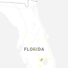
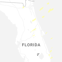
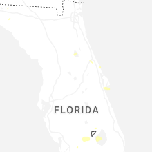


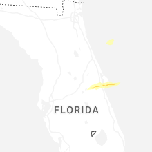


Connect with Interactive Hail Maps