

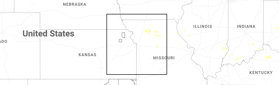
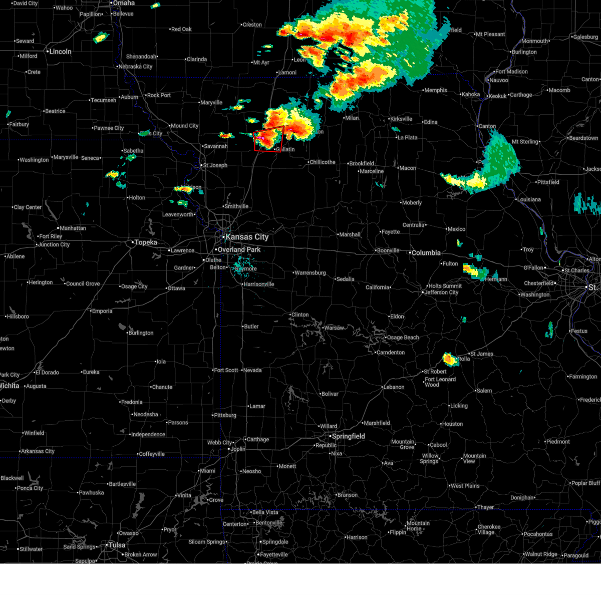
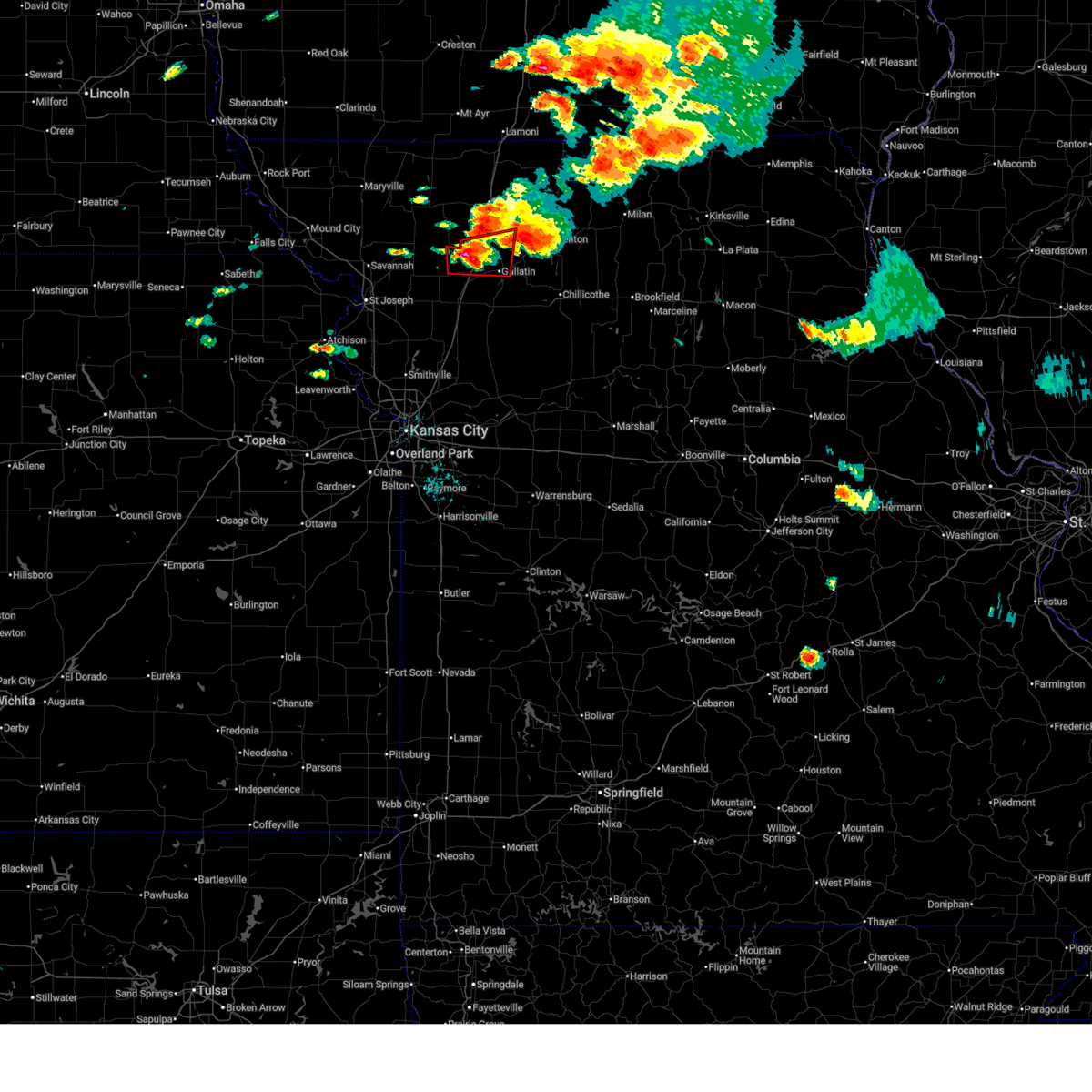
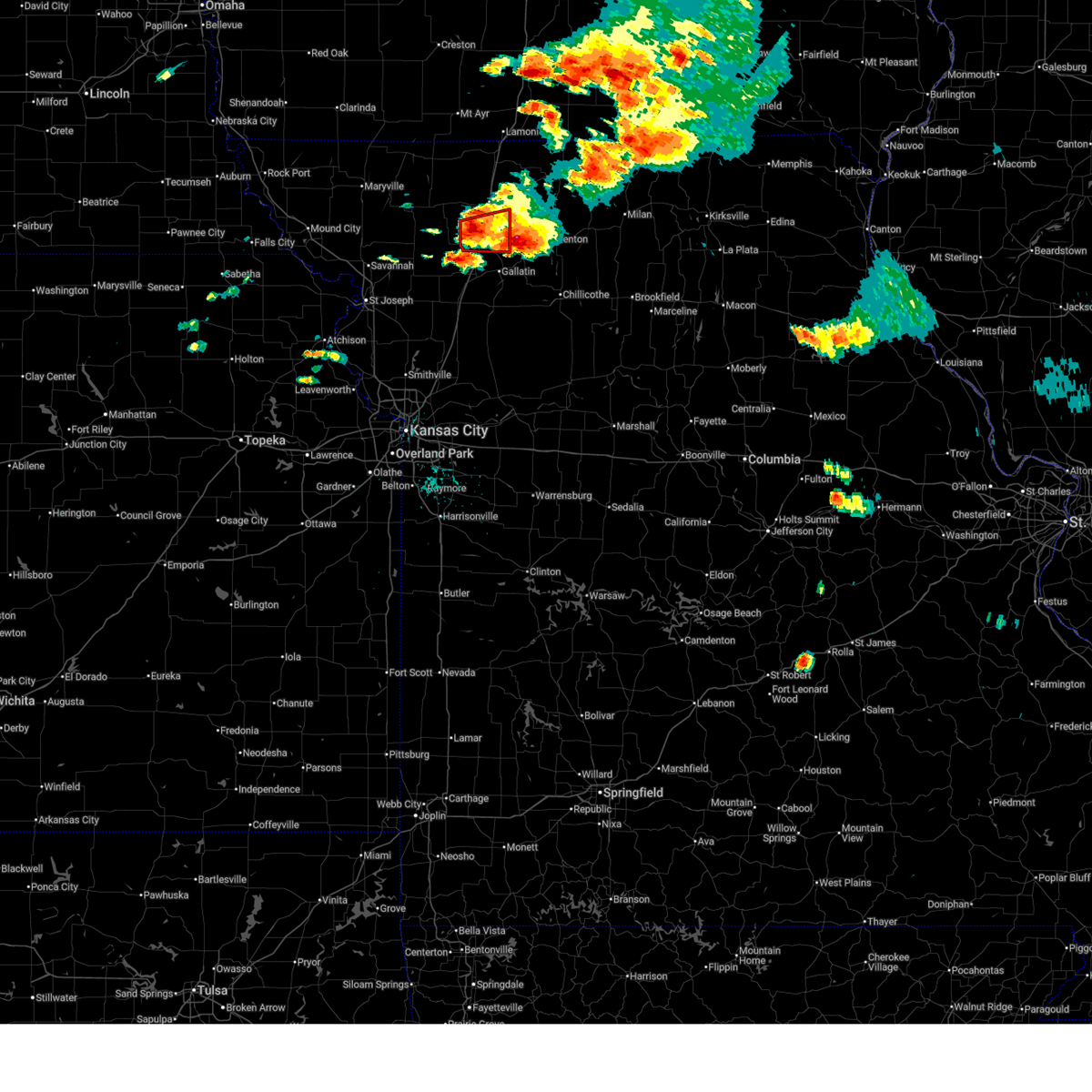
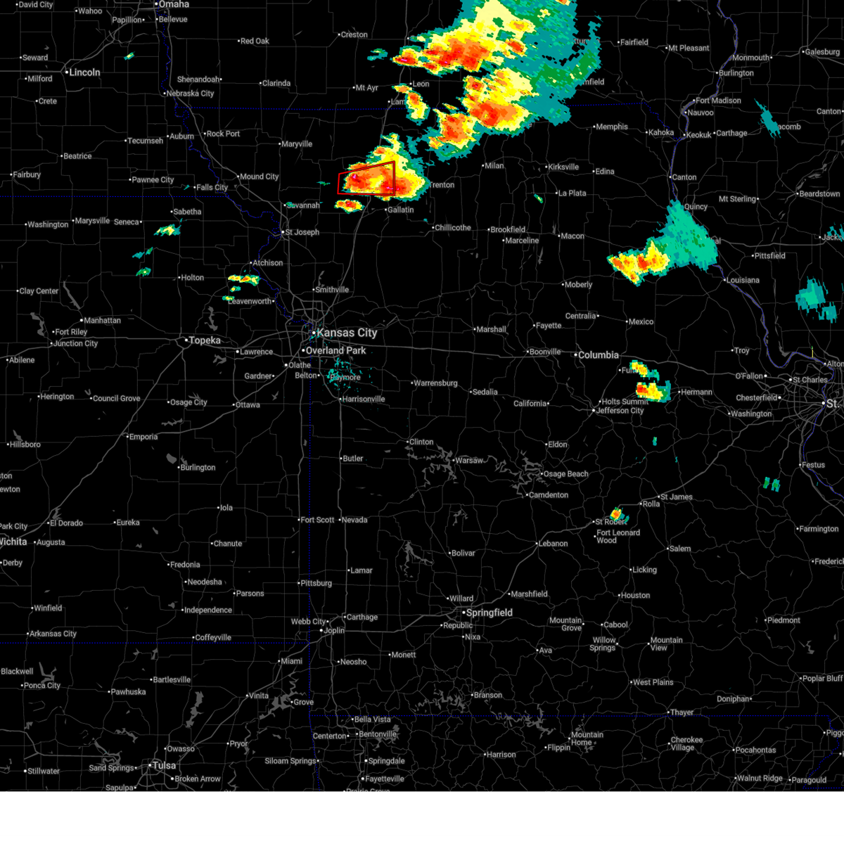
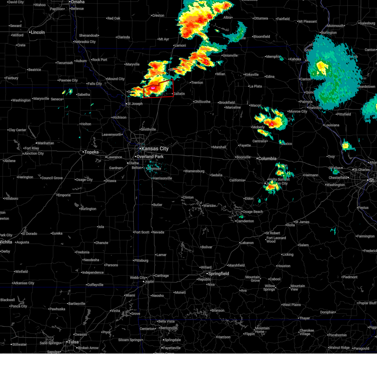
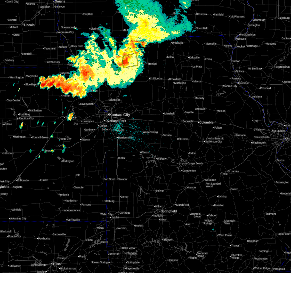
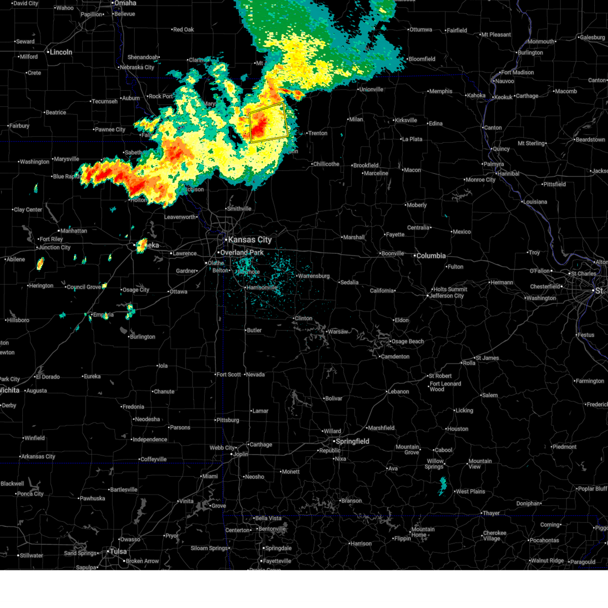
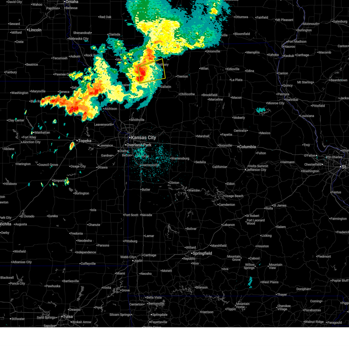
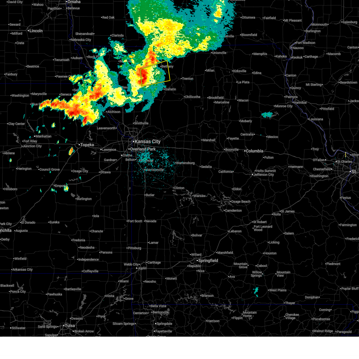
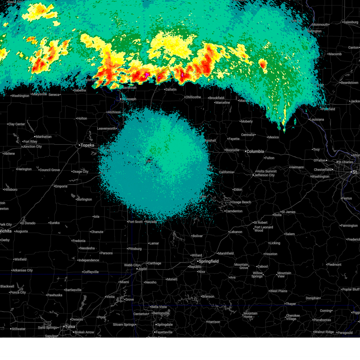
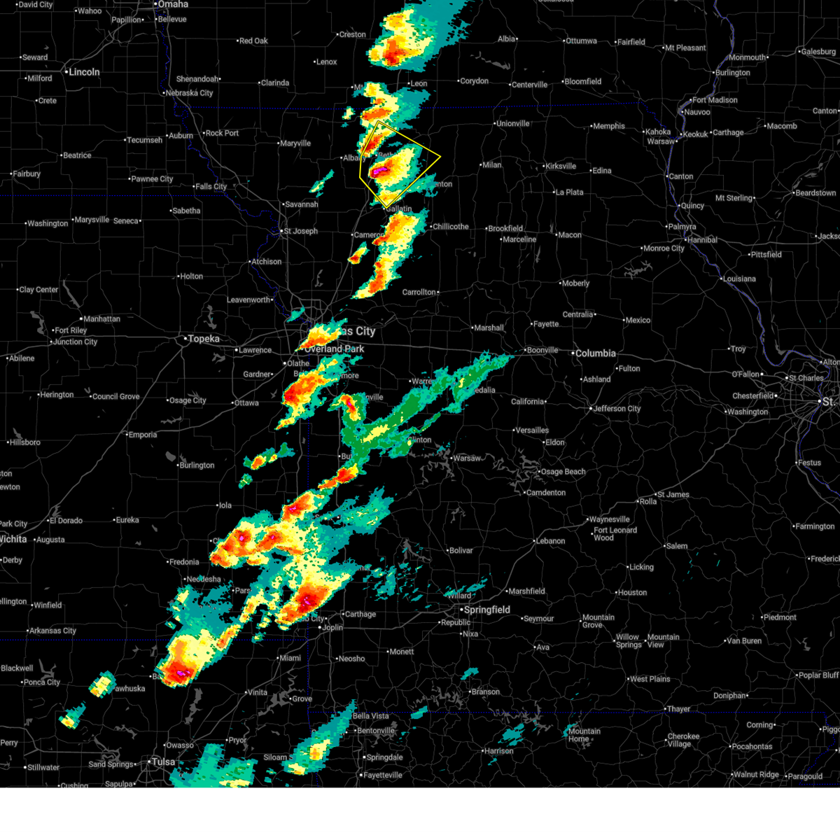
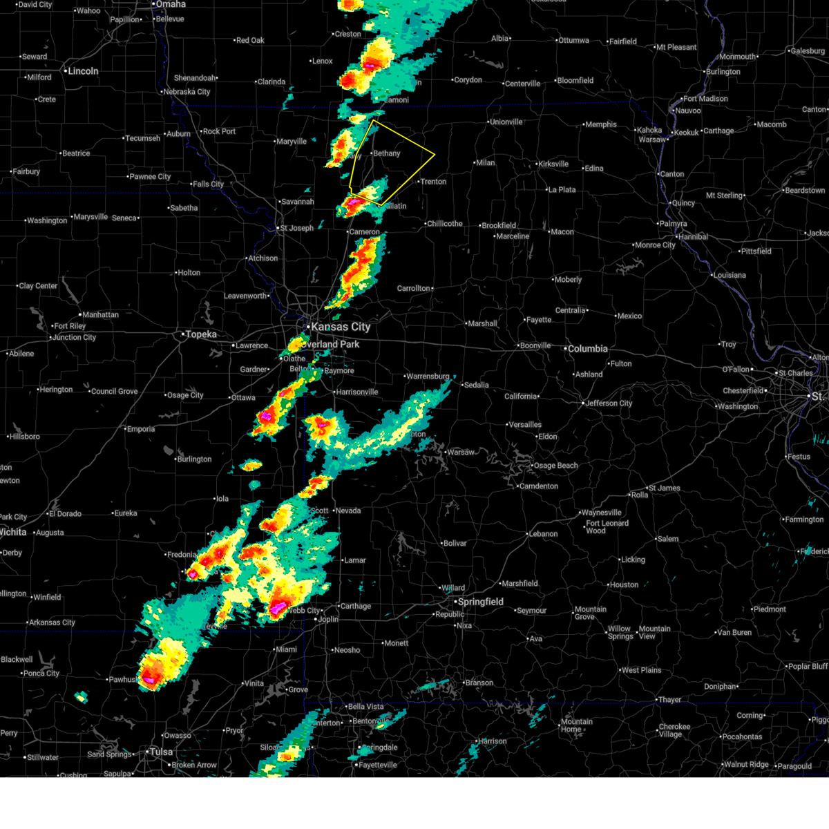
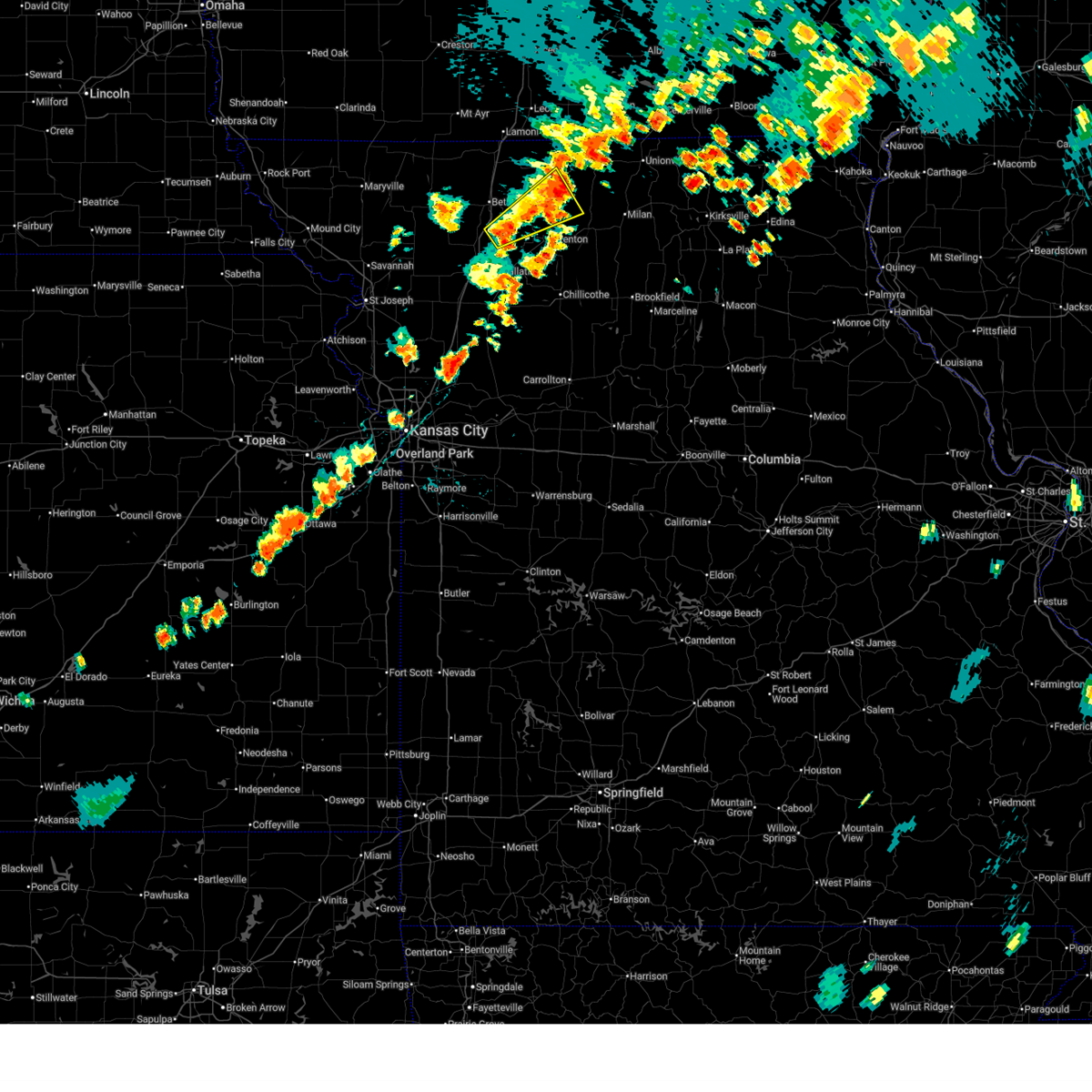
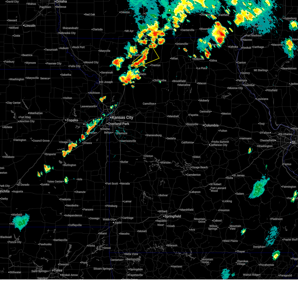
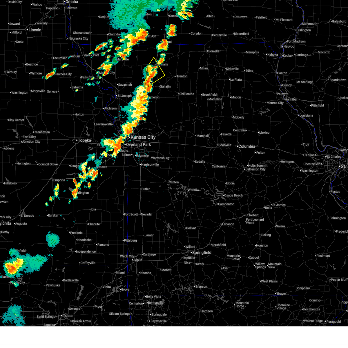
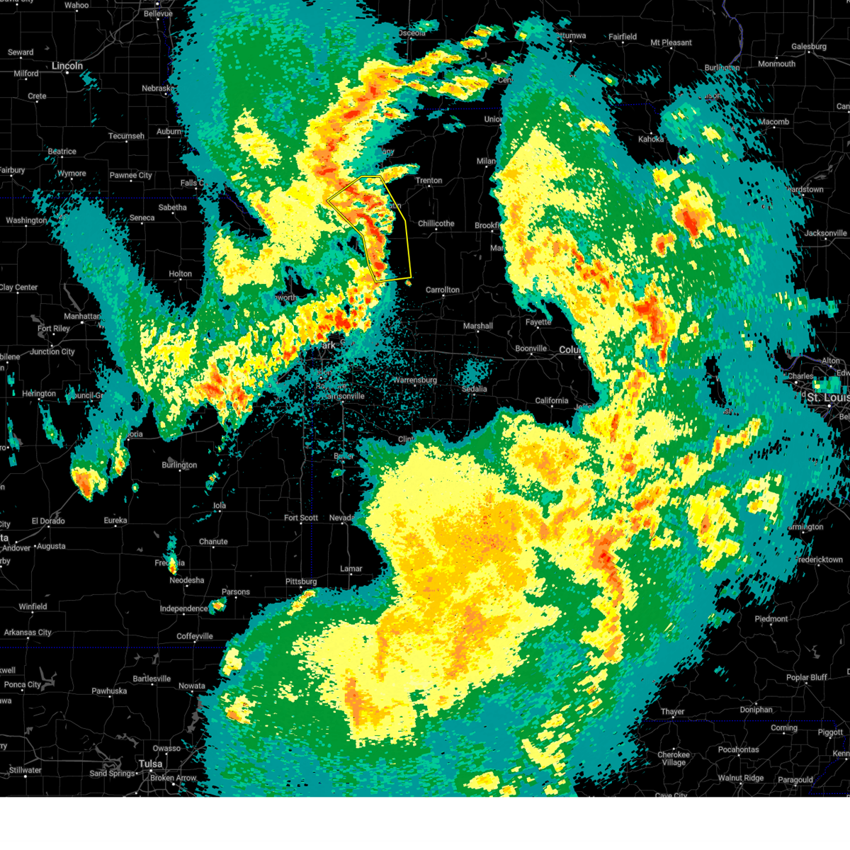
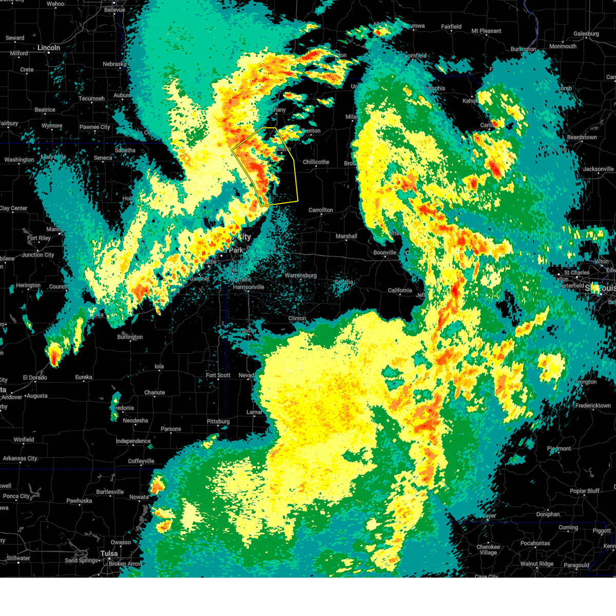
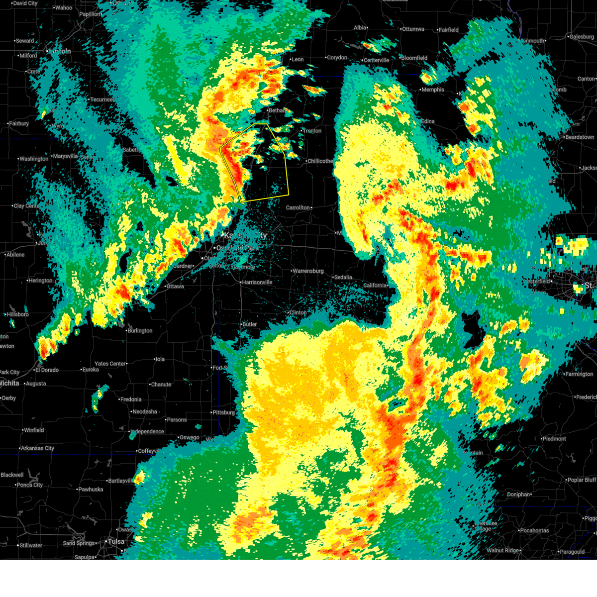
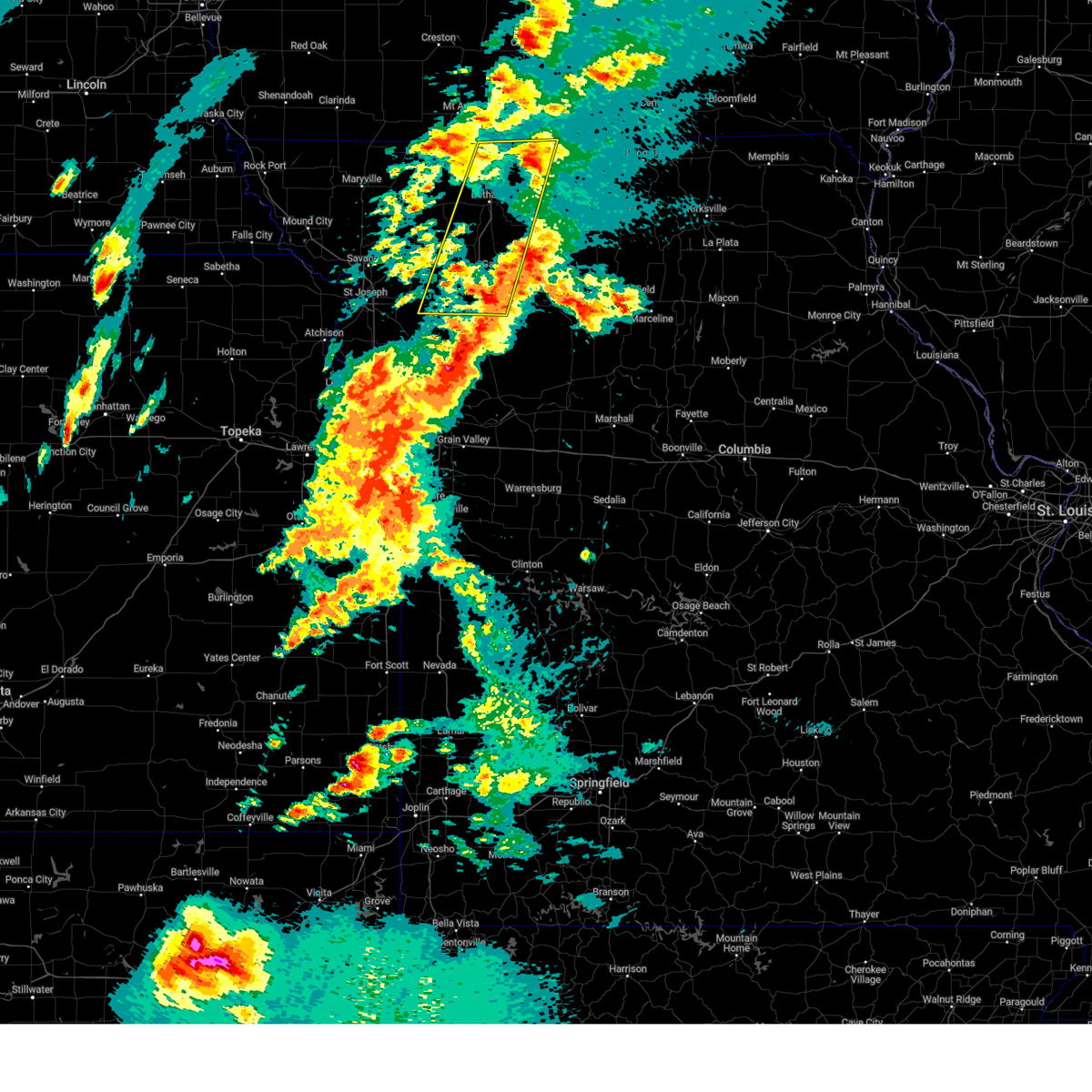
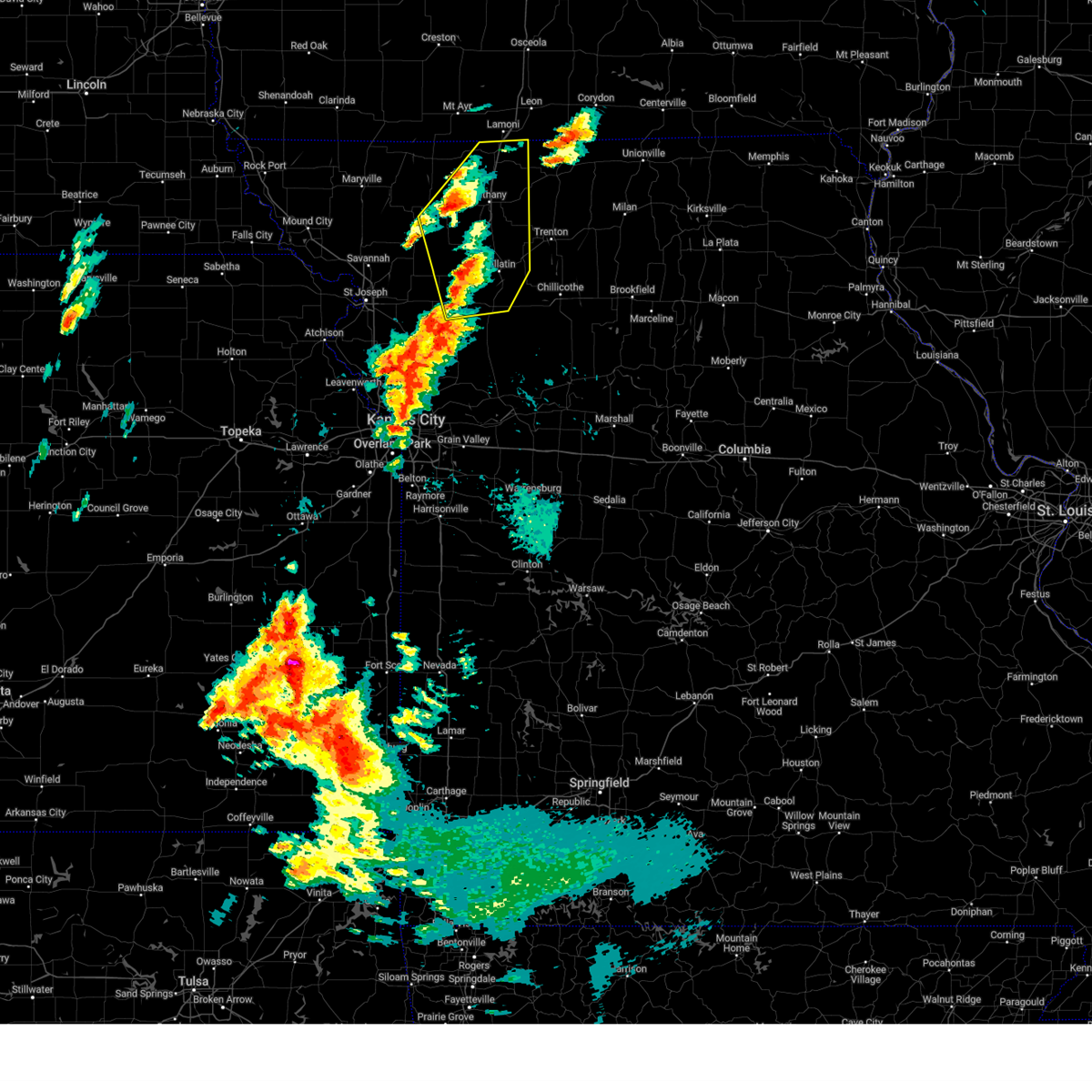
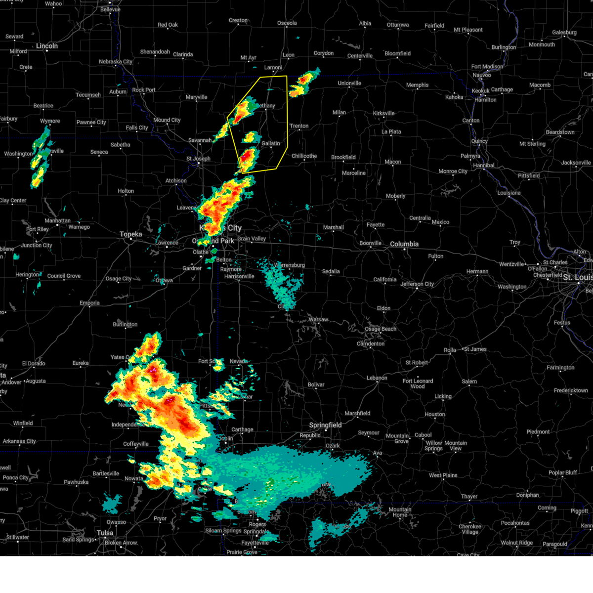
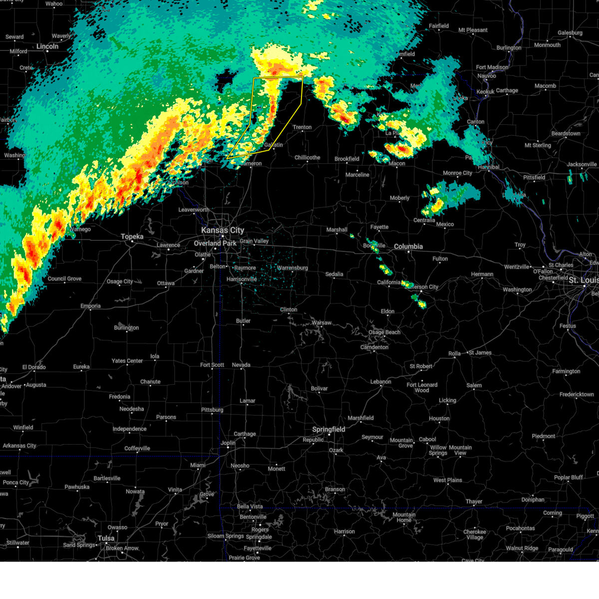
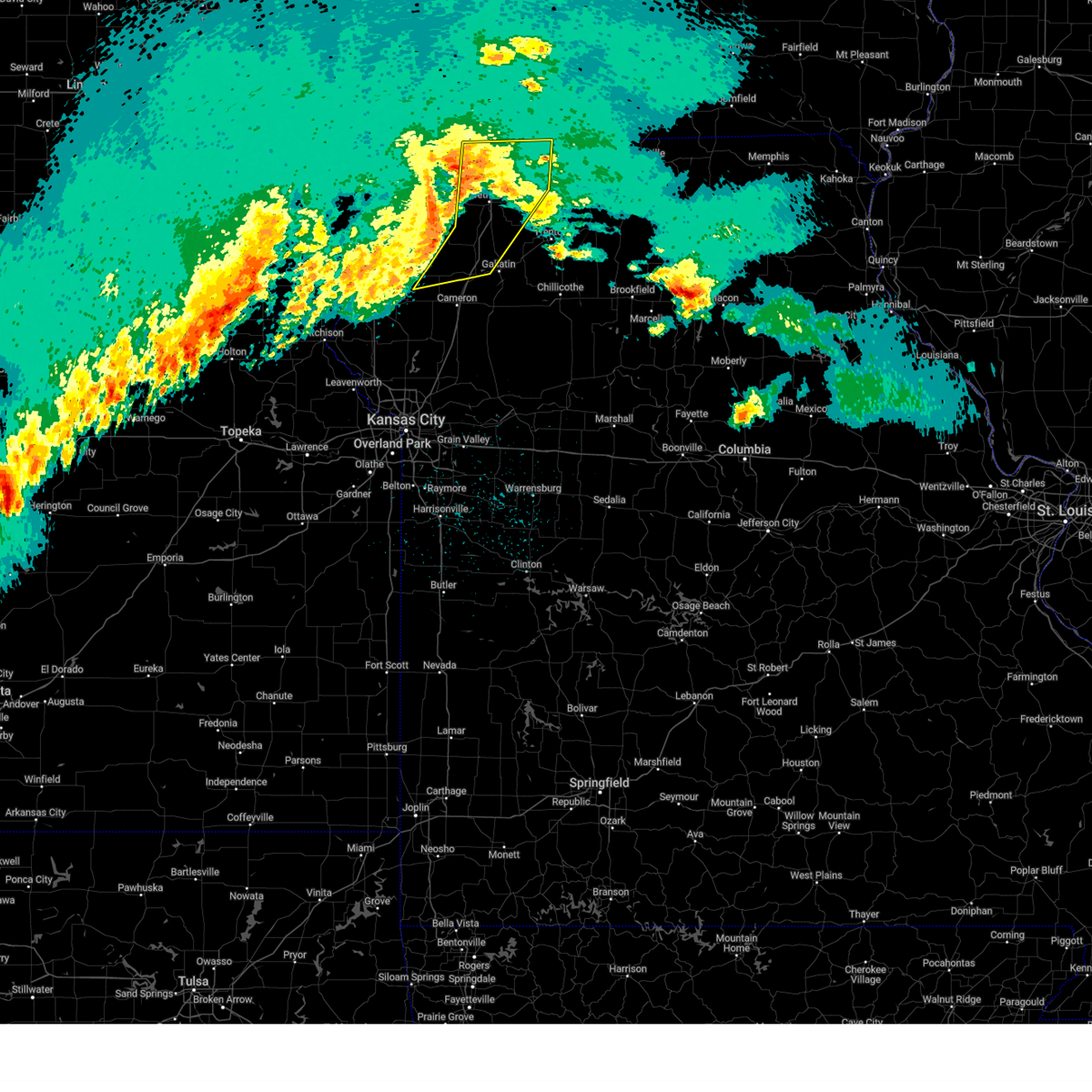
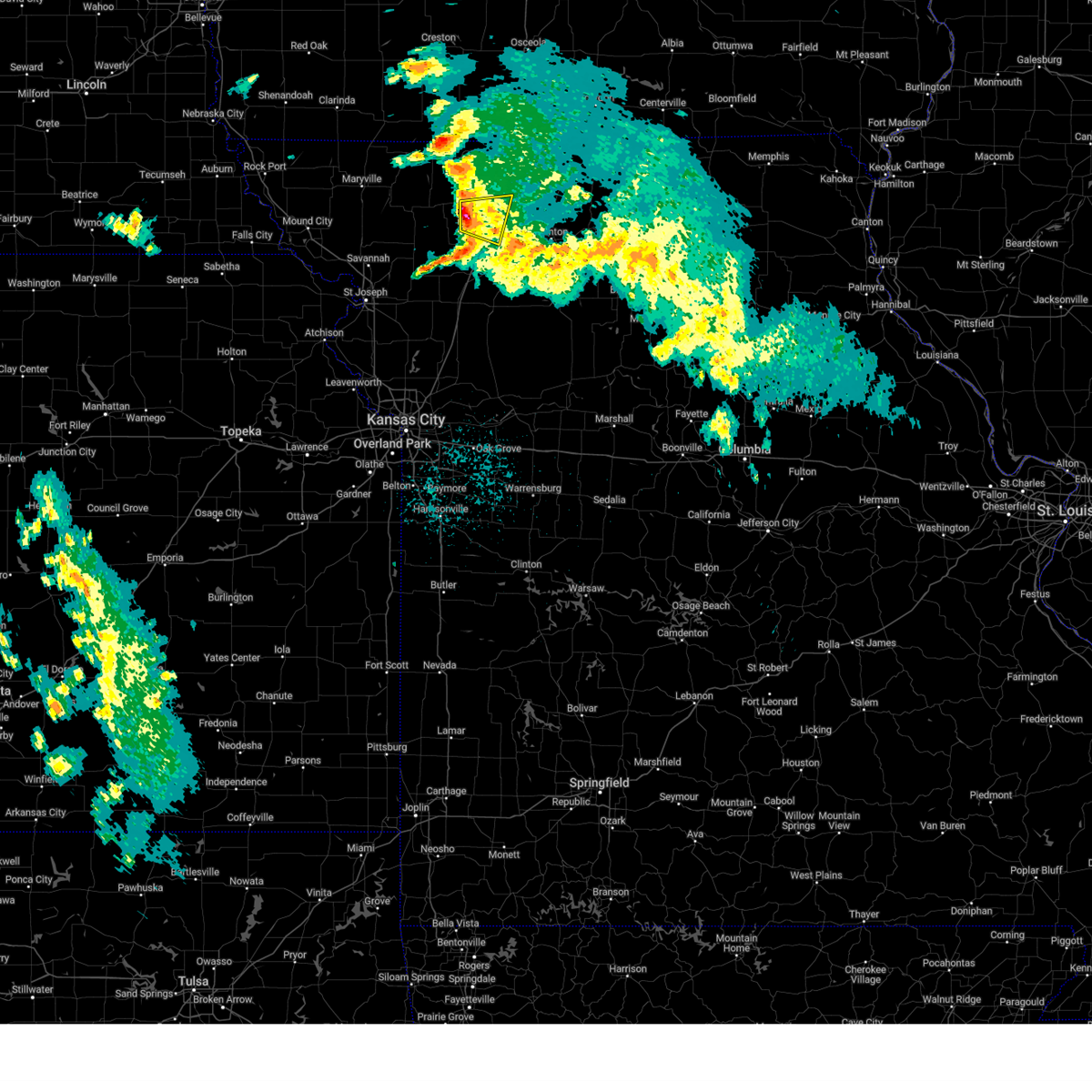
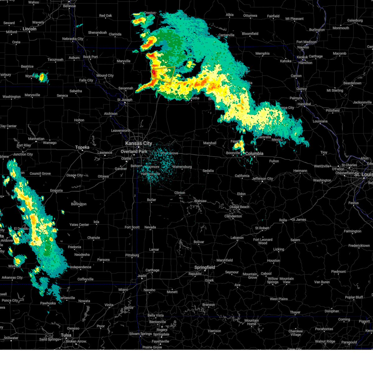
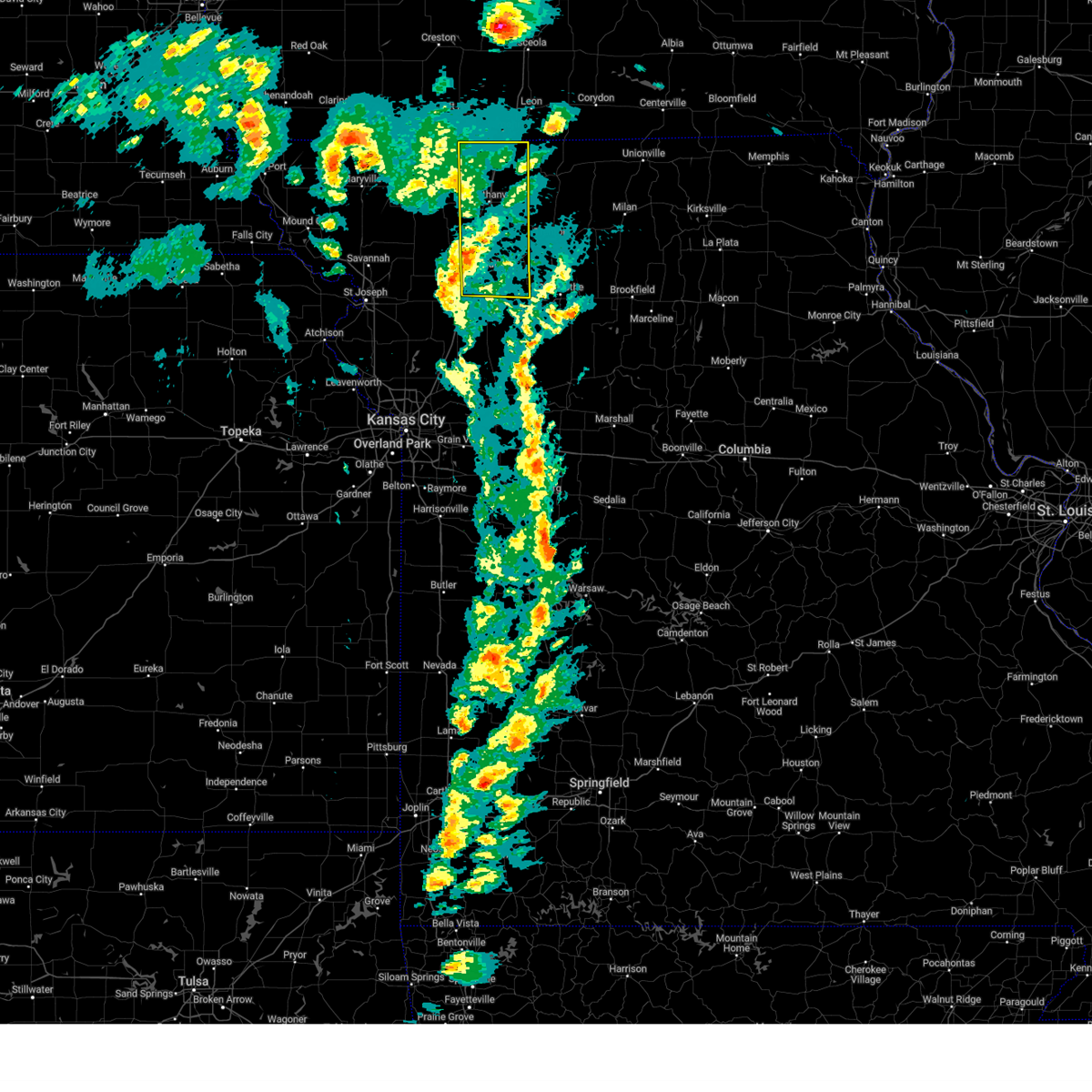
Hail Map for Coffey, MO
The Coffey, MO area has had 5 reports of on-the-ground hail by trained spotters, and has been under severe weather warnings 46 times during the past 12 months. Doppler radar has detected hail at or near Coffey, MO on 61 occasions, including 5 occasions during the past year.
| Name: | Coffey, MO |
| Where Located: | 75.7 miles NNE of Kansas City, MO |
| Map: | Google Map for Coffey, MO |
| Population: | 166 |
| Housing Units: | 76 |
| More Info: | Search Google for Coffey, MO |
4
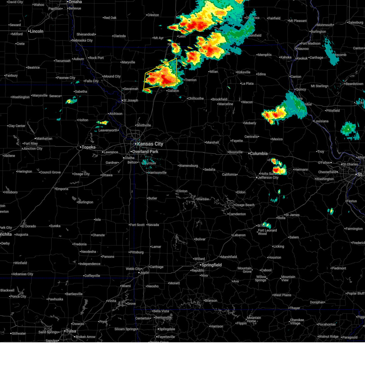
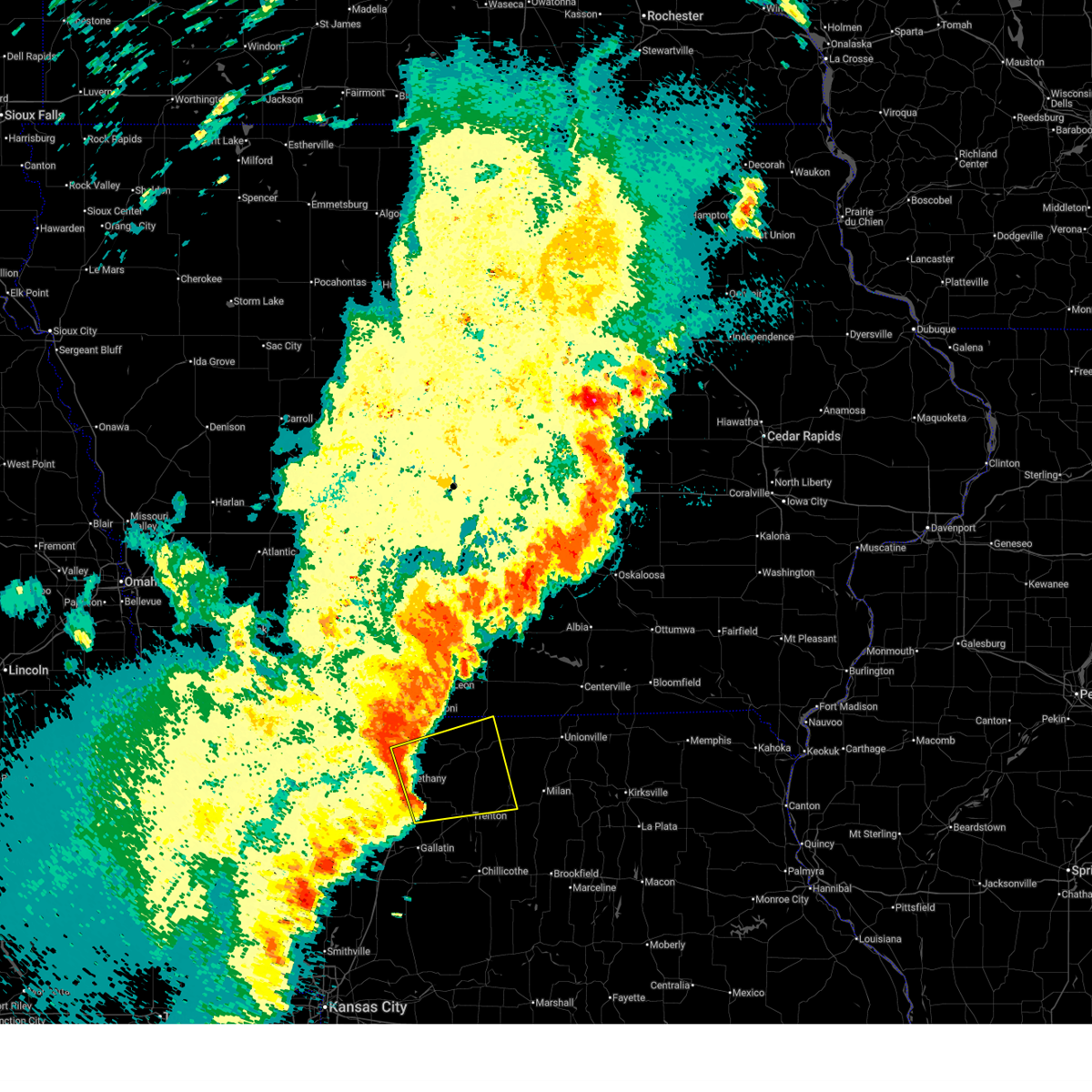
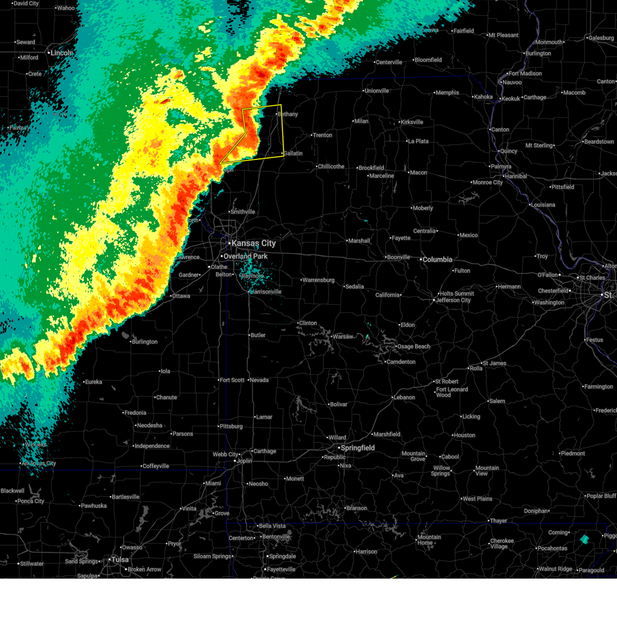
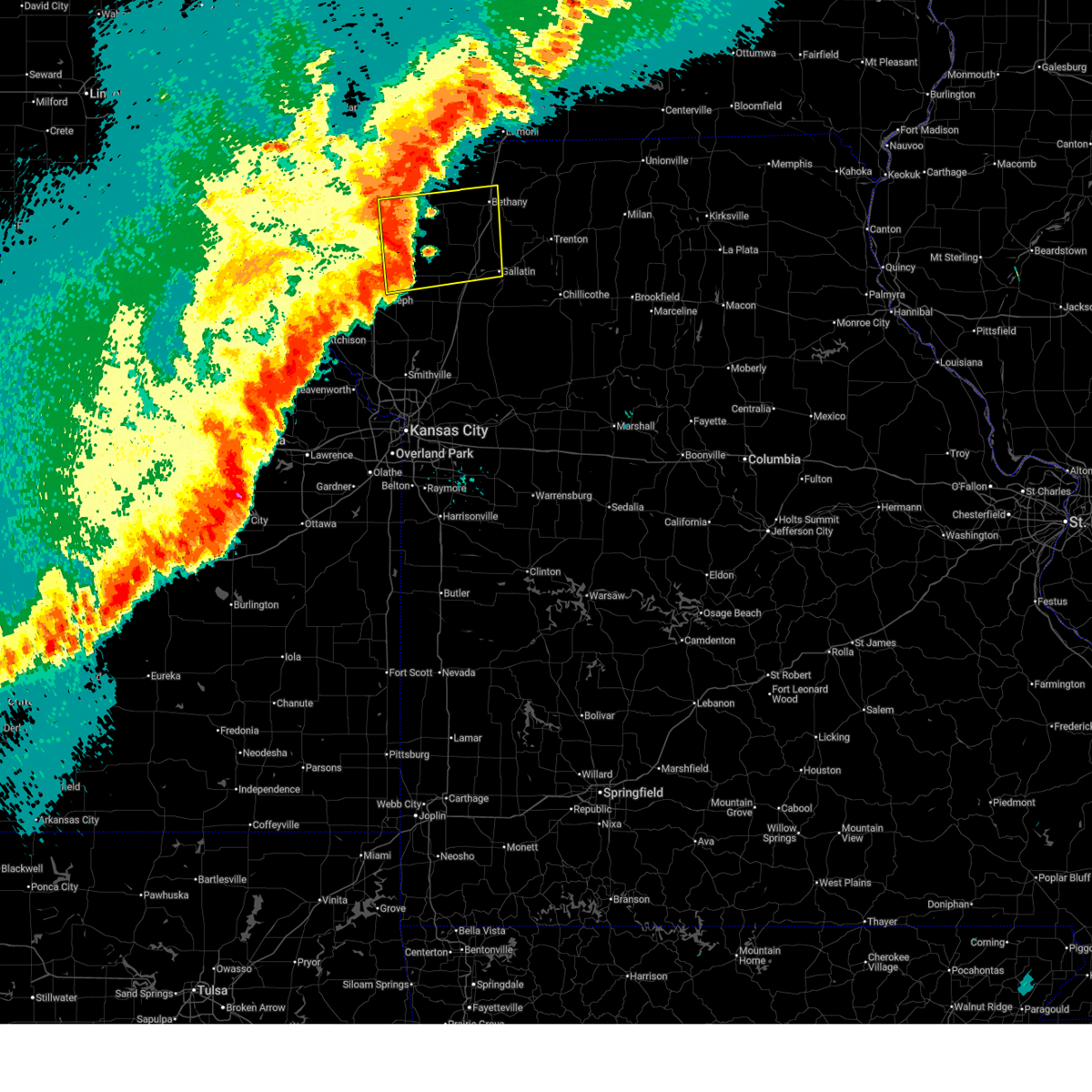
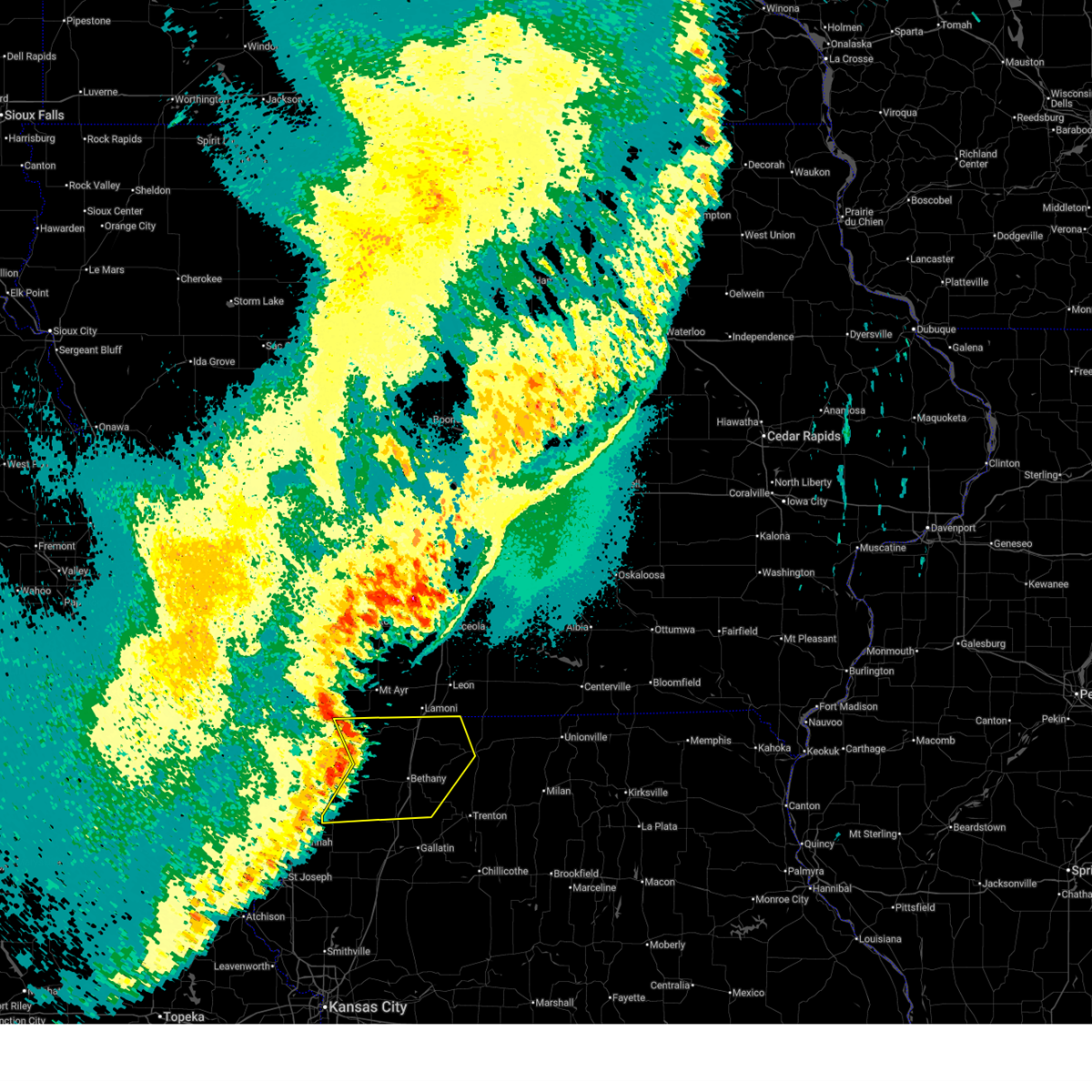
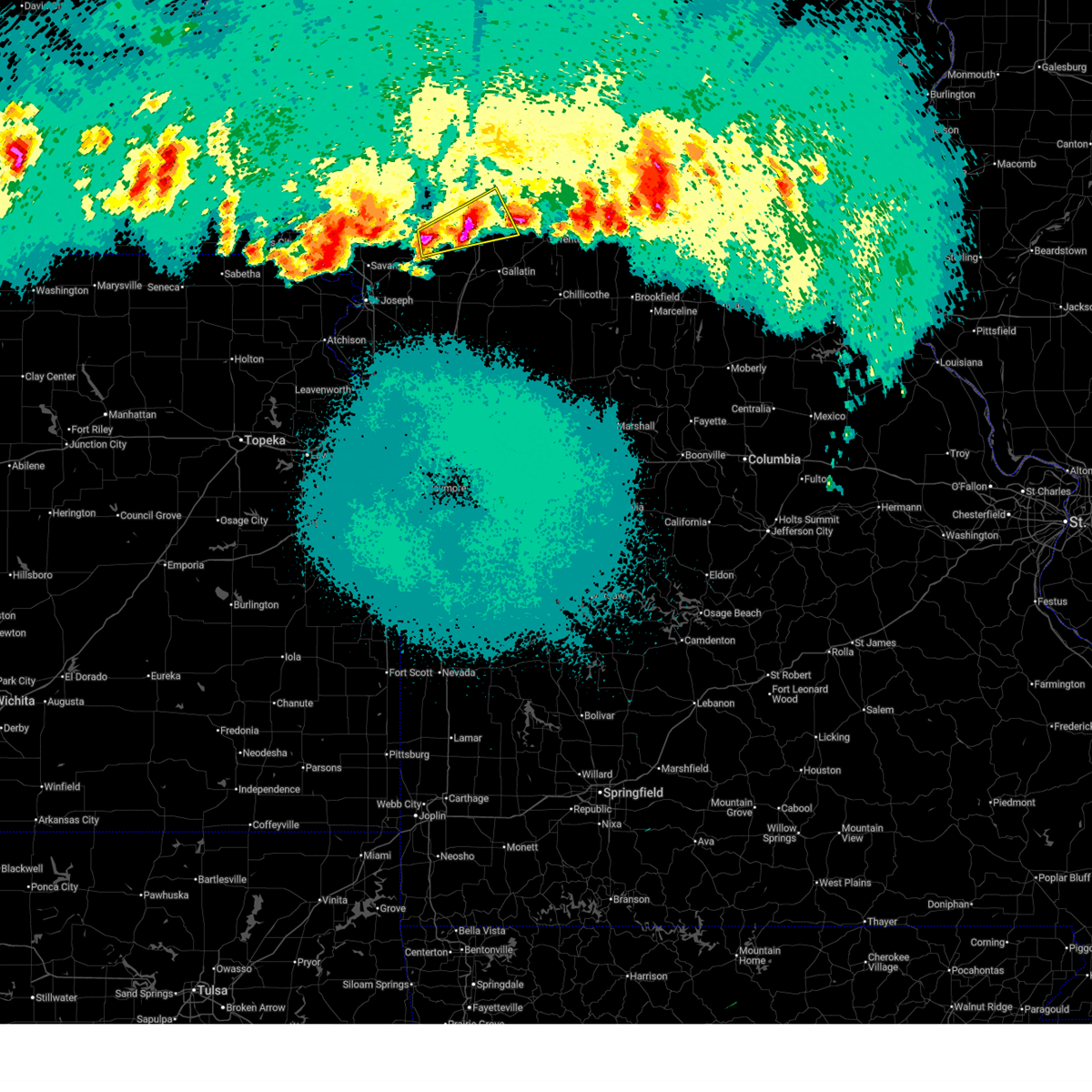
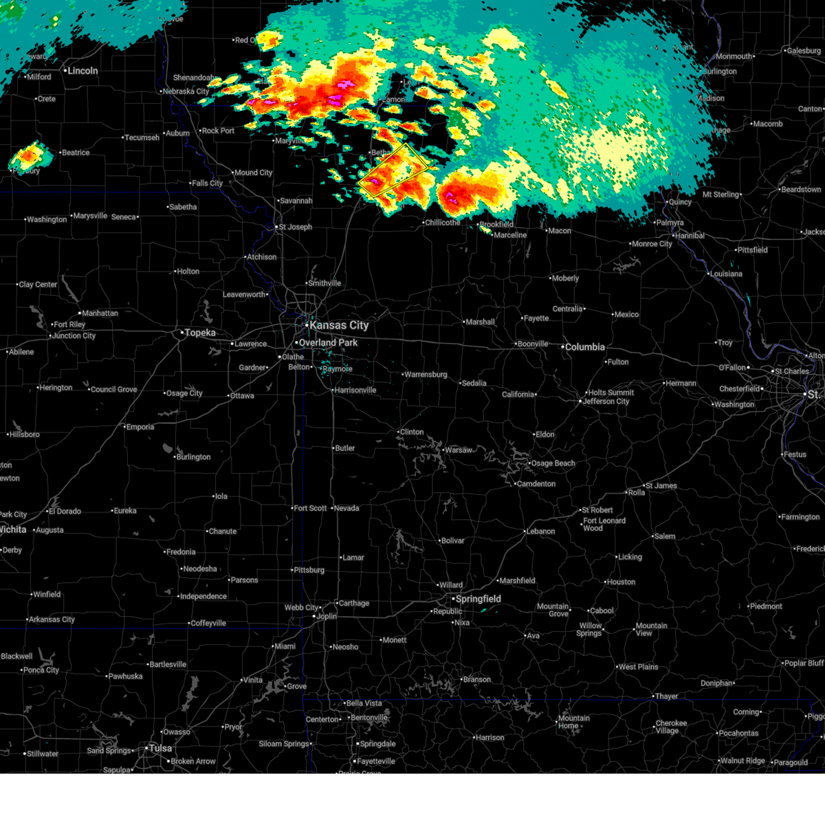
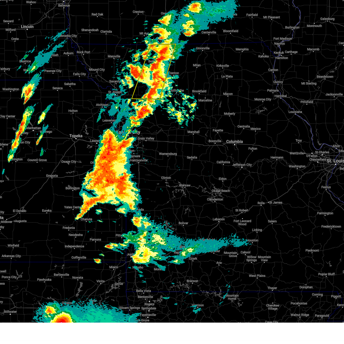
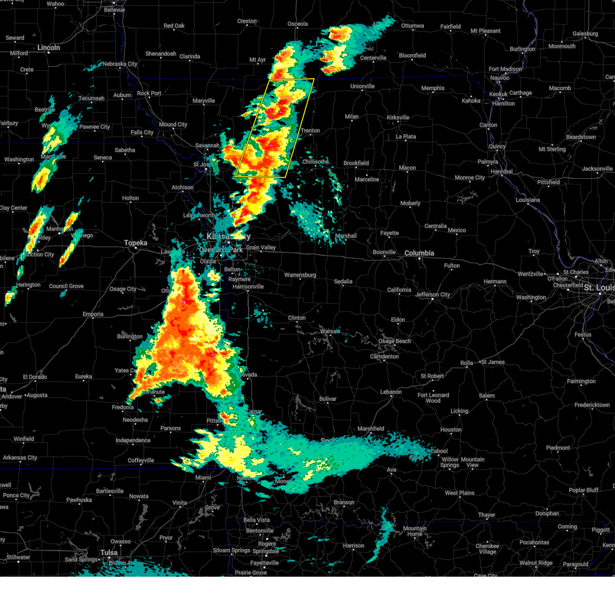
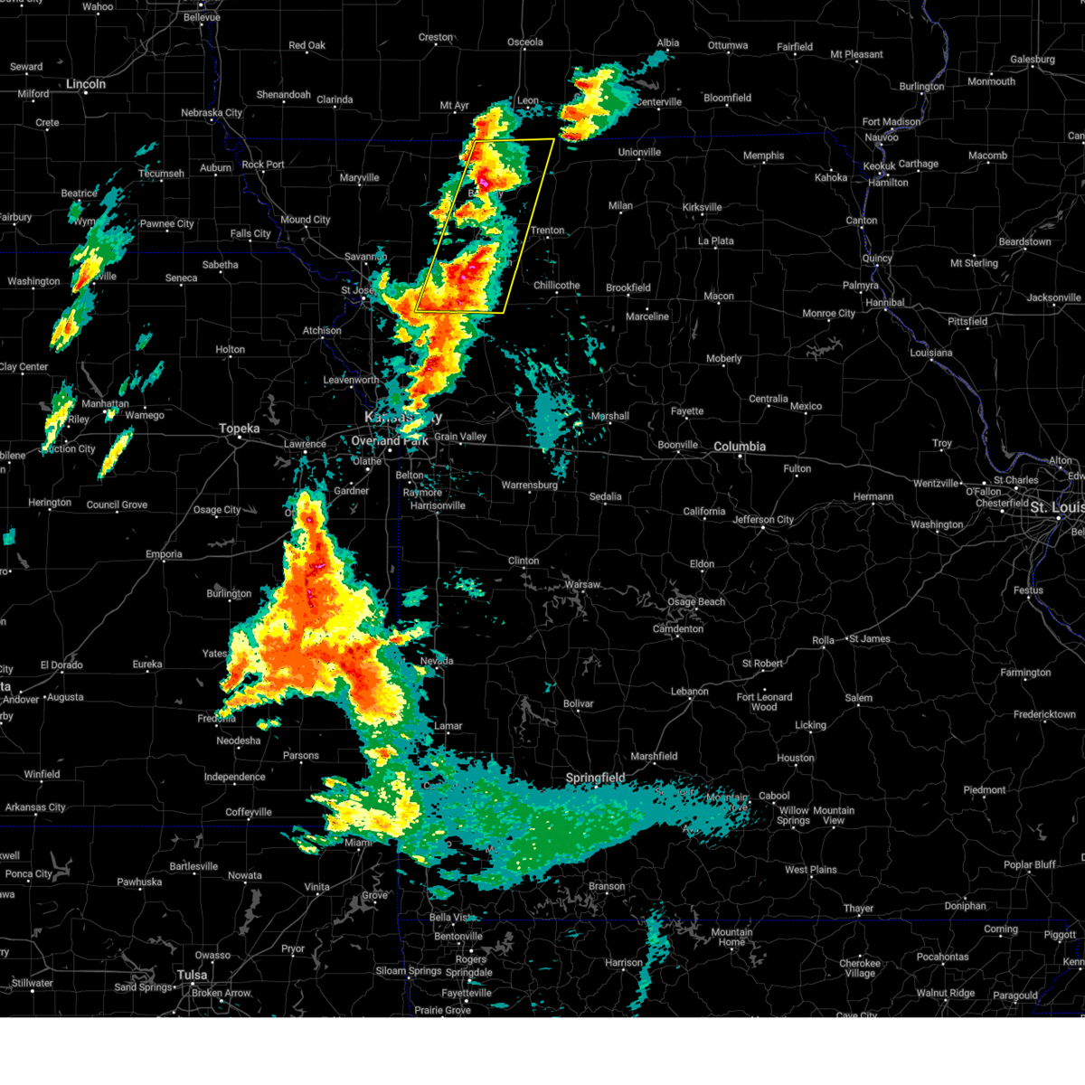
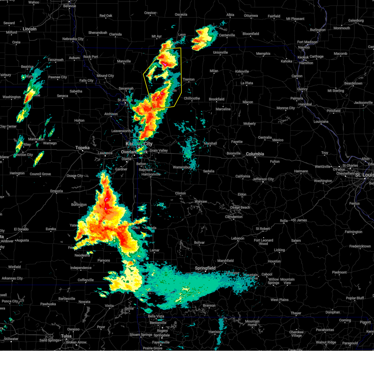
The Top Recent Hail Date for Coffey, MO is Saturday, May 16, 2026 (3rd out of 61)
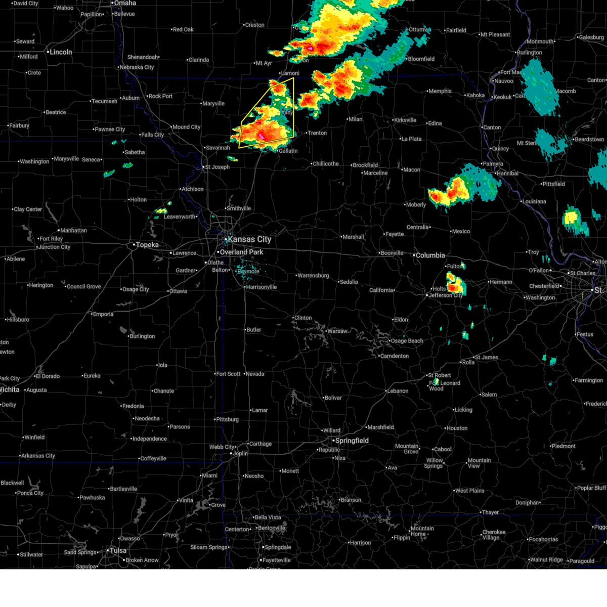
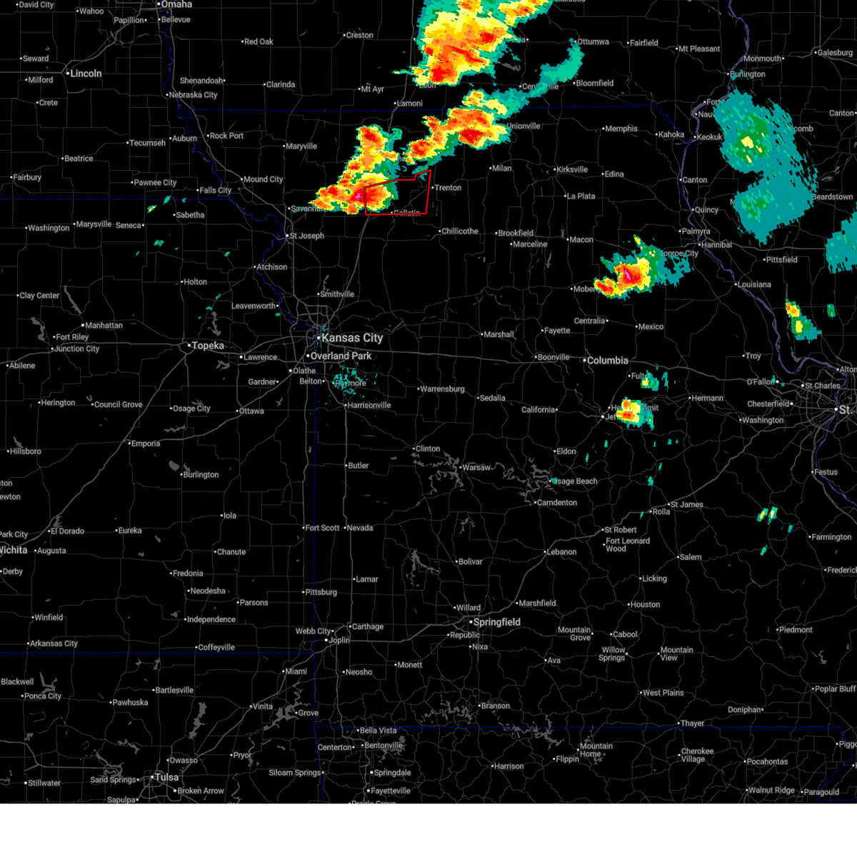
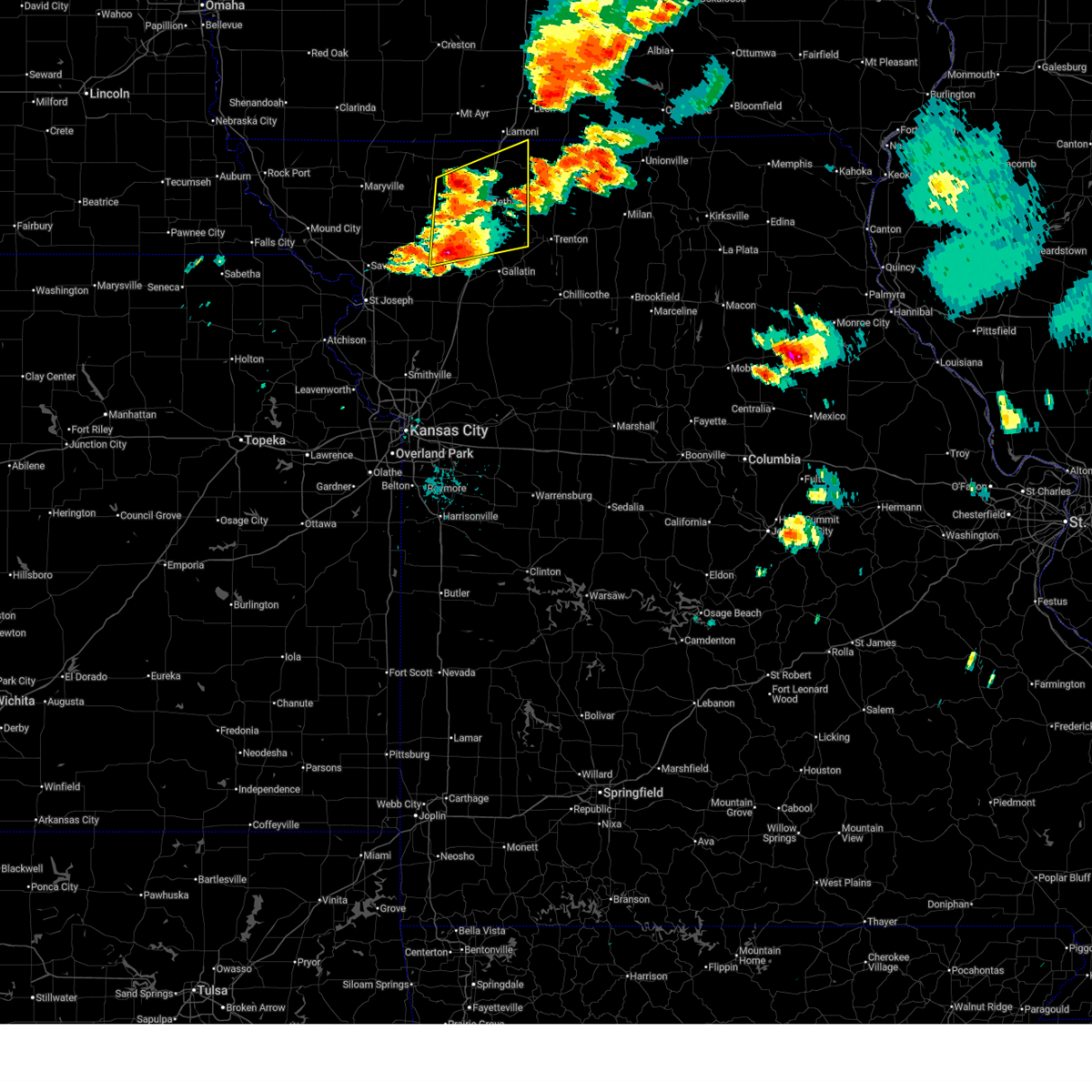
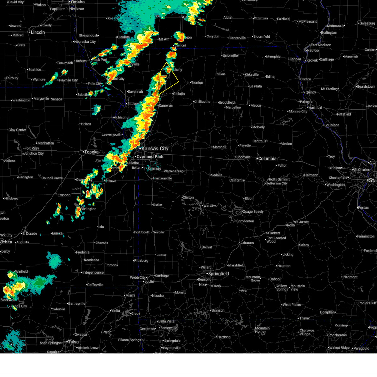
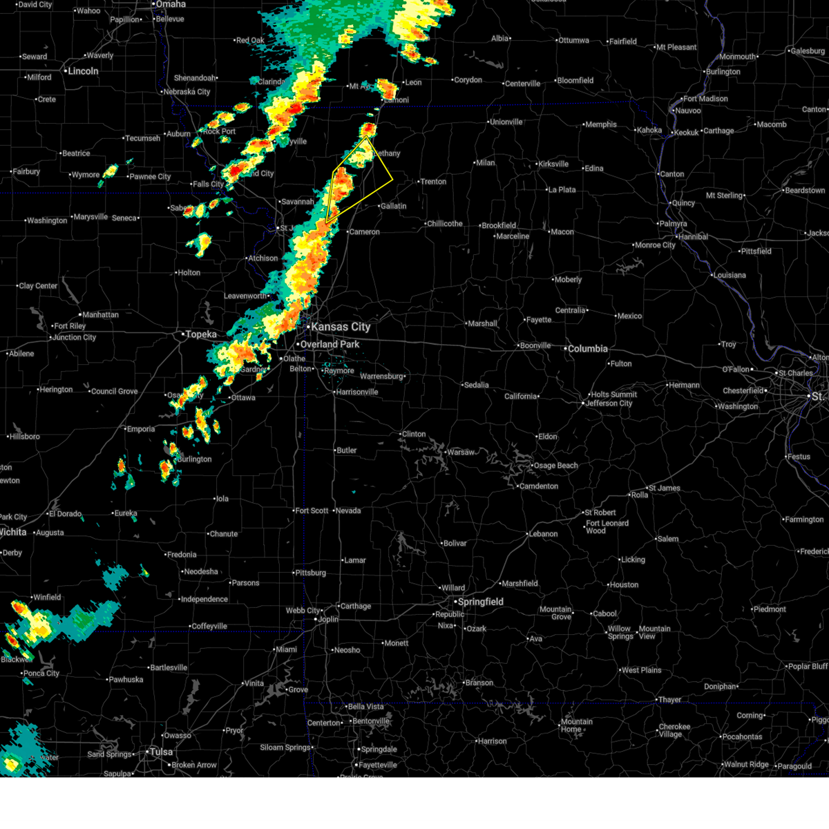
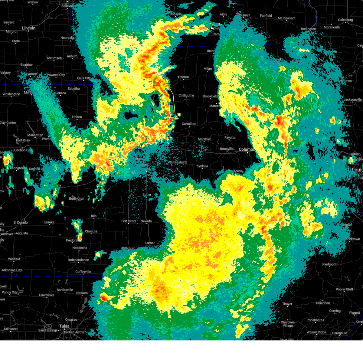
Hail and Wind Damage Spotted near Coffey, MO
| Date / Time | Report Details |
|---|---|
| 6/11/2026 8:34 AM CDT |
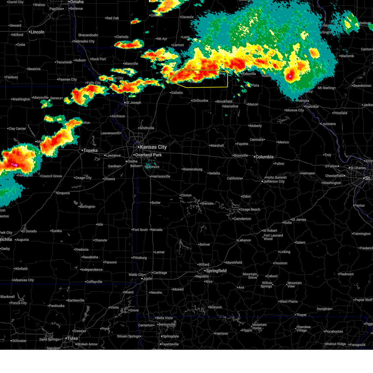
 At 833 am cdt, severe thunderstorms were located along a line extending from 12 miles northwest of unionville to near princeton to near gilman city, moving east at 55 mph (emergency management reported ping pong ball size hail at hwy. 69 and hwy. 136 in harrison county missouri. this line of storms has a history of 60 to 65 mph winds). Hazards include ping pong ball size hail and 60 mph wind gusts. People and animals outdoors will be injured. expect hail damage to roofs, siding, windows, and vehicles. expect wind damage to roofs, siding, and trees. locations impacted include, trenton, bethany, milan, unionville, princeton, gilman city, mercer, spickard, galt, laredo, newtown, coffey, humphreys, pollock, mount moriah, lucerne, tindall, brimson, harris, and powersville. This includes interstate 35 in missouri between mile markers 80 and 93. At 833 am cdt, severe thunderstorms were located along a line extending from 12 miles northwest of unionville to near princeton to near gilman city, moving east at 55 mph (emergency management reported ping pong ball size hail at hwy. 69 and hwy. 136 in harrison county missouri. this line of storms has a history of 60 to 65 mph winds). Hazards include ping pong ball size hail and 60 mph wind gusts. People and animals outdoors will be injured. expect hail damage to roofs, siding, windows, and vehicles. expect wind damage to roofs, siding, and trees. locations impacted include, trenton, bethany, milan, unionville, princeton, gilman city, mercer, spickard, galt, laredo, newtown, coffey, humphreys, pollock, mount moriah, lucerne, tindall, brimson, harris, and powersville. This includes interstate 35 in missouri between mile markers 80 and 93.
|
| 6/11/2026 8:28 AM CDT |
 Svreax the national weather service in pleasant hill has issued a * severe thunderstorm warning for, northeastern daviess county in north central missouri, grundy county in north central missouri, northwestern sullivan county in north central missouri, mercer county in north central missouri, putnam county in north central missouri, southeastern harrison county in north central missouri, northwestern schuyler county in northeastern missouri, * until 915 am cdt. * at 827 am cdt, severe thunderstorms were located along a line extending from 13 miles south of corydon to near cainsville to near gilman city, moving east at 55 mph (radar indicated). Hazards include ping pong ball size hail and 60 mph wind gusts. People and animals outdoors will be injured. expect hail damage to roofs, siding, windows, and vehicles. Expect wind damage to roofs, siding, and trees. Svreax the national weather service in pleasant hill has issued a * severe thunderstorm warning for, northeastern daviess county in north central missouri, grundy county in north central missouri, northwestern sullivan county in north central missouri, mercer county in north central missouri, putnam county in north central missouri, southeastern harrison county in north central missouri, northwestern schuyler county in northeastern missouri, * until 915 am cdt. * at 827 am cdt, severe thunderstorms were located along a line extending from 13 miles south of corydon to near cainsville to near gilman city, moving east at 55 mph (radar indicated). Hazards include ping pong ball size hail and 60 mph wind gusts. People and animals outdoors will be injured. expect hail damage to roofs, siding, windows, and vehicles. Expect wind damage to roofs, siding, and trees.
|
| 6/10/2026 8:01 PM CDT |
 Svreax the national weather service in pleasant hill has issued a * severe thunderstorm warning for, northern linn county in north central missouri, northeastern daviess county in north central missouri, grundy county in north central missouri, southern sullivan county in north central missouri, southeastern harrison county in north central missouri, * until 845 pm cdt. * at 801 pm cdt, severe thunderstorms were located along a line extending from near milan to near gilman city, moving east at 35 mph (radar indicated). Hazards include 60 mph wind gusts and half dollar size hail. Hail damage to vehicles is expected. Expect wind damage to roofs, siding, and trees. Svreax the national weather service in pleasant hill has issued a * severe thunderstorm warning for, northern linn county in north central missouri, northeastern daviess county in north central missouri, grundy county in north central missouri, southern sullivan county in north central missouri, southeastern harrison county in north central missouri, * until 845 pm cdt. * at 801 pm cdt, severe thunderstorms were located along a line extending from near milan to near gilman city, moving east at 35 mph (radar indicated). Hazards include 60 mph wind gusts and half dollar size hail. Hail damage to vehicles is expected. Expect wind damage to roofs, siding, and trees.
|
| 6/10/2026 4:43 PM CDT |
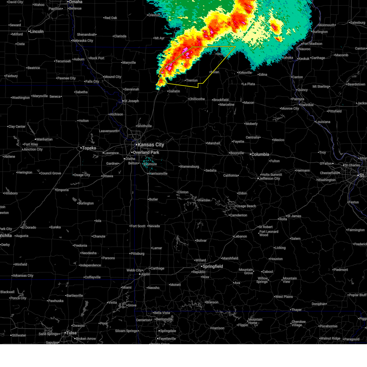
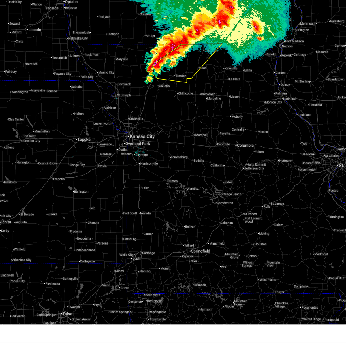
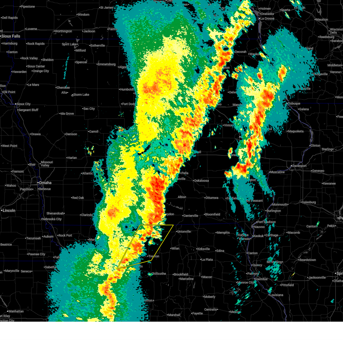
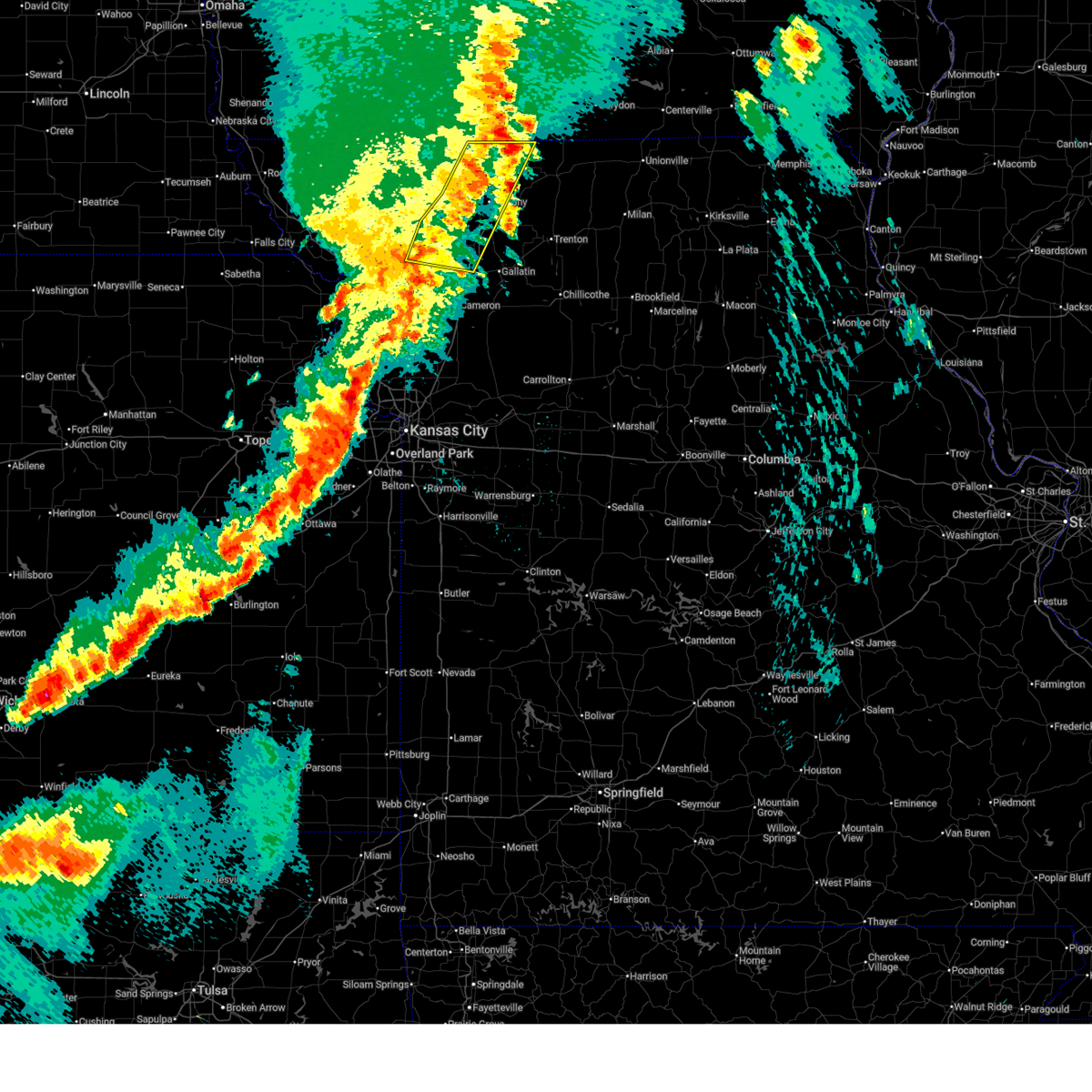
 At 443 pm cdt, a severe thunderstorm capable of producing a tornado was located near pattonsburg, or 11 miles northwest of gallatin, moving northeast at 35 mph (radar indicated rotation). Hazards include tornado and baseball size hail. Flying debris will be dangerous to those caught without shelter. mobile homes will be damaged or destroyed. damage to roofs, windows, and vehicles will occur. tree damage is likely. locations impacted include, gallatin, gilman city, pattonsburg, coffey, and jameson. This includes interstate 35 in missouri between mile markers 65 and 79. At 443 pm cdt, a severe thunderstorm capable of producing a tornado was located near pattonsburg, or 11 miles northwest of gallatin, moving northeast at 35 mph (radar indicated rotation). Hazards include tornado and baseball size hail. Flying debris will be dangerous to those caught without shelter. mobile homes will be damaged or destroyed. damage to roofs, windows, and vehicles will occur. tree damage is likely. locations impacted include, gallatin, gilman city, pattonsburg, coffey, and jameson. This includes interstate 35 in missouri between mile markers 65 and 79.
|
| 6/10/2026 4:39 PM CDT |
 At 439 pm cdt, severe thunderstorms were located along a line extending from near bethany to near pattonsburg, moving northeast at 45 mph (radar indicated). Hazards include tennis ball size hail and 60 mph wind gusts. People and animals outdoors will be injured. expect hail damage to roofs, siding, windows, and vehicles. expect wind damage to roofs, siding, and trees. locations impacted include, bethany, gallatin, princeton, jamesport, gilman city, pattonsburg, coffey, jameson, mcfall, mount moriah, brimson, and modena. This includes interstate 35 in missouri between mile markers 65 and 93. At 439 pm cdt, severe thunderstorms were located along a line extending from near bethany to near pattonsburg, moving northeast at 45 mph (radar indicated). Hazards include tennis ball size hail and 60 mph wind gusts. People and animals outdoors will be injured. expect hail damage to roofs, siding, windows, and vehicles. expect wind damage to roofs, siding, and trees. locations impacted include, bethany, gallatin, princeton, jamesport, gilman city, pattonsburg, coffey, jameson, mcfall, mount moriah, brimson, and modena. This includes interstate 35 in missouri between mile markers 65 and 93.
|
| 6/10/2026 4:34 PM CDT |
 Toreax the national weather service in pleasant hill has issued a * tornado warning for, central daviess county in north central missouri, northeastern dekalb county in northwestern missouri, * until 515 pm cdt. * at 434 pm cdt, a severe thunderstorm capable of producing a tornado was located 8 miles southwest of pattonsburg, or 8 miles northeast of maysville, moving northeast at 35 mph (radar indicated rotation). Hazards include tornado and golf ball size hail. Flying debris will be dangerous to those caught without shelter. mobile homes will be damaged or destroyed. damage to roofs, windows, and vehicles will occur. Tree damage is likely. Toreax the national weather service in pleasant hill has issued a * tornado warning for, central daviess county in north central missouri, northeastern dekalb county in northwestern missouri, * until 515 pm cdt. * at 434 pm cdt, a severe thunderstorm capable of producing a tornado was located 8 miles southwest of pattonsburg, or 8 miles northeast of maysville, moving northeast at 35 mph (radar indicated rotation). Hazards include tornado and golf ball size hail. Flying debris will be dangerous to those caught without shelter. mobile homes will be damaged or destroyed. damage to roofs, windows, and vehicles will occur. Tree damage is likely.
|
| 6/10/2026 4:33 PM CDT |
 the tornado warning has been cancelled and is no longer in effect the tornado warning has been cancelled and is no longer in effect
|
| 6/10/2026 4:33 PM CDT |
 At 433 pm cdt, a severe thunderstorm capable of producing a tornado was located over pattonsburg, or 14 miles southeast of albany, moving east at 35 mph (radar indicated rotation). Hazards include tornado and ping pong ball size hail. Flying debris will be dangerous to those caught without shelter. mobile homes will be damaged or destroyed. damage to roofs, windows, and vehicles will occur. tree damage is likely. locations impacted include, pattonsburg, coffey, and mcfall. This includes interstate 35 in missouri between mile markers 74 and 88. At 433 pm cdt, a severe thunderstorm capable of producing a tornado was located over pattonsburg, or 14 miles southeast of albany, moving east at 35 mph (radar indicated rotation). Hazards include tornado and ping pong ball size hail. Flying debris will be dangerous to those caught without shelter. mobile homes will be damaged or destroyed. damage to roofs, windows, and vehicles will occur. tree damage is likely. locations impacted include, pattonsburg, coffey, and mcfall. This includes interstate 35 in missouri between mile markers 74 and 88.
|
| 6/10/2026 4:28 PM CDT |
 Svreax the national weather service in pleasant hill has issued a * severe thunderstorm warning for, daviess county in north central missouri, western grundy county in north central missouri, southeastern gentry county in northwestern missouri, southwestern mercer county in north central missouri, southern harrison county in north central missouri, northeastern dekalb county in northwestern missouri, northwestern livingston county in north central missouri, * until 530 pm cdt. * at 428 pm cdt, severe thunderstorms were located along a line extending from 6 miles north of pattonsburg to 8 miles northeast of maysville, moving northeast at 45 mph (radar indicated). Hazards include golf ball size hail and 60 mph wind gusts. People and animals outdoors will be injured. expect hail damage to roofs, siding, windows, and vehicles. Expect wind damage to roofs, siding, and trees. Svreax the national weather service in pleasant hill has issued a * severe thunderstorm warning for, daviess county in north central missouri, western grundy county in north central missouri, southeastern gentry county in northwestern missouri, southwestern mercer county in north central missouri, southern harrison county in north central missouri, northeastern dekalb county in northwestern missouri, northwestern livingston county in north central missouri, * until 530 pm cdt. * at 428 pm cdt, severe thunderstorms were located along a line extending from 6 miles north of pattonsburg to 8 miles northeast of maysville, moving northeast at 45 mph (radar indicated). Hazards include golf ball size hail and 60 mph wind gusts. People and animals outdoors will be injured. expect hail damage to roofs, siding, windows, and vehicles. Expect wind damage to roofs, siding, and trees.
|
| 6/10/2026 4:22 PM CDT |
 Toreax the national weather service in pleasant hill has issued a * tornado warning for, northwestern daviess county in north central missouri, southeastern gentry county in northwestern missouri, southwestern harrison county in north central missouri, northeastern dekalb county in northwestern missouri, * until 500 pm cdt. * at 421 pm cdt, a severe thunderstorm capable of producing a tornado was located 8 miles west of pattonsburg, or 12 miles north of maysville, moving east at 35 mph (radar indicated rotation). Hazards include tornado and ping pong ball size hail. Flying debris will be dangerous to those caught without shelter. mobile homes will be damaged or destroyed. damage to roofs, windows, and vehicles will occur. Tree damage is likely. Toreax the national weather service in pleasant hill has issued a * tornado warning for, northwestern daviess county in north central missouri, southeastern gentry county in northwestern missouri, southwestern harrison county in north central missouri, northeastern dekalb county in northwestern missouri, * until 500 pm cdt. * at 421 pm cdt, a severe thunderstorm capable of producing a tornado was located 8 miles west of pattonsburg, or 12 miles north of maysville, moving east at 35 mph (radar indicated rotation). Hazards include tornado and ping pong ball size hail. Flying debris will be dangerous to those caught without shelter. mobile homes will be damaged or destroyed. damage to roofs, windows, and vehicles will occur. Tree damage is likely.
|
| 6/10/2026 4:18 PM CDT |
 At 418 pm cdt, a severe thunderstorm capable of producing a tornado was located near gallatin, moving east at 40 mph (radar indicated rotation. this storm has a history of producing a tornado). Hazards include tornado and golf ball size hail. Flying debris will be dangerous to those caught without shelter. mobile homes will be damaged or destroyed. damage to roofs, windows, and vehicles will occur. tree damage is likely. locations impacted include, jamesport, gilman city, coffey, jameson, and brimson. This includes interstate 35 in missouri near mile marker 71. At 418 pm cdt, a severe thunderstorm capable of producing a tornado was located near gallatin, moving east at 40 mph (radar indicated rotation. this storm has a history of producing a tornado). Hazards include tornado and golf ball size hail. Flying debris will be dangerous to those caught without shelter. mobile homes will be damaged or destroyed. damage to roofs, windows, and vehicles will occur. tree damage is likely. locations impacted include, jamesport, gilman city, coffey, jameson, and brimson. This includes interstate 35 in missouri near mile marker 71.
|
| 6/10/2026 4:17 PM CDT |
 At 417 pm cdt, a severe thunderstorm was located 9 miles west of pattonsburg, or 11 miles south of albany, moving northeast at 45 mph (radar indicated). Hazards include ping pong ball size hail and 60 mph wind gusts. People and animals outdoors will be injured. expect hail damage to roofs, siding, windows, and vehicles. expect wind damage to roofs, siding, and trees. locations impacted include, bethany, gilman city, pattonsburg, coffey, jameson, mcfall, mount moriah, fairport, and santa rosa. This includes interstate 35 in missouri between mile markers 72 and 95. At 417 pm cdt, a severe thunderstorm was located 9 miles west of pattonsburg, or 11 miles south of albany, moving northeast at 45 mph (radar indicated). Hazards include ping pong ball size hail and 60 mph wind gusts. People and animals outdoors will be injured. expect hail damage to roofs, siding, windows, and vehicles. expect wind damage to roofs, siding, and trees. locations impacted include, bethany, gilman city, pattonsburg, coffey, jameson, mcfall, mount moriah, fairport, and santa rosa. This includes interstate 35 in missouri between mile markers 72 and 95.
|
| 6/10/2026 4:07 PM CDT |
 At 407 pm cdt, severe thunderstorms were located along a line extending from eagleville to pattonsburg, moving northeast at 50 mph (radar indicated). Hazards include golf ball size hail and 60 mph wind gusts. People and animals outdoors will be injured. expect hail damage to roofs, siding, windows, and vehicles. expect wind damage to roofs, siding, and trees. locations impacted include, bethany, albany, ridgeway, gilman city, pattonsburg, eagleville, new hampton, cainsville, blythedale, coffey, jameson, mcfall, mount moriah, fairport, martinsville, and santa rosa. This includes interstate 35 in missouri between mile markers 72 and 109. At 407 pm cdt, severe thunderstorms were located along a line extending from eagleville to pattonsburg, moving northeast at 50 mph (radar indicated). Hazards include golf ball size hail and 60 mph wind gusts. People and animals outdoors will be injured. expect hail damage to roofs, siding, windows, and vehicles. expect wind damage to roofs, siding, and trees. locations impacted include, bethany, albany, ridgeway, gilman city, pattonsburg, eagleville, new hampton, cainsville, blythedale, coffey, jameson, mcfall, mount moriah, fairport, martinsville, and santa rosa. This includes interstate 35 in missouri between mile markers 72 and 109.
|
| 6/10/2026 4:06 PM CDT |
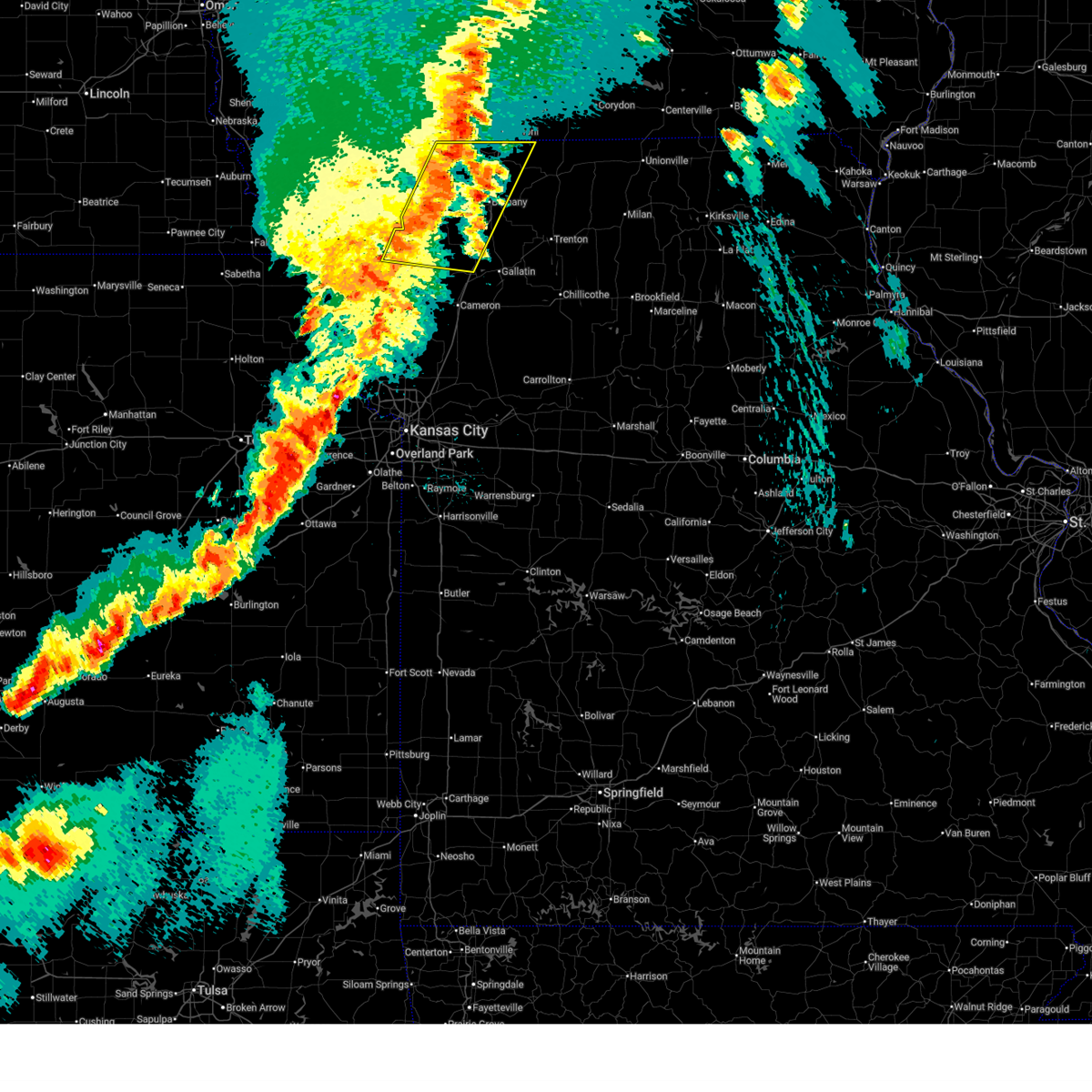
 Toreax the national weather service in pleasant hill has issued a * tornado warning for, northern daviess county in north central missouri, southwestern grundy county in north central missouri, northwestern livingston county in north central missouri, * until 445 pm cdt. * at 405 pm cdt, a confirmed tornado was located near pattonsburg, or 8 miles northwest of gallatin, moving east at 40 mph (weather spotters confirmed tornado). Hazards include damaging tornado and golf ball size hail. Flying debris will be dangerous to those caught without shelter. mobile homes will be damaged or destroyed. damage to roofs, windows, and vehicles will occur. Tree damage is likely. Toreax the national weather service in pleasant hill has issued a * tornado warning for, northern daviess county in north central missouri, southwestern grundy county in north central missouri, northwestern livingston county in north central missouri, * until 445 pm cdt. * at 405 pm cdt, a confirmed tornado was located near pattonsburg, or 8 miles northwest of gallatin, moving east at 40 mph (weather spotters confirmed tornado). Hazards include damaging tornado and golf ball size hail. Flying debris will be dangerous to those caught without shelter. mobile homes will be damaged or destroyed. damage to roofs, windows, and vehicles will occur. Tree damage is likely.
|
| 6/10/2026 4:04 PM CDT |
 At 403 pm cdt, a confirmed tornado was located 7 miles south of pattonsburg, or 10 miles west of gallatin, moving east at 40 mph (weather spotters confirmed tornado). Hazards include damaging tornado and golf ball size hail. Flying debris will be dangerous to those caught without shelter. mobile homes will be damaged or destroyed. damage to roofs, windows, and vehicles will occur. tree damage is likely. locations impacted include, gallatin, pattonsburg, winston, altamont, coffey, and jameson. This includes interstate 35 in missouri between mile markers 63 and 80. At 403 pm cdt, a confirmed tornado was located 7 miles south of pattonsburg, or 10 miles west of gallatin, moving east at 40 mph (weather spotters confirmed tornado). Hazards include damaging tornado and golf ball size hail. Flying debris will be dangerous to those caught without shelter. mobile homes will be damaged or destroyed. damage to roofs, windows, and vehicles will occur. tree damage is likely. locations impacted include, gallatin, pattonsburg, winston, altamont, coffey, and jameson. This includes interstate 35 in missouri between mile markers 63 and 80.
|
| 6/10/2026 3:51 PM CDT |
 At 351 pm cdt, a severe thunderstorm capable of producing a tornado was located near maysville, moving east at 25 mph (radar indicated rotation). Hazards include tornado and golf ball size hail. Flying debris will be dangerous to those caught without shelter. mobile homes will be damaged or destroyed. damage to roofs, windows, and vehicles will occur. tree damage is likely. locations impacted include, gallatin, maysville, pattonsburg, winston, altamont, coffey, jameson, weatherby, fairport, and santa rosa. This includes interstate 35 in missouri between mile markers 62 and 80. At 351 pm cdt, a severe thunderstorm capable of producing a tornado was located near maysville, moving east at 25 mph (radar indicated rotation). Hazards include tornado and golf ball size hail. Flying debris will be dangerous to those caught without shelter. mobile homes will be damaged or destroyed. damage to roofs, windows, and vehicles will occur. tree damage is likely. locations impacted include, gallatin, maysville, pattonsburg, winston, altamont, coffey, jameson, weatherby, fairport, and santa rosa. This includes interstate 35 in missouri between mile markers 62 and 80.
|
| 6/10/2026 3:45 PM CDT |
 Svreax the national weather service in pleasant hill has issued a * severe thunderstorm warning for, southeastern worth county in northwestern missouri, northern daviess county in north central missouri, eastern gentry county in northwestern missouri, harrison county in north central missouri, northeastern dekalb county in northwestern missouri, * until 430 pm cdt. * at 345 pm cdt, severe thunderstorms were located along a line extending from 6 miles northwest of new hampton to 8 miles north of maysville, moving east at 50 mph (radar indicated). Hazards include golf ball size hail and 60 mph wind gusts. People and animals outdoors will be injured. expect hail damage to roofs, siding, windows, and vehicles. Expect wind damage to roofs, siding, and trees. Svreax the national weather service in pleasant hill has issued a * severe thunderstorm warning for, southeastern worth county in northwestern missouri, northern daviess county in north central missouri, eastern gentry county in northwestern missouri, harrison county in north central missouri, northeastern dekalb county in northwestern missouri, * until 430 pm cdt. * at 345 pm cdt, severe thunderstorms were located along a line extending from 6 miles northwest of new hampton to 8 miles north of maysville, moving east at 50 mph (radar indicated). Hazards include golf ball size hail and 60 mph wind gusts. People and animals outdoors will be injured. expect hail damage to roofs, siding, windows, and vehicles. Expect wind damage to roofs, siding, and trees.
|
| 6/10/2026 3:37 PM CDT |
 Toreax the national weather service in pleasant hill has issued a * tornado warning for, western daviess county in north central missouri, northeastern dekalb county in northwestern missouri, * until 415 pm cdt. * at 337 pm cdt, a severe thunderstorm capable of producing a tornado was located near maysville, moving east at 45 mph (radar indicated rotation). Hazards include tornado and ping pong ball size hail. Flying debris will be dangerous to those caught without shelter. mobile homes will be damaged or destroyed. damage to roofs, windows, and vehicles will occur. Tree damage is likely. Toreax the national weather service in pleasant hill has issued a * tornado warning for, western daviess county in north central missouri, northeastern dekalb county in northwestern missouri, * until 415 pm cdt. * at 337 pm cdt, a severe thunderstorm capable of producing a tornado was located near maysville, moving east at 45 mph (radar indicated rotation). Hazards include tornado and ping pong ball size hail. Flying debris will be dangerous to those caught without shelter. mobile homes will be damaged or destroyed. damage to roofs, windows, and vehicles will occur. Tree damage is likely.
|
| 6/4/2026 10:22 PM CDT |
 At 1021 pm cdt, a severe thunderstorm was located near pattonsburg, or 10 miles southwest of bethany, moving east at 20 mph (radar indicated). Hazards include 60 mph wind gusts. Expect damage to roofs, siding, and trees. locations impacted include, bethany, gilman city, pattonsburg, and coffey. This includes interstate 35 in missouri between mile markers 74 and 91. At 1021 pm cdt, a severe thunderstorm was located near pattonsburg, or 10 miles southwest of bethany, moving east at 20 mph (radar indicated). Hazards include 60 mph wind gusts. Expect damage to roofs, siding, and trees. locations impacted include, bethany, gilman city, pattonsburg, and coffey. This includes interstate 35 in missouri between mile markers 74 and 91.
|
| 6/4/2026 10:22 PM CDT |
 the severe thunderstorm warning has been cancelled and is no longer in effect the severe thunderstorm warning has been cancelled and is no longer in effect
|
| 6/4/2026 10:12 PM CDT |
 At 1012 pm cdt, a severe thunderstorm was located near pattonsburg, or 9 miles southwest of bethany, moving east at 30 mph (radar indicated). Hazards include 60 mph wind gusts. Expect damage to roofs, siding, and trees. locations impacted include, bethany, gilman city, pattonsburg, new hampton, coffey, and mcfall. This includes interstate 35 in missouri between mile markers 74 and 96. At 1012 pm cdt, a severe thunderstorm was located near pattonsburg, or 9 miles southwest of bethany, moving east at 30 mph (radar indicated). Hazards include 60 mph wind gusts. Expect damage to roofs, siding, and trees. locations impacted include, bethany, gilman city, pattonsburg, new hampton, coffey, and mcfall. This includes interstate 35 in missouri between mile markers 74 and 96.
|
| 6/4/2026 10:02 PM CDT |
 At 1002 pm cdt, a severe thunderstorm was located 7 miles northwest of pattonsburg, or 9 miles southeast of albany, moving east at 25 mph (radar indicated). Hazards include 70 mph wind gusts. Expect considerable tree damage. damage is likely to mobile homes, roofs, and outbuildings. locations impacted include, bethany, albany, gilman city, pattonsburg, new hampton, coffey, darlington, mcfall, and fairport. This includes interstate 35 in missouri between mile markers 74 and 96. At 1002 pm cdt, a severe thunderstorm was located 7 miles northwest of pattonsburg, or 9 miles southeast of albany, moving east at 25 mph (radar indicated). Hazards include 70 mph wind gusts. Expect considerable tree damage. damage is likely to mobile homes, roofs, and outbuildings. locations impacted include, bethany, albany, gilman city, pattonsburg, new hampton, coffey, darlington, mcfall, and fairport. This includes interstate 35 in missouri between mile markers 74 and 96.
|
| 6/4/2026 9:53 PM CDT |
 Svreax the national weather service in pleasant hill has issued a * severe thunderstorm warning for, northern daviess county in north central missouri, southeastern gentry county in northwestern missouri, southwestern harrison county in north central missouri, northeastern dekalb county in northwestern missouri, * until 1045 pm cdt. * at 952 pm cdt, a severe thunderstorm was located 9 miles west of pattonsburg, or 9 miles south of albany, moving east at 30 mph (radar indicated). Hazards include 70 mph wind gusts. Expect considerable tree damage. Damage is likely to mobile homes, roofs, and outbuildings. Svreax the national weather service in pleasant hill has issued a * severe thunderstorm warning for, northern daviess county in north central missouri, southeastern gentry county in northwestern missouri, southwestern harrison county in north central missouri, northeastern dekalb county in northwestern missouri, * until 1045 pm cdt. * at 952 pm cdt, a severe thunderstorm was located 9 miles west of pattonsburg, or 9 miles south of albany, moving east at 30 mph (radar indicated). Hazards include 70 mph wind gusts. Expect considerable tree damage. Damage is likely to mobile homes, roofs, and outbuildings.
|
| 5/18/2026 9:15 PM CDT |
 the severe thunderstorm warning has been cancelled and is no longer in effect the severe thunderstorm warning has been cancelled and is no longer in effect
|
| 5/18/2026 9:15 PM CDT |
 At 914 pm cdt, severe thunderstorms were located along a line extending from ridgeway to 6 miles north of gallatin, moving northeast at 55 mph (radar indicated). Hazards include 60 mph wind gusts and nickel size hail. Expect damage to roofs, siding, and trees. locations impacted include, trenton, bethany, princeton, ridgeway, gilman city, mercer, cainsville, spickard, galt, coffey, humphreys, mount moriah, tindall, brimson, osgood, modena, and mill grove. This includes interstate 35 in missouri between mile markers 85 and 105. At 914 pm cdt, severe thunderstorms were located along a line extending from ridgeway to 6 miles north of gallatin, moving northeast at 55 mph (radar indicated). Hazards include 60 mph wind gusts and nickel size hail. Expect damage to roofs, siding, and trees. locations impacted include, trenton, bethany, princeton, ridgeway, gilman city, mercer, cainsville, spickard, galt, coffey, humphreys, mount moriah, tindall, brimson, osgood, modena, and mill grove. This includes interstate 35 in missouri between mile markers 85 and 105.
|
| 5/18/2026 9:07 PM CDT |
 At 907 pm cdt, a severe thunderstorm capable of producing a tornado was located 7 miles west of gilman city, or 9 miles south of bethany, moving east at 60 mph (radar indicated rotation). Hazards include tornado. Flying debris will be dangerous to those caught without shelter. mobile homes will be damaged or destroyed. damage to roofs, windows, and vehicles will occur. tree damage is likely. locations impacted include, trenton, gilman city, coffey, tindall, and brimson. This includes interstate 35 in missouri between mile markers 80 and 88. At 907 pm cdt, a severe thunderstorm capable of producing a tornado was located 7 miles west of gilman city, or 9 miles south of bethany, moving east at 60 mph (radar indicated rotation). Hazards include tornado. Flying debris will be dangerous to those caught without shelter. mobile homes will be damaged or destroyed. damage to roofs, windows, and vehicles will occur. tree damage is likely. locations impacted include, trenton, gilman city, coffey, tindall, and brimson. This includes interstate 35 in missouri between mile markers 80 and 88.
|
| 5/18/2026 9:06 PM CDT |
 Svreax the national weather service in pleasant hill has issued a * severe thunderstorm warning for, southeastern worth county in northwestern missouri, northern daviess county in north central missouri, grundy county in north central missouri, southwestern sullivan county in north central missouri, northeastern gentry county in northwestern missouri, mercer county in north central missouri, harrison county in north central missouri, * until 945 pm cdt. * at 906 pm cdt, severe thunderstorms were located along a line extending from near bethany to 6 miles southeast of pattonsburg, moving east at 55 mph (radar indicated). Hazards include 60 mph wind gusts and nickel size hail. expect damage to roofs, siding, and trees Svreax the national weather service in pleasant hill has issued a * severe thunderstorm warning for, southeastern worth county in northwestern missouri, northern daviess county in north central missouri, grundy county in north central missouri, southwestern sullivan county in north central missouri, northeastern gentry county in northwestern missouri, mercer county in north central missouri, harrison county in north central missouri, * until 945 pm cdt. * at 906 pm cdt, severe thunderstorms were located along a line extending from near bethany to 6 miles southeast of pattonsburg, moving east at 55 mph (radar indicated). Hazards include 60 mph wind gusts and nickel size hail. expect damage to roofs, siding, and trees
|
| 5/18/2026 9:02 PM CDT |
 the severe thunderstorm warning has been cancelled and is no longer in effect the severe thunderstorm warning has been cancelled and is no longer in effect
|
| 5/18/2026 9:02 PM CDT |
 At 902 pm cdt, a severe thunderstorm was located over bethany, moving east at 60 mph (radar indicated). Hazards include 60 mph wind gusts and nickel size hail. Expect damage to roofs, siding, and trees. locations impacted include, bethany, gallatin, albany, maysville, pattonsburg, new hampton, winston, altamont, coffey, jameson, darlington, weatherby, mcfall, amity, fairport, and santa rosa. This includes interstate 35 in missouri between mile markers 63 and 97. At 902 pm cdt, a severe thunderstorm was located over bethany, moving east at 60 mph (radar indicated). Hazards include 60 mph wind gusts and nickel size hail. Expect damage to roofs, siding, and trees. locations impacted include, bethany, gallatin, albany, maysville, pattonsburg, new hampton, winston, altamont, coffey, jameson, darlington, weatherby, mcfall, amity, fairport, and santa rosa. This includes interstate 35 in missouri between mile markers 63 and 97.
|
| 5/18/2026 8:57 PM CDT |
 Toreax the national weather service in pleasant hill has issued a * tornado warning for, northern daviess county in north central missouri, western grundy county in north central missouri, southern harrison county in north central missouri, * until 930 pm cdt. * at 857 pm cdt, a severe thunderstorm capable of producing a tornado was located over pattonsburg, or 13 miles northwest of gallatin, moving east at 65 mph (radar indicated rotation). Hazards include tornado. Flying debris will be dangerous to those caught without shelter. mobile homes will be damaged or destroyed. damage to roofs, windows, and vehicles will occur. Tree damage is likely. Toreax the national weather service in pleasant hill has issued a * tornado warning for, northern daviess county in north central missouri, western grundy county in north central missouri, southern harrison county in north central missouri, * until 930 pm cdt. * at 857 pm cdt, a severe thunderstorm capable of producing a tornado was located over pattonsburg, or 13 miles northwest of gallatin, moving east at 65 mph (radar indicated rotation). Hazards include tornado. Flying debris will be dangerous to those caught without shelter. mobile homes will be damaged or destroyed. damage to roofs, windows, and vehicles will occur. Tree damage is likely.
|
| 5/18/2026 8:35 PM CDT |
 Svreax the national weather service in pleasant hill has issued a * severe thunderstorm warning for, northeastern buchanan county in northwestern missouri, northwestern daviess county in north central missouri, gentry county in northwestern missouri, southwestern harrison county in north central missouri, southeastern nodaway county in northwestern missouri, eastern andrew county in northwestern missouri, dekalb county in northwestern missouri, * until 915 pm cdt. * at 834 pm cdt, a severe thunderstorm was located near stanberry, moving east at 60 mph (radar indicated). Hazards include 60 mph wind gusts and quarter size hail. Hail damage to vehicles is expected. Expect wind damage to roofs, siding, and trees. Svreax the national weather service in pleasant hill has issued a * severe thunderstorm warning for, northeastern buchanan county in northwestern missouri, northwestern daviess county in north central missouri, gentry county in northwestern missouri, southwestern harrison county in north central missouri, southeastern nodaway county in northwestern missouri, eastern andrew county in northwestern missouri, dekalb county in northwestern missouri, * until 915 pm cdt. * at 834 pm cdt, a severe thunderstorm was located near stanberry, moving east at 60 mph (radar indicated). Hazards include 60 mph wind gusts and quarter size hail. Hail damage to vehicles is expected. Expect wind damage to roofs, siding, and trees.
|
| 5/17/2026 11:45 PM CDT |
 Svreax the national weather service in pleasant hill has issued a * severe thunderstorm warning for, worth county in northwestern missouri, northwestern daviess county in north central missouri, northwestern grundy county in north central missouri, gentry county in northwestern missouri, western mercer county in north central missouri, harrison county in north central missouri, * until 1230 am cdt. * at 1145 pm cdt, severe thunderstorms were located along a line extending from near irena to 6 miles north of albany to near king city, moving east at 55 mph (law enforcement). Hazards include 60 mph wind gusts. expect damage to roofs, siding, and trees Svreax the national weather service in pleasant hill has issued a * severe thunderstorm warning for, worth county in northwestern missouri, northwestern daviess county in north central missouri, northwestern grundy county in north central missouri, gentry county in northwestern missouri, western mercer county in north central missouri, harrison county in north central missouri, * until 1230 am cdt. * at 1145 pm cdt, severe thunderstorms were located along a line extending from near irena to 6 miles north of albany to near king city, moving east at 55 mph (law enforcement). Hazards include 60 mph wind gusts. expect damage to roofs, siding, and trees
|
| 5/16/2026 11:14 PM CDT |
 Svreax the national weather service in pleasant hill has issued a * severe thunderstorm warning for, northwestern daviess county in north central missouri, southeastern gentry county in northwestern missouri, southwestern harrison county in north central missouri, north central dekalb county in northwestern missouri, * until 1145 pm cdt. * at 1114 pm cdt, a severe thunderstorm was located near pattonsburg, or 10 miles southwest of bethany, moving northeast at 25 mph (radar indicated). Hazards include 60 mph wind gusts and quarter size hail. Hail damage to vehicles is expected. Expect wind damage to roofs, siding, and trees. Svreax the national weather service in pleasant hill has issued a * severe thunderstorm warning for, northwestern daviess county in north central missouri, southeastern gentry county in northwestern missouri, southwestern harrison county in north central missouri, north central dekalb county in northwestern missouri, * until 1145 pm cdt. * at 1114 pm cdt, a severe thunderstorm was located near pattonsburg, or 10 miles southwest of bethany, moving northeast at 25 mph (radar indicated). Hazards include 60 mph wind gusts and quarter size hail. Hail damage to vehicles is expected. Expect wind damage to roofs, siding, and trees.
|
| 5/16/2026 10:47 PM CDT |
 Svreax the national weather service in pleasant hill has issued a * severe thunderstorm warning for, northeastern daviess county in north central missouri, south central harrison county in north central missouri, * until 1115 pm cdt. * at 1047 pm cdt, a severe thunderstorm was located near pattonsburg, or 11 miles south of bethany, moving northeast at 30 mph (radar indicated). Hazards include 60 mph wind gusts and quarter size hail. Hail damage to vehicles is expected. Expect wind damage to roofs, siding, and trees. Svreax the national weather service in pleasant hill has issued a * severe thunderstorm warning for, northeastern daviess county in north central missouri, south central harrison county in north central missouri, * until 1115 pm cdt. * at 1047 pm cdt, a severe thunderstorm was located near pattonsburg, or 11 miles south of bethany, moving northeast at 30 mph (radar indicated). Hazards include 60 mph wind gusts and quarter size hail. Hail damage to vehicles is expected. Expect wind damage to roofs, siding, and trees.
|
| 5/16/2026 10:04 PM CDT |
 Svreax the national weather service in pleasant hill has issued a * severe thunderstorm warning for, northeastern daviess county in north central missouri, southeastern harrison county in north central missouri, * until 1030 pm cdt. * at 1004 pm cdt, a severe thunderstorm was located near pattonsburg, or 8 miles north of gallatin, moving east at 25 mph (radar indicated). Hazards include 60 mph wind gusts and half dollar size hail. Hail damage to vehicles is expected. Expect wind damage to roofs, siding, and trees. Svreax the national weather service in pleasant hill has issued a * severe thunderstorm warning for, northeastern daviess county in north central missouri, southeastern harrison county in north central missouri, * until 1030 pm cdt. * at 1004 pm cdt, a severe thunderstorm was located near pattonsburg, or 8 miles north of gallatin, moving east at 25 mph (radar indicated). Hazards include 60 mph wind gusts and half dollar size hail. Hail damage to vehicles is expected. Expect wind damage to roofs, siding, and trees.
|
| 5/16/2026 8:33 PM CDT |
 Svreax the national weather service in pleasant hill has issued a * severe thunderstorm warning for, northern daviess county in north central missouri, northwestern grundy county in north central missouri, east central gentry county in northwestern missouri, southern mercer county in north central missouri, southern harrison county in north central missouri, * until 900 pm cdt. * at 833 pm cdt, severe thunderstorms were located along a line extending from near princeton to near gilman city to 9 miles northwest of pattonsburg, moving east at 40 mph (radar indicated). Hazards include 60 mph wind gusts and quarter size hail. Hail damage to vehicles is expected. Expect wind damage to roofs, siding, and trees. Svreax the national weather service in pleasant hill has issued a * severe thunderstorm warning for, northern daviess county in north central missouri, northwestern grundy county in north central missouri, east central gentry county in northwestern missouri, southern mercer county in north central missouri, southern harrison county in north central missouri, * until 900 pm cdt. * at 833 pm cdt, severe thunderstorms were located along a line extending from near princeton to near gilman city to 9 miles northwest of pattonsburg, moving east at 40 mph (radar indicated). Hazards include 60 mph wind gusts and quarter size hail. Hail damage to vehicles is expected. Expect wind damage to roofs, siding, and trees.
|
| 5/16/2026 8:16 PM CDT |
 Svreax the national weather service in pleasant hill has issued a * severe thunderstorm warning for, northwestern daviess county in north central missouri, east central gentry county in northwestern missouri, southwestern harrison county in north central missouri, * until 900 pm cdt. * at 815 pm cdt, a severe thunderstorm was located over new hampton, or near albany, moving southeast at 25 mph (radar indicated). Hazards include 60 mph wind gusts and quarter size hail. Hail damage to vehicles is expected. Expect wind damage to roofs, siding, and trees. Svreax the national weather service in pleasant hill has issued a * severe thunderstorm warning for, northwestern daviess county in north central missouri, east central gentry county in northwestern missouri, southwestern harrison county in north central missouri, * until 900 pm cdt. * at 815 pm cdt, a severe thunderstorm was located over new hampton, or near albany, moving southeast at 25 mph (radar indicated). Hazards include 60 mph wind gusts and quarter size hail. Hail damage to vehicles is expected. Expect wind damage to roofs, siding, and trees.
|
| 5/16/2026 7:01 PM CDT |
 Svreax the national weather service in pleasant hill has issued a * severe thunderstorm warning for, northern daviess county in north central missouri, northwestern grundy county in north central missouri, southwestern mercer county in north central missouri, southeastern harrison county in north central missouri, * until 745 pm cdt. * at 701 pm cdt, a severe thunderstorm was located near pattonsburg, or 10 miles north of gallatin, moving northeast at 40 mph (radar indicated). Hazards include 60 mph wind gusts and quarter size hail. Hail damage to vehicles is expected. Expect wind damage to roofs, siding, and trees. Svreax the national weather service in pleasant hill has issued a * severe thunderstorm warning for, northern daviess county in north central missouri, northwestern grundy county in north central missouri, southwestern mercer county in north central missouri, southeastern harrison county in north central missouri, * until 745 pm cdt. * at 701 pm cdt, a severe thunderstorm was located near pattonsburg, or 10 miles north of gallatin, moving northeast at 40 mph (radar indicated). Hazards include 60 mph wind gusts and quarter size hail. Hail damage to vehicles is expected. Expect wind damage to roofs, siding, and trees.
|
| 4/23/2026 9:16 PM CDT |
 Svreax the national weather service in pleasant hill has issued a * severe thunderstorm warning for, northern daviess county in north central missouri, grundy county in north central missouri, northwestern sullivan county in north central missouri, mercer county in north central missouri, western putnam county in north central missouri, eastern harrison county in north central missouri, east central dekalb county in northwestern missouri, * until 1000 pm cdt. * at 916 pm cdt, severe thunderstorms were located along a line extending from 8 miles north of mercer to near gallatin, moving east at 50 mph (radar indicated). Hazards include 60 mph wind gusts and penny size hail. expect damage to roofs, siding, and trees Svreax the national weather service in pleasant hill has issued a * severe thunderstorm warning for, northern daviess county in north central missouri, grundy county in north central missouri, northwestern sullivan county in north central missouri, mercer county in north central missouri, western putnam county in north central missouri, eastern harrison county in north central missouri, east central dekalb county in northwestern missouri, * until 1000 pm cdt. * at 916 pm cdt, severe thunderstorms were located along a line extending from 8 miles north of mercer to near gallatin, moving east at 50 mph (radar indicated). Hazards include 60 mph wind gusts and penny size hail. expect damage to roofs, siding, and trees
|
| 4/23/2026 8:39 PM CDT |
 At 839 pm cdt, a severe thunderstorm was located near eagleville, or 10 miles north of bethany, moving northeast at 55 mph (radar indicated). Hazards include 60 mph wind gusts and nickel size hail. Expect damage to roofs, siding, and trees. locations impacted include, bethany, albany, king city, ridgeway, pattonsburg, eagleville, new hampton, blythedale, coffey, darlington, mcfall, hatfield, fairport, ford city, martinsville, and santa rosa. This includes interstate 35 in missouri between mile markers 66 and 113. At 839 pm cdt, a severe thunderstorm was located near eagleville, or 10 miles north of bethany, moving northeast at 55 mph (radar indicated). Hazards include 60 mph wind gusts and nickel size hail. Expect damage to roofs, siding, and trees. locations impacted include, bethany, albany, king city, ridgeway, pattonsburg, eagleville, new hampton, blythedale, coffey, darlington, mcfall, hatfield, fairport, ford city, martinsville, and santa rosa. This includes interstate 35 in missouri between mile markers 66 and 113.
|
| 4/23/2026 8:19 PM CDT |
 Svreax the national weather service in pleasant hill has issued a * severe thunderstorm warning for, eastern worth county in northwestern missouri, northwestern daviess county in north central missouri, gentry county in northwestern missouri, northwestern mercer county in north central missouri, harrison county in north central missouri, northeastern andrew county in northwestern missouri, northern dekalb county in northwestern missouri, * until 900 pm cdt. * at 819 pm cdt, a severe thunderstorm was located over albany, moving northeast at 55 mph (radar indicated). Hazards include 60 mph wind gusts and nickel size hail. expect damage to roofs, siding, and trees Svreax the national weather service in pleasant hill has issued a * severe thunderstorm warning for, eastern worth county in northwestern missouri, northwestern daviess county in north central missouri, gentry county in northwestern missouri, northwestern mercer county in north central missouri, harrison county in north central missouri, northeastern andrew county in northwestern missouri, northern dekalb county in northwestern missouri, * until 900 pm cdt. * at 819 pm cdt, a severe thunderstorm was located over albany, moving northeast at 55 mph (radar indicated). Hazards include 60 mph wind gusts and nickel size hail. expect damage to roofs, siding, and trees
|
| 4/15/2026 4:54 PM CDT |
 At 454 pm cdt, a severe thunderstorm was located near bethany, moving northeast at 50 mph (radar indicated). Hazards include tennis ball size hail and 60 mph wind gusts. People and animals outdoors will be injured. expect hail damage to roofs, siding, windows, and vehicles. expect wind damage to roofs, siding, and trees. locations impacted include, bethany, ridgeway, gilman city, eagleville, spickard, coffey, mount moriah, brimson, modena, and mill grove. This includes interstate 35 in missouri between mile markers 80 and 106. At 454 pm cdt, a severe thunderstorm was located near bethany, moving northeast at 50 mph (radar indicated). Hazards include tennis ball size hail and 60 mph wind gusts. People and animals outdoors will be injured. expect hail damage to roofs, siding, windows, and vehicles. expect wind damage to roofs, siding, and trees. locations impacted include, bethany, ridgeway, gilman city, eagleville, spickard, coffey, mount moriah, brimson, modena, and mill grove. This includes interstate 35 in missouri between mile markers 80 and 106.
|
| 4/15/2026 4:49 PM CDT |
 At 448 pm cdt, a severe thunderstorm was located near pattonsburg, or 9 miles south of bethany, moving northeast at 50 mph (radar indicated). Hazards include ping pong ball size hail and 60 mph wind gusts. People and animals outdoors will be injured. expect hail damage to roofs, siding, windows, and vehicles. expect wind damage to roofs, siding, and trees. locations impacted include, bethany, ridgeway, gilman city, pattonsburg, eagleville, spickard, coffey, jameson, mount moriah, tindall, brimson, modena, and mill grove. This includes interstate 35 in missouri between mile markers 77 and 106. At 448 pm cdt, a severe thunderstorm was located near pattonsburg, or 9 miles south of bethany, moving northeast at 50 mph (radar indicated). Hazards include ping pong ball size hail and 60 mph wind gusts. People and animals outdoors will be injured. expect hail damage to roofs, siding, windows, and vehicles. expect wind damage to roofs, siding, and trees. locations impacted include, bethany, ridgeway, gilman city, pattonsburg, eagleville, spickard, coffey, jameson, mount moriah, tindall, brimson, modena, and mill grove. This includes interstate 35 in missouri between mile markers 77 and 106.
|
| 4/15/2026 4:35 PM CDT |
 Svreax the national weather service in pleasant hill has issued a * severe thunderstorm warning for, northern daviess county in north central missouri, northwestern grundy county in north central missouri, southwestern mercer county in north central missouri, harrison county in north central missouri, * until 515 pm cdt. * at 434 pm cdt, a severe thunderstorm was located near pattonsburg, or 10 miles west of gallatin, moving northeast at 50 mph (public. quarter size hail was reported north of osborn with this storm earlier). Hazards include ping pong ball size hail and 60 mph wind gusts. People and animals outdoors will be injured. expect hail damage to roofs, siding, windows, and vehicles. Expect wind damage to roofs, siding, and trees. Svreax the national weather service in pleasant hill has issued a * severe thunderstorm warning for, northern daviess county in north central missouri, northwestern grundy county in north central missouri, southwestern mercer county in north central missouri, harrison county in north central missouri, * until 515 pm cdt. * at 434 pm cdt, a severe thunderstorm was located near pattonsburg, or 10 miles west of gallatin, moving northeast at 50 mph (public. quarter size hail was reported north of osborn with this storm earlier). Hazards include ping pong ball size hail and 60 mph wind gusts. People and animals outdoors will be injured. expect hail damage to roofs, siding, windows, and vehicles. Expect wind damage to roofs, siding, and trees.
|
| 7/11/2025 6:36 PM CDT |
 At 635 pm cdt, a severe thunderstorm was located near spickard, or 11 miles northwest of trenton, moving northeast at 15 mph (radar indicated). Hazards include 60 mph wind gusts and quarter size hail. Hail damage to vehicles is expected. expect wind damage to roofs, siding, and trees. locations impacted include, princeton, gilman city, spickard, coffey, tindall, brimson, modena, and mill grove. This includes interstate 35 in missouri between mile markers 82 and 83. At 635 pm cdt, a severe thunderstorm was located near spickard, or 11 miles northwest of trenton, moving northeast at 15 mph (radar indicated). Hazards include 60 mph wind gusts and quarter size hail. Hail damage to vehicles is expected. expect wind damage to roofs, siding, and trees. locations impacted include, princeton, gilman city, spickard, coffey, tindall, brimson, modena, and mill grove. This includes interstate 35 in missouri between mile markers 82 and 83.
|
| 7/11/2025 6:16 PM CDT |
 Svreax the national weather service in pleasant hill has issued a * severe thunderstorm warning for, northeastern daviess county in north central missouri, northern grundy county in north central missouri, southwestern mercer county in north central missouri, southeastern harrison county in north central missouri, * until 700 pm cdt. * at 616 pm cdt, a severe thunderstorm was located 7 miles northeast of gilman city, or 11 miles northwest of trenton, moving northeast at 15 mph (radar indicated). Hazards include 60 mph wind gusts and quarter size hail. Hail damage to vehicles is expected. Expect wind damage to roofs, siding, and trees. Svreax the national weather service in pleasant hill has issued a * severe thunderstorm warning for, northeastern daviess county in north central missouri, northern grundy county in north central missouri, southwestern mercer county in north central missouri, southeastern harrison county in north central missouri, * until 700 pm cdt. * at 616 pm cdt, a severe thunderstorm was located 7 miles northeast of gilman city, or 11 miles northwest of trenton, moving northeast at 15 mph (radar indicated). Hazards include 60 mph wind gusts and quarter size hail. Hail damage to vehicles is expected. Expect wind damage to roofs, siding, and trees.
|
| 6/26/2025 5:57 PM CDT |
 The storm which prompted the warning has weakened below severe limits, and no longer poses an immediate threat to life or property. therefore, the warning will be allowed to expire. however, gusty winds to 50 mph and heavy rain are still possible with this thunderstorm. a severe thunderstorm watch remains in effect until 900 pm cdt for north central and northwestern missouri. The storm which prompted the warning has weakened below severe limits, and no longer poses an immediate threat to life or property. therefore, the warning will be allowed to expire. however, gusty winds to 50 mph and heavy rain are still possible with this thunderstorm. a severe thunderstorm watch remains in effect until 900 pm cdt for north central and northwestern missouri.
|
| 6/26/2025 5:49 PM CDT |
 At 548 pm cdt, a severe thunderstorm was located over pattonsburg, or 13 miles northwest of gallatin, moving northeast at 35 mph (radar indicated). Hazards include 60 mph wind gusts. Expect damage to roofs, siding, and trees. locations impacted include, bethany, gilman city, pattonsburg, coffey, weatherby, and santa rosa. This includes interstate 35 in missouri between mile markers 70 and 94. At 548 pm cdt, a severe thunderstorm was located over pattonsburg, or 13 miles northwest of gallatin, moving northeast at 35 mph (radar indicated). Hazards include 60 mph wind gusts. Expect damage to roofs, siding, and trees. locations impacted include, bethany, gilman city, pattonsburg, coffey, weatherby, and santa rosa. This includes interstate 35 in missouri between mile markers 70 and 94.
|
| 6/26/2025 5:49 PM CDT |
 the severe thunderstorm warning has been cancelled and is no longer in effect the severe thunderstorm warning has been cancelled and is no longer in effect
|
| 6/26/2025 5:33 PM CDT |
 At 532 pm cdt, severe thunderstorms were located along a line extending from 8 miles northwest of pattonsburg to near maysville, moving northeast at 25 mph (radar indicated). Hazards include 60 mph wind gusts. Expect damage to roofs, siding, and trees. locations impacted include, bethany, maysville, gilman city, pattonsburg, new hampton, coffey, weatherby, mcfall, fairport, and santa rosa. This includes interstate 35 in missouri between mile markers 70 and 94. At 532 pm cdt, severe thunderstorms were located along a line extending from 8 miles northwest of pattonsburg to near maysville, moving northeast at 25 mph (radar indicated). Hazards include 60 mph wind gusts. Expect damage to roofs, siding, and trees. locations impacted include, bethany, maysville, gilman city, pattonsburg, new hampton, coffey, weatherby, mcfall, fairport, and santa rosa. This includes interstate 35 in missouri between mile markers 70 and 94.
|
| 6/26/2025 5:17 PM CDT |
 Svreax the national weather service in pleasant hill has issued a * severe thunderstorm warning for, northwestern daviess county in north central missouri, southeastern gentry county in northwestern missouri, southwestern harrison county in north central missouri, central dekalb county in northwestern missouri, * until 600 pm cdt. * at 516 pm cdt, a severe thunderstorm was located 10 miles east of king city, or 10 miles north of maysville, moving northeast at 30 mph (radar indicated). Hazards include 60 mph wind gusts and penny size hail. expect damage to roofs, siding, and trees Svreax the national weather service in pleasant hill has issued a * severe thunderstorm warning for, northwestern daviess county in north central missouri, southeastern gentry county in northwestern missouri, southwestern harrison county in north central missouri, central dekalb county in northwestern missouri, * until 600 pm cdt. * at 516 pm cdt, a severe thunderstorm was located 10 miles east of king city, or 10 miles north of maysville, moving northeast at 30 mph (radar indicated). Hazards include 60 mph wind gusts and penny size hail. expect damage to roofs, siding, and trees
|
| 5/19/2025 10:02 PM CDT |
 At 1002 pm cdt, severe thunderstorms were located along a line extending from near pattonsburg to near breckenridge to near braymer, moving northeast at 40 mph (radar indicated). Hazards include 60 mph wind gusts. Expect damage to roofs, siding, and trees. locations impacted include, hamilton, gallatin, braymer, breckenridge, pattonsburg, cowgill, altamont, coffey, and jameson. This includes interstate 35 in missouri between mile markers 66 and 83. At 1002 pm cdt, severe thunderstorms were located along a line extending from near pattonsburg to near breckenridge to near braymer, moving northeast at 40 mph (radar indicated). Hazards include 60 mph wind gusts. Expect damage to roofs, siding, and trees. locations impacted include, hamilton, gallatin, braymer, breckenridge, pattonsburg, cowgill, altamont, coffey, and jameson. This includes interstate 35 in missouri between mile markers 66 and 83.
|
| 5/19/2025 10:02 PM CDT |
 the severe thunderstorm warning has been cancelled and is no longer in effect the severe thunderstorm warning has been cancelled and is no longer in effect
|
| 5/19/2025 9:50 PM CDT |
 the severe thunderstorm warning has been cancelled and is no longer in effect the severe thunderstorm warning has been cancelled and is no longer in effect
|
| 5/19/2025 9:50 PM CDT |
 At 950 pm cdt, severe thunderstorms were located along a line extending from near pattonsburg to hamilton to near cowgill, moving northeast at 40 mph (radar indicated). Hazards include 60 mph wind gusts. Expect damage to roofs, siding, and trees. locations impacted include, hamilton, gallatin, maysville, braymer, polo, breckenridge, pattonsburg, kingston, cowgill, kidder, winston, altamont, coffey, jameson, weatherby, mcfall, fairport, and santa rosa. This includes interstate 35 in missouri between mile markers 56 and 83. At 950 pm cdt, severe thunderstorms were located along a line extending from near pattonsburg to hamilton to near cowgill, moving northeast at 40 mph (radar indicated). Hazards include 60 mph wind gusts. Expect damage to roofs, siding, and trees. locations impacted include, hamilton, gallatin, maysville, braymer, polo, breckenridge, pattonsburg, kingston, cowgill, kidder, winston, altamont, coffey, jameson, weatherby, mcfall, fairport, and santa rosa. This includes interstate 35 in missouri between mile markers 56 and 83.
|
| 5/19/2025 9:36 PM CDT |
 the severe thunderstorm warning has been cancelled and is no longer in effect the severe thunderstorm warning has been cancelled and is no longer in effect
|
| 5/19/2025 9:36 PM CDT |
 At 936 pm cdt, severe thunderstorms were located along a line extending from 6 miles north of maysville to near cameron to near lawson, moving northeast at 40 mph (radar indicated). Hazards include 60 mph wind gusts. Expect damage to roofs, siding, and trees. locations impacted include, cameron, lawson, hamilton, gallatin, maysville, braymer, polo, osborn, breckenridge, pattonsburg, kingston, cowgill, kidder, winston, altamont, coffey, jameson, weatherby, mcfall, and amity. This includes interstate 35 in missouri between mile markers 41 and 83. At 936 pm cdt, severe thunderstorms were located along a line extending from 6 miles north of maysville to near cameron to near lawson, moving northeast at 40 mph (radar indicated). Hazards include 60 mph wind gusts. Expect damage to roofs, siding, and trees. locations impacted include, cameron, lawson, hamilton, gallatin, maysville, braymer, polo, osborn, breckenridge, pattonsburg, kingston, cowgill, kidder, winston, altamont, coffey, jameson, weatherby, mcfall, and amity. This includes interstate 35 in missouri between mile markers 41 and 83.
|
| 5/19/2025 9:23 PM CDT |
 Svreax the national weather service in pleasant hill has issued a * severe thunderstorm warning for, daviess county in north central missouri, eastern clinton county in northwestern missouri, northeastern clay county in west central missouri, southeastern gentry county in northwestern missouri, northern ray county in west central missouri, caldwell county in north central missouri, dekalb county in northwestern missouri, * until 1015 pm cdt. * at 922 pm cdt, severe thunderstorms were located along a line extending from 6 miles northwest of maysville to 7 miles north of lathrop to near excelsior estates, moving northeast at 40 mph (radar indicated). Hazards include 60 mph wind gusts. expect damage to roofs, siding, and trees Svreax the national weather service in pleasant hill has issued a * severe thunderstorm warning for, daviess county in north central missouri, eastern clinton county in northwestern missouri, northeastern clay county in west central missouri, southeastern gentry county in northwestern missouri, northern ray county in west central missouri, caldwell county in north central missouri, dekalb county in northwestern missouri, * until 1015 pm cdt. * at 922 pm cdt, severe thunderstorms were located along a line extending from 6 miles northwest of maysville to 7 miles north of lathrop to near excelsior estates, moving northeast at 40 mph (radar indicated). Hazards include 60 mph wind gusts. expect damage to roofs, siding, and trees
|
| 5/19/2025 4:13 PM CDT |
 The storms which prompted the warning have weakened below severe limits, and no longer pose an immediate threat to life or property. therefore, the warning will be allowed to expire. however, small hail and heavy rain are still possible with these thunderstorms. a tornado watch remains in effect until 900 pm cdt for north central and northwestern missouri. a severe thunderstorm watch remains in effect until 1000 pm cdt for north central missouri. The storms which prompted the warning have weakened below severe limits, and no longer pose an immediate threat to life or property. therefore, the warning will be allowed to expire. however, small hail and heavy rain are still possible with these thunderstorms. a tornado watch remains in effect until 900 pm cdt for north central and northwestern missouri. a severe thunderstorm watch remains in effect until 1000 pm cdt for north central missouri.
|
| 5/19/2025 3:50 PM CDT |
 At 350 pm cdt, severe thunderstorms were located along a line extending from near lamoni to near cainsville to 7 miles northwest of hamilton, moving northeast at 40 mph (emergency management). Hazards include ping pong ball size hail. People and animals outdoors will be injured. expect damage to roofs, siding, windows, and vehicles. locations impacted include, cameron, bethany, hamilton, gallatin, maysville, jamesport, ridgeway, osborn, gilman city, pattonsburg, eagleville, new hampton, cainsville, kidder, winston, altamont, blythedale, coffey, jameson, and weatherby. This includes interstate 35 in missouri between mile markers 50 and 114. At 350 pm cdt, severe thunderstorms were located along a line extending from near lamoni to near cainsville to 7 miles northwest of hamilton, moving northeast at 40 mph (emergency management). Hazards include ping pong ball size hail. People and animals outdoors will be injured. expect damage to roofs, siding, windows, and vehicles. locations impacted include, cameron, bethany, hamilton, gallatin, maysville, jamesport, ridgeway, osborn, gilman city, pattonsburg, eagleville, new hampton, cainsville, kidder, winston, altamont, blythedale, coffey, jameson, and weatherby. This includes interstate 35 in missouri between mile markers 50 and 114.
|
| 5/19/2025 3:32 PM CDT |
 At 332 pm cdt, severe thunderstorms were located along a line extending from 6 miles north of eagleville to near bethany to 7 miles west of gallatin, moving east at 20 mph (emergency management. quarter size hail was reported in bethany with these storms). Hazards include ping pong ball size hail. People and animals outdoors will be injured. expect damage to roofs, siding, windows, and vehicles. locations impacted include, cameron, bethany, hamilton, gallatin, maysville, jamesport, ridgeway, osborn, gilman city, pattonsburg, eagleville, new hampton, cainsville, kidder, winston, altamont, blythedale, coffey, jameson, and weatherby. This includes interstate 35 in missouri between mile markers 50 and 114. At 332 pm cdt, severe thunderstorms were located along a line extending from 6 miles north of eagleville to near bethany to 7 miles west of gallatin, moving east at 20 mph (emergency management. quarter size hail was reported in bethany with these storms). Hazards include ping pong ball size hail. People and animals outdoors will be injured. expect damage to roofs, siding, windows, and vehicles. locations impacted include, cameron, bethany, hamilton, gallatin, maysville, jamesport, ridgeway, osborn, gilman city, pattonsburg, eagleville, new hampton, cainsville, kidder, winston, altamont, blythedale, coffey, jameson, and weatherby. This includes interstate 35 in missouri between mile markers 50 and 114.
|
| 5/19/2025 3:23 PM CDT |
 Svreax the national weather service in pleasant hill has issued a * severe thunderstorm warning for, daviess county in north central missouri, northwestern grundy county in north central missouri, northeastern clinton county in northwestern missouri, southeastern gentry county in northwestern missouri, western mercer county in north central missouri, harrison county in north central missouri, northwestern caldwell county in north central missouri, eastern dekalb county in northwestern missouri, * until 415 pm cdt. * at 323 pm cdt, severe thunderstorms were located along a line extending from near ridgeway to 8 miles west of gallatin, moving northeast at 40 mph (radar indicated). Hazards include ping pong ball size hail. People and animals outdoors will be injured. Expect damage to roofs, siding, windows, and vehicles. Svreax the national weather service in pleasant hill has issued a * severe thunderstorm warning for, daviess county in north central missouri, northwestern grundy county in north central missouri, northeastern clinton county in northwestern missouri, southeastern gentry county in northwestern missouri, western mercer county in north central missouri, harrison county in north central missouri, northwestern caldwell county in north central missouri, eastern dekalb county in northwestern missouri, * until 415 pm cdt. * at 323 pm cdt, severe thunderstorms were located along a line extending from near ridgeway to 8 miles west of gallatin, moving northeast at 40 mph (radar indicated). Hazards include ping pong ball size hail. People and animals outdoors will be injured. Expect damage to roofs, siding, windows, and vehicles.
|
| 5/19/2025 3:15 PM CDT |
 At 314 pm cdt, severe thunderstorms were located along a line extending from 6 miles northwest of bethany to 8 miles west of gallatin, moving northeast at 40 mph (public). Hazards include ping pong ball size hail. People and animals outdoors will be injured. expect damage to roofs, siding, windows, and vehicles. locations impacted include, cameron, bethany, hamilton, gallatin, albany, maysville, jamesport, ridgeway, gilman city, pattonsburg, eagleville, new hampton, cainsville, kidder, winston, altamont, blythedale, coffey, jameson, and darlington. This includes interstate 35 in missouri between mile markers 49 and 114. At 314 pm cdt, severe thunderstorms were located along a line extending from 6 miles northwest of bethany to 8 miles west of gallatin, moving northeast at 40 mph (public). Hazards include ping pong ball size hail. People and animals outdoors will be injured. expect damage to roofs, siding, windows, and vehicles. locations impacted include, cameron, bethany, hamilton, gallatin, albany, maysville, jamesport, ridgeway, gilman city, pattonsburg, eagleville, new hampton, cainsville, kidder, winston, altamont, blythedale, coffey, jameson, and darlington. This includes interstate 35 in missouri between mile markers 49 and 114.
|
| 5/19/2025 3:02 PM CDT |
 At 301 pm cdt, severe thunderstorms were located along a line extending from near new hampton to 8 miles east of maysville, moving northeast at 45 mph (public. quarter size hail was reported in albany as these storms passed). Hazards include half dollar size hail. Damage to vehicles is expected. locations impacted include, cameron, bethany, hamilton, gallatin, albany, maysville, jamesport, ridgeway, gilman city, pattonsburg, eagleville, new hampton, cainsville, kidder, winston, altamont, blythedale, coffey, jameson, and darlington. This includes interstate 35 in missouri between mile markers 49 and 114. At 301 pm cdt, severe thunderstorms were located along a line extending from near new hampton to 8 miles east of maysville, moving northeast at 45 mph (public. quarter size hail was reported in albany as these storms passed). Hazards include half dollar size hail. Damage to vehicles is expected. locations impacted include, cameron, bethany, hamilton, gallatin, albany, maysville, jamesport, ridgeway, gilman city, pattonsburg, eagleville, new hampton, cainsville, kidder, winston, altamont, blythedale, coffey, jameson, and darlington. This includes interstate 35 in missouri between mile markers 49 and 114.
|
| 5/19/2025 2:48 PM CDT |
 Svreax the national weather service in pleasant hill has issued a * severe thunderstorm warning for, southeastern worth county in northwestern missouri, daviess county in north central missouri, northeastern clinton county in northwestern missouri, eastern gentry county in northwestern missouri, harrison county in north central missouri, northwestern caldwell county in north central missouri, eastern dekalb county in northwestern missouri, * until 330 pm cdt. * at 248 pm cdt, severe thunderstorms were located along a line extending from near albany to near cameron, moving northeast at 45 mph (radar indicated). Hazards include half dollar size hail. damage to vehicles is expected Svreax the national weather service in pleasant hill has issued a * severe thunderstorm warning for, southeastern worth county in northwestern missouri, daviess county in north central missouri, northeastern clinton county in northwestern missouri, eastern gentry county in northwestern missouri, harrison county in north central missouri, northwestern caldwell county in north central missouri, eastern dekalb county in northwestern missouri, * until 330 pm cdt. * at 248 pm cdt, severe thunderstorms were located along a line extending from near albany to near cameron, moving northeast at 45 mph (radar indicated). Hazards include half dollar size hail. damage to vehicles is expected
|
| 4/2/2025 1:54 AM CDT |
 The storms which prompted the warning have weakened below severe limits, and no longer pose an immediate threat to life or property. therefore, the warning will be allowed to expire. however, gusty winds around 50 mph are still possible with these thunderstorms. a severe thunderstorm watch remains in effect until 300 am cdt for north central and northwestern missouri. The storms which prompted the warning have weakened below severe limits, and no longer pose an immediate threat to life or property. therefore, the warning will be allowed to expire. however, gusty winds around 50 mph are still possible with these thunderstorms. a severe thunderstorm watch remains in effect until 300 am cdt for north central and northwestern missouri.
|
| 4/2/2025 1:30 AM CDT |
 Svreax the national weather service in pleasant hill has issued a * severe thunderstorm warning for, northwestern daviess county in north central missouri, northwestern grundy county in north central missouri, southeastern gentry county in northwestern missouri, western mercer county in north central missouri, harrison county in north central missouri, northern dekalb county in northwestern missouri, * until 200 am cdt. * at 129 am cdt, severe thunderstorms were located along a line extending from 9 miles west of eagleville to 6 miles south of new hampton to near clarksdale, moving east at 45 mph (radar indicated). Hazards include 60 mph wind gusts. expect damage to roofs, siding, and trees Svreax the national weather service in pleasant hill has issued a * severe thunderstorm warning for, northwestern daviess county in north central missouri, northwestern grundy county in north central missouri, southeastern gentry county in northwestern missouri, western mercer county in north central missouri, harrison county in north central missouri, northern dekalb county in northwestern missouri, * until 200 am cdt. * at 129 am cdt, severe thunderstorms were located along a line extending from 9 miles west of eagleville to 6 miles south of new hampton to near clarksdale, moving east at 45 mph (radar indicated). Hazards include 60 mph wind gusts. expect damage to roofs, siding, and trees
|
| 3/27/2025 6:22 AM CDT |
 At 621 am cdt, a severe thunderstorm was located near new hampton, or 7 miles southwest of bethany, moving east at 35 mph (radar indicated). Hazards include quarter size hail. Damage to vehicles is expected. locations impacted include, coffey, bethany, and new hampton. This includes interstate 35 in missouri between mile markers 79 and 93. At 621 am cdt, a severe thunderstorm was located near new hampton, or 7 miles southwest of bethany, moving east at 35 mph (radar indicated). Hazards include quarter size hail. Damage to vehicles is expected. locations impacted include, coffey, bethany, and new hampton. This includes interstate 35 in missouri between mile markers 79 and 93.
|
| 3/27/2025 6:22 AM CDT |
 the severe thunderstorm warning has been cancelled and is no longer in effect the severe thunderstorm warning has been cancelled and is no longer in effect
|
| 3/27/2025 6:12 AM CDT |
 Svreax the national weather service in pleasant hill has issued a * severe thunderstorm warning for, northwestern daviess county in north central missouri, east central gentry county in northwestern missouri, southwestern harrison county in north central missouri, * until 645 am cdt. * at 612 am cdt, a severe thunderstorm was located near albany, moving east at 35 mph (radar indicated). Hazards include quarter size hail. damage to vehicles is expected Svreax the national weather service in pleasant hill has issued a * severe thunderstorm warning for, northwestern daviess county in north central missouri, east central gentry county in northwestern missouri, southwestern harrison county in north central missouri, * until 645 am cdt. * at 612 am cdt, a severe thunderstorm was located near albany, moving east at 35 mph (radar indicated). Hazards include quarter size hail. damage to vehicles is expected
|
| 3/14/2025 4:21 PM CDT |
 At 421 pm cdt, a severe thunderstorm was located near ridgeway, or 9 miles north of bethany, moving north at 50 mph (public reported 60 mph wind gust in coffey, missouri). Hazards include 70 mph wind gusts and penny size hail. Expect considerable tree damage. damage is likely to mobile homes, roofs, and outbuildings. locations impacted include, coffey, jameson, jamesport, pattonsburg, gallatin, altamont, ridgeway, hatfield, new hampton, mount moriah, eagleville, winston, lock springs, martinsville, gilman city, bethany, blythedale, cainsville, santa rosa, and mcfall. This includes interstate 35 in missouri between mile markers 57 and 113. At 421 pm cdt, a severe thunderstorm was located near ridgeway, or 9 miles north of bethany, moving north at 50 mph (public reported 60 mph wind gust in coffey, missouri). Hazards include 70 mph wind gusts and penny size hail. Expect considerable tree damage. damage is likely to mobile homes, roofs, and outbuildings. locations impacted include, coffey, jameson, jamesport, pattonsburg, gallatin, altamont, ridgeway, hatfield, new hampton, mount moriah, eagleville, winston, lock springs, martinsville, gilman city, bethany, blythedale, cainsville, santa rosa, and mcfall. This includes interstate 35 in missouri between mile markers 57 and 113.
|
| 3/14/2025 4:03 PM CDT | Estimated; relayed from social medi in daviess county MO, 0.3 miles SSE of Coffey, MO |
| 3/14/2025 4:03 PM CDT |
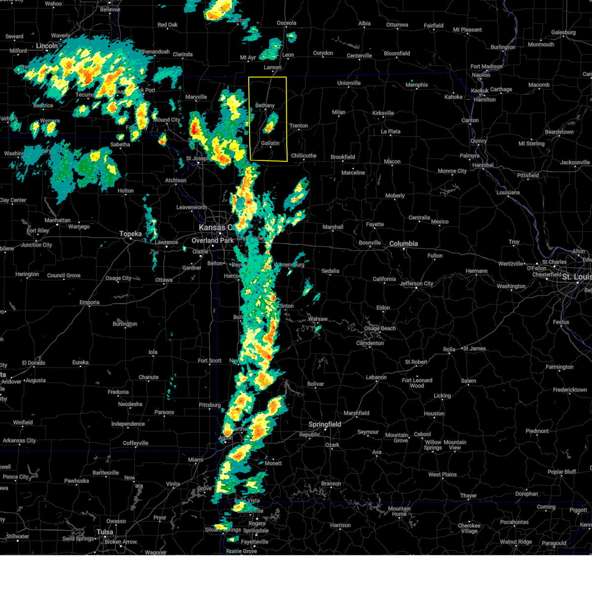 Svreax the national weather service in pleasant hill has issued a * severe thunderstorm warning for, daviess county in north central missouri, harrison county in north central missouri, * until 445 pm cdt. * at 402 pm cdt, a cluster of severe thunderstorms were located near gilman city, or near bethany, moving north at 50 mph (radar indicated). Hazards include 70 mph wind gusts and penny size hail. Expect considerable tree damage. Damage is likely to mobile homes, roofs, and outbuildings. Svreax the national weather service in pleasant hill has issued a * severe thunderstorm warning for, daviess county in north central missouri, harrison county in north central missouri, * until 445 pm cdt. * at 402 pm cdt, a cluster of severe thunderstorms were located near gilman city, or near bethany, moving north at 50 mph (radar indicated). Hazards include 70 mph wind gusts and penny size hail. Expect considerable tree damage. Damage is likely to mobile homes, roofs, and outbuildings.
|
| 10/24/2024 9:17 PM CDT |
 the severe thunderstorm warning has been cancelled and is no longer in effect the severe thunderstorm warning has been cancelled and is no longer in effect
|
| 10/24/2024 9:17 PM CDT |
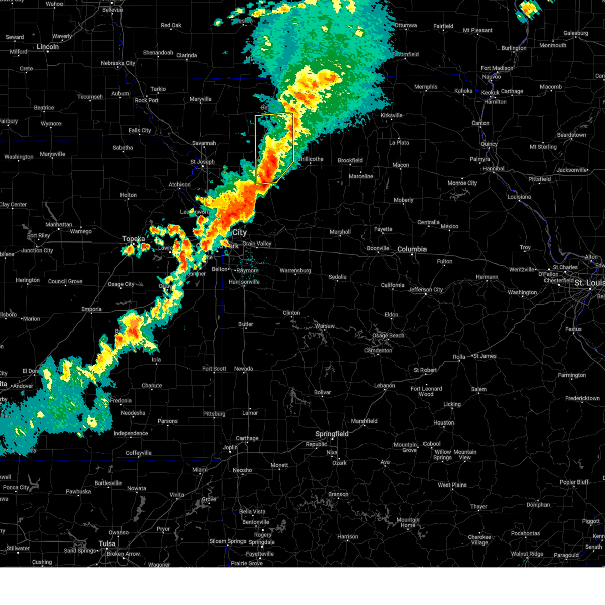 At 917 pm cdt, severe thunderstorms were located along a line extending from near gilman city to near hamilton to 6 miles west of kingston, moving east at 35 mph (radar indicated). Hazards include 60 mph wind gusts and quarter size hail. Hail damage to vehicles is expected. expect wind damage to roofs, siding, and trees. locations impacted include, cameron, hamilton, gallatin, jamesport, gilman city, breckenridge, pattonsburg, kingston, kidder, winston, altamont, coffey, jameson, mcfall, lock springs, and santa rosa. This includes interstate 35 in missouri between mile markers 56 and 90. At 917 pm cdt, severe thunderstorms were located along a line extending from near gilman city to near hamilton to 6 miles west of kingston, moving east at 35 mph (radar indicated). Hazards include 60 mph wind gusts and quarter size hail. Hail damage to vehicles is expected. expect wind damage to roofs, siding, and trees. locations impacted include, cameron, hamilton, gallatin, jamesport, gilman city, breckenridge, pattonsburg, kingston, kidder, winston, altamont, coffey, jameson, mcfall, lock springs, and santa rosa. This includes interstate 35 in missouri between mile markers 56 and 90.
|
| 10/24/2024 9:03 PM CDT |
 the severe thunderstorm warning has been cancelled and is no longer in effect the severe thunderstorm warning has been cancelled and is no longer in effect
|
| 10/24/2024 9:03 PM CDT |
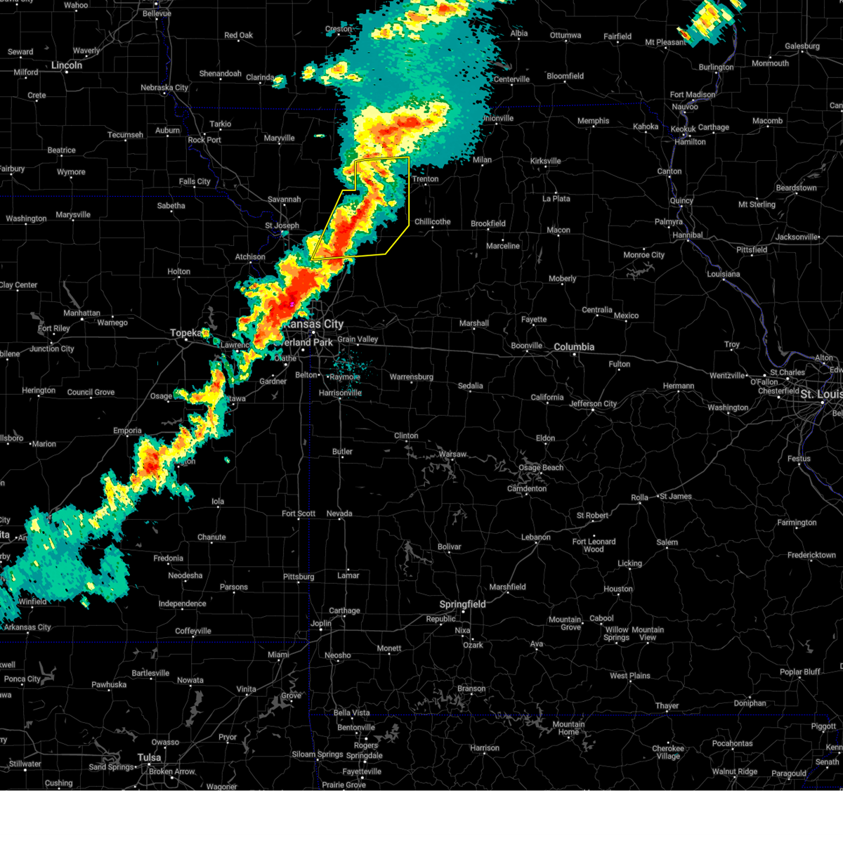 At 902 pm cdt, severe thunderstorms were located along a line extending from 7 miles west of gilman city to 6 miles northeast of cameron to near lathrop, moving east at 40 mph (radar indicated). Hazards include 60 mph wind gusts and quarter size hail. Hail damage to vehicles is expected. expect wind damage to roofs, siding, and trees. locations impacted include, cameron, hamilton, gallatin, maysville, stewartsville, jamesport, osborn, gilman city, breckenridge, pattonsburg, kingston, kidder, winston, altamont, coffey, turney, jameson, weatherby, mcfall, and lock springs. This includes interstate 35 in missouri between mile markers 44 and 90. At 902 pm cdt, severe thunderstorms were located along a line extending from 7 miles west of gilman city to 6 miles northeast of cameron to near lathrop, moving east at 40 mph (radar indicated). Hazards include 60 mph wind gusts and quarter size hail. Hail damage to vehicles is expected. expect wind damage to roofs, siding, and trees. locations impacted include, cameron, hamilton, gallatin, maysville, stewartsville, jamesport, osborn, gilman city, breckenridge, pattonsburg, kingston, kidder, winston, altamont, coffey, turney, jameson, weatherby, mcfall, and lock springs. This includes interstate 35 in missouri between mile markers 44 and 90.
|
| 10/24/2024 8:41 PM CDT |
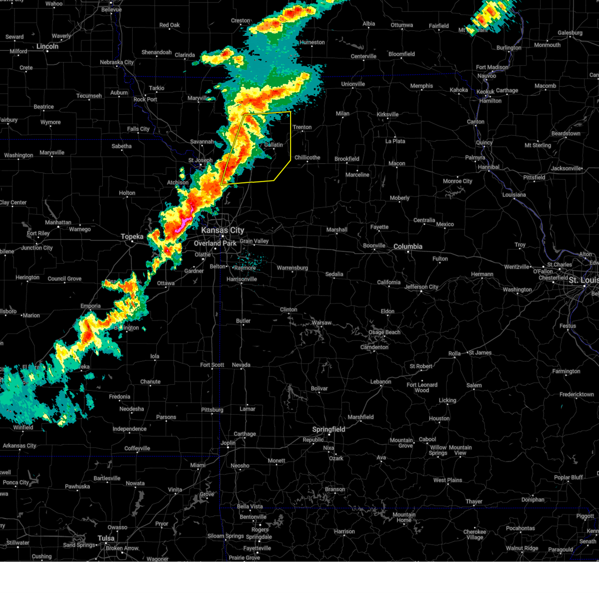 Svreax the national weather service in pleasant hill has issued a * severe thunderstorm warning for, daviess county in north central missouri, northern clinton county in northwestern missouri, southeastern gentry county in northwestern missouri, southern harrison county in north central missouri, northern caldwell county in north central missouri, dekalb county in northwestern missouri, * until 930 pm cdt. * at 841 pm cdt, severe thunderstorms were located along a line extending from 7 miles northwest of pattonsburg to osborn to near plattsburg, moving east at 35 mph (radar indicated). Hazards include 70 mph wind gusts and quarter size hail. Hail damage to vehicles is expected. expect considerable tree damage. Wind damage is also likely to mobile homes, roofs, and outbuildings. Svreax the national weather service in pleasant hill has issued a * severe thunderstorm warning for, daviess county in north central missouri, northern clinton county in northwestern missouri, southeastern gentry county in northwestern missouri, southern harrison county in north central missouri, northern caldwell county in north central missouri, dekalb county in northwestern missouri, * until 930 pm cdt. * at 841 pm cdt, severe thunderstorms were located along a line extending from 7 miles northwest of pattonsburg to osborn to near plattsburg, moving east at 35 mph (radar indicated). Hazards include 70 mph wind gusts and quarter size hail. Hail damage to vehicles is expected. expect considerable tree damage. Wind damage is also likely to mobile homes, roofs, and outbuildings.
|
| 8/15/2024 6:19 PM CDT |
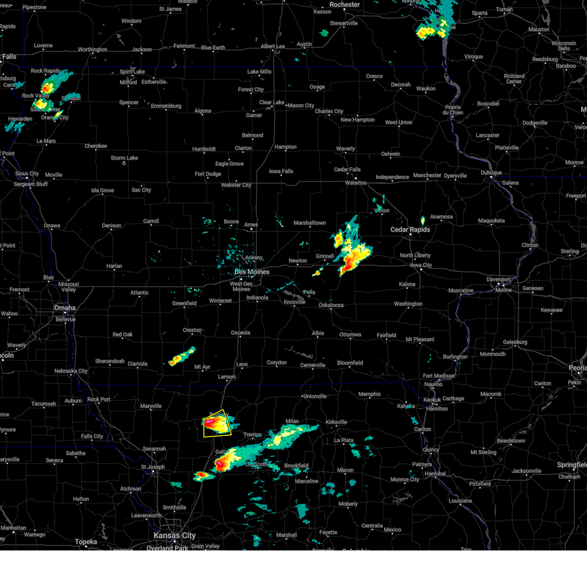 the severe thunderstorm warning has been cancelled and is no longer in effect the severe thunderstorm warning has been cancelled and is no longer in effect
|
| 8/15/2024 6:19 PM CDT |
 At 619 pm cdt, a severe thunderstorm was located near new hampton, moving northeast at 40 mph (radar indicated). Hazards include 60 mph wind gusts and quarter size hail. Hail damage to vehicles is expected. expect wind damage to roofs, siding, and trees. Locations impacted include, bethany and new hampton. At 619 pm cdt, a severe thunderstorm was located near new hampton, moving northeast at 40 mph (radar indicated). Hazards include 60 mph wind gusts and quarter size hail. Hail damage to vehicles is expected. expect wind damage to roofs, siding, and trees. Locations impacted include, bethany and new hampton.
|
| 8/15/2024 5:58 PM CDT |
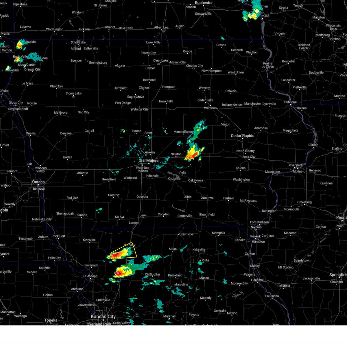 At 558 pm cdt, a severe thunderstorm was located 6 miles southeast of albany, moving northeast at 45 mph (radar indicated). Hazards include 60 mph wind gusts and quarter size hail. Hail damage to vehicles is expected. expect wind damage to roofs, siding, and trees. Locations impacted include, bethany and new hampton. At 558 pm cdt, a severe thunderstorm was located 6 miles southeast of albany, moving northeast at 45 mph (radar indicated). Hazards include 60 mph wind gusts and quarter size hail. Hail damage to vehicles is expected. expect wind damage to roofs, siding, and trees. Locations impacted include, bethany and new hampton.
|
| 8/15/2024 5:38 PM CDT |
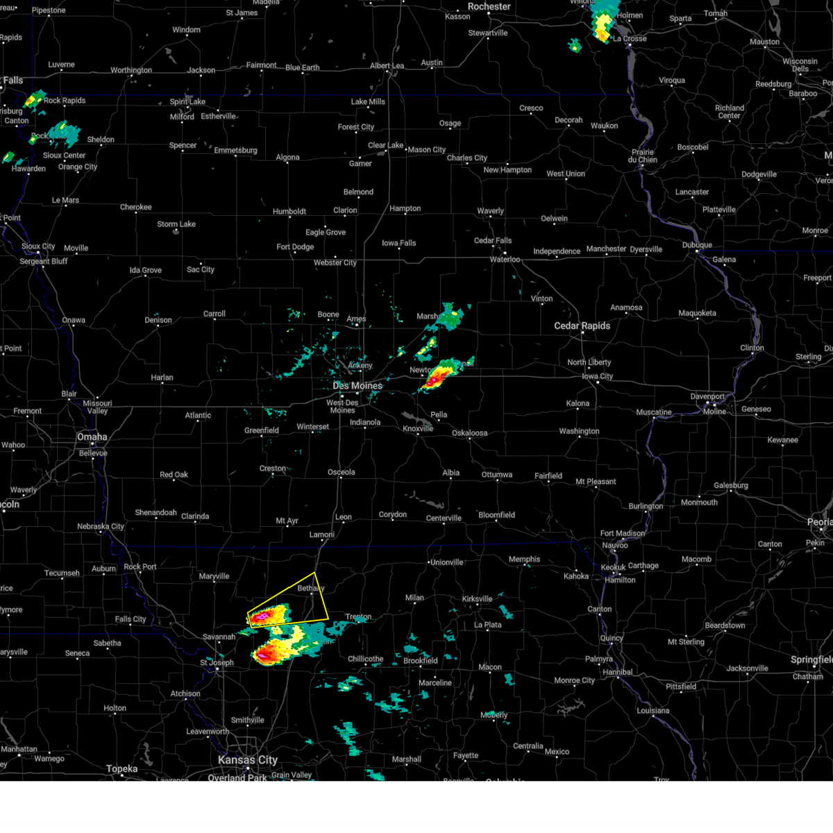 Svreax the national weather service in pleasant hill has issued a * severe thunderstorm warning for, northwestern daviess county in north central missouri, southern gentry county in northwestern missouri, southwestern harrison county in north central missouri, * until 630 pm cdt. * at 538 pm cdt, a severe thunderstorm was located 8 miles south of albany, moving northeast at 40 mph (radar indicated). Hazards include 60 mph wind gusts and quarter size hail. Hail damage to vehicles is expected. Expect wind damage to roofs, siding, and trees. Svreax the national weather service in pleasant hill has issued a * severe thunderstorm warning for, northwestern daviess county in north central missouri, southern gentry county in northwestern missouri, southwestern harrison county in north central missouri, * until 630 pm cdt. * at 538 pm cdt, a severe thunderstorm was located 8 miles south of albany, moving northeast at 40 mph (radar indicated). Hazards include 60 mph wind gusts and quarter size hail. Hail damage to vehicles is expected. Expect wind damage to roofs, siding, and trees.
|
| 7/2/2024 6:31 PM CDT |
 the severe thunderstorm warning has been cancelled and is no longer in effect the severe thunderstorm warning has been cancelled and is no longer in effect
|
| 7/2/2024 6:31 PM CDT |
 At 630 pm cdt, severe thunderstorms were located along a line extending from 6 miles northeast of gilman city to near pattonsburg, moving east at 40 mph (public. 60 mph winds were reported on interstate 35 south of bethany as these storms passed). Hazards include 60 mph wind gusts and quarter size hail. Hail damage to vehicles is expected. expect wind damage to roofs, siding, and trees. locations impacted include, trenton, gilman city, pattonsburg, spickard, coffey, jameson, tindall, and brimson. This includes interstate 35 in missouri between mile markers 74 and 87. At 630 pm cdt, severe thunderstorms were located along a line extending from 6 miles northeast of gilman city to near pattonsburg, moving east at 40 mph (public. 60 mph winds were reported on interstate 35 south of bethany as these storms passed). Hazards include 60 mph wind gusts and quarter size hail. Hail damage to vehicles is expected. expect wind damage to roofs, siding, and trees. locations impacted include, trenton, gilman city, pattonsburg, spickard, coffey, jameson, tindall, and brimson. This includes interstate 35 in missouri between mile markers 74 and 87.
|
| 7/2/2024 6:16 PM CDT |
 Svreax the national weather service in pleasant hill has issued a * severe thunderstorm warning for, northern daviess county in north central missouri, northwestern grundy county in north central missouri, southeastern gentry county in northwestern missouri, southeastern harrison county in north central missouri, northeastern dekalb county in northwestern missouri, * until 700 pm cdt. * at 616 pm cdt, severe thunderstorms were located along a line extending from near gilman city to 7 miles southwest of pattonsburg, moving east at 40 mph (radar indicated). Hazards include 60 mph wind gusts and quarter size hail. Hail damage to vehicles is expected. Expect wind damage to roofs, siding, and trees. Svreax the national weather service in pleasant hill has issued a * severe thunderstorm warning for, northern daviess county in north central missouri, northwestern grundy county in north central missouri, southeastern gentry county in northwestern missouri, southeastern harrison county in north central missouri, northeastern dekalb county in northwestern missouri, * until 700 pm cdt. * at 616 pm cdt, severe thunderstorms were located along a line extending from near gilman city to 7 miles southwest of pattonsburg, moving east at 40 mph (radar indicated). Hazards include 60 mph wind gusts and quarter size hail. Hail damage to vehicles is expected. Expect wind damage to roofs, siding, and trees.
|
| 6/26/2024 12:27 AM CDT |
 The storms which prompted the warning have moved out of the area. therefore, the warning will be allowed to expire. however, gusty winds and heavy rain are still possible with these thunderstorms. a severe thunderstorm watch remains in effect until 700 am cdt for north central and northwestern missouri. The storms which prompted the warning have moved out of the area. therefore, the warning will be allowed to expire. however, gusty winds and heavy rain are still possible with these thunderstorms. a severe thunderstorm watch remains in effect until 700 am cdt for north central and northwestern missouri.
|
| 6/25/2024 11:56 PM CDT |
 At 1155 pm cdt, severe thunderstorms were located along a line extending from near cainsville to near new hampton to near albany to 10 miles southeast of maryville, moving southeast at 65 mph (law enforcement 70 mph winds in albany). Hazards include 70 mph wind gusts and nickel size hail. Expect considerable tree damage. damage is likely to mobile homes, roofs, and outbuildings. locations impacted include, maryville, bethany, albany, stanberry, princeton, king city, ridgeway, ravenwood, gilman city, pattonsburg, mercer, eagleville, new hampton, cainsville, spickard, barnard, conception junction, blythedale, bolckow, and coffey. This includes interstate 35 in missouri between mile markers 75 and 107. At 1155 pm cdt, severe thunderstorms were located along a line extending from near cainsville to near new hampton to near albany to 10 miles southeast of maryville, moving southeast at 65 mph (law enforcement 70 mph winds in albany). Hazards include 70 mph wind gusts and nickel size hail. Expect considerable tree damage. damage is likely to mobile homes, roofs, and outbuildings. locations impacted include, maryville, bethany, albany, stanberry, princeton, king city, ridgeway, ravenwood, gilman city, pattonsburg, mercer, eagleville, new hampton, cainsville, spickard, barnard, conception junction, blythedale, bolckow, and coffey. This includes interstate 35 in missouri between mile markers 75 and 107.
|
| 6/25/2024 11:36 PM CDT |
 Svreax the national weather service in pleasant hill has issued a * severe thunderstorm warning for, northern daviess county in north central missouri, northwestern grundy county in north central missouri, gentry county in northwestern missouri, mercer county in north central missouri, harrison county in north central missouri, southeastern nodaway county in northwestern missouri, northeastern andrew county in northwestern missouri, * until 1230 am cdt. * at 1135 pm cdt, severe thunderstorms were located along a line extending from near lamoni to grant city to near ravenwood, moving southeast at 45 mph (radar indicated). Hazards include 70 mph wind gusts and nickel size hail. Expect considerable tree damage. Damage is likely to mobile homes, roofs, and outbuildings. Svreax the national weather service in pleasant hill has issued a * severe thunderstorm warning for, northern daviess county in north central missouri, northwestern grundy county in north central missouri, gentry county in northwestern missouri, mercer county in north central missouri, harrison county in north central missouri, southeastern nodaway county in northwestern missouri, northeastern andrew county in northwestern missouri, * until 1230 am cdt. * at 1135 pm cdt, severe thunderstorms were located along a line extending from near lamoni to grant city to near ravenwood, moving southeast at 45 mph (radar indicated). Hazards include 70 mph wind gusts and nickel size hail. Expect considerable tree damage. Damage is likely to mobile homes, roofs, and outbuildings.
|
| 5/26/2024 10:29 PM CDT |
 Svreax the national weather service in pleasant hill has issued a * severe thunderstorm warning for, daviess county in north central missouri, * until 1115 pm cdt. * at 1029 pm cdt, a severe thunderstorm was located over pattonsburg, or 11 miles northwest of gallatin, moving southeast at 30 mph (radar indicated). Hazards include 60 mph wind gusts and quarter size hail. Hail damage to vehicles is expected. Expect wind damage to roofs, siding, and trees. Svreax the national weather service in pleasant hill has issued a * severe thunderstorm warning for, daviess county in north central missouri, * until 1115 pm cdt. * at 1029 pm cdt, a severe thunderstorm was located over pattonsburg, or 11 miles northwest of gallatin, moving southeast at 30 mph (radar indicated). Hazards include 60 mph wind gusts and quarter size hail. Hail damage to vehicles is expected. Expect wind damage to roofs, siding, and trees.
|
| 5/21/2024 3:29 PM CDT |
 Svreax the national weather service in pleasant hill has issued a * severe thunderstorm warning for, eastern wyandotte county in northeastern kansas, eastern johnson county in east central kansas, southeastern buchanan county in northwestern missouri, western mercer county in north central missouri, harrison county in north central missouri, jackson county in west central missouri, northwestern johnson county in west central missouri, northern cass county in west central missouri, daviess county in north central missouri, clinton county in northwestern missouri, clay county in west central missouri, gentry county in northwestern missouri, western ray county in west central missouri, caldwell county in north central missouri, southwestern lafayette county in west central missouri, eastern platte county in west central missouri, dekalb county in northwestern missouri, * until 400 pm cdt. * at 329 pm cdt, severe thunderstorms were located along a line extending from near albany to near spring hill, moving east at 65 mph (radar indicated). Hazards include 60 mph wind gusts and quarter size hail. Hail damage to vehicles is expected. Expect wind damage to roofs, siding, and trees. Svreax the national weather service in pleasant hill has issued a * severe thunderstorm warning for, eastern wyandotte county in northeastern kansas, eastern johnson county in east central kansas, southeastern buchanan county in northwestern missouri, western mercer county in north central missouri, harrison county in north central missouri, jackson county in west central missouri, northwestern johnson county in west central missouri, northern cass county in west central missouri, daviess county in north central missouri, clinton county in northwestern missouri, clay county in west central missouri, gentry county in northwestern missouri, western ray county in west central missouri, caldwell county in north central missouri, southwestern lafayette county in west central missouri, eastern platte county in west central missouri, dekalb county in northwestern missouri, * until 400 pm cdt. * at 329 pm cdt, severe thunderstorms were located along a line extending from near albany to near spring hill, moving east at 65 mph (radar indicated). Hazards include 60 mph wind gusts and quarter size hail. Hail damage to vehicles is expected. Expect wind damage to roofs, siding, and trees.
|
| 5/6/2024 11:37 PM CDT |
 Svreax the national weather service in pleasant hill has issued a * severe thunderstorm warning for, daviess county in north central missouri, southwestern grundy county in north central missouri, eastern clinton county in northwestern missouri, northeastern clay county in west central missouri, ray county in west central missouri, carroll county in north central missouri, caldwell county in north central missouri, lafayette county in west central missouri, eastern dekalb county in northwestern missouri, livingston county in north central missouri, * until 1230 am cdt. * at 1136 pm cdt, severe thunderstorms were located along a line extending from 7 miles north of maysville to lone jack, moving northeast at 50 mph (public). Hazards include 60 mph wind gusts and penny size hail. expect damage to roofs, siding, and trees Svreax the national weather service in pleasant hill has issued a * severe thunderstorm warning for, daviess county in north central missouri, southwestern grundy county in north central missouri, eastern clinton county in northwestern missouri, northeastern clay county in west central missouri, ray county in west central missouri, carroll county in north central missouri, caldwell county in north central missouri, lafayette county in west central missouri, eastern dekalb county in northwestern missouri, livingston county in north central missouri, * until 1230 am cdt. * at 1136 pm cdt, severe thunderstorms were located along a line extending from 7 miles north of maysville to lone jack, moving northeast at 50 mph (public). Hazards include 60 mph wind gusts and penny size hail. expect damage to roofs, siding, and trees
|
| 4/27/2024 4:56 PM CDT |
 Svreax the national weather service in pleasant hill has issued a * severe thunderstorm warning for, northeastern daviess county in north central missouri, northern grundy county in north central missouri, northwestern sullivan county in north central missouri, mercer county in north central missouri, southwestern putnam county in north central missouri, southern harrison county in north central missouri, * until 545 pm cdt. * at 455 pm cdt, severe thunderstorms were located along a line extending from near bethany to near gilman city to spickard, moving northeast at 60 mph (radar indicated). Hazards include 60 mph wind gusts and half dollar size hail. Hail damage to vehicles is expected. Expect wind damage to roofs, siding, and trees. Svreax the national weather service in pleasant hill has issued a * severe thunderstorm warning for, northeastern daviess county in north central missouri, northern grundy county in north central missouri, northwestern sullivan county in north central missouri, mercer county in north central missouri, southwestern putnam county in north central missouri, southern harrison county in north central missouri, * until 545 pm cdt. * at 455 pm cdt, severe thunderstorms were located along a line extending from near bethany to near gilman city to spickard, moving northeast at 60 mph (radar indicated). Hazards include 60 mph wind gusts and half dollar size hail. Hail damage to vehicles is expected. Expect wind damage to roofs, siding, and trees.
|
| 4/27/2024 4:35 PM CDT |
 At 435 pm cdt, a severe thunderstorm was located 9 miles west of pattonsburg, or 10 miles south of albany, moving northeast at 55 mph (radar indicated). Hazards include ping pong ball size hail and 60 mph wind gusts. People and animals outdoors will be injured. expect hail damage to roofs, siding, windows, and vehicles. expect wind damage to roofs, siding, and trees. locations impacted include, bethany, gilman city, pattonsburg, new hampton, coffey, and mcfall. This includes interstate 35 in missouri between mile markers 78 and 99. At 435 pm cdt, a severe thunderstorm was located 9 miles west of pattonsburg, or 10 miles south of albany, moving northeast at 55 mph (radar indicated). Hazards include ping pong ball size hail and 60 mph wind gusts. People and animals outdoors will be injured. expect hail damage to roofs, siding, windows, and vehicles. expect wind damage to roofs, siding, and trees. locations impacted include, bethany, gilman city, pattonsburg, new hampton, coffey, and mcfall. This includes interstate 35 in missouri between mile markers 78 and 99.
|
| 4/27/2024 4:35 PM CDT |
 the severe thunderstorm warning has been cancelled and is no longer in effect the severe thunderstorm warning has been cancelled and is no longer in effect
|
| 4/27/2024 4:23 PM CDT |
 Svreax the national weather service in pleasant hill has issued a * severe thunderstorm warning for, northern daviess county in north central missouri, southern gentry county in northwestern missouri, southwestern harrison county in north central missouri, northwestern dekalb county in northwestern missouri, * until 500 pm cdt. * at 423 pm cdt, a severe thunderstorm was located over king city, or 11 miles northwest of maysville, moving northeast at 55 mph (radar indicated). Hazards include 60 mph wind gusts and quarter size hail. Hail damage to vehicles is expected. Expect wind damage to roofs, siding, and trees. Svreax the national weather service in pleasant hill has issued a * severe thunderstorm warning for, northern daviess county in north central missouri, southern gentry county in northwestern missouri, southwestern harrison county in north central missouri, northwestern dekalb county in northwestern missouri, * until 500 pm cdt. * at 423 pm cdt, a severe thunderstorm was located over king city, or 11 miles northwest of maysville, moving northeast at 55 mph (radar indicated). Hazards include 60 mph wind gusts and quarter size hail. Hail damage to vehicles is expected. Expect wind damage to roofs, siding, and trees.
|
| 4/16/2024 11:20 AM CDT |
 At 1120 am cdt, severe thunderstorms were located along a line extending from near gilman city to near braymer, moving northeast at 35 mph (radar indicated). Hazards include 60 mph wind gusts. Expect damage to roofs, siding, and trees. locations impacted include, hamilton, gallatin, jamesport, breckenridge, gilman city, coffey, jameson, mooresville, mount moriah, and lock springs. This includes interstate 35 in missouri between mile markers 81 and 86. At 1120 am cdt, severe thunderstorms were located along a line extending from near gilman city to near braymer, moving northeast at 35 mph (radar indicated). Hazards include 60 mph wind gusts. Expect damage to roofs, siding, and trees. locations impacted include, hamilton, gallatin, jamesport, breckenridge, gilman city, coffey, jameson, mooresville, mount moriah, and lock springs. This includes interstate 35 in missouri between mile markers 81 and 86.
|
| 4/16/2024 11:11 AM CDT |
 the severe thunderstorm warning has been cancelled and is no longer in effect the severe thunderstorm warning has been cancelled and is no longer in effect
|
| 4/16/2024 11:11 AM CDT |
 At 1111 am cdt, severe thunderstorms were located along a line extending from near pattonsburg to near cowgill, moving northeast at 45 mph (radar indicated). Hazards include 60 mph wind gusts. Expect damage to roofs, siding, and trees. locations impacted include, hamilton, gallatin, polo, jamesport, breckenridge, gilman city, pattonsburg, kingston, kidder, altamont, coffey, ludlow, jameson, mooresville, mount moriah, and lock springs. This includes interstate 35 in missouri between mile markers 68 and 87. At 1111 am cdt, severe thunderstorms were located along a line extending from near pattonsburg to near cowgill, moving northeast at 45 mph (radar indicated). Hazards include 60 mph wind gusts. Expect damage to roofs, siding, and trees. locations impacted include, hamilton, gallatin, polo, jamesport, breckenridge, gilman city, pattonsburg, kingston, kidder, altamont, coffey, ludlow, jameson, mooresville, mount moriah, and lock springs. This includes interstate 35 in missouri between mile markers 68 and 87.
|
| 4/16/2024 11:04 AM CDT |
 the severe thunderstorm warning has been cancelled and is no longer in effect the severe thunderstorm warning has been cancelled and is no longer in effect
|
| 4/16/2024 11:04 AM CDT |
 At 1104 am cdt, severe thunderstorms were located along a line extending from 8 miles west of gallatin to 7 miles northeast of woods heights, moving northeast at 35 mph (radar indicated). Hazards include 60 mph wind gusts. Expect damage to roofs, siding, and trees. locations impacted include, hamilton, gallatin, braymer, polo, jamesport, breckenridge, gilman city, pattonsburg, kingston, cowgill, kidder, winston, altamont, coffey, ludlow, jameson, mooresville, mount moriah, lock springs, and elmira. This includes interstate 35 in missouri between mile markers 61 and 89. At 1104 am cdt, severe thunderstorms were located along a line extending from 8 miles west of gallatin to 7 miles northeast of woods heights, moving northeast at 35 mph (radar indicated). Hazards include 60 mph wind gusts. Expect damage to roofs, siding, and trees. locations impacted include, hamilton, gallatin, braymer, polo, jamesport, breckenridge, gilman city, pattonsburg, kingston, cowgill, kidder, winston, altamont, coffey, ludlow, jameson, mooresville, mount moriah, lock springs, and elmira. This includes interstate 35 in missouri between mile markers 61 and 89.
|
| 4/16/2024 10:59 AM CDT |
 Svreax the national weather service in pleasant hill has issued a * severe thunderstorm warning for, daviess county in north central missouri, southwestern grundy county in north central missouri, eastern clinton county in northwestern missouri, northern ray county in west central missouri, northwestern carroll county in north central missouri, southeastern harrison county in north central missouri, caldwell county in north central missouri, eastern dekalb county in northwestern missouri, western livingston county in north central missouri, * until 1145 am cdt. * at 1058 am cdt, severe thunderstorms were located along a line extending from 9 miles west of gallatin to 6 miles northeast of woods heights, moving northeast at 35 mph (radar indicated). Hazards include 60 mph wind gusts. expect damage to roofs, siding, and trees Svreax the national weather service in pleasant hill has issued a * severe thunderstorm warning for, daviess county in north central missouri, southwestern grundy county in north central missouri, eastern clinton county in northwestern missouri, northern ray county in west central missouri, northwestern carroll county in north central missouri, southeastern harrison county in north central missouri, caldwell county in north central missouri, eastern dekalb county in northwestern missouri, western livingston county in north central missouri, * until 1145 am cdt. * at 1058 am cdt, severe thunderstorms were located along a line extending from 9 miles west of gallatin to 6 miles northeast of woods heights, moving northeast at 35 mph (radar indicated). Hazards include 60 mph wind gusts. expect damage to roofs, siding, and trees
|
| 8/11/2023 10:40 PM CDT |
 At 1040 pm cdt, a severe thunderstorm was located near gallatin, moving southeast at 30 mph (radar indicated). Hazards include 60 mph wind gusts and half dollar size hail. Hail damage to vehicles is expected. expect wind damage to roofs, siding, and trees. locations impacted include, gallatin, jamesport, altamont, coffey and jameson. this includes interstate 35 in missouri between mile markers 67 and 77. hail threat, radar indicated max hail size, 1. 25 in wind threat, radar indicated max wind gust, 60 mph. At 1040 pm cdt, a severe thunderstorm was located near gallatin, moving southeast at 30 mph (radar indicated). Hazards include 60 mph wind gusts and half dollar size hail. Hail damage to vehicles is expected. expect wind damage to roofs, siding, and trees. locations impacted include, gallatin, jamesport, altamont, coffey and jameson. this includes interstate 35 in missouri between mile markers 67 and 77. hail threat, radar indicated max hail size, 1. 25 in wind threat, radar indicated max wind gust, 60 mph.
|
| 8/11/2023 10:28 PM CDT |
 At 1027 pm cdt, a severe thunderstorm was located over pattonsburg, or 11 miles northwest of gallatin, moving southeast at 30 mph (radar indicated). Hazards include ping pong ball size hail and 60 mph wind gusts. People and animals outdoors will be injured. expect hail damage to roofs, siding, windows, and vehicles. Expect wind damage to roofs, siding, and trees. At 1027 pm cdt, a severe thunderstorm was located over pattonsburg, or 11 miles northwest of gallatin, moving southeast at 30 mph (radar indicated). Hazards include ping pong ball size hail and 60 mph wind gusts. People and animals outdoors will be injured. expect hail damage to roofs, siding, windows, and vehicles. Expect wind damage to roofs, siding, and trees.
|
| 8/11/2023 10:13 PM CDT |
 At 1012 pm cdt, a severe thunderstorm was located near pattonsburg, or 12 miles southwest of bethany, moving southeast at 30 mph (radar indicated). Hazards include ping pong ball size hail and 60 mph wind gusts. People and animals outdoors will be injured. expect hail damage to roofs, siding, windows, and vehicles. expect wind damage to roofs, siding, and trees. locations impacted include, pattonsburg, coffey, mcfall and santa rosa. this includes interstate 35 in missouri between mile markers 71 and 84. hail threat, radar indicated max hail size, 1. 50 in wind threat, radar indicated max wind gust, 60 mph. At 1012 pm cdt, a severe thunderstorm was located near pattonsburg, or 12 miles southwest of bethany, moving southeast at 30 mph (radar indicated). Hazards include ping pong ball size hail and 60 mph wind gusts. People and animals outdoors will be injured. expect hail damage to roofs, siding, windows, and vehicles. expect wind damage to roofs, siding, and trees. locations impacted include, pattonsburg, coffey, mcfall and santa rosa. this includes interstate 35 in missouri between mile markers 71 and 84. hail threat, radar indicated max hail size, 1. 50 in wind threat, radar indicated max wind gust, 60 mph.
|
| 8/11/2023 10:04 PM CDT |
 At 1004 pm cdt, a severe thunderstorm was located 8 miles south of new hampton, or 8 miles southeast of albany, moving southeast at 40 mph (radar indicated). Hazards include golf ball size hail and 60 mph wind gusts. People and animals outdoors will be injured. expect hail damage to roofs, siding, windows, and vehicles. expect wind damage to roofs, siding, and trees. locations impacted include, albany, pattonsburg, coffey, darlington, mcfall and santa rosa. this includes interstate 35 in missouri between mile markers 71 and 86. thunderstorm damage threat, considerable hail threat, radar indicated max hail size, 1. 75 in wind threat, radar indicated max wind gust, 60 mph. At 1004 pm cdt, a severe thunderstorm was located 8 miles south of new hampton, or 8 miles southeast of albany, moving southeast at 40 mph (radar indicated). Hazards include golf ball size hail and 60 mph wind gusts. People and animals outdoors will be injured. expect hail damage to roofs, siding, windows, and vehicles. expect wind damage to roofs, siding, and trees. locations impacted include, albany, pattonsburg, coffey, darlington, mcfall and santa rosa. this includes interstate 35 in missouri between mile markers 71 and 86. thunderstorm damage threat, considerable hail threat, radar indicated max hail size, 1. 75 in wind threat, radar indicated max wind gust, 60 mph.
|
| 8/11/2023 9:48 PM CDT |
 At 948 pm cdt, a severe thunderstorm was located over albany, moving southeast at 30 mph (radar indicated). Hazards include golf ball size hail and 60 mph wind gusts. People and animals outdoors will be injured. expect hail damage to roofs, siding, windows, and vehicles. Expect wind damage to roofs, siding, and trees. At 948 pm cdt, a severe thunderstorm was located over albany, moving southeast at 30 mph (radar indicated). Hazards include golf ball size hail and 60 mph wind gusts. People and animals outdoors will be injured. expect hail damage to roofs, siding, windows, and vehicles. Expect wind damage to roofs, siding, and trees.
|
| 8/11/2023 9:43 PM CDT |
 At 943 pm cdt, a severe thunderstorm was located near gilman city, or 11 miles southeast of bethany, moving east at 25 mph (radar indicated). Hazards include two inch hail and 60 mph wind gusts. People and animals outdoors will be injured. expect hail damage to roofs, siding, windows, and vehicles. expect wind damage to roofs, siding, and trees. locations impacted include, gilman city, coffey and brimson. this includes interstate 35 in missouri between mile markers 83 and 86. thunderstorm damage threat, considerable hail threat, radar indicated max hail size, 2. 00 in wind threat, radar indicated max wind gust, 60 mph. At 943 pm cdt, a severe thunderstorm was located near gilman city, or 11 miles southeast of bethany, moving east at 25 mph (radar indicated). Hazards include two inch hail and 60 mph wind gusts. People and animals outdoors will be injured. expect hail damage to roofs, siding, windows, and vehicles. expect wind damage to roofs, siding, and trees. locations impacted include, gilman city, coffey and brimson. this includes interstate 35 in missouri between mile markers 83 and 86. thunderstorm damage threat, considerable hail threat, radar indicated max hail size, 2. 00 in wind threat, radar indicated max wind gust, 60 mph.
|
| 8/11/2023 9:36 PM CDT |
 At 935 pm cdt, a severe thunderstorm was located near gilman city, or 9 miles south of bethany, moving east at 30 mph (radar indicated). Hazards include ping pong ball size hail and 60 mph wind gusts. People and animals outdoors will be injured. expect hail damage to roofs, siding, windows, and vehicles. expect wind damage to roofs, siding, and trees. locations impacted include, gilman city, coffey and brimson. this includes interstate 35 in missouri between mile markers 80 and 88. hail threat, radar indicated max hail size, 1. 50 in wind threat, radar indicated max wind gust, 60 mph. At 935 pm cdt, a severe thunderstorm was located near gilman city, or 9 miles south of bethany, moving east at 30 mph (radar indicated). Hazards include ping pong ball size hail and 60 mph wind gusts. People and animals outdoors will be injured. expect hail damage to roofs, siding, windows, and vehicles. expect wind damage to roofs, siding, and trees. locations impacted include, gilman city, coffey and brimson. this includes interstate 35 in missouri between mile markers 80 and 88. hail threat, radar indicated max hail size, 1. 50 in wind threat, radar indicated max wind gust, 60 mph.
|
| 8/11/2023 9:25 PM CDT |
 At 925 pm cdt, a severe thunderstorm was located near bethany, moving east at 30 mph (radar indicated). Hazards include 60 mph wind gusts and quarter size hail. Hail damage to vehicles is expected. expect wind damage to roofs, siding, and trees. locations impacted include, bethany, gilman city, coffey, mount moriah and brimson. this includes interstate 35 in missouri between mile markers 80 and 94. hail threat, radar indicated max hail size, 1. 00 in wind threat, radar indicated max wind gust, 60 mph. At 925 pm cdt, a severe thunderstorm was located near bethany, moving east at 30 mph (radar indicated). Hazards include 60 mph wind gusts and quarter size hail. Hail damage to vehicles is expected. expect wind damage to roofs, siding, and trees. locations impacted include, bethany, gilman city, coffey, mount moriah and brimson. this includes interstate 35 in missouri between mile markers 80 and 94. hail threat, radar indicated max hail size, 1. 00 in wind threat, radar indicated max wind gust, 60 mph.
|
| 8/11/2023 9:14 PM CDT |
 At 914 pm cdt, a severe thunderstorm was located near new hampton, or 7 miles southwest of bethany, moving east at 30 mph (radar indicated). Hazards include 60 mph wind gusts and half dollar size hail. Hail damage to vehicles is expected. Expect wind damage to roofs, siding, and trees. At 914 pm cdt, a severe thunderstorm was located near new hampton, or 7 miles southwest of bethany, moving east at 30 mph (radar indicated). Hazards include 60 mph wind gusts and half dollar size hail. Hail damage to vehicles is expected. Expect wind damage to roofs, siding, and trees.
|
| 7/29/2023 11:42 AM CDT |
 At 1142 am cdt, severe thunderstorms were located along a line extending from near gilman city to near utica to near norborne, moving east at 50 mph (trained weather spotters). Hazards include 70 mph wind gusts. Expect considerable tree damage. Damage is likely to mobile homes, roofs, and outbuildings. At 1142 am cdt, severe thunderstorms were located along a line extending from near gilman city to near utica to near norborne, moving east at 50 mph (trained weather spotters). Hazards include 70 mph wind gusts. Expect considerable tree damage. Damage is likely to mobile homes, roofs, and outbuildings.
|
| 7/29/2023 11:37 AM CDT |
 At 1137 am cdt, severe thunderstorms were located along a line extending from 6 miles north of gallatin to 7 miles south of utica to near wellington, moving southeast at 45 mph (radar indicated). Hazards include 60 mph wind gusts and penny size hail. Expect damage to roofs, siding, and trees. locations impacted include, richmond, lawson, hamilton, gallatin, braymer, norborne, polo, hardin, jamesport, breckenridge, gilman city, crystal lakes, kingston, pattonsburg, utica, cowgill, woods heights, kidder, winston and rayville. this includes interstate 35 in missouri between mile markers 58 and 82. hail threat, radar indicated max hail size, 0. 75 in wind threat, observed max wind gust, 60 mph. At 1137 am cdt, severe thunderstorms were located along a line extending from 6 miles north of gallatin to 7 miles south of utica to near wellington, moving southeast at 45 mph (radar indicated). Hazards include 60 mph wind gusts and penny size hail. Expect damage to roofs, siding, and trees. locations impacted include, richmond, lawson, hamilton, gallatin, braymer, norborne, polo, hardin, jamesport, breckenridge, gilman city, crystal lakes, kingston, pattonsburg, utica, cowgill, woods heights, kidder, winston and rayville. this includes interstate 35 in missouri between mile markers 58 and 82. hail threat, radar indicated max hail size, 0. 75 in wind threat, observed max wind gust, 60 mph.
|
| 7/29/2023 11:26 AM CDT |
 At 1126 am cdt, severe thunderstorms were located along a line extending from near pattonsburg to 6 miles northeast of braymer to near orrick, moving east at 50 mph (radar indicated). Hazards include 60 mph wind gusts and penny size hail. Expect damage to roofs, siding, and trees. locations impacted include, liberty, excelsior springs, cameron, kearney, richmond, lexington, lawson, hamilton, gallatin, braymer, orrick, norborne, polo, hardin, jamesport, holt, breckenridge, gilman city, henrietta and crystal lakes. this includes interstate 35 in missouri between mile markers 19 and 32, between mile markers 38 and 53, and between mile markers 56 and 82. hail threat, radar indicated max hail size, 0. 75 in wind threat, observed max wind gust, 60 mph. At 1126 am cdt, severe thunderstorms were located along a line extending from near pattonsburg to 6 miles northeast of braymer to near orrick, moving east at 50 mph (radar indicated). Hazards include 60 mph wind gusts and penny size hail. Expect damage to roofs, siding, and trees. locations impacted include, liberty, excelsior springs, cameron, kearney, richmond, lexington, lawson, hamilton, gallatin, braymer, orrick, norborne, polo, hardin, jamesport, holt, breckenridge, gilman city, henrietta and crystal lakes. this includes interstate 35 in missouri between mile markers 19 and 32, between mile markers 38 and 53, and between mile markers 56 and 82. hail threat, radar indicated max hail size, 0. 75 in wind threat, observed max wind gust, 60 mph.
|
| 7/29/2023 10:54 AM CDT |
 At 1053 am cdt, severe thunderstorms were located along a line extending from near stanberry to near cameron to near smithville, moving southeast at 60 mph (trained weather spotters). Hazards include 70 mph wind gusts. Expect considerable tree damage. Damage is likely to mobile homes, roofs, and outbuildings. At 1053 am cdt, severe thunderstorms were located along a line extending from near stanberry to near cameron to near smithville, moving southeast at 60 mph (trained weather spotters). Hazards include 70 mph wind gusts. Expect considerable tree damage. Damage is likely to mobile homes, roofs, and outbuildings.
|
| 6/30/2023 11:13 PM CDT |
 At 1113 pm cdt, severe thunderstorms were located along a line extending from 7 miles west of gilman city to near breckenridge to near braymer, moving east at 35 mph (radar indicated). Hazards include 60 mph wind gusts. expect damage to roofs, siding, and trees At 1113 pm cdt, severe thunderstorms were located along a line extending from 7 miles west of gilman city to near breckenridge to near braymer, moving east at 35 mph (radar indicated). Hazards include 60 mph wind gusts. expect damage to roofs, siding, and trees
|
| 6/30/2023 11:04 PM CDT |
 At 1103 pm cdt, severe thunderstorms were located along a line extending from pattonsburg to near gallatin to near kingston, moving east at 45 mph (radar indicated). Hazards include 60 mph wind gusts. Expect damage to roofs, siding, and trees. locations impacted include, bethany, hamilton, gallatin, braymer, jamesport, breckenridge, gilman city, pattonsburg, kingston, kidder, winston, altamont, coffey, jameson, mcfall and lock springs. this includes interstate 35 in missouri between mile markers 64 and 95. hail threat, radar indicated max hail size, <. 75 in wind threat, observed max wind gust, 60 mph. At 1103 pm cdt, severe thunderstorms were located along a line extending from pattonsburg to near gallatin to near kingston, moving east at 45 mph (radar indicated). Hazards include 60 mph wind gusts. Expect damage to roofs, siding, and trees. locations impacted include, bethany, hamilton, gallatin, braymer, jamesport, breckenridge, gilman city, pattonsburg, kingston, kidder, winston, altamont, coffey, jameson, mcfall and lock springs. this includes interstate 35 in missouri between mile markers 64 and 95. hail threat, radar indicated max hail size, <. 75 in wind threat, observed max wind gust, 60 mph.
|
| 6/30/2023 10:53 PM CDT |
 At 1053 pm cdt, severe thunderstorms were located along a line extending from 6 miles southeast of albany to pattonsburg to 6 miles west of hamilton, moving northeast at 50 mph (radar indicated). Hazards include 60 mph wind gusts. Expect damage to roofs, siding, and trees. locations impacted include, cameron, bethany, hamilton, gallatin, braymer, jamesport, breckenridge, gilman city, pattonsburg, kingston, kidder, winston, altamont, coffey, jameson, weatherby, mcfall, lock springs, fairport and santa rosa. this includes interstate 35 in missouri between mile markers 55 and 95. hail threat, radar indicated max hail size, <. 75 in wind threat, observed max wind gust, 60 mph. At 1053 pm cdt, severe thunderstorms were located along a line extending from 6 miles southeast of albany to pattonsburg to 6 miles west of hamilton, moving northeast at 50 mph (radar indicated). Hazards include 60 mph wind gusts. Expect damage to roofs, siding, and trees. locations impacted include, cameron, bethany, hamilton, gallatin, braymer, jamesport, breckenridge, gilman city, pattonsburg, kingston, kidder, winston, altamont, coffey, jameson, weatherby, mcfall, lock springs, fairport and santa rosa. this includes interstate 35 in missouri between mile markers 55 and 95. hail threat, radar indicated max hail size, <. 75 in wind threat, observed max wind gust, 60 mph.
|
| 6/30/2023 10:37 PM CDT |
 At 1036 pm cdt, severe thunderstorms were located along a line extending from near king city to near maysville to 7 miles north of lathrop, moving northeast at 50 mph (radar indicated). Hazards include 60 mph wind gusts. expect damage to roofs, siding, and trees At 1036 pm cdt, severe thunderstorms were located along a line extending from near king city to near maysville to 7 miles north of lathrop, moving northeast at 50 mph (radar indicated). Hazards include 60 mph wind gusts. expect damage to roofs, siding, and trees
|
| 6/29/2023 9:20 AM CDT |
 At 919 am cdt, severe thunderstorms were located along a line extending from 7 miles southwest of gilman city to near breckenridge to near cowgill, moving east at 65 mph (radar indicated). Hazards include 70 mph wind gusts. Expect considerable tree damage. Damage is likely to mobile homes, roofs, and outbuildings. At 919 am cdt, severe thunderstorms were located along a line extending from 7 miles southwest of gilman city to near breckenridge to near cowgill, moving east at 65 mph (radar indicated). Hazards include 70 mph wind gusts. Expect considerable tree damage. Damage is likely to mobile homes, roofs, and outbuildings.
|
| 6/29/2023 9:00 AM CDT |
 At 900 am cdt, severe thunderstorms were located along a line extending from king city to near osborn to plattsburg, moving east at 60 mph (radar indicated). Hazards include 70 mph wind gusts. Expect considerable tree damage. damage is likely to mobile homes, roofs, and outbuildings. locations impacted include, cameron, plattsburg, lathrop, hamilton, gallatin, gower, maysville, king city, braymer, stewartsville, polo, jamesport, union star, osborn, breckenridge, gilman city, kingston, pattonsburg, clarksdale and cowgill. this includes interstate 35 in missouri between mile markers 39 and 88. thunderstorm damage threat, considerable hail threat, radar indicated max hail size, <. 75 in wind threat, radar indicated max wind gust, 70 mph. At 900 am cdt, severe thunderstorms were located along a line extending from king city to near osborn to plattsburg, moving east at 60 mph (radar indicated). Hazards include 70 mph wind gusts. Expect considerable tree damage. damage is likely to mobile homes, roofs, and outbuildings. locations impacted include, cameron, plattsburg, lathrop, hamilton, gallatin, gower, maysville, king city, braymer, stewartsville, polo, jamesport, union star, osborn, breckenridge, gilman city, kingston, pattonsburg, clarksdale and cowgill. this includes interstate 35 in missouri between mile markers 39 and 88. thunderstorm damage threat, considerable hail threat, radar indicated max hail size, <. 75 in wind threat, radar indicated max wind gust, 70 mph.
|
| 6/29/2023 8:38 AM CDT |
 At 837 am cdt, severe thunderstorms were located along a line extending from near fillmore to 6 miles east of st. joseph to dearborn, moving east at 60 mph (radar indicated). Hazards include 70 mph wind gusts. Expect considerable tree damage. Damage is likely to mobile homes, roofs, and outbuildings. At 837 am cdt, severe thunderstorms were located along a line extending from near fillmore to 6 miles east of st. joseph to dearborn, moving east at 60 mph (radar indicated). Hazards include 70 mph wind gusts. Expect considerable tree damage. Damage is likely to mobile homes, roofs, and outbuildings.
|
| 6/29/2023 8:23 AM CDT |
 At 822 am cdt, severe thunderstorms were located along a line extending from ridgeway to 7 miles east of bethany to near gilman city, moving east at 55 mph (trained weather spotters). Hazards include 70 mph wind gusts. Expect considerable tree damage. Damage is likely to mobile homes, roofs, and outbuildings. At 822 am cdt, severe thunderstorms were located along a line extending from ridgeway to 7 miles east of bethany to near gilman city, moving east at 55 mph (trained weather spotters). Hazards include 70 mph wind gusts. Expect considerable tree damage. Damage is likely to mobile homes, roofs, and outbuildings.
|
| 6/29/2023 8:05 AM CDT |
 At 804 am cdt, severe thunderstorms were located along a line extending from near grant city to albany to near king city, moving east at 50 mph (trained weather spotters). Hazards include 70 mph wind gusts and penny size hail. Expect considerable tree damage. damage is likely to mobile homes, roofs, and outbuildings. locations impacted include, bethany, gallatin, albany, stanberry, king city, grant city, ridgeway, gilman city, pattonsburg, eagleville, new hampton, cainsville, irena, altamont, blythedale, coffey, jameson, darlington, weatherby and mcfall. this includes interstate 35 in missouri between mile markers 65 and 113. thunderstorm damage threat, considerable hail threat, radar indicated max hail size, 0. 75 in wind threat, observed max wind gust, 70 mph. At 804 am cdt, severe thunderstorms were located along a line extending from near grant city to albany to near king city, moving east at 50 mph (trained weather spotters). Hazards include 70 mph wind gusts and penny size hail. Expect considerable tree damage. damage is likely to mobile homes, roofs, and outbuildings. locations impacted include, bethany, gallatin, albany, stanberry, king city, grant city, ridgeway, gilman city, pattonsburg, eagleville, new hampton, cainsville, irena, altamont, blythedale, coffey, jameson, darlington, weatherby and mcfall. this includes interstate 35 in missouri between mile markers 65 and 113. thunderstorm damage threat, considerable hail threat, radar indicated max hail size, 0. 75 in wind threat, observed max wind gust, 70 mph.
|
| 6/29/2023 7:54 AM CDT |
 At 753 am cdt, severe thunderstorms were located along a line extending from 7 miles northeast of ravenwood to stanberry to near king city, moving east at 40 mph (trained weather spotters). Hazards include 70 mph wind gusts and penny size hail. Expect considerable tree damage. damage is likely to mobile homes, roofs, and outbuildings. locations impacted include, maryville, bethany, gallatin, albany, stanberry, king city, grant city, ridgeway, ravenwood, union star, gilman city, pattonsburg, eagleville, new hampton, cainsville, irena, altamont, conception junction, sheridan and blythedale. this includes interstate 35 in missouri between mile markers 65 and 113. thunderstorm damage threat, considerable hail threat, radar indicated max hail size, 0. 75 in wind threat, observed max wind gust, 70 mph. At 753 am cdt, severe thunderstorms were located along a line extending from 7 miles northeast of ravenwood to stanberry to near king city, moving east at 40 mph (trained weather spotters). Hazards include 70 mph wind gusts and penny size hail. Expect considerable tree damage. damage is likely to mobile homes, roofs, and outbuildings. locations impacted include, maryville, bethany, gallatin, albany, stanberry, king city, grant city, ridgeway, ravenwood, union star, gilman city, pattonsburg, eagleville, new hampton, cainsville, irena, altamont, conception junction, sheridan and blythedale. this includes interstate 35 in missouri between mile markers 65 and 113. thunderstorm damage threat, considerable hail threat, radar indicated max hail size, 0. 75 in wind threat, observed max wind gust, 70 mph.
|
| 6/29/2023 7:42 AM CDT |
 At 741 am cdt, severe thunderstorms were located along a line extending from near ravenwood to 6 miles west of stanberry to 8 miles northwest of union star, moving east at 45 mph. these are destructive storms for areas east of maryville to conception junction to stanberry (trained weather spotters). Hazards include 80 mph wind gusts and penny size hail. Flying debris will be dangerous to those caught without shelter. mobile homes will be heavily damaged. expect considerable damage to roofs, windows, and vehicles. Extensive tree damage and power outages are likely. At 741 am cdt, severe thunderstorms were located along a line extending from near ravenwood to 6 miles west of stanberry to 8 miles northwest of union star, moving east at 45 mph. these are destructive storms for areas east of maryville to conception junction to stanberry (trained weather spotters). Hazards include 80 mph wind gusts and penny size hail. Flying debris will be dangerous to those caught without shelter. mobile homes will be heavily damaged. expect considerable damage to roofs, windows, and vehicles. Extensive tree damage and power outages are likely.
|
| 6/29/2023 7:33 AM CDT |
 At 732 am cdt, severe thunderstorms were located along a line extending from maryville to 12 miles east of maitland to near fillmore, moving east at 45 mph (trained weather spotters). Hazards include 60 mph wind gusts and nickel size hail. Expect damage to roofs, siding, and trees. locations impacted include, maryville, savannah, bethany, albany, stanberry, mound city, king city, grant city, oregon, ravenwood, union star, pattonsburg, maitland, new hampton, skidmore, forest city, fillmore, barnard, altamont and conception junction. this includes the following highways, interstate 35 in missouri between mile markers 65 and 100. interstate 29 between mile markers 66 and 89. hail threat, radar indicated max hail size, 0. 88 in wind threat, observed max wind gust, 60 mph. At 732 am cdt, severe thunderstorms were located along a line extending from maryville to 12 miles east of maitland to near fillmore, moving east at 45 mph (trained weather spotters). Hazards include 60 mph wind gusts and nickel size hail. Expect damage to roofs, siding, and trees. locations impacted include, maryville, savannah, bethany, albany, stanberry, mound city, king city, grant city, oregon, ravenwood, union star, pattonsburg, maitland, new hampton, skidmore, forest city, fillmore, barnard, altamont and conception junction. this includes the following highways, interstate 35 in missouri between mile markers 65 and 100. interstate 29 between mile markers 66 and 89. hail threat, radar indicated max hail size, 0. 88 in wind threat, observed max wind gust, 60 mph.
|
| 6/29/2023 7:31 AM CDT |
 At 731 am cdt, severe thunderstorms were located along a line extending from maryville to 11 miles southwest of ravenwood to 6 miles northeast of fillmore, moving east at 45 mph (trained weather spotters). Hazards include 60 mph wind gusts and nickel size hail. Expect damage to roofs, siding, and trees. locations impacted include, maryville, savannah, bethany, albany, stanberry, mound city, king city, grant city, oregon, ravenwood, union star, pattonsburg, maitland, new hampton, skidmore, forest city, fillmore, barnard, altamont and conception junction. this includes the following highways, interstate 35 in missouri between mile markers 65 and 100. interstate 29 between mile markers 66 and 89. hail threat, radar indicated max hail size, 0. 88 in wind threat, radar indicated max wind gust, 60 mph. At 731 am cdt, severe thunderstorms were located along a line extending from maryville to 11 miles southwest of ravenwood to 6 miles northeast of fillmore, moving east at 45 mph (trained weather spotters). Hazards include 60 mph wind gusts and nickel size hail. Expect damage to roofs, siding, and trees. locations impacted include, maryville, savannah, bethany, albany, stanberry, mound city, king city, grant city, oregon, ravenwood, union star, pattonsburg, maitland, new hampton, skidmore, forest city, fillmore, barnard, altamont and conception junction. this includes the following highways, interstate 35 in missouri between mile markers 65 and 100. interstate 29 between mile markers 66 and 89. hail threat, radar indicated max hail size, 0. 88 in wind threat, radar indicated max wind gust, 60 mph.
|
| 6/29/2023 7:29 AM CDT |
 At 729 am cdt, severe thunderstorms were located along a line extending from maryville to 11 miles southwest of ravenwood to 6 miles northeast of fillmore, moving east at 45 mph (radar indicated). Hazards include 60 mph wind gusts and nickel size hail. expect damage to roofs, siding, and trees At 729 am cdt, severe thunderstorms were located along a line extending from maryville to 11 miles southwest of ravenwood to 6 miles northeast of fillmore, moving east at 45 mph (radar indicated). Hazards include 60 mph wind gusts and nickel size hail. expect damage to roofs, siding, and trees
|
| 6/17/2023 6:23 PM CDT |
 The severe thunderstorm warning for north central daviess and southwestern harrison counties will expire at 630 pm cdt, the severe thunderstorm which prompted the warning has moved out of daviess county. therefore, the warning will be allowed to expire. a severe thunderstorm warning remains in effect for harrison county. The severe thunderstorm warning for north central daviess and southwestern harrison counties will expire at 630 pm cdt, the severe thunderstorm which prompted the warning has moved out of daviess county. therefore, the warning will be allowed to expire. a severe thunderstorm warning remains in effect for harrison county.
|
| 6/17/2023 6:07 PM CDT |
 At 606 pm cdt, a severe thunderstorm was located near bethany, moving north at 30 mph (radar indicated). Hazards include golf ball size hail and 60 mph wind gusts. People and animals outdoors will be injured. expect hail damage to roofs, siding, windows, and vehicles. expect wind damage to roofs, siding, and trees. locations impacted include, bethany and coffey. this includes interstate 35 in missouri between mile markers 80 and 92. thunderstorm damage threat, considerable hail threat, radar indicated max hail size, 1. 75 in wind threat, radar indicated max wind gust, 60 mph. At 606 pm cdt, a severe thunderstorm was located near bethany, moving north at 30 mph (radar indicated). Hazards include golf ball size hail and 60 mph wind gusts. People and animals outdoors will be injured. expect hail damage to roofs, siding, windows, and vehicles. expect wind damage to roofs, siding, and trees. locations impacted include, bethany and coffey. this includes interstate 35 in missouri between mile markers 80 and 92. thunderstorm damage threat, considerable hail threat, radar indicated max hail size, 1. 75 in wind threat, radar indicated max wind gust, 60 mph.
|
| 6/17/2023 5:56 PM CDT |
 At 556 pm cdt, a severe thunderstorm was located near pattonsburg, or 11 miles south of bethany, moving north at 20 mph (radar indicated). Hazards include golf ball size hail and 60 mph wind gusts. People and animals outdoors will be injured. expect hail damage to roofs, siding, windows, and vehicles. Expect wind damage to roofs, siding, and trees. At 556 pm cdt, a severe thunderstorm was located near pattonsburg, or 11 miles south of bethany, moving north at 20 mph (radar indicated). Hazards include golf ball size hail and 60 mph wind gusts. People and animals outdoors will be injured. expect hail damage to roofs, siding, windows, and vehicles. Expect wind damage to roofs, siding, and trees.
|
| 6/17/2023 5:52 PM CDT |
 At 551 pm cdt, a severe thunderstorm was located near pattonsburg, or 10 miles south of bethany, moving northeast at 30 mph (radar indicated). Hazards include ping pong ball size hail and 60 mph wind gusts. People and animals outdoors will be injured. expect hail damage to roofs, siding, windows, and vehicles. expect wind damage to roofs, siding, and trees. locations impacted include, pattonsburg and coffey. this includes interstate 35 in missouri between mile markers 73 and 86. hail threat, radar indicated max hail size, 1. 50 in wind threat, radar indicated max wind gust, 60 mph. At 551 pm cdt, a severe thunderstorm was located near pattonsburg, or 10 miles south of bethany, moving northeast at 30 mph (radar indicated). Hazards include ping pong ball size hail and 60 mph wind gusts. People and animals outdoors will be injured. expect hail damage to roofs, siding, windows, and vehicles. expect wind damage to roofs, siding, and trees. locations impacted include, pattonsburg and coffey. this includes interstate 35 in missouri between mile markers 73 and 86. hail threat, radar indicated max hail size, 1. 50 in wind threat, radar indicated max wind gust, 60 mph.
|
| 6/17/2023 5:35 PM CDT |
 At 534 pm cdt, a severe thunderstorm was located near pattonsburg, or 12 miles northwest of gallatin, moving northeast at 30 mph (radar indicated). Hazards include ping pong ball size hail and 60 mph wind gusts. People and animals outdoors will be injured. expect hail damage to roofs, siding, windows, and vehicles. Expect wind damage to roofs, siding, and trees. At 534 pm cdt, a severe thunderstorm was located near pattonsburg, or 12 miles northwest of gallatin, moving northeast at 30 mph (radar indicated). Hazards include ping pong ball size hail and 60 mph wind gusts. People and animals outdoors will be injured. expect hail damage to roofs, siding, windows, and vehicles. Expect wind damage to roofs, siding, and trees.
|
| 5/6/2023 7:29 PM CDT |
 At 729 pm cdt, a severe thunderstorm was located over gilman city, or 12 miles southeast of bethany, moving east at 35 mph. this is a destructive storm! (radar indicated). Hazards include three inch hail and 60 mph wind gusts. People and animals outdoors will be severely injured. expect shattered windows, extensive damage to roofs, siding, and vehicles. locations impacted include, trenton, jamesport, gilman city, coffey, jameson and brimson. This includes interstate 35 in missouri between mile markers 85 and 86. At 729 pm cdt, a severe thunderstorm was located over gilman city, or 12 miles southeast of bethany, moving east at 35 mph. this is a destructive storm! (radar indicated). Hazards include three inch hail and 60 mph wind gusts. People and animals outdoors will be severely injured. expect shattered windows, extensive damage to roofs, siding, and vehicles. locations impacted include, trenton, jamesport, gilman city, coffey, jameson and brimson. This includes interstate 35 in missouri between mile markers 85 and 86.
|
| 5/6/2023 7:21 PM CDT |
 The severe thunderstorm warning for northwestern daviess, east central gentry and southwestern harrison counties will expire at 730 pm cdt, the existing warning has been replaced with a new warning. a tornado watch remains in effect until 1100 pm cdt for north central and northwestern missouri. The severe thunderstorm warning for northwestern daviess, east central gentry and southwestern harrison counties will expire at 730 pm cdt, the existing warning has been replaced with a new warning. a tornado watch remains in effect until 1100 pm cdt for north central and northwestern missouri.
|
| 5/6/2023 7:20 PM CDT |
 At 719 pm cdt, a severe thunderstorm was located 7 miles northeast of pattonsburg, or 9 miles south of bethany, moving east at 35 mph. this is a destructive storm (radar indicated). Hazards include baseball size hail and 60 mph wind gusts. People and animals outdoors will be severely injured. Expect shattered windows, extensive damage to roofs, siding, and vehicles. At 719 pm cdt, a severe thunderstorm was located 7 miles northeast of pattonsburg, or 9 miles south of bethany, moving east at 35 mph. this is a destructive storm (radar indicated). Hazards include baseball size hail and 60 mph wind gusts. People and animals outdoors will be severely injured. Expect shattered windows, extensive damage to roofs, siding, and vehicles.
|
| 5/6/2023 7:11 PM CDT |
 At 710 pm cdt, a severe thunderstorm was located near pattonsburg, or 10 miles southwest of bethany, moving east at 35 mph. this is a destructive storm (radar indicated). Hazards include baseball size hail and 60 mph wind gusts. People and animals outdoors will be severely injured. expect shattered windows, extensive damage to roofs, siding, and vehicles. locations impacted include, pattonsburg, coffey and mcfall. This includes interstate 35 in missouri between mile markers 78 and 90. At 710 pm cdt, a severe thunderstorm was located near pattonsburg, or 10 miles southwest of bethany, moving east at 35 mph. this is a destructive storm (radar indicated). Hazards include baseball size hail and 60 mph wind gusts. People and animals outdoors will be severely injured. expect shattered windows, extensive damage to roofs, siding, and vehicles. locations impacted include, pattonsburg, coffey and mcfall. This includes interstate 35 in missouri between mile markers 78 and 90.
|
| 5/6/2023 7:00 PM CDT |
 At 700 pm cdt, a severe thunderstorm was located near albany, moving east at 30 mph (radar indicated). Hazards include ping pong ball size hail and 60 mph wind gusts. People and animals outdoors will be injured. expect hail damage to roofs, siding, windows, and vehicles. Expect wind damage to roofs, siding, and trees. At 700 pm cdt, a severe thunderstorm was located near albany, moving east at 30 mph (radar indicated). Hazards include ping pong ball size hail and 60 mph wind gusts. People and animals outdoors will be injured. expect hail damage to roofs, siding, windows, and vehicles. Expect wind damage to roofs, siding, and trees.
|
| 5/6/2023 6:55 PM CDT |
 At 655 pm cdt, a severe thunderstorm capable of producing a tornado was located near gilman city, or 8 miles south of bethany, moving east at 35 mph (radar indicated rotation). Hazards include tornado and two inch hail. Flying debris will be dangerous to those caught without shelter. mobile homes will be damaged or destroyed. damage to roofs, windows, and vehicles will occur. tree damage is likely. locations impacted include, bethany, gilman city, coffey, brimson and modena. This includes interstate 35 in missouri between mile markers 82 and 93. At 655 pm cdt, a severe thunderstorm capable of producing a tornado was located near gilman city, or 8 miles south of bethany, moving east at 35 mph (radar indicated rotation). Hazards include tornado and two inch hail. Flying debris will be dangerous to those caught without shelter. mobile homes will be damaged or destroyed. damage to roofs, windows, and vehicles will occur. tree damage is likely. locations impacted include, bethany, gilman city, coffey, brimson and modena. This includes interstate 35 in missouri between mile markers 82 and 93.
|
| 5/6/2023 6:33 PM CDT |
 At 633 pm cdt, a severe thunderstorm capable of producing a tornado was located near new hampton, or 8 miles southeast of albany, moving east at 35 mph (radar indicated rotation). Hazards include tornado and ping pong ball size hail. Flying debris will be dangerous to those caught without shelter. mobile homes will be damaged or destroyed. damage to roofs, windows, and vehicles will occur. Tree damage is likely. At 633 pm cdt, a severe thunderstorm capable of producing a tornado was located near new hampton, or 8 miles southeast of albany, moving east at 35 mph (radar indicated rotation). Hazards include tornado and ping pong ball size hail. Flying debris will be dangerous to those caught without shelter. mobile homes will be damaged or destroyed. damage to roofs, windows, and vehicles will occur. Tree damage is likely.
|
| 6/21/2022 9:24 PM CDT |
 The severe thunderstorm warning for northwestern daviess and southwestern harrison counties will expire at 930 pm cdt, the storm which prompted the warning has weakened below severe limits, and no longer poses an immediate threat to life or property. therefore, the warning will be allowed to expire. a severe thunderstorm watch remains in effect until midnight cdt for north central missouri. The severe thunderstorm warning for northwestern daviess and southwestern harrison counties will expire at 930 pm cdt, the storm which prompted the warning has weakened below severe limits, and no longer poses an immediate threat to life or property. therefore, the warning will be allowed to expire. a severe thunderstorm watch remains in effect until midnight cdt for north central missouri.
|
| 6/21/2022 9:15 PM CDT |
 At 914 pm cdt, a severe thunderstorm was located near pattonsburg, or 11 miles south of bethany, moving east at 30 mph (radar indicated). Hazards include 60 mph wind gusts and penny size hail. Expect damage to roofs, siding, and trees. locations impacted include, pattonsburg, coffey and jameson. this includes interstate 35 in missouri between mile markers 71 and 87. hail threat, radar indicated max hail size, 0. 75 in wind threat, radar indicated max wind gust, 60 mph. At 914 pm cdt, a severe thunderstorm was located near pattonsburg, or 11 miles south of bethany, moving east at 30 mph (radar indicated). Hazards include 60 mph wind gusts and penny size hail. Expect damage to roofs, siding, and trees. locations impacted include, pattonsburg, coffey and jameson. this includes interstate 35 in missouri between mile markers 71 and 87. hail threat, radar indicated max hail size, 0. 75 in wind threat, radar indicated max wind gust, 60 mph.
|
| 6/21/2022 8:53 PM CDT |
 At 852 pm cdt, a severe thunderstorm was located near pattonsburg, or 13 miles southeast of albany, moving east at 30 mph (radar indicated). Hazards include 60 mph wind gusts and penny size hail. expect damage to roofs, siding, and trees At 852 pm cdt, a severe thunderstorm was located near pattonsburg, or 13 miles southeast of albany, moving east at 30 mph (radar indicated). Hazards include 60 mph wind gusts and penny size hail. expect damage to roofs, siding, and trees
|
| 6/8/2022 12:49 AM CDT |
 At 1249 am cdt, severe thunderstorms were located along a line extending from near new hampton to near pattonsburg to near osborn, moving east at 45 mph (radar indicated). Hazards include 60 mph wind gusts. expect damage to roofs, siding, and trees At 1249 am cdt, severe thunderstorms were located along a line extending from near new hampton to near pattonsburg to near osborn, moving east at 45 mph (radar indicated). Hazards include 60 mph wind gusts. expect damage to roofs, siding, and trees
|
| 5/20/2022 3:46 AM CDT |
 At 346 am cdt, a severe thunderstorm was located 7 miles north of pattonsburg, or 8 miles southwest of bethany, moving east at 45 mph (radar indicated). Hazards include quarter size hail. Damage to vehicles is expected. locations impacted include, bethany, gilman city, pattonsburg, new hampton, coffey and martinsville. this includes interstate 35 in missouri between mile markers 74 and 101. hail threat, radar indicated max hail size, 1. 00 in wind threat, radar indicated max wind gust, <50 mph. At 346 am cdt, a severe thunderstorm was located 7 miles north of pattonsburg, or 8 miles southwest of bethany, moving east at 45 mph (radar indicated). Hazards include quarter size hail. Damage to vehicles is expected. locations impacted include, bethany, gilman city, pattonsburg, new hampton, coffey and martinsville. this includes interstate 35 in missouri between mile markers 74 and 101. hail threat, radar indicated max hail size, 1. 00 in wind threat, radar indicated max wind gust, <50 mph.
|
| 5/20/2022 3:26 AM CDT |
 At 326 am cdt, a severe thunderstorm was located 8 miles south of albany, moving northeast at 50 mph (radar indicated). Hazards include quarter size hail. damage to vehicles is expected At 326 am cdt, a severe thunderstorm was located 8 miles south of albany, moving northeast at 50 mph (radar indicated). Hazards include quarter size hail. damage to vehicles is expected
|
| 4/29/2022 10:55 PM CDT |
 The severe thunderstorm warning for southeastern buchanan, worth, western daviess, clinton, gentry, western harrison, western caldwell, northeastern platte and dekalb counties will expire at 1100 pm cdt, the storms which prompted the warning have weakened below severe limits, and no longer pose an immediate threat to life or property. therefore, the warning will be allowed to expire. however gusty winds are still possible with these thunderstorms. a severe thunderstorm watch remains in effect until 400 am cdt for north central, northwestern and west central missouri. The severe thunderstorm warning for southeastern buchanan, worth, western daviess, clinton, gentry, western harrison, western caldwell, northeastern platte and dekalb counties will expire at 1100 pm cdt, the storms which prompted the warning have weakened below severe limits, and no longer pose an immediate threat to life or property. therefore, the warning will be allowed to expire. however gusty winds are still possible with these thunderstorms. a severe thunderstorm watch remains in effect until 400 am cdt for north central, northwestern and west central missouri.
|
| 4/29/2022 10:27 PM CDT |
 At 1027 pm cdt, severe thunderstorms were located along a line extending from near stanberry to near clarksdale to camden point, moving east at 35 mph (radar indicated). Hazards include 60 mph wind gusts and nickel size hail. Expect damage to roofs, siding, and trees. locations impacted include, cameron, bethany, plattsburg, lathrop, hamilton, gallatin, albany, gower, stanberry, maysville, king city, grant city, stewartsville, trimble, edgerton, dearborn, camden point, holt, union star and osborn. this includes the following highways, interstate 35 in missouri between mile markers 33 and 86. interstate 29 between mile markers 25 and 27. hail threat, radar indicated max hail size, 0. 88 in wind threat, radar indicated max wind gust, 60 mph. At 1027 pm cdt, severe thunderstorms were located along a line extending from near stanberry to near clarksdale to camden point, moving east at 35 mph (radar indicated). Hazards include 60 mph wind gusts and nickel size hail. Expect damage to roofs, siding, and trees. locations impacted include, cameron, bethany, plattsburg, lathrop, hamilton, gallatin, albany, gower, stanberry, maysville, king city, grant city, stewartsville, trimble, edgerton, dearborn, camden point, holt, union star and osborn. this includes the following highways, interstate 35 in missouri between mile markers 33 and 86. interstate 29 between mile markers 25 and 27. hail threat, radar indicated max hail size, 0. 88 in wind threat, radar indicated max wind gust, 60 mph.
|
| 4/29/2022 10:08 PM CDT |
 At 1007 pm cdt, severe thunderstorms were located along a line extending from 6 miles south of ravenwood to 7 miles east of st. joseph to weston, moving east at 35 mph (radar indicated). Hazards include 60 mph wind gusts and nickel size hail. expect damage to roofs, siding, and trees At 1007 pm cdt, severe thunderstorms were located along a line extending from 6 miles south of ravenwood to 7 miles east of st. joseph to weston, moving east at 35 mph (radar indicated). Hazards include 60 mph wind gusts and nickel size hail. expect damage to roofs, siding, and trees
|
| 3/29/2022 10:24 PM CDT |
 The severe thunderstorm warning for daviess, grundy, southeastern harrison and northern livingston counties will expire at 1030 pm cdt, the storm which prompted the warning has weakened below severe limits, and no longer poses an immediate threat to life or property. therefore, the warning will be allowed to expire. however small hail and gusty winds are still possible with this thunderstorm. a severe thunderstorm watch remains in effect until midnight cdt for north central and northwestern missouri. The severe thunderstorm warning for daviess, grundy, southeastern harrison and northern livingston counties will expire at 1030 pm cdt, the storm which prompted the warning has weakened below severe limits, and no longer poses an immediate threat to life or property. therefore, the warning will be allowed to expire. however small hail and gusty winds are still possible with this thunderstorm. a severe thunderstorm watch remains in effect until midnight cdt for north central and northwestern missouri.
|
| 3/29/2022 9:47 PM CDT |
 At 947 pm cdt, a severe thunderstorm was located over gallatin, moving northeast at 55 mph (radar indicated). Hazards include 60 mph wind gusts and penny size hail. expect damage to roofs, siding, and trees At 947 pm cdt, a severe thunderstorm was located over gallatin, moving northeast at 55 mph (radar indicated). Hazards include 60 mph wind gusts and penny size hail. expect damage to roofs, siding, and trees
|
| 3/29/2022 9:10 PM CDT |
 At 909 pm cdt, severe thunderstorms were located along a line extending from near union star to near plattsburg to near smithville to shawnee, moving northeast at 50 mph (radar indicated). Hazards include 60 mph wind gusts and quarter size hail. Hail damage to vehicles is expected. Expect wind damage to roofs, siding, and trees. At 909 pm cdt, severe thunderstorms were located along a line extending from near union star to near plattsburg to near smithville to shawnee, moving northeast at 50 mph (radar indicated). Hazards include 60 mph wind gusts and quarter size hail. Hail damage to vehicles is expected. Expect wind damage to roofs, siding, and trees.
|
| 12/15/2021 6:19 PM CST | Report of carport and lean to blown ove in daviess county MO, 0.3 miles SSE of Coffey, MO |
| 7/31/2021 12:04 AM CDT |
 At 1203 am cdt, severe thunderstorms were located along a line extending from near gilman city to 6 miles south of pattonsburg to near union star, moving southeast at 30 mph (radar indicated). Hazards include 60 mph wind gusts and quarter size hail. Hail damage to vehicles is expected. expect wind damage to roofs, siding, and trees. Locations impacted include, trenton, gallatin, maysville, jamesport, union star, gilman city, pattonsburg, clarksdale, winston, chula, altamont, coffey, jameson, weatherby, brimson, lock springs, amity, spring hill, fairport and santa rosa. At 1203 am cdt, severe thunderstorms were located along a line extending from near gilman city to 6 miles south of pattonsburg to near union star, moving southeast at 30 mph (radar indicated). Hazards include 60 mph wind gusts and quarter size hail. Hail damage to vehicles is expected. expect wind damage to roofs, siding, and trees. Locations impacted include, trenton, gallatin, maysville, jamesport, union star, gilman city, pattonsburg, clarksdale, winston, chula, altamont, coffey, jameson, weatherby, brimson, lock springs, amity, spring hill, fairport and santa rosa.
|
| 7/30/2021 11:45 PM CDT |
 At 1145 pm cdt, severe thunderstorms were located along a line extending from near bethany to 7 miles west of pattonsburg to 11 miles north of savannah, moving southeast at 30 mph (radar indicated). Hazards include 60 mph wind gusts and quarter size hail. Hail damage to vehicles is expected. expect wind damage to roofs, siding, and trees. severe thunderstorms will be near, bethany around 1150 pm cdt. pattonsburg around 1155 pm cdt. king city and gilman city around 1205 am cdt. other locations in the path of these severe thunderstorms include union star, gallatin, trenton, jamesport and clarksdale. This includes interstate 35 in missouri between mile markers 58 and 95. At 1145 pm cdt, severe thunderstorms were located along a line extending from near bethany to 7 miles west of pattonsburg to 11 miles north of savannah, moving southeast at 30 mph (radar indicated). Hazards include 60 mph wind gusts and quarter size hail. Hail damage to vehicles is expected. expect wind damage to roofs, siding, and trees. severe thunderstorms will be near, bethany around 1150 pm cdt. pattonsburg around 1155 pm cdt. king city and gilman city around 1205 am cdt. other locations in the path of these severe thunderstorms include union star, gallatin, trenton, jamesport and clarksdale. This includes interstate 35 in missouri between mile markers 58 and 95.
|
| 7/10/2021 3:10 AM CDT | At 309 am cdt, severe thunderstorms were located along a line extending from 7 miles southeast of lamoni to 6 miles southeast of cameron, moving east at 40 mph (radar indicated). Hazards include 60 mph wind gusts. Expect damage to roofs, siding, and trees. Locations impacted include, bethany, gallatin, jamesport, ridgeway, gilman city, pattonsburg, eagleville, cainsville, winston, altamont, blythedale, coffey, jameson and mount moriah. |
| 7/10/2021 2:55 AM CDT |
 At 255 am cdt, severe thunderstorms were located along a line extending from near lamoni to cameron, moving east at 40 mph (radar indicated). Hazards include 60 mph wind gusts. Expect damage to roofs, siding, and trees. Locations impacted include, bethany, gallatin, albany, maysville, jamesport, ridgeway, gilman city, pattonsburg, eagleville, new hampton, cainsville, winston, altamont, blythedale, coffey, jameson, weatherby, mcfall, mount moriah and amity. At 255 am cdt, severe thunderstorms were located along a line extending from near lamoni to cameron, moving east at 40 mph (radar indicated). Hazards include 60 mph wind gusts. Expect damage to roofs, siding, and trees. Locations impacted include, bethany, gallatin, albany, maysville, jamesport, ridgeway, gilman city, pattonsburg, eagleville, new hampton, cainsville, winston, altamont, blythedale, coffey, jameson, weatherby, mcfall, mount moriah and amity.
|
| 7/10/2021 2:32 AM CDT |
 At 232 am cdt, severe thunderstorms were located along a line extending from 9 miles south of mount ayr to stewartsville, moving east at 40 mph (radar indicated). Hazards include 60 mph wind gusts. expect damage to roofs, siding, and trees At 232 am cdt, severe thunderstorms were located along a line extending from 9 miles south of mount ayr to stewartsville, moving east at 40 mph (radar indicated). Hazards include 60 mph wind gusts. expect damage to roofs, siding, and trees
|
| 6/24/2021 9:02 PM CDT |
 At 902 pm cdt, severe thunderstorms were located along a line extending from 6 miles south of cainsville to near trenton to near jamesport to 7 miles northeast of cameron, moving east at 50 mph (law enforcement). Hazards include 70 mph wind gusts and penny size hail. Expect considerable tree damage. damage is likely to mobile homes, roofs, and outbuildings. Locations impacted include, cameron, chillicothe, trenton, milan, hamilton, gallatin, maysville, princeton, jamesport, ridgeway, gilman city, breckenridge, kingston, mercer, cainsville, linneus, wheeling, utica, browning and spickard. At 902 pm cdt, severe thunderstorms were located along a line extending from 6 miles south of cainsville to near trenton to near jamesport to 7 miles northeast of cameron, moving east at 50 mph (law enforcement). Hazards include 70 mph wind gusts and penny size hail. Expect considerable tree damage. damage is likely to mobile homes, roofs, and outbuildings. Locations impacted include, cameron, chillicothe, trenton, milan, hamilton, gallatin, maysville, princeton, jamesport, ridgeway, gilman city, breckenridge, kingston, mercer, cainsville, linneus, wheeling, utica, browning and spickard.
|
| 6/24/2021 8:51 PM CDT |
 At 850 pm cdt, severe thunderstorms were located along a line extending from near ridgeway to gilman city to near jamesport to gallatin to near maysville, moving east at 45 mph (law enforcement). Hazards include 70 mph wind gusts and penny size hail. Expect considerable tree damage. damage is likely to mobile homes, roofs, and outbuildings. severe thunderstorms will be near, jamesport and gilman city around 855 pm cdt. cainsville around 900 pm cdt. trenton around 905 pm cdt. hamilton, princeton and spickard around 910 pm cdt. other locations in the path of these severe thunderstorms include galt, breckenridge, utica, browning, chillicothe and milan. This includes interstate 35 in missouri between mile markers 53 and 106. At 850 pm cdt, severe thunderstorms were located along a line extending from near ridgeway to gilman city to near jamesport to gallatin to near maysville, moving east at 45 mph (law enforcement). Hazards include 70 mph wind gusts and penny size hail. Expect considerable tree damage. damage is likely to mobile homes, roofs, and outbuildings. severe thunderstorms will be near, jamesport and gilman city around 855 pm cdt. cainsville around 900 pm cdt. trenton around 905 pm cdt. hamilton, princeton and spickard around 910 pm cdt. other locations in the path of these severe thunderstorms include galt, breckenridge, utica, browning, chillicothe and milan. This includes interstate 35 in missouri between mile markers 53 and 106.
|
| 6/24/2021 8:38 PM CDT |
 At 838 pm cdt, severe thunderstorms were located along a line extending from near bethany to 8 miles northwest of gilman city to near pattonsburg to 6 miles northwest of gallatin to 8 miles east of maysville, moving east at 55 mph (radar indicated). Hazards include 60 mph wind gusts and penny size hail. Expect damage to roofs, siding, and trees. Locations impacted include, trenton, bethany, gallatin, maysville, jamesport, ridgeway, gilman city, pattonsburg, new hampton, cainsville, winston, altamont, coffey, jameson, weatherby, mcfall, mount moriah, brimson, amity and modena. At 838 pm cdt, severe thunderstorms were located along a line extending from near bethany to 8 miles northwest of gilman city to near pattonsburg to 6 miles northwest of gallatin to 8 miles east of maysville, moving east at 55 mph (radar indicated). Hazards include 60 mph wind gusts and penny size hail. Expect damage to roofs, siding, and trees. Locations impacted include, trenton, bethany, gallatin, maysville, jamesport, ridgeway, gilman city, pattonsburg, new hampton, cainsville, winston, altamont, coffey, jameson, weatherby, mcfall, mount moriah, brimson, amity and modena.
|
| 6/24/2021 8:29 PM CDT |
 At 828 pm cdt, severe thunderstorms were located along a line extending from 7 miles northeast of albany to near new hampton to near pattonsburg to 14 miles west of gallatin to near maysville, moving east at 40 mph (radar indicated). Hazards include 60 mph wind gusts and penny size hail. Expect damage to roofs, siding, and trees. Locations impacted include, trenton, bethany, gallatin, albany, maysville, jamesport, ridgeway, gilman city, pattonsburg, new hampton, cainsville, winston, altamont, coffey, jameson, weatherby, mcfall, mount moriah, brimson and amity. At 828 pm cdt, severe thunderstorms were located along a line extending from 7 miles northeast of albany to near new hampton to near pattonsburg to 14 miles west of gallatin to near maysville, moving east at 40 mph (radar indicated). Hazards include 60 mph wind gusts and penny size hail. Expect damage to roofs, siding, and trees. Locations impacted include, trenton, bethany, gallatin, albany, maysville, jamesport, ridgeway, gilman city, pattonsburg, new hampton, cainsville, winston, altamont, coffey, jameson, weatherby, mcfall, mount moriah, brimson and amity.
|
| 6/24/2021 8:12 PM CDT |
 At 812 pm cdt, severe thunderstorms were located along a line extending from 9 miles south of grant city to albany to 7 miles northeast of king city to near union star, moving east at 55 mph (radar indicated). Hazards include 60 mph wind gusts and penny size hail. expect damage to roofs, siding, and trees At 812 pm cdt, severe thunderstorms were located along a line extending from 9 miles south of grant city to albany to 7 miles northeast of king city to near union star, moving east at 55 mph (radar indicated). Hazards include 60 mph wind gusts and penny size hail. expect damage to roofs, siding, and trees
|
| 8/10/2020 1:20 PM CDT |
 At 120 pm cdt, severe thunderstorms were located along a line extending from 7 miles south of bethany to near gilman city to near trenton to 12 miles east of jamesport to 7 miles north of wheeling, moving northeast at 30 mph (radar indicated). Hazards include 60 mph wind gusts and penny size hail. Expect damage to roofs, siding, and trees. Locations impacted include, trenton, bethany, princeton, jamesport, ridgeway, gilman city, pattonsburg, eagleville, cainsville, linneus, wheeling, browning, spickard, galt, chula, laredo, blythedale, purdin, coffey and jameson. At 120 pm cdt, severe thunderstorms were located along a line extending from 7 miles south of bethany to near gilman city to near trenton to 12 miles east of jamesport to 7 miles north of wheeling, moving northeast at 30 mph (radar indicated). Hazards include 60 mph wind gusts and penny size hail. Expect damage to roofs, siding, and trees. Locations impacted include, trenton, bethany, princeton, jamesport, ridgeway, gilman city, pattonsburg, eagleville, cainsville, linneus, wheeling, browning, spickard, galt, chula, laredo, blythedale, purdin, coffey and jameson.
|
| 8/10/2020 12:58 PM CDT |
 At 1258 pm cdt, severe thunderstorms were located along a line extending from near pattonsburg to 8 miles northeast of gallatin to jamesport to 11 miles south of trenton to near chillicothe, moving northeast at 25 mph (emergency management). Hazards include 60 mph wind gusts and penny size hail. expect damage to roofs, siding, and trees At 1258 pm cdt, severe thunderstorms were located along a line extending from near pattonsburg to 8 miles northeast of gallatin to jamesport to 11 miles south of trenton to near chillicothe, moving northeast at 25 mph (emergency management). Hazards include 60 mph wind gusts and penny size hail. expect damage to roofs, siding, and trees
|
| 6/5/2020 3:40 AM CDT |
 At 340 am cdt, severe thunderstorms were located along a line extending from 6 miles west of gilman city to 7 miles northeast of lathrop to near trimble, moving southeast at 45 mph (radar indicated). Hazards include 60 mph wind gusts and nickel size hail. expect damage to roofs, siding, and trees At 340 am cdt, severe thunderstorms were located along a line extending from 6 miles west of gilman city to 7 miles northeast of lathrop to near trimble, moving southeast at 45 mph (radar indicated). Hazards include 60 mph wind gusts and nickel size hail. expect damage to roofs, siding, and trees
|
| 6/5/2020 3:05 AM CDT |
 At 305 am cdt, severe thunderstorms were located along a line extending from near new hampton to near clarksdale to 7 miles east of rushville, moving east at 65 mph (radar indicated). Hazards include 70 mph wind gusts and quarter size hail. Hail damage to vehicles is expected. expect considerable tree damage. Wind damage is also likely to mobile homes, roofs, and outbuildings. At 305 am cdt, severe thunderstorms were located along a line extending from near new hampton to near clarksdale to 7 miles east of rushville, moving east at 65 mph (radar indicated). Hazards include 70 mph wind gusts and quarter size hail. Hail damage to vehicles is expected. expect considerable tree damage. Wind damage is also likely to mobile homes, roofs, and outbuildings.
|
| 5/24/2020 4:13 PM CDT |
 The severe thunderstorm warning for western daviess, southeastern gentry and northeastern dekalb counties will expire at 415 pm cdt, the storm which prompted the warning has weakened below severe limits, and no longer poses an immediate threat to life or property. therefore, the warning will be allowed to expire. however small hail and gusty winds are still possible with this thunderstorm. a severe thunderstorm watch remains in effect until 800 pm cdt for north central and northwestern missouri. The severe thunderstorm warning for western daviess, southeastern gentry and northeastern dekalb counties will expire at 415 pm cdt, the storm which prompted the warning has weakened below severe limits, and no longer poses an immediate threat to life or property. therefore, the warning will be allowed to expire. however small hail and gusty winds are still possible with this thunderstorm. a severe thunderstorm watch remains in effect until 800 pm cdt for north central and northwestern missouri.
|
| 5/24/2020 4:03 PM CDT |
 At 403 pm cdt, a severe thunderstorm was located near pattonsburg, or 7 miles northwest of gallatin, moving northeast at 30 mph (radar indicated). Hazards include 60 mph wind gusts and quarter size hail. Hail damage to vehicles is expected. expect wind damage to roofs, siding, and trees. Locations impacted include, gallatin, pattonsburg, winston, altamont, coffey, jameson, mcfall and santa rosa. At 403 pm cdt, a severe thunderstorm was located near pattonsburg, or 7 miles northwest of gallatin, moving northeast at 30 mph (radar indicated). Hazards include 60 mph wind gusts and quarter size hail. Hail damage to vehicles is expected. expect wind damage to roofs, siding, and trees. Locations impacted include, gallatin, pattonsburg, winston, altamont, coffey, jameson, mcfall and santa rosa.
|
| 5/24/2020 3:54 PM CDT |
 At 354 pm cdt, a severe thunderstorm was located 7 miles west of gallatin, moving northeast at 30 mph (radar indicated). Hazards include 60 mph wind gusts and quarter size hail. Hail damage to vehicles is expected. expect wind damage to roofs, siding, and trees. Locations impacted include, gallatin, pattonsburg, kidder, winston, altamont, coffey, jameson, darlington, weatherby, mcfall, fairport and santa rosa. At 354 pm cdt, a severe thunderstorm was located 7 miles west of gallatin, moving northeast at 30 mph (radar indicated). Hazards include 60 mph wind gusts and quarter size hail. Hail damage to vehicles is expected. expect wind damage to roofs, siding, and trees. Locations impacted include, gallatin, pattonsburg, kidder, winston, altamont, coffey, jameson, darlington, weatherby, mcfall, fairport and santa rosa.
|
| 5/24/2020 3:35 PM CDT |
 At 335 pm cdt, a severe thunderstorm was located near cameron, moving northeast at 30 mph (radar indicated). Hazards include 60 mph wind gusts and half dollar size hail. Hail damage to vehicles is expected. Expect wind damage to roofs, siding, and trees. At 335 pm cdt, a severe thunderstorm was located near cameron, moving northeast at 30 mph (radar indicated). Hazards include 60 mph wind gusts and half dollar size hail. Hail damage to vehicles is expected. Expect wind damage to roofs, siding, and trees.
|
| 4/11/2020 10:05 PM CDT |
 At 1004 pm cdt, a severe thunderstorm was located near pattonsburg, or 7 miles northwest of gallatin, moving northeast at 40 mph (radar indicated). Hazards include quarter size hail. Damage to vehicles is expected. Locations impacted include, gallatin, jamesport, pattonsburg, winston, altamont, coffey and jameson. At 1004 pm cdt, a severe thunderstorm was located near pattonsburg, or 7 miles northwest of gallatin, moving northeast at 40 mph (radar indicated). Hazards include quarter size hail. Damage to vehicles is expected. Locations impacted include, gallatin, jamesport, pattonsburg, winston, altamont, coffey and jameson.
|
| 4/11/2020 9:54 PM CDT |
 At 954 pm cdt, a severe thunderstorm was located 8 miles south of pattonsburg, or 9 miles east of maysville, moving northeast at 40 mph (radar indicated). Hazards include ping pong ball size hail. People and animals outdoors will be injured. expect damage to roofs, siding, windows, and vehicles. Locations impacted include, gallatin, jamesport, pattonsburg, winston, altamont, coffey, jameson, weatherby and santa rosa. At 954 pm cdt, a severe thunderstorm was located 8 miles south of pattonsburg, or 9 miles east of maysville, moving northeast at 40 mph (radar indicated). Hazards include ping pong ball size hail. People and animals outdoors will be injured. expect damage to roofs, siding, windows, and vehicles. Locations impacted include, gallatin, jamesport, pattonsburg, winston, altamont, coffey, jameson, weatherby and santa rosa.
|
| 4/11/2020 9:40 PM CDT |
 At 940 pm cdt, a severe thunderstorm was located over maysville, moving northeast at 40 mph (radar indicated). Hazards include golf ball size hail. People and animals outdoors will be injured. Expect damage to roofs, siding, windows, and vehicles. At 940 pm cdt, a severe thunderstorm was located over maysville, moving northeast at 40 mph (radar indicated). Hazards include golf ball size hail. People and animals outdoors will be injured. Expect damage to roofs, siding, windows, and vehicles.
|
| 9/27/2019 8:23 PM CDT |
 At 823 pm cdt, a severe thunderstorm was located over gallatin, moving northeast at 35 mph (radar indicated). Hazards include golf ball size hail and 60 mph wind gusts. People and animals outdoors will be injured. expect hail damage to roofs, siding, windows, and vehicles. Expect wind damage to roofs, siding, and trees. At 823 pm cdt, a severe thunderstorm was located over gallatin, moving northeast at 35 mph (radar indicated). Hazards include golf ball size hail and 60 mph wind gusts. People and animals outdoors will be injured. expect hail damage to roofs, siding, windows, and vehicles. Expect wind damage to roofs, siding, and trees.
|
| 8/29/2019 9:13 PM CDT |
 At 831 pm cdt, severe thunderstorms were located along a line extending from near breckenridge to 6 miles east of king city, moving south at 10 mph (emergency management). Hazards include ping pong ball size hail and 60 mph wind gusts. People and animals outdoors will be injured. expect hail damage to roofs, siding, windows, and vehicles. Expect wind damage to roofs, siding, and trees. At 831 pm cdt, severe thunderstorms were located along a line extending from near breckenridge to 6 miles east of king city, moving south at 10 mph (emergency management). Hazards include ping pong ball size hail and 60 mph wind gusts. People and animals outdoors will be injured. expect hail damage to roofs, siding, windows, and vehicles. Expect wind damage to roofs, siding, and trees.
|
| 8/29/2019 8:32 PM CDT |
 At 831 pm cdt, severe thunderstorms were located along a line extending from near breckenridge to 6 miles east of king city, moving south at 10 mph (emergency management). Hazards include ping pong ball size hail and 60 mph wind gusts. People and animals outdoors will be injured. expect hail damage to roofs, siding, windows, and vehicles. Expect wind damage to roofs, siding, and trees. At 831 pm cdt, severe thunderstorms were located along a line extending from near breckenridge to 6 miles east of king city, moving south at 10 mph (emergency management). Hazards include ping pong ball size hail and 60 mph wind gusts. People and animals outdoors will be injured. expect hail damage to roofs, siding, windows, and vehicles. Expect wind damage to roofs, siding, and trees.
|
| 6/22/2019 7:30 PM CDT |
 At 729 pm cdt, severe thunderstorms were located along a line extending from 9 miles west of spickard to near lawson, moving east at 40 mph (radar indicated). Hazards include 70 mph wind gusts and quarter size hail. Hail damage to vehicles is expected. expect considerable tree damage. wind damage is also likely to mobile homes, roofs, and outbuildings. Locations impacted include, excelsior springs, trenton, bethany, lawson, hamilton, gallatin, princeton, braymer, polo, jamesport, breckenridge, gilman city, crystal lakes, kingston, spickard, cowgill, excelsior estates, woods heights, kidder and winston. At 729 pm cdt, severe thunderstorms were located along a line extending from 9 miles west of spickard to near lawson, moving east at 40 mph (radar indicated). Hazards include 70 mph wind gusts and quarter size hail. Hail damage to vehicles is expected. expect considerable tree damage. wind damage is also likely to mobile homes, roofs, and outbuildings. Locations impacted include, excelsior springs, trenton, bethany, lawson, hamilton, gallatin, princeton, braymer, polo, jamesport, breckenridge, gilman city, crystal lakes, kingston, spickard, cowgill, excelsior estates, woods heights, kidder and winston.
|
| 6/22/2019 7:07 PM CDT |
 At 706 pm cdt, severe thunderstorms were located along a line extending from bethany to near holt, moving east at 40 mph (radar indicated). Hazards include 70 mph wind gusts and quarter size hail. Hail damage to vehicles is expected. expect considerable tree damage. Wind damage is also likely to mobile homes, roofs, and outbuildings. At 706 pm cdt, severe thunderstorms were located along a line extending from bethany to near holt, moving east at 40 mph (radar indicated). Hazards include 70 mph wind gusts and quarter size hail. Hail damage to vehicles is expected. expect considerable tree damage. Wind damage is also likely to mobile homes, roofs, and outbuildings.
|
| 6/22/2019 6:25 PM CDT |
 The severe thunderstorm warning for northern daviess, southeastern gentry, southern harrison and northeastern dekalb counties will expire at 630 pm cdt, the storm which prompted the warning has weakened below severe limits, and no longer poses an immediate threat to life or property. therefore, the warning will be allowed to expire. however small hail and gusty winds are still possible with this thunderstorm. a severe thunderstorm watch remains in effect until 1000 pm cdt for north central and northwestern missouri. The severe thunderstorm warning for northern daviess, southeastern gentry, southern harrison and northeastern dekalb counties will expire at 630 pm cdt, the storm which prompted the warning has weakened below severe limits, and no longer poses an immediate threat to life or property. therefore, the warning will be allowed to expire. however small hail and gusty winds are still possible with this thunderstorm. a severe thunderstorm watch remains in effect until 1000 pm cdt for north central and northwestern missouri.
|
| 6/22/2019 6:01 PM CDT |
 At 601 pm cdt, a severe thunderstorm was located 9 miles west of pattonsburg, or 11 miles south of albany, moving northeast at 35 mph (radar indicated). Hazards include 60 mph wind gusts and quarter size hail. Hail damage to vehicles is expected. Expect wind damage to roofs, siding, and trees. At 601 pm cdt, a severe thunderstorm was located 9 miles west of pattonsburg, or 11 miles south of albany, moving northeast at 35 mph (radar indicated). Hazards include 60 mph wind gusts and quarter size hail. Hail damage to vehicles is expected. Expect wind damage to roofs, siding, and trees.
|
| 5/28/2019 4:45 PM CDT | Quarter sized hail reported 0.3 miles SSE of Coffey, MO |
| 5/28/2019 4:45 PM CDT |
 At 445 pm cdt, a severe thunderstorm was located near gilman city, or 10 miles south of bethany, moving east at 40 mph (radar indicated). Hazards include golf ball size hail and 60 mph wind gusts. People and animals outdoors will be injured. expect hail damage to roofs, siding, windows, and vehicles. expect wind damage to roofs, siding, and trees. Locations impacted include, gilman city and coffey. At 445 pm cdt, a severe thunderstorm was located near gilman city, or 10 miles south of bethany, moving east at 40 mph (radar indicated). Hazards include golf ball size hail and 60 mph wind gusts. People and animals outdoors will be injured. expect hail damage to roofs, siding, windows, and vehicles. expect wind damage to roofs, siding, and trees. Locations impacted include, gilman city and coffey.
|
| 5/28/2019 4:30 PM CDT |
 At 429 pm cdt, a severe thunderstorm was located near pattonsburg, or 11 miles southwest of bethany, moving east at 40 mph (radar indicated). Hazards include ping pong ball size hail and 60 mph wind gusts. People and animals outdoors will be injured. expect hail damage to roofs, siding, windows, and vehicles. Expect wind damage to roofs, siding, and trees. At 429 pm cdt, a severe thunderstorm was located near pattonsburg, or 11 miles southwest of bethany, moving east at 40 mph (radar indicated). Hazards include ping pong ball size hail and 60 mph wind gusts. People and animals outdoors will be injured. expect hail damage to roofs, siding, windows, and vehicles. Expect wind damage to roofs, siding, and trees.
|
| 5/27/2019 5:42 AM CDT |
 At 541 am cdt, a severe thunderstorm was located 7 miles south of pattonsburg, or 10 miles northeast of maysville, moving northeast at 45 mph (radar indicated). Hazards include 70 mph wind gusts. Expect considerable tree damage. Damage is likely to mobile homes, roofs, and outbuildings. At 541 am cdt, a severe thunderstorm was located 7 miles south of pattonsburg, or 10 miles northeast of maysville, moving northeast at 45 mph (radar indicated). Hazards include 70 mph wind gusts. Expect considerable tree damage. Damage is likely to mobile homes, roofs, and outbuildings.
|
| 5/25/2019 7:27 PM CDT |
 The severe thunderstorm warning for northeastern daviess, northwestern grundy, southwestern mercer and southeastern harrison counties will expire at 730 pm cdt, the storm which prompted the warning has weakened below severe limits, and no longer poses an immediate threat to life or property; therefore, the warning will be allowed to expire. however, gusty winds and heavy rain are still possible with this thunderstorm. a severe thunderstorm watch remains in effect until 1100 pm cdt for north central missouri. to report severe weather, contact your nearest law enforcement agency. they will relay your report to the national weather service pleasant hill. The severe thunderstorm warning for northeastern daviess, northwestern grundy, southwestern mercer and southeastern harrison counties will expire at 730 pm cdt, the storm which prompted the warning has weakened below severe limits, and no longer poses an immediate threat to life or property; therefore, the warning will be allowed to expire. however, gusty winds and heavy rain are still possible with this thunderstorm. a severe thunderstorm watch remains in effect until 1100 pm cdt for north central missouri. to report severe weather, contact your nearest law enforcement agency. they will relay your report to the national weather service pleasant hill.
|
| 5/25/2019 7:20 PM CDT |
 At 720 pm cdt, a severe thunderstorm was located near gilman city, or 7 miles southeast of bethany, moving east at 35 mph (trained weather spotters). Hazards include 60 mph wind gusts and quarter size hail. Hail damage to vehicles is expected. expect wind damage to roofs, siding, and trees. Locations impacted include, trenton, bethany, gilman city, spickard, coffey, mount moriah, tindall, brimson, modena and mill grove. At 720 pm cdt, a severe thunderstorm was located near gilman city, or 7 miles southeast of bethany, moving east at 35 mph (trained weather spotters). Hazards include 60 mph wind gusts and quarter size hail. Hail damage to vehicles is expected. expect wind damage to roofs, siding, and trees. Locations impacted include, trenton, bethany, gilman city, spickard, coffey, mount moriah, tindall, brimson, modena and mill grove.
|
| 5/25/2019 7:03 PM CDT |
 At 703 pm cdt, a severe thunderstorm was located near new hampton, or near bethany, moving east at 35 mph (radar indicated). Hazards include 60 mph wind gusts and half dollar size hail. Hail damage to vehicles is expected. expect wind damage to roofs, siding, and trees. Locations impacted include, trenton, bethany, princeton, ridgeway, gilman city, eagleville, new hampton, cainsville, spickard, coffey, mount moriah, tindall, brimson, modena, mill grove and martinsville. At 703 pm cdt, a severe thunderstorm was located near new hampton, or near bethany, moving east at 35 mph (radar indicated). Hazards include 60 mph wind gusts and half dollar size hail. Hail damage to vehicles is expected. expect wind damage to roofs, siding, and trees. Locations impacted include, trenton, bethany, princeton, ridgeway, gilman city, eagleville, new hampton, cainsville, spickard, coffey, mount moriah, tindall, brimson, modena, mill grove and martinsville.
|
| 5/25/2019 6:49 PM CDT |
 At 649 pm cdt, severe thunderstorms were located along a line extending from near ridgeway to near albany, moving east at 35 mph (radar indicated). Hazards include 60 mph wind gusts and quarter size hail. Hail damage to vehicles is expected. Expect wind damage to roofs, siding, and trees. At 649 pm cdt, severe thunderstorms were located along a line extending from near ridgeway to near albany, moving east at 35 mph (radar indicated). Hazards include 60 mph wind gusts and quarter size hail. Hail damage to vehicles is expected. Expect wind damage to roofs, siding, and trees.
|
| 5/21/2019 3:59 PM CDT |
 At 858 pm cdt, a line of thunderstorms extending from north of turney to south of pattonsburg, moving northeast at 45 mph. these storms may be capable of brief tornadoes (radar indicated). Hazards include 60 mph wind gusts and quarter size hail. Hail damage to vehicles is expected. Expect wind damage to roofs, siding, and trees. At 858 pm cdt, a line of thunderstorms extending from north of turney to south of pattonsburg, moving northeast at 45 mph. these storms may be capable of brief tornadoes (radar indicated). Hazards include 60 mph wind gusts and quarter size hail. Hail damage to vehicles is expected. Expect wind damage to roofs, siding, and trees.
|
| 5/21/2019 3:34 PM CDT |
 At 832 pm cdt, a line of thunderstorms extending from north of cameron to south of plattsburg, moving northeast at 45 mph. this storms may be capable of brief tornadoes (radar indicated). Hazards include 60 mph wind gusts and quarter size hail. Hail damage to vehicles is expected. Expect wind damage to roofs, siding, and trees. At 832 pm cdt, a line of thunderstorms extending from north of cameron to south of plattsburg, moving northeast at 45 mph. this storms may be capable of brief tornadoes (radar indicated). Hazards include 60 mph wind gusts and quarter size hail. Hail damage to vehicles is expected. Expect wind damage to roofs, siding, and trees.
|
| 10/8/2018 6:01 PM CDT |
 At 600 pm cdt, a severe thunderstorm was located over pattonsburg, or 12 miles northwest of gallatin, moving northeast at 40 mph (radar indicated). Hazards include 60 mph wind gusts and quarter size hail. Hail damage to vehicles is expected. Expect wind damage to roofs, siding, and trees. At 600 pm cdt, a severe thunderstorm was located over pattonsburg, or 12 miles northwest of gallatin, moving northeast at 40 mph (radar indicated). Hazards include 60 mph wind gusts and quarter size hail. Hail damage to vehicles is expected. Expect wind damage to roofs, siding, and trees.
|
| 8/28/2018 5:52 PM CDT |
 At 551 pm cdt, a severe thunderstorm was located over gilman city, or 12 miles southeast of bethany, moving northeast at 30 mph. another severe thunderstorm is currently moving into northern daviess county moving at a similar speed just to the southeast of jameson (radar indicated). Hazards include 60 mph wind gusts and quarter size hail. Hail damage to vehicles is expected. expect wind damage to roofs, siding, and trees. locations impacted include, gilman city, coffey, jameson, tindall and brimson. This includes interstate 35 in missouri near mile marker 76. At 551 pm cdt, a severe thunderstorm was located over gilman city, or 12 miles southeast of bethany, moving northeast at 30 mph. another severe thunderstorm is currently moving into northern daviess county moving at a similar speed just to the southeast of jameson (radar indicated). Hazards include 60 mph wind gusts and quarter size hail. Hail damage to vehicles is expected. expect wind damage to roofs, siding, and trees. locations impacted include, gilman city, coffey, jameson, tindall and brimson. This includes interstate 35 in missouri near mile marker 76.
|
| 8/28/2018 5:38 PM CDT |
 At 538 pm cdt, a severe thunderstorm was located near gilman city, or 11 miles north of gallatin, moving northeast at 30 mph (radar indicated). Hazards include ping pong ball size hail and 60 mph wind gusts. People and animals outdoors will be injured. expect hail damage to roofs, siding, windows, and vehicles. expect wind damage to roofs, siding, and trees. locations impacted include, gilman city, coffey, jameson, tindall and brimson. This includes interstate 35 in missouri near mile marker 76. At 538 pm cdt, a severe thunderstorm was located near gilman city, or 11 miles north of gallatin, moving northeast at 30 mph (radar indicated). Hazards include ping pong ball size hail and 60 mph wind gusts. People and animals outdoors will be injured. expect hail damage to roofs, siding, windows, and vehicles. expect wind damage to roofs, siding, and trees. locations impacted include, gilman city, coffey, jameson, tindall and brimson. This includes interstate 35 in missouri near mile marker 76.
|
| 8/28/2018 5:30 PM CDT |
 At 530 pm cdt, a severe thunderstorm was located 8 miles north of gallatin, moving northeast at 30 mph (radar indicated). Hazards include 60 mph wind gusts and quarter size hail. Hail damage to vehicles is expected. Expect wind damage to roofs, siding, and trees. At 530 pm cdt, a severe thunderstorm was located 8 miles north of gallatin, moving northeast at 30 mph (radar indicated). Hazards include 60 mph wind gusts and quarter size hail. Hail damage to vehicles is expected. Expect wind damage to roofs, siding, and trees.
|
| 8/28/2018 4:41 PM CDT |
 At 440 pm cdt, a severe thunderstorm was located near gilman city, or 8 miles southeast of bethany, moving northeast at 35 mph (radar indicated). Hazards include ping pong ball size hail and 60 mph wind gusts. People and animals outdoors will be injured. expect hail damage to roofs, siding, windows, and vehicles. Expect wind damage to roofs, siding, and trees. At 440 pm cdt, a severe thunderstorm was located near gilman city, or 8 miles southeast of bethany, moving northeast at 35 mph (radar indicated). Hazards include ping pong ball size hail and 60 mph wind gusts. People and animals outdoors will be injured. expect hail damage to roofs, siding, windows, and vehicles. Expect wind damage to roofs, siding, and trees.
|
| 8/28/2018 4:34 PM CDT |
 At 434 pm cdt, a severe thunderstorm was located near gilman city, or 7 miles southeast of bethany, moving northeast at 40 mph (radar indicated). Hazards include 60 mph wind gusts and quarter size hail. Hail damage to vehicles is expected. expect wind damage to roofs, siding, and trees. locations impacted include, bethany, gilman city, pattonsburg, new hampton and coffey. This includes interstate 35 in missouri between mile markers 75 and 94. At 434 pm cdt, a severe thunderstorm was located near gilman city, or 7 miles southeast of bethany, moving northeast at 40 mph (radar indicated). Hazards include 60 mph wind gusts and quarter size hail. Hail damage to vehicles is expected. expect wind damage to roofs, siding, and trees. locations impacted include, bethany, gilman city, pattonsburg, new hampton and coffey. This includes interstate 35 in missouri between mile markers 75 and 94.
|
| 8/28/2018 4:22 PM CDT |
 At 422 pm cdt, a severe thunderstorm was located near pattonsburg, or 12 miles south of bethany, moving northeast at 40 mph (radar indicated). Hazards include 60 mph wind gusts and quarter size hail. Hail damage to vehicles is expected. Expect wind damage to roofs, siding, and trees. At 422 pm cdt, a severe thunderstorm was located near pattonsburg, or 12 miles south of bethany, moving northeast at 40 mph (radar indicated). Hazards include 60 mph wind gusts and quarter size hail. Hail damage to vehicles is expected. Expect wind damage to roofs, siding, and trees.
|
| 6/28/2017 9:55 PM CDT | Tennis Ball sized hail reported 0.9 miles WSW of Coffey, MO |
| 6/28/2017 9:55 PM CDT | Storm damage reported in daviess county MO, 0.9 miles WSW of Coffey, MO |
| 6/28/2017 7:58 PM CDT |
 The severe thunderstorm warning for daviess. southeastern gentry and northeastern dekalb counties will expire at 100 am cdt. the storm which prompted the warning has weakened below severe limits, and no longer poses an immediate threat to life or property. therefore the warning will be allowed to expire. However small hail is still possible with this thunderstorm. The severe thunderstorm warning for daviess. southeastern gentry and northeastern dekalb counties will expire at 100 am cdt. the storm which prompted the warning has weakened below severe limits, and no longer poses an immediate threat to life or property. therefore the warning will be allowed to expire. However small hail is still possible with this thunderstorm.
|
| 6/28/2017 7:14 PM CDT |
 At 1214 am cdt, a severe thunderstorm was located near king city, or 8 miles north of maysville, moving east at 35 mph (radar indicated). Hazards include 60 mph wind gusts and half dollar size hail. Hail damage to vehicles is expected. Expect wind damage to roofs, siding, and trees. At 1214 am cdt, a severe thunderstorm was located near king city, or 8 miles north of maysville, moving east at 35 mph (radar indicated). Hazards include 60 mph wind gusts and half dollar size hail. Hail damage to vehicles is expected. Expect wind damage to roofs, siding, and trees.
|
| 6/28/2017 4:49 PM CDT |
 At 949 pm cdt, a severe thunderstorm capable of producing a tornado was located near pattonsburg, or 11 miles northwest of gallatin, moving east at 40 mph (radar indicated rotation). Hazards include tornado. Flying debris will be dangerous to those caught without shelter. mobile homes will be damaged or destroyed. damage to roofs, windows, and vehicles will occur. Tree damage is likely. At 949 pm cdt, a severe thunderstorm capable of producing a tornado was located near pattonsburg, or 11 miles northwest of gallatin, moving east at 40 mph (radar indicated rotation). Hazards include tornado. Flying debris will be dangerous to those caught without shelter. mobile homes will be damaged or destroyed. damage to roofs, windows, and vehicles will occur. Tree damage is likely.
|
| 6/28/2017 4:43 PM CDT |
 At 943 pm cdt, a severe thunderstorm was located near pattonsburg, or 10 miles southwest of bethany, moving east at 35 mph (radar indicated). Hazards include golf ball size hail and 60 mph wind gusts. People and animals outdoors will be injured. expect hail damage to roofs, siding, windows, and vehicles. Expect wind damage to roofs, siding, and trees. At 943 pm cdt, a severe thunderstorm was located near pattonsburg, or 10 miles southwest of bethany, moving east at 35 mph (radar indicated). Hazards include golf ball size hail and 60 mph wind gusts. People and animals outdoors will be injured. expect hail damage to roofs, siding, windows, and vehicles. Expect wind damage to roofs, siding, and trees.
|
| 6/16/2017 11:00 PM CDT |
 At 1059 pm cdt, severe thunderstorms were located along a line extending from near mercer to near spickard to near jamesport, moving east at 40 mph (radar indicated). Hazards include 70 mph wind gusts. Expect considerable tree damage. damage is likely to mobile homes, roofs, and outbuildings. locations impacted include, trenton, milan, gallatin, princeton, jamesport, gilman city, pattonsburg, mercer, cainsville, browning, spickard, galt, chula, laredo, newtown, coffey, jameson, humphreys, mcfall and pollock. This includes interstate 35 in missouri between mile markers 67 and 91. At 1059 pm cdt, severe thunderstorms were located along a line extending from near mercer to near spickard to near jamesport, moving east at 40 mph (radar indicated). Hazards include 70 mph wind gusts. Expect considerable tree damage. damage is likely to mobile homes, roofs, and outbuildings. locations impacted include, trenton, milan, gallatin, princeton, jamesport, gilman city, pattonsburg, mercer, cainsville, browning, spickard, galt, chula, laredo, newtown, coffey, jameson, humphreys, mcfall and pollock. This includes interstate 35 in missouri between mile markers 67 and 91.
|
| 6/16/2017 10:44 PM CDT |
 At 1043 pm cdt, severe thunderstorms were located along a line extending from near cainsville to 7 miles west of spickard to near pattonsburg, moving southeast at 40 mph (radar indicated). Hazards include 70 mph wind gusts. Expect considerable tree damage. Damage is likely to mobile homes, roofs, and outbuildings. At 1043 pm cdt, severe thunderstorms were located along a line extending from near cainsville to 7 miles west of spickard to near pattonsburg, moving southeast at 40 mph (radar indicated). Hazards include 70 mph wind gusts. Expect considerable tree damage. Damage is likely to mobile homes, roofs, and outbuildings.
|
| 6/16/2017 10:34 PM CDT |
 At 1034 pm cdt, severe thunderstorms were located along a line extending from near ridgeway to near gilman city to pattonsburg, moving southeast at 55 mph (radar indicated). Hazards include 70 mph wind gusts. Expect considerable tree damage. damage is likely to mobile homes, roofs, and outbuildings. locations impacted include, bethany, gallatin, albany, princeton, jamesport, ridgeway, gilman city, pattonsburg, mercer, eagleville, new hampton, cainsville, spickard, blythedale, coffey, jameson, mcfall, mount moriah, tindall and brimson. This includes interstate 35 in missouri between mile markers 67 and 113. At 1034 pm cdt, severe thunderstorms were located along a line extending from near ridgeway to near gilman city to pattonsburg, moving southeast at 55 mph (radar indicated). Hazards include 70 mph wind gusts. Expect considerable tree damage. damage is likely to mobile homes, roofs, and outbuildings. locations impacted include, bethany, gallatin, albany, princeton, jamesport, ridgeway, gilman city, pattonsburg, mercer, eagleville, new hampton, cainsville, spickard, blythedale, coffey, jameson, mcfall, mount moriah, tindall and brimson. This includes interstate 35 in missouri between mile markers 67 and 113.
|
| 6/16/2017 10:07 PM CDT |
 At 1007 pm cdt, severe thunderstorms were located along a line extending from 8 miles east of grant city to near albany, moving east at 50 mph. these are very dangerous storms (radar indicated). Hazards include 80 mph wind gusts and quarter size hail. Flying debris will be dangerous to those caught without shelter. mobile homes will be heavily damaged. expect considerable damage to roofs, windows, and vehicles. Extensive tree damage and power outages are likely. At 1007 pm cdt, severe thunderstorms were located along a line extending from 8 miles east of grant city to near albany, moving east at 50 mph. these are very dangerous storms (radar indicated). Hazards include 80 mph wind gusts and quarter size hail. Flying debris will be dangerous to those caught without shelter. mobile homes will be heavily damaged. expect considerable damage to roofs, windows, and vehicles. Extensive tree damage and power outages are likely.
|
| 6/14/2017 9:45 PM CDT |
 At 945 pm cdt, a severe thunderstorm was located near new hampton, or near bethany, moving southeast at 15 mph (radar indicated). Hazards include 60 mph wind gusts and quarter size hail. Hail damage to vehicles is expected. Expect wind damage to roofs, siding, and trees. At 945 pm cdt, a severe thunderstorm was located near new hampton, or near bethany, moving southeast at 15 mph (radar indicated). Hazards include 60 mph wind gusts and quarter size hail. Hail damage to vehicles is expected. Expect wind damage to roofs, siding, and trees.
|
| 3/6/2017 7:33 PM CST |
 At 733 pm cst, a severe thunderstorm capable of producing a tornado was located 7 miles northeast of maysville, moving northeast at 55 mph (radar indicated rotation). Hazards include tornado and quarter size hail. Flying debris will be dangerous to those caught without shelter. mobile homes will be damaged or destroyed. damage to roofs, windows, and vehicles will occur. Tree damage is likely. At 733 pm cst, a severe thunderstorm capable of producing a tornado was located 7 miles northeast of maysville, moving northeast at 55 mph (radar indicated rotation). Hazards include tornado and quarter size hail. Flying debris will be dangerous to those caught without shelter. mobile homes will be damaged or destroyed. damage to roofs, windows, and vehicles will occur. Tree damage is likely.
|
| 7/7/2016 4:26 AM CDT |
 At 426 am cdt, severe thunderstorms were located along a line extending from near irena to 8 miles south of grant city to near albany to near maysville, moving east at 50 mph (radar indicated). Hazards include 60 mph wind gusts. Expect damage to roofs. siding. And trees. At 426 am cdt, severe thunderstorms were located along a line extending from near irena to 8 miles south of grant city to near albany to near maysville, moving east at 50 mph (radar indicated). Hazards include 60 mph wind gusts. Expect damage to roofs. siding. And trees.
|
| 4/27/2016 5:43 PM CDT | The tornado warning for northeastern daviess county will expire at 545 pm cdt, the tornado threat has diminished, therefore the tornado warning has been cancelled. however, large hail and damaging winds remain possible and a severe thunderstorm warning remains in effect for the area. a tornado watch remains in effect until 900 pm cdt for north central missouri. |
| 4/27/2016 5:29 PM CDT |
 At 528 pm cdt, severe thunderstorms were located along a line extending from 8 miles east of irena to near bethany to near pattonsburg, moving northeast at 30 mph (radar indicated). Hazards include 60 mph wind gusts and quarter size hail. Hail damage to vehicles is expected. expect wind damage to roofs, siding, and trees. locations impacted include, bethany, ridgeway, gilman city, pattonsburg, eagleville, new hampton, blythedale, coffey, jameson, hatfield and martinsville. this includes interstate 35 in missouri between mile markers 71 and 114. A tornado watch remains in effect until 900 pm cdt for northwestern missouri. At 528 pm cdt, severe thunderstorms were located along a line extending from 8 miles east of irena to near bethany to near pattonsburg, moving northeast at 30 mph (radar indicated). Hazards include 60 mph wind gusts and quarter size hail. Hail damage to vehicles is expected. expect wind damage to roofs, siding, and trees. locations impacted include, bethany, ridgeway, gilman city, pattonsburg, eagleville, new hampton, blythedale, coffey, jameson, hatfield and martinsville. this includes interstate 35 in missouri between mile markers 71 and 114. A tornado watch remains in effect until 900 pm cdt for northwestern missouri.
|
| 4/27/2016 5:27 PM CDT |
 At 526 pm cdt, a severe thunderstorm capable of producing a tornado was located 7 miles north of gallatin, or near jameson, moving northeast at 25 mph (radar indicated rotation). Hazards include tornado and quarter size hail. Flying debris will be dangerous to those caught without shelter. mobile homes will be damaged or destroyed. damage to roofs, windows, and vehicles will occur. tree damage is likely. locations impacted include, coffey and jameson. This includes interstate 35 in missouri between mile markers 81 and 83. At 526 pm cdt, a severe thunderstorm capable of producing a tornado was located 7 miles north of gallatin, or near jameson, moving northeast at 25 mph (radar indicated rotation). Hazards include tornado and quarter size hail. Flying debris will be dangerous to those caught without shelter. mobile homes will be damaged or destroyed. damage to roofs, windows, and vehicles will occur. tree damage is likely. locations impacted include, coffey and jameson. This includes interstate 35 in missouri between mile markers 81 and 83.
|
| 4/27/2016 5:12 PM CDT |
 At 511 pm cdt, a storm with a history of producing tornadoes was near pattonsburg, or 7 miles northwest of gallatin, moving northeast at 25 mph (weather spotters confirmed funnel cloud). Hazards include damaging tornado and quarter size hail. Flying debris will be dangerous to those caught without shelter. mobile homes will be damaged or destroyed. damage to roofs, windows, and vehicles will occur. Tree damage is likely. At 511 pm cdt, a storm with a history of producing tornadoes was near pattonsburg, or 7 miles northwest of gallatin, moving northeast at 25 mph (weather spotters confirmed funnel cloud). Hazards include damaging tornado and quarter size hail. Flying debris will be dangerous to those caught without shelter. mobile homes will be damaged or destroyed. damage to roofs, windows, and vehicles will occur. Tree damage is likely.
|
| 4/27/2016 5:08 PM CDT |
 At 508 pm cdt, severe thunderstorms were located along a line extending from near irena to near albany to 6 miles west of pattonsburg, moving northeast at 30 mph (radar indicated). Hazards include 60 mph wind gusts and quarter size hail. Hail damage to vehicles is expected. Expect wind damage to roofs, siding, and trees. At 508 pm cdt, severe thunderstorms were located along a line extending from near irena to near albany to 6 miles west of pattonsburg, moving northeast at 30 mph (radar indicated). Hazards include 60 mph wind gusts and quarter size hail. Hail damage to vehicles is expected. Expect wind damage to roofs, siding, and trees.
|
| 3/15/2016 3:19 AM CDT |
 At 319 am cdt, severe thunderstorms were located along a line extending from 6 miles west of eagleville to near ridgeway to near gilman city, moving east at 50 mph (radar indicated). Hazards include 60 mph wind gusts and nickel size hail. Expect damage to roofs. siding. and trees. locations impacted include, bethany, ridgeway, gilman city, eagleville, cainsville, blythedale, coffey and mount moriah. This includes interstate 35 in missouri between mile markers 80 and 109. At 319 am cdt, severe thunderstorms were located along a line extending from 6 miles west of eagleville to near ridgeway to near gilman city, moving east at 50 mph (radar indicated). Hazards include 60 mph wind gusts and nickel size hail. Expect damage to roofs. siding. and trees. locations impacted include, bethany, ridgeway, gilman city, eagleville, cainsville, blythedale, coffey and mount moriah. This includes interstate 35 in missouri between mile markers 80 and 109.
|
| 3/15/2016 3:05 AM CDT |
 At 305 am cdt, severe thunderstorms were located along a line extending from 7 miles east of grant city to near new hampton to near pattonsburg, moving east at 50 mph (radar indicated). Hazards include 60 mph wind gusts and penny size hail. Expect damage to roofs. siding. And trees. At 305 am cdt, severe thunderstorms were located along a line extending from 7 miles east of grant city to near new hampton to near pattonsburg, moving east at 50 mph (radar indicated). Hazards include 60 mph wind gusts and penny size hail. Expect damage to roofs. siding. And trees.
|
| 8/3/2015 11:55 AM CDT | Ping Pong Ball sized hail reported 3.4 miles WSW of Coffey, MO, pea-sized up to ping pong ball sized hail covering ground. |
| 8/3/2015 11:53 AM CDT |
 At 1153 am cdt, a severe thunderstorm was located over gilman city, or 12 miles southeast of bethany, moving east at 35 mph (radar indicated). Hazards include 60 mph wind gusts and quarter size hail. Hail damage to vehicles is expected. expect wind damage to roofs, siding and trees. locations impacted include, jamesport, gilman city, coffey and brimson. This includes interstate 35 in missouri near mile marker 86. At 1153 am cdt, a severe thunderstorm was located over gilman city, or 12 miles southeast of bethany, moving east at 35 mph (radar indicated). Hazards include 60 mph wind gusts and quarter size hail. Hail damage to vehicles is expected. expect wind damage to roofs, siding and trees. locations impacted include, jamesport, gilman city, coffey and brimson. This includes interstate 35 in missouri near mile marker 86.
|
| 8/3/2015 11:40 AM CDT |
 At 1140 am cdt, a severe thunderstorm was located 7 miles west of gilman city, or 7 miles south of bethany, moving east at 35 mph (radar indicated). Hazards include 60 mph wind gusts and quarter size hail. Hail damage to vehicles is expected. Expect wind damage to roofs, siding and trees. At 1140 am cdt, a severe thunderstorm was located 7 miles west of gilman city, or 7 miles south of bethany, moving east at 35 mph (radar indicated). Hazards include 60 mph wind gusts and quarter size hail. Hail damage to vehicles is expected. Expect wind damage to roofs, siding and trees.
|
| 8/2/2015 9:42 PM CDT | The severe thunderstorm warning for southwestern mercer, southern harrison, northern grundy and northern daviess counties will expire at 945 pm cdt, the storm which prompted the warning has moved out of the area. therefore the warning will be allowed to expire. however gusty winds are still possible with this thunderstorm. a severe thunderstorm watch remains in effect until 1100 pm cdt for northwestern missouri. to report severe weather, contact your nearest law enforcement agency. they will relay your report to the national weather service pleasant hill. remember, a severe thunderstorm warning still remains in effect for portions of harrison, grundy, and daviess counties until 1015 pm. |
| 8/2/2015 9:34 PM CDT |
 At 934 pm cdt, a severe thunderstorm was located near gilman city, or 7 miles west of trenton, moving southeast at 35 mph (radar indicated). Hazards include 70 mph wind gusts and nickel size hail. Expect considerable tree damage. damage is likely to mobile homes, roofs and outbuildings. locations impacted include, bethany, gilman city, pattonsburg, spickard, coffey, jameson, tindall, brimson, modena and mill grove. This includes interstate 35 in missouri between mile markers 71 and 92. At 934 pm cdt, a severe thunderstorm was located near gilman city, or 7 miles west of trenton, moving southeast at 35 mph (radar indicated). Hazards include 70 mph wind gusts and nickel size hail. Expect considerable tree damage. damage is likely to mobile homes, roofs and outbuildings. locations impacted include, bethany, gilman city, pattonsburg, spickard, coffey, jameson, tindall, brimson, modena and mill grove. This includes interstate 35 in missouri between mile markers 71 and 92.
|
| 8/2/2015 9:32 PM CDT |
 At 932 pm cdt, a severe thunderstorm was located near trenton, moving southeast at 45 mph (radar indicated). Hazards include 70 mph wind gusts and nickel size hail. Expect considerable tree damage. Damage is likely to mobile homes, roofs and outbuildings. At 932 pm cdt, a severe thunderstorm was located near trenton, moving southeast at 45 mph (radar indicated). Hazards include 70 mph wind gusts and nickel size hail. Expect considerable tree damage. Damage is likely to mobile homes, roofs and outbuildings.
|
| 8/2/2015 9:19 PM CDT |
 At 917 pm cdt, a severe thunderstorm was located near gilman city, or 10 miles east of bethany, moving southeast at 35 mph (law enforcement. at 859 pm...several reports of estimated 70 mph wind gusts were reported from eagleville to ridgeway with power outages). Hazards include 70 mph wind gusts. Expect considerable tree damage. damage is likely to mobile homes, roofs and outbuildings. locations impacted include, bethany, ridgeway, gilman city, pattonsburg, new hampton, cainsville, spickard, coffey, jameson, mcfall, mount moriah, tindall, brimson, mill grove, modena and martinsville. This includes interstate 35 in missouri between mile markers 71 and 105. At 917 pm cdt, a severe thunderstorm was located near gilman city, or 10 miles east of bethany, moving southeast at 35 mph (law enforcement. at 859 pm...several reports of estimated 70 mph wind gusts were reported from eagleville to ridgeway with power outages). Hazards include 70 mph wind gusts. Expect considerable tree damage. damage is likely to mobile homes, roofs and outbuildings. locations impacted include, bethany, ridgeway, gilman city, pattonsburg, new hampton, cainsville, spickard, coffey, jameson, mcfall, mount moriah, tindall, brimson, mill grove, modena and martinsville. This includes interstate 35 in missouri between mile markers 71 and 105.
|
| 8/2/2015 8:56 PM CDT |
 At 856 pm cdt, a severe thunderstorm was located over ridgeway, or 9 miles northeast of bethany, moving southeast at 35 mph (radar indicated). Hazards include 60 mph wind gusts and quarter size hail. Hail damage to vehicles is expected. Expect wind damage to roofs, siding and trees. At 856 pm cdt, a severe thunderstorm was located over ridgeway, or 9 miles northeast of bethany, moving southeast at 35 mph (radar indicated). Hazards include 60 mph wind gusts and quarter size hail. Hail damage to vehicles is expected. Expect wind damage to roofs, siding and trees.
|
| 7/24/2015 11:45 PM CDT | Quarter sized hail reported 0.3 miles SSE of Coffey, MO |
| 7/24/2015 11:45 PM CDT | Numerous limbs down in daviess county MO, 0.3 miles SSE of Coffey, MO |
| 6/21/2015 6:28 PM CDT |
 At 624 pm cdt, a severe thunderstorm was located 7 miles northeast of pattonsburg, and moving east at 25 mph (radar indicated). Hazards include quarter size hail. Damage to vehicles is expected. locations impacted include, gilman city, coffey and jameson. This will impact i-35 between mile markers 73 and 92. At 624 pm cdt, a severe thunderstorm was located 7 miles northeast of pattonsburg, and moving east at 25 mph (radar indicated). Hazards include quarter size hail. Damage to vehicles is expected. locations impacted include, gilman city, coffey and jameson. This will impact i-35 between mile markers 73 and 92.
|
| 6/21/2015 6:14 PM CDT |
 At 611 pm cdt, a severe thunderstorm was located 7 miles south of new hampton, and moving east at 25 mph (radar indicated). Hazards include quarter size hail. damage to vehicles is expected At 611 pm cdt, a severe thunderstorm was located 7 miles south of new hampton, and moving east at 25 mph (radar indicated). Hazards include quarter size hail. damage to vehicles is expected
|
| 6/21/2015 5:50 PM CDT |
 At 546 pm cdt, a severe thunderstorm was located near gilman city, and moving east at 30 mph. at 520 pm, trained weather spotters reported quarter size hail 1 mile northwest of bethany (radar indicated). Hazards include quarter size hail. damage to vehicles is expected At 546 pm cdt, a severe thunderstorm was located near gilman city, and moving east at 30 mph. at 520 pm, trained weather spotters reported quarter size hail 1 mile northwest of bethany (radar indicated). Hazards include quarter size hail. damage to vehicles is expected
|
| 6/21/2015 5:40 PM CDT | Quarter sized hail reported 2 miles SE of Coffey, MO |
| 6/21/2015 5:35 PM CDT |
 At 532 pm cdt, a severe thunderstorm was located near bethany, and moving east at 30 mph. at 514 pm, trained weather spotters reported quarter size hail in pattonsburg. at 520 pm, trained weather spotters reported quarter size hail 1 mile northwest of bethany (radar indicated). Hazards include quarter size hail. damage to vehicles is expected At 532 pm cdt, a severe thunderstorm was located near bethany, and moving east at 30 mph. at 514 pm, trained weather spotters reported quarter size hail in pattonsburg. at 520 pm, trained weather spotters reported quarter size hail 1 mile northwest of bethany (radar indicated). Hazards include quarter size hail. damage to vehicles is expected
|
| 6/21/2015 5:13 PM CDT | The severe thunderstorm warning for southwestern harrison and daviess counties is being reissued, please refer to that bulletin for the latest severe weather information. to report severe weather, contact your nearest law enforcement agency. they will relay your report to the national weather service in pleasant hill. |
| 6/21/2015 5:13 PM CDT |
 At 508 pm cdt, a severe thunderstorm was located 7 miles east of pattonsburg, and moving southeast at 30 mph. at 454 pm, public reported quarter size hail in mcfall. at 507 pm, trained weather spotters reported nickel size hail 5 miles east of mcfall. at 511 pm, trained weather spotters reported quarter size hail in pattonsburg (trained weather spotters). Hazards include ping pong ball size hail and 60 mph wind gusts. People and animals outdoors will be injured. expect hail damage to roofs, siding, windows and vehicles. Expect wind damage to roofs, siding and trees. At 508 pm cdt, a severe thunderstorm was located 7 miles east of pattonsburg, and moving southeast at 30 mph. at 454 pm, public reported quarter size hail in mcfall. at 507 pm, trained weather spotters reported nickel size hail 5 miles east of mcfall. at 511 pm, trained weather spotters reported quarter size hail in pattonsburg (trained weather spotters). Hazards include ping pong ball size hail and 60 mph wind gusts. People and animals outdoors will be injured. expect hail damage to roofs, siding, windows and vehicles. Expect wind damage to roofs, siding and trees.
|
| 6/21/2015 4:57 PM CDT |
 At 454 pm, public reported quarter size hail in mcfall. at 455 pm cdt, a severe thunderstorm was located near pattonsburg, and moving southeast at 35 mph (public. quarter size hail was reported in mcfall). Hazards include 60 mph wind gusts and quarter size hail. Hail damage to vehicles is expected. expect wind damage to roofs, siding and trees. locations impacted include, gallatin, coffey, altamont and jameson. This will impact i-35 between mile markers 66 and 85. At 454 pm, public reported quarter size hail in mcfall. at 455 pm cdt, a severe thunderstorm was located near pattonsburg, and moving southeast at 35 mph (public. quarter size hail was reported in mcfall). Hazards include 60 mph wind gusts and quarter size hail. Hail damage to vehicles is expected. expect wind damage to roofs, siding and trees. locations impacted include, gallatin, coffey, altamont and jameson. This will impact i-35 between mile markers 66 and 85.
|
| 6/21/2015 4:38 PM CDT |
 At 433 pm cdt, a severe thunderstorm was located 7 miles south of albany, and moving southeast at 35 mph (radar indicated). Hazards include 60 mph wind gusts and quarter size hail. Hail damage to vehicles is expected. Expect wind damage to roofs, siding and trees. At 433 pm cdt, a severe thunderstorm was located 7 miles south of albany, and moving southeast at 35 mph (radar indicated). Hazards include 60 mph wind gusts and quarter size hail. Hail damage to vehicles is expected. Expect wind damage to roofs, siding and trees.
|
| 6/11/2015 8:16 PM CDT |
 At 812 pm cdt, a severe thunderstorm was located near gallatin, and moving east at 50 mph (radar indicated). Hazards include 60 mph wind gusts and quarter size hail. Hail damage to vehicles is expected. expect wind damage to roofs, siding and trees. Locations impacted include, trenton, jamesport, utica, lock springs, mooresville and spring hill. At 812 pm cdt, a severe thunderstorm was located near gallatin, and moving east at 50 mph (radar indicated). Hazards include 60 mph wind gusts and quarter size hail. Hail damage to vehicles is expected. expect wind damage to roofs, siding and trees. Locations impacted include, trenton, jamesport, utica, lock springs, mooresville and spring hill.
|
| 6/11/2015 8:07 PM CDT |
 At 800 pm, the public reported an estimated 60 mph wind gust 2 miles north northeast of winston. at 805 pm cdt, a severe thunderstorm was located 5 miles north of breckenridge, and moving east at 50 mph. Hazards include 60 mph wind gusts and quarter size hail. Hail damage to vehicles is expected. expect wind damage to roofs, siding and trees. locations impacted include, trenton, utica, lock springs, mooresville, spring hill and dawn. This will impact i-35 between mile markers 60 and 82. At 800 pm, the public reported an estimated 60 mph wind gust 2 miles north northeast of winston. at 805 pm cdt, a severe thunderstorm was located 5 miles north of breckenridge, and moving east at 50 mph. Hazards include 60 mph wind gusts and quarter size hail. Hail damage to vehicles is expected. expect wind damage to roofs, siding and trees. locations impacted include, trenton, utica, lock springs, mooresville, spring hill and dawn. This will impact i-35 between mile markers 60 and 82.
|
| 6/11/2015 7:42 PM CDT |
 At 740 pm cdt, a severe thunderstorm was located 8 miles east of maysville, and moving east at 50 mph (radar indicated). Hazards include 60 mph wind gusts and quarter size hail. Hail damage to vehicles is expected. Expect wind damage to roofs, siding and trees. At 740 pm cdt, a severe thunderstorm was located 8 miles east of maysville, and moving east at 50 mph (radar indicated). Hazards include 60 mph wind gusts and quarter size hail. Hail damage to vehicles is expected. Expect wind damage to roofs, siding and trees.
|
| 8/8/2012 8:43 PM CDT | 60-70 mph wind gusts estd near coffe in daviess county MO, 1.8 miles N of Coffey, MO |
| 1/1/0001 12:00 AM | Power poles snapped off in daviess county MO, 0.3 miles SSE of Coffey, MO |
Hail Maps for Coffey, MO
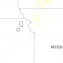
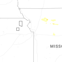

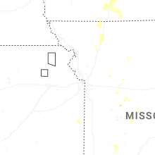
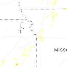


Connect with Interactive Hail Maps