

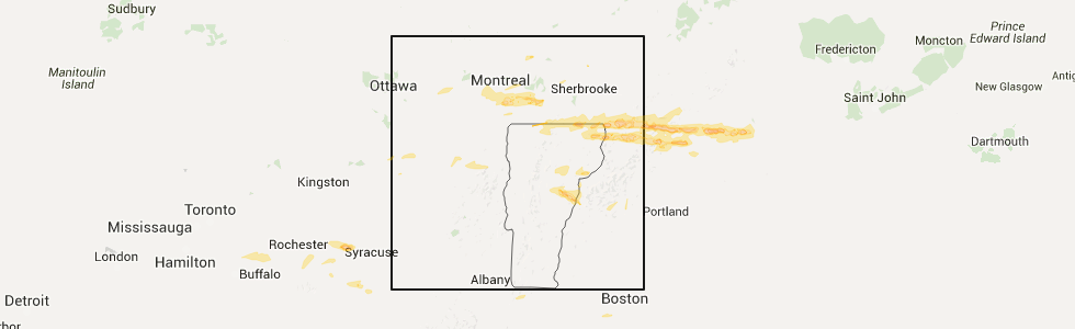
Hail Map for Colebrook, NH
The Colebrook, NH area has had 9 reports of on-the-ground hail by trained spotters, and has been under severe weather warnings 3 times during the past 12 months. Doppler radar has detected hail at or near Colebrook, NH on 9 occasions.
| Name: | Colebrook, NH |
| Where Located: | 89.4 miles ENE of Burlington, VT |
| Map: | Google Map for Colebrook, NH |
| Population: | 1394 |
| Housing Units: | 788 |
| More Info: | Search Google for Colebrook, NH |
5
The Top Recent Hail Date for Colebrook, NH is Monday, July 18, 2016 (1st out of 9)
Hail and Wind Damage Spotted near Colebrook, NH
| Date / Time | Report Details |
|---|---|
| 7/14/2026 5:59 PM EDT | 3-4 downed trees near intersection of daniel webster hwy and jordan hill rd. time estimated from rada in coos county NH, 5.2 miles NNE of Colebrook, NH |
| 7/14/2026 5:52 PM EDT | Quarter sized hail reported 2.1 miles NE of Colebrook, NH, reported by weather spotter. |
| 7/14/2026 5:50 PM EDT |
 Svrgyx the national weather service in gray maine has issued a * severe thunderstorm warning for, central coos county in northern new hampshire, * until 645 pm edt. * at 549 pm edt, a severe thunderstorm was located 9 miles west of colebrook, moving southeast at 45 mph (radar indicated). Hazards include 60 mph wind gusts and quarter size hail. Hail damage to vehicles is expected. Expect wind damage to roofs, siding, and trees. Svrgyx the national weather service in gray maine has issued a * severe thunderstorm warning for, central coos county in northern new hampshire, * until 645 pm edt. * at 549 pm edt, a severe thunderstorm was located 9 miles west of colebrook, moving southeast at 45 mph (radar indicated). Hazards include 60 mph wind gusts and quarter size hail. Hail damage to vehicles is expected. Expect wind damage to roofs, siding, and trees.
|
| 7/14/2026 5:45 PM EDT |
 At 545 pm edt, a severe thunderstorm was located over averill, moving southeast at 45 mph (radar indicated). Hazards include 60 mph wind gusts and quarter size hail. Minor hail damage to vehicles is possible. expect wind damage to trees and powerlines. Locations impacted include, canaan, averill, lemington, norton, bloomfield, lewis, and averys gore. At 545 pm edt, a severe thunderstorm was located over averill, moving southeast at 45 mph (radar indicated). Hazards include 60 mph wind gusts and quarter size hail. Minor hail damage to vehicles is possible. expect wind damage to trees and powerlines. Locations impacted include, canaan, averill, lemington, norton, bloomfield, lewis, and averys gore.
|
| 7/14/2026 5:19 PM EDT |
 Svrbtv the national weather service in burlington has issued a * severe thunderstorm warning for, northeastern essex county in northeastern vermont, * until 600 pm edt. * at 519 pm edt, a severe thunderstorm was located 9 miles north of norton, moving southeast at 50 mph (radar indicated). Hazards include 60 mph wind gusts and quarter size hail. Minor hail damage to vehicles is possible. Expect wind damage to trees and powerlines. Svrbtv the national weather service in burlington has issued a * severe thunderstorm warning for, northeastern essex county in northeastern vermont, * until 600 pm edt. * at 519 pm edt, a severe thunderstorm was located 9 miles north of norton, moving southeast at 50 mph (radar indicated). Hazards include 60 mph wind gusts and quarter size hail. Minor hail damage to vehicles is possible. Expect wind damage to trees and powerlines.
|
| 8/4/2024 2:32 PM EDT |
 the severe thunderstorm warning has been cancelled and is no longer in effect the severe thunderstorm warning has been cancelled and is no longer in effect
|
| 8/4/2024 2:10 PM EDT | Trees and power lines down on titus hill roa in coos county NH, 1.6 miles NW of Colebrook, NH |
| 8/4/2024 2:10 PM EDT | Trees and wires down on fish pond roa in coos county NH, 3.2 miles NNW of Colebrook, NH |
| 8/4/2024 1:56 PM EDT |
 Svrgyx the national weather service in gray maine has issued a * severe thunderstorm warning for, central coos county in northern new hampshire, * until 245 pm edt. * at 156 pm edt, a severe thunderstorm was located near colebrook, moving east at 5 mph (radar indicated). Hazards include 60 mph wind gusts and nickel size hail. expect damage to roofs, siding, and trees Svrgyx the national weather service in gray maine has issued a * severe thunderstorm warning for, central coos county in northern new hampshire, * until 245 pm edt. * at 156 pm edt, a severe thunderstorm was located near colebrook, moving east at 5 mph (radar indicated). Hazards include 60 mph wind gusts and nickel size hail. expect damage to roofs, siding, and trees
|
| 8/13/2023 3:53 PM EDT | Reported by amateur radio. tree down on us-3 just south of colebroo in coos county NH, 6.1 miles NNE of Colebrook, NH |
| 7/4/2023 3:30 PM EDT | Reported by amateur radio. reports of a few downed trees and large branches on north side of colebrook. tree down on hughes road near the iga. time estimated by rada in coos county NH, 1.1 miles SSW of Colebrook, NH |
| 8/8/2022 6:28 PM EDT |
 At 628 pm edt, a severe thunderstorm was located near colebrook, moving northeast at 30 mph (radar indicated). Hazards include 60 mph wind gusts. expect damage to roofs, siding, and trees At 628 pm edt, a severe thunderstorm was located near colebrook, moving northeast at 30 mph (radar indicated). Hazards include 60 mph wind gusts. expect damage to roofs, siding, and trees
|
| 7/23/2022 7:55 PM EDT |
 At 755 pm edt, a severe thunderstorm was located near pittsburg, or 12 miles northeast of colebrook, moving east at 25 mph (radar indicated). Hazards include 60 mph wind gusts and quarter size hail. Hail damage to vehicles is expected. expect wind damage to roofs, siding, and trees. locations impacted include, colebrook, pittsburg, dixville, clarksville, stewartstown, wentworth location and parkertown. hail threat, radar indicated max hail size, 1. 00 in wind threat, radar indicated max wind gust, 60 mph. At 755 pm edt, a severe thunderstorm was located near pittsburg, or 12 miles northeast of colebrook, moving east at 25 mph (radar indicated). Hazards include 60 mph wind gusts and quarter size hail. Hail damage to vehicles is expected. expect wind damage to roofs, siding, and trees. locations impacted include, colebrook, pittsburg, dixville, clarksville, stewartstown, wentworth location and parkertown. hail threat, radar indicated max hail size, 1. 00 in wind threat, radar indicated max wind gust, 60 mph.
|
| 7/23/2022 7:50 PM EDT | Half Dollar sized hail reported 1.3 miles WSW of Colebrook, NH, observed hail for about 6-7 minutes on reed road north of highway 26. largest hail stones were 1.25 inches in diameter. time estimated by radar. |
| 7/23/2022 7:45 PM EDT | Half Dollar sized hail reported 1.1 miles SSW of Colebrook, NH, hail observed north of downtown colebrook. biggest hail was the size of half dollars. time estimated by radar. |
| 7/23/2022 7:43 PM EDT | Downed trees and branches across nh hwy 145. time estimated by rada in coos county NH, 1.6 miles SW of Colebrook, NH |
| 7/23/2022 7:43 PM EDT |
 The severe thunderstorm warning for northeastern essex county will expire at 745 pm edt, the storm which prompted the warning has moved out of the area. therefore, the warning will be allowed to expire. The severe thunderstorm warning for northeastern essex county will expire at 745 pm edt, the storm which prompted the warning has moved out of the area. therefore, the warning will be allowed to expire.
|
| 7/23/2022 7:23 PM EDT |
 At 723 pm edt, a severe thunderstorm was located over canaan, moving east at 30 mph (radar indicated). Hazards include 60 mph wind gusts and quarter size hail. Minor hail damage to vehicles is possible. expect wind damage to trees and powerlines. locations impacted include, canaan, averill, norton, averys gore, lemington, lewis and beecher falls. hail threat, radar indicated max hail size, 1. 00 in wind threat, radar indicated max wind gust, 60 mph. At 723 pm edt, a severe thunderstorm was located over canaan, moving east at 30 mph (radar indicated). Hazards include 60 mph wind gusts and quarter size hail. Minor hail damage to vehicles is possible. expect wind damage to trees and powerlines. locations impacted include, canaan, averill, norton, averys gore, lemington, lewis and beecher falls. hail threat, radar indicated max hail size, 1. 00 in wind threat, radar indicated max wind gust, 60 mph.
|
| 7/23/2022 7:18 PM EDT |
 At 717 pm edt, a severe thunderstorm was located 7 miles northwest of colebrook, moving east at 25 mph (radar indicated). Hazards include 60 mph wind gusts and quarter size hail. Hail damage to vehicles is expected. Expect wind damage to roofs, siding, and trees. At 717 pm edt, a severe thunderstorm was located 7 miles northwest of colebrook, moving east at 25 mph (radar indicated). Hazards include 60 mph wind gusts and quarter size hail. Hail damage to vehicles is expected. Expect wind damage to roofs, siding, and trees.
|
| 7/23/2022 6:57 PM EDT |
 At 657 pm edt, a severe thunderstorm was located near norton, moving east at 30 mph (radar indicated). Hazards include 60 mph wind gusts and quarter size hail. Minor hail damage to vehicles is possible. Expect wind damage to trees and powerlines. At 657 pm edt, a severe thunderstorm was located near norton, moving east at 30 mph (radar indicated). Hazards include 60 mph wind gusts and quarter size hail. Minor hail damage to vehicles is possible. Expect wind damage to trees and powerlines.
|
| 7/21/2022 6:17 PM EDT | Tree on road. time estimated by rada in coos county NH, 3.8 miles S of Colebrook, NH |
| 7/21/2022 5:46 PM EDT |
 At 546 pm edt, a severe thunderstorm was located over lewis, moving east at 40 mph (radar indicated). Hazards include 60 mph wind gusts and quarter size hail. Minor hail damage to vehicles is possible. Expect wind damage to trees and powerlines. At 546 pm edt, a severe thunderstorm was located over lewis, moving east at 40 mph (radar indicated). Hazards include 60 mph wind gusts and quarter size hail. Minor hail damage to vehicles is possible. Expect wind damage to trees and powerlines.
|
| 7/21/2022 3:38 PM EDT |
 The severe thunderstorm warning for northern coos county will expire at 345 pm edt, the storm which prompted the warning has moved out of the area. therefore, the warning will be allowed to expire. however gusty winds are still possible with this thunderstorm. a severe thunderstorm watch remains in effect until 800 pm edt for western maine, and northern new hampshire. The severe thunderstorm warning for northern coos county will expire at 345 pm edt, the storm which prompted the warning has moved out of the area. therefore, the warning will be allowed to expire. however gusty winds are still possible with this thunderstorm. a severe thunderstorm watch remains in effect until 800 pm edt for western maine, and northern new hampshire.
|
| 7/21/2022 3:19 PM EDT |
 At 319 pm edt, a severe thunderstorm was located near dixville, or 11 miles east of colebrook, moving northeast at 40 mph (radar indicated). Hazards include 60 mph wind gusts and half dollar size hail. Hail damage to vehicles is expected. expect wind damage to roofs, siding, and trees. locations impacted include, colebrook, errol, dixville, pittsburg, stratford, columbia, clarksville, wentworth location and stewartstown. hail threat, radar indicated max hail size, 1. 25 in wind threat, radar indicated max wind gust, 60 mph. At 319 pm edt, a severe thunderstorm was located near dixville, or 11 miles east of colebrook, moving northeast at 40 mph (radar indicated). Hazards include 60 mph wind gusts and half dollar size hail. Hail damage to vehicles is expected. expect wind damage to roofs, siding, and trees. locations impacted include, colebrook, errol, dixville, pittsburg, stratford, columbia, clarksville, wentworth location and stewartstown. hail threat, radar indicated max hail size, 1. 25 in wind threat, radar indicated max wind gust, 60 mph.
|
| 7/21/2022 3:03 PM EDT |
 At 303 pm edt, a severe thunderstorm was located 7 miles south of colebrook, moving northeast at 45 mph (radar indicated). Hazards include 60 mph wind gusts and half dollar size hail. Hail damage to vehicles is expected. expect wind damage to roofs, siding, and trees. locations impacted include, colebrook, errol, stratford, dixville, pittsburg, columbia, dummer, clarksville, wentworth location and stewartstown. hail threat, radar indicated max hail size, 1. 25 in wind threat, radar indicated max wind gust, 60 mph. At 303 pm edt, a severe thunderstorm was located 7 miles south of colebrook, moving northeast at 45 mph (radar indicated). Hazards include 60 mph wind gusts and half dollar size hail. Hail damage to vehicles is expected. expect wind damage to roofs, siding, and trees. locations impacted include, colebrook, errol, stratford, dixville, pittsburg, columbia, dummer, clarksville, wentworth location and stewartstown. hail threat, radar indicated max hail size, 1. 25 in wind threat, radar indicated max wind gust, 60 mph.
|
| 7/21/2022 2:49 PM EDT |
 At 248 pm edt, a severe thunderstorm was located over stratford, or 10 miles north of lancaster, moving northeast at 50 mph (radar indicated). Hazards include 60 mph wind gusts and quarter size hail. Hail damage to vehicles is expected. expect wind damage to roofs, siding, and trees. locations impacted include, lancaster, colebrook, errol, stratford, dixville, pittsburg, columbia, dummer, clarksville, northumberland, stark, wentworth location and stewartstown. hail threat, radar indicated max hail size, 1. 00 in wind threat, radar indicated max wind gust, 60 mph. At 248 pm edt, a severe thunderstorm was located over stratford, or 10 miles north of lancaster, moving northeast at 50 mph (radar indicated). Hazards include 60 mph wind gusts and quarter size hail. Hail damage to vehicles is expected. expect wind damage to roofs, siding, and trees. locations impacted include, lancaster, colebrook, errol, stratford, dixville, pittsburg, columbia, dummer, clarksville, northumberland, stark, wentworth location and stewartstown. hail threat, radar indicated max hail size, 1. 00 in wind threat, radar indicated max wind gust, 60 mph.
|
| 7/21/2022 2:49 PM EDT |
 At 249 pm edt, a severe thunderstorm was located over maidstone state park, moving northeast at 45 mph (radar indicated). Hazards include 60 mph wind gusts and quarter size hail. Minor hail damage to vehicles is possible. expect wind damage to trees and powerlines. locations impacted include, canaan, brunswick, bloomfield, granby, maidstone, lemington, maidstone state park, averill, ferdinand, guildhall, lewis, beecher falls and brunswick springs. hail threat, radar indicated max hail size, 1. 00 in wind threat, radar indicated max wind gust, 60 mph. At 249 pm edt, a severe thunderstorm was located over maidstone state park, moving northeast at 45 mph (radar indicated). Hazards include 60 mph wind gusts and quarter size hail. Minor hail damage to vehicles is possible. expect wind damage to trees and powerlines. locations impacted include, canaan, brunswick, bloomfield, granby, maidstone, lemington, maidstone state park, averill, ferdinand, guildhall, lewis, beecher falls and brunswick springs. hail threat, radar indicated max hail size, 1. 00 in wind threat, radar indicated max wind gust, 60 mph.
|
| 7/21/2022 2:38 PM EDT |
 At 238 pm edt, a severe thunderstorm was located near lancaster, moving northeast at 40 mph (radar indicated). Hazards include 60 mph wind gusts and quarter size hail. Hail damage to vehicles is expected. Expect wind damage to roofs, siding, and trees. At 238 pm edt, a severe thunderstorm was located near lancaster, moving northeast at 40 mph (radar indicated). Hazards include 60 mph wind gusts and quarter size hail. Hail damage to vehicles is expected. Expect wind damage to roofs, siding, and trees.
|
| 7/21/2022 2:31 PM EDT |
 At 231 pm edt, a severe thunderstorm was located near victory, moving northeast at 50 mph (radar indicated). Hazards include 60 mph wind gusts and quarter size hail. Minor hail damage to vehicles is possible. Expect wind damage to trees and powerlines. At 231 pm edt, a severe thunderstorm was located near victory, moving northeast at 50 mph (radar indicated). Hazards include 60 mph wind gusts and quarter size hail. Minor hail damage to vehicles is possible. Expect wind damage to trees and powerlines.
|
| 7/21/2022 1:40 PM EDT |
 At 140 pm edt, a severe thunderstorm was located near lemington, moving east at 35 mph (radar indicated). Hazards include 60 mph wind gusts and nickel size hail. Expect damage to trees and powerlines. Locations impacted include, canaan, averill, lewis, norton, lemington, averys gore, bloomfield and beecher falls. At 140 pm edt, a severe thunderstorm was located near lemington, moving east at 35 mph (radar indicated). Hazards include 60 mph wind gusts and nickel size hail. Expect damage to trees and powerlines. Locations impacted include, canaan, averill, lewis, norton, lemington, averys gore, bloomfield and beecher falls.
|
| 7/21/2022 1:38 PM EDT |
 At 137 pm edt, a severe thunderstorm was located 10 miles northwest of colebrook, moving northeast at 35 mph (radar indicated). Hazards include 60 mph wind gusts and quarter size hail. Hail damage to vehicles is expected. Expect wind damage to roofs, siding, and trees. At 137 pm edt, a severe thunderstorm was located 10 miles northwest of colebrook, moving northeast at 35 mph (radar indicated). Hazards include 60 mph wind gusts and quarter size hail. Hail damage to vehicles is expected. Expect wind damage to roofs, siding, and trees.
|
| 7/21/2022 1:27 PM EDT |
 At 126 pm edt, a severe thunderstorm was located over lewis, moving east at 35 mph (radar indicated). Hazards include 60 mph wind gusts and nickel size hail. expect damage to trees and powerlines At 126 pm edt, a severe thunderstorm was located over lewis, moving east at 35 mph (radar indicated). Hazards include 60 mph wind gusts and nickel size hail. expect damage to trees and powerlines
|
| 5/21/2022 7:26 PM EDT | Hen Egg sized hail reported 9.7 miles W of Colebrook, NH, reported by amateur radio. large hail fell for 6 minutes. largest stones between 1.75 inches and 2 inches. |
| 5/21/2022 7:26 PM EDT | Winds blew down trees as large as 8 inches in diamete in coos county NH, 9.7 miles W of Colebrook, NH |
| 5/21/2022 7:20 PM EDT | Hen Egg sized hail reported 11 miles WNW of Colebrook, NH, reported by amateur radio. 2 inches measured hail outside dixville notch. |
| 5/21/2022 7:20 PM EDT | Several reports of trees and wires down in colebroo in coos county NH, 0.4 miles SSW of Colebrook, NH |
| 5/21/2022 7:15 PM EDT | Trees and wires down on rt 14 in coos county NH, 5 miles SSW of Colebrook, NH |
| 5/21/2022 7:10 PM EDT | Ping Pong Ball sized hail reported 0.4 miles NW of Colebrook, NH, dented car hood. |
| 5/21/2022 7:01 PM EDT |
 At 700 pm edt, severe thunderstorms were located along a line extending from 19 miles northwest of coburn gore to 9 miles north of pittsburg to 19 miles west of stratford, moving east at 40 mph (radar indicated). Hazards include 70 mph wind gusts and half dollar size hail. Hail damage to vehicles is expected. expect considerable tree damage. wind damage is also likely to mobile homes, roofs, and outbuildings. locations impacted include, colebrook, eustis, coburn gore, rangeley, errol, pittsburg, dixville, stratford, grafton, columbia, dallas plantation, dummer, clarksville, upper cupsuptic, tim pond, davis, lynchtown, alder stream, upton and chain of ponds. thunderstorm damage threat, considerable hail threat, radar indicated max hail size, 1. 25 in wind threat, radar indicated max wind gust, 70 mph. At 700 pm edt, severe thunderstorms were located along a line extending from 19 miles northwest of coburn gore to 9 miles north of pittsburg to 19 miles west of stratford, moving east at 40 mph (radar indicated). Hazards include 70 mph wind gusts and half dollar size hail. Hail damage to vehicles is expected. expect considerable tree damage. wind damage is also likely to mobile homes, roofs, and outbuildings. locations impacted include, colebrook, eustis, coburn gore, rangeley, errol, pittsburg, dixville, stratford, grafton, columbia, dallas plantation, dummer, clarksville, upper cupsuptic, tim pond, davis, lynchtown, alder stream, upton and chain of ponds. thunderstorm damage threat, considerable hail threat, radar indicated max hail size, 1. 25 in wind threat, radar indicated max wind gust, 70 mph.
|
| 5/21/2022 6:46 PM EDT |
 At 645 pm edt, severe thunderstorms were located along a line extending from 24 miles northwest of coburn gore to 12 miles northwest of pittsburg to 25 miles west of stratford, moving east at 40 mph (radar indicated). Hazards include 70 mph wind gusts and quarter size hail. Hail damage to vehicles is expected. expect considerable tree damage. Wind damage is also likely to mobile homes, roofs, and outbuildings. At 645 pm edt, severe thunderstorms were located along a line extending from 24 miles northwest of coburn gore to 12 miles northwest of pittsburg to 25 miles west of stratford, moving east at 40 mph (radar indicated). Hazards include 70 mph wind gusts and quarter size hail. Hail damage to vehicles is expected. expect considerable tree damage. Wind damage is also likely to mobile homes, roofs, and outbuildings.
|
| 5/21/2022 6:42 PM EDT |
 At 641 pm edt, a severe thunderstorm was located over island pond, moving east at 40 mph (radar indicated). Hazards include 60 mph wind gusts and quarter size hail. Minor hail damage to vehicles is possible. Expect wind damage to trees and powerlines. At 641 pm edt, a severe thunderstorm was located over island pond, moving east at 40 mph (radar indicated). Hazards include 60 mph wind gusts and quarter size hail. Minor hail damage to vehicles is possible. Expect wind damage to trees and powerlines.
|
| 6/21/2021 6:40 PM EDT | Trees down on highway 26 near black mountain. time estimated based on rada in coos county NH, 16.8 miles WNW of Colebrook, NH |
| 6/21/2021 6:13 PM EDT |
 At 612 pm edt, a severe thunderstorm was located near colebrook, moving northeast at 20 mph (radar indicated). Hazards include 60 mph wind gusts and quarter size hail. Hail damage to vehicles is expected. expect wind damage to roofs, siding, and trees. locations impacted include, colebrook, pittsburg, dixville, stratford, columbia, clarksville and stewartstown. This also includes, dixville notch state park and coleman state park. At 612 pm edt, a severe thunderstorm was located near colebrook, moving northeast at 20 mph (radar indicated). Hazards include 60 mph wind gusts and quarter size hail. Hail damage to vehicles is expected. expect wind damage to roofs, siding, and trees. locations impacted include, colebrook, pittsburg, dixville, stratford, columbia, clarksville and stewartstown. This also includes, dixville notch state park and coleman state park.
|
| 6/21/2021 6:05 PM EDT | Ping Pong Ball sized hail reported 1.9 miles NNE of Colebrook, NH |
| 6/21/2021 5:47 PM EDT |
 At 547 pm edt, a severe thunderstorm was located 10 miles southwest of colebrook, moving northeast at 30 mph (radar indicated). Hazards include 60 mph wind gusts and quarter size hail. Hail damage to vehicles is expected. Expect wind damage to roofs, siding, and trees. At 547 pm edt, a severe thunderstorm was located 10 miles southwest of colebrook, moving northeast at 30 mph (radar indicated). Hazards include 60 mph wind gusts and quarter size hail. Hail damage to vehicles is expected. Expect wind damage to roofs, siding, and trees.
|
| 10/10/2020 5:58 PM EDT |
 The severe thunderstorm warning for northeastern caledonia, northeastern orleans and essex counties will expire at 600 pm edt, the storm which prompted the warning has weakened below severe limits, and has exited the warned area. therefore, the warning will be allowed to expire. a severe thunderstorm watch remains in effect until 900 pm edt for northeastern vermont. The severe thunderstorm warning for northeastern caledonia, northeastern orleans and essex counties will expire at 600 pm edt, the storm which prompted the warning has weakened below severe limits, and has exited the warned area. therefore, the warning will be allowed to expire. a severe thunderstorm watch remains in effect until 900 pm edt for northeastern vermont.
|
| 10/10/2020 5:50 PM EDT |
 At 549 pm edt, a severe thunderstorm was located over lewis, moving east at 70 mph (radar indicated). Hazards include 60 mph wind gusts and quarter size hail. Minor hail damage to vehicles is possible. expect wind damage to trees and powerlines. Locations impacted include, island pond, canaan, charleston, west burke village, westmore, east haven, morgan, ferdinand, warren gore, averys gore, brunswick, brighton, bloomfield, sutton, norton, averill, maidstone, warners grant, lewis and newark. At 549 pm edt, a severe thunderstorm was located over lewis, moving east at 70 mph (radar indicated). Hazards include 60 mph wind gusts and quarter size hail. Minor hail damage to vehicles is possible. expect wind damage to trees and powerlines. Locations impacted include, island pond, canaan, charleston, west burke village, westmore, east haven, morgan, ferdinand, warren gore, averys gore, brunswick, brighton, bloomfield, sutton, norton, averill, maidstone, warners grant, lewis and newark.
|
| 10/10/2020 5:36 PM EDT |
 At 536 pm edt, a severe thunderstorm was located over westmore, moving east at 70 mph (radar indicated). Hazards include 60 mph wind gusts and quarter size hail. Minor hail damage to vehicles is possible. Expect wind damage to trees and powerlines. At 536 pm edt, a severe thunderstorm was located over westmore, moving east at 70 mph (radar indicated). Hazards include 60 mph wind gusts and quarter size hail. Minor hail damage to vehicles is possible. Expect wind damage to trees and powerlines.
|
| 10/10/2020 4:35 PM EDT |
 The severe thunderstorm warning for northwestern oxford and northeastern coos counties will expire at 445 pm edt, the storms which prompted the warning have weakened below severe limits, and no longer pose an immediate threat to life or property. therefore, the warning will be allowed to expire. however gusty winds are still possible with these thunderstorms. The severe thunderstorm warning for northwestern oxford and northeastern coos counties will expire at 445 pm edt, the storms which prompted the warning have weakened below severe limits, and no longer pose an immediate threat to life or property. therefore, the warning will be allowed to expire. however gusty winds are still possible with these thunderstorms.
|
| 10/10/2020 4:06 PM EDT |
 At 406 pm edt, severe thunderstorms were located along a line extending from 18 miles northwest of pittsburg to 6 miles north of colebrook to 13 miles northwest of stratford, moving east at 60 mph (radar indicated). Hazards include 60 mph wind gusts. expect damage to roofs, siding, and trees At 406 pm edt, severe thunderstorms were located along a line extending from 18 miles northwest of pittsburg to 6 miles north of colebrook to 13 miles northwest of stratford, moving east at 60 mph (radar indicated). Hazards include 60 mph wind gusts. expect damage to roofs, siding, and trees
|
| 10/10/2020 4:05 PM EDT |
 At 404 pm edt, a severe thunderstorm was located over lemington, moving east at 55 mph (radar indicated). Hazards include 60 mph wind gusts. expect damage to trees and powerlines At 404 pm edt, a severe thunderstorm was located over lemington, moving east at 55 mph (radar indicated). Hazards include 60 mph wind gusts. expect damage to trees and powerlines
|
| 7/8/2020 4:17 PM EDT |
 At 416 pm edt, severe thunderstorms were located along a line extending from averys gore to morgan to orleans village, moving south at 30 mph (radar indicated). Hazards include 60 mph wind gusts and quarter size hail. Minor hail damage to vehicles is possible. expect wind damage to trees and powerlines. Locations impacted include, island pond, canaan, charleston, morgan, ferdinand, warren gore, averys gore, brunswick, brighton, bloomfield, averill, warners grant, lewis, newark, newark hollow, lemington, westmore, norton, east haven and holland. At 416 pm edt, severe thunderstorms were located along a line extending from averys gore to morgan to orleans village, moving south at 30 mph (radar indicated). Hazards include 60 mph wind gusts and quarter size hail. Minor hail damage to vehicles is possible. expect wind damage to trees and powerlines. Locations impacted include, island pond, canaan, charleston, morgan, ferdinand, warren gore, averys gore, brunswick, brighton, bloomfield, averill, warners grant, lewis, newark, newark hollow, lemington, westmore, norton, east haven and holland.
|
| 7/8/2020 4:10 PM EDT |
 At 409 pm edt, severe thunderstorms were located along a line extending from 15 miles north of bingham to 8 miles west of carrabassett valley to 6 miles southeast of rangeley to 12 miles east of errol to colebrook, moving southeast at 40 mph (radar indicated). Hazards include 60 mph wind gusts and quarter size hail. Hail damage to vehicles is expected. Expect wind damage to roofs, siding, and trees. At 409 pm edt, severe thunderstorms were located along a line extending from 15 miles north of bingham to 8 miles west of carrabassett valley to 6 miles southeast of rangeley to 12 miles east of errol to colebrook, moving southeast at 40 mph (radar indicated). Hazards include 60 mph wind gusts and quarter size hail. Hail damage to vehicles is expected. Expect wind damage to roofs, siding, and trees.
|
| 7/8/2020 3:59 PM EDT |
 At 358 pm edt, severe thunderstorms were located along a line extending from 21 miles northeast of bingham to near eustis to 9 miles northeast of errol to near colebrook to 24 miles west of pittsburg, moving south at 30 mph (radar indicated). Hazards include 60 mph wind gusts and quarter size hail. Hail damage to vehicles is expected. expect wind damage to roofs, siding, and trees. locations impacted include, colebrook, eustis, rangeley, kingfield, bingham, andover, carrabassett valley, errol, dixville, phillips, stratford, weld, athens, embden, harmony, columbia, avon, dallas plantation, dummer and clarksville. This also includes, umbagog lake state park, saddleback mountain, sugarloaf mountain, crocker mountain, and the bigelows. At 358 pm edt, severe thunderstorms were located along a line extending from 21 miles northeast of bingham to near eustis to 9 miles northeast of errol to near colebrook to 24 miles west of pittsburg, moving south at 30 mph (radar indicated). Hazards include 60 mph wind gusts and quarter size hail. Hail damage to vehicles is expected. expect wind damage to roofs, siding, and trees. locations impacted include, colebrook, eustis, rangeley, kingfield, bingham, andover, carrabassett valley, errol, dixville, phillips, stratford, weld, athens, embden, harmony, columbia, avon, dallas plantation, dummer and clarksville. This also includes, umbagog lake state park, saddleback mountain, sugarloaf mountain, crocker mountain, and the bigelows.
|
| 7/8/2020 3:48 PM EDT |
 At 348 pm edt, severe thunderstorms were located along a line extending from near norton to near derby line to newport center, moving south at 30 mph (radar indicated). Hazards include 60 mph wind gusts and quarter size hail. Minor hail damage to vehicles is possible. Expect wind damage to trees and powerlines. At 348 pm edt, severe thunderstorms were located along a line extending from near norton to near derby line to newport center, moving south at 30 mph (radar indicated). Hazards include 60 mph wind gusts and quarter size hail. Minor hail damage to vehicles is possible. Expect wind damage to trees and powerlines.
|
| 7/8/2020 3:26 PM EDT |
 At 326 pm edt, severe thunderstorms were located along a line extending from 27 miles north of bingham to 19 miles northeast of dixville to near pittsburg to 26 miles northwest of colebrook, moving south at 35 mph (radar indicated). Hazards include 60 mph wind gusts and quarter size hail. Hail damage to vehicles is expected. Expect wind damage to roofs, siding, and trees. At 326 pm edt, severe thunderstorms were located along a line extending from 27 miles north of bingham to 19 miles northeast of dixville to near pittsburg to 26 miles northwest of colebrook, moving south at 35 mph (radar indicated). Hazards include 60 mph wind gusts and quarter size hail. Hail damage to vehicles is expected. Expect wind damage to roofs, siding, and trees.
|
| 5/29/2020 8:53 PM EDT |
 At 852 pm edt, severe thunderstorms were located along a line extending from 18 miles west of coburn gore to near pittsburg to 9 miles southwest of stratford, moving northeast at 50 mph (radar indicated). Hazards include 60 mph wind gusts and penny size hail. expect damage to roofs, siding, and trees At 852 pm edt, severe thunderstorms were located along a line extending from 18 miles west of coburn gore to near pittsburg to 9 miles southwest of stratford, moving northeast at 50 mph (radar indicated). Hazards include 60 mph wind gusts and penny size hail. expect damage to roofs, siding, and trees
|
| 5/29/2020 8:47 PM EDT |
 At 846 pm edt, severe thunderstorms were located along a line extending from 18 miles north of colebrook to near pittsburg to 7 miles west of stratford, moving northeast at 40 mph (radar indicated). Hazards include 60 mph wind gusts and penny size hail. Expect damage to roofs, siding, and trees. locations impacted include, colebrook, errol, pittsburg, stratford, dixville, columbia, dummer, clarksville, stewartstown, northumberland, stark and wentworth location. This also includes, first connecticut lake, dixville notch state park, coleman state park, lake francis state park, and percy peaks. At 846 pm edt, severe thunderstorms were located along a line extending from 18 miles north of colebrook to near pittsburg to 7 miles west of stratford, moving northeast at 40 mph (radar indicated). Hazards include 60 mph wind gusts and penny size hail. Expect damage to roofs, siding, and trees. locations impacted include, colebrook, errol, pittsburg, stratford, dixville, columbia, dummer, clarksville, stewartstown, northumberland, stark and wentworth location. This also includes, first connecticut lake, dixville notch state park, coleman state park, lake francis state park, and percy peaks.
|
| 5/29/2020 8:21 PM EDT |
 At 820 pm edt, severe thunderstorms were located along a line extending from 20 miles west of pittsburg to 10 miles west of colebrook to 19 miles northwest of littleton, moving northeast at 40 mph (radar indicated). Hazards include 60 mph wind gusts and quarter size hail. Hail damage to vehicles is expected. Expect wind damage to roofs, siding, and trees. At 820 pm edt, severe thunderstorms were located along a line extending from 20 miles west of pittsburg to 10 miles west of colebrook to 19 miles northwest of littleton, moving northeast at 40 mph (radar indicated). Hazards include 60 mph wind gusts and quarter size hail. Hail damage to vehicles is expected. Expect wind damage to roofs, siding, and trees.
|
| 7/28/2019 3:05 PM EDT | Trees down in many locations across the city of colebroo in coos county NH, 0.4 miles NE of Colebrook, NH |
| 7/28/2019 2:59 PM EDT |
 The national weather service in gray maine has issued a * severe thunderstorm warning for. northeastern coos county in northern new hampshire. until 400 pm edt. At 258 pm edt, a severe thunderstorm was located over colebrook, moving east at 25 mph. The national weather service in gray maine has issued a * severe thunderstorm warning for. northeastern coos county in northern new hampshire. until 400 pm edt. At 258 pm edt, a severe thunderstorm was located over colebrook, moving east at 25 mph.
|
| 6/29/2019 6:38 PM EDT |
 At 637 pm edt, severe thunderstorms were located along a line extending from 27 miles north of dixville to near pittsburg to 11 miles northwest of colebrook, moving southeast at 45 mph (radar indicated). Hazards include 60 mph wind gusts and quarter size hail. Hail damage to vehicles is expected. Expect wind damage to roofs, siding, and trees. At 637 pm edt, severe thunderstorms were located along a line extending from 27 miles north of dixville to near pittsburg to 11 miles northwest of colebrook, moving southeast at 45 mph (radar indicated). Hazards include 60 mph wind gusts and quarter size hail. Hail damage to vehicles is expected. Expect wind damage to roofs, siding, and trees.
|
| 9/3/2018 4:57 PM EDT |
 At 457 pm edt, a severe thunderstorm was located near stratford, or 13 miles south of colebrook, moving southeast at 40 mph (radar indicated). Hazards include 60 mph wind gusts. expect damage to roofs, siding, and trees At 457 pm edt, a severe thunderstorm was located near stratford, or 13 miles south of colebrook, moving southeast at 40 mph (radar indicated). Hazards include 60 mph wind gusts. expect damage to roofs, siding, and trees
|
| 8/29/2018 6:13 PM EDT |
 The severe thunderstorm warning for northeastern caledonia, east central orleans and essex counties will expire at 615 pm edt, the storm which prompted the warning has weakened below severe limits, and no longer poses an immediate threat to life or property. therefore, the warning will be allowed to expire. however gusty winds and heavy rain are still possible with this thunderstorm. a severe thunderstorm watch remains in effect until 1100 pm edt for northeastern vermont. The severe thunderstorm warning for northeastern caledonia, east central orleans and essex counties will expire at 615 pm edt, the storm which prompted the warning has weakened below severe limits, and no longer poses an immediate threat to life or property. therefore, the warning will be allowed to expire. however gusty winds and heavy rain are still possible with this thunderstorm. a severe thunderstorm watch remains in effect until 1100 pm edt for northeastern vermont.
|
| 8/29/2018 5:49 PM EDT |
 At 515 pm edt, severe thunderstorms were located along a line extending from 13 miles northeast of pittsburg to near colebrook, moving east at 30 mph (radar indicated). Hazards include 60 mph wind gusts and quarter size hail. Hail damage to vehicles is expected. Expect wind damage to roofs, siding, and trees. At 515 pm edt, severe thunderstorms were located along a line extending from 13 miles northeast of pittsburg to near colebrook, moving east at 30 mph (radar indicated). Hazards include 60 mph wind gusts and quarter size hail. Hail damage to vehicles is expected. Expect wind damage to roofs, siding, and trees.
|
| 8/29/2018 5:45 PM EDT |
 At 544 pm edt, a severe thunderstorm was located near newark, moving east at 35 mph (radar indicated). Hazards include 60 mph wind gusts. Expect damage to trees and powerlines. Locations impacted include, island pond, lyndon, canaan, west burke village, guildhall, westmore, east haven, ferdinand, granby, averys gore, victory, brunswick, burke, brighton, bloomfield, sutton, averill, maidstone, lewis and newark. At 544 pm edt, a severe thunderstorm was located near newark, moving east at 35 mph (radar indicated). Hazards include 60 mph wind gusts. Expect damage to trees and powerlines. Locations impacted include, island pond, lyndon, canaan, west burke village, guildhall, westmore, east haven, ferdinand, granby, averys gore, victory, brunswick, burke, brighton, bloomfield, sutton, averill, maidstone, lewis and newark.
|
| 8/29/2018 5:15 PM EDT |
 At 515 pm edt, severe thunderstorms were located along a line extending from 13 miles northeast of pittsburg to near colebrook, moving east at 30 mph (radar indicated). Hazards include 60 mph wind gusts and quarter size hail. Hail damage to vehicles is expected. Expect wind damage to roofs, siding, and trees. At 515 pm edt, severe thunderstorms were located along a line extending from 13 miles northeast of pittsburg to near colebrook, moving east at 30 mph (radar indicated). Hazards include 60 mph wind gusts and quarter size hail. Hail damage to vehicles is expected. Expect wind damage to roofs, siding, and trees.
|
| 8/29/2018 5:14 PM EDT |
 At 513 pm edt, a severe thunderstorm was located over east craftsbury, moving east at 35 mph (radar indicated). Hazards include 60 mph wind gusts and penny size hail. expect damage to trees and powerlines At 513 pm edt, a severe thunderstorm was located over east craftsbury, moving east at 35 mph (radar indicated). Hazards include 60 mph wind gusts and penny size hail. expect damage to trees and powerlines
|
| 8/6/2018 8:16 PM EDT |
 At 816 pm edt, a severe thunderstorm was located near norton, moving east at 25 mph (radar indicated). Hazards include 60 mph wind gusts. expect damage to trees and powerlines At 816 pm edt, a severe thunderstorm was located near norton, moving east at 25 mph (radar indicated). Hazards include 60 mph wind gusts. expect damage to trees and powerlines
|
| 5/4/2018 9:15 PM EDT | Colebrook dispatch. tree down on cunnington lane in clebroo in coos county NH, 1.3 miles SW of Colebrook, NH |
| 5/4/2018 8:41 PM EDT |
 A severe thunderstorm warning remains in effect until 900 pm edt for central caledonia. essex and northern washington counties. at 840 pm edt, severe thunderstorms were located along a line extending from near canaan to granby to east cabot, moving east at 40 mph. hazard. 60 mph wind gusts and quarter size hail. A severe thunderstorm warning remains in effect until 900 pm edt for central caledonia. essex and northern washington counties. at 840 pm edt, severe thunderstorms were located along a line extending from near canaan to granby to east cabot, moving east at 40 mph. hazard. 60 mph wind gusts and quarter size hail.
|
| 5/4/2018 8:37 PM EDT |
 At 837 pm edt, severe thunderstorms were located along a line extending from coburn gore to 16 miles east of pittsburg to near lancaster to 6 miles west of littleton, moving east at 35 mph (radar indicated). Hazards include 60 mph wind gusts and penny size hail. Expect damage to roofs, siding, and trees. locations impacted include, berlin, littleton, lancaster, bethlehem, colebrook, franconia, errol, pittsburg, dixville, stratford, carroll, lisbon, jefferson, dalton, columbia, dummer, clarksville, whitefield, northumberland and monroe. this also includes, umbagog lake state park, first connecticut lake, kilkenny ridge trail, pontook reservoir, and dixville notch state park. This includes interstate 93 between mile markers 112 and 131. At 837 pm edt, severe thunderstorms were located along a line extending from coburn gore to 16 miles east of pittsburg to near lancaster to 6 miles west of littleton, moving east at 35 mph (radar indicated). Hazards include 60 mph wind gusts and penny size hail. Expect damage to roofs, siding, and trees. locations impacted include, berlin, littleton, lancaster, bethlehem, colebrook, franconia, errol, pittsburg, dixville, stratford, carroll, lisbon, jefferson, dalton, columbia, dummer, clarksville, whitefield, northumberland and monroe. this also includes, umbagog lake state park, first connecticut lake, kilkenny ridge trail, pontook reservoir, and dixville notch state park. This includes interstate 93 between mile markers 112 and 131.
|
| 5/4/2018 8:12 PM EDT |
 At 811 pm edt, severe thunderstorms were located along a line extending from 14 miles west of coburn gore to near pittsburg to 17 miles west of lancaster to 20 miles west of littleton, moving east at 50 mph (radar indicated). Hazards include 60 mph wind gusts and nickel size hail. expect damage to roofs, siding, and trees At 811 pm edt, severe thunderstorms were located along a line extending from 14 miles west of coburn gore to near pittsburg to 17 miles west of lancaster to 20 miles west of littleton, moving east at 50 mph (radar indicated). Hazards include 60 mph wind gusts and nickel size hail. expect damage to roofs, siding, and trees
|
| 5/4/2018 8:05 PM EDT |
 The national weather service in burlington has issued a * severe thunderstorm warning for. caledonia county in northeastern vermont. northeastern orleans county in northeastern vermont. essex county in northeastern vermont. Northern washington county in central vermont. The national weather service in burlington has issued a * severe thunderstorm warning for. caledonia county in northeastern vermont. northeastern orleans county in northeastern vermont. essex county in northeastern vermont. Northern washington county in central vermont.
|
| 8/12/2017 7:38 PM EDT |
 At 737 pm edt, severe thunderstorms were located along a line extending from near norton to brighton to near south walden, moving east at 15 mph (radar indicated). Hazards include 60 mph wind gusts and quarter size hail. Minor hail damage to vehicles is possible. expect wind damage to trees and powerlines. locations impacted include, st. Johnsbury, island pond, lyndon, orleans, charleston, glover, albany, brunswick, burke, greensboro bend, averill, newark, brownington village, canaan, west burke village, morgan, ferdinand, gilman, granby and woodbury. At 737 pm edt, severe thunderstorms were located along a line extending from near norton to brighton to near south walden, moving east at 15 mph (radar indicated). Hazards include 60 mph wind gusts and quarter size hail. Minor hail damage to vehicles is possible. expect wind damage to trees and powerlines. locations impacted include, st. Johnsbury, island pond, lyndon, orleans, charleston, glover, albany, brunswick, burke, greensboro bend, averill, newark, brownington village, canaan, west burke village, morgan, ferdinand, gilman, granby and woodbury.
|
| 8/12/2017 7:00 PM EDT |
 At 700 pm edt, severe thunderstorms were located along a line extending from cove island to near elmore state park, moving east at 40 mph (radar indicated). Hazards include 60 mph wind gusts and quarter size hail. Minor hail damage to vehicles is possible. Expect wind damage to trees and powerlines. At 700 pm edt, severe thunderstorms were located along a line extending from cove island to near elmore state park, moving east at 40 mph (radar indicated). Hazards include 60 mph wind gusts and quarter size hail. Minor hail damage to vehicles is possible. Expect wind damage to trees and powerlines.
|
| 5/18/2017 6:42 PM EDT |
 The severe thunderstorm warning for northeastern caledonia, southeastern orleans and essex counties will expire at 645 pm edt, the storm which prompted the warning has moved out of the area. therefore the warning will be allowed to expire. a severe thunderstorm watch remains in effect until 1100 pm edt for northeastern vermont. The severe thunderstorm warning for northeastern caledonia, southeastern orleans and essex counties will expire at 645 pm edt, the storm which prompted the warning has moved out of the area. therefore the warning will be allowed to expire. a severe thunderstorm watch remains in effect until 1100 pm edt for northeastern vermont.
|
| 5/18/2017 6:02 PM EDT |
 At 541 pm edt, a severe thunderstorm was located over south wheelock, moving east at 45 mph (radar indicated). Hazards include 60 mph wind gusts and quarter size hail. Minor hail damage to vehicles is possible. Expect wind damage to trees and powerlines. At 541 pm edt, a severe thunderstorm was located over south wheelock, moving east at 45 mph (radar indicated). Hazards include 60 mph wind gusts and quarter size hail. Minor hail damage to vehicles is possible. Expect wind damage to trees and powerlines.
|
| 5/18/2017 5:41 PM EDT |
 At 541 pm edt, a severe thunderstorm was located over south wheelock, moving east at 45 mph (radar indicated). Hazards include 60 mph wind gusts and quarter size hail. Minor hail damage to vehicles is possible. Expect wind damage to trees and powerlines. At 541 pm edt, a severe thunderstorm was located over south wheelock, moving east at 45 mph (radar indicated). Hazards include 60 mph wind gusts and quarter size hail. Minor hail damage to vehicles is possible. Expect wind damage to trees and powerlines.
|
| 9/11/2016 8:04 AM EDT | Numerous trees and wires downed in coos county NH, 10.4 miles NNE of Colebrook, NH |
| 7/22/2016 11:36 PM EDT |
 At 1134 pm edt, severe thunderstorms were located along a line extending from north troy to mount worcester, moving east at 35 mph (radar indicated). Hazards include 60 mph wind gusts and quarter size hail. Hail damage to vehicles is expected. expect wind damage to roofs, siding, and trees. Locations impacted include, island pond, stowe, hardwick, richford, danville, morrisville, berkshire, wolcott, troy, johnson, eden, bakersfield, concord, craftsbury, montgomery, irasburg, glover, coventry, sutton and canaan. At 1134 pm edt, severe thunderstorms were located along a line extending from north troy to mount worcester, moving east at 35 mph (radar indicated). Hazards include 60 mph wind gusts and quarter size hail. Hail damage to vehicles is expected. expect wind damage to roofs, siding, and trees. Locations impacted include, island pond, stowe, hardwick, richford, danville, morrisville, berkshire, wolcott, troy, johnson, eden, bakersfield, concord, craftsbury, montgomery, irasburg, glover, coventry, sutton and canaan.
|
| 7/22/2016 10:43 PM EDT |
 At 1041 pm edt, severe thunderstorms were located along a line extending from alburg vermont to burlington vermont, moving east at 35 to 40 mph. other strong to severe thunderstorms were located over northeast vermont moving east at 35 mph (radar indicated). Hazards include 60 mph wind gusts and quarter size hail. Hail damage to vehicles is expected. Expect wind damage to roofs, siding, and trees. At 1041 pm edt, severe thunderstorms were located along a line extending from alburg vermont to burlington vermont, moving east at 35 to 40 mph. other strong to severe thunderstorms were located over northeast vermont moving east at 35 mph (radar indicated). Hazards include 60 mph wind gusts and quarter size hail. Hail damage to vehicles is expected. Expect wind damage to roofs, siding, and trees.
|
| 7/18/2016 8:06 PM EDT |
 The severe thunderstorm warning for northern orleans, northern essex and northeastern franklin counties will expire at 815 pm edt, the storm which prompted the warning has weakened below severe limits, and have exited the warned area. therefore the warning will be allowed to expire. The severe thunderstorm warning for northern orleans, northern essex and northeastern franklin counties will expire at 815 pm edt, the storm which prompted the warning has weakened below severe limits, and have exited the warned area. therefore the warning will be allowed to expire.
|
| 7/18/2016 7:31 PM EDT |
 At 729 pm edt, a severe thunderstorm was located over jay in franklin county, moving east at 40 mph (the public reported quarter sized hail and large tree limbs downed in richford). Hazards include 60 mph wind gusts and quarter size hail. Hail damage to vehicles is expected. expect wind damage to roofs, siding, and trees. locations impacted include, colebrook, richford, troy, montgomery, coventry, canaan, morgan, holland, derby center, westfield, jay, norton, averill, newport center, montgomery center, jay in franklin county, derby line, north troy, west charleston and holbrook bay. At 729 pm edt, a severe thunderstorm was located over jay in franklin county, moving east at 40 mph (the public reported quarter sized hail and large tree limbs downed in richford). Hazards include 60 mph wind gusts and quarter size hail. Hail damage to vehicles is expected. expect wind damage to roofs, siding, and trees. locations impacted include, colebrook, richford, troy, montgomery, coventry, canaan, morgan, holland, derby center, westfield, jay, norton, averill, newport center, montgomery center, jay in franklin county, derby line, north troy, west charleston and holbrook bay.
|
| 7/18/2016 7:11 PM EDT |
 At 710 pm edt, a severe thunderstorm was located near montgomery, moving east at 50 mph (radar indicated). Hazards include 60 mph wind gusts and half dollar size hail. Hail damage to vehicles is expected. Expect wind damage to roofs, siding, and trees. At 710 pm edt, a severe thunderstorm was located near montgomery, moving east at 50 mph (radar indicated). Hazards include 60 mph wind gusts and half dollar size hail. Hail damage to vehicles is expected. Expect wind damage to roofs, siding, and trees.
|
| 7/18/2016 1:23 PM EDT |
 At 122 pm edt, a severe thunderstorm was located near colebrook, moving east at 30 mph (trained weather spotters reported golf ball size hail in colebrook). Hazards include golf ball size hail and 60 mph wind gusts. People and animals outdoors will be injured. expect hail damage to roofs, siding, windows, and vehicles. expect wind damage to roofs, siding, and trees. Locations impacted include, colebrook, errol, dixville, stratford, columbia, wentworth location, upton, magalloway plantation, lincoln plantation and stewartstown. At 122 pm edt, a severe thunderstorm was located near colebrook, moving east at 30 mph (trained weather spotters reported golf ball size hail in colebrook). Hazards include golf ball size hail and 60 mph wind gusts. People and animals outdoors will be injured. expect hail damage to roofs, siding, windows, and vehicles. expect wind damage to roofs, siding, and trees. Locations impacted include, colebrook, errol, dixville, stratford, columbia, wentworth location, upton, magalloway plantation, lincoln plantation and stewartstown.
|
| 7/18/2016 1:19 PM EDT | Tree down on power lines in essex county VT, 1.6 miles NE of Colebrook, NH |
| 7/18/2016 1:15 PM EDT | Golf Ball sized hail reported 3.3 miles NE of Colebrook, NH |
| 7/18/2016 1:06 PM EDT |
 At 106 pm edt, a severe thunderstorm was located near colebrook, moving east at 50 mph (radar indicated). Hazards include 60 mph wind gusts and quarter size hail. Hail damage to vehicles is expected. Expect wind damage to roofs, siding, and trees. At 106 pm edt, a severe thunderstorm was located near colebrook, moving east at 50 mph (radar indicated). Hazards include 60 mph wind gusts and quarter size hail. Hail damage to vehicles is expected. Expect wind damage to roofs, siding, and trees.
|
| 7/18/2016 1:02 PM EDT |
 At 102 pm edt, a severe thunderstorm was located over colebrook, moving east at 60 mph (radar indicated). Hazards include 60 mph wind gusts and quarter size hail. Hail damage to vehicles is expected. Expect wind damage to roofs, siding, and trees. At 102 pm edt, a severe thunderstorm was located over colebrook, moving east at 60 mph (radar indicated). Hazards include 60 mph wind gusts and quarter size hail. Hail damage to vehicles is expected. Expect wind damage to roofs, siding, and trees.
|
| 7/18/2016 12:43 PM EDT |
 At 1243 pm edt, a severe thunderstorm was located near pittsburg, or 12 miles northeast of colebrook, moving east at 55 mph (radar indicated). Hazards include 60 mph wind gusts and quarter size hail. Hail damage to vehicles is expected. expect wind damage to roofs, siding, and trees. Locations impacted include, colebrook, eustis, rangeley, carrabassett valley, pittsburg, dixville, phillips, dallas plantation, clarksville, lang, redington, upper cupsuptic, adamstown, coplin plantation, stetsontown, lincoln plantation, parkertown, davis, oxbow and tim pond. At 1243 pm edt, a severe thunderstorm was located near pittsburg, or 12 miles northeast of colebrook, moving east at 55 mph (radar indicated). Hazards include 60 mph wind gusts and quarter size hail. Hail damage to vehicles is expected. expect wind damage to roofs, siding, and trees. Locations impacted include, colebrook, eustis, rangeley, carrabassett valley, pittsburg, dixville, phillips, dallas plantation, clarksville, lang, redington, upper cupsuptic, adamstown, coplin plantation, stetsontown, lincoln plantation, parkertown, davis, oxbow and tim pond.
|
| 7/18/2016 12:30 PM EDT |
 At 1230 pm edt, severe thunderstorms were located along a line extending from 11 miles south of coburn gore to 6 miles west of pittsburg, moving east at 55 mph (radar indicated). Hazards include 60 mph wind gusts and quarter size hail. Hail damage to vehicles is expected. expect wind damage to roofs, siding, and trees. Locations impacted include, colebrook, eustis, rangeley, carrabassett valley, pittsburg, dixville, phillips, columbia, dallas plantation, clarksville, lang, redington, upper cupsuptic, adamstown, coplin plantation, stetsontown, alder stream, lincoln plantation, parkertown and jim pond. At 1230 pm edt, severe thunderstorms were located along a line extending from 11 miles south of coburn gore to 6 miles west of pittsburg, moving east at 55 mph (radar indicated). Hazards include 60 mph wind gusts and quarter size hail. Hail damage to vehicles is expected. expect wind damage to roofs, siding, and trees. Locations impacted include, colebrook, eustis, rangeley, carrabassett valley, pittsburg, dixville, phillips, columbia, dallas plantation, clarksville, lang, redington, upper cupsuptic, adamstown, coplin plantation, stetsontown, alder stream, lincoln plantation, parkertown and jim pond.
|
| 7/18/2016 12:22 PM EDT |
 At 1222 pm edt, a severe thunderstorm was located over newport center, moving east at 45 mph (radar indicated). Hazards include 60 mph wind gusts and quarter size hail. Hail damage to vehicles is expected. expect wind damage to roofs, siding, and trees. locations impacted include, colebrook, island pond, troy, irasburg, coventry, canaan, orleans, morgan, barton, holland, derby center, westfield, jay, westmore, bloomfield, maidstone, norton, averill, newport center and jay in franklin county. At 1222 pm edt, a severe thunderstorm was located over newport center, moving east at 45 mph (radar indicated). Hazards include 60 mph wind gusts and quarter size hail. Hail damage to vehicles is expected. expect wind damage to roofs, siding, and trees. locations impacted include, colebrook, island pond, troy, irasburg, coventry, canaan, orleans, morgan, barton, holland, derby center, westfield, jay, westmore, bloomfield, maidstone, norton, averill, newport center and jay in franklin county.
|
| 7/18/2016 12:16 PM EDT |
 At 1216 pm edt, severe thunderstorms were located along a line extending from 14 miles northeast of pittsburg to 14 miles north of island pond, moving east at 55 mph (radar indicated). Hazards include 60 mph wind gusts and quarter size hail. Hail damage to vehicles is expected. Expect wind damage to roofs, siding, and trees. At 1216 pm edt, severe thunderstorms were located along a line extending from 14 miles northeast of pittsburg to 14 miles north of island pond, moving east at 55 mph (radar indicated). Hazards include 60 mph wind gusts and quarter size hail. Hail damage to vehicles is expected. Expect wind damage to roofs, siding, and trees.
|
| 7/18/2016 11:42 AM EDT |
 At 1141 am edt, a severe thunderstorm was located near north troy, moving east at 35 mph (radar indicated). Hazards include 60 mph wind gusts and quarter size hail. Hail damage to vehicles is expected. Expect wind damage to roofs, siding, and trees. At 1141 am edt, a severe thunderstorm was located near north troy, moving east at 35 mph (radar indicated). Hazards include 60 mph wind gusts and quarter size hail. Hail damage to vehicles is expected. Expect wind damage to roofs, siding, and trees.
|
| 7/14/2016 4:46 PM EDT |
 At 445 pm edt, severe thunderstorms were located along a line extending from island pond to groton, moving east at 35 to 40 mph (radar indicated). Hazards include 60 mph wind gusts. Expect damage to roofs. siding. And trees. At 445 pm edt, severe thunderstorms were located along a line extending from island pond to groton, moving east at 35 to 40 mph (radar indicated). Hazards include 60 mph wind gusts. Expect damage to roofs. siding. And trees.
|
| 7/7/2016 2:43 PM EDT |
 At 243 pm edt, a severe thunderstorm was located 7 miles southwest of dixville, or 10 miles southeast of colebrook, moving east at 30 mph (radar indicated). Hazards include 60 mph wind gusts and quarter size hail. Hail damage to vehicles is expected. Expect wind damage to roofs, siding, and trees. At 243 pm edt, a severe thunderstorm was located 7 miles southwest of dixville, or 10 miles southeast of colebrook, moving east at 30 mph (radar indicated). Hazards include 60 mph wind gusts and quarter size hail. Hail damage to vehicles is expected. Expect wind damage to roofs, siding, and trees.
|
| 8/3/2015 8:12 PM EDT |
 At 812 pm edt, doppler radar indicated a severe thunderstorm capable of producing half dollar size hail and damaging winds in excess of 60 mph. this storm was located over maidstone state park, or 11 miles northwest of lancaster, and moving northeast at 45 mph. At 812 pm edt, doppler radar indicated a severe thunderstorm capable of producing half dollar size hail and damaging winds in excess of 60 mph. this storm was located over maidstone state park, or 11 miles northwest of lancaster, and moving northeast at 45 mph.
|
| 8/3/2015 6:35 PM EDT | Quarter sized hail reported 7.6 miles W of Colebrook, NH |
| 8/3/2015 6:32 PM EDT |
 At 632 pm edt, doppler radar indicated a severe thunderstorm capable of producing quarter size hail and damaging winds in excess of 60 mph. this storm was located near dixville, or 7 miles southeast of colebrook, and moving northeast at 40 mph. At 632 pm edt, doppler radar indicated a severe thunderstorm capable of producing quarter size hail and damaging winds in excess of 60 mph. this storm was located near dixville, or 7 miles southeast of colebrook, and moving northeast at 40 mph.
|
| 7/19/2015 9:37 PM EDT |
 The severe thunderstorm warning for east central orleans, central essex and northeastern caledonia counties will expire at 945 pm edt, the storm which prompted the warning has moved out of the area. therefore the warning will be allowed to expire. to report severe weather, contact your nearest law enforcement agency. they will relay your report to the national weather service burlington. The severe thunderstorm warning for east central orleans, central essex and northeastern caledonia counties will expire at 945 pm edt, the storm which prompted the warning has moved out of the area. therefore the warning will be allowed to expire. to report severe weather, contact your nearest law enforcement agency. they will relay your report to the national weather service burlington.
|
| 7/19/2015 9:28 PM EDT |
 At 927 pm edt, doppler radar indicated a severe thunderstorm capable of producing large damaging hail up to golf ball size and damaging winds in excess of 60 mph. this storm was located near colebrook and north stratford, moving northeast at 35 mph. locations impacted include, colebrook, errol, coleman state park, dixville, stratford, columbia, clarksville, dixville notch state park, stewartstown and wentworth location. At 927 pm edt, doppler radar indicated a severe thunderstorm capable of producing large damaging hail up to golf ball size and damaging winds in excess of 60 mph. this storm was located near colebrook and north stratford, moving northeast at 35 mph. locations impacted include, colebrook, errol, coleman state park, dixville, stratford, columbia, clarksville, dixville notch state park, stewartstown and wentworth location.
|
| 7/19/2015 9:22 PM EDT |
 At 919 pm edt, doppler radar indicated a severe thunderstorm capable of producing quarter size hail and damaging winds in excess of 60 mph. this storm was located near bloomfield in essex county vermont , moving northeast at 30 mph. as this storm moved through newark vermont, hail the size of quarters was reported. locations impacted include, colebrook, island pond, sutton, westmore, bloomfield, maidstone, willoughby, newark hollow, maidstone state park, columbia, newark, west burke, east haven, ferdinand, burke hollow, east brighton, brunswick springs, brighton state park, connor island and east burke. At 919 pm edt, doppler radar indicated a severe thunderstorm capable of producing quarter size hail and damaging winds in excess of 60 mph. this storm was located near bloomfield in essex county vermont , moving northeast at 30 mph. as this storm moved through newark vermont, hail the size of quarters was reported. locations impacted include, colebrook, island pond, sutton, westmore, bloomfield, maidstone, willoughby, newark hollow, maidstone state park, columbia, newark, west burke, east haven, ferdinand, burke hollow, east brighton, brunswick springs, brighton state park, connor island and east burke.
|
| 7/19/2015 9:20 PM EDT | Trees and power lines down on route 3 in coos county NH, 10.4 miles NNE of Colebrook, NH |
| 7/19/2015 9:11 PM EDT |
 At 911 pm edt, doppler radar indicated a severe thunderstorm capable of producing quarter size hail and damaging winds in excess of 60 mph. this storm was located 7 miles northwest of maidstone, or 13 miles southwest of colebrook, and moving northeast at 35 mph. At 911 pm edt, doppler radar indicated a severe thunderstorm capable of producing quarter size hail and damaging winds in excess of 60 mph. this storm was located 7 miles northwest of maidstone, or 13 miles southwest of colebrook, and moving northeast at 35 mph.
|
| 7/19/2015 8:48 PM EDT |
 At 847 pm edt, doppler radar indicated a severe thunderstorm capable of producing quarter size hail and damaging winds in excess of 60 mph. this storm was located near newark vermont, and moving northeast at 30 mph. * locations to be impacted include, colebrook, island pond, sutton, westmore, bloomfield, maidstone, willoughby, newark hollow, maidstone state park, columbia, newark, west burke, east haven, ferdinand, burke hollow, east brighton, brunswick springs, brighton state park, connor island and east burke. At 847 pm edt, doppler radar indicated a severe thunderstorm capable of producing quarter size hail and damaging winds in excess of 60 mph. this storm was located near newark vermont, and moving northeast at 30 mph. * locations to be impacted include, colebrook, island pond, sutton, westmore, bloomfield, maidstone, willoughby, newark hollow, maidstone state park, columbia, newark, west burke, east haven, ferdinand, burke hollow, east brighton, brunswick springs, brighton state park, connor island and east burke.
|
| 6/23/2015 6:07 PM EDT | Tree on wires in north stratford in coos county NH, 10.4 miles NNE of Colebrook, NH |
| 6/23/2015 5:57 PM EDT |
 At 557 pm edt, doppler radar indicated a line of severe thunderstorms capable of producing quarter size hail and damaging winds in excess of 60 mph. these storms were located along a line extending from near colebrook to near east haven, and moving east at 35 mph. * severe thunderstorms will be near, colebrook around 605 pm edt. coleman state park and dixville around 620 pm edt. errol around 645 pm edt. other locations impacted by these severe thunderstorms include dixville notch state park, mollidgewock state park, milan, groveton, columbia, wentworth location, clarksville, dummer, stark and stewartstown. At 557 pm edt, doppler radar indicated a line of severe thunderstorms capable of producing quarter size hail and damaging winds in excess of 60 mph. these storms were located along a line extending from near colebrook to near east haven, and moving east at 35 mph. * severe thunderstorms will be near, colebrook around 605 pm edt. coleman state park and dixville around 620 pm edt. errol around 645 pm edt. other locations impacted by these severe thunderstorms include dixville notch state park, mollidgewock state park, milan, groveton, columbia, wentworth location, clarksville, dummer, stark and stewartstown.
|
| 6/23/2015 5:20 PM EDT | Trees reported down on rte 3 in coos county NH, 1.3 miles NE of Colebrook, NH |
| 6/23/2015 5:14 PM EDT |
 At 514 pm edt, doppler radar indicated a severe thunderstorm capable of producing quarter size hail and damaging winds in excess of 60 mph. this storm was located near colebrook, and moving east at 30 mph. At 514 pm edt, doppler radar indicated a severe thunderstorm capable of producing quarter size hail and damaging winds in excess of 60 mph. this storm was located near colebrook, and moving east at 30 mph.
|
| 5/19/2015 5:05 PM EDT | At 504 pm edt, doppler radar indicated a severe thunderstorm capable of producing quarter size hail and damaging winds in excess of 60 mph. this storm was located near colebrook, and moving east at 30 mph. |
| 5/19/2015 4:35 PM EDT | At 434 pm edt, doppler radar indicated a severe thunderstorm capable of producing quarter size hail and damaging winds in excess of 60 mph. this storm was located over holland, and moving east at 30 mph. * locations to be impacted include, canaan, holland, averill, stewartstown, stewartstown, beecher falls and morgan center. |
| 7/23/2014 2:55 PM EDT | Tree down in the road on route 3 just north of tow in coos county NH, 10.4 miles NNE of Colebrook, NH |
| 9/11/2013 7:20 PM EDT | Branches down on wires in coos county NH, 10.4 miles NNE of Colebrook, NH |
| 6/2/2013 4:05 PM EDT | Trees down on wires in coos county NH, 5.3 miles SW of Colebrook, NH |
| 6/2/2013 3:45 PM EDT | Trees and wires down around colebrook and errol in coos county NH, 0.4 miles NE of Colebrook, NH |
| 9/8/2012 7:15 PM EDT | Trees down in coos county NH, 10.4 miles NNE of Colebrook, NH |
| 1/1/0001 12:00 AM | Several trees uprooted on bridge street and pleasant street in colebrook. time is estimated in coos county NH, 0.4 miles NE of Colebrook, NH |
| 1/1/0001 12:00 AM | Trees down blocking the road in both directions. time estimated from rada in coos county NH, 3.5 miles NNE of Colebrook, NH |
| 1/1/0001 12:00 AM | Trees down in colebrook reported by local police department in coos county NH, 0.4 miles NE of Colebrook, NH |
Hail Maps for Colebrook, NH


Connect with Interactive Hail Maps