

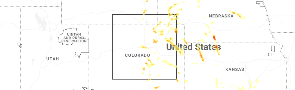
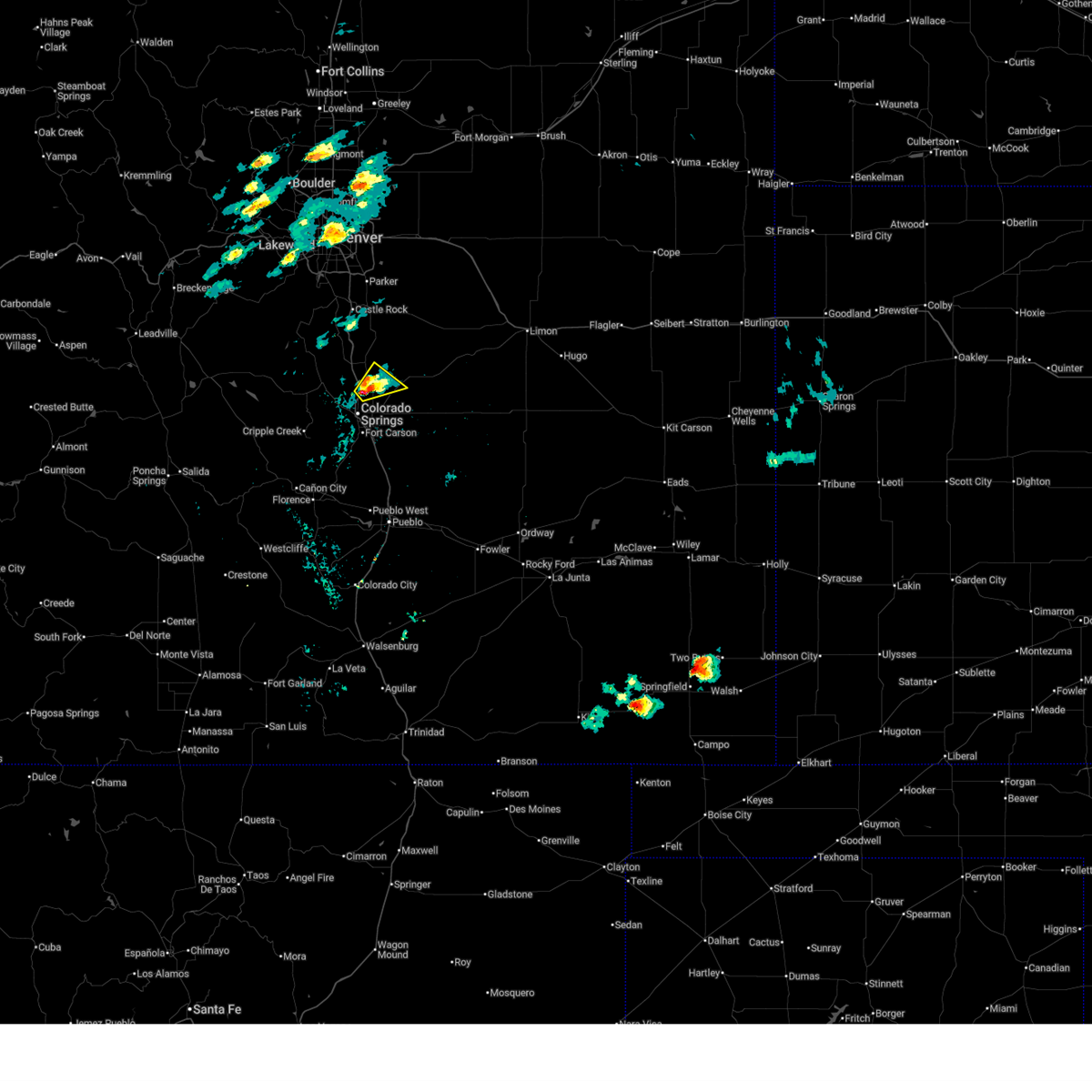
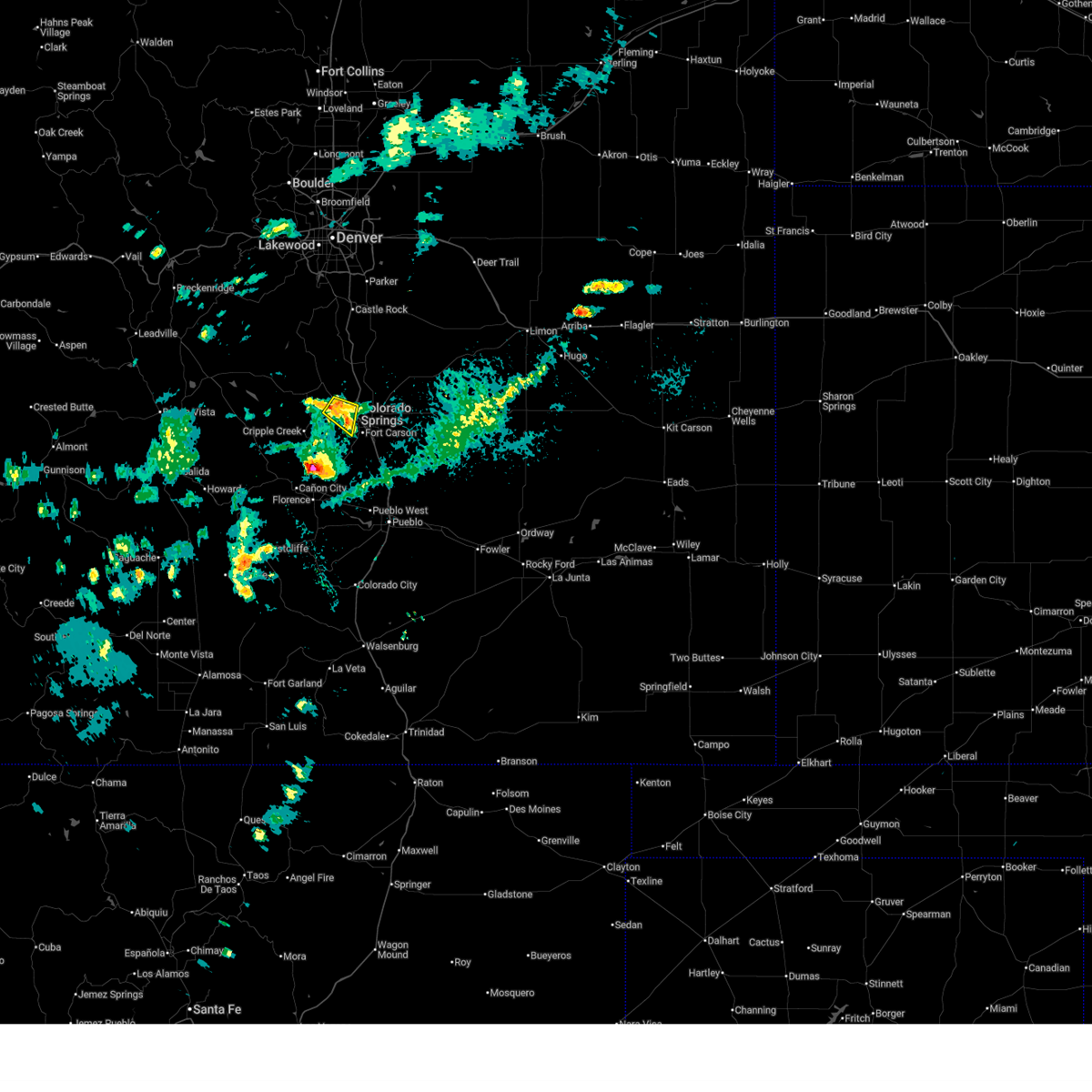
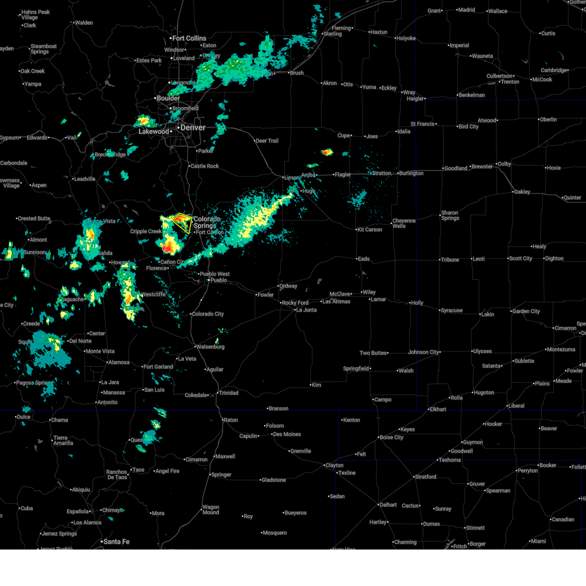
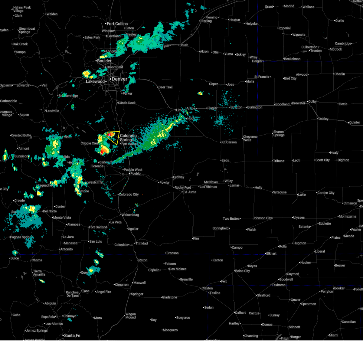
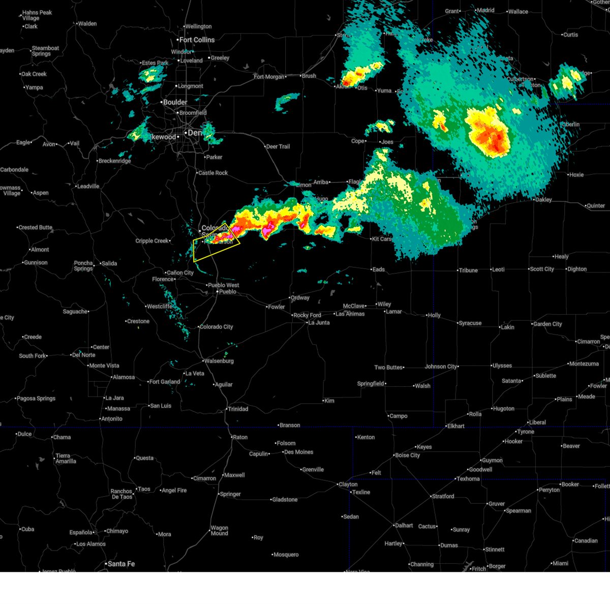
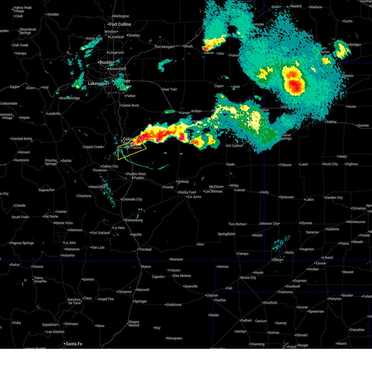
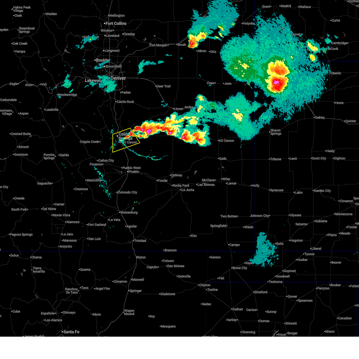
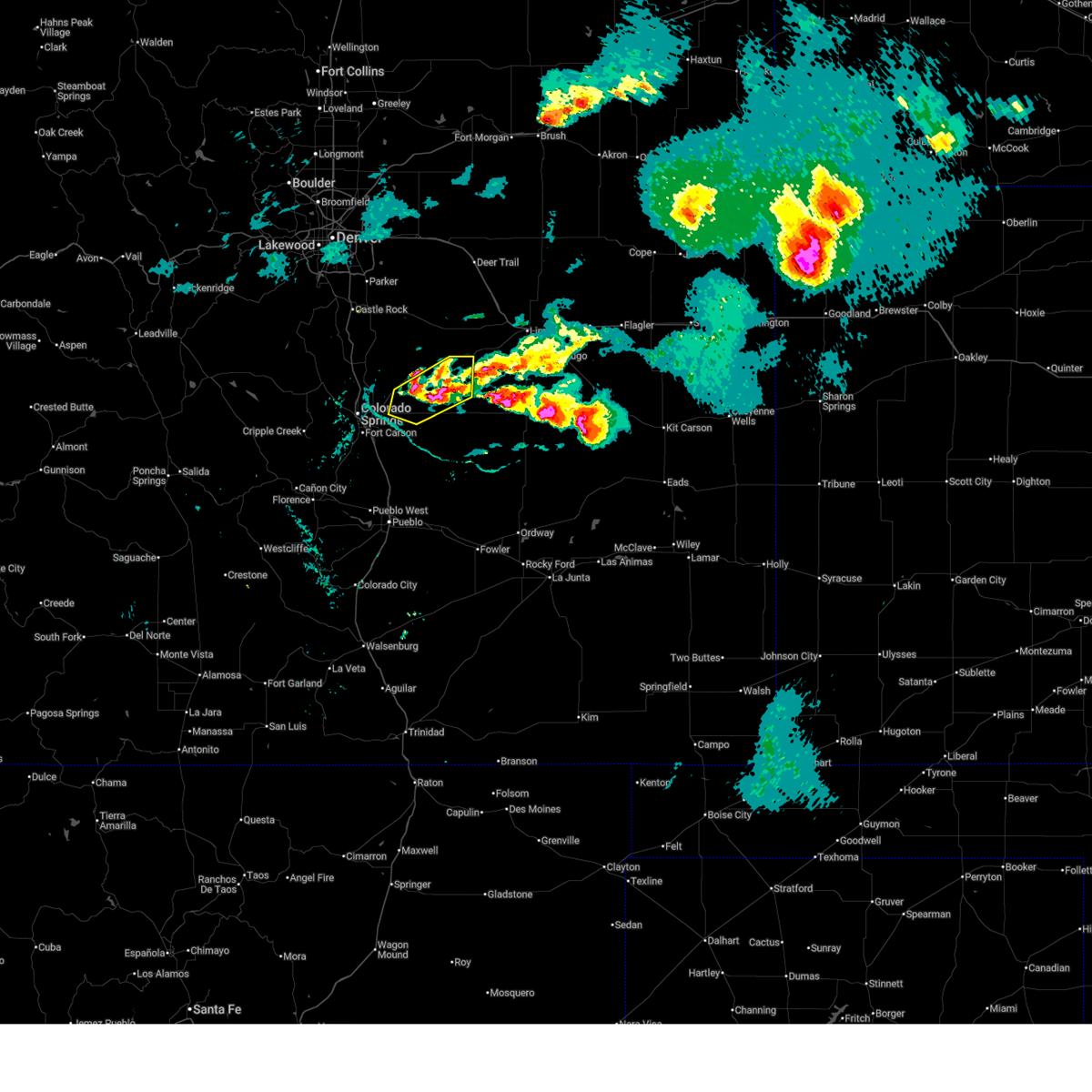
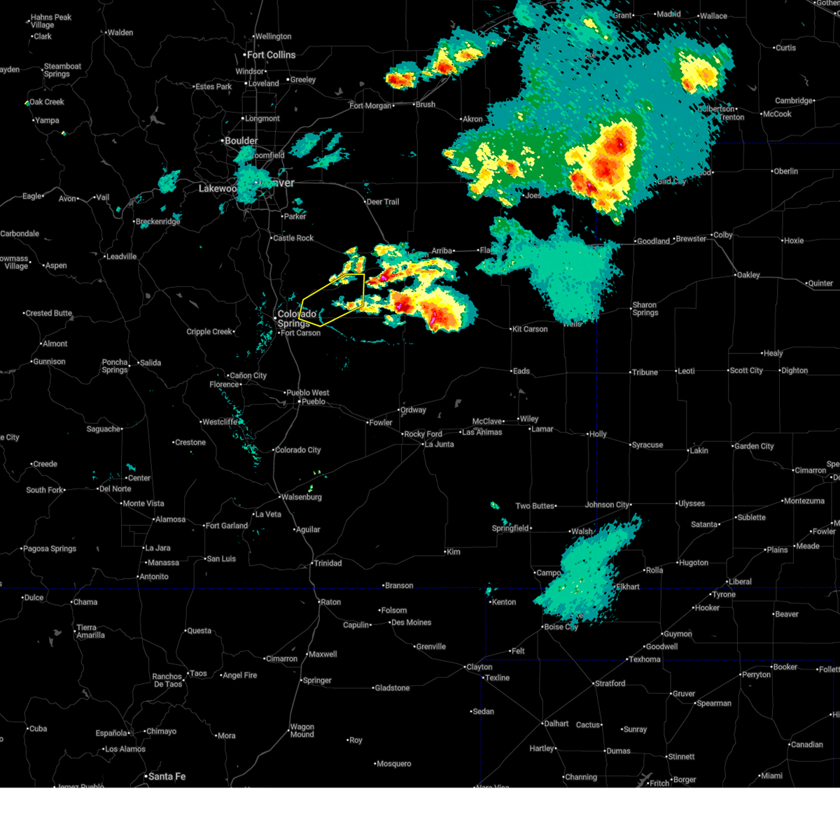
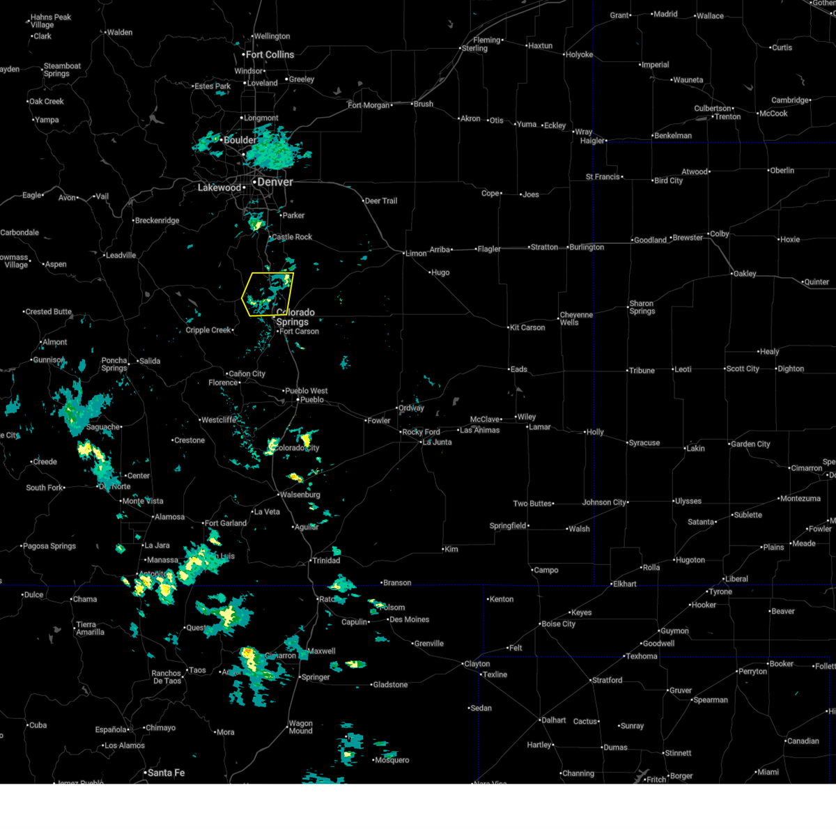
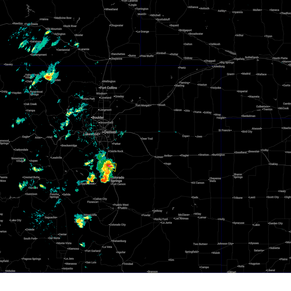
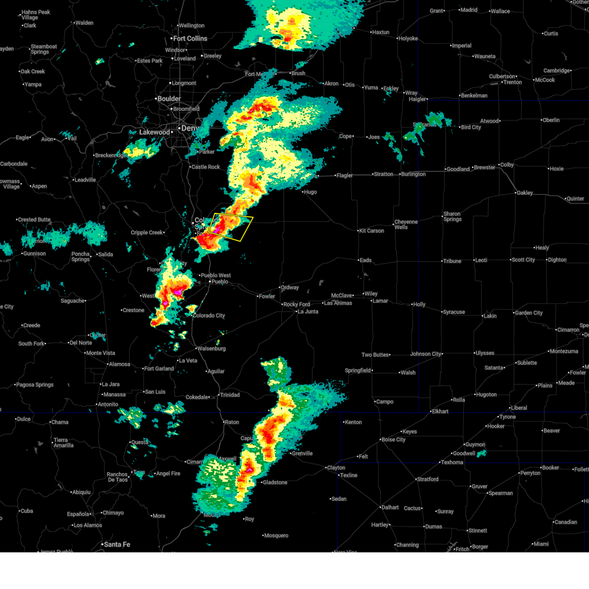
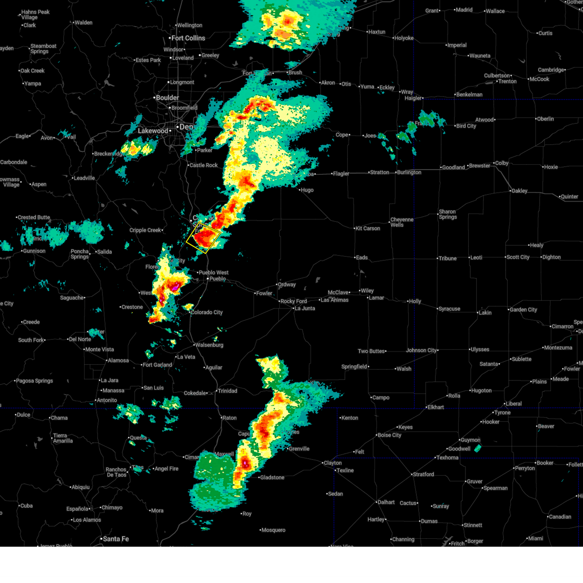
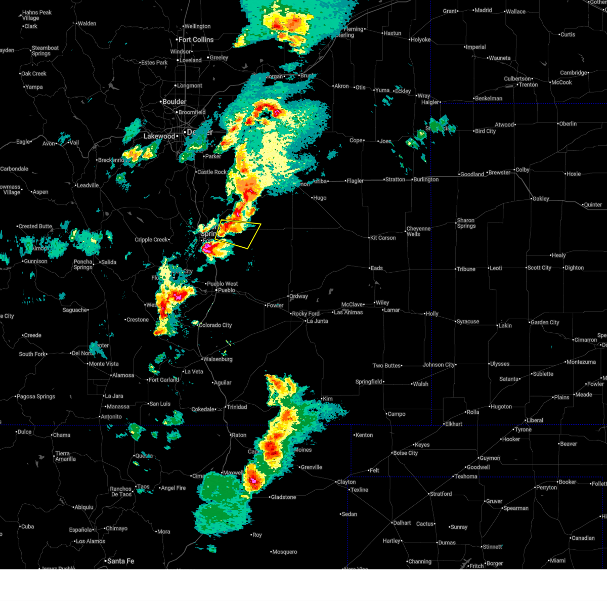
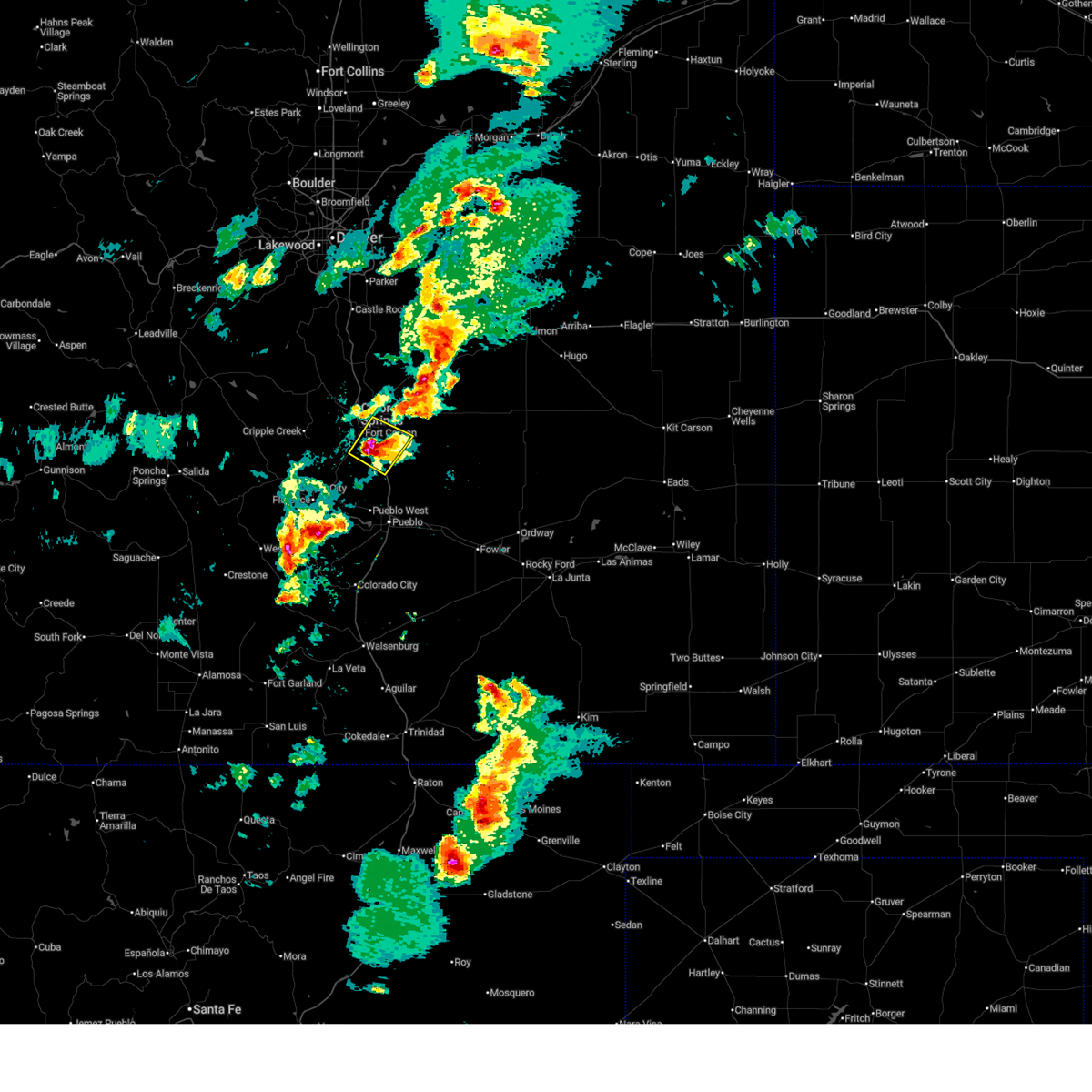
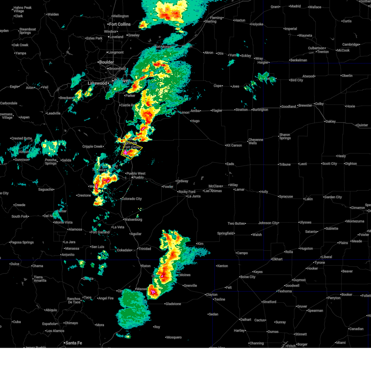
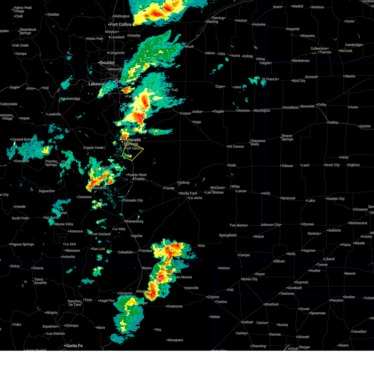
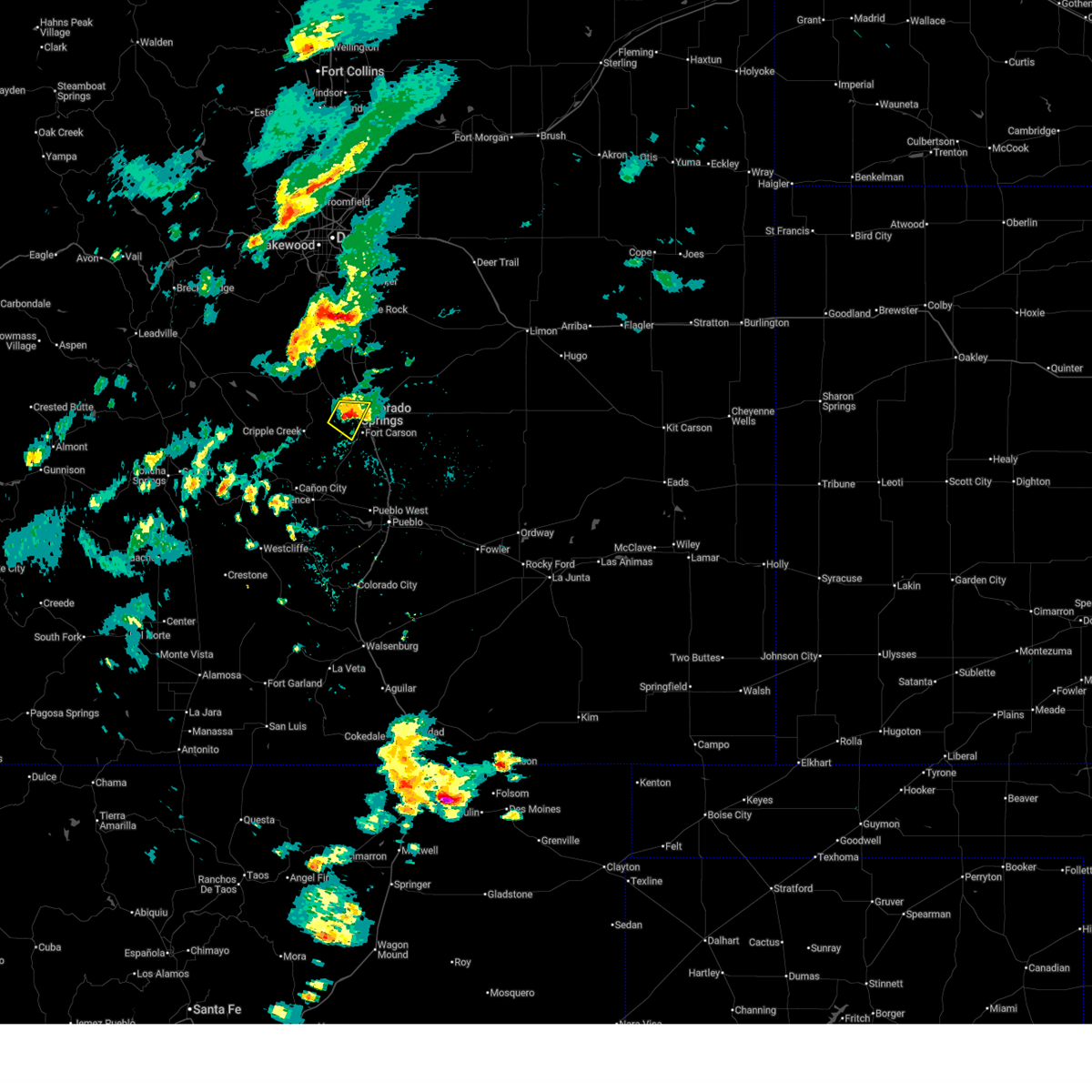
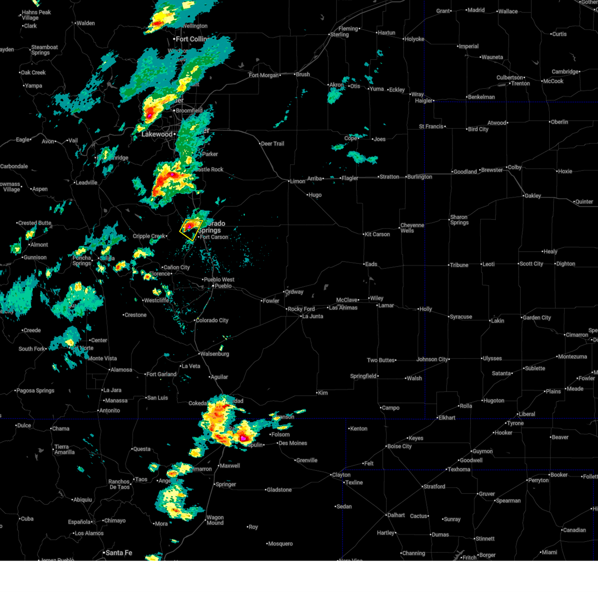
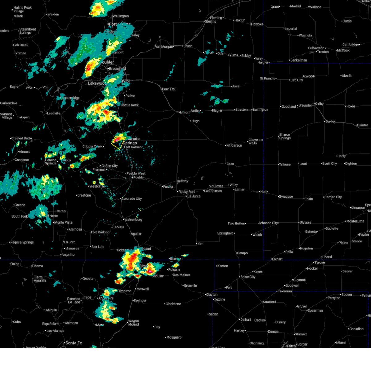
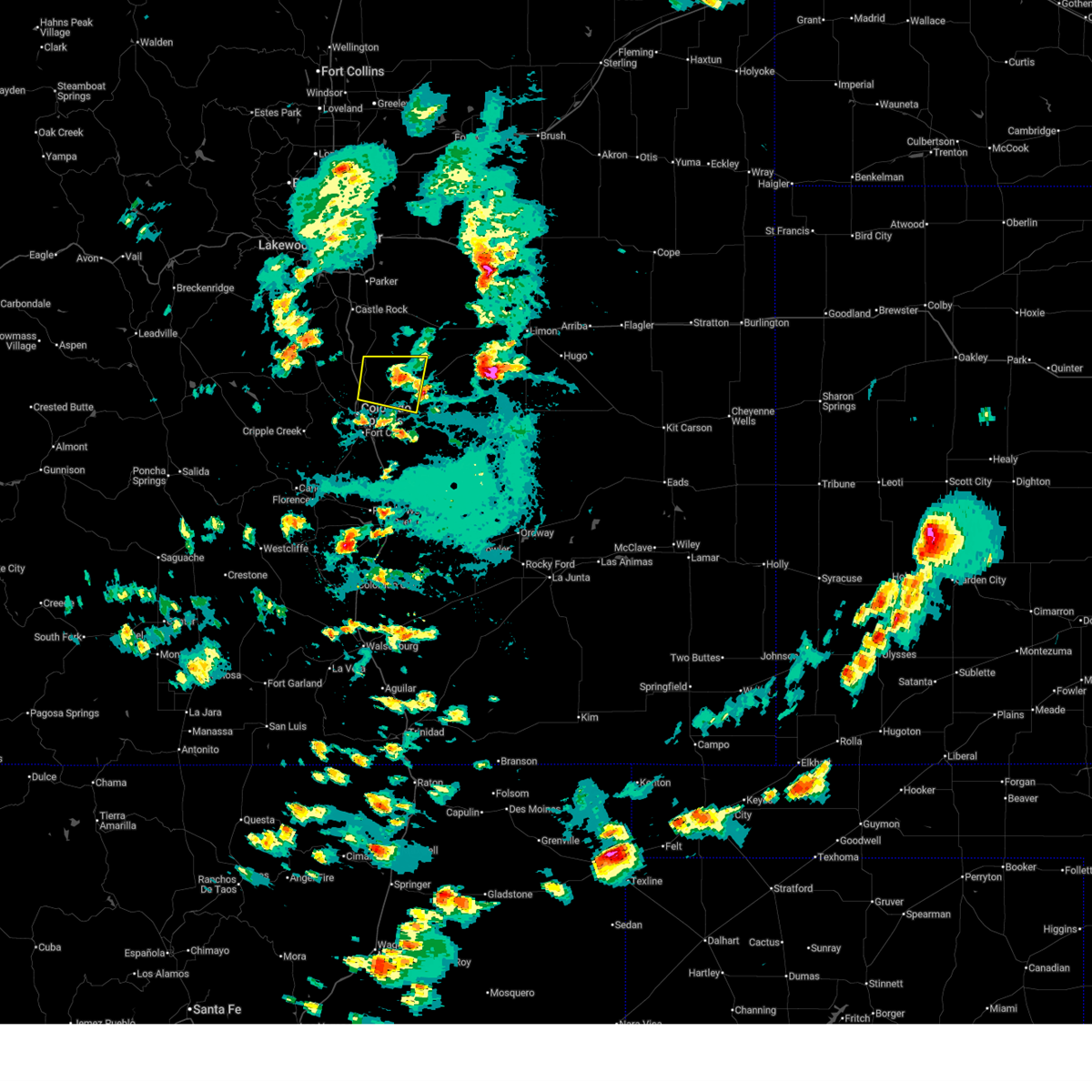
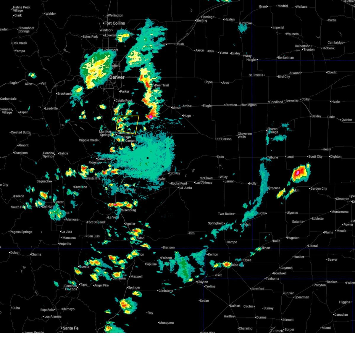
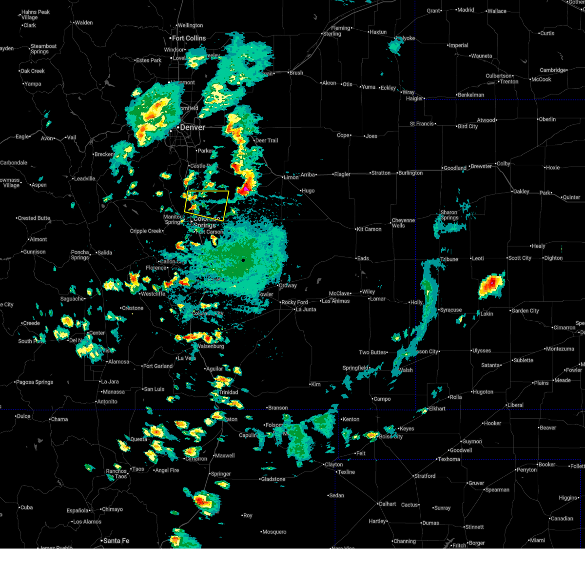
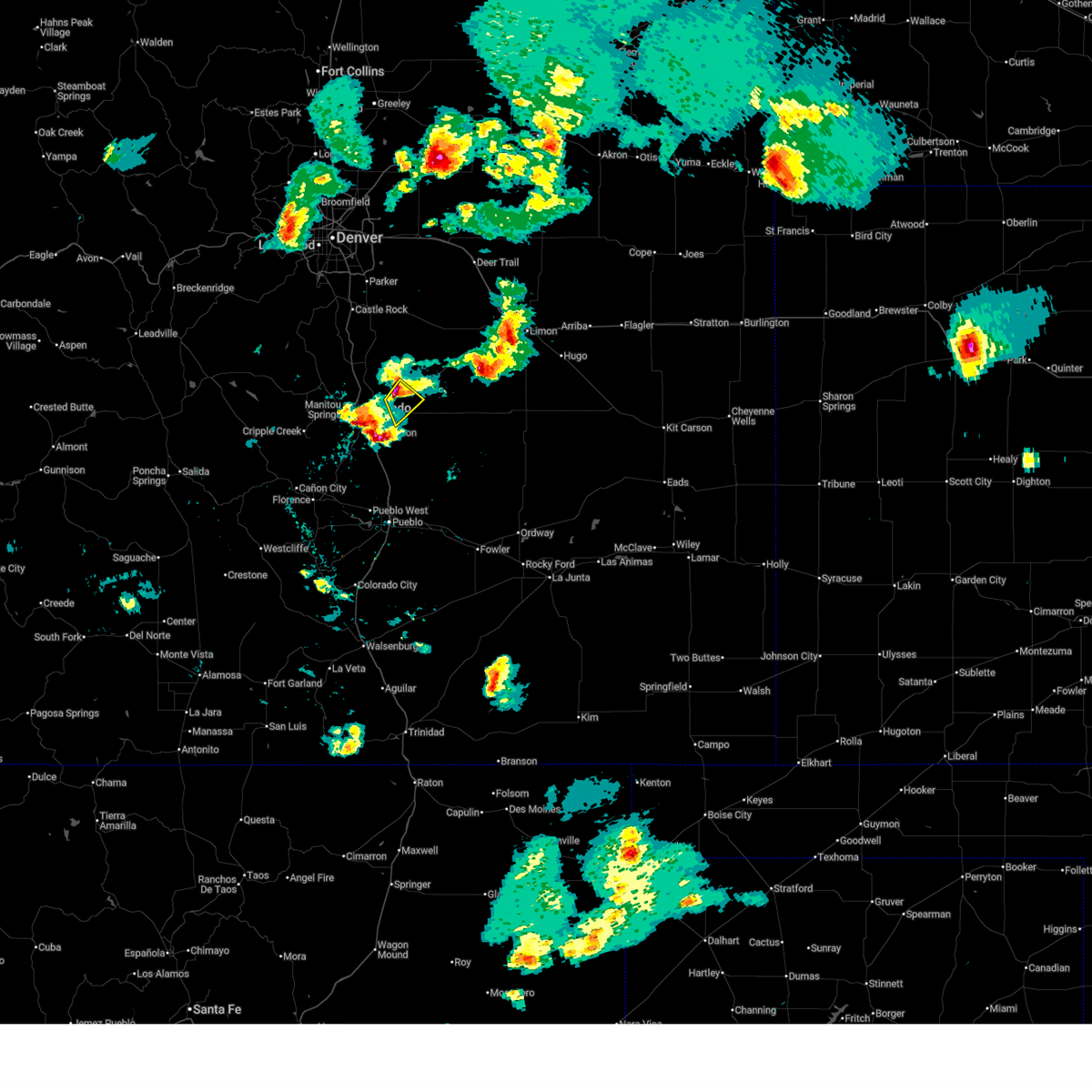
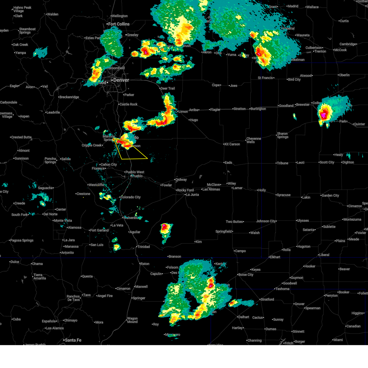
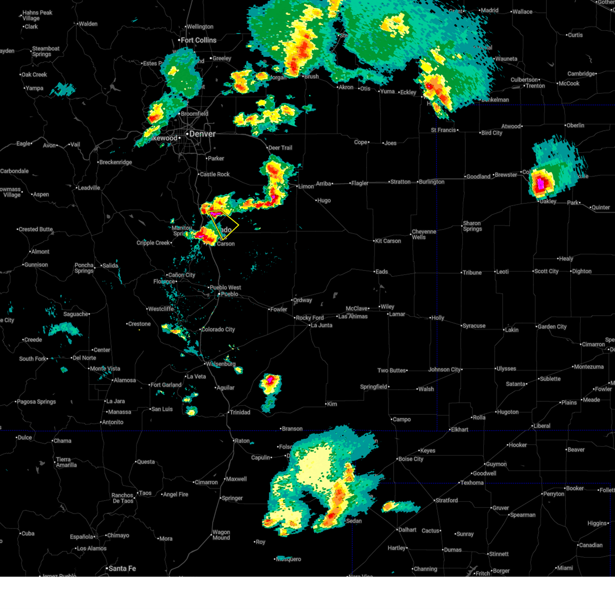
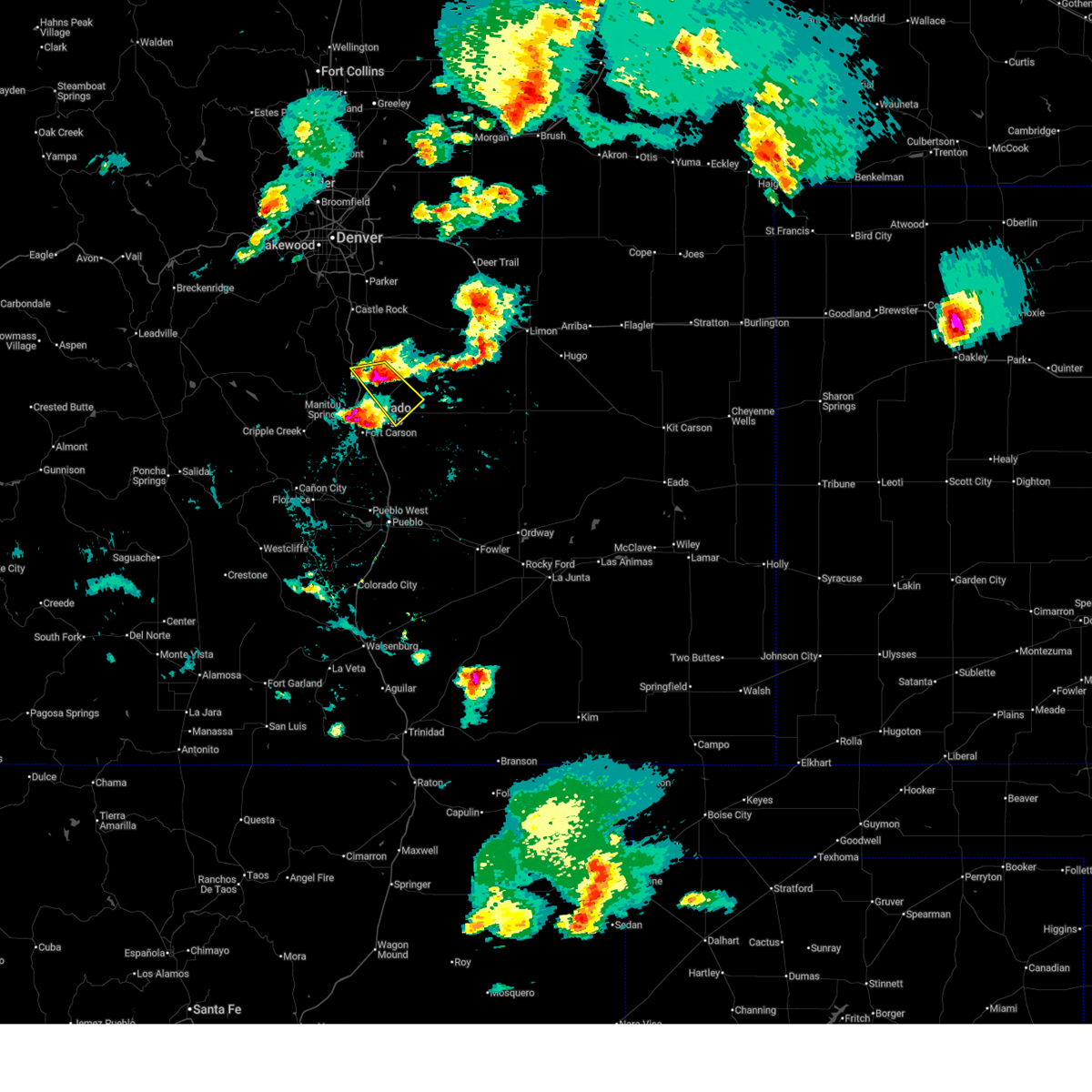
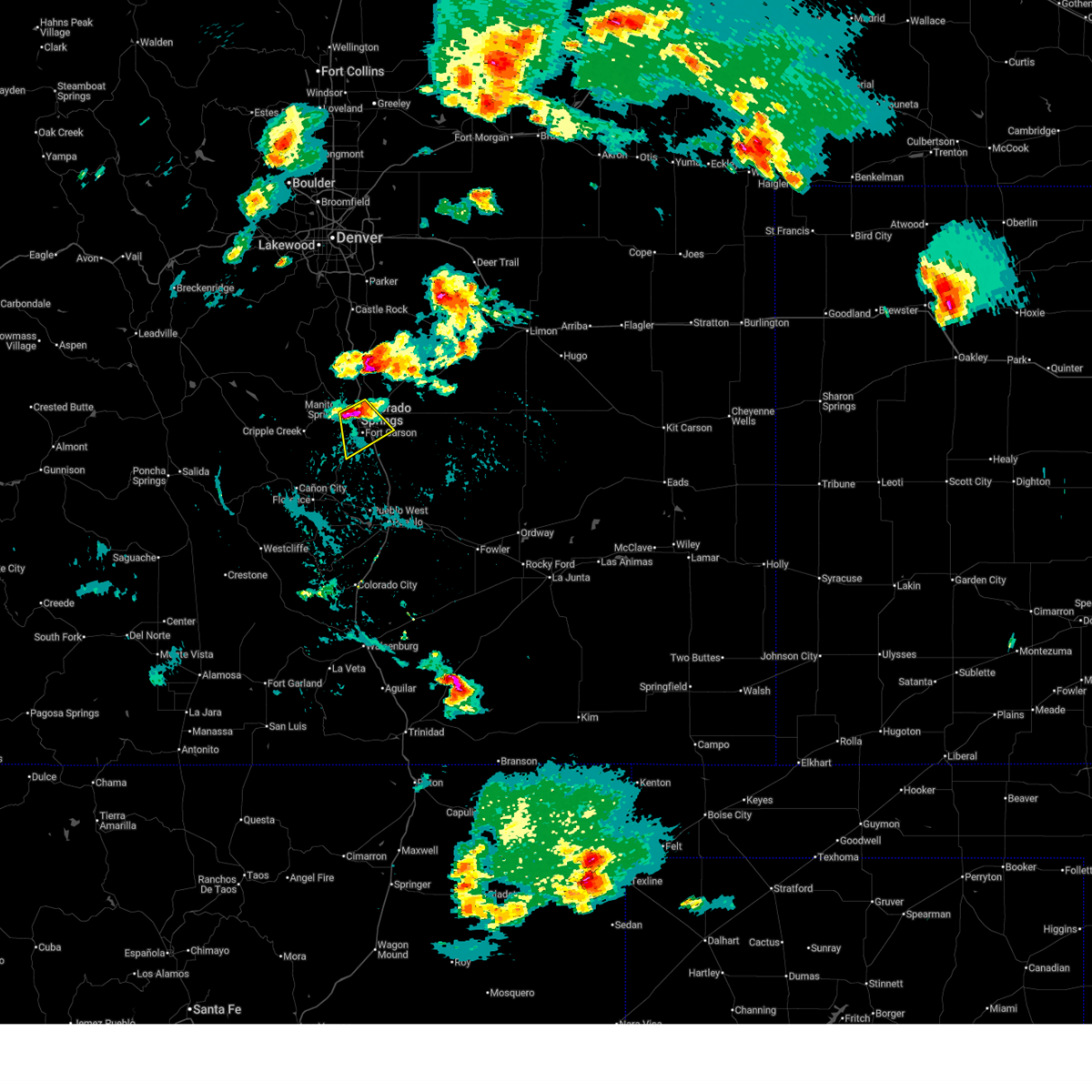
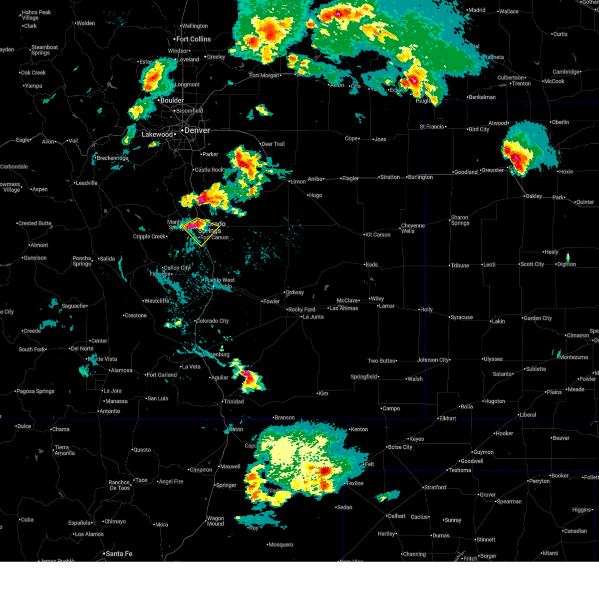
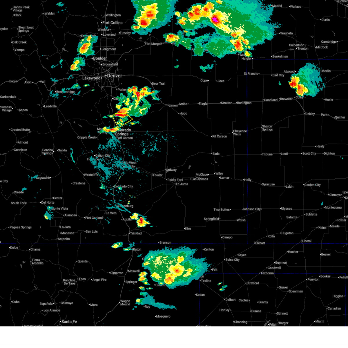
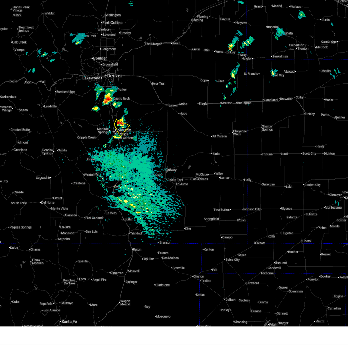
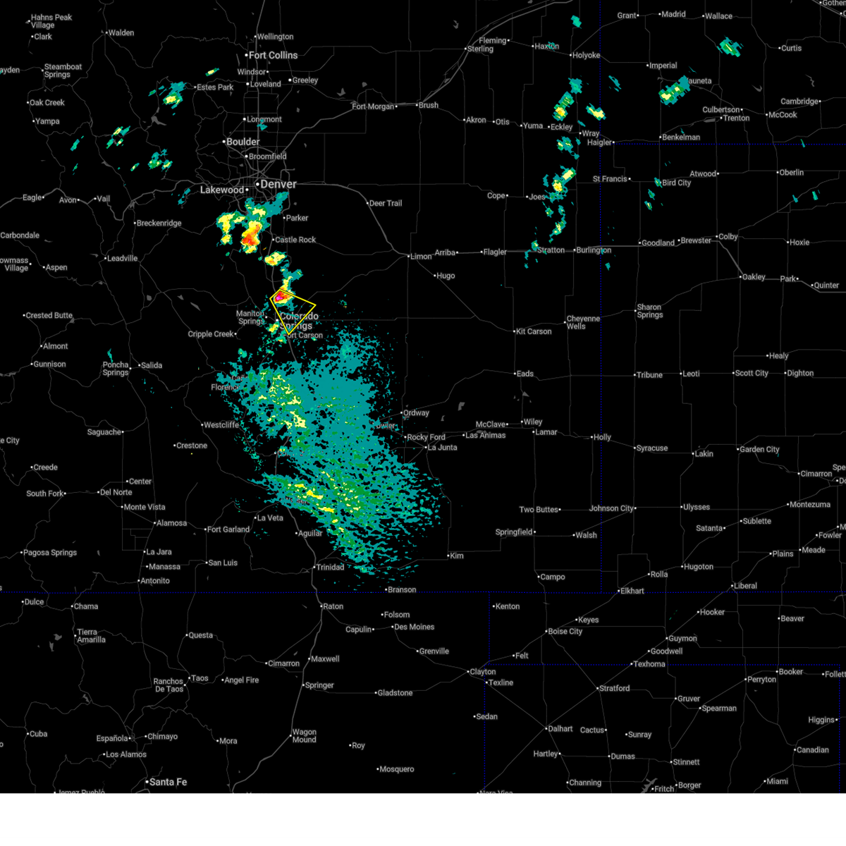
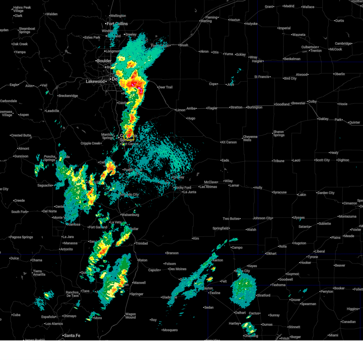
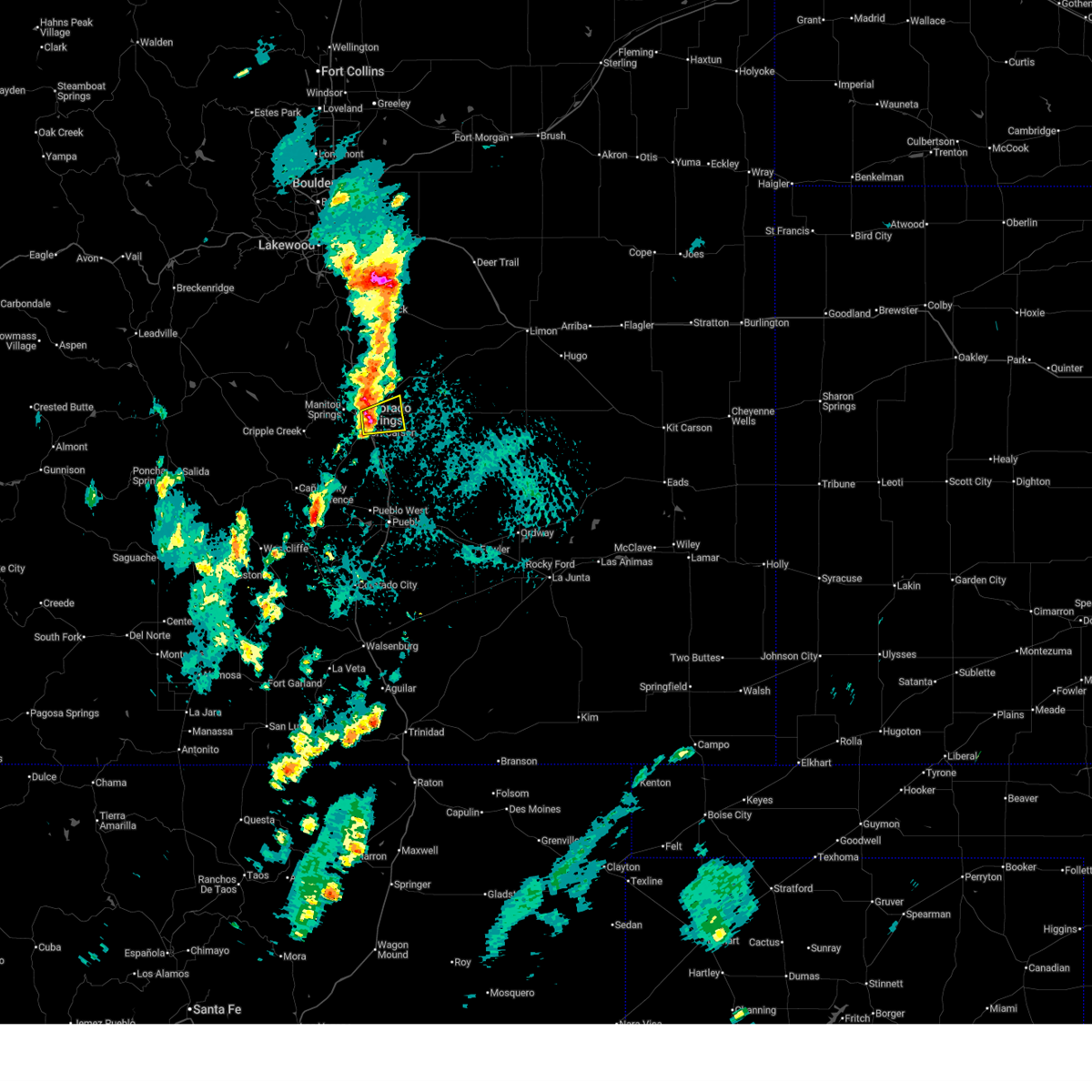
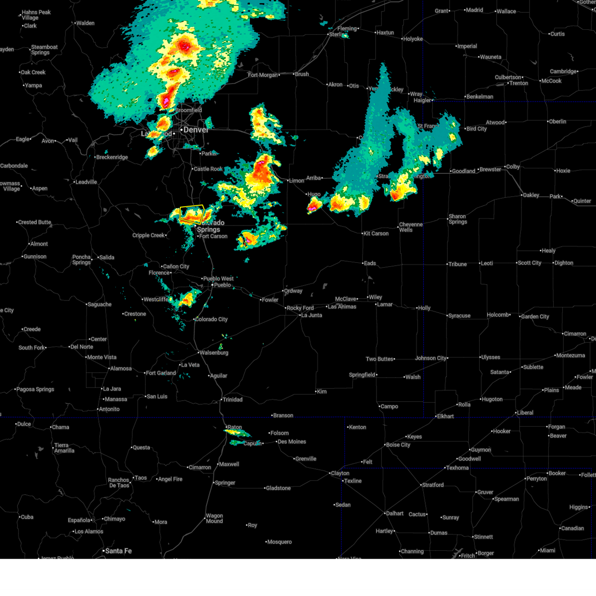
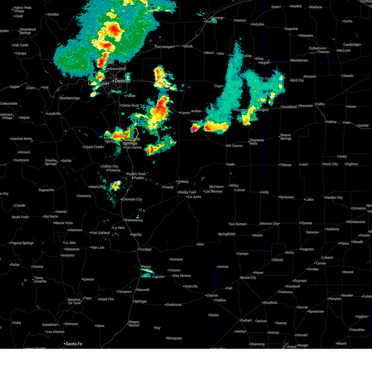
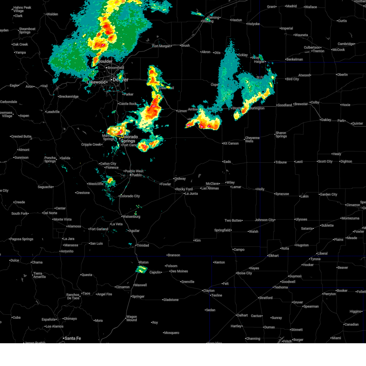
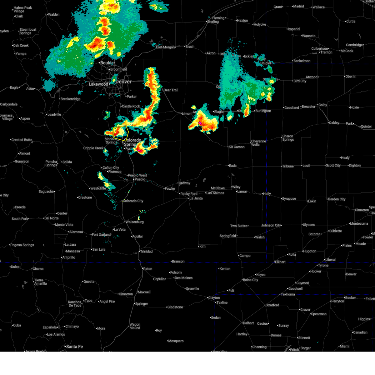
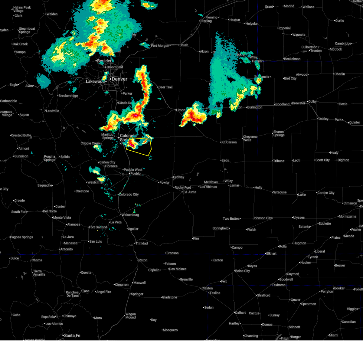
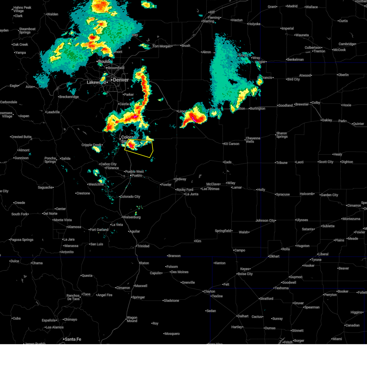
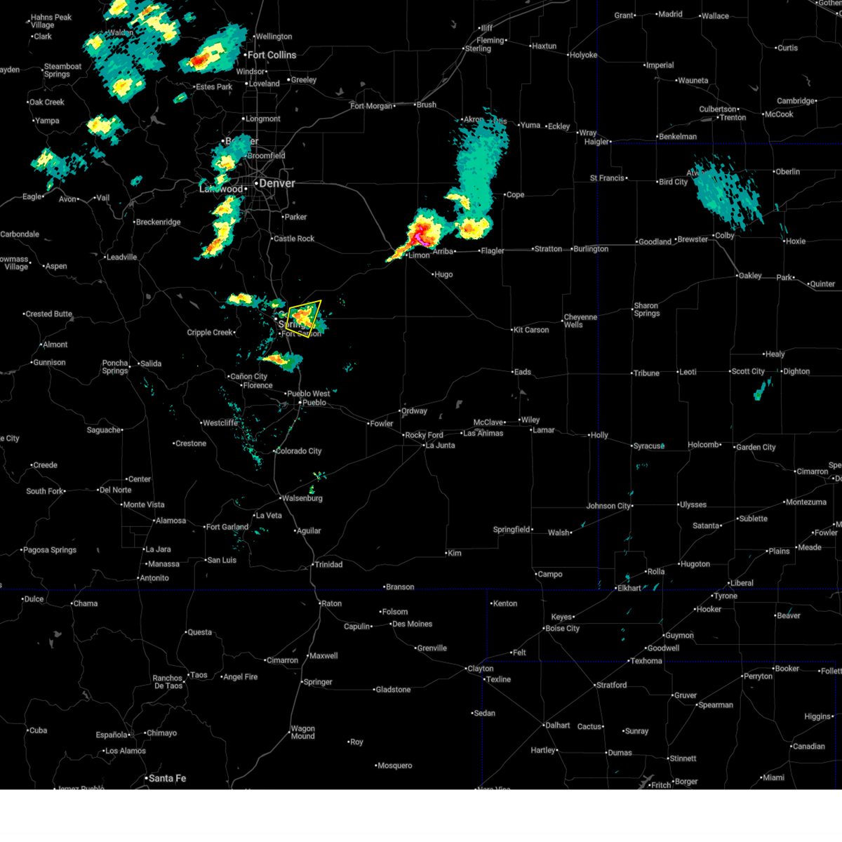
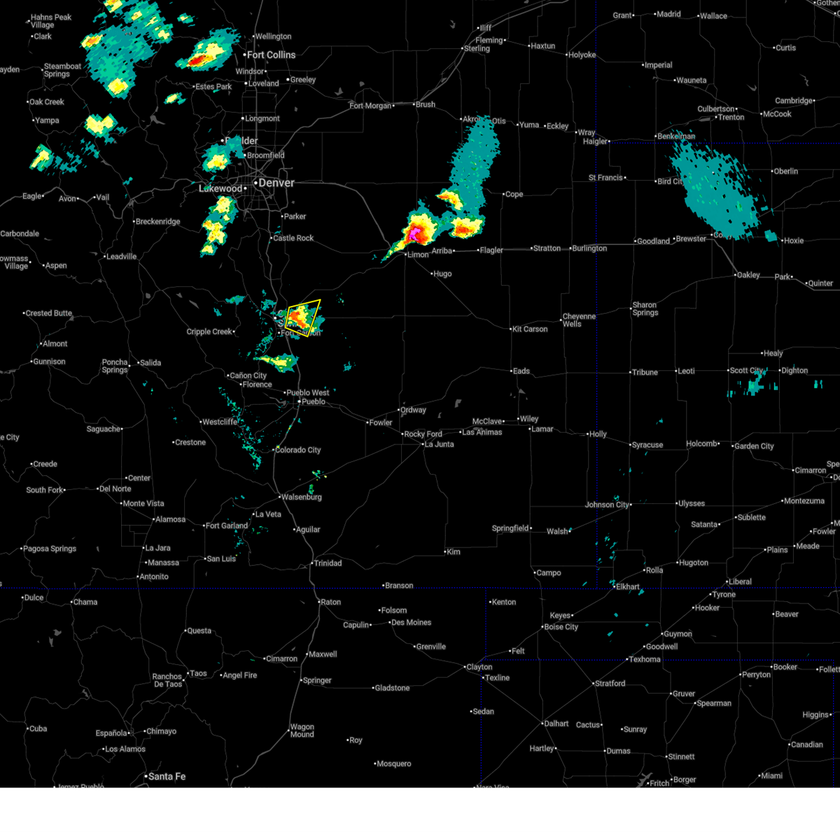
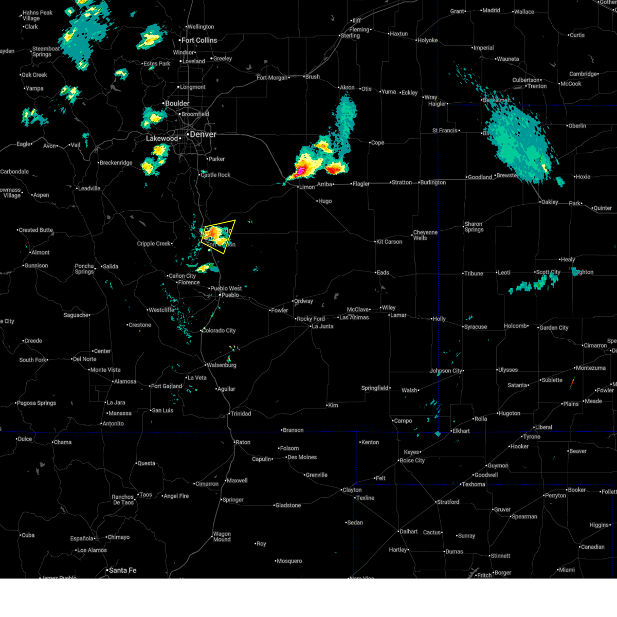
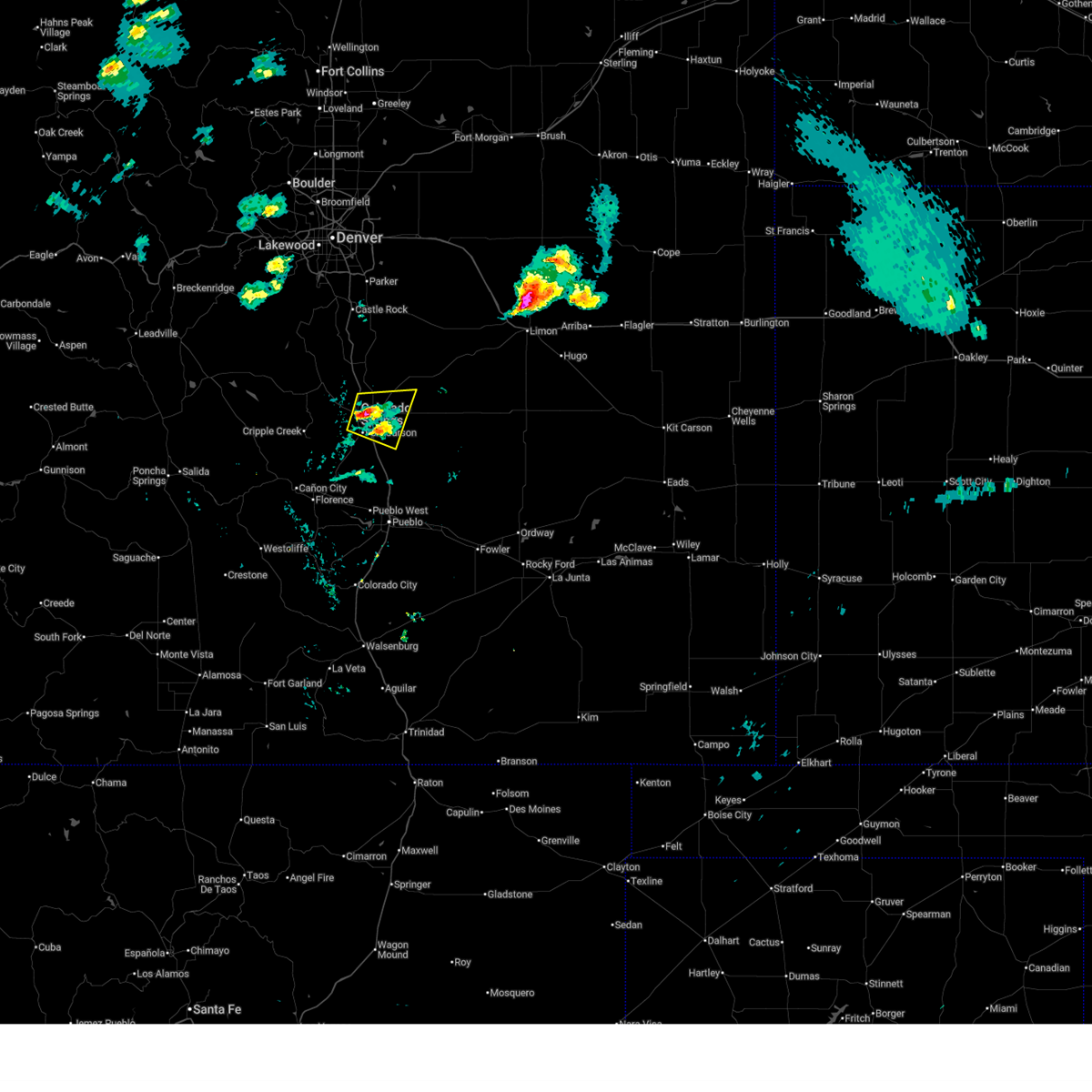
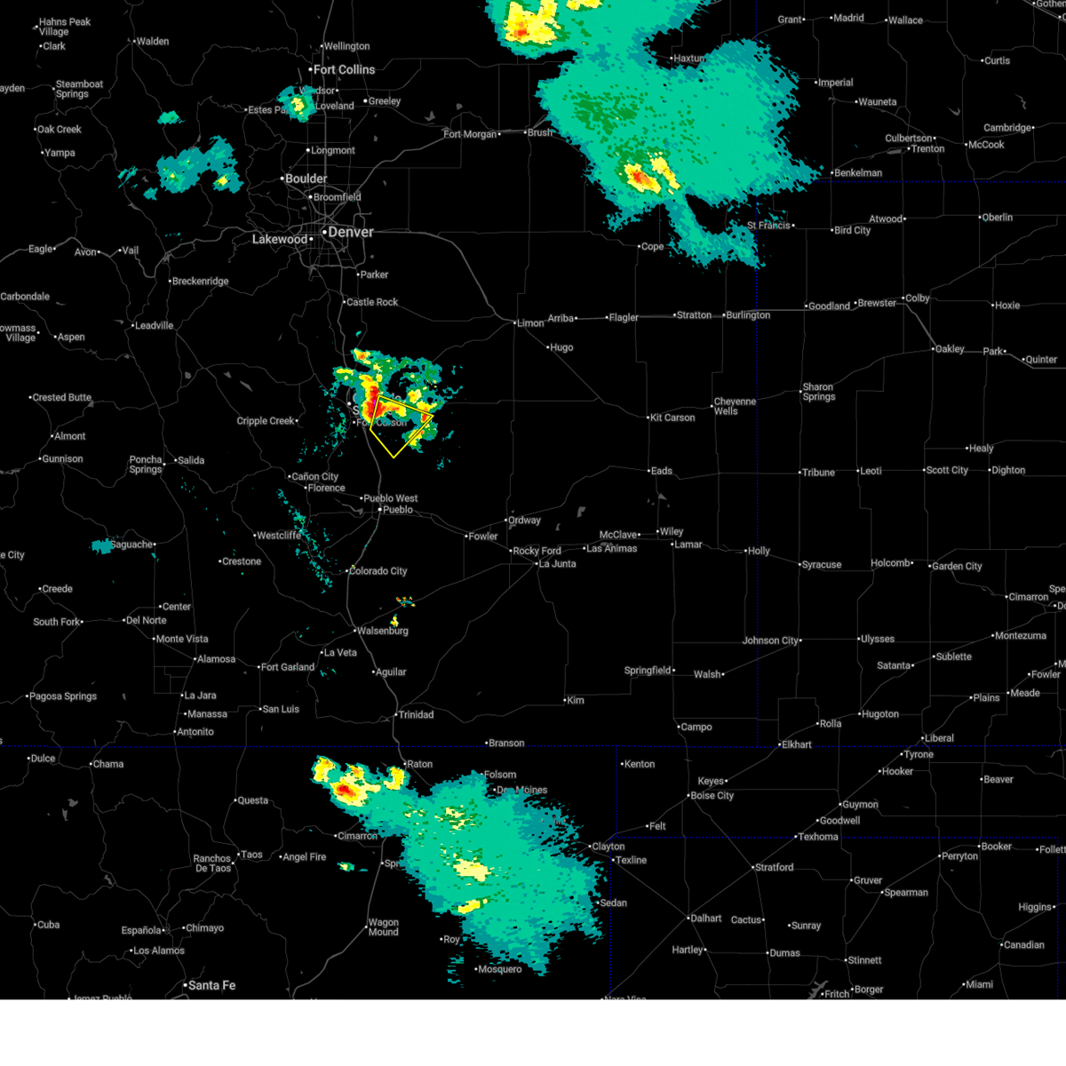
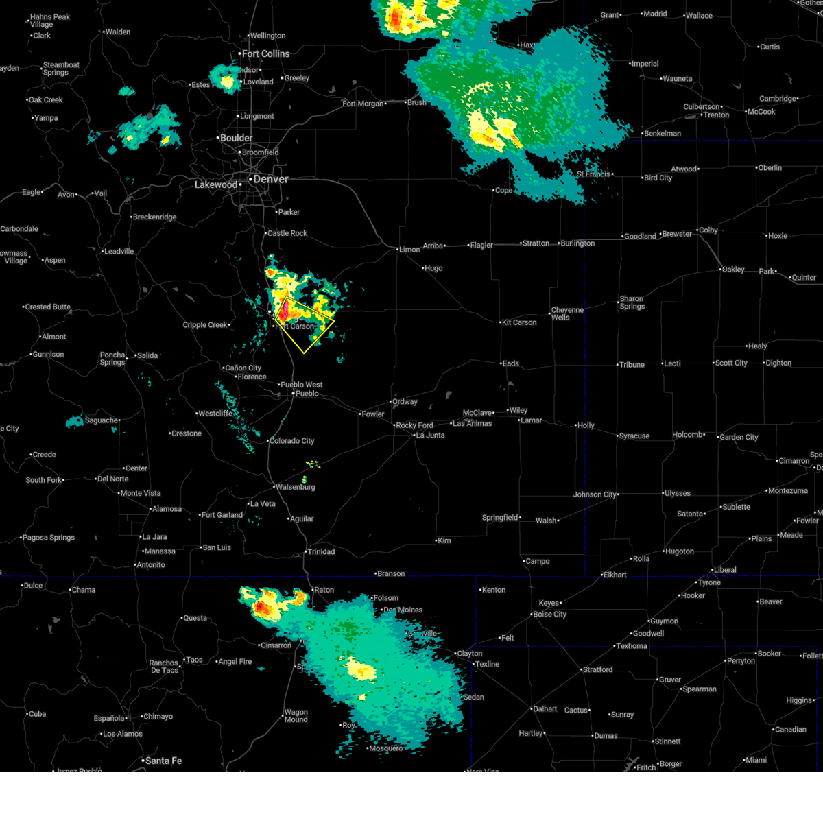
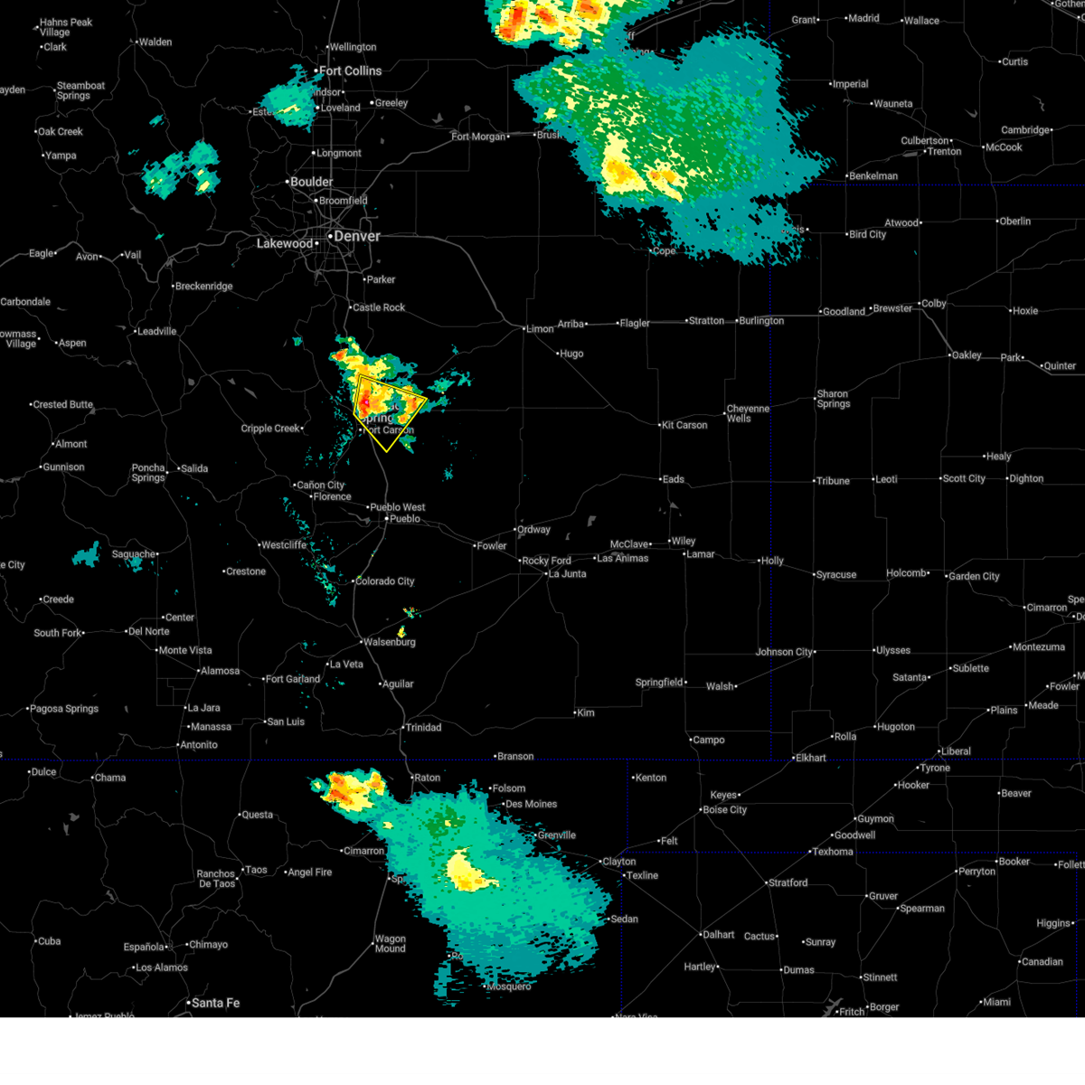
Hail Map for Colorado Springs, CO
The Colorado Springs, CO area has had 605 reports of on-the-ground hail by trained spotters, and has been under severe weather warnings 67 times during the past 12 months. Doppler radar has detected hail at or near Colorado Springs, CO on 228 occasions, including 19 occasions during the past year.
| Name: | Colorado Springs, CO |
| Where Located: | 43.1 miles N of Pueblo, CO |
| Map: | Google Map for Colorado Springs, CO |
| Population: | 416427 |
| Housing Units: | 179607 |
| More Info: | Search Google for Colorado Springs, CO |
1
The Top Recent Hail Date for Colorado Springs, CO is Sunday, July 6, 2025 (19th out of 228)
Hail and Wind Damage Spotted near Colorado Springs, CO
| Date / Time | Report Details |
|---|---|
| 6/6/2026 7:52 PM MDT |
 At 752 pm mdt, a severe thunderstorm was located near fountain, or 15 miles southeast of colorado springs, moving southwest at 10 mph (radar indicated). Hazards include 60 mph wind gusts and quarter size hail. Hail damage to vehicles is expected. expect wind damage to roofs, siding, and trees. Locations impacted include, fountain. At 752 pm mdt, a severe thunderstorm was located near fountain, or 15 miles southeast of colorado springs, moving southwest at 10 mph (radar indicated). Hazards include 60 mph wind gusts and quarter size hail. Hail damage to vehicles is expected. expect wind damage to roofs, siding, and trees. Locations impacted include, fountain.
|
| 6/6/2026 7:38 PM MDT |
 Svrpub the national weather service in pueblo has issued a * severe thunderstorm warning for, south central el paso county in east central colorado, * until 830 pm mdt. * at 737 pm mdt, a severe thunderstorm was located near schriever space force base, or 16 miles southeast of colorado springs, moving southwest at 10 mph (radar indicated). Hazards include 60 mph wind gusts and half dollar size hail. Hail damage to vehicles is expected. Expect wind damage to roofs, siding, and trees. Svrpub the national weather service in pueblo has issued a * severe thunderstorm warning for, south central el paso county in east central colorado, * until 830 pm mdt. * at 737 pm mdt, a severe thunderstorm was located near schriever space force base, or 16 miles southeast of colorado springs, moving southwest at 10 mph (radar indicated). Hazards include 60 mph wind gusts and half dollar size hail. Hail damage to vehicles is expected. Expect wind damage to roofs, siding, and trees.
|
| 6/1/2026 1:15 PM MDT | Quarter sized hail reported 5.7 miles S of Colorado Springs, CO |
| 6/1/2026 1:12 PM MDT | Quarter sized hail reported 6.4 miles S of Colorado Springs, CO |
| 6/1/2026 1:11 PM MDT | Quarter sized hail reported 7.2 miles S of Colorado Springs, CO, report from mping: quarter (1.00 in.). |
| 6/1/2026 1:10 PM MDT |
 At 110 pm mdt, a severe thunderstorm was located over northeastern colorado springs, moving northeast at 10 mph (radar indicated). Hazards include 60 mph wind gusts and quarter size hail. Hail damage to vehicles is expected. expect wind damage to roofs, siding, and trees. Locations impacted include, northern colorado springs and black forest. At 110 pm mdt, a severe thunderstorm was located over northeastern colorado springs, moving northeast at 10 mph (radar indicated). Hazards include 60 mph wind gusts and quarter size hail. Hail damage to vehicles is expected. expect wind damage to roofs, siding, and trees. Locations impacted include, northern colorado springs and black forest.
|
| 6/1/2026 1:05 PM MDT | Quarter sized hail reported 5.3 miles SSW of Colorado Springs, CO |
| 6/1/2026 12:58 PM MDT |
 Svrpub the national weather service in pueblo has issued a * severe thunderstorm warning for, north central el paso county in east central colorado, * until 145 pm mdt. * at 1258 pm mdt, a severe thunderstorm was located over northern colorado springs, moving northeast at 10 mph (radar indicated). Hazards include 60 mph wind gusts and quarter size hail. Hail damage to vehicles is expected. Expect wind damage to roofs, siding, and trees. Svrpub the national weather service in pueblo has issued a * severe thunderstorm warning for, north central el paso county in east central colorado, * until 145 pm mdt. * at 1258 pm mdt, a severe thunderstorm was located over northern colorado springs, moving northeast at 10 mph (radar indicated). Hazards include 60 mph wind gusts and quarter size hail. Hail damage to vehicles is expected. Expect wind damage to roofs, siding, and trees.
|
| 9/17/2025 6:15 PM MDT | At 615 pm mdt, a severe thunderstorm was located 7 miles northwest of hanover, or 19 miles southeast of colorado springs, moving east at 20 mph (radar indicated). Hazards include 60 mph wind gusts and half dollar size hail. Hail damage to vehicles is expected. expect wind damage to roofs, siding, and trees. Locations impacted include, southeastern colorado springs, fountain, hanover, stratmoor, fort carson, security, security-widefield, schriever space force base, and peterson space force base. |
| 9/17/2025 6:13 PM MDT | At 613 pm mdt, a severe thunderstorm was located 7 miles south of schriever space force base, or 18 miles southeast of colorado springs, moving east at 20 mph (radar indicated). Hazards include 60 mph wind gusts and quarter size hail. Hail damage to vehicles is expected. expect wind damage to roofs, siding, and trees. Locations impacted include, southeastern colorado springs, fountain, hanover, stratmoor, fort carson, security, security-widefield, schriever space force base, and peterson space force base. |
| 9/17/2025 5:56 PM MDT | Svrpub the national weather service in pueblo has issued a * severe thunderstorm warning for, southern el paso county in east central colorado, * until 630 pm mdt. * at 556 pm mdt, a severe thunderstorm was located near security-widefield, or 13 miles southeast of colorado springs, moving east at 20 mph (radar indicated). Hazards include 60 mph wind gusts and quarter size hail. Hail damage to vehicles is expected. Expect wind damage to roofs, siding, and trees. |
| 9/17/2025 5:44 PM MDT | The storm which prompted the warning has weakened below severe limits, and no longer poses an immediate threat to life or property. therefore, the warning will be allowed to expire. however, heavy rain is still possible with this thunderstorm. a severe thunderstorm watch remains in effect until 1000 pm mdt for east central colorado. |
| 9/17/2025 5:22 PM MDT | Svrpub the national weather service in pueblo has issued a * severe thunderstorm warning for, west central el paso county in east central colorado, * until 545 pm mdt. * at 521 pm mdt, a severe thunderstorm was located over southwestern colorado springs, moving east at 15 mph (radar indicated). Hazards include quarter size hail. damage to vehicles is expected |
| 8/24/2025 3:07 PM MDT | Measured gust at fort carson (kfcs in el paso county CO, 13.6 miles N of Colorado Springs, CO |
| 8/24/2025 2:58 PM MDT |
 At 258 pm mdt, a severe thunderstorm was located over fountain, or 10 miles southeast of colorado springs, moving southeast at 20 mph (trained weather spotters). Hazards include 70 mph wind gusts and ping pong ball size hail. People and animals outdoors will be injured. expect hail damage to roofs, siding, windows, and vehicles. expect considerable tree damage. wind damage is also likely to mobile homes, roofs, and outbuildings. Locations impacted include, southern colorado springs, fountain, stratmoor, fort carson, security, security-widefield, peterson space force base, and cimarron hills. At 258 pm mdt, a severe thunderstorm was located over fountain, or 10 miles southeast of colorado springs, moving southeast at 20 mph (trained weather spotters). Hazards include 70 mph wind gusts and ping pong ball size hail. People and animals outdoors will be injured. expect hail damage to roofs, siding, windows, and vehicles. expect considerable tree damage. wind damage is also likely to mobile homes, roofs, and outbuildings. Locations impacted include, southern colorado springs, fountain, stratmoor, fort carson, security, security-widefield, peterson space force base, and cimarron hills.
|
| 8/24/2025 2:51 PM MDT |
 At 251 pm mdt, a severe thunderstorm was located over security-widefield, or 8 miles southeast of colorado springs, moving southeast at 20 mph (trained weather spotters). Hazards include quarter size hail. Damage to vehicles is expected. Locations impacted include, southern colorado springs, fountain, stratmoor, fort carson, security, security-widefield, peterson space force base, and cimarron hills. At 251 pm mdt, a severe thunderstorm was located over security-widefield, or 8 miles southeast of colorado springs, moving southeast at 20 mph (trained weather spotters). Hazards include quarter size hail. Damage to vehicles is expected. Locations impacted include, southern colorado springs, fountain, stratmoor, fort carson, security, security-widefield, peterson space force base, and cimarron hills.
|
| 8/24/2025 2:45 PM MDT | Quarter sized hail reported 4.3 miles NNW of Colorado Springs, CO |
| 8/24/2025 2:40 PM MDT |
 Svrpub the national weather service in pueblo has issued a * severe thunderstorm warning for, southwestern el paso county in east central colorado, * until 315 pm mdt. * at 240 pm mdt, a severe thunderstorm was located over southern colorado springs, moving southeast at 20 mph (radar indicated). Hazards include 60 mph wind gusts and quarter size hail. Hail damage to vehicles is expected. Expect wind damage to roofs, siding, and trees. Svrpub the national weather service in pueblo has issued a * severe thunderstorm warning for, southwestern el paso county in east central colorado, * until 315 pm mdt. * at 240 pm mdt, a severe thunderstorm was located over southern colorado springs, moving southeast at 20 mph (radar indicated). Hazards include 60 mph wind gusts and quarter size hail. Hail damage to vehicles is expected. Expect wind damage to roofs, siding, and trees.
|
| 8/22/2025 3:48 PM MDT |
 the severe thunderstorm warning has been cancelled and is no longer in effect the severe thunderstorm warning has been cancelled and is no longer in effect
|
| 8/22/2025 3:42 PM MDT |
 At 342 pm mdt, a severe thunderstorm was located over cascade, or 8 miles west of colorado springs, moving southeast at 5 mph (radar indicated). Hazards include 60 mph wind gusts and quarter size hail. Hail damage to vehicles is expected. expect wind damage to roofs, siding, and trees. Locations impacted include, southwestern colorado springs, manitou springs, pikes peak, and cascade. At 342 pm mdt, a severe thunderstorm was located over cascade, or 8 miles west of colorado springs, moving southeast at 5 mph (radar indicated). Hazards include 60 mph wind gusts and quarter size hail. Hail damage to vehicles is expected. expect wind damage to roofs, siding, and trees. Locations impacted include, southwestern colorado springs, manitou springs, pikes peak, and cascade.
|
| 8/22/2025 3:26 PM MDT |
 Svrpub the national weather service in pueblo has issued a * severe thunderstorm warning for, east central teller county in central colorado, west central el paso county in east central colorado, * until 400 pm mdt. * at 326 pm mdt, a severe thunderstorm was located over cascade, or 9 miles west of colorado springs, moving east at 15 mph (radar indicated). Hazards include 60 mph wind gusts and half dollar size hail. Hail damage to vehicles is expected. Expect wind damage to roofs, siding, and trees. Svrpub the national weather service in pueblo has issued a * severe thunderstorm warning for, east central teller county in central colorado, west central el paso county in east central colorado, * until 400 pm mdt. * at 326 pm mdt, a severe thunderstorm was located over cascade, or 9 miles west of colorado springs, moving east at 15 mph (radar indicated). Hazards include 60 mph wind gusts and half dollar size hail. Hail damage to vehicles is expected. Expect wind damage to roofs, siding, and trees.
|
| 8/9/2025 8:12 PM MDT |
 At 810 pm mdt, a severe thunderstorm was located over schriever space force base, or 17 miles east of colorado springs, moving east at 30 mph. there is a good chance that strong to severe thunderstorms may develop west of the interstate over the fort carson military base through 9 pm (radar indicated). Hazards include 60 mph wind gusts and quarter size hail. Hail damage to vehicles is expected. expect wind damage to roofs, siding, and trees. Locations impacted include, southern colorado springs, fountain, stratmoor, fort carson, schriever space force base, security, and security-widefield. At 810 pm mdt, a severe thunderstorm was located over schriever space force base, or 17 miles east of colorado springs, moving east at 30 mph. there is a good chance that strong to severe thunderstorms may develop west of the interstate over the fort carson military base through 9 pm (radar indicated). Hazards include 60 mph wind gusts and quarter size hail. Hail damage to vehicles is expected. expect wind damage to roofs, siding, and trees. Locations impacted include, southern colorado springs, fountain, stratmoor, fort carson, schriever space force base, security, and security-widefield.
|
| 8/9/2025 7:55 PM MDT |
 Svrpub the national weather service in pueblo has issued a * severe thunderstorm warning for, southwestern el paso county in east central colorado, * until 845 pm mdt. * at 755 pm mdt, a severe thunderstorm was located near security-widefield, or 11 miles east of colorado springs, moving east at 30 mph (radar indicated). Hazards include 60 mph wind gusts and quarter size hail. Hail damage to vehicles is expected. Expect wind damage to roofs, siding, and trees. Svrpub the national weather service in pueblo has issued a * severe thunderstorm warning for, southwestern el paso county in east central colorado, * until 845 pm mdt. * at 755 pm mdt, a severe thunderstorm was located near security-widefield, or 11 miles east of colorado springs, moving east at 30 mph (radar indicated). Hazards include 60 mph wind gusts and quarter size hail. Hail damage to vehicles is expected. Expect wind damage to roofs, siding, and trees.
|
| 8/9/2025 7:37 PM MDT |
 Svrpub the national weather service in pueblo has issued a * severe thunderstorm warning for, southwestern el paso county in east central colorado, * until 800 pm mdt. * at 737 pm mdt, a severe thunderstorm was located over southeastern colorado springs, moving east at 40 mph (radar indicated). Hazards include ping pong ball size hail and 60 mph wind gusts. People and animals outdoors will be injured. expect hail damage to roofs, siding, windows, and vehicles. Expect wind damage to roofs, siding, and trees. Svrpub the national weather service in pueblo has issued a * severe thunderstorm warning for, southwestern el paso county in east central colorado, * until 800 pm mdt. * at 737 pm mdt, a severe thunderstorm was located over southeastern colorado springs, moving east at 40 mph (radar indicated). Hazards include ping pong ball size hail and 60 mph wind gusts. People and animals outdoors will be injured. expect hail damage to roofs, siding, windows, and vehicles. Expect wind damage to roofs, siding, and trees.
|
| 8/9/2025 7:17 PM MDT |
 At 717 pm mdt, a severe thunderstorm was located near yoder, or 30 miles east of colorado springs, moving east at 20 mph (radar indicated). Hazards include ping pong ball size hail and 60 mph wind gusts. People and animals outdoors will be injured. expect hail damage to roofs, siding, windows, and vehicles. expect wind damage to roofs, siding, and trees. rotation was starting to develop in this storm. Locations impacted include, calhan, ramah, ellicott, and schriever space force base. At 717 pm mdt, a severe thunderstorm was located near yoder, or 30 miles east of colorado springs, moving east at 20 mph (radar indicated). Hazards include ping pong ball size hail and 60 mph wind gusts. People and animals outdoors will be injured. expect hail damage to roofs, siding, windows, and vehicles. expect wind damage to roofs, siding, and trees. rotation was starting to develop in this storm. Locations impacted include, calhan, ramah, ellicott, and schriever space force base.
|
| 8/9/2025 7:07 PM MDT |
 Svrpub the national weather service in pueblo has issued a * severe thunderstorm warning for, northeastern el paso county in east central colorado, * until 800 pm mdt. * at 707 pm mdt, a severe thunderstorm was located near calhan, or 27 miles east of colorado springs, moving northeast at 55 mph (radar indicated). Hazards include 60 mph wind gusts and quarter size hail. Hail damage to vehicles is expected. Expect wind damage to roofs, siding, and trees. Svrpub the national weather service in pueblo has issued a * severe thunderstorm warning for, northeastern el paso county in east central colorado, * until 800 pm mdt. * at 707 pm mdt, a severe thunderstorm was located near calhan, or 27 miles east of colorado springs, moving northeast at 55 mph (radar indicated). Hazards include 60 mph wind gusts and quarter size hail. Hail damage to vehicles is expected. Expect wind damage to roofs, siding, and trees.
|
| 8/6/2025 4:43 PM MDT |
 The severe thunderstorm which prompted the warning has weakened. therefore, the warning will be allowed to expire. however, gusty winds to 40 to 50 mph are still possible with this area of virga showers. The severe thunderstorm which prompted the warning has weakened. therefore, the warning will be allowed to expire. however, gusty winds to 40 to 50 mph are still possible with this area of virga showers.
|
| 8/6/2025 4:19 PM MDT |
 Svrpub the national weather service in pueblo has issued a * severe thunderstorm warning for, northeastern teller county in central colorado, northwestern el paso county in east central colorado, * until 445 pm mdt. * at 419 pm mdt, a severe thunderstorm was located over air force academy, or 11 miles north of colorado springs, moving northeast at 55 mph (radar indicated). Hazards include 60 mph wind gusts. expect damage to roofs, siding, and trees Svrpub the national weather service in pueblo has issued a * severe thunderstorm warning for, northeastern teller county in central colorado, northwestern el paso county in east central colorado, * until 445 pm mdt. * at 419 pm mdt, a severe thunderstorm was located over air force academy, or 11 miles north of colorado springs, moving northeast at 55 mph (radar indicated). Hazards include 60 mph wind gusts. expect damage to roofs, siding, and trees
|
| 7/30/2025 3:23 PM MDT |
 The storm which prompted the warning has weakened below severe limits, and no longer poses an immediate threat to life or property. therefore, the warning will be allowed to expire. however, gusty winds and heavy rain are still possible with this thunderstorm. The storm which prompted the warning has weakened below severe limits, and no longer poses an immediate threat to life or property. therefore, the warning will be allowed to expire. however, gusty winds and heavy rain are still possible with this thunderstorm.
|
| 7/30/2025 3:02 PM MDT |
 Svrpub the national weather service in pueblo has issued a * severe thunderstorm warning for, north central el paso county in east central colorado, * until 330 pm mdt. * at 302 pm mdt, a severe thunderstorm was located over gleneagle, or 15 miles north of colorado springs, moving southeast at 15 mph (radar indicated). Hazards include quarter size hail. damage to vehicles is expected Svrpub the national weather service in pueblo has issued a * severe thunderstorm warning for, north central el paso county in east central colorado, * until 330 pm mdt. * at 302 pm mdt, a severe thunderstorm was located over gleneagle, or 15 miles north of colorado springs, moving southeast at 15 mph (radar indicated). Hazards include quarter size hail. damage to vehicles is expected
|
| 7/30/2025 2:49 PM MDT |
 Svrpub the national weather service in pueblo has issued a * severe thunderstorm warning for, north central el paso county in east central colorado, * until 315 pm mdt. * at 249 pm mdt, a severe thunderstorm was located over monument, or 17 miles north of colorado springs, moving southeast at 10 mph (radar indicated). Hazards include quarter size hail. damage to vehicles is expected Svrpub the national weather service in pueblo has issued a * severe thunderstorm warning for, north central el paso county in east central colorado, * until 315 pm mdt. * at 249 pm mdt, a severe thunderstorm was located over monument, or 17 miles north of colorado springs, moving southeast at 10 mph (radar indicated). Hazards include quarter size hail. damage to vehicles is expected
|
| 7/29/2025 2:43 PM MDT |
 At 243 pm mdt, a severe thunderstorm was located 8 miles east of fountain, or 17 miles southeast of colorado springs, moving east at 5 mph (radar indicated). Hazards include 60 mph wind gusts and quarter size hail. Hail damage to vehicles is expected. expect wind damage to roofs, siding, and trees. Locations impacted include, hanover. At 243 pm mdt, a severe thunderstorm was located 8 miles east of fountain, or 17 miles southeast of colorado springs, moving east at 5 mph (radar indicated). Hazards include 60 mph wind gusts and quarter size hail. Hail damage to vehicles is expected. expect wind damage to roofs, siding, and trees. Locations impacted include, hanover.
|
| 7/29/2025 2:22 PM MDT |
 Svrpub the national weather service in pueblo has issued a * severe thunderstorm warning for, south central el paso county in east central colorado, * until 300 pm mdt. * at 222 pm mdt, a severe thunderstorm was located near fountain, or 15 miles southeast of colorado springs, moving east at 5 mph (radar indicated). Hazards include 60 mph wind gusts and quarter size hail. Hail damage to vehicles is expected. Expect wind damage to roofs, siding, and trees. Svrpub the national weather service in pueblo has issued a * severe thunderstorm warning for, south central el paso county in east central colorado, * until 300 pm mdt. * at 222 pm mdt, a severe thunderstorm was located near fountain, or 15 miles southeast of colorado springs, moving east at 5 mph (radar indicated). Hazards include 60 mph wind gusts and quarter size hail. Hail damage to vehicles is expected. Expect wind damage to roofs, siding, and trees.
|
| 7/16/2025 5:11 PM MDT |
 the severe thunderstorm warning has been cancelled and is no longer in effect the severe thunderstorm warning has been cancelled and is no longer in effect
|
| 7/16/2025 4:59 PM MDT |
 At 458 pm mdt, severe thunderstorms were located along a line extending from ellicott to near schriever space force base, moving east at 15 mph (radar indicated). Hazards include two inch hail and 70 mph wind gusts. People and animals outdoors will be injured. expect hail damage to roofs, siding, windows, and vehicles. expect considerable tree damage. wind damage is also likely to mobile homes, roofs, and outbuildings. Locations impacted include, yoder, schriever space force base, and ellicott. At 458 pm mdt, severe thunderstorms were located along a line extending from ellicott to near schriever space force base, moving east at 15 mph (radar indicated). Hazards include two inch hail and 70 mph wind gusts. People and animals outdoors will be injured. expect hail damage to roofs, siding, windows, and vehicles. expect considerable tree damage. wind damage is also likely to mobile homes, roofs, and outbuildings. Locations impacted include, yoder, schriever space force base, and ellicott.
|
| 7/16/2025 4:55 PM MDT |
 At 455 pm mdt, a severe thunderstorm was located over security-widefield, or 11 miles southeast of colorado springs, moving northeast at 10 mph (radar indicated). Hazards include 70 mph wind gusts and ping pong ball size hail. People and animals outdoors will be injured. expect hail damage to roofs, siding, windows, and vehicles. expect considerable tree damage. wind damage is also likely to mobile homes, roofs, and outbuildings. Locations impacted include, southeastern colorado springs, fountain, fort carson, security, security-widefield, and stratmoor. At 455 pm mdt, a severe thunderstorm was located over security-widefield, or 11 miles southeast of colorado springs, moving northeast at 10 mph (radar indicated). Hazards include 70 mph wind gusts and ping pong ball size hail. People and animals outdoors will be injured. expect hail damage to roofs, siding, windows, and vehicles. expect considerable tree damage. wind damage is also likely to mobile homes, roofs, and outbuildings. Locations impacted include, southeastern colorado springs, fountain, fort carson, security, security-widefield, and stratmoor.
|
| 7/16/2025 4:48 PM MDT | Quarter sized hail reported 13.6 miles N of Colorado Springs, CO |
| 7/16/2025 4:46 PM MDT |
 Svrpub the national weather service in pueblo has issued a * severe thunderstorm warning for, east central el paso county in east central colorado, * until 530 pm mdt. * at 446 pm mdt, severe thunderstorms were located along a line extending from near ellicott to near schriever space force base, moving east at 20 mph (radar indicated). Hazards include 70 mph wind gusts and ping pong ball size hail. People and animals outdoors will be injured. expect hail damage to roofs, siding, windows, and vehicles. expect considerable tree damage. Wind damage is also likely to mobile homes, roofs, and outbuildings. Svrpub the national weather service in pueblo has issued a * severe thunderstorm warning for, east central el paso county in east central colorado, * until 530 pm mdt. * at 446 pm mdt, severe thunderstorms were located along a line extending from near ellicott to near schriever space force base, moving east at 20 mph (radar indicated). Hazards include 70 mph wind gusts and ping pong ball size hail. People and animals outdoors will be injured. expect hail damage to roofs, siding, windows, and vehicles. expect considerable tree damage. Wind damage is also likely to mobile homes, roofs, and outbuildings.
|
| 7/16/2025 4:38 PM MDT |
 Svrpub the national weather service in pueblo has issued a * severe thunderstorm warning for, southwestern el paso county in east central colorado, * until 530 pm mdt. * at 438 pm mdt, a severe thunderstorm was located over fountain, or 11 miles southeast of colorado springs, moving northeast at 10 mph (radar indicated). Hazards include two inch hail and 70 mph wind gusts. People and animals outdoors will be injured. expect hail damage to roofs, siding, windows, and vehicles. expect considerable tree damage. Wind damage is also likely to mobile homes, roofs, and outbuildings. Svrpub the national weather service in pueblo has issued a * severe thunderstorm warning for, southwestern el paso county in east central colorado, * until 530 pm mdt. * at 438 pm mdt, a severe thunderstorm was located over fountain, or 11 miles southeast of colorado springs, moving northeast at 10 mph (radar indicated). Hazards include two inch hail and 70 mph wind gusts. People and animals outdoors will be injured. expect hail damage to roofs, siding, windows, and vehicles. expect considerable tree damage. Wind damage is also likely to mobile homes, roofs, and outbuildings.
|
| 7/16/2025 4:32 PM MDT |
 At 432 pm mdt, a severe thunderstorm was located over fountain, or 12 miles southeast of colorado springs, moving northeast at 5 mph (radar indicated). Hazards include two inch hail and 70 mph wind gusts. People and animals outdoors will be injured. expect hail damage to roofs, siding, windows, and vehicles. expect considerable tree damage. wind damage is also likely to mobile homes, roofs, and outbuildings. Locations impacted include, southeastern colorado springs, fountain, security, security-widefield, fort carson, peterson space force base, and stratmoor. At 432 pm mdt, a severe thunderstorm was located over fountain, or 12 miles southeast of colorado springs, moving northeast at 5 mph (radar indicated). Hazards include two inch hail and 70 mph wind gusts. People and animals outdoors will be injured. expect hail damage to roofs, siding, windows, and vehicles. expect considerable tree damage. wind damage is also likely to mobile homes, roofs, and outbuildings. Locations impacted include, southeastern colorado springs, fountain, security, security-widefield, fort carson, peterson space force base, and stratmoor.
|
| 7/16/2025 4:15 PM MDT |
 At 415 pm mdt, a severe thunderstorm was located over fountain, or 13 miles southeast of colorado springs, moving northeast at 15 mph (radar indicated). Hazards include two inch hail and 70 mph wind gusts. People and animals outdoors will be injured. expect hail damage to roofs, siding, windows, and vehicles. expect considerable tree damage. wind damage is also likely to mobile homes, roofs, and outbuildings. Locations impacted include, southeastern colorado springs, fountain, security, security-widefield, fort carson, peterson space force base, and stratmoor. At 415 pm mdt, a severe thunderstorm was located over fountain, or 13 miles southeast of colorado springs, moving northeast at 15 mph (radar indicated). Hazards include two inch hail and 70 mph wind gusts. People and animals outdoors will be injured. expect hail damage to roofs, siding, windows, and vehicles. expect considerable tree damage. wind damage is also likely to mobile homes, roofs, and outbuildings. Locations impacted include, southeastern colorado springs, fountain, security, security-widefield, fort carson, peterson space force base, and stratmoor.
|
| 7/16/2025 4:11 PM MDT |
 Svrpub the national weather service in pueblo has issued a * severe thunderstorm warning for, south central el paso county in east central colorado, * until 445 pm mdt. * at 410 pm mdt, a severe thunderstorm was located near fountain, or 15 miles southeast of colorado springs, moving northeast at 10 mph (radar indicated). Hazards include 60 mph wind gusts and half dollar size hail. Hail damage to vehicles is expected. Expect wind damage to roofs, siding, and trees. Svrpub the national weather service in pueblo has issued a * severe thunderstorm warning for, south central el paso county in east central colorado, * until 445 pm mdt. * at 410 pm mdt, a severe thunderstorm was located near fountain, or 15 miles southeast of colorado springs, moving northeast at 10 mph (radar indicated). Hazards include 60 mph wind gusts and half dollar size hail. Hail damage to vehicles is expected. Expect wind damage to roofs, siding, and trees.
|
| 7/16/2025 2:55 PM MDT |
 The storm which prompted the warning has weakened below severe limits, and no longer poses an immediate threat to life or property. therefore, the warning will be allowed to expire. however, small hail, gusty winds and heavy rain are still possible with this thunderstorm. a severe thunderstorm watch remains in effect until 1000 pm mdt for east central colorado. The storm which prompted the warning has weakened below severe limits, and no longer poses an immediate threat to life or property. therefore, the warning will be allowed to expire. however, small hail, gusty winds and heavy rain are still possible with this thunderstorm. a severe thunderstorm watch remains in effect until 1000 pm mdt for east central colorado.
|
| 7/16/2025 2:41 PM MDT |
 At 241 pm mdt, a severe thunderstorm was located over manitou springs, or near colorado springs, moving east at 5 mph (radar indicated). Hazards include 60 mph wind gusts and quarter size hail. Hail damage to vehicles is expected. expect wind damage to roofs, siding, and trees. Locations impacted include, colorado springs and manitou springs. At 241 pm mdt, a severe thunderstorm was located over manitou springs, or near colorado springs, moving east at 5 mph (radar indicated). Hazards include 60 mph wind gusts and quarter size hail. Hail damage to vehicles is expected. expect wind damage to roofs, siding, and trees. Locations impacted include, colorado springs and manitou springs.
|
| 7/16/2025 2:31 PM MDT |
 Svrpub the national weather service in pueblo has issued a * severe thunderstorm warning for, southeastern teller county in central colorado, west central el paso county in east central colorado, * until 300 pm mdt. * at 231 pm mdt, a severe thunderstorm was located over manitou springs, or near colorado springs, moving east at 5 mph (radar indicated). Hazards include 60 mph wind gusts and quarter size hail. Hail damage to vehicles is expected. Expect wind damage to roofs, siding, and trees. Svrpub the national weather service in pueblo has issued a * severe thunderstorm warning for, southeastern teller county in central colorado, west central el paso county in east central colorado, * until 300 pm mdt. * at 231 pm mdt, a severe thunderstorm was located over manitou springs, or near colorado springs, moving east at 5 mph (radar indicated). Hazards include 60 mph wind gusts and quarter size hail. Hail damage to vehicles is expected. Expect wind damage to roofs, siding, and trees.
|
| 7/16/2025 2:26 PM MDT |
 The storm which prompted the warning has weakened below severe limits, and no longer poses an immediate threat to life or property. therefore, the warning will be allowed to expire. however, small hail, gusty winds and heavy rain are still possible with this thunderstorm. The storm which prompted the warning has weakened below severe limits, and no longer poses an immediate threat to life or property. therefore, the warning will be allowed to expire. however, small hail, gusty winds and heavy rain are still possible with this thunderstorm.
|
| 7/16/2025 2:14 PM MDT |
 At 214 pm mdt, a severe thunderstorm was located over manitou springs, or near colorado springs, moving east at 10 mph (radar indicated). Hazards include 60 mph wind gusts and quarter size hail. Hail damage to vehicles is expected. expect wind damage to roofs, siding, and trees. Locations impacted include, colorado springs, air force academy, manitou springs, cascade, and chipita park. At 214 pm mdt, a severe thunderstorm was located over manitou springs, or near colorado springs, moving east at 10 mph (radar indicated). Hazards include 60 mph wind gusts and quarter size hail. Hail damage to vehicles is expected. expect wind damage to roofs, siding, and trees. Locations impacted include, colorado springs, air force academy, manitou springs, cascade, and chipita park.
|
| 7/16/2025 2:02 PM MDT |
 Svrpub the national weather service in pueblo has issued a * severe thunderstorm warning for, southeastern teller county in central colorado, west central el paso county in east central colorado, * until 230 pm mdt. * at 202 pm mdt, a severe thunderstorm was located over manitou springs, or near colorado springs, moving east at 10 mph (radar indicated). Hazards include 60 mph wind gusts and quarter size hail. Hail damage to vehicles is expected. Expect wind damage to roofs, siding, and trees. Svrpub the national weather service in pueblo has issued a * severe thunderstorm warning for, southeastern teller county in central colorado, west central el paso county in east central colorado, * until 230 pm mdt. * at 202 pm mdt, a severe thunderstorm was located over manitou springs, or near colorado springs, moving east at 10 mph (radar indicated). Hazards include 60 mph wind gusts and quarter size hail. Hail damage to vehicles is expected. Expect wind damage to roofs, siding, and trees.
|
| 7/10/2025 2:25 PM MDT |
 The storm which prompted the warning has weakened below severe limits, and no longer poses an immediate threat to life or property. therefore, the warning will be allowed to expire. however, gusty winds are still possible with this thunderstorm. The storm which prompted the warning has weakened below severe limits, and no longer poses an immediate threat to life or property. therefore, the warning will be allowed to expire. however, gusty winds are still possible with this thunderstorm.
|
| 7/10/2025 2:07 PM MDT |
 At 206 pm mdt, a severe thunderstorm was located near black forest, or 18 miles northeast of colorado springs, moving east at 30 mph (radar indicated). Hazards include 60 mph wind gusts and nickel size hail. Expect damage to roofs, siding, and trees. Locations impacted include, northern colorado springs, black forest, peyton, falcon, and cimarron hills. At 206 pm mdt, a severe thunderstorm was located near black forest, or 18 miles northeast of colorado springs, moving east at 30 mph (radar indicated). Hazards include 60 mph wind gusts and nickel size hail. Expect damage to roofs, siding, and trees. Locations impacted include, northern colorado springs, black forest, peyton, falcon, and cimarron hills.
|
| 7/10/2025 1:54 PM MDT |
 Svrpub the national weather service in pueblo has issued a * severe thunderstorm warning for, northwestern el paso county in east central colorado, * until 230 pm mdt. * at 154 pm mdt, a severe thunderstorm was located over black forest, or 15 miles north of colorado springs, moving east at 30 mph (radar indicated). Hazards include 60 mph wind gusts and nickel size hail. expect damage to roofs, siding, and trees Svrpub the national weather service in pueblo has issued a * severe thunderstorm warning for, northwestern el paso county in east central colorado, * until 230 pm mdt. * at 154 pm mdt, a severe thunderstorm was located over black forest, or 15 miles north of colorado springs, moving east at 30 mph (radar indicated). Hazards include 60 mph wind gusts and nickel size hail. expect damage to roofs, siding, and trees
|
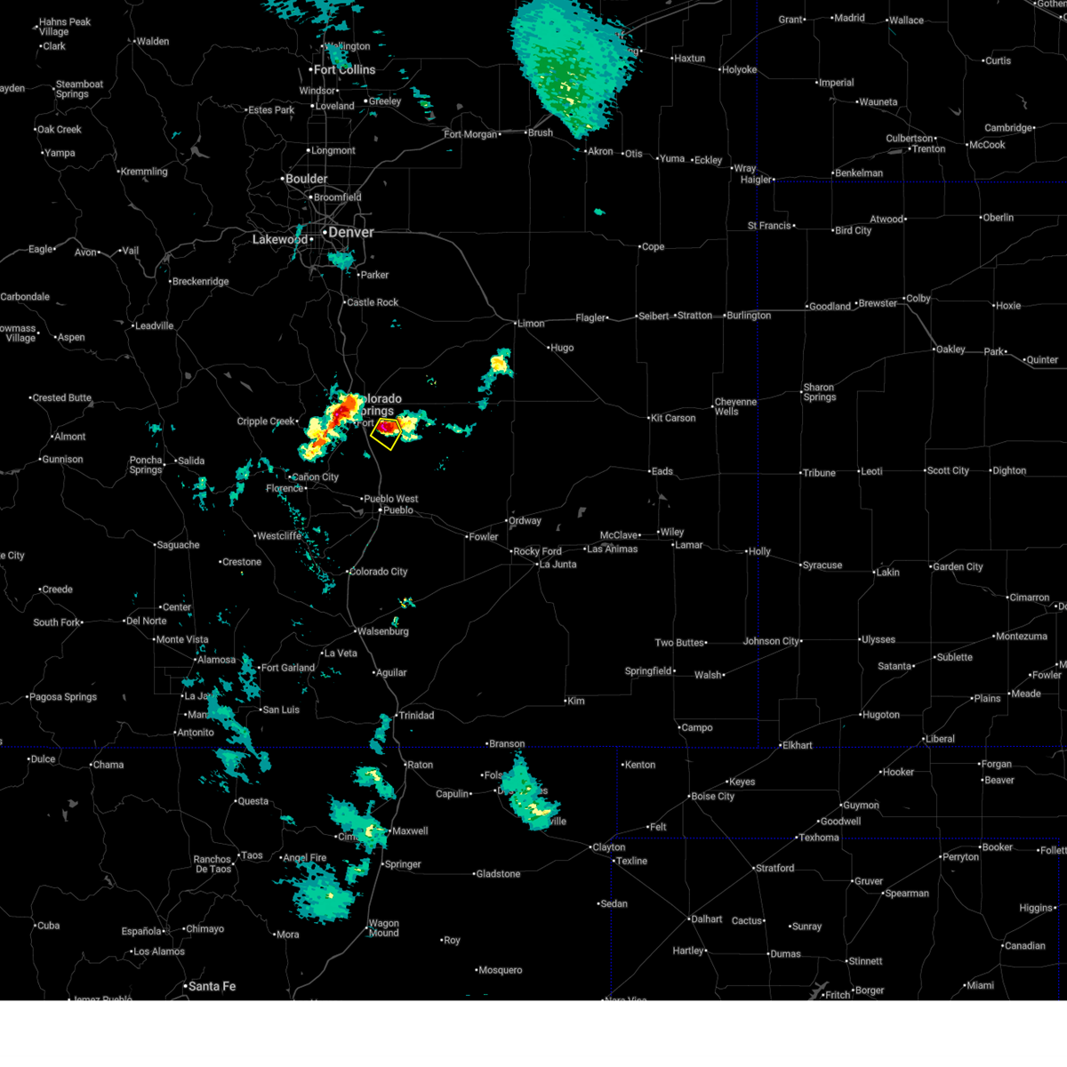
| 7/6/2025 10:05 PM MDT |
 Svrpub the national weather service in pueblo has issued a * severe thunderstorm warning for, south central el paso county in east central colorado, * until 1030 pm mdt. * at 1005 pm mdt, a severe thunderstorm was located near schriever space force base, or 15 miles southeast of colorado springs, moving east at 15 mph (radar indicated). Hazards include 60 mph wind gusts and quarter size hail. Hail damage to vehicles is expected. Expect wind damage to roofs, siding, and trees. Svrpub the national weather service in pueblo has issued a * severe thunderstorm warning for, south central el paso county in east central colorado, * until 1030 pm mdt. * at 1005 pm mdt, a severe thunderstorm was located near schriever space force base, or 15 miles southeast of colorado springs, moving east at 15 mph (radar indicated). Hazards include 60 mph wind gusts and quarter size hail. Hail damage to vehicles is expected. Expect wind damage to roofs, siding, and trees.
|
| 7/6/2025 6:44 PM MDT |
 The storm which prompted the warning in the fountain area has weakened below severe limits, and no longer poses an immediate threat to life or property. therefore, the warning will be allowed to expire. however, small hail and heavy rain are still possible with this thunderstorm. there is a chance that this storm could re-intenify and become severe once again a severe thunderstorm watch remains in effect until 800 pm mdt for east central colorado. The storm which prompted the warning in the fountain area has weakened below severe limits, and no longer poses an immediate threat to life or property. therefore, the warning will be allowed to expire. however, small hail and heavy rain are still possible with this thunderstorm. there is a chance that this storm could re-intenify and become severe once again a severe thunderstorm watch remains in effect until 800 pm mdt for east central colorado.
|
| 7/6/2025 6:13 PM MDT |
 At 612 pm mdt, a severe thunderstorm was located over falcon, or 14 miles northeast of colorado springs, moving southeast at 10 mph (radar indicated). Hazards include ping pong ball size hail and 60 mph wind gusts. People and animals outdoors will be injured. expect hail damage to roofs, siding, windows, and vehicles. expect wind damage to roofs, siding, and trees. numerous reports of 1 to 2 inch hail have been reported with severe severe storms in the colorado springs region. Locations impacted include, falcon and schriever space force base. At 612 pm mdt, a severe thunderstorm was located over falcon, or 14 miles northeast of colorado springs, moving southeast at 10 mph (radar indicated). Hazards include ping pong ball size hail and 60 mph wind gusts. People and animals outdoors will be injured. expect hail damage to roofs, siding, windows, and vehicles. expect wind damage to roofs, siding, and trees. numerous reports of 1 to 2 inch hail have been reported with severe severe storms in the colorado springs region. Locations impacted include, falcon and schriever space force base.
|
| 7/6/2025 6:04 PM MDT |
 Svrpub the national weather service in pueblo has issued a * severe thunderstorm warning for, southwestern el paso county in east central colorado, * until 645 pm mdt. * at 604 pm mdt, a severe thunderstorm was located near fountain, or 12 miles southeast of colorado springs, moving southeast at 20 mph (radar indicated). Hazards include 60 mph wind gusts and half dollar size hail. Hail damage to vehicles is expected. Expect wind damage to roofs, siding, and trees. Svrpub the national weather service in pueblo has issued a * severe thunderstorm warning for, southwestern el paso county in east central colorado, * until 645 pm mdt. * at 604 pm mdt, a severe thunderstorm was located near fountain, or 12 miles southeast of colorado springs, moving southeast at 20 mph (radar indicated). Hazards include 60 mph wind gusts and half dollar size hail. Hail damage to vehicles is expected. Expect wind damage to roofs, siding, and trees.
|
| 7/6/2025 6:03 PM MDT | Quarter sized hail reported 8.3 miles NNE of Colorado Springs, CO |
| 7/6/2025 6:00 PM MDT | Ping Pong Ball sized hail reported 6.8 miles NE of Colorado Springs, CO, measured 1.5 inch hail. widespread window damage and broken skylights reported. hail fell for approximately 40 consecutive minutes. |
| 7/6/2025 5:51 PM MDT | Half Dollar sized hail reported 9.5 miles SW of Colorado Springs, CO, report from mping: half dollar (1.25 in.). |
| 7/6/2025 5:50 PM MDT | Half Dollar sized hail reported 10.4 miles SSW of Colorado Springs, CO |
| 7/6/2025 5:50 PM MDT | Quarter sized hail reported 10.2 miles NNW of Colorado Springs, CO, report from mping: quarter (1.00 in.). |
| 7/6/2025 5:50 PM MDT |
 At 550 pm mdt, a severe thunderstorm was located near falcon, or 14 miles northeast of colorado springs, moving southeast at 15 mph (radar indicated). Hazards include ping pong ball size hail and 60 mph wind gusts. People and animals outdoors will be injured. expect hail damage to roofs, siding, windows, and vehicles. expect wind damage to roofs, siding, and trees. rotation was starting to develop with this storm. Locations impacted include, black forest, falcon, and schriever space force base. At 550 pm mdt, a severe thunderstorm was located near falcon, or 14 miles northeast of colorado springs, moving southeast at 15 mph (radar indicated). Hazards include ping pong ball size hail and 60 mph wind gusts. People and animals outdoors will be injured. expect hail damage to roofs, siding, windows, and vehicles. expect wind damage to roofs, siding, and trees. rotation was starting to develop with this storm. Locations impacted include, black forest, falcon, and schriever space force base.
|
| 7/6/2025 5:43 PM MDT | Hen Egg sized hail reported 7.2 miles NE of Colorado Springs, CO |
| 7/6/2025 5:43 PM MDT |
 At 542 pm mdt, a severe thunderstorm was located over southwestern colorado springs, moving south at 10 mph (reported by ham radio operators). Hazards include two inch hail. People and animals outdoors will be injured. expect damage to roofs, siding, windows, and vehicles. Locations impacted include, colorado springs, fountain, manitou springs, stratmoor, fort carson, security, security-widefield, peterson space force base, and cimarron hills. At 542 pm mdt, a severe thunderstorm was located over southwestern colorado springs, moving south at 10 mph (reported by ham radio operators). Hazards include two inch hail. People and animals outdoors will be injured. expect damage to roofs, siding, windows, and vehicles. Locations impacted include, colorado springs, fountain, manitou springs, stratmoor, fort carson, security, security-widefield, peterson space force base, and cimarron hills.
|
| 7/6/2025 5:40 PM MDT | Quarter sized hail reported 9.9 miles SSW of Colorado Springs, CO, report from mping: quarter (1.00 in.). |
| 7/6/2025 5:40 PM MDT |
 Svrpub the national weather service in pueblo has issued a * severe thunderstorm warning for, north central el paso county in east central colorado, * until 630 pm mdt. * at 540 pm mdt, a severe thunderstorm was located over black forest, or 14 miles northeast of colorado springs, moving southeast at 10 mph (radar indicated). Hazards include 60 mph wind gusts and half dollar size hail. Hail damage to vehicles is expected. Expect wind damage to roofs, siding, and trees. Svrpub the national weather service in pueblo has issued a * severe thunderstorm warning for, north central el paso county in east central colorado, * until 630 pm mdt. * at 540 pm mdt, a severe thunderstorm was located over black forest, or 14 miles northeast of colorado springs, moving southeast at 10 mph (radar indicated). Hazards include 60 mph wind gusts and half dollar size hail. Hail damage to vehicles is expected. Expect wind damage to roofs, siding, and trees.
|
| 7/6/2025 5:35 PM MDT | Ping Pong Ball sized hail reported 7.2 miles ENE of Colorado Springs, CO |
| 7/6/2025 5:34 PM MDT | Half Dollar sized hail reported 13.6 miles SSW of Colorado Springs, CO, report from mping: half dollar (1.25 in.). |
| 7/6/2025 5:30 PM MDT | Golf Ball sized hail reported 7.6 miles ENE of Colorado Springs, CO |
| 7/6/2025 5:28 PM MDT | Quarter sized hail reported 6.8 miles NE of Colorado Springs, CO, report from mping: quarter (1.00 in.). |
| 7/6/2025 5:25 PM MDT |
 At 525 pm mdt, a severe thunderstorm was located near black forest, or 17 miles northeast of colorado springs, moving southeast at 10 mph (radar indicated). Hazards include ping pong ball size hail and 60 mph wind gusts. People and animals outdoors will be injured. expect hail damage to roofs, siding, windows, and vehicles. expect wind damage to roofs, siding, and trees. Locations impacted include, northern colorado springs, peyton, and black forest. At 525 pm mdt, a severe thunderstorm was located near black forest, or 17 miles northeast of colorado springs, moving southeast at 10 mph (radar indicated). Hazards include ping pong ball size hail and 60 mph wind gusts. People and animals outdoors will be injured. expect hail damage to roofs, siding, windows, and vehicles. expect wind damage to roofs, siding, and trees. Locations impacted include, northern colorado springs, peyton, and black forest.
|
| 7/6/2025 5:23 PM MDT |
 Svrpub the national weather service in pueblo has issued a * severe thunderstorm warning for, southwestern el paso county in east central colorado, * until 615 pm mdt. * at 522 pm mdt, a severe thunderstorm was located over southwestern colorado springs, moving south at 10 mph (radar indicated). Hazards include ping pong ball size hail and 60 mph wind gusts. People and animals outdoors will be injured. expect hail damage to roofs, siding, windows, and vehicles. Expect wind damage to roofs, siding, and trees. Svrpub the national weather service in pueblo has issued a * severe thunderstorm warning for, southwestern el paso county in east central colorado, * until 615 pm mdt. * at 522 pm mdt, a severe thunderstorm was located over southwestern colorado springs, moving south at 10 mph (radar indicated). Hazards include ping pong ball size hail and 60 mph wind gusts. People and animals outdoors will be injured. expect hail damage to roofs, siding, windows, and vehicles. Expect wind damage to roofs, siding, and trees.
|
| 7/6/2025 5:20 PM MDT | Ping Pong Ball sized hail reported 7.1 miles NE of Colorado Springs, CO, storm lasted for 40 minutes (520pm-6pm) with largest hail 1.5 inches. 1.85 inches rain and melted hail. |
| 7/6/2025 5:19 PM MDT |
 At 518 pm mdt, a severe thunderstorm was located near black forest, or 18 miles northeast of colorado springs, moving southeast at 10 mph (radar indicated). Hazards include ping pong ball size hail and 60 mph wind gusts. People and animals outdoors will be injured. expect hail damage to roofs, siding, windows, and vehicles. expect wind damage to roofs, siding, and trees. Locations impacted include, northern colorado springs, monument, black forest, peyton, and gleneagle. At 518 pm mdt, a severe thunderstorm was located near black forest, or 18 miles northeast of colorado springs, moving southeast at 10 mph (radar indicated). Hazards include ping pong ball size hail and 60 mph wind gusts. People and animals outdoors will be injured. expect hail damage to roofs, siding, windows, and vehicles. expect wind damage to roofs, siding, and trees. Locations impacted include, northern colorado springs, monument, black forest, peyton, and gleneagle.
|
| 7/6/2025 5:13 PM MDT | Half Dollar sized hail reported 7.2 miles ENE of Colorado Springs, CO, report from mping: half dollar (1.25 in.). |
| 7/6/2025 5:13 PM MDT |
 At 512 pm mdt, a severe thunderstorm was located over southwestern colorado springs, moving southeast at 10 mph (radar indicated). Hazards include ping pong ball size hail and 60 mph wind gusts. People and animals outdoors will be injured. expect hail damage to roofs, siding, windows, and vehicles. expect wind damage to roofs, siding, and trees. 1 inch size hail has been reported with this storm. Locations impacted include, colorado springs, fountain, manitou springs, stratmoor, fort carson, security, security-widefield, cimarron hills, and peterson space force base. At 512 pm mdt, a severe thunderstorm was located over southwestern colorado springs, moving southeast at 10 mph (radar indicated). Hazards include ping pong ball size hail and 60 mph wind gusts. People and animals outdoors will be injured. expect hail damage to roofs, siding, windows, and vehicles. expect wind damage to roofs, siding, and trees. 1 inch size hail has been reported with this storm. Locations impacted include, colorado springs, fountain, manitou springs, stratmoor, fort carson, security, security-widefield, cimarron hills, and peterson space force base.
|
| 7/6/2025 5:07 PM MDT | Quarter sized hail reported 5.8 miles NE of Colorado Springs, CO |
| 7/6/2025 5:06 PM MDT |
 Svrpub the national weather service in pueblo has issued a * severe thunderstorm warning for, north central el paso county in east central colorado, * until 545 pm mdt. * at 506 pm mdt, a severe thunderstorm was located near black forest, or 19 miles north of colorado springs, moving southeast at 10 mph (radar indicated). Hazards include 60 mph wind gusts and quarter size hail. Hail damage to vehicles is expected. Expect wind damage to roofs, siding, and trees. Svrpub the national weather service in pueblo has issued a * severe thunderstorm warning for, north central el paso county in east central colorado, * until 545 pm mdt. * at 506 pm mdt, a severe thunderstorm was located near black forest, or 19 miles north of colorado springs, moving southeast at 10 mph (radar indicated). Hazards include 60 mph wind gusts and quarter size hail. Hail damage to vehicles is expected. Expect wind damage to roofs, siding, and trees.
|
| 7/6/2025 5:05 PM MDT | Quarter sized hail reported 14.7 miles S of Colorado Springs, CO |
| 7/6/2025 5:04 PM MDT |
 Svrpub the national weather service in pueblo has issued a * severe thunderstorm warning for, southwestern el paso county in east central colorado, * until 530 pm mdt. * at 504 pm mdt, a severe thunderstorm was located over western colorado springs, moving southeast at 10 mph (radar indicated). Hazards include 60 mph wind gusts and quarter size hail. Hail damage to vehicles is expected. Expect wind damage to roofs, siding, and trees. Svrpub the national weather service in pueblo has issued a * severe thunderstorm warning for, southwestern el paso county in east central colorado, * until 530 pm mdt. * at 504 pm mdt, a severe thunderstorm was located over western colorado springs, moving southeast at 10 mph (radar indicated). Hazards include 60 mph wind gusts and quarter size hail. Hail damage to vehicles is expected. Expect wind damage to roofs, siding, and trees.
|
| 7/4/2025 12:40 PM MDT |
 The storm which prompted the warning has weakened below severe limits, and no longer poses an immediate threat to life or property. therefore, the warning will be allowed to expire. however, small hail is still possible with this thunderstorm. The storm which prompted the warning has weakened below severe limits, and no longer poses an immediate threat to life or property. therefore, the warning will be allowed to expire. however, small hail is still possible with this thunderstorm.
|
| 7/4/2025 12:33 PM MDT |
 At 1233 pm mdt, a severe thunderstorm was located over northern colorado springs, moving southeast at 15 mph (trained weather spotters). Hazards include quarter size hail. Damage to vehicles is expected. Locations impacted include, colorado springs, falcon, cimarron hills, and peterson space force base. At 1233 pm mdt, a severe thunderstorm was located over northern colorado springs, moving southeast at 15 mph (trained weather spotters). Hazards include quarter size hail. Damage to vehicles is expected. Locations impacted include, colorado springs, falcon, cimarron hills, and peterson space force base.
|
| 7/4/2025 12:20 PM MDT |
 Svrpub the national weather service in pueblo has issued a * severe thunderstorm warning for, northwestern el paso county in east central colorado, * until 1245 pm mdt. * at 1220 pm mdt, a severe thunderstorm was located near air force academy, or 9 miles north of colorado springs, moving southeast at 15 mph (trained weather spotters). Hazards include quarter size hail. damage to vehicles is expected Svrpub the national weather service in pueblo has issued a * severe thunderstorm warning for, northwestern el paso county in east central colorado, * until 1245 pm mdt. * at 1220 pm mdt, a severe thunderstorm was located near air force academy, or 9 miles north of colorado springs, moving southeast at 15 mph (trained weather spotters). Hazards include quarter size hail. damage to vehicles is expected
|
| 6/27/2025 2:20 PM MDT | Asos station kcos colorado springs airport thunderstorm outflow wind gus in el paso county CO, 6 miles NW of Colorado Springs, CO |
| 6/24/2025 2:28 PM MDT |
 The storm which prompted the warning has weakened below severe limits, and no longer poses an immediate threat to life or property. therefore, the warning will be allowed to expire. however, small hail, gusty winds and heavy rain are still possible with this thunderstorm. a severe thunderstorm watch remains in effect until 800 pm mdt for east central colorado. The storm which prompted the warning has weakened below severe limits, and no longer poses an immediate threat to life or property. therefore, the warning will be allowed to expire. however, small hail, gusty winds and heavy rain are still possible with this thunderstorm. a severe thunderstorm watch remains in effect until 800 pm mdt for east central colorado.
|
| 6/24/2025 2:19 PM MDT |
 At 219 pm mdt, a severe thunderstorm was located over eastern colorado springs, moving northeast at 20 mph (radar indicated). Hazards include 60 mph wind gusts and quarter size hail. Hail damage to vehicles is expected. expect wind damage to roofs, siding, and trees. Locations impacted include, eastern colorado springs, schriever space force base, cimarron hills, and peterson space force base. At 219 pm mdt, a severe thunderstorm was located over eastern colorado springs, moving northeast at 20 mph (radar indicated). Hazards include 60 mph wind gusts and quarter size hail. Hail damage to vehicles is expected. expect wind damage to roofs, siding, and trees. Locations impacted include, eastern colorado springs, schriever space force base, cimarron hills, and peterson space force base.
|
| 6/24/2025 2:12 PM MDT |
 At 212 pm mdt, a severe thunderstorm was located over southeastern colorado springs, moving east at 20 mph (radar indicated). Hazards include 60 mph wind gusts and quarter size hail. Hail damage to vehicles is expected. expect wind damage to roofs, siding, and trees. Locations impacted include, southeastern colorado springs, schriever space force base, cimarron hills, peterson space force base, and security-widefield. At 212 pm mdt, a severe thunderstorm was located over southeastern colorado springs, moving east at 20 mph (radar indicated). Hazards include 60 mph wind gusts and quarter size hail. Hail damage to vehicles is expected. expect wind damage to roofs, siding, and trees. Locations impacted include, southeastern colorado springs, schriever space force base, cimarron hills, peterson space force base, and security-widefield.
|
| 6/24/2025 2:06 PM MDT |
 At 206 pm mdt, a severe thunderstorm was located over southeastern colorado springs, moving northeast at 20 mph (radar indicated). Hazards include 60 mph wind gusts and quarter size hail. Hail damage to vehicles is expected. expect wind damage to roofs, siding, and trees. Locations impacted include, southern colorado springs, fountain, schriever space force base, security-widefield, cimarron hills, and peterson space force base. At 206 pm mdt, a severe thunderstorm was located over southeastern colorado springs, moving northeast at 20 mph (radar indicated). Hazards include 60 mph wind gusts and quarter size hail. Hail damage to vehicles is expected. expect wind damage to roofs, siding, and trees. Locations impacted include, southern colorado springs, fountain, schriever space force base, security-widefield, cimarron hills, and peterson space force base.
|
| 6/24/2025 1:59 PM MDT |
 Svrpub the national weather service in pueblo has issued a * severe thunderstorm warning for, central el paso county in east central colorado, * until 230 pm mdt. * at 159 pm mdt, a severe thunderstorm was located over southeastern colorado springs, moving east at 20 mph (radar indicated). Hazards include 60 mph wind gusts and quarter size hail. Hail damage to vehicles is expected. Expect wind damage to roofs, siding, and trees. Svrpub the national weather service in pueblo has issued a * severe thunderstorm warning for, central el paso county in east central colorado, * until 230 pm mdt. * at 159 pm mdt, a severe thunderstorm was located over southeastern colorado springs, moving east at 20 mph (radar indicated). Hazards include 60 mph wind gusts and quarter size hail. Hail damage to vehicles is expected. Expect wind damage to roofs, siding, and trees.
|
| 6/24/2025 1:58 PM MDT | Quarter sized hail reported 3.6 miles WSW of Colorado Springs, CO, report from mping: quarter (1.00 in.). |
| 6/24/2025 1:45 PM MDT |
 At 144 pm mdt, a severe thunderstorm was located over northwestern colorado springs, moving northeast at 15 mph (trained weather spotters). Hazards include 60 mph wind gusts and quarter size hail. Hail damage to vehicles is expected. expect wind damage to roofs, siding, and trees. Locations impacted include, colorado springs, fountain, air force academy, manitou springs, black forest, stratmoor, fort carson, security, security-widefield, falcon, cimarron hills, and peterson space force base. At 144 pm mdt, a severe thunderstorm was located over northwestern colorado springs, moving northeast at 15 mph (trained weather spotters). Hazards include 60 mph wind gusts and quarter size hail. Hail damage to vehicles is expected. expect wind damage to roofs, siding, and trees. Locations impacted include, colorado springs, fountain, air force academy, manitou springs, black forest, stratmoor, fort carson, security, security-widefield, falcon, cimarron hills, and peterson space force base.
|
| 6/24/2025 1:35 PM MDT |
 Svrpub the national weather service in pueblo has issued a * severe thunderstorm warning for, northwestern el paso county in east central colorado, * until 200 pm mdt. * at 135 pm mdt, a severe thunderstorm was located over western colorado springs, moving northeast at 15 mph (radar indicated). Hazards include 60 mph wind gusts and quarter size hail. Hail damage to vehicles is expected. Expect wind damage to roofs, siding, and trees. Svrpub the national weather service in pueblo has issued a * severe thunderstorm warning for, northwestern el paso county in east central colorado, * until 200 pm mdt. * at 135 pm mdt, a severe thunderstorm was located over western colorado springs, moving northeast at 15 mph (radar indicated). Hazards include 60 mph wind gusts and quarter size hail. Hail damage to vehicles is expected. Expect wind damage to roofs, siding, and trees.
|
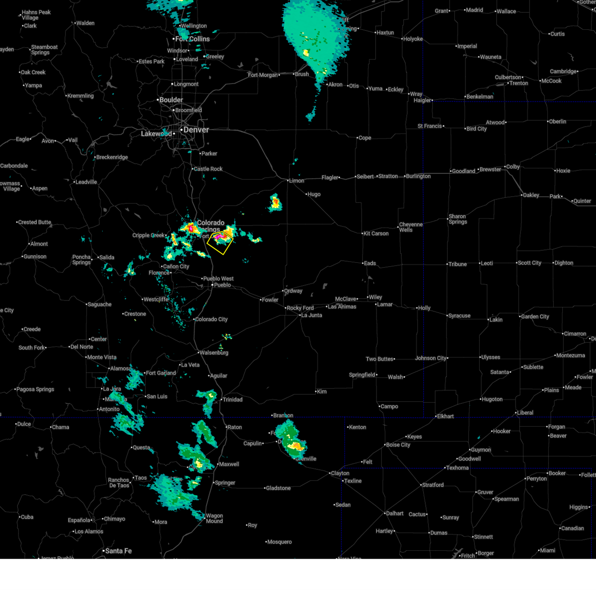
| 6/17/2025 2:11 PM MDT |
 The storm which prompted the warning has weakened below severe limits, and no longer poses an immediate threat to life or property. therefore, the warning will be allowed to expire. a severe thunderstorm watch remains in effect until 500 pm mdt for east central colorado. The storm which prompted the warning has weakened below severe limits, and no longer poses an immediate threat to life or property. therefore, the warning will be allowed to expire. a severe thunderstorm watch remains in effect until 500 pm mdt for east central colorado.
|
| 6/17/2025 1:54 PM MDT | Half Dollar sized hail reported 3.6 miles WSW of Colorado Springs, CO, report from mping: half dollar (1.25 in.). |
| 6/17/2025 1:46 PM MDT | Golf Ball sized hail reported 3.6 miles WSW of Colorado Springs, CO, report from mping: golf ball (1.75 in.). |
| 6/17/2025 1:45 PM MDT | Golf Ball sized hail reported 3.6 miles WSW of Colorado Springs, CO, report from mping: golf ball (1.75 in.). |
| 6/17/2025 1:42 PM MDT |
 the severe thunderstorm warning has been cancelled and is no longer in effect the severe thunderstorm warning has been cancelled and is no longer in effect
|
| 6/17/2025 1:35 PM MDT |
 Svrpub the national weather service in pueblo has issued a * severe thunderstorm warning for, north central el paso county in east central colorado, * until 215 pm mdt. * at 135 pm mdt, a severe thunderstorm was located near cimarron hills, or 8 miles northeast of colorado springs, moving east at 20 mph (radar indicated). Hazards include 60 mph wind gusts and quarter size hail. Hail damage to vehicles is expected. Expect wind damage to roofs, siding, and trees. Svrpub the national weather service in pueblo has issued a * severe thunderstorm warning for, north central el paso county in east central colorado, * until 215 pm mdt. * at 135 pm mdt, a severe thunderstorm was located near cimarron hills, or 8 miles northeast of colorado springs, moving east at 20 mph (radar indicated). Hazards include 60 mph wind gusts and quarter size hail. Hail damage to vehicles is expected. Expect wind damage to roofs, siding, and trees.
|
| 6/17/2025 1:34 PM MDT | Quarter sized hail reported 2.5 miles SSE of Colorado Springs, CO, report from mping: quarter (1.00 in.). |
| 6/17/2025 1:29 PM MDT | Ping Pong Ball sized hail reported 3 miles S of Colorado Springs, CO |
| 6/17/2025 1:28 PM MDT | Ping Pong Ball sized hail reported 4 miles ESE of Colorado Springs, CO |
| 6/17/2025 1:28 PM MDT | Half Dollar sized hail reported 3.1 miles SSE of Colorado Springs, CO, report from mping: half dollar (1.25 in.). |
| 6/17/2025 1:26 PM MDT | Quarter sized hail reported 3.5 miles ESE of Colorado Springs, CO, report from mping: quarter (1.00 in.). |
| 6/17/2025 1:26 PM MDT | Quarter sized hail reported 4.8 miles ESE of Colorado Springs, CO |
| 6/17/2025 1:25 PM MDT | Quarter sized hail reported 5.3 miles ESE of Colorado Springs, CO |
| 6/17/2025 1:23 PM MDT | Quarter sized hail reported 4.7 miles SE of Colorado Springs, CO, report from mping: quarter (1.00 in.). |
| 6/17/2025 1:23 PM MDT |
 At 122 pm mdt, a severe thunderstorm was located over air force academy, or 8 miles north of colorado springs, moving east southeast at 20 mph (trained weather spotters reported quarter sized hail 1 mile south of the air force academy). Hazards include 60 mph wind gusts and half dollar size hail. Hail damage to vehicles is expected. expect wind damage to roofs, siding, and trees. Locations impacted include, colorado springs, air force academy, green mountain falls, chipita park, and cascade. At 122 pm mdt, a severe thunderstorm was located over air force academy, or 8 miles north of colorado springs, moving east southeast at 20 mph (trained weather spotters reported quarter sized hail 1 mile south of the air force academy). Hazards include 60 mph wind gusts and half dollar size hail. Hail damage to vehicles is expected. expect wind damage to roofs, siding, and trees. Locations impacted include, colorado springs, air force academy, green mountain falls, chipita park, and cascade.
|
| 6/17/2025 1:21 PM MDT | Quarter sized hail reported 5.2 miles SE of Colorado Springs, CO |
| 6/17/2025 1:20 PM MDT | Quarter sized hail reported 6 miles SE of Colorado Springs, CO |
| 6/17/2025 1:19 PM MDT | Quarter sized hail reported 5.8 miles ESE of Colorado Springs, CO |
| 6/17/2025 1:11 PM MDT | Quarter sized hail reported 20.8 miles NW of Colorado Springs, CO, mping report. |
| 6/17/2025 1:09 PM MDT |
 Svrpub the national weather service in pueblo has issued a * severe thunderstorm warning for, northwestern el paso county in east central colorado, * until 200 pm mdt. * at 108 pm mdt, a severe thunderstorm was located near air force academy, or 11 miles northwest of colorado springs, moving east at 20 mph (radar indicated). Hazards include ping pong ball size hail and 60 mph wind gusts. People and animals outdoors will be injured. expect hail damage to roofs, siding, windows, and vehicles. Expect wind damage to roofs, siding, and trees. Svrpub the national weather service in pueblo has issued a * severe thunderstorm warning for, northwestern el paso county in east central colorado, * until 200 pm mdt. * at 108 pm mdt, a severe thunderstorm was located near air force academy, or 11 miles northwest of colorado springs, moving east at 20 mph (radar indicated). Hazards include ping pong ball size hail and 60 mph wind gusts. People and animals outdoors will be injured. expect hail damage to roofs, siding, windows, and vehicles. Expect wind damage to roofs, siding, and trees.
|
| 6/17/2025 1:02 PM MDT |
 At 102 pm mdt, a severe thunderstorm was located near schriever space force base, or 18 miles southeast of colorado springs, moving east at 25 mph (radar indicated). Hazards include 60 mph wind gusts and quarter size hail. Hail damage to vehicles is expected. expect wind damage to roofs, siding, and trees. Locations impacted include, fountain, hanover, and schriever space force base. At 102 pm mdt, a severe thunderstorm was located near schriever space force base, or 18 miles southeast of colorado springs, moving east at 25 mph (radar indicated). Hazards include 60 mph wind gusts and quarter size hail. Hail damage to vehicles is expected. expect wind damage to roofs, siding, and trees. Locations impacted include, fountain, hanover, and schriever space force base.
|
| 6/17/2025 12:54 PM MDT |
 Svrpub the national weather service in pueblo has issued a * severe thunderstorm warning for, southeastern el paso county in east central colorado, * until 130 pm mdt. * at 1254 pm mdt, a severe thunderstorm was located near schriever space force base, or 15 miles southeast of colorado springs, moving east at 25 mph (radar indicated). Hazards include 60 mph wind gusts and quarter size hail. Hail damage to vehicles is expected. Expect wind damage to roofs, siding, and trees. Svrpub the national weather service in pueblo has issued a * severe thunderstorm warning for, southeastern el paso county in east central colorado, * until 130 pm mdt. * at 1254 pm mdt, a severe thunderstorm was located near schriever space force base, or 15 miles southeast of colorado springs, moving east at 25 mph (radar indicated). Hazards include 60 mph wind gusts and quarter size hail. Hail damage to vehicles is expected. Expect wind damage to roofs, siding, and trees.
|
| 6/17/2025 11:24 AM MDT |
 The storm which prompted the warning has weakened below severe limits, and no longer poses an immediate threat to life or property. therefore, the warning will be allowed to expire. however, small hail and gusty winds are still possible with this thunderstorm. a severe thunderstorm watch remains in effect until 500 pm mdt for east central colorado. The storm which prompted the warning has weakened below severe limits, and no longer poses an immediate threat to life or property. therefore, the warning will be allowed to expire. however, small hail and gusty winds are still possible with this thunderstorm. a severe thunderstorm watch remains in effect until 500 pm mdt for east central colorado.
|
| 6/17/2025 11:15 AM MDT |
 At 1115 am mdt, a severe thunderstorm was located near peterson space force base, or 11 miles east of colorado springs, moving east at 35 mph (radar indicated). Hazards include quarter size hail. Damage to vehicles is expected. Locations impacted include, southeastern colorado springs, schriever space force base, cimarron hills, peterson space force base, and security-widefield. At 1115 am mdt, a severe thunderstorm was located near peterson space force base, or 11 miles east of colorado springs, moving east at 35 mph (radar indicated). Hazards include quarter size hail. Damage to vehicles is expected. Locations impacted include, southeastern colorado springs, schriever space force base, cimarron hills, peterson space force base, and security-widefield.
|
| 6/17/2025 11:08 AM MDT |
 At 1108 am mdt, a severe thunderstorm was located over southeastern colorado springs, moving east at 15 mph (radar indicated). Hazards include 60 mph wind gusts and quarter size hail. Hail damage to vehicles is expected. expect wind damage to roofs, siding, and trees. Locations impacted include, colorado springs, fountain, stratmoor, fort carson, schriever space force base, security, security-widefield, cimarron hills, and peterson space force base. At 1108 am mdt, a severe thunderstorm was located over southeastern colorado springs, moving east at 15 mph (radar indicated). Hazards include 60 mph wind gusts and quarter size hail. Hail damage to vehicles is expected. expect wind damage to roofs, siding, and trees. Locations impacted include, colorado springs, fountain, stratmoor, fort carson, schriever space force base, security, security-widefield, cimarron hills, and peterson space force base.
|
| 6/17/2025 10:58 AM MDT |
 Svrpub the national weather service in pueblo has issued a * severe thunderstorm warning for, central el paso county in east central colorado, * until 1130 am mdt. * at 1058 am mdt, a severe thunderstorm was located over southern colorado springs, moving east at 15 mph (radar indicated). Hazards include 60 mph wind gusts and quarter size hail. Hail damage to vehicles is expected. Expect wind damage to roofs, siding, and trees. Svrpub the national weather service in pueblo has issued a * severe thunderstorm warning for, central el paso county in east central colorado, * until 1130 am mdt. * at 1058 am mdt, a severe thunderstorm was located over southern colorado springs, moving east at 15 mph (radar indicated). Hazards include 60 mph wind gusts and quarter size hail. Hail damage to vehicles is expected. Expect wind damage to roofs, siding, and trees.
|
| 6/17/2025 10:57 AM MDT | Quarter sized hail reported 2.2 miles NNE of Colorado Springs, CO |
| 6/17/2025 10:56 AM MDT | Quarter sized hail reported 2.6 miles N of Colorado Springs, CO, report from mping: quarter (1.00 in.). |
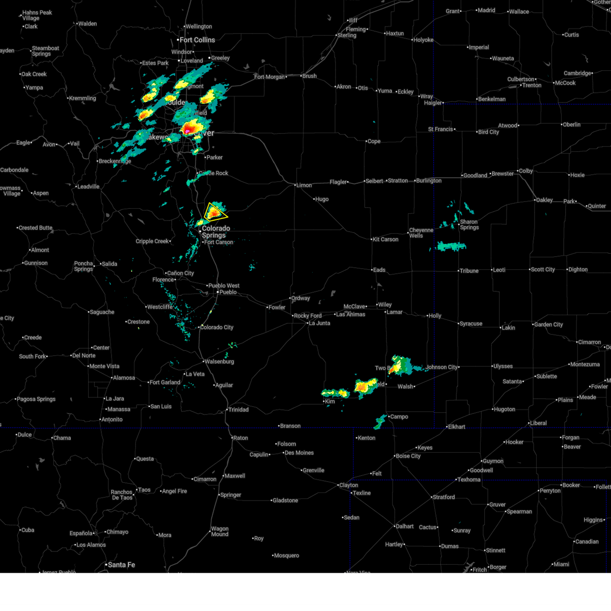
| 6/15/2025 7:32 PM MDT | Ping Pong Ball sized hail reported 3.7 miles SW of Colorado Springs, CO, report from mping: ping pong ball (1.50 in.). |
| 6/15/2025 7:30 PM MDT | Half Dollar sized hail reported 3.7 miles SW of Colorado Springs, CO, report from mping: half dollar (1.25 in.). |
| 6/15/2025 7:27 PM MDT | Quarter sized hail reported 4.2 miles SSW of Colorado Springs, CO, report from mping: quarter (1.00 in.). |
| 6/15/2025 7:20 PM MDT | Quarter sized hail reported 18.8 miles WNW of Colorado Springs, CO, report from mping: quarter (1.00 in.). |
| 6/15/2025 7:07 PM MDT |
 At 705 pm mdt, a severe thunderstorm was located near schriever space force base, or 13 miles east of colorado springs, moving southeast at 25 mph (radar indicated. this storm has a long history of producing hail stones between ping pong and golf ball size hails schriever space force base is in the direct path of this hailstorm). Hazards include golf ball size hail and 60 mph wind gusts. People and animals outdoors will be injured. expect hail damage to roofs, siding, windows, and vehicles. expect wind damage to roofs, siding, and trees. Locations impacted include, southeastern colorado springs, fountain, schriever space force base, hanover, and security-widefield. At 705 pm mdt, a severe thunderstorm was located near schriever space force base, or 13 miles east of colorado springs, moving southeast at 25 mph (radar indicated. this storm has a long history of producing hail stones between ping pong and golf ball size hails schriever space force base is in the direct path of this hailstorm). Hazards include golf ball size hail and 60 mph wind gusts. People and animals outdoors will be injured. expect hail damage to roofs, siding, windows, and vehicles. expect wind damage to roofs, siding, and trees. Locations impacted include, southeastern colorado springs, fountain, schriever space force base, hanover, and security-widefield.
|
| 6/15/2025 6:54 PM MDT | Half Dollar sized hail reported 9 miles NW of Colorado Springs, CO |
| 6/15/2025 6:54 PM MDT |
 Svrpub the national weather service in pueblo has issued a * severe thunderstorm warning for, central el paso county in east central colorado, * until 730 pm mdt. * at 653 pm mdt, a severe thunderstorm was located over southeastern colorado springs, moving southeast at 20 mph. this storm has a long history of producing ping pong to golfball size hail. 1.25 inch hail was occurring at the colorado spring airport at 6:53 pm (radar indicated). Hazards include golf ball size hail and 60 mph wind gusts. People and animals outdoors will be injured. expect hail damage to roofs, siding, windows, and vehicles. Expect wind damage to roofs, siding, and trees. Svrpub the national weather service in pueblo has issued a * severe thunderstorm warning for, central el paso county in east central colorado, * until 730 pm mdt. * at 653 pm mdt, a severe thunderstorm was located over southeastern colorado springs, moving southeast at 20 mph. this storm has a long history of producing ping pong to golfball size hail. 1.25 inch hail was occurring at the colorado spring airport at 6:53 pm (radar indicated). Hazards include golf ball size hail and 60 mph wind gusts. People and animals outdoors will be injured. expect hail damage to roofs, siding, windows, and vehicles. Expect wind damage to roofs, siding, and trees.
|
| 6/15/2025 6:52 PM MDT | Half Dollar sized hail reported 5.6 miles NNW of Colorado Springs, CO |
| 6/15/2025 6:49 PM MDT |
 At 648 pm mdt, a severe thunderstorm was located over cimarron hills, or 7 miles east of colorado springs, moving southeast at 20 mph (trained ham radio weather spotters). Hazards include numerous reports of hail between ping pong and golfball size hail were being reported by ham radio operators on the southeast side of colorado springs. People and animals outdoors will be injured. expect damage to roofs, siding, windows, and vehicles. Locations impacted include, colorado springs, fountain, schriever space force base, security, security-widefield, falcon, cimarron hills, peterson space force base, and stratmoor. At 648 pm mdt, a severe thunderstorm was located over cimarron hills, or 7 miles east of colorado springs, moving southeast at 20 mph (trained ham radio weather spotters). Hazards include numerous reports of hail between ping pong and golfball size hail were being reported by ham radio operators on the southeast side of colorado springs. People and animals outdoors will be injured. expect damage to roofs, siding, windows, and vehicles. Locations impacted include, colorado springs, fountain, schriever space force base, security, security-widefield, falcon, cimarron hills, peterson space force base, and stratmoor.
|
| 6/15/2025 6:48 PM MDT | Quarter sized hail reported 3.8 miles WNW of Colorado Springs, CO, report from mping: quarter (1.00 in.). |
| 6/15/2025 6:48 PM MDT | Golf Ball sized hail reported 1.7 miles W of Colorado Springs, CO, report from mping: golf ball (1.75 in.). |
| 6/15/2025 6:47 PM MDT | Quarter sized hail reported 2.1 miles NW of Colorado Springs, CO, report from mping: quarter (1.00 in.). |
| 6/15/2025 6:46 PM MDT |
 At 645 pm mdt, a severe thunderstorm was located over cimarron hills, or near colorado springs, moving southeast at 20 mph (trained ham radio weather spotters). Hazards include ping pong ball size hail and 60 mph wind gusts. the hail report was at powers and aeroplaza drive. People and animals outdoors will be injured. expect hail damage to roofs, siding, windows, and vehicles. expect wind damage to roofs, siding, and trees. Locations impacted include, colorado springs, fountain, schriever space force base, security, security-widefield, falcon, cimarron hills, peterson space force base, and stratmoor. At 645 pm mdt, a severe thunderstorm was located over cimarron hills, or near colorado springs, moving southeast at 20 mph (trained ham radio weather spotters). Hazards include ping pong ball size hail and 60 mph wind gusts. the hail report was at powers and aeroplaza drive. People and animals outdoors will be injured. expect hail damage to roofs, siding, windows, and vehicles. expect wind damage to roofs, siding, and trees. Locations impacted include, colorado springs, fountain, schriever space force base, security, security-widefield, falcon, cimarron hills, peterson space force base, and stratmoor.
|
| 6/15/2025 6:45 PM MDT | Half Dollar sized hail reported 1 miles SSE of Colorado Springs, CO, report from mping: half dollar (1.25 in.). |
| 6/15/2025 6:44 PM MDT | Ping Pong Ball sized hail reported 3.5 miles NNW of Colorado Springs, CO, report from mping: ping pong ball (1.50 in.). |
| 6/15/2025 6:43 PM MDT | Ping Pong Ball sized hail reported 4.9 miles NNW of Colorado Springs, CO |
| 6/15/2025 6:43 PM MDT | Quarter sized hail reported 3.5 miles NNW of Colorado Springs, CO, report from mping: quarter (1.00 in.). |
| 6/15/2025 6:41 PM MDT | Quarter sized hail reported 1 miles SSE of Colorado Springs, CO, report from mping: quarter (1.00 in.). |
| 6/15/2025 6:40 PM MDT | Quarter sized hail reported 0.8 miles NW of Colorado Springs, CO, report from mping: quarter (1.00 in.). |
| 6/15/2025 6:40 PM MDT | Golf Ball sized hail reported 2.5 miles NW of Colorado Springs, CO, picture with measurement on social media. |
| 6/15/2025 6:37 PM MDT |
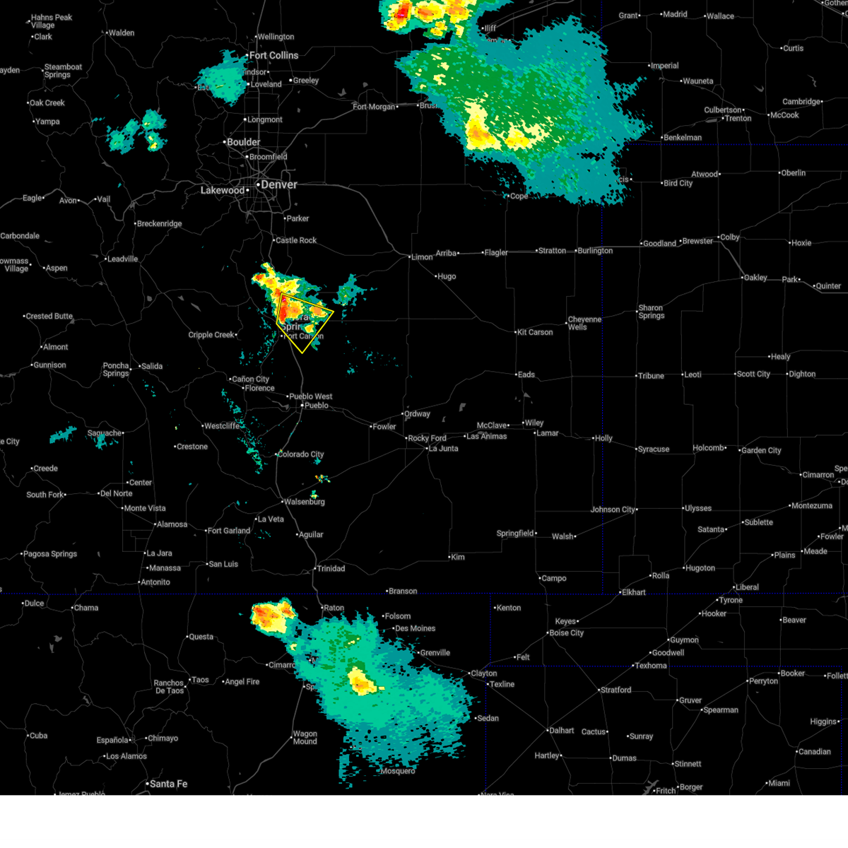 Svrpub the national weather service in pueblo has issued a * severe thunderstorm warning for, central el paso county in east central colorado, * until 700 pm mdt. * at 635 pm mdt, a severe thunderstorm was located over northeastern colorado springs, moving southeast at 20 mph (radar indicated). Hazards include 60 mph wind gusts and half dollar size hail. Hail damage to vehicles is expected. expect wind damage to roofs, siding, and trees. This storm has a long history of producing hailstones between the size of quarters and golfballs. Svrpub the national weather service in pueblo has issued a * severe thunderstorm warning for, central el paso county in east central colorado, * until 700 pm mdt. * at 635 pm mdt, a severe thunderstorm was located over northeastern colorado springs, moving southeast at 20 mph (radar indicated). Hazards include 60 mph wind gusts and half dollar size hail. Hail damage to vehicles is expected. expect wind damage to roofs, siding, and trees. This storm has a long history of producing hailstones between the size of quarters and golfballs.
|
| 6/15/2025 6:35 PM MDT | Quarter sized hail reported 1.6 miles SSE of Colorado Springs, CO |
| 6/15/2025 6:34 PM MDT | Quarter sized hail reported 2.5 miles SSE of Colorado Springs, CO, report from mping: quarter (1.00 in.). |
| 6/15/2025 6:34 PM MDT |
 At 633 pm mdt, a severe thunderstorm was located over eastern colorado springs, moving southeast at 30 mph (trained weather spotters). Hazards include golf ball size hail. this report occurred at academy and dublin. People and animals outdoors will be injured. expect damage to roofs, siding, windows, and vehicles. Locations impacted include, colorado springs, monument, air force academy, manitou springs, crystola, security, falcon, stratmoor, fort carson, cimarron hills, peterson space force base, cascade, chipita park, gleneagle, and security-widefield. At 633 pm mdt, a severe thunderstorm was located over eastern colorado springs, moving southeast at 30 mph (trained weather spotters). Hazards include golf ball size hail. this report occurred at academy and dublin. People and animals outdoors will be injured. expect damage to roofs, siding, windows, and vehicles. Locations impacted include, colorado springs, monument, air force academy, manitou springs, crystola, security, falcon, stratmoor, fort carson, cimarron hills, peterson space force base, cascade, chipita park, gleneagle, and security-widefield.
|
| 6/15/2025 6:30 PM MDT | Golf Ball sized hail reported 3.9 miles SSE of Colorado Springs, CO, report from storm spotter network. |
| 6/15/2025 6:28 PM MDT |
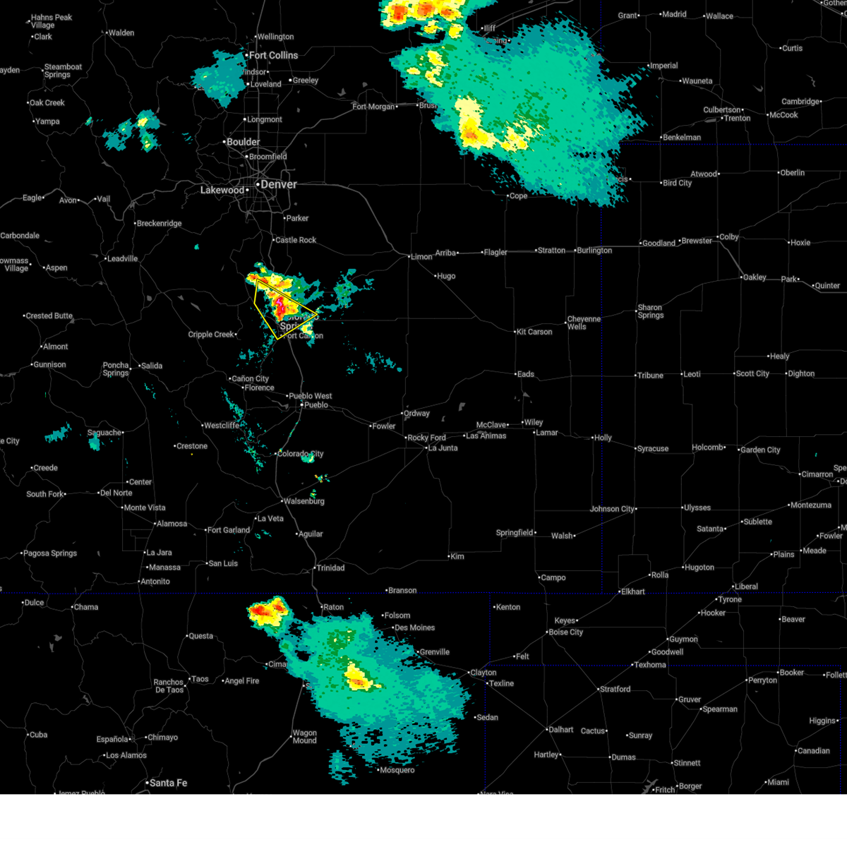 At 628 pm mdt, a severe thunderstorm was located over central colorado springs, moving southeast at 20 mph (trained weather spotters). Hazards include quarter size hail. Damage to vehicles is expected. Locations impacted include, colorado springs, monument, air force academy, manitou springs, crystola, security, falcon, stratmoor, fort carson, cimarron hills, peterson space force base, cascade, chipita park, gleneagle, and security-widefield. At 628 pm mdt, a severe thunderstorm was located over central colorado springs, moving southeast at 20 mph (trained weather spotters). Hazards include quarter size hail. Damage to vehicles is expected. Locations impacted include, colorado springs, monument, air force academy, manitou springs, crystola, security, falcon, stratmoor, fort carson, cimarron hills, peterson space force base, cascade, chipita park, gleneagle, and security-widefield.
|
| 6/15/2025 6:20 PM MDT |
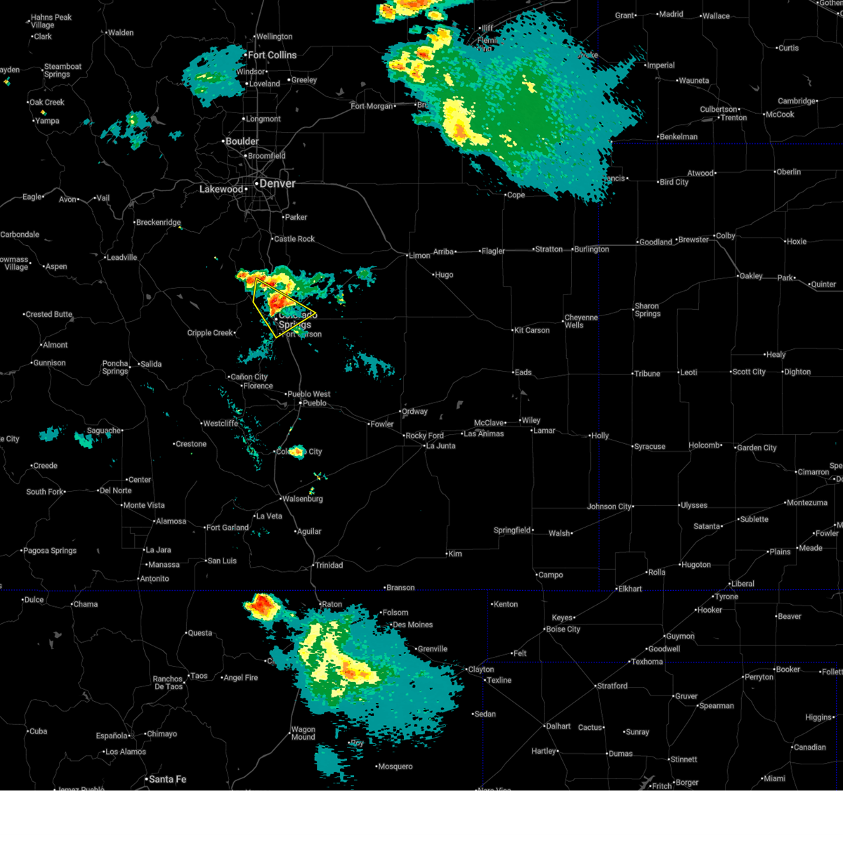 At 619 pm mdt, a severe thunderstorm was located over southeastern colorado springs, moving southeast at 30 mph (trained weather spotters). Hazards include quarter size hail was reported by a trained spotter at 6:18 pm in colorado springs. Damage to vehicles is expected. Locations impacted include, colorado springs, monument, air force academy, manitou springs, crystola, security, falcon, stratmoor, fort carson, cimarron hills, peterson space force base, cascade, chipita park, gleneagle, and security-widefield. At 619 pm mdt, a severe thunderstorm was located over southeastern colorado springs, moving southeast at 30 mph (trained weather spotters). Hazards include quarter size hail was reported by a trained spotter at 6:18 pm in colorado springs. Damage to vehicles is expected. Locations impacted include, colorado springs, monument, air force academy, manitou springs, crystola, security, falcon, stratmoor, fort carson, cimarron hills, peterson space force base, cascade, chipita park, gleneagle, and security-widefield.
|
| 6/15/2025 6:19 PM MDT | Quarter sized hail reported 4.9 miles E of Colorado Springs, CO, report from mping: quarter (1.00 in.). |
| 6/15/2025 6:18 PM MDT | Quarter sized hail reported 5.8 miles ESE of Colorado Springs, CO |
| 6/15/2025 6:13 PM MDT |
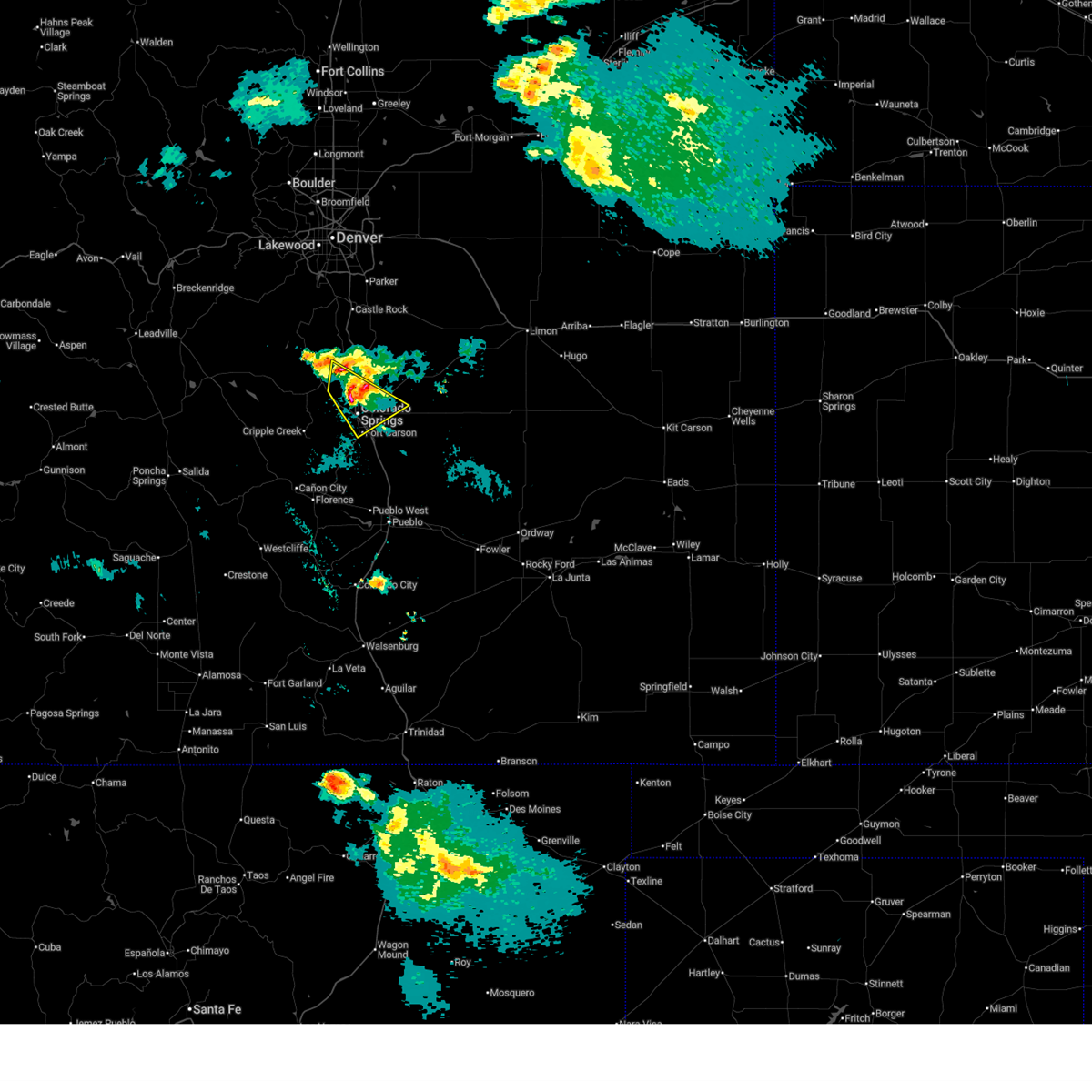 At 612 pm mdt, a severe thunderstorm was located over northwestern colorado springs, moving southeast at 30 mph (radar indicated). Hazards include 60 mph wind gusts and half dollar size hail. Hail damage to vehicles is expected. expect wind damage to roofs, siding, and trees. video from social media showed strong rotation at cloud base with this storm. Locations impacted include, colorado springs, monument, air force academy, manitou springs, crystola, security, falcon, stratmoor, fort carson, cimarron hills, peterson space force base, cascade, chipita park, gleneagle, and security-widefield. At 612 pm mdt, a severe thunderstorm was located over northwestern colorado springs, moving southeast at 30 mph (radar indicated). Hazards include 60 mph wind gusts and half dollar size hail. Hail damage to vehicles is expected. expect wind damage to roofs, siding, and trees. video from social media showed strong rotation at cloud base with this storm. Locations impacted include, colorado springs, monument, air force academy, manitou springs, crystola, security, falcon, stratmoor, fort carson, cimarron hills, peterson space force base, cascade, chipita park, gleneagle, and security-widefield.
|
| 6/15/2025 6:09 PM MDT |
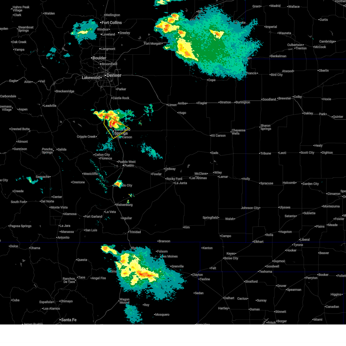 Svrpub the national weather service in pueblo has issued a * severe thunderstorm warning for, northwestern el paso county in east central colorado, * until 645 pm mdt. * at 608 pm mdt, a severe thunderstorm was located over northwestern colorado springs, moving southeast at 30 mph (radar indicated). Hazards include 60 mph wind gusts and half dollar size hail. Hail damage to vehicles is expected. Expect wind damage to roofs, siding, and trees. Svrpub the national weather service in pueblo has issued a * severe thunderstorm warning for, northwestern el paso county in east central colorado, * until 645 pm mdt. * at 608 pm mdt, a severe thunderstorm was located over northwestern colorado springs, moving southeast at 30 mph (radar indicated). Hazards include 60 mph wind gusts and half dollar size hail. Hail damage to vehicles is expected. Expect wind damage to roofs, siding, and trees.
|
| 6/15/2025 5:51 PM MDT |
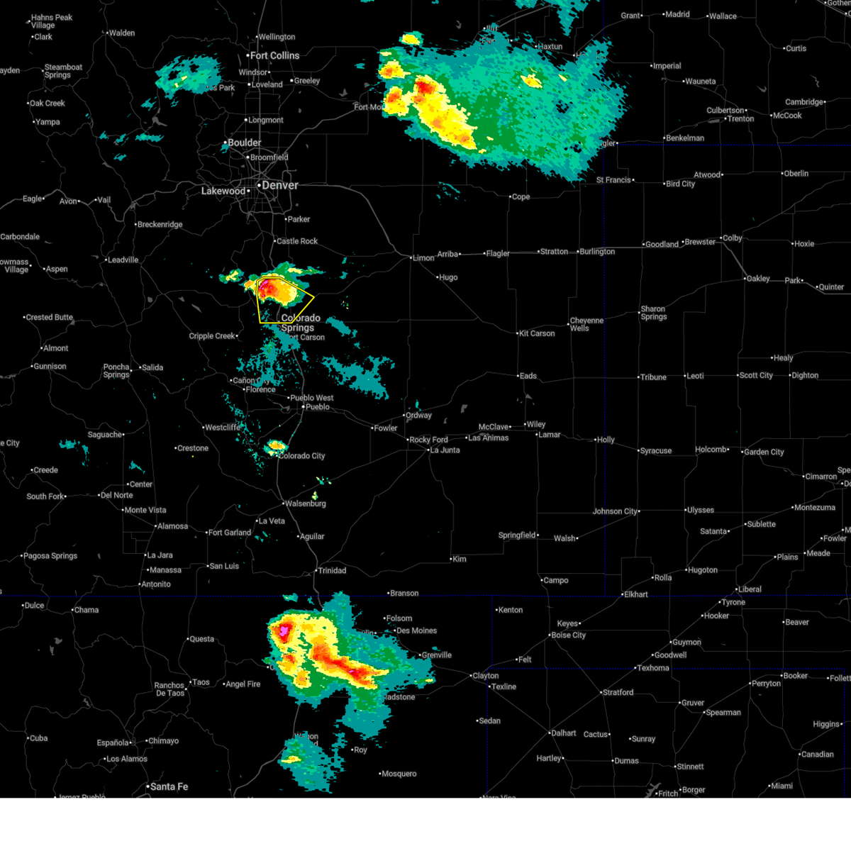 Svrpub the national weather service in pueblo has issued a * severe thunderstorm warning for, northwestern el paso county in east central colorado, * until 615 pm mdt. * at 551 pm mdt, a severe thunderstorm was located over gleneagle, or 14 miles north of colorado springs, moving southeast at 25 mph (trained weather spotters). Hazards include 60 mph wind gusts and half dollar size hail. Hail damage to vehicles is expected. Expect wind damage to roofs, siding, and trees. Svrpub the national weather service in pueblo has issued a * severe thunderstorm warning for, northwestern el paso county in east central colorado, * until 615 pm mdt. * at 551 pm mdt, a severe thunderstorm was located over gleneagle, or 14 miles north of colorado springs, moving southeast at 25 mph (trained weather spotters). Hazards include 60 mph wind gusts and half dollar size hail. Hail damage to vehicles is expected. Expect wind damage to roofs, siding, and trees.
|
| 6/14/2025 6:43 PM MDT |
 At 643 pm mdt, a severe thunderstorm was located over southern colorado springs, moving southeast at 10 mph (trained weather spotters). Hazards include quarter size hail. Damage to vehicles is expected. Locations impacted include, southern colorado springs, fountain, stratmoor, fort carson, security, security-widefield, peterson space force base, and cimarron hills. At 643 pm mdt, a severe thunderstorm was located over southern colorado springs, moving southeast at 10 mph (trained weather spotters). Hazards include quarter size hail. Damage to vehicles is expected. Locations impacted include, southern colorado springs, fountain, stratmoor, fort carson, security, security-widefield, peterson space force base, and cimarron hills.
|
| 6/14/2025 6:42 PM MDT | Golf Ball sized hail reported 8.9 miles NNE of Colorado Springs, CO, hailed ranged in size from peas to golfballs. |
| 6/14/2025 6:39 PM MDT |
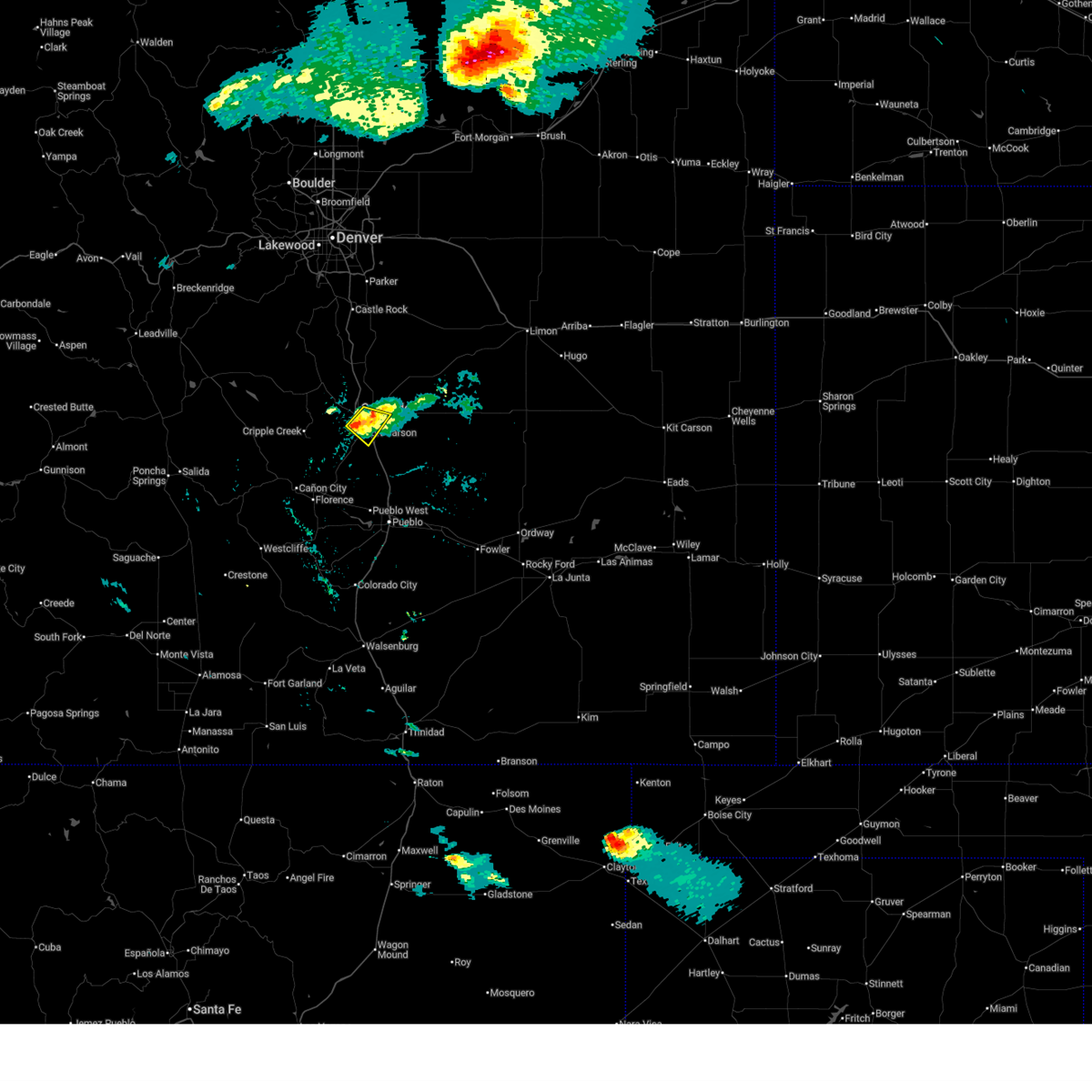 At 639 pm mdt, a severe thunderstorm was located over southern colorado springs, moving southeast at 10 mph (radar indicated). Hazards include quarter size hail. Damage to vehicles is expected. Locations impacted include, southern colorado springs, fountain, stratmoor, fort carson, security, security-widefield, peterson space force base, and cimarron hills. At 639 pm mdt, a severe thunderstorm was located over southern colorado springs, moving southeast at 10 mph (radar indicated). Hazards include quarter size hail. Damage to vehicles is expected. Locations impacted include, southern colorado springs, fountain, stratmoor, fort carson, security, security-widefield, peterson space force base, and cimarron hills.
|
| 6/14/2025 6:26 PM MDT |
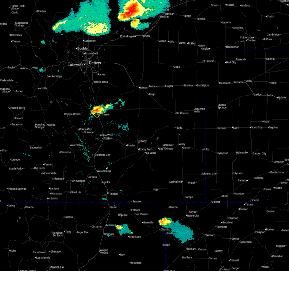 Svrpub the national weather service in pueblo has issued a * severe thunderstorm warning for, west central el paso county in east central colorado, * until 700 pm mdt. * at 626 pm mdt, a severe thunderstorm was located over southwestern colorado springs, moving southeast at 10 mph (radar indicated). Hazards include 60 mph wind gusts and quarter size hail. Hail damage to vehicles is expected. Expect wind damage to roofs, siding, and trees. Svrpub the national weather service in pueblo has issued a * severe thunderstorm warning for, west central el paso county in east central colorado, * until 700 pm mdt. * at 626 pm mdt, a severe thunderstorm was located over southwestern colorado springs, moving southeast at 10 mph (radar indicated). Hazards include 60 mph wind gusts and quarter size hail. Hail damage to vehicles is expected. Expect wind damage to roofs, siding, and trees.
|
| 6/14/2025 6:16 PM MDT | Quarter sized hail reported 5 miles NE of Colorado Springs, CO, report from mping: quarter (1.00 in.). |
| 6/14/2025 6:00 PM MDT | Half Dollar sized hail reported 0.9 miles S of Colorado Springs, CO |
| 6/14/2025 5:58 PM MDT |
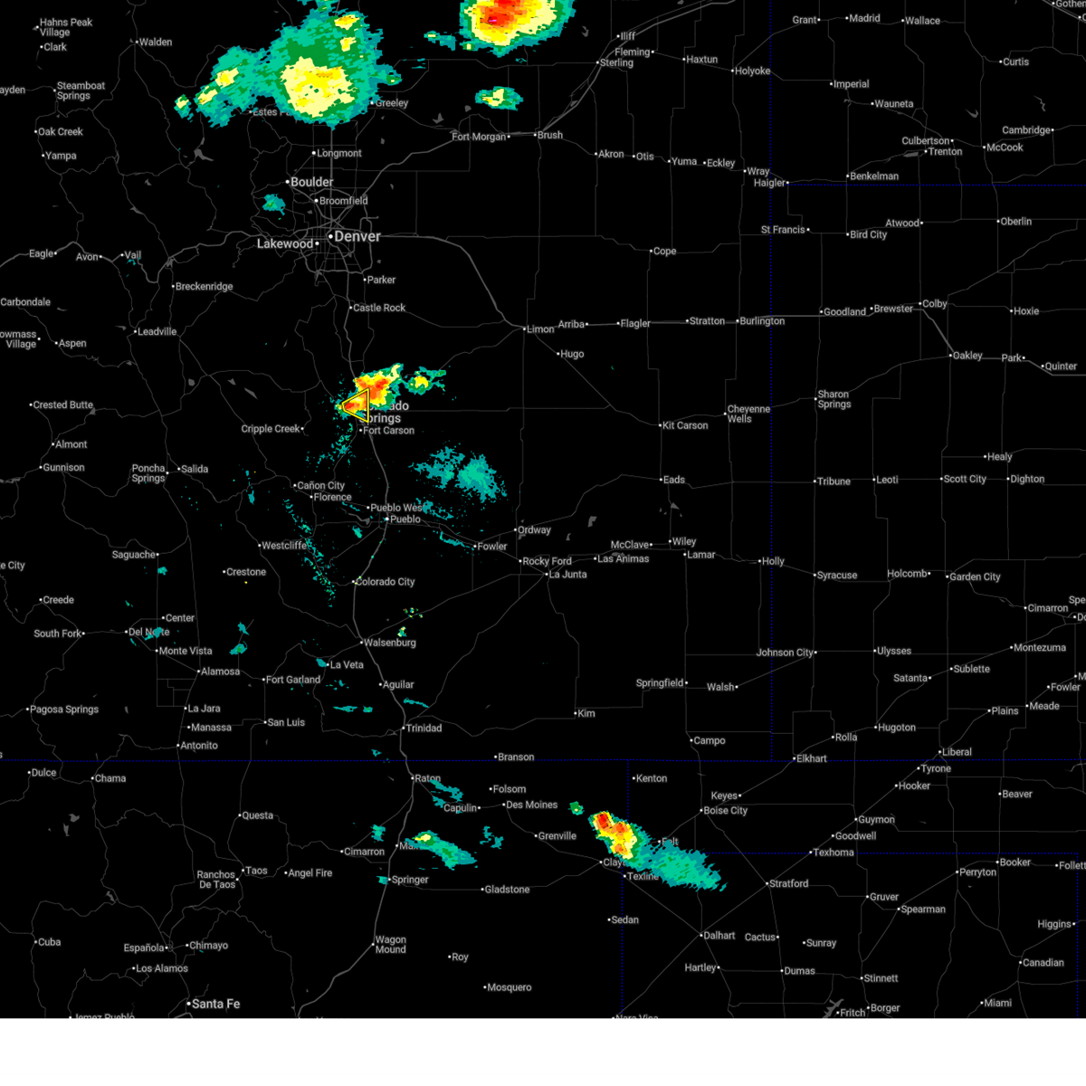 Svrpub the national weather service in pueblo has issued a * severe thunderstorm warning for, west central el paso county in east central colorado, * until 630 pm mdt. * at 558 pm mdt, a severe thunderstorm was located over western colorado springs, moving east at 5 mph (trained weather spotters). Hazards include 60 mph wind gusts and quarter size hail. Hail damage to vehicles is expected. Expect wind damage to roofs, siding, and trees. Svrpub the national weather service in pueblo has issued a * severe thunderstorm warning for, west central el paso county in east central colorado, * until 630 pm mdt. * at 558 pm mdt, a severe thunderstorm was located over western colorado springs, moving east at 5 mph (trained weather spotters). Hazards include 60 mph wind gusts and quarter size hail. Hail damage to vehicles is expected. Expect wind damage to roofs, siding, and trees.
|
| 6/14/2025 5:41 PM MDT | Quarter sized hail reported 7.2 miles S of Colorado Springs, CO, report from mping: quarter (1.00 in.). |
| 6/14/2025 5:39 PM MDT | Half Dollar sized hail reported 7.2 miles S of Colorado Springs, CO, report from mping: half dollar (1.25 in.). |
| 6/14/2025 5:38 PM MDT | Quarter sized hail reported 7.2 miles S of Colorado Springs, CO, report from mping: quarter (1.00 in.). |
| 6/14/2025 5:37 PM MDT | Quarter sized hail reported 7.2 miles S of Colorado Springs, CO, report from mping: quarter (1.00 in.). |
| 6/14/2025 5:37 PM MDT | Quarter sized hail reported 5.2 miles SE of Colorado Springs, CO |
| 6/14/2025 5:35 PM MDT | Quarter sized hail reported 6.4 miles S of Colorado Springs, CO, report from mping: quarter (1.00 in.). |
| 6/14/2025 5:33 PM MDT | Quarter sized hail reported 7.2 miles S of Colorado Springs, CO, report from mping: quarter (1.00 in.). |
| 6/14/2025 5:29 PM MDT |
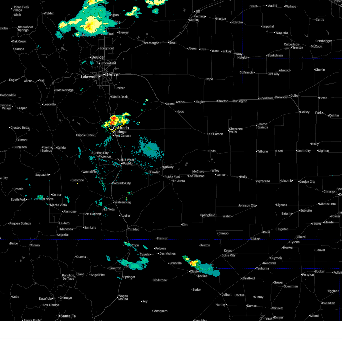 Svrpub the national weather service in pueblo has issued a * severe thunderstorm warning for, west central el paso county in east central colorado, * until 600 pm mdt. * at 529 pm mdt, a severe thunderstorm was located over northwestern colorado springs, moving southeast at 15 mph (public). Hazards include 60 mph wind gusts and quarter size hail. Hail damage to vehicles is expected. Expect wind damage to roofs, siding, and trees. Svrpub the national weather service in pueblo has issued a * severe thunderstorm warning for, west central el paso county in east central colorado, * until 600 pm mdt. * at 529 pm mdt, a severe thunderstorm was located over northwestern colorado springs, moving southeast at 15 mph (public). Hazards include 60 mph wind gusts and quarter size hail. Hail damage to vehicles is expected. Expect wind damage to roofs, siding, and trees.
|
| 6/14/2025 5:28 PM MDT | Quarter sized hail reported 5.6 miles SE of Colorado Springs, CO, report from mping: quarter (1.00 in.). |
| 6/14/2025 5:26 PM MDT | Quarter sized hail reported 5.6 miles SE of Colorado Springs, CO, report from mping: quarter (1.00 in.). |
| 6/14/2025 5:26 PM MDT | Quarter sized hail reported 5.8 miles ESE of Colorado Springs, CO |
| 6/14/2025 5:24 PM MDT | Quarter sized hail reported 6.1 miles SE of Colorado Springs, CO, report from mping: quarter (1.00 in.). |
| 6/14/2025 5:22 PM MDT | Half Dollar sized hail reported 6.1 miles SE of Colorado Springs, CO, report from mping: half dollar (1.25 in.). |
| 6/8/2025 3:03 PM MDT |
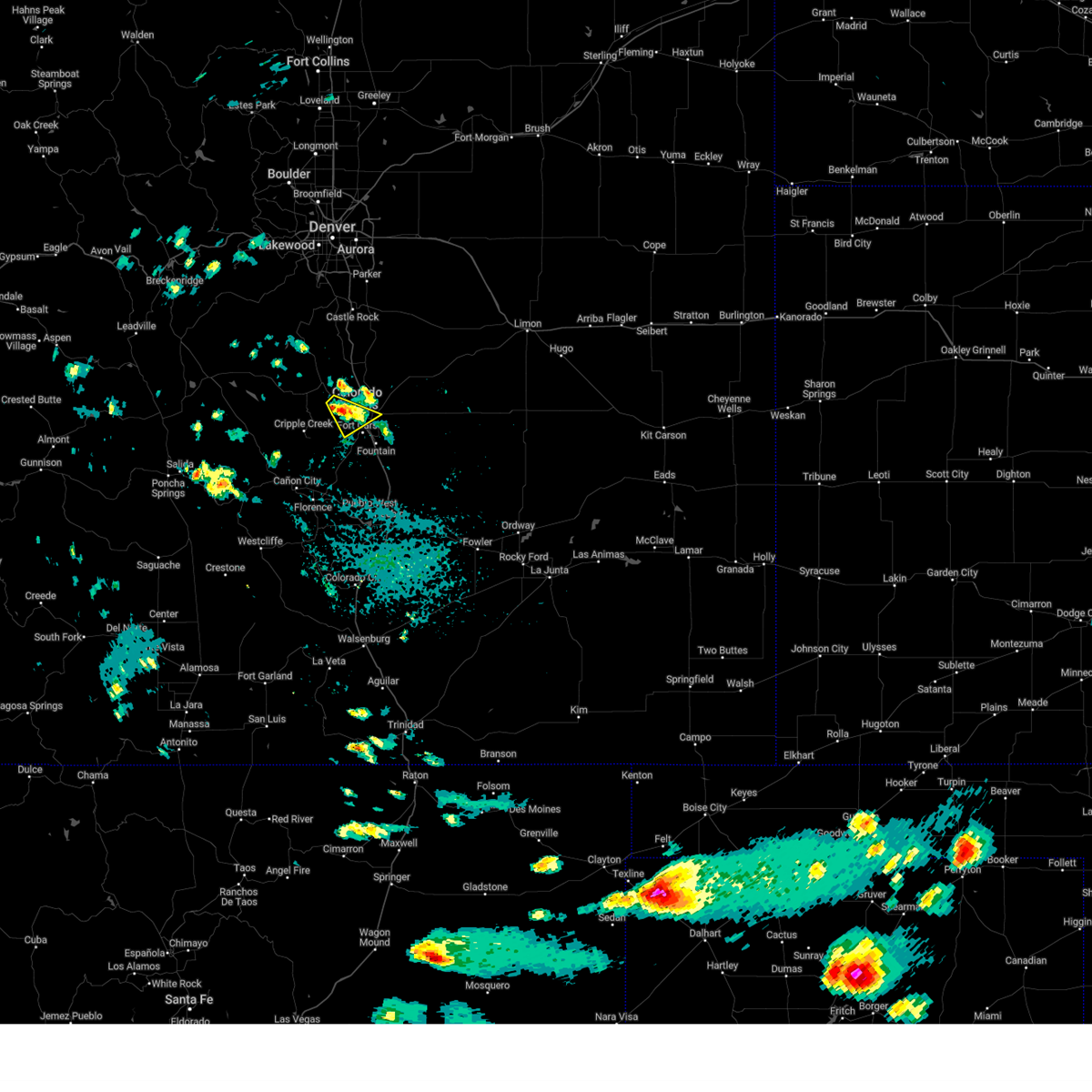 the severe thunderstorm warning has been cancelled and is no longer in effect the severe thunderstorm warning has been cancelled and is no longer in effect
|
| 6/8/2025 2:42 PM MDT |
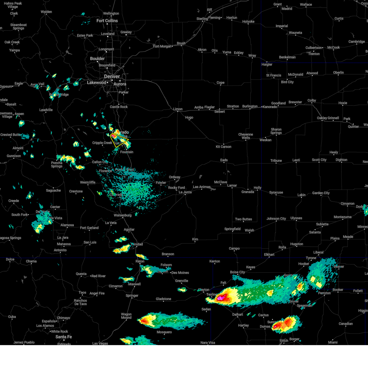 Svrpub the national weather service in pueblo has issued a * severe thunderstorm warning for, southeastern teller county in central colorado, west central el paso county in east central colorado, * until 315 pm mdt. * at 241 pm mdt, a severe thunderstorm was located over cascade, or 8 miles northwest of colorado springs, moving southeast at 25 mph (radar indicated). Hazards include 60 mph wind gusts and quarter size hail. Hail damage to vehicles is expected. Expect wind damage to roofs, siding, and trees. Svrpub the national weather service in pueblo has issued a * severe thunderstorm warning for, southeastern teller county in central colorado, west central el paso county in east central colorado, * until 315 pm mdt. * at 241 pm mdt, a severe thunderstorm was located over cascade, or 8 miles northwest of colorado springs, moving southeast at 25 mph (radar indicated). Hazards include 60 mph wind gusts and quarter size hail. Hail damage to vehicles is expected. Expect wind damage to roofs, siding, and trees.
|
| 6/8/2025 2:29 PM MDT |
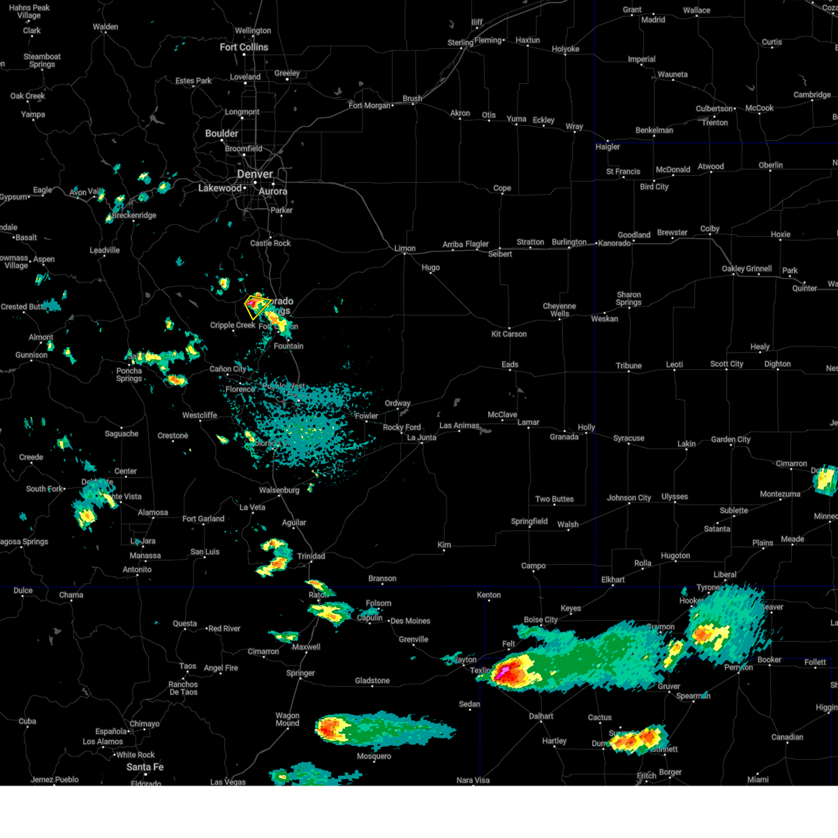 At 228 pm mdt, a severe thunderstorm was located over green mountain falls, or 13 miles northwest of colorado springs, moving southeast at 15 mph (radar indicated). Hazards include 60 mph wind gusts and quarter size hail. Hail damage to vehicles is expected. expect wind damage to roofs, siding, and trees. Locations impacted include, western colorado springs, woodland park, green mountain falls, crystola, chipita park, and cascade. At 228 pm mdt, a severe thunderstorm was located over green mountain falls, or 13 miles northwest of colorado springs, moving southeast at 15 mph (radar indicated). Hazards include 60 mph wind gusts and quarter size hail. Hail damage to vehicles is expected. expect wind damage to roofs, siding, and trees. Locations impacted include, western colorado springs, woodland park, green mountain falls, crystola, chipita park, and cascade.
|
| 6/8/2025 2:17 PM MDT |
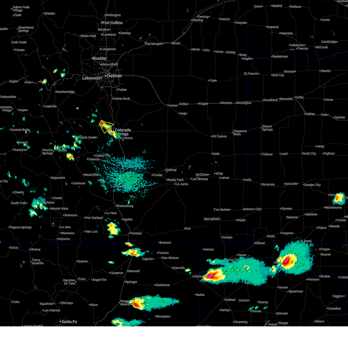 Svrpub the national weather service in pueblo has issued a * severe thunderstorm warning for, east central teller county in central colorado, west central el paso county in east central colorado, * until 245 pm mdt. * at 217 pm mdt, a severe thunderstorm was located over woodland park, or 16 miles northwest of colorado springs, moving southeast at 15 mph (radar indicated). Hazards include 60 mph wind gusts and quarter size hail. Hail damage to vehicles is expected. Expect wind damage to roofs, siding, and trees. Svrpub the national weather service in pueblo has issued a * severe thunderstorm warning for, east central teller county in central colorado, west central el paso county in east central colorado, * until 245 pm mdt. * at 217 pm mdt, a severe thunderstorm was located over woodland park, or 16 miles northwest of colorado springs, moving southeast at 15 mph (radar indicated). Hazards include 60 mph wind gusts and quarter size hail. Hail damage to vehicles is expected. Expect wind damage to roofs, siding, and trees.
|
| 6/6/2025 4:06 PM MDT |
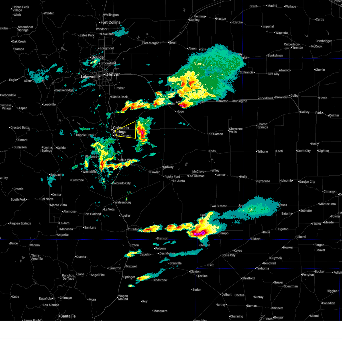 The storm which prompted the warning has moved out of the area. therefore, the warning will be allowed to expire. a tornado watch remains in effect until 900 pm mdt for east central colorado. The storm which prompted the warning has moved out of the area. therefore, the warning will be allowed to expire. a tornado watch remains in effect until 900 pm mdt for east central colorado.
|
| 6/6/2025 3:38 PM MDT |
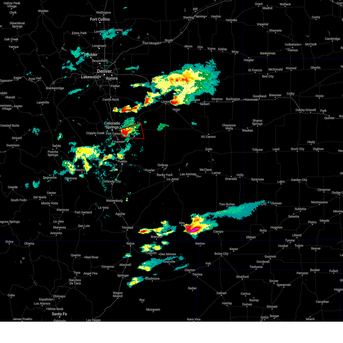 Torpub the national weather service in pueblo has issued a * tornado warning for, east central el paso county in east central colorado, * until 415 pm mdt. * at 338 pm mdt, a severe thunderstorm capable of producing a tornado was located over schriever space force base, or 15 miles east of colorado springs, moving east at 25 mph (radar indicated rotation). Hazards include tornado. Flying debris will be dangerous to those caught without shelter. mobile homes will be damaged or destroyed. damage to roofs, windows, and vehicles will occur. tree damage is likely. this dangerous storm will be near, schriever space force base around 345 pm mdt. Ellicott around 355 pm mdt. Torpub the national weather service in pueblo has issued a * tornado warning for, east central el paso county in east central colorado, * until 415 pm mdt. * at 338 pm mdt, a severe thunderstorm capable of producing a tornado was located over schriever space force base, or 15 miles east of colorado springs, moving east at 25 mph (radar indicated rotation). Hazards include tornado. Flying debris will be dangerous to those caught without shelter. mobile homes will be damaged or destroyed. damage to roofs, windows, and vehicles will occur. tree damage is likely. this dangerous storm will be near, schriever space force base around 345 pm mdt. Ellicott around 355 pm mdt.
|
| 6/6/2025 3:34 PM MDT |
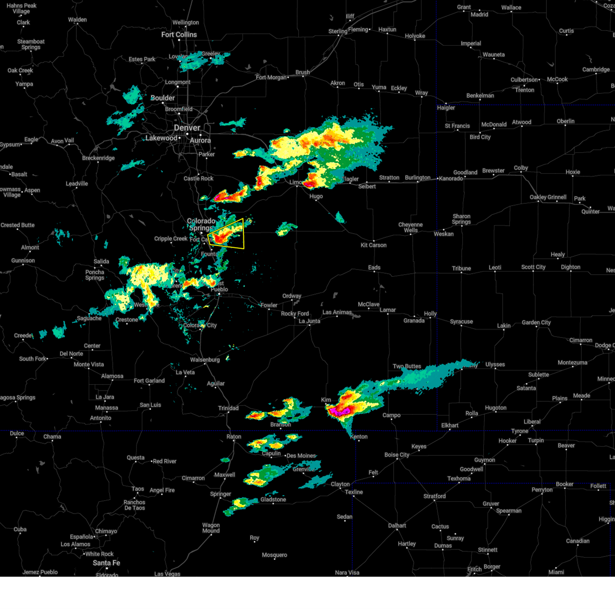 At 333 pm mdt, a severe thunderstorm was located near schriever space force base, or 11 miles east of colorado springs, moving east at 25 mph (radar indicated). Hazards include 60 mph wind gusts and half dollar size hail. Hail damage to vehicles is expected. expect wind damage to roofs, siding, and trees. there have been several reports via social media that a funnel cloud has been observed with this storm. Locations impacted include, southeastern colorado springs, fountain, ellicott, schriever space force base, security-widefield, peterson space force base, and cimarron hills. At 333 pm mdt, a severe thunderstorm was located near schriever space force base, or 11 miles east of colorado springs, moving east at 25 mph (radar indicated). Hazards include 60 mph wind gusts and half dollar size hail. Hail damage to vehicles is expected. expect wind damage to roofs, siding, and trees. there have been several reports via social media that a funnel cloud has been observed with this storm. Locations impacted include, southeastern colorado springs, fountain, ellicott, schriever space force base, security-widefield, peterson space force base, and cimarron hills.
|
| 6/6/2025 3:28 PM MDT |
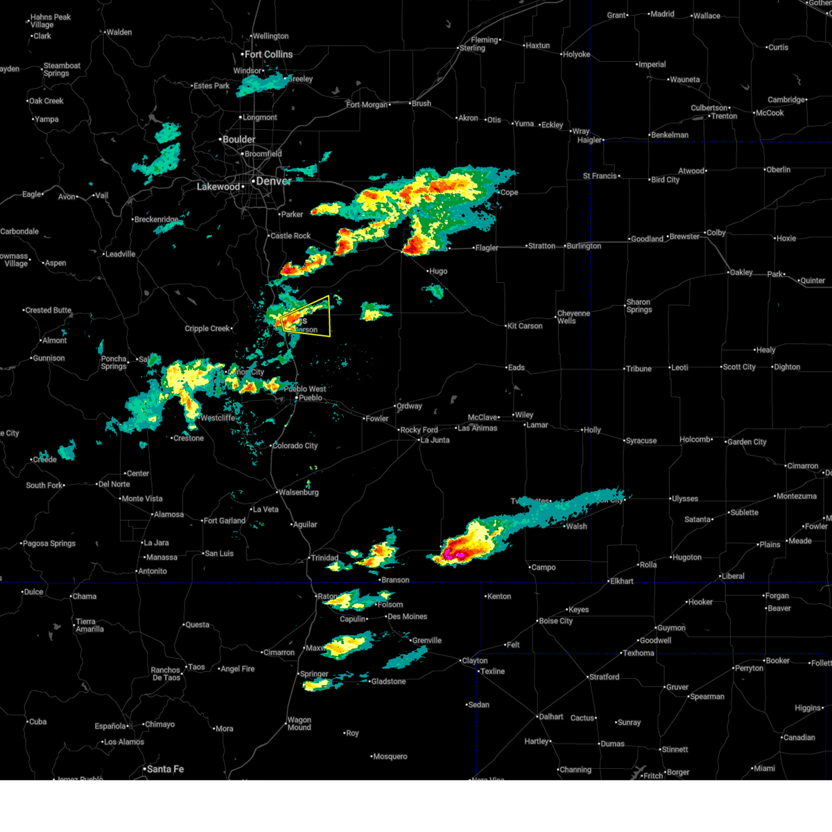 Svrpub the national weather service in pueblo has issued a * severe thunderstorm warning for, central el paso county in east central colorado, * until 415 pm mdt. * at 328 pm mdt, a severe thunderstorm was located over southeastern colorado springs, moving east at 25 mph (radar indicated). Hazards include 60 mph wind gusts and quarter size hail. Hail damage to vehicles is expected. Expect wind damage to roofs, siding, and trees. Svrpub the national weather service in pueblo has issued a * severe thunderstorm warning for, central el paso county in east central colorado, * until 415 pm mdt. * at 328 pm mdt, a severe thunderstorm was located over southeastern colorado springs, moving east at 25 mph (radar indicated). Hazards include 60 mph wind gusts and quarter size hail. Hail damage to vehicles is expected. Expect wind damage to roofs, siding, and trees.
|
| 6/6/2025 2:02 PM MDT |
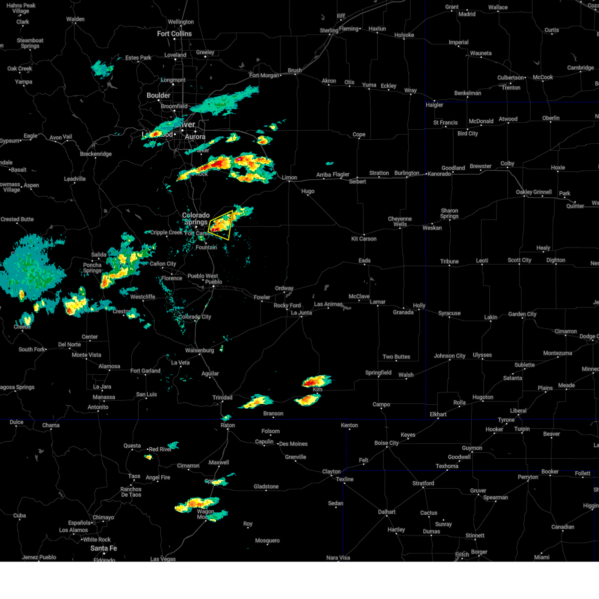 At 202 pm mdt, a severe thunderstorm was located over southeastern colorado springs, moving east at 15 mph (radar indicated). Hazards include half dollar size hail. Damage to vehicles is expected. Locations impacted include, eastern colorado springs and schriever space force base. At 202 pm mdt, a severe thunderstorm was located over southeastern colorado springs, moving east at 15 mph (radar indicated). Hazards include half dollar size hail. Damage to vehicles is expected. Locations impacted include, eastern colorado springs and schriever space force base.
|
| 6/6/2025 1:52 PM MDT | Quarter sized hail reported 4.6 miles NW of Colorado Springs, CO |
| 6/6/2025 1:51 PM MDT |
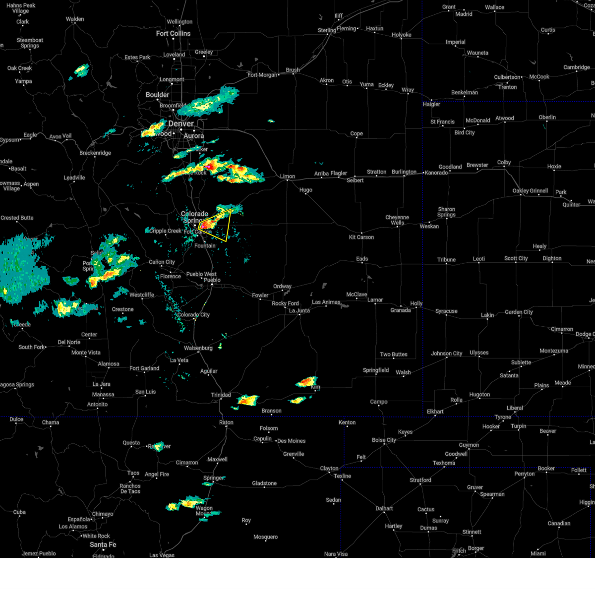 At 151 pm mdt, a severe thunderstorm was located over southeastern colorado springs, moving east at 15 mph (radar indicated). Hazards include half dollar size hail. Damage to vehicles is expected. Locations impacted include, southeastern colorado springs, schriever space force base, cimarron hills, and peterson space force base. At 151 pm mdt, a severe thunderstorm was located over southeastern colorado springs, moving east at 15 mph (radar indicated). Hazards include half dollar size hail. Damage to vehicles is expected. Locations impacted include, southeastern colorado springs, schriever space force base, cimarron hills, and peterson space force base.
|
| 6/6/2025 1:45 PM MDT |
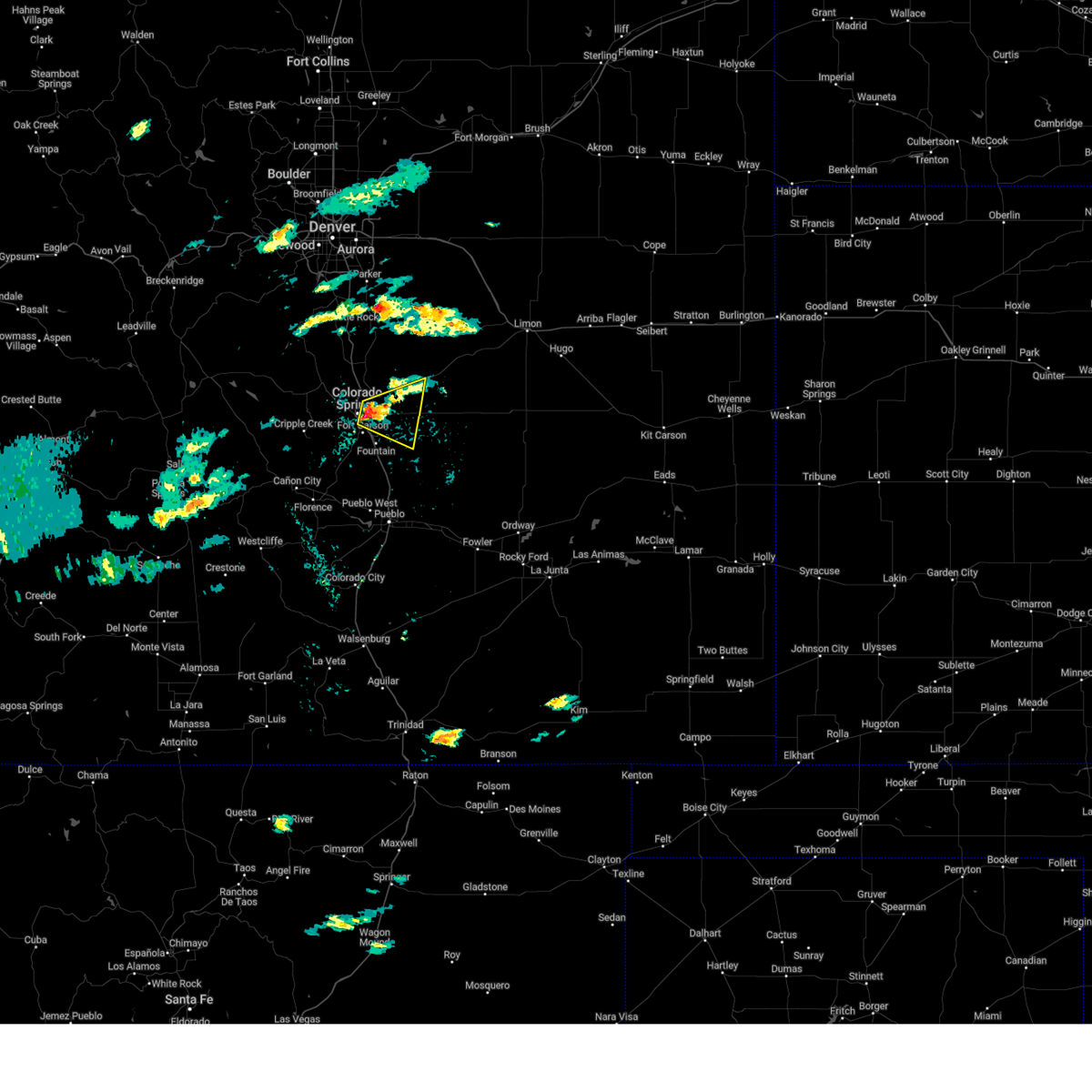 Svrpub the national weather service in pueblo has issued a * severe thunderstorm warning for, central el paso county in east central colorado, * until 215 pm mdt. * at 144 pm mdt, a severe thunderstorm was located over southern colorado springs, moving east at 15 mph (radar indicated). Hazards include half dollar size hail. damage to vehicles is expected Svrpub the national weather service in pueblo has issued a * severe thunderstorm warning for, central el paso county in east central colorado, * until 215 pm mdt. * at 144 pm mdt, a severe thunderstorm was located over southern colorado springs, moving east at 15 mph (radar indicated). Hazards include half dollar size hail. damage to vehicles is expected
|
| 6/5/2025 1:56 PM MDT |
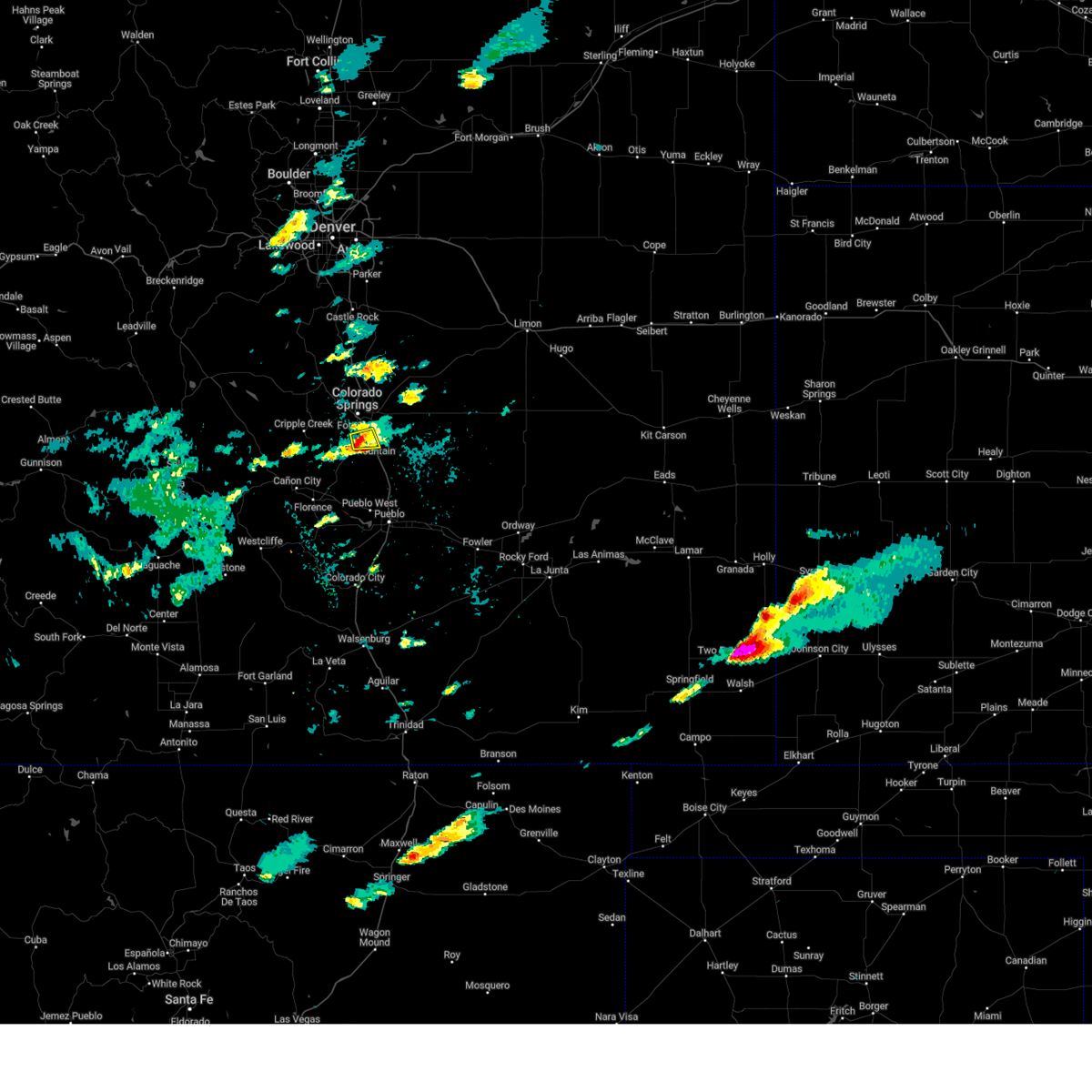 The storm which prompted the warning has weakened below severe limits, and no longer poses an immediate threat to life or property. therefore, the warning will be allowed to expire. however, heavy rain is occurring with this thunderstorm and there is a flash flood warning in effect for southwestern el paso county. The storm which prompted the warning has weakened below severe limits, and no longer poses an immediate threat to life or property. therefore, the warning will be allowed to expire. however, heavy rain is occurring with this thunderstorm and there is a flash flood warning in effect for southwestern el paso county.
|
| 6/5/2025 1:39 PM MDT |
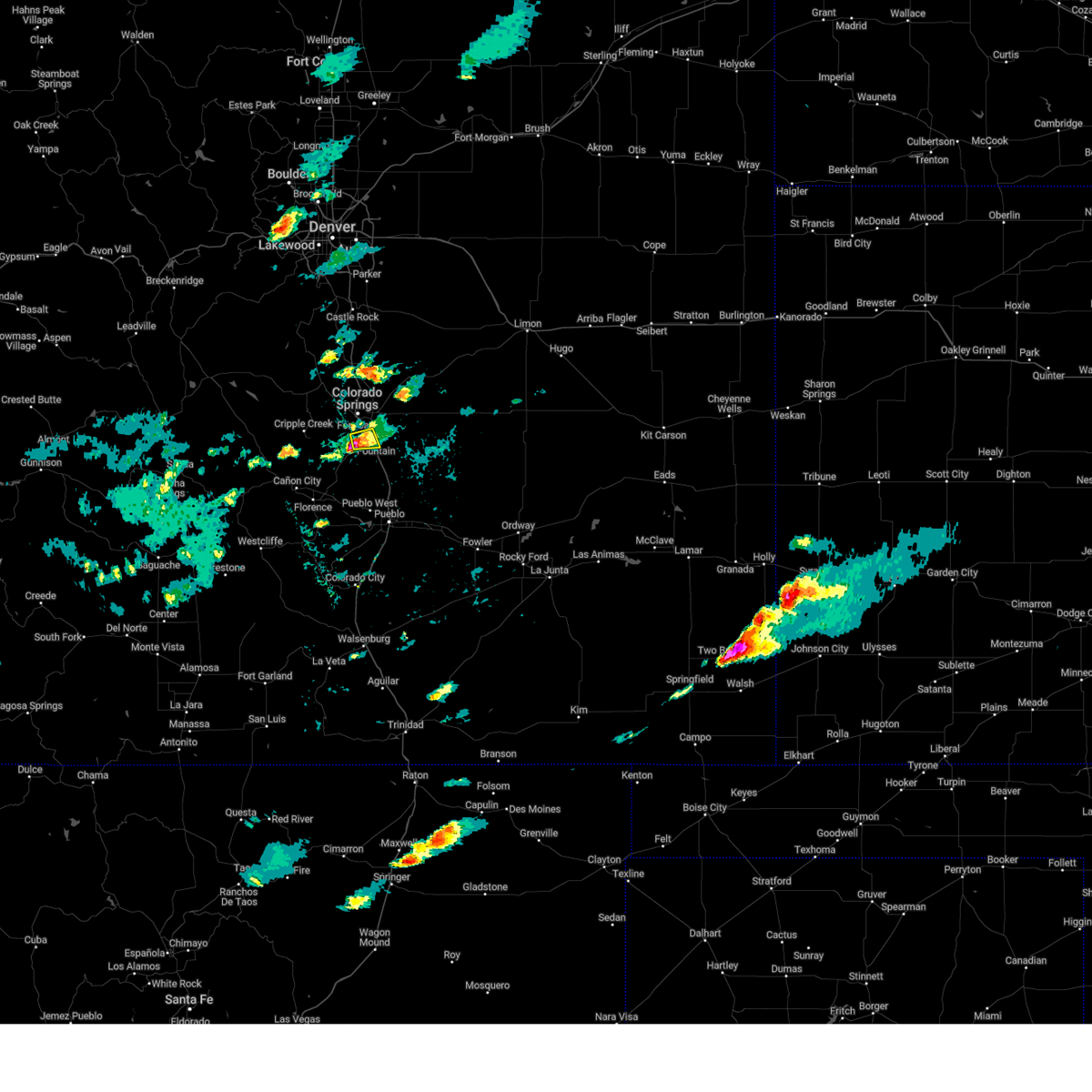 At 139 pm mdt, a severe thunderstorm was located 6 miles southwest of fort carson, or 12 miles south of colorado springs, moving east at 10 mph (radar indicated). Hazards include quarter size hail. Damage to vehicles is expected. Locations impacted include, southern colorado springs, fountain, fort carson, security, stratmoor and security-widefield. At 139 pm mdt, a severe thunderstorm was located 6 miles southwest of fort carson, or 12 miles south of colorado springs, moving east at 10 mph (radar indicated). Hazards include quarter size hail. Damage to vehicles is expected. Locations impacted include, southern colorado springs, fountain, fort carson, security, stratmoor and security-widefield.
|
| 6/5/2025 1:18 PM MDT |
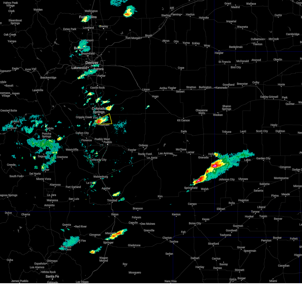 Svrpub the national weather service in pueblo has issued a * severe thunderstorm warning for, southwestern el paso county in east central colorado, * until 200 pm mdt. * at 118 pm mdt, a severe thunderstorm was located near fort carson, or 10 miles south of colorado springs, moving east at 20 mph (radar indicated). Hazards include quarter size hail. damage to vehicles is expected Svrpub the national weather service in pueblo has issued a * severe thunderstorm warning for, southwestern el paso county in east central colorado, * until 200 pm mdt. * at 118 pm mdt, a severe thunderstorm was located near fort carson, or 10 miles south of colorado springs, moving east at 20 mph (radar indicated). Hazards include quarter size hail. damage to vehicles is expected
|
| 5/31/2025 5:34 PM MDT |
 the severe thunderstorm warning has been cancelled and is no longer in effect the severe thunderstorm warning has been cancelled and is no longer in effect
|
| 5/31/2025 5:28 PM MDT |
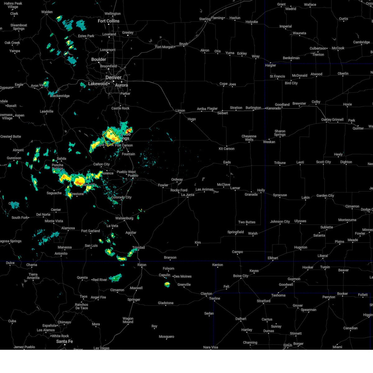 At 527 pm mdt, a severe thunderstorm was located near divide, or 15 miles west of colorado springs, moving southeast at 20 mph (radar indicated). Hazards include 60 mph wind gusts and quarter size hail. Hail damage to vehicles is expected. expect wind damage to roofs, siding, and trees. Locations impacted include, pikes peak, manitou springs, crystola, chipita park, green mountain falls, and cascade. At 527 pm mdt, a severe thunderstorm was located near divide, or 15 miles west of colorado springs, moving southeast at 20 mph (radar indicated). Hazards include 60 mph wind gusts and quarter size hail. Hail damage to vehicles is expected. expect wind damage to roofs, siding, and trees. Locations impacted include, pikes peak, manitou springs, crystola, chipita park, green mountain falls, and cascade.
|
| 5/31/2025 5:13 PM MDT |
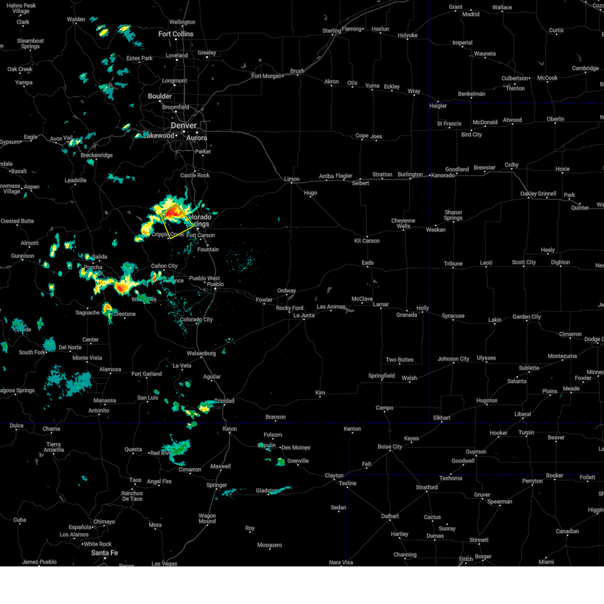 Svrpub the national weather service in pueblo has issued a * severe thunderstorm warning for, central teller county in central colorado, west central el paso county in east central colorado, * until 600 pm mdt. * at 513 pm mdt, a severe thunderstorm was located over divide, or 18 miles northwest of colorado springs, moving southeast at 20 mph (radar indicated). Hazards include 60 mph wind gusts and quarter size hail. Hail damage to vehicles is expected. Expect wind damage to roofs, siding, and trees. Svrpub the national weather service in pueblo has issued a * severe thunderstorm warning for, central teller county in central colorado, west central el paso county in east central colorado, * until 600 pm mdt. * at 513 pm mdt, a severe thunderstorm was located over divide, or 18 miles northwest of colorado springs, moving southeast at 20 mph (radar indicated). Hazards include 60 mph wind gusts and quarter size hail. Hail damage to vehicles is expected. Expect wind damage to roofs, siding, and trees.
|
| 5/30/2025 6:15 PM MDT |
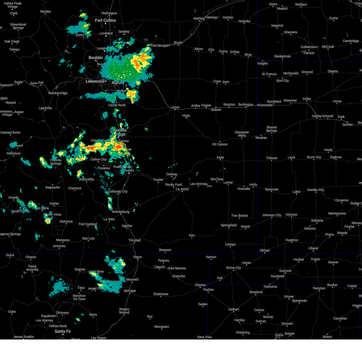 the severe thunderstorm warning has been cancelled and is no longer in effect the severe thunderstorm warning has been cancelled and is no longer in effect
|
| 5/30/2025 6:02 PM MDT |
 the severe thunderstorm warning has been cancelled and is no longer in effect the severe thunderstorm warning has been cancelled and is no longer in effect
|
| 5/30/2025 6:02 PM MDT |
 At 601 pm mdt, a severe thunderstorm was located near fort carson, or 11 miles south of colorado springs, moving south at 10 mph (radar indicated). Hazards include 60 mph wind gusts and quarter size hail. Hail damage to vehicles is expected. expect wind damage to roofs, siding, and trees. Locations impacted include, fort carson, fountain, security-widefield, stratmoor, and colorado springs. At 601 pm mdt, a severe thunderstorm was located near fort carson, or 11 miles south of colorado springs, moving south at 10 mph (radar indicated). Hazards include 60 mph wind gusts and quarter size hail. Hail damage to vehicles is expected. expect wind damage to roofs, siding, and trees. Locations impacted include, fort carson, fountain, security-widefield, stratmoor, and colorado springs.
|
| 5/30/2025 5:55 PM MDT |
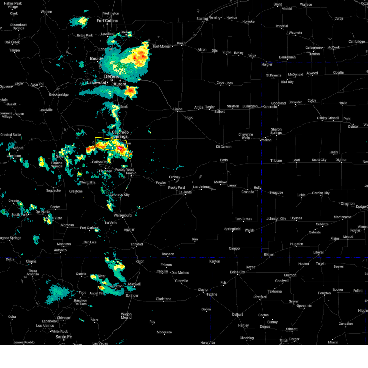 At 553 pm mdt, a severe thunderstorm were located across southern teller and southwestern el paso. hail was covering the ground in cripple creek. the storms are nearly nearly stationary. the most intense storms were over ft carson (radar indicated). Hazards include 60 mph wind gusts and quarter size hail. Hail damage to vehicles is expected. expect wind damage to roofs, siding, and trees. Locations impacted include, victor, pikes peak, stratmoor, fountain, cripple creek, fort carson, security, security-widefield, colorado springs, and peterson space force base. At 553 pm mdt, a severe thunderstorm were located across southern teller and southwestern el paso. hail was covering the ground in cripple creek. the storms are nearly nearly stationary. the most intense storms were over ft carson (radar indicated). Hazards include 60 mph wind gusts and quarter size hail. Hail damage to vehicles is expected. expect wind damage to roofs, siding, and trees. Locations impacted include, victor, pikes peak, stratmoor, fountain, cripple creek, fort carson, security, security-widefield, colorado springs, and peterson space force base.
|
| 5/30/2025 5:42 PM MDT |
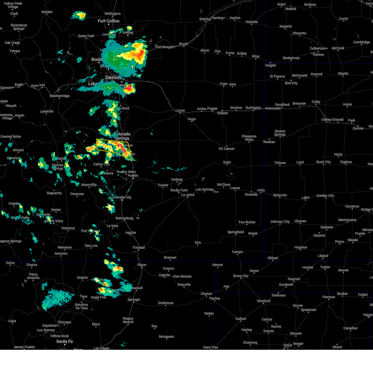 Svrpub the national weather service in pueblo has issued a * severe thunderstorm warning for, southern teller county in central colorado, southwestern el paso county in east central colorado, * until 630 pm mdt. * at 541 pm mdt, a severe thunderstorm was located over southern teller and southwestern el paso county. the storms showed little movement (radar indicated). Hazards include 60 mph wind gusts and quarter size hail. Hail damage to vehicles is expected. Expect wind damage to roofs, siding, and trees. Svrpub the national weather service in pueblo has issued a * severe thunderstorm warning for, southern teller county in central colorado, southwestern el paso county in east central colorado, * until 630 pm mdt. * at 541 pm mdt, a severe thunderstorm was located over southern teller and southwestern el paso county. the storms showed little movement (radar indicated). Hazards include 60 mph wind gusts and quarter size hail. Hail damage to vehicles is expected. Expect wind damage to roofs, siding, and trees.
|
| 5/30/2025 5:28 PM MDT |
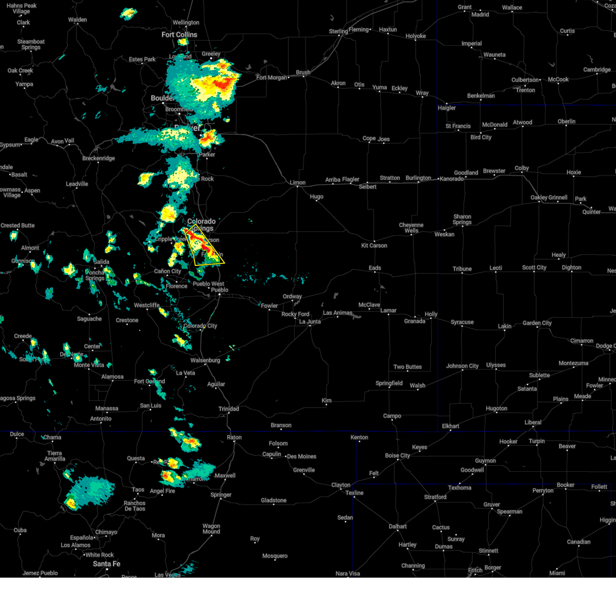 At 527 pm mdt, a severe thunderstorm was located over fountain, or 10 miles south of colorado springs, moving east at 10 mph (radar indicated). Hazards include 60 mph wind gusts and quarter size hail. Hail damage to vehicles is expected. expect wind damage to roofs, siding, and trees. Locations impacted include, manitou springs, stratmoor, fountain, fort carson, security, colorado springs, and security-widefield. At 527 pm mdt, a severe thunderstorm was located over fountain, or 10 miles south of colorado springs, moving east at 10 mph (radar indicated). Hazards include 60 mph wind gusts and quarter size hail. Hail damage to vehicles is expected. expect wind damage to roofs, siding, and trees. Locations impacted include, manitou springs, stratmoor, fountain, fort carson, security, colorado springs, and security-widefield.
|
| 5/30/2025 4:55 PM MDT |
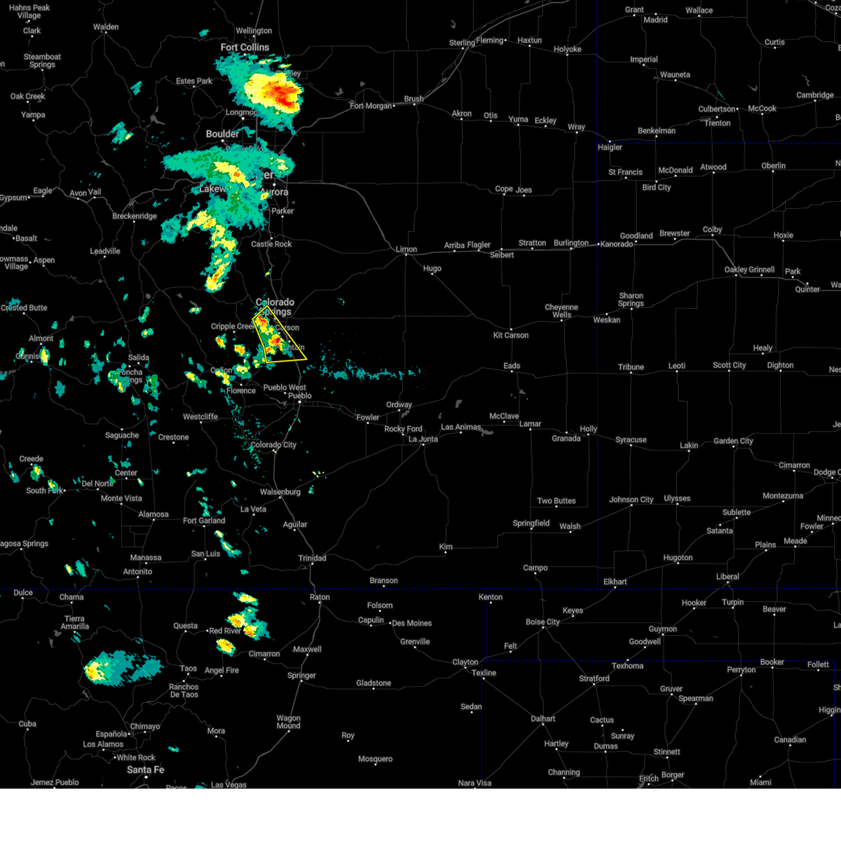 Svrpub the national weather service in pueblo has issued a * severe thunderstorm warning for, southeastern teller county in central colorado, southwestern el paso county in east central colorado, * until 545 pm mdt. * at 455 pm mdt, a severe thunderstorm was located near fountain, or 11 miles south of colorado springs, moving southeast at 25 mph (radar indicated). Hazards include 60 mph wind gusts and quarter size hail. Hail damage to vehicles is expected. Expect wind damage to roofs, siding, and trees. Svrpub the national weather service in pueblo has issued a * severe thunderstorm warning for, southeastern teller county in central colorado, southwestern el paso county in east central colorado, * until 545 pm mdt. * at 455 pm mdt, a severe thunderstorm was located near fountain, or 11 miles south of colorado springs, moving southeast at 25 mph (radar indicated). Hazards include 60 mph wind gusts and quarter size hail. Hail damage to vehicles is expected. Expect wind damage to roofs, siding, and trees.
|
| 5/28/2025 3:06 PM MDT |
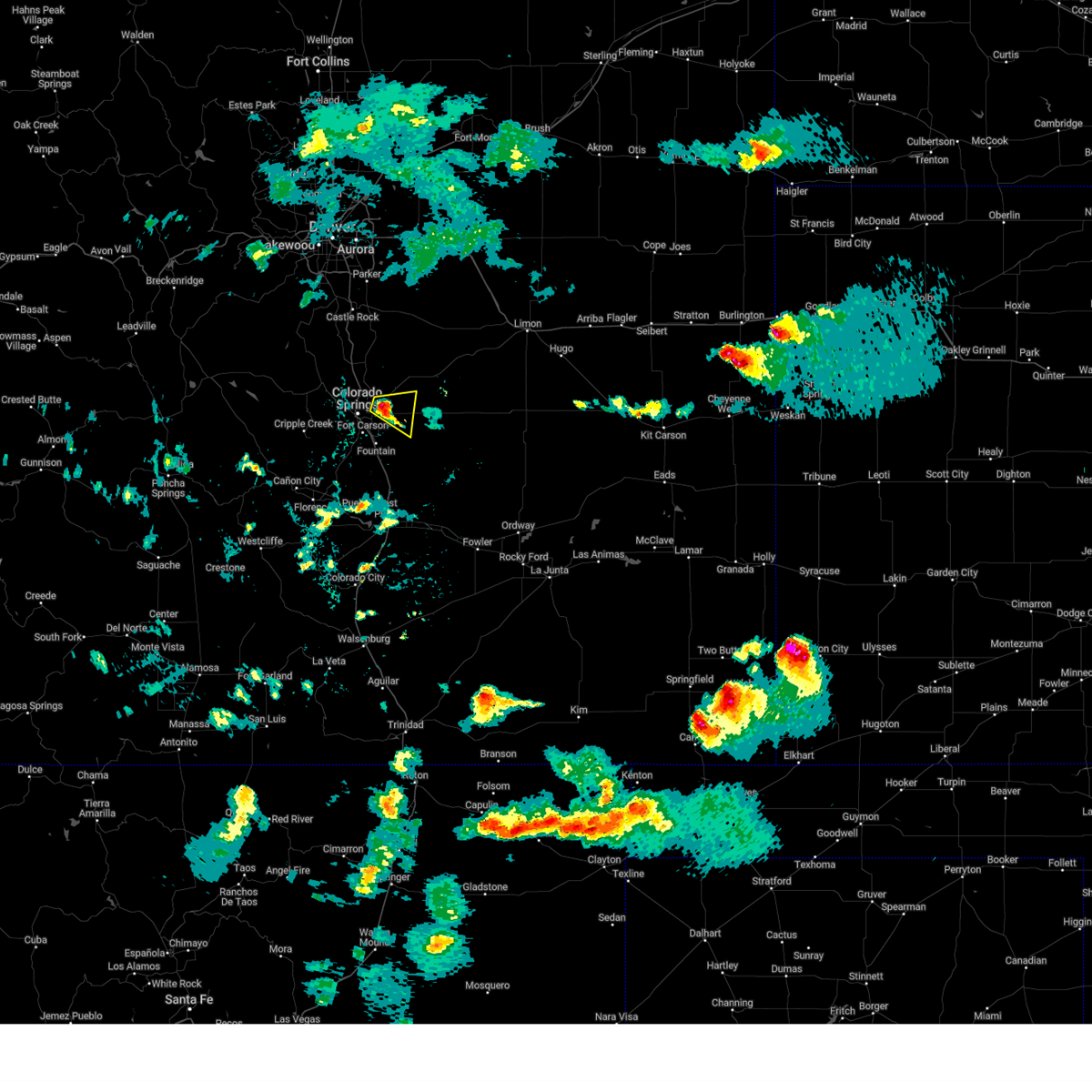 The storm which prompted the warning has weakened below severe limits, and no longer poses an immediate threat to life or property. therefore, the warning has been allowed to expire. however, small hail is still possible with this thunderstorm. a severe thunderstorm watch remains in effect until 800 pm mdt for east central colorado. The storm which prompted the warning has weakened below severe limits, and no longer poses an immediate threat to life or property. therefore, the warning has been allowed to expire. however, small hail is still possible with this thunderstorm. a severe thunderstorm watch remains in effect until 800 pm mdt for east central colorado.
|
| 5/28/2025 2:51 PM MDT |
 At 251 pm mdt, a severe thunderstorm was located near falcon, or 12 miles east of colorado springs, moving east at 25 mph (radar indicated). Hazards include 60 mph wind gusts and quarter size hail. Hail damage to vehicles is expected. expect wind damage to roofs, siding, and trees. Locations impacted include, schriever space force base, cimarron hills, peterson space force base, falcon, and colorado springs. At 251 pm mdt, a severe thunderstorm was located near falcon, or 12 miles east of colorado springs, moving east at 25 mph (radar indicated). Hazards include 60 mph wind gusts and quarter size hail. Hail damage to vehicles is expected. expect wind damage to roofs, siding, and trees. Locations impacted include, schriever space force base, cimarron hills, peterson space force base, falcon, and colorado springs.
|
| 5/28/2025 2:35 PM MDT |
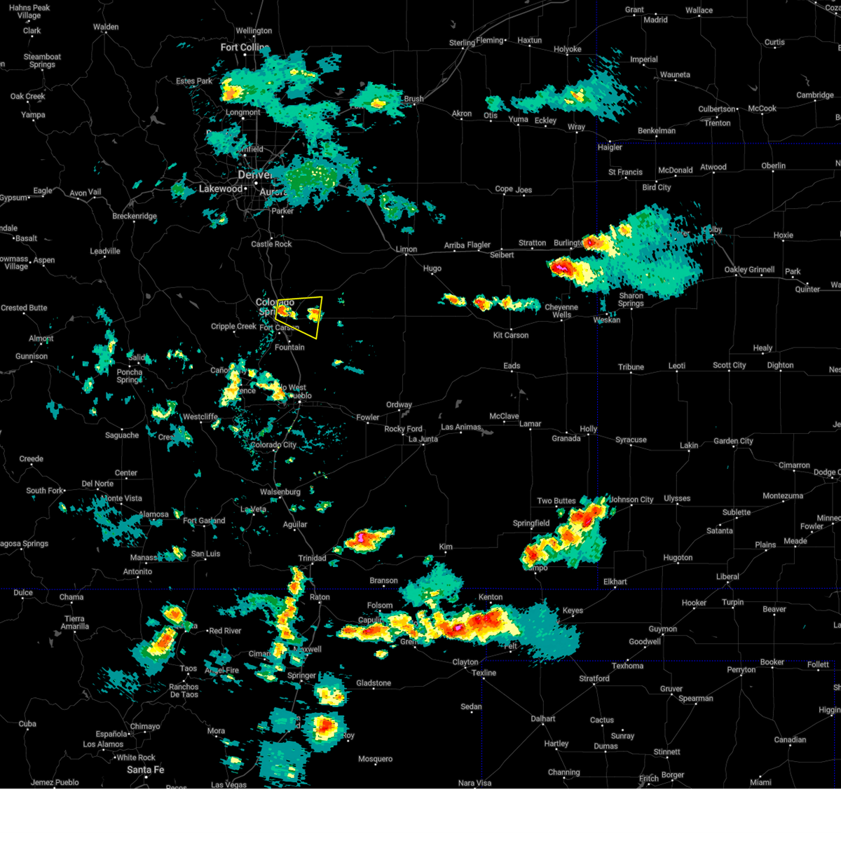 Svrpub the national weather service in pueblo has issued a * severe thunderstorm warning for, central el paso county in east central colorado, * until 300 pm mdt. * at 235 pm mdt, a severe thunderstorm was located over cimarron hills, or near colorado springs, moving east at 25 mph (radar indicated). Hazards include 60 mph wind gusts and quarter size hail. Hail damage to vehicles is expected. Expect wind damage to roofs, siding, and trees. Svrpub the national weather service in pueblo has issued a * severe thunderstorm warning for, central el paso county in east central colorado, * until 300 pm mdt. * at 235 pm mdt, a severe thunderstorm was located over cimarron hills, or near colorado springs, moving east at 25 mph (radar indicated). Hazards include 60 mph wind gusts and quarter size hail. Hail damage to vehicles is expected. Expect wind damage to roofs, siding, and trees.
|
| 5/28/2025 1:25 PM MDT |
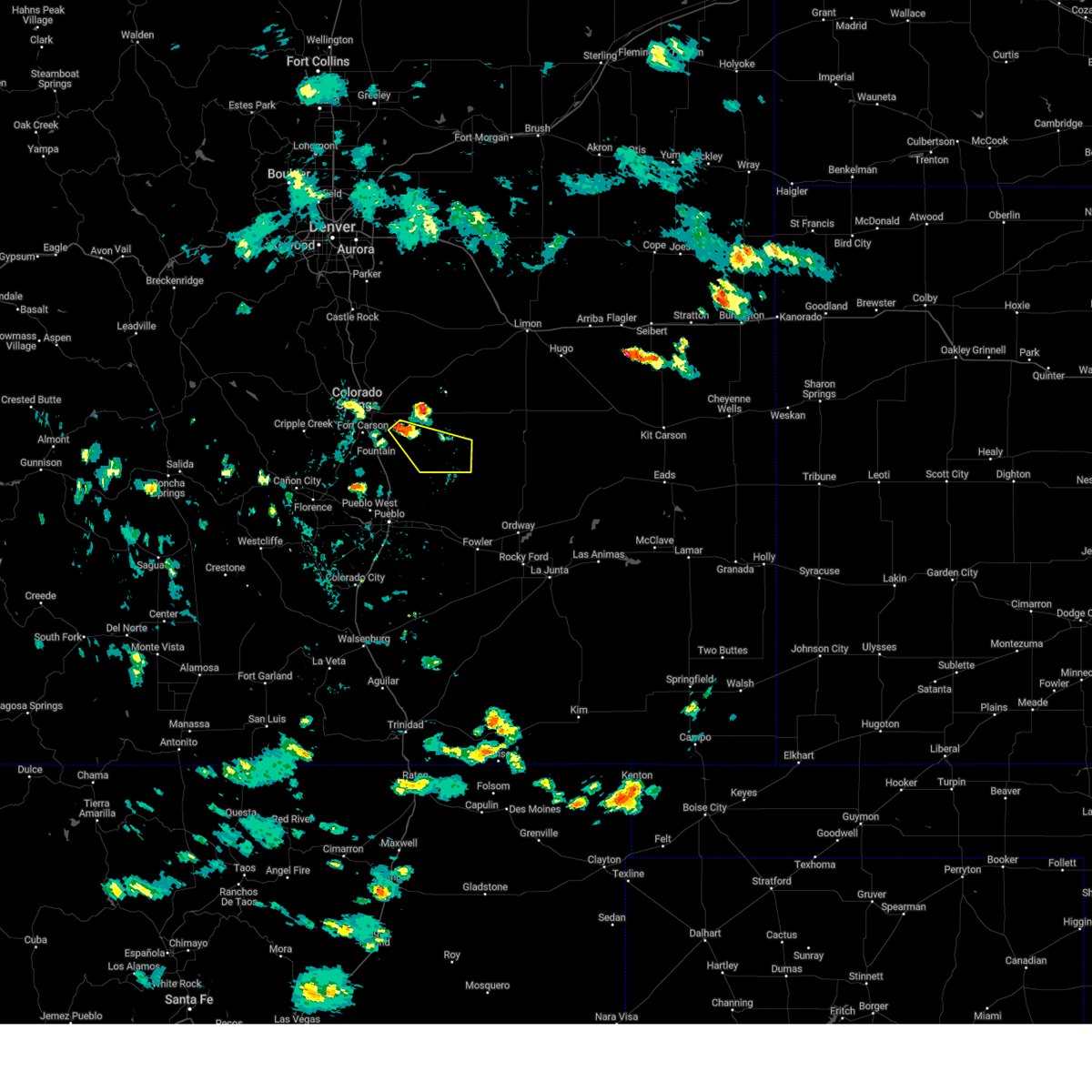 Svrpub the national weather service in pueblo has issued a * severe thunderstorm warning for, southeastern el paso county in east central colorado, * until 215 pm mdt. * at 125 pm mdt, a severe thunderstorm was located near schriever space force base, or 19 miles southeast of colorado springs, moving southeast at 20 mph (radar indicated). Hazards include ping pong ball size hail and 60 mph wind gusts. People and animals outdoors will be injured. expect hail damage to roofs, siding, windows, and vehicles. Expect wind damage to roofs, siding, and trees. Svrpub the national weather service in pueblo has issued a * severe thunderstorm warning for, southeastern el paso county in east central colorado, * until 215 pm mdt. * at 125 pm mdt, a severe thunderstorm was located near schriever space force base, or 19 miles southeast of colorado springs, moving southeast at 20 mph (radar indicated). Hazards include ping pong ball size hail and 60 mph wind gusts. People and animals outdoors will be injured. expect hail damage to roofs, siding, windows, and vehicles. Expect wind damage to roofs, siding, and trees.
|
| 5/28/2025 1:06 PM MDT |
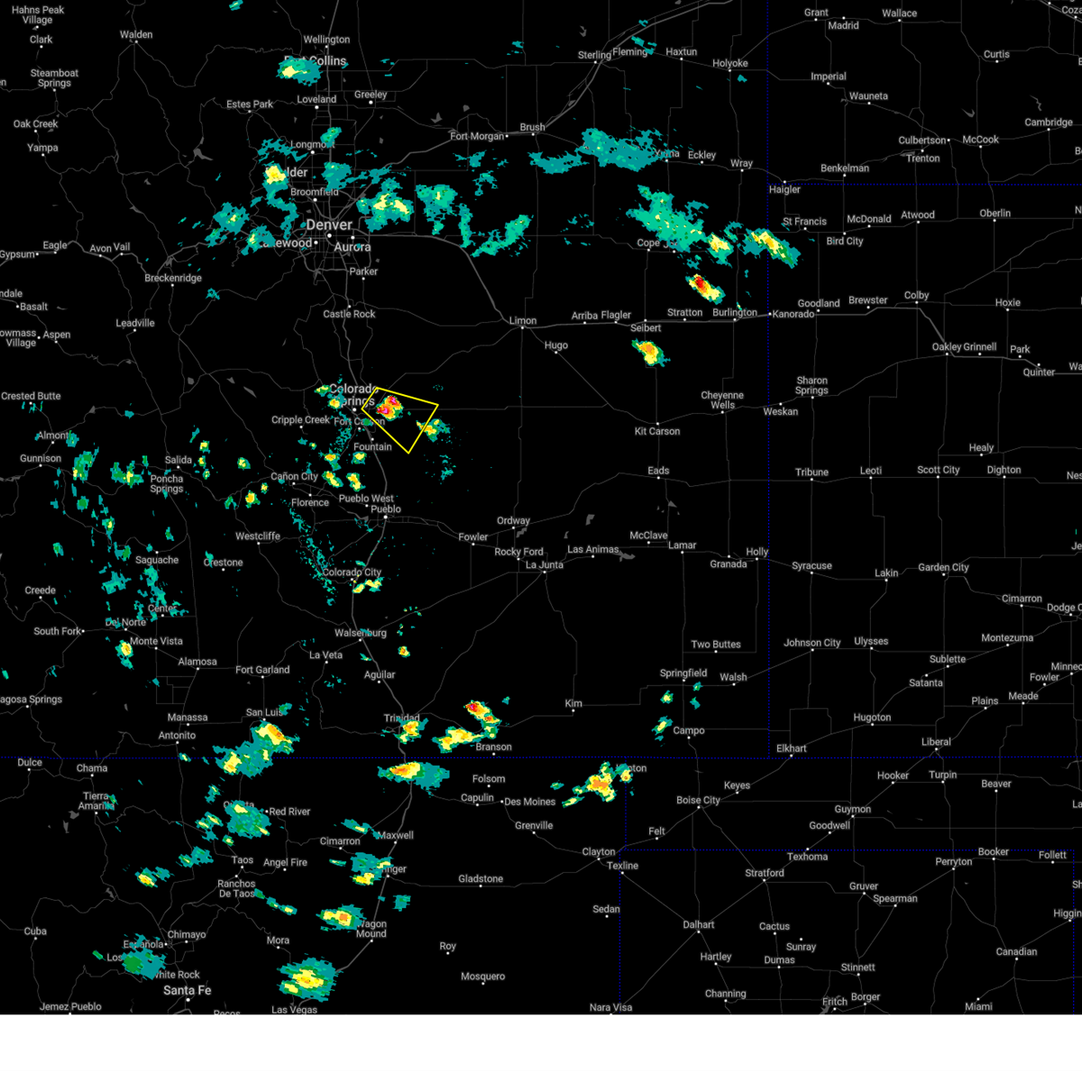 At 105 pm mdt, a severe thunderstorm was located near peterson space force base, or 10 miles east of colorado springs, moving southeast at 15 mph (trained weather spotters). Hazards include ping pong ball size hail was reported at constitution and peterson road in colorado springs. People and animals outdoors will be injured. expect damage to roofs, siding, windows, and vehicles. Locations impacted include, ellicott, schriever space force base, falcon, cimarron hills, peterson space force base, hanover, and colorado springs. At 105 pm mdt, a severe thunderstorm was located near peterson space force base, or 10 miles east of colorado springs, moving southeast at 15 mph (trained weather spotters). Hazards include ping pong ball size hail was reported at constitution and peterson road in colorado springs. People and animals outdoors will be injured. expect damage to roofs, siding, windows, and vehicles. Locations impacted include, ellicott, schriever space force base, falcon, cimarron hills, peterson space force base, hanover, and colorado springs.
|
| 5/28/2025 1:03 PM MDT | Ping Pong Ball sized hail reported 3.3 miles W of Colorado Springs, CO |
| 5/28/2025 12:54 PM MDT |
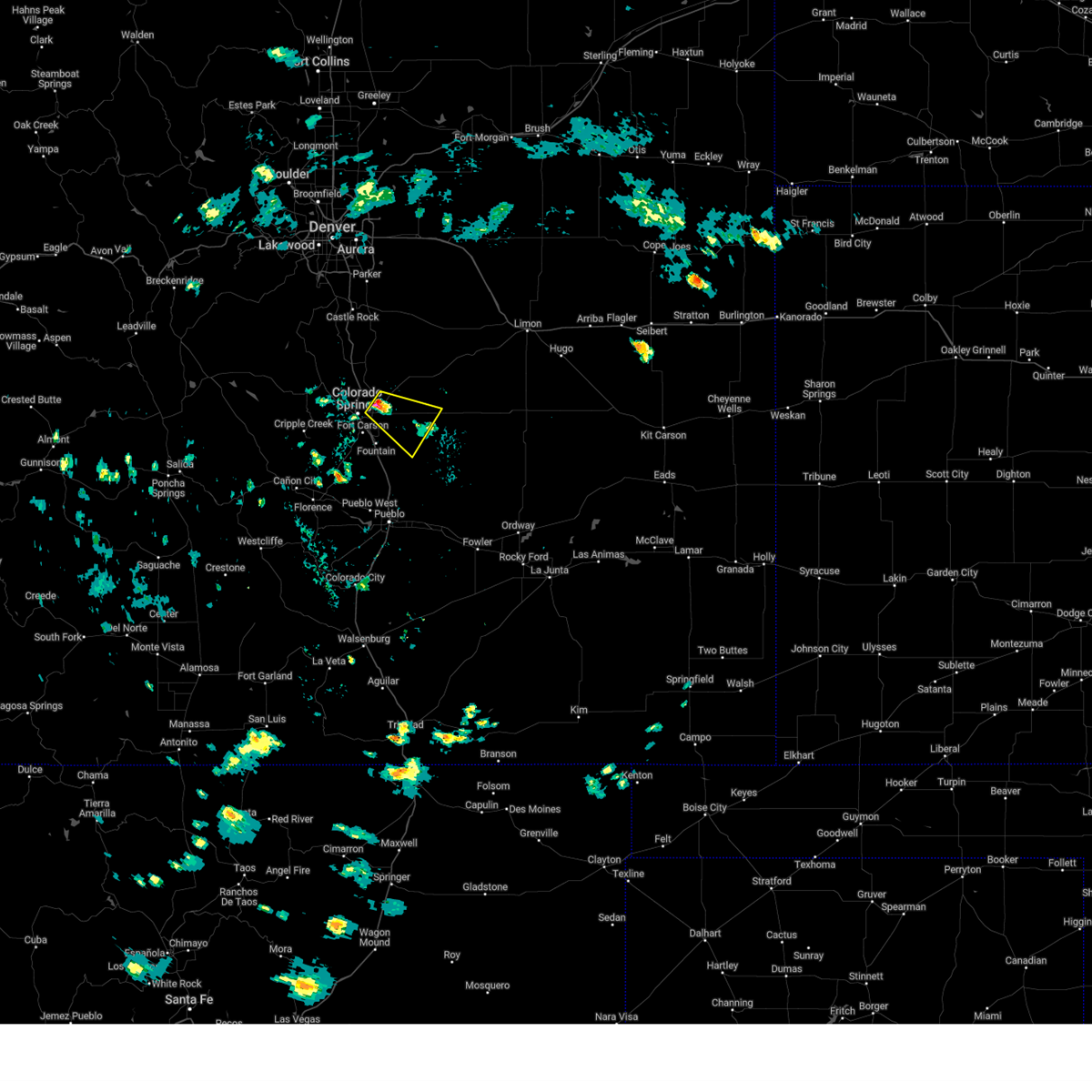 Svrpub the national weather service in pueblo has issued a * severe thunderstorm warning for, central el paso county in east central colorado, * until 130 pm mdt. * at 1254 pm mdt, a severe thunderstorm was located over cimarron hills, or 8 miles east of colorado springs, moving southeast at 15 mph (radar indicated). Hazards include quarter size hail. damage to vehicles is expected Svrpub the national weather service in pueblo has issued a * severe thunderstorm warning for, central el paso county in east central colorado, * until 130 pm mdt. * at 1254 pm mdt, a severe thunderstorm was located over cimarron hills, or 8 miles east of colorado springs, moving southeast at 15 mph (radar indicated). Hazards include quarter size hail. damage to vehicles is expected
|
| 5/27/2025 5:31 PM MDT |
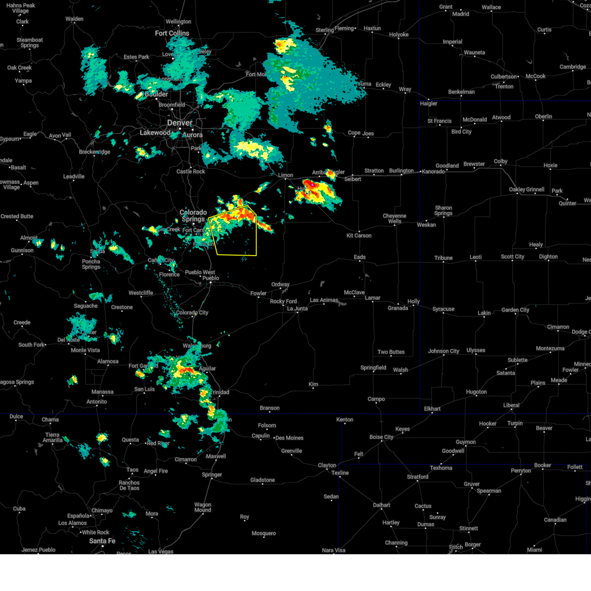 Svrpub the national weather service in pueblo has issued a * severe thunderstorm warning for, southeastern el paso county in east central colorado, * until 630 pm mdt. * at 530 pm mdt, a cluster of severe thunderstorms were located near ellicott, or 26 miles east of colorado springs, moving southeast at 25 mph (radar indicated). Hazards include 60 mph wind gusts and quarter size hail. Hail damage to vehicles is expected. Expect wind damage to roofs, siding, and trees. Svrpub the national weather service in pueblo has issued a * severe thunderstorm warning for, southeastern el paso county in east central colorado, * until 630 pm mdt. * at 530 pm mdt, a cluster of severe thunderstorms were located near ellicott, or 26 miles east of colorado springs, moving southeast at 25 mph (radar indicated). Hazards include 60 mph wind gusts and quarter size hail. Hail damage to vehicles is expected. Expect wind damage to roofs, siding, and trees.
|
| 5/27/2025 5:16 PM MDT |
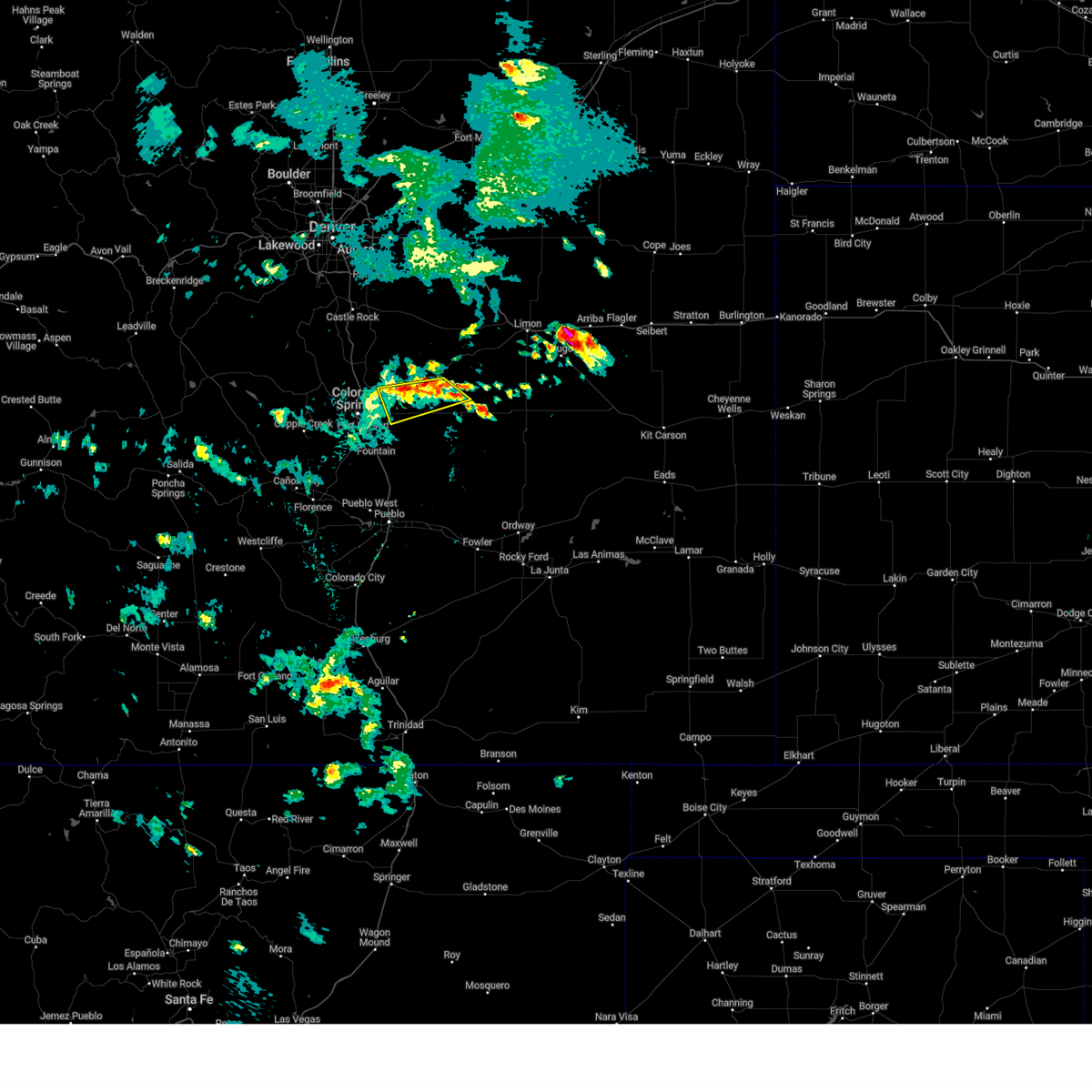 At 516 pm mdt, a severe thunderstorm was located near calhan, or 29 miles east of colorado springs, moving southeast at 25 mph (radar indicated). Hazards include 60 mph wind gusts and quarter size hail. Hail damage to vehicles is expected. expect wind damage to roofs, siding, and trees. Locations impacted include, schriever space force base, ellicott, falcon, and colorado springs. At 516 pm mdt, a severe thunderstorm was located near calhan, or 29 miles east of colorado springs, moving southeast at 25 mph (radar indicated). Hazards include 60 mph wind gusts and quarter size hail. Hail damage to vehicles is expected. expect wind damage to roofs, siding, and trees. Locations impacted include, schriever space force base, ellicott, falcon, and colorado springs.
|
| 5/27/2025 5:06 PM MDT |
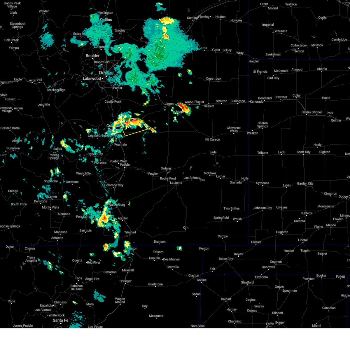 At 505 pm mdt, a severe thunderstorm was located near calhan, or 27 miles northeast of colorado springs, moving southeast at 25 mph (radar indicated). Hazards include 60 mph wind gusts and half dollar size hail. Hail damage to vehicles is expected. expect wind damage to roofs, siding, and trees. Locations impacted include, black forest, ellicott, peyton, calhan, schriever space force base, falcon, and colorado springs. At 505 pm mdt, a severe thunderstorm was located near calhan, or 27 miles northeast of colorado springs, moving southeast at 25 mph (radar indicated). Hazards include 60 mph wind gusts and half dollar size hail. Hail damage to vehicles is expected. expect wind damage to roofs, siding, and trees. Locations impacted include, black forest, ellicott, peyton, calhan, schriever space force base, falcon, and colorado springs.
|
| 5/27/2025 5:00 PM MDT |
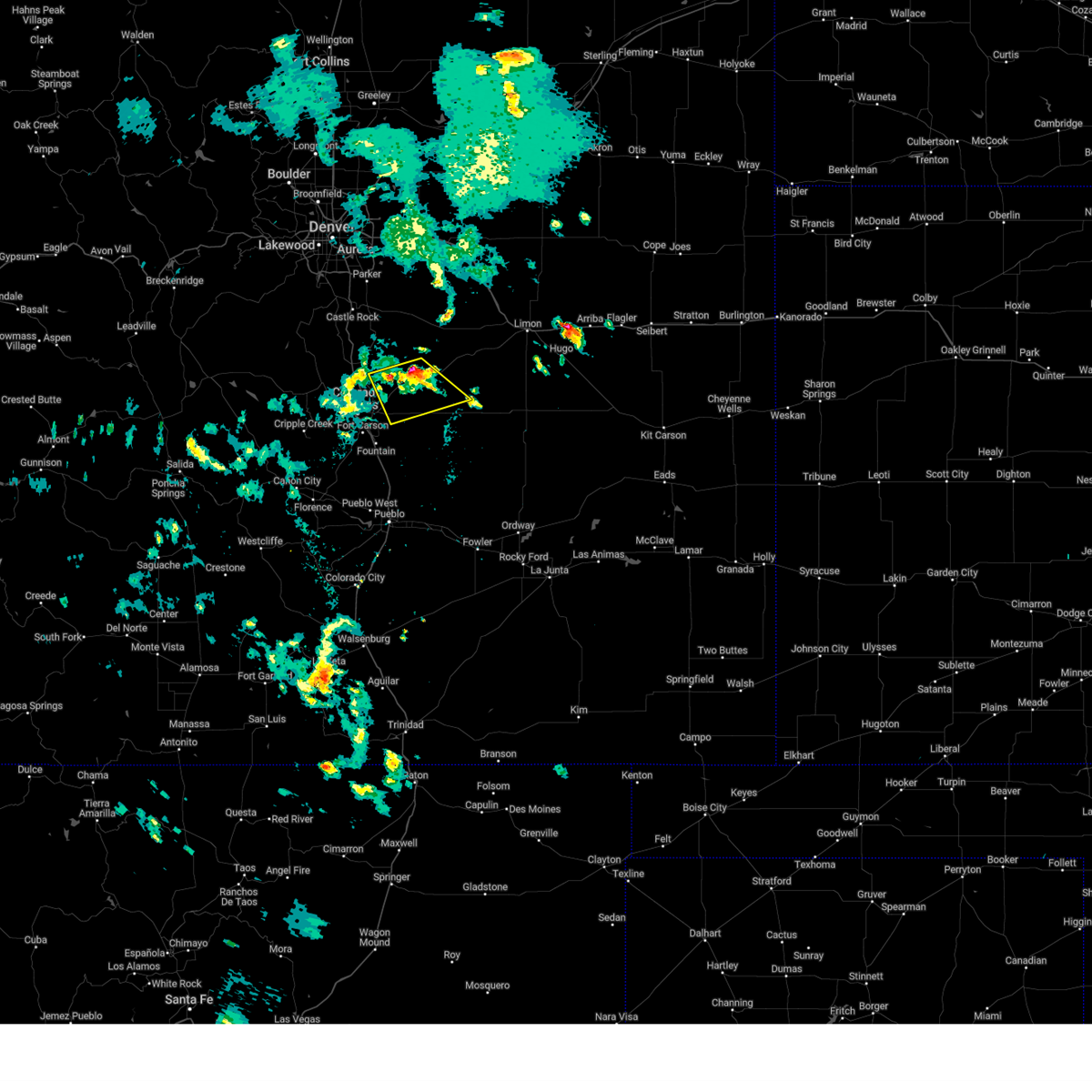 Svrpub the national weather service in pueblo has issued a * severe thunderstorm warning for, northeastern el paso county in east central colorado, * until 545 pm mdt. * at 459 pm mdt, a severe thunderstorm was located near peyton, or 26 miles northeast of colorado springs, moving southeast at 25 mph (radar indicated). Hazards include 60 mph wind gusts and half dollar size hail. Hail damage to vehicles is expected. Expect wind damage to roofs, siding, and trees. Svrpub the national weather service in pueblo has issued a * severe thunderstorm warning for, northeastern el paso county in east central colorado, * until 545 pm mdt. * at 459 pm mdt, a severe thunderstorm was located near peyton, or 26 miles northeast of colorado springs, moving southeast at 25 mph (radar indicated). Hazards include 60 mph wind gusts and half dollar size hail. Hail damage to vehicles is expected. Expect wind damage to roofs, siding, and trees.
|
| 5/27/2025 4:51 PM MDT |
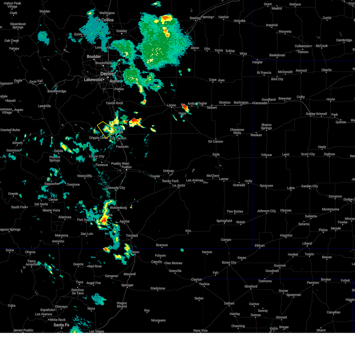 the severe thunderstorm warning has been cancelled and is no longer in effect the severe thunderstorm warning has been cancelled and is no longer in effect
|
| 5/27/2025 4:46 PM MDT |
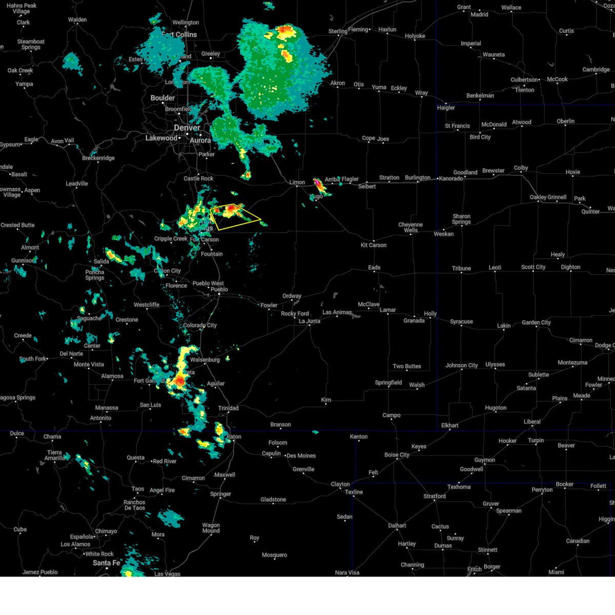 At 445 pm mdt, a severe thunderstorm was located over peyton, or 24 miles northeast of colorado springs, moving southeast at 20 mph (radar indicated). Hazards include 60 mph wind gusts and half dollar size hail. Hail damage to vehicles is expected. expect wind damage to roofs, siding, and trees. Locations impacted include, calhan, black forest, peyton, and falcon. At 445 pm mdt, a severe thunderstorm was located over peyton, or 24 miles northeast of colorado springs, moving southeast at 20 mph (radar indicated). Hazards include 60 mph wind gusts and half dollar size hail. Hail damage to vehicles is expected. expect wind damage to roofs, siding, and trees. Locations impacted include, calhan, black forest, peyton, and falcon.
|
| 5/27/2025 4:33 PM MDT |
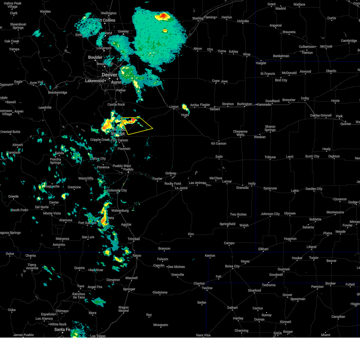 Svrpub the national weather service in pueblo has issued a * severe thunderstorm warning for, northeastern el paso county in east central colorado, * until 500 pm mdt. * at 433 pm mdt, a severe thunderstorm was located near peyton, or 24 miles northeast of colorado springs, moving southeast at 20 mph (radar indicated). Hazards include 60 mph wind gusts and half dollar size hail. Hail damage to vehicles is expected. Expect wind damage to roofs, siding, and trees. Svrpub the national weather service in pueblo has issued a * severe thunderstorm warning for, northeastern el paso county in east central colorado, * until 500 pm mdt. * at 433 pm mdt, a severe thunderstorm was located near peyton, or 24 miles northeast of colorado springs, moving southeast at 20 mph (radar indicated). Hazards include 60 mph wind gusts and half dollar size hail. Hail damage to vehicles is expected. Expect wind damage to roofs, siding, and trees.
|
| 5/27/2025 4:31 PM MDT |
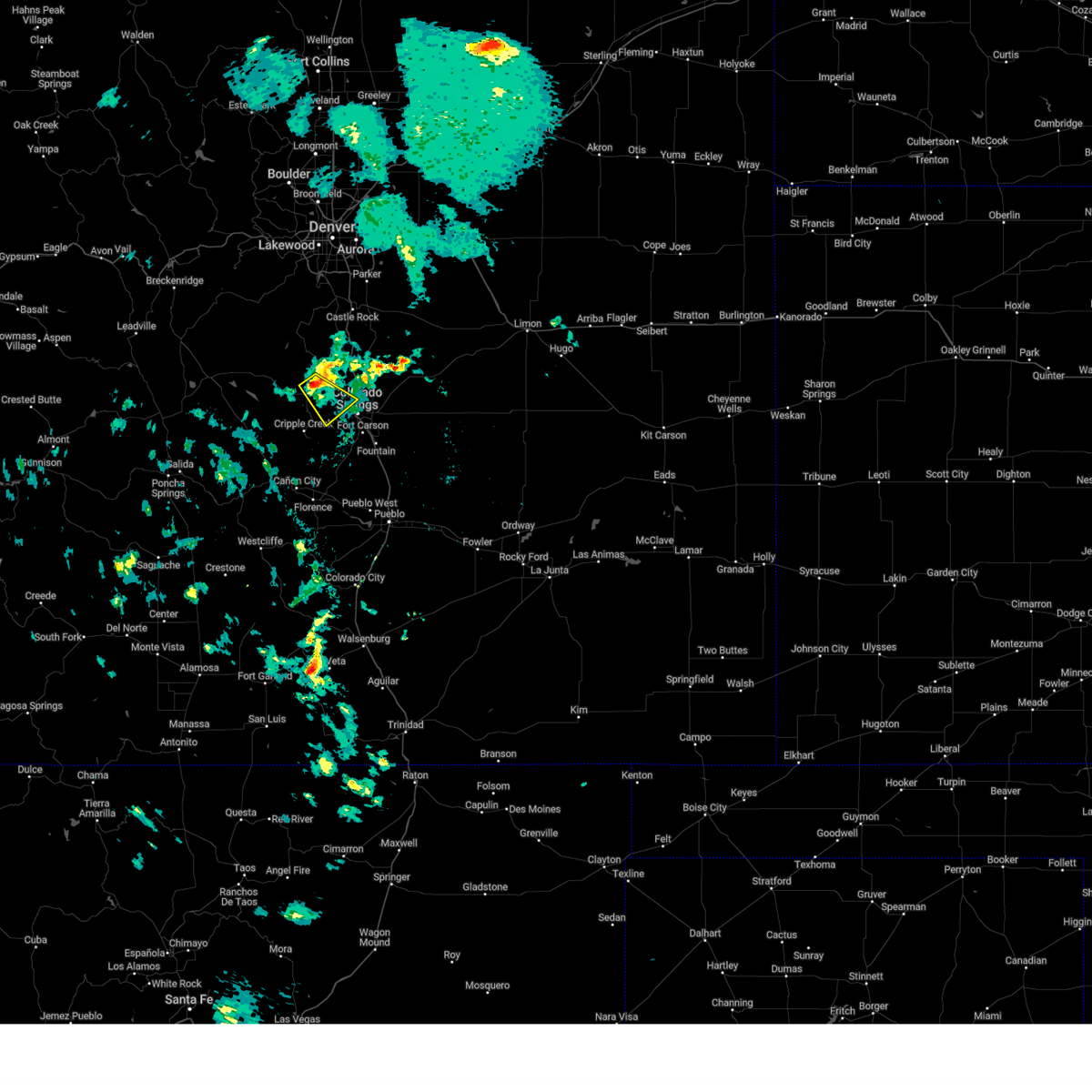 Svrpub the national weather service in pueblo has issued a * severe thunderstorm warning for, central teller county in central colorado, west central el paso county in east central colorado, * until 500 pm mdt. * at 430 pm mdt, a severe thunderstorm was located near divide, or 17 miles northwest of colorado springs, moving southeast at 20 mph (radar indicated). Hazards include 60 mph wind gusts and quarter size hail. Hail damage to vehicles is expected. Expect wind damage to roofs, siding, and trees. Svrpub the national weather service in pueblo has issued a * severe thunderstorm warning for, central teller county in central colorado, west central el paso county in east central colorado, * until 500 pm mdt. * at 430 pm mdt, a severe thunderstorm was located near divide, or 17 miles northwest of colorado springs, moving southeast at 20 mph (radar indicated). Hazards include 60 mph wind gusts and quarter size hail. Hail damage to vehicles is expected. Expect wind damage to roofs, siding, and trees.
|
| 9/17/2024 3:25 PM MDT |
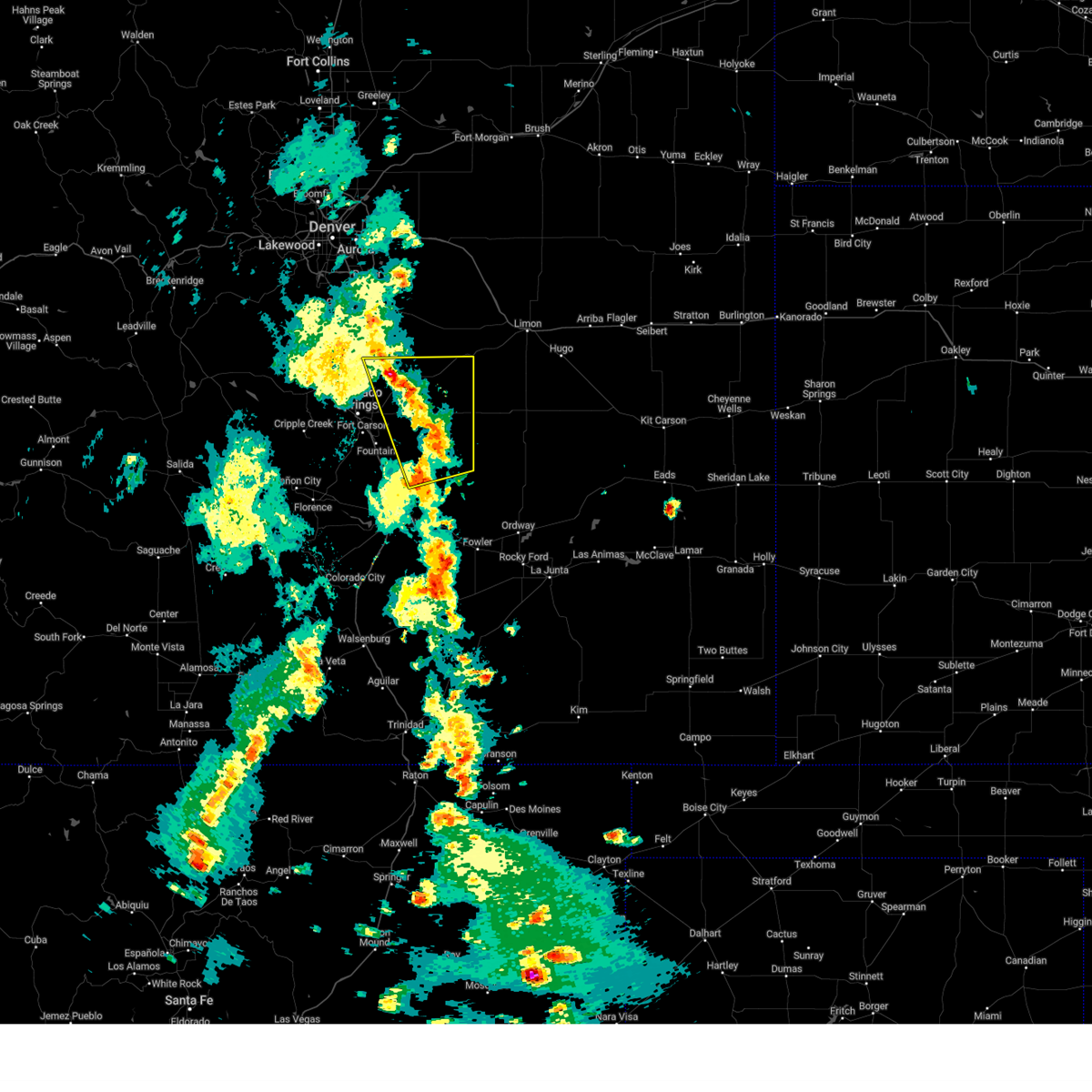 At 325 pm mdt, severe thunderstorms were located along a line extending from near peyton to near truckton, moving northeast at 55 mph (radar indicated). Hazards include 60 mph wind gusts and penny size hail. Expect damage to roofs, siding, and trees. Locations impacted include, southeastern colorado springs, calhan, ramah, hanover, truckton, yoder, black forest, ellicott, peyton, falcon, schriever space force base, rush, and cimarron hills. At 325 pm mdt, severe thunderstorms were located along a line extending from near peyton to near truckton, moving northeast at 55 mph (radar indicated). Hazards include 60 mph wind gusts and penny size hail. Expect damage to roofs, siding, and trees. Locations impacted include, southeastern colorado springs, calhan, ramah, hanover, truckton, yoder, black forest, ellicott, peyton, falcon, schriever space force base, rush, and cimarron hills.
|
| 9/17/2024 3:11 PM MDT |
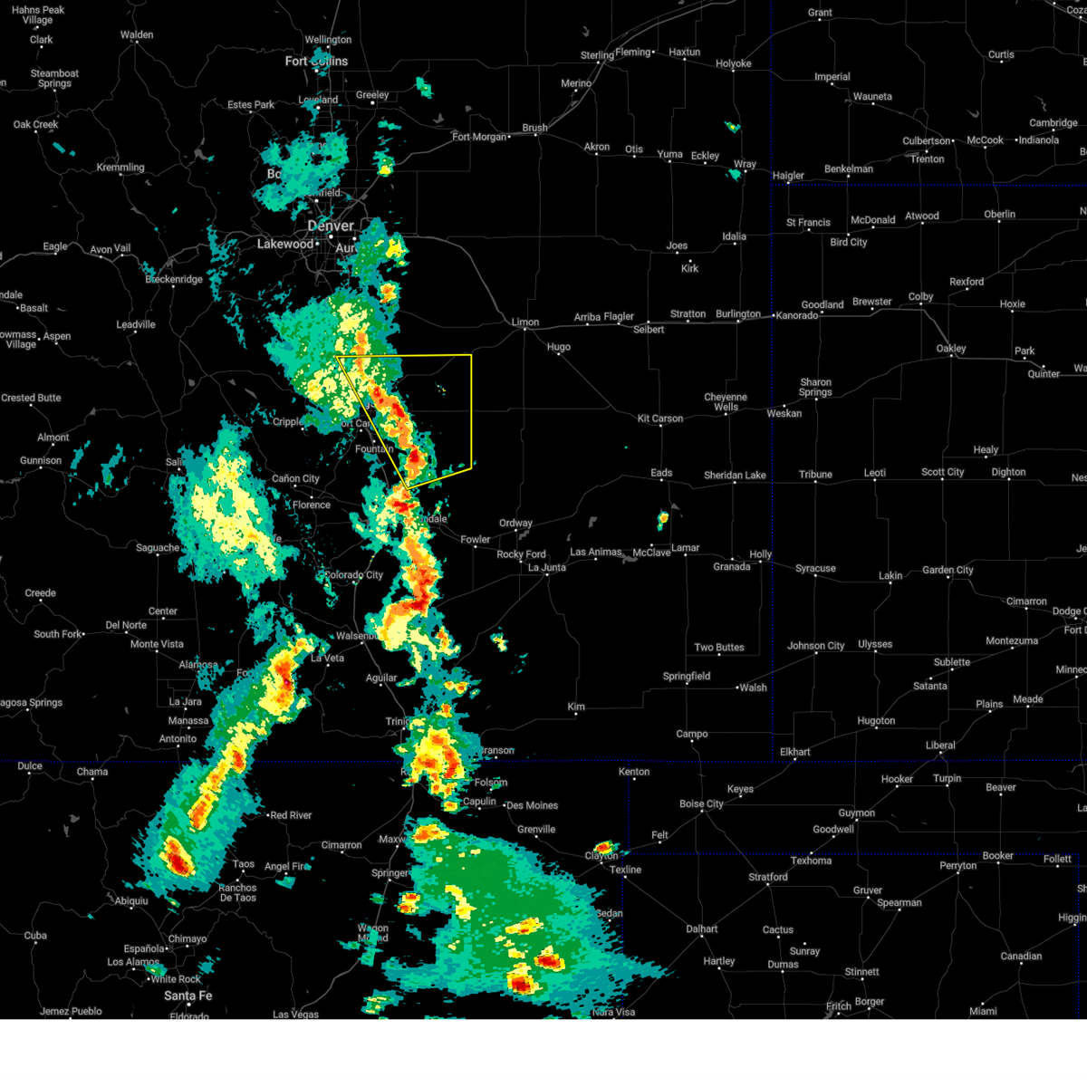 Svrpub the national weather service in pueblo has issued a * severe thunderstorm warning for, el paso county in east central colorado, north central pueblo county in southeastern colorado, * until 345 pm mdt. * at 311 pm mdt, severe thunderstorms were located along a line extending from near black forest to 7 miles south of hanover, moving northeast at 55 mph (radar indicated). Hazards include 70 mph wind gusts and nickel size hail. Expect considerable tree damage. Damage is likely to mobile homes, roofs, and outbuildings. Svrpub the national weather service in pueblo has issued a * severe thunderstorm warning for, el paso county in east central colorado, north central pueblo county in southeastern colorado, * until 345 pm mdt. * at 311 pm mdt, severe thunderstorms were located along a line extending from near black forest to 7 miles south of hanover, moving northeast at 55 mph (radar indicated). Hazards include 70 mph wind gusts and nickel size hail. Expect considerable tree damage. Damage is likely to mobile homes, roofs, and outbuildings.
|
| 9/17/2024 3:03 PM MDT | Asos station kcos colorado springs airpor in el paso county CO, 5.9 miles NW of Colorado Springs, CO |
| 9/17/2024 2:48 PM MDT |
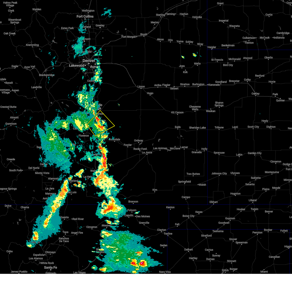 At 248 pm mdt, a severe thunderstorm was located just southwest of fountain, or 15 miles south of colorado springs, moving northeast at 40 mph (radar indicated). Hazards include 70 mph wind gusts and nickel size hail. Expect considerable tree damage. damage is likely to mobile homes, roofs, and outbuildings. Locations impacted include, southeastern colorado springs, fountain, stratmoor, fort carson, pinon, security, security-widefield, peterson space force base, hanover, cimarron hills, and pueblo west. At 248 pm mdt, a severe thunderstorm was located just southwest of fountain, or 15 miles south of colorado springs, moving northeast at 40 mph (radar indicated). Hazards include 70 mph wind gusts and nickel size hail. Expect considerable tree damage. damage is likely to mobile homes, roofs, and outbuildings. Locations impacted include, southeastern colorado springs, fountain, stratmoor, fort carson, pinon, security, security-widefield, peterson space force base, hanover, cimarron hills, and pueblo west.
|
| 9/17/2024 2:40 PM MDT |
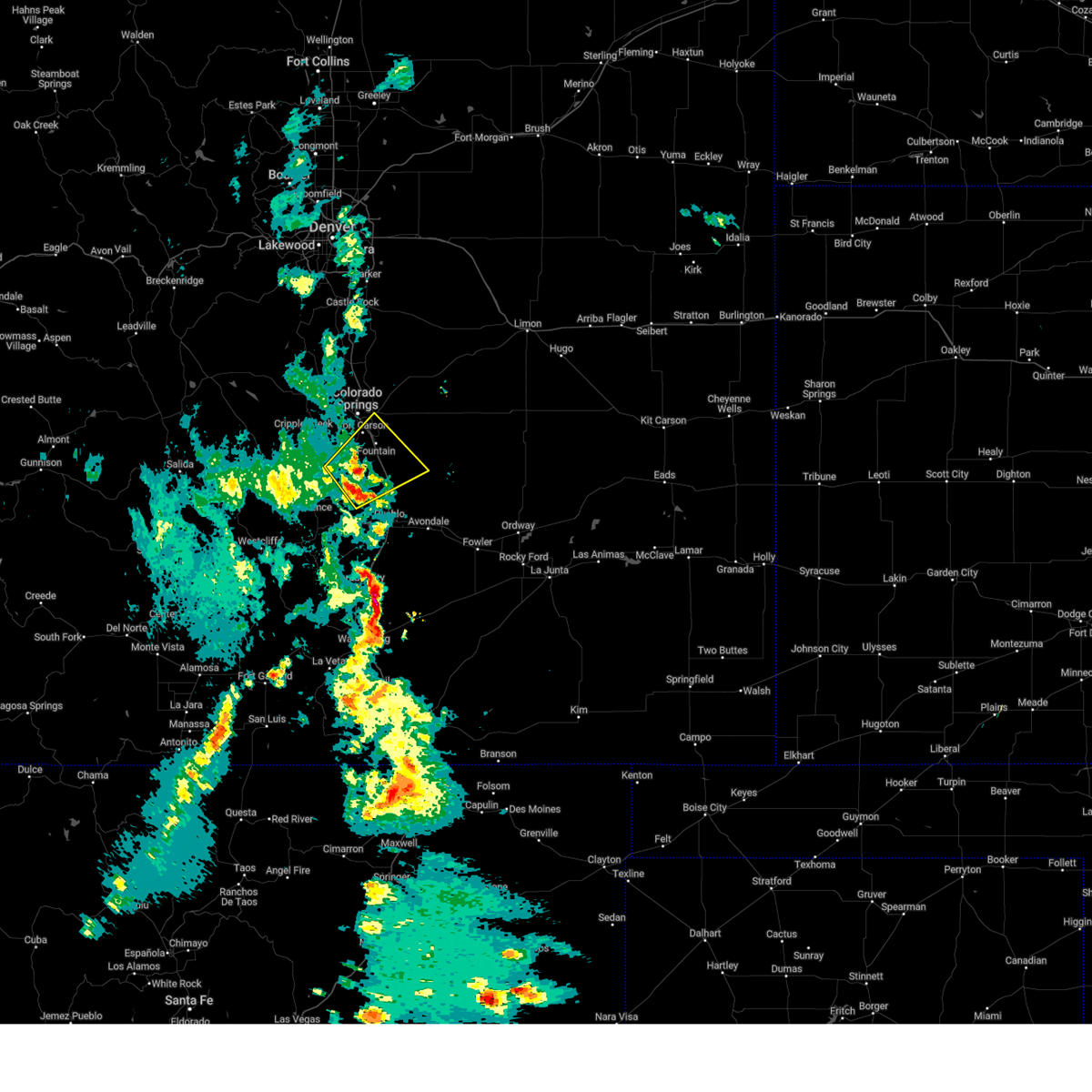 Svrpub the national weather service in pueblo has issued a * severe thunderstorm warning for, east central fremont county in central colorado, southwestern el paso county in east central colorado, northwestern pueblo county in southeastern colorado, * until 315 pm mdt. * at 240 pm mdt, a severe thunderstorm was located 11 miles southwest of fountain, or 20 miles south of colorado springs, moving northeast at 35 mph (radar indicated). Hazards include 70 mph wind gusts and nickel size hail. Expect considerable tree damage. Damage is likely to mobile homes, roofs, and outbuildings. Svrpub the national weather service in pueblo has issued a * severe thunderstorm warning for, east central fremont county in central colorado, southwestern el paso county in east central colorado, northwestern pueblo county in southeastern colorado, * until 315 pm mdt. * at 240 pm mdt, a severe thunderstorm was located 11 miles southwest of fountain, or 20 miles south of colorado springs, moving northeast at 35 mph (radar indicated). Hazards include 70 mph wind gusts and nickel size hail. Expect considerable tree damage. Damage is likely to mobile homes, roofs, and outbuildings.
|
| 9/7/2024 7:09 PM MDT |
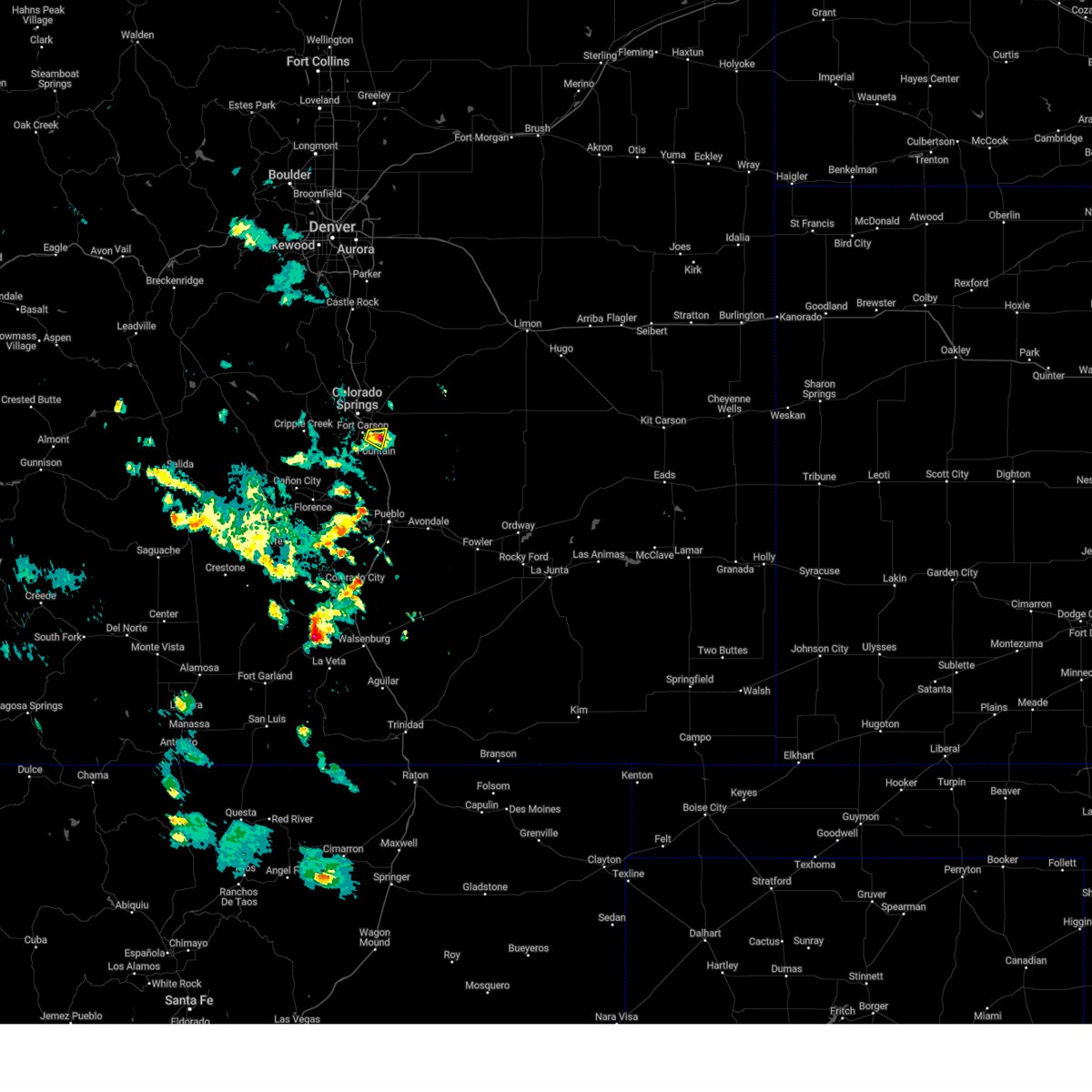 The storm which prompted the warning has weakened below severe limits, and has exited the warned area. therefore, the warning will be allowed to expire. however, gusty winds are still possible with this thunderstorm. to report severe weather, contact your nearest law enforcement agency. they will relay your report to the national weather service pueblo. The storm which prompted the warning has weakened below severe limits, and has exited the warned area. therefore, the warning will be allowed to expire. however, gusty winds are still possible with this thunderstorm. to report severe weather, contact your nearest law enforcement agency. they will relay your report to the national weather service pueblo.
|
| 9/7/2024 7:04 PM MDT |
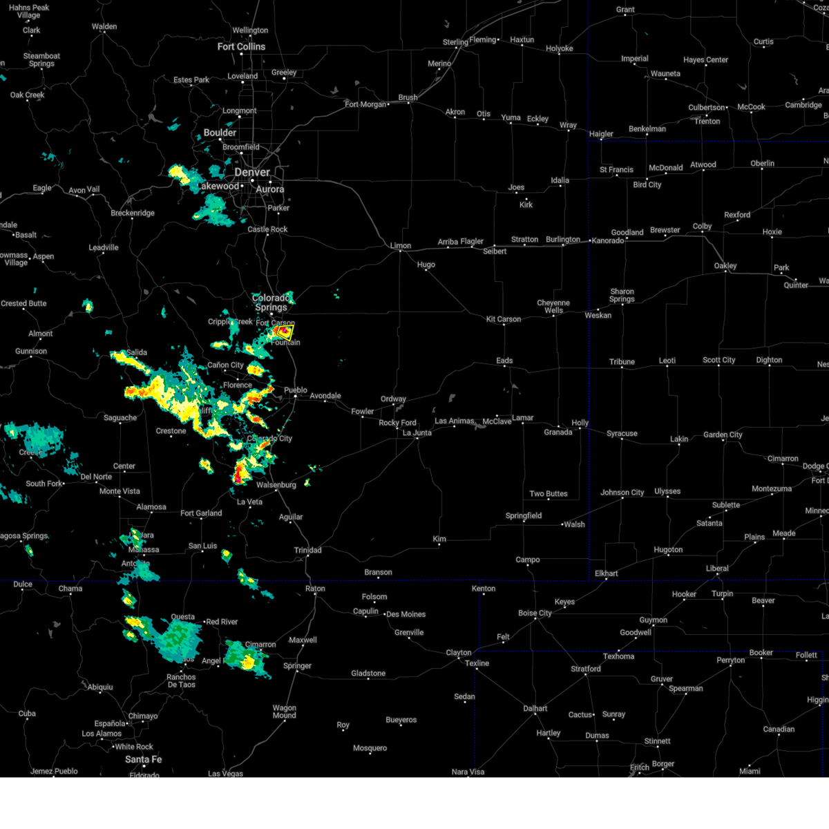 At 704 pm mdt, a severe thunderstorm was located over security-widefield, or 11 miles southeast of colorado springs, moving east at 15 mph (trained weather spotters). Hazards include 60 mph wind gusts and quarter size hail. Hail damage to vehicles is expected. expect wind damage to roofs, siding, and trees. Locations impacted include, southeastern colorado springs, fountain, security-widefield, and fort carson. At 704 pm mdt, a severe thunderstorm was located over security-widefield, or 11 miles southeast of colorado springs, moving east at 15 mph (trained weather spotters). Hazards include 60 mph wind gusts and quarter size hail. Hail damage to vehicles is expected. expect wind damage to roofs, siding, and trees. Locations impacted include, southeastern colorado springs, fountain, security-widefield, and fort carson.
|
| 9/7/2024 6:56 PM MDT |
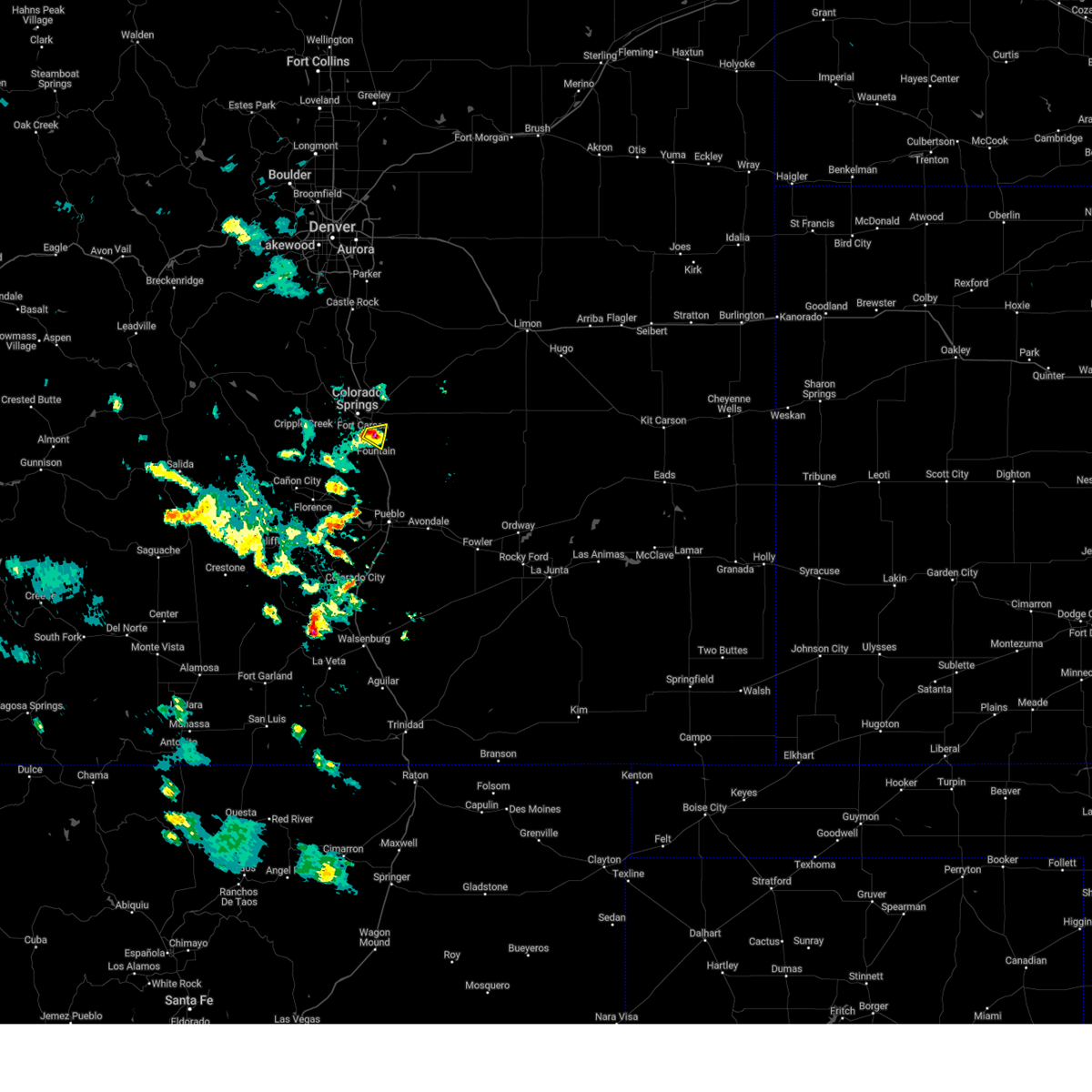 At 655 pm mdt, a severe thunderstorm was located over security-widefield, or 10 miles southeast of colorado springs, moving east at 15 mph (trained weather spotters). Hazards include 60 mph wind gusts and quarter size hail. Hail damage to vehicles is expected. expect wind damage to roofs, siding, and trees. Locations impacted include, southeastern colorado springs, fountain, security, security-widefield, fort carson, and stratmoor. At 655 pm mdt, a severe thunderstorm was located over security-widefield, or 10 miles southeast of colorado springs, moving east at 15 mph (trained weather spotters). Hazards include 60 mph wind gusts and quarter size hail. Hail damage to vehicles is expected. expect wind damage to roofs, siding, and trees. Locations impacted include, southeastern colorado springs, fountain, security, security-widefield, fort carson, and stratmoor.
|
| 9/7/2024 6:50 PM MDT | Quarter sized hail reported 8.9 miles N of Colorado Springs, CO, fell between 6:45 and 6:50 pm. |
| 9/7/2024 6:46 PM MDT | Quarter sized hail reported 10.4 miles NNW of Colorado Springs, CO |
| 9/7/2024 6:40 PM MDT |
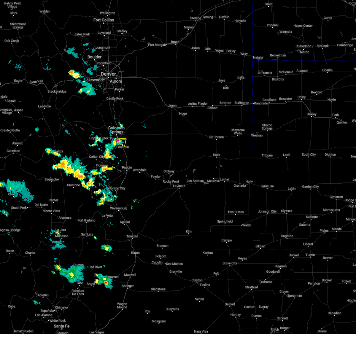 At 640 pm mdt, a severe thunderstorm was located over fort carson, or near colorado springs, moving east at 15 mph (trained weather spotters). Hazards include 60 mph wind gusts and quarter size hail. Hail damage to vehicles is expected. expect wind damage to roofs, siding, and trees. Locations impacted include, southeastern colorado springs, fountain, fort carson, stratmoor, security, and security-widefield. At 640 pm mdt, a severe thunderstorm was located over fort carson, or near colorado springs, moving east at 15 mph (trained weather spotters). Hazards include 60 mph wind gusts and quarter size hail. Hail damage to vehicles is expected. expect wind damage to roofs, siding, and trees. Locations impacted include, southeastern colorado springs, fountain, fort carson, stratmoor, security, and security-widefield.
|
| 9/7/2024 6:33 PM MDT | Quarter sized hail reported 9.6 miles NNE of Colorado Springs, CO |
| 9/7/2024 6:33 PM MDT |
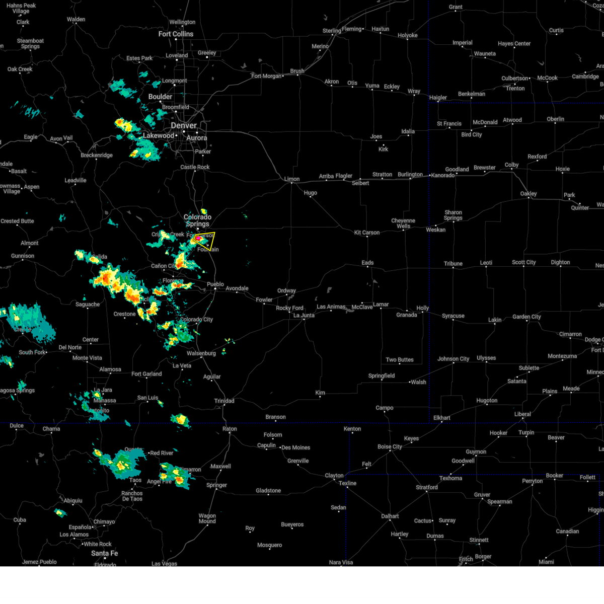 Svrpub the national weather service in pueblo has issued a * severe thunderstorm warning for, southwestern el paso county in east central colorado, * until 715 pm mdt. * at 633 pm mdt, a severe thunderstorm was located over fort carson, or near colorado springs, moving east at 15 mph (radar indicated). Hazards include 60 mph wind gusts and quarter size hail. Hail damage to vehicles is expected. Expect wind damage to roofs, siding, and trees. Svrpub the national weather service in pueblo has issued a * severe thunderstorm warning for, southwestern el paso county in east central colorado, * until 715 pm mdt. * at 633 pm mdt, a severe thunderstorm was located over fort carson, or near colorado springs, moving east at 15 mph (radar indicated). Hazards include 60 mph wind gusts and quarter size hail. Hail damage to vehicles is expected. Expect wind damage to roofs, siding, and trees.
|
| 8/20/2024 7:06 PM MDT |
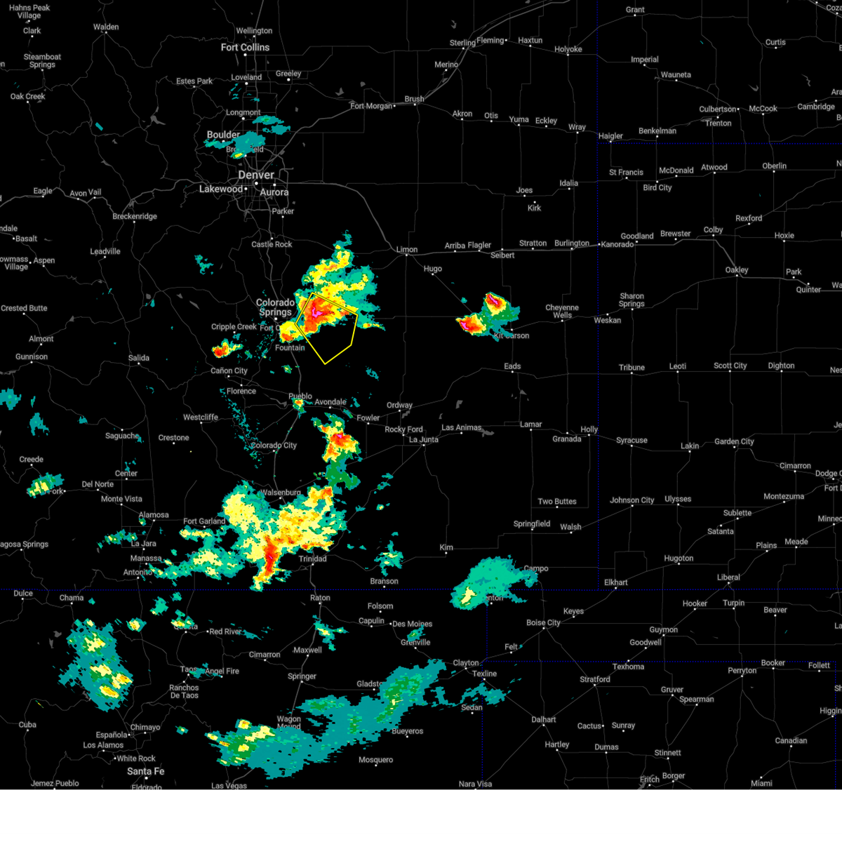 Svrpub the national weather service in pueblo has issued a * severe thunderstorm warning for, eastern el paso county in east central colorado, * until 730 pm mdt. * at 706 pm mdt, a severe thunderstorm was located near schriever space force base, or 20 miles east of colorado springs, moving southeast at 10 mph (radar indicated). Hazards include 70 mph wind gusts and quarter size hail. Hail damage to vehicles is expected. expect considerable tree damage. Wind damage is also likely to mobile homes, roofs, and outbuildings. Svrpub the national weather service in pueblo has issued a * severe thunderstorm warning for, eastern el paso county in east central colorado, * until 730 pm mdt. * at 706 pm mdt, a severe thunderstorm was located near schriever space force base, or 20 miles east of colorado springs, moving southeast at 10 mph (radar indicated). Hazards include 70 mph wind gusts and quarter size hail. Hail damage to vehicles is expected. expect considerable tree damage. Wind damage is also likely to mobile homes, roofs, and outbuildings.
|
| 8/20/2024 6:54 PM MDT |
 At 654 pm mdt, a severe thunderstorm was located near falcon, or 17 miles east of colorado springs, moving southeast at 10 mph (radar indicated). Hazards include 70 mph wind gusts and ping pong ball size hail. People and animals outdoors will be injured. expect hail damage to roofs, siding, windows, and vehicles. expect considerable tree damage. wind damage is also likely to mobile homes, roofs, and outbuildings. Locations impacted include, yoder, ellicott, and rush. At 654 pm mdt, a severe thunderstorm was located near falcon, or 17 miles east of colorado springs, moving southeast at 10 mph (radar indicated). Hazards include 70 mph wind gusts and ping pong ball size hail. People and animals outdoors will be injured. expect hail damage to roofs, siding, windows, and vehicles. expect considerable tree damage. wind damage is also likely to mobile homes, roofs, and outbuildings. Locations impacted include, yoder, ellicott, and rush.
|
| 8/20/2024 6:43 PM MDT |
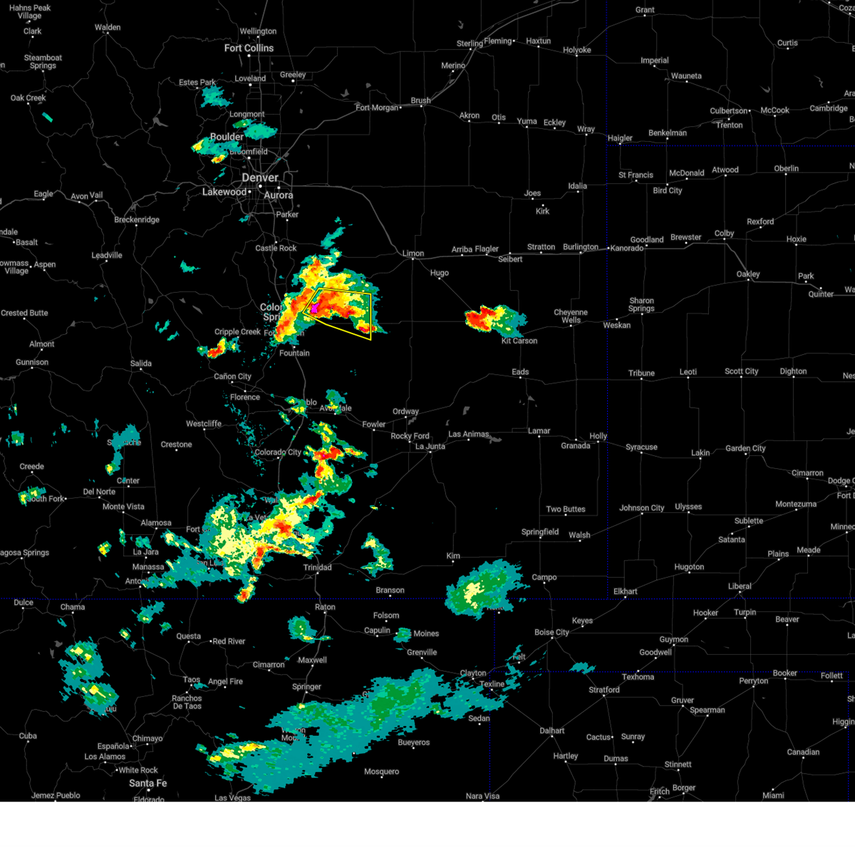 At 643 pm mdt, a severe thunderstorm was located near peyton, or 18 miles northeast of colorado springs, moving east at 10 mph (radar indicated). Hazards include golf ball size hail and 60 mph wind gusts. People and animals outdoors will be injured. expect hail damage to roofs, siding, windows, and vehicles. expect wind damage to roofs, siding, and trees. Locations impacted include, calhan, yoder, ellicott, peyton, and rush. At 643 pm mdt, a severe thunderstorm was located near peyton, or 18 miles northeast of colorado springs, moving east at 10 mph (radar indicated). Hazards include golf ball size hail and 60 mph wind gusts. People and animals outdoors will be injured. expect hail damage to roofs, siding, windows, and vehicles. expect wind damage to roofs, siding, and trees. Locations impacted include, calhan, yoder, ellicott, peyton, and rush.
|
| 8/20/2024 6:42 PM MDT |
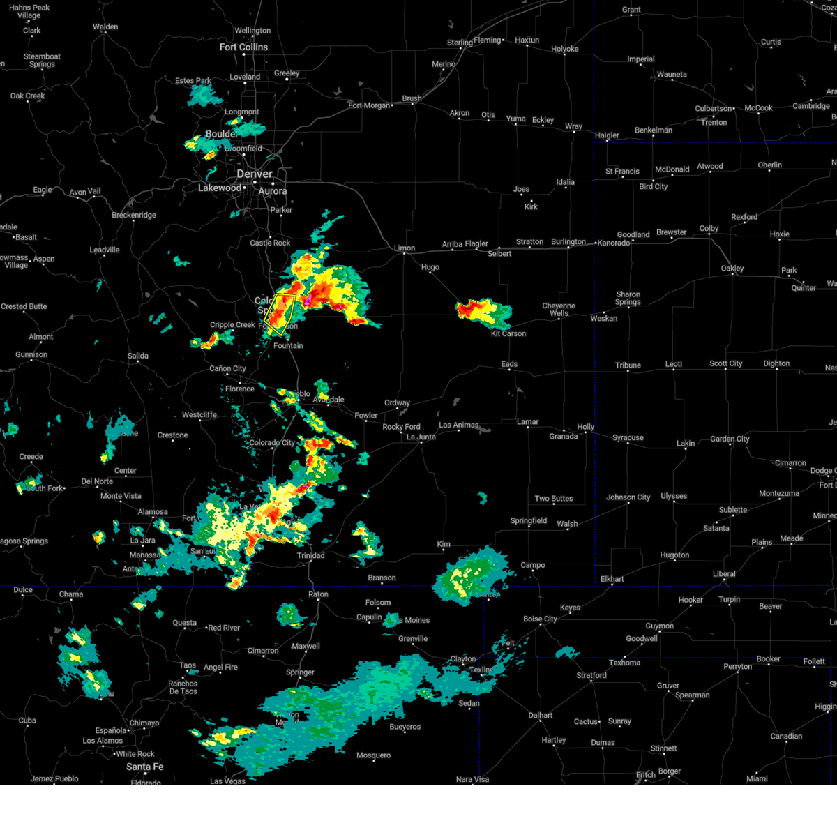 the severe thunderstorm warning has been cancelled and is no longer in effect the severe thunderstorm warning has been cancelled and is no longer in effect
|
| 8/20/2024 6:36 PM MDT |
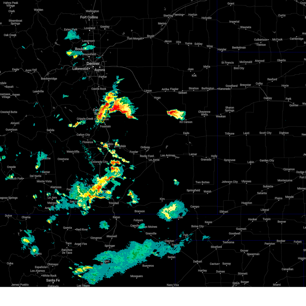 At 636 pm mdt, a severe thunderstorm was located over southwestern colorado springs, moving east at 10 mph (radar indicated). Hazards include 60 mph wind gusts and quarter size hail. Hail damage to vehicles is expected. expect wind damage to roofs, siding, and trees. Locations impacted include, colorado springs, fountain, stratmoor, fort carson, security, cimarron hills, peterson space force base, and security-widefield. At 636 pm mdt, a severe thunderstorm was located over southwestern colorado springs, moving east at 10 mph (radar indicated). Hazards include 60 mph wind gusts and quarter size hail. Hail damage to vehicles is expected. expect wind damage to roofs, siding, and trees. Locations impacted include, colorado springs, fountain, stratmoor, fort carson, security, cimarron hills, peterson space force base, and security-widefield.
|
| 8/20/2024 6:26 PM MDT |
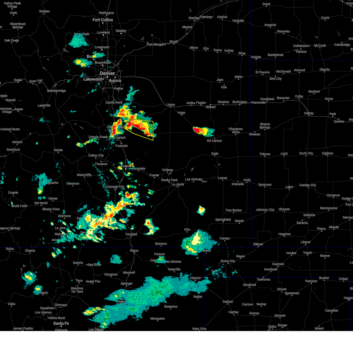 Svrpub the national weather service in pueblo has issued a * severe thunderstorm warning for, northeastern el paso county in east central colorado, * until 715 pm mdt. * at 626 pm mdt, a severe thunderstorm was located near peyton, or 20 miles northeast of colorado springs, moving east at 10 mph (radar indicated). Hazards include 60 mph wind gusts and half dollar size hail. Hail damage to vehicles is expected. Expect wind damage to roofs, siding, and trees. Svrpub the national weather service in pueblo has issued a * severe thunderstorm warning for, northeastern el paso county in east central colorado, * until 715 pm mdt. * at 626 pm mdt, a severe thunderstorm was located near peyton, or 20 miles northeast of colorado springs, moving east at 10 mph (radar indicated). Hazards include 60 mph wind gusts and half dollar size hail. Hail damage to vehicles is expected. Expect wind damage to roofs, siding, and trees.
|
| 8/20/2024 6:24 PM MDT |
 At 624 pm mdt, a severe thunderstorm was located over western colorado springs, moving east at 10 mph (radar indicated). Hazards include ping pong ball size hail and 60 mph wind gusts. People and animals outdoors will be injured. expect hail damage to roofs, siding, windows, and vehicles. expect wind damage to roofs, siding, and trees. Locations impacted include, colorado springs, fountain, air force academy, manitou springs, stratmoor, fort carson, security, cimarron hills, peterson space force base, and security-widefield. At 624 pm mdt, a severe thunderstorm was located over western colorado springs, moving east at 10 mph (radar indicated). Hazards include ping pong ball size hail and 60 mph wind gusts. People and animals outdoors will be injured. expect hail damage to roofs, siding, windows, and vehicles. expect wind damage to roofs, siding, and trees. Locations impacted include, colorado springs, fountain, air force academy, manitou springs, stratmoor, fort carson, security, cimarron hills, peterson space force base, and security-widefield.
|
| 8/20/2024 6:24 PM MDT |
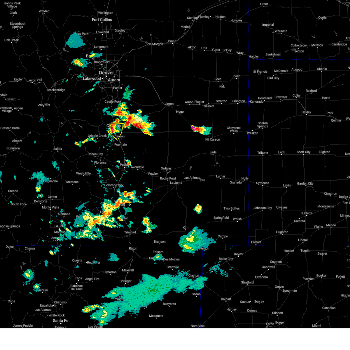 the severe thunderstorm warning has been cancelled and is no longer in effect the severe thunderstorm warning has been cancelled and is no longer in effect
|
| 8/20/2024 6:12 PM MDT |
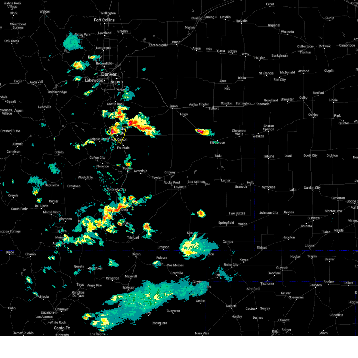 Svrpub the national weather service in pueblo has issued a * severe thunderstorm warning for, eastern teller county in central colorado, west central el paso county in east central colorado, * until 700 pm mdt. * at 611 pm mdt, a severe thunderstorm was located over western colorado springs, moving east at 10 mph (radar indicated). Hazards include ping pong ball size hail and 60 mph wind gusts. People and animals outdoors will be injured. expect hail damage to roofs, siding, windows, and vehicles. Expect wind damage to roofs, siding, and trees. Svrpub the national weather service in pueblo has issued a * severe thunderstorm warning for, eastern teller county in central colorado, west central el paso county in east central colorado, * until 700 pm mdt. * at 611 pm mdt, a severe thunderstorm was located over western colorado springs, moving east at 10 mph (radar indicated). Hazards include ping pong ball size hail and 60 mph wind gusts. People and animals outdoors will be injured. expect hail damage to roofs, siding, windows, and vehicles. Expect wind damage to roofs, siding, and trees.
|
| 8/20/2024 6:04 PM MDT |
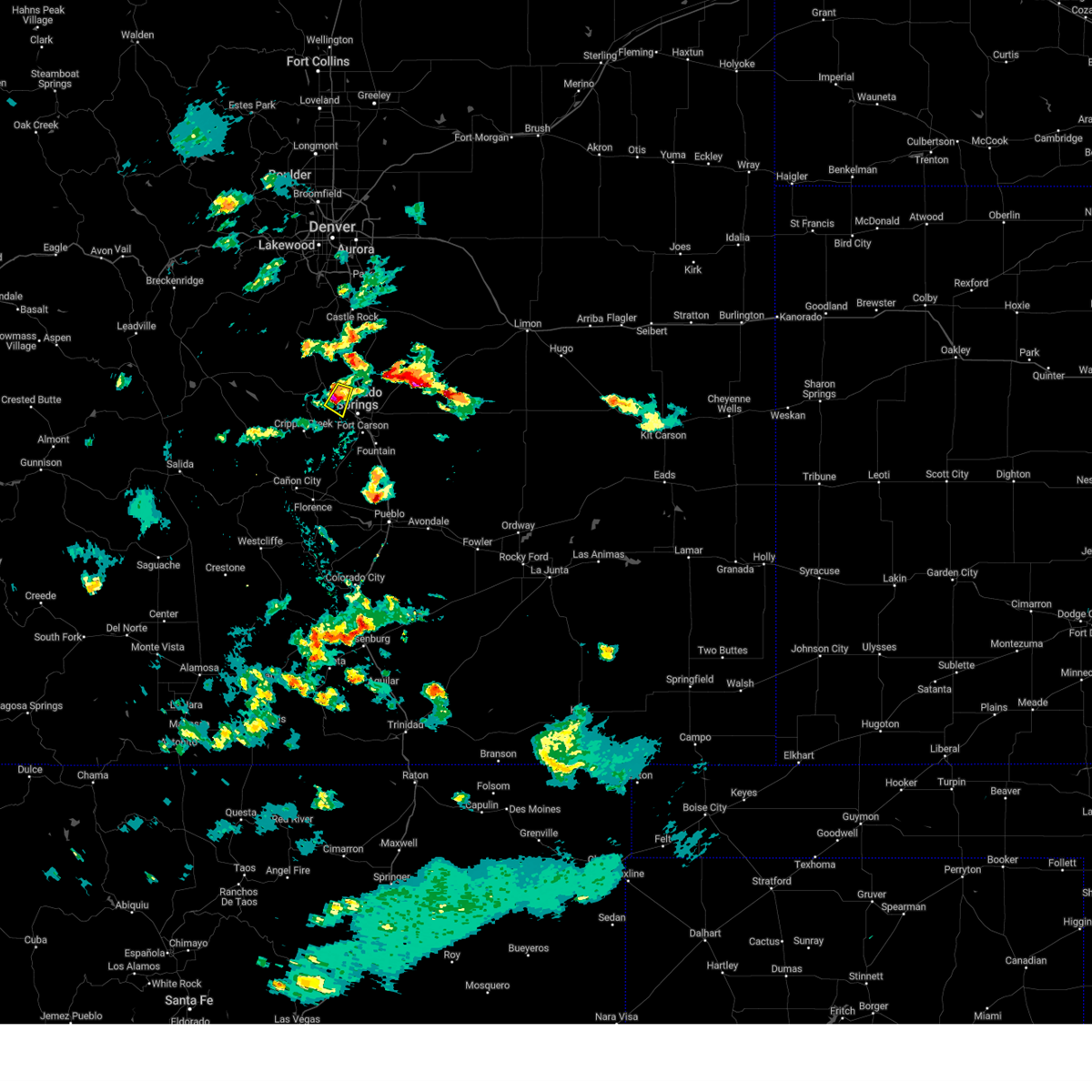 At 604 pm mdt, a severe thunderstorm was located over cascade, or 7 miles northwest of colorado springs, moving east at 10 mph (radar indicated). Hazards include 60 mph wind gusts and half dollar size hail. Hail damage to vehicles is expected. expect wind damage to roofs, siding, and trees. Locations impacted include, western colorado springs, manitou springs, chipita park, and cascade. At 604 pm mdt, a severe thunderstorm was located over cascade, or 7 miles northwest of colorado springs, moving east at 10 mph (radar indicated). Hazards include 60 mph wind gusts and half dollar size hail. Hail damage to vehicles is expected. expect wind damage to roofs, siding, and trees. Locations impacted include, western colorado springs, manitou springs, chipita park, and cascade.
|
| 8/20/2024 5:52 PM MDT |
 At 552 pm mdt, a severe thunderstorm was located over chipita park, or 10 miles northwest of colorado springs, moving east at 10 mph (radar indicated). Hazards include 60 mph wind gusts and half dollar size hail. Hail damage to vehicles is expected. expect wind damage to roofs, siding, and trees. Locations impacted include, western colorado springs, air force academy, manitou springs, green mountain falls, crystola, chipita park, and cascade. At 552 pm mdt, a severe thunderstorm was located over chipita park, or 10 miles northwest of colorado springs, moving east at 10 mph (radar indicated). Hazards include 60 mph wind gusts and half dollar size hail. Hail damage to vehicles is expected. expect wind damage to roofs, siding, and trees. Locations impacted include, western colorado springs, air force academy, manitou springs, green mountain falls, crystola, chipita park, and cascade.
|
| 8/20/2024 5:42 PM MDT | Quarter sized hail reported 12.5 miles SSW of Colorado Springs, CO, report from mping: quarter (1.00 in.). |
| 8/20/2024 5:39 PM MDT |
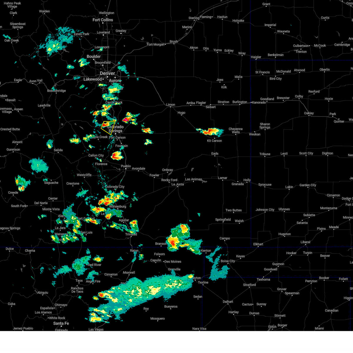 Svrpub the national weather service in pueblo has issued a * severe thunderstorm warning for, northeastern teller county in central colorado, northwestern el paso county in east central colorado, * until 615 pm mdt. * at 539 pm mdt, a severe thunderstorm was located over crystola, or 14 miles northwest of colorado springs, moving east at 10 mph (radar indicated). Hazards include 60 mph wind gusts and quarter size hail. Hail damage to vehicles is expected. Expect wind damage to roofs, siding, and trees. Svrpub the national weather service in pueblo has issued a * severe thunderstorm warning for, northeastern teller county in central colorado, northwestern el paso county in east central colorado, * until 615 pm mdt. * at 539 pm mdt, a severe thunderstorm was located over crystola, or 14 miles northwest of colorado springs, moving east at 10 mph (radar indicated). Hazards include 60 mph wind gusts and quarter size hail. Hail damage to vehicles is expected. Expect wind damage to roofs, siding, and trees.
|
| 8/19/2024 5:47 PM MDT |
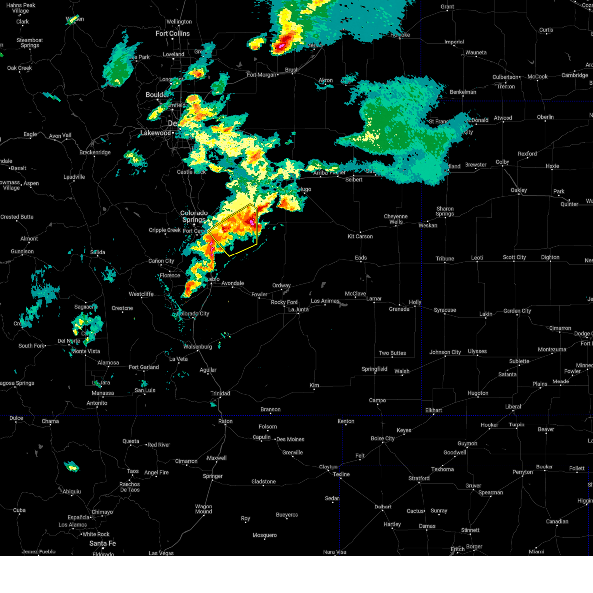 At 547 pm mdt, severe thunderstorms were located along a line extending from 10 miles southeast of matheson to 11 miles southeast of truckton to 9 miles southeast of hanover, moving southeast at 35 mph (radar indicated). Hazards include ping pong ball size hail and 60 mph wind gusts. People and animals outdoors will be injured. expect hail damage to roofs, siding, windows, and vehicles. expect wind damage to roofs, siding, and trees. Locations impacted include, hanover, truckton, yoder, schriever space force base, ellicott, and rush. At 547 pm mdt, severe thunderstorms were located along a line extending from 10 miles southeast of matheson to 11 miles southeast of truckton to 9 miles southeast of hanover, moving southeast at 35 mph (radar indicated). Hazards include ping pong ball size hail and 60 mph wind gusts. People and animals outdoors will be injured. expect hail damage to roofs, siding, windows, and vehicles. expect wind damage to roofs, siding, and trees. Locations impacted include, hanover, truckton, yoder, schriever space force base, ellicott, and rush.
|
| 8/19/2024 5:43 PM MDT |
 At 543 pm mdt, a severe thunderstorm was located 7 miles southeast of fountain, or 19 miles southeast of colorado springs, moving southeast at 15 mph (radar indicated). Hazards include ping pong ball size hail and 60 mph wind gusts. People and animals outdoors will be injured. expect hail damage to roofs, siding, windows, and vehicles. expect wind damage to roofs, siding, and trees. Locations impacted include, fountain, pinon, hanover, and security-widefield. At 543 pm mdt, a severe thunderstorm was located 7 miles southeast of fountain, or 19 miles southeast of colorado springs, moving southeast at 15 mph (radar indicated). Hazards include ping pong ball size hail and 60 mph wind gusts. People and animals outdoors will be injured. expect hail damage to roofs, siding, windows, and vehicles. expect wind damage to roofs, siding, and trees. Locations impacted include, fountain, pinon, hanover, and security-widefield.
|
| 8/19/2024 5:40 PM MDT |
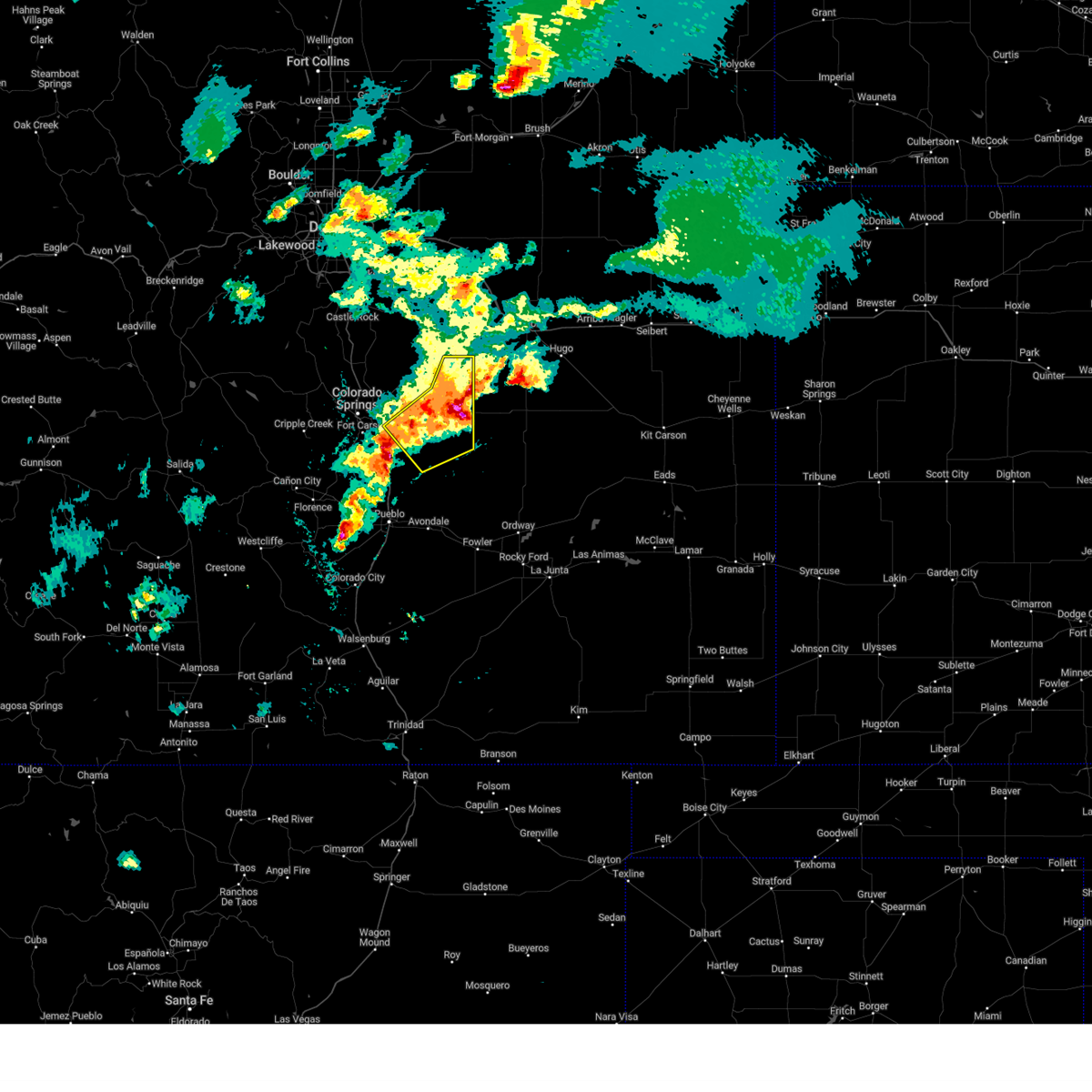 At 540 pm mdt, severe thunderstorms were located along a line extending from 7 miles southeast of matheson to 7 miles southeast of truckton to near hanover, moving southeast at 35 mph (radar indicated). Hazards include ping pong ball size hail and 60 mph wind gusts. People and animals outdoors will be injured. expect hail damage to roofs, siding, windows, and vehicles. expect wind damage to roofs, siding, and trees. Locations impacted include, calhan, ramah, hanover, truckton, yoder, ellicott, schriever space force base, and rush. At 540 pm mdt, severe thunderstorms were located along a line extending from 7 miles southeast of matheson to 7 miles southeast of truckton to near hanover, moving southeast at 35 mph (radar indicated). Hazards include ping pong ball size hail and 60 mph wind gusts. People and animals outdoors will be injured. expect hail damage to roofs, siding, windows, and vehicles. expect wind damage to roofs, siding, and trees. Locations impacted include, calhan, ramah, hanover, truckton, yoder, ellicott, schriever space force base, and rush.
|
| 8/19/2024 5:24 PM MDT |
 Svrpub the national weather service in pueblo has issued a * severe thunderstorm warning for, south central el paso county in east central colorado, north central pueblo county in southeastern colorado, * until 615 pm mdt. * at 524 pm mdt, a severe thunderstorm was located over fountain, or 14 miles southeast of colorado springs, moving southeast at 15 mph (radar indicated). Hazards include golf ball size hail and 60 mph wind gusts. People and animals outdoors will be injured. expect hail damage to roofs, siding, windows, and vehicles. Expect wind damage to roofs, siding, and trees. Svrpub the national weather service in pueblo has issued a * severe thunderstorm warning for, south central el paso county in east central colorado, north central pueblo county in southeastern colorado, * until 615 pm mdt. * at 524 pm mdt, a severe thunderstorm was located over fountain, or 14 miles southeast of colorado springs, moving southeast at 15 mph (radar indicated). Hazards include golf ball size hail and 60 mph wind gusts. People and animals outdoors will be injured. expect hail damage to roofs, siding, windows, and vehicles. Expect wind damage to roofs, siding, and trees.
|
| 8/19/2024 5:23 PM MDT |
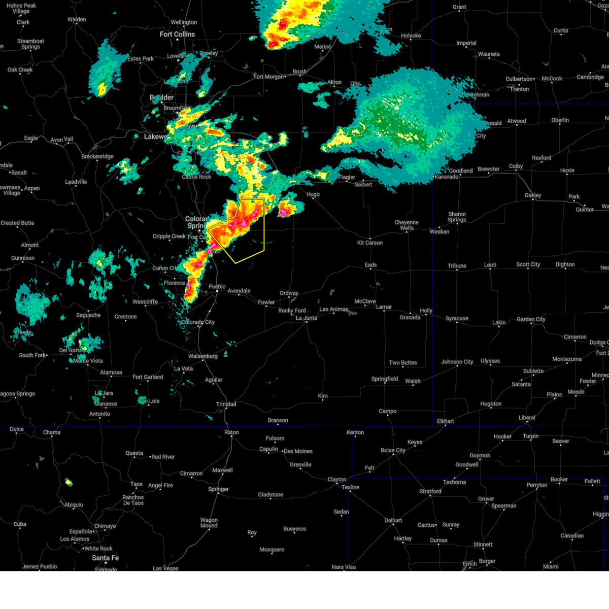 Svrpub the national weather service in pueblo has issued a * severe thunderstorm warning for, eastern el paso county in east central colorado, * until 615 pm mdt. * at 523 pm mdt, severe thunderstorms were located along a line extending from matheson to near truckton to near hanover, moving southeast at 35 mph (radar indicated). Hazards include 60 mph wind gusts and quarter size hail. Hail damage to vehicles is expected. Expect wind damage to roofs, siding, and trees. Svrpub the national weather service in pueblo has issued a * severe thunderstorm warning for, eastern el paso county in east central colorado, * until 615 pm mdt. * at 523 pm mdt, severe thunderstorms were located along a line extending from matheson to near truckton to near hanover, moving southeast at 35 mph (radar indicated). Hazards include 60 mph wind gusts and quarter size hail. Hail damage to vehicles is expected. Expect wind damage to roofs, siding, and trees.
|
| 8/19/2024 5:20 PM MDT |
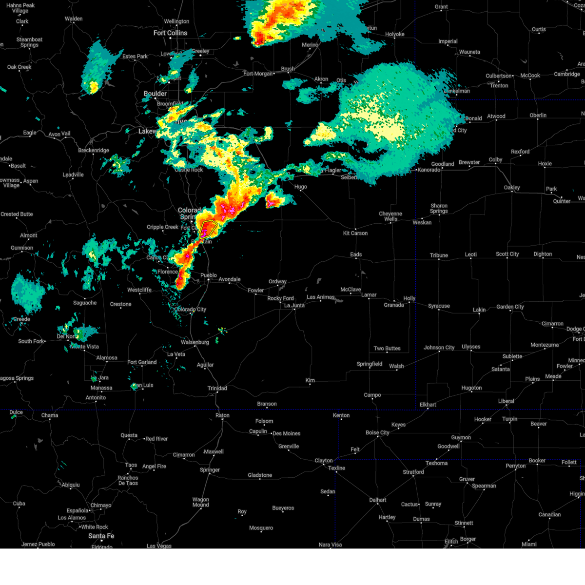 At 520 pm mdt, a severe thunderstorm was located near fountain, or 12 miles southeast of colorado springs, moving east at 10 mph (radar indicated). Hazards include ping pong ball size hail and 60 mph wind gusts. People and animals outdoors will be injured. expect hail damage to roofs, siding, windows, and vehicles. expect wind damage to roofs, siding, and trees. Locations impacted include, southeastern colorado springs, fountain, schriever space force base, and security-widefield. At 520 pm mdt, a severe thunderstorm was located near fountain, or 12 miles southeast of colorado springs, moving east at 10 mph (radar indicated). Hazards include ping pong ball size hail and 60 mph wind gusts. People and animals outdoors will be injured. expect hail damage to roofs, siding, windows, and vehicles. expect wind damage to roofs, siding, and trees. Locations impacted include, southeastern colorado springs, fountain, schriever space force base, and security-widefield.
|
| 8/19/2024 5:12 PM MDT | Quarter sized hail reported 10.2 miles NNW of Colorado Springs, CO, report from mping: quarter (1.00 in.). |
| 8/19/2024 5:04 PM MDT |
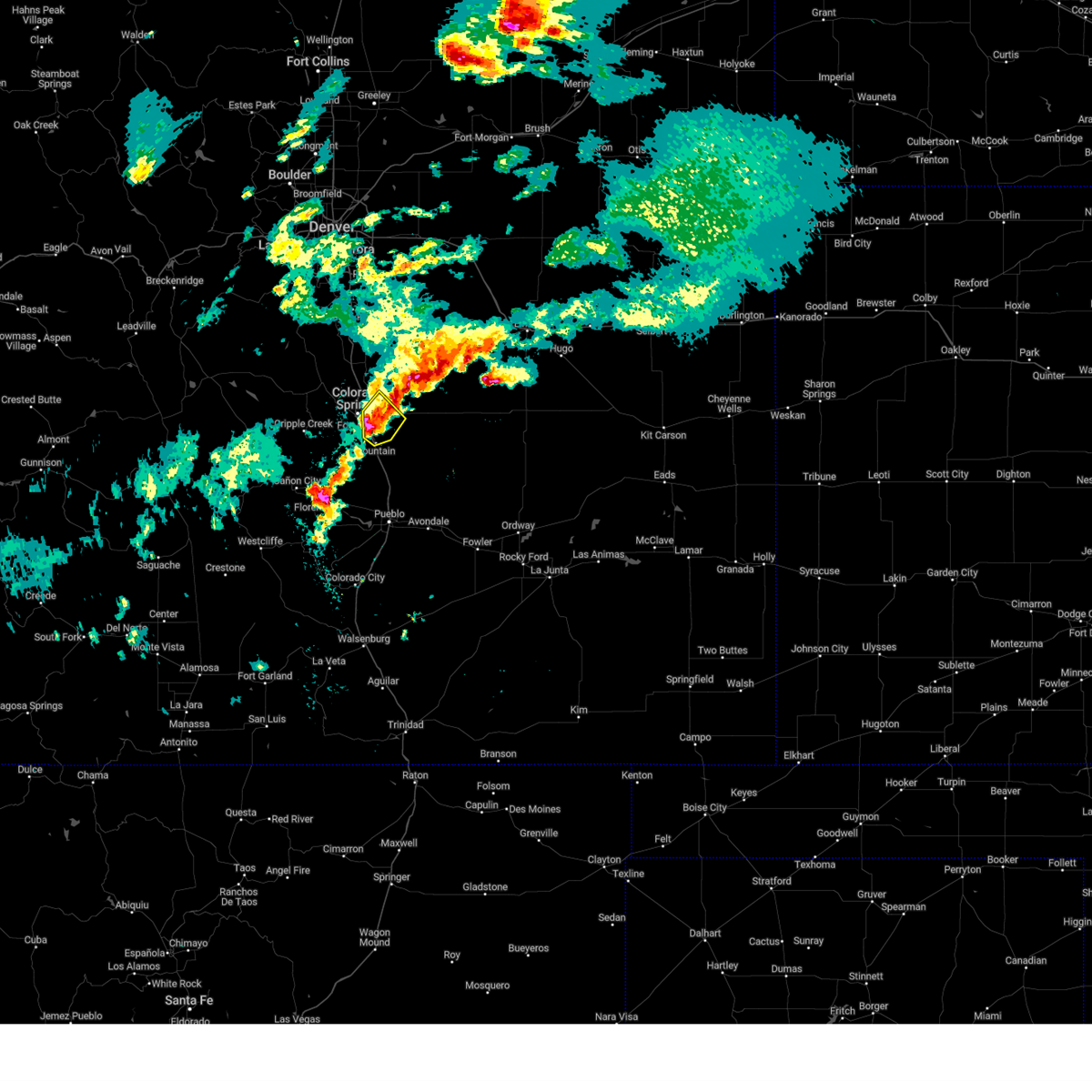 At 503 pm mdt, a severe thunderstorm was located over southeastern colorado springs, moving northeast at 15 mph (radar indicated). Hazards include ping pong ball size hail and 60 mph wind gusts. People and animals outdoors will be injured. expect hail damage to roofs, siding, windows, and vehicles. expect wind damage to roofs, siding, and trees. Locations impacted include, colorado springs, fountain, stratmoor, fort carson, schriever space force base, security, security-widefield, cimarron hills, and peterson space force base. At 503 pm mdt, a severe thunderstorm was located over southeastern colorado springs, moving northeast at 15 mph (radar indicated). Hazards include ping pong ball size hail and 60 mph wind gusts. People and animals outdoors will be injured. expect hail damage to roofs, siding, windows, and vehicles. expect wind damage to roofs, siding, and trees. Locations impacted include, colorado springs, fountain, stratmoor, fort carson, schriever space force base, security, security-widefield, cimarron hills, and peterson space force base.
|
| 8/19/2024 4:51 PM MDT |
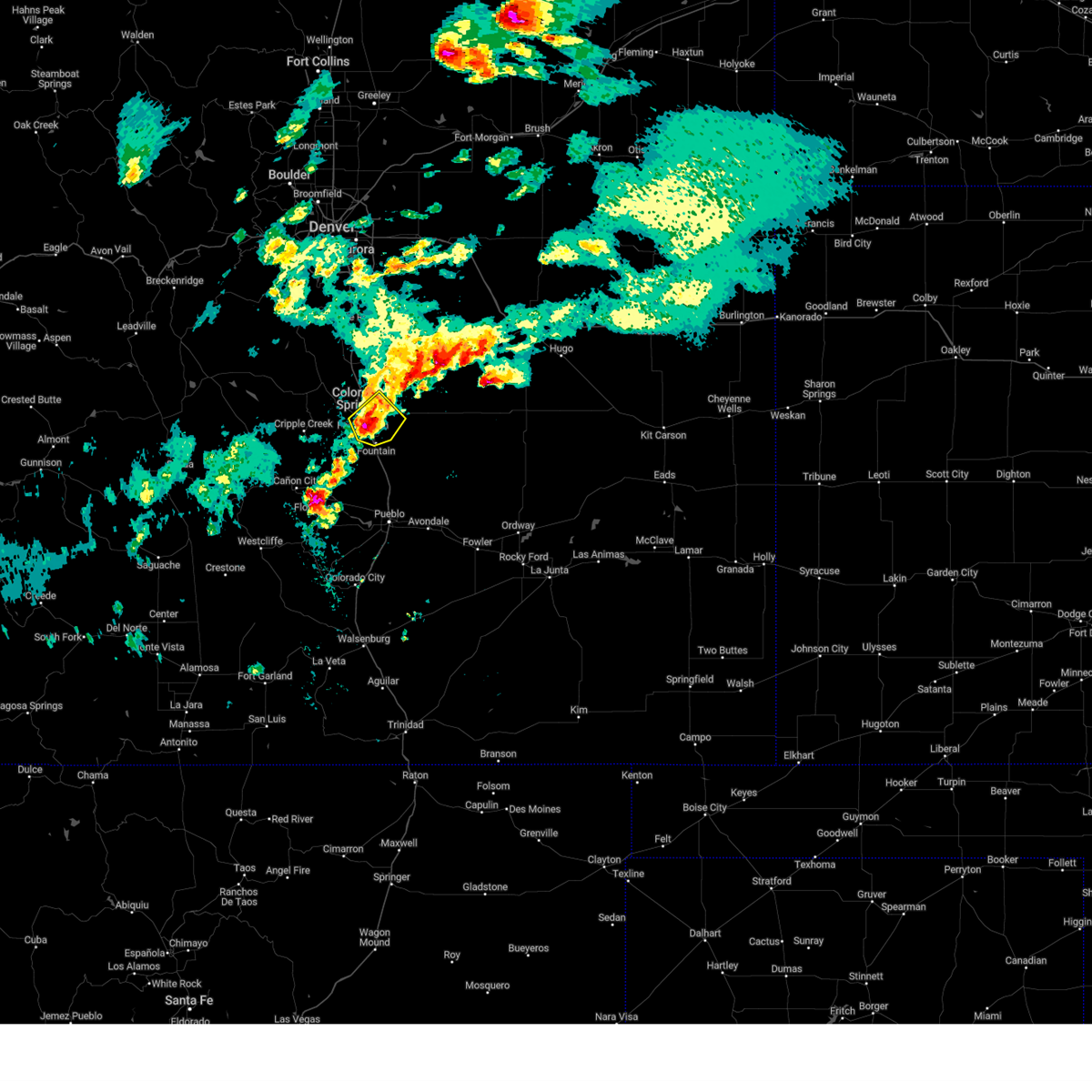 the severe thunderstorm warning has been cancelled and is no longer in effect the severe thunderstorm warning has been cancelled and is no longer in effect
|
| 8/19/2024 4:51 PM MDT |
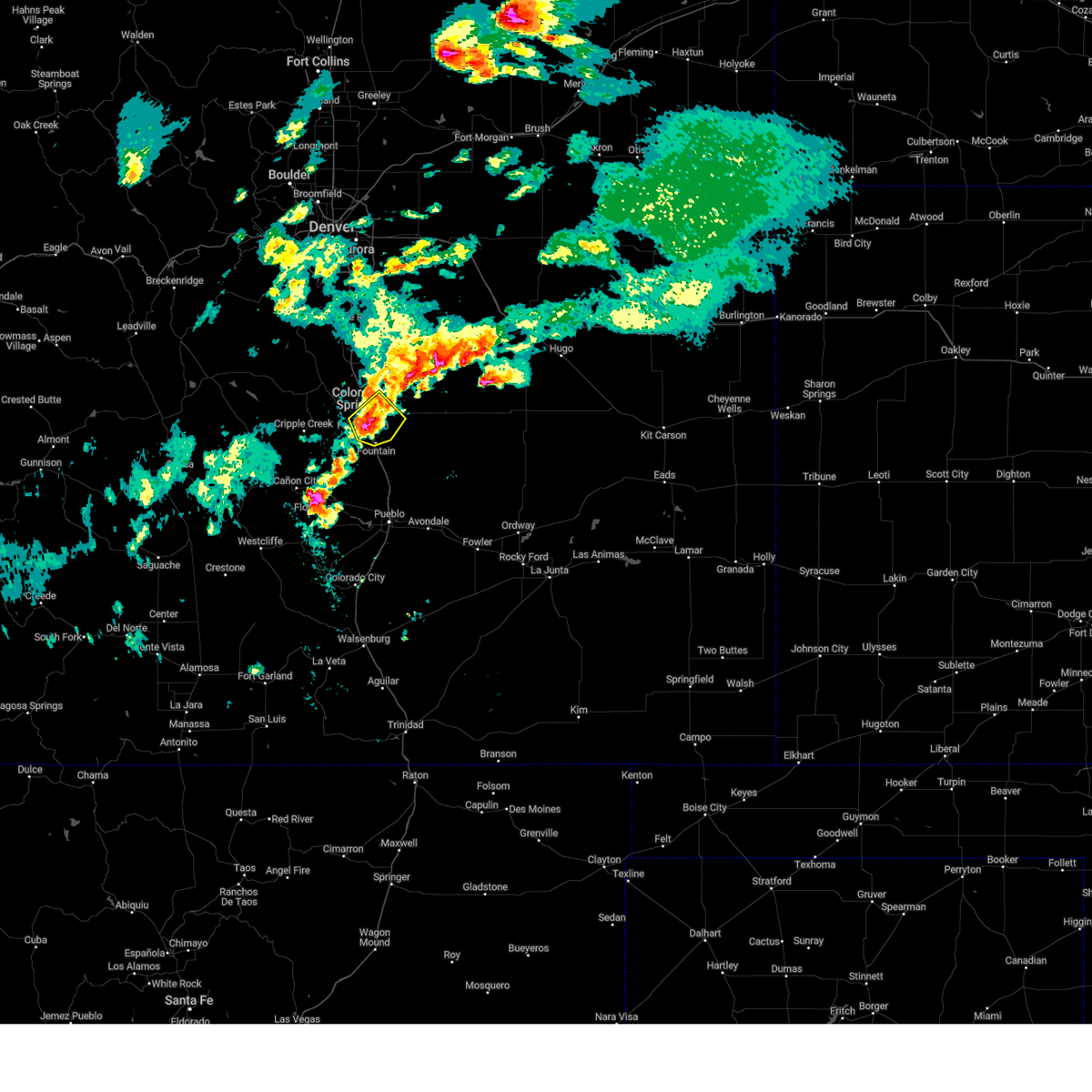 At 451 pm mdt, a severe thunderstorm was located over stratmoor, or near colorado springs, moving northeast at 10 mph (radar indicated). Hazards include ping pong ball size hail and 60 mph wind gusts. People and animals outdoors will be injured. expect hail damage to roofs, siding, windows, and vehicles. expect wind damage to roofs, siding, and trees. Locations impacted include, colorado springs, fountain, stratmoor, fort carson, schriever space force base, security, security-widefield, cimarron hills, and peterson space force base. At 451 pm mdt, a severe thunderstorm was located over stratmoor, or near colorado springs, moving northeast at 10 mph (radar indicated). Hazards include ping pong ball size hail and 60 mph wind gusts. People and animals outdoors will be injured. expect hail damage to roofs, siding, windows, and vehicles. expect wind damage to roofs, siding, and trees. Locations impacted include, colorado springs, fountain, stratmoor, fort carson, schriever space force base, security, security-widefield, cimarron hills, and peterson space force base.
|
| 8/19/2024 4:43 PM MDT |
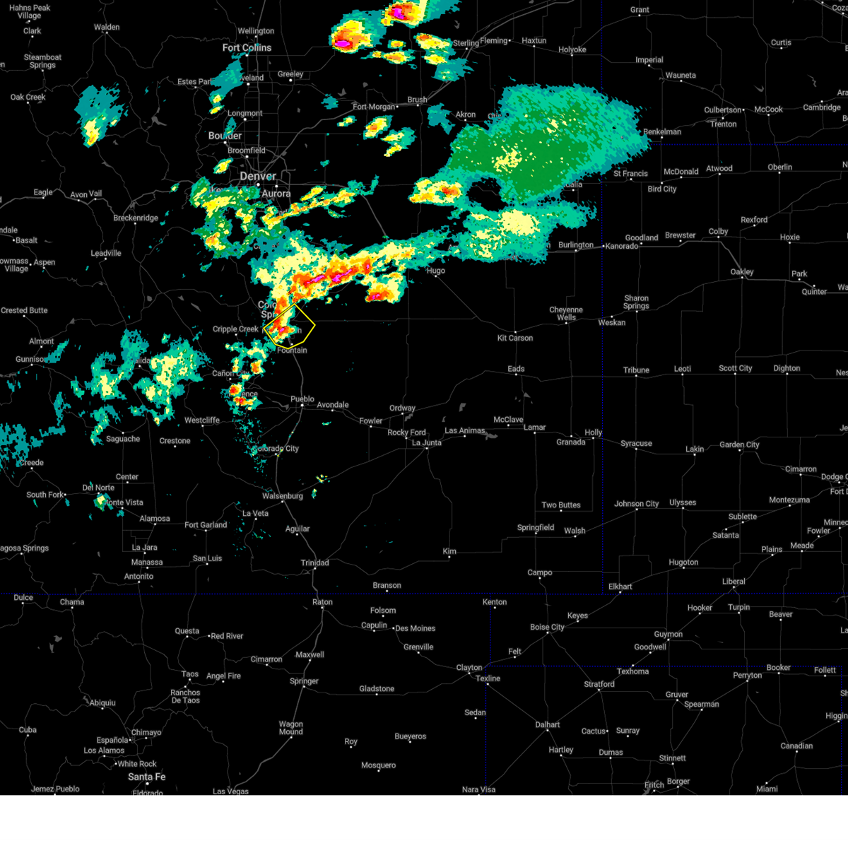 Svrpub the national weather service in pueblo has issued a * severe thunderstorm warning for, southeastern teller county in central colorado, southwestern el paso county in east central colorado, * until 530 pm mdt. * at 442 pm mdt, a severe thunderstorm was located over southern colorado springs, moving northeast at 15 mph (radar indicated). Hazards include 60 mph wind gusts and half dollar size hail. Hail damage to vehicles is expected. Expect wind damage to roofs, siding, and trees. Svrpub the national weather service in pueblo has issued a * severe thunderstorm warning for, southeastern teller county in central colorado, southwestern el paso county in east central colorado, * until 530 pm mdt. * at 442 pm mdt, a severe thunderstorm was located over southern colorado springs, moving northeast at 15 mph (radar indicated). Hazards include 60 mph wind gusts and half dollar size hail. Hail damage to vehicles is expected. Expect wind damage to roofs, siding, and trees.
|
| 8/12/2024 3:11 PM MDT |
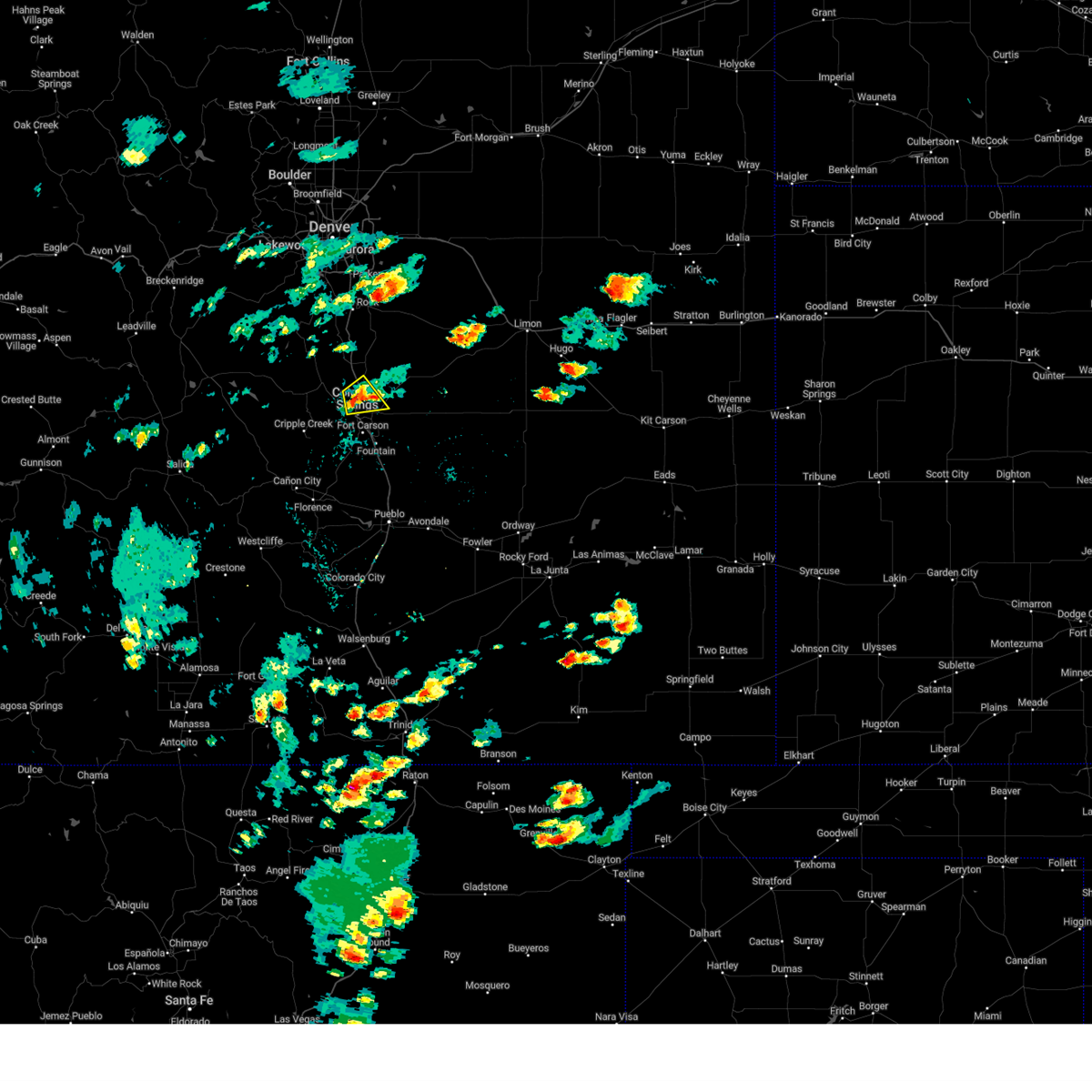 The storm which prompted the warning has weakened below severe limits, and no longer poses an immediate threat to life or property. therefore, the warning will be allowed to expire. however, gusty winds and heavy rain are still possible with this thunderstorm. The storm which prompted the warning has weakened below severe limits, and no longer poses an immediate threat to life or property. therefore, the warning will be allowed to expire. however, gusty winds and heavy rain are still possible with this thunderstorm.
|
| 8/12/2024 2:55 PM MDT |
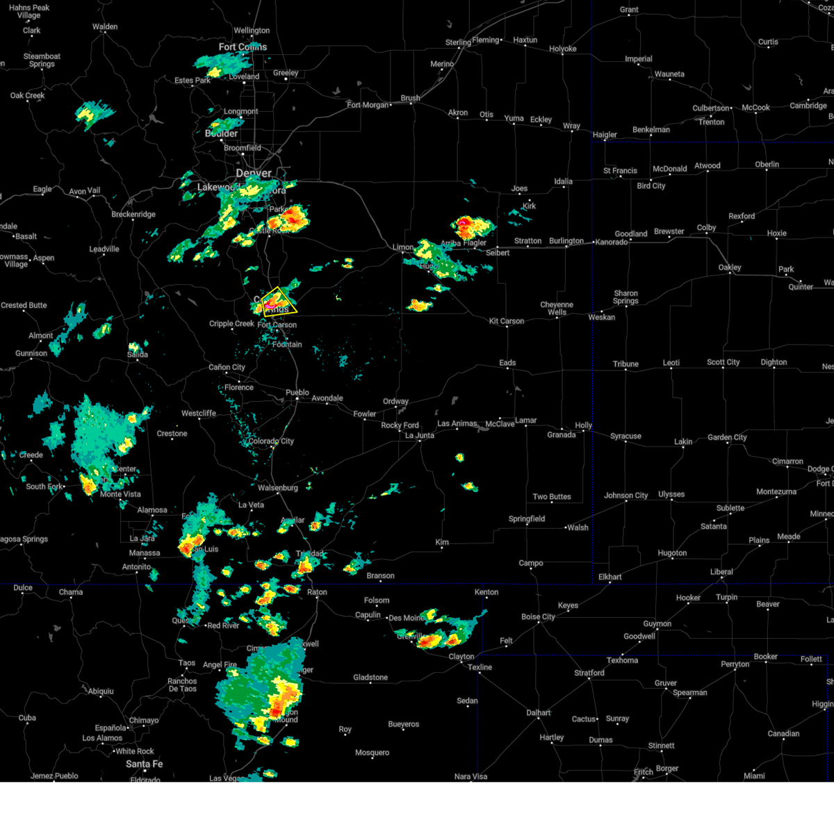 At 255 pm mdt, a severe thunderstorm was located over northwestern colorado springs, moving northeast at 15 mph (radar indicated). Hazards include 60 mph wind gusts and quarter size hail. Hail damage to vehicles is expected. expect wind damage to roofs, siding, and trees. Locations impacted include, colorado springs, air force academy, manitou springs, and cimarron hills. At 255 pm mdt, a severe thunderstorm was located over northwestern colorado springs, moving northeast at 15 mph (radar indicated). Hazards include 60 mph wind gusts and quarter size hail. Hail damage to vehicles is expected. expect wind damage to roofs, siding, and trees. Locations impacted include, colorado springs, air force academy, manitou springs, and cimarron hills.
|
| 8/12/2024 2:39 PM MDT |
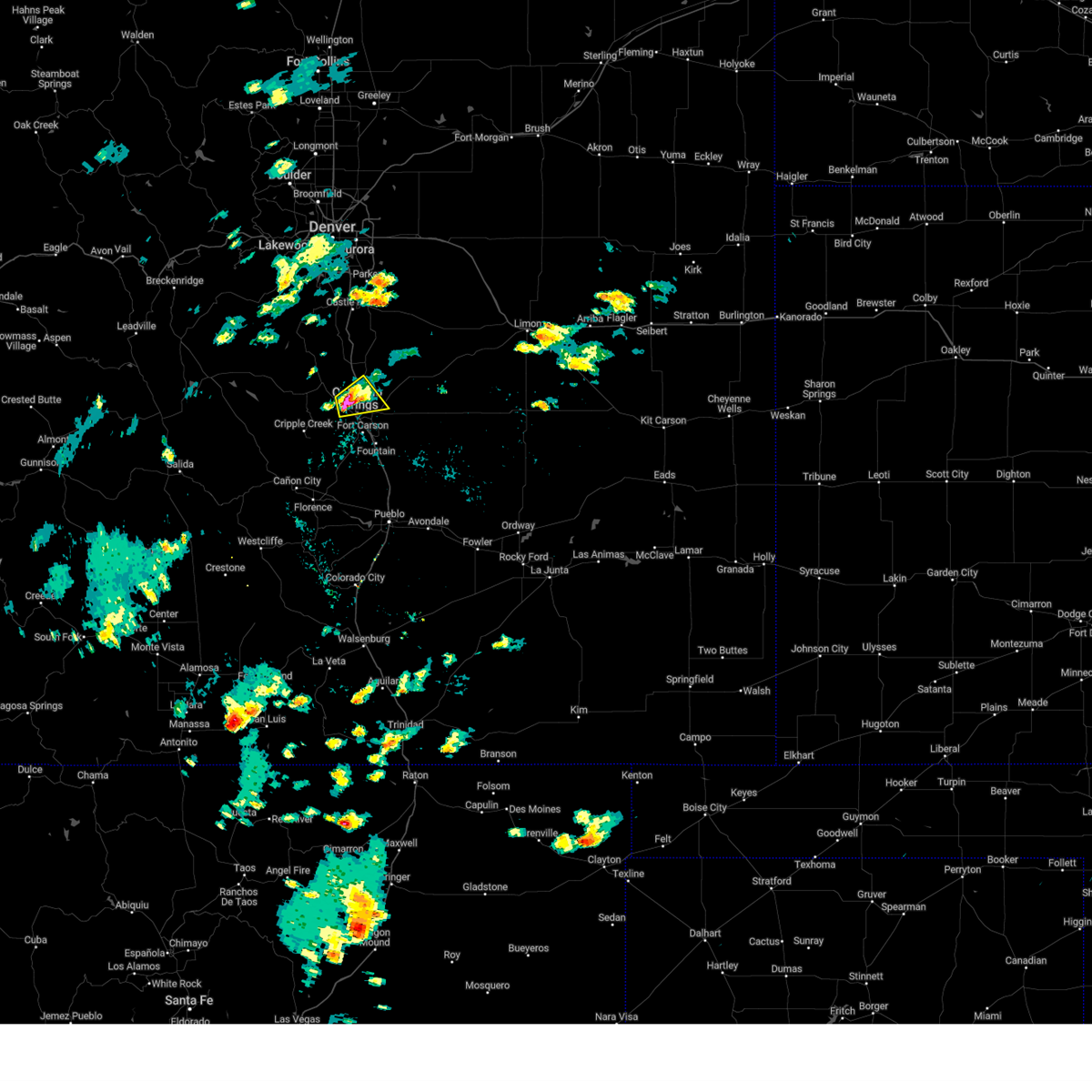 Svrpub the national weather service in pueblo has issued a * severe thunderstorm warning for, northwestern el paso county in east central colorado, * until 315 pm mdt. * at 238 pm mdt, a severe thunderstorm was located over western colorado springs, moving northeast at 15 mph (radar indicated). Hazards include 60 mph wind gusts and quarter size hail. Hail damage to vehicles is expected. Expect wind damage to roofs, siding, and trees. Svrpub the national weather service in pueblo has issued a * severe thunderstorm warning for, northwestern el paso county in east central colorado, * until 315 pm mdt. * at 238 pm mdt, a severe thunderstorm was located over western colorado springs, moving northeast at 15 mph (radar indicated). Hazards include 60 mph wind gusts and quarter size hail. Hail damage to vehicles is expected. Expect wind damage to roofs, siding, and trees.
|
| 8/1/2024 7:58 PM MDT | Ping Pong Ball sized hail reported 8.5 miles WNW of Colorado Springs, CO |
| 8/1/2024 7:42 PM MDT |
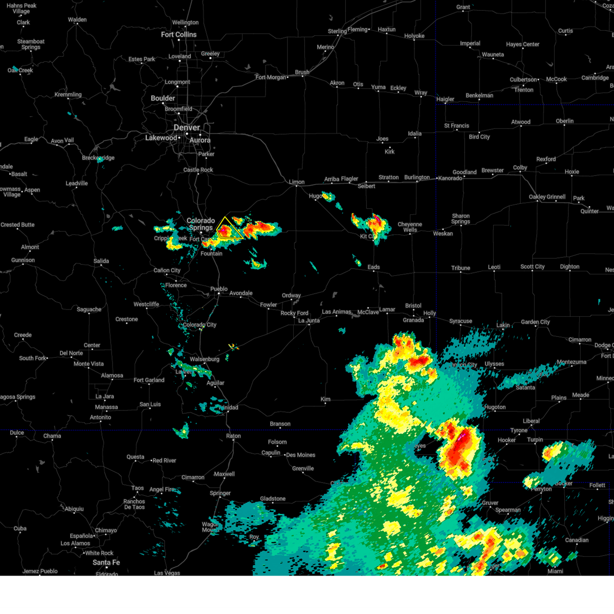 At 742 pm mdt, a severe thunderstorm was located near schriever space force base, or 15 miles east of colorado springs, moving northeast at 15 mph (radar indicated). Hazards include 60 mph wind gusts and quarter size hail. Hail damage to vehicles is expected. expect wind damage to roofs, siding, and trees. Locations impacted include, eastern colorado springs, schriever space force base, and ellicott. At 742 pm mdt, a severe thunderstorm was located near schriever space force base, or 15 miles east of colorado springs, moving northeast at 15 mph (radar indicated). Hazards include 60 mph wind gusts and quarter size hail. Hail damage to vehicles is expected. expect wind damage to roofs, siding, and trees. Locations impacted include, eastern colorado springs, schriever space force base, and ellicott.
|
| 8/1/2024 7:31 PM MDT |
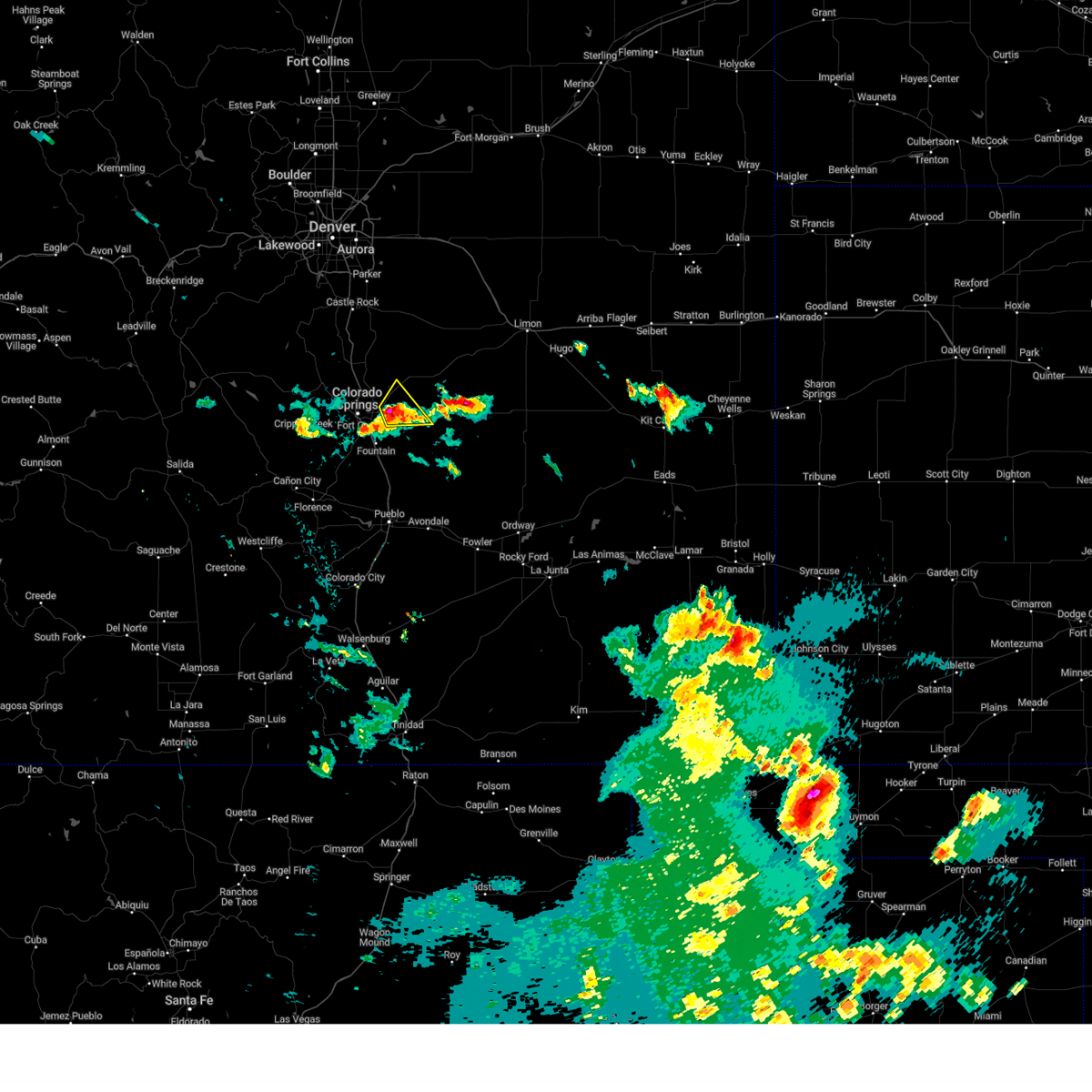 Svrpub the national weather service in pueblo has issued a * severe thunderstorm warning for, central el paso county in east central colorado, * until 800 pm mdt. * at 730 pm mdt, a severe thunderstorm was located near schriever space force base, or 12 miles east of colorado springs, moving northeast at 15 mph (radar indicated). Hazards include 60 mph wind gusts and half dollar size hail. Hail damage to vehicles is expected. Expect wind damage to roofs, siding, and trees. Svrpub the national weather service in pueblo has issued a * severe thunderstorm warning for, central el paso county in east central colorado, * until 800 pm mdt. * at 730 pm mdt, a severe thunderstorm was located near schriever space force base, or 12 miles east of colorado springs, moving northeast at 15 mph (radar indicated). Hazards include 60 mph wind gusts and half dollar size hail. Hail damage to vehicles is expected. Expect wind damage to roofs, siding, and trees.
|
| 8/1/2024 7:25 PM MDT |
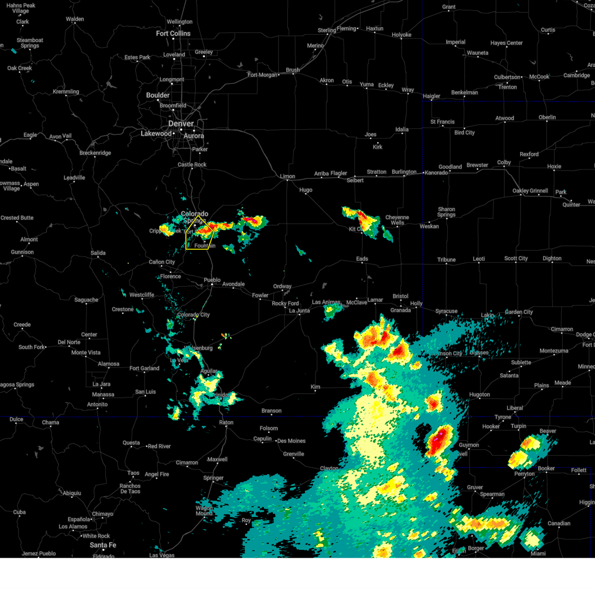 The storm which prompted the warning has weakened below severe limits, and no longer poses an immediate threat to life or property. therefore, the warning will be allowed to expire. however, small hail, gusty winds and heavy rain are still possible with this thunderstorm. The storm which prompted the warning has weakened below severe limits, and no longer poses an immediate threat to life or property. therefore, the warning will be allowed to expire. however, small hail, gusty winds and heavy rain are still possible with this thunderstorm.
|
| 8/1/2024 7:24 PM MDT | Ping Pong Ball sized hail reported 8.5 miles WNW of Colorado Springs, CO, corrects previous hail report timing from 5 e peterson afb. |
| 8/1/2024 7:14 PM MDT |
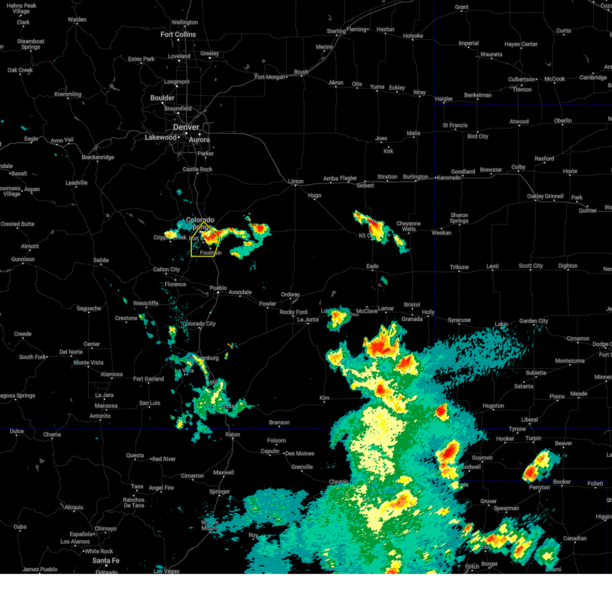 At 713 pm mdt, a severe thunderstorm was located over stratmoor, or near colorado springs, and is nearly stationary (radar indicated). Hazards include 60 mph wind gusts and quarter size hail. locally heavy rain is also occurring with this storm. Hail damage to vehicles is expected. expect wind damage to roofs, siding, and trees. Locations impacted include, colorado springs, fountain, stratmoor, fort carson, security, security-widefield, peterson space force base, and cimarron hills. At 713 pm mdt, a severe thunderstorm was located over stratmoor, or near colorado springs, and is nearly stationary (radar indicated). Hazards include 60 mph wind gusts and quarter size hail. locally heavy rain is also occurring with this storm. Hail damage to vehicles is expected. expect wind damage to roofs, siding, and trees. Locations impacted include, colorado springs, fountain, stratmoor, fort carson, security, security-widefield, peterson space force base, and cimarron hills.
|
| 8/1/2024 6:58 PM MDT |
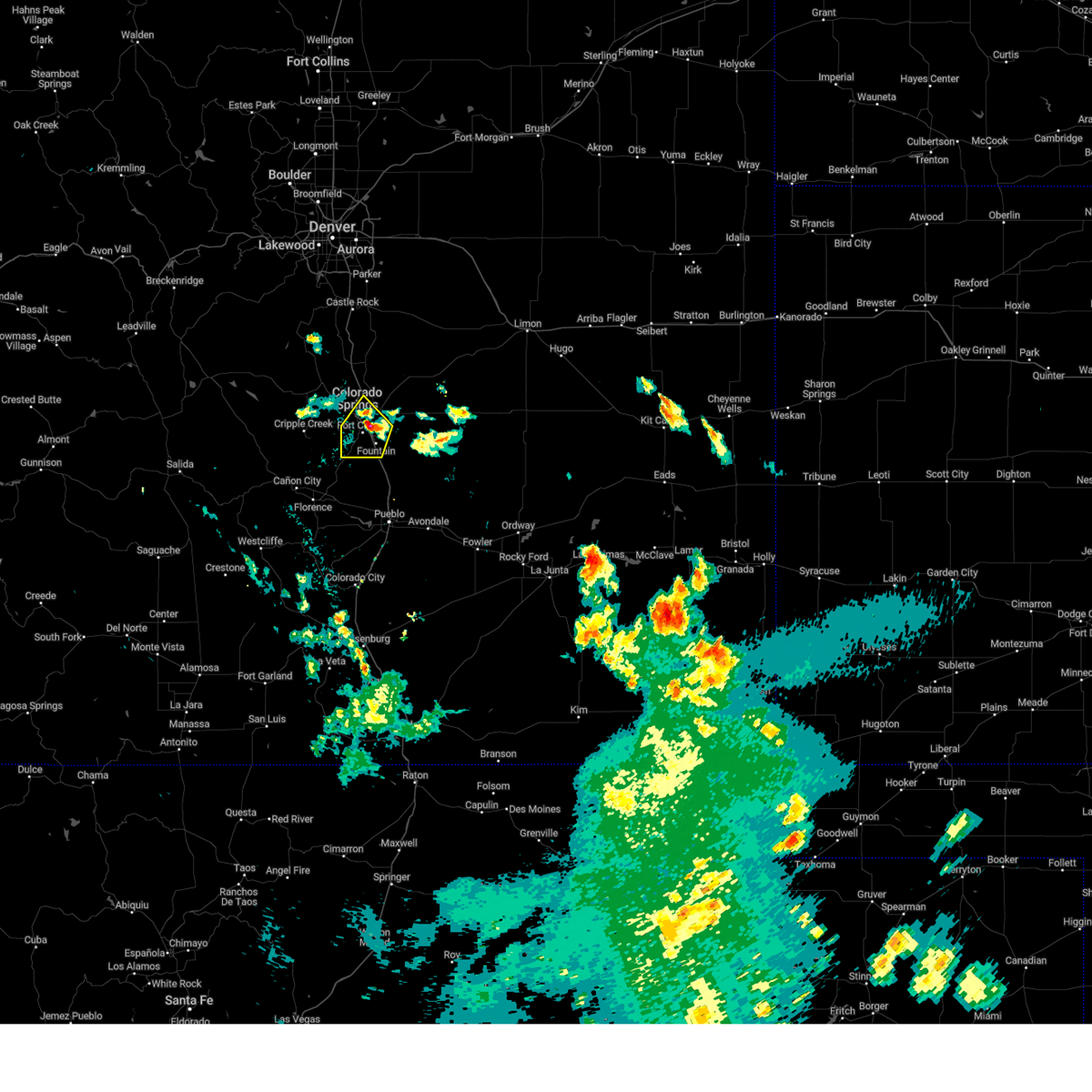 Svrpub the national weather service in pueblo has issued a * severe thunderstorm warning for, southwestern el paso county in east central colorado, * until 730 pm mdt. * at 658 pm mdt, a severe thunderstorm was located over security, or near colorado springs, moving southwest at 5 mph (radar indicated). Hazards include 60 mph wind gusts and quarter size hail. Hail damage to vehicles is expected. Expect wind damage to roofs, siding, and trees. Svrpub the national weather service in pueblo has issued a * severe thunderstorm warning for, southwestern el paso county in east central colorado, * until 730 pm mdt. * at 658 pm mdt, a severe thunderstorm was located over security, or near colorado springs, moving southwest at 5 mph (radar indicated). Hazards include 60 mph wind gusts and quarter size hail. Hail damage to vehicles is expected. Expect wind damage to roofs, siding, and trees.
|
| 7/17/2024 4:53 PM MDT |
 The storm which prompted the warning has weakened below severe limits, and no longer poses an immediate threat to life or property. therefore, the warning will be allowed to expire. however, small hail and gusty winds are still possible with this thunderstorm. The storm which prompted the warning has weakened below severe limits, and no longer poses an immediate threat to life or property. therefore, the warning will be allowed to expire. however, small hail and gusty winds are still possible with this thunderstorm.
|
| 7/17/2024 4:45 PM MDT |
 At 445 pm mdt, a severe thunderstorm was located 9 miles southwest of fountain, or 15 miles south of colorado springs, moving southeast at 10 mph (radar indicated). Hazards include 70 mph wind gusts and quarter size hail. Hail damage to vehicles is expected. expect considerable tree damage. wind damage is also likely to mobile homes, roofs, and outbuildings. Locations impacted include, fountain, fort carson, and security-widefield. At 445 pm mdt, a severe thunderstorm was located 9 miles southwest of fountain, or 15 miles south of colorado springs, moving southeast at 10 mph (radar indicated). Hazards include 70 mph wind gusts and quarter size hail. Hail damage to vehicles is expected. expect considerable tree damage. wind damage is also likely to mobile homes, roofs, and outbuildings. Locations impacted include, fountain, fort carson, and security-widefield.
|
| 7/17/2024 4:34 PM MDT |
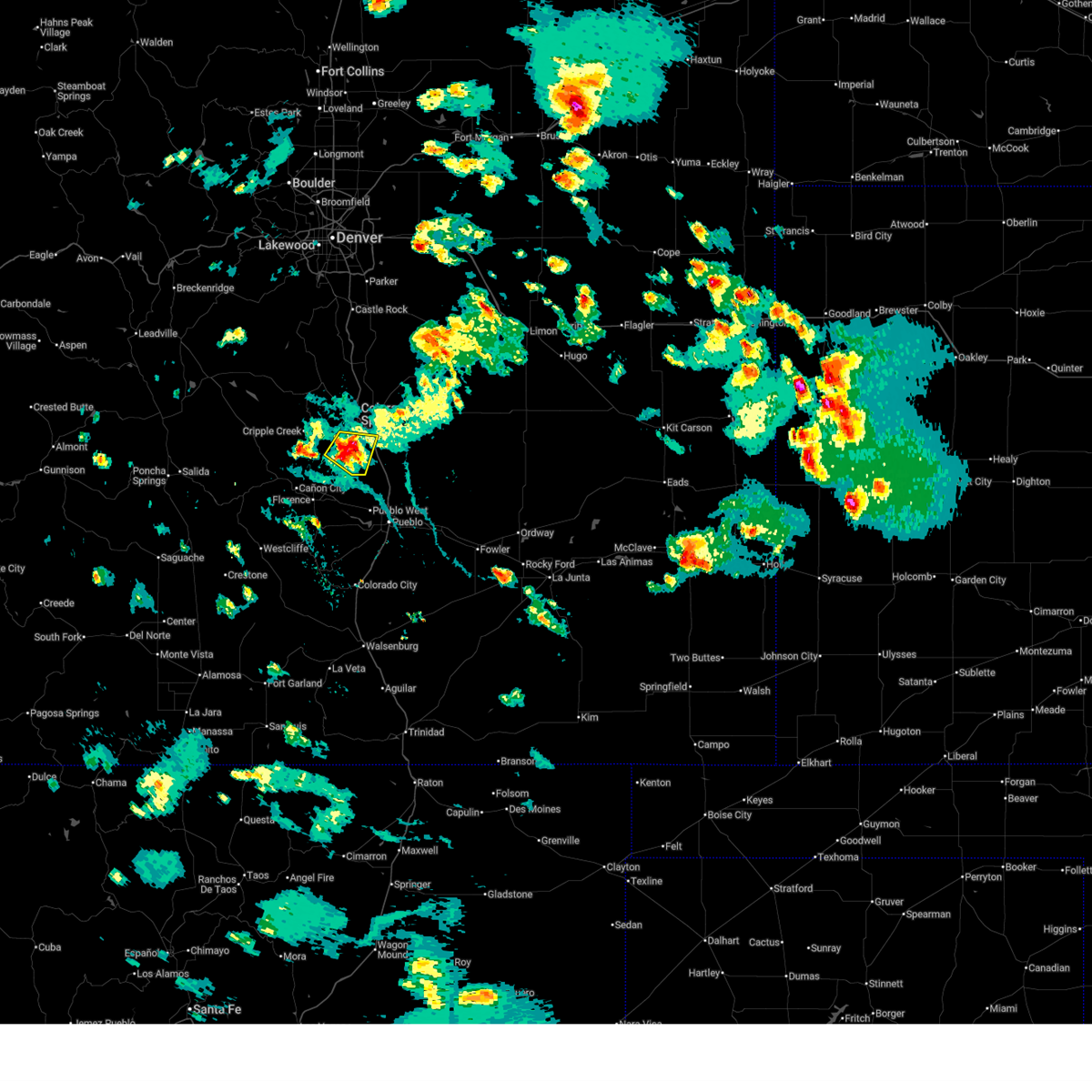 At 434 pm mdt, a severe thunderstorm was located 10 miles southwest of fort carson, or 15 miles south of colorado springs, moving southeast at 10 mph (radar indicated). Hazards include 70 mph wind gusts and quarter size hail. Hail damage to vehicles is expected. expect considerable tree damage. wind damage is also likely to mobile homes, roofs, and outbuildings. Locations impacted include, fountain, fort carson, and security-widefield. At 434 pm mdt, a severe thunderstorm was located 10 miles southwest of fort carson, or 15 miles south of colorado springs, moving southeast at 10 mph (radar indicated). Hazards include 70 mph wind gusts and quarter size hail. Hail damage to vehicles is expected. expect considerable tree damage. wind damage is also likely to mobile homes, roofs, and outbuildings. Locations impacted include, fountain, fort carson, and security-widefield.
|
| 7/17/2024 4:27 PM MDT |
 Svrpub the national weather service in pueblo has issued a * severe thunderstorm warning for, eastern fremont county in central colorado, southeastern teller county in central colorado, southwestern el paso county in east central colorado, * until 500 pm mdt. * at 427 pm mdt, a severe thunderstorm was located 10 miles southwest of fort carson, or 15 miles south of colorado springs, moving southeast at 10 mph (radar indicated). Hazards include 60 mph wind gusts and quarter size hail. Hail damage to vehicles is expected. Expect wind damage to roofs, siding, and trees. Svrpub the national weather service in pueblo has issued a * severe thunderstorm warning for, eastern fremont county in central colorado, southeastern teller county in central colorado, southwestern el paso county in east central colorado, * until 500 pm mdt. * at 427 pm mdt, a severe thunderstorm was located 10 miles southwest of fort carson, or 15 miles south of colorado springs, moving southeast at 10 mph (radar indicated). Hazards include 60 mph wind gusts and quarter size hail. Hail damage to vehicles is expected. Expect wind damage to roofs, siding, and trees.
|
| 7/16/2024 2:54 PM MDT | Asos station kcos colorado springs airpor in el paso county CO, 5.9 miles NW of Colorado Springs, CO |
| 7/16/2024 2:43 PM MDT |
 The storm which prompted the warning has moved out of the area. therefore, the warning will be allowed to expire. however, gusty winds and heavy rain are still possible with this thunderstorm. The storm which prompted the warning has moved out of the area. therefore, the warning will be allowed to expire. however, gusty winds and heavy rain are still possible with this thunderstorm.
|
| 7/16/2024 2:12 PM MDT |
 Svrpub the national weather service in pueblo has issued a * severe thunderstorm warning for, central el paso county in east central colorado, * until 245 pm mdt. * at 211 pm mdt, a severe thunderstorm was located over southeastern colorado springs, moving southeast at 20 mph (radar indicated). Hazards include 60 mph wind gusts and quarter size hail. Hail damage to vehicles is expected. Expect wind damage to roofs, siding, and trees. Svrpub the national weather service in pueblo has issued a * severe thunderstorm warning for, central el paso county in east central colorado, * until 245 pm mdt. * at 211 pm mdt, a severe thunderstorm was located over southeastern colorado springs, moving southeast at 20 mph (radar indicated). Hazards include 60 mph wind gusts and quarter size hail. Hail damage to vehicles is expected. Expect wind damage to roofs, siding, and trees.
|
| 7/7/2024 6:07 PM MDT |
 Svrpub the national weather service in pueblo has issued a * severe thunderstorm warning for, south central el paso county in east central colorado, * until 645 pm mdt. * at 607 pm mdt, a severe thunderstorm was located near security-widefield, or 12 miles southeast of colorado springs, moving southeast at 15 mph (trained weather spotters). Hazards include 60 mph wind gusts and quarter size hail. Hail damage to vehicles is expected. Expect wind damage to roofs, siding, and trees. Svrpub the national weather service in pueblo has issued a * severe thunderstorm warning for, south central el paso county in east central colorado, * until 645 pm mdt. * at 607 pm mdt, a severe thunderstorm was located near security-widefield, or 12 miles southeast of colorado springs, moving southeast at 15 mph (trained weather spotters). Hazards include 60 mph wind gusts and quarter size hail. Hail damage to vehicles is expected. Expect wind damage to roofs, siding, and trees.
|
| 7/7/2024 6:02 PM MDT |
 At 601 pm mdt, severe thunderstorms were located along a line extending from 6 miles southeast of peterson space force base to near schriever space force base to near truckton, moving southeast at 20 mph (radar indicated). Hazards include ping pong ball size hail and 60 mph wind gusts. People and animals outdoors will be injured. expect hail damage to roofs, siding, windows, and vehicles. expect wind damage to roofs, siding, and trees. Locations impacted include, southeastern colorado springs, truckton, yoder, schriever space force base, ellicott, and rush. At 601 pm mdt, severe thunderstorms were located along a line extending from 6 miles southeast of peterson space force base to near schriever space force base to near truckton, moving southeast at 20 mph (radar indicated). Hazards include ping pong ball size hail and 60 mph wind gusts. People and animals outdoors will be injured. expect hail damage to roofs, siding, windows, and vehicles. expect wind damage to roofs, siding, and trees. Locations impacted include, southeastern colorado springs, truckton, yoder, schriever space force base, ellicott, and rush.
|
| 7/7/2024 6:00 PM MDT | Quarter sized hail reported 9 miles NW of Colorado Springs, CO |
| 7/7/2024 5:49 PM MDT |
 Svrpub the national weather service in pueblo has issued a * severe thunderstorm warning for, east central el paso county in east central colorado, * until 615 pm mdt. * at 549 pm mdt, severe thunderstorms were located along a line extending from colorado springs to near schriever space force base to near yoder, moving southeast at 20 mph (radar indicated). Hazards include 60 mph wind gusts and quarter size hail. Hail damage to vehicles is expected. Expect wind damage to roofs, siding, and trees. Svrpub the national weather service in pueblo has issued a * severe thunderstorm warning for, east central el paso county in east central colorado, * until 615 pm mdt. * at 549 pm mdt, severe thunderstorms were located along a line extending from colorado springs to near schriever space force base to near yoder, moving southeast at 20 mph (radar indicated). Hazards include 60 mph wind gusts and quarter size hail. Hail damage to vehicles is expected. Expect wind damage to roofs, siding, and trees.
|
| 7/7/2024 5:44 PM MDT | Quarter sized hail reported 3.3 miles NW of Colorado Springs, CO, report from mping: quarter (1.00 in.). |
| 7/7/2024 4:37 PM MDT |
 At 437 pm mdt, severe thunderstorms were located along a line extending from near fort carson to near security-widefield to near schriever space force base, moving east at 30 mph (radar indicated). Hazards include 60 mph wind gusts and quarter size hail. Hail damage to vehicles is expected. expect wind damage to roofs, siding, and trees. Locations impacted include, southeastern colorado springs, fountain, fort carson, stratmoor, security, and security-widefield. At 437 pm mdt, severe thunderstorms were located along a line extending from near fort carson to near security-widefield to near schriever space force base, moving east at 30 mph (radar indicated). Hazards include 60 mph wind gusts and quarter size hail. Hail damage to vehicles is expected. expect wind damage to roofs, siding, and trees. Locations impacted include, southeastern colorado springs, fountain, fort carson, stratmoor, security, and security-widefield.
|
| 7/7/2024 4:37 PM MDT |
 the severe thunderstorm warning has been cancelled and is no longer in effect the severe thunderstorm warning has been cancelled and is no longer in effect
|
| 7/7/2024 4:22 PM MDT |
 Svrpub the national weather service in pueblo has issued a * severe thunderstorm warning for, southeastern teller county in central colorado, southwestern el paso county in east central colorado, * until 445 pm mdt. * at 421 pm mdt, severe thunderstorms were located along a line extending from 6 miles southeast of pikes peak to stratmoor to colorado springs, moving east at 40 mph (radar indicated). Hazards include 60 mph wind gusts and quarter size hail. Hail damage to vehicles is expected. Expect wind damage to roofs, siding, and trees. Svrpub the national weather service in pueblo has issued a * severe thunderstorm warning for, southeastern teller county in central colorado, southwestern el paso county in east central colorado, * until 445 pm mdt. * at 421 pm mdt, severe thunderstorms were located along a line extending from 6 miles southeast of pikes peak to stratmoor to colorado springs, moving east at 40 mph (radar indicated). Hazards include 60 mph wind gusts and quarter size hail. Hail damage to vehicles is expected. Expect wind damage to roofs, siding, and trees.
|
| 7/7/2024 3:07 PM MDT |
 Svrpub the national weather service in pueblo has issued a * severe thunderstorm warning for, south central el paso county in east central colorado, * until 345 pm mdt. * at 307 pm mdt, a severe thunderstorm was located over fountain, or 14 miles southeast of colorado springs, moving southeast at 25 mph (radar indicated). Hazards include ping pong ball size hail and 60 mph wind gusts. People and animals outdoors will be injured. expect hail damage to roofs, siding, windows, and vehicles. Expect wind damage to roofs, siding, and trees. Svrpub the national weather service in pueblo has issued a * severe thunderstorm warning for, south central el paso county in east central colorado, * until 345 pm mdt. * at 307 pm mdt, a severe thunderstorm was located over fountain, or 14 miles southeast of colorado springs, moving southeast at 25 mph (radar indicated). Hazards include ping pong ball size hail and 60 mph wind gusts. People and animals outdoors will be injured. expect hail damage to roofs, siding, windows, and vehicles. Expect wind damage to roofs, siding, and trees.
|
| 7/7/2024 3:03 PM MDT | Ping Pong Ball sized hail reported 10.4 miles NNW of Colorado Springs, CO |
| 7/7/2024 2:57 PM MDT |
 At 256 pm mdt, a severe thunderstorm was located over fountain, or 10 miles southeast of colorado springs, moving southeast at 25 mph (trained weather spotters). Hazards include ping pong ball size hail and 60 mph wind gusts. People and animals outdoors will be injured. expect hail damage to roofs, siding, windows, and vehicles. expect wind damage to roofs, siding, and trees. Locations impacted include, southern colorado springs, fountain, stratmoor, fort carson, security, security-widefield, peterson space force base, and cimarron hills. At 256 pm mdt, a severe thunderstorm was located over fountain, or 10 miles southeast of colorado springs, moving southeast at 25 mph (trained weather spotters). Hazards include ping pong ball size hail and 60 mph wind gusts. People and animals outdoors will be injured. expect hail damage to roofs, siding, windows, and vehicles. expect wind damage to roofs, siding, and trees. Locations impacted include, southern colorado springs, fountain, stratmoor, fort carson, security, security-widefield, peterson space force base, and cimarron hills.
|
| 7/7/2024 2:38 PM MDT |
 Svrpub the national weather service in pueblo has issued a * severe thunderstorm warning for, western el paso county in east central colorado, * until 315 pm mdt. * at 238 pm mdt, a severe thunderstorm was located over southeastern colorado springs, moving southeast at 10 mph (radar indicated). Hazards include 60 mph wind gusts and quarter size hail. Hail damage to vehicles is expected. Expect wind damage to roofs, siding, and trees. Svrpub the national weather service in pueblo has issued a * severe thunderstorm warning for, western el paso county in east central colorado, * until 315 pm mdt. * at 238 pm mdt, a severe thunderstorm was located over southeastern colorado springs, moving southeast at 10 mph (radar indicated). Hazards include 60 mph wind gusts and quarter size hail. Hail damage to vehicles is expected. Expect wind damage to roofs, siding, and trees.
|
| 6/8/2024 3:00 PM MDT |
 At 300 pm mdt, a severe thunderstorm was located near falcon, or 17 miles east of colorado springs, moving east at 15 mph (radar indicated). Hazards include 60 mph wind gusts and quarter size hail. Hail damage to vehicles is expected. expect wind damage to roofs, siding, and trees. Locations impacted include, peyton and schriever space force base. At 300 pm mdt, a severe thunderstorm was located near falcon, or 17 miles east of colorado springs, moving east at 15 mph (radar indicated). Hazards include 60 mph wind gusts and quarter size hail. Hail damage to vehicles is expected. expect wind damage to roofs, siding, and trees. Locations impacted include, peyton and schriever space force base.
|
| 6/8/2024 2:38 PM MDT |
 Svrpub the national weather service in pueblo has issued a * severe thunderstorm warning for, central el paso county in east central colorado, * until 315 pm mdt. * at 237 pm mdt, a severe thunderstorm was located over eastern colorado springs, moving east at 15 mph (radar indicated). Hazards include 60 mph wind gusts and quarter size hail. Hail damage to vehicles is expected. Expect wind damage to roofs, siding, and trees. Svrpub the national weather service in pueblo has issued a * severe thunderstorm warning for, central el paso county in east central colorado, * until 315 pm mdt. * at 237 pm mdt, a severe thunderstorm was located over eastern colorado springs, moving east at 15 mph (radar indicated). Hazards include 60 mph wind gusts and quarter size hail. Hail damage to vehicles is expected. Expect wind damage to roofs, siding, and trees.
|
| 6/7/2024 2:58 PM MDT |
 The storm which prompted the warning has moved out of the area. therefore, the warning will be allowed to expire. however, small hail and gusty winds are still possible with this thunderstorm. The storm which prompted the warning has moved out of the area. therefore, the warning will be allowed to expire. however, small hail and gusty winds are still possible with this thunderstorm.
|
| 6/7/2024 2:28 PM MDT |
 At 228 pm mdt, a severe thunderstorm was located near schriever space force base, or 19 miles east of colorado springs, moving east at 20 mph (radar indicated). Hazards include 60 mph wind gusts. Expect damage to roofs, siding, and trees. Locations impacted include, southeastern colorado springs, fountain, truckton, yoder, ellicott, schriever space force base, security, security-widefield, and rush. At 228 pm mdt, a severe thunderstorm was located near schriever space force base, or 19 miles east of colorado springs, moving east at 20 mph (radar indicated). Hazards include 60 mph wind gusts. Expect damage to roofs, siding, and trees. Locations impacted include, southeastern colorado springs, fountain, truckton, yoder, ellicott, schriever space force base, security, security-widefield, and rush.
|
| 6/7/2024 2:27 PM MDT |
 The severe thunderstorm which prompted the warning has moved out of the warned area. therefore, the warning will be allowed to expire. however, gusty winds are still possible with this thunderstorm. a severe thunderstorm warning remains in effect for the east central area of el paso county. The severe thunderstorm which prompted the warning has moved out of the warned area. therefore, the warning will be allowed to expire. however, gusty winds are still possible with this thunderstorm. a severe thunderstorm warning remains in effect for the east central area of el paso county.
|
| 6/7/2024 2:20 PM MDT |
 At 219 pm mdt, a severe thunderstorm was located over pinon, or 12 miles north of pueblo, moving east at 20 mph. a wind gusts to 58 mph was observed at the pueblo airport at 2:18 pm (trained weather spotters). Hazards include 60 mph wind gusts. Expect damage to roofs, siding, and trees. Locations impacted include, southern colorado springs, pueblo, pueblo airport, fountain, hanover, fort carson, pueblo west, pinon, security, security-widefield, and stratmoor. At 219 pm mdt, a severe thunderstorm was located over pinon, or 12 miles north of pueblo, moving east at 20 mph. a wind gusts to 58 mph was observed at the pueblo airport at 2:18 pm (trained weather spotters). Hazards include 60 mph wind gusts. Expect damage to roofs, siding, and trees. Locations impacted include, southern colorado springs, pueblo, pueblo airport, fountain, hanover, fort carson, pueblo west, pinon, security, security-widefield, and stratmoor.
|
| 6/7/2024 2:09 PM MDT |
 Svrpub the national weather service in pueblo has issued a * severe thunderstorm warning for, southeastern el paso county in east central colorado, * until 300 pm mdt. * at 209 pm mdt, a severe thunderstorm was located near schriever space force base, or 12 miles east of colorado springs, moving east at 20 mph (radar indicated). Hazards include 60 mph wind gusts. expect damage to roofs, siding, and trees Svrpub the national weather service in pueblo has issued a * severe thunderstorm warning for, southeastern el paso county in east central colorado, * until 300 pm mdt. * at 209 pm mdt, a severe thunderstorm was located near schriever space force base, or 12 miles east of colorado springs, moving east at 20 mph (radar indicated). Hazards include 60 mph wind gusts. expect damage to roofs, siding, and trees
|
| 6/7/2024 1:56 PM MDT |
 Svrpub the national weather service in pueblo has issued a * severe thunderstorm warning for, southwestern el paso county in east central colorado, northwestern pueblo county in southeastern colorado, * until 230 pm mdt. * at 155 pm mdt, a severe thunderstorm was located 8 miles west of pinon, or 17 miles northwest of pueblo, moving east at 20 mph (radar indicated). Hazards include 60 mph wind gusts. expect damage to roofs, siding, and trees Svrpub the national weather service in pueblo has issued a * severe thunderstorm warning for, southwestern el paso county in east central colorado, northwestern pueblo county in southeastern colorado, * until 230 pm mdt. * at 155 pm mdt, a severe thunderstorm was located 8 miles west of pinon, or 17 miles northwest of pueblo, moving east at 20 mph (radar indicated). Hazards include 60 mph wind gusts. expect damage to roofs, siding, and trees
|
| 5/31/2024 7:13 PM MDT | Half Dollar sized hail reported 10.4 miles NNW of Colorado Springs, CO |
| 5/31/2024 7:10 PM MDT | Quarter sized hail reported 10.2 miles NNW of Colorado Springs, CO, report from mping: quarter (1.00 in.). |
| 5/31/2024 7:08 PM MDT |
 At 708 pm mdt, a severe thunderstorm was located over schriever space force base, or 18 miles east of colorado springs, moving east at 15 mph (radar indicated). Hazards include ping pong ball size hail and 60 mph wind gusts. People and animals outdoors will be injured. expect hail damage to roofs, siding, windows, and vehicles. expect wind damage to roofs, siding, and trees. Locations impacted include, schriever space force base and ellicott. At 708 pm mdt, a severe thunderstorm was located over schriever space force base, or 18 miles east of colorado springs, moving east at 15 mph (radar indicated). Hazards include ping pong ball size hail and 60 mph wind gusts. People and animals outdoors will be injured. expect hail damage to roofs, siding, windows, and vehicles. expect wind damage to roofs, siding, and trees. Locations impacted include, schriever space force base and ellicott.
|
| 5/31/2024 7:03 PM MDT |
 At 703 pm mdt, a severe thunderstorm was located over schriever space force base, or 16 miles east of colorado springs, moving east at 15 mph (radar indicated). Hazards include 60 mph wind gusts and half dollar size hail. Hail damage to vehicles is expected. expect wind damage to roofs, siding, and trees. Locations impacted include, eastern colorado springs, schriever space force base, and ellicott. At 703 pm mdt, a severe thunderstorm was located over schriever space force base, or 16 miles east of colorado springs, moving east at 15 mph (radar indicated). Hazards include 60 mph wind gusts and half dollar size hail. Hail damage to vehicles is expected. expect wind damage to roofs, siding, and trees. Locations impacted include, eastern colorado springs, schriever space force base, and ellicott.
|
| 5/31/2024 6:51 PM MDT |
 Svrpub the national weather service in pueblo has issued a * severe thunderstorm warning for, central el paso county in east central colorado, * until 715 pm mdt. * at 651 pm mdt, a severe thunderstorm was located near schriever space force base, or 12 miles east of colorado springs, moving east at 15 mph (radar indicated). Hazards include 60 mph wind gusts and quarter size hail. Hail damage to vehicles is expected. Expect wind damage to roofs, siding, and trees. Svrpub the national weather service in pueblo has issued a * severe thunderstorm warning for, central el paso county in east central colorado, * until 715 pm mdt. * at 651 pm mdt, a severe thunderstorm was located near schriever space force base, or 12 miles east of colorado springs, moving east at 15 mph (radar indicated). Hazards include 60 mph wind gusts and quarter size hail. Hail damage to vehicles is expected. Expect wind damage to roofs, siding, and trees.
|
| 5/30/2024 2:44 PM MDT |
 The storm which prompted the warning has moved out of the area. therefore, the warning will be allowed to expire. storm is still above severe limits, with a new severe thunderstorm warning in effect. see warning sv.w.0052. The storm which prompted the warning has moved out of the area. therefore, the warning will be allowed to expire. storm is still above severe limits, with a new severe thunderstorm warning in effect. see warning sv.w.0052.
|
| 5/30/2024 2:22 PM MDT |
 At 222 pm mdt, a severe thunderstorm was located near fountain, or 13 miles south of colorado springs, moving southeast at 20 mph (radar indicated). Hazards include 60 mph wind gusts and half dollar size hail. Hail damage to vehicles is expected. expect wind damage to roofs, siding, and trees. Locations impacted include, fountain, fort carson, security-widefield, and pueblo west. At 222 pm mdt, a severe thunderstorm was located near fountain, or 13 miles south of colorado springs, moving southeast at 20 mph (radar indicated). Hazards include 60 mph wind gusts and half dollar size hail. Hail damage to vehicles is expected. expect wind damage to roofs, siding, and trees. Locations impacted include, fountain, fort carson, security-widefield, and pueblo west.
|
| 5/30/2024 2:05 PM MDT |
 Svrpub the national weather service in pueblo has issued a * severe thunderstorm warning for, southwestern el paso county in east central colorado, north central pueblo county in southeastern colorado, * until 245 pm mdt. * at 204 pm mdt, a severe thunderstorm was located near fort carson, or 9 miles south of colorado springs, moving southeast at 20 mph (radar indicated). Hazards include 60 mph wind gusts and quarter size hail. Hail damage to vehicles is expected. Expect wind damage to roofs, siding, and trees. Svrpub the national weather service in pueblo has issued a * severe thunderstorm warning for, southwestern el paso county in east central colorado, north central pueblo county in southeastern colorado, * until 245 pm mdt. * at 204 pm mdt, a severe thunderstorm was located near fort carson, or 9 miles south of colorado springs, moving southeast at 20 mph (radar indicated). Hazards include 60 mph wind gusts and quarter size hail. Hail damage to vehicles is expected. Expect wind damage to roofs, siding, and trees.
|
| 5/20/2024 8:09 PM MDT | Quarter sized hail reported 4.1 miles NNW of Colorado Springs, CO |
| 10/2/2023 6:06 PM MDT |
 The severe thunderstorm warning for northwestern el paso county will expire at 615 pm mdt, the storm which prompted the warning has moved out of the area. therefore, the warning will be allowed to expire. however heavy rain is still possible with this thunderstorm. The severe thunderstorm warning for northwestern el paso county will expire at 615 pm mdt, the storm which prompted the warning has moved out of the area. therefore, the warning will be allowed to expire. however heavy rain is still possible with this thunderstorm.
|
| 10/2/2023 6:01 PM MDT |
 At 600 pm mdt, a severe thunderstorm was located near gleneagle, or 18 miles north of colorado springs, moving north at 40 mph (trained weather spotters). Hazards include 60 mph wind gusts. Expect damage to roofs, siding, and trees. locations impacted include, monument, air force academy, black forest and gleneagle. hail threat, radar indicated max hail size, <. 75 in wind threat, observed max wind gust, 60 mph. At 600 pm mdt, a severe thunderstorm was located near gleneagle, or 18 miles north of colorado springs, moving north at 40 mph (trained weather spotters). Hazards include 60 mph wind gusts. Expect damage to roofs, siding, and trees. locations impacted include, monument, air force academy, black forest and gleneagle. hail threat, radar indicated max hail size, <. 75 in wind threat, observed max wind gust, 60 mph.
|
| 10/2/2023 5:52 PM MDT |
 At 551 pm mdt, a severe thunderstorm was located near gleneagle, or 11 miles north of colorado springs, moving north at 40 mph (trained weather spotters. at 539 pm, a 58 mph wind gust was reported at the colorado springs airport). Hazards include 60 mph wind gusts. expect damage to roofs, siding, and trees At 551 pm mdt, a severe thunderstorm was located near gleneagle, or 11 miles north of colorado springs, moving north at 40 mph (trained weather spotters. at 539 pm, a 58 mph wind gust was reported at the colorado springs airport). Hazards include 60 mph wind gusts. expect damage to roofs, siding, and trees
|
| 10/2/2023 5:39 PM MDT | Asos station kcos colorado springs airpor in el paso county CO, 5.9 miles NW of Colorado Springs, CO |
| 10/2/2023 2:43 PM MDT |
 The severe thunderstorm warning for south central el paso county will expire at 245 pm mdt, the storm which prompted the warning has weakened below severe limits, and has exited the warned area. therefore, the warning will be allowed to expire. however gusty winds are still possible with this thunderstorm. The severe thunderstorm warning for south central el paso county will expire at 245 pm mdt, the storm which prompted the warning has weakened below severe limits, and has exited the warned area. therefore, the warning will be allowed to expire. however gusty winds are still possible with this thunderstorm.
|
| 10/2/2023 2:36 PM MDT |
 At 234 pm mdt, a severe thunderstorm was located near security-widefield, or 13 miles southeast of colorado springs, moving north at 35 mph (radar indicated). Hazards include 60 mph wind gusts and nickel size hail. Expect damage to roofs, siding, and trees. locations impacted include, southeastern colorado springs, fountain, ellicott, schriever space force base, security-widefield, peterson space force base and cimarron hills. hail threat, radar indicated max hail size, 0. 88 in wind threat, radar indicated max wind gust, 60 mph. At 234 pm mdt, a severe thunderstorm was located near security-widefield, or 13 miles southeast of colorado springs, moving north at 35 mph (radar indicated). Hazards include 60 mph wind gusts and nickel size hail. Expect damage to roofs, siding, and trees. locations impacted include, southeastern colorado springs, fountain, ellicott, schriever space force base, security-widefield, peterson space force base and cimarron hills. hail threat, radar indicated max hail size, 0. 88 in wind threat, radar indicated max wind gust, 60 mph.
|
| 10/2/2023 2:23 PM MDT |
 At 222 pm mdt, a severe thunderstorm was located near fountain, or 16 miles southeast of colorado springs, moving north at 35 mph (radar indicated). Hazards include 60 mph wind gusts and nickel size hail. expect damage to roofs, siding, and trees At 222 pm mdt, a severe thunderstorm was located near fountain, or 16 miles southeast of colorado springs, moving north at 35 mph (radar indicated). Hazards include 60 mph wind gusts and nickel size hail. expect damage to roofs, siding, and trees
|
| 8/6/2023 10:27 PM MDT |
 At 1027 pm mdt, a severe thunderstorm was located near black forest, or 14 miles northeast of colorado springs, moving southeast at 35 mph (radar indicated). Hazards include 60 mph wind gusts and quarter size hail. Hail damage to vehicles is expected. Expect wind damage to roofs, siding, and trees. At 1027 pm mdt, a severe thunderstorm was located near black forest, or 14 miles northeast of colorado springs, moving southeast at 35 mph (radar indicated). Hazards include 60 mph wind gusts and quarter size hail. Hail damage to vehicles is expected. Expect wind damage to roofs, siding, and trees.
|
| 8/5/2023 3:49 PM MDT | Tennis Ball sized hail reported 31.8 miles NW of Colorado Springs, CO, report from mping: tennis ball (2.50 in.). |
| 8/5/2023 3:48 PM MDT | Tea Cup sized hail reported 24.3 miles NNW of Colorado Springs, CO, report from mping: baseball+ (3.25 in.). |
| 8/5/2023 3:47 PM MDT | Hen Egg sized hail reported 24.1 miles NW of Colorado Springs, CO, report from mping: hen egg+ (2.25 in.). |
| 8/5/2023 3:46 PM MDT | Tea Cup sized hail reported 25 miles NW of Colorado Springs, CO, measured 3.3 inch hail with picture on social media. |
| 8/5/2023 3:45 PM MDT | Grapefruit sized hail reported 24.6 miles NW of Colorado Springs, CO, hail between 3 and 4 inches. |
| 8/5/2023 3:43 PM MDT | Quarter sized hail reported 22.6 miles NW of Colorado Springs, CO, report from mping: quarter (1.00 in.). |
| 8/5/2023 3:35 PM MDT | Half Dollar sized hail reported 8.3 miles NNW of Colorado Springs, CO, relayed via social media. |
| 8/5/2023 3:31 PM MDT | Half Dollar sized hail reported 10.9 miles NNW of Colorado Springs, CO |
| 8/5/2023 3:27 PM MDT |
 At 326 pm mdt, a severe thunderstorm capable of producing a tornado was located near fountain, or 16 miles southeast of colorado springs, moving southeast at 25 mph (radar indicated rotation). Hazards include tornado. Flying debris will be dangerous to those caught without shelter. mobile homes will be damaged or destroyed. damage to roofs, windows, and vehicles will occur. tree damage is likely. This dangerous storm will be near, hanover around 340 pm mdt. At 326 pm mdt, a severe thunderstorm capable of producing a tornado was located near fountain, or 16 miles southeast of colorado springs, moving southeast at 25 mph (radar indicated rotation). Hazards include tornado. Flying debris will be dangerous to those caught without shelter. mobile homes will be damaged or destroyed. damage to roofs, windows, and vehicles will occur. tree damage is likely. This dangerous storm will be near, hanover around 340 pm mdt.
|
| 8/5/2023 3:26 PM MDT | Tennis Ball sized hail reported 19.9 miles NW of Colorado Springs, CO, report from mping: tennis ball (2.50 in.). |
| 8/5/2023 3:24 PM MDT |
 At 324 pm mdt, a severe thunderstorm was located over fountain, or 11 miles southeast of colorado springs, moving southeast at 25 mph (radar indicated). Hazards include two inch hail and 60 mph wind gusts. People and animals outdoors will be injured. expect hail damage to roofs, siding, windows, and vehicles. expect wind damage to roofs, siding, and trees. Locations impacted include, hanover. At 324 pm mdt, a severe thunderstorm was located over fountain, or 11 miles southeast of colorado springs, moving southeast at 25 mph (radar indicated). Hazards include two inch hail and 60 mph wind gusts. People and animals outdoors will be injured. expect hail damage to roofs, siding, windows, and vehicles. expect wind damage to roofs, siding, and trees. Locations impacted include, hanover.
|
| 8/5/2023 3:23 PM MDT | Half Dollar sized hail reported 11.2 miles NNW of Colorado Springs, CO, report from mping: half dollar (1.25 in.). |
| 8/5/2023 3:23 PM MDT | Quarter sized hail reported 10 miles NNW of Colorado Springs, CO |
| 8/5/2023 3:14 PM MDT | Baseball sized hail reported 14.8 miles NW of Colorado Springs, CO, report from mping: baseball (2.75 in.). |
| 8/5/2023 3:14 PM MDT |
 At 313 pm mdt, a severe thunderstorm was located over security, or near colorado springs, moving southeast at 20 mph (radar indicated). Hazards include ping pong ball size hail and 60 mph wind gusts. People and animals outdoors will be injured. expect hail damage to roofs, siding, windows, and vehicles. expect wind damage to roofs, siding, and trees. this severe thunderstorm will be near, security-widefield around 320 pm mdt. fountain around 325 pm mdt. Other locations in the path of this severe thunderstorm include hanover. At 313 pm mdt, a severe thunderstorm was located over security, or near colorado springs, moving southeast at 20 mph (radar indicated). Hazards include ping pong ball size hail and 60 mph wind gusts. People and animals outdoors will be injured. expect hail damage to roofs, siding, windows, and vehicles. expect wind damage to roofs, siding, and trees. this severe thunderstorm will be near, security-widefield around 320 pm mdt. fountain around 325 pm mdt. Other locations in the path of this severe thunderstorm include hanover.
|
| 8/5/2023 3:08 PM MDT | Tennis Ball sized hail reported 13.2 miles WNW of Colorado Springs, CO, report from mping: tennis ball (2.50 in.). |
| 8/5/2023 3:00 PM MDT | Ping Pong Ball sized hail reported 12.6 miles WNW of Colorado Springs, CO, report from mping: ping pong ball (1.50 in.). |
| 8/5/2023 3:00 PM MDT | Ping Pong Ball sized hail reported 2.2 miles W of Colorado Springs, CO, report from mping: ping pong ball (1.50 in.). |
| 8/5/2023 3:00 PM MDT | Golf Ball sized hail reported 3.3 miles W of Colorado Springs, CO |
| 8/5/2023 2:59 PM MDT | Golf Ball sized hail reported 2.7 miles SW of Colorado Springs, CO, report from mping: golf ball (1.75 in.). |
| 8/5/2023 2:59 PM MDT |
 At 258 pm mdt, a severe thunderstorm was located near schriever space force base, or 13 miles east of colorado springs, moving southeast at 20 mph (radar indicated). Hazards include two inch hail and 60 mph wind gusts. People and animals outdoors will be injured. expect hail damage to roofs, siding, windows, and vehicles. expect wind damage to roofs, siding, and trees. this severe thunderstorm will be near, schriever space force base around 305 pm mdt. Other locations in the path of this severe thunderstorm include ellicott. At 258 pm mdt, a severe thunderstorm was located near schriever space force base, or 13 miles east of colorado springs, moving southeast at 20 mph (radar indicated). Hazards include two inch hail and 60 mph wind gusts. People and animals outdoors will be injured. expect hail damage to roofs, siding, windows, and vehicles. expect wind damage to roofs, siding, and trees. this severe thunderstorm will be near, schriever space force base around 305 pm mdt. Other locations in the path of this severe thunderstorm include ellicott.
|
| 8/5/2023 2:57 PM MDT | Hen Egg sized hail reported 5.5 miles W of Colorado Springs, CO |
| 8/5/2023 2:56 PM MDT | Ping Pong Ball sized hail reported 5.5 miles W of Colorado Springs, CO, report from mping: ping pong ball (1.50 in.). |
| 8/5/2023 2:56 PM MDT |
 The severe thunderstorm warning for east central teller and west central el paso counties will expire at 300 pm mdt, the storm which prompted the warning has weakened below severe limits, and no longer poses an immediate threat to life or property. therefore, the warning will be allowed to expire. however small hail, gusty winds and heavy rain are still possible with this thunderstorm. a severe thunderstorm watch remains in effect until 1000 pm mdt for central and east central colorado. The severe thunderstorm warning for east central teller and west central el paso counties will expire at 300 pm mdt, the storm which prompted the warning has weakened below severe limits, and no longer poses an immediate threat to life or property. therefore, the warning will be allowed to expire. however small hail, gusty winds and heavy rain are still possible with this thunderstorm. a severe thunderstorm watch remains in effect until 1000 pm mdt for central and east central colorado.
|
| 8/5/2023 2:53 PM MDT | Hen Egg sized hail reported 5.5 miles W of Colorado Springs, CO, numerous reports of ping pong to golf ball size hail. |
| 8/5/2023 2:49 PM MDT | Golf Ball sized hail reported 4.6 miles WSW of Colorado Springs, CO |
| 8/5/2023 2:49 PM MDT |
 At 249 pm mdt, a severe thunderstorm capable of producing a tornado was located near falcon, or 11 miles east of colorado springs, moving east southeast at 25 mph (radar indicated rotation). Hazards include tornado and ping pong ball size hail. Flying debris will be dangerous to those caught without shelter. mobile homes will be damaged or destroyed. damage to roofs, windows, and vehicles will occur. tree damage is likely. Locations impacted include, schriever space force base. At 249 pm mdt, a severe thunderstorm capable of producing a tornado was located near falcon, or 11 miles east of colorado springs, moving east southeast at 25 mph (radar indicated rotation). Hazards include tornado and ping pong ball size hail. Flying debris will be dangerous to those caught without shelter. mobile homes will be damaged or destroyed. damage to roofs, windows, and vehicles will occur. tree damage is likely. Locations impacted include, schriever space force base.
|
| 8/5/2023 2:46 PM MDT | Ping Pong Ball sized hail reported 6.7 miles WSW of Colorado Springs, CO |
| 8/5/2023 2:46 PM MDT | Golf Ball sized hail reported 5.5 miles NW of Colorado Springs, CO, report from mping: golf ball (1.75 in.). |
| 8/5/2023 2:45 PM MDT | Ping Pong Ball sized hail reported 5.7 miles SW of Colorado Springs, CO, numerous reports of hail 1.00 to 1.5 inches in this immediate region. |
| 8/5/2023 2:45 PM MDT |
 At 245 pm mdt, a severe thunderstorm was located over falcon, or 11 miles northeast of colorado springs, moving southeast at 25 mph (radar indicated). Hazards include 60 mph wind gusts and half dollar size hail. Hail damage to vehicles is expected. expect wind damage to roofs, siding, and trees. Locations impacted include, schriever space force base. At 245 pm mdt, a severe thunderstorm was located over falcon, or 11 miles northeast of colorado springs, moving southeast at 25 mph (radar indicated). Hazards include 60 mph wind gusts and half dollar size hail. Hail damage to vehicles is expected. expect wind damage to roofs, siding, and trees. Locations impacted include, schriever space force base.
|
| 8/5/2023 2:40 PM MDT | Golf Ball sized hail reported 4.8 miles SSW of Colorado Springs, CO |
| 8/5/2023 2:38 PM MDT | Half Dollar sized hail reported 9.5 miles SSE of Colorado Springs, CO |
| 8/5/2023 2:36 PM MDT |
 At 236 pm mdt, a severe thunderstorm capable of producing a tornado was located over northeastern colorado springs, moving east at 20 mph (radar indicated rotation). Hazards include tornado and ping pong ball size hail. Flying debris will be dangerous to those caught without shelter. mobile homes will be damaged or destroyed. damage to roofs, windows, and vehicles will occur. tree damage is likely. this dangerous storm will be near, falcon around 250 pm mdt. Other locations in the path of this tornadic thunderstorm include schriever space force base. At 236 pm mdt, a severe thunderstorm capable of producing a tornado was located over northeastern colorado springs, moving east at 20 mph (radar indicated rotation). Hazards include tornado and ping pong ball size hail. Flying debris will be dangerous to those caught without shelter. mobile homes will be damaged or destroyed. damage to roofs, windows, and vehicles will occur. tree damage is likely. this dangerous storm will be near, falcon around 250 pm mdt. Other locations in the path of this tornadic thunderstorm include schriever space force base.
|
| 8/5/2023 2:35 PM MDT | Golf Ball sized hail reported 5.7 miles S of Colorado Springs, CO, pictures relayed via broadcast media. |
| 8/5/2023 2:30 PM MDT |
 At 230 pm mdt, a severe thunderstorm was located over crystola, or 14 miles northwest of colorado springs, moving southeast at 15 mph (radar indicated). Hazards include 60 mph wind gusts and half dollar size hail. Hail damage to vehicles is expected. expect wind damage to roofs, siding, and trees. this severe thunderstorm will be near, green mountain falls and crystola around 235 pm mdt. pikes peak around 245 pm mdt. cascade and chipita park around 250 pm mdt. Other locations in the path of this severe thunderstorm include manitou springs. At 230 pm mdt, a severe thunderstorm was located over crystola, or 14 miles northwest of colorado springs, moving southeast at 15 mph (radar indicated). Hazards include 60 mph wind gusts and half dollar size hail. Hail damage to vehicles is expected. expect wind damage to roofs, siding, and trees. this severe thunderstorm will be near, green mountain falls and crystola around 235 pm mdt. pikes peak around 245 pm mdt. cascade and chipita park around 250 pm mdt. Other locations in the path of this severe thunderstorm include manitou springs.
|
| 8/5/2023 2:27 PM MDT | Half Dollar sized hail reported 6.5 miles S of Colorado Springs, CO, report from mping: half dollar (1.25 in.). |
| 8/5/2023 2:27 PM MDT |
 At 227 pm mdt, a severe thunderstorm was located over northern colorado springs, moving east at 30 mph (radar indicated). Hazards include 60 mph wind gusts and half dollar size hail. Hail damage to vehicles is expected. expect wind damage to roofs, siding, and trees. this severe thunderstorm will be near, black forest around 230 pm mdt. cimarron hills around 240 pm mdt. falcon around 245 pm mdt. Other locations in the path of this severe thunderstorm include schriever space force base. At 227 pm mdt, a severe thunderstorm was located over northern colorado springs, moving east at 30 mph (radar indicated). Hazards include 60 mph wind gusts and half dollar size hail. Hail damage to vehicles is expected. expect wind damage to roofs, siding, and trees. this severe thunderstorm will be near, black forest around 230 pm mdt. cimarron hills around 240 pm mdt. falcon around 245 pm mdt. Other locations in the path of this severe thunderstorm include schriever space force base.
|
| 8/5/2023 2:22 PM MDT | Quarter sized hail reported 8.2 miles SSE of Colorado Springs, CO |
| 8/5/2023 2:15 PM MDT |
 At 214 pm mdt, a severe thunderstorm capable of producing a tornado was located over gleneagle, or 12 miles north of colorado springs, moving east at 30 mph (weather spotters reported a funnel cloud). Hazards include tornado and half dollar size hail. Flying debris will be dangerous to those caught without shelter. mobile homes will be damaged or destroyed. damage to roofs, windows, and vehicles will occur. tree damage is likely. Locations impacted include, black forest. At 214 pm mdt, a severe thunderstorm capable of producing a tornado was located over gleneagle, or 12 miles north of colorado springs, moving east at 30 mph (weather spotters reported a funnel cloud). Hazards include tornado and half dollar size hail. Flying debris will be dangerous to those caught without shelter. mobile homes will be damaged or destroyed. damage to roofs, windows, and vehicles will occur. tree damage is likely. Locations impacted include, black forest.
|
| 8/5/2023 2:04 PM MDT |
 At 203 pm mdt, a severe thunderstorm capable of producing a tornado was located near monument, or 15 miles northwest of colorado springs, moving east at 30 mph (radar indicated rotation). Hazards include tornado. Flying debris will be dangerous to those caught without shelter. mobile homes will be damaged or destroyed. damage to roofs, windows, and vehicles will occur. tree damage is likely. this dangerous storm will be near, air force academy and gleneagle around 215 pm mdt. Other locations in the path of this tornadic thunderstorm include black forest. At 203 pm mdt, a severe thunderstorm capable of producing a tornado was located near monument, or 15 miles northwest of colorado springs, moving east at 30 mph (radar indicated rotation). Hazards include tornado. Flying debris will be dangerous to those caught without shelter. mobile homes will be damaged or destroyed. damage to roofs, windows, and vehicles will occur. tree damage is likely. this dangerous storm will be near, air force academy and gleneagle around 215 pm mdt. Other locations in the path of this tornadic thunderstorm include black forest.
|
| 8/5/2023 1:53 PM MDT |
 At 153 pm mdt, a severe thunderstorm was located near palmer lake, or 19 miles northwest of colorado springs, moving east at 35 mph (radar indicated). Hazards include ping pong ball size hail and 60 mph wind gusts. People and animals outdoors will be injured. expect hail damage to roofs, siding, windows, and vehicles. expect wind damage to roofs, siding, and trees. this severe thunderstorm will be near, monument, air force academy and gleneagle around 210 pm mdt. other locations in the path of this severe thunderstorm include black forest. hail threat, radar indicated max hail size, 1. 50 in wind threat, radar indicated max wind gust, 60 mph. At 153 pm mdt, a severe thunderstorm was located near palmer lake, or 19 miles northwest of colorado springs, moving east at 35 mph (radar indicated). Hazards include ping pong ball size hail and 60 mph wind gusts. People and animals outdoors will be injured. expect hail damage to roofs, siding, windows, and vehicles. expect wind damage to roofs, siding, and trees. this severe thunderstorm will be near, monument, air force academy and gleneagle around 210 pm mdt. other locations in the path of this severe thunderstorm include black forest. hail threat, radar indicated max hail size, 1. 50 in wind threat, radar indicated max wind gust, 60 mph.
|
| 8/3/2023 4:38 PM MDT |
 The severe thunderstorm warning for central el paso county will expire at 445 pm mdt, the storm which prompted the warning has weakened below severe limits, and no longer poses an immediate threat to life or property. therefore, the warning will be allowed to expire. however small hail, gusty winds and heavy rain are still possible with this thunderstorm. The severe thunderstorm warning for central el paso county will expire at 445 pm mdt, the storm which prompted the warning has weakened below severe limits, and no longer poses an immediate threat to life or property. therefore, the warning will be allowed to expire. however small hail, gusty winds and heavy rain are still possible with this thunderstorm.
|
| 8/3/2023 4:32 PM MDT |
 At 432 pm mdt, a severe thunderstorm was located over eastern colorado springs, moving east at 10 mph (radar indicated). Hazards include 60 mph wind gusts and nickel size hail. Expect damage to roofs, siding, and trees. locations impacted include, eastern colorado springs, falcon, cimarron hills, peterson space force base and schriever space force base. hail threat, radar indicated max hail size, 0. 88 in wind threat, radar indicated max wind gust, 60 mph. At 432 pm mdt, a severe thunderstorm was located over eastern colorado springs, moving east at 10 mph (radar indicated). Hazards include 60 mph wind gusts and nickel size hail. Expect damage to roofs, siding, and trees. locations impacted include, eastern colorado springs, falcon, cimarron hills, peterson space force base and schriever space force base. hail threat, radar indicated max hail size, 0. 88 in wind threat, radar indicated max wind gust, 60 mph.
|
| 8/3/2023 4:22 PM MDT |
 At 422 pm mdt, a severe thunderstorm was located over cimarron hills, or 8 miles east of colorado springs, moving east at 10 mph (radar indicated). Hazards include 60 mph wind gusts and half dollar size hail. Hail damage to vehicles is expected. expect wind damage to roofs, siding, and trees. locations impacted include, eastern colorado springs, falcon, cimarron hills, peterson space force base and schriever space force base. hail threat, radar indicated max hail size, 1. 25 in wind threat, radar indicated max wind gust, 60 mph. At 422 pm mdt, a severe thunderstorm was located over cimarron hills, or 8 miles east of colorado springs, moving east at 10 mph (radar indicated). Hazards include 60 mph wind gusts and half dollar size hail. Hail damage to vehicles is expected. expect wind damage to roofs, siding, and trees. locations impacted include, eastern colorado springs, falcon, cimarron hills, peterson space force base and schriever space force base. hail threat, radar indicated max hail size, 1. 25 in wind threat, radar indicated max wind gust, 60 mph.
|
| 8/3/2023 4:06 PM MDT |
 At 406 pm mdt, a severe thunderstorm was located over cimarron hills, or near colorado springs, moving east at 10 mph (radar indicated). Hazards include 60 mph wind gusts and quarter size hail. Hail damage to vehicles is expected. Expect wind damage to roofs, siding, and trees. At 406 pm mdt, a severe thunderstorm was located over cimarron hills, or near colorado springs, moving east at 10 mph (radar indicated). Hazards include 60 mph wind gusts and quarter size hail. Hail damage to vehicles is expected. Expect wind damage to roofs, siding, and trees.
|
| 8/2/2023 8:44 PM MDT |
 At 839 pm mdt, strong to severe thunderstorms were located along a line extending from colorado springs to ellicott to 6 miles south of truckton, moving northeast at 40 mph. these storms are producing severe strength winds (wind gust of 67 mph was measured at the colorado springs airport at 813 pm). Hazards include 70 mph wind gusts and quarter size hail. Hail damage to vehicles is expected. expect considerable tree damage. wind damage is also likely to mobile homes, roofs, and outbuildings. locations impacted include, northeastern colorado springs, calhan, ramah, yoder, truckton, black forest, ellicott, peyton, schriever space force base, falcon, rush and cimarron hills. thunderstorm damage threat, considerable hail threat, radar indicated max hail size, 1. 00 in wind threat, radar indicated max wind gust, 70 mph. At 839 pm mdt, strong to severe thunderstorms were located along a line extending from colorado springs to ellicott to 6 miles south of truckton, moving northeast at 40 mph. these storms are producing severe strength winds (wind gust of 67 mph was measured at the colorado springs airport at 813 pm). Hazards include 70 mph wind gusts and quarter size hail. Hail damage to vehicles is expected. expect considerable tree damage. wind damage is also likely to mobile homes, roofs, and outbuildings. locations impacted include, northeastern colorado springs, calhan, ramah, yoder, truckton, black forest, ellicott, peyton, schriever space force base, falcon, rush and cimarron hills. thunderstorm damage threat, considerable hail threat, radar indicated max hail size, 1. 00 in wind threat, radar indicated max wind gust, 70 mph.
|
| 8/2/2023 8:25 PM MDT |
 At 824 pm mdt, severe thunderstorms were located along a line extending from colorado springs to schriever space force base to near hanover, moving northeast at 40 mph (wind gust of 62 mph was measured at the colorado springs airport at 807 pm). Hazards include 70 mph wind gusts and quarter size hail. Hail damage to vehicles is expected. expect considerable tree damage. Wind damage is also likely to mobile homes, roofs, and outbuildings. At 824 pm mdt, severe thunderstorms were located along a line extending from colorado springs to schriever space force base to near hanover, moving northeast at 40 mph (wind gust of 62 mph was measured at the colorado springs airport at 807 pm). Hazards include 70 mph wind gusts and quarter size hail. Hail damage to vehicles is expected. expect considerable tree damage. Wind damage is also likely to mobile homes, roofs, and outbuildings.
|
| 8/2/2023 8:14 PM MDT |
 At 813 pm mdt, a severe thunderstorm was located near schriever space force base, or 12 miles east of colorado springs, moving northeast at 30 mph (wind gust of 62 mph was measured at the colorado springs airport at 807 pm). Hazards include 70 mph wind gusts and nickel size hail. Expect considerable tree damage. damage is likely to mobile homes, roofs, and outbuildings. locations impacted include, colorado springs, fountain, air force academy, manitou springs, hanover, ellicott, security, security-widefield, falcon, stratmoor, fort carson, schriever space force base, cimarron hills and peterson space force base. thunderstorm damage threat, considerable hail threat, radar indicated max hail size, 0. 88 in wind threat, radar indicated max wind gust, 70 mph. At 813 pm mdt, a severe thunderstorm was located near schriever space force base, or 12 miles east of colorado springs, moving northeast at 30 mph (wind gust of 62 mph was measured at the colorado springs airport at 807 pm). Hazards include 70 mph wind gusts and nickel size hail. Expect considerable tree damage. damage is likely to mobile homes, roofs, and outbuildings. locations impacted include, colorado springs, fountain, air force academy, manitou springs, hanover, ellicott, security, security-widefield, falcon, stratmoor, fort carson, schriever space force base, cimarron hills and peterson space force base. thunderstorm damage threat, considerable hail threat, radar indicated max hail size, 0. 88 in wind threat, radar indicated max wind gust, 70 mph.
|
| 8/2/2023 8:13 PM MDT | Storm damage reported in el paso county CO, 6 miles NW of Colorado Springs, CO |
| 8/2/2023 8:07 PM MDT | Storm damage reported in el paso county CO, 6 miles NW of Colorado Springs, CO |
| 8/2/2023 8:04 PM MDT |
 At 804 pm mdt, severe thunderstorms were located along a line extending from 10 miles southwest of fountain to 9 miles northwest of pinon to near pueblo west, moving northeast at 25 mph (radar indicated). Hazards include 60 mph wind gusts and penny size hail. Expect damage to roofs, siding, and trees. locations impacted include, southwestern colorado springs, fountain, fort carson, pinon and security-widefield. hail threat, radar indicated max hail size, 0. 75 in wind threat, radar indicated max wind gust, 60 mph. At 804 pm mdt, severe thunderstorms were located along a line extending from 10 miles southwest of fountain to 9 miles northwest of pinon to near pueblo west, moving northeast at 25 mph (radar indicated). Hazards include 60 mph wind gusts and penny size hail. Expect damage to roofs, siding, and trees. locations impacted include, southwestern colorado springs, fountain, fort carson, pinon and security-widefield. hail threat, radar indicated max hail size, 0. 75 in wind threat, radar indicated max wind gust, 60 mph.
|
| 8/2/2023 7:55 PM MDT |
 At 755 pm mdt, severe thunderstorms were located along a line extending from 10 miles northeast of penrose to 9 miles west of pinon to pueblo west, moving northeast at 25 mph (radar indicated). Hazards include 60 mph wind gusts and nickel size hail. Expect damage to roofs, siding, and trees. locations impacted include, southwestern colorado springs, fountain, fort carson, pueblo west, pinon and security-widefield. hail threat, radar indicated max hail size, 0. 88 in wind threat, radar indicated max wind gust, 60 mph. At 755 pm mdt, severe thunderstorms were located along a line extending from 10 miles northeast of penrose to 9 miles west of pinon to pueblo west, moving northeast at 25 mph (radar indicated). Hazards include 60 mph wind gusts and nickel size hail. Expect damage to roofs, siding, and trees. locations impacted include, southwestern colorado springs, fountain, fort carson, pueblo west, pinon and security-widefield. hail threat, radar indicated max hail size, 0. 88 in wind threat, radar indicated max wind gust, 60 mph.
|
| 8/2/2023 7:51 PM MDT |
 At 751 pm mdt, a severe thunderstorm was located over fountain, or 11 miles southeast of colorado springs, moving northeast at 30 mph (radar indicated). Hazards include 60 mph wind gusts and nickel size hail. Expect damage to roofs, siding, and trees. this severe thunderstorm will be near, peterson space force base around 805 pm mdt. schriever space force base and cimarron hills around 810 pm mdt. other locations in the path of this severe thunderstorm include falcon and ellicott. hail threat, radar indicated max hail size, 0. 88 in wind threat, radar indicated max wind gust, 60 mph. At 751 pm mdt, a severe thunderstorm was located over fountain, or 11 miles southeast of colorado springs, moving northeast at 30 mph (radar indicated). Hazards include 60 mph wind gusts and nickel size hail. Expect damage to roofs, siding, and trees. this severe thunderstorm will be near, peterson space force base around 805 pm mdt. schriever space force base and cimarron hills around 810 pm mdt. other locations in the path of this severe thunderstorm include falcon and ellicott. hail threat, radar indicated max hail size, 0. 88 in wind threat, radar indicated max wind gust, 60 mph.
|
| 8/2/2023 7:50 PM MDT | Storm damage reported in el paso county CO, 13.6 miles N of Colorado Springs, CO |
| 8/2/2023 7:40 PM MDT |
 At 740 pm mdt, severe thunderstorms were located along a line extending from near penrose to 7 miles northwest of pueblo west to near pueblo reservoir, moving northeast at 25 mph (radar indicated). Hazards include 60 mph wind gusts and nickel size hail. expect damage to roofs, siding, and trees At 740 pm mdt, severe thunderstorms were located along a line extending from near penrose to 7 miles northwest of pueblo west to near pueblo reservoir, moving northeast at 25 mph (radar indicated). Hazards include 60 mph wind gusts and nickel size hail. expect damage to roofs, siding, and trees
|
| 7/31/2023 9:11 PM MDT |
 At 911 pm mdt, a severe thunderstorm was located over black forest, or 14 miles northeast of colorado springs, moving north at 25 mph (radar indicated). Hazards include 60 mph wind gusts and quarter size hail. Hail damage to vehicles is expected. expect wind damage to roofs, siding, and trees. this severe thunderstorm will remain over mainly rural areas of north central el paso county. hail threat, radar indicated max hail size, 1. 00 in wind threat, radar indicated max wind gust, 60 mph. At 911 pm mdt, a severe thunderstorm was located over black forest, or 14 miles northeast of colorado springs, moving north at 25 mph (radar indicated). Hazards include 60 mph wind gusts and quarter size hail. Hail damage to vehicles is expected. expect wind damage to roofs, siding, and trees. this severe thunderstorm will remain over mainly rural areas of north central el paso county. hail threat, radar indicated max hail size, 1. 00 in wind threat, radar indicated max wind gust, 60 mph.
|
| 7/31/2023 9:00 PM MDT |
 At 900 pm mdt, a severe thunderstorm was located over northwestern colorado springs, moving north at 10 mph (trained weather spotters). Hazards include 60 mph wind gusts and quarter size hail. Hail damage to vehicles is expected. expect wind damage to roofs, siding, and trees. locations impacted include, colorado springs, air force academy, manitou springs, black forest, gleneagle and cimarron hills. hail threat, observed max hail size, 1. 00 in wind threat, radar indicated max wind gust, 60 mph. At 900 pm mdt, a severe thunderstorm was located over northwestern colorado springs, moving north at 10 mph (trained weather spotters). Hazards include 60 mph wind gusts and quarter size hail. Hail damage to vehicles is expected. expect wind damage to roofs, siding, and trees. locations impacted include, colorado springs, air force academy, manitou springs, black forest, gleneagle and cimarron hills. hail threat, observed max hail size, 1. 00 in wind threat, radar indicated max wind gust, 60 mph.
|
| 7/31/2023 8:58 PM MDT | Quarter sized hail reported 7.1 miles S of Colorado Springs, CO |
| 7/31/2023 8:56 PM MDT | Quarter sized hail reported 5.4 miles SW of Colorado Springs, CO |
| 7/31/2023 8:42 PM MDT | Quarter sized hail reported 5.8 miles S of Colorado Springs, CO, report from mping: quarter (1.00 in.). |
| 7/31/2023 8:41 PM MDT |
 At 840 pm mdt, a severe thunderstorm was located over northwestern colorado springs, moving north at 10 mph (trained weather spotters). Hazards include 60 mph wind gusts and half dollar size hail. Hail damage to vehicles is expected. Expect wind damage to roofs, siding, and trees. At 840 pm mdt, a severe thunderstorm was located over northwestern colorado springs, moving north at 10 mph (trained weather spotters). Hazards include 60 mph wind gusts and half dollar size hail. Hail damage to vehicles is expected. Expect wind damage to roofs, siding, and trees.
|
| 7/31/2023 8:25 PM MDT | Ping Pong Ball sized hail reported 2.3 miles SSE of Colorado Springs, CO |
| 7/31/2023 8:24 PM MDT | Quarter sized hail reported 3.1 miles SSE of Colorado Springs, CO, report from mping: quarter (1.00 in.). |
| 7/31/2023 8:24 PM MDT | Quarter sized hail reported 3 miles S of Colorado Springs, CO |
| 7/31/2023 8:23 PM MDT | Quarter sized hail reported 2.3 miles ESE of Colorado Springs, CO |
| 7/31/2023 8:22 PM MDT |
 At 821 pm mdt, a severe thunderstorm was located over air force academy, or 10 miles north of colorado springs, moving north at 20 mph (trained weather spotters. numerous hail reports have been noted between 1 and 1.5 inches in diameter). Hazards include ping pong ball size hail and 60 mph wind gusts. People and animals outdoors will be injured. expect hail damage to roofs, siding, windows, and vehicles. expect wind damage to roofs, siding, and trees. locations impacted include, colorado springs, woodland park, monument, air force academy, manitou springs, palmer lake, green mountain falls, black forest, crystola, chipita park, gleneagle, cimarron hills, peterson space force base and cascade. hail threat, observed max hail size, 1. 50 in wind threat, radar indicated max wind gust, 60 mph. At 821 pm mdt, a severe thunderstorm was located over air force academy, or 10 miles north of colorado springs, moving north at 20 mph (trained weather spotters. numerous hail reports have been noted between 1 and 1.5 inches in diameter). Hazards include ping pong ball size hail and 60 mph wind gusts. People and animals outdoors will be injured. expect hail damage to roofs, siding, windows, and vehicles. expect wind damage to roofs, siding, and trees. locations impacted include, colorado springs, woodland park, monument, air force academy, manitou springs, palmer lake, green mountain falls, black forest, crystola, chipita park, gleneagle, cimarron hills, peterson space force base and cascade. hail threat, observed max hail size, 1. 50 in wind threat, radar indicated max wind gust, 60 mph.
|
| 7/31/2023 8:20 PM MDT | Quarter sized hail reported 2.2 miles S of Colorado Springs, CO |
| 7/31/2023 8:20 PM MDT | Half Dollar sized hail reported 3.7 miles S of Colorado Springs, CO, report from mping: half dollar (1.25 in.). |
| 7/31/2023 8:17 PM MDT | Quarter sized hail reported 3.8 miles SSE of Colorado Springs, CO |
| 7/31/2023 8:16 PM MDT | Quarter sized hail reported 1.8 miles ESE of Colorado Springs, CO |
| 7/31/2023 8:15 PM MDT | Quarter sized hail reported 1.9 miles SSE of Colorado Springs, CO |
| 7/31/2023 8:15 PM MDT |
 At 815 pm mdt, a severe thunderstorm was located over air force academy, or 8 miles north of colorado springs, moving north at 20 mph (trained weather spotters). Hazards include 60 mph wind gusts and half dollar size hail. Hail damage to vehicles is expected. expect wind damage to roofs, siding, and trees. locations impacted include, colorado springs, woodland park, monument, air force academy, manitou springs, palmer lake, green mountain falls, black forest, crystola, chipita park, gleneagle, cimarron hills, peterson space force base and cascade. hail threat, observed max hail size, 1. 25 in wind threat, radar indicated max wind gust, 60 mph. At 815 pm mdt, a severe thunderstorm was located over air force academy, or 8 miles north of colorado springs, moving north at 20 mph (trained weather spotters). Hazards include 60 mph wind gusts and half dollar size hail. Hail damage to vehicles is expected. expect wind damage to roofs, siding, and trees. locations impacted include, colorado springs, woodland park, monument, air force academy, manitou springs, palmer lake, green mountain falls, black forest, crystola, chipita park, gleneagle, cimarron hills, peterson space force base and cascade. hail threat, observed max hail size, 1. 25 in wind threat, radar indicated max wind gust, 60 mph.
|
| 7/31/2023 8:13 PM MDT | Half Dollar sized hail reported 4.3 miles E of Colorado Springs, CO |
| 7/31/2023 8:10 PM MDT | Half Dollar sized hail reported 1 miles SSE of Colorado Springs, CO, report from mping: half dollar (1.25 in.). |
| 7/31/2023 8:09 PM MDT | Quarter sized hail reported 1.6 miles NE of Colorado Springs, CO |
| 7/31/2023 8:09 PM MDT |
 At 809 pm mdt, a severe thunderstorm was located over northwestern colorado springs, moving north at 20 mph (trained weather spotters). Hazards include 60 mph wind gusts and quarter size hail. Hail damage to vehicles is expected. Expect wind damage to roofs, siding, and trees. At 809 pm mdt, a severe thunderstorm was located over northwestern colorado springs, moving north at 20 mph (trained weather spotters). Hazards include 60 mph wind gusts and quarter size hail. Hail damage to vehicles is expected. Expect wind damage to roofs, siding, and trees.
|
| 7/31/2023 8:06 PM MDT | Quarter sized hail reported 2.2 miles ENE of Colorado Springs, CO |
| 7/31/2023 7:05 PM MDT |
 The severe thunderstorm warning for west central el paso county will expire at 715 pm mdt, the storm which prompted the warning has weakened below severe limits, and no longer poses an immediate threat to life or property. therefore, the warning will be allowed to expire. however small hail, gusty winds and heavy rain are still possible with this thunderstorm. The severe thunderstorm warning for west central el paso county will expire at 715 pm mdt, the storm which prompted the warning has weakened below severe limits, and no longer poses an immediate threat to life or property. therefore, the warning will be allowed to expire. however small hail, gusty winds and heavy rain are still possible with this thunderstorm.
|
| 7/31/2023 6:44 PM MDT |
 At 644 pm mdt, a severe thunderstorm was located over stratmoor, or near colorado springs, moving north at 10 mph (radar indicated). Hazards include 60 mph wind gusts and quarter size hail. Hail damage to vehicles is expected. Expect wind damage to roofs, siding, and trees. At 644 pm mdt, a severe thunderstorm was located over stratmoor, or near colorado springs, moving north at 10 mph (radar indicated). Hazards include 60 mph wind gusts and quarter size hail. Hail damage to vehicles is expected. Expect wind damage to roofs, siding, and trees.
|
| 7/28/2023 3:25 PM MDT |
 The severe thunderstorm warning for west central el paso county will expire at 330 pm mdt, the storm which prompted the warning has weakened below severe limits, and has exited the warned area. therefore, the warning will be allowed to expire. The severe thunderstorm warning for west central el paso county will expire at 330 pm mdt, the storm which prompted the warning has weakened below severe limits, and has exited the warned area. therefore, the warning will be allowed to expire.
|
| 7/28/2023 3:09 PM MDT |
 At 308 pm mdt, a severe thunderstorm was located over chipita park, or 10 miles northwest of colorado springs, moving southeast at 10 mph (radar indicated). Hazards include 60 mph wind gusts and quarter size hail. Hail damage to vehicles is expected. expect wind damage to roofs, siding, and trees. locations impacted include, western colorado springs, manitou springs and cascade. hail threat, radar indicated max hail size, 1. 00 in wind threat, radar indicated max wind gust, 60 mph. At 308 pm mdt, a severe thunderstorm was located over chipita park, or 10 miles northwest of colorado springs, moving southeast at 10 mph (radar indicated). Hazards include 60 mph wind gusts and quarter size hail. Hail damage to vehicles is expected. expect wind damage to roofs, siding, and trees. locations impacted include, western colorado springs, manitou springs and cascade. hail threat, radar indicated max hail size, 1. 00 in wind threat, radar indicated max wind gust, 60 mph.
|
| 7/28/2023 3:02 PM MDT |
 At 302 pm mdt, a severe thunderstorm was located over chipita park, or 11 miles northwest of colorado springs, moving southeast at 10 mph (radar indicated). Hazards include 60 mph wind gusts and quarter size hail. Hail damage to vehicles is expected. expect wind damage to roofs, siding, and trees. this severe storm will be near, cascade around 310 pm mdt. other locations in the path of this severe thunderstorm include manitou springs. hail threat, radar indicated max hail size, 1. 00 in wind threat, radar indicated max wind gust, 60 mph. At 302 pm mdt, a severe thunderstorm was located over chipita park, or 11 miles northwest of colorado springs, moving southeast at 10 mph (radar indicated). Hazards include 60 mph wind gusts and quarter size hail. Hail damage to vehicles is expected. expect wind damage to roofs, siding, and trees. this severe storm will be near, cascade around 310 pm mdt. other locations in the path of this severe thunderstorm include manitou springs. hail threat, radar indicated max hail size, 1. 00 in wind threat, radar indicated max wind gust, 60 mph.
|
| 7/28/2023 2:52 PM MDT |
 At 252 pm mdt, a severe thunderstorm was located over crystola, or 13 miles northwest of colorado springs, moving southeast at 10 mph (radar indicated). Hazards include 60 mph wind gusts and quarter size hail. Hail damage to vehicles is expected. expect wind damage to roofs, siding, and trees. this severe storm will be near, green mountain falls around 255 pm mdt. other locations in the path of this severe thunderstorm include chipita park, cascade and manitou springs. hail threat, radar indicated max hail size, 1. 00 in wind threat, radar indicated max wind gust, 60 mph. At 252 pm mdt, a severe thunderstorm was located over crystola, or 13 miles northwest of colorado springs, moving southeast at 10 mph (radar indicated). Hazards include 60 mph wind gusts and quarter size hail. Hail damage to vehicles is expected. expect wind damage to roofs, siding, and trees. this severe storm will be near, green mountain falls around 255 pm mdt. other locations in the path of this severe thunderstorm include chipita park, cascade and manitou springs. hail threat, radar indicated max hail size, 1. 00 in wind threat, radar indicated max wind gust, 60 mph.
|
| 7/28/2023 2:39 PM MDT |
 At 239 pm mdt, a severe thunderstorm was located over woodland park, or 16 miles northwest of colorado springs, moving southeast at 10 mph (radar indicated). Hazards include ping pong ball size hail and 60 mph wind gusts. People and animals outdoors will be injured. expect hail damage to roofs, siding, windows, and vehicles. expect wind damage to roofs, siding, and trees. this severe thunderstorm will be near, green mountain falls and crystola around 255 pm mdt. other locations in the path of this severe thunderstorm include chipita park, cascade, pikes peak and manitou springs. hail threat, radar indicated max hail size, 1. 50 in wind threat, radar indicated max wind gust, 60 mph. At 239 pm mdt, a severe thunderstorm was located over woodland park, or 16 miles northwest of colorado springs, moving southeast at 10 mph (radar indicated). Hazards include ping pong ball size hail and 60 mph wind gusts. People and animals outdoors will be injured. expect hail damage to roofs, siding, windows, and vehicles. expect wind damage to roofs, siding, and trees. this severe thunderstorm will be near, green mountain falls and crystola around 255 pm mdt. other locations in the path of this severe thunderstorm include chipita park, cascade, pikes peak and manitou springs. hail threat, radar indicated max hail size, 1. 50 in wind threat, radar indicated max wind gust, 60 mph.
|
| 7/21/2023 10:41 PM MDT | The severe thunderstorm warning for north central el paso county will expire at 1045 pm mdt, the storm which prompted the warning has weakened below severe limits, and no longer poses an immediate threat to life or property. therefore, the warning will be allowed to expire. |
| 7/21/2023 10:18 PM MDT | At 1017 pm mdt, a severe thunderstorm was located over northern colorado springs, moving southeast at 20 mph (radar indicated). Hazards include quarter size hail. damage to vehicles is expected |
| 7/21/2023 10:09 PM MDT | At 1008 pm mdt, a severe thunderstorm was located over northern colorado springs, moving southeast at 25 mph (radar indicated). Hazards include quarter size hail. Damage to vehicles is expected. this severe thunderstorm will be near, cimarron hills and falcon around 1025 pm mdt. other locations in the path of this severe thunderstorm include peterson afb. hail threat, radar indicated max hail size, 1. 00 in wind threat, radar indicated max wind gust, <50 mph. |
| 7/21/2023 9:48 PM MDT | At 947 pm mdt, severe thunderstorms were located along a line extending from 3 miles northeast of calhan to near monument, or along a line extending from 33 miles southwest of limon to 15 miles north of colorado springs, moving east at 30 mph (trained weather spotters. at 945 pm, ping pong ball sized hail was reported one mile east of monument). Hazards include ping pong ball size hail and 60 mph wind gusts. Expect damage to roofs, siding, and trees. people and animals outdoors will be injured. expect hail damage to roofs, siding, windows, and vehicles. locations impacted include, northern colorado springs, monument, calhan, black forest, peyton, gleneagle and falcon. hail threat, observed max hail size, 1. 50 in wind threat, radar indicated max wind gust, 60 mph. |
| 7/21/2023 9:34 PM MDT | At 934 pm mdt, severe thunderstorms were located along a line extending from 4 miles south of elbert to 4 miles northeast of monument, or along a line extending from 44 miles west of limon to 17 miles north of colorado springs, moving southeast at 25 mph (radar indicated). Hazards include 60 mph wind gusts and quarter size hail. Expect damage to roofs, siding, and trees. Hail damage to vehicles is expected. |
| 7/20/2023 3:33 PM MDT |
 At 333 pm mdt, a severe thunderstorm was located over southwestern colorado springs, moving east at 15 mph (radar indicated). Hazards include 60 mph wind gusts and quarter size hail. Hail damage to vehicles is expected. expect wind damage to roofs, siding, and trees. locations impacted include, colorado springs, manitou springs, cimarron hills and peterson space force base. hail threat, radar indicated max hail size, 1. 00 in wind threat, radar indicated max wind gust, 60 mph. At 333 pm mdt, a severe thunderstorm was located over southwestern colorado springs, moving east at 15 mph (radar indicated). Hazards include 60 mph wind gusts and quarter size hail. Hail damage to vehicles is expected. expect wind damage to roofs, siding, and trees. locations impacted include, colorado springs, manitou springs, cimarron hills and peterson space force base. hail threat, radar indicated max hail size, 1. 00 in wind threat, radar indicated max wind gust, 60 mph.
|
| 7/20/2023 3:24 PM MDT |
 At 324 pm mdt, a severe thunderstorm was located over western colorado springs, moving east at 15 mph (radar indicated). Hazards include ping pong ball size hail and 60 mph wind gusts. People and animals outdoors will be injured. expect hail damage to roofs, siding, windows, and vehicles. Expect wind damage to roofs, siding, and trees. At 324 pm mdt, a severe thunderstorm was located over western colorado springs, moving east at 15 mph (radar indicated). Hazards include ping pong ball size hail and 60 mph wind gusts. People and animals outdoors will be injured. expect hail damage to roofs, siding, windows, and vehicles. Expect wind damage to roofs, siding, and trees.
|
| 7/20/2023 2:59 PM MDT |
 At 259 pm mdt, a severe thunderstorm was located near schriever space force base, or 12 miles east of colorado springs, moving southeast at 25 mph (radar indicated). Hazards include two inch hail and 60 mph wind gusts. People and animals outdoors will be injured. expect hail damage to roofs, siding, windows, and vehicles. expect wind damage to roofs, siding, and trees. locations impacted include, eastern colorado springs and schriever space force base. thunderstorm damage threat, considerable hail threat, radar indicated max hail size, 2. 00 in wind threat, radar indicated max wind gust, 60 mph. At 259 pm mdt, a severe thunderstorm was located near schriever space force base, or 12 miles east of colorado springs, moving southeast at 25 mph (radar indicated). Hazards include two inch hail and 60 mph wind gusts. People and animals outdoors will be injured. expect hail damage to roofs, siding, windows, and vehicles. expect wind damage to roofs, siding, and trees. locations impacted include, eastern colorado springs and schriever space force base. thunderstorm damage threat, considerable hail threat, radar indicated max hail size, 2. 00 in wind threat, radar indicated max wind gust, 60 mph.
|
| 7/20/2023 2:51 PM MDT |
 At 251 pm mdt, a severe thunderstorm was located over southeastern colorado springs, moving southeast at 25 mph (radar indicated). Hazards include golf ball size hail and 60 mph wind gusts. People and animals outdoors will be injured. expect hail damage to roofs, siding, windows, and vehicles. expect wind damage to roofs, siding, and trees. locations impacted include, southeastern colorado springs, fountain, schriever space force base, cimarron hills, peterson space force base and security-widefield. thunderstorm damage threat, considerable hail threat, radar indicated max hail size, 1. 75 in wind threat, radar indicated max wind gust, 60 mph. At 251 pm mdt, a severe thunderstorm was located over southeastern colorado springs, moving southeast at 25 mph (radar indicated). Hazards include golf ball size hail and 60 mph wind gusts. People and animals outdoors will be injured. expect hail damage to roofs, siding, windows, and vehicles. expect wind damage to roofs, siding, and trees. locations impacted include, southeastern colorado springs, fountain, schriever space force base, cimarron hills, peterson space force base and security-widefield. thunderstorm damage threat, considerable hail threat, radar indicated max hail size, 1. 75 in wind threat, radar indicated max wind gust, 60 mph.
|
| 7/20/2023 2:45 PM MDT | Ping Pong Ball sized hail reported 4.2 miles NW of Colorado Springs, CO |
| 7/20/2023 2:43 PM MDT | Half Dollar sized hail reported 5.1 miles WNW of Colorado Springs, CO, report from mping: half dollar (1.25 in.). |
| 7/20/2023 2:40 PM MDT |
 At 239 pm mdt, a severe thunderstorm was located over peterson space force base, or near colorado springs, moving southeast at 25 mph (radar indicated). Hazards include golf ball size hail and 60 mph wind gusts. People and animals outdoors will be injured. expect hail damage to roofs, siding, windows, and vehicles. Expect wind damage to roofs, siding, and trees. At 239 pm mdt, a severe thunderstorm was located over peterson space force base, or near colorado springs, moving southeast at 25 mph (radar indicated). Hazards include golf ball size hail and 60 mph wind gusts. People and animals outdoors will be injured. expect hail damage to roofs, siding, windows, and vehicles. Expect wind damage to roofs, siding, and trees.
|
| 7/20/2023 2:38 PM MDT | Ping Pong Ball sized hail reported 2.8 miles NNE of Colorado Springs, CO, report from mping: ping pong ball (1.50 in.). |
| 7/20/2023 2:37 PM MDT | Quarter sized hail reported 2.5 miles NW of Colorado Springs, CO |
| 7/20/2023 2:35 PM MDT | Quarter sized hail reported 2.8 miles NNE of Colorado Springs, CO, report from mping: quarter (1.00 in.). |
| 7/20/2023 2:29 PM MDT |
 At 229 pm mdt, a severe thunderstorm was located over southeastern colorado springs, moving east at 45 mph (trained weather spotters). Hazards include tennis ball size hail and 60 mph wind gusts. People and animals outdoors will be injured. expect hail damage to roofs, siding, windows, and vehicles. expect wind damage to roofs, siding, and trees. locations impacted include, colorado springs, manitou springs, schriever space force base, falcon, cimarron hills, peterson space force base, stratmoor and security-widefield. thunderstorm damage threat, considerable hail threat, radar indicated max hail size, 2. 50 in wind threat, radar indicated max wind gust, 60 mph. At 229 pm mdt, a severe thunderstorm was located over southeastern colorado springs, moving east at 45 mph (trained weather spotters). Hazards include tennis ball size hail and 60 mph wind gusts. People and animals outdoors will be injured. expect hail damage to roofs, siding, windows, and vehicles. expect wind damage to roofs, siding, and trees. locations impacted include, colorado springs, manitou springs, schriever space force base, falcon, cimarron hills, peterson space force base, stratmoor and security-widefield. thunderstorm damage threat, considerable hail threat, radar indicated max hail size, 2. 50 in wind threat, radar indicated max wind gust, 60 mph.
|
| 7/20/2023 2:28 PM MDT | Tennis Ball sized hail reported 3.8 miles E of Colorado Springs, CO |
| 7/20/2023 2:26 PM MDT | Quarter sized hail reported 2.9 miles ENE of Colorado Springs, CO |
| 7/20/2023 2:25 PM MDT | Half Dollar sized hail reported 5.7 miles ENE of Colorado Springs, CO |
| 7/20/2023 2:24 PM MDT | Golf Ball sized hail reported 4.3 miles E of Colorado Springs, CO, report from mping: golf ball (1.75 in.). |
| 7/20/2023 2:21 PM MDT |
 At 221 pm mdt, a severe thunderstorm was located over northwestern colorado springs, moving east at 45 mph (trained weather spotters). Hazards include ping pong ball size hail and 60 mph wind gusts. People and animals outdoors will be injured. expect hail damage to roofs, siding, windows, and vehicles. expect wind damage to roofs, siding, and trees. locations impacted include, colorado springs, air force academy, manitou springs, schriever space force base, falcon, cimarron hills, peterson space force base, stratmoor and security-widefield. hail threat, radar indicated max hail size, 1. 50 in wind threat, radar indicated max wind gust, 60 mph. At 221 pm mdt, a severe thunderstorm was located over northwestern colorado springs, moving east at 45 mph (trained weather spotters). Hazards include ping pong ball size hail and 60 mph wind gusts. People and animals outdoors will be injured. expect hail damage to roofs, siding, windows, and vehicles. expect wind damage to roofs, siding, and trees. locations impacted include, colorado springs, air force academy, manitou springs, schriever space force base, falcon, cimarron hills, peterson space force base, stratmoor and security-widefield. hail threat, radar indicated max hail size, 1. 50 in wind threat, radar indicated max wind gust, 60 mph.
|
| 7/20/2023 2:14 PM MDT | Quarter sized hail reported 5.8 miles ESE of Colorado Springs, CO |
| 7/20/2023 2:14 PM MDT |
 At 214 pm mdt, a severe thunderstorm was located over northwestern colorado springs, moving east at 45 mph (radar indicated). Hazards include 60 mph wind gusts and half dollar size hail. Hail damage to vehicles is expected. Expect wind damage to roofs, siding, and trees. At 214 pm mdt, a severe thunderstorm was located over northwestern colorado springs, moving east at 45 mph (radar indicated). Hazards include 60 mph wind gusts and half dollar size hail. Hail damage to vehicles is expected. Expect wind damage to roofs, siding, and trees.
|
| 7/20/2023 2:02 PM MDT |
 At 202 pm mdt, a severe thunderstorm was located over manitou springs, or near colorado springs, moving southeast at 35 mph (radar indicated). Hazards include 60 mph wind gusts and quarter size hail. Hail damage to vehicles is expected. expect wind damage to roofs, siding, and trees. Locations impacted include, colorado springs, woodland park, air force academy, manitou springs, green mountain falls, pikes peak, crystola, chipita park, cascade and cimarron hills. At 202 pm mdt, a severe thunderstorm was located over manitou springs, or near colorado springs, moving southeast at 35 mph (radar indicated). Hazards include 60 mph wind gusts and quarter size hail. Hail damage to vehicles is expected. expect wind damage to roofs, siding, and trees. Locations impacted include, colorado springs, woodland park, air force academy, manitou springs, green mountain falls, pikes peak, crystola, chipita park, cascade and cimarron hills.
|
| 7/20/2023 1:58 PM MDT |
 At 158 pm mdt, a severe thunderstorm capable of producing a tornado was located near green mountain falls, or 13 miles west of colorado springs, moving southeast at 25 mph (radar indicated rotation). Hazards include tornado and quarter size hail. Flying debris will be dangerous to those caught without shelter. mobile homes will be damaged or destroyed. damage to roofs, windows, and vehicles will occur. Tree damage is likely. At 158 pm mdt, a severe thunderstorm capable of producing a tornado was located near green mountain falls, or 13 miles west of colorado springs, moving southeast at 25 mph (radar indicated rotation). Hazards include tornado and quarter size hail. Flying debris will be dangerous to those caught without shelter. mobile homes will be damaged or destroyed. damage to roofs, windows, and vehicles will occur. Tree damage is likely.
|
| 7/20/2023 1:54 PM MDT |
 At 154 pm mdt, a severe thunderstorm was located over chipita park, or 11 miles northwest of colorado springs, moving southeast at 35 mph (radar indicated). Hazards include 60 mph wind gusts and quarter size hail. Hail damage to vehicles is expected. expect wind damage to roofs, siding, and trees. Locations impacted include, colorado springs, woodland park, air force academy, manitou springs, green mountain falls, divide, pikes peak, crystola, chipita park, cascade and cimarron hills. At 154 pm mdt, a severe thunderstorm was located over chipita park, or 11 miles northwest of colorado springs, moving southeast at 35 mph (radar indicated). Hazards include 60 mph wind gusts and quarter size hail. Hail damage to vehicles is expected. expect wind damage to roofs, siding, and trees. Locations impacted include, colorado springs, woodland park, air force academy, manitou springs, green mountain falls, divide, pikes peak, crystola, chipita park, cascade and cimarron hills.
|
| 7/20/2023 1:47 PM MDT |
 At 147 pm mdt, a severe thunderstorm was located over green mountain falls, or 14 miles northwest of colorado springs, moving southeast at 35 mph (radar indicated). Hazards include 60 mph wind gusts and quarter size hail. Hail damage to vehicles is expected. Expect wind damage to roofs, siding, and trees. At 147 pm mdt, a severe thunderstorm was located over green mountain falls, or 14 miles northwest of colorado springs, moving southeast at 35 mph (radar indicated). Hazards include 60 mph wind gusts and quarter size hail. Hail damage to vehicles is expected. Expect wind damage to roofs, siding, and trees.
|
| 7/19/2023 2:41 PM MDT |
 The severe thunderstorm warning for north central el paso county will expire at 245 pm mdt, the storm which prompted the warning has weakened below severe limits, and no longer poses an immediate threat to life or property. therefore, the warning will be allowed to expire. however small hail and gusty winds are still possible with this thunderstorm. The severe thunderstorm warning for north central el paso county will expire at 245 pm mdt, the storm which prompted the warning has weakened below severe limits, and no longer poses an immediate threat to life or property. therefore, the warning will be allowed to expire. however small hail and gusty winds are still possible with this thunderstorm.
|
| 7/19/2023 2:30 PM MDT |
 At 230 pm mdt, a severe thunderstorm was located over falcon, or 13 miles northeast of colorado springs, moving east at 30 mph (radar indicated). Hazards include 60 mph wind gusts and quarter size hail. Hail damage to vehicles is expected. expect wind damage to roofs, siding, and trees. locations impacted include, eastern colorado springs and falcon. hail threat, radar indicated max hail size, 1. 00 in wind threat, radar indicated max wind gust, 60 mph. At 230 pm mdt, a severe thunderstorm was located over falcon, or 13 miles northeast of colorado springs, moving east at 30 mph (radar indicated). Hazards include 60 mph wind gusts and quarter size hail. Hail damage to vehicles is expected. expect wind damage to roofs, siding, and trees. locations impacted include, eastern colorado springs and falcon. hail threat, radar indicated max hail size, 1. 00 in wind threat, radar indicated max wind gust, 60 mph.
|
| 7/19/2023 2:25 PM MDT | Quarter sized hail reported 7.1 miles S of Colorado Springs, CO, report received via media. |
| 7/19/2023 2:18 PM MDT |
 At 218 pm mdt, a severe thunderstorm was located near black forest, or 11 miles northeast of colorado springs, moving east at 35 mph (radar indicated). Hazards include 60 mph wind gusts and quarter size hail. Hail damage to vehicles is expected. Expect wind damage to roofs, siding, and trees. At 218 pm mdt, a severe thunderstorm was located near black forest, or 11 miles northeast of colorado springs, moving east at 35 mph (radar indicated). Hazards include 60 mph wind gusts and quarter size hail. Hail damage to vehicles is expected. Expect wind damage to roofs, siding, and trees.
|
| 7/15/2023 7:21 PM MDT | Quarter sized hail reported 9.1 miles SSW of Colorado Springs, CO |
| 7/15/2023 3:06 PM MDT |
 At 306 pm mdt, a severe thunderstorm was located 7 miles southwest of fountain, or 17 miles south of colorado springs, moving southeast at 30 mph (radar indicated). Hazards include 60 mph wind gusts and half dollar size hail. Hail damage to vehicles is expected. expect wind damage to roofs, siding, and trees. locations impacted include, fountain, fort carson and hanover. hail threat, radar indicated max hail size, 1. 25 in wind threat, radar indicated max wind gust, 60 mph. At 306 pm mdt, a severe thunderstorm was located 7 miles southwest of fountain, or 17 miles south of colorado springs, moving southeast at 30 mph (radar indicated). Hazards include 60 mph wind gusts and half dollar size hail. Hail damage to vehicles is expected. expect wind damage to roofs, siding, and trees. locations impacted include, fountain, fort carson and hanover. hail threat, radar indicated max hail size, 1. 25 in wind threat, radar indicated max wind gust, 60 mph.
|
| 7/15/2023 2:58 PM MDT |
 At 257 pm mdt, a severe thunderstorm was located near fountain, or 13 miles south of colorado springs, moving southeast at 30 mph (radar indicated). Hazards include 60 mph wind gusts and quarter size hail. Hail damage to vehicles is expected. expect wind damage to roofs, siding, and trees. locations impacted include, southern colorado springs, fountain, fort carson and hanover. hail threat, radar indicated max hail size, 1. 00 in wind threat, radar indicated max wind gust, 60 mph. At 257 pm mdt, a severe thunderstorm was located near fountain, or 13 miles south of colorado springs, moving southeast at 30 mph (radar indicated). Hazards include 60 mph wind gusts and quarter size hail. Hail damage to vehicles is expected. expect wind damage to roofs, siding, and trees. locations impacted include, southern colorado springs, fountain, fort carson and hanover. hail threat, radar indicated max hail size, 1. 00 in wind threat, radar indicated max wind gust, 60 mph.
|
| 7/15/2023 2:53 PM MDT |
 At 252 pm mdt, a severe thunderstorm was located near fort carson, or 11 miles south of colorado springs, moving southeast at 30 mph (radar indicated). Hazards include 60 mph wind gusts and quarter size hail. Hail damage to vehicles is expected. expect wind damage to roofs, siding, and trees. this severe thunderstorm will remain over mainly rural areas of southeastern teller and southwestern el paso counties. hail threat, radar indicated max hail size, 1. 00 in wind threat, radar indicated max wind gust, 60 mph. At 252 pm mdt, a severe thunderstorm was located near fort carson, or 11 miles south of colorado springs, moving southeast at 30 mph (radar indicated). Hazards include 60 mph wind gusts and quarter size hail. Hail damage to vehicles is expected. expect wind damage to roofs, siding, and trees. this severe thunderstorm will remain over mainly rural areas of southeastern teller and southwestern el paso counties. hail threat, radar indicated max hail size, 1. 00 in wind threat, radar indicated max wind gust, 60 mph.
|
| 7/14/2023 6:35 PM MDT |
 The severe thunderstorm warning for east central teller and southwestern el paso counties will expire at 645 pm mdt, the storms which prompted the warning has weakened below severe limits, and no longer pose an immediate threat to life or property. therefore, the warning will be allowed to expire. however small hail and heavy rain are still possible with these thunderstorm. The severe thunderstorm warning for east central teller and southwestern el paso counties will expire at 645 pm mdt, the storms which prompted the warning has weakened below severe limits, and no longer pose an immediate threat to life or property. therefore, the warning will be allowed to expire. however small hail and heavy rain are still possible with these thunderstorm.
|
| 7/14/2023 6:10 PM MDT |
 At 609 pm mdt, a severe thunderstorm was located over southwestern colorado springs, moving southeast at 20 mph. another severe storm was located over cascade also moving southeast at 20 mph (radar indicated). Hazards include quarter size hail. Damage to vehicles is expected. locations impacted include, colorado springs, fountain, manitou springs, stratmoor, fort carson, security, peterson afb, security-widefield, cimarron hills, cascade and chipita park. hail threat, radar indicated max hail size, 1. 00 in wind threat, radar indicated max wind gust, <50 mph. At 609 pm mdt, a severe thunderstorm was located over southwestern colorado springs, moving southeast at 20 mph. another severe storm was located over cascade also moving southeast at 20 mph (radar indicated). Hazards include quarter size hail. Damage to vehicles is expected. locations impacted include, colorado springs, fountain, manitou springs, stratmoor, fort carson, security, peterson afb, security-widefield, cimarron hills, cascade and chipita park. hail threat, radar indicated max hail size, 1. 00 in wind threat, radar indicated max wind gust, <50 mph.
|
| 7/14/2023 5:53 PM MDT |
 At 553 pm mdt, a severe thunderstorm was located over manitou springs, or near colorado springs, moving southeast at 25 mph (radar indicated). Hazards include quarter size hail. damage to vehicles is expected At 553 pm mdt, a severe thunderstorm was located over manitou springs, or near colorado springs, moving southeast at 25 mph (radar indicated). Hazards include quarter size hail. damage to vehicles is expected
|
| 7/10/2023 1:05 PM MDT |
 At 103 pm mdt, a cluster of severe thunderstorms was extending from near black forest to 6 miles northwest of ellicott to near fountain to 10 miles southwest of fort carson, moving east at 45 mph (surface observation). Hazards include 60 mph wind gusts and nickel size hail. expect damage to roofs, siding, and trees At 103 pm mdt, a cluster of severe thunderstorms was extending from near black forest to 6 miles northwest of ellicott to near fountain to 10 miles southwest of fort carson, moving east at 45 mph (surface observation). Hazards include 60 mph wind gusts and nickel size hail. expect damage to roofs, siding, and trees
|
| 7/8/2023 6:12 PM MDT |
 At 611 pm mdt, a severe thunderstorm was located 7 miles east of fountain, or 16 miles southeast of colorado springs, moving southeast at 25 mph (radar indicated). Hazards include 60 mph wind gusts and half dollar size hail. Hail damage to vehicles is expected. expect wind damage to roofs, siding, and trees. locations impacted include, fountain, hanover and security-widefield. hail threat, radar indicated max hail size, 1. 25 in wind threat, radar indicated max wind gust, 60 mph. At 611 pm mdt, a severe thunderstorm was located 7 miles east of fountain, or 16 miles southeast of colorado springs, moving southeast at 25 mph (radar indicated). Hazards include 60 mph wind gusts and half dollar size hail. Hail damage to vehicles is expected. expect wind damage to roofs, siding, and trees. locations impacted include, fountain, hanover and security-widefield. hail threat, radar indicated max hail size, 1. 25 in wind threat, radar indicated max wind gust, 60 mph.
|
| 7/8/2023 6:02 PM MDT |
 At 602 pm mdt, a severe thunderstorm was located over security, or near colorado springs, moving south at 10 mph (radar indicated). Hazards include 60 mph wind gusts and half dollar size hail. Hail damage to vehicles is expected. expect wind damage to roofs, siding, and trees. locations impacted include, fort carson, fountain and security-widefield. hail threat, radar indicated max hail size, 1. 25 in wind threat, radar indicated max wind gust, 60 mph. At 602 pm mdt, a severe thunderstorm was located over security, or near colorado springs, moving south at 10 mph (radar indicated). Hazards include 60 mph wind gusts and half dollar size hail. Hail damage to vehicles is expected. expect wind damage to roofs, siding, and trees. locations impacted include, fort carson, fountain and security-widefield. hail threat, radar indicated max hail size, 1. 25 in wind threat, radar indicated max wind gust, 60 mph.
|
| 7/8/2023 5:43 PM MDT |
 At 543 pm mdt, a severe thunderstorm was located over southern colorado springs, moving south at 10 mph (radar indicated). Hazards include 60 mph wind gusts and half dollar size hail. Hail damage to vehicles is expected. expect wind damage to roofs, siding, and trees. this severe thunderstorm will be near, stratmoor around 550 pm mdt. fort carson around 555 pm mdt. other locations in the path of this severe thunderstorm include security, fountain and security-widefield. hail threat, radar indicated max hail size, 1. 25 in wind threat, radar indicated max wind gust, 60 mph. At 543 pm mdt, a severe thunderstorm was located over southern colorado springs, moving south at 10 mph (radar indicated). Hazards include 60 mph wind gusts and half dollar size hail. Hail damage to vehicles is expected. expect wind damage to roofs, siding, and trees. this severe thunderstorm will be near, stratmoor around 550 pm mdt. fort carson around 555 pm mdt. other locations in the path of this severe thunderstorm include security, fountain and security-widefield. hail threat, radar indicated max hail size, 1. 25 in wind threat, radar indicated max wind gust, 60 mph.
|
| 7/8/2023 5:17 PM MDT | Quarter sized hail reported 23.6 miles WNW of Colorado Springs, CO |
| 7/8/2023 4:38 PM MDT |
 At 437 pm mdt, a severe thunderstorm was located near ellicott, or 22 miles east of colorado springs, moving southeast at 45 mph (radar indicated). Hazards include two inch hail and 60 mph wind gusts. People and animals outdoors will be injured. expect hail damage to roofs, siding, windows, and vehicles. expect wind damage to roofs, siding, and trees. Locations impacted include, southeastern colorado springs, fountain, schriever afb, hanover and truckton. At 437 pm mdt, a severe thunderstorm was located near ellicott, or 22 miles east of colorado springs, moving southeast at 45 mph (radar indicated). Hazards include two inch hail and 60 mph wind gusts. People and animals outdoors will be injured. expect hail damage to roofs, siding, windows, and vehicles. expect wind damage to roofs, siding, and trees. Locations impacted include, southeastern colorado springs, fountain, schriever afb, hanover and truckton.
|
| 7/8/2023 4:33 PM MDT | Tea Cup sized hail reported 11.8 miles WNW of Colorado Springs, CO, photo from social media shows hailstones at least 3 inches in fiameter in the vicinity of schriever space force base. time based on radar. |
| 7/8/2023 4:32 PM MDT | Quarter sized hail reported 11.7 miles WNW of Colorado Springs, CO |
| 7/8/2023 4:32 PM MDT | Ping Pong Ball sized hail reported 9.4 miles WNW of Colorado Springs, CO |
| 7/8/2023 4:28 PM MDT |
 At 428 pm mdt, a severe thunderstorm was located over schriever afb, or 16 miles east of colorado springs, moving southeast at 45 mph (radar indicated). Hazards include golf ball size hail and 60 mph wind gusts. People and animals outdoors will be injured. expect hail damage to roofs, siding, windows, and vehicles. expect wind damage to roofs, siding, and trees. this severe thunderstorm will be near, ellicott around 435 pm mdt. other locations in the path of this severe thunderstorm include truckton. thunderstorm damage threat, considerable hail threat, radar indicated max hail size, 1. 75 in wind threat, radar indicated max wind gust, 60 mph. At 428 pm mdt, a severe thunderstorm was located over schriever afb, or 16 miles east of colorado springs, moving southeast at 45 mph (radar indicated). Hazards include golf ball size hail and 60 mph wind gusts. People and animals outdoors will be injured. expect hail damage to roofs, siding, windows, and vehicles. expect wind damage to roofs, siding, and trees. this severe thunderstorm will be near, ellicott around 435 pm mdt. other locations in the path of this severe thunderstorm include truckton. thunderstorm damage threat, considerable hail threat, radar indicated max hail size, 1. 75 in wind threat, radar indicated max wind gust, 60 mph.
|
| 7/8/2023 4:21 PM MDT |
 At 421 pm mdt, a severe thunderstorm was located near schriever afb, or 18 miles east of colorado springs, moving southeast at 45 mph (trained weather spotters). Hazards include half dollar size hail. Damage to vehicles is expected. locations impacted include, eastern colorado springs, schriever afb, ellicott, peterson afb, falcon and cimarron hills. hail threat, radar indicated max hail size, 1. 25 in wind threat, radar indicated max wind gust, <50 mph. At 421 pm mdt, a severe thunderstorm was located near schriever afb, or 18 miles east of colorado springs, moving southeast at 45 mph (trained weather spotters). Hazards include half dollar size hail. Damage to vehicles is expected. locations impacted include, eastern colorado springs, schriever afb, ellicott, peterson afb, falcon and cimarron hills. hail threat, radar indicated max hail size, 1. 25 in wind threat, radar indicated max wind gust, <50 mph.
|
| 7/8/2023 4:13 PM MDT | Quarter sized hail reported 6.3 miles SSW of Colorado Springs, CO |
| 7/8/2023 4:07 PM MDT |
 At 407 pm mdt, a severe thunderstorm was located over northeastern colorado springs, moving southeast at 45 mph (trained weather spotters). Hazards include quarter size hail. damage to vehicles is expected At 407 pm mdt, a severe thunderstorm was located over northeastern colorado springs, moving southeast at 45 mph (trained weather spotters). Hazards include quarter size hail. damage to vehicles is expected
|
| 7/8/2023 4:04 PM MDT | Quarter sized hail reported 7.8 miles S of Colorado Springs, CO |
| 7/7/2023 6:11 PM MDT |
 The severe thunderstorm warning for northwestern el paso county will expire at 615 pm mdt, the storm which prompted the warning has weakened below severe limits, and no longer poses an immediate threat to life or property. therefore, the warning will be allowed to expire. however gusty winds and heavy rain are still possible with this thunderstorm. a severe thunderstorm watch remains in effect until 800 pm mdt for east central colorado. remember, a severe thunderstorm warning still remains in effect for southwest el paso county through 630 pm. The severe thunderstorm warning for northwestern el paso county will expire at 615 pm mdt, the storm which prompted the warning has weakened below severe limits, and no longer poses an immediate threat to life or property. therefore, the warning will be allowed to expire. however gusty winds and heavy rain are still possible with this thunderstorm. a severe thunderstorm watch remains in effect until 800 pm mdt for east central colorado. remember, a severe thunderstorm warning still remains in effect for southwest el paso county through 630 pm.
|
| 7/7/2023 6:03 PM MDT |
 At 603 pm mdt, a severe thunderstorm was located near air force academy, or 7 miles north of colorado springs, moving east at 20 mph (radar indicated). Hazards include 60 mph wind gusts and quarter size hail. Hail damage to vehicles is expected. expect wind damage to roofs, siding, and trees. locations impacted include, cimarron hills. hail threat, radar indicated max hail size, 1. 00 in wind threat, radar indicated max wind gust, 60 mph. At 603 pm mdt, a severe thunderstorm was located near air force academy, or 7 miles north of colorado springs, moving east at 20 mph (radar indicated). Hazards include 60 mph wind gusts and quarter size hail. Hail damage to vehicles is expected. expect wind damage to roofs, siding, and trees. locations impacted include, cimarron hills. hail threat, radar indicated max hail size, 1. 00 in wind threat, radar indicated max wind gust, 60 mph.
|
| 7/7/2023 5:46 PM MDT |
 At 546 pm mdt, a severe thunderstorm was located near chipita park, or 10 miles northwest of colorado springs, moving east at 20 mph (radar indicated). Hazards include 60 mph wind gusts and quarter size hail. Hail damage to vehicles is expected. expect wind damage to roofs, siding, and trees. this severe thunderstorm will be near, air force academy around 600 pm mdt. gleneagle around 605 pm mdt. other locations in the path of this severe thunderstorm include cimarron hills. hail threat, radar indicated max hail size, 1. 00 in wind threat, radar indicated max wind gust, 60 mph. At 546 pm mdt, a severe thunderstorm was located near chipita park, or 10 miles northwest of colorado springs, moving east at 20 mph (radar indicated). Hazards include 60 mph wind gusts and quarter size hail. Hail damage to vehicles is expected. expect wind damage to roofs, siding, and trees. this severe thunderstorm will be near, air force academy around 600 pm mdt. gleneagle around 605 pm mdt. other locations in the path of this severe thunderstorm include cimarron hills. hail threat, radar indicated max hail size, 1. 00 in wind threat, radar indicated max wind gust, 60 mph.
|
| 7/7/2023 5:20 PM MDT |
 The severe thunderstorm warning for central el paso county will expire at 530 pm mdt, the storm which prompted the warning has weakened below severe limits, and no longer poses an immediate threat to life or property. therefore, the warning will be allowed to expire. however small hail and heavy rain are still possible with this thunderstorm. The severe thunderstorm warning for central el paso county will expire at 530 pm mdt, the storm which prompted the warning has weakened below severe limits, and no longer poses an immediate threat to life or property. therefore, the warning will be allowed to expire. however small hail and heavy rain are still possible with this thunderstorm.
|
| 7/7/2023 5:15 PM MDT |
 At 515 pm mdt, a severe thunderstorm was located near schriever afb, or 13 miles southeast of colorado springs, moving east at 20 mph (radar indicated). Hazards include 60 mph wind gusts and quarter size hail. Hail damage to vehicles is expected. expect wind damage to roofs, siding, and trees. locations impacted include, southeastern colorado springs, fountain and schriever afb. hail threat, radar indicated max hail size, 1. 00 in wind threat, radar indicated max wind gust, 60 mph. At 515 pm mdt, a severe thunderstorm was located near schriever afb, or 13 miles southeast of colorado springs, moving east at 20 mph (radar indicated). Hazards include 60 mph wind gusts and quarter size hail. Hail damage to vehicles is expected. expect wind damage to roofs, siding, and trees. locations impacted include, southeastern colorado springs, fountain and schriever afb. hail threat, radar indicated max hail size, 1. 00 in wind threat, radar indicated max wind gust, 60 mph.
|
| 7/7/2023 5:09 PM MDT |
 The severe thunderstorm warning for west central el paso county will expire at 515 pm mdt, the storm which prompted the warning has moved out of the area. therefore, the warning will be allowed to expire. remember, a severe thunderstorm warning still remains in effect for central el paso county through 530 pm. The severe thunderstorm warning for west central el paso county will expire at 515 pm mdt, the storm which prompted the warning has moved out of the area. therefore, the warning will be allowed to expire. remember, a severe thunderstorm warning still remains in effect for central el paso county through 530 pm.
|
| 7/7/2023 5:03 PM MDT |
 At 503 pm mdt, a severe thunderstorm was located over security-widefield, or 9 miles southeast of colorado springs, moving east at 20 mph (radar indicated). Hazards include 60 mph wind gusts and half dollar size hail. Hail damage to vehicles is expected. Expect wind damage to roofs, siding, and trees. At 503 pm mdt, a severe thunderstorm was located over security-widefield, or 9 miles southeast of colorado springs, moving east at 20 mph (radar indicated). Hazards include 60 mph wind gusts and half dollar size hail. Hail damage to vehicles is expected. Expect wind damage to roofs, siding, and trees.
|
| 7/7/2023 4:58 PM MDT |
 At 458 pm mdt, a severe thunderstorm was located over southwestern colorado springs, moving east at 15 mph (radar indicated). Hazards include 60 mph wind gusts and quarter size hail. Hail damage to vehicles is expected. expect wind damage to roofs, siding, and trees. locations impacted include, colorado springs, fountain, stratmoor, fort carson, security, peterson afb, cimarron hills and security-widefield. hail threat, radar indicated max hail size, 1. 00 in wind threat, radar indicated max wind gust, 60 mph. At 458 pm mdt, a severe thunderstorm was located over southwestern colorado springs, moving east at 15 mph (radar indicated). Hazards include 60 mph wind gusts and quarter size hail. Hail damage to vehicles is expected. expect wind damage to roofs, siding, and trees. locations impacted include, colorado springs, fountain, stratmoor, fort carson, security, peterson afb, cimarron hills and security-widefield. hail threat, radar indicated max hail size, 1. 00 in wind threat, radar indicated max wind gust, 60 mph.
|
| 7/7/2023 4:47 PM MDT |
 At 447 pm mdt, a severe thunderstorm was located over manitou springs, or over colorado springs, moving east at 15 mph (radar indicated). Hazards include 60 mph wind gusts and quarter size hail. Hail damage to vehicles is expected. expect wind damage to roofs, siding, and trees. locations impacted include, colorado springs, fountain, manitou springs, stratmoor, fort carson, security, peterson afb, cimarron hills and security-widefield. hail threat, radar indicated max hail size, 1. 00 in wind threat, radar indicated max wind gust, 60 mph. At 447 pm mdt, a severe thunderstorm was located over manitou springs, or over colorado springs, moving east at 15 mph (radar indicated). Hazards include 60 mph wind gusts and quarter size hail. Hail damage to vehicles is expected. expect wind damage to roofs, siding, and trees. locations impacted include, colorado springs, fountain, manitou springs, stratmoor, fort carson, security, peterson afb, cimarron hills and security-widefield. hail threat, radar indicated max hail size, 1. 00 in wind threat, radar indicated max wind gust, 60 mph.
|
| 7/7/2023 4:38 PM MDT |
 At 437 pm mdt, a severe thunderstorm was located over manitou springs, or near colorado springs, moving east at 15 mph (radar indicated). Hazards include 60 mph wind gusts and half dollar size hail. Hail damage to vehicles is expected. Expect wind damage to roofs, siding, and trees. At 437 pm mdt, a severe thunderstorm was located over manitou springs, or near colorado springs, moving east at 15 mph (radar indicated). Hazards include 60 mph wind gusts and half dollar size hail. Hail damage to vehicles is expected. Expect wind damage to roofs, siding, and trees.
|
| 7/7/2023 4:18 PM MDT | Half Dollar sized hail reported 12 miles WNW of Colorado Springs, CO, report from mping: half dollar (1.25 in.). |
| 7/7/2023 4:08 PM MDT |
 The severe thunderstorm warning for southeastern el paso county will expire at 415 pm mdt, the storm which prompted the warning has weakened below severe limits, and no longer poses an immediate threat to life or property. therefore, the warning will be allowed to expire. however small hail and gusty winds are still possible with this thunderstorm. The severe thunderstorm warning for southeastern el paso county will expire at 415 pm mdt, the storm which prompted the warning has weakened below severe limits, and no longer poses an immediate threat to life or property. therefore, the warning will be allowed to expire. however small hail and gusty winds are still possible with this thunderstorm.
|
| 7/7/2023 4:02 PM MDT | Quarter sized hail reported 7 miles WNW of Colorado Springs, CO, report from mping: quarter (1.00 in.). |
| 7/7/2023 4:01 PM MDT | Quarter sized hail reported 7 miles WNW of Colorado Springs, CO, report from mping: quarter (1.00 in.). |
| 7/7/2023 3:45 PM MDT |
 At 345 pm mdt, a severe thunderstorm was located over schriever afb, or 15 miles east of colorado springs, moving east at 30 mph (radar indicated). Hazards include ping pong ball size hail. People and animals outdoors will be injured. expect damage to roofs, siding, windows, and vehicles. this severe thunderstorm will be near, ellicott around 400 pm mdt. other locations in the path of this severe thunderstorm include yoder and truckton. hail threat, radar indicated max hail size, 1. 50 in wind threat, radar indicated max wind gust, <50 mph. At 345 pm mdt, a severe thunderstorm was located over schriever afb, or 15 miles east of colorado springs, moving east at 30 mph (radar indicated). Hazards include ping pong ball size hail. People and animals outdoors will be injured. expect damage to roofs, siding, windows, and vehicles. this severe thunderstorm will be near, ellicott around 400 pm mdt. other locations in the path of this severe thunderstorm include yoder and truckton. hail threat, radar indicated max hail size, 1. 50 in wind threat, radar indicated max wind gust, <50 mph.
|
| 7/7/2023 3:35 PM MDT | Half Dollar sized hail reported 2.2 miles W of Colorado Springs, CO, report from mping: half dollar (1.25 in.). |
| 7/7/2023 3:27 PM MDT |
 At 326 pm mdt, a severe thunderstorm was located over cimarron hills, or near colorado springs, moving east at 20 mph (trained weather spotters). Hazards include golf ball size hail and 60 mph wind gusts. People and animals outdoors will be injured. expect hail damage to roofs, siding, windows, and vehicles. expect wind damage to roofs, siding, and trees. locations impacted include, colorado springs, peterson afb, falcon and cimarron hills. thunderstorm damage threat, considerable hail threat, observed max hail size, 1. 75 in wind threat, radar indicated max wind gust, 60 mph. At 326 pm mdt, a severe thunderstorm was located over cimarron hills, or near colorado springs, moving east at 20 mph (trained weather spotters). Hazards include golf ball size hail and 60 mph wind gusts. People and animals outdoors will be injured. expect hail damage to roofs, siding, windows, and vehicles. expect wind damage to roofs, siding, and trees. locations impacted include, colorado springs, peterson afb, falcon and cimarron hills. thunderstorm damage threat, considerable hail threat, observed max hail size, 1. 75 in wind threat, radar indicated max wind gust, 60 mph.
|
| 7/7/2023 3:26 PM MDT | Quarter sized hail reported 3.5 miles SW of Colorado Springs, CO, report from mping: quarter (1.00 in.). |
| 7/7/2023 3:26 PM MDT | Golf Ball sized hail reported 2.1 miles NW of Colorado Springs, CO |
| 7/7/2023 3:25 PM MDT | Half Dollar sized hail reported 3.8 miles WNW of Colorado Springs, CO, report from mping: half dollar (1.25 in.). |
| 7/7/2023 3:24 PM MDT | Quarter sized hail reported 3.8 miles WNW of Colorado Springs, CO, report from mping: quarter (1.00 in.). |
| 7/7/2023 3:23 PM MDT | Quarter sized hail reported 3.1 miles SW of Colorado Springs, CO |
| 7/7/2023 3:23 PM MDT | Quarter sized hail reported 2.9 miles NW of Colorado Springs, CO, report from mping: quarter (1.00 in.). |
| 7/7/2023 3:23 PM MDT |
 At 323 pm mdt, a severe thunderstorm was located over southeastern colorado springs, moving east at 20 mph (trained weather spotters). Hazards include ping pong ball size hail and 60 mph wind gusts. People and animals outdoors will be injured. expect hail damage to roofs, siding, windows, and vehicles. expect wind damage to roofs, siding, and trees. locations impacted include, falcon. hail threat, observed max hail size, 1. 50 in wind threat, radar indicated max wind gust, 60 mph. At 323 pm mdt, a severe thunderstorm was located over southeastern colorado springs, moving east at 20 mph (trained weather spotters). Hazards include ping pong ball size hail and 60 mph wind gusts. People and animals outdoors will be injured. expect hail damage to roofs, siding, windows, and vehicles. expect wind damage to roofs, siding, and trees. locations impacted include, falcon. hail threat, observed max hail size, 1. 50 in wind threat, radar indicated max wind gust, 60 mph.
|
| 7/7/2023 3:21 PM MDT | Ping Pong Ball sized hail reported 2.5 miles NW of Colorado Springs, CO |
| 7/7/2023 3:20 PM MDT | Quarter sized hail reported 0.8 miles NW of Colorado Springs, CO, report from mping: quarter (1.00 in.). |
| 7/7/2023 3:17 PM MDT |
 At 317 pm mdt, a severe thunderstorm was located over western colorado springs, moving east at 20 mph (radar indicated). Hazards include 60 mph wind gusts and quarter size hail. Hail damage to vehicles is expected. expect wind damage to roofs, siding, and trees. this severe thunderstorm will be near, cimarron hills and peterson afb around 330 pm mdt. other locations in the path of this severe thunderstorm include falcon. hail threat, radar indicated max hail size, 1. 00 in wind threat, radar indicated max wind gust, 60 mph. At 317 pm mdt, a severe thunderstorm was located over western colorado springs, moving east at 20 mph (radar indicated). Hazards include 60 mph wind gusts and quarter size hail. Hail damage to vehicles is expected. expect wind damage to roofs, siding, and trees. this severe thunderstorm will be near, cimarron hills and peterson afb around 330 pm mdt. other locations in the path of this severe thunderstorm include falcon. hail threat, radar indicated max hail size, 1. 00 in wind threat, radar indicated max wind gust, 60 mph.
|
| 7/5/2023 7:06 PM MDT |
 The severe thunderstorm warning for central el paso county will expire at 715 pm mdt, the storm which prompted the warning has weakened below severe limits, and has exited the warned area. therefore, the warning will be allowed to expire. a severe thunderstorm watch remains in effect until 1100 pm mdt for east central colorado. The severe thunderstorm warning for central el paso county will expire at 715 pm mdt, the storm which prompted the warning has weakened below severe limits, and has exited the warned area. therefore, the warning will be allowed to expire. a severe thunderstorm watch remains in effect until 1100 pm mdt for east central colorado.
|
| 7/5/2023 6:59 PM MDT |
 At 658 pm mdt, a severe thunderstorm was located over southeastern colorado springs, moving east at 20 mph (public). Hazards include half dollar size hail. Damage to vehicles is expected. locations impacted include, southeastern colorado springs, fountain, peterson afb, cimarron hills and security-widefield. hail threat, radar indicated max hail size, 1. 25 in wind threat, radar indicated max wind gust, <50 mph. At 658 pm mdt, a severe thunderstorm was located over southeastern colorado springs, moving east at 20 mph (public). Hazards include half dollar size hail. Damage to vehicles is expected. locations impacted include, southeastern colorado springs, fountain, peterson afb, cimarron hills and security-widefield. hail threat, radar indicated max hail size, 1. 25 in wind threat, radar indicated max wind gust, <50 mph.
|
| 7/5/2023 6:58 PM MDT | Quarter sized hail reported 5.1 miles WNW of Colorado Springs, CO, hail of 1.1 inch at 658 pm. |
| 7/5/2023 6:51 PM MDT |
 At 650 pm mdt, a severe thunderstorm was located over southeastern colorado springs, moving east at 20 mph (public reported gold ball size hail in colorado springs). Hazards include golf ball size hail. People and animals outdoors will be injured. expect damage to roofs, siding, windows, and vehicles. locations impacted include, southeastern colorado springs, fountain, peterson afb, cimarron hills and security-widefield. thunderstorm damage threat, considerable hail threat, radar indicated max hail size, 1. 75 in wind threat, radar indicated max wind gust, <50 mph. At 650 pm mdt, a severe thunderstorm was located over southeastern colorado springs, moving east at 20 mph (public reported gold ball size hail in colorado springs). Hazards include golf ball size hail. People and animals outdoors will be injured. expect damage to roofs, siding, windows, and vehicles. locations impacted include, southeastern colorado springs, fountain, peterson afb, cimarron hills and security-widefield. thunderstorm damage threat, considerable hail threat, radar indicated max hail size, 1. 75 in wind threat, radar indicated max wind gust, <50 mph.
|
| 7/5/2023 6:48 PM MDT | Quarter sized hail reported 3.8 miles WNW of Colorado Springs, CO, report from mping: quarter (1.00 in.). |
| 7/5/2023 6:42 PM MDT | Quarter sized hail reported 3.3 miles NE of Colorado Springs, CO |
| 7/5/2023 6:42 PM MDT |
 At 642 pm mdt, a severe thunderstorm was located over southern colorado springs, moving east at 20 mph (radar indicated). Hazards include ping pong ball size hail. People and animals outdoors will be injured. expect damage to roofs, siding, windows, and vehicles. locations impacted include, colorado springs, fountain, stratmoor, security, peterson afb, security-widefield and cimarron hills. hail threat, radar indicated max hail size, 1. 50 in wind threat, radar indicated max wind gust, <50 mph. At 642 pm mdt, a severe thunderstorm was located over southern colorado springs, moving east at 20 mph (radar indicated). Hazards include ping pong ball size hail. People and animals outdoors will be injured. expect damage to roofs, siding, windows, and vehicles. locations impacted include, colorado springs, fountain, stratmoor, security, peterson afb, security-widefield and cimarron hills. hail threat, radar indicated max hail size, 1. 50 in wind threat, radar indicated max wind gust, <50 mph.
|
| 7/5/2023 6:38 PM MDT |
 At 638 pm mdt, a severe thunderstorm was located over southwestern colorado springs, moving east at 20 mph (radar indicated). Hazards include quarter size hail. damage to vehicles is expected At 638 pm mdt, a severe thunderstorm was located over southwestern colorado springs, moving east at 20 mph (radar indicated). Hazards include quarter size hail. damage to vehicles is expected
|
| 7/5/2023 4:20 PM MDT |
 At 420 pm mdt, a severe thunderstorm was located over black forest, or 17 miles northeast of colorado springs, moving east at 25 mph (public). Hazards include quarter size hail. Damage to vehicles is expected. locations impacted include, black forest. hail threat, radar indicated max hail size, 1. 00 in wind threat, radar indicated max wind gust, <50 mph. At 420 pm mdt, a severe thunderstorm was located over black forest, or 17 miles northeast of colorado springs, moving east at 25 mph (public). Hazards include quarter size hail. Damage to vehicles is expected. locations impacted include, black forest. hail threat, radar indicated max hail size, 1. 00 in wind threat, radar indicated max wind gust, <50 mph.
|
| 7/5/2023 4:09 PM MDT |
 At 409 pm mdt, a severe thunderstorm was located near gleneagle, or 17 miles north of colorado springs, moving east at 25 mph (public). Hazards include quarter size hail. damage to vehicles is expected At 409 pm mdt, a severe thunderstorm was located near gleneagle, or 17 miles north of colorado springs, moving east at 25 mph (public). Hazards include quarter size hail. damage to vehicles is expected
|
| 7/4/2023 6:52 PM MDT |
 At 651 pm mdt, a severe thunderstorm was located over southwestern colorado springs, moving east at 25 mph (public). Hazards include 60 mph wind gusts and quarter size hail. Hail damage to vehicles is expected. expect wind damage to roofs, siding, and trees. locations impacted include, colorado springs, fountain, manitou springs, stratmoor, schriever afb, fort carson, security, peterson afb, security-widefield, falcon and cimarron hills. hail threat, observed max hail size, 1. 00 in wind threat, radar indicated max wind gust, 60 mph. At 651 pm mdt, a severe thunderstorm was located over southwestern colorado springs, moving east at 25 mph (public). Hazards include 60 mph wind gusts and quarter size hail. Hail damage to vehicles is expected. expect wind damage to roofs, siding, and trees. locations impacted include, colorado springs, fountain, manitou springs, stratmoor, schriever afb, fort carson, security, peterson afb, security-widefield, falcon and cimarron hills. hail threat, observed max hail size, 1. 00 in wind threat, radar indicated max wind gust, 60 mph.
|
| 7/4/2023 6:47 PM MDT | Quarter sized hail reported 7.2 miles NE of Colorado Springs, CO |
| 7/4/2023 6:44 PM MDT |
 At 644 pm mdt, a severe thunderstorm was located over southwestern colorado springs, moving east at 25 mph (radar indicated). Hazards include 60 mph wind gusts and half dollar size hail. Hail damage to vehicles is expected. Expect wind damage to roofs, siding, and trees. At 644 pm mdt, a severe thunderstorm was located over southwestern colorado springs, moving east at 25 mph (radar indicated). Hazards include 60 mph wind gusts and half dollar size hail. Hail damage to vehicles is expected. Expect wind damage to roofs, siding, and trees.
|
| 7/4/2023 4:36 PM MDT |
 At 435 pm mdt, a severe thunderstorm was located near air force academy, or 8 miles northwest of colorado springs, moving east at 15 mph (radar indicated). Hazards include 60 mph wind gusts and quarter size hail. Hail damage to vehicles is expected. expect wind damage to roofs, siding, and trees. locations impacted include, western colorado springs, air force academy, manitou springs, green mountain falls, chipita park and cascade. hail threat, radar indicated max hail size, 1. 00 in wind threat, radar indicated max wind gust, 60 mph. At 435 pm mdt, a severe thunderstorm was located near air force academy, or 8 miles northwest of colorado springs, moving east at 15 mph (radar indicated). Hazards include 60 mph wind gusts and quarter size hail. Hail damage to vehicles is expected. expect wind damage to roofs, siding, and trees. locations impacted include, western colorado springs, air force academy, manitou springs, green mountain falls, chipita park and cascade. hail threat, radar indicated max hail size, 1. 00 in wind threat, radar indicated max wind gust, 60 mph.
|
| 7/4/2023 4:23 PM MDT |
 At 423 pm mdt, a severe thunderstorm was located over chipita park, or 10 miles northwest of colorado springs, moving east at 15 mph (radar indicated). Hazards include half dollar size hail. Damage to vehicles is expected. locations impacted include, western colorado springs, air force academy, manitou springs, green mountain falls, pikes peak, crystola, chipita park and cascade. hail threat, radar indicated max hail size, 1. 25 in wind threat, radar indicated max wind gust, <50 mph. At 423 pm mdt, a severe thunderstorm was located over chipita park, or 10 miles northwest of colorado springs, moving east at 15 mph (radar indicated). Hazards include half dollar size hail. Damage to vehicles is expected. locations impacted include, western colorado springs, air force academy, manitou springs, green mountain falls, pikes peak, crystola, chipita park and cascade. hail threat, radar indicated max hail size, 1. 25 in wind threat, radar indicated max wind gust, <50 mph.
|
| 7/4/2023 4:08 PM MDT |
 At 408 pm mdt, a severe thunderstorm was located over green mountain falls, or 14 miles northwest of colorado springs, moving east at 20 mph (radar indicated). Hazards include ping pong ball size hail. People and animals outdoors will be injured. Expect damage to roofs, siding, windows, and vehicles. At 408 pm mdt, a severe thunderstorm was located over green mountain falls, or 14 miles northwest of colorado springs, moving east at 20 mph (radar indicated). Hazards include ping pong ball size hail. People and animals outdoors will be injured. Expect damage to roofs, siding, windows, and vehicles.
|
| 7/4/2023 2:30 PM MDT | Quarter sized hail reported 17.1 miles WNW of Colorado Springs, CO |
| 7/4/2023 2:24 PM MDT |
 At 224 pm mdt, a severe thunderstorm was located over schriever afb, or 16 miles east of colorado springs, moving southeast at 25 mph (radar indicated). Hazards include ping pong ball size hail and 60 mph wind gusts. People and animals outdoors will be injured. expect hail damage to roofs, siding, windows, and vehicles. Expect wind damage to roofs, siding, and trees. At 224 pm mdt, a severe thunderstorm was located over schriever afb, or 16 miles east of colorado springs, moving southeast at 25 mph (radar indicated). Hazards include ping pong ball size hail and 60 mph wind gusts. People and animals outdoors will be injured. expect hail damage to roofs, siding, windows, and vehicles. Expect wind damage to roofs, siding, and trees.
|
| 7/4/2023 2:17 PM MDT |
 At 216 pm mdt, a severe thunderstorm was located over schriever afb, or 14 miles east of colorado springs, moving southeast at 25 mph (trained weather spotters). Hazards include ping pong ball size hail and 60 mph wind gusts. People and animals outdoors will be injured. expect hail damage to roofs, siding, windows, and vehicles. expect wind damage to roofs, siding, and trees. locations impacted include, southeastern colorado springs, fountain, ellicott, stratmoor, schriever afb, fort carson, security, peterson afb, security-widefield, falcon and cimarron hills. hail threat, observed max hail size, 1. 50 in wind threat, radar indicated max wind gust, 60 mph. At 216 pm mdt, a severe thunderstorm was located over schriever afb, or 14 miles east of colorado springs, moving southeast at 25 mph (trained weather spotters). Hazards include ping pong ball size hail and 60 mph wind gusts. People and animals outdoors will be injured. expect hail damage to roofs, siding, windows, and vehicles. expect wind damage to roofs, siding, and trees. locations impacted include, southeastern colorado springs, fountain, ellicott, stratmoor, schriever afb, fort carson, security, peterson afb, security-widefield, falcon and cimarron hills. hail threat, observed max hail size, 1. 50 in wind threat, radar indicated max wind gust, 60 mph.
|
| 7/4/2023 2:06 PM MDT |
 At 206 pm mdt, a severe thunderstorm was located near peterson afb, or 10 miles east of colorado springs, moving southeast at 25 mph (trained weather spotters). Hazards include golf ball size hail and 60 mph wind gusts. People and animals outdoors will be injured. expect hail damage to roofs, siding, windows, and vehicles. expect wind damage to roofs, siding, and trees. locations impacted include, colorado springs, fountain, ellicott, stratmoor, schriever afb, fort carson, security, peterson afb, security-widefield, falcon and cimarron hills. thunderstorm damage threat, considerable hail threat, observed max hail size, 1. 75 in wind threat, radar indicated max wind gust, 60 mph. At 206 pm mdt, a severe thunderstorm was located near peterson afb, or 10 miles east of colorado springs, moving southeast at 25 mph (trained weather spotters). Hazards include golf ball size hail and 60 mph wind gusts. People and animals outdoors will be injured. expect hail damage to roofs, siding, windows, and vehicles. expect wind damage to roofs, siding, and trees. locations impacted include, colorado springs, fountain, ellicott, stratmoor, schriever afb, fort carson, security, peterson afb, security-widefield, falcon and cimarron hills. thunderstorm damage threat, considerable hail threat, observed max hail size, 1. 75 in wind threat, radar indicated max wind gust, 60 mph.
|
| 7/4/2023 1:55 PM MDT | Quarter sized hail reported 2.2 miles W of Colorado Springs, CO |
| 7/4/2023 1:55 PM MDT |
 At 155 pm mdt, a severe thunderstorm was located over cimarron hills, or near colorado springs, moving southeast at 25 mph (trained weather spotters). Hazards include golf ball size hail and 60 mph wind gusts. People and animals outdoors will be injured. expect hail damage to roofs, siding, windows, and vehicles. expect wind damage to roofs, siding, and trees. locations impacted include, colorado springs, fountain, ellicott, stratmoor, schriever afb, fort carson, security, peterson afb, security-widefield, falcon and cimarron hills. thunderstorm damage threat, considerable hail threat, radar indicated max hail size, 1. 75 in wind threat, radar indicated max wind gust, 60 mph. At 155 pm mdt, a severe thunderstorm was located over cimarron hills, or near colorado springs, moving southeast at 25 mph (trained weather spotters). Hazards include golf ball size hail and 60 mph wind gusts. People and animals outdoors will be injured. expect hail damage to roofs, siding, windows, and vehicles. expect wind damage to roofs, siding, and trees. locations impacted include, colorado springs, fountain, ellicott, stratmoor, schriever afb, fort carson, security, peterson afb, security-widefield, falcon and cimarron hills. thunderstorm damage threat, considerable hail threat, radar indicated max hail size, 1. 75 in wind threat, radar indicated max wind gust, 60 mph.
|
| 7/4/2023 1:54 PM MDT | Golf Ball sized hail reported 2.3 miles WNW of Colorado Springs, CO |
| 7/4/2023 1:53 PM MDT | Quarter sized hail reported 2.5 miles WNW of Colorado Springs, CO |
| 7/4/2023 1:53 PM MDT | Quarter sized hail reported 2.5 miles NW of Colorado Springs, CO |
| 7/4/2023 1:53 PM MDT |
 At 153 pm mdt, a severe thunderstorm was located over southeastern colorado springs, moving southeast at 25 mph (radar indicated). Hazards include 60 mph wind gusts and half dollar size hail. Hail damage to vehicles is expected. Expect wind damage to roofs, siding, and trees. At 153 pm mdt, a severe thunderstorm was located over southeastern colorado springs, moving southeast at 25 mph (radar indicated). Hazards include 60 mph wind gusts and half dollar size hail. Hail damage to vehicles is expected. Expect wind damage to roofs, siding, and trees.
|
| 6/30/2023 1:53 PM MDT |
 The severe thunderstorm warning for south central el paso county will expire at 200 pm mdt, the storm which prompted the warning has weakened below severe limits, and has exited the warned area. therefore, the warning will be allowed to expire. a severe thunderstorm watch remains in effect until 700 pm mdt for east central colorado. to report severe weather, contact your nearest law enforcement agency. they will relay your report to the national weather service pueblo. The severe thunderstorm warning for south central el paso county will expire at 200 pm mdt, the storm which prompted the warning has weakened below severe limits, and has exited the warned area. therefore, the warning will be allowed to expire. a severe thunderstorm watch remains in effect until 700 pm mdt for east central colorado. to report severe weather, contact your nearest law enforcement agency. they will relay your report to the national weather service pueblo.
|
| 6/30/2023 1:48 PM MDT |
 At 147 pm mdt, a severe thunderstorm was located near fountain, or 15 miles southeast of colorado springs, moving east at 20 mph (radar indicated). Hazards include 60 mph wind gusts and quarter size hail. Hail damage to vehicles is expected. expect wind damage to roofs, siding, and trees. locations impacted include, fountain, security-widefield and fort carson. hail threat, observed max hail size, 1. 00 in wind threat, radar indicated max wind gust, 60 mph. At 147 pm mdt, a severe thunderstorm was located near fountain, or 15 miles southeast of colorado springs, moving east at 20 mph (radar indicated). Hazards include 60 mph wind gusts and quarter size hail. Hail damage to vehicles is expected. expect wind damage to roofs, siding, and trees. locations impacted include, fountain, security-widefield and fort carson. hail threat, observed max hail size, 1. 00 in wind threat, radar indicated max wind gust, 60 mph.
|
| 6/30/2023 1:38 PM MDT |
 At 137 pm mdt, a severe thunderstorm was located over fountain, or 13 miles southeast of colorado springs, moving east at 15 mph (radar indicated). Hazards include 60 mph wind gusts and quarter size hail. Hail damage to vehicles is expected. expect wind damage to roofs, siding, and trees. this severe thunderstorm will remain over mainly rural areas of south central el paso county. hail threat, observed max hail size, 1. 00 in wind threat, radar indicated max wind gust, 60 mph. At 137 pm mdt, a severe thunderstorm was located over fountain, or 13 miles southeast of colorado springs, moving east at 15 mph (radar indicated). Hazards include 60 mph wind gusts and quarter size hail. Hail damage to vehicles is expected. expect wind damage to roofs, siding, and trees. this severe thunderstorm will remain over mainly rural areas of south central el paso county. hail threat, observed max hail size, 1. 00 in wind threat, radar indicated max wind gust, 60 mph.
|
| 6/30/2023 1:28 PM MDT |
 At 127 pm mdt, a severe thunderstorm was located over fountain, or 12 miles south of colorado springs, moving east at 20 mph (radar indicated). Hazards include 60 mph wind gusts and half dollar size hail. Hail damage to vehicles is expected. expect wind damage to roofs, siding, and trees. this severe storm will be near, fountain around 140 pm mdt. hail threat, radar indicated max hail size, 1. 25 in wind threat, radar indicated max wind gust, 60 mph. At 127 pm mdt, a severe thunderstorm was located over fountain, or 12 miles south of colorado springs, moving east at 20 mph (radar indicated). Hazards include 60 mph wind gusts and half dollar size hail. Hail damage to vehicles is expected. expect wind damage to roofs, siding, and trees. this severe storm will be near, fountain around 140 pm mdt. hail threat, radar indicated max hail size, 1. 25 in wind threat, radar indicated max wind gust, 60 mph.
|
| 6/30/2023 1:26 PM MDT | Quarter sized hail reported 13.6 miles N of Colorado Springs, CO |
| 6/30/2023 1:26 PM MDT | Hen Egg sized hail reported 10.4 miles NNW of Colorado Springs, CO |
| 6/30/2023 1:24 PM MDT |
 At 123 pm mdt, a severe thunderstorm was located near fountain, or 11 miles south of colorado springs, moving east at 20 mph (radar indicated). Hazards include 60 mph wind gusts and quarter size hail. Hail damage to vehicles is expected. expect wind damage to roofs, siding, and trees. this severe thunderstorm will be near, security-widefield around 130 pm mdt. fountain around 140 pm mdt. hail threat, radar indicated max hail size, 1. 00 in wind threat, radar indicated max wind gust, 60 mph. At 123 pm mdt, a severe thunderstorm was located near fountain, or 11 miles south of colorado springs, moving east at 20 mph (radar indicated). Hazards include 60 mph wind gusts and quarter size hail. Hail damage to vehicles is expected. expect wind damage to roofs, siding, and trees. this severe thunderstorm will be near, security-widefield around 130 pm mdt. fountain around 140 pm mdt. hail threat, radar indicated max hail size, 1. 00 in wind threat, radar indicated max wind gust, 60 mph.
|
| 6/22/2023 8:21 PM MDT |
 At 821 pm mdt, a severe thunderstorm was located near falcon, or 17 miles east of colorado springs, moving northeast at 15 mph (radar indicated). Hazards include half dollar size hail. Damage to vehicles is expected. locations impacted include, peyton and falcon. hail threat, radar indicated max hail size, 1. 25 in wind threat, radar indicated max wind gust, <50 mph. At 821 pm mdt, a severe thunderstorm was located near falcon, or 17 miles east of colorado springs, moving northeast at 15 mph (radar indicated). Hazards include half dollar size hail. Damage to vehicles is expected. locations impacted include, peyton and falcon. hail threat, radar indicated max hail size, 1. 25 in wind threat, radar indicated max wind gust, <50 mph.
|
| 6/22/2023 8:06 PM MDT |
 At 805 pm mdt, a severe thunderstorm was located over falcon, or 13 miles east of colorado springs, moving northeast at 15 mph (radar indicated). Hazards include golf ball size hail. People and animals outdoors will be injured. Expect damage to roofs, siding, windows, and vehicles. At 805 pm mdt, a severe thunderstorm was located over falcon, or 13 miles east of colorado springs, moving northeast at 15 mph (radar indicated). Hazards include golf ball size hail. People and animals outdoors will be injured. Expect damage to roofs, siding, windows, and vehicles.
|
| 6/22/2023 7:43 PM MDT | Quarter sized hail reported 1.7 miles W of Colorado Springs, CO, report from mping: quarter (1.00 in.). |
| 6/22/2023 6:44 PM MDT | Ping Pong Ball sized hail reported 11.6 miles SSW of Colorado Springs, CO |
| 6/22/2023 6:39 PM MDT |
 At 639 pm mdt, a severe thunderstorm was located near black forest, or 17 miles northeast of colorado springs, moving east at 15 mph (trained weather spotters). Hazards include tennis ball size hail. People and animals outdoors will be injured. Expect damage to roofs, siding, windows, and vehicles. At 639 pm mdt, a severe thunderstorm was located near black forest, or 17 miles northeast of colorado springs, moving east at 15 mph (trained weather spotters). Hazards include tennis ball size hail. People and animals outdoors will be injured. Expect damage to roofs, siding, windows, and vehicles.
|
| 6/22/2023 6:37 PM MDT | Ping Pong Ball sized hail reported 11.2 miles S of Colorado Springs, CO |
| 6/22/2023 6:33 PM MDT | Hen Egg sized hail reported 11.3 miles S of Colorado Springs, CO |
| 6/22/2023 6:33 PM MDT |
 At 633 pm mdt, a severe thunderstorm was located 7 miles north of black forest, or 22 miles northeast of colorado springs, moving east at 15 mph (trained weather spotters). Hazards include two inch hail. People and animals outdoors will be injured. expect damage to roofs, siding, windows, and vehicles. locations impacted include, monument, black forest and gleneagle. thunderstorm damage threat, considerable hail threat, radar indicated max hail size, 2. 00 in wind threat, radar indicated max wind gust, <50 mph. At 633 pm mdt, a severe thunderstorm was located 7 miles north of black forest, or 22 miles northeast of colorado springs, moving east at 15 mph (trained weather spotters). Hazards include two inch hail. People and animals outdoors will be injured. expect damage to roofs, siding, windows, and vehicles. locations impacted include, monument, black forest and gleneagle. thunderstorm damage threat, considerable hail threat, radar indicated max hail size, 2. 00 in wind threat, radar indicated max wind gust, <50 mph.
|
| 6/22/2023 6:30 PM MDT | Quarter sized hail reported 14.2 miles SSW of Colorado Springs, CO |
| 6/22/2023 6:28 PM MDT | Quarter sized hail reported 11.3 miles S of Colorado Springs, CO |
| 6/22/2023 6:19 PM MDT |
 At 618 pm mdt, a severe thunderstorm was located 7 miles northeast of gleneagle, or 20 miles north of colorado springs, moving east at 15 mph (trained weather spotters). Hazards include half dollar size hail. Damage to vehicles is expected. locations impacted include, monument, air force academy, black forest and gleneagle. hail threat, radar indicated max hail size, 1. 25 in wind threat, radar indicated max wind gust, <50 mph. At 618 pm mdt, a severe thunderstorm was located 7 miles northeast of gleneagle, or 20 miles north of colorado springs, moving east at 15 mph (trained weather spotters). Hazards include half dollar size hail. Damage to vehicles is expected. locations impacted include, monument, air force academy, black forest and gleneagle. hail threat, radar indicated max hail size, 1. 25 in wind threat, radar indicated max wind gust, <50 mph.
|
| 6/22/2023 6:18 PM MDT | Quarter sized hail reported 15.4 miles S of Colorado Springs, CO |
| 6/22/2023 6:04 PM MDT |
 At 604 pm mdt, a severe thunderstorm was located near monument, or 19 miles north of colorado springs, moving east at 15 mph (radar indicated). Hazards include half dollar size hail. Damage to vehicles is expected. locations impacted include, monument, air force academy, palmer lake, black forest and gleneagle. hail threat, radar indicated max hail size, 1. 25 in wind threat, radar indicated max wind gust, <50 mph. At 604 pm mdt, a severe thunderstorm was located near monument, or 19 miles north of colorado springs, moving east at 15 mph (radar indicated). Hazards include half dollar size hail. Damage to vehicles is expected. locations impacted include, monument, air force academy, palmer lake, black forest and gleneagle. hail threat, radar indicated max hail size, 1. 25 in wind threat, radar indicated max wind gust, <50 mph.
|
| 6/22/2023 5:46 PM MDT |
 At 546 pm mdt, a severe thunderstorm was located over monument, or 19 miles north of colorado springs, moving east at 15 mph (radar indicated). Hazards include half dollar size hail. damage to vehicles is expected At 546 pm mdt, a severe thunderstorm was located over monument, or 19 miles north of colorado springs, moving east at 15 mph (radar indicated). Hazards include half dollar size hail. damage to vehicles is expected
|
| 6/21/2023 11:08 PM MDT |
 At 1108 pm mdt, severe thunderstorms were located along a line extending from near peterson afb to 8 miles southeast of fountain to pinon, moving northeast at 20 mph (radar indicated). Hazards include golf ball size hail and 60 mph wind gusts. People and animals outdoors will be injured. expect hail damage to roofs, siding, windows, and vehicles. Expect wind damage to roofs, siding, and trees. At 1108 pm mdt, severe thunderstorms were located along a line extending from near peterson afb to 8 miles southeast of fountain to pinon, moving northeast at 20 mph (radar indicated). Hazards include golf ball size hail and 60 mph wind gusts. People and animals outdoors will be injured. expect hail damage to roofs, siding, windows, and vehicles. Expect wind damage to roofs, siding, and trees.
|
| 6/21/2023 10:54 PM MDT |
 At 1053 pm mdt, a severe thunderstorm was located near fountain, or 17 miles southeast of colorado springs, moving southeast at 5 mph (radar indicated). Hazards include golf ball size hail and 70 mph wind gusts. People and animals outdoors will be injured. expect hail damage to roofs, siding, windows, and vehicles. expect considerable tree damage. wind damage is also likely to mobile homes, roofs, and outbuildings. Locations impacted include, southeastern colorado springs, fountain, hanover, schriever afb, fort carson, pinon, security, security-widefield and stratmoor. At 1053 pm mdt, a severe thunderstorm was located near fountain, or 17 miles southeast of colorado springs, moving southeast at 5 mph (radar indicated). Hazards include golf ball size hail and 70 mph wind gusts. People and animals outdoors will be injured. expect hail damage to roofs, siding, windows, and vehicles. expect considerable tree damage. wind damage is also likely to mobile homes, roofs, and outbuildings. Locations impacted include, southeastern colorado springs, fountain, hanover, schriever afb, fort carson, pinon, security, security-widefield and stratmoor.
|
| 6/21/2023 10:41 PM MDT |
 At 1041 pm mdt, a severe thunderstorm was located near fountain, or 15 miles southeast of colorado springs, moving southeast at 5 mph (radar indicated). Hazards include two inch hail and 70 mph wind gusts. People and animals outdoors will be injured. expect hail damage to roofs, siding, windows, and vehicles. expect considerable tree damage. Wind damage is also likely to mobile homes, roofs, and outbuildings. At 1041 pm mdt, a severe thunderstorm was located near fountain, or 15 miles southeast of colorado springs, moving southeast at 5 mph (radar indicated). Hazards include two inch hail and 70 mph wind gusts. People and animals outdoors will be injured. expect hail damage to roofs, siding, windows, and vehicles. expect considerable tree damage. Wind damage is also likely to mobile homes, roofs, and outbuildings.
|
| 6/21/2023 10:14 PM MDT |
 At 1013 pm mdt, a severe thunderstorm was located over fountain, or 14 miles southeast of colorado springs, moving east at 15 mph (radar indicated). Hazards include ping pong ball size hail. People and animals outdoors will be injured. expect damage to roofs, siding, windows, and vehicles. Locations impacted include, southeastern colorado springs, fountain, hanover, ellicott, stratmoor, schriever afb, fort carson, security and security-widefield. At 1013 pm mdt, a severe thunderstorm was located over fountain, or 14 miles southeast of colorado springs, moving east at 15 mph (radar indicated). Hazards include ping pong ball size hail. People and animals outdoors will be injured. expect damage to roofs, siding, windows, and vehicles. Locations impacted include, southeastern colorado springs, fountain, hanover, ellicott, stratmoor, schriever afb, fort carson, security and security-widefield.
|
| 6/21/2023 9:58 PM MDT |
 At 957 pm mdt, a severe thunderstorm was located over fountain, or 12 miles southeast of colorado springs, moving east at 15 mph (radar indicated). Hazards include ping pong ball size hail. People and animals outdoors will be injured. Expect damage to roofs, siding, windows, and vehicles. At 957 pm mdt, a severe thunderstorm was located over fountain, or 12 miles southeast of colorado springs, moving east at 15 mph (radar indicated). Hazards include ping pong ball size hail. People and animals outdoors will be injured. Expect damage to roofs, siding, windows, and vehicles.
|
| 6/21/2023 9:39 PM MDT | Half Dollar sized hail reported 11.5 miles NNW of Colorado Springs, CO |
| 6/21/2023 9:15 PM MDT |
 At 915 pm mdt, a severe thunderstorm was located over southeastern colorado springs, moving east at 10 mph (radar indicated). Hazards include ping pong ball size hail. People and animals outdoors will be injured. Expect damage to roofs, siding, windows, and vehicles. At 915 pm mdt, a severe thunderstorm was located over southeastern colorado springs, moving east at 10 mph (radar indicated). Hazards include ping pong ball size hail. People and animals outdoors will be injured. Expect damage to roofs, siding, windows, and vehicles.
|
| 6/21/2023 5:25 PM MDT | Ping Pong Ball sized hail reported 6.4 miles S of Colorado Springs, CO |
| 6/21/2023 4:51 PM MDT | Half Dollar sized hail reported 3.5 miles WNW of Colorado Springs, CO |
| 6/21/2023 4:50 PM MDT | Quarter sized hail reported 10.2 miles SSE of Colorado Springs, CO |
| 6/21/2023 4:37 PM MDT |
 At 437 pm mdt, a severe thunderstorm was located over northern colorado springs, moving northeast at 10 mph (trained weather spotters). Hazards include quarter size hail. Damage to vehicles is expected. locations impacted include, northern colorado springs and air force academy. hail threat, radar indicated max hail size, 1. 00 in wind threat, radar indicated max wind gust, <50 mph. At 437 pm mdt, a severe thunderstorm was located over northern colorado springs, moving northeast at 10 mph (trained weather spotters). Hazards include quarter size hail. Damage to vehicles is expected. locations impacted include, northern colorado springs and air force academy. hail threat, radar indicated max hail size, 1. 00 in wind threat, radar indicated max wind gust, <50 mph.
|
| 6/21/2023 4:36 PM MDT |
 At 436 pm mdt, a severe thunderstorm was located near schriever afb, or 18 miles east of colorado springs, moving east at 10 mph (radar indicated). Hazards include half dollar size hail. damage to vehicles is expected At 436 pm mdt, a severe thunderstorm was located near schriever afb, or 18 miles east of colorado springs, moving east at 10 mph (radar indicated). Hazards include half dollar size hail. damage to vehicles is expected
|
| 6/21/2023 4:33 PM MDT | Half Dollar sized hail reported 4.3 miles S of Colorado Springs, CO |
| 6/21/2023 4:30 PM MDT | Half Dollar sized hail reported 4.3 miles SE of Colorado Springs, CO |
| 6/21/2023 4:28 PM MDT |
 At 428 pm mdt, a severe thunderstorm was located near air force academy, or 7 miles north of colorado springs, moving east at 10 mph (trained weather spotters). Hazards include half dollar size hail. damage to vehicles is expected At 428 pm mdt, a severe thunderstorm was located near air force academy, or 7 miles north of colorado springs, moving east at 10 mph (trained weather spotters). Hazards include half dollar size hail. damage to vehicles is expected
|
| 6/21/2023 4:25 PM MDT | Half Dollar sized hail reported 6 miles SE of Colorado Springs, CO |
| 6/21/2023 4:07 PM MDT |
 The severe thunderstorm warning for north central el paso county will expire at 415 pm mdt, the storm which prompted the warning has weakened below severe limits, and has exited the warned area. therefore, the warning will be allowed to expire. however small hail is still possible with this thunderstorm. The severe thunderstorm warning for north central el paso county will expire at 415 pm mdt, the storm which prompted the warning has weakened below severe limits, and has exited the warned area. therefore, the warning will be allowed to expire. however small hail is still possible with this thunderstorm.
|
| 6/21/2023 4:04 PM MDT |
 At 404 pm mdt, a severe thunderstorm was located near falcon, or 14 miles east of colorado springs, moving northeast at 5 mph (radar indicated). Hazards include quarter size hail. Damage to vehicles is expected. locations impacted include, eastern colorado springs, peyton and falcon. hail threat, radar indicated max hail size, 1. 00 in wind threat, radar indicated max wind gust, <50 mph. At 404 pm mdt, a severe thunderstorm was located near falcon, or 14 miles east of colorado springs, moving northeast at 5 mph (radar indicated). Hazards include quarter size hail. Damage to vehicles is expected. locations impacted include, eastern colorado springs, peyton and falcon. hail threat, radar indicated max hail size, 1. 00 in wind threat, radar indicated max wind gust, <50 mph.
|
| 6/21/2023 3:55 PM MDT |
 At 355 pm mdt, a severe thunderstorm was located near falcon, or 13 miles northeast of colorado springs, moving northeast at 10 mph (trained weather spotters). Hazards include quarter size hail. Damage to vehicles is expected. locations impacted include, northeastern colorado springs, black forest, peyton, falcon and cimarron hills. hail threat, radar indicated max hail size, 1. 00 in wind threat, radar indicated max wind gust, <50 mph. At 355 pm mdt, a severe thunderstorm was located near falcon, or 13 miles northeast of colorado springs, moving northeast at 10 mph (trained weather spotters). Hazards include quarter size hail. Damage to vehicles is expected. locations impacted include, northeastern colorado springs, black forest, peyton, falcon and cimarron hills. hail threat, radar indicated max hail size, 1. 00 in wind threat, radar indicated max wind gust, <50 mph.
|
| 6/21/2023 3:49 PM MDT |
 At 349 pm mdt, a severe thunderstorm was located near black forest, or 12 miles northeast of colorado springs, moving northeast at 10 mph (trained weather spotters). Hazards include ping pong ball size hail. People and animals outdoors will be injured. expect damage to roofs, siding, windows, and vehicles. locations impacted include, northeastern colorado springs, black forest, peyton, falcon and cimarron hills. hail threat, radar indicated max hail size, 1. 50 in wind threat, radar indicated max wind gust, <50 mph. At 349 pm mdt, a severe thunderstorm was located near black forest, or 12 miles northeast of colorado springs, moving northeast at 10 mph (trained weather spotters). Hazards include ping pong ball size hail. People and animals outdoors will be injured. expect damage to roofs, siding, windows, and vehicles. locations impacted include, northeastern colorado springs, black forest, peyton, falcon and cimarron hills. hail threat, radar indicated max hail size, 1. 50 in wind threat, radar indicated max wind gust, <50 mph.
|
| 6/21/2023 3:47 PM MDT | Ping Pong Ball sized hail reported 5 miles S of Colorado Springs, CO |
| 6/21/2023 3:45 PM MDT | Golf Ball sized hail reported 5.7 miles SSW of Colorado Springs, CO |
| 6/21/2023 3:43 PM MDT | Quarter sized hail reported 5.7 miles S of Colorado Springs, CO |
| 6/21/2023 3:41 PM MDT |
 At 341 pm mdt, a severe thunderstorm was located over northern colorado springs, moving north at 10 mph (trained weather spotters). Hazards include two inch hail. People and animals outdoors will be injured. Expect damage to roofs, siding, windows, and vehicles. At 341 pm mdt, a severe thunderstorm was located over northern colorado springs, moving north at 10 mph (trained weather spotters). Hazards include two inch hail. People and animals outdoors will be injured. Expect damage to roofs, siding, windows, and vehicles.
|
| 6/21/2023 3:39 PM MDT | Hen Egg sized hail reported 8.5 miles S of Colorado Springs, CO |
| 6/21/2023 3:33 PM MDT | Quarter sized hail reported 6.4 miles S of Colorado Springs, CO |
| 6/21/2023 3:32 PM MDT | Quarter sized hail reported 5.3 miles SSW of Colorado Springs, CO |
| 6/21/2023 3:30 PM MDT |
 At 330 pm mdt, a severe thunderstorm was located over northeastern colorado springs, moving east at 5 mph (radar indicated). Hazards include golf ball size hail. People and animals outdoors will be injured. expect damage to roofs, siding, windows, and vehicles. locations impacted include, northern colorado springs, black forest, falcon and cimarron hills. thunderstorm damage threat, considerable hail threat, radar indicated max hail size, 1. 75 in wind threat, radar indicated max wind gust, <50 mph. At 330 pm mdt, a severe thunderstorm was located over northeastern colorado springs, moving east at 5 mph (radar indicated). Hazards include golf ball size hail. People and animals outdoors will be injured. expect damage to roofs, siding, windows, and vehicles. locations impacted include, northern colorado springs, black forest, falcon and cimarron hills. thunderstorm damage threat, considerable hail threat, radar indicated max hail size, 1. 75 in wind threat, radar indicated max wind gust, <50 mph.
|
| 6/21/2023 3:25 PM MDT |
 At 325 pm mdt, a severe thunderstorm was located near falcon, or 10 miles northeast of colorado springs, moving east at 15 mph (public). Hazards include ping pong ball size hail. People and animals outdoors will be injured. expect damage to roofs, siding, windows, and vehicles. locations impacted include, northern colorado springs, black forest, falcon and cimarron hills. hail threat, radar indicated max hail size, 1. 50 in wind threat, radar indicated max wind gust, <50 mph. At 325 pm mdt, a severe thunderstorm was located near falcon, or 10 miles northeast of colorado springs, moving east at 15 mph (public). Hazards include ping pong ball size hail. People and animals outdoors will be injured. expect damage to roofs, siding, windows, and vehicles. locations impacted include, northern colorado springs, black forest, falcon and cimarron hills. hail threat, radar indicated max hail size, 1. 50 in wind threat, radar indicated max wind gust, <50 mph.
|
| 6/21/2023 3:22 PM MDT |
 At 322 pm mdt, a severe thunderstorm was located over northeastern colorado springs, and is nearly stationary (radar indicated). Hazards include ping pong ball size hail. People and animals outdoors will be injured. expect damage to roofs, siding, windows, and vehicles. locations impacted include, northern colorado springs, black forest, falcon and cimarron hills. hail threat, radar indicated max hail size, 1. 50 in wind threat, radar indicated max wind gust, <50 mph. At 322 pm mdt, a severe thunderstorm was located over northeastern colorado springs, and is nearly stationary (radar indicated). Hazards include ping pong ball size hail. People and animals outdoors will be injured. expect damage to roofs, siding, windows, and vehicles. locations impacted include, northern colorado springs, black forest, falcon and cimarron hills. hail threat, radar indicated max hail size, 1. 50 in wind threat, radar indicated max wind gust, <50 mph.
|
| 6/21/2023 3:20 PM MDT | Quarter sized hail reported 5.8 miles S of Colorado Springs, CO, report from mping: quarter (1.00 in.). |
| 6/21/2023 3:14 PM MDT | Ping Pong Ball sized hail reported 9.2 miles S of Colorado Springs, CO |
| 6/21/2023 3:14 PM MDT |
 At 313 pm mdt, a severe thunderstorm was located over black forest, or 11 miles north of colorado springs, moving east at 15 mph (radar indicated). Hazards include half dollar size hail. damage to vehicles is expected At 313 pm mdt, a severe thunderstorm was located over black forest, or 11 miles north of colorado springs, moving east at 15 mph (radar indicated). Hazards include half dollar size hail. damage to vehicles is expected
|
| 6/21/2023 3:12 PM MDT | Quarter sized hail reported 9.5 miles SSE of Colorado Springs, CO |
| 6/21/2023 3:09 PM MDT | Quarter sized hail reported 8.2 miles SSE of Colorado Springs, CO |
| 6/21/2023 3:03 PM MDT | Quarter sized hail reported 7.8 miles S of Colorado Springs, CO, report from mping: quarter (1.00 in.). |
| 6/21/2023 3:02 PM MDT | Quarter sized hail reported 8.5 miles S of Colorado Springs, CO |
| 6/21/2023 3:00 PM MDT |
 At 300 pm mdt, a severe thunderstorm was located over monument, or 19 miles north of colorado springs, moving north at 25 mph (trained weather spotters). Hazards include ping pong ball size hail and 60 mph wind gusts. People and animals outdoors will be injured. expect hail damage to roofs, siding, windows, and vehicles. expect wind damage to roofs, siding, and trees. locations impacted include, northern colorado springs, monument, air force academy and gleneagle. hail threat, radar indicated max hail size, 1. 50 in wind threat, radar indicated max wind gust, 60 mph. At 300 pm mdt, a severe thunderstorm was located over monument, or 19 miles north of colorado springs, moving north at 25 mph (trained weather spotters). Hazards include ping pong ball size hail and 60 mph wind gusts. People and animals outdoors will be injured. expect hail damage to roofs, siding, windows, and vehicles. expect wind damage to roofs, siding, and trees. locations impacted include, northern colorado springs, monument, air force academy and gleneagle. hail threat, radar indicated max hail size, 1. 50 in wind threat, radar indicated max wind gust, 60 mph.
|
| 6/21/2023 2:53 PM MDT |
 At 253 pm mdt, a severe thunderstorm was located near monument, or 18 miles north of colorado springs, moving north at 25 mph (radar indicated). Hazards include ping pong ball size hail and 60 mph wind gusts. People and animals outdoors will be injured. expect hail damage to roofs, siding, windows, and vehicles. expect wind damage to roofs, siding, and trees. locations impacted include, northern colorado springs, monument, air force academy and gleneagle. hail threat, radar indicated max hail size, 1. 50 in wind threat, radar indicated max wind gust, 60 mph. At 253 pm mdt, a severe thunderstorm was located near monument, or 18 miles north of colorado springs, moving north at 25 mph (radar indicated). Hazards include ping pong ball size hail and 60 mph wind gusts. People and animals outdoors will be injured. expect hail damage to roofs, siding, windows, and vehicles. expect wind damage to roofs, siding, and trees. locations impacted include, northern colorado springs, monument, air force academy and gleneagle. hail threat, radar indicated max hail size, 1. 50 in wind threat, radar indicated max wind gust, 60 mph.
|
| 6/21/2023 2:43 PM MDT |
 At 243 pm mdt, a severe thunderstorm was located over gleneagle, or 13 miles north of colorado springs, moving north at 25 mph (radar indicated). Hazards include ping pong ball size hail and 60 mph wind gusts. People and animals outdoors will be injured. expect hail damage to roofs, siding, windows, and vehicles. Expect wind damage to roofs, siding, and trees. At 243 pm mdt, a severe thunderstorm was located over gleneagle, or 13 miles north of colorado springs, moving north at 25 mph (radar indicated). Hazards include ping pong ball size hail and 60 mph wind gusts. People and animals outdoors will be injured. expect hail damage to roofs, siding, windows, and vehicles. Expect wind damage to roofs, siding, and trees.
|
| 6/16/2023 3:48 PM MDT |
 At 346 pm mdt, a severe thunderstorm was located over monument, or 19 miles north of colorado springs, moving northeast at 25 mph (radar indicated). Hazards include 60 mph wind gusts and half dollar size hail. Hail damage to vehicles is expected. expect wind damage to roofs, siding, and trees. considerable amounts of hail was occurring in monument. hail to 1 inch in diameter was observed in monument. locations impacted include, monument and gleneagle. hail threat, radar indicated max hail size, 1. 25 in wind threat, radar indicated max wind gust, 60 mph. At 346 pm mdt, a severe thunderstorm was located over monument, or 19 miles north of colorado springs, moving northeast at 25 mph (radar indicated). Hazards include 60 mph wind gusts and half dollar size hail. Hail damage to vehicles is expected. expect wind damage to roofs, siding, and trees. considerable amounts of hail was occurring in monument. hail to 1 inch in diameter was observed in monument. locations impacted include, monument and gleneagle. hail threat, radar indicated max hail size, 1. 25 in wind threat, radar indicated max wind gust, 60 mph.
|
| 6/16/2023 3:35 PM MDT |
 At 334 pm mdt, a severe thunderstorm was located over monument, or 18 miles north of colorado springs, moving northeast at 55 mph (radar indicated). Hazards include 60 mph wind gusts and half dollar size hail. Hail damage to vehicles is expected. expect wind damage to roofs, siding, and trees. this severe thunderstorm will remain over mainly rural areas of northwestern el paso county. hail threat, radar indicated max hail size, 1. 25 in wind threat, radar indicated max wind gust, 60 mph. At 334 pm mdt, a severe thunderstorm was located over monument, or 18 miles north of colorado springs, moving northeast at 55 mph (radar indicated). Hazards include 60 mph wind gusts and half dollar size hail. Hail damage to vehicles is expected. expect wind damage to roofs, siding, and trees. this severe thunderstorm will remain over mainly rural areas of northwestern el paso county. hail threat, radar indicated max hail size, 1. 25 in wind threat, radar indicated max wind gust, 60 mph.
|
| 6/12/2023 1:14 PM MDT |
 At 113 pm mdt, a severe thunderstorm was located over fort carson, or 8 miles south of colorado springs, moving northeast at 10 mph (radar indicated). Hazards include 60 mph wind gusts and quarter size hail. Hail damage to vehicles is expected. Expect wind damage to roofs, siding, and trees. At 113 pm mdt, a severe thunderstorm was located over fort carson, or 8 miles south of colorado springs, moving northeast at 10 mph (radar indicated). Hazards include 60 mph wind gusts and quarter size hail. Hail damage to vehicles is expected. Expect wind damage to roofs, siding, and trees.
|
| 6/12/2023 1:04 PM MDT |
 At 104 pm mdt, a severe thunderstorm was located over security, or near colorado springs, moving northeast at 10 mph (trained weather spotters). Hazards include 60 mph wind gusts and quarter size hail. Hail damage to vehicles is expected. expect wind damage to roofs, siding, and trees. locations impacted include, colorado springs, fountain, stratmoor, fort carson, security, peterson afb, security-widefield, falcon and cimarron hills. hail threat, radar indicated max hail size, 1. 00 in wind threat, radar indicated max wind gust, 60 mph. At 104 pm mdt, a severe thunderstorm was located over security, or near colorado springs, moving northeast at 10 mph (trained weather spotters). Hazards include 60 mph wind gusts and quarter size hail. Hail damage to vehicles is expected. expect wind damage to roofs, siding, and trees. locations impacted include, colorado springs, fountain, stratmoor, fort carson, security, peterson afb, security-widefield, falcon and cimarron hills. hail threat, radar indicated max hail size, 1. 00 in wind threat, radar indicated max wind gust, 60 mph.
|
| 6/12/2023 12:47 PM MDT | Quarter sized hail reported 7.4 miles N of Colorado Springs, CO, report from mping: quarter (1.00 in.). |
| 6/12/2023 12:45 PM MDT |
 At 1244 pm mdt, a severe thunderstorm was located over security, or near colorado springs, moving northeast at 10 mph (trained weather spotters). Hazards include 60 mph wind gusts and quarter size hail. Hail damage to vehicles is expected. Expect wind damage to roofs, siding, and trees. At 1244 pm mdt, a severe thunderstorm was located over security, or near colorado springs, moving northeast at 10 mph (trained weather spotters). Hazards include 60 mph wind gusts and quarter size hail. Hail damage to vehicles is expected. Expect wind damage to roofs, siding, and trees.
|
| 6/12/2023 12:43 PM MDT | Quarter sized hail reported 8.9 miles N of Colorado Springs, CO, hail size ranging from 0.75 to 1 inch in diameter. |
| 6/10/2023 2:10 PM MDT | Half Dollar sized hail reported 10.9 miles N of Colorado Springs, CO |
| 6/10/2023 2:10 PM MDT | Half Dollar sized hail reported 15.8 miles NNE of Colorado Springs, CO, this corrects the location of hail for 3 sw security report. |
| 6/10/2023 2:09 PM MDT |
 At 209 pm mdt, a severe thunderstorm was located near fort carson, or 10 miles south of colorado springs, moving southeast at 10 mph (radar indicated). Hazards include 60 mph wind gusts and half dollar size hail. Hail damage to vehicles is expected. Expect wind damage to roofs, siding, and trees. At 209 pm mdt, a severe thunderstorm was located near fort carson, or 10 miles south of colorado springs, moving southeast at 10 mph (radar indicated). Hazards include 60 mph wind gusts and half dollar size hail. Hail damage to vehicles is expected. Expect wind damage to roofs, siding, and trees.
|
| 6/10/2023 1:10 PM MDT |
 The severe thunderstorm warning for northwestern el paso county will expire at 115 pm mdt, the storm which prompted the warning has weakened below severe limits, and no longer poses an immediate threat to life or property. therefore, the warning will be allowed to expire. however small hail, gusty winds and heavy rain are still possible with this thunderstorm. The severe thunderstorm warning for northwestern el paso county will expire at 115 pm mdt, the storm which prompted the warning has weakened below severe limits, and no longer poses an immediate threat to life or property. therefore, the warning will be allowed to expire. however small hail, gusty winds and heavy rain are still possible with this thunderstorm.
|
| 6/10/2023 12:58 PM MDT |
 At 1257 pm mdt, a severe thunderstorm was located over air force academy, or 11 miles north of colorado springs, and is nearly stationary (trained weather spotters). Hazards include 60 mph wind gusts and quarter size hail. Hail damage to vehicles is expected. expect wind damage to roofs, siding, and trees. locations impacted include, northern colorado springs, monument, air force academy, black forest and gleneagle. hail threat, radar indicated max hail size, 1. 00 in wind threat, radar indicated max wind gust, 60 mph. At 1257 pm mdt, a severe thunderstorm was located over air force academy, or 11 miles north of colorado springs, and is nearly stationary (trained weather spotters). Hazards include 60 mph wind gusts and quarter size hail. Hail damage to vehicles is expected. expect wind damage to roofs, siding, and trees. locations impacted include, northern colorado springs, monument, air force academy, black forest and gleneagle. hail threat, radar indicated max hail size, 1. 00 in wind threat, radar indicated max wind gust, 60 mph.
|
| 6/10/2023 12:43 PM MDT |
 At 1242 pm mdt, a severe thunderstorm was located over air force academy, or 10 miles north of colorado springs, and is nearly stationary (trained weather spotters reported quarter size hail). Hazards include 60 mph wind gusts and quarter size hail. Hail damage to vehicles is expected. Expect wind damage to roofs, siding, and trees. At 1242 pm mdt, a severe thunderstorm was located over air force academy, or 10 miles north of colorado springs, and is nearly stationary (trained weather spotters reported quarter size hail). Hazards include 60 mph wind gusts and quarter size hail. Hail damage to vehicles is expected. Expect wind damage to roofs, siding, and trees.
|
| 6/10/2023 12:28 PM MDT |
 At 1228 pm mdt, a severe thunderstorm was located over northwestern colorado springs, moving northeast at 10 mph (radar indicated). Hazards include 60 mph wind gusts and quarter size hail. Hail damage to vehicles is expected. expect wind damage to roofs, siding, and trees. locations impacted include, black forest. hail threat, radar indicated max hail size, 1. 00 in wind threat, radar indicated max wind gust, 60 mph. At 1228 pm mdt, a severe thunderstorm was located over northwestern colorado springs, moving northeast at 10 mph (radar indicated). Hazards include 60 mph wind gusts and quarter size hail. Hail damage to vehicles is expected. expect wind damage to roofs, siding, and trees. locations impacted include, black forest. hail threat, radar indicated max hail size, 1. 00 in wind threat, radar indicated max wind gust, 60 mph.
|
| 6/10/2023 12:15 PM MDT | Quarter sized hail reported 10.6 miles S of Colorado Springs, CO |
| 6/10/2023 12:13 PM MDT |
 At 1213 pm mdt, a severe thunderstorm was located over air force academy, or 12 miles north of colorado springs, moving east at 10 mph (radar indicated). Hazards include 60 mph wind gusts and quarter size hail. Hail damage to vehicles is expected. expect wind damage to roofs, siding, and trees. this severe thunderstorm will be near, monument around 1225 pm mdt. gleneagle around 1230 pm mdt. other locations in the path of this severe thunderstorm include black forest. hail threat, radar indicated max hail size, 1. 00 in wind threat, radar indicated max wind gust, 60 mph. At 1213 pm mdt, a severe thunderstorm was located over air force academy, or 12 miles north of colorado springs, moving east at 10 mph (radar indicated). Hazards include 60 mph wind gusts and quarter size hail. Hail damage to vehicles is expected. expect wind damage to roofs, siding, and trees. this severe thunderstorm will be near, monument around 1225 pm mdt. gleneagle around 1230 pm mdt. other locations in the path of this severe thunderstorm include black forest. hail threat, radar indicated max hail size, 1. 00 in wind threat, radar indicated max wind gust, 60 mph.
|
| 6/8/2023 4:55 PM MDT | Quarter sized hail reported 1.3 miles NNW of Colorado Springs, CO, nickle to quarter sized hail. |
| 5/30/2023 5:35 PM MDT |
 The severe thunderstorm warning for central el paso county will expire at 545 pm mdt, the storm which prompted the warning has weakened below severe limits, and no longer poses an immediate threat to life or property. therefore, the warning will be allowed to expire. however small hail and gusty winds are still possible with this thunderstorm. The severe thunderstorm warning for central el paso county will expire at 545 pm mdt, the storm which prompted the warning has weakened below severe limits, and no longer poses an immediate threat to life or property. therefore, the warning will be allowed to expire. however small hail and gusty winds are still possible with this thunderstorm.
|
| 5/30/2023 5:21 PM MDT |
 At 521 pm mdt, a severe thunderstorm was located over falcon, or 9 miles northeast of colorado springs, moving northeast at 10 mph (radar indicated). Hazards include 60 mph wind gusts and quarter size hail. Hail damage to vehicles is expected. expect wind damage to roofs, siding, and trees. locations impacted include, eastern colorado springs, falcon and cimarron hills. hail threat, radar indicated max hail size, 1. 00 in wind threat, radar indicated max wind gust, 60 mph. At 521 pm mdt, a severe thunderstorm was located over falcon, or 9 miles northeast of colorado springs, moving northeast at 10 mph (radar indicated). Hazards include 60 mph wind gusts and quarter size hail. Hail damage to vehicles is expected. expect wind damage to roofs, siding, and trees. locations impacted include, eastern colorado springs, falcon and cimarron hills. hail threat, radar indicated max hail size, 1. 00 in wind threat, radar indicated max wind gust, 60 mph.
|
| 5/30/2023 5:09 PM MDT |
 At 508 pm mdt, a severe thunderstorm was located over northeastern colorado springs, moving northeast at 10 mph (radar indicated). Hazards include 60 mph wind gusts and quarter size hail. Hail damage to vehicles is expected. expect wind damage to roofs, siding, and trees. locations impacted include, eastern colorado springs, falcon and cimarron hills. hail threat, radar indicated max hail size, 1. 00 in wind threat, radar indicated max wind gust, 60 mph. At 508 pm mdt, a severe thunderstorm was located over northeastern colorado springs, moving northeast at 10 mph (radar indicated). Hazards include 60 mph wind gusts and quarter size hail. Hail damage to vehicles is expected. expect wind damage to roofs, siding, and trees. locations impacted include, eastern colorado springs, falcon and cimarron hills. hail threat, radar indicated max hail size, 1. 00 in wind threat, radar indicated max wind gust, 60 mph.
|
| 5/30/2023 5:00 PM MDT |
 At 500 pm mdt, a severe thunderstorm was located over northeastern colorado springs, moving northeast at 10 mph (radar indicated). Hazards include 60 mph wind gusts and quarter size hail. Hail damage to vehicles is expected. Expect wind damage to roofs, siding, and trees. At 500 pm mdt, a severe thunderstorm was located over northeastern colorado springs, moving northeast at 10 mph (radar indicated). Hazards include 60 mph wind gusts and quarter size hail. Hail damage to vehicles is expected. Expect wind damage to roofs, siding, and trees.
|
| 5/30/2023 4:38 PM MDT | Quarter sized hail reported 5.9 miles SSW of Colorado Springs, CO, soft hail. |
| 5/26/2023 4:28 PM MDT |
 At 424 pm mdt, a cluster of strong to severe thunderstorms were over northeast el paso county. the thunderstorm activity was generally moving to the northeast at 20 mph (radar indicated). Hazards include 60 mph wind gusts and quarter size hail. Hail damage to vehicles is expected. expect wind damage to roofs, siding, and trees. this severe thunderstorm activity will affect the northeast section of el paso county through 5 pm. weak tornadic spin ups along this merging line of storms will be possible. other locations in the path of this severe thunderstorm include calhan. hail threat, radar indicated max hail size, 1. 00 in wind threat, radar indicated max wind gust, 60 mph. At 424 pm mdt, a cluster of strong to severe thunderstorms were over northeast el paso county. the thunderstorm activity was generally moving to the northeast at 20 mph (radar indicated). Hazards include 60 mph wind gusts and quarter size hail. Hail damage to vehicles is expected. expect wind damage to roofs, siding, and trees. this severe thunderstorm activity will affect the northeast section of el paso county through 5 pm. weak tornadic spin ups along this merging line of storms will be possible. other locations in the path of this severe thunderstorm include calhan. hail threat, radar indicated max hail size, 1. 00 in wind threat, radar indicated max wind gust, 60 mph.
|
| 5/26/2023 4:03 PM MDT |
 At 402 pm mdt, a cluster of severe thunderstorms were located over easter colorado springs extending down towards fountain, moving northeast at 30 mph (radar indicated). Hazards include 60 mph wind gusts and quarter size hail. Hail damage to vehicles is expected. expect wind damage to roofs, siding, and trees. this severe thunderstorm will be near, schriever afb around 405 pm mdt. falcon around 415 pm mdt. other locations in the path of this severe thunderstorm include peyton. hail threat, radar indicated max hail size, 1. 00 in wind threat, radar indicated max wind gust, 60 mph. At 402 pm mdt, a cluster of severe thunderstorms were located over easter colorado springs extending down towards fountain, moving northeast at 30 mph (radar indicated). Hazards include 60 mph wind gusts and quarter size hail. Hail damage to vehicles is expected. expect wind damage to roofs, siding, and trees. this severe thunderstorm will be near, schriever afb around 405 pm mdt. falcon around 415 pm mdt. other locations in the path of this severe thunderstorm include peyton. hail threat, radar indicated max hail size, 1. 00 in wind threat, radar indicated max wind gust, 60 mph.
|
| 5/26/2023 4:00 PM MDT | Quarter sized hail reported 9.2 miles NW of Colorado Springs, CO, time and location estimated. |
| 5/26/2023 3:51 PM MDT |
 At 350 pm mdt, a severe thunderstorm was located over fountain, or 11 miles south of colorado springs, moving north at 25 mph (trained weather spotters). Hazards include quarter size hail. Damage to vehicles is expected. several reports of 0. 5 inch to 1. 0 inch hail have been reported throughout the colorado springs area. torrential rain is occurring with these storms. locations impacted include, southern colorado springs, fountain, fort carson and security-widefield. hail threat, radar indicated max hail size, 1. 00 in wind threat, radar indicated max wind gust, <50 mph. At 350 pm mdt, a severe thunderstorm was located over fountain, or 11 miles south of colorado springs, moving north at 25 mph (trained weather spotters). Hazards include quarter size hail. Damage to vehicles is expected. several reports of 0. 5 inch to 1. 0 inch hail have been reported throughout the colorado springs area. torrential rain is occurring with these storms. locations impacted include, southern colorado springs, fountain, fort carson and security-widefield. hail threat, radar indicated max hail size, 1. 00 in wind threat, radar indicated max wind gust, <50 mph.
|
| 5/26/2023 3:48 PM MDT | Quarter sized hail reported 5 miles NE of Colorado Springs, CO |
| 5/26/2023 3:42 PM MDT |
 At 341 pm mdt, a severe thunderstorm was located near cimarron hills, or near colorado springs, moving north at 15 mph (radar indicated). Hazards include 60 mph wind gusts and quarter size hail. Hail damage to vehicles is expected. expect wind damage to roofs, siding, and trees. several reports of 0. 5 inch to 1. 0 inch hail has been reported in the colorado springs metro area. very intense rain is occurring with these storms. locations impacted include, colorado springs, fountain, monument, air force academy, manitou springs, black forest, peyton, security, security-widefield, falcon, stratmoor, gleneagle, fort carson, peterson afb and cimarron hills. hail threat, radar indicated max hail size, 1. 00 in wind threat, radar indicated max wind gust, 60 mph. At 341 pm mdt, a severe thunderstorm was located near cimarron hills, or near colorado springs, moving north at 15 mph (radar indicated). Hazards include 60 mph wind gusts and quarter size hail. Hail damage to vehicles is expected. expect wind damage to roofs, siding, and trees. several reports of 0. 5 inch to 1. 0 inch hail has been reported in the colorado springs metro area. very intense rain is occurring with these storms. locations impacted include, colorado springs, fountain, monument, air force academy, manitou springs, black forest, peyton, security, security-widefield, falcon, stratmoor, gleneagle, fort carson, peterson afb and cimarron hills. hail threat, radar indicated max hail size, 1. 00 in wind threat, radar indicated max wind gust, 60 mph.
|
| 5/26/2023 3:39 PM MDT |
 At 338 pm mdt, a severe thunderstorm was located 11 miles northeast of penrose, or 19 miles south of colorado springs, moving north at 15 mph (radar indicated). Hazards include 60 mph wind gusts and quarter size hail. Hail damage to vehicles is expected. Expect wind damage to roofs, siding, and trees. At 338 pm mdt, a severe thunderstorm was located 11 miles northeast of penrose, or 19 miles south of colorado springs, moving north at 15 mph (radar indicated). Hazards include 60 mph wind gusts and quarter size hail. Hail damage to vehicles is expected. Expect wind damage to roofs, siding, and trees.
|
| 5/26/2023 3:18 PM MDT |
 At 317 pm mdt, a severe thunderstorm was located 8 miles northeast of penrose, or 21 miles south of colorado springs, moving north at 15 mph (radar indicated). Hazards include 60 mph wind gusts and quarter size hail. Hail damage to vehicles is expected. expect wind damage to roofs, siding, and trees. this severe thunderstorm will remain over mainly rural areas of east central fremont, southeastern teller, southwestern el paso and northwestern pueblo counties. hail threat, radar indicated max hail size, 1. 00 in wind threat, radar indicated max wind gust, 60 mph. At 317 pm mdt, a severe thunderstorm was located 8 miles northeast of penrose, or 21 miles south of colorado springs, moving north at 15 mph (radar indicated). Hazards include 60 mph wind gusts and quarter size hail. Hail damage to vehicles is expected. expect wind damage to roofs, siding, and trees. this severe thunderstorm will remain over mainly rural areas of east central fremont, southeastern teller, southwestern el paso and northwestern pueblo counties. hail threat, radar indicated max hail size, 1. 00 in wind threat, radar indicated max wind gust, 60 mph.
|
| 5/25/2023 7:38 PM MDT |
 At 738 pm mdt, a severe thunderstorm was located near fort carson, or 11 miles south of colorado springs, and is nearly stationary (radar indicated). Hazards include 60 mph wind gusts and quarter size hail. Hail damage to vehicles is expected. Expect wind damage to roofs, siding, and trees. At 738 pm mdt, a severe thunderstorm was located near fort carson, or 11 miles south of colorado springs, and is nearly stationary (radar indicated). Hazards include 60 mph wind gusts and quarter size hail. Hail damage to vehicles is expected. Expect wind damage to roofs, siding, and trees.
|
| 5/25/2023 7:37 PM MDT |
 The severe thunderstorm warning for south central el paso county will expire at 745 pm mdt, the storm which prompted the warning has weakened below severe limits, and no longer poses an immediate threat to life or property. therefore, the warning will be allowed to expire. however small hail, gusty winds and heavy rain are still possible with this thunderstorm. remember, severe thunderstorm warnings still remain in effect for east and southeast el paso count. The severe thunderstorm warning for south central el paso county will expire at 745 pm mdt, the storm which prompted the warning has weakened below severe limits, and no longer poses an immediate threat to life or property. therefore, the warning will be allowed to expire. however small hail, gusty winds and heavy rain are still possible with this thunderstorm. remember, severe thunderstorm warnings still remain in effect for east and southeast el paso count.
|
| 5/25/2023 7:26 PM MDT |
 At 726 pm mdt, a severe thunderstorm was located over fountain, or 10 miles southeast of colorado springs, and is nearly stationary (radar indicated). Hazards include 60 mph wind gusts and quarter size hail. Hail damage to vehicles is expected. expect wind damage to roofs, siding, and trees. locations impacted include, fountain and security-widefield. hail threat, radar indicated max hail size, 1. 00 in wind threat, radar indicated max wind gust, 60 mph. At 726 pm mdt, a severe thunderstorm was located over fountain, or 10 miles southeast of colorado springs, and is nearly stationary (radar indicated). Hazards include 60 mph wind gusts and quarter size hail. Hail damage to vehicles is expected. expect wind damage to roofs, siding, and trees. locations impacted include, fountain and security-widefield. hail threat, radar indicated max hail size, 1. 00 in wind threat, radar indicated max wind gust, 60 mph.
|
| 5/25/2023 6:55 PM MDT |
 At 655 pm mdt, a severe thunderstorm was located over fountain, or 13 miles southeast of colorado springs, and is nearly stationary (radar indicated). Hazards include 60 mph wind gusts and half dollar size hail. Hail damage to vehicles is expected. Expect wind damage to roofs, siding, and trees. At 655 pm mdt, a severe thunderstorm was located over fountain, or 13 miles southeast of colorado springs, and is nearly stationary (radar indicated). Hazards include 60 mph wind gusts and half dollar size hail. Hail damage to vehicles is expected. Expect wind damage to roofs, siding, and trees.
|
| 5/10/2023 4:55 PM MDT |
 The severe thunderstorm warning for southwestern el paso and north central pueblo counties will expire at 500 pm mdt, the storm which prompted the warning has weakened below severe limits, and no longer poses an immediate threat to life or property. therefore, the warning will be allowed to expire. a tornado watch remains in effect until 900 pm mdt for east central colorado. a severe thunderstorm watch remains in effect until 1000 pm mdt for southeastern colorado. The severe thunderstorm warning for southwestern el paso and north central pueblo counties will expire at 500 pm mdt, the storm which prompted the warning has weakened below severe limits, and no longer poses an immediate threat to life or property. therefore, the warning will be allowed to expire. a tornado watch remains in effect until 900 pm mdt for east central colorado. a severe thunderstorm watch remains in effect until 1000 pm mdt for southeastern colorado.
|
| 5/10/2023 4:35 PM MDT |
 At 434 pm mdt, a severe thunderstorm was located 8 miles northwest of pinon, or 17 miles northwest of pueblo, moving north at 40 mph. blowing dust will be possible, with reduced visibilites (trained weather spotters). Hazards include two inch hail and 70 mph wind gusts. People and animals outdoors will be injured. expect hail damage to roofs, siding, windows, and vehicles. expect considerable tree damage. Wind damage is also likely to mobile homes, roofs, and outbuildings. At 434 pm mdt, a severe thunderstorm was located 8 miles northwest of pinon, or 17 miles northwest of pueblo, moving north at 40 mph. blowing dust will be possible, with reduced visibilites (trained weather spotters). Hazards include two inch hail and 70 mph wind gusts. People and animals outdoors will be injured. expect hail damage to roofs, siding, windows, and vehicles. expect considerable tree damage. Wind damage is also likely to mobile homes, roofs, and outbuildings.
|
| 5/10/2023 4:34 PM MDT |
 At 434 pm mdt, a severe thunderstorm was located over palmer lake, or 21 miles north of colorado springs, moving north at 45 mph (radar indicated). Hazards include 60 mph wind gusts and quarter size hail. Hail damage to vehicles is expected. expect wind damage to roofs, siding, and trees. locations impacted include, monument, air force academy, palmer lake and gleneagle. hail threat, radar indicated max hail size, 1. 00 in wind threat, radar indicated max wind gust, 60 mph. At 434 pm mdt, a severe thunderstorm was located over palmer lake, or 21 miles north of colorado springs, moving north at 45 mph (radar indicated). Hazards include 60 mph wind gusts and quarter size hail. Hail damage to vehicles is expected. expect wind damage to roofs, siding, and trees. locations impacted include, monument, air force academy, palmer lake and gleneagle. hail threat, radar indicated max hail size, 1. 00 in wind threat, radar indicated max wind gust, 60 mph.
|
| 5/10/2023 4:27 PM MDT |
 At 427 pm mdt, a severe thunderstorm was located near palmer lake, or 17 miles north of colorado springs, moving north at 45 mph (radar indicated). Hazards include 60 mph wind gusts and quarter size hail. Hail damage to vehicles is expected. expect wind damage to roofs, siding, and trees. locations impacted include, northwestern colorado springs, woodland park, monument, air force academy, palmer lake, green mountain falls, crystola, chipita park, gleneagle and cascade. hail threat, radar indicated max hail size, 1. 00 in wind threat, radar indicated max wind gust, 60 mph. At 427 pm mdt, a severe thunderstorm was located near palmer lake, or 17 miles north of colorado springs, moving north at 45 mph (radar indicated). Hazards include 60 mph wind gusts and quarter size hail. Hail damage to vehicles is expected. expect wind damage to roofs, siding, and trees. locations impacted include, northwestern colorado springs, woodland park, monument, air force academy, palmer lake, green mountain falls, crystola, chipita park, gleneagle and cascade. hail threat, radar indicated max hail size, 1. 00 in wind threat, radar indicated max wind gust, 60 mph.
|
| 5/10/2023 4:13 PM MDT |
 At 413 pm mdt, a severe thunderstorm was located over cascade, or 8 miles northwest of colorado springs, moving north at 45 mph (radar indicated). Hazards include 60 mph wind gusts and quarter size hail. Hail damage to vehicles is expected. Expect wind damage to roofs, siding, and trees. At 413 pm mdt, a severe thunderstorm was located over cascade, or 8 miles northwest of colorado springs, moving north at 45 mph (radar indicated). Hazards include 60 mph wind gusts and quarter size hail. Hail damage to vehicles is expected. Expect wind damage to roofs, siding, and trees.
|
| 7/29/2022 6:51 PM MDT |
 The severe thunderstorm warning for north central el paso county will expire at 700 pm mdt, the storm which prompted the warning has weakened below severe limits, and no longer poses an immediate threat to life or property. therefore, the warning will be allowed to expire. however gusty winds and heavy rain are still possible with this thunderstorm. The severe thunderstorm warning for north central el paso county will expire at 700 pm mdt, the storm which prompted the warning has weakened below severe limits, and no longer poses an immediate threat to life or property. therefore, the warning will be allowed to expire. however gusty winds and heavy rain are still possible with this thunderstorm.
|
| 7/29/2022 6:40 PM MDT |
 At 640 pm mdt, a severe thunderstorm was located near falcon, or 15 miles east of colorado springs, moving south at 15 mph (radar indicated). Hazards include 60 mph wind gusts. Expect damage to roofs, siding, and trees. locations impacted include, eastern colorado springs, falcon and cimarron hills. hail threat, radar indicated max hail size, <. 75 in wind threat, radar indicated max wind gust, 60 mph. At 640 pm mdt, a severe thunderstorm was located near falcon, or 15 miles east of colorado springs, moving south at 15 mph (radar indicated). Hazards include 60 mph wind gusts. Expect damage to roofs, siding, and trees. locations impacted include, eastern colorado springs, falcon and cimarron hills. hail threat, radar indicated max hail size, <. 75 in wind threat, radar indicated max wind gust, 60 mph.
|
| 7/29/2022 6:21 PM MDT |
 At 620 pm mdt, a severe thunderstorm was located near falcon, or 17 miles northeast of colorado springs, moving south at 15 mph (radar indicated). Hazards include 60 mph wind gusts. expect damage to roofs, siding, and trees At 620 pm mdt, a severe thunderstorm was located near falcon, or 17 miles northeast of colorado springs, moving south at 15 mph (radar indicated). Hazards include 60 mph wind gusts. expect damage to roofs, siding, and trees
|
| 7/25/2022 4:38 PM MDT |
 The severe thunderstorm warning for central el paso county will expire at 445 pm mdt, the storm which prompted the warning has weakened below severe limits, and no longer pose an immediate threat to life or property. therefore, the warning will be allowed to expire. however gusty winds and heavy rain are still possible with these thunderstorms, and a flash flood warning still remains in effect as well. The severe thunderstorm warning for central el paso county will expire at 445 pm mdt, the storm which prompted the warning has weakened below severe limits, and no longer pose an immediate threat to life or property. therefore, the warning will be allowed to expire. however gusty winds and heavy rain are still possible with these thunderstorms, and a flash flood warning still remains in effect as well.
|
| 7/25/2022 4:27 PM MDT |
 At 426 pm mdt, severe thunderstorms were located along a line extending from fort carson to colorado springs, moving northeast at 10 mph (radar indicated). Hazards include 60 mph wind gusts and penny size hail. Expect damage to roofs, siding, and trees. locations impacted include, southeastern colorado springs, fountain, stratmoor, fort carson, security, peterson afb, security-widefield and cimarron hills. hail threat, radar indicated max hail size, 0. 75 in wind threat, radar indicated max wind gust, 60 mph. At 426 pm mdt, severe thunderstorms were located along a line extending from fort carson to colorado springs, moving northeast at 10 mph (radar indicated). Hazards include 60 mph wind gusts and penny size hail. Expect damage to roofs, siding, and trees. locations impacted include, southeastern colorado springs, fountain, stratmoor, fort carson, security, peterson afb, security-widefield and cimarron hills. hail threat, radar indicated max hail size, 0. 75 in wind threat, radar indicated max wind gust, 60 mph.
|
| 7/25/2022 4:19 PM MDT | Quarter sized hail reported 13.6 miles N of Colorado Springs, CO |
| 7/25/2022 4:09 PM MDT |
 At 409 pm mdt, severe thunderstorms were located along a line extending from near fort carson to near security-widefield, moving northeast at 15 mph (radar indicated). Hazards include 60 mph wind gusts and penny size hail. Expect damage to roofs, siding, and trees. locations impacted include, southern colorado springs, fountain, stratmoor, fort carson, security, peterson afb, security-widefield and cimarron hills. hail threat, radar indicated max hail size, 0. 75 in wind threat, radar indicated max wind gust, 60 mph. At 409 pm mdt, severe thunderstorms were located along a line extending from near fort carson to near security-widefield, moving northeast at 15 mph (radar indicated). Hazards include 60 mph wind gusts and penny size hail. Expect damage to roofs, siding, and trees. locations impacted include, southern colorado springs, fountain, stratmoor, fort carson, security, peterson afb, security-widefield and cimarron hills. hail threat, radar indicated max hail size, 0. 75 in wind threat, radar indicated max wind gust, 60 mph.
|
| 7/25/2022 3:52 PM MDT |
 At 351 pm mdt, a severe thunderstorm was located over southwestern colorado springs, moving northeast at 10 mph (radar indicated). Hazards include 60 mph wind gusts and quarter size hail. Hail damage to vehicles is expected. Expect wind damage to roofs, siding, and trees. At 351 pm mdt, a severe thunderstorm was located over southwestern colorado springs, moving northeast at 10 mph (radar indicated). Hazards include 60 mph wind gusts and quarter size hail. Hail damage to vehicles is expected. Expect wind damage to roofs, siding, and trees.
|
| 7/24/2022 5:40 PM MDT |
 At 540 pm mdt, a severe thunderstorm was located over schriever afb, or 16 miles east of colorado springs, moving northeast at 20 mph (radar indicated). Hazards include 60 mph wind gusts. Expect damage to roofs, siding, and trees. locations impacted include, southern colorado springs, fountain, ellicott, schriever afb, peterson afb, cimarron hills and security-widefield. hail threat, radar indicated max hail size, <. 75 in wind threat, radar indicated max wind gust, 60 mph. At 540 pm mdt, a severe thunderstorm was located over schriever afb, or 16 miles east of colorado springs, moving northeast at 20 mph (radar indicated). Hazards include 60 mph wind gusts. Expect damage to roofs, siding, and trees. locations impacted include, southern colorado springs, fountain, ellicott, schriever afb, peterson afb, cimarron hills and security-widefield. hail threat, radar indicated max hail size, <. 75 in wind threat, radar indicated max wind gust, 60 mph.
|
| 7/24/2022 5:12 PM MDT |
 At 512 pm mdt, a severe thunderstorm was located over security-widefield, or 9 miles southeast of colorado springs, moving northeast at 20 mph (radar indicated). Hazards include 60 mph wind gusts and penny size hail. expect damage to roofs, siding, and trees At 512 pm mdt, a severe thunderstorm was located over security-widefield, or 9 miles southeast of colorado springs, moving northeast at 20 mph (radar indicated). Hazards include 60 mph wind gusts and penny size hail. expect damage to roofs, siding, and trees
|
| 7/20/2022 2:27 PM MDT |
 At 226 pm mdt, severe thunderstorms were located along a line extending from fountain to 7 miles north of pueblo west, moving east at 30 mph (radar indicated). Hazards include 70 mph wind gusts and half dollar size hail. Hail damage to vehicles is expected. expect considerable tree damage. wind damage is also likely to mobile homes, roofs, and outbuildings. locations impacted include, southern colorado springs, fountain, fort carson, pinon and security-widefield. thunderstorm damage threat, considerable hail threat, radar indicated max hail size, 1. 25 in wind threat, radar indicated max wind gust, 70 mph. At 226 pm mdt, severe thunderstorms were located along a line extending from fountain to 7 miles north of pueblo west, moving east at 30 mph (radar indicated). Hazards include 70 mph wind gusts and half dollar size hail. Hail damage to vehicles is expected. expect considerable tree damage. wind damage is also likely to mobile homes, roofs, and outbuildings. locations impacted include, southern colorado springs, fountain, fort carson, pinon and security-widefield. thunderstorm damage threat, considerable hail threat, radar indicated max hail size, 1. 25 in wind threat, radar indicated max wind gust, 70 mph.
|
| 7/20/2022 2:12 PM MDT |
 At 210 pm mdt, severe thunderstorms were located along a line extending from near fort carson to 6 miles northeast of penrose, moving east at 25 mph (radar indicated). Hazards include 60 mph wind gusts and quarter size hail. Hail damage to vehicles is expected. Expect wind damage to roofs, siding, and trees. At 210 pm mdt, severe thunderstorms were located along a line extending from near fort carson to 6 miles northeast of penrose, moving east at 25 mph (radar indicated). Hazards include 60 mph wind gusts and quarter size hail. Hail damage to vehicles is expected. Expect wind damage to roofs, siding, and trees.
|
| 7/10/2022 6:13 PM MDT |
 At 612 pm mdt, severe thunderstorms were located along a line extending from near peyton to schriever afb to near fountain, moving southeast at 40 mph (radar indicated. at 557 pm, 66 mph was reported at the colorado spring airport). Hazards include 60 mph wind gusts. expect damage to roofs, siding, and trees At 612 pm mdt, severe thunderstorms were located along a line extending from near peyton to schriever afb to near fountain, moving southeast at 40 mph (radar indicated. at 557 pm, 66 mph was reported at the colorado spring airport). Hazards include 60 mph wind gusts. expect damage to roofs, siding, and trees
|
| 7/10/2022 6:05 PM MDT | Asos station kcos colorado springs airpor in el paso county CO, 5.9 miles NW of Colorado Springs, CO |
| 7/10/2022 1:26 PM MDT |
 At 126 pm mdt, a severe thunderstorm was located near schriever afb, or 19 miles east of colorado springs, moving east at 10 mph (radar indicated). Hazards include 60 mph wind gusts and penny size hail. expect damage to roofs, siding, and trees At 126 pm mdt, a severe thunderstorm was located near schriever afb, or 19 miles east of colorado springs, moving east at 10 mph (radar indicated). Hazards include 60 mph wind gusts and penny size hail. expect damage to roofs, siding, and trees
|
| 7/10/2022 1:15 PM MDT |
 At 114 pm mdt, a severe thunderstorm was located over schriever afb, or 15 miles east of colorado springs, moving east at 5 mph (radar indicated). Hazards include 60 mph wind gusts and penny size hail. Expect damage to roofs, siding, and trees. locations impacted include, eastern colorado springs, schriever afb and cimarron hills. hail threat, radar indicated max hail size, 0. 75 in wind threat, radar indicated max wind gust, 60 mph. At 114 pm mdt, a severe thunderstorm was located over schriever afb, or 15 miles east of colorado springs, moving east at 5 mph (radar indicated). Hazards include 60 mph wind gusts and penny size hail. Expect damage to roofs, siding, and trees. locations impacted include, eastern colorado springs, schriever afb and cimarron hills. hail threat, radar indicated max hail size, 0. 75 in wind threat, radar indicated max wind gust, 60 mph.
|
| 7/10/2022 12:59 PM MDT |
 At 1259 pm mdt, a severe thunderstorm was located over schriever afb, or 13 miles east of colorado springs, moving east at 5 mph (radar indicated). Hazards include 60 mph wind gusts and penny size hail. expect damage to roofs, siding, and trees At 1259 pm mdt, a severe thunderstorm was located over schriever afb, or 13 miles east of colorado springs, moving east at 5 mph (radar indicated). Hazards include 60 mph wind gusts and penny size hail. expect damage to roofs, siding, and trees
|
| 7/8/2022 3:46 PM MDT |
 At 345 pm mdt, a severe thunderstorm was located near black forest, or 17 miles northeast of colorado springs, and is slowly moving southward (radar indicated). Hazards include 60 mph wind gusts and quarter size hail. Hail damage to vehicles is expected. expect wind damage to roofs, siding, and trees. locations impacted include, black forest. hail threat, radar indicated max hail size, 1. 00 in wind threat, radar indicated max wind gust, 60 mph. At 345 pm mdt, a severe thunderstorm was located near black forest, or 17 miles northeast of colorado springs, and is slowly moving southward (radar indicated). Hazards include 60 mph wind gusts and quarter size hail. Hail damage to vehicles is expected. expect wind damage to roofs, siding, and trees. locations impacted include, black forest. hail threat, radar indicated max hail size, 1. 00 in wind threat, radar indicated max wind gust, 60 mph.
|
| 7/8/2022 3:16 PM MDT |
 At 315 pm mdt, a severe thunderstorm was located near black forest, or 19 miles northeast of colorado springs, and is moving slowly southwestward (radar indicated). Hazards include 60 mph wind gusts and quarter size hail. Hail damage to vehicles is expected. Expect wind damage to roofs, siding, and trees. At 315 pm mdt, a severe thunderstorm was located near black forest, or 19 miles northeast of colorado springs, and is moving slowly southwestward (radar indicated). Hazards include 60 mph wind gusts and quarter size hail. Hail damage to vehicles is expected. Expect wind damage to roofs, siding, and trees.
|
| 7/6/2022 4:50 PM MDT |
 At 450 pm mdt, a cluster of severe thunderstorms was located along a line extending from near peyton to colorado springs, moving east at 10 mph (public). Hazards include 60 mph wind gusts. Expect damage to roofs, siding, and trees. Locations impacted include, eastern colorado springs, falcon and cimarron hills. At 450 pm mdt, a cluster of severe thunderstorms was located along a line extending from near peyton to colorado springs, moving east at 10 mph (public). Hazards include 60 mph wind gusts. Expect damage to roofs, siding, and trees. Locations impacted include, eastern colorado springs, falcon and cimarron hills.
|
| 7/6/2022 4:39 PM MDT |
 At 438 pm mdt, severe thunderstorms were located along a line extending from near peyton to near black forest, moving northeast at 15 mph (radar indicated). Hazards include 60 mph wind gusts and quarter size hail. Hail damage to vehicles is expected. expect wind damage to roofs, siding, and trees. Locations impacted include, northeastern colorado springs, black forest, falcon and cimarron hills. At 438 pm mdt, severe thunderstorms were located along a line extending from near peyton to near black forest, moving northeast at 15 mph (radar indicated). Hazards include 60 mph wind gusts and quarter size hail. Hail damage to vehicles is expected. expect wind damage to roofs, siding, and trees. Locations impacted include, northeastern colorado springs, black forest, falcon and cimarron hills.
|
| 7/6/2022 4:28 PM MDT |
 At 427 pm mdt, severe thunderstorms were located along a line extending from the black forest to colorado springs, moving northeast at 20 mph (radar indicated). Hazards include 60 mph wind gusts and quarter size hail. Hail damage to vehicles is expected. expect wind damage to roofs, siding, and trees. Locations impacted include, colorado springs, black forest, peterson afb, falcon and cimarron hills. At 427 pm mdt, severe thunderstorms were located along a line extending from the black forest to colorado springs, moving northeast at 20 mph (radar indicated). Hazards include 60 mph wind gusts and quarter size hail. Hail damage to vehicles is expected. expect wind damage to roofs, siding, and trees. Locations impacted include, colorado springs, black forest, peterson afb, falcon and cimarron hills.
|
| 7/6/2022 4:10 PM MDT |
 At 409 pm mdt, severe thunderstorms were developing along a line extending from gleneagle to near air force academy, moving northeast at 15 mph (radar indicated). Hazards include 60 mph wind gusts and quarter size hail. Hail damage to vehicles is expected. Expect wind damage to roofs, siding, and trees. At 409 pm mdt, severe thunderstorms were developing along a line extending from gleneagle to near air force academy, moving northeast at 15 mph (radar indicated). Hazards include 60 mph wind gusts and quarter size hail. Hail damage to vehicles is expected. Expect wind damage to roofs, siding, and trees.
|
| 6/7/2022 3:45 PM MDT |
 At 344 pm mdt, a severe thunderstorm was located over falcon, or 13 miles northeast of colorado springs, moving southeast at 20 mph (trained weather spotters reported quarter size hail with this storm). Hazards include 60 mph wind gusts and half dollar size hail. Hail damage to vehicles is expected. expect wind damage to roofs, siding, and trees. locations impacted include, eastern colorado springs, calhan, black forest, ellicott, peyton, schriever afb, falcon and cimarron hills. hail threat, radar indicated max hail size, 1. 25 in wind threat, radar indicated max wind gust, 60 mph. At 344 pm mdt, a severe thunderstorm was located over falcon, or 13 miles northeast of colorado springs, moving southeast at 20 mph (trained weather spotters reported quarter size hail with this storm). Hazards include 60 mph wind gusts and half dollar size hail. Hail damage to vehicles is expected. expect wind damage to roofs, siding, and trees. locations impacted include, eastern colorado springs, calhan, black forest, ellicott, peyton, schriever afb, falcon and cimarron hills. hail threat, radar indicated max hail size, 1. 25 in wind threat, radar indicated max wind gust, 60 mph.
|
| 6/7/2022 3:35 PM MDT |
 At 335 pm mdt, a severe thunderstorm was located near black forest, or 12 miles northeast of colorado springs, moving southeast at 20 mph (radar indicated). Hazards include 60 mph wind gusts and half dollar size hail. Hail damage to vehicles is expected. Expect wind damage to roofs, siding, and trees. At 335 pm mdt, a severe thunderstorm was located near black forest, or 12 miles northeast of colorado springs, moving southeast at 20 mph (radar indicated). Hazards include 60 mph wind gusts and half dollar size hail. Hail damage to vehicles is expected. Expect wind damage to roofs, siding, and trees.
|
| 6/7/2022 1:50 PM MDT |
 At 149 pm mdt, a severe thunderstorm was located near falcon, or 15 miles east of colorado springs, moving southeast at 30 mph (trained weather spotters). Hazards include ping pong ball size hail and 60 mph wind gusts. People and animals outdoors will be injured. expect hail damage to roofs, siding, windows, and vehicles. expect wind damage to roofs, siding, and trees. locations impacted include, falcon and ellicott. hail threat, radar indicated max hail size, 1. 50 in wind threat, radar indicated max wind gust, 60 mph. At 149 pm mdt, a severe thunderstorm was located near falcon, or 15 miles east of colorado springs, moving southeast at 30 mph (trained weather spotters). Hazards include ping pong ball size hail and 60 mph wind gusts. People and animals outdoors will be injured. expect hail damage to roofs, siding, windows, and vehicles. expect wind damage to roofs, siding, and trees. locations impacted include, falcon and ellicott. hail threat, radar indicated max hail size, 1. 50 in wind threat, radar indicated max wind gust, 60 mph.
|
| 6/7/2022 1:38 PM MDT |
 At 137 pm mdt, a severe thunderstorm was located over falcon, or 13 miles northeast of colorado springs, moving southeast at 25 mph (radar indicated). Hazards include 60 mph wind gusts and half dollar size hail. Hail damage to vehicles is expected. expect wind damage to roofs, siding, and trees. locations impacted include, eastern colorado springs, schriever afb, ellicott and falcon. hail threat, radar indicated max hail size, 1. 25 in wind threat, radar indicated max wind gust, 60 mph. At 137 pm mdt, a severe thunderstorm was located over falcon, or 13 miles northeast of colorado springs, moving southeast at 25 mph (radar indicated). Hazards include 60 mph wind gusts and half dollar size hail. Hail damage to vehicles is expected. expect wind damage to roofs, siding, and trees. locations impacted include, eastern colorado springs, schriever afb, ellicott and falcon. hail threat, radar indicated max hail size, 1. 25 in wind threat, radar indicated max wind gust, 60 mph.
|
| 6/7/2022 1:22 PM MDT |
 At 122 pm mdt, a severe thunderstorm was located near black forest, or 11 miles northeast of colorado springs, moving southeast at 30 mph (radar indicated). Hazards include 60 mph wind gusts and quarter size hail. Hail damage to vehicles is expected. Expect wind damage to roofs, siding, and trees. At 122 pm mdt, a severe thunderstorm was located near black forest, or 11 miles northeast of colorado springs, moving southeast at 30 mph (radar indicated). Hazards include 60 mph wind gusts and quarter size hail. Hail damage to vehicles is expected. Expect wind damage to roofs, siding, and trees.
|
| 6/6/2022 8:11 PM MDT |
 The severe thunderstorm warning for southwestern el paso county will expire at 815 pm mdt, the severe thunderstorm which prompted the warning has weakened. therefore, the warning will be allowed however small hail, gusty winds and heavy rain are still possible with this thunderstorm. The severe thunderstorm warning for southwestern el paso county will expire at 815 pm mdt, the severe thunderstorm which prompted the warning has weakened. therefore, the warning will be allowed however small hail, gusty winds and heavy rain are still possible with this thunderstorm.
|
| 6/6/2022 8:03 PM MDT |
 At 802 pm mdt, a severe thunderstorm was located near security-widefield, or 10 miles east of colorado springs, moving east at 30 mph (radar indicated). Hazards include 60 mph wind gusts and quarter size hail. Hail damage to vehicles is expected. expect wind damage to roofs, siding, and trees. locations impacted include, southern colorado springs, fountain, stratmoor, schriever afb, fort carson, security, peterson afb, security-widefield, cimarron hills and hanover. hail threat, radar indicated max hail size, 1. 00 in wind threat, radar indicated max wind gust, 60 mph. At 802 pm mdt, a severe thunderstorm was located near security-widefield, or 10 miles east of colorado springs, moving east at 30 mph (radar indicated). Hazards include 60 mph wind gusts and quarter size hail. Hail damage to vehicles is expected. expect wind damage to roofs, siding, and trees. locations impacted include, southern colorado springs, fountain, stratmoor, schriever afb, fort carson, security, peterson afb, security-widefield, cimarron hills and hanover. hail threat, radar indicated max hail size, 1. 00 in wind threat, radar indicated max wind gust, 60 mph.
|
| 6/6/2022 8:00 PM MDT | Quarter sized hail reported 6.7 miles N of Colorado Springs, CO, picture on social media... hailstones are at least as large as quarters. |
| 6/6/2022 7:57 PM MDT | Golf Ball sized hail reported 15.8 miles NNE of Colorado Springs, CO |
| 6/6/2022 7:56 PM MDT |
 At 756 pm mdt, a severe thunderstorm was located over southeastern colorado springs, moving east at 30 mph (public). Hazards include golf ball size hail was reported at fort carson. People and animals outdoors will be injured. expect damage to roofs, siding, windows, and vehicles. locations impacted include, schriever afb. thunderstorm damage threat, considerable hail threat, radar indicated max hail size, 1. 75 in wind threat, radar indicated max wind gust, <50 mph. At 756 pm mdt, a severe thunderstorm was located over southeastern colorado springs, moving east at 30 mph (public). Hazards include golf ball size hail was reported at fort carson. People and animals outdoors will be injured. expect damage to roofs, siding, windows, and vehicles. locations impacted include, schriever afb. thunderstorm damage threat, considerable hail threat, radar indicated max hail size, 1. 75 in wind threat, radar indicated max wind gust, <50 mph.
|
| 6/6/2022 7:46 PM MDT |
 At 745 pm mdt, a severe thunderstorm was located over southwestern colorado springs, moving east at 30 mph (radar indicated). Hazards include 60 mph wind gusts and quarter size hail. Hail damage to vehicles is expected. expect wind damage to roofs, siding, and trees. this severe thunderstorm will be near, fort carson around 750 pm mdt. security, security-widefield and peterson afb around 755 pm mdt. fountain and cimarron hills around 800 pm mdt. other locations in the path of this severe thunderstorm include schriever afb. hail threat, radar indicated max hail size, 1. 00 in wind threat, radar indicated max wind gust, 60 mph. At 745 pm mdt, a severe thunderstorm was located over southwestern colorado springs, moving east at 30 mph (radar indicated). Hazards include 60 mph wind gusts and quarter size hail. Hail damage to vehicles is expected. expect wind damage to roofs, siding, and trees. this severe thunderstorm will be near, fort carson around 750 pm mdt. security, security-widefield and peterson afb around 755 pm mdt. fountain and cimarron hills around 800 pm mdt. other locations in the path of this severe thunderstorm include schriever afb. hail threat, radar indicated max hail size, 1. 00 in wind threat, radar indicated max wind gust, 60 mph.
|
| 6/6/2022 1:51 PM MDT |
 At 151 pm mdt, a severe thunderstorm was located near fountain, or 15 miles southeast of colorado springs, moving east at 25 mph (radar indicated). Hazards include golf ball size hail and 60 mph wind gusts. People and animals outdoors will be injured. expect hail damage to roofs, siding, windows, and vehicles. expect wind damage to roofs, siding, and trees. locations impacted include, southeastern colorado springs, fountain, fort carson, stratmoor, security and security-widefield. thunderstorm damage threat, considerable hail threat, radar indicated max hail size, 1. 75 in wind threat, radar indicated max wind gust, 60 mph. At 151 pm mdt, a severe thunderstorm was located near fountain, or 15 miles southeast of colorado springs, moving east at 25 mph (radar indicated). Hazards include golf ball size hail and 60 mph wind gusts. People and animals outdoors will be injured. expect hail damage to roofs, siding, windows, and vehicles. expect wind damage to roofs, siding, and trees. locations impacted include, southeastern colorado springs, fountain, fort carson, stratmoor, security and security-widefield. thunderstorm damage threat, considerable hail threat, radar indicated max hail size, 1. 75 in wind threat, radar indicated max wind gust, 60 mph.
|
| 6/6/2022 1:45 PM MDT |
 At 145 pm mdt, a severe thunderstorm was located over fountain, or 11 miles southeast of colorado springs, moving east at 30 mph (radar indicated). Hazards include tennis ball size hail and 60 mph wind gusts. People and animals outdoors will be injured. expect hail damage to roofs, siding, windows, and vehicles. expect wind damage to roofs, siding, and trees. locations impacted include, southern colorado springs, fountain, stratmoor, schriever afb, fort carson, security and security-widefield. thunderstorm damage threat, considerable hail threat, radar indicated max hail size, 2. 50 in wind threat, radar indicated max wind gust, 60 mph. At 145 pm mdt, a severe thunderstorm was located over fountain, or 11 miles southeast of colorado springs, moving east at 30 mph (radar indicated). Hazards include tennis ball size hail and 60 mph wind gusts. People and animals outdoors will be injured. expect hail damage to roofs, siding, windows, and vehicles. expect wind damage to roofs, siding, and trees. locations impacted include, southern colorado springs, fountain, stratmoor, schriever afb, fort carson, security and security-widefield. thunderstorm damage threat, considerable hail threat, radar indicated max hail size, 2. 50 in wind threat, radar indicated max wind gust, 60 mph.
|
| 6/6/2022 1:40 PM MDT |
 At 140 pm mdt, an intensifying severe thunderstorm was located near fort carson, or 10 miles south of colorado springs, moving east at 30 mph (radar indicated). Hazards include two inch hail and 60 mph wind gusts. People and animals outdoors will be injured. expect hail damage to roofs, siding, windows, and vehicles. expect wind damage to roofs, siding, and trees. locations impacted include, southern colorado springs, fountain, stratmoor, schriever afb, fort carson, security and security-widefield. thunderstorm damage threat, considerable hail threat, radar indicated max hail size, 2. 00 in wind threat, radar indicated max wind gust, 60 mph. At 140 pm mdt, an intensifying severe thunderstorm was located near fort carson, or 10 miles south of colorado springs, moving east at 30 mph (radar indicated). Hazards include two inch hail and 60 mph wind gusts. People and animals outdoors will be injured. expect hail damage to roofs, siding, windows, and vehicles. expect wind damage to roofs, siding, and trees. locations impacted include, southern colorado springs, fountain, stratmoor, schriever afb, fort carson, security and security-widefield. thunderstorm damage threat, considerable hail threat, radar indicated max hail size, 2. 00 in wind threat, radar indicated max wind gust, 60 mph.
|
| 6/6/2022 1:36 PM MDT |
 At 135 pm mdt, a rapidly intensifying severe thunderstorm was located near fort carson, or 10 miles south of colorado springs, moving east at 20 mph (radar indicated). Hazards include golf ball size hail and 60 mph wind gusts. People and animals outdoors will be injured. expect hail damage to roofs, siding, windows, and vehicles. expect wind damage to roofs, siding, and trees. locations impacted include, southern colorado springs, fountain, stratmoor, schriever afb, fort carson, security and security-widefield. thunderstorm damage threat, considerable hail threat, radar indicated max hail size, 1. 75 in wind threat, radar indicated max wind gust, 60 mph. At 135 pm mdt, a rapidly intensifying severe thunderstorm was located near fort carson, or 10 miles south of colorado springs, moving east at 20 mph (radar indicated). Hazards include golf ball size hail and 60 mph wind gusts. People and animals outdoors will be injured. expect hail damage to roofs, siding, windows, and vehicles. expect wind damage to roofs, siding, and trees. locations impacted include, southern colorado springs, fountain, stratmoor, schriever afb, fort carson, security and security-widefield. thunderstorm damage threat, considerable hail threat, radar indicated max hail size, 1. 75 in wind threat, radar indicated max wind gust, 60 mph.
|
| 6/6/2022 1:31 PM MDT |
 At 131 pm mdt, an intensifying severe thunderstorm was located near fort carson, or 9 miles south of colorado springs, moving east at 25 mph (radar indicated). Hazards include 60 mph wind gusts and half dollar size hail. Hail damage to vehicles is expected. expect wind damage to roofs, siding, and trees. locations impacted include, southern colorado springs, fountain, stratmoor, schriever afb, fort carson, security and security-widefield. hail threat, radar indicated max hail size, 1. 25 in wind threat, radar indicated max wind gust, 60 mph. At 131 pm mdt, an intensifying severe thunderstorm was located near fort carson, or 9 miles south of colorado springs, moving east at 25 mph (radar indicated). Hazards include 60 mph wind gusts and half dollar size hail. Hail damage to vehicles is expected. expect wind damage to roofs, siding, and trees. locations impacted include, southern colorado springs, fountain, stratmoor, schriever afb, fort carson, security and security-widefield. hail threat, radar indicated max hail size, 1. 25 in wind threat, radar indicated max wind gust, 60 mph.
|
| 6/6/2022 1:29 PM MDT |
 At 128 pm mdt, a severe thunderstorm was located near fort carson, or 9 miles south of colorado springs, moving east at 30 mph (radar indicated). Hazards include 60 mph wind gusts and quarter size hail. Hail damage to vehicles is expected. expect wind damage to roofs, siding, and trees. this severe thunderstorm will be near, fort carson around 135 pm mdt. security-widefield and security around 140 pm mdt. other locations in the path of this severe thunderstorm include fountain. hail threat, radar indicated max hail size, 1. 00 in wind threat, radar indicated max wind gust, 60 mph. At 128 pm mdt, a severe thunderstorm was located near fort carson, or 9 miles south of colorado springs, moving east at 30 mph (radar indicated). Hazards include 60 mph wind gusts and quarter size hail. Hail damage to vehicles is expected. expect wind damage to roofs, siding, and trees. this severe thunderstorm will be near, fort carson around 135 pm mdt. security-widefield and security around 140 pm mdt. other locations in the path of this severe thunderstorm include fountain. hail threat, radar indicated max hail size, 1. 00 in wind threat, radar indicated max wind gust, 60 mph.
|
| 5/27/2022 4:58 PM MDT | High based showers producing outflow wind in el paso county CO, 26.4 miles WNW of Colorado Springs, CO |
| 5/18/2022 3:41 PM MDT |
 At 340 pm mdt, a severe thunderstorm was located near ellicott, or 22 miles east of colorado springs, moving southeast at 15 mph. this is a destructive storm for areas south of ellicott (radar indicated). Hazards include 80 mph wind gusts and quarter size hail. Flying debris will be dangerous to those caught without shelter. mobile homes will be heavily damaged. expect considerable damage to roofs, windows, and vehicles. extensive tree damage and power outages are likely. locations impacted include, schriever afb, hanover, truckton and ellicott. thunderstorm damage threat, destructive hail threat, radar indicated max hail size, 1. 00 in wind threat, radar indicated max wind gust, 80 mph. At 340 pm mdt, a severe thunderstorm was located near ellicott, or 22 miles east of colorado springs, moving southeast at 15 mph. this is a destructive storm for areas south of ellicott (radar indicated). Hazards include 80 mph wind gusts and quarter size hail. Flying debris will be dangerous to those caught without shelter. mobile homes will be heavily damaged. expect considerable damage to roofs, windows, and vehicles. extensive tree damage and power outages are likely. locations impacted include, schriever afb, hanover, truckton and ellicott. thunderstorm damage threat, destructive hail threat, radar indicated max hail size, 1. 00 in wind threat, radar indicated max wind gust, 80 mph.
|
| 5/18/2022 3:28 PM MDT |
 At 328 pm mdt, a severe thunderstorm was located near ellicott, or 20 miles east of colorado springs, moving southeast at 15 mph (radar indicated). Hazards include 70 mph wind gusts and quarter size hail. Hail damage to vehicles is expected. expect considerable tree damage. Wind damage is also likely to mobile homes, roofs, and outbuildings. At 328 pm mdt, a severe thunderstorm was located near ellicott, or 20 miles east of colorado springs, moving southeast at 15 mph (radar indicated). Hazards include 70 mph wind gusts and quarter size hail. Hail damage to vehicles is expected. expect considerable tree damage. Wind damage is also likely to mobile homes, roofs, and outbuildings.
|
| 5/16/2022 7:07 PM MDT | Storm damage reported in el paso county CO, 6.9 miles SSE of Colorado Springs, CO |
| 12/15/2021 1:39 PM MST | Report from mping: 3-inch tree limbs broken; power poles broke in el paso county CO, 1.3 miles NNE of Colorado Springs, CO |
| 9/14/2021 3:32 PM MDT |
 At 332 pm mdt, a severe thunderstorm was located near schriever afb, or 18 miles east of colorado springs, moving southeast at 30 mph (radar indicated). Hazards include 60 mph wind gusts and quarter size hail. Hail damage to vehicles is expected. expect wind damage to roofs, siding, and trees. this severe thunderstorm will be near, ellicott around 345 pm mdt. other locations in the path of this severe thunderstorm include yoder and truckton. hail threat, radar indicated max hail size, 1. 00 in wind threat, radar indicated max wind gust, 60 mph. At 332 pm mdt, a severe thunderstorm was located near schriever afb, or 18 miles east of colorado springs, moving southeast at 30 mph (radar indicated). Hazards include 60 mph wind gusts and quarter size hail. Hail damage to vehicles is expected. expect wind damage to roofs, siding, and trees. this severe thunderstorm will be near, ellicott around 345 pm mdt. other locations in the path of this severe thunderstorm include yoder and truckton. hail threat, radar indicated max hail size, 1. 00 in wind threat, radar indicated max wind gust, 60 mph.
|
| 9/14/2021 3:20 PM MDT |
 At 320 pm mdt, a severe thunderstorm was located over falcon, or 12 miles northeast of colorado springs, moving southeast at 15 mph (radar indicated). Hazards include 60 mph wind gusts and quarter size hail. Hail damage to vehicles is expected. expect wind damage to roofs, siding, and trees. this severe thunderstorm will remain over mainly rural areas of central el paso county. hail threat, radar indicated max hail size, 1. 00 in wind threat, radar indicated max wind gust, 60 mph. At 320 pm mdt, a severe thunderstorm was located over falcon, or 12 miles northeast of colorado springs, moving southeast at 15 mph (radar indicated). Hazards include 60 mph wind gusts and quarter size hail. Hail damage to vehicles is expected. expect wind damage to roofs, siding, and trees. this severe thunderstorm will remain over mainly rural areas of central el paso county. hail threat, radar indicated max hail size, 1. 00 in wind threat, radar indicated max wind gust, 60 mph.
|
| 9/14/2021 2:59 PM MDT |
 The national weather service in pueblo has issued a * severe thunderstorm warning for. north central el paso county in east central colorado. until 345 pm mdt. At 258 pm mdt, a severe thunderstorm was located over black forest, or 13 miles northeast of colorado springs, moving southeast at 15. The national weather service in pueblo has issued a * severe thunderstorm warning for. north central el paso county in east central colorado. until 345 pm mdt. At 258 pm mdt, a severe thunderstorm was located over black forest, or 13 miles northeast of colorado springs, moving southeast at 15.
|
| 9/14/2021 2:45 PM MDT | Quarter sized hail reported 8 miles SW of Colorado Springs, CO, hail was mixed with pea to quarter size... possibly larger. |
| 9/14/2021 2:33 PM MDT |
 At 233 pm mdt, a severe thunderstorm was located near black forest, or 15 miles north of colorado springs, moving southeast at 20 mph (radar indicated). Hazards include quarter size hail. Damage to vehicles is expected. this severe thunderstorm will be near, black forest around 245 pm mdt. hail threat, radar indicated max hail size, 1. 00 in wind threat, radar indicated max wind gust, <50 mph. At 233 pm mdt, a severe thunderstorm was located near black forest, or 15 miles north of colorado springs, moving southeast at 20 mph (radar indicated). Hazards include quarter size hail. Damage to vehicles is expected. this severe thunderstorm will be near, black forest around 245 pm mdt. hail threat, radar indicated max hail size, 1. 00 in wind threat, radar indicated max wind gust, <50 mph.
|
| 7/4/2021 2:53 PM MDT |
 The severe thunderstorm warning for central el paso county will expire at 300 pm mdt, the storm which prompted the warning has weakened below severe limits, and has exited the warned area. therefore, the warning will be allowed to expire. however small hail, gusty winds and heavy rain are still possible with this thunderstorm. a severe thunderstorm watch remains in effect until 1000 pm mdt for east central colorado. to report severe weather, contact your nearest law enforcement agency. they will relay your report to the national weather service pueblo. The severe thunderstorm warning for central el paso county will expire at 300 pm mdt, the storm which prompted the warning has weakened below severe limits, and has exited the warned area. therefore, the warning will be allowed to expire. however small hail, gusty winds and heavy rain are still possible with this thunderstorm. a severe thunderstorm watch remains in effect until 1000 pm mdt for east central colorado. to report severe weather, contact your nearest law enforcement agency. they will relay your report to the national weather service pueblo.
|
| 7/4/2021 2:44 PM MDT |
 At 244 pm mdt, a severe thunderstorm was located over southeastern colorado springs, moving east at 5 mph (radar indicated). Hazards include 60 mph wind gusts and quarter size hail. Hail damage to vehicles is expected. expect wind damage to roofs, siding, and trees. Locations impacted include, southeastern colorado springs, peterson afb, security-widefield and cimarron hills. At 244 pm mdt, a severe thunderstorm was located over southeastern colorado springs, moving east at 5 mph (radar indicated). Hazards include 60 mph wind gusts and quarter size hail. Hail damage to vehicles is expected. expect wind damage to roofs, siding, and trees. Locations impacted include, southeastern colorado springs, peterson afb, security-widefield and cimarron hills.
|
| 7/4/2021 2:34 PM MDT |
 At 234 pm mdt, a severe thunderstorm was located over southern colorado springs, moving southeast at 10 mph (radar indicated). Hazards include 60 mph wind gusts and quarter size hail. Hail damage to vehicles is expected. expect wind damage to roofs, siding, and trees. Locations impacted include, southeastern colorado springs, fountain, stratmoor, fort carson, security, peterson afb, security-widefield and cimarron hills. At 234 pm mdt, a severe thunderstorm was located over southern colorado springs, moving southeast at 10 mph (radar indicated). Hazards include 60 mph wind gusts and quarter size hail. Hail damage to vehicles is expected. expect wind damage to roofs, siding, and trees. Locations impacted include, southeastern colorado springs, fountain, stratmoor, fort carson, security, peterson afb, security-widefield and cimarron hills.
|
| 7/4/2021 2:26 PM MDT |
 At 225 pm mdt, a severe thunderstorm was located over southern colorado springs, moving southeast at 5 mph (radar indicated). Hazards include 60 mph wind gusts and quarter size hail. Hail damage to vehicles is expected. Expect wind damage to roofs, siding, and trees. At 225 pm mdt, a severe thunderstorm was located over southern colorado springs, moving southeast at 5 mph (radar indicated). Hazards include 60 mph wind gusts and quarter size hail. Hail damage to vehicles is expected. Expect wind damage to roofs, siding, and trees.
|
| 7/3/2021 6:28 PM MDT |
 At 627 pm mdt, a severe thunderstorm was located near black forest, or 16 miles northeast of colorado springs, moving southeast at 15 mph (trained weather spotters reported 1 inch hail in black forest). Hazards include 60 mph wind gusts and quarter size hail. Hail damage to vehicles is expected. expect wind damage to roofs, siding, and trees. Locations impacted include, eastern colorado springs, black forest, peyton and falcon. At 627 pm mdt, a severe thunderstorm was located near black forest, or 16 miles northeast of colorado springs, moving southeast at 15 mph (trained weather spotters reported 1 inch hail in black forest). Hazards include 60 mph wind gusts and quarter size hail. Hail damage to vehicles is expected. expect wind damage to roofs, siding, and trees. Locations impacted include, eastern colorado springs, black forest, peyton and falcon.
|
| 7/3/2021 6:23 PM MDT |
 At 623 pm mdt, a severe thunderstorm was located near black forest, or 17 miles northeast of colorado springs, moving southeast at 15 mph (radar indicated). Hazards include 60 mph wind gusts and quarter size hail. Hail damage to vehicles is expected. expect wind damage to roofs, siding, and trees. Locations impacted include, eastern colorado springs, black forest, peyton and falcon. At 623 pm mdt, a severe thunderstorm was located near black forest, or 17 miles northeast of colorado springs, moving southeast at 15 mph (radar indicated). Hazards include 60 mph wind gusts and quarter size hail. Hail damage to vehicles is expected. expect wind damage to roofs, siding, and trees. Locations impacted include, eastern colorado springs, black forest, peyton and falcon.
|
| 7/3/2021 6:20 PM MDT | Quarter sized hail reported 16.5 miles SSW of Colorado Springs, CO |
| 7/3/2021 6:13 PM MDT |
 At 613 pm mdt, a severe thunderstorm was located near black forest, or 18 miles northeast of colorado springs, moving southeast at 15 mph (radar indicated). Hazards include 60 mph wind gusts and quarter size hail. Hail damage to vehicles is expected. Expect wind damage to roofs, siding, and trees. At 613 pm mdt, a severe thunderstorm was located near black forest, or 18 miles northeast of colorado springs, moving southeast at 15 mph (radar indicated). Hazards include 60 mph wind gusts and quarter size hail. Hail damage to vehicles is expected. Expect wind damage to roofs, siding, and trees.
|
| 7/3/2021 6:05 PM MDT |
 At 605 pm mdt, a severe thunderstorm was located 7 miles northwest of peyton, or 20 miles northeast of colorado springs, moving south at 20 mph (radar indicated). Hazards include ping pong ball size hail and 60 mph wind gusts. People and animals outdoors will be injured. expect hail damage to roofs, siding, windows, and vehicles. expect wind damage to roofs, siding, and trees. Locations impacted include, eastern colorado springs, peyton and black forest. At 605 pm mdt, a severe thunderstorm was located 7 miles northwest of peyton, or 20 miles northeast of colorado springs, moving south at 20 mph (radar indicated). Hazards include ping pong ball size hail and 60 mph wind gusts. People and animals outdoors will be injured. expect hail damage to roofs, siding, windows, and vehicles. expect wind damage to roofs, siding, and trees. Locations impacted include, eastern colorado springs, peyton and black forest.
|
| 7/3/2021 5:52 PM MDT |
 At 552 pm mdt, a severe thunderstorm was located 7 miles northeast of black forest, or 21 miles northeast of colorado springs, moving south at 20 mph (radar indicated). Hazards include ping pong ball size hail and 60 mph wind gusts. People and animals outdoors will be injured. expect hail damage to roofs, siding, windows, and vehicles. expect wind damage to roofs, siding, and trees. Locations impacted include, eastern colorado springs, peyton and black forest. At 552 pm mdt, a severe thunderstorm was located 7 miles northeast of black forest, or 21 miles northeast of colorado springs, moving south at 20 mph (radar indicated). Hazards include ping pong ball size hail and 60 mph wind gusts. People and animals outdoors will be injured. expect hail damage to roofs, siding, windows, and vehicles. expect wind damage to roofs, siding, and trees. Locations impacted include, eastern colorado springs, peyton and black forest.
|
| 7/3/2021 5:39 PM MDT |
 At 539 pm mdt, a severe thunderstorm was located near elbert, or 24 miles northeast of colorado springs, moving south at 25 mph (radar indicated). Hazards include 60 mph wind gusts and quarter size hail. Hail damage to vehicles is expected. Expect wind damage to roofs, siding, and trees. At 539 pm mdt, a severe thunderstorm was located near elbert, or 24 miles northeast of colorado springs, moving south at 25 mph (radar indicated). Hazards include 60 mph wind gusts and quarter size hail. Hail damage to vehicles is expected. Expect wind damage to roofs, siding, and trees.
|
| 6/24/2021 3:34 PM MDT |
 At 333 pm mdt, a severe thunderstorm was located near calhan, or 25 miles east of colorado springs, moving east at 30 mph (radar indicated). Hazards include 60 mph wind gusts and quarter size hail. Hail damage to vehicles is expected. expect wind damage to roofs, siding, and trees. Locations impacted include, calhan, ramah, yoder, ellicott, peyton and rush. At 333 pm mdt, a severe thunderstorm was located near calhan, or 25 miles east of colorado springs, moving east at 30 mph (radar indicated). Hazards include 60 mph wind gusts and quarter size hail. Hail damage to vehicles is expected. expect wind damage to roofs, siding, and trees. Locations impacted include, calhan, ramah, yoder, ellicott, peyton and rush.
|
| 6/24/2021 3:16 PM MDT |
 At 316 pm mdt, a severe thunderstorm was located near falcon, or 16 miles northeast of colorado springs, moving east at 30 mph (radar indicated). Hazards include 60 mph wind gusts and quarter size hail. Hail damage to vehicles is expected. Expect wind damage to roofs, siding, and trees. At 316 pm mdt, a severe thunderstorm was located near falcon, or 16 miles northeast of colorado springs, moving east at 30 mph (radar indicated). Hazards include 60 mph wind gusts and quarter size hail. Hail damage to vehicles is expected. Expect wind damage to roofs, siding, and trees.
|
| 6/24/2021 3:09 PM MDT |
 At 308 pm mdt, a severe thunderstorm was located over falcon, or 13 miles northeast of colorado springs, moving east at 25 mph (radar indicated). Hazards include 60 mph wind gusts and quarter size hail. Hail damage to vehicles is expected. expect wind damage to roofs, siding, and trees. Locations impacted include, colorado springs, schriever afb, black forest, peterson afb, falcon and cimarron hills. At 308 pm mdt, a severe thunderstorm was located over falcon, or 13 miles northeast of colorado springs, moving east at 25 mph (radar indicated). Hazards include 60 mph wind gusts and quarter size hail. Hail damage to vehicles is expected. expect wind damage to roofs, siding, and trees. Locations impacted include, colorado springs, schriever afb, black forest, peterson afb, falcon and cimarron hills.
|
| 6/24/2021 2:56 PM MDT |
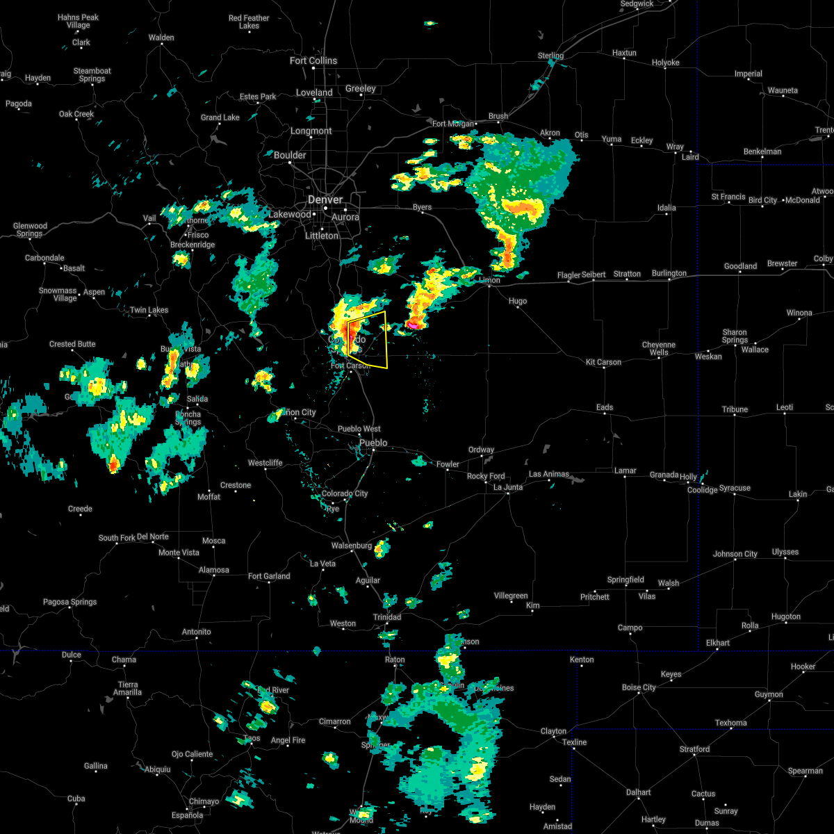 At 256 pm mdt, a severe thunderstorm was located over northern colorado springs, moving east at 20 mph (radar indicated). Hazards include 60 mph wind gusts and quarter size hail. Hail damage to vehicles is expected. Expect wind damage to roofs, siding, and trees. At 256 pm mdt, a severe thunderstorm was located over northern colorado springs, moving east at 20 mph (radar indicated). Hazards include 60 mph wind gusts and quarter size hail. Hail damage to vehicles is expected. Expect wind damage to roofs, siding, and trees.
|
| 6/24/2021 2:50 PM MDT | Storm damage reported in el paso county CO, 1.7 miles W of Colorado Springs, CO |
| 6/20/2021 9:32 PM MDT |
 At 931 pm mdt, a severe thunderstorm was located 10 miles southwest of fort carson, or 14 miles southwest of colorado springs, moving southeast at 20 mph (radar indicated). Hazards include 60 mph wind gusts and half dollar size hail. Hail damage to vehicles is expected. expect wind damage to roofs, siding, and trees. This severe thunderstorm will remain over mainly rural areas of eastern fremont, southeastern teller and southwestern el paso counties. At 931 pm mdt, a severe thunderstorm was located 10 miles southwest of fort carson, or 14 miles southwest of colorado springs, moving southeast at 20 mph (radar indicated). Hazards include 60 mph wind gusts and half dollar size hail. Hail damage to vehicles is expected. expect wind damage to roofs, siding, and trees. This severe thunderstorm will remain over mainly rural areas of eastern fremont, southeastern teller and southwestern el paso counties.
|
| 6/20/2021 9:23 PM MDT |
 At 922 pm mdt, a severe thunderstorm was located 7 miles east of victor, or 14 miles southwest of colorado springs, moving east at 20 mph (radar indicated). Hazards include golf ball size hail and 60 mph wind gusts. People and animals outdoors will be injured. expect hail damage to roofs, siding, windows, and vehicles. expect wind damage to roofs, siding, and trees. This severe thunderstorm will remain over mainly rural areas of northeastern fremont, southeastern teller and southwestern el paso counties. At 922 pm mdt, a severe thunderstorm was located 7 miles east of victor, or 14 miles southwest of colorado springs, moving east at 20 mph (radar indicated). Hazards include golf ball size hail and 60 mph wind gusts. People and animals outdoors will be injured. expect hail damage to roofs, siding, windows, and vehicles. expect wind damage to roofs, siding, and trees. This severe thunderstorm will remain over mainly rural areas of northeastern fremont, southeastern teller and southwestern el paso counties.
|
| 6/20/2021 9:15 PM MDT |
 At 915 pm mdt, a severe thunderstorm was located near victor, or 15 miles southwest of colorado springs, moving east at 20 mph (radar indicated). Hazards include ping pong ball size hail and 60 mph wind gusts. People and animals outdoors will be injured. expect hail damage to roofs, siding, windows, and vehicles. Expect wind damage to roofs, siding, and trees. At 915 pm mdt, a severe thunderstorm was located near victor, or 15 miles southwest of colorado springs, moving east at 20 mph (radar indicated). Hazards include ping pong ball size hail and 60 mph wind gusts. People and animals outdoors will be injured. expect hail damage to roofs, siding, windows, and vehicles. Expect wind damage to roofs, siding, and trees.
|
| 6/19/2021 3:28 PM MDT |
 The severe thunderstorm warning for central el paso county will expire at 330 pm mdt, the storms which prompted the warning have weakened below severe limits, and no longer pose an immediate threat to life or property. therefore, the warning will be allowed to expire. however small hail and gusty winds are still possible with these thunderstorms. a severe thunderstorm watch remains in effect until 900 pm mdt for east central colorado. The severe thunderstorm warning for central el paso county will expire at 330 pm mdt, the storms which prompted the warning have weakened below severe limits, and no longer pose an immediate threat to life or property. therefore, the warning will be allowed to expire. however small hail and gusty winds are still possible with these thunderstorms. a severe thunderstorm watch remains in effect until 900 pm mdt for east central colorado.
|
| 6/19/2021 3:26 PM MDT | Quarter sized hail reported 5.3 miles SW of Colorado Springs, CO, estimated size based on a video on twitter. |
| 6/19/2021 3:03 PM MDT |
 At 303 pm mdt, severe thunderstorms were located along a line extending from colorado springs to near falcon, moving east at 20 mph (radar indicated). Hazards include 60 mph wind gusts and quarter size hail. Hail damage to vehicles is expected. expect wind damage to roofs, siding, and trees. Locations impacted include, colorado springs, yoder, ellicott, schriever afb, peterson afb, falcon and cimarron hills. At 303 pm mdt, severe thunderstorms were located along a line extending from colorado springs to near falcon, moving east at 20 mph (radar indicated). Hazards include 60 mph wind gusts and quarter size hail. Hail damage to vehicles is expected. expect wind damage to roofs, siding, and trees. Locations impacted include, colorado springs, yoder, ellicott, schriever afb, peterson afb, falcon and cimarron hills.
|
| 6/19/2021 2:36 PM MDT |
 At 236 pm mdt, severe thunderstorms were located along a line extending from near manitou springs to near peyton, moving east at 35 mph (radar indicated). Hazards include 60 mph wind gusts and quarter size hail. Hail damage to vehicles is expected. Expect wind damage to roofs, siding, and trees. At 236 pm mdt, severe thunderstorms were located along a line extending from near manitou springs to near peyton, moving east at 35 mph (radar indicated). Hazards include 60 mph wind gusts and quarter size hail. Hail damage to vehicles is expected. Expect wind damage to roofs, siding, and trees.
|
| 6/13/2021 7:38 PM MDT |
 The severe thunderstorm warning for northeastern teller and northwestern el paso counties will expire at 745 pm mdt, the storm which prompted the warning has weakened below severe limits, and no longer poses an immediate threat to life or property. therefore, the warning will be allowed to expire. however small hail and gusty winds are still possible with this thunderstorm. The severe thunderstorm warning for northeastern teller and northwestern el paso counties will expire at 745 pm mdt, the storm which prompted the warning has weakened below severe limits, and no longer poses an immediate threat to life or property. therefore, the warning will be allowed to expire. however small hail and gusty winds are still possible with this thunderstorm.
|
| 6/13/2021 7:31 PM MDT |
 At 729 pm mdt, a severe thunderstorm was located near crystola, or 13 miles northwest of colorado springs, moving east at 20 mph (trained weather spotters earlier reported half dollar size hail in the woodland park area. this storm has weakened slightly but still remains capable of producing quarter size hail). Hazards include quarter size hail. Damage to vehicles is expected. Locations impacted include, northwestern colorado springs and air force academy. At 729 pm mdt, a severe thunderstorm was located near crystola, or 13 miles northwest of colorado springs, moving east at 20 mph (trained weather spotters earlier reported half dollar size hail in the woodland park area. this storm has weakened slightly but still remains capable of producing quarter size hail). Hazards include quarter size hail. Damage to vehicles is expected. Locations impacted include, northwestern colorado springs and air force academy.
|
| 6/13/2021 7:19 PM MDT |
 At 719 pm mdt, a severe thunderstorm was located over crystola, or 14 miles northwest of colorado springs, moving southeast at 30 mph (trained weather spotters). Hazards include half dollar size hail. damage to vehicles is expected At 719 pm mdt, a severe thunderstorm was located over crystola, or 14 miles northwest of colorado springs, moving southeast at 30 mph (trained weather spotters). Hazards include half dollar size hail. damage to vehicles is expected
|
| 5/30/2021 3:41 PM MDT |
 At 340 pm mdt, a severe thunderstorm was located over schriever afb, or 18 miles east of colorado springs, moving northeast at 15 mph (radar indicated). Hazards include 70 mph wind gusts and ping pong ball size hail. People and animals outdoors will be injured. expect hail damage to roofs, siding, windows, and vehicles. expect considerable tree damage. Wind damage is also likely to mobile homes, roofs, and outbuildings. At 340 pm mdt, a severe thunderstorm was located over schriever afb, or 18 miles east of colorado springs, moving northeast at 15 mph (radar indicated). Hazards include 70 mph wind gusts and ping pong ball size hail. People and animals outdoors will be injured. expect hail damage to roofs, siding, windows, and vehicles. expect considerable tree damage. Wind damage is also likely to mobile homes, roofs, and outbuildings.
|
| 5/30/2021 3:21 PM MDT |
 At 321 pm mdt, a severe thunderstorm was located over schriever afb, or 14 miles east of colorado springs, moving northeast at 20 mph (radar indicated). Hazards include 60 mph wind gusts and half dollar size hail. Hail damage to vehicles is expected. Expect wind damage to roofs, siding, and trees. At 321 pm mdt, a severe thunderstorm was located over schriever afb, or 14 miles east of colorado springs, moving northeast at 20 mph (radar indicated). Hazards include 60 mph wind gusts and half dollar size hail. Hail damage to vehicles is expected. Expect wind damage to roofs, siding, and trees.
|
| 5/29/2021 8:05 PM MDT |
 The severe thunderstorm warning for south central el paso county will expire at 815 pm mdt, the storm which prompted the warning has weakened below severe limits, and no longer poses an immediate threat to life or property. therefore, the warning will be allowed to expire. The severe thunderstorm warning for south central el paso county will expire at 815 pm mdt, the storm which prompted the warning has weakened below severe limits, and no longer poses an immediate threat to life or property. therefore, the warning will be allowed to expire.
|
| 5/29/2021 7:45 PM MDT |
 At 745 pm mdt, a severe thunderstorm was located near fountain, or 17 miles southeast of colorado springs, moving northeast at 20 mph (radar indicated). Hazards include 60 mph wind gusts and quarter size hail. Hail damage to vehicles is expected. Expect wind damage to roofs, siding, and trees. At 745 pm mdt, a severe thunderstorm was located near fountain, or 17 miles southeast of colorado springs, moving northeast at 20 mph (radar indicated). Hazards include 60 mph wind gusts and quarter size hail. Hail damage to vehicles is expected. Expect wind damage to roofs, siding, and trees.
|
| 5/29/2021 7:26 PM MDT |
 The severe thunderstorm warning for central el paso county will expire at 730 pm mdt, the storm which prompted the warning has weakened below severe limits, and no longer poses an immediate threat to life or property. therefore, the warning will be allowed to expire. however heavy rain is still possible with this thunderstorm. The severe thunderstorm warning for central el paso county will expire at 730 pm mdt, the storm which prompted the warning has weakened below severe limits, and no longer poses an immediate threat to life or property. therefore, the warning will be allowed to expire. however heavy rain is still possible with this thunderstorm.
|
| 5/29/2021 6:55 PM MDT | Quarter sized hail reported 5.4 miles E of Colorado Springs, CO |
| 5/29/2021 6:53 PM MDT |
 At 653 pm mdt, a severe thunderstorm was located over southwestern colorado springs, moving northeast at 15 mph (public). Hazards include quarter size hail. damage to vehicles is expected At 653 pm mdt, a severe thunderstorm was located over southwestern colorado springs, moving northeast at 15 mph (public). Hazards include quarter size hail. damage to vehicles is expected
|
| 5/29/2021 5:05 PM MDT |
 The severe thunderstorm warning for central el paso county will expire at 515 pm mdt, the storm which prompted the warning has weakened below severe limits, and no longer poses an immediate threat to life or property. therefore, the warning will be allowed to expire. however small hail and gusty winds are still possible with this thunderstorm. a tornado watch remains in effect until 900 pm mdt for east central colorado. The severe thunderstorm warning for central el paso county will expire at 515 pm mdt, the storm which prompted the warning has weakened below severe limits, and no longer poses an immediate threat to life or property. therefore, the warning will be allowed to expire. however small hail and gusty winds are still possible with this thunderstorm. a tornado watch remains in effect until 900 pm mdt for east central colorado.
|
| 5/29/2021 4:56 PM MDT |
 The severe thunderstorm warning for west central el paso county will expire at 500 pm mdt, the storm which prompted the warning has weakened below severe limits, and no longer poses an immediate threat to life or property. therefore, the warning will be allowed to expire. a tornado watch remains in effect until 900 pm mdt for east central colorado. The severe thunderstorm warning for west central el paso county will expire at 500 pm mdt, the storm which prompted the warning has weakened below severe limits, and no longer poses an immediate threat to life or property. therefore, the warning will be allowed to expire. a tornado watch remains in effect until 900 pm mdt for east central colorado.
|
| 5/29/2021 4:50 PM MDT | Quarter sized hail reported 6.3 miles NNW of Colorado Springs, CO |
| 5/29/2021 4:31 PM MDT |
 At 431 pm mdt, a severe thunderstorm was located over southwestern colorado springs, moving southeast at 10 mph (public). Hazards include quarter size hail. damage to vehicles is expected At 431 pm mdt, a severe thunderstorm was located over southwestern colorado springs, moving southeast at 10 mph (public). Hazards include quarter size hail. damage to vehicles is expected
|
| 5/29/2021 4:29 PM MDT | Quarter sized hail reported 8.3 miles NNE of Colorado Springs, CO |
| 5/29/2021 4:25 PM MDT |
 At 425 pm mdt, a severe thunderstorm was located near schriever afb, or 11 miles east of colorado springs, moving southeast at 10 mph (radar indicated). Hazards include 60 mph wind gusts and half dollar size hail. Hail damage to vehicles is expected. Expect wind damage to roofs, siding, and trees. At 425 pm mdt, a severe thunderstorm was located near schriever afb, or 11 miles east of colorado springs, moving southeast at 10 mph (radar indicated). Hazards include 60 mph wind gusts and half dollar size hail. Hail damage to vehicles is expected. Expect wind damage to roofs, siding, and trees.
|
| 5/29/2021 4:19 PM MDT |
 At 418 pm mdt, a severe thunderstorm was located over southeastern colorado springs, moving southeast at 15 mph (radar indicated). Hazards include ping pong ball size hail and 60 mph wind gusts. People and animals outdoors will be injured. expect hail damage to roofs, siding, windows, and vehicles. expect wind damage to roofs, siding, and trees. locations impacted include, southeastern colorado springs, fountain, yoder, ellicott, schriever afb, peterson afb, security-widefield and cimarron hills. other strong storms were noted south and southwest of peyton. These storms have had a history of producing hail between 1 and 2 inches in diameter. At 418 pm mdt, a severe thunderstorm was located over southeastern colorado springs, moving southeast at 15 mph (radar indicated). Hazards include ping pong ball size hail and 60 mph wind gusts. People and animals outdoors will be injured. expect hail damage to roofs, siding, windows, and vehicles. expect wind damage to roofs, siding, and trees. locations impacted include, southeastern colorado springs, fountain, yoder, ellicott, schriever afb, peterson afb, security-widefield and cimarron hills. other strong storms were noted south and southwest of peyton. These storms have had a history of producing hail between 1 and 2 inches in diameter.
|
| 5/29/2021 4:06 PM MDT |
 At 405 pm mdt, a severe thunderstorm was located near schriever afb, or 17 miles east of colorado springs, moving southeast at 15 mph (public). Hazards include hailstones from 1 to 2 inches in diameter. People and animals outdoors will be injured. expect damage to roofs, siding, windows, and vehicles. locations impacted include, colorado springs, fountain, yoder, ellicott, schriever afb, peterson afb, falcon, cimarron hills and security-widefield. A cluster of severe storms extending from colorado springs airport to just south of peyton were producing hailstones between 1 and 2 inches in diameter. At 405 pm mdt, a severe thunderstorm was located near schriever afb, or 17 miles east of colorado springs, moving southeast at 15 mph (public). Hazards include hailstones from 1 to 2 inches in diameter. People and animals outdoors will be injured. expect damage to roofs, siding, windows, and vehicles. locations impacted include, colorado springs, fountain, yoder, ellicott, schriever afb, peterson afb, falcon, cimarron hills and security-widefield. A cluster of severe storms extending from colorado springs airport to just south of peyton were producing hailstones between 1 and 2 inches in diameter.
|
| 5/29/2021 4:03 PM MDT | Half Dollar sized hail reported 4.6 miles NW of Colorado Springs, CO |
| 5/29/2021 3:55 PM MDT |
 At 353 pm mdt, a severe thunderstorm was located near falcon, or 16 miles east of colorado springs, moving southeast at 15 mph (radar indicated). Hazards include two inch hail. People and animals outdoors will be injured. expect damage to roofs, siding, windows, and vehicles. Hail measured at 2 inches in diameter was reported 9 miles southwest of peyton. At 353 pm mdt, a severe thunderstorm was located near falcon, or 16 miles east of colorado springs, moving southeast at 15 mph (radar indicated). Hazards include two inch hail. People and animals outdoors will be injured. expect damage to roofs, siding, windows, and vehicles. Hail measured at 2 inches in diameter was reported 9 miles southwest of peyton.
|
| 5/29/2021 3:45 PM MDT | Ping Pong Ball sized hail reported 4.7 miles N of Colorado Springs, CO |
| 5/29/2021 3:44 PM MDT |
 At 342 pm mdt, a severe thunderstorm was located near falcon, or 17 miles northeast of colorado springs, moving east at 30 mph (off duty national weather service meteorologist). Hazards include ping pong ball size hail. People and animals outdoors will be injured. expect damage to roofs, siding, windows, and vehicles. ping pong size hail was observed at highway 24 and chelton road at 3:40 pm. Locations impacted include, colorado springs, fountain, ellicott, schriever afb, peterson afb, falcon, cimarron hills, stratmoor and security-widefield. At 342 pm mdt, a severe thunderstorm was located near falcon, or 17 miles northeast of colorado springs, moving east at 30 mph (off duty national weather service meteorologist). Hazards include ping pong ball size hail. People and animals outdoors will be injured. expect damage to roofs, siding, windows, and vehicles. ping pong size hail was observed at highway 24 and chelton road at 3:40 pm. Locations impacted include, colorado springs, fountain, ellicott, schriever afb, peterson afb, falcon, cimarron hills, stratmoor and security-widefield.
|
| 5/29/2021 3:30 PM MDT |
 At 329 pm mdt, a severe thunderstorm was located over falcon, or 12 miles northeast of colorado springs, moving southeast at 15 mph (public). Hazards include quarter size hail. Damage to vehicles is expected. hail the size of quarters was observed at 3:27 pm in falcon. Locations impacted include, colorado springs, fountain, ellicott, stratmoor, schriever afb, peterson afb, falcon, cimarron hills and security-widefield. At 329 pm mdt, a severe thunderstorm was located over falcon, or 12 miles northeast of colorado springs, moving southeast at 15 mph (public). Hazards include quarter size hail. Damage to vehicles is expected. hail the size of quarters was observed at 3:27 pm in falcon. Locations impacted include, colorado springs, fountain, ellicott, stratmoor, schriever afb, peterson afb, falcon, cimarron hills and security-widefield.
|
| 5/29/2021 3:25 PM MDT | Quarter sized hail reported 6 miles SSW of Colorado Springs, CO |
| 5/29/2021 3:25 PM MDT |
 At 325 pm mdt, a severe thunderstorm was located near falcon, or 12 miles northeast of colorado springs, moving southeast at 15 mph (radar indicated). Hazards include 60 mph wind gusts and half dollar size hail. Hail damage to vehicles is expected. Expect wind damage to roofs, siding, and trees. At 325 pm mdt, a severe thunderstorm was located near falcon, or 12 miles northeast of colorado springs, moving southeast at 15 mph (radar indicated). Hazards include 60 mph wind gusts and half dollar size hail. Hail damage to vehicles is expected. Expect wind damage to roofs, siding, and trees.
|
| 5/29/2021 3:10 PM MDT |
 At 309 pm mdt, a severe thunderstorm was located over black forest, or 14 miles northeast of colorado springs, moving southeast at 15 mph (radar indicated). Hazards include 60 mph wind gusts and half dollar size hail. Hail damage to vehicles is expected. expect wind damage to roofs, siding, and trees. Locations impacted include, black forest, peyton and falcon. At 309 pm mdt, a severe thunderstorm was located over black forest, or 14 miles northeast of colorado springs, moving southeast at 15 mph (radar indicated). Hazards include 60 mph wind gusts and half dollar size hail. Hail damage to vehicles is expected. expect wind damage to roofs, siding, and trees. Locations impacted include, black forest, peyton and falcon.
|
| 5/29/2021 2:54 PM MDT |
 At 252 pm mdt, a severe thunderstorm was located near black forest, or 17 miles northeast of colorado springs, moving southeast at 25 mph (radar indicated). Hazards include 60 mph wind gusts and half dollar size hail. Hail damage to vehicles is expected. expect wind damage to roofs, siding, and trees. reports from ham radio operators indicate significant amounts of one half inch hail were covering the roads in the black forest area. Locations impacted include, calhan, black forest, peyton and falcon. At 252 pm mdt, a severe thunderstorm was located near black forest, or 17 miles northeast of colorado springs, moving southeast at 25 mph (radar indicated). Hazards include 60 mph wind gusts and half dollar size hail. Hail damage to vehicles is expected. expect wind damage to roofs, siding, and trees. reports from ham radio operators indicate significant amounts of one half inch hail were covering the roads in the black forest area. Locations impacted include, calhan, black forest, peyton and falcon.
|
| 5/29/2021 2:42 PM MDT |
 At 242 pm mdt, a severe thunderstorm was located near peyton, or 22 miles northeast of colorado springs, moving southeast at 25 mph (radar indicated). Hazards include 60 mph wind gusts and half dollar size hail. Hail damage to vehicles is expected. Expect wind damage to roofs, siding, and trees. At 242 pm mdt, a severe thunderstorm was located near peyton, or 22 miles northeast of colorado springs, moving southeast at 25 mph (radar indicated). Hazards include 60 mph wind gusts and half dollar size hail. Hail damage to vehicles is expected. Expect wind damage to roofs, siding, and trees.
|
| 5/22/2021 1:42 PM MDT |
 The severe thunderstorm warning for northwestern el paso county will expire at 145 pm mdt, the storm which prompted the warning has weakened below severe limits, and no longer poses an immediate threat to life or property. therefore, the warning will be allowed to expire. however small hail, gusty winds and heavy rain are still possible with this thunderstorm. a tornado watch remains in effect until 800 pm mdt for east central colorado. The severe thunderstorm warning for northwestern el paso county will expire at 145 pm mdt, the storm which prompted the warning has weakened below severe limits, and no longer poses an immediate threat to life or property. therefore, the warning will be allowed to expire. however small hail, gusty winds and heavy rain are still possible with this thunderstorm. a tornado watch remains in effect until 800 pm mdt for east central colorado.
|
| 5/22/2021 1:36 PM MDT |
 At 136 pm mdt, a severe thunderstorm was located over northwestern colorado springs, moving north at 30 mph (radar indicated). Hazards include 60 mph wind gusts and penny size hail. Expect damage to roofs, siding, and trees. Locations impacted include, colorado springs, monument, air force academy, manitou springs, palmer lake, black forest, stratmoor, gleneagle, fort carson, cimarron hills and security-widefield. At 136 pm mdt, a severe thunderstorm was located over northwestern colorado springs, moving north at 30 mph (radar indicated). Hazards include 60 mph wind gusts and penny size hail. Expect damage to roofs, siding, and trees. Locations impacted include, colorado springs, monument, air force academy, manitou springs, palmer lake, black forest, stratmoor, gleneagle, fort carson, cimarron hills and security-widefield.
|
| 5/22/2021 1:21 PM MDT |
 At 121 pm mdt, a severe thunderstorm was located near air force academy, or 8 miles north of colorado springs, moving north at 40 mph (radar indicated). Hazards include 60 mph wind gusts and quarter size hail. Hail damage to vehicles is expected. expect wind damage to roofs, siding, and trees. Locations impacted include, colorado springs, monument, air force academy, manitou springs, palmer lake, black forest, stratmoor, gleneagle, peterson afb, cimarron hills, security, security-widefield and fort carson. At 121 pm mdt, a severe thunderstorm was located near air force academy, or 8 miles north of colorado springs, moving north at 40 mph (radar indicated). Hazards include 60 mph wind gusts and quarter size hail. Hail damage to vehicles is expected. expect wind damage to roofs, siding, and trees. Locations impacted include, colorado springs, monument, air force academy, manitou springs, palmer lake, black forest, stratmoor, gleneagle, peterson afb, cimarron hills, security, security-widefield and fort carson.
|
| 5/22/2021 1:08 PM MDT |
 At 108 pm mdt, a severe thunderstorm was located over northwestern colorado springs, moving north at 25 mph (radar indicated). Hazards include 60 mph wind gusts and half dollar size hail. Hail damage to vehicles is expected. Expect wind damage to roofs, siding, and trees. At 108 pm mdt, a severe thunderstorm was located over northwestern colorado springs, moving north at 25 mph (radar indicated). Hazards include 60 mph wind gusts and half dollar size hail. Hail damage to vehicles is expected. Expect wind damage to roofs, siding, and trees.
|
| 5/17/2021 7:02 PM MDT | Quarter sized hail reported 5.8 miles ESE of Colorado Springs, CO |
| 5/2/2021 3:43 PM MDT | Quarter sized hail reported 6.9 miles NNW of Colorado Springs, CO |
| 5/2/2021 1:48 PM MDT |
 At 148 pm mdt, a severe thunderstorm was located near fountain, or 15 miles southeast of colorado springs, moving east at 20 mph (radar indicated). Hazards include 60 mph wind gusts and half dollar size hail. Hail damage to vehicles is expected. expect wind damage to roofs, siding, and trees. Locations impacted include, southeastern colorado springs, fountain, schriever afb and hanover. At 148 pm mdt, a severe thunderstorm was located near fountain, or 15 miles southeast of colorado springs, moving east at 20 mph (radar indicated). Hazards include 60 mph wind gusts and half dollar size hail. Hail damage to vehicles is expected. expect wind damage to roofs, siding, and trees. Locations impacted include, southeastern colorado springs, fountain, schriever afb and hanover.
|
| 5/2/2021 1:37 PM MDT |
 At 137 pm mdt, a severe thunderstorm was located near security-widefield, or 12 miles southeast of colorado springs, moving east at 20 mph (radar indicated). Hazards include ping pong ball size hail and 60 mph wind gusts. People and animals outdoors will be injured. expect hail damage to roofs, siding, windows, and vehicles. Expect wind damage to roofs, siding, and trees. At 137 pm mdt, a severe thunderstorm was located near security-widefield, or 12 miles southeast of colorado springs, moving east at 20 mph (radar indicated). Hazards include ping pong ball size hail and 60 mph wind gusts. People and animals outdoors will be injured. expect hail damage to roofs, siding, windows, and vehicles. Expect wind damage to roofs, siding, and trees.
|
| 5/2/2021 1:31 PM MDT | Golf Ball sized hail reported 4.6 miles NW of Colorado Springs, CO |
| 5/2/2021 1:30 PM MDT |
 At 130 pm mdt, a severe thunderstorm was located over southeastern colorado springs, moving northeast at 20 mph (trained weather spotters). Hazards include golf ball size hail. People and animals outdoors will be injured. expect damage to roofs, siding, windows, and vehicles. Locations impacted include, southeastern colorado springs, fountain, ellicott, schriever afb, peterson afb, falcon, security-widefield and cimarron hills. At 130 pm mdt, a severe thunderstorm was located over southeastern colorado springs, moving northeast at 20 mph (trained weather spotters). Hazards include golf ball size hail. People and animals outdoors will be injured. expect damage to roofs, siding, windows, and vehicles. Locations impacted include, southeastern colorado springs, fountain, ellicott, schriever afb, peterson afb, falcon, security-widefield and cimarron hills.
|
| 5/2/2021 1:25 PM MDT | Quarter sized hail reported 6.9 miles NNW of Colorado Springs, CO, report from mping: quarter (1.00 in.). |
| 5/2/2021 1:20 PM MDT |
 At 119 pm mdt, a severe thunderstorm was located over southeastern colorado springs, moving northeast at 20 mph (trained weather spotters. quarter size hail was reported at flying horse ranch). Hazards include quarter size hail. damage to vehicles is expected At 119 pm mdt, a severe thunderstorm was located over southeastern colorado springs, moving northeast at 20 mph (trained weather spotters. quarter size hail was reported at flying horse ranch). Hazards include quarter size hail. damage to vehicles is expected
|
| 5/2/2021 1:18 PM MDT | Quarter sized hail reported 10 miles S of Colorado Springs, CO, report from mping: quarter (1.00 in.). |
| 8/20/2020 5:10 PM MDT |
 The severe thunderstorm warning for southwestern el paso county will expire at 515 pm mdt, the storm which prompted the warning has weakened below severe limits, and no longer poses an immediate threat to life or property. therefore, the warning will be allowed to expire. however small hail, gusty winds and very heavy rain are still possible with this thunderstorm. The severe thunderstorm warning for southwestern el paso county will expire at 515 pm mdt, the storm which prompted the warning has weakened below severe limits, and no longer poses an immediate threat to life or property. therefore, the warning will be allowed to expire. however small hail, gusty winds and very heavy rain are still possible with this thunderstorm.
|
| 8/20/2020 4:55 PM MDT |
 At 455 pm mdt, a severe thunderstorm was located near fort carson, or 10 miles south of colorado springs, moving east at 15 mph (radar indicated). Hazards include 60 mph wind gusts and quarter size hail. Hail damage to vehicles is expected. expect wind damage to roofs, siding, and trees. Locations impacted include, southwestern colorado springs, fountain, fort carson, security, security-widefield and stratmoor. At 455 pm mdt, a severe thunderstorm was located near fort carson, or 10 miles south of colorado springs, moving east at 15 mph (radar indicated). Hazards include 60 mph wind gusts and quarter size hail. Hail damage to vehicles is expected. expect wind damage to roofs, siding, and trees. Locations impacted include, southwestern colorado springs, fountain, fort carson, security, security-widefield and stratmoor.
|
| 8/20/2020 4:40 PM MDT |
 At 439 pm mdt, a severe thunderstorm was located 7 miles southwest of fort carson, or 10 miles south of colorado springs, moving east at 15 mph (radar indicated). Hazards include 60 mph wind gusts and quarter size hail. Hail damage to vehicles is expected. Expect wind damage to roofs, siding, and trees. At 439 pm mdt, a severe thunderstorm was located 7 miles southwest of fort carson, or 10 miles south of colorado springs, moving east at 15 mph (radar indicated). Hazards include 60 mph wind gusts and quarter size hail. Hail damage to vehicles is expected. Expect wind damage to roofs, siding, and trees.
|
| 8/16/2020 2:58 PM MDT |
 The severe thunderstorm warning for central el paso county will expire at 300 pm mdt, the storm which prompted the warning has weakened below severe limits, and no longer poses an immediate threat to life or property. therefore, the warning will be allowed to expire. The severe thunderstorm warning for central el paso county will expire at 300 pm mdt, the storm which prompted the warning has weakened below severe limits, and no longer poses an immediate threat to life or property. therefore, the warning will be allowed to expire.
|
| 8/16/2020 2:43 PM MDT |
 At 243 pm mdt, a severe thunderstorm was located over southeastern colorado springs, moving south at 15 mph (radar indicated). Hazards include 60 mph wind gusts and quarter size hail. Hail damage to vehicles is expected. expect wind damage to roofs, siding, and trees. Locations impacted include, southeastern colorado springs, fountain, security, peterson afb, security-widefield, cimarron hills, fort carson and stratmoor. At 243 pm mdt, a severe thunderstorm was located over southeastern colorado springs, moving south at 15 mph (radar indicated). Hazards include 60 mph wind gusts and quarter size hail. Hail damage to vehicles is expected. expect wind damage to roofs, siding, and trees. Locations impacted include, southeastern colorado springs, fountain, security, peterson afb, security-widefield, cimarron hills, fort carson and stratmoor.
|
| 8/16/2020 2:29 PM MDT |
 The national weather service in pueblo has issued a * severe thunderstorm warning for. central el paso county in east central colorado. until 300 pm mdt. At 229 pm mdt, a severe thunderstorm was located over southeastern colorado springs, moving south at 10 mph. The national weather service in pueblo has issued a * severe thunderstorm warning for. central el paso county in east central colorado. until 300 pm mdt. At 229 pm mdt, a severe thunderstorm was located over southeastern colorado springs, moving south at 10 mph.
|
| 8/15/2020 5:11 PM MDT |
 At 510 pm mdt, a severe thunderstorm was located over southeastern colorado springs, moving south at 10 mph (trained weather spotters). Hazards include ping pong ball size hail. People and animals outdoors will be injured. expect damage to roofs, siding, windows, and vehicles. this severe thunderstorm will be near, fort carson around 515 pm mdt. fountain around 530 pm mdt. Security-widefield around 535 pm mdt. At 510 pm mdt, a severe thunderstorm was located over southeastern colorado springs, moving south at 10 mph (trained weather spotters). Hazards include ping pong ball size hail. People and animals outdoors will be injured. expect damage to roofs, siding, windows, and vehicles. this severe thunderstorm will be near, fort carson around 515 pm mdt. fountain around 530 pm mdt. Security-widefield around 535 pm mdt.
|
| 8/15/2020 5:09 PM MDT |
 At 509 pm mdt, a severe thunderstorm was located over southeastern colorado springs, moving south at 10 mph (trained weather spotters). Hazards include two inch hail. People and animals outdoors will be injured. expect damage to roofs, siding, windows, and vehicles. Locations impacted include, southeastern colorado springs, fountain, security, security-widefield and fort carson. At 509 pm mdt, a severe thunderstorm was located over southeastern colorado springs, moving south at 10 mph (trained weather spotters). Hazards include two inch hail. People and animals outdoors will be injured. expect damage to roofs, siding, windows, and vehicles. Locations impacted include, southeastern colorado springs, fountain, security, security-widefield and fort carson.
|
| 8/15/2020 5:08 PM MDT | Half Dollar sized hail reported 9 miles NW of Colorado Springs, CO |
| 8/15/2020 5:06 PM MDT | Ping Pong Ball sized hail reported 5.1 miles NW of Colorado Springs, CO |
| 8/15/2020 5:01 PM MDT | Hen Egg sized hail reported 6 miles NW of Colorado Springs, CO, reported by observer at colorado springs airport. |
| 8/15/2020 4:58 PM MDT |
 At 457 pm mdt, a severe thunderstorm was located over southeastern colorado springs, moving south at 10 mph (trained weather spotters). Hazards include ping pong ball size hail. People and animals outdoors will be injured. expect damage to roofs, siding, windows, and vehicles. Locations impacted include, southeastern colorado springs, fountain, security, peterson afb, security-widefield, cimarron hills and fort carson. At 457 pm mdt, a severe thunderstorm was located over southeastern colorado springs, moving south at 10 mph (trained weather spotters). Hazards include ping pong ball size hail. People and animals outdoors will be injured. expect damage to roofs, siding, windows, and vehicles. Locations impacted include, southeastern colorado springs, fountain, security, peterson afb, security-widefield, cimarron hills and fort carson.
|
| 8/15/2020 4:52 PM MDT | Half Dollar sized hail reported 3.5 miles WNW of Colorado Springs, CO |
| 8/15/2020 4:50 PM MDT | Golf Ball sized hail reported 4.6 miles NW of Colorado Springs, CO, report via picture on social media. stated largest hail occurred around 4:50 pm in zip code 80916. location estimated by radar. |
| 8/15/2020 4:49 PM MDT |
 At 449 pm mdt, a severe thunderstorm was located over peterson afb, or near colorado springs, moving south at 10 mph (radar indicated). Hazards include half dollar size hail. damage to vehicles is expected At 449 pm mdt, a severe thunderstorm was located over peterson afb, or near colorado springs, moving south at 10 mph (radar indicated). Hazards include half dollar size hail. damage to vehicles is expected
|
| 8/15/2020 4:18 PM MDT | Quarter sized hail reported 6 miles SSW of Colorado Springs, CO |
| 8/15/2020 4:16 PM MDT |
 At 416 pm mdt, a severe thunderstorm was located over northern colorado springs, moving southeast at 10 mph (trained weather spotters). Hazards include quarter size hail. Damage to vehicles is expected. Locations impacted include, northern colorado springs and black forest. At 416 pm mdt, a severe thunderstorm was located over northern colorado springs, moving southeast at 10 mph (trained weather spotters). Hazards include quarter size hail. Damage to vehicles is expected. Locations impacted include, northern colorado springs and black forest.
|
| 8/15/2020 4:14 PM MDT | Quarter sized hail reported 1.6 miles SSE of Colorado Springs, CO |
| 8/15/2020 4:13 PM MDT | Quarter sized hail reported 6.1 miles SSW of Colorado Springs, CO |
| 8/15/2020 4:12 PM MDT |
 At 411 pm mdt, a severe thunderstorm was located near black forest, or 10 miles northeast of colorado springs, moving southeast at 10 mph (trained weather spotters). Hazards include half dollar size hail. damage to vehicles is expected At 411 pm mdt, a severe thunderstorm was located near black forest, or 10 miles northeast of colorado springs, moving southeast at 10 mph (trained weather spotters). Hazards include half dollar size hail. damage to vehicles is expected
|
| 8/15/2020 4:11 PM MDT | Half Dollar sized hail reported 5.4 miles SW of Colorado Springs, CO, reported at black forest and woodman colorado springs... co. |
| 8/15/2020 4:05 PM MDT | Quarter sized hail reported 10.2 miles SSE of Colorado Springs, CO |
| 8/15/2020 4:02 PM MDT |
 At 402 pm mdt, a severe thunderstorm was located over northern colorado springs, moving southeast at 10 mph (trained weather spotters). Hazards include 60 mph wind gusts and quarter size hail. Hail damage to vehicles is expected. expect wind damage to roofs, siding, and trees. Locations impacted include, northern colorado springs, air force academy, black forest and gleneagle. At 402 pm mdt, a severe thunderstorm was located over northern colorado springs, moving southeast at 10 mph (trained weather spotters). Hazards include 60 mph wind gusts and quarter size hail. Hail damage to vehicles is expected. expect wind damage to roofs, siding, and trees. Locations impacted include, northern colorado springs, air force academy, black forest and gleneagle.
|
| 8/15/2020 3:53 PM MDT | Quarter sized hail reported 9.3 miles S of Colorado Springs, CO |
| 8/15/2020 3:43 PM MDT |
 At 342 pm mdt, a severe thunderstorm was located over gleneagle, or 14 miles north of colorado springs, moving southeast at 10 mph (radar indicated). Hazards include 60 mph wind gusts and quarter size hail. Hail damage to vehicles is expected. Expect wind damage to roofs, siding, and trees. At 342 pm mdt, a severe thunderstorm was located over gleneagle, or 14 miles north of colorado springs, moving southeast at 10 mph (radar indicated). Hazards include 60 mph wind gusts and quarter size hail. Hail damage to vehicles is expected. Expect wind damage to roofs, siding, and trees.
|
| 8/5/2020 8:12 PM MDT |
 The severe thunderstorm warning for west central el paso county will expire at 815 pm mdt, the storm which prompted the warning has weakened below severe limits, and no longer poses an immediate threat to life or property. therefore, the warning will be allowed to expire. a severe thunderstorm watch remains in effect until 900 pm mdt for east central colorado. The severe thunderstorm warning for west central el paso county will expire at 815 pm mdt, the storm which prompted the warning has weakened below severe limits, and no longer poses an immediate threat to life or property. therefore, the warning will be allowed to expire. a severe thunderstorm watch remains in effect until 900 pm mdt for east central colorado.
|
| 8/5/2020 8:00 PM MDT |
 At 800 pm mdt, a severe thunderstorm was located over manitou springs, or near colorado springs, moving east at 5 mph (radar indicated). Hazards include quarter size hail. Damage to vehicles is expected. Locations impacted include, western colorado springs and manitou springs. At 800 pm mdt, a severe thunderstorm was located over manitou springs, or near colorado springs, moving east at 5 mph (radar indicated). Hazards include quarter size hail. Damage to vehicles is expected. Locations impacted include, western colorado springs and manitou springs.
|
| 8/5/2020 7:44 PM MDT |
 At 744 pm mdt, a severe thunderstorm was located near cascade, or 8 miles west of colorado springs, moving east at 5 mph (radar indicated). Hazards include half dollar size hail. damage to vehicles is expected At 744 pm mdt, a severe thunderstorm was located near cascade, or 8 miles west of colorado springs, moving east at 5 mph (radar indicated). Hazards include half dollar size hail. damage to vehicles is expected
|
| 8/5/2020 7:32 PM MDT |
 A severe thunderstorm warning remains in effect until 745 pm mdt for western el paso county. at 732 pm mdt, a severe thunderstorm was located over cascade, or 9 miles west of colorado springs, moving east at 5 mph. hazard. half dollar size hail. source. Radar indicated. A severe thunderstorm warning remains in effect until 745 pm mdt for western el paso county. at 732 pm mdt, a severe thunderstorm was located over cascade, or 9 miles west of colorado springs, moving east at 5 mph. hazard. half dollar size hail. source. Radar indicated.
|
| 8/5/2020 7:13 PM MDT |
 At 713 pm mdt, a severe thunderstorm was located over pikes peak, or 11 miles west of colorado springs, moving east at 5 mph (radar indicated). Hazards include quarter size hail. damage to vehicles is expected At 713 pm mdt, a severe thunderstorm was located over pikes peak, or 11 miles west of colorado springs, moving east at 5 mph (radar indicated). Hazards include quarter size hail. damage to vehicles is expected
|
| 8/5/2020 5:56 PM MDT |
 At 556 pm mdt, a severe thunderstorm was located over southeastern colorado springs, moving east at 10 mph (radar indicated). Hazards include quarter size hail. Damage to vehicles is expected. Locations impacted include, southeastern colorado springs, fountain and security-widefield. At 556 pm mdt, a severe thunderstorm was located over southeastern colorado springs, moving east at 10 mph (radar indicated). Hazards include quarter size hail. Damage to vehicles is expected. Locations impacted include, southeastern colorado springs, fountain and security-widefield.
|
| 8/5/2020 5:41 PM MDT |
 At 540 pm mdt, a severe thunderstorm was located over security-widefield, or 8 miles southeast of colorado springs, moving east at 10 mph (radar indicated). Hazards include half dollar size hail. damage to vehicles is expected At 540 pm mdt, a severe thunderstorm was located over security-widefield, or 8 miles southeast of colorado springs, moving east at 10 mph (radar indicated). Hazards include half dollar size hail. damage to vehicles is expected
|
| 8/5/2020 5:23 PM MDT |
 The severe thunderstorm warning for central el paso county will expire at 530 pm mdt, the storm which prompted the warning has weakened below severe limits, and no longer poses an immediate threat to life or property. therefore, the warning will be allowed to expire. however small hail and heavy rain are still possible with this thunderstorm. a severe thunderstorm watch remains in effect until 900 pm mdt for east central colorado. The severe thunderstorm warning for central el paso county will expire at 530 pm mdt, the storm which prompted the warning has weakened below severe limits, and no longer poses an immediate threat to life or property. therefore, the warning will be allowed to expire. however small hail and heavy rain are still possible with this thunderstorm. a severe thunderstorm watch remains in effect until 900 pm mdt for east central colorado.
|
| 8/5/2020 5:13 PM MDT |
 At 512 pm mdt, a severe thunderstorm was located near schriever afb, or 15 miles southeast of colorado springs, moving east at 15 mph (trained weather spotters). Hazards include 60 mph wind gusts and half dollar size hail. Hail damage to vehicles is expected. expect wind damage to roofs, siding, and trees. Locations impacted include, southeastern colorado springs, fountain, hanover, security, security-widefield, stratmoor and fort carson. At 512 pm mdt, a severe thunderstorm was located near schriever afb, or 15 miles southeast of colorado springs, moving east at 15 mph (trained weather spotters). Hazards include 60 mph wind gusts and half dollar size hail. Hail damage to vehicles is expected. expect wind damage to roofs, siding, and trees. Locations impacted include, southeastern colorado springs, fountain, hanover, security, security-widefield, stratmoor and fort carson.
|
| 8/5/2020 5:11 PM MDT |
 At 511 pm mdt, a severe thunderstorm was located over southwestern colorado springs, moving northeast at 25 mph (radar indicated). Hazards include 60 mph wind gusts and quarter size hail. Hail damage to vehicles is expected. expect wind damage to roofs, siding, and trees. Locations impacted include, colorado springs, schriever afb, peterson afb, falcon and cimarron hills. At 511 pm mdt, a severe thunderstorm was located over southwestern colorado springs, moving northeast at 25 mph (radar indicated). Hazards include 60 mph wind gusts and quarter size hail. Hail damage to vehicles is expected. expect wind damage to roofs, siding, and trees. Locations impacted include, colorado springs, schriever afb, peterson afb, falcon and cimarron hills.
|
| 8/5/2020 4:58 PM MDT |
 At 445 pm mdt, a severe thunderstorm was located over western colorado springs, moving east at 40 mph (radar indicated). Hazards include 60 mph wind gusts and half dollar size hail. Hail damage to vehicles is expected. Expect wind damage to roofs, siding, and trees. At 445 pm mdt, a severe thunderstorm was located over western colorado springs, moving east at 40 mph (radar indicated). Hazards include 60 mph wind gusts and half dollar size hail. Hail damage to vehicles is expected. Expect wind damage to roofs, siding, and trees.
|
| 8/5/2020 4:54 PM MDT |
 At 453 pm mdt, a severe thunderstorm was located near security-widefield, or 11 miles southeast of colorado springs, moving east at 10 mph (trained weather spotters). Hazards include two inch hail and 60 mph wind gusts. People and animals outdoors will be injured. expect hail damage to roofs, siding, windows, and vehicles. expect wind damage to roofs, siding, and trees. This severe thunderstorm will be near, hanover around 540 pm mdt. At 453 pm mdt, a severe thunderstorm was located near security-widefield, or 11 miles southeast of colorado springs, moving east at 10 mph (trained weather spotters). Hazards include two inch hail and 60 mph wind gusts. People and animals outdoors will be injured. expect hail damage to roofs, siding, windows, and vehicles. expect wind damage to roofs, siding, and trees. This severe thunderstorm will be near, hanover around 540 pm mdt.
|
| 8/5/2020 4:46 PM MDT |
 At 445 pm mdt, a severe thunderstorm was located over western colorado springs, moving east at 40 mph (radar indicated). Hazards include 60 mph wind gusts and half dollar size hail. Hail damage to vehicles is expected. Expect wind damage to roofs, siding, and trees. At 445 pm mdt, a severe thunderstorm was located over western colorado springs, moving east at 40 mph (radar indicated). Hazards include 60 mph wind gusts and half dollar size hail. Hail damage to vehicles is expected. Expect wind damage to roofs, siding, and trees.
|
| 8/5/2020 4:45 PM MDT |
 At 444 pm mdt, a severe thunderstorm was located over fountain, or 10 miles southeast of colorado springs, moving southeast at 15 mph (trained weather spotters). Hazards include tennis ball size hail and 60 mph wind gusts. People and animals outdoors will be injured. expect hail damage to roofs, siding, windows, and vehicles. expect wind damage to roofs, siding, and trees. This severe thunderstorm will remain over mainly rural areas of south central el paso county. At 444 pm mdt, a severe thunderstorm was located over fountain, or 10 miles southeast of colorado springs, moving southeast at 15 mph (trained weather spotters). Hazards include tennis ball size hail and 60 mph wind gusts. People and animals outdoors will be injured. expect hail damage to roofs, siding, windows, and vehicles. expect wind damage to roofs, siding, and trees. This severe thunderstorm will remain over mainly rural areas of south central el paso county.
|
| 8/5/2020 4:41 PM MDT | Hen Egg sized hail reported 8.9 miles N of Colorado Springs, CO |
| 8/5/2020 4:35 PM MDT | Quarter sized hail reported 9.6 miles N of Colorado Springs, CO |
| 8/5/2020 4:33 PM MDT | Ping Pong Ball sized hail reported 8.9 miles N of Colorado Springs, CO, reported at security and main colorado springs. |
| 8/5/2020 4:30 PM MDT | Hen Egg sized hail reported 7.4 miles NNE of Colorado Springs, CO, time estimated by radar. |
| 8/5/2020 4:28 PM MDT | Hen Egg sized hail reported 7.9 miles NNE of Colorado Springs, CO |
| 8/5/2020 4:27 PM MDT |
 At 426 pm mdt, a severe thunderstorm was located over fort carson, or 7 miles southeast of colorado springs, moving southeast at 15 mph (trained weather spotters). Hazards include tennis ball size hail and 60 mph wind gusts. People and animals outdoors will be injured. expect hail damage to roofs, siding, windows, and vehicles. expect wind damage to roofs, siding, and trees. this severe storm will be near, security-widefield around 435 pm mdt. Fountain around 445 pm mdt. At 426 pm mdt, a severe thunderstorm was located over fort carson, or 7 miles southeast of colorado springs, moving southeast at 15 mph (trained weather spotters). Hazards include tennis ball size hail and 60 mph wind gusts. People and animals outdoors will be injured. expect hail damage to roofs, siding, windows, and vehicles. expect wind damage to roofs, siding, and trees. this severe storm will be near, security-widefield around 435 pm mdt. Fountain around 445 pm mdt.
|
| 8/5/2020 4:25 PM MDT | Hen Egg sized hail reported 8.1 miles NNE of Colorado Springs, CO |
| 8/5/2020 4:21 PM MDT |
 At 421 pm mdt, a severe thunderstorm was located over fort carson, or near colorado springs, moving southeast at 15 mph (trained weather spotters). Hazards include golf ball size hail and 60 mph wind gusts. People and animals outdoors will be injured. expect hail damage to roofs, siding, windows, and vehicles. expect wind damage to roofs, siding, and trees. this severe storm will be near, security around 430 pm mdt. security-widefield around 435 pm mdt. Fountain around 445 pm mdt. At 421 pm mdt, a severe thunderstorm was located over fort carson, or near colorado springs, moving southeast at 15 mph (trained weather spotters). Hazards include golf ball size hail and 60 mph wind gusts. People and animals outdoors will be injured. expect hail damage to roofs, siding, windows, and vehicles. expect wind damage to roofs, siding, and trees. this severe storm will be near, security around 430 pm mdt. security-widefield around 435 pm mdt. Fountain around 445 pm mdt.
|
| 8/5/2020 4:19 PM MDT | Golf Ball sized hail reported 8.1 miles NNE of Colorado Springs, CO |
| 8/5/2020 4:08 PM MDT |
 At 408 pm mdt, a severe thunderstorm was located over southwestern colorado springs, moving southeast at 15 mph (trained weather spotters). Hazards include golf ball size hail and 60 mph wind gusts. People and animals outdoors will be injured. expect hail damage to roofs, siding, windows, and vehicles. expect wind damage to roofs, siding, and trees. this severe thunderstorm will be near, fort carson and stratmoor around 415 pm mdt. security around 425 pm mdt. security-widefield around 435 pm mdt. Fountain around 445 pm mdt. At 408 pm mdt, a severe thunderstorm was located over southwestern colorado springs, moving southeast at 15 mph (trained weather spotters). Hazards include golf ball size hail and 60 mph wind gusts. People and animals outdoors will be injured. expect hail damage to roofs, siding, windows, and vehicles. expect wind damage to roofs, siding, and trees. this severe thunderstorm will be near, fort carson and stratmoor around 415 pm mdt. security around 425 pm mdt. security-widefield around 435 pm mdt. Fountain around 445 pm mdt.
|
| 8/5/2020 4:05 PM MDT | Golf Ball sized hail reported 8.3 miles NNE of Colorado Springs, CO |
| 8/5/2020 4:02 PM MDT |
 At 401 pm mdt, a severe thunderstorm was located over southwestern colorado springs, moving southeast at 15 mph (trained weather spotters). Hazards include golf ball size hail and 60 mph wind gusts. People and animals outdoors will be injured. expect hail damage to roofs, siding, windows, and vehicles. expect wind damage to roofs, siding, and trees. this severe storm will be near, stratmoor around 415 pm mdt. fort carson around 420 pm mdt. Security and security-widefield around 430 pm mdt. At 401 pm mdt, a severe thunderstorm was located over southwestern colorado springs, moving southeast at 15 mph (trained weather spotters). Hazards include golf ball size hail and 60 mph wind gusts. People and animals outdoors will be injured. expect hail damage to roofs, siding, windows, and vehicles. expect wind damage to roofs, siding, and trees. this severe storm will be near, stratmoor around 415 pm mdt. fort carson around 420 pm mdt. Security and security-widefield around 430 pm mdt.
|
| 8/5/2020 4:01 PM MDT | Ping Pong Ball sized hail reported 5.4 miles NE of Colorado Springs, CO, reported at 10th and colorado ave... colorado springs... co. |
| 8/5/2020 4:00 PM MDT | Golf Ball sized hail reported 6.2 miles NE of Colorado Springs, CO, *** 1 inj *** woman was hit in the wrist at 7 falls and was injured. time estimated at 4 pm. |
| 8/5/2020 3:58 PM MDT | Half Dollar sized hail reported 6.8 miles NE of Colorado Springs, CO, ended 412 pm. |
| 8/5/2020 3:58 PM MDT | Quarter sized hail reported 5.5 miles ENE of Colorado Springs, CO |
| 8/5/2020 3:56 PM MDT |
 At 355 pm mdt, a severe thunderstorm was located over southwestern colorado springs, moving southeast at 15 mph (trained weather spotters in old colorado city reported quarter size hail). Hazards include 60 mph wind gusts and half dollar size hail. Hail damage to vehicles is expected. expect wind damage to roofs, siding, and trees. Locations impacted include, southern colorado springs, fort carson, stratmoor, peterson afb, cimarron hills and security-widefield. At 355 pm mdt, a severe thunderstorm was located over southwestern colorado springs, moving southeast at 15 mph (trained weather spotters in old colorado city reported quarter size hail). Hazards include 60 mph wind gusts and half dollar size hail. Hail damage to vehicles is expected. expect wind damage to roofs, siding, and trees. Locations impacted include, southern colorado springs, fort carson, stratmoor, peterson afb, cimarron hills and security-widefield.
|
| 8/5/2020 3:55 PM MDT | Golf Ball sized hail reported 7.9 miles NE of Colorado Springs, CO |
| 8/5/2020 3:54 PM MDT | Quarter sized hail reported 7.9 miles NE of Colorado Springs, CO |
| 8/5/2020 3:52 PM MDT | Quarter sized hail reported 5.4 miles NE of Colorado Springs, CO |
| 8/5/2020 3:52 PM MDT | Ping Pong Ball sized hail reported 7.6 miles ENE of Colorado Springs, CO |
| 8/5/2020 3:48 PM MDT |
 At 348 pm mdt, a severe thunderstorm was located over manitou springs, or near colorado springs, moving southeast at 15 mph (radar indicated). Hazards include 60 mph wind gusts and half dollar size hail. Hail damage to vehicles is expected. Expect wind damage to roofs, siding, and trees. At 348 pm mdt, a severe thunderstorm was located over manitou springs, or near colorado springs, moving southeast at 15 mph (radar indicated). Hazards include 60 mph wind gusts and half dollar size hail. Hail damage to vehicles is expected. Expect wind damage to roofs, siding, and trees.
|
| 8/5/2020 3:08 PM MDT |
 The severe thunderstorm warning for northwestern el paso county will expire at 315 pm mdt, the storm which prompted the warning has weakened below severe limits, and no longer poses an immediate threat to life or property. therefore, the warning will be allowed to expire. however small hail is still possible with this thunderstorm. a severe thunderstorm watch remains in effect until 900 pm mdt for east central colorado. remember, a severe thunderstorm warning still remains in effect for much of eastern colorado. The severe thunderstorm warning for northwestern el paso county will expire at 315 pm mdt, the storm which prompted the warning has weakened below severe limits, and no longer poses an immediate threat to life or property. therefore, the warning will be allowed to expire. however small hail is still possible with this thunderstorm. a severe thunderstorm watch remains in effect until 900 pm mdt for east central colorado. remember, a severe thunderstorm warning still remains in effect for much of eastern colorado.
|
| 8/5/2020 3:02 PM MDT |
 At 301 pm mdt, a severe thunderstorm was located near palmer lake, or 17 miles north of colorado springs, moving east at 10 mph (radar indicated). Hazards include 60 mph wind gusts and quarter size hail. Hail damage to vehicles is expected. expect wind damage to roofs, siding, and trees. Locations impacted include, northern colorado springs, monument, air force academy, palmer lake and gleneagle. At 301 pm mdt, a severe thunderstorm was located near palmer lake, or 17 miles north of colorado springs, moving east at 10 mph (radar indicated). Hazards include 60 mph wind gusts and quarter size hail. Hail damage to vehicles is expected. expect wind damage to roofs, siding, and trees. Locations impacted include, northern colorado springs, monument, air force academy, palmer lake and gleneagle.
|
| 8/5/2020 2:47 PM MDT |
 The national weather service in pueblo has issued a * severe thunderstorm warning for. northeastern teller county in central colorado. northwestern el paso county in east central colorado. until 315 pm mdt. At 246 pm mdt, a severe thunderstorm was located near palmer lake,. The national weather service in pueblo has issued a * severe thunderstorm warning for. northeastern teller county in central colorado. northwestern el paso county in east central colorado. until 315 pm mdt. At 246 pm mdt, a severe thunderstorm was located near palmer lake,.
|
| 7/21/2020 3:05 PM MDT |
 At 305 pm mdt, a severe thunderstorm was located over woodland park, or 15 miles northwest of colorado springs, moving southeast at 25 mph (radar indicated). Hazards include 60 mph wind gusts and quarter size hail. Hail damage to vehicles is expected. expect wind damage to roofs, siding, and trees. Locations impacted include, northwestern colorado springs, woodland park, monument, air force academy, manitou springs, green mountain falls, pikes peak, black forest, crystola, divide, chipita park, gleneagle and cascade. At 305 pm mdt, a severe thunderstorm was located over woodland park, or 15 miles northwest of colorado springs, moving southeast at 25 mph (radar indicated). Hazards include 60 mph wind gusts and quarter size hail. Hail damage to vehicles is expected. expect wind damage to roofs, siding, and trees. Locations impacted include, northwestern colorado springs, woodland park, monument, air force academy, manitou springs, green mountain falls, pikes peak, black forest, crystola, divide, chipita park, gleneagle and cascade.
|
| 7/21/2020 2:54 PM MDT |
 At 253 pm mdt, a severe thunderstorm was located near woodland park, or 20 miles northwest of colorado springs, moving southeast at 25 mph (radar indicated). Hazards include 60 mph wind gusts and quarter size hail. Hail damage to vehicles is expected. Expect wind damage to roofs, siding, and trees. At 253 pm mdt, a severe thunderstorm was located near woodland park, or 20 miles northwest of colorado springs, moving southeast at 25 mph (radar indicated). Hazards include 60 mph wind gusts and quarter size hail. Hail damage to vehicles is expected. Expect wind damage to roofs, siding, and trees.
|
| 7/15/2020 3:21 PM MDT | Quarter sized hail reported 14.2 miles SSW of Colorado Springs, CO |
| 7/15/2020 3:16 PM MDT |
 At 316 pm mdt, a severe thunderstorm was located over black forest, or 15 miles north of colorado springs, moving northeast at 15 mph (radar indicated). Hazards include 60 mph wind gusts and quarter size hail. Hail damage to vehicles is expected. Expect wind damage to roofs, siding, and trees. At 316 pm mdt, a severe thunderstorm was located over black forest, or 15 miles north of colorado springs, moving northeast at 15 mph (radar indicated). Hazards include 60 mph wind gusts and quarter size hail. Hail damage to vehicles is expected. Expect wind damage to roofs, siding, and trees.
|
| 7/15/2020 2:56 PM MDT |
 At 242 pm mdt, a severe thunderstorm was located 9 miles southwest of fountain, or 14 miles south of colorado springs, moving east at 5 mph (radar indicated). Hazards include 60 mph wind gusts and quarter size hail. Hail damage to vehicles is expected. Expect wind damage to roofs, siding, and trees. At 242 pm mdt, a severe thunderstorm was located 9 miles southwest of fountain, or 14 miles south of colorado springs, moving east at 5 mph (radar indicated). Hazards include 60 mph wind gusts and quarter size hail. Hail damage to vehicles is expected. Expect wind damage to roofs, siding, and trees.
|
| 7/15/2020 2:42 PM MDT |
 At 242 pm mdt, a severe thunderstorm was located 9 miles southwest of fountain, or 14 miles south of colorado springs, moving east at 5 mph (radar indicated). Hazards include 60 mph wind gusts and quarter size hail. Hail damage to vehicles is expected. Expect wind damage to roofs, siding, and trees. At 242 pm mdt, a severe thunderstorm was located 9 miles southwest of fountain, or 14 miles south of colorado springs, moving east at 5 mph (radar indicated). Hazards include 60 mph wind gusts and quarter size hail. Hail damage to vehicles is expected. Expect wind damage to roofs, siding, and trees.
|
| 7/15/2020 2:38 PM MDT |
 The severe thunderstorm warning for central teller and northwestern el paso counties will expire at 245 pm mdt, the storm which prompted the warning has weakened below severe limits, and no longer poses an immediate threat to life or property. therefore, the warning will be allowed to expire. however small hail and gusty winds are still possible with this thunderstorm. a severe thunderstorm watch remains in effect until 900 pm mdt for central and east central colorado. The severe thunderstorm warning for central teller and northwestern el paso counties will expire at 245 pm mdt, the storm which prompted the warning has weakened below severe limits, and no longer poses an immediate threat to life or property. therefore, the warning will be allowed to expire. however small hail and gusty winds are still possible with this thunderstorm. a severe thunderstorm watch remains in effect until 900 pm mdt for central and east central colorado.
|
| 7/15/2020 2:24 PM MDT |
 At 224 pm mdt, a severe thunderstorm was located over green mountain falls, or 13 miles northwest of colorado springs, moving east at 10 mph (radar indicated). Hazards include 60 mph wind gusts and quarter size hail. Hail damage to vehicles is expected. expect wind damage to roofs, siding, and trees. Locations impacted include, woodland park, air force academy, manitou springs, green mountain falls, divide, pikes peak, crystola, chipita park and cascade. At 224 pm mdt, a severe thunderstorm was located over green mountain falls, or 13 miles northwest of colorado springs, moving east at 10 mph (radar indicated). Hazards include 60 mph wind gusts and quarter size hail. Hail damage to vehicles is expected. expect wind damage to roofs, siding, and trees. Locations impacted include, woodland park, air force academy, manitou springs, green mountain falls, divide, pikes peak, crystola, chipita park and cascade.
|
| 7/15/2020 2:16 PM MDT |
 At 216 pm mdt, a severe thunderstorm was located near hanover, or 20 miles southeast of colorado springs, moving east at 5 mph (radar indicated). Hazards include 60 mph wind gusts and quarter size hail. Hail damage to vehicles is expected. expect wind damage to roofs, siding, and trees. Locations impacted include, southeastern colorado springs, fountain, hanover, truckton, yoder, schriever afb, rush and security-widefield. At 216 pm mdt, a severe thunderstorm was located near hanover, or 20 miles southeast of colorado springs, moving east at 5 mph (radar indicated). Hazards include 60 mph wind gusts and quarter size hail. Hail damage to vehicles is expected. expect wind damage to roofs, siding, and trees. Locations impacted include, southeastern colorado springs, fountain, hanover, truckton, yoder, schriever afb, rush and security-widefield.
|
| 7/15/2020 2:10 PM MDT |
 At 210 pm mdt, a severe thunderstorm was located near green mountain falls, or 15 miles northwest of colorado springs, moving east at 10 mph (radar indicated). Hazards include 60 mph wind gusts and quarter size hail. Hail damage to vehicles is expected. Expect wind damage to roofs, siding, and trees. At 210 pm mdt, a severe thunderstorm was located near green mountain falls, or 15 miles northwest of colorado springs, moving east at 10 mph (radar indicated). Hazards include 60 mph wind gusts and quarter size hail. Hail damage to vehicles is expected. Expect wind damage to roofs, siding, and trees.
|
| 7/15/2020 2:08 PM MDT |
 At 208 pm mdt, a severe thunderstorm was located near ellicott, or 19 miles east of colorado springs, moving northeast at 15 mph (trained weather spotters at schriever). Hazards include 60 mph wind gusts and quarter size hail. Hail damage to vehicles is expected. expect wind damage to roofs, siding, and trees. Locations impacted include, eastern colorado springs, schriever afb, ellicott, peterson afb and cimarron hills. At 208 pm mdt, a severe thunderstorm was located near ellicott, or 19 miles east of colorado springs, moving northeast at 15 mph (trained weather spotters at schriever). Hazards include 60 mph wind gusts and quarter size hail. Hail damage to vehicles is expected. expect wind damage to roofs, siding, and trees. Locations impacted include, eastern colorado springs, schriever afb, ellicott, peterson afb and cimarron hills.
|
| 7/15/2020 1:58 PM MDT | Quarter sized hail reported 13.6 miles WNW of Colorado Springs, CO, reports of several shattered glass windows and windshield damage. |
| 7/15/2020 1:56 PM MDT |
 A severe thunderstorm warning remains in effect until 230 pm mdt for southeastern el paso county. at 156 pm mdt, a severe thunderstorm was located near schriever afb, or 20 miles southeast of colorado springs, moving northeast at 20 mph. hazard. 60 mph wind gusts and quarter size hail. A severe thunderstorm warning remains in effect until 230 pm mdt for southeastern el paso county. at 156 pm mdt, a severe thunderstorm was located near schriever afb, or 20 miles southeast of colorado springs, moving northeast at 20 mph. hazard. 60 mph wind gusts and quarter size hail.
|
| 7/15/2020 1:54 PM MDT |
 At 154 pm mdt, a severe thunderstorm was located over schriever afb, or 16 miles east of colorado springs, moving northeast at 15 mph (radar indicated). Hazards include 60 mph wind gusts and quarter size hail. Hail damage to vehicles is expected. Expect wind damage to roofs, siding, and trees. At 154 pm mdt, a severe thunderstorm was located over schriever afb, or 16 miles east of colorado springs, moving northeast at 15 mph (radar indicated). Hazards include 60 mph wind gusts and quarter size hail. Hail damage to vehicles is expected. Expect wind damage to roofs, siding, and trees.
|
| 7/15/2020 1:41 PM MDT |
 At 141 pm mdt, a severe thunderstorm was located 7 miles east of fountain, or 17 miles southeast of colorado springs, moving east at 10 mph (radar indicated). Hazards include 60 mph wind gusts and quarter size hail. Hail damage to vehicles is expected. expect wind damage to roofs, siding, and trees. Locations impacted include, southeastern colorado springs, fountain, hanover, truckton, yoder, schriever afb, rush and security-widefield. At 141 pm mdt, a severe thunderstorm was located 7 miles east of fountain, or 17 miles southeast of colorado springs, moving east at 10 mph (radar indicated). Hazards include 60 mph wind gusts and quarter size hail. Hail damage to vehicles is expected. expect wind damage to roofs, siding, and trees. Locations impacted include, southeastern colorado springs, fountain, hanover, truckton, yoder, schriever afb, rush and security-widefield.
|
| 7/15/2020 1:27 PM MDT |
 At 127 pm mdt, a severe thunderstorm was located 7 miles northwest of hanover, or 18 miles southeast of colorado springs, moving east at 25 mph (radar indicated). Hazards include 60 mph wind gusts and quarter size hail. Hail damage to vehicles is expected. Expect wind damage to roofs, siding, and trees. At 127 pm mdt, a severe thunderstorm was located 7 miles northwest of hanover, or 18 miles southeast of colorado springs, moving east at 25 mph (radar indicated). Hazards include 60 mph wind gusts and quarter size hail. Hail damage to vehicles is expected. Expect wind damage to roofs, siding, and trees.
|
| 7/12/2020 2:12 PM MDT |
 The severe thunderstorm warning for southwestern el paso county will expire at 215 pm mdt, the storm which prompted the warning has weakened below severe limits, and no longer poses an immediate threat to life or property. therefore, the warning will be allowed to expire. however heavy rain is still possible with this thunderstorm. a severe thunderstorm watch remains in effect until 600 pm mdt for east central colorado. The severe thunderstorm warning for southwestern el paso county will expire at 215 pm mdt, the storm which prompted the warning has weakened below severe limits, and no longer poses an immediate threat to life or property. therefore, the warning will be allowed to expire. however heavy rain is still possible with this thunderstorm. a severe thunderstorm watch remains in effect until 600 pm mdt for east central colorado.
|
| 7/12/2020 2:06 PM MDT |
 At 205 pm mdt, a severe thunderstorm was located over fort carson, or 7 miles south of colorado springs, moving southeast at 10 mph (radar indicated). Hazards include 60 mph wind gusts and quarter size hail. Hail damage to vehicles is expected. expect wind damage to roofs, siding, and trees. Locations impacted include, southeastern colorado springs, fountain, fort carson, stratmoor, security and security-widefield. At 205 pm mdt, a severe thunderstorm was located over fort carson, or 7 miles south of colorado springs, moving southeast at 10 mph (radar indicated). Hazards include 60 mph wind gusts and quarter size hail. Hail damage to vehicles is expected. expect wind damage to roofs, siding, and trees. Locations impacted include, southeastern colorado springs, fountain, fort carson, stratmoor, security and security-widefield.
|
| 7/12/2020 2:00 PM MDT | Golf Ball sized hail reported 9.8 miles NNE of Colorado Springs, CO, reported at fort carson image from social media (twitter). |
| 7/12/2020 1:53 PM MDT |
 At 148 pm mdt, a severe thunderstorm was located over southwestern colorado springs, moving southeast at 10 mph (radar indicated. at 149 pm, hail 1 inch in diameter was reported in the rock creek canyon area just south of cheyenne mountain). Hazards include 60 mph wind gusts and quarter size hail. Hail damage to vehicles is expected. expect wind damage to roofs, siding, and trees. Locations impacted include, southern colorado springs, fountain, stratmoor, fort carson, security, peterson afb, security-widefield and cimarron hills. At 148 pm mdt, a severe thunderstorm was located over southwestern colorado springs, moving southeast at 10 mph (radar indicated. at 149 pm, hail 1 inch in diameter was reported in the rock creek canyon area just south of cheyenne mountain). Hazards include 60 mph wind gusts and quarter size hail. Hail damage to vehicles is expected. expect wind damage to roofs, siding, and trees. Locations impacted include, southern colorado springs, fountain, stratmoor, fort carson, security, peterson afb, security-widefield and cimarron hills.
|
| 7/12/2020 1:49 PM MDT | Quarter sized hail reported 13 miles NNE of Colorado Springs, CO |
| 7/12/2020 1:37 PM MDT |
 At 137 pm mdt, a severe thunderstorm was located over southwestern colorado springs, moving east at 10 mph (radar indicated). Hazards include 60 mph wind gusts and half dollar size hail. Hail damage to vehicles is expected. Expect wind damage to roofs, siding, and trees. At 137 pm mdt, a severe thunderstorm was located over southwestern colorado springs, moving east at 10 mph (radar indicated). Hazards include 60 mph wind gusts and half dollar size hail. Hail damage to vehicles is expected. Expect wind damage to roofs, siding, and trees.
|
| 7/3/2020 1:56 PM MDT | Quarter sized hail reported 13.7 miles SSW of Colorado Springs, CO |
| 6/26/2020 5:41 PM MDT |
 The severe thunderstorm warning for northwestern el paso county will expire at 545 pm mdt, the storm which prompted the warning has weakened below severe limits, and no longer poses an immediate threat to life or property. therefore, the warning will be allowed to expire. however small hail, gusty winds and heavy rain are still possible with this thunderstorm. a severe thunderstorm watch remains in effect until 900 pm mdt for east central colorado. The severe thunderstorm warning for northwestern el paso county will expire at 545 pm mdt, the storm which prompted the warning has weakened below severe limits, and no longer poses an immediate threat to life or property. therefore, the warning will be allowed to expire. however small hail, gusty winds and heavy rain are still possible with this thunderstorm. a severe thunderstorm watch remains in effect until 900 pm mdt for east central colorado.
|
| 6/26/2020 5:37 PM MDT |
 At 537 pm mdt, a severe thunderstorm was located near ellicott, or 19 miles east of colorado springs, moving southeast at 10 mph (trained weather spotters). Hazards include golf ball size hail and 60 mph wind gusts. People and animals outdoors will be injured. expect hail damage to roofs, siding, windows, and vehicles. expect wind damage to roofs, siding, and trees. Locations impacted include, ellicott. At 537 pm mdt, a severe thunderstorm was located near ellicott, or 19 miles east of colorado springs, moving southeast at 10 mph (trained weather spotters). Hazards include golf ball size hail and 60 mph wind gusts. People and animals outdoors will be injured. expect hail damage to roofs, siding, windows, and vehicles. expect wind damage to roofs, siding, and trees. Locations impacted include, ellicott.
|
| 6/26/2020 5:28 PM MDT | Quarter sized hail reported 4.4 miles W of Colorado Springs, CO, report from mping: quarter (1.00 in.). |
| 6/26/2020 5:28 PM MDT |
 At 528 pm mdt, a severe thunderstorm was located over cimarron hills, or near colorado springs, moving east at 15 mph (radar indicated). Hazards include 60 mph wind gusts and quarter size hail. Hail damage to vehicles is expected. expect wind damage to roofs, siding, and trees. Locations impacted include, colorado springs, fountain, air force academy, manitou springs, stratmoor, fort carson, security, peterson afb, cimarron hills and security-widefield. At 528 pm mdt, a severe thunderstorm was located over cimarron hills, or near colorado springs, moving east at 15 mph (radar indicated). Hazards include 60 mph wind gusts and quarter size hail. Hail damage to vehicles is expected. expect wind damage to roofs, siding, and trees. Locations impacted include, colorado springs, fountain, air force academy, manitou springs, stratmoor, fort carson, security, peterson afb, cimarron hills and security-widefield.
|
| 6/26/2020 5:14 PM MDT |
 At 514 pm mdt, a severe thunderstorm was located near falcon, or 17 miles east of colorado springs, moving southeast at 15 mph (trained weather spotters). Hazards include golf ball size hail and 60 mph wind gusts. People and animals outdoors will be injured. expect hail damage to roofs, siding, windows, and vehicles. expect wind damage to roofs, siding, and trees. Locations impacted include, eastern colorado springs, falcon and cimarron hills. At 514 pm mdt, a severe thunderstorm was located near falcon, or 17 miles east of colorado springs, moving southeast at 15 mph (trained weather spotters). Hazards include golf ball size hail and 60 mph wind gusts. People and animals outdoors will be injured. expect hail damage to roofs, siding, windows, and vehicles. expect wind damage to roofs, siding, and trees. Locations impacted include, eastern colorado springs, falcon and cimarron hills.
|
| 6/26/2020 5:13 PM MDT |
 At 512 pm mdt, a severe thunderstorm was located over southwestern colorado springs, moving southeast at 25 mph (radar indicated). Hazards include 60 mph wind gusts and quarter size hail. Hail damage to vehicles is expected. expect wind damage to roofs, siding, and trees. Locations impacted include, colorado springs, fountain, air force academy, manitou springs, stratmoor, chipita park, fort carson, security, peterson afb, cimarron hills, cascade and security-widefield. At 512 pm mdt, a severe thunderstorm was located over southwestern colorado springs, moving southeast at 25 mph (radar indicated). Hazards include 60 mph wind gusts and quarter size hail. Hail damage to vehicles is expected. expect wind damage to roofs, siding, and trees. Locations impacted include, colorado springs, fountain, air force academy, manitou springs, stratmoor, chipita park, fort carson, security, peterson afb, cimarron hills, cascade and security-widefield.
|
| 6/26/2020 5:06 PM MDT |
 At 506 pm mdt, a severe thunderstorm was located near falcon, or 15 miles east of colorado springs, moving southeast at 10 mph (trained weather spotters). Hazards include golf ball size hail and 60 mph wind gusts. People and animals outdoors will be injured. expect hail damage to roofs, siding, windows, and vehicles. Expect wind damage to roofs, siding, and trees. At 506 pm mdt, a severe thunderstorm was located near falcon, or 15 miles east of colorado springs, moving southeast at 10 mph (trained weather spotters). Hazards include golf ball size hail and 60 mph wind gusts. People and animals outdoors will be injured. expect hail damage to roofs, siding, windows, and vehicles. Expect wind damage to roofs, siding, and trees.
|
| 6/26/2020 4:59 PM MDT |
 At 459 pm mdt, a severe thunderstorm capable of producing a tornado was located near falcon, or 14 miles east of colorado springs, moving southeast at 10 mph (radar indicated rotation). Hazards include tornado and half dollar size hail. Flying debris will be dangerous to those caught without shelter. mobile homes will be damaged or destroyed. damage to roofs, windows, and vehicles will occur. tree damage is likely. This tornadic thunderstorm will remain over mainly rural areas of central el paso county. At 459 pm mdt, a severe thunderstorm capable of producing a tornado was located near falcon, or 14 miles east of colorado springs, moving southeast at 10 mph (radar indicated rotation). Hazards include tornado and half dollar size hail. Flying debris will be dangerous to those caught without shelter. mobile homes will be damaged or destroyed. damage to roofs, windows, and vehicles will occur. tree damage is likely. This tornadic thunderstorm will remain over mainly rural areas of central el paso county.
|
| 6/26/2020 4:58 PM MDT |
 At 458 pm mdt, a severe thunderstorm was located over cascade, or 8 miles northwest of colorado springs, moving southeast at 20 mph (radar indicated). Hazards include 60 mph wind gusts and quarter size hail. Hail damage to vehicles is expected. Expect wind damage to roofs, siding, and trees. At 458 pm mdt, a severe thunderstorm was located over cascade, or 8 miles northwest of colorado springs, moving southeast at 20 mph (radar indicated). Hazards include 60 mph wind gusts and quarter size hail. Hail damage to vehicles is expected. Expect wind damage to roofs, siding, and trees.
|
| 6/26/2020 4:44 PM MDT | Quarter sized hail reported 8.7 miles SSW of Colorado Springs, CO |
| 6/26/2020 4:41 PM MDT |
 The tornado warning for north central el paso county will expire at 445 pm mdt, the tornado threat has diminished and the tornado warning has been cancelled. however, large hail and damaging winds remain likely and a severe thunderstorm warning remains in effect for the area. however small hail and gusty winds are still possible with this thunderstorm. a severe thunderstorm watch remains in effect until 900 pm mdt for east central colorado. remember, a severe thunderstorm warning still remains in effect for el paso county through 530 pm mdt. The tornado warning for north central el paso county will expire at 445 pm mdt, the tornado threat has diminished and the tornado warning has been cancelled. however, large hail and damaging winds remain likely and a severe thunderstorm warning remains in effect for the area. however small hail and gusty winds are still possible with this thunderstorm. a severe thunderstorm watch remains in effect until 900 pm mdt for east central colorado. remember, a severe thunderstorm warning still remains in effect for el paso county through 530 pm mdt.
|
| 6/26/2020 4:40 PM MDT |
 At 439 pm mdt, a severe thunderstorm was located over black forest, or 13 miles northeast of colorado springs, moving southeast at 15 mph (trained weather spotters). Hazards include golf ball size hail and 60 mph wind gusts. People and animals outdoors will be injured. expect hail damage to roofs, siding, windows, and vehicles. Expect wind damage to roofs, siding, and trees. At 439 pm mdt, a severe thunderstorm was located over black forest, or 13 miles northeast of colorado springs, moving southeast at 15 mph (trained weather spotters). Hazards include golf ball size hail and 60 mph wind gusts. People and animals outdoors will be injured. expect hail damage to roofs, siding, windows, and vehicles. Expect wind damage to roofs, siding, and trees.
|
| 6/26/2020 4:37 PM MDT | Ping Pong Ball sized hail reported 6.8 miles SSW of Colorado Springs, CO |
| 6/26/2020 4:37 PM MDT |
 At 437 pm mdt, a severe thunderstorm was located near falcon, or 16 miles northeast of colorado springs, moving southeast at 15 mph (trained weather spotters). Hazards include ping pong ball size hail and 60 mph wind gusts. People and animals outdoors will be injured. expect hail damage to roofs, siding, windows, and vehicles. expect wind damage to roofs, siding, and trees. Locations impacted include, northern colorado springs and black forest. At 437 pm mdt, a severe thunderstorm was located near falcon, or 16 miles northeast of colorado springs, moving southeast at 15 mph (trained weather spotters). Hazards include ping pong ball size hail and 60 mph wind gusts. People and animals outdoors will be injured. expect hail damage to roofs, siding, windows, and vehicles. expect wind damage to roofs, siding, and trees. Locations impacted include, northern colorado springs and black forest.
|
| 6/26/2020 4:36 PM MDT | Ping Pong Ball sized hail reported 7.2 miles SSW of Colorado Springs, CO, report from mping: ping pong ball (1.50 in.). |
| 6/26/2020 4:34 PM MDT | Quarter sized hail reported 6.1 miles SSW of Colorado Springs, CO |
| 6/26/2020 4:33 PM MDT | Quarter sized hail reported 7.2 miles S of Colorado Springs, CO |
| 6/26/2020 4:32 PM MDT |
 At 431 pm mdt, a severe thunderstorm capable of producing a tornado was located near black forest, or 9 miles northeast of colorado springs, moving southeast at 15 mph (radar indicated rotation). Hazards include tornado and golf ball size hail. Flying debris will be dangerous to those caught without shelter. mobile homes will be damaged or destroyed. damage to roofs, windows, and vehicles will occur. tree damage is likely. This tornadic thunderstorm will remain over mainly rural areas of north central el paso county. At 431 pm mdt, a severe thunderstorm capable of producing a tornado was located near black forest, or 9 miles northeast of colorado springs, moving southeast at 15 mph (radar indicated rotation). Hazards include tornado and golf ball size hail. Flying debris will be dangerous to those caught without shelter. mobile homes will be damaged or destroyed. damage to roofs, windows, and vehicles will occur. tree damage is likely. This tornadic thunderstorm will remain over mainly rural areas of north central el paso county.
|
| 6/26/2020 4:18 PM MDT | Golf Ball sized hail reported 8.5 miles S of Colorado Springs, CO |
| 6/26/2020 4:16 PM MDT |
 At 416 pm mdt, a severe thunderstorm was located over black forest, or 16 miles northeast of colorado springs, moving southeast at 15 mph (trained weather spotters). Hazards include tennis ball size hail and 60 mph wind gusts. People and animals outdoors will be injured. expect hail damage to roofs, siding, windows, and vehicles. expect wind damage to roofs, siding, and trees. Locations impacted include, northern colorado springs, monument, air force academy, black forest and gleneagle. At 416 pm mdt, a severe thunderstorm was located over black forest, or 16 miles northeast of colorado springs, moving southeast at 15 mph (trained weather spotters). Hazards include tennis ball size hail and 60 mph wind gusts. People and animals outdoors will be injured. expect hail damage to roofs, siding, windows, and vehicles. expect wind damage to roofs, siding, and trees. Locations impacted include, northern colorado springs, monument, air force academy, black forest and gleneagle.
|
| 6/26/2020 4:15 PM MDT | Golf Ball sized hail reported 10.2 miles SSE of Colorado Springs, CO |
| 6/26/2020 4:13 PM MDT | Tennis Ball sized hail reported 9.3 miles S of Colorado Springs, CO |
| 6/26/2020 4:13 PM MDT |
 At 413 pm mdt, a severe thunderstorm capable of producing a tornado was located over northern colorado springs, moving southeast at 10 mph (radar indicated rotation). Hazards include tornado and half dollar size hail. Flying debris will be dangerous to those caught without shelter. mobile homes will be damaged or destroyed. damage to roofs, windows, and vehicles will occur. tree damage is likely. This dangerous storm will be near, black forest around 425 pm mdt. At 413 pm mdt, a severe thunderstorm capable of producing a tornado was located over northern colorado springs, moving southeast at 10 mph (radar indicated rotation). Hazards include tornado and half dollar size hail. Flying debris will be dangerous to those caught without shelter. mobile homes will be damaged or destroyed. damage to roofs, windows, and vehicles will occur. tree damage is likely. This dangerous storm will be near, black forest around 425 pm mdt.
|
| 6/26/2020 4:09 PM MDT | Quarter sized hail reported 12.2 miles SSE of Colorado Springs, CO |
| 6/26/2020 3:58 PM MDT |
 At 358 pm mdt, a severe thunderstorm was located near black forest, or 17 miles north of colorado springs, moving southeast at 15 mph (radar indicated). Hazards include 60 mph wind gusts and half dollar size hail. Hail damage to vehicles is expected. Expect wind damage to roofs, siding, and trees. At 358 pm mdt, a severe thunderstorm was located near black forest, or 17 miles north of colorado springs, moving southeast at 15 mph (radar indicated). Hazards include 60 mph wind gusts and half dollar size hail. Hail damage to vehicles is expected. Expect wind damage to roofs, siding, and trees.
|
| 6/26/2020 3:50 PM MDT |
 At 349 pm mdt, a severe thunderstorm was located near gleneagle, or 17 miles north of colorado springs, moving southeast at 15 mph (radar indicated). Hazards include ping pong ball size hail and 60 mph wind gusts. People and animals outdoors will be injured. expect hail damage to roofs, siding, windows, and vehicles. expect wind damage to roofs, siding, and trees. Locations impacted include, northern colorado springs, monument, air force academy and gleneagle. At 349 pm mdt, a severe thunderstorm was located near gleneagle, or 17 miles north of colorado springs, moving southeast at 15 mph (radar indicated). Hazards include ping pong ball size hail and 60 mph wind gusts. People and animals outdoors will be injured. expect hail damage to roofs, siding, windows, and vehicles. expect wind damage to roofs, siding, and trees. Locations impacted include, northern colorado springs, monument, air force academy and gleneagle.
|
| 6/26/2020 3:20 PM MDT |
 At 320 pm mdt, a severe thunderstorm was located over greenland, or 23 miles north of colorado springs, moving southeast at 15 mph (radar indicated). Hazards include ping pong ball size hail and 60 mph wind gusts. People and animals outdoors will be injured. expect hail damage to roofs, siding, windows, and vehicles. Expect wind damage to roofs, siding, and trees. At 320 pm mdt, a severe thunderstorm was located over greenland, or 23 miles north of colorado springs, moving southeast at 15 mph (radar indicated). Hazards include ping pong ball size hail and 60 mph wind gusts. People and animals outdoors will be injured. expect hail damage to roofs, siding, windows, and vehicles. Expect wind damage to roofs, siding, and trees.
|
| 6/6/2020 4:55 PM MDT |
 At 454 pm mdt, severe thunderstorms were located along a line extending from 9 miles south of byers to ramah to 7 miles northwest of hanover, moving northeast at 60 mph. these are very dangerous storms (radar indicated). Hazards include 80 mph wind gusts and quarter size hail. Flying debris will be dangerous to those caught without shelter. mobile homes will be heavily damaged. expect considerable damage to roofs, windows, and vehicles. extensive tree damage and power outages are likely. Locations impacted include, southeastern colorado springs, pueblo, fountain, calhan, boone, ramah, hanover, truckton, yoder, pueblo reservoir, salt creek, ellicott, peyton, schriever afb, pueblo depot, pinon, blende, avondale, pueblo west and rush. At 454 pm mdt, severe thunderstorms were located along a line extending from 9 miles south of byers to ramah to 7 miles northwest of hanover, moving northeast at 60 mph. these are very dangerous storms (radar indicated). Hazards include 80 mph wind gusts and quarter size hail. Flying debris will be dangerous to those caught without shelter. mobile homes will be heavily damaged. expect considerable damage to roofs, windows, and vehicles. extensive tree damage and power outages are likely. Locations impacted include, southeastern colorado springs, pueblo, fountain, calhan, boone, ramah, hanover, truckton, yoder, pueblo reservoir, salt creek, ellicott, peyton, schriever afb, pueblo depot, pinon, blende, avondale, pueblo west and rush.
|
| 6/6/2020 4:43 PM MDT |
 At 443 pm mdt, severe thunderstorms were located along a line extending from near kiowa to 6 miles north of ellicott to near pinon, moving northeast at 60 mph. these are very dangerous storms (radar indicated). Hazards include 80 mph wind gusts and quarter size hail. Flying debris will be dangerous to those caught without shelter. mobile homes will be heavily damaged. expect considerable damage to roofs, windows, and vehicles. Extensive tree damage and power outages are likely. At 443 pm mdt, severe thunderstorms were located along a line extending from near kiowa to 6 miles north of ellicott to near pinon, moving northeast at 60 mph. these are very dangerous storms (radar indicated). Hazards include 80 mph wind gusts and quarter size hail. Flying debris will be dangerous to those caught without shelter. mobile homes will be heavily damaged. expect considerable damage to roofs, windows, and vehicles. Extensive tree damage and power outages are likely.
|
| 6/6/2020 4:42 PM MDT | Asos station kcos colorado springs airpor in el paso county CO, 5.9 miles NW of Colorado Springs, CO |
| 6/6/2020 4:33 PM MDT |
 At 433 pm mdt, a severe thunderstorm was located 8 miles southwest of fountain, or 15 miles south of colorado springs, moving northeast at 50 mph (radar indicated). Hazards include 60 mph wind gusts and quarter size hail. Hail damage to vehicles is expected. expect wind damage to roofs, siding, and trees. Locations impacted include, southern colorado springs, fountain, fort carson, security, stratmoor and security-widefield. At 433 pm mdt, a severe thunderstorm was located 8 miles southwest of fountain, or 15 miles south of colorado springs, moving northeast at 50 mph (radar indicated). Hazards include 60 mph wind gusts and quarter size hail. Hail damage to vehicles is expected. expect wind damage to roofs, siding, and trees. Locations impacted include, southern colorado springs, fountain, fort carson, security, stratmoor and security-widefield.
|
| 6/6/2020 4:30 PM MDT |
 At 430 pm mdt, a severe thunderstorm was located near schriever afb, or 18 miles east of colorado springs, moving northeast at 65 mph (radar indicated). Hazards include 70 mph wind gusts and quarter size hail. Hail damage to vehicles is expected. expect considerable tree damage. wind damage is also likely to mobile homes, roofs, and outbuildings. Locations impacted include, southeastern colorado springs, fountain, hanover, yoder, ellicott, peyton, schriever afb, falcon and security-widefield. At 430 pm mdt, a severe thunderstorm was located near schriever afb, or 18 miles east of colorado springs, moving northeast at 65 mph (radar indicated). Hazards include 70 mph wind gusts and quarter size hail. Hail damage to vehicles is expected. expect considerable tree damage. wind damage is also likely to mobile homes, roofs, and outbuildings. Locations impacted include, southeastern colorado springs, fountain, hanover, yoder, ellicott, peyton, schriever afb, falcon and security-widefield.
|
| 6/6/2020 4:28 PM MDT |
 At 427 pm mdt, a severe thunderstorm was located near black forest, or 17 miles north of colorado springs, moving east at 45 mph (radar indicated). Hazards include 70 mph wind gusts and quarter size hail. Hail damage to vehicles is expected. expect considerable tree damage. wind damage is also likely to mobile homes, roofs, and outbuildings. Locations impacted include, eastern colorado springs, monument, calhan, ramah, yoder, black forest, ellicott, peyton, schriever afb, falcon, peterson afb, cimarron hills, rush, gleneagle and security-widefield. At 427 pm mdt, a severe thunderstorm was located near black forest, or 17 miles north of colorado springs, moving east at 45 mph (radar indicated). Hazards include 70 mph wind gusts and quarter size hail. Hail damage to vehicles is expected. expect considerable tree damage. wind damage is also likely to mobile homes, roofs, and outbuildings. Locations impacted include, eastern colorado springs, monument, calhan, ramah, yoder, black forest, ellicott, peyton, schriever afb, falcon, peterson afb, cimarron hills, rush, gleneagle and security-widefield.
|
| 6/6/2020 4:24 PM MDT | Storm damage reported in el paso county CO, 5.4 miles E of Colorado Springs, CO |
| 6/6/2020 4:21 PM MDT |
 At 421 pm mdt, a severe thunderstorm was located 7 miles southeast of fountain, or 19 miles southeast of colorado springs, moving northeast at 65 mph (radar indicated). Hazards include 70 mph wind gusts and quarter size hail. Hail damage to vehicles is expected. expect considerable tree damage. wind damage is also likely to mobile homes, roofs, and outbuildings. Locations impacted include, southeastern colorado springs, fountain, hanover, yoder, ellicott, peyton, schriever afb, falcon, security-widefield and cimarron hills. At 421 pm mdt, a severe thunderstorm was located 7 miles southeast of fountain, or 19 miles southeast of colorado springs, moving northeast at 65 mph (radar indicated). Hazards include 70 mph wind gusts and quarter size hail. Hail damage to vehicles is expected. expect considerable tree damage. wind damage is also likely to mobile homes, roofs, and outbuildings. Locations impacted include, southeastern colorado springs, fountain, hanover, yoder, ellicott, peyton, schriever afb, falcon, security-widefield and cimarron hills.
|
| 6/6/2020 4:19 PM MDT |
 At 419 pm mdt, a severe thunderstorm was located near penrose, or 23 miles northwest of pueblo, moving northeast at 50 mph (radar indicated). Hazards include 60 mph wind gusts and quarter size hail. Hail damage to vehicles is expected. Expect wind damage to roofs, siding, and trees. At 419 pm mdt, a severe thunderstorm was located near penrose, or 23 miles northwest of pueblo, moving northeast at 50 mph (radar indicated). Hazards include 60 mph wind gusts and quarter size hail. Hail damage to vehicles is expected. Expect wind damage to roofs, siding, and trees.
|
| 6/6/2020 4:14 PM MDT |
 At 414 pm mdt, a severe thunderstorm was located near monument, or 15 miles north of colorado springs, moving northeast at 20 mph (radar indicated). Hazards include 70 mph wind gusts and penny size hail. Expect considerable tree damage. damage is likely to mobile homes, roofs, and outbuildings. Locations impacted include, colorado springs, woodland park, monument, air force academy, manitou springs, palmer lake, calhan, green mountain falls, ramah, yoder, peyton, security, falcon, stratmoor, chipita park, gleneagle, cimarron hills, cascade, rush and black forest. At 414 pm mdt, a severe thunderstorm was located near monument, or 15 miles north of colorado springs, moving northeast at 20 mph (radar indicated). Hazards include 70 mph wind gusts and penny size hail. Expect considerable tree damage. damage is likely to mobile homes, roofs, and outbuildings. Locations impacted include, colorado springs, woodland park, monument, air force academy, manitou springs, palmer lake, calhan, green mountain falls, ramah, yoder, peyton, security, falcon, stratmoor, chipita park, gleneagle, cimarron hills, cascade, rush and black forest.
|
| 6/6/2020 4:11 PM MDT |
 At 411 pm mdt, a severe thunderstorm was located near pinon, or 13 miles north of pueblo, moving northeast at 65 mph (radar indicated). Hazards include 70 mph wind gusts and quarter size hail. Hail damage to vehicles is expected. expect considerable tree damage. Wind damage is also likely to mobile homes, roofs, and outbuildings. At 411 pm mdt, a severe thunderstorm was located near pinon, or 13 miles north of pueblo, moving northeast at 65 mph (radar indicated). Hazards include 70 mph wind gusts and quarter size hail. Hail damage to vehicles is expected. expect considerable tree damage. Wind damage is also likely to mobile homes, roofs, and outbuildings.
|
| 6/6/2020 4:01 PM MDT |
 At 401 pm mdt, a severe thunderstorm was located near woodland park, or 14 miles northwest of colorado springs, moving east at 40 mph (radar indicated). Hazards include 70 mph wind gusts and penny size hail. Expect considerable tree damage. Damage is likely to mobile homes, roofs, and outbuildings. At 401 pm mdt, a severe thunderstorm was located near woodland park, or 14 miles northwest of colorado springs, moving east at 40 mph (radar indicated). Hazards include 70 mph wind gusts and penny size hail. Expect considerable tree damage. Damage is likely to mobile homes, roofs, and outbuildings.
|
| 6/6/2020 3:41 PM MDT |
 The severe thunderstorm warning for southeastern teller and southwestern el paso counties will expire at 345 pm mdt, the storm which prompted the warning has weakened below severe limits, and no longer poses an immediate threat to life or property. therefore, the warning will be allowed to expire. however gusty winds are still possible with this thunderstorm. a severe thunderstorm watch remains in effect until 800 pm mdt for central and east central colorado. The severe thunderstorm warning for southeastern teller and southwestern el paso counties will expire at 345 pm mdt, the storm which prompted the warning has weakened below severe limits, and no longer poses an immediate threat to life or property. therefore, the warning will be allowed to expire. however gusty winds are still possible with this thunderstorm. a severe thunderstorm watch remains in effect until 800 pm mdt for central and east central colorado.
|
| 6/6/2020 3:32 PM MDT |
 At 331 pm mdt, a severe thunderstorm was located over southwestern colorado springs, moving north at 70 mph (radar indicated). Hazards include 70 mph wind gusts and quarter size hail. Hail damage to vehicles is expected. expect considerable tree damage. wind damage is also likely to mobile homes, roofs, and outbuildings. Locations impacted include, colorado springs, fountain, manitou springs, stratmoor, fort carson, security, peterson afb, security-widefield, cimarron hills and cascade. At 331 pm mdt, a severe thunderstorm was located over southwestern colorado springs, moving north at 70 mph (radar indicated). Hazards include 70 mph wind gusts and quarter size hail. Hail damage to vehicles is expected. expect considerable tree damage. wind damage is also likely to mobile homes, roofs, and outbuildings. Locations impacted include, colorado springs, fountain, manitou springs, stratmoor, fort carson, security, peterson afb, security-widefield, cimarron hills and cascade.
|
| 6/6/2020 3:27 PM MDT |
 At 326 pm mdt, a severe thunderstorm was located 7 miles southwest of fort carson, or 10 miles southwest of colorado springs, moving north at 65 mph (radar indicated). Hazards include 70 mph wind gusts and quarter size hail. Hail damage to vehicles is expected. expect considerable tree damage. wind damage is also likely to mobile homes, roofs, and outbuildings. Locations impacted include, colorado springs, fountain, manitou springs, stratmoor, fort carson, security, peterson afb, security-widefield, cimarron hills and cascade. At 326 pm mdt, a severe thunderstorm was located 7 miles southwest of fort carson, or 10 miles southwest of colorado springs, moving north at 65 mph (radar indicated). Hazards include 70 mph wind gusts and quarter size hail. Hail damage to vehicles is expected. expect considerable tree damage. wind damage is also likely to mobile homes, roofs, and outbuildings. Locations impacted include, colorado springs, fountain, manitou springs, stratmoor, fort carson, security, peterson afb, security-widefield, cimarron hills and cascade.
|
| 6/6/2020 3:20 PM MDT |
 At 320 pm mdt, a severe thunderstorm was located 12 miles southwest of fort carson, or 16 miles south of colorado springs, moving north at 70 mph (radar indicated). Hazards include 70 mph wind gusts and quarter size hail. Hail damage to vehicles is expected. expect considerable tree damage. wind damage is also likely to mobile homes, roofs, and outbuildings. Locations impacted include, colorado springs, fountain, manitou springs, stratmoor, fort carson, security, peterson afb, security-widefield, cimarron hills and cascade. At 320 pm mdt, a severe thunderstorm was located 12 miles southwest of fort carson, or 16 miles south of colorado springs, moving north at 70 mph (radar indicated). Hazards include 70 mph wind gusts and quarter size hail. Hail damage to vehicles is expected. expect considerable tree damage. wind damage is also likely to mobile homes, roofs, and outbuildings. Locations impacted include, colorado springs, fountain, manitou springs, stratmoor, fort carson, security, peterson afb, security-widefield, cimarron hills and cascade.
|
| 6/6/2020 3:15 PM MDT |
 At 315 pm mdt, a severe thunderstorm was located 7 miles north of penrose, or 22 miles south of colorado springs, moving north at 65 mph (radar indicated). Hazards include 60 mph wind gusts and quarter size hail. Hail damage to vehicles is expected. Expect wind damage to roofs, siding, and trees. At 315 pm mdt, a severe thunderstorm was located 7 miles north of penrose, or 22 miles south of colorado springs, moving north at 65 mph (radar indicated). Hazards include 60 mph wind gusts and quarter size hail. Hail damage to vehicles is expected. Expect wind damage to roofs, siding, and trees.
|
| 9/6/2019 5:28 PM MDT |
 The severe thunderstorm warning for northwestern el paso county will expire at 530 pm mdt, the storm which prompted the warning has weakened below severe limits, and no longer poses an immediate threat to life or property. therefore, the warning will be allowed to expire. however small hail, gusty winds and heavy rain are still possible with this thunderstorm. The severe thunderstorm warning for northwestern el paso county will expire at 530 pm mdt, the storm which prompted the warning has weakened below severe limits, and no longer poses an immediate threat to life or property. therefore, the warning will be allowed to expire. however small hail, gusty winds and heavy rain are still possible with this thunderstorm.
|
| 9/6/2019 5:20 PM MDT |
 At 519 pm mdt, a severe thunderstorm was located near the air force academy, or 11 miles north of colorado springs, moving southeast at 20 mph (radar indicated). Hazards include 60 mph wind gusts and quarter size hail. Hail damage to vehicles is expected. expect wind damage to roofs, siding, and trees. Locations impacted include, northern colorado springs, air force academy, black forest and gleneagle. At 519 pm mdt, a severe thunderstorm was located near the air force academy, or 11 miles north of colorado springs, moving southeast at 20 mph (radar indicated). Hazards include 60 mph wind gusts and quarter size hail. Hail damage to vehicles is expected. expect wind damage to roofs, siding, and trees. Locations impacted include, northern colorado springs, air force academy, black forest and gleneagle.
|
| 9/6/2019 5:11 PM MDT |
 At 511 pm mdt, a severe thunderstorm was located near gleneagle, or 14 miles north of colorado springs, moving southeast at 20 mph (radar indicated). Hazards include 60 mph wind gusts and quarter size hail. Hail damage to vehicles is expected. expect wind damage to roofs, siding, and trees. Locations impacted include, northern colorado springs, monument, air force academy, black forest and gleneagle. At 511 pm mdt, a severe thunderstorm was located near gleneagle, or 14 miles north of colorado springs, moving southeast at 20 mph (radar indicated). Hazards include 60 mph wind gusts and quarter size hail. Hail damage to vehicles is expected. expect wind damage to roofs, siding, and trees. Locations impacted include, northern colorado springs, monument, air force academy, black forest and gleneagle.
|
| 9/6/2019 5:01 PM MDT |
 At 501 pm mdt, a severe thunderstorm was located near monument, or 16 miles north of colorado springs, moving southeast at 20 mph (trained weather spotters. at 459 pm mdt, quarter size hail was reported near monument). Hazards include 60 mph wind gusts and half dollar size hail. Hail damage to vehicles is expected. expect wind damage to roofs, siding, and trees. Locations impacted include, northern colorado springs, monument, air force academy, palmer lake, black forest and gleneagle. At 501 pm mdt, a severe thunderstorm was located near monument, or 16 miles north of colorado springs, moving southeast at 20 mph (trained weather spotters. at 459 pm mdt, quarter size hail was reported near monument). Hazards include 60 mph wind gusts and half dollar size hail. Hail damage to vehicles is expected. expect wind damage to roofs, siding, and trees. Locations impacted include, northern colorado springs, monument, air force academy, palmer lake, black forest and gleneagle.
|
| 9/6/2019 4:51 PM MDT |
 At 451 pm mdt, a severe thunderstorm was located near monument, or 17 miles north of colorado springs, moving southeast at 20 mph (radar indicated). Hazards include 60 mph wind gusts and half dollar size hail. Hail damage to vehicles is expected. Expect wind damage to roofs, siding, and trees. At 451 pm mdt, a severe thunderstorm was located near monument, or 17 miles north of colorado springs, moving southeast at 20 mph (radar indicated). Hazards include 60 mph wind gusts and half dollar size hail. Hail damage to vehicles is expected. Expect wind damage to roofs, siding, and trees.
|
| 8/30/2019 3:03 PM MDT |
 At 302 pm mdt, a severe thunderstorm was located 8 miles southwest of fort carson, or 11 miles south of colorado springs, moving southeast at 20 mph (radar indicated). Hazards include 60 mph wind gusts and quarter size hail. Hail damage to vehicles is expected. Expect wind damage to roofs, siding, and trees. At 302 pm mdt, a severe thunderstorm was located 8 miles southwest of fort carson, or 11 miles south of colorado springs, moving southeast at 20 mph (radar indicated). Hazards include 60 mph wind gusts and quarter size hail. Hail damage to vehicles is expected. Expect wind damage to roofs, siding, and trees.
|
| 8/23/2019 5:25 PM MDT | Golf Ball sized hail reported 25.6 miles NW of Colorado Springs, CO, pic via social media. time estimated by radar. |
| 8/23/2019 4:48 PM MDT |
 At 448 pm mdt, a severe thunderstorm was located over schriever afb, or 14 miles east of colorado springs, moving east at 15 mph (radar indicated). Hazards include 60 mph wind gusts and quarter size hail. Hail damage to vehicles is expected. Expect wind damage to roofs, siding, and trees. At 448 pm mdt, a severe thunderstorm was located over schriever afb, or 14 miles east of colorado springs, moving east at 15 mph (radar indicated). Hazards include 60 mph wind gusts and quarter size hail. Hail damage to vehicles is expected. Expect wind damage to roofs, siding, and trees.
|
| 8/22/2019 4:50 PM MDT |
 At 450 pm mdt, a severe thunderstorm was located 8 miles southwest of fort carson, or 13 miles south of colorado springs, moving northeast at 20 mph (radar indicated). Hazards include 60 mph wind gusts and quarter size hail. Hail damage to vehicles is expected. Expect wind damage to roofs, siding, and trees. At 450 pm mdt, a severe thunderstorm was located 8 miles southwest of fort carson, or 13 miles south of colorado springs, moving northeast at 20 mph (radar indicated). Hazards include 60 mph wind gusts and quarter size hail. Hail damage to vehicles is expected. Expect wind damage to roofs, siding, and trees.
|
| 8/22/2019 3:58 PM MDT |
 At 357 pm mdt, a severe thunderstorm was located over northwestern colorado springs, moving southeast at 15 mph (radar indicated). Hazards include 60 mph wind gusts and quarter size hail. Hail damage to vehicles is expected. expect wind damage to roofs, siding, and trees. Locations impacted include, northwestern colorado springs and air force academy. At 357 pm mdt, a severe thunderstorm was located over northwestern colorado springs, moving southeast at 15 mph (radar indicated). Hazards include 60 mph wind gusts and quarter size hail. Hail damage to vehicles is expected. expect wind damage to roofs, siding, and trees. Locations impacted include, northwestern colorado springs and air force academy.
|
| 8/22/2019 3:41 PM MDT |
 At 341 pm mdt, a severe thunderstorm was located over air force academy, or 11 miles north of colorado springs, moving east at 15 mph (radar indicated). Hazards include 60 mph wind gusts and quarter size hail. Hail damage to vehicles is expected. Expect wind damage to roofs, siding, and trees. At 341 pm mdt, a severe thunderstorm was located over air force academy, or 11 miles north of colorado springs, moving east at 15 mph (radar indicated). Hazards include 60 mph wind gusts and quarter size hail. Hail damage to vehicles is expected. Expect wind damage to roofs, siding, and trees.
|
| 8/21/2019 3:08 PM MDT |
 The national weather service in pueblo has issued a * severe thunderstorm warning for. east central fremont county in central colorado. southwestern el paso county in east central colorado. northwestern pueblo county in southeastern colorado. Until 400 pm mdt. The national weather service in pueblo has issued a * severe thunderstorm warning for. east central fremont county in central colorado. southwestern el paso county in east central colorado. northwestern pueblo county in southeastern colorado. Until 400 pm mdt.
|
| 8/8/2019 4:53 PM MDT |
 At 452 pm mdt, severe thunderstorms were located along a line extending from near falcon to cimarron hills to colorado springs, moving southeast at 20 mph (radar indicated). Hazards include 60 mph wind gusts and nickel size hail. Expect damage to roofs, siding, and trees. Locations impacted include, northern colorado springs, peyton, falcon and cimarron hills. At 452 pm mdt, severe thunderstorms were located along a line extending from near falcon to cimarron hills to colorado springs, moving southeast at 20 mph (radar indicated). Hazards include 60 mph wind gusts and nickel size hail. Expect damage to roofs, siding, and trees. Locations impacted include, northern colorado springs, peyton, falcon and cimarron hills.
|
| 8/8/2019 4:35 PM MDT |
 At 434 pm mdt, severe thunderstorms were located along a line extending from black forest to colorado springs to near manitou springs, moving southeast at 20 mph (radar indicated). Hazards include 60 mph wind gusts and quarter size hail. Hail damage to vehicles is expected. expect wind damage to roofs, siding, and trees. Locations impacted include, colorado springs, air force academy, manitou springs, black forest, peyton, peterson afb, security-widefield, falcon, cimarron hills, security and stratmoor. At 434 pm mdt, severe thunderstorms were located along a line extending from black forest to colorado springs to near manitou springs, moving southeast at 20 mph (radar indicated). Hazards include 60 mph wind gusts and quarter size hail. Hail damage to vehicles is expected. expect wind damage to roofs, siding, and trees. Locations impacted include, colorado springs, air force academy, manitou springs, black forest, peyton, peterson afb, security-widefield, falcon, cimarron hills, security and stratmoor.
|
| 8/8/2019 4:27 PM MDT |
 At 426 pm mdt, a severe thunderstorm capable of producing a tornado was located over black forest, or 12 miles northeast of colorado springs, moving east at 20 mph (radar indicated rotation). Hazards include tornado. Flying debris will be dangerous to those caught without shelter. mobile homes will be damaged or destroyed. damage to roofs, windows, and vehicles will occur. tree damage is likely. this dangerous storm will be near, black forest around 430 pm mdt. Falcon around 450 pm mdt. At 426 pm mdt, a severe thunderstorm capable of producing a tornado was located over black forest, or 12 miles northeast of colorado springs, moving east at 20 mph (radar indicated rotation). Hazards include tornado. Flying debris will be dangerous to those caught without shelter. mobile homes will be damaged or destroyed. damage to roofs, windows, and vehicles will occur. tree damage is likely. this dangerous storm will be near, black forest around 430 pm mdt. Falcon around 450 pm mdt.
|
| 8/8/2019 4:22 PM MDT |
 At 421 pm mdt, a severe thunderstorm capable of producing a tornado was located near gleneagle, or 12 miles north of colorado springs, moving east at 20 mph (radar indicated rotation). Hazards include tornado and quarter size hail. Flying debris will be dangerous to those caught without shelter. mobile homes will be damaged or destroyed. damage to roofs, windows, and vehicles will occur. tree damage is likely. This dangerous storm will be near, black forest around 430 pm mdt. At 421 pm mdt, a severe thunderstorm capable of producing a tornado was located near gleneagle, or 12 miles north of colorado springs, moving east at 20 mph (radar indicated rotation). Hazards include tornado and quarter size hail. Flying debris will be dangerous to those caught without shelter. mobile homes will be damaged or destroyed. damage to roofs, windows, and vehicles will occur. tree damage is likely. This dangerous storm will be near, black forest around 430 pm mdt.
|
| 8/8/2019 4:17 PM MDT |
 At 417 pm mdt, severe thunderstorms were located along a line extending from gleneagle to air force academy to near cascade, moving southeast at 20 mph (radar indicated). Hazards include 60 mph wind gusts and quarter size hail. Hail damage to vehicles is expected. Expect wind damage to roofs, siding, and trees. At 417 pm mdt, severe thunderstorms were located along a line extending from gleneagle to air force academy to near cascade, moving southeast at 20 mph (radar indicated). Hazards include 60 mph wind gusts and quarter size hail. Hail damage to vehicles is expected. Expect wind damage to roofs, siding, and trees.
|
| 8/8/2019 4:07 PM MDT |
 At 407 pm mdt, a severe thunderstorm capable of producing a tornado was located over gleneagle, or 14 miles north of colorado springs, moving east at 20 mph (radar indicated rotation). Hazards include tornado and quarter size hail. Flying debris will be dangerous to those caught without shelter. mobile homes will be damaged or destroyed. damage to roofs, windows, and vehicles will occur. tree damage is likely. this dangerous storm will be near, air force academy and gleneagle around 410 pm mdt. Black forest around 430 pm mdt. At 407 pm mdt, a severe thunderstorm capable of producing a tornado was located over gleneagle, or 14 miles north of colorado springs, moving east at 20 mph (radar indicated rotation). Hazards include tornado and quarter size hail. Flying debris will be dangerous to those caught without shelter. mobile homes will be damaged or destroyed. damage to roofs, windows, and vehicles will occur. tree damage is likely. this dangerous storm will be near, air force academy and gleneagle around 410 pm mdt. Black forest around 430 pm mdt.
|
| 7/29/2019 5:53 PM MDT |
 The severe thunderstorm warning for southeastern el paso and north central pueblo counties will expire at 600 pm mdt, the storm which prompted the warning has weakened below severe limits, and has exited the warned area. therefore, the warning will be allowed to expire. however gusty winds to 50 mph are still possible with this thunderstorm. The severe thunderstorm warning for southeastern el paso and north central pueblo counties will expire at 600 pm mdt, the storm which prompted the warning has weakened below severe limits, and has exited the warned area. therefore, the warning will be allowed to expire. however gusty winds to 50 mph are still possible with this thunderstorm.
|
| 7/29/2019 5:44 PM MDT |
 At 544 pm mdt, a severe thunderstorm was located near hanover, or 23 miles southeast of colorado springs, moving southeast at 15 mph (radar indicated). Hazards include 60 mph wind gusts and penny size hail. Expect damage to roofs, siding, and trees. Locations impacted include, hanover, schriever afb and truckton. At 544 pm mdt, a severe thunderstorm was located near hanover, or 23 miles southeast of colorado springs, moving southeast at 15 mph (radar indicated). Hazards include 60 mph wind gusts and penny size hail. Expect damage to roofs, siding, and trees. Locations impacted include, hanover, schriever afb and truckton.
|
| 7/29/2019 5:38 PM MDT |
 At 537 pm mdt, a severe thunderstorm was located near hanover, or 21 miles southeast of colorado springs, moving southeast at 15 mph (radar indicated. the storm has shown a slow weakening trend between 530 pm and 537 pm). Hazards include 60 mph wind gusts and quarter size hail. Hail damage to vehicles is expected. expect wind damage to roofs, siding, and trees. Locations impacted include, hanover, schriever afb and truckton. At 537 pm mdt, a severe thunderstorm was located near hanover, or 21 miles southeast of colorado springs, moving southeast at 15 mph (radar indicated. the storm has shown a slow weakening trend between 530 pm and 537 pm). Hazards include 60 mph wind gusts and quarter size hail. Hail damage to vehicles is expected. expect wind damage to roofs, siding, and trees. Locations impacted include, hanover, schriever afb and truckton.
|
| 7/29/2019 5:27 PM MDT |
 At 526 pm mdt, a severe thunderstorm was located near schriever afb, or 18 miles east of colorado springs, moving southeast at 15 mph (radar indicated). Hazards include 70 mph wind gusts and half dollar size hail. Hail damage to vehicles is expected. expect considerable tree damage. Wind damage is also likely to mobile homes, roofs, and outbuildings. At 526 pm mdt, a severe thunderstorm was located near schriever afb, or 18 miles east of colorado springs, moving southeast at 15 mph (radar indicated). Hazards include 70 mph wind gusts and half dollar size hail. Hail damage to vehicles is expected. expect considerable tree damage. Wind damage is also likely to mobile homes, roofs, and outbuildings.
|
| 7/29/2019 5:21 PM MDT |
 At 520 pm mdt, a severe thunderstorm capable of producing a tornado was located over schriever afb, or 17 miles east of colorado springs, moving southeast at 15 mph (radar indicated rotation). Hazards include tornado and half dollar size hail. significant amounts of hail have been confirmed with this storm. also winds to 70 mph are likely with this storm. Flying debris will be dangerous to those caught without shelter. mobile homes will be damaged or destroyed. damage to roofs, windows, and vehicles will occur. tree damage is likely. This dangerous storm will be near, ellicott around 530 pm mdt. At 520 pm mdt, a severe thunderstorm capable of producing a tornado was located over schriever afb, or 17 miles east of colorado springs, moving southeast at 15 mph (radar indicated rotation). Hazards include tornado and half dollar size hail. significant amounts of hail have been confirmed with this storm. also winds to 70 mph are likely with this storm. Flying debris will be dangerous to those caught without shelter. mobile homes will be damaged or destroyed. damage to roofs, windows, and vehicles will occur. tree damage is likely. This dangerous storm will be near, ellicott around 530 pm mdt.
|
| 7/29/2019 5:20 PM MDT | Storm damage reported in el paso county CO, 12.7 miles NW of Colorado Springs, CO |
| 7/29/2019 5:14 PM MDT |
 At 514 pm mdt, a severe thunderstorm capable of producing a tornado was located over schriever afb, or 16 miles east of colorado springs, moving southeast at 20 mph (radar indicated rotation). Hazards include tornado. Flying debris will be dangerous to those caught without shelter. mobile homes will be damaged or destroyed. damage to roofs, windows, and vehicles will occur. tree damage is likely. This dangerous storm will be near, ellicott around 525 pm mdt. At 514 pm mdt, a severe thunderstorm capable of producing a tornado was located over schriever afb, or 16 miles east of colorado springs, moving southeast at 20 mph (radar indicated rotation). Hazards include tornado. Flying debris will be dangerous to those caught without shelter. mobile homes will be damaged or destroyed. damage to roofs, windows, and vehicles will occur. tree damage is likely. This dangerous storm will be near, ellicott around 525 pm mdt.
|
| 7/29/2019 5:07 PM MDT |
 The national weather service in pueblo has issued a * tornado warning for. central el paso county in east central colorado. until 530 pm mdt. At 507 pm mdt, a severe thunderstorm capable of producing a tornado was located over eastern colorado springs, moving southeast at 15. The national weather service in pueblo has issued a * tornado warning for. central el paso county in east central colorado. until 530 pm mdt. At 507 pm mdt, a severe thunderstorm capable of producing a tornado was located over eastern colorado springs, moving southeast at 15.
|
| 7/29/2019 5:03 PM MDT |
 At 502 pm mdt, a severe thunderstorm capable of producing a tornado was located near falcon, or 12 miles east of colorado springs, moving southeast at 15 mph (radar indicated rotation. numerous reports of funnels have been reported with this storm). Hazards include tornado and quarter size hail. Flying debris will be dangerous to those caught without shelter. mobile homes will be damaged or destroyed. damage to roofs, windows, and vehicles will occur. tree damage is likely. Locations impacted include, northeastern colorado springs, black forest, falcon and cimarron hills. At 502 pm mdt, a severe thunderstorm capable of producing a tornado was located near falcon, or 12 miles east of colorado springs, moving southeast at 15 mph (radar indicated rotation. numerous reports of funnels have been reported with this storm). Hazards include tornado and quarter size hail. Flying debris will be dangerous to those caught without shelter. mobile homes will be damaged or destroyed. damage to roofs, windows, and vehicles will occur. tree damage is likely. Locations impacted include, northeastern colorado springs, black forest, falcon and cimarron hills.
|
| 7/29/2019 5:02 PM MDT | Quarter sized hail reported 2.3 miles SSE of Colorado Springs, CO |
| 7/29/2019 5:01 PM MDT | Quarter sized hail reported 6.1 miles SW of Colorado Springs, CO |
| 7/29/2019 4:56 PM MDT |
 At 455 pm mdt, a severe thunderstorm capable of producing a tornado was located over eastern colorado springs, moving southeast at 20 mph (weather spotters reported a funnel cloud. the funnel was reported near woodmen road and falcon meadows boulevard). Hazards include tornado. Flying debris will be dangerous to those caught without shelter. mobile homes will be damaged or destroyed. damage to roofs, windows, and vehicles will occur. tree damage is likely. Locations impacted include, northeastern colorado springs, black forest, falcon and cimarron hills. At 455 pm mdt, a severe thunderstorm capable of producing a tornado was located over eastern colorado springs, moving southeast at 20 mph (weather spotters reported a funnel cloud. the funnel was reported near woodmen road and falcon meadows boulevard). Hazards include tornado. Flying debris will be dangerous to those caught without shelter. mobile homes will be damaged or destroyed. damage to roofs, windows, and vehicles will occur. tree damage is likely. Locations impacted include, northeastern colorado springs, black forest, falcon and cimarron hills.
|
| 7/29/2019 4:55 PM MDT | Quarter sized hail reported 5.7 miles SSW of Colorado Springs, CO |
| 7/29/2019 4:53 PM MDT |
 At 455 pm mdt, a severe thunderstorm capable of producing a tornado was located over eastern colorado springs, moving southeast at 20 mph (weather spotters reported a funnel cloud. the funnel was reported near woodmen road and falcon meadows boulevard). Hazards include tornado. Flying debris will be dangerous to those caught without shelter. mobile homes will be damaged or destroyed. damage to roofs, windows, and vehicles will occur. tree damage is likely. Locations impacted include, northeastern colorado springs, black forest, falcon and cimarron hills. At 455 pm mdt, a severe thunderstorm capable of producing a tornado was located over eastern colorado springs, moving southeast at 20 mph (weather spotters reported a funnel cloud. the funnel was reported near woodmen road and falcon meadows boulevard). Hazards include tornado. Flying debris will be dangerous to those caught without shelter. mobile homes will be damaged or destroyed. damage to roofs, windows, and vehicles will occur. tree damage is likely. Locations impacted include, northeastern colorado springs, black forest, falcon and cimarron hills.
|
| 7/29/2019 4:49 PM MDT |
 At 448 pm mdt, a severe thunderstorm capable of producing a tornado was located over northeastern colorado springs, moving southeast at 15 mph (radar indicated rotation. spotter are reporting a funnel with this storm). Hazards include tornado. Flying debris will be dangerous to those caught without shelter. mobile homes will be damaged or destroyed. damage to roofs, windows, and vehicles will occur. tree damage is likely. This dangerous storm will be near, falcon around 455 pm mdt. At 448 pm mdt, a severe thunderstorm capable of producing a tornado was located over northeastern colorado springs, moving southeast at 15 mph (radar indicated rotation. spotter are reporting a funnel with this storm). Hazards include tornado. Flying debris will be dangerous to those caught without shelter. mobile homes will be damaged or destroyed. damage to roofs, windows, and vehicles will occur. tree damage is likely. This dangerous storm will be near, falcon around 455 pm mdt.
|
| 7/29/2019 4:43 PM MDT |
 At 442 pm mdt, a severe thunderstorm was located over northeastern colorado springs, moving southeast at 15 mph (radar indicated. this storm has a history of producing 1 inch size hail). Hazards include 60 mph wind gusts and quarter size hail. Hail damage to vehicles is expected. Expect wind damage to roofs, siding, and trees. At 442 pm mdt, a severe thunderstorm was located over northeastern colorado springs, moving southeast at 15 mph (radar indicated. this storm has a history of producing 1 inch size hail). Hazards include 60 mph wind gusts and quarter size hail. Hail damage to vehicles is expected. Expect wind damage to roofs, siding, and trees.
|
| 7/29/2019 4:42 PM MDT | Quarter sized hail reported 12.3 miles SSW of Colorado Springs, CO |
| 7/29/2019 4:37 PM MDT | Quarter sized hail reported 8 miles SSW of Colorado Springs, CO |
| 7/29/2019 4:36 PM MDT |
 At 434 pm mdt, a severe thunderstorm was located over northern colorado springs, moving southeast at 15 mph (public). Hazards include quarter size hail. spotters also reported 4 inches of pea size hail on highway 83 near roller coaster road. traffic is stopped due to all of the hail on the road. Damage to vehicles is expected. Locations impacted include, colorado springs, monument, air force academy, black forest, gleneagle, peterson afb, falcon, cimarron hills, stratmoor and security-widefield. At 434 pm mdt, a severe thunderstorm was located over northern colorado springs, moving southeast at 15 mph (public). Hazards include quarter size hail. spotters also reported 4 inches of pea size hail on highway 83 near roller coaster road. traffic is stopped due to all of the hail on the road. Damage to vehicles is expected. Locations impacted include, colorado springs, monument, air force academy, black forest, gleneagle, peterson afb, falcon, cimarron hills, stratmoor and security-widefield.
|
| 7/29/2019 4:27 PM MDT |
 At 426 pm mdt, a severe thunderstorm was located over northern colorado springs, moving southeast at 15 mph (trained weather spotters). Hazards include quarter size hail. several reports of 1 inch hail have been reported with this storm. winds to 60 mph will also be possible with this storm. Damage to vehicles is expected. Locations impacted include, colorado springs, monument, air force academy, black forest, gleneagle, peterson afb, falcon, cimarron hills, stratmoor and security-widefield. At 426 pm mdt, a severe thunderstorm was located over northern colorado springs, moving southeast at 15 mph (trained weather spotters). Hazards include quarter size hail. several reports of 1 inch hail have been reported with this storm. winds to 60 mph will also be possible with this storm. Damage to vehicles is expected. Locations impacted include, colorado springs, monument, air force academy, black forest, gleneagle, peterson afb, falcon, cimarron hills, stratmoor and security-widefield.
|
| 7/29/2019 4:24 PM MDT | Quarter sized hail reported 9.3 miles S of Colorado Springs, CO |
| 7/29/2019 4:16 PM MDT | Quarter sized hail reported 12.2 miles SSE of Colorado Springs, CO |
| 7/29/2019 4:16 PM MDT |
 At 414 pm mdt, a severe thunderstorm was located over gleneagle, or 13 miles north of colorado springs, moving south at 10 mph (radar indicated). Hazards include ping pong ball size hail and 60 mph wind gusts. People and animals outdoors will be injured. expect hail damage to roofs, siding, windows, and vehicles. expect wind damage to roofs, siding, and trees. this storm is becoming better organized and rotation is starting to become better organized. spotters have reported 1 inch hail with this storm. Locations impacted include, colorado springs, monument, air force academy, black forest, gleneagle, peterson afb, falcon, cimarron hills, stratmoor and security-widefield. At 414 pm mdt, a severe thunderstorm was located over gleneagle, or 13 miles north of colorado springs, moving south at 10 mph (radar indicated). Hazards include ping pong ball size hail and 60 mph wind gusts. People and animals outdoors will be injured. expect hail damage to roofs, siding, windows, and vehicles. expect wind damage to roofs, siding, and trees. this storm is becoming better organized and rotation is starting to become better organized. spotters have reported 1 inch hail with this storm. Locations impacted include, colorado springs, monument, air force academy, black forest, gleneagle, peterson afb, falcon, cimarron hills, stratmoor and security-widefield.
|
| 7/29/2019 4:07 PM MDT |
 At 406 pm mdt, a severe thunderstorm was located over gleneagle, or 14 miles north of colorado springs, moving southeast at 15 mph (radar indicated). Hazards include 60 mph wind gusts and half dollar size hail. Hail damage to vehicles is expected. Expect wind damage to roofs, siding, and trees. At 406 pm mdt, a severe thunderstorm was located over gleneagle, or 14 miles north of colorado springs, moving southeast at 15 mph (radar indicated). Hazards include 60 mph wind gusts and half dollar size hail. Hail damage to vehicles is expected. Expect wind damage to roofs, siding, and trees.
|
| 7/21/2019 8:39 PM MDT |
 At 836 pm mdt, several severe thunderstorms were located along and east of the i-25 corridor in western el paso county. the most intense cells were located over fort carson. other intense cells were over cimarron hills. very heavy rain was also occuring with these storms (radar indicated). Hazards include 60 mph wind gusts and quarter size hail. Hail damage to vehicles is expected. expect wind damage to roofs, siding, and trees. Locations impacted include, colorado springs, fountain, monument, air force academy, manitou springs, black forest, security, falcon, security-widefield, stratmoor, gleneagle, fort carson, peterson afb and cimarron hills. At 836 pm mdt, several severe thunderstorms were located along and east of the i-25 corridor in western el paso county. the most intense cells were located over fort carson. other intense cells were over cimarron hills. very heavy rain was also occuring with these storms (radar indicated). Hazards include 60 mph wind gusts and quarter size hail. Hail damage to vehicles is expected. expect wind damage to roofs, siding, and trees. Locations impacted include, colorado springs, fountain, monument, air force academy, manitou springs, black forest, security, falcon, security-widefield, stratmoor, gleneagle, fort carson, peterson afb and cimarron hills.
|
| 7/21/2019 8:25 PM MDT |
 At 824 pm mdt, a severe thunderstorm was located over southwestern colorado springs, moving northeast at 25 mph (radar indicated). Hazards include 60 mph wind gusts and quarter size hail. Hail damage to vehicles is expected. Expect wind damage to roofs, siding, and trees. At 824 pm mdt, a severe thunderstorm was located over southwestern colorado springs, moving northeast at 25 mph (radar indicated). Hazards include 60 mph wind gusts and quarter size hail. Hail damage to vehicles is expected. Expect wind damage to roofs, siding, and trees.
|
| 7/21/2019 4:03 PM MDT |
 At 403 pm mdt, a severe thunderstorm was located near schriever afb, or 18 miles east of colorado springs, moving east at 25 mph (trained weather spotters). Hazards include 60 mph wind gusts and half dollar size hail. Hail damage to vehicles is expected. expect wind damage to roofs, siding, and trees. Locations impacted include, schriever afb, truckton, yoder and ellicott. At 403 pm mdt, a severe thunderstorm was located near schriever afb, or 18 miles east of colorado springs, moving east at 25 mph (trained weather spotters). Hazards include 60 mph wind gusts and half dollar size hail. Hail damage to vehicles is expected. expect wind damage to roofs, siding, and trees. Locations impacted include, schriever afb, truckton, yoder and ellicott.
|
| 7/21/2019 4:02 PM MDT | Half Dollar sized hail reported 11.7 miles WNW of Colorado Springs, CO |
| 7/21/2019 3:59 PM MDT |
 At 358 pm mdt, a severe thunderstorm was located over schriever afb, or 16 miles east of colorado springs, moving east at 25 mph (radar indicated). Hazards include 60 mph wind gusts and half dollar size hail. Hail damage to vehicles is expected. Expect wind damage to roofs, siding, and trees. At 358 pm mdt, a severe thunderstorm was located over schriever afb, or 16 miles east of colorado springs, moving east at 25 mph (radar indicated). Hazards include 60 mph wind gusts and half dollar size hail. Hail damage to vehicles is expected. Expect wind damage to roofs, siding, and trees.
|
| 7/20/2019 5:32 PM MDT |
 At 532 pm mdt, a severe thunderstorm was located 13 miles southeast of hanover, or 28 miles northeast of pueblo, moving southeast at 20 mph (radar indicated). Hazards include 70 mph wind gusts and half dollar size hail. Hail damage to vehicles is expected. expect considerable tree damage. wind damage is also likely to mobile homes, roofs, and outbuildings. Locations impacted include, fowler, manzanola, olney springs, boone, crowley, hanover, truckton, schriever afb and pueblo depot. At 532 pm mdt, a severe thunderstorm was located 13 miles southeast of hanover, or 28 miles northeast of pueblo, moving southeast at 20 mph (radar indicated). Hazards include 70 mph wind gusts and half dollar size hail. Hail damage to vehicles is expected. expect considerable tree damage. wind damage is also likely to mobile homes, roofs, and outbuildings. Locations impacted include, fowler, manzanola, olney springs, boone, crowley, hanover, truckton, schriever afb and pueblo depot.
|
| 7/20/2019 5:17 PM MDT |
 At 516 pm mdt, a severe thunderstorm was located 8 miles southeast of hanover, or 27 miles northeast of pueblo, moving southeast at 20 mph (radar indicated). Hazards include 70 mph wind gusts and half dollar size hail. Hail damage to vehicles is expected. expect considerable tree damage. Wind damage is also likely to mobile homes, roofs, and outbuildings. At 516 pm mdt, a severe thunderstorm was located 8 miles southeast of hanover, or 27 miles northeast of pueblo, moving southeast at 20 mph (radar indicated). Hazards include 70 mph wind gusts and half dollar size hail. Hail damage to vehicles is expected. expect considerable tree damage. Wind damage is also likely to mobile homes, roofs, and outbuildings.
|
| 7/20/2019 5:15 PM MDT | Live tree downed over roa in el paso county CO, 9.4 miles NW of Colorado Springs, CO |
| 7/20/2019 5:12 PM MDT |
 At 512 pm mdt, a severe thunderstorm was located near schriever afb, or 16 miles east of colorado springs, moving southeast at 25 mph (radar indicated). Hazards include 70 mph wind gusts and half dollar size hail. Hail damage to vehicles is expected. expect considerable tree damage. wind damage is also likely to mobile homes, roofs, and outbuildings. Locations impacted include, southeastern colorado springs, fountain, hanover, schriever afb and security-widefield. At 512 pm mdt, a severe thunderstorm was located near schriever afb, or 16 miles east of colorado springs, moving southeast at 25 mph (radar indicated). Hazards include 70 mph wind gusts and half dollar size hail. Hail damage to vehicles is expected. expect considerable tree damage. wind damage is also likely to mobile homes, roofs, and outbuildings. Locations impacted include, southeastern colorado springs, fountain, hanover, schriever afb and security-widefield.
|
| 7/20/2019 5:06 PM MDT | Few trees dow in el paso county CO, 8.5 miles NW of Colorado Springs, CO |
| 7/20/2019 5:01 PM MDT |
 At 455 pm mdt, a severe thunderstorm was located over southeastern colorado springs, moving southeast at 25 mph (radar indicated). Hazards include 70 mph wind gusts and half dollar size hail. this storm has a long history of producing damaging winds and large hail. Hail damage to vehicles is expected. expect considerable tree damage. Wind damage is also likely to mobile homes, roofs, and outbuildings. At 455 pm mdt, a severe thunderstorm was located over southeastern colorado springs, moving southeast at 25 mph (radar indicated). Hazards include 70 mph wind gusts and half dollar size hail. this storm has a long history of producing damaging winds and large hail. Hail damage to vehicles is expected. expect considerable tree damage. Wind damage is also likely to mobile homes, roofs, and outbuildings.
|
| 7/20/2019 4:56 PM MDT |
 At 455 pm mdt, a severe thunderstorm was located over southeastern colorado springs, moving southeast at 25 mph (radar indicated). Hazards include 70 mph wind gusts and half dollar size hail. this storm has a long history of producing damaging winds and large hail. Hail damage to vehicles is expected. expect considerable tree damage. Wind damage is also likely to mobile homes, roofs, and outbuildings. At 455 pm mdt, a severe thunderstorm was located over southeastern colorado springs, moving southeast at 25 mph (radar indicated). Hazards include 70 mph wind gusts and half dollar size hail. this storm has a long history of producing damaging winds and large hail. Hail damage to vehicles is expected. expect considerable tree damage. Wind damage is also likely to mobile homes, roofs, and outbuildings.
|
| 7/20/2019 4:49 PM MDT |
 At 448 pm mdt, a severe thunderstorm was located near black forest, or 13 miles northeast of colorado springs, moving northeast at 25 mph (public). Hazards include quarter size hail on the south side of pueblo. intense rainfall was also occurring with this storm. Damage to vehicles is expected. Locations impacted include, colorado springs, air force academy, manitou springs, black forest, peyton, gleneagle, falcon and cimarron hills. At 448 pm mdt, a severe thunderstorm was located near black forest, or 13 miles northeast of colorado springs, moving northeast at 25 mph (public). Hazards include quarter size hail on the south side of pueblo. intense rainfall was also occurring with this storm. Damage to vehicles is expected. Locations impacted include, colorado springs, air force academy, manitou springs, black forest, peyton, gleneagle, falcon and cimarron hills.
|
| 7/20/2019 4:45 PM MDT |
 At 444 pm mdt, a severe thunderstorm was located over southeastern colorado springs, moving southeast at 20 mph (the colorado springs airport weather sensor measured 70 mph at 4:37 pm). Hazards include 70 mph wind gusts and quarter size hail. Hail damage to vehicles is expected. expect considerable tree damage. wind damage is also likely to mobile homes, roofs, and outbuildings. Locations impacted include, colorado springs, fountain, air force academy, manitou springs, ellicott, schriever afb, security, falcon, security-widefield, stratmoor, fort carson, peterson afb, cimarron hills and hanover. At 444 pm mdt, a severe thunderstorm was located over southeastern colorado springs, moving southeast at 20 mph (the colorado springs airport weather sensor measured 70 mph at 4:37 pm). Hazards include 70 mph wind gusts and quarter size hail. Hail damage to vehicles is expected. expect considerable tree damage. wind damage is also likely to mobile homes, roofs, and outbuildings. Locations impacted include, colorado springs, fountain, air force academy, manitou springs, ellicott, schriever afb, security, falcon, security-widefield, stratmoor, fort carson, peterson afb, cimarron hills and hanover.
|
| 7/20/2019 4:44 PM MDT |
 At 443 pm mdt, a severe thunderstorm was located over southeastern colorado springs, moving southeast at 20 mph (radar indicated). Hazards include 70 mph wind gusts and quarter size hail. Hail damage to vehicles is expected. expect considerable tree damage. wind damage is also likely to mobile homes, roofs, and outbuildings. this storm has a history of producing damaging winds and hail up to the size of quarters. very intense rain is also occurring with this storm. Locations impacted include, colorado springs, fountain, air force academy, manitou springs, ellicott, schriever afb, security, falcon, security-widefield, stratmoor, fort carson, peterson afb, cimarron hills and hanover. At 443 pm mdt, a severe thunderstorm was located over southeastern colorado springs, moving southeast at 20 mph (radar indicated). Hazards include 70 mph wind gusts and quarter size hail. Hail damage to vehicles is expected. expect considerable tree damage. wind damage is also likely to mobile homes, roofs, and outbuildings. this storm has a history of producing damaging winds and hail up to the size of quarters. very intense rain is also occurring with this storm. Locations impacted include, colorado springs, fountain, air force academy, manitou springs, ellicott, schriever afb, security, falcon, security-widefield, stratmoor, fort carson, peterson afb, cimarron hills and hanover.
|
| 7/20/2019 4:37 PM MDT | Asos station kcos colorado springs airpor in el paso county CO, 5.9 miles NW of Colorado Springs, CO |
| 7/20/2019 4:37 PM MDT |
 At 437 pm mdt, a severe thunderstorm was located over southern colorado springs, moving southeast at 20 mph (radar indicated). Hazards include 70 mph wind gusts and quarter size hail. Hail damage to vehicles is expected. expect considerable tree damage. Wind damage is also likely to mobile homes, roofs, and outbuildings. At 437 pm mdt, a severe thunderstorm was located over southern colorado springs, moving southeast at 20 mph (radar indicated). Hazards include 70 mph wind gusts and quarter size hail. Hail damage to vehicles is expected. expect considerable tree damage. Wind damage is also likely to mobile homes, roofs, and outbuildings.
|
| 7/20/2019 4:34 PM MDT |
 At 432 pm mdt, a severe thunderstorm was located over northern colorado springs, moving northeast at 25 mph (airport weather station). Hazards include a 60 mph wind gusts was reported at the colorado springs airport at 4:30 pm. Expect damage to roofs, siding, and trees. Locations impacted include, colorado springs, air force academy, manitou springs, black forest, peyton, gleneagle, falcon and cimarron hills. At 432 pm mdt, a severe thunderstorm was located over northern colorado springs, moving northeast at 25 mph (airport weather station). Hazards include a 60 mph wind gusts was reported at the colorado springs airport at 4:30 pm. Expect damage to roofs, siding, and trees. Locations impacted include, colorado springs, air force academy, manitou springs, black forest, peyton, gleneagle, falcon and cimarron hills.
|
| 7/20/2019 4:30 PM MDT | Storm damage reported in el paso county CO, 5.5 miles NW of Colorado Springs, CO |
| 7/20/2019 4:30 PM MDT | Quarter sized hail reported 3.7 miles E of Colorado Springs, CO |
| 7/20/2019 4:30 PM MDT |
 At 429 pm mdt, a severe thunderstorm was located over northwestern colorado springs, moving northeast at 25 mph (trained weather spotters). Hazards include 70 mph wind gusts. ham radio spotters are reporting wind damage to homes, and trees down in colorado springs. hail up to one inch is also being reported. Expect considerable tree damage. damage is likely to mobile homes, roofs, and outbuildings. Locations impacted include, colorado springs, air force academy, manitou springs, black forest, peyton, gleneagle, falcon and cimarron hills. At 429 pm mdt, a severe thunderstorm was located over northwestern colorado springs, moving northeast at 25 mph (trained weather spotters). Hazards include 70 mph wind gusts. ham radio spotters are reporting wind damage to homes, and trees down in colorado springs. hail up to one inch is also being reported. Expect considerable tree damage. damage is likely to mobile homes, roofs, and outbuildings. Locations impacted include, colorado springs, air force academy, manitou springs, black forest, peyton, gleneagle, falcon and cimarron hills.
|
| 7/20/2019 4:28 PM MDT |
 At 427 pm mdt, a severe thunderstorm was located over northwestern colorado springs, moving northeast at 25 mph (trained weather spotters). Hazards include 70 mph wind gusts. ham radio spotters were reporting large branches down in colorado springs. Expect considerable tree damage. damage is likely to mobile homes, roofs, and outbuildings. Locations impacted include, colorado springs, air force academy, manitou springs, black forest, peyton, gleneagle, falcon and cimarron hills. At 427 pm mdt, a severe thunderstorm was located over northwestern colorado springs, moving northeast at 25 mph (trained weather spotters). Hazards include 70 mph wind gusts. ham radio spotters were reporting large branches down in colorado springs. Expect considerable tree damage. damage is likely to mobile homes, roofs, and outbuildings. Locations impacted include, colorado springs, air force academy, manitou springs, black forest, peyton, gleneagle, falcon and cimarron hills.
|
| 7/20/2019 4:25 PM MDT | 2 inch tree branches dow in el paso county CO, 1.7 miles WNW of Colorado Springs, CO |
| 7/20/2019 4:24 PM MDT |
 At 424 pm mdt, a severe thunderstorm was located over northwestern colorado springs, moving northeast at 25 mph (radar indicated). Hazards include 70 mph wind gusts and quarter size hail. Hail damage to vehicles is expected. expect considerable tree damage. Wind damage is also likely to mobile homes, roofs, and outbuildings. At 424 pm mdt, a severe thunderstorm was located over northwestern colorado springs, moving northeast at 25 mph (radar indicated). Hazards include 70 mph wind gusts and quarter size hail. Hail damage to vehicles is expected. expect considerable tree damage. Wind damage is also likely to mobile homes, roofs, and outbuildings.
|
| 7/12/2019 2:04 PM MDT | Asos station kcos colorado springs airpor in el paso county CO, 5.9 miles NW of Colorado Springs, CO |
| 7/5/2019 8:42 PM MDT |
 The severe thunderstorm warning for south central el paso county will expire at 845 pm mdt, the storm which prompted the warning has weakened below severe limits, and no longer poses an immediate threat to life or property. therefore, the warning will be allowed to expire. however small hail and heavy rain are still possible with this thunderstorm. a severe thunderstorm watch remains in effect until 1000 pm mdt for east central colorado. The severe thunderstorm warning for south central el paso county will expire at 845 pm mdt, the storm which prompted the warning has weakened below severe limits, and no longer poses an immediate threat to life or property. therefore, the warning will be allowed to expire. however small hail and heavy rain are still possible with this thunderstorm. a severe thunderstorm watch remains in effect until 1000 pm mdt for east central colorado.
|
| 7/5/2019 8:31 PM MDT |
 At 831 pm mdt, a severe thunderstorm was located near fountain, or 15 miles southeast of colorado springs, moving east at 10 mph (trained weather spotters). Hazards include half dollar size hail. Damage to vehicles is expected. Locations impacted include, southeastern colorado springs, fountain, security-widefield and fort carson. At 831 pm mdt, a severe thunderstorm was located near fountain, or 15 miles southeast of colorado springs, moving east at 10 mph (trained weather spotters). Hazards include half dollar size hail. Damage to vehicles is expected. Locations impacted include, southeastern colorado springs, fountain, security-widefield and fort carson.
|
| 7/5/2019 8:16 PM MDT |
 At 816 pm mdt, a severe thunderstorm was located over fountain, or 12 miles southeast of colorado springs, moving northeast at 10 mph (radar indicated). Hazards include quarter size hail. damage to vehicles is expected At 816 pm mdt, a severe thunderstorm was located over fountain, or 12 miles southeast of colorado springs, moving northeast at 10 mph (radar indicated). Hazards include quarter size hail. damage to vehicles is expected
|
| 7/5/2019 7:13 PM MDT |
 The severe thunderstorm warning for central el paso county will expire at 715 pm mdt, the storm which prompted the warning has weakened below severe limits, and no longer poses an immediate threat to life or property. therefore, the warning will be allowed to expire. however small hail and heavy rain are still possible with this thunderstorm. a severe thunderstorm watch remains in effect until 1000 pm mdt for east central colorado. The severe thunderstorm warning for central el paso county will expire at 715 pm mdt, the storm which prompted the warning has weakened below severe limits, and no longer poses an immediate threat to life or property. therefore, the warning will be allowed to expire. however small hail and heavy rain are still possible with this thunderstorm. a severe thunderstorm watch remains in effect until 1000 pm mdt for east central colorado.
|
| 7/5/2019 6:49 PM MDT |
 At 648 pm mdt, a severe thunderstorm was located over southeastern colorado springs, moving northeast at 20 mph (radar indicated). Hazards include 60 mph wind gusts and quarter size hail. Hail damage to vehicles is expected. expect wind damage to roofs, siding, and trees. Locations impacted include, southeastern colorado springs, fountain, stratmoor, schriever afb, fort carson, security, peterson afb, falcon, security-widefield and cimarron hills. At 648 pm mdt, a severe thunderstorm was located over southeastern colorado springs, moving northeast at 20 mph (radar indicated). Hazards include 60 mph wind gusts and quarter size hail. Hail damage to vehicles is expected. expect wind damage to roofs, siding, and trees. Locations impacted include, southeastern colorado springs, fountain, stratmoor, schriever afb, fort carson, security, peterson afb, falcon, security-widefield and cimarron hills.
|
| 7/5/2019 6:39 PM MDT | Quarter sized hail reported 14.2 miles SSW of Colorado Springs, CO |
| 7/5/2019 6:35 PM MDT |
 At 635 pm mdt, a severe thunderstorm was located over security-widefield, or 9 miles southeast of colorado springs, moving northeast at 20 mph (radar indicated). Hazards include ping pong ball size hail and 60 mph wind gusts. People and animals outdoors will be injured. expect hail damage to roofs, siding, windows, and vehicles. Expect wind damage to roofs, siding, and trees. At 635 pm mdt, a severe thunderstorm was located over security-widefield, or 9 miles southeast of colorado springs, moving northeast at 20 mph (radar indicated). Hazards include ping pong ball size hail and 60 mph wind gusts. People and animals outdoors will be injured. expect hail damage to roofs, siding, windows, and vehicles. Expect wind damage to roofs, siding, and trees.
|
| 7/5/2019 6:32 PM MDT |
 At 632 pm mdt, a severe thunderstorm was located near black forest, or 17 miles northeast of colorado springs, moving northeast at 20 mph (trained weather spotters). Hazards include ping pong ball size hail and 60 mph wind gusts. People and animals outdoors will be injured. expect hail damage to roofs, siding, windows, and vehicles. expect wind damage to roofs, siding, and trees. Locations impacted include, northern colorado springs, peyton and black forest. At 632 pm mdt, a severe thunderstorm was located near black forest, or 17 miles northeast of colorado springs, moving northeast at 20 mph (trained weather spotters). Hazards include ping pong ball size hail and 60 mph wind gusts. People and animals outdoors will be injured. expect hail damage to roofs, siding, windows, and vehicles. expect wind damage to roofs, siding, and trees. Locations impacted include, northern colorado springs, peyton and black forest.
|
| 7/5/2019 6:30 PM MDT | Quarter sized hail reported 11.3 miles S of Colorado Springs, CO |
| 7/5/2019 6:30 PM MDT | Tennis Ball sized hail reported 12.3 miles SSW of Colorado Springs, CO |
| 7/5/2019 6:28 PM MDT | Quarter sized hail reported 13.2 miles SSW of Colorado Springs, CO |
| 7/5/2019 6:21 PM MDT |
 At 620 pm mdt, a severe thunderstorm was located over black forest, or 13 miles northeast of colorado springs, moving northeast at 20 mph (trained weather spotters). Hazards include tennis ball size hail and 60 mph wind gusts. People and animals outdoors will be injured. expect hail damage to roofs, siding, windows, and vehicles. expect wind damage to roofs, siding, and trees. Locations impacted include, northern colorado springs, peyton and black forest. At 620 pm mdt, a severe thunderstorm was located over black forest, or 13 miles northeast of colorado springs, moving northeast at 20 mph (trained weather spotters). Hazards include tennis ball size hail and 60 mph wind gusts. People and animals outdoors will be injured. expect hail damage to roofs, siding, windows, and vehicles. expect wind damage to roofs, siding, and trees. Locations impacted include, northern colorado springs, peyton and black forest.
|
| 7/5/2019 6:19 PM MDT | Hen Egg sized hail reported 8.5 miles S of Colorado Springs, CO |
| 7/5/2019 6:16 PM MDT | Quarter sized hail reported 8.7 miles SSW of Colorado Springs, CO |
| 7/5/2019 6:14 PM MDT | Half Dollar sized hail reported 6.8 miles SSW of Colorado Springs, CO |
| 7/5/2019 6:12 PM MDT |
 At 612 pm mdt, a severe thunderstorm was located over northern colorado springs, moving northeast at 20 mph (radar indicated). Hazards include ping pong ball size hail and 60 mph wind gusts. People and animals outdoors will be injured. expect hail damage to roofs, siding, windows, and vehicles. Expect wind damage to roofs, siding, and trees. At 612 pm mdt, a severe thunderstorm was located over northern colorado springs, moving northeast at 20 mph (radar indicated). Hazards include ping pong ball size hail and 60 mph wind gusts. People and animals outdoors will be injured. expect hail damage to roofs, siding, windows, and vehicles. Expect wind damage to roofs, siding, and trees.
|
| 7/4/2019 4:29 PM MDT |
 At 422 pm mdt, a severe thunderstorm was located near schriever afb, or 15 miles east of colorado springs, moving east at 15 mph (radar indicated). Hazards include 60 mph wind gusts and half dollar size hail. Hail damage to vehicles is expected. expect wind damage to roofs, siding, and trees. this storm has a long history of producing hail between 1. 0 and 1. 5 inches. Locations impacted include, calhan, ramah, truckton, yoder, ellicott, peyton, schriever afb and rush. At 422 pm mdt, a severe thunderstorm was located near schriever afb, or 15 miles east of colorado springs, moving east at 15 mph (radar indicated). Hazards include 60 mph wind gusts and half dollar size hail. Hail damage to vehicles is expected. expect wind damage to roofs, siding, and trees. this storm has a long history of producing hail between 1. 0 and 1. 5 inches. Locations impacted include, calhan, ramah, truckton, yoder, ellicott, peyton, schriever afb and rush.
|
| 7/4/2019 4:23 PM MDT |
 At 422 pm mdt, a severe thunderstorm was located near schriever afb, or 15 miles east of colorado springs, moving east at 15 mph (radar indicated). Hazards include 60 mph wind gusts and half dollar size hail. Hail damage to vehicles is expected. expect wind damage to roofs, siding, and trees. this storm has a long history of producing hail between 1. 0 and 1. 5 inches. Locations impacted include, calhan, ramah, truckton, yoder, ellicott, peyton, schriever afb and rush. At 422 pm mdt, a severe thunderstorm was located near schriever afb, or 15 miles east of colorado springs, moving east at 15 mph (radar indicated). Hazards include 60 mph wind gusts and half dollar size hail. Hail damage to vehicles is expected. expect wind damage to roofs, siding, and trees. this storm has a long history of producing hail between 1. 0 and 1. 5 inches. Locations impacted include, calhan, ramah, truckton, yoder, ellicott, peyton, schriever afb and rush.
|
| 7/4/2019 4:12 PM MDT |
 At 411 pm mdt, a severe thunderstorm was located near falcon, or 18 miles east of colorado springs, moving east at 20 mph (trained weather spotters). Hazards include ping pong ball size hail. People and animals outdoors will be injured. Expect damage to roofs, siding, windows, and vehicles. At 411 pm mdt, a severe thunderstorm was located near falcon, or 18 miles east of colorado springs, moving east at 20 mph (trained weather spotters). Hazards include ping pong ball size hail. People and animals outdoors will be injured. Expect damage to roofs, siding, windows, and vehicles.
|
| 7/4/2019 4:07 PM MDT |
 At 407 pm mdt, a severe thunderstorm was located near ellicott, or 21 miles east of colorado springs, moving northeast at 20 mph (trained weather spotters). Hazards include ping pong ball size hail. People and animals outdoors will be injured. expect damage to roofs, siding, windows, and vehicles. Locations impacted include, southeastern colorado springs, calhan, ramah, ellicott, peyton, schriever afb, falcon and cimarron hills. At 407 pm mdt, a severe thunderstorm was located near ellicott, or 21 miles east of colorado springs, moving northeast at 20 mph (trained weather spotters). Hazards include ping pong ball size hail. People and animals outdoors will be injured. expect damage to roofs, siding, windows, and vehicles. Locations impacted include, southeastern colorado springs, calhan, ramah, ellicott, peyton, schriever afb, falcon and cimarron hills.
|
| 7/4/2019 4:06 PM MDT |
 At 405 pm mdt, a severe thunderstorm was located near ellicott, or 20 miles east of colorado springs, moving east at 25 mph (radar indicated). Hazards include 60 mph wind gusts and half dollar size hail. Hail damage to vehicles is expected. expect wind damage to roofs, siding, and trees. locations impacted include, southeastern colorado springs, calhan, ramah, ellicott, peyton, schriever afb, falcon and cimarron hills. This severe thunderstorms warning will likely be re-issued prior to 4:15 pm. At 405 pm mdt, a severe thunderstorm was located near ellicott, or 20 miles east of colorado springs, moving east at 25 mph (radar indicated). Hazards include 60 mph wind gusts and half dollar size hail. Hail damage to vehicles is expected. expect wind damage to roofs, siding, and trees. locations impacted include, southeastern colorado springs, calhan, ramah, ellicott, peyton, schriever afb, falcon and cimarron hills. This severe thunderstorms warning will likely be re-issued prior to 4:15 pm.
|
| 7/4/2019 3:58 PM MDT |
 At 353 pm mdt, a severe thunderstorm was located near ellicott, or 20 miles east of colorado springs, moving east at 20 mph (radar indicated). Hazards include 60 mph wind gusts and quarter size hail. Hail damage to vehicles is expected. expect wind damage to roofs, siding, and trees. Locations impacted include, colorado springs, fountain, air force academy, manitou springs, calhan, ramah, yoder, black forest, ellicott, peyton, schriever afb, security, falcon, security-widefield, stratmoor, fort carson, peterson afb, cimarron hills and rush. At 353 pm mdt, a severe thunderstorm was located near ellicott, or 20 miles east of colorado springs, moving east at 20 mph (radar indicated). Hazards include 60 mph wind gusts and quarter size hail. Hail damage to vehicles is expected. expect wind damage to roofs, siding, and trees. Locations impacted include, colorado springs, fountain, air force academy, manitou springs, calhan, ramah, yoder, black forest, ellicott, peyton, schriever afb, security, falcon, security-widefield, stratmoor, fort carson, peterson afb, cimarron hills and rush.
|
| 7/4/2019 3:53 PM MDT |
 At 342 pm mdt, a severe thunderstorm was located near falcon, or 15 miles east of colorado springs, moving east at 10 mph (trained weather spotters). Hazards include half dollar size hail. Damage to vehicles is expected. additional severe storms were located near monument, and this storm was also producing ping pong size hail. Locations impacted include, colorado springs, fountain, monument, air force academy, manitou springs, palmer lake, calhan, ramah, yoder, black forest, ellicott, peyton, schriever afb, security, falcon, security-widefield, stratmoor, gleneagle, fort carson and peterson afb. At 342 pm mdt, a severe thunderstorm was located near falcon, or 15 miles east of colorado springs, moving east at 10 mph (trained weather spotters). Hazards include half dollar size hail. Damage to vehicles is expected. additional severe storms were located near monument, and this storm was also producing ping pong size hail. Locations impacted include, colorado springs, fountain, monument, air force academy, manitou springs, palmer lake, calhan, ramah, yoder, black forest, ellicott, peyton, schriever afb, security, falcon, security-widefield, stratmoor, gleneagle, fort carson and peterson afb.
|
| 7/4/2019 3:43 PM MDT |
 At 342 pm mdt, a severe thunderstorm was located near falcon, or 15 miles east of colorado springs, moving east at 10 mph (trained weather spotters). Hazards include half dollar size hail. Damage to vehicles is expected. additional severe storms were located near monument, and this storm was also producing ping pong size hail. Locations impacted include, colorado springs, fountain, monument, air force academy, manitou springs, palmer lake, calhan, ramah, yoder, black forest, ellicott, peyton, schriever afb, security, falcon, security-widefield, stratmoor, gleneagle, fort carson and peterson afb. At 342 pm mdt, a severe thunderstorm was located near falcon, or 15 miles east of colorado springs, moving east at 10 mph (trained weather spotters). Hazards include half dollar size hail. Damage to vehicles is expected. additional severe storms were located near monument, and this storm was also producing ping pong size hail. Locations impacted include, colorado springs, fountain, monument, air force academy, manitou springs, palmer lake, calhan, ramah, yoder, black forest, ellicott, peyton, schriever afb, security, falcon, security-widefield, stratmoor, gleneagle, fort carson and peterson afb.
|
| 7/4/2019 3:35 PM MDT |
 At 333 pm mdt, a severe thunderstorm was located over falcon, or 14 miles northeast of colorado springs, moving northeast at 20 mph. other strong to severe storms were located near monument moving north at 30 mph. additional storms were noted over southern colorado springs (radar indicated). Hazards include 70 mph wind gusts and ping pong ball size hail. People and animals outdoors will be injured. expect hail damage to roofs, siding, windows, and vehicles. expect considerable tree damage. wind damage is also likely to mobile homes, roofs, and outbuildings. Locations impacted include, colorado springs, fountain, monument, air force academy, manitou springs, palmer lake, calhan, ramah, yoder, black forest, ellicott, peyton, schriever afb, security, falcon, security-widefield, stratmoor, gleneagle, fort carson and peterson afb. At 333 pm mdt, a severe thunderstorm was located over falcon, or 14 miles northeast of colorado springs, moving northeast at 20 mph. other strong to severe storms were located near monument moving north at 30 mph. additional storms were noted over southern colorado springs (radar indicated). Hazards include 70 mph wind gusts and ping pong ball size hail. People and animals outdoors will be injured. expect hail damage to roofs, siding, windows, and vehicles. expect considerable tree damage. wind damage is also likely to mobile homes, roofs, and outbuildings. Locations impacted include, colorado springs, fountain, monument, air force academy, manitou springs, palmer lake, calhan, ramah, yoder, black forest, ellicott, peyton, schriever afb, security, falcon, security-widefield, stratmoor, gleneagle, fort carson and peterson afb.
|
| 7/4/2019 3:25 PM MDT |
 At 324 pm mdt, a severe thunderstorm was located over northeastern colorado springs, moving northeast at 20 mph (radar indicated). Hazards include 60 mph wind gusts and quarter size hail. Hail damage to vehicles is expected. Expect wind damage to roofs, siding, and trees. At 324 pm mdt, a severe thunderstorm was located over northeastern colorado springs, moving northeast at 20 mph (radar indicated). Hazards include 60 mph wind gusts and quarter size hail. Hail damage to vehicles is expected. Expect wind damage to roofs, siding, and trees.
|
| 6/16/2019 4:35 PM MDT | Quarter sized hail reported 6.8 miles NE of Colorado Springs, CO, hail has been falling for the past 20 minutes and covers the ground. |
| 6/16/2019 4:33 PM MDT |
 At 433 pm mdt, a severe thunderstorm was located over southwestern colorado springs, and is nearly stationary (radar indicated). Hazards include quarter size hail. Damage to vehicles is expected. Locations impacted include, southern colorado springs and stratmoor. At 433 pm mdt, a severe thunderstorm was located over southwestern colorado springs, and is nearly stationary (radar indicated). Hazards include quarter size hail. Damage to vehicles is expected. Locations impacted include, southern colorado springs and stratmoor.
|
| 6/16/2019 4:20 PM MDT |
 At 420 pm mdt, a severe thunderstorm was located over southwestern colorado springs, moving southeast at 5 mph (radar indicated). Hazards include quarter size hail. damage to vehicles is expected At 420 pm mdt, a severe thunderstorm was located over southwestern colorado springs, moving southeast at 5 mph (radar indicated). Hazards include quarter size hail. damage to vehicles is expected
|
| 6/16/2019 4:19 PM MDT | Quarter sized hail reported 7.2 miles NE of Colorado Springs, CO |
| 6/16/2019 3:27 PM MDT |
 The severe thunderstorm warning for west central el paso county will expire at 330 pm mdt, the storm which prompted the warning has weakened below severe limits, and no longer poses an immediate threat to life or property. therefore, the warning will be allowed to expire. however small hail is still possible with this thunderstorm. The severe thunderstorm warning for west central el paso county will expire at 330 pm mdt, the storm which prompted the warning has weakened below severe limits, and no longer poses an immediate threat to life or property. therefore, the warning will be allowed to expire. however small hail is still possible with this thunderstorm.
|
| 6/16/2019 3:23 PM MDT |
 At 314 pm mdt, a severe thunderstorm was located over northwestern colorado springs, moving southeast at 15 mph. 1 inch hail has been reported 5 miles northeast of manitou springs by a trained spotter (trained weather spotters). Hazards include 60 mph wind gusts and quarter size hail. Hail damage to vehicles is expected. expect wind damage to roofs, siding, and trees. Locations impacted include, northwestern colorado springs, air force academy and manitou springs. At 314 pm mdt, a severe thunderstorm was located over northwestern colorado springs, moving southeast at 15 mph. 1 inch hail has been reported 5 miles northeast of manitou springs by a trained spotter (trained weather spotters). Hazards include 60 mph wind gusts and quarter size hail. Hail damage to vehicles is expected. expect wind damage to roofs, siding, and trees. Locations impacted include, northwestern colorado springs, air force academy and manitou springs.
|
| 6/16/2019 3:15 PM MDT |
 At 314 pm mdt, a severe thunderstorm was located over northwestern colorado springs, moving southeast at 15 mph. 1 inch hail has been reported 5 miles northeast of manitou springs by a trained spotter (trained weather spotters). Hazards include 60 mph wind gusts and quarter size hail. Hail damage to vehicles is expected. expect wind damage to roofs, siding, and trees. Locations impacted include, northwestern colorado springs, air force academy and manitou springs. At 314 pm mdt, a severe thunderstorm was located over northwestern colorado springs, moving southeast at 15 mph. 1 inch hail has been reported 5 miles northeast of manitou springs by a trained spotter (trained weather spotters). Hazards include 60 mph wind gusts and quarter size hail. Hail damage to vehicles is expected. expect wind damage to roofs, siding, and trees. Locations impacted include, northwestern colorado springs, air force academy and manitou springs.
|
| 6/16/2019 3:14 PM MDT | Quarter sized hail reported 5.8 miles ESE of Colorado Springs, CO |
| 6/16/2019 3:05 PM MDT |
 At 305 pm mdt, a severe thunderstorm was located over northwestern colorado springs, moving southeast at 10 mph (radar indicated). Hazards include 60 mph wind gusts and quarter size hail. Hail damage to vehicles is expected. expect wind damage to roofs, siding, and trees. Locations impacted include, northwestern colorado springs, air force academy and manitou springs. At 305 pm mdt, a severe thunderstorm was located over northwestern colorado springs, moving southeast at 10 mph (radar indicated). Hazards include 60 mph wind gusts and quarter size hail. Hail damage to vehicles is expected. expect wind damage to roofs, siding, and trees. Locations impacted include, northwestern colorado springs, air force academy and manitou springs.
|
| 6/16/2019 2:53 PM MDT |
 At 253 pm mdt, a severe thunderstorm was located over air force academy, or 9 miles north of colorado springs, moving southeast at 15 mph (radar indicated). Hazards include 60 mph wind gusts and quarter size hail. Hail damage to vehicles is expected. Expect wind damage to roofs, siding, and trees. At 253 pm mdt, a severe thunderstorm was located over air force academy, or 9 miles north of colorado springs, moving southeast at 15 mph (radar indicated). Hazards include 60 mph wind gusts and quarter size hail. Hail damage to vehicles is expected. Expect wind damage to roofs, siding, and trees.
|
| 6/7/2019 5:00 PM MDT |
 At 459 pm mdt, a severe thunderstorm was located near peyton, or 23 miles northeast of colorado springs, moving northeast at 35 mph (radar indicated). Hazards include 60 mph wind gusts and quarter size hail. Hail damage to vehicles is expected. expect wind damage to roofs, siding, and trees. Locations impacted include, colorado springs, air force academy, calhan, black forest, peyton, falcon and cimarron hills. At 459 pm mdt, a severe thunderstorm was located near peyton, or 23 miles northeast of colorado springs, moving northeast at 35 mph (radar indicated). Hazards include 60 mph wind gusts and quarter size hail. Hail damage to vehicles is expected. expect wind damage to roofs, siding, and trees. Locations impacted include, colorado springs, air force academy, calhan, black forest, peyton, falcon and cimarron hills.
|
| 6/7/2019 4:47 PM MDT |
 At 446 pm mdt, a severe thunderstorm was located near black forest, or 15 miles northeast of colorado springs, moving northeast at 30 mph. other strong storms extended back to the southwest near manitou springs and colorado springs (public). Hazards include 60 mph wind gusts and quarter size hail. Hail damage to vehicles is expected. expect wind damage to roofs, siding, and trees. Locations impacted include, colorado springs, air force academy, calhan, black forest, peyton, falcon and cimarron hills. At 446 pm mdt, a severe thunderstorm was located near black forest, or 15 miles northeast of colorado springs, moving northeast at 30 mph. other strong storms extended back to the southwest near manitou springs and colorado springs (public). Hazards include 60 mph wind gusts and quarter size hail. Hail damage to vehicles is expected. expect wind damage to roofs, siding, and trees. Locations impacted include, colorado springs, air force academy, calhan, black forest, peyton, falcon and cimarron hills.
|
| 6/7/2019 4:34 PM MDT |
 At 433 pm mdt, a severe thunderstorm was located over northern colorado springs, moving northeast at 30 mph (public). Hazards include 60 mph wind gusts and quarter size hail. Hail damage to vehicles is expected. Expect wind damage to roofs, siding, and trees. At 433 pm mdt, a severe thunderstorm was located over northern colorado springs, moving northeast at 30 mph (public). Hazards include 60 mph wind gusts and quarter size hail. Hail damage to vehicles is expected. Expect wind damage to roofs, siding, and trees.
|
| 6/7/2019 2:41 PM MDT |
 At 240 pm mdt, a severe thunderstorm was located over air force academy, or 10 miles north of colorado springs, moving northeast at 10 mph (trained weather spotters. at 232 pm mdt, spotters reported one-inch hail at falcon stadium). Hazards include 60 mph wind gusts and quarter size hail. Hail damage to vehicles is expected. expect wind damage to roofs, siding, and trees. Locations impacted include, monument, air force academy and gleneagle. At 240 pm mdt, a severe thunderstorm was located over air force academy, or 10 miles north of colorado springs, moving northeast at 10 mph (trained weather spotters. at 232 pm mdt, spotters reported one-inch hail at falcon stadium). Hazards include 60 mph wind gusts and quarter size hail. Hail damage to vehicles is expected. expect wind damage to roofs, siding, and trees. Locations impacted include, monument, air force academy and gleneagle.
|
| 6/7/2019 2:37 PM MDT |
 At 236 pm mdt, a severe thunderstorm was located over air force academy, or 11 miles north of colorado springs, moving northeast at 10 mph (trained weather spotters. at 234 pm mdt one-hail was reported at falcon stadium). Hazards include 60 mph wind gusts and quarter size hail. Hail damage to vehicles is expected. expect wind damage to roofs, siding, and trees. Locations impacted include, monument, air force academy and gleneagle. At 236 pm mdt, a severe thunderstorm was located over air force academy, or 11 miles north of colorado springs, moving northeast at 10 mph (trained weather spotters. at 234 pm mdt one-hail was reported at falcon stadium). Hazards include 60 mph wind gusts and quarter size hail. Hail damage to vehicles is expected. expect wind damage to roofs, siding, and trees. Locations impacted include, monument, air force academy and gleneagle.
|
| 6/7/2019 2:25 PM MDT |
 At 224 pm mdt, a severe thunderstorm was located over air force academy, or 10 miles north of colorado springs, moving northeast at 10 mph (radar indicated). Hazards include 60 mph wind gusts and quarter size hail. Hail damage to vehicles is expected. Expect wind damage to roofs, siding, and trees. At 224 pm mdt, a severe thunderstorm was located over air force academy, or 10 miles north of colorado springs, moving northeast at 10 mph (radar indicated). Hazards include 60 mph wind gusts and quarter size hail. Hail damage to vehicles is expected. Expect wind damage to roofs, siding, and trees.
|
| 6/3/2019 2:28 PM MDT |
 At 215 pm mdt, a severe thunderstorm was located near falcon, or 9 miles northeast of colorado springs, moving northeast at 20 mph (trained weather spotters). Hazards include 60 mph wind gusts and quarter size hail. Hail damage to vehicles is expected. expect wind damage to roofs, siding, and trees. Locations impacted include, eastern colorado springs, black forest, peyton, peterson afb, falcon and cimarron hills. At 215 pm mdt, a severe thunderstorm was located near falcon, or 9 miles northeast of colorado springs, moving northeast at 20 mph (trained weather spotters). Hazards include 60 mph wind gusts and quarter size hail. Hail damage to vehicles is expected. expect wind damage to roofs, siding, and trees. Locations impacted include, eastern colorado springs, black forest, peyton, peterson afb, falcon and cimarron hills.
|
| 6/3/2019 2:15 PM MDT |
 At 215 pm mdt, a severe thunderstorm was located near falcon, or 9 miles northeast of colorado springs, moving northeast at 20 mph (trained weather spotters). Hazards include 60 mph wind gusts and quarter size hail. Hail damage to vehicles is expected. expect wind damage to roofs, siding, and trees. Locations impacted include, eastern colorado springs, black forest, peyton, peterson afb, falcon and cimarron hills. At 215 pm mdt, a severe thunderstorm was located near falcon, or 9 miles northeast of colorado springs, moving northeast at 20 mph (trained weather spotters). Hazards include 60 mph wind gusts and quarter size hail. Hail damage to vehicles is expected. expect wind damage to roofs, siding, and trees. Locations impacted include, eastern colorado springs, black forest, peyton, peterson afb, falcon and cimarron hills.
|
| 6/3/2019 2:13 PM MDT | Quarter sized hail reported 3.2 miles WSW of Colorado Springs, CO |
| 6/3/2019 2:08 PM MDT |
 At 157 pm mdt, a severe thunderstorm was located over northeastern colorado springs, moving northeast at 20 mph (radar indicated). Hazards include 60 mph wind gusts and quarter size hail. Hail damage to vehicles is expected. Expect wind damage to roofs, siding, and trees. At 157 pm mdt, a severe thunderstorm was located over northeastern colorado springs, moving northeast at 20 mph (radar indicated). Hazards include 60 mph wind gusts and quarter size hail. Hail damage to vehicles is expected. Expect wind damage to roofs, siding, and trees.
|
| 6/3/2019 2:06 PM MDT | Quarter sized hail reported 1.9 miles WSW of Colorado Springs, CO |
| 6/3/2019 2:05 PM MDT | Quarter sized hail reported 2.5 miles SSW of Colorado Springs, CO |
| 6/3/2019 2:02 PM MDT | Quarter sized hail reported 1.9 miles SSE of Colorado Springs, CO |
| 6/3/2019 1:58 PM MDT |
 At 157 pm mdt, a severe thunderstorm was located over northeastern colorado springs, moving northeast at 20 mph (radar indicated). Hazards include 60 mph wind gusts and quarter size hail. Hail damage to vehicles is expected. Expect wind damage to roofs, siding, and trees. At 157 pm mdt, a severe thunderstorm was located over northeastern colorado springs, moving northeast at 20 mph (radar indicated). Hazards include 60 mph wind gusts and quarter size hail. Hail damage to vehicles is expected. Expect wind damage to roofs, siding, and trees.
|
| 5/26/2019 3:44 PM MDT |
 At 343 pm mdt, a severe thunderstorm was located over gleneagle, or 15 miles north of colorado springs, moving north at 40 mph (trained weather spotters). Hazards include quarter size hail. Damage to vehicles is expected. Locations impacted include, northern colorado springs, monument, air force academy, black forest and gleneagle. At 343 pm mdt, a severe thunderstorm was located over gleneagle, or 15 miles north of colorado springs, moving north at 40 mph (trained weather spotters). Hazards include quarter size hail. Damage to vehicles is expected. Locations impacted include, northern colorado springs, monument, air force academy, black forest and gleneagle.
|
| 5/26/2019 3:37 PM MDT |
 At 337 pm mdt, a severe thunderstorm was located over air force academy, or 11 miles north of colorado springs, moving north at 40 mph (trained weather spotters). Hazards include quarter size hail. damage to vehicles is expected At 337 pm mdt, a severe thunderstorm was located over air force academy, or 11 miles north of colorado springs, moving north at 40 mph (trained weather spotters). Hazards include quarter size hail. damage to vehicles is expected
|
| 5/26/2019 3:33 PM MDT | Quarter sized hail reported 11.4 miles S of Colorado Springs, CO |
| 5/26/2019 3:25 PM MDT | Quarter sized hail reported 5.9 miles SSE of Colorado Springs, CO |
| 3/29/2019 4:58 PM MDT | Quarter sized hail reported 4.3 miles NNE of Colorado Springs, CO, circle drive and fountain blvd. |
| 3/29/2019 4:06 PM MDT |
 At 405 pm mdt, a severe thunderstorm was located near falcon, or 17 miles northeast of colorado springs, moving east at 15 mph (radar indicated). Hazards include quarter size hail. damage to vehicles is expected At 405 pm mdt, a severe thunderstorm was located near falcon, or 17 miles northeast of colorado springs, moving east at 15 mph (radar indicated). Hazards include quarter size hail. damage to vehicles is expected
|
| 8/18/2018 12:38 PM MDT | Quarter sized hail reported 20.6 miles WNW of Colorado Springs, CO |
| 8/17/2018 3:57 PM MDT | Storm damage reported in el paso county CO, 13.6 miles N of Colorado Springs, CO |
| 8/17/2018 3:52 PM MDT |
 At 351 pm mdt, a severe thunderstorm was located over southern colorado springs, moving southeast at 10 mph (trained weather spotters). Hazards include golf ball size hail. People and animals outdoors will be injured. expect damage to roofs, siding, windows, and vehicles. golfball size hail was reported near hancock and circle in colorado springs. Locations impacted include, southeastern colorado springs, fountain, stratmoor, fort carson, security, peterson afb, security-widefield and cimarron hills. At 351 pm mdt, a severe thunderstorm was located over southern colorado springs, moving southeast at 10 mph (trained weather spotters). Hazards include golf ball size hail. People and animals outdoors will be injured. expect damage to roofs, siding, windows, and vehicles. golfball size hail was reported near hancock and circle in colorado springs. Locations impacted include, southeastern colorado springs, fountain, stratmoor, fort carson, security, peterson afb, security-widefield and cimarron hills.
|
| 8/17/2018 3:50 PM MDT | Golf Ball sized hail reported 5.4 miles N of Colorado Springs, CO |
| 8/17/2018 3:40 PM MDT |
 At 340 pm mdt, a severe thunderstorm was located over southern colorado springs, moving southeast at 10 mph (radar indicated). Hazards include quarter size hail. damage to vehicles is expected At 340 pm mdt, a severe thunderstorm was located over southern colorado springs, moving southeast at 10 mph (radar indicated). Hazards include quarter size hail. damage to vehicles is expected
|
| 8/17/2018 3:34 PM MDT |
 At 334 pm mdt, a severe thunderstorm was located over southwestern colorado springs, moving southeast at 10 mph (radar indicated). Hazards include quarter size hail. Damage to vehicles is expected. Locations impacted include, colorado springs, manitou springs, stratmoor, fort carson, peterson afb, cimarron hills, security and security-widefield. At 334 pm mdt, a severe thunderstorm was located over southwestern colorado springs, moving southeast at 10 mph (radar indicated). Hazards include quarter size hail. Damage to vehicles is expected. Locations impacted include, colorado springs, manitou springs, stratmoor, fort carson, peterson afb, cimarron hills, security and security-widefield.
|
| 8/17/2018 3:24 PM MDT | Ping Pong Ball sized hail reported 5.4 miles E of Colorado Springs, CO |
| 8/17/2018 3:23 PM MDT | Ping Pong Ball sized hail reported 5.8 miles ESE of Colorado Springs, CO |
| 8/17/2018 3:22 PM MDT | Quarter sized hail reported 5.4 miles NE of Colorado Springs, CO |
| 8/17/2018 3:22 PM MDT | Quarter sized hail reported 6.7 miles NE of Colorado Springs, CO |
| 8/17/2018 3:22 PM MDT |
 At 321 pm mdt, a severe thunderstorm was located over western colorado springs, moving southeast at 15 mph (trained weather spotters). Hazards include ping pong ball size hail. People and animals outdoors will be injured. expect damage to roofs, siding, windows, and vehicles. spotters report golfball size hail in manitou springs. Locations impacted include, colorado springs, air force academy, manitou springs, stratmoor, fort carson, security, peterson afb, cimarron hills and security-widefield. At 321 pm mdt, a severe thunderstorm was located over western colorado springs, moving southeast at 15 mph (trained weather spotters). Hazards include ping pong ball size hail. People and animals outdoors will be injured. expect damage to roofs, siding, windows, and vehicles. spotters report golfball size hail in manitou springs. Locations impacted include, colorado springs, air force academy, manitou springs, stratmoor, fort carson, security, peterson afb, cimarron hills and security-widefield.
|
| 8/17/2018 3:18 PM MDT | Quarter sized hail reported 6 miles SE of Colorado Springs, CO |
| 8/17/2018 3:10 PM MDT | Ping Pong Ball sized hail reported 6 miles ENE of Colorado Springs, CO, mostly quarter to half dollar sized hail with a few up to 1.5 inch. |
| 8/17/2018 3:10 PM MDT |
 The national weather service in pueblo has issued a * severe thunderstorm warning for. east central teller county in central colorado. northwestern el paso county in east central colorado. until 345 pm mdt. At 310 pm mdt, a severe thunderstorm was located over western. The national weather service in pueblo has issued a * severe thunderstorm warning for. east central teller county in central colorado. northwestern el paso county in east central colorado. until 345 pm mdt. At 310 pm mdt, a severe thunderstorm was located over western.
|
| 8/17/2018 2:54 PM MDT |
 At 254 pm mdt, a severe thunderstorm was located near gleneagle, or 14 miles north of colorado springs, moving southeast at 15 mph (radar indicated). Hazards include half dollar size hail. Damage to vehicles is expected. Locations impacted include, colorado springs, woodland park, monument, air force academy, palmer lake, black forest and gleneagle. At 254 pm mdt, a severe thunderstorm was located near gleneagle, or 14 miles north of colorado springs, moving southeast at 15 mph (radar indicated). Hazards include half dollar size hail. Damage to vehicles is expected. Locations impacted include, colorado springs, woodland park, monument, air force academy, palmer lake, black forest and gleneagle.
|
| 8/17/2018 2:51 PM MDT | Quarter sized hail reported 14.1 miles SSE of Colorado Springs, CO |
| 8/17/2018 2:38 PM MDT |
 At 238 pm mdt, a severe thunderstorm was located near palmer lake, or 18 miles northwest of colorado springs, moving southeast at 20 mph (radar indicated). Hazards include half dollar size hail. damage to vehicles is expected At 238 pm mdt, a severe thunderstorm was located near palmer lake, or 18 miles northwest of colorado springs, moving southeast at 20 mph (radar indicated). Hazards include half dollar size hail. damage to vehicles is expected
|
| 8/15/2018 5:32 PM MDT |
 At 531 pm mdt, a severe thunderstorm was located over peyton, or 21 miles northeast of colorado springs, moving southeast at 15 mph (radar indicated). Hazards include 60 mph wind gusts and half dollar size hail. Hail damage to vehicles is expected. expect wind damage to roofs, siding, and trees. Locations impacted include, peyton and black forest. At 531 pm mdt, a severe thunderstorm was located over peyton, or 21 miles northeast of colorado springs, moving southeast at 15 mph (radar indicated). Hazards include 60 mph wind gusts and half dollar size hail. Hail damage to vehicles is expected. expect wind damage to roofs, siding, and trees. Locations impacted include, peyton and black forest.
|
| 8/15/2018 5:22 PM MDT |
 At 522 pm mdt, a severe thunderstorm was located near black forest, or 13 miles northeast of colorado springs, moving southeast at 20 mph (radar indicated). Hazards include 60 mph wind gusts and quarter size hail. Hail damage to vehicles is expected. Expect wind damage to roofs, siding, and trees. At 522 pm mdt, a severe thunderstorm was located near black forest, or 13 miles northeast of colorado springs, moving southeast at 20 mph (radar indicated). Hazards include 60 mph wind gusts and quarter size hail. Hail damage to vehicles is expected. Expect wind damage to roofs, siding, and trees.
|
| 8/8/2018 11:36 AM MDT |
 At 1136 am mdt, a severe thunderstorm was located over fountain, or 13 miles southeast of colorado springs, moving southeast at 30 mph (radar indicated). Hazards include 60 mph wind gusts and quarter size hail. Hail damage to vehicles is expected. Expect wind damage to roofs, siding, and trees. At 1136 am mdt, a severe thunderstorm was located over fountain, or 13 miles southeast of colorado springs, moving southeast at 30 mph (radar indicated). Hazards include 60 mph wind gusts and quarter size hail. Hail damage to vehicles is expected. Expect wind damage to roofs, siding, and trees.
|
| 8/8/2018 11:18 AM MDT |
 At 1118 am mdt, a severe thunderstorm was located near schriever afb, or 19 miles east of colorado springs, moving southeast at 20 mph (radar indicated). Hazards include quarter size hail. Damage to vehicles is expected. Locations impacted include, southeastern colorado springs, schriever afb, ellicott and hanover. At 1118 am mdt, a severe thunderstorm was located near schriever afb, or 19 miles east of colorado springs, moving southeast at 20 mph (radar indicated). Hazards include quarter size hail. Damage to vehicles is expected. Locations impacted include, southeastern colorado springs, schriever afb, ellicott and hanover.
|
| 8/8/2018 11:10 AM MDT |
 At 1110 am mdt, a severe thunderstorm was located over schriever afb, or 15 miles east of colorado springs, moving southeast at 20 mph (radar indicated). Hazards include half dollar size hail. Damage to vehicles is expected. Locations impacted include, southeastern colorado springs, schriever afb, ellicott and hanover. At 1110 am mdt, a severe thunderstorm was located over schriever afb, or 15 miles east of colorado springs, moving southeast at 20 mph (radar indicated). Hazards include half dollar size hail. Damage to vehicles is expected. Locations impacted include, southeastern colorado springs, schriever afb, ellicott and hanover.
|
| 8/8/2018 10:59 AM MDT |
 The national weather service in pueblo has issued a * severe thunderstorm warning for. central el paso county in east central colorado. until 1145 am mdt. At 1059 am mdt, a severe thunderstorm was located near falcon, or 15 miles east of colorado springs, moving southeast at 20 mph. The national weather service in pueblo has issued a * severe thunderstorm warning for. central el paso county in east central colorado. until 1145 am mdt. At 1059 am mdt, a severe thunderstorm was located near falcon, or 15 miles east of colorado springs, moving southeast at 20 mph.
|
| 8/7/2018 11:45 PM MDT |
 At 1144 pm mdt, a severe thunderstorm was located over schriever afb, or 14 miles east of colorado springs, moving east at 20 mph (radar indicated). Hazards include quarter size hail. damage to vehicles is expected At 1144 pm mdt, a severe thunderstorm was located over schriever afb, or 14 miles east of colorado springs, moving east at 20 mph (radar indicated). Hazards include quarter size hail. damage to vehicles is expected
|
| 8/7/2018 11:15 PM MDT |
 At 1115 pm mdt, a severe thunderstorm was located near schriever afb, or 16 miles east of colorado springs, moving southeast at 30 mph (radar indicated). Hazards include quarter size hail. damage to vehicles is expected At 1115 pm mdt, a severe thunderstorm was located near schriever afb, or 16 miles east of colorado springs, moving southeast at 30 mph (radar indicated). Hazards include quarter size hail. damage to vehicles is expected
|
| 8/7/2018 10:58 PM MDT |
 At 1058 pm mdt, a severe thunderstorm was located over falcon, or 13 miles northeast of colorado springs, moving east at 25 mph (radar indicated). Hazards include ping pong ball size hail and 60 mph wind gusts. People and animals outdoors will be injured. expect hail damage to roofs, siding, windows, and vehicles. Expect wind damage to roofs, siding, and trees. At 1058 pm mdt, a severe thunderstorm was located over falcon, or 13 miles northeast of colorado springs, moving east at 25 mph (radar indicated). Hazards include ping pong ball size hail and 60 mph wind gusts. People and animals outdoors will be injured. expect hail damage to roofs, siding, windows, and vehicles. Expect wind damage to roofs, siding, and trees.
|
| 8/7/2018 10:22 PM MDT |
 The national weather service in pueblo has issued a * severe thunderstorm warning for. south central el paso county in east central colorado. until 1045 pm mdt. At 1022 pm mdt, a severe thunderstorm was located near fountain, or 13 miles south of colorado springs, moving east at 10 mph. The national weather service in pueblo has issued a * severe thunderstorm warning for. south central el paso county in east central colorado. until 1045 pm mdt. At 1022 pm mdt, a severe thunderstorm was located near fountain, or 13 miles south of colorado springs, moving east at 10 mph.
|
| 8/7/2018 4:10 PM MDT | Half Dollar sized hail reported 7.9 miles NE of Colorado Springs, CO |
| 8/7/2018 4:06 PM MDT |
 At 405 pm mdt, a severe thunderstorm was located over manitou springs, or near colorado springs, moving southeast at 15 mph (radar indicated). Hazards include ping pong ball size hail and 60 mph wind gusts. People and animals outdoors will be injured. expect hail damage to roofs, siding, windows, and vehicles. expect wind damage to roofs, siding, and trees. Locations impacted include, colorado springs, manitou springs, stratmoor, fort carson, security, peterson afb, cimarron hills and security-widefield. At 405 pm mdt, a severe thunderstorm was located over manitou springs, or near colorado springs, moving southeast at 15 mph (radar indicated). Hazards include ping pong ball size hail and 60 mph wind gusts. People and animals outdoors will be injured. expect hail damage to roofs, siding, windows, and vehicles. expect wind damage to roofs, siding, and trees. Locations impacted include, colorado springs, manitou springs, stratmoor, fort carson, security, peterson afb, cimarron hills and security-widefield.
|
| 8/7/2018 3:57 PM MDT |
 At 357 pm mdt, a severe thunderstorm was located over manitou springs, or near colorado springs, moving southeast at 20 mph (radar indicated). Hazards include 60 mph wind gusts and quarter size hail. Hail damage to vehicles is expected. expect wind damage to roofs, siding, and trees. Locations impacted include, colorado springs, manitou springs, pikes peak, stratmoor, fort carson, security, peterson afb, cimarron hills, cascade, chipita park and security-widefield. At 357 pm mdt, a severe thunderstorm was located over manitou springs, or near colorado springs, moving southeast at 20 mph (radar indicated). Hazards include 60 mph wind gusts and quarter size hail. Hail damage to vehicles is expected. expect wind damage to roofs, siding, and trees. Locations impacted include, colorado springs, manitou springs, pikes peak, stratmoor, fort carson, security, peterson afb, cimarron hills, cascade, chipita park and security-widefield.
|
| 8/7/2018 3:43 PM MDT |
 At 343 pm mdt, a severe thunderstorm was located over chipita park, or 10 miles northwest of colorado springs, moving southeast at 20 mph (radar indicated). Hazards include 60 mph wind gusts and quarter size hail. Hail damage to vehicles is expected. Expect wind damage to roofs, siding, and trees. At 343 pm mdt, a severe thunderstorm was located over chipita park, or 10 miles northwest of colorado springs, moving southeast at 20 mph (radar indicated). Hazards include 60 mph wind gusts and quarter size hail. Hail damage to vehicles is expected. Expect wind damage to roofs, siding, and trees.
|
| 8/7/2018 3:37 PM MDT |
 At 337 pm mdt, a severe thunderstorm was located over pikes peak, or 12 miles west of colorado springs, moving southeast at 25 mph (trained weather spotters). Hazards include 60 mph wind gusts and quarter size hail. Hail damage to vehicles is expected. expect wind damage to roofs, siding, and trees. Locations impacted include, southwestern colorado springs, woodland park, air force academy, manitou springs, green mountain falls, pikes peak, crystola, chipita park and cascade. At 337 pm mdt, a severe thunderstorm was located over pikes peak, or 12 miles west of colorado springs, moving southeast at 25 mph (trained weather spotters). Hazards include 60 mph wind gusts and quarter size hail. Hail damage to vehicles is expected. expect wind damage to roofs, siding, and trees. Locations impacted include, southwestern colorado springs, woodland park, air force academy, manitou springs, green mountain falls, pikes peak, crystola, chipita park and cascade.
|
| 8/7/2018 3:20 PM MDT |
 At 320 pm mdt, a severe thunderstorm was located over divide, or 19 miles northwest of colorado springs, moving east at 15 mph (trained weather spotters). Hazards include ping pong ball size hail and 60 mph wind gusts. People and animals outdoors will be injured. expect hail damage to roofs, siding, windows, and vehicles. expect wind damage to roofs, siding, and trees. Locations impacted include, southwestern colorado springs, woodland park, air force academy, manitou springs, green mountain falls, divide, crystola, chipita park and cascade. At 320 pm mdt, a severe thunderstorm was located over divide, or 19 miles northwest of colorado springs, moving east at 15 mph (trained weather spotters). Hazards include ping pong ball size hail and 60 mph wind gusts. People and animals outdoors will be injured. expect hail damage to roofs, siding, windows, and vehicles. expect wind damage to roofs, siding, and trees. Locations impacted include, southwestern colorado springs, woodland park, air force academy, manitou springs, green mountain falls, divide, crystola, chipita park and cascade.
|
| 8/7/2018 3:14 PM MDT |
 At 313 pm mdt, a severe thunderstorm was located over divide, or 19 miles northwest of colorado springs, moving southeast at 30 mph (radar indicated). Hazards include 60 mph wind gusts and quarter size hail. Hail damage to vehicles is expected. Expect wind damage to roofs, siding, and trees. At 313 pm mdt, a severe thunderstorm was located over divide, or 19 miles northwest of colorado springs, moving southeast at 30 mph (radar indicated). Hazards include 60 mph wind gusts and quarter size hail. Hail damage to vehicles is expected. Expect wind damage to roofs, siding, and trees.
|
| 8/6/2018 4:55 PM MDT | Golf Ball sized hail reported 27.4 miles NW of Colorado Springs, CO |
| 8/6/2018 4:37 PM MDT |
 At 437 pm mdt, a severe thunderstorm was located near fountain, or 18 miles southeast of colorado springs, moving southeast at 30 mph (radar indicated). Hazards include ping pong ball size hail and 60 mph wind gusts. People and animals outdoors will be injured. expect hail damage to roofs, siding, windows, and vehicles. expect wind damage to roofs, siding, and trees. Locations impacted include, southeastern colorado springs, fountain, hanover and security-widefield. At 437 pm mdt, a severe thunderstorm was located near fountain, or 18 miles southeast of colorado springs, moving southeast at 30 mph (radar indicated). Hazards include ping pong ball size hail and 60 mph wind gusts. People and animals outdoors will be injured. expect hail damage to roofs, siding, windows, and vehicles. expect wind damage to roofs, siding, and trees. Locations impacted include, southeastern colorado springs, fountain, hanover and security-widefield.
|
| 8/6/2018 4:15 PM MDT |
 At 415 pm mdt, a severe thunderstorm was located near fort carson, or 9 miles south of colorado springs, moving southeast at 30 mph (radar indicated). Hazards include ping pong ball size hail and 60 mph wind gusts. People and animals outdoors will be injured. expect hail damage to roofs, siding, windows, and vehicles. Expect wind damage to roofs, siding, and trees. At 415 pm mdt, a severe thunderstorm was located near fort carson, or 9 miles south of colorado springs, moving southeast at 30 mph (radar indicated). Hazards include ping pong ball size hail and 60 mph wind gusts. People and animals outdoors will be injured. expect hail damage to roofs, siding, windows, and vehicles. Expect wind damage to roofs, siding, and trees.
|
| 8/6/2018 3:50 PM MDT | Baseball sized hail reported 9.1 miles NE of Colorado Springs, CO, *** 8 inj *** 8 people transported to the hospital from the cheyenne mountain zoo. time and hail estimated. |
| 8/6/2018 3:24 PM MDT | Tea Cup sized hail reported 27.8 miles NNW of Colorado Springs, CO |
| 8/6/2018 3:19 PM MDT | Quarter sized hail reported 3.7 miles ENE of Colorado Springs, CO |
| 8/6/2018 3:02 PM MDT |
 At 301 pm mdt, a severe thunderstorm was located near fountain, or 18 miles southeast of colorado springs, moving southeast at 25 mph. this is a very dangerous storm (trained weather spotters). Hazards include softball size hail and 60 mph wind gusts. People and animals outdoors will be severely injured. expect shattered windows, extensive damage to roofs, siding, and vehicles. Locations impacted include, southeastern colorado springs, fountain, hanover and security-widefield. At 301 pm mdt, a severe thunderstorm was located near fountain, or 18 miles southeast of colorado springs, moving southeast at 25 mph. this is a very dangerous storm (trained weather spotters). Hazards include softball size hail and 60 mph wind gusts. People and animals outdoors will be severely injured. expect shattered windows, extensive damage to roofs, siding, and vehicles. Locations impacted include, southeastern colorado springs, fountain, hanover and security-widefield.
|
| 8/6/2018 2:57 PM MDT | Grapefruit sized hail reported 10 miles NNW of Colorado Springs, CO |
| 8/6/2018 2:51 PM MDT |
 At 251 pm mdt, a severe thunderstorm was located 7 miles north of pinon, or 20 miles north of pueblo, moving southeast at 25 mph (trained weather spotters). Hazards include ping pong ball size hail and 60 mph wind gusts. People and animals outdoors will be injured. expect hail damage to roofs, siding, windows, and vehicles. expect wind damage to roofs, siding, and trees. Locations impacted include, southern colorado springs, fountain, hanover, stratmoor, fort carson, security, peterson afb, security-widefield and cimarron hills. At 251 pm mdt, a severe thunderstorm was located 7 miles north of pinon, or 20 miles north of pueblo, moving southeast at 25 mph (trained weather spotters). Hazards include ping pong ball size hail and 60 mph wind gusts. People and animals outdoors will be injured. expect hail damage to roofs, siding, windows, and vehicles. expect wind damage to roofs, siding, and trees. Locations impacted include, southern colorado springs, fountain, hanover, stratmoor, fort carson, security, peterson afb, security-widefield and cimarron hills.
|
| 8/6/2018 2:49 PM MDT |
 At 248 pm mdt, a severe thunderstorm was located near falcon, or 15 miles east of colorado springs, moving southeast at 25 mph (trained weather spotters). Hazards include 60 mph wind gusts and half dollar size hail. Hail damage to vehicles is expected. expect wind damage to roofs, siding, and trees. Locations impacted include, eastern colorado springs, schriever afb and ellicott. At 248 pm mdt, a severe thunderstorm was located near falcon, or 15 miles east of colorado springs, moving southeast at 25 mph (trained weather spotters). Hazards include 60 mph wind gusts and half dollar size hail. Hail damage to vehicles is expected. expect wind damage to roofs, siding, and trees. Locations impacted include, eastern colorado springs, schriever afb and ellicott.
|
| 8/6/2018 2:44 PM MDT | Quarter sized hail reported 5.4 miles NE of Colorado Springs, CO |
| 8/6/2018 2:35 PM MDT |
 At 235 pm mdt, a severe thunderstorm was located over falcon, or 13 miles northeast of colorado springs, moving southeast at 35 mph (radar indicated). Hazards include ping pong ball size hail and 60 mph wind gusts. People and animals outdoors will be injured. expect hail damage to roofs, siding, windows, and vehicles. expect wind damage to roofs, siding, and trees. Locations impacted include, northeastern colorado springs, black forest, ellicott, peyton, schriever afb, falcon and cimarron hills. At 235 pm mdt, a severe thunderstorm was located over falcon, or 13 miles northeast of colorado springs, moving southeast at 35 mph (radar indicated). Hazards include ping pong ball size hail and 60 mph wind gusts. People and animals outdoors will be injured. expect hail damage to roofs, siding, windows, and vehicles. expect wind damage to roofs, siding, and trees. Locations impacted include, northeastern colorado springs, black forest, ellicott, peyton, schriever afb, falcon and cimarron hills.
|
| 8/6/2018 2:34 PM MDT | Hen Egg sized hail reported 9.1 miles NNW of Colorado Springs, CO |
| 8/6/2018 2:32 PM MDT | Quarter sized hail reported 9.1 miles NNW of Colorado Springs, CO |
| 8/6/2018 2:31 PM MDT | Ping Pong Ball sized hail reported 8.9 miles N of Colorado Springs, CO |
| 8/6/2018 2:30 PM MDT | Ping Pong Ball sized hail reported 6.9 miles NNW of Colorado Springs, CO |
| 8/6/2018 2:30 PM MDT | Half Dollar sized hail reported 7.6 miles ENE of Colorado Springs, CO |
| 8/6/2018 2:28 PM MDT |
 At 227 pm mdt, a severe thunderstorm was located over southwestern colorado springs, moving southeast at 25 mph. this is a very dangerous storm (trained weather spotters). Hazards include baseball size hail and 60 mph wind gusts. People and animals outdoors will be severely injured. Expect shattered windows, extensive damage to roofs, siding, and vehicles. At 227 pm mdt, a severe thunderstorm was located over southwestern colorado springs, moving southeast at 25 mph. this is a very dangerous storm (trained weather spotters). Hazards include baseball size hail and 60 mph wind gusts. People and animals outdoors will be severely injured. Expect shattered windows, extensive damage to roofs, siding, and vehicles.
|
| 8/6/2018 2:21 PM MDT |
 At 221 pm mdt, a severe thunderstorm was located over black forest, or 13 miles north of colorado springs, moving southeast at 30 mph (radar indicated). Hazards include ping pong ball size hail and 60 mph wind gusts. People and animals outdoors will be injured. expect hail damage to roofs, siding, windows, and vehicles. Expect wind damage to roofs, siding, and trees. At 221 pm mdt, a severe thunderstorm was located over black forest, or 13 miles north of colorado springs, moving southeast at 30 mph (radar indicated). Hazards include ping pong ball size hail and 60 mph wind gusts. People and animals outdoors will be injured. expect hail damage to roofs, siding, windows, and vehicles. Expect wind damage to roofs, siding, and trees.
|
| 8/6/2018 2:20 PM MDT | Baseball sized hail reported 7.7 miles NNE of Colorado Springs, CO |
| 8/6/2018 2:20 PM MDT | Quarter sized hail reported 5.4 miles E of Colorado Springs, CO |
| 8/6/2018 2:19 PM MDT | Ping Pong Ball sized hail reported 6.8 miles NE of Colorado Springs, CO |
| 8/6/2018 2:19 PM MDT | Hen Egg sized hail reported 7.6 miles ENE of Colorado Springs, CO |
| 8/6/2018 2:19 PM MDT | Quarter sized hail reported 7.6 miles ENE of Colorado Springs, CO |
| 8/6/2018 2:17 PM MDT |
 At 217 pm mdt, a severe thunderstorm was located over southwestern colorado springs, moving southeast at 25 mph (radar indicated). Hazards include golf ball size hail and 60 mph wind gusts. People and animals outdoors will be injured. expect hail damage to roofs, siding, windows, and vehicles. expect wind damage to roofs, siding, and trees. Locations impacted include, colorado springs, fountain, manitou springs, stratmoor, fort carson, security, peterson afb, security-widefield and cimarron hills. At 217 pm mdt, a severe thunderstorm was located over southwestern colorado springs, moving southeast at 25 mph (radar indicated). Hazards include golf ball size hail and 60 mph wind gusts. People and animals outdoors will be injured. expect hail damage to roofs, siding, windows, and vehicles. expect wind damage to roofs, siding, and trees. Locations impacted include, colorado springs, fountain, manitou springs, stratmoor, fort carson, security, peterson afb, security-widefield and cimarron hills.
|
| 8/6/2018 2:16 PM MDT | Quarter sized hail reported 4.8 miles NNE of Colorado Springs, CO, reported at 1070 transit dr. colorado springs... co. |
| 8/6/2018 2:16 PM MDT | Tennis Ball sized hail reported 6.7 miles NE of Colorado Springs, CO |
| 8/6/2018 2:15 PM MDT | Hen Egg sized hail reported 6.7 miles NE of Colorado Springs, CO |
| 8/6/2018 2:15 PM MDT | Quarter sized hail reported 5.2 miles ENE of Colorado Springs, CO |
| 8/6/2018 2:14 PM MDT | Quarter sized hail reported 5.4 miles E of Colorado Springs, CO |
| 8/6/2018 2:14 PM MDT | Quarter sized hail reported 5.2 miles ENE of Colorado Springs, CO |
| 8/6/2018 2:10 PM MDT | Quarter sized hail reported 6.1 miles SSW of Colorado Springs, CO |
| 8/6/2018 2:02 PM MDT |
 At 201 pm mdt, a severe thunderstorm was located over western colorado springs, moving east at 30 mph (trained weather spotters). Hazards include golf ball size hail and 60 mph wind gusts. People and animals outdoors will be injured. expect hail damage to roofs, siding, windows, and vehicles. expect wind damage to roofs, siding, and trees. Locations impacted include, colorado springs, fountain, air force academy, manitou springs, green mountain falls, pikes peak, security, falcon, security-widefield, stratmoor, chipita park, fort carson, peterson afb, cimarron hills and cascade. At 201 pm mdt, a severe thunderstorm was located over western colorado springs, moving east at 30 mph (trained weather spotters). Hazards include golf ball size hail and 60 mph wind gusts. People and animals outdoors will be injured. expect hail damage to roofs, siding, windows, and vehicles. expect wind damage to roofs, siding, and trees. Locations impacted include, colorado springs, fountain, air force academy, manitou springs, green mountain falls, pikes peak, security, falcon, security-widefield, stratmoor, chipita park, fort carson, peterson afb, cimarron hills and cascade.
|
| 8/6/2018 1:45 PM MDT |
 At 144 pm mdt, a severe thunderstorm was located over green mountain falls, or 12 miles northwest of colorado springs, moving east at 30 mph (trained weather spotters). Hazards include 60 mph wind gusts and quarter size hail. Hail damage to vehicles is expected. Expect wind damage to roofs, siding, and trees. At 144 pm mdt, a severe thunderstorm was located over green mountain falls, or 12 miles northwest of colorado springs, moving east at 30 mph (trained weather spotters). Hazards include 60 mph wind gusts and quarter size hail. Hail damage to vehicles is expected. Expect wind damage to roofs, siding, and trees.
|
| 8/6/2018 1:33 PM MDT |
 At 132 pm mdt, a severe thunderstorm was located over divide, or 17 miles northwest of colorado springs, moving southeast at 30 mph (radar indicated). Hazards include 60 mph wind gusts and quarter size hail. Hail damage to vehicles is expected. expect wind damage to roofs, siding, and trees. Locations impacted include, western colorado springs, woodland park, air force academy, manitou springs, green mountain falls, pikes peak, divide, crystola, chipita park and cascade. At 132 pm mdt, a severe thunderstorm was located over divide, or 17 miles northwest of colorado springs, moving southeast at 30 mph (radar indicated). Hazards include 60 mph wind gusts and quarter size hail. Hail damage to vehicles is expected. expect wind damage to roofs, siding, and trees. Locations impacted include, western colorado springs, woodland park, air force academy, manitou springs, green mountain falls, pikes peak, divide, crystola, chipita park and cascade.
|
| 8/6/2018 1:19 PM MDT |
 At 118 pm mdt, a severe thunderstorm was located near florissant, or 24 miles northwest of colorado springs, moving east at 30 mph (trained weather spotters). Hazards include 60 mph wind gusts and quarter size hail. Hail damage to vehicles is expected. Expect wind damage to roofs, siding, and trees. At 118 pm mdt, a severe thunderstorm was located near florissant, or 24 miles northwest of colorado springs, moving east at 30 mph (trained weather spotters). Hazards include 60 mph wind gusts and quarter size hail. Hail damage to vehicles is expected. Expect wind damage to roofs, siding, and trees.
|
| 7/29/2018 9:43 PM MDT |
 At 942 pm mdt, severe thunderstorms were located along a line extending from 9 miles southeast of rush to near hanover, moving south at 60 mph (radar indicated). Hazards include 60 mph wind gusts and half dollar size hail. Hail damage to vehicles is expected. expect wind damage to roofs, siding, and trees. Locations impacted include, truckton, yoder, avondale, pueblo depot, and rush. At 942 pm mdt, severe thunderstorms were located along a line extending from 9 miles southeast of rush to near hanover, moving south at 60 mph (radar indicated). Hazards include 60 mph wind gusts and half dollar size hail. Hail damage to vehicles is expected. expect wind damage to roofs, siding, and trees. Locations impacted include, truckton, yoder, avondale, pueblo depot, and rush.
|
| 7/29/2018 9:32 PM MDT |
 At 931 pm mdt, severe thunderstorms were located along a line extending from near rush to 6 miles north of hanover, moving south at 45 mph (radar indicated). Hazards include 60 mph wind gusts and half dollar size hail. Hail damage to vehicles is expected. Expect wind damage to roofs, siding, and trees. At 931 pm mdt, severe thunderstorms were located along a line extending from near rush to 6 miles north of hanover, moving south at 45 mph (radar indicated). Hazards include 60 mph wind gusts and half dollar size hail. Hail damage to vehicles is expected. Expect wind damage to roofs, siding, and trees.
|
| 7/29/2018 4:08 PM MDT | Half Dollar sized hail reported 13.6 miles N of Colorado Springs, CO, fort carson. |
| 7/29/2018 4:03 PM MDT |
 At 402 pm mdt, a severe thunderstorm was located over fort carson, or 9 miles south of colorado springs, moving southeast at 15 mph (radar indicated). Hazards include 60 mph wind gusts and quarter size hail. Hail damage to vehicles is expected. Expect wind damage to roofs, siding, and trees. At 402 pm mdt, a severe thunderstorm was located over fort carson, or 9 miles south of colorado springs, moving southeast at 15 mph (radar indicated). Hazards include 60 mph wind gusts and quarter size hail. Hail damage to vehicles is expected. Expect wind damage to roofs, siding, and trees.
|
| 7/28/2018 3:16 PM MDT |
 At 316 pm mdt, a severe thunderstorm was located near peyton, or 18 miles northeast of colorado springs, moving southeast at 30 mph (radar indicated). Hazards include 60 mph wind gusts and quarter size hail. Hail damage to vehicles is expected. expect wind damage to roofs, siding, and trees. Locations impacted include, eastern colorado springs, black forest, peyton and falcon. At 316 pm mdt, a severe thunderstorm was located near peyton, or 18 miles northeast of colorado springs, moving southeast at 30 mph (radar indicated). Hazards include 60 mph wind gusts and quarter size hail. Hail damage to vehicles is expected. expect wind damage to roofs, siding, and trees. Locations impacted include, eastern colorado springs, black forest, peyton and falcon.
|
| 7/28/2018 3:00 PM MDT |
 At 259 pm mdt, a severe thunderstorm was located over black forest, or 16 miles north of colorado springs, moving southeast at 35 mph (ham radio reported 1 inch hail near gleneagle). Hazards include 60 mph wind gusts and quarter size hail. Hail damage to vehicles is expected. Expect wind damage to roofs, siding, and trees. At 259 pm mdt, a severe thunderstorm was located over black forest, or 16 miles north of colorado springs, moving southeast at 35 mph (ham radio reported 1 inch hail near gleneagle). Hazards include 60 mph wind gusts and quarter size hail. Hail damage to vehicles is expected. Expect wind damage to roofs, siding, and trees.
|
| 7/28/2018 2:53 PM MDT | Quarter sized hail reported 12.2 miles SSE of Colorado Springs, CO |
| 7/26/2018 4:54 PM MDT |
 At 454 pm mdt, a severe thunderstorm was located near peterson afb, or 11 miles east of colorado springs, moving southeast at 15 mph (radar indicated). Hazards include quarter size hail. Damage to vehicles is expected. Locations impacted include, southeastern colorado springs and schriever afb. At 454 pm mdt, a severe thunderstorm was located near peterson afb, or 11 miles east of colorado springs, moving southeast at 15 mph (radar indicated). Hazards include quarter size hail. Damage to vehicles is expected. Locations impacted include, southeastern colorado springs and schriever afb.
|
| 7/26/2018 4:46 PM MDT |
 At 445 pm mdt, a severe thunderstorm was located over eastern colorado springs, moving southeast at 15 mph (radar indicated). Hazards include quarter size hail. damage to vehicles is expected At 445 pm mdt, a severe thunderstorm was located over eastern colorado springs, moving southeast at 15 mph (radar indicated). Hazards include quarter size hail. damage to vehicles is expected
|
| 7/26/2018 3:43 PM MDT |
 The severe thunderstorm warning for central teller and west central el paso counties will expire at 345 pm mdt, the storm which prompted the warning has weakened below severe limits, and no longer poses an immediate threat to life or property. therefore, the warning will be allowed to expire. a severe thunderstorm watch remains in effect until 900 pm mdt for central and east central colorado. The severe thunderstorm warning for central teller and west central el paso counties will expire at 345 pm mdt, the storm which prompted the warning has weakened below severe limits, and no longer poses an immediate threat to life or property. therefore, the warning will be allowed to expire. a severe thunderstorm watch remains in effect until 900 pm mdt for central and east central colorado.
|
| 7/26/2018 3:32 PM MDT |
 At 328 pm mdt, a severe thunderstorm was located over green mountain falls, or 14 miles northwest of colorado springs, moving southeast at 30 mph (radar indicated. at 3:17 pm mdt...trained weather spotters reported 1 inch diameter hail 1 mile northwest of woodland park and also 1 mile northeast of woodland park). Hazards include 60 mph wind gusts and half dollar size hail. Hail damage to vehicles is expected. expect wind damage to roofs, siding, and trees. Locations impacted include, western colorado springs, woodland park, manitou springs, green mountain falls, pikes peak, divide, crystola, chipita park and cascade. At 328 pm mdt, a severe thunderstorm was located over green mountain falls, or 14 miles northwest of colorado springs, moving southeast at 30 mph (radar indicated. at 3:17 pm mdt...trained weather spotters reported 1 inch diameter hail 1 mile northwest of woodland park and also 1 mile northeast of woodland park). Hazards include 60 mph wind gusts and half dollar size hail. Hail damage to vehicles is expected. expect wind damage to roofs, siding, and trees. Locations impacted include, western colorado springs, woodland park, manitou springs, green mountain falls, pikes peak, divide, crystola, chipita park and cascade.
|
| 7/26/2018 3:26 PM MDT |
 At 325 pm mdt, a severe thunderstorm was located over crystola, or 15 miles northwest of colorado springs, moving southeast at 30 mph (trained weather spotters). Hazards include 60 mph wind gusts and half dollar size hail. Hail damage to vehicles is expected. expect wind damage to roofs, siding, and trees. Locations impacted include, western colorado springs, woodland park, air force academy, manitou springs, green mountain falls, pikes peak, divide, crystola, chipita park and cascade. At 325 pm mdt, a severe thunderstorm was located over crystola, or 15 miles northwest of colorado springs, moving southeast at 30 mph (trained weather spotters). Hazards include 60 mph wind gusts and half dollar size hail. Hail damage to vehicles is expected. expect wind damage to roofs, siding, and trees. Locations impacted include, western colorado springs, woodland park, air force academy, manitou springs, green mountain falls, pikes peak, divide, crystola, chipita park and cascade.
|
| 7/26/2018 3:08 PM MDT |
 At 307 pm mdt, a severe thunderstorm was located near westcreek, or 23 miles northwest of colorado springs, moving southeast at 30 mph (radar indicated). Hazards include 60 mph wind gusts and half dollar size hail. Hail damage to vehicles is expected. Expect wind damage to roofs, siding, and trees. At 307 pm mdt, a severe thunderstorm was located near westcreek, or 23 miles northwest of colorado springs, moving southeast at 30 mph (radar indicated). Hazards include 60 mph wind gusts and half dollar size hail. Hail damage to vehicles is expected. Expect wind damage to roofs, siding, and trees.
|
| 7/26/2018 1:14 PM MDT | Quarter sized hail reported 21.7 miles NNE of Colorado Springs, CO, mping report. |
| 7/25/2018 8:42 PM MDT |
 At 841 pm mdt, a severe thunderstorm was located over elbert, or 29 miles northeast of colorado springs, moving southeast at 30 mph (asos kmnh reported). Hazards include 70 mph wind gusts and quarter size hail. Hail damage to vehicles is expected. expect considerable tree damage. Wind damage is also likely to mobile homes, roofs, and outbuildings. At 841 pm mdt, a severe thunderstorm was located over elbert, or 29 miles northeast of colorado springs, moving southeast at 30 mph (asos kmnh reported). Hazards include 70 mph wind gusts and quarter size hail. Hail damage to vehicles is expected. expect considerable tree damage. Wind damage is also likely to mobile homes, roofs, and outbuildings.
|
| 7/25/2018 4:45 PM MDT |
 At 445 pm mdt, a severe thunderstorm was located over schriever afb, or 13 miles east of colorado springs, moving east at 15 mph (radar indicated). Hazards include 60 mph wind gusts and quarter size hail. Hail damage to vehicles is expected. expect wind damage to roofs, siding, and trees. Locations impacted include, southeastern colorado springs, fountain, schriever afb, hanover, ellicott and security-widefield. At 445 pm mdt, a severe thunderstorm was located over schriever afb, or 13 miles east of colorado springs, moving east at 15 mph (radar indicated). Hazards include 60 mph wind gusts and quarter size hail. Hail damage to vehicles is expected. expect wind damage to roofs, siding, and trees. Locations impacted include, southeastern colorado springs, fountain, schriever afb, hanover, ellicott and security-widefield.
|
| 7/25/2018 4:27 PM MDT |
 At 427 pm mdt, a severe thunderstorm was located over southeastern colorado springs, moving east at 15 mph (radar indicated). Hazards include 60 mph wind gusts and half dollar size hail. Hail damage to vehicles is expected. Expect wind damage to roofs, siding, and trees. At 427 pm mdt, a severe thunderstorm was located over southeastern colorado springs, moving east at 15 mph (radar indicated). Hazards include 60 mph wind gusts and half dollar size hail. Hail damage to vehicles is expected. Expect wind damage to roofs, siding, and trees.
|
| 7/24/2018 3:42 PM MDT |
 The severe thunderstorm warning for northeastern el paso county will expire at 345 pm mdt, the storm which prompted the warning has weakened below severe limits, and no longer poses an immediate threat to life or property. therefore, the warning will be allowed to expire. however small hail, gusty winds and heavy rain are still possible with this thunderstorm. The severe thunderstorm warning for northeastern el paso county will expire at 345 pm mdt, the storm which prompted the warning has weakened below severe limits, and no longer poses an immediate threat to life or property. therefore, the warning will be allowed to expire. however small hail, gusty winds and heavy rain are still possible with this thunderstorm.
|
| 7/24/2018 3:29 PM MDT |
 At 328 pm mdt, a severe thunderstorm was located over black forest, or 13 miles northeast of colorado springs, moving south at 10 mph. 1.25 inch hail and a funnel cloud has been reported with this storm near black forest. the funnel has since dissipated (trained weather spotters). Hazards include 70 mph wind gusts and half dollar size hail. Hail damage to vehicles is expected. expect considerable tree damage. wind damage is also likely to mobile homes, roofs, and outbuildings. Locations impacted include, northeastern colorado springs, calhan, black forest, peyton, falcon and gleneagle. At 328 pm mdt, a severe thunderstorm was located over black forest, or 13 miles northeast of colorado springs, moving south at 10 mph. 1.25 inch hail and a funnel cloud has been reported with this storm near black forest. the funnel has since dissipated (trained weather spotters). Hazards include 70 mph wind gusts and half dollar size hail. Hail damage to vehicles is expected. expect considerable tree damage. wind damage is also likely to mobile homes, roofs, and outbuildings. Locations impacted include, northeastern colorado springs, calhan, black forest, peyton, falcon and gleneagle.
|
| 7/24/2018 3:14 PM MDT |
 At 313 pm mdt, a severe thunderstorm was located over black forest, or 15 miles northeast of colorado springs, moving southeast at 10 mph (radar indicated). Hazards include 70 mph wind gusts and half dollar size hail. Hail damage to vehicles is expected. expect considerable tree damage. Wind damage is also likely to mobile homes, roofs, and outbuildings. At 313 pm mdt, a severe thunderstorm was located over black forest, or 15 miles northeast of colorado springs, moving southeast at 10 mph (radar indicated). Hazards include 70 mph wind gusts and half dollar size hail. Hail damage to vehicles is expected. expect considerable tree damage. Wind damage is also likely to mobile homes, roofs, and outbuildings.
|
| 7/24/2018 3:01 PM MDT |
 At 255 pm mdt, a severe thunderstorm was located over black forest, or 16 miles northeast of colorado springs, and is nearly stationary. 1 inch hail has been observed in black forest. this updates includes a tornado possible tag for upper level rotation observed on radar (trained weather spotters). Hazards include 70 mph wind gusts and half dollar size hail. Hail damage to vehicles is expected. expect considerable tree damage. wind damage is also likely to mobile homes, roofs, and outbuildings. Locations impacted include, peyton and black forest. At 255 pm mdt, a severe thunderstorm was located over black forest, or 16 miles northeast of colorado springs, and is nearly stationary. 1 inch hail has been observed in black forest. this updates includes a tornado possible tag for upper level rotation observed on radar (trained weather spotters). Hazards include 70 mph wind gusts and half dollar size hail. Hail damage to vehicles is expected. expect considerable tree damage. wind damage is also likely to mobile homes, roofs, and outbuildings. Locations impacted include, peyton and black forest.
|
| 7/24/2018 3:00 PM MDT | Quarter sized hail reported 11.3 miles S of Colorado Springs, CO, rotation was observed... no funnel. |
| 7/24/2018 2:55 PM MDT | Half Dollar sized hail reported 11.3 miles S of Colorado Springs, CO |
| 7/24/2018 2:55 PM MDT |
 At 255 pm mdt, a severe thunderstorm was located over black forest, or 16 miles northeast of colorado springs, and is nearly stationary. 1 inch hail has been observed in black forest. this updates includes a tornado possible tag for upper level rotation observed on radar (trained weather spotters). Hazards include 70 mph wind gusts and half dollar size hail. Hail damage to vehicles is expected. expect considerable tree damage. wind damage is also likely to mobile homes, roofs, and outbuildings. Locations impacted include, peyton and black forest. At 255 pm mdt, a severe thunderstorm was located over black forest, or 16 miles northeast of colorado springs, and is nearly stationary. 1 inch hail has been observed in black forest. this updates includes a tornado possible tag for upper level rotation observed on radar (trained weather spotters). Hazards include 70 mph wind gusts and half dollar size hail. Hail damage to vehicles is expected. expect considerable tree damage. wind damage is also likely to mobile homes, roofs, and outbuildings. Locations impacted include, peyton and black forest.
|
| 7/24/2018 2:51 PM MDT |
 At 250 pm mdt, a severe thunderstorm was located near black forest, or 17 miles northeast of colorado springs, and is nearly stationary. 1 inch hail has been reported in black forest. radar signature indicates a wet microburst is likely, so the wind gusts have been increased to 70 mph (trained weather spotters). Hazards include 70 mph wind gusts and half dollar size hail. Hail damage to vehicles is expected. expect considerable tree damage. wind damage is also likely to mobile homes, roofs, and outbuildings. Locations impacted include, peyton and black forest. At 250 pm mdt, a severe thunderstorm was located near black forest, or 17 miles northeast of colorado springs, and is nearly stationary. 1 inch hail has been reported in black forest. radar signature indicates a wet microburst is likely, so the wind gusts have been increased to 70 mph (trained weather spotters). Hazards include 70 mph wind gusts and half dollar size hail. Hail damage to vehicles is expected. expect considerable tree damage. wind damage is also likely to mobile homes, roofs, and outbuildings. Locations impacted include, peyton and black forest.
|
| 7/24/2018 2:40 PM MDT |
 At 239 pm mdt, a severe thunderstorm was located near black forest, or 17 miles northeast of colorado springs, and is nearly stationary. a trained storm spotter reported 1 inch hail (trained spotter). Hazards include quarter size hail. damage to vehicles is expected At 239 pm mdt, a severe thunderstorm was located near black forest, or 17 miles northeast of colorado springs, and is nearly stationary. a trained storm spotter reported 1 inch hail (trained spotter). Hazards include quarter size hail. damage to vehicles is expected
|
| 7/24/2018 2:35 PM MDT | Quarter sized hail reported 14.2 miles SSW of Colorado Springs, CO |
| 7/23/2018 5:12 PM MDT |
 At 511 pm mdt, a severe thunderstorm was located 8 miles south of fountain, or 20 miles southeast of colorado springs, moving southeast at 25 mph (radar indicated). Hazards include golf ball size hail and 70 mph wind gusts. People and animals outdoors will be injured. expect hail damage to roofs, siding, windows, and vehicles. expect considerable tree damage. wind damage is also likely to mobile homes, roofs, and outbuildings. Locations impacted include, southeastern colorado springs, fountain, hanover, fort carson, pinon, security, security-widefield, stratmoor and pueblo west. At 511 pm mdt, a severe thunderstorm was located 8 miles south of fountain, or 20 miles southeast of colorado springs, moving southeast at 25 mph (radar indicated). Hazards include golf ball size hail and 70 mph wind gusts. People and animals outdoors will be injured. expect hail damage to roofs, siding, windows, and vehicles. expect considerable tree damage. wind damage is also likely to mobile homes, roofs, and outbuildings. Locations impacted include, southeastern colorado springs, fountain, hanover, fort carson, pinon, security, security-widefield, stratmoor and pueblo west.
|
| 7/23/2018 5:02 PM MDT |
 At 501 pm mdt, a severe thunderstorm was located near fountain, or 15 miles southeast of colorado springs, moving southeast at 15 mph (radar indicated). Hazards include tennis ball size hail and 60 mph wind gusts. People and animals outdoors will be injured. expect hail damage to roofs, siding, windows, and vehicles. expect wind damage to roofs, siding, and trees. Locations impacted include, southeastern colorado springs, fountain, hanover, fort carson, pinon, security, security-widefield, stratmoor and pueblo west. At 501 pm mdt, a severe thunderstorm was located near fountain, or 15 miles southeast of colorado springs, moving southeast at 15 mph (radar indicated). Hazards include tennis ball size hail and 60 mph wind gusts. People and animals outdoors will be injured. expect hail damage to roofs, siding, windows, and vehicles. expect wind damage to roofs, siding, and trees. Locations impacted include, southeastern colorado springs, fountain, hanover, fort carson, pinon, security, security-widefield, stratmoor and pueblo west.
|
| 7/23/2018 4:56 PM MDT |
 At 454 pm mdt, a severe thunderstorm was located over fountain, or 13 miles southeast of colorado springs, moving southeast at 15 mph (radar indicated). Hazards include golf ball size hail and 60 mph wind gusts. People and animals outdoors will be injured. expect hail damage to roofs, siding, windows, and vehicles. Expect wind damage to roofs, siding, and trees. At 454 pm mdt, a severe thunderstorm was located over fountain, or 13 miles southeast of colorado springs, moving southeast at 15 mph (radar indicated). Hazards include golf ball size hail and 60 mph wind gusts. People and animals outdoors will be injured. expect hail damage to roofs, siding, windows, and vehicles. Expect wind damage to roofs, siding, and trees.
|
| 7/23/2018 4:47 PM MDT |
 At 434 pm mdt, a severe thunderstorm was located over southwestern colorado springs, moving southeast at 20 mph (radar indicated). Hazards include golf ball size hail and 70 mph wind gusts. People and animals outdoors will be injured. expect hail damage to roofs, siding, windows, and vehicles. expect considerable tree damage. Wind damage is also likely to mobile homes, roofs, and outbuildings. At 434 pm mdt, a severe thunderstorm was located over southwestern colorado springs, moving southeast at 20 mph (radar indicated). Hazards include golf ball size hail and 70 mph wind gusts. People and animals outdoors will be injured. expect hail damage to roofs, siding, windows, and vehicles. expect considerable tree damage. Wind damage is also likely to mobile homes, roofs, and outbuildings.
|
| 7/23/2018 4:43 PM MDT | Estimated 60mph winds and pea sized hai in el paso county CO, 8.3 miles NNE of Colorado Springs, CO |
| 7/23/2018 4:34 PM MDT |
 At 434 pm mdt, a severe thunderstorm was located over southwestern colorado springs, moving southeast at 20 mph (radar indicated). Hazards include golf ball size hail and 70 mph wind gusts. People and animals outdoors will be injured. expect hail damage to roofs, siding, windows, and vehicles. expect considerable tree damage. Wind damage is also likely to mobile homes, roofs, and outbuildings. At 434 pm mdt, a severe thunderstorm was located over southwestern colorado springs, moving southeast at 20 mph (radar indicated). Hazards include golf ball size hail and 70 mph wind gusts. People and animals outdoors will be injured. expect hail damage to roofs, siding, windows, and vehicles. expect considerable tree damage. Wind damage is also likely to mobile homes, roofs, and outbuildings.
|
| 7/23/2018 4:25 PM MDT |
 At 425 pm mdt, a severe thunderstorm was located over manitou springs, or near colorado springs, moving southeast at 20 mph (radar indicated). Hazards include 70 mph wind gusts and half dollar size hail. Hail damage to vehicles is expected. expect considerable tree damage. wind damage is also likely to mobile homes, roofs, and outbuildings. Locations impacted include, colorado springs, manitou springs, pikes peak, chipita park, peterson afb, cimarron hills, cascade and stratmoor. At 425 pm mdt, a severe thunderstorm was located over manitou springs, or near colorado springs, moving southeast at 20 mph (radar indicated). Hazards include 70 mph wind gusts and half dollar size hail. Hail damage to vehicles is expected. expect considerable tree damage. wind damage is also likely to mobile homes, roofs, and outbuildings. Locations impacted include, colorado springs, manitou springs, pikes peak, chipita park, peterson afb, cimarron hills, cascade and stratmoor.
|
| 7/23/2018 4:14 PM MDT |
 At 412 pm mdt, a severe thunderstorm was located over cascade, or 7 miles northwest of colorado springs, moving southeast at 20 mph (radar indicated). Hazards include 70 mph wind gusts and half dollar size hail. Hail damage to vehicles is expected. expect considerable tree damage. wind damage is also likely to mobile homes, roofs, and outbuildings. This severe thunderstorm warning replaces the tornado warning that was in effect for area. At 412 pm mdt, a severe thunderstorm was located over cascade, or 7 miles northwest of colorado springs, moving southeast at 20 mph (radar indicated). Hazards include 70 mph wind gusts and half dollar size hail. Hail damage to vehicles is expected. expect considerable tree damage. wind damage is also likely to mobile homes, roofs, and outbuildings. This severe thunderstorm warning replaces the tornado warning that was in effect for area.
|
| 7/23/2018 3:54 PM MDT |
 At 353 pm mdt, a severe thunderstorm capable of producing a tornado was located over chipita park, or 11 miles northwest of colorado springs, moving southeast at 20 mph (radar indicated rotation). Hazards include tornado and ping pong ball size hail. Flying debris will be dangerous to those caught without shelter. mobile homes will be damaged or destroyed. damage to roofs, windows, and vehicles will occur. tree damage is likely. funnel were observed with this storm by weather spotters. this dangerous storm will be near, cascade around 400 pm mdt. manitou springs around 410 pm mdt. Western colorado springs around 415 pm mdt. At 353 pm mdt, a severe thunderstorm capable of producing a tornado was located over chipita park, or 11 miles northwest of colorado springs, moving southeast at 20 mph (radar indicated rotation). Hazards include tornado and ping pong ball size hail. Flying debris will be dangerous to those caught without shelter. mobile homes will be damaged or destroyed. damage to roofs, windows, and vehicles will occur. tree damage is likely. funnel were observed with this storm by weather spotters. this dangerous storm will be near, cascade around 400 pm mdt. manitou springs around 410 pm mdt. Western colorado springs around 415 pm mdt.
|
| 7/23/2018 3:48 PM MDT |
 At 348 pm mdt, a severe thunderstorm capable of producing a tornado was located over chipita park, or 11 miles northwest of colorado springs, moving southeast at 25 mph (radar indicated rotation). Hazards include tornado. Flying debris will be dangerous to those caught without shelter. mobile homes will be damaged or destroyed. damage to roofs, windows, and vehicles will occur. tree damage is likely. this dangerous storm will be near, manitou springs around 405 pm mdt. Colorado springs around 415 pm mdt. At 348 pm mdt, a severe thunderstorm capable of producing a tornado was located over chipita park, or 11 miles northwest of colorado springs, moving southeast at 25 mph (radar indicated rotation). Hazards include tornado. Flying debris will be dangerous to those caught without shelter. mobile homes will be damaged or destroyed. damage to roofs, windows, and vehicles will occur. tree damage is likely. this dangerous storm will be near, manitou springs around 405 pm mdt. Colorado springs around 415 pm mdt.
|
| 7/23/2018 3:44 PM MDT |
 At 344 pm mdt, a severe thunderstorm was located over green mountain falls, or 12 miles northwest of colorado springs, moving southeast at 20 mph (radar indicated). Hazards include 70 mph wind gusts and ping pong ball size hail. People and animals outdoors will be injured. expect hail damage to roofs, siding, windows, and vehicles. expect considerable tree damage. wind damage is also likely to mobile homes, roofs, and outbuildings. Locations impacted include, colorado springs, woodland park, air force academy, manitou springs, green mountain falls, divide, crystola, chipita park and cascade. At 344 pm mdt, a severe thunderstorm was located over green mountain falls, or 12 miles northwest of colorado springs, moving southeast at 20 mph (radar indicated). Hazards include 70 mph wind gusts and ping pong ball size hail. People and animals outdoors will be injured. expect hail damage to roofs, siding, windows, and vehicles. expect considerable tree damage. wind damage is also likely to mobile homes, roofs, and outbuildings. Locations impacted include, colorado springs, woodland park, air force academy, manitou springs, green mountain falls, divide, crystola, chipita park and cascade.
|
| 7/23/2018 3:33 PM MDT |
 At 333 pm mdt, a severe thunderstorm was located over woodland park, or 15 miles northwest of colorado springs, moving southeast at 20 mph (trained weather spotters). Hazards include quarter size hail. Damage to vehicles is expected. Locations impacted include, colorado springs, woodland park, air force academy, manitou springs, green mountain falls, divide, crystola, chipita park and cascade. At 333 pm mdt, a severe thunderstorm was located over woodland park, or 15 miles northwest of colorado springs, moving southeast at 20 mph (trained weather spotters). Hazards include quarter size hail. Damage to vehicles is expected. Locations impacted include, colorado springs, woodland park, air force academy, manitou springs, green mountain falls, divide, crystola, chipita park and cascade.
|
| 7/23/2018 3:24 PM MDT |
 At 323 pm mdt, a severe thunderstorm was located over woodland park, or 18 miles northwest of colorado springs, moving southeast at 25 mph (radar indicated). Hazards include golf ball size hail and 70 mph wind gusts. People and animals outdoors will be injured. expect hail damage to roofs, siding, windows, and vehicles. expect considerable tree damage. Wind damage is also likely to mobile homes, roofs, and outbuildings. At 323 pm mdt, a severe thunderstorm was located over woodland park, or 18 miles northwest of colorado springs, moving southeast at 25 mph (radar indicated). Hazards include golf ball size hail and 70 mph wind gusts. People and animals outdoors will be injured. expect hail damage to roofs, siding, windows, and vehicles. expect considerable tree damage. Wind damage is also likely to mobile homes, roofs, and outbuildings.
|
| 7/23/2018 3:19 PM MDT |
 At 319 pm mdt, a severe thunderstorm was located over woodland park, or 17 miles northwest of colorado springs, moving southeast at 25 mph (radar indicated). Hazards include 70 mph wind gusts and ping pong ball size hail. People and animals outdoors will be injured. expect hail damage to roofs, siding, windows, and vehicles. expect considerable tree damage. wind damage is also likely to mobile homes, roofs, and outbuildings. Locations impacted include, colorado springs, fountain, woodland park, monument, air force academy, manitou springs, palmer lake, green mountain falls, pikes peak, black forest, crystola, security, divide, stratmoor, chipita park, florissant, gleneagle, fort carson, peterson afb and cimarron hills. At 319 pm mdt, a severe thunderstorm was located over woodland park, or 17 miles northwest of colorado springs, moving southeast at 25 mph (radar indicated). Hazards include 70 mph wind gusts and ping pong ball size hail. People and animals outdoors will be injured. expect hail damage to roofs, siding, windows, and vehicles. expect considerable tree damage. wind damage is also likely to mobile homes, roofs, and outbuildings. Locations impacted include, colorado springs, fountain, woodland park, monument, air force academy, manitou springs, palmer lake, green mountain falls, pikes peak, black forest, crystola, security, divide, stratmoor, chipita park, florissant, gleneagle, fort carson, peterson afb and cimarron hills.
|
| 7/23/2018 3:13 PM MDT |
 At 312 pm mdt, a severe thunderstorm was located near woodland park, or 21 miles northwest of colorado springs, moving southeast at 20 mph (radar indicated). Hazards include 60 mph wind gusts and half dollar size hail. Hail damage to vehicles is expected. expect wind damage to roofs, siding, and trees. Locations impacted include, colorado springs, fountain, woodland park, monument, air force academy, manitou springs, palmer lake, green mountain falls, pikes peak, black forest, crystola, security, divide, stratmoor, chipita park, florissant, gleneagle, fort carson, peterson afb and cimarron hills. At 312 pm mdt, a severe thunderstorm was located near woodland park, or 21 miles northwest of colorado springs, moving southeast at 20 mph (radar indicated). Hazards include 60 mph wind gusts and half dollar size hail. Hail damage to vehicles is expected. expect wind damage to roofs, siding, and trees. Locations impacted include, colorado springs, fountain, woodland park, monument, air force academy, manitou springs, palmer lake, green mountain falls, pikes peak, black forest, crystola, security, divide, stratmoor, chipita park, florissant, gleneagle, fort carson, peterson afb and cimarron hills.
|
| 7/23/2018 2:58 PM MDT |
 At 258 pm mdt, a severe thunderstorm was located near westcreek, or 25 miles northwest of colorado springs, moving southeast at 20 mph (radar indicated). Hazards include 60 mph wind gusts and half dollar size hail. Hail damage to vehicles is expected. expect wind damage to roofs, siding, and trees. Locations impacted include, colorado springs, fountain, woodland park, monument, air force academy, manitou springs, palmer lake, green mountain falls, pikes peak, black forest, crystola, security, divide, stratmoor, chipita park, florissant, gleneagle, fort carson, peterson afb and cimarron hills. At 258 pm mdt, a severe thunderstorm was located near westcreek, or 25 miles northwest of colorado springs, moving southeast at 20 mph (radar indicated). Hazards include 60 mph wind gusts and half dollar size hail. Hail damage to vehicles is expected. expect wind damage to roofs, siding, and trees. Locations impacted include, colorado springs, fountain, woodland park, monument, air force academy, manitou springs, palmer lake, green mountain falls, pikes peak, black forest, crystola, security, divide, stratmoor, chipita park, florissant, gleneagle, fort carson, peterson afb and cimarron hills.
|
| 7/23/2018 2:42 PM MDT |
 At 241 pm mdt, a severe thunderstorm was located near westcreek, or 25 miles northwest of colorado springs, moving southeast at 30 mph (radar indicated). Hazards include golf ball size hail and 70 mph wind gusts. People and animals outdoors will be injured. expect hail damage to roofs, siding, windows, and vehicles. expect considerable tree damage. wind damage is also likely to mobile homes, roofs, and outbuildings. Locations impacted include, colorado springs, fountain, woodland park, monument, air force academy, manitou springs, palmer lake, green mountain falls, pikes peak, black forest, crystola, security, divide, stratmoor, chipita park, florissant, gleneagle, fort carson, peterson afb and cimarron hills. At 241 pm mdt, a severe thunderstorm was located near westcreek, or 25 miles northwest of colorado springs, moving southeast at 30 mph (radar indicated). Hazards include golf ball size hail and 70 mph wind gusts. People and animals outdoors will be injured. expect hail damage to roofs, siding, windows, and vehicles. expect considerable tree damage. wind damage is also likely to mobile homes, roofs, and outbuildings. Locations impacted include, colorado springs, fountain, woodland park, monument, air force academy, manitou springs, palmer lake, green mountain falls, pikes peak, black forest, crystola, security, divide, stratmoor, chipita park, florissant, gleneagle, fort carson, peterson afb and cimarron hills.
|
| 7/23/2018 2:38 PM MDT |
 At 238 pm mdt, a severe thunderstorm was located over westcreek, or 26 miles northwest of colorado springs, moving southeast at 30 mph (radar indicated). Hazards include 60 mph wind gusts and half dollar size hail. Hail damage to vehicles is expected. Expect wind damage to roofs, siding, and trees. At 238 pm mdt, a severe thunderstorm was located over westcreek, or 26 miles northwest of colorado springs, moving southeast at 30 mph (radar indicated). Hazards include 60 mph wind gusts and half dollar size hail. Hail damage to vehicles is expected. Expect wind damage to roofs, siding, and trees.
|
| 7/12/2018 1:17 PM MDT |
 At 114 pm mdt, a severe thunderstorm was located near schriever afb, or 15 miles east of colorado springs, moving east at 30 mph (radar indicated). Hazards include 60 mph wind gusts and penny size hail. Expect damage to roofs, siding, and trees. a 60 mph wind gust was reported at the colorado springs airport. gusty winds are advancing across southeast el paso county ahead of the decaying thunderstorm. Locations impacted include, southeastern colorado springs, fountain, schriever afb, hanover and security-widefield. At 114 pm mdt, a severe thunderstorm was located near schriever afb, or 15 miles east of colorado springs, moving east at 30 mph (radar indicated). Hazards include 60 mph wind gusts and penny size hail. Expect damage to roofs, siding, and trees. a 60 mph wind gust was reported at the colorado springs airport. gusty winds are advancing across southeast el paso county ahead of the decaying thunderstorm. Locations impacted include, southeastern colorado springs, fountain, schriever afb, hanover and security-widefield.
|
| 7/12/2018 1:07 PM MDT |
 At 106 pm mdt, a severe thunderstorm was located near security-widefield, or 11 miles east of colorado springs, moving east at 30 mph (radar indicated). Hazards include 60 mph wind gusts and penny size hail. expect damage to roofs, siding, and trees At 106 pm mdt, a severe thunderstorm was located near security-widefield, or 11 miles east of colorado springs, moving east at 30 mph (radar indicated). Hazards include 60 mph wind gusts and penny size hail. expect damage to roofs, siding, and trees
|
| 6/30/2018 6:10 PM MDT |
 The severe thunderstorm warning for central el paso county will expire at 615 pm mdt, the storm which prompted the warning has weakened below severe limits, and no longer poses an immediate threat to life or property. therefore, the warning will be allowed to expire. a severe thunderstorm watch remains in effect until 900 pm mdt for east central colorado. The severe thunderstorm warning for central el paso county will expire at 615 pm mdt, the storm which prompted the warning has weakened below severe limits, and no longer poses an immediate threat to life or property. therefore, the warning will be allowed to expire. a severe thunderstorm watch remains in effect until 900 pm mdt for east central colorado.
|
| 6/30/2018 6:05 PM MDT |
 At 604 pm mdt, a severe thunderstorm was located over eastern colorado springs, moving east at 25 mph. 1 inch hail was reported at around 6pm on the intersection of pronghorn lane and brady road (trained weather spotters). Hazards include quarter size hail. Damage to vehicles is expected. Locations impacted include, eastern colorado springs, peterson afb, falcon and cimarron hills. At 604 pm mdt, a severe thunderstorm was located over eastern colorado springs, moving east at 25 mph. 1 inch hail was reported at around 6pm on the intersection of pronghorn lane and brady road (trained weather spotters). Hazards include quarter size hail. Damage to vehicles is expected. Locations impacted include, eastern colorado springs, peterson afb, falcon and cimarron hills.
|
| 6/30/2018 6:03 PM MDT | Quarter sized hail reported 2.1 miles NW of Colorado Springs, CO |
| 6/30/2018 5:52 PM MDT |
 At 552 pm mdt, a severe thunderstorm was located over southeastern colorado springs, moving east at 30 mph (radar indicated). Hazards include quarter size hail. Damage to vehicles is expected. Locations impacted include, colorado springs, peterson afb, falcon, cimarron hills, stratmoor and security-widefield. At 552 pm mdt, a severe thunderstorm was located over southeastern colorado springs, moving east at 30 mph (radar indicated). Hazards include quarter size hail. Damage to vehicles is expected. Locations impacted include, colorado springs, peterson afb, falcon, cimarron hills, stratmoor and security-widefield.
|
| 6/30/2018 5:39 PM MDT |
 At 539 pm mdt, a severe thunderstorm was located over western colorado springs, moving east at 25 mph (radar indicated). Hazards include quarter size hail. damage to vehicles is expected At 539 pm mdt, a severe thunderstorm was located over western colorado springs, moving east at 25 mph (radar indicated). Hazards include quarter size hail. damage to vehicles is expected
|
| 6/30/2018 5:17 PM MDT |
 At 517 pm mdt, a severe thunderstorm was located near falcon, or 14 miles east of colorado springs, moving east at 35 mph. the storm has a history of dropping ping pong ball size hail in the colorado springs region (trained weather spotters). Hazards include quarter size hail. Damage to vehicles is expected. Locations impacted include, eastern colorado springs, calhan, ellicott, peyton and falcon. At 517 pm mdt, a severe thunderstorm was located near falcon, or 14 miles east of colorado springs, moving east at 35 mph. the storm has a history of dropping ping pong ball size hail in the colorado springs region (trained weather spotters). Hazards include quarter size hail. Damage to vehicles is expected. Locations impacted include, eastern colorado springs, calhan, ellicott, peyton and falcon.
|
| 6/30/2018 5:11 PM MDT |
 At 509 pm mdt, a severe thunderstorm was located near falcon, or 16 miles east of colorado springs, moving east at 30 mph. th storm has a history of dropping ping pong ball size hail in the colorado springs region (trained weather spotters). Hazards include half dollar size hail. Damage to vehicles is expected. Locations impacted include, colorado springs, calhan, ellicott, falcon, cimarron hills and peyton. At 509 pm mdt, a severe thunderstorm was located near falcon, or 16 miles east of colorado springs, moving east at 30 mph. th storm has a history of dropping ping pong ball size hail in the colorado springs region (trained weather spotters). Hazards include half dollar size hail. Damage to vehicles is expected. Locations impacted include, colorado springs, calhan, ellicott, falcon, cimarron hills and peyton.
|
| 6/30/2018 4:57 PM MDT |
 At 457 pm mdt, a severe thunderstorm was located over eastern colorado springs, moving east at 30 mph. trained spotters across the colorado springs region have reported hail up to 1.25 inches (trained weather spotters). Hazards include ping pong ball size hail. People and animals outdoors will be injured. Expect damage to roofs, siding, windows, and vehicles. At 457 pm mdt, a severe thunderstorm was located over eastern colorado springs, moving east at 30 mph. trained spotters across the colorado springs region have reported hail up to 1.25 inches (trained weather spotters). Hazards include ping pong ball size hail. People and animals outdoors will be injured. Expect damage to roofs, siding, windows, and vehicles.
|
| 6/30/2018 4:52 PM MDT | Half Dollar sized hail reported 1.1 miles W of Colorado Springs, CO |
| 6/30/2018 4:48 PM MDT | Quarter sized hail reported 2.3 miles WNW of Colorado Springs, CO |
| 6/30/2018 4:48 PM MDT | Quarter sized hail reported 4 miles ESE of Colorado Springs, CO |
| 6/30/2018 4:48 PM MDT | Quarter sized hail reported 1.9 miles WSW of Colorado Springs, CO |
| 6/30/2018 4:48 PM MDT |
 At 448 pm mdt, a severe thunderstorm was located over northeastern colorado springs, moving east at 30 mph. mulitiple reports of 1 inch hail have been reported (trained weather spotters). Hazards include quarter size hail. Damage to vehicles is expected. Locations impacted include, colorado springs and cimarron hills. At 448 pm mdt, a severe thunderstorm was located over northeastern colorado springs, moving east at 30 mph. mulitiple reports of 1 inch hail have been reported (trained weather spotters). Hazards include quarter size hail. Damage to vehicles is expected. Locations impacted include, colorado springs and cimarron hills.
|
| 6/30/2018 4:47 PM MDT |
 At 447 pm mdt, a severe thunderstorm was located over western colorado springs, moving east at 35 mph. mulitple reports of hail greater than 1 inch just north of colorado springs (trained weather spotters). Hazards include quarter size hail. Damage to vehicles is expected. Locations impacted include, northern colorado springs, monument, air force academy, manitou springs, gleneagle, cascade, falcon, chipita park and cimarron hills. At 447 pm mdt, a severe thunderstorm was located over western colorado springs, moving east at 35 mph. mulitple reports of hail greater than 1 inch just north of colorado springs (trained weather spotters). Hazards include quarter size hail. Damage to vehicles is expected. Locations impacted include, northern colorado springs, monument, air force academy, manitou springs, gleneagle, cascade, falcon, chipita park and cimarron hills.
|
| 6/30/2018 4:46 PM MDT | Quarter sized hail reported 1.1 miles W of Colorado Springs, CO |
| 6/30/2018 4:45 PM MDT | Quarter sized hail reported 2.9 miles WSW of Colorado Springs, CO |
| 6/30/2018 4:43 PM MDT |
 At 443 pm mdt, a severe thunderstorm was located over western colorado springs, moving east at 30 mph (radar indicated). Hazards include quarter size hail. damage to vehicles is expected At 443 pm mdt, a severe thunderstorm was located over western colorado springs, moving east at 30 mph (radar indicated). Hazards include quarter size hail. damage to vehicles is expected
|
| 6/30/2018 4:42 PM MDT | Quarter sized hail reported 3.7 miles E of Colorado Springs, CO |
| 6/30/2018 4:38 PM MDT |
 At 437 pm mdt, a severe thunderstorm was located over northwestern colorado springs, moving northeast at 15 mph. 1 inch hail was reported 3 miles north of downtown colorado springs (trained weather spotters). Hazards include quarter size hail. Damage to vehicles is expected. Locations impacted include, northern colorado springs, monument, air force academy, manitou springs, gleneagle, cascade, falcon, chipita park and cimarron hills. At 437 pm mdt, a severe thunderstorm was located over northwestern colorado springs, moving northeast at 15 mph. 1 inch hail was reported 3 miles north of downtown colorado springs (trained weather spotters). Hazards include quarter size hail. Damage to vehicles is expected. Locations impacted include, northern colorado springs, monument, air force academy, manitou springs, gleneagle, cascade, falcon, chipita park and cimarron hills.
|
| 6/30/2018 4:37 PM MDT | Quarter sized hail reported 3.8 miles E of Colorado Springs, CO |
| 6/30/2018 4:30 PM MDT |
 At 429 pm mdt, a severe thunderstorm was located over northwestern colorado springs, moving northeast at 10 mph (radar indicated). Hazards include quarter size hail. damage to vehicles is expected At 429 pm mdt, a severe thunderstorm was located over northwestern colorado springs, moving northeast at 10 mph (radar indicated). Hazards include quarter size hail. damage to vehicles is expected
|
| 6/30/2018 4:12 PM MDT |
 At 412 pm mdt, a severe thunderstorm was located over northwestern colorado springs, moving east at 15 mph (radar indicated). Hazards include 60 mph wind gusts and quarter size hail. Hail damage to vehicles is expected. expect wind damage to roofs, siding, and trees. Locations impacted include, colorado springs, air force academy, black forest and gleneagle. At 412 pm mdt, a severe thunderstorm was located over northwestern colorado springs, moving east at 15 mph (radar indicated). Hazards include 60 mph wind gusts and quarter size hail. Hail damage to vehicles is expected. expect wind damage to roofs, siding, and trees. Locations impacted include, colorado springs, air force academy, black forest and gleneagle.
|
| 6/30/2018 4:04 PM MDT |
 At 404 pm mdt, a severe thunderstorm was located near air force academy, or 10 miles northwest of colorado springs, moving east at 15 mph (radar indicated). Hazards include 60 mph wind gusts and quarter size hail. Hail damage to vehicles is expected. Expect wind damage to roofs, siding, and trees. At 404 pm mdt, a severe thunderstorm was located near air force academy, or 10 miles northwest of colorado springs, moving east at 15 mph (radar indicated). Hazards include 60 mph wind gusts and quarter size hail. Hail damage to vehicles is expected. Expect wind damage to roofs, siding, and trees.
|
| 6/30/2018 3:54 PM MDT |
 At 354 pm mdt, a severe thunderstorm was located over northeastern colorado springs, moving east at 10 mph (radar indicated). Hazards include 60 mph wind gusts and quarter size hail. Hail damage to vehicles is expected. expect wind damage to roofs, siding, and trees. Locations impacted include, colorado springs, fountain, ellicott, schriever afb, peterson afb, falcon, security-widefield, cimarron hills and stratmoor. At 354 pm mdt, a severe thunderstorm was located over northeastern colorado springs, moving east at 10 mph (radar indicated). Hazards include 60 mph wind gusts and quarter size hail. Hail damage to vehicles is expected. expect wind damage to roofs, siding, and trees. Locations impacted include, colorado springs, fountain, ellicott, schriever afb, peterson afb, falcon, security-widefield, cimarron hills and stratmoor.
|
| 6/30/2018 3:40 PM MDT |
 At 340 pm mdt, a severe thunderstorm was located over southern colorado springs, moving southeast at 15 mph (radar indicated). Hazards include ping pong ball size hail and 60 mph wind gusts. People and animals outdoors will be injured. expect hail damage to roofs, siding, windows, and vehicles. Expect wind damage to roofs, siding, and trees. At 340 pm mdt, a severe thunderstorm was located over southern colorado springs, moving southeast at 15 mph (radar indicated). Hazards include ping pong ball size hail and 60 mph wind gusts. People and animals outdoors will be injured. expect hail damage to roofs, siding, windows, and vehicles. Expect wind damage to roofs, siding, and trees.
|
| 6/30/2018 3:39 PM MDT | Ping Pong Ball sized hail reported 3.8 miles E of Colorado Springs, CO |
| 6/30/2018 3:38 PM MDT | Quarter sized hail reported 4.8 miles E of Colorado Springs, CO |
| 6/30/2018 3:37 PM MDT | Quarter sized hail reported 0.8 miles NW of Colorado Springs, CO |
| 6/30/2018 3:37 PM MDT |
 At 335 pm mdt, a severe thunderstorm was located near schriever afb, or 18 miles east of colorado springs, moving east at 25 mph (radar indicated). Hazards include 60 mph wind gusts and quarter size hail. Hail damage to vehicles is expected. expect wind damage to roofs, siding, and trees. Locations impacted include, southeastern colorado springs, schriever afb, ellicott, peterson afb and cimarron hills. At 335 pm mdt, a severe thunderstorm was located near schriever afb, or 18 miles east of colorado springs, moving east at 25 mph (radar indicated). Hazards include 60 mph wind gusts and quarter size hail. Hail damage to vehicles is expected. expect wind damage to roofs, siding, and trees. Locations impacted include, southeastern colorado springs, schriever afb, ellicott, peterson afb and cimarron hills.
|
| 6/30/2018 3:25 PM MDT | Quarter sized hail reported 11.4 miles NW of Colorado Springs, CO |
| 6/30/2018 3:23 PM MDT |
 At 323 pm mdt, a severe thunderstorm was located near schriever afb, or 13 miles east of colorado springs, moving east at 25 mph (radar indicated). Hazards include 60 mph wind gusts and quarter size hail. Hail damage to vehicles is expected. Expect wind damage to roofs, siding, and trees. At 323 pm mdt, a severe thunderstorm was located near schriever afb, or 13 miles east of colorado springs, moving east at 25 mph (radar indicated). Hazards include 60 mph wind gusts and quarter size hail. Hail damage to vehicles is expected. Expect wind damage to roofs, siding, and trees.
|
| 6/30/2018 3:08 PM MDT |
 At 306 pm mdt, a severe thunderstorm was located over falcon, or 12 miles northeast of colorado springs, moving east at 10 mph (radar indicated). Hazards include 60 mph wind gusts and half dollar size hail. Hail damage to vehicles is possible. expect wind damage to roofs, siding, and trees. Locations impacted include, eastern colorado springs, peyton, peterson afb, falcon and cimarron hills. At 306 pm mdt, a severe thunderstorm was located over falcon, or 12 miles northeast of colorado springs, moving east at 10 mph (radar indicated). Hazards include 60 mph wind gusts and half dollar size hail. Hail damage to vehicles is possible. expect wind damage to roofs, siding, and trees. Locations impacted include, eastern colorado springs, peyton, peterson afb, falcon and cimarron hills.
|
| 6/30/2018 2:55 PM MDT |
 At 255 pm mdt, a severe thunderstorm was located over northeastern colorado springs, moving east at 10 mph (radar indicated). Hazards include 60 mph wind gusts and half dollar size hail. Hail damage to vehicles is expected. Expect wind damage to roofs, siding, and trees. At 255 pm mdt, a severe thunderstorm was located over northeastern colorado springs, moving east at 10 mph (radar indicated). Hazards include 60 mph wind gusts and half dollar size hail. Hail damage to vehicles is expected. Expect wind damage to roofs, siding, and trees.
|
| 6/24/2018 4:04 PM MDT |
 At 404 pm mdt, a severe thunderstorm was located 7 miles southwest of fountain, or 15 miles south of colorado springs, moving east at 30 mph (radar indicated). Hazards include 60 mph wind gusts and quarter size hail. Hail damage to vehicles is expected. expect wind damage to roofs, siding, and trees. Locations impacted include, fountain, pueblo west, pinon and hanover. At 404 pm mdt, a severe thunderstorm was located 7 miles southwest of fountain, or 15 miles south of colorado springs, moving east at 30 mph (radar indicated). Hazards include 60 mph wind gusts and quarter size hail. Hail damage to vehicles is expected. expect wind damage to roofs, siding, and trees. Locations impacted include, fountain, pueblo west, pinon and hanover.
|
| 6/24/2018 3:55 PM MDT |
 At 355 pm mdt, a severe thunderstorm was located 9 miles southwest of fountain, or 14 miles south of colorado springs, moving southeast at 20 mph (radar indicated). Hazards include 60 mph wind gusts and quarter size hail. Hail damage to vehicles is expected. expect wind damage to roofs, siding, and trees. Locations impacted include, fountain, pueblo west, pinon, fort carson and hanover. At 355 pm mdt, a severe thunderstorm was located 9 miles southwest of fountain, or 14 miles south of colorado springs, moving southeast at 20 mph (radar indicated). Hazards include 60 mph wind gusts and quarter size hail. Hail damage to vehicles is expected. expect wind damage to roofs, siding, and trees. Locations impacted include, fountain, pueblo west, pinon, fort carson and hanover.
|
| 6/24/2018 3:44 PM MDT |
 At 343 pm mdt, a severe thunderstorm was located 11 miles southwest of fort carson, or 15 miles south of colorado springs, moving southeast at 20 mph (radar indicated). Hazards include 60 mph wind gusts and half dollar size hail. Hail damage to vehicles is expected. Expect wind damage to roofs, siding, and trees. At 343 pm mdt, a severe thunderstorm was located 11 miles southwest of fort carson, or 15 miles south of colorado springs, moving southeast at 20 mph (radar indicated). Hazards include 60 mph wind gusts and half dollar size hail. Hail damage to vehicles is expected. Expect wind damage to roofs, siding, and trees.
|
| 6/24/2018 3:31 PM MDT |
 At 331 pm mdt, a severe thunderstorm was located over ellicott, or 21 miles east of colorado springs, moving east at 45 mph (radar indicated). Hazards include 60 mph wind gusts and quarter size hail. Hail damage to vehicles is expected. expect wind damage to roofs, siding, and trees. Locations impacted include, southeastern colorado springs, calhan, truckton, yoder, ellicott, peyton, schriever afb, peterson afb, falcon, cimarron hills and rush. At 331 pm mdt, a severe thunderstorm was located over ellicott, or 21 miles east of colorado springs, moving east at 45 mph (radar indicated). Hazards include 60 mph wind gusts and quarter size hail. Hail damage to vehicles is expected. expect wind damage to roofs, siding, and trees. Locations impacted include, southeastern colorado springs, calhan, truckton, yoder, ellicott, peyton, schriever afb, peterson afb, falcon, cimarron hills and rush.
|
| 6/24/2018 3:22 PM MDT |
 At 322 pm mdt, a severe thunderstorm was located near schriever afb, or 16 miles east of colorado springs, moving east at 45 mph (radar indicated). Hazards include 60 mph wind gusts and quarter size hail. Hail damage to vehicles is expected. expect wind damage to roofs, siding, and trees. Locations impacted include, southeastern colorado springs, calhan, truckton, yoder, ellicott, peyton, schriever afb, peterson afb, falcon, cimarron hills and rush. At 322 pm mdt, a severe thunderstorm was located near schriever afb, or 16 miles east of colorado springs, moving east at 45 mph (radar indicated). Hazards include 60 mph wind gusts and quarter size hail. Hail damage to vehicles is expected. expect wind damage to roofs, siding, and trees. Locations impacted include, southeastern colorado springs, calhan, truckton, yoder, ellicott, peyton, schriever afb, peterson afb, falcon, cimarron hills and rush.
|
| 6/24/2018 3:12 PM MDT |
 At 312 pm mdt, a severe thunderstorm was located near falcon, or 12 miles east of colorado springs, moving east at 60 mph (radar indicated). Hazards include ping pong ball size hail. People and animals outdoors will be injured. Expect damage to roofs, siding, windows, and vehicles. At 312 pm mdt, a severe thunderstorm was located near falcon, or 12 miles east of colorado springs, moving east at 60 mph (radar indicated). Hazards include ping pong ball size hail. People and animals outdoors will be injured. Expect damage to roofs, siding, windows, and vehicles.
|
| 6/24/2018 3:06 PM MDT |
 At 305 pm mdt, a severe thunderstorm was located over southeastern colorado springs, moving east at 40 mph (trained weather spotters). Hazards include quarter size hail. Damage to vehicles is expected. Locations impacted include, colorado springs, fountain, air force academy, manitou springs, stratmoor, fort carson, security, peterson afb, falcon, security-widefield, cimarron hills and cascade. At 305 pm mdt, a severe thunderstorm was located over southeastern colorado springs, moving east at 40 mph (trained weather spotters). Hazards include quarter size hail. Damage to vehicles is expected. Locations impacted include, colorado springs, fountain, air force academy, manitou springs, stratmoor, fort carson, security, peterson afb, falcon, security-widefield, cimarron hills and cascade.
|
| 6/24/2018 2:55 PM MDT |
 At 255 pm mdt, a severe thunderstorm was located over western colorado springs, moving east at 35 mph (trained weather spotters). Hazards include golf ball size hail. People and animals outdoors will be injured. expect damage to roofs, siding, windows, and vehicles. Locations impacted include, colorado springs, fountain, air force academy, manitou springs, stratmoor, fort carson, security, peterson afb, falcon, security-widefield, cimarron hills and cascade. At 255 pm mdt, a severe thunderstorm was located over western colorado springs, moving east at 35 mph (trained weather spotters). Hazards include golf ball size hail. People and animals outdoors will be injured. expect damage to roofs, siding, windows, and vehicles. Locations impacted include, colorado springs, fountain, air force academy, manitou springs, stratmoor, fort carson, security, peterson afb, falcon, security-widefield, cimarron hills and cascade.
|
| 6/24/2018 2:53 PM MDT | Hen Egg sized hail reported 3.7 miles E of Colorado Springs, CO |
| 6/24/2018 2:50 PM MDT | Quarter sized hail reported 5.1 miles ESE of Colorado Springs, CO |
| 6/24/2018 2:49 PM MDT | Quarter sized hail reported 5.8 miles ESE of Colorado Springs, CO |
| 6/24/2018 2:48 PM MDT |
 At 247 pm mdt, a severe thunderstorm was located over western colorado springs, moving east at 40 mph (radar indicated). Hazards include half dollar size hail. damage to vehicles is expected At 247 pm mdt, a severe thunderstorm was located over western colorado springs, moving east at 40 mph (radar indicated). Hazards include half dollar size hail. damage to vehicles is expected
|
| 6/24/2018 1:09 PM MDT |
 At 109 pm mdt, a severe thunderstorm was located near black forest, or 17 miles northeast of colorado springs, moving east at 30 mph (trained weather spotters). Hazards include quarter size hail. Damage to vehicles is expected. Locations impacted include, peyton and black forest. At 109 pm mdt, a severe thunderstorm was located near black forest, or 17 miles northeast of colorado springs, moving east at 30 mph (trained weather spotters). Hazards include quarter size hail. Damage to vehicles is expected. Locations impacted include, peyton and black forest.
|
| 6/24/2018 12:58 PM MDT | Ping Pong Ball sized hail reported 12 miles S of Colorado Springs, CO |
| 6/24/2018 12:57 PM MDT | Quarter sized hail reported 11.4 miles S of Colorado Springs, CO |
| 6/24/2018 12:54 PM MDT | Quarter sized hail reported 12.2 miles SSE of Colorado Springs, CO |
| 6/24/2018 12:52 PM MDT |
 At 1252 pm mdt, a severe thunderstorm was located over gleneagle, or 14 miles north of colorado springs, moving east at 25 mph (trained weather spotters). Hazards include half dollar size hail. damage to vehicles is expected At 1252 pm mdt, a severe thunderstorm was located over gleneagle, or 14 miles north of colorado springs, moving east at 25 mph (trained weather spotters). Hazards include half dollar size hail. damage to vehicles is expected
|
| 6/24/2018 12:45 PM MDT | Quarter sized hail reported 12 miles S of Colorado Springs, CO |
| 6/19/2018 4:31 PM MDT |
 At 430 pm mdt, a severe thunderstorm was located near black forest, or 18 miles north of colorado springs, moving east at 25 mph (trained weather spotters). Hazards include two inch hail. People and animals outdoors will be injured. expect damage to roofs, siding, windows, and vehicles. locations impacted include, peyton. A tornado watch remains in effect until 700 pm mdt for east central colorado. At 430 pm mdt, a severe thunderstorm was located near black forest, or 18 miles north of colorado springs, moving east at 25 mph (trained weather spotters). Hazards include two inch hail. People and animals outdoors will be injured. expect damage to roofs, siding, windows, and vehicles. locations impacted include, peyton. A tornado watch remains in effect until 700 pm mdt for east central colorado.
|
| 6/19/2018 4:30 PM MDT | Tea Cup sized hail reported 13.7 miles SSW of Colorado Springs, CO |
| 6/19/2018 4:22 PM MDT |
 At 422 pm mdt, a severe thunderstorm was located near black forest, or 20 miles north of colorado springs, moving east at 30 mph (trained weather spotters). Hazards include golf ball size hail. People and animals outdoors will be injured. expect damage to roofs, siding, windows, and vehicles. locations impacted include, monument, peyton and gleneagle. A tornado watch remains in effect until 700 pm mdt for east central colorado. At 422 pm mdt, a severe thunderstorm was located near black forest, or 20 miles north of colorado springs, moving east at 30 mph (trained weather spotters). Hazards include golf ball size hail. People and animals outdoors will be injured. expect damage to roofs, siding, windows, and vehicles. locations impacted include, monument, peyton and gleneagle. A tornado watch remains in effect until 700 pm mdt for east central colorado.
|
| 6/19/2018 4:15 PM MDT |
 At 415 pm mdt, a severe thunderstorm was located near greenland, or 19 miles north of colorado springs, moving east at 30 mph (trained weather spotters). Hazards include golf ball size hail. People and animals outdoors will be injured. Expect damage to roofs, siding, windows, and vehicles. At 415 pm mdt, a severe thunderstorm was located near greenland, or 19 miles north of colorado springs, moving east at 30 mph (trained weather spotters). Hazards include golf ball size hail. People and animals outdoors will be injured. Expect damage to roofs, siding, windows, and vehicles.
|
| 6/13/2018 2:46 AM MDT |
 At 246 am mdt, a severe thunderstorm was located 8 miles west of hanover, or 20 miles southeast of colorado springs, moving southeast at 20 mph (radar indicated). Hazards include ping pong ball size hail. People and animals outdoors will be injured. Expect damage to roofs, siding, windows, and vehicles. At 246 am mdt, a severe thunderstorm was located 8 miles west of hanover, or 20 miles southeast of colorado springs, moving southeast at 20 mph (radar indicated). Hazards include ping pong ball size hail. People and animals outdoors will be injured. Expect damage to roofs, siding, windows, and vehicles.
|
| 6/13/2018 2:26 AM MDT |
 At 225 am mdt, a severe thunderstorm was located near fountain, or 16 miles southeast of colorado springs, moving southeast at 10 mph (radar indicated). Hazards include tennis ball size hail. People and animals outdoors will be injured. expect damage to roofs, siding, windows, and vehicles. Locations impacted include, southeastern colorado springs, fountain, hanover and security-widefield. At 225 am mdt, a severe thunderstorm was located near fountain, or 16 miles southeast of colorado springs, moving southeast at 10 mph (radar indicated). Hazards include tennis ball size hail. People and animals outdoors will be injured. expect damage to roofs, siding, windows, and vehicles. Locations impacted include, southeastern colorado springs, fountain, hanover and security-widefield.
|
| 6/13/2018 2:17 AM MDT |
 At 217 am mdt, a severe thunderstorm was located near fountain, or 14 miles southeast of colorado springs, moving east at 10 mph (trained weather spotters). Hazards include tennis ball size hail. People and animals outdoors will be injured. expect damage to roofs, siding, windows, and vehicles. Locations impacted include, southeastern colorado springs, fountain, fort carson, security, security-widefield, hanover and stratmoor. At 217 am mdt, a severe thunderstorm was located near fountain, or 14 miles southeast of colorado springs, moving east at 10 mph (trained weather spotters). Hazards include tennis ball size hail. People and animals outdoors will be injured. expect damage to roofs, siding, windows, and vehicles. Locations impacted include, southeastern colorado springs, fountain, fort carson, security, security-widefield, hanover and stratmoor.
|
| 6/13/2018 2:10 AM MDT |
 At 210 am mdt, a severe thunderstorm was located over fountain, or 13 miles southeast of colorado springs, moving east at 10 mph (trained weather spotters). Hazards include tennis ball size hail. People and animals outdoors will be injured. expect damage to roofs, siding, windows, and vehicles. Locations impacted include, southeastern colorado springs, fountain, fort carson, security, security-widefield, hanover and stratmoor. At 210 am mdt, a severe thunderstorm was located over fountain, or 13 miles southeast of colorado springs, moving east at 10 mph (trained weather spotters). Hazards include tennis ball size hail. People and animals outdoors will be injured. expect damage to roofs, siding, windows, and vehicles. Locations impacted include, southeastern colorado springs, fountain, fort carson, security, security-widefield, hanover and stratmoor.
|
| 6/13/2018 1:58 AM MDT |
 At 158 am mdt, a severe thunderstorm was located over fountain, or 11 miles southeast of colorado springs, moving east at 10 mph. this is a very dangerous storm (radar indicated). Hazards include baseball size hail. People and animals outdoors will be severely injured. Expect shattered windows, extensive damage to roofs, siding, and vehicles. At 158 am mdt, a severe thunderstorm was located over fountain, or 11 miles southeast of colorado springs, moving east at 10 mph. this is a very dangerous storm (radar indicated). Hazards include baseball size hail. People and animals outdoors will be severely injured. Expect shattered windows, extensive damage to roofs, siding, and vehicles.
|
| 6/13/2018 1:51 AM MDT |
 At 151 am mdt, a severe thunderstorm was located over fountain, or 10 miles southeast of colorado springs, moving southeast at 5 mph (trained weather spotters). Hazards include ping pong ball size hail. People and animals outdoors will be injured. expect damage to roofs, siding, windows, and vehicles. Locations impacted include, southeastern colorado springs, fountain, fort carson, security, security-widefield and stratmoor. At 151 am mdt, a severe thunderstorm was located over fountain, or 10 miles southeast of colorado springs, moving southeast at 5 mph (trained weather spotters). Hazards include ping pong ball size hail. People and animals outdoors will be injured. expect damage to roofs, siding, windows, and vehicles. Locations impacted include, southeastern colorado springs, fountain, fort carson, security, security-widefield and stratmoor.
|
| 6/13/2018 1:41 AM MDT |
 At 141 am mdt, a severe thunderstorm was located over fountain, or 9 miles southeast of colorado springs, moving southeast at 5 mph (public). Hazards include two inch hail. People and animals outdoors will be injured. expect damage to roofs, siding, windows, and vehicles. Locations impacted include, southeastern colorado springs, fountain, fort carson, security, security-widefield and stratmoor. At 141 am mdt, a severe thunderstorm was located over fountain, or 9 miles southeast of colorado springs, moving southeast at 5 mph (public). Hazards include two inch hail. People and animals outdoors will be injured. expect damage to roofs, siding, windows, and vehicles. Locations impacted include, southeastern colorado springs, fountain, fort carson, security, security-widefield and stratmoor.
|
| 6/13/2018 1:29 AM MDT |
 At 129 am mdt, a severe thunderstorm was located over fort carson, or 8 miles south of colorado springs, moving southeast at 5 mph (radar indicated). Hazards include ping pong ball size hail. People and animals outdoors will be injured. expect damage to roofs, siding, windows, and vehicles. Locations impacted include, southeastern colorado springs, fountain, fort carson, stratmoor, security and security-widefield. At 129 am mdt, a severe thunderstorm was located over fort carson, or 8 miles south of colorado springs, moving southeast at 5 mph (radar indicated). Hazards include ping pong ball size hail. People and animals outdoors will be injured. expect damage to roofs, siding, windows, and vehicles. Locations impacted include, southeastern colorado springs, fountain, fort carson, stratmoor, security and security-widefield.
|
| 6/13/2018 1:18 AM MDT |
 At 118 am mdt, a severe thunderstorm was located over fort carson, or 7 miles south of colorado springs, moving southeast at 5 mph (trained weather spotters). Hazards include quarter size hail. Damage to vehicles is expected. Locations impacted include, southeastern colorado springs, fountain, fort carson, stratmoor, security and security-widefield. At 118 am mdt, a severe thunderstorm was located over fort carson, or 7 miles south of colorado springs, moving southeast at 5 mph (trained weather spotters). Hazards include quarter size hail. Damage to vehicles is expected. Locations impacted include, southeastern colorado springs, fountain, fort carson, stratmoor, security and security-widefield.
|
| 6/13/2018 1:14 AM MDT |
 At 113 am mdt, a severe thunderstorm was located over fort carson, or 7 miles south of colorado springs, moving southeast at 5 mph (radar indicated). Hazards include quarter size hail. damage to vehicles is expected At 113 am mdt, a severe thunderstorm was located over fort carson, or 7 miles south of colorado springs, moving southeast at 5 mph (radar indicated). Hazards include quarter size hail. damage to vehicles is expected
|
| 6/13/2018 1:11 AM MDT | Quarter sized hail reported 8.9 miles N of Colorado Springs, CO |
| 6/13/2018 1:06 AM MDT | Hen Egg sized hail reported 4.1 miles NNW of Colorado Springs, CO |
| 6/13/2018 1:05 AM MDT | Ping Pong Ball sized hail reported 3.3 miles N of Colorado Springs, CO |
| 6/13/2018 1:04 AM MDT |
 At 104 am mdt, a severe thunderstorm was located over security, or near colorado springs, moving southeast at 5 mph (radar indicated). Hazards include half dollar size hail. Damage to vehicles is expected. Locations impacted include, southeastern colorado springs, fountain, fort carson, stratmoor, security and security-widefield. At 104 am mdt, a severe thunderstorm was located over security, or near colorado springs, moving southeast at 5 mph (radar indicated). Hazards include half dollar size hail. Damage to vehicles is expected. Locations impacted include, southeastern colorado springs, fountain, fort carson, stratmoor, security and security-widefield.
|
| 6/13/2018 12:57 AM MDT | Half Dollar sized hail reported 5.6 miles NNW of Colorado Springs, CO |
| 6/13/2018 12:55 AM MDT | Tea Cup sized hail reported 4.7 miles N of Colorado Springs, CO |
| 6/13/2018 12:55 AM MDT |
 At 1254 am mdt, a severe thunderstorm was located over stratmoor, or near colorado springs, moving south at 5 mph. this is a very dangerous storm (trained weather spotters). Hazards include three inch hail. People and animals outdoors will be severely injured. expect shattered windows, extensive damage to roofs, siding, and vehicles. Locations impacted include, southern colorado springs, fountain, fort carson, stratmoor, security and security-widefield. At 1254 am mdt, a severe thunderstorm was located over stratmoor, or near colorado springs, moving south at 5 mph. this is a very dangerous storm (trained weather spotters). Hazards include three inch hail. People and animals outdoors will be severely injured. expect shattered windows, extensive damage to roofs, siding, and vehicles. Locations impacted include, southern colorado springs, fountain, fort carson, stratmoor, security and security-widefield.
|
| 6/13/2018 12:50 AM MDT | Quarter sized hail reported 4.7 miles N of Colorado Springs, CO |
| 6/13/2018 12:49 AM MDT | Quarter sized hail reported 4.3 miles NNW of Colorado Springs, CO |
| 6/13/2018 12:48 AM MDT |
 At 1247 am mdt, a severe thunderstorm was located over stratmoor, or near colorado springs, moving south at 5 mph (radar indicated). Hazards include golf ball size hail. People and animals outdoors will be injured. expect damage to roofs, siding, windows, and vehicles. Locations impacted include, southern colorado springs, fountain, fort carson, stratmoor, security and security-widefield. At 1247 am mdt, a severe thunderstorm was located over stratmoor, or near colorado springs, moving south at 5 mph (radar indicated). Hazards include golf ball size hail. People and animals outdoors will be injured. expect damage to roofs, siding, windows, and vehicles. Locations impacted include, southern colorado springs, fountain, fort carson, stratmoor, security and security-widefield.
|
| 6/13/2018 12:45 AM MDT | Hen Egg sized hail reported 10.5 miles NNW of Colorado Springs, CO |
| 6/13/2018 12:41 AM MDT |
 At 1241 am mdt, a severe thunderstorm was located over stratmoor, or near colorado springs, moving south at 5 mph (trained weather spotters). Hazards include half dollar size hail. damage to vehicles is expected At 1241 am mdt, a severe thunderstorm was located over stratmoor, or near colorado springs, moving south at 5 mph (trained weather spotters). Hazards include half dollar size hail. damage to vehicles is expected
|
| 6/13/2018 12:40 AM MDT | Ping Pong Ball sized hail reported 11.1 miles NNW of Colorado Springs, CO |
| 6/13/2018 12:39 AM MDT | Quarter sized hail reported 2 miles NE of Colorado Springs, CO |
| 6/13/2018 12:38 AM MDT | Quarter sized hail reported 7 miles NNE of Colorado Springs, CO |
| 6/13/2018 12:38 AM MDT | Half Dollar sized hail reported 8.7 miles SSW of Colorado Springs, CO |
| 6/13/2018 12:37 AM MDT | Half Dollar sized hail reported 12.2 miles SSW of Colorado Springs, CO |
| 6/13/2018 12:35 AM MDT | Quarter sized hail reported 3.8 miles SSE of Colorado Springs, CO |
| 6/13/2018 12:35 AM MDT |
 At 1235 am mdt, a severe thunderstorm was located over northern colorado springs, moving north at 30 mph (trained weather spotters). Hazards include ping pong ball size hail. People and animals outdoors will be injured. expect damage to roofs, siding, windows, and vehicles. Locations impacted include, colorado springs, monument, air force academy, manitou springs, black forest, gleneagle, peterson afb and cimarron hills. At 1235 am mdt, a severe thunderstorm was located over northern colorado springs, moving north at 30 mph (trained weather spotters). Hazards include ping pong ball size hail. People and animals outdoors will be injured. expect damage to roofs, siding, windows, and vehicles. Locations impacted include, colorado springs, monument, air force academy, manitou springs, black forest, gleneagle, peterson afb and cimarron hills.
|
| 6/13/2018 12:30 AM MDT | Quarter sized hail reported 5.2 miles SSE of Colorado Springs, CO |
| 6/13/2018 12:29 AM MDT |
 At 1228 am mdt, a severe thunderstorm was located over northwestern colorado springs, moving north at 25 mph (radar indicated). Hazards include 60 mph wind gusts and quarter size hail. Hail damage to vehicles is expected. Expect wind damage to roofs, siding, and trees. At 1228 am mdt, a severe thunderstorm was located over northwestern colorado springs, moving north at 25 mph (radar indicated). Hazards include 60 mph wind gusts and quarter size hail. Hail damage to vehicles is expected. Expect wind damage to roofs, siding, and trees.
|
| 5/30/2018 4:31 PM MDT |
 At 430 pm mdt, a severe thunderstorm was located near peterson afb, or 11 miles east of colorado springs, moving east at 5 mph (radar indicated). Hazards include 60 mph wind gusts and quarter size hail. Hail damage to vehicles is expected. expect wind damage to roofs, siding, and trees. Locations impacted include, eastern colorado springs and schriever afb. At 430 pm mdt, a severe thunderstorm was located near peterson afb, or 11 miles east of colorado springs, moving east at 5 mph (radar indicated). Hazards include 60 mph wind gusts and quarter size hail. Hail damage to vehicles is expected. expect wind damage to roofs, siding, and trees. Locations impacted include, eastern colorado springs and schriever afb.
|
| 5/30/2018 4:23 PM MDT |
 At 422 pm mdt, a severe thunderstorm was located over southeastern colorado springs, moving east at 5 mph (radar indicated). Hazards include 60 mph wind gusts and quarter size hail. Hail damage to vehicles is expected. expect wind damage to roofs, siding, and trees. Locations impacted include, southeastern colorado springs, schriever afb, peterson afb, cimarron hills and security-widefield. At 422 pm mdt, a severe thunderstorm was located over southeastern colorado springs, moving east at 5 mph (radar indicated). Hazards include 60 mph wind gusts and quarter size hail. Hail damage to vehicles is expected. expect wind damage to roofs, siding, and trees. Locations impacted include, southeastern colorado springs, schriever afb, peterson afb, cimarron hills and security-widefield.
|
| 5/30/2018 4:01 PM MDT |
 The national weather service in pueblo has issued a * severe thunderstorm warning for. central el paso county in east central colorado. until 445 pm mdt. At 401 pm mdt, a severe thunderstorm was located over southeastern colorado springs, moving east at 5 mph. The national weather service in pueblo has issued a * severe thunderstorm warning for. central el paso county in east central colorado. until 445 pm mdt. At 401 pm mdt, a severe thunderstorm was located over southeastern colorado springs, moving east at 5 mph.
|
| 5/30/2018 3:43 PM MDT |
 At 343 pm mdt, a severe thunderstorm was located over southeastern colorado springs, moving east at 15 mph (radar indicated). Hazards include 60 mph wind gusts and quarter size hail. Hail damage to vehicles is expected. expect wind damage to roofs, siding, and trees. Locations impacted include, southern colorado springs, fountain, ellicott, schriever afb, peterson afb, falcon, security-widefield and cimarron hills. At 343 pm mdt, a severe thunderstorm was located over southeastern colorado springs, moving east at 15 mph (radar indicated). Hazards include 60 mph wind gusts and quarter size hail. Hail damage to vehicles is expected. expect wind damage to roofs, siding, and trees. Locations impacted include, southern colorado springs, fountain, ellicott, schriever afb, peterson afb, falcon, security-widefield and cimarron hills.
|
| 5/30/2018 3:32 PM MDT |
 At 331 pm mdt, a severe thunderstorm was located over southeastern colorado springs, moving east at 20 mph (radar indicated). Hazards include 60 mph wind gusts and quarter size hail. Hail damage to vehicles is expected. Expect wind damage to roofs, siding, and trees. At 331 pm mdt, a severe thunderstorm was located over southeastern colorado springs, moving east at 20 mph (radar indicated). Hazards include 60 mph wind gusts and quarter size hail. Hail damage to vehicles is expected. Expect wind damage to roofs, siding, and trees.
|
| 5/28/2018 4:45 PM MDT |
 At 445 pm mdt, a severe thunderstorm was located near schriever afb, or 14 miles southeast of colorado springs, moving northeast at 20 mph (radar indicated). Hazards include 60 mph wind gusts and half dollar size hail. Hail damage to vehicles is expected. expect wind damage to roofs, siding, and trees. Locations impacted include, schriever afb. At 445 pm mdt, a severe thunderstorm was located near schriever afb, or 14 miles southeast of colorado springs, moving northeast at 20 mph (radar indicated). Hazards include 60 mph wind gusts and half dollar size hail. Hail damage to vehicles is expected. expect wind damage to roofs, siding, and trees. Locations impacted include, schriever afb.
|
| 5/28/2018 4:35 PM MDT |
 At 434 pm mdt, a severe thunderstorm was located near fountain, or 14 miles southeast of colorado springs, moving northeast at 15 mph (radar indicated). Hazards include golf ball size hail and 60 mph wind gusts. People and animals outdoors will be injured. expect hail damage to roofs, siding, windows, and vehicles. expect wind damage to roofs, siding, and trees. Locations impacted include, portions of fountain, far eastern portions of security and widefield and schriever afb. At 434 pm mdt, a severe thunderstorm was located near fountain, or 14 miles southeast of colorado springs, moving northeast at 15 mph (radar indicated). Hazards include golf ball size hail and 60 mph wind gusts. People and animals outdoors will be injured. expect hail damage to roofs, siding, windows, and vehicles. expect wind damage to roofs, siding, and trees. Locations impacted include, portions of fountain, far eastern portions of security and widefield and schriever afb.
|
| 5/28/2018 4:23 PM MDT |
 At 422 pm mdt, a severe thunderstorm was located near fountain, or 15 miles southeast of colorado springs, moving north at 15 mph (radar indicated). Hazards include two inch hail and 60 mph wind gusts. People and animals outdoors will be injured. expect hail damage to roofs, siding, windows, and vehicles. Expect wind damage to roofs, siding, and trees. At 422 pm mdt, a severe thunderstorm was located near fountain, or 15 miles southeast of colorado springs, moving north at 15 mph (radar indicated). Hazards include two inch hail and 60 mph wind gusts. People and animals outdoors will be injured. expect hail damage to roofs, siding, windows, and vehicles. Expect wind damage to roofs, siding, and trees.
|
| 5/28/2018 4:12 PM MDT |
 At 411 pm mdt, a severe thunderstorm was located near fountain, or 17 miles southeast of colorado springs, moving north at 15 mph (radar indicated). Hazards include golf ball size hail and 60 mph wind gusts. People and animals outdoors will be injured. expect hail damage to roofs, siding, windows, and vehicles. expect wind damage to roofs, siding, and trees. Locations impacted include, portions of fountain and hanover. At 411 pm mdt, a severe thunderstorm was located near fountain, or 17 miles southeast of colorado springs, moving north at 15 mph (radar indicated). Hazards include golf ball size hail and 60 mph wind gusts. People and animals outdoors will be injured. expect hail damage to roofs, siding, windows, and vehicles. expect wind damage to roofs, siding, and trees. Locations impacted include, portions of fountain and hanover.
|
| 5/28/2018 3:58 PM MDT |
 At 357 pm mdt, a severe thunderstorm was located 7 miles southeast of fountain, or 19 miles southeast of colorado springs, moving north at 10 mph (radar indicated). Hazards include 60 mph wind gusts and half dollar size hail. Hail damage to vehicles is expected. expect wind damage to roofs, siding, and trees. Locations impacted include, eastern portions of fountain, hanover, ellicott, and schriever afb. At 357 pm mdt, a severe thunderstorm was located 7 miles southeast of fountain, or 19 miles southeast of colorado springs, moving north at 10 mph (radar indicated). Hazards include 60 mph wind gusts and half dollar size hail. Hail damage to vehicles is expected. expect wind damage to roofs, siding, and trees. Locations impacted include, eastern portions of fountain, hanover, ellicott, and schriever afb.
|
| 5/28/2018 3:49 PM MDT |
 At 348 pm mdt, a severe thunderstorm was located 8 miles west of hanover, or 20 miles southeast of colorado springs, moving north at 20 mph (radar indicated). Hazards include 60 mph wind gusts and half dollar size hail. Hail damage to vehicles is expected. Expect wind damage to roofs, siding, and trees. At 348 pm mdt, a severe thunderstorm was located 8 miles west of hanover, or 20 miles southeast of colorado springs, moving north at 20 mph (radar indicated). Hazards include 60 mph wind gusts and half dollar size hail. Hail damage to vehicles is expected. Expect wind damage to roofs, siding, and trees.
|
| 5/28/2018 3:36 PM MDT |
 At 335 pm mdt, a severe thunderstorm was located east of fountain, or 13 miles southeast of colorado springs, moving northeast at 20 mph (trained weather spotters). Hazards include half dollar size hail. Damage to vehicles is expected. Locations impacted include, southeastern colorado springs, schriever afb, and portions of security and widefield. At 335 pm mdt, a severe thunderstorm was located east of fountain, or 13 miles southeast of colorado springs, moving northeast at 20 mph (trained weather spotters). Hazards include half dollar size hail. Damage to vehicles is expected. Locations impacted include, southeastern colorado springs, schriever afb, and portions of security and widefield.
|
| 5/28/2018 3:21 PM MDT |
 At 320 pm mdt, a severe thunderstorm was located over fountain, or 14 miles southeast of colorado springs, moving northeast at 15 mph (radar indicated). Hazards include 60 mph wind gusts and quarter size hail. Hail damage to vehicles is expected. expect wind damage to roofs, siding, and trees. Locations impacted include, southern and eastern colorado springs, fountain, security, widefield and peterson afb. At 320 pm mdt, a severe thunderstorm was located over fountain, or 14 miles southeast of colorado springs, moving northeast at 15 mph (radar indicated). Hazards include 60 mph wind gusts and quarter size hail. Hail damage to vehicles is expected. expect wind damage to roofs, siding, and trees. Locations impacted include, southern and eastern colorado springs, fountain, security, widefield and peterson afb.
|
| 5/28/2018 3:10 PM MDT |
 At 309 pm mdt, a severe thunderstorm was located over fountain, or 12 miles southeast of colorado springs, moving northeast at 20 mph (radar indicated). Hazards include 60 mph wind gusts and quarter size hail. Hail damage to vehicles is expected. expect wind damage to roofs, siding, and trees. Locations impacted include, southern and eastern colorado springs, fountain, schriever afb, security, and peterson afb. At 309 pm mdt, a severe thunderstorm was located over fountain, or 12 miles southeast of colorado springs, moving northeast at 20 mph (radar indicated). Hazards include 60 mph wind gusts and quarter size hail. Hail damage to vehicles is expected. expect wind damage to roofs, siding, and trees. Locations impacted include, southern and eastern colorado springs, fountain, schriever afb, security, and peterson afb.
|
| 5/28/2018 3:00 PM MDT |
 At 259 pm mdt, a severe thunderstorm was located over fountain, or 12 miles south of colorado springs, moving northeast at 20 mph (radar indicated). Hazards include 60 mph wind gusts and quarter size hail. Hail damage to vehicles is expected. Expect wind damage to roofs, siding, and trees. At 259 pm mdt, a severe thunderstorm was located over fountain, or 12 miles south of colorado springs, moving northeast at 20 mph (radar indicated). Hazards include 60 mph wind gusts and quarter size hail. Hail damage to vehicles is expected. Expect wind damage to roofs, siding, and trees.
|
| 5/28/2018 2:46 PM MDT |
 At 245 pm mdt, a severe thunderstorm was located near fountain, or 14 miles south of colorado springs, moving northeast at 35 mph (radar indicated). Hazards include 60 mph wind gusts and quarter size hail. Hail damage to vehicles is expected. expect wind damage to roofs, siding, and trees. Locations impacted include, southern colorado springs, fountain, fort carson, and security. At 245 pm mdt, a severe thunderstorm was located near fountain, or 14 miles south of colorado springs, moving northeast at 35 mph (radar indicated). Hazards include 60 mph wind gusts and quarter size hail. Hail damage to vehicles is expected. expect wind damage to roofs, siding, and trees. Locations impacted include, southern colorado springs, fountain, fort carson, and security.
|
| 5/28/2018 2:37 PM MDT |
 At 237 pm mdt, a severe thunderstorm was located 11 miles northeast of penrose, or 19 miles south of colorado springs, moving northeast at 25 mph (radar indicated). Hazards include 60 mph wind gusts and quarter size hail. Hail damage to vehicles is expected. Expect wind damage to roofs, siding, and trees. At 237 pm mdt, a severe thunderstorm was located 11 miles northeast of penrose, or 19 miles south of colorado springs, moving northeast at 25 mph (radar indicated). Hazards include 60 mph wind gusts and quarter size hail. Hail damage to vehicles is expected. Expect wind damage to roofs, siding, and trees.
|
| 5/18/2018 5:00 PM MDT | Half Dollar sized hail reported 8.3 miles NNW of Colorado Springs, CO, approximate time... photo proof... though. |
| 5/18/2018 4:26 PM MDT | Golf Ball sized hail reported 2.2 miles W of Colorado Springs, CO |
| 5/18/2018 4:23 PM MDT |
 At 422 pm mdt, a severe thunderstorm was located over cimarron hills, or near colorado springs, moving east at 5 mph (trained weather spotters. at 420 pm, hail up to 1.5 inches in diameter was reported 3 miles north of peterson air force base). Hazards include ping pong ball size hail and 60 mph wind gusts. People and animals outdoors will be injured. expect hail damage to roofs, siding, windows, and vehicles. expect wind damage to roofs, siding, and trees. Locations impacted include, colorado springs,peterson afb, falcon, cimarron hills, stratmoor and security-widefield. At 422 pm mdt, a severe thunderstorm was located over cimarron hills, or near colorado springs, moving east at 5 mph (trained weather spotters. at 420 pm, hail up to 1.5 inches in diameter was reported 3 miles north of peterson air force base). Hazards include ping pong ball size hail and 60 mph wind gusts. People and animals outdoors will be injured. expect hail damage to roofs, siding, windows, and vehicles. expect wind damage to roofs, siding, and trees. Locations impacted include, colorado springs,peterson afb, falcon, cimarron hills, stratmoor and security-widefield.
|
| 5/18/2018 4:20 PM MDT | Ping Pong Ball sized hail reported 3.3 miles W of Colorado Springs, CO, reported at peterson and constitution colorado springs. |
| 5/18/2018 4:15 PM MDT | Half Dollar sized hail reported 2.1 miles NW of Colorado Springs, CO, reported at prong horn lane colorado springs. |
| 5/18/2018 4:09 PM MDT | Quarter sized hail reported 1.1 miles W of Colorado Springs, CO |
| 5/18/2018 4:08 PM MDT | Half Dollar sized hail reported 1.3 miles NNW of Colorado Springs, CO |
| 5/18/2018 4:06 PM MDT |
 At 405 pm mdt, a severe thunderstorm was located over southern colorado springs, moving east at 5 mph (trained weather spotters. at 404 pm, hail up to 1 inch in diameter was reported 3 miles northwest of peterson air force base). Hazards include 60 mph wind gusts and quarter size hail. Hail damage to vehicles is expected. expect wind damage to roofs, siding, and trees. Locations impacted include, colorado springs, peterson afb, falcon, cimarron hills, stratmoor and security-widefield. At 405 pm mdt, a severe thunderstorm was located over southern colorado springs, moving east at 5 mph (trained weather spotters. at 404 pm, hail up to 1 inch in diameter was reported 3 miles northwest of peterson air force base). Hazards include 60 mph wind gusts and quarter size hail. Hail damage to vehicles is expected. expect wind damage to roofs, siding, and trees. Locations impacted include, colorado springs, peterson afb, falcon, cimarron hills, stratmoor and security-widefield.
|
| 5/18/2018 4:04 PM MDT | Quarter sized hail reported 1.3 miles NNW of Colorado Springs, CO |
| 5/18/2018 3:54 PM MDT |
 At 354 pm mdt, a severe thunderstorm was located over southwestern colorado springs, moving east at 5 mph (radar indicated). Hazards include 60 mph wind gusts and quarter size hail. Hail damage to vehicles is expected. Expect wind damage to roofs, siding, and trees. At 354 pm mdt, a severe thunderstorm was located over southwestern colorado springs, moving east at 5 mph (radar indicated). Hazards include 60 mph wind gusts and quarter size hail. Hail damage to vehicles is expected. Expect wind damage to roofs, siding, and trees.
|
| 5/18/2018 3:35 PM MDT | Ping Pong Ball sized hail reported 8.2 miles SE of Colorado Springs, CO |
| 5/18/2018 3:33 PM MDT |
 At 332 pm mdt, a severe thunderstorm was located over northwestern colorado springs, moving northeast at 5 mph (trained weather spotters). Hazards include ping pong ball size hail and 60 mph wind gusts. People and animals outdoors will be injured. expect hail damage to roofs, siding, windows, and vehicles. expect wind damage to roofs, siding, and trees. Locations impacted include, colorado springs, monument, air force academy, manitou springs, black forest, gleneagle and cascade. At 332 pm mdt, a severe thunderstorm was located over northwestern colorado springs, moving northeast at 5 mph (trained weather spotters). Hazards include ping pong ball size hail and 60 mph wind gusts. People and animals outdoors will be injured. expect hail damage to roofs, siding, windows, and vehicles. expect wind damage to roofs, siding, and trees. Locations impacted include, colorado springs, monument, air force academy, manitou springs, black forest, gleneagle and cascade.
|
| 5/18/2018 3:18 PM MDT |
 At 318 pm mdt, a severe thunderstorm was located near gleneagle, or 14 miles north of colorado springs, moving east at 15 mph (radar indicated). Hazards include 60 mph wind gusts and half dollar size hail. Hail damage to vehicles is expected. expect wind damage to roofs, siding, and trees. Locations impacted include, northern colorado springs, monument, air force academy, palmer lake, black forest and gleneagle. At 318 pm mdt, a severe thunderstorm was located near gleneagle, or 14 miles north of colorado springs, moving east at 15 mph (radar indicated). Hazards include 60 mph wind gusts and half dollar size hail. Hail damage to vehicles is expected. expect wind damage to roofs, siding, and trees. Locations impacted include, northern colorado springs, monument, air force academy, palmer lake, black forest and gleneagle.
|
| 5/18/2018 3:12 PM MDT |
 At 310 pm mdt, a severe thunderstorm was located over northwestern colorado springs, moving northeast at 10 mph (trained weather spotters. at 306 pm, ping pong ball size hail was reported 5 miles northeast of manitou springs). Hazards include ping pong ball size hail and 60 mph wind gusts. People and animals outdoors will be injured. expect hail damage to roofs, siding, windows, and vehicles. Expect wind damage to roofs, siding, and trees. At 310 pm mdt, a severe thunderstorm was located over northwestern colorado springs, moving northeast at 10 mph (trained weather spotters. at 306 pm, ping pong ball size hail was reported 5 miles northeast of manitou springs). Hazards include ping pong ball size hail and 60 mph wind gusts. People and animals outdoors will be injured. expect hail damage to roofs, siding, windows, and vehicles. Expect wind damage to roofs, siding, and trees.
|
| 5/18/2018 3:10 PM MDT | Half Dollar sized hail reported 3.4 miles ENE of Colorado Springs, CO |
| 5/18/2018 3:08 PM MDT |
 At 307 pm mdt, a severe thunderstorm was located near monument, or 15 miles north of colorado springs, moving east at 5 mph (radar indicated). Hazards include half dollar size hail. Damage to vehicles is expected. Locations impacted include, northern colorado springs, monument, air force academy, palmer lake, black forest and gleneagle. At 307 pm mdt, a severe thunderstorm was located near monument, or 15 miles north of colorado springs, moving east at 5 mph (radar indicated). Hazards include half dollar size hail. Damage to vehicles is expected. Locations impacted include, northern colorado springs, monument, air force academy, palmer lake, black forest and gleneagle.
|
| 5/18/2018 3:06 PM MDT | Ping Pong Ball sized hail reported 5.8 miles ESE of Colorado Springs, CO |
| 5/18/2018 3:02 PM MDT |
 At 302 pm mdt, a severe thunderstorm was located over northwestern colorado springs, moving northeast at 10 mph (radar indicated). Hazards include 60 mph wind gusts and quarter size hail. Hail damage to vehicles is expected. expect wind damage to roofs, siding, and trees. Locations impacted include, colorado springs, air force academy, manitou springs, black forest and cimarron hills. At 302 pm mdt, a severe thunderstorm was located over northwestern colorado springs, moving northeast at 10 mph (radar indicated). Hazards include 60 mph wind gusts and quarter size hail. Hail damage to vehicles is expected. expect wind damage to roofs, siding, and trees. Locations impacted include, colorado springs, air force academy, manitou springs, black forest and cimarron hills.
|
| 5/18/2018 2:59 PM MDT | Quarter sized hail reported 5.1 miles ESE of Colorado Springs, CO |
| 5/18/2018 2:57 PM MDT | Quarter sized hail reported 5.8 miles ESE of Colorado Springs, CO |
| 5/18/2018 2:56 PM MDT | Quarter sized hail reported 5.8 miles ESE of Colorado Springs, CO |
| 5/18/2018 2:55 PM MDT |
 At 255 pm mdt, a severe thunderstorm was located near monument, or 16 miles northwest of colorado springs, moving east at 15 mph (radar indicated). Hazards include 60 mph wind gusts and quarter size hail. Hail damage to vehicles is expected. Expect wind damage to roofs, siding, and trees. At 255 pm mdt, a severe thunderstorm was located near monument, or 16 miles northwest of colorado springs, moving east at 15 mph (radar indicated). Hazards include 60 mph wind gusts and quarter size hail. Hail damage to vehicles is expected. Expect wind damage to roofs, siding, and trees.
|
| 5/18/2018 2:51 PM MDT |
 At 251 pm mdt, a severe thunderstorm was located over western colorado springs, moving northeast at 10 mph (radar indicated). Hazards include 60 mph wind gusts and quarter size hail. Hail damage to vehicles is expected. expect wind damage to roofs, siding, and trees. Locations impacted include, colorado springs, air force academy, manitou springs and black forest. At 251 pm mdt, a severe thunderstorm was located over western colorado springs, moving northeast at 10 mph (radar indicated). Hazards include 60 mph wind gusts and quarter size hail. Hail damage to vehicles is expected. expect wind damage to roofs, siding, and trees. Locations impacted include, colorado springs, air force academy, manitou springs and black forest.
|
| 5/18/2018 2:40 PM MDT |
 At 240 pm mdt, a severe thunderstorm was located over western colorado springs, moving northeast at 10 mph (radar indicated). Hazards include 60 mph wind gusts and quarter size hail. Hail damage to vehicles is expected. Expect wind damage to roofs, siding, and trees. At 240 pm mdt, a severe thunderstorm was located over western colorado springs, moving northeast at 10 mph (radar indicated). Hazards include 60 mph wind gusts and quarter size hail. Hail damage to vehicles is expected. Expect wind damage to roofs, siding, and trees.
|
| 5/15/2018 6:09 PM MDT |
 At 608 pm mdt, a severe thunderstorm was located over southeastern colorado springs, moving east at 10 mph (radar indicated). Hazards include quarter size hail. Damage to vehicles is expected. Locations impacted include, southeastern colorado springs, peterson afb. At 608 pm mdt, a severe thunderstorm was located over southeastern colorado springs, moving east at 10 mph (radar indicated). Hazards include quarter size hail. Damage to vehicles is expected. Locations impacted include, southeastern colorado springs, peterson afb.
|
| 5/15/2018 6:07 PM MDT | Quarter sized hail reported 1.9 miles N of Colorado Springs, CO, 5 inches of water reported on the road. |
| 5/15/2018 6:02 PM MDT |
 At 601 pm mdt, a severe thunderstorm was located over southeastern colorado springs, moving east at 10 mph (radar indicated). Hazards include quarter size hail. Damage to vehicles is expected. Locations impacted include, colorado springs, peterson afb, security-widefield, cimarron hills and stratmoor. At 601 pm mdt, a severe thunderstorm was located over southeastern colorado springs, moving east at 10 mph (radar indicated). Hazards include quarter size hail. Damage to vehicles is expected. Locations impacted include, colorado springs, peterson afb, security-widefield, cimarron hills and stratmoor.
|
| 5/15/2018 5:55 PM MDT |
 At 555 pm mdt, a severe thunderstorm was located over southeastern colorado springs, moving southeast at 15 mph (radar indicated). Hazards include quarter size hail. Damage to vehicles is expected. Locations impacted include, colorado springs, peterson afb, security-widefield, cimarron hills and stratmoor. At 555 pm mdt, a severe thunderstorm was located over southeastern colorado springs, moving southeast at 15 mph (radar indicated). Hazards include quarter size hail. Damage to vehicles is expected. Locations impacted include, colorado springs, peterson afb, security-widefield, cimarron hills and stratmoor.
|
| 5/15/2018 5:54 PM MDT | Quarter sized hail reported 2 miles NNE of Colorado Springs, CO |
| 5/15/2018 5:51 PM MDT |
 At 551 pm mdt, a severe thunderstorm was located over southern colorado springs, moving east at 15 mph (radar indicated). Hazards include quarter size hail. damage to vehicles is expected At 551 pm mdt, a severe thunderstorm was located over southern colorado springs, moving east at 15 mph (radar indicated). Hazards include quarter size hail. damage to vehicles is expected
|
| 5/15/2018 5:37 PM MDT | Quarter sized hail reported 3.3 miles SSE of Colorado Springs, CO |
| 5/15/2018 5:36 PM MDT |
 At 536 pm mdt, a severe thunderstorm was located over northeastern colorado springs, moving northeast at 10 mph (trained weather spotters). Hazards include quarter size hail. Damage to vehicles is expected. Locations impacted include, colorado springs, falcon and cimarron hills. At 536 pm mdt, a severe thunderstorm was located over northeastern colorado springs, moving northeast at 10 mph (trained weather spotters). Hazards include quarter size hail. Damage to vehicles is expected. Locations impacted include, colorado springs, falcon and cimarron hills.
|
| 5/15/2018 5:34 PM MDT | Quarter sized hail reported 2.3 miles SSE of Colorado Springs, CO |
| 5/15/2018 5:31 PM MDT |
 At 530 pm mdt, a severe thunderstorm was located over northwestern colorado springs, moving east at 5 mph (radar indicated). Hazards include quarter size hail. Damage to vehicles is expected. Locations impacted include, colorado springs and cimarron hills. At 530 pm mdt, a severe thunderstorm was located over northwestern colorado springs, moving east at 5 mph (radar indicated). Hazards include quarter size hail. Damage to vehicles is expected. Locations impacted include, colorado springs and cimarron hills.
|
| 5/15/2018 5:24 PM MDT |
 At 524 pm mdt, a severe thunderstorm was located over northwestern colorado springs, moving east at 10 mph (radar indicated). Hazards include quarter size hail. Damage to vehicles is expected. Locations impacted include, colorado springs, falcon and cimarron hills. At 524 pm mdt, a severe thunderstorm was located over northwestern colorado springs, moving east at 10 mph (radar indicated). Hazards include quarter size hail. Damage to vehicles is expected. Locations impacted include, colorado springs, falcon and cimarron hills.
|
| 5/15/2018 5:18 PM MDT |
 At 517 pm mdt, a severe thunderstorm was located over northwestern colorado springs, moving northeast at 15 mph (radar indicated). Hazards include 60 mph wind gusts and quarter size hail. Hail damage to vehicles is expected. expect wind damage to roofs, siding, and trees. Locations impacted include, colorado springs, falcon and cimarron hills. At 517 pm mdt, a severe thunderstorm was located over northwestern colorado springs, moving northeast at 15 mph (radar indicated). Hazards include 60 mph wind gusts and quarter size hail. Hail damage to vehicles is expected. expect wind damage to roofs, siding, and trees. Locations impacted include, colorado springs, falcon and cimarron hills.
|
| 5/15/2018 5:13 PM MDT |
 At 512 pm mdt, a severe thunderstorm was located over western colorado springs, moving east at 15 mph (radar indicated). Hazards include 60 mph wind gusts and quarter size hail. Hail damage to vehicles is expected. Expect wind damage to roofs, siding, and trees. At 512 pm mdt, a severe thunderstorm was located over western colorado springs, moving east at 15 mph (radar indicated). Hazards include 60 mph wind gusts and quarter size hail. Hail damage to vehicles is expected. Expect wind damage to roofs, siding, and trees.
|
| 5/15/2018 5:12 PM MDT | Quarter sized hail reported 3.8 miles E of Colorado Springs, CO |
| 5/15/2018 5:05 PM MDT | Quarter sized hail reported 4.7 miles ENE of Colorado Springs, CO |
| 8/10/2017 4:55 PM MDT |
 At 454 pm mdt, a severe thunderstorm was located near fountain, or 15 miles southeast of colorado springs, moving southeast at 30 mph (radar indicated). Hazards include quarter size hail. damage to vehicles is expected At 454 pm mdt, a severe thunderstorm was located near fountain, or 15 miles southeast of colorado springs, moving southeast at 30 mph (radar indicated). Hazards include quarter size hail. damage to vehicles is expected
|
| 8/10/2017 4:52 PM MDT |
 At 451 pm mdt, a severe thunderstorm was located near security-widefield, or 12 miles southeast of colorado springs, moving southeast at 30 mph (trained weather spotters). Hazards include quarter size hail. Damage to vehicles is expected. quarter size hail was reported 2 mile southeast of security. Locations impacted include, southeastern colorado springs, fountain, stratmoor, schriever afb, fort carson, security, peterson afb, security-widefield, cimarron hills and hanover. At 451 pm mdt, a severe thunderstorm was located near security-widefield, or 12 miles southeast of colorado springs, moving southeast at 30 mph (trained weather spotters). Hazards include quarter size hail. Damage to vehicles is expected. quarter size hail was reported 2 mile southeast of security. Locations impacted include, southeastern colorado springs, fountain, stratmoor, schriever afb, fort carson, security, peterson afb, security-widefield, cimarron hills and hanover.
|
| 8/10/2017 4:48 PM MDT | Quarter sized hail reported 10.7 miles NNW of Colorado Springs, CO |
| 8/10/2017 4:42 PM MDT |
 At 442 pm mdt, a severe thunderstorm was located over security-widefield, or 8 miles southeast of colorado springs, moving southeast at 30 mph (radar indicated). Hazards include quarter size hail. Damage to vehicles is expected. Locations impacted include, southern colorado springs, fountain, stratmoor, schriever afb, fort carson, security, peterson afb, security-widefield, cimarron hills and hanover. At 442 pm mdt, a severe thunderstorm was located over security-widefield, or 8 miles southeast of colorado springs, moving southeast at 30 mph (radar indicated). Hazards include quarter size hail. Damage to vehicles is expected. Locations impacted include, southern colorado springs, fountain, stratmoor, schriever afb, fort carson, security, peterson afb, security-widefield, cimarron hills and hanover.
|
| 8/10/2017 4:30 PM MDT |
 At 430 pm mdt, a severe thunderstorm was located over southwestern colorado springs, moving southeast at 30 mph (radar indicated). Hazards include quarter size hail. damage to vehicles is expected At 430 pm mdt, a severe thunderstorm was located over southwestern colorado springs, moving southeast at 30 mph (radar indicated). Hazards include quarter size hail. damage to vehicles is expected
|
| 7/26/2017 3:57 PM MDT |
 The severe thunderstorm warning for central el paso county will expire at 400 pm mdt, the storm which prompted the warning has weakened below severe limits, and no longer poses an immediate threat to life or property. therefore the warning will be allowed to expire. however heavy rain is still possible with this thunderstorm. The severe thunderstorm warning for central el paso county will expire at 400 pm mdt, the storm which prompted the warning has weakened below severe limits, and no longer poses an immediate threat to life or property. therefore the warning will be allowed to expire. however heavy rain is still possible with this thunderstorm.
|
| 7/26/2017 3:39 PM MDT |
 At 339 pm mdt, a severe thunderstorm was located over falcon, or 10 miles northeast of colorado springs, moving east at 15 mph (radar indicated). Hazards include 60 mph wind gusts and quarter size hail. Hail damage to vehicles is expected. expect wind damage to roofs, siding, and trees. Locations impacted include, northeastern colorado springs, schriever afb, yoder, ellicott, falcon and cimarron hills. At 339 pm mdt, a severe thunderstorm was located over falcon, or 10 miles northeast of colorado springs, moving east at 15 mph (radar indicated). Hazards include 60 mph wind gusts and quarter size hail. Hail damage to vehicles is expected. expect wind damage to roofs, siding, and trees. Locations impacted include, northeastern colorado springs, schriever afb, yoder, ellicott, falcon and cimarron hills.
|
| 7/26/2017 3:32 PM MDT | Trees blown dow in el paso county CO, 5.7 miles SW of Colorado Springs, CO |
| 7/26/2017 3:22 PM MDT |
 At 322 pm mdt, a severe thunderstorm was located over northern colorado springs, moving east at 10 mph (radar indicated). Hazards include 60 mph wind gusts and quarter size hail. Hail damage to vehicles is expected. expect wind damage to roofs, siding, and trees. very heavy rain is also occurring with this storm. Locations impacted include, colorado springs, air force academy, yoder, ellicott, schriever afb, peterson afb, falcon, cimarron hills and security-widefield. At 322 pm mdt, a severe thunderstorm was located over northern colorado springs, moving east at 10 mph (radar indicated). Hazards include 60 mph wind gusts and quarter size hail. Hail damage to vehicles is expected. expect wind damage to roofs, siding, and trees. very heavy rain is also occurring with this storm. Locations impacted include, colorado springs, air force academy, yoder, ellicott, schriever afb, peterson afb, falcon, cimarron hills and security-widefield.
|
| 7/26/2017 3:08 PM MDT |
 At 308 pm mdt, a severe thunderstorm was located over northwestern colorado springs, moving east at 15 mph (radar indicated). Hazards include 60 mph wind gusts and quarter size hail. Hail damage to vehicles is expected. Expect wind damage to roofs, siding, and trees. At 308 pm mdt, a severe thunderstorm was located over northwestern colorado springs, moving east at 15 mph (radar indicated). Hazards include 60 mph wind gusts and quarter size hail. Hail damage to vehicles is expected. Expect wind damage to roofs, siding, and trees.
|
| 7/12/2017 5:09 PM MDT |
 At 509 pm mdt, a severe thunderstorm was located near black forest, or 17 miles northeast of colorado springs, moving east at 20 mph (radar indicated). Hazards include 70 mph wind gusts and penny size hail. Expect considerable tree damage. damage is likely to mobile homes, roofs, and outbuildings. Locations impacted include, eastern colorado springs, calhan, black forest, peyton and falcon. At 509 pm mdt, a severe thunderstorm was located near black forest, or 17 miles northeast of colorado springs, moving east at 20 mph (radar indicated). Hazards include 70 mph wind gusts and penny size hail. Expect considerable tree damage. damage is likely to mobile homes, roofs, and outbuildings. Locations impacted include, eastern colorado springs, calhan, black forest, peyton and falcon.
|
| 7/12/2017 4:58 PM MDT |
 At 458 pm mdt, a severe thunderstorm was located over black forest, or 15 miles northeast of colorado springs, moving east at 25 mph (radar indicated). Hazards include 70 mph wind gusts and penny size hail. Expect considerable tree damage. Damage is likely to mobile homes, roofs, and outbuildings. At 458 pm mdt, a severe thunderstorm was located over black forest, or 15 miles northeast of colorado springs, moving east at 25 mph (radar indicated). Hazards include 70 mph wind gusts and penny size hail. Expect considerable tree damage. Damage is likely to mobile homes, roofs, and outbuildings.
|
| 7/12/2017 4:46 PM MDT |
 At 435 pm mdt, a severe thunderstorm was located over northern colorado springs, moving east at 25 mph. this is a very dangerous storm (radar indicated). Hazards include 80 mph wind gusts. Flying debris will be dangerous to those caught without shelter. mobile homes will be heavily damaged. expect considerable damage to roofs, windows, and vehicles. Extensive tree damage and power outages are likely. At 435 pm mdt, a severe thunderstorm was located over northern colorado springs, moving east at 25 mph. this is a very dangerous storm (radar indicated). Hazards include 80 mph wind gusts. Flying debris will be dangerous to those caught without shelter. mobile homes will be heavily damaged. expect considerable damage to roofs, windows, and vehicles. Extensive tree damage and power outages are likely.
|
| 7/12/2017 4:35 PM MDT |
 At 435 pm mdt, a severe thunderstorm was located over northern colorado springs, moving east at 25 mph. this is a very dangerous storm (radar indicated). Hazards include 80 mph wind gusts. Flying debris will be dangerous to those caught without shelter. mobile homes will be heavily damaged. expect considerable damage to roofs, windows, and vehicles. Extensive tree damage and power outages are likely. At 435 pm mdt, a severe thunderstorm was located over northern colorado springs, moving east at 25 mph. this is a very dangerous storm (radar indicated). Hazards include 80 mph wind gusts. Flying debris will be dangerous to those caught without shelter. mobile homes will be heavily damaged. expect considerable damage to roofs, windows, and vehicles. Extensive tree damage and power outages are likely.
|
| 7/12/2017 4:32 PM MDT | Asos station aff... us air force academ in el paso county CO, 6.9 miles SSE of Colorado Springs, CO |
| 7/7/2017 2:28 PM MDT |
 At 226 pm mdt, severe thunderstorms were located along a line extending from near calhan to 7 miles east of fountain, moving east at 10 mph (radar indicated). Hazards include ping pong ball size hail and 60 mph wind gusts. large hail is most likely in the northern portion of the line near calhan, with strong winds likely on the southern portion just east of fountain. People and animals outdoors will be injured. expect hail damage to roofs, siding, windows, and vehicles. Expect wind damage to roofs, siding, and trees. At 226 pm mdt, severe thunderstorms were located along a line extending from near calhan to 7 miles east of fountain, moving east at 10 mph (radar indicated). Hazards include ping pong ball size hail and 60 mph wind gusts. large hail is most likely in the northern portion of the line near calhan, with strong winds likely on the southern portion just east of fountain. People and animals outdoors will be injured. expect hail damage to roofs, siding, windows, and vehicles. Expect wind damage to roofs, siding, and trees.
|
| 7/2/2017 3:07 PM MDT | Ft carson airfield automated weather statio in el paso county CO, 7.6 miles NNE of Colorado Springs, CO |
| 7/1/2017 8:26 PM MDT |
 The severe thunderstorm warning for south central el paso county will expire at 830 pm mdt, the storm which prompted the warning has weakened below severe limits, and no longer poses an immediate threat to life or property. therefore the warning will be allowed to expire. however small hail and heavy rain are still possible with this thunderstorm. in addition, localized street flooding will be possible. The severe thunderstorm warning for south central el paso county will expire at 830 pm mdt, the storm which prompted the warning has weakened below severe limits, and no longer poses an immediate threat to life or property. therefore the warning will be allowed to expire. however small hail and heavy rain are still possible with this thunderstorm. in addition, localized street flooding will be possible.
|
| 7/1/2017 8:12 PM MDT |
 At 812 pm mdt, a severe thunderstorm was located near fountain, or 17 miles southeast of colorado springs, moving southeast at 10 mph (radar indicated). Hazards include 60 mph wind gusts and quarter size hail. Hail damage to vehicles is expected. expect wind damage to roofs, siding, and trees. Locations impacted include, fountain, hanover, security-widefield and fort carson. At 812 pm mdt, a severe thunderstorm was located near fountain, or 17 miles southeast of colorado springs, moving southeast at 10 mph (radar indicated). Hazards include 60 mph wind gusts and quarter size hail. Hail damage to vehicles is expected. expect wind damage to roofs, siding, and trees. Locations impacted include, fountain, hanover, security-widefield and fort carson.
|
| 7/1/2017 8:00 PM MDT |
 At 800 pm mdt, a severe thunderstorm was located over fountain, or 13 miles southeast of colorado springs, moving east at 15 mph (radar indicated). Hazards include 60 mph wind gusts and quarter size hail. Hail damage to vehicles is expected. expect wind damage to roofs, siding, and trees. Locations impacted include, southeastern colorado springs, fountain, hanover, schriever afb, security, security-widefield and fort carson. At 800 pm mdt, a severe thunderstorm was located over fountain, or 13 miles southeast of colorado springs, moving east at 15 mph (radar indicated). Hazards include 60 mph wind gusts and quarter size hail. Hail damage to vehicles is expected. expect wind damage to roofs, siding, and trees. Locations impacted include, southeastern colorado springs, fountain, hanover, schriever afb, security, security-widefield and fort carson.
|
| 7/1/2017 7:51 PM MDT |
 At 751 pm mdt, a severe thunderstorm was located over fountain, or 12 miles southeast of colorado springs, moving east at 10 mph (radar indicated). Hazards include 60 mph wind gusts and quarter size hail. Hail damage to vehicles is expected. expect wind damage to roofs, siding, and trees. Locations impacted include, southeastern colorado springs, fountain, hanover, schriever afb, fort carson, security, security-widefield and stratmoor. At 751 pm mdt, a severe thunderstorm was located over fountain, or 12 miles southeast of colorado springs, moving east at 10 mph (radar indicated). Hazards include 60 mph wind gusts and quarter size hail. Hail damage to vehicles is expected. expect wind damage to roofs, siding, and trees. Locations impacted include, southeastern colorado springs, fountain, hanover, schriever afb, fort carson, security, security-widefield and stratmoor.
|
| 7/1/2017 7:40 PM MDT |
 At 740 pm mdt, a severe thunderstorm was located over fountain, or 11 miles southeast of colorado springs, moving east at 15 mph (radar indicated). Hazards include 60 mph wind gusts and quarter size hail. Hail damage to vehicles is expected. Expect wind damage to roofs, siding, and trees. At 740 pm mdt, a severe thunderstorm was located over fountain, or 11 miles southeast of colorado springs, moving east at 15 mph (radar indicated). Hazards include 60 mph wind gusts and quarter size hail. Hail damage to vehicles is expected. Expect wind damage to roofs, siding, and trees.
|
| 6/26/2017 7:22 PM MDT | Half Dollar sized hail reported 2.1 miles E of Colorado Springs, CO |
| 6/26/2017 7:06 PM MDT | Golf Ball sized hail reported 5.8 miles ESE of Colorado Springs, CO |
| 6/22/2017 1:53 PM MDT | 2 power poles dow in el paso county CO, 10.5 miles W of Colorado Springs, CO |
| 6/22/2017 1:51 PM MDT |
 At 150 pm mdt, severe thunderstorms were located along a line extending from near calhan to colorado springs, moving southeast at 30 mph (radar indicated). Hazards include 60 mph wind gusts. expect damage to roofs, siding, and trees At 150 pm mdt, severe thunderstorms were located along a line extending from near calhan to colorado springs, moving southeast at 30 mph (radar indicated). Hazards include 60 mph wind gusts. expect damage to roofs, siding, and trees
|
| 6/6/2017 4:05 PM MDT |
 The severe thunderstorm warning for central el paso county will expire at 415 pm mdt, the storm which prompted the warning has weakened below severe limits, and no longer poses an immediate threat to life or property. therefore the warning will be allowed to expire. however small hail and gusty winds are still possible with this thunderstorm. The severe thunderstorm warning for central el paso county will expire at 415 pm mdt, the storm which prompted the warning has weakened below severe limits, and no longer poses an immediate threat to life or property. therefore the warning will be allowed to expire. however small hail and gusty winds are still possible with this thunderstorm.
|
| 6/6/2017 3:56 PM MDT |
 At 356 pm mdt, a severe thunderstorm was located over northeastern colorado springs, moving southeast at 15 mph (radar indicated). Hazards include 60 mph wind gusts. Expect damage to roofs, siding, and trees. Locations impacted include, colorado springs, fountain, black forest, security, peterson afb, falcon, security-widefield, cimarron hills and stratmoor. At 356 pm mdt, a severe thunderstorm was located over northeastern colorado springs, moving southeast at 15 mph (radar indicated). Hazards include 60 mph wind gusts. Expect damage to roofs, siding, and trees. Locations impacted include, colorado springs, fountain, black forest, security, peterson afb, falcon, security-widefield, cimarron hills and stratmoor.
|
| 6/6/2017 3:46 PM MDT |
 At 346 pm mdt, a severe thunderstorm was located near black forest, or 11 miles northeast of colorado springs, moving southeast at 10 mph (radar indicated). Hazards include 60 mph wind gusts and nickel size hail. Expect damage to roofs, siding, and trees. Locations impacted include, colorado springs, fountain, black forest, security, peterson afb, falcon, security-widefield, cimarron hills and stratmoor. At 346 pm mdt, a severe thunderstorm was located near black forest, or 11 miles northeast of colorado springs, moving southeast at 10 mph (radar indicated). Hazards include 60 mph wind gusts and nickel size hail. Expect damage to roofs, siding, and trees. Locations impacted include, colorado springs, fountain, black forest, security, peterson afb, falcon, security-widefield, cimarron hills and stratmoor.
|
| 6/6/2017 3:24 PM MDT |
 At 323 pm mdt, a severe thunderstorm was located over northwestern colorado springs, moving southeast at 15 mph (radar indicated). Hazards include 60 mph wind gusts and quarter size hail. Hail damage to vehicles is expected. Expect wind damage to roofs, siding, and trees. At 323 pm mdt, a severe thunderstorm was located over northwestern colorado springs, moving southeast at 15 mph (radar indicated). Hazards include 60 mph wind gusts and quarter size hail. Hail damage to vehicles is expected. Expect wind damage to roofs, siding, and trees.
|
| 6/6/2017 3:11 PM MDT |
 At 311 pm mdt, a severe thunderstorm was located over northwestern colorado springs, moving southeast at 10 mph (radar indicated). Hazards include 60 mph wind gusts and quarter size hail. Hail damage to vehicles is expected. expect wind damage to roofs, siding, and trees. Locations impacted include, colorado springs, air force academy, black forest, gleneagle and cimarron hills. At 311 pm mdt, a severe thunderstorm was located over northwestern colorado springs, moving southeast at 10 mph (radar indicated). Hazards include 60 mph wind gusts and quarter size hail. Hail damage to vehicles is expected. expect wind damage to roofs, siding, and trees. Locations impacted include, colorado springs, air force academy, black forest, gleneagle and cimarron hills.
|
| 6/6/2017 2:57 PM MDT |
 At 257 pm mdt, a severe thunderstorm was located over air force academy, or 11 miles north of colorado springs, moving southeast at 10 mph (radar indicated). Hazards include 60 mph wind gusts and quarter size hail. Hail damage to vehicles is expected. Expect wind damage to roofs, siding, and trees. At 257 pm mdt, a severe thunderstorm was located over air force academy, or 11 miles north of colorado springs, moving southeast at 10 mph (radar indicated). Hazards include 60 mph wind gusts and quarter size hail. Hail damage to vehicles is expected. Expect wind damage to roofs, siding, and trees.
|
| 5/26/2017 6:54 PM MDT |
 At 654 pm mdt, a severe thunderstorm was located over greenland, or 20 miles north of colorado springs, moving east at 25 mph (radar indicated). Hazards include 60 mph wind gusts and half dollar size hail. Hail damage to vehicles is expected. Expect wind damage to roofs, siding, and trees. At 654 pm mdt, a severe thunderstorm was located over greenland, or 20 miles north of colorado springs, moving east at 25 mph (radar indicated). Hazards include 60 mph wind gusts and half dollar size hail. Hail damage to vehicles is expected. Expect wind damage to roofs, siding, and trees.
|
| 5/26/2017 5:07 PM MDT |
 At 506 pm mdt, a severe thunderstorm was located near peyton, or 19 miles northeast of colorado springs, moving northeast at 20 mph (radar indicated). Hazards include 60 mph wind gusts and quarter size hail. Hail damage to vehicles is expected. Expect wind damage to roofs, siding, and trees. At 506 pm mdt, a severe thunderstorm was located near peyton, or 19 miles northeast of colorado springs, moving northeast at 20 mph (radar indicated). Hazards include 60 mph wind gusts and quarter size hail. Hail damage to vehicles is expected. Expect wind damage to roofs, siding, and trees.
|
| 1/9/2017 7:44 AM MST | . in el paso county CO, 5.4 miles E of Colorado Springs, CO |
| 8/29/2016 1:57 PM MDT |
 The severe thunderstorm warning for eastern teller and northwestern el paso counties will expire at 200 pm mdt, the storm which prompted the warning has weakened below severe limits, and no longer pose an immediate threat to life or property. therefore the warning will be allowed to expire. however small hail and heavy rain are still possible with this thunderstorm. The severe thunderstorm warning for eastern teller and northwestern el paso counties will expire at 200 pm mdt, the storm which prompted the warning has weakened below severe limits, and no longer pose an immediate threat to life or property. therefore the warning will be allowed to expire. however small hail and heavy rain are still possible with this thunderstorm.
|
| 8/29/2016 1:50 PM MDT |
 At 148 pm mdt, a severe thunderstorm was located over northwestern colorado springs, moving northwest at 10 mph (radar indicated). Hazards include quarter size hail and heavy rain. Hail damage to vehicles is expected. expect wind damage to roofs, siding, and trees. Locations impacted include, colorado springs, air force academy, manitou springs, cimarron hills, cascade, gleneagle, stratmoor, peterson afb, fort carson, chipita park and security-widefield. At 148 pm mdt, a severe thunderstorm was located over northwestern colorado springs, moving northwest at 10 mph (radar indicated). Hazards include quarter size hail and heavy rain. Hail damage to vehicles is expected. expect wind damage to roofs, siding, and trees. Locations impacted include, colorado springs, air force academy, manitou springs, cimarron hills, cascade, gleneagle, stratmoor, peterson afb, fort carson, chipita park and security-widefield.
|
| 8/29/2016 1:37 PM MDT |
 At 136 pm mdt, a severe thunderstorm was located over western colorado springs, moving northwest at 10 mph (radar indicated). Hazards include 60 mph wind gusts and quarter size hail. Hail damage to vehicles is expected. expect wind damage to roofs, siding, and trees. Locations impacted include, colorado springs, air force academy, manitou springs, cimarron hills, cascade, gleneagle, stratmoor, peterson afb, fort carson, chipita park and security-widefield. At 136 pm mdt, a severe thunderstorm was located over western colorado springs, moving northwest at 10 mph (radar indicated). Hazards include 60 mph wind gusts and quarter size hail. Hail damage to vehicles is expected. expect wind damage to roofs, siding, and trees. Locations impacted include, colorado springs, air force academy, manitou springs, cimarron hills, cascade, gleneagle, stratmoor, peterson afb, fort carson, chipita park and security-widefield.
|
| 8/29/2016 1:27 PM MDT | Quarter sized hail reported 2.2 miles NNE of Colorado Springs, CO, . |
| 8/29/2016 1:25 PM MDT |
 At 124 pm mdt, a severe thunderstorm was located over southwestern colorado springs, moving northwest at 10 mph (radar indicated). Hazards include quarter size hail. damage to vehicles is expected At 124 pm mdt, a severe thunderstorm was located over southwestern colorado springs, moving northwest at 10 mph (radar indicated). Hazards include quarter size hail. damage to vehicles is expected
|
| 8/29/2016 1:24 PM MDT | Quarter sized hail reported 1.9 miles N of Colorado Springs, CO, . |
| 8/16/2016 4:54 PM MDT |
 The severe thunderstorm warning for central el paso county will expire at 500 pm mdt, the storm which prompted the warning has weakened below severe limits, and no longer pose an immediate threat to life or property. therefore the warning will be allowed to expire. however heavy rain is still possible with this thunderstorm. to report severe weather, contact your nearest law enforcement agency. they will relay your report to the national weather service pueblo. The severe thunderstorm warning for central el paso county will expire at 500 pm mdt, the storm which prompted the warning has weakened below severe limits, and no longer pose an immediate threat to life or property. therefore the warning will be allowed to expire. however heavy rain is still possible with this thunderstorm. to report severe weather, contact your nearest law enforcement agency. they will relay your report to the national weather service pueblo.
|
| 8/16/2016 4:45 PM MDT |
 At 443 pm mdt, a severe thunderstorm was located 8 miles southwest of fort carson, or 11 miles southwest of colorado springs, and is nearly stationary (radar indicated). Hazards include 60 mph wind gusts...quarter size hail...very heavy rain and lightning. Hail damage to vehicles is expected. expect wind damage to roofs, siding, and trees. Locations impacted include, southwestern colorado springs, fountain, manitou springs, security, fort carson, stratmoor and security-widefield. At 443 pm mdt, a severe thunderstorm was located 8 miles southwest of fort carson, or 11 miles southwest of colorado springs, and is nearly stationary (radar indicated). Hazards include 60 mph wind gusts...quarter size hail...very heavy rain and lightning. Hail damage to vehicles is expected. expect wind damage to roofs, siding, and trees. Locations impacted include, southwestern colorado springs, fountain, manitou springs, security, fort carson, stratmoor and security-widefield.
|
| 8/16/2016 4:43 PM MDT |
 At 443 pm mdt, a severe thunderstorm was located near ellicott, or 19 miles east of colorado springs, moving south at 20 mph (radar indicated). Hazards include 60 mph wind gusts and quarter size hail. Hail damage to vehicles is expected. expect wind damage to roofs, siding, and trees. Locations impacted include, eastern colorado springs, cimarron hills, peyton, schriever afb and falcon. At 443 pm mdt, a severe thunderstorm was located near ellicott, or 19 miles east of colorado springs, moving south at 20 mph (radar indicated). Hazards include 60 mph wind gusts and quarter size hail. Hail damage to vehicles is expected. expect wind damage to roofs, siding, and trees. Locations impacted include, eastern colorado springs, cimarron hills, peyton, schriever afb and falcon.
|
| 8/16/2016 4:35 PM MDT |
 At 435 pm mdt, a severe thunderstorm was located near falcon, or 17 miles east of colorado springs, moving southwest at 20 mph (radar indicated). Hazards include 60 mph wind gusts and quarter size hail. Hail damage to vehicles is expected. expect wind damage to roofs, siding, and trees. Locations impacted include, northeastern colorado springs, cimarron hills, peyton, schriever afb and falcon. At 435 pm mdt, a severe thunderstorm was located near falcon, or 17 miles east of colorado springs, moving southwest at 20 mph (radar indicated). Hazards include 60 mph wind gusts and quarter size hail. Hail damage to vehicles is expected. expect wind damage to roofs, siding, and trees. Locations impacted include, northeastern colorado springs, cimarron hills, peyton, schriever afb and falcon.
|
| 8/16/2016 4:32 PM MDT |
 At 431 pm mdt, a severe thunderstorm was located near stratmoor, or near colorado springs, moving north at 20 mph (radar indicated). Hazards include 60 mph wind gusts...quarter size hail...very heavy rain and lightning. Hail damage to vehicles is expected. expect wind damage to roofs, siding, and trees. Locations impacted include, southwestern colorado springs, fountain, manitou springs, security, fort carson, stratmoor and security-widefield. At 431 pm mdt, a severe thunderstorm was located near stratmoor, or near colorado springs, moving north at 20 mph (radar indicated). Hazards include 60 mph wind gusts...quarter size hail...very heavy rain and lightning. Hail damage to vehicles is expected. expect wind damage to roofs, siding, and trees. Locations impacted include, southwestern colorado springs, fountain, manitou springs, security, fort carson, stratmoor and security-widefield.
|
| 8/16/2016 4:22 PM MDT |
 At 422 pm mdt, a severe thunderstorm was located near peyton, or 22 miles northeast of colorado springs, moving southwest at 20 mph (radar indicated). Hazards include 60 mph wind gusts and quarter size hail. Hail damage to vehicles is expected. Expect wind damage to roofs, siding, and trees. At 422 pm mdt, a severe thunderstorm was located near peyton, or 22 miles northeast of colorado springs, moving southwest at 20 mph (radar indicated). Hazards include 60 mph wind gusts and quarter size hail. Hail damage to vehicles is expected. Expect wind damage to roofs, siding, and trees.
|
| 8/16/2016 4:15 PM MDT |
 At 413 pm mdt, a severe thunderstorm was located 10 miles southwest of fort carson, or 13 miles southwest of colorado springs, moving north at 20 mph (radar indicated). Hazards include 60 mph wind gusts and quarter size hail. Hail damage to vehicles is expected. Expect wind damage to roofs, siding, and trees. At 413 pm mdt, a severe thunderstorm was located 10 miles southwest of fort carson, or 13 miles southwest of colorado springs, moving north at 20 mph (radar indicated). Hazards include 60 mph wind gusts and quarter size hail. Hail damage to vehicles is expected. Expect wind damage to roofs, siding, and trees.
|
| 8/12/2016 4:54 PM MDT |
 At 453 pm mdt, a severe thunderstorm was located near gleneagle, or 17 miles north of colorado springs, moving southeast at 15 mph (radar indicated). Hazards include quarter size hail. Damage to vehicles is expected. Locations impacted include, peyton and black forest. At 453 pm mdt, a severe thunderstorm was located near gleneagle, or 17 miles north of colorado springs, moving southeast at 15 mph (radar indicated). Hazards include quarter size hail. Damage to vehicles is expected. Locations impacted include, peyton and black forest.
|
| 8/12/2016 4:48 PM MDT |
 At 447 pm mdt, a severe thunderstorm was located over monument, or 17 miles north of colorado springs, moving southeast at 10 mph (radar indicated). Hazards include quarter size hail. Damage to vehicles is expected. Locations impacted include, northern colorado springs, monument, air force academy, palmer lake, peyton, black forest and gleneagle. At 447 pm mdt, a severe thunderstorm was located over monument, or 17 miles north of colorado springs, moving southeast at 10 mph (radar indicated). Hazards include quarter size hail. Damage to vehicles is expected. Locations impacted include, northern colorado springs, monument, air force academy, palmer lake, peyton, black forest and gleneagle.
|
| 8/12/2016 4:39 PM MDT |
 At 438 pm mdt, a severe thunderstorm was located over monument, or 18 miles north of colorado springs, moving southeast at 10 mph (radar indicated). Hazards include quarter size hail. damage to vehicles is expected At 438 pm mdt, a severe thunderstorm was located over monument, or 18 miles north of colorado springs, moving southeast at 10 mph (radar indicated). Hazards include quarter size hail. damage to vehicles is expected
|
| 8/8/2016 12:08 AM MDT |
 At 1207 am mdt, a severe thunderstorm was located 7 miles southwest of fort carson, or 11 miles south of colorado springs, moving northeast at 10 mph (radar indicated). Hazards include 60 mph wind gusts and quarter size hail. Hail damage to vehicles is expected. expect wind damage to roofs, siding, and trees. Locations impacted include, southwestern colorado springs, fountain, security, fort carson, security-widefield and stratmoor. At 1207 am mdt, a severe thunderstorm was located 7 miles southwest of fort carson, or 11 miles south of colorado springs, moving northeast at 10 mph (radar indicated). Hazards include 60 mph wind gusts and quarter size hail. Hail damage to vehicles is expected. expect wind damage to roofs, siding, and trees. Locations impacted include, southwestern colorado springs, fountain, security, fort carson, security-widefield and stratmoor.
|
| 8/7/2016 11:55 PM MDT |
 At 1154 pm mdt, a severe thunderstorm was located 8 miles southwest of fort carson, or 11 miles south of colorado springs, moving east at 5 mph (radar indicated). Hazards include 60 mph wind gusts and quarter size hail. Hail damage to vehicles is expected. expect wind damage to roofs, siding, and trees. Locations impacted include, southwestern colorado springs, fountain, security, fort carson, security-widefield and stratmoor. At 1154 pm mdt, a severe thunderstorm was located 8 miles southwest of fort carson, or 11 miles south of colorado springs, moving east at 5 mph (radar indicated). Hazards include 60 mph wind gusts and quarter size hail. Hail damage to vehicles is expected. expect wind damage to roofs, siding, and trees. Locations impacted include, southwestern colorado springs, fountain, security, fort carson, security-widefield and stratmoor.
|
| 8/7/2016 11:45 PM MDT |
 At 1145 pm mdt, a severe thunderstorm was located 8 miles southwest of fort carson, or 12 miles southwest of colorado springs, moving northeast at 10 mph (radar indicated). Hazards include 60 mph wind gusts and quarter size hail. Hail damage to vehicles is expected. Expect wind damage to roofs, siding, and trees. At 1145 pm mdt, a severe thunderstorm was located 8 miles southwest of fort carson, or 12 miles southwest of colorado springs, moving northeast at 10 mph (radar indicated). Hazards include 60 mph wind gusts and quarter size hail. Hail damage to vehicles is expected. Expect wind damage to roofs, siding, and trees.
|
| 8/7/2016 11:32 PM MDT |
 At 1131 pm mdt, a severe thunderstorm was located near fort carson, or 9 miles southwest of colorado springs, moving northeast at 5 mph (radar indicated). Hazards include 60 mph wind gusts...torrential rainfall and half dollar size hail. Hail damage to vehicles is expected. expect wind damage to roofs, siding, and trees. Locations impacted include, colorado springs, fountain, manitou springs, security, falcon, fort carson, cimarron hills, security-widefield, stratmoor and peterson afb. At 1131 pm mdt, a severe thunderstorm was located near fort carson, or 9 miles southwest of colorado springs, moving northeast at 5 mph (radar indicated). Hazards include 60 mph wind gusts...torrential rainfall and half dollar size hail. Hail damage to vehicles is expected. expect wind damage to roofs, siding, and trees. Locations impacted include, colorado springs, fountain, manitou springs, security, falcon, fort carson, cimarron hills, security-widefield, stratmoor and peterson afb.
|
| 8/7/2016 11:25 PM MDT |
 At 1124 pm mdt, a severe thunderstorm was located near fort carson, or 9 miles southwest of colorado springs, moving northeast at 10 mph (radar indicated). Hazards include ping pong ball size hail and 60 mph wind gusts. People and animals outdoors will be injured. expect hail damage to roofs, siding, windows, and vehicles. expect wind damage to roofs, siding, and trees. Locations impacted include, colorado springs, fountain, manitou springs, security, falcon, fort carson, cimarron hills, security-widefield, stratmoor and peterson afb. At 1124 pm mdt, a severe thunderstorm was located near fort carson, or 9 miles southwest of colorado springs, moving northeast at 10 mph (radar indicated). Hazards include ping pong ball size hail and 60 mph wind gusts. People and animals outdoors will be injured. expect hail damage to roofs, siding, windows, and vehicles. expect wind damage to roofs, siding, and trees. Locations impacted include, colorado springs, fountain, manitou springs, security, falcon, fort carson, cimarron hills, security-widefield, stratmoor and peterson afb.
|
| 8/7/2016 11:14 PM MDT |
 At 1113 pm mdt, a severe thunderstorm was located near fort carson, or near colorado springs, moving northeast at 10 mph (radar indicated). Hazards include ping pong ball size hail and 60 mph wind gusts. People and animals outdoors will be injured. expect hail damage to roofs, siding, windows, and vehicles. expect wind damage to roofs, siding, and trees. Locations impacted include, colorado springs, fountain, manitou springs, security, falcon, fort carson, cimarron hills, security-widefield, stratmoor and peterson afb. At 1113 pm mdt, a severe thunderstorm was located near fort carson, or near colorado springs, moving northeast at 10 mph (radar indicated). Hazards include ping pong ball size hail and 60 mph wind gusts. People and animals outdoors will be injured. expect hail damage to roofs, siding, windows, and vehicles. expect wind damage to roofs, siding, and trees. Locations impacted include, colorado springs, fountain, manitou springs, security, falcon, fort carson, cimarron hills, security-widefield, stratmoor and peterson afb.
|
| 8/7/2016 11:04 PM MDT |
 At 1102 pm mdt, a severe thunderstorm was located over southwestern colorado springs, moving northeast at 10 mph. another severe thunderstorm was 3 miles to the northwest of falcon, moving northeast at 10 mph (radar indicated). Hazards include ping pong ball size hail and 60 mph wind gusts. People and animals outdoors will be injured. expect hail damage to roofs, siding, windows, and vehicles. expect wind damage to roofs, siding, and trees. Locations impacted include, colorado springs, fountain, manitou springs, security, falcon, fort carson, cimarron hills, security-widefield, stratmoor and peterson afb. At 1102 pm mdt, a severe thunderstorm was located over southwestern colorado springs, moving northeast at 10 mph. another severe thunderstorm was 3 miles to the northwest of falcon, moving northeast at 10 mph (radar indicated). Hazards include ping pong ball size hail and 60 mph wind gusts. People and animals outdoors will be injured. expect hail damage to roofs, siding, windows, and vehicles. expect wind damage to roofs, siding, and trees. Locations impacted include, colorado springs, fountain, manitou springs, security, falcon, fort carson, cimarron hills, security-widefield, stratmoor and peterson afb.
|
| 8/7/2016 10:51 PM MDT |
 At 1049 pm mdt, a severe thunderstorm was located near colorado springs, moving northeast at 10 mph (trained weather spotters). Hazards include quarter size hail. damage to vehicles is possible locations impacted include, colorado springs, fountain, manitou springs, security, falcon, fort carson, cimarron hills, security-widefield, stratmoor and peterson afb At 1049 pm mdt, a severe thunderstorm was located near colorado springs, moving northeast at 10 mph (trained weather spotters). Hazards include quarter size hail. damage to vehicles is possible locations impacted include, colorado springs, fountain, manitou springs, security, falcon, fort carson, cimarron hills, security-widefield, stratmoor and peterson afb
|
| 8/7/2016 10:47 PM MDT | Quarter sized hail reported 4.2 miles SSW of Colorado Springs, CO, dublin and powers. |
| 8/7/2016 10:41 PM MDT |
 At 1041 pm mdt, a severe thunderstorm was located over southwestern colorado springs, moving northeast at 10 mph (radar indicated). Hazards include 60 mph wind gusts and quarter size hail. Hail damage to vehicles is expected. Expect wind damage to roofs, siding, and trees. At 1041 pm mdt, a severe thunderstorm was located over southwestern colorado springs, moving northeast at 10 mph (radar indicated). Hazards include 60 mph wind gusts and quarter size hail. Hail damage to vehicles is expected. Expect wind damage to roofs, siding, and trees.
|
| 7/29/2016 3:07 PM MDT |
 The severe thunderstorm warning for eastern fremont, southeastern teller and southwestern el paso counties will expire at 315 pm mdt, the severe thunderstorm which prompted the warning has weakened. therefore the warning will be allowed to expire. a severe thunderstorm watch remains in effect until 1000 pm mdt for east central colorado. The severe thunderstorm warning for eastern fremont, southeastern teller and southwestern el paso counties will expire at 315 pm mdt, the severe thunderstorm which prompted the warning has weakened. therefore the warning will be allowed to expire. a severe thunderstorm watch remains in effect until 1000 pm mdt for east central colorado.
|
| 7/29/2016 3:00 PM MDT |
 At 300 pm mdt, a severe thunderstorm was located near victor, or 12 miles southwest of colorado springs, moving southeast at 15 mph (radar indicated). Hazards include 60 mph wind gusts and quarter size hail. Hail damage to vehicles is expected. expect wind damage to roofs, siding, and trees. Locations impacted include, southwestern colorado springs, cripple creek, victor, pikes peak. At 300 pm mdt, a severe thunderstorm was located near victor, or 12 miles southwest of colorado springs, moving southeast at 15 mph (radar indicated). Hazards include 60 mph wind gusts and quarter size hail. Hail damage to vehicles is expected. expect wind damage to roofs, siding, and trees. Locations impacted include, southwestern colorado springs, cripple creek, victor, pikes peak.
|
| 7/29/2016 2:53 PM MDT |
 At 252 pm mdt, a severe thunderstorm was located near victor, or 13 miles southwest of colorado springs, moving southeast at 15 mph (radar indicated). Hazards include 60 mph wind gusts and quarter size hail. Hail damage to vehicles is expected. expect wind damage to roofs, siding, and trees. Locations impacted include, southwestern colorado springs, cripple creek, victor, pikes peak and fort carson. At 252 pm mdt, a severe thunderstorm was located near victor, or 13 miles southwest of colorado springs, moving southeast at 15 mph (radar indicated). Hazards include 60 mph wind gusts and quarter size hail. Hail damage to vehicles is expected. expect wind damage to roofs, siding, and trees. Locations impacted include, southwestern colorado springs, cripple creek, victor, pikes peak and fort carson.
|
| 7/29/2016 2:41 PM MDT |
 At 241 pm mdt, a severe thunderstorm was located near cripple creek, or 15 miles west of colorado springs, moving southeast at 15 mph (radar indicated). Hazards include 60 mph wind gusts and half dollar size hail. Hail damage to vehicles is expected. Expect wind damage to roofs, siding, and trees. At 241 pm mdt, a severe thunderstorm was located near cripple creek, or 15 miles west of colorado springs, moving southeast at 15 mph (radar indicated). Hazards include 60 mph wind gusts and half dollar size hail. Hail damage to vehicles is expected. Expect wind damage to roofs, siding, and trees.
|
| 7/28/2016 10:59 PM MDT |
 At 1059 pm mdt, a severe thunderstorm was located over black forest, or 15 miles northeast of colorado springs, moving east at 20 mph (radar indicated). Hazards include 60 mph wind gusts and quarter size hail. Hail damage to vehicles is expected. Expect wind damage to roofs, siding, and trees. At 1059 pm mdt, a severe thunderstorm was located over black forest, or 15 miles northeast of colorado springs, moving east at 20 mph (radar indicated). Hazards include 60 mph wind gusts and quarter size hail. Hail damage to vehicles is expected. Expect wind damage to roofs, siding, and trees.
|
| 7/28/2016 10:53 PM MDT |
 At 1053 pm mdt, a severe thunderstorm was located near falcon, or 16 miles east of colorado springs, moving east at 25 mph (radar indicated). Hazards include 60 mph wind gusts and half dollar size hail. Hail damage to vehicles is expected. Expect wind damage to roofs, siding, and trees. At 1053 pm mdt, a severe thunderstorm was located near falcon, or 16 miles east of colorado springs, moving east at 25 mph (radar indicated). Hazards include 60 mph wind gusts and half dollar size hail. Hail damage to vehicles is expected. Expect wind damage to roofs, siding, and trees.
|
| 7/28/2016 10:42 PM MDT |
 At 1042 pm mdt, a severe thunderstorm was located over falcon, or 12 miles northeast of colorado springs, moving northeast at 10 mph (trained weather spotters). Hazards include ping pong ball size hail and 60 mph wind gusts. People and animals outdoors will be injured. expect hail damage to roofs, siding, windows, and vehicles. expect wind damage to roofs, siding, and trees. Locations impacted include, northeastern colorado springs, cimarron hills and falcon. At 1042 pm mdt, a severe thunderstorm was located over falcon, or 12 miles northeast of colorado springs, moving northeast at 10 mph (trained weather spotters). Hazards include ping pong ball size hail and 60 mph wind gusts. People and animals outdoors will be injured. expect hail damage to roofs, siding, windows, and vehicles. expect wind damage to roofs, siding, and trees. Locations impacted include, northeastern colorado springs, cimarron hills and falcon.
|
| 7/28/2016 10:35 PM MDT | Tennis Ball sized hail reported 5.3 miles SW of Colorado Springs, CO, . |
| 7/28/2016 10:35 PM MDT | Half Dollar sized hail reported 8.5 miles S of Colorado Springs, CO, . |
| 7/28/2016 10:35 PM MDT | Half Dollar sized hail reported 1.9 miles SW of Colorado Springs, CO, . |
| 7/28/2016 10:34 PM MDT |
 At 1034 pm mdt, a severe thunderstorm was located over northeastern colorado springs, moving northeast at 10 mph (trained weather spotters). Hazards include ping pong ball size hail and 60 mph wind gusts. People and animals outdoors will be injured. expect hail damage to roofs, siding, windows, and vehicles. expect wind damage to roofs, siding, and trees. Locations impacted include, colorado springs, cimarron hills, falcon, peterson afb and security-widefield. At 1034 pm mdt, a severe thunderstorm was located over northeastern colorado springs, moving northeast at 10 mph (trained weather spotters). Hazards include ping pong ball size hail and 60 mph wind gusts. People and animals outdoors will be injured. expect hail damage to roofs, siding, windows, and vehicles. expect wind damage to roofs, siding, and trees. Locations impacted include, colorado springs, cimarron hills, falcon, peterson afb and security-widefield.
|
| 7/28/2016 10:28 PM MDT | Hen Egg sized hail reported 4 miles SW of Colorado Springs, CO, . |
| 7/28/2016 10:23 PM MDT | Hen Egg sized hail reported 4 miles SW of Colorado Springs, CO, . |
| 7/28/2016 10:23 PM MDT | Quarter sized hail reported 11.5 miles W of Colorado Springs, CO, . |
| 7/28/2016 10:21 PM MDT | Tennis Ball sized hail reported 6.3 miles NNW of Colorado Springs, CO, 2.5" hail measured by kcos observer. . |
| 7/28/2016 10:21 PM MDT |
 At 1021 pm mdt, a severe thunderstorm was located over northeastern colorado springs, moving north at 15 mph (trained weather spotters). Hazards include tennis ball size hail and 60 mph wind gusts. People and animals outdoors will be injured. expect hail damage to roofs, siding, windows, and vehicles. expect wind damage to roofs, siding, and trees. Locations impacted include, colorado springs, black forest, falcon, cimarron hills, stratmoor, peterson afb, fort carson and security-widefield. At 1021 pm mdt, a severe thunderstorm was located over northeastern colorado springs, moving north at 15 mph (trained weather spotters). Hazards include tennis ball size hail and 60 mph wind gusts. People and animals outdoors will be injured. expect hail damage to roofs, siding, windows, and vehicles. expect wind damage to roofs, siding, and trees. Locations impacted include, colorado springs, black forest, falcon, cimarron hills, stratmoor, peterson afb, fort carson and security-widefield.
|
| 7/28/2016 10:18 PM MDT | Ping Pong Ball sized hail reported 1.1 miles W of Colorado Springs, CO, hail ranging from 1.25" to 1.5". . |
| 7/28/2016 10:15 PM MDT | Hen Egg sized hail reported 3.8 miles WNW of Colorado Springs, CO, . |
| 7/28/2016 10:15 PM MDT | Hen Egg sized hail reported 2.2 miles W of Colorado Springs, CO, . |
| 7/28/2016 10:15 PM MDT | Hen Egg sized hail reported 4 miles SW of Colorado Springs, CO, . |
| 7/28/2016 10:13 PM MDT | Hen Egg sized hail reported 2.7 miles SW of Colorado Springs, CO, measured 2.0"... but some stones could be larger. . |
| 7/28/2016 10:11 PM MDT | Ping Pong Ball sized hail reported 5.3 miles SSW of Colorado Springs, CO, . |
| 7/28/2016 10:10 PM MDT |
 At 1010 pm mdt, a severe thunderstorm was located over cimarron hills, or 7 miles east of colorado springs, moving northeast at 10 mph (trained weather spotters). Hazards include tennis ball size hail and 60 mph wind gusts. People and animals outdoors will be injured. expect hail damage to roofs, siding, windows, and vehicles. expect wind damage to roofs, siding, and trees. Locations impacted include, southeastern colorado springs, fountain, security, fort carson, cimarron hills, schriever afb, stratmoor, peterson afb and security-widefield. At 1010 pm mdt, a severe thunderstorm was located over cimarron hills, or 7 miles east of colorado springs, moving northeast at 10 mph (trained weather spotters). Hazards include tennis ball size hail and 60 mph wind gusts. People and animals outdoors will be injured. expect hail damage to roofs, siding, windows, and vehicles. expect wind damage to roofs, siding, and trees. Locations impacted include, southeastern colorado springs, fountain, security, fort carson, cimarron hills, schriever afb, stratmoor, peterson afb and security-widefield.
|
| 7/28/2016 10:09 PM MDT |
 At 1009 pm mdt, a severe thunderstorm was located over eastern colorado springs, moving north at 15 mph (trained weather spotters). Hazards include tennis ball size hail and 60 mph wind gusts. People and animals outdoors will be injured. expect hail damage to roofs, siding, windows, and vehicles. Expect wind damage to roofs, siding, and trees. At 1009 pm mdt, a severe thunderstorm was located over eastern colorado springs, moving north at 15 mph (trained weather spotters). Hazards include tennis ball size hail and 60 mph wind gusts. People and animals outdoors will be injured. expect hail damage to roofs, siding, windows, and vehicles. Expect wind damage to roofs, siding, and trees.
|
| 7/28/2016 10:06 PM MDT | Half Dollar sized hail reported 3.3 miles W of Colorado Springs, CO, . |
| 7/28/2016 10:06 PM MDT | Golf Ball sized hail reported 3.3 miles W of Colorado Springs, CO, . |
| 7/28/2016 10:05 PM MDT | Hen Egg sized hail reported 4.4 miles W of Colorado Springs, CO, . |
| 7/28/2016 10:04 PM MDT | Golf Ball sized hail reported 3.3 miles W of Colorado Springs, CO, . |
| 7/28/2016 10:03 PM MDT | Tennis Ball sized hail reported 6.3 miles NNW of Colorado Springs, CO, 2.25 inch hail reported by kcos. . |
| 7/28/2016 10:02 PM MDT |
 At 1002 pm mdt, a severe thunderstorm was located over southeastern colorado springs, moving east at 10 mph (trained weather spotters). Hazards include tennis ball size hail and 60 mph wind gusts. People and animals outdoors will be injured. expect hail damage to roofs, siding, windows, and vehicles. expect wind damage to roofs, siding, and trees. Locations impacted include, southeastern colorado springs, fountain, security, fort carson, cimarron hills, schriever afb, security-widefield, stratmoor, peterson afb and hanover. At 1002 pm mdt, a severe thunderstorm was located over southeastern colorado springs, moving east at 10 mph (trained weather spotters). Hazards include tennis ball size hail and 60 mph wind gusts. People and animals outdoors will be injured. expect hail damage to roofs, siding, windows, and vehicles. expect wind damage to roofs, siding, and trees. Locations impacted include, southeastern colorado springs, fountain, security, fort carson, cimarron hills, schriever afb, security-widefield, stratmoor, peterson afb and hanover.
|
| 7/28/2016 10:00 PM MDT | Golf Ball sized hail reported 3.5 miles WNW of Colorado Springs, CO, . |
| 7/28/2016 10:00 PM MDT | Golf Ball sized hail reported 6.6 miles SSW of Colorado Springs, CO, . |
| 7/28/2016 10:00 PM MDT |
 At 1000 pm mdt, a severe thunderstorm was located over southeastern colorado springs, moving northeast at 15 mph (trained weather spotters). Hazards include golf ball size hail and 60 mph wind gusts. People and animals outdoors will be injured. expect hail damage to roofs, siding, windows, and vehicles. expect wind damage to roofs, siding, and trees. Locations impacted include, southeastern colorado springs, fountain, security, fort carson, cimarron hills, schriever afb, security-widefield, stratmoor, peterson afb and hanover. At 1000 pm mdt, a severe thunderstorm was located over southeastern colorado springs, moving northeast at 15 mph (trained weather spotters). Hazards include golf ball size hail and 60 mph wind gusts. People and animals outdoors will be injured. expect hail damage to roofs, siding, windows, and vehicles. expect wind damage to roofs, siding, and trees. Locations impacted include, southeastern colorado springs, fountain, security, fort carson, cimarron hills, schriever afb, security-widefield, stratmoor, peterson afb and hanover.
|
| 7/28/2016 9:59 PM MDT | Ping Pong Ball sized hail reported 7.3 miles SSW of Colorado Springs, CO, . |
| 7/28/2016 9:57 PM MDT | Ping Pong Ball sized hail reported 2.9 miles NW of Colorado Springs, CO, . |
| 7/28/2016 9:54 PM MDT |
 At 953 pm mdt, a severe thunderstorm was located over southeastern colorado springs, moving east at 10 mph (trained weather spotters). Hazards include ping pong ball size hail and 60 mph wind gusts. People and animals outdoors will be injured. expect hail damage to roofs, siding, windows, and vehicles. expect wind damage to roofs, siding, and trees. Locations impacted include, southern colorado springs, fountain, security, fort carson, cimarron hills, schriever afb, security-widefield, stratmoor, peterson afb and hanover. At 953 pm mdt, a severe thunderstorm was located over southeastern colorado springs, moving east at 10 mph (trained weather spotters). Hazards include ping pong ball size hail and 60 mph wind gusts. People and animals outdoors will be injured. expect hail damage to roofs, siding, windows, and vehicles. expect wind damage to roofs, siding, and trees. Locations impacted include, southern colorado springs, fountain, security, fort carson, cimarron hills, schriever afb, security-widefield, stratmoor, peterson afb and hanover.
|
| 7/28/2016 9:53 PM MDT | Ping Pong Ball sized hail reported 1.4 miles SW of Colorado Springs, CO, . |
| 7/28/2016 9:52 PM MDT | Quarter sized hail reported 4 miles WNW of Colorado Springs, CO, . |
| 7/28/2016 9:44 PM MDT |
 At 943 pm mdt, a severe thunderstorm was located over security, or near colorado springs, moving east at 10 mph. this includes interstate 25 from mile markers 130 to 137 (radar indicated). Hazards include tennis ball size hail and 60 mph wind gusts. People and animals outdoors will be injured. expect hail damage to roofs, siding, windows, and vehicles. expect wind damage to roofs, siding, and trees. Locations impacted include, southern colorado springs, fountain, security, fort carson, cimarron hills, schriever afb, security-widefield, stratmoor, peterson afb and hanover. At 943 pm mdt, a severe thunderstorm was located over security, or near colorado springs, moving east at 10 mph. this includes interstate 25 from mile markers 130 to 137 (radar indicated). Hazards include tennis ball size hail and 60 mph wind gusts. People and animals outdoors will be injured. expect hail damage to roofs, siding, windows, and vehicles. expect wind damage to roofs, siding, and trees. Locations impacted include, southern colorado springs, fountain, security, fort carson, cimarron hills, schriever afb, security-widefield, stratmoor, peterson afb and hanover.
|
| 7/28/2016 9:40 PM MDT |
 At 940 pm mdt, a severe thunderstorm was located over security, or near colorado springs, moving east at 10 mph (radar indicated). Hazards include ping pong ball size hail and 60 mph wind gusts. People and animals outdoors will be injured. expect hail damage to roofs, siding, windows, and vehicles. Expect wind damage to roofs, siding, and trees. At 940 pm mdt, a severe thunderstorm was located over security, or near colorado springs, moving east at 10 mph (radar indicated). Hazards include ping pong ball size hail and 60 mph wind gusts. People and animals outdoors will be injured. expect hail damage to roofs, siding, windows, and vehicles. Expect wind damage to roofs, siding, and trees.
|
| 7/28/2016 9:34 PM MDT | Quarter sized hail reported 6.6 miles NNW of Colorado Springs, CO, . |
| 7/28/2016 9:27 PM MDT |
 At 927 pm mdt, a severe thunderstorm was located over security- widefield, or 9 miles southeast of colorado springs, moving east at 15 mph (radar indicated). Hazards include 60 mph wind gusts and half dollar size hail. Hail damage to vehicles is expected. expect wind damage to roofs, siding, and trees. Locations impacted include, southeastern colorado springs, fountain, hanover, security, fort carson, pinon, security-widefield, stratmoor and pueblo west. At 927 pm mdt, a severe thunderstorm was located over security- widefield, or 9 miles southeast of colorado springs, moving east at 15 mph (radar indicated). Hazards include 60 mph wind gusts and half dollar size hail. Hail damage to vehicles is expected. expect wind damage to roofs, siding, and trees. Locations impacted include, southeastern colorado springs, fountain, hanover, security, fort carson, pinon, security-widefield, stratmoor and pueblo west.
|
| 7/28/2016 9:22 PM MDT | Quarter sized hail reported 1.6 miles S of Colorado Springs, CO, . |
| 7/28/2016 9:17 PM MDT |
 At 916 pm mdt, a severe thunderstorm was located over fountain, or 11 miles southeast of colorado springs, moving southeast at 25 mph. this will impact interstate 25 from mile marker 122 to 135 (radar indicated). Hazards include two inch hail and 70 mph wind gusts. People and animals outdoors will be injured. expect hail damage to roofs, siding, windows, and vehicles. expect considerable tree damage. wind damage is also likely to mobile homes, roofs, and outbuildings. Locations impacted include, southeastern colorado springs, fountain, hanover, security, fort carson, pinon, security-widefield, stratmoor and pueblo west. At 916 pm mdt, a severe thunderstorm was located over fountain, or 11 miles southeast of colorado springs, moving southeast at 25 mph. this will impact interstate 25 from mile marker 122 to 135 (radar indicated). Hazards include two inch hail and 70 mph wind gusts. People and animals outdoors will be injured. expect hail damage to roofs, siding, windows, and vehicles. expect considerable tree damage. wind damage is also likely to mobile homes, roofs, and outbuildings. Locations impacted include, southeastern colorado springs, fountain, hanover, security, fort carson, pinon, security-widefield, stratmoor and pueblo west.
|
| 7/28/2016 9:10 PM MDT |
 At 910 pm mdt, a severe thunderstorm was located over fort carson, or 9 miles south of colorado springs, moving east at 10 mph (radar indicated). Hazards include ping pong ball size hail and 60 mph wind gusts. People and animals outdoors will be injured. expect hail damage to roofs, siding, windows, and vehicles. expect wind damage to roofs, siding, and trees. Locations impacted include, southeastern colorado springs, fountain, hanover, security, fort carson, pinon, security-widefield, stratmoor and pueblo west. At 910 pm mdt, a severe thunderstorm was located over fort carson, or 9 miles south of colorado springs, moving east at 10 mph (radar indicated). Hazards include ping pong ball size hail and 60 mph wind gusts. People and animals outdoors will be injured. expect hail damage to roofs, siding, windows, and vehicles. expect wind damage to roofs, siding, and trees. Locations impacted include, southeastern colorado springs, fountain, hanover, security, fort carson, pinon, security-widefield, stratmoor and pueblo west.
|
| 7/28/2016 9:01 PM MDT |
 At 901 pm mdt, a severe thunderstorm was located over fort carson, or 7 miles south of colorado springs, moving southeast at 25 mph (radar indicated). Hazards include 60 mph wind gusts and quarter size hail. Hail damage to vehicles is expected. Expect wind damage to roofs, siding, and trees. At 901 pm mdt, a severe thunderstorm was located over fort carson, or 7 miles south of colorado springs, moving southeast at 25 mph (radar indicated). Hazards include 60 mph wind gusts and quarter size hail. Hail damage to vehicles is expected. Expect wind damage to roofs, siding, and trees.
|
| 7/28/2016 7:15 PM MDT | Hen Egg sized hail reported 6.8 miles NNE of Colorado Springs, CO, . |
| 7/28/2016 6:44 PM MDT | Golf Ball sized hail reported 6.3 miles NNW of Colorado Springs, CO, . |
| 7/28/2016 6:43 PM MDT | Ping Pong Ball sized hail reported 8.9 miles N of Colorado Springs, CO, . |
| 7/28/2016 6:43 PM MDT | Golf Ball sized hail reported 8.9 miles N of Colorado Springs, CO, quarter to golf ball size hail. . |
| 7/28/2016 6:38 PM MDT |
 At 638 pm mdt, a severe thunderstorm was located over security- widefield, or 8 miles southeast of colorado springs, moving east at 20 mph (radar indicated). Hazards include 60 mph wind gusts and quarter size hail. Hail damage to vehicles is expected. expect wind damage to roofs, siding, and trees. Locations impacted include, southeastern colorado springs, fountain, security, fort carson, schriever afb, security-widefield, peterson afb, stratmoor, cimarron hills and hanover. At 638 pm mdt, a severe thunderstorm was located over security- widefield, or 8 miles southeast of colorado springs, moving east at 20 mph (radar indicated). Hazards include 60 mph wind gusts and quarter size hail. Hail damage to vehicles is expected. expect wind damage to roofs, siding, and trees. Locations impacted include, southeastern colorado springs, fountain, security, fort carson, schriever afb, security-widefield, peterson afb, stratmoor, cimarron hills and hanover.
|
| 7/28/2016 6:34 PM MDT | Ping Pong Ball sized hail reported 8.1 miles N of Colorado Springs, CO, . |
| 7/28/2016 6:34 PM MDT | Golf Ball sized hail reported 8.1 miles N of Colorado Springs, CO, . |
| 7/28/2016 6:26 PM MDT |
 At 625 pm mdt, a severe thunderstorm was located over stratmoor, or near colorado springs, moving east at 20 mph (trained weather spotters). Hazards include ping pong ball size hail and 60 mph wind gusts. People and animals outdoors will be injured. expect hail damage to roofs, siding, windows, and vehicles. Expect wind damage to roofs, siding, and trees. At 625 pm mdt, a severe thunderstorm was located over stratmoor, or near colorado springs, moving east at 20 mph (trained weather spotters). Hazards include ping pong ball size hail and 60 mph wind gusts. People and animals outdoors will be injured. expect hail damage to roofs, siding, windows, and vehicles. Expect wind damage to roofs, siding, and trees.
|
| 7/28/2016 6:25 PM MDT | Ping Pong Ball sized hail reported 6.2 miles NNE of Colorado Springs, CO, . |
| 7/28/2016 6:24 PM MDT | Half Dollar sized hail reported 5.4 miles N of Colorado Springs, CO, . |
| 7/28/2016 6:21 PM MDT | Quarter sized hail reported 5.3 miles N of Colorado Springs, CO, . |
| 7/28/2016 6:17 PM MDT |
 At 615 pm mdt, a severe thunderstorm was located over southwestern colorado springs, moving northeast at 20 mph. this will impact interstate 25 from mile markers 134 to 140 (radar indicated). Hazards include two inch hail and 60 mph wind gusts. People and animals outdoors will be injured. expect hail damage to roofs, siding, windows, and vehicles. expect wind damage to roofs, siding, and trees. Locations impacted include, colorado springs, fountain, security, fort carson, cimarron hills, security-widefield, stratmoor and peterson afb. At 615 pm mdt, a severe thunderstorm was located over southwestern colorado springs, moving northeast at 20 mph. this will impact interstate 25 from mile markers 134 to 140 (radar indicated). Hazards include two inch hail and 60 mph wind gusts. People and animals outdoors will be injured. expect hail damage to roofs, siding, windows, and vehicles. expect wind damage to roofs, siding, and trees. Locations impacted include, colorado springs, fountain, security, fort carson, cimarron hills, security-widefield, stratmoor and peterson afb.
|
| 7/28/2016 6:15 PM MDT | Ping Pong Ball sized hail reported 7.9 miles NNE of Colorado Springs, CO, . |
| 7/28/2016 6:12 PM MDT |
 At 611 pm mdt, a severe thunderstorm was located over southwestern colorado springs, moving east at 15 mph (trained weather spotters). Hazards include 60 mph wind gusts and half dollar size hail. Hail damage to vehicles is expected. expect wind damage to roofs, siding, and trees. Locations impacted include, colorado springs, fountain, security, fort carson, cimarron hills, security-widefield, stratmoor and peterson afb. At 611 pm mdt, a severe thunderstorm was located over southwestern colorado springs, moving east at 15 mph (trained weather spotters). Hazards include 60 mph wind gusts and half dollar size hail. Hail damage to vehicles is expected. expect wind damage to roofs, siding, and trees. Locations impacted include, colorado springs, fountain, security, fort carson, cimarron hills, security-widefield, stratmoor and peterson afb.
|
| 7/28/2016 6:10 PM MDT | Half Dollar sized hail reported 3.2 miles E of Colorado Springs, CO, . |
| 7/28/2016 6:07 PM MDT |
 At 606 pm mdt, a severe thunderstorm was located over southwestern colorado springs, moving northeast at 20 mph (trained weather spotters). Hazards include 60 mph wind gusts and quarter size hail. Hail damage to vehicles is expected. expect wind damage to roofs, siding, and trees. Locations impacted include, colorado springs, fountain, security, fort carson, cimarron hills, security-widefield, stratmoor and peterson afb. At 606 pm mdt, a severe thunderstorm was located over southwestern colorado springs, moving northeast at 20 mph (trained weather spotters). Hazards include 60 mph wind gusts and quarter size hail. Hail damage to vehicles is expected. expect wind damage to roofs, siding, and trees. Locations impacted include, colorado springs, fountain, security, fort carson, cimarron hills, security-widefield, stratmoor and peterson afb.
|
| 7/28/2016 6:05 PM MDT | Quarter sized hail reported 8.3 miles NNE of Colorado Springs, CO, . |
| 7/28/2016 5:55 PM MDT |
 At 555 pm mdt, a severe thunderstorm was located near manitou springs, or near colorado springs, moving northeast at 20 mph (radar indicated). Hazards include 60 mph wind gusts and quarter size hail. Hail damage to vehicles is expected. Expect wind damage to roofs, siding, and trees. At 555 pm mdt, a severe thunderstorm was located near manitou springs, or near colorado springs, moving northeast at 20 mph (radar indicated). Hazards include 60 mph wind gusts and quarter size hail. Hail damage to vehicles is expected. Expect wind damage to roofs, siding, and trees.
|
| 7/25/2016 4:56 PM MDT |
 At 454 pm mdt, a severe thunderstorm was located west of schriever afb, or 19 miles east of colorado springs, moving south at 15 mph (radar indicated). Hazards include 60 mph wind gusts and quarter size hail. Hail damage to vehicles is expected. expect wind damage to roofs, siding, and trees. Locations impacted include, hanover, ellicott and schriever afb. At 454 pm mdt, a severe thunderstorm was located west of schriever afb, or 19 miles east of colorado springs, moving south at 15 mph (radar indicated). Hazards include 60 mph wind gusts and quarter size hail. Hail damage to vehicles is expected. expect wind damage to roofs, siding, and trees. Locations impacted include, hanover, ellicott and schriever afb.
|
| 7/25/2016 4:34 PM MDT |
 At 433 pm mdt, a severe thunderstorm was located just north of shriever air force base and ellicott, moving south at 15 mph (radar indicated). Hazards include 60 mph wind gusts and quarter size hail. Hail damage to vehicles is expected. expect wind damage to roofs, siding, and trees. Locations impacted include, hanover, ellicott and schriever afb. At 433 pm mdt, a severe thunderstorm was located just north of shriever air force base and ellicott, moving south at 15 mph (radar indicated). Hazards include 60 mph wind gusts and quarter size hail. Hail damage to vehicles is expected. expect wind damage to roofs, siding, and trees. Locations impacted include, hanover, ellicott and schriever afb.
|
| 7/25/2016 4:23 PM MDT |
 At 423 pm mdt, a severe thunderstorm was located near ellicott, or 20 miles east of colorado springs, moving south at 15 mph (radar indicated). Hazards include 60 mph wind gusts and quarter size hail. Hail damage to vehicles is expected. Expect wind damage to roofs, siding, and trees. At 423 pm mdt, a severe thunderstorm was located near ellicott, or 20 miles east of colorado springs, moving south at 15 mph (radar indicated). Hazards include 60 mph wind gusts and quarter size hail. Hail damage to vehicles is expected. Expect wind damage to roofs, siding, and trees.
|
| 7/14/2016 6:07 PM MDT |
 The severe thunderstorm warning for north central el paso county will expire at 615 pm mdt, the storm which prompted the warning has weakened below severe limits, and no longer poses an immediate threat to life or property. therefore the warning will be allowed to expire. a severe thunderstorm watch remains in effect until 800 pm mdt for east central colorado. The severe thunderstorm warning for north central el paso county will expire at 615 pm mdt, the storm which prompted the warning has weakened below severe limits, and no longer poses an immediate threat to life or property. therefore the warning will be allowed to expire. a severe thunderstorm watch remains in effect until 800 pm mdt for east central colorado.
|
| 7/14/2016 5:58 PM MDT |
 At 557 pm mdt, a severe thunderstorm was located over northeastern colorado springs, moving east at 25 mph (trained weather spotters). Hazards include half dollar size hail. Damage to vehicles is expected. trained spotters reported that the hail was breaking upon impact. Locations impacted include, colorado springs, cimarron hills, black forest and falcon. At 557 pm mdt, a severe thunderstorm was located over northeastern colorado springs, moving east at 25 mph (trained weather spotters). Hazards include half dollar size hail. Damage to vehicles is expected. trained spotters reported that the hail was breaking upon impact. Locations impacted include, colorado springs, cimarron hills, black forest and falcon.
|
| 7/14/2016 5:56 PM MDT | Half Dollar sized hail reported 3 miles S of Colorado Springs, CO, . |
| 7/14/2016 5:50 PM MDT | Quarter sized hail reported 3.6 miles SE of Colorado Springs, CO, . |
| 7/14/2016 5:45 PM MDT |
 At 544 pm mdt, a severe thunderstorm was located over northwestern colorado springs, moving northeast at 25 mph (radar indicated). Hazards include quarter size hail. damage to vehicles is expected At 544 pm mdt, a severe thunderstorm was located over northwestern colorado springs, moving northeast at 25 mph (radar indicated). Hazards include quarter size hail. damage to vehicles is expected
|
| 7/14/2016 5:10 PM MDT | Quarter sized hail reported 2.7 miles SW of Colorado Springs, CO, . |
| 7/14/2016 4:56 PM MDT | Quarter sized hail reported 3.7 miles E of Colorado Springs, CO, . |
| 7/14/2016 4:55 PM MDT | Quarter sized hail reported 5.3 miles E of Colorado Springs, CO, . |
| 7/14/2016 4:53 PM MDT |
 At 453 pm mdt, a severe thunderstorm was located over western colorado springs, moving northeast at 10 mph (radar indicated). Hazards include 60 mph wind gusts and quarter size hail. Hail damage to vehicles is expected. expect wind damage to roofs, siding, and trees. Locations impacted include, colorado springs, air force academy and manitou springs. At 453 pm mdt, a severe thunderstorm was located over western colorado springs, moving northeast at 10 mph (radar indicated). Hazards include 60 mph wind gusts and quarter size hail. Hail damage to vehicles is expected. expect wind damage to roofs, siding, and trees. Locations impacted include, colorado springs, air force academy and manitou springs.
|
| 7/14/2016 4:49 PM MDT |
 At 449 pm mdt, a severe thunderstorm was located over western colorado springs, moving northeast at 10 mph (radar indicated). Hazards include 60 mph wind gusts and quarter size hail. Hail damage to vehicles is expected. Expect wind damage to roofs, siding, and trees. At 449 pm mdt, a severe thunderstorm was located over western colorado springs, moving northeast at 10 mph (radar indicated). Hazards include 60 mph wind gusts and quarter size hail. Hail damage to vehicles is expected. Expect wind damage to roofs, siding, and trees.
|
| 7/14/2016 4:25 PM MDT |
 At 425 pm mdt, a severe thunderstorm was located over security, or 7 miles southeast of colorado springs, moving east at 20 mph (radar indicated). Hazards include 60 mph wind gusts and quarter size hail. Hail damage to vehicles is expected. expect wind damage to roofs, siding, and trees. Locations impacted include, southern colorado springs, fountain, security, fort carson, security-widefield and stratmoor. At 425 pm mdt, a severe thunderstorm was located over security, or 7 miles southeast of colorado springs, moving east at 20 mph (radar indicated). Hazards include 60 mph wind gusts and quarter size hail. Hail damage to vehicles is expected. expect wind damage to roofs, siding, and trees. Locations impacted include, southern colorado springs, fountain, security, fort carson, security-widefield and stratmoor.
|
| 7/14/2016 4:17 PM MDT |
 At 417 pm mdt, a severe thunderstorm was located over southwestern colorado springs, moving east at 15 mph (radar indicated). Hazards include 60 mph wind gusts and quarter size hail. Hail damage to vehicles is expected. expect wind damage to roofs, siding, and trees. Locations impacted include, southern colorado springs, fountain, security, fort carson, security-widefield, stratmoor, peterson afb and cimarron hills. At 417 pm mdt, a severe thunderstorm was located over southwestern colorado springs, moving east at 15 mph (radar indicated). Hazards include 60 mph wind gusts and quarter size hail. Hail damage to vehicles is expected. expect wind damage to roofs, siding, and trees. Locations impacted include, southern colorado springs, fountain, security, fort carson, security-widefield, stratmoor, peterson afb and cimarron hills.
|
| 7/14/2016 4:09 PM MDT |
 At 409 pm mdt, a severe thunderstorm was located over southwestern colorado springs, moving east at 15 mph (radar indicated). Hazards include 60 mph wind gusts and quarter size hail. Hail damage to vehicles is expected. Expect wind damage to roofs, siding, and trees. At 409 pm mdt, a severe thunderstorm was located over southwestern colorado springs, moving east at 15 mph (radar indicated). Hazards include 60 mph wind gusts and quarter size hail. Hail damage to vehicles is expected. Expect wind damage to roofs, siding, and trees.
|
| 7/14/2016 4:07 PM MDT | Quarter sized hail reported 7.9 miles NE of Colorado Springs, CO, . |
| 7/14/2016 3:25 PM MDT |
 At 324 pm mdt, a severe thunderstorm was located near schriever afb, or 12 miles east of colorado springs, moving east at 15 mph (radar indicated). Hazards include 60 mph wind gusts and quarter size hail. Hail damage to vehicles is expected. expect wind damage to roofs, siding, and trees. Locations impacted include, schriever afb. At 324 pm mdt, a severe thunderstorm was located near schriever afb, or 12 miles east of colorado springs, moving east at 15 mph (radar indicated). Hazards include 60 mph wind gusts and quarter size hail. Hail damage to vehicles is expected. expect wind damage to roofs, siding, and trees. Locations impacted include, schriever afb.
|
| 7/14/2016 3:16 PM MDT |
 At 316 pm mdt, a severe thunderstorm was located near peterson afb, or 11 miles east of colorado springs, moving east at 15 mph (radar indicated). Hazards include 60 mph wind gusts and quarter size hail. Hail damage to vehicles is expected. expect wind damage to roofs, siding, and trees. Locations impacted include, southeastern colorado springs and schriever afb. At 316 pm mdt, a severe thunderstorm was located near peterson afb, or 11 miles east of colorado springs, moving east at 15 mph (radar indicated). Hazards include 60 mph wind gusts and quarter size hail. Hail damage to vehicles is expected. expect wind damage to roofs, siding, and trees. Locations impacted include, southeastern colorado springs and schriever afb.
|
| 7/14/2016 3:07 PM MDT |
 At 307 pm mdt, a severe thunderstorm was located over peterson afb, or 9 miles east of colorado springs, moving east at 15 mph (radar indicated). Hazards include 60 mph wind gusts and quarter size hail. Hail damage to vehicles is expected. expect wind damage to roofs, siding, and trees. Locations impacted include, southeastern colorado springs, schriever afb and cimarron hills. At 307 pm mdt, a severe thunderstorm was located over peterson afb, or 9 miles east of colorado springs, moving east at 15 mph (radar indicated). Hazards include 60 mph wind gusts and quarter size hail. Hail damage to vehicles is expected. expect wind damage to roofs, siding, and trees. Locations impacted include, southeastern colorado springs, schriever afb and cimarron hills.
|
| 7/14/2016 3:06 PM MDT | Hen Egg sized hail reported 5.7 miles NW of Colorado Springs, CO, observed by the contract observer at the airport. |
| 7/14/2016 3:01 PM MDT |
 At 301 pm mdt, a severe thunderstorm was located over southeastern colorado springs, moving east at 15 mph (radar indicated). Hazards include 60 mph wind gusts and quarter size hail. Hail damage to vehicles is expected. expect wind damage to roofs, siding, and trees. Locations impacted include, southeastern colorado springs, cimarron hills, schriever afb, peterson afb and security-widefield. At 301 pm mdt, a severe thunderstorm was located over southeastern colorado springs, moving east at 15 mph (radar indicated). Hazards include 60 mph wind gusts and quarter size hail. Hail damage to vehicles is expected. expect wind damage to roofs, siding, and trees. Locations impacted include, southeastern colorado springs, cimarron hills, schriever afb, peterson afb and security-widefield.
|
| 7/14/2016 2:58 PM MDT |
 At 257 pm mdt, a severe thunderstorm was located over southeastern colorado springs, moving east at 15 mph (radar indicated). Hazards include 60 mph wind gusts and quarter size hail. Hail damage to vehicles is expected. Expect wind damage to roofs, siding, and trees. At 257 pm mdt, a severe thunderstorm was located over southeastern colorado springs, moving east at 15 mph (radar indicated). Hazards include 60 mph wind gusts and quarter size hail. Hail damage to vehicles is expected. Expect wind damage to roofs, siding, and trees.
|
| 7/14/2016 2:55 PM MDT | Hen Egg sized hail reported 4.6 miles NW of Colorado Springs, CO, . |
| 7/8/2016 5:04 PM MDT |
 At 504 pm mdt, a severe thunderstorm was located near yoder, or 31 miles east of colorado springs, moving southeast at 30 mph (radar indicated). Hazards include 60 mph wind gusts and quarter size hail. Hail damage to vehicles is expected. expect wind damage to roofs, siding, and trees. Locations impacted include, ellicott and yoder. At 504 pm mdt, a severe thunderstorm was located near yoder, or 31 miles east of colorado springs, moving southeast at 30 mph (radar indicated). Hazards include 60 mph wind gusts and quarter size hail. Hail damage to vehicles is expected. expect wind damage to roofs, siding, and trees. Locations impacted include, ellicott and yoder.
|
| 7/8/2016 4:54 PM MDT |
 At 453 pm mdt, a severe thunderstorm was located near ellicott, or 27 miles east of colorado springs, moving east at 30 mph (radar indicated). Hazards include 60 mph wind gusts and quarter size hail. Hail damage to vehicles is expected. expect wind damage to roofs, siding, and trees. Locations impacted include, ellicott and yoder. At 453 pm mdt, a severe thunderstorm was located near ellicott, or 27 miles east of colorado springs, moving east at 30 mph (radar indicated). Hazards include 60 mph wind gusts and quarter size hail. Hail damage to vehicles is expected. expect wind damage to roofs, siding, and trees. Locations impacted include, ellicott and yoder.
|
| 7/8/2016 4:54 PM MDT |
 At 454 pm mdt, a severe thunderstorm was located over fountain, or 13 miles southeast of colorado springs, moving southeast at 25 mph (radar indicated). Hazards include 60 mph wind gusts and quarter size hail. Hail damage to vehicles is expected. Expect wind damage to roofs, siding, and trees. At 454 pm mdt, a severe thunderstorm was located over fountain, or 13 miles southeast of colorado springs, moving southeast at 25 mph (radar indicated). Hazards include 60 mph wind gusts and quarter size hail. Hail damage to vehicles is expected. Expect wind damage to roofs, siding, and trees.
|
| 7/8/2016 4:46 PM MDT |
 At 446 pm mdt, a severe thunderstorm was located near peyton, or 20 miles east of colorado springs, moving east at 25 mph (radar indicated). Hazards include 60 mph wind gusts and quarter size hail. Hail damage to vehicles is expected. expect wind damage to roofs, siding, and trees. Locations impacted include, eastern colorado springs, falcon, ellicott, schriever afb, yoder, peyton and cimarron hills. At 446 pm mdt, a severe thunderstorm was located near peyton, or 20 miles east of colorado springs, moving east at 25 mph (radar indicated). Hazards include 60 mph wind gusts and quarter size hail. Hail damage to vehicles is expected. expect wind damage to roofs, siding, and trees. Locations impacted include, eastern colorado springs, falcon, ellicott, schriever afb, yoder, peyton and cimarron hills.
|
| 7/8/2016 4:45 PM MDT |
 At 444 pm mdt, a severe thunderstorm was located near security- widefield, or 12 miles southeast of colorado springs, moving southeast at 15 mph (radar indicated). Hazards include ping pong ball size hail and 60 mph wind gusts. People and animals outdoors will be injured. expect hail damage to roofs, siding, windows, and vehicles. expect wind damage to roofs, siding, and trees. Locations impacted include, southeastern colorado springs, fountain, hanover, security, fort carson, pinon, security-widefield, stratmoor and pueblo west. At 444 pm mdt, a severe thunderstorm was located near security- widefield, or 12 miles southeast of colorado springs, moving southeast at 15 mph (radar indicated). Hazards include ping pong ball size hail and 60 mph wind gusts. People and animals outdoors will be injured. expect hail damage to roofs, siding, windows, and vehicles. expect wind damage to roofs, siding, and trees. Locations impacted include, southeastern colorado springs, fountain, hanover, security, fort carson, pinon, security-widefield, stratmoor and pueblo west.
|
| 7/8/2016 4:39 PM MDT |
 At 439 pm mdt, a severe thunderstorm was located near falcon, or 17 miles east of colorado springs, moving east at 20 mph (radar indicated). Hazards include 60 mph wind gusts and quarter size hail. Hail damage to vehicles is expected. Expect wind damage to roofs, siding, and trees. At 439 pm mdt, a severe thunderstorm was located near falcon, or 17 miles east of colorado springs, moving east at 20 mph (radar indicated). Hazards include 60 mph wind gusts and quarter size hail. Hail damage to vehicles is expected. Expect wind damage to roofs, siding, and trees.
|
| 7/8/2016 4:34 PM MDT |
 At 434 pm mdt, a severe thunderstorm capable of producing a tornado was located near falcon, or 15 miles east of colorado springs, moving southeast at 20 mph (radar indicated rotation). Hazards include tornado and quarter size hail. Flying debris will be dangerous to those caught without shelter. mobile homes will be damaged or destroyed. damage to roofs, windows, and vehicles will occur. tree damage is likely. Locations impacted include, falcon. At 434 pm mdt, a severe thunderstorm capable of producing a tornado was located near falcon, or 15 miles east of colorado springs, moving southeast at 20 mph (radar indicated rotation). Hazards include tornado and quarter size hail. Flying debris will be dangerous to those caught without shelter. mobile homes will be damaged or destroyed. damage to roofs, windows, and vehicles will occur. tree damage is likely. Locations impacted include, falcon.
|
| 7/8/2016 4:32 PM MDT |
 At 432 pm mdt, a severe thunderstorm was located over security-widefield, or 8 miles southeast of colorado springs, moving southeast at 15 mph (radar indicated). Hazards include 60 mph wind gusts and quarter size hail. Hail damage to vehicles is expected. Expect wind damage to roofs, siding, and trees. At 432 pm mdt, a severe thunderstorm was located over security-widefield, or 8 miles southeast of colorado springs, moving southeast at 15 mph (radar indicated). Hazards include 60 mph wind gusts and quarter size hail. Hail damage to vehicles is expected. Expect wind damage to roofs, siding, and trees.
|
| 7/8/2016 4:25 PM MDT | Half Dollar sized hail reported 8.7 miles SSW of Colorado Springs, CO, . |
| 7/8/2016 4:25 PM MDT |
 At 421 pm mdt, a severe thunderstorm capable of producing a tornado was located over falcon, or 12 miles northeast of colorado springs, moving southeast at 25 mph (radar indicated rotation). Hazards include tornado and quarter size hail...70 mph winds. Flying debris will be dangerous to those caught without shelter. mobile homes will be damaged or destroyed. damage to roofs, windows, and vehicles will occur. tree damage is likely. This tornadic thunderstorm will remain over mainly rural areas of central el paso county. At 421 pm mdt, a severe thunderstorm capable of producing a tornado was located over falcon, or 12 miles northeast of colorado springs, moving southeast at 25 mph (radar indicated rotation). Hazards include tornado and quarter size hail...70 mph winds. Flying debris will be dangerous to those caught without shelter. mobile homes will be damaged or destroyed. damage to roofs, windows, and vehicles will occur. tree damage is likely. This tornadic thunderstorm will remain over mainly rural areas of central el paso county.
|
| 7/8/2016 4:20 PM MDT | Half Dollar sized hail reported 6.1 miles SSW of Colorado Springs, CO, . |
| 7/8/2016 4:14 PM MDT | Half Dollar sized hail reported 5.9 miles SSW of Colorado Springs, CO, . |
| 7/8/2016 4:10 PM MDT |
 At 409 pm mdt, a severe thunderstorm capable of producing a tornado was located near black forest, or 11 miles northeast of colorado springs, moving southeast at 30 mph (radar indicated rotation). Hazards include tornado and golf ball size hail...70 mph winds. Flying debris will be dangerous to those caught without shelter. mobile homes will be damaged or destroyed. damage to roofs, windows, and vehicles will occur. tree damage is likely. This dangerous storm will be near, falcon, cimarron hills and peterson afb around 420 pm mdt. At 409 pm mdt, a severe thunderstorm capable of producing a tornado was located near black forest, or 11 miles northeast of colorado springs, moving southeast at 30 mph (radar indicated rotation). Hazards include tornado and golf ball size hail...70 mph winds. Flying debris will be dangerous to those caught without shelter. mobile homes will be damaged or destroyed. damage to roofs, windows, and vehicles will occur. tree damage is likely. This dangerous storm will be near, falcon, cimarron hills and peterson afb around 420 pm mdt.
|
| 7/8/2016 4:05 PM MDT | Golf Ball sized hail reported 5.3 miles SSW of Colorado Springs, CO, . |
| 7/8/2016 4:03 PM MDT |
 At 402 pm mdt, a severe thunderstorm capable of producing a tornado was located near black forest, or 11 miles north of colorado springs, moving southeast at 20 mph (radar indicated rotation). Hazards include tornado and golf ball size hail...70 mph winds. Flying debris will be dangerous to those caught without shelter. mobile homes will be damaged or destroyed. damage to roofs, windows, and vehicles will occur. tree damage is likely. this dangerous storm will be near, cimarron hills around 420 pm mdt. Falcon and peterson afb around 425 pm mdt. At 402 pm mdt, a severe thunderstorm capable of producing a tornado was located near black forest, or 11 miles north of colorado springs, moving southeast at 20 mph (radar indicated rotation). Hazards include tornado and golf ball size hail...70 mph winds. Flying debris will be dangerous to those caught without shelter. mobile homes will be damaged or destroyed. damage to roofs, windows, and vehicles will occur. tree damage is likely. this dangerous storm will be near, cimarron hills around 420 pm mdt. Falcon and peterson afb around 425 pm mdt.
|
| 7/8/2016 3:55 PM MDT | Quarter sized hail reported 10.3 miles SSE of Colorado Springs, CO, . |
| 7/8/2016 3:55 PM MDT |
 At 352 pm mdt, a severe thunderstorm was located near air force academy, or 11 miles north of colorado springs, moving southeast at 25 mph (trained weather spotters reported tennis ball size hail 2 east to southeast of monument). Hazards include up to tennis ball size hail and 70 mph winds. People and animals outdoors will be injured. expect damage to roofs, siding, windows, and vehicles. Locations impacted include, northwestern colorado springs, woodland park, monument, air force academy, palmer lake, black forest, gleneagle and crystola. At 352 pm mdt, a severe thunderstorm was located near air force academy, or 11 miles north of colorado springs, moving southeast at 25 mph (trained weather spotters reported tennis ball size hail 2 east to southeast of monument). Hazards include up to tennis ball size hail and 70 mph winds. People and animals outdoors will be injured. expect damage to roofs, siding, windows, and vehicles. Locations impacted include, northwestern colorado springs, woodland park, monument, air force academy, palmer lake, black forest, gleneagle and crystola.
|
| 7/8/2016 3:42 PM MDT |
 At 340 pm mdt, a severe thunderstorm was located over northwestern colorado springs, moving southeast at 25 mph (radar indicated). Hazards include 70 mph wind gusts and ping pong ball size hail. People and animals outdoors will be injured. expect hail damage to roofs, siding, windows, and vehicles. expect considerable tree damage. wind damage is also likely to mobile homes, roofs, and outbuildings. Locations impacted include, northwestern colorado springs, woodland park, monument, air force academy, palmer lake, black forest, gleneagle and crystola. At 340 pm mdt, a severe thunderstorm was located over northwestern colorado springs, moving southeast at 25 mph (radar indicated). Hazards include 70 mph wind gusts and ping pong ball size hail. People and animals outdoors will be injured. expect hail damage to roofs, siding, windows, and vehicles. expect considerable tree damage. wind damage is also likely to mobile homes, roofs, and outbuildings. Locations impacted include, northwestern colorado springs, woodland park, monument, air force academy, palmer lake, black forest, gleneagle and crystola.
|
| 7/8/2016 3:29 PM MDT |
 At 328 pm mdt, a severe thunderstorm was located over monument, or 16 miles north of colorado springs, moving southeast at 25 mph (radar indicated). Hazards include 70 mph wind gusts and ping pong ball size hail. People and animals outdoors will be injured. expect hail damage to roofs, siding, windows, and vehicles. expect considerable tree damage. Wind damage is also likely to mobile homes, roofs, and outbuildings. At 328 pm mdt, a severe thunderstorm was located over monument, or 16 miles north of colorado springs, moving southeast at 25 mph (radar indicated). Hazards include 70 mph wind gusts and ping pong ball size hail. People and animals outdoors will be injured. expect hail damage to roofs, siding, windows, and vehicles. expect considerable tree damage. Wind damage is also likely to mobile homes, roofs, and outbuildings.
|
| 7/8/2016 3:16 PM MDT |
 At 314 pm mdt, a severe thunderstorm was located a little north of monument, or 18 miles north of colorado springs, moving southeast at 15 mph (radar indicated). Hazards include 70 mph wind gusts and ping pong ball size hail. People and animals outdoors will be injured. expect hail damage to roofs, siding, windows, and vehicles. expect considerable tree damage. wind damage is also likely to mobile homes, roofs, and outbuildings. Locations impacted include, northern colorado springs, woodland park, monument, air force academy, palmer lake, green mountain falls, black forest, gleneagle, crystola, falcon and chipita park. At 314 pm mdt, a severe thunderstorm was located a little north of monument, or 18 miles north of colorado springs, moving southeast at 15 mph (radar indicated). Hazards include 70 mph wind gusts and ping pong ball size hail. People and animals outdoors will be injured. expect hail damage to roofs, siding, windows, and vehicles. expect considerable tree damage. wind damage is also likely to mobile homes, roofs, and outbuildings. Locations impacted include, northern colorado springs, woodland park, monument, air force academy, palmer lake, green mountain falls, black forest, gleneagle, crystola, falcon and chipita park.
|
| 7/8/2016 3:06 PM MDT |
 At 305 pm mdt, a severe thunderstorm was located over greenland, or 20 miles north of colorado springs, moving southeast at 15 mph (radar indicated). Hazards include 70 mph wind gusts and ping pong ball size hail. People and animals outdoors will be injured. expect hail damage to roofs, siding, windows, and vehicles. expect considerable tree damage. Wind damage is also likely to mobile homes, roofs, and outbuildings. At 305 pm mdt, a severe thunderstorm was located over greenland, or 20 miles north of colorado springs, moving southeast at 15 mph (radar indicated). Hazards include 70 mph wind gusts and ping pong ball size hail. People and animals outdoors will be injured. expect hail damage to roofs, siding, windows, and vehicles. expect considerable tree damage. Wind damage is also likely to mobile homes, roofs, and outbuildings.
|
| 7/8/2016 4:05 AM MDT |
 At 405 am mdt, a severe thunderstorm was located near fountain, or 15 miles south of colorado springs, moving south at 15 mph (radar indicated). Hazards include golf ball size hail. People and animals outdoors will be injured. expect damage to roofs, siding, windows, and vehicles. Locations impacted include, fountain and security-widefield. At 405 am mdt, a severe thunderstorm was located near fountain, or 15 miles south of colorado springs, moving south at 15 mph (radar indicated). Hazards include golf ball size hail. People and animals outdoors will be injured. expect damage to roofs, siding, windows, and vehicles. Locations impacted include, fountain and security-widefield.
|
| 7/8/2016 3:58 AM MDT | Quarter sized hail reported 13.6 miles N of Colorado Springs, CO, kfcs observation. |
| 7/8/2016 3:57 AM MDT |
 At 357 am mdt, a severe thunderstorm was located near fountain, or 13 miles south of colorado springs, moving east at 5 mph (radar indicated). Hazards include ping pong ball size hail. People and animals outdoors will be injured. Expect damage to roofs, siding, windows, and vehicles. At 357 am mdt, a severe thunderstorm was located near fountain, or 13 miles south of colorado springs, moving east at 5 mph (radar indicated). Hazards include ping pong ball size hail. People and animals outdoors will be injured. Expect damage to roofs, siding, windows, and vehicles.
|
| 7/8/2016 3:28 AM MDT |
 The severe thunderstorm warning for south central el paso county will expire at 330 am mdt, the storm which prompted the warning has weakened below severe limits, and no longer pose an immediate threat to life or property. therefore the warning will be allowed to expire. however small hail, gusty winds and heavy rain are still possible with this thunderstorm. The severe thunderstorm warning for south central el paso county will expire at 330 am mdt, the storm which prompted the warning has weakened below severe limits, and no longer pose an immediate threat to life or property. therefore the warning will be allowed to expire. however small hail, gusty winds and heavy rain are still possible with this thunderstorm.
|
| 7/8/2016 3:15 AM MDT |
 At 314 am mdt, a severe thunderstorm was located just southwest of schriever afb, or 15 miles southeast of colorado springs, moving east at 20 mph (radar indicated). Hazards include ping pong ball size hail. People and animals outdoors will be injured. expect damage to roofs, siding, windows, and vehicles. Locations impacted include, southeastern colorado springs, fountain, security, schriever afb, security-widefield, stratmoor and fort carson. At 314 am mdt, a severe thunderstorm was located just southwest of schriever afb, or 15 miles southeast of colorado springs, moving east at 20 mph (radar indicated). Hazards include ping pong ball size hail. People and animals outdoors will be injured. expect damage to roofs, siding, windows, and vehicles. Locations impacted include, southeastern colorado springs, fountain, security, schriever afb, security-widefield, stratmoor and fort carson.
|
| 7/8/2016 3:04 AM MDT |
 At 304 am mdt, a severe thunderstorm was located over southeastern colorado springs, moving east at 15 mph (trained weather spotters in widefield reported golfball size hail at 303 am mdt). Hazards include golf ball size hail. People and animals outdoors will be injured. expect damage to roofs, siding, windows, and vehicles. Locations impacted include, southeastern colorado springs, fountain, security, schriever afb, security-widefield, peterson afb, stratmoor and fort carson. At 304 am mdt, a severe thunderstorm was located over southeastern colorado springs, moving east at 15 mph (trained weather spotters in widefield reported golfball size hail at 303 am mdt). Hazards include golf ball size hail. People and animals outdoors will be injured. expect damage to roofs, siding, windows, and vehicles. Locations impacted include, southeastern colorado springs, fountain, security, schriever afb, security-widefield, peterson afb, stratmoor and fort carson.
|
| 7/8/2016 3:03 AM MDT | Golf Ball sized hail reported 9.7 miles NNW of Colorado Springs, CO, . |
| 7/8/2016 3:00 AM MDT |
 At 259 am mdt, a severe thunderstorm was located over security-widefield, or 9 miles southeast of colorado springs, moving east at 15 mph (radar indicated). Hazards include half dollar size hail. damage to vehicles is expected At 259 am mdt, a severe thunderstorm was located over security-widefield, or 9 miles southeast of colorado springs, moving east at 15 mph (radar indicated). Hazards include half dollar size hail. damage to vehicles is expected
|
| 7/8/2016 12:26 AM MDT |
 At 1225 am mdt, a severe thunderstorm was located over southeastern colorado springs, moving northeast at 10 mph (radar indicated). Hazards include quarter size hail. Damage to vehicles is expected. Locations impacted include, southeastern colorado springs, fountain, peterson afb, cimarron hills and security-widefield. At 1225 am mdt, a severe thunderstorm was located over southeastern colorado springs, moving northeast at 10 mph (radar indicated). Hazards include quarter size hail. Damage to vehicles is expected. Locations impacted include, southeastern colorado springs, fountain, peterson afb, cimarron hills and security-widefield.
|
| 7/8/2016 12:14 AM MDT |
 At 1213 am mdt, a severe thunderstorm was located over southeastern colorado springs, moving north at 10 mph (radar indicated). Hazards include half dollar size hail. Damage to vehicles is expected. Locations impacted include, colorado springs, fountain, security, peyton, black forest, falcon, fort carson, cimarron hills, schriever afb, security-widefield, stratmoor and peterson afb. At 1213 am mdt, a severe thunderstorm was located over southeastern colorado springs, moving north at 10 mph (radar indicated). Hazards include half dollar size hail. Damage to vehicles is expected. Locations impacted include, colorado springs, fountain, security, peyton, black forest, falcon, fort carson, cimarron hills, schriever afb, security-widefield, stratmoor and peterson afb.
|
| 7/7/2016 11:54 PM MDT |
 At 1154 pm mdt, a severe thunderstorm was located over southeastern colorado springs, moving northeast at 10 mph (trained weather spotters). Hazards include golf ball size hail. People and animals outdoors will be injured. Expect damage to roofs, siding, windows, and vehicles. At 1154 pm mdt, a severe thunderstorm was located over southeastern colorado springs, moving northeast at 10 mph (trained weather spotters). Hazards include golf ball size hail. People and animals outdoors will be injured. Expect damage to roofs, siding, windows, and vehicles.
|
| 7/7/2016 11:48 PM MDT |
 At 1147 pm mdt, a severe thunderstorm was located over southeastern colorado springs, moving northeast at 10 mph (trained weather spotters). Hazards include ping pong ball size hail. People and animals outdoors will be injured. expect damage to roofs, siding, windows, and vehicles. numerous reports of hail between 1. 0 inches and 1. 5 inches have been reported with this storm. Locations impacted include, colorado springs, fountain, security, fort carson, cimarron hills, security-widefield, stratmoor and peterson afb. At 1147 pm mdt, a severe thunderstorm was located over southeastern colorado springs, moving northeast at 10 mph (trained weather spotters). Hazards include ping pong ball size hail. People and animals outdoors will be injured. expect damage to roofs, siding, windows, and vehicles. numerous reports of hail between 1. 0 inches and 1. 5 inches have been reported with this storm. Locations impacted include, colorado springs, fountain, security, fort carson, cimarron hills, security-widefield, stratmoor and peterson afb.
|
| 7/7/2016 11:47 PM MDT | Ping Pong Ball sized hail reported 4.9 miles NNW of Colorado Springs, CO, . |
| 7/7/2016 11:39 PM MDT |
 At 1139 pm mdt, a severe thunderstorm was located over cimarron hills, or 7 miles east of colorado springs, moving north at 10 mph (trained weather spotters). Hazards include ping pong ball size hail. People and animals outdoors will be injured. expect damage to roofs, siding, windows, and vehicles. Locations impacted include, colorado springs, fountain, security, fort carson, cimarron hills, security-widefield, stratmoor and peterson afb. At 1139 pm mdt, a severe thunderstorm was located over cimarron hills, or 7 miles east of colorado springs, moving north at 10 mph (trained weather spotters). Hazards include ping pong ball size hail. People and animals outdoors will be injured. expect damage to roofs, siding, windows, and vehicles. Locations impacted include, colorado springs, fountain, security, fort carson, cimarron hills, security-widefield, stratmoor and peterson afb.
|
| 7/7/2016 11:34 PM MDT | Quarter sized hail reported 4.3 miles NNW of Colorado Springs, CO, . |
| 7/7/2016 11:32 PM MDT | Ping Pong Ball sized hail reported 6.3 miles NNW of Colorado Springs, CO, . |
| 7/7/2016 11:25 PM MDT | Quarter sized hail reported 8.9 miles N of Colorado Springs, CO, . |
| 7/7/2016 11:25 PM MDT | Golf Ball sized hail reported 9.7 miles NNW of Colorado Springs, CO, . |
| 7/7/2016 11:20 PM MDT | Half Dollar sized hail reported 9.9 miles NNW of Colorado Springs, CO, . |
| 7/7/2016 11:17 PM MDT |
 At 1117 pm mdt, a severe thunderstorm was located over southeastern colorado springs, moving north at 10 mph (radar indicated). Hazards include golf ball size hail. People and animals outdoors will be injured. Expect damage to roofs, siding, windows, and vehicles. At 1117 pm mdt, a severe thunderstorm was located over southeastern colorado springs, moving north at 10 mph (radar indicated). Hazards include golf ball size hail. People and animals outdoors will be injured. Expect damage to roofs, siding, windows, and vehicles.
|
| 7/7/2016 11:15 PM MDT | Half Dollar sized hail reported 8.9 miles N of Colorado Springs, CO, . |
| 7/7/2016 9:30 PM MDT | Quarter sized hail reported 14.3 miles W of Colorado Springs, CO, lasted until 940 pm. |
| 7/7/2016 9:18 PM MDT |
 At 918 pm mdt, a severe thunderstorm was located near falcon, or 18 miles northeast of colorado springs, moving east at 15 mph (radar indicated). Hazards include 60 mph wind gusts and quarter size hail. Hail damage to vehicles is expected. expect wind damage to roofs, siding, and trees. Locations impacted include, calhan, ramah and peyton. At 918 pm mdt, a severe thunderstorm was located near falcon, or 18 miles northeast of colorado springs, moving east at 15 mph (radar indicated). Hazards include 60 mph wind gusts and quarter size hail. Hail damage to vehicles is expected. expect wind damage to roofs, siding, and trees. Locations impacted include, calhan, ramah and peyton.
|
| 7/7/2016 9:10 PM MDT |
 At 910 pm mdt, a severe thunderstorm was located near falcon, or 16 miles northeast of colorado springs, moving east at 20 mph (radar indicated). Hazards include golf ball size hail and 60 mph wind gusts. People and animals outdoors will be injured. expect hail damage to roofs, siding, windows, and vehicles. expect wind damage to roofs, siding, and trees. Locations impacted include, eastern colorado springs, calhan, ramah, peyton, falcon, ellicott and yoder. At 910 pm mdt, a severe thunderstorm was located near falcon, or 16 miles northeast of colorado springs, moving east at 20 mph (radar indicated). Hazards include golf ball size hail and 60 mph wind gusts. People and animals outdoors will be injured. expect hail damage to roofs, siding, windows, and vehicles. expect wind damage to roofs, siding, and trees. Locations impacted include, eastern colorado springs, calhan, ramah, peyton, falcon, ellicott and yoder.
|
| 7/7/2016 9:04 PM MDT |
 At 904 pm mdt, a severe thunderstorm was located over falcon, or 13 miles northeast of colorado springs, moving east at 15 mph (radar indicated). Hazards include golf ball size hail and 60 mph wind gusts. People and animals outdoors will be injured. expect hail damage to roofs, siding, windows, and vehicles. expect wind damage to roofs, siding, and trees. Locations impacted include, colorado springs, calhan, ramah, rush, peyton, black forest, falcon, cimarron hills, ellicott, peterson afb and yoder. At 904 pm mdt, a severe thunderstorm was located over falcon, or 13 miles northeast of colorado springs, moving east at 15 mph (radar indicated). Hazards include golf ball size hail and 60 mph wind gusts. People and animals outdoors will be injured. expect hail damage to roofs, siding, windows, and vehicles. expect wind damage to roofs, siding, and trees. Locations impacted include, colorado springs, calhan, ramah, rush, peyton, black forest, falcon, cimarron hills, ellicott, peterson afb and yoder.
|
| 7/7/2016 8:54 PM MDT |
 At 854 pm mdt, a severe thunderstorm was located over falcon, or 12 miles northeast of colorado springs, moving east at 20 mph (radar indicated). Hazards include 60 mph wind gusts and half dollar size hail. Hail damage to vehicles is expected. Expect wind damage to roofs, siding, and trees. At 854 pm mdt, a severe thunderstorm was located over falcon, or 12 miles northeast of colorado springs, moving east at 20 mph (radar indicated). Hazards include 60 mph wind gusts and half dollar size hail. Hail damage to vehicles is expected. Expect wind damage to roofs, siding, and trees.
|
| 7/7/2016 8:50 PM MDT | Quarter sized hail reported 6 miles W of Colorado Springs, CO, . |
| 7/7/2016 8:50 PM MDT |
 At 849 pm mdt, a severe thunderstorm was located over northeastern colorado springs, moving northeast at 10 mph (radar indicated). Hazards include 60 mph wind gusts and half dollar size hail. Hail damage to vehicles is expected. expect wind damage to roofs, siding, and trees. Locations impacted include, eastern colorado springs, peyton and falcon. At 849 pm mdt, a severe thunderstorm was located over northeastern colorado springs, moving northeast at 10 mph (radar indicated). Hazards include 60 mph wind gusts and half dollar size hail. Hail damage to vehicles is expected. expect wind damage to roofs, siding, and trees. Locations impacted include, eastern colorado springs, peyton and falcon.
|
| 7/7/2016 8:44 PM MDT | Golf Ball sized hail reported 4.4 miles WSW of Colorado Springs, CO, relayed by media. |
| 7/7/2016 8:44 PM MDT |
 At 843 pm mdt, a severe thunderstorm was located over peyton, or 21 miles northeast of colorado springs, moving northeast at 30 mph (radar indicated). Hazards include 60 mph wind gusts and quarter size hail. Hail damage to vehicles is expected. expect wind damage to roofs, siding, and trees. Locations impacted include, eastern colorado springs, peyton and falcon. At 843 pm mdt, a severe thunderstorm was located over peyton, or 21 miles northeast of colorado springs, moving northeast at 30 mph (radar indicated). Hazards include 60 mph wind gusts and quarter size hail. Hail damage to vehicles is expected. expect wind damage to roofs, siding, and trees. Locations impacted include, eastern colorado springs, peyton and falcon.
|
| 7/7/2016 8:35 PM MDT |
 At 835 pm mdt, a severe thunderstorm was located near falcon, or 17 miles northeast of colorado springs, moving northeast at 30 mph (radar indicated). Hazards include 60 mph wind gusts and half dollar size hail. Hail damage to vehicles is expected. Expect wind damage to roofs, siding, and trees. At 835 pm mdt, a severe thunderstorm was located near falcon, or 17 miles northeast of colorado springs, moving northeast at 30 mph (radar indicated). Hazards include 60 mph wind gusts and half dollar size hail. Hail damage to vehicles is expected. Expect wind damage to roofs, siding, and trees.
|
| 7/7/2016 8:32 PM MDT |
 At 831 pm mdt, a severe thunderstorm was located near schriever afb, or 17 miles east of colorado springs, moving east at 15 mph (radar indicated). Hazards include quarter size hail. Damage to vehicles is expected. locations impacted include, ellicott. This storm has a history of producing one inch hail. At 831 pm mdt, a severe thunderstorm was located near schriever afb, or 17 miles east of colorado springs, moving east at 15 mph (radar indicated). Hazards include quarter size hail. Damage to vehicles is expected. locations impacted include, ellicott. This storm has a history of producing one inch hail.
|
| 7/7/2016 8:24 PM MDT |
 At 823 pm mdt, a severe thunderstorm was located near schriever afb, or 14 miles east of colorado springs, moving east at 15 mph (trained weather spotters). Hazards include quarter size hail. Damage to vehicles is expected. one inch hail was reported near falcon. Locations impacted include, eastern colorado springs, ellicott and schriever afb. At 823 pm mdt, a severe thunderstorm was located near schriever afb, or 14 miles east of colorado springs, moving east at 15 mph (trained weather spotters). Hazards include quarter size hail. Damage to vehicles is expected. one inch hail was reported near falcon. Locations impacted include, eastern colorado springs, ellicott and schriever afb.
|
| 7/7/2016 8:18 PM MDT |
 At 817 pm mdt, a severe thunderstorm was located near schriever afb, or 13 miles east of colorado springs, moving east at 15 mph (radar indicated). Hazards include quarter size hail. damage to vehicles is expected At 817 pm mdt, a severe thunderstorm was located near schriever afb, or 13 miles east of colorado springs, moving east at 15 mph (radar indicated). Hazards include quarter size hail. damage to vehicles is expected
|
| 7/7/2016 8:11 PM MDT | Quarter sized hail reported 11 miles W of Colorado Springs, CO, . |
| 7/1/2016 5:40 PM MDT |
 At 540 pm mdt, a severe thunderstorm was located near ellicott, or 21 miles east of colorado springs, moving northeast at 25 mph (radar indicated). Hazards include 60 mph wind gusts and half dollar size hail. Hail damage to vehicles is expected. expect wind damage to roofs, siding, and trees. Locations impacted include, calhan, ramah and peyton. At 540 pm mdt, a severe thunderstorm was located near ellicott, or 21 miles east of colorado springs, moving northeast at 25 mph (radar indicated). Hazards include 60 mph wind gusts and half dollar size hail. Hail damage to vehicles is expected. expect wind damage to roofs, siding, and trees. Locations impacted include, calhan, ramah and peyton.
|
| 7/1/2016 5:30 PM MDT |
 At 530 pm mdt, a severe thunderstorm was located near schriever afb, or 17 miles east of colorado springs, moving northeast at 25 mph (radar indicated). Hazards include ping pong ball size hail and 60 mph wind gusts. People and animals outdoors will be injured. expect hail damage to roofs, siding, windows, and vehicles. Expect wind damage to roofs, siding, and trees. At 530 pm mdt, a severe thunderstorm was located near schriever afb, or 17 miles east of colorado springs, moving northeast at 25 mph (radar indicated). Hazards include ping pong ball size hail and 60 mph wind gusts. People and animals outdoors will be injured. expect hail damage to roofs, siding, windows, and vehicles. Expect wind damage to roofs, siding, and trees.
|
| 6/23/2016 2:41 PM MDT |
 The severe thunderstorm warning for north central el paso county will expire at 245 pm mdt, the severe thunderstorm which prompted the warning has weakened. therefore the warning will be allowed to expire. however small. The severe thunderstorm warning for north central el paso county will expire at 245 pm mdt, the severe thunderstorm which prompted the warning has weakened. therefore the warning will be allowed to expire. however small.
|
| 6/23/2016 2:29 PM MDT |
 At 228 pm mdt, a severe thunderstorm was located near peyton, or 19 miles northeast of colorado springs, moving east at 15 mph (radar indicated). Hazards include 60 mph wind gusts and half dollar size hail. Hail damage to vehicles is expected. expect wind damage to roofs, siding, and trees. Locations impacted include, eastern colorado springs, peyton, schriever afb, falcon and cimarron hills. At 228 pm mdt, a severe thunderstorm was located near peyton, or 19 miles northeast of colorado springs, moving east at 15 mph (radar indicated). Hazards include 60 mph wind gusts and half dollar size hail. Hail damage to vehicles is expected. expect wind damage to roofs, siding, and trees. Locations impacted include, eastern colorado springs, peyton, schriever afb, falcon and cimarron hills.
|
| 6/23/2016 2:23 PM MDT |
 At 222 pm mdt, a severe thunderstorm was located near peyton, or 19 miles northeast of colorado springs, moving east at 15 mph (radar indicated). Hazards include ping pong ball size hail and 60 mph wind gusts. People and animals outdoors will be injured. expect hail damage to roofs, siding, windows, and vehicles. expect wind damage to roofs, siding, and trees. another strong storm was located just to the south of monument. Locations impacted include, colorado springs, peyton, black forest, falcon, cimarron hills, schriever afb and peterson afb. At 222 pm mdt, a severe thunderstorm was located near peyton, or 19 miles northeast of colorado springs, moving east at 15 mph (radar indicated). Hazards include ping pong ball size hail and 60 mph wind gusts. People and animals outdoors will be injured. expect hail damage to roofs, siding, windows, and vehicles. expect wind damage to roofs, siding, and trees. another strong storm was located just to the south of monument. Locations impacted include, colorado springs, peyton, black forest, falcon, cimarron hills, schriever afb and peterson afb.
|
| 6/23/2016 2:16 PM MDT |
 At 215 pm mdt, a severe thunderstorm was located near peyton, or 19 miles northeast of colorado springs, moving east at 25 mph (radar indicated). Hazards include ping pong ball size hail and 60 mph wind gusts. People and animals outdoors will be injured. expect hail damage to roofs, siding, windows, and vehicles. expect wind damage to roofs, siding, and trees. Locations impacted include, colorado springs, peyton, black forest, falcon, cimarron hills, schriever afb and peterson afb. At 215 pm mdt, a severe thunderstorm was located near peyton, or 19 miles northeast of colorado springs, moving east at 25 mph (radar indicated). Hazards include ping pong ball size hail and 60 mph wind gusts. People and animals outdoors will be injured. expect hail damage to roofs, siding, windows, and vehicles. expect wind damage to roofs, siding, and trees. Locations impacted include, colorado springs, peyton, black forest, falcon, cimarron hills, schriever afb and peterson afb.
|
| 6/23/2016 2:07 PM MDT |
 At 207 pm mdt, a severe thunderstorm was located near black forest, or 17 miles northeast of colorado springs, moving east at 20 mph (radar indicated). Hazards include 60 mph wind gusts and half dollar size hail. Hail damage to vehicles is expected. expect wind damage to roofs, siding, and trees. Locations impacted include, colorado springs, peyton, black forest, falcon, cimarron hills, schriever afb and peterson afb. At 207 pm mdt, a severe thunderstorm was located near black forest, or 17 miles northeast of colorado springs, moving east at 20 mph (radar indicated). Hazards include 60 mph wind gusts and half dollar size hail. Hail damage to vehicles is expected. expect wind damage to roofs, siding, and trees. Locations impacted include, colorado springs, peyton, black forest, falcon, cimarron hills, schriever afb and peterson afb.
|
| 6/23/2016 2:01 PM MDT |
 At 201 pm mdt, a severe thunderstorm was located near black forest, or 17 miles northeast of colorado springs, moving east at 25 mph (radar indicated). Hazards include 60 mph wind gusts and quarter size hail. Hail damage to vehicles is expected. Expect wind damage to roofs, siding, and trees. At 201 pm mdt, a severe thunderstorm was located near black forest, or 17 miles northeast of colorado springs, moving east at 25 mph (radar indicated). Hazards include 60 mph wind gusts and quarter size hail. Hail damage to vehicles is expected. Expect wind damage to roofs, siding, and trees.
|
| 6/20/2016 8:41 PM MDT | The severe thunderstorm warning for northwestern el paso county will expire at 845 pm mdt. the storm which prompted the warning has weakened below severe limits. and no longer pose an immediate threat to life or property. therefore the warning will be allowed to expire. However heavy rain is still possible with this thunderstorm. |
| 6/20/2016 8:34 PM MDT |
 At 834 pm mdt, a severe thunderstorm was located over gleneagle, or 14 miles north of colorado springs, moving east at 10 mph (radar indicated). Hazards include quarter size hail. Damage to vehicles is expected. Locations impacted include, northern colorado springs, monument, air force academy, black forest and gleneagle. At 834 pm mdt, a severe thunderstorm was located over gleneagle, or 14 miles north of colorado springs, moving east at 10 mph (radar indicated). Hazards include quarter size hail. Damage to vehicles is expected. Locations impacted include, northern colorado springs, monument, air force academy, black forest and gleneagle.
|
| 6/20/2016 8:16 PM MDT |
 At 816 pm mdt, a severe thunderstorm was located near monument, or 15 miles north of colorado springs, and is nearly stationary (radar indicated). Hazards include 60 mph wind gusts and quarter size hail. Hail damage to vehicles is expected. Expect wind damage to roofs, siding, and trees. At 816 pm mdt, a severe thunderstorm was located near monument, or 15 miles north of colorado springs, and is nearly stationary (radar indicated). Hazards include 60 mph wind gusts and quarter size hail. Hail damage to vehicles is expected. Expect wind damage to roofs, siding, and trees.
|
| 6/20/2016 8:15 PM MDT | Quarter sized hail reported 14.1 miles SSE of Colorado Springs, CO, . |
| 6/20/2016 8:07 PM MDT |
 At 806 pm mdt, a severe thunderstorm was located over northern colorado springs, and is nearly stationary (trained weather spotters). Hazards include 60 mph wind gusts and quarter size hail. Hail damage to vehicles is expected. expect wind damage to roofs, siding, and trees. Locations impacted include, northern colorado springs, cimarron hills, black forest and falcon. At 806 pm mdt, a severe thunderstorm was located over northern colorado springs, and is nearly stationary (trained weather spotters). Hazards include 60 mph wind gusts and quarter size hail. Hail damage to vehicles is expected. expect wind damage to roofs, siding, and trees. Locations impacted include, northern colorado springs, cimarron hills, black forest and falcon.
|
| 6/20/2016 8:00 PM MDT | Quarter sized hail reported 7.1 miles S of Colorado Springs, CO, . |
| 6/20/2016 7:55 PM MDT | Quarter sized hail reported 4.6 miles SSE of Colorado Springs, CO, . |
| 6/20/2016 7:55 PM MDT |
 At 754 pm mdt, a severe thunderstorm was located over northern colorado springs, and is nearly stationary (trained weather spotters reported quarter size hail near chapel hills mall at 754 pm mdt). Hazards include 60 mph wind gusts and quarter size hail. Hail damage to vehicles is expected. expect wind damage to roofs, siding, and trees. Locations impacted include, northern colorado springs, cimarron hills, black forest and falcon. At 754 pm mdt, a severe thunderstorm was located over northern colorado springs, and is nearly stationary (trained weather spotters reported quarter size hail near chapel hills mall at 754 pm mdt). Hazards include 60 mph wind gusts and quarter size hail. Hail damage to vehicles is expected. expect wind damage to roofs, siding, and trees. Locations impacted include, northern colorado springs, cimarron hills, black forest and falcon.
|
| 6/20/2016 7:49 PM MDT |
 At 747 pm mdt, a severe thunderstorm was located near air force academy, or 9 miles north of colorado springs, and is nearly stationary (trained weather spotters have reported hail of half dollar size on the east edge of the air force academy). Hazards include ping pong ball size hail and 60 mph wind gusts. People and animals outdoors will be injured. expect hail damage to roofs, siding, windows, and vehicles. expect wind damage to roofs, siding, and trees. Locations impacted include, colorado springs, monument, air force academy, black forest, falcon, cimarron hills, gleneagle and peterson afb. At 747 pm mdt, a severe thunderstorm was located near air force academy, or 9 miles north of colorado springs, and is nearly stationary (trained weather spotters have reported hail of half dollar size on the east edge of the air force academy). Hazards include ping pong ball size hail and 60 mph wind gusts. People and animals outdoors will be injured. expect hail damage to roofs, siding, windows, and vehicles. expect wind damage to roofs, siding, and trees. Locations impacted include, colorado springs, monument, air force academy, black forest, falcon, cimarron hills, gleneagle and peterson afb.
|
| 6/20/2016 7:41 PM MDT |
 At 740 pm mdt, a severe thunderstorm was located near air force academy, or 9 miles north of colorado springs, and is nearly stationary (radar indicated). Hazards include ping pong ball size hail and 60 mph wind gusts. People and animals outdoors will be injured. expect hail damage to roofs, siding, windows, and vehicles. Expect wind damage to roofs, siding, and trees. At 740 pm mdt, a severe thunderstorm was located near air force academy, or 9 miles north of colorado springs, and is nearly stationary (radar indicated). Hazards include ping pong ball size hail and 60 mph wind gusts. People and animals outdoors will be injured. expect hail damage to roofs, siding, windows, and vehicles. Expect wind damage to roofs, siding, and trees.
|
| 6/13/2016 9:48 PM MDT |
 At 947 pm mdt, a severe thunderstorm was located near schriever afb, or 13 miles east of colorado springs, moving east at 25 mph (radar indicated). Hazards include quarter size hail. Damage to vehicles is expected. Locations impacted include, eastern colorado springs, ellicott, schriever afb, falcon and cimarron hills. At 947 pm mdt, a severe thunderstorm was located near schriever afb, or 13 miles east of colorado springs, moving east at 25 mph (radar indicated). Hazards include quarter size hail. Damage to vehicles is expected. Locations impacted include, eastern colorado springs, ellicott, schriever afb, falcon and cimarron hills.
|
| 6/13/2016 9:43 PM MDT |
 The severe thunderstorm warning for southwestern el paso and north central pueblo counties will expire at 945 pm mdt, the storm which prompted the warning has weakened below severe limits, and no longer pose an immediate threat to life or property. therefore the warning will be allowed to expire. however small hail, gusty winds and heavy rain are still possible with this thunderstorm. The severe thunderstorm warning for southwestern el paso and north central pueblo counties will expire at 945 pm mdt, the storm which prompted the warning has weakened below severe limits, and no longer pose an immediate threat to life or property. therefore the warning will be allowed to expire. however small hail, gusty winds and heavy rain are still possible with this thunderstorm.
|
| 6/13/2016 9:27 PM MDT |
 At 927 pm mdt, a severe thunderstorm was located over southern colorado springs, moving east at 30 mph (radar indicated). Hazards include 60 mph wind gusts and quarter size hail. Hail damage to vehicles is expected. Expect wind damage to roofs, siding, and trees. At 927 pm mdt, a severe thunderstorm was located over southern colorado springs, moving east at 30 mph (radar indicated). Hazards include 60 mph wind gusts and quarter size hail. Hail damage to vehicles is expected. Expect wind damage to roofs, siding, and trees.
|
| 6/13/2016 9:22 PM MDT |
 At 921 pm mdt, a severe thunderstorm was located 7 miles southwest of fountain, or 14 miles south of colorado springs, moving east at 30 mph (radar indicated). Hazards include 60 mph wind gusts and quarter size hail. Hail damage to vehicles is expected. Expect wind damage to roofs, siding, and trees. At 921 pm mdt, a severe thunderstorm was located 7 miles southwest of fountain, or 14 miles south of colorado springs, moving east at 30 mph (radar indicated). Hazards include 60 mph wind gusts and quarter size hail. Hail damage to vehicles is expected. Expect wind damage to roofs, siding, and trees.
|
| 6/13/2016 5:43 PM MDT |
 At 542 pm mdt, a severe thunderstorm was located over southeastern colorado springs, moving northeast at 20 mph (radar indicated). Hazards include 60 mph wind gusts and quarter size hail. Hail damage to vehicles is expected. Expect wind damage to roofs, siding, and trees. At 542 pm mdt, a severe thunderstorm was located over southeastern colorado springs, moving northeast at 20 mph (radar indicated). Hazards include 60 mph wind gusts and quarter size hail. Hail damage to vehicles is expected. Expect wind damage to roofs, siding, and trees.
|
| 6/13/2016 4:55 PM MDT |
 The severe thunderstorm warning for north central el paso county will expire at 500 pm mdt, the storm which prompted the warning has moved out of the area. therefore the warning will be allowed to expire. however small hail and gusty winds are still possible with this thunderstorm. a tornado watch remains in effect until 900 pm mdt for east central colorado. The severe thunderstorm warning for north central el paso county will expire at 500 pm mdt, the storm which prompted the warning has moved out of the area. therefore the warning will be allowed to expire. however small hail and gusty winds are still possible with this thunderstorm. a tornado watch remains in effect until 900 pm mdt for east central colorado.
|
| 6/13/2016 4:40 PM MDT | Quarter sized hail reported 8 miles SSW of Colorado Springs, CO, . |
| 6/13/2016 4:40 PM MDT |
 At 439 pm mdt, a severe thunderstorm was located near black forest, or 19 miles northeast of colorado springs, moving northeast at 35 mph (radar indicated). Hazards include 60 mph wind gusts and quarter size hail. Hail damage to vehicles is expected. expect wind damage to roofs, siding, and trees. locations impacted include, black forest. A tornado watch remains in effect until 900 pm mdt for east central colorado. At 439 pm mdt, a severe thunderstorm was located near black forest, or 19 miles northeast of colorado springs, moving northeast at 35 mph (radar indicated). Hazards include 60 mph wind gusts and quarter size hail. Hail damage to vehicles is expected. expect wind damage to roofs, siding, and trees. locations impacted include, black forest. A tornado watch remains in effect until 900 pm mdt for east central colorado.
|
| 6/13/2016 4:34 PM MDT | Half Dollar sized hail reported 5.7 miles SSW of Colorado Springs, CO, . |
| 6/13/2016 4:31 PM MDT | Quarter sized hail reported 6.1 miles SSW of Colorado Springs, CO, . |
| 6/13/2016 4:30 PM MDT |
 At 430 pm mdt, a severe thunderstorm was located over black forest, or 12 miles northeast of colorado springs, moving north at 35 mph (radar indicated). Hazards include 60 mph wind gusts and quarter size hail. Hail damage to vehicles is expected. Expect wind damage to roofs, siding, and trees. At 430 pm mdt, a severe thunderstorm was located over black forest, or 12 miles northeast of colorado springs, moving north at 35 mph (radar indicated). Hazards include 60 mph wind gusts and quarter size hail. Hail damage to vehicles is expected. Expect wind damage to roofs, siding, and trees.
|
| 6/13/2016 3:39 PM MDT |
 At 339 pm mdt, a severe thunderstorm was located 7 miles southeast of peyton, or 24 miles east of colorado springs, moving northeast at 45 mph (radar indicated). Hazards include golf ball size hail and 70 mph wind gusts. People and animals outdoors will be injured. expect hail damage to roofs, siding, windows, and vehicles. expect considerable tree damage. Wind damage is also likely to mobile homes, roofs, and outbuildings. At 339 pm mdt, a severe thunderstorm was located 7 miles southeast of peyton, or 24 miles east of colorado springs, moving northeast at 45 mph (radar indicated). Hazards include golf ball size hail and 70 mph wind gusts. People and animals outdoors will be injured. expect hail damage to roofs, siding, windows, and vehicles. expect considerable tree damage. Wind damage is also likely to mobile homes, roofs, and outbuildings.
|
| 6/13/2016 3:35 PM MDT |
 At 335 pm mdt, a severe thunderstorm was located near ellicott, or 25 miles east of colorado springs, moving northeast at 45 mph (radar indicated). Hazards include golf ball size hail and 70 mph wind gusts. People and animals outdoors will be injured. expect hail damage to roofs, siding, windows, and vehicles. expect considerable tree damage. wind damage is also likely to mobile homes, roofs, and outbuildings. locations impacted include, eastern colorado springs, ellicott and peyton. A tornado watch remains in effect until 900 pm mdt for east central colorado. At 335 pm mdt, a severe thunderstorm was located near ellicott, or 25 miles east of colorado springs, moving northeast at 45 mph (radar indicated). Hazards include golf ball size hail and 70 mph wind gusts. People and animals outdoors will be injured. expect hail damage to roofs, siding, windows, and vehicles. expect considerable tree damage. wind damage is also likely to mobile homes, roofs, and outbuildings. locations impacted include, eastern colorado springs, ellicott and peyton. A tornado watch remains in effect until 900 pm mdt for east central colorado.
|
| 6/13/2016 3:27 PM MDT | Ping Pong Ball sized hail reported 17.1 miles WNW of Colorado Springs, CO, windows on house broken by the hail. |
| 6/13/2016 3:23 PM MDT |
 At 323 pm mdt, a severe thunderstorm was located near schriever afb, or 19 miles east of colorado springs, moving northeast at 35 mph (radar indicated). Hazards include 70 mph wind gusts and ping pong ball size hail. People and animals outdoors will be injured. expect hail damage to roofs, siding, windows, and vehicles. expect considerable tree damage. wind damage is also likely to mobile homes, roofs, and outbuildings. locations impacted include, southeastern colorado springs, fountain, peyton, falcon, ellicott, schriever afb, security-widefield and cimarron hills. A tornado watch remains in effect until 900 pm mdt for east central colorado. At 323 pm mdt, a severe thunderstorm was located near schriever afb, or 19 miles east of colorado springs, moving northeast at 35 mph (radar indicated). Hazards include 70 mph wind gusts and ping pong ball size hail. People and animals outdoors will be injured. expect hail damage to roofs, siding, windows, and vehicles. expect considerable tree damage. wind damage is also likely to mobile homes, roofs, and outbuildings. locations impacted include, southeastern colorado springs, fountain, peyton, falcon, ellicott, schriever afb, security-widefield and cimarron hills. A tornado watch remains in effect until 900 pm mdt for east central colorado.
|
| 6/13/2016 3:19 PM MDT |
 At 318 pm mdt, a severe thunderstorm was located near schriever afb, or 19 miles southeast of colorado springs, moving northeast at 35 mph (radar indicated). Hazards include 60 mph wind gusts and quarter size hail. Hail damage to vehicles is expected. expect wind damage to roofs, siding, and trees. locations impacted include, southeastern colorado springs, fountain, peyton, falcon, ellicott, schriever afb, security-widefield, peterson afb, security, cimarron hills and fort carson. A tornado watch remains in effect until 900 pm mdt for east central colorado. At 318 pm mdt, a severe thunderstorm was located near schriever afb, or 19 miles southeast of colorado springs, moving northeast at 35 mph (radar indicated). Hazards include 60 mph wind gusts and quarter size hail. Hail damage to vehicles is expected. expect wind damage to roofs, siding, and trees. locations impacted include, southeastern colorado springs, fountain, peyton, falcon, ellicott, schriever afb, security-widefield, peterson afb, security, cimarron hills and fort carson. A tornado watch remains in effect until 900 pm mdt for east central colorado.
|
| 6/13/2016 3:15 PM MDT |
 At 314 pm mdt, a severe thunderstorm was located near hanover, or 19 miles southeast of colorado springs, moving northeast at 35 mph (radar indicated). Hazards include ping pong ball size hail and 60 mph wind gusts. People and animals outdoors will be injured. expect hail damage to roofs, siding, windows, and vehicles. expect wind damage to roofs, siding, and trees. locations impacted include, eastern colorado springs, fountain, peyton, black forest, schriever afb, security-widefield, peterson afb, hanover, security, falcon, fort carson, cimarron hills, ellicott and stratmoor. A tornado watch remains in effect until 900 pm mdt for east central colorado. At 314 pm mdt, a severe thunderstorm was located near hanover, or 19 miles southeast of colorado springs, moving northeast at 35 mph (radar indicated). Hazards include ping pong ball size hail and 60 mph wind gusts. People and animals outdoors will be injured. expect hail damage to roofs, siding, windows, and vehicles. expect wind damage to roofs, siding, and trees. locations impacted include, eastern colorado springs, fountain, peyton, black forest, schriever afb, security-widefield, peterson afb, hanover, security, falcon, fort carson, cimarron hills, ellicott and stratmoor. A tornado watch remains in effect until 900 pm mdt for east central colorado.
|
| 6/13/2016 3:08 PM MDT |
 At 308 pm mdt, a severe thunderstorm was located near hanover, or 19 miles southeast of colorado springs, moving northeast at 35 mph (radar indicated). Hazards include ping pong ball size hail and 60 mph wind gusts. People and animals outdoors will be injured. expect hail damage to roofs, siding, windows, and vehicles. expect wind damage to roofs, siding, and trees. Another strong storm was noted near security. At 308 pm mdt, a severe thunderstorm was located near hanover, or 19 miles southeast of colorado springs, moving northeast at 35 mph (radar indicated). Hazards include ping pong ball size hail and 60 mph wind gusts. People and animals outdoors will be injured. expect hail damage to roofs, siding, windows, and vehicles. expect wind damage to roofs, siding, and trees. Another strong storm was noted near security.
|
| 6/12/2016 5:18 PM MDT |
 At 518 pm mdt, a severe thunderstorm was located over falcon, or 13 miles northeast of colorado springs, moving northeast at 15 mph (radar indicated). Hazards include 60 mph wind gusts and quarter size hail. Hail damage to vehicles is expected. expect wind damage to roofs, siding, and trees. Locations impacted include, eastern colorado springs, peyton, black forest, falcon and cimarron hills. At 518 pm mdt, a severe thunderstorm was located over falcon, or 13 miles northeast of colorado springs, moving northeast at 15 mph (radar indicated). Hazards include 60 mph wind gusts and quarter size hail. Hail damage to vehicles is expected. expect wind damage to roofs, siding, and trees. Locations impacted include, eastern colorado springs, peyton, black forest, falcon and cimarron hills.
|
| 6/12/2016 5:08 PM MDT |
 At 508 pm mdt, a severe thunderstorm was located over black forest, or 14 miles northeast of colorado springs, moving northeast at 20 mph (radar indicated). Hazards include 60 mph wind gusts and quarter size hail. Hail damage to vehicles is expected. expect wind damage to roofs, siding, and trees. Locations impacted include, colorado springs, peyton, black forest, falcon and cimarron hills. At 508 pm mdt, a severe thunderstorm was located over black forest, or 14 miles northeast of colorado springs, moving northeast at 20 mph (radar indicated). Hazards include 60 mph wind gusts and quarter size hail. Hail damage to vehicles is expected. expect wind damage to roofs, siding, and trees. Locations impacted include, colorado springs, peyton, black forest, falcon and cimarron hills.
|
| 6/12/2016 4:59 PM MDT |
 At 458 pm mdt, a severe thunderstorm was located over black forest, or 12 miles northeast of colorado springs, moving northeast at 25 mph (radar indicated). Hazards include 60 mph wind gusts and quarter size hail. Hail damage to vehicles is expected. Expect wind damage to roofs, siding, and trees. At 458 pm mdt, a severe thunderstorm was located over black forest, or 12 miles northeast of colorado springs, moving northeast at 25 mph (radar indicated). Hazards include 60 mph wind gusts and quarter size hail. Hail damage to vehicles is expected. Expect wind damage to roofs, siding, and trees.
|
| 6/12/2016 4:55 PM MDT | Quarter sized hail reported 16.1 miles S of Colorado Springs, CO, . |
| 6/7/2016 5:12 PM MDT |
 At 511 pm mdt, a severe thunderstorm was located near hanover, or 20 miles southeast of colorado springs, moving southeast at 20 mph (trained weather spotters). Hazards include 60 mph wind gusts and quarter size hail. Hail damage to vehicles is expected. expect wind damage to roofs, siding, and trees. Locations impacted include, southeastern colorado springs, fountain, hanover, schriever afb and security-widefield. At 511 pm mdt, a severe thunderstorm was located near hanover, or 20 miles southeast of colorado springs, moving southeast at 20 mph (trained weather spotters). Hazards include 60 mph wind gusts and quarter size hail. Hail damage to vehicles is expected. expect wind damage to roofs, siding, and trees. Locations impacted include, southeastern colorado springs, fountain, hanover, schriever afb and security-widefield.
|
| 6/7/2016 4:59 PM MDT |
 At 459 pm mdt, a severe thunderstorm was located near schriever afb, or 16 miles southeast of colorado springs, moving east at 15 mph (trained weather spotters). Hazards include two inch hail and 60 mph wind gusts. People and animals outdoors will be injured. expect hail damage to roofs, siding, windows, and vehicles. expect wind damage to roofs, siding, and trees. Locations impacted include, southeastern colorado springs, fountain, hanover, schriever afb and security-widefield. At 459 pm mdt, a severe thunderstorm was located near schriever afb, or 16 miles southeast of colorado springs, moving east at 15 mph (trained weather spotters). Hazards include two inch hail and 60 mph wind gusts. People and animals outdoors will be injured. expect hail damage to roofs, siding, windows, and vehicles. expect wind damage to roofs, siding, and trees. Locations impacted include, southeastern colorado springs, fountain, hanover, schriever afb and security-widefield.
|
| 6/7/2016 4:58 PM MDT | Multiple tree limbs/branches down... greater than or equal to 2 inch diamete in el paso county CO, 12.4 miles NW of Colorado Springs, CO |
| 6/7/2016 4:50 PM MDT |
 At 450 pm mdt, a severe thunderstorm was located near security-widefield, or 14 miles southeast of colorado springs, moving east at 25 mph (radar indicated). Hazards include 60 mph wind gusts and half dollar size hail. Hail damage to vehicles is expected. Expect wind damage to roofs, siding, and trees. At 450 pm mdt, a severe thunderstorm was located near security-widefield, or 14 miles southeast of colorado springs, moving east at 25 mph (radar indicated). Hazards include 60 mph wind gusts and half dollar size hail. Hail damage to vehicles is expected. Expect wind damage to roofs, siding, and trees.
|
| 6/7/2016 4:44 PM MDT |
 At 444 pm mdt, a severe thunderstorm was located over southeastern colorado springs, moving east at 25 mph (trained weather spotters). Hazards include 60 mph wind gusts and half dollar size hail. Hail damage to vehicles is expected. expect wind damage to roofs, siding, and trees. Locations impacted include, southern colorado springs, fountain, security, fort carson, security-widefield, stratmoor, peterson afb and cimarron hills. At 444 pm mdt, a severe thunderstorm was located over southeastern colorado springs, moving east at 25 mph (trained weather spotters). Hazards include 60 mph wind gusts and half dollar size hail. Hail damage to vehicles is expected. expect wind damage to roofs, siding, and trees. Locations impacted include, southern colorado springs, fountain, security, fort carson, security-widefield, stratmoor, peterson afb and cimarron hills.
|
| 6/7/2016 4:42 PM MDT | Ping Pong Ball sized hail reported 6.9 miles NNW of Colorado Springs, CO, mping report. |
| 6/7/2016 4:38 PM MDT |
 At 437 pm mdt, a severe thunderstorm was located over security, or 7 miles southeast of colorado springs, moving southeast at 20 mph (trained weather spotters). Hazards include 60 mph wind gusts and half dollar size hail. Hail damage to vehicles is expected. expect wind damage to roofs, siding, and trees. Locations impacted include, southern colorado springs, fountain, security, fort carson, security-widefield, stratmoor, peterson afb and cimarron hills. At 437 pm mdt, a severe thunderstorm was located over security, or 7 miles southeast of colorado springs, moving southeast at 20 mph (trained weather spotters). Hazards include 60 mph wind gusts and half dollar size hail. Hail damage to vehicles is expected. expect wind damage to roofs, siding, and trees. Locations impacted include, southern colorado springs, fountain, security, fort carson, security-widefield, stratmoor, peterson afb and cimarron hills.
|
| 6/7/2016 4:35 PM MDT | Half Dollar sized hail reported 6.9 miles NNW of Colorado Springs, CO, . |
| 6/7/2016 4:35 PM MDT | Half Dollar sized hail reported 8.1 miles N of Colorado Springs, CO, . |
| 6/7/2016 4:32 PM MDT |
 At 432 pm mdt, a severe thunderstorm was located over stratmoor, or near colorado springs, moving southeast at 20 mph (trained weather spotters). Hazards include 60 mph wind gusts and quarter size hail. Hail damage to vehicles is expected. Expect wind damage to roofs, siding, and trees. At 432 pm mdt, a severe thunderstorm was located over stratmoor, or near colorado springs, moving southeast at 20 mph (trained weather spotters). Hazards include 60 mph wind gusts and quarter size hail. Hail damage to vehicles is expected. Expect wind damage to roofs, siding, and trees.
|
| 6/7/2016 4:21 PM MDT |
 At 420 pm mdt, a severe thunderstorm was located over southwestern colorado springs, moving southeast at 10 mph (trained weather spotters). Hazards include golf ball size hail and 60 mph wind gusts. People and animals outdoors will be injured. expect hail damage to roofs, siding, windows, and vehicles. expect wind damage to roofs, siding, and trees. Locations impacted include, southern colorado springs, fountain, manitou springs, security, fort carson, stratmoor, peterson afb, security-widefield and cimarron hills. At 420 pm mdt, a severe thunderstorm was located over southwestern colorado springs, moving southeast at 10 mph (trained weather spotters). Hazards include golf ball size hail and 60 mph wind gusts. People and animals outdoors will be injured. expect hail damage to roofs, siding, windows, and vehicles. expect wind damage to roofs, siding, and trees. Locations impacted include, southern colorado springs, fountain, manitou springs, security, fort carson, stratmoor, peterson afb, security-widefield and cimarron hills.
|
| 6/7/2016 4:17 PM MDT | Quarter sized hail reported 8.3 miles NNE of Colorado Springs, CO, . |
| 6/7/2016 4:13 PM MDT |
 At 412 pm mdt, a severe thunderstorm was located over southwestern colorado springs, moving southeast at 15 mph (trained weather spotters). Hazards include golf ball size hail and 60 mph wind gusts. People and animals outdoors will be injured. expect hail damage to roofs, siding, windows, and vehicles. expect wind damage to roofs, siding, and trees. Locations impacted include, southern colorado springs, fountain, manitou springs, security, fort carson, stratmoor, peterson afb, security-widefield and cimarron hills. At 412 pm mdt, a severe thunderstorm was located over southwestern colorado springs, moving southeast at 15 mph (trained weather spotters). Hazards include golf ball size hail and 60 mph wind gusts. People and animals outdoors will be injured. expect hail damage to roofs, siding, windows, and vehicles. expect wind damage to roofs, siding, and trees. Locations impacted include, southern colorado springs, fountain, manitou springs, security, fort carson, stratmoor, peterson afb, security-widefield and cimarron hills.
|
| 6/7/2016 4:10 PM MDT | Golf Ball sized hail reported 5.4 miles NE of Colorado Springs, CO, . |
| 6/7/2016 3:52 PM MDT |
 The severe thunderstorm warning for northwestern el paso county will expire at 400 pm mdt, the storm which prompted the warning has weakened below severe limits, and no longer pose an immediate threat to life or property. therefore the warning will be allowed to expire. however small. The severe thunderstorm warning for northwestern el paso county will expire at 400 pm mdt, the storm which prompted the warning has weakened below severe limits, and no longer pose an immediate threat to life or property. therefore the warning will be allowed to expire. however small.
|
| 6/7/2016 3:36 PM MDT |
 At 335 pm mdt, a severe thunderstorm was located over northwestern colorado springs, moving southeast at 20 mph (radar indicated). Hazards include 60 mph wind gusts and quarter size hail. Hail damage to vehicles is expected. expect wind damage to roofs, siding, and trees. Locations impacted include, colorado springs, monument, air force academy, palmer lake, peyton, black forest, falcon, cimarron hills and gleneagle. At 335 pm mdt, a severe thunderstorm was located over northwestern colorado springs, moving southeast at 20 mph (radar indicated). Hazards include 60 mph wind gusts and quarter size hail. Hail damage to vehicles is expected. expect wind damage to roofs, siding, and trees. Locations impacted include, colorado springs, monument, air force academy, palmer lake, peyton, black forest, falcon, cimarron hills and gleneagle.
|
| 6/7/2016 3:25 PM MDT |
 At 325 pm mdt, a severe thunderstorm was located over gleneagle, or 14 miles north of colorado springs, moving southeast at 20 mph (radar indicated). Hazards include 60 mph wind gusts and quarter size hail. Hail damage to vehicles is expected. Expect wind damage to roofs, siding, and trees. At 325 pm mdt, a severe thunderstorm was located over gleneagle, or 14 miles north of colorado springs, moving southeast at 20 mph (radar indicated). Hazards include 60 mph wind gusts and quarter size hail. Hail damage to vehicles is expected. Expect wind damage to roofs, siding, and trees.
|
| 5/26/2016 2:27 PM MDT |
 At 227 pm mdt, a severe thunderstorm was located near falcon, or 17 miles east of colorado springs, moving east at 25 mph (radar indicated). Hazards include 60 mph wind gusts and quarter size hail. Hail damage to vehicles is expected. Expect wind damage to roofs, siding, and trees. At 227 pm mdt, a severe thunderstorm was located near falcon, or 17 miles east of colorado springs, moving east at 25 mph (radar indicated). Hazards include 60 mph wind gusts and quarter size hail. Hail damage to vehicles is expected. Expect wind damage to roofs, siding, and trees.
|
| 5/26/2016 2:19 PM MDT | Quarter sized hail reported 27.3 miles NW of Colorado Springs, CO |
| 5/26/2016 2:16 PM MDT |
 At 216 pm mdt, a severe thunderstorm was located near peyton, or 17 miles northeast of colorado springs, moving northeast at 10 mph (radar indicated). Hazards include 60 mph wind gusts and quarter size hail. Hail damage to vehicles is expected. expect wind damage to roofs, siding, and trees. locations impacted include, eastern colorado springs, calhan, peyton and falcon. A tornado watch remains in effect until 700 pm mdt for east central colorado. At 216 pm mdt, a severe thunderstorm was located near peyton, or 17 miles northeast of colorado springs, moving northeast at 10 mph (radar indicated). Hazards include 60 mph wind gusts and quarter size hail. Hail damage to vehicles is expected. expect wind damage to roofs, siding, and trees. locations impacted include, eastern colorado springs, calhan, peyton and falcon. A tornado watch remains in effect until 700 pm mdt for east central colorado.
|
| 5/26/2016 2:04 PM MDT |
 At 201 pm mdt, a severe thunderstorm was located near falcon, or 15 miles northeast of colorado springs, moving northeast at 10 mph (trained weather spotters. at 202 pm...1 inch diameter hail was reported 1 mile north northwest of falcon). Hazards include 60 mph wind gusts and half dollar size hail. Hail damage to vehicles is expected. Expect wind damage to roofs, siding, and trees. At 201 pm mdt, a severe thunderstorm was located near falcon, or 15 miles northeast of colorado springs, moving northeast at 10 mph (trained weather spotters. at 202 pm...1 inch diameter hail was reported 1 mile north northwest of falcon). Hazards include 60 mph wind gusts and half dollar size hail. Hail damage to vehicles is expected. Expect wind damage to roofs, siding, and trees.
|
| 5/26/2016 2:03 PM MDT | Quarter sized hail reported 8.3 miles WSW of Colorado Springs, CO |
| 5/26/2016 2:01 PM MDT | Quarter sized hail reported 0.6 miles WSW of Colorado Springs, CO |
| 5/26/2016 1:54 PM MDT |
 At 153 pm mdt, a severe thunderstorm was located over cimarron hills, or 8 miles northeast of colorado springs, moving northeast at 10 mph (radar indicated. between 130 pm and 145 pm numerous reports of 1 inch diameter hail was reported in the colorado springs area). Hazards include 60 mph wind gusts and half dollar size hail. Hail damage to vehicles is expected. expect wind damage to roofs, siding, and trees. locations impacted include, colorado springs, cimarron hills, black forest, falcon, peterson afb and security-widefield. A tornado watch remains in effect until 700 pm mdt for east central colorado. At 153 pm mdt, a severe thunderstorm was located over cimarron hills, or 8 miles northeast of colorado springs, moving northeast at 10 mph (radar indicated. between 130 pm and 145 pm numerous reports of 1 inch diameter hail was reported in the colorado springs area). Hazards include 60 mph wind gusts and half dollar size hail. Hail damage to vehicles is expected. expect wind damage to roofs, siding, and trees. locations impacted include, colorado springs, cimarron hills, black forest, falcon, peterson afb and security-widefield. A tornado watch remains in effect until 700 pm mdt for east central colorado.
|
| 5/26/2016 1:48 PM MDT |
 At 147 pm mdt, a severe thunderstorm was located over cimarron hills, or 7 miles east of colorado springs, moving northeast at 20 mph (radar indicated). Hazards include 60 mph wind gusts and half dollar size hail. Hail damage to vehicles is expected. expect wind damage to roofs, siding, and trees. locations impacted include, colorado springs, cimarron hills, black forest, falcon, peterson afb and security-widefield. A tornado watch remains in effect until 700 pm mdt for east central colorado. At 147 pm mdt, a severe thunderstorm was located over cimarron hills, or 7 miles east of colorado springs, moving northeast at 20 mph (radar indicated). Hazards include 60 mph wind gusts and half dollar size hail. Hail damage to vehicles is expected. expect wind damage to roofs, siding, and trees. locations impacted include, colorado springs, cimarron hills, black forest, falcon, peterson afb and security-widefield. A tornado watch remains in effect until 700 pm mdt for east central colorado.
|
| 5/26/2016 1:45 PM MDT | Quarter sized hail reported 3.4 miles WSW of Colorado Springs, CO |
| 5/26/2016 1:45 PM MDT | Quarter sized hail reported 1.9 miles WSW of Colorado Springs, CO |
| 5/26/2016 1:42 PM MDT | Quarter sized hail reported 5.4 miles N of Colorado Springs, CO |
| 5/26/2016 1:38 PM MDT |
 At 138 pm mdt, a severe thunderstorm was located over eastern colorado springs, moving northeast at 15 mph (radar indicated). Hazards include 60 mph wind gusts and quarter size hail. Hail damage to vehicles is expected. expect wind damage to roofs, siding, and trees. locations impacted include, colorado springs, security, black forest, falcon, fort carson, cimarron hills, stratmoor, peterson afb and security-widefield. A tornado watch remains in effect until 700 pm mdt for east central colorado. At 138 pm mdt, a severe thunderstorm was located over eastern colorado springs, moving northeast at 15 mph (radar indicated). Hazards include 60 mph wind gusts and quarter size hail. Hail damage to vehicles is expected. expect wind damage to roofs, siding, and trees. locations impacted include, colorado springs, security, black forest, falcon, fort carson, cimarron hills, stratmoor, peterson afb and security-widefield. A tornado watch remains in effect until 700 pm mdt for east central colorado.
|
| 5/26/2016 1:31 PM MDT | Quarter sized hail reported 1.1 miles W of Colorado Springs, CO |
| 5/26/2016 1:30 PM MDT | Quarter sized hail reported 1.4 miles SW of Colorado Springs, CO |
| 5/26/2016 1:29 PM MDT | Quarter sized hail reported 2.5 miles NW of Colorado Springs, CO |
| 5/26/2016 1:27 PM MDT |
 At 127 pm mdt, a severe thunderstorm was located over northeastern colorado springs, moving northeast at 10 mph (radar indicated). Hazards include 60 mph wind gusts and quarter size hail. Hail damage to vehicles is expected. Expect wind damage to roofs, siding, and trees. At 127 pm mdt, a severe thunderstorm was located over northeastern colorado springs, moving northeast at 10 mph (radar indicated). Hazards include 60 mph wind gusts and quarter size hail. Hail damage to vehicles is expected. Expect wind damage to roofs, siding, and trees.
|
| 5/10/2016 6:14 PM MDT |
 At 613 pm mdt, a severe thunderstorm was located near peyton, or 19 miles northeast of colorado springs, moving northeast at 30 mph (radar indicated). Hazards include quarter size hail. Damage to vehicles is expected. Locations impacted include, eastern colorado springs, calhan, peyton and falcon. At 613 pm mdt, a severe thunderstorm was located near peyton, or 19 miles northeast of colorado springs, moving northeast at 30 mph (radar indicated). Hazards include quarter size hail. Damage to vehicles is expected. Locations impacted include, eastern colorado springs, calhan, peyton and falcon.
|
| 5/10/2016 6:05 PM MDT |
 At 605 pm mdt, a severe thunderstorm was located over falcon, or 14 miles northeast of colorado springs, moving northeast at 35 mph (radar indicated). Hazards include quarter size hail. Damage to vehicles is expected. Locations impacted include, eastern colorado springs, calhan, peyton and falcon. At 605 pm mdt, a severe thunderstorm was located over falcon, or 14 miles northeast of colorado springs, moving northeast at 35 mph (radar indicated). Hazards include quarter size hail. Damage to vehicles is expected. Locations impacted include, eastern colorado springs, calhan, peyton and falcon.
|
| 5/10/2016 6:00 PM MDT | Half Dollar sized hail reported 6.1 miles SW of Colorado Springs, CO |
| 5/10/2016 6:00 PM MDT |
 At 600 pm mdt, a severe thunderstorm was located over eastern colorado springs, moving northeast at 35 mph (radar indicated). Hazards include quarter size hail. damage to vehicles is expected At 600 pm mdt, a severe thunderstorm was located over eastern colorado springs, moving northeast at 35 mph (radar indicated). Hazards include quarter size hail. damage to vehicles is expected
|
| 5/7/2016 12:54 PM MDT |
 The severe thunderstorm warning for north central el paso county will expire at 100 pm mdt, the storm which prompted the warning has moved out of the area. therefore the warning will be allowed to expire. The severe thunderstorm warning for north central el paso county will expire at 100 pm mdt, the storm which prompted the warning has moved out of the area. therefore the warning will be allowed to expire.
|
| 5/7/2016 12:46 PM MDT | Quarter sized hail reported 10.6 miles SSW of Colorado Springs, CO |
| 5/7/2016 12:46 PM MDT |
 At 1245 pm mdt, a severe thunderstorm was located 7 miles east of greenland, or 21 miles north of colorado springs, moving north at 25 mph (radar indicated). Hazards include 60 mph wind gusts and quarter size hail. Hail damage to vehicles is expected. expect wind damage to roofs, siding, and trees. Locations impacted include, northern colorado springs and black forest. At 1245 pm mdt, a severe thunderstorm was located 7 miles east of greenland, or 21 miles north of colorado springs, moving north at 25 mph (radar indicated). Hazards include 60 mph wind gusts and quarter size hail. Hail damage to vehicles is expected. expect wind damage to roofs, siding, and trees. Locations impacted include, northern colorado springs and black forest.
|
| 5/7/2016 12:34 PM MDT |
 At 1233 pm mdt, a severe thunderstorm was located near black forest, or 20 miles north of colorado springs, moving north at 25 mph (trained weather spotters). Hazards include ping pong ball size hail and 60 mph wind gusts. People and animals outdoors will be injured. expect hail damage to roofs, siding, windows, and vehicles. expect wind damage to roofs, siding, and trees. Locations impacted include, northern colorado springs and black forest. At 1233 pm mdt, a severe thunderstorm was located near black forest, or 20 miles north of colorado springs, moving north at 25 mph (trained weather spotters). Hazards include ping pong ball size hail and 60 mph wind gusts. People and animals outdoors will be injured. expect hail damage to roofs, siding, windows, and vehicles. expect wind damage to roofs, siding, and trees. Locations impacted include, northern colorado springs and black forest.
|
| 5/7/2016 12:29 PM MDT | Ping Pong Ball sized hail reported 13.2 miles SSW of Colorado Springs, CO |
| 5/7/2016 12:28 PM MDT |
 At 1228 pm mdt, a severe thunderstorm was located near black forest, or 18 miles north of colorado springs, moving north at 30 mph (trained weather spotters). Hazards include 60 mph wind gusts and quarter size hail. Hail damage to vehicles is expected. Expect wind damage to roofs, siding, and trees. At 1228 pm mdt, a severe thunderstorm was located near black forest, or 18 miles north of colorado springs, moving north at 30 mph (trained weather spotters). Hazards include 60 mph wind gusts and quarter size hail. Hail damage to vehicles is expected. Expect wind damage to roofs, siding, and trees.
|
| 8/17/2015 4:11 PM MDT |
 The tornado warning for north central teller and northwestern el paso counties will expire at 415 pm mdt, the tornado threat has diminished, therefore the tornado warning has been cancelled. however, large hail and damaging winds remain likely and a severe thunderstorm warning remains in effect for the area. a tornado watch remains in effect until 1100 pm mdt for east central colorado. remember, a severe thunderstorm warning still remains in effect for northeast teller and northwest el paso county. The tornado warning for north central teller and northwestern el paso counties will expire at 415 pm mdt, the tornado threat has diminished, therefore the tornado warning has been cancelled. however, large hail and damaging winds remain likely and a severe thunderstorm warning remains in effect for the area. a tornado watch remains in effect until 1100 pm mdt for east central colorado. remember, a severe thunderstorm warning still remains in effect for northeast teller and northwest el paso county.
|
| 8/17/2015 4:09 PM MDT |
 At 409 pm mdt, a severe thunderstorm was located over palmer lake, or 20 miles north of colorado springs, moving southeast at 25 mph (radar indicated). Hazards include 60 mph wind gusts and quarter size hail. Hail damage to vehicles is expected. Expect wind damage to roofs, siding and trees. At 409 pm mdt, a severe thunderstorm was located over palmer lake, or 20 miles north of colorado springs, moving southeast at 25 mph (radar indicated). Hazards include 60 mph wind gusts and quarter size hail. Hail damage to vehicles is expected. Expect wind damage to roofs, siding and trees.
|
| 8/17/2015 4:01 PM MDT |
 At 359 pm mdt, a severe thunderstorm capable of producing a tornado was located over monument, or 19 miles north of colorado springs, moving southeast at 40 mph (radar indicated rotation). Hazards include tornado and ping pong ball size hail. Flying debris will be dangerous to those caught without shelter. mobile homes will be damaged or destroyed. damage to roofs, windows and vehicles will occur. tree damage is likely. the rotation in the storm has weakened, but redevelopment is still possible. large hail is possible with this storm. this dangerous storm will be near, gleneagle around 405 pm mdt. air force academy around 410 pm mdt. Black forest around 415 pm mdt. At 359 pm mdt, a severe thunderstorm capable of producing a tornado was located over monument, or 19 miles north of colorado springs, moving southeast at 40 mph (radar indicated rotation). Hazards include tornado and ping pong ball size hail. Flying debris will be dangerous to those caught without shelter. mobile homes will be damaged or destroyed. damage to roofs, windows and vehicles will occur. tree damage is likely. the rotation in the storm has weakened, but redevelopment is still possible. large hail is possible with this storm. this dangerous storm will be near, gleneagle around 405 pm mdt. air force academy around 410 pm mdt. Black forest around 415 pm mdt.
|
| 8/17/2015 3:49 PM MDT |
 At 349 pm mdt, a severe thunderstorm capable of producing a tornado was located near larkspur, or 24 miles north of colorado springs, moving southeast at 40 mph (radar indicated rotation). Hazards include tornado and ping pong ball size hail. Flying debris will be dangerous to those caught without shelter. mobile homes will be damaged or destroyed. damage to roofs, windows and vehicles will occur. tree damage is likely. this dangerous storm will be near, palmer lake around 355 pm mdt. monument and gleneagle around 405 pm mdt. air force academy around 410 pm mdt. Black forest around 415 pm mdt. At 349 pm mdt, a severe thunderstorm capable of producing a tornado was located near larkspur, or 24 miles north of colorado springs, moving southeast at 40 mph (radar indicated rotation). Hazards include tornado and ping pong ball size hail. Flying debris will be dangerous to those caught without shelter. mobile homes will be damaged or destroyed. damage to roofs, windows and vehicles will occur. tree damage is likely. this dangerous storm will be near, palmer lake around 355 pm mdt. monument and gleneagle around 405 pm mdt. air force academy around 410 pm mdt. Black forest around 415 pm mdt.
|
| 8/10/2015 1:25 PM MDT |
 The severe thunderstorm warning for central el paso county will expire at 130 pm mdt, the storm which prompted the warning has weakened below severe limits and exited the warned area. therefore the warning will be allowed to expire. however small hail and heavy rain are still possible with this thunderstorm. The severe thunderstorm warning for central el paso county will expire at 130 pm mdt, the storm which prompted the warning has weakened below severe limits and exited the warned area. therefore the warning will be allowed to expire. however small hail and heavy rain are still possible with this thunderstorm.
|
| 8/10/2015 1:09 PM MDT |
 At 109 pm mdt, doppler radar indicated a severe thunderstorm capable of producing quarter size hail and damaging winds in excess of 60 mph. this storm was located over eastern colorado springs, moving northeast at 10 mph. this severe storm will be near, cimarron hills around 125 pm mdt. At 109 pm mdt, doppler radar indicated a severe thunderstorm capable of producing quarter size hail and damaging winds in excess of 60 mph. this storm was located over eastern colorado springs, moving northeast at 10 mph. this severe storm will be near, cimarron hills around 125 pm mdt.
|
| 8/10/2015 12:56 PM MDT |
 At 1255 pm mdt, doppler radar indicated a severe thunderstorm capable of producing quarter size hail and damaging winds in excess of 60 mph. this storm was located over southwestern colorado springs, and moving east at 5 mph. this storm will also produce very heavy rainfall which may result in flooding of streets and low lying areas. At 1255 pm mdt, doppler radar indicated a severe thunderstorm capable of producing quarter size hail and damaging winds in excess of 60 mph. this storm was located over southwestern colorado springs, and moving east at 5 mph. this storm will also produce very heavy rainfall which may result in flooding of streets and low lying areas.
|
| 8/10/2015 12:40 PM MDT |
 The severe thunderstorm warning for northwestern el paso county will expire at 1245 pm mdt, the storm which prompted the warning has weakened below severe limits and exited the warned area. therefore the warning will be allowed to expire. however heavy rain and small hail are still possible with this thunderstorm. The severe thunderstorm warning for northwestern el paso county will expire at 1245 pm mdt, the storm which prompted the warning has weakened below severe limits and exited the warned area. therefore the warning will be allowed to expire. however heavy rain and small hail are still possible with this thunderstorm.
|
| 8/10/2015 12:25 PM MDT | Quarter sized hail reported 7.5 miles E of Colorado Springs, CO |
| 8/10/2015 12:24 PM MDT |
 At 1223 pm mdt, doppler radar indicated a severe thunderstorm capable of producing quarter size hail and damaging winds in excess of 60 mph. this storm was located over northwestern colorado springs, moving east at 15 mph. locations impacted include, colorado springs and manitou springs. At 1223 pm mdt, doppler radar indicated a severe thunderstorm capable of producing quarter size hail and damaging winds in excess of 60 mph. this storm was located over northwestern colorado springs, moving east at 15 mph. locations impacted include, colorado springs and manitou springs.
|
| 8/10/2015 12:11 PM MDT |
 At 1211 pm mdt, doppler radar indicated a severe thunderstorm capable of producing quarter size hail and damaging winds in excess of 60 mph. this storm was located over western colorado springs, and moving east at 15 mph. At 1211 pm mdt, doppler radar indicated a severe thunderstorm capable of producing quarter size hail and damaging winds in excess of 60 mph. this storm was located over western colorado springs, and moving east at 15 mph.
|
| 7/21/2015 5:17 PM MDT |
 At 517 pm mdt, a severe thunderstorm was located near ellicott, or 22 miles east of colorado springs, moving east at 25 mph (radar indicated). Hazards include 60 mph wind gusts and quarter size hail. Hail damage to vehicles is expected. expect wind damage to roofs, siding and trees. Locations impacted include, southeastern colorado springs, fountain, calhan, ellicott, schriever afb, peyton, security-widefield, security and fort carson. At 517 pm mdt, a severe thunderstorm was located near ellicott, or 22 miles east of colorado springs, moving east at 25 mph (radar indicated). Hazards include 60 mph wind gusts and quarter size hail. Hail damage to vehicles is expected. expect wind damage to roofs, siding and trees. Locations impacted include, southeastern colorado springs, fountain, calhan, ellicott, schriever afb, peyton, security-widefield, security and fort carson.
|
| 7/21/2015 5:01 PM MDT |
 At 501 pm mdt, a severe thunderstorm was located near falcon, or 17 miles east of colorado springs, moving east at 30 mph (radar indicated). Hazards include 60 mph wind gusts and quarter size hail. Hail damage to vehicles is expected. expect wind damage to roofs, siding and trees. Locations impacted include, southeastern colorado springs, fountain, calhan, falcon, peterson afb, stratmoor, ellicott, schriever afb, fort carson, peyton, security-widefield, security and cimarron hills. At 501 pm mdt, a severe thunderstorm was located near falcon, or 17 miles east of colorado springs, moving east at 30 mph (radar indicated). Hazards include 60 mph wind gusts and quarter size hail. Hail damage to vehicles is expected. expect wind damage to roofs, siding and trees. Locations impacted include, southeastern colorado springs, fountain, calhan, falcon, peterson afb, stratmoor, ellicott, schriever afb, fort carson, peyton, security-widefield, security and cimarron hills.
|
| 7/21/2015 4:52 PM MDT |
 At 450 pm mdt, a severe thunderstorm was located over falcon, or 12 miles east of colorado springs, moving east at 30 mph. other strong to severe storms were located over black forest. the storm over black forest was producing torrential rainfall (radar indicated). Hazards include 60 mph wind gusts and quarter size hail. Hail damage to vehicles is expected. expect wind damage to roofs, siding and trees. Locations impacted include, colorado springs, fountain, calhan, black forest, schriever afb, fort carson, peyton, security-widefield, cimarron hills, falcon, peterson afb, stratmoor, ellicott and security. At 450 pm mdt, a severe thunderstorm was located over falcon, or 12 miles east of colorado springs, moving east at 30 mph. other strong to severe storms were located over black forest. the storm over black forest was producing torrential rainfall (radar indicated). Hazards include 60 mph wind gusts and quarter size hail. Hail damage to vehicles is expected. expect wind damage to roofs, siding and trees. Locations impacted include, colorado springs, fountain, calhan, black forest, schriever afb, fort carson, peyton, security-widefield, cimarron hills, falcon, peterson afb, stratmoor, ellicott and security.
|
| 7/21/2015 4:43 PM MDT |
 At 443 pm mdt, a severe thunderstorm was located over northeastern colorado springs, moving east at 30 mph (radar indicated). Hazards include 60 mph wind gusts and quarter size hail. Hail damage to vehicles is expected. Expect wind damage to roofs, siding and trees. At 443 pm mdt, a severe thunderstorm was located over northeastern colorado springs, moving east at 30 mph (radar indicated). Hazards include 60 mph wind gusts and quarter size hail. Hail damage to vehicles is expected. Expect wind damage to roofs, siding and trees.
|
| 7/9/2015 6:53 PM MDT |
 The severe thunderstorm warning for north central el paso county will expire at 700 pm mdt, the storm which prompted the warning has weakened below severe limits, and the large hail threat has decreased. however very heavy rain will continue with this storm. a flash flood warning is in effect for all of western el paso county. The severe thunderstorm warning for north central el paso county will expire at 700 pm mdt, the storm which prompted the warning has weakened below severe limits, and the large hail threat has decreased. however very heavy rain will continue with this storm. a flash flood warning is in effect for all of western el paso county.
|
| 7/9/2015 6:37 PM MDT |
 At 637 pm mdt, a severe thunderstorm was located near black forest, or 16 miles northeast of colorado springs, moving northeast at 15 mph (radar indicated). Hazards include 60 mph wind gusts and quarter size hail. Hail damage to vehicles is expected. expect wind damage to roofs, siding and trees. Locations impacted include, peyton. At 637 pm mdt, a severe thunderstorm was located near black forest, or 16 miles northeast of colorado springs, moving northeast at 15 mph (radar indicated). Hazards include 60 mph wind gusts and quarter size hail. Hail damage to vehicles is expected. expect wind damage to roofs, siding and trees. Locations impacted include, peyton.
|
| 7/9/2015 6:27 PM MDT |
 At 626 pm mdt, a severe thunderstorm was located over black forest, or 12 miles northeast of colorado springs, moving northeast at 10 mph (radar indicated). Hazards include 60 mph wind gusts and quarter size hail. Hail damage to vehicles is expected. Expect wind damage to roofs, siding and trees. At 626 pm mdt, a severe thunderstorm was located over black forest, or 12 miles northeast of colorado springs, moving northeast at 10 mph (radar indicated). Hazards include 60 mph wind gusts and quarter size hail. Hail damage to vehicles is expected. Expect wind damage to roofs, siding and trees.
|
| 7/9/2015 5:58 PM MDT |
 At 558 pm mdt, a severe thunderstorm was located over northwestern colorado springs, moving east at 10 mph (radar indicated). Hazards include 60 mph wind gusts and quarter size hail. Hail damage to vehicles is expected. Expect wind damage to roofs, siding and trees. At 558 pm mdt, a severe thunderstorm was located over northwestern colorado springs, moving east at 10 mph (radar indicated). Hazards include 60 mph wind gusts and quarter size hail. Hail damage to vehicles is expected. Expect wind damage to roofs, siding and trees.
|
| 7/9/2015 5:47 PM MDT |
 At 547 pm mdt, a severe thunderstorm was located over gleneagle, or 13 miles north of colorado springs, moving east at 10 mph (radar indicated). Hazards include 60 mph wind gusts and quarter size hail. Hail damage to vehicles is expected. expect wind damage to roofs, siding and trees. Locations impacted include, northern colorado springs, monument, air force academy, gleneagle and black forest. At 547 pm mdt, a severe thunderstorm was located over gleneagle, or 13 miles north of colorado springs, moving east at 10 mph (radar indicated). Hazards include 60 mph wind gusts and quarter size hail. Hail damage to vehicles is expected. expect wind damage to roofs, siding and trees. Locations impacted include, northern colorado springs, monument, air force academy, gleneagle and black forest.
|
| 7/9/2015 5:36 PM MDT |
 At 535 pm mdt, a severe thunderstorm was located over gleneagle, or 14 miles north of colorado springs, moving east at 15 mph (radar indicated). Hazards include 60 mph wind gusts and quarter size hail. Hail damage to vehicles is expected. expect wind damage to roofs, siding and trees. Locations impacted include, northern colorado springs, monument, air force academy and gleneagle. At 535 pm mdt, a severe thunderstorm was located over gleneagle, or 14 miles north of colorado springs, moving east at 15 mph (radar indicated). Hazards include 60 mph wind gusts and quarter size hail. Hail damage to vehicles is expected. expect wind damage to roofs, siding and trees. Locations impacted include, northern colorado springs, monument, air force academy and gleneagle.
|
| 7/9/2015 5:26 PM MDT |
 At 526 pm mdt, a severe thunderstorm was located near gleneagle, or 13 miles north of colorado springs, moving east at 10 mph (radar indicated). Hazards include 60 mph wind gusts and half dollar size hail. Hail damage to vehicles is expected. expect wind damage to roofs, siding and trees. Locations impacted include, northern colorado springs, monument, air force academy, gleneagle and black forest. At 526 pm mdt, a severe thunderstorm was located near gleneagle, or 13 miles north of colorado springs, moving east at 10 mph (radar indicated). Hazards include 60 mph wind gusts and half dollar size hail. Hail damage to vehicles is expected. expect wind damage to roofs, siding and trees. Locations impacted include, northern colorado springs, monument, air force academy, gleneagle and black forest.
|
| 7/9/2015 5:19 PM MDT |
 At 518 pm mdt, a severe thunderstorm was located near gleneagle, or 14 miles north of colorado springs, moving east at 20 mph (radar indicated). Hazards include 60 mph wind gusts and quarter size hail. Hail damage to vehicles is expected. Expect wind damage to roofs, siding and trees. At 518 pm mdt, a severe thunderstorm was located near gleneagle, or 14 miles north of colorado springs, moving east at 20 mph (radar indicated). Hazards include 60 mph wind gusts and quarter size hail. Hail damage to vehicles is expected. Expect wind damage to roofs, siding and trees.
|
| 7/3/2015 6:39 PM MDT | Quarter sized hail reported 6 miles SE of Colorado Springs, CO |
| 6/28/2015 8:15 PM MDT |
 At 814 pm mdt, a severe thunderstorm was located northwest of peyton, or 21 miles northeast of colorado springs, moving southeast at 20 mph (trained weather spotters). Hazards include quarter size hail. Damage to vehicles is expected. locations impacted include, falcon and peyton. At 810 pm mdt, quarter size hail was reported by a trained weather spotter. At 814 pm mdt, a severe thunderstorm was located northwest of peyton, or 21 miles northeast of colorado springs, moving southeast at 20 mph (trained weather spotters). Hazards include quarter size hail. Damage to vehicles is expected. locations impacted include, falcon and peyton. At 810 pm mdt, quarter size hail was reported by a trained weather spotter.
|
| 6/28/2015 8:13 PM MDT | Quarter sized hail reported 11 miles SSW of Colorado Springs, CO |
| 6/28/2015 8:09 PM MDT | Quarter sized hail reported 13.1 miles SSW of Colorado Springs, CO |
| 6/28/2015 8:00 PM MDT |
 At 759 pm mdt, a severe thunderstorm was located 7 miles southwest of elbert, or 24 miles northeast of colorado springs, moving southeast at 20 mph (radar indicated). Hazards include quarter size hail. damage to vehicles is expected At 759 pm mdt, a severe thunderstorm was located 7 miles southwest of elbert, or 24 miles northeast of colorado springs, moving southeast at 20 mph (radar indicated). Hazards include quarter size hail. damage to vehicles is expected
|
| 6/28/2015 7:33 PM MDT |
 At 732 pm mdt, a severe thunderstorm was located over northwestern colorado springs, moving south at 15 mph (radar indicated. at 725 pm mdt penny size hail was reported in the mountain shadows area). Hazards include quarter size hail. Damage to vehicles is expected. Locations impacted include, colorado springs, air force academy, manitou springs, peterson afb, stratmoor, cimarron hills, fort carson and security-widefield. At 732 pm mdt, a severe thunderstorm was located over northwestern colorado springs, moving south at 15 mph (radar indicated. at 725 pm mdt penny size hail was reported in the mountain shadows area). Hazards include quarter size hail. Damage to vehicles is expected. Locations impacted include, colorado springs, air force academy, manitou springs, peterson afb, stratmoor, cimarron hills, fort carson and security-widefield.
|
| 6/28/2015 7:24 PM MDT |
 At 723 pm mdt, a severe thunderstorm was located over northwestern colorado springs, moving south at 15 mph (radar indicated). Hazards include quarter size hail. damage to vehicles is expected At 723 pm mdt, a severe thunderstorm was located over northwestern colorado springs, moving south at 15 mph (radar indicated). Hazards include quarter size hail. damage to vehicles is expected
|
| 6/28/2015 6:56 PM MDT |
 The severe thunderstorm warning for west central el paso county will expire at 700 pm mdt, the storm which prompted the warning has weakened below severe limits, and no longer pose an immediate threat to life or property. therefore the warning will be allowed to expire. however small hail will still occur with this thunderstorm. The severe thunderstorm warning for west central el paso county will expire at 700 pm mdt, the storm which prompted the warning has weakened below severe limits, and no longer pose an immediate threat to life or property. therefore the warning will be allowed to expire. however small hail will still occur with this thunderstorm.
|
| 6/28/2015 6:48 PM MDT |
 At 647 pm mdt, a severe thunderstorm was located over southeastern colorado springs, moving south at 25 mph (trained weather spotters). Hazards include half dollar size hail. Damage to vehicles is expected. numerous reports of quarter to half dollar size hail have been reported with this storm. Locations impacted include, southern colorado springs, fountain, peterson afb, stratmoor, fort carson, security-widefield, security and cimarron hills. At 647 pm mdt, a severe thunderstorm was located over southeastern colorado springs, moving south at 25 mph (trained weather spotters). Hazards include half dollar size hail. Damage to vehicles is expected. numerous reports of quarter to half dollar size hail have been reported with this storm. Locations impacted include, southern colorado springs, fountain, peterson afb, stratmoor, fort carson, security-widefield, security and cimarron hills.
|
| 6/28/2015 6:38 PM MDT |
 At 636 pm mdt, a severe thunderstorm was located over cimarron hills, or near colorado springs, moving south at 25 mph (radar indicated. there have been numerous reports of quarter size hail in the northeast part of colorado springs). Hazards include 60 mph wind gusts and half dollar size hail. Hail damage to vehicles is expected. expect wind damage to roofs, siding and trees. Locations impacted include, colorado springs, fountain, peterson afb, stratmoor, fort carson, security-widefield, security and cimarron hills. At 636 pm mdt, a severe thunderstorm was located over cimarron hills, or near colorado springs, moving south at 25 mph (radar indicated. there have been numerous reports of quarter size hail in the northeast part of colorado springs). Hazards include 60 mph wind gusts and half dollar size hail. Hail damage to vehicles is expected. expect wind damage to roofs, siding and trees. Locations impacted include, colorado springs, fountain, peterson afb, stratmoor, fort carson, security-widefield, security and cimarron hills.
|
| 6/28/2015 6:37 PM MDT | Quarter sized hail reported 1.4 miles SW of Colorado Springs, CO |
| 6/28/2015 6:35 PM MDT | Quarter sized hail reported 1.1 miles W of Colorado Springs, CO |
| 6/28/2015 6:30 PM MDT | Half Dollar sized hail reported 1.9 miles SW of Colorado Springs, CO |
| 6/28/2015 6:30 PM MDT | Quarter sized hail reported 1.9 miles WSW of Colorado Springs, CO |
| 6/28/2015 6:25 PM MDT |
 At 624 pm mdt, a severe thunderstorm was located near falcon, or 9 miles northeast of colorado springs, moving south at 25 mph (radar indicated). Hazards include half dollar size hail. damage to vehicles is expected At 624 pm mdt, a severe thunderstorm was located near falcon, or 9 miles northeast of colorado springs, moving south at 25 mph (radar indicated). Hazards include half dollar size hail. damage to vehicles is expected
|
| 6/28/2015 6:23 PM MDT | Half Dollar sized hail reported 5.3 miles SSW of Colorado Springs, CO |
| 6/28/2015 6:22 PM MDT | Quarter sized hail reported 6.1 miles SSW of Colorado Springs, CO |
| 6/28/2015 6:20 PM MDT | Quarter sized hail reported 2.5 miles SSW of Colorado Springs, CO |
| 6/28/2015 6:08 PM MDT |
 At 608 pm mdt, a severe thunderstorm was located north of peyton, or 20 miles northeast of colorado springs, moving south at 25 mph (radar indicated). Hazards include quarter size hail. damage to vehicles is expected At 608 pm mdt, a severe thunderstorm was located north of peyton, or 20 miles northeast of colorado springs, moving south at 25 mph (radar indicated). Hazards include quarter size hail. damage to vehicles is expected
|
| 6/25/2015 6:10 PM MDT |
 At 608 pm mdt, a severe thunderstorm was located 5 miles north of the el paso and elbert county line. the severe storm was moving south at 15 mph (radar indicated). Hazards include 60 mph wind gusts and quarter size hail. Hail damage to vehicles is expected. expect wind damage to roofs, siding and trees. Locations impacted include, peyton and black forest. At 608 pm mdt, a severe thunderstorm was located 5 miles north of the el paso and elbert county line. the severe storm was moving south at 15 mph (radar indicated). Hazards include 60 mph wind gusts and quarter size hail. Hail damage to vehicles is expected. expect wind damage to roofs, siding and trees. Locations impacted include, peyton and black forest.
|
| 6/25/2015 5:54 PM MDT |
 At 553 pm mdt, a severe thunderstorm was located near elbert, or 28 miles north of colorado springs, moving south at 15 mph (radar indicated). Hazards include 60 mph wind gusts and half dollar size hail. Hail damage to vehicles is expected. Expect wind damage to roofs, siding and trees. At 553 pm mdt, a severe thunderstorm was located near elbert, or 28 miles north of colorado springs, moving south at 15 mph (radar indicated). Hazards include 60 mph wind gusts and half dollar size hail. Hail damage to vehicles is expected. Expect wind damage to roofs, siding and trees.
|
| 6/25/2015 5:22 PM MDT |
 At 522 pm mdt, a severe thunderstorm was located near peyton, or 19 miles east of colorado springs, moving east at 25 mph (public). Hazards include quarter size hail. Damage to vehicles is expected. Locations impacted include, southeastern colorado springs, calhan, falcon, ellicott, schriever afb, peyton, cimarron hills and security-widefield. At 522 pm mdt, a severe thunderstorm was located near peyton, or 19 miles east of colorado springs, moving east at 25 mph (public). Hazards include quarter size hail. Damage to vehicles is expected. Locations impacted include, southeastern colorado springs, calhan, falcon, ellicott, schriever afb, peyton, cimarron hills and security-widefield.
|
| 6/25/2015 5:14 PM MDT |
 At 514 pm mdt, a severe thunderstorm was located near falcon, or 17 miles northeast of colorado springs, moving east at 35 mph (radar indicated). Hazards include quarter size hail. damage to vehicles is expected At 514 pm mdt, a severe thunderstorm was located near falcon, or 17 miles northeast of colorado springs, moving east at 35 mph (radar indicated). Hazards include quarter size hail. damage to vehicles is expected
|
| 6/25/2015 5:10 PM MDT |
 At 510 pm mdt, a severe thunderstorm was located over falcon, or 14 miles east of colorado springs, moving east at 30 mph (radar indicated). Hazards include quarter size hail. Damage to vehicles is expected. Locations impacted include, colorado springs, falcon, truckton, peterson afb, ellicott, schriever afb, cimarron hills and yoder. At 510 pm mdt, a severe thunderstorm was located over falcon, or 14 miles east of colorado springs, moving east at 30 mph (radar indicated). Hazards include quarter size hail. Damage to vehicles is expected. Locations impacted include, colorado springs, falcon, truckton, peterson afb, ellicott, schriever afb, cimarron hills and yoder.
|
| 6/25/2015 4:59 PM MDT |
 At 458 pm mdt, a severe thunderstorm was located over eastern colorado springs, moving southeast at 35 mph (numerous public reports). Hazards include hail between the size of nickels to quarters was occurring with this storm. Damage to vehicles is expected. Locations impacted include, colorado springs, falcon, truckton, peterson afb, ellicott, schriever afb, cimarron hills and yoder. At 458 pm mdt, a severe thunderstorm was located over eastern colorado springs, moving southeast at 35 mph (numerous public reports). Hazards include hail between the size of nickels to quarters was occurring with this storm. Damage to vehicles is expected. Locations impacted include, colorado springs, falcon, truckton, peterson afb, ellicott, schriever afb, cimarron hills and yoder.
|
| 6/25/2015 4:52 PM MDT |
 At 451 pm mdt, a severe thunderstorm was located over northeastern colorado springs, moving southeast at 35 mph (public). Hazards include quarter size hail. damage to vehicles is expected At 451 pm mdt, a severe thunderstorm was located over northeastern colorado springs, moving southeast at 35 mph (public). Hazards include quarter size hail. damage to vehicles is expected
|
| 6/25/2015 4:49 PM MDT | Quarter sized hail reported 5 miles S of Colorado Springs, CO |
| 6/11/2015 5:40 PM MDT |
 The severe thunderstorm warning for central el paso county will expire at 545 pm mdt, the storm which prompted the warning has weakened below severe limits, and no longer pose an immediate threat to life or property. therefore the warning will be allowed to expire. however small hail is still possible with this thunderstorm. a severe thunderstorm watch remains in effect until 800 pm mdt for east central colorado. The severe thunderstorm warning for central el paso county will expire at 545 pm mdt, the storm which prompted the warning has weakened below severe limits, and no longer pose an immediate threat to life or property. therefore the warning will be allowed to expire. however small hail is still possible with this thunderstorm. a severe thunderstorm watch remains in effect until 800 pm mdt for east central colorado.
|
| 6/11/2015 5:29 PM MDT |
 At 529 pm mdt, a severe thunderstorm was located over southern colorado springs, moving northeast at 10 mph (trained weather spotters). Hazards include 60 mph wind gusts and quarter size hail. Hail damage to vehicles is expected. expect wind damage to roofs, siding and trees. Locations impacted include, colorado springs, cimarron hills and falcon. At 529 pm mdt, a severe thunderstorm was located over southern colorado springs, moving northeast at 10 mph (trained weather spotters). Hazards include 60 mph wind gusts and quarter size hail. Hail damage to vehicles is expected. expect wind damage to roofs, siding and trees. Locations impacted include, colorado springs, cimarron hills and falcon.
|
| 6/11/2015 5:22 PM MDT |
 At 521 pm mdt, a severe thunderstorm was located over southwestern colorado springs, moving northeast at 10 mph (radar indicated). Hazards include 60 mph wind gusts and quarter size hail. Hail damage to vehicles is expected. Expect wind damage to roofs, siding and trees. At 521 pm mdt, a severe thunderstorm was located over southwestern colorado springs, moving northeast at 10 mph (radar indicated). Hazards include 60 mph wind gusts and quarter size hail. Hail damage to vehicles is expected. Expect wind damage to roofs, siding and trees.
|
| 6/11/2015 3:55 PM MDT |
 At 354 pm mdt, a severe thunderstorm was located over pinon, or 12 miles north of pueblo, moving north at 25 mph (radar indicated). Hazards include 60 mph wind gusts and quarter size hail. Hail damage to vehicles is expected. Expect wind damage to roofs, siding and trees. At 354 pm mdt, a severe thunderstorm was located over pinon, or 12 miles north of pueblo, moving north at 25 mph (radar indicated). Hazards include 60 mph wind gusts and quarter size hail. Hail damage to vehicles is expected. Expect wind damage to roofs, siding and trees.
|
| 6/11/2015 3:22 PM MDT | Quarter sized hail reported 4 miles SW of Colorado Springs, CO |
| 6/11/2015 3:09 PM MDT |
 At 308 pm mdt, a severe thunderstorm was located over falcon, or 12 miles northeast of colorado springs, moving northeast at 25 mph. another severe thunderstorm was located 4 miles south of schriever air force base which was moving east at 25 mph (radar indicated). Hazards include 60 mph wind gusts and quarter size hail. Hail damage to vehicles is expected. expect wind damage to roofs, siding and trees. Locations impacted include, eastern colorado springs, fountain, falcon, peterson afb, ellicott, schriever afb, peyton, cimarron hills and security-widefield. At 308 pm mdt, a severe thunderstorm was located over falcon, or 12 miles northeast of colorado springs, moving northeast at 25 mph. another severe thunderstorm was located 4 miles south of schriever air force base which was moving east at 25 mph (radar indicated). Hazards include 60 mph wind gusts and quarter size hail. Hail damage to vehicles is expected. expect wind damage to roofs, siding and trees. Locations impacted include, eastern colorado springs, fountain, falcon, peterson afb, ellicott, schriever afb, peyton, cimarron hills and security-widefield.
|
| 6/11/2015 3:04 PM MDT | Quarter sized hail reported 4.4 miles WSW of Colorado Springs, CO |
| 6/11/2015 2:57 PM MDT |
 At 257 pm mdt, a severe thunderstorm was located over eastern colorado springs, moving northeast at 30 mph (radar indicated). Hazards include 60 mph wind gusts and quarter size hail. Hail damage to vehicles is expected. Expect wind damage to roofs, siding and trees. At 257 pm mdt, a severe thunderstorm was located over eastern colorado springs, moving northeast at 30 mph (radar indicated). Hazards include 60 mph wind gusts and quarter size hail. Hail damage to vehicles is expected. Expect wind damage to roofs, siding and trees.
|
| 6/11/2015 11:42 AM MDT | The severe thunderstorm warning for north central el paso county will expire at 1145 am mdt, the storm which prompted the warning has weakened below severe limits, and no longer pose an immediate threat to life or property. therefore the warning will be allowed to expire. however heavy rain is still possible with this thunderstorm. |
| 6/11/2015 11:36 AM MDT |
 At 1136 am mdt, a severe thunderstorm was located over black forest, or 15 miles north of colorado springs, moving northeast at 15 mph (radar indicated). Hazards include quarter size hail. Damage to vehicles is expected. Locations impacted include, monument, gleneagle and black forest. At 1136 am mdt, a severe thunderstorm was located over black forest, or 15 miles north of colorado springs, moving northeast at 15 mph (radar indicated). Hazards include quarter size hail. Damage to vehicles is expected. Locations impacted include, monument, gleneagle and black forest.
|
| 6/11/2015 11:22 AM MDT |
 At 1122 am mdt, a severe thunderstorm was located near gleneagle, or 13 miles north of colorado springs, moving northeast at 5 mph (radar indicated). Hazards include quarter size hail. damage to vehicles is expected At 1122 am mdt, a severe thunderstorm was located near gleneagle, or 13 miles north of colorado springs, moving northeast at 5 mph (radar indicated). Hazards include quarter size hail. damage to vehicles is expected
|
| 6/7/2015 2:48 PM MDT | At 248 pm mdt, a severe thunderstorm was located 7 miles southwest of elbert, or 23 miles northeast of colorado springs, moving southeast at 20 mph (radar indicated). Hazards include 60 mph wind gusts and quarter size hail. Hail damage to vehicles is expected. Expect wind damage to roofs, siding and trees. |
| 6/5/2015 12:39 AM MDT | The severe thunderstorm warning for west central el paso county will expire at 1245 am mdt, the storm which prompted the warning has weakened below severe limits, and no longer pose an immediate threat to life or property. therefore the warning will be allowed to expire. however heavy rain is still possible with this thunderstorm. |
| 6/5/2015 12:32 AM MDT | At 1231 am mdt, a severe thunderstorm was located over security, or near colorado springs, moving northeast at 10 mph (radar indicated. at 1224 am...hail 1 inch in diameter was reported 2 miles north northeast of security). Hazards include quarter size hail. Damage to vehicles is expected. Locations impacted include, colorado springs, fountain, peterson afb, stratmoor, fort carson, security-widefield, security and cimarron hills. |
| 6/5/2015 12:26 AM MDT | At 1224 am mdt, a severe thunderstorm was located over stratmoor, or near colorado springs, moving northeast at 10 mph (radar indicated). Hazards include golf ball size hail. People and animals outdoors will be injured. expect damage to roofs, siding, windows and vehicles. Locations impacted include, colorado springs, fountain, peterson afb, stratmoor, fort carson, security-widefield, security and cimarron hills. |
| 6/5/2015 12:24 AM MDT | Quarter sized hail reported 6.9 miles NNW of Colorado Springs, CO |
| 6/5/2015 12:18 AM MDT | At 1218 am mdt, a severe thunderstorm was located over the northern portion of fort carson, or near colorado springs, moving east at 5 mph (radar indicated). Hazards include ping pong ball size hail. People and animals outdoors will be injured. expect damage to roofs, siding, windows and vehicles. Locations impacted include, colorado springs, fountain, peterson afb, stratmoor, fort carson, security-widefield, security and cimarron hills. |
| 6/5/2015 12:10 AM MDT | At 1210 am mdt, a severe thunderstorm was located over stratmoor, or near colorado springs, moving northeast at 5 mph (radar indicated). Hazards include half dollar size hail. damage to vehicles is expected |
| 6/5/2015 12:05 AM MDT | At 1205 am mdt, a severe thunderstorm was located over fort carson, or near colorado springs, moving northeast at 15 mph (radar indicated). Hazards include quarter size hail. Damage to vehicles is expected. Locations impacted include, colorado springs, fountain, monument, air force academy, manitou springs, black forest, fort carson, cimarron hills, stratmoor, peterson afb, gleneagle, security and security-widefield. |
| 6/4/2015 11:55 PM MDT | At 1154 pm mdt, a severe thunderstorm was located over gleneagle, or 14 miles north of colorado springs, moving north at 25 mph. another severe thunderstorm was located 8 miles south southeast of manitou springs (radar indicated). Hazards include quarter size hail. Damage to vehicles is expected. Locations impacted include, colorado springs, fountain, monument, air force academy, manitou springs, black forest, fort carson, cimarron hills, stratmoor, peterson afb, gleneagle, security and security-widefield. |
| 6/4/2015 11:44 PM MDT | At 1143 pm mdt, a severe thunderstorm was located over western colorado springs, moving north at 10 mph. another severe thunderstorm was located 9 miles south southeast of manitou springs and was moving north at 10 mph (radar indicated). Hazards include half dollar size hail. Damage to vehicles is expected. Locations impacted include, colorado springs, fountain, monument, air force academy, manitou springs, black forest, fort carson, cimarron hills, stratmoor, peterson afb, gleneagle, security and security-widefield. |
| 6/4/2015 11:31 PM MDT | At 1130 pm mdt, a severe thunderstorm was located over western colorado springs, moving north at 15 mph (radar indicated. at 1129 pm...hail 1 inch in diameter was reported 2 miles west northwest of colorado springs). Hazards include half dollar size hail. Damage to vehicles is expected. Locations impacted include, colorado springs, fountain, monument, air force academy, manitou springs, black forest, fort carson, cimarron hills, stratmoor, peterson afb, gleneagle, security and security-widefield. |
| 6/4/2015 11:29 PM MDT | Quarter sized hail reported 5.2 miles ENE of Colorado Springs, CO |
| 6/4/2015 11:23 PM MDT | At 1122 pm mdt, a severe thunderstorm was located over southwestern colorado springs, moving north at 20 mph (radar indicated). Hazards include half dollar size hail. damage to vehicles is expected |
| 5/24/2015 12:58 PM MDT | The tornado warning for southwestern el paso county will expire at 100 pm mdt, the storm which prompted the warning is no longer producing a funnel cloud, and no longer appears capable of producing a tornado. therefore the warning will be allowed to expire. however small hail is still possible with this thunderstorm, along with heavy rain. |
| 5/24/2015 12:51 PM MDT | At 1250 pm mdt, a severe thunderstorm capable of producing a tornado was located over security-widefield, or 9 miles southeast of colorado springs, moving northeast at 25 mph (weather spotters reported a funnel cloud earlier with this storm). Hazards include tornado. Flying debris will be dangerous to those caught without shelter. mobile homes will be damaged or destroyed. damage to roofs, windows and vehicles will occur. tree damage is likely. This dangerous storm will be near, colorado springs and security-widefield around 1255 pm mdt. |
| 5/24/2015 12:37 PM MDT | At 1236 pm mdt, a severe thunderstorm capable of producing a tornado was located near fountain, or 12 miles south of colorado springs, moving northeast at 25 mph (weather spotters reported funnel cloud over fort carson). Hazards include tornado. Flying debris will be dangerous to those caught without shelter. mobile homes will be damaged or destroyed. damage to roofs, windows and vehicles will occur. tree damage is likely. this dangerous storm will be near, southern colorado springs around 1245 pm mdt. security-widefield and fort carson around 1250 pm mdt. security and stratmoor around 1255 pm mdt. Fountain around 1255 pm mdt. |
| 5/9/2015 3:21 PM MDT | At 321 pm mdt, a severe thunderstorm was located near hanover, or 23 miles southeast of colorado springs, moving north at 35 mph (radar indicated). Hazards include golf ball size hail. People and animals outdoors will be injured. expect damage to roofs, siding, windows and vehicles. locations impacted include, fountain and hanover. a tornado watch remains in effect until 900 pm mdt for southeastern colorado. Possible. |
| 5/9/2015 3:05 PM MDT | At 304 pm mdt, a severe thunderstorm was located near pinon, or 15 miles northeast of pueblo, moving north at 30 mph (radar indicated). Hazards include golf ball size hail. People and animals outdoors will be injured. expect damage to roofs, siding, windows and vehicles. locations impacted include, fountain, hanover and pinon. a tornado watch remains in effect until 900 pm mdt for southeastern colorado. Possible. |
| 5/9/2015 2:56 PM MDT | At 256 pm mdt, a severe thunderstorm was located near pinon, or 12 miles northeast of pueblo, moving north at 35 mph (radar indicated). Hazards include golf ball size hail. People and animals outdoors will be injured. Expect damage to roofs, siding, windows and vehicles. |
| 5/9/2015 2:07 PM MDT | Quarter sized hail reported 6 miles SE of Colorado Springs, CO |
| 5/7/2015 3:47 PM MDT | At 347 pm mdt, a severe thunderstorm was located over peyton, or 21 miles northeast of colorado springs, moving northeast at 40 mph (radar indicated). Hazards include 60 mph wind gusts and quarter size hail. Hail damage to vehicles is expected. expect wind damage to roofs, siding and trees. locations impacted include, eastern colorado springs, falcon, peyton and cimarron hills. 1. 00in. |
| 5/7/2015 3:29 PM MDT | At 329 pm mdt, a severe thunderstorm was located near black forest, or 17 miles northeast of colorado springs, moving northeast at 25 mph (radar indicated). Hazards include 60 mph wind gusts and quarter size hail. Hail damage to vehicles is expected. Expect wind damage to roofs, siding and trees. |
| 5/7/2015 3:02 PM MDT | At 302 pm mdt, a severe thunderstorm was located near falcon, or 13 miles northeast of colorado springs, moving northeast at 15 mph (radar indicated. much of the northern part of colorado springs has received a large amount of hail, in some cases over 6 inches deep, since 200 pm mdt). Hazards include up to quarter size hail. Light damage to vehicles is expected. locations impacted include, colorado springs, falcon, black forest, cimarron hills and peyton. 1. 00in. |
| 5/7/2015 2:46 PM MDT | At 246 pm mdt, a severe thunderstorm was located near falcon, or 9 miles northeast of colorado springs, moving northeast at 15 mph (radar indicated). Hazards include quarter size hail. damage to vehicles is expected |
| 5/7/2015 2:25 PM MDT | Quarter sized hail reported 5.3 miles SSW of Colorado Springs, CO |
| 5/7/2015 2:22 PM MDT | At 222 pm mdt, a severe thunderstorm was located over northern colorado springs, moving northeast at 20 mph (radar indicated). Hazards include quarter size hail. damage to vehicles is expected |
| 5/7/2015 1:55 PM MDT | Quarter sized hail reported 5.2 miles SE of Colorado Springs, CO |
| 5/7/2015 1:45 PM MDT | Quarter sized hail reported 6 miles SE of Colorado Springs, CO |
| 5/7/2015 1:33 PM MDT | Golf Ball sized hail reported 5.8 miles ESE of Colorado Springs, CO |
| 5/7/2015 1:33 PM MDT | At 132 pm mdt, a severe thunderstorm was located over northwestern colorado springs, moving northeast at 15 mph (trained weather spotters). Hazards include golf ball size hail. People and animals outdoors will be injured. Expect damage to roofs, siding, windows and vehicles. |
| 8/7/2014 4:30 PM MDT | Quarter sized hail reported 12.9 miles N of Colorado Springs, CO, butts airfield on fort carson |
| 7/14/2014 2:25 PM MDT | Quarter sized hail reported 6.4 miles NNE of Colorado Springs, CO |
| 7/12/2014 1:56 PM MDT | Quarter sized hail reported 5.1 miles SSE of Colorado Springs, CO |
| 7/12/2014 1:51 PM MDT | Ping Pong Ball sized hail reported 5.4 miles SSE of Colorado Springs, CO, mostly quarter sized with some ping pong ball sized. |
| 7/12/2014 1:23 PM MDT | Quarter sized hail reported 2.3 miles SSE of Colorado Springs, CO |
| 6/12/2014 5:08 PM MDT | Half Dollar sized hail reported 2.5 miles NW of Colorado Springs, CO |
| 6/12/2014 5:07 PM MDT | Half Dollar sized hail reported 2.5 miles NW of Colorado Springs, CO, via amateur radio. |
| 6/12/2014 5:05 PM MDT | Half Dollar sized hail reported 2.5 miles NW of Colorado Springs, CO |
| 6/12/2014 4:53 PM MDT | Quarter sized hail reported 2.7 miles SE of Colorado Springs, CO |
| 6/12/2014 4:52 PM MDT | Quarter sized hail reported 2.3 miles ESE of Colorado Springs, CO |
| 6/6/2014 2:55 PM MDT | Quarter sized hail reported 5.9 miles SSW of Colorado Springs, CO |
| 6/6/2014 2:35 PM MDT | Quarter sized hail reported 16.3 miles SSW of Colorado Springs, CO |
| 6/5/2014 8:48 PM MDT | Quarter sized hail reported 14.1 miles WNW of Colorado Springs, CO |
| 6/5/2014 8:15 PM MDT | Quarter sized hail reported 9.4 miles WNW of Colorado Springs, CO |
| 5/23/2014 7:48 PM MDT | Quarter sized hail reported 1.4 miles SW of Colorado Springs, CO |
| 5/21/2014 3:58 PM MDT | Quarter sized hail reported 15.4 miles S of Colorado Springs, CO |
| 5/21/2014 3:53 PM MDT | Quarter sized hail reported 4.6 miles NE of Colorado Springs, CO |
| 5/21/2014 3:52 PM MDT | Quarter sized hail reported 4.6 miles NE of Colorado Springs, CO |
| 5/21/2014 3:45 PM MDT | Quarter sized hail reported 10.8 miles SSE of Colorado Springs, CO |
| 5/21/2014 3:39 PM MDT | Quarter sized hail reported 7.9 miles NE of Colorado Springs, CO, at intersection of colorado avenue and cascade... colorado springs |
| 5/21/2014 3:35 PM MDT | Ping Pong Ball sized hail reported 11.9 miles S of Colorado Springs, CO, hail between 335 pm and 355 pm mdt |
| 5/21/2014 3:33 PM MDT | Quarter sized hail reported 4.3 miles E of Colorado Springs, CO |
| 5/21/2014 3:29 PM MDT | Quarter sized hail reported 4.6 miles NE of Colorado Springs, CO, at prospect lake |
| 5/21/2014 3:28 PM MDT | Golf Ball sized hail reported 4.6 miles NE of Colorado Springs, CO |
| 5/21/2014 3:23 PM MDT | Quarter sized hail reported 7.6 miles NE of Colorado Springs, CO |
| 8/22/2013 6:07 PM MDT | Quarter sized hail reported 10.7 miles SSE of Colorado Springs, CO |
| 8/18/2013 3:40 PM MDT | Quarter sized hail reported 15.9 miles W of Colorado Springs, CO |
| 8/14/2013 5:46 PM MDT | Half Dollar sized hail reported 5.1 miles SSW of Colorado Springs, CO |
| 8/14/2013 5:37 PM MDT | Quarter sized hail reported 5.8 miles SW of Colorado Springs, CO |
| 8/12/2013 3:56 PM MDT | Quarter sized hail reported 4.6 miles NE of Colorado Springs, CO |
| 8/4/2013 4:15 PM MDT | Quarter sized hail reported 4.5 miles SW of Colorado Springs, CO |
| 8/4/2013 3:55 PM MDT | Quarter sized hail reported 5.9 miles SSW of Colorado Springs, CO |
| 8/3/2013 5:53 PM MDT | 3 sections of wooden fence blown down...parts of siding torn...and other exterior damag in el paso county CO, 6.3 miles NNW of Colorado Springs, CO |
| 7/10/2013 2:45 PM MDT | Quarter sized hail reported 10.7 miles SSE of Colorado Springs, CO |
| 7/10/2013 2:45 PM MDT | Quarter sized hail reported 3.9 miles SE of Colorado Springs, CO, ham radio operator reported occasional stones of one inch diameter 2 miles east of i-25 on baptist road. |
| 7/10/2013 2:40 PM MDT | Quarter sized hail reported 3.9 miles SE of Colorado Springs, CO, ham radio operator reported occasional stones of one inch diameter 2 miles east of i-25 on baptist road. |
| 7/10/2013 1:45 PM MDT | Quarter sized hail reported 10.7 miles SSE of Colorado Springs, CO |
| 6/28/2013 8:56 PM MDT | Half Dollar sized hail reported 4.6 miles NE of Colorado Springs, CO |
| 6/18/2013 4:30 PM MDT | Measured by kfly...meadow lake airpor in el paso county CO, 11.3 miles WSW of Colorado Springs, CO |
| 6/18/2013 4:18 PM MDT | Golf Ball sized hail reported 8.9 miles N of Colorado Springs, CO, in security widefield area. relayed from media. |
| 6/18/2013 4:05 PM MDT | Golf Ball sized hail reported 10.2 miles N of Colorado Springs, CO, on fort carson. |
| 6/7/2012 9:01 PM MDT | Ping Pong Ball sized hail reported 3.3 miles W of Colorado Springs, CO |
| 6/7/2012 8:59 PM MDT | Golf Ball sized hail reported 13 miles SSE of Colorado Springs, CO |
| 6/7/2012 8:57 PM MDT | Hen Egg sized hail reported 2.5 miles WNW of Colorado Springs, CO |
| 6/7/2012 8:57 PM MDT | Tennis Ball sized hail reported 1.1 miles W of Colorado Springs, CO |
| 6/7/2012 8:55 PM MDT | Golf Ball sized hail reported 2.6 miles NNW of Colorado Springs, CO |
| 6/7/2012 8:49 PM MDT | Tennis Ball sized hail reported 2.5 miles SSW of Colorado Springs, CO |
| 6/7/2012 8:48 PM MDT | Golf Ball sized hail reported 1.7 miles WNW of Colorado Springs, CO |
| 6/7/2012 8:47 PM MDT | Hen Egg sized hail reported 0.7 miles NE of Colorado Springs, CO, reported at palmer park and babcock |
| 6/7/2012 8:46 PM MDT | Ping Pong Ball sized hail reported 2 miles NNW of Colorado Springs, CO |
| 6/7/2012 8:43 PM MDT | Quarter sized hail reported 2.3 miles SW of Colorado Springs, CO |
| 6/7/2012 8:41 PM MDT | Hen Egg sized hail reported 1.1 miles W of Colorado Springs, CO |
| 6/7/2012 8:40 PM MDT | Golf Ball sized hail reported 1.9 miles SW of Colorado Springs, CO |
| 6/7/2012 8:38 PM MDT | Quarter sized hail reported 1.9 miles WSW of Colorado Springs, CO |
| 6/7/2012 8:38 PM MDT | Tennis Ball sized hail reported 2.7 miles SW of Colorado Springs, CO |
| 6/7/2012 8:38 PM MDT | Golf Ball sized hail reported 1.6 miles S of Colorado Springs, CO |
| 6/7/2012 8:35 PM MDT | Half Dollar sized hail reported 1.1 miles W of Colorado Springs, CO |
| 6/7/2012 8:28 PM MDT | Half Dollar sized hail reported 6.1 miles SSW of Colorado Springs, CO |
| 6/7/2012 8:23 PM MDT | Half Dollar sized hail reported 2.3 miles SSW of Colorado Springs, CO |
| 6/7/2012 8:21 PM MDT | Half Dollar sized hail reported 6.1 miles SSW of Colorado Springs, CO |
| 6/6/2012 8:44 PM MDT | Quarter sized hail reported 6.9 miles NNW of Colorado Springs, CO, hail fell at 800pm mdt. |
| 6/6/2012 8:16 PM MDT | Ping Pong Ball sized hail reported 8.1 miles N of Colorado Springs, CO, fell at 803 pm mdt. |
| 6/6/2012 8:06 PM MDT | Quarter sized hail reported 6.9 miles NNE of Colorado Springs, CO |
| 6/6/2012 7:49 PM MDT | Quarter sized hail reported 1.1 miles W of Colorado Springs, CO, 1.50 inches of rain. |
| 6/6/2012 7:49 PM MDT | Golf Ball sized hail reported 2.5 miles NE of Colorado Springs, CO |
| 6/6/2012 7:48 PM MDT | Golf Ball sized hail reported 6.9 miles NNE of Colorado Springs, CO |
| 6/6/2012 7:44 PM MDT | Quarter sized hail reported 6.8 miles NE of Colorado Springs, CO |
| 6/6/2012 7:43 PM MDT | Ping Pong Ball sized hail reported 7.9 miles NE of Colorado Springs, CO |
| 6/6/2012 7:40 PM MDT | Half Dollar sized hail reported 5.4 miles N of Colorado Springs, CO |
| 6/6/2012 7:33 PM MDT | Half Dollar sized hail reported 5.4 miles N of Colorado Springs, CO |
| 6/6/2012 7:32 PM MDT | Half Dollar sized hail reported 8.1 miles NE of Colorado Springs, CO |
| 6/6/2012 7:30 PM MDT | Quarter sized hail reported 6.1 miles SSW of Colorado Springs, CO, 720 to 724pm mdt |
| 6/6/2012 7:26 PM MDT | Golf Ball sized hail reported 2.5 miles NE of Colorado Springs, CO |
| 6/6/2012 7:22 PM MDT | Half Dollar sized hail reported 7.9 miles NE of Colorado Springs, CO |
| 6/6/2012 7:21 PM MDT | Half Dollar sized hail reported 2.7 miles SW of Colorado Springs, CO |
| 6/6/2012 7:20 PM MDT | Storm damage reported in el paso county CO, 5 miles WNW of Colorado Springs, CO |
| 6/6/2012 7:19 PM MDT | Half Dollar sized hail reported 2 miles NNW of Colorado Springs, CO |
| 6/6/2012 7:19 PM MDT | Ping Pong Ball sized hail reported 2.5 miles SSW of Colorado Springs, CO |
| 6/6/2012 7:19 PM MDT | Golf Ball sized hail reported 1.6 miles S of Colorado Springs, CO, home gutters being ripped off of house by hail fall. |
| 6/6/2012 7:14 PM MDT | Quarter sized hail reported 4.8 miles E of Colorado Springs, CO |
| 6/6/2012 7:14 PM MDT | Storm damage reported in el paso county CO, 4.8 miles E of Colorado Springs, CO |
| 6/6/2012 7:13 PM MDT | Quarter sized hail reported 2.3 miles SSE of Colorado Springs, CO |
| 6/6/2012 7:10 PM MDT | Quarter sized hail reported 3.3 miles W of Colorado Springs, CO |
| 6/6/2012 7:04 PM MDT | Ping Pong Ball sized hail reported 2.2 miles NNE of Colorado Springs, CO |
| 6/6/2012 7:02 PM MDT | Half Dollar sized hail reported 2.5 miles SSW of Colorado Springs, CO |
| 6/6/2012 7:01 PM MDT | Quarter sized hail reported 2.5 miles NE of Colorado Springs, CO |
| 6/6/2012 7:00 PM MDT | Quarter sized hail reported 5.4 miles N of Colorado Springs, CO |
| 6/6/2012 6:56 PM MDT | Quarter sized hail reported 3.7 miles S of Colorado Springs, CO |
| 6/6/2012 6:54 PM MDT | Quarter sized hail reported 5.3 miles SSW of Colorado Springs, CO |
| 6/6/2012 6:53 PM MDT | Quarter sized hail reported 2.3 miles SSE of Colorado Springs, CO |
| 6/6/2012 6:51 PM MDT | Quarter sized hail reported 5.3 miles SSW of Colorado Springs, CO |
| 6/2/2012 1:38 PM MDT | Mesonet site c5171 in el paso county CO, 6.9 miles ESE of Colorado Springs, CO |
| 1/1/0001 12:00 AM | Golf Ball sized hail reported 5.8 miles S of Colorado Springs, CO |
| 1/1/0001 12:00 AM | Quarter sized hail reported 5.7 miles S of Colorado Springs, CO |
| 1/1/0001 12:00 AM | Quarter sized hail reported 5.2 miles ENE of Colorado Springs, CO |
| 1/1/0001 12:00 AM | Quarter sized hail reported 3.2 miles E of Colorado Springs, CO |
| 1/1/0001 12:00 AM | Quarter sized hail reported 4.7 miles ENE of Colorado Springs, CO |
| 1/1/0001 12:00 AM | Quarter sized hail reported 5.2 miles ENE of Colorado Springs, CO |
| 1/1/0001 12:00 AM | Colorado springs airport observation in el paso county CO, 4.6 miles NE of Colorado Springs, CO |
| 1/1/0001 12:00 AM | Quarter sized hail reported 15.4 miles S of Colorado Springs, CO, no damage. |
| 1/1/0001 12:00 AM | Quarter sized hail reported 15.4 miles S of Colorado Springs, CO, no damage. |
| 1/1/0001 12:00 AM | Quarter sized hail reported 19.1 miles W of Colorado Springs, CO |
| 1/1/0001 12:00 AM | Quarter sized hail reported 15.9 miles W of Colorado Springs, CO |
| 1/1/0001 12:00 AM | Half Dollar sized hail reported 12.1 miles W of Colorado Springs, CO |
Hail Maps for Colorado Springs, CO
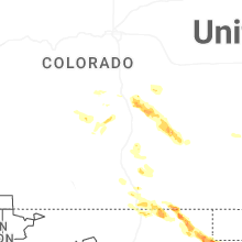
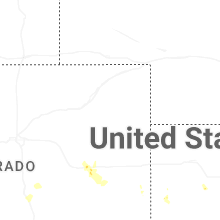
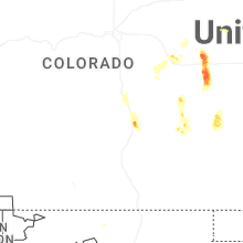
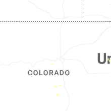
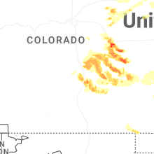
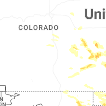
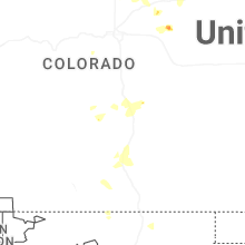
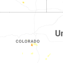
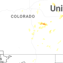
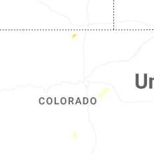
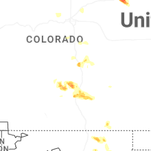

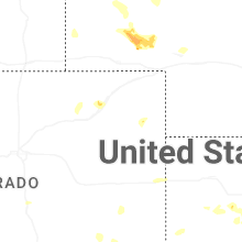
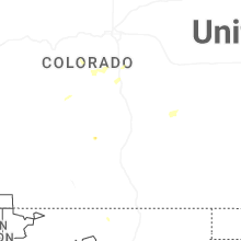
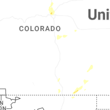
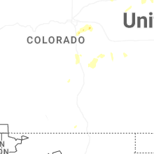

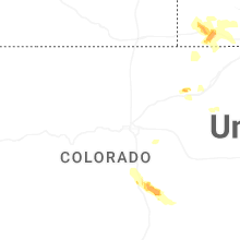
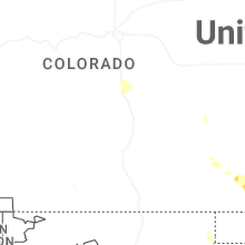
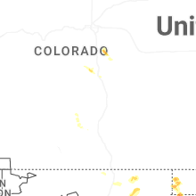
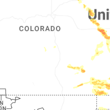
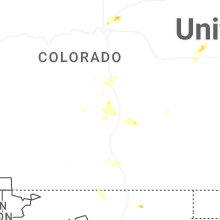

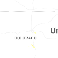
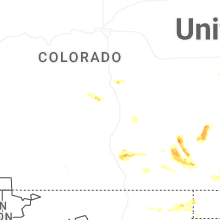
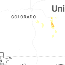
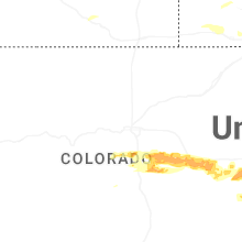


Connect with Interactive Hail Maps