

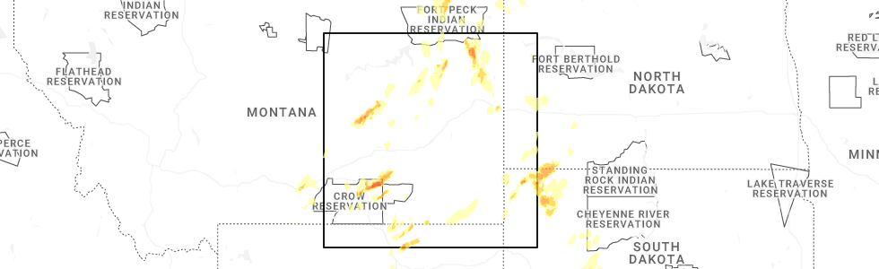
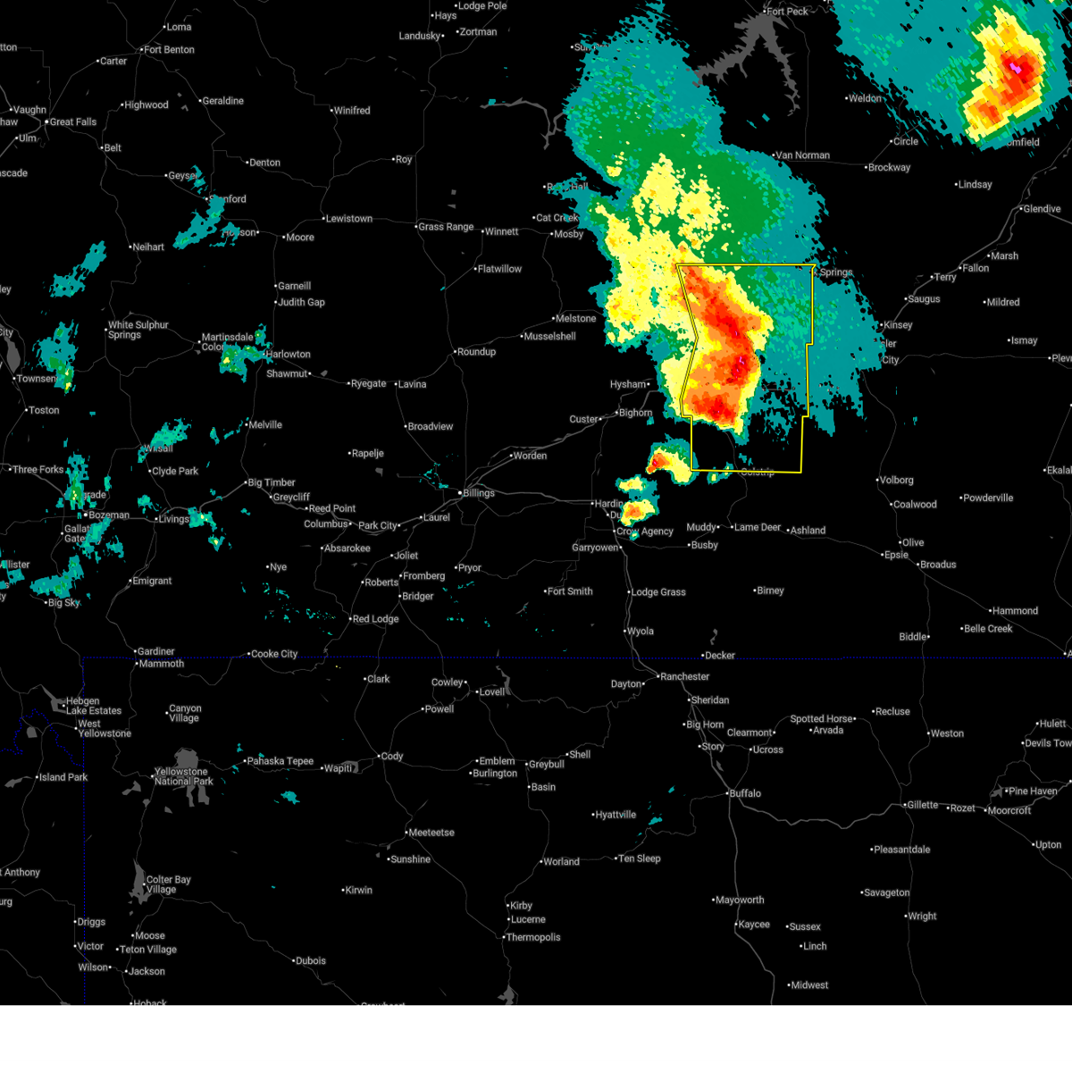
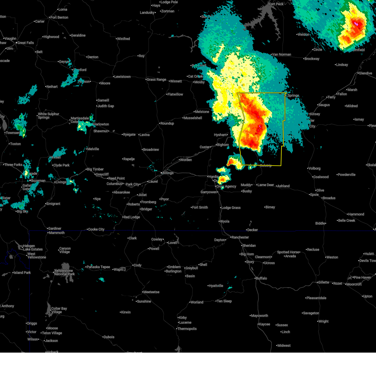
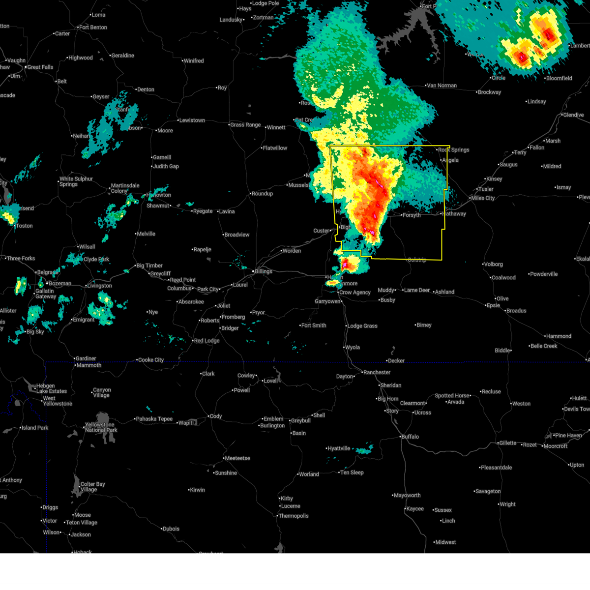
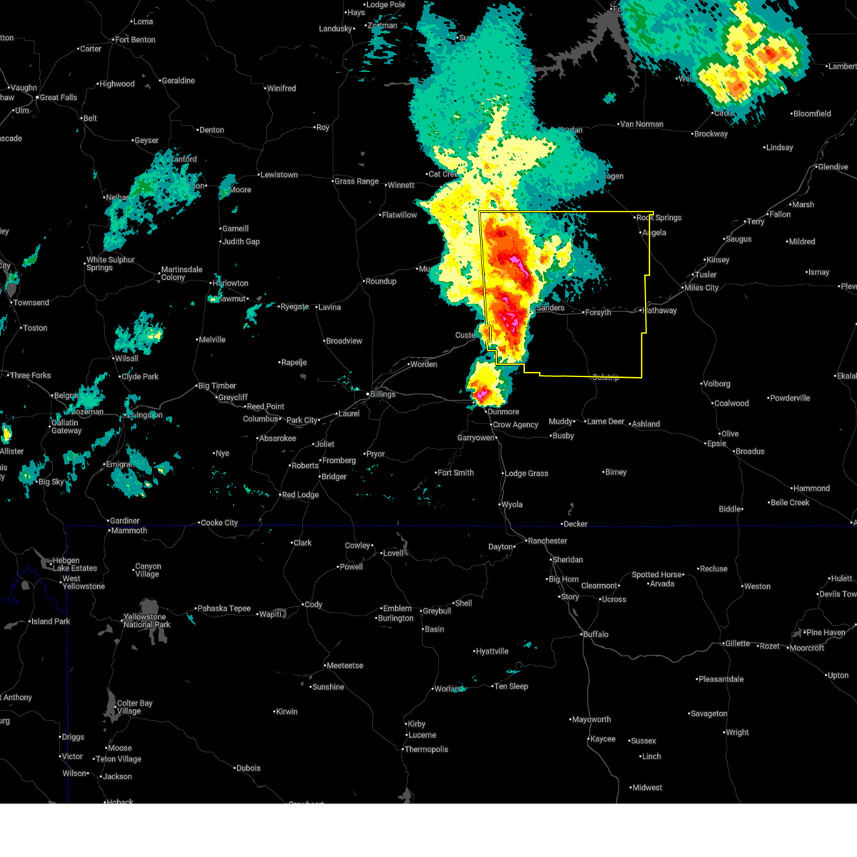
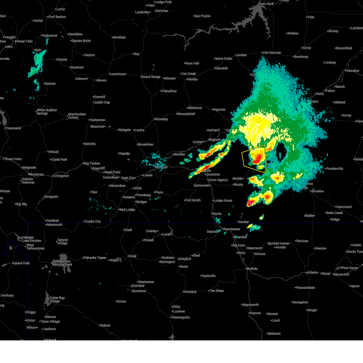
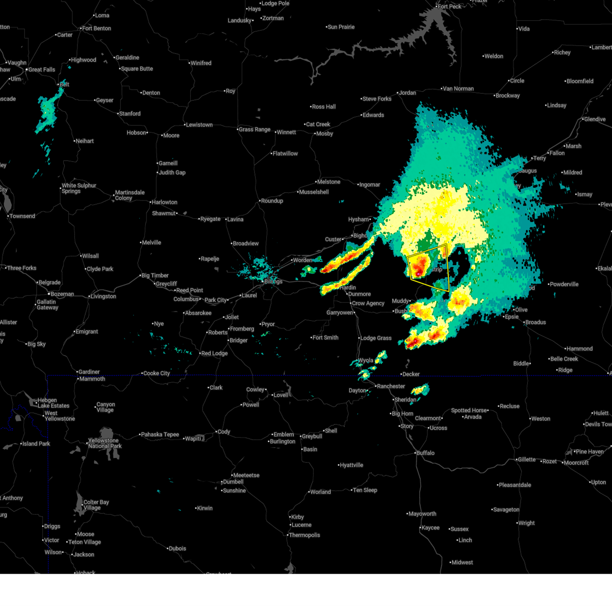
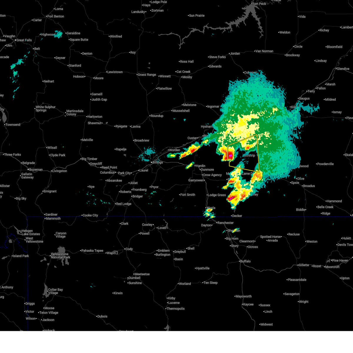
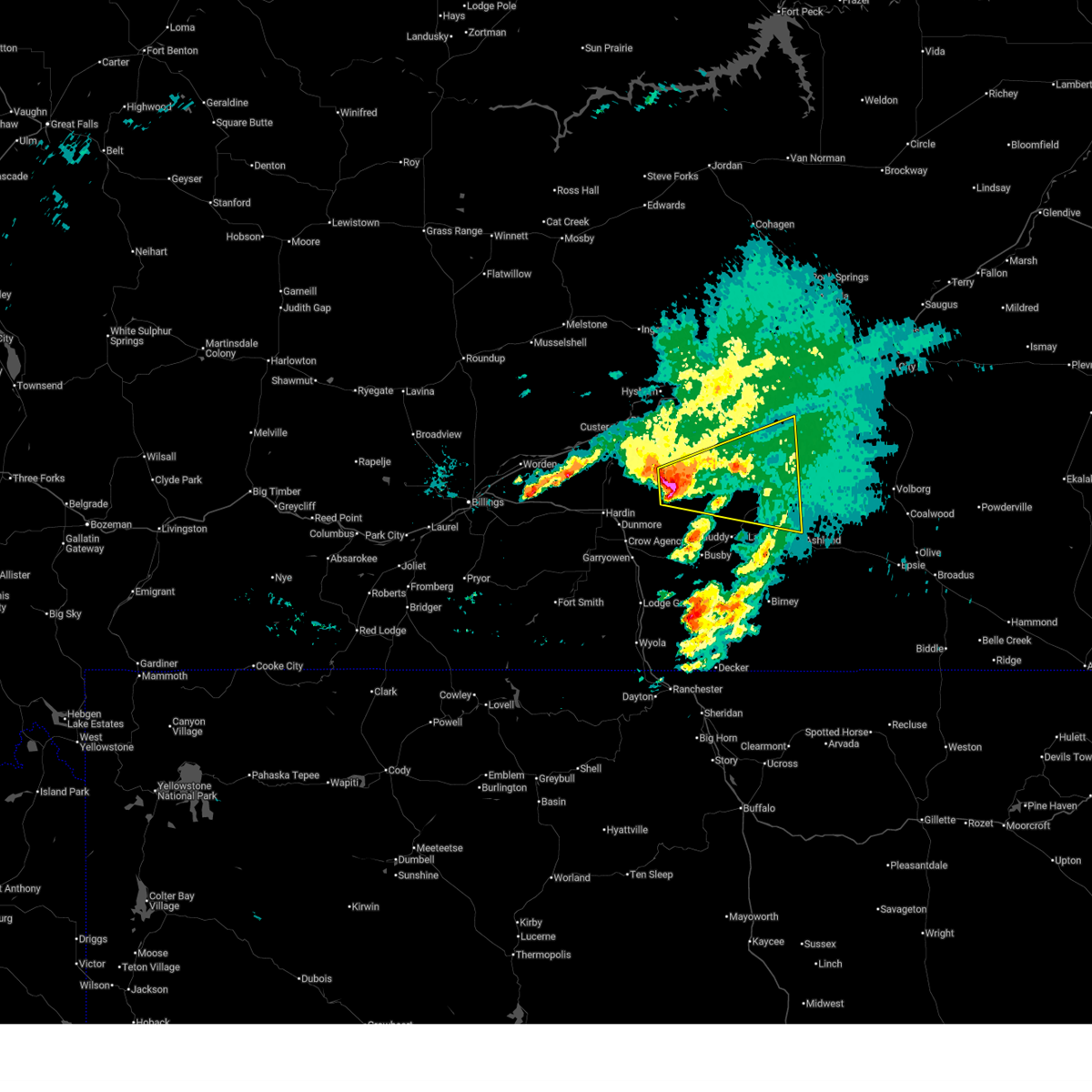
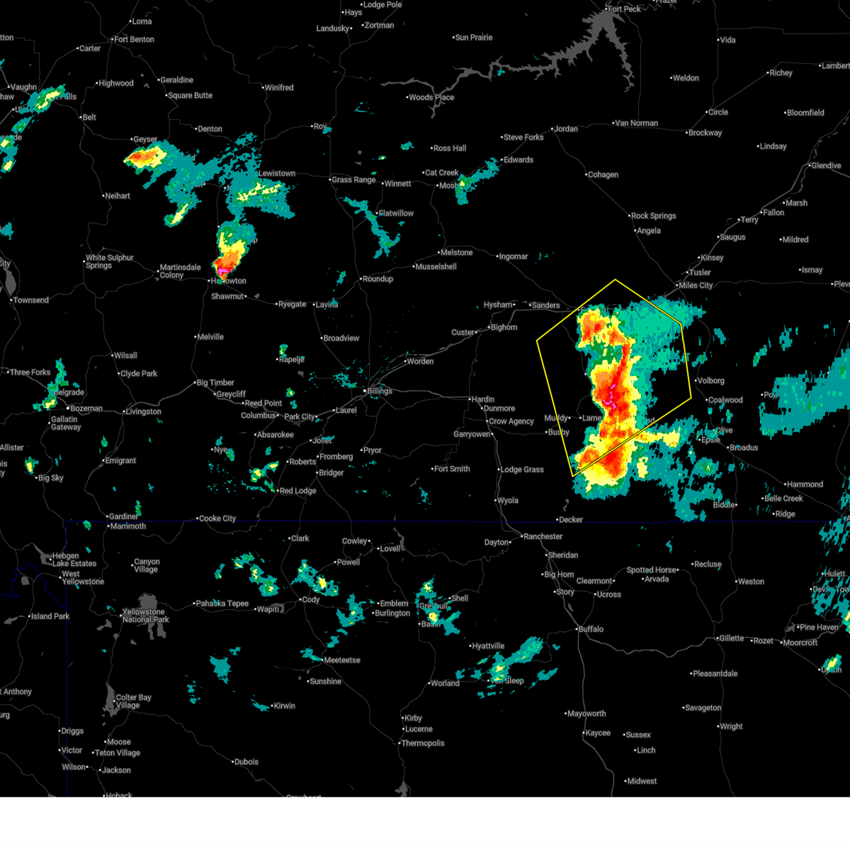
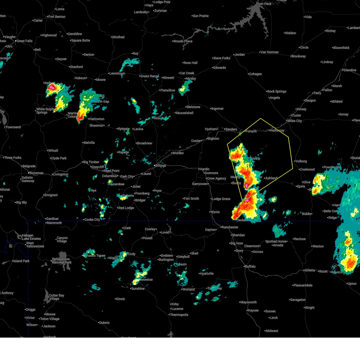
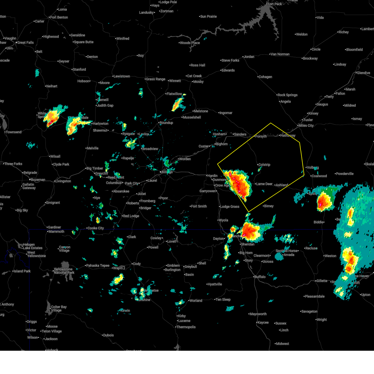
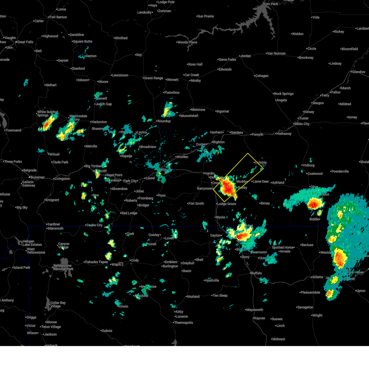
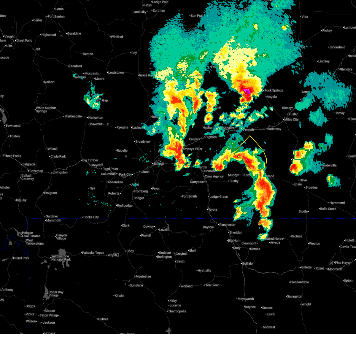
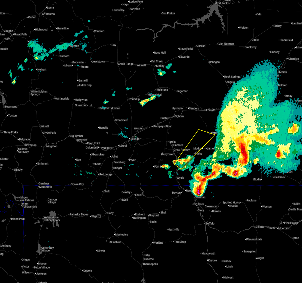
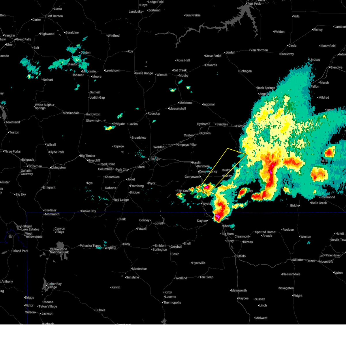
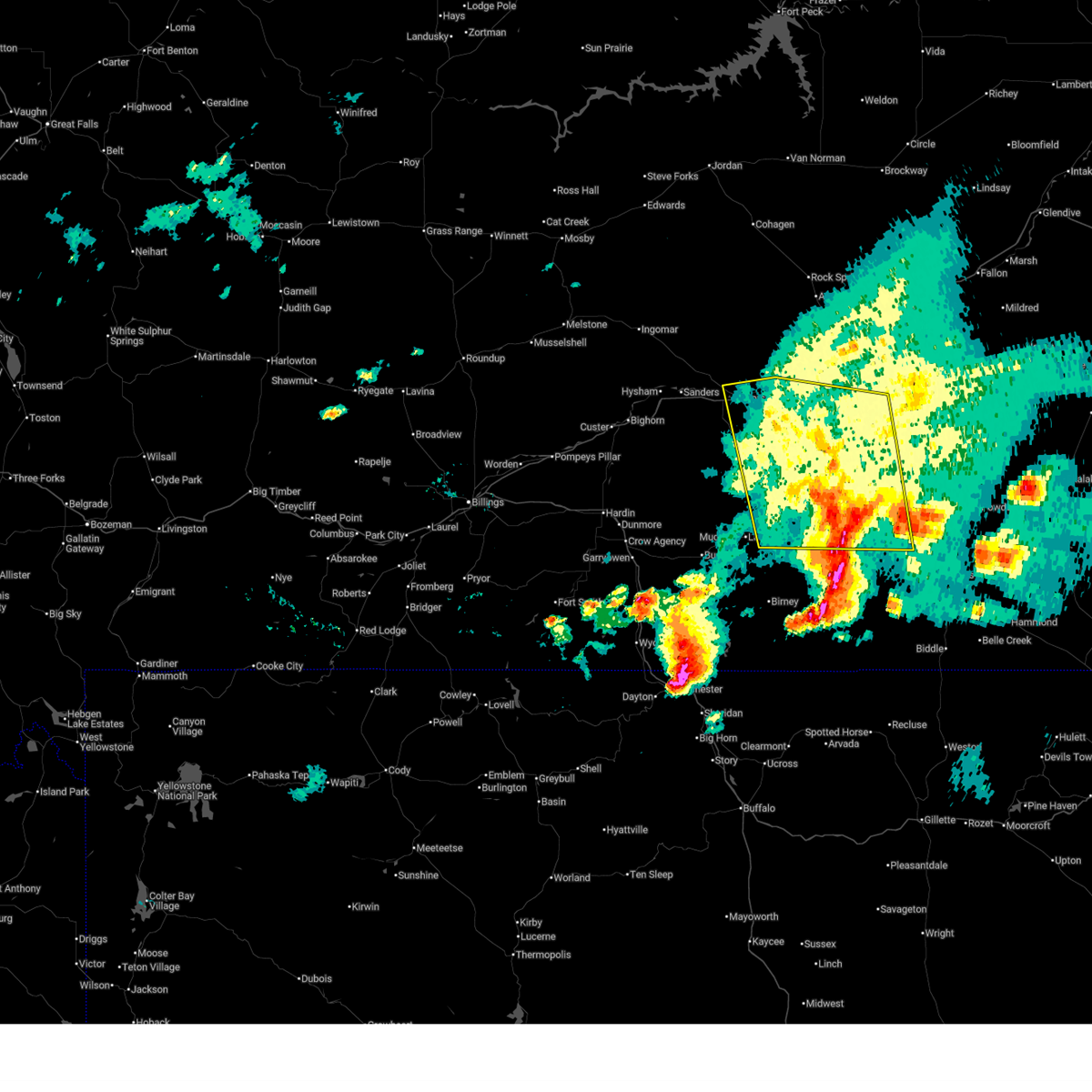
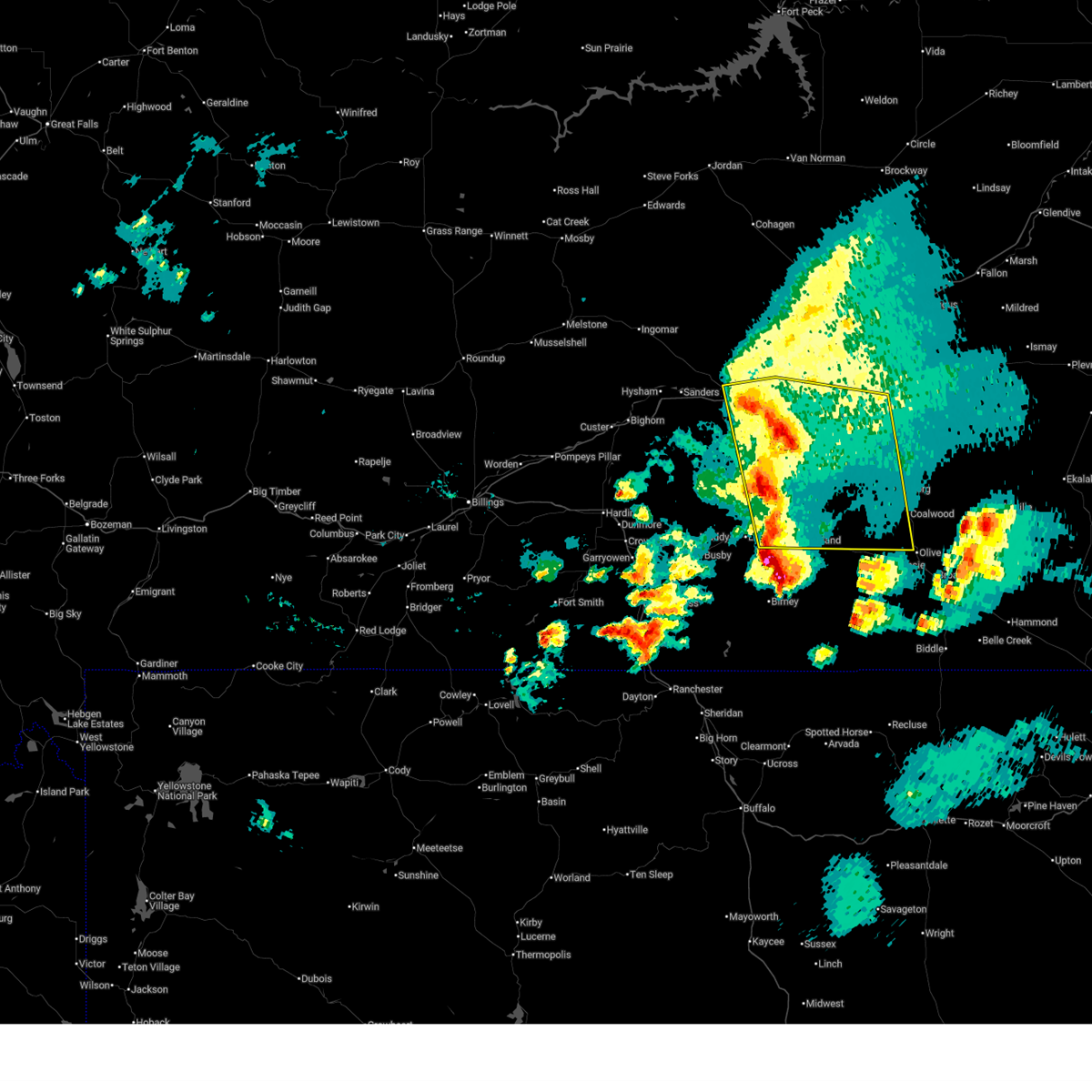
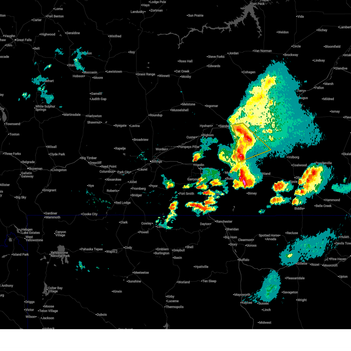
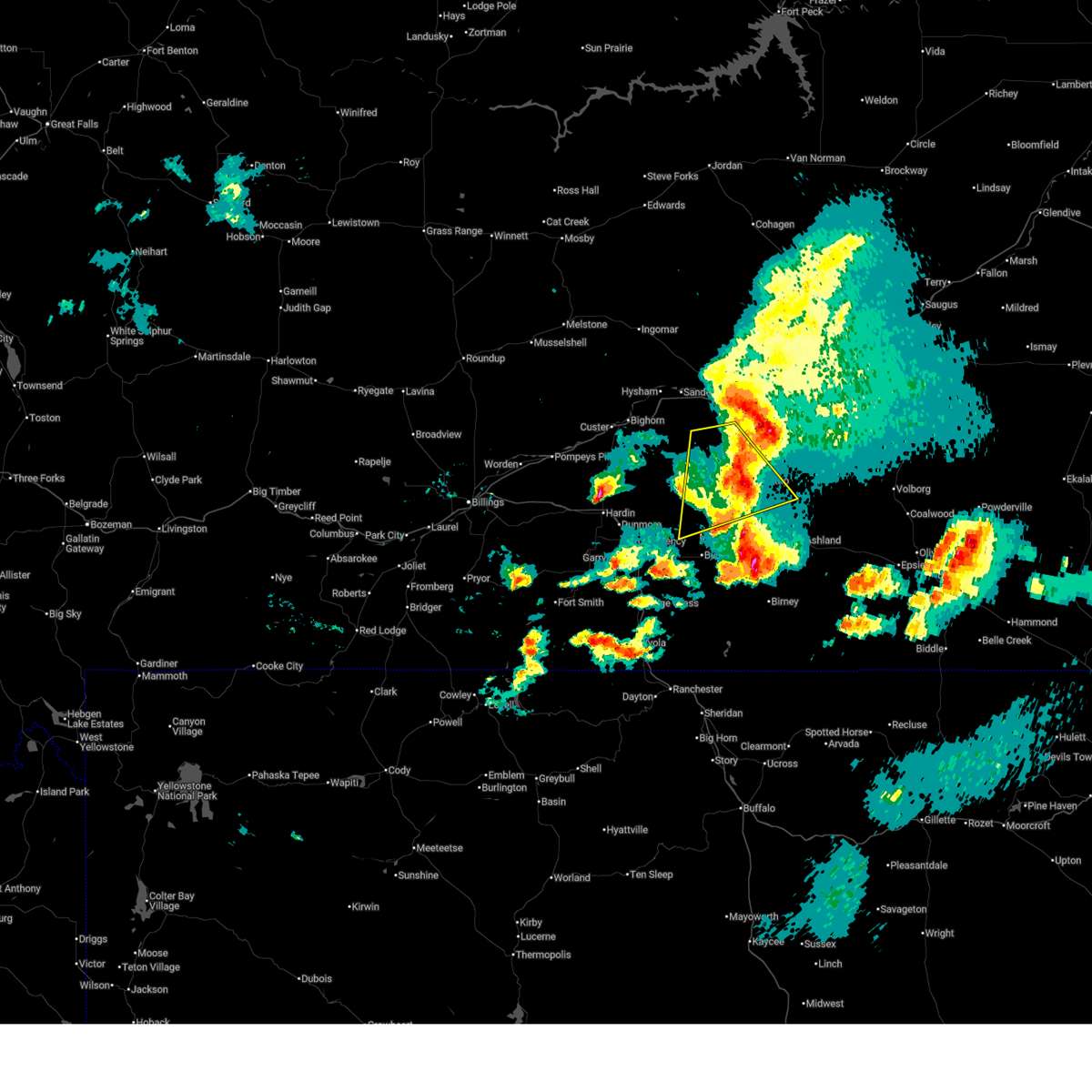
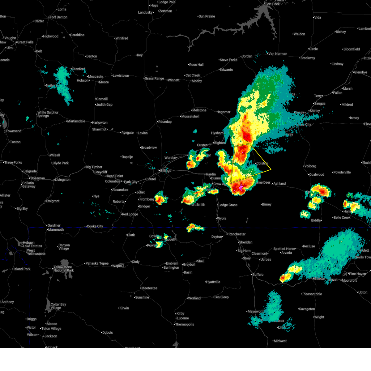
Hail Map for Colstrip, MT
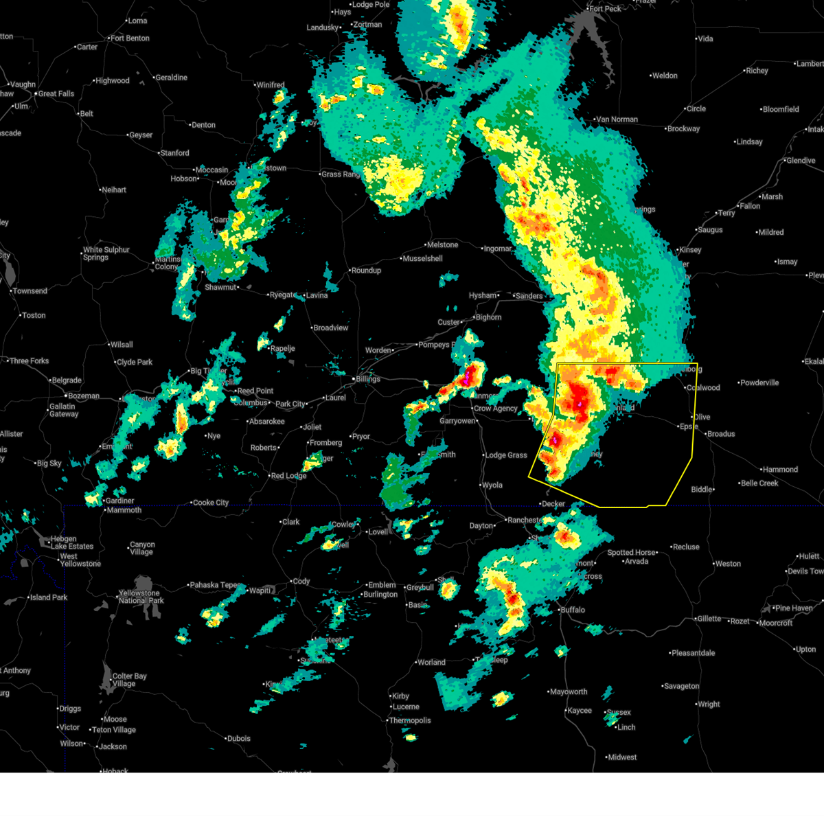
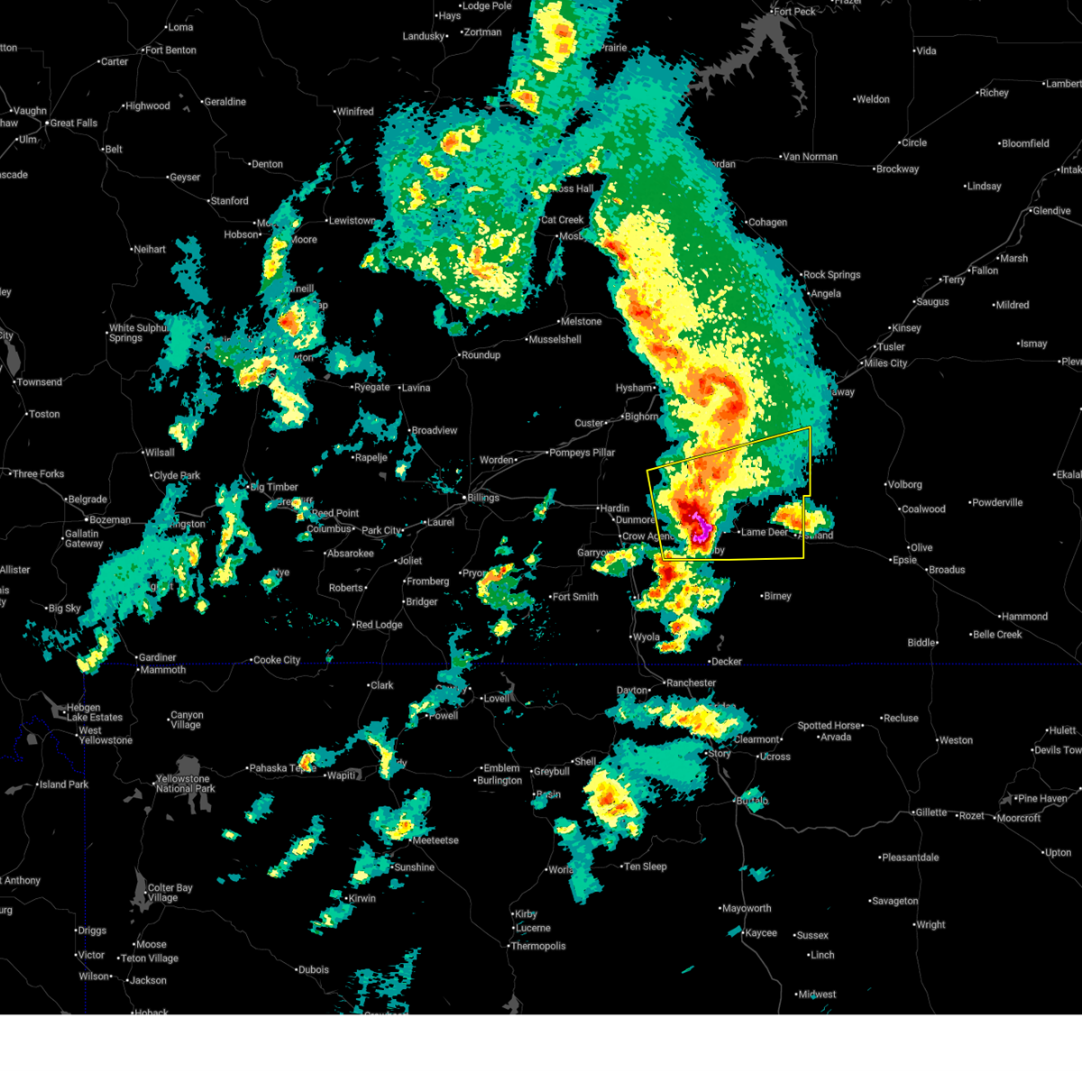
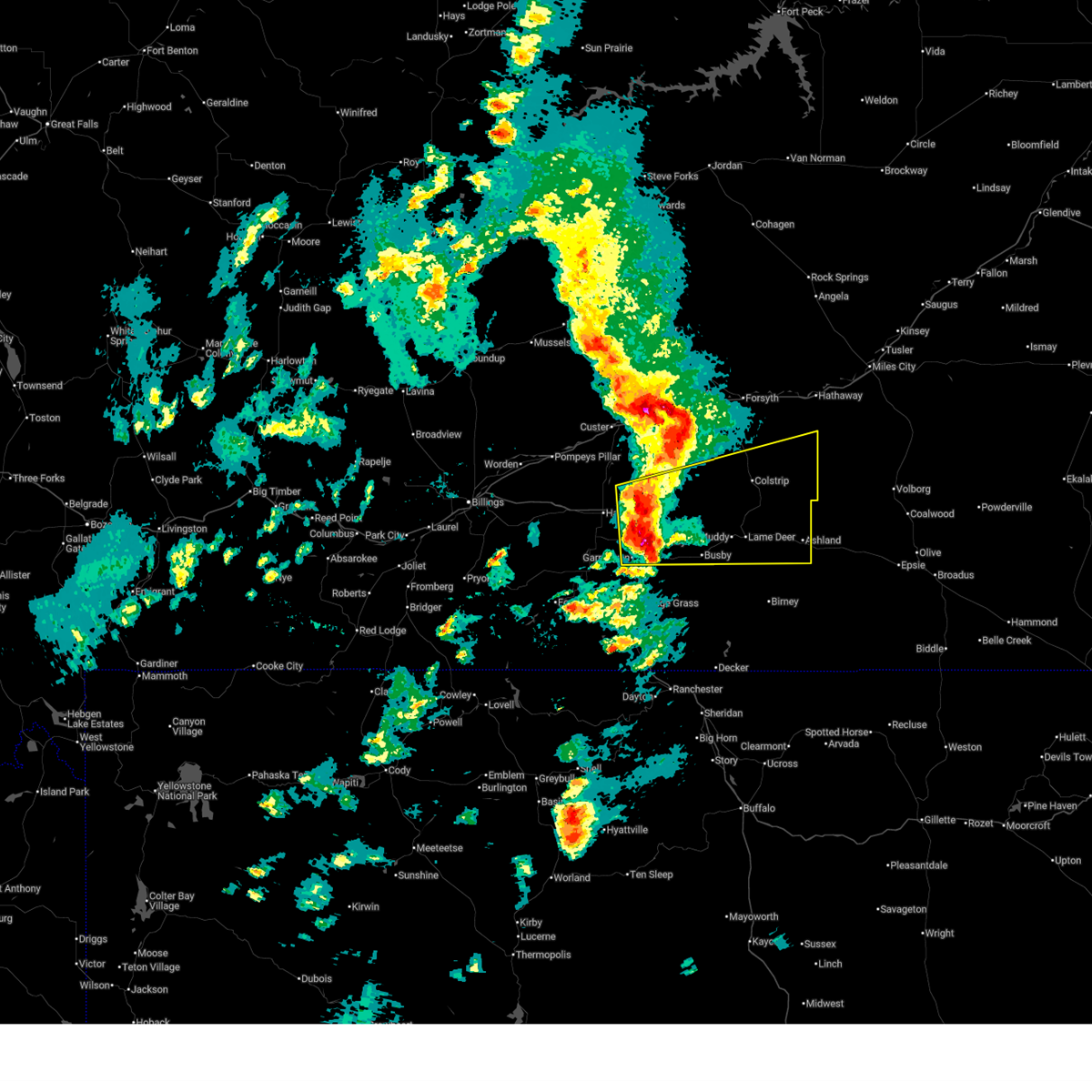
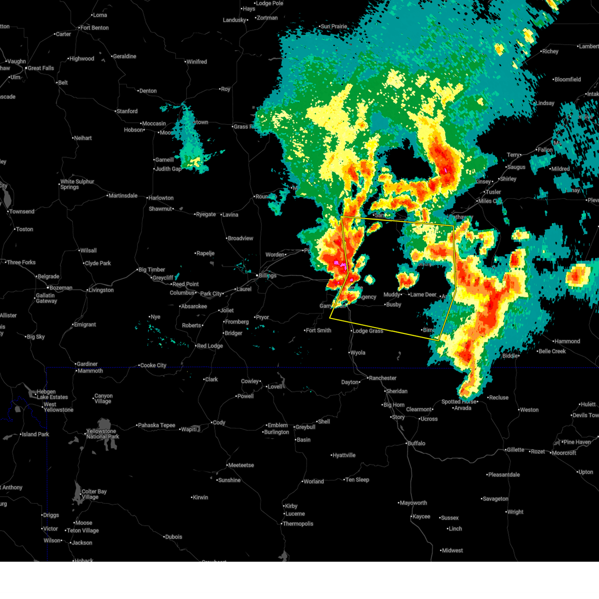
The Colstrip, MT area has had 5 reports of on-the-ground hail by trained spotters, and has been under severe weather warnings 19 times during the past 12 months. Doppler radar has detected hail at or near Colstrip, MT on 39 occasions, including 2 occasions during the past year.
| Name: | Colstrip, MT |
| Where Located: | 51.7 miles SW of Miles City, MT |
| Map: | Google Map for Colstrip, MT |
| Population: | 2214 |
| Housing Units: | 986 |
| More Info: | Search Google for Colstrip, MT |
0
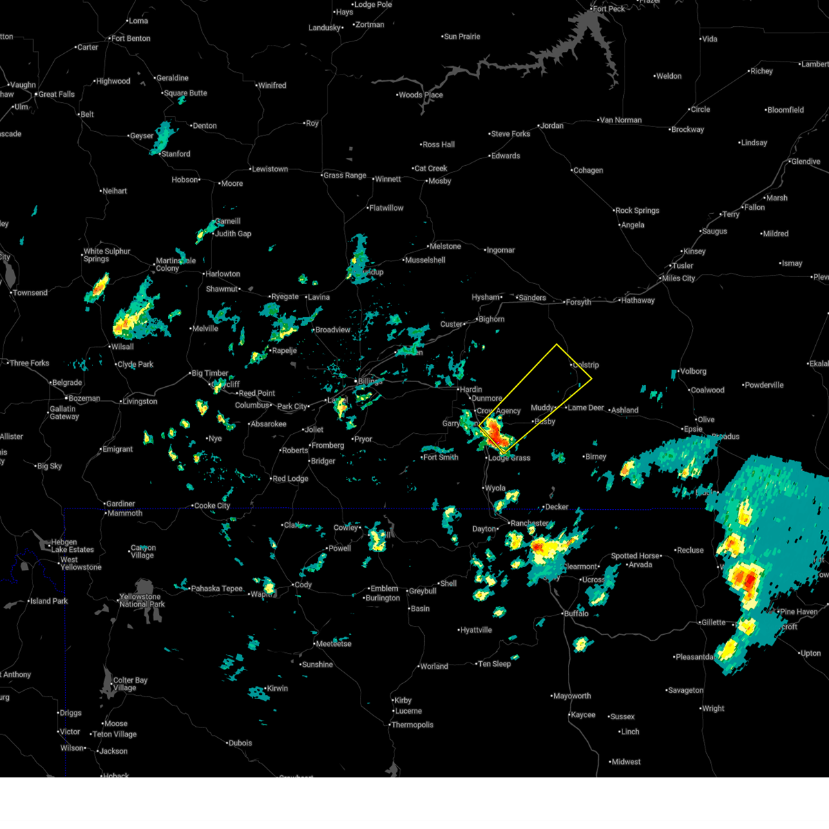
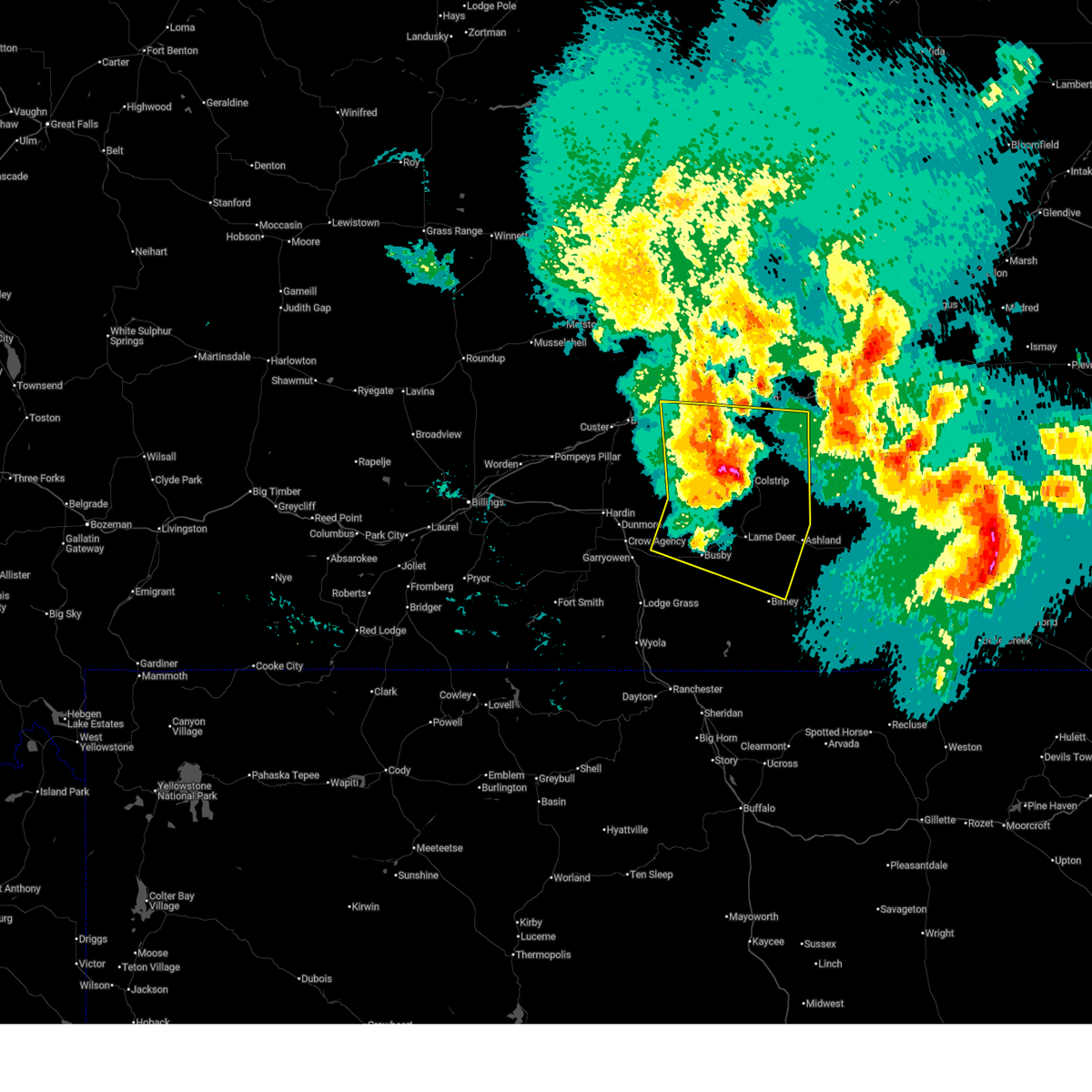
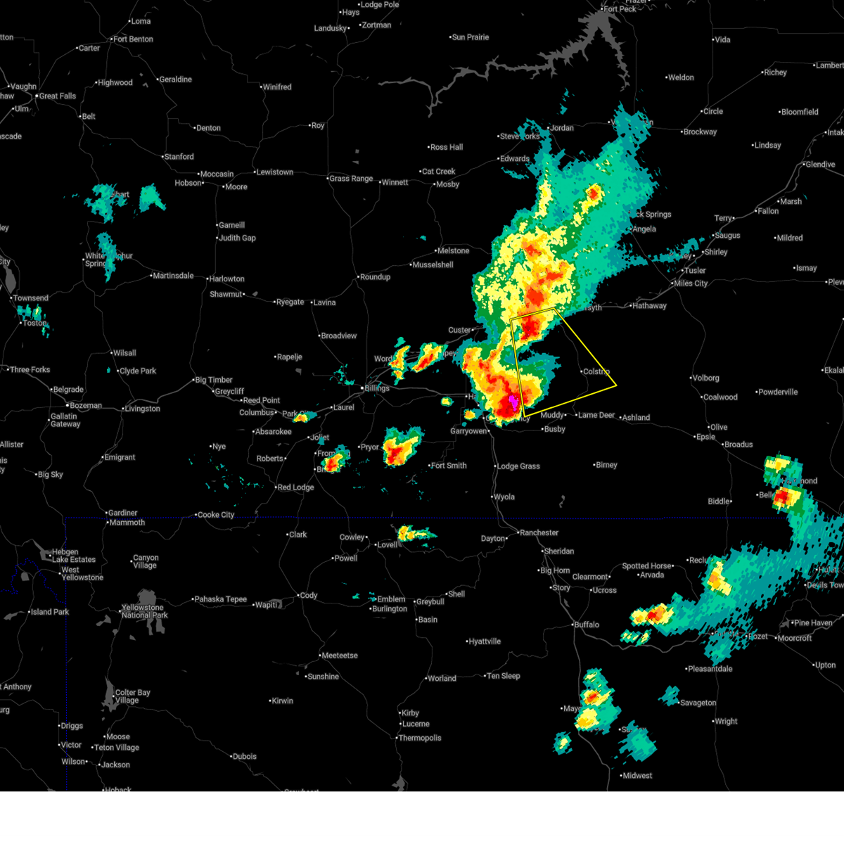
The Top Recent Hail Date for Colstrip, MT is Saturday, June 27, 2026 (30th out of 39)
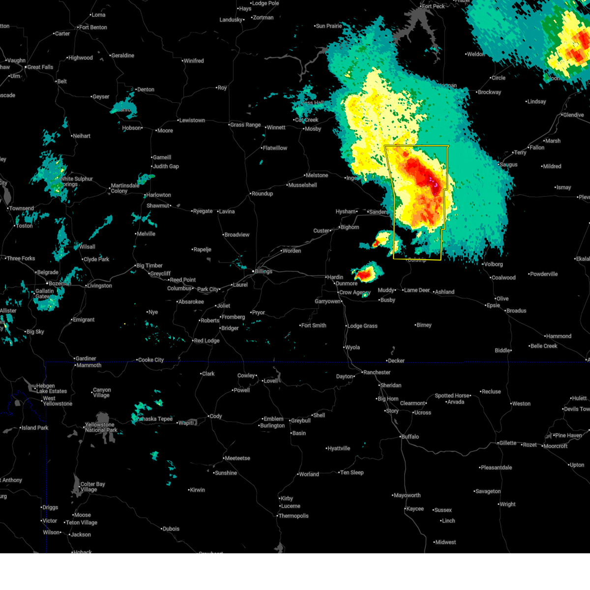
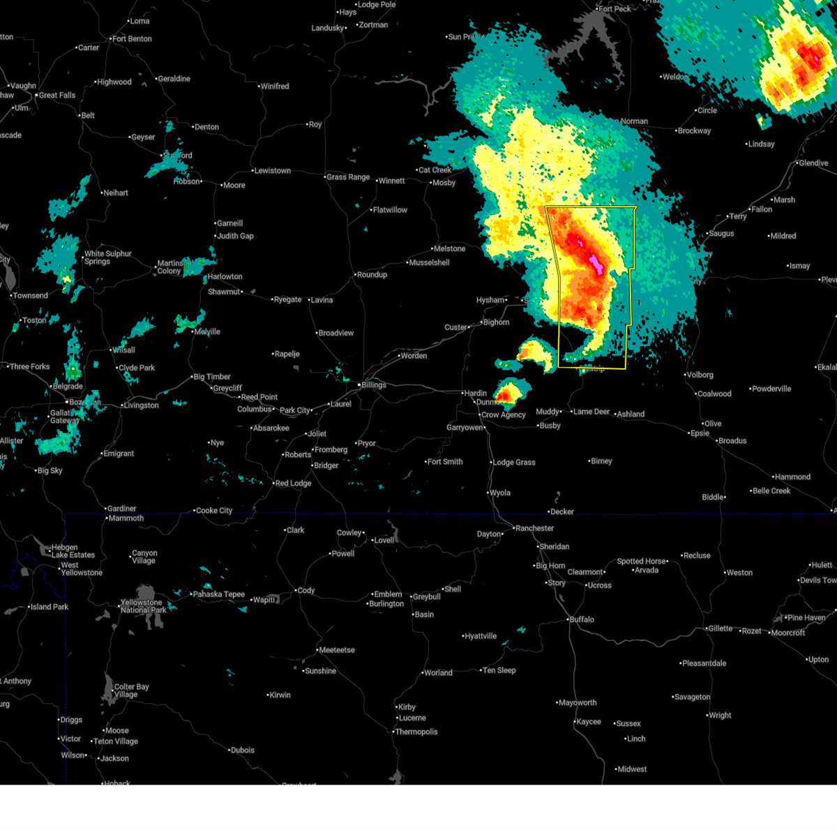
Hail and Wind Damage Spotted near Colstrip, MT
| Date / Time | Report Details |
|---|---|
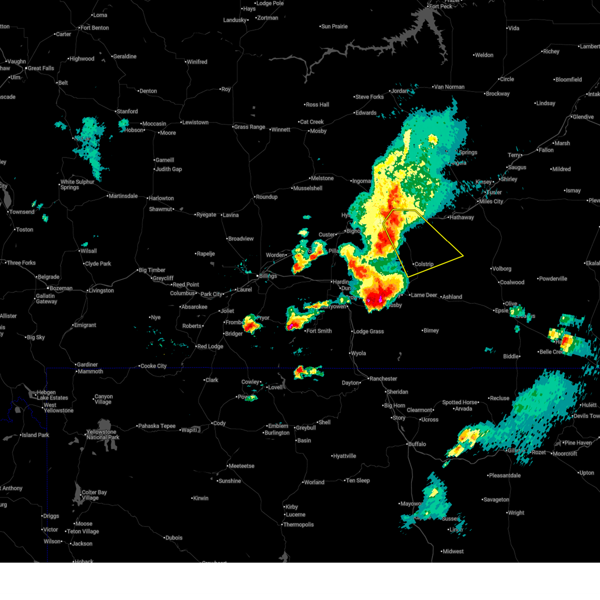
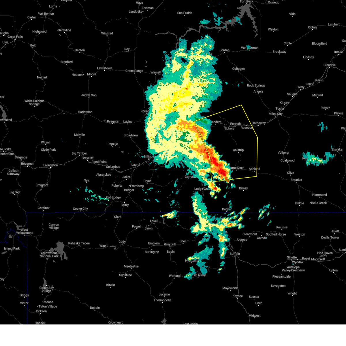
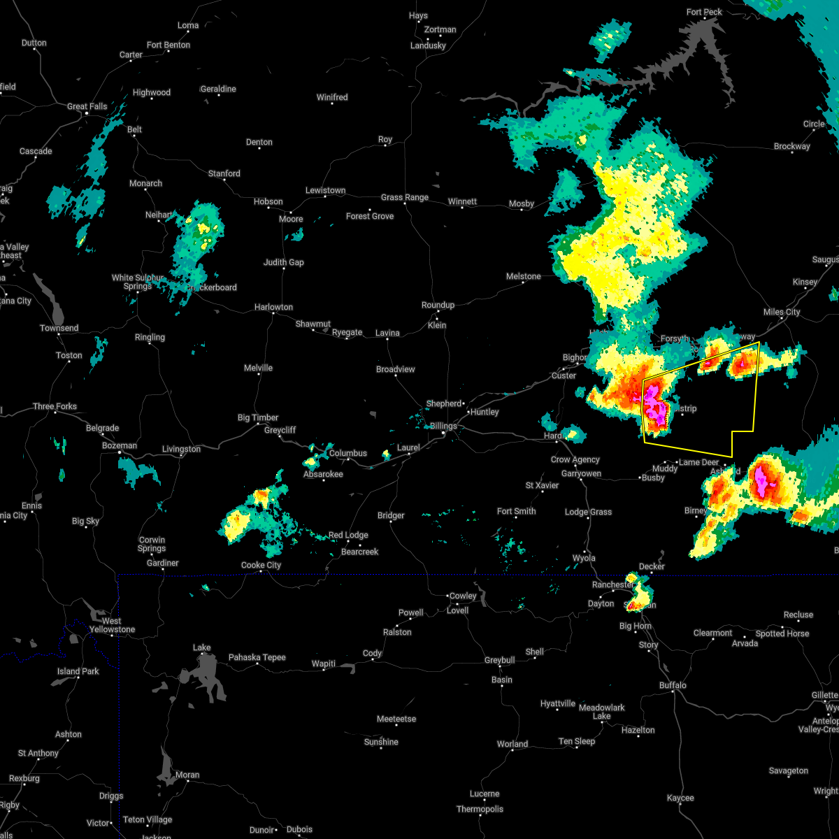
| 6/27/2026 4:53 PM MDT |
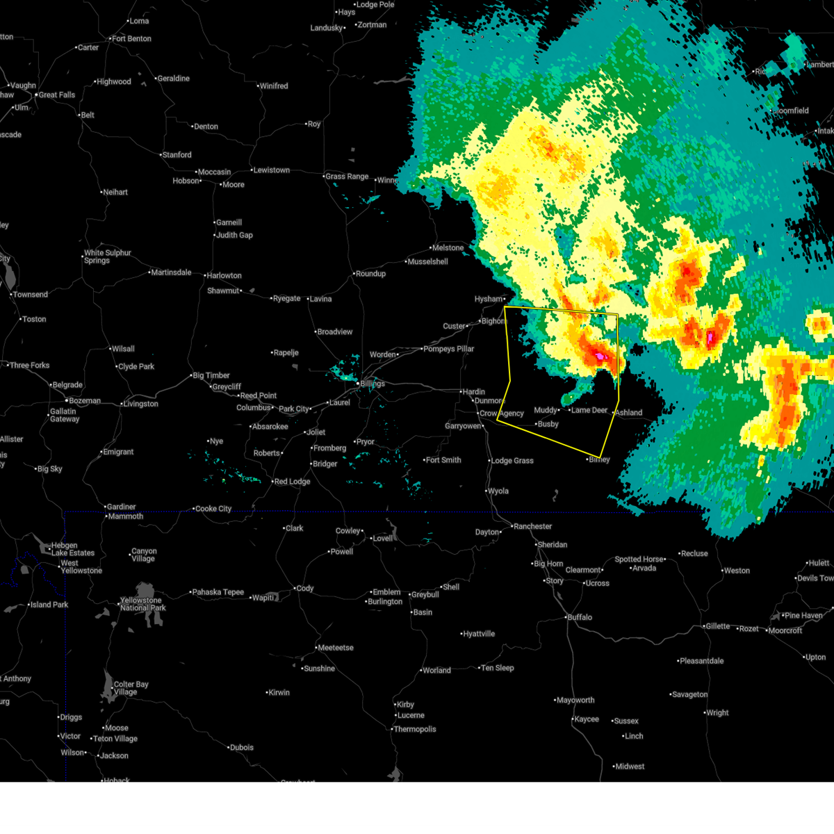
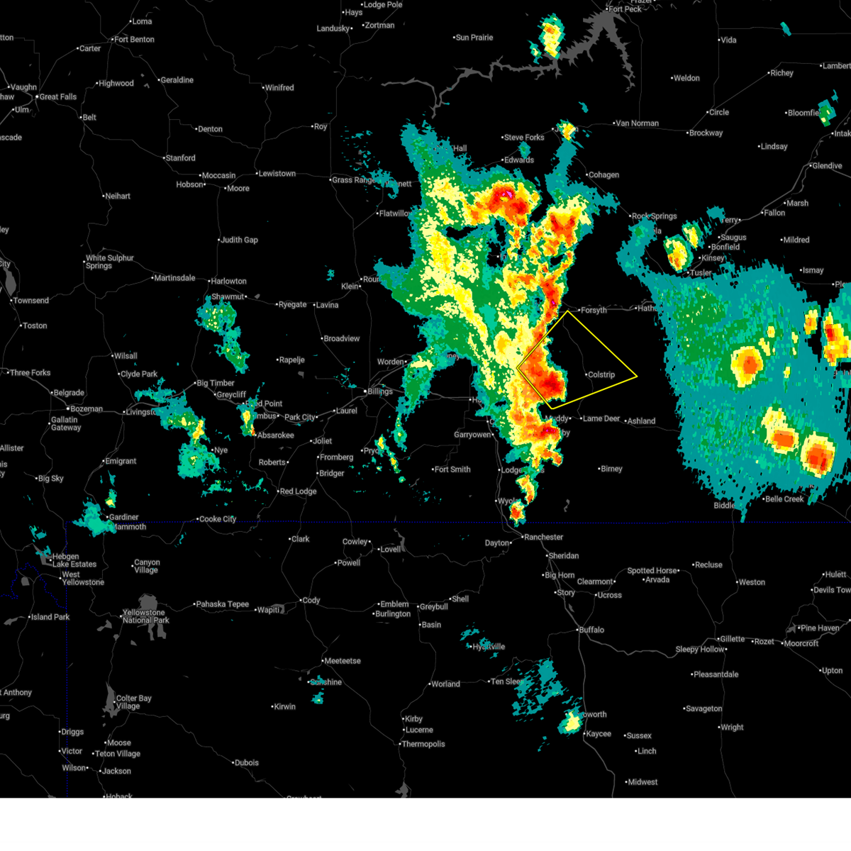 Svrbyz the national weather service in billings has issued a * severe thunderstorm warning for, north central big horn county in south central montana, central rosebud county in southeastern montana, southeastern treasure county in southeastern montana, * until 530 pm mdt. * at 453 pm mdt, a severe thunderstorm was located 10 miles west of colstrip, moving northeast at 35 mph (radar indicated). Hazards include 60 mph wind gusts and quarter size hail. Hail damage to vehicles is expected. Expect wind damage to roofs, siding, and trees. Svrbyz the national weather service in billings has issued a * severe thunderstorm warning for, north central big horn county in south central montana, central rosebud county in southeastern montana, southeastern treasure county in southeastern montana, * until 530 pm mdt. * at 453 pm mdt, a severe thunderstorm was located 10 miles west of colstrip, moving northeast at 35 mph (radar indicated). Hazards include 60 mph wind gusts and quarter size hail. Hail damage to vehicles is expected. Expect wind damage to roofs, siding, and trees.
|
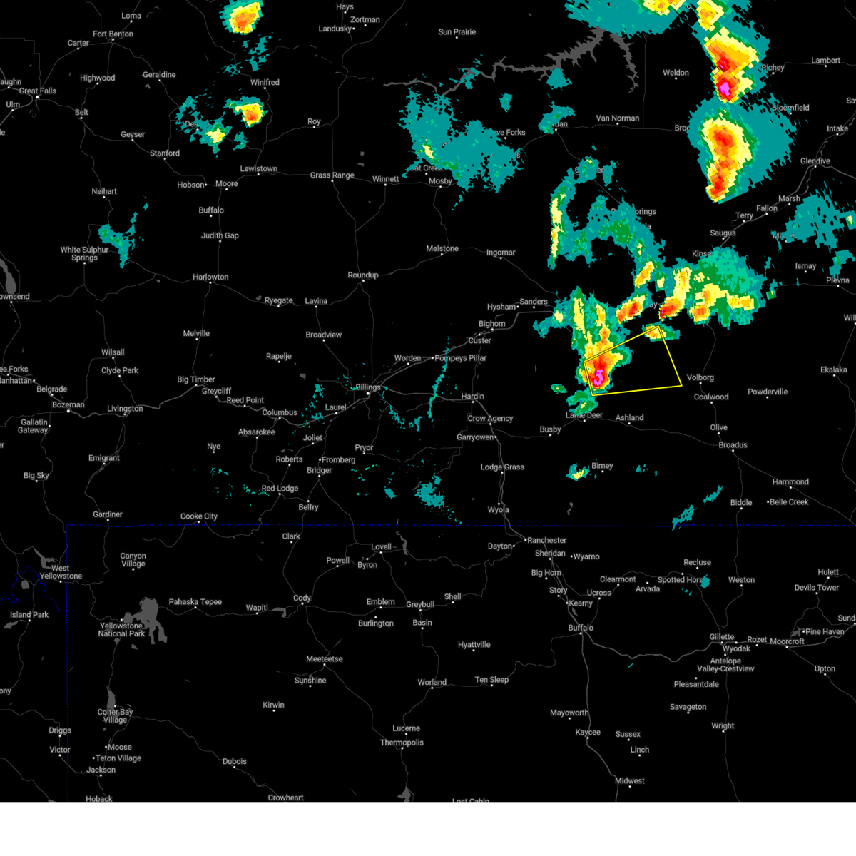
| 8/7/2025 7:55 PM MDT |
 the severe thunderstorm warning has been cancelled and is no longer in effect the severe thunderstorm warning has been cancelled and is no longer in effect
|
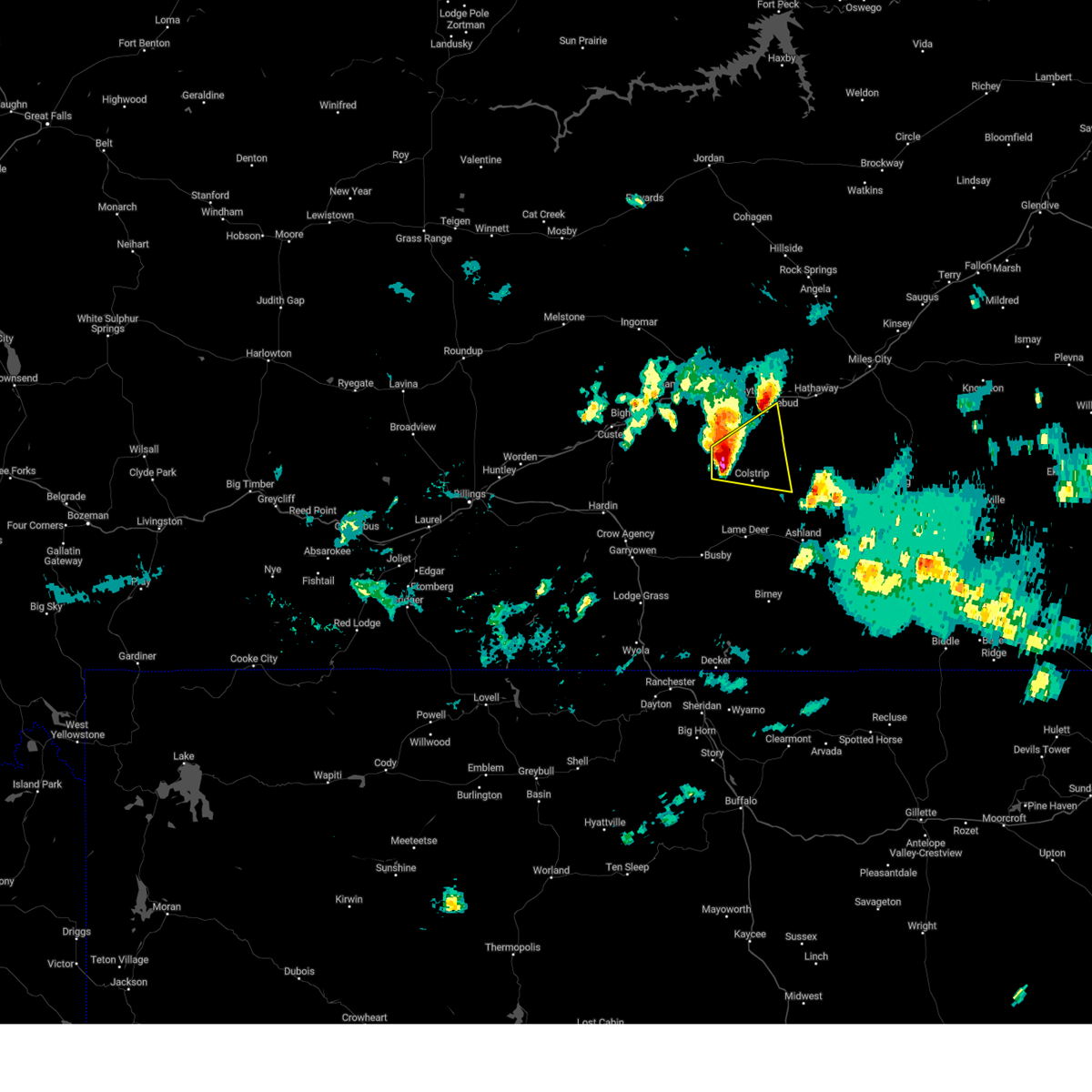
| 8/7/2025 7:48 PM MDT |
 At 748 pm mdt, severe thunderstorms were located along a line from 31 miles northeast of forsyth to 15 miles northeast of colstrip, moving east at 60 mph (sweeney creek mt dot station recorded a 69 mph wind gust at 745 pm). Hazards include 70 mph wind gusts and half dollar size hail. Hail damage to vehicles is expected. expect considerable tree damage. wind damage is also likely to mobile homes, roofs, and outbuildings. Locations impacted include, colstrip, forsyth, rosebud, cartersville, hathaway, angela and rock springs. At 748 pm mdt, severe thunderstorms were located along a line from 31 miles northeast of forsyth to 15 miles northeast of colstrip, moving east at 60 mph (sweeney creek mt dot station recorded a 69 mph wind gust at 745 pm). Hazards include 70 mph wind gusts and half dollar size hail. Hail damage to vehicles is expected. expect considerable tree damage. wind damage is also likely to mobile homes, roofs, and outbuildings. Locations impacted include, colstrip, forsyth, rosebud, cartersville, hathaway, angela and rock springs.
|
| 8/7/2025 7:40 PM MDT |
 At 740 pm mdt, severe thunderstorms were located along a line from 29 miles north of forsyth to 10 miles north of colstrip, moving east at 60 mph (public reported). Hazards include 70 mph wind gusts and half dollar size hail. Hail damage to vehicles is expected. expect considerable tree damage. wind damage is also likely to mobile homes, roofs, and outbuildings. Locations impacted include, colstrip, forsyth, rosebud, cartersville, hathaway, angela and rock springs. At 740 pm mdt, severe thunderstorms were located along a line from 29 miles north of forsyth to 10 miles north of colstrip, moving east at 60 mph (public reported). Hazards include 70 mph wind gusts and half dollar size hail. Hail damage to vehicles is expected. expect considerable tree damage. wind damage is also likely to mobile homes, roofs, and outbuildings. Locations impacted include, colstrip, forsyth, rosebud, cartersville, hathaway, angela and rock springs.
|
| 8/7/2025 7:40 PM MDT |
 the severe thunderstorm warning has been cancelled and is no longer in effect the severe thunderstorm warning has been cancelled and is no longer in effect
|
| 8/7/2025 7:39 PM MDT |
 At 739 pm mdt, severe thunderstorms were located along a line from 28 miles north of forsyth to 10 miles north of colstrip, moving east at 60 mph (mesonet station south of hysham recorded a 64 mph wind gust at 610 pm). Hazards include 70 mph wind gusts and half dollar size hail. Hail damage to vehicles is expected. expect considerable tree damage. wind damage is also likely to mobile homes, roofs, and outbuildings. Locations impacted include, colstrip, forsyth, rosebud, cartersville, hathaway, angela and rock springs. At 739 pm mdt, severe thunderstorms were located along a line from 28 miles north of forsyth to 10 miles north of colstrip, moving east at 60 mph (mesonet station south of hysham recorded a 64 mph wind gust at 610 pm). Hazards include 70 mph wind gusts and half dollar size hail. Hail damage to vehicles is expected. expect considerable tree damage. wind damage is also likely to mobile homes, roofs, and outbuildings. Locations impacted include, colstrip, forsyth, rosebud, cartersville, hathaway, angela and rock springs.
|
| 8/7/2025 7:21 PM MDT |
 At 721 pm mdt, severe thunderstorms were located along a line from 26 miles north of hysham to 20 miles southeast of hysham, moving east at 40 mph (mesonet station south of hysham recorded a 64 mph wind gust at 610 pm). Hazards include 70 mph wind gusts and half dollar size hail. Hail damage to vehicles is expected. expect considerable tree damage. wind damage is also likely to mobile homes, roofs, and outbuildings. Locations impacted include, colstrip, forsyth, hysham, rosebud, vananda, cartersville, ingomar, hathaway, bighorn, angela and rock springs. At 721 pm mdt, severe thunderstorms were located along a line from 26 miles north of hysham to 20 miles southeast of hysham, moving east at 40 mph (mesonet station south of hysham recorded a 64 mph wind gust at 610 pm). Hazards include 70 mph wind gusts and half dollar size hail. Hail damage to vehicles is expected. expect considerable tree damage. wind damage is also likely to mobile homes, roofs, and outbuildings. Locations impacted include, colstrip, forsyth, hysham, rosebud, vananda, cartersville, ingomar, hathaway, bighorn, angela and rock springs.
|
| 8/7/2025 7:08 PM MDT |
 Svrbyz the national weather service in billings has issued a * severe thunderstorm warning for, rosebud county in southeastern montana, treasure county in southeastern montana, * until 845 pm mdt. * at 708 pm mdt, severe thunderstorms were located along a line from 25 miles north of hysham to 19 miles south of hysham, moving east at 40 mph (radar indicated). Hazards include 70 mph wind gusts and half dollar size hail. Hail damage to vehicles is expected. expect considerable tree damage. Wind damage is also likely to mobile homes, roofs, and outbuildings. Svrbyz the national weather service in billings has issued a * severe thunderstorm warning for, rosebud county in southeastern montana, treasure county in southeastern montana, * until 845 pm mdt. * at 708 pm mdt, severe thunderstorms were located along a line from 25 miles north of hysham to 19 miles south of hysham, moving east at 40 mph (radar indicated). Hazards include 70 mph wind gusts and half dollar size hail. Hail damage to vehicles is expected. expect considerable tree damage. Wind damage is also likely to mobile homes, roofs, and outbuildings.
|
| 7/29/2025 1:48 AM MDT |
 the severe thunderstorm warning has been cancelled and is no longer in effect the severe thunderstorm warning has been cancelled and is no longer in effect
|
| 7/29/2025 1:32 AM MDT |
 At 132 am mdt, a severe thunderstorm was located near colstrip, moving east at 35 mph (radar indicated). Hazards include 60 mph wind gusts and quarter size hail. Hail damage to vehicles is expected. expect wind damage to roofs, siding, and trees. Locations impacted include, colstrip. At 132 am mdt, a severe thunderstorm was located near colstrip, moving east at 35 mph (radar indicated). Hazards include 60 mph wind gusts and quarter size hail. Hail damage to vehicles is expected. expect wind damage to roofs, siding, and trees. Locations impacted include, colstrip.
|
| 7/29/2025 1:18 AM MDT |
 At 118 am mdt, a severe thunderstorm was located 11 miles west of colstrip, moving east at 40 mph (radar indicated. this storm has a history of producing large hail and damaging wind gusts). Hazards include 60 mph wind gusts and quarter size hail. Hail damage to vehicles is expected. expect wind damage to roofs, siding, and trees. Locations impacted include, colstrip and northern cheyenne indian reservation. At 118 am mdt, a severe thunderstorm was located 11 miles west of colstrip, moving east at 40 mph (radar indicated. this storm has a history of producing large hail and damaging wind gusts). Hazards include 60 mph wind gusts and quarter size hail. Hail damage to vehicles is expected. expect wind damage to roofs, siding, and trees. Locations impacted include, colstrip and northern cheyenne indian reservation.
|
| 7/29/2025 1:18 AM MDT |
 the severe thunderstorm warning has been cancelled and is no longer in effect the severe thunderstorm warning has been cancelled and is no longer in effect
|
| 7/29/2025 12:56 AM MDT |
 Svrbyz the national weather service in billings has issued a * severe thunderstorm warning for, northeast big horn county in south central montana, central rosebud county in southeastern montana, southeastern treasure county in southeastern montana, * until 200 am mdt. * at 1256 am mdt, a severe thunderstorm was located 24 miles north of busby, or 24 miles east of hardin, moving east at 30 mph (radar indicated. this storm has a history of producing large hail and damaging wind gusts). Hazards include 60 mph wind gusts and quarter size hail. Hail damage to vehicles is expected. Expect wind damage to roofs, siding, and trees. Svrbyz the national weather service in billings has issued a * severe thunderstorm warning for, northeast big horn county in south central montana, central rosebud county in southeastern montana, southeastern treasure county in southeastern montana, * until 200 am mdt. * at 1256 am mdt, a severe thunderstorm was located 24 miles north of busby, or 24 miles east of hardin, moving east at 30 mph (radar indicated. this storm has a history of producing large hail and damaging wind gusts). Hazards include 60 mph wind gusts and quarter size hail. Hail damage to vehicles is expected. Expect wind damage to roofs, siding, and trees.
|
| 7/21/2025 5:29 PM MDT |
 The severe thunderstorm warning that was previously in effect has been reissued for custer, rosebud, and powder river counties and is in effect until 630 pm mdt. please refer to that bulletin for the latest severe weather information. a severe thunderstorm watch remains in effect until 1100 pm mdt monday for portions of south central and southeast montana. The severe thunderstorm warning that was previously in effect has been reissued for custer, rosebud, and powder river counties and is in effect until 630 pm mdt. please refer to that bulletin for the latest severe weather information. a severe thunderstorm watch remains in effect until 1100 pm mdt monday for portions of south central and southeast montana.
|
| 7/21/2025 5:06 PM MDT |
 At 506 pm mdt, severe thunderstorms were located along a line from 11 miles south of forsyth to near ashland, or along a line from 11 miles south of forsyth to 24 miles southeast of colstrip, moving northeast at 50 mph (radar indicated). Hazards include 70 mph wind gusts and ping pong ball size hail. People and animals outdoors will be injured. expect hail damage to roofs, siding, windows, and vehicles. expect considerable tree damage. wind damage is also likely to mobile homes, roofs, and outbuildings. Locations impacted include, colstrip, forsyth, ashland, lame deer, rosebud, brandenberg, cartersville, hathaway, moon creek ranch, birney village, garland, muddy cluster and northern cheyenne indian reservation. At 506 pm mdt, severe thunderstorms were located along a line from 11 miles south of forsyth to near ashland, or along a line from 11 miles south of forsyth to 24 miles southeast of colstrip, moving northeast at 50 mph (radar indicated). Hazards include 70 mph wind gusts and ping pong ball size hail. People and animals outdoors will be injured. expect hail damage to roofs, siding, windows, and vehicles. expect considerable tree damage. wind damage is also likely to mobile homes, roofs, and outbuildings. Locations impacted include, colstrip, forsyth, ashland, lame deer, rosebud, brandenberg, cartersville, hathaway, moon creek ranch, birney village, garland, muddy cluster and northern cheyenne indian reservation.
|
| 7/21/2025 4:52 PM MDT |
 The severe thunderstorm warning that was previously in effect has been reissued for rosebud and big horn counties and is in effect until 530 pm mdt. please refer to that bulletin for the latest severe weather information. a severe thunderstorm watch remains in effect until 1100 pm mdt monday for portions of south central and southeast montana. The severe thunderstorm warning that was previously in effect has been reissued for rosebud and big horn counties and is in effect until 530 pm mdt. please refer to that bulletin for the latest severe weather information. a severe thunderstorm watch remains in effect until 1100 pm mdt monday for portions of south central and southeast montana.
|
| 7/21/2025 4:32 PM MDT |
 Svrbyz the national weather service in billings has issued a * severe thunderstorm warning for, northeastern big horn county in south central montana, southwestern custer county in southeastern montana, northwestern powder river county in southeastern montana, southern rosebud county in southeastern montana, southeastern treasure county in southeastern montana, * until 530 pm mdt. * at 432 pm mdt, severe thunderstorms were located along a line from 23 miles northeast of crow agency to 12 miles southeast of busby, or along a line from 22 miles northeast of hardin to 34 miles south of colstrip, moving northeast at 50 mph. this replaces the previous warning for this area (radar indicated). Hazards include 70 mph wind gusts and ping pong ball size hail. People and animals outdoors will be injured. expect hail damage to roofs, siding, windows, and vehicles. expect considerable tree damage. Wind damage is also likely to mobile homes, roofs, and outbuildings. Svrbyz the national weather service in billings has issued a * severe thunderstorm warning for, northeastern big horn county in south central montana, southwestern custer county in southeastern montana, northwestern powder river county in southeastern montana, southern rosebud county in southeastern montana, southeastern treasure county in southeastern montana, * until 530 pm mdt. * at 432 pm mdt, severe thunderstorms were located along a line from 23 miles northeast of crow agency to 12 miles southeast of busby, or along a line from 22 miles northeast of hardin to 34 miles south of colstrip, moving northeast at 50 mph. this replaces the previous warning for this area (radar indicated). Hazards include 70 mph wind gusts and ping pong ball size hail. People and animals outdoors will be injured. expect hail damage to roofs, siding, windows, and vehicles. expect considerable tree damage. Wind damage is also likely to mobile homes, roofs, and outbuildings.
|
| 7/21/2025 4:12 PM MDT |
 At 412 pm mdt, a severe thunderstorm was located 8 miles west of busby, or 27 miles southeast of hardin, moving northeast at 40 mph (radar indicated). Hazards include ping pong ball size hail and 60 mph wind gusts. People and animals outdoors will be injured. expect hail damage to roofs, siding, windows, and vehicles. expect wind damage to roofs, siding, and trees. Locations impacted include, colstrip, busby, northern cheyenne indian reservation and crow indian reservation. At 412 pm mdt, a severe thunderstorm was located 8 miles west of busby, or 27 miles southeast of hardin, moving northeast at 40 mph (radar indicated). Hazards include ping pong ball size hail and 60 mph wind gusts. People and animals outdoors will be injured. expect hail damage to roofs, siding, windows, and vehicles. expect wind damage to roofs, siding, and trees. Locations impacted include, colstrip, busby, northern cheyenne indian reservation and crow indian reservation.
|
| 7/21/2025 4:00 PM MDT |
 Svrbyz the national weather service in billings has issued a * severe thunderstorm warning for, northeastern big horn county in south central montana, central rosebud county in southeastern montana, * until 500 pm mdt. * at 400 pm mdt, a severe thunderstorm was located 11 miles northeast of lodge grass, or 26 miles southeast of hardin, moving northeast at 40 mph (radar indicated). Hazards include 60 mph wind gusts and quarter size hail. Hail damage to vehicles is expected. Expect wind damage to roofs, siding, and trees. Svrbyz the national weather service in billings has issued a * severe thunderstorm warning for, northeastern big horn county in south central montana, central rosebud county in southeastern montana, * until 500 pm mdt. * at 400 pm mdt, a severe thunderstorm was located 11 miles northeast of lodge grass, or 26 miles southeast of hardin, moving northeast at 40 mph (radar indicated). Hazards include 60 mph wind gusts and quarter size hail. Hail damage to vehicles is expected. Expect wind damage to roofs, siding, and trees.
|
| 7/5/2025 4:11 PM MDT |
 Svrbyz the national weather service in billings has issued a * severe thunderstorm warning for, southeastern big horn county in south central montana, southwestern custer county in southeastern montana, western powder river county in southeastern montana, southern rosebud county in southeastern montana, * until 515 pm mdt. * at 411 pm mdt, severe thunderstorms were located along a line from 13 miles northwest of ashland to 32 miles south of lame deer, moving east at 40 mph (radar indicated). Hazards include 60 mph wind gusts and quarter size hail. Hail damage to vehicles is expected. Expect wind damage to roofs, siding, and trees. Svrbyz the national weather service in billings has issued a * severe thunderstorm warning for, southeastern big horn county in south central montana, southwestern custer county in southeastern montana, western powder river county in southeastern montana, southern rosebud county in southeastern montana, * until 515 pm mdt. * at 411 pm mdt, severe thunderstorms were located along a line from 13 miles northwest of ashland to 32 miles south of lame deer, moving east at 40 mph (radar indicated). Hazards include 60 mph wind gusts and quarter size hail. Hail damage to vehicles is expected. Expect wind damage to roofs, siding, and trees.
|
| 7/5/2025 3:40 PM MDT |
 At 340 pm mdt, a severe thunderstorm was located 11 miles northwest of lame deer, or 14 miles southwest of colstrip, moving east at 40 mph (at 3:35 pm mdt, a trained spotter reported 1.75 inch hail 11 miles northwest of busby, montana). Hazards include golf ball size hail and 70 mph wind gusts. People and animals outdoors will be injured. expect hail damage to roofs, siding, windows, and vehicles. expect considerable tree damage. wind damage is also likely to mobile homes, roofs, and outbuildings. Locations impacted include, colstrip, lame deer, busby, ashland, muddy cluster, brandenberg, northern cheyenne indian reservation and crow indian reservation. At 340 pm mdt, a severe thunderstorm was located 11 miles northwest of lame deer, or 14 miles southwest of colstrip, moving east at 40 mph (at 3:35 pm mdt, a trained spotter reported 1.75 inch hail 11 miles northwest of busby, montana). Hazards include golf ball size hail and 70 mph wind gusts. People and animals outdoors will be injured. expect hail damage to roofs, siding, windows, and vehicles. expect considerable tree damage. wind damage is also likely to mobile homes, roofs, and outbuildings. Locations impacted include, colstrip, lame deer, busby, ashland, muddy cluster, brandenberg, northern cheyenne indian reservation and crow indian reservation.
|
| 7/5/2025 3:13 PM MDT |
 Svrbyz the national weather service in billings has issued a * severe thunderstorm warning for, northeastern big horn county in south central montana, southern rosebud county in southeastern montana, southeastern treasure county in southeastern montana, * until 415 pm mdt. * at 313 pm mdt, a severe thunderstorm was located 14 miles northwest of busby, or 22 miles east of hardin, moving east at 45 mph (radar indicated). Hazards include 70 mph wind gusts and quarter size hail. Hail damage to vehicles is expected. expect considerable tree damage. Wind damage is also likely to mobile homes, roofs, and outbuildings. Svrbyz the national weather service in billings has issued a * severe thunderstorm warning for, northeastern big horn county in south central montana, southern rosebud county in southeastern montana, southeastern treasure county in southeastern montana, * until 415 pm mdt. * at 313 pm mdt, a severe thunderstorm was located 14 miles northwest of busby, or 22 miles east of hardin, moving east at 45 mph (radar indicated). Hazards include 70 mph wind gusts and quarter size hail. Hail damage to vehicles is expected. expect considerable tree damage. Wind damage is also likely to mobile homes, roofs, and outbuildings.
|
| 6/15/2025 10:38 PM MDT |
 The storms which prompted the warning have weakened below severe limits, and no longer pose an immediate threat to life or property. therefore, the warning will be allowed to expire. however, small hail, gusty winds, and heavy rain are still possible with these thunderstorms. a severe thunderstorm watch remains in effect until 1100 pm mdt sunday for portions of south central and southeast montana. The storms which prompted the warning have weakened below severe limits, and no longer pose an immediate threat to life or property. therefore, the warning will be allowed to expire. however, small hail, gusty winds, and heavy rain are still possible with these thunderstorms. a severe thunderstorm watch remains in effect until 1100 pm mdt sunday for portions of south central and southeast montana.
|
| 6/15/2025 10:17 PM MDT |
 the severe thunderstorm warning has been cancelled and is no longer in effect the severe thunderstorm warning has been cancelled and is no longer in effect
|
| 6/15/2025 10:17 PM MDT |
 At 1017 pm mdt, severe thunderstorms were located along a line from 10 miles south of forsyth to 8 miles southeast of busby, or along a line from 10 miles south of forsyth to 34 miles south of colstrip, moving east at 50 mph (radar indicated). Hazards include 70 mph wind gusts and quarter size hail. Hail damage to vehicles is expected. expect considerable tree damage. wind damage is also likely to mobile homes, roofs, and outbuildings. Locations impacted include, colstrip, lame deer, busby, ashland, muddy cluster, brandenberg, birney village, northern cheyenne indian reservation and crow indian reservation. At 1017 pm mdt, severe thunderstorms were located along a line from 10 miles south of forsyth to 8 miles southeast of busby, or along a line from 10 miles south of forsyth to 34 miles south of colstrip, moving east at 50 mph (radar indicated). Hazards include 70 mph wind gusts and quarter size hail. Hail damage to vehicles is expected. expect considerable tree damage. wind damage is also likely to mobile homes, roofs, and outbuildings. Locations impacted include, colstrip, lame deer, busby, ashland, muddy cluster, brandenberg, birney village, northern cheyenne indian reservation and crow indian reservation.
|
| 6/15/2025 9:41 PM MDT |
 Svrbyz the national weather service in billings has issued a * severe thunderstorm warning for, central big horn county in south central montana, southwestern custer county in southeastern montana, northwestern powder river county in southeastern montana, southern rosebud county in southeastern montana, southeastern treasure county in southeastern montana, * until 1045 pm mdt. * at 941 pm mdt, severe thunderstorms were located along a line from 9 miles southwest of hysham to 8 miles south of crow agency, or along a line from 9 miles southwest of hysham to 19 miles southeast of hardin, moving east at 50 mph (radar indicated). Hazards include 70 mph wind gusts and ping pong ball size hail. People and animals outdoors will be injured. expect hail damage to roofs, siding, windows, and vehicles. expect considerable tree damage. Wind damage is also likely to mobile homes, roofs, and outbuildings. Svrbyz the national weather service in billings has issued a * severe thunderstorm warning for, central big horn county in south central montana, southwestern custer county in southeastern montana, northwestern powder river county in southeastern montana, southern rosebud county in southeastern montana, southeastern treasure county in southeastern montana, * until 1045 pm mdt. * at 941 pm mdt, severe thunderstorms were located along a line from 9 miles southwest of hysham to 8 miles south of crow agency, or along a line from 9 miles southwest of hysham to 19 miles southeast of hardin, moving east at 50 mph (radar indicated). Hazards include 70 mph wind gusts and ping pong ball size hail. People and animals outdoors will be injured. expect hail damage to roofs, siding, windows, and vehicles. expect considerable tree damage. Wind damage is also likely to mobile homes, roofs, and outbuildings.
|
| 6/15/2025 9:27 PM MDT |
 The storms which prompted the warning have weakened below severe limits, and no longer pose an immediate threat to life or property. therefore, the warning will be allowed to expire. however, small hail, gusty winds, and heavy rain are still possible with these thunderstorms. a severe thunderstorm watch remains in effect until 1100 pm mdt sunday for a portion of southeast montana. The storms which prompted the warning have weakened below severe limits, and no longer pose an immediate threat to life or property. therefore, the warning will be allowed to expire. however, small hail, gusty winds, and heavy rain are still possible with these thunderstorms. a severe thunderstorm watch remains in effect until 1100 pm mdt sunday for a portion of southeast montana.
|
| 6/15/2025 9:06 PM MDT |
 Svrbyz the national weather service in billings has issued a * severe thunderstorm warning for, central rosebud county in southeastern montana, * until 930 pm mdt. * at 906 pm mdt, severe thunderstorms were located along a line from 8 miles northwest of colstrip to 7 miles west of ashland, or along a line from 8 miles northwest of colstrip to 19 miles southeast of colstrip, moving northeast at 25 mph (radar indicated). Hazards include 60 mph wind gusts and half dollar size hail. Hail damage to vehicles is expected. Expect wind damage to roofs, siding, and trees. Svrbyz the national weather service in billings has issued a * severe thunderstorm warning for, central rosebud county in southeastern montana, * until 930 pm mdt. * at 906 pm mdt, severe thunderstorms were located along a line from 8 miles northwest of colstrip to 7 miles west of ashland, or along a line from 8 miles northwest of colstrip to 19 miles southeast of colstrip, moving northeast at 25 mph (radar indicated). Hazards include 60 mph wind gusts and half dollar size hail. Hail damage to vehicles is expected. Expect wind damage to roofs, siding, and trees.
|
| 6/13/2025 9:53 PM MDT |
 the severe thunderstorm warning has been cancelled and is no longer in effect the severe thunderstorm warning has been cancelled and is no longer in effect
|
| 6/13/2025 9:34 PM MDT |
 Svrbyz the national weather service in billings has issued a * severe thunderstorm warning for, northeastern big horn county in south central montana, central rosebud county in southeastern montana, * until 1030 pm mdt. * at 934 pm mdt, a severe thunderstorm was located 7 miles northeast of lodge grass, or 29 miles southeast of hardin, moving northeast at 40 mph (radar indicated). Hazards include half dollar size hail. damage to vehicles is expected Svrbyz the national weather service in billings has issued a * severe thunderstorm warning for, northeastern big horn county in south central montana, central rosebud county in southeastern montana, * until 1030 pm mdt. * at 934 pm mdt, a severe thunderstorm was located 7 miles northeast of lodge grass, or 29 miles southeast of hardin, moving northeast at 40 mph (radar indicated). Hazards include half dollar size hail. damage to vehicles is expected
|
| 6/13/2025 9:29 PM MDT |
 the severe thunderstorm warning has been cancelled and is no longer in effect the severe thunderstorm warning has been cancelled and is no longer in effect
|
| 6/13/2025 8:57 PM MDT |
 Svrbyz the national weather service in billings has issued a * severe thunderstorm warning for, southwestern custer county in southeastern montana, northwestern powder river county in southeastern montana, central rosebud county in southeastern montana, * until 1000 pm mdt. * at 857 pm mdt, a severe thunderstorm was located 14 miles north of ashland, or 13 miles southeast of colstrip, moving east at 45 mph (radar indicated). Hazards include 60 mph wind gusts and quarter size hail. Hail damage to vehicles is expected. Expect wind damage to roofs, siding, and trees. Svrbyz the national weather service in billings has issued a * severe thunderstorm warning for, southwestern custer county in southeastern montana, northwestern powder river county in southeastern montana, central rosebud county in southeastern montana, * until 1000 pm mdt. * at 857 pm mdt, a severe thunderstorm was located 14 miles north of ashland, or 13 miles southeast of colstrip, moving east at 45 mph (radar indicated). Hazards include 60 mph wind gusts and quarter size hail. Hail damage to vehicles is expected. Expect wind damage to roofs, siding, and trees.
|
| 6/13/2025 8:47 PM MDT |
 At 847 pm mdt, a severe thunderstorm was located 10 miles northeast of colstrip, moving southeast at 30 mph (radar indicated). Hazards include 60 mph wind gusts and quarter size hail. Hail damage to vehicles is expected. expect wind damage to roofs, siding, and trees. Locations impacted include, colstrip and forsyth. At 847 pm mdt, a severe thunderstorm was located 10 miles northeast of colstrip, moving southeast at 30 mph (radar indicated). Hazards include 60 mph wind gusts and quarter size hail. Hail damage to vehicles is expected. expect wind damage to roofs, siding, and trees. Locations impacted include, colstrip and forsyth.
|
| 6/13/2025 8:41 PM MDT |
 The storm which prompted the warning has weakened below severe limits, and no longer poses an immediate threat to life or property. therefore, the warning will be allowed to expire. however, small hail and gusty winds are still possible with this thunderstorm. The storm which prompted the warning has weakened below severe limits, and no longer poses an immediate threat to life or property. therefore, the warning will be allowed to expire. however, small hail and gusty winds are still possible with this thunderstorm.
|
| 6/13/2025 8:15 PM MDT |
 At 815 pm mdt, a severe thunderstorm was located 9 miles west of colstrip, moving southeast at 30 mph (radar indicated). Hazards include 60 mph wind gusts and quarter size hail. Hail damage to vehicles is expected. expect wind damage to roofs, siding, and trees. Locations impacted include, colstrip, northern cheyenne indian reservation and crow indian reservation. At 815 pm mdt, a severe thunderstorm was located 9 miles west of colstrip, moving southeast at 30 mph (radar indicated). Hazards include 60 mph wind gusts and quarter size hail. Hail damage to vehicles is expected. expect wind damage to roofs, siding, and trees. Locations impacted include, colstrip, northern cheyenne indian reservation and crow indian reservation.
|
| 6/13/2025 8:07 PM MDT |
 Svrbyz the national weather service in billings has issued a * severe thunderstorm warning for, western custer county in southeastern montana, central rosebud county in southeastern montana, * until 900 pm mdt. * at 807 pm mdt, a severe thunderstorm was located 6 miles southwest of forsyth, moving southeast at 30 mph (radar indicated). Hazards include 60 mph wind gusts and quarter size hail. Hail damage to vehicles is expected. Expect wind damage to roofs, siding, and trees. Svrbyz the national weather service in billings has issued a * severe thunderstorm warning for, western custer county in southeastern montana, central rosebud county in southeastern montana, * until 900 pm mdt. * at 807 pm mdt, a severe thunderstorm was located 6 miles southwest of forsyth, moving southeast at 30 mph (radar indicated). Hazards include 60 mph wind gusts and quarter size hail. Hail damage to vehicles is expected. Expect wind damage to roofs, siding, and trees.
|
| 6/13/2025 7:45 PM MDT |
 Svrbyz the national weather service in billings has issued a * severe thunderstorm warning for, north central big horn county in south central montana, central rosebud county in southeastern montana, southeastern treasure county in southeastern montana, * until 845 pm mdt. * at 745 pm mdt, a severe thunderstorm was located 19 miles southeast of hysham, moving southeast at 30 mph (radar indicated). Hazards include 60 mph wind gusts and quarter size hail. Hail damage to vehicles is expected. Expect wind damage to roofs, siding, and trees. Svrbyz the national weather service in billings has issued a * severe thunderstorm warning for, north central big horn county in south central montana, central rosebud county in southeastern montana, southeastern treasure county in southeastern montana, * until 845 pm mdt. * at 745 pm mdt, a severe thunderstorm was located 19 miles southeast of hysham, moving southeast at 30 mph (radar indicated). Hazards include 60 mph wind gusts and quarter size hail. Hail damage to vehicles is expected. Expect wind damage to roofs, siding, and trees.
|
| 8/21/2024 7:22 PM MDT |
 Svrbyz the national weather service in billings has issued a * severe thunderstorm warning for, southwestern custer county in southeastern montana, central rosebud county in southeastern montana, * until 745 pm mdt. * at 721 pm mdt, a severe thunderstorm was located near colstrip, moving east at 45 mph (radar indicated). Hazards include 60 mph wind gusts and quarter size hail. Hail damage to vehicles is expected. Expect wind damage to roofs, siding, and trees. Svrbyz the national weather service in billings has issued a * severe thunderstorm warning for, southwestern custer county in southeastern montana, central rosebud county in southeastern montana, * until 745 pm mdt. * at 721 pm mdt, a severe thunderstorm was located near colstrip, moving east at 45 mph (radar indicated). Hazards include 60 mph wind gusts and quarter size hail. Hail damage to vehicles is expected. Expect wind damage to roofs, siding, and trees.
|
| 8/4/2024 10:33 PM MDT |
 The storms which prompted the warning have moved out of the area. therefore, the warning has been allowed to expire. however, gusty winds and heavy rain are still possible with these thunderstorms. The storms which prompted the warning have moved out of the area. therefore, the warning has been allowed to expire. however, gusty winds and heavy rain are still possible with these thunderstorms.
|
| 8/4/2024 10:15 PM MDT |
 At 1013 pm mdt, severe thunderstorms were located along a line extending from 7 miles north of forsyth to 12 miles northeast of colstrip to near ashland, moving east at 40 mph (weather station reported wind gust of 60 mph, 6 ene of lame deer at 1001 pm mdt). Hazards include 60 mph wind gusts. Expect damage to roofs, siding, and trees. Locations impacted include, colstrip, forsyth, ashland, rosebud, brandenberg, cartersville, and northern cheyenne indian reservation. At 1013 pm mdt, severe thunderstorms were located along a line extending from 7 miles north of forsyth to 12 miles northeast of colstrip to near ashland, moving east at 40 mph (weather station reported wind gust of 60 mph, 6 ene of lame deer at 1001 pm mdt). Hazards include 60 mph wind gusts. Expect damage to roofs, siding, and trees. Locations impacted include, colstrip, forsyth, ashland, rosebud, brandenberg, cartersville, and northern cheyenne indian reservation.
|
| 8/4/2024 10:15 PM MDT |
 the severe thunderstorm warning has been cancelled and is no longer in effect the severe thunderstorm warning has been cancelled and is no longer in effect
|
| 8/4/2024 9:27 PM MDT |
 Svrbyz the national weather service in billings has issued a * severe thunderstorm warning for, northeastern big horn county in south central montana, rosebud county in southeastern montana, treasure county in southeastern montana, * until 1030 pm mdt. * at 926 pm mdt, severe thunderstorms were located along a line extending from near hysham to 17 miles west of colstrip to busby, moving east at 40 mph (radar indicated). Hazards include 60 mph wind gusts. expect damage to roofs, siding, and trees Svrbyz the national weather service in billings has issued a * severe thunderstorm warning for, northeastern big horn county in south central montana, rosebud county in southeastern montana, treasure county in southeastern montana, * until 1030 pm mdt. * at 926 pm mdt, severe thunderstorms were located along a line extending from near hysham to 17 miles west of colstrip to busby, moving east at 40 mph (radar indicated). Hazards include 60 mph wind gusts. expect damage to roofs, siding, and trees
|
| 6/27/2024 3:22 PM MDT |
 Svrbyz the national weather service in billings has issued a * severe thunderstorm warning for, southwestern custer county in southeastern montana, northwestern powder river county in southeastern montana, southern rosebud county in southeastern montana, * until 415 pm mdt. * at 322 pm mdt, a severe thunderstorm was located 10 miles northwest of ashland, or 14 miles southeast of colstrip, moving east at 50 mph (radar indicated). Hazards include 60 mph wind gusts and quarter size hail. Hail damage to vehicles is expected. Expect wind damage to roofs, siding, and trees. Svrbyz the national weather service in billings has issued a * severe thunderstorm warning for, southwestern custer county in southeastern montana, northwestern powder river county in southeastern montana, southern rosebud county in southeastern montana, * until 415 pm mdt. * at 322 pm mdt, a severe thunderstorm was located 10 miles northwest of ashland, or 14 miles southeast of colstrip, moving east at 50 mph (radar indicated). Hazards include 60 mph wind gusts and quarter size hail. Hail damage to vehicles is expected. Expect wind damage to roofs, siding, and trees.
|
| 6/27/2024 3:12 PM MDT |
 the severe thunderstorm warning has been cancelled and is no longer in effect the severe thunderstorm warning has been cancelled and is no longer in effect
|
| 6/27/2024 3:12 PM MDT |
 At 311 pm mdt, a severe thunderstorm was located near lame deer, or 12 miles south of colstrip, moving east at 60 mph (radar indicated). Hazards include 60 mph wind gusts and quarter size hail. Hail damage to vehicles is expected. expect wind damage to roofs, siding, and trees. Locations impacted include, colstrip, lame deer, and northern cheyenne indian reservation. At 311 pm mdt, a severe thunderstorm was located near lame deer, or 12 miles south of colstrip, moving east at 60 mph (radar indicated). Hazards include 60 mph wind gusts and quarter size hail. Hail damage to vehicles is expected. expect wind damage to roofs, siding, and trees. Locations impacted include, colstrip, lame deer, and northern cheyenne indian reservation.
|
| 6/27/2024 3:09 PM MDT |
 Svrbyz the national weather service in billings has issued a * severe thunderstorm warning for, southwestern custer county in southeastern montana, central rosebud county in southeastern montana, * until 415 pm mdt. * at 309 pm mdt, a severe thunderstorm was located 7 miles south of forsyth, moving east at 50 mph (radar indicated). Hazards include 70 mph wind gusts and quarter size hail. Hail damage to vehicles is expected. expect considerable tree damage. Wind damage is also likely to mobile homes, roofs, and outbuildings. Svrbyz the national weather service in billings has issued a * severe thunderstorm warning for, southwestern custer county in southeastern montana, central rosebud county in southeastern montana, * until 415 pm mdt. * at 309 pm mdt, a severe thunderstorm was located 7 miles south of forsyth, moving east at 50 mph (radar indicated). Hazards include 70 mph wind gusts and quarter size hail. Hail damage to vehicles is expected. expect considerable tree damage. Wind damage is also likely to mobile homes, roofs, and outbuildings.
|
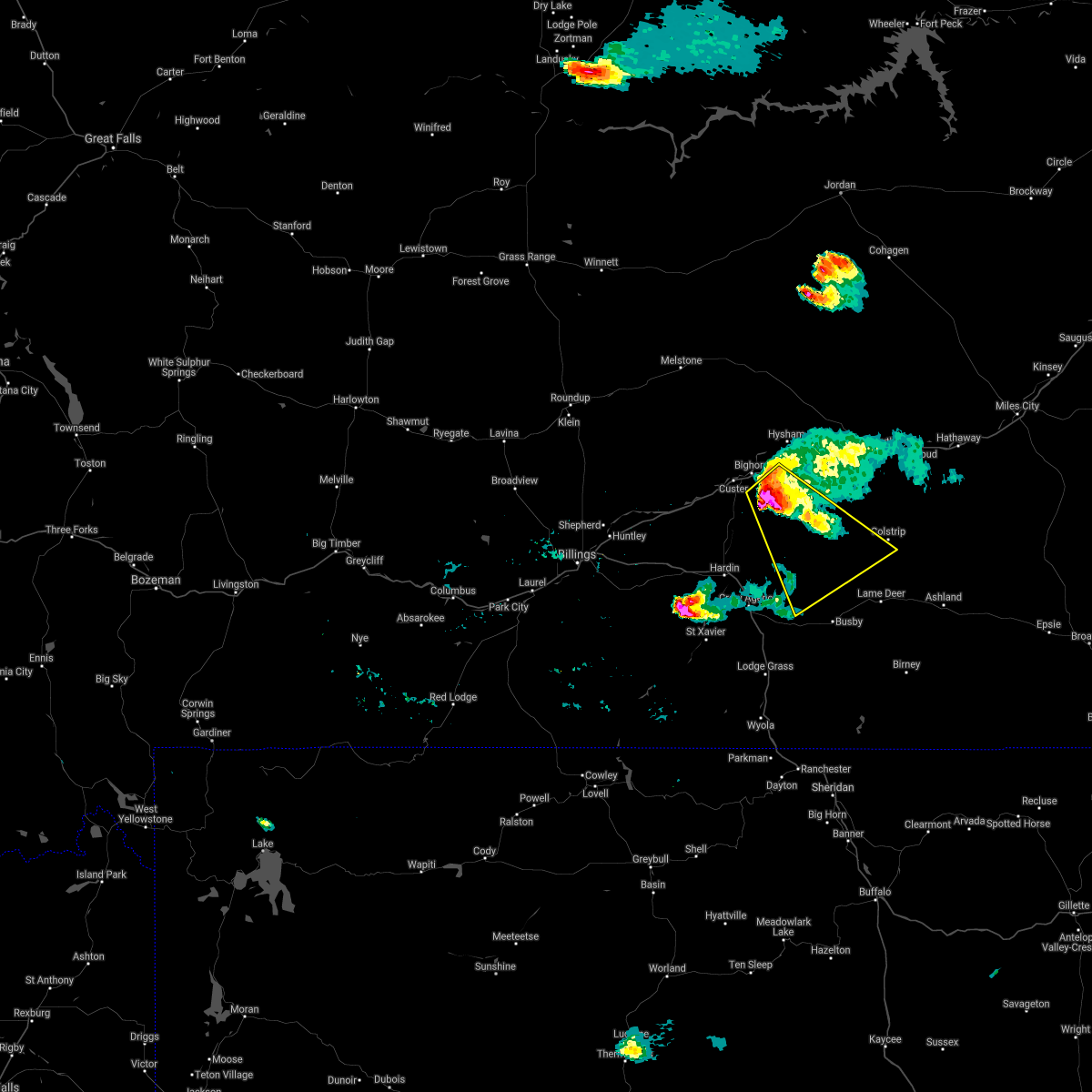
| 6/27/2024 3:00 PM MDT | Quarter sized hail reported 0.2 miles NNW of Colstrip, MT |
| 6/27/2024 2:43 PM MDT |
 At 241 pm mdt, a severe thunderstorm was located 14 miles northwest of busby, or 22 miles east of hardin, moving east at 40 mph (trained weather spotters reported quarter sized hail and 60 mph winds in hardin). Hazards include 70 mph wind gusts and half dollar size hail. Hail damage to vehicles is expected. expect considerable tree damage. wind damage is also likely to mobile homes, roofs, and outbuildings. Locations impacted include, colstrip, lame deer, muddy cluster, and northern cheyenne indian reservation. At 241 pm mdt, a severe thunderstorm was located 14 miles northwest of busby, or 22 miles east of hardin, moving east at 40 mph (trained weather spotters reported quarter sized hail and 60 mph winds in hardin). Hazards include 70 mph wind gusts and half dollar size hail. Hail damage to vehicles is expected. expect considerable tree damage. wind damage is also likely to mobile homes, roofs, and outbuildings. Locations impacted include, colstrip, lame deer, muddy cluster, and northern cheyenne indian reservation.
|
| 6/27/2024 2:36 PM MDT |
 Svrbyz the national weather service in billings has issued a * severe thunderstorm warning for, northeastern big horn county in south central montana, central rosebud county in southeastern montana, * until 330 pm mdt. * at 235 pm mdt, a severe thunderstorm was located 12 miles northeast of crow agency, or 18 miles east of hardin, moving east at 40 mph (radar indicated). Hazards include 60 mph wind gusts and quarter size hail. Hail damage to vehicles is expected. Expect wind damage to roofs, siding, and trees. Svrbyz the national weather service in billings has issued a * severe thunderstorm warning for, northeastern big horn county in south central montana, central rosebud county in southeastern montana, * until 330 pm mdt. * at 235 pm mdt, a severe thunderstorm was located 12 miles northeast of crow agency, or 18 miles east of hardin, moving east at 40 mph (radar indicated). Hazards include 60 mph wind gusts and quarter size hail. Hail damage to vehicles is expected. Expect wind damage to roofs, siding, and trees.
|
| 6/26/2023 10:29 PM MDT |
 At 1029 pm mdt, a severe thunderstorm was located 9 miles northwest of colstrip, moving east at 20 mph (radar indicated). Hazards include 60 mph wind gusts and half dollar size hail. Hail damage to vehicles is expected. Expect wind damage to roofs, siding, and trees. At 1029 pm mdt, a severe thunderstorm was located 9 miles northwest of colstrip, moving east at 20 mph (radar indicated). Hazards include 60 mph wind gusts and half dollar size hail. Hail damage to vehicles is expected. Expect wind damage to roofs, siding, and trees.
|
| 6/19/2023 11:59 PM MDT |
 At 1158 pm mdt, a severe thunderstorm was located near colstrip, moving northeast at 45 mph (radar indicated). Hazards include ping pong ball size hail and 60 mph wind gusts. People and animals outdoors will be injured. expect hail damage to roofs, siding, windows, and vehicles. expect wind damage to roofs, siding, and trees. locations impacted include, colstrip, brandenberg and northern cheyenne indian reservation. hail threat, radar indicated max hail size, 1. 50 in wind threat, radar indicated max wind gust, 60 mph. At 1158 pm mdt, a severe thunderstorm was located near colstrip, moving northeast at 45 mph (radar indicated). Hazards include ping pong ball size hail and 60 mph wind gusts. People and animals outdoors will be injured. expect hail damage to roofs, siding, windows, and vehicles. expect wind damage to roofs, siding, and trees. locations impacted include, colstrip, brandenberg and northern cheyenne indian reservation. hail threat, radar indicated max hail size, 1. 50 in wind threat, radar indicated max wind gust, 60 mph.
|
| 6/19/2023 11:44 PM MDT |
 At 1143 pm mdt, a severe thunderstorm was located 11 miles northwest of lame deer, or 18 miles southwest of colstrip, moving northeast at 45 mph (radar indicated). Hazards include 70 mph wind gusts and ping pong ball size hail. People and animals outdoors will be injured. expect hail damage to roofs, siding, windows, and vehicles. expect considerable tree damage. wind damage is also likely to mobile homes, roofs, and outbuildings. locations impacted include, colstrip, lame deer, ashland, muddy cluster, brandenberg and northern cheyenne indian reservation. thunderstorm damage threat, considerable hail threat, radar indicated max hail size, 1. 50 in wind threat, radar indicated max wind gust, 70 mph. At 1143 pm mdt, a severe thunderstorm was located 11 miles northwest of lame deer, or 18 miles southwest of colstrip, moving northeast at 45 mph (radar indicated). Hazards include 70 mph wind gusts and ping pong ball size hail. People and animals outdoors will be injured. expect hail damage to roofs, siding, windows, and vehicles. expect considerable tree damage. wind damage is also likely to mobile homes, roofs, and outbuildings. locations impacted include, colstrip, lame deer, ashland, muddy cluster, brandenberg and northern cheyenne indian reservation. thunderstorm damage threat, considerable hail threat, radar indicated max hail size, 1. 50 in wind threat, radar indicated max wind gust, 70 mph.
|
| 6/19/2023 11:27 PM MDT |
 At 1127 pm mdt, a severe thunderstorm was located 7 miles northwest of busby, or 27 miles east of hardin, moving northeast at 45 mph (radar indicated). Hazards include 70 mph wind gusts and ping pong ball size hail. People and animals outdoors will be injured. expect hail damage to roofs, siding, windows, and vehicles. expect considerable tree damage. Wind damage is also likely to mobile homes, roofs, and outbuildings. At 1127 pm mdt, a severe thunderstorm was located 7 miles northwest of busby, or 27 miles east of hardin, moving northeast at 45 mph (radar indicated). Hazards include 70 mph wind gusts and ping pong ball size hail. People and animals outdoors will be injured. expect hail damage to roofs, siding, windows, and vehicles. expect considerable tree damage. Wind damage is also likely to mobile homes, roofs, and outbuildings.
|
| 9/22/2022 3:51 PM MDT |
 At 350 pm mdt, severe thunderstorms were located along a line extending from 8 miles south of colstrip to 8 miles south of ashland to 33 miles northwest of spotted horse, moving northeast at 35 mph (radar indicated). Hazards include 60 mph wind gusts and quarter size hail. Hail damage to vehicles is expected. Expect wind damage to roofs, siding, and trees. At 350 pm mdt, severe thunderstorms were located along a line extending from 8 miles south of colstrip to 8 miles south of ashland to 33 miles northwest of spotted horse, moving northeast at 35 mph (radar indicated). Hazards include 60 mph wind gusts and quarter size hail. Hail damage to vehicles is expected. Expect wind damage to roofs, siding, and trees.
|
| 7/15/2022 5:43 PM MDT |
 At 543 pm mdt, severe thunderstorms were located along a line extending from 19 miles south of sand springs to 21 miles northwest of forsyth to 6 miles northwest of lame deer to 7 miles east of busby to near ranchester, moving east at 20 mph (weather station. between 500 pm and 530 pm reports of 55 to 65 mph winds have been reported by weather station. these outflow winds have a history of damage). Hazards include 70 mph wind gusts. Expect considerable tree damage. Damage is likely to mobile homes, roofs, and outbuildings. At 543 pm mdt, severe thunderstorms were located along a line extending from 19 miles south of sand springs to 21 miles northwest of forsyth to 6 miles northwest of lame deer to 7 miles east of busby to near ranchester, moving east at 20 mph (weather station. between 500 pm and 530 pm reports of 55 to 65 mph winds have been reported by weather station. these outflow winds have a history of damage). Hazards include 70 mph wind gusts. Expect considerable tree damage. Damage is likely to mobile homes, roofs, and outbuildings.
|
| 7/15/2022 5:18 PM MDT |
 At 517 pm mdt, severe thunderstorms were located along a line extending from 13 miles northwest of colstrip to 12 miles north of ranchester, moving east at 40 mph (weather station. at 430 pm, 64 mph wind gust was reported 5 miles north of hardin from the hardin n mda weather station). Hazards include 70 mph wind gusts. Expect considerable tree damage. damage is likely to mobile homes, roofs, and outbuildings. locations impacted include, sheridan, colstrip, ranchester, dayton, lame deer, busby, ashland, big horn, birney, wyola, parkman, tongue river reservoir, banner, birney village, brandenberg, kirby, muddy cluster, rosebud battlefield park, story and northern cheyenne indian reservation. thunderstorm damage threat, considerable hail threat, radar indicated max hail size, <. 75 in wind threat, observed max wind gust, 70 mph. At 517 pm mdt, severe thunderstorms were located along a line extending from 13 miles northwest of colstrip to 12 miles north of ranchester, moving east at 40 mph (weather station. at 430 pm, 64 mph wind gust was reported 5 miles north of hardin from the hardin n mda weather station). Hazards include 70 mph wind gusts. Expect considerable tree damage. damage is likely to mobile homes, roofs, and outbuildings. locations impacted include, sheridan, colstrip, ranchester, dayton, lame deer, busby, ashland, big horn, birney, wyola, parkman, tongue river reservoir, banner, birney village, brandenberg, kirby, muddy cluster, rosebud battlefield park, story and northern cheyenne indian reservation. thunderstorm damage threat, considerable hail threat, radar indicated max hail size, <. 75 in wind threat, observed max wind gust, 70 mph.
|
| 7/15/2022 4:55 PM MDT |
 At 452 pm mdt, a gust front ahead of strong thunderstorms was located along a line extending from 19 miles south of hysham to 14 miles southwest of lodge grass, moving east at 40 mph (weather station. at 430 pm, 64 mph wind gust was reported 5 miles north of hardin from the hardin n mda weather station). Hazards include 70 mph wind gusts. Expect considerable tree damage. Damage is likely to mobile homes, roofs, and outbuildings. At 452 pm mdt, a gust front ahead of strong thunderstorms was located along a line extending from 19 miles south of hysham to 14 miles southwest of lodge grass, moving east at 40 mph (weather station. at 430 pm, 64 mph wind gust was reported 5 miles north of hardin from the hardin n mda weather station). Hazards include 70 mph wind gusts. Expect considerable tree damage. Damage is likely to mobile homes, roofs, and outbuildings.
|
| 7/6/2022 5:51 PM MDT |
 At 550 pm mdt, a severe thunderstorm was located 7 miles northwest of lame deer, or 14 miles southwest of colstrip, moving east at 20 mph (radar indicated). Hazards include 60 mph wind gusts and quarter size hail. Hail damage to vehicles is expected. Expect wind damage to roofs, siding, and trees. At 550 pm mdt, a severe thunderstorm was located 7 miles northwest of lame deer, or 14 miles southwest of colstrip, moving east at 20 mph (radar indicated). Hazards include 60 mph wind gusts and quarter size hail. Hail damage to vehicles is expected. Expect wind damage to roofs, siding, and trees.
|
| 7/5/2022 4:49 AM MDT |
 At 448 am mdt, a severe thunderstorm was located near colstrip, moving east at 25 mph (radar indicated). Hazards include tennis ball size hail and 60 mph wind gusts. People and animals outdoors will be injured. expect hail damage to roofs, siding, windows, and vehicles. expect wind damage to roofs, siding, and trees. locations impacted include, colstrip, rosebud, hathaway, cartersville and brandenberg. thunderstorm damage threat, considerable hail threat, radar indicated max hail size, 2. 50 in wind threat, radar indicated max wind gust, 60 mph. At 448 am mdt, a severe thunderstorm was located near colstrip, moving east at 25 mph (radar indicated). Hazards include tennis ball size hail and 60 mph wind gusts. People and animals outdoors will be injured. expect hail damage to roofs, siding, windows, and vehicles. expect wind damage to roofs, siding, and trees. locations impacted include, colstrip, rosebud, hathaway, cartersville and brandenberg. thunderstorm damage threat, considerable hail threat, radar indicated max hail size, 2. 50 in wind threat, radar indicated max wind gust, 60 mph.
|
| 7/5/2022 4:40 AM MDT |
 At 439 am mdt, a severe thunderstorm was located near colstrip, moving east at 35 mph (radar indicated). Hazards include 60 mph wind gusts and half dollar size hail. Hail damage to vehicles is expected. expect wind damage to roofs, siding, and trees. locations impacted include, colstrip, forsyth, rosebud, hathaway, cartersville and brandenberg. hail threat, radar indicated max hail size, 1. 25 in wind threat, radar indicated max wind gust, 60 mph. At 439 am mdt, a severe thunderstorm was located near colstrip, moving east at 35 mph (radar indicated). Hazards include 60 mph wind gusts and half dollar size hail. Hail damage to vehicles is expected. expect wind damage to roofs, siding, and trees. locations impacted include, colstrip, forsyth, rosebud, hathaway, cartersville and brandenberg. hail threat, radar indicated max hail size, 1. 25 in wind threat, radar indicated max wind gust, 60 mph.
|
| 7/5/2022 4:14 AM MDT |
 At 414 am mdt, a severe thunderstorm was located 18 miles west of colstrip, moving east at 35 mph (radar indicated). Hazards include quarter size hail. damage to vehicles is expected At 414 am mdt, a severe thunderstorm was located 18 miles west of colstrip, moving east at 35 mph (radar indicated). Hazards include quarter size hail. damage to vehicles is expected
|
| 7/3/2022 8:21 PM MDT |
 At 821 pm mdt, severe thunderstorms were located along a line extending from 16 miles southeast of forsyth to 9 miles east of colstrip, moving east at 45 mph (radar indicated). Hazards include ping pong ball size hail and 60 mph wind gusts. People and animals outdoors will be injured. expect hail damage to roofs, siding, windows, and vehicles. expect wind damage to roofs, siding, and trees. locations impacted include, colstrip, brandenberg and moon creek ranch. hail threat, radar indicated max hail size, 1. 50 in wind threat, radar indicated max wind gust, 60 mph. At 821 pm mdt, severe thunderstorms were located along a line extending from 16 miles southeast of forsyth to 9 miles east of colstrip, moving east at 45 mph (radar indicated). Hazards include ping pong ball size hail and 60 mph wind gusts. People and animals outdoors will be injured. expect hail damage to roofs, siding, windows, and vehicles. expect wind damage to roofs, siding, and trees. locations impacted include, colstrip, brandenberg and moon creek ranch. hail threat, radar indicated max hail size, 1. 50 in wind threat, radar indicated max wind gust, 60 mph.
|
| 7/3/2022 7:59 PM MDT |
 At 759 pm mdt, severe thunderstorms were located along a line extending from 17 miles south of forsyth to 7 miles southwest of colstrip, moving east at 45 mph (radar indicated). Hazards include ping pong ball size hail and 60 mph wind gusts. People and animals outdoors will be injured. expect hail damage to roofs, siding, windows, and vehicles. Expect wind damage to roofs, siding, and trees. At 759 pm mdt, severe thunderstorms were located along a line extending from 17 miles south of forsyth to 7 miles southwest of colstrip, moving east at 45 mph (radar indicated). Hazards include ping pong ball size hail and 60 mph wind gusts. People and animals outdoors will be injured. expect hail damage to roofs, siding, windows, and vehicles. Expect wind damage to roofs, siding, and trees.
|
| 7/3/2022 7:46 PM MDT |
 At 746 pm mdt, severe thunderstorms were located along a line extending from 21 miles west of colstrip to 11 miles north of busby, moving east at 45 mph (radar indicated). Hazards include 70 mph wind gusts and half dollar size hail. Hail damage to vehicles is expected. expect considerable tree damage. wind damage is also likely to mobile homes, roofs, and outbuildings. locations impacted include, colstrip, lame deer, muddy cluster and northern cheyenne indian reservation. thunderstorm damage threat, considerable hail threat, radar indicated max hail size, 1. 25 in wind threat, radar indicated max wind gust, 70 mph. At 746 pm mdt, severe thunderstorms were located along a line extending from 21 miles west of colstrip to 11 miles north of busby, moving east at 45 mph (radar indicated). Hazards include 70 mph wind gusts and half dollar size hail. Hail damage to vehicles is expected. expect considerable tree damage. wind damage is also likely to mobile homes, roofs, and outbuildings. locations impacted include, colstrip, lame deer, muddy cluster and northern cheyenne indian reservation. thunderstorm damage threat, considerable hail threat, radar indicated max hail size, 1. 25 in wind threat, radar indicated max wind gust, 70 mph.
|
| 7/3/2022 7:21 PM MDT |
 At 721 pm mdt, severe thunderstorms were located along a line extending from 10 miles southeast of custer to 11 miles northeast of crow agency, moving east at 45 mph (radar indicated). Hazards include 70 mph wind gusts and half dollar size hail. Hail damage to vehicles is expected. expect considerable tree damage. Wind damage is also likely to mobile homes, roofs, and outbuildings. At 721 pm mdt, severe thunderstorms were located along a line extending from 10 miles southeast of custer to 11 miles northeast of crow agency, moving east at 45 mph (radar indicated). Hazards include 70 mph wind gusts and half dollar size hail. Hail damage to vehicles is expected. expect considerable tree damage. Wind damage is also likely to mobile homes, roofs, and outbuildings.
|
| 7/7/2021 7:00 PM MDT |
 At 700 pm mdt, a severe thunderstorm was located 10 miles southeast of forsyth, moving southeast at 50 mph (radar indicated). Hazards include 60 mph wind gusts and quarter size hail. expect wind damage to roofs, siding, and trees At 700 pm mdt, a severe thunderstorm was located 10 miles southeast of forsyth, moving southeast at 50 mph (radar indicated). Hazards include 60 mph wind gusts and quarter size hail. expect wind damage to roofs, siding, and trees
|
| 7/6/2021 6:58 PM MDT |
 At 656 pm mdt, a severe thunderstorm was located 15 miles southeast of custer, or 19 miles south of hysham, moving southeast at 35 mph (radar indicated. at 638 pm golfball size hail was reported 13 miles sw of hysham!). Hazards include golf ball size hail and 60 mph wind gusts. People and animals outdoors will be injured. expect hail damage to roofs, siding, windows, and vehicles. expect wind damage to roofs, siding, and trees. This severe thunderstorm will remain over mainly rural areas of north central big horn, southern rosebud and southeastern treasure counties. At 656 pm mdt, a severe thunderstorm was located 15 miles southeast of custer, or 19 miles south of hysham, moving southeast at 35 mph (radar indicated. at 638 pm golfball size hail was reported 13 miles sw of hysham!). Hazards include golf ball size hail and 60 mph wind gusts. People and animals outdoors will be injured. expect hail damage to roofs, siding, windows, and vehicles. expect wind damage to roofs, siding, and trees. This severe thunderstorm will remain over mainly rural areas of north central big horn, southern rosebud and southeastern treasure counties.
|
| 7/6/2021 6:42 PM MDT |
 At 641 pm mdt, a severe thunderstorm was located 10 miles east of custer, or 13 miles southwest of hysham, moving southeast at 40 mph (trained weather spotters). Hazards include golf ball size hail and 60 mph wind gusts. People and animals outdoors will be injured. expect hail damage to roofs, siding, windows, and vehicles. expect wind damage to roofs, siding, and trees. locations impacted include, colstrip, custer and bighorn. golfball size hail was reported 13 miles sw of hysham with this storm. This warning does not include the city of billings. At 641 pm mdt, a severe thunderstorm was located 10 miles east of custer, or 13 miles southwest of hysham, moving southeast at 40 mph (trained weather spotters). Hazards include golf ball size hail and 60 mph wind gusts. People and animals outdoors will be injured. expect hail damage to roofs, siding, windows, and vehicles. expect wind damage to roofs, siding, and trees. locations impacted include, colstrip, custer and bighorn. golfball size hail was reported 13 miles sw of hysham with this storm. This warning does not include the city of billings.
|
| 7/6/2021 6:28 PM MDT |
 At 628 pm mdt, a severe thunderstorm was located near custer, or 13 miles southwest of hysham, moving southeast at 40 mph (radar indicated). Hazards include 60 mph wind gusts and half dollar size hail. Hail damage to vehicles is expected. Expect wind damage to roofs, siding, and trees. At 628 pm mdt, a severe thunderstorm was located near custer, or 13 miles southwest of hysham, moving southeast at 40 mph (radar indicated). Hazards include 60 mph wind gusts and half dollar size hail. Hail damage to vehicles is expected. Expect wind damage to roofs, siding, and trees.
|
| 7/7/2020 6:39 PM MDT |
 The severe thunderstorm warning for northeastern big horn, rosebud and treasure counties will expire at 645 pm mdt, the storms which prompted the warning have weakened below severe limits, and no longer pose an immediate threat to life or property. therefore, the warning will be allowed to expire. however gusty winds are still possible with these thunderstorms. a severe thunderstorm watch remains in effect until 900 pm mdt for south central and southeastern montana. The severe thunderstorm warning for northeastern big horn, rosebud and treasure counties will expire at 645 pm mdt, the storms which prompted the warning have weakened below severe limits, and no longer pose an immediate threat to life or property. therefore, the warning will be allowed to expire. however gusty winds are still possible with these thunderstorms. a severe thunderstorm watch remains in effect until 900 pm mdt for south central and southeastern montana.
|
| 7/7/2020 6:14 PM MDT |
 At 613 pm mdt, severe thunderstorms were located along a line extending from 16 miles southwest of cohagen to 13 miles northwest of busby, moving east at 40 mph (radar indicated). Hazards include 60 mph wind gusts and nickel size hail. Expect damage to roofs, siding, and trees. Locations impacted include, colstrip, forsyth, hysham, lame deer, rosebud, vananda, bighorn, rock springs, ingomar, cartersville, muddy cluster and northern cheyenne indian reservation. At 613 pm mdt, severe thunderstorms were located along a line extending from 16 miles southwest of cohagen to 13 miles northwest of busby, moving east at 40 mph (radar indicated). Hazards include 60 mph wind gusts and nickel size hail. Expect damage to roofs, siding, and trees. Locations impacted include, colstrip, forsyth, hysham, lame deer, rosebud, vananda, bighorn, rock springs, ingomar, cartersville, muddy cluster and northern cheyenne indian reservation.
|
| 7/7/2020 5:41 PM MDT |
 At 539 pm mdt, severe thunderstorms were located along a line extending from 18 miles south of edwards to hardin, moving east at 40 mph (radar indicated). Hazards include 70 mph wind gusts and quarter size hail. Hail damage to vehicles is expected. expect considerable tree damage. Wind damage is also likely to mobile homes, roofs, and outbuildings. At 539 pm mdt, severe thunderstorms were located along a line extending from 18 miles south of edwards to hardin, moving east at 40 mph (radar indicated). Hazards include 70 mph wind gusts and quarter size hail. Hail damage to vehicles is expected. expect considerable tree damage. Wind damage is also likely to mobile homes, roofs, and outbuildings.
|
| 7/7/2020 4:52 PM MDT |
 At 450 pm mdt, severe thunderstorms were located along a line extending from 8 miles south of colstrip to 30 miles northeast of sheridan, moving northeast at 35 mph (trained weather spotters. at 425 pm mdt, quarter size hail was reported 20 miles south of busby, near kirby). Hazards include 60 mph wind gusts and quarter size hail. Hail damage to vehicles is expected. Expect wind damage to roofs, siding, and trees. At 450 pm mdt, severe thunderstorms were located along a line extending from 8 miles south of colstrip to 30 miles northeast of sheridan, moving northeast at 35 mph (trained weather spotters. at 425 pm mdt, quarter size hail was reported 20 miles south of busby, near kirby). Hazards include 60 mph wind gusts and quarter size hail. Hail damage to vehicles is expected. Expect wind damage to roofs, siding, and trees.
|
| 7/4/2020 5:57 PM MDT |
 At 556 pm mdt, a line of severe thunderstorms extending from colstrip to 10 miles south of ashland, moving east northeast at 20 mph (radar indicated). Hazards include 60 mph wind gusts and quarter size hail. Hail damage to vehicles is expected. Expect wind damage to roofs, siding, and trees. At 556 pm mdt, a line of severe thunderstorms extending from colstrip to 10 miles south of ashland, moving east northeast at 20 mph (radar indicated). Hazards include 60 mph wind gusts and quarter size hail. Hail damage to vehicles is expected. Expect wind damage to roofs, siding, and trees.
|
| 7/4/2020 5:41 PM MDT |
 At 538 pm mdt, a severe thunderstorm was located near colstrip, moving northeast at 40 mph (radar indicated). Hazards include 60 mph wind gusts and quarter size hail. Hail damage to vehicles is expected. expect wind damage to roofs, siding, and trees. Locations impacted include, colstrip, brandenberg and northern cheyenne indian reservation. At 538 pm mdt, a severe thunderstorm was located near colstrip, moving northeast at 40 mph (radar indicated). Hazards include 60 mph wind gusts and quarter size hail. Hail damage to vehicles is expected. expect wind damage to roofs, siding, and trees. Locations impacted include, colstrip, brandenberg and northern cheyenne indian reservation.
|
| 7/4/2020 5:14 PM MDT |
 At 514 pm mdt, a severe thunderstorm was located 12 miles southwest of colstrip, moving northeast at 35 mph (radar indicated). Hazards include 60 mph wind gusts and quarter size hail. Hail damage to vehicles is expected. Expect wind damage to roofs, siding, and trees. At 514 pm mdt, a severe thunderstorm was located 12 miles southwest of colstrip, moving northeast at 35 mph (radar indicated). Hazards include 60 mph wind gusts and quarter size hail. Hail damage to vehicles is expected. Expect wind damage to roofs, siding, and trees.
|
| 8/22/2019 9:36 PM MDT |
 The severe thunderstorm warning for northeastern big horn and southern rosebud counties will expire at 945 pm mdt, the storm which prompted the warning has weakened below severe limits, and has exited the warned area. therefore, the warning will be allowed to expire. however heavy rain is still possible with this thunderstorm. The severe thunderstorm warning for northeastern big horn and southern rosebud counties will expire at 945 pm mdt, the storm which prompted the warning has weakened below severe limits, and has exited the warned area. therefore, the warning will be allowed to expire. however heavy rain is still possible with this thunderstorm.
|
| 8/22/2019 9:09 PM MDT |
 At 908 pm mdt, a severe thunderstorm was located southwest of colstrip, moving northeast at 25 mph (radar indicated). Hazards include 60 mph wind gusts and quarter size hail. Hail damage to vehicles is expected. expect wind damage to roofs, siding, and trees. Locations impacted include, colstrip, lame deer, busby and northern cheyenne indian reservation. At 908 pm mdt, a severe thunderstorm was located southwest of colstrip, moving northeast at 25 mph (radar indicated). Hazards include 60 mph wind gusts and quarter size hail. Hail damage to vehicles is expected. expect wind damage to roofs, siding, and trees. Locations impacted include, colstrip, lame deer, busby and northern cheyenne indian reservation.
|
| 8/22/2019 8:40 PM MDT |
 At 840 pm mdt, a line of severe thunderstorms were located from busby, and through colstrip, moving northeast at 20 mph (radar indicated). Hazards include 60 mph wind gusts and half dollar size hail. Hail damage to vehicles is expected. Expect wind damage to roofs, siding, and trees. At 840 pm mdt, a line of severe thunderstorms were located from busby, and through colstrip, moving northeast at 20 mph (radar indicated). Hazards include 60 mph wind gusts and half dollar size hail. Hail damage to vehicles is expected. Expect wind damage to roofs, siding, and trees.
|
| 8/11/2019 9:11 PM MDT |
 At 909 pm mdt, severe thunderstorms were located along a line extending from 9 miles southeast of hillside to 12 miles east of forsyth to near colstrip, moving east at 50 mph (radar indicated). Hazards include 60 mph wind gusts and half dollar size hail. there is some rotation on the leading edge of this line of severe storms which may produce a brief tornado. Hail damage to vehicles is expected. expect wind damage to roofs, siding, and trees. Locations impacted include, miles city, colstrip, forsyth, rosebud, angela, cartersville, matthews recreation area, strawberry hill recreation area, hathaway, twelve mile dam, brandenberg, rock springs, garland and moon creek ranch. At 909 pm mdt, severe thunderstorms were located along a line extending from 9 miles southeast of hillside to 12 miles east of forsyth to near colstrip, moving east at 50 mph (radar indicated). Hazards include 60 mph wind gusts and half dollar size hail. there is some rotation on the leading edge of this line of severe storms which may produce a brief tornado. Hail damage to vehicles is expected. expect wind damage to roofs, siding, and trees. Locations impacted include, miles city, colstrip, forsyth, rosebud, angela, cartersville, matthews recreation area, strawberry hill recreation area, hathaway, twelve mile dam, brandenberg, rock springs, garland and moon creek ranch.
|
| 8/11/2019 8:53 PM MDT |
 At 852 pm mdt, severe thunderstorms were located along a line extending from 9 miles southwest of hillside to 16 miles west of colstrip, moving east at 35 mph (radar indicated). Hazards include 60 mph wind gusts and half dollar size hail. Hail damage to vehicles is expected. Expect wind damage to roofs, siding, and trees. At 852 pm mdt, severe thunderstorms were located along a line extending from 9 miles southwest of hillside to 16 miles west of colstrip, moving east at 35 mph (radar indicated). Hazards include 60 mph wind gusts and half dollar size hail. Hail damage to vehicles is expected. Expect wind damage to roofs, siding, and trees.
|
| 8/11/2019 8:39 PM MDT |
 At 836 pm mdt, severe thunderstorms were located along a line extending from 12 miles southwest of hillside to 6 miles south of crow agency, moving east at 30 mph. another severe thunderstorm was located 5 miles east of muddy moving northeast at 20 mph (radar indicated). Hazards include ping pong ball size hail and 60 mph wind gusts. People and animals outdoors will be injured. expect hail damage to roofs, siding, windows, and vehicles. expect wind damage to roofs, siding, and trees. Locations impacted include, hardin, colstrip, forsyth, hysham, lame deer, busby, crow agency, rosebud, cartersville, birney village, vananda, muddy cluster, northern cheyenne indian reservation and crow indian reservation. At 836 pm mdt, severe thunderstorms were located along a line extending from 12 miles southwest of hillside to 6 miles south of crow agency, moving east at 30 mph. another severe thunderstorm was located 5 miles east of muddy moving northeast at 20 mph (radar indicated). Hazards include ping pong ball size hail and 60 mph wind gusts. People and animals outdoors will be injured. expect hail damage to roofs, siding, windows, and vehicles. expect wind damage to roofs, siding, and trees. Locations impacted include, hardin, colstrip, forsyth, hysham, lame deer, busby, crow agency, rosebud, cartersville, birney village, vananda, muddy cluster, northern cheyenne indian reservation and crow indian reservation.
|
| 8/11/2019 8:16 PM MDT |
 At 814 pm mdt, severe thunderstorms were located along a line extending from 17 miles southwest of cohagen to 11 miles west of crow agency, moving east at 30 mph. another severe thunderstorm was located 5 miles east of busby, moving east at 20 mph (radar indicated. these storms have a history of producing large hail and damaging winds). Hazards include 70 mph wind gusts and ping pong ball size hail. People and animals outdoors will be injured. expect hail damage to roofs, siding, windows, and vehicles. expect considerable tree damage. wind damage is also likely to mobile homes, roofs, and outbuildings. Locations impacted include, hardin, colstrip, forsyth, hysham, custer, lame deer, busby, crow agency, rosebud, bighorn, ingomar, cartersville, birney village, vananda, muddy cluster, northern cheyenne indian reservation and crow indian reservation. At 814 pm mdt, severe thunderstorms were located along a line extending from 17 miles southwest of cohagen to 11 miles west of crow agency, moving east at 30 mph. another severe thunderstorm was located 5 miles east of busby, moving east at 20 mph (radar indicated. these storms have a history of producing large hail and damaging winds). Hazards include 70 mph wind gusts and ping pong ball size hail. People and animals outdoors will be injured. expect hail damage to roofs, siding, windows, and vehicles. expect considerable tree damage. wind damage is also likely to mobile homes, roofs, and outbuildings. Locations impacted include, hardin, colstrip, forsyth, hysham, custer, lame deer, busby, crow agency, rosebud, bighorn, ingomar, cartersville, birney village, vananda, muddy cluster, northern cheyenne indian reservation and crow indian reservation.
|
| 8/11/2019 8:02 PM MDT |
 At 801 pm mdt, severe thunderstorms were located along a line extending from 20 miles southwest of cohagen to 13 miles southwest of hardin, moving east at 30 mph. another severe thunderstorm was located near busby, moving north at 25 mph (radar indicated). Hazards include golf ball size hail and 70 mph wind gusts. People and animals outdoors will be injured. expect hail damage to roofs, siding, windows, and vehicles. expect considerable tree damage. Wind damage is also likely to mobile homes, roofs, and outbuildings. At 801 pm mdt, severe thunderstorms were located along a line extending from 20 miles southwest of cohagen to 13 miles southwest of hardin, moving east at 30 mph. another severe thunderstorm was located near busby, moving north at 25 mph (radar indicated). Hazards include golf ball size hail and 70 mph wind gusts. People and animals outdoors will be injured. expect hail damage to roofs, siding, windows, and vehicles. expect considerable tree damage. Wind damage is also likely to mobile homes, roofs, and outbuildings.
|
| 7/8/2019 6:54 PM MDT |
 At 653 pm mdt, a severe thunderstorm was located 15 miles southeast of forsyth, moving north at 35 mph. another severe thunderstorm was located north of lame deer (radar indicated). Hazards include 60 mph wind gusts and half dollar size hail. Hail damage to vehicles is expected. expect wind damage to roofs, siding, and trees. Locations impacted include, colstrip, forsyth, lame deer, rosebud, cartersville and northern cheyenne indian reservation. At 653 pm mdt, a severe thunderstorm was located 15 miles southeast of forsyth, moving north at 35 mph. another severe thunderstorm was located north of lame deer (radar indicated). Hazards include 60 mph wind gusts and half dollar size hail. Hail damage to vehicles is expected. expect wind damage to roofs, siding, and trees. Locations impacted include, colstrip, forsyth, lame deer, rosebud, cartersville and northern cheyenne indian reservation.
|
| 7/8/2019 6:23 PM MDT |
 At 622 pm mdt, severe thunderstorms were located near busby and colstrip, moving northeast at 25 mph (radar indicated). Hazards include 60 mph wind gusts and half dollar size hail. Hail damage to vehicles is expected. Expect wind damage to roofs, siding, and trees. At 622 pm mdt, severe thunderstorms were located near busby and colstrip, moving northeast at 25 mph (radar indicated). Hazards include 60 mph wind gusts and half dollar size hail. Hail damage to vehicles is expected. Expect wind damage to roofs, siding, and trees.
|
| 7/7/2019 7:40 PM MDT |
 The severe thunderstorm warning for central rosebud county will expire at 745 pm mdt, the storm which prompted the warning has weakened below severe limits, and has exited the warned area. therefore, the warning will be allowed to expire. a severe thunderstorm watch remains in effect until 1000 pm mdt for southeastern montana. The severe thunderstorm warning for central rosebud county will expire at 745 pm mdt, the storm which prompted the warning has weakened below severe limits, and has exited the warned area. therefore, the warning will be allowed to expire. a severe thunderstorm watch remains in effect until 1000 pm mdt for southeastern montana.
|
| 7/7/2019 7:18 PM MDT |
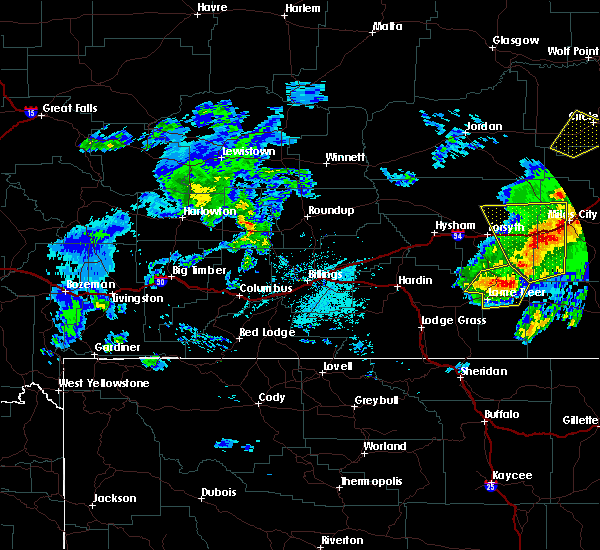 At 718 pm mdt, a severe thunderstorm was located 9 miles northeast of lame deer, or 10 miles south of colstrip, moving northeast at 25 mph (radar indicated). Hazards include 60 mph wind gusts and quarter size hail, along with very heavy rainfall. Hail damage to vehicles is expected. expect wind damage to roofs, siding, and trees. Locations impacted include, colstrip. At 718 pm mdt, a severe thunderstorm was located 9 miles northeast of lame deer, or 10 miles south of colstrip, moving northeast at 25 mph (radar indicated). Hazards include 60 mph wind gusts and quarter size hail, along with very heavy rainfall. Hail damage to vehicles is expected. expect wind damage to roofs, siding, and trees. Locations impacted include, colstrip.
|
| 7/7/2019 7:09 PM MDT |
 At 707 pm mdt, a severe thunderstorm was located near lame deer, or 13 miles south of colstrip, moving northeast at 25 mph (radar indicated). Hazards include golf ball size hail and 60 mph wind gusts, along with very heavy rainfall. People and animals outdoors will be injured. expect hail damage to roofs, siding, windows, and vehicles. expect wind damage to roofs, siding, and trees. Locations impacted include, colstrip, lame deer and northern cheyenne indian reservation. At 707 pm mdt, a severe thunderstorm was located near lame deer, or 13 miles south of colstrip, moving northeast at 25 mph (radar indicated). Hazards include golf ball size hail and 60 mph wind gusts, along with very heavy rainfall. People and animals outdoors will be injured. expect hail damage to roofs, siding, windows, and vehicles. expect wind damage to roofs, siding, and trees. Locations impacted include, colstrip, lame deer and northern cheyenne indian reservation.
|
| 7/7/2019 6:47 PM MDT |
 At 642 pm mdt, a severe thunderstorm was located 5 miles southwest of lame deer, moving northeast at 25 mph. this storm will impact travel on highway 212 between busby and lame deer, and may track eastward toward ashland (radar indicated). Hazards include golf ball size hail and 60 mph wind gusts, along with very heavy rainfall. People and animals outdoors will be injured. expect hail damage to roofs, siding, windows, and vehicles. Expect wind damage to roofs, siding, and trees. At 642 pm mdt, a severe thunderstorm was located 5 miles southwest of lame deer, moving northeast at 25 mph. this storm will impact travel on highway 212 between busby and lame deer, and may track eastward toward ashland (radar indicated). Hazards include golf ball size hail and 60 mph wind gusts, along with very heavy rainfall. People and animals outdoors will be injured. expect hail damage to roofs, siding, windows, and vehicles. Expect wind damage to roofs, siding, and trees.
|
| 8/3/2018 6:28 PM MDT |
 At 627 pm mdt, severe thunderstorms were located along a line extending from 13 miles north of volborg to 9 miles northeast of ashland to 29 miles southeast of lame deer, moving east at 55 mph (radar indicated). Hazards include 60 mph wind gusts. expect damage to roofs, siding, and trees At 627 pm mdt, severe thunderstorms were located along a line extending from 13 miles north of volborg to 9 miles northeast of ashland to 29 miles southeast of lame deer, moving east at 55 mph (radar indicated). Hazards include 60 mph wind gusts. expect damage to roofs, siding, and trees
|
| 8/3/2018 6:01 PM MDT |
 At 559 pm mdt, severe thunderstorms were located along a line extending from 8 miles northeast of colstrip to 7 miles south of lame deer to 11 miles east of lodge grass, moving east at 50 mph (radar indicated). Hazards include 60 mph wind gusts. Expect damage to roofs, siding, and trees. Locations impacted include, colstrip, lodge grass, lame deer, busby, crow agency, ashland, birney, birney village, brandenberg, kirby, garland and northern cheyenne indian reservation. At 559 pm mdt, severe thunderstorms were located along a line extending from 8 miles northeast of colstrip to 7 miles south of lame deer to 11 miles east of lodge grass, moving east at 50 mph (radar indicated). Hazards include 60 mph wind gusts. Expect damage to roofs, siding, and trees. Locations impacted include, colstrip, lodge grass, lame deer, busby, crow agency, ashland, birney, birney village, brandenberg, kirby, garland and northern cheyenne indian reservation.
|
| 8/3/2018 5:27 PM MDT |
 At 526 pm mdt, severe thunderstorms were located along a line extending from 20 miles northeast of hardin to 9 miles south of crow agency to near fort smith, moving east at 50 mph (trained weather spotters). Hazards include 70 mph wind gusts. Expect considerable tree damage. Damage is likely to mobile homes, roofs, and outbuildings. At 526 pm mdt, severe thunderstorms were located along a line extending from 20 miles northeast of hardin to 9 miles south of crow agency to near fort smith, moving east at 50 mph (trained weather spotters). Hazards include 70 mph wind gusts. Expect considerable tree damage. Damage is likely to mobile homes, roofs, and outbuildings.
|
| 7/2/2018 10:23 PM MDT |
 At 1021 pm mdt, severe thunderstorms were located along a line extending from near colstrip to 9 miles south of lame deer, moving east at 45 mph (trained weather spotters. quarter size hail was reported in busby with these storms). Hazards include 70 mph wind gusts and ping pong ball size hail. People and animals outdoors will be injured. expect hail damage to roofs, siding, windows, and vehicles. expect considerable tree damage. wind damage is also likely to mobile homes, roofs, and outbuildings. severe thunderstorms will be near, ashland around 1045 pm mdt. other locations impacted by these severe thunderstorms include olive, garland, brandenberg and northern cheyenne indian reservation. the largest hail with these storms is moving along highway 212 toward lame deer and ashland at this time. This replaces the warning previously in effect for this area. At 1021 pm mdt, severe thunderstorms were located along a line extending from near colstrip to 9 miles south of lame deer, moving east at 45 mph (trained weather spotters. quarter size hail was reported in busby with these storms). Hazards include 70 mph wind gusts and ping pong ball size hail. People and animals outdoors will be injured. expect hail damage to roofs, siding, windows, and vehicles. expect considerable tree damage. wind damage is also likely to mobile homes, roofs, and outbuildings. severe thunderstorms will be near, ashland around 1045 pm mdt. other locations impacted by these severe thunderstorms include olive, garland, brandenberg and northern cheyenne indian reservation. the largest hail with these storms is moving along highway 212 toward lame deer and ashland at this time. This replaces the warning previously in effect for this area.
|
| 7/2/2018 10:01 PM MDT |
 At 1000 pm mdt, a severe thunderstorm was located 11 miles north of busby, or 18 miles southwest of colstrip, moving east at 40 mph (radar indicated). Hazards include golf ball size hail and 70 mph wind gusts. People and animals outdoors will be injured. expect hail damage to roofs, siding, windows, and vehicles. expect considerable tree damage. wind damage is also likely to mobile homes, roofs, and outbuildings. this severe storm will be near, lame deer around 1020 pm mdt. Other locations impacted by this severe thunderstorm include birney village and northern cheyenne indian reservation. At 1000 pm mdt, a severe thunderstorm was located 11 miles north of busby, or 18 miles southwest of colstrip, moving east at 40 mph (radar indicated). Hazards include golf ball size hail and 70 mph wind gusts. People and animals outdoors will be injured. expect hail damage to roofs, siding, windows, and vehicles. expect considerable tree damage. wind damage is also likely to mobile homes, roofs, and outbuildings. this severe storm will be near, lame deer around 1020 pm mdt. Other locations impacted by this severe thunderstorm include birney village and northern cheyenne indian reservation.
|
| 7/2/2018 9:39 PM MDT |
 At 937 pm mdt, a severe thunderstorm was located 12 miles northeast of crow agency, or 18 miles east of hardin, moving east at 40 mph (radar indicated. damaging winds and quarter size hail was reported south of hardin with this storm). Hazards include 70 mph wind gusts and half dollar size hail. Hail damage to vehicles is expected. expect considerable tree damage. wind damage is also likely to mobile homes, roofs, and outbuildings. this severe thunderstorm will remain over mainly rural areas of northeastern big horn and southern rosebud counties, including the following locations, birney village and northern cheyenne indian reservation. This replaces the previous warning for big horn county. At 937 pm mdt, a severe thunderstorm was located 12 miles northeast of crow agency, or 18 miles east of hardin, moving east at 40 mph (radar indicated. damaging winds and quarter size hail was reported south of hardin with this storm). Hazards include 70 mph wind gusts and half dollar size hail. Hail damage to vehicles is expected. expect considerable tree damage. wind damage is also likely to mobile homes, roofs, and outbuildings. this severe thunderstorm will remain over mainly rural areas of northeastern big horn and southern rosebud counties, including the following locations, birney village and northern cheyenne indian reservation. This replaces the previous warning for big horn county.
|
| 6/28/2018 6:49 PM MDT |
 At 648 pm mdt, a severe thunderstorm was located 11 miles northwest of ashland, or 14 miles southeast of colstrip, moving east at 15 mph (radar indicated). Hazards include 60 mph wind gusts and half dollar size hail. Hail damage to vehicles is expected. expect wind damage to roofs, siding, and trees. locations impacted include, colstrip, lame deer, ashland, brandenberg and northern cheyenne indian reservation. A tornado watch remains in effect until 1100 pm mdt for southeastern montana. At 648 pm mdt, a severe thunderstorm was located 11 miles northwest of ashland, or 14 miles southeast of colstrip, moving east at 15 mph (radar indicated). Hazards include 60 mph wind gusts and half dollar size hail. Hail damage to vehicles is expected. expect wind damage to roofs, siding, and trees. locations impacted include, colstrip, lame deer, ashland, brandenberg and northern cheyenne indian reservation. A tornado watch remains in effect until 1100 pm mdt for southeastern montana.
|
| 6/28/2018 6:35 PM MDT |
 At 635 pm mdt, a severe thunderstorm was located 10 miles northeast of lame deer, or 12 miles southeast of colstrip, moving east at 15 mph (radar indicated). Hazards include 60 mph wind gusts and half dollar size hail. Hail damage to vehicles is expected. Expect wind damage to roofs, siding, and trees. At 635 pm mdt, a severe thunderstorm was located 10 miles northeast of lame deer, or 12 miles southeast of colstrip, moving east at 15 mph (radar indicated). Hazards include 60 mph wind gusts and half dollar size hail. Hail damage to vehicles is expected. Expect wind damage to roofs, siding, and trees.
|
| 6/7/2018 6:33 PM MDT |
 At 632 pm mdt, a severe thunderstorm was located near forsyth, moving northeast at 25 mph (radar indicated). Hazards include 60 mph wind gusts and quarter size hail. Hail damage to vehicles is expected. Locations impacted include, colstrip, forsyth, rosebud, hathaway, cartersville and brandenberg. At 632 pm mdt, a severe thunderstorm was located near forsyth, moving northeast at 25 mph (radar indicated). Hazards include 60 mph wind gusts and quarter size hail. Hail damage to vehicles is expected. Locations impacted include, colstrip, forsyth, rosebud, hathaway, cartersville and brandenberg.
|
| 6/7/2018 5:54 PM MDT |
 At 554 pm mdt, severe thunderstorms were located from near colstrip to south of hysham moving east at 25 mph (radar indicated). Hazards include 60 mph wind gusts and half dollar size hail. Hail damage to vehicles is expected. Expect wind damage to roofs, siding, and trees. At 554 pm mdt, severe thunderstorms were located from near colstrip to south of hysham moving east at 25 mph (radar indicated). Hazards include 60 mph wind gusts and half dollar size hail. Hail damage to vehicles is expected. Expect wind damage to roofs, siding, and trees.
|
| 6/7/2018 5:51 PM MDT |
 At 550 pm mdt, a severe thunderstorm was located 7 miles northwest of busby, or 25 miles southwest of colstrip, moving north at 15 mph (radar indicated). Hazards include 60 mph wind gusts and quarter size hail. Hail damage to vehicles is expected. expect wind damage to roofs, siding, and trees. Locations impacted include, colstrip, lame deer, busby and northern cheyenne indian reservation. At 550 pm mdt, a severe thunderstorm was located 7 miles northwest of busby, or 25 miles southwest of colstrip, moving north at 15 mph (radar indicated). Hazards include 60 mph wind gusts and quarter size hail. Hail damage to vehicles is expected. expect wind damage to roofs, siding, and trees. Locations impacted include, colstrip, lame deer, busby and northern cheyenne indian reservation.
|
| 6/7/2018 5:28 PM MDT |
 At 528 pm mdt, a severe thunderstorm was located near busby, or 29 miles southeast of hardin, moving north at 15 mph (radar indicated). Hazards include 60 mph wind gusts and quarter size hail. Hail damage to vehicles is expected. Expect wind damage to roofs, siding, and trees. At 528 pm mdt, a severe thunderstorm was located near busby, or 29 miles southeast of hardin, moving north at 15 mph (radar indicated). Hazards include 60 mph wind gusts and quarter size hail. Hail damage to vehicles is expected. Expect wind damage to roofs, siding, and trees.
|
| 5/23/2018 4:58 PM MDT |
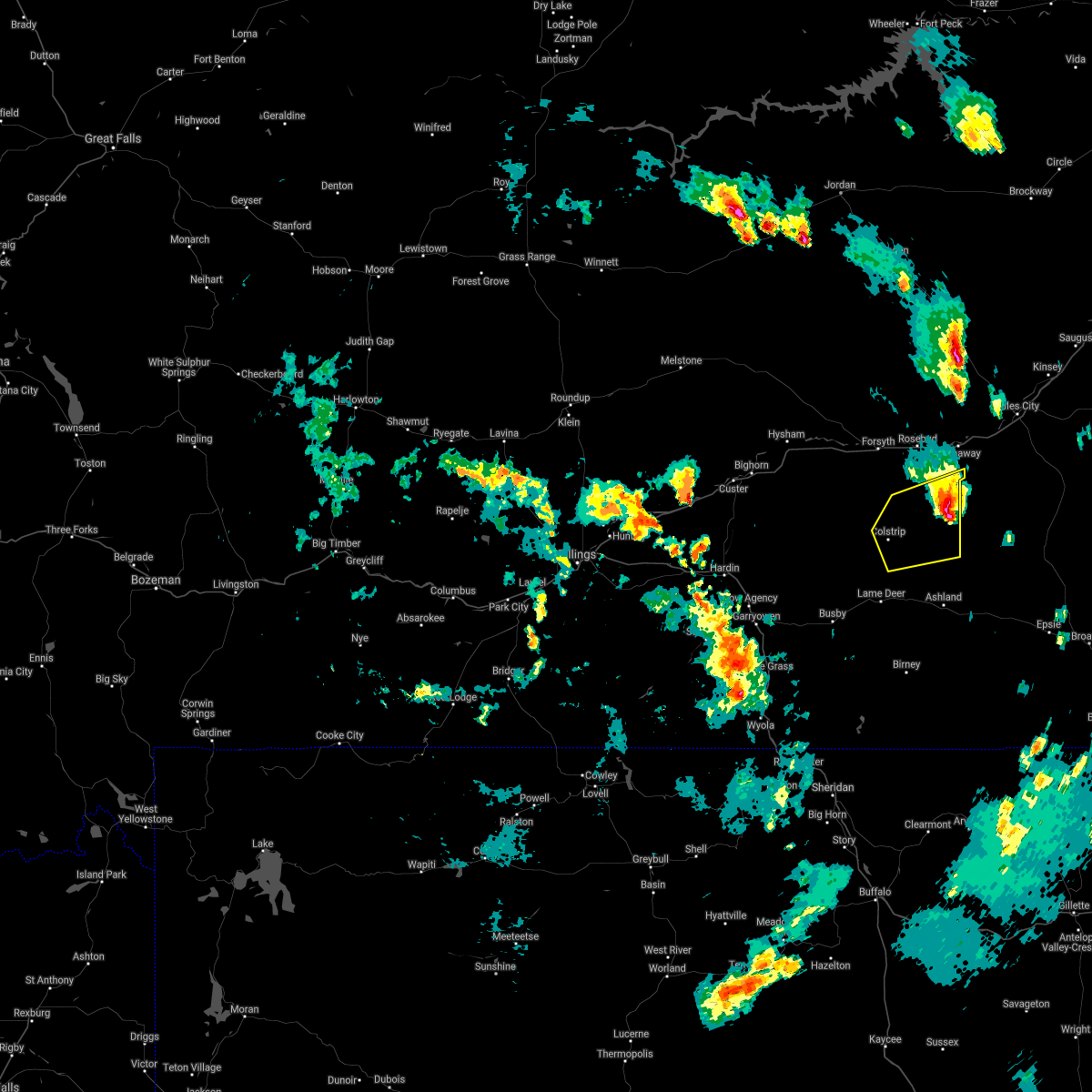 At 416 pm mdt, a severe thunderstorm was located over colstrip, moving northeast at 20 mph (quarter sized hail was reported in colstrip by spotters at 412pm mdt). Hazards include 60 mph wind gusts and quarter size hail. Hail damage to vehicles is expected. expect wind damage to roofs, siding, and trees. Locations impacted include, colstrip and brandenberg. At 416 pm mdt, a severe thunderstorm was located over colstrip, moving northeast at 20 mph (quarter sized hail was reported in colstrip by spotters at 412pm mdt). Hazards include 60 mph wind gusts and quarter size hail. Hail damage to vehicles is expected. expect wind damage to roofs, siding, and trees. Locations impacted include, colstrip and brandenberg.
|
| 5/23/2018 4:17 PM MDT |
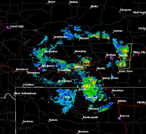 At 416 pm mdt, a severe thunderstorm was located over colstrip, moving northeast at 20 mph (quarter sized hail was reported in colstrip by spotters at 412pm mdt). Hazards include 60 mph wind gusts and quarter size hail. Hail damage to vehicles is expected. expect wind damage to roofs, siding, and trees. Locations impacted include, colstrip and brandenberg. At 416 pm mdt, a severe thunderstorm was located over colstrip, moving northeast at 20 mph (quarter sized hail was reported in colstrip by spotters at 412pm mdt). Hazards include 60 mph wind gusts and quarter size hail. Hail damage to vehicles is expected. expect wind damage to roofs, siding, and trees. Locations impacted include, colstrip and brandenberg.
|
| 5/23/2018 4:12 PM MDT | Quarter sized hail reported 0.9 miles N of Colstrip, MT |
| 5/23/2018 4:03 PM MDT |
 At 402 pm mdt, a severe thunderstorm was located over colstrip, moving northeast at 20 mph (radar indicated). Hazards include 60 mph wind gusts and half dollar size hail. Hail damage to vehicles is expected. Expect wind damage to roofs, siding, and trees. At 402 pm mdt, a severe thunderstorm was located over colstrip, moving northeast at 20 mph (radar indicated). Hazards include 60 mph wind gusts and half dollar size hail. Hail damage to vehicles is expected. Expect wind damage to roofs, siding, and trees.
|
| 7/10/2017 5:05 PM MDT |
 At 505 pm mdt, severe thunderstorms were located along a line extending from 11 miles northeast of hillside to near colstrip, moving east at 50 mph (trained weather spotters). Hazards include 60 mph wind gusts. Expect damage to roofs, siding, and trees. Locations impacted include, colstrip, forsyth, rosebud, hathaway, rock springs, angela, cartersville and moon creek ranch. At 505 pm mdt, severe thunderstorms were located along a line extending from 11 miles northeast of hillside to near colstrip, moving east at 50 mph (trained weather spotters). Hazards include 60 mph wind gusts. Expect damage to roofs, siding, and trees. Locations impacted include, colstrip, forsyth, rosebud, hathaway, rock springs, angela, cartersville and moon creek ranch.
|
| 7/10/2017 4:52 PM MDT |
 At 451 pm mdt, severe thunderstorms were located along a line extending from 8 miles east of cohagen to 15 miles west of colstrip, moving east at 45 mph (radar indicated). Hazards include 60 mph wind gusts. expect damage to roofs, siding, and trees At 451 pm mdt, severe thunderstorms were located along a line extending from 8 miles east of cohagen to 15 miles west of colstrip, moving east at 45 mph (radar indicated). Hazards include 60 mph wind gusts. expect damage to roofs, siding, and trees
|
| 6/20/2017 9:20 PM MDT |
 At 918 pm mdt, a severe thunderstorm was located 13 miles southwest of forsyth, moving east at 45 mph (trained weather spotters 13 miles southeast of hysham reported nickel sized hail at 915 pm mdt). Hazards include 60 mph wind gusts and quarter size hail. Expect damage to roofs, siding, and trees. Locations impacted include, forsyth, hysham, vananda and bighorn. At 918 pm mdt, a severe thunderstorm was located 13 miles southwest of forsyth, moving east at 45 mph (trained weather spotters 13 miles southeast of hysham reported nickel sized hail at 915 pm mdt). Hazards include 60 mph wind gusts and quarter size hail. Expect damage to roofs, siding, and trees. Locations impacted include, forsyth, hysham, vananda and bighorn.
|
| 6/20/2017 8:55 PM MDT |
 At 852 pm mdt, a severe thunderstorm was located 14 miles southeast of custer, or 18 miles south of hysham, moving east at 55 mph (radar indicated). Hazards include 60 mph wind gusts and quarter size hail. Hail damage to vehicles is expected. Expect wind damage to roofs, siding, and trees. At 852 pm mdt, a severe thunderstorm was located 14 miles southeast of custer, or 18 miles south of hysham, moving east at 55 mph (radar indicated). Hazards include 60 mph wind gusts and quarter size hail. Hail damage to vehicles is expected. Expect wind damage to roofs, siding, and trees.
|
| 7/27/2016 8:56 PM MDT |
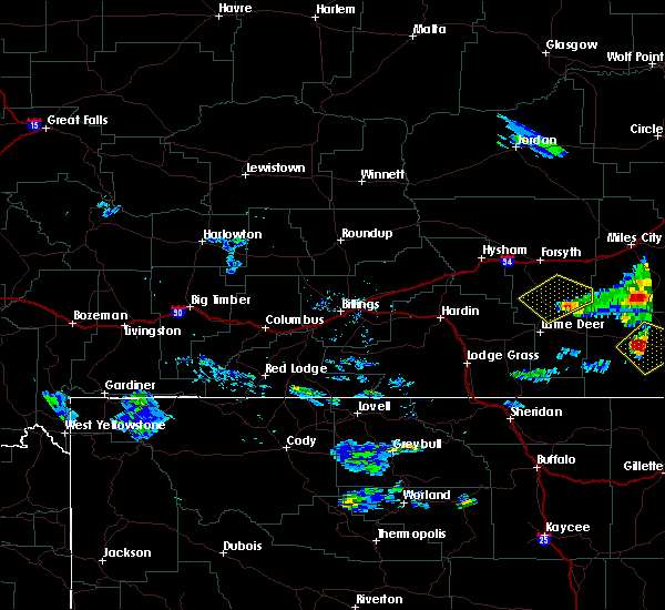 The severe thunderstorm warning for central rosebud county will expire at 900 pm mdt, the storm which prompted the warning has weakened below severe limits, and no longer poses an immediate threat to life or property. therefore the warning will be allowed to expire. however small hail and gusty winds are still possible with this thunderstorm. The severe thunderstorm warning for central rosebud county will expire at 900 pm mdt, the storm which prompted the warning has weakened below severe limits, and no longer poses an immediate threat to life or property. therefore the warning will be allowed to expire. however small hail and gusty winds are still possible with this thunderstorm.
|
| 7/27/2016 8:34 PM MDT |
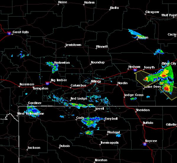 At 832 pm mdt, a severe thunderstorm was located near colstrip, moving southeast at 40 mph (radar indicated). Hazards include 60 mph wind gusts and quarter size hail. Hail damage to vehicles is expected. expect wind damage to roofs, siding, and trees. Locations impacted include, colstrip. At 832 pm mdt, a severe thunderstorm was located near colstrip, moving southeast at 40 mph (radar indicated). Hazards include 60 mph wind gusts and quarter size hail. Hail damage to vehicles is expected. expect wind damage to roofs, siding, and trees. Locations impacted include, colstrip.
|
| 7/27/2016 8:10 PM MDT |
 At 809 pm mdt, a severe thunderstorm was located 15 miles southwest of forsyth, moving southeast at 45 mph (radar indicated). Hazards include 60 mph wind gusts and quarter size hail. Hail damage to vehicles is expected. Expect wind damage to roofs, siding, and trees. At 809 pm mdt, a severe thunderstorm was located 15 miles southwest of forsyth, moving southeast at 45 mph (radar indicated). Hazards include 60 mph wind gusts and quarter size hail. Hail damage to vehicles is expected. Expect wind damage to roofs, siding, and trees.
|
| 6/13/2016 3:44 PM MDT |
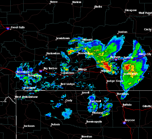 At 341 pm mdt, a severe thunderstorm was located near colstrip, moving east at 20 mph (a spotter reported one inch diameter hail in colstrip). Hazards include 60 mph wind gusts and quarter size hail. Hail damage to vehicles is expected. expect wind damage to roofs, siding, and trees. Locations impacted include, colstrip and brandenberg. At 341 pm mdt, a severe thunderstorm was located near colstrip, moving east at 20 mph (a spotter reported one inch diameter hail in colstrip). Hazards include 60 mph wind gusts and quarter size hail. Hail damage to vehicles is expected. expect wind damage to roofs, siding, and trees. Locations impacted include, colstrip and brandenberg.
|
| 6/13/2016 3:39 PM MDT | Quarter sized hail reported 0.9 miles N of Colstrip, MT |
| 6/13/2016 3:20 PM MDT | Golf Ball sized hail reported 1.2 miles S of Colstrip, MT, broken windows. |
| 6/13/2016 3:16 PM MDT |
 At 313 pm mdt, a severe thunderstorm was located near colstrip, moving east at 30 mph (radar indicated). Hazards include golf ball size hail and 60 mph wind gusts...along with very heavy rain and frequent lightning. People and animals outdoors will be injured. expect hail damage to roofs, siding, windows, and vehicles. expect wind damage to roofs, siding, and trees. Locations impacted include, colstrip and brandenberg. At 313 pm mdt, a severe thunderstorm was located near colstrip, moving east at 30 mph (radar indicated). Hazards include golf ball size hail and 60 mph wind gusts...along with very heavy rain and frequent lightning. People and animals outdoors will be injured. expect hail damage to roofs, siding, windows, and vehicles. expect wind damage to roofs, siding, and trees. Locations impacted include, colstrip and brandenberg.
|
| 6/13/2016 3:09 PM MDT |
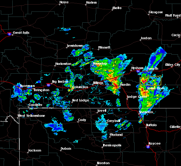 At 308 pm mdt, a severe thunderstorm was located just west of colstrip, moving east at 35 mph (radar indicated). Hazards include 60 mph wind gusts and half dollar size hail...along with very heavy rain and frequent lightning. Hail damage to vehicles is expected. Expect wind damage to roofs, siding, and trees. At 308 pm mdt, a severe thunderstorm was located just west of colstrip, moving east at 35 mph (radar indicated). Hazards include 60 mph wind gusts and half dollar size hail...along with very heavy rain and frequent lightning. Hail damage to vehicles is expected. Expect wind damage to roofs, siding, and trees.
|
| 6/11/2016 7:55 PM MDT |
 At 754 pm mdt, a severe thunderstorm was located 19 miles northeast of colstrip, moving northeast at 30 mph. another severe storm was located near stacey and moving north at 30 mph (radar indicated). Hazards include 60 mph wind gusts and quarter size hail. Hail damage to vehicles is expected. Expect wind damage to roofs, siding, and trees. At 754 pm mdt, a severe thunderstorm was located 19 miles northeast of colstrip, moving northeast at 30 mph. another severe storm was located near stacey and moving north at 30 mph (radar indicated). Hazards include 60 mph wind gusts and quarter size hail. Hail damage to vehicles is expected. Expect wind damage to roofs, siding, and trees.
|
| 7/1/2015 6:35 PM MDT |
 At 634 pm mdt, a severe thunderstorm was located near colstrip, moving southeast at 35 mph (trained weather spotters reported 60 mph winds 10 miles north of colstrip at 625 pm.). Hazards include 60 mph wind gusts and quarter size hail. Hail damage to vehicles is expected. expect wind damage to roofs, siding and trees. Locations impacted include, colstrip and brandenberg. At 634 pm mdt, a severe thunderstorm was located near colstrip, moving southeast at 35 mph (trained weather spotters reported 60 mph winds 10 miles north of colstrip at 625 pm.). Hazards include 60 mph wind gusts and quarter size hail. Hail damage to vehicles is expected. expect wind damage to roofs, siding and trees. Locations impacted include, colstrip and brandenberg.
|
| 7/1/2015 6:25 PM MDT | Less than 200 yards visibilit in rosebud county MT, 9.5 miles S of Colstrip, MT |
| 7/1/2015 6:15 PM MDT |
 At 614 pm mdt, a severe thunderstorm was located 15 miles southwest of forsyth, moving southeast at 35 mph (radar indicated). Hazards include ping pong ball size hail and 60 mph wind gusts. People and animals outdoors will be injured. expect hail damage to roofs, siding, windows and vehicles. Expect wind damage to roofs, siding and trees. At 614 pm mdt, a severe thunderstorm was located 15 miles southwest of forsyth, moving southeast at 35 mph (radar indicated). Hazards include ping pong ball size hail and 60 mph wind gusts. People and animals outdoors will be injured. expect hail damage to roofs, siding, windows and vehicles. Expect wind damage to roofs, siding and trees.
|
| 6/24/2015 4:26 AM MDT |
 At 425 am mdt, a severe thunderstorm was located near colstrip, moving east at 40 mph (radar indicated). Hazards include golf ball size hail and 70 mph wind gusts. People and animals outdoors will be injured. expect hail damage to roofs, siding, windows and vehicles. expect considerable tree damage. wind damage is also likely to mobile homes, roofs and outbuildings. Locations impacted include, colstrip. At 425 am mdt, a severe thunderstorm was located near colstrip, moving east at 40 mph (radar indicated). Hazards include golf ball size hail and 70 mph wind gusts. People and animals outdoors will be injured. expect hail damage to roofs, siding, windows and vehicles. expect considerable tree damage. wind damage is also likely to mobile homes, roofs and outbuildings. Locations impacted include, colstrip.
|
| 6/24/2015 4:09 AM MDT |
 At 408 am mdt, a severe thunderstorm was located 17 miles northwest of colstrip, moving east at 40 mph (radar indicated). Hazards include ping pong ball size hail and 60 mph wind gusts. People and animals outdoors will be injured. expect hail damage to roofs, siding, windows and vehicles. Expect wind damage to roofs, siding and trees. At 408 am mdt, a severe thunderstorm was located 17 miles northwest of colstrip, moving east at 40 mph (radar indicated). Hazards include ping pong ball size hail and 60 mph wind gusts. People and animals outdoors will be injured. expect hail damage to roofs, siding, windows and vehicles. Expect wind damage to roofs, siding and trees.
|
| 6/19/2015 2:51 PM MDT |
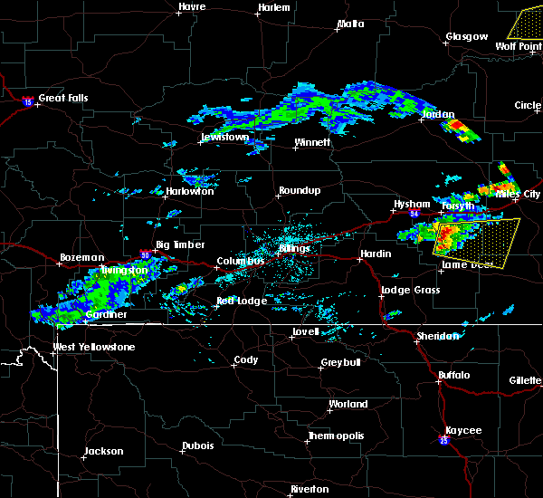 At 250 pm mdt, a severe thunderstorm was located 9 miles north of colstrip, moving east at 35 mph (radar indicated). Hazards include 60 mph wind gusts and half dollar size hail. Hail damage to vehicles is expected. Expect wind damage to roofs, siding and trees. At 250 pm mdt, a severe thunderstorm was located 9 miles north of colstrip, moving east at 35 mph (radar indicated). Hazards include 60 mph wind gusts and half dollar size hail. Hail damage to vehicles is expected. Expect wind damage to roofs, siding and trees.
|
| 7/8/2013 6:25 PM MDT | Storm damage reported in rosebud county MT, 17.7 miles WSW of Colstrip, MT |
| 7/8/2013 6:15 PM MDT | Large pine trees downed near high school ahead of approaching thunderstor in rosebud county MT, 1.3 miles SSW of Colstrip, MT |
| 5/25/2013 8:00 PM MDT | Quarter sized hail reported 1.9 miles S of Colstrip, MT |
| 1/1/0001 12:00 AM | Storm damage reported in rosebud county MT, 17.7 miles WSW of Colstrip, MT |
| 1/1/0001 12:00 AM | At the town pump gas station in rosebud county MT, 0.2 miles NNW of Colstrip, MT |
Hail Maps for Colstrip, MT
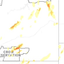
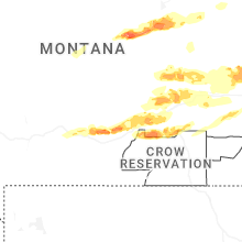
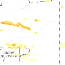
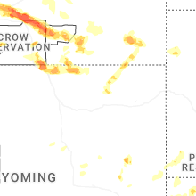
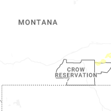


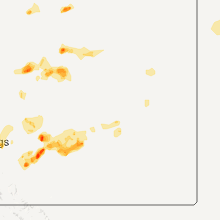

Connect with Interactive Hail Maps