

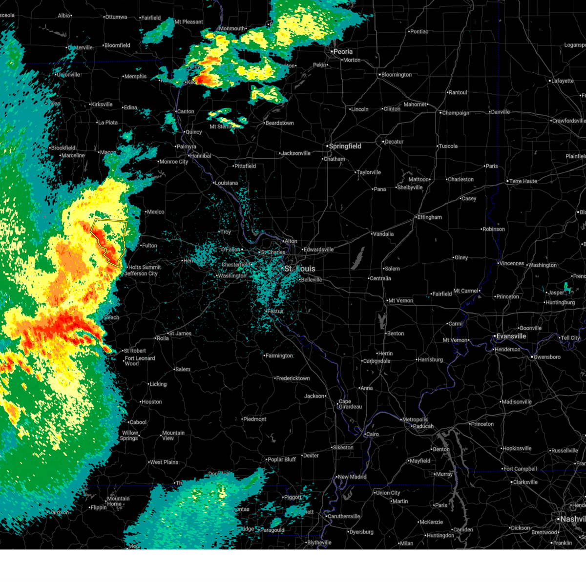
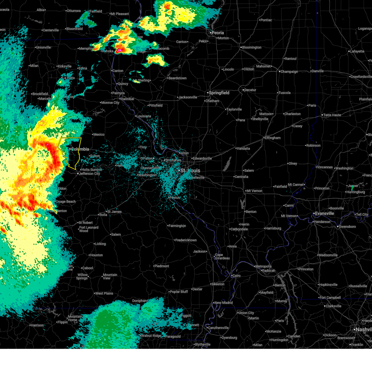
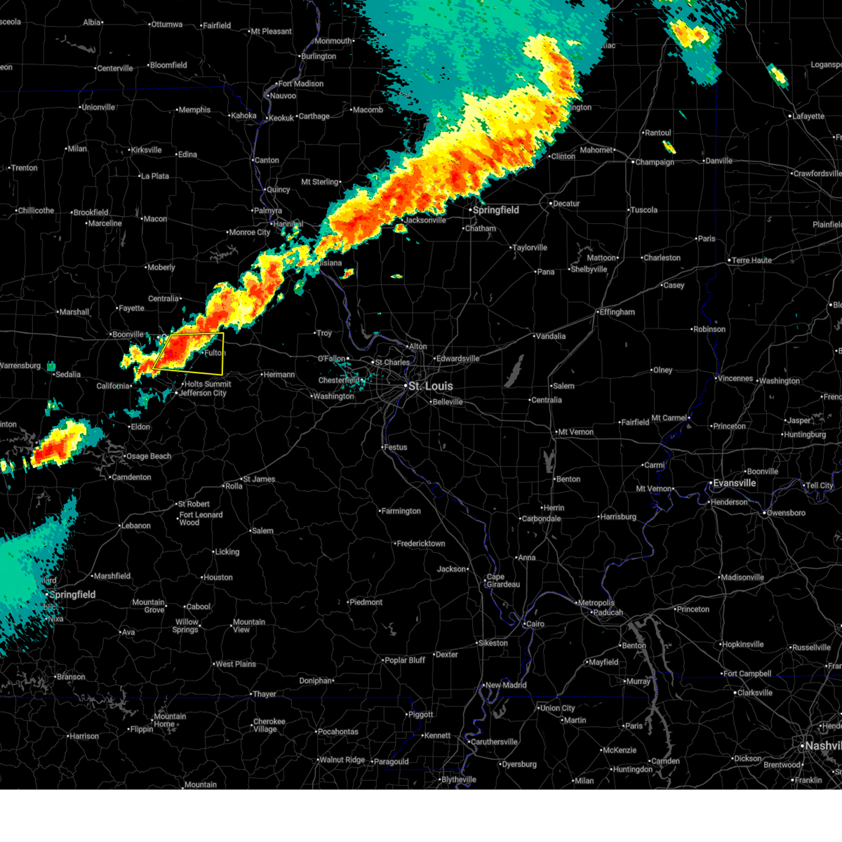
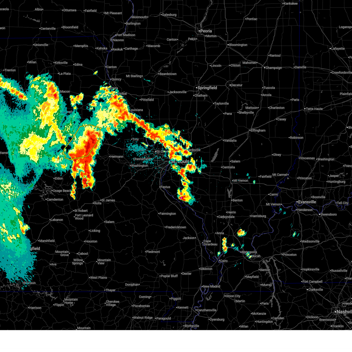
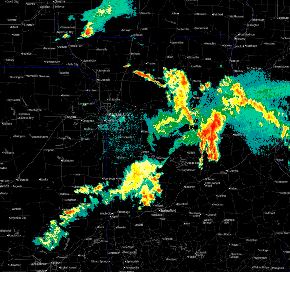
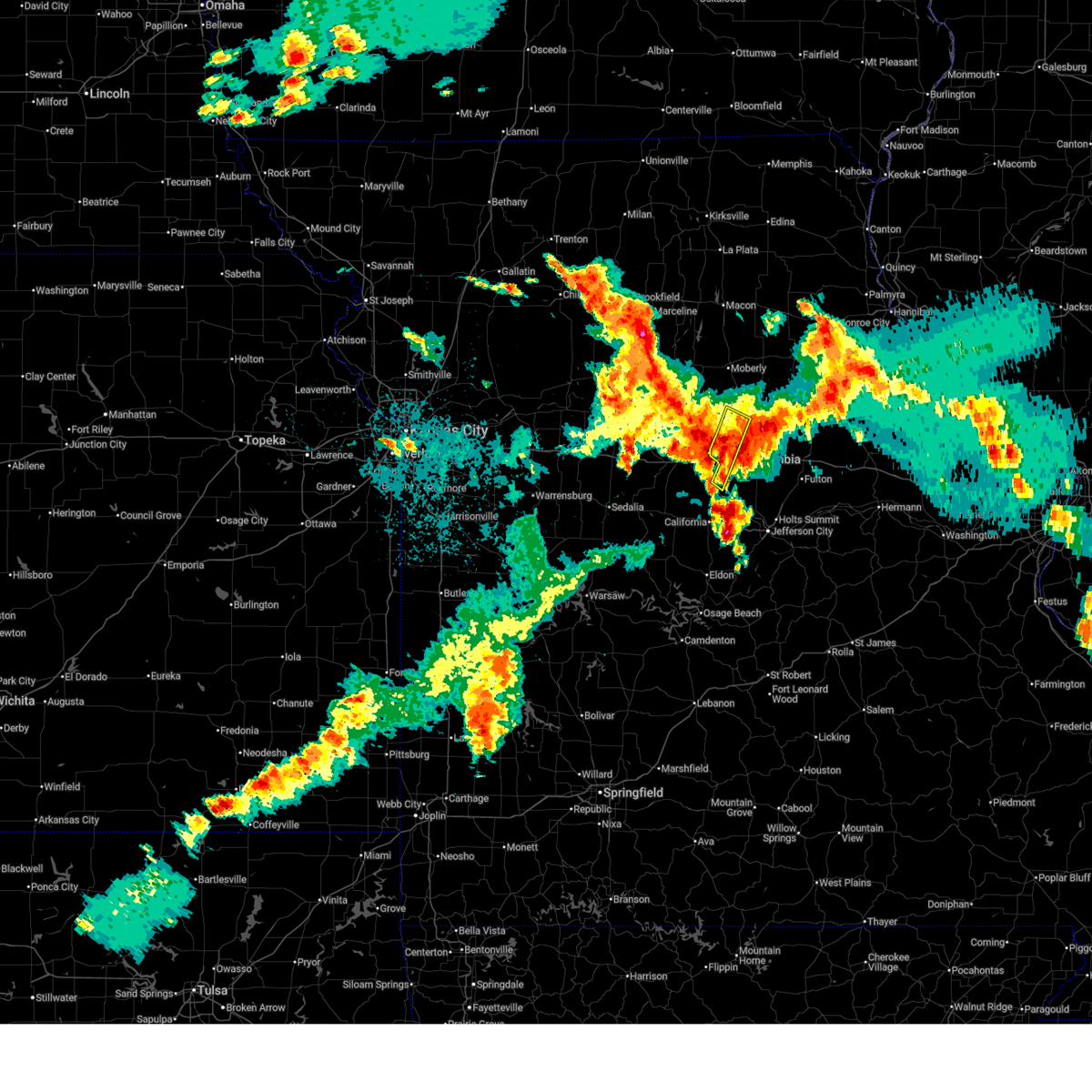
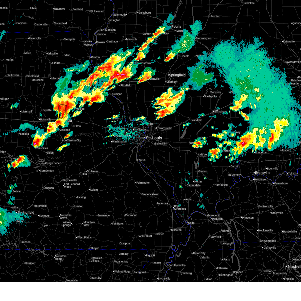
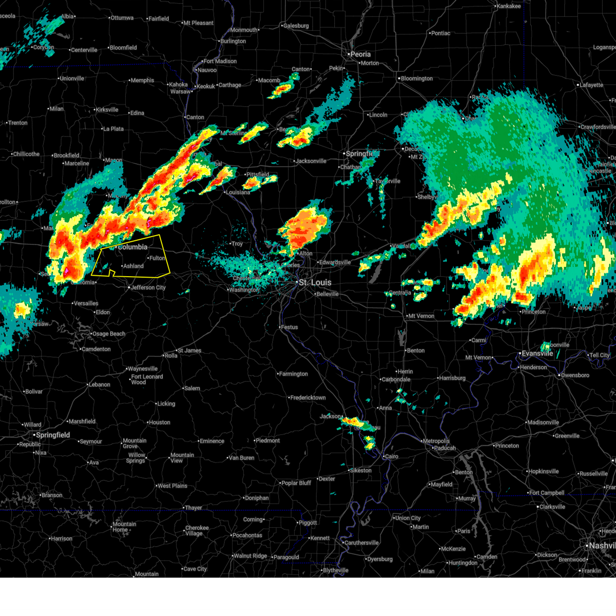
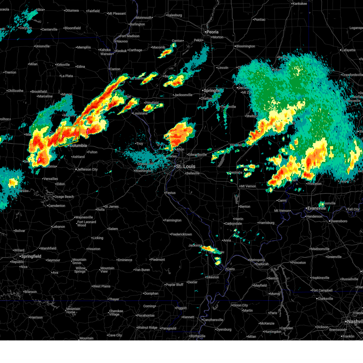
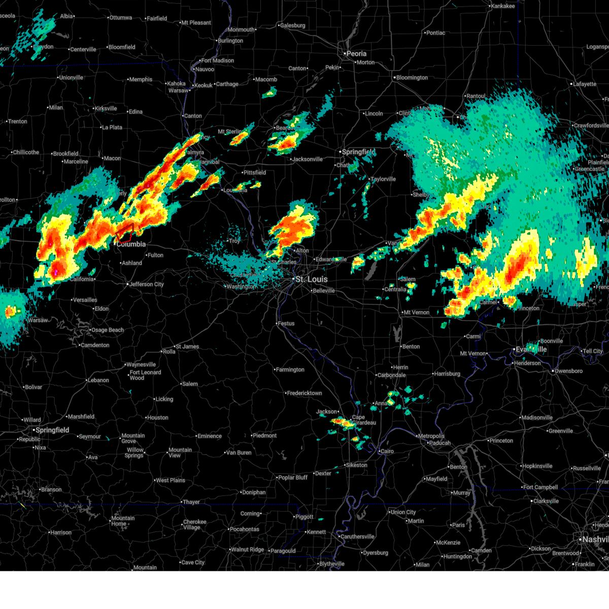
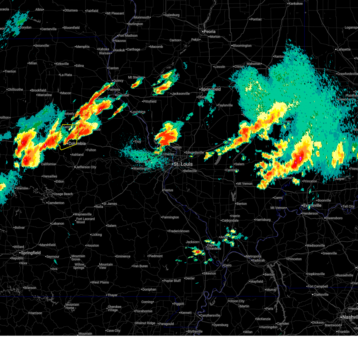
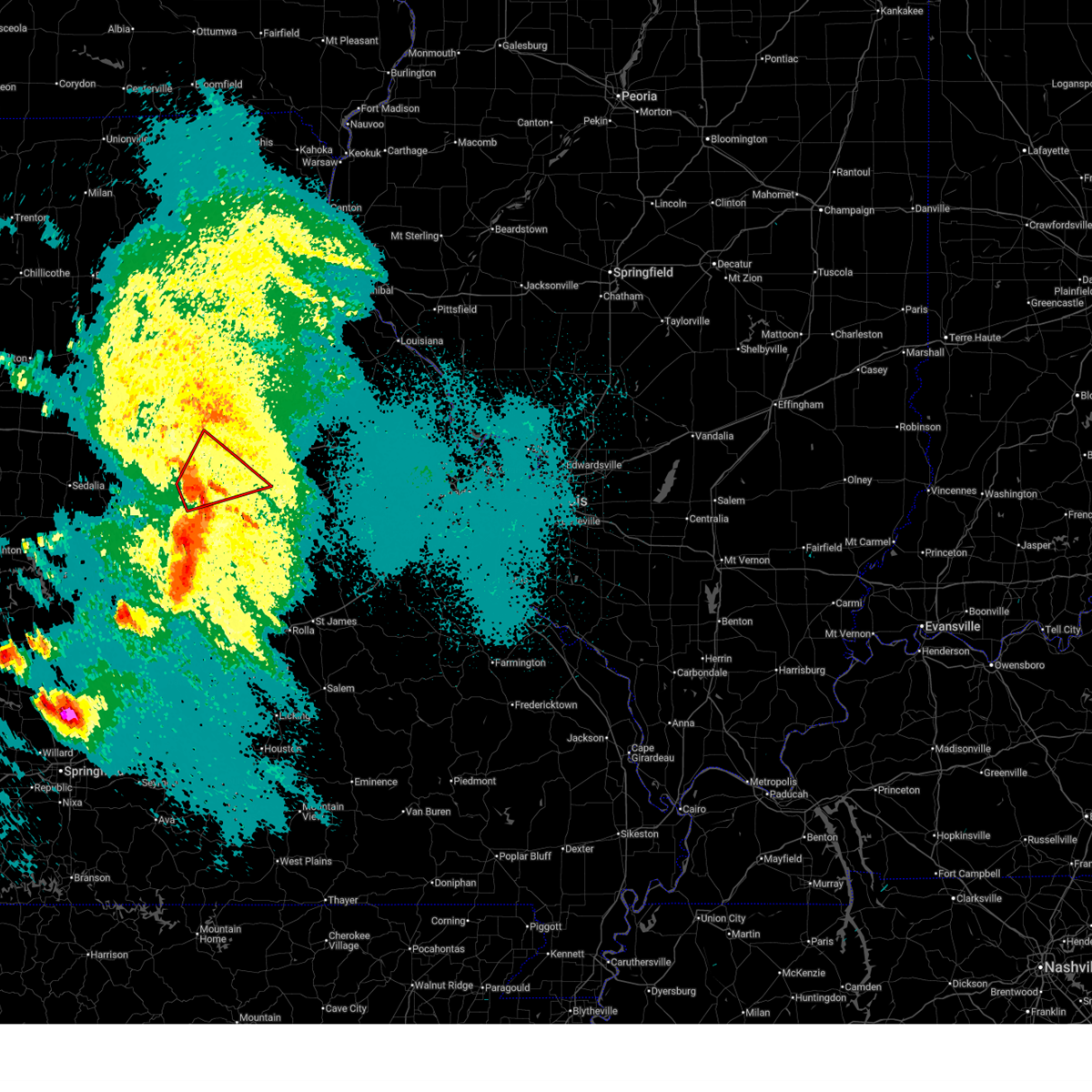
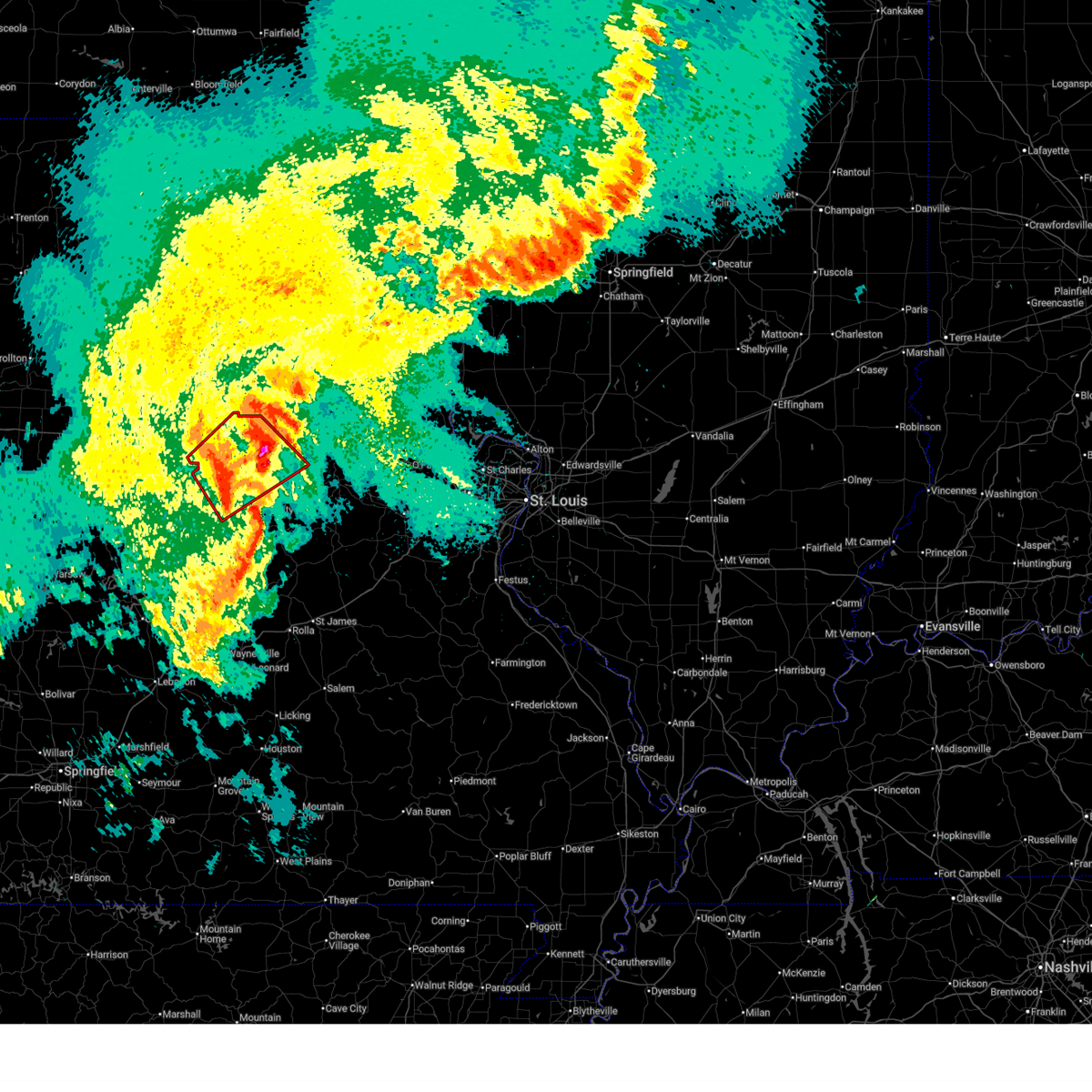
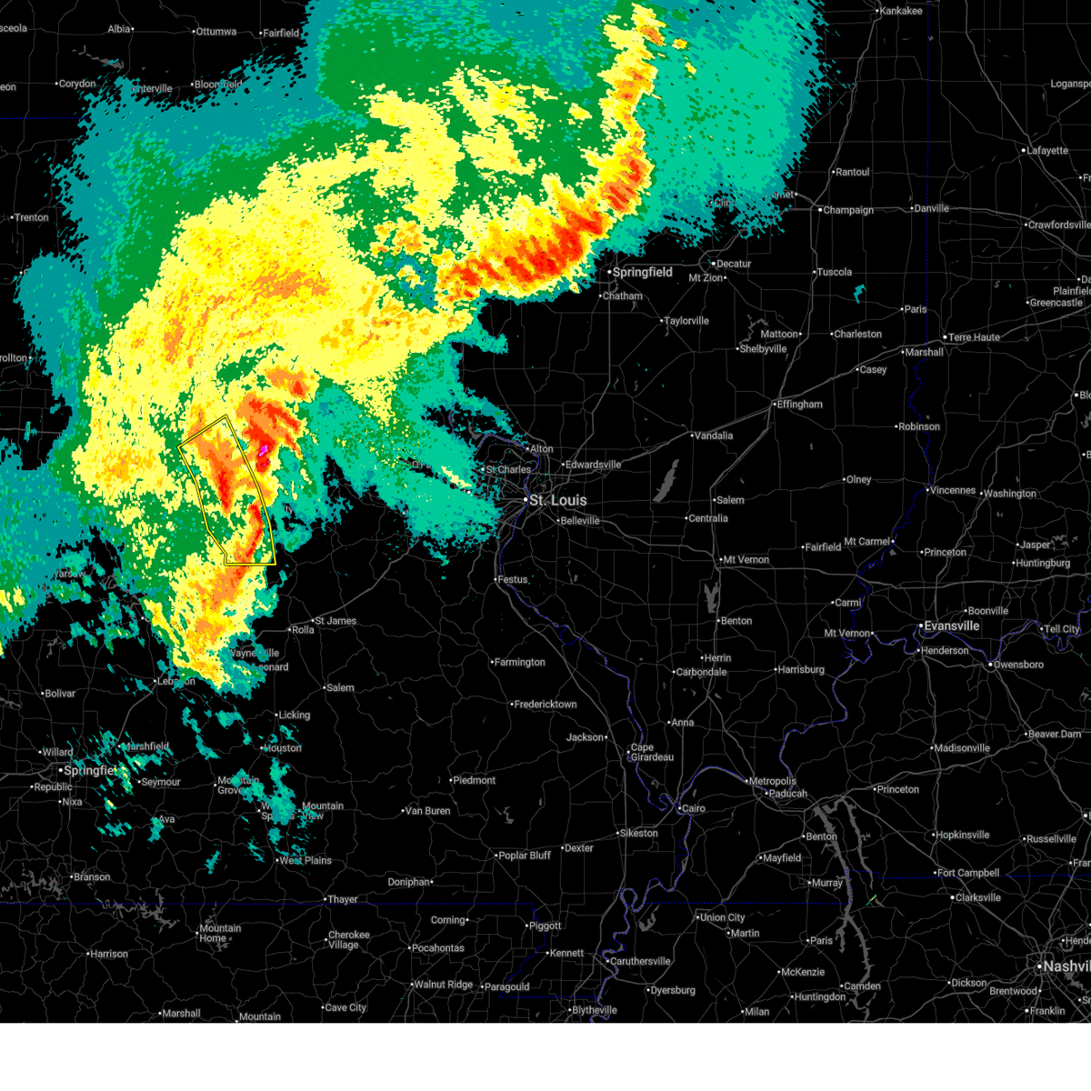
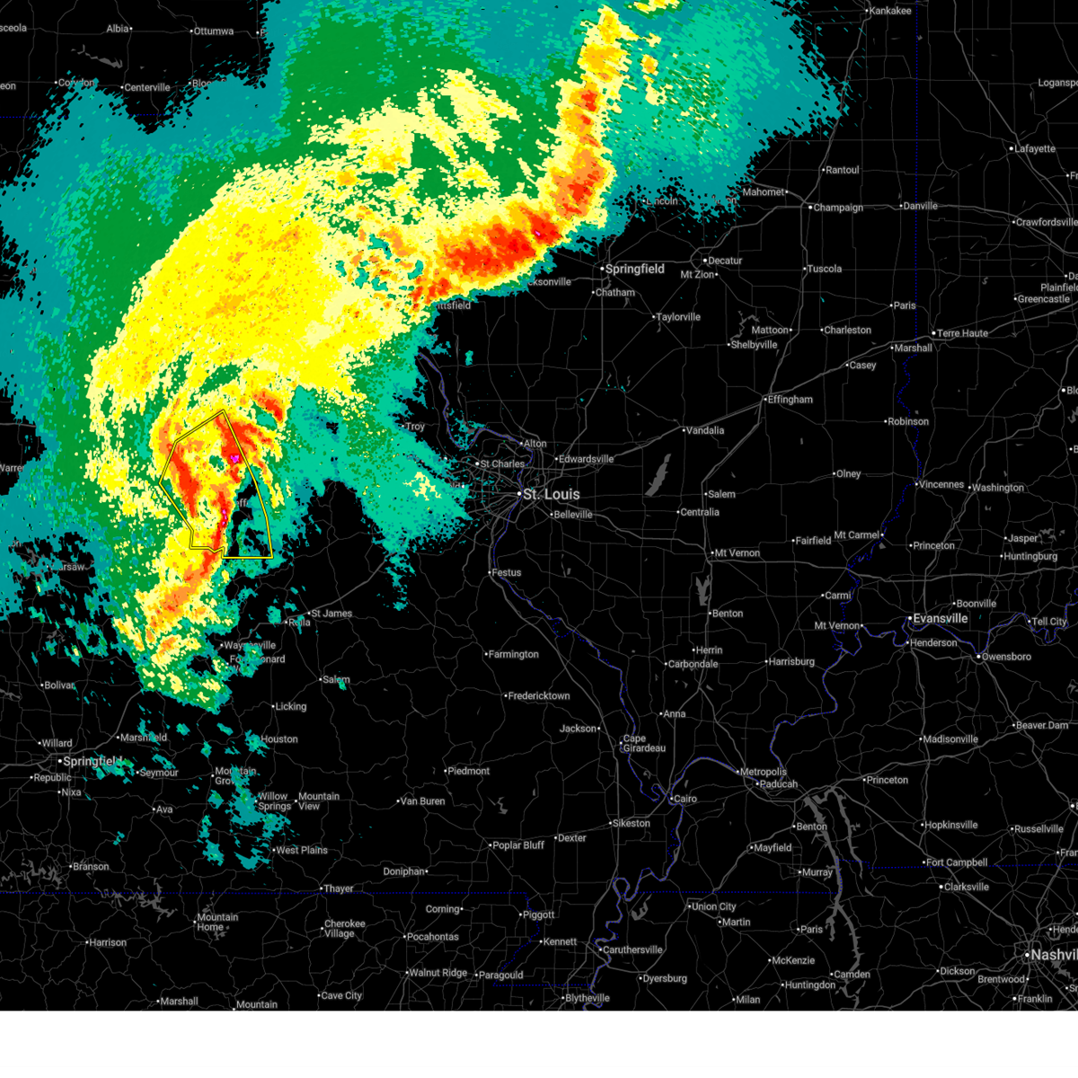
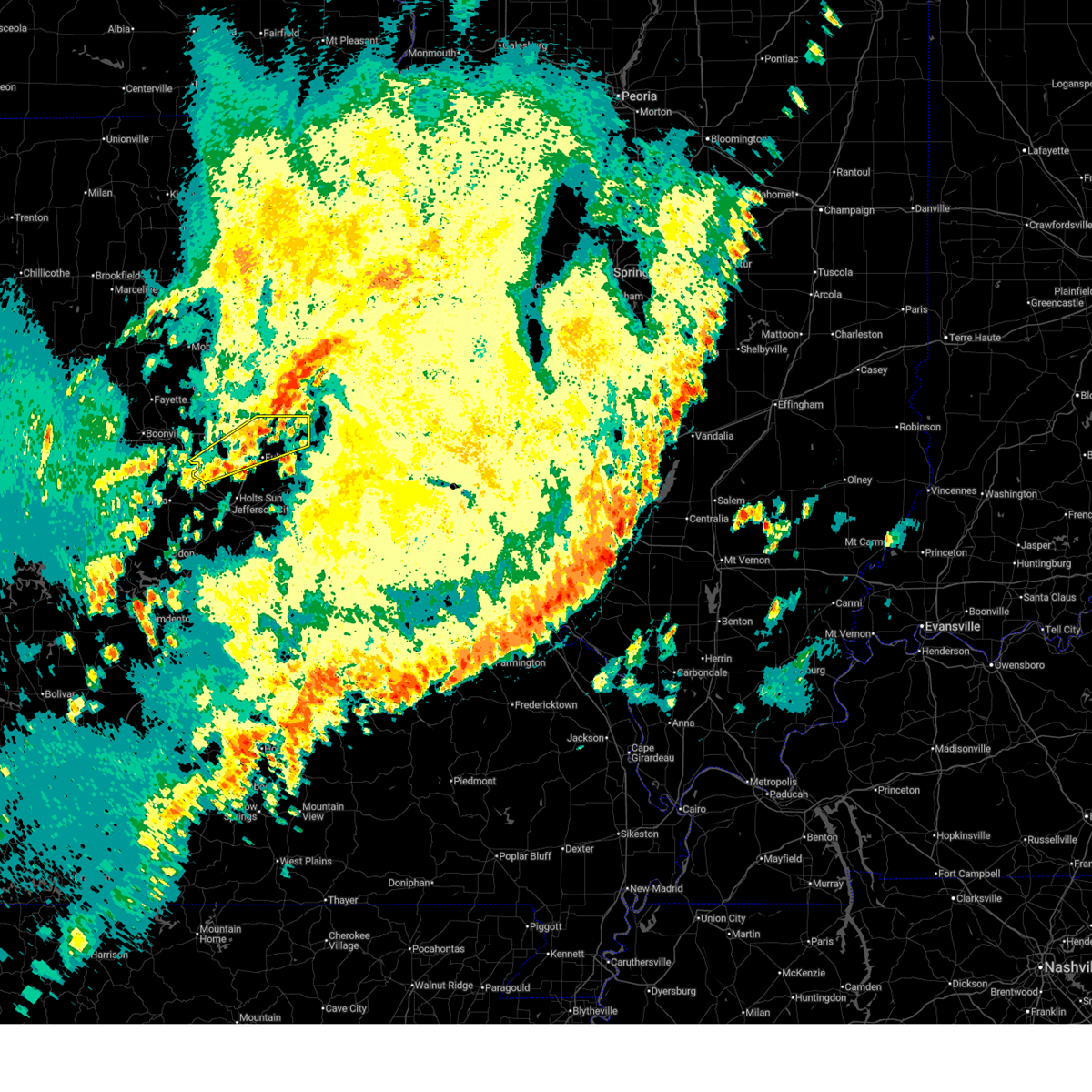
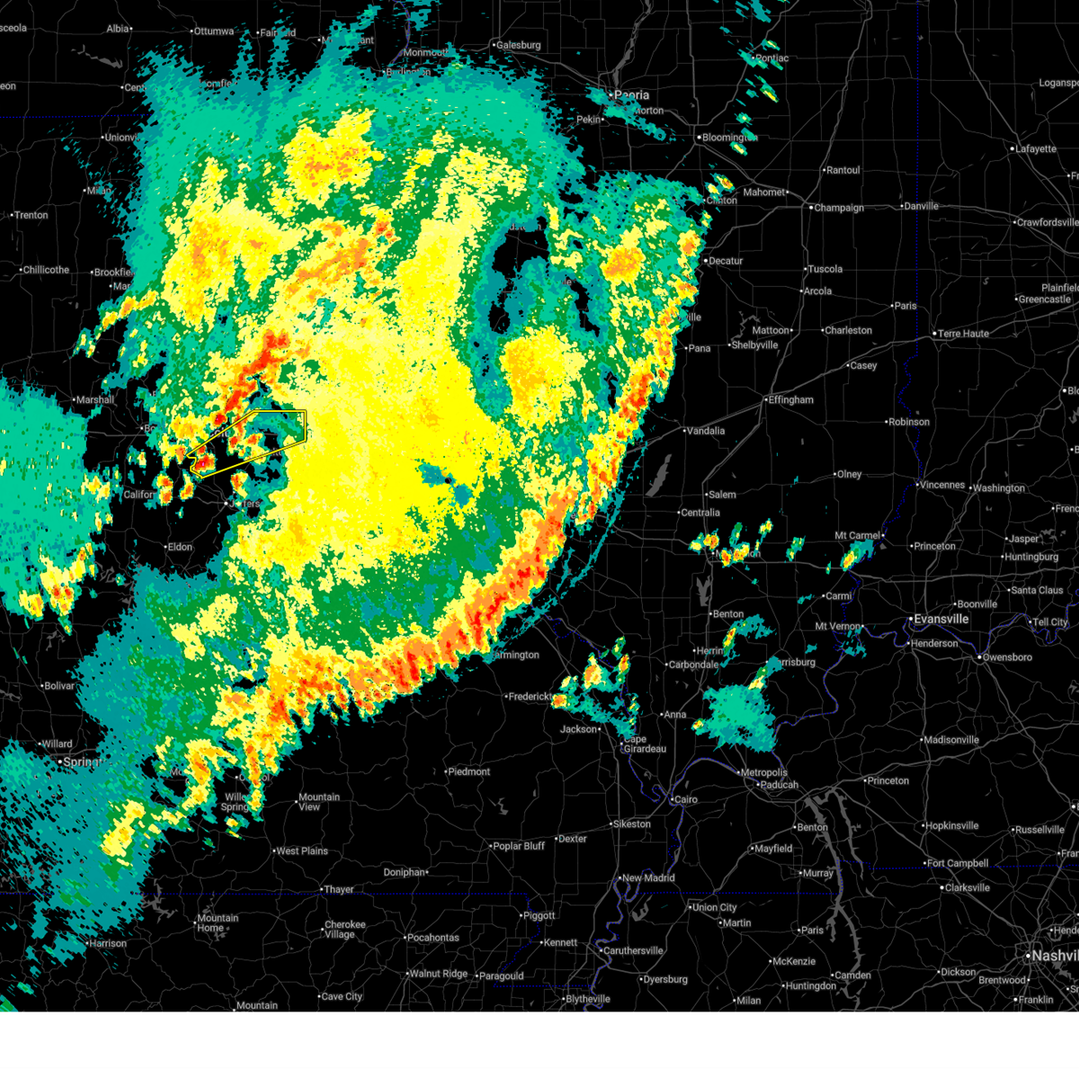
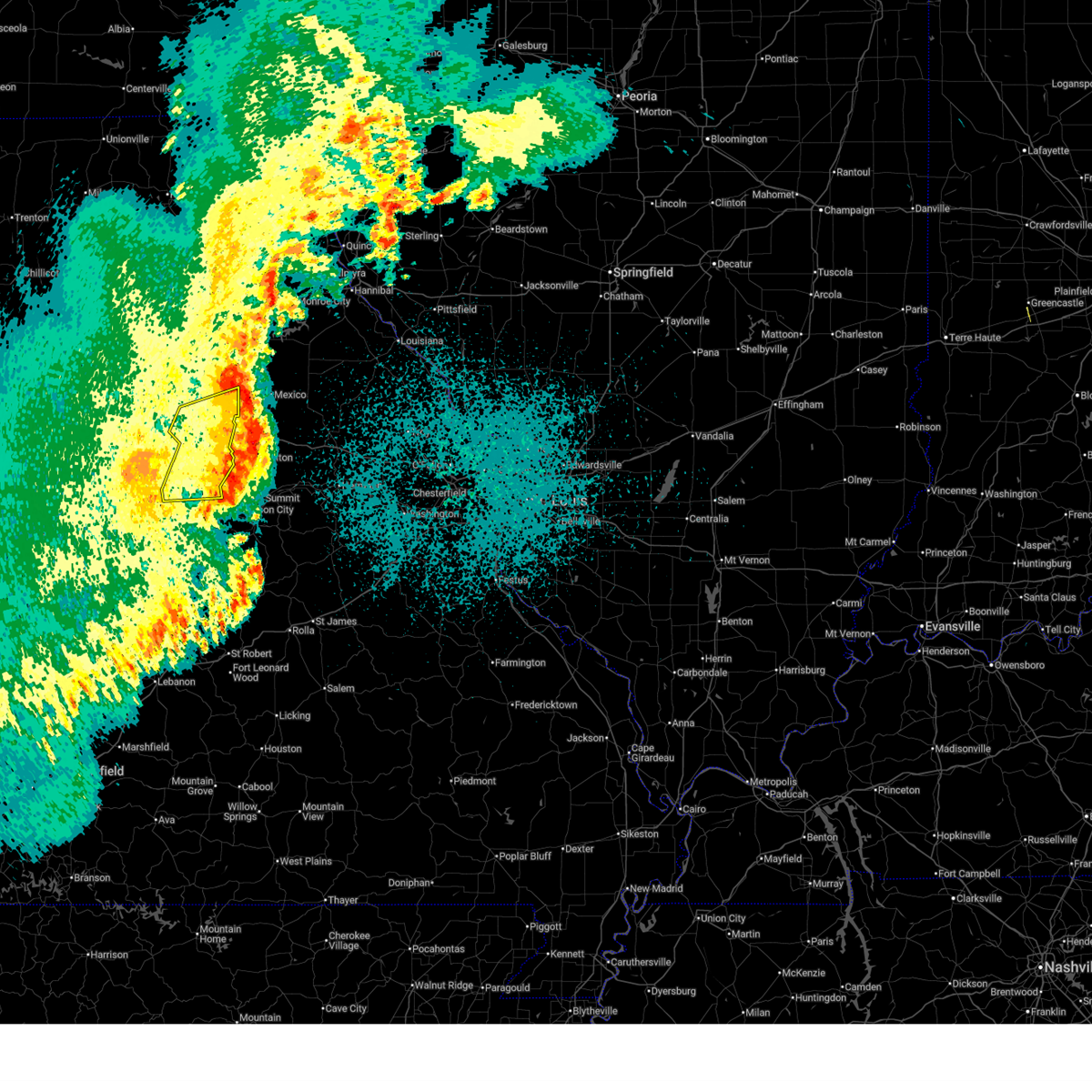
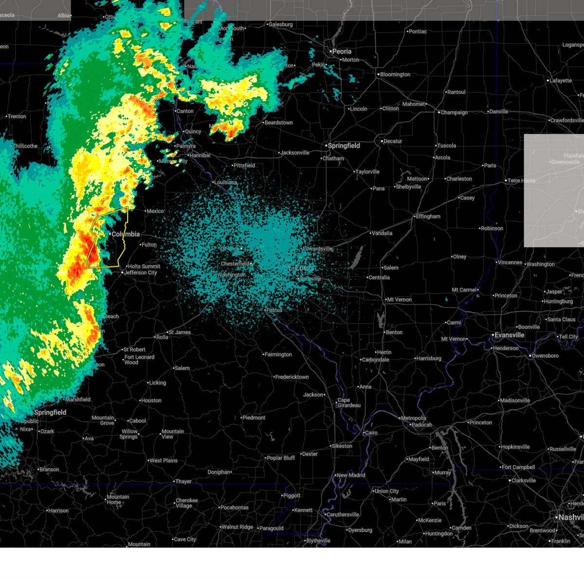
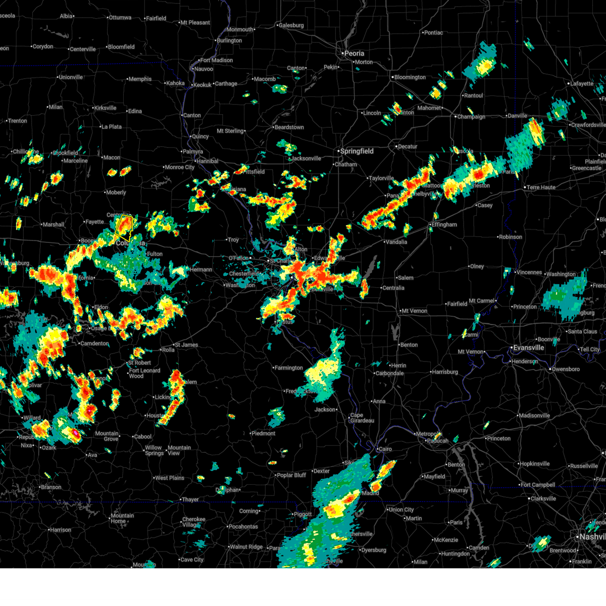
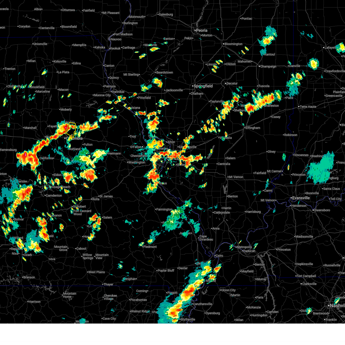
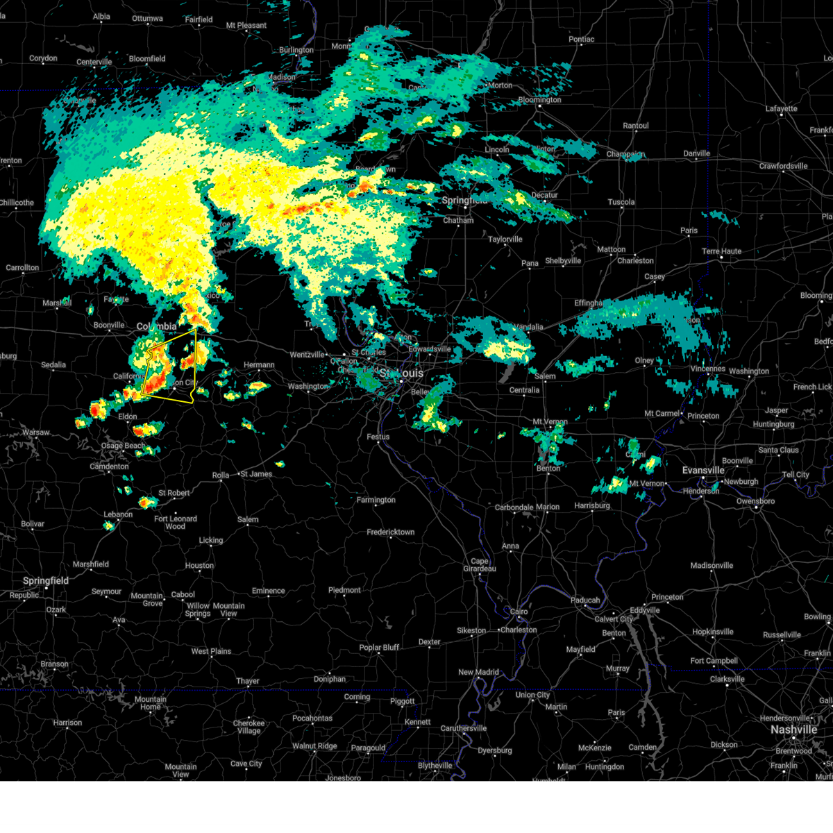
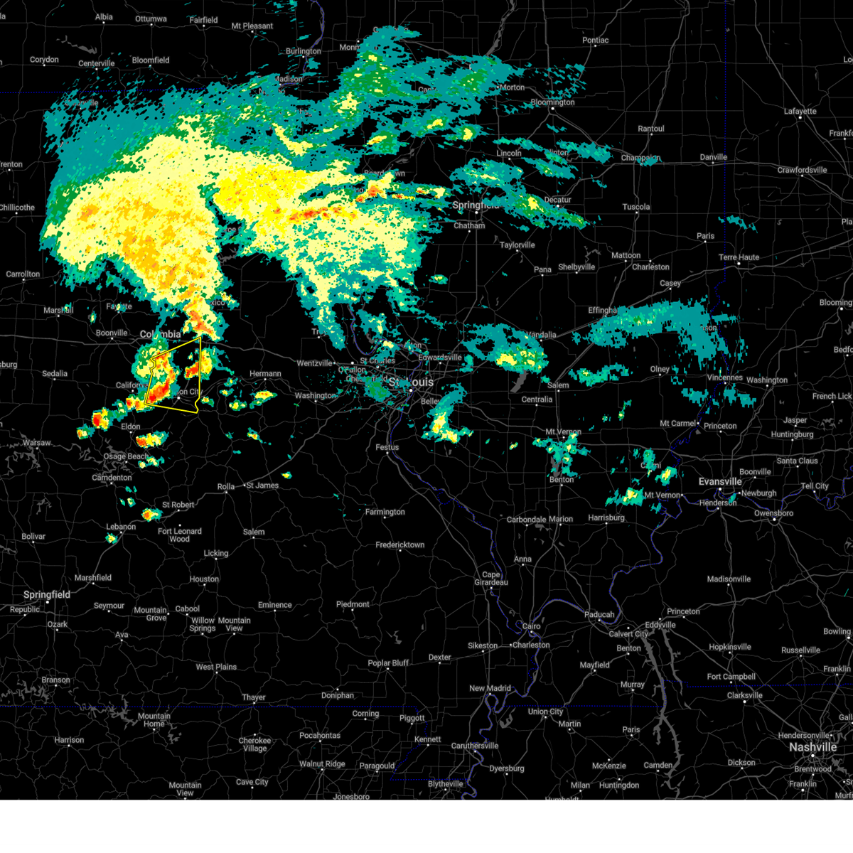
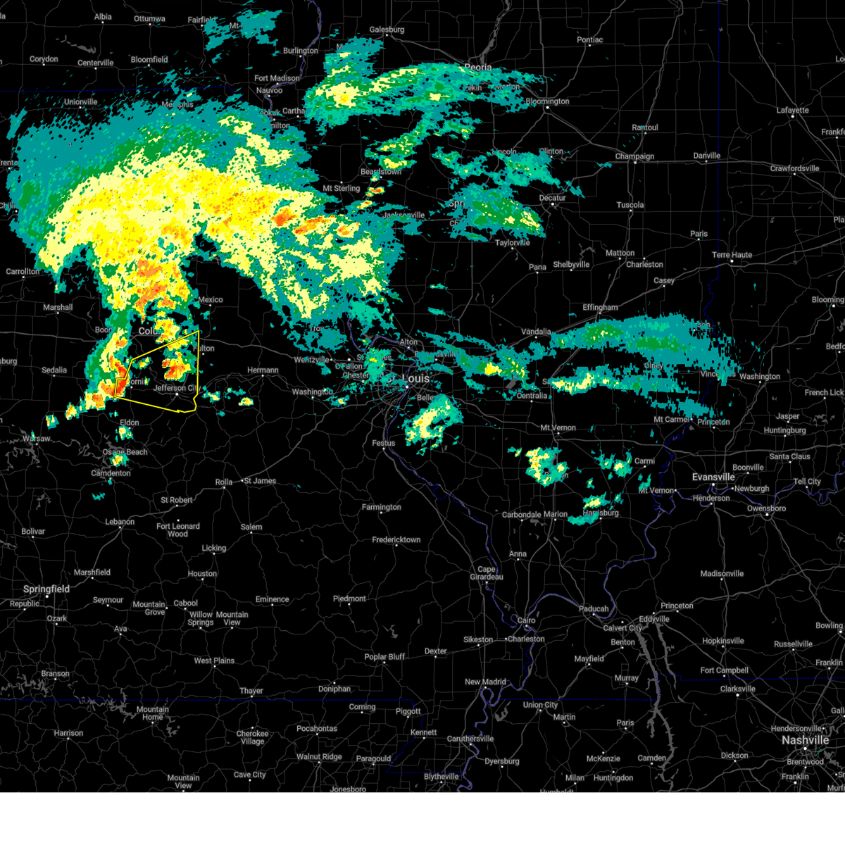
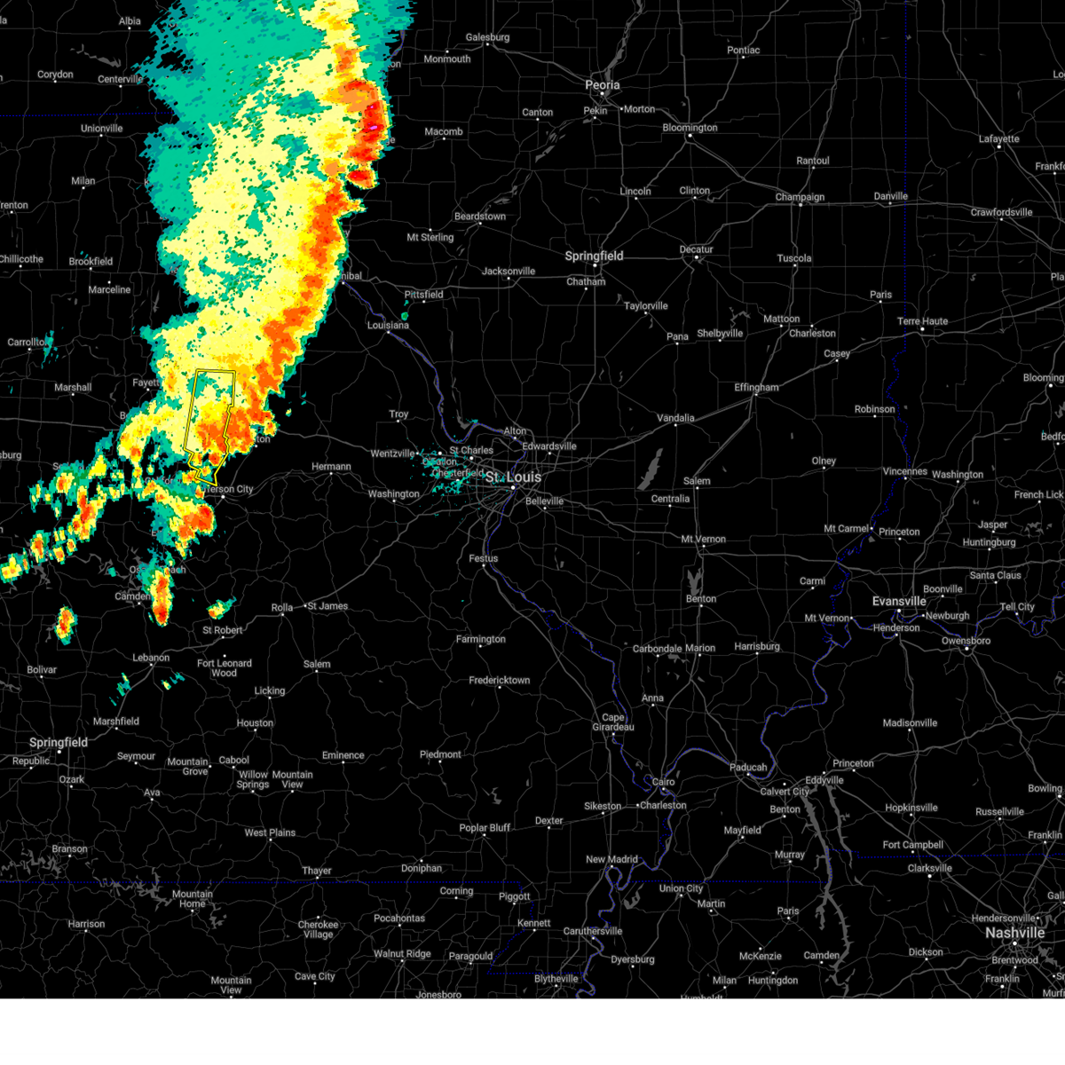
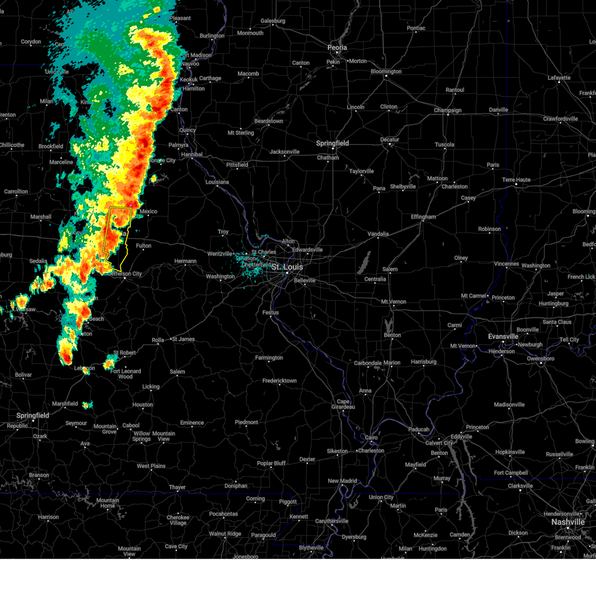
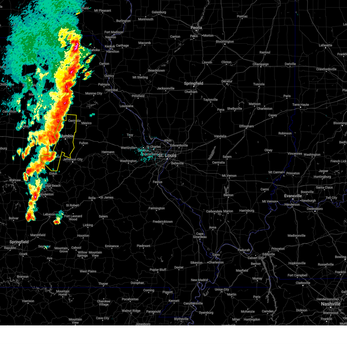
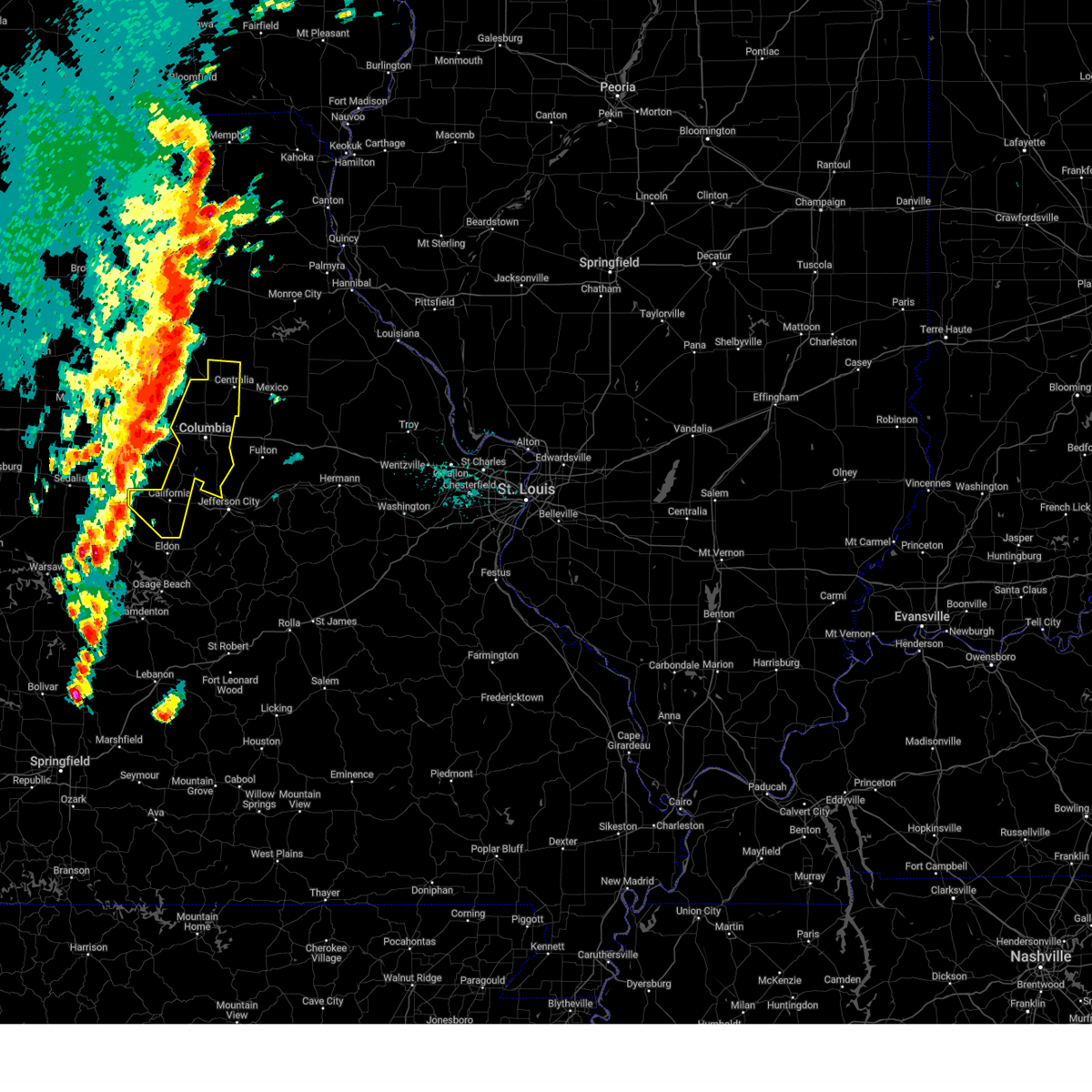
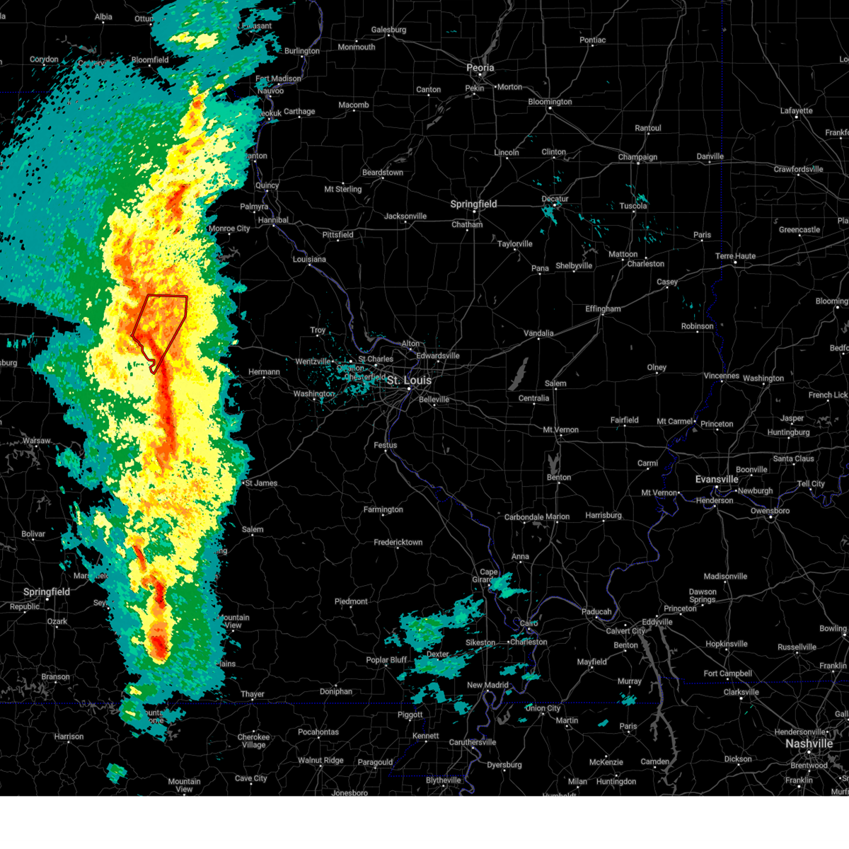
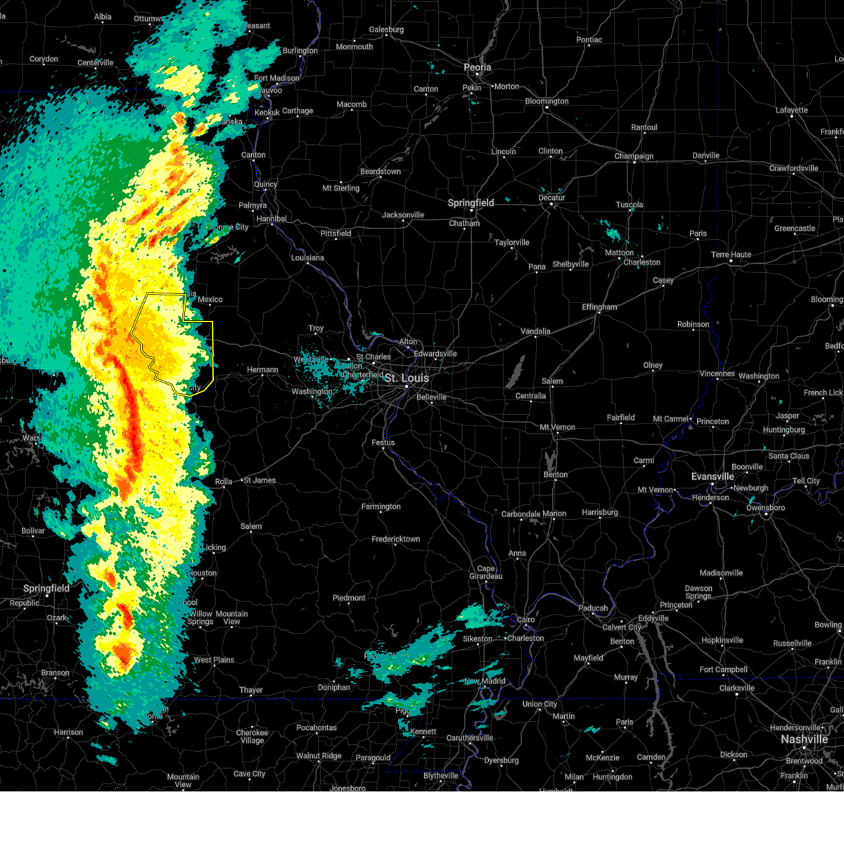
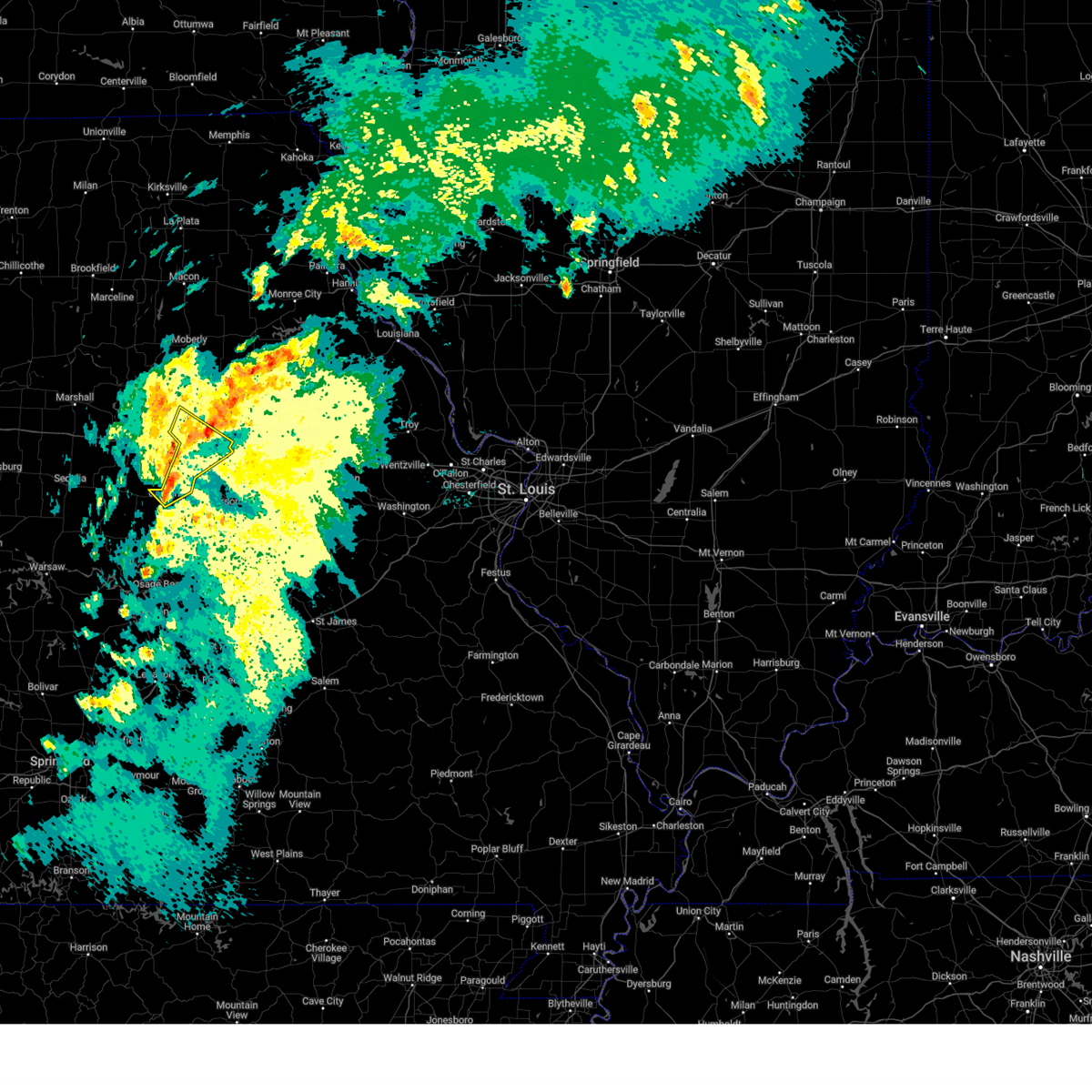
Hail Map for Columbia, MO
The Columbia, MO area has had 83 reports of on-the-ground hail by trained spotters, and has been under severe weather warnings 42 times during the past 12 months. Doppler radar has detected hail at or near Columbia, MO on 116 occasions, including 4 occasions during the past year.
| Name: | Columbia, MO |
| Where Located: | 1 miles S of Columbia, MO |
| Map: | Google Map for Columbia, MO |
| Population: | 108500 |
| Housing Units: | 46758 |
| More Info: | Search Google for Columbia, MO |
1
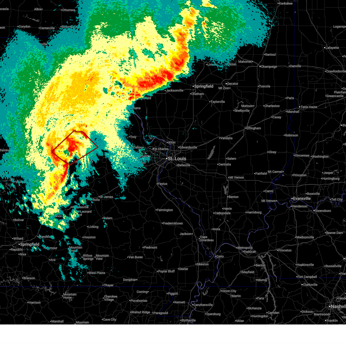
The Top Recent Hail Date for Columbia, MO is Monday, April 27, 2026 (21st out of 116)

Hail and Wind Damage Spotted near Columbia, MO
| Date / Time | Report Details |
|---|---|
| 6/13/2026 11:46 PM CDT |
 At 1146 pm cdt, severe thunderstorms were located along a line from over midway to near jefferson city, or along a line from 8 miles northwest of columbia to near holts summit, moving east at 40 mph (radar indicated). Hazards include 60 mph wind gusts and small hail. Expect damage to roofs, siding, and trees. locations impacted include, lupus, rocheport, mcbaine, wilton, easley, hartsburg, columbia, ashland, midway, columbia regional airport and murry. this includes the following state parks, rock bridge state park, finger lakes state park and jewell cemetery historic site. This includes interstate 70 in missouri between exits 115 and 133. At 1146 pm cdt, severe thunderstorms were located along a line from over midway to near jefferson city, or along a line from 8 miles northwest of columbia to near holts summit, moving east at 40 mph (radar indicated). Hazards include 60 mph wind gusts and small hail. Expect damage to roofs, siding, and trees. locations impacted include, lupus, rocheport, mcbaine, wilton, easley, hartsburg, columbia, ashland, midway, columbia regional airport and murry. this includes the following state parks, rock bridge state park, finger lakes state park and jewell cemetery historic site. This includes interstate 70 in missouri between exits 115 and 133.
|
| 6/13/2026 11:21 PM CDT |
 Svrlsx the national weather service in st louis has issued a * severe thunderstorm warning for, boone county in central missouri, * until 1215 am cdt. * at 1121 pm cdt, severe thunderstorms were located along a line from 12 miles northwest of rocheport to 7 miles west of high point, or along a line from 23 miles northwest of columbia to 14 miles southwest of california, moving east at 40 mph (radar indicated). Hazards include 60 mph wind gusts and small hail. expect damage to roofs, siding, and trees Svrlsx the national weather service in st louis has issued a * severe thunderstorm warning for, boone county in central missouri, * until 1215 am cdt. * at 1121 pm cdt, severe thunderstorms were located along a line from 12 miles northwest of rocheport to 7 miles west of high point, or along a line from 23 miles northwest of columbia to 14 miles southwest of california, moving east at 40 mph (radar indicated). Hazards include 60 mph wind gusts and small hail. expect damage to roofs, siding, and trees
|
| 6/11/2026 6:49 PM CDT |
 Svrlsx the national weather service in st louis has issued a * severe thunderstorm warning for, southeastern boone county in central missouri, central callaway county in central missouri, * until 730 pm cdt. * at 649 pm cdt, a severe thunderstorm was located over columbia regional airport, moving east at 35 mph (radar indicated). Hazards include 60 mph wind gusts and quarter size hail. Hail damage to vehicles is expected. Expect wind damage to roofs, siding, and trees. Svrlsx the national weather service in st louis has issued a * severe thunderstorm warning for, southeastern boone county in central missouri, central callaway county in central missouri, * until 730 pm cdt. * at 649 pm cdt, a severe thunderstorm was located over columbia regional airport, moving east at 35 mph (radar indicated). Hazards include 60 mph wind gusts and quarter size hail. Hail damage to vehicles is expected. Expect wind damage to roofs, siding, and trees.
|
| 6/1/2026 4:25 AM CDT |
 The severe thunderstorm warning that was previously in effect has been reissued for audrain and callaway counties and is in effect until 500 am cdt. please refer to that bulletin for the latest severe weather information. a severe thunderstorm watch remains in effect until 900 am cdt for a portion of central missouri. The severe thunderstorm warning that was previously in effect has been reissued for audrain and callaway counties and is in effect until 500 am cdt. please refer to that bulletin for the latest severe weather information. a severe thunderstorm watch remains in effect until 900 am cdt for a portion of central missouri.
|
| 6/1/2026 4:25 AM CDT |
 The storm which prompted the warning has weakened below severe limits, and no longer poses an immediate threat to life or property. therefore, the warning will be allowed to expire. a severe thunderstorm watch remains in effect until 900 am cdt for a portion of central missouri. The storm which prompted the warning has weakened below severe limits, and no longer poses an immediate threat to life or property. therefore, the warning will be allowed to expire. a severe thunderstorm watch remains in effect until 900 am cdt for a portion of central missouri.
|
| 6/1/2026 4:15 AM CDT |
 At 415 am cdt, severe thunderstorms were located along a line from 7 miles south of auxvasse to over ashland, or along a line from 7 miles northeast of fulton to over ashland, moving southeast at 20 mph (radar indicated). Hazards include 60 mph wind gusts and quarter size hail. Hail damage to vehicles is expected. expect wind damage to roofs, siding, and trees. locations impacted include, vandiver, hatton, mexico, easley, benton city, auxvasse, columbia regional airport, kingdom city, ashland, fulton, martinsburg, carrington, hartsburg, shamrock, guthrie, new bloomfield, lake mykee town, lake mykee and williamsburg. this includes the following state parks, rock bridge state park. This includes interstate 70 in missouri between exits 133 and 155. At 415 am cdt, severe thunderstorms were located along a line from 7 miles south of auxvasse to over ashland, or along a line from 7 miles northeast of fulton to over ashland, moving southeast at 20 mph (radar indicated). Hazards include 60 mph wind gusts and quarter size hail. Hail damage to vehicles is expected. expect wind damage to roofs, siding, and trees. locations impacted include, vandiver, hatton, mexico, easley, benton city, auxvasse, columbia regional airport, kingdom city, ashland, fulton, martinsburg, carrington, hartsburg, shamrock, guthrie, new bloomfield, lake mykee town, lake mykee and williamsburg. this includes the following state parks, rock bridge state park. This includes interstate 70 in missouri between exits 133 and 155.
|
| 6/1/2026 4:04 AM CDT |
 At 404 am cdt, severe thunderstorms were located along a line from near auxvasse to over ashland, or along a line from 8 miles north of fulton to over ashland, moving southeast at 20 mph (radar indicated). Hazards include 60 mph wind gusts and quarter size hail. Hail damage to vehicles is expected. expect wind damage to roofs, siding, and trees. locations impacted include, hallsville, centralia, columbia, murry, mexico, easley, benton city, auxvasse, columbia regional airport, kingdom city, ashland, fulton, martinsburg, hartsburg, shamrock, new bloomfield, lake mykee town, lake mykee and williamsburg. this includes the following state parks, rock bridge state park, finger lakes state park and jewell cemetery historic site. This includes interstate 70 in missouri between exits 121 and 155. At 404 am cdt, severe thunderstorms were located along a line from near auxvasse to over ashland, or along a line from 8 miles north of fulton to over ashland, moving southeast at 20 mph (radar indicated). Hazards include 60 mph wind gusts and quarter size hail. Hail damage to vehicles is expected. expect wind damage to roofs, siding, and trees. locations impacted include, hallsville, centralia, columbia, murry, mexico, easley, benton city, auxvasse, columbia regional airport, kingdom city, ashland, fulton, martinsburg, hartsburg, shamrock, new bloomfield, lake mykee town, lake mykee and williamsburg. this includes the following state parks, rock bridge state park, finger lakes state park and jewell cemetery historic site. This includes interstate 70 in missouri between exits 121 and 155.
|
| 6/1/2026 4:04 AM CDT |
 At 404 am cdt, a severe thunderstorm was located over columbia, moving southeast at 20 mph (radar indicated). Hazards include 60 mph wind gusts and quarter size hail. Hail damage to vehicles is expected. expect wind damage to roofs, siding, and trees. locations impacted include, rocheport, harrisburg, midway, mcbaine and lupus. This includes interstate 70 in missouri between exits 115 and 121. At 404 am cdt, a severe thunderstorm was located over columbia, moving southeast at 20 mph (radar indicated). Hazards include 60 mph wind gusts and quarter size hail. Hail damage to vehicles is expected. expect wind damage to roofs, siding, and trees. locations impacted include, rocheport, harrisburg, midway, mcbaine and lupus. This includes interstate 70 in missouri between exits 115 and 121.
|
| 6/1/2026 3:39 AM CDT |
 Svrlsx the national weather service in st louis has issued a * severe thunderstorm warning for, northwestern boone county in central missouri, northeastern moniteau county in central missouri, * until 430 am cdt. * at 339 am cdt, a severe thunderstorm was located near midway, or 10 miles northwest of columbia, moving southeast at 20 mph (radar indicated). Hazards include 60 mph wind gusts and quarter size hail. Hail damage to vehicles is expected. Expect wind damage to roofs, siding, and trees. Svrlsx the national weather service in st louis has issued a * severe thunderstorm warning for, northwestern boone county in central missouri, northeastern moniteau county in central missouri, * until 430 am cdt. * at 339 am cdt, a severe thunderstorm was located near midway, or 10 miles northwest of columbia, moving southeast at 20 mph (radar indicated). Hazards include 60 mph wind gusts and quarter size hail. Hail damage to vehicles is expected. Expect wind damage to roofs, siding, and trees.
|
| 6/1/2026 3:34 AM CDT |
 At 334 am cdt, a severe thunderstorm was located over midway, or 7 miles northwest of columbia, moving southeast at 20 mph (radar indicated). Hazards include 60 mph wind gusts and quarter size hail. Hail damage to vehicles is expected. expect wind damage to roofs, siding, and trees. locations impacted include, rocheport, harrisburg, midway, mcbaine and lupus. This includes interstate 70 in missouri between exits 115 and 121. At 334 am cdt, a severe thunderstorm was located over midway, or 7 miles northwest of columbia, moving southeast at 20 mph (radar indicated). Hazards include 60 mph wind gusts and quarter size hail. Hail damage to vehicles is expected. expect wind damage to roofs, siding, and trees. locations impacted include, rocheport, harrisburg, midway, mcbaine and lupus. This includes interstate 70 in missouri between exits 115 and 121.
|
| 6/1/2026 3:33 AM CDT |
 Svrlsx the national weather service in st louis has issued a * severe thunderstorm warning for, southern audrain county in central missouri, boone county in central missouri, callaway county in central missouri, * until 430 am cdt. * at 333 am cdt, severe thunderstorms were located along a line from 8 miles northeast of murry to 6 miles south of midway, or along a line from 10 miles southeast of centralia to 7 miles southwest of columbia, moving southeast at 20 mph (radar indicated). Hazards include 60 mph wind gusts and quarter size hail. Hail damage to vehicles is expected. Expect wind damage to roofs, siding, and trees. Svrlsx the national weather service in st louis has issued a * severe thunderstorm warning for, southern audrain county in central missouri, boone county in central missouri, callaway county in central missouri, * until 430 am cdt. * at 333 am cdt, severe thunderstorms were located along a line from 8 miles northeast of murry to 6 miles south of midway, or along a line from 10 miles southeast of centralia to 7 miles southwest of columbia, moving southeast at 20 mph (radar indicated). Hazards include 60 mph wind gusts and quarter size hail. Hail damage to vehicles is expected. Expect wind damage to roofs, siding, and trees.
|
| 6/1/2026 2:59 AM CDT |
 Svrlsx the national weather service in st louis has issued a * severe thunderstorm warning for, northwestern boone county in central missouri, northeastern moniteau county in central missouri, * until 345 am cdt. * at 259 am cdt, a severe thunderstorm was located 8 miles northwest of rocheport, or 19 miles northwest of columbia, moving southeast at 20 mph (radar indicated). Hazards include 60 mph wind gusts and half dollar size hail. Hail damage to vehicles is expected. Expect wind damage to roofs, siding, and trees. Svrlsx the national weather service in st louis has issued a * severe thunderstorm warning for, northwestern boone county in central missouri, northeastern moniteau county in central missouri, * until 345 am cdt. * at 259 am cdt, a severe thunderstorm was located 8 miles northwest of rocheport, or 19 miles northwest of columbia, moving southeast at 20 mph (radar indicated). Hazards include 60 mph wind gusts and half dollar size hail. Hail damage to vehicles is expected. Expect wind damage to roofs, siding, and trees.
|
| 4/27/2026 4:41 PM CDT |
 The storm which prompted the warning has moved out of the area. therefore, the warning will be allowed to expire. a tornado watch remains in effect until 900 pm cdt for a portion of central missouri. The storm which prompted the warning has moved out of the area. therefore, the warning will be allowed to expire. a tornado watch remains in effect until 900 pm cdt for a portion of central missouri.
|
| 4/27/2026 4:32 PM CDT |
 At 432 pm cdt, a severe thunderstorm was located 6 miles northwest of laddonia, or 8 miles southeast of santa fe, moving northeast at 40 mph (radar indicated). Hazards include 60 mph wind gusts and quarter size hail. Hail damage to vehicles is expected. expect wind damage to roofs, siding, and trees. This severe thunderstorm will remain over mainly rural areas of northeastern boone county. At 432 pm cdt, a severe thunderstorm was located 6 miles northwest of laddonia, or 8 miles southeast of santa fe, moving northeast at 40 mph (radar indicated). Hazards include 60 mph wind gusts and quarter size hail. Hail damage to vehicles is expected. expect wind damage to roofs, siding, and trees. This severe thunderstorm will remain over mainly rural areas of northeastern boone county.
|
| 4/27/2026 4:01 PM CDT |
 The storm which prompted the warning has moved out of the area. therefore, the warning has been allowed to expire. a severe thunderstorm warning still remains in effect for boone county. a tornado watch remains in effect until 900 pm cdt for a portion of central missouri. The storm which prompted the warning has moved out of the area. therefore, the warning has been allowed to expire. a severe thunderstorm warning still remains in effect for boone county. a tornado watch remains in effect until 900 pm cdt for a portion of central missouri.
|
| 4/27/2026 4:00 PM CDT |
 Svrlsx the national weather service in st louis has issued a * severe thunderstorm warning for, southern boone county in central missouri, callaway county in central missouri, northeastern moniteau county in central missouri, * until 500 pm cdt. * at 400 pm cdt, a severe thunderstorm was located 6 miles north of tipton, moving east at 60 mph (radar indicated). Hazards include 60 mph wind gusts and half dollar size hail. Hail damage to vehicles is expected. expect wind damage to roofs, siding, and trees. this severe thunderstorm will be near, jamestown around 415 pm cdt. easley around 420 pm cdt. other locations impacted by the severe thunderstorm include kliever, sandy hook, lupus, wilton, mcbaine, hartsburg, guthrie, carrington and kingdom city. this includes the following state parks, rock bridge state park and jewell cemetery historic site. This includes interstate 70 in missouri between exits 128 and 155. Svrlsx the national weather service in st louis has issued a * severe thunderstorm warning for, southern boone county in central missouri, callaway county in central missouri, northeastern moniteau county in central missouri, * until 500 pm cdt. * at 400 pm cdt, a severe thunderstorm was located 6 miles north of tipton, moving east at 60 mph (radar indicated). Hazards include 60 mph wind gusts and half dollar size hail. Hail damage to vehicles is expected. expect wind damage to roofs, siding, and trees. this severe thunderstorm will be near, jamestown around 415 pm cdt. easley around 420 pm cdt. other locations impacted by the severe thunderstorm include kliever, sandy hook, lupus, wilton, mcbaine, hartsburg, guthrie, carrington and kingdom city. this includes the following state parks, rock bridge state park and jewell cemetery historic site. This includes interstate 70 in missouri between exits 128 and 155.
|
| 4/27/2026 3:58 PM CDT |
 At 358 pm cdt, a severe thunderstorm was located 6 miles southeast of centralia, moving northeast at 40 mph (radar indicated). Hazards include 60 mph wind gusts and quarter size hail. Hail damage to vehicles is expected. expect wind damage to roofs, siding, and trees. this severe thunderstorm will be near, centralia around 400 pm cdt. this includes the following state parks, finger lakes state park. This includes interstate 70 in missouri between exits 115 and 126. At 358 pm cdt, a severe thunderstorm was located 6 miles southeast of centralia, moving northeast at 40 mph (radar indicated). Hazards include 60 mph wind gusts and quarter size hail. Hail damage to vehicles is expected. expect wind damage to roofs, siding, and trees. this severe thunderstorm will be near, centralia around 400 pm cdt. this includes the following state parks, finger lakes state park. This includes interstate 70 in missouri between exits 115 and 126.
|
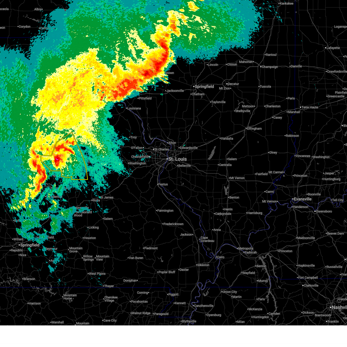
| 4/27/2026 3:46 PM CDT |
 Torlsx the national weather service in st louis has issued a * tornado warning for, east central boone county in central missouri, * until 400 pm cdt. * at 346 pm cdt, a severe thunderstorm capable of producing a tornado was located over murry, or 9 miles northeast of columbia, moving northeast at 40 mph (radar indicated rotation). Hazards include tornado and quarter size hail. Flying debris will be dangerous to those caught without shelter. mobile homes will be damaged or destroyed. damage to roofs, windows and vehicles will occur. tree damage is likely. This tornado will be near, murry and columbia around 350 pm cdt. Torlsx the national weather service in st louis has issued a * tornado warning for, east central boone county in central missouri, * until 400 pm cdt. * at 346 pm cdt, a severe thunderstorm capable of producing a tornado was located over murry, or 9 miles northeast of columbia, moving northeast at 40 mph (radar indicated rotation). Hazards include tornado and quarter size hail. Flying debris will be dangerous to those caught without shelter. mobile homes will be damaged or destroyed. damage to roofs, windows and vehicles will occur. tree damage is likely. This tornado will be near, murry and columbia around 350 pm cdt.
|
| 4/27/2026 3:43 PM CDT |
 Svrlsx the national weather service in st louis has issued a * severe thunderstorm warning for, boone county in central missouri, * until 445 pm cdt. * at 343 pm cdt, a severe thunderstorm was located near hallsville, or 9 miles northeast of columbia, moving northeast at 35 mph (radar indicated). Hazards include 60 mph wind gusts and quarter size hail. Hail damage to vehicles is expected. expect wind damage to roofs, siding, and trees. this severe thunderstorm will be near, columbia and murry around 345 pm cdt. hallsville around 350 pm cdt. centralia around 400 pm cdt. this includes the following state parks, finger lakes state park and jewell cemetery historic site. This includes interstate 70 in missouri between exits 115 and 133. Svrlsx the national weather service in st louis has issued a * severe thunderstorm warning for, boone county in central missouri, * until 445 pm cdt. * at 343 pm cdt, a severe thunderstorm was located near hallsville, or 9 miles northeast of columbia, moving northeast at 35 mph (radar indicated). Hazards include 60 mph wind gusts and quarter size hail. Hail damage to vehicles is expected. expect wind damage to roofs, siding, and trees. this severe thunderstorm will be near, columbia and murry around 345 pm cdt. hallsville around 350 pm cdt. centralia around 400 pm cdt. this includes the following state parks, finger lakes state park and jewell cemetery historic site. This includes interstate 70 in missouri between exits 115 and 133.
|
| 4/27/2026 3:14 PM CDT |
 At 314 pm cdt, a severe thunderstorm was located near columbia, moving northeast at 35 mph (public reported. at 3:10 pm, mping reports of 1 inch hail were received). Hazards include 60 mph wind gusts and quarter size hail. Hail damage to vehicles is expected. expect wind damage to roofs, siding, and trees. this severe thunderstorm will be near, columbia and midway around 315 pm cdt. murry and hallsville around 330 pm cdt. this includes the following state parks, finger lakes state park and jewell cemetery historic site. This includes interstate 70 in missouri between exits 115 and 133. At 314 pm cdt, a severe thunderstorm was located near columbia, moving northeast at 35 mph (public reported. at 3:10 pm, mping reports of 1 inch hail were received). Hazards include 60 mph wind gusts and quarter size hail. Hail damage to vehicles is expected. expect wind damage to roofs, siding, and trees. this severe thunderstorm will be near, columbia and midway around 315 pm cdt. murry and hallsville around 330 pm cdt. this includes the following state parks, finger lakes state park and jewell cemetery historic site. This includes interstate 70 in missouri between exits 115 and 133.
|
| 4/27/2026 3:14 PM CDT |
 the severe thunderstorm warning has been cancelled and is no longer in effect the severe thunderstorm warning has been cancelled and is no longer in effect
|
| 4/27/2026 3:13 PM CDT |
 At 313 pm cdt, a severe thunderstorm was located over columbia, moving northeast at 35 mph (radar indicated). Hazards include 60 mph wind gusts and quarter size hail. Hail damage to vehicles is expected. expect wind damage to roofs, siding, and trees. this severe thunderstorm will be near, columbia and midway around 315 pm cdt. murry and hallsville around 330 pm cdt. this includes the following state parks, finger lakes state park and jewell cemetery historic site. This includes interstate 70 in missouri between exits 115 and 133. At 313 pm cdt, a severe thunderstorm was located over columbia, moving northeast at 35 mph (radar indicated). Hazards include 60 mph wind gusts and quarter size hail. Hail damage to vehicles is expected. expect wind damage to roofs, siding, and trees. this severe thunderstorm will be near, columbia and midway around 315 pm cdt. murry and hallsville around 330 pm cdt. this includes the following state parks, finger lakes state park and jewell cemetery historic site. This includes interstate 70 in missouri between exits 115 and 133.
|
| 4/27/2026 3:10 PM CDT | Quarter sized hail reported 2.9 miles SE of Columbia, MO, report from mping: quarter (1.00 in.). |
| 4/27/2026 3:08 PM CDT | Quarter sized hail reported 4.3 miles S of Columbia, MO, report from mping: quarter (1.00 in.). |
| 4/27/2026 2:57 PM CDT |
 Svrlsx the national weather service in st louis has issued a * severe thunderstorm warning for, boone county in central missouri, northeastern moniteau county in central missouri, * until 345 pm cdt. * at 257 pm cdt, a severe thunderstorm was located near midway, or 9 miles west of columbia, moving northeast at 35 mph (radar indicated). Hazards include 60 mph wind gusts and quarter size hail. Hail damage to vehicles is expected. expect wind damage to roofs, siding, and trees. this severe thunderstorm will be near, rocheport around 300 pm cdt. midway around 305 pm cdt. columbia around 310 pm cdt. other locations impacted by the severe thunderstorm include mcbaine and lupus. this includes the following state parks, finger lakes state park and jewell cemetery historic site. This includes interstate 70 in missouri between exits 115 and 133. Svrlsx the national weather service in st louis has issued a * severe thunderstorm warning for, boone county in central missouri, northeastern moniteau county in central missouri, * until 345 pm cdt. * at 257 pm cdt, a severe thunderstorm was located near midway, or 9 miles west of columbia, moving northeast at 35 mph (radar indicated). Hazards include 60 mph wind gusts and quarter size hail. Hail damage to vehicles is expected. expect wind damage to roofs, siding, and trees. this severe thunderstorm will be near, rocheport around 300 pm cdt. midway around 305 pm cdt. columbia around 310 pm cdt. other locations impacted by the severe thunderstorm include mcbaine and lupus. this includes the following state parks, finger lakes state park and jewell cemetery historic site. This includes interstate 70 in missouri between exits 115 and 133.
|
| 4/26/2026 8:57 PM CDT |
 At 857 pm cdt, a severe thunderstorm capable of producing a tornado was located near ashland, moving northeast at 35 mph (radar indicated rotation). Hazards include tornado. Flying debris will be dangerous to those caught without shelter. mobile homes will be damaged or destroyed. damage to roofs, windows and vehicles will occur. tree damage is likely. this tornado will be near, ashland around 900 pm cdt. columbia regional airport around 905 pm cdt. lake mykee town, lake mykee and holts summit around 910 pm cdt. other locations impacted by the tornado include hartsburg, wilton, guthrie and carrington. this includes the following state parks, rock bridge state park and jewell cemetery historic site. This includes interstate 70 in missouri between exits 125 and 127. At 857 pm cdt, a severe thunderstorm capable of producing a tornado was located near ashland, moving northeast at 35 mph (radar indicated rotation). Hazards include tornado. Flying debris will be dangerous to those caught without shelter. mobile homes will be damaged or destroyed. damage to roofs, windows and vehicles will occur. tree damage is likely. this tornado will be near, ashland around 900 pm cdt. columbia regional airport around 905 pm cdt. lake mykee town, lake mykee and holts summit around 910 pm cdt. other locations impacted by the tornado include hartsburg, wilton, guthrie and carrington. this includes the following state parks, rock bridge state park and jewell cemetery historic site. This includes interstate 70 in missouri between exits 125 and 127.
|
| 4/26/2026 8:43 PM CDT |
 Torlsx the national weather service in st louis has issued a * tornado warning for, southeastern boone county in central missouri, southwestern callaway county in central missouri, northwestern cole county in central missouri, east central moniteau county in central missouri, * until 930 pm cdt. * at 843 pm cdt, a severe thunderstorm capable of producing a tornado was located over centertown, or 9 miles east of california, moving northeast at 35 mph (radar indicated rotation). Hazards include tornado. Flying debris will be dangerous to those caught without shelter. mobile homes will be damaged or destroyed. damage to roofs, windows and vehicles will occur. tree damage is likely. this tornado will be near, centertown, st. martins and jamestown around 845 pm cdt. ashland around 900 pm cdt. other locations impacted by the tornado include kliever, marion, wilton, elston, sandy hook, hartsburg, guthrie and carrington. this includes the following state parks, rock bridge state park and jewell cemetery historic site. This includes interstate 70 in missouri between exits 125 and 127. Torlsx the national weather service in st louis has issued a * tornado warning for, southeastern boone county in central missouri, southwestern callaway county in central missouri, northwestern cole county in central missouri, east central moniteau county in central missouri, * until 930 pm cdt. * at 843 pm cdt, a severe thunderstorm capable of producing a tornado was located over centertown, or 9 miles east of california, moving northeast at 35 mph (radar indicated rotation). Hazards include tornado. Flying debris will be dangerous to those caught without shelter. mobile homes will be damaged or destroyed. damage to roofs, windows and vehicles will occur. tree damage is likely. this tornado will be near, centertown, st. martins and jamestown around 845 pm cdt. ashland around 900 pm cdt. other locations impacted by the tornado include kliever, marion, wilton, elston, sandy hook, hartsburg, guthrie and carrington. this includes the following state parks, rock bridge state park and jewell cemetery historic site. This includes interstate 70 in missouri between exits 125 and 127.
|
| 4/24/2026 12:30 AM CDT | Large 10 to 12 in diameter tree limb onto power line in boone county MO, 1.7 miles SSE of Columbia, MO |
| 4/17/2026 8:38 PM CDT |
 At 838 pm cdt, a severe thunderstorm capable of producing a tornado was located over fulton, moving northeast at 50 mph (radar indicated rotation). Hazards include tornado. Flying debris will be dangerous to those caught without shelter. mobile homes will be damaged or destroyed. damage to roofs, windows and vehicles will occur. tree damage is likely. this tornado will be near, fulton around 840 pm cdt. other locations impacted by the tornado include carrington and kingdom city. this includes the following state parks, rock bridge state park, jewell cemetery historic site and jefferson landing historic site. This includes interstate 70 in missouri between exits 128 and 155. At 838 pm cdt, a severe thunderstorm capable of producing a tornado was located over fulton, moving northeast at 50 mph (radar indicated rotation). Hazards include tornado. Flying debris will be dangerous to those caught without shelter. mobile homes will be damaged or destroyed. damage to roofs, windows and vehicles will occur. tree damage is likely. this tornado will be near, fulton around 840 pm cdt. other locations impacted by the tornado include carrington and kingdom city. this includes the following state parks, rock bridge state park, jewell cemetery historic site and jefferson landing historic site. This includes interstate 70 in missouri between exits 128 and 155.
|
| 4/17/2026 8:36 PM CDT |
 At 836 pm cdt, severe thunderstorms were located along a line from near columbia to 7 miles south of westphalia, or along a line from near columbia to 14 miles southwest of linn, moving east at 50 mph (radar indicated). Hazards include 70 mph wind gusts and small hail. Expect considerable tree damage. damage is likely to mobile homes, roofs, and outbuildings. locations impacted include, st. martins, brazito, jefferson city, marion, st. thomas, wardsville, easley, meta, taos, columbia, ashland, holts summit, columbia regional airport, lake mykee town, lake mykee, new bloomfield, argyle, westphalia, freeburg and rich fountain. this includes the following state parks, rock bridge state park, clarks hill/norton historic site, jewell cemetery historic site and jefferson landing historic site. This includes interstate 70 in missouri between exits 124 and 133. At 836 pm cdt, severe thunderstorms were located along a line from near columbia to 7 miles south of westphalia, or along a line from near columbia to 14 miles southwest of linn, moving east at 50 mph (radar indicated). Hazards include 70 mph wind gusts and small hail. Expect considerable tree damage. damage is likely to mobile homes, roofs, and outbuildings. locations impacted include, st. martins, brazito, jefferson city, marion, st. thomas, wardsville, easley, meta, taos, columbia, ashland, holts summit, columbia regional airport, lake mykee town, lake mykee, new bloomfield, argyle, westphalia, freeburg and rich fountain. this includes the following state parks, rock bridge state park, clarks hill/norton historic site, jewell cemetery historic site and jefferson landing historic site. This includes interstate 70 in missouri between exits 124 and 133.
|
| 4/17/2026 8:24 PM CDT |
 At 824 pm cdt, severe thunderstorms were located along a line from near ashland to over st. thomas, or along a line from near ashland to 12 miles south of jefferson city, moving east at 70 mph (radar indicated). Hazards include 70 mph wind gusts and small hail. Expect considerable tree damage. damage is likely to mobile homes, roofs, and outbuildings. locations impacted include, california, russellville, centertown, st. martins, brazito, jamestown, jefferson city, wardsville, st. thomas, easley, holts summit, taos, ashland, lake mykee town, lake mykee, columbia regional airport, columbia, new bloomfield, westphalia and freeburg. this includes the following state parks, rock bridge state park, clarks hill/norton historic site, jewell cemetery historic site and jefferson landing historic site. This includes interstate 70 in missouri between exits 124 and 133. At 824 pm cdt, severe thunderstorms were located along a line from near ashland to over st. thomas, or along a line from near ashland to 12 miles south of jefferson city, moving east at 70 mph (radar indicated). Hazards include 70 mph wind gusts and small hail. Expect considerable tree damage. damage is likely to mobile homes, roofs, and outbuildings. locations impacted include, california, russellville, centertown, st. martins, brazito, jamestown, jefferson city, wardsville, st. thomas, easley, holts summit, taos, ashland, lake mykee town, lake mykee, columbia regional airport, columbia, new bloomfield, westphalia and freeburg. this includes the following state parks, rock bridge state park, clarks hill/norton historic site, jewell cemetery historic site and jefferson landing historic site. This includes interstate 70 in missouri between exits 124 and 133.
|
| 4/17/2026 8:17 PM CDT |
 Torlsx the national weather service in st louis has issued a * tornado warning for, southeastern boone county in central missouri, callaway county in central missouri, northwestern cole county in central missouri, northeastern moniteau county in central missouri, * until 900 pm cdt. * at 817 pm cdt, a severe thunderstorm capable of producing a tornado was located 6 miles south of ashland, moving northeast at 40 mph (radar indicated rotation). Hazards include tornado. Flying debris will be dangerous to those caught without shelter. mobile homes will be damaged or destroyed. damage to roofs, windows and vehicles will occur. tree damage is likely. this tornado will be near, ashland and jefferson city around 820 pm cdt. lake mykee town, lake mykee, holts summit and columbia regional airport around 825 pm cdt. new bloomfield around 830 pm cdt. other locations impacted by the tornado include hartsburg, guthrie, carrington, kingdom city and reform. this includes the following state parks, rock bridge state park, jewell cemetery historic site and jefferson landing historic site. This includes interstate 70 in missouri between exits 128 and 155. Torlsx the national weather service in st louis has issued a * tornado warning for, southeastern boone county in central missouri, callaway county in central missouri, northwestern cole county in central missouri, northeastern moniteau county in central missouri, * until 900 pm cdt. * at 817 pm cdt, a severe thunderstorm capable of producing a tornado was located 6 miles south of ashland, moving northeast at 40 mph (radar indicated rotation). Hazards include tornado. Flying debris will be dangerous to those caught without shelter. mobile homes will be damaged or destroyed. damage to roofs, windows and vehicles will occur. tree damage is likely. this tornado will be near, ashland and jefferson city around 820 pm cdt. lake mykee town, lake mykee, holts summit and columbia regional airport around 825 pm cdt. new bloomfield around 830 pm cdt. other locations impacted by the tornado include hartsburg, guthrie, carrington, kingdom city and reform. this includes the following state parks, rock bridge state park, jewell cemetery historic site and jefferson landing historic site. This includes interstate 70 in missouri between exits 128 and 155.
|
| 4/17/2026 7:57 PM CDT |
 Svrlsx the national weather service in st louis has issued a * severe thunderstorm warning for, southern boone county in central missouri, southwestern callaway county in central missouri, cole county in central missouri, moniteau county in central missouri, southwestern osage county in central missouri, * until 900 pm cdt. * at 757 pm cdt, severe thunderstorms were located along a line from 7 miles southwest of tipton to 19 miles southwest of high point, or along a line from 7 miles southwest of tipton to 28 miles south of tipton, moving east at 45 mph (radar indicated). Hazards include 70 mph wind gusts and quarter size hail. Hail damage to vehicles is expected. expect considerable tree damage. Wind damage is also likely to mobile homes, roofs, and outbuildings. Svrlsx the national weather service in st louis has issued a * severe thunderstorm warning for, southern boone county in central missouri, southwestern callaway county in central missouri, cole county in central missouri, moniteau county in central missouri, southwestern osage county in central missouri, * until 900 pm cdt. * at 757 pm cdt, severe thunderstorms were located along a line from 7 miles southwest of tipton to 19 miles southwest of high point, or along a line from 7 miles southwest of tipton to 28 miles south of tipton, moving east at 45 mph (radar indicated). Hazards include 70 mph wind gusts and quarter size hail. Hail damage to vehicles is expected. expect considerable tree damage. Wind damage is also likely to mobile homes, roofs, and outbuildings.
|
| 4/17/2026 3:18 PM CDT |
 At 318 pm cdt, a severe thunderstorm was located over murry, or 8 miles northeast of columbia, moving northeast at 35 mph (radar indicated). Hazards include 60 mph wind gusts and quarter size hail. Hail damage to vehicles is expected. expect wind damage to roofs, siding, and trees. locations impacted include, columbia, murry, hallsville and centralia. this includes the following state parks, finger lakes state park. This includes interstate 70 in missouri between exits 133 and 137. At 318 pm cdt, a severe thunderstorm was located over murry, or 8 miles northeast of columbia, moving northeast at 35 mph (radar indicated). Hazards include 60 mph wind gusts and quarter size hail. Hail damage to vehicles is expected. expect wind damage to roofs, siding, and trees. locations impacted include, columbia, murry, hallsville and centralia. this includes the following state parks, finger lakes state park. This includes interstate 70 in missouri between exits 133 and 137.
|
| 4/17/2026 3:06 PM CDT |
 Svrlsx the national weather service in st louis has issued a * severe thunderstorm warning for, southwestern audrain county in central missouri, northeastern boone county in central missouri, northwestern callaway county in central missouri, * until 345 pm cdt. * at 306 pm cdt, a severe thunderstorm was located over columbia, moving northeast at 35 mph (public reported half dollar size hail near columbia). Hazards include 60 mph wind gusts and half dollar size hail. Hail damage to vehicles is expected. Expect wind damage to roofs, siding, and trees. Svrlsx the national weather service in st louis has issued a * severe thunderstorm warning for, southwestern audrain county in central missouri, northeastern boone county in central missouri, northwestern callaway county in central missouri, * until 345 pm cdt. * at 306 pm cdt, a severe thunderstorm was located over columbia, moving northeast at 35 mph (public reported half dollar size hail near columbia). Hazards include 60 mph wind gusts and half dollar size hail. Hail damage to vehicles is expected. Expect wind damage to roofs, siding, and trees.
|
| 4/17/2026 3:00 PM CDT | Quarter sized hail reported 4.7 miles N of Columbia, MO |
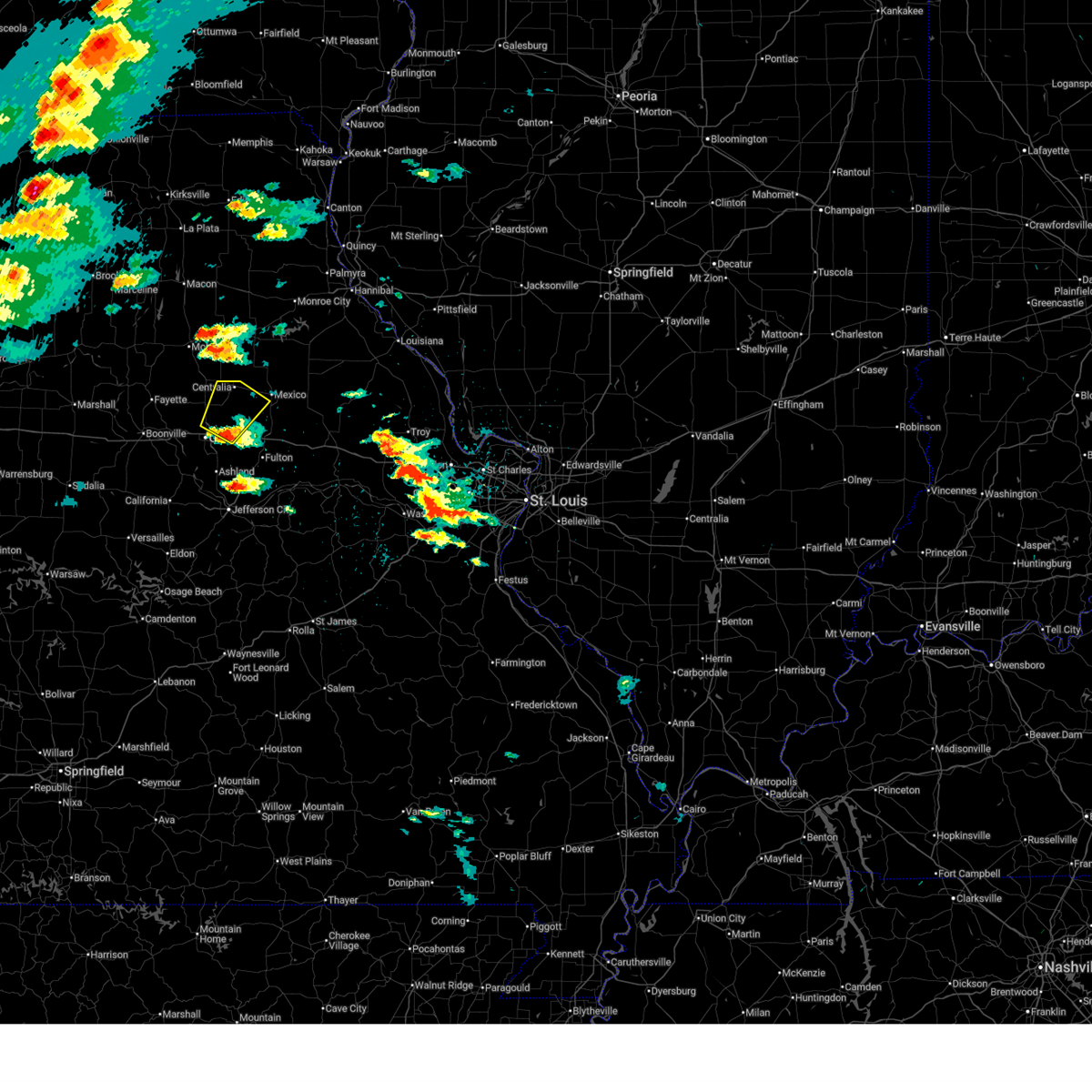
| 3/7/2026 2:50 AM CST |
 the severe thunderstorm warning has been cancelled and is no longer in effect the severe thunderstorm warning has been cancelled and is no longer in effect
|
| 3/7/2026 2:31 AM CST |
 Svrlsx the national weather service in st louis has issued a * severe thunderstorm warning for, southeastern boone county in central missouri, northern callaway county in central missouri, * until 315 am cst. * at 231 am cst, a severe thunderstorm was located over easley, or near ashland, moving northeast at 55 mph (radar indicated). Hazards include 60 mph wind gusts and quarter size hail. Hail damage to vehicles is expected. Expect wind damage to roofs, siding, and trees. Svrlsx the national weather service in st louis has issued a * severe thunderstorm warning for, southeastern boone county in central missouri, northern callaway county in central missouri, * until 315 am cst. * at 231 am cst, a severe thunderstorm was located over easley, or near ashland, moving northeast at 55 mph (radar indicated). Hazards include 60 mph wind gusts and quarter size hail. Hail damage to vehicles is expected. Expect wind damage to roofs, siding, and trees.
|
| 3/6/2026 10:56 PM CST |
 the severe thunderstorm warning has been cancelled and is no longer in effect the severe thunderstorm warning has been cancelled and is no longer in effect
|
| 3/6/2026 10:40 PM CST | Report of electric pole down on the roadwa in boone county MO, 2.9 miles SW of Columbia, MO |
| 3/6/2026 10:39 PM CST | Bradford farm missouri mesonet weather station measured wind gus in boone county MO, 6.8 miles WNW of Columbia, MO |
| 3/6/2026 10:35 PM CST | Report of a 10 inch diameter tree over the roadwa in boone county MO, 3 miles NNW of Columbia, MO |
| 3/6/2026 10:35 PM CST | Report of a tree down on the roadwa in boone county MO, 4.8 miles N of Columbia, MO |
| 3/6/2026 10:25 PM CST |
 Svrlsx the national weather service in st louis has issued a * severe thunderstorm warning for, boone county in central missouri, northwestern cole county in central missouri, northeastern moniteau county in central missouri, * until 1115 pm cst. * at 1025 pm cst, severe thunderstorms were located along a line from over rocheport to near jamestown, or along a line from 13 miles west of columbia to 7 miles northeast of california, moving east at 45 mph (radar indicated). Hazards include 60 mph wind gusts and small hail. expect damage to roofs, siding, and trees Svrlsx the national weather service in st louis has issued a * severe thunderstorm warning for, boone county in central missouri, northwestern cole county in central missouri, northeastern moniteau county in central missouri, * until 1115 pm cst. * at 1025 pm cst, severe thunderstorms were located along a line from over rocheport to near jamestown, or along a line from 13 miles west of columbia to 7 miles northeast of california, moving east at 45 mph (radar indicated). Hazards include 60 mph wind gusts and small hail. expect damage to roofs, siding, and trees
|
| 11/17/2025 4:57 PM CST | The storm which prompted the warning has weakened below severe limits, and no longer poses an immediate threat to life or property. therefore, the warning will be allowed to expire. however, small hail and heavy rain are still possible with this thunderstorm. |
| 11/17/2025 4:33 PM CST | At 433 pm cst, a severe thunderstorm was located near murry, or 6 miles northeast of columbia, moving northeast at 25 mph (radar indicated). Hazards include quarter size hail. Damage to vehicles is expected. locations impacted include, columbia and murry. This includes interstate 70 in missouri between exits 125 and 133. |
| 11/17/2025 4:15 PM CST | Quarter sized hail reported 0.4 miles WSW of Columbia, MO, former nws employee. |
| 11/17/2025 4:12 PM CST | Svrlsx the national weather service in st louis has issued a * severe thunderstorm warning for, central boone county in central missouri, * until 500 pm cst. * at 412 pm cst, a severe thunderstorm was located over columbia, moving northeast at 30 mph (radar indicated). Hazards include quarter size hail. damage to vehicles is expected |
| 9/15/2025 4:22 PM CDT | Svrlsx the national weather service in st louis has issued a * severe thunderstorm warning for, southeastern boone county in central missouri, northwestern callaway county in central missouri, * until 500 pm cdt. * at 422 pm cdt, a severe thunderstorm was located 5 miles northeast of columbia regional airport. this storm was nearly stationary (radar indicated). Hazards include 60 mph wind gusts and quarter size hail. Hail damage to vehicles is expected. Expect wind damage to roofs, siding, and trees. |
| 7/6/2025 4:13 PM CDT |
 the severe thunderstorm warning has been cancelled and is no longer in effect the severe thunderstorm warning has been cancelled and is no longer in effect
|
| 7/6/2025 3:54 PM CDT |
 Svrlsx the national weather service in st louis has issued a * severe thunderstorm warning for, northeastern boone county in central missouri, * until 430 pm cdt. * at 354 pm cdt, a severe thunderstorm was located near hallsville, or 10 miles southwest of centralia, moving east at 20 mph (emergency management reported a tree down west of hallsville). Hazards include 60 mph wind gusts and small hail. expect damage to roofs, siding, and trees Svrlsx the national weather service in st louis has issued a * severe thunderstorm warning for, northeastern boone county in central missouri, * until 430 pm cdt. * at 354 pm cdt, a severe thunderstorm was located near hallsville, or 10 miles southwest of centralia, moving east at 20 mph (emergency management reported a tree down west of hallsville). Hazards include 60 mph wind gusts and small hail. expect damage to roofs, siding, and trees
|
| 6/7/2025 3:21 PM CDT |
 the severe thunderstorm warning has been cancelled and is no longer in effect the severe thunderstorm warning has been cancelled and is no longer in effect
|
| 6/7/2025 3:21 PM CDT |
 At 321 pm cdt, a severe thunderstorm was located 5 miles southeast of ashland, moving east at 45 mph (radar indicated). Hazards include 60 mph wind gusts. Expect damage to roofs, siding, and trees. locations impacted include, columbia, jefferson city, ashland, holts summit, columbia regional airport, wardsville, st. martins, taos, new bloomfield, lake mykee town, centertown, lake mykee, easley, marion, lohman, hartsburg, guthrie, elston, carrington and wilton. this includes the following state parks, clarks hill/norton historic site and jefferson landing historic site. This includes interstate 70 in missouri near exit 144. At 321 pm cdt, a severe thunderstorm was located 5 miles southeast of ashland, moving east at 45 mph (radar indicated). Hazards include 60 mph wind gusts. Expect damage to roofs, siding, and trees. locations impacted include, columbia, jefferson city, ashland, holts summit, columbia regional airport, wardsville, st. martins, taos, new bloomfield, lake mykee town, centertown, lake mykee, easley, marion, lohman, hartsburg, guthrie, elston, carrington and wilton. this includes the following state parks, clarks hill/norton historic site and jefferson landing historic site. This includes interstate 70 in missouri near exit 144.
|
| 6/7/2025 3:01 PM CDT |
 Svrlsx the national weather service in st louis has issued a * severe thunderstorm warning for, southeastern boone county in central missouri, western callaway county in central missouri, central cole county in central missouri, eastern moniteau county in central missouri, * until 345 pm cdt. * at 301 pm cdt, a severe thunderstorm was located near mcgirk, or near california, moving east at 45 mph (radar indicated). Hazards include 60 mph wind gusts. expect damage to roofs, siding, and trees Svrlsx the national weather service in st louis has issued a * severe thunderstorm warning for, southeastern boone county in central missouri, western callaway county in central missouri, central cole county in central missouri, eastern moniteau county in central missouri, * until 345 pm cdt. * at 301 pm cdt, a severe thunderstorm was located near mcgirk, or near california, moving east at 45 mph (radar indicated). Hazards include 60 mph wind gusts. expect damage to roofs, siding, and trees
|
| 6/3/2025 6:14 PM CDT |
 the severe thunderstorm warning has been cancelled and is no longer in effect the severe thunderstorm warning has been cancelled and is no longer in effect
|
| 6/3/2025 5:41 PM CDT | Corrects previous tstm wnd dmg report from 1 ne columbia. wind gusts estimated at 50-55 mp in boone county MO, 2.1 miles SW of Columbia, MO |
| 6/3/2025 5:41 PM CDT |
 Svrlsx the national weather service in st louis has issued a * severe thunderstorm warning for, boone county in central missouri, * until 615 pm cdt. * at 541 pm cdt, severe thunderstorms were located along a line from 7 miles south of paris to near ashland, moving northeast at 55 mph (radar indicated). Hazards include 60 mph wind gusts and quarter size hail. Hail damage to vehicles is expected. expect wind damage to roofs, siding, and trees. this severe thunderstorm will be near, columbia regional airport, columbia, murry, ashland, centralia, easley and hallsville around 545 pm cdt. other locations impacted by the severe thunderstorm include wilton. this includes the following state parks, rock bridge state park, finger lakes state park and jewell cemetery historic site. This includes interstate 70 in missouri between exits 124 and 133. Svrlsx the national weather service in st louis has issued a * severe thunderstorm warning for, boone county in central missouri, * until 615 pm cdt. * at 541 pm cdt, severe thunderstorms were located along a line from 7 miles south of paris to near ashland, moving northeast at 55 mph (radar indicated). Hazards include 60 mph wind gusts and quarter size hail. Hail damage to vehicles is expected. expect wind damage to roofs, siding, and trees. this severe thunderstorm will be near, columbia regional airport, columbia, murry, ashland, centralia, easley and hallsville around 545 pm cdt. other locations impacted by the severe thunderstorm include wilton. this includes the following state parks, rock bridge state park, finger lakes state park and jewell cemetery historic site. This includes interstate 70 in missouri between exits 124 and 133.
|
| 6/3/2025 5:09 PM CDT |
 At 509 pm cdt, severe thunderstorms were located along a line from 9 miles north of sturgeon to 9 miles south of clarksburg, or along a line from 14 miles northwest of centralia to 9 miles southeast of tipton, moving northeast at 50 mph (radar indicated). Hazards include 60 mph wind gusts and quarter size hail. Hail damage to vehicles is expected. expect wind damage to roofs, siding, and trees. this severe thunderstorm will be near, tipton around 455 pm cdt. other locations impacted by the severe thunderstorm include harrisburg, latham, mcbaine, lupus, kliever, sandy hook, wilton and hartsburg. this includes the following state parks, rock bridge state park, finger lakes state park and jewell cemetery historic site. This includes interstate 70 in missouri between exits 115 and 133. At 509 pm cdt, severe thunderstorms were located along a line from 9 miles north of sturgeon to 9 miles south of clarksburg, or along a line from 14 miles northwest of centralia to 9 miles southeast of tipton, moving northeast at 50 mph (radar indicated). Hazards include 60 mph wind gusts and quarter size hail. Hail damage to vehicles is expected. expect wind damage to roofs, siding, and trees. this severe thunderstorm will be near, tipton around 455 pm cdt. other locations impacted by the severe thunderstorm include harrisburg, latham, mcbaine, lupus, kliever, sandy hook, wilton and hartsburg. this includes the following state parks, rock bridge state park, finger lakes state park and jewell cemetery historic site. This includes interstate 70 in missouri between exits 115 and 133.
|
| 6/3/2025 4:48 PM CDT |
 Svrlsx the national weather service in st louis has issued a * severe thunderstorm warning for, western audrain county in central missouri, boone county in central missouri, moniteau county in central missouri, * until 545 pm cdt. * at 448 pm cdt, severe thunderstorms were located along a line from 18 miles west of sturgeon to 5 miles west of tipton, or along a line from 26 miles west of centralia to 5 miles west of tipton, moving northeast at 40 mph (radar indicated). Hazards include 60 mph wind gusts and quarter size hail. Hail damage to vehicles is expected. expect wind damage to roofs, siding, and trees. this severe thunderstorm will be near, tipton around 455 pm cdt. other locations impacted by the severe thunderstorm include harrisburg, kliever, mcbaine, sandy hook and lupus. this includes the following state parks, rock bridge state park, finger lakes state park and jewell cemetery historic site. This includes interstate 70 in missouri between exits 115 and 133. Svrlsx the national weather service in st louis has issued a * severe thunderstorm warning for, western audrain county in central missouri, boone county in central missouri, moniteau county in central missouri, * until 545 pm cdt. * at 448 pm cdt, severe thunderstorms were located along a line from 18 miles west of sturgeon to 5 miles west of tipton, or along a line from 26 miles west of centralia to 5 miles west of tipton, moving northeast at 40 mph (radar indicated). Hazards include 60 mph wind gusts and quarter size hail. Hail damage to vehicles is expected. expect wind damage to roofs, siding, and trees. this severe thunderstorm will be near, tipton around 455 pm cdt. other locations impacted by the severe thunderstorm include harrisburg, kliever, mcbaine, sandy hook and lupus. this includes the following state parks, rock bridge state park, finger lakes state park and jewell cemetery historic site. This includes interstate 70 in missouri between exits 115 and 133.
|
| 4/20/2025 5:36 PM CDT |
 the tornado warning has been cancelled and is no longer in effect the tornado warning has been cancelled and is no longer in effect
|
| 4/20/2025 5:33 PM CDT | At columbia-bradford mo ag sit in boone county MO, 6.8 miles WNW of Columbia, MO |
| 4/20/2025 5:26 PM CDT | Corrects previous tstm wnd gst report from 7 ese columbia. at columbia-bradford mo ag sit in boone county MO, 6.8 miles WNW of Columbia, MO |
| 4/20/2025 5:25 PM CDT |
 Torlsx the national weather service in st louis has issued a * tornado warning for, central audrain county in central missouri, east central boone county in central missouri, northwestern callaway county in central missouri, * until 615 pm cdt. * at 525 pm cdt, a severe thunderstorm capable of producing a tornado was located near murry, or 11 miles east of columbia, moving northeast at 55 mph (radar indicated rotation). Hazards include tornado. Flying debris will be dangerous to those caught without shelter. mobile homes will be damaged or destroyed. damage to roofs, windows and vehicles will occur. tree damage is likely. this tornado will be near, murry around 525 pm cdt. other locations impacted by the tornado include hatton, thompson and vandiver. This includes interstate 70 in missouri between exits 133 and 144. Torlsx the national weather service in st louis has issued a * tornado warning for, central audrain county in central missouri, east central boone county in central missouri, northwestern callaway county in central missouri, * until 615 pm cdt. * at 525 pm cdt, a severe thunderstorm capable of producing a tornado was located near murry, or 11 miles east of columbia, moving northeast at 55 mph (radar indicated rotation). Hazards include tornado. Flying debris will be dangerous to those caught without shelter. mobile homes will be damaged or destroyed. damage to roofs, windows and vehicles will occur. tree damage is likely. this tornado will be near, murry around 525 pm cdt. other locations impacted by the tornado include hatton, thompson and vandiver. This includes interstate 70 in missouri between exits 133 and 144.
|
| 4/20/2025 5:20 PM CDT | An outbuilding and a warehouse were significantly damaged... per image in boone county MO, 6.4 miles SW of Columbia, MO |
| 4/20/2025 5:20 PM CDT | Estimated wind in boone county MO, 1.5 miles ESE of Columbia, MO |
| 4/20/2025 5:20 PM CDT |
 At 520 pm cdt, a severe thunderstorm capable of producing a tornado was located near columbia, moving northeast at 65 mph (radar indicated rotation). Hazards include tornado. Flying debris will be dangerous to those caught without shelter. mobile homes will be damaged or destroyed. damage to roofs, windows and vehicles will occur. tree damage is likely. this tornado will be near, columbia around 515 pm cdt. this includes the following state parks, finger lakes state park and jewell cemetery historic site. This includes interstate 70 in missouri between exits 121 and 131. At 520 pm cdt, a severe thunderstorm capable of producing a tornado was located near columbia, moving northeast at 65 mph (radar indicated rotation). Hazards include tornado. Flying debris will be dangerous to those caught without shelter. mobile homes will be damaged or destroyed. damage to roofs, windows and vehicles will occur. tree damage is likely. this tornado will be near, columbia around 515 pm cdt. this includes the following state parks, finger lakes state park and jewell cemetery historic site. This includes interstate 70 in missouri between exits 121 and 131.
|
| 4/20/2025 5:19 PM CDT | Small outbuildings damage in boone county MO, 4.4 miles SW of Columbia, MO |
| 4/20/2025 5:18 PM CDT | Roof damage to parkade baptist churc in boone county MO, 2.2 miles S of Columbia, MO |
| 4/20/2025 5:18 PM CDT | Tree damage varying from downed limbs to uprooted tree in boone county MO, 2.9 miles S of Columbia, MO |
| 4/20/2025 5:16 PM CDT | Storm damage reported in boone county MO, 10.8 miles NW of Columbia, MO |
| 4/20/2025 5:15 PM CDT |
 At 515 pm cdt, severe thunderstorms were located along a line from near midway to 5 miles northwest of holts summit, or along a line from 9 miles northwest of columbia to 5 miles northwest of holts summit, moving northeast at 50 mph (trained spotters reported. at 4:50 pm a 61 mph wind gust was reported near california, mo). Hazards include 70 mph wind gusts. Expect considerable tree damage. damage is likely to mobile homes, roofs, and outbuildings. this severe thunderstorm will be near, easley and rocheport around 505 pm cdt. other locations impacted by the severe thunderstorm include wilton, mcbaine, lupus, hartsburg, harrisburg, guthrie, carrington, hatton and kingdom city. this includes the following state parks, rock bridge state park, finger lakes state park and jewell cemetery historic site. This includes interstate 70 in missouri between exits 115 and 148. At 515 pm cdt, severe thunderstorms were located along a line from near midway to 5 miles northwest of holts summit, or along a line from 9 miles northwest of columbia to 5 miles northwest of holts summit, moving northeast at 50 mph (trained spotters reported. at 4:50 pm a 61 mph wind gust was reported near california, mo). Hazards include 70 mph wind gusts. Expect considerable tree damage. damage is likely to mobile homes, roofs, and outbuildings. this severe thunderstorm will be near, easley and rocheport around 505 pm cdt. other locations impacted by the severe thunderstorm include wilton, mcbaine, lupus, hartsburg, harrisburg, guthrie, carrington, hatton and kingdom city. this includes the following state parks, rock bridge state park, finger lakes state park and jewell cemetery historic site. This includes interstate 70 in missouri between exits 115 and 148.
|
| 4/20/2025 5:14 PM CDT |
 At 514 pm cdt, a severe thunderstorm capable of producing a tornado was located over columbia, moving north at 75 mph (radar indicated rotation). Hazards include tornado. Flying debris will be dangerous to those caught without shelter. mobile homes will be damaged or destroyed. damage to roofs, windows and vehicles will occur. tree damage is likely. this tornado will be near, easley around 505 pm cdt. columbia around 515 pm cdt. other locations impacted by the tornado include lupus and mcbaine. this includes the following state parks, rock bridge state park, finger lakes state park and jewell cemetery historic site. This includes interstate 70 in missouri between exits 115 and 131. At 514 pm cdt, a severe thunderstorm capable of producing a tornado was located over columbia, moving north at 75 mph (radar indicated rotation). Hazards include tornado. Flying debris will be dangerous to those caught without shelter. mobile homes will be damaged or destroyed. damage to roofs, windows and vehicles will occur. tree damage is likely. this tornado will be near, easley around 505 pm cdt. columbia around 515 pm cdt. other locations impacted by the tornado include lupus and mcbaine. this includes the following state parks, rock bridge state park, finger lakes state park and jewell cemetery historic site. This includes interstate 70 in missouri between exits 115 and 131.
|
| 4/20/2025 5:11 PM CDT |
 At 511 pm cdt, severe thunderstorms were located along a line from near midway to 7 miles northwest of jefferson city, or along a line from 10 miles northwest of columbia to 7 miles northwest of jefferson city, moving northeast at 50 mph (trained spotters reported. at 4:50 pm a 61 mph wind gust was reported near california, mo). Hazards include 60 mph wind gusts. Expect damage to roofs, siding, and trees. this severe thunderstorm will be near, easley and rocheport around 505 pm cdt. other locations impacted by the severe thunderstorm include wilton, mcbaine, lupus, hartsburg, harrisburg, guthrie, carrington, hatton and kingdom city. this includes the following state parks, rock bridge state park, finger lakes state park and jewell cemetery historic site. This includes interstate 70 in missouri between exits 115 and 148. At 511 pm cdt, severe thunderstorms were located along a line from near midway to 7 miles northwest of jefferson city, or along a line from 10 miles northwest of columbia to 7 miles northwest of jefferson city, moving northeast at 50 mph (trained spotters reported. at 4:50 pm a 61 mph wind gust was reported near california, mo). Hazards include 60 mph wind gusts. Expect damage to roofs, siding, and trees. this severe thunderstorm will be near, easley and rocheport around 505 pm cdt. other locations impacted by the severe thunderstorm include wilton, mcbaine, lupus, hartsburg, harrisburg, guthrie, carrington, hatton and kingdom city. this includes the following state parks, rock bridge state park, finger lakes state park and jewell cemetery historic site. This includes interstate 70 in missouri between exits 115 and 148.
|
| 4/20/2025 5:10 PM CDT |
 At 510 pm cdt, a severe thunderstorm capable of producing a tornado was located near midway, or near columbia, moving northeast at 60 mph (radar indicated rotation). Hazards include tornado. Flying debris will be dangerous to those caught without shelter. mobile homes will be damaged or destroyed. damage to roofs, windows and vehicles will occur. tree damage is likely. this tornado will be near, easley around 505 pm cdt. columbia and midway around 510 pm cdt. other locations impacted by the tornado include mcbaine and lupus. this includes the following state parks, rock bridge state park, finger lakes state park and jewell cemetery historic site. This includes interstate 70 in missouri between exits 115 and 131. At 510 pm cdt, a severe thunderstorm capable of producing a tornado was located near midway, or near columbia, moving northeast at 60 mph (radar indicated rotation). Hazards include tornado. Flying debris will be dangerous to those caught without shelter. mobile homes will be damaged or destroyed. damage to roofs, windows and vehicles will occur. tree damage is likely. this tornado will be near, easley around 505 pm cdt. columbia and midway around 510 pm cdt. other locations impacted by the tornado include mcbaine and lupus. this includes the following state parks, rock bridge state park, finger lakes state park and jewell cemetery historic site. This includes interstate 70 in missouri between exits 115 and 131.
|
| 4/20/2025 5:10 PM CDT |
 the tornado warning has been cancelled and is no longer in effect the tornado warning has been cancelled and is no longer in effect
|
| 4/20/2025 5:01 PM CDT |
 Torlsx the national weather service in st louis has issued a * tornado warning for, boone county in central missouri, northeastern moniteau county in central missouri, * until 545 pm cdt. * at 501 pm cdt, a severe thunderstorm capable of producing a tornado was located near jamestown, or 12 miles southwest of columbia, moving northeast at 60 mph (radar indicated rotation). Hazards include tornado. Flying debris will be dangerous to those caught without shelter. mobile homes will be damaged or destroyed. damage to roofs, windows and vehicles will occur. tree damage is likely. this tornado will be near, easley and jamestown around 505 pm cdt. columbia and midway around 510 pm cdt. other locations impacted by the tornado include mcbaine and lupus. this includes the following state parks, rock bridge state park, finger lakes state park and jewell cemetery historic site. This includes interstate 70 in missouri between exits 115 and 131. Torlsx the national weather service in st louis has issued a * tornado warning for, boone county in central missouri, northeastern moniteau county in central missouri, * until 545 pm cdt. * at 501 pm cdt, a severe thunderstorm capable of producing a tornado was located near jamestown, or 12 miles southwest of columbia, moving northeast at 60 mph (radar indicated rotation). Hazards include tornado. Flying debris will be dangerous to those caught without shelter. mobile homes will be damaged or destroyed. damage to roofs, windows and vehicles will occur. tree damage is likely. this tornado will be near, easley and jamestown around 505 pm cdt. columbia and midway around 510 pm cdt. other locations impacted by the tornado include mcbaine and lupus. this includes the following state parks, rock bridge state park, finger lakes state park and jewell cemetery historic site. This includes interstate 70 in missouri between exits 115 and 131.
|
| 4/20/2025 4:51 PM CDT |
 Svrlsx the national weather service in st louis has issued a * severe thunderstorm warning for, boone county in central missouri, callaway county in central missouri, * until 545 pm cdt. * at 451 pm cdt, severe thunderstorms were located along a line from 14 miles north of tipton to 22 miles south of hickory hill, or along a line from 14 miles north of tipton to 37 miles southwest of jefferson city, moving northeast at 50 mph (radar indicated). Hazards include 60 mph wind gusts. Expect damage to roofs, siding, and trees. this severe thunderstorm will be near, rocheport around 505 pm cdt. other locations impacted by the severe thunderstorm include lupus, wilton, mcbaine, hartsburg, harrisburg, guthrie, wainwright, carrington, tebbetts and hatton. this includes the following state parks, rock bridge state park, finger lakes state park and jewell cemetery historic site. This includes interstate 70 in missouri between exits 115 and 148. Svrlsx the national weather service in st louis has issued a * severe thunderstorm warning for, boone county in central missouri, callaway county in central missouri, * until 545 pm cdt. * at 451 pm cdt, severe thunderstorms were located along a line from 14 miles north of tipton to 22 miles south of hickory hill, or along a line from 14 miles north of tipton to 37 miles southwest of jefferson city, moving northeast at 50 mph (radar indicated). Hazards include 60 mph wind gusts. Expect damage to roofs, siding, and trees. this severe thunderstorm will be near, rocheport around 505 pm cdt. other locations impacted by the severe thunderstorm include lupus, wilton, mcbaine, hartsburg, harrisburg, guthrie, wainwright, carrington, tebbetts and hatton. this includes the following state parks, rock bridge state park, finger lakes state park and jewell cemetery historic site. This includes interstate 70 in missouri between exits 115 and 148.
|
| 4/2/2025 10:50 AM CDT |
 The storm which prompted the warning has weakened below severe limits, and no longer poses an immediate threat to life or property. therefore, the warning will be allowed to expire. however, gusty winds are still possible with this thunderstorm. a tornado watch remains in effect until 400 pm cdt wednesday for a portion of central missouri. The storm which prompted the warning has weakened below severe limits, and no longer poses an immediate threat to life or property. therefore, the warning will be allowed to expire. however, gusty winds are still possible with this thunderstorm. a tornado watch remains in effect until 400 pm cdt wednesday for a portion of central missouri.
|
| 4/2/2025 10:46 AM CDT |
 At 1046 am cdt, a severe thunderstorm was located 6 miles north of easley, or 5 miles southwest of columbia, moving northeast at 60 mph (radar indicated). Hazards include 60 mph wind gusts and small hail. Expect damage to roofs, siding, and trees. locations impacted include, columbia, easley, lupus and mcbaine. this includes the following state parks, rock bridge state park and jewell cemetery historic site. This includes interstate 70 in missouri between exits 121 and 131. At 1046 am cdt, a severe thunderstorm was located 6 miles north of easley, or 5 miles southwest of columbia, moving northeast at 60 mph (radar indicated). Hazards include 60 mph wind gusts and small hail. Expect damage to roofs, siding, and trees. locations impacted include, columbia, easley, lupus and mcbaine. this includes the following state parks, rock bridge state park and jewell cemetery historic site. This includes interstate 70 in missouri between exits 121 and 131.
|
| 4/2/2025 10:46 AM CDT |
 the severe thunderstorm warning has been cancelled and is no longer in effect the severe thunderstorm warning has been cancelled and is no longer in effect
|
| 4/2/2025 10:36 AM CDT |
 Torlsx the national weather service in st louis has issued a * tornado warning for, central audrain county in central missouri, northeastern boone county in central missouri, * until 1115 am cdt. * at 1036 am cdt, a severe thunderstorm capable of producing a tornado was located near murry, or 7 miles northeast of columbia, moving northeast at 65 mph (radar indicated rotation). Hazards include tornado. Flying debris will be dangerous to those caught without shelter. mobile homes will be damaged or destroyed. damage to roofs, windows and vehicles will occur. Tree damage is likely. Torlsx the national weather service in st louis has issued a * tornado warning for, central audrain county in central missouri, northeastern boone county in central missouri, * until 1115 am cdt. * at 1036 am cdt, a severe thunderstorm capable of producing a tornado was located near murry, or 7 miles northeast of columbia, moving northeast at 65 mph (radar indicated rotation). Hazards include tornado. Flying debris will be dangerous to those caught without shelter. mobile homes will be damaged or destroyed. damage to roofs, windows and vehicles will occur. Tree damage is likely.
|
| 4/2/2025 10:32 AM CDT |
 At 1032 am cdt, a severe thunderstorm was located 5 miles southwest of jamestown, or 7 miles north of california, moving northeast at 60 mph (radar indicated). Hazards include 60 mph wind gusts and small hail. Expect damage to roofs, siding, and trees. locations impacted include, columbia, california, jamestown, clarksburg, rocheport, easley, midway, lupus, mcbaine, sandy hook and kliever. this includes the following state parks, rock bridge state park and jewell cemetery historic site. This includes interstate 70 in missouri between exits 115 and 131. At 1032 am cdt, a severe thunderstorm was located 5 miles southwest of jamestown, or 7 miles north of california, moving northeast at 60 mph (radar indicated). Hazards include 60 mph wind gusts and small hail. Expect damage to roofs, siding, and trees. locations impacted include, columbia, california, jamestown, clarksburg, rocheport, easley, midway, lupus, mcbaine, sandy hook and kliever. this includes the following state parks, rock bridge state park and jewell cemetery historic site. This includes interstate 70 in missouri between exits 115 and 131.
|
| 4/2/2025 10:12 AM CDT |
 Svrlsx the national weather service in st louis has issued a * severe thunderstorm warning for, central boone county in central missouri, moniteau county in central missouri, * until 1100 am cdt. * at 1012 am cdt, a severe thunderstorm was located 10 miles south of tipton, moving northeast at 60 mph (radar indicated). Hazards include 60 mph wind gusts and small hail. expect damage to roofs, siding, and trees Svrlsx the national weather service in st louis has issued a * severe thunderstorm warning for, central boone county in central missouri, moniteau county in central missouri, * until 1100 am cdt. * at 1012 am cdt, a severe thunderstorm was located 10 miles south of tipton, moving northeast at 60 mph (radar indicated). Hazards include 60 mph wind gusts and small hail. expect damage to roofs, siding, and trees
|
| 3/14/2025 6:50 PM CDT |
 At 650 pm cdt, a severe thunderstorm was located 6 miles west of auxvasse, or 12 miles southwest of mexico, moving northeast at 65 mph (radar indicated). Hazards include 60 mph wind gusts and quarter size hail. Hail damage to vehicles is expected. expect wind damage to roofs, siding, and trees. this severe thunderstorm will be near, easley around 625 pm cdt. ashland and columbia regional airport around 630 pm cdt. other locations impacted by the severe thunderstorm include hartsburg, hatton, kingdom city, vandiver, thompson, benton city and rush hill. this includes the following state parks, rock bridge state park. This includes interstate 70 in missouri between exits 128 and 155. At 650 pm cdt, a severe thunderstorm was located 6 miles west of auxvasse, or 12 miles southwest of mexico, moving northeast at 65 mph (radar indicated). Hazards include 60 mph wind gusts and quarter size hail. Hail damage to vehicles is expected. expect wind damage to roofs, siding, and trees. this severe thunderstorm will be near, easley around 625 pm cdt. ashland and columbia regional airport around 630 pm cdt. other locations impacted by the severe thunderstorm include hartsburg, hatton, kingdom city, vandiver, thompson, benton city and rush hill. this includes the following state parks, rock bridge state park. This includes interstate 70 in missouri between exits 128 and 155.
|
| 3/14/2025 6:24 PM CDT |
 Svrlsx the national weather service in st louis has issued a * severe thunderstorm warning for, audrain county in central missouri, boone county in central missouri, callaway county in central missouri, * until 730 pm cdt. * at 624 pm cdt, a severe thunderstorm was located near ashland, moving northeast at 65 mph (radar indicated). Hazards include 70 mph wind gusts and quarter size hail. Hail damage to vehicles is expected. expect considerable tree damage. wind damage is also likely to mobile homes, roofs, and outbuildings. this severe thunderstorm will be near, ashland and easley around 625 pm cdt. columbia regional airport and columbia around 630 pm cdt. other locations impacted by the severe thunderstorm include hatton, kingdom city, thompson, vandiver, benton city and rush hill. this includes the following state parks, rock bridge state park, finger lakes state park and jewell cemetery historic site. This includes interstate 70 in missouri between exits 124 and 161. Svrlsx the national weather service in st louis has issued a * severe thunderstorm warning for, audrain county in central missouri, boone county in central missouri, callaway county in central missouri, * until 730 pm cdt. * at 624 pm cdt, a severe thunderstorm was located near ashland, moving northeast at 65 mph (radar indicated). Hazards include 70 mph wind gusts and quarter size hail. Hail damage to vehicles is expected. expect considerable tree damage. wind damage is also likely to mobile homes, roofs, and outbuildings. this severe thunderstorm will be near, ashland and easley around 625 pm cdt. columbia regional airport and columbia around 630 pm cdt. other locations impacted by the severe thunderstorm include hatton, kingdom city, thompson, vandiver, benton city and rush hill. this includes the following state parks, rock bridge state park, finger lakes state park and jewell cemetery historic site. This includes interstate 70 in missouri between exits 124 and 161.
|
| 3/14/2025 6:14 PM CDT |
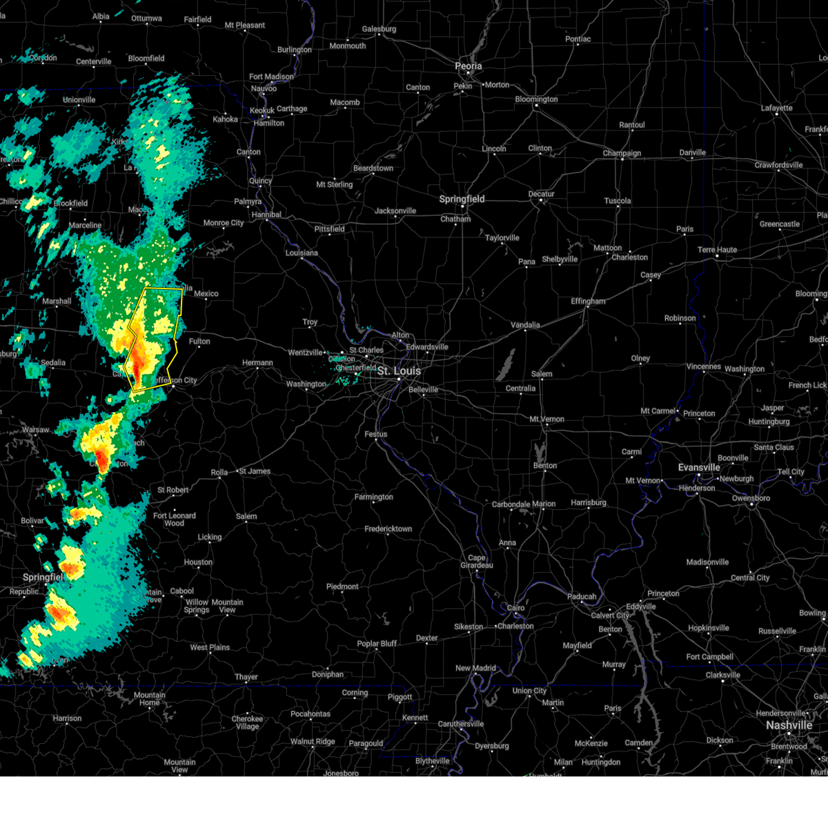 At 614 pm cdt, severe thunderstorms were located along a line from near sturgeon to near russellville, or along a line from near centralia to 10 miles southeast of california, moving northeast at 65 mph (radar indicated). Hazards include 70 mph wind gusts and quarter size hail. Hail damage to vehicles is expected. expect considerable tree damage. wind damage is also likely to mobile homes, roofs, and outbuildings. other locations impacted by the severe thunderstorm include mcbaine, harrisburg, lupus, kliever, sandy hook, wilton, marion, elston and hartsburg. this includes the following state parks, rock bridge state park, finger lakes state park and jewell cemetery historic site. This includes interstate 70 in missouri between exits 115 and 133. At 614 pm cdt, severe thunderstorms were located along a line from near sturgeon to near russellville, or along a line from near centralia to 10 miles southeast of california, moving northeast at 65 mph (radar indicated). Hazards include 70 mph wind gusts and quarter size hail. Hail damage to vehicles is expected. expect considerable tree damage. wind damage is also likely to mobile homes, roofs, and outbuildings. other locations impacted by the severe thunderstorm include mcbaine, harrisburg, lupus, kliever, sandy hook, wilton, marion, elston and hartsburg. this includes the following state parks, rock bridge state park, finger lakes state park and jewell cemetery historic site. This includes interstate 70 in missouri between exits 115 and 133.
|
| 3/14/2025 5:51 PM CDT |
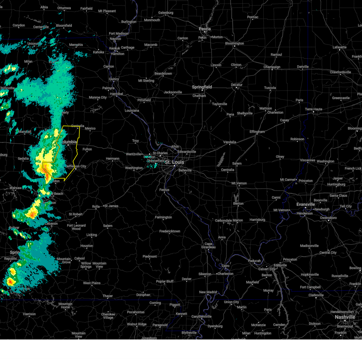 At 551 pm cdt, severe thunderstorms were located along a line from over rocheport to 20 miles southwest of high point, or along a line from 12 miles west of columbia to 27 miles south of tipton, moving northeast at 60 mph (radar indicated). Hazards include 70 mph wind gusts and quarter size hail. Hail damage to vehicles is expected. expect considerable tree damage. wind damage is also likely to mobile homes, roofs, and outbuildings. this severe thunderstorm will be near, tipton around 535 pm cdt. other locations impacted by the severe thunderstorm include latham, harrisburg, lupus, kliever, mcbaine, sandy hook, enon, marion, wilton and lohman. this includes the following state parks, rock bridge state park, finger lakes state park and jewell cemetery historic site. This includes interstate 70 in missouri between exits 115 and 133. At 551 pm cdt, severe thunderstorms were located along a line from over rocheport to 20 miles southwest of high point, or along a line from 12 miles west of columbia to 27 miles south of tipton, moving northeast at 60 mph (radar indicated). Hazards include 70 mph wind gusts and quarter size hail. Hail damage to vehicles is expected. expect considerable tree damage. wind damage is also likely to mobile homes, roofs, and outbuildings. this severe thunderstorm will be near, tipton around 535 pm cdt. other locations impacted by the severe thunderstorm include latham, harrisburg, lupus, kliever, mcbaine, sandy hook, enon, marion, wilton and lohman. this includes the following state parks, rock bridge state park, finger lakes state park and jewell cemetery historic site. This includes interstate 70 in missouri between exits 115 and 133.
|
| 3/14/2025 5:27 PM CDT |
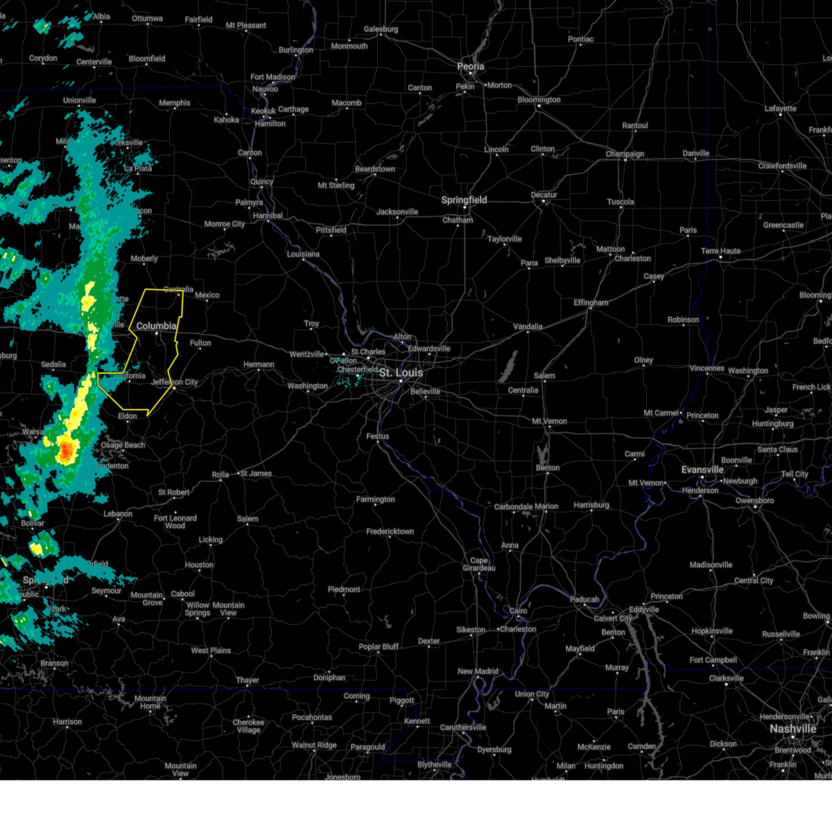 Svrlsx the national weather service in st louis has issued a * severe thunderstorm warning for, boone county in central missouri, western cole county in central missouri, moniteau county in central missouri, * until 630 pm cdt. * at 527 pm cdt, severe thunderstorms were located along a line from 9 miles north of tipton to 43 miles southwest of high point, or along a line from 9 miles north of tipton to 47 miles southwest of tipton, moving northeast at 75 mph (radar indicated). Hazards include 70 mph wind gusts and quarter size hail. Hail damage to vehicles is expected. expect considerable tree damage. wind damage is also likely to mobile homes, roofs, and outbuildings. this severe thunderstorm will be near, tipton around 535 pm cdt. other locations impacted by the severe thunderstorm include latham, harrisburg, lupus, kliever, mcbaine, sandy hook, marion, wilton and hartsburg. this includes the following state parks, rock bridge state park, finger lakes state park and jewell cemetery historic site. This includes interstate 70 in missouri between exits 115 and 133. Svrlsx the national weather service in st louis has issued a * severe thunderstorm warning for, boone county in central missouri, western cole county in central missouri, moniteau county in central missouri, * until 630 pm cdt. * at 527 pm cdt, severe thunderstorms were located along a line from 9 miles north of tipton to 43 miles southwest of high point, or along a line from 9 miles north of tipton to 47 miles southwest of tipton, moving northeast at 75 mph (radar indicated). Hazards include 70 mph wind gusts and quarter size hail. Hail damage to vehicles is expected. expect considerable tree damage. wind damage is also likely to mobile homes, roofs, and outbuildings. this severe thunderstorm will be near, tipton around 535 pm cdt. other locations impacted by the severe thunderstorm include latham, harrisburg, lupus, kliever, mcbaine, sandy hook, marion, wilton and hartsburg. this includes the following state parks, rock bridge state park, finger lakes state park and jewell cemetery historic site. This includes interstate 70 in missouri between exits 115 and 133.
|
| 3/4/2025 6:02 AM CST |
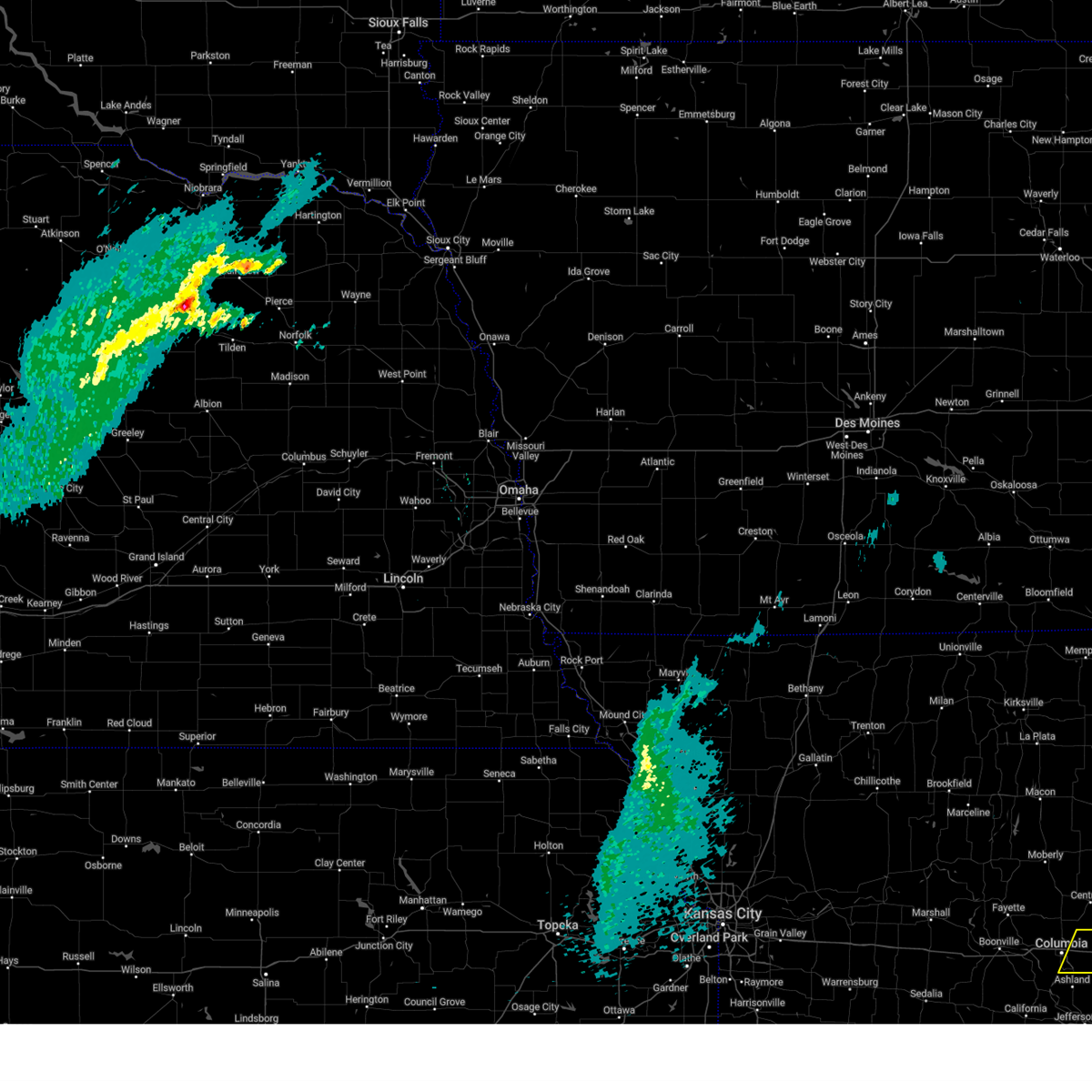 At 602 am cst, a severe thunderstorm was located 9 miles southeast of murry, or 9 miles northwest of fulton, moving northeast at 45 mph (radar indicated). Hazards include quarter size hail. Damage to vehicles is expected. locations impacted include, columbia, auxvasse, murry, kingdom city and hatton. this includes the following state parks, rock bridge state park. This includes interstate 70 in missouri between exits 131 and 144. At 602 am cst, a severe thunderstorm was located 9 miles southeast of murry, or 9 miles northwest of fulton, moving northeast at 45 mph (radar indicated). Hazards include quarter size hail. Damage to vehicles is expected. locations impacted include, columbia, auxvasse, murry, kingdom city and hatton. this includes the following state parks, rock bridge state park. This includes interstate 70 in missouri between exits 131 and 144.
|
| 3/4/2025 5:50 AM CST |
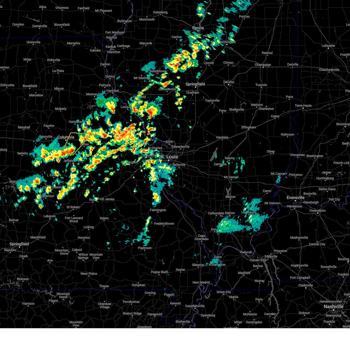 Svrlsx the national weather service in st louis has issued a * severe thunderstorm warning for, southeastern boone county in central missouri, northwestern callaway county in central missouri, * until 615 am cst. * at 550 am cst, a severe thunderstorm was located over columbia regional airport, moving northeast at 45 mph (radar indicated). Hazards include quarter size hail. damage to vehicles is expected Svrlsx the national weather service in st louis has issued a * severe thunderstorm warning for, southeastern boone county in central missouri, northwestern callaway county in central missouri, * until 615 am cst. * at 550 am cst, a severe thunderstorm was located over columbia regional airport, moving northeast at 45 mph (radar indicated). Hazards include quarter size hail. damage to vehicles is expected
|
| 8/14/2024 10:04 AM CDT | Large tree blown over onto doziers station road. numerous other tree limbs blown down around the are in boone county MO, 8.5 miles W of Columbia, MO |
| 6/25/2024 6:26 PM CDT |
 The storms which prompted the warning have weakened below severe limits, and no longer pose an immediate threat to life or property. therefore, the warning will be allowed to expire. The storms which prompted the warning have weakened below severe limits, and no longer pose an immediate threat to life or property. therefore, the warning will be allowed to expire.
|
| 6/25/2024 6:24 PM CDT |
 The storm which prompted the warning has weakened below severe limits, and no longer poses an immediate threat to life or property. therefore, the warning will be allowed to expire. The storm which prompted the warning has weakened below severe limits, and no longer poses an immediate threat to life or property. therefore, the warning will be allowed to expire.
|
| 6/25/2024 6:20 PM CDT |
 At 620 pm cdt, severe thunderstorms were located along a line extending from 7 miles southeast of murry to near easley, moving southeast at 25 mph (broadcast media). Hazards include 60 mph wind gusts. Expect damage to roofs, siding, and trees. locations impacted include, columbia, jamestown, easley, lupus, mcbaine, and sandy hook. This also includes rock bridge state park and jewell cemetery historic site. At 620 pm cdt, severe thunderstorms were located along a line extending from 7 miles southeast of murry to near easley, moving southeast at 25 mph (broadcast media). Hazards include 60 mph wind gusts. Expect damage to roofs, siding, and trees. locations impacted include, columbia, jamestown, easley, lupus, mcbaine, and sandy hook. This also includes rock bridge state park and jewell cemetery historic site.
|
| 6/25/2024 6:02 PM CDT | Boone county 911 relayed video of a large tree that was down on a parked car near st. charles road and clark lane on the northeast side of columbia. time estimated by r in boone county MO, 4.9 miles WSW of Columbia, MO |
| 6/25/2024 6:02 PM CDT |
 At 600 pm cdt, a severe thunderstorm was located over hallsville, moving east at 20 mph (radar indicated). Hazards include 60 mph wind gusts. Expect damage to roofs, siding, and trees. locations impacted include, columbia and murry. this also includes finger lakes state park. This includes interstate 70 in missouri between exits 124 and 133. At 600 pm cdt, a severe thunderstorm was located over hallsville, moving east at 20 mph (radar indicated). Hazards include 60 mph wind gusts. Expect damage to roofs, siding, and trees. locations impacted include, columbia and murry. this also includes finger lakes state park. This includes interstate 70 in missouri between exits 124 and 133.
|
| 6/25/2024 5:51 PM CDT |
 Svrlsx the national weather service in st louis has issued a * severe thunderstorm warning for, central boone county in central missouri, northeastern moniteau county in central missouri, * until 630 pm cdt. * at 550 pm cdt, severe thunderstorms were located along a line extending from near columbia to 7 miles southwest of rocheport, moving southeast at 25 mph (radar indicated). Hazards include 60 mph wind gusts. expect damage to roofs, siding, and trees Svrlsx the national weather service in st louis has issued a * severe thunderstorm warning for, central boone county in central missouri, northeastern moniteau county in central missouri, * until 630 pm cdt. * at 550 pm cdt, severe thunderstorms were located along a line extending from near columbia to 7 miles southwest of rocheport, moving southeast at 25 mph (radar indicated). Hazards include 60 mph wind gusts. expect damage to roofs, siding, and trees
|
| 6/25/2024 5:46 PM CDT | Trees down and power lines across the count in boone county MO, 3 miles NNW of Columbia, MO |
| 6/25/2024 5:46 PM CDT |
 The severe thunderstorm which prompted the warning has weakened. therefore, the warning has been allowed to expire. The severe thunderstorm which prompted the warning has weakened. therefore, the warning has been allowed to expire.
|
| 6/25/2024 5:24 PM CDT |
 Svrlsx the national weather service in st louis has issued a * severe thunderstorm warning for, northeastern boone county in central missouri, * until 630 pm cdt. * at 523 pm cdt, a severe thunderstorm was located 8 miles north of midway, moving east at 20 mph (radar indicated). Hazards include 70 mph wind gusts and half dollar size hail. Hail damage to vehicles is expected. expect considerable tree damage. Wind damage is also likely to mobile homes, roofs, and outbuildings. Svrlsx the national weather service in st louis has issued a * severe thunderstorm warning for, northeastern boone county in central missouri, * until 630 pm cdt. * at 523 pm cdt, a severe thunderstorm was located 8 miles north of midway, moving east at 20 mph (radar indicated). Hazards include 70 mph wind gusts and half dollar size hail. Hail damage to vehicles is expected. expect considerable tree damage. Wind damage is also likely to mobile homes, roofs, and outbuildings.
|
| 6/25/2024 5:18 PM CDT |
 At 518 pm cdt, a severe thunderstorm was located 8 miles south of higbee, moving east at 20 mph (radar indicated). Hazards include 70 mph wind gusts and half dollar size hail. Hail damage to vehicles is expected. expect considerable tree damage. wind damage is also likely to mobile homes, roofs, and outbuildings. locations impacted include, columbia, rocheport, midway, and harrisburg. This includes interstate 70 in missouri between exits 115 and 121. At 518 pm cdt, a severe thunderstorm was located 8 miles south of higbee, moving east at 20 mph (radar indicated). Hazards include 70 mph wind gusts and half dollar size hail. Hail damage to vehicles is expected. expect considerable tree damage. wind damage is also likely to mobile homes, roofs, and outbuildings. locations impacted include, columbia, rocheport, midway, and harrisburg. This includes interstate 70 in missouri between exits 115 and 121.
|
| 6/25/2024 5:01 PM CDT |
 Svrlsx the national weather service in st louis has issued a * severe thunderstorm warning for, northwestern boone county in central missouri, * until 545 pm cdt. * at 500 pm cdt, a severe thunderstorm was located near fayette, moving east at 20 mph (radar indicated). Hazards include 60 mph wind gusts and quarter size hail. Hail damage to vehicles is expected. expect wind damage to roofs, siding, and trees. this severe thunderstorm will remain over mainly rural areas of northwestern boone county, including the following locations, harrisburg. This includes interstate 70 in missouri between exits 115 and 121. Svrlsx the national weather service in st louis has issued a * severe thunderstorm warning for, northwestern boone county in central missouri, * until 545 pm cdt. * at 500 pm cdt, a severe thunderstorm was located near fayette, moving east at 20 mph (radar indicated). Hazards include 60 mph wind gusts and quarter size hail. Hail damage to vehicles is expected. expect wind damage to roofs, siding, and trees. this severe thunderstorm will remain over mainly rural areas of northwestern boone county, including the following locations, harrisburg. This includes interstate 70 in missouri between exits 115 and 121.
|
| 6/13/2024 9:52 PM CDT |
 the severe thunderstorm warning has been cancelled and is no longer in effect the severe thunderstorm warning has been cancelled and is no longer in effect
|
| 6/13/2024 9:52 PM CDT |
 At 952 pm cdt, a severe thunderstorm was located near fulton, moving southeast at 35 mph (radar indicated). Hazards include 70 mph wind gusts and quarter size hail. Hail damage to vehicles is expected. expect considerable tree damage. wind damage is also likely to mobile homes, roofs, and outbuildings. locations impacted include, columbia, fulton, holts summit, columbia regional airport, auxvasse, new bloomfield, lake mykee town, shamrock, lake mykee, williamsburg, kingdom city, carrington, hatton, and guthrie. This includes interstate 70 in missouri between exits 133 and 161. At 952 pm cdt, a severe thunderstorm was located near fulton, moving southeast at 35 mph (radar indicated). Hazards include 70 mph wind gusts and quarter size hail. Hail damage to vehicles is expected. expect considerable tree damage. wind damage is also likely to mobile homes, roofs, and outbuildings. locations impacted include, columbia, fulton, holts summit, columbia regional airport, auxvasse, new bloomfield, lake mykee town, shamrock, lake mykee, williamsburg, kingdom city, carrington, hatton, and guthrie. This includes interstate 70 in missouri between exits 133 and 161.
|
| 6/13/2024 9:51 PM CDT |
 The storm which prompted the warning has moved out of the area. therefore, the warning will be allowed to expire. a severe thunderstorm watch remains in effect until 100 am cdt for central missouri. The storm which prompted the warning has moved out of the area. therefore, the warning will be allowed to expire. a severe thunderstorm watch remains in effect until 100 am cdt for central missouri.
|
| 6/13/2024 9:46 PM CDT |
 At 946 pm cdt, a severe thunderstorm was located 8 miles northwest of fulton, moving southeast at 40 mph (radar indicated). Hazards include 70 mph wind gusts and quarter size hail. Hail damage to vehicles is expected. expect considerable tree damage. wind damage is also likely to mobile homes, roofs, and outbuildings. locations impacted include, columbia, fulton, holts summit, columbia regional airport, auxvasse, new bloomfield, lake mykee town, murry, shamrock, lake mykee, williamsburg, kingdom city, carrington, hatton, and guthrie. This includes interstate 70 in missouri between exits 131 and 161. At 946 pm cdt, a severe thunderstorm was located 8 miles northwest of fulton, moving southeast at 40 mph (radar indicated). Hazards include 70 mph wind gusts and quarter size hail. Hail damage to vehicles is expected. expect considerable tree damage. wind damage is also likely to mobile homes, roofs, and outbuildings. locations impacted include, columbia, fulton, holts summit, columbia regional airport, auxvasse, new bloomfield, lake mykee town, murry, shamrock, lake mykee, williamsburg, kingdom city, carrington, hatton, and guthrie. This includes interstate 70 in missouri between exits 131 and 161.
|
| 6/13/2024 9:44 PM CDT |
 At 943 pm cdt, a severe thunderstorm was located near murry, moving southeast at 30 mph (trained weather spotters). Hazards include 70 mph wind gusts and quarter size hail. Hail damage to vehicles is expected. expect considerable tree damage. wind damage is also likely to mobile homes, roofs, and outbuildings. Locations impacted include, columbia, hallsville, and murry. At 943 pm cdt, a severe thunderstorm was located near murry, moving southeast at 30 mph (trained weather spotters). Hazards include 70 mph wind gusts and quarter size hail. Hail damage to vehicles is expected. expect considerable tree damage. wind damage is also likely to mobile homes, roofs, and outbuildings. Locations impacted include, columbia, hallsville, and murry.
|
| 6/13/2024 9:44 PM CDT |
 the severe thunderstorm warning has been cancelled and is no longer in effect the severe thunderstorm warning has been cancelled and is no longer in effect
|
| 6/13/2024 9:40 PM CDT | Large tree limbs snapped and power outages in pockets of the city utility distric in boone county MO, 3.5 miles SW of Columbia, MO |
| 6/13/2024 9:39 PM CDT | Report from mping: medium sized tree limbs dow in boone county MO, 4.5 miles SSW of Columbia, MO |
| 6/13/2024 9:28 PM CDT |
 At 928 pm cdt, a severe thunderstorm was located over hallsville, moving southeast at 30 mph (trained weather spotters). Hazards include 70 mph wind gusts and quarter size hail. Hail damage to vehicles is expected. expect considerable tree damage. wind damage is also likely to mobile homes, roofs, and outbuildings. locations impacted include, columbia, centralia, hallsville, sturgeon, and murry. This also includes finger lakes state park. At 928 pm cdt, a severe thunderstorm was located over hallsville, moving southeast at 30 mph (trained weather spotters). Hazards include 70 mph wind gusts and quarter size hail. Hail damage to vehicles is expected. expect considerable tree damage. wind damage is also likely to mobile homes, roofs, and outbuildings. locations impacted include, columbia, centralia, hallsville, sturgeon, and murry. This also includes finger lakes state park.
|
| 6/13/2024 9:26 PM CDT |
 Svrlsx the national weather service in st louis has issued a * severe thunderstorm warning for, eastern boone county in central missouri, southwestern audrain county in central missouri, callaway county in central missouri, * until 1015 pm cdt. * at 926 pm cdt, a severe thunderstorm was located over murry, moving southeast at 35 mph (radar indicated). Hazards include 70 mph wind gusts and quarter size hail. Hail damage to vehicles is expected. expect considerable tree damage. Wind damage is also likely to mobile homes, roofs, and outbuildings. Svrlsx the national weather service in st louis has issued a * severe thunderstorm warning for, eastern boone county in central missouri, southwestern audrain county in central missouri, callaway county in central missouri, * until 1015 pm cdt. * at 926 pm cdt, a severe thunderstorm was located over murry, moving southeast at 35 mph (radar indicated). Hazards include 70 mph wind gusts and quarter size hail. Hail damage to vehicles is expected. expect considerable tree damage. Wind damage is also likely to mobile homes, roofs, and outbuildings.
|
| 6/13/2024 9:14 PM CDT |
 At 913 pm cdt, a severe thunderstorm was located over sturgeon, moving southeast at 30 mph (trained weather spotters). Hazards include 70 mph wind gusts and penny size hail. Expect considerable tree damage. damage is likely to mobile homes, roofs, and outbuildings. locations impacted include, columbia, centralia, hallsville, sturgeon, murry, and harrisburg. This also includes finger lakes state park. At 913 pm cdt, a severe thunderstorm was located over sturgeon, moving southeast at 30 mph (trained weather spotters). Hazards include 70 mph wind gusts and penny size hail. Expect considerable tree damage. damage is likely to mobile homes, roofs, and outbuildings. locations impacted include, columbia, centralia, hallsville, sturgeon, murry, and harrisburg. This also includes finger lakes state park.
|
| 6/13/2024 8:58 PM CDT |
 Svrlsx the national weather service in st louis has issued a * severe thunderstorm warning for, northern boone county in central missouri, western audrain county in central missouri, * until 1000 pm cdt. * at 858 pm cdt, a severe thunderstorm was located near clark, moving southeast at 30 mph (trained weather spotters). Hazards include 60 mph wind gusts and half dollar size hail. Hail damage to vehicles is expected. Expect wind damage to roofs, siding, and trees. Svrlsx the national weather service in st louis has issued a * severe thunderstorm warning for, northern boone county in central missouri, western audrain county in central missouri, * until 1000 pm cdt. * at 858 pm cdt, a severe thunderstorm was located near clark, moving southeast at 30 mph (trained weather spotters). Hazards include 60 mph wind gusts and half dollar size hail. Hail damage to vehicles is expected. Expect wind damage to roofs, siding, and trees.
|
| 6/3/2024 4:43 PM CDT | Tree down on mobile home and vehicl in boone county MO, 4.9 miles SSW of Columbia, MO |
| 5/27/2024 3:33 PM CDT |
 Svrlsx the national weather service in st louis has issued a * severe thunderstorm warning for, southeastern boone county in central missouri, central callaway county in central missouri, * until 415 pm cdt. * at 332 pm cdt, a severe thunderstorm was located near columbia regional airport, moving southeast at 40 mph (radar indicated). Hazards include 60 mph wind gusts. expect damage to roofs, siding, and trees Svrlsx the national weather service in st louis has issued a * severe thunderstorm warning for, southeastern boone county in central missouri, central callaway county in central missouri, * until 415 pm cdt. * at 332 pm cdt, a severe thunderstorm was located near columbia regional airport, moving southeast at 40 mph (radar indicated). Hazards include 60 mph wind gusts. expect damage to roofs, siding, and trees
|
| 5/27/2024 3:17 PM CDT | Large tree down pulled live power lines on to home... time estimated by rada in boone county MO, 1.5 miles S of Columbia, MO |
| 5/27/2024 3:17 PM CDT | Large tree fell across electric lines... time estimated from rada in boone county MO, 1.5 miles ESE of Columbia, MO |
| 5/26/2024 1:30 AM CDT |
 The storms which prompted the warning have weakened below severe limits, and no longer pose an immediate threat to life or property. therefore, the warning will be allowed to expire. however, gusty winds are still possible with these thunderstorms. The storms which prompted the warning have weakened below severe limits, and no longer pose an immediate threat to life or property. therefore, the warning will be allowed to expire. however, gusty winds are still possible with these thunderstorms.
|
| 5/26/2024 1:18 AM CDT |
 At 118 am cdt, severe thunderstorms were located along a line extending from near midway to near columbia regional airport to st. martins, moving east at 35 mph (radar indicated). Hazards include 60 mph wind gusts. Expect damage to roofs, siding, and trees. locations impacted include, columbia, ashland, columbia regional airport, holts summit, hallsville, new bloomfield, murry, lake mykee town and lake mykee. this also includes rock bridge state park, finger lakes state park, and jewell cemetery historic site. This includes interstate 70 in missouri between exits 115 and 137. At 118 am cdt, severe thunderstorms were located along a line extending from near midway to near columbia regional airport to st. martins, moving east at 35 mph (radar indicated). Hazards include 60 mph wind gusts. Expect damage to roofs, siding, and trees. locations impacted include, columbia, ashland, columbia regional airport, holts summit, hallsville, new bloomfield, murry, lake mykee town and lake mykee. this also includes rock bridge state park, finger lakes state park, and jewell cemetery historic site. This includes interstate 70 in missouri between exits 115 and 137.
|
| 5/26/2024 1:18 AM CDT |
 the severe thunderstorm warning has been cancelled and is no longer in effect the severe thunderstorm warning has been cancelled and is no longer in effect
|
| 5/26/2024 12:57 AM CDT |
 Svrlsx the national weather service in st louis has issued a * severe thunderstorm warning for, northern cole county in central missouri, boone county in central missouri, western callaway county in central missouri, eastern moniteau county in central missouri, * until 130 am cdt. * at 1257 am cdt, severe thunderstorms were located along a line extending from near rocheport to near california to high point, moving northeast at 50 mph (radar indicated). Hazards include 60 mph wind gusts. Expect damage to roofs, siding, and trees. severe thunderstorms will be near, columbia, st. martins, russellville, jamestown, centertown, rocheport, easley, midway, and mcgirk around 105 am cdt. jefferson city, ashland, and columbia regional airport around 110 am cdt. this includes interstate 70 in missouri between exits 115 and 137. This also includes rock bridge state park, finger lakes state park, clarks hill/norton historic site, jewell cemetery historic site, and jefferson landing historic site. Svrlsx the national weather service in st louis has issued a * severe thunderstorm warning for, northern cole county in central missouri, boone county in central missouri, western callaway county in central missouri, eastern moniteau county in central missouri, * until 130 am cdt. * at 1257 am cdt, severe thunderstorms were located along a line extending from near rocheport to near california to high point, moving northeast at 50 mph (radar indicated). Hazards include 60 mph wind gusts. Expect damage to roofs, siding, and trees. severe thunderstorms will be near, columbia, st. martins, russellville, jamestown, centertown, rocheport, easley, midway, and mcgirk around 105 am cdt. jefferson city, ashland, and columbia regional airport around 110 am cdt. this includes interstate 70 in missouri between exits 115 and 137. This also includes rock bridge state park, finger lakes state park, clarks hill/norton historic site, jewell cemetery historic site, and jefferson landing historic site.
|
| 5/7/2024 2:29 AM CDT |
 At 229 am cdt, severe thunderstorms were located along a line extending from near granville to 9 miles southwest of santa fe to near auxvasse to near taos, moving east at 35 mph (radar indicated). Hazards include 60 mph wind gusts. Expect damage to roofs, siding, and trees. locations impacted include, columbia, jefferson city, fulton, centralia, ashland, holts summit, columbia regional airport, hallsville, sturgeon, new bloomfield, madison, lake mykee town, murry, woodlawn, lake mykee, granville, holliday, kingdom city, hartsburg, and hatton. this also includes rock bridge state park and union covered bridge historic site. This includes interstate 70 in missouri between exits 128 and 148. At 229 am cdt, severe thunderstorms were located along a line extending from near granville to 9 miles southwest of santa fe to near auxvasse to near taos, moving east at 35 mph (radar indicated). Hazards include 60 mph wind gusts. Expect damage to roofs, siding, and trees. locations impacted include, columbia, jefferson city, fulton, centralia, ashland, holts summit, columbia regional airport, hallsville, sturgeon, new bloomfield, madison, lake mykee town, murry, woodlawn, lake mykee, granville, holliday, kingdom city, hartsburg, and hatton. this also includes rock bridge state park and union covered bridge historic site. This includes interstate 70 in missouri between exits 128 and 148.
|
| 5/7/2024 1:57 AM CDT |
 At 156 am cdt, severe thunderstorms were located along a line extending from near cairo to clark to columbia to near russellville, moving east at 45 mph (radar indicated). Hazards include 60 mph wind gusts. Expect damage to roofs, siding, and trees. locations impacted include, columbia, jefferson city, fulton, centralia, ashland, holts summit, columbia regional airport, hallsville, sturgeon, new bloomfield, madison, lake mykee town, rocheport, easley, murry, midway, woodlawn, lake mykee, granville, and harrisburg. this also includes rock bridge state park, finger lakes state park, union covered bridge historic site, and jewell cemetery historic site. This includes interstate 70 in missouri between exits 115 and 148. At 156 am cdt, severe thunderstorms were located along a line extending from near cairo to clark to columbia to near russellville, moving east at 45 mph (radar indicated). Hazards include 60 mph wind gusts. Expect damage to roofs, siding, and trees. locations impacted include, columbia, jefferson city, fulton, centralia, ashland, holts summit, columbia regional airport, hallsville, sturgeon, new bloomfield, madison, lake mykee town, rocheport, easley, murry, midway, woodlawn, lake mykee, granville, and harrisburg. this also includes rock bridge state park, finger lakes state park, union covered bridge historic site, and jewell cemetery historic site. This includes interstate 70 in missouri between exits 115 and 148.
|
| 5/7/2024 1:25 AM CDT |
 Svrlsx the national weather service in st louis has issued a * severe thunderstorm warning for, boone county in central missouri, western audrain county in central missouri, western callaway county in central missouri, western monroe county in northeastern missouri, * until 245 am cdt. * at 124 am cdt, severe thunderstorms were located along a line extending from near brookfield to 6 miles north of glasgow to new franklin to near tipton, moving east at 45 mph (radar indicated). Hazards include 60 mph wind gusts. expect damage to roofs, siding, and trees Svrlsx the national weather service in st louis has issued a * severe thunderstorm warning for, boone county in central missouri, western audrain county in central missouri, western callaway county in central missouri, western monroe county in northeastern missouri, * until 245 am cdt. * at 124 am cdt, severe thunderstorms were located along a line extending from near brookfield to 6 miles north of glasgow to new franklin to near tipton, moving east at 45 mph (radar indicated). Hazards include 60 mph wind gusts. expect damage to roofs, siding, and trees
|
| 3/14/2024 4:26 PM CDT |
 The storm which prompted the warning has moved out of the area. therefore, the warning will be allowed to expire. a tornado watch remains in effect until 900 pm cdt for central missouri. The storm which prompted the warning has moved out of the area. therefore, the warning will be allowed to expire. a tornado watch remains in effect until 900 pm cdt for central missouri.
|
| 3/14/2024 4:16 PM CDT |
 At 415 pm cdt, a severe thunderstorm was located 7 miles northeast of columbia regional airport, moving east at 45 mph (at 412 pm, trained weather spotters reported ping pong sized hail north of columbia regional airport in ashland, mo). Hazards include ping pong ball size hail and 60 mph wind gusts. People and animals outdoors will be injured. expect hail damage to roofs, siding, windows, and vehicles. expect wind damage to roofs, siding, and trees. locations impacted include, columbia, fulton, ashland, columbia regional airport, new bloomfield, shamrock, williamsburg, kingdom city, carrington, portland, guthrie, and reform. This includes interstate 70 in missouri between exits 137 and 161. At 415 pm cdt, a severe thunderstorm was located 7 miles northeast of columbia regional airport, moving east at 45 mph (at 412 pm, trained weather spotters reported ping pong sized hail north of columbia regional airport in ashland, mo). Hazards include ping pong ball size hail and 60 mph wind gusts. People and animals outdoors will be injured. expect hail damage to roofs, siding, windows, and vehicles. expect wind damage to roofs, siding, and trees. locations impacted include, columbia, fulton, ashland, columbia regional airport, new bloomfield, shamrock, williamsburg, kingdom city, carrington, portland, guthrie, and reform. This includes interstate 70 in missouri between exits 137 and 161.
|
| 3/14/2024 4:07 PM CDT |
 Svrlsx the national weather service in st louis has issued a * severe thunderstorm warning for, southeastern boone county in central missouri, callaway county in central missouri, * until 500 pm cdt. * at 407 pm cdt, a severe thunderstorm was located over columbia regional airport, moving east at 45 mph (radar indicated). Hazards include 60 mph wind gusts and quarter size hail. Hail damage to vehicles is expected. Expect wind damage to roofs, siding, and trees. Svrlsx the national weather service in st louis has issued a * severe thunderstorm warning for, southeastern boone county in central missouri, callaway county in central missouri, * until 500 pm cdt. * at 407 pm cdt, a severe thunderstorm was located over columbia regional airport, moving east at 45 mph (radar indicated). Hazards include 60 mph wind gusts and quarter size hail. Hail damage to vehicles is expected. Expect wind damage to roofs, siding, and trees.
|
| 3/14/2024 4:00 PM CDT |
 At 359 pm cdt, a severe thunderstorm was located near easley, moving east at 40 mph (at 357 pm, a member of the public reported quarter-sized hail 2 miles south of columbia, mo). Hazards include 60 mph wind gusts and half dollar size hail. Hail damage to vehicles is expected. expect wind damage to roofs, siding, and trees. locations impacted include, columbia, ashland, columbia regional airport, lupus, and mcbaine. this also includes rock bridge state park and jewell cemetery historic site. This includes interstate 70 in missouri between exits 128 and 133. At 359 pm cdt, a severe thunderstorm was located near easley, moving east at 40 mph (at 357 pm, a member of the public reported quarter-sized hail 2 miles south of columbia, mo). Hazards include 60 mph wind gusts and half dollar size hail. Hail damage to vehicles is expected. expect wind damage to roofs, siding, and trees. locations impacted include, columbia, ashland, columbia regional airport, lupus, and mcbaine. this also includes rock bridge state park and jewell cemetery historic site. This includes interstate 70 in missouri between exits 128 and 133.
|
| 3/14/2024 4:00 PM CDT |
 the severe thunderstorm warning has been cancelled and is no longer in effect the severe thunderstorm warning has been cancelled and is no longer in effect
|
| 3/14/2024 3:59 PM CDT | Quarter sized hail reported 6.8 miles N of Columbia, MO, report from mping: quarter (1.00 in.). |
| 3/14/2024 3:58 PM CDT | Quarter sized hail reported 1.3 miles NNW of Columbia, MO, mping reported 1 in hail 2 mi s of columbia... mo. |
| 3/14/2024 3:57 PM CDT | Quarter sized hail reported 2.6 miles N of Columbia, MO, report from mping: quarter (1.00 in.). |
| 3/14/2024 3:55 PM CDT | Quarter sized hail reported 2 miles N of Columbia, MO, public photo submission. most pieces are around nickel size with biggest hail stone near quarter sized. |
| 3/14/2024 3:55 PM CDT | Half Dollar sized hail reported 1.9 miles N of Columbia, MO, photo of a range of hail sizes. largest looks to be slightly bigger than a quarter. |
| 3/14/2024 3:52 PM CDT | Quarter sized hail reported 4.8 miles NE of Columbia, MO, video submission. most hail was dime sized with few quarter sized pieces mixed in. time estimated by radar. |
| 3/14/2024 3:34 PM CDT |
 Svrlsx the national weather service in st louis has issued a * severe thunderstorm warning for, central boone county in central missouri, northeastern moniteau county in central missouri, * until 430 pm cdt. * at 333 pm cdt, a severe thunderstorm was located 8 miles east of bunceton, moving east at 40 mph (at 329 pm, trained weather spotters reported ping pong sized hail in bunceton, mo). Hazards include ping pong ball size hail and 60 mph wind gusts. People and animals outdoors will be injured. expect hail damage to roofs, siding, windows, and vehicles. Expect wind damage to roofs, siding, and trees. Svrlsx the national weather service in st louis has issued a * severe thunderstorm warning for, central boone county in central missouri, northeastern moniteau county in central missouri, * until 430 pm cdt. * at 333 pm cdt, a severe thunderstorm was located 8 miles east of bunceton, moving east at 40 mph (at 329 pm, trained weather spotters reported ping pong sized hail in bunceton, mo). Hazards include ping pong ball size hail and 60 mph wind gusts. People and animals outdoors will be injured. expect hail damage to roofs, siding, windows, and vehicles. Expect wind damage to roofs, siding, and trees.
|
| 3/14/2024 7:42 AM CDT |
 Svrlsx the national weather service in st louis has issued a * severe thunderstorm warning for, northwestern cole county in central missouri, southern boone county in central missouri, western callaway county in central missouri, moniteau county in central missouri, * until 830 am cdt. * at 741 am cdt, a severe thunderstorm was located over clarksburg, moving east at 60 mph (radar indicated). Hazards include 60 mph wind gusts and quarter size hail. Hail damage to vehicles is expected. expect wind damage to roofs, siding, and trees. this severe thunderstorm will be near, california around 745 am cdt. jamestown around 750 am cdt. ashland and columbia regional airport around 800 am cdt. other locations in the path of this severe thunderstorm include new bloomfield. this includes interstate 70 in missouri between exits 127 and 137. This also includes rock bridge state park, jewell cemetery historic site, and jefferson landing historic site. Svrlsx the national weather service in st louis has issued a * severe thunderstorm warning for, northwestern cole county in central missouri, southern boone county in central missouri, western callaway county in central missouri, moniteau county in central missouri, * until 830 am cdt. * at 741 am cdt, a severe thunderstorm was located over clarksburg, moving east at 60 mph (radar indicated). Hazards include 60 mph wind gusts and quarter size hail. Hail damage to vehicles is expected. expect wind damage to roofs, siding, and trees. this severe thunderstorm will be near, california around 745 am cdt. jamestown around 750 am cdt. ashland and columbia regional airport around 800 am cdt. other locations in the path of this severe thunderstorm include new bloomfield. this includes interstate 70 in missouri between exits 127 and 137. This also includes rock bridge state park, jewell cemetery historic site, and jefferson landing historic site.
|
| 9/23/2023 8:41 PM CDT |
 At 840 pm cdt, severe thunderstorms were located along a line extending from 7 miles south of rocheport to near mcgirk to near eldon, moving east at 20 mph (radar indicated). Hazards include 60 mph wind gusts and nickel size hail. Expect damage to roofs, siding, and trees. severe thunderstorms will be near, columbia, russellville, jamestown, centertown, and mcgirk around 845 pm cdt. easley around 850 pm cdt. st. martins around 855 pm cdt. hickory hill around 900 pm cdt. other locations in the path of these severe thunderstorms include jefferson city, ashland and brazito. this includes interstate 70 in missouri between exits 117 and 131. this also includes rock bridge state park and jewell cemetery historic site. hail threat, radar indicated max hail size, 0. 88 in wind threat, radar indicated max wind gust, 60 mph. At 840 pm cdt, severe thunderstorms were located along a line extending from 7 miles south of rocheport to near mcgirk to near eldon, moving east at 20 mph (radar indicated). Hazards include 60 mph wind gusts and nickel size hail. Expect damage to roofs, siding, and trees. severe thunderstorms will be near, columbia, russellville, jamestown, centertown, and mcgirk around 845 pm cdt. easley around 850 pm cdt. st. martins around 855 pm cdt. hickory hill around 900 pm cdt. other locations in the path of these severe thunderstorms include jefferson city, ashland and brazito. this includes interstate 70 in missouri between exits 117 and 131. this also includes rock bridge state park and jewell cemetery historic site. hail threat, radar indicated max hail size, 0. 88 in wind threat, radar indicated max wind gust, 60 mph.
|
| 8/12/2023 3:04 AM CDT |
 At 304 am cdt, severe thunderstorms were located along a line extending from 6 miles southeast of paris to near mexico to near murry to near columbia, moving southeast at 40 mph (radar indicated). Hazards include 60 mph wind gusts and quarter size hail. Hail damage to vehicles is expected. Expect wind damage to roofs, siding, and trees. At 304 am cdt, severe thunderstorms were located along a line extending from 6 miles southeast of paris to near mexico to near murry to near columbia, moving southeast at 40 mph (radar indicated). Hazards include 60 mph wind gusts and quarter size hail. Hail damage to vehicles is expected. Expect wind damage to roofs, siding, and trees.
|
| 8/12/2023 2:56 AM CDT |
 At 256 am cdt, severe thunderstorms were located along a line extending from 7 miles south of paris to near centralia to near murry to near midway, moving southeast at 40 mph (radar indicated). Hazards include 60 mph wind gusts and quarter size hail. Hail damage to vehicles is expected. expect wind damage to roofs, siding, and trees. locations impacted include, columbia, mexico, centralia, paris, hallsville, sturgeon, madison, murry, woodlawn, granville, midway, harrisburg, holliday, hatton, duncans bridge, and thompson. this also includes rock bridge state park, finger lakes state park, union covered bridge historic site, and jewell cemetery historic site. this includes interstate 70 in missouri between exits 115 and 144. hail threat, radar indicated max hail size, 1. 00 in wind threat, radar indicated max wind gust, 60 mph. At 256 am cdt, severe thunderstorms were located along a line extending from 7 miles south of paris to near centralia to near murry to near midway, moving southeast at 40 mph (radar indicated). Hazards include 60 mph wind gusts and quarter size hail. Hail damage to vehicles is expected. expect wind damage to roofs, siding, and trees. locations impacted include, columbia, mexico, centralia, paris, hallsville, sturgeon, madison, murry, woodlawn, granville, midway, harrisburg, holliday, hatton, duncans bridge, and thompson. this also includes rock bridge state park, finger lakes state park, union covered bridge historic site, and jewell cemetery historic site. this includes interstate 70 in missouri between exits 115 and 144. hail threat, radar indicated max hail size, 1. 00 in wind threat, radar indicated max wind gust, 60 mph.
|
| 8/12/2023 2:41 AM CDT |
 At 241 am cdt, severe thunderstorms were located along a line extending from madison to near centralia to 6 miles southwest of sturgeon to 9 miles east of fayette, moving southeast at 40 mph (radar indicated). Hazards include 60 mph wind gusts and quarter size hail. Hail damage to vehicles is expected. expect wind damage to roofs, siding, and trees. locations impacted include, columbia, mexico, centralia, paris, hallsville, sturgeon, madison, murry, woodlawn, granville, midway, harrisburg, holliday, hatton, duncans bridge, and thompson. this also includes rock bridge state park, finger lakes state park, union covered bridge historic site, and jewell cemetery historic site. this includes interstate 70 in missouri between exits 115 and 144. hail threat, radar indicated max hail size, 1. 00 in wind threat, radar indicated max wind gust, 60 mph. At 241 am cdt, severe thunderstorms were located along a line extending from madison to near centralia to 6 miles southwest of sturgeon to 9 miles east of fayette, moving southeast at 40 mph (radar indicated). Hazards include 60 mph wind gusts and quarter size hail. Hail damage to vehicles is expected. expect wind damage to roofs, siding, and trees. locations impacted include, columbia, mexico, centralia, paris, hallsville, sturgeon, madison, murry, woodlawn, granville, midway, harrisburg, holliday, hatton, duncans bridge, and thompson. this also includes rock bridge state park, finger lakes state park, union covered bridge historic site, and jewell cemetery historic site. this includes interstate 70 in missouri between exits 115 and 144. hail threat, radar indicated max hail size, 1. 00 in wind threat, radar indicated max wind gust, 60 mph.
|
| 8/12/2023 2:17 AM CDT |
 At 217 am cdt, severe thunderstorms were located along a line extending from 6 miles north of cairo to moberly to higbee to near glasgow, moving southeast at 40 mph (radar indicated). Hazards include 60 mph wind gusts. expect damage to roofs, siding, and trees At 217 am cdt, severe thunderstorms were located along a line extending from 6 miles north of cairo to moberly to higbee to near glasgow, moving southeast at 40 mph (radar indicated). Hazards include 60 mph wind gusts. expect damage to roofs, siding, and trees
|
| 8/4/2023 9:28 PM CDT |
 At 928 pm cdt, a severe thunderstorm was located near ashland, moving east at 25 mph (radar indicated). Hazards include 60 mph wind gusts and quarter size hail. Hail damage to vehicles is expected. expect wind damage to roofs, siding, and trees. locations impacted include, jefferson city, california, ashland, holts summit, columbia regional airport, wardsville, st. martins, new bloomfield, jamestown, lake mykee town, centertown, easley, mcgirk, lake mykee, marion, lohman, hartsburg, lupus, elston, and sandy hook. This also includes jefferson landing historic site. At 928 pm cdt, a severe thunderstorm was located near ashland, moving east at 25 mph (radar indicated). Hazards include 60 mph wind gusts and quarter size hail. Hail damage to vehicles is expected. expect wind damage to roofs, siding, and trees. locations impacted include, jefferson city, california, ashland, holts summit, columbia regional airport, wardsville, st. martins, new bloomfield, jamestown, lake mykee town, centertown, easley, mcgirk, lake mykee, marion, lohman, hartsburg, lupus, elston, and sandy hook. This also includes jefferson landing historic site.
|
| 8/4/2023 9:01 PM CDT |
 At 901 pm cdt, a severe thunderstorm was located over easley, moving east at 15 mph (radar indicated). Hazards include 60 mph wind gusts and quarter size hail. Hail damage to vehicles is expected. expect wind damage to roofs, siding, and trees. locations impacted include, columbia, jefferson city, california, ashland, columbia regional airport, st. martins, jamestown, clarksburg, centertown, easley, mcgirk, marion, hartsburg, lupus, mcbaine, elston, sandy hook, wilton, and kliever. This also includes rock bridge state park and jewell cemetery historic site. At 901 pm cdt, a severe thunderstorm was located over easley, moving east at 15 mph (radar indicated). Hazards include 60 mph wind gusts and quarter size hail. Hail damage to vehicles is expected. expect wind damage to roofs, siding, and trees. locations impacted include, columbia, jefferson city, california, ashland, columbia regional airport, st. martins, jamestown, clarksburg, centertown, easley, mcgirk, marion, hartsburg, lupus, mcbaine, elston, sandy hook, wilton, and kliever. This also includes rock bridge state park and jewell cemetery historic site.
|
| 8/4/2023 8:37 PM CDT |
 At 836 pm cdt, a severe thunderstorm was located near prairie home, moving east at 25 mph (radar indicated). Hazards include 60 mph wind gusts and quarter size hail. Hail damage to vehicles is expected. expect wind damage to roofs, siding, and trees. locations impacted include, columbia, jefferson city, california, ashland, tipton, columbia regional airport, st. martins, jamestown, clarksburg, centertown, easley, mcgirk, marion, hartsburg, lupus, mcbaine, elston, sandy hook, wilton, and kliever. This also includes rock bridge state park and jewell cemetery historic site. At 836 pm cdt, a severe thunderstorm was located near prairie home, moving east at 25 mph (radar indicated). Hazards include 60 mph wind gusts and quarter size hail. Hail damage to vehicles is expected. expect wind damage to roofs, siding, and trees. locations impacted include, columbia, jefferson city, california, ashland, tipton, columbia regional airport, st. martins, jamestown, clarksburg, centertown, easley, mcgirk, marion, hartsburg, lupus, mcbaine, elston, sandy hook, wilton, and kliever. This also includes rock bridge state park and jewell cemetery historic site.
|
| 8/4/2023 8:21 PM CDT |
 At 820 pm cdt, a severe thunderstorm was located near bunceton, moving east at 25 mph (radar indicated). Hazards include 60 mph wind gusts and quarter size hail. Hail damage to vehicles is expected. Expect wind damage to roofs, siding, and trees. At 820 pm cdt, a severe thunderstorm was located near bunceton, moving east at 25 mph (radar indicated). Hazards include 60 mph wind gusts and quarter size hail. Hail damage to vehicles is expected. Expect wind damage to roofs, siding, and trees.
|
| 8/2/2023 3:28 AM CDT |
 The severe thunderstorm warning for northern boone and southwestern audrain counties will expire at 330 am cdt, the storms which prompted the warning have weakened below severe limits, and no longer pose an immediate threat to life or property. therefore, the warning will be allowed to expire. however, heavy rain is still ongoing with these thunderstorms. The severe thunderstorm warning for northern boone and southwestern audrain counties will expire at 330 am cdt, the storms which prompted the warning have weakened below severe limits, and no longer pose an immediate threat to life or property. therefore, the warning will be allowed to expire. however, heavy rain is still ongoing with these thunderstorms.
|
| 8/2/2023 3:08 AM CDT |
 At 307 am cdt, severe thunderstorms were located along a line extending from near sturgeon to 7 miles west of hallsville to 10 miles south of higbee, moving southeast at 30 mph (radar indicated). Hazards include 60 mph wind gusts and quarter size hail. Hail damage to vehicles is expected. expect wind damage to roofs, siding, and trees. locations impacted include, centralia, hallsville, murry. this also includes finger lakes state park. hail threat, radar indicated max hail size, 1. 00 in wind threat, radar indicated max wind gust, 60 mph. At 307 am cdt, severe thunderstorms were located along a line extending from near sturgeon to 7 miles west of hallsville to 10 miles south of higbee, moving southeast at 30 mph (radar indicated). Hazards include 60 mph wind gusts and quarter size hail. Hail damage to vehicles is expected. expect wind damage to roofs, siding, and trees. locations impacted include, centralia, hallsville, murry. this also includes finger lakes state park. hail threat, radar indicated max hail size, 1. 00 in wind threat, radar indicated max wind gust, 60 mph.
|
| 8/2/2023 2:42 AM CDT |
 At 241 am cdt, severe thunderstorms were located along a line extending from near madison to near higbee to near salisbury, moving south at 30 mph (radar indicated). Hazards include 60 mph wind gusts and quarter size hail. Hail damage to vehicles is expected. expect wind damage to roofs, siding, and trees. severe thunderstorms will be near, sturgeon around 250 am cdt. other locations in the path of these severe thunderstorms include centralia, hallsville and columbia. this also includes finger lakes state park. hail threat, radar indicated max hail size, 1. 00 in wind threat, radar indicated max wind gust, 60 mph. At 241 am cdt, severe thunderstorms were located along a line extending from near madison to near higbee to near salisbury, moving south at 30 mph (radar indicated). Hazards include 60 mph wind gusts and quarter size hail. Hail damage to vehicles is expected. expect wind damage to roofs, siding, and trees. severe thunderstorms will be near, sturgeon around 250 am cdt. other locations in the path of these severe thunderstorms include centralia, hallsville and columbia. this also includes finger lakes state park. hail threat, radar indicated max hail size, 1. 00 in wind threat, radar indicated max wind gust, 60 mph.
|
| 7/29/2023 1:41 PM CDT | Storm damage reported in boone county MO, 10.8 miles NW of Columbia, MO |
| 7/29/2023 1:30 PM CDT | Tree down on hom in boone county MO, 1.7 miles SSW of Columbia, MO |
| 7/29/2023 1:30 PM CDT | Large trees dow in boone county MO, 1.5 miles S of Columbia, MO |
| 7/29/2023 1:25 PM CDT | Large tree down on deck and part of hous in boone county MO, 2.3 miles SSE of Columbia, MO |
| 7/29/2023 1:25 PM CDT | Streetlight in roadway at 600 block of heidman road. time estimated from rada in boone county MO, 2 miles SE of Columbia, MO |
| 7/29/2023 1:24 PM CDT | Rescue of person blown from patio hanging off the ledge at high rise apartment building. time estimated from rada in boone county MO, 1.2 miles SW of Columbia, MO |
| 7/29/2023 1:23 PM CDT | Steel roof peeled off of hom in boone county MO, 9.8 miles S of Columbia, MO |
| 7/29/2023 1:17 PM CDT | Emergency management has relayed several reports of tree and power line damage. downed trees have blocked some roadway within the columbia city limit in boone county MO, 0.9 miles SSW of Columbia, MO |
| 7/29/2023 1:17 PM CDT | Several small limbs down in the area. spotter estimated winds to be near 60 mp in boone county MO, 3.8 miles ESE of Columbia, MO |
| 7/29/2023 1:16 PM CDT | Power lines down near worley and providence inside city limits. power outages and traffic lights out in tow in boone county MO, 0.9 miles SSW of Columbia, MO |
| 7/29/2023 1:15 PM CDT | Em reporting thousands without power across boone county between 1:15 and 1:45p in boone county MO, 0.9 miles SSW of Columbia, MO |
| 7/29/2023 1:15 PM CDT |
 At 113 pm cdt, severe thunderstorms were located along a line extending from cairo to near rocheport, moving east at 45 mph (radar indicated. this complex has a history of producing 60 to 70 mph winds along with downed trees). Hazards include 70 mph wind gusts. Expect considerable tree damage. damage is likely to mobile homes, roofs, and outbuildings. locations impacted include, columbia, sturgeon, midway, hallsville, madison, centralia, murry, paris, mexico and auxvasse. this also includes rock bridge state park, finger lakes state park, union covered bridge historic site, and jewell cemetery historic site. this includes interstate 70 in missouri between exits 115 and 148. thunderstorm damage threat, considerable hail threat, radar indicated max hail size, <. 75 in wind threat, radar indicated max wind gust, 70 mph. At 113 pm cdt, severe thunderstorms were located along a line extending from cairo to near rocheport, moving east at 45 mph (radar indicated. this complex has a history of producing 60 to 70 mph winds along with downed trees). Hazards include 70 mph wind gusts. Expect considerable tree damage. damage is likely to mobile homes, roofs, and outbuildings. locations impacted include, columbia, sturgeon, midway, hallsville, madison, centralia, murry, paris, mexico and auxvasse. this also includes rock bridge state park, finger lakes state park, union covered bridge historic site, and jewell cemetery historic site. this includes interstate 70 in missouri between exits 115 and 148. thunderstorm damage threat, considerable hail threat, radar indicated max hail size, <. 75 in wind threat, radar indicated max wind gust, 70 mph.
|
| 7/29/2023 12:46 PM CDT |
 At 1246 pm cdt, severe thunderstorms were located along a line extending from 9 miles north of salisbury to 7 miles west of new franklin, moving east at 45 mph (radar indicated). Hazards include 60 mph wind gusts. Expect damage to roofs, siding, and trees. severe thunderstorms will be near, rocheport around 105 pm cdt. other locations in the path of these severe thunderstorms include midway, columbia, sturgeon, madison, hallsville, centralia and murry. this includes interstate 70 in missouri between exits 115 and 148. this also includes rock bridge state park, finger lakes state park, union covered bridge historic site, and jewell cemetery historic site. hail threat, radar indicated max hail size, <. 75 in wind threat, radar indicated max wind gust, 60 mph. At 1246 pm cdt, severe thunderstorms were located along a line extending from 9 miles north of salisbury to 7 miles west of new franklin, moving east at 45 mph (radar indicated). Hazards include 60 mph wind gusts. Expect damage to roofs, siding, and trees. severe thunderstorms will be near, rocheport around 105 pm cdt. other locations in the path of these severe thunderstorms include midway, columbia, sturgeon, madison, hallsville, centralia and murry. this includes interstate 70 in missouri between exits 115 and 148. this also includes rock bridge state park, finger lakes state park, union covered bridge historic site, and jewell cemetery historic site. hail threat, radar indicated max hail size, <. 75 in wind threat, radar indicated max wind gust, 60 mph.
|
| 7/19/2023 2:49 AM CDT |
 At 248 am cdt, a severe thunderstorm was located over columbia, moving southeast at 30 mph (trained weather spotters). Hazards include quarter size hail. Damage to vehicles is expected. locations impacted include, columbia, ashland, columbia regional airport, rocheport, murry, midway, lupus, and mcbaine. this also includes rock bridge state park, finger lakes state park, and jewell cemetery historic site. this includes interstate 70 in missouri between exits 115 and 133. hail threat, observed max hail size, 1. 00 in wind threat, radar indicated max wind gust, <50 mph. At 248 am cdt, a severe thunderstorm was located over columbia, moving southeast at 30 mph (trained weather spotters). Hazards include quarter size hail. Damage to vehicles is expected. locations impacted include, columbia, ashland, columbia regional airport, rocheport, murry, midway, lupus, and mcbaine. this also includes rock bridge state park, finger lakes state park, and jewell cemetery historic site. this includes interstate 70 in missouri between exits 115 and 133. hail threat, observed max hail size, 1. 00 in wind threat, radar indicated max wind gust, <50 mph.
|
| 7/19/2023 2:47 AM CDT | Quarter sized hail reported 0.9 miles SSW of Columbia, MO, spotter reported quarter sized hail in western columbia. |
| 7/19/2023 2:40 AM CDT | Quarter sized hail reported 5.5 miles SE of Columbia, MO, via twitter: report of at least quarter sized hail falling for about 7 minutes. |
| 7/19/2023 2:38 AM CDT |
 At 238 am cdt, a severe thunderstorm was located near midway, moving southeast at 15 mph (radar indicated). Hazards include quarter size hail. Damage to vehicles is expected. locations impacted include, columbia, ashland, columbia regional airport, rocheport, murry, midway, lupus, and mcbaine. this also includes rock bridge state park, finger lakes state park, and jewell cemetery historic site. this includes interstate 70 in missouri between exits 115 and 133. hail threat, radar indicated max hail size, 1. 00 in wind threat, radar indicated max wind gust, <50 mph. At 238 am cdt, a severe thunderstorm was located near midway, moving southeast at 15 mph (radar indicated). Hazards include quarter size hail. Damage to vehicles is expected. locations impacted include, columbia, ashland, columbia regional airport, rocheport, murry, midway, lupus, and mcbaine. this also includes rock bridge state park, finger lakes state park, and jewell cemetery historic site. this includes interstate 70 in missouri between exits 115 and 133. hail threat, radar indicated max hail size, 1. 00 in wind threat, radar indicated max wind gust, <50 mph.
|
| 7/19/2023 2:14 AM CDT |
 At 213 am cdt, a severe thunderstorm was located near columbia, moving southeast at 30 mph (radar indicated). Hazards include quarter size hail. Damage to vehicles is expected. locations impacted include, columbia, ashland, columbia regional airport, rocheport, murry, midway, lupus, and mcbaine. this also includes rock bridge state park, finger lakes state park, and jewell cemetery historic site. this includes interstate 70 in missouri between exits 115 and 133. hail threat, radar indicated max hail size, 1. 00 in wind threat, radar indicated max wind gust, <50 mph. At 213 am cdt, a severe thunderstorm was located near columbia, moving southeast at 30 mph (radar indicated). Hazards include quarter size hail. Damage to vehicles is expected. locations impacted include, columbia, ashland, columbia regional airport, rocheport, murry, midway, lupus, and mcbaine. this also includes rock bridge state park, finger lakes state park, and jewell cemetery historic site. this includes interstate 70 in missouri between exits 115 and 133. hail threat, radar indicated max hail size, 1. 00 in wind threat, radar indicated max wind gust, <50 mph.
|
| 7/19/2023 2:02 AM CDT |
 At 202 am cdt, a severe thunderstorm was located over midway, moving southeast at 30 mph (radar indicated). Hazards include half dollar size hail. damage to vehicles is expected At 202 am cdt, a severe thunderstorm was located over midway, moving southeast at 30 mph (radar indicated). Hazards include half dollar size hail. damage to vehicles is expected
|
| 7/18/2023 8:42 AM CDT |
 At 842 am cdt, severe thunderstorms were located along a line extending from near rocheport to near tipton, moving southeast at 55 mph (radar indicated). Hazards include 60 mph wind gusts and nickel size hail. expect damage to roofs, siding, and trees At 842 am cdt, severe thunderstorms were located along a line extending from near rocheport to near tipton, moving southeast at 55 mph (radar indicated). Hazards include 60 mph wind gusts and nickel size hail. expect damage to roofs, siding, and trees
|
| 7/14/2023 7:37 PM CDT | Power lines down near west broadway and stadium blv in boone county MO, 2 miles ESE of Columbia, MO |
| 7/14/2023 7:27 PM CDT |
 The severe thunderstorm warning for northeastern boone and northwestern callaway counties will expire at 730 pm cdt, the storm which prompted the warning has weakened below severe limits, and no longer poses an immediate threat to life or property. therefore, the warning will be allowed to expire. however, gusty winds and heavy rain are still possible with this thunderstorm. a severe thunderstorm watch remains in effect until midnight cdt for central missouri. remember, a severe thunderstorm warning still remains in effect for northeast callaway county until 800 pm cdt. The severe thunderstorm warning for northeastern boone and northwestern callaway counties will expire at 730 pm cdt, the storm which prompted the warning has weakened below severe limits, and no longer poses an immediate threat to life or property. therefore, the warning will be allowed to expire. however, gusty winds and heavy rain are still possible with this thunderstorm. a severe thunderstorm watch remains in effect until midnight cdt for central missouri. remember, a severe thunderstorm warning still remains in effect for northeast callaway county until 800 pm cdt.
|
| 7/14/2023 7:24 PM CDT | Tree over bonne femme church road and gan creek wild line are in boone county MO, 4.7 miles NNW of Columbia, MO |
| 7/14/2023 7:20 PM CDT |
 At 720 pm cdt, a severe thunderstorm was located near murry, moving northeast at 20 mph (radar indicated). Hazards include 60 mph wind gusts and nickel size hail. Expect damage to roofs, siding, and trees. locations impacted include, columbia, hallsville, auxvasse, murry, kingdom city, and hatton. this includes interstate 70 in missouri between exits 131 and 144. hail threat, radar indicated max hail size, 0. 88 in wind threat, radar indicated max wind gust, 60 mph. At 720 pm cdt, a severe thunderstorm was located near murry, moving northeast at 20 mph (radar indicated). Hazards include 60 mph wind gusts and nickel size hail. Expect damage to roofs, siding, and trees. locations impacted include, columbia, hallsville, auxvasse, murry, kingdom city, and hatton. this includes interstate 70 in missouri between exits 131 and 144. hail threat, radar indicated max hail size, 0. 88 in wind threat, radar indicated max wind gust, 60 mph.
|
| 7/14/2023 7:17 PM CDT | Power line down rt z near abc lan in boone county MO, 7.5 miles WSW of Columbia, MO |
| 7/14/2023 7:15 PM CDT | Large tree blocking st. charles road near kiplin in boone county MO, 2.6 miles WSW of Columbia, MO |
| 7/14/2023 7:10 PM CDT | Large tree down blocking roadway at randy lane at bluff blv in boone county MO, 1.9 miles W of Columbia, MO |
| 7/14/2023 7:02 PM CDT | Power lines down and power pole leaning on range line roa in boone county MO, 7.4 miles W of Columbia, MO |
| 7/14/2023 7:01 PM CDT | Via facebook: 1 inch diameter tree limbs down in are in boone county MO, 3.9 miles WSW of Columbia, MO |
| 7/14/2023 7:01 PM CDT | Via facebook with picture included: large tree branch down in stree in boone county MO, 2.4 miles NW of Columbia, MO |
| 7/14/2023 6:59 PM CDT |
 At 659 pm cdt, a severe thunderstorm was located near columbia, moving northeast at 20 mph (radar indicated). Hazards include 60 mph wind gusts and nickel size hail. expect damage to roofs, siding, and trees At 659 pm cdt, a severe thunderstorm was located near columbia, moving northeast at 20 mph (radar indicated). Hazards include 60 mph wind gusts and nickel size hail. expect damage to roofs, siding, and trees
|
| 7/14/2023 6:58 PM CDT | Communication lines down due to a tree blown dow in boone county MO, 5 miles ESE of Columbia, MO |
| 7/14/2023 6:36 PM CDT | Missouri mesone in boone county MO, 4.1 miles WNW of Columbia, MO |
| 7/12/2023 6:49 PM CDT |
 At 649 pm cdt, severe thunderstorms were located along a line extending from 7 miles southeast of murry to 6 miles northeast of columbia regional airport to near columbia, moving southeast at 40 mph (broadcast media reported trees and power lines down in columbia). Hazards include 60 mph wind gusts and quarter size hail. Hail damage to vehicles is expected. Expect wind damage to roofs, siding, and trees. At 649 pm cdt, severe thunderstorms were located along a line extending from 7 miles southeast of murry to 6 miles northeast of columbia regional airport to near columbia, moving southeast at 40 mph (broadcast media reported trees and power lines down in columbia). Hazards include 60 mph wind gusts and quarter size hail. Hail damage to vehicles is expected. Expect wind damage to roofs, siding, and trees.
|
| 7/12/2023 6:42 PM CDT | Several reports of trees down in the columbia area according to boone county 911 joint comms center. time estimated by rada in boone county MO, 0.9 miles SSW of Columbia, MO |
| 7/12/2023 6:42 PM CDT | Tree on a house near ash street and greenwood. powerlines reported down. report courtesy of abc-1 in boone county MO, 1.7 miles SSE of Columbia, MO |
| 7/12/2023 6:39 PM CDT |
 The severe thunderstorm warning for northeastern boone county will expire at 645 pm cdt, the storm which prompted the warning has weakened below severe limits, and no longer poses an immediate threat to life or property. therefore, the warning will be allowed to expire. The severe thunderstorm warning for northeastern boone county will expire at 645 pm cdt, the storm which prompted the warning has weakened below severe limits, and no longer poses an immediate threat to life or property. therefore, the warning will be allowed to expire.
|
| 7/12/2023 6:37 PM CDT | Powerlines down at the 5400 block of highway z. time estimated by rada in boone county MO, 9.8 miles WSW of Columbia, MO |
| 7/12/2023 6:24 PM CDT |
 At 624 pm cdt, a severe thunderstorm was located over hallsville, moving southeast at 40 mph (radar indicated). Hazards include 60 mph wind gusts and quarter size hail. Hail damage to vehicles is expected. expect wind damage to roofs, siding, and trees. locations impacted include, columbia, centralia, hallsville, and murry. this also includes finger lakes state park. this includes interstate 70 in missouri near exit 133. hail threat, radar indicated max hail size, 1. 00 in wind threat, radar indicated max wind gust, 60 mph. At 624 pm cdt, a severe thunderstorm was located over hallsville, moving southeast at 40 mph (radar indicated). Hazards include 60 mph wind gusts and quarter size hail. Hail damage to vehicles is expected. expect wind damage to roofs, siding, and trees. locations impacted include, columbia, centralia, hallsville, and murry. this also includes finger lakes state park. this includes interstate 70 in missouri near exit 133. hail threat, radar indicated max hail size, 1. 00 in wind threat, radar indicated max wind gust, 60 mph.
|
| 7/12/2023 6:15 PM CDT |
 At 615 pm cdt, a severe thunderstorm was located near hallsville, moving southeast at 40 mph (radar indicated). Hazards include 60 mph wind gusts and quarter size hail. Hail damage to vehicles is expected. expect wind damage to roofs, siding, and trees. locations impacted include, columbia, centralia, columbia regional airport, hallsville, sturgeon, murry, and harrisburg. this also includes finger lakes state park and jewell cemetery historic site. this includes interstate 70 in missouri between exits 124 and 133. hail threat, radar indicated max hail size, 1. 00 in wind threat, radar indicated max wind gust, 60 mph. At 615 pm cdt, a severe thunderstorm was located near hallsville, moving southeast at 40 mph (radar indicated). Hazards include 60 mph wind gusts and quarter size hail. Hail damage to vehicles is expected. expect wind damage to roofs, siding, and trees. locations impacted include, columbia, centralia, columbia regional airport, hallsville, sturgeon, murry, and harrisburg. this also includes finger lakes state park and jewell cemetery historic site. this includes interstate 70 in missouri between exits 124 and 133. hail threat, radar indicated max hail size, 1. 00 in wind threat, radar indicated max wind gust, 60 mph.
|
| 7/12/2023 5:59 PM CDT |
 At 559 pm cdt, a severe thunderstorm was located 9 miles south of higbee, moving southeast at 45 mph (radar indicated). Hazards include 60 mph wind gusts and quarter size hail. Hail damage to vehicles is expected. Expect wind damage to roofs, siding, and trees. At 559 pm cdt, a severe thunderstorm was located 9 miles south of higbee, moving southeast at 45 mph (radar indicated). Hazards include 60 mph wind gusts and quarter size hail. Hail damage to vehicles is expected. Expect wind damage to roofs, siding, and trees.
|
| 5/14/2023 3:07 PM CDT |
 The severe thunderstorm warning for southwestern boone and northeastern moniteau counties will expire at 315 pm cdt, the storm which prompted the warning has weakened below severe limits, and no longer poses an immediate threat to life or property. therefore, the warning will be allowed to expire. a severe thunderstorm watch remains in effect until 1000 pm cdt for central missouri. The severe thunderstorm warning for southwestern boone and northeastern moniteau counties will expire at 315 pm cdt, the storm which prompted the warning has weakened below severe limits, and no longer poses an immediate threat to life or property. therefore, the warning will be allowed to expire. a severe thunderstorm watch remains in effect until 1000 pm cdt for central missouri.
|
| 5/14/2023 2:58 PM CDT |
 At 257 pm cdt, a severe thunderstorm was located near jamestown, moving east at 20 mph (radar indicated). Hazards include 60 mph wind gusts and quarter size hail. Hail damage to vehicles is expected. expect wind damage to roofs, siding, and trees. locations impacted include, columbia, jamestown, easley, lupus, mcbaine, and sandy hook. hail threat, radar indicated max hail size, 1. 00 in wind threat, radar indicated max wind gust, 60 mph. At 257 pm cdt, a severe thunderstorm was located near jamestown, moving east at 20 mph (radar indicated). Hazards include 60 mph wind gusts and quarter size hail. Hail damage to vehicles is expected. expect wind damage to roofs, siding, and trees. locations impacted include, columbia, jamestown, easley, lupus, mcbaine, and sandy hook. hail threat, radar indicated max hail size, 1. 00 in wind threat, radar indicated max wind gust, 60 mph.
|
| 5/14/2023 2:36 PM CDT |
 At 236 pm cdt, a severe thunderstorm was located 7 miles northwest of jamestown, moving east at 10 mph (radar indicated). Hazards include 60 mph wind gusts and quarter size hail. Hail damage to vehicles is expected. Expect wind damage to roofs, siding, and trees. At 236 pm cdt, a severe thunderstorm was located 7 miles northwest of jamestown, moving east at 10 mph (radar indicated). Hazards include 60 mph wind gusts and quarter size hail. Hail damage to vehicles is expected. Expect wind damage to roofs, siding, and trees.
|
| 4/5/2023 4:11 AM CDT |
 At 409 am cdt, a severe thunderstorm was located near columbia regional airport, moving northeast at 60 mph (at 405 am, emergency management reported a large tree down in ashland, missouri). Hazards include 60 mph wind gusts and quarter size hail. Hail damage to vehicles is expected. expect wind damage to roofs, siding, and trees. locations impacted include, auxvasse and mexico. this includes interstate 70 in missouri between exits 133 and 161. hail threat, radar indicated max hail size, 1. 00 in wind threat, radar indicated max wind gust, 60 mph. At 409 am cdt, a severe thunderstorm was located near columbia regional airport, moving northeast at 60 mph (at 405 am, emergency management reported a large tree down in ashland, missouri). Hazards include 60 mph wind gusts and quarter size hail. Hail damage to vehicles is expected. expect wind damage to roofs, siding, and trees. locations impacted include, auxvasse and mexico. this includes interstate 70 in missouri between exits 133 and 161. hail threat, radar indicated max hail size, 1. 00 in wind threat, radar indicated max wind gust, 60 mph.
|
| 4/5/2023 3:59 AM CDT |
 At 359 am cdt, a severe thunderstorm was located over easley, moving northeast at 60 mph (radar indicated). Hazards include 60 mph wind gusts and quarter size hail. Hail damage to vehicles is expected. expect wind damage to roofs, siding, and trees. this severe thunderstorm will be near, columbia regional airport around 405 am cdt. other locations in the path of this severe thunderstorm include auxvasse and mexico. this includes interstate 70 in missouri between exits 128 and 161. this also includes rock bridge state park and jewell cemetery historic site. hail threat, radar indicated max hail size, 1. 00 in wind threat, radar indicated max wind gust, 60 mph. At 359 am cdt, a severe thunderstorm was located over easley, moving northeast at 60 mph (radar indicated). Hazards include 60 mph wind gusts and quarter size hail. Hail damage to vehicles is expected. expect wind damage to roofs, siding, and trees. this severe thunderstorm will be near, columbia regional airport around 405 am cdt. other locations in the path of this severe thunderstorm include auxvasse and mexico. this includes interstate 70 in missouri between exits 128 and 161. this also includes rock bridge state park and jewell cemetery historic site. hail threat, radar indicated max hail size, 1. 00 in wind threat, radar indicated max wind gust, 60 mph.
|
| 4/4/2023 3:17 PM CDT |
 At 316 pm cdt, a severe thunderstorm was located near new franklin, moving northeast at 50 mph (radar indicated. at 310 pm, two inch hail was reported in new franklin). Hazards include two inch hail and 60 mph wind gusts. People and animals outdoors will be injured. expect hail damage to roofs, siding, windows, and vehicles. expect wind damage to roofs, siding, and trees. this severe storm will be near, rocheport around 320 pm cdt. other locations in the path of this severe thunderstorm include hallsville, sturgeon and centralia. this also includes finger lakes state park. thunderstorm damage threat, considerable hail threat, radar indicated max hail size, 2. 00 in wind threat, radar indicated max wind gust, 60 mph. At 316 pm cdt, a severe thunderstorm was located near new franklin, moving northeast at 50 mph (radar indicated. at 310 pm, two inch hail was reported in new franklin). Hazards include two inch hail and 60 mph wind gusts. People and animals outdoors will be injured. expect hail damage to roofs, siding, windows, and vehicles. expect wind damage to roofs, siding, and trees. this severe storm will be near, rocheport around 320 pm cdt. other locations in the path of this severe thunderstorm include hallsville, sturgeon and centralia. this also includes finger lakes state park. thunderstorm damage threat, considerable hail threat, radar indicated max hail size, 2. 00 in wind threat, radar indicated max wind gust, 60 mph.
|
| 4/4/2023 3:07 PM CDT |
 At 306 pm cdt, a severe thunderstorm was located over new franklin, moving northeast at 55 mph (radar indicated). Hazards include 60 mph wind gusts and half dollar size hail. Hail damage to vehicles is expected. expect wind damage to roofs, siding, and trees. this severe thunderstorm will be near, rocheport around 315 pm cdt. other locations in the path of this severe thunderstorm include hallsville, sturgeon and centralia. this includes interstate 70 in missouri between exits 115 and 127. this also includes finger lakes state park. hail threat, radar indicated max hail size, 1. 25 in wind threat, radar indicated max wind gust, 60 mph. At 306 pm cdt, a severe thunderstorm was located over new franklin, moving northeast at 55 mph (radar indicated). Hazards include 60 mph wind gusts and half dollar size hail. Hail damage to vehicles is expected. expect wind damage to roofs, siding, and trees. this severe thunderstorm will be near, rocheport around 315 pm cdt. other locations in the path of this severe thunderstorm include hallsville, sturgeon and centralia. this includes interstate 70 in missouri between exits 115 and 127. this also includes finger lakes state park. hail threat, radar indicated max hail size, 1. 25 in wind threat, radar indicated max wind gust, 60 mph.
|
| 3/31/2023 3:58 PM CDT | Quarter sized hail reported 4.2 miles WSW of Columbia, MO, report from mping: quarter (1.00 in.). |
| 3/31/2023 3:48 PM CDT | Golf Ball sized hail reported 2.8 miles NNW of Columbia, MO, report from south columbia. |
| 3/31/2023 3:46 PM CDT | Half Dollar sized hail reported 2.3 miles WNW of Columbia, MO, report from mping: half dollar (1.25 in.). |
| 3/31/2023 3:45 PM CDT | Half Dollar sized hail reported 2.9 miles WSW of Columbia, MO |
| 3/31/2023 3:41 PM CDT | Quarter sized hail reported 4.7 miles WSW of Columbia, MO |
| 3/31/2023 3:40 PM CDT | Quarter sized hail reported 2.4 miles NW of Columbia, MO |
| 3/31/2023 3:40 PM CDT | Ping Pong Ball sized hail reported 1.9 miles W of Columbia, MO |
| 3/31/2023 3:38 PM CDT | Hen Egg sized hail reported 2.3 miles WNW of Columbia, MO |
| 3/31/2023 3:36 PM CDT | Quarter sized hail reported 2 miles WNW of Columbia, MO |
| 3/31/2023 3:35 PM CDT | Golf Ball sized hail reported 2.6 miles N of Columbia, MO |
| 3/31/2023 3:35 PM CDT | Hen Egg sized hail reported 2.4 miles NW of Columbia, MO |
| 3/31/2023 3:35 PM CDT | Half Dollar sized hail reported 1.3 miles NNW of Columbia, MO, delayed report. |
| 3/31/2023 3:33 PM CDT | Golf Ball sized hail reported 7 miles ENE of Columbia, MO |
| 6/8/2022 3:47 AM CDT |
 At 347 am cdt, severe thunderstorms were located along a line extending from clark to near murry, moving northeast at 60 mph (radar indicated). Hazards include 60 mph wind gusts. Expect damage to roofs, siding, and trees. severe thunderstorms will be near, madison around 400 am cdt. other locations in the path of these severe thunderstorms include mexico, paris, laddonia, farber, vandalia and monroe city. this includes interstate 70 in missouri between exits 133 and 137. This also includes union covered bridge historic site and mark twain lake recreational area. At 347 am cdt, severe thunderstorms were located along a line extending from clark to near murry, moving northeast at 60 mph (radar indicated). Hazards include 60 mph wind gusts. Expect damage to roofs, siding, and trees. severe thunderstorms will be near, madison around 400 am cdt. other locations in the path of these severe thunderstorms include mexico, paris, laddonia, farber, vandalia and monroe city. this includes interstate 70 in missouri between exits 133 and 137. This also includes union covered bridge historic site and mark twain lake recreational area.
|
| 6/8/2022 3:38 AM CDT |
 At 338 am cdt, severe thunderstorms were located along a line extending from near midway to near easley, moving east at 60 mph (radar indicated). Hazards include 60 mph wind gusts. Expect damage to roofs, siding, and trees. locations impacted include, columbia regional airport, lake mykee town, murry, lake mykee, new bloomfield and fulton. this also includes rock bridge state park, finger lakes state park, jewell cemetery historic site, and jefferson landing historic site. this includes interstate 70 in missouri between exits 121 and 144. hail threat, radar indicated max hail size, <. 75 in wind threat, radar indicated max wind gust, 60 mph. At 338 am cdt, severe thunderstorms were located along a line extending from near midway to near easley, moving east at 60 mph (radar indicated). Hazards include 60 mph wind gusts. Expect damage to roofs, siding, and trees. locations impacted include, columbia regional airport, lake mykee town, murry, lake mykee, new bloomfield and fulton. this also includes rock bridge state park, finger lakes state park, jewell cemetery historic site, and jefferson landing historic site. this includes interstate 70 in missouri between exits 121 and 144. hail threat, radar indicated max hail size, <. 75 in wind threat, radar indicated max wind gust, 60 mph.
|
| 6/8/2022 3:22 AM CDT |
 At 322 am cdt, a severe thunderstorm was located 8 miles southeast of boonville, moving east at 55 mph (radar indicated). Hazards include 60 mph wind gusts. Expect damage to roofs, siding, and trees. this severe thunderstorm will be near, rocheport around 330 am cdt. midway around 335 am cdt. easley around 340 am cdt. other locations in the path of this severe thunderstorm include columbia regional airport and fulton. this includes interstate 70 in missouri between exits 115 and 144. This also includes rock bridge state park, finger lakes state park, jewell cemetery historic site, and jefferson landing historic site. At 322 am cdt, a severe thunderstorm was located 8 miles southeast of boonville, moving east at 55 mph (radar indicated). Hazards include 60 mph wind gusts. Expect damage to roofs, siding, and trees. this severe thunderstorm will be near, rocheport around 330 am cdt. midway around 335 am cdt. easley around 340 am cdt. other locations in the path of this severe thunderstorm include columbia regional airport and fulton. this includes interstate 70 in missouri between exits 115 and 144. This also includes rock bridge state park, finger lakes state park, jewell cemetery historic site, and jefferson landing historic site.
|
| 6/8/2022 2:51 AM CDT |
 At 251 am cdt, a severe thunderstorm was located near hallsville, moving northeast at 40 mph (radar indicated). Hazards include 60 mph wind gusts and quarter size hail. Hail damage to vehicles is expected. expect wind damage to roofs, siding, and trees. locations impacted include, centralia. this also includes finger lakes state park. hail threat, radar indicated max hail size, 1. 00 in wind threat, radar indicated max wind gust, 60 mph. At 251 am cdt, a severe thunderstorm was located near hallsville, moving northeast at 40 mph (radar indicated). Hazards include 60 mph wind gusts and quarter size hail. Hail damage to vehicles is expected. expect wind damage to roofs, siding, and trees. locations impacted include, centralia. this also includes finger lakes state park. hail threat, radar indicated max hail size, 1. 00 in wind threat, radar indicated max wind gust, 60 mph.
|
| 6/8/2022 2:39 AM CDT |
 At 239 am cdt, a severe thunderstorm was located 7 miles northeast of midway, moving northeast at 40 mph (radar indicated). Hazards include 60 mph wind gusts and quarter size hail. Hail damage to vehicles is expected. expect wind damage to roofs, siding, and trees. this severe thunderstorm will be near, hallsville around 250 am cdt. other locations in the path of this severe thunderstorm include sturgeon and centralia. this also includes finger lakes state park. hail threat, radar indicated max hail size, 1. 00 in wind threat, radar indicated max wind gust, 60 mph. At 239 am cdt, a severe thunderstorm was located 7 miles northeast of midway, moving northeast at 40 mph (radar indicated). Hazards include 60 mph wind gusts and quarter size hail. Hail damage to vehicles is expected. expect wind damage to roofs, siding, and trees. this severe thunderstorm will be near, hallsville around 250 am cdt. other locations in the path of this severe thunderstorm include sturgeon and centralia. this also includes finger lakes state park. hail threat, radar indicated max hail size, 1. 00 in wind threat, radar indicated max wind gust, 60 mph.
|
| 5/31/2022 3:53 PM CDT |
 At 353 pm cdt, a severe thunderstorm was located near murry, moving east at 30 mph (radar indicated). Hazards include 60 mph wind gusts and quarter size hail. Hail damage to vehicles is expected. Expect wind damage to roofs, siding, and trees. At 353 pm cdt, a severe thunderstorm was located near murry, moving east at 30 mph (radar indicated). Hazards include 60 mph wind gusts and quarter size hail. Hail damage to vehicles is expected. Expect wind damage to roofs, siding, and trees.
|
| 5/31/2022 3:37 PM CDT |
 At 335 pm cdt, a severe thunderstorm was located over columbia, moving east at 30 mph (radar indicated). Hazards include 60 mph wind gusts and quarter size hail. Hail damage to vehicles is expected. expect wind damage to roofs, siding, and trees. locations impacted include, murry. this also includes finger lakes state park and jewell cemetery historic site. this includes interstate 70 in missouri between exits 121 and 133. hail threat, radar indicated max hail size, 1. 00 in wind threat, radar indicated max wind gust, 60 mph. At 335 pm cdt, a severe thunderstorm was located over columbia, moving east at 30 mph (radar indicated). Hazards include 60 mph wind gusts and quarter size hail. Hail damage to vehicles is expected. expect wind damage to roofs, siding, and trees. locations impacted include, murry. this also includes finger lakes state park and jewell cemetery historic site. this includes interstate 70 in missouri between exits 121 and 133. hail threat, radar indicated max hail size, 1. 00 in wind threat, radar indicated max wind gust, 60 mph.
|
| 5/31/2022 3:22 PM CDT |
 At 321 pm cdt, a severe thunderstorm was located over midway, moving east at 35 mph (radar indicated). Hazards include 60 mph wind gusts and quarter size hail. Hail damage to vehicles is expected. expect wind damage to roofs, siding, and trees. this severe thunderstorm will be near, columbia around 340 pm cdt. other locations in the path of this severe thunderstorm include hallsville and murry. this includes interstate 70 in missouri between exits 115 and 133. this also includes finger lakes state park and jewell cemetery historic site. hail threat, radar indicated max hail size, 1. 00 in wind threat, radar indicated max wind gust, 60 mph. At 321 pm cdt, a severe thunderstorm was located over midway, moving east at 35 mph (radar indicated). Hazards include 60 mph wind gusts and quarter size hail. Hail damage to vehicles is expected. expect wind damage to roofs, siding, and trees. this severe thunderstorm will be near, columbia around 340 pm cdt. other locations in the path of this severe thunderstorm include hallsville and murry. this includes interstate 70 in missouri between exits 115 and 133. this also includes finger lakes state park and jewell cemetery historic site. hail threat, radar indicated max hail size, 1. 00 in wind threat, radar indicated max wind gust, 60 mph.
|
| 4/30/2022 1:22 AM CDT |
 At 121 am cdt, severe thunderstorms were located along a line extending from near sturgeon to centertown to near village of four seasons, moving east at 50 mph (radar indicated). Hazards include 60 mph wind gusts and penny size hail. Expect damage to roofs, siding, and trees. locations impacted include, hallsville, st. martins, sturgeon, centralia and jefferson city. this also includes rock bridge state park, finger lakes state park, and jewell cemetery historic site. this includes interstate 70 in missouri between exits 115 and 133. hail threat, radar indicated max hail size, 0. 75 in wind threat, radar indicated max wind gust, 60 mph. At 121 am cdt, severe thunderstorms were located along a line extending from near sturgeon to centertown to near village of four seasons, moving east at 50 mph (radar indicated). Hazards include 60 mph wind gusts and penny size hail. Expect damage to roofs, siding, and trees. locations impacted include, hallsville, st. martins, sturgeon, centralia and jefferson city. this also includes rock bridge state park, finger lakes state park, and jewell cemetery historic site. this includes interstate 70 in missouri between exits 115 and 133. hail threat, radar indicated max hail size, 0. 75 in wind threat, radar indicated max wind gust, 60 mph.
|
| 4/30/2022 12:48 AM CDT |
 At 1248 am cdt, severe thunderstorms were located along a line extending from near fayette to near otterville to 8 miles southeast of warsaw, moving east at 45 mph (radar indicated). Hazards include 60 mph wind gusts and quarter size hail. Hail damage to vehicles is expected. expect wind damage to roofs, siding, and trees. severe thunderstorms will be near, tipton around 100 am cdt. other locations in the path of these severe thunderstorms include clarksburg, columbia, california, hallsville, sturgeon, jamestown, mcgirk, murry, centralia, centertown, st. martins, jefferson city and ashland. this includes interstate 70 in missouri between exits 115 and 133. this also includes rock bridge state park, finger lakes state park, and jewell cemetery historic site. hail threat, radar indicated max hail size, 1. 00 in wind threat, radar indicated max wind gust, 60 mph. At 1248 am cdt, severe thunderstorms were located along a line extending from near fayette to near otterville to 8 miles southeast of warsaw, moving east at 45 mph (radar indicated). Hazards include 60 mph wind gusts and quarter size hail. Hail damage to vehicles is expected. expect wind damage to roofs, siding, and trees. severe thunderstorms will be near, tipton around 100 am cdt. other locations in the path of these severe thunderstorms include clarksburg, columbia, california, hallsville, sturgeon, jamestown, mcgirk, murry, centralia, centertown, st. martins, jefferson city and ashland. this includes interstate 70 in missouri between exits 115 and 133. this also includes rock bridge state park, finger lakes state park, and jewell cemetery historic site. hail threat, radar indicated max hail size, 1. 00 in wind threat, radar indicated max wind gust, 60 mph.
|
| 4/5/2022 8:26 PM CDT |
 The severe thunderstorm warning for southern boone and northeastern moniteau counties will expire at 830 pm cdt, the storm which prompted the warning has weakened below severe limits, and no longer poses an immediate threat to life or property. therefore, the warning will be allowed to expire. however gusty winds are still possible with this thunderstorm. The severe thunderstorm warning for southern boone and northeastern moniteau counties will expire at 830 pm cdt, the storm which prompted the warning has weakened below severe limits, and no longer poses an immediate threat to life or property. therefore, the warning will be allowed to expire. however gusty winds are still possible with this thunderstorm.
|
| 4/5/2022 8:15 PM CDT |
 At 815 pm cdt, a severe thunderstorm was located over ashland, moving east at 50 mph (radar indicated). Hazards include 60 mph wind gusts and quarter size hail. Hail damage to vehicles is expected. expect wind damage to roofs, siding, and trees. this severe thunderstorm will remain over mainly rural areas of southern boone and northeastern moniteau counties, including the following locations, lupus, wilton, sandy hook, mcbaine and hartsburg. this also includes rock bridge state park. hail threat, radar indicated max hail size, 1. 00 in wind threat, radar indicated max wind gust, 60 mph. At 815 pm cdt, a severe thunderstorm was located over ashland, moving east at 50 mph (radar indicated). Hazards include 60 mph wind gusts and quarter size hail. Hail damage to vehicles is expected. expect wind damage to roofs, siding, and trees. this severe thunderstorm will remain over mainly rural areas of southern boone and northeastern moniteau counties, including the following locations, lupus, wilton, sandy hook, mcbaine and hartsburg. this also includes rock bridge state park. hail threat, radar indicated max hail size, 1. 00 in wind threat, radar indicated max wind gust, 60 mph.
|
| 4/5/2022 8:02 PM CDT |
 At 802 pm cdt, a severe thunderstorm was located near jamestown, moving east at 45 mph (radar indicated). Hazards include 60 mph wind gusts and quarter size hail. Hail damage to vehicles is expected. expect wind damage to roofs, siding, and trees. this severe storm will be near, easley around 810 pm cdt. other locations in the path of this severe thunderstorm include ashland and columbia regional airport. This also includes rock bridge state park. At 802 pm cdt, a severe thunderstorm was located near jamestown, moving east at 45 mph (radar indicated). Hazards include 60 mph wind gusts and quarter size hail. Hail damage to vehicles is expected. expect wind damage to roofs, siding, and trees. this severe storm will be near, easley around 810 pm cdt. other locations in the path of this severe thunderstorm include ashland and columbia regional airport. This also includes rock bridge state park.
|
| 4/5/2022 7:51 PM CDT |
 At 751 pm cdt, a severe thunderstorm was located 8 miles northwest of jamestown, moving east at 50 mph (radar indicated). Hazards include 60 mph wind gusts and quarter size hail. Hail damage to vehicles is expected. expect wind damage to roofs, siding, and trees. this severe thunderstorm will be near, jamestown around 800 pm cdt. easley around 805 pm cdt. other locations in the path of this severe thunderstorm include ashland and columbia regional airport. This also includes rock bridge state park. At 751 pm cdt, a severe thunderstorm was located 8 miles northwest of jamestown, moving east at 50 mph (radar indicated). Hazards include 60 mph wind gusts and quarter size hail. Hail damage to vehicles is expected. expect wind damage to roofs, siding, and trees. this severe thunderstorm will be near, jamestown around 800 pm cdt. easley around 805 pm cdt. other locations in the path of this severe thunderstorm include ashland and columbia regional airport. This also includes rock bridge state park.
|
| 12/15/2021 9:06 PM CST | Tree was blown over onto roadway at intersection of highway ww and s. rangeline roa in boone county MO, 7.4 miles W of Columbia, MO |
| 12/15/2021 9:00 PM CST | Street light snapped and blocking roadway at 7th and cherr in boone county MO, 0.9 miles SSW of Columbia, MO |
| 12/15/2021 8:59 PM CST | Power lines down at providence and wilke in boone county MO, 1.5 miles SSW of Columbia, MO |
| 12/15/2021 8:59 PM CST | Several trees blown down across old plank road near intersection with route k. the trees are over a foot in diamete in boone county MO, 3.3 miles N of Columbia, MO |
| 12/15/2021 8:53 PM CST | Ten inch diameter tree blown over onto old highway 63 near dripping springs roa in boone county MO, 10.5 miles S of Columbia, MO |
| 12/10/2021 6:19 PM CST | Columbia...mo (cou) asos reports gust of 52.0 knots from sw @ 0019z kcou 110032z 20014g22kt 2sm vcts +ra br few024 bkn043 ovc080 14/13 a2943 rmk ao2 pk wnd 22052/0019 r in boone county MO, 10.3 miles NW of Columbia, MO |
| 12/10/2021 5:59 PM CST | Tree down over roadway on rock quarry and gans roa in boone county MO, 3.6 miles NNW of Columbia, MO |
| 10/24/2021 6:05 PM CDT |
 The severe thunderstorm warning for central boone county will expire at 615 pm cdt, the storm which prompted the warning has weakened below severe limits, and no longer poses an immediate threat to life or property. therefore, the warning will be allowed to expire. however gusty winds and heavy rain are still possible with this thunderstorm. a tornado watch remains in effect until 1000 pm cdt for central missouri. The severe thunderstorm warning for central boone county will expire at 615 pm cdt, the storm which prompted the warning has weakened below severe limits, and no longer poses an immediate threat to life or property. therefore, the warning will be allowed to expire. however gusty winds and heavy rain are still possible with this thunderstorm. a tornado watch remains in effect until 1000 pm cdt for central missouri.
|
| 10/24/2021 5:55 PM CDT |
 At 555 pm cdt, a severe thunderstorm was located near easley, moving east at 35 mph (radar indicated). Hazards include 60 mph wind gusts and quarter size hail. Hail damage to vehicles is expected. expect wind damage to roofs, siding, and trees. locations impacted include, columbia regional airport and columbia. this also includes rock bridge state park and jewell cemetery historic site. This includes interstate 70 in missouri between exits 124 and 133. At 555 pm cdt, a severe thunderstorm was located near easley, moving east at 35 mph (radar indicated). Hazards include 60 mph wind gusts and quarter size hail. Hail damage to vehicles is expected. expect wind damage to roofs, siding, and trees. locations impacted include, columbia regional airport and columbia. this also includes rock bridge state park and jewell cemetery historic site. This includes interstate 70 in missouri between exits 124 and 133.
|
| 10/24/2021 5:44 PM CDT |
 At 544 pm cdt, a severe thunderstorm was located 7 miles south of midway, moving northeast at 60 mph (radar indicated). Hazards include 60 mph wind gusts and quarter size hail. Hail damage to vehicles is expected. expect wind damage to roofs, siding, and trees. locations impacted include, columbia. this also includes rock bridge state park and jewell cemetery historic site. This includes interstate 70 in missouri between exits 124 and 133. At 544 pm cdt, a severe thunderstorm was located 7 miles south of midway, moving northeast at 60 mph (radar indicated). Hazards include 60 mph wind gusts and quarter size hail. Hail damage to vehicles is expected. expect wind damage to roofs, siding, and trees. locations impacted include, columbia. this also includes rock bridge state park and jewell cemetery historic site. This includes interstate 70 in missouri between exits 124 and 133.
|
| 10/24/2021 5:27 PM CDT |
 At 526 pm cdt, a severe thunderstorm was located near bunceton, moving east at 45 mph (radar indicated). Hazards include 60 mph wind gusts and quarter size hail. Hail damage to vehicles is expected. expect wind damage to roofs, siding, and trees. this severe thunderstorm will be near, jamestown around 545 pm cdt. other locations in the path of this severe thunderstorm include easley, ashland and columbia regional airport. this includes interstate 70 in missouri between exits 124 and 133. This also includes rock bridge state park and jewell cemetery historic site. At 526 pm cdt, a severe thunderstorm was located near bunceton, moving east at 45 mph (radar indicated). Hazards include 60 mph wind gusts and quarter size hail. Hail damage to vehicles is expected. expect wind damage to roofs, siding, and trees. this severe thunderstorm will be near, jamestown around 545 pm cdt. other locations in the path of this severe thunderstorm include easley, ashland and columbia regional airport. this includes interstate 70 in missouri between exits 124 and 133. This also includes rock bridge state park and jewell cemetery historic site.
|
| 8/26/2021 5:30 PM CDT | Medium sized tree snapped off. via twitter with picture of tre in boone county MO, 8.4 miles S of Columbia, MO |
| 6/25/2021 6:55 PM CDT |
 At 655 pm cdt, a severe thunderstorm was located 7 miles northeast of columbia regional airport, moving northeast at 20 mph (radar indicated). Hazards include 60 mph wind gusts and quarter size hail. Hail damage to vehicles is expected. expect wind damage to roofs, siding, and trees. this severe thunderstorm will be near, murry around 710 pm cdt. other locations in the path of this severe thunderstorm include auxvasse. this includes interstate 70 in missouri between exits 131 and 148. This also includes rock bridge state park. At 655 pm cdt, a severe thunderstorm was located 7 miles northeast of columbia regional airport, moving northeast at 20 mph (radar indicated). Hazards include 60 mph wind gusts and quarter size hail. Hail damage to vehicles is expected. expect wind damage to roofs, siding, and trees. this severe thunderstorm will be near, murry around 710 pm cdt. other locations in the path of this severe thunderstorm include auxvasse. this includes interstate 70 in missouri between exits 131 and 148. This also includes rock bridge state park.
|
| 6/25/2021 5:47 PM CDT |
 At 545 pm cdt, a severe thunderstorm was located over murry, moving northeast at 20 mph (emergency management. as of 540 pm, there have been numerous reports of downed power lines in and near columbia with this storm). Hazards include 60 mph wind gusts and quarter size hail. Hail damage to vehicles is expected. expect wind damage to roofs, siding, and trees. this severe storm will be near, murry around 550 pm cdt. hallsville around 600 pm cdt. centralia around 625 pm cdt. other locations impacted by this severe thunderstorm include thompson. This includes interstate 70 in missouri between exits 125 and 137. At 545 pm cdt, a severe thunderstorm was located over murry, moving northeast at 20 mph (emergency management. as of 540 pm, there have been numerous reports of downed power lines in and near columbia with this storm). Hazards include 60 mph wind gusts and quarter size hail. Hail damage to vehicles is expected. expect wind damage to roofs, siding, and trees. this severe storm will be near, murry around 550 pm cdt. hallsville around 600 pm cdt. centralia around 625 pm cdt. other locations impacted by this severe thunderstorm include thompson. This includes interstate 70 in missouri between exits 125 and 137.
|
| 6/25/2021 5:42 PM CDT |
 At 541 pm cdt, a severe thunderstorm was located near murry, moving northeast at 20 mph (radar indicated). Hazards include 60 mph wind gusts and quarter size hail. Hail damage to vehicles is expected. expect wind damage to roofs, siding, and trees. this severe thunderstorm will be near, murry around 550 pm cdt. hallsville around 600 pm cdt. centralia around 625 pm cdt. other locations impacted by this severe thunderstorm include thompson. This includes interstate 70 in missouri between exits 125 and 137. At 541 pm cdt, a severe thunderstorm was located near murry, moving northeast at 20 mph (radar indicated). Hazards include 60 mph wind gusts and quarter size hail. Hail damage to vehicles is expected. expect wind damage to roofs, siding, and trees. this severe thunderstorm will be near, murry around 550 pm cdt. hallsville around 600 pm cdt. centralia around 625 pm cdt. other locations impacted by this severe thunderstorm include thompson. This includes interstate 70 in missouri between exits 125 and 137.
|
| 6/25/2021 5:40 PM CDT | Tree down blocking exit ram in boone county MO, 4.4 miles SW of Columbia, MO |
| 6/25/2021 5:37 PM CDT | Tree fell down on mobile hom in boone county MO, 3.1 miles WSW of Columbia, MO |
| 6/25/2021 5:35 PM CDT | Tree down into a mobile home with structural damag in boone county MO, 3.3 miles SW of Columbia, MO |
| 6/25/2021 5:35 PM CDT | Power lines dow in boone county MO, 3.4 miles NNE of Columbia, MO |
| 6/25/2021 5:32 PM CDT | Tree down at the intersection of washington ave. and dysart s in boone county MO, 1.5 miles SSW of Columbia, MO |
| 6/25/2021 5:28 PM CDT | Power lines dow in boone county MO, 1.5 miles NNE of Columbia, MO |
| 6/25/2021 5:23 PM CDT | Corrects time of previous tstm wnd dmg report from 4 ssw columbia. power lines dow in boone county MO, 3.4 miles NNE of Columbia, MO |
| 6/25/2021 5:21 PM CDT |
 At 521 pm cdt, a severe thunderstorm was located near columbia, moving north at 20 mph (radar indicated). Hazards include 60 mph wind gusts and nickel size hail. Expect damage to roofs, siding, and trees. locations impacted include, columbia, hallsville and murry. this also includes rock bridge state park, finger lakes state park, and jewell cemetery historic site. This includes interstate 70 in missouri between exits 121 and 133. At 521 pm cdt, a severe thunderstorm was located near columbia, moving north at 20 mph (radar indicated). Hazards include 60 mph wind gusts and nickel size hail. Expect damage to roofs, siding, and trees. locations impacted include, columbia, hallsville and murry. this also includes rock bridge state park, finger lakes state park, and jewell cemetery historic site. This includes interstate 70 in missouri between exits 121 and 133.
|
| 6/25/2021 5:01 PM CDT |
 At 501 pm cdt, a severe thunderstorm was located over easley, moving northeast at 20 mph (radar indicated). Hazards include 60 mph wind gusts and quarter size hail. Hail damage to vehicles is expected. expect wind damage to roofs, siding, and trees. this severe thunderstorm will be near, ashland around 505 pm cdt. columbia regional airport around 515 pm cdt. other locations in the path of this severe thunderstorm include columbia and murry. this includes interstate 70 in missouri between exits 121 and 133. This also includes rock bridge state park, finger lakes state park, and jewell cemetery historic site. At 501 pm cdt, a severe thunderstorm was located over easley, moving northeast at 20 mph (radar indicated). Hazards include 60 mph wind gusts and quarter size hail. Hail damage to vehicles is expected. expect wind damage to roofs, siding, and trees. this severe thunderstorm will be near, ashland around 505 pm cdt. columbia regional airport around 515 pm cdt. other locations in the path of this severe thunderstorm include columbia and murry. this includes interstate 70 in missouri between exits 121 and 133. This also includes rock bridge state park, finger lakes state park, and jewell cemetery historic site.
|
| 6/21/2021 12:34 AM CDT |
 At 1234 am cdt, severe thunderstorms were located along a line extending from 7 miles northeast of columbia regional airport to near st. martins to near centertown, moving east at 40 mph (radar indicated). Hazards include 60 mph wind gusts. Expect damage to roofs, siding, and trees. severe thunderstorms will be near, jefferson city around 1240 am cdt. fulton, holts summit, lake mykee town and lake mykee around 1250 am cdt. other locations in the path of these severe thunderstorms include wardsville. This also includes clarks hill/norton historic site and jefferson landing historic site. At 1234 am cdt, severe thunderstorms were located along a line extending from 7 miles northeast of columbia regional airport to near st. martins to near centertown, moving east at 40 mph (radar indicated). Hazards include 60 mph wind gusts. Expect damage to roofs, siding, and trees. severe thunderstorms will be near, jefferson city around 1240 am cdt. fulton, holts summit, lake mykee town and lake mykee around 1250 am cdt. other locations in the path of these severe thunderstorms include wardsville. This also includes clarks hill/norton historic site and jefferson landing historic site.
|
| 6/20/2021 11:13 PM CDT |
 At 1111 pm cdt, severe thunderstorms were located along a line extending from near fulton to near st. martins, moving east at 60 mph (radar indicated). Hazards include 70 mph wind gusts and quarter size hail. Hail damage to vehicles is expected. expect considerable tree damage. wind damage is also likely to mobile homes, roofs, and outbuildings. locations impacted include, lake mykee town and lake mykee. This also includes clarks hill/norton historic site and jefferson landing historic site. At 1111 pm cdt, severe thunderstorms were located along a line extending from near fulton to near st. martins, moving east at 60 mph (radar indicated). Hazards include 70 mph wind gusts and quarter size hail. Hail damage to vehicles is expected. expect considerable tree damage. wind damage is also likely to mobile homes, roofs, and outbuildings. locations impacted include, lake mykee town and lake mykee. This also includes clarks hill/norton historic site and jefferson landing historic site.
|
| 6/20/2021 11:04 PM CDT | 58 mph measured gust at columbia airpor in boone county MO, 10.3 miles NW of Columbia, MO |
| 6/20/2021 10:55 PM CDT |
 At 1054 pm cdt, severe thunderstorms were located along a line extending from martinsburg to 6 miles south of fulton, moving east at 55 mph (trained weather spotters. at 10:25 pm multiple trees and power lines were reported to be blown down in columbia, mo). Hazards include 70 mph wind gusts and quarter size hail. Hail damage to vehicles is expected. expect considerable tree damage. wind damage is also likely to mobile homes, roofs, and outbuildings. severe thunderstorms will be near, wellsville and martinsburg around 1100 pm cdt. montgomery city around 1105 pm cdt. buell around 1110 pm cdt. other locations in the path of these severe thunderstorms include bellflower. this includes interstate 70 in missouri between exits 121 and 183. This also includes rock bridge state park, jewell cemetery historic site, and graham cave state park. At 1054 pm cdt, severe thunderstorms were located along a line extending from martinsburg to 6 miles south of fulton, moving east at 55 mph (trained weather spotters. at 10:25 pm multiple trees and power lines were reported to be blown down in columbia, mo). Hazards include 70 mph wind gusts and quarter size hail. Hail damage to vehicles is expected. expect considerable tree damage. wind damage is also likely to mobile homes, roofs, and outbuildings. severe thunderstorms will be near, wellsville and martinsburg around 1100 pm cdt. montgomery city around 1105 pm cdt. buell around 1110 pm cdt. other locations in the path of these severe thunderstorms include bellflower. this includes interstate 70 in missouri between exits 121 and 183. This also includes rock bridge state park, jewell cemetery historic site, and graham cave state park.
|
| 6/20/2021 10:42 PM CDT |
 At 1041 pm cdt, severe thunderstorms were located along a line extending from near columbia to near tipton, moving east at 55 mph (radar indicated). Hazards include 70 mph wind gusts and quarter size hail. Hail damage to vehicles is expected. expect considerable tree damage. wind damage is also likely to mobile homes, roofs, and outbuildings. severe thunderstorms will be near, easley around 1045 pm cdt. ashland and columbia regional airport around 1050 pm cdt. jamestown around 1055 pm cdt. centertown around 1100 pm cdt. other locations in the path of these severe thunderstorms include st. martins, jefferson city, holts summit, lake mykee town, new bloomfield and lake mykee. This also includes clarks hill/norton historic site and jefferson landing historic site. At 1041 pm cdt, severe thunderstorms were located along a line extending from near columbia to near tipton, moving east at 55 mph (radar indicated). Hazards include 70 mph wind gusts and quarter size hail. Hail damage to vehicles is expected. expect considerable tree damage. wind damage is also likely to mobile homes, roofs, and outbuildings. severe thunderstorms will be near, easley around 1045 pm cdt. ashland and columbia regional airport around 1050 pm cdt. jamestown around 1055 pm cdt. centertown around 1100 pm cdt. other locations in the path of these severe thunderstorms include st. martins, jefferson city, holts summit, lake mykee town, new bloomfield and lake mykee. This also includes clarks hill/norton historic site and jefferson landing historic site.
|
| 6/20/2021 10:29 PM CDT | Tree across roadwa in boone county MO, 4.5 miles WNW of Columbia, MO |
| 6/20/2021 10:28 PM CDT | Powers lines down onto roadway near pannell st and business 7 in boone county MO, 1.7 miles SSW of Columbia, MO |
| 6/20/2021 10:28 PM CDT | Tree down blocking new haven roa in boone county MO, 3.6 miles WNW of Columbia, MO |
| 6/20/2021 10:28 PM CDT | Tree downed onto powerline in boone county MO, 4.9 miles NW of Columbia, MO |
| 6/20/2021 10:27 PM CDT | Large tree limb blocking roadway at williams and brighton s in boone county MO, 1.7 miles SSW of Columbia, MO |
| 6/20/2021 10:27 PM CDT | Tree down over old 63 and walnu in boone county MO, 1.6 miles WSW of Columbia, MO |
| 6/20/2021 10:27 PM CDT | Large tree downed onto private parking lo in boone county MO, 2.1 miles SW of Columbia, MO |
| 6/20/2021 10:27 PM CDT | Trees downed onto roadwa in boone county MO, 1.9 miles W of Columbia, MO |
| 6/20/2021 10:27 PM CDT | *** 1 inj *** tree fell and struck a person on the head along cook avenu in boone county MO, 1.7 miles SSE of Columbia, MO |
| 6/20/2021 10:27 PM CDT | Large tree across 8th stree in boone county MO, 1.5 miles SSW of Columbia, MO |
| 6/20/2021 10:27 PM CDT | Large tree on home along thilly roa in boone county MO, 0.9 miles W of Columbia, MO |
| 6/20/2021 10:26 PM CDT | Tree and power lines down on hillshire cour in boone county MO, 1.9 miles ENE of Columbia, MO |
| 6/20/2021 10:26 PM CDT | Tree into power lines at amelia and mont vernon stree in boone county MO, 1.7 miles SSW of Columbia, MO |
| 6/20/2021 10:26 PM CDT | Tree into power lines at amelia and mont vernon stree in boone county MO, 1.7 miles SSW of Columbia, MO |
| 6/20/2021 10:26 PM CDT | Large tree blocking roadwa in boone county MO, 4.1 miles SSW of Columbia, MO |
| 6/20/2021 10:26 PM CDT | Large tree partially blocking roadwa in boone county MO, 1.5 miles NNE of Columbia, MO |
| 6/20/2021 10:24 PM CDT | Large tree into home along south trails terrac in boone county MO, 7.3 miles ESE of Columbia, MO |
| 6/20/2021 10:24 PM CDT | Multiple tree blocking rt e forcing closure of roa in boone county MO, 6 miles SE of Columbia, MO |
| 6/20/2021 10:22 PM CDT |
 At 1021 pm cdt, severe thunderstorms were located along a line extending from near centralia to near midway, moving east at 45 mph (radar indicated). Hazards include 70 mph wind gusts and quarter size hail. Hail damage to vehicles is expected. expect considerable tree damage. wind damage is also likely to mobile homes, roofs, and outbuildings. severe thunderstorms will be near, hallsville around 1025 pm cdt. columbia regional airport around 1040 pm cdt. other locations in the path of these severe thunderstorms include mexico, fulton and shamrock. this includes interstate 70 in missouri between exits 115 and 161. This also includes rock bridge state park, finger lakes state park, and jewell cemetery historic site. At 1021 pm cdt, severe thunderstorms were located along a line extending from near centralia to near midway, moving east at 45 mph (radar indicated). Hazards include 70 mph wind gusts and quarter size hail. Hail damage to vehicles is expected. expect considerable tree damage. wind damage is also likely to mobile homes, roofs, and outbuildings. severe thunderstorms will be near, hallsville around 1025 pm cdt. columbia regional airport around 1040 pm cdt. other locations in the path of these severe thunderstorms include mexico, fulton and shamrock. this includes interstate 70 in missouri between exits 115 and 161. This also includes rock bridge state park, finger lakes state park, and jewell cemetery historic site.
|
| 6/20/2021 12:52 AM CDT | Two large trees across the road at scott blvd and w route k... blocking the road from traffic. time estimated from rada in boone county MO, 5.8 miles NE of Columbia, MO |
| 6/20/2021 12:51 AM CDT | Six inch diameter tree across roadway at warren school and old plank road. time estimated from rada in boone county MO, 7 miles NNE of Columbia, MO |
| 6/20/2021 12:51 AM CDT | 12 inch diameter tree across the road at old plank rd and campus drive. time estimated from rada in boone county MO, 5.5 miles NNE of Columbia, MO |
| 5/9/2021 2:45 AM CDT | Report via twitter of large branch down on rollins st. in columbia. picture showed the branch of a healthy tree (about 8in diameter) snapped from the tree. time estimat in boone county MO, 0.9 miles W of Columbia, MO |
| 3/17/2021 8:28 AM CDT |
 The severe thunderstorm warning for central boone county will expire at 830 am cdt, the storm which prompted the warning has weakened below severe limits, and no longer poses an immediate threat to life or property. therefore, the warning will be allowed to expire. however small hail is still possible with this thunderstorm. to report severe weather, contact your nearest law enforcement agency. they will relay your report to the national weather service st louis. The severe thunderstorm warning for central boone county will expire at 830 am cdt, the storm which prompted the warning has weakened below severe limits, and no longer poses an immediate threat to life or property. therefore, the warning will be allowed to expire. however small hail is still possible with this thunderstorm. to report severe weather, contact your nearest law enforcement agency. they will relay your report to the national weather service st louis.
|
| 3/17/2021 8:18 AM CDT |
 At 817 am cdt, a severe thunderstorm was located near easley, moving northeast at 45 mph (radar indicated). Hazards include quarter size hail. Damage to vehicles is expected. locations impacted include, columbia, rocheport, midway, harrisburg, mcbaine and wilton. this also includes rock bridge state park and jewell cemetery historic site. This includes interstate 70 in missouri between exits 115 and 133. At 817 am cdt, a severe thunderstorm was located near easley, moving northeast at 45 mph (radar indicated). Hazards include quarter size hail. Damage to vehicles is expected. locations impacted include, columbia, rocheport, midway, harrisburg, mcbaine and wilton. this also includes rock bridge state park and jewell cemetery historic site. This includes interstate 70 in missouri between exits 115 and 133.
|
| 3/17/2021 8:06 AM CDT |
 At 806 am cdt, a severe thunderstorm was located over jamestown, moving northeast at 45 mph (trained weather spotters quarter sized hail in kliever). Hazards include quarter size hail. Damage to vehicles is expected. locations impacted include, columbia, jamestown, rocheport, easley, midway, harrisburg, lupus, mcbaine, kliever, sandy hook and wilton. this also includes rock bridge state park and jewell cemetery historic site. This includes interstate 70 in missouri between exits 115 and 133. At 806 am cdt, a severe thunderstorm was located over jamestown, moving northeast at 45 mph (trained weather spotters quarter sized hail in kliever). Hazards include quarter size hail. Damage to vehicles is expected. locations impacted include, columbia, jamestown, rocheport, easley, midway, harrisburg, lupus, mcbaine, kliever, sandy hook and wilton. this also includes rock bridge state park and jewell cemetery historic site. This includes interstate 70 in missouri between exits 115 and 133.
|
| 3/17/2021 7:52 AM CDT |
 At 751 am cdt, a severe thunderstorm was located over california, moving northeast at 40 mph (radar indicated). Hazards include quarter size hail. damage to vehicles is expected At 751 am cdt, a severe thunderstorm was located over california, moving northeast at 40 mph (radar indicated). Hazards include quarter size hail. damage to vehicles is expected
|
| 11/10/2020 12:41 PM CST |
 At 1241 pm cst, severe thunderstorms were located along a line extending from near emden to near columbia, moving northeast at 55 mph (radar indicated). Hazards include 60 mph wind gusts. expect damage to roofs, siding, and trees At 1241 pm cst, severe thunderstorms were located along a line extending from near emden to near columbia, moving northeast at 55 mph (radar indicated). Hazards include 60 mph wind gusts. expect damage to roofs, siding, and trees
|
| 11/10/2020 12:29 PM CST |
 At 1229 pm cst, severe thunderstorms were located along a line extending from near midway to high point, moving northeast at 50 mph (radar indicated). Hazards include 60 mph wind gusts. Expect damage to roofs, siding, and trees. locations impacted include, columbia, jefferson city, fulton, california, ashland, holts summit, columbia regional airport, st. martins, russellville, new bloomfield, jamestown, lake mykee town, centertown, easley, high point, mcgirk, lake mykee, marion, lohman and hartsburg. This also includes rock bridge state park, jewell cemetery historic site, and jefferson landing historic site. At 1229 pm cst, severe thunderstorms were located along a line extending from near midway to high point, moving northeast at 50 mph (radar indicated). Hazards include 60 mph wind gusts. Expect damage to roofs, siding, and trees. locations impacted include, columbia, jefferson city, fulton, california, ashland, holts summit, columbia regional airport, st. martins, russellville, new bloomfield, jamestown, lake mykee town, centertown, easley, high point, mcgirk, lake mykee, marion, lohman and hartsburg. This also includes rock bridge state park, jewell cemetery historic site, and jefferson landing historic site.
|
| 11/10/2020 12:16 PM CST |
 At 1215 pm cst, severe thunderstorms were located along a line extending from 7 miles north of clarence to 6 miles north of midway, moving northeast at 65 mph (trained weather spotters estimate 60 mph winds in renick). Hazards include 60 mph wind gusts. Expect damage to roofs, siding, and trees. locations impacted include, columbia, mexico, centralia, shelbina, paris, hallsville, auxvasse, sturgeon, clarence, madison, shelbyville, rocheport, murry, midway, maud, woodlawn, granville, emden, harrisburg and hunnewell. this also includes finger lakes state park, union covered bridge historic site, and jewell cemetery historic site. This includes interstate 70 in missouri between exits 115 and 148. At 1215 pm cst, severe thunderstorms were located along a line extending from 7 miles north of clarence to 6 miles north of midway, moving northeast at 65 mph (trained weather spotters estimate 60 mph winds in renick). Hazards include 60 mph wind gusts. Expect damage to roofs, siding, and trees. locations impacted include, columbia, mexico, centralia, shelbina, paris, hallsville, auxvasse, sturgeon, clarence, madison, shelbyville, rocheport, murry, midway, maud, woodlawn, granville, emden, harrisburg and hunnewell. this also includes finger lakes state park, union covered bridge historic site, and jewell cemetery historic site. This includes interstate 70 in missouri between exits 115 and 148.
|
| 11/10/2020 11:59 AM CST |
 At 1159 am cst, severe thunderstorms were located along a line extending from near otterville to near versailles, moving northeast at 70 mph (radar indicated). Hazards include 60 mph wind gusts. expect damage to roofs, siding, and trees At 1159 am cst, severe thunderstorms were located along a line extending from near otterville to near versailles, moving northeast at 70 mph (radar indicated). Hazards include 60 mph wind gusts. expect damage to roofs, siding, and trees
|
| 11/10/2020 11:55 AM CST |
 At 1155 am cst, severe thunderstorms were located along a line extending from 8 miles south of macon to near bunceton, moving northeast at 65 mph (radar indicated). Hazards include 60 mph wind gusts. expect damage to roofs, siding, and trees At 1155 am cst, severe thunderstorms were located along a line extending from 8 miles south of macon to near bunceton, moving northeast at 65 mph (radar indicated). Hazards include 60 mph wind gusts. expect damage to roofs, siding, and trees
|
| 8/31/2020 10:34 AM CDT | Large tree down on a trailer with people inside. no injuries reporte in boone county MO, 9.1 miles NW of Columbia, MO |
| 8/31/2020 10:31 AM CDT |
 At 1030 am cdt, severe thunderstorms were located along a line extending from near columbia regional airport to near high point, moving east at 30 mph (radar indicated). Hazards include 60 mph wind gusts and penny size hail. Expect damage to roofs, siding, and trees. locations impacted include, columbia, california, ashland, columbia regional airport, st. martins, russellville, jamestown, centertown, easley, high point, mcgirk, hickory hill, marion, lohman, eugene, hartsburg, lupus, mcbaine, elston and sandy hook. This also includes rock bridge state park. At 1030 am cdt, severe thunderstorms were located along a line extending from near columbia regional airport to near high point, moving east at 30 mph (radar indicated). Hazards include 60 mph wind gusts and penny size hail. Expect damage to roofs, siding, and trees. locations impacted include, columbia, california, ashland, columbia regional airport, st. martins, russellville, jamestown, centertown, easley, high point, mcgirk, hickory hill, marion, lohman, eugene, hartsburg, lupus, mcbaine, elston and sandy hook. This also includes rock bridge state park.
|
| 8/31/2020 10:17 AM CDT |
 At 1001 am cdt, a severe thunderstorm was located near tipton, moving east at 35 mph (radar indicated). Hazards include 60 mph wind gusts and penny size hail. expect damage to roofs, siding, and trees At 1001 am cdt, a severe thunderstorm was located near tipton, moving east at 35 mph (radar indicated). Hazards include 60 mph wind gusts and penny size hail. expect damage to roofs, siding, and trees
|
| 8/31/2020 10:01 AM CDT |
 At 1001 am cdt, a severe thunderstorm was located near tipton, moving east at 35 mph (radar indicated). Hazards include 60 mph wind gusts and penny size hail. expect damage to roofs, siding, and trees At 1001 am cdt, a severe thunderstorm was located near tipton, moving east at 35 mph (radar indicated). Hazards include 60 mph wind gusts and penny size hail. expect damage to roofs, siding, and trees
|
| 8/10/2020 4:40 PM CDT | Trees uprooted in very wet soi in boone county MO, 7.4 miles SSE of Columbia, MO |
| 8/10/2020 4:33 PM CDT | Storm damage reported in boone county MO, 2.9 miles S of Columbia, MO |
| 6/3/2020 11:05 PM CDT |
 At 1104 pm cdt, a severe thunderstorm was located near columbia regional airport, moving south at 30 mph (radar indicated). Hazards include 60 mph wind gusts and penny size hail. Expect damage to roofs, siding, and trees. locations impacted include, columbia, ashland, columbia regional airport, rocheport, midway, easley, harrisburg, hartsburg, lupus, mcbaine and wilton. this also includes rock bridge state park, finger lakes state park, and jewell cemetery historic site. This includes interstate 70 in missouri between exits 115 and 133. At 1104 pm cdt, a severe thunderstorm was located near columbia regional airport, moving south at 30 mph (radar indicated). Hazards include 60 mph wind gusts and penny size hail. Expect damage to roofs, siding, and trees. locations impacted include, columbia, ashland, columbia regional airport, rocheport, midway, easley, harrisburg, hartsburg, lupus, mcbaine and wilton. this also includes rock bridge state park, finger lakes state park, and jewell cemetery historic site. This includes interstate 70 in missouri between exits 115 and 133.
|
| 6/3/2020 10:52 PM CDT |
 At 1052 pm cdt, a severe thunderstorm was located near columbia, moving south at 30 mph (radar indicated). Hazards include 60 mph wind gusts and penny size hail. Expect damage to roofs, siding, and trees. locations impacted include, columbia, jefferson city, centralia, ashland, holts summit, columbia regional airport, hallsville, sturgeon, new bloomfield, lake mykee town, rocheport, murry, midway, lake mykee, easley, harrisburg, hartsburg, lupus, mcbaine and hatton. this also includes rock bridge state park, finger lakes state park, and jewell cemetery historic site. This includes interstate 70 in missouri between exits 115 and 144. At 1052 pm cdt, a severe thunderstorm was located near columbia, moving south at 30 mph (radar indicated). Hazards include 60 mph wind gusts and penny size hail. Expect damage to roofs, siding, and trees. locations impacted include, columbia, jefferson city, centralia, ashland, holts summit, columbia regional airport, hallsville, sturgeon, new bloomfield, lake mykee town, rocheport, murry, midway, lake mykee, easley, harrisburg, hartsburg, lupus, mcbaine and hatton. this also includes rock bridge state park, finger lakes state park, and jewell cemetery historic site. This includes interstate 70 in missouri between exits 115 and 144.
|
| 6/3/2020 10:39 PM CDT |
 At 1038 pm cdt, a severe thunderstorm was located near murry, moving south at 25 mph (radar indicated). Hazards include 60 mph wind gusts and penny size hail. expect damage to roofs, siding, and trees At 1038 pm cdt, a severe thunderstorm was located near murry, moving south at 25 mph (radar indicated). Hazards include 60 mph wind gusts and penny size hail. expect damage to roofs, siding, and trees
|
| 6/3/2020 8:00 PM CDT |
 At 800 pm cdt, a severe thunderstorm was located near murry, moving east at 25 mph (radar indicated). Hazards include 60 mph wind gusts and quarter size hail. Hail damage to vehicles is expected. expect wind damage to roofs, siding, and trees. locations impacted include, columbia, hallsville, murry and harrisburg. this also includes finger lakes state park. This includes interstate 70 in missouri between exits 133 and 137. At 800 pm cdt, a severe thunderstorm was located near murry, moving east at 25 mph (radar indicated). Hazards include 60 mph wind gusts and quarter size hail. Hail damage to vehicles is expected. expect wind damage to roofs, siding, and trees. locations impacted include, columbia, hallsville, murry and harrisburg. this also includes finger lakes state park. This includes interstate 70 in missouri between exits 133 and 137.
|
| 6/3/2020 7:44 PM CDT |
 At 744 pm cdt, a severe thunderstorm was located over hallsville, moving east at 25 mph (radar indicated). Hazards include 60 mph wind gusts and quarter size hail. Hail damage to vehicles is expected. Expect wind damage to roofs, siding, and trees. At 744 pm cdt, a severe thunderstorm was located over hallsville, moving east at 25 mph (radar indicated). Hazards include 60 mph wind gusts and quarter size hail. Hail damage to vehicles is expected. Expect wind damage to roofs, siding, and trees.
|
| 4/28/2020 5:19 PM CDT |
 At 519 pm cdt, a severe thunderstorm was located near murry, moving northeast at 35 mph (radar indicated). Hazards include 60 mph wind gusts and quarter size hail. Hail damage to vehicles is expected. expect wind damage to roofs, siding, and trees. locations impacted include, columbia, centralia, hallsville, sturgeon, rocheport, murry, midway, lupus and mcbaine. this also includes rock bridge state park, finger lakes state park, and jewell cemetery historic site. This includes interstate 70 in missouri between exits 115 and 133. At 519 pm cdt, a severe thunderstorm was located near murry, moving northeast at 35 mph (radar indicated). Hazards include 60 mph wind gusts and quarter size hail. Hail damage to vehicles is expected. expect wind damage to roofs, siding, and trees. locations impacted include, columbia, centralia, hallsville, sturgeon, rocheport, murry, midway, lupus and mcbaine. this also includes rock bridge state park, finger lakes state park, and jewell cemetery historic site. This includes interstate 70 in missouri between exits 115 and 133.
|
| 4/28/2020 4:59 PM CDT |
 At 458 pm cdt, a severe thunderstorm was located over midway, moving northeast at 40 mph (radar indicated). Hazards include 60 mph wind gusts and quarter size hail. Hail damage to vehicles is expected. Expect wind damage to roofs, siding, and trees. At 458 pm cdt, a severe thunderstorm was located over midway, moving northeast at 40 mph (radar indicated). Hazards include 60 mph wind gusts and quarter size hail. Hail damage to vehicles is expected. Expect wind damage to roofs, siding, and trees.
|
| 3/27/2020 1:09 AM CDT |
 At 108 am cdt, a severe thunderstorm was located over columbia regional airport, moving east at 60 mph (radar indicated). Hazards include golf ball size hail. People and animals outdoors will be injured. expect damage to roofs, siding, windows, and vehicles. locations impacted include, columbia, fulton, ashland, holts summit, columbia regional airport, auxvasse, new bloomfield, chamois, lake mykee town, easley, murry, shamrock, lake mykee, williamsburg, mokane, kingdom city, hartsburg, portland, wilton and carrington. this also includes rock bridge state park and jewell cemetery historic site. This includes interstate 70 in missouri between exits 124 and 161. At 108 am cdt, a severe thunderstorm was located over columbia regional airport, moving east at 60 mph (radar indicated). Hazards include golf ball size hail. People and animals outdoors will be injured. expect damage to roofs, siding, windows, and vehicles. locations impacted include, columbia, fulton, ashland, holts summit, columbia regional airport, auxvasse, new bloomfield, chamois, lake mykee town, easley, murry, shamrock, lake mykee, williamsburg, mokane, kingdom city, hartsburg, portland, wilton and carrington. this also includes rock bridge state park and jewell cemetery historic site. This includes interstate 70 in missouri between exits 124 and 161.
|
| 3/27/2020 12:46 AM CDT |
 At 1245 am cdt, a severe thunderstorm was located 8 miles east of bunceton, moving east at 60 mph (radar indicated). Hazards include half dollar size hail. damage to vehicles is expected At 1245 am cdt, a severe thunderstorm was located 8 miles east of bunceton, moving east at 60 mph (radar indicated). Hazards include half dollar size hail. damage to vehicles is expected
|
| 8/29/2019 7:11 PM CDT |
 The severe thunderstorm warning for central boone and northeastern moniteau counties will expire at 715 pm cdt, the storm which prompted the warning has weakened below severe limits, and no longer poses an immediate threat to life or property. therefore, the warning will be allowed to expire. however gusty winds and heavy rain are still possible with this thunderstorm. a severe thunderstorm watch remains in effect until 1100 pm cdt for central missouri. The severe thunderstorm warning for central boone and northeastern moniteau counties will expire at 715 pm cdt, the storm which prompted the warning has weakened below severe limits, and no longer poses an immediate threat to life or property. therefore, the warning will be allowed to expire. however gusty winds and heavy rain are still possible with this thunderstorm. a severe thunderstorm watch remains in effect until 1100 pm cdt for central missouri.
|
| 8/29/2019 6:51 PM CDT |
 At 651 pm cdt, a severe thunderstorm was located near rocheport, moving southeast at 30 mph (radar indicated). Hazards include 60 mph wind gusts and penny size hail. Expect damage to roofs, siding, and trees. locations impacted include, columbia, rocheport, midway, harrisburg, lupus and mcbaine. this also includes rock bridge state park, finger lakes state park, and jewell cemetery historic site. This includes interstate 70 in missouri between exits 115 and 133. At 651 pm cdt, a severe thunderstorm was located near rocheport, moving southeast at 30 mph (radar indicated). Hazards include 60 mph wind gusts and penny size hail. Expect damage to roofs, siding, and trees. locations impacted include, columbia, rocheport, midway, harrisburg, lupus and mcbaine. this also includes rock bridge state park, finger lakes state park, and jewell cemetery historic site. This includes interstate 70 in missouri between exits 115 and 133.
|
| 8/29/2019 6:24 PM CDT |
 At 624 pm cdt, a severe thunderstorm was located near armstrong, moving southeast at 25 mph (radar indicated). Hazards include 60 mph wind gusts and penny size hail. expect damage to roofs, siding, and trees At 624 pm cdt, a severe thunderstorm was located near armstrong, moving southeast at 25 mph (radar indicated). Hazards include 60 mph wind gusts and penny size hail. expect damage to roofs, siding, and trees
|
| 8/17/2019 6:41 AM CDT |
 The severe thunderstorm warning for cole, southern boone and moniteau counties will expire at 645 am cdt, the storms which prompted the warning have weakened below severe limits, and no longer pose an immediate threat to life or property. therefore, the warning will be allowed to expire. however gusty winds and heavy rain are still possible with these thunderstorms. The severe thunderstorm warning for cole, southern boone and moniteau counties will expire at 645 am cdt, the storms which prompted the warning have weakened below severe limits, and no longer pose an immediate threat to life or property. therefore, the warning will be allowed to expire. however gusty winds and heavy rain are still possible with these thunderstorms.
|
| 8/17/2019 6:31 AM CDT |
 At 554 am cdt, severe thunderstorms were located along a line extending from near pilot grove to near otterville to stover, moving east at 45 mph (radar indicated). Hazards include 70 mph wind gusts and penny size hail. Expect considerable tree damage. Damage is likely to mobile homes, roofs, and outbuildings. At 554 am cdt, severe thunderstorms were located along a line extending from near pilot grove to near otterville to stover, moving east at 45 mph (radar indicated). Hazards include 70 mph wind gusts and penny size hail. Expect considerable tree damage. Damage is likely to mobile homes, roofs, and outbuildings.
|
| 8/17/2019 5:55 AM CDT |
 At 554 am cdt, severe thunderstorms were located along a line extending from near pilot grove to near otterville to stover, moving east at 45 mph (radar indicated). Hazards include 70 mph wind gusts and penny size hail. Expect considerable tree damage. Damage is likely to mobile homes, roofs, and outbuildings. At 554 am cdt, severe thunderstorms were located along a line extending from near pilot grove to near otterville to stover, moving east at 45 mph (radar indicated). Hazards include 70 mph wind gusts and penny size hail. Expect considerable tree damage. Damage is likely to mobile homes, roofs, and outbuildings.
|
| 6/21/2019 10:22 AM CDT |
 A severe thunderstorm warning remains in effect until 1045 am cdt for southeastern boone and southeastern audrain counties in central missouri. montgomery county in east central missouri. callaway county in central missouri and southwestern pike counties in northeastern missouri. At 1022 am cdt, severe thunderstorms were located along a line. A severe thunderstorm warning remains in effect until 1045 am cdt for southeastern boone and southeastern audrain counties in central missouri. montgomery county in east central missouri. callaway county in central missouri and southwestern pike counties in northeastern missouri. At 1022 am cdt, severe thunderstorms were located along a line.
|
| 6/21/2019 10:06 AM CDT |
 At 1005 am cdt, severe thunderstorms were located along a line extending from near laddonia to near easley, moving east at 40 mph (trained weather spotters reported trees down in columbia and quarter size hail in rocheport). Hazards include 60 mph wind gusts and quarter size hail. Hail damage to vehicles is expected. expect wind damage to roofs, siding, and trees. locations impacted include, columbia, jefferson city, fulton, mexico, vandalia, ashland, holts summit, montgomery city, wellsville, columbia regional airport, wardsville, hallsville, st. martins, auxvasse, taos, new florence, new bloomfield, laddonia, bellflower and jamestown. this also includes rock bridge state park, clarks hill/norton historic site, jewell cemetery historic site, jefferson landing historic site, and graham cave state park. This includes interstate 70 in missouri between exits 124 and 175. At 1005 am cdt, severe thunderstorms were located along a line extending from near laddonia to near easley, moving east at 40 mph (trained weather spotters reported trees down in columbia and quarter size hail in rocheport). Hazards include 60 mph wind gusts and quarter size hail. Hail damage to vehicles is expected. expect wind damage to roofs, siding, and trees. locations impacted include, columbia, jefferson city, fulton, mexico, vandalia, ashland, holts summit, montgomery city, wellsville, columbia regional airport, wardsville, hallsville, st. martins, auxvasse, taos, new florence, new bloomfield, laddonia, bellflower and jamestown. this also includes rock bridge state park, clarks hill/norton historic site, jewell cemetery historic site, jefferson landing historic site, and graham cave state park. This includes interstate 70 in missouri between exits 124 and 175.
|
| 6/21/2019 10:03 AM CDT | 6 inch tree knocked over a roadway in s central columbi in boone county MO, 1.4 miles W of Columbia, MO |
| 6/21/2019 9:43 AM CDT |
 At 943 am cdt, severe thunderstorms were located along a line extending from 9 miles west of santa fe to 8 miles east of bunceton, moving east at 55 mph (radar indicated). Hazards include 60 mph wind gusts and quarter size hail. Hail damage to vehicles is expected. Expect wind damage to roofs, siding, and trees. At 943 am cdt, severe thunderstorms were located along a line extending from 9 miles west of santa fe to 8 miles east of bunceton, moving east at 55 mph (radar indicated). Hazards include 60 mph wind gusts and quarter size hail. Hail damage to vehicles is expected. Expect wind damage to roofs, siding, and trees.
|
| 6/21/2019 9:25 AM CDT |
 At 924 am cdt, severe thunderstorms were located along a line extending from 7 miles east of la plata to near midway, moving east at 45 mph (radar indicated hail up to the size of half dollars in western monroe and audrain counties and spotters continue to report wind gusts of 60 mph with the severe line of the thunderstorms). Hazards include 60 mph wind gusts and half dollar size hail. Hail damage to vehicles is expected. expect wind damage to roofs, siding, and trees. locations impacted include, columbia, fulton, mexico, centralia, monroe city, shelbina, paris, edina, santa fe, warren, hallsville, auxvasse, sturgeon, clarence, la belle, madison, shelbyville, lewistown, knox city and murry. this also includes finger lakes state park, union covered bridge historic site, jewell cemetery historic site, and mark twain lake recreational area. This includes interstate 70 in missouri between exits 117 and 148. At 924 am cdt, severe thunderstorms were located along a line extending from 7 miles east of la plata to near midway, moving east at 45 mph (radar indicated hail up to the size of half dollars in western monroe and audrain counties and spotters continue to report wind gusts of 60 mph with the severe line of the thunderstorms). Hazards include 60 mph wind gusts and half dollar size hail. Hail damage to vehicles is expected. expect wind damage to roofs, siding, and trees. locations impacted include, columbia, fulton, mexico, centralia, monroe city, shelbina, paris, edina, santa fe, warren, hallsville, auxvasse, sturgeon, clarence, la belle, madison, shelbyville, lewistown, knox city and murry. this also includes finger lakes state park, union covered bridge historic site, jewell cemetery historic site, and mark twain lake recreational area. This includes interstate 70 in missouri between exits 117 and 148.
|
| 6/21/2019 9:20 AM CDT |
 At 919 am cdt, severe thunderstorms were located along a line extending from near la plata to near rocheport, moving east at 55 mph (spotters in randolph county have estimated wind gusts of 60 mph with this line of thunderstorms). Hazards include 60 mph wind gusts. Expect damage to roofs, siding, and trees. locations impacted include, columbia, fulton, mexico, centralia, monroe city, shelbina, paris, edina, santa fe, warren, hallsville, auxvasse, sturgeon, clarence, la belle, madison, shelbyville, lewistown, knox city and murry. this also includes finger lakes state park, union covered bridge historic site, jewell cemetery historic site, and mark twain lake recreational area. This includes interstate 70 in missouri between exits 117 and 148. At 919 am cdt, severe thunderstorms were located along a line extending from near la plata to near rocheport, moving east at 55 mph (spotters in randolph county have estimated wind gusts of 60 mph with this line of thunderstorms). Hazards include 60 mph wind gusts. Expect damage to roofs, siding, and trees. locations impacted include, columbia, fulton, mexico, centralia, monroe city, shelbina, paris, edina, santa fe, warren, hallsville, auxvasse, sturgeon, clarence, la belle, madison, shelbyville, lewistown, knox city and murry. this also includes finger lakes state park, union covered bridge historic site, jewell cemetery historic site, and mark twain lake recreational area. This includes interstate 70 in missouri between exits 117 and 148.
|
| 6/21/2019 8:51 AM CDT |
 At 850 am cdt, severe thunderstorms were located along a line extending from near kirksville to moberly to marshall, moving east at 55 mph (radar indicated). Hazards include 60 mph wind gusts. expect damage to roofs, siding, and trees At 850 am cdt, severe thunderstorms were located along a line extending from near kirksville to moberly to marshall, moving east at 55 mph (radar indicated). Hazards include 60 mph wind gusts. expect damage to roofs, siding, and trees
|
| 5/22/2019 10:06 PM CDT |
 The severe thunderstorm warning for northwestern cole, southern boone and moniteau counties will expire at 1015 pm cdt, the storm which prompted the warning has weakened below severe limits, and no longer poses an immediate threat to life or property. therefore, the warning will be allowed to expire. a tornado watch remains in effect until 1100 pm cdt for central missouri. The severe thunderstorm warning for northwestern cole, southern boone and moniteau counties will expire at 1015 pm cdt, the storm which prompted the warning has weakened below severe limits, and no longer poses an immediate threat to life or property. therefore, the warning will be allowed to expire. a tornado watch remains in effect until 1100 pm cdt for central missouri.
|
| 5/22/2019 9:52 PM CDT |
 The tornado warning for northeastern boone county will expire at 1000 pm cdt, the storm which prompted the warning has moved out of the area. therefore, the warning will be allowed to expire. a tornado watch remains in effect until 1100 pm cdt for central missouri. The tornado warning for northeastern boone county will expire at 1000 pm cdt, the storm which prompted the warning has moved out of the area. therefore, the warning will be allowed to expire. a tornado watch remains in effect until 1100 pm cdt for central missouri.
|
| 5/22/2019 9:44 PM CDT |
 At 943 pm cdt, a confirmed tornado was located near hallsville, moving east at 45 mph (weather spotters confirmed tornado east of hallsville). Hazards include damaging tornado and quarter size hail. Flying debris will be dangerous to those caught without shelter. mobile homes will be damaged or destroyed. damage to roofs, windows, and vehicles will occur. tree damage is likely. This tornado will be near, centralia around 950 pm cdt. At 943 pm cdt, a confirmed tornado was located near hallsville, moving east at 45 mph (weather spotters confirmed tornado east of hallsville). Hazards include damaging tornado and quarter size hail. Flying debris will be dangerous to those caught without shelter. mobile homes will be damaged or destroyed. damage to roofs, windows, and vehicles will occur. tree damage is likely. This tornado will be near, centralia around 950 pm cdt.
|
| 5/22/2019 9:34 PM CDT |
 At 934 pm cdt, a confirmed tornado was located 7 miles west of hallsville, moving east at 50 mph (weather spotters confirmed a tornado north of columbia moving toward hallsville). Hazards include damaging tornado and quarter size hail. Flying debris will be dangerous to those caught without shelter. mobile homes will be damaged or destroyed. damage to roofs, windows, and vehicles will occur. tree damage is likely. this tornado will be near, hallsville around 940 pm cdt. murry around 945 pm cdt. centralia around 950 pm cdt. This also includes finger lakes state park. At 934 pm cdt, a confirmed tornado was located 7 miles west of hallsville, moving east at 50 mph (weather spotters confirmed a tornado north of columbia moving toward hallsville). Hazards include damaging tornado and quarter size hail. Flying debris will be dangerous to those caught without shelter. mobile homes will be damaged or destroyed. damage to roofs, windows, and vehicles will occur. tree damage is likely. this tornado will be near, hallsville around 940 pm cdt. murry around 945 pm cdt. centralia around 950 pm cdt. This also includes finger lakes state park.
|
| 5/22/2019 9:33 PM CDT | Trees down on boothe lan in boone county MO, 7.1 miles ESE of Columbia, MO |
| 5/22/2019 9:31 PM CDT |
 At 931 pm cdt, a confirmed tornado was located 7 miles north of midway, moving east at 45 mph (weather spotters confirmed tornado). Hazards include damaging tornado and quarter size hail. Flying debris will be dangerous to those caught without shelter. mobile homes will be damaged or destroyed. damage to roofs, windows, and vehicles will occur. tree damage is likely. this tornado will be near, columbia around 940 pm cdt. hallsville and murry around 945 pm cdt. centralia around 955 pm cdt. other locations impacted by this tornadic thunderstorm include harrisburg. this also includes finger lakes state park. This includes interstate 70 in missouri between exits 115 and 128. At 931 pm cdt, a confirmed tornado was located 7 miles north of midway, moving east at 45 mph (weather spotters confirmed tornado). Hazards include damaging tornado and quarter size hail. Flying debris will be dangerous to those caught without shelter. mobile homes will be damaged or destroyed. damage to roofs, windows, and vehicles will occur. tree damage is likely. this tornado will be near, columbia around 940 pm cdt. hallsville and murry around 945 pm cdt. centralia around 955 pm cdt. other locations impacted by this tornadic thunderstorm include harrisburg. this also includes finger lakes state park. This includes interstate 70 in missouri between exits 115 and 128.
|
| 5/22/2019 9:22 PM CDT |
 At 922 pm cdt, a severe squall line capable of producing both tornadoes and extensive straight line wind damage was located near rocheport, moving east at 50 mph (radar indicated rotation). Hazards include tornado and quarter size hail. Flying debris will be dangerous to those caught without shelter. mobile homes will be damaged or destroyed. damage to roofs, windows, and vehicles will occur. tree damage is likely. these dangerous storms will be near, midway around 925 pm cdt. columbia around 940 pm cdt. hallsville and murry around 945 pm cdt. centralia around 955 pm cdt. other locations impacted by this tornadic thunderstorm include harrisburg. this also includes finger lakes state park. This includes interstate 70 in missouri between exits 115 and 128. At 922 pm cdt, a severe squall line capable of producing both tornadoes and extensive straight line wind damage was located near rocheport, moving east at 50 mph (radar indicated rotation). Hazards include tornado and quarter size hail. Flying debris will be dangerous to those caught without shelter. mobile homes will be damaged or destroyed. damage to roofs, windows, and vehicles will occur. tree damage is likely. these dangerous storms will be near, midway around 925 pm cdt. columbia around 940 pm cdt. hallsville and murry around 945 pm cdt. centralia around 955 pm cdt. other locations impacted by this tornadic thunderstorm include harrisburg. this also includes finger lakes state park. This includes interstate 70 in missouri between exits 115 and 128.
|
| 5/22/2019 9:18 PM CDT |
 At 918 pm cdt, a severe thunderstorm was located near tipton, moving east at 40 mph (radar indicated). Hazards include 60 mph wind gusts and quarter size hail. Hail damage to vehicles is expected. Expect wind damage to roofs, siding, and trees. At 918 pm cdt, a severe thunderstorm was located near tipton, moving east at 40 mph (radar indicated). Hazards include 60 mph wind gusts and quarter size hail. Hail damage to vehicles is expected. Expect wind damage to roofs, siding, and trees.
|
| 5/22/2019 9:10 PM CDT |
 At 910 pm cdt, severe thunderstorms capable of producing both tornadoes and extensive straight line wind damage were located near new franklin, moving east at 45 mph (radar indicated rotation). Hazards include tornado and quarter size hail. Flying debris will be dangerous to those caught without shelter. mobile homes will be damaged or destroyed. damage to roofs, windows, and vehicles will occur. tree damage is likely. these dangerous storms will be near, rocheport around 915 pm cdt. midway around 925 pm cdt. columbia and hallsville around 940 pm cdt. murry around 945 pm cdt. other locations impacted by this tornadic thunderstorm include harrisburg. this also includes finger lakes state park. This includes interstate 70 in missouri between exits 115 and 128. At 910 pm cdt, severe thunderstorms capable of producing both tornadoes and extensive straight line wind damage were located near new franklin, moving east at 45 mph (radar indicated rotation). Hazards include tornado and quarter size hail. Flying debris will be dangerous to those caught without shelter. mobile homes will be damaged or destroyed. damage to roofs, windows, and vehicles will occur. tree damage is likely. these dangerous storms will be near, rocheport around 915 pm cdt. midway around 925 pm cdt. columbia and hallsville around 940 pm cdt. murry around 945 pm cdt. other locations impacted by this tornadic thunderstorm include harrisburg. this also includes finger lakes state park. This includes interstate 70 in missouri between exits 115 and 128.
|
| 5/22/2019 8:55 PM CDT |
 At 854 pm cdt, severe thunderstorms were located along a line extending from 7 miles northwest of new franklin to near boonville to pilot grove, moving east at 55 mph (radar indicated). Hazards include 70 mph wind gusts and quarter size hail. Hail damage to vehicles is expected. expect considerable tree damage. Wind damage is also likely to mobile homes, roofs, and outbuildings. At 854 pm cdt, severe thunderstorms were located along a line extending from 7 miles northwest of new franklin to near boonville to pilot grove, moving east at 55 mph (radar indicated). Hazards include 70 mph wind gusts and quarter size hail. Hail damage to vehicles is expected. expect considerable tree damage. Wind damage is also likely to mobile homes, roofs, and outbuildings.
|
| 5/21/2019 4:56 PM CDT | Many limbs over highway j in northern callaway county. time estimated from rada in callaway county MO, 11.1 miles W of Columbia, MO |
| 5/21/2019 4:40 PM CDT |
 The national weather service in st louis has issued a * severe thunderstorm warning for. southeastern boone county in central missouri. south central audrain county in central missouri. western montgomery county in east central missouri. Callaway county in central missouri. The national weather service in st louis has issued a * severe thunderstorm warning for. southeastern boone county in central missouri. south central audrain county in central missouri. western montgomery county in east central missouri. Callaway county in central missouri.
|
| 5/18/2019 5:35 PM CDT |
 At 534 pm cdt, severe thunderstorms were located along a line extending from near mcgirk to 6 miles northwest of vienna, moving northeast at 50 mph (radar indicated). Hazards include 60 mph wind gusts and quarter size hail. Hail damage to vehicles is expected. expect wind damage to roofs, siding, and trees. locations impacted include, columbia, jefferson city, california, ashland, holts summit, linn, columbia regional airport, belle, wardsville, st. martins, taos, russellville, new bloomfield, freeburg, chamois, westphalia, jamestown, lake mykee town, clarksburg and centertown. This also includes rock bridge state park, clarks hill/norton historic site, and jefferson landing historic site. At 534 pm cdt, severe thunderstorms were located along a line extending from near mcgirk to 6 miles northwest of vienna, moving northeast at 50 mph (radar indicated). Hazards include 60 mph wind gusts and quarter size hail. Hail damage to vehicles is expected. expect wind damage to roofs, siding, and trees. locations impacted include, columbia, jefferson city, california, ashland, holts summit, linn, columbia regional airport, belle, wardsville, st. martins, taos, russellville, new bloomfield, freeburg, chamois, westphalia, jamestown, lake mykee town, clarksburg and centertown. This also includes rock bridge state park, clarks hill/norton historic site, and jefferson landing historic site.
|
| 5/18/2019 5:18 PM CDT |
 At 517 pm cdt, severe thunderstorms were located along a line extending from near high point to near iberia, moving northeast at 50 mph. this storm has a history of producing half-dollar size hail in near camdenton, mo (radar indicated). Hazards include 60 mph wind gusts and quarter size hail. Hail damage to vehicles is expected. Expect wind damage to roofs, siding, and trees. At 517 pm cdt, severe thunderstorms were located along a line extending from near high point to near iberia, moving northeast at 50 mph. this storm has a history of producing half-dollar size hail in near camdenton, mo (radar indicated). Hazards include 60 mph wind gusts and quarter size hail. Hail damage to vehicles is expected. Expect wind damage to roofs, siding, and trees.
|
| 7/19/2018 11:18 AM CDT |
 At 1118 am cdt, severe thunderstorms were located along a line extending from near ashland to near easley, moving east at 25 mph (radar indicated). Hazards include 60 mph wind gusts and penny size hail. Expect damage to roofs, siding, and trees. locations impacted include, jefferson city, ashland, holts summit, columbia regional airport, new bloomfield, lake mykee town, lake mykee, hartsburg, carrington, guthrie and wilton. This also includes rock bridge state park. At 1118 am cdt, severe thunderstorms were located along a line extending from near ashland to near easley, moving east at 25 mph (radar indicated). Hazards include 60 mph wind gusts and penny size hail. Expect damage to roofs, siding, and trees. locations impacted include, jefferson city, ashland, holts summit, columbia regional airport, new bloomfield, lake mykee town, lake mykee, hartsburg, carrington, guthrie and wilton. This also includes rock bridge state park.
|
| 7/19/2018 11:01 AM CDT |
 At 1101 am cdt, severe thunderstorms were located along a line extending from near easley to jamestown, moving east at 25 mph (radar indicated). Hazards include 60 mph wind gusts and penny size hail. expect damage to roofs, siding, and trees At 1101 am cdt, severe thunderstorms were located along a line extending from near easley to jamestown, moving east at 25 mph (radar indicated). Hazards include 60 mph wind gusts and penny size hail. expect damage to roofs, siding, and trees
|
| 6/28/2018 6:35 AM CDT |
 The severe thunderstorm warning for southeastern boone and northwestern callaway counties will expire at 645 am cdt, the storm which prompted the warning has weakened below severe limits, and no longer poses an immediate threat to life or property. therefore, the warning will be allowed to expire. however small hail and heavy rain are still possible with this thunderstorm. The severe thunderstorm warning for southeastern boone and northwestern callaway counties will expire at 645 am cdt, the storm which prompted the warning has weakened below severe limits, and no longer poses an immediate threat to life or property. therefore, the warning will be allowed to expire. however small hail and heavy rain are still possible with this thunderstorm.
|
| 6/28/2018 6:21 AM CDT |
 At 621 am cdt, a severe thunderstorm was located 8 miles west of fulton, moving south at 25 mph (radar indicated). Hazards include 60 mph wind gusts and quarter size hail. Hail damage to vehicles is expected. expect wind damage to roofs, siding, and trees. locations impacted include, fulton, columbia regional airport and carrington. This includes interstate 70 in missouri between exits 133 and 144. At 621 am cdt, a severe thunderstorm was located 8 miles west of fulton, moving south at 25 mph (radar indicated). Hazards include 60 mph wind gusts and quarter size hail. Hail damage to vehicles is expected. expect wind damage to roofs, siding, and trees. locations impacted include, fulton, columbia regional airport and carrington. This includes interstate 70 in missouri between exits 133 and 144.
|
| 6/28/2018 5:58 AM CDT |
 The national weather service in st louis has issued a * severe thunderstorm warning for. eastern boone county in central missouri. northwestern callaway county in central missouri. until 645 am cdt. At 557 am cdt, a severe thunderstorm was located over murry, moving. The national weather service in st louis has issued a * severe thunderstorm warning for. eastern boone county in central missouri. northwestern callaway county in central missouri. until 645 am cdt. At 557 am cdt, a severe thunderstorm was located over murry, moving.
|
| 6/28/2018 5:00 AM CDT |
 At 500 am cdt, a severe thunderstorm was located over hallsville, moving southeast at 10 mph (radar indicated). Hazards include quarter size hail. Damage to vehicles is expected. locations impacted include, columbia, hallsville and murry. this also includes finger lakes state park. This includes interstate 70 in missouri between exits 131 and 133. At 500 am cdt, a severe thunderstorm was located over hallsville, moving southeast at 10 mph (radar indicated). Hazards include quarter size hail. Damage to vehicles is expected. locations impacted include, columbia, hallsville and murry. this also includes finger lakes state park. This includes interstate 70 in missouri between exits 131 and 133.
|
| 6/28/2018 4:34 AM CDT |
 At 433 am cdt, a severe thunderstorm was located over hallsville, moving southeast at 10 mph (radar indicated). Hazards include quarter size hail. damage to vehicles is expected At 433 am cdt, a severe thunderstorm was located over hallsville, moving southeast at 10 mph (radar indicated). Hazards include quarter size hail. damage to vehicles is expected
|
| 6/26/2018 3:01 PM CDT |
 At 301 pm cdt, severe thunderstorms were located along a line extending from near murry to near centertown to 6 miles northwest of high point, moving east at 50 mph (radar indicated). Hazards include 60 mph wind gusts and penny size hail. expect damage to roofs, siding, and trees At 301 pm cdt, severe thunderstorms were located along a line extending from near murry to near centertown to 6 miles northwest of high point, moving east at 50 mph (radar indicated). Hazards include 60 mph wind gusts and penny size hail. expect damage to roofs, siding, and trees
|
| 6/26/2018 2:55 PM CDT |
 At 254 pm cdt, severe thunderstorms were located along a line extending from near columbia to jamestown to 6 miles southeast of tipton, moving east at 50 mph (radar indicated). Hazards include 60 mph wind gusts and penny size hail. Expect damage to roofs, siding, and trees. locations impacted include, columbia, jefferson city, california, ashland, tipton, columbia regional airport, st. martins, russellville, jamestown, clarksburg, centertown, rocheport, easley, murry, high point, mcgirk, midway, marion, lohman and hartsburg. this also includes rock bridge state park and jewell cemetery historic site. This includes interstate 70 in missouri between exits 115 and 133. At 254 pm cdt, severe thunderstorms were located along a line extending from near columbia to jamestown to 6 miles southeast of tipton, moving east at 50 mph (radar indicated). Hazards include 60 mph wind gusts and penny size hail. Expect damage to roofs, siding, and trees. locations impacted include, columbia, jefferson city, california, ashland, tipton, columbia regional airport, st. martins, russellville, jamestown, clarksburg, centertown, rocheport, easley, murry, high point, mcgirk, midway, marion, lohman and hartsburg. this also includes rock bridge state park and jewell cemetery historic site. This includes interstate 70 in missouri between exits 115 and 133.
|
| 6/26/2018 2:33 PM CDT |
 At 233 pm cdt, severe thunderstorms were located along a line extending from new franklin to bunceton to 8 miles north of stover, moving east at 50 mph (radar indicated). Hazards include 60 mph wind gusts and penny size hail. expect damage to roofs, siding, and trees At 233 pm cdt, severe thunderstorms were located along a line extending from new franklin to bunceton to 8 miles north of stover, moving east at 50 mph (radar indicated). Hazards include 60 mph wind gusts and penny size hail. expect damage to roofs, siding, and trees
|
| 5/20/2018 8:13 PM CDT | Storm damage reported in boone county MO, 0.4 miles WSW of Columbia, MO |
| 5/20/2018 7:57 PM CDT |
 At 756 pm cdt, severe thunderstorms were located along a line extending from 6 miles southeast of rocheport to near jamestown, moving northeast at 35 mph (radar indicated. this storm has previously produced wind damage in moniteau county). Hazards include 60 mph wind gusts. expect damage to roofs, siding, and trees At 756 pm cdt, severe thunderstorms were located along a line extending from 6 miles southeast of rocheport to near jamestown, moving northeast at 35 mph (radar indicated. this storm has previously produced wind damage in moniteau county). Hazards include 60 mph wind gusts. expect damage to roofs, siding, and trees
|
| 5/14/2018 4:17 PM CDT |
 At 417 pm cdt, severe thunderstorms were located along a line extending from 6 miles northeast of mexico to near auxvasse, moving east at 45 mph (trained weather spotters). Hazards include 70 mph wind gusts and quarter size hail. Hail damage to vehicles is expected. expect considerable tree damage. wind damage is also likely to mobile homes, roofs, and outbuildings. locations impacted include, columbia, fulton, mexico, centralia, auxvasse, laddonia, martinsburg, shamrock, williamsburg, rush hill, kingdom city, benton city, vandiver, mcbaine, hatton and thompson. this also includes jewell cemetery historic site. This includes interstate 70 in missouri between exits 128 and 161. At 417 pm cdt, severe thunderstorms were located along a line extending from 6 miles northeast of mexico to near auxvasse, moving east at 45 mph (trained weather spotters). Hazards include 70 mph wind gusts and quarter size hail. Hail damage to vehicles is expected. expect considerable tree damage. wind damage is also likely to mobile homes, roofs, and outbuildings. locations impacted include, columbia, fulton, mexico, centralia, auxvasse, laddonia, martinsburg, shamrock, williamsburg, rush hill, kingdom city, benton city, vandiver, mcbaine, hatton and thompson. this also includes jewell cemetery historic site. This includes interstate 70 in missouri between exits 128 and 161.
|
| 5/14/2018 3:59 PM CDT |
 At 347 pm cdt, a severe thunderstorm was located over murry, moving east at 40 mph (radar indicated). Hazards include 60 mph wind gusts and quarter size hail. Hail damage to vehicles is expected. Expect wind damage to roofs, siding, and trees. At 347 pm cdt, a severe thunderstorm was located over murry, moving east at 40 mph (radar indicated). Hazards include 60 mph wind gusts and quarter size hail. Hail damage to vehicles is expected. Expect wind damage to roofs, siding, and trees.
|
| 5/14/2018 3:58 PM CDT | Mobile home sustained moderate roof damage in the 4200 block of clark lan in boone county MO, 3.9 miles WSW of Columbia, MO |
| 5/14/2018 3:57 PM CDT | Large section of a large tree blown down across from west middle school. three unoccupied vehicles sustained damage from the large section of tre in boone county MO, 2 miles SE of Columbia, MO |
| 5/14/2018 3:47 PM CDT |
 At 347 pm cdt, a severe thunderstorm was located over murry, moving east at 40 mph (radar indicated). Hazards include 60 mph wind gusts and quarter size hail. Hail damage to vehicles is expected. Expect wind damage to roofs, siding, and trees. At 347 pm cdt, a severe thunderstorm was located over murry, moving east at 40 mph (radar indicated). Hazards include 60 mph wind gusts and quarter size hail. Hail damage to vehicles is expected. Expect wind damage to roofs, siding, and trees.
|
| 5/6/2018 4:42 PM CDT |
 At 441 pm cdt, a severe thunderstorm was located near sturgeon, moving southeast at 20 mph (radar indicated). Hazards include 60 mph wind gusts and quarter size hail. Hail damage to vehicles is expected. expect wind damage to roofs, siding, and trees. locations impacted include, columbia, centralia, hallsville, sturgeon, murry and hatton. This also includes finger lakes state park. At 441 pm cdt, a severe thunderstorm was located near sturgeon, moving southeast at 20 mph (radar indicated). Hazards include 60 mph wind gusts and quarter size hail. Hail damage to vehicles is expected. expect wind damage to roofs, siding, and trees. locations impacted include, columbia, centralia, hallsville, sturgeon, murry and hatton. This also includes finger lakes state park.
|
| 5/6/2018 4:27 PM CDT |
 The national weather service in st louis has issued a * severe thunderstorm warning for. northeastern boone county in central missouri. western audrain county in central missouri. north central callaway county in central missouri. Southwestern monroe county in northeastern missouri. The national weather service in st louis has issued a * severe thunderstorm warning for. northeastern boone county in central missouri. western audrain county in central missouri. north central callaway county in central missouri. Southwestern monroe county in northeastern missouri.
|
| 10/14/2017 9:49 PM CDT |
 At 947 pm cdt, severe thunderstorms were located along a line extending from near centralia to 6 miles east of hallsville to ashland, moving northeast at 60 mph (radar indicated). Hazards include 60 mph wind gusts. Expect damage to roofs, siding, and trees. locations impacted include, columbia, mexico, california, centralia, ashland, tipton, columbia regional airport, hallsville, st. martins, sturgeon, russellville, jamestown, clarksburg, centertown, rocheport, easley, murry, mcgirk, midway and harrisburg. this also includes rock bridge state park, finger lakes state park, and jewell cemetery historic site. this includes interstate 70 in missouri between exits 115 and 144. A tornado watch remains in effect until 100 am cdt for central and northeastern missouri. At 947 pm cdt, severe thunderstorms were located along a line extending from near centralia to 6 miles east of hallsville to ashland, moving northeast at 60 mph (radar indicated). Hazards include 60 mph wind gusts. Expect damage to roofs, siding, and trees. locations impacted include, columbia, mexico, california, centralia, ashland, tipton, columbia regional airport, hallsville, st. martins, sturgeon, russellville, jamestown, clarksburg, centertown, rocheport, easley, murry, mcgirk, midway and harrisburg. this also includes rock bridge state park, finger lakes state park, and jewell cemetery historic site. this includes interstate 70 in missouri between exits 115 and 144. A tornado watch remains in effect until 100 am cdt for central and northeastern missouri.
|
| 10/14/2017 9:21 PM CDT |
 At 921 pm cdt, severe thunderstorms were located along a line extending from near fayette to near rocheport to 6 miles west of tipton, moving east at 65 mph (radar indicated). Hazards include 60 mph wind gusts. expect damage to roofs, siding, and trees At 921 pm cdt, severe thunderstorms were located along a line extending from near fayette to near rocheport to 6 miles west of tipton, moving east at 65 mph (radar indicated). Hazards include 60 mph wind gusts. expect damage to roofs, siding, and trees
|
| 8/21/2017 7:55 PM CDT |
 The severe thunderstorm warning for northwestern cole, southern boone and northeastern moniteau counties will expire at 800 pm cdt, the storm which prompted the warning has weakened below severe limits, and no longer poses an immediate threat to life or property. therefore the warning will be allowed to expire. however small hail and gusty winds to 50 mph are still possible with this thunderstorm. to report severe weather, contact your nearest law enforcement agency. they will relay your report to the national weather service st louis. The severe thunderstorm warning for northwestern cole, southern boone and northeastern moniteau counties will expire at 800 pm cdt, the storm which prompted the warning has weakened below severe limits, and no longer poses an immediate threat to life or property. therefore the warning will be allowed to expire. however small hail and gusty winds to 50 mph are still possible with this thunderstorm. to report severe weather, contact your nearest law enforcement agency. they will relay your report to the national weather service st louis.
|
| 8/21/2017 7:19 PM CDT |
 At 719 pm cdt, a severe thunderstorm was located 8 miles west of jamestown, moving east at 30 mph (radar indicated). Hazards include 60 mph wind gusts and quarter size hail. Hail damage to vehicles is expected. Expect wind damage to roofs, siding, and trees. At 719 pm cdt, a severe thunderstorm was located 8 miles west of jamestown, moving east at 30 mph (radar indicated). Hazards include 60 mph wind gusts and quarter size hail. Hail damage to vehicles is expected. Expect wind damage to roofs, siding, and trees.
|
| 8/16/2017 2:42 PM CDT |
 The severe thunderstorm warning for northwestern cole, southern boone and moniteau counties will expire at 245 pm cdt, the storms which prompted the warning have moved out of the area. therefore the warning will be allowed to expire. The severe thunderstorm warning for northwestern cole, southern boone and moniteau counties will expire at 245 pm cdt, the storms which prompted the warning have moved out of the area. therefore the warning will be allowed to expire.
|
| 8/16/2017 2:30 PM CDT | Tree down on top of a house on morningside drive in southeastern columbi in boone county MO, 1.4 miles W of Columbia, MO |
| 8/16/2017 2:06 PM CDT |
 At 206 pm cdt, severe thunderstorms were located along a line extending from near easley to centertown to near high point, moving east at 25 mph (radar indicated). Hazards include 60 mph wind gusts and penny size hail. Expect damage to roofs, siding, and trees. locations impacted include, columbia, jefferson city, california, ashland, columbia regional airport, st. martins, russellville, jamestown, centertown, easley, high point, brazito, mcgirk, marion, lohman, hartsburg, lupus, mcbaine, elston and sandy hook. this also includes rock bridge state park and jewell cemetery historic site. This includes interstate 70 in missouri between exits 128 and 133. At 206 pm cdt, severe thunderstorms were located along a line extending from near easley to centertown to near high point, moving east at 25 mph (radar indicated). Hazards include 60 mph wind gusts and penny size hail. Expect damage to roofs, siding, and trees. locations impacted include, columbia, jefferson city, california, ashland, columbia regional airport, st. martins, russellville, jamestown, centertown, easley, high point, brazito, mcgirk, marion, lohman, hartsburg, lupus, mcbaine, elston and sandy hook. this also includes rock bridge state park and jewell cemetery historic site. This includes interstate 70 in missouri between exits 128 and 133.
|
| 8/16/2017 1:54 PM CDT |
 At 154 pm cdt, severe thunderstorms were located along a line extending from 7 miles west of easley to near jamestown to near high point, moving northeast at 40 mph (radar indicated). Hazards include 60 mph wind gusts and penny size hail. expect damage to roofs, siding, and trees At 154 pm cdt, severe thunderstorms were located along a line extending from 7 miles west of easley to near jamestown to near high point, moving northeast at 40 mph (radar indicated). Hazards include 60 mph wind gusts and penny size hail. expect damage to roofs, siding, and trees
|
| 7/23/2017 1:39 AM CDT |
 At 139 am cdt, severe thunderstorms were located along a line extending from near shelbina to near santa fe to near auxvasse, moving east at 40 mph (radar indicated). Hazards include 60 mph wind gusts and quarter size hail. Hail damage to vehicles is expected. expect wind damage to roofs, siding, and trees. locations impacted include, columbia, mexico, centralia, monroe city, shelbina, paris, santa fe, hallsville, auxvasse, sturgeon, madison, murry, maud, woodlawn, granville, hunnewell, holliday, vandiver, stoutsville and florida. this also includes union covered bridge historic site and mark twain lake recreational area. This includes interstate 70 in missouri between exits 128 and 133. At 139 am cdt, severe thunderstorms were located along a line extending from near shelbina to near santa fe to near auxvasse, moving east at 40 mph (radar indicated). Hazards include 60 mph wind gusts and quarter size hail. Hail damage to vehicles is expected. expect wind damage to roofs, siding, and trees. locations impacted include, columbia, mexico, centralia, monroe city, shelbina, paris, santa fe, hallsville, auxvasse, sturgeon, madison, murry, maud, woodlawn, granville, hunnewell, holliday, vandiver, stoutsville and florida. this also includes union covered bridge historic site and mark twain lake recreational area. This includes interstate 70 in missouri between exits 128 and 133.
|
| 7/23/2017 1:08 AM CDT |
 At 107 am cdt, severe thunderstorms were located along a line extending from 7 miles northwest of cairo to 6 miles east of moberly to near midway, moving east at 40 mph (radar indicated). Hazards include 60 mph wind gusts and quarter size hail. Hail damage to vehicles is expected. Expect wind damage to roofs, siding, and trees. At 107 am cdt, severe thunderstorms were located along a line extending from 7 miles northwest of cairo to 6 miles east of moberly to near midway, moving east at 40 mph (radar indicated). Hazards include 60 mph wind gusts and quarter size hail. Hail damage to vehicles is expected. Expect wind damage to roofs, siding, and trees.
|
| 7/23/2017 12:47 AM CDT |
 At 1245 am cdt, severe thunderstorms were located along a line extending from near salisbury to near rocheport to clarksburg, moving east at 40 mph. additional severe thunderstorms extend east from the line across central boone county (radar indicated). Hazards include 60 mph wind gusts and quarter size hail. Hail damage to vehicles is expected. expect wind damage to roofs, siding, and trees. locations impacted include, columbia, california, centralia, ashland, tipton, columbia regional airport, hallsville, sturgeon, jamestown, clarksburg, centertown, easley, murry, midway, harrisburg, marion, hartsburg, lupus, mcbaine and elston. this also includes rock bridge state park, finger lakes state park, and jewell cemetery historic site. This includes interstate 70 in missouri between exits 115 and 133. At 1245 am cdt, severe thunderstorms were located along a line extending from near salisbury to near rocheport to clarksburg, moving east at 40 mph. additional severe thunderstorms extend east from the line across central boone county (radar indicated). Hazards include 60 mph wind gusts and quarter size hail. Hail damage to vehicles is expected. expect wind damage to roofs, siding, and trees. locations impacted include, columbia, california, centralia, ashland, tipton, columbia regional airport, hallsville, sturgeon, jamestown, clarksburg, centertown, easley, murry, midway, harrisburg, marion, hartsburg, lupus, mcbaine and elston. this also includes rock bridge state park, finger lakes state park, and jewell cemetery historic site. This includes interstate 70 in missouri between exits 115 and 133.
|
| 7/23/2017 12:21 AM CDT |
 At 1219 am cdt, severe thunderstorms were located along a line extending from near keytesville to near new franklin to near otterville, moving east at 40 mph. severe thunderstorms were also preceding the line into central boone county and moving east around 25 mph (radar indicated). Hazards include 60 mph wind gusts and quarter size hail. Hail damage to vehicles is expected. Expect wind damage to roofs, siding, and trees. At 1219 am cdt, severe thunderstorms were located along a line extending from near keytesville to near new franklin to near otterville, moving east at 40 mph. severe thunderstorms were also preceding the line into central boone county and moving east around 25 mph (radar indicated). Hazards include 60 mph wind gusts and quarter size hail. Hail damage to vehicles is expected. Expect wind damage to roofs, siding, and trees.
|
| 6/17/2017 11:32 PM CDT |
 At 1131 pm cdt, severe thunderstorms were located along a line extending from murry to 6 miles northeast of columbia regional airport to mcgirk, moving east at 60 mph (radar indicated). Hazards include 70 mph wind gusts. Expect considerable tree damage. damage is likely to mobile homes, roofs, and outbuildings. locations impacted include, columbia, jefferson city, fulton, california, ashland, holts summit, columbia regional airport, wardsville, st. martins, auxvasse, russellville, new bloomfield, jamestown, lake mykee town, clarksburg, centertown, rocheport, easley, murry and shamrock. this also includes rock bridge state park, finger lakes state park, clarks hill/norton historic site, jewell cemetery historic site, and jefferson landing historic site. This includes interstate 70 in missouri between exits 115 and 161. At 1131 pm cdt, severe thunderstorms were located along a line extending from murry to 6 miles northeast of columbia regional airport to mcgirk, moving east at 60 mph (radar indicated). Hazards include 70 mph wind gusts. Expect considerable tree damage. damage is likely to mobile homes, roofs, and outbuildings. locations impacted include, columbia, jefferson city, fulton, california, ashland, holts summit, columbia regional airport, wardsville, st. martins, auxvasse, russellville, new bloomfield, jamestown, lake mykee town, clarksburg, centertown, rocheport, easley, murry and shamrock. this also includes rock bridge state park, finger lakes state park, clarks hill/norton historic site, jewell cemetery historic site, and jefferson landing historic site. This includes interstate 70 in missouri between exits 115 and 161.
|
| 6/17/2017 11:04 PM CDT |
 At 1101 pm cdt, severe thunderstorms were located along a line extending from near armstrong to near boonville to otterville, moving east at 55 mph (radar indicated). Hazards include 70 mph wind gusts and penny size hail. Expect considerable tree damage. Damage is likely to mobile homes, roofs, and outbuildings. At 1101 pm cdt, severe thunderstorms were located along a line extending from near armstrong to near boonville to otterville, moving east at 55 mph (radar indicated). Hazards include 70 mph wind gusts and penny size hail. Expect considerable tree damage. Damage is likely to mobile homes, roofs, and outbuildings.
|
| 5/27/2017 3:05 PM CDT | Reported at columbia regional airport. several tents blown over at airsho in boone county MO, 10.3 miles NW of Columbia, MO |
| 5/27/2017 3:03 PM CDT |
 At 303 pm cdt, severe thunderstorms were located along a line extending from near midway to near easley to 6 miles east of eldon, moving east at 45 mph (radar indicated). Hazards include 60 mph wind gusts and nickel size hail. Expect damage to roofs, siding, and trees. locations impacted include, columbia, jefferson city, ashland, columbia regional airport, st. martins, russellville, centertown, st. thomas, easley, brazito, mcgirk, hickory hill, marion, lohman, eugene, hartsburg, lupus, mcbaine, elston and sandy hook. this also includes rock bridge state park and jewell cemetery historic site. this includes interstate 70 in missouri between exits 121 and 133. A tornado watch remains in effect until 700 pm cdt for central missouri. At 303 pm cdt, severe thunderstorms were located along a line extending from near midway to near easley to 6 miles east of eldon, moving east at 45 mph (radar indicated). Hazards include 60 mph wind gusts and nickel size hail. Expect damage to roofs, siding, and trees. locations impacted include, columbia, jefferson city, ashland, columbia regional airport, st. martins, russellville, centertown, st. thomas, easley, brazito, mcgirk, hickory hill, marion, lohman, eugene, hartsburg, lupus, mcbaine, elston and sandy hook. this also includes rock bridge state park and jewell cemetery historic site. this includes interstate 70 in missouri between exits 121 and 133. A tornado watch remains in effect until 700 pm cdt for central missouri.
|
| 5/27/2017 2:24 PM CDT |
 The national weather service in st louis has issued a * severe thunderstorm warning for. cole county in central missouri. southern boone county in central missouri. moniteau county in central missouri. Until 315 pm cdt. The national weather service in st louis has issued a * severe thunderstorm warning for. cole county in central missouri. southern boone county in central missouri. moniteau county in central missouri. Until 315 pm cdt.
|
| 5/27/2017 1:58 PM CDT |
 At 158 pm cdt, a severe thunderstorm was located over columbia, moving northeast at 25 mph (radar indicated). Hazards include 60 mph wind gusts and quarter size hail. Hail damage to vehicles is expected. expect wind damage to roofs, siding, and trees. locations impacted include, columbia, hallsville and murry. this includes interstate 70 in missouri between exits 124 and 133. A tornado watch remains in effect until 700 pm cdt for central missouri. At 158 pm cdt, a severe thunderstorm was located over columbia, moving northeast at 25 mph (radar indicated). Hazards include 60 mph wind gusts and quarter size hail. Hail damage to vehicles is expected. expect wind damage to roofs, siding, and trees. locations impacted include, columbia, hallsville and murry. this includes interstate 70 in missouri between exits 124 and 133. A tornado watch remains in effect until 700 pm cdt for central missouri.
|
| 5/27/2017 1:39 PM CDT |
 At 139 pm cdt, a severe thunderstorm was located near easley, moving northeast at 25 mph (radar indicated). Hazards include 60 mph wind gusts and quarter size hail. Hail damage to vehicles is expected. Expect wind damage to roofs, siding, and trees. At 139 pm cdt, a severe thunderstorm was located near easley, moving northeast at 25 mph (radar indicated). Hazards include 60 mph wind gusts and quarter size hail. Hail damage to vehicles is expected. Expect wind damage to roofs, siding, and trees.
|
| 5/19/2017 6:42 PM CDT |
 The severe thunderstorm warning for cole, southern boone, southern callaway, central osage and moniteau counties will expire at 645 pm cdt, the storms which prompted the warning have moved out of the area. therefore the warning will be allowed to expire. however gusty winds and heavy rain are still possible with these thunderstorms. a tornado watch remains in effect until 1000 pm cdt for central and east central missouri. remember, a severe thunderstorm warning still remains in effect for portions of southern boone and northwest cole counties. The severe thunderstorm warning for cole, southern boone, southern callaway, central osage and moniteau counties will expire at 645 pm cdt, the storms which prompted the warning have moved out of the area. therefore the warning will be allowed to expire. however gusty winds and heavy rain are still possible with these thunderstorms. a tornado watch remains in effect until 1000 pm cdt for central and east central missouri. remember, a severe thunderstorm warning still remains in effect for portions of southern boone and northwest cole counties.
|
| 5/19/2017 6:19 PM CDT |
 At 619 pm cdt, severe thunderstorms were located along a line extending from near clarksburg to near brazito to 6 miles south of st. thomas, moving northeast at 55 mph (radar indicated). Hazards include 60 mph wind gusts and quarter size hail. Hail damage to vehicles is expected. expect wind damage to roofs, siding, and trees. locations impacted include, columbia, jefferson city, california, ashland, tipton, holts summit, linn, columbia regional airport, wardsville, st. martins, taos, russellville, new bloomfield, chamois, westphalia, jamestown, lake mykee town, clarksburg, centertown and st. thomas. this also includes rock bridge state park, clarks hill/norton historic site, and jefferson landing historic site. A tornado watch remains in effect until 1000 pm cdt for central and east central missouri. At 619 pm cdt, severe thunderstorms were located along a line extending from near clarksburg to near brazito to 6 miles south of st. thomas, moving northeast at 55 mph (radar indicated). Hazards include 60 mph wind gusts and quarter size hail. Hail damage to vehicles is expected. expect wind damage to roofs, siding, and trees. locations impacted include, columbia, jefferson city, california, ashland, tipton, holts summit, linn, columbia regional airport, wardsville, st. martins, taos, russellville, new bloomfield, chamois, westphalia, jamestown, lake mykee town, clarksburg, centertown and st. thomas. this also includes rock bridge state park, clarks hill/norton historic site, and jefferson landing historic site. A tornado watch remains in effect until 1000 pm cdt for central and east central missouri.
|
| 5/19/2017 6:00 PM CDT |
 The national weather service in st louis has issued a * severe thunderstorm warning for. cole county in central missouri. southern boone county in central missouri. southern callaway county in central missouri. Central osage county in central missouri. The national weather service in st louis has issued a * severe thunderstorm warning for. cole county in central missouri. southern boone county in central missouri. southern callaway county in central missouri. Central osage county in central missouri.
|
| 3/6/2017 10:37 PM CST |
 At 1036 pm cst, severe thunderstorms were located along a line extending from near santa fe to 7 miles northeast of columbia regional airport to near high point, moving east at 55 mph (radar indicated). Hazards include 70 mph wind gusts and ping pong ball size hail. People and animals outdoors will be injured. expect hail damage to roofs, siding, windows, and vehicles. expect considerable tree damage. wind damage is also likely to mobile homes, roofs, and outbuildings. locations impacted include, columbia, jefferson city, fulton, mexico, california, centralia, vandalia, ashland, holts summit, columbia regional airport, wardsville, hallsville, st. martins, auxvasse, taos, russellville, new bloomfield, laddonia, jamestown and lake mykee town. this also includes rock bridge state park, finger lakes state park, clarks hill/norton historic site, jewell cemetery historic site, and jefferson landing historic site. this includes interstate 70 in missouri between exits 124 and 161. A tornado watch remains in effect until 400 am cst for central, northeastern and east central missouri. At 1036 pm cst, severe thunderstorms were located along a line extending from near santa fe to 7 miles northeast of columbia regional airport to near high point, moving east at 55 mph (radar indicated). Hazards include 70 mph wind gusts and ping pong ball size hail. People and animals outdoors will be injured. expect hail damage to roofs, siding, windows, and vehicles. expect considerable tree damage. wind damage is also likely to mobile homes, roofs, and outbuildings. locations impacted include, columbia, jefferson city, fulton, mexico, california, centralia, vandalia, ashland, holts summit, columbia regional airport, wardsville, hallsville, st. martins, auxvasse, taos, russellville, new bloomfield, laddonia, jamestown and lake mykee town. this also includes rock bridge state park, finger lakes state park, clarks hill/norton historic site, jewell cemetery historic site, and jefferson landing historic site. this includes interstate 70 in missouri between exits 124 and 161. A tornado watch remains in effect until 400 am cst for central, northeastern and east central missouri.
|
| 3/6/2017 10:30 PM CST | Parts of strip mall roof blown off into parking lot. intersection of vandiver and providence in boone county MO, 0.9 miles SSW of Columbia, MO |
| 3/6/2017 10:20 PM CST | Golf Ball sized hail reported 0.9 miles SSW of Columbia, MO |
| 3/6/2017 10:20 PM CST |
 At 1020 pm cst, severe thunderstorms were located along a line extending from 7 miles north of centralia to near columbia to 7 miles south of clarksburg, moving east at 45 mph (radar indicated). Hazards include 60 mph wind gusts and quarter size hail. Hail damage to vehicles is expected. expect wind damage to roofs, siding, and trees. locations impacted include, columbia, jefferson city, fulton, mexico, california, centralia, vandalia, ashland, tipton, holts summit, columbia regional airport, wardsville, hallsville, st. martins, auxvasse, taos, sturgeon, russellville, new bloomfield and laddonia. this also includes rock bridge state park, finger lakes state park, clarks hill/norton historic site, jewell cemetery historic site, and jefferson landing historic site. this includes interstate 70 in missouri between exits 117 and 161. A tornado watch remains in effect until 400 am cst for central, northeastern and east central missouri. At 1020 pm cst, severe thunderstorms were located along a line extending from 7 miles north of centralia to near columbia to 7 miles south of clarksburg, moving east at 45 mph (radar indicated). Hazards include 60 mph wind gusts and quarter size hail. Hail damage to vehicles is expected. expect wind damage to roofs, siding, and trees. locations impacted include, columbia, jefferson city, fulton, mexico, california, centralia, vandalia, ashland, tipton, holts summit, columbia regional airport, wardsville, hallsville, st. martins, auxvasse, taos, sturgeon, russellville, new bloomfield and laddonia. this also includes rock bridge state park, finger lakes state park, clarks hill/norton historic site, jewell cemetery historic site, and jefferson landing historic site. this includes interstate 70 in missouri between exits 117 and 161. A tornado watch remains in effect until 400 am cst for central, northeastern and east central missouri.
|
| 3/6/2017 10:16 PM CST |
 At 1015 pm cst, a severe thunderstorm capable of producing a tornado was located over columbia, moving east at 50 mph (radar indicated rotation). Hazards include tornado. Flying debris will be dangerous to those caught without shelter. mobile homes will be damaged or destroyed. damage to roofs, windows, and vehicles will occur. tree damage is likely. locations impacted include, columbia, hallsville, murry and midway. this also includes finger lakes state park and jewell cemetery historic site. This includes interstate 70 in missouri between exits 121 and 133. At 1015 pm cst, a severe thunderstorm capable of producing a tornado was located over columbia, moving east at 50 mph (radar indicated rotation). Hazards include tornado. Flying debris will be dangerous to those caught without shelter. mobile homes will be damaged or destroyed. damage to roofs, windows, and vehicles will occur. tree damage is likely. locations impacted include, columbia, hallsville, murry and midway. this also includes finger lakes state park and jewell cemetery historic site. This includes interstate 70 in missouri between exits 121 and 133.
|
| 3/6/2017 10:01 PM CST |
 At 1000 pm cst, a severe thunderstorm capable of producing a tornado was located over rocheport, moving east at 55 mph (radar indicated rotation). Hazards include tornado. Flying debris will be dangerous to those caught without shelter. mobile homes will be damaged or destroyed. damage to roofs, windows, and vehicles will occur. Tree damage is likely. At 1000 pm cst, a severe thunderstorm capable of producing a tornado was located over rocheport, moving east at 55 mph (radar indicated rotation). Hazards include tornado. Flying debris will be dangerous to those caught without shelter. mobile homes will be damaged or destroyed. damage to roofs, windows, and vehicles will occur. Tree damage is likely.
|
| 3/6/2017 9:54 PM CST |
 At 953 pm cst, severe thunderstorms were located along a line extending from near huntsville to near otterville, moving east at 55 mph (radar indicated). Hazards include 60 mph wind gusts and nickel size hail. expect damage to roofs, siding, and trees At 953 pm cst, severe thunderstorms were located along a line extending from near huntsville to near otterville, moving east at 55 mph (radar indicated). Hazards include 60 mph wind gusts and nickel size hail. expect damage to roofs, siding, and trees
|
| 2/28/2017 11:37 PM CST |
 The severe thunderstorm warning for central boone county will expire at 1145 pm cst, the storm which prompted the warning has weakened below severe limits, and has exited the warned area. therefore, the warning will be allowed to expire. however gusty winds and heavy rain are still possible with this thunderstorm. a tornado watch remains in effect until 400 am cst for central missouri. The severe thunderstorm warning for central boone county will expire at 1145 pm cst, the storm which prompted the warning has weakened below severe limits, and has exited the warned area. therefore, the warning will be allowed to expire. however gusty winds and heavy rain are still possible with this thunderstorm. a tornado watch remains in effect until 400 am cst for central missouri.
|
| 2/28/2017 11:25 PM CST |
 At 1125 pm cst, a severe thunderstorm was located over columbia, moving east at 55 mph (trained weather spotters. several reports of quarter size hail from spotters). Hazards include 60 mph wind gusts and half dollar size hail. Hail damage to vehicles is expected. expect wind damage to roofs, siding, and trees. locations impacted include, columbia, columbia regional airport and murry. this also includes rock bridge state park and jewell cemetery historic site. this includes interstate 70 in missouri between exits 121 and 133. A tornado watch remains in effect until 400 am cst for central missouri. At 1125 pm cst, a severe thunderstorm was located over columbia, moving east at 55 mph (trained weather spotters. several reports of quarter size hail from spotters). Hazards include 60 mph wind gusts and half dollar size hail. Hail damage to vehicles is expected. expect wind damage to roofs, siding, and trees. locations impacted include, columbia, columbia regional airport and murry. this also includes rock bridge state park and jewell cemetery historic site. this includes interstate 70 in missouri between exits 121 and 133. A tornado watch remains in effect until 400 am cst for central missouri.
|
| 2/28/2017 11:21 PM CST | Quarter sized hail reported 0.9 miles SSW of Columbia, MO, reported on the west side of columbia. |
| 2/28/2017 11:20 PM CST |
 At 1120 pm cst, a severe thunderstorm was located over columbia, moving east at 70 mph (radar indicated). Hazards include 60 mph wind gusts and half dollar size hail. Hail damage to vehicles is expected. expect wind damage to roofs, siding, and trees. locations impacted include, columbia, columbia regional airport, murry, midway, lupus and mcbaine. this also includes rock bridge state park and jewell cemetery historic site. this includes interstate 70 in missouri between exits 115 and 133. A tornado watch remains in effect until 400 am cst for central missouri. At 1120 pm cst, a severe thunderstorm was located over columbia, moving east at 70 mph (radar indicated). Hazards include 60 mph wind gusts and half dollar size hail. Hail damage to vehicles is expected. expect wind damage to roofs, siding, and trees. locations impacted include, columbia, columbia regional airport, murry, midway, lupus and mcbaine. this also includes rock bridge state park and jewell cemetery historic site. this includes interstate 70 in missouri between exits 115 and 133. A tornado watch remains in effect until 400 am cst for central missouri.
|
| 2/28/2017 11:04 PM CST |
 At 1104 pm cst, a severe thunderstorm was located 8 miles southeast of boonville, moving east at 55 mph (radar indicated). Hazards include 60 mph wind gusts and half dollar size hail. Hail damage to vehicles is expected. Expect wind damage to roofs, siding, and trees. At 1104 pm cst, a severe thunderstorm was located 8 miles southeast of boonville, moving east at 55 mph (radar indicated). Hazards include 60 mph wind gusts and half dollar size hail. Hail damage to vehicles is expected. Expect wind damage to roofs, siding, and trees.
|
| 11/2/2016 6:15 PM CDT | Quarter sized hail reported 2.2 miles S of Columbia, MO, hail ranged from 0.5 to 1 inch and was wafer shaped. also had 0.72 inches of rain in just 9 minutes. |
| 11/2/2016 6:14 PM CDT | Quarter sized hail reported 0.9 miles SSW of Columbia, MO |
| 7/13/2016 1:18 PM CDT |
 At 118 pm cdt, severe thunderstorms were located along a line extending from paris to russellville, moving east at 45 mph (radar indicated). Hazards include 60 mph wind gusts and penny size hail. Expect damage to roofs. siding. and trees. locations impacted include, columbia, jefferson city, fulton, mexico, california, centralia, ashland, tipton, holts summit, linn, paris, santa fe, belle, wardsville, hallsville, st. martins, auxvasse, taos, sturgeon and russellville. this also includes rock bridge state park, finger lakes state park, clarks hill/norton historic site, union covered bridge historic site, jewell cemetery historic site, jefferson landing historic site, and mark twain lake recreational area. This includes interstate 70 in missouri between exits 115 and 161. At 118 pm cdt, severe thunderstorms were located along a line extending from paris to russellville, moving east at 45 mph (radar indicated). Hazards include 60 mph wind gusts and penny size hail. Expect damage to roofs. siding. and trees. locations impacted include, columbia, jefferson city, fulton, mexico, california, centralia, ashland, tipton, holts summit, linn, paris, santa fe, belle, wardsville, hallsville, st. martins, auxvasse, taos, sturgeon and russellville. this also includes rock bridge state park, finger lakes state park, clarks hill/norton historic site, union covered bridge historic site, jewell cemetery historic site, jefferson landing historic site, and mark twain lake recreational area. This includes interstate 70 in missouri between exits 115 and 161.
|
| 7/13/2016 1:15 PM CDT | Multiple trees and powerlines down throughout the city in boone county MO, 0.9 miles SSW of Columbia, MO |
| 7/7/2016 7:08 AM CDT |
 The severe thunderstorm warning for cole, monroe, western callaway, southern shelby, audrain, moniteau and boone counties will expire at 715 am cdt, the storms which prompted the warning have moved out of the area. therefore the warning will be allowed to expire. a severe thunderstorm watch remains in effect until 100 pm cdt for northeastern missouri. The severe thunderstorm warning for cole, monroe, western callaway, southern shelby, audrain, moniteau and boone counties will expire at 715 am cdt, the storms which prompted the warning have moved out of the area. therefore the warning will be allowed to expire. a severe thunderstorm watch remains in effect until 100 pm cdt for northeastern missouri.
|
| 7/7/2016 6:09 AM CDT |
 At 609 am cdt, severe thunderstorms were located along a line extending from near keytesville to green ridge, moving southeast at 60 mph (radar indicated). Hazards include 60 mph wind gusts. Expect damage to roofs. siding. And trees. At 609 am cdt, severe thunderstorms were located along a line extending from near keytesville to green ridge, moving southeast at 60 mph (radar indicated). Hazards include 60 mph wind gusts. Expect damage to roofs. siding. And trees.
|
| 7/6/2016 11:05 AM CDT | Sizable tree down over road at rice and mckee in columbia in boone county MO, 0.9 miles SSW of Columbia, MO |
| 7/6/2016 10:50 AM CDT | Quarter sized hail reported 0.9 miles SSW of Columbia, MO |
| 4/26/2016 11:45 AM CDT |
 At 1144 am cdt, severe thunderstorms were located along a line extending from 6 miles south of paris to near hickory hill, moving east at 45 mph (trained weather spotters. quarter size hail was reported southwest of fulton, and a 58 mph wind gust was measured at columbia regional airport). Hazards include 60 mph wind gusts and half dollar size hail. Hail damage to vehicles is expected. expect wind damage to roofs, siding, and trees. locations impacted include, columbia, jefferson city, fulton, mexico, centralia, ashland, holts summit, linn, paris, wellsville, santa fe, wardsville, hallsville, st. martins, auxvasse, taos, russellville, new bloomfield, laddonia and freeburg. this also includes rock bridge state park, clarks hill/norton historic site, union covered bridge historic site, jewell cemetery historic site, jefferson landing historic site, and graham cave state park. This includes interstate 70 in missouri between exits 125 and 161. At 1144 am cdt, severe thunderstorms were located along a line extending from 6 miles south of paris to near hickory hill, moving east at 45 mph (trained weather spotters. quarter size hail was reported southwest of fulton, and a 58 mph wind gust was measured at columbia regional airport). Hazards include 60 mph wind gusts and half dollar size hail. Hail damage to vehicles is expected. expect wind damage to roofs, siding, and trees. locations impacted include, columbia, jefferson city, fulton, mexico, centralia, ashland, holts summit, linn, paris, wellsville, santa fe, wardsville, hallsville, st. martins, auxvasse, taos, russellville, new bloomfield, laddonia and freeburg. this also includes rock bridge state park, clarks hill/norton historic site, union covered bridge historic site, jewell cemetery historic site, jefferson landing historic site, and graham cave state park. This includes interstate 70 in missouri between exits 125 and 161.
|
| 4/26/2016 11:37 AM CDT | Storm damage reported in boone county MO, 9.7 miles NW of Columbia, MO |
| 4/26/2016 11:37 AM CDT |
 At 1137 am cdt, severe thunderstorms were located along a line extending from 7 miles southeast of madison to near russellville, moving east at 45 mph (radar indicated). Hazards include 60 mph wind gusts and half dollar size hail. Hail damage to vehicles is expected. Expect wind damage to roofs, siding, and trees. At 1137 am cdt, severe thunderstorms were located along a line extending from 7 miles southeast of madison to near russellville, moving east at 45 mph (radar indicated). Hazards include 60 mph wind gusts and half dollar size hail. Hail damage to vehicles is expected. Expect wind damage to roofs, siding, and trees.
|
| 4/26/2016 11:23 AM CDT |
 At 1123 am cdt, a severe thunderstorm was located over sturgeon, moving east at 35 mph (radar indicated). Hazards include 60 mph wind gusts. Expect damage to roofs. siding. And trees. At 1123 am cdt, a severe thunderstorm was located over sturgeon, moving east at 35 mph (radar indicated). Hazards include 60 mph wind gusts. Expect damage to roofs. siding. And trees.
|
| 4/26/2016 11:19 AM CDT |
 At 1118 am cdt, severe thunderstorms were located along a line extending from near jamestown to near high point, moving east at 45 mph (trained weather spotters observed half dollar size hail in jamestown). Hazards include 60 mph wind gusts and half dollar size hail. Hail damage to vehicles is expected. expect wind damage to roofs, siding, and trees. locations impacted include, columbia, jefferson city, california, ashland, tipton, wardsville, st. martins, russellville, jamestown, clarksburg, centertown, st. thomas, rocheport, hickory hill, easley, high point, mcgirk, midway, brazito and marion. this also includes rock bridge state park, jewell cemetery historic site, and jefferson landing historic site. This includes interstate 70 in missouri between exits 115 and 133. At 1118 am cdt, severe thunderstorms were located along a line extending from near jamestown to near high point, moving east at 45 mph (trained weather spotters observed half dollar size hail in jamestown). Hazards include 60 mph wind gusts and half dollar size hail. Hail damage to vehicles is expected. expect wind damage to roofs, siding, and trees. locations impacted include, columbia, jefferson city, california, ashland, tipton, wardsville, st. martins, russellville, jamestown, clarksburg, centertown, st. thomas, rocheport, hickory hill, easley, high point, mcgirk, midway, brazito and marion. this also includes rock bridge state park, jewell cemetery historic site, and jefferson landing historic site. This includes interstate 70 in missouri between exits 115 and 133.
|
| 4/26/2016 10:52 AM CDT |
 At 1051 am cdt, severe thunderstorms were located along a line extending from pilot grove to 6 miles west of tipton, moving east at 45 mph (emergency management and spotters have reported large hail and damage from wind gusts to 60 mph in sedalia). Hazards include 60 mph wind gusts and half dollar size hail. Hail damage to vehicles is expected. Expect wind damage to roofs, siding, and trees. At 1051 am cdt, severe thunderstorms were located along a line extending from pilot grove to 6 miles west of tipton, moving east at 45 mph (emergency management and spotters have reported large hail and damage from wind gusts to 60 mph in sedalia). Hazards include 60 mph wind gusts and half dollar size hail. Hail damage to vehicles is expected. Expect wind damage to roofs, siding, and trees.
|
| 7/1/2015 9:41 PM CDT | Skylights broken at walmart just south of columbia with water flooding stor in boone county MO, 1.5 miles WNW of Columbia, MO |
| 7/1/2015 7:57 PM CDT |
 At 757 pm cdt, a severe thunderstorm capable of producing a tornado was located near columbia, moving southeast at 20 mph (radar indicated rotation). Hazards include tornado. Flying debris will be dangerous to those caught without shelter. mobile homes will be damaged or destroyed. damage to roofs, windows and vehicles will occur. tree damage is likely. this tornadic thunderstorm will remain over mainly rural areas of east central boone and northwestern callaway counties, including the following locations, carrington, kingdom city and guthrie. This includes interstate 70 in missouri between exits 131 and 148. At 757 pm cdt, a severe thunderstorm capable of producing a tornado was located near columbia, moving southeast at 20 mph (radar indicated rotation). Hazards include tornado. Flying debris will be dangerous to those caught without shelter. mobile homes will be damaged or destroyed. damage to roofs, windows and vehicles will occur. tree damage is likely. this tornadic thunderstorm will remain over mainly rural areas of east central boone and northwestern callaway counties, including the following locations, carrington, kingdom city and guthrie. This includes interstate 70 in missouri between exits 131 and 148.
|
| 7/1/2015 7:43 PM CDT |
 At 742 pm cdt, a severe thunderstorm capable of producing a tornado was located near columbia, moving east at 25 mph (radar indicated rotation). Hazards include tornado. Flying debris will be dangerous to those caught without shelter. mobile homes will be damaged or destroyed. damage to roofs, windows and vehicles will occur. tree damage is likely. this dangerous storm will be near, fulton and new bloomfield around 815 pm cdt. other locations impacted by this tornadic thunderstorm include carrington, kingdom city and guthrie. this warning also includes rock bridge state park and jewell cemetery historic site. This includes interstate 70 in missouri between exits 125 and 148. At 742 pm cdt, a severe thunderstorm capable of producing a tornado was located near columbia, moving east at 25 mph (radar indicated rotation). Hazards include tornado. Flying debris will be dangerous to those caught without shelter. mobile homes will be damaged or destroyed. damage to roofs, windows and vehicles will occur. tree damage is likely. this dangerous storm will be near, fulton and new bloomfield around 815 pm cdt. other locations impacted by this tornadic thunderstorm include carrington, kingdom city and guthrie. this warning also includes rock bridge state park and jewell cemetery historic site. This includes interstate 70 in missouri between exits 125 and 148.
|
| 6/13/2015 5:29 PM CDT |
 At 527 pm cdt, a severe thunderstorm capable of producing a tornado was located near murry, and moving northeast at 20 mph (radar indicated rotation). Hazards include tornado. Flying debris will be dangerous to those caught without shelter. mobile homes will be damaged or destroyed. damage to roofs, windows and vehicles will occur. tree damage is likely. this dangerous storm will be near, murry around 535 pm cdt. auxvasse around 600 pm cdt. other locations in the warning include hatton. This warning also includes, interstate 70 in missouri from exit 133 to exit 144. At 527 pm cdt, a severe thunderstorm capable of producing a tornado was located near murry, and moving northeast at 20 mph (radar indicated rotation). Hazards include tornado. Flying debris will be dangerous to those caught without shelter. mobile homes will be damaged or destroyed. damage to roofs, windows and vehicles will occur. tree damage is likely. this dangerous storm will be near, murry around 535 pm cdt. auxvasse around 600 pm cdt. other locations in the warning include hatton. This warning also includes, interstate 70 in missouri from exit 133 to exit 144.
|
| 6/13/2015 5:27 PM CDT | Large tree blown down blocking gravel road next to lake lavista...via twitte in boone county MO, 9.2 miles WSW of Columbia, MO |
| 6/13/2015 5:24 PM CDT | Large tree snapped off...several large limbs blown down along i-70 about half a mile east of exit 133...via twitte in boone county MO, 8 miles W of Columbia, MO |
| 6/13/2015 5:18 PM CDT |
 At 515 pm cdt, a severe thunderstorm capable of producing a tornado was located 5 miles east of columbia, and moving northeast at 25 mph (radar indicated rotation). Hazards include tornado. Flying debris will be dangerous to those caught without shelter. mobile homes will be damaged or destroyed. damage to roofs, windows and vehicles will occur. tree damage is likely. this dangerous storm will be near, murry around 525 pm cdt. this warning includes jewell cemetery historic site. This warning also includes, interstate 70 in missouri from exit 126 to exit 133. At 515 pm cdt, a severe thunderstorm capable of producing a tornado was located 5 miles east of columbia, and moving northeast at 25 mph (radar indicated rotation). Hazards include tornado. Flying debris will be dangerous to those caught without shelter. mobile homes will be damaged or destroyed. damage to roofs, windows and vehicles will occur. tree damage is likely. this dangerous storm will be near, murry around 525 pm cdt. this warning includes jewell cemetery historic site. This warning also includes, interstate 70 in missouri from exit 126 to exit 133.
|
| 6/13/2015 5:10 PM CDT | Power lines down on west blvd at worle in boone county MO, 0.9 miles SSW of Columbia, MO |
| 6/13/2015 5:08 PM CDT |
 At 504 pm cdt, a severe thunderstorm capable of producing a tornado was located near columbia, and moving east at 30 mph (radar indicated rotation). Hazards include tornado. Flying debris will be dangerous to those caught without shelter. mobile homes will be damaged or destroyed. damage to roofs, windows and vehicles will occur. tree damage is likely. this dangerous storm will be near, murry around 520 pm cdt. this warning includes jewell cemetery historic site and rock bridge state park. This warning also includes, interstate 70 in missouri from exit 124 to exit 133. At 504 pm cdt, a severe thunderstorm capable of producing a tornado was located near columbia, and moving east at 30 mph (radar indicated rotation). Hazards include tornado. Flying debris will be dangerous to those caught without shelter. mobile homes will be damaged or destroyed. damage to roofs, windows and vehicles will occur. tree damage is likely. this dangerous storm will be near, murry around 520 pm cdt. this warning includes jewell cemetery historic site and rock bridge state park. This warning also includes, interstate 70 in missouri from exit 124 to exit 133.
|
| 6/13/2015 5:04 PM CDT | Power lines down on west blvd at worle in boone county MO, 0.9 miles SSW of Columbia, MO |
| 6/13/2015 5:04 PM CDT | Large tree limb blown down...which knocked down a power line onto an unoccupied vehicle in the drivewa in boone county MO, 1.7 miles SSE of Columbia, MO |
| 6/13/2015 4:58 PM CDT |
 At 455 pm cdt, a severe thunderstorm capable of producing a tornado was located 5 miles north of easley, and moving northeast at 25 mph (radar indicated rotation). Hazards include tornado. Flying debris will be dangerous to those caught without shelter. mobile homes will be damaged or destroyed. damage to roofs, windows and vehicles will occur. tree damage is likely. this dangerous storm will be near, columbia around 510 pm cdt. murry around 530 pm cdt. this warning includes jewell cemetery historic site and rock bridge state park. This warning also includes, interstate 70 in missouri from exit 124 to exit 133. At 455 pm cdt, a severe thunderstorm capable of producing a tornado was located 5 miles north of easley, and moving northeast at 25 mph (radar indicated rotation). Hazards include tornado. Flying debris will be dangerous to those caught without shelter. mobile homes will be damaged or destroyed. damage to roofs, windows and vehicles will occur. tree damage is likely. this dangerous storm will be near, columbia around 510 pm cdt. murry around 530 pm cdt. this warning includes jewell cemetery historic site and rock bridge state park. This warning also includes, interstate 70 in missouri from exit 124 to exit 133.
|
| 6/13/2015 4:55 PM CDT | Between 125 and 150 trees blown down near the intersection of old plank road south and dothage roa in boone county MO, 7.6 miles NNE of Columbia, MO |
| 6/7/2015 10:58 PM CDT | At 1056 pm cdt, severe thunderstorms were located along a line extending from 6 miles northeast of centralia to midway, and moving southeast at 45 mph (radar indicated). Hazards include 60 mph wind gusts and penny size hail. Expect damage to roofs. siding and trees. locations impacted include, centralia, midway, hallsville and thompson. this warning includes finger lakes state park. This warning also includes, interstate 70 in missouri near exit 121. |
| 6/7/2015 10:15 PM CDT | At 1013 pm cdt, severe thunderstorms were located along a line extending from madison to glasgow, and moving southeast at 35 mph (radar indicated). Hazards include 60 mph wind gusts and nickel size hail. Expect damage to roofs. Siding and trees. |
| 5/24/2015 3:33 PM CDT | At 329 pm cdt, a severe thunderstorm was located near new bloomfield, and moving northeast at 50 mph (radar indicated). Hazards include 60 mph wind gusts. Expect damage to roofs. siding and trees. locations impacted include, fulton, carrington and kingdom city. This warning also includes, interstate 70 in missouri from exit 131 to exit 155. |
| 5/24/2015 3:19 PM CDT | At 317 pm cdt, a severe thunderstorm was located near jefferson city, and moving northeast at 50 mph (radar indicated). Hazards include 60 mph wind gusts. Expect damage to roofs. Siding and trees. |
| 4/9/2015 3:56 PM CDT | The severe thunderstorm warning for northwestern boone county is being reissued. please refer to that bulletin for the latest severe weather information. additional strong thunderstorms are still possible. And a tornado watch remains in effect until 8 pm. |
| 4/9/2015 3:54 PM CDT | The national weather service in st louis has issued a * severe thunderstorm warning for. audrain county in central missouri. northeastern boone county in central missouri. southeastern monroe county in northeast missouri. Until 445 pm cdt. |
| 4/9/2015 3:51 PM CDT | Quarter sized hail reported 6.4 miles SSW of Columbia, MO, on highway 63. |
| 4/9/2015 3:42 PM CDT | A severe thunderstorm warning remains in effect for northwestern boone county until 400 pm cdt. at 338 pm cdt. a severe thunderstorm was located 7 miles north of midway. and moving northeast at 55 mph. hazard. 60 mph wind gusts and quarter size hail. source. Radar indicated. |
| 4/9/2015 3:20 PM CDT | The national weather service in st louis has issued a * severe thunderstorm warning for. northwestern boone county in central missouri. until 400 pm cdt * at 320 pm cdt. a severe thunderstorm was located 5 miles southeast of fayette. And moving east at 50 mph. |
| 4/8/2015 6:52 PM CDT | A severe thunderstorm warning remains in effect for western audrain. western monroe. northeastern moniteau. northern callaway and boone counties until 700 pm cdt. at 650 pm cdt. severe thunderstorms were located along a line extending from higbee to 6 miles north of easley. and moving east at 35 mph. The greatest threat of high winds and hail will be over. |
| 4/8/2015 6:27 PM CDT | The national weather service in st louis has issued a * severe thunderstorm warning for. western audrain county in central missouri. boone county in central missouri. northern callaway county in central missouri. Northern moniteau county in central missouri. |
| 4/7/2015 4:35 AM CST | Golf Ball sized hail reported 2.2 miles S of Columbia, MO |
| 4/7/2015 5:18 AM CDT | A severe thunderstorm warning remains in effect for northern boone county until 545 am cdt. at 515 am cdt. a severe thunderstorm was located 7 miles southwest of hallsville. and moving east at 35 mph. hazard. 60 mph wind gusts and half dollar size hail. source. Radar indicated. |
| 4/7/2015 4:59 AM CDT | The national weather service in st louis has issued a * severe thunderstorm warning for. northern boone county in central missouri. until 545 am cdt * at 457 am cdt. a severe thunderstorm was located near rocheport. And moving east at 30 mph. |
| 7/7/2014 11:28 PM CDT | University of missouri south far in boone county MO, 4.1 miles WNW of Columbia, MO |
| 7/7/2014 11:25 PM CDT | Numerous large trees blocking roads and power lines down across columbia...mainly in western and southern sections of town in boone county MO, 0.9 miles SSW of Columbia, MO |
| 6/30/2014 11:35 PM CDT | 8-10 inch diameter limb snapped off tree... partially blocking residential stree in boone county MO, 0.9 miles SSW of Columbia, MO |
| 6/21/2014 5:01 PM CDT | Strong winds produced scattered tree damage in area... with one metal light pole snapped at its base. some nickel sized hail also observed. torrential rains flooded sev in boone county MO, 6 miles NE of Columbia, MO |
| 6/4/2014 4:24 AM CDT | Estimated 70-75 mph winds at komu-tv south of columbia with dime sized hail in boone county MO, 0.9 miles SSW of Columbia, MO |
| 5/10/2014 9:16 PM CDT | Quarter sized hail reported 0.9 miles SSW of Columbia, MO, estimated 50 mph wind gust reported. |
| 5/10/2014 9:10 PM CDT | Quarter sized hail reported 0.9 miles SSW of Columbia, MO, columbia police reported quarter-sized hail in downtown columbia. |
| 5/10/2014 9:09 PM CDT | Quarter sized hail reported 0.9 miles SSW of Columbia, MO, at the intersection of ridgeway and ash in columbia. |
| 4/2/2014 7:28 AM CDT | Quarter sized hail reported 0.9 miles SSW of Columbia, MO, quarter size hail in downtown columbia. |
| 4/2/2014 7:27 AM CDT | Half Dollar sized hail reported 6.1 miles ENE of Columbia, MO, update from spotter...hail has covered ground with largest stones the size of half dollars. |
| 4/2/2014 7:19 AM CDT | Quarter sized hail reported 6.1 miles ENE of Columbia, MO, spotter reports nickel to quarter size hail. |
| 3/27/2014 7:07 PM CDT | Quarter sized hail reported 0.9 miles SSW of Columbia, MO, hail has gotten bigger...now quarter size in downtown columbia. |
| 5/31/2013 5:26 PM CDT | Quarter sized hail reported 4 miles N of Columbia, MO |
| 5/26/2013 7:15 PM CDT | Quarter sized hail reported 3.2 miles SE of Columbia, MO, up to quarter size hail |
| 5/20/2013 6:35 PM CDT | Half Dollar sized hail reported 0.9 miles SSW of Columbia, MO, half dollar size hail on the northeast side of columbia |
| 5/20/2013 6:25 PM CDT | Quarter sized hail reported 2.1 miles WSW of Columbia, MO, hail 1.5 miles east of columbia on hwy 63 near hwy ww. |
| 5/20/2013 6:25 PM CDT | Ping Pong Ball sized hail reported 4.7 miles W of Columbia, MO, hail caused damage to trees and minor damage to several vehicles. |
| 5/20/2013 6:21 PM CDT | Quarter sized hail reported 2.1 miles WSW of Columbia, MO, hail 1.5 miles east of columbia on hwy 63 near hwy ww. |
| 4/17/2013 6:10 PM CDT | Half Dollar sized hail reported 9.2 miles SE of Columbia, MO |
| 4/17/2013 6:06 PM CDT | Golf Ball sized hail reported 0.9 miles SSW of Columbia, MO |
| 4/17/2013 6:02 PM CDT | Ping Pong Ball sized hail reported 0.9 miles SSW of Columbia, MO, central columbia...hail ranged in size from peas to ping pong ball |
| 4/17/2013 6:00 PM CDT | Hen Egg sized hail reported 0.9 miles SSW of Columbia, MO |
| 4/17/2013 5:59 PM CDT | Baseball sized hail reported 0.9 miles SSW of Columbia, MO, on university of missouri campus |
| 4/17/2013 5:59 PM CDT | Quarter sized hail reported 0.9 miles SSW of Columbia, MO |
| 4/17/2013 5:59 PM CDT | Tennis Ball sized hail reported 0.9 miles SSW of Columbia, MO, on university of missouri campus |
| 4/17/2013 5:56 PM CDT | Quarter sized hail reported 0.9 miles SSW of Columbia, MO |
| 4/17/2013 5:54 PM CDT | Quarter sized hail reported 0.9 miles SSW of Columbia, MO |
| 4/17/2013 5:53 PM CDT | Half Dollar sized hail reported 0.9 miles SSW of Columbia, MO |
| 4/17/2013 5:53 PM CDT | Golf Ball sized hail reported 0.9 miles SSW of Columbia, MO, 1 mile south of mizzou campus |
| 4/17/2013 5:50 PM CDT | Half Dollar sized hail reported 0.9 miles SSW of Columbia, MO, south side of town |
| 4/17/2013 5:48 PM CDT | Golf Ball sized hail reported 0.9 miles SSW of Columbia, MO |
| 4/17/2013 5:40 PM CDT | Baseball sized hail reported 3.2 miles SE of Columbia, MO, hail lasted 20 minutes. up to baseball size. |
| 9/7/2012 4:10 PM CDT | Ping Pong Ball sized hail reported 3.7 miles WSW of Columbia, MO, on route ww east of columbia. |
| 9/7/2012 4:10 PM CDT | Golf Ball sized hail reported 0.9 miles SSW of Columbia, MO, falling hail broke outdoor lighting glass. hail fell for several minutes. |
| 9/7/2012 4:06 PM CDT | Quarter sized hail reported 0.9 miles SSW of Columbia, MO, north side of town |
| 9/7/2012 4:05 PM CDT | Hen Egg sized hail reported 0.9 miles SSW of Columbia, MO, hail up to 2 inches in diameter. measured with a measuring tape. |
| 9/7/2012 4:03 PM CDT | Baseball sized hail reported 0.9 miles SSW of Columbia, MO, report of baseball size hail on nw side of columbia. |
| 9/7/2012 4:00 PM CDT | Golf Ball sized hail reported 0.9 miles SSW of Columbia, MO, near intersection of providence and walnut |
| 9/7/2012 3:59 PM CDT | Tennis Ball sized hail reported 0.9 miles SSW of Columbia, MO |
| 9/7/2012 3:57 PM CDT | Hen Egg sized hail reported 0.9 miles SSW of Columbia, MO, nw portion of city |
| 9/7/2012 3:56 PM CDT | Quarter sized hail reported 2.9 miles SE of Columbia, MO, at intersection of stadium blvd and i-70. |
| 9/7/2012 3:55 PM CDT | Golf Ball sized hail reported 0.9 miles SSW of Columbia, MO, hail stripped vital green leaves and branches from some trees near mile marker 123 on i70 |
| 9/7/2012 3:54 PM CDT | Golf Ball sized hail reported 3.5 miles ESE of Columbia, MO |
| 9/7/2012 3:52 PM CDT | Golf Ball sized hail reported 3.8 miles ESE of Columbia, MO |
| 9/7/2012 3:50 PM CDT | Ping Pong Ball sized hail reported 3.7 miles WSW of Columbia, MO |
| 9/7/2012 3:47 PM CDT | Quarter sized hail reported 6.8 miles ESE of Columbia, MO, hail 2 inches deep on back deck |
| 6/16/2012 7:21 PM CDT | West central columbia on braemore rd...24 to 30 inch diameter tree fell onto a house. retractable awning snapped in half. 30 ft tall tree onto roof of hous in boone county MO, 0.9 miles SSW of Columbia, MO |
| 4/28/2012 4:30 PM CDT | Quarter sized hail reported 13.9 miles W of Columbia, MO, just north of intersection of hwy j and ww |
| 3/16/2012 12:46 AM CDT | Quarter sized hail reported 0.9 miles SSW of Columbia, MO, measured on the north side of columbia |
| 3/16/2012 12:41 AM CDT | Quarter sized hail reported 0.9 miles SSW of Columbia, MO, measured at the sheriffs office near i-70 |
| 1/1/0001 12:00 AM | Tent blown over at the boone county fair causing one minor injury. wind speed unknow in boone county MO, 3.8 miles SW of Columbia, MO |
| 1/1/0001 12:00 AM | Large tree blocking missouri highway ww at blackthor in boone county MO, 3.7 miles WSW of Columbia, MO |
| 1/1/0001 12:00 AM | 12 inch branch blocking new haven roa in boone county MO, 4.1 miles W of Columbia, MO |
| 1/1/0001 12:00 AM | Golf Ball sized hail reported 0.9 miles SSW of Columbia, MO |
| 1/1/0001 12:00 AM | Several trees blown down on west side of tow in boone county MO, 1.1 miles SE of Columbia, MO |
| 1/1/0001 12:00 AM | Several calls about tree limbs blown down onto power lines. one house also lost a few shingles. measured wind speeds throughout area 36 to 46 mp in boone county MO, 0.9 miles SSW of Columbia, MO |
| 1/1/0001 12:00 AM | Two trees have fallen onto a house in columbia in boone county MO, 0.9 miles SSW of Columbia, MO |
| 1/1/0001 12:00 AM | Quarter sized hail reported 0.9 miles SSW of Columbia, MO, hail observed off of route k in south part of columbia |
| 1/1/0001 12:00 AM | Ping Pong Ball sized hail reported 5.2 miles NE of Columbia, MO, hail size rapidly decreased to pea...near city limits of columbia |
| 1/1/0001 12:00 AM | Quarter sized hail reported 4 miles N of Columbia, MO, at komu station |
| 1/1/0001 12:00 AM | Quarter sized hail reported 9.1 miles S of Columbia, MO |
| 1/1/0001 12:00 AM | Half Dollar sized hail reported 8.7 miles SE of Columbia, MO |
| 1/1/0001 12:00 AM | Jefferson farm and gardens in boone county MO, 0.9 miles SSW of Columbia, MO |
| 1/1/0001 12:00 AM | Quarter sized hail reported 2.9 miles NNE of Columbia, MO, wind speed estimated 30 mph |
| 1/1/0001 12:00 AM | Trees downed into power lines in the southwestern part of columbia in boone county MO, 0.9 miles SSW of Columbia, MO |
Hail Maps for Columbia, MO
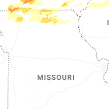

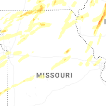
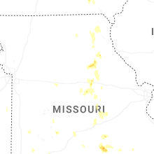
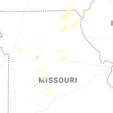


Connect with Interactive Hail Maps