

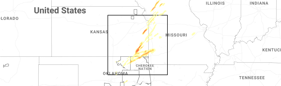
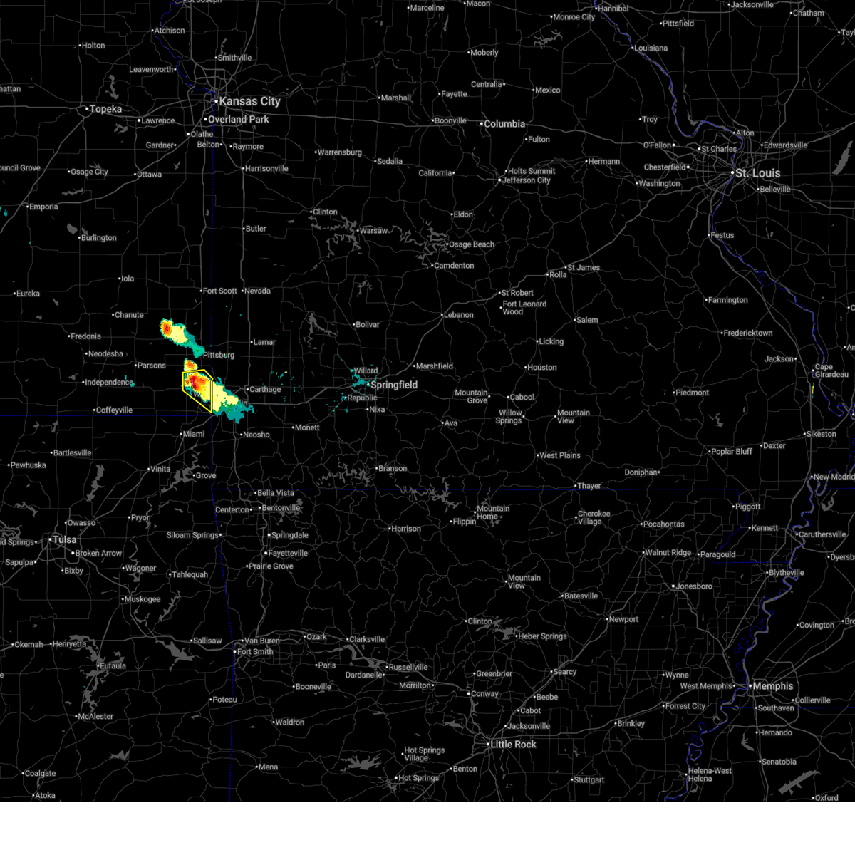
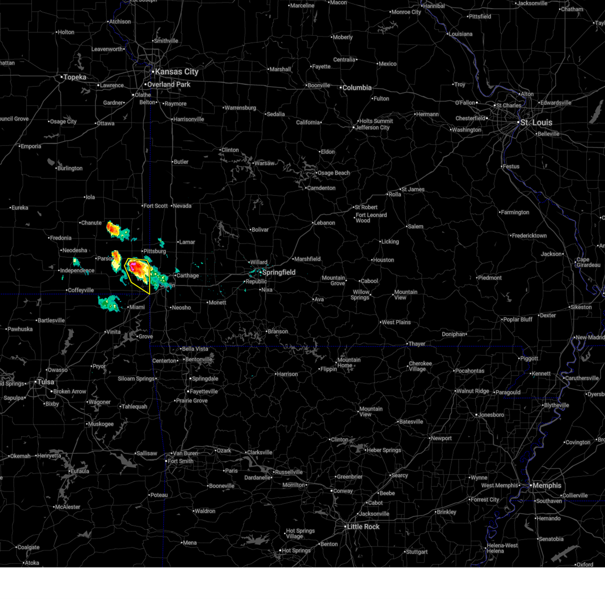
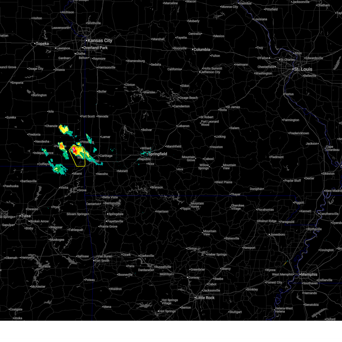
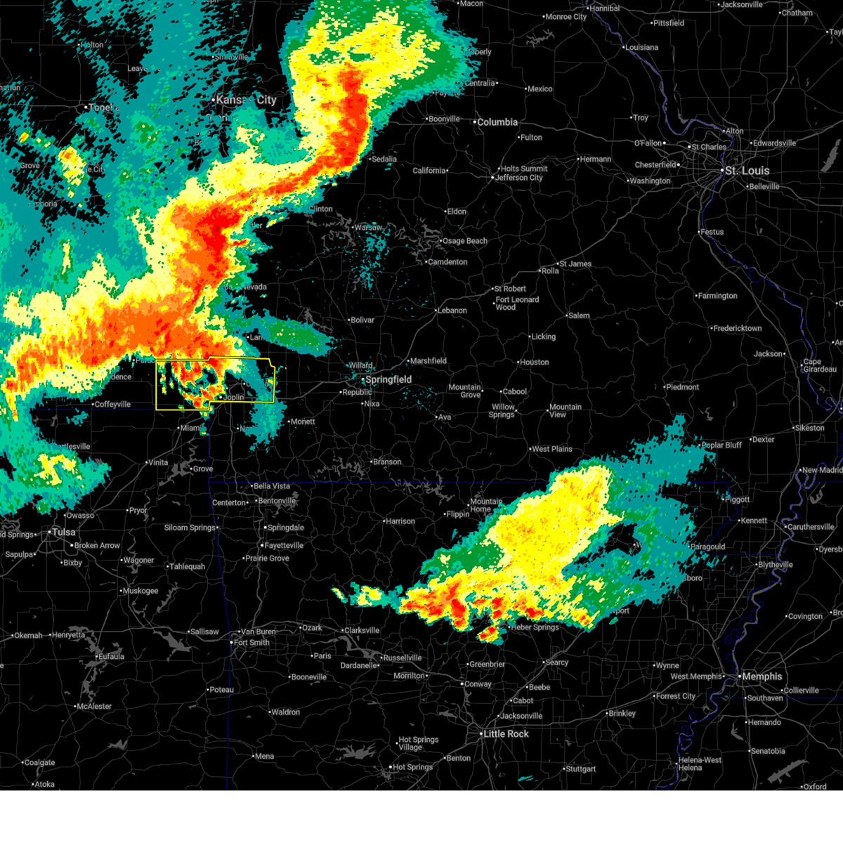
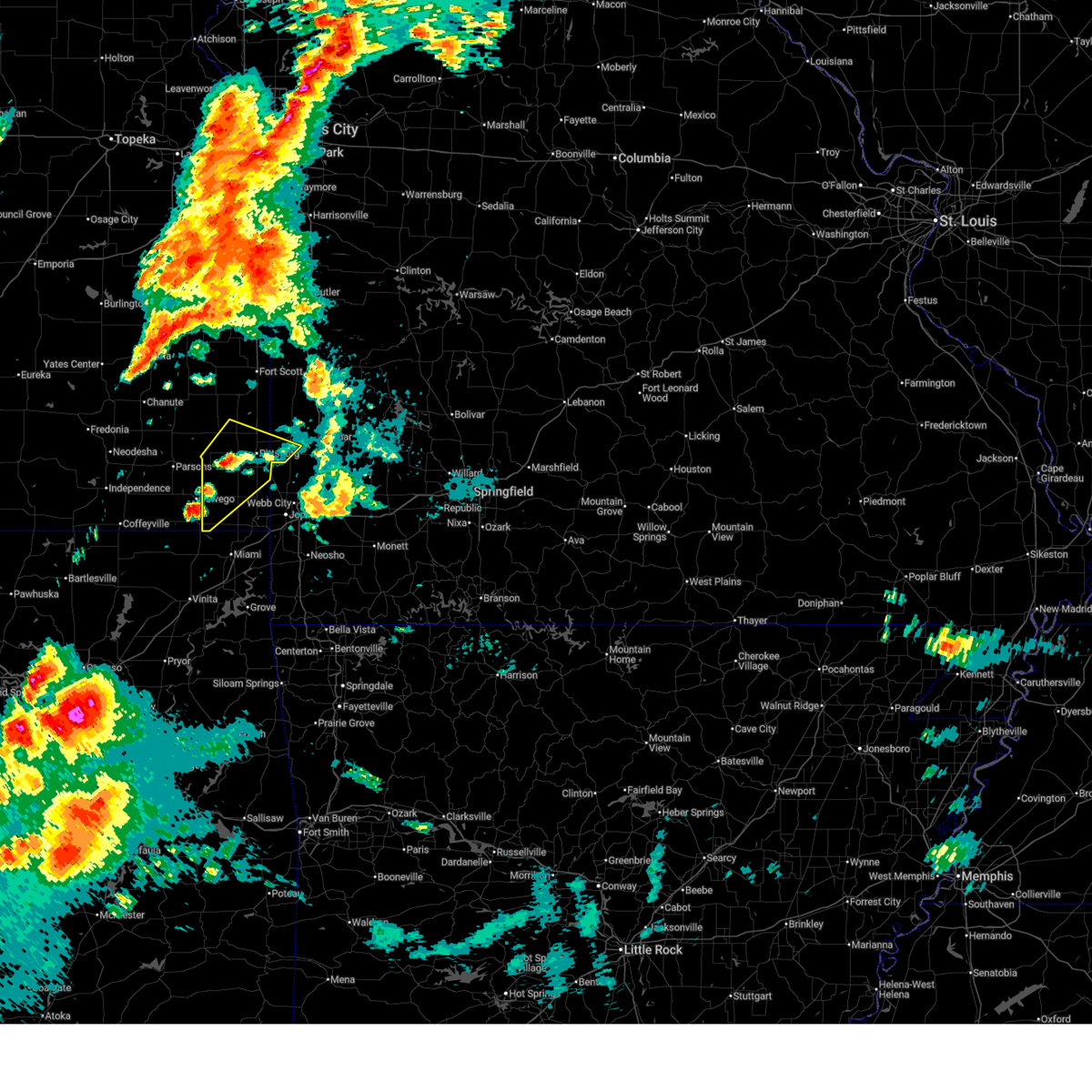
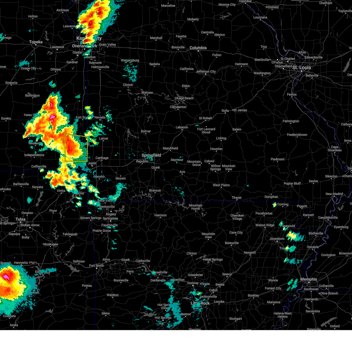
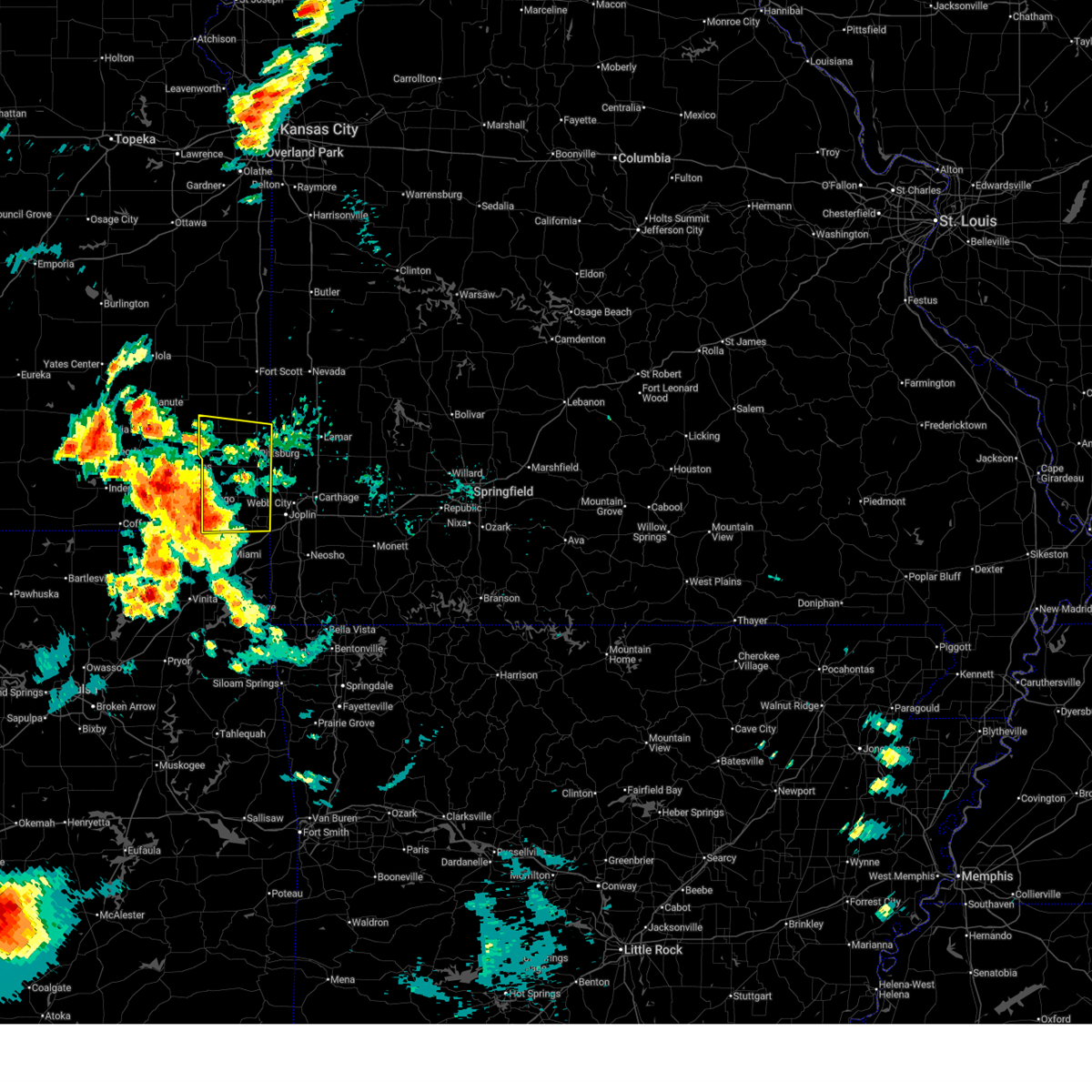
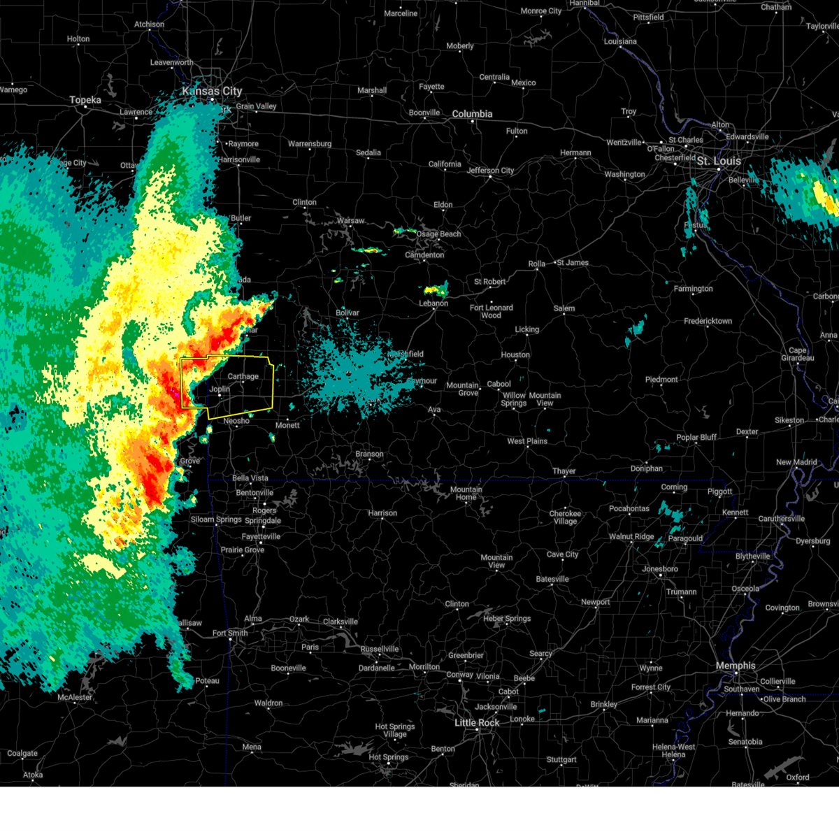
Hail Map for Columbus, KS
The Columbus, KS area has had 34 reports of on-the-ground hail by trained spotters, and has been under severe weather warnings 39 times during the past 12 months. Doppler radar has detected hail at or near Columbus, KS on 83 occasions, including 7 occasions during the past year.
| Name: | Columbus, KS |
| Where Located: | 48.5 miles SE of Chanute, KS |
| Map: | Google Map for Columbus, KS |
| Population: | 3312 |
| Housing Units: | 1633 |
| More Info: | Search Google for Columbus, KS |
5
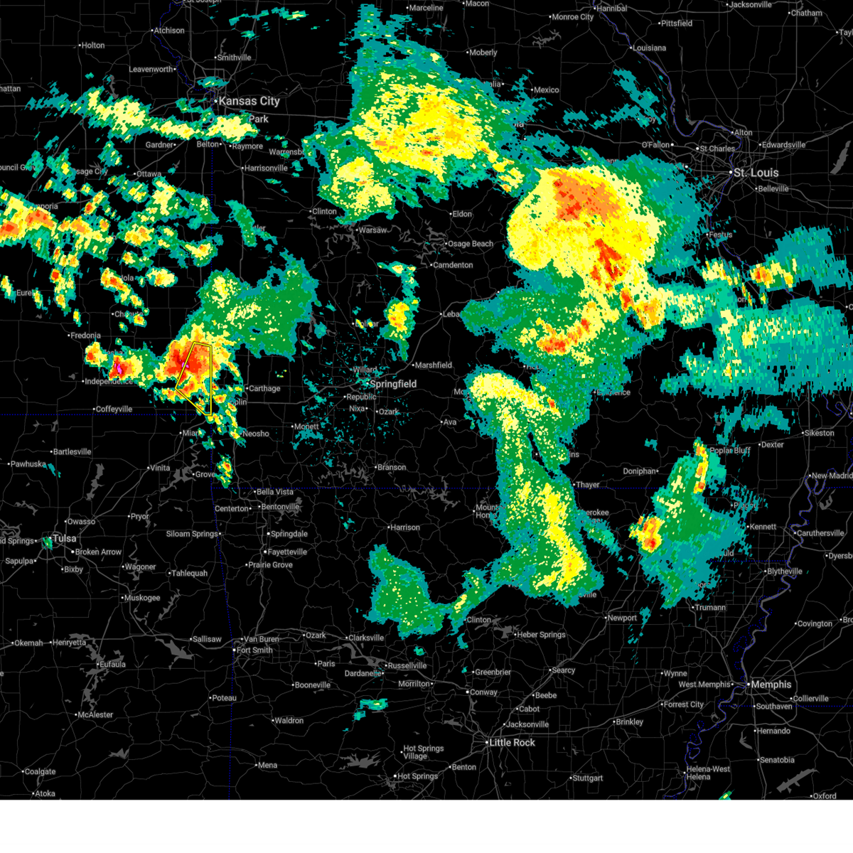
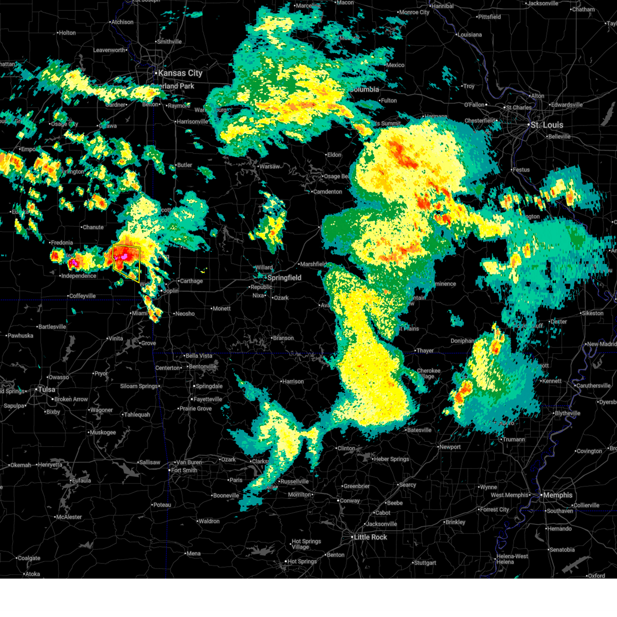
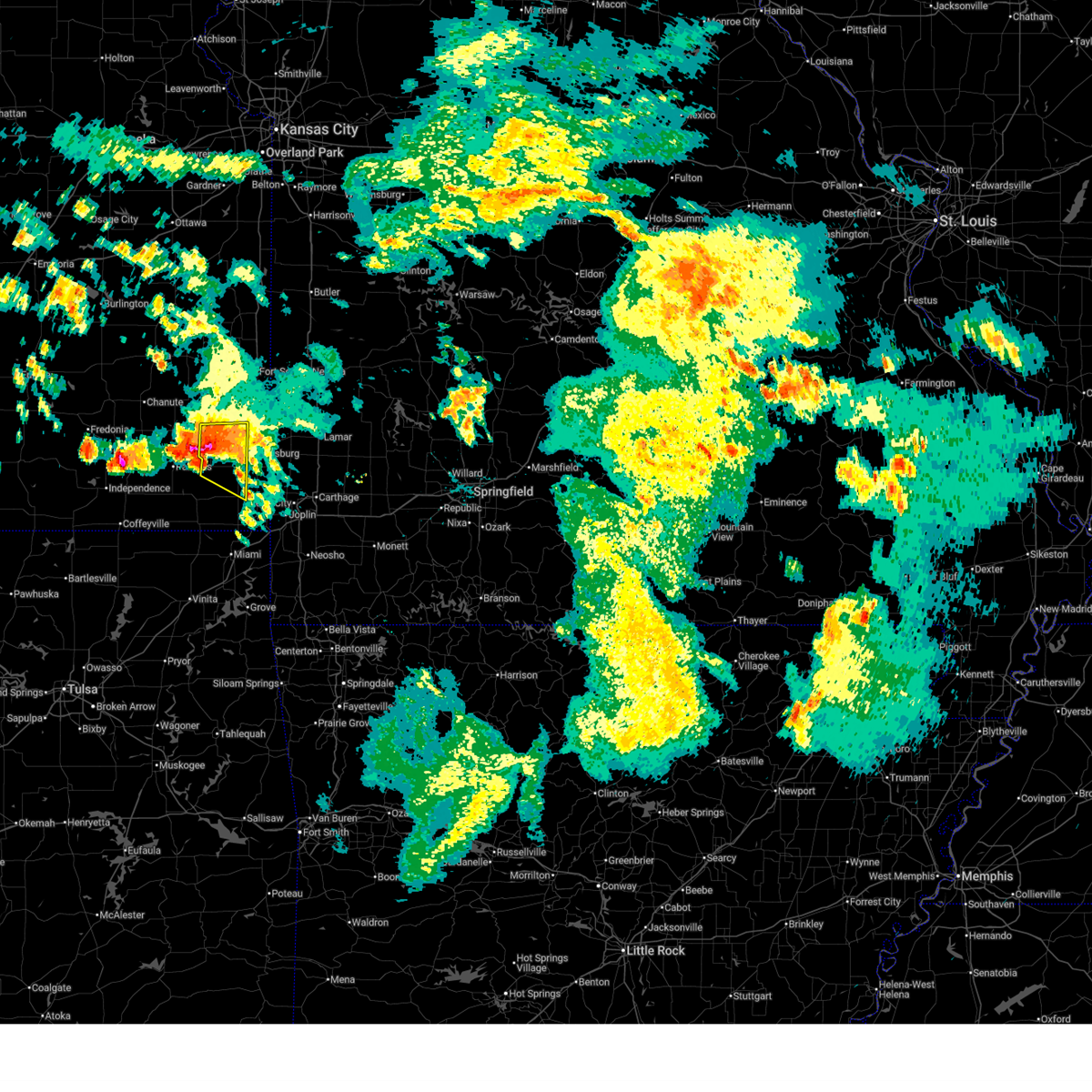
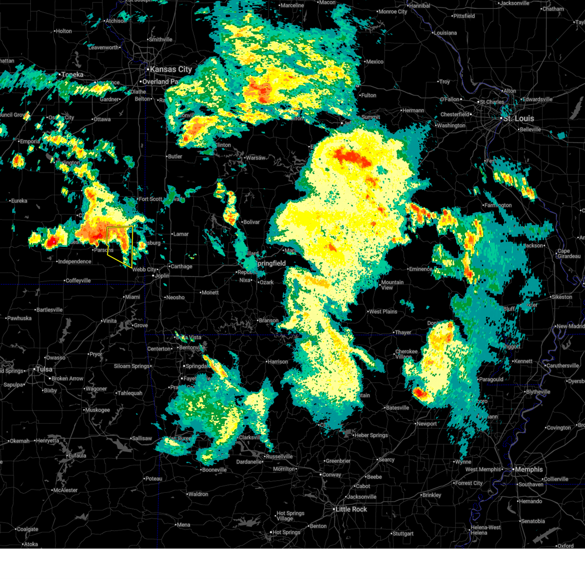
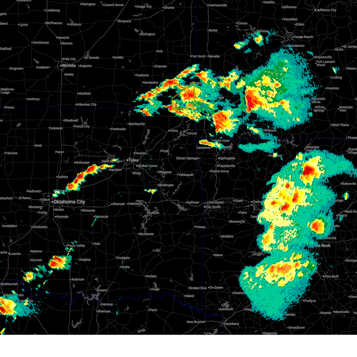
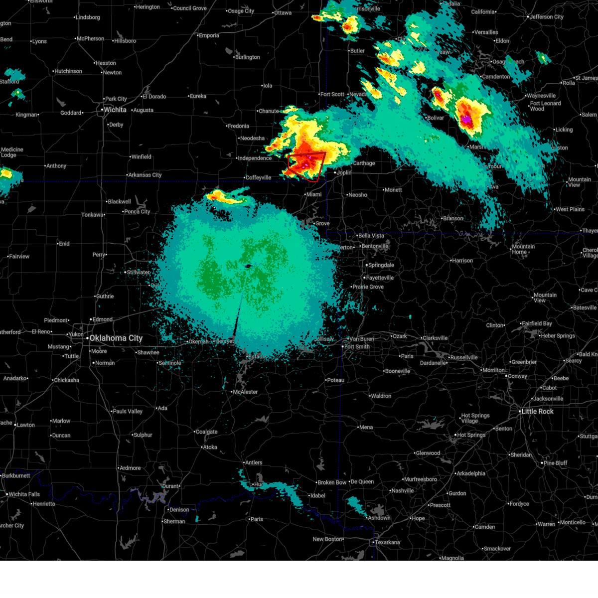
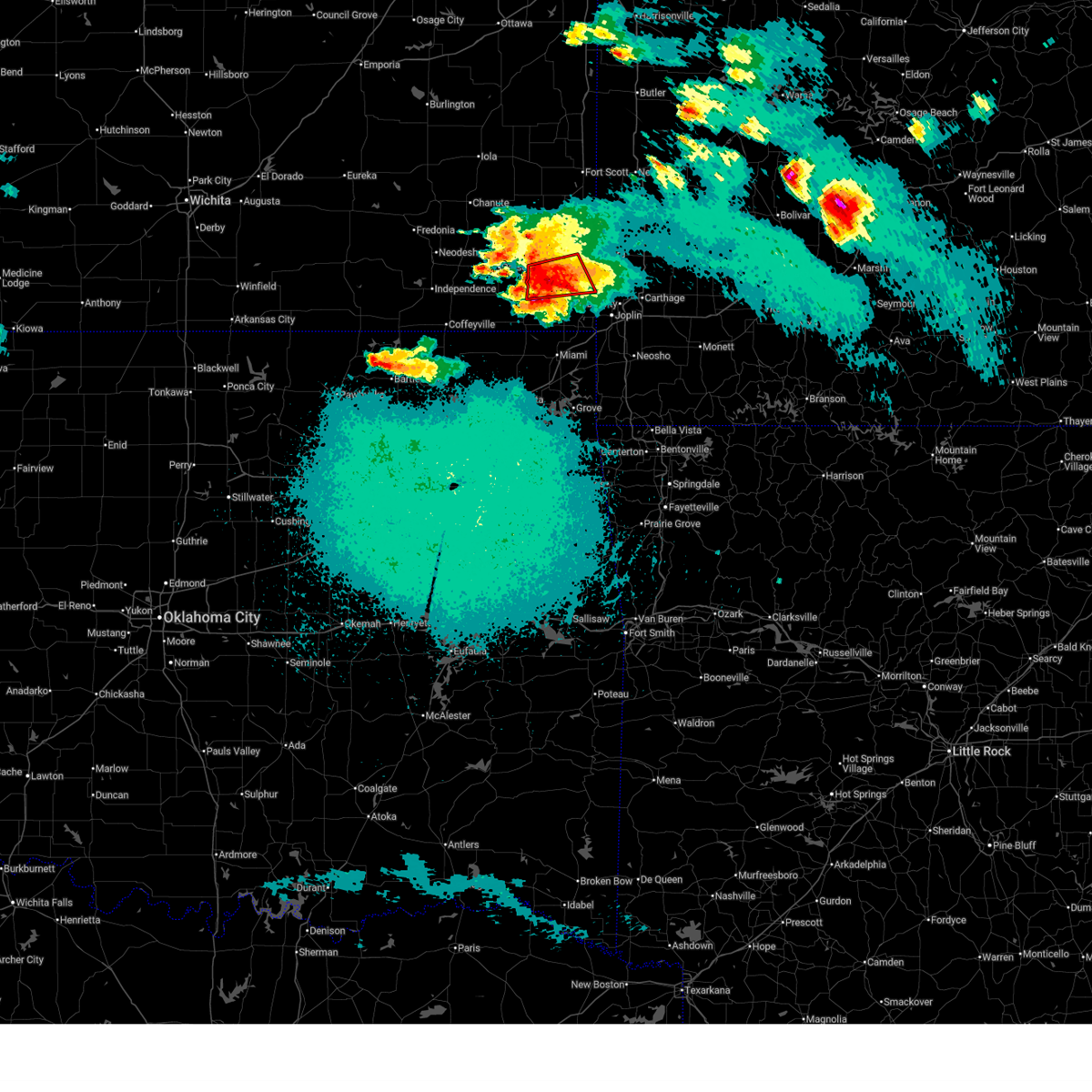
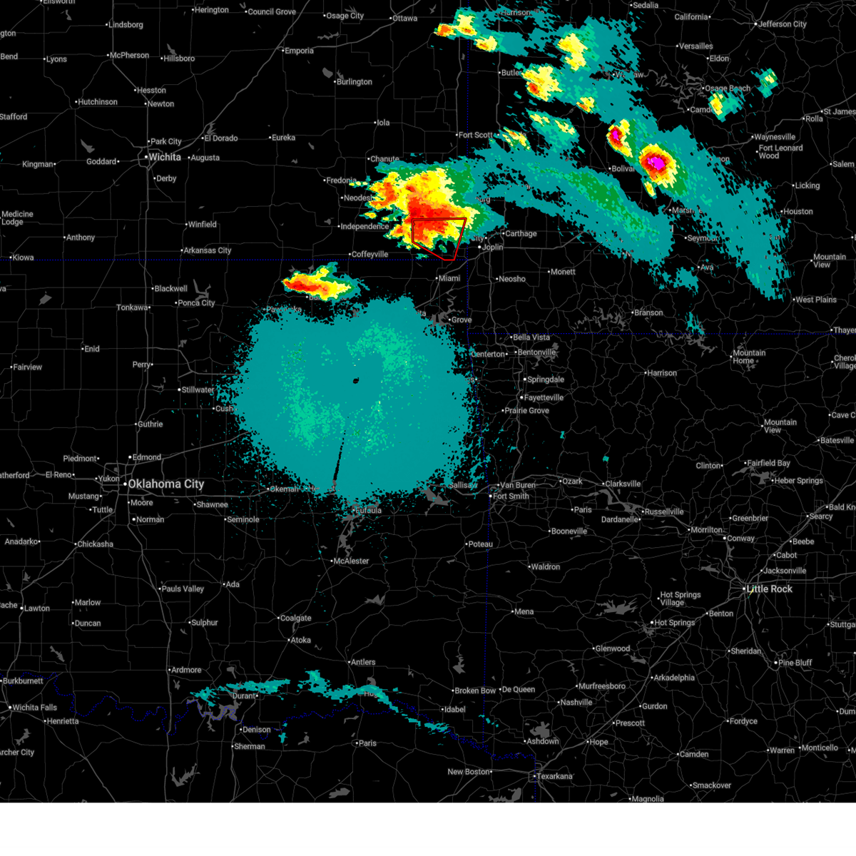
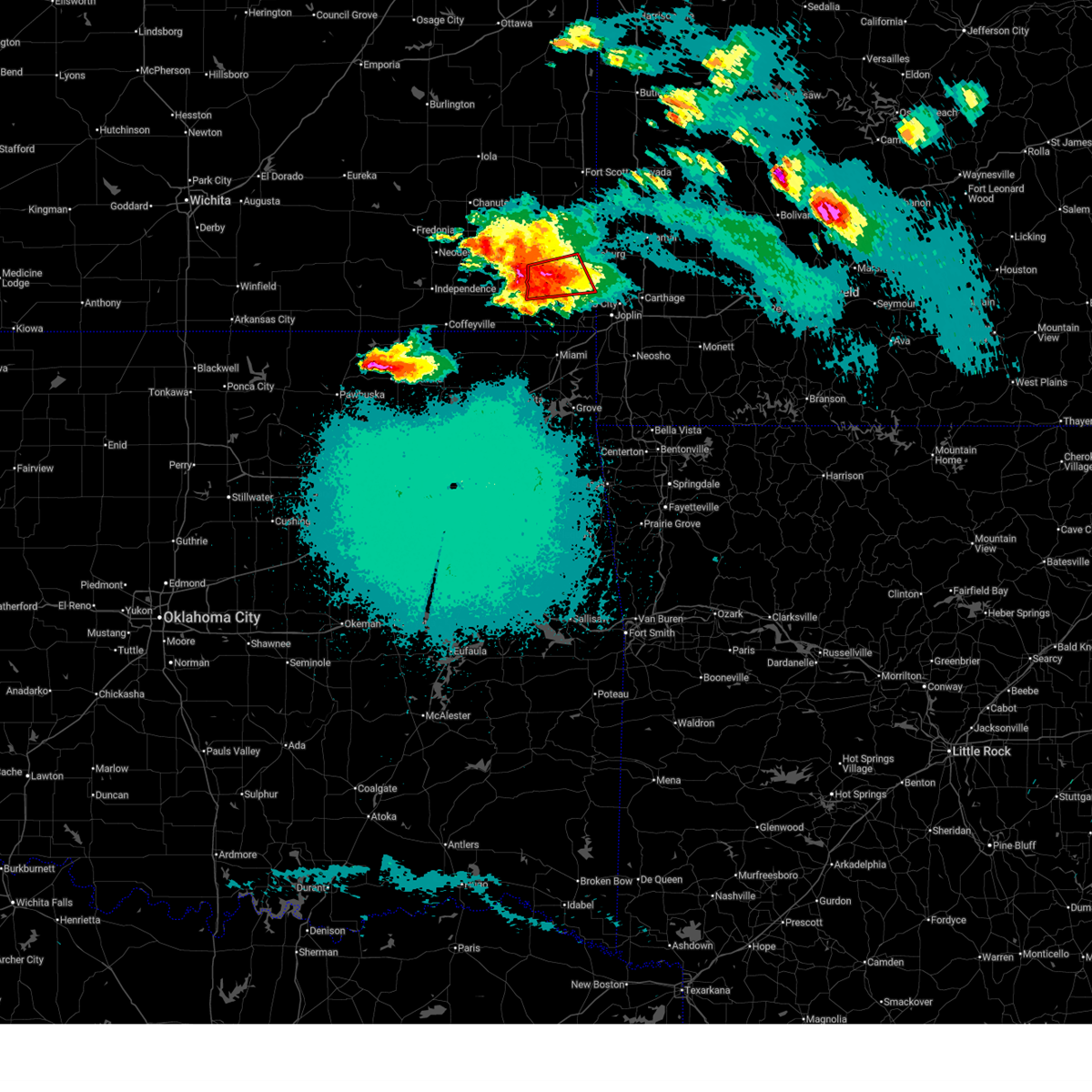
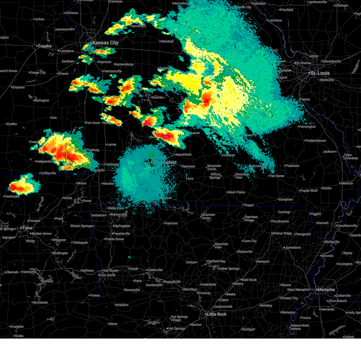
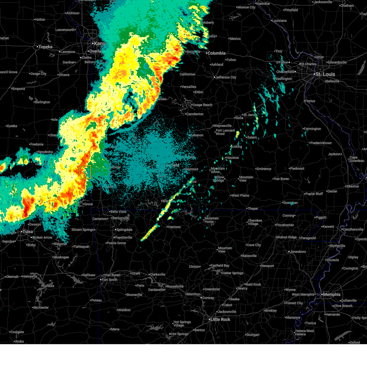
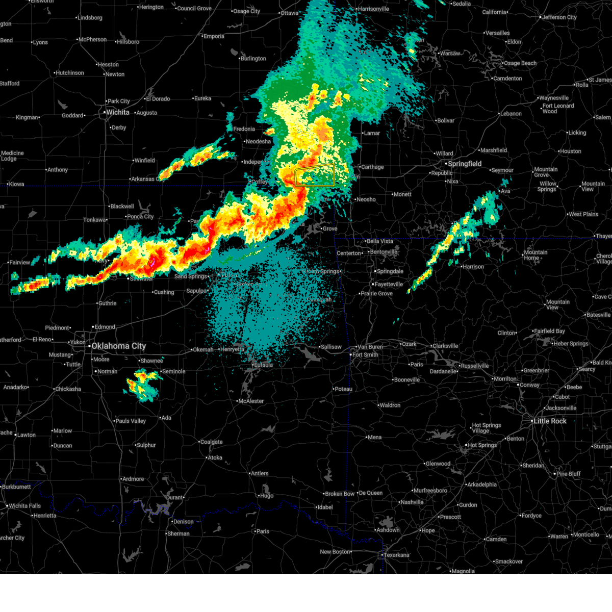
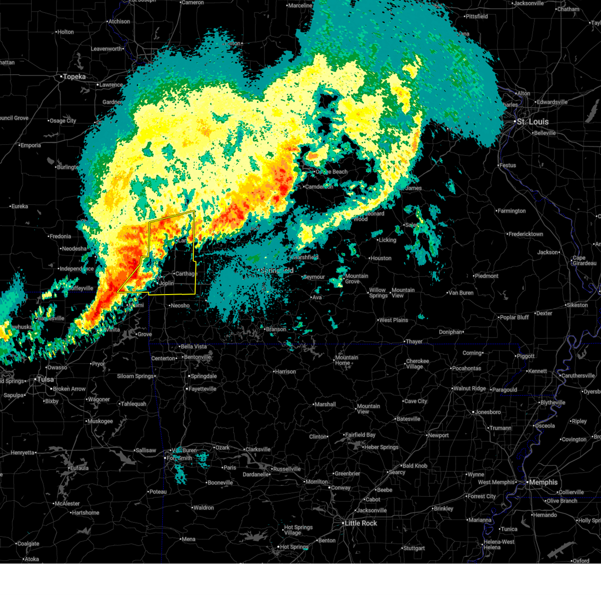
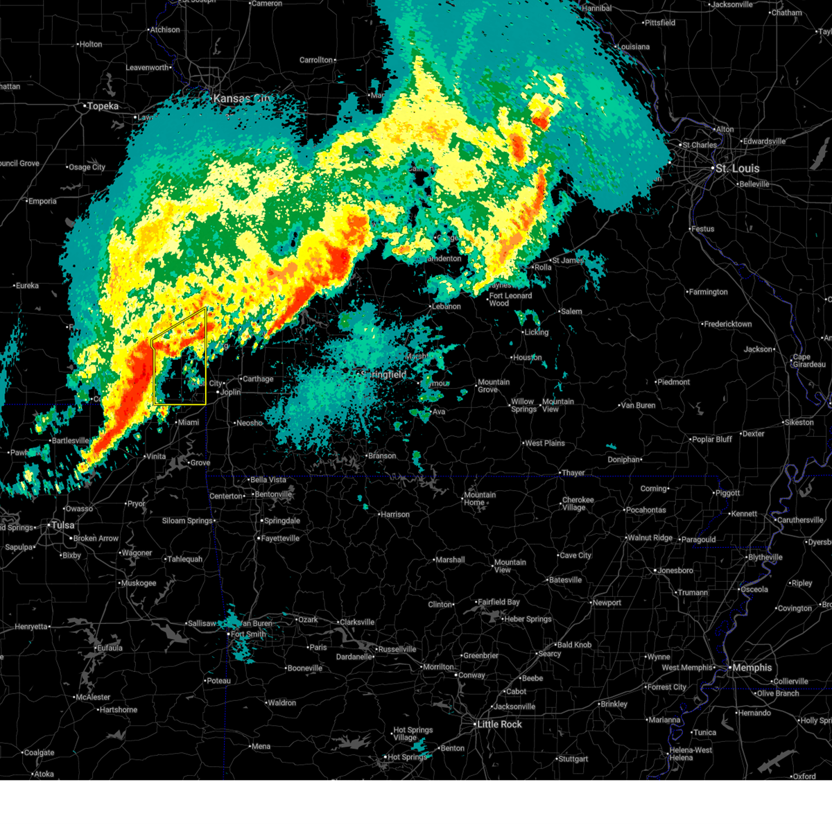
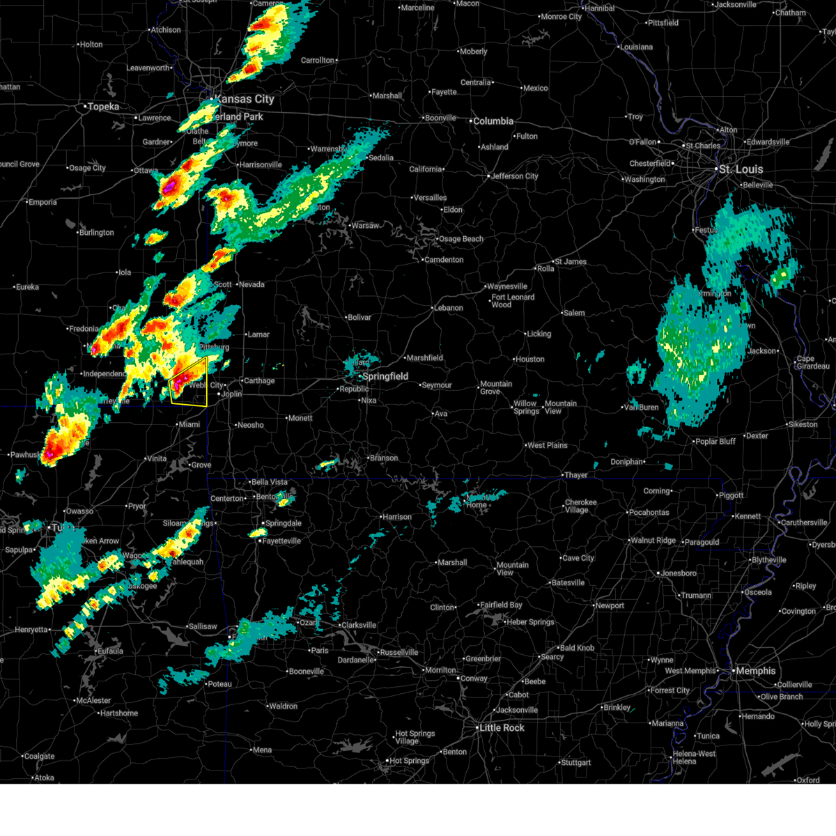
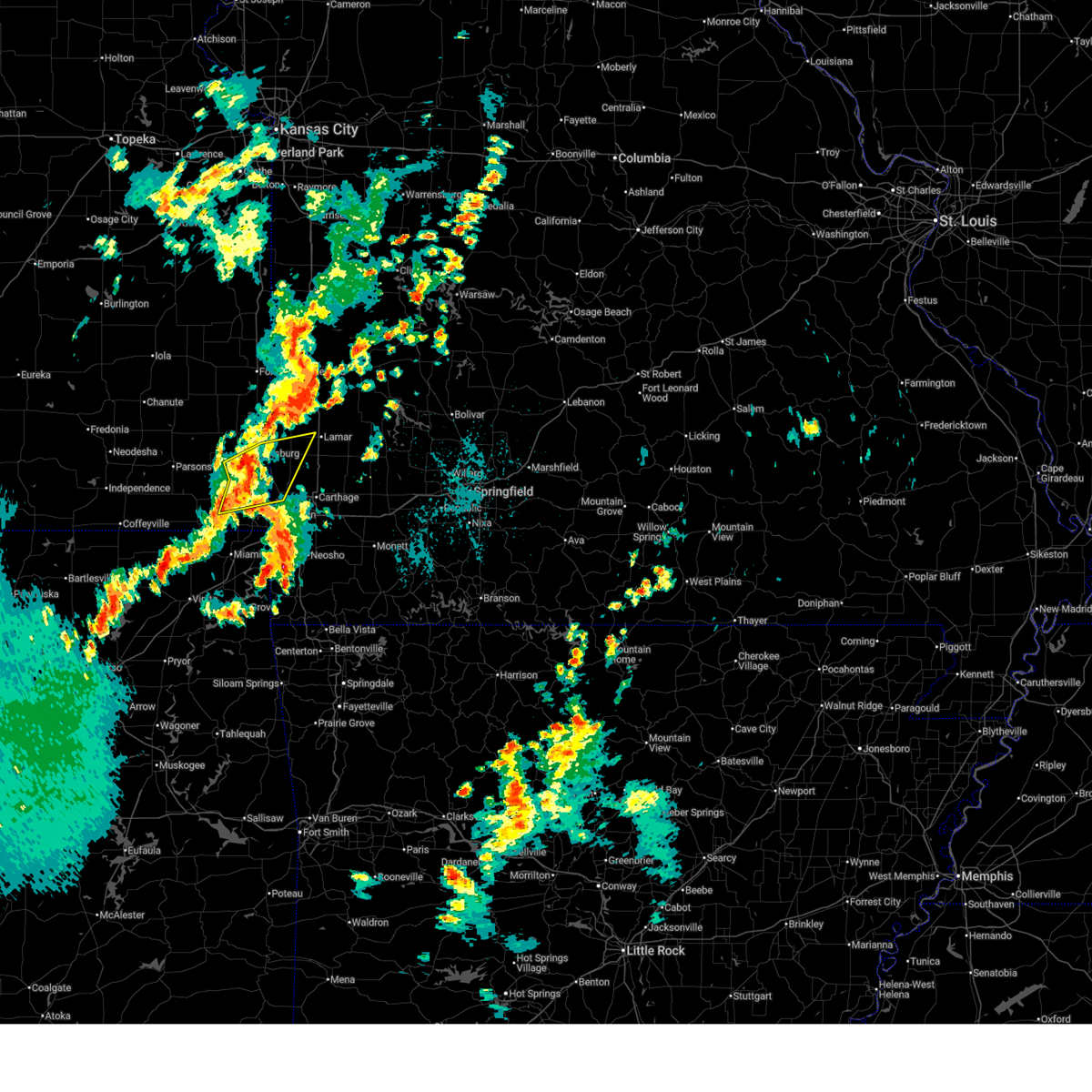
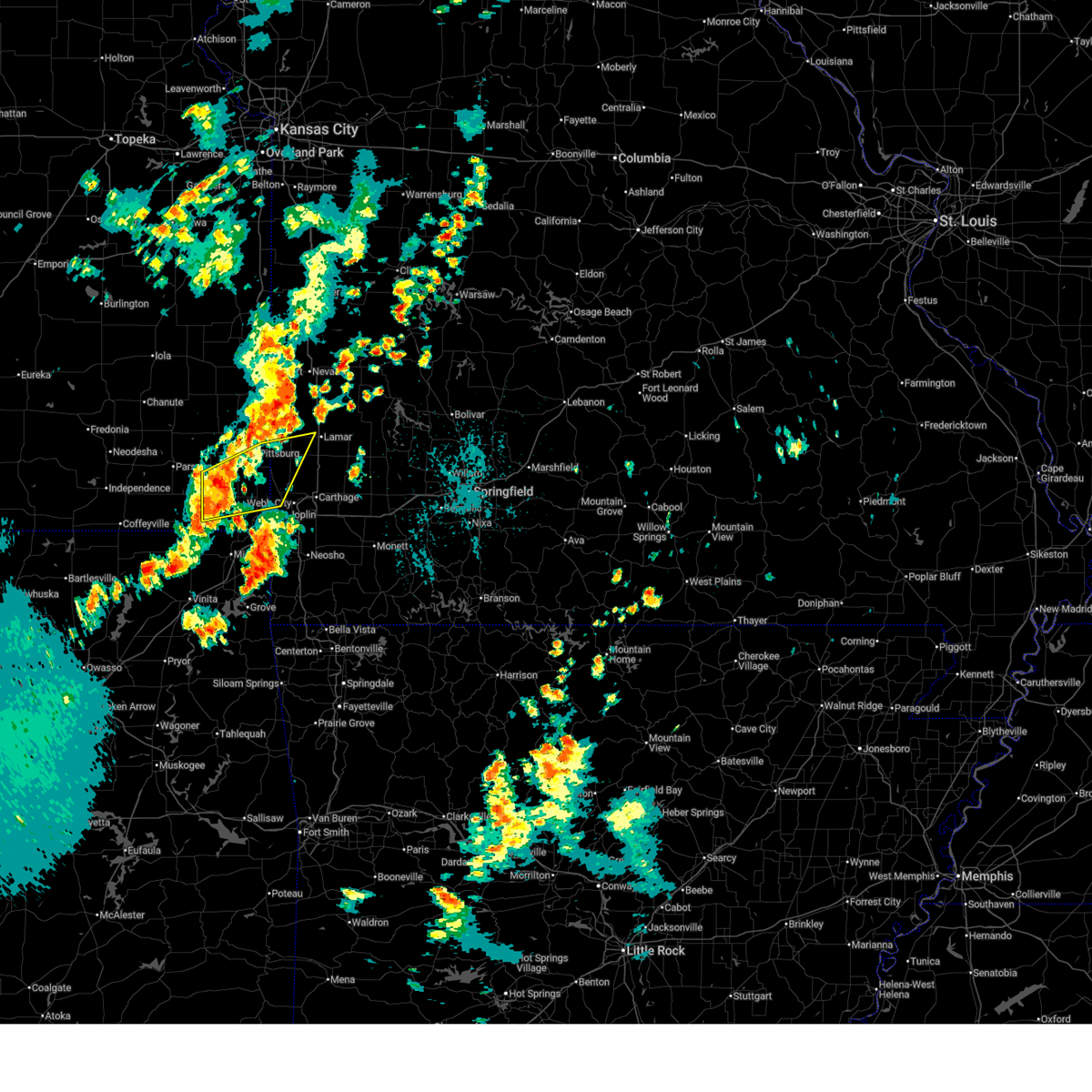
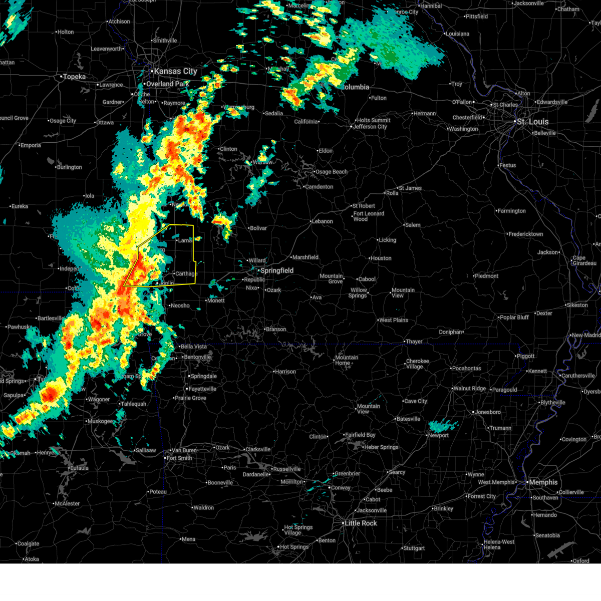
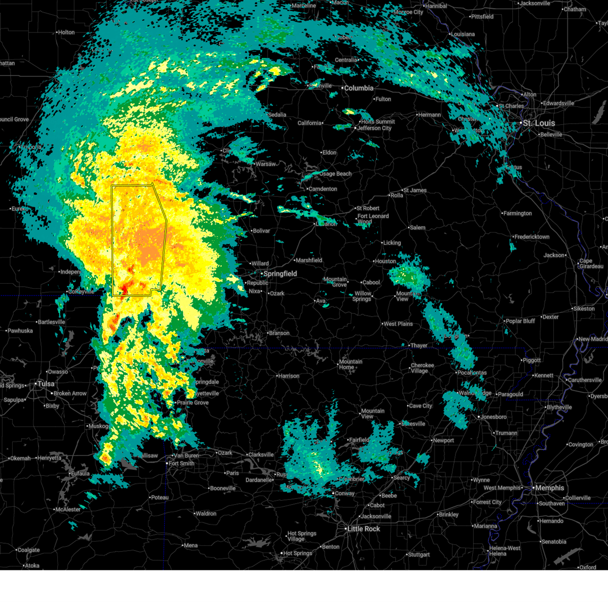
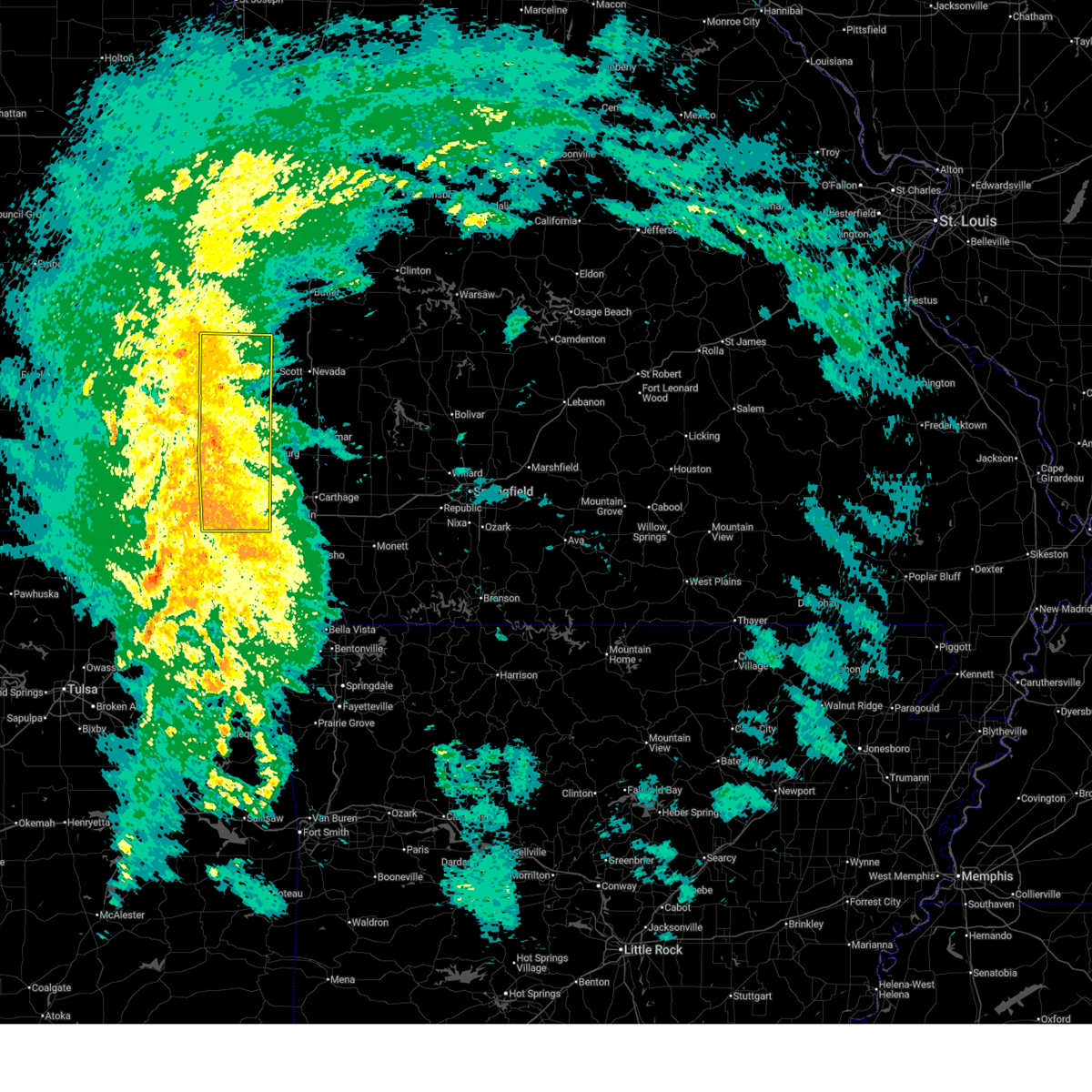
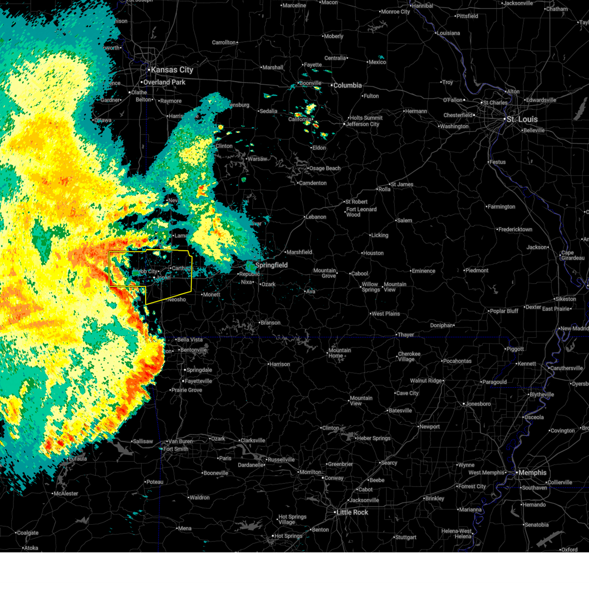
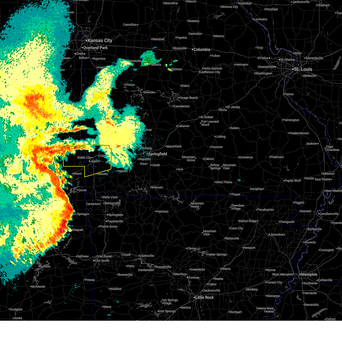
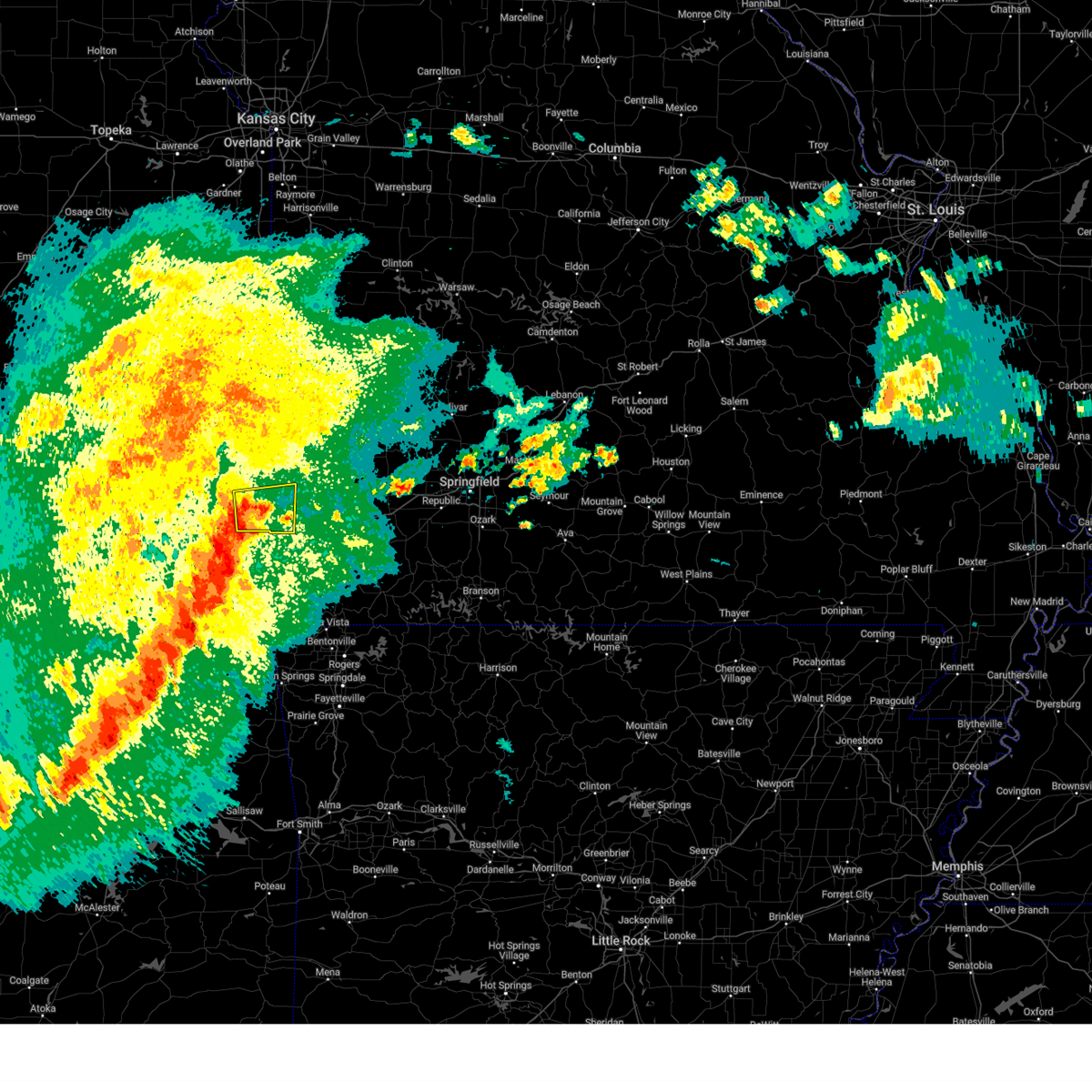
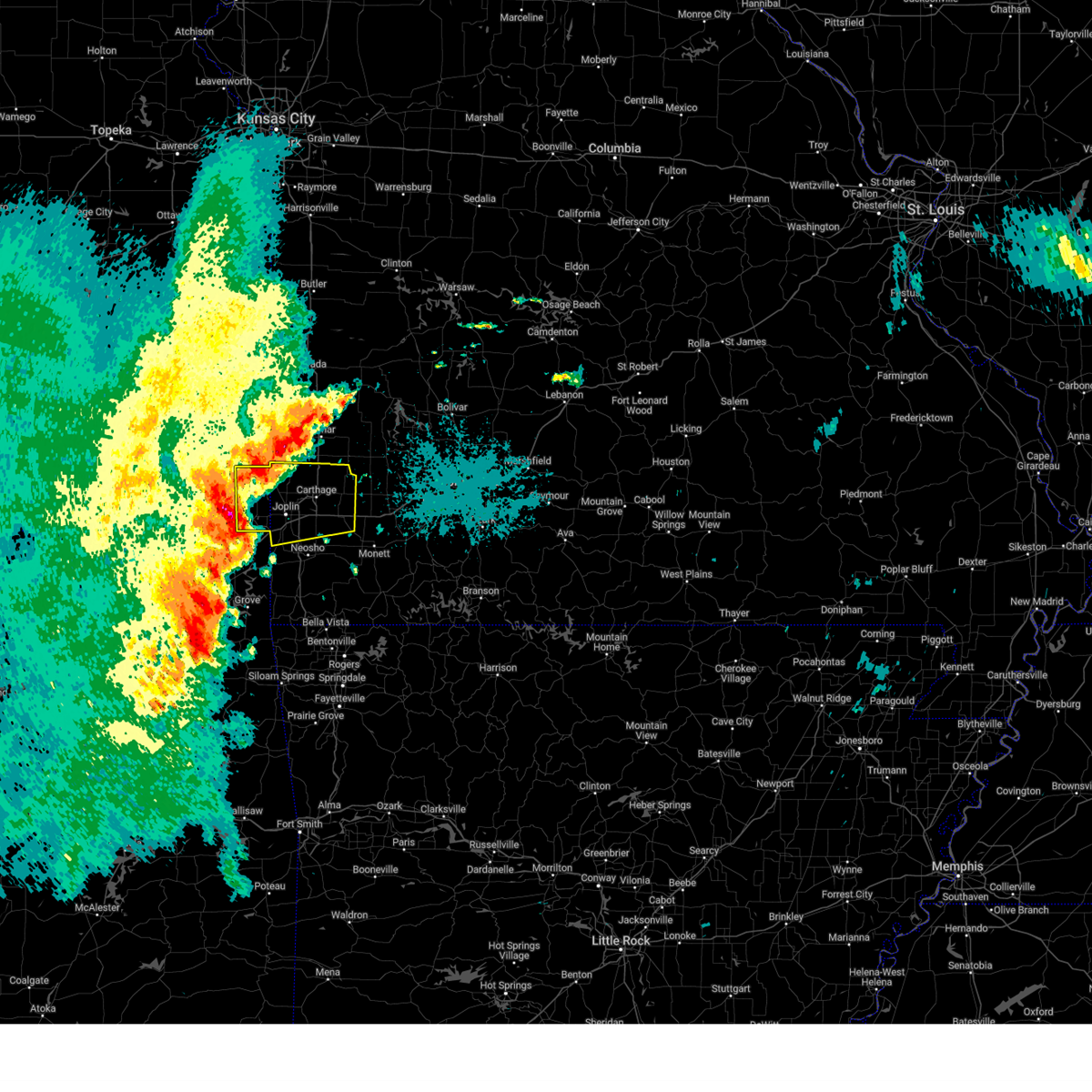
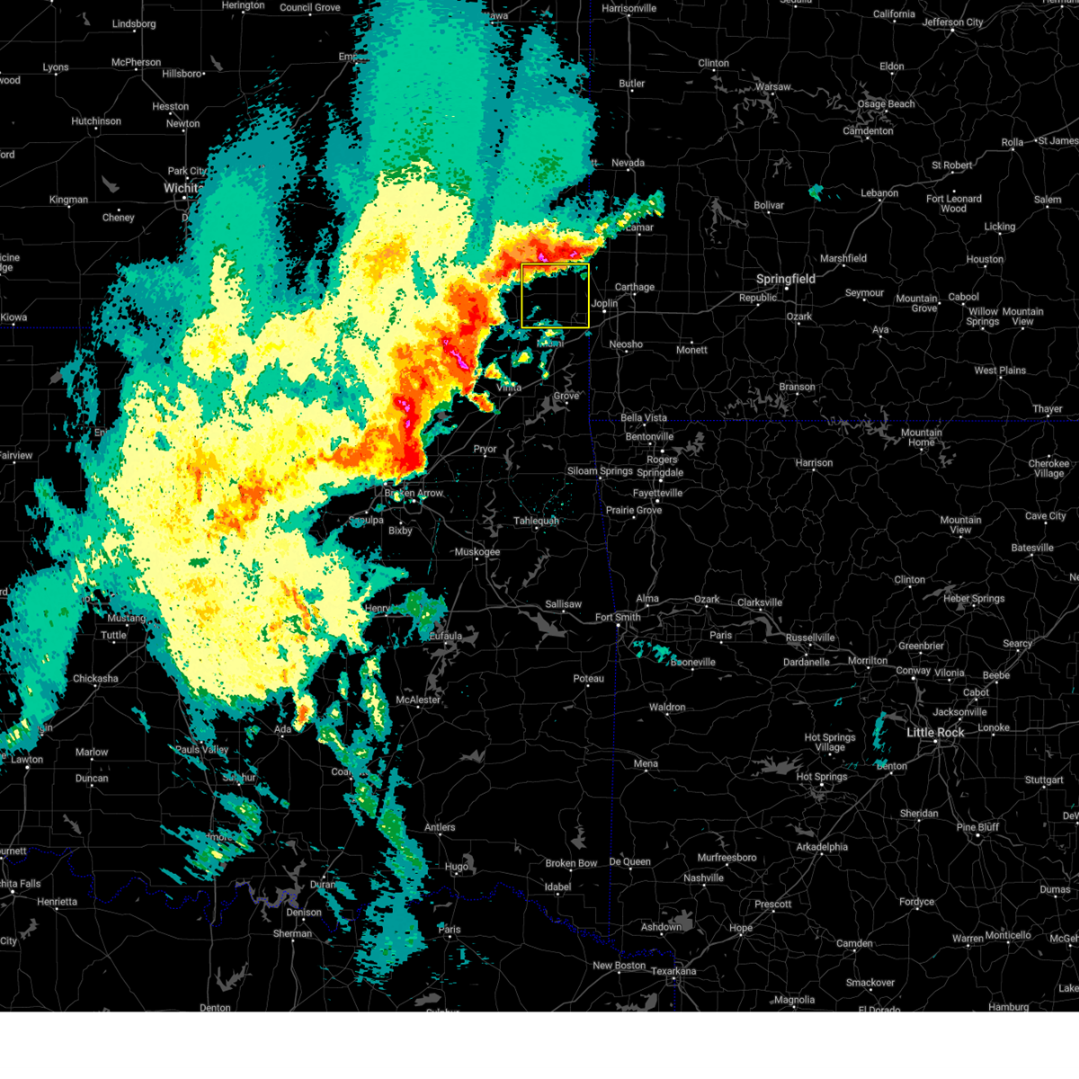
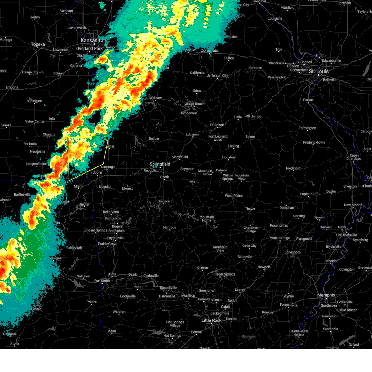
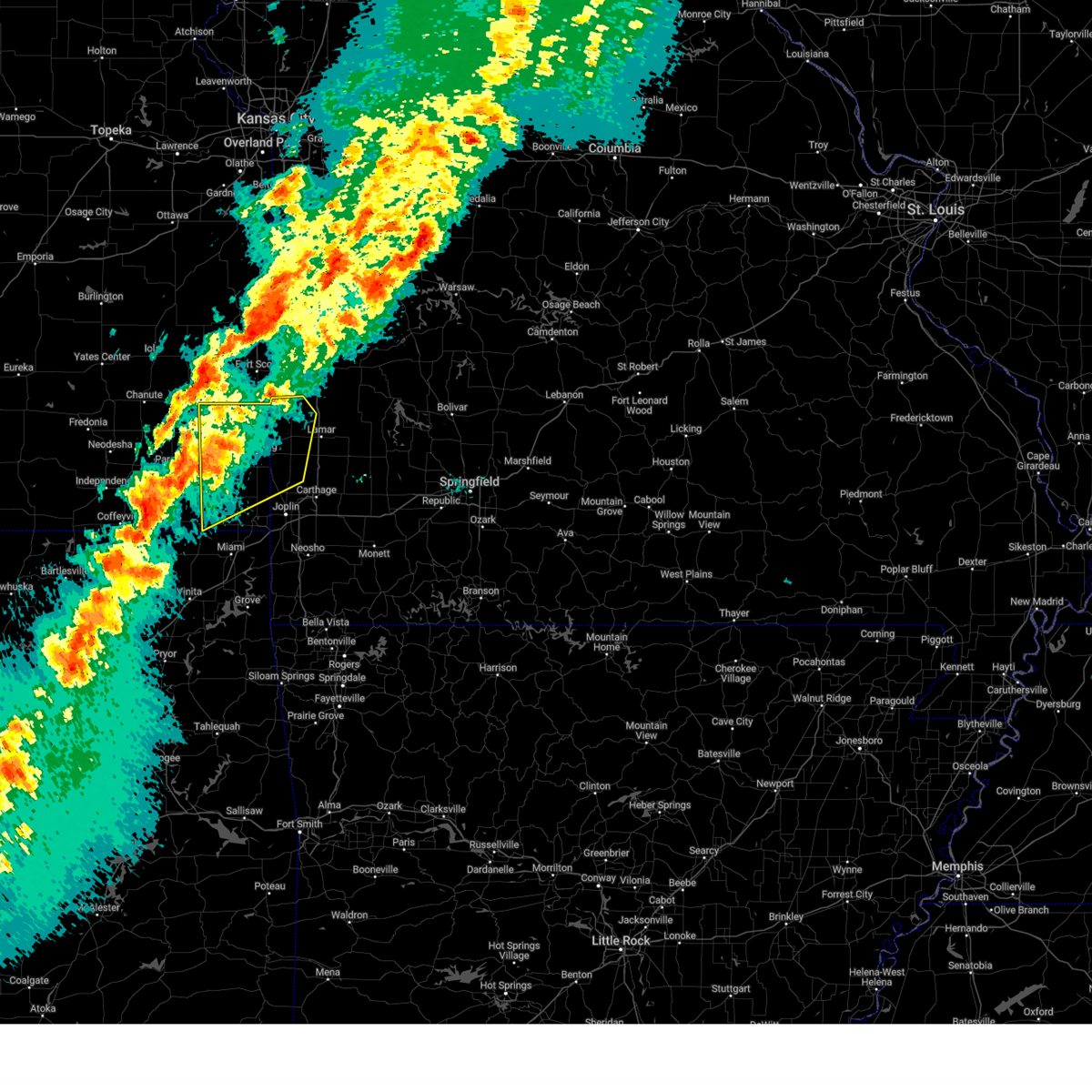
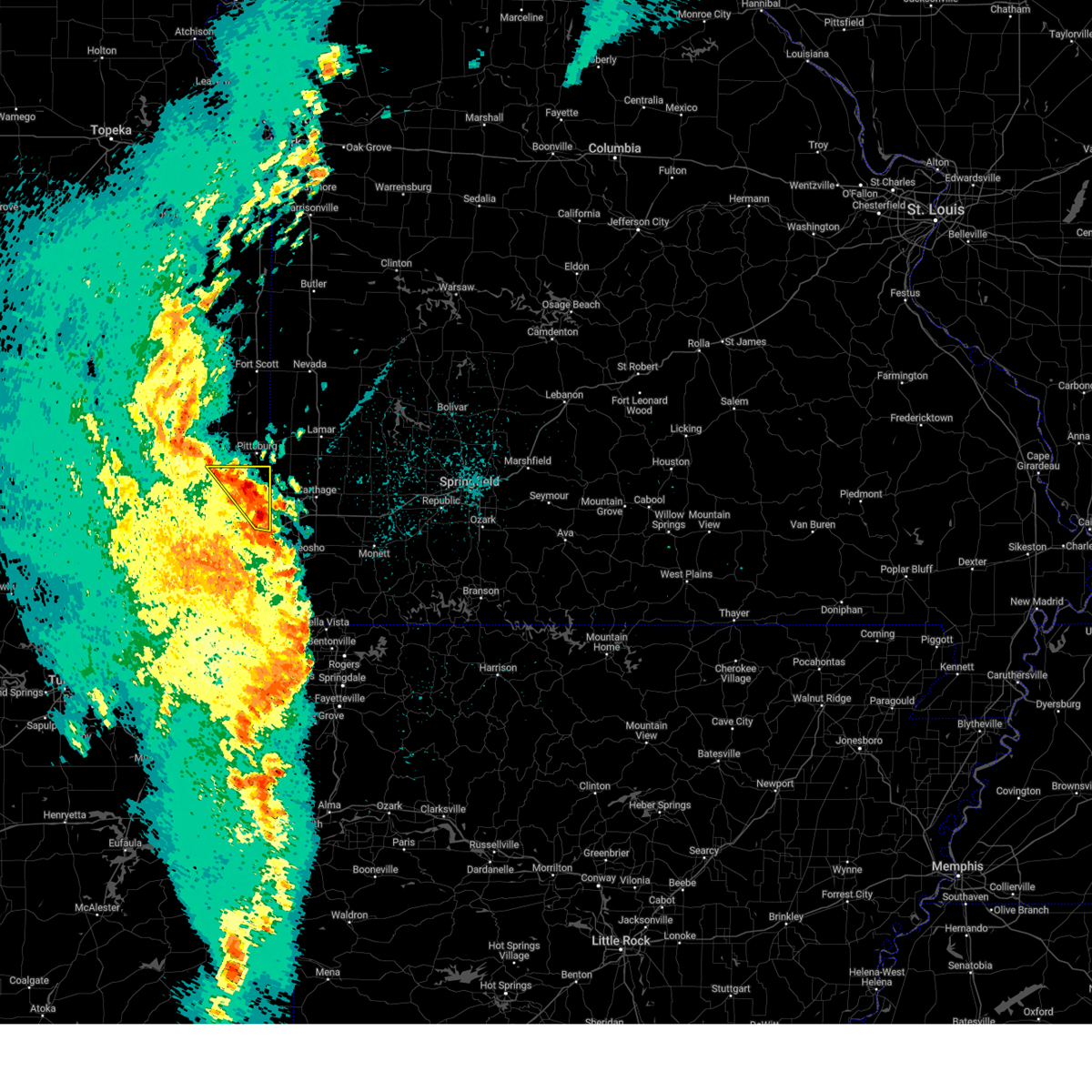
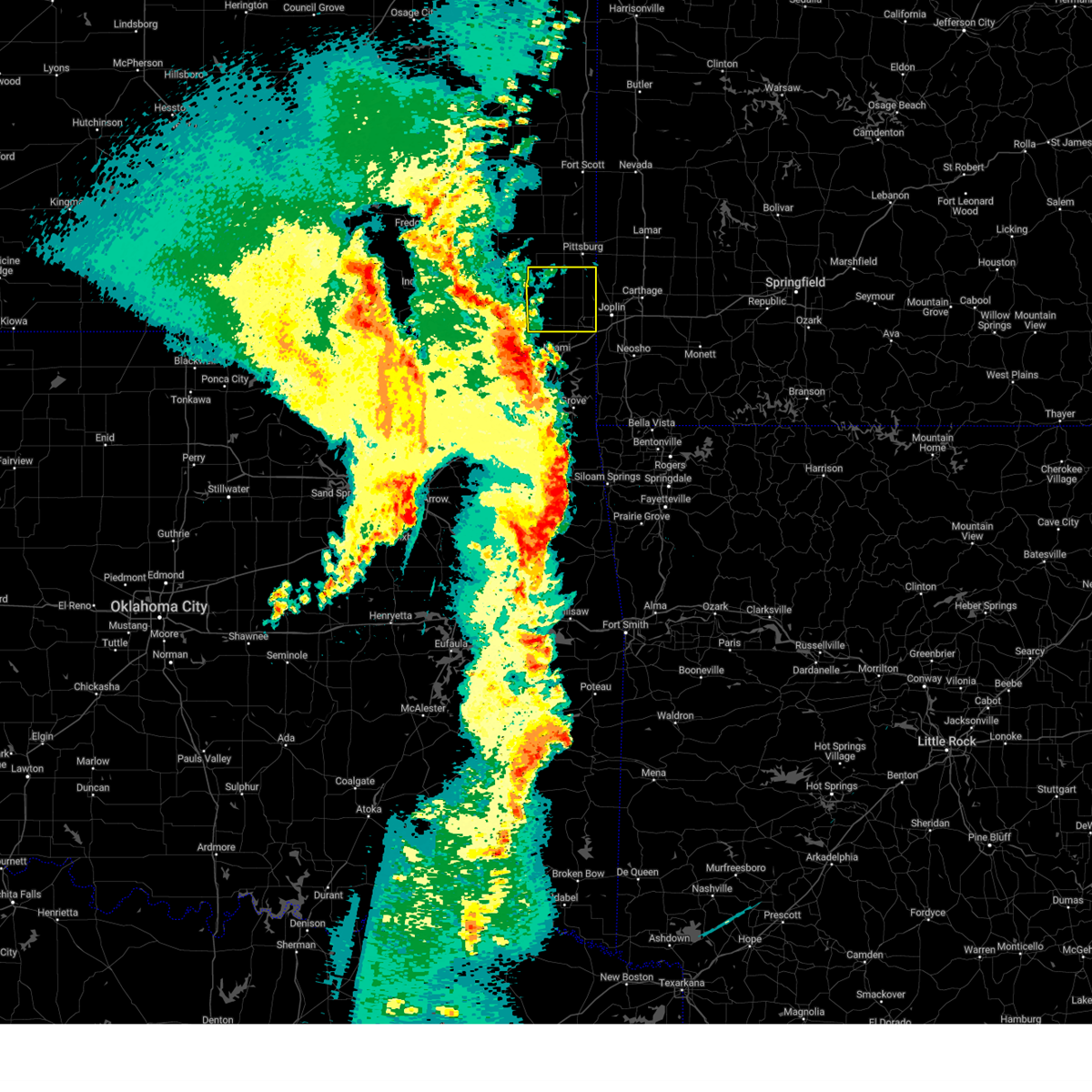
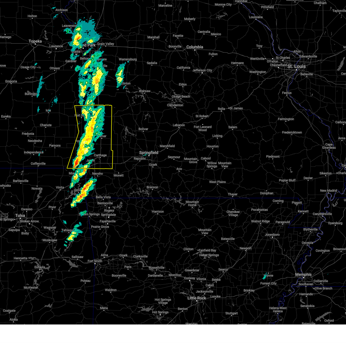
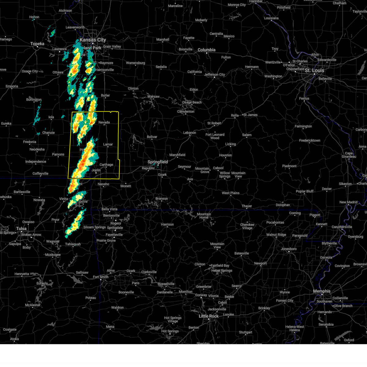
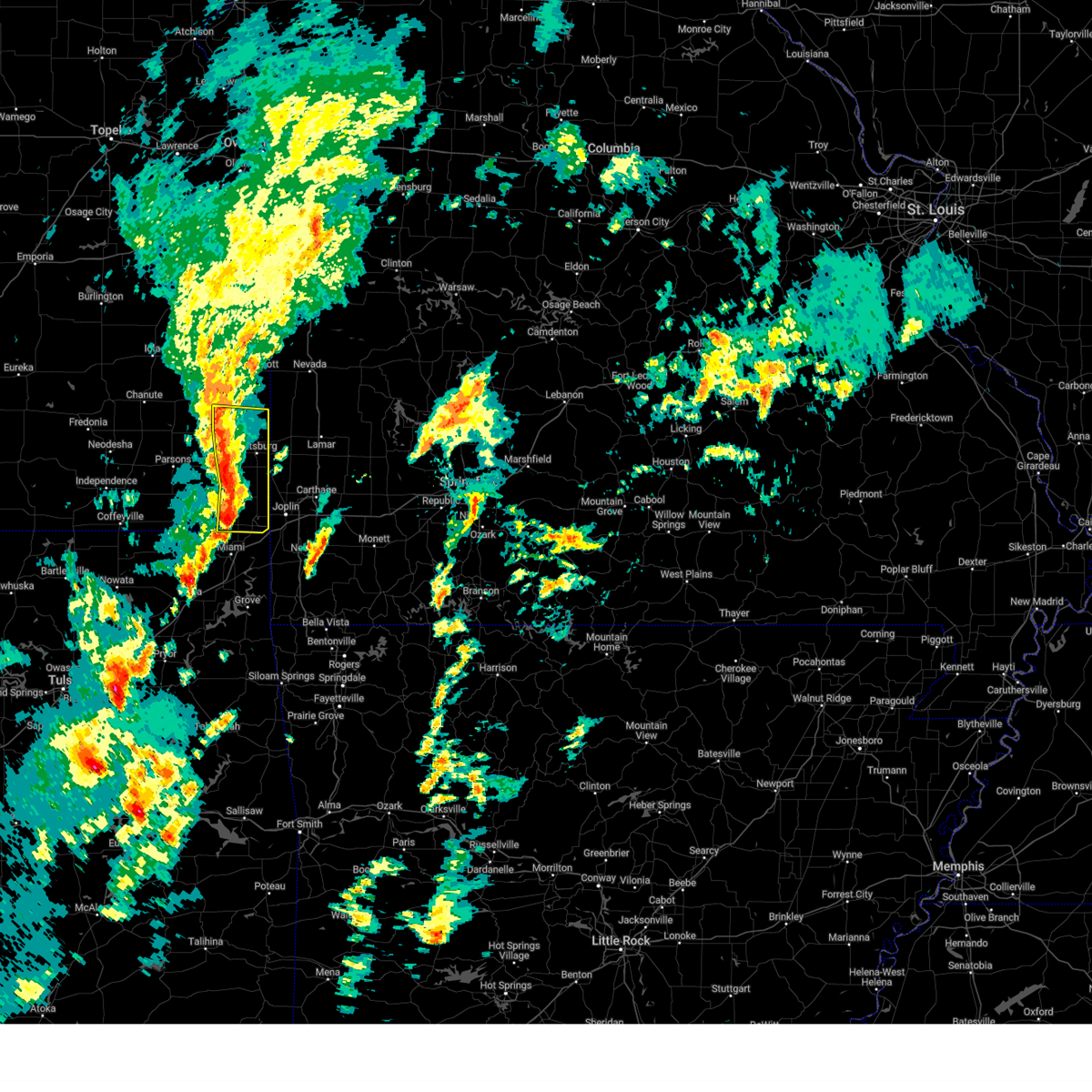
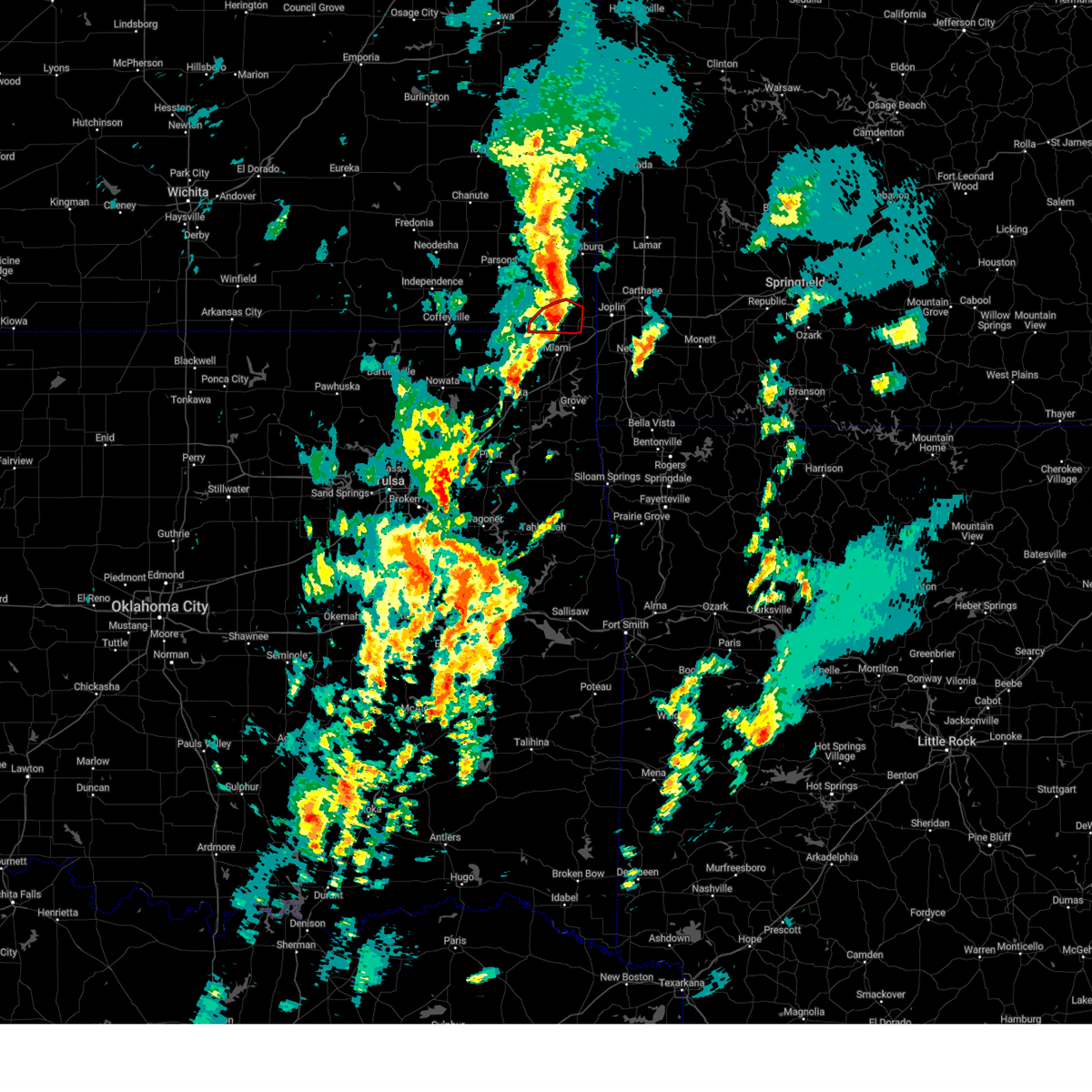
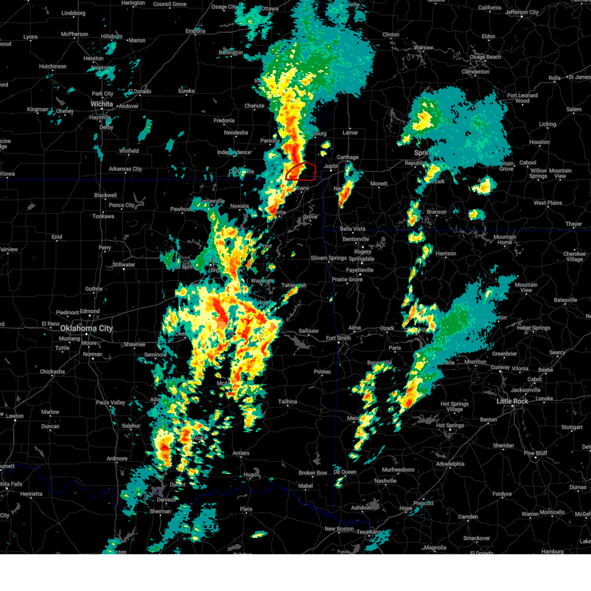
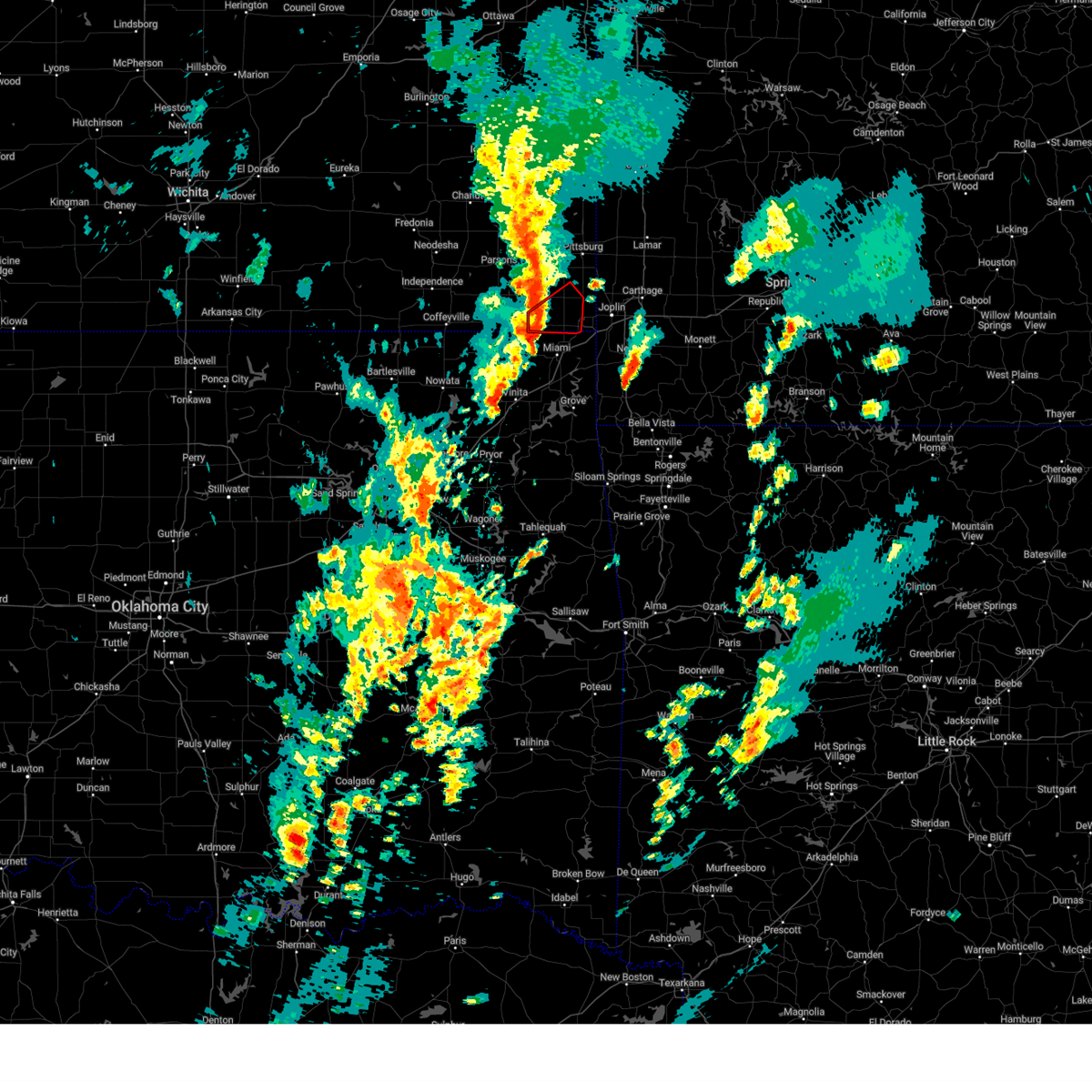
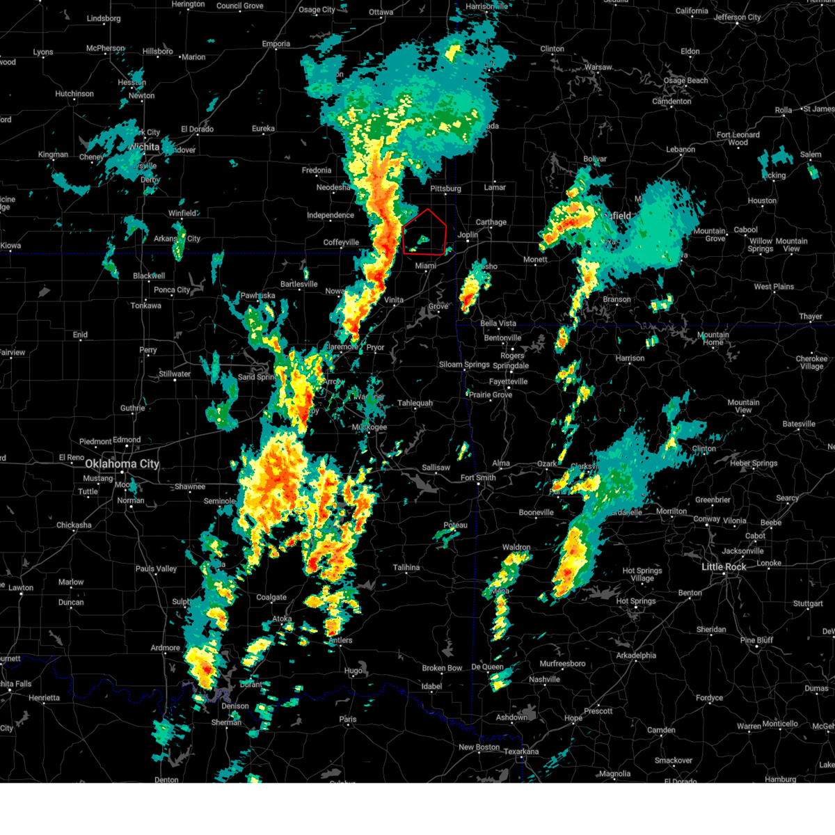
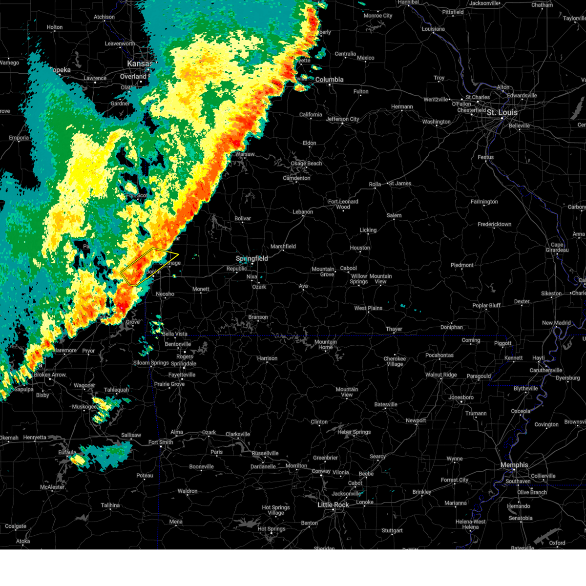
The Top Recent Hail Date for Columbus, KS is Wednesday, April 15, 2026 (1st out of 83)
Hail and Wind Damage Spotted near Columbus, KS
| Date / Time | Report Details |
|---|---|
| 6/26/2026 2:44 AM CDT |
 Svrsgf the national weather service in springfield has issued a * severe thunderstorm warning for, cherokee county in southeastern kansas, southern crawford county in southeastern kansas, southwestern barton county in southwestern missouri, northwestern jasper county in southwestern missouri, * until 330 am cdt. * at 244 am cdt, severe thunderstorms were located along a line extending from near mccune to near scammon to near chetopa, moving northeast at 35 mph (radar indicated). Hazards include 60 mph wind gusts. expect damage to roofs, siding, and trees Svrsgf the national weather service in springfield has issued a * severe thunderstorm warning for, cherokee county in southeastern kansas, southern crawford county in southeastern kansas, southwestern barton county in southwestern missouri, northwestern jasper county in southwestern missouri, * until 330 am cdt. * at 244 am cdt, severe thunderstorms were located along a line extending from near mccune to near scammon to near chetopa, moving northeast at 35 mph (radar indicated). Hazards include 60 mph wind gusts. expect damage to roofs, siding, and trees
|
| 6/25/2026 9:36 PM CDT |
 At 936 pm cdt, a severe thunderstorm was located over oswego, moving southeast at 30 mph (radar indicated). Hazards include 60 mph wind gusts and quarter size hail. Hail damage to vehicles is expected. expect wind damage to roofs, siding, and trees. Locations impacted include, baxter springs, columbus, sherman, scammon, west mineral, treece, roseland, neutral, melrose, carona, skidmore, hallowell, sherwin, faulkner, and stippville. At 936 pm cdt, a severe thunderstorm was located over oswego, moving southeast at 30 mph (radar indicated). Hazards include 60 mph wind gusts and quarter size hail. Hail damage to vehicles is expected. expect wind damage to roofs, siding, and trees. Locations impacted include, baxter springs, columbus, sherman, scammon, west mineral, treece, roseland, neutral, melrose, carona, skidmore, hallowell, sherwin, faulkner, and stippville.
|
| 6/25/2026 9:24 PM CDT |
 Svrsgf the national weather service in springfield has issued a * severe thunderstorm warning for, cherokee county in southeastern kansas, * until 1030 pm cdt. * at 924 pm cdt, a severe thunderstorm was located near altamont, moving southeast at 30 mph (radar indicated). Hazards include golf ball size hail and 60 mph wind gusts. People and animals outdoors will be injured. expect hail damage to roofs, siding, windows, and vehicles. Expect wind damage to roofs, siding, and trees. Svrsgf the national weather service in springfield has issued a * severe thunderstorm warning for, cherokee county in southeastern kansas, * until 1030 pm cdt. * at 924 pm cdt, a severe thunderstorm was located near altamont, moving southeast at 30 mph (radar indicated). Hazards include golf ball size hail and 60 mph wind gusts. People and animals outdoors will be injured. expect hail damage to roofs, siding, windows, and vehicles. Expect wind damage to roofs, siding, and trees.
|
| 6/25/2026 9:07 PM CDT |
 At 906 pm cdt, a severe thunderstorm was located near weir, or 9 miles south of pittsburg, moving southeast at 25 mph (radar indicated). Hazards include 60 mph wind gusts and quarter size hail. Hail damage to vehicles is expected. expect wind damage to roofs, siding, and trees. locations impacted include, pittsburg, frontenac, columbus, galena, cherokee, weir, lowell, scammon, chicopee, roseland, neutral, opolis, riverton, lawton, carona, lone oak, skidmore, stippville, and crestline. This includes interstate 44 near mile marker 0. At 906 pm cdt, a severe thunderstorm was located near weir, or 9 miles south of pittsburg, moving southeast at 25 mph (radar indicated). Hazards include 60 mph wind gusts and quarter size hail. Hail damage to vehicles is expected. expect wind damage to roofs, siding, and trees. locations impacted include, pittsburg, frontenac, columbus, galena, cherokee, weir, lowell, scammon, chicopee, roseland, neutral, opolis, riverton, lawton, carona, lone oak, skidmore, stippville, and crestline. This includes interstate 44 near mile marker 0.
|
| 6/25/2026 8:41 PM CDT |
 Svrsgf the national weather service in springfield has issued a * severe thunderstorm warning for, eastern cherokee county in southeastern kansas, southeastern crawford county in southeastern kansas, * until 945 pm cdt. * at 841 pm cdt, a severe thunderstorm was located near cherokee, or 10 miles south of girard, moving southeast at 25 mph (radar indicated). Hazards include golf ball size hail and 60 mph wind gusts. People and animals outdoors will be injured. expect hail damage to roofs, siding, windows, and vehicles. Expect wind damage to roofs, siding, and trees. Svrsgf the national weather service in springfield has issued a * severe thunderstorm warning for, eastern cherokee county in southeastern kansas, southeastern crawford county in southeastern kansas, * until 945 pm cdt. * at 841 pm cdt, a severe thunderstorm was located near cherokee, or 10 miles south of girard, moving southeast at 25 mph (radar indicated). Hazards include golf ball size hail and 60 mph wind gusts. People and animals outdoors will be injured. expect hail damage to roofs, siding, windows, and vehicles. Expect wind damage to roofs, siding, and trees.
|
| 6/25/2026 8:33 PM CDT |
 At 833 pm cdt, a severe thunderstorm was located near mccune, or 10 miles southwest of girard, moving southeast at 25 mph (radar indicated). Hazards include golf ball size hail and 60 mph wind gusts. People and animals outdoors will be injured. expect hail damage to roofs, siding, windows, and vehicles. expect wind damage to roofs, siding, and trees. Locations impacted include, columbus, cherokee, weir, scammon, mccune, west mineral, roseland, beulah, skidmore, stippville, and carona. At 833 pm cdt, a severe thunderstorm was located near mccune, or 10 miles southwest of girard, moving southeast at 25 mph (radar indicated). Hazards include golf ball size hail and 60 mph wind gusts. People and animals outdoors will be injured. expect hail damage to roofs, siding, windows, and vehicles. expect wind damage to roofs, siding, and trees. Locations impacted include, columbus, cherokee, weir, scammon, mccune, west mineral, roseland, beulah, skidmore, stippville, and carona.
|
| 6/25/2026 8:25 PM CDT |
 At 824 pm cdt, a severe thunderstorm was located near mccune, or 10 miles southwest of girard, moving east at 20 mph (radar indicated). Hazards include 60 mph wind gusts and half dollar size hail. Hail damage to vehicles is expected. expect wind damage to roofs, siding, and trees. Locations impacted include, columbus, girard, cherokee, weir, scammon, mccune, west mineral, roseland, beulah, greenbush, carona, skidmore, brazilton, and stippville. At 824 pm cdt, a severe thunderstorm was located near mccune, or 10 miles southwest of girard, moving east at 20 mph (radar indicated). Hazards include 60 mph wind gusts and half dollar size hail. Hail damage to vehicles is expected. expect wind damage to roofs, siding, and trees. Locations impacted include, columbus, girard, cherokee, weir, scammon, mccune, west mineral, roseland, beulah, greenbush, carona, skidmore, brazilton, and stippville.
|
| 6/25/2026 8:08 PM CDT |
 Svrsgf the national weather service in springfield has issued a * severe thunderstorm warning for, northwestern cherokee county in southeastern kansas, southwestern crawford county in southeastern kansas, * until 900 pm cdt. * at 807 pm cdt, a severe thunderstorm was located near st. paul, moving east at 20 mph (radar indicated). Hazards include 60 mph wind gusts and quarter size hail. Hail damage to vehicles is expected. Expect wind damage to roofs, siding, and trees. Svrsgf the national weather service in springfield has issued a * severe thunderstorm warning for, northwestern cherokee county in southeastern kansas, southwestern crawford county in southeastern kansas, * until 900 pm cdt. * at 807 pm cdt, a severe thunderstorm was located near st. paul, moving east at 20 mph (radar indicated). Hazards include 60 mph wind gusts and quarter size hail. Hail damage to vehicles is expected. Expect wind damage to roofs, siding, and trees.
|
| 6/16/2026 8:36 PM CDT |
 At 835 pm cdt, a severe thunderstorm was located near columbus, moving southeast at 15 mph (radar indicated). Hazards include quarter size hail. Damage to vehicles is expected. Locations impacted include, columbus, galena, scammon, roseland, skidmore, riverton, stippville, crestline, and lawton. At 835 pm cdt, a severe thunderstorm was located near columbus, moving southeast at 15 mph (radar indicated). Hazards include quarter size hail. Damage to vehicles is expected. Locations impacted include, columbus, galena, scammon, roseland, skidmore, riverton, stippville, crestline, and lawton.
|
| 6/16/2026 8:16 PM CDT |
 At 816 pm cdt, a severe thunderstorm was located near scammon, or near columbus, moving southeast at 15 mph (radar indicated). Hazards include half dollar size hail. Damage to vehicles is expected. locations impacted include, columbus, galena, weir, lowell, scammon, roseland, neutral, riverton, lawton, carona, skidmore, stippville, and crestline. This includes interstate 44 near mile marker 0. At 816 pm cdt, a severe thunderstorm was located near scammon, or near columbus, moving southeast at 15 mph (radar indicated). Hazards include half dollar size hail. Damage to vehicles is expected. locations impacted include, columbus, galena, weir, lowell, scammon, roseland, neutral, riverton, lawton, carona, skidmore, stippville, and crestline. This includes interstate 44 near mile marker 0.
|
| 6/16/2026 8:08 PM CDT |
 Svrsgf the national weather service in springfield has issued a * severe thunderstorm warning for, eastern cherokee county in southeastern kansas, * until 845 pm cdt. * at 807 pm cdt, a severe thunderstorm was located over scammon, or near columbus, moving southeast at 15 mph (radar indicated). Hazards include quarter size hail. damage to vehicles is expected Svrsgf the national weather service in springfield has issued a * severe thunderstorm warning for, eastern cherokee county in southeastern kansas, * until 845 pm cdt. * at 807 pm cdt, a severe thunderstorm was located over scammon, or near columbus, moving southeast at 15 mph (radar indicated). Hazards include quarter size hail. damage to vehicles is expected
|
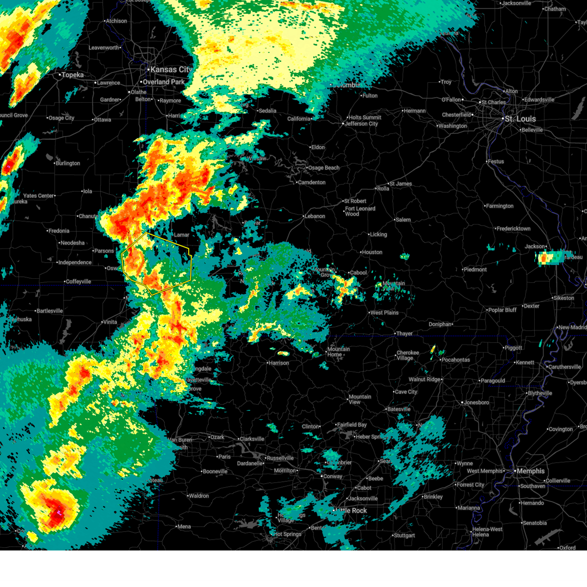
| 6/13/2026 10:18 PM CDT |
 Svrsgf the national weather service in springfield has issued a * severe thunderstorm warning for, cherokee county in southeastern kansas, jasper county in southwestern missouri, * until 1115 pm cdt. * at 1018 pm cdt, severe thunderstorms were located along a line extending from near hepler to near parsons to near elk city, moving southeast at 40 mph (radar indicated). Hazards include 70 mph wind gusts and half dollar size hail. Hail damage to vehicles is expected. expect considerable tree damage. Wind damage is also likely to mobile homes, roofs, and outbuildings. Svrsgf the national weather service in springfield has issued a * severe thunderstorm warning for, cherokee county in southeastern kansas, jasper county in southwestern missouri, * until 1115 pm cdt. * at 1018 pm cdt, severe thunderstorms were located along a line extending from near hepler to near parsons to near elk city, moving southeast at 40 mph (radar indicated). Hazards include 70 mph wind gusts and half dollar size hail. Hail damage to vehicles is expected. expect considerable tree damage. Wind damage is also likely to mobile homes, roofs, and outbuildings.
|
| 4/28/2026 1:38 PM CDT |
 Svrsgf the national weather service in springfield has issued a * severe thunderstorm warning for, cherokee county in southeastern kansas, southeastern crawford county in southeastern kansas, * until 215 pm cdt. * at 137 pm cdt, a new severe thunderstorm was located over chetopa, moving northeast at 50 mph (radar indicated). Hazards include half dollar size hail. damage to vehicles is expected Svrsgf the national weather service in springfield has issued a * severe thunderstorm warning for, cherokee county in southeastern kansas, southeastern crawford county in southeastern kansas, * until 215 pm cdt. * at 137 pm cdt, a new severe thunderstorm was located over chetopa, moving northeast at 50 mph (radar indicated). Hazards include half dollar size hail. damage to vehicles is expected
|
| 4/28/2026 1:14 PM CDT |
 Svrsgf the national weather service in springfield has issued a * severe thunderstorm warning for, cherokee county in southeastern kansas, southern crawford county in southeastern kansas, * until 145 pm cdt. * at 113 pm cdt, a pair of severe thunderstorms were located near faulkner and cherokee, moving east at 40 mph (radar indicated). Hazards include ping pong ball size hail and 60 mph wind gusts. People and animals outdoors will be injured. expect hail damage to roofs, siding, windows, and vehicles. Expect wind damage to roofs, siding, and trees. Svrsgf the national weather service in springfield has issued a * severe thunderstorm warning for, cherokee county in southeastern kansas, southern crawford county in southeastern kansas, * until 145 pm cdt. * at 113 pm cdt, a pair of severe thunderstorms were located near faulkner and cherokee, moving east at 40 mph (radar indicated). Hazards include ping pong ball size hail and 60 mph wind gusts. People and animals outdoors will be injured. expect hail damage to roofs, siding, windows, and vehicles. Expect wind damage to roofs, siding, and trees.
|
| 4/28/2026 11:55 AM CDT |
 At 1155 am cdt, a severe thunderstorm was located near columbus, moving northeast at 75 mph (radar indicated). Hazards include two inch hail. People and animals outdoors will be injured. expect damage to roofs, siding, windows, and vehicles. Locations impacted include, pittsburg, prairie state park, carl junction, lamar, frontenac, columbus, galena, girard, arma, liberal, cherokee, weir, sherman, mulberry, scammon, chicopee, mccune, nashville, mindenmines, and franklin. At 1155 am cdt, a severe thunderstorm was located near columbus, moving northeast at 75 mph (radar indicated). Hazards include two inch hail. People and animals outdoors will be injured. expect damage to roofs, siding, windows, and vehicles. Locations impacted include, pittsburg, prairie state park, carl junction, lamar, frontenac, columbus, galena, girard, arma, liberal, cherokee, weir, sherman, mulberry, scammon, chicopee, mccune, nashville, mindenmines, and franklin.
|
| 4/28/2026 11:51 AM CDT |
 Svrsgf the national weather service in springfield has issued a * severe thunderstorm warning for, cherokee county in southeastern kansas, crawford county in southeastern kansas, barton county in southwestern missouri, northwestern jasper county in southwestern missouri, * until 1215 pm cdt. * at 1151 am cdt, a severe thunderstorm was located near columbus, moving northeast at 80 mph (radar indicated). Hazards include half dollar size hail. damage to vehicles is expected Svrsgf the national weather service in springfield has issued a * severe thunderstorm warning for, cherokee county in southeastern kansas, crawford county in southeastern kansas, barton county in southwestern missouri, northwestern jasper county in southwestern missouri, * until 1215 pm cdt. * at 1151 am cdt, a severe thunderstorm was located near columbus, moving northeast at 80 mph (radar indicated). Hazards include half dollar size hail. damage to vehicles is expected
|
| 4/26/2026 9:51 PM CDT |
 At 951 pm cdt, a confirmed large and extremely dangerous tornado was located near columbus, moving east at 20 mph. this is a particularly dangerous situation. take cover now! (radar confirmed tornado). Hazards include damaging tornado. You are in a life-threatening situation. flying debris may be deadly to those caught without shelter. mobile homes will be destroyed. considerable damage to homes, businesses, and vehicles is likely and complete destruction is possible. Locations impacted include, baxter springs, columbus, neutral, skidmore, hallowell, sherwin, riverton, faulkner, stippville, and crestline. At 951 pm cdt, a confirmed large and extremely dangerous tornado was located near columbus, moving east at 20 mph. this is a particularly dangerous situation. take cover now! (radar confirmed tornado). Hazards include damaging tornado. You are in a life-threatening situation. flying debris may be deadly to those caught without shelter. mobile homes will be destroyed. considerable damage to homes, businesses, and vehicles is likely and complete destruction is possible. Locations impacted include, baxter springs, columbus, neutral, skidmore, hallowell, sherwin, riverton, faulkner, stippville, and crestline.
|
| 4/26/2026 9:49 PM CDT | Multiple trees downed including tress on house in cherokee county KS, 8.7 miles E of Columbus, KS |
| 4/26/2026 9:43 PM CDT |
 At 943 pm cdt, a confirmed tornado was located near columbus, moving east at 20 mph (weather spotters confirmed tornado). Hazards include damaging tornado and golf ball size hail. Flying debris will be dangerous to those caught without shelter. mobile homes will be damaged or destroyed. damage to roofs, windows, and vehicles will occur. tree damage is likely. Locations impacted include, columbus, cherokee, weir, sherman, scammon, chicopee, mccune, west mineral, roseland, lawton, carona, skidmore, and stippville. At 943 pm cdt, a confirmed tornado was located near columbus, moving east at 20 mph (weather spotters confirmed tornado). Hazards include damaging tornado and golf ball size hail. Flying debris will be dangerous to those caught without shelter. mobile homes will be damaged or destroyed. damage to roofs, windows, and vehicles will occur. tree damage is likely. Locations impacted include, columbus, cherokee, weir, sherman, scammon, chicopee, mccune, west mineral, roseland, lawton, carona, skidmore, and stippville.
|
| 4/26/2026 9:38 PM CDT |
 Torsgf the national weather service in springfield has issued a * tornado warning for, central cherokee county in southeastern kansas, * until 1030 pm cdt. * at 937 pm cdt, a confirmed tornado was located near oswego, moving east at 25 mph (weather spotters confirmed tornado). Hazards include damaging tornado and golf ball size hail. Flying debris will be dangerous to those caught without shelter. mobile homes will be damaged or destroyed. damage to roofs, windows, and vehicles will occur. Tree damage is likely. Torsgf the national weather service in springfield has issued a * tornado warning for, central cherokee county in southeastern kansas, * until 1030 pm cdt. * at 937 pm cdt, a confirmed tornado was located near oswego, moving east at 25 mph (weather spotters confirmed tornado). Hazards include damaging tornado and golf ball size hail. Flying debris will be dangerous to those caught without shelter. mobile homes will be damaged or destroyed. damage to roofs, windows, and vehicles will occur. Tree damage is likely.
|
| 4/26/2026 9:30 PM CDT |
 Torsgf the national weather service in springfield has issued a * tornado warning for, northern cherokee county in southeastern kansas, south central crawford county in southeastern kansas, * until 1015 pm cdt. * at 930 pm cdt, a severe thunderstorm capable of producing a tornado was located over west mineral, or 8 miles northwest of columbus, moving east at 25 mph (radar indicated rotation). Hazards include tornado and golf ball size hail. Flying debris will be dangerous to those caught without shelter. mobile homes will be damaged or destroyed. damage to roofs, windows, and vehicles will occur. Tree damage is likely. Torsgf the national weather service in springfield has issued a * tornado warning for, northern cherokee county in southeastern kansas, south central crawford county in southeastern kansas, * until 1015 pm cdt. * at 930 pm cdt, a severe thunderstorm capable of producing a tornado was located over west mineral, or 8 miles northwest of columbus, moving east at 25 mph (radar indicated rotation). Hazards include tornado and golf ball size hail. Flying debris will be dangerous to those caught without shelter. mobile homes will be damaged or destroyed. damage to roofs, windows, and vehicles will occur. Tree damage is likely.
|
| 4/26/2026 9:14 PM CDT |
 Svrsgf the national weather service in springfield has issued a * severe thunderstorm warning for, northern cherokee county in southeastern kansas, southwestern crawford county in southeastern kansas, * until 1000 pm cdt. * at 914 pm cdt, severe thunderstorms were located along a line extending from near thayer to near columbus, moving east at 20 mph (radar indicated). Hazards include two inch hail and 60 mph wind gusts. People and animals outdoors will be injured. expect hail damage to roofs, siding, windows, and vehicles. Expect wind damage to roofs, siding, and trees. Svrsgf the national weather service in springfield has issued a * severe thunderstorm warning for, northern cherokee county in southeastern kansas, southwestern crawford county in southeastern kansas, * until 1000 pm cdt. * at 914 pm cdt, severe thunderstorms were located along a line extending from near thayer to near columbus, moving east at 20 mph (radar indicated). Hazards include two inch hail and 60 mph wind gusts. People and animals outdoors will be injured. expect hail damage to roofs, siding, windows, and vehicles. Expect wind damage to roofs, siding, and trees.
|
| 4/26/2026 9:55 AM CDT | Damaged and broken power poles reported in columbus... k in cherokee county KS, 0.2 miles NW of Columbus, KS |
| 4/24/2026 12:04 AM CDT |
 At 1204 am cdt, a severe thunderstorm was located over baxter springs, moving east at 40 mph (radar indicated). Hazards include 60 mph wind gusts and nickel size hail. Expect damage to roofs, siding, and trees. locations impacted include, baxter springs, columbus, galena, lowell, neutral, riverton, and crestline. This includes interstate 44 near mile marker 0. At 1204 am cdt, a severe thunderstorm was located over baxter springs, moving east at 40 mph (radar indicated). Hazards include 60 mph wind gusts and nickel size hail. Expect damage to roofs, siding, and trees. locations impacted include, baxter springs, columbus, galena, lowell, neutral, riverton, and crestline. This includes interstate 44 near mile marker 0.
|
| 4/23/2026 11:35 PM CDT |
 Svrsgf the national weather service in springfield has issued a * severe thunderstorm warning for, southern cherokee county in southeastern kansas, * until 1215 am cdt. * at 1135 pm cdt, a severe thunderstorm was located near chetopa, moving east at 40 mph (radar indicated). Hazards include 60 mph wind gusts and nickel size hail. expect damage to roofs, siding, and trees Svrsgf the national weather service in springfield has issued a * severe thunderstorm warning for, southern cherokee county in southeastern kansas, * until 1215 am cdt. * at 1135 pm cdt, a severe thunderstorm was located near chetopa, moving east at 40 mph (radar indicated). Hazards include 60 mph wind gusts and nickel size hail. expect damage to roofs, siding, and trees
|
| 4/17/2026 9:22 PM CDT |
 Svrsgf the national weather service in springfield has issued a * severe thunderstorm warning for, eastern cherokee county in southeastern kansas, barton county in southwestern missouri, northern newton county in southwestern missouri, southern vernon county in west central missouri, jasper county in southwestern missouri, * until 1000 pm cdt. * at 921 pm cdt, severe thunderstorms were located along a line extending from near arcadia to 7 miles north of carl junction to baxter springs, moving east at 65 mph (radar indicated). Hazards include 60 mph wind gusts. expect damage to roofs, siding, and trees Svrsgf the national weather service in springfield has issued a * severe thunderstorm warning for, eastern cherokee county in southeastern kansas, barton county in southwestern missouri, northern newton county in southwestern missouri, southern vernon county in west central missouri, jasper county in southwestern missouri, * until 1000 pm cdt. * at 921 pm cdt, severe thunderstorms were located along a line extending from near arcadia to 7 miles north of carl junction to baxter springs, moving east at 65 mph (radar indicated). Hazards include 60 mph wind gusts. expect damage to roofs, siding, and trees
|
| 4/17/2026 8:57 PM CDT |
 Svrsgf the national weather service in springfield has issued a * severe thunderstorm warning for, cherokee county in southeastern kansas, crawford county in southeastern kansas, * until 945 pm cdt. * at 856 pm cdt, severe thunderstorms were located along a line extending from near mccune to oswego to near chetopa, moving northeast at 55 mph (radar indicated). Hazards include 60 mph wind gusts. expect damage to roofs, siding, and trees Svrsgf the national weather service in springfield has issued a * severe thunderstorm warning for, cherokee county in southeastern kansas, crawford county in southeastern kansas, * until 945 pm cdt. * at 856 pm cdt, severe thunderstorms were located along a line extending from near mccune to oswego to near chetopa, moving northeast at 55 mph (radar indicated). Hazards include 60 mph wind gusts. expect damage to roofs, siding, and trees
|
| 4/15/2026 9:04 PM CDT |
 The storm which prompted the warning has moved out of the area. therefore, the warning has been allowed to expire. however, gusty winds and heavy rain are still possible with this thunderstorm. a tornado watch remains in effect until midnight cdt for southeastern kansas. to report severe weather, contact your nearest law enforcement agency. they will relay your report to the national weather service springfield. The storm which prompted the warning has moved out of the area. therefore, the warning has been allowed to expire. however, gusty winds and heavy rain are still possible with this thunderstorm. a tornado watch remains in effect until midnight cdt for southeastern kansas. to report severe weather, contact your nearest law enforcement agency. they will relay your report to the national weather service springfield.
|
| 4/15/2026 8:19 PM CDT |
 Svrsgf the national weather service in springfield has issued a * severe thunderstorm warning for, northern cherokee county in southeastern kansas, southern crawford county in southeastern kansas, * until 900 pm cdt. * at 819 pm cdt, a severe thunderstorm was located 7 miles north of oswego, moving east at 45 mph (radar indicated). Hazards include 60 mph wind gusts and quarter size hail. Hail damage to vehicles is expected. Expect wind damage to roofs, siding, and trees. Svrsgf the national weather service in springfield has issued a * severe thunderstorm warning for, northern cherokee county in southeastern kansas, southern crawford county in southeastern kansas, * until 900 pm cdt. * at 819 pm cdt, a severe thunderstorm was located 7 miles north of oswego, moving east at 45 mph (radar indicated). Hazards include 60 mph wind gusts and quarter size hail. Hail damage to vehicles is expected. Expect wind damage to roofs, siding, and trees.
|
| 4/15/2026 6:07 PM CDT |
 Svrsgf the national weather service in springfield has issued a * severe thunderstorm warning for, eastern cherokee county in southeastern kansas, southeastern barton county in southwestern missouri, northern newton county in southwestern missouri, jasper county in southwestern missouri, * until 715 pm cdt. * at 607 pm cdt, a severe thunderstorm was located near carl junction, or 7 miles northwest of joplin, moving east at 35 mph (radar indicated). Hazards include 60 mph wind gusts and quarter size hail. Hail damage to vehicles is expected. Expect wind damage to roofs, siding, and trees. Svrsgf the national weather service in springfield has issued a * severe thunderstorm warning for, eastern cherokee county in southeastern kansas, southeastern barton county in southwestern missouri, northern newton county in southwestern missouri, jasper county in southwestern missouri, * until 715 pm cdt. * at 607 pm cdt, a severe thunderstorm was located near carl junction, or 7 miles northwest of joplin, moving east at 35 mph (radar indicated). Hazards include 60 mph wind gusts and quarter size hail. Hail damage to vehicles is expected. Expect wind damage to roofs, siding, and trees.
|
| 4/15/2026 5:35 PM CDT |
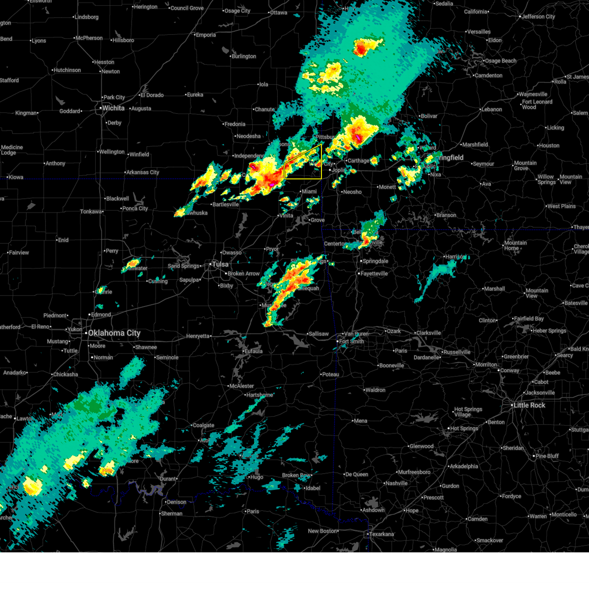 Svrsgf the national weather service in springfield has issued a * severe thunderstorm warning for, cherokee county in southeastern kansas, * until 615 pm cdt. * at 535 pm cdt, a severe thunderstorm was located near columbus, moving east at 55 mph (radar indicated). Hazards include 60 mph wind gusts and quarter size hail. Hail damage to vehicles is expected. Expect wind damage to roofs, siding, and trees. Svrsgf the national weather service in springfield has issued a * severe thunderstorm warning for, cherokee county in southeastern kansas, * until 615 pm cdt. * at 535 pm cdt, a severe thunderstorm was located near columbus, moving east at 55 mph (radar indicated). Hazards include 60 mph wind gusts and quarter size hail. Hail damage to vehicles is expected. Expect wind damage to roofs, siding, and trees.
|
| 4/15/2026 4:36 PM CDT | Trees and powerlines down as well as considerable hail damag in cherokee county KS, 0.5 miles ENE of Columbus, KS |
| 4/15/2026 4:35 PM CDT | Tree down... road closed due to storm damag in cherokee county KS, 0.9 miles N of Columbus, KS |
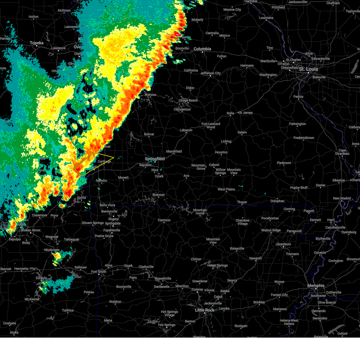
| 4/15/2026 4:34 PM CDT |
 At 433 pm cdt, a severe thunderstorm was located over columbus, moving east at 40 mph (trained weather spotters). Hazards include golf ball size hail and 60 mph wind gusts. People and animals outdoors will be injured. expect hail damage to roofs, siding, windows, and vehicles. expect wind damage to roofs, siding, and trees. locations impacted include, baxter springs, columbus, galena, lowell, neutral, sherwin, riverton, crestline, stippville, lawton, and skidmore. This includes interstate 44 near mile marker 0. At 433 pm cdt, a severe thunderstorm was located over columbus, moving east at 40 mph (trained weather spotters). Hazards include golf ball size hail and 60 mph wind gusts. People and animals outdoors will be injured. expect hail damage to roofs, siding, windows, and vehicles. expect wind damage to roofs, siding, and trees. locations impacted include, baxter springs, columbus, galena, lowell, neutral, sherwin, riverton, crestline, stippville, lawton, and skidmore. This includes interstate 44 near mile marker 0.
|
| 4/15/2026 4:31 PM CDT | Ping Pong Ball sized hail reported 0.2 miles NW of Columbus, KS, ping pong size hail... 40mph wind gust... torrential rainfall. |
| 4/15/2026 4:31 PM CDT | Quarter sized hail reported 3.1 miles ENE of Columbus, KS, quarter size hail. |
| 4/15/2026 4:22 PM CDT | Quarter sized hail reported 10.2 miles ENE of Columbus, KS, also report of 60mph winds. |
| 4/15/2026 4:22 PM CDT |
 At 421 pm cdt, a severe thunderstorm was located 7 miles southwest of columbus, moving northeast at 30 mph (radar indicated). Hazards include golf ball size hail and 60 mph wind gusts. People and animals outdoors will be injured. expect hail damage to roofs, siding, windows, and vehicles. expect wind damage to roofs, siding, and trees. locations impacted include, baxter springs, columbus, galena, lowell, treece, neutral, melrose, riverton, lawton, sherwin, faulkner, crestline, stippville, and skidmore. This includes interstate 44 near mile marker 0. At 421 pm cdt, a severe thunderstorm was located 7 miles southwest of columbus, moving northeast at 30 mph (radar indicated). Hazards include golf ball size hail and 60 mph wind gusts. People and animals outdoors will be injured. expect hail damage to roofs, siding, windows, and vehicles. expect wind damage to roofs, siding, and trees. locations impacted include, baxter springs, columbus, galena, lowell, treece, neutral, melrose, riverton, lawton, sherwin, faulkner, crestline, stippville, and skidmore. This includes interstate 44 near mile marker 0.
|
| 4/15/2026 4:07 PM CDT |
 Svrsgf the national weather service in springfield has issued a * severe thunderstorm warning for, cherokee county in southeastern kansas, * until 500 pm cdt. * at 406 pm cdt, a severe thunderstorm was located over chetopa, moving east at 40 mph (radar indicated). Hazards include ping pong ball size hail and 60 mph wind gusts. People and animals outdoors will be injured. expect hail damage to roofs, siding, windows, and vehicles. Expect wind damage to roofs, siding, and trees. Svrsgf the national weather service in springfield has issued a * severe thunderstorm warning for, cherokee county in southeastern kansas, * until 500 pm cdt. * at 406 pm cdt, a severe thunderstorm was located over chetopa, moving east at 40 mph (radar indicated). Hazards include ping pong ball size hail and 60 mph wind gusts. People and animals outdoors will be injured. expect hail damage to roofs, siding, windows, and vehicles. Expect wind damage to roofs, siding, and trees.
|
| 4/3/2026 9:47 PM CDT |
 At 946 pm cdt, severe thunderstorms were located along a line extending from near cherokee to near weir to 8 miles east of scammon to near columbus, moving east at 50 mph (radar indicated). Hazards include 60 mph wind gusts. Expect damage to roofs, siding, and trees. Locations impacted include, pittsburg, carl junction, frontenac, columbus, cherokee, weir, scammon, chicopee, nashville, mindenmines, asbury, waco, roseland, opolis, lawton, carona, skidmore, crestline, and stippville. At 946 pm cdt, severe thunderstorms were located along a line extending from near cherokee to near weir to 8 miles east of scammon to near columbus, moving east at 50 mph (radar indicated). Hazards include 60 mph wind gusts. Expect damage to roofs, siding, and trees. Locations impacted include, pittsburg, carl junction, frontenac, columbus, cherokee, weir, scammon, chicopee, nashville, mindenmines, asbury, waco, roseland, opolis, lawton, carona, skidmore, crestline, and stippville.
|
| 4/3/2026 9:28 PM CDT |
 Svrsgf the national weather service in springfield has issued a * severe thunderstorm warning for, cherokee county in southeastern kansas, southeastern crawford county in southeastern kansas, southwestern barton county in southwestern missouri, northwestern jasper county in southwestern missouri, * until 1015 pm cdt. * at 928 pm cdt, severe thunderstorms were located along a line extending from near mccune to near west mineral to near columbus to near chetopa, moving northeast at 50 mph (radar indicated). Hazards include 60 mph wind gusts. expect damage to roofs, siding, and trees Svrsgf the national weather service in springfield has issued a * severe thunderstorm warning for, cherokee county in southeastern kansas, southeastern crawford county in southeastern kansas, southwestern barton county in southwestern missouri, northwestern jasper county in southwestern missouri, * until 1015 pm cdt. * at 928 pm cdt, severe thunderstorms were located along a line extending from near mccune to near west mineral to near columbus to near chetopa, moving northeast at 50 mph (radar indicated). Hazards include 60 mph wind gusts. expect damage to roofs, siding, and trees
|
| 3/6/2026 8:03 PM CST |
 Svrsgf the national weather service in springfield has issued a * severe thunderstorm warning for, eastern cherokee county in southeastern kansas, southeastern crawford county in southeastern kansas, barton county in southwestern missouri, jasper county in southwestern missouri, * until 845 pm cst. * at 803 pm cst, severe thunderstorms were located along a line extending from near mindenmines to 8 miles northwest of purcell to near columbus, moving northeast at 55 mph (radar indicated). Hazards include 60 mph wind gusts and penny size hail. expect damage to roofs, siding, and trees Svrsgf the national weather service in springfield has issued a * severe thunderstorm warning for, eastern cherokee county in southeastern kansas, southeastern crawford county in southeastern kansas, barton county in southwestern missouri, jasper county in southwestern missouri, * until 845 pm cst. * at 803 pm cst, severe thunderstorms were located along a line extending from near mindenmines to 8 miles northwest of purcell to near columbus, moving northeast at 55 mph (radar indicated). Hazards include 60 mph wind gusts and penny size hail. expect damage to roofs, siding, and trees
|
| 3/6/2026 7:50 PM CST | *** 1 inj *** side of house blown in...1 injur in cherokee county KS, 0.2 miles NW of Columbus, KS |
| 1/8/2026 10:30 AM CST |
 Svrsgf the national weather service in springfield has issued a * severe thunderstorm warning for, bourbon county in southeastern kansas, cherokee county in southeastern kansas, crawford county in southeastern kansas, western barton county in southwestern missouri, western vernon county in west central missouri, western jasper county in southwestern missouri, * until 1115 am cst. * at 1030 am cst, severe thunderstorms were located along a line extending from 6 miles southeast of humboldt to near mccune to near treece, moving northeast at 60 mph (radar indicated). Hazards include 60 mph wind gusts and penny size hail. expect damage to roofs, siding, and trees Svrsgf the national weather service in springfield has issued a * severe thunderstorm warning for, bourbon county in southeastern kansas, cherokee county in southeastern kansas, crawford county in southeastern kansas, western barton county in southwestern missouri, western vernon county in west central missouri, western jasper county in southwestern missouri, * until 1115 am cst. * at 1030 am cst, severe thunderstorms were located along a line extending from 6 miles southeast of humboldt to near mccune to near treece, moving northeast at 60 mph (radar indicated). Hazards include 60 mph wind gusts and penny size hail. expect damage to roofs, siding, and trees
|
| 1/8/2026 9:49 AM CST |
 Svrsgf the national weather service in springfield has issued a * severe thunderstorm warning for, bourbon county in southeastern kansas, cherokee county in southeastern kansas, crawford county in southeastern kansas, * until 1030 am cst. * at 948 am cst, severe thunderstorms were located along a line extending from 6 miles southeast of blue mound to 7 miles southwest of girard to near baxter springs, moving northeast at 60 mph (radar indicated). Hazards include 60 mph wind gusts and nickel size hail. expect damage to roofs, siding, and trees Svrsgf the national weather service in springfield has issued a * severe thunderstorm warning for, bourbon county in southeastern kansas, cherokee county in southeastern kansas, crawford county in southeastern kansas, * until 1030 am cst. * at 948 am cst, severe thunderstorms were located along a line extending from 6 miles southeast of blue mound to 7 miles southwest of girard to near baxter springs, moving northeast at 60 mph (radar indicated). Hazards include 60 mph wind gusts and nickel size hail. expect damage to roofs, siding, and trees
|
| 8/10/2025 10:41 PM CDT |
 The storm which prompted the warning has moved out of the area. therefore, the warning will be allowed to expire. however, gusty winds are still possible with this thunderstorm. The storm which prompted the warning has moved out of the area. therefore, the warning will be allowed to expire. however, gusty winds are still possible with this thunderstorm.
|
| 8/10/2025 10:12 PM CDT | Measured 62 mp in cherokee county KS, 0.8 miles SW of Columbus, KS |
| 8/10/2025 10:06 PM CDT |
 Svrsgf the national weather service in springfield has issued a * severe thunderstorm warning for, cherokee county in southeastern kansas, * until 1045 pm cdt. * at 1006 pm cdt, a severe thunderstorm was located near oswego, moving east at 15 mph (radar indicated). Hazards include 60 mph wind gusts and quarter size hail. Hail damage to vehicles is expected. Expect wind damage to roofs, siding, and trees. Svrsgf the national weather service in springfield has issued a * severe thunderstorm warning for, cherokee county in southeastern kansas, * until 1045 pm cdt. * at 1006 pm cdt, a severe thunderstorm was located near oswego, moving east at 15 mph (radar indicated). Hazards include 60 mph wind gusts and quarter size hail. Hail damage to vehicles is expected. Expect wind damage to roofs, siding, and trees.
|
| 6/18/2025 1:58 AM CDT |
 The storms which prompted the warning have weakened below severe limits, and no longer pose an immediate threat to life or property. therefore, the warning will be allowed to expire. however, gusty winds and heavy rain are still possible with these thunderstorms. a severe thunderstorm watch remains in effect until 400 am cdt for southeastern kansas, and southwestern missouri. The storms which prompted the warning have weakened below severe limits, and no longer pose an immediate threat to life or property. therefore, the warning will be allowed to expire. however, gusty winds and heavy rain are still possible with these thunderstorms. a severe thunderstorm watch remains in effect until 400 am cdt for southeastern kansas, and southwestern missouri.
|
| 6/18/2025 1:26 AM CDT |
 At 126 am cdt, severe thunderstorms were located along a line extending from near oswego to near fairland, moving northeast at 50 mph (radar indicated). Hazards include 60 mph wind gusts and quarter size hail. Hail damage to vehicles is expected. expect wind damage to roofs, siding, and trees. these severe storms will be near, baxter springs, columbus, and treece around 130 am cdt. seneca around 135 am cdt. galena and scammon around 140 am cdt. joplin, weir, leawood, and shoal creek drive around 145 am cdt. webb city, carl junction, duquesne, silver creek, and saginaw around 150 am cdt. oronogo, carterville, duenweg, and diamond around 155 am cdt. carthage, alba, and purcell around 200 am cdt. Other locations impacted by these severe thunderstorms include asbury, fidelity, neutral, melrose, carytown, shoal creek estates, riverton, dennis acres, carona, and grand falls plaza. At 126 am cdt, severe thunderstorms were located along a line extending from near oswego to near fairland, moving northeast at 50 mph (radar indicated). Hazards include 60 mph wind gusts and quarter size hail. Hail damage to vehicles is expected. expect wind damage to roofs, siding, and trees. these severe storms will be near, baxter springs, columbus, and treece around 130 am cdt. seneca around 135 am cdt. galena and scammon around 140 am cdt. joplin, weir, leawood, and shoal creek drive around 145 am cdt. webb city, carl junction, duquesne, silver creek, and saginaw around 150 am cdt. oronogo, carterville, duenweg, and diamond around 155 am cdt. carthage, alba, and purcell around 200 am cdt. Other locations impacted by these severe thunderstorms include asbury, fidelity, neutral, melrose, carytown, shoal creek estates, riverton, dennis acres, carona, and grand falls plaza.
|
| 6/18/2025 1:06 AM CDT |
 Svrsgf the national weather service in springfield has issued a * severe thunderstorm warning for, cherokee county in southeastern kansas, northern newton county in southwestern missouri, jasper county in southwestern missouri, * until 200 am cdt. * at 106 am cdt, severe thunderstorms were located along a line extending from near edna to near afton, moving northeast at 55 mph (radar indicated). Hazards include 60 mph wind gusts and quarter size hail. Hail damage to vehicles is expected. expect wind damage to roofs, siding, and trees. severe thunderstorms will be near, treece around 120 am cdt. baxter springs and columbus around 125 am cdt. Other locations in the path of these severe thunderstorms include seneca, galena, scammon, joplin, neosho, carl junction, weir, leawood, silver creek, shoal creek drive, saginaw, webb city, oronogo, carterville, duquesne, duenweg, carthage, granby, diamond, alba and purcell. Svrsgf the national weather service in springfield has issued a * severe thunderstorm warning for, cherokee county in southeastern kansas, northern newton county in southwestern missouri, jasper county in southwestern missouri, * until 200 am cdt. * at 106 am cdt, severe thunderstorms were located along a line extending from near edna to near afton, moving northeast at 55 mph (radar indicated). Hazards include 60 mph wind gusts and quarter size hail. Hail damage to vehicles is expected. expect wind damage to roofs, siding, and trees. severe thunderstorms will be near, treece around 120 am cdt. baxter springs and columbus around 125 am cdt. Other locations in the path of these severe thunderstorms include seneca, galena, scammon, joplin, neosho, carl junction, weir, leawood, silver creek, shoal creek drive, saginaw, webb city, oronogo, carterville, duquesne, duenweg, carthage, granby, diamond, alba and purcell.
|
| 6/8/2025 5:37 PM CDT |
 At 537 pm cdt, a severe thunderstorm was located over galena, or 7 miles northeast of baxter springs, moving southeast at 30 mph (radar indicated). Hazards include 60 mph wind gusts and half dollar size hail. Hail damage to vehicles is expected. expect wind damage to roofs, siding, and trees. locations impacted include, baxter springs, galena, lowell, riverton, neutral, and crestline. This includes interstate 44 near mile marker 0. At 537 pm cdt, a severe thunderstorm was located over galena, or 7 miles northeast of baxter springs, moving southeast at 30 mph (radar indicated). Hazards include 60 mph wind gusts and half dollar size hail. Hail damage to vehicles is expected. expect wind damage to roofs, siding, and trees. locations impacted include, baxter springs, galena, lowell, riverton, neutral, and crestline. This includes interstate 44 near mile marker 0.
|
| 6/8/2025 5:18 PM CDT |
 Svrsgf the national weather service in springfield has issued a * severe thunderstorm warning for, eastern cherokee county in southeastern kansas, * until 600 pm cdt. * at 518 pm cdt, a severe thunderstorm was located near columbus, moving southeast at 15 mph (radar indicated). Hazards include 60 mph wind gusts and half dollar size hail. Hail damage to vehicles is expected. Expect wind damage to roofs, siding, and trees. Svrsgf the national weather service in springfield has issued a * severe thunderstorm warning for, eastern cherokee county in southeastern kansas, * until 600 pm cdt. * at 518 pm cdt, a severe thunderstorm was located near columbus, moving southeast at 15 mph (radar indicated). Hazards include 60 mph wind gusts and half dollar size hail. Hail damage to vehicles is expected. Expect wind damage to roofs, siding, and trees.
|
| 6/8/2025 5:12 PM CDT | Half Dollar sized hail reported 3.2 miles S of Columbus, KS, cocorahs report of half dollar sized hail 3.6 north of columbus... kansas. time estimated from radar. |
| 6/6/2025 5:47 AM CDT |
 Svrsgf the national weather service in springfield has issued a * severe thunderstorm warning for, southeastern cherokee county in southeastern kansas, northwestern newton county in southwestern missouri, southwestern jasper county in southwestern missouri, * until 630 am cdt. * at 547 am cdt, a severe thunderstorm was located over baxter springs, moving east at 25 mph (radar indicated). Hazards include 60 mph wind gusts. expect damage to roofs, siding, and trees Svrsgf the national weather service in springfield has issued a * severe thunderstorm warning for, southeastern cherokee county in southeastern kansas, northwestern newton county in southwestern missouri, southwestern jasper county in southwestern missouri, * until 630 am cdt. * at 547 am cdt, a severe thunderstorm was located over baxter springs, moving east at 25 mph (radar indicated). Hazards include 60 mph wind gusts. expect damage to roofs, siding, and trees
|
| 5/19/2025 5:58 PM CDT |
 At 557 pm cdt, severe thunderstorms were located along a line extending from near pittsburg to 8 miles west of purcell to near carl junction, moving east at 65 mph (law enforcement. fire department reported multiple trees and powerlines down in columbus). Hazards include 60 mph wind gusts and half dollar size hail. Hail damage to vehicles is expected. expect wind damage to roofs, siding, and trees. locations impacted include, joplin, pittsburg, carthage, webb city, prairie state park, carl junction, baxter springs, frontenac, columbus, galena, oronogo, carterville, duquesne, sarcoxie, duenweg, jasper, diamond, loma linda, cherokee, and airport drive. this includes the following highways, interstate 44 between mile markers 0 and 32. Interstate 49 between mile markers 28 and 61. At 557 pm cdt, severe thunderstorms were located along a line extending from near pittsburg to 8 miles west of purcell to near carl junction, moving east at 65 mph (law enforcement. fire department reported multiple trees and powerlines down in columbus). Hazards include 60 mph wind gusts and half dollar size hail. Hail damage to vehicles is expected. expect wind damage to roofs, siding, and trees. locations impacted include, joplin, pittsburg, carthage, webb city, prairie state park, carl junction, baxter springs, frontenac, columbus, galena, oronogo, carterville, duquesne, sarcoxie, duenweg, jasper, diamond, loma linda, cherokee, and airport drive. this includes the following highways, interstate 44 between mile markers 0 and 32. Interstate 49 between mile markers 28 and 61.
|
| 5/19/2025 5:48 PM CDT | Ohio and walnut in columbus tree on a house and truck. multiple lines down and trees down in tow in cherokee county KS, 0.7 miles WNW of Columbus, KS |
| 5/19/2025 5:43 PM CDT |
 Svrsgf the national weather service in springfield has issued a * severe thunderstorm warning for, cherokee county in southeastern kansas, southeastern crawford county in southeastern kansas, southern barton county in southwestern missouri, northern newton county in southwestern missouri, jasper county in southwestern missouri, * until 615 pm cdt. * at 543 pm cdt, severe thunderstorms were located along a line extending from 6 miles south of west mineral to near columbus to quapaw, moving east at 50 mph (radar indicated). Hazards include 60 mph wind gusts and half dollar size hail. Hail damage to vehicles is expected. Expect wind damage to roofs, siding, and trees. Svrsgf the national weather service in springfield has issued a * severe thunderstorm warning for, cherokee county in southeastern kansas, southeastern crawford county in southeastern kansas, southern barton county in southwestern missouri, northern newton county in southwestern missouri, jasper county in southwestern missouri, * until 615 pm cdt. * at 543 pm cdt, severe thunderstorms were located along a line extending from 6 miles south of west mineral to near columbus to quapaw, moving east at 50 mph (radar indicated). Hazards include 60 mph wind gusts and half dollar size hail. Hail damage to vehicles is expected. Expect wind damage to roofs, siding, and trees.
|
| 5/19/2025 4:22 PM CDT |
 At 421 pm cdt, a severe thunderstorm was located over weir, or near pittsburg, moving northeast at 50 mph (radar indicated). Hazards include two inch hail and 60 mph wind gusts. People and animals outdoors will be injured. expect hail damage to roofs, siding, windows, and vehicles. expect wind damage to roofs, siding, and trees. Locations impacted include, pittsburg, frontenac, columbus, girard, arma, cherokee, weir, sherman, scammon, chicopee, mccune, mindenmines, franklin, west mineral, roseland, beulah, yale, carona, hallowell, and sherwin. At 421 pm cdt, a severe thunderstorm was located over weir, or near pittsburg, moving northeast at 50 mph (radar indicated). Hazards include two inch hail and 60 mph wind gusts. People and animals outdoors will be injured. expect hail damage to roofs, siding, windows, and vehicles. expect wind damage to roofs, siding, and trees. Locations impacted include, pittsburg, frontenac, columbus, girard, arma, cherokee, weir, sherman, scammon, chicopee, mccune, mindenmines, franklin, west mineral, roseland, beulah, yale, carona, hallowell, and sherwin.
|
| 5/19/2025 4:00 PM CDT |
 Svrsgf the national weather service in springfield has issued a * severe thunderstorm warning for, cherokee county in southeastern kansas, southern crawford county in southeastern kansas, southwestern barton county in southwestern missouri, * until 445 pm cdt. * at 400 pm cdt, a severe thunderstorm was located near oswego, moving northeast at 50 mph (radar indicated). Hazards include 60 mph wind gusts and half dollar size hail. Hail damage to vehicles is expected. Expect wind damage to roofs, siding, and trees. Svrsgf the national weather service in springfield has issued a * severe thunderstorm warning for, cherokee county in southeastern kansas, southern crawford county in southeastern kansas, southwestern barton county in southwestern missouri, * until 445 pm cdt. * at 400 pm cdt, a severe thunderstorm was located near oswego, moving northeast at 50 mph (radar indicated). Hazards include 60 mph wind gusts and half dollar size hail. Hail damage to vehicles is expected. Expect wind damage to roofs, siding, and trees.
|
| 5/19/2025 2:56 PM CDT |
 At 255 pm cdt, a severe thunderstorm was located near west mineral, or 11 miles south of girard, moving northeast at 55 mph (radar indicated). Hazards include 60 mph wind gusts and quarter size hail. Hail damage to vehicles is expected. expect wind damage to roofs, siding, and trees. Locations impacted include, pittsburg, frontenac, columbus, girard, arma, cherokee, weir, sherman, mulberry, scammon, chicopee, mccune, franklin, walnut, west mineral, roseland, burgess, beulah, croweburg, and yale. At 255 pm cdt, a severe thunderstorm was located near west mineral, or 11 miles south of girard, moving northeast at 55 mph (radar indicated). Hazards include 60 mph wind gusts and quarter size hail. Hail damage to vehicles is expected. expect wind damage to roofs, siding, and trees. Locations impacted include, pittsburg, frontenac, columbus, girard, arma, cherokee, weir, sherman, mulberry, scammon, chicopee, mccune, franklin, walnut, west mineral, roseland, burgess, beulah, croweburg, and yale.
|
| 5/19/2025 2:48 PM CDT | Multiple large trees down over nw belleview rd and nw 110th in cherokee county. time based on radar estimat in cherokee county KS, 11.3 miles ESE of Columbus, KS |
| 5/19/2025 2:37 PM CDT |
 Svrsgf the national weather service in springfield has issued a * severe thunderstorm warning for, cherokee county in southeastern kansas, crawford county in southeastern kansas, * until 315 pm cdt. * at 236 pm cdt, a severe thunderstorm was located near oswego, moving northeast at 55 mph (radar indicated). Hazards include 60 mph wind gusts and quarter size hail. Hail damage to vehicles is expected. Expect wind damage to roofs, siding, and trees. Svrsgf the national weather service in springfield has issued a * severe thunderstorm warning for, cherokee county in southeastern kansas, crawford county in southeastern kansas, * until 315 pm cdt. * at 236 pm cdt, a severe thunderstorm was located near oswego, moving northeast at 55 mph (radar indicated). Hazards include 60 mph wind gusts and quarter size hail. Hail damage to vehicles is expected. Expect wind damage to roofs, siding, and trees.
|
| 4/29/2025 8:01 AM CDT |
 At 801 am cdt, severe thunderstorms were located along a line extending from near columbus to near baxter springs to near fairland, moving east at 50 mph (radar indicated). Hazards include 70 mph wind gusts and quarter size hail. Hail damage to vehicles is expected. expect considerable tree damage. wind damage is also likely to mobile homes, roofs, and outbuildings. locations impacted include, fidelity, neutral, duquesne, sarcoxie, carthage, joplin, iron gates, atlas, roseland, brooklyn heights, lawton, redings mill, reeds, avilla, columbus, carterville, weir, neck city, baxter springs, and purcell. this includes the following highways, interstate 44 between mile markers 0 and 32. Interstate 49 between mile markers 29 and 56. At 801 am cdt, severe thunderstorms were located along a line extending from near columbus to near baxter springs to near fairland, moving east at 50 mph (radar indicated). Hazards include 70 mph wind gusts and quarter size hail. Hail damage to vehicles is expected. expect considerable tree damage. wind damage is also likely to mobile homes, roofs, and outbuildings. locations impacted include, fidelity, neutral, duquesne, sarcoxie, carthage, joplin, iron gates, atlas, roseland, brooklyn heights, lawton, redings mill, reeds, avilla, columbus, carterville, weir, neck city, baxter springs, and purcell. this includes the following highways, interstate 44 between mile markers 0 and 32. Interstate 49 between mile markers 29 and 56.
|
| 4/29/2025 7:54 AM CDT |
 Svrsgf the national weather service in springfield has issued a * severe thunderstorm warning for, eastern cherokee county in southeastern kansas, northern newton county in southwestern missouri, jasper county in southwestern missouri, * until 900 am cdt. * at 754 am cdt, severe thunderstorms were located along a line extending from near west mineral to near treece to near narcissa, moving east at 40 mph (radar indicated). Hazards include 60 mph wind gusts and quarter size hail. Hail damage to vehicles is expected. Expect wind damage to roofs, siding, and trees. Svrsgf the national weather service in springfield has issued a * severe thunderstorm warning for, eastern cherokee county in southeastern kansas, northern newton county in southwestern missouri, jasper county in southwestern missouri, * until 900 am cdt. * at 754 am cdt, severe thunderstorms were located along a line extending from near west mineral to near treece to near narcissa, moving east at 40 mph (radar indicated). Hazards include 60 mph wind gusts and quarter size hail. Hail damage to vehicles is expected. Expect wind damage to roofs, siding, and trees.
|
| 4/29/2025 7:15 AM CDT |
 Svrsgf the national weather service in springfield has issued a * severe thunderstorm warning for, cherokee county in southeastern kansas, * until 815 am cdt. * at 715 am cdt, severe thunderstorms were located along a line extending from near altamont to near edna to 8 miles northeast of new alluwe, moving east at 35 mph (radar indicated). Hazards include 60 mph wind gusts and quarter size hail. Hail damage to vehicles is expected. Expect wind damage to roofs, siding, and trees. Svrsgf the national weather service in springfield has issued a * severe thunderstorm warning for, cherokee county in southeastern kansas, * until 815 am cdt. * at 715 am cdt, severe thunderstorms were located along a line extending from near altamont to near edna to 8 miles northeast of new alluwe, moving east at 35 mph (radar indicated). Hazards include 60 mph wind gusts and quarter size hail. Hail damage to vehicles is expected. Expect wind damage to roofs, siding, and trees.
|
| 4/20/2025 1:28 PM CDT |
 Svrsgf the national weather service in springfield has issued a * severe thunderstorm warning for, cherokee county in southeastern kansas, crawford county in southeastern kansas, * until 230 pm cdt. * at 128 pm cdt, severe thunderstorms were located along a line extending from near altamont to near welch to langley, moving northeast at 30 mph (radar indicated). Hazards include 60 mph wind gusts and penny size hail. expect damage to roofs, siding, and trees Svrsgf the national weather service in springfield has issued a * severe thunderstorm warning for, cherokee county in southeastern kansas, crawford county in southeastern kansas, * until 230 pm cdt. * at 128 pm cdt, severe thunderstorms were located along a line extending from near altamont to near welch to langley, moving northeast at 30 mph (radar indicated). Hazards include 60 mph wind gusts and penny size hail. expect damage to roofs, siding, and trees
|
| 4/2/2025 7:57 AM CDT |
 Svrsgf the national weather service in springfield has issued a * severe thunderstorm warning for, eastern cherokee county in southeastern kansas, northwestern newton county in southwestern missouri, jasper county in southwestern missouri, * until 845 am cdt. * at 757 am cdt, a severe thunderstorm was located over quapaw, or near baxter springs, moving northeast at 55 mph (radar indicated). Hazards include 60 mph wind gusts and quarter size hail. Hail damage to vehicles is expected. Expect wind damage to roofs, siding, and trees. Svrsgf the national weather service in springfield has issued a * severe thunderstorm warning for, eastern cherokee county in southeastern kansas, northwestern newton county in southwestern missouri, jasper county in southwestern missouri, * until 845 am cdt. * at 757 am cdt, a severe thunderstorm was located over quapaw, or near baxter springs, moving northeast at 55 mph (radar indicated). Hazards include 60 mph wind gusts and quarter size hail. Hail damage to vehicles is expected. Expect wind damage to roofs, siding, and trees.
|
| 4/2/2025 6:47 AM CDT |
 At 647 am cdt, severe thunderstorms were located along a line extending from mccune to near oswego to near edna, moving northeast at 50 mph (radar indicated). Hazards include 60 mph wind gusts and quarter size hail. Hail damage to vehicles is expected. expect wind damage to roofs, siding, and trees. Locations impacted include, franklin, frontenac, beulah, girard, pittsburg, croweburg, yale, west mineral, farlington, prairie state park, brazilton, faulkner, mulberry, oakton, cherokee, roseland, nashville, ringo, oskaloosa, and verdella. At 647 am cdt, severe thunderstorms were located along a line extending from mccune to near oswego to near edna, moving northeast at 50 mph (radar indicated). Hazards include 60 mph wind gusts and quarter size hail. Hail damage to vehicles is expected. expect wind damage to roofs, siding, and trees. Locations impacted include, franklin, frontenac, beulah, girard, pittsburg, croweburg, yale, west mineral, farlington, prairie state park, brazilton, faulkner, mulberry, oakton, cherokee, roseland, nashville, ringo, oskaloosa, and verdella.
|
| 4/2/2025 6:40 AM CDT |
 Svrsgf the national weather service in springfield has issued a * severe thunderstorm warning for, cherokee county in southeastern kansas, crawford county in southeastern kansas, western barton county in southwestern missouri, southwestern vernon county in west central missouri, northwestern jasper county in southwestern missouri, * until 730 am cdt. * at 640 am cdt, severe thunderstorms were located along a line extending from near mccune to 6 miles north of oswego to near edna, moving northeast at 65 mph (radar indicated). Hazards include 60 mph wind gusts and quarter size hail. Hail damage to vehicles is expected. Expect wind damage to roofs, siding, and trees. Svrsgf the national weather service in springfield has issued a * severe thunderstorm warning for, cherokee county in southeastern kansas, crawford county in southeastern kansas, western barton county in southwestern missouri, southwestern vernon county in west central missouri, northwestern jasper county in southwestern missouri, * until 730 am cdt. * at 640 am cdt, severe thunderstorms were located along a line extending from near mccune to 6 miles north of oswego to near edna, moving northeast at 65 mph (radar indicated). Hazards include 60 mph wind gusts and quarter size hail. Hail damage to vehicles is expected. Expect wind damage to roofs, siding, and trees.
|
| 3/30/2025 2:21 AM CDT |
 At 220 am cdt, severe thunderstorms were located along a line extending from near west mineral to near galena to near seneca, moving east at 55 mph (emergency management. tree and roof damage has been reported in baxter springs, kansas). Hazards include 70 mph wind gusts and nickel size hail. Expect considerable tree damage. damage is likely to mobile homes, roofs, and outbuildings. locations impacted include, neutral, riverton, roseland, lawton, scammon, carona, west mineral, skidmore, lowell, galena, columbus, stippville, crestline, weir, baxter springs, and cherokee. This includes interstate 44 near mile marker 0. At 220 am cdt, severe thunderstorms were located along a line extending from near west mineral to near galena to near seneca, moving east at 55 mph (emergency management. tree and roof damage has been reported in baxter springs, kansas). Hazards include 70 mph wind gusts and nickel size hail. Expect considerable tree damage. damage is likely to mobile homes, roofs, and outbuildings. locations impacted include, neutral, riverton, roseland, lawton, scammon, carona, west mineral, skidmore, lowell, galena, columbus, stippville, crestline, weir, baxter springs, and cherokee. This includes interstate 44 near mile marker 0.
|
| 3/30/2025 1:50 AM CDT |
 Svrsgf the national weather service in springfield has issued a * severe thunderstorm warning for, cherokee county in southeastern kansas, * until 245 am cdt. * at 149 am cdt, severe thunderstorms were located along a line extending from 6 miles east of edna to near welch to near afton, moving northeast at 45 mph (radar indicated). Hazards include 60 mph wind gusts and nickel size hail. expect damage to roofs, siding, and trees Svrsgf the national weather service in springfield has issued a * severe thunderstorm warning for, cherokee county in southeastern kansas, * until 245 am cdt. * at 149 am cdt, severe thunderstorms were located along a line extending from 6 miles east of edna to near welch to near afton, moving northeast at 45 mph (radar indicated). Hazards include 60 mph wind gusts and nickel size hail. expect damage to roofs, siding, and trees
|
| 3/14/2025 3:09 PM CDT |
 At 305 pm cdt, a severe thunderstorm was located over liberal, or 12 miles northeast of pittsburg, moving northeast at 70 mph (radar indicated. at 245 pm, emergency management reported 4 inch tree limbs down in cherokee county. a 62 mph gust was measured in crestline, kansas). Hazards include 70 mph wind gusts and penny size hail. Expect considerable tree damage. damage is likely to mobile homes, roofs, and outbuildings. locations impacted include, franklin, fidelity, frontenac, sarcoxie, richards, metz, milo, iron gates, boston, mulberry, cherokee, roseland, nashville, brooklyn heights, kenoma, lone oak, arcadia, reeds, hammond, and avilla. this includes the following highways, interstate 44 between mile markers 0 and 32. Interstate 49 between mile markers 32 and 106. At 305 pm cdt, a severe thunderstorm was located over liberal, or 12 miles northeast of pittsburg, moving northeast at 70 mph (radar indicated. at 245 pm, emergency management reported 4 inch tree limbs down in cherokee county. a 62 mph gust was measured in crestline, kansas). Hazards include 70 mph wind gusts and penny size hail. Expect considerable tree damage. damage is likely to mobile homes, roofs, and outbuildings. locations impacted include, franklin, fidelity, frontenac, sarcoxie, richards, metz, milo, iron gates, boston, mulberry, cherokee, roseland, nashville, brooklyn heights, kenoma, lone oak, arcadia, reeds, hammond, and avilla. this includes the following highways, interstate 44 between mile markers 0 and 32. Interstate 49 between mile markers 32 and 106.
|
| 3/14/2025 2:47 PM CDT |
 Svrsgf the national weather service in springfield has issued a * severe thunderstorm warning for, bourbon county in southeastern kansas, cherokee county in southeastern kansas, crawford county in southeastern kansas, barton county in southwestern missouri, northern newton county in southwestern missouri, vernon county in west central missouri, jasper county in southwestern missouri, * until 345 pm cdt. * at 246 pm cdt, a severe thunderstorm was located near weir, or 7 miles northeast of columbus, moving northeast at 70 mph (radar indicated. emergency manager reported 4 inch tree limbs down in cherokee county). Hazards include 70 mph wind gusts and penny size hail. Expect considerable tree damage. Damage is likely to mobile homes, roofs, and outbuildings. Svrsgf the national weather service in springfield has issued a * severe thunderstorm warning for, bourbon county in southeastern kansas, cherokee county in southeastern kansas, crawford county in southeastern kansas, barton county in southwestern missouri, northern newton county in southwestern missouri, vernon county in west central missouri, jasper county in southwestern missouri, * until 345 pm cdt. * at 246 pm cdt, a severe thunderstorm was located near weir, or 7 miles northeast of columbus, moving northeast at 70 mph (radar indicated. emergency manager reported 4 inch tree limbs down in cherokee county). Hazards include 70 mph wind gusts and penny size hail. Expect considerable tree damage. Damage is likely to mobile homes, roofs, and outbuildings.
|
| 3/14/2025 2:46 PM CDT | Tree branches broken near 4 inch in diamete in cherokee county KS, 0.2 miles NW of Columbus, KS |
| 11/4/2024 2:27 PM CST |
 At 226 pm cst, severe thunderstorms were located along a line extending from near girard to scammon to near treece, moving northeast at 45 mph (radar indicated). Hazards include 60 mph wind gusts and quarter size hail. Hail damage to vehicles is expected. expect wind damage to roofs, siding, and trees. Locations impacted include, pittsburg, baxter springs, frontenac, columbus, galena, girard, arma, cherokee, weir, lowell, mulberry, scammon, chicopee, franklin, arcadia, west mineral, treece, hepler, roseland, and picher. At 226 pm cst, severe thunderstorms were located along a line extending from near girard to scammon to near treece, moving northeast at 45 mph (radar indicated). Hazards include 60 mph wind gusts and quarter size hail. Hail damage to vehicles is expected. expect wind damage to roofs, siding, and trees. Locations impacted include, pittsburg, baxter springs, frontenac, columbus, galena, girard, arma, cherokee, weir, lowell, mulberry, scammon, chicopee, franklin, arcadia, west mineral, treece, hepler, roseland, and picher.
|
| 11/4/2024 2:25 PM CST |
 The tornado threat has diminished and the tornado warning has been cancelled. however, large hail and damaging winds remain likely and a severe thunderstorm warning remains in effect for the area. a tornado watch remains in effect until 900 pm cst for southeastern kansas. remember, a severe thunderstorm warning still remains in effect. The tornado threat has diminished and the tornado warning has been cancelled. however, large hail and damaging winds remain likely and a severe thunderstorm warning remains in effect for the area. a tornado watch remains in effect until 900 pm cst for southeastern kansas. remember, a severe thunderstorm warning still remains in effect.
|
| 11/4/2024 2:22 PM CST |
 At 221 pm cst, a confirmed tornado was located near treece, or 8 miles east of chetopa, moving northeast at 55 mph (law enforcement confirmed tornado). Hazards include damaging tornado and quarter size hail. Flying debris will be dangerous to those caught without shelter. mobile homes will be damaged or destroyed. damage to roofs, windows, and vehicles will occur. tree damage is likely. Locations impacted include, baxter springs, columbus, treece, picher, neutral, and melrose. At 221 pm cst, a confirmed tornado was located near treece, or 8 miles east of chetopa, moving northeast at 55 mph (law enforcement confirmed tornado). Hazards include damaging tornado and quarter size hail. Flying debris will be dangerous to those caught without shelter. mobile homes will be damaged or destroyed. damage to roofs, windows, and vehicles will occur. tree damage is likely. Locations impacted include, baxter springs, columbus, treece, picher, neutral, and melrose.
|
| 11/4/2024 2:15 PM CST |
 At 215 pm cst, a confirmed tornado was located 7 miles northeast of chetopa, moving northeast at 45 mph (law enforcement confirmed tornado). Hazards include damaging tornado and quarter size hail. Flying debris will be dangerous to those caught without shelter. mobile homes will be damaged or destroyed. damage to roofs, windows, and vehicles will occur. tree damage is likely. Locations impacted include, baxter springs, columbus, treece, picher, neutral, melrose, faulkner, stippville, and crestline. At 215 pm cst, a confirmed tornado was located 7 miles northeast of chetopa, moving northeast at 45 mph (law enforcement confirmed tornado). Hazards include damaging tornado and quarter size hail. Flying debris will be dangerous to those caught without shelter. mobile homes will be damaged or destroyed. damage to roofs, windows, and vehicles will occur. tree damage is likely. Locations impacted include, baxter springs, columbus, treece, picher, neutral, melrose, faulkner, stippville, and crestline.
|
| 11/4/2024 2:01 PM CST |
 Torsgf the national weather service in springfield has issued a * tornado warning for, cherokee county in southeastern kansas, * until 230 pm cst. * at 201 pm cst, a confirmed tornado was located over chetopa, moving northeast at 45 mph (law enforcement confirmed tornado). Hazards include damaging tornado and quarter size hail. Flying debris will be dangerous to those caught without shelter. mobile homes will be damaged or destroyed. damage to roofs, windows, and vehicles will occur. Tree damage is likely. Torsgf the national weather service in springfield has issued a * tornado warning for, cherokee county in southeastern kansas, * until 230 pm cst. * at 201 pm cst, a confirmed tornado was located over chetopa, moving northeast at 45 mph (law enforcement confirmed tornado). Hazards include damaging tornado and quarter size hail. Flying debris will be dangerous to those caught without shelter. mobile homes will be damaged or destroyed. damage to roofs, windows, and vehicles will occur. Tree damage is likely.
|
| 11/4/2024 1:58 PM CST |
 Svrsgf the national weather service in springfield has issued a * severe thunderstorm warning for, cherokee county in southeastern kansas, crawford county in southeastern kansas, * until 245 pm cst. * at 158 pm cst, severe thunderstorms were located along a line extending from near parsons to near chetopa to near welch, moving northeast at 65 mph (radar indicated). Hazards include 60 mph wind gusts and quarter size hail. Hail damage to vehicles is expected. Expect wind damage to roofs, siding, and trees. Svrsgf the national weather service in springfield has issued a * severe thunderstorm warning for, cherokee county in southeastern kansas, crawford county in southeastern kansas, * until 245 pm cst. * at 158 pm cst, severe thunderstorms were located along a line extending from near parsons to near chetopa to near welch, moving northeast at 65 mph (radar indicated). Hazards include 60 mph wind gusts and quarter size hail. Hail damage to vehicles is expected. Expect wind damage to roofs, siding, and trees.
|
| 10/30/2024 10:29 PM CDT |
 At 1028 pm cdt, a severe thunderstorm was located near carl junction, or 9 miles northwest of joplin, moving northeast at 55 mph (radar indicated). Hazards include 60 mph wind gusts and nickel size hail. Expect damage to roofs, siding, and trees. locations impacted include, northwestern joplin, webb city, carl junction, baxter springs, columbus, galena, oronogo, carterville, airport drive, lowell, alba, purcell, carytown, asbury, neck city, waco, neutral, riverton, lawton, and crestline. This includes interstate 49 between mile markers 49 and 53. At 1028 pm cdt, a severe thunderstorm was located near carl junction, or 9 miles northwest of joplin, moving northeast at 55 mph (radar indicated). Hazards include 60 mph wind gusts and nickel size hail. Expect damage to roofs, siding, and trees. locations impacted include, northwestern joplin, webb city, carl junction, baxter springs, columbus, galena, oronogo, carterville, airport drive, lowell, alba, purcell, carytown, asbury, neck city, waco, neutral, riverton, lawton, and crestline. This includes interstate 49 between mile markers 49 and 53.
|
| 10/30/2024 10:19 PM CDT |
 Svrsgf the national weather service in springfield has issued a * severe thunderstorm warning for, southeastern cherokee county in southeastern kansas, northwestern jasper county in southwestern missouri, * until 1045 pm cdt. * at 1019 pm cdt, a severe thunderstorm was located near baxter springs, moving northeast at 50 mph (radar indicated). Hazards include 60 mph wind gusts and nickel size hail. expect damage to roofs, siding, and trees Svrsgf the national weather service in springfield has issued a * severe thunderstorm warning for, southeastern cherokee county in southeastern kansas, northwestern jasper county in southwestern missouri, * until 1045 pm cdt. * at 1019 pm cdt, a severe thunderstorm was located near baxter springs, moving northeast at 50 mph (radar indicated). Hazards include 60 mph wind gusts and nickel size hail. expect damage to roofs, siding, and trees
|
| 9/19/2024 8:29 PM CDT |
 At 828 pm cdt, a severe thunderstorm was located near west mineral, or 9 miles north of columbus, moving east at 30 mph (radar indicated). Hazards include 60 mph wind gusts and quarter size hail. Hail damage to vehicles is expected. expect wind damage to roofs, siding, and trees. Locations impacted include, columbus, cherokee, weir, scammon, west mineral, roseland, skidmore, stippville, carona, and sherwin. At 828 pm cdt, a severe thunderstorm was located near west mineral, or 9 miles north of columbus, moving east at 30 mph (radar indicated). Hazards include 60 mph wind gusts and quarter size hail. Hail damage to vehicles is expected. expect wind damage to roofs, siding, and trees. Locations impacted include, columbus, cherokee, weir, scammon, west mineral, roseland, skidmore, stippville, carona, and sherwin.
|
| 9/19/2024 8:11 PM CDT |
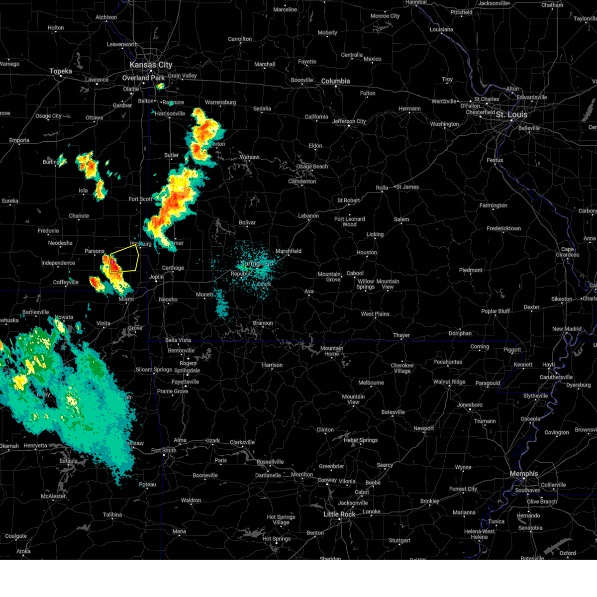 Svrsgf the national weather service in springfield has issued a * severe thunderstorm warning for, northwestern cherokee county in southeastern kansas, south central crawford county in southeastern kansas, * until 845 pm cdt. * at 811 pm cdt, a severe thunderstorm was located near mccune, or 8 miles northeast of oswego, moving east at 30 mph (radar indicated). Hazards include 60 mph wind gusts and quarter size hail. Hail damage to vehicles is expected. Expect wind damage to roofs, siding, and trees. Svrsgf the national weather service in springfield has issued a * severe thunderstorm warning for, northwestern cherokee county in southeastern kansas, south central crawford county in southeastern kansas, * until 845 pm cdt. * at 811 pm cdt, a severe thunderstorm was located near mccune, or 8 miles northeast of oswego, moving east at 30 mph (radar indicated). Hazards include 60 mph wind gusts and quarter size hail. Hail damage to vehicles is expected. Expect wind damage to roofs, siding, and trees.
|
| 8/16/2024 7:42 PM CDT |
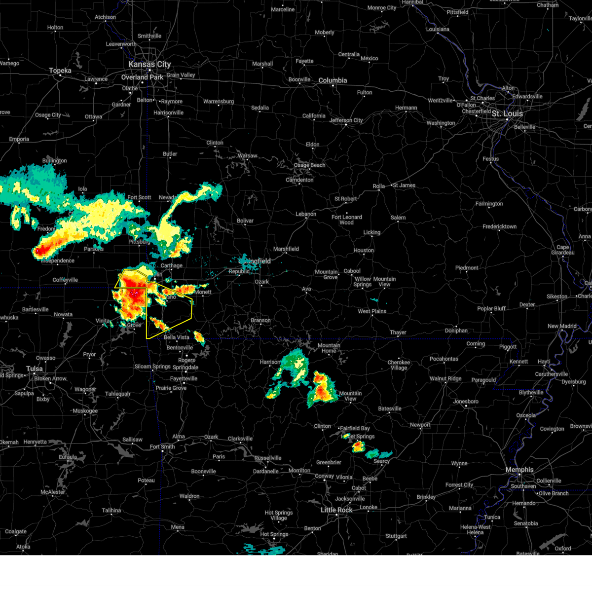 Svrsgf the national weather service in springfield has issued a * severe thunderstorm warning for, southeastern cherokee county in southeastern kansas, newton county in southwestern missouri, mcdonald county in southwestern missouri, * until 845 pm cdt. * at 742 pm cdt, a severe thunderstorm was located near baxter springs, moving southeast at 45 mph. this is a destructive storm for baxter springs and neosho (emergency management). Hazards include 80 mph wind gusts and two inch hail. Flying debris will be dangerous to those caught without shelter. mobile homes will be heavily damaged. expect considerable damage to roofs, windows, and vehicles. Extensive tree damage and power outages are likely. Svrsgf the national weather service in springfield has issued a * severe thunderstorm warning for, southeastern cherokee county in southeastern kansas, newton county in southwestern missouri, mcdonald county in southwestern missouri, * until 845 pm cdt. * at 742 pm cdt, a severe thunderstorm was located near baxter springs, moving southeast at 45 mph. this is a destructive storm for baxter springs and neosho (emergency management). Hazards include 80 mph wind gusts and two inch hail. Flying debris will be dangerous to those caught without shelter. mobile homes will be heavily damaged. expect considerable damage to roofs, windows, and vehicles. Extensive tree damage and power outages are likely.
|
| 8/16/2024 7:35 PM CDT | Golf Ball sized hail reported 6.9 miles NNE of Columbus, KS |
| 8/16/2024 7:32 PM CDT |
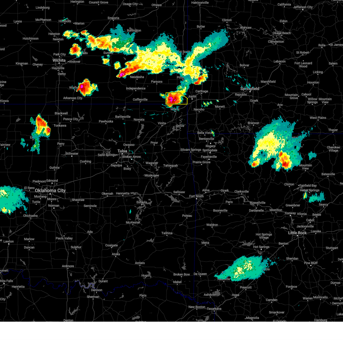 At 731 pm cdt, a severe thunderstorm was located over treece, or near baxter springs, moving southeast at 45 mph. this is a destructive storm for treece and baxter springs (emergency management). Hazards include 80 mph wind gusts and two inch hail. Flying debris will be dangerous to those caught without shelter. mobile homes will be heavily damaged. expect considerable damage to roofs, windows, and vehicles. extensive tree damage and power outages are likely. locations impacted include, baxter springs, columbus, galena, lowell, treece, neutral, melrose, hallowell, sherwin, riverton, and faulkner. This includes interstate 44 near mile marker 0. At 731 pm cdt, a severe thunderstorm was located over treece, or near baxter springs, moving southeast at 45 mph. this is a destructive storm for treece and baxter springs (emergency management). Hazards include 80 mph wind gusts and two inch hail. Flying debris will be dangerous to those caught without shelter. mobile homes will be heavily damaged. expect considerable damage to roofs, windows, and vehicles. extensive tree damage and power outages are likely. locations impacted include, baxter springs, columbus, galena, lowell, treece, neutral, melrose, hallowell, sherwin, riverton, and faulkner. This includes interstate 44 near mile marker 0.
|
| 8/16/2024 7:30 PM CDT | Corrects previous tstm wnd dmg report from 2 nw melrose. several metal buildings and barns damaged or destroyed across the southwestern portions of cherokee count in cherokee county KS, 11.8 miles NE of Columbus, KS |
| 8/16/2024 7:30 PM CDT | Corrects previous tstm wnd dmg report from 3 nne melrose. barn blown dow in cherokee county KS, 8.4 miles NE of Columbus, KS |
| 8/16/2024 7:25 PM CDT | Storm damage reported in cherokee county KS, 7.9 miles NE of Columbus, KS |
| 8/16/2024 7:24 PM CDT |
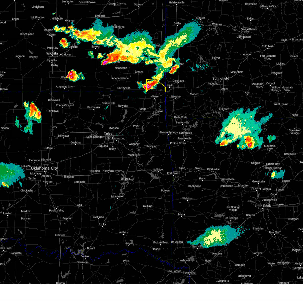 At 724 pm cdt, a severe thunderstorm was located near treece, or 8 miles east of chetopa, moving southeast at 45 mph (law enforcement). Hazards include golf ball size hail and 70 mph wind gusts. People and animals outdoors will be injured. expect hail damage to roofs, siding, windows, and vehicles. expect considerable tree damage. wind damage is also likely to mobile homes, roofs, and outbuildings. locations impacted include, baxter springs, columbus, galena, lowell, treece, neutral, melrose, hallowell, sherwin, riverton, faulkner, and stippville. This includes interstate 44 near mile marker 0. At 724 pm cdt, a severe thunderstorm was located near treece, or 8 miles east of chetopa, moving southeast at 45 mph (law enforcement). Hazards include golf ball size hail and 70 mph wind gusts. People and animals outdoors will be injured. expect hail damage to roofs, siding, windows, and vehicles. expect considerable tree damage. wind damage is also likely to mobile homes, roofs, and outbuildings. locations impacted include, baxter springs, columbus, galena, lowell, treece, neutral, melrose, hallowell, sherwin, riverton, faulkner, and stippville. This includes interstate 44 near mile marker 0.
|
| 8/16/2024 7:18 PM CDT |
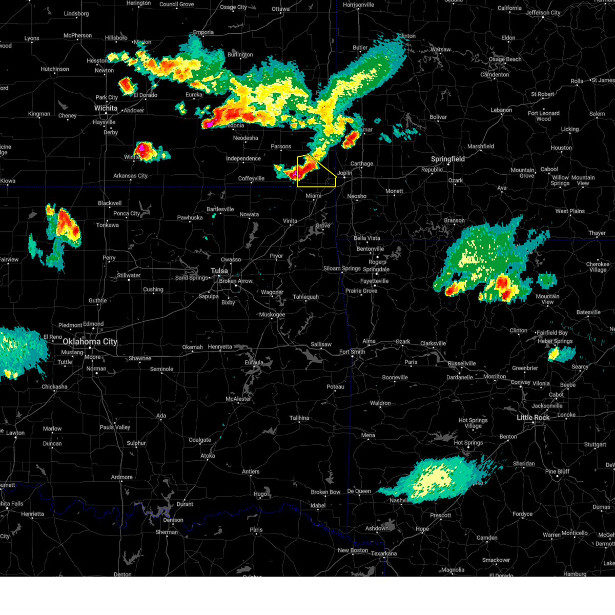 At 717 pm cdt, a severe thunderstorm was located near chetopa, moving southeast at 30 mph (law enforcement). Hazards include 70 mph wind gusts and half dollar size hail. Hail damage to vehicles is expected. expect considerable tree damage. wind damage is also likely to mobile homes, roofs, and outbuildings. locations impacted include, baxter springs, columbus, galena, lowell, sherman, west mineral, treece, neutral, melrose, riverton, hallowell, sherwin, faulkner, and stippville. This includes interstate 44 near mile marker 0. At 717 pm cdt, a severe thunderstorm was located near chetopa, moving southeast at 30 mph (law enforcement). Hazards include 70 mph wind gusts and half dollar size hail. Hail damage to vehicles is expected. expect considerable tree damage. wind damage is also likely to mobile homes, roofs, and outbuildings. locations impacted include, baxter springs, columbus, galena, lowell, sherman, west mineral, treece, neutral, melrose, riverton, hallowell, sherwin, faulkner, and stippville. This includes interstate 44 near mile marker 0.
|
| 8/16/2024 7:02 PM CDT |
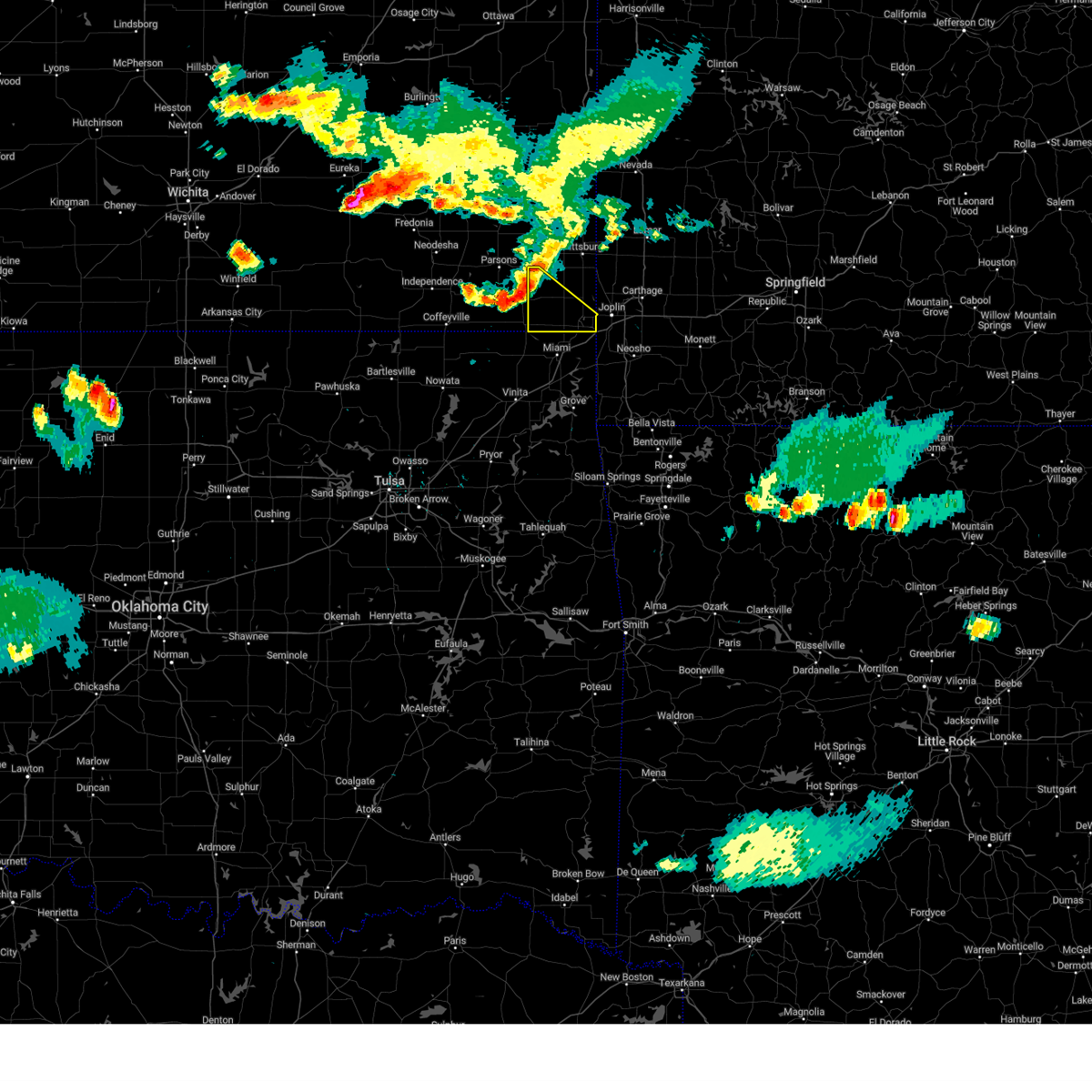 Svrsgf the national weather service in springfield has issued a * severe thunderstorm warning for, cherokee county in southeastern kansas, * until 745 pm cdt. * at 702 pm cdt, a severe thunderstorm was located over oswego, moving southeast at 40 mph (radar indicated). Hazards include 60 mph wind gusts and nickel size hail. expect damage to roofs, siding, and trees Svrsgf the national weather service in springfield has issued a * severe thunderstorm warning for, cherokee county in southeastern kansas, * until 745 pm cdt. * at 702 pm cdt, a severe thunderstorm was located over oswego, moving southeast at 40 mph (radar indicated). Hazards include 60 mph wind gusts and nickel size hail. expect damage to roofs, siding, and trees
|
| 8/16/2024 6:30 PM CDT | Barn blown dow in cherokee county KS, 8.4 miles NE of Columbus, KS |
| 8/16/2024 6:30 PM CDT | Several metal buildings and barns damaged or destroyed across the southwestern portions of cherokee count in cherokee county KS, 11.8 miles NE of Columbus, KS |
| 7/12/2024 2:53 AM CDT |
 The storm which prompted the warning has weakened below severe limits, and no longer poses an immediate threat to life or property. therefore, the warning has been allowed to expire. The storm which prompted the warning has weakened below severe limits, and no longer poses an immediate threat to life or property. therefore, the warning has been allowed to expire.
|
| 7/12/2024 2:24 AM CDT |
 At 224 am cdt, a severe thunderstorm was located over scammon, or near columbus, moving northeast at 10 mph (radar indicated). Hazards include 60 mph wind gusts and quarter size hail. Hail damage to vehicles is expected. expect wind damage to roofs, siding, and trees. Locations impacted include, pittsburg, columbus, cherokee, weir, scammon, chicopee, west mineral, roseland, opolis, lawton, carona, skidmore, stippville, and crestline. At 224 am cdt, a severe thunderstorm was located over scammon, or near columbus, moving northeast at 10 mph (radar indicated). Hazards include 60 mph wind gusts and quarter size hail. Hail damage to vehicles is expected. expect wind damage to roofs, siding, and trees. Locations impacted include, pittsburg, columbus, cherokee, weir, scammon, chicopee, west mineral, roseland, opolis, lawton, carona, skidmore, stippville, and crestline.
|
| 7/12/2024 2:10 AM CDT |
 Svrsgf the national weather service in springfield has issued a * severe thunderstorm warning for, central cherokee county in southeastern kansas, southeastern crawford county in southeastern kansas, * until 245 am cdt. * at 210 am cdt, a severe thunderstorm was located over scammon, or near columbus, moving northeast at 10 mph (radar indicated). Hazards include 60 mph wind gusts and quarter size hail. Hail damage to vehicles is expected. Expect wind damage to roofs, siding, and trees. Svrsgf the national weather service in springfield has issued a * severe thunderstorm warning for, central cherokee county in southeastern kansas, southeastern crawford county in southeastern kansas, * until 245 am cdt. * at 210 am cdt, a severe thunderstorm was located over scammon, or near columbus, moving northeast at 10 mph (radar indicated). Hazards include 60 mph wind gusts and quarter size hail. Hail damage to vehicles is expected. Expect wind damage to roofs, siding, and trees.
|
| 7/4/2024 8:35 PM CDT |
 Svrsgf the national weather service in springfield has issued a * severe thunderstorm warning for, northern cherokee county in southeastern kansas, crawford county in southeastern kansas, * until 915 pm cdt. * at 834 pm cdt, a severe thunderstorm was located near oswego, moving northeast at 35 mph (radar indicated. at 820 pm, a trained spotter reported golf ball sized hail 5 miles east of altamont). Hazards include 60 mph wind gusts and half dollar size hail. Hail damage to vehicles is expected. Expect wind damage to roofs, siding, and trees. Svrsgf the national weather service in springfield has issued a * severe thunderstorm warning for, northern cherokee county in southeastern kansas, crawford county in southeastern kansas, * until 915 pm cdt. * at 834 pm cdt, a severe thunderstorm was located near oswego, moving northeast at 35 mph (radar indicated. at 820 pm, a trained spotter reported golf ball sized hail 5 miles east of altamont). Hazards include 60 mph wind gusts and half dollar size hail. Hail damage to vehicles is expected. Expect wind damage to roofs, siding, and trees.
|
| 6/26/2024 5:52 AM CDT |
 The storms which prompted the warning have moved out of the area. therefore, the warning will be allowed to expire. a severe thunderstorm watch remains in effect until 1100 am cdt for southeastern kansas, and southwestern missouri. The storms which prompted the warning have moved out of the area. therefore, the warning will be allowed to expire. a severe thunderstorm watch remains in effect until 1100 am cdt for southeastern kansas, and southwestern missouri.
|
| 6/26/2024 5:08 AM CDT |
 Svrsgf the national weather service in springfield has issued a * severe thunderstorm warning for, cherokee county in southeastern kansas, southern crawford county in southeastern kansas, southwestern barton county in southwestern missouri, newton county in southwestern missouri, western jasper county in southwestern missouri, * until 600 am cdt. * at 507 am cdt, severe thunderstorms were located along a line extending from near liberal to 6 miles southwest of girard to near galesburg, moving southeast at 65 mph (radar indicated). Hazards include 60 mph wind gusts. expect damage to roofs, siding, and trees Svrsgf the national weather service in springfield has issued a * severe thunderstorm warning for, cherokee county in southeastern kansas, southern crawford county in southeastern kansas, southwestern barton county in southwestern missouri, newton county in southwestern missouri, western jasper county in southwestern missouri, * until 600 am cdt. * at 507 am cdt, severe thunderstorms were located along a line extending from near liberal to 6 miles southwest of girard to near galesburg, moving southeast at 65 mph (radar indicated). Hazards include 60 mph wind gusts. expect damage to roofs, siding, and trees
|
| 5/16/2024 2:23 AM CDT |
 The storm which prompted the warning has weakened below severe limits, and no longer poses an immediate threat to life or property. therefore, the warning will be allowed to expire. however, small hail and gusty winds are still possible with this thunderstorm. The storm which prompted the warning has weakened below severe limits, and no longer poses an immediate threat to life or property. therefore, the warning will be allowed to expire. however, small hail and gusty winds are still possible with this thunderstorm.
|
| 5/16/2024 2:11 AM CDT |
 At 210 am cdt, a severe thunderstorm was located near cherokee, or 11 miles southwest of pittsburg, moving east at 35 mph (radar indicated). Hazards include 60 mph wind gusts and quarter size hail. Hail damage to vehicles is expected. expect wind damage to roofs, siding, and trees. Locations impacted include, pittsburg, frontenac, columbus, cherokee, weir, sherman, scammon, chicopee, mccune, west mineral, roseland, beulah, opolis, yale, lawton, carona, lone oak, skidmore, and stippville. At 210 am cdt, a severe thunderstorm was located near cherokee, or 11 miles southwest of pittsburg, moving east at 35 mph (radar indicated). Hazards include 60 mph wind gusts and quarter size hail. Hail damage to vehicles is expected. expect wind damage to roofs, siding, and trees. Locations impacted include, pittsburg, frontenac, columbus, cherokee, weir, sherman, scammon, chicopee, mccune, west mineral, roseland, beulah, opolis, yale, lawton, carona, lone oak, skidmore, and stippville.
|
| 5/16/2024 2:02 AM CDT |
 At 202 am cdt, a severe thunderstorm was located near mccune, or 12 miles southwest of girard, moving east at 35 mph (radar indicated). Hazards include 60 mph wind gusts and half dollar size hail. Hail damage to vehicles is expected. expect wind damage to roofs, siding, and trees. Locations impacted include, pittsburg, frontenac, columbus, girard, arma, cherokee, weir, sherman, mulberry, scammon, chicopee, mccune, franklin, west mineral, roseland, beulah, croweburg, yale, carona, and opolis. At 202 am cdt, a severe thunderstorm was located near mccune, or 12 miles southwest of girard, moving east at 35 mph (radar indicated). Hazards include 60 mph wind gusts and half dollar size hail. Hail damage to vehicles is expected. expect wind damage to roofs, siding, and trees. Locations impacted include, pittsburg, frontenac, columbus, girard, arma, cherokee, weir, sherman, mulberry, scammon, chicopee, mccune, franklin, west mineral, roseland, beulah, croweburg, yale, carona, and opolis.
|
| 5/16/2024 1:40 AM CDT |
 Svrsgf the national weather service in springfield has issued a * severe thunderstorm warning for, northern cherokee county in southeastern kansas, crawford county in southeastern kansas, * until 230 am cdt. * at 140 am cdt, a severe thunderstorm was located near parsons, moving east at 40 mph (radar indicated). Hazards include golf ball size hail and 60 mph wind gusts. People and animals outdoors will be injured. expect hail damage to roofs, siding, windows, and vehicles. Expect wind damage to roofs, siding, and trees. Svrsgf the national weather service in springfield has issued a * severe thunderstorm warning for, northern cherokee county in southeastern kansas, crawford county in southeastern kansas, * until 230 am cdt. * at 140 am cdt, a severe thunderstorm was located near parsons, moving east at 40 mph (radar indicated). Hazards include golf ball size hail and 60 mph wind gusts. People and animals outdoors will be injured. expect hail damage to roofs, siding, windows, and vehicles. Expect wind damage to roofs, siding, and trees.
|
| 5/6/2024 11:30 PM CDT |
 The storm which prompted the warning has moved out of the area. therefore, the warning has been allowed to expire. a tornado watch remains in effect until 400 am cdt for southeastern kansas. The storm which prompted the warning has moved out of the area. therefore, the warning has been allowed to expire. a tornado watch remains in effect until 400 am cdt for southeastern kansas.
|
| 5/6/2024 11:15 PM CDT |
 Torsgf the national weather service in springfield has issued a * tornado warning for, eastern cherokee county in southeastern kansas, northwestern jasper county in southwestern missouri, * until 1145 pm cdt. * at 1115 pm cdt, a severe thunderstorm capable of producing a tornado was located near columbus, moving northeast at 65 mph (radar indicated rotation). Hazards include tornado. Flying debris will be dangerous to those caught without shelter. mobile homes will be damaged or destroyed. damage to roofs, windows, and vehicles will occur. Tree damage is likely. Torsgf the national weather service in springfield has issued a * tornado warning for, eastern cherokee county in southeastern kansas, northwestern jasper county in southwestern missouri, * until 1145 pm cdt. * at 1115 pm cdt, a severe thunderstorm capable of producing a tornado was located near columbus, moving northeast at 65 mph (radar indicated rotation). Hazards include tornado. Flying debris will be dangerous to those caught without shelter. mobile homes will be damaged or destroyed. damage to roofs, windows, and vehicles will occur. Tree damage is likely.
|
| 5/6/2024 10:58 PM CDT |
 At 1057 pm cdt, a severe thunderstorm was located near oswego, moving northeast at 65 mph (broadcast media reported 60 mph wind gusts in edna ks at 1044 pm). Hazards include 60 mph wind gusts and nickel size hail. Expect damage to roofs, siding, and trees. locations impacted include, pittsburg, baxter springs, frontenac, columbus, galena, girard, arma, cherokee, weir, lowell, sherman, mulberry, scammon, chicopee, mccune, franklin, west mineral, treece, roseland, and neutral. This includes interstate 44 near mile marker 0. At 1057 pm cdt, a severe thunderstorm was located near oswego, moving northeast at 65 mph (broadcast media reported 60 mph wind gusts in edna ks at 1044 pm). Hazards include 60 mph wind gusts and nickel size hail. Expect damage to roofs, siding, and trees. locations impacted include, pittsburg, baxter springs, frontenac, columbus, galena, girard, arma, cherokee, weir, lowell, sherman, mulberry, scammon, chicopee, mccune, franklin, west mineral, treece, roseland, and neutral. This includes interstate 44 near mile marker 0.
|
| 5/6/2024 10:43 PM CDT |
 Svrsgf the national weather service in springfield has issued a * severe thunderstorm warning for, cherokee county in southeastern kansas, southern crawford county in southeastern kansas, * until 1130 pm cdt. * at 1042 pm cdt, a severe thunderstorm was located 7 miles southeast of edna, or 9 miles west of chetopa, moving northeast at 65 mph (radar indicated). Hazards include 60 mph wind gusts and nickel size hail. expect damage to roofs, siding, and trees Svrsgf the national weather service in springfield has issued a * severe thunderstorm warning for, cherokee county in southeastern kansas, southern crawford county in southeastern kansas, * until 1130 pm cdt. * at 1042 pm cdt, a severe thunderstorm was located 7 miles southeast of edna, or 9 miles west of chetopa, moving northeast at 65 mph (radar indicated). Hazards include 60 mph wind gusts and nickel size hail. expect damage to roofs, siding, and trees
|
| 4/28/2024 7:07 PM CDT |
 At 707 pm cdt, a severe thunderstorm was located near columbus, moving northeast at 30 mph (radar indicated). Hazards include 60 mph wind gusts and penny size hail. Expect damage to roofs, siding, and trees. Locations impacted include, columbus, cherokee, weir, scammon, west mineral, roseland, skidmore, hallowell, sherwin, stippville, and carona. At 707 pm cdt, a severe thunderstorm was located near columbus, moving northeast at 30 mph (radar indicated). Hazards include 60 mph wind gusts and penny size hail. Expect damage to roofs, siding, and trees. Locations impacted include, columbus, cherokee, weir, scammon, west mineral, roseland, skidmore, hallowell, sherwin, stippville, and carona.
|
| 4/28/2024 6:57 PM CDT |
 Svrsgf the national weather service in springfield has issued a * severe thunderstorm warning for, cherokee county in southeastern kansas, * until 730 pm cdt. * at 656 pm cdt, a severe thunderstorm was located near columbus, moving northeast at 30 mph (radar indicated). Hazards include 60 mph wind gusts and penny size hail. expect damage to roofs, siding, and trees Svrsgf the national weather service in springfield has issued a * severe thunderstorm warning for, cherokee county in southeastern kansas, * until 730 pm cdt. * at 656 pm cdt, a severe thunderstorm was located near columbus, moving northeast at 30 mph (radar indicated). Hazards include 60 mph wind gusts and penny size hail. expect damage to roofs, siding, and trees
|
| 4/28/2024 2:15 AM CDT |
 The storms which prompted the warning have weakened below severe limits, and no longer pose an immediate threat to life or property. therefore, the warning will be allowed to expire. a tornado watch remains in effect until 700 am cdt for southeastern kansas, and southwestern missouri. The storms which prompted the warning have weakened below severe limits, and no longer pose an immediate threat to life or property. therefore, the warning will be allowed to expire. a tornado watch remains in effect until 700 am cdt for southeastern kansas, and southwestern missouri.
|
| 4/28/2024 1:13 AM CDT |
 Svrsgf the national weather service in springfield has issued a * severe thunderstorm warning for, cherokee county in southeastern kansas, newton county in southwestern missouri, jasper county in southwestern missouri, * until 215 am cdt. * at 112 am cdt, severe thunderstorms were located along a line extending from near oswego to near afton to near locust grove, moving northeast at 50 mph (radar indicated). Hazards include 60 mph wind gusts and penny size hail. expect damage to roofs, siding, and trees Svrsgf the national weather service in springfield has issued a * severe thunderstorm warning for, cherokee county in southeastern kansas, newton county in southwestern missouri, jasper county in southwestern missouri, * until 215 am cdt. * at 112 am cdt, severe thunderstorms were located along a line extending from near oswego to near afton to near locust grove, moving northeast at 50 mph (radar indicated). Hazards include 60 mph wind gusts and penny size hail. expect damage to roofs, siding, and trees
|
| 4/1/2024 9:22 PM CDT |
 The storm which prompted the warning has moved out of the area. therefore, the warning will be allowed to expire. however, gusty winds are still possible with this thunderstorm. a tornado watch remains in effect until 1100 pm cdt for southeastern kansas. The storm which prompted the warning has moved out of the area. therefore, the warning will be allowed to expire. however, gusty winds are still possible with this thunderstorm. a tornado watch remains in effect until 1100 pm cdt for southeastern kansas.
|
| 4/1/2024 9:06 PM CDT |
 At 905 pm cdt, a severe thunderstorm was located 7 miles northwest of treece, or 7 miles southwest of columbus, moving northeast at 55 mph (radar indicated). Hazards include 60 mph wind gusts and quarter size hail. Hail damage to vehicles is expected. expect wind damage to roofs, siding, and trees. locations impacted include, baxter springs, columbus, galena, weir, lowell, scammon, treece, roseland, neutral, melrose, riverton, lawton, carona, skidmore, hallowell, sherwin, faulkner, stippville, and crestline. This includes interstate 44 near mile marker 0. At 905 pm cdt, a severe thunderstorm was located 7 miles northwest of treece, or 7 miles southwest of columbus, moving northeast at 55 mph (radar indicated). Hazards include 60 mph wind gusts and quarter size hail. Hail damage to vehicles is expected. expect wind damage to roofs, siding, and trees. locations impacted include, baxter springs, columbus, galena, weir, lowell, scammon, treece, roseland, neutral, melrose, riverton, lawton, carona, skidmore, hallowell, sherwin, faulkner, stippville, and crestline. This includes interstate 44 near mile marker 0.
|
| 4/1/2024 8:50 PM CDT |
 Svrsgf the national weather service in springfield has issued a * severe thunderstorm warning for, cherokee county in southeastern kansas, * until 930 pm cdt. * at 850 pm cdt, a severe thunderstorm was located 8 miles southwest of chetopa, moving northeast at 50 mph (radar indicated). Hazards include 60 mph wind gusts and quarter size hail. Hail damage to vehicles is expected. Expect wind damage to roofs, siding, and trees. Svrsgf the national weather service in springfield has issued a * severe thunderstorm warning for, cherokee county in southeastern kansas, * until 930 pm cdt. * at 850 pm cdt, a severe thunderstorm was located 8 miles southwest of chetopa, moving northeast at 50 mph (radar indicated). Hazards include 60 mph wind gusts and quarter size hail. Hail damage to vehicles is expected. Expect wind damage to roofs, siding, and trees.
|
| 4/1/2024 6:14 PM CDT |
 The storm which prompted the warning has moved out of the area. therefore, the warning will be allowed to expire. a tornado watch remains in effect until 1100 pm cdt for southeastern kansas. to report severe weather, contact your nearest law enforcement agency. they will relay your report to the national weather service springfield. The storm which prompted the warning has moved out of the area. therefore, the warning will be allowed to expire. a tornado watch remains in effect until 1100 pm cdt for southeastern kansas. to report severe weather, contact your nearest law enforcement agency. they will relay your report to the national weather service springfield.
|
| 4/1/2024 5:35 PM CDT |
 At 534 pm cdt, a severe thunderstorm was located over mccune, or 11 miles northeast of oswego, moving east at 50 mph (radar indicated). Hazards include 60 mph wind gusts and half dollar size hail. Hail damage to vehicles is expected. expect wind damage to roofs, siding, and trees. Locations impacted include, pittsburg, frontenac, columbus, galena, girard, arma, cherokee, weir, sherman, mulberry, scammon, chicopee, mccune, franklin, west mineral, roseland, neutral, beulah, croweburg, and yale. At 534 pm cdt, a severe thunderstorm was located over mccune, or 11 miles northeast of oswego, moving east at 50 mph (radar indicated). Hazards include 60 mph wind gusts and half dollar size hail. Hail damage to vehicles is expected. expect wind damage to roofs, siding, and trees. Locations impacted include, pittsburg, frontenac, columbus, galena, girard, arma, cherokee, weir, sherman, mulberry, scammon, chicopee, mccune, franklin, west mineral, roseland, neutral, beulah, croweburg, and yale.
|
| 4/1/2024 5:24 PM CDT |
 At 522 pm cdt, a severe thunderstorm was located near parsons, moving east at 50 mph (trained weather spotters. this storm has a history of producing large and damaging winds across southeastern kansas). Hazards include golf ball size hail and 70 mph wind gusts. People and animals outdoors will be injured. expect hail damage to roofs, siding, windows, and vehicles. expect considerable tree damage. wind damage is also likely to mobile homes, roofs, and outbuildings. Locations impacted include, pittsburg, frontenac, columbus, galena, girard, arma, cherokee, weir, sherman, mulberry, scammon, chicopee, mccune, franklin, west mineral, roseland, neutral, beulah, croweburg, and yale. At 522 pm cdt, a severe thunderstorm was located near parsons, moving east at 50 mph (trained weather spotters. this storm has a history of producing large and damaging winds across southeastern kansas). Hazards include golf ball size hail and 70 mph wind gusts. People and animals outdoors will be injured. expect hail damage to roofs, siding, windows, and vehicles. expect considerable tree damage. wind damage is also likely to mobile homes, roofs, and outbuildings. Locations impacted include, pittsburg, frontenac, columbus, galena, girard, arma, cherokee, weir, sherman, mulberry, scammon, chicopee, mccune, franklin, west mineral, roseland, neutral, beulah, croweburg, and yale.
|
| 4/1/2024 5:16 PM CDT |
 Svrsgf the national weather service in springfield has issued a * severe thunderstorm warning for, cherokee county in southeastern kansas, southern crawford county in southeastern kansas, * until 615 pm cdt. * at 515 pm cdt, a severe thunderstorm was located near altamont, moving east at 50 mph (trained weather spotters). Hazards include two inch hail and 70 mph wind gusts. People and animals outdoors will be injured. expect hail damage to roofs, siding, windows, and vehicles. expect considerable tree damage. Wind damage is also likely to mobile homes, roofs, and outbuildings. Svrsgf the national weather service in springfield has issued a * severe thunderstorm warning for, cherokee county in southeastern kansas, southern crawford county in southeastern kansas, * until 615 pm cdt. * at 515 pm cdt, a severe thunderstorm was located near altamont, moving east at 50 mph (trained weather spotters). Hazards include two inch hail and 70 mph wind gusts. People and animals outdoors will be injured. expect hail damage to roofs, siding, windows, and vehicles. expect considerable tree damage. Wind damage is also likely to mobile homes, roofs, and outbuildings.
|
| 9/8/2023 5:39 AM CDT |
 At 539 am cdt, a severe thunderstorm was located near columbus, moving southeast at 50 mph (radar indicated). Hazards include quarter size hail. Damage to vehicles is expected. locations impacted include, columbus, treece, neutral, melrose, hallowell, sherwin and faulkner. hail threat, radar indicated max hail size, 1. 00 in wind threat, radar indicated max wind gust, <50 mph. At 539 am cdt, a severe thunderstorm was located near columbus, moving southeast at 50 mph (radar indicated). Hazards include quarter size hail. Damage to vehicles is expected. locations impacted include, columbus, treece, neutral, melrose, hallowell, sherwin and faulkner. hail threat, radar indicated max hail size, 1. 00 in wind threat, radar indicated max wind gust, <50 mph.
|
| 9/8/2023 5:22 AM CDT |
 At 522 am cdt, a severe thunderstorm was located near oswego, moving southeast at 40 mph (radar indicated). Hazards include quarter size hail. damage to vehicles is expected At 522 am cdt, a severe thunderstorm was located near oswego, moving southeast at 40 mph (radar indicated). Hazards include quarter size hail. damage to vehicles is expected
|
| 7/30/2023 10:08 PM CDT |
 At 1007 pm cdt, severe thunderstorms were located along a line extending from 8 miles northeast of lamar to 8 miles northwest of jasper to near west mineral, moving southeast at 55 mph. these are destructive storms for northern barton county and western cedar (radar indicated). Hazards include 80 mph wind gusts. Flying debris will be dangerous to those caught without shelter. mobile homes will be heavily damaged. expect considerable damage to roofs, windows, and vehicles. Extensive tree damage and power outages are likely. At 1007 pm cdt, severe thunderstorms were located along a line extending from 8 miles northeast of lamar to 8 miles northwest of jasper to near west mineral, moving southeast at 55 mph. these are destructive storms for northern barton county and western cedar (radar indicated). Hazards include 80 mph wind gusts. Flying debris will be dangerous to those caught without shelter. mobile homes will be heavily damaged. expect considerable damage to roofs, windows, and vehicles. Extensive tree damage and power outages are likely.
|
| 7/14/2023 6:54 PM CDT |
 The severe thunderstorm warning for cherokee county will expire at 700 pm cdt, the storms which prompted the warning have moved out of the area. therefore, the warning will be allowed to expire. however gusty winds are still possible with these thunderstorms. a severe thunderstorm watch remains in effect until 900 pm cdt for southeastern kansas. to report severe weather, contact your nearest law enforcement agency. they will relay your report to the national weather service springfield. The severe thunderstorm warning for cherokee county will expire at 700 pm cdt, the storms which prompted the warning have moved out of the area. therefore, the warning will be allowed to expire. however gusty winds are still possible with these thunderstorms. a severe thunderstorm watch remains in effect until 900 pm cdt for southeastern kansas. to report severe weather, contact your nearest law enforcement agency. they will relay your report to the national weather service springfield.
|
| 7/14/2023 6:40 PM CDT |
 At 640 pm cdt, severe thunderstorms were located along a line extending from 7 miles northwest of carl junction to 6 miles east of chetopa, moving southeast at 45 mph (trained weather spotters). Hazards include 60 mph wind gusts and quarter size hail. Hail damage to vehicles is expected. Expect wind damage to roofs, siding, and trees. At 640 pm cdt, severe thunderstorms were located along a line extending from 7 miles northwest of carl junction to 6 miles east of chetopa, moving southeast at 45 mph (trained weather spotters). Hazards include 60 mph wind gusts and quarter size hail. Hail damage to vehicles is expected. Expect wind damage to roofs, siding, and trees.
|
| 7/14/2023 6:39 PM CDT | The line has just worked in... we have winds right at 60 mph in central cherokee count in cherokee county KS, 8 miles WSW of Columbus, KS |
| 7/14/2023 6:11 PM CDT |
 At 610 pm cdt, severe thunderstorms were located along a line extending from near girard to near oswego to near south coffeyville, moving east at 55 mph (trained weather spotters). Hazards include 70 mph wind gusts and quarter size hail. Hail damage to vehicles is expected. expect considerable tree damage. Wind damage is also likely to mobile homes, roofs, and outbuildings. At 610 pm cdt, severe thunderstorms were located along a line extending from near girard to near oswego to near south coffeyville, moving east at 55 mph (trained weather spotters). Hazards include 70 mph wind gusts and quarter size hail. Hail damage to vehicles is expected. expect considerable tree damage. Wind damage is also likely to mobile homes, roofs, and outbuildings.
|
| 7/14/2023 5:29 PM CDT |
 At 528 pm cdt, severe thunderstorms were located along a line extending from near westphalia to gas to near chanute to near neodesha, moving east at 50 mph (radar indicated). Hazards include 70 mph wind gusts and quarter size hail. Hail damage to vehicles is expected. expect considerable tree damage. Wind damage is also likely to mobile homes, roofs, and outbuildings. At 528 pm cdt, severe thunderstorms were located along a line extending from near westphalia to gas to near chanute to near neodesha, moving east at 50 mph (radar indicated). Hazards include 70 mph wind gusts and quarter size hail. Hail damage to vehicles is expected. expect considerable tree damage. Wind damage is also likely to mobile homes, roofs, and outbuildings.
|
| 7/13/2023 12:58 AM CDT |
 At 1258 am cdt, severe thunderstorms were located along a line extending from 6 miles southwest of golden city to duenweg to near columbus, moving south at 35 mph (radar indicated). Hazards include 60 mph wind gusts and penny size hail. expect damage to roofs, siding, and trees At 1258 am cdt, severe thunderstorms were located along a line extending from 6 miles southwest of golden city to duenweg to near columbus, moving south at 35 mph (radar indicated). Hazards include 60 mph wind gusts and penny size hail. expect damage to roofs, siding, and trees
|
| 6/18/2023 2:11 AM CDT |
 At 211 am cdt, severe thunderstorms were located along a line extending from west mineral to treece to seneca, moving northeast at 45 mph (radar indicated). Hazards include 60 mph wind gusts and nickel size hail. Expect damage to roofs, siding, and trees. these severe storms will be near, scammon and west mineral around 215 am cdt. galena, cherokee and weir around 220 am cdt. columbus around 225 am cdt. pittsburg and shoal creek drive around 230 am cdt. joplin, carl junction, duquesne, leawood, silver creek and saginaw around 235 am cdt. oronogo and duenweg around 240 am cdt. carterville around 245 am cdt. other locations impacted by these severe thunderstorms include loma linda, airport drive, lowell, sherman, chicopee, asbury, redings mill, grand falls plaza, shoal creek estates and waco. this includes the following highways, interstate 44 between mile markers 0 and 13. interstate 49 between mile markers 16 and 35. hail threat, radar indicated max hail size, 0. 88 in wind threat, radar indicated max wind gust, 60 mph. At 211 am cdt, severe thunderstorms were located along a line extending from west mineral to treece to seneca, moving northeast at 45 mph (radar indicated). Hazards include 60 mph wind gusts and nickel size hail. Expect damage to roofs, siding, and trees. these severe storms will be near, scammon and west mineral around 215 am cdt. galena, cherokee and weir around 220 am cdt. columbus around 225 am cdt. pittsburg and shoal creek drive around 230 am cdt. joplin, carl junction, duquesne, leawood, silver creek and saginaw around 235 am cdt. oronogo and duenweg around 240 am cdt. carterville around 245 am cdt. other locations impacted by these severe thunderstorms include loma linda, airport drive, lowell, sherman, chicopee, asbury, redings mill, grand falls plaza, shoal creek estates and waco. this includes the following highways, interstate 44 between mile markers 0 and 13. interstate 49 between mile markers 16 and 35. hail threat, radar indicated max hail size, 0. 88 in wind threat, radar indicated max wind gust, 60 mph.
|
| 6/18/2023 1:50 AM CDT |
 At 150 am cdt, severe thunderstorms were located along a line extending from near oswego to near narcissa to near grove, moving northeast at 45 mph (radar indicated). Hazards include 60 mph wind gusts and nickel size hail. Expect damage to roofs, siding, and trees. severe thunderstorms will be near, seneca, mccune, west mineral and treece around 210 am cdt. baxter springs and scammon around 215 am cdt. columbus, galena, cherokee and weir around 220 am cdt. pittsburg and shoal creek drive around 230 am cdt. joplin, carl junction, duquesne, leawood, silver creek and saginaw around 235 am cdt. webb city, oronogo and duenweg around 240 am cdt. carterville around 245 am cdt. other locations impacted by these severe thunderstorms include loma linda, airport drive, lowell, sherman, chicopee, asbury, redings mill, grand falls plaza, shoal creek estates and waco. this includes the following highways, interstate 44 between mile markers 0 and 13. interstate 49 between mile markers 16 and 35. hail threat, radar indicated max hail size, 0. 88 in wind threat, radar indicated max wind gust, 60 mph. At 150 am cdt, severe thunderstorms were located along a line extending from near oswego to near narcissa to near grove, moving northeast at 45 mph (radar indicated). Hazards include 60 mph wind gusts and nickel size hail. Expect damage to roofs, siding, and trees. severe thunderstorms will be near, seneca, mccune, west mineral and treece around 210 am cdt. baxter springs and scammon around 215 am cdt. columbus, galena, cherokee and weir around 220 am cdt. pittsburg and shoal creek drive around 230 am cdt. joplin, carl junction, duquesne, leawood, silver creek and saginaw around 235 am cdt. webb city, oronogo and duenweg around 240 am cdt. carterville around 245 am cdt. other locations impacted by these severe thunderstorms include loma linda, airport drive, lowell, sherman, chicopee, asbury, redings mill, grand falls plaza, shoal creek estates and waco. this includes the following highways, interstate 44 between mile markers 0 and 13. interstate 49 between mile markers 16 and 35. hail threat, radar indicated max hail size, 0. 88 in wind threat, radar indicated max wind gust, 60 mph.
|
| 6/11/2023 1:37 AM CDT |
 The severe thunderstorm warning for southern cherokee county will expire at 145 am cdt, the storm which prompted the warning has weakened below severe limits, and no longer poses an immediate threat to life or property. therefore, the warning will be allowed to expire. small hail and wind gusts up to 40 to 50 mph remain possible. The severe thunderstorm warning for southern cherokee county will expire at 145 am cdt, the storm which prompted the warning has weakened below severe limits, and no longer poses an immediate threat to life or property. therefore, the warning will be allowed to expire. small hail and wind gusts up to 40 to 50 mph remain possible.
|
| 6/11/2023 1:13 AM CDT |
 At 112 am cdt, a severe thunderstorm was located near oswego, moving southeast at 25 mph (radar indicated). Hazards include quarter size hail. Damage to vehicles is expected. locations impacted include, columbus, sherwin, neutral, faulkner, melrose and hallowell. hail threat, radar indicated max hail size, 1. 00 in wind threat, radar indicated max wind gust, <50 mph. At 112 am cdt, a severe thunderstorm was located near oswego, moving southeast at 25 mph (radar indicated). Hazards include quarter size hail. Damage to vehicles is expected. locations impacted include, columbus, sherwin, neutral, faulkner, melrose and hallowell. hail threat, radar indicated max hail size, 1. 00 in wind threat, radar indicated max wind gust, <50 mph.
|
| 6/11/2023 12:54 AM CDT |
 At 1253 am cdt, a severe thunderstorm was located near oswego, moving southeast at 25 mph (radar indicated). Hazards include quarter size hail. damage to vehicles is expected At 1253 am cdt, a severe thunderstorm was located near oswego, moving southeast at 25 mph (radar indicated). Hazards include quarter size hail. damage to vehicles is expected
|
| 5/9/2023 6:51 PM CDT |
 At 651 pm cdt, severe thunderstorms were located along a line extending from 6 miles northwest of lamar to near west mineral to 6 miles west of edna, moving southeast at 40 mph (radar indicated). Hazards include 60 mph wind gusts and quarter size hail. Hail damage to vehicles is expected. Expect wind damage to roofs, siding, and trees. At 651 pm cdt, severe thunderstorms were located along a line extending from 6 miles northwest of lamar to near west mineral to 6 miles west of edna, moving southeast at 40 mph (radar indicated). Hazards include 60 mph wind gusts and quarter size hail. Hail damage to vehicles is expected. Expect wind damage to roofs, siding, and trees.
|
| 4/5/2023 3:43 AM CDT |
 At 343 am cdt, a severe thunderstorm was located near welch, or 9 miles south of chetopa, moving northeast at 60 mph (radar indicated). Hazards include 60 mph wind gusts and quarter size hail. Hail damage to vehicles is expected. Expect wind damage to roofs, siding, and trees. At 343 am cdt, a severe thunderstorm was located near welch, or 9 miles south of chetopa, moving northeast at 60 mph (radar indicated). Hazards include 60 mph wind gusts and quarter size hail. Hail damage to vehicles is expected. Expect wind damage to roofs, siding, and trees.
|
| 4/5/2023 3:20 AM CDT |
 The severe thunderstorm warning for northern cherokee county will expire at 330 am cdt, the storm which prompted the warning has moved out of the area. therefore, the warning will be allowed to expire. a severe thunderstorm watch remains in effect until 1000 am cdt for southeastern kansas. The severe thunderstorm warning for northern cherokee county will expire at 330 am cdt, the storm which prompted the warning has moved out of the area. therefore, the warning will be allowed to expire. a severe thunderstorm watch remains in effect until 1000 am cdt for southeastern kansas.
|
| 4/5/2023 3:07 AM CDT |
 At 307 am cdt, a severe thunderstorm was located over scammon, or 9 miles north of columbus, moving northeast at 65 mph (radar indicated). Hazards include 70 mph wind gusts and half dollar size hail. Hail damage to vehicles is expected. expect considerable tree damage. Wind damage is also likely to mobile homes, roofs, and outbuildings. At 307 am cdt, a severe thunderstorm was located over scammon, or 9 miles north of columbus, moving northeast at 65 mph (radar indicated). Hazards include 70 mph wind gusts and half dollar size hail. Hail damage to vehicles is expected. expect considerable tree damage. Wind damage is also likely to mobile homes, roofs, and outbuildings.
|
| 4/5/2023 3:02 AM CDT |
 At 301 am cdt, a severe thunderstorm was located over west mineral, or near columbus, moving northeast at 65 mph (broadcast media. quarter size hail was reported east of oswego, kansas). Hazards include 60 mph wind gusts and quarter size hail. Hail damage to vehicles is expected. expect wind damage to roofs, siding, and trees. locations impacted include, columbus, cherokee, weir, sherman, scammon, west mineral, roseland, lawton, carona, skidmore, hallowell, sherwin and stippville. hail threat, radar indicated max hail size, 1. 00 in wind threat, radar indicated max wind gust, 60 mph. At 301 am cdt, a severe thunderstorm was located over west mineral, or near columbus, moving northeast at 65 mph (broadcast media. quarter size hail was reported east of oswego, kansas). Hazards include 60 mph wind gusts and quarter size hail. Hail damage to vehicles is expected. expect wind damage to roofs, siding, and trees. locations impacted include, columbus, cherokee, weir, sherman, scammon, west mineral, roseland, lawton, carona, skidmore, hallowell, sherwin and stippville. hail threat, radar indicated max hail size, 1. 00 in wind threat, radar indicated max wind gust, 60 mph.
|
| 4/5/2023 2:54 AM CDT | Quarter sized hail reported 12 miles E of Columbus, KS, relayed by broadcast media. |
| 4/5/2023 2:49 AM CDT |
 At 249 am cdt, a severe thunderstorm was located near oswego, moving east at 60 mph (radar indicated). Hazards include 60 mph wind gusts and quarter size hail. Hail damage to vehicles is expected. Expect wind damage to roofs, siding, and trees. At 249 am cdt, a severe thunderstorm was located near oswego, moving east at 60 mph (radar indicated). Hazards include 60 mph wind gusts and quarter size hail. Hail damage to vehicles is expected. Expect wind damage to roofs, siding, and trees.
|
| 3/2/2023 1:04 PM CST |
 At 104 pm cst, a severe thunderstorm was located near columbus, moving north at 45 mph (radar indicated). Hazards include quarter size hail. Damage to vehicles is expected. locations impacted include, columbus, cherokee, weir, scammon, asbury, waco, roseland, neutral, riverton, lawton, carona, skidmore, stippville and crestline. hail threat, radar indicated max hail size, 1. 00 in wind threat, radar indicated max wind gust, <50 mph. At 104 pm cst, a severe thunderstorm was located near columbus, moving north at 45 mph (radar indicated). Hazards include quarter size hail. Damage to vehicles is expected. locations impacted include, columbus, cherokee, weir, scammon, asbury, waco, roseland, neutral, riverton, lawton, carona, skidmore, stippville and crestline. hail threat, radar indicated max hail size, 1. 00 in wind threat, radar indicated max wind gust, <50 mph.
|
| 3/2/2023 12:53 PM CST |
 At 1253 pm cst, a severe thunderstorm was located over baxter springs, moving northeast at 45 mph (radar indicated). Hazards include quarter size hail. Damage to vehicles is expected. locations impacted include, joplin, webb city, carl junction, baxter springs, columbus, galena, oronogo, carterville, duquesne, duenweg, loma linda, cherokee, airport drive, weir, leawood, lowell, silver creek, scammon, purcell and shoal creek drive. this includes the following highways, interstate 44 between mile markers 0 and 12. interstate 49 between mile markers 34 and 35. hail threat, radar indicated max hail size, 1. 00 in wind threat, radar indicated max wind gust, <50 mph. At 1253 pm cst, a severe thunderstorm was located over baxter springs, moving northeast at 45 mph (radar indicated). Hazards include quarter size hail. Damage to vehicles is expected. locations impacted include, joplin, webb city, carl junction, baxter springs, columbus, galena, oronogo, carterville, duquesne, duenweg, loma linda, cherokee, airport drive, weir, leawood, lowell, silver creek, scammon, purcell and shoal creek drive. this includes the following highways, interstate 44 between mile markers 0 and 12. interstate 49 between mile markers 34 and 35. hail threat, radar indicated max hail size, 1. 00 in wind threat, radar indicated max wind gust, <50 mph.
|
| 3/2/2023 12:32 PM CST |
 At 1232 pm cst, a severe thunderstorm was located over miami, moving northeast at 50 mph (radar indicated). Hazards include half dollar size hail. damage to vehicles is expected At 1232 pm cst, a severe thunderstorm was located over miami, moving northeast at 50 mph (radar indicated). Hazards include half dollar size hail. damage to vehicles is expected
|
| 2/27/2023 12:29 AM CST |
 At 1229 am cst, severe thunderstorms were located along a line extending from near columbus to near quapaw to wyandotte, moving northeast at 65 mph (radar indicated). Hazards include 60 mph wind gusts. expect damage to roofs, siding, and trees At 1229 am cst, severe thunderstorms were located along a line extending from near columbus to near quapaw to wyandotte, moving northeast at 65 mph (radar indicated). Hazards include 60 mph wind gusts. expect damage to roofs, siding, and trees
|
| 2/27/2023 12:18 AM CST |
 At 1218 am cst, severe thunderstorms were located along a line extending from near chetopa to near bernice state park to near proctor, moving northeast at 60 mph (radar indicated). Hazards include 60 mph wind gusts. expect damage to roofs, siding, and trees At 1218 am cst, severe thunderstorms were located along a line extending from near chetopa to near bernice state park to near proctor, moving northeast at 60 mph (radar indicated). Hazards include 60 mph wind gusts. expect damage to roofs, siding, and trees
|
| 5/4/2022 11:28 PM CDT | Numerous flooded roadways in the city of columbus as well as several of the rural areas of cherokee count in cherokee county KS, 0.2 miles NW of Columbus, KS |
| 4/30/2022 2:07 AM CDT |
 The severe thunderstorm warning for cherokee county will expire at 215 am cdt, the storms which prompted the warning have weakened below severe limits, and no longer pose an immediate threat to life or property. therefore, the warning will be allowed to expire. however gusty winds and heavy rain are still possible with these thunderstorms. a severe thunderstorm watch remains in effect until 600 am cdt for southeastern kansas. The severe thunderstorm warning for cherokee county will expire at 215 am cdt, the storms which prompted the warning have weakened below severe limits, and no longer pose an immediate threat to life or property. therefore, the warning will be allowed to expire. however gusty winds and heavy rain are still possible with these thunderstorms. a severe thunderstorm watch remains in effect until 600 am cdt for southeastern kansas.
|
| 4/30/2022 1:08 AM CDT |
 At 107 am cdt, severe thunderstorms were located along a line extending from near parsons to 6 miles south of edna, moving east at 50 mph (radar indicated). Hazards include 60 mph wind gusts and penny size hail. expect damage to roofs, siding, and trees At 107 am cdt, severe thunderstorms were located along a line extending from near parsons to 6 miles south of edna, moving east at 50 mph (radar indicated). Hazards include 60 mph wind gusts and penny size hail. expect damage to roofs, siding, and trees
|
| 10/13/2021 8:23 AM CDT |
 The severe thunderstorm warning for cherokee and southeastern crawford counties will expire at 830 am cdt, the storms which prompted the warning have weakened below severe limits, and no longer pose an immediate threat to life or property. therefore, the warning will be allowed to expire. however heavy rain is still possible with these thunderstorms. The severe thunderstorm warning for cherokee and southeastern crawford counties will expire at 830 am cdt, the storms which prompted the warning have weakened below severe limits, and no longer pose an immediate threat to life or property. therefore, the warning will be allowed to expire. however heavy rain is still possible with these thunderstorms.
|
| 10/13/2021 7:59 AM CDT |
 At 758 am cdt, severe thunderstorms were located along a line extending from girard to near chetopa, moving northeast at 50 mph (radar indicated). Hazards include 60 mph wind gusts and penny size hail. Expect damage to roofs, siding, and trees. locations impacted include, pittsburg, baxter springs, frontenac, columbus, galena, girard, arma, cherokee, weir, lowell, mulberry, scammon, chicopee, franklin, west mineral, treece, roseland, neutral, melrose, beulah, this includes interstate 44 near mile marker 0. hail threat, radar indicated max hail size, 0. 75 in wind threat, radar indicated max wind gust, 60 mph. At 758 am cdt, severe thunderstorms were located along a line extending from girard to near chetopa, moving northeast at 50 mph (radar indicated). Hazards include 60 mph wind gusts and penny size hail. Expect damage to roofs, siding, and trees. locations impacted include, pittsburg, baxter springs, frontenac, columbus, galena, girard, arma, cherokee, weir, lowell, mulberry, scammon, chicopee, franklin, west mineral, treece, roseland, neutral, melrose, beulah, this includes interstate 44 near mile marker 0. hail threat, radar indicated max hail size, 0. 75 in wind threat, radar indicated max wind gust, 60 mph.
|
| 10/13/2021 7:45 AM CDT | Cherokee county emd estimated 60 mph wind gusts at the oswego airpor in cherokee county KS, 10.9 miles E of Columbus, KS |
| 10/13/2021 7:37 AM CDT |
 At 736 am cdt, severe thunderstorms were located over far western crawford and western cherokee counties, moving northeast at 55 mph (radar indicated). Hazards include 60 mph wind gusts and penny size hail. expect damage to roofs, siding, and trees At 736 am cdt, severe thunderstorms were located over far western crawford and western cherokee counties, moving northeast at 55 mph (radar indicated). Hazards include 60 mph wind gusts and penny size hail. expect damage to roofs, siding, and trees
|
| 9/7/2021 8:38 PM CDT |
 At 838 pm cdt, a severe thunderstorm was located near columbus, moving south at 30 mph (radar indicated). Hazards include 60 mph wind gusts and quarter size hail. Hail damage to vehicles is expected. expect wind damage to roofs, siding, and trees. this severe storm will be near, baxter springs and treece around 855 pm cdt. other locations impacted by this severe thunderstorm include lowell, neutral, melrose, hallowell, sherwin, riverton, faulkner and stippville. hail threat, radar indicated max hail size, 1. 00 in wind threat, radar indicated max wind gust, 60 mph. At 838 pm cdt, a severe thunderstorm was located near columbus, moving south at 30 mph (radar indicated). Hazards include 60 mph wind gusts and quarter size hail. Hail damage to vehicles is expected. expect wind damage to roofs, siding, and trees. this severe storm will be near, baxter springs and treece around 855 pm cdt. other locations impacted by this severe thunderstorm include lowell, neutral, melrose, hallowell, sherwin, riverton, faulkner and stippville. hail threat, radar indicated max hail size, 1. 00 in wind threat, radar indicated max wind gust, 60 mph.
|
| 9/7/2021 8:23 PM CDT |
 At 822 pm cdt, a severe thunderstorm was located near scammon, or near columbus, moving south at 30 mph (radar indicated). Hazards include 60 mph wind gusts and quarter size hail. Hail damage to vehicles is expected. expect wind damage to roofs, siding, and trees. this severe storm will be near, columbus around 830 pm cdt. baxter springs and treece around 855 pm cdt. other locations impacted by this severe thunderstorm include lowell, sherman, roseland, neutral, melrose, riverton, carona, skidmore, hallowell and sherwin. this includes interstate 44 near mile marker 0. hail threat, radar indicated max hail size, 1. 00 in wind threat, radar indicated max wind gust, 60 mph. At 822 pm cdt, a severe thunderstorm was located near scammon, or near columbus, moving south at 30 mph (radar indicated). Hazards include 60 mph wind gusts and quarter size hail. Hail damage to vehicles is expected. expect wind damage to roofs, siding, and trees. this severe storm will be near, columbus around 830 pm cdt. baxter springs and treece around 855 pm cdt. other locations impacted by this severe thunderstorm include lowell, sherman, roseland, neutral, melrose, riverton, carona, skidmore, hallowell and sherwin. this includes interstate 44 near mile marker 0. hail threat, radar indicated max hail size, 1. 00 in wind threat, radar indicated max wind gust, 60 mph.
|
| 9/7/2021 8:07 PM CDT |
 At 805 pm cdt, a severe thunderstorm was located over cherokee, or 9 miles southwest of pittsburg, moving south at 30 mph (public. at 7:55 pm, quarter sized hail was reported five miles southwest of girard). Hazards include 60 mph wind gusts and half dollar size hail. Hail damage to vehicles is expected. expect wind damage to roofs, siding, and trees. this severe storm will be near, weir around 810 pm cdt. scammon and west mineral around 815 pm cdt. columbus around 830 pm cdt. baxter springs and treece around 855 pm cdt. other locations impacted by this severe thunderstorm include lowell, sherman, chicopee, roseland, neutral, melrose, beulah, riverton, carona and lone oak. this includes interstate 44 near mile marker 0. hail threat, observed max hail size, 1. 25 in wind threat, radar indicated max wind gust, 60 mph. At 805 pm cdt, a severe thunderstorm was located over cherokee, or 9 miles southwest of pittsburg, moving south at 30 mph (public. at 7:55 pm, quarter sized hail was reported five miles southwest of girard). Hazards include 60 mph wind gusts and half dollar size hail. Hail damage to vehicles is expected. expect wind damage to roofs, siding, and trees. this severe storm will be near, weir around 810 pm cdt. scammon and west mineral around 815 pm cdt. columbus around 830 pm cdt. baxter springs and treece around 855 pm cdt. other locations impacted by this severe thunderstorm include lowell, sherman, chicopee, roseland, neutral, melrose, beulah, riverton, carona and lone oak. this includes interstate 44 near mile marker 0. hail threat, observed max hail size, 1. 25 in wind threat, radar indicated max wind gust, 60 mph.
|
| 9/7/2021 7:43 PM CDT |
 At 743 pm cdt, a severe thunderstorm was located over girard, moving south at 30 mph (radar indicated). Hazards include 60 mph wind gusts and quarter size hail. Hail damage to vehicles is expected. expect wind damage to roofs, siding, and trees. this severe thunderstorm will be near, cherokee and weir around 810 pm cdt. scammon and west mineral around 815 pm cdt. columbus around 830 pm cdt. baxter springs and treece around 845 pm cdt. other locations impacted by this severe thunderstorm include lowell, sherman, chicopee, franklin, roseland, neutral, melrose, beulah, greenbush and riverton. this includes interstate 44 near mile marker 0. hail threat, radar indicated max hail size, 1. 00 in wind threat, radar indicated max wind gust, 60 mph. At 743 pm cdt, a severe thunderstorm was located over girard, moving south at 30 mph (radar indicated). Hazards include 60 mph wind gusts and quarter size hail. Hail damage to vehicles is expected. expect wind damage to roofs, siding, and trees. this severe thunderstorm will be near, cherokee and weir around 810 pm cdt. scammon and west mineral around 815 pm cdt. columbus around 830 pm cdt. baxter springs and treece around 845 pm cdt. other locations impacted by this severe thunderstorm include lowell, sherman, chicopee, franklin, roseland, neutral, melrose, beulah, greenbush and riverton. this includes interstate 44 near mile marker 0. hail threat, radar indicated max hail size, 1. 00 in wind threat, radar indicated max wind gust, 60 mph.
|
| 6/11/2021 8:03 PM CDT |
 At 803 pm cdt, severe thunderstorms were located along a line extending from near oswego to 6 miles northwest of carl junction, moving south at 10 mph (radar indicated). Hazards include 70 mph wind gusts and quarter size hail. Hail damage to vehicles is expected. expect considerable tree damage. Wind damage is also likely to mobile homes, roofs, and outbuildings. At 803 pm cdt, severe thunderstorms were located along a line extending from near oswego to 6 miles northwest of carl junction, moving south at 10 mph (radar indicated). Hazards include 70 mph wind gusts and quarter size hail. Hail damage to vehicles is expected. expect considerable tree damage. Wind damage is also likely to mobile homes, roofs, and outbuildings.
|
| 6/11/2021 6:58 PM CDT |
 At 657 pm cdt, a severe thunderstorm was located 6 miles west of girard, moving south at 30 mph (radar indicated). Hazards include golf ball size hail and 70 mph wind gusts. People and animals outdoors will be injured. expect hail damage to roofs, siding, windows, and vehicles. expect considerable tree damage. Wind damage is also likely to mobile homes, roofs, and outbuildings. At 657 pm cdt, a severe thunderstorm was located 6 miles west of girard, moving south at 30 mph (radar indicated). Hazards include golf ball size hail and 70 mph wind gusts. People and animals outdoors will be injured. expect hail damage to roofs, siding, windows, and vehicles. expect considerable tree damage. Wind damage is also likely to mobile homes, roofs, and outbuildings.
|
| 4/9/2021 4:22 PM CDT |
 The severe thunderstorm warning for southeastern cherokee, northwestern newton and southwestern jasper counties will expire at 430 pm cdt, another warning has been issued for those areas expected to experience severe hail and winds with this storm. a severe thunderstorm watch remains in effect until 800 pm cdt for southeastern kansas, and southwestern missouri. The severe thunderstorm warning for southeastern cherokee, northwestern newton and southwestern jasper counties will expire at 430 pm cdt, another warning has been issued for those areas expected to experience severe hail and winds with this storm. a severe thunderstorm watch remains in effect until 800 pm cdt for southeastern kansas, and southwestern missouri.
|
| 4/9/2021 4:09 PM CDT |
 At 409 pm cdt, severe thunderstorms were located along a line extending from near galena to near shoal creek drive, moving northwest at 15 mph (radar indicated). Hazards include 60 mph wind gusts and quarter size hail. Hail damage to vehicles is expected. expect wind damage to roofs, siding, and trees. Locations impacted include, joplin, webb city, carl junction, baxter springs, columbus, galena, oronogo, duquesne, airport drive, leawood, lowell, silver creek, shoal creek drive, saginaw, redings mill, grand falls plaza, shoal creek estates, dennis acres, cliff village, neutral, this includes interstate 44 between mile markers 4 and 8. At 409 pm cdt, severe thunderstorms were located along a line extending from near galena to near shoal creek drive, moving northwest at 15 mph (radar indicated). Hazards include 60 mph wind gusts and quarter size hail. Hail damage to vehicles is expected. expect wind damage to roofs, siding, and trees. Locations impacted include, joplin, webb city, carl junction, baxter springs, columbus, galena, oronogo, duquesne, airport drive, leawood, lowell, silver creek, shoal creek drive, saginaw, redings mill, grand falls plaza, shoal creek estates, dennis acres, cliff village, neutral, this includes interstate 44 between mile markers 4 and 8.
|
| 4/9/2021 3:52 PM CDT |
 At 352 pm cdt, severe thunderstorms were located along a line extending from near baxter springs to near shoal creek drive, moving north at 20 mph (radar indicated). Hazards include 60 mph wind gusts and quarter size hail. Hail damage to vehicles is expected. Expect wind damage to roofs, siding, and trees. At 352 pm cdt, severe thunderstorms were located along a line extending from near baxter springs to near shoal creek drive, moving north at 20 mph (radar indicated). Hazards include 60 mph wind gusts and quarter size hail. Hail damage to vehicles is expected. Expect wind damage to roofs, siding, and trees.
|
| 3/17/2021 5:51 AM CDT |
 At 551 am cdt, severe thunderstorms were located along a line extending from arcadia to near galena, moving east at 40 mph (radar indicated). Hazards include 60 mph wind gusts and penny size hail. Expect damage to roofs, siding, and trees. locations impacted include, joplin, pittsburg, carthage, neosho, webb city, prairie state park, carl junction, lamar, baxter springs, frontenac, columbus, galena, girard, oronogo, granby, carterville, duquesne, arma, sarcoxie, duenweg, this includes the following highways, interstate 44 between mile markers 0 and 29. Interstate 49 between mile markers 25 and 76. At 551 am cdt, severe thunderstorms were located along a line extending from arcadia to near galena, moving east at 40 mph (radar indicated). Hazards include 60 mph wind gusts and penny size hail. Expect damage to roofs, siding, and trees. locations impacted include, joplin, pittsburg, carthage, neosho, webb city, prairie state park, carl junction, lamar, baxter springs, frontenac, columbus, galena, girard, oronogo, granby, carterville, duquesne, arma, sarcoxie, duenweg, this includes the following highways, interstate 44 between mile markers 0 and 29. Interstate 49 between mile markers 25 and 76.
|
| 3/17/2021 5:33 AM CDT |
 At 533 am cdt, severe thunderstorms were located along a line extending from 8 miles east of hepler to treece, moving east at 40 mph (radar indicated). Hazards include 60 mph wind gusts and penny size hail. expect damage to roofs, siding, and trees At 533 am cdt, severe thunderstorms were located along a line extending from 8 miles east of hepler to treece, moving east at 40 mph (radar indicated). Hazards include 60 mph wind gusts and penny size hail. expect damage to roofs, siding, and trees
|
| 11/24/2020 8:48 PM CST |
 At 847 pm cst, severe thunderstorms were located along a line extending from near walnut to near west mineral to near treece, moving east at 50 mph (public and emergency management. one inch hail was recently reported 10 miles west of columbus). Hazards include 60 mph wind gusts and quarter size hail. Hail damage to vehicles is expected. expect wind damage to roofs, siding, and trees. Locations impacted include, pittsburg, baxter springs, frontenac, columbus, galena, girard, arma, cherokee, weir, lowell, mulberry, scammon, chicopee, mccune, franklin, west mineral, treece, roseland, neutral, melrose,. At 847 pm cst, severe thunderstorms were located along a line extending from near walnut to near west mineral to near treece, moving east at 50 mph (public and emergency management. one inch hail was recently reported 10 miles west of columbus). Hazards include 60 mph wind gusts and quarter size hail. Hail damage to vehicles is expected. expect wind damage to roofs, siding, and trees. Locations impacted include, pittsburg, baxter springs, frontenac, columbus, galena, girard, arma, cherokee, weir, lowell, mulberry, scammon, chicopee, mccune, franklin, west mineral, treece, roseland, neutral, melrose,.
|
| 11/24/2020 8:43 PM CST | Quarter sized hail reported 10.3 miles E of Columbus, KS, dime to quarter size hail reported by emergency manager. |
| 11/24/2020 8:27 PM CST |
 At 825 pm cst, severe thunderstorms were located along a line extending from near galesburg to near oswego to near welch, moving east at 50 mph (public. there have been recent reports of 60 mph wind gusts and greater than one inch hail within the line of storms). Hazards include 60 mph wind gusts and quarter size hail. Hail damage to vehicles is expected. Expect wind damage to roofs, siding, and trees. At 825 pm cst, severe thunderstorms were located along a line extending from near galesburg to near oswego to near welch, moving east at 50 mph (public. there have been recent reports of 60 mph wind gusts and greater than one inch hail within the line of storms). Hazards include 60 mph wind gusts and quarter size hail. Hail damage to vehicles is expected. Expect wind damage to roofs, siding, and trees.
|
| 8/29/2020 8:18 AM CDT |
 At 817 am cdt, severe thunderstorms were located along a line extending from near st. paul to 7 miles east of parsons to near chetopa, moving east at 40 mph (trained weather spotters. these storms have a history of producing wind gusts to 60 mph and minor tree damage across southeastern kansas). Hazards include 60 mph wind gusts and penny size hail. Expect damage to roofs, siding, and trees. Locations impacted include, pittsburg, baxter springs, frontenac, columbus, galena, girard, arma, cherokee, weir, lowell, sherman, mulberry, scammon, chicopee, mccune, franklin, walnut, west mineral, treece, roseland, this includes interstate 44 near mile marker 0. At 817 am cdt, severe thunderstorms were located along a line extending from near st. paul to 7 miles east of parsons to near chetopa, moving east at 40 mph (trained weather spotters. these storms have a history of producing wind gusts to 60 mph and minor tree damage across southeastern kansas). Hazards include 60 mph wind gusts and penny size hail. Expect damage to roofs, siding, and trees. Locations impacted include, pittsburg, baxter springs, frontenac, columbus, galena, girard, arma, cherokee, weir, lowell, sherman, mulberry, scammon, chicopee, mccune, franklin, walnut, west mineral, treece, roseland, this includes interstate 44 near mile marker 0.
|
| 8/29/2020 8:10 AM CDT |
 At 809 am cdt, severe thunderstorms were located along a line extending from near erie to near parsons to 6 miles southeast of edna, moving east at 40 mph (radar indicated). Hazards include 60 mph wind gusts and penny size hail. expect damage to roofs, siding, and trees At 809 am cdt, severe thunderstorms were located along a line extending from near erie to near parsons to 6 miles southeast of edna, moving east at 40 mph (radar indicated). Hazards include 60 mph wind gusts and penny size hail. expect damage to roofs, siding, and trees
|
| 8/15/2020 6:07 PM CDT |
 The severe thunderstorm warning for southern cherokee county will expire at 615 pm cdt, the storm which prompted the warning has weakened below severe limits, and has exited the warned area. therefore, the warning will be allowed to expire. The severe thunderstorm warning for southern cherokee county will expire at 615 pm cdt, the storm which prompted the warning has weakened below severe limits, and has exited the warned area. therefore, the warning will be allowed to expire.
|
| 8/15/2020 5:48 PM CDT | Golf Ball sized hail reported 7.3 miles NW of Columbus, KS |
| 8/15/2020 5:46 PM CDT |
 At 545 pm cdt, a severe thunderstorm was located over baxter springs, moving south at 15 mph (emergency management. golf ball sized hail is being reported about 2 to 3 miles west-northwest of riverton now). Hazards include golf ball size hail and 60 mph wind gusts. People and animals outdoors will be injured. expect hail damage to roofs, siding, windows, and vehicles. expect wind damage to roofs, siding, and trees. Locations impacted include, baxter springs, columbus, galena, lowell, treece, neutral, melrose, riverton, sherwin, faulkner,. At 545 pm cdt, a severe thunderstorm was located over baxter springs, moving south at 15 mph (emergency management. golf ball sized hail is being reported about 2 to 3 miles west-northwest of riverton now). Hazards include golf ball size hail and 60 mph wind gusts. People and animals outdoors will be injured. expect hail damage to roofs, siding, windows, and vehicles. expect wind damage to roofs, siding, and trees. Locations impacted include, baxter springs, columbus, galena, lowell, treece, neutral, melrose, riverton, sherwin, faulkner,.
|
| 8/15/2020 5:24 PM CDT |
 At 523 pm cdt, a severe thunderstorm was located near treece, or 7 miles south of columbus, moving southwest at 10 mph (emergency management. half dollar to golf ball sized hail is being reported wit this storm now). Hazards include golf ball size hail and 60 mph wind gusts. People and animals outdoors will be injured. expect hail damage to roofs, siding, windows, and vehicles. Expect wind damage to roofs, siding, and trees. At 523 pm cdt, a severe thunderstorm was located near treece, or 7 miles south of columbus, moving southwest at 10 mph (emergency management. half dollar to golf ball sized hail is being reported wit this storm now). Hazards include golf ball size hail and 60 mph wind gusts. People and animals outdoors will be injured. expect hail damage to roofs, siding, windows, and vehicles. Expect wind damage to roofs, siding, and trees.
|
| 8/15/2020 5:23 PM CDT | Golf Ball sized hail reported 3.7 miles N of Columbus, KS, 3 miles south of columbus half dollar to golf ball size hail. |
| 8/15/2020 5:20 PM CDT | Tennis Ball sized hail reported 3.5 miles NE of Columbus, KS, picture via social media. |
| 8/15/2020 5:10 PM CDT |
 At 509 pm cdt, a severe thunderstorm was located near columbus, moving southwest at 5 mph (emergency management. large hail was reported with this storm). Hazards include golf ball size hail and 60 mph wind gusts. People and animals outdoors will be injured. expect hail damage to roofs, siding, windows, and vehicles. expect wind damage to roofs, siding, and trees. Locations impacted include, baxter springs, columbus, treece, neutral, melrose,. At 509 pm cdt, a severe thunderstorm was located near columbus, moving southwest at 5 mph (emergency management. large hail was reported with this storm). Hazards include golf ball size hail and 60 mph wind gusts. People and animals outdoors will be injured. expect hail damage to roofs, siding, windows, and vehicles. expect wind damage to roofs, siding, and trees. Locations impacted include, baxter springs, columbus, treece, neutral, melrose,.
|
| 8/15/2020 4:46 PM CDT |
 At 444 pm cdt, a severe thunderstorm was located near columbus, moving south at 15 mph (emergency management). Hazards include 60 mph wind gusts and half dollar size hail. half dollar sized hail was reported 3 miles east-southeast of columbus at 437 pm. Hail damage to vehicles is expected. Expect wind damage to roofs, siding, and trees. At 444 pm cdt, a severe thunderstorm was located near columbus, moving south at 15 mph (emergency management). Hazards include 60 mph wind gusts and half dollar size hail. half dollar sized hail was reported 3 miles east-southeast of columbus at 437 pm. Hail damage to vehicles is expected. Expect wind damage to roofs, siding, and trees.
|
| 8/15/2020 4:34 PM CDT | Half Dollar sized hail reported 6.6 miles WNW of Columbus, KS |
| 8/15/2020 4:28 PM CDT |
 At 427 pm cdt, a severe thunderstorm was located over galena, or near joplin, moving southeast at 20 mph (public). Hazards include golf ball size hail and 60 mph wind gusts. golf ball hail was reported 3 miles west of carl junction along the state line at 423 pm. People and animals outdoors will be injured. expect hail damage to roofs, siding, windows, and vehicles. expect wind damage to roofs, siding, and trees. Locations impacted include, joplin, webb city, carl junction, columbus, galena, oronogo, carterville, duquesne, duenweg, airport drive, lowell, waco, atlas, neutral, riverton, lawton, oakland park, skidmore, stippville, iron gates, this includes interstate 44 between mile markers 10 and 14. At 427 pm cdt, a severe thunderstorm was located over galena, or near joplin, moving southeast at 20 mph (public). Hazards include golf ball size hail and 60 mph wind gusts. golf ball hail was reported 3 miles west of carl junction along the state line at 423 pm. People and animals outdoors will be injured. expect hail damage to roofs, siding, windows, and vehicles. expect wind damage to roofs, siding, and trees. Locations impacted include, joplin, webb city, carl junction, columbus, galena, oronogo, carterville, duquesne, duenweg, airport drive, lowell, waco, atlas, neutral, riverton, lawton, oakland park, skidmore, stippville, iron gates, this includes interstate 44 between mile markers 10 and 14.
|
| 8/15/2020 4:07 PM CDT |
 At 407 pm cdt, a severe thunderstorm was located near carl junction, or 9 miles east of columbus, moving southeast at 20 mph (radar indicated). Hazards include 60 mph wind gusts and quarter size hail. Hail damage to vehicles is expected. Expect wind damage to roofs, siding, and trees. At 407 pm cdt, a severe thunderstorm was located near carl junction, or 9 miles east of columbus, moving southeast at 20 mph (radar indicated). Hazards include 60 mph wind gusts and quarter size hail. Hail damage to vehicles is expected. Expect wind damage to roofs, siding, and trees.
|
| 8/15/2020 4:07 PM CDT |
 The national weather service in springfield has issued a * severe thunderstorm warning for. eastern cherokee county in southeastern kansas. southwestern jasper county in southwestern missouri. until 445 pm cdt. At 407 pm cdt, a severe thunderstorm was located near carl. The national weather service in springfield has issued a * severe thunderstorm warning for. eastern cherokee county in southeastern kansas. southwestern jasper county in southwestern missouri. until 445 pm cdt. At 407 pm cdt, a severe thunderstorm was located near carl.
|
| 8/10/2020 5:22 PM CDT |
 At 522 pm cdt, severe thunderstorms were located along a line extending from 6 miles east of columbus to near baxter springs to near narcissa, moving east at 40 mph (emergency management). Hazards include 70 mph wind gusts and nickel size hail. Expect considerable tree damage. damage is likely to mobile homes, roofs, and outbuildings. Locations impacted include, baxter springs, columbus, galena, lowell, treece, neutral, riverton, crestline, lawton, this includes interstate 44 near mile marker 0. At 522 pm cdt, severe thunderstorms were located along a line extending from 6 miles east of columbus to near baxter springs to near narcissa, moving east at 40 mph (emergency management). Hazards include 70 mph wind gusts and nickel size hail. Expect considerable tree damage. damage is likely to mobile homes, roofs, and outbuildings. Locations impacted include, baxter springs, columbus, galena, lowell, treece, neutral, riverton, crestline, lawton, this includes interstate 44 near mile marker 0.
|
| 8/10/2020 4:55 PM CDT | At least 5 downed tress in rural areas. time based on rada in cherokee county KS, 10.5 miles E of Columbus, KS |
| 8/10/2020 4:54 PM CDT |
 At 452 pm cdt, severe thunderstorms were located along a line extending from near mccune to near oswego to near chetopa, moving east at 30 mph. at 552 pm cdt, emergency management reports up to 65 mph wind gusts along highway 160 east of oswego in cherokee county (emergency management). Hazards include 70 mph wind gusts and quarter size hail. Hail damage to vehicles is expected. expect considerable tree damage. wind damage is also likely to mobile homes, roofs, and outbuildings. Locations impacted include, baxter springs, columbus, galena, cherokee, weir, lowell, sherman, scammon, west mineral, treece, roseland, neutral, melrose, riverton, lawton, carona, skidmore, hallowell, sherwin, faulkner,. At 452 pm cdt, severe thunderstorms were located along a line extending from near mccune to near oswego to near chetopa, moving east at 30 mph. at 552 pm cdt, emergency management reports up to 65 mph wind gusts along highway 160 east of oswego in cherokee county (emergency management). Hazards include 70 mph wind gusts and quarter size hail. Hail damage to vehicles is expected. expect considerable tree damage. wind damage is also likely to mobile homes, roofs, and outbuildings. Locations impacted include, baxter springs, columbus, galena, cherokee, weir, lowell, sherman, scammon, west mineral, treece, roseland, neutral, melrose, riverton, lawton, carona, skidmore, hallowell, sherwin, faulkner,.
|
| 8/10/2020 4:52 PM CDT | Corrects previous tstm wnd dmg report from 2 wsw hallowell. cherokee county emergency management director observed 65 to 70 mph winds along highway 160 east of osweg in cherokee county KS, 10.3 miles E of Columbus, KS |
| 8/10/2020 4:26 PM CDT |
 At 426 pm cdt, severe thunderstorms were located along a line extending from near parsons to near altamont to near edna, moving east at 40 mph (radar indicated). Hazards include 60 mph wind gusts and quarter size hail. Hail damage to vehicles is expected. Expect wind damage to roofs, siding, and trees. At 426 pm cdt, severe thunderstorms were located along a line extending from near parsons to near altamont to near edna, moving east at 40 mph (radar indicated). Hazards include 60 mph wind gusts and quarter size hail. Hail damage to vehicles is expected. Expect wind damage to roofs, siding, and trees.
|
| 7/11/2020 6:11 PM CDT |
 At 611 pm cdt, a severe thunderstorm was located near chetopa, moving southeast at 30 mph. this is a very dangerous storm (radar indicated). Hazards include baseball size hail and 60 mph wind gusts. People and animals outdoors will be severely injured. expect shattered windows, extensive damage to roofs, siding, and vehicles. Locations impacted include, baxter springs, columbus, treece, melrose, hallowell, sherwin, faulkner,. At 611 pm cdt, a severe thunderstorm was located near chetopa, moving southeast at 30 mph. this is a very dangerous storm (radar indicated). Hazards include baseball size hail and 60 mph wind gusts. People and animals outdoors will be severely injured. expect shattered windows, extensive damage to roofs, siding, and vehicles. Locations impacted include, baxter springs, columbus, treece, melrose, hallowell, sherwin, faulkner,.
|
| 7/11/2020 6:01 PM CDT |
 At 601 pm cdt, a severe thunderstorm was located over oswego, moving southeast at 35 mph. this is a very dangerous storm (radar indicated). Hazards include three inch hail and 60 mph wind gusts. People and animals outdoors will be severely injured. expect shattered windows, extensive damage to roofs, siding, and vehicles. Locations impacted include, baxter springs, columbus, lowell, treece, neutral, melrose, hallowell, riverton, sherwin, faulkner,. At 601 pm cdt, a severe thunderstorm was located over oswego, moving southeast at 35 mph. this is a very dangerous storm (radar indicated). Hazards include three inch hail and 60 mph wind gusts. People and animals outdoors will be severely injured. expect shattered windows, extensive damage to roofs, siding, and vehicles. Locations impacted include, baxter springs, columbus, lowell, treece, neutral, melrose, hallowell, riverton, sherwin, faulkner,.
|
| 7/11/2020 5:41 PM CDT |
 The national weather service in springfield has issued a * severe thunderstorm warning for. cherokee county in southeastern kansas. until 645 pm cdt. At 540 pm cdt, a severe thunderstorm was located near parsons, moving southeast at 30 mph. The national weather service in springfield has issued a * severe thunderstorm warning for. cherokee county in southeastern kansas. until 645 pm cdt. At 540 pm cdt, a severe thunderstorm was located near parsons, moving southeast at 30 mph.
|
| 5/25/2020 10:07 PM CDT |
 The severe thunderstorm warning for cherokee county will expire at 1015 pm cdt, the storms which prompted the warning have weakened. therefore, the warning will be allowed to expire. however heavy rain is still possible with these thunderstorms. a severe thunderstorm watch remains in effect until midnight cdt for southeastern kansas. The severe thunderstorm warning for cherokee county will expire at 1015 pm cdt, the storms which prompted the warning have weakened. therefore, the warning will be allowed to expire. however heavy rain is still possible with these thunderstorms. a severe thunderstorm watch remains in effect until midnight cdt for southeastern kansas.
|
| 5/25/2020 9:16 PM CDT |
 At 915 pm cdt, severe thunderstorms were located along a line extending from near miami to quapaw to 6 miles southeast of baxter springs, moving north at 35 mph (radar indicated). Hazards include 60 mph wind gusts and quarter size hail. Hail damage to vehicles is expected. Expect wind damage to roofs, siding, and trees. At 915 pm cdt, severe thunderstorms were located along a line extending from near miami to quapaw to 6 miles southeast of baxter springs, moving north at 35 mph (radar indicated). Hazards include 60 mph wind gusts and quarter size hail. Hail damage to vehicles is expected. Expect wind damage to roofs, siding, and trees.
|
| 5/4/2020 5:46 PM CDT |
 At 546 pm cdt, a severe thunderstorm was located near treece, or 7 miles west of baxter springs, moving northeast at 35 mph (radar indicated). Hazards include 60 mph wind gusts and half dollar size hail. Hail damage to vehicles is expected. expect wind damage to roofs, siding, and trees. Locations impacted include, baxter springs, columbus, galena, lowell, treece, neutral, melrose, riverton, crestline, lawton, this includes interstate 44 near mile marker 0. At 546 pm cdt, a severe thunderstorm was located near treece, or 7 miles west of baxter springs, moving northeast at 35 mph (radar indicated). Hazards include 60 mph wind gusts and half dollar size hail. Hail damage to vehicles is expected. expect wind damage to roofs, siding, and trees. Locations impacted include, baxter springs, columbus, galena, lowell, treece, neutral, melrose, riverton, crestline, lawton, this includes interstate 44 near mile marker 0.
|
| 5/4/2020 5:24 PM CDT |
 At 523 pm cdt, a severe thunderstorm was located over chetopa, moving northeast at 35 mph (radar indicated). Hazards include ping pong ball size hail and 60 mph wind gusts. People and animals outdoors will be injured. expect hail damage to roofs, siding, windows, and vehicles. Expect wind damage to roofs, siding, and trees. At 523 pm cdt, a severe thunderstorm was located over chetopa, moving northeast at 35 mph (radar indicated). Hazards include ping pong ball size hail and 60 mph wind gusts. People and animals outdoors will be injured. expect hail damage to roofs, siding, windows, and vehicles. Expect wind damage to roofs, siding, and trees.
|
| 5/4/2020 5:12 PM CDT |
 The severe thunderstorm warning for cherokee county will expire at 515 pm cdt, the storm which prompted the warning has moved out of the area. therefore, the warning will be allowed to expire. a tornado watch remains in effect until 1000 pm cdt for southeastern kansas. The severe thunderstorm warning for cherokee county will expire at 515 pm cdt, the storm which prompted the warning has moved out of the area. therefore, the warning will be allowed to expire. a tornado watch remains in effect until 1000 pm cdt for southeastern kansas.
|
| 5/4/2020 5:02 PM CDT | Ping Pong Ball sized hail reported 2.4 miles NNW of Columbus, KS |
| 5/4/2020 4:58 PM CDT | Golf Ball sized hail reported 0.2 miles NW of Columbus, KS, golf ball hail in columbus and crestline. |
| 5/4/2020 4:53 PM CDT |
 At 452 pm cdt, a severe thunderstorm was located near columbus, moving northeast at 40 mph (radar indicated). Hazards include golf ball size hail and 60 mph wind gusts. People and animals outdoors will be injured. expect hail damage to roofs, siding, windows, and vehicles. expect wind damage to roofs, siding, and trees. Locations impacted include, baxter springs, columbus, galena, lowell, treece, neutral, melrose, riverton, sherwin, faulkner, crestline, lawton, this includes interstate 44 near mile marker 0. At 452 pm cdt, a severe thunderstorm was located near columbus, moving northeast at 40 mph (radar indicated). Hazards include golf ball size hail and 60 mph wind gusts. People and animals outdoors will be injured. expect hail damage to roofs, siding, windows, and vehicles. expect wind damage to roofs, siding, and trees. Locations impacted include, baxter springs, columbus, galena, lowell, treece, neutral, melrose, riverton, sherwin, faulkner, crestline, lawton, this includes interstate 44 near mile marker 0.
|
| 5/4/2020 4:31 PM CDT |
 At 430 pm cdt, a severe thunderstorm was located near chetopa, moving east at 40 mph (radar indicated). Hazards include two inch hail and 60 mph wind gusts. People and animals outdoors will be injured. expect hail damage to roofs, siding, windows, and vehicles. Expect wind damage to roofs, siding, and trees. At 430 pm cdt, a severe thunderstorm was located near chetopa, moving east at 40 mph (radar indicated). Hazards include two inch hail and 60 mph wind gusts. People and animals outdoors will be injured. expect hail damage to roofs, siding, windows, and vehicles. Expect wind damage to roofs, siding, and trees.
|
| 5/4/2020 9:12 AM CDT |
 At 911 am cdt, a severe thunderstorm was located over treece, or near baxter springs, moving northeast at 45 mph. golfball sized hail was reported 5 miles west of baxter springs (radar indicated). Hazards include two inch hail. People and animals outdoors will be injured. expect damage to roofs, siding, windows, and vehicles. Locations impacted include, baxter springs, columbus, galena, lowell, treece, neutral, melrose, riverton, sherwin, faulkner, crestline, lawton, this includes interstate 44 near mile marker 0. At 911 am cdt, a severe thunderstorm was located over treece, or near baxter springs, moving northeast at 45 mph. golfball sized hail was reported 5 miles west of baxter springs (radar indicated). Hazards include two inch hail. People and animals outdoors will be injured. expect damage to roofs, siding, windows, and vehicles. Locations impacted include, baxter springs, columbus, galena, lowell, treece, neutral, melrose, riverton, sherwin, faulkner, crestline, lawton, this includes interstate 44 near mile marker 0.
|
| 5/4/2020 9:02 AM CDT |
 At 901 am cdt, a severe thunderstorm was located over commerce, or near miami, moving northeast at 55 mph (radar indicated). Hazards include two inch hail. People and animals outdoors will be injured. Expect damage to roofs, siding, windows, and vehicles. At 901 am cdt, a severe thunderstorm was located over commerce, or near miami, moving northeast at 55 mph (radar indicated). Hazards include two inch hail. People and animals outdoors will be injured. Expect damage to roofs, siding, windows, and vehicles.
|
| 5/3/2020 9:28 AM CDT |
 At 928 am cdt, a severe thunderstorm was located near carl junction, or 8 miles east of columbus, moving east at 50 mph (radar indicated). Hazards include tennis ball size hail and 70 mph wind gusts. People and animals outdoors will be injured. expect hail damage to roofs, siding, windows, and vehicles. expect considerable tree damage. Wind damage is also likely to mobile homes, roofs, and outbuildings. At 928 am cdt, a severe thunderstorm was located near carl junction, or 8 miles east of columbus, moving east at 50 mph (radar indicated). Hazards include tennis ball size hail and 70 mph wind gusts. People and animals outdoors will be injured. expect hail damage to roofs, siding, windows, and vehicles. expect considerable tree damage. Wind damage is also likely to mobile homes, roofs, and outbuildings.
|
| 5/3/2020 8:45 AM CDT |
 At 844 am cdt, severe thunderstorms were located along a line extending from 6 miles southeast of walnut to near parsons to 6 miles northwest of edna, moving east at 55 mph (trained weather spotters). Hazards include 70 mph wind gusts and quarter size hail has been reported with these storms. Hail damage to vehicles is expected. expect considerable tree damage. Wind damage is also likely to mobile homes, roofs, and outbuildings. At 844 am cdt, severe thunderstorms were located along a line extending from 6 miles southeast of walnut to near parsons to 6 miles northwest of edna, moving east at 55 mph (trained weather spotters). Hazards include 70 mph wind gusts and quarter size hail has been reported with these storms. Hail damage to vehicles is expected. expect considerable tree damage. Wind damage is also likely to mobile homes, roofs, and outbuildings.
|
| 4/28/2020 6:07 PM CDT |
 The severe thunderstorm warning for cherokee county will expire at 615 pm cdt, the storms which prompted the warning have moved out of the area. therefore, the warning will be allowed to expire. a tornado watch remains in effect until 1100 pm cdt for southeastern kansas. The severe thunderstorm warning for cherokee county will expire at 615 pm cdt, the storms which prompted the warning have moved out of the area. therefore, the warning will be allowed to expire. a tornado watch remains in effect until 1100 pm cdt for southeastern kansas.
|
| 4/28/2020 5:45 PM CDT |
 At 545 pm cdt, severe thunderstorms were located along a line extending from 6 miles northeast of mccune to scammon to near chetopa, moving southeast at 50 mph (radar indicated). Hazards include 70 mph wind gusts and quarter size hail. Hail damage to vehicles is expected. expect considerable tree damage. wind damage is also likely to mobile homes, roofs, and outbuildings. Locations impacted include, baxter springs, columbus, galena, cherokee, weir, lowell, sherman, scammon, west mineral, treece, roseland, neutral, melrose, riverton, lawton, carona, skidmore, hallowell, sherwin, faulkner,. At 545 pm cdt, severe thunderstorms were located along a line extending from 6 miles northeast of mccune to scammon to near chetopa, moving southeast at 50 mph (radar indicated). Hazards include 70 mph wind gusts and quarter size hail. Hail damage to vehicles is expected. expect considerable tree damage. wind damage is also likely to mobile homes, roofs, and outbuildings. Locations impacted include, baxter springs, columbus, galena, cherokee, weir, lowell, sherman, scammon, west mineral, treece, roseland, neutral, melrose, riverton, lawton, carona, skidmore, hallowell, sherwin, faulkner,.
|
| 4/28/2020 5:43 PM CDT | Storm damage reported in cherokee county KS, 3.8 miles E of Columbus, KS |
| 4/28/2020 5:23 PM CDT |
 At 522 pm cdt, severe thunderstorms were located along a line extending from st. paul to near mccune to near edna, moving east at 45 mph (radar indicated). Hazards include 60 mph wind gusts and quarter size hail. Hail damage to vehicles is expected. Expect wind damage to roofs, siding, and trees. At 522 pm cdt, severe thunderstorms were located along a line extending from st. paul to near mccune to near edna, moving east at 45 mph (radar indicated). Hazards include 60 mph wind gusts and quarter size hail. Hail damage to vehicles is expected. Expect wind damage to roofs, siding, and trees.
|
| 12/28/2019 4:58 PM CST |
 At 457 pm cst, severe thunderstorms were located along a line extending from 6 miles northeast of mccune to near columbus to near picher, moving northeast at 50 mph (radar indicated). Hazards include 60 mph wind gusts. Expect damage to roofs, siding, and trees. Locations impacted include, pittsburg, baxter springs, frontenac, columbus, galena, arma, cherokee, weir, lowell, mulberry, scammon, chicopee, franklin, west mineral, treece, roseland, neutral, melrose, beulah, croweburg, this includes interstate 44 near mile marker 0. At 457 pm cst, severe thunderstorms were located along a line extending from 6 miles northeast of mccune to near columbus to near picher, moving northeast at 50 mph (radar indicated). Hazards include 60 mph wind gusts. Expect damage to roofs, siding, and trees. Locations impacted include, pittsburg, baxter springs, frontenac, columbus, galena, arma, cherokee, weir, lowell, mulberry, scammon, chicopee, franklin, west mineral, treece, roseland, neutral, melrose, beulah, croweburg, this includes interstate 44 near mile marker 0.
|
| 12/28/2019 4:40 PM CST |
 At 440 pm cst, severe thunderstorms were located along a line extending from near oswego to near chetopa to near afton, moving northeast at 45 mph (radar indicated). Hazards include 60 mph wind gusts. expect damage to roofs, siding, and trees At 440 pm cst, severe thunderstorms were located along a line extending from near oswego to near chetopa to near afton, moving northeast at 45 mph (radar indicated). Hazards include 60 mph wind gusts. expect damage to roofs, siding, and trees
|
| 8/30/2019 3:43 AM CDT |
 The severe thunderstorm warning for bourbon, cherokee and crawford counties will expire at 345 am cdt, the storms which prompted the warning have weakened below severe limits, and no longer pose an immediate threat to life or property. therefore, the warning will be allowed to expire. however gusty winds are still possible with these thunderstorms. The severe thunderstorm warning for bourbon, cherokee and crawford counties will expire at 345 am cdt, the storms which prompted the warning have weakened below severe limits, and no longer pose an immediate threat to life or property. therefore, the warning will be allowed to expire. however gusty winds are still possible with these thunderstorms.
|
| 8/30/2019 3:06 AM CDT |
 At 305 am cdt, severe thunderstorms were located along a line extending from near redfield to oswego to near watova, moving east at 45 mph (radar indicated). Hazards include 60 mph wind gusts. Expect damage to roofs, siding, and trees. Locations impacted include, pittsburg, fort scott, baxter springs, frontenac, columbus, galena, girard, arma, marmaton, cherokee, weir, lowell, sherman, mulberry, scammon, chicopee, mccune, franklin, bronson, arcadia, this includes interstate 44 near mile marker 0. At 305 am cdt, severe thunderstorms were located along a line extending from near redfield to oswego to near watova, moving east at 45 mph (radar indicated). Hazards include 60 mph wind gusts. Expect damage to roofs, siding, and trees. Locations impacted include, pittsburg, fort scott, baxter springs, frontenac, columbus, galena, girard, arma, marmaton, cherokee, weir, lowell, sherman, mulberry, scammon, chicopee, mccune, franklin, bronson, arcadia, this includes interstate 44 near mile marker 0.
|
| 8/30/2019 2:43 AM CDT |
 At 243 am cdt, severe thunderstorms were located along a line extending from la harpe to near cherryvale to near osage hills state park, moving east at 60 mph (radar indicated). Hazards include 60 mph wind gusts. expect damage to roofs, siding, and trees At 243 am cdt, severe thunderstorms were located along a line extending from la harpe to near cherryvale to near osage hills state park, moving east at 60 mph (radar indicated). Hazards include 60 mph wind gusts. expect damage to roofs, siding, and trees
|
| 8/26/2019 8:30 PM CDT | Reported south of columbus; speed estimate in cherokee county KS, 3.7 miles N of Columbus, KS |
| 8/26/2019 8:28 PM CDT |
 At 828 pm cdt, a severe thunderstorm capable of producing a tornado was located near columbus, moving southeast at 10 mph (radar indicated rotation). Hazards include tornado and golf ball size hail. Flying debris will be dangerous to those caught without shelter. mobile homes will be damaged or destroyed. damage to roofs, windows, and vehicles will occur. tree damage is likely. Locations impacted include, baxter springs, columbus, galena, lowell, riverton, neutral,. At 828 pm cdt, a severe thunderstorm capable of producing a tornado was located near columbus, moving southeast at 10 mph (radar indicated rotation). Hazards include tornado and golf ball size hail. Flying debris will be dangerous to those caught without shelter. mobile homes will be damaged or destroyed. damage to roofs, windows, and vehicles will occur. tree damage is likely. Locations impacted include, baxter springs, columbus, galena, lowell, riverton, neutral,.
|
| 8/26/2019 8:17 PM CDT | Half Dollar sized hail reported 5.7 miles W of Columbus, KS, relayed to law enforcement; east of columbus. |
| 8/26/2019 8:15 PM CDT |
 At 814 pm cdt, a severe thunderstorm was located over columbus, moving east at 20 mph (radar indicated). Hazards include golf ball size hail and 60 mph wind gusts. People and animals outdoors will be injured. expect hail damage to roofs, siding, windows, and vehicles. expect wind damage to roofs, siding, and trees. Locations impacted include, baxter springs, columbus, galena, weir, lowell, scammon, west mineral, treece, roseland, neutral, riverton, lawton, carona, skidmore, sherwin, stippville, crestline,. At 814 pm cdt, a severe thunderstorm was located over columbus, moving east at 20 mph (radar indicated). Hazards include golf ball size hail and 60 mph wind gusts. People and animals outdoors will be injured. expect hail damage to roofs, siding, windows, and vehicles. expect wind damage to roofs, siding, and trees. Locations impacted include, baxter springs, columbus, galena, weir, lowell, scammon, west mineral, treece, roseland, neutral, riverton, lawton, carona, skidmore, sherwin, stippville, crestline,.
|
| 8/26/2019 8:13 PM CDT |
 At 808 pm cdt, a severe thunderstorm capable of producing a tornado was located over columbus, moving southeast at 15 mph (radar indicated rotation). Hazards include tornado and half dollar size hail. Flying debris will be dangerous to those caught without shelter. mobile homes will be damaged or destroyed. damage to roofs, windows, and vehicles will occur. Tree damage is likely. At 808 pm cdt, a severe thunderstorm capable of producing a tornado was located over columbus, moving southeast at 15 mph (radar indicated rotation). Hazards include tornado and half dollar size hail. Flying debris will be dangerous to those caught without shelter. mobile homes will be damaged or destroyed. damage to roofs, windows, and vehicles will occur. Tree damage is likely.
|
| 8/26/2019 8:08 PM CDT |
 At 808 pm cdt, a severe thunderstorm capable of producing a tornado was located over columbus, moving southeast at 15 mph (radar indicated rotation). Hazards include tornado and half dollar size hail. Flying debris will be dangerous to those caught without shelter. mobile homes will be damaged or destroyed. damage to roofs, windows, and vehicles will occur. Tree damage is likely. At 808 pm cdt, a severe thunderstorm capable of producing a tornado was located over columbus, moving southeast at 15 mph (radar indicated rotation). Hazards include tornado and half dollar size hail. Flying debris will be dangerous to those caught without shelter. mobile homes will be damaged or destroyed. damage to roofs, windows, and vehicles will occur. Tree damage is likely.
|
| 8/26/2019 8:02 PM CDT |
 At 802 pm cdt, a severe thunderstorm was located over columbus, moving southeast at 15 mph (radar indicated). Hazards include 60 mph wind gusts and half dollar size hail. Hail damage to vehicles is expected. expect wind damage to roofs, siding, and trees. Locations impacted include, baxter springs, columbus, galena, weir, lowell, scammon, west mineral, treece, roseland, neutral, riverton, lawton, carona, skidmore, sherwin, stippville, crestline,. At 802 pm cdt, a severe thunderstorm was located over columbus, moving southeast at 15 mph (radar indicated). Hazards include 60 mph wind gusts and half dollar size hail. Hail damage to vehicles is expected. expect wind damage to roofs, siding, and trees. Locations impacted include, baxter springs, columbus, galena, weir, lowell, scammon, west mineral, treece, roseland, neutral, riverton, lawton, carona, skidmore, sherwin, stippville, crestline,.
|
| 8/26/2019 7:50 PM CDT |
 At 749 pm cdt, a severe thunderstorm was located over columbus, moving east at 20 mph (radar indicated). Hazards include 60 mph wind gusts and half dollar size hail. Hail damage to vehicles is expected. expect wind damage to roofs, siding, and trees. Locations impacted include, baxter springs, columbus, galena, cherokee, weir, lowell, scammon, west mineral, treece, roseland, neutral, riverton, lawton, carona, skidmore, hallowell, sherwin, stippville, crestline, this includes interstate 44 near mile marker 0. At 749 pm cdt, a severe thunderstorm was located over columbus, moving east at 20 mph (radar indicated). Hazards include 60 mph wind gusts and half dollar size hail. Hail damage to vehicles is expected. expect wind damage to roofs, siding, and trees. Locations impacted include, baxter springs, columbus, galena, cherokee, weir, lowell, scammon, west mineral, treece, roseland, neutral, riverton, lawton, carona, skidmore, hallowell, sherwin, stippville, crestline, this includes interstate 44 near mile marker 0.
|
| 8/26/2019 7:39 PM CDT |
 At 739 pm cdt, a severe thunderstorm was located over scammon, or 7 miles north of columbus, moving east at 20 mph (radar indicated). Hazards include 60 mph wind gusts and quarter size hail. Hail damage to vehicles is expected. Expect wind damage to roofs, siding, and trees. At 739 pm cdt, a severe thunderstorm was located over scammon, or 7 miles north of columbus, moving east at 20 mph (radar indicated). Hazards include 60 mph wind gusts and quarter size hail. Hail damage to vehicles is expected. Expect wind damage to roofs, siding, and trees.
|
| 8/6/2019 7:06 PM CDT |
 The severe thunderstorm warning for cherokee and southeastern crawford counties will expire at 715 pm cdt, the storm which prompted the warning has weakened below severe limits, and no longer poses an immediate threat to life or property. therefore, the warning will be allowed to expire. however heavy rain is still possible with this thunderstorm. The severe thunderstorm warning for cherokee and southeastern crawford counties will expire at 715 pm cdt, the storm which prompted the warning has weakened below severe limits, and no longer poses an immediate threat to life or property. therefore, the warning will be allowed to expire. however heavy rain is still possible with this thunderstorm.
|
| 8/6/2019 7:00 PM CDT | Numerous large tree limbs down in tow in cherokee county KS, 0.2 miles NW of Columbus, KS |
| 8/6/2019 6:38 PM CDT |
 The national weather service in springfield has issued a * severe thunderstorm warning for. cherokee county in southeastern kansas. southeastern crawford county in southeastern kansas. until 715 pm cdt. At 636 pm cdt, a severe thunderstorm was located over cherokee, or. The national weather service in springfield has issued a * severe thunderstorm warning for. cherokee county in southeastern kansas. southeastern crawford county in southeastern kansas. until 715 pm cdt. At 636 pm cdt, a severe thunderstorm was located over cherokee, or.
|
| 7/21/2019 10:08 PM CDT |
 At 1007 pm cdt, severe thunderstorms were located along a line extending from near mindenmines to near galena to near welch, moving southeast at 45 mph. at 942 pm cdt there was a report of 60 mph gust near mccune, kanasas (law enforcement). Hazards include 60 mph wind gusts. Expect damage to roofs, siding, and trees. Locations impacted include, pittsburg, baxter springs, columbus, galena, cherokee, weir, lowell, scammon, chicopee, west mineral, treece, roseland, neutral, melrose, opolis, riverton, lawton, carona, skidmore, hallowell,. At 1007 pm cdt, severe thunderstorms were located along a line extending from near mindenmines to near galena to near welch, moving southeast at 45 mph. at 942 pm cdt there was a report of 60 mph gust near mccune, kanasas (law enforcement). Hazards include 60 mph wind gusts. Expect damage to roofs, siding, and trees. Locations impacted include, pittsburg, baxter springs, columbus, galena, cherokee, weir, lowell, scammon, chicopee, west mineral, treece, roseland, neutral, melrose, opolis, riverton, lawton, carona, skidmore, hallowell,.
|
| 7/21/2019 9:16 PM CDT |
 At 915 pm cdt, severe thunderstorms were located along a line extending from 8 miles north of mccune to mound valley to near dearing, moving east at 35 mph (radar indicated). Hazards include 60 mph wind gusts. expect damage to roofs, siding, and trees At 915 pm cdt, severe thunderstorms were located along a line extending from 8 miles north of mccune to mound valley to near dearing, moving east at 35 mph (radar indicated). Hazards include 60 mph wind gusts. expect damage to roofs, siding, and trees
|
| 6/26/2019 4:02 PM CDT |
 At 402 pm cdt, a severe thunderstorm was located near weir, or 8 miles northeast of columbus, and is nearly stationary (radar indicated). Hazards include 60 mph wind gusts and quarter size hail. Hail damage to vehicles is expected. Expect wind damage to roofs, siding, and trees. At 402 pm cdt, a severe thunderstorm was located near weir, or 8 miles northeast of columbus, and is nearly stationary (radar indicated). Hazards include 60 mph wind gusts and quarter size hail. Hail damage to vehicles is expected. Expect wind damage to roofs, siding, and trees.
|
| 6/23/2019 8:06 AM CDT |
 The severe thunderstorm warning for bourbon, cherokee and crawford counties will expire at 815 am cdt, the storms which prompted the warning have moved out of the area. therefore, the warning will be allowed to expire. however gusty winds are still possible with these thunderstorms. a severe thunderstorm watch remains in effect until noon cdt for southeastern kansas, and southwestern and west central missouri. The severe thunderstorm warning for bourbon, cherokee and crawford counties will expire at 815 am cdt, the storms which prompted the warning have moved out of the area. therefore, the warning will be allowed to expire. however gusty winds are still possible with these thunderstorms. a severe thunderstorm watch remains in effect until noon cdt for southeastern kansas, and southwestern and west central missouri.
|
| 6/23/2019 7:34 AM CDT |
 At 734 am cdt, severe thunderstorms were located along a line extending from near blue mound to near walnut to edna, moving east at 55 mph (radar indicated). Hazards include 60 mph wind gusts. Expect damage to roofs, siding, and trees. Locations impacted include, pittsburg, fort scott, baxter springs, frontenac, columbus, galena, girard, arma, marmaton, cherokee, weir, lowell, sherman, mulberry, scammon, chicopee, mccune, franklin, bronson, arcadia, this includes interstate 44 near mile marker 0. At 734 am cdt, severe thunderstorms were located along a line extending from near blue mound to near walnut to edna, moving east at 55 mph (radar indicated). Hazards include 60 mph wind gusts. Expect damage to roofs, siding, and trees. Locations impacted include, pittsburg, fort scott, baxter springs, frontenac, columbus, galena, girard, arma, marmaton, cherokee, weir, lowell, sherman, mulberry, scammon, chicopee, mccune, franklin, bronson, arcadia, this includes interstate 44 near mile marker 0.
|
| 6/23/2019 7:09 AM CDT |
 At 708 am cdt, severe thunderstorms were located along a line extending from near colony to near dearing, moving east at 45 mph (radar indicated). Hazards include 60 mph wind gusts. expect damage to roofs, siding, and trees At 708 am cdt, severe thunderstorms were located along a line extending from near colony to near dearing, moving east at 45 mph (radar indicated). Hazards include 60 mph wind gusts. expect damage to roofs, siding, and trees
|
| 6/1/2019 9:23 PM CDT |
 The severe thunderstorm warning for northeastern cherokee and southern crawford counties will expire at 930 pm cdt, the storm which prompted the warning has weakened below severe limits, and no longer poses an immediate threat to life or property. therefore, the warning will be allowed to expire. however gusty winds are still possible with this thunderstorm. a severe thunderstorm watch remains in effect until midnight cdt for southeastern kansas. to report severe weather, contact your nearest law enforcement agency. they will relay your report to the national weather service springfield. The severe thunderstorm warning for northeastern cherokee and southern crawford counties will expire at 930 pm cdt, the storm which prompted the warning has weakened below severe limits, and no longer poses an immediate threat to life or property. therefore, the warning will be allowed to expire. however gusty winds are still possible with this thunderstorm. a severe thunderstorm watch remains in effect until midnight cdt for southeastern kansas. to report severe weather, contact your nearest law enforcement agency. they will relay your report to the national weather service springfield.
|
| 6/1/2019 9:04 PM CDT |
 At 904 pm cdt, a severe thunderstorm was located over girard, moving southeast at 25 mph. other storms were located near columbus in cherokee county (radar indicated). Hazards include 60 mph wind gusts and quarter size hail. Hail damage to vehicles is expected. expect wind damage to roofs, siding, and trees. Locations impacted include, pittsburg, frontenac, columbus, girard, cherokee, weir, scammon, chicopee, west mineral, roseland, beulah, opolis, greenbush, ringo, lawton, carona, lone oak, skidmore, brazilton, stippville,. At 904 pm cdt, a severe thunderstorm was located over girard, moving southeast at 25 mph. other storms were located near columbus in cherokee county (radar indicated). Hazards include 60 mph wind gusts and quarter size hail. Hail damage to vehicles is expected. expect wind damage to roofs, siding, and trees. Locations impacted include, pittsburg, frontenac, columbus, girard, cherokee, weir, scammon, chicopee, west mineral, roseland, beulah, opolis, greenbush, ringo, lawton, carona, lone oak, skidmore, brazilton, stippville,.
|
| 6/1/2019 8:45 PM CDT |
 At 845 pm cdt, a severe thunderstorm was located near girard, moving southeast at 35 mph (radar indicated). Hazards include 60 mph wind gusts and quarter size hail. Hail damage to vehicles is expected. Expect wind damage to roofs, siding, and trees. At 845 pm cdt, a severe thunderstorm was located near girard, moving southeast at 35 mph (radar indicated). Hazards include 60 mph wind gusts and quarter size hail. Hail damage to vehicles is expected. Expect wind damage to roofs, siding, and trees.
|
| 6/1/2019 8:25 PM CDT |
 At 824 pm cdt, a severe thunderstorm was located over cherokee, or 8 miles southwest of pittsburg, moving southeast at 35 mph (trained weather spotters. ping pong size hail was reported one mile north of cherokee). Hazards include two inch hail and 60 mph wind gusts. People and animals outdoors will be injured. expect hail damage to roofs, siding, windows, and vehicles. expect wind damage to roofs, siding, and trees. Locations impacted include, columbus, girard, cherokee, weir, sherman, scammon, chicopee, mccune, west mineral, roseland, beulah, carona, skidmore, hallowell, sherwin, faulkner, stippville, crestline,. At 824 pm cdt, a severe thunderstorm was located over cherokee, or 8 miles southwest of pittsburg, moving southeast at 35 mph (trained weather spotters. ping pong size hail was reported one mile north of cherokee). Hazards include two inch hail and 60 mph wind gusts. People and animals outdoors will be injured. expect hail damage to roofs, siding, windows, and vehicles. expect wind damage to roofs, siding, and trees. Locations impacted include, columbus, girard, cherokee, weir, sherman, scammon, chicopee, mccune, west mineral, roseland, beulah, carona, skidmore, hallowell, sherwin, faulkner, stippville, crestline,.
|
| 6/1/2019 7:59 PM CDT |
 At 759 pm cdt, a severe thunderstorm was located 7 miles west of girard, moving southeast at 40 mph (radar indicated). Hazards include ping pong ball size hail and 60 mph wind gusts. People and animals outdoors will be injured. expect hail damage to roofs, siding, windows, and vehicles. Expect wind damage to roofs, siding, and trees. At 759 pm cdt, a severe thunderstorm was located 7 miles west of girard, moving southeast at 40 mph (radar indicated). Hazards include ping pong ball size hail and 60 mph wind gusts. People and animals outdoors will be injured. expect hail damage to roofs, siding, windows, and vehicles. Expect wind damage to roofs, siding, and trees.
|
| 5/28/2019 7:06 PM CDT |
 The severe thunderstorm warning for eastern cherokee and northwestern jasper counties will expire at 715 pm cdt, the storm which prompted the warning has weakened below severe limits, and no longer poses an immediate threat to life or property. therefore, the warning will be allowed to expire. The severe thunderstorm warning for eastern cherokee and northwestern jasper counties will expire at 715 pm cdt, the storm which prompted the warning has weakened below severe limits, and no longer poses an immediate threat to life or property. therefore, the warning will be allowed to expire.
|
| 5/28/2019 6:57 PM CDT |
 At 655 pm cdt, a severe thunderstorm was located over columbus, moving northeast at 50 mph (radar indicated. at 652 pm...emergency management reported dime size hail and 50 mph winds in columbus). Hazards include 60 mph wind gusts and penny size hail. Expect damage to roofs, siding, and trees. Locations impacted include, columbus, cherokee, weir, scammon, asbury, waco, roseland, neutral, lawton, carona, skidmore, sherwin, stippville, crestline,. At 655 pm cdt, a severe thunderstorm was located over columbus, moving northeast at 50 mph (radar indicated. at 652 pm...emergency management reported dime size hail and 50 mph winds in columbus). Hazards include 60 mph wind gusts and penny size hail. Expect damage to roofs, siding, and trees. Locations impacted include, columbus, cherokee, weir, scammon, asbury, waco, roseland, neutral, lawton, carona, skidmore, sherwin, stippville, crestline,.
|
| 5/28/2019 6:35 PM CDT |
 At 635 pm cdt, a severe thunderstorm was located near chetopa, moving northeast at 70 mph (radar indicated). Hazards include 60 mph wind gusts and quarter size hail. Hail damage to vehicles is expected. Expect wind damage to roofs, siding, and trees. At 635 pm cdt, a severe thunderstorm was located near chetopa, moving northeast at 70 mph (radar indicated). Hazards include 60 mph wind gusts and quarter size hail. Hail damage to vehicles is expected. Expect wind damage to roofs, siding, and trees.
|
| 5/23/2019 3:03 AM CDT |
 At 303 am cdt, a severe thunderstorm was located 7 miles west of chetopa, moving east at 25 mph (radar indicated). Hazards include 60 mph wind gusts and quarter size hail. Hail damage to vehicles is expected. Expect wind damage to roofs, siding, and trees. At 303 am cdt, a severe thunderstorm was located 7 miles west of chetopa, moving east at 25 mph (radar indicated). Hazards include 60 mph wind gusts and quarter size hail. Hail damage to vehicles is expected. Expect wind damage to roofs, siding, and trees.
|
| 5/22/2019 7:50 PM CDT |
 At 749 pm cdt, a severe thunderstorm was located over baxter springs, moving east at 20 mph (radar indicated). Hazards include two inch hail and 60 mph wind gusts. People and animals outdoors will be injured. expect hail damage to roofs, siding, windows, and vehicles. expect wind damage to roofs, siding, and trees. locations impacted include, joplin, webb city, carl junction, baxter springs, columbus, galena, oronogo, carterville, duquesne, duenweg, loma linda, airport drive, leawood, lowell, silver creek, shoal creek drive, saginaw, redings mill, treece, grand falls plaza, this includes the following highways, interstate 44 between mile markers 0 and 11. Interstate 49 between mile markers 29 and 35. At 749 pm cdt, a severe thunderstorm was located over baxter springs, moving east at 20 mph (radar indicated). Hazards include two inch hail and 60 mph wind gusts. People and animals outdoors will be injured. expect hail damage to roofs, siding, windows, and vehicles. expect wind damage to roofs, siding, and trees. locations impacted include, joplin, webb city, carl junction, baxter springs, columbus, galena, oronogo, carterville, duquesne, duenweg, loma linda, airport drive, leawood, lowell, silver creek, shoal creek drive, saginaw, redings mill, treece, grand falls plaza, this includes the following highways, interstate 44 between mile markers 0 and 11. Interstate 49 between mile markers 29 and 35.
|
| 5/22/2019 7:29 PM CDT |
 At 729 pm cdt, a large and extremely dangerous tornado was located near treece, or 7 miles north of miami, moving northeast at 30 mph. this is a particularly dangerous situation. take cover now! (radar indicated rotation). Hazards include damaging tornado. You are in a life-threatening situation. flying debris may be deadly to those caught without shelter. mobile homes will be destroyed. considerable damage to homes, businesses, and vehicles is likely and complete destruction is possible. Locations impacted include, baxter springs, columbus, galena, lowell, treece, neutral, melrose, riverton, crestline, lawton, this includes interstate 44 near mile marker 0. At 729 pm cdt, a large and extremely dangerous tornado was located near treece, or 7 miles north of miami, moving northeast at 30 mph. this is a particularly dangerous situation. take cover now! (radar indicated rotation). Hazards include damaging tornado. You are in a life-threatening situation. flying debris may be deadly to those caught without shelter. mobile homes will be destroyed. considerable damage to homes, businesses, and vehicles is likely and complete destruction is possible. Locations impacted include, baxter springs, columbus, galena, lowell, treece, neutral, melrose, riverton, crestline, lawton, this includes interstate 44 near mile marker 0.
|
| 5/22/2019 7:19 PM CDT |
 At 719 pm cdt, a severe thunderstorm capable of producing a tornado was located near commerce, or near miami, moving east at 35 mph (radar indicated rotation). Hazards include tornado and golf ball size hail. Flying debris will be dangerous to those caught without shelter. mobile homes will be damaged or destroyed. damage to roofs, windows, and vehicles will occur. Tree damage is likely. At 719 pm cdt, a severe thunderstorm capable of producing a tornado was located near commerce, or near miami, moving east at 35 mph (radar indicated rotation). Hazards include tornado and golf ball size hail. Flying debris will be dangerous to those caught without shelter. mobile homes will be damaged or destroyed. damage to roofs, windows, and vehicles will occur. Tree damage is likely.
|
| 5/22/2019 7:11 PM CDT |
 At 711 pm cdt, a severe thunderstorm was located near commerce, or 8 miles northwest of miami, moving east at 20 mph (radar indicated). Hazards include golf ball size hail and 60 mph wind gusts. People and animals outdoors will be injured. expect hail damage to roofs, siding, windows, and vehicles. Expect wind damage to roofs, siding, and trees. At 711 pm cdt, a severe thunderstorm was located near commerce, or 8 miles northwest of miami, moving east at 20 mph (radar indicated). Hazards include golf ball size hail and 60 mph wind gusts. People and animals outdoors will be injured. expect hail damage to roofs, siding, windows, and vehicles. Expect wind damage to roofs, siding, and trees.
|
| 5/22/2019 7:00 PM CDT |
 At 700 pm cdt, a severe thunderstorm capable of producing a tornado was located over columbus, moving northeast at 35 mph (radar indicated rotation). Hazards include tornado and golf ball size hail. Flying debris will be dangerous to those caught without shelter. mobile homes will be damaged or destroyed. damage to roofs, windows, and vehicles will occur. tree damage is likely. Locations impacted include, columbus, cherokee, weir, scammon, roseland, skidmore, stippville, crestline, lawton, carona,. At 700 pm cdt, a severe thunderstorm capable of producing a tornado was located over columbus, moving northeast at 35 mph (radar indicated rotation). Hazards include tornado and golf ball size hail. Flying debris will be dangerous to those caught without shelter. mobile homes will be damaged or destroyed. damage to roofs, windows, and vehicles will occur. tree damage is likely. Locations impacted include, columbus, cherokee, weir, scammon, roseland, skidmore, stippville, crestline, lawton, carona,.
|
| 5/22/2019 6:51 PM CDT | Golf Ball sized hail reported 5.4 miles E of Columbus, KS |
| 5/22/2019 6:51 PM CDT |
 At 650 pm cdt, a severe thunderstorm capable of producing a tornado was located over columbus, moving northeast at 40 mph (radar indicated rotation). Hazards include tornado and golf ball size hail. Flying debris will be dangerous to those caught without shelter. mobile homes will be damaged or destroyed. damage to roofs, windows, and vehicles will occur. tree damage is likely. Locations impacted include, columbus, cherokee, weir, scammon, roseland, skidmore, sherwin, stippville, crestline, lawton, carona,. At 650 pm cdt, a severe thunderstorm capable of producing a tornado was located over columbus, moving northeast at 40 mph (radar indicated rotation). Hazards include tornado and golf ball size hail. Flying debris will be dangerous to those caught without shelter. mobile homes will be damaged or destroyed. damage to roofs, windows, and vehicles will occur. tree damage is likely. Locations impacted include, columbus, cherokee, weir, scammon, roseland, skidmore, sherwin, stippville, crestline, lawton, carona,.
|
| 5/22/2019 6:42 PM CDT |
 At 642 pm cdt, a severe thunderstorm capable of producing a tornado was located near columbus, moving northeast at 45 mph (radar indicated rotation). Hazards include tornado and ping pong ball size hail. Flying debris will be dangerous to those caught without shelter. mobile homes will be damaged or destroyed. damage to roofs, windows, and vehicles will occur. Tree damage is likely. At 642 pm cdt, a severe thunderstorm capable of producing a tornado was located near columbus, moving northeast at 45 mph (radar indicated rotation). Hazards include tornado and ping pong ball size hail. Flying debris will be dangerous to those caught without shelter. mobile homes will be damaged or destroyed. damage to roofs, windows, and vehicles will occur. Tree damage is likely.
|
| 5/22/2019 6:38 PM CDT |
 At 637 pm cdt, a severe thunderstorm was located near columbus, moving northeast at 35 mph. other severe thunderstorms are located in northeastern oklahoma and may move into the warning area over the next hour (radar indicated). Hazards include 60 mph wind gusts and half dollar size hail. Hail damage to vehicles is expected. expect wind damage to roofs, siding, and trees. Locations impacted include, columbus, cherokee, weir, sherman, scammon, west mineral, roseland, neutral, melrose, lawton, carona, skidmore, hallowell, sherwin, faulkner, stippville, crestline,. At 637 pm cdt, a severe thunderstorm was located near columbus, moving northeast at 35 mph. other severe thunderstorms are located in northeastern oklahoma and may move into the warning area over the next hour (radar indicated). Hazards include 60 mph wind gusts and half dollar size hail. Hail damage to vehicles is expected. expect wind damage to roofs, siding, and trees. Locations impacted include, columbus, cherokee, weir, sherman, scammon, west mineral, roseland, neutral, melrose, lawton, carona, skidmore, hallowell, sherwin, faulkner, stippville, crestline,.
|
| 5/22/2019 6:19 PM CDT |
 At 619 pm cdt, a severe thunderstorm was located near chetopa, moving northeast at 40 mph (radar indicated). Hazards include 60 mph wind gusts and quarter size hail. Hail damage to vehicles is expected. Expect wind damage to roofs, siding, and trees. At 619 pm cdt, a severe thunderstorm was located near chetopa, moving northeast at 40 mph (radar indicated). Hazards include 60 mph wind gusts and quarter size hail. Hail damage to vehicles is expected. Expect wind damage to roofs, siding, and trees.
|
| 5/20/2019 8:40 PM CDT |
 The severe thunderstorm warning for cherokee county will expire at 845 pm cdt, the storms which prompted the warning have weakened below severe limits, and no longer pose an immediate threat to life or property. therefore, the warning will be allowed to expire. however gusty winds and very heavy rain will occur with these thunderstorms. a tornado watch remains in effect until 100 am cdt for southeastern kansas, and southwestern missouri. The severe thunderstorm warning for cherokee county will expire at 845 pm cdt, the storms which prompted the warning have weakened below severe limits, and no longer pose an immediate threat to life or property. therefore, the warning will be allowed to expire. however gusty winds and very heavy rain will occur with these thunderstorms. a tornado watch remains in effect until 100 am cdt for southeastern kansas, and southwestern missouri.
|
| 5/20/2019 8:03 PM CDT |
 At 803 pm cdt, severe thunderstorms were located along a line extending from near oswego to chetopa, moving east at 50 mph (radar indicated). Hazards include 60 mph wind gusts and quarter size hail. Hail damage to vehicles is expected. expect wind damage to roofs, siding, and trees. Locations impacted include, baxter springs, columbus, galena, cherokee, weir, lowell, sherman, scammon, asbury, west mineral, treece, roseland, neutral, melrose, riverton, lawton, carona, skidmore, hallowell, sherwin, this includes interstate 44 near mile marker 0. At 803 pm cdt, severe thunderstorms were located along a line extending from near oswego to chetopa, moving east at 50 mph (radar indicated). Hazards include 60 mph wind gusts and quarter size hail. Hail damage to vehicles is expected. expect wind damage to roofs, siding, and trees. Locations impacted include, baxter springs, columbus, galena, cherokee, weir, lowell, sherman, scammon, asbury, west mineral, treece, roseland, neutral, melrose, riverton, lawton, carona, skidmore, hallowell, sherwin, this includes interstate 44 near mile marker 0.
|
| 5/20/2019 7:48 PM CDT |
 At 747 pm cdt, severe thunderstorms were located along a line extending from near mccune to near chetopa, moving east at 30 mph (radar indicated). Hazards include 60 mph wind gusts and quarter size hail. Hail damage to vehicles is expected. Expect wind damage to roofs, siding, and trees. At 747 pm cdt, severe thunderstorms were located along a line extending from near mccune to near chetopa, moving east at 30 mph (radar indicated). Hazards include 60 mph wind gusts and quarter size hail. Hail damage to vehicles is expected. Expect wind damage to roofs, siding, and trees.
|
| 5/20/2019 4:13 PM CDT |
 At 413 pm cdt, a severe thunderstorm was located over weir, or 7 miles southwest of pittsburg, moving northeast at 45 mph (radar indicated). Hazards include 60 mph wind gusts and quarter size hail. Hail damage to vehicles is expected. expect wind damage to roofs, siding, and trees. Locations impacted include, pittsburg, prairie state park, lamar, frontenac, columbus, girard, oronogo, arma, jasper, golden city, liberal, cherokee, weir, alba, mulberry, scammon, purcell, chicopee, nashville, mindenmines, this includes interstate 49 between mile markers 45 and 75. At 413 pm cdt, a severe thunderstorm was located over weir, or 7 miles southwest of pittsburg, moving northeast at 45 mph (radar indicated). Hazards include 60 mph wind gusts and quarter size hail. Hail damage to vehicles is expected. expect wind damage to roofs, siding, and trees. Locations impacted include, pittsburg, prairie state park, lamar, frontenac, columbus, girard, oronogo, arma, jasper, golden city, liberal, cherokee, weir, alba, mulberry, scammon, purcell, chicopee, nashville, mindenmines, this includes interstate 49 between mile markers 45 and 75.
|
| 5/20/2019 4:08 PM CDT |
 At 408 pm cdt, a severe thunderstorm was located over scammon, or 9 miles north of columbus, moving northeast at 50 mph (radar indicated). Hazards include 60 mph wind gusts. expect damage to roofs, siding, and trees At 408 pm cdt, a severe thunderstorm was located over scammon, or 9 miles north of columbus, moving northeast at 50 mph (radar indicated). Hazards include 60 mph wind gusts. expect damage to roofs, siding, and trees
|
| 5/20/2019 4:08 PM CDT |
 The national weather service in springfield has issued a * severe thunderstorm warning for. northern cherokee county in southeastern kansas. southern crawford county in southeastern kansas. barton county in southwestern missouri. Northern jasper county in southwestern missouri. The national weather service in springfield has issued a * severe thunderstorm warning for. northern cherokee county in southeastern kansas. southern crawford county in southeastern kansas. barton county in southwestern missouri. Northern jasper county in southwestern missouri.
|
| 5/19/2019 12:55 AM CDT |
 At 1254 am cdt, severe thunderstorms were located along a line extending from near st. paul to near treece, moving northeast at 70 mph (emergency management. 60 mph winds were reported from faulkner to melrose). Hazards include 60 mph wind gusts. Expect damage to roofs, siding, and trees. Locations impacted include, pittsburg, frontenac, columbus, galena, girard, arma, cherokee, weir, sherman, mulberry, scammon, chicopee, mccune, franklin, arcadia, west mineral, roseland, neutral, melrose, beulah,. At 1254 am cdt, severe thunderstorms were located along a line extending from near st. paul to near treece, moving northeast at 70 mph (emergency management. 60 mph winds were reported from faulkner to melrose). Hazards include 60 mph wind gusts. Expect damage to roofs, siding, and trees. Locations impacted include, pittsburg, frontenac, columbus, galena, girard, arma, cherokee, weir, sherman, mulberry, scammon, chicopee, mccune, franklin, arcadia, west mineral, roseland, neutral, melrose, beulah,.
|
| 5/19/2019 12:26 AM CDT |
 At 1224 am cdt, severe thunderstorms were located along a line extending from near neodesha to near edna, moving east at 50 mph (radar indicated. this line of storms has a history of producing 60 to 70mph wind gusts). Hazards include 60 mph wind gusts. expect damage to roofs, siding, and trees At 1224 am cdt, severe thunderstorms were located along a line extending from near neodesha to near edna, moving east at 50 mph (radar indicated. this line of storms has a history of producing 60 to 70mph wind gusts). Hazards include 60 mph wind gusts. expect damage to roofs, siding, and trees
|
| 5/18/2019 1:40 PM CDT |
 At 139 pm cdt, severe thunderstorms were located along a line extending from near scammon to 7 miles east of columbus, moving northeast at 40 mph (radar indicated). Hazards include 60 mph wind gusts and quarter size hail. Hail damage to vehicles is expected. expect wind damage to roofs, siding, and trees. Locations impacted include, baxter springs, columbus, galena, weir, lowell, scammon, roseland, neutral, riverton, lawton, skidmore, crestline, stippville, this includes interstate 44 near mile marker 0. At 139 pm cdt, severe thunderstorms were located along a line extending from near scammon to 7 miles east of columbus, moving northeast at 40 mph (radar indicated). Hazards include 60 mph wind gusts and quarter size hail. Hail damage to vehicles is expected. expect wind damage to roofs, siding, and trees. Locations impacted include, baxter springs, columbus, galena, weir, lowell, scammon, roseland, neutral, riverton, lawton, skidmore, crestline, stippville, this includes interstate 44 near mile marker 0.
|
| 5/18/2019 1:32 PM CDT |
 At 132 pm cdt, severe thunderstorms were located along a line extending from near uniontown to near girard to near pittsburg to seneca to near south west city, moving north-northeast at 55 mph (radar indicated). Hazards include 60 mph wind gusts and quarter size hail. Hail damage to vehicles is expected. expect wind damage to roofs, siding, and trees. locations impacted include, joplin, pittsburg, carthage, neosho, webb city, big sugar creek state park, prairie state park, fort scott, carl junction, lamar, baxter springs, frontenac, galena, girard, oronogo, seneca, granby, anderson, carterville, noel, this includes the following highways, interstate 44 between mile markers 0 and 30. Interstate 49 between mile markers 1 and 85. At 132 pm cdt, severe thunderstorms were located along a line extending from near uniontown to near girard to near pittsburg to seneca to near south west city, moving north-northeast at 55 mph (radar indicated). Hazards include 60 mph wind gusts and quarter size hail. Hail damage to vehicles is expected. expect wind damage to roofs, siding, and trees. locations impacted include, joplin, pittsburg, carthage, neosho, webb city, big sugar creek state park, prairie state park, fort scott, carl junction, lamar, baxter springs, frontenac, galena, girard, oronogo, seneca, granby, anderson, carterville, noel, this includes the following highways, interstate 44 between mile markers 0 and 30. Interstate 49 between mile markers 1 and 85.
|
| 5/18/2019 1:20 PM CDT |
 At 118 pm cdt, severe thunderstorms were located along a line extending from 6 miles southwest of columbus to near treece, moving north at 50 mph (radar indicated. at 115 pm cdt...60 mph wind gusts and dime sized hail were reported by cherokee county emergency management). Hazards include 60 mph wind gusts and half dollar size hail. Hail damage to vehicles is expected. expect wind damage to roofs, siding, and trees. Locations impacted include, baxter springs, columbus, galena, weir, lowell, sherman, scammon, west mineral, treece, roseland, neutral, melrose, riverton, lawton, carona, skidmore, hallowell, sherwin, faulkner, stippville, this includes interstate 44 near mile marker 0. At 118 pm cdt, severe thunderstorms were located along a line extending from 6 miles southwest of columbus to near treece, moving north at 50 mph (radar indicated. at 115 pm cdt...60 mph wind gusts and dime sized hail were reported by cherokee county emergency management). Hazards include 60 mph wind gusts and half dollar size hail. Hail damage to vehicles is expected. expect wind damage to roofs, siding, and trees. Locations impacted include, baxter springs, columbus, galena, weir, lowell, sherman, scammon, west mineral, treece, roseland, neutral, melrose, riverton, lawton, carona, skidmore, hallowell, sherwin, faulkner, stippville, this includes interstate 44 near mile marker 0.
|
| 5/18/2019 1:13 PM CDT |
 At 113 pm cdt, severe thunderstorms were located along a line extending from near mccune to near scammon to near miami to near maysville, moving north at 55 mph (radar indicated). Hazards include 60 mph wind gusts and half dollar size hail. Hail damage to vehicles is expected. Expect wind damage to roofs, siding, and trees. At 113 pm cdt, severe thunderstorms were located along a line extending from near mccune to near scammon to near miami to near maysville, moving north at 55 mph (radar indicated). Hazards include 60 mph wind gusts and half dollar size hail. Hail damage to vehicles is expected. Expect wind damage to roofs, siding, and trees.
|
| 5/18/2019 1:01 PM CDT |
 At 101 pm cdt, severe thunderstorms were located along a line extending from near chetopa to miami, moving northeast at 30 mph (radar indicated). Hazards include 60 mph wind gusts and half dollar size hail. Hail damage to vehicles is expected. Expect wind damage to roofs, siding, and trees. At 101 pm cdt, severe thunderstorms were located along a line extending from near chetopa to miami, moving northeast at 30 mph (radar indicated). Hazards include 60 mph wind gusts and half dollar size hail. Hail damage to vehicles is expected. Expect wind damage to roofs, siding, and trees.
|
| 5/6/2019 11:17 PM CDT |
 At 1104 pm cdt, severe thunderstorms were located along a line extending from 6 miles northeast of oswego to 6 miles west of carl junction, moving southeast at 40 mph (radar indicated). Hazards include 60 mph wind gusts and quarter size hail. Hail damage to vehicles is expected. Expect wind damage to roofs, siding, and trees. At 1104 pm cdt, severe thunderstorms were located along a line extending from 6 miles northeast of oswego to 6 miles west of carl junction, moving southeast at 40 mph (radar indicated). Hazards include 60 mph wind gusts and quarter size hail. Hail damage to vehicles is expected. Expect wind damage to roofs, siding, and trees.
|
| 5/6/2019 11:04 PM CDT |
 At 1104 pm cdt, severe thunderstorms were located along a line extending from 6 miles northeast of oswego to 6 miles west of carl junction, moving southeast at 40 mph (radar indicated). Hazards include 60 mph wind gusts and quarter size hail. Hail damage to vehicles is expected. Expect wind damage to roofs, siding, and trees. At 1104 pm cdt, severe thunderstorms were located along a line extending from 6 miles northeast of oswego to 6 miles west of carl junction, moving southeast at 40 mph (radar indicated). Hazards include 60 mph wind gusts and quarter size hail. Hail damage to vehicles is expected. Expect wind damage to roofs, siding, and trees.
|
| 4/18/2019 12:22 AM CDT |
 The severe thunderstorm warning for eastern cherokee and crawford counties will expire at 1230 am cdt, the storms which prompted the warning have moved out of the area. therefore, the warning will be allowed to expire. a severe thunderstorm watch remains in effect until 500 am cdt for southeastern kansas. to report severe weather, contact your nearest law enforcement agency. they will relay your report to the national weather service springfield. The severe thunderstorm warning for eastern cherokee and crawford counties will expire at 1230 am cdt, the storms which prompted the warning have moved out of the area. therefore, the warning will be allowed to expire. a severe thunderstorm watch remains in effect until 500 am cdt for southeastern kansas. to report severe weather, contact your nearest law enforcement agency. they will relay your report to the national weather service springfield.
|
| 4/18/2019 12:12 AM CDT |
 At 1212 am cdt, severe thunderstorms were located along a line extending from near hepler to near baxter springs, moving east at 55 mph (radar indicated). Hazards include 70 mph wind gusts. Expect considerable tree damage. damage is likely to mobile homes, roofs, and outbuildings. Locations impacted include, pittsburg, baxter springs, frontenac, columbus, galena, girard, arma, cherokee, weir, lowell, mulberry, scammon, chicopee, franklin, arcadia, walnut, treece, hepler, roseland, neutral,. At 1212 am cdt, severe thunderstorms were located along a line extending from near hepler to near baxter springs, moving east at 55 mph (radar indicated). Hazards include 70 mph wind gusts. Expect considerable tree damage. damage is likely to mobile homes, roofs, and outbuildings. Locations impacted include, pittsburg, baxter springs, frontenac, columbus, galena, girard, arma, cherokee, weir, lowell, mulberry, scammon, chicopee, franklin, arcadia, walnut, treece, hepler, roseland, neutral,.
|
| 4/18/2019 12:00 AM CDT | 60 mph plus wind gust in cherokee county KS, 10.3 miles E of Columbus, KS |
| 4/18/2019 12:00 AM CDT | Multiple large tree limbs down 7 miles west of columbus near hwy 16 in cherokee county KS, 7 miles E of Columbus, KS |
| 4/17/2019 11:53 PM CDT |
 At 1153 pm cdt, severe thunderstorms were located along a line extending from near erie to 6 miles southeast of chetopa, moving east at 65 mph (radar indicated). Hazards include 70 mph wind gusts. Expect considerable tree damage. damage is likely to mobile homes, roofs, and outbuildings. Locations impacted include, pittsburg, baxter springs, frontenac, columbus, galena, girard, arma, cherokee, weir, lowell, sherman, mulberry, scammon, chicopee, mccune, franklin, arcadia, walnut, west mineral, treece,. At 1153 pm cdt, severe thunderstorms were located along a line extending from near erie to 6 miles southeast of chetopa, moving east at 65 mph (radar indicated). Hazards include 70 mph wind gusts. Expect considerable tree damage. damage is likely to mobile homes, roofs, and outbuildings. Locations impacted include, pittsburg, baxter springs, frontenac, columbus, galena, girard, arma, cherokee, weir, lowell, sherman, mulberry, scammon, chicopee, mccune, franklin, arcadia, walnut, west mineral, treece,.
|
| 4/17/2019 11:33 PM CDT |
 At 1133 pm cdt, severe thunderstorms were located along a line extending from near thayer kansas to 9 miles northwest of white oak oklahoma, moving east at 55 mph (radar indicated). Hazards include 60 mph wind gusts. expect damage to roofs, siding, and trees At 1133 pm cdt, severe thunderstorms were located along a line extending from near thayer kansas to 9 miles northwest of white oak oklahoma, moving east at 55 mph (radar indicated). Hazards include 60 mph wind gusts. expect damage to roofs, siding, and trees
|
| 2/6/2019 10:14 PM CST |
 At 1014 pm cst, a severe thunderstorm was located over frontenac, or over pittsburg, moving northeast at 55 mph (emergency management). Hazards include quarter size hail. Damage to vehicles is expected. Locations impacted include, pittsburg, frontenac, columbus, girard, arma, cherokee, weir, sherman, mulberry, scammon, chicopee, mccune, franklin, arcadia, west mineral, roseland, neutral, beulah, croweburg, yale,. At 1014 pm cst, a severe thunderstorm was located over frontenac, or over pittsburg, moving northeast at 55 mph (emergency management). Hazards include quarter size hail. Damage to vehicles is expected. Locations impacted include, pittsburg, frontenac, columbus, girard, arma, cherokee, weir, sherman, mulberry, scammon, chicopee, mccune, franklin, arcadia, west mineral, roseland, neutral, beulah, croweburg, yale,.
|
| 2/6/2019 10:02 PM CST |
 At 1001 pm cst, a severe thunderstorm was located over scammon, or 9 miles north of columbus, moving northeast at 50 mph. county emergency management has reported quarter size hail northwest of columbus (emergency management). Hazards include quarter size hail. Damage to vehicles is expected. Locations impacted include, pittsburg, frontenac, columbus, girard, arma, cherokee, weir, sherman, mulberry, scammon, chicopee, mccune, franklin, arcadia, walnut, west mineral, hepler, roseland, neutral, beulah,. At 1001 pm cst, a severe thunderstorm was located over scammon, or 9 miles north of columbus, moving northeast at 50 mph. county emergency management has reported quarter size hail northwest of columbus (emergency management). Hazards include quarter size hail. Damage to vehicles is expected. Locations impacted include, pittsburg, frontenac, columbus, girard, arma, cherokee, weir, sherman, mulberry, scammon, chicopee, mccune, franklin, arcadia, walnut, west mineral, hepler, roseland, neutral, beulah,.
|
| 2/6/2019 9:55 PM CST | Quarter sized hail reported 7.2 miles ESE of Columbus, KS, quarter size hail report just west of columbus... ks. |
| 2/6/2019 9:46 PM CST |
 At 946 pm cst, a severe thunderstorm was located near columbus, moving northeast at 55 mph (radar indicated). Hazards include quarter size hail. damage to vehicles is expected At 946 pm cst, a severe thunderstorm was located near columbus, moving northeast at 55 mph (radar indicated). Hazards include quarter size hail. damage to vehicles is expected
|
| 11/30/2018 11:27 PM CST |
 At 1127 pm cst, severe thunderstorms were located along a line extending from near bronson to near cherokee to near baxter springs, moving northeast at 40 mph (radar indicated). Hazards include 60 mph wind gusts and quarter size hail. Hail damage to vehicles is expected. expect wind damage to roofs, siding, and trees. Locations impacted include, pittsburg, fort scott, baxter springs, frontenac, columbus, galena, girard, arma, marmaton, cherokee, weir, lowell, mulberry, scammon, chicopee, franklin, bronson, arcadia, uniontown, redfield, a tornado watch remains in effect until 500 am cst for southeastern kansas. At 1127 pm cst, severe thunderstorms were located along a line extending from near bronson to near cherokee to near baxter springs, moving northeast at 40 mph (radar indicated). Hazards include 60 mph wind gusts and quarter size hail. Hail damage to vehicles is expected. expect wind damage to roofs, siding, and trees. Locations impacted include, pittsburg, fort scott, baxter springs, frontenac, columbus, galena, girard, arma, marmaton, cherokee, weir, lowell, mulberry, scammon, chicopee, franklin, bronson, arcadia, uniontown, redfield, a tornado watch remains in effect until 500 am cst for southeastern kansas.
|
| 11/30/2018 11:02 PM CST |
 At 1101 pm cst, severe thunderstorms were located along a line extending from 6 miles east of chanute to 6 miles south of mccune to near welch, moving northeast at 40 mph (radar indicated). Hazards include 60 mph wind gusts and quarter size hail. Hail damage to vehicles is expected. Expect wind damage to roofs, siding, and trees. At 1101 pm cst, severe thunderstorms were located along a line extending from 6 miles east of chanute to 6 miles south of mccune to near welch, moving northeast at 40 mph (radar indicated). Hazards include 60 mph wind gusts and quarter size hail. Hail damage to vehicles is expected. Expect wind damage to roofs, siding, and trees.
|
| 8/19/2018 4:54 PM CDT |
 At 453 pm cdt, severe thunderstorms were located along a line extending from 8 miles west of sheldon to near purcell to 6 miles north of seneca, moving east at 25 mph. at 445 pm, emergency management reported 60 mph winds at mile marker one on interstate 44 (emergency management). Hazards include 60 mph wind gusts and nickel size hail. Expect damage to roofs, siding, and trees. locations impacted include, joplin, pittsburg, carthage, neosho, webb city, prairie state park, carl junction, lamar, baxter springs, frontenac, galena, oronogo, seneca, granby, carterville, duquesne, arma, sarcoxie, duenweg, jasper, this includes the following highways, interstate 44 between mile markers 0 and 31. interstate 49 between mile markers 22 and 76. A tornado watch remains in effect until 900 pm cdt for southeastern kansas, and southwestern missouri. At 453 pm cdt, severe thunderstorms were located along a line extending from 8 miles west of sheldon to near purcell to 6 miles north of seneca, moving east at 25 mph. at 445 pm, emergency management reported 60 mph winds at mile marker one on interstate 44 (emergency management). Hazards include 60 mph wind gusts and nickel size hail. Expect damage to roofs, siding, and trees. locations impacted include, joplin, pittsburg, carthage, neosho, webb city, prairie state park, carl junction, lamar, baxter springs, frontenac, galena, oronogo, seneca, granby, carterville, duquesne, arma, sarcoxie, duenweg, jasper, this includes the following highways, interstate 44 between mile markers 0 and 31. interstate 49 between mile markers 22 and 76. A tornado watch remains in effect until 900 pm cdt for southeastern kansas, and southwestern missouri.
|
| 8/19/2018 4:22 PM CDT |
 At 422 pm cdt, severe thunderstorms were located along a line extending from near arcadia to near columbus to miami, moving east at 40 mph (radar indicated). Hazards include 60 mph wind gusts and nickel size hail. expect damage to roofs, siding, and trees At 422 pm cdt, severe thunderstorms were located along a line extending from near arcadia to near columbus to miami, moving east at 40 mph (radar indicated). Hazards include 60 mph wind gusts and nickel size hail. expect damage to roofs, siding, and trees
|
| 8/16/2018 5:52 PM CDT |
 At 551 pm cdt, a severe thunderstorm was located near treece, or 7 miles east of chetopa, moving northeast at 20 mph (radar indicated). Hazards include 60 mph wind gusts and half dollar size hail. Hail damage to vehicles is expected. expect wind damage to roofs, siding, and trees. Locations impacted include, baxter springs, columbus, galena, cherokee, weir, lowell, sherman, scammon, west mineral, treece, roseland, neutral, melrose, riverton, lawton, carona, skidmore, hallowell, sherwin, faulkner,. At 551 pm cdt, a severe thunderstorm was located near treece, or 7 miles east of chetopa, moving northeast at 20 mph (radar indicated). Hazards include 60 mph wind gusts and half dollar size hail. Hail damage to vehicles is expected. expect wind damage to roofs, siding, and trees. Locations impacted include, baxter springs, columbus, galena, cherokee, weir, lowell, sherman, scammon, west mineral, treece, roseland, neutral, melrose, riverton, lawton, carona, skidmore, hallowell, sherwin, faulkner,.
|
| 8/16/2018 5:36 PM CDT |
 At 536 pm cdt, a severe thunderstorm was located near welch, or near chetopa, moving northeast at 25 mph (radar indicated). Hazards include 60 mph wind gusts and half dollar size hail. Hail damage to vehicles is expected. Expect wind damage to roofs, siding, and trees. At 536 pm cdt, a severe thunderstorm was located near welch, or near chetopa, moving northeast at 25 mph (radar indicated). Hazards include 60 mph wind gusts and half dollar size hail. Hail damage to vehicles is expected. Expect wind damage to roofs, siding, and trees.
|
| 8/9/2018 3:23 PM CDT |
 The severe thunderstorm warning for eastern cherokee county will expire at 330 pm cdt, the storm which prompted the warning has weakened below severe limits, and no longer poses an immediate threat to life or property. therefore, the warning will be allowed to expire. The severe thunderstorm warning for eastern cherokee county will expire at 330 pm cdt, the storm which prompted the warning has weakened below severe limits, and no longer poses an immediate threat to life or property. therefore, the warning will be allowed to expire.
|
| 8/9/2018 2:52 PM CDT |
 At 252 pm cdt, a severe thunderstorm was located near scammon, or near columbus, moving south at 10 mph (radar indicated). Hazards include 60 mph wind gusts and penny size hail. expect damage to roofs, siding, and trees At 252 pm cdt, a severe thunderstorm was located near scammon, or near columbus, moving south at 10 mph (radar indicated). Hazards include 60 mph wind gusts and penny size hail. expect damage to roofs, siding, and trees
|
| 7/17/2018 12:59 PM CDT |
 At 1259 pm cdt, severe thunderstorms were located along a line extending from near columbus to picher, moving east at 25 mph (radar indicated). Hazards include 60 mph wind gusts. expect damage to roofs, siding, and trees At 1259 pm cdt, severe thunderstorms were located along a line extending from near columbus to picher, moving east at 25 mph (radar indicated). Hazards include 60 mph wind gusts. expect damage to roofs, siding, and trees
|
| 7/17/2018 12:59 PM CDT |
 The national weather service in springfield has issued a * severe thunderstorm warning for. southeastern cherokee county in southeastern kansas. newton county in southwestern missouri. southwestern jasper county in southwestern missouri. Until 200 pm cdt. The national weather service in springfield has issued a * severe thunderstorm warning for. southeastern cherokee county in southeastern kansas. newton county in southwestern missouri. southwestern jasper county in southwestern missouri. Until 200 pm cdt.
|
| 7/17/2018 12:53 PM CDT |
 At 1253 pm cdt, severe thunderstorms were located along a line extending from columbus to treece, moving east at 30 mph (radar indicated). Hazards include 60 mph wind gusts and penny size hail. Expect damage to roofs, siding, and trees. these severe storms will be near, baxter springs around 100 pm cdt. Other locations impacted by these severe thunderstorms include lowell, neutral, melrose, skidmore, hallowell, sherwin, riverton, faulkner, stippville and crestline. At 1253 pm cdt, severe thunderstorms were located along a line extending from columbus to treece, moving east at 30 mph (radar indicated). Hazards include 60 mph wind gusts and penny size hail. Expect damage to roofs, siding, and trees. these severe storms will be near, baxter springs around 100 pm cdt. Other locations impacted by these severe thunderstorms include lowell, neutral, melrose, skidmore, hallowell, sherwin, riverton, faulkner, stippville and crestline.
|
| 7/17/2018 12:40 PM CDT |
 At 1240 pm cdt, severe thunderstorms were located along a line extending from 7 miles north of mccune to 6 miles east of chetopa, moving east at 20 mph (radar indicated). Hazards include 60 mph wind gusts and penny size hail. Expect damage to roofs, siding, and trees. these severe storms will be near, girard around 1255 pm cdt. pittsburg, baxter springs, cherokee and treece around 100 pm cdt. other locations impacted by these severe thunderstorms include lowell, sherman, chicopee, franklin, roseland, neutral, melrose, beulah, opolis and greenbush. This includes interstate 44 near mile marker 0. At 1240 pm cdt, severe thunderstorms were located along a line extending from 7 miles north of mccune to 6 miles east of chetopa, moving east at 20 mph (radar indicated). Hazards include 60 mph wind gusts and penny size hail. Expect damage to roofs, siding, and trees. these severe storms will be near, girard around 1255 pm cdt. pittsburg, baxter springs, cherokee and treece around 100 pm cdt. other locations impacted by these severe thunderstorms include lowell, sherman, chicopee, franklin, roseland, neutral, melrose, beulah, opolis and greenbush. This includes interstate 44 near mile marker 0.
|
| 7/17/2018 12:16 PM CDT |
 At 1215 pm cdt, severe thunderstorms were located along a line extending from near st. paul to 6 miles northeast of oswego to chetopa, moving east at 30 mph (radar indicated). Hazards include 60 mph wind gusts and penny size hail. Expect damage to roofs, siding, and trees. these severe storms will be near, mccune around 1220 pm cdt. west mineral around 1225 pm cdt. columbus, cherokee, weir and scammon around 1235 pm cdt. girard and treece around 1240 pm cdt. baxter springs around 1245 pm cdt. pittsburg and arma around 1250 pm cdt. frontenac and galena around 1255 pm cdt. mulberry around 100 pm cdt. Other locations impacted by these severe thunderstorms include lowell, sherman, chicopee, franklin, roseland, neutral, melrose, beulah, croweburg and riverton. At 1215 pm cdt, severe thunderstorms were located along a line extending from near st. paul to 6 miles northeast of oswego to chetopa, moving east at 30 mph (radar indicated). Hazards include 60 mph wind gusts and penny size hail. Expect damage to roofs, siding, and trees. these severe storms will be near, mccune around 1220 pm cdt. west mineral around 1225 pm cdt. columbus, cherokee, weir and scammon around 1235 pm cdt. girard and treece around 1240 pm cdt. baxter springs around 1245 pm cdt. pittsburg and arma around 1250 pm cdt. frontenac and galena around 1255 pm cdt. mulberry around 100 pm cdt. Other locations impacted by these severe thunderstorms include lowell, sherman, chicopee, franklin, roseland, neutral, melrose, beulah, croweburg and riverton.
|
| 7/17/2018 11:54 AM CDT |
 At 1154 am cdt, severe thunderstorms were located along a line extending from near galesburg to near edna, moving east at 30 mph (radar indicated). Hazards include 60 mph wind gusts and quarter size hail. Hail damage to vehicles is expected. expect wind damage to roofs, siding, and trees. severe thunderstorms will be near, walnut around 1225 pm cdt. girard and treece around 1250 pm cdt. baxter springs, columbus and arma around 100 pm cdt. other locations impacted by these severe thunderstorms include lowell, sherman, chicopee, franklin, roseland, neutral, melrose, beulah, croweburg and riverton. This includes interstate 44 near mile marker 0. At 1154 am cdt, severe thunderstorms were located along a line extending from near galesburg to near edna, moving east at 30 mph (radar indicated). Hazards include 60 mph wind gusts and quarter size hail. Hail damage to vehicles is expected. expect wind damage to roofs, siding, and trees. severe thunderstorms will be near, walnut around 1225 pm cdt. girard and treece around 1250 pm cdt. baxter springs, columbus and arma around 100 pm cdt. other locations impacted by these severe thunderstorms include lowell, sherman, chicopee, franklin, roseland, neutral, melrose, beulah, croweburg and riverton. This includes interstate 44 near mile marker 0.
|
| 5/20/2018 3:12 PM CDT |
 At 312 pm cdt, a severe thunderstorm was located near treece, or near baxter springs, moving north at 35 mph (radar indicated). Hazards include 60 mph wind gusts and quarter size hail. Hail damage to vehicles is expected. Expect wind damage to roofs, siding, and trees. At 312 pm cdt, a severe thunderstorm was located near treece, or near baxter springs, moving north at 35 mph (radar indicated). Hazards include 60 mph wind gusts and quarter size hail. Hail damage to vehicles is expected. Expect wind damage to roofs, siding, and trees.
|
| 5/20/2018 5:45 AM CDT |
 At 544 am cdt, severe thunderstorms were located along a line extending from near columbus to near saginaw to lanagan, moving northeast at 30 mph (radar indicated). Hazards include 60 mph wind gusts and quarter size hail. Hail damage to vehicles is expected. expect wind damage to roofs, siding, and trees. locations impacted include, joplin, carthage, neosho, webb city, big sugar creek state park, carl junction, baxter springs, columbus, galena, oronogo, seneca, granby, anderson, carterville, noel, duquesne, dodge, sarcoxie, goodman, duenweg, this includes the following highways, interstate 44 between mile markers 0 and 30. Interstate 49 between mile markers 1 and 55. At 544 am cdt, severe thunderstorms were located along a line extending from near columbus to near saginaw to lanagan, moving northeast at 30 mph (radar indicated). Hazards include 60 mph wind gusts and quarter size hail. Hail damage to vehicles is expected. expect wind damage to roofs, siding, and trees. locations impacted include, joplin, carthage, neosho, webb city, big sugar creek state park, carl junction, baxter springs, columbus, galena, oronogo, seneca, granby, anderson, carterville, noel, duquesne, dodge, sarcoxie, goodman, duenweg, this includes the following highways, interstate 44 between mile markers 0 and 30. Interstate 49 between mile markers 1 and 55.
|
| 5/20/2018 5:16 AM CDT |
 At 516 am cdt, severe thunderstorms were located along a line extending from 6 miles northwest of treece to wyandotte to near south west city, moving northeast at 65 mph (radar indicated). Hazards include 60 mph wind gusts and quarter size hail. Hail damage to vehicles is expected. Expect wind damage to roofs, siding, and trees. At 516 am cdt, severe thunderstorms were located along a line extending from 6 miles northwest of treece to wyandotte to near south west city, moving northeast at 65 mph (radar indicated). Hazards include 60 mph wind gusts and quarter size hail. Hail damage to vehicles is expected. Expect wind damage to roofs, siding, and trees.
|
| 5/20/2018 12:22 AM CDT |
 At 1222 am cdt, a severe thunderstorm was located near parsons, moving northeast at 50 mph (radar indicated). Hazards include 60 mph wind gusts and quarter size hail. Hail damage to vehicles is expected. Expect wind damage to roofs, siding, and trees. At 1222 am cdt, a severe thunderstorm was located near parsons, moving northeast at 50 mph (radar indicated). Hazards include 60 mph wind gusts and quarter size hail. Hail damage to vehicles is expected. Expect wind damage to roofs, siding, and trees.
|
| 5/19/2018 4:39 PM CDT |
 At 439 pm cdt, a severe thunderstorm was located over west mineral, or 9 miles northwest of columbus, moving east at 50 mph (radar indicated). Hazards include 60 mph wind gusts and quarter size hail. Hail damage to vehicles is expected. Expect wind damage to roofs, siding, and trees. At 439 pm cdt, a severe thunderstorm was located over west mineral, or 9 miles northwest of columbus, moving east at 50 mph (radar indicated). Hazards include 60 mph wind gusts and quarter size hail. Hail damage to vehicles is expected. Expect wind damage to roofs, siding, and trees.
|
| 5/3/2018 12:04 AM CDT |
 At 1202 am cdt, severe thunderstorms were located along a line extending from near walnut to weir to quapaw, moving northeast at 50 mph (emergency management). Hazards include 60 mph wind gusts. the cherokee county emergency manager has reported 50 to 60 mph winds with these storms. Expect damage to roofs, siding, and trees. Locations impacted include, pittsburg, baxter springs, frontenac, columbus, galena, girard, arma, cherokee, weir, lowell, mulberry, scammon, chicopee, franklin, arcadia, walnut, treece, hepler, roseland, neutral,. At 1202 am cdt, severe thunderstorms were located along a line extending from near walnut to weir to quapaw, moving northeast at 50 mph (emergency management). Hazards include 60 mph wind gusts. the cherokee county emergency manager has reported 50 to 60 mph winds with these storms. Expect damage to roofs, siding, and trees. Locations impacted include, pittsburg, baxter springs, frontenac, columbus, galena, girard, arma, cherokee, weir, lowell, mulberry, scammon, chicopee, franklin, arcadia, walnut, treece, hepler, roseland, neutral,.
|
| 5/2/2018 11:31 PM CDT |
 At 1131 pm cdt, severe thunderstorms were located along a line extending from 8 miles west of parsons to near oswego to 6 miles west of bluejacket, moving northeast at 50 mph (radar indicated). Hazards include 60 mph wind gusts and nickel size hail. expect damage to roofs, siding, and trees At 1131 pm cdt, severe thunderstorms were located along a line extending from 8 miles west of parsons to near oswego to 6 miles west of bluejacket, moving northeast at 50 mph (radar indicated). Hazards include 60 mph wind gusts and nickel size hail. expect damage to roofs, siding, and trees
|
| 10/21/2017 10:49 PM CDT |
 At 1049 pm cdt, severe thunderstorms were located along a line extending from 6 miles east of weir to near seneca, moving east at 50 mph (radar indicated). Hazards include 60 mph wind gusts and nickel size hail. expect damage to roofs, siding, and trees At 1049 pm cdt, severe thunderstorms were located along a line extending from 6 miles east of weir to near seneca, moving east at 50 mph (radar indicated). Hazards include 60 mph wind gusts and nickel size hail. expect damage to roofs, siding, and trees
|
| 10/9/2017 7:50 PM CDT | 3 foot diameter tree uprooted along with several 18 inch diameter limbs down. 1/2 of the shingles on house blown off. several pole barns blown dow in cherokee county KS, 5.7 miles W of Columbus, KS |
| 9/16/2017 5:45 PM CDT | Small limbs down in columbu in cherokee county KS, 0.2 miles NW of Columbus, KS |
| 6/29/2017 11:11 PM CDT |
 The severe thunderstorm warning for cherokee county will expire at 415 am cdt, the storms which prompted the warning have weakened below severe limits, and no longer pose an immediate threat to life or property. therefore the warning will be allowed to expire. a severe thunderstorm watch remains in effect until 1000 am cdt for southeastern kansas. The severe thunderstorm warning for cherokee county will expire at 415 am cdt, the storms which prompted the warning have weakened below severe limits, and no longer pose an immediate threat to life or property. therefore the warning will be allowed to expire. a severe thunderstorm watch remains in effect until 1000 am cdt for southeastern kansas.
|
| 6/29/2017 10:22 PM CDT |
 At 321 am cdt, severe thunderstorms were located along a line extending from near girard to mccune to near mound valley, moving southeast at 45 mph (radar indicated). Hazards include 60 mph wind gusts. expect damage to roofs, siding, and trees At 321 am cdt, severe thunderstorms were located along a line extending from near girard to mccune to near mound valley, moving southeast at 45 mph (radar indicated). Hazards include 60 mph wind gusts. expect damage to roofs, siding, and trees
|
| 6/17/2017 6:40 AM CDT |
 At 639 am cdt, a severe thunderstorm was located over columbus, moving south at 45 mph (emergency management reported 60 mph winds and dime size hail in the town of columbus). Hazards include 60 mph wind gusts and quarter size hail. Hail damage to vehicles is expected. expect wind damage to roofs, siding, and trees. Locations impacted include, joplin, pittsburg, carl junction, baxter springs, frontenac, columbus, galena, cherokee, airport drive, weir, leawood, lowell, silver creek, sherman, scammon, chicopee, mccune, shoal creek drive, saginaw, asbury, this includes interstate 44 between mile markers 2 and 8. At 639 am cdt, a severe thunderstorm was located over columbus, moving south at 45 mph (emergency management reported 60 mph winds and dime size hail in the town of columbus). Hazards include 60 mph wind gusts and quarter size hail. Hail damage to vehicles is expected. expect wind damage to roofs, siding, and trees. Locations impacted include, joplin, pittsburg, carl junction, baxter springs, frontenac, columbus, galena, cherokee, airport drive, weir, leawood, lowell, silver creek, sherman, scammon, chicopee, mccune, shoal creek drive, saginaw, asbury, this includes interstate 44 between mile markers 2 and 8.
|
| 6/17/2017 6:39 AM CDT | Storm damage reported in cherokee county KS, 0.2 miles NW of Columbus, KS |
| 6/17/2017 6:27 AM CDT |
 At 627 am cdt, a severe thunderstorm was located over scammon, or 9 miles north of columbus, moving south at 45 mph (radar indicated). Hazards include 60 mph wind gusts and quarter size hail. Hail damage to vehicles is expected. Expect wind damage to roofs, siding, and trees. At 627 am cdt, a severe thunderstorm was located over scammon, or 9 miles north of columbus, moving south at 45 mph (radar indicated). Hazards include 60 mph wind gusts and quarter size hail. Hail damage to vehicles is expected. Expect wind damage to roofs, siding, and trees.
|
| 6/17/2017 6:12 AM CDT |
 At 611 am cdt, severe thunderstorms were located along a line extending from near mulberry to near frontenac to weir to west mineral to 6 miles northeast of parsons, moving south at 45 mph (radar indicated). Hazards include 60 mph wind gusts and quarter size hail. Hail damage to vehicles is expected. expect wind damage to roofs, siding, and trees. Locations impacted include, pittsburg, frontenac, columbus, girard, arma, cherokee, weir, sherman, mulberry, scammon, chicopee, mccune, franklin, arcadia, walnut, west mineral, roseland, burgess, beulah, croweburg,. At 611 am cdt, severe thunderstorms were located along a line extending from near mulberry to near frontenac to weir to west mineral to 6 miles northeast of parsons, moving south at 45 mph (radar indicated). Hazards include 60 mph wind gusts and quarter size hail. Hail damage to vehicles is expected. expect wind damage to roofs, siding, and trees. Locations impacted include, pittsburg, frontenac, columbus, girard, arma, cherokee, weir, sherman, mulberry, scammon, chicopee, mccune, franklin, arcadia, walnut, west mineral, roseland, burgess, beulah, croweburg,.
|
| 6/17/2017 6:00 AM CDT |
 At 559 am cdt, severe thunderstorms were located along a line extending from 7 miles south of fort scott to near arma to near girard to 7 miles northeast of mccune to st. paul, moving south at 30 mph (radar indicated). Hazards include 60 mph wind gusts and quarter size hail. Hail damage to vehicles is expected. expect wind damage to roofs, siding, and trees. Locations impacted include, pittsburg, prairie state park, carl junction, frontenac, columbus, girard, arma, liberal, cherokee, weir, sherman, mulberry, scammon, chicopee, mccune, nashville, mindenmines, franklin, arcadia, walnut,. At 559 am cdt, severe thunderstorms were located along a line extending from 7 miles south of fort scott to near arma to near girard to 7 miles northeast of mccune to st. paul, moving south at 30 mph (radar indicated). Hazards include 60 mph wind gusts and quarter size hail. Hail damage to vehicles is expected. expect wind damage to roofs, siding, and trees. Locations impacted include, pittsburg, prairie state park, carl junction, frontenac, columbus, girard, arma, liberal, cherokee, weir, sherman, mulberry, scammon, chicopee, mccune, nashville, mindenmines, franklin, arcadia, walnut,.
|
| 6/17/2017 5:44 AM CDT |
 At 544 am cdt, severe thunderstorms were located along a line extending from fort scott to near arcadia to near girard to 6 miles southeast of walnut to near erie, moving south at 30 mph (radar indicated). Hazards include 60 mph wind gusts and quarter size hail. Hail damage to vehicles is expected. Expect wind damage to roofs, siding, and trees. At 544 am cdt, severe thunderstorms were located along a line extending from fort scott to near arcadia to near girard to 6 miles southeast of walnut to near erie, moving south at 30 mph (radar indicated). Hazards include 60 mph wind gusts and quarter size hail. Hail damage to vehicles is expected. Expect wind damage to roofs, siding, and trees.
|
| 6/17/2017 5:40 AM CDT |
 At 540 am cdt, a severe thunderstorm was located near carl junction, or 11 miles northwest of joplin, moving southeast at 35 mph (radar indicated). Hazards include 60 mph wind gusts and quarter size hail. Hail damage to vehicles is expected. Expect wind damage to roofs, siding, and trees. At 540 am cdt, a severe thunderstorm was located near carl junction, or 11 miles northwest of joplin, moving southeast at 35 mph (radar indicated). Hazards include 60 mph wind gusts and quarter size hail. Hail damage to vehicles is expected. Expect wind damage to roofs, siding, and trees.
|
| 6/15/2017 10:25 PM CDT |
 The severe thunderstorm warning for cherokee and crawford counties will expire at 1030 pm cdt, the storms which prompted the warning have weakened below severe limits, and no longer pose an immediate threat to life or property. therefore the warning will be allowed to expire. however gusty winds are still possible with these thunderstorms. a severe thunderstorm watch remains in effect until 200 am cdt for southeastern kansas. The severe thunderstorm warning for cherokee and crawford counties will expire at 1030 pm cdt, the storms which prompted the warning have weakened below severe limits, and no longer pose an immediate threat to life or property. therefore the warning will be allowed to expire. however gusty winds are still possible with these thunderstorms. a severe thunderstorm watch remains in effect until 200 am cdt for southeastern kansas.
|
| 6/15/2017 10:05 PM CDT |
 At 1005 pm cdt, severe thunderstorms were located along a line extending from 7 miles west of girard to near chetopa, moving east at 20 mph (radar indicated). Hazards include 60 mph wind gusts. Expect damage to roofs, siding, and trees. Locations impacted include, pittsburg, baxter springs, frontenac, columbus, galena, girard, arma, cherokee, weir, lowell, sherman, mulberry, scammon, chicopee, mccune, franklin, west mineral, treece, roseland, neutral,. At 1005 pm cdt, severe thunderstorms were located along a line extending from 7 miles west of girard to near chetopa, moving east at 20 mph (radar indicated). Hazards include 60 mph wind gusts. Expect damage to roofs, siding, and trees. Locations impacted include, pittsburg, baxter springs, frontenac, columbus, galena, girard, arma, cherokee, weir, lowell, sherman, mulberry, scammon, chicopee, mccune, franklin, west mineral, treece, roseland, neutral,.
|
| 6/15/2017 9:37 PM CDT |
 At 936 pm cdt, severe thunderstorms were located along a line extending from 7 miles north of mccune to near edna, moving southeast at 25 mph (radar indicated). Hazards include 60 mph wind gusts. expect damage to roofs, siding, and trees At 936 pm cdt, severe thunderstorms were located along a line extending from 7 miles north of mccune to near edna, moving southeast at 25 mph (radar indicated). Hazards include 60 mph wind gusts. expect damage to roofs, siding, and trees
|
| 5/31/2017 1:48 PM CDT |
 At 148 pm cdt, a severe thunderstorm was located over mccune, or 12 miles east of parsons, moving east at 30 mph (radar indicated). Hazards include 60 mph wind gusts and quarter size hail. Hail damage to vehicles is expected. expect wind damage to roofs, siding, and trees. Locations impacted include, pittsburg, baxter springs, frontenac, columbus, galena, girard, cherokee, weir, lowell, sherman, scammon, chicopee, mccune, west mineral, roseland, neutral, beulah, riverton, yale, carona,. At 148 pm cdt, a severe thunderstorm was located over mccune, or 12 miles east of parsons, moving east at 30 mph (radar indicated). Hazards include 60 mph wind gusts and quarter size hail. Hail damage to vehicles is expected. expect wind damage to roofs, siding, and trees. Locations impacted include, pittsburg, baxter springs, frontenac, columbus, galena, girard, cherokee, weir, lowell, sherman, scammon, chicopee, mccune, west mineral, roseland, neutral, beulah, riverton, yale, carona,.
|
| 5/31/2017 1:23 PM CDT |
 At 122 pm cdt, a severe thunderstorm was located near st. paul, moving east at 40 mph (radar indicated). Hazards include 60 mph wind gusts and quarter size hail. Hail damage to vehicles is expected. Expect wind damage to roofs, siding, and trees. At 122 pm cdt, a severe thunderstorm was located near st. paul, moving east at 40 mph (radar indicated). Hazards include 60 mph wind gusts and quarter size hail. Hail damage to vehicles is expected. Expect wind damage to roofs, siding, and trees.
|
| 5/28/2017 12:18 AM CDT |
 At 1217 am cdt, a severe thunderstorm was located near galena, or near joplin, moving northeast at 35 mph (trained weather spotters. this storm has a history of producing very large hail in northeast oklahoma). Hazards include tennis ball size hail and 60 mph wind gusts. People and animals outdoors will be injured. expect hail damage to roofs, siding, windows, and vehicles. expect wind damage to roofs, siding, and trees. Locations impacted include, joplin, carthage, neosho, webb city, carl junction, baxter springs, columbus, galena, oronogo, seneca, granby, carterville, duquesne, duenweg, diamond, loma linda, airport drive, leawood, lowell, silver creek, this includes interstate 44 between mile markers 0 and 25. At 1217 am cdt, a severe thunderstorm was located near galena, or near joplin, moving northeast at 35 mph (trained weather spotters. this storm has a history of producing very large hail in northeast oklahoma). Hazards include tennis ball size hail and 60 mph wind gusts. People and animals outdoors will be injured. expect hail damage to roofs, siding, windows, and vehicles. expect wind damage to roofs, siding, and trees. Locations impacted include, joplin, carthage, neosho, webb city, carl junction, baxter springs, columbus, galena, oronogo, seneca, granby, carterville, duquesne, duenweg, diamond, loma linda, airport drive, leawood, lowell, silver creek, this includes interstate 44 between mile markers 0 and 25.
|
| 5/27/2017 11:49 PM CDT |
 At 1147 pm cdt, a severe thunderstorm was located over commerce, or near miami, moving northeast at 45 mph. this is a very dangerous storm (trained weather spotters. this storm has produced baseball size hail in craig and ottawa counties). Hazards include baseball size hail and 60 mph wind gusts. People and animals outdoors will be severely injured. Expect shattered windows, extensive damage to roofs, siding, and vehicles. At 1147 pm cdt, a severe thunderstorm was located over commerce, or near miami, moving northeast at 45 mph. this is a very dangerous storm (trained weather spotters. this storm has produced baseball size hail in craig and ottawa counties). Hazards include baseball size hail and 60 mph wind gusts. People and animals outdoors will be severely injured. Expect shattered windows, extensive damage to roofs, siding, and vehicles.
|
| 4/25/2017 11:08 PM CDT |
 At 1108 pm cdt, a severe thunderstorm was located near treece, or 7 miles south of columbus, moving northeast at 40 mph (radar indicated). Hazards include 60 mph wind gusts and quarter size hail. Hail damage to vehicles is expected. expect wind damage to roofs, siding, and trees. Locations impacted include, baxter springs, columbus, galena, lowell, treece, neutral, melrose, riverton, crestline, this includes interstate 44 near mile marker 0. At 1108 pm cdt, a severe thunderstorm was located near treece, or 7 miles south of columbus, moving northeast at 40 mph (radar indicated). Hazards include 60 mph wind gusts and quarter size hail. Hail damage to vehicles is expected. expect wind damage to roofs, siding, and trees. Locations impacted include, baxter springs, columbus, galena, lowell, treece, neutral, melrose, riverton, crestline, this includes interstate 44 near mile marker 0.
|
| 4/25/2017 10:47 PM CDT |
 At 1047 pm cdt, a severe thunderstorm was located near welch, or near chetopa, moving northeast at 30 mph (radar indicated). Hazards include 60 mph wind gusts and quarter size hail. Hail damage to vehicles is expected. Expect wind damage to roofs, siding, and trees. At 1047 pm cdt, a severe thunderstorm was located near welch, or near chetopa, moving northeast at 30 mph (radar indicated). Hazards include 60 mph wind gusts and quarter size hail. Hail damage to vehicles is expected. Expect wind damage to roofs, siding, and trees.
|
| 4/4/2017 8:15 PM CDT |
 At 814 pm cdt, severe thunderstorms were located along a line extending from near chanute to near welch, moving northeast at 45 mph (radar indicated). Hazards include 60 mph wind gusts. expect damage to roofs, siding, and trees At 814 pm cdt, severe thunderstorms were located along a line extending from near chanute to near welch, moving northeast at 45 mph (radar indicated). Hazards include 60 mph wind gusts. expect damage to roofs, siding, and trees
|
| 3/9/2017 4:31 PM CST |
 At 431 pm cst, a severe thunderstorm was located near columbus, moving east at 40 mph (radar indicated). Hazards include 60 mph wind gusts and quarter size hail. Hail damage to vehicles is expected. Expect wind damage to roofs, siding, and trees. At 431 pm cst, a severe thunderstorm was located near columbus, moving east at 40 mph (radar indicated). Hazards include 60 mph wind gusts and quarter size hail. Hail damage to vehicles is expected. Expect wind damage to roofs, siding, and trees.
|
| 3/6/2017 10:04 PM CST |
 At 1003 pm cst, severe thunderstorms were located along a line extending from near greenfield to near carthage, moving east at 80 mph (law enforcement. numerous reports of wind damage have been reported with this line of storms). Hazards include 60 mph wind gusts and quarter size hail. Hail damage to vehicles is expected. expect wind damage to roofs, siding, and trees. locations impacted include, northwestern joplin, pittsburg, webb city, prairie state park, carl junction, lamar, baxter springs, columbus, galena, oronogo, airport drive, weir, lowell, alba, scammon, purcell, nashville, mindenmines, asbury, neck city, this includes interstate 44 near mile marker 0. A tornado watch remains in effect until 300 am cst for southeastern kansas, and southwestern and west central missouri. At 1003 pm cst, severe thunderstorms were located along a line extending from near greenfield to near carthage, moving east at 80 mph (law enforcement. numerous reports of wind damage have been reported with this line of storms). Hazards include 60 mph wind gusts and quarter size hail. Hail damage to vehicles is expected. expect wind damage to roofs, siding, and trees. locations impacted include, northwestern joplin, pittsburg, webb city, prairie state park, carl junction, lamar, baxter springs, columbus, galena, oronogo, airport drive, weir, lowell, alba, scammon, purcell, nashville, mindenmines, asbury, neck city, this includes interstate 44 near mile marker 0. A tornado watch remains in effect until 300 am cst for southeastern kansas, and southwestern and west central missouri.
|
| 3/6/2017 9:35 PM CST | Hwy 69 n 8 power poles and lines down. time reported to fire dep in cherokee county KS, 6.8 miles W of Columbus, KS |
| 3/6/2017 9:32 PM CST |
 At 931 pm cst, severe thunderstorms were located along a line extending from near frontenac to near oswego, moving east at 60 mph (law enforcement). Hazards include 70 mph wind gusts and half dollar size hail. Hail damage to vehicles is expected. expect considerable tree damage. wind damage is also likely to mobile homes, roofs, and outbuildings. locations impacted include, northwestern joplin, pittsburg, webb city, prairie state park, carl junction, lamar, baxter springs, frontenac, columbus, galena, oronogo, cherokee, airport drive, weir, lowell, alba, sherman, scammon, purcell, chicopee, this includes interstate 44 near mile marker 0. A tornado watch remains in effect until 300 am cst for southeastern kansas, and southwestern and west central missouri. At 931 pm cst, severe thunderstorms were located along a line extending from near frontenac to near oswego, moving east at 60 mph (law enforcement). Hazards include 70 mph wind gusts and half dollar size hail. Hail damage to vehicles is expected. expect considerable tree damage. wind damage is also likely to mobile homes, roofs, and outbuildings. locations impacted include, northwestern joplin, pittsburg, webb city, prairie state park, carl junction, lamar, baxter springs, frontenac, columbus, galena, oronogo, cherokee, airport drive, weir, lowell, alba, sherman, scammon, purcell, chicopee, this includes interstate 44 near mile marker 0. A tornado watch remains in effect until 300 am cst for southeastern kansas, and southwestern and west central missouri.
|
| 3/6/2017 9:16 PM CST |
 At 915 pm cst, severe thunderstorms were located along a line extending from near girard to near edna, moving east at 60 mph (law enforcement. numerous reports of wind damage and large hail have been reported with these storms across southeast kansas). Hazards include 70 mph wind gusts and half dollar size hail. Hail damage to vehicles is expected. expect considerable tree damage. Wind damage is also likely to mobile homes, roofs, and outbuildings. At 915 pm cst, severe thunderstorms were located along a line extending from near girard to near edna, moving east at 60 mph (law enforcement. numerous reports of wind damage and large hail have been reported with these storms across southeast kansas). Hazards include 70 mph wind gusts and half dollar size hail. Hail damage to vehicles is expected. expect considerable tree damage. Wind damage is also likely to mobile homes, roofs, and outbuildings.
|
| 2/28/2017 11:56 PM CST | Golf Ball sized hail reported 6.6 miles E of Columbus, KS, . |
| 2/28/2017 11:44 PM CST | Golf Ball sized hail reported 0.2 miles NW of Columbus, KS, . |
| 2/28/2017 11:32 PM CST |
 At 1132 pm cst, a severe thunderstorm was located over oswego, moving east at 60 mph (radar indicated). Hazards include 60 mph wind gusts and quarter size hail. Hail damage to vehicles is expected. Expect wind damage to roofs, siding, and trees. At 1132 pm cst, a severe thunderstorm was located over oswego, moving east at 60 mph (radar indicated). Hazards include 60 mph wind gusts and quarter size hail. Hail damage to vehicles is expected. Expect wind damage to roofs, siding, and trees.
|
| 12/25/2016 7:21 PM CST |
 At 721 pm cst, a severe thunderstorm was located near columbus, moving northeast at 60 mph (radar indicated). Hazards include 60 mph wind gusts. expect damage to roofs, siding, and trees At 721 pm cst, a severe thunderstorm was located near columbus, moving northeast at 60 mph (radar indicated). Hazards include 60 mph wind gusts. expect damage to roofs, siding, and trees
|
| 8/10/2016 5:08 PM CDT |
 At 508 pm cdt, a severe thunderstorm was located near scammon, or near columbus, moving east at 20 mph (radar indicated). Hazards include 60 mph wind gusts. Expect damage to roofs. siding. and trees. Locations impacted include, columbus, scammon, west mineral, roseland, carona, sherwin, stippville, hallowell, skidmore,. At 508 pm cdt, a severe thunderstorm was located near scammon, or near columbus, moving east at 20 mph (radar indicated). Hazards include 60 mph wind gusts. Expect damage to roofs. siding. and trees. Locations impacted include, columbus, scammon, west mineral, roseland, carona, sherwin, stippville, hallowell, skidmore,.
|
| 8/10/2016 4:46 PM CDT |
 At 445 pm cdt, a severe thunderstorm was located 4 miles south of sherman, moving east at 15 mph (radar indicated). Hazards include 60 mph wind gusts and nickel size hail. Expect damage to roofs. siding. And trees. At 445 pm cdt, a severe thunderstorm was located 4 miles south of sherman, moving east at 15 mph (radar indicated). Hazards include 60 mph wind gusts and nickel size hail. Expect damage to roofs. siding. And trees.
|
| 8/9/2016 8:25 PM CDT |
 The severe thunderstorm warning for western cherokee county will expire at 830 pm cdt, the storm which prompted the warning has weakened below severe limits, and no longer pose an immediate threat to life or property. therefore the warning will be allowed to expire. The severe thunderstorm warning for western cherokee county will expire at 830 pm cdt, the storm which prompted the warning has weakened below severe limits, and no longer pose an immediate threat to life or property. therefore the warning will be allowed to expire.
|
| 8/9/2016 8:11 PM CDT |
 At 811 pm cdt, a severe thunderstorm was located near oswego, moving north at 25 mph (radar indicated). Hazards include 60 mph wind gusts. Expect damage to roofs. siding. and trees. Locations impacted include, columbus, sherman, west mineral, carona, sherwin, faulkner, hallowell,. At 811 pm cdt, a severe thunderstorm was located near oswego, moving north at 25 mph (radar indicated). Hazards include 60 mph wind gusts. Expect damage to roofs. siding. and trees. Locations impacted include, columbus, sherman, west mineral, carona, sherwin, faulkner, hallowell,.
|
| 8/9/2016 7:56 PM CDT |
 At 755 pm cdt, a severe thunderstorm was located 7 miles northeast of chetopa, moving north at 15 mph (radar indicated). Hazards include 60 mph wind gusts and penny size hail. Expect damage to roofs. siding. And trees. At 755 pm cdt, a severe thunderstorm was located 7 miles northeast of chetopa, moving north at 15 mph (radar indicated). Hazards include 60 mph wind gusts and penny size hail. Expect damage to roofs. siding. And trees.
|
| 7/14/2016 10:54 AM CDT |
 The severe thunderstorm warning for southeastern crawford and northeastern cherokee counties will expire at 1100 am cdt, the storms which prompted the warning have moved out of the area. therefore the warning will be allowed to expire. to report severe weather, contact your nearest law enforcement agency. they will relay your report to the national weather service springfield. The severe thunderstorm warning for southeastern crawford and northeastern cherokee counties will expire at 1100 am cdt, the storms which prompted the warning have moved out of the area. therefore the warning will be allowed to expire. to report severe weather, contact your nearest law enforcement agency. they will relay your report to the national weather service springfield.
|
| 7/14/2016 10:31 AM CDT |
 At 1031 am cdt, severe thunderstorms were located along a line extending from near cherokee to near columbus, moving east at 25 mph (radar indicated). Hazards include 60 mph wind gusts and penny size hail. Expect damage to roofs. siding. and trees. Locations impacted include, pittsburg, frontenac, columbus, cherokee, weir, scammon, chicopee, roseland, lone oak, beulah, crestline, carona, lawton, stippville, opolis, skidmore,. At 1031 am cdt, severe thunderstorms were located along a line extending from near cherokee to near columbus, moving east at 25 mph (radar indicated). Hazards include 60 mph wind gusts and penny size hail. Expect damage to roofs. siding. and trees. Locations impacted include, pittsburg, frontenac, columbus, cherokee, weir, scammon, chicopee, roseland, lone oak, beulah, crestline, carona, lawton, stippville, opolis, skidmore,.
|
| 7/14/2016 10:17 AM CDT |
 At 1016 am cdt, severe thunderstorms were located along a line extending from near girard to columbus, moving east at 25 mph (radar indicated). Hazards include 60 mph wind gusts and penny size hail. Expect damage to roofs. siding. and trees. Locations impacted include, pittsburg, frontenac, columbus, galena, girard, arma, cherokee, weir, lowell, mulberry, scammon, chicopee, franklin, west mineral, roseland, sherwin, hallowell, crestline, greenbush, stippville,. At 1016 am cdt, severe thunderstorms were located along a line extending from near girard to columbus, moving east at 25 mph (radar indicated). Hazards include 60 mph wind gusts and penny size hail. Expect damage to roofs. siding. and trees. Locations impacted include, pittsburg, frontenac, columbus, galena, girard, arma, cherokee, weir, lowell, mulberry, scammon, chicopee, franklin, west mineral, roseland, sherwin, hallowell, crestline, greenbush, stippville,.
|
| 7/14/2016 9:56 AM CDT |
 At 955 am cdt, severe thunderstorms were located along a line extending from 6 miles southeast of st. paul to near oswego, moving east at 25 mph (radar indicated). Hazards include 60 mph wind gusts and penny size hail. Expect damage to roofs. siding. And trees. At 955 am cdt, severe thunderstorms were located along a line extending from 6 miles southeast of st. paul to near oswego, moving east at 25 mph (radar indicated). Hazards include 60 mph wind gusts and penny size hail. Expect damage to roofs. siding. And trees.
|
| 7/8/2016 12:35 AM CDT |
 At 1234 am cdt, severe thunderstorms were located along a line extending from near carl junction to near oswego, moving south at 35 mph (law enforcement. this storm has a long history of producing wind damage across extreme southeastern kansas). Hazards include 60 mph wind gusts and nickel size hail. Expect damage to roofs. siding. and trees. Locations impacted include, pittsburg, baxter springs, frontenac, columbus, galena, cherokee, weir, lowell, sherman, scammon, chicopee, mccune, west mineral, treece, roseland, sherwin, hallowell, crestline, stippville, faulkner,. At 1234 am cdt, severe thunderstorms were located along a line extending from near carl junction to near oswego, moving south at 35 mph (law enforcement. this storm has a long history of producing wind damage across extreme southeastern kansas). Hazards include 60 mph wind gusts and nickel size hail. Expect damage to roofs. siding. and trees. Locations impacted include, pittsburg, baxter springs, frontenac, columbus, galena, cherokee, weir, lowell, sherman, scammon, chicopee, mccune, west mineral, treece, roseland, sherwin, hallowell, crestline, stippville, faulkner,.
|
| 7/8/2016 12:17 AM CDT |
 At 1215 am cdt, severe thunderstorms were located along a line extending from near frontenac to cherokee to 6 miles south of mccune, moving southeast at 45 mph (law enforcement. this line of storms has a history of downing large trees across crawford county). Hazards include 70 mph wind gusts and nickel size hail. Expect considerable tree damage. damage is likely to mobile homes, roofs, and outbuildings. Locations impacted include, pittsburg, baxter springs, frontenac, columbus, galena, girard, arma, cherokee, weir, lowell, sherman, mulberry, scammon, chicopee, mccune, franklin, arcadia, west mineral, treece, roseland,. At 1215 am cdt, severe thunderstorms were located along a line extending from near frontenac to cherokee to 6 miles south of mccune, moving southeast at 45 mph (law enforcement. this line of storms has a history of downing large trees across crawford county). Hazards include 70 mph wind gusts and nickel size hail. Expect considerable tree damage. damage is likely to mobile homes, roofs, and outbuildings. Locations impacted include, pittsburg, baxter springs, frontenac, columbus, galena, girard, arma, cherokee, weir, lowell, sherman, mulberry, scammon, chicopee, mccune, franklin, arcadia, west mineral, treece, roseland,.
|
| 7/7/2016 11:58 PM CDT |
 At 1156 pm cdt, severe thunderstorms were located along a line extending from 6 miles northwest of arma to near parsons, moving southeast at 45 mph (law enforcement. this line of storms has a history of downing large trees). Hazards include 70 mph wind gusts and quarter size hail. Hail damage to vehicles is expected. expect considerable tree damage. wind damage is also likely to mobile homes, roofs, and outbuildings. Locations impacted include, pittsburg, baxter springs, frontenac, columbus, galena, girard, arma, cherokee, weir, lowell, sherman, mulberry, scammon, chicopee, mccune, franklin, arcadia, walnut, west mineral, treece,. At 1156 pm cdt, severe thunderstorms were located along a line extending from 6 miles northwest of arma to near parsons, moving southeast at 45 mph (law enforcement. this line of storms has a history of downing large trees). Hazards include 70 mph wind gusts and quarter size hail. Hail damage to vehicles is expected. expect considerable tree damage. wind damage is also likely to mobile homes, roofs, and outbuildings. Locations impacted include, pittsburg, baxter springs, frontenac, columbus, galena, girard, arma, cherokee, weir, lowell, sherman, mulberry, scammon, chicopee, mccune, franklin, arcadia, walnut, west mineral, treece,.
|
| 7/7/2016 11:48 PM CDT |
 At 1147 pm cdt, severe thunderstorms were located along a line extending from 6 miles east of hepler to near parsons, moving southeast at 40 mph. these storms have a history of producing wind damage (radar indicated). Hazards include 60 mph wind gusts and quarter size hail. Hail damage to vehicles is expected. Expect wind damage to roofs, siding, and trees. At 1147 pm cdt, severe thunderstorms were located along a line extending from 6 miles east of hepler to near parsons, moving southeast at 40 mph. these storms have a history of producing wind damage (radar indicated). Hazards include 60 mph wind gusts and quarter size hail. Hail damage to vehicles is expected. Expect wind damage to roofs, siding, and trees.
|
| 7/6/2016 5:13 AM CDT |
 At 513 am cdt, severe thunderstorms were located along a line extending from near hepler to near pittsburg to columbus, moving east at 45 mph (radar indicated). Hazards include 60 mph wind gusts. Expect damage to roofs. siding. and trees. Locations impacted include, pittsburg, fort scott, baxter springs, frontenac, columbus, galena, girard, arma, cherokee, weir, lowell, sherman, mulberry, scammon, chicopee, mccune, franklin, arcadia, walnut, west mineral, this includes interstate 44 near mile marker 0. At 513 am cdt, severe thunderstorms were located along a line extending from near hepler to near pittsburg to columbus, moving east at 45 mph (radar indicated). Hazards include 60 mph wind gusts. Expect damage to roofs. siding. and trees. Locations impacted include, pittsburg, fort scott, baxter springs, frontenac, columbus, galena, girard, arma, cherokee, weir, lowell, sherman, mulberry, scammon, chicopee, mccune, franklin, arcadia, walnut, west mineral, this includes interstate 44 near mile marker 0.
|
| 7/6/2016 5:10 AM CDT | Thunderstorm wind gusts downed several tree limbs in columbus kansas in cherokee county KS, 0.2 miles NW of Columbus, KS |
| 7/6/2016 4:44 AM CDT |
 At 444 am cdt, severe thunderstorms were located along a line extending from 8 miles north of erie to near altamont, moving east at 60 mph (radar indicated). Hazards include 60 mph wind gusts. Expect damage to roofs. siding. And trees. At 444 am cdt, severe thunderstorms were located along a line extending from 8 miles north of erie to near altamont, moving east at 60 mph (radar indicated). Hazards include 60 mph wind gusts. Expect damage to roofs. siding. And trees.
|
| 6/26/2016 6:25 PM CDT | A few trees down 6 miles south of columbus in cherokee county KS, 6.4 miles N of Columbus, KS |
| 5/9/2016 11:22 PM CDT |
 At 1122 pm cdt, a severe thunderstorm was located over columbus, moving northeast at 40 mph (radar indicated). Hazards include 60 mph wind gusts and nickel size hail. Expect damage to roofs. siding. and trees. Locations impacted include, baxter springs, columbus, galena, weir, lowell, scammon, treece, roseland, sherwin, neutral, crestline, riverton, lawton, stippville, skidmore, melrose, this includes interstate 44 near mile marker 0. At 1122 pm cdt, a severe thunderstorm was located over columbus, moving northeast at 40 mph (radar indicated). Hazards include 60 mph wind gusts and nickel size hail. Expect damage to roofs. siding. and trees. Locations impacted include, baxter springs, columbus, galena, weir, lowell, scammon, treece, roseland, sherwin, neutral, crestline, riverton, lawton, stippville, skidmore, melrose, this includes interstate 44 near mile marker 0.
|
| 5/9/2016 11:05 PM CDT |
 At 1105 pm cdt, a severe thunderstorm was located over chetopa, moving east at 35 mph (radar indicated). Hazards include 60 mph wind gusts and nickel size hail. Expect damage to roofs. siding. And trees. At 1105 pm cdt, a severe thunderstorm was located over chetopa, moving east at 35 mph (radar indicated). Hazards include 60 mph wind gusts and nickel size hail. Expect damage to roofs. siding. And trees.
|
| 5/9/2016 10:53 PM CDT |
 At 1053 pm cdt, a severe thunderstorm was located over scammon, or near columbus, moving east at 25 mph (radar indicated). Hazards include 60 mph wind gusts and quarter size hail. Hail damage to vehicles is expected. expect wind damage to roofs, siding, and trees. Locations impacted include, columbus, cherokee, weir, scammon, roseland, carona, lawton, stippville, crestline, skidmore,. At 1053 pm cdt, a severe thunderstorm was located over scammon, or near columbus, moving east at 25 mph (radar indicated). Hazards include 60 mph wind gusts and quarter size hail. Hail damage to vehicles is expected. expect wind damage to roofs, siding, and trees. Locations impacted include, columbus, cherokee, weir, scammon, roseland, carona, lawton, stippville, crestline, skidmore,.
|
| 5/9/2016 10:43 PM CDT |
 At 1043 pm cdt, a severe thunderstorm was located near scammon, or near columbus, moving east at 25 mph (radar indicated). Hazards include 60 mph wind gusts and quarter size hail. Hail damage to vehicles is expected. expect wind damage to roofs, siding, and trees. Locations impacted include, columbus, cherokee, weir, scammon, west mineral, roseland, carona, sherwin, lawton, stippville, hallowell, crestline, skidmore,. At 1043 pm cdt, a severe thunderstorm was located near scammon, or near columbus, moving east at 25 mph (radar indicated). Hazards include 60 mph wind gusts and quarter size hail. Hail damage to vehicles is expected. expect wind damage to roofs, siding, and trees. Locations impacted include, columbus, cherokee, weir, scammon, west mineral, roseland, carona, sherwin, lawton, stippville, hallowell, crestline, skidmore,.
|
| 5/9/2016 10:39 PM CDT |
 The severe thunderstorm warning for central cherokee county will expire at 1045 pm cdt, a new severe thunderstorm warning has been reissued for the same area till 11:30 pm. to report severe weather, contact your nearest law enforcement agency. they will relay your report to the national weather service springfield. The severe thunderstorm warning for central cherokee county will expire at 1045 pm cdt, a new severe thunderstorm warning has been reissued for the same area till 11:30 pm. to report severe weather, contact your nearest law enforcement agency. they will relay your report to the national weather service springfield.
|
| 5/9/2016 10:38 PM CDT |
 At 1037 pm cdt, a severe thunderstorm was located near west mineral, or near columbus, moving east at 25 mph (radar indicated). Hazards include half dollar size hail. damage to vehicles is expected At 1037 pm cdt, a severe thunderstorm was located near west mineral, or near columbus, moving east at 25 mph (radar indicated). Hazards include half dollar size hail. damage to vehicles is expected
|
| 5/9/2016 10:33 PM CDT | Quarter sized hail reported 7 miles E of Columbus, KS, quarter size hail 7 miles west of columbus |
| 5/9/2016 10:29 PM CDT |
 At 1029 pm cdt, a severe thunderstorm was located near columbus, moving east at 25 mph (radar indicated). Hazards include ping pong ball size hail and 60 mph wind gusts. People and animals outdoors will be injured. expect hail damage to roofs, siding, windows, and vehicles. expect wind damage to roofs, siding, and trees. Locations impacted include, columbus, weir, sherman, scammon, west mineral, roseland, sherwin, hallowell, crestline, carona, lawton, stippville, skidmore, faulkner,. At 1029 pm cdt, a severe thunderstorm was located near columbus, moving east at 25 mph (radar indicated). Hazards include ping pong ball size hail and 60 mph wind gusts. People and animals outdoors will be injured. expect hail damage to roofs, siding, windows, and vehicles. expect wind damage to roofs, siding, and trees. Locations impacted include, columbus, weir, sherman, scammon, west mineral, roseland, sherwin, hallowell, crestline, carona, lawton, stippville, skidmore, faulkner,.
|
| 5/9/2016 10:17 PM CDT |
 At 1016 pm cdt, a severe thunderstorm was located near west mineral, or 7 miles east of oswego, moving east at 35 mph (radar indicated). Hazards include ping pong ball size hail and 60 mph wind gusts. People and animals outdoors will be injured. expect hail damage to roofs, siding, windows, and vehicles. expect wind damage to roofs, siding, and trees. Locations impacted include, columbus, cherokee, weir, sherman, scammon, west mineral, roseland, sherwin, hallowell, crestline, carona, lawton, stippville, skidmore, faulkner,. At 1016 pm cdt, a severe thunderstorm was located near west mineral, or 7 miles east of oswego, moving east at 35 mph (radar indicated). Hazards include ping pong ball size hail and 60 mph wind gusts. People and animals outdoors will be injured. expect hail damage to roofs, siding, windows, and vehicles. expect wind damage to roofs, siding, and trees. Locations impacted include, columbus, cherokee, weir, sherman, scammon, west mineral, roseland, sherwin, hallowell, crestline, carona, lawton, stippville, skidmore, faulkner,.
|
| 5/9/2016 10:12 PM CDT |
 At 1012 pm cdt, a severe thunderstorm was located near oswego, moving east at 35 mph (radar indicated). Hazards include 60 mph wind gusts and half dollar size hail. Hail damage to vehicles is expected. expect wind damage to roofs, siding, and trees. Locations impacted include, columbus, cherokee, weir, sherman, scammon, west mineral, roseland, sherwin, hallowell, crestline, carona, lawton, stippville, skidmore, faulkner,. At 1012 pm cdt, a severe thunderstorm was located near oswego, moving east at 35 mph (radar indicated). Hazards include 60 mph wind gusts and half dollar size hail. Hail damage to vehicles is expected. expect wind damage to roofs, siding, and trees. Locations impacted include, columbus, cherokee, weir, sherman, scammon, west mineral, roseland, sherwin, hallowell, crestline, carona, lawton, stippville, skidmore, faulkner,.
|
| 5/9/2016 10:07 PM CDT |
 At 1006 pm cdt, a severe thunderstorm was located near oswego, moving east at 40 mph (radar indicated). Hazards include 60 mph wind gusts and quarter size hail. Hail damage to vehicles is expected. Expect wind damage to roofs, siding, and trees. At 1006 pm cdt, a severe thunderstorm was located near oswego, moving east at 40 mph (radar indicated). Hazards include 60 mph wind gusts and quarter size hail. Hail damage to vehicles is expected. Expect wind damage to roofs, siding, and trees.
|
| 4/27/2016 12:03 AM CDT |
 At 1202 am cdt, a severe thunderstorm was located near treece, or near baxter springs, moving northeast at 40 mph (radar indicated). Hazards include 70 mph wind gusts and nickel size hail. Expect considerable tree damage. Damage is likely to mobile homes, roofs, and outbuildings. At 1202 am cdt, a severe thunderstorm was located near treece, or near baxter springs, moving northeast at 40 mph (radar indicated). Hazards include 70 mph wind gusts and nickel size hail. Expect considerable tree damage. Damage is likely to mobile homes, roofs, and outbuildings.
|
| 4/26/2016 11:27 PM CDT |
 At 1125 pm cdt, severe thunderstorms were located along a line extending from thayer to near galesburg to near parsons to near chetopa, moving northeast at 45 mph. this line of storms has a history of producing wind damage (radar indicated). Hazards include 70 mph wind gusts and quarter size hail. Hail damage to vehicles is expected. expect considerable tree damage. Wind damage is also likely to mobile homes, roofs, and outbuildings. At 1125 pm cdt, severe thunderstorms were located along a line extending from thayer to near galesburg to near parsons to near chetopa, moving northeast at 45 mph. this line of storms has a history of producing wind damage (radar indicated). Hazards include 70 mph wind gusts and quarter size hail. Hail damage to vehicles is expected. expect considerable tree damage. Wind damage is also likely to mobile homes, roofs, and outbuildings.
|
| 3/30/2016 9:25 PM CDT |
 The tornado warning for southern cherokee county will expire at 930 pm cdt, the tornado threat has diminished, therefore the tornado warning has been cancelled. however, large hail and damaging winds remain likely and a severe thunderstorm warning remains in effect for the area. a severe thunderstorm watch remains in effect until midnight cdt for southeastern kansas. The tornado warning for southern cherokee county will expire at 930 pm cdt, the tornado threat has diminished, therefore the tornado warning has been cancelled. however, large hail and damaging winds remain likely and a severe thunderstorm warning remains in effect for the area. a severe thunderstorm watch remains in effect until midnight cdt for southeastern kansas.
|
| 3/30/2016 9:04 PM CDT |
 At 904 pm cdt, a severe thunderstorm capable of producing a tornado was located 7 miles northwest of treece, or 7 miles east of chetopa, moving east at 35 mph (radar indicated rotation). Hazards include tornado and quarter size hail. Flying debris will be dangerous to those caught without shelter. mobile homes will be damaged or destroyed. damage to roofs, windows, and vehicles will occur. Tree damage is likely. At 904 pm cdt, a severe thunderstorm capable of producing a tornado was located 7 miles northwest of treece, or 7 miles east of chetopa, moving east at 35 mph (radar indicated rotation). Hazards include tornado and quarter size hail. Flying debris will be dangerous to those caught without shelter. mobile homes will be damaged or destroyed. damage to roofs, windows, and vehicles will occur. Tree damage is likely.
|
| 3/30/2016 8:54 PM CDT |
 At 854 pm cdt, severe thunderstorms were located along a line extending from near mccune to near chetopa, moving northeast at 45 mph (radar indicated). Hazards include 60 mph wind gusts and quarter size hail. Hail damage to vehicles is expected. expect wind damage to roofs, siding, and trees. Locations impacted include, baxter springs, columbus, galena, weir, lowell, sherman, scammon, west mineral, treece, roseland, sherwin, faulkner, neutral, hallowell, crestline, riverton, carona, lawton, stippville, skidmore,. At 854 pm cdt, severe thunderstorms were located along a line extending from near mccune to near chetopa, moving northeast at 45 mph (radar indicated). Hazards include 60 mph wind gusts and quarter size hail. Hail damage to vehicles is expected. expect wind damage to roofs, siding, and trees. Locations impacted include, baxter springs, columbus, galena, weir, lowell, sherman, scammon, west mineral, treece, roseland, sherwin, faulkner, neutral, hallowell, crestline, riverton, carona, lawton, stippville, skidmore,.
|
| 3/30/2016 8:44 PM CDT |
 At 844 pm cdt, a severe thunderstorm was located over chetopa, moving northeast at 40 mph (radar indicated). Hazards include 60 mph wind gusts and quarter size hail. Hail damage to vehicles is expected. Expect wind damage to roofs, siding, and trees. At 844 pm cdt, a severe thunderstorm was located over chetopa, moving northeast at 40 mph (radar indicated). Hazards include 60 mph wind gusts and quarter size hail. Hail damage to vehicles is expected. Expect wind damage to roofs, siding, and trees.
|
| 11/5/2015 2:15 PM CST |
 At 214 pm cst, severe thunderstorms were located along a line extending from near cherokee to near west mineral to columbus to near treece, moving northeast at 40 mph (radar indicated). Hazards include 60 mph wind gusts and quarter size hail. Hail damage to vehicles is expected. Expect wind damage to roofs, siding and trees. At 214 pm cst, severe thunderstorms were located along a line extending from near cherokee to near west mineral to columbus to near treece, moving northeast at 40 mph (radar indicated). Hazards include 60 mph wind gusts and quarter size hail. Hail damage to vehicles is expected. Expect wind damage to roofs, siding and trees.
|
| 8/27/2015 7:38 AM CDT |
 At 737 am cdt, a severe thunderstorm was located 4 miles southeast of columbus, moving south at 25 mph (radar indicated). Hazards include quarter size hail. Damage to vehicles is expected. Locations impacted include, baxter springs, columbus, galena, lowell, treece, sherwin, neutral, riverton, melrose, this includes interstate 44 near mile marker 0. At 737 am cdt, a severe thunderstorm was located 4 miles southeast of columbus, moving south at 25 mph (radar indicated). Hazards include quarter size hail. Damage to vehicles is expected. Locations impacted include, baxter springs, columbus, galena, lowell, treece, sherwin, neutral, riverton, melrose, this includes interstate 44 near mile marker 0.
|
| 8/27/2015 7:25 AM CDT |
 At 724 am cdt, a severe thunderstorm was located over columbus, moving south at 25 mph (trained weather spotters). Hazards include quarter size hail. Damage to vehicles is expected. Locations impacted include, baxter springs, columbus, galena, weir, lowell, scammon, treece, roseland, sherwin, faulkner, neutral, hallowell, crestline, riverton, carona, stippville, skidmore, melrose, this includes interstate 44 near mile marker 0. At 724 am cdt, a severe thunderstorm was located over columbus, moving south at 25 mph (trained weather spotters). Hazards include quarter size hail. Damage to vehicles is expected. Locations impacted include, baxter springs, columbus, galena, weir, lowell, scammon, treece, roseland, sherwin, faulkner, neutral, hallowell, crestline, riverton, carona, stippville, skidmore, melrose, this includes interstate 44 near mile marker 0.
|
| 8/27/2015 7:23 AM CDT | Quarter sized hail reported 1.9 miles S of Columbus, KS, quarter size hail. |
| 8/27/2015 7:14 AM CDT |
 At 714 am cdt, a severe thunderstorm was located over scammon, or near columbus, moving south at 25 mph (radar indicated). Hazards include 60 mph wind gusts and quarter size hail. Hail damage to vehicles is expected. Expect wind damage to roofs, siding and trees. At 714 am cdt, a severe thunderstorm was located over scammon, or near columbus, moving south at 25 mph (radar indicated). Hazards include 60 mph wind gusts and quarter size hail. Hail damage to vehicles is expected. Expect wind damage to roofs, siding and trees.
|
| 8/27/2015 7:04 AM CDT |
 At 703 am cdt, severe thunderstorms were located along a line extending from cherokee to near mccune, moving south at 20 mph (radar indicated). Hazards include 60 mph wind gusts and quarter size hail. Hail damage to vehicles is expected. expect wind damage to roofs, siding and trees. Locations impacted include, baxter springs, columbus, galena, cherokee, weir, lowell, sherman, scammon, west mineral, treece, roseland, sherwin, faulkner, neutral, hallowell, crestline, riverton, carona, stippville, skidmore, this includes interstate 44 near mile marker 0. At 703 am cdt, severe thunderstorms were located along a line extending from cherokee to near mccune, moving south at 20 mph (radar indicated). Hazards include 60 mph wind gusts and quarter size hail. Hail damage to vehicles is expected. expect wind damage to roofs, siding and trees. Locations impacted include, baxter springs, columbus, galena, cherokee, weir, lowell, sherman, scammon, west mineral, treece, roseland, sherwin, faulkner, neutral, hallowell, crestline, riverton, carona, stippville, skidmore, this includes interstate 44 near mile marker 0.
|
| 8/27/2015 6:34 AM CDT |
 At 633 am cdt, a severe thunderstorm was located 6 miles east of mccune, or 10 miles southwest of girard, moving south at 30 mph (radar indicated). Hazards include 60 mph wind gusts and quarter size hail. Hail damage to vehicles is expected. expect wind damage to roofs, siding and trees. Locations impacted include, baxter springs, columbus, galena, cherokee, weir, lowell, sherman, scammon, west mineral, treece, roseland, sherwin, faulkner, neutral, hallowell, crestline, riverton, carona, stippville, skidmore,. At 633 am cdt, a severe thunderstorm was located 6 miles east of mccune, or 10 miles southwest of girard, moving south at 30 mph (radar indicated). Hazards include 60 mph wind gusts and quarter size hail. Hail damage to vehicles is expected. expect wind damage to roofs, siding and trees. Locations impacted include, baxter springs, columbus, galena, cherokee, weir, lowell, sherman, scammon, west mineral, treece, roseland, sherwin, faulkner, neutral, hallowell, crestline, riverton, carona, stippville, skidmore,.
|
| 8/27/2015 6:21 AM CDT |
 At 621 am cdt, a severe thunderstorm was located 7 miles north of mccune, or 8 miles southwest of girard, moving south at 25 mph (law enforcement). Hazards include ping pong ball size hail and 60 mph wind gusts. People and animals outdoors will be injured. expect hail damage to roofs, siding, windows and vehicles. Expect wind damage to roofs, siding and trees. At 621 am cdt, a severe thunderstorm was located 7 miles north of mccune, or 8 miles southwest of girard, moving south at 25 mph (law enforcement). Hazards include ping pong ball size hail and 60 mph wind gusts. People and animals outdoors will be injured. expect hail damage to roofs, siding, windows and vehicles. Expect wind damage to roofs, siding and trees.
|
| 8/23/2015 3:48 AM CDT |
 At 348 am cdt, severe thunderstorms were located along a line extending from humansville to near lockwood to 8 miles south of mindenmines to near altamont, moving southeast at 40 mph (radar indicated). Hazards include 60 mph wind gusts. Expect damage to roofs. Siding and trees. At 348 am cdt, severe thunderstorms were located along a line extending from humansville to near lockwood to 8 miles south of mindenmines to near altamont, moving southeast at 40 mph (radar indicated). Hazards include 60 mph wind gusts. Expect damage to roofs. Siding and trees.
|
| 8/18/2015 8:08 PM CDT |
 At 808 pm cdt, severe thunderstorms were located along a line extending from near girard to near treece, moving east at 25 mph (radar indicated). Hazards include 60 mph wind gusts and nickel size hail. Expect damage to roofs. Siding and trees. At 808 pm cdt, severe thunderstorms were located along a line extending from near girard to near treece, moving east at 25 mph (radar indicated). Hazards include 60 mph wind gusts and nickel size hail. Expect damage to roofs. Siding and trees.
|
| 8/18/2015 8:00 PM CDT |
 At 800 pm cdt, severe thunderstorms were located along a line extending from near girard to near treece, moving east at 25 mph (trained weather spotters). Hazards include 70 mph wind gusts. Expect considerable tree damage. damage is likely to mobile homes, roofs and outbuildings. Locations impacted include, pittsburg, baxter springs, frontenac, columbus, galena, girard, arma, cherokee, weir, lowell, sherman, mulberry, scammon, chicopee, mccune, franklin, west mineral, roseland, sherwin, hallowell, this includes interstate 44 near mile marker 0. At 800 pm cdt, severe thunderstorms were located along a line extending from near girard to near treece, moving east at 25 mph (trained weather spotters). Hazards include 70 mph wind gusts. Expect considerable tree damage. damage is likely to mobile homes, roofs and outbuildings. Locations impacted include, pittsburg, baxter springs, frontenac, columbus, galena, girard, arma, cherokee, weir, lowell, sherman, mulberry, scammon, chicopee, mccune, franklin, west mineral, roseland, sherwin, hallowell, this includes interstate 44 near mile marker 0.
|
| 8/18/2015 7:46 PM CDT |
 At 746 pm cdt, severe thunderstorms were located along a line extending from 7 miles west of girard to 7 miles west of columbus, moving east at 40 mph (trained weather spotters). Hazards include 70 mph wind gusts. Expect considerable tree damage. damage is likely to mobile homes, roofs and outbuildings. Locations impacted include, pittsburg, baxter springs, frontenac, columbus, galena, girard, arma, cherokee, weir, lowell, sherman, mulberry, scammon, chicopee, mccune, franklin, arcadia, west mineral, roseland, sherwin, this includes interstate 44 near mile marker 0. At 746 pm cdt, severe thunderstorms were located along a line extending from 7 miles west of girard to 7 miles west of columbus, moving east at 40 mph (trained weather spotters). Hazards include 70 mph wind gusts. Expect considerable tree damage. damage is likely to mobile homes, roofs and outbuildings. Locations impacted include, pittsburg, baxter springs, frontenac, columbus, galena, girard, arma, cherokee, weir, lowell, sherman, mulberry, scammon, chicopee, mccune, franklin, arcadia, west mineral, roseland, sherwin, this includes interstate 44 near mile marker 0.
|
| 8/18/2015 7:34 PM CDT |
 At 733 pm cdt, severe thunderstorms were located along a line extending from near st. paul to oswego, moving east at 35 mph (radar indicated). Hazards include 60 mph wind gusts. Expect damage to roofs. Siding and trees. At 733 pm cdt, severe thunderstorms were located along a line extending from near st. paul to oswego, moving east at 35 mph (radar indicated). Hazards include 60 mph wind gusts. Expect damage to roofs. Siding and trees.
|
| 8/5/2015 8:57 AM CDT | The severe thunderstorm warning for southeastern crawford and cherokee counties will expire at 900 am cdt, the storms which prompted the warning have weakened below severe limits, and no longer pose an immediate threat to life or property. therefore the warning will be allowed to expire. however heavy rain is still possible with these thunderstorms. a severe thunderstorm watch remains in effect until 1100 am cdt for southeastern kansas. |
| 8/5/2015 8:47 AM CDT |
 At 846 am cdt, severe thunderstorms were located along a line extending from near pittsburg to 6 miles east of chetopa, moving southeast at 35 mph (radar indicated). Hazards include 60 mph wind gusts. Expect damage to roofs. siding and trees. these severe storms will be near, treece around 855 am cdt. Other locations impacted by these severe thunderstorms include lowell, lawton, neutral, stippville, opolis, crestline, riverton, skidmore and melrose. At 846 am cdt, severe thunderstorms were located along a line extending from near pittsburg to 6 miles east of chetopa, moving southeast at 35 mph (radar indicated). Hazards include 60 mph wind gusts. Expect damage to roofs. siding and trees. these severe storms will be near, treece around 855 am cdt. Other locations impacted by these severe thunderstorms include lowell, lawton, neutral, stippville, opolis, crestline, riverton, skidmore and melrose.
|
| 8/5/2015 8:16 AM CDT |
 At 815 am cdt, severe thunderstorms were located along a line extending from hepler to near oswego, moving east at 45 mph (radar indicated). Hazards include 60 mph wind gusts. Expect damage to roofs. siding and trees. these severe storms will be near, hepler around 820 am cdt. arma around 835 am cdt. columbus, mulberry, arcadia and treece around 840 am cdt. baxter springs around 845 am cdt. galena around 850 am cdt. other locations impacted by these severe thunderstorms include lowell, sherman, chicopee, franklin, roseland, sherwin, hallowell, crestline, greenbush and stippville. This includes interstate 44 near mile marker 0. At 815 am cdt, severe thunderstorms were located along a line extending from hepler to near oswego, moving east at 45 mph (radar indicated). Hazards include 60 mph wind gusts. Expect damage to roofs. siding and trees. these severe storms will be near, hepler around 820 am cdt. arma around 835 am cdt. columbus, mulberry, arcadia and treece around 840 am cdt. baxter springs around 845 am cdt. galena around 850 am cdt. other locations impacted by these severe thunderstorms include lowell, sherman, chicopee, franklin, roseland, sherwin, hallowell, crestline, greenbush and stippville. This includes interstate 44 near mile marker 0.
|
| 8/5/2015 8:00 AM CDT |
 At 759 am cdt, severe thunderstorms were located along a line extending from near erie to 6 miles northwest of edna, moving east at 40 mph (radar indicated). Hazards include 60 mph wind gusts. Expect damage to roofs. siding and trees. severe thunderstorms will be near, walnut around 805 am cdt. hepler around 815 am cdt. girard around 825 am cdt. arma around 835 am cdt. frontenac around 840 am cdt. mulberry and arcadia around 845 am cdt. columbus and treece around 850 am cdt. baxter springs and galena around 900 am cdt. other locations impacted by these severe thunderstorms include lowell, sherman, chicopee, franklin, roseland, sherwin, hallowell, crestline, greenbush and stippville. This includes interstate 44 near mile marker 0. At 759 am cdt, severe thunderstorms were located along a line extending from near erie to 6 miles northwest of edna, moving east at 40 mph (radar indicated). Hazards include 60 mph wind gusts. Expect damage to roofs. siding and trees. severe thunderstorms will be near, walnut around 805 am cdt. hepler around 815 am cdt. girard around 825 am cdt. arma around 835 am cdt. frontenac around 840 am cdt. mulberry and arcadia around 845 am cdt. columbus and treece around 850 am cdt. baxter springs and galena around 900 am cdt. other locations impacted by these severe thunderstorms include lowell, sherman, chicopee, franklin, roseland, sherwin, hallowell, crestline, greenbush and stippville. This includes interstate 44 near mile marker 0.
|
| 6/12/2015 11:30 PM CDT |
 A severe thunderstorm warning remains in effect for northwestern cherokee county until midnight cdt. at 1129 pm cdt. a severe thunderstorm was located 6 miles west of columbus. and moving northeast at 20 mph. hazard. 60 mph wind gusts. source. Radar indicated. A severe thunderstorm warning remains in effect for northwestern cherokee county until midnight cdt. at 1129 pm cdt. a severe thunderstorm was located 6 miles west of columbus. and moving northeast at 20 mph. hazard. 60 mph wind gusts. source. Radar indicated.
|
| 6/12/2015 11:13 PM CDT |
 At 1109 pm cdt, a severe thunderstorm was located 11 miles southwest of columbus, and moving northeast at 20 mph (law enforcement. trees were reported down near or in chetopa). Hazards include 60 mph wind gusts. Expect damage to roofs. Siding and trees. At 1109 pm cdt, a severe thunderstorm was located 11 miles southwest of columbus, and moving northeast at 20 mph (law enforcement. trees were reported down near or in chetopa). Hazards include 60 mph wind gusts. Expect damage to roofs. Siding and trees.
|
| 5/17/2015 12:21 AM CDT | At 1218 am cdt, severe thunderstorms were located along a line extending from 34 miles northeast of fort scott to 6 miles southeast of baxter springs, and moving east at 45 mph (radar indicated). Hazards include 60 mph wind gusts. Expect damage to roofs. siding and trees. locations impacted include, arcadia, arma, baxter springs, carona, cherokee, columbus, englevale, fort scott, frontenac, galena, girard, mindenmines, mulberry, pittsburg, scammon, treece, weir and west mineral. this warning also includes prairie state park. a tornado watch remains in effect until 500 am cdt sunday morning for southeast kansas and southwestern missouri. 75in. |
| 5/17/2015 12:21 AM CDT | At 1218 am cdt, severe thunderstorms were located along a line extending from 34 miles northeast of fort scott to 6 miles southeast of baxter springs, and moving east at 45 mph (radar indicated). Hazards include 60 mph wind gusts. Expect damage to roofs. siding and trees. locations impacted include, arcadia, arma, baxter springs, carona, cherokee, columbus, englevale, fort scott, frontenac, galena, girard, mindenmines, mulberry, pittsburg, scammon, treece, weir and west mineral. this warning also includes prairie state park. a tornado watch remains in effect until 500 am cdt sunday morning for southeast kansas and southwestern missouri. 75in. |
| 5/17/2015 12:06 AM CDT | At 1205 am cdt, severe thunderstorms were located along a line extending from 19 miles east of fulton to treece, and moving east at 45 mph (radar indicated). Hazards include 60 mph wind gusts. Expect damage to roofs. siding and trees. locations impacted include, arcadia, arma, baxter springs, carona, cherokee, columbus, englevale, fort scott, frontenac, fulton, galena, girard, hepler, mccune, mindenmines, mulberry, pittsburg, redfield, scammon, treece, weir and west mineral. this warning also includes prairie state park. a tornado watch remains in effect until 500 am cdt sunday morning for southeast kansas and southwestern missouri. Possible. |
| 5/17/2015 12:06 AM CDT | At 1205 am cdt, severe thunderstorms were located along a line extending from 19 miles east of fulton to treece, and moving east at 45 mph (radar indicated). Hazards include 60 mph wind gusts. Expect damage to roofs. siding and trees. locations impacted include, arcadia, arma, baxter springs, carona, cherokee, columbus, englevale, fort scott, frontenac, fulton, galena, girard, hepler, mccune, mindenmines, mulberry, pittsburg, redfield, scammon, treece, weir and west mineral. this warning also includes prairie state park. a tornado watch remains in effect until 500 am cdt sunday morning for southeast kansas and southwestern missouri. Possible. |
| 5/16/2015 11:43 PM CDT | At 1140 pm cdt, severe thunderstorms were located along a line extending from fulton to 18 miles southwest of treece, and moving east at 45 mph (radar indicated). Hazards include 60 mph wind gusts. Expect damage to roofs. siding and trees. locations impacted include, arcadia, arma, baxter springs, carona, cherokee, columbus, englevale, fort scott, frontenac, fulton, galena, girard, hepler, mccune, mindenmines, mulberry, pittsburg, redfield, scammon, treece, uniontown, walnut, weir and west mineral. this warning also includes prairie state park. a tornado watch remains in effect until 500 am cdt sunday morning for southeast kansas and southwestern missouri. Possible. |
| 5/16/2015 11:43 PM CDT | At 1140 pm cdt, severe thunderstorms were located along a line extending from fulton to 18 miles southwest of treece, and moving east at 45 mph (radar indicated). Hazards include 60 mph wind gusts. Expect damage to roofs. siding and trees. locations impacted include, arcadia, arma, baxter springs, carona, cherokee, columbus, englevale, fort scott, frontenac, fulton, galena, girard, hepler, mccune, mindenmines, mulberry, pittsburg, redfield, scammon, treece, uniontown, walnut, weir and west mineral. this warning also includes prairie state park. a tornado watch remains in effect until 500 am cdt sunday morning for southeast kansas and southwestern missouri. Possible. |
| 5/16/2015 11:35 PM CDT | At 1133 pm cdt, severe thunderstorms were located along a line extending from fulton to 22 miles west of treece, and moving east at 45 mph (radar indicated). Hazards include 60 mph wind gusts. Expect damage to roofs. Siding and trees. |
| 5/16/2015 11:35 PM CDT | At 1133 pm cdt, severe thunderstorms were located along a line extending from fulton to 22 miles west of treece, and moving east at 45 mph (radar indicated). Hazards include 60 mph wind gusts. Expect damage to roofs. Siding and trees. |
| 4/3/2015 6:45 AM CST | Ping Pong Ball sized hail reported 5 miles NW of Columbus, KS |
| 4/3/2015 2:39 AM CDT | A tornado warning remains in effect for cherokee county until 245 am cdt. at 237 am cdt. a severe thunderstorm capable of producing a tornado was located near treece. and moving east at 70 mph. hazard. tornado and golf ball size hail. source. Radar indicated rotation. |
| 4/3/2015 2:05 AM CDT | The national weather service in springfield has issued a * tornado warning for. cherokee county in southeast kansas. until 245 am cdt * at 205 am cdt. a severe thunderstorm capable of producing a tornado was located near edna. And moving east at 70 mph. |
| 4/2/2015 9:18 PM CDT | A severe thunderstorm warning remains in effect for southeastern cherokee county until 930 pm cdt. at 915 pm cdt. a severe thunderstorm was located 5 miles south of columbus. and moving east at 25 mph. hazard. 60 mph wind gusts and quarter size hail. source. Radar indicated. |
| 4/2/2015 9:04 PM CDT | The national weather service in springfield has issued a * severe thunderstorm warning for. cherokee county in southeast kansas. until 930 pm cdt * at 903 pm cdt. a severe thunderstorm was located 6 miles southwest of columbus. And moving east at 45 mph. |
| 4/2/2015 8:16 PM CDT | A tornado warning remains in effect for cherokee county until 830 pm cdt. at 814 pm cdt. a severe thunderstorm capable of producing a tornado was located near columbus. and moving east at 40 mph. hazard. tornado and ping pong ball size hail. source. Radar indicated rotation. |
| 4/2/2015 8:08 PM CDT | A tornado warning remains in effect for cherokee county until 830 pm cdt. at 804 pm cdt. a severe thunderstorm capable of producing a tornado was located 6 miles west of columbus. and moving east at 45 mph. hazard. tornado and ping pong ball size hail. source. Radar indicated rotation. |
| 4/2/2015 7:56 PM CDT | A tornado warning remains in effect for southeastern crawford and cherokee counties until 830 pm cdt. at 755 pm cdt. a severe thunderstorm capable of producing a tornado was located 7 miles southwest of west mineral. and moving east at 40 mph. hazard. Tornado and ping pong ball size hail. |
| 4/2/2015 7:41 PM CDT | The national weather service in springfield has issued a * tornado warning for. cherokee county in southeast kansas. southern crawford county in southeast kansas. until 830 pm cdt * at 737 pm cdt. A severe thunderstorm capable of producing a. |
| 4/2/2015 7:31 PM CDT | The national weather service in springfield has issued a * severe thunderstorm warning for. cherokee county in southeast kansas. crawford county in southeast kansas. until 830 pm cdt * at 728 pm cdt. A severe thunderstorm was located 11 miles west of. |
| 10/1/2014 5:22 PM CDT | Tennis Ball sized hail reported 5.2 miles NNW of Columbus, KS |
| 10/1/2014 5:04 PM CDT | Quarter sized hail reported 7.6 miles E of Columbus, KS |
| 9/1/2014 8:10 PM CDT | Quarter sized hail reported 12.1 miles NNE of Columbus, KS |
| 7/23/2014 12:36 PM CDT | Large tree limb reported down on power line in tow in cherokee county KS, 0.2 miles NW of Columbus, KS |
| 6/6/2014 12:01 AM CDT | Golf Ball sized hail reported 3.1 miles NE of Columbus, KS |
| 6/5/2014 11:53 PM CDT | Half Dollar sized hail reported 6.4 miles N of Columbus, KS |
| 6/5/2014 11:52 PM CDT | Quarter sized hail reported 6.4 miles N of Columbus, KS, also had 50 mph winds. |
| 6/5/2014 8:45 AM CDT | Trees down in eastern parts of count in cherokee county KS, 5.1 miles W of Columbus, KS |
| 4/13/2014 5:30 PM CDT | 60-70 mph gust estimated by emergency manager. numerous reports of dust being picked u in cherokee county KS, 0.2 miles NW of Columbus, KS |
| 4/3/2014 3:07 PM CDT | Quarter sized hail reported 5.1 miles W of Columbus, KS |
| 6/15/2013 2:45 PM CDT | Several trees down in the city of columbus. one tree has fallen on a house causing damagg in cherokee county KS, 0.2 miles NW of Columbus, KS |
| 6/15/2013 2:45 PM CDT | Severe thunderstorm wind gusts snapped a power pole north of crestlin in cherokee county KS, 7 miles WSW of Columbus, KS |
| 6/15/2013 2:38 PM CDT | Half Dollar sized hail reported 2.9 miles W of Columbus, KS |
| 6/15/2013 2:30 PM CDT | Visibilities were near zero with driving rai in cherokee county KS, 2.3 miles N of Columbus, KS |
| 6/15/2013 2:30 PM CDT | Emergency management suspects that a micro burst hit the town of columbus. several trees of all sizes were destroyed along with one roof of a garage that was ripped off in cherokee county KS, 0.2 miles NW of Columbus, KS |
| 5/19/2013 11:30 PM CDT | One foot diameter tree reported dow in cherokee county KS, 1 miles ENE of Columbus, KS |
| 5/19/2013 11:30 PM CDT | Barn reported damage in cherokee county KS, 2.6 miles S of Columbus, KS |
| 8/4/2012 6:01 PM CDT | 15 to 25 power poles were downed from 2 miles west of crestline to crestlin in cherokee county KS, 5.7 miles W of Columbus, KS |
| 8/4/2012 5:50 PM CDT | Emergency management reports power polls down approximately 1 mile west of crestline on us-16 in cherokee county KS, 6.8 miles W of Columbus, KS |
| 7/8/2012 7:40 PM CDT | Storm damage reported in cherokee county KS, 5 miles NW of Columbus, KS |
| 7/8/2012 7:40 PM CDT | Storm damage reported in cherokee county KS, 5.9 miles WNW of Columbus, KS |
| 5/1/2012 12:33 AM CDT | Quarter sized hail reported 3.2 miles E of Columbus, KS |
| 5/1/2012 12:20 AM CDT | Quarter sized hail reported 11.8 miles NNE of Columbus, KS |
| 3/19/2012 1:00 PM CDT | Barn blown down reported by emergency manager in cherokee county KS, 2.8 miles SE of Columbus, KS |
| 1/1/0001 12:00 AM | 1 inch limbs dow in cherokee county KS, 4.3 miles E of Columbus, KS |
| 1/1/0001 12:00 AM | Quarter sized hail reported 4 miles S of Columbus, KS |
| 1/1/0001 12:00 AM | Several small trees dow in cherokee county KS, 0.2 miles NW of Columbus, KS |
| 1/1/0001 12:00 AM | Power poles and trees down 6 miles west of columbus on hwy 160 in cherokee county KS, 5.9 miles E of Columbus, KS |
| 1/1/0001 12:00 AM | Trees and power poles blown dow in cherokee county KS, 1.8 miles W of Columbus, KS |
| 5/22/2011 5:10 PM CDT | Golf Ball sized hail reported 1.8 miles W of Columbus, KS, storm spotters report golf ball size hail |
| 5/22/2011 5:03 PM CDT | Tennis Ball sized hail reported 3.1 miles WSW of Columbus, KS |
| 1/1/0001 12:00 AM | Emergency management reports large tree dow in cherokee county KS, 4 miles W of Columbus, KS |
Hail Maps for Columbus, KS
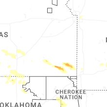
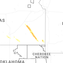
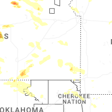
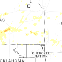


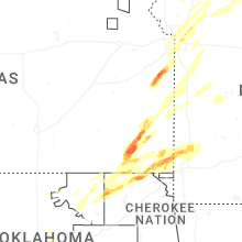


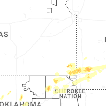


Connect with Interactive Hail Maps