

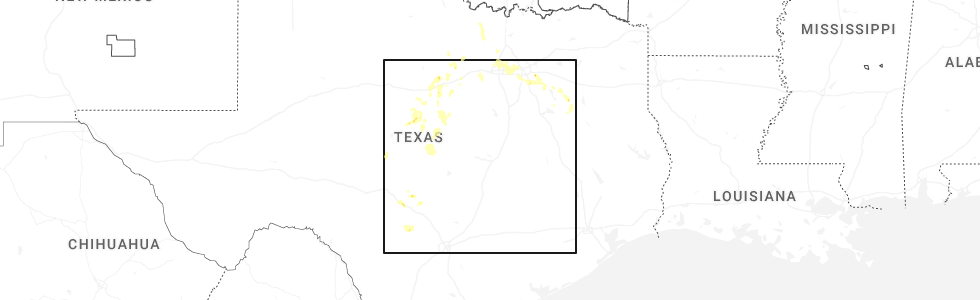
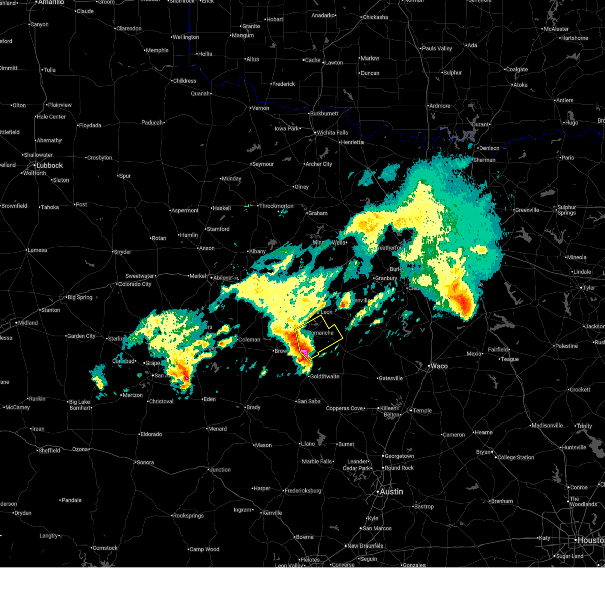
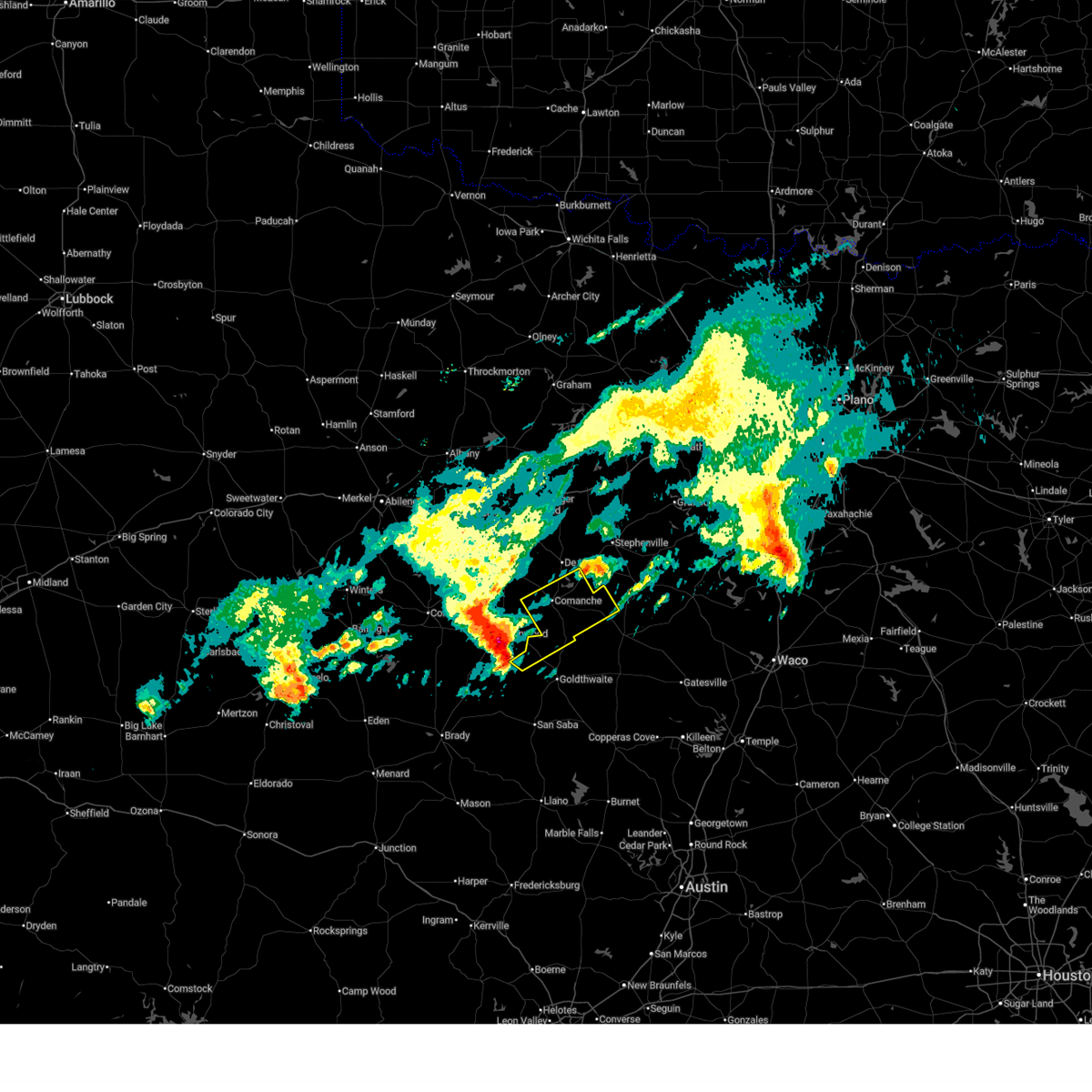
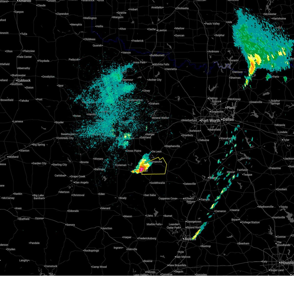
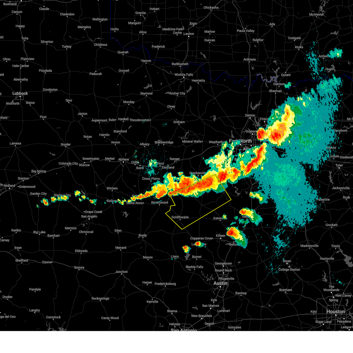
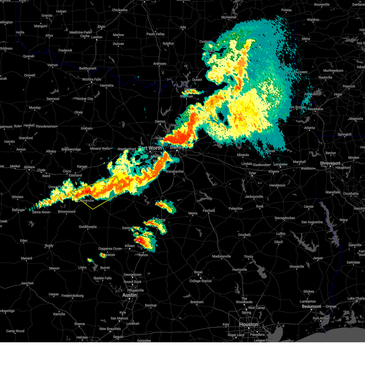
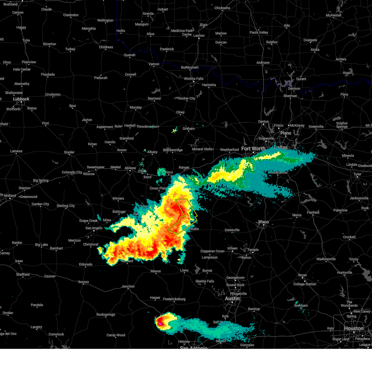
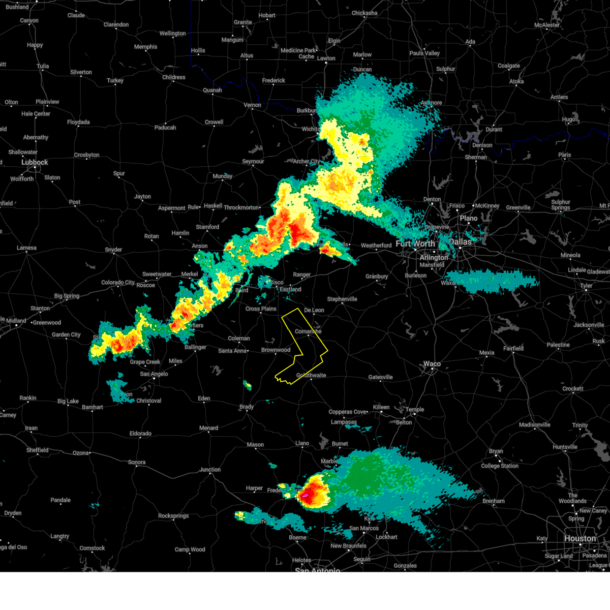
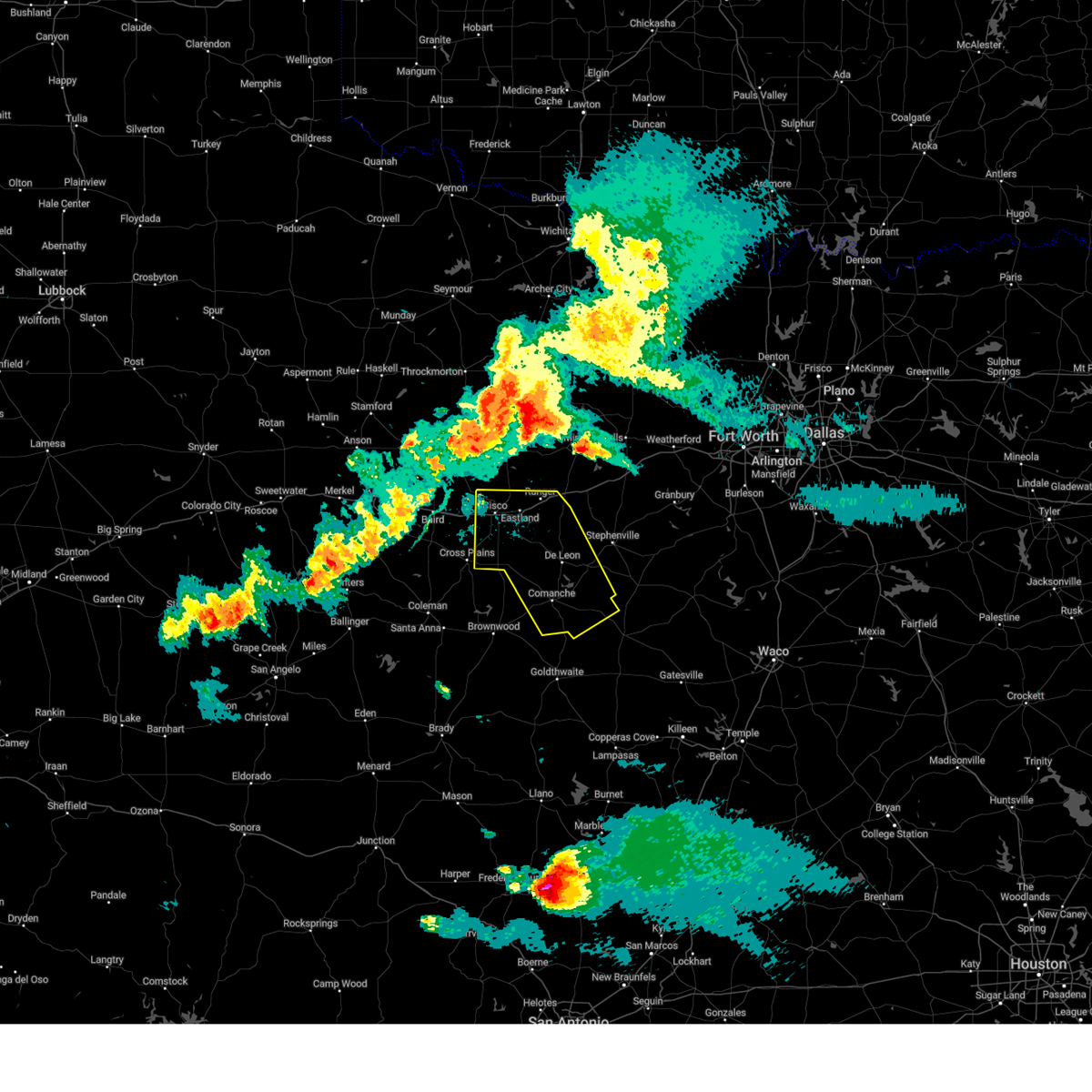
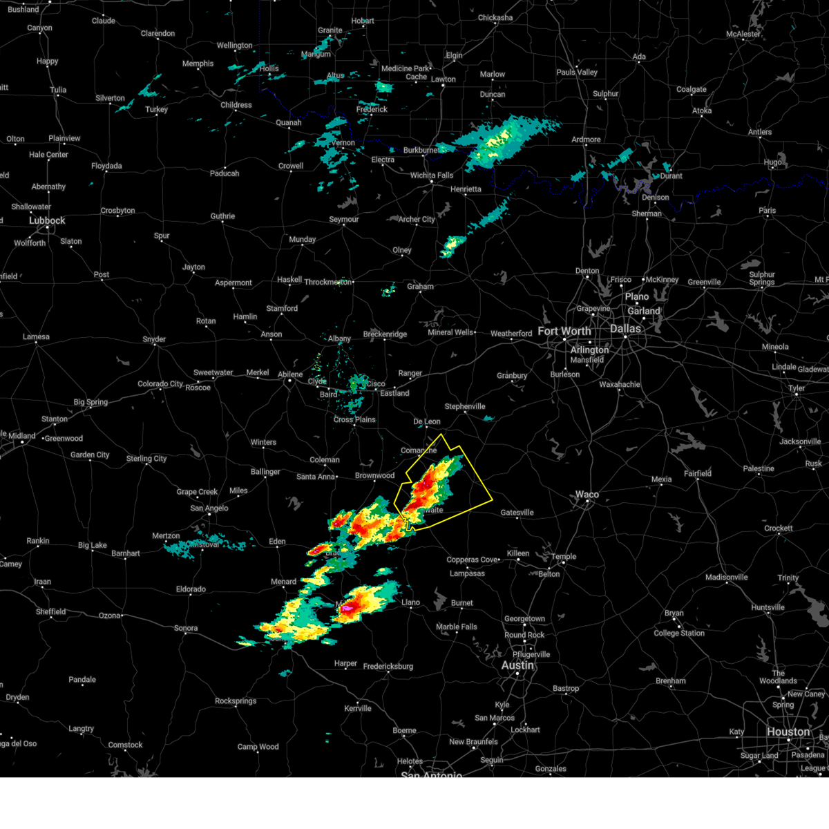
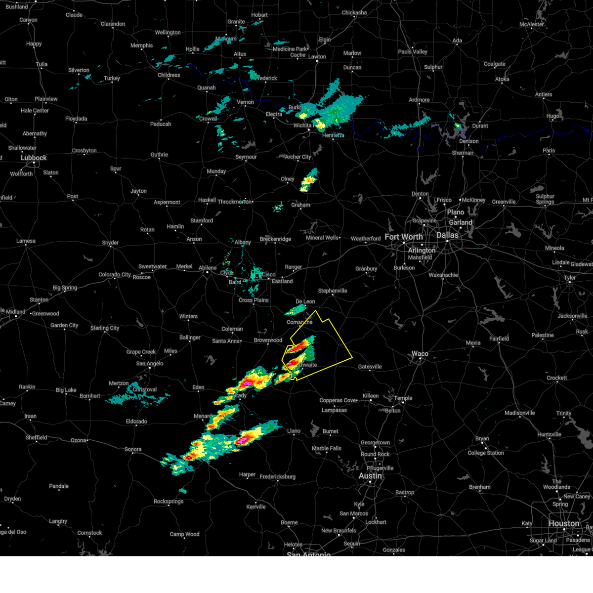
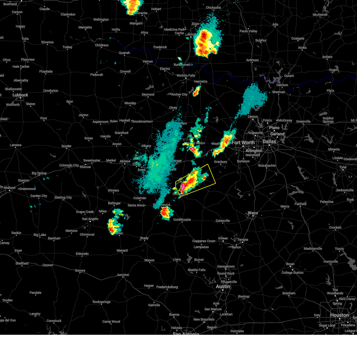
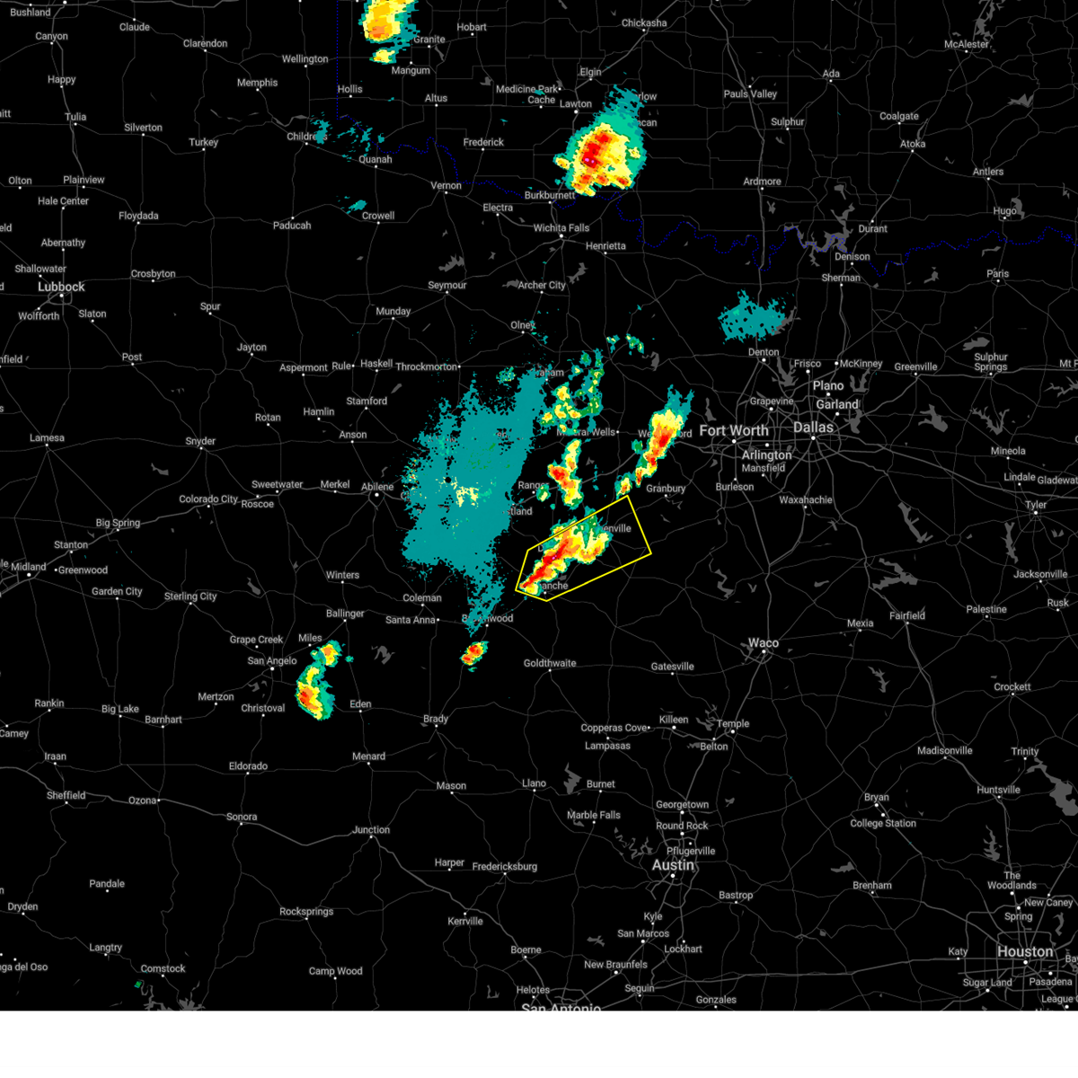
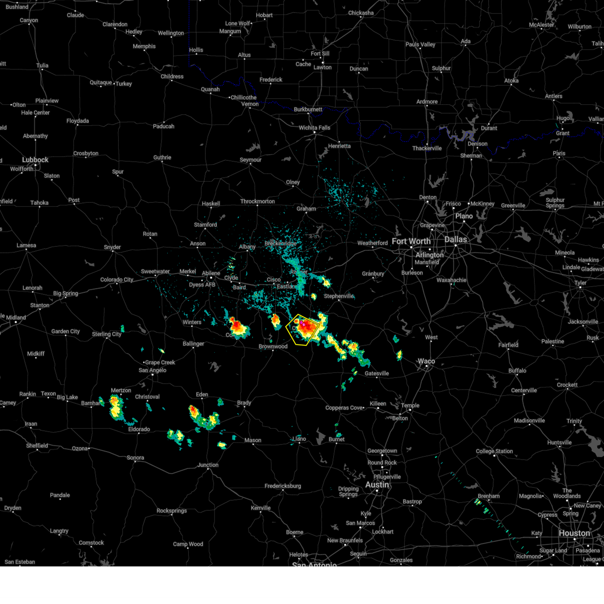
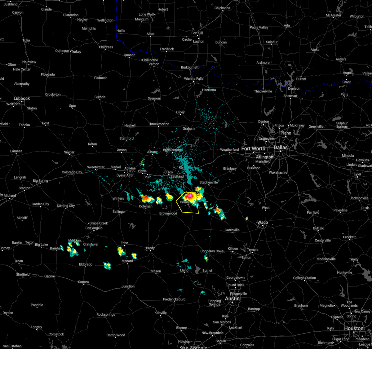
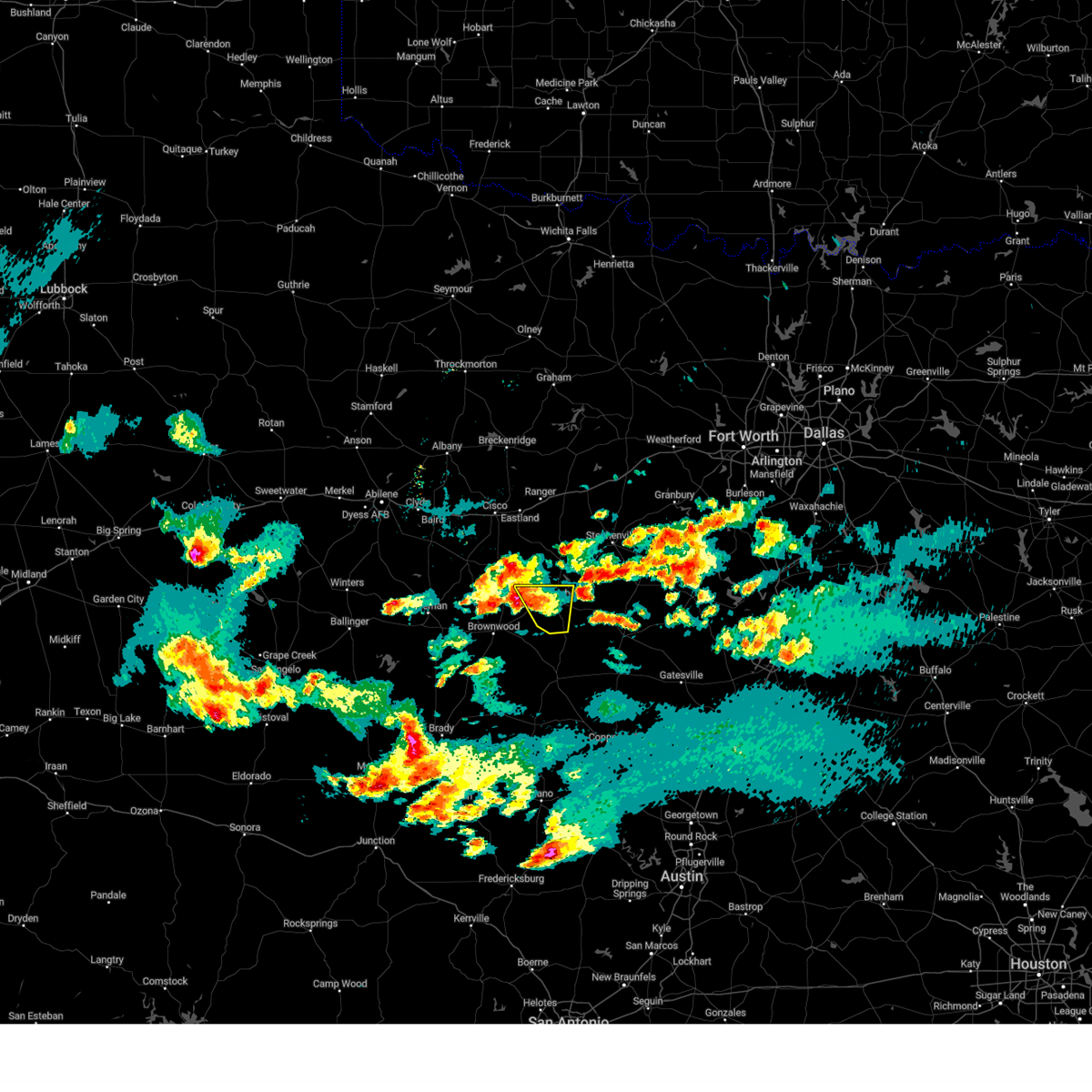
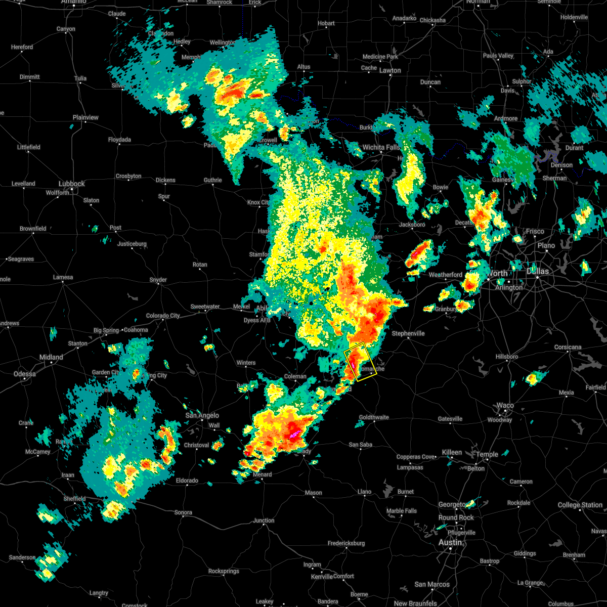
Hail Map for Comanche, TX
The Comanche, TX area has had 19 reports of on-the-ground hail by trained spotters, and has been under severe weather warnings 10 times during the past 12 months. Doppler radar has detected hail at or near Comanche, TX on 103 occasions, including 9 occasions during the past year.
| Name: | Comanche, TX |
| Where Located: | 74.9 miles NW of Killeen, TX |
| Map: | Google Map for Comanche, TX |
| Population: | 4335 |
| Housing Units: | 1933 |
| More Info: | Search Google for Comanche, TX |
1
The Top Recent Hail Date for Comanche, TX is Sunday, May 24, 2026 (22nd out of 103)
Hail and Wind Damage Spotted near Comanche, TX
| Date / Time | Report Details |
|---|---|
| 5/10/2026 5:30 PM CDT |
 At 530 pm cdt, a severe thunderstorm was located near gustine, or 7 miles east of comanche, moving southeast at 10 mph (radar indicated). Hazards include golf ball size hail and 60 mph wind gusts. People and animals outdoors will be injured. expect hail damage to roofs, siding, windows, and vehicles. expect wind damage to roofs, siding, and trees. Locations impacted include, comanche, gustine, proctor lake, newburg, energy, proctor, and hasse. At 530 pm cdt, a severe thunderstorm was located near gustine, or 7 miles east of comanche, moving southeast at 10 mph (radar indicated). Hazards include golf ball size hail and 60 mph wind gusts. People and animals outdoors will be injured. expect hail damage to roofs, siding, windows, and vehicles. expect wind damage to roofs, siding, and trees. Locations impacted include, comanche, gustine, proctor lake, newburg, energy, proctor, and hasse.
|
| 5/10/2026 5:17 PM CDT |
 Svrfwd the national weather service in fort worth has issued a * severe thunderstorm warning for, southeastern comanche county in central texas, * until 545 pm cdt. * at 517 pm cdt, a severe thunderstorm was located near proctor lake, or near comanche, moving southeast at 10 mph (radar indicated). Hazards include golf ball size hail and 60 mph wind gusts. People and animals outdoors will be injured. expect hail damage to roofs, siding, windows, and vehicles. expect wind damage to roofs, siding, and trees. This severe thunderstorm will remain over mainly rural areas of southeastern comanche county, including the following locations, hasse, newburg, energy, proctor, and van dyke. Svrfwd the national weather service in fort worth has issued a * severe thunderstorm warning for, southeastern comanche county in central texas, * until 545 pm cdt. * at 517 pm cdt, a severe thunderstorm was located near proctor lake, or near comanche, moving southeast at 10 mph (radar indicated). Hazards include golf ball size hail and 60 mph wind gusts. People and animals outdoors will be injured. expect hail damage to roofs, siding, windows, and vehicles. expect wind damage to roofs, siding, and trees. This severe thunderstorm will remain over mainly rural areas of southeastern comanche county, including the following locations, hasse, newburg, energy, proctor, and van dyke.
|
| 5/10/2026 5:15 PM CDT | Ping Pong Ball sized hail reported 3.8 miles WSW of Comanche, TX, facebook photo showed ping pong ball size hail east of comanche. |
| 4/29/2026 2:29 PM CDT |
 Svrfwd the national weather service in fort worth has issued a * severe thunderstorm warning for, northern hamilton county in central texas, southeastern erath county in north central texas, southeastern comanche county in central texas, * until 330 pm cdt. * at 229 pm cdt, a severe thunderstorm was located near newburg, or 10 miles southeast of comanche, moving east at 40 mph (radar indicated). Hazards include quarter size hail. damage to vehicles is possible Svrfwd the national weather service in fort worth has issued a * severe thunderstorm warning for, northern hamilton county in central texas, southeastern erath county in north central texas, southeastern comanche county in central texas, * until 330 pm cdt. * at 229 pm cdt, a severe thunderstorm was located near newburg, or 10 miles southeast of comanche, moving east at 40 mph (radar indicated). Hazards include quarter size hail. damage to vehicles is possible
|
| 4/18/2026 9:18 AM CDT |
 At 918 am cdt, a severe thunderstorm was located 7 miles south of gustine, or 14 miles southeast of comanche, moving northeast at 55 mph (radar indicated). Hazards include quarter size hail. Damage to vehicles is possible. This severe thunderstorm will remain over mainly rural areas of north central mills and southeastern comanche counties, including the following locations, newburg, lamkin, energy, proctor, van dyke, hasse, priddy, democrat, and downing. At 918 am cdt, a severe thunderstorm was located 7 miles south of gustine, or 14 miles southeast of comanche, moving northeast at 55 mph (radar indicated). Hazards include quarter size hail. Damage to vehicles is possible. This severe thunderstorm will remain over mainly rural areas of north central mills and southeastern comanche counties, including the following locations, newburg, lamkin, energy, proctor, van dyke, hasse, priddy, democrat, and downing.
|
| 4/18/2026 9:00 AM CDT |
 Svrfwd the national weather service in fort worth has issued a * severe thunderstorm warning for, northwestern mills county in central texas, comanche county in central texas, * until 945 am cdt. * at 900 am cdt, a severe thunderstorm was located near zephyr, or 13 miles east of early, moving northeast at 55 mph (radar indicated). Hazards include quarter size hail. Damage to vehicles is possible. this severe thunderstorm will be near, gustine around 920 am cdt. Other locations impacted by this severe thunderstorm include newburg, lamkin, energy, proctor, democrat, van dyke, hasse, priddy, and downing. Svrfwd the national weather service in fort worth has issued a * severe thunderstorm warning for, northwestern mills county in central texas, comanche county in central texas, * until 945 am cdt. * at 900 am cdt, a severe thunderstorm was located near zephyr, or 13 miles east of early, moving northeast at 55 mph (radar indicated). Hazards include quarter size hail. Damage to vehicles is possible. this severe thunderstorm will be near, gustine around 920 am cdt. Other locations impacted by this severe thunderstorm include newburg, lamkin, energy, proctor, democrat, van dyke, hasse, priddy, and downing.
|
| 4/15/2026 10:22 PM CDT |
 Svrfwd the national weather service in fort worth has issued a * severe thunderstorm warning for, west central hamilton county in central texas, north central mills county in central texas, southern comanche county in central texas, * until 1115 pm cdt. * at 1022 pm cdt, a severe thunderstorm was located near zephyr, or 10 miles east of early, moving east at 30 mph (radar indicated). Hazards include 60 mph wind gusts and quarter size hail. Hail damage to vehicles is expected. Expect wind damage to roofs, siding, and trees. Svrfwd the national weather service in fort worth has issued a * severe thunderstorm warning for, west central hamilton county in central texas, north central mills county in central texas, southern comanche county in central texas, * until 1115 pm cdt. * at 1022 pm cdt, a severe thunderstorm was located near zephyr, or 10 miles east of early, moving east at 30 mph (radar indicated). Hazards include 60 mph wind gusts and quarter size hail. Hail damage to vehicles is expected. Expect wind damage to roofs, siding, and trees.
|
| 10/24/2025 7:20 PM CDT | The storms which prompted the warning have moved out of the area. therefore the warning will be allowed to expire. however gusty winds and heavy rain are still possible with these thunderstorms. a severe thunderstorm watch remains in effect until midnight cdt for central and north central texas. |
| 10/24/2025 6:56 PM CDT | At 656 pm cdt, severe thunderstorms were located along a line extending from near ranger to near gustine, moving east at 30 mph (radar indicated). Hazards include 60 mph wind gusts. Expect damage to roofs, siding, and trees. these severe storms will be near, de leon, gustine, and proctor lake around 700 pm cdt. Other locations impacted by these severe thunderstorms include lamkin, kokomo, proctor, staff, hasse, duster, morton valley, comyn, newburg, and downing. |
| 10/24/2025 6:42 PM CDT | At 641 pm cdt, severe thunderstorms were located along a line extending from near gunsight to comanche, moving northeast at 30 mph (radar indicated). Hazards include 60 mph wind gusts. Expect damage to roofs, siding, and trees. these severe storms will be near, eastland, gorman, lake leon, lake olden, and proctor lake around 645 pm cdt. de leon and gustine around 650 pm cdt. ranger around 655 pm cdt. Other locations impacted by these severe thunderstorms include lamkin, kokomo, proctor, staff, hasse, sidney, carbon, okra, duster, and morton valley. |
| 10/24/2025 6:22 PM CDT | Svrfwd the national weather service in fort worth has issued a * severe thunderstorm warning for, eastland county in north central texas, comanche county in central texas, * until 730 pm cdt. * at 622 pm cdt, severe thunderstorms were located along a line extending from near cisco to zephyr, moving northeast at 30 mph (radar indicated). Hazards include 60 mph wind gusts. Expect damage to roofs, siding, and trees. severe thunderstorms will be near, comanche, cisco, and lake cisco around 625 pm cdt. eastland around 630 pm cdt. gorman, lake leon, lake olden, and proctor lake around 640 pm cdt. ranger, de leon, and gustine around 650 pm cdt. other locations impacted by these severe thunderstorms include nimrod, kokomo, staff, okra, duster, morton valley, comyn, energy, sipe springs, and scranton. This includes interstate 20 between mile markers 324 and 362. |
| 7/8/2025 10:15 PM CDT | Kmkn awo in comanche county TX, 1.3 miles SSW of Comanche, TX |
| 6/3/2025 11:28 PM CDT |
 Svrfwd the national weather service in fort worth has issued a * severe thunderstorm warning for, southwestern somervell county in north central texas, hamilton county in central texas, southeastern erath county in north central texas, western bosque county in central texas, mills county in central texas, southern comanche county in central texas, * until 1245 am cdt. * at 1128 pm cdt, severe thunderstorms were located along a line extending from iredell to near early, moving southeast at 20 mph (radar indicated). Hazards include 60 mph wind gusts and quarter size hail. Hail damage to vehicles is expected. Expect wind damage to roofs, siding, and trees. Svrfwd the national weather service in fort worth has issued a * severe thunderstorm warning for, southwestern somervell county in north central texas, hamilton county in central texas, southeastern erath county in north central texas, western bosque county in central texas, mills county in central texas, southern comanche county in central texas, * until 1245 am cdt. * at 1128 pm cdt, severe thunderstorms were located along a line extending from iredell to near early, moving southeast at 20 mph (radar indicated). Hazards include 60 mph wind gusts and quarter size hail. Hail damage to vehicles is expected. Expect wind damage to roofs, siding, and trees.
|
| 6/3/2025 11:04 PM CDT |
 At 1104 pm cdt, severe thunderstorms were located along a line extending from stephenville to near comanche, moving southeast at 25 mph (radar indicated). Hazards include 60 mph wind gusts and quarter size hail. Hail damage to vehicles is expected. expect wind damage to roofs, siding, and trees. Locations impacted include, alexander, clairette, harbin, dublin, duffau, duster, edna hill, comyn, stephenville, johnsville, sipe springs, gustine, comanche, highland, proctor, hasse, bunyan, downing, rucker, and van dyke. At 1104 pm cdt, severe thunderstorms were located along a line extending from stephenville to near comanche, moving southeast at 25 mph (radar indicated). Hazards include 60 mph wind gusts and quarter size hail. Hail damage to vehicles is expected. expect wind damage to roofs, siding, and trees. Locations impacted include, alexander, clairette, harbin, dublin, duffau, duster, edna hill, comyn, stephenville, johnsville, sipe springs, gustine, comanche, highland, proctor, hasse, bunyan, downing, rucker, and van dyke.
|
| 6/3/2025 11:04 PM CDT |
 the severe thunderstorm warning has been cancelled and is no longer in effect the severe thunderstorm warning has been cancelled and is no longer in effect
|
| 6/3/2025 10:30 PM CDT |
 Svrfwd the national weather service in fort worth has issued a * severe thunderstorm warning for, erath county in north central texas, southeastern eastland county in north central texas, comanche county in central texas, * until 1130 pm cdt. * at 1030 pm cdt, severe thunderstorms were located along a line extending from near morgan mill to rising star, moving southeast at 20 mph (radar indicated). Hazards include 60 mph wind gusts and quarter size hail. Hail damage to vehicles is expected. Expect wind damage to roofs, siding, and trees. Svrfwd the national weather service in fort worth has issued a * severe thunderstorm warning for, erath county in north central texas, southeastern eastland county in north central texas, comanche county in central texas, * until 1130 pm cdt. * at 1030 pm cdt, severe thunderstorms were located along a line extending from near morgan mill to rising star, moving southeast at 20 mph (radar indicated). Hazards include 60 mph wind gusts and quarter size hail. Hail damage to vehicles is expected. Expect wind damage to roofs, siding, and trees.
|
| 5/22/2025 10:56 PM CDT |
 At 1055 pm cdt, a severe thunderstorm was located near blanket, or 10 miles east of early, moving south at 45 mph (radar indicated). Hazards include 65 mph wind gusts and quarter size hail. Hail damage to vehicles is expected. expect wind damage to roofs, siding, and trees. this severe storm will be near, mullin around 1110 pm cdt. Other locations impacted by this severe thunderstorm include regency, newburg, democrat, priddy, sidney, ridge, and bozar. At 1055 pm cdt, a severe thunderstorm was located near blanket, or 10 miles east of early, moving south at 45 mph (radar indicated). Hazards include 65 mph wind gusts and quarter size hail. Hail damage to vehicles is expected. expect wind damage to roofs, siding, and trees. this severe storm will be near, mullin around 1110 pm cdt. Other locations impacted by this severe thunderstorm include regency, newburg, democrat, priddy, sidney, ridge, and bozar.
|
| 5/22/2025 10:27 PM CDT |
 Svrfwd the national weather service in fort worth has issued a * severe thunderstorm warning for, northwestern mills county in central texas, western comanche county in central texas, * until 1130 pm cdt. * at 1027 pm cdt, a severe thunderstorm was located 7 miles east of may, or 12 miles west of comanche, moving south at 30 mph (radar indicated). Hazards include 70 mph wind gusts and quarter size hail. Hail damage to vehicles is expected. expect considerable tree damage. wind damage is also likely to mobile homes, roofs, and outbuildings. this severe thunderstorm will be near, mullin around 1115 pm cdt. Other locations impacted by this severe thunderstorm include regency, newburg, democrat, beattie, priddy, sipe springs, sidney, duster, ridge, and van dyke. Svrfwd the national weather service in fort worth has issued a * severe thunderstorm warning for, northwestern mills county in central texas, western comanche county in central texas, * until 1130 pm cdt. * at 1027 pm cdt, a severe thunderstorm was located 7 miles east of may, or 12 miles west of comanche, moving south at 30 mph (radar indicated). Hazards include 70 mph wind gusts and quarter size hail. Hail damage to vehicles is expected. expect considerable tree damage. wind damage is also likely to mobile homes, roofs, and outbuildings. this severe thunderstorm will be near, mullin around 1115 pm cdt. Other locations impacted by this severe thunderstorm include regency, newburg, democrat, beattie, priddy, sipe springs, sidney, duster, ridge, and van dyke.
|
| 5/22/2025 10:15 PM CDT |
 At 1014 pm cdt, a severe thunderstorm was located 10 miles east of may, or 12 miles northwest of comanche, moving south at 25 mph (radar indicated). Hazards include 70 mph wind gusts and quarter size hail. Hail damage to vehicles is expected. expect considerable tree damage. wind damage is also likely to mobile homes, roofs, and outbuildings. This severe thunderstorm will remain over mainly rural areas of southern eastland and comanche counties, including the following locations, kokomo, hasse, sidney, carbon, okra, duster, newburg, downing, pleasant hill, and rucker. At 1014 pm cdt, a severe thunderstorm was located 10 miles east of may, or 12 miles northwest of comanche, moving south at 25 mph (radar indicated). Hazards include 70 mph wind gusts and quarter size hail. Hail damage to vehicles is expected. expect considerable tree damage. wind damage is also likely to mobile homes, roofs, and outbuildings. This severe thunderstorm will remain over mainly rural areas of southern eastland and comanche counties, including the following locations, kokomo, hasse, sidney, carbon, okra, duster, newburg, downing, pleasant hill, and rucker.
|
| 5/22/2025 10:15 PM CDT |
 the severe thunderstorm warning has been cancelled and is no longer in effect the severe thunderstorm warning has been cancelled and is no longer in effect
|
| 5/22/2025 9:49 PM CDT |
 At 947 pm cdt, a severe thunderstorm was located from eastland to rising star, moving southeast at 35 mph. a 75 mph wind gust was reported at ketn (radar indicated). Hazards include 70 mph wind gusts and quarter size hail. Hail damage to vehicles is expected. expect considerable tree damage. wind damage is also likely to mobile homes, roofs, and outbuildings. this severe storm will be near, de leon around 1000 pm cdt. proctor lake around 1005 pm cdt. gustine around 1030 pm cdt. Other locations impacted by this severe thunderstorm include nimrod, kokomo, staff, okra, duster, edna hill, morton valley, comyn, energy, and sipe springs. At 947 pm cdt, a severe thunderstorm was located from eastland to rising star, moving southeast at 35 mph. a 75 mph wind gust was reported at ketn (radar indicated). Hazards include 70 mph wind gusts and quarter size hail. Hail damage to vehicles is expected. expect considerable tree damage. wind damage is also likely to mobile homes, roofs, and outbuildings. this severe storm will be near, de leon around 1000 pm cdt. proctor lake around 1005 pm cdt. gustine around 1030 pm cdt. Other locations impacted by this severe thunderstorm include nimrod, kokomo, staff, okra, duster, edna hill, morton valley, comyn, energy, and sipe springs.
|
| 5/22/2025 9:38 PM CDT |
 Svrfwd the national weather service in fort worth has issued a * severe thunderstorm warning for, southwestern erath county in north central texas, eastland county in north central texas, comanche county in central texas, * until 1030 pm cdt. * at 937 pm cdt, a line of severe thunderstorms was located from ranger to rising star, moving southeast at 40 mph (radar indicated). Hazards include 65 mph wind gusts and quarter size hail. Hail damage to vehicles is expected. expect wind damage to roofs, siding, and trees. this severe thunderstorm will be near, gorman around 940 pm cdt. de leon around 945 pm cdt. proctor lake around 955 pm cdt. gustine around 1015 pm cdt. other locations impacted by this severe thunderstorm include nimrod, kokomo, staff, lingleville, okra, duster, edna hill, morton valley, comyn, and energy. This includes interstate 20 between mile markers 324 and 358. Svrfwd the national weather service in fort worth has issued a * severe thunderstorm warning for, southwestern erath county in north central texas, eastland county in north central texas, comanche county in central texas, * until 1030 pm cdt. * at 937 pm cdt, a line of severe thunderstorms was located from ranger to rising star, moving southeast at 40 mph (radar indicated). Hazards include 65 mph wind gusts and quarter size hail. Hail damage to vehicles is expected. expect wind damage to roofs, siding, and trees. this severe thunderstorm will be near, gorman around 940 pm cdt. de leon around 945 pm cdt. proctor lake around 955 pm cdt. gustine around 1015 pm cdt. other locations impacted by this severe thunderstorm include nimrod, kokomo, staff, lingleville, okra, duster, edna hill, morton valley, comyn, and energy. This includes interstate 20 between mile markers 324 and 358.
|
| 5/17/2025 2:58 PM CDT |
 At 257 pm cdt, a severe thunderstorm was located 12 miles northeast of mullin, or 15 miles south of comanche, moving northeast at 20 mph (radar indicated). Hazards include golf ball size hail and 60 mph wind gusts. People and animals outdoors will be injured. expect hail damage to roofs, siding, windows, and vehicles. expect wind damage to roofs, siding, and trees. This severe thunderstorm will remain over mainly rural areas of southwestern hamilton, mills and southeastern comanche counties, including the following locations, shive, lamkin, proctor, hasse, bozar, priddy, aleman, indian gap, newburg, and center city. At 257 pm cdt, a severe thunderstorm was located 12 miles northeast of mullin, or 15 miles south of comanche, moving northeast at 20 mph (radar indicated). Hazards include golf ball size hail and 60 mph wind gusts. People and animals outdoors will be injured. expect hail damage to roofs, siding, windows, and vehicles. expect wind damage to roofs, siding, and trees. This severe thunderstorm will remain over mainly rural areas of southwestern hamilton, mills and southeastern comanche counties, including the following locations, shive, lamkin, proctor, hasse, bozar, priddy, aleman, indian gap, newburg, and center city.
|
| 5/17/2025 2:42 PM CDT |
 Svrfwd the national weather service in fort worth has issued a * severe thunderstorm warning for, southwestern hamilton county in central texas, mills county in central texas, southeastern comanche county in central texas, * until 345 pm cdt. * at 241 pm cdt, a severe thunderstorm was located near mullin, or 21 miles northeast of algerita, moving northeast at 25 mph (radar indicated). Hazards include 60 mph wind gusts and half dollar size hail. Hail damage to vehicles is expected. expect wind damage to roofs, siding, and trees. this severe thunderstorm will be near, mullin around 245 pm cdt. Other locations impacted by this severe thunderstorm include shive, lamkin, proctor, hasse, bozar, priddy, aleman, indian gap, newburg, and center city. Svrfwd the national weather service in fort worth has issued a * severe thunderstorm warning for, southwestern hamilton county in central texas, mills county in central texas, southeastern comanche county in central texas, * until 345 pm cdt. * at 241 pm cdt, a severe thunderstorm was located near mullin, or 21 miles northeast of algerita, moving northeast at 25 mph (radar indicated). Hazards include 60 mph wind gusts and half dollar size hail. Hail damage to vehicles is expected. expect wind damage to roofs, siding, and trees. this severe thunderstorm will be near, mullin around 245 pm cdt. Other locations impacted by this severe thunderstorm include shive, lamkin, proctor, hasse, bozar, priddy, aleman, indian gap, newburg, and center city.
|
| 3/29/2025 9:17 PM CDT |
 At 917 pm cdt, a severe thunderstorm was located near dublin, moving northeast at 40 mph (radar indicated). Hazards include golf ball size hail and 65 mph wind gusts. People and animals outdoors will be injured. expect hail damage to roofs, siding, windows, and vehicles. expect wind damage to roofs, siding, and trees. this severe storm will be near, stephenville around 925 pm cdt. bluff dale around 950 pm cdt. Other locations impacted by this severe thunderstorm include alexander, proctor, harbin, hasse, lingleville, duffau, duster, bunyan, downing, and comyn. At 917 pm cdt, a severe thunderstorm was located near dublin, moving northeast at 40 mph (radar indicated). Hazards include golf ball size hail and 65 mph wind gusts. People and animals outdoors will be injured. expect hail damage to roofs, siding, windows, and vehicles. expect wind damage to roofs, siding, and trees. this severe storm will be near, stephenville around 925 pm cdt. bluff dale around 950 pm cdt. Other locations impacted by this severe thunderstorm include alexander, proctor, harbin, hasse, lingleville, duffau, duster, bunyan, downing, and comyn.
|
| 3/29/2025 8:58 PM CDT |
 Svrfwd the national weather service in fort worth has issued a * severe thunderstorm warning for, erath county in north central texas, central comanche county in central texas, * until 1000 pm cdt. * at 857 pm cdt, a severe thunderstorm was located over de leon, or 11 miles west of dublin, moving northeast at 35 mph (radar indicated). Hazards include 60 mph wind gusts and quarter size hail. Hail damage to vehicles is expected. expect wind damage to roofs, siding, and trees. this severe thunderstorm will be near, stephenville around 920 pm cdt. bluff dale around 945 pm cdt. Other locations impacted by this severe thunderstorm include alexander, proctor, clairette, harbin, hasse, sidney, lingleville, duffau, duster, and edna hill. Svrfwd the national weather service in fort worth has issued a * severe thunderstorm warning for, erath county in north central texas, central comanche county in central texas, * until 1000 pm cdt. * at 857 pm cdt, a severe thunderstorm was located over de leon, or 11 miles west of dublin, moving northeast at 35 mph (radar indicated). Hazards include 60 mph wind gusts and quarter size hail. Hail damage to vehicles is expected. expect wind damage to roofs, siding, and trees. this severe thunderstorm will be near, stephenville around 920 pm cdt. bluff dale around 945 pm cdt. Other locations impacted by this severe thunderstorm include alexander, proctor, clairette, harbin, hasse, sidney, lingleville, duffau, duster, and edna hill.
|
| 6/11/2024 11:14 AM CDT |
 The storm which prompted the warning has weakened below severe limits. therefore the warning will be allowed to expire. however small hail and gusty winds are still possible with this thunderstorm. The storm which prompted the warning has weakened below severe limits. therefore the warning will be allowed to expire. however small hail and gusty winds are still possible with this thunderstorm.
|
| 6/11/2024 10:48 AM CDT |
 Svrfwd the national weather service in fort worth has issued a * severe thunderstorm warning for, northern mills county in central texas, southern comanche county in central texas, * until 1115 am cdt. * at 1048 am cdt, a severe thunderstorm was located over comanche, moving southeast at 15 mph (radar indicated). Hazards include 60 mph wind gusts and quarter size hail. Hail damage to vehicles is expected. Expect wind damage to roofs, siding, and trees. Svrfwd the national weather service in fort worth has issued a * severe thunderstorm warning for, northern mills county in central texas, southern comanche county in central texas, * until 1115 am cdt. * at 1048 am cdt, a severe thunderstorm was located over comanche, moving southeast at 15 mph (radar indicated). Hazards include 60 mph wind gusts and quarter size hail. Hail damage to vehicles is expected. Expect wind damage to roofs, siding, and trees.
|
| 5/31/2024 2:18 AM CDT |
 Svrfwd the national weather service in fort worth has issued a * severe thunderstorm warning for, hamilton county in central texas, southern erath county in north central texas, northwestern coryell county in central texas, central lampasas county in central texas, northwestern bosque county in central texas, mills county in central texas, southeastern comanche county in central texas, * until 300 am cdt. * at 218 am cdt, severe thunderstorms were located along a line extending from near stephenville to near goldthwaite to near mercury, moving southeast at 35 mph (radar indicated). Hazards include 60 mph wind gusts and nickel size hail. Expect damage to roofs, siding, and trees. severe thunderstorms will be near, goldthwaite around 225 am cdt. hico around 240 am cdt. hamilton around 245 am cdt. Other locations impacted by these severe thunderstorms include shive, alexander, moline, clairette, izoro, olin, harbin, bozar, adamsville, and whiteway. Svrfwd the national weather service in fort worth has issued a * severe thunderstorm warning for, hamilton county in central texas, southern erath county in north central texas, northwestern coryell county in central texas, central lampasas county in central texas, northwestern bosque county in central texas, mills county in central texas, southeastern comanche county in central texas, * until 300 am cdt. * at 218 am cdt, severe thunderstorms were located along a line extending from near stephenville to near goldthwaite to near mercury, moving southeast at 35 mph (radar indicated). Hazards include 60 mph wind gusts and nickel size hail. Expect damage to roofs, siding, and trees. severe thunderstorms will be near, goldthwaite around 225 am cdt. hico around 240 am cdt. hamilton around 245 am cdt. Other locations impacted by these severe thunderstorms include shive, alexander, moline, clairette, izoro, olin, harbin, bozar, adamsville, and whiteway.
|
| 5/31/2024 2:07 AM CDT |
 the severe thunderstorm warning has been cancelled and is no longer in effect the severe thunderstorm warning has been cancelled and is no longer in effect
|
| 5/31/2024 2:07 AM CDT |
 At 206 am cdt, a severe thunderstorm was located over proctor lake, or 8 miles southwest of dublin, moving east at 45 mph (radar indicated). Hazards include 60 mph wind gusts and penny size hail. Expect damage to roofs, siding, and trees. This severe thunderstorm will remain over mainly rural areas of southwestern erath and comanche counties, including the following locations, lamkin, alexander, proctor, harbin, hasse, lingleville, edna hill, bunyan, newburg, and downing. At 206 am cdt, a severe thunderstorm was located over proctor lake, or 8 miles southwest of dublin, moving east at 45 mph (radar indicated). Hazards include 60 mph wind gusts and penny size hail. Expect damage to roofs, siding, and trees. This severe thunderstorm will remain over mainly rural areas of southwestern erath and comanche counties, including the following locations, lamkin, alexander, proctor, harbin, hasse, lingleville, edna hill, bunyan, newburg, and downing.
|
| 5/31/2024 1:39 AM CDT |
 Svrfwd the national weather service in fort worth has issued a * severe thunderstorm warning for, southwestern erath county in north central texas, southeastern eastland county in north central texas, comanche county in central texas, * until 230 am cdt. * at 139 am cdt, a severe thunderstorm was located 8 miles east of rising star, or 18 miles northwest of comanche, moving east at 35 mph (radar indicated). Hazards include 60 mph wind gusts. Expect damage to roofs, siding, and trees. this severe thunderstorm will be near, proctor lake around 205 am cdt. Other locations impacted by this severe thunderstorm include lamkin, alexander, kokomo, proctor, harbin, hasse, sidney, lingleville, carbon, and okra. Svrfwd the national weather service in fort worth has issued a * severe thunderstorm warning for, southwestern erath county in north central texas, southeastern eastland county in north central texas, comanche county in central texas, * until 230 am cdt. * at 139 am cdt, a severe thunderstorm was located 8 miles east of rising star, or 18 miles northwest of comanche, moving east at 35 mph (radar indicated). Hazards include 60 mph wind gusts. Expect damage to roofs, siding, and trees. this severe thunderstorm will be near, proctor lake around 205 am cdt. Other locations impacted by this severe thunderstorm include lamkin, alexander, kokomo, proctor, harbin, hasse, sidney, lingleville, carbon, and okra.
|
| 5/30/2024 10:14 PM CDT |
 the severe thunderstorm warning has been cancelled and is no longer in effect the severe thunderstorm warning has been cancelled and is no longer in effect
|
| 5/30/2024 10:14 PM CDT |
 At 1013 pm cdt, severe thunderstorms were located along a line extending from stephenville to gustine, moving east at 40 mph (radar indicated). Hazards include 65 mph wind gusts and penny size hail. Expect damage to roofs, siding, and trees. these severe storms will be near, stephenville and hico around 1020 pm cdt. iredell around 1035 pm cdt. Other locations impacted by these severe thunderstorms include lamkin, alexander, proctor, clairette, olin, harbin, hasse, lingleville, duffau, and edna hill. At 1013 pm cdt, severe thunderstorms were located along a line extending from stephenville to gustine, moving east at 40 mph (radar indicated). Hazards include 65 mph wind gusts and penny size hail. Expect damage to roofs, siding, and trees. these severe storms will be near, stephenville and hico around 1020 pm cdt. iredell around 1035 pm cdt. Other locations impacted by these severe thunderstorms include lamkin, alexander, proctor, clairette, olin, harbin, hasse, lingleville, duffau, and edna hill.
|
| 5/30/2024 9:40 PM CDT |
 Svrfwd the national weather service in fort worth has issued a * severe thunderstorm warning for, northern hamilton county in central texas, erath county in north central texas, eastern eastland county in north central texas, west central bosque county in central texas, comanche county in central texas, * until 1045 pm cdt. * at 939 pm cdt, severe thunderstorms were located along a line extending from near gorman to near comanche, moving east at 40 mph (radar indicated). Hazards include 65 mph wind gusts and penny size hail. Expect damage to roofs, siding, and trees. severe thunderstorms will be near, de leon and proctor lake around 945 pm cdt. dublin around 950 pm cdt. stephenville around 1000 pm cdt. hico around 1015 pm cdt. bluff dale around 1025 pm cdt. iredell around 1030 pm cdt. other locations impacted by these severe thunderstorms include alexander, kokomo, clairette, olin, staff, harbin, lingleville, duster, duffau, and edna hill. This includes interstate 20 between mile markers 340 and 347. Svrfwd the national weather service in fort worth has issued a * severe thunderstorm warning for, northern hamilton county in central texas, erath county in north central texas, eastern eastland county in north central texas, west central bosque county in central texas, comanche county in central texas, * until 1045 pm cdt. * at 939 pm cdt, severe thunderstorms were located along a line extending from near gorman to near comanche, moving east at 40 mph (radar indicated). Hazards include 65 mph wind gusts and penny size hail. Expect damage to roofs, siding, and trees. severe thunderstorms will be near, de leon and proctor lake around 945 pm cdt. dublin around 950 pm cdt. stephenville around 1000 pm cdt. hico around 1015 pm cdt. bluff dale around 1025 pm cdt. iredell around 1030 pm cdt. other locations impacted by these severe thunderstorms include alexander, kokomo, clairette, olin, staff, harbin, lingleville, duster, duffau, and edna hill. This includes interstate 20 between mile markers 340 and 347.
|
| 5/30/2024 8:43 PM CDT |
 Svrfwd the national weather service in fort worth has issued a * severe thunderstorm warning for, eastland county in north central texas, comanche county in central texas, * until 945 pm cdt. * at 841 pm cdt, severe thunderstorms were located along a line extending from near atwell to near santa anna, moving east at 40 mph (radar indicated). Hazards include 65 mph wind gusts and quarter size hail. Hail damage to vehicles is expected. expect wind damage to roofs, siding, and trees. severe thunderstorms will be near, rising star around 900 pm cdt. gorman around 920 pm cdt. comanche and de leon around 935 pm cdt. proctor lake around 940 pm cdt. other locations impacted by these severe thunderstorms include nimrod, kokomo, staff, hasse, sidney, carbon, okra, duster, newburg, and downing. This includes interstate 20 between mile markers 324 and 352. Svrfwd the national weather service in fort worth has issued a * severe thunderstorm warning for, eastland county in north central texas, comanche county in central texas, * until 945 pm cdt. * at 841 pm cdt, severe thunderstorms were located along a line extending from near atwell to near santa anna, moving east at 40 mph (radar indicated). Hazards include 65 mph wind gusts and quarter size hail. Hail damage to vehicles is expected. expect wind damage to roofs, siding, and trees. severe thunderstorms will be near, rising star around 900 pm cdt. gorman around 920 pm cdt. comanche and de leon around 935 pm cdt. proctor lake around 940 pm cdt. other locations impacted by these severe thunderstorms include nimrod, kokomo, staff, hasse, sidney, carbon, okra, duster, newburg, and downing. This includes interstate 20 between mile markers 324 and 352.
|
| 5/26/2024 4:18 AM CDT |
 the severe thunderstorm warning has been cancelled and is no longer in effect the severe thunderstorm warning has been cancelled and is no longer in effect
|
| 5/26/2024 4:06 AM CDT |
 At 405 am cdt, severe thunderstorms were located along a line extending from 7 miles east of proctor lake to gustine, moving east at 40 mph (radar indicated). Hazards include 60 mph wind gusts and dime size hail. Expect damage to roofs, siding, and trees. these severe storms will be near, gustine around 410 am cdt. Other locations impacted by these severe thunderstorms include newburg, lamkin, downing, comyn, energy, proctor, democrat, van dyke, hasse, and priddy. At 405 am cdt, severe thunderstorms were located along a line extending from 7 miles east of proctor lake to gustine, moving east at 40 mph (radar indicated). Hazards include 60 mph wind gusts and dime size hail. Expect damage to roofs, siding, and trees. these severe storms will be near, gustine around 410 am cdt. Other locations impacted by these severe thunderstorms include newburg, lamkin, downing, comyn, energy, proctor, democrat, van dyke, hasse, and priddy.
|
| 5/26/2024 3:49 AM CDT |
 At 349 am cdt, severe thunderstorms were located along a line extending from 6 miles east of gorman to near de leon to near proctor lake to blanket, moving east at 45 mph (radar indicated). Hazards include 60 mph wind gusts and penny size hail. Expect damage to roofs, siding, and trees. these severe storms will be near, comanche and proctor lake around 355 am cdt. Other locations impacted by these severe thunderstorms include lamkin, proctor, hasse, priddy, sidney, duster, newburg, downing, comyn, and energy. At 349 am cdt, severe thunderstorms were located along a line extending from 6 miles east of gorman to near de leon to near proctor lake to blanket, moving east at 45 mph (radar indicated). Hazards include 60 mph wind gusts and penny size hail. Expect damage to roofs, siding, and trees. these severe storms will be near, comanche and proctor lake around 355 am cdt. Other locations impacted by these severe thunderstorms include lamkin, proctor, hasse, priddy, sidney, duster, newburg, downing, comyn, and energy.
|
| 5/26/2024 3:25 AM CDT |
 Svrfwd the national weather service in fort worth has issued a * severe thunderstorm warning for, north central mills county in central texas, comanche county in central texas, * until 430 am cdt. * at 324 am cdt, severe thunderstorms were located along a line extending from near rising star to near may to near early to near bangs, moving east at 45 mph (radar indicated). Hazards include 60 mph wind gusts and nickel size hail. Expect damage to roofs, siding, and trees. severe thunderstorms will be near, comanche around 345 am cdt. de leon and proctor lake around 350 am cdt. gustine around 405 am cdt. Other locations impacted by these severe thunderstorms include lamkin, proctor, hasse, priddy, sidney, duster, newburg, downing, comyn, and energy. Svrfwd the national weather service in fort worth has issued a * severe thunderstorm warning for, north central mills county in central texas, comanche county in central texas, * until 430 am cdt. * at 324 am cdt, severe thunderstorms were located along a line extending from near rising star to near may to near early to near bangs, moving east at 45 mph (radar indicated). Hazards include 60 mph wind gusts and nickel size hail. Expect damage to roofs, siding, and trees. severe thunderstorms will be near, comanche around 345 am cdt. de leon and proctor lake around 350 am cdt. gustine around 405 am cdt. Other locations impacted by these severe thunderstorms include lamkin, proctor, hasse, priddy, sidney, duster, newburg, downing, comyn, and energy.
|
| 9/9/2023 5:15 PM CDT | 50 kt wind measured by the awos at comanche county-city airpor in comanche county TX, 1.3 miles SSW of Comanche, TX |
| 9/9/2023 5:10 PM CDT |
 At 510 pm cdt, a severe thunderstorm was located near comanche, moving southwest at 15 mph (radar indicated). Hazards include 60 mph wind gusts and half dollar size hail. Hail damage to vehicles is expected. expect wind damage to roofs, siding, and trees. locations impacted include, comanche, proctor lake, van dyke, hasse, beattie, sidney, and downing. hail threat, radar indicated max hail size, 1. 25 in wind threat, radar indicated max wind gust, 60 mph. At 510 pm cdt, a severe thunderstorm was located near comanche, moving southwest at 15 mph (radar indicated). Hazards include 60 mph wind gusts and half dollar size hail. Hail damage to vehicles is expected. expect wind damage to roofs, siding, and trees. locations impacted include, comanche, proctor lake, van dyke, hasse, beattie, sidney, and downing. hail threat, radar indicated max hail size, 1. 25 in wind threat, radar indicated max wind gust, 60 mph.
|
| 9/9/2023 4:52 PM CDT |
 At 452 pm cdt, a severe thunderstorm was located near proctor lake, or 7 miles north of comanche, moving south at 15 mph (radar indicated). Hazards include 60 mph wind gusts and quarter size hail. Hail damage to vehicles is expected. Expect wind damage to roofs, siding, and trees. At 452 pm cdt, a severe thunderstorm was located near proctor lake, or 7 miles north of comanche, moving south at 15 mph (radar indicated). Hazards include 60 mph wind gusts and quarter size hail. Hail damage to vehicles is expected. Expect wind damage to roofs, siding, and trees.
|
| 9/9/2023 4:40 PM CDT |
 At 439 pm cdt, a severe thunderstorm was located near de leon, or 11 miles north of comanche, moving south at 10 mph (radar indicated). Hazards include 60 mph wind gusts and quarter size hail. Hail damage to vehicles is expected. expect wind damage to roofs, siding, and trees. locations impacted include, comanche, dublin, de leon, proctor lake, comyn, downing, proctor, van dyke, and hasse. hail threat, radar indicated max hail size, 1. 00 in wind threat, radar indicated max wind gust, 60 mph. At 439 pm cdt, a severe thunderstorm was located near de leon, or 11 miles north of comanche, moving south at 10 mph (radar indicated). Hazards include 60 mph wind gusts and quarter size hail. Hail damage to vehicles is expected. expect wind damage to roofs, siding, and trees. locations impacted include, comanche, dublin, de leon, proctor lake, comyn, downing, proctor, van dyke, and hasse. hail threat, radar indicated max hail size, 1. 00 in wind threat, radar indicated max wind gust, 60 mph.
|
| 9/9/2023 4:22 PM CDT |
 At 422 pm cdt, a severe thunderstorm was located over de leon, or 12 miles west of dublin, moving southeast at 10 mph (radar indicated). Hazards include 60 mph wind gusts. expect damage to roofs, siding, and trees At 422 pm cdt, a severe thunderstorm was located over de leon, or 12 miles west of dublin, moving southeast at 10 mph (radar indicated). Hazards include 60 mph wind gusts. expect damage to roofs, siding, and trees
|
| 6/12/2023 8:36 PM CDT |
 At 836 pm cdt, a severe thunderstorm was located over de leon, or 9 miles west of dublin, moving northeast at 40 mph (radar indicated). Hazards include ping pong ball size hail. People and animals outdoors will be injured. expect damage to roofs, siding, windows, and vehicles. locations impacted include, comanche, de leon, proctor lake, comyn, downing, proctor, rucker, van dyke, hasse, beattie and duster. hail threat, radar indicated max hail size, 1. 50 in wind threat, radar indicated max wind gust, <50 mph. At 836 pm cdt, a severe thunderstorm was located over de leon, or 9 miles west of dublin, moving northeast at 40 mph (radar indicated). Hazards include ping pong ball size hail. People and animals outdoors will be injured. expect damage to roofs, siding, windows, and vehicles. locations impacted include, comanche, de leon, proctor lake, comyn, downing, proctor, rucker, van dyke, hasse, beattie and duster. hail threat, radar indicated max hail size, 1. 50 in wind threat, radar indicated max wind gust, <50 mph.
|
| 6/12/2023 8:15 PM CDT |
 At 814 pm cdt, a severe thunderstorm was located 8 miles northwest of comanche, moving northeast at 40 mph (radar indicated). Hazards include tennis ball size hail. People and animals outdoors will be injured. expect damage to roofs, siding, windows, and vehicles. locations impacted include, comanche, de leon, proctor lake, comyn, proctor, hasse, sidney, duster, downing, rucker, van dyke, beattie and sipe springs. thunderstorm damage threat, considerable hail threat, radar indicated max hail size, 2. 50 in wind threat, radar indicated max wind gust, <50 mph. At 814 pm cdt, a severe thunderstorm was located 8 miles northwest of comanche, moving northeast at 40 mph (radar indicated). Hazards include tennis ball size hail. People and animals outdoors will be injured. expect damage to roofs, siding, windows, and vehicles. locations impacted include, comanche, de leon, proctor lake, comyn, proctor, hasse, sidney, duster, downing, rucker, van dyke, beattie and sipe springs. thunderstorm damage threat, considerable hail threat, radar indicated max hail size, 2. 50 in wind threat, radar indicated max wind gust, <50 mph.
|
| 6/12/2023 7:59 PM CDT |
 At 759 pm cdt, a severe thunderstorm was located near blanket, or 13 miles west of comanche, moving northeast at 40 mph (radar indicated). Hazards include golf ball size hail. People and animals outdoors will be injured. Expect damage to roofs, siding, windows, and vehicles. At 759 pm cdt, a severe thunderstorm was located near blanket, or 13 miles west of comanche, moving northeast at 40 mph (radar indicated). Hazards include golf ball size hail. People and animals outdoors will be injured. Expect damage to roofs, siding, windows, and vehicles.
|
| 5/19/2023 8:41 PM CDT |
 At 841 pm cdt, a severe thunderstorm was located near blanket, or 10 miles west of comanche, moving east at 25 mph (radar indicated). Hazards include ping pong ball size hail and 60 mph wind gusts. People and animals outdoors will be injured. expect hail damage to roofs, siding, windows, and vehicles. Expect wind damage to roofs, siding, and trees. At 841 pm cdt, a severe thunderstorm was located near blanket, or 10 miles west of comanche, moving east at 25 mph (radar indicated). Hazards include ping pong ball size hail and 60 mph wind gusts. People and animals outdoors will be injured. expect hail damage to roofs, siding, windows, and vehicles. Expect wind damage to roofs, siding, and trees.
|
| 5/6/2023 8:25 PM CDT |
 At 825 pm cdt, a severe thunderstorm was located over comanche, moving east at 25 mph (radar indicated). Hazards include 60 mph wind gusts. Expect damage to roofs, siding, and trees. locations impacted include, comanche, gustine, proctor lake, lamkin, newburg, energy, proctor, van dyke, hasse and sidney. hail threat, radar indicated max hail size, <. 75 in wind threat, radar indicated max wind gust, 60 mph. At 825 pm cdt, a severe thunderstorm was located over comanche, moving east at 25 mph (radar indicated). Hazards include 60 mph wind gusts. Expect damage to roofs, siding, and trees. locations impacted include, comanche, gustine, proctor lake, lamkin, newburg, energy, proctor, van dyke, hasse and sidney. hail threat, radar indicated max hail size, <. 75 in wind threat, radar indicated max wind gust, 60 mph.
|
| 5/6/2023 8:09 PM CDT |
 At 809 pm cdt, a severe thunderstorm was located over blanket, or 10 miles southwest of comanche, moving east at 25 mph (radar indicated). Hazards include 60 mph wind gusts and half dollar size hail. Hail damage to vehicles is expected. Expect wind damage to roofs, siding, and trees. At 809 pm cdt, a severe thunderstorm was located over blanket, or 10 miles southwest of comanche, moving east at 25 mph (radar indicated). Hazards include 60 mph wind gusts and half dollar size hail. Hail damage to vehicles is expected. Expect wind damage to roofs, siding, and trees.
|
| 5/6/2023 7:47 PM CDT |
 At 747 pm cdt, a severe thunderstorm was located 9 miles south of gorman, or 13 miles northwest of comanche, moving east at 20 mph (radar indicated). Hazards include 60 mph wind gusts and penny size hail. Expect damage to roofs, siding, and trees. locations impacted include, comanche, de leon, gorman, proctor lake, comyn, proctor, hasse, sidney, okra, duster, downing, rucker, van dyke, beattie, sipe springs and desdemona. hail threat, radar indicated max hail size, 0. 75 in wind threat, radar indicated max wind gust, 60 mph. At 747 pm cdt, a severe thunderstorm was located 9 miles south of gorman, or 13 miles northwest of comanche, moving east at 20 mph (radar indicated). Hazards include 60 mph wind gusts and penny size hail. Expect damage to roofs, siding, and trees. locations impacted include, comanche, de leon, gorman, proctor lake, comyn, proctor, hasse, sidney, okra, duster, downing, rucker, van dyke, beattie, sipe springs and desdemona. hail threat, radar indicated max hail size, 0. 75 in wind threat, radar indicated max wind gust, 60 mph.
|
| 5/6/2023 7:30 PM CDT |
 At 730 pm cdt, a severe thunderstorm was located 8 miles northeast of may, or 16 miles northwest of comanche, moving east at 20 mph (radar indicated). Hazards include 65 mph wind gusts and quarter size hail. Hail damage to vehicles is expected. expect wind damage to roofs, siding, and trees. locations impacted include, comanche, de leon, gorman, rising star, proctor lake, comyn, sabanno, proctor, hasse, sidney, okra, duster, downing, rucker, pioneer, van dyke, beattie, sipe springs and desdemona. hail threat, radar indicated max hail size, 1. 00 in wind threat, radar indicated max wind gust, 65 mph. At 730 pm cdt, a severe thunderstorm was located 8 miles northeast of may, or 16 miles northwest of comanche, moving east at 20 mph (radar indicated). Hazards include 65 mph wind gusts and quarter size hail. Hail damage to vehicles is expected. expect wind damage to roofs, siding, and trees. locations impacted include, comanche, de leon, gorman, rising star, proctor lake, comyn, sabanno, proctor, hasse, sidney, okra, duster, downing, rucker, pioneer, van dyke, beattie, sipe springs and desdemona. hail threat, radar indicated max hail size, 1. 00 in wind threat, radar indicated max wind gust, 65 mph.
|
| 5/6/2023 7:12 PM CDT |
 At 712 pm cdt, a severe thunderstorm was located over may, or 17 miles north of early, moving east at 20 mph (radar indicated). Hazards include 65 mph wind gusts and half dollar size hail. Hail damage to vehicles is expected. Expect wind damage to roofs, siding, and trees. At 712 pm cdt, a severe thunderstorm was located over may, or 17 miles north of early, moving east at 20 mph (radar indicated). Hazards include 65 mph wind gusts and half dollar size hail. Hail damage to vehicles is expected. Expect wind damage to roofs, siding, and trees.
|
| 5/5/2023 5:33 PM CDT |
 At 532 pm cdt, a severe thunderstorm was located 11 miles south of gorman, or 12 miles northwest of comanche, moving northeast at 25 mph (radar indicated). Hazards include golf ball size hail and 65 mph wind gusts. People and animals outdoors will be injured. expect hail damage to roofs, siding, windows, and vehicles. expect wind damage to roofs, siding, and trees. locations impacted include, comanche, de leon, proctor lake, comyn, proctor, hasse, sidney, duster, downing, rucker, van dyke, beattie and sipe springs. thunderstorm damage threat, considerable hail threat, observed max hail size, 1. 75 in wind threat, radar indicated max wind gust, 65 mph. At 532 pm cdt, a severe thunderstorm was located 11 miles south of gorman, or 12 miles northwest of comanche, moving northeast at 25 mph (radar indicated). Hazards include golf ball size hail and 65 mph wind gusts. People and animals outdoors will be injured. expect hail damage to roofs, siding, windows, and vehicles. expect wind damage to roofs, siding, and trees. locations impacted include, comanche, de leon, proctor lake, comyn, proctor, hasse, sidney, duster, downing, rucker, van dyke, beattie and sipe springs. thunderstorm damage threat, considerable hail threat, observed max hail size, 1. 75 in wind threat, radar indicated max wind gust, 65 mph.
|
| 5/5/2023 5:17 PM CDT | Golf Ball sized hail reported 4.9 miles SSE of Comanche, TX, report from mping: golf ball (1.75 in.). |
| 5/5/2023 5:07 PM CDT |
 At 506 pm cdt, a severe thunderstorm was located near may, or 11 miles north of early, moving northeast at 25 mph (radar indicated). Hazards include 65 mph wind gusts and half dollar size hail. Hail damage to vehicles is expected. Expect wind damage to roofs, siding, and trees. At 506 pm cdt, a severe thunderstorm was located near may, or 11 miles north of early, moving northeast at 25 mph (radar indicated). Hazards include 65 mph wind gusts and half dollar size hail. Hail damage to vehicles is expected. Expect wind damage to roofs, siding, and trees.
|
| 5/4/2023 7:44 PM CDT |
 At 744 pm cdt, a cluster of severe thunderstorms was located over comanche, moving east at 45 mph (radar indicated). Hazards include 60 mph wind gusts and half dollar size hail. Hail damage to vehicles is expected. Expect wind damage to roofs, siding, and trees. At 744 pm cdt, a cluster of severe thunderstorms was located over comanche, moving east at 45 mph (radar indicated). Hazards include 60 mph wind gusts and half dollar size hail. Hail damage to vehicles is expected. Expect wind damage to roofs, siding, and trees.
|
| 5/4/2023 7:31 PM CDT |
 At 730 pm cdt, a severe thunderstorm was located over comanche, moving east at 45 mph (radar indicated). Hazards include ping pong ball size hail and 60 mph wind gusts. People and animals outdoors will be injured. expect hail damage to roofs, siding, windows, and vehicles. expect wind damage to roofs, siding, and trees. locations impacted include, comanche, gustine, proctor lake, purves, lamkin, proctor, hasse, sidney, edna hill, downing, van dyke, beattie, gentrys mill and carlton. hail threat, radar indicated max hail size, 1. 50 in wind threat, radar indicated max wind gust, 60 mph. At 730 pm cdt, a severe thunderstorm was located over comanche, moving east at 45 mph (radar indicated). Hazards include ping pong ball size hail and 60 mph wind gusts. People and animals outdoors will be injured. expect hail damage to roofs, siding, windows, and vehicles. expect wind damage to roofs, siding, and trees. locations impacted include, comanche, gustine, proctor lake, purves, lamkin, proctor, hasse, sidney, edna hill, downing, van dyke, beattie, gentrys mill and carlton. hail threat, radar indicated max hail size, 1. 50 in wind threat, radar indicated max wind gust, 60 mph.
|
| 5/4/2023 6:48 PM CDT |
 At 647 pm cdt, a severe thunderstorm was located near byrds, or 13 miles north of early, moving east at 50 mph (radar indicated). Hazards include ping pong ball size hail and 60 mph wind gusts. People and animals outdoors will be injured. expect hail damage to roofs, siding, windows, and vehicles. Expect wind damage to roofs, siding, and trees. At 647 pm cdt, a severe thunderstorm was located near byrds, or 13 miles north of early, moving east at 50 mph (radar indicated). Hazards include ping pong ball size hail and 60 mph wind gusts. People and animals outdoors will be injured. expect hail damage to roofs, siding, windows, and vehicles. Expect wind damage to roofs, siding, and trees.
|
| 3/24/2023 4:01 AM CDT |
 At 401 am cdt, a severe thunderstorm was located near de leon, or 14 miles north of comanche, moving east at 45 mph (radar indicated). Hazards include 65 mph wind gusts and half dollar size hail. Hail damage to vehicles is expected. expect wind damage to roofs, siding, and trees. Locations impacted include, stephenville, comanche, eastland, dublin, ranger, de leon, gorman, lake leon, huckabay, lake olden, proctor lake, carbon, staff, purves, comyn, kokomo, harbin, alexander, lingleville and okra. At 401 am cdt, a severe thunderstorm was located near de leon, or 14 miles north of comanche, moving east at 45 mph (radar indicated). Hazards include 65 mph wind gusts and half dollar size hail. Hail damage to vehicles is expected. expect wind damage to roofs, siding, and trees. Locations impacted include, stephenville, comanche, eastland, dublin, ranger, de leon, gorman, lake leon, huckabay, lake olden, proctor lake, carbon, staff, purves, comyn, kokomo, harbin, alexander, lingleville and okra.
|
| 3/24/2023 3:30 AM CDT |
 At 329 am cdt, a severe thunderstorm was located near cross cut, or 21 miles north of early, moving east at 50 mph (radar indicated). Hazards include 65 mph wind gusts and half dollar size hail. Hail damage to vehicles is expected. Expect wind damage to roofs, siding, and trees. At 329 am cdt, a severe thunderstorm was located near cross cut, or 21 miles north of early, moving east at 50 mph (radar indicated). Hazards include 65 mph wind gusts and half dollar size hail. Hail damage to vehicles is expected. Expect wind damage to roofs, siding, and trees.
|
| 3/2/2023 5:15 PM CST |
 At 515 pm cst, a severe thunderstorm was located near blanket, or 8 miles west of comanche, moving east at 45 mph (radar indicated). Hazards include 60 mph wind gusts and quarter size hail. Hail damage to vehicles is expected. Expect wind damage to roofs, siding, and trees. At 515 pm cst, a severe thunderstorm was located near blanket, or 8 miles west of comanche, moving east at 45 mph (radar indicated). Hazards include 60 mph wind gusts and quarter size hail. Hail damage to vehicles is expected. Expect wind damage to roofs, siding, and trees.
|
| 10/24/2022 6:41 PM CDT |
 At 641 pm cdt, a severe thunderstorm was located over blanket, or 9 miles northeast of early, moving east at 35 mph (radar indicated). Hazards include 60 mph wind gusts and quarter size hail. Hail damage to vehicles is expected. Expect wind damage to roofs, siding, and trees. At 641 pm cdt, a severe thunderstorm was located over blanket, or 9 miles northeast of early, moving east at 35 mph (radar indicated). Hazards include 60 mph wind gusts and quarter size hail. Hail damage to vehicles is expected. Expect wind damage to roofs, siding, and trees.
|
| 4/12/2022 3:54 PM CDT |
 At 352 pm cdt, severe thunderstorms were located near comanche and mullin, both moving east at 30 mph (radar indicated). Hazards include 60 mph wind gusts and quarter size hail. Hail damage to vehicles is expected. expect wind damage to roofs, siding, and trees. locations impacted include, comanche, gustine, priddy, democrat, newburg, hasse, proctor, pottsville. hail threat, radar indicated max hail size, 1. 00 in wind threat, radar indicated max wind gust, 60 mph. At 352 pm cdt, severe thunderstorms were located near comanche and mullin, both moving east at 30 mph (radar indicated). Hazards include 60 mph wind gusts and quarter size hail. Hail damage to vehicles is expected. expect wind damage to roofs, siding, and trees. locations impacted include, comanche, gustine, priddy, democrat, newburg, hasse, proctor, pottsville. hail threat, radar indicated max hail size, 1. 00 in wind threat, radar indicated max wind gust, 60 mph.
|
| 4/12/2022 3:30 PM CDT |
 At 330 pm cdt, a severe thunderstorm was located near zephyr, moving east at 25 mph (radar indicated). Hazards include 60 mph wind gusts and quarter size hail. Hail damage to vehicles is expected. Expect wind damage to roofs, siding, and trees. At 330 pm cdt, a severe thunderstorm was located near zephyr, moving east at 25 mph (radar indicated). Hazards include 60 mph wind gusts and quarter size hail. Hail damage to vehicles is expected. Expect wind damage to roofs, siding, and trees.
|
| 3/21/2022 4:20 PM CDT |
 At 420 pm cdt, a severe thunderstorm was located near dublin, moving northeast at 50 mph (radar indicated). Hazards include 60 mph wind gusts and quarter size hail. Hail damage to vehicles is expected. Expect wind damage to roofs, siding, and trees. At 420 pm cdt, a severe thunderstorm was located near dublin, moving northeast at 50 mph (radar indicated). Hazards include 60 mph wind gusts and quarter size hail. Hail damage to vehicles is expected. Expect wind damage to roofs, siding, and trees.
|
| 10/10/2021 7:42 PM CDT |
 At 742 pm cdt, severe thunderstorms were located along a line extending from 7 miles south of eastland to may to near bangs, moving east at 55 mph (radar indicated). Hazards include 60 mph wind gusts and quarter size hail. Hail damage to vehicles is expected. Expect wind damage to roofs, siding, and trees. At 742 pm cdt, severe thunderstorms were located along a line extending from 7 miles south of eastland to may to near bangs, moving east at 55 mph (radar indicated). Hazards include 60 mph wind gusts and quarter size hail. Hail damage to vehicles is expected. Expect wind damage to roofs, siding, and trees.
|
| 9/30/2021 6:43 PM CDT |
 The national weather service in fort worth has issued a * severe thunderstorm warning for. northwestern comanche county in central texas. until 745 pm cdt. At 643 pm cdt, a severe thunderstorm was located near may, or 13 miles northwest of comanche, moving east at 5 mph. The national weather service in fort worth has issued a * severe thunderstorm warning for. northwestern comanche county in central texas. until 745 pm cdt. At 643 pm cdt, a severe thunderstorm was located near may, or 13 miles northwest of comanche, moving east at 5 mph.
|
| 5/31/2021 3:04 PM CDT |
 At 303 pm cdt, severe thunderstorms were located along a line extending from de leon to near blanket, moving east at 20 mph (radar indicated). Hazards include 60 mph wind gusts and penny size hail. expect damage to roofs, siding, and trees At 303 pm cdt, severe thunderstorms were located along a line extending from de leon to near blanket, moving east at 20 mph (radar indicated). Hazards include 60 mph wind gusts and penny size hail. expect damage to roofs, siding, and trees
|
| 5/28/2021 1:10 PM CDT |
 The severe thunderstorm warning for southeastern comanche county will expire at 115 pm cdt, the storm which prompted the warning has moved out of the area. therefore the warning will be allowed to expire. however gusty winds and heavy rain are still possible with this thunderstorm. a severe thunderstorm watch remains in effect until 700 pm cdt for central texas. The severe thunderstorm warning for southeastern comanche county will expire at 115 pm cdt, the storm which prompted the warning has moved out of the area. therefore the warning will be allowed to expire. however gusty winds and heavy rain are still possible with this thunderstorm. a severe thunderstorm watch remains in effect until 700 pm cdt for central texas.
|
| 5/28/2021 12:49 PM CDT |
 At 1248 pm cdt, a severe thunderstorm was located 10 miles southwest of gustine, or 15 miles southeast of comanche, moving southeast at 25 mph (radar indicated). Hazards include 60 mph wind gusts and half dollar size hail. Hail damage to vehicles is expected. expect wind damage to roofs, siding, and trees. Locations impacted include, gustine. At 1248 pm cdt, a severe thunderstorm was located 10 miles southwest of gustine, or 15 miles southeast of comanche, moving southeast at 25 mph (radar indicated). Hazards include 60 mph wind gusts and half dollar size hail. Hail damage to vehicles is expected. expect wind damage to roofs, siding, and trees. Locations impacted include, gustine.
|
| 5/28/2021 12:10 PM CDT |
 At 1210 pm cdt, a severe thunderstorm was located over comanche, moving southeast at 20 mph (radar indicated). Hazards include half dollar size hail. damage to vehicles is possible At 1210 pm cdt, a severe thunderstorm was located over comanche, moving southeast at 20 mph (radar indicated). Hazards include half dollar size hail. damage to vehicles is possible
|
| 5/28/2021 11:40 AM CDT |
 At 1140 am cdt, a severe thunderstorm was located near comanche, moving east at 20 mph (radar indicated). Hazards include half dollar size hail. damage to vehicles is possible At 1140 am cdt, a severe thunderstorm was located near comanche, moving east at 20 mph (radar indicated). Hazards include half dollar size hail. damage to vehicles is possible
|
| 5/28/2021 11:00 AM CDT |
 At 1100 am cdt, a severe thunderstorm was located 5 miles northeast of may, or 15 miles northwest of comanche, moving east at 10 mph (radar indicated). Hazards include quarter size hail. Damage to vehicles is possible. Locations impacted include, comanche and rising star. At 1100 am cdt, a severe thunderstorm was located 5 miles northeast of may, or 15 miles northwest of comanche, moving east at 10 mph (radar indicated). Hazards include quarter size hail. Damage to vehicles is possible. Locations impacted include, comanche and rising star.
|
| 5/28/2021 10:47 AM CDT |
 At 1046 am cdt, a severe thunderstorm was located near rising star, or 20 miles northwest of comanche, moving east at 10 mph. this storm is over highway 36 northwest of comanche and just east of rising star (radar indicated). Hazards include half dollar size hail. damage to vehicles is possible At 1046 am cdt, a severe thunderstorm was located near rising star, or 20 miles northwest of comanche, moving east at 10 mph. this storm is over highway 36 northwest of comanche and just east of rising star (radar indicated). Hazards include half dollar size hail. damage to vehicles is possible
|
| 4/28/2021 10:30 PM CDT |
 At 1029 pm cdt, a severe thunderstorm was located near comanche, moving northeast at 30 mph (radar indicated). Hazards include 60 mph wind gusts and quarter size hail. Hail damage to vehicles is expected. expect wind damage to roofs, siding, and trees. locations impacted include, comanche, de leon and gustine. A tornado watch remains in effect until 200 am cdt for central and north central texas. At 1029 pm cdt, a severe thunderstorm was located near comanche, moving northeast at 30 mph (radar indicated). Hazards include 60 mph wind gusts and quarter size hail. Hail damage to vehicles is expected. expect wind damage to roofs, siding, and trees. locations impacted include, comanche, de leon and gustine. A tornado watch remains in effect until 200 am cdt for central and north central texas.
|
| 4/28/2021 10:01 PM CDT |
 At 1000 pm cdt, a severe thunderstorm was located near blanket, or 10 miles west of comanche, moving northeast at 35 mph (radar indicated). Hazards include 60 mph wind gusts and quarter size hail. Hail damage to vehicles is expected. Expect wind damage to roofs, siding, and trees. At 1000 pm cdt, a severe thunderstorm was located near blanket, or 10 miles west of comanche, moving northeast at 35 mph (radar indicated). Hazards include 60 mph wind gusts and quarter size hail. Hail damage to vehicles is expected. Expect wind damage to roofs, siding, and trees.
|
| 3/24/2021 8:23 PM CDT |
 The severe thunderstorm warning for southwestern comanche county will expire at 830 pm cdt, the storm which prompted the warning has weakened below severe limits. therefore the warning will be allowed to expire. however small hail, gusty winds and heavy rain are still possible with this thunderstorm. a tornado watch remains in effect until 1000 pm cdt for central texas. The severe thunderstorm warning for southwestern comanche county will expire at 830 pm cdt, the storm which prompted the warning has weakened below severe limits. therefore the warning will be allowed to expire. however small hail, gusty winds and heavy rain are still possible with this thunderstorm. a tornado watch remains in effect until 1000 pm cdt for central texas.
|
| 3/24/2021 7:59 PM CDT |
 At 732 pm cdt, a severe thunderstorm was located near blanket, or 8 miles east of early, moving northeast at 20 mph (radar indicated). Hazards include ping pong ball size hail and 60 mph wind gusts. People and animals outdoors will be injured. expect hail damage to roofs, siding, windows, and vehicles. Expect wind damage to roofs, siding, and trees. At 732 pm cdt, a severe thunderstorm was located near blanket, or 8 miles east of early, moving northeast at 20 mph (radar indicated). Hazards include ping pong ball size hail and 60 mph wind gusts. People and animals outdoors will be injured. expect hail damage to roofs, siding, windows, and vehicles. Expect wind damage to roofs, siding, and trees.
|
| 3/24/2021 7:33 PM CDT |
 At 732 pm cdt, a severe thunderstorm was located near blanket, or 8 miles east of early, moving northeast at 20 mph (radar indicated). Hazards include ping pong ball size hail and 60 mph wind gusts. People and animals outdoors will be injured. expect hail damage to roofs, siding, windows, and vehicles. Expect wind damage to roofs, siding, and trees. At 732 pm cdt, a severe thunderstorm was located near blanket, or 8 miles east of early, moving northeast at 20 mph (radar indicated). Hazards include ping pong ball size hail and 60 mph wind gusts. People and animals outdoors will be injured. expect hail damage to roofs, siding, windows, and vehicles. Expect wind damage to roofs, siding, and trees.
|
| 3/17/2021 3:10 AM CDT |
 At 308 am cdt, severe thunderstorms were located along a line extending from ranger to goldthwaite, moving east at 50 mph (radar indicated. 60 to 65 mph winds have been measured with this storm). Hazards include 65 mph wind gusts and quarter size hail. Hail damage to vehicles is expected. expect wind damage to roofs, siding, and trees. Locations impacted include, stephenville, comanche, eastland, dublin, hamilton, ranger, de leon, hico, gorman, gustine, huckabay and carbon. At 308 am cdt, severe thunderstorms were located along a line extending from ranger to goldthwaite, moving east at 50 mph (radar indicated. 60 to 65 mph winds have been measured with this storm). Hazards include 65 mph wind gusts and quarter size hail. Hail damage to vehicles is expected. expect wind damage to roofs, siding, and trees. Locations impacted include, stephenville, comanche, eastland, dublin, hamilton, ranger, de leon, hico, gorman, gustine, huckabay and carbon.
|
| 3/17/2021 2:50 AM CDT |
 At 249 am cdt, severe thunderstorms were located along a line extending from cisco to zephyr, moving northeast at 55 mph (radar indicated. 63 mph winds were measured in brownwood). Hazards include 65 mph wind gusts and half dollar size hail. Hail damage to vehicles is expected. expect wind damage to roofs, siding, and trees. Locations impacted include, stephenville, comanche, eastland, cisco, dublin, hamilton, ranger, de leon, hico, gorman, rising star, gustine, mullin, huckabay, carbon and i-20 near the callahan-eastland county line. At 249 am cdt, severe thunderstorms were located along a line extending from cisco to zephyr, moving northeast at 55 mph (radar indicated. 63 mph winds were measured in brownwood). Hazards include 65 mph wind gusts and half dollar size hail. Hail damage to vehicles is expected. expect wind damage to roofs, siding, and trees. Locations impacted include, stephenville, comanche, eastland, cisco, dublin, hamilton, ranger, de leon, hico, gorman, rising star, gustine, mullin, huckabay, carbon and i-20 near the callahan-eastland county line.
|
| 3/17/2021 2:26 AM CDT |
 At 224 am cdt, severe thunderstorms were located along a line extending from near cross plains to brookesmith, moving northeast at 55 mph (radar indicated). Hazards include 60 mph wind gusts and quarter size hail. Hail damage to vehicles is expected. Expect wind damage to roofs, siding, and trees. At 224 am cdt, severe thunderstorms were located along a line extending from near cross plains to brookesmith, moving northeast at 55 mph (radar indicated). Hazards include 60 mph wind gusts and quarter size hail. Hail damage to vehicles is expected. Expect wind damage to roofs, siding, and trees.
|
| 9/1/2020 7:43 PM CDT |
 The tornado warning for northwestern hamilton, south central erath and southeastern comanche counties will expire at 745 pm cdt, the rotation associated with the storm that prompted the tornado warning has weakened, and no longer appears capable of producing a tornado. therefore the tornado warning will be allowed to expire. however gusty winds are still possible with this thunderstorm. The tornado warning for northwestern hamilton, south central erath and southeastern comanche counties will expire at 745 pm cdt, the rotation associated with the storm that prompted the tornado warning has weakened, and no longer appears capable of producing a tornado. therefore the tornado warning will be allowed to expire. however gusty winds are still possible with this thunderstorm.
|
| 9/1/2020 7:22 PM CDT |
 At 721 pm cdt, a severe thunderstorm capable of producing a tornado was located near gustine, or 8 miles southeast of comanche, moving east at 30 mph (radar indicated rotation). Hazards include tornado. Flying debris will be dangerous to those caught without shelter. mobile homes will be damaged or destroyed. damage to roofs, windows, and vehicles will occur. tree damage is likely. This dangerous storm will be near, gustine around 735 pm cdt. At 721 pm cdt, a severe thunderstorm capable of producing a tornado was located near gustine, or 8 miles southeast of comanche, moving east at 30 mph (radar indicated rotation). Hazards include tornado. Flying debris will be dangerous to those caught without shelter. mobile homes will be damaged or destroyed. damage to roofs, windows, and vehicles will occur. tree damage is likely. This dangerous storm will be near, gustine around 735 pm cdt.
|
| 4/29/2020 2:44 AM CDT |
 At 243 am cdt, severe thunderstorms were located along a line extending from comanche to hamilton to cranfills gap, moving south at 20 mph (radar indicated). Hazards include 65 mph wind gusts and half dollar size hail. Hail damage to vehicles is expected. Expect wind damage to roofs, siding, and trees. At 243 am cdt, severe thunderstorms were located along a line extending from comanche to hamilton to cranfills gap, moving south at 20 mph (radar indicated). Hazards include 65 mph wind gusts and half dollar size hail. Hail damage to vehicles is expected. Expect wind damage to roofs, siding, and trees.
|
| 4/29/2020 12:26 AM CDT |
 The severe thunderstorm warning for southeastern eastland and comanche counties will expire at 1230 am cdt, the storm which prompted the warning has weakened below severe limits. therefore the warning will be allowed to expire. a severe thunderstorm watch remains in effect until 400 am cdt for central and north central texas. The severe thunderstorm warning for southeastern eastland and comanche counties will expire at 1230 am cdt, the storm which prompted the warning has weakened below severe limits. therefore the warning will be allowed to expire. a severe thunderstorm watch remains in effect until 400 am cdt for central and north central texas.
|
| 4/28/2020 11:55 PM CDT |
 At 1155 pm cdt, a severe thunderstorm was located near gorman, or 18 miles south of eastland, moving south at 25 mph (trained weather spotters). Hazards include ping pong ball size hail and 60 mph wind gusts. People and animals outdoors will be injured. expect hail damage to roofs, siding, windows, and vehicles. expect wind damage to roofs, siding, and trees. Locations impacted include, comanche, de leon, gorman and carbon. At 1155 pm cdt, a severe thunderstorm was located near gorman, or 18 miles south of eastland, moving south at 25 mph (trained weather spotters). Hazards include ping pong ball size hail and 60 mph wind gusts. People and animals outdoors will be injured. expect hail damage to roofs, siding, windows, and vehicles. expect wind damage to roofs, siding, and trees. Locations impacted include, comanche, de leon, gorman and carbon.
|
| 4/28/2020 11:26 PM CDT |
 At 1126 pm cdt, a severe thunderstorm was located 8 miles south of eastland, moving southeast at 25 mph. at 1117 pm cdt, trained spotters reported egg size hail in eastland (trained weather spotters). Hazards include two inch hail and 60 mph wind gusts. People and animals outdoors will be injured. expect hail damage to roofs, siding, windows, and vehicles. Expect wind damage to roofs, siding, and trees. At 1126 pm cdt, a severe thunderstorm was located 8 miles south of eastland, moving southeast at 25 mph. at 1117 pm cdt, trained spotters reported egg size hail in eastland (trained weather spotters). Hazards include two inch hail and 60 mph wind gusts. People and animals outdoors will be injured. expect hail damage to roofs, siding, windows, and vehicles. Expect wind damage to roofs, siding, and trees.
|
| 10/21/2019 12:09 AM CDT |
 At 1208 am cdt, a line of severe thunderstorms extends from near dublin to comanche, moving east at 55 mph. very strong winds may pass across the southern part of the city of stephenville (radar indicated). Hazards include 70 mph wind gusts. Expect considerable tree damage. damage is likely to mobile homes, roofs, and outbuildings. locations impacted include, stephenville, comanche, dublin and de leon. A tornado watch remains in effect until 200 am cdt for central and north central texas. At 1208 am cdt, a line of severe thunderstorms extends from near dublin to comanche, moving east at 55 mph. very strong winds may pass across the southern part of the city of stephenville (radar indicated). Hazards include 70 mph wind gusts. Expect considerable tree damage. damage is likely to mobile homes, roofs, and outbuildings. locations impacted include, stephenville, comanche, dublin and de leon. A tornado watch remains in effect until 200 am cdt for central and north central texas.
|
| 10/20/2019 11:56 PM CDT |
 At 1156 pm cdt, a severe thunderstorm was located over de leon, or 10 miles west of dublin, moving east at 40 mph (radar indicated). Hazards include 65 mph wind gusts and penny size hail. Expect damage to roofs, siding, and trees. locations impacted include, stephenville, comanche, dublin, de leon and gorman. A tornado watch remains in effect until 200 am cdt for central and north central texas. At 1156 pm cdt, a severe thunderstorm was located over de leon, or 10 miles west of dublin, moving east at 40 mph (radar indicated). Hazards include 65 mph wind gusts and penny size hail. Expect damage to roofs, siding, and trees. locations impacted include, stephenville, comanche, dublin, de leon and gorman. A tornado watch remains in effect until 200 am cdt for central and north central texas.
|
| 10/20/2019 11:39 PM CDT |
 At 1138 pm cdt, a line of severe thunderstorms was located from near gorman to lake brownwood, moving east at 40 mph (radar indicated). Hazards include 60 mph wind gusts and quarter size hail. Hail damage to vehicles is expected. Expect wind damage to roofs, siding, and trees. At 1138 pm cdt, a line of severe thunderstorms was located from near gorman to lake brownwood, moving east at 40 mph (radar indicated). Hazards include 60 mph wind gusts and quarter size hail. Hail damage to vehicles is expected. Expect wind damage to roofs, siding, and trees.
|
| 6/27/2019 8:07 PM CDT |
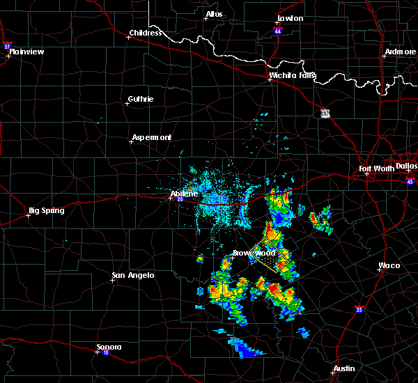 At 806 pm cdt, a severe thunderstorm was located 12 miles south of gustine, or 17 miles west of hamilton, moving northwest at 15 mph (radar indicated). Hazards include 60 mph wind gusts and half dollar size hail. Hail damage to vehicles is expected. Expect wind damage to roofs, siding, and trees. At 806 pm cdt, a severe thunderstorm was located 12 miles south of gustine, or 17 miles west of hamilton, moving northwest at 15 mph (radar indicated). Hazards include 60 mph wind gusts and half dollar size hail. Hail damage to vehicles is expected. Expect wind damage to roofs, siding, and trees.
|
| 6/23/2019 10:21 PM CDT |
 At 1021 pm cdt, a severe thunderstorm was located 7 miles north of blanket, or 10 miles west of comanche, moving east at 35 mph (radar indicated). Hazards include 60 mph wind gusts and quarter size hail. Hail damage to vehicles is expected. Expect wind damage to roofs, siding, and trees. At 1021 pm cdt, a severe thunderstorm was located 7 miles north of blanket, or 10 miles west of comanche, moving east at 35 mph (radar indicated). Hazards include 60 mph wind gusts and quarter size hail. Hail damage to vehicles is expected. Expect wind damage to roofs, siding, and trees.
|
| 6/18/2019 6:52 AM CDT |
 The severe thunderstorm warning for southwestern erath and central comanche counties will expire at 700 am cdt, the storm which prompted the warning has weakened below severe limits. therefore the warning will be allowed to expire. gusty winds are still possible with this thunderstorm. The severe thunderstorm warning for southwestern erath and central comanche counties will expire at 700 am cdt, the storm which prompted the warning has weakened below severe limits. therefore the warning will be allowed to expire. gusty winds are still possible with this thunderstorm.
|
| 6/18/2019 6:27 AM CDT |
 At 627 am cdt, a severe thunderstorm was located near de leon, or 8 miles west of dublin, moving southeast at 35 mph (radar indicated). Hazards include 60 mph wind gusts and penny size hail. Expect damage to roofs, siding, and trees. Locations impacted include, comanche, dublin, de leon and gustine. At 627 am cdt, a severe thunderstorm was located near de leon, or 8 miles west of dublin, moving southeast at 35 mph (radar indicated). Hazards include 60 mph wind gusts and penny size hail. Expect damage to roofs, siding, and trees. Locations impacted include, comanche, dublin, de leon and gustine.
|
| 6/18/2019 6:07 AM CDT |
 At 607 am cdt, a severe thunderstorm was located near de leon, or 15 miles northwest of dublin, moving southeast at 50 mph (radar indicated). Hazards include 65 mph wind gusts and quarter size hail. Hail damage to vehicles is expected. Expect wind damage to roofs, siding, and trees. At 607 am cdt, a severe thunderstorm was located near de leon, or 15 miles northwest of dublin, moving southeast at 50 mph (radar indicated). Hazards include 65 mph wind gusts and quarter size hail. Hail damage to vehicles is expected. Expect wind damage to roofs, siding, and trees.
|
| 5/2/2019 1:37 PM CDT |
 At 136 pm cdt, severe thunderstorms were located along a line extending from 9 miles northwest of dublin to near comanche, moving southeast at 25 mph (radar indicated). Hazards include quarter size hail. damage to vehicles is possible At 136 pm cdt, severe thunderstorms were located along a line extending from 9 miles northwest of dublin to near comanche, moving southeast at 25 mph (radar indicated). Hazards include quarter size hail. damage to vehicles is possible
|
| 4/17/2019 9:04 PM CDT |
 At 903 pm cdt, a severe thunderstorm was located near dublin, moving northeast at 40 mph (radar indicated). Hazards include 60 mph wind gusts and half dollar size hail. Hail damage to vehicles is expected. expect wind damage to roofs, siding, and trees. Locations impacted include, comanche, de leon, gorman, gustine and mullin. At 903 pm cdt, a severe thunderstorm was located near dublin, moving northeast at 40 mph (radar indicated). Hazards include 60 mph wind gusts and half dollar size hail. Hail damage to vehicles is expected. expect wind damage to roofs, siding, and trees. Locations impacted include, comanche, de leon, gorman, gustine and mullin.
|
| 4/17/2019 8:19 PM CDT |
 At 817 pm cdt, a cluster of severe thunderstorms was located from a rising star to comanche to regency line, moving northeast at 40 mph (radar indicated). Hazards include 60 mph wind gusts and half dollar size hail. Hail damage to vehicles is expected. Expect wind damage to roofs, siding, and trees. At 817 pm cdt, a cluster of severe thunderstorms was located from a rising star to comanche to regency line, moving northeast at 40 mph (radar indicated). Hazards include 60 mph wind gusts and half dollar size hail. Hail damage to vehicles is expected. Expect wind damage to roofs, siding, and trees.
|
| 6/2/2018 9:52 PM CDT |
 At 951 pm cdt, a severe thunderstorm was located near gorman, or 10 miles north of de leon, moving south at 15 to 20 mph (radar indicated). Hazards include 60 mph wind gusts and nickel size hail. expect damage to roofs, siding, and trees At 951 pm cdt, a severe thunderstorm was located near gorman, or 10 miles north of de leon, moving south at 15 to 20 mph (radar indicated). Hazards include 60 mph wind gusts and nickel size hail. expect damage to roofs, siding, and trees
|
| 5/25/2018 7:47 PM CDT |
 At 747 pm cdt, a severe thunderstorm was located near zephyr, or 14 miles east of early, moving south at 30 mph (radar indicated). Hazards include ping pong ball size hail and 60 mph wind gusts. People and animals outdoors will be injured. expect hail damage to roofs, siding, windows, and vehicles. expect wind damage to roofs, siding, and trees. Locations impacted include, comanche. At 747 pm cdt, a severe thunderstorm was located near zephyr, or 14 miles east of early, moving south at 30 mph (radar indicated). Hazards include ping pong ball size hail and 60 mph wind gusts. People and animals outdoors will be injured. expect hail damage to roofs, siding, windows, and vehicles. expect wind damage to roofs, siding, and trees. Locations impacted include, comanche.
|
| 5/25/2018 7:20 PM CDT | Baseball sized hail reported 1.7 miles ENE of Comanche, TX, baseball size hail reported 1 ssw comanche |
| 5/25/2018 7:17 PM CDT |
 At 716 pm cdt, a severe thunderstorm was located over comanche, moving southwest at 25 mph. this storm has a history of producing very large hail! (radar indicated). Hazards include two inch hail and 60 mph wind gusts. People and animals outdoors will be injured. expect hail damage to roofs, siding, windows, and vehicles. Expect wind damage to roofs, siding, and trees. At 716 pm cdt, a severe thunderstorm was located over comanche, moving southwest at 25 mph. this storm has a history of producing very large hail! (radar indicated). Hazards include two inch hail and 60 mph wind gusts. People and animals outdoors will be injured. expect hail damage to roofs, siding, windows, and vehicles. Expect wind damage to roofs, siding, and trees.
|
| 5/25/2018 7:12 PM CDT |
 At 711 pm cdt, a severe thunderstorm was located near comanche, moving southwest at 25 mph. this storm has a history of producing very large hail! this is a very dangerous storm (trained weather spotters). Hazards include baseball size hail and 65 mph wind gusts. People and animals outdoors will be severely injured. expect shattered windows, extensive damage to roofs, siding, and vehicles. Locations impacted include, comanche, de leon and gustine. At 711 pm cdt, a severe thunderstorm was located near comanche, moving southwest at 25 mph. this storm has a history of producing very large hail! this is a very dangerous storm (trained weather spotters). Hazards include baseball size hail and 65 mph wind gusts. People and animals outdoors will be severely injured. expect shattered windows, extensive damage to roofs, siding, and vehicles. Locations impacted include, comanche, de leon and gustine.
|
| 5/25/2018 7:00 PM CDT |
 At 658 pm cdt, a severe thunderstorm was located 7 miles south of de leon, or 8 miles north of comanche, moving southwest at 25 mph. at 637 pm cdt, a trained spotter reported baseball size hail 4 miles north of de leon. this storm has a history of producing very large hail. this is a very dangerous storm (trained weather spotters). Hazards include baseball size hail and 65 mph wind gusts. People and animals outdoors will be severely injured. expect shattered windows, extensive damage to roofs, siding, and vehicles. Locations impacted include, comanche, dublin, de leon and gustine. At 658 pm cdt, a severe thunderstorm was located 7 miles south of de leon, or 8 miles north of comanche, moving southwest at 25 mph. at 637 pm cdt, a trained spotter reported baseball size hail 4 miles north of de leon. this storm has a history of producing very large hail. this is a very dangerous storm (trained weather spotters). Hazards include baseball size hail and 65 mph wind gusts. People and animals outdoors will be severely injured. expect shattered windows, extensive damage to roofs, siding, and vehicles. Locations impacted include, comanche, dublin, de leon and gustine.
|
| 5/25/2018 6:40 PM CDT |
 At 639 pm cdt, a severe thunderstorm was located over de leon, or 10 miles west of dublin, moving southwest at 25 mph. a trained spotter reported baseball size hail 4 miles north of de leon. this is a very dangerous storm (trained weather spotters). Hazards include baseball size hail and 65 mph wind gusts. People and animals outdoors will be severely injured. expect shattered windows, extensive damage to roofs, siding, and vehicles. Locations impacted include, comanche, dublin, de leon and gustine. At 639 pm cdt, a severe thunderstorm was located over de leon, or 10 miles west of dublin, moving southwest at 25 mph. a trained spotter reported baseball size hail 4 miles north of de leon. this is a very dangerous storm (trained weather spotters). Hazards include baseball size hail and 65 mph wind gusts. People and animals outdoors will be severely injured. expect shattered windows, extensive damage to roofs, siding, and vehicles. Locations impacted include, comanche, dublin, de leon and gustine.
|
| 5/25/2018 6:24 PM CDT |
 The national weather service in fort worth has issued a * severe thunderstorm warning for. southwestern erath county in north central texas. east central eastland county in north central texas. central comanche county in central texas. Until 730 pm cdt. The national weather service in fort worth has issued a * severe thunderstorm warning for. southwestern erath county in north central texas. east central eastland county in north central texas. central comanche county in central texas. Until 730 pm cdt.
|
| 5/3/2018 9:32 AM CDT |
 At 932 am cdt, a severe thunderstorm was located over mullin, or 20 miles southeast of early, moving east at 35 mph (radar indicated). Hazards include 65 mph wind gusts and half dollar size hail. Hail damage to vehicles is expected. expect wind damage to roofs, siding, and trees. Locations impacted include, comanche, de leon, goldthwaite, gustine and mullin. At 932 am cdt, a severe thunderstorm was located over mullin, or 20 miles southeast of early, moving east at 35 mph (radar indicated). Hazards include 65 mph wind gusts and half dollar size hail. Hail damage to vehicles is expected. expect wind damage to roofs, siding, and trees. Locations impacted include, comanche, de leon, goldthwaite, gustine and mullin.
|
| 5/3/2018 8:47 AM CDT |
 At 846 am cdt, a severe thunderstorm was located over camp bowie, or near early, moving east at 40 mph (radar indicated). Hazards include 65 mph wind gusts and half dollar size hail. Hail damage to vehicles is expected. Expect wind damage to roofs, siding, and trees. At 846 am cdt, a severe thunderstorm was located over camp bowie, or near early, moving east at 40 mph (radar indicated). Hazards include 65 mph wind gusts and half dollar size hail. Hail damage to vehicles is expected. Expect wind damage to roofs, siding, and trees.
|
| 3/27/2018 9:38 PM CDT |
 The severe thunderstorm warning for central comanche county will expire at 945 pm cdt, the storm which prompted the warning has weakened and moved out of the area. therefore the warning will be allowed to expire. The severe thunderstorm warning for central comanche county will expire at 945 pm cdt, the storm which prompted the warning has weakened and moved out of the area. therefore the warning will be allowed to expire.
|
| 3/27/2018 9:27 PM CDT | Quarter sized hail reported 7.3 miles WSW of Comanche, TX, mping report of quarter sized hail |
| 3/27/2018 9:20 PM CDT |
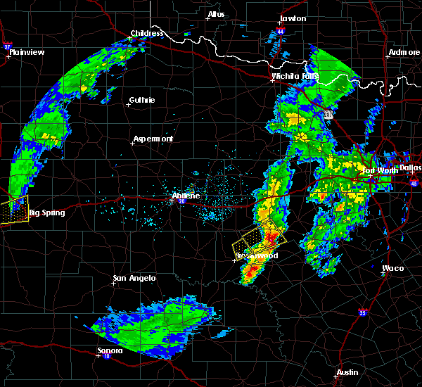 At 920 pm cdt, a severe thunderstorm was located 7 miles south of de leon, or 7 miles northeast of comanche, moving northeast at 55 mph (radar indicated). Hazards include 60 mph wind gusts and quarter size hail. Hail damage to vehicles is expected. expect wind damage to roofs, siding, and trees. Locations impacted include, comanche. At 920 pm cdt, a severe thunderstorm was located 7 miles south of de leon, or 7 miles northeast of comanche, moving northeast at 55 mph (radar indicated). Hazards include 60 mph wind gusts and quarter size hail. Hail damage to vehicles is expected. expect wind damage to roofs, siding, and trees. Locations impacted include, comanche.
|
| 3/27/2018 8:58 PM CDT |
 At 858 pm cdt, a severe thunderstorm was located near blanket, or 12 miles west of comanche, moving northeast at 55 mph (radar indicated). Hazards include 65 mph wind gusts and half dollar size hail. Hail damage to vehicles is expected. Expect wind damage to roofs, siding, and trees. At 858 pm cdt, a severe thunderstorm was located near blanket, or 12 miles west of comanche, moving northeast at 55 mph (radar indicated). Hazards include 65 mph wind gusts and half dollar size hail. Hail damage to vehicles is expected. Expect wind damage to roofs, siding, and trees.
|
| 3/17/2018 3:12 PM CDT |
 At 310 pm cdt, a severe thunderstorm was located over may, or 18 miles north of early, moving northeast at 30 mph. another cluster of strong to possibly severe storms was located near rising star and will move northward along the comanche-eastland county line (radar indicated). Hazards include 60 mph wind gusts and quarter size hail. Hail damage to vehicles is expected. expect wind damage to roofs, siding, and trees. Locations impacted include, comanche, de leon, gorman, rising star and carbon. At 310 pm cdt, a severe thunderstorm was located over may, or 18 miles north of early, moving northeast at 30 mph. another cluster of strong to possibly severe storms was located near rising star and will move northward along the comanche-eastland county line (radar indicated). Hazards include 60 mph wind gusts and quarter size hail. Hail damage to vehicles is expected. expect wind damage to roofs, siding, and trees. Locations impacted include, comanche, de leon, gorman, rising star and carbon.
|
| 3/17/2018 2:53 PM CDT |
 At 253 pm cdt, a severe thunderstorm was located over byrds, or 14 miles north of early, moving northeast at 25 mph (radar indicated). Hazards include golf ball size hail and 65 mph wind gusts. People and animals outdoors will be injured. expect hail damage to roofs, siding, windows, and vehicles. Expect wind damage to roofs, siding, and trees. At 253 pm cdt, a severe thunderstorm was located over byrds, or 14 miles north of early, moving northeast at 25 mph (radar indicated). Hazards include golf ball size hail and 65 mph wind gusts. People and animals outdoors will be injured. expect hail damage to roofs, siding, windows, and vehicles. Expect wind damage to roofs, siding, and trees.
|
| 5/19/2017 9:55 PM CDT |
 At 955 pm cdt, severe thunderstorms were located along a line extending from 8 miles northeast of de leon to 8 miles south of gustine, moving northeast at 25 mph (radar indicated). Hazards include 65 mph wind gusts and half dollar size hail. Hail damage to vehicles is expected. Expect wind damage to roofs, siding, and trees. At 955 pm cdt, severe thunderstorms were located along a line extending from 8 miles northeast of de leon to 8 miles south of gustine, moving northeast at 25 mph (radar indicated). Hazards include 65 mph wind gusts and half dollar size hail. Hail damage to vehicles is expected. Expect wind damage to roofs, siding, and trees.
|
| 5/18/2017 10:11 PM CDT |
 At 1010 pm cdt, a severe thunderstorm was located near gustine, or 10 miles east of comanche, moving southeast at 20 mph (radar indicated). Hazards include 65 mph wind gusts and half dollar size hail. Hail damage to vehicles is expected. expect wind damage to roofs, siding, and trees. Locations impacted include, comanche and gustine. At 1010 pm cdt, a severe thunderstorm was located near gustine, or 10 miles east of comanche, moving southeast at 20 mph (radar indicated). Hazards include 65 mph wind gusts and half dollar size hail. Hail damage to vehicles is expected. expect wind damage to roofs, siding, and trees. Locations impacted include, comanche and gustine.
|
| 5/18/2017 9:52 PM CDT |
 At 952 pm cdt, a severe thunderstorm was located over comanche, moving southeast at 15 mph (radar indicated). Hazards include 65 mph wind gusts and half dollar size hail. Hail damage to vehicles is expected. expect wind damage to roofs, siding, and trees. locations impacted include, comanche and gustine. A tornado watch remains in effect until 1000 pm cdt for central and north central texas. At 952 pm cdt, a severe thunderstorm was located over comanche, moving southeast at 15 mph (radar indicated). Hazards include 65 mph wind gusts and half dollar size hail. Hail damage to vehicles is expected. expect wind damage to roofs, siding, and trees. locations impacted include, comanche and gustine. A tornado watch remains in effect until 1000 pm cdt for central and north central texas.
|
| 5/18/2017 9:43 PM CDT |
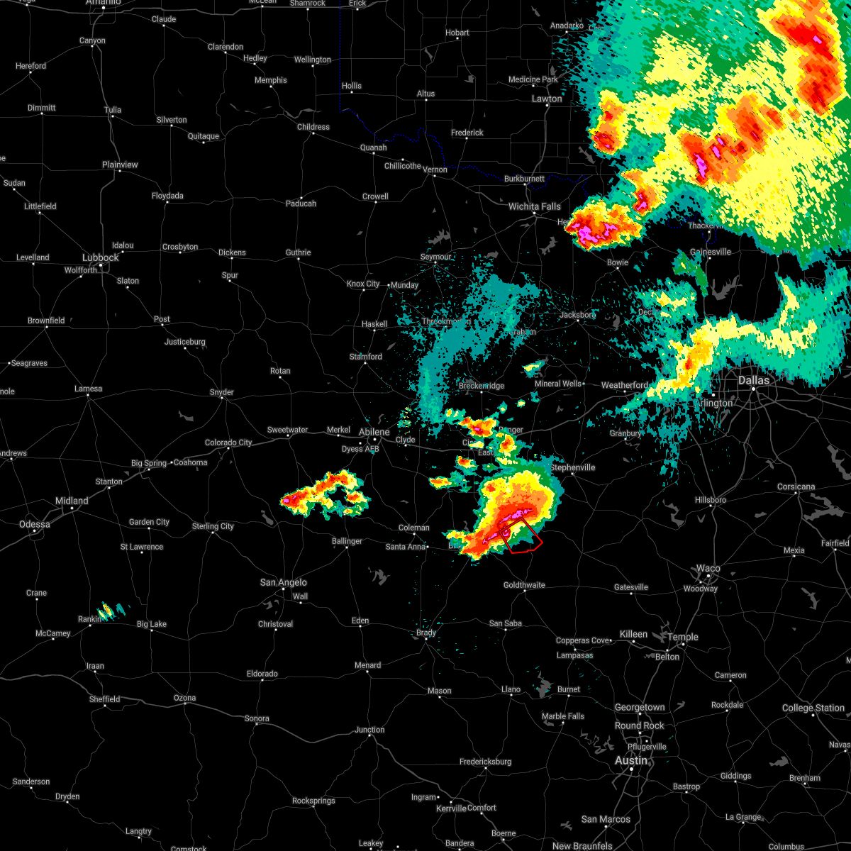 At 943 pm cdt, a severe thunderstorm capable of producing a tornado was located near blanket, or 8 miles southwest of comanche, moving southeast at 20 mph (radar indicated rotation). Hazards include tornado and golf ball size hail. Flying debris will be dangerous to those caught without shelter. mobile homes will be damaged or destroyed. damage to roofs, windows, and vehicles will occur. tree damage is likely. This tornadic thunderstorm will remain over mainly rural areas of southwestern comanche county. At 943 pm cdt, a severe thunderstorm capable of producing a tornado was located near blanket, or 8 miles southwest of comanche, moving southeast at 20 mph (radar indicated rotation). Hazards include tornado and golf ball size hail. Flying debris will be dangerous to those caught without shelter. mobile homes will be damaged or destroyed. damage to roofs, windows, and vehicles will occur. tree damage is likely. This tornadic thunderstorm will remain over mainly rural areas of southwestern comanche county.
|
| 5/18/2017 9:40 PM CDT |
 At 939 pm cdt, a severe thunderstorm was located near comanche, moving southeast at 25 mph (radar indicated). Hazards include golf ball size hail and 60 mph wind gusts. People and animals outdoors will be injured. expect hail damage to roofs, siding, windows, and vehicles. Expect wind damage to roofs, siding, and trees. At 939 pm cdt, a severe thunderstorm was located near comanche, moving southeast at 25 mph (radar indicated). Hazards include golf ball size hail and 60 mph wind gusts. People and animals outdoors will be injured. expect hail damage to roofs, siding, windows, and vehicles. Expect wind damage to roofs, siding, and trees.
|
| 5/18/2017 9:16 PM CDT |
 At 915 pm cdt, a severe thunderstorm was located 11 miles south of gorman, or 12 miles northwest of comanche, moving northeast at 20 mph (radar indicated). Hazards include tennis ball size hail and 70 mph wind gusts. People and animals outdoors will be injured. expect hail damage to roofs, siding, windows, and vehicles. expect considerable tree damage. wind damage is also likely to mobile homes, roofs, and outbuildings. locations impacted include, de leon. A tornado watch remains in effect until 1000 pm cdt for central and north central texas. At 915 pm cdt, a severe thunderstorm was located 11 miles south of gorman, or 12 miles northwest of comanche, moving northeast at 20 mph (radar indicated). Hazards include tennis ball size hail and 70 mph wind gusts. People and animals outdoors will be injured. expect hail damage to roofs, siding, windows, and vehicles. expect considerable tree damage. wind damage is also likely to mobile homes, roofs, and outbuildings. locations impacted include, de leon. A tornado watch remains in effect until 1000 pm cdt for central and north central texas.
|
| 5/18/2017 9:13 PM CDT |
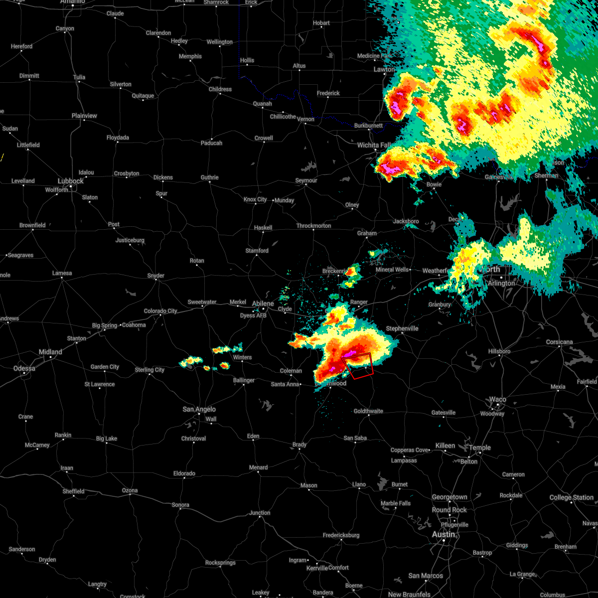 At 910 pm cdt, a severe thunderstorm capable of producing a tornado was located near blanket, or 11 miles west of comanche, moving east at 10 mph (radar indicated rotation). Hazards include tornado and tennis ball size hail. Flying debris will be dangerous to those caught without shelter. mobile homes will be damaged or destroyed. damage to roofs, windows, and vehicles will occur. Tree damage is likely. At 910 pm cdt, a severe thunderstorm capable of producing a tornado was located near blanket, or 11 miles west of comanche, moving east at 10 mph (radar indicated rotation). Hazards include tornado and tennis ball size hail. Flying debris will be dangerous to those caught without shelter. mobile homes will be damaged or destroyed. damage to roofs, windows, and vehicles will occur. Tree damage is likely.
|
| 5/18/2017 9:02 PM CDT |
 At 901 pm cdt, a severe thunderstorm was located 10 miles northeast of may, or 15 miles northwest of comanche, moving east at 15 mph (radar indicated). Hazards include golf ball size hail and 70 mph wind gusts. People and animals outdoors will be injured. expect hail damage to roofs, siding, windows, and vehicles. expect considerable tree damage. wind damage is also likely to mobile homes, roofs, and outbuildings. locations impacted include, de leon. A tornado watch remains in effect until 1000 pm cdt for central and north central texas. At 901 pm cdt, a severe thunderstorm was located 10 miles northeast of may, or 15 miles northwest of comanche, moving east at 15 mph (radar indicated). Hazards include golf ball size hail and 70 mph wind gusts. People and animals outdoors will be injured. expect hail damage to roofs, siding, windows, and vehicles. expect considerable tree damage. wind damage is also likely to mobile homes, roofs, and outbuildings. locations impacted include, de leon. A tornado watch remains in effect until 1000 pm cdt for central and north central texas.
|
| 5/18/2017 8:43 PM CDT |
 At 843 pm cdt, a severe thunderstorm was located near may, or 18 miles northwest of comanche, moving east at 15 mph (radar indicated). Hazards include golf ball size hail and 70 mph wind gusts. People and animals outdoors will be injured. expect hail damage to roofs, siding, windows, and vehicles. expect considerable tree damage. Wind damage is also likely to mobile homes, roofs, and outbuildings. At 843 pm cdt, a severe thunderstorm was located near may, or 18 miles northwest of comanche, moving east at 15 mph (radar indicated). Hazards include golf ball size hail and 70 mph wind gusts. People and animals outdoors will be injured. expect hail damage to roofs, siding, windows, and vehicles. expect considerable tree damage. Wind damage is also likely to mobile homes, roofs, and outbuildings.
|
| 5/18/2017 8:39 PM CDT |
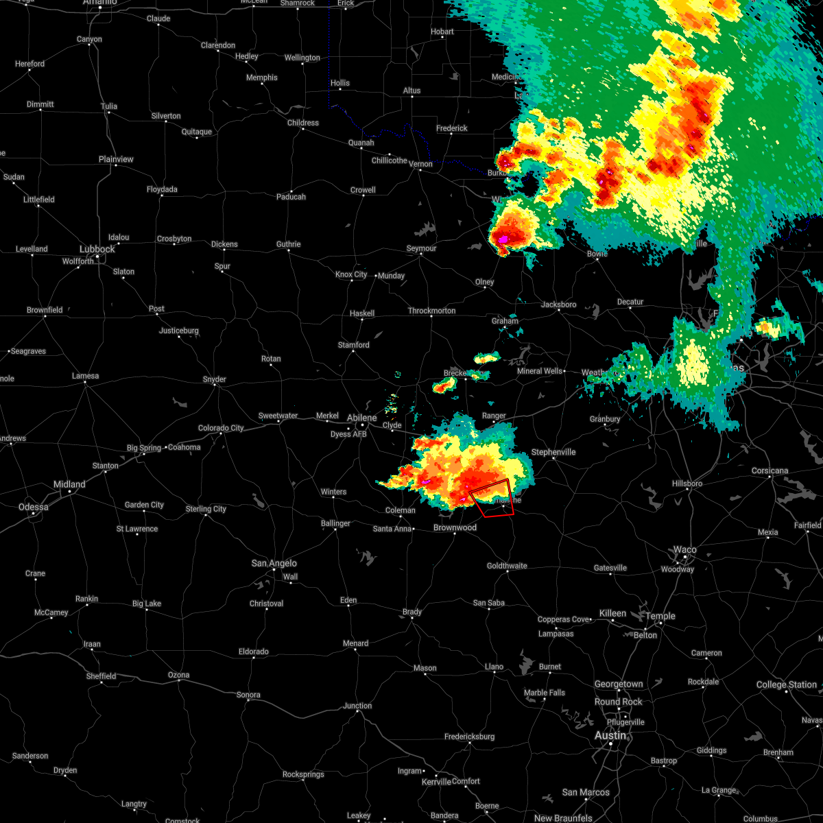 At 839 pm cdt, a severe thunderstorm capable of producing a tornado was located near may, or 13 miles west of comanche, moving east at 20 mph (radar indicated rotation). Hazards include tornado and golf ball size hail. Flying debris will be dangerous to those caught without shelter. mobile homes will be damaged or destroyed. damage to roofs, windows, and vehicles will occur. tree damage is likely. This dangerous storm will be near, comanche around 915 pm cdt. At 839 pm cdt, a severe thunderstorm capable of producing a tornado was located near may, or 13 miles west of comanche, moving east at 20 mph (radar indicated rotation). Hazards include tornado and golf ball size hail. Flying debris will be dangerous to those caught without shelter. mobile homes will be damaged or destroyed. damage to roofs, windows, and vehicles will occur. tree damage is likely. This dangerous storm will be near, comanche around 915 pm cdt.
|
| 4/1/2017 11:55 PM CDT |
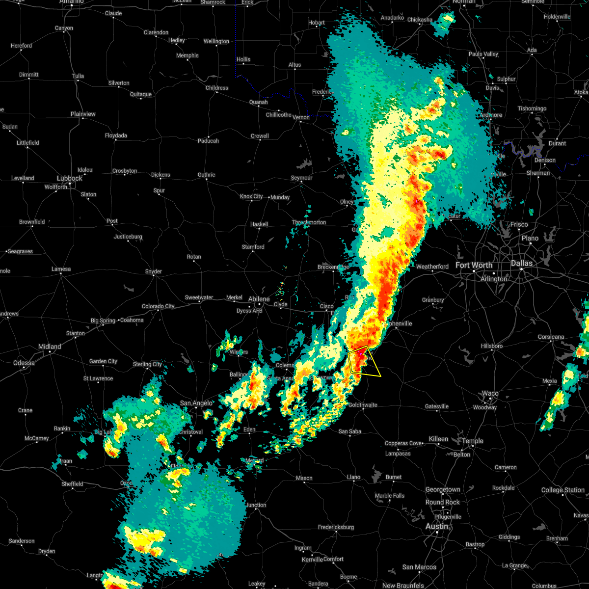 The severe thunderstorm warning for south central comanche county will expire at midnight cdt, the storm which prompted the warning has weakened below severe limits. therefore the warning will be allowed to expire. however gusty winds and heavy rain are still possible with this thunderstorm. The severe thunderstorm warning for south central comanche county will expire at midnight cdt, the storm which prompted the warning has weakened below severe limits. therefore the warning will be allowed to expire. however gusty winds and heavy rain are still possible with this thunderstorm.
|
| 4/1/2017 11:43 PM CDT |
 At 1142 pm cdt, a severe thunderstorm was located over comanche, moving east at 15 mph (radar indicated). Hazards include 60 mph wind gusts and quarter size hail. Hail damage to vehicles is expected. expect wind damage to roofs, siding, and trees. This severe storm will be near, comanche around 1155 pm cdt. At 1142 pm cdt, a severe thunderstorm was located over comanche, moving east at 15 mph (radar indicated). Hazards include 60 mph wind gusts and quarter size hail. Hail damage to vehicles is expected. expect wind damage to roofs, siding, and trees. This severe storm will be near, comanche around 1155 pm cdt.
|
| 4/1/2017 11:17 PM CDT |
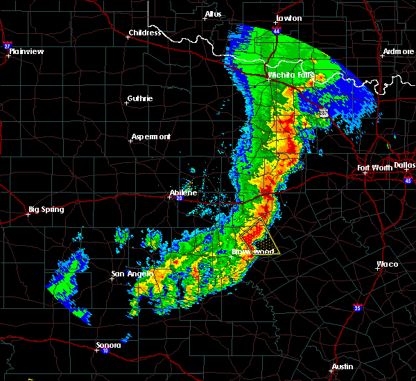 At 1116 pm cdt, a severe thunderstorm was located near blanket, or 7 miles west of comanche, moving east at 25 mph (radar indicated). Hazards include 60 mph wind gusts and quarter size hail. Hail damage to vehicles is expected. expect wind damage to roofs, siding, and trees. Locations impacted include, comanche. At 1116 pm cdt, a severe thunderstorm was located near blanket, or 7 miles west of comanche, moving east at 25 mph (radar indicated). Hazards include 60 mph wind gusts and quarter size hail. Hail damage to vehicles is expected. expect wind damage to roofs, siding, and trees. Locations impacted include, comanche.
|
| 4/1/2017 10:59 PM CDT |
 At 1059 pm cdt, a severe thunderstorm was located near blanket, or 8 miles north of early, moving east at 15 mph (radar indicated). Hazards include 60 mph wind gusts and quarter size hail. Hail damage to vehicles is expected. expect wind damage to roofs, siding, and trees. This severe thunderstorm will be near, comanche around 1200 am cdt. At 1059 pm cdt, a severe thunderstorm was located near blanket, or 8 miles north of early, moving east at 15 mph (radar indicated). Hazards include 60 mph wind gusts and quarter size hail. Hail damage to vehicles is expected. expect wind damage to roofs, siding, and trees. This severe thunderstorm will be near, comanche around 1200 am cdt.
|
| 1/2/2017 2:53 AM CST |
 At 252 am cst, a severe thunderstorm was located near comanche, moving northeast at 45 mph (radar indicated). Hazards include 60 mph wind gusts and quarter size hail. Hail damage to vehicles is expected. expect wind damage to roofs, siding, and trees. this severe thunderstorm will be near, gustine around 300 am cst. Dublin around 320 am cst. At 252 am cst, a severe thunderstorm was located near comanche, moving northeast at 45 mph (radar indicated). Hazards include 60 mph wind gusts and quarter size hail. Hail damage to vehicles is expected. expect wind damage to roofs, siding, and trees. this severe thunderstorm will be near, gustine around 300 am cst. Dublin around 320 am cst.
|
| 5/26/2016 8:58 PM CDT |
 At 858 pm cdt, a severe thunderstorm was located near comanche, moving east at 35 mph (radar indicated). Hazards include 70 mph wind gusts and half dollar size hail. Hail damage to vehicles is expected. expect considerable tree damage. wind damage is also likely to mobile homes, roofs, and outbuildings. This severe thunderstorm will remain over mainly rural areas of comanche and southwestern erath counties. At 858 pm cdt, a severe thunderstorm was located near comanche, moving east at 35 mph (radar indicated). Hazards include 70 mph wind gusts and half dollar size hail. Hail damage to vehicles is expected. expect considerable tree damage. wind damage is also likely to mobile homes, roofs, and outbuildings. This severe thunderstorm will remain over mainly rural areas of comanche and southwestern erath counties.
|
| 5/26/2016 8:50 PM CDT | Powerlines and trees down in sidney reported by sheriffs ofic in comanche county TX, 8.1 miles ESE of Comanche, TX |
| 5/26/2016 8:39 PM CDT | Delayed report---comanche co sheriff's office reported trees down at intersection of cr 157 and 103. time estimated via rada in comanche county TX, 7.3 miles SE of Comanche, TX |
| 5/26/2016 8:38 PM CDT |
 At 838 pm cdt, a severe thunderstorm capable of producing a tornado was located 7 miles northwest of comanche, moving northeast at 35 mph (radar indicated rotation). Hazards include tornado and quarter size hail. Flying debris will be dangerous to those caught without shelter. mobile homes will be damaged or destroyed. damage to roofs, windows, and vehicles will occur. Tree damage is likely. At 838 pm cdt, a severe thunderstorm capable of producing a tornado was located 7 miles northwest of comanche, moving northeast at 35 mph (radar indicated rotation). Hazards include tornado and quarter size hail. Flying debris will be dangerous to those caught without shelter. mobile homes will be damaged or destroyed. damage to roofs, windows, and vehicles will occur. Tree damage is likely.
|
| 5/12/2016 3:13 AM CDT | The severe thunderstorm warning for western comanche and eastland counties will expire at 315 am cdt, the storm which prompted the warning has weakened below severe limits and exited the warned area. therefore the warning will be allowed to expire. however one additional storm near rising star may still produce gusty winds and heavy rain. |
| 5/12/2016 2:13 AM CDT |
 At 212 am cdt, a severe thunderstorm was located over rising star, or 19 miles south of cisco, moving southeast at 20 mph (radar indicated). Hazards include ping pong ball size hail and 60 mph wind gusts. People and animals outdoors will be injured. expect hail damage to roofs, siding, windows, and vehicles. expect wind damage to roofs, siding, and trees. this severe thunderstorm will be near, comanche around 315 am cdt. other locations impacted by this severe thunderstorm include carbon. This includes interstate 20 between mile markers 324 and 342. At 212 am cdt, a severe thunderstorm was located over rising star, or 19 miles south of cisco, moving southeast at 20 mph (radar indicated). Hazards include ping pong ball size hail and 60 mph wind gusts. People and animals outdoors will be injured. expect hail damage to roofs, siding, windows, and vehicles. expect wind damage to roofs, siding, and trees. this severe thunderstorm will be near, comanche around 315 am cdt. other locations impacted by this severe thunderstorm include carbon. This includes interstate 20 between mile markers 324 and 342.
|
| 5/10/2016 5:15 PM CDT |
 At 514 pm cdt, a severe thunderstorm was located over de leon, or 8 miles west of dublin, moving northeast at 35 mph (radar indicated). Hazards include golf ball size hail and 65 mph wind gusts. People and animals outdoors will be injured. expect hail damage to roofs, siding, windows, and vehicles. Expect wind damage to roofs, siding, and trees. At 514 pm cdt, a severe thunderstorm was located over de leon, or 8 miles west of dublin, moving northeast at 35 mph (radar indicated). Hazards include golf ball size hail and 65 mph wind gusts. People and animals outdoors will be injured. expect hail damage to roofs, siding, windows, and vehicles. Expect wind damage to roofs, siding, and trees.
|
| 5/10/2016 5:10 PM CDT | Measured at the comanche raws site - coat2 in comanche county TX, 2 miles S of Comanche, TX |
| 5/10/2016 5:02 PM CDT | Storm damage reported in comanche county TX, 1.6 miles ESE of Comanche, TX |
| 5/10/2016 4:59 PM CDT |
 At 458 pm cdt, a severe thunderstorm was located over comanche, moving northeast at 25 mph. this storm produced a 62 mph wind gust at comanche over the last few minutes (radar indicated). Hazards include hen egg size hail and 65 mph wind gusts. People and animals outdoors will be injured. expect hail damage to roofs, siding, windows, and vehicles. expect wind damage to roofs, siding, and trees. Locations impacted include, comanche, de leon, gustine and mullin. At 458 pm cdt, a severe thunderstorm was located over comanche, moving northeast at 25 mph. this storm produced a 62 mph wind gust at comanche over the last few minutes (radar indicated). Hazards include hen egg size hail and 65 mph wind gusts. People and animals outdoors will be injured. expect hail damage to roofs, siding, windows, and vehicles. expect wind damage to roofs, siding, and trees. Locations impacted include, comanche, de leon, gustine and mullin.
|
| 5/10/2016 4:54 PM CDT | 62 mph wind gust measured at comanche county airport in comanche county TX, 0.9 miles E of Comanche, TX |
| 5/10/2016 4:35 PM CDT |
 At 434 pm cdt, two severe thunderstorms were located near blanket and also 7 miles north of mullin, moving northeast at 25 mph (radar indicated). Hazards include hen egg size hail and 60 mph wind gusts. People and animals outdoors will be injured. expect hail damage to roofs, siding, windows, and vehicles. expect wind damage to roofs, siding, and trees. Locations impacted include, comanche, de leon, gustine and mullin. At 434 pm cdt, two severe thunderstorms were located near blanket and also 7 miles north of mullin, moving northeast at 25 mph (radar indicated). Hazards include hen egg size hail and 60 mph wind gusts. People and animals outdoors will be injured. expect hail damage to roofs, siding, windows, and vehicles. expect wind damage to roofs, siding, and trees. Locations impacted include, comanche, de leon, gustine and mullin.
|
| 5/10/2016 4:25 PM CDT |
 At 425 pm cdt, a severe thunderstorm was located near mullin, or 15 miles east of early, moving northeast at 10 mph (radar indicated). Hazards include 60 mph wind gusts and half dollar size hail. Hail damage to vehicles is expected. expect wind damage to roofs, siding, and trees. This severe thunderstorm will remain over mainly rural areas of comanche and northwestern mills counties. At 425 pm cdt, a severe thunderstorm was located near mullin, or 15 miles east of early, moving northeast at 10 mph (radar indicated). Hazards include 60 mph wind gusts and half dollar size hail. Hail damage to vehicles is expected. expect wind damage to roofs, siding, and trees. This severe thunderstorm will remain over mainly rural areas of comanche and northwestern mills counties.
|
| 4/29/2016 5:38 PM CDT |
 At 538 pm cdt, a severe thunderstorm was located near gustine, or 10 miles east of comanche, moving northeast at 35 mph (radar indicated). Hazards include 60 mph wind gusts and quarter size hail. Hail damage to vehicles is expected. expect wind damage to roofs, siding, and trees. this severe thunderstorm will remain over mainly rural areas of central comanche county. A tornado watch remains in effect until 1000 pm cdt for north central texas. At 538 pm cdt, a severe thunderstorm was located near gustine, or 10 miles east of comanche, moving northeast at 35 mph (radar indicated). Hazards include 60 mph wind gusts and quarter size hail. Hail damage to vehicles is expected. expect wind damage to roofs, siding, and trees. this severe thunderstorm will remain over mainly rural areas of central comanche county. A tornado watch remains in effect until 1000 pm cdt for north central texas.
|
| 4/29/2016 5:27 PM CDT | Quarter sized hail reported 0.9 miles E of Comanche, TX |
| 4/29/2016 5:18 PM CDT |
 At 518 pm cdt, a severe thunderstorm was located near comanche, moving northeast at 45 mph (radar indicated). Hazards include ping pong ball size hail and 60 mph wind gusts. People and animals outdoors will be injured. expect hail damage to roofs, siding, windows, and vehicles. expect wind damage to roofs, siding, and trees. this severe storm will be near, gustine around 530 pm cdt. A tornado watch remains in effect until 1000 pm cdt for north central texas. At 518 pm cdt, a severe thunderstorm was located near comanche, moving northeast at 45 mph (radar indicated). Hazards include ping pong ball size hail and 60 mph wind gusts. People and animals outdoors will be injured. expect hail damage to roofs, siding, windows, and vehicles. expect wind damage to roofs, siding, and trees. this severe storm will be near, gustine around 530 pm cdt. A tornado watch remains in effect until 1000 pm cdt for north central texas.
|
| 4/29/2016 5:13 PM CDT | Golf Ball sized hail reported 5.7 miles NE of Comanche, TX, delayed report....golfball reported along hwy 590 5 miles southwest of comanche. |
| 4/29/2016 4:58 PM CDT |
 At 458 pm cdt, a severe thunderstorm was located over blanket, or 10 miles east of early, moving northeast at 25 mph (radar indicated). Hazards include 60 mph wind gusts and quarter size hail. Hail damage to vehicles is expected. expect wind damage to roofs, siding, and trees. this severe thunderstorm will be near, comanche around 530 pm cdt. A tornado watch remains in effect until 1000 pm cdt for north central texas. At 458 pm cdt, a severe thunderstorm was located over blanket, or 10 miles east of early, moving northeast at 25 mph (radar indicated). Hazards include 60 mph wind gusts and quarter size hail. Hail damage to vehicles is expected. expect wind damage to roofs, siding, and trees. this severe thunderstorm will be near, comanche around 530 pm cdt. A tornado watch remains in effect until 1000 pm cdt for north central texas.
|
| 4/29/2016 2:30 PM CDT |
 At 230 pm cdt, a severe thunderstorm was located near may, or 15 miles west of comanche, moving northeast at 40 mph (radar indicated). Hazards include 60 mph wind gusts and quarter size hail. Hail damage to vehicles is expected. expect wind damage to roofs, siding, and trees. this severe thunderstorm will be near, gorman around 300 pm cdt. A tornado watch remains in effect until 1000 pm cdt for north central texas. At 230 pm cdt, a severe thunderstorm was located near may, or 15 miles west of comanche, moving northeast at 40 mph (radar indicated). Hazards include 60 mph wind gusts and quarter size hail. Hail damage to vehicles is expected. expect wind damage to roofs, siding, and trees. this severe thunderstorm will be near, gorman around 300 pm cdt. A tornado watch remains in effect until 1000 pm cdt for north central texas.
|
| 5/27/2015 1:26 AM CDT | The severe thunderstorm warning for southern comanche, west central hamilton and northern mills counties will expire at 130 am cdt, the storm which prompted the warning has weakened below severe limits, and no longer poses an immediate threat to life or property. therefore the warning will be allowed to expire. however gusty winds, frequent lightning and very heavy rainfall are still possible with this thunderstorm. |
| 5/27/2015 12:52 AM CDT | At 1252 am cdt, a severe thunderstorm was located 7 miles south of gustine, or 15 miles west of hamilton, moving east at 15 mph (radar indicated). Hazards include 60 mph wind gusts and quarter size hail. Hail damage to vehicles is expected. expect wind damage to roofs, siding and trees. This severe storm will be near, hamilton around 130 am cdt. |
| 5/27/2015 12:29 AM CDT | At 1228 am cdt, a severe thunderstorm was located 7 miles southwest of gustine, or 10 miles south of comanche, moving east at 25 mph (radar indicated). Hazards include 60 mph wind gusts and half dollar size hail. Hail damage to vehicles is expected. expect wind damage to roofs, siding and trees. this severe thunderstorm will be near, gustine around 1235 am cdt. Hamilton around 120 am cdt. |
| 5/26/2015 11:52 PM CDT | At 1151 pm cdt, a severe thunderstorm was located near comanche, moving east at 15 mph (radar indicated). Hazards include 60 mph wind gusts and half dollar size hail. Hail damage to vehicles is expected. expect wind damage to roofs, siding and trees. This severe storm will be near, gustine around 1230 am cdt. |
| 5/26/2015 11:25 PM CDT | At 1124 pm cdt, a severe thunderstorm was located near blanket, or near comanche, moving east at 15 mph (radar indicated). Hazards include 60 mph wind gusts and half dollar size hail. Hail damage to vehicles is expected. expect wind damage to roofs, siding and trees. this severe thunderstorm will be near, comanche around 1145 pm cdt. Gustine around 1230 am cdt. |
| 5/26/2015 11:00 PM CDT | At 1059 pm cdt, severe thunderstorms were located along a line extending from 5 miles northwest of iredell to 10 miles west of cranfills gap to near gustine, moving southeast at 25 mph (radar indicated). Hazards include 70 mph wind gusts and penny size hail. Expect considerable tree damage. damage is likely to mobile homes, roofs and outbuildings. these severe storms will be near, cranfills gap around 1115 pm cdt. Hamilton around 1130 pm cdt. |
| 5/26/2015 10:46 PM CDT | At 1046 pm cdt, severe thunderstorms were located along a line extending from 10 miles east of stephenville to 7 miles southwest of hico to near gustine, moving southeast at 20 mph (radar indicated). Hazards include 70 mph wind gusts and quarter size hail. Hail damage to vehicles is expected. expect considerable tree damage. wind damage is also likely to mobile homes, roofs and outbuildings. These severe storms will be near, iredell and cranfills gap around 1130 pm cdt. |
| 5/26/2015 10:29 PM CDT | At 1028 pm cdt, severe thunderstorms were located along a line extending from near stephenville to 11 miles southwest of hico to comanche, moving southeast at 20 mph (radar indicated). Hazards include ping pong ball size hail and 60 mph wind gusts. People and animals outdoors will be injured. expect hail damage to roofs, siding, windows and vehicles. expect wind damage to roofs, siding and trees. severe thunderstorms will be near, gustine around 1105 pm cdt. hico around 1110 pm cdt. Iredell and cranfills gap around 1130 pm cdt. |
| 5/26/2015 10:00 PM CDT | At 1000 pm cdt, severe thunderstorms were located along a line extending from near dinosaur valley state park to 6 miles west of glen rose to 8 miles west of hico to 6 miles west of gustine, moving southeast at 20 mph (trained weather spotters). Hazards include golf ball size hail and 60 mph wind gusts. People and animals outdoors will be injured. expect hail damage to roofs, siding, windows and vehicles. expect wind damage to roofs, siding and trees. locations impacted include, stephenville, comanche, dublin, de leon, gustine, huckabay and morgan mill. This includes interstate 20 between mile markers 364 and 367. |
| 5/26/2015 9:58 PM CDT | Golf Ball sized hail reported 6.8 miles S of Comanche, TX |
| 5/26/2015 9:43 PM CDT | At 943 pm cdt, severe thunderstorms were located along a line extending from 8 miles east of stephenville to near gorman to 6 miles east of rising star, moving east at 20 mph (radar indicated). Hazards include 60 mph wind gusts and half dollar size hail. Hail damage to vehicles is expected. Expect wind damage to roofs, siding and trees. |
| 5/10/2015 4:44 AM CDT | At 444 am cdt, severe thunderstorms were located along a line extending from 10 miles east of ranger to near de leon to 5 miles southwest of comanche, moving east at 35 mph (radar indicated). Hazards include 60 mph wind gusts. Expect damage to roofs. Siding and trees. |
| 5/10/2015 4:00 AM CDT | At 358 am cdt, severe thunderstorms were located along a line extending from near putnam to near rising star to near brownwood, moving east at 50 mph. a 69 mph wind gust was measured west of coleman with these storms. the strongest winds are likely to affect the rising star and carbon areas in the next few minutes (radar indicated). Hazards include 70 mph wind gusts. Expect considerable tree damage. damage is likely to mobile homes, roofs and outbuildings. locations impacted include, comanche, eastland, cisco, ranger, de leon, gorman, rising star, gustine and carbon. this includes interstate 20 between mile markers 324 and 362. 75in. |
| 5/10/2015 3:39 AM CDT | At 339 am cdt, severe thunderstorms were located along a line extending from near baird to near cross plains to near trickham, moving east at 45 mph (radar indicated). Hazards include 60 mph wind gusts. Expect damage to roofs. siding and trees. severe thunderstorms will be near, rising star around 400 am cdt. cisco around 415 am cdt. gorman around 425 am cdt. eastland and de leon around 430 am cdt. ranger around 435 am cdt. other locations impacted by these severe thunderstorms include carbon. this includes interstate 20 between mile markers 324 and 362. 75in. |
| 5/7/2015 9:57 PM CDT | At 956 pm cdt, severe thunderstorms were located along a line extending from 7 miles west of stephenville to near de leon to 6 miles north of blanket, moving east at 15 mph (radar indicated). Hazards include ping pong ball size hail and 60 mph wind gusts. People and animals outdoors will be injured. expect hail damage to roofs, siding, windows and vehicles. Expect wind damage to roofs, siding and trees. |
| 5/7/2015 9:39 PM CDT | At 938 pm cdt, severe thunderstorms were located along a line extending from 6 miles south of morgan mill to near dublin to 6 miles south of may, moving southeast at 25 mph (radar indicated). Hazards include tennis ball size hail and 60 mph wind gusts. People and animals outdoors will be injured. expect hail damage to roofs, siding, windows and vehicles. expect wind damage to roofs, siding and trees. locations impacted include, stephenville, comanche, dublin, de leon, gorman and huckabay. 2. 50in. |
| 5/7/2015 9:30 PM CDT | At 929 pm cdt, severe thunderstorms were located along a line extending from near lipan to 6 miles north of dublin to near may, moving southeast at 25 mph (radar indicated). Hazards include tennis ball size hail and 60 mph wind gusts. People and animals outdoors will be injured. expect hail damage to roofs, siding, windows and vehicles. expect wind damage to roofs, siding and trees. locations impacted include, stephenville, granbury, comanche, dublin, de leon, gorman, lipan, huckabay, morgan mill, oak trail shores and tolar. this includes interstate 20 between mile markers 364 and 367. 2. 50in. |
| 5/7/2015 8:57 PM CDT | At 857 pm cdt, severe thunderstorms were located along a line extending from 7 miles east of gordon to 9 miles northeast of gorman to near cross cut, moving southeast at 25 mph (radar indicated). Hazards include 60 mph wind gusts and quarter size hail. Hail damage to vehicles is expected. Expect wind damage to roofs, siding and trees. |
| 4/26/2015 4:11 PM CDT | At 410 pm cdt, a severe thunderstorm was located 7 miles northeast of de leon, or 9 miles northwest of dublin, moving east at 35 mph. this is a very dangerous storm (radar indicated). Hazards include softball size hail and 70 mph wind gusts. People and animals outdoors will be severely injured. expect shattered windows, extensive damage to roofs, siding and vehicles. locations impacted include, stephenville, dublin, de leon, gorman, morgan mill and huckabay. a tornado watch remains in effect until 800 pm cdt for north central texas. 4. 25in. |
| 4/26/2015 3:56 PM CDT | At 356 pm cdt, a confirmed large and extremely dangerous tornado was located 7 miles northwest of comanche, moving east at 30 mph. this is a particularly dangerous situation (weather spotters confirmed tornado). Hazards include damaging tornado. You are in a life threatening situation. flying debris may be deadly to those caught without shelter. mobile homes will be destroyed. considerable damage to homes, businesses and vehicles is likely and complete destruction is possible. the tornado will be near, comanche around 405 pm cdt. Observed tornado damage threat, considerable. |
| 4/26/2015 3:52 PM CDT | At 351 pm cdt, a severe thunderstorm was located near gorman, or 17 miles west of dublin, moving east at 35 mph. this is a very dangerous storm (radar indicated). Hazards include softball size hail and 70 mph wind gusts. People and animals outdoors will be severely injured. expect shattered windows, extensive damage to roofs, siding and vehicles. locations impacted include, stephenville, comanche, dublin, de leon, gorman, huckabay, morgan mill and carbon. a tornado watch remains in effect until 800 pm cdt for north central texas. 4. 25in. |
| 4/26/2015 3:48 PM CDT | At 348 pm cdt, a confirmed large and extremely dangerous tornado was located 9 miles northwest of comanche, moving east at 30 mph. this is a particularly dangerous situation (weather spotters confirmed tornado). Hazards include damaging tornado. You are in a life threatening situation. flying debris may be deadly to those caught without shelter. mobile homes will be destroyed. considerable damage to homes, businesses and vehicles is likely and complete destruction is possible. locations impacted include, comanche and de leon. Observed tornado damage threat, considerable. |
| 4/26/2015 3:45 PM CDT | At 345 pm cdt, a severe thunderstorm was located near gorman, or 17 miles north of comanche, moving east at 35 mph. this is a very dangerous storm (radar indicated). Hazards include baseball size hail and 70 mph wind gusts. People and animals outdoors will be severely injured. Expect shattered windows, extensive damage to roofs, siding and vehicles. |
| 4/26/2015 3:34 PM CDT | At 334 pm cdt, a confirmed large and extremely dangerous tornado was located near may, or 16 miles northwest of comanche, moving east at 25 mph. this is a particularly dangerous situation (weather spotters confirmed tornado). Hazards include damaging tornado. You are in a life threatening situation. flying debris may be deadly to those caught without shelter. mobile homes will be destroyed. considerable damage to homes, businesses and vehicles is likely and complete destruction is possible. locations impacted include, comanche and de leon. Observed tornado damage threat, considerable. |
| 4/26/2015 3:34 PM CDT | At 333 pm cdt, a severe thunderstorm was located 8 miles southwest of gorman, or 18 miles south of eastland, moving east at 25 mph. this is a very dangerous storm (radar indicated). Hazards include baseball size hail and 70 mph wind gusts. People and animals outdoors will be severely injured. expect shattered windows, extensive damage to roofs, siding and vehicles. locations impacted include, comanche, de leon, gorman, rising star and carbon. a tornado watch remains in effect until 800 pm cdt for north central texas. Possible. |
| 4/26/2015 3:17 PM CDT | At 316 pm cdt, a severe thunderstorm capable of producing a tornado was located near may, or 18 miles north of early, moving east at 30 mph (radar indicated rotation). Hazards include tornado and baseball size hail. Flying debris will be dangerous to those caught without shelter. mobile homes will be damaged or destroyed. damage to roofs, windows and vehicles will occur. Tree damage is likely. |
| 4/26/2015 3:09 PM CDT | At 308 pm cdt, a severe thunderstorm was located over rising star, or 17 miles south of cisco, moving east at 45 mph. this is a very dangerous storm (radar indicated). Hazards include baseball size hail and 60 mph wind gusts. People and animals outdoors will be severely injured. expect shattered windows, extensive damage to roofs, siding and vehicles. locations impacted include, comanche, de leon, gorman, rising star and carbon. a tornado watch remains in effect until 800 pm cdt for north central texas. Possible. |
| 4/26/2015 3:00 PM CDT | At 258 pm cdt, a severe thunderstorm was located near cross plains, or 20 miles south of cisco, moving east at 40 mph (radar indicated). Hazards include golf ball size hail and 60 mph wind gusts. People and animals outdoors will be injured. expect hail damage to roofs, siding, windows and vehicles. expect wind damage to roofs, siding and trees. locations impacted include, comanche, de leon, gorman, rising star and carbon. a tornado watch remains in effect until 800 pm cdt for north central texas. Possible. |
| 4/26/2015 2:42 PM CDT | At 241 pm cdt, a severe thunderstorm was located over cross plains, or 23 miles southeast of baird, moving east at 35 mph (radar indicated). Hazards include ping pong ball size hail and 60 mph wind gusts. People and animals outdoors will be injured. expect hail damage to roofs, siding, windows and vehicles. Expect wind damage to roofs, siding and trees. |
| 4/18/2015 5:47 PM CDT | At 546 pm cdt, severe thunderstorms were located along a line extending from near de leon to near gustine, moving east at 30 mph (radar indicated). Hazards include 60 mph wind gusts and quarter size hail. Hail damage to vehicles is expected. expect wind damage to roofs, siding and trees. locations impacted include, comanche, de leon and gorman. 1. 00in. |
| 4/18/2015 5:07 PM CDT | At 506 pm cdt, a severe thunderstorm was located near comanche, moving northeast at 25 mph (radar indicated). Hazards include 60 mph wind gusts and quarter size hail. Hail damage to vehicles is expected. Expect wind damage to roofs, siding and trees. |
| 10/10/2014 9:05 PM CDT | Roof blown off building into street. several transformers/power lines down and significant dree damag in comanche county TX, 0.9 miles E of Comanche, TX |
| 3/15/2014 6:37 PM CDT | Quarter sized hail reported 0.9 miles E of Comanche, TX, quarter size hail in the city of commanche |
| 3/15/2014 6:20 PM CDT | Golf Ball sized hail reported 8.1 miles ESE of Comanche, TX |
| 10/26/2013 5:18 PM CDT | Quarter sized hail reported 9.1 miles SW of Comanche, TX, quarter size hail at lake proctor |
| 3/30/2013 7:42 PM CDT | Golf Ball sized hail reported 8.8 miles SSW of Comanche, TX, quarter size hail in downing. |
| 8/12/2012 8:55 PM CDT | Comanche county airport awos observed 60kt gust in comanche county TX, 1 miles ESE of Comanche, TX |
| 6/12/2012 2:15 PM CDT | Powerlines and large tree limbs down throughout town in comanche county TX, 0.9 miles E of Comanche, TX |
| 6/12/2012 2:10 PM CDT | Measured at kmkn in comanche county TX, 0.6 miles SSE of Comanche, TX |
| 1/1/0001 12:00 AM | Golf Ball sized hail reported 4.3 miles SW of Comanche, TX, at fm 2861 and cr 416 |
| 1/1/0001 12:00 AM | Quarter sized hail reported 0.9 miles E of Comanche, TX |
| 1/1/0001 12:00 AM | Golf Ball sized hail reported 0.9 miles E of Comanche, TX, golfball size hail in comanche |
| 1/1/0001 12:00 AM | Baseball sized hail reported 9.1 miles ESE of Comanche, TX, golfball to baseball size hail 1 mile west of sidney |
| 1/1/0001 12:00 AM | Baseball sized hail reported 11.1 miles SE of Comanche, TX, baseball size hail just west of beattie |
| 1/1/0001 12:00 AM | Golf Ball sized hail reported 8.1 miles ESE of Comanche, TX |
| 1/1/0001 12:00 AM | Quarter sized hail reported 14.4 miles SE of Comanche, TX, 17w comanche |
| 1/1/0001 12:00 AM | Ping Pong Ball sized hail reported 8.6 miles SE of Comanche, TX, ping pong ball size hail 8 nw of decatur |
Hail Maps for Comanche, TX
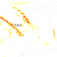
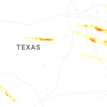
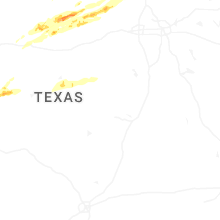
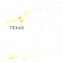
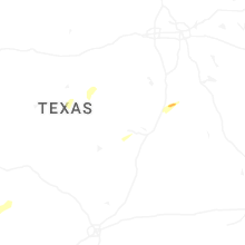
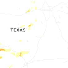

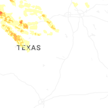

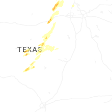
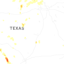
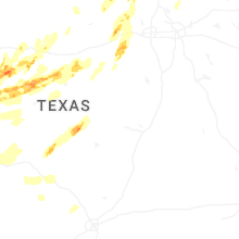
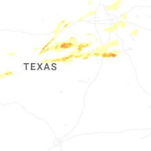
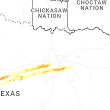


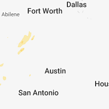
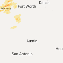


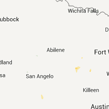


Connect with Interactive Hail Maps