

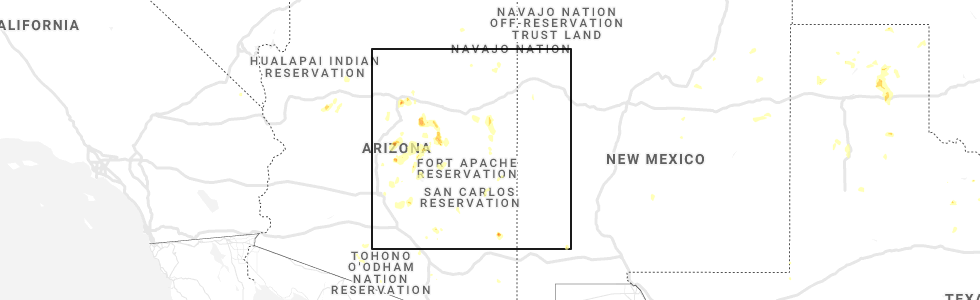
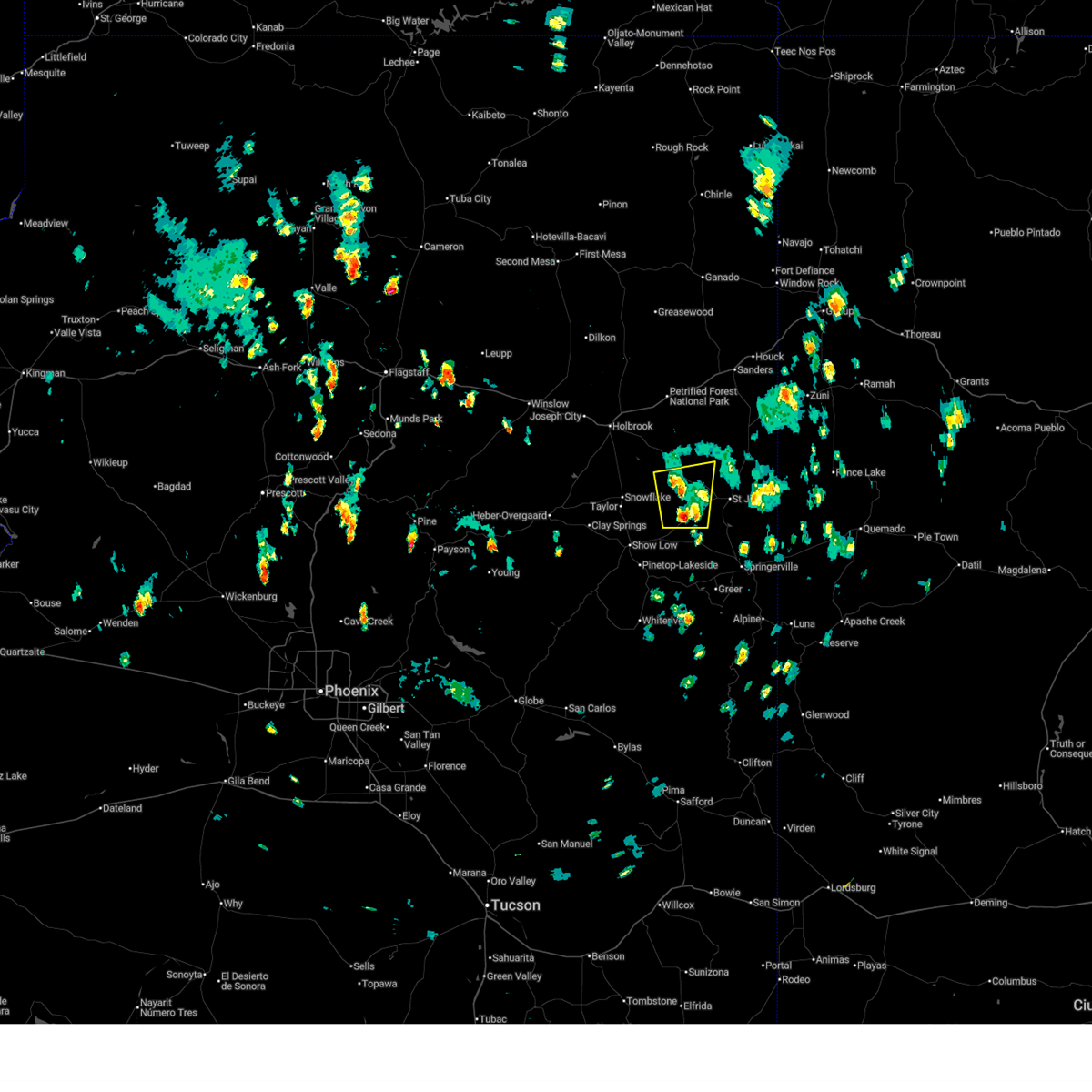
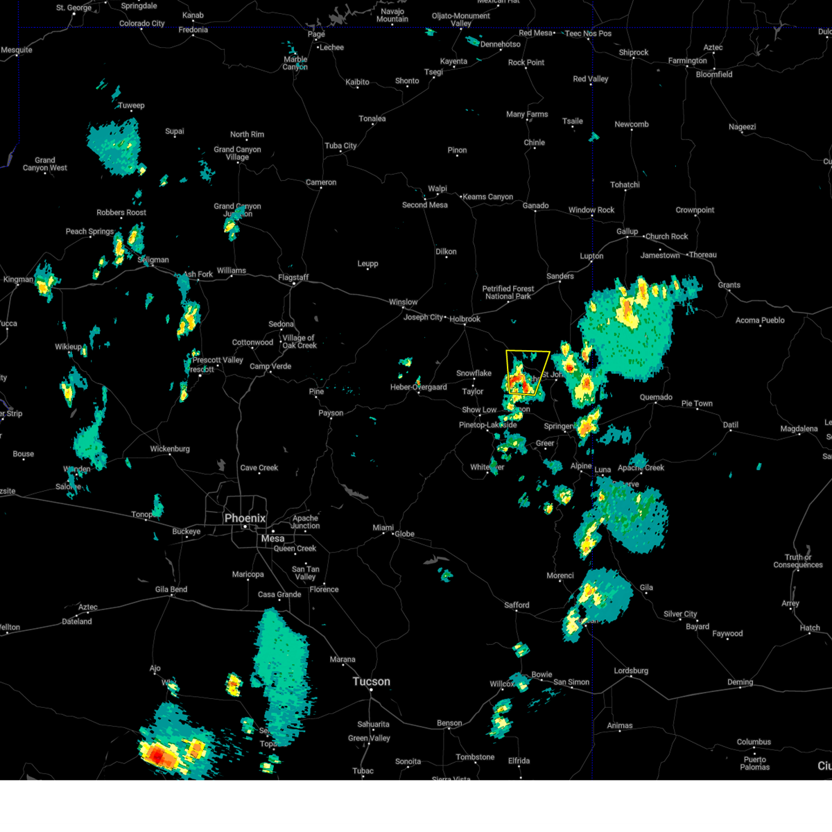
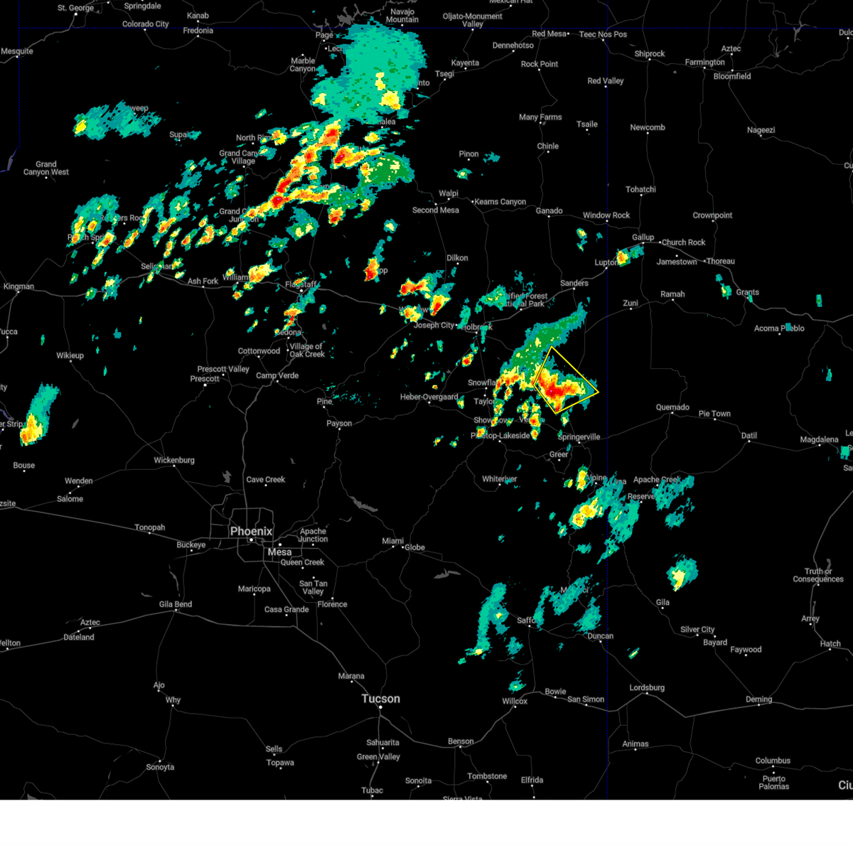
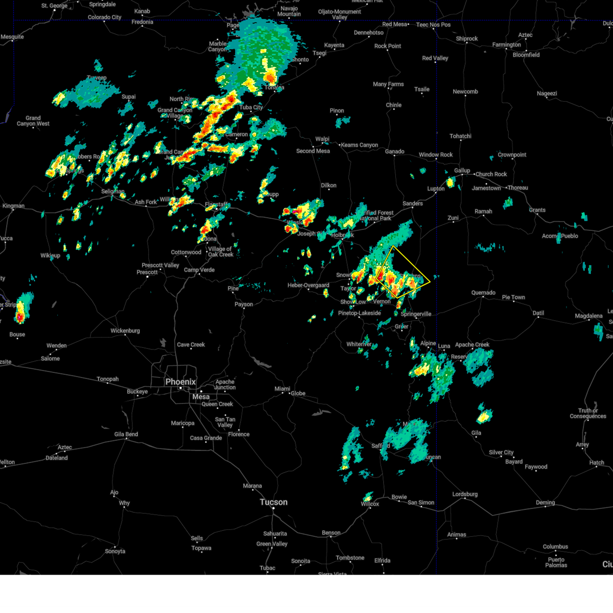
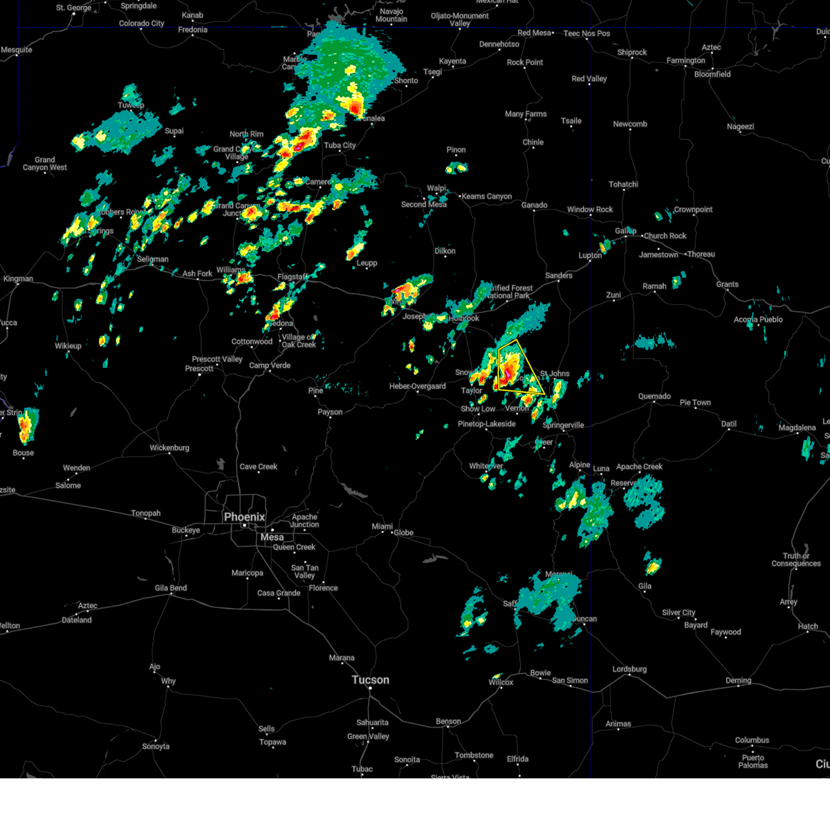
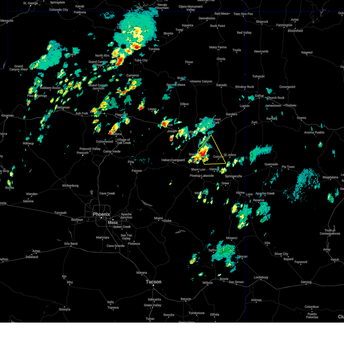
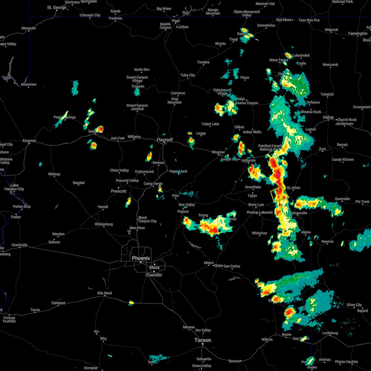
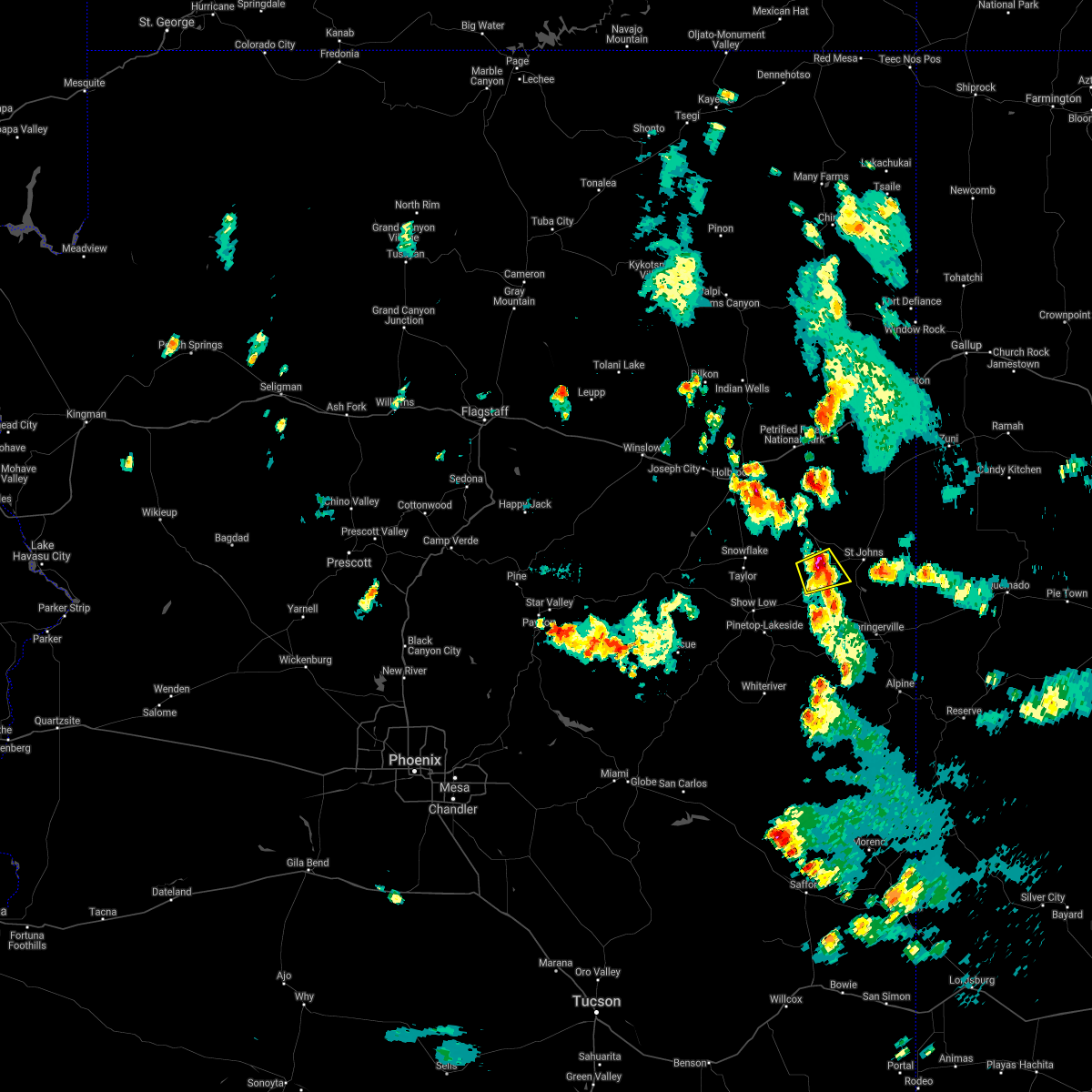
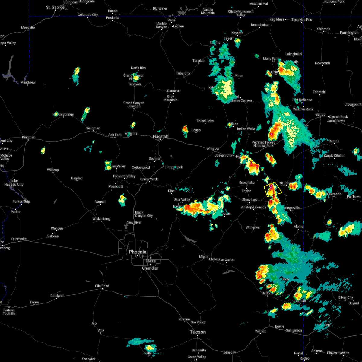
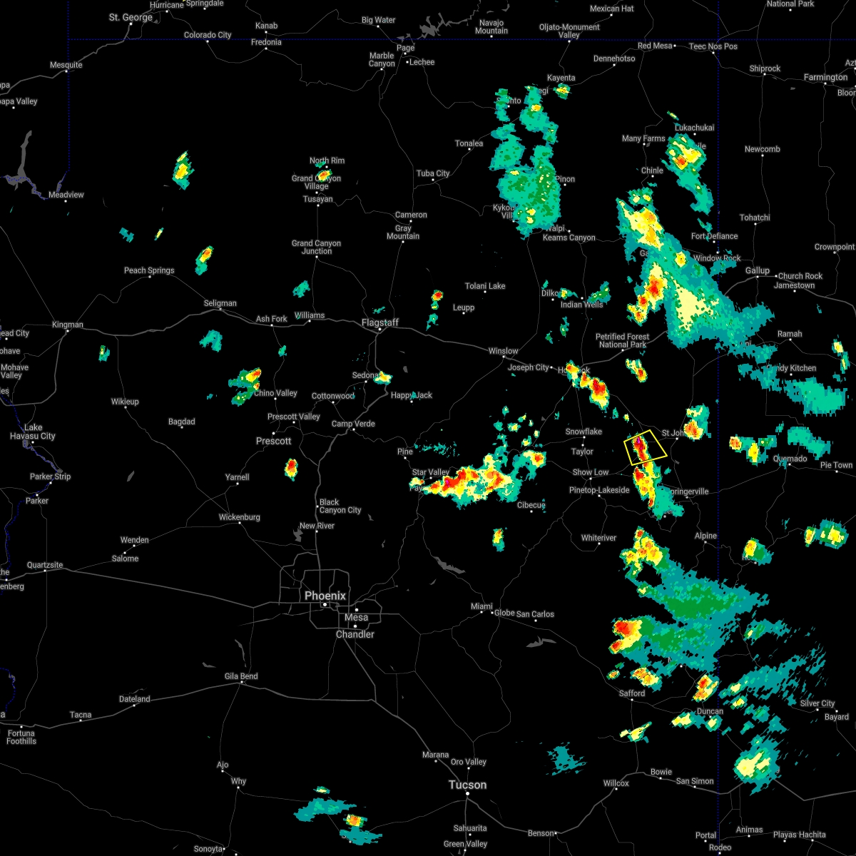
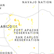
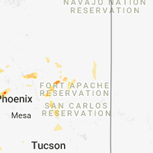
Hail Map for Concho, AZ
The Concho, AZ area has had 1 report of on-the-ground hail by trained spotters, and has been under severe weather warnings 4 times during the past 12 months. Doppler radar has detected hail at or near Concho, AZ on 6 occasions.
| Name: | Concho, AZ |
| Where Located: | 29.1 miles ENE of Show Low, AZ |
| Map: | Google Map for Concho, AZ |
| Population: | 38 |
| Housing Units: | 36 |
| More Info: | Search Google for Concho, AZ |
5
The Top Recent Hail Date for Concho, AZ is Monday, August 16, 2021 (1st out of 6)
Hail and Wind Damage Spotted near Concho, AZ
| Date / Time | Report Details |
|---|---|
| 9/12/2025 9:17 PM MST | the severe thunderstorm warning has been cancelled and is no longer in effect |
| 9/12/2025 8:57 PM MST | Svrfgz the national weather service in flagstaff has issued a * severe thunderstorm warning for, apache county in northeastern arizona, * until 930 pm mst. * at 857 pm mst, a severe thunderstorm was located 6 miles south of vernon, or 20 miles east of show low, moving northeast at 40 mph (radar indicated). Hazards include 60 mph wind gusts and quarter size hail. Hail damage to vehicles is expected. Expect wind damage to roofs, siding, and trees. |
| 8/26/2025 1:11 PM MST |
 The severe thunderstorm which prompted the warning has weakened and moved out of the warned area. therefore, the warning will be allowed to expire. The severe thunderstorm which prompted the warning has weakened and moved out of the warned area. therefore, the warning will be allowed to expire.
|
| 8/26/2025 12:29 PM MST |
 Svrfgz the national weather service in flagstaff has issued a * severe thunderstorm warning for, west central apache county in northeastern arizona, southeastern navajo county in north central arizona, * until 115 pm mst. * at 1226 pm mst, a severe thunderstorm was located over mainly rural areas of southern apache county , moving north at 15 mph (radar indicated). Hazards include 60 mph wind gusts and quarter sized hail. expect damage to roofs, siding, and trees Svrfgz the national weather service in flagstaff has issued a * severe thunderstorm warning for, west central apache county in northeastern arizona, southeastern navajo county in north central arizona, * until 115 pm mst. * at 1226 pm mst, a severe thunderstorm was located over mainly rural areas of southern apache county , moving north at 15 mph (radar indicated). Hazards include 60 mph wind gusts and quarter sized hail. expect damage to roofs, siding, and trees
|
| 8/18/2023 3:17 PM MST |
 At 317 pm mst, a severe thunderstorm was located over concho, or 28 miles northeast of show low, moving north at 10 mph (radar indicated). Hazards include 60 mph wind gusts and quarter size hail. Hail damage to vehicles is expected. Expect wind damage to roofs, siding, and trees. At 317 pm mst, a severe thunderstorm was located over concho, or 28 miles northeast of show low, moving north at 10 mph (radar indicated). Hazards include 60 mph wind gusts and quarter size hail. Hail damage to vehicles is expected. Expect wind damage to roofs, siding, and trees.
|
| 8/10/2023 4:26 PM MST |
 At 425 pm mst, a severe thunderstorm was located near saint johns, or 32 miles northeast of show low, moving northeast at 20 mph (radar indicated). Hazards include 60 mph wind gusts and quarter size hail. Hail damage to vehicles is expected. expect wind damage to roofs, siding, and trees. locations impacted include, st. johns, saint johns, st johns industrial air park, concho, and zion reservoir. this includes the following highways, highway 180 191 between mile markers 371 and 379. highway 191 161 between mile markers 316 and 325. highway 180 between mile markers 346 and 368. state route 61 between mile markers 372 and 381. hail threat, radar indicated max hail size, 1. 00 in wind threat, radar indicated max wind gust, 60 mph. At 425 pm mst, a severe thunderstorm was located near saint johns, or 32 miles northeast of show low, moving northeast at 20 mph (radar indicated). Hazards include 60 mph wind gusts and quarter size hail. Hail damage to vehicles is expected. expect wind damage to roofs, siding, and trees. locations impacted include, st. johns, saint johns, st johns industrial air park, concho, and zion reservoir. this includes the following highways, highway 180 191 between mile markers 371 and 379. highway 191 161 between mile markers 316 and 325. highway 180 between mile markers 346 and 368. state route 61 between mile markers 372 and 381. hail threat, radar indicated max hail size, 1. 00 in wind threat, radar indicated max wind gust, 60 mph.
|
| 8/10/2023 4:12 PM MST |
 At 411 pm mst, a severe thunderstorm was located 7 miles northwest of concho, or 27 miles northeast of show low, moving northeast at 20 mph (radar indicated). Hazards include 60 mph wind gusts and quarter size hail. Hail damage to vehicles is expected. Expect wind damage to roofs, siding, and trees. At 411 pm mst, a severe thunderstorm was located 7 miles northwest of concho, or 27 miles northeast of show low, moving northeast at 20 mph (radar indicated). Hazards include 60 mph wind gusts and quarter size hail. Hail damage to vehicles is expected. Expect wind damage to roofs, siding, and trees.
|
| 8/10/2023 3:56 PM MST |
 At 354 pm mst, a severe thunderstorm was located near hunt, or 33 miles northeast of show low, moving east at 30 mph (radar indicated). Hazards include 60 mph wind gusts and quarter size hail. Hail damage to vehicles is expected. expect wind damage to roofs, siding, and trees. locations impacted include, concho lake, hunt, mesa redonda, and concho. this includes the following highways, highway 180 between mile markers 332 and 349. state route 61 between mile markers 368 and 377. hail threat, radar indicated max hail size, 1. 00 in wind threat, radar indicated max wind gust, 60 mph. At 354 pm mst, a severe thunderstorm was located near hunt, or 33 miles northeast of show low, moving east at 30 mph (radar indicated). Hazards include 60 mph wind gusts and quarter size hail. Hail damage to vehicles is expected. expect wind damage to roofs, siding, and trees. locations impacted include, concho lake, hunt, mesa redonda, and concho. this includes the following highways, highway 180 between mile markers 332 and 349. state route 61 between mile markers 368 and 377. hail threat, radar indicated max hail size, 1. 00 in wind threat, radar indicated max wind gust, 60 mph.
|
| 8/10/2023 3:36 PM MST |
 At 333 pm mst, a severe thunderstorm was located 8 miles east of concho, or 25 miles northeast of show low, moving east at 30 mph (radar indicated). Hazards include 60 mph wind gusts and quarter size hail. Hail damage to vehicles is expected. Expect wind damage to roofs, siding, and trees. At 333 pm mst, a severe thunderstorm was located 8 miles east of concho, or 25 miles northeast of show low, moving east at 30 mph (radar indicated). Hazards include 60 mph wind gusts and quarter size hail. Hail damage to vehicles is expected. Expect wind damage to roofs, siding, and trees.
|
| 10/5/2021 5:30 PM MST | Quarter sized hail reported 9 miles SE of Concho, AZ, persistent large hail reported. |
| 8/16/2021 4:51 PM MST |
 The severe thunderstorm warning for apache county will expire at 500 pm mst, the storm which prompted the warning has weakened below severe limits, and no longer poses an immediate threat to life or property. therefore, the warning will be allowed to expire. however heavy rain is still possible with this thunderstorm. The severe thunderstorm warning for apache county will expire at 500 pm mst, the storm which prompted the warning has weakened below severe limits, and no longer poses an immediate threat to life or property. therefore, the warning will be allowed to expire. however heavy rain is still possible with this thunderstorm.
|
| 8/16/2021 4:25 PM MST |
 At 424 pm mst, a severe thunderstorm was located 7 miles south of concho moving southeast at 15 mph (radar indicated). Hazards include 60 mph wind gusts and quarter size hail. Hail damage to vehicles is expected. Expect wind damage to roofs, siding, and trees. At 424 pm mst, a severe thunderstorm was located 7 miles south of concho moving southeast at 15 mph (radar indicated). Hazards include 60 mph wind gusts and quarter size hail. Hail damage to vehicles is expected. Expect wind damage to roofs, siding, and trees.
|
| 8/16/2021 4:14 PM MST |
 At 414 pm mst, a severe thunderstorm was located near concho moving southeast at 15 mph (radar indicated). Hazards include 60 mph wind gusts. Expect damage to roofs, siding, and trees. locations impacted include, concho and little ortega lake. hail threat, radar indicated max hail size, <. 75 in wind threat, radar indicated max wind gust, 60 mph. At 414 pm mst, a severe thunderstorm was located near concho moving southeast at 15 mph (radar indicated). Hazards include 60 mph wind gusts. Expect damage to roofs, siding, and trees. locations impacted include, concho and little ortega lake. hail threat, radar indicated max hail size, <. 75 in wind threat, radar indicated max wind gust, 60 mph.
|
| 8/16/2021 3:57 PM MST |
 At 357 pm mst, a severe thunderstorm was located over concho moving southeast at 15 mph (radar indicated). Hazards include 60 mph wind gusts. expect damage to roofs, siding, and trees At 357 pm mst, a severe thunderstorm was located over concho moving southeast at 15 mph (radar indicated). Hazards include 60 mph wind gusts. expect damage to roofs, siding, and trees
|
Hail Maps for Concho, AZ


Connect with Interactive Hail Maps