

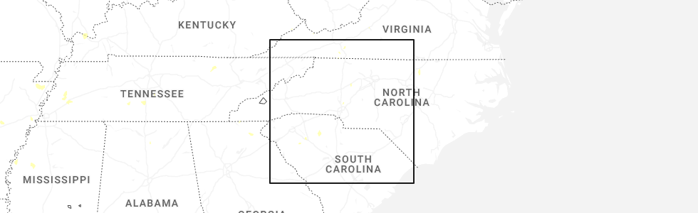
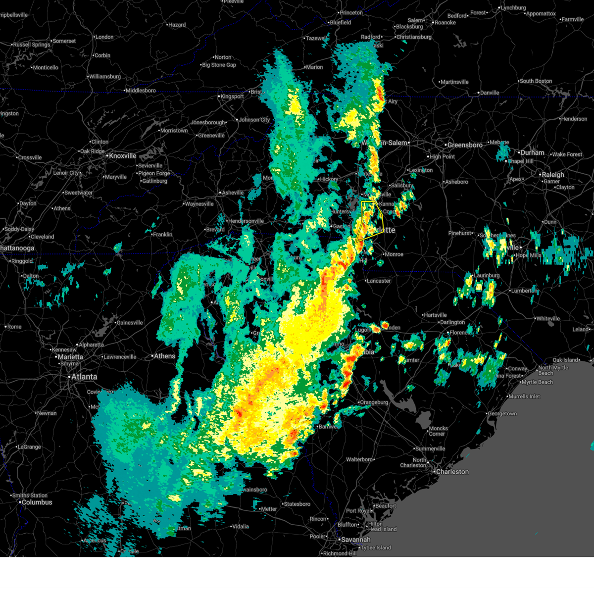
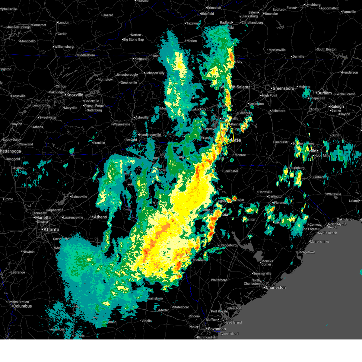
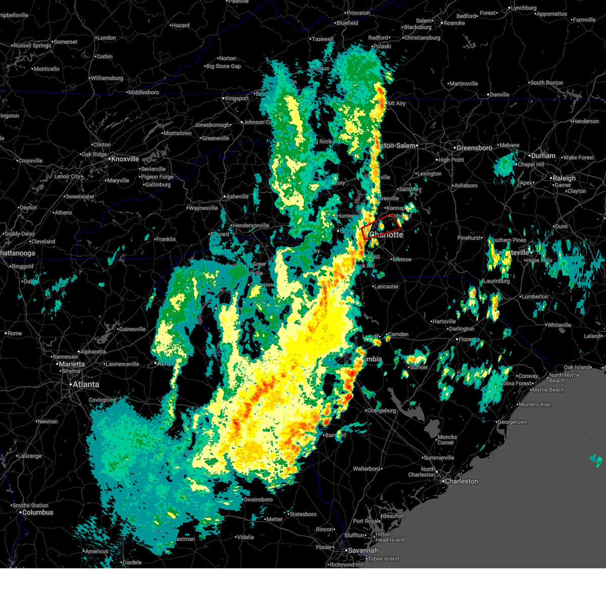
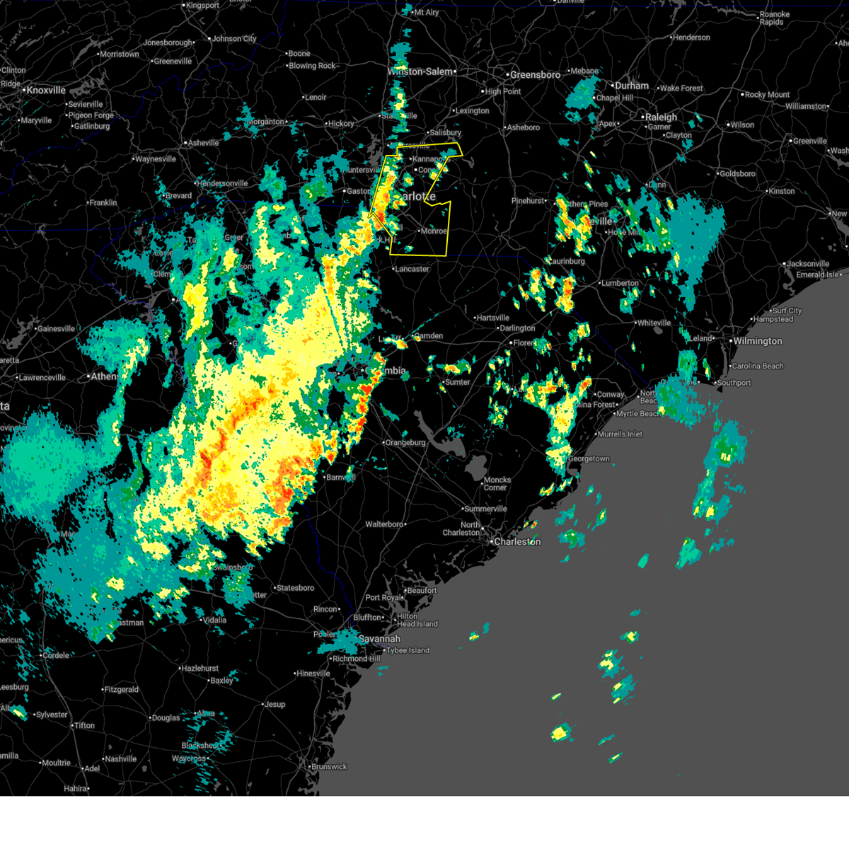
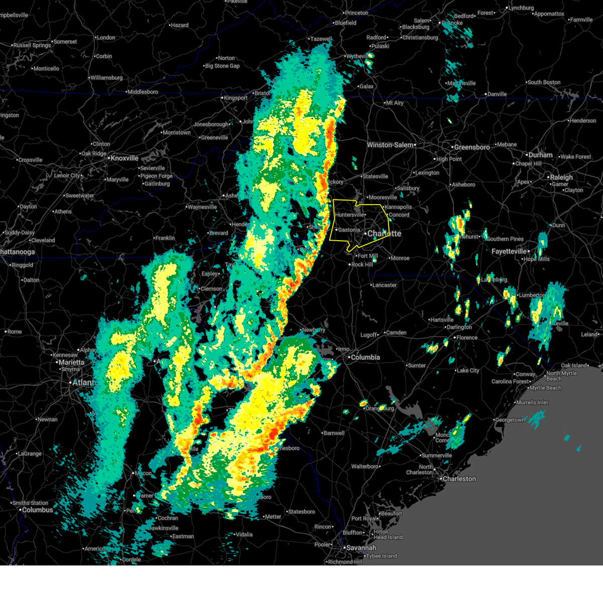
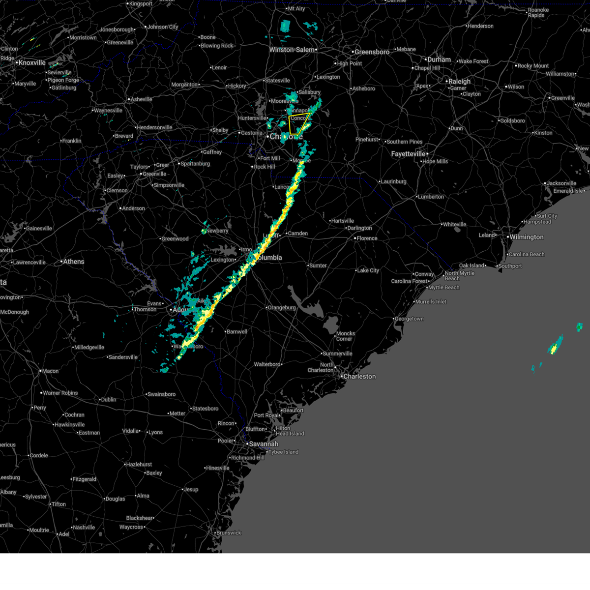
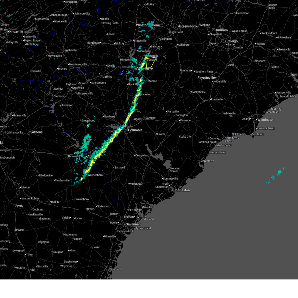
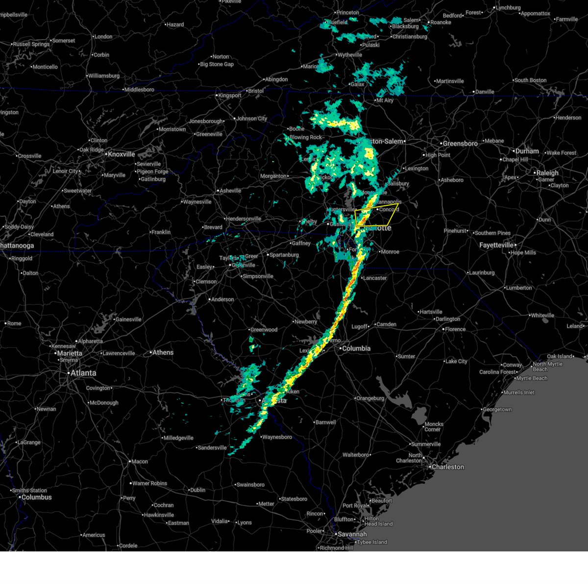
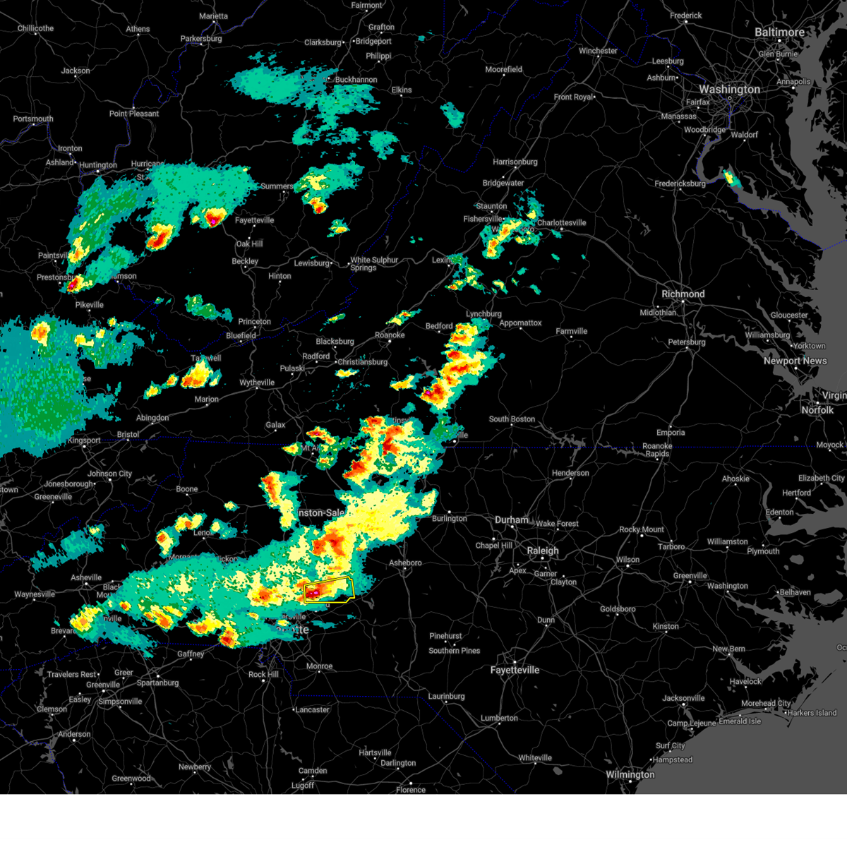
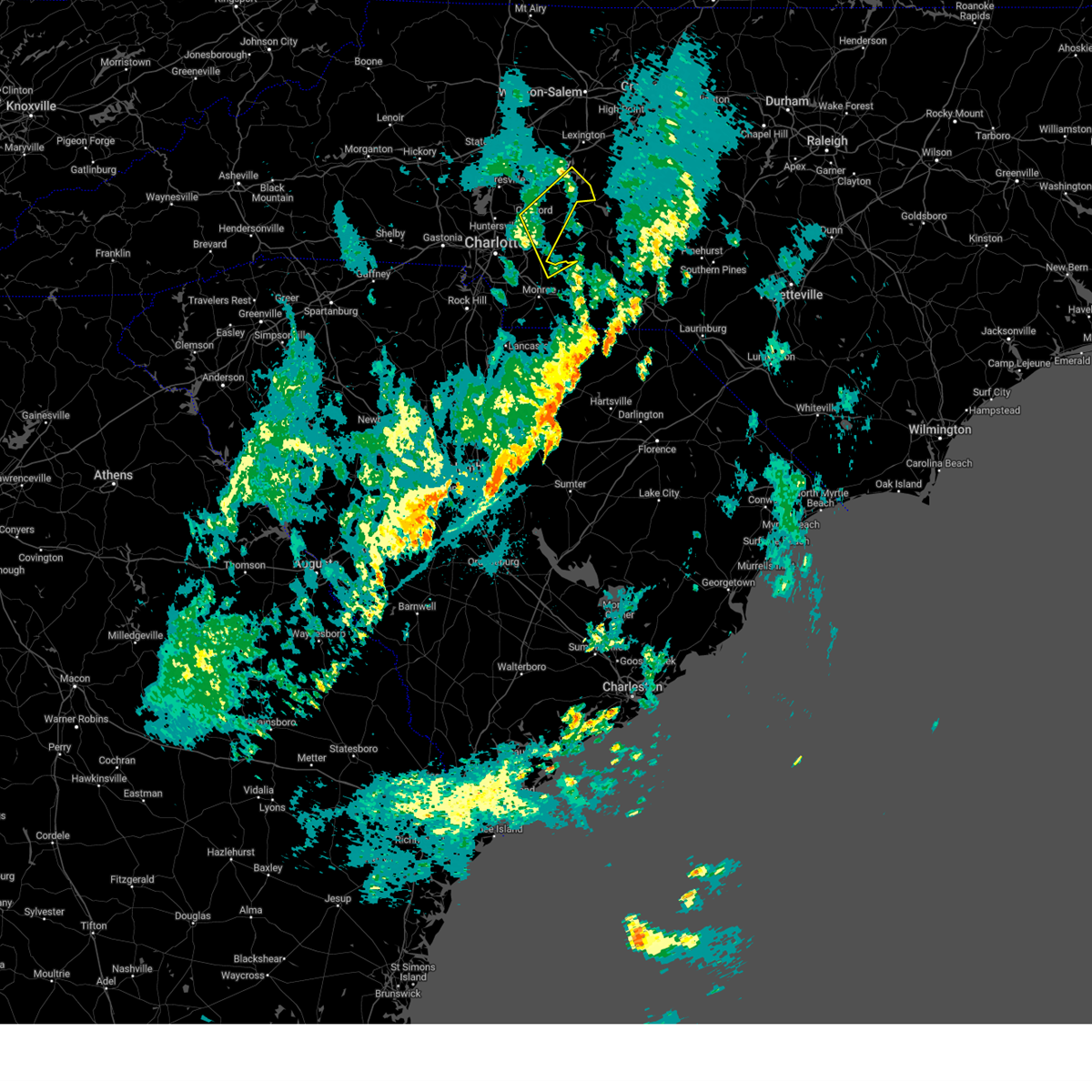
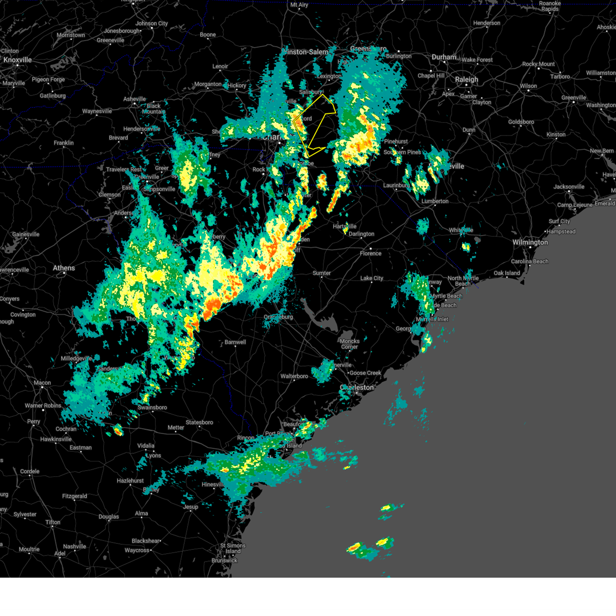
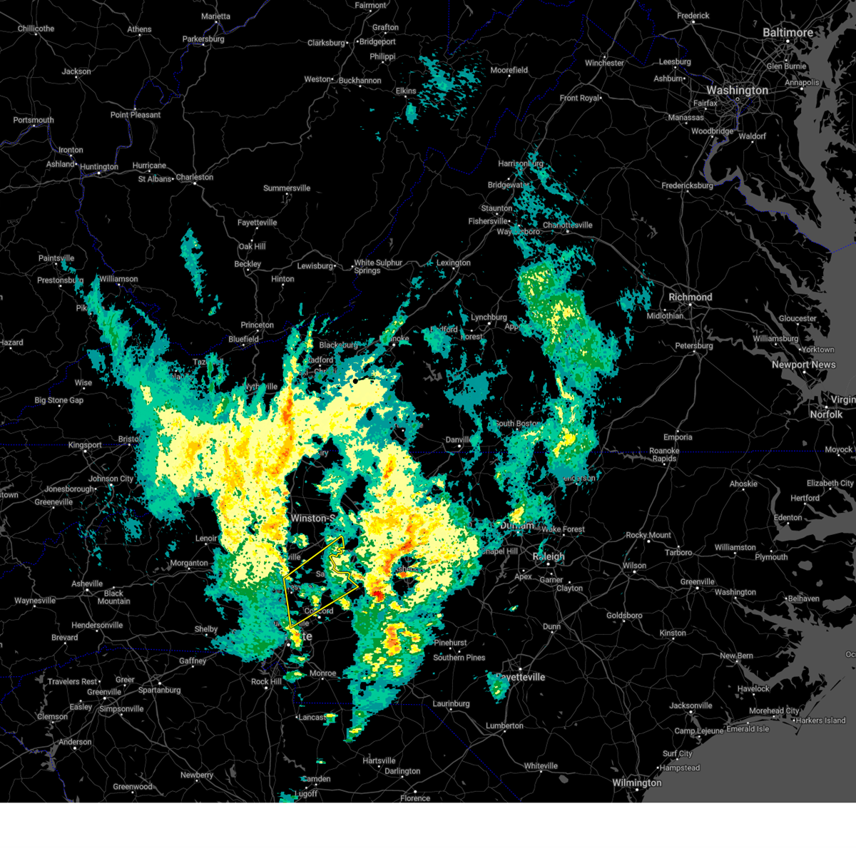
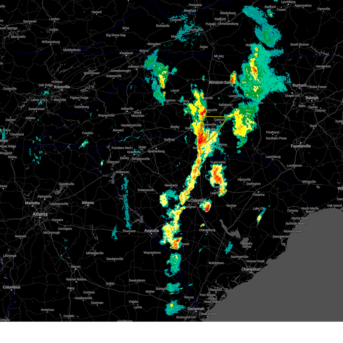
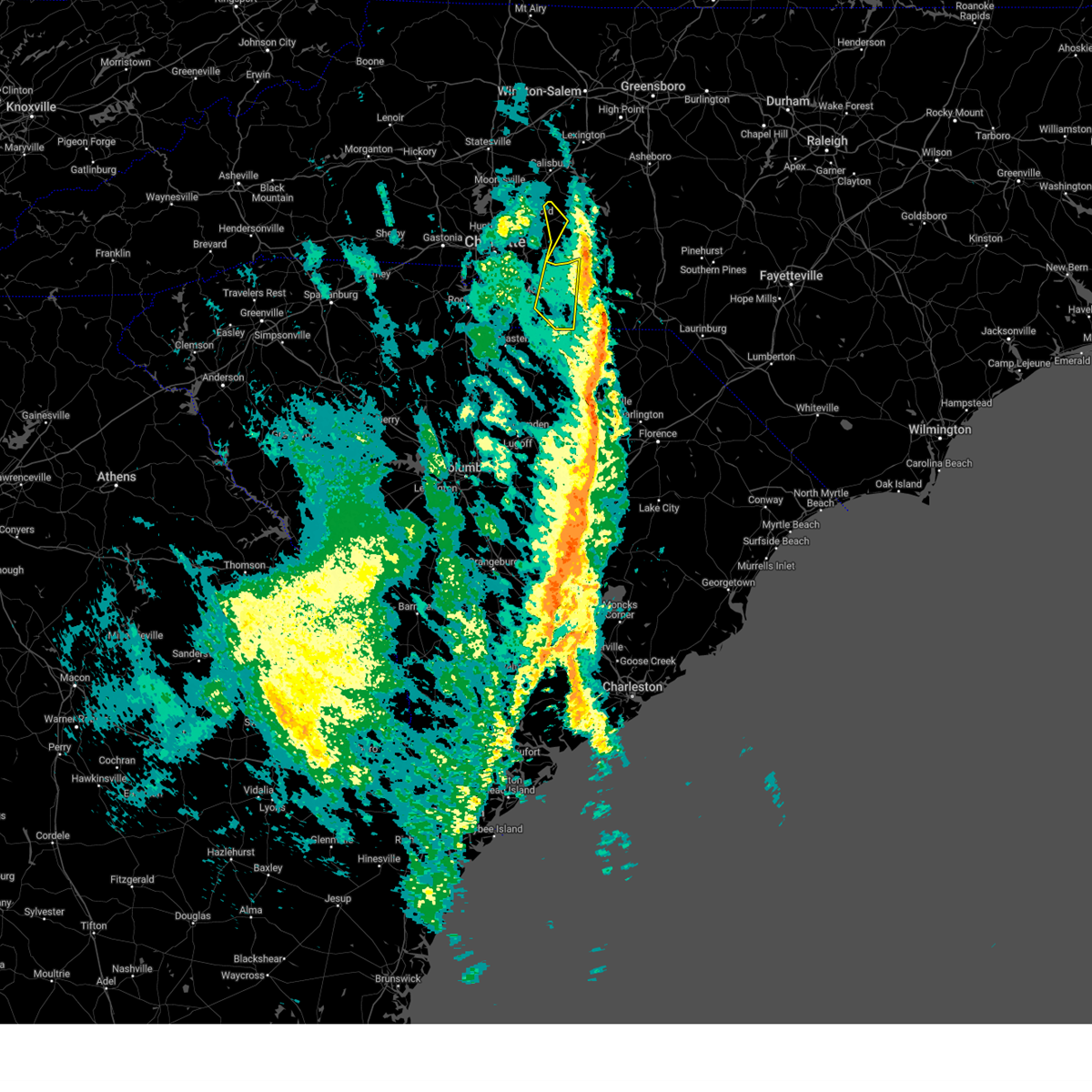
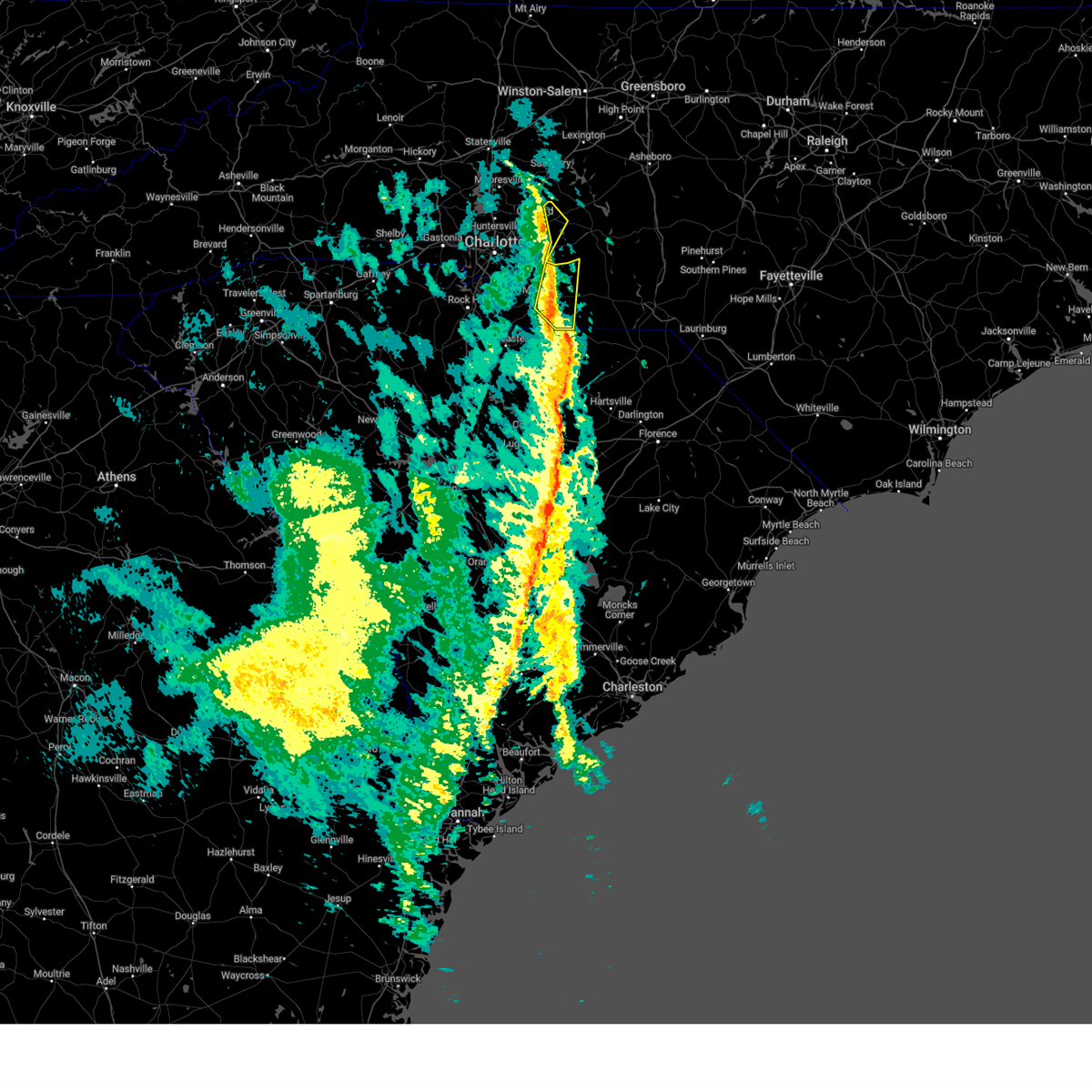
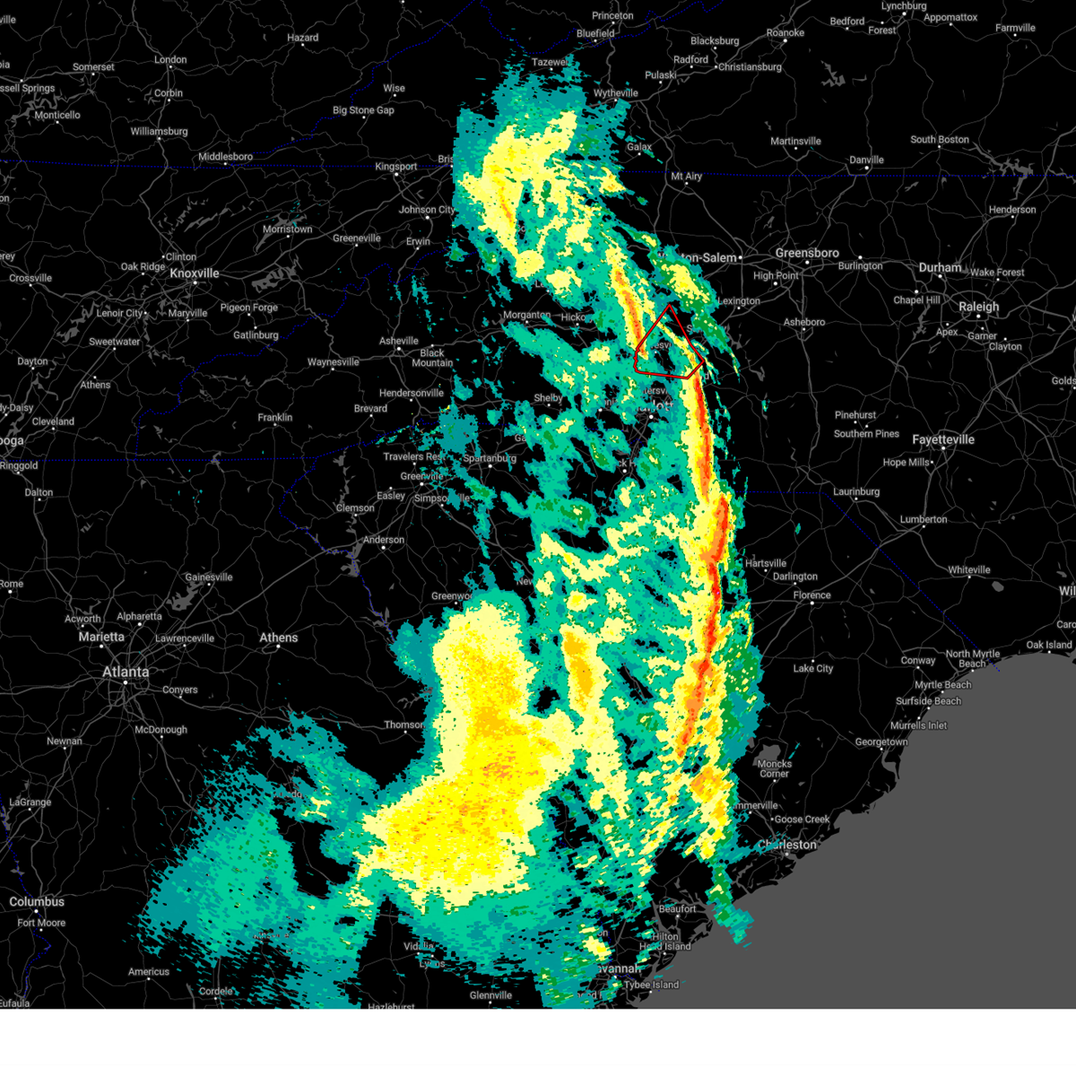
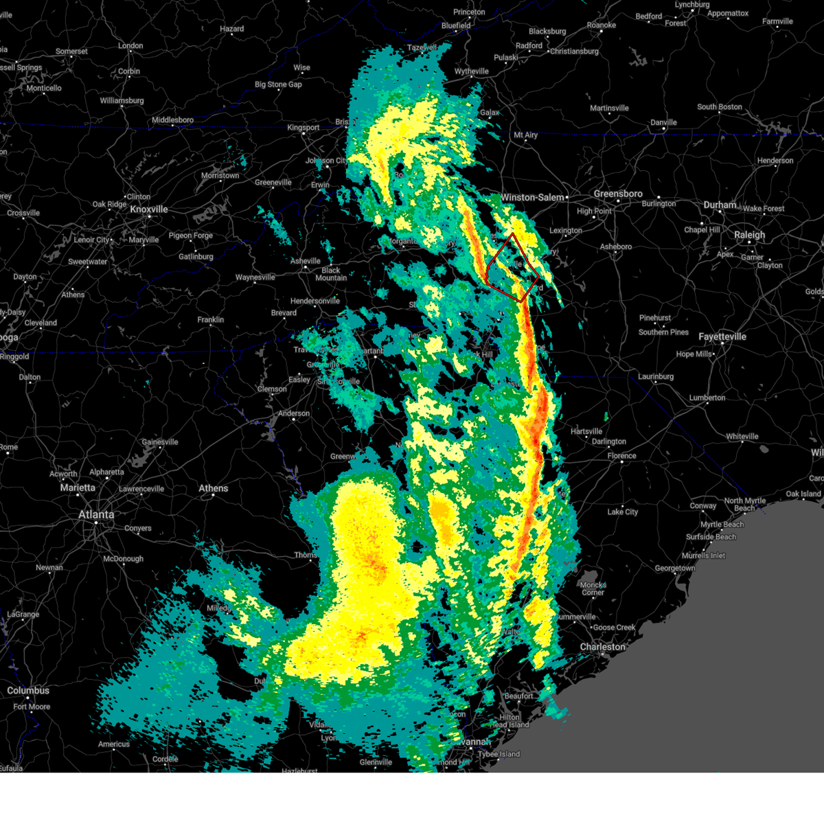
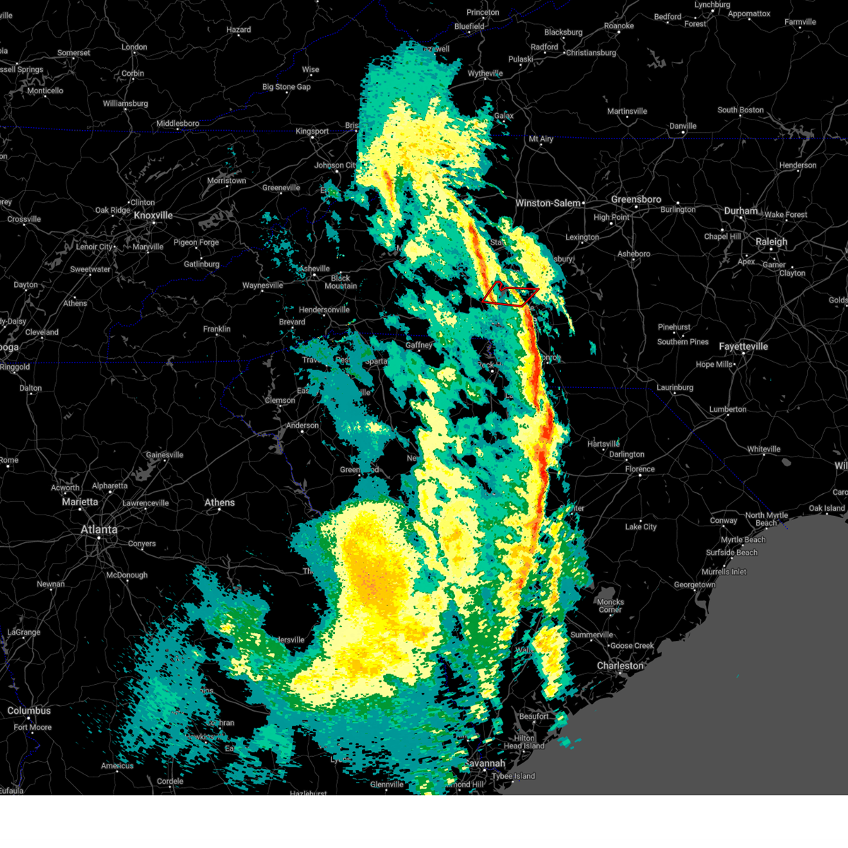
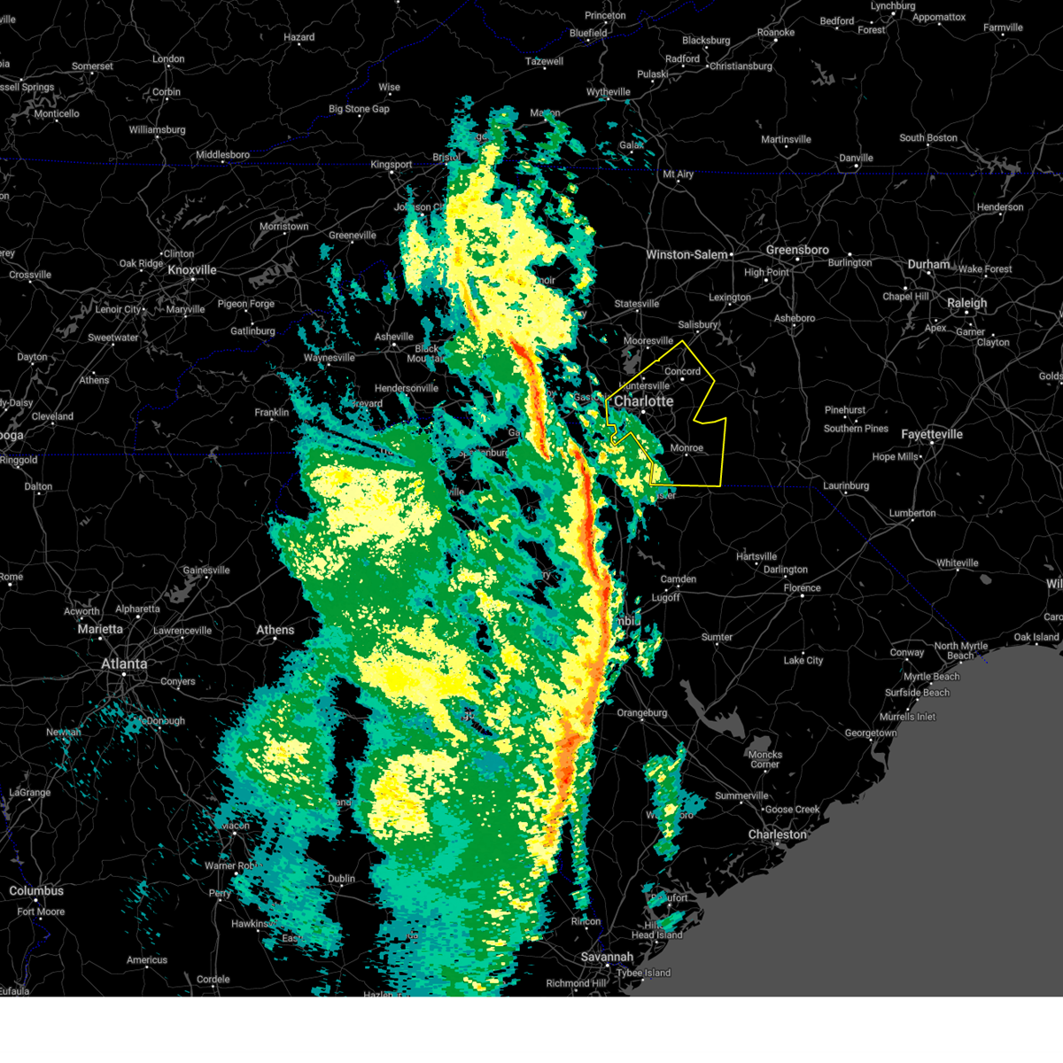
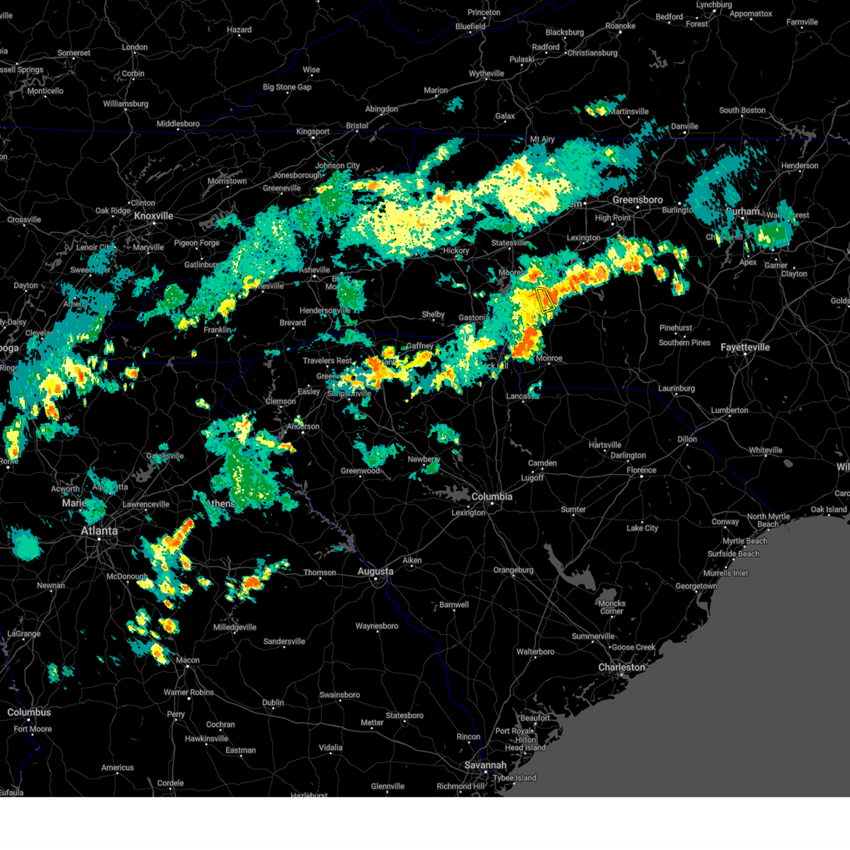
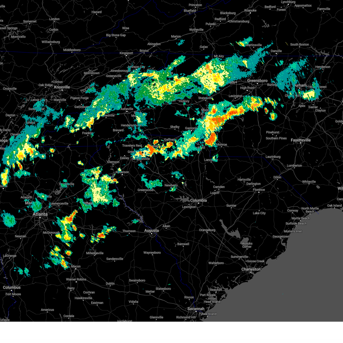
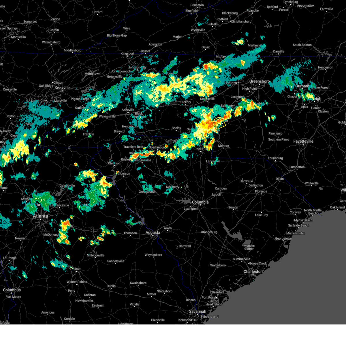
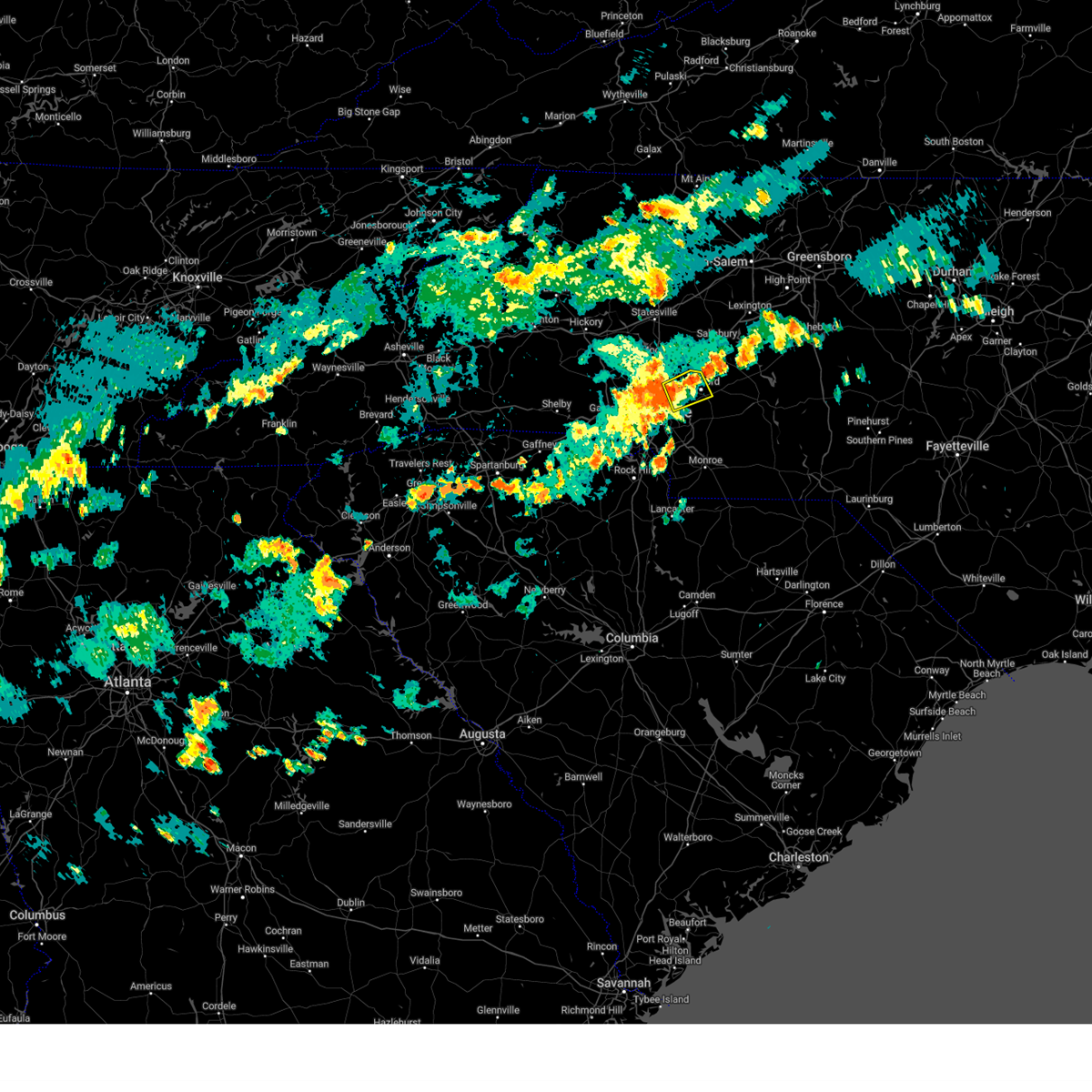
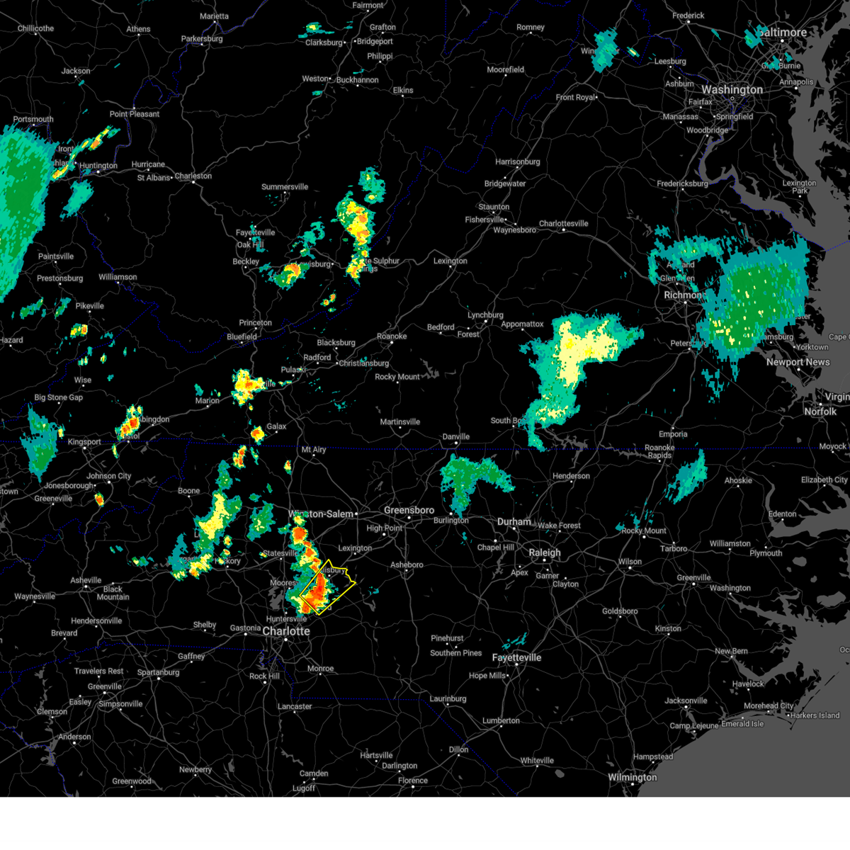
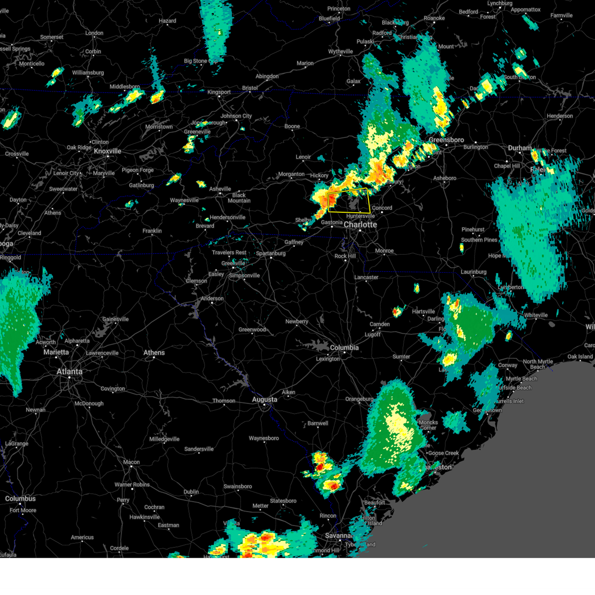
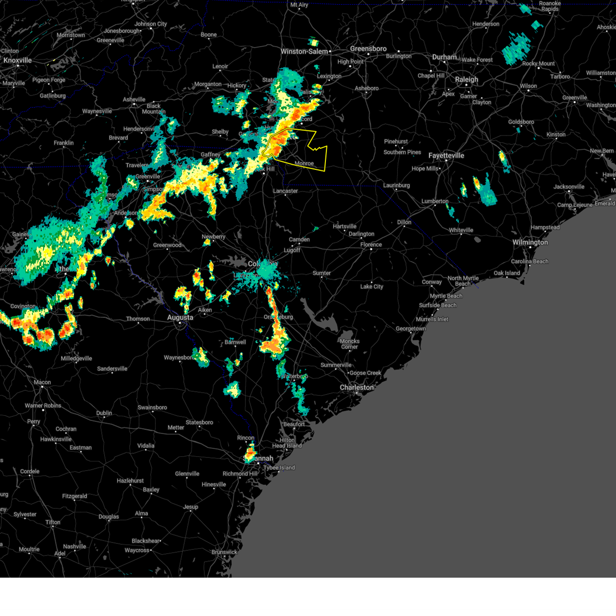
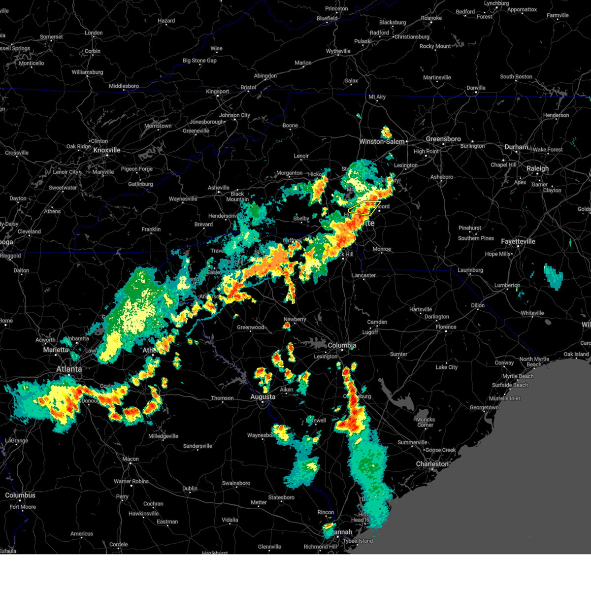
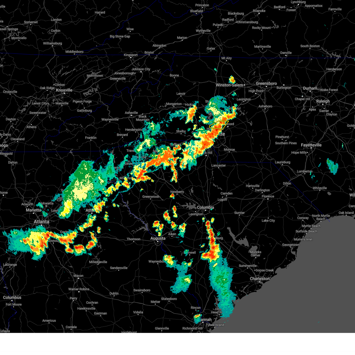
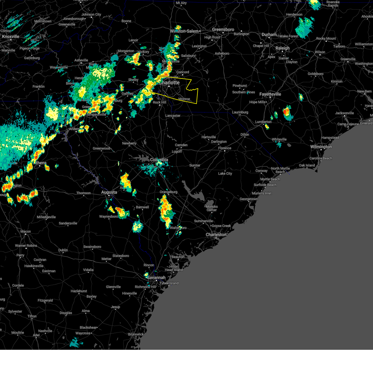
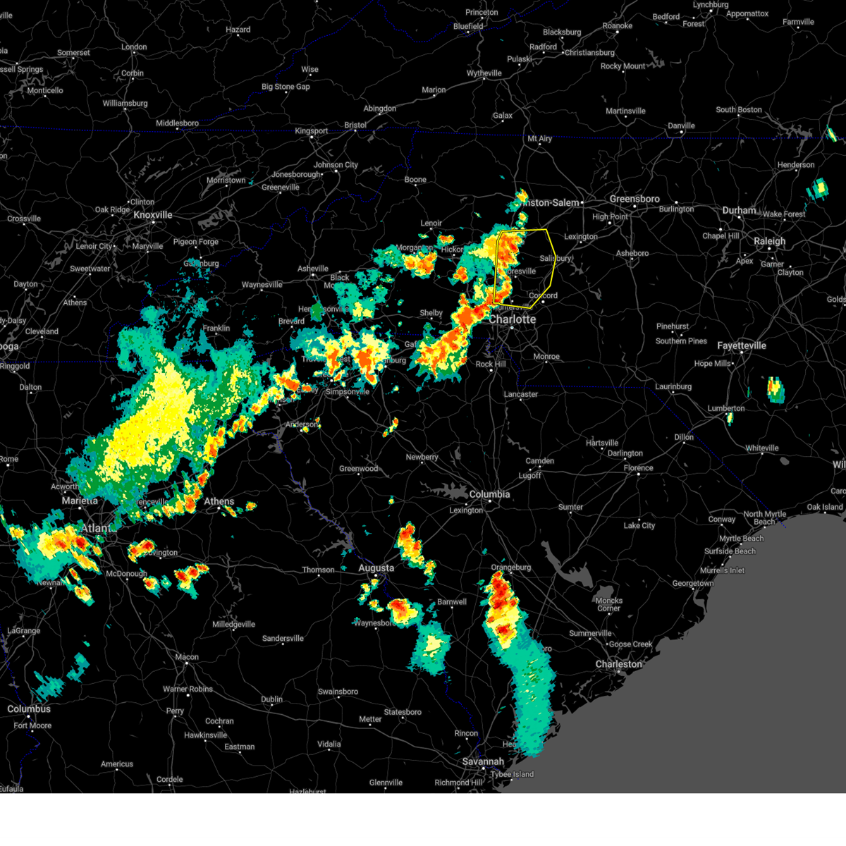
Hail Map for Concord, NC
The Concord, NC area has had 16 reports of on-the-ground hail by trained spotters, and has been under severe weather warnings 27 times during the past 12 months. Doppler radar has detected hail at or near Concord, NC on 81 occasions, including 2 occasions during the past year.
| Name: | Concord, NC |
| Where Located: | 16.7 miles NE of Charlotte, NC |
| Map: | Google Map for Concord, NC |
| Population: | 79066 |
| Housing Units: | 32130 |
| More Info: | Search Google for Concord, NC |
0
The Top Recent Hail Date for Concord, NC is Saturday, June 28, 2025 (81st out of 81)
Hail and Wind Damage Spotted near Concord, NC
| Date / Time | Report Details |
|---|---|
| 3/16/2026 10:09 AM EDT |
 At 1009 am edt, severe thunderstorms were located along a line extending from 11 miles east of kannapolis to 7 miles southwest of monroe, moving east at 35 mph (radar indicated). Hazards include 60 mph wind gusts. Expect damage to trees and power lines. Locations impacted include, monroe, indian trail, stallings, unionville, wesley chapel, wingate, waxhaw, marshville, lake park, and mineral springs. At 1009 am edt, severe thunderstorms were located along a line extending from 11 miles east of kannapolis to 7 miles southwest of monroe, moving east at 35 mph (radar indicated). Hazards include 60 mph wind gusts. Expect damage to trees and power lines. Locations impacted include, monroe, indian trail, stallings, unionville, wesley chapel, wingate, waxhaw, marshville, lake park, and mineral springs.
|
| 3/16/2026 10:09 AM EDT |
 the severe thunderstorm warning has been cancelled and is no longer in effect the severe thunderstorm warning has been cancelled and is no longer in effect
|
| 3/16/2026 10:09 AM EDT |
 The storm which prompted the warning has weakened below severe limits, and has exited the warned area. therefore, the warning will be allowed to expire. a severe thunderstorm watch remains in effect until 1100 am edt for the piedmont of north carolina. remember, a severe thunderstorm warning still remains in effect for cabarrus counties until 1045 am edt. The storm which prompted the warning has weakened below severe limits, and has exited the warned area. therefore, the warning will be allowed to expire. a severe thunderstorm watch remains in effect until 1100 am edt for the piedmont of north carolina. remember, a severe thunderstorm warning still remains in effect for cabarrus counties until 1045 am edt.
|
| 3/16/2026 10:01 AM EDT |
 the tornado warning has been cancelled and is no longer in effect the tornado warning has been cancelled and is no longer in effect
|
| 3/16/2026 10:01 AM EDT |
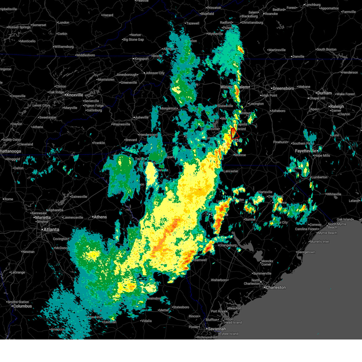
 At 1000 am edt, a severe thunderstorm capable of producing a tornado was located 6 miles south of downtown concord, or 5 miles east of harrisburg, moving northeast at 40 mph (radar indicated rotation). Hazards include tornado. Flying debris will be dangerous to those caught without shelter. mobile homes will be damaged or destroyed. damage to roofs, windows, and vehicles will occur. tree damage is likely. This dangerous storm will be near, mt pleasant around 1010 am edt. At 1000 am edt, a severe thunderstorm capable of producing a tornado was located 6 miles south of downtown concord, or 5 miles east of harrisburg, moving northeast at 40 mph (radar indicated rotation). Hazards include tornado. Flying debris will be dangerous to those caught without shelter. mobile homes will be damaged or destroyed. damage to roofs, windows, and vehicles will occur. tree damage is likely. This dangerous storm will be near, mt pleasant around 1010 am edt.
|
| 3/16/2026 9:47 AM EDT |
 At 946 am edt, a severe thunderstorm capable of producing a tornado was located 6 miles east of uptown charlotte, or near reedy creek park, moving northeast at 40 mph (radar indicated rotation). Hazards include tornado. Flying debris will be dangerous to those caught without shelter. mobile homes will be damaged or destroyed. damage to roofs, windows, and vehicles will occur. tree damage is likely. this dangerous storm will be near, charlotte, harrisburg, and reedy creek park around 950 am edt. Mt pleasant around 1000 am edt. At 946 am edt, a severe thunderstorm capable of producing a tornado was located 6 miles east of uptown charlotte, or near reedy creek park, moving northeast at 40 mph (radar indicated rotation). Hazards include tornado. Flying debris will be dangerous to those caught without shelter. mobile homes will be damaged or destroyed. damage to roofs, windows, and vehicles will occur. tree damage is likely. this dangerous storm will be near, charlotte, harrisburg, and reedy creek park around 950 am edt. Mt pleasant around 1000 am edt.
|
| 3/16/2026 9:47 AM EDT |
 At 946 am edt, severe thunderstorms were located along a line extending from 6 miles west of kannapolis to 9 miles southwest of downtown concord to 8 miles southeast of uptown charlotte, moving east at 50 mph (radar indicated). Hazards include 60 mph wind gusts. Expect damage to trees and power lines. Locations impacted include, uptown charlotte, downtown concord, northeast charlotte, east charlotte, west concord, mint hill, harrisburg, university city, freedom park, and reedy creek park. At 946 am edt, severe thunderstorms were located along a line extending from 6 miles west of kannapolis to 9 miles southwest of downtown concord to 8 miles southeast of uptown charlotte, moving east at 50 mph (radar indicated). Hazards include 60 mph wind gusts. Expect damage to trees and power lines. Locations impacted include, uptown charlotte, downtown concord, northeast charlotte, east charlotte, west concord, mint hill, harrisburg, university city, freedom park, and reedy creek park.
|
| 3/16/2026 9:47 AM EDT |
 the severe thunderstorm warning has been cancelled and is no longer in effect the severe thunderstorm warning has been cancelled and is no longer in effect
|
| 3/16/2026 9:40 AM EDT |
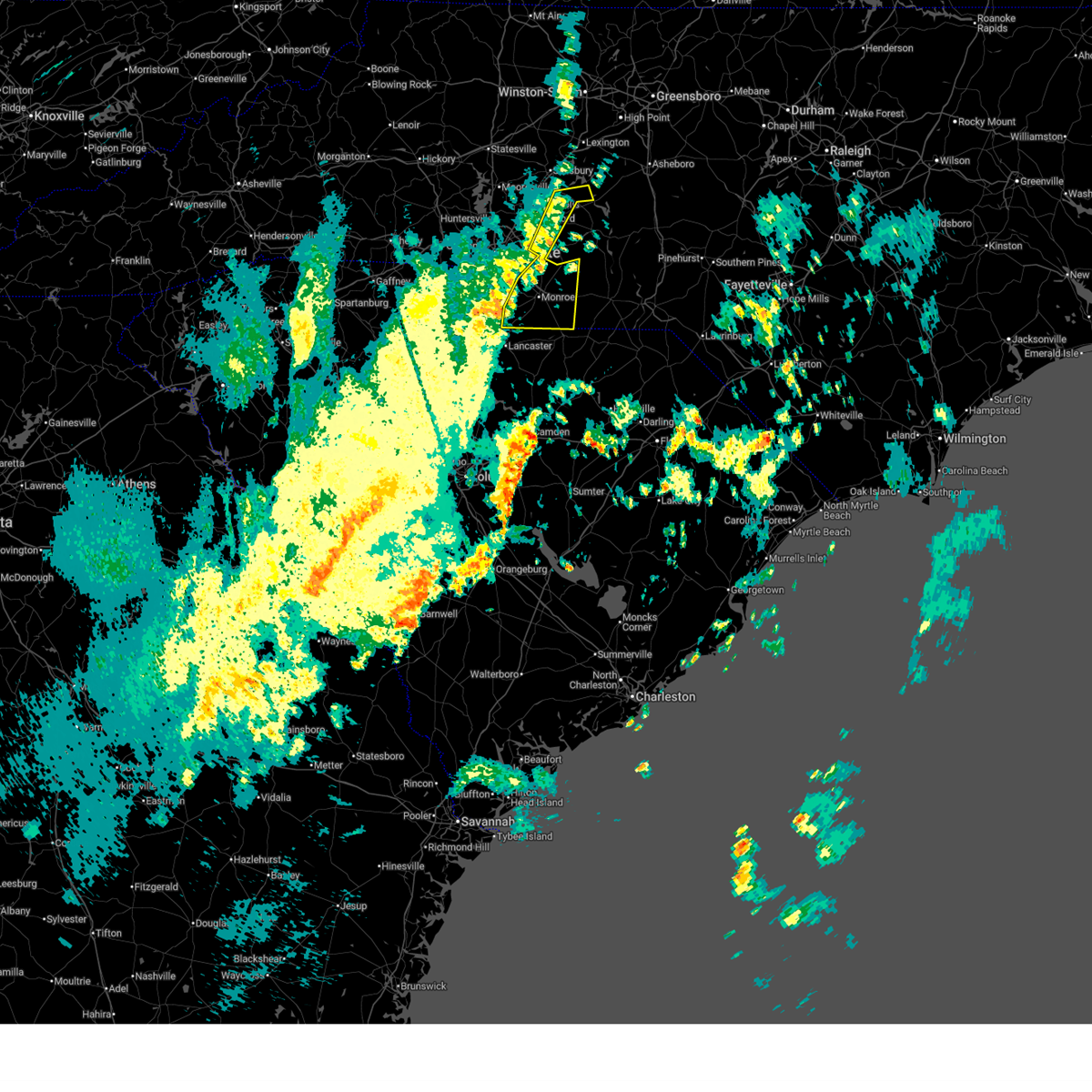
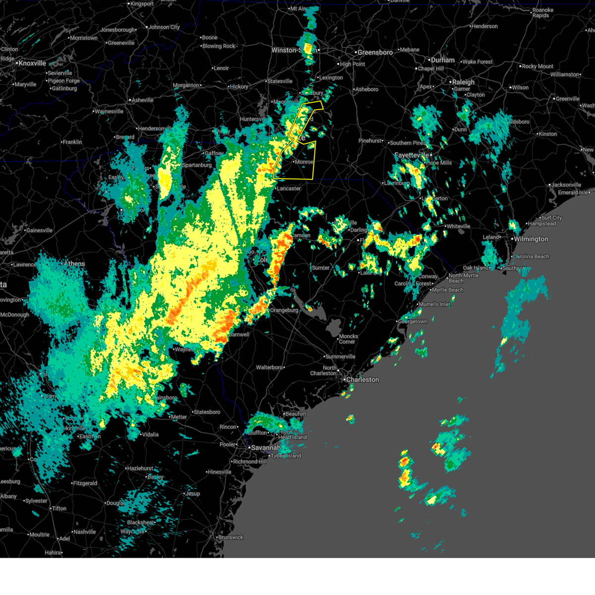
 Torgsp the national weather service in greenville-spartanburg has issued a * tornado warning for, central cabarrus county in the piedmont of north carolina, central mecklenburg county in the piedmont of north carolina, * until 1015 am edt. * at 940 am edt, a severe thunderstorm capable of producing a tornado was located near uptown charlotte, or over the plaza, moving northeast at 40 mph (radar indicated rotation). Hazards include tornado. Flying debris will be dangerous to those caught without shelter. mobile homes will be damaged or destroyed. damage to roofs, windows, and vehicles will occur. tree damage is likely. this dangerous storm will be near, charlotte, harrisburg, and reedy creek park around 950 am edt. Mt pleasant around 1010 am edt. Torgsp the national weather service in greenville-spartanburg has issued a * tornado warning for, central cabarrus county in the piedmont of north carolina, central mecklenburg county in the piedmont of north carolina, * until 1015 am edt. * at 940 am edt, a severe thunderstorm capable of producing a tornado was located near uptown charlotte, or over the plaza, moving northeast at 40 mph (radar indicated rotation). Hazards include tornado. Flying debris will be dangerous to those caught without shelter. mobile homes will be damaged or destroyed. damage to roofs, windows, and vehicles will occur. tree damage is likely. this dangerous storm will be near, charlotte, harrisburg, and reedy creek park around 950 am edt. Mt pleasant around 1010 am edt.
|
| 3/16/2026 9:39 AM EDT |
 Svrgsp the national weather service in greenville-spartanburg has issued a * severe thunderstorm warning for, cabarrus county in the piedmont of north carolina, mecklenburg county in the piedmont of north carolina, southern rowan county in the piedmont of north carolina, union county in the piedmont of north carolina, * until 1045 am edt. * at 937 am edt, severe thunderstorms were located along a line extending from 7 miles northeast of huntersville to 3 miles east of rock hill, moving east at 40 mph (radar indicated). Hazards include 60 mph wind gusts. expect damage to trees and power lines Svrgsp the national weather service in greenville-spartanburg has issued a * severe thunderstorm warning for, cabarrus county in the piedmont of north carolina, mecklenburg county in the piedmont of north carolina, southern rowan county in the piedmont of north carolina, union county in the piedmont of north carolina, * until 1045 am edt. * at 937 am edt, severe thunderstorms were located along a line extending from 7 miles northeast of huntersville to 3 miles east of rock hill, moving east at 40 mph (radar indicated). Hazards include 60 mph wind gusts. expect damage to trees and power lines
|
| 3/16/2026 9:04 AM EDT |
 Svrgsp the national weather service in greenville-spartanburg has issued a * severe thunderstorm warning for, western cabarrus county in the piedmont of north carolina, eastern lincoln county in the piedmont of north carolina, mecklenburg county in the piedmont of north carolina, gaston county in the piedmont of north carolina, * until 1000 am edt. * at 904 am edt, severe thunderstorms were located along a line extending from 6 miles north of lincolnton to 19 miles west of huntersville to 6 miles southwest of gastonia, moving east at 40 mph (radar indicated). Hazards include 60 mph wind gusts. expect damage to trees and power lines Svrgsp the national weather service in greenville-spartanburg has issued a * severe thunderstorm warning for, western cabarrus county in the piedmont of north carolina, eastern lincoln county in the piedmont of north carolina, mecklenburg county in the piedmont of north carolina, gaston county in the piedmont of north carolina, * until 1000 am edt. * at 904 am edt, severe thunderstorms were located along a line extending from 6 miles north of lincolnton to 19 miles west of huntersville to 6 miles southwest of gastonia, moving east at 40 mph (radar indicated). Hazards include 60 mph wind gusts. expect damage to trees and power lines
|
| 12/19/2025 5:24 AM EST |
 the severe thunderstorm warning has been cancelled and is no longer in effect the severe thunderstorm warning has been cancelled and is no longer in effect
|
| 12/19/2025 5:12 AM EST |
 the severe thunderstorm warning has been cancelled and is no longer in effect the severe thunderstorm warning has been cancelled and is no longer in effect
|
| 12/19/2025 5:12 AM EST |
 At 511 am est, a severe thunderstorm was located 7 miles southeast of downtown concord, or near mt pleasant, moving east at 45 mph (radar indicated). Hazards include 60 mph wind gusts. Expect damage to trees and power lines. Locations impacted include, mt pleasant and downtown concord. At 511 am est, a severe thunderstorm was located 7 miles southeast of downtown concord, or near mt pleasant, moving east at 45 mph (radar indicated). Hazards include 60 mph wind gusts. Expect damage to trees and power lines. Locations impacted include, mt pleasant and downtown concord.
|
| 12/19/2025 5:10 AM EST | Report of a tree down on barrier road. time estimated from rada in cabarrus county NC, 9.3 miles SW of Concord, NC |
| 12/19/2025 4:55 AM EST |
 Svrgsp the national weather service in greenville-spartanburg has issued a * severe thunderstorm warning for, cabarrus county in the piedmont of north carolina, central mecklenburg county in the piedmont of north carolina, * until 600 am est. * at 455 am est, a severe thunderstorm was located 6 miles southwest of downtown concord, or over charlotte motor speedway, moving east at 45 mph (radar indicated). Hazards include 60 mph wind gusts. expect damage to trees and power lines Svrgsp the national weather service in greenville-spartanburg has issued a * severe thunderstorm warning for, cabarrus county in the piedmont of north carolina, central mecklenburg county in the piedmont of north carolina, * until 600 am est. * at 455 am est, a severe thunderstorm was located 6 miles southwest of downtown concord, or over charlotte motor speedway, moving east at 45 mph (radar indicated). Hazards include 60 mph wind gusts. expect damage to trees and power lines
|
| 8/1/2025 5:32 PM EDT |
 At 532 pm edt, severe thunderstorms were located along a line extending from 7 miles northwest of albemarle to near downtown concord to 14 miles south of kannapolis to near uptown charlotte, moving southeast at 25 mph (radar indicated). Hazards include 60 mph wind gusts. Expect damage to trees and power lines. Locations impacted include, downtown concord, northeast charlotte, west concord, rockwell, university city, charlotte motor speedway, high rock lake, croft, huntersville, and harrisburg. At 532 pm edt, severe thunderstorms were located along a line extending from 7 miles northwest of albemarle to near downtown concord to 14 miles south of kannapolis to near uptown charlotte, moving southeast at 25 mph (radar indicated). Hazards include 60 mph wind gusts. Expect damage to trees and power lines. Locations impacted include, downtown concord, northeast charlotte, west concord, rockwell, university city, charlotte motor speedway, high rock lake, croft, huntersville, and harrisburg.
|
| 8/1/2025 5:17 PM EDT |
 At 517 pm edt, severe thunderstorms were located along a line extending from 13 miles northwest of albemarle to 13 miles south of salisbury to near kannapolis to 6 miles southwest of downtown concord to near uptown charlotte, moving southeast at 25 mph (radar indicated). Hazards include 60 mph wind gusts. Expect damage to trees and power lines. Locations impacted include, huntersville, kannapolis, downtown concord, northeast charlotte, west concord, china grove, landis, enochville, granite quarry, and rockwell. At 517 pm edt, severe thunderstorms were located along a line extending from 13 miles northwest of albemarle to 13 miles south of salisbury to near kannapolis to 6 miles southwest of downtown concord to near uptown charlotte, moving southeast at 25 mph (radar indicated). Hazards include 60 mph wind gusts. Expect damage to trees and power lines. Locations impacted include, huntersville, kannapolis, downtown concord, northeast charlotte, west concord, china grove, landis, enochville, granite quarry, and rockwell.
|
| 8/1/2025 5:00 PM EDT |
 Svrgsp the national weather service in greenville-spartanburg has issued a * severe thunderstorm warning for, central cabarrus county in the piedmont of north carolina, southeastern rowan county in the piedmont of north carolina, * until 600 pm edt. * at 500 pm edt, severe thunderstorms were located along a line extending from 11 miles south of lexington to 8 miles south of salisbury to 4 miles east of huntersville, moving southeast at 25 mph (radar indicated). Hazards include 60 mph wind gusts. expect damage to trees and power lines Svrgsp the national weather service in greenville-spartanburg has issued a * severe thunderstorm warning for, central cabarrus county in the piedmont of north carolina, southeastern rowan county in the piedmont of north carolina, * until 600 pm edt. * at 500 pm edt, severe thunderstorms were located along a line extending from 11 miles south of lexington to 8 miles south of salisbury to 4 miles east of huntersville, moving southeast at 25 mph (radar indicated). Hazards include 60 mph wind gusts. expect damage to trees and power lines
|
| 8/1/2025 4:39 PM EDT |
 Svrgsp the national weather service in greenville-spartanburg has issued a * severe thunderstorm warning for, northwestern cabarrus county in the piedmont of north carolina, north central mecklenburg county in the piedmont of north carolina, southern rowan county in the piedmont of north carolina, * until 545 pm edt. * at 439 pm edt, severe thunderstorms were located along a line extending from near salisbury to 10 miles north of kannapolis to 12 miles southeast of statesville to 8 miles north of huntersville to 14 miles east of lincolnton, moving southeast at 25 mph (radar indicated). Hazards include 60 mph wind gusts. expect damage to trees and power lines Svrgsp the national weather service in greenville-spartanburg has issued a * severe thunderstorm warning for, northwestern cabarrus county in the piedmont of north carolina, north central mecklenburg county in the piedmont of north carolina, southern rowan county in the piedmont of north carolina, * until 545 pm edt. * at 439 pm edt, severe thunderstorms were located along a line extending from near salisbury to 10 miles north of kannapolis to 12 miles southeast of statesville to 8 miles north of huntersville to 14 miles east of lincolnton, moving southeast at 25 mph (radar indicated). Hazards include 60 mph wind gusts. expect damage to trees and power lines
|
| 6/29/2025 8:20 PM EDT |
 The storms which prompted the warning have weakened below severe limits, and have exited the warned area. therefore, the warning will be allowed to expire. however, heavy rain is still possible with these thunderstorms. to report severe weather to the national weather service greenville-spartanburg, call toll free, 1, 800, 2 6 7, 8 1 0 1, or post on our facebook page, or post it to x using hashtag nwsgsp. your message should describe the event and the specific location where it occurred. The storms which prompted the warning have weakened below severe limits, and have exited the warned area. therefore, the warning will be allowed to expire. however, heavy rain is still possible with these thunderstorms. to report severe weather to the national weather service greenville-spartanburg, call toll free, 1, 800, 2 6 7, 8 1 0 1, or post on our facebook page, or post it to x using hashtag nwsgsp. your message should describe the event and the specific location where it occurred.
|
| 6/29/2025 7:44 PM EDT |
 Svrgsp the national weather service in greenville-spartanburg has issued a * severe thunderstorm warning for, northwestern cabarrus county in the piedmont of north carolina, southwestern rowan county in the piedmont of north carolina, * until 830 pm edt. * at 744 pm edt, severe thunderstorms were located along a line extending from 9 miles north of downtown concord to 3 miles southwest of kannapolis, moving northeast at 15 mph (radar indicated). Hazards include 60 mph wind gusts and quarter size hail. Minor hail damage to vehicles is expected. Expect wind damage to trees and power lines. Svrgsp the national weather service in greenville-spartanburg has issued a * severe thunderstorm warning for, northwestern cabarrus county in the piedmont of north carolina, southwestern rowan county in the piedmont of north carolina, * until 830 pm edt. * at 744 pm edt, severe thunderstorms were located along a line extending from 9 miles north of downtown concord to 3 miles southwest of kannapolis, moving northeast at 15 mph (radar indicated). Hazards include 60 mph wind gusts and quarter size hail. Minor hail damage to vehicles is expected. Expect wind damage to trees and power lines.
|
| 6/29/2025 7:11 PM EDT |
 Svrgsp the national weather service in greenville-spartanburg has issued a * severe thunderstorm warning for, northwestern mecklenburg county in the piedmont of north carolina, * until 745 pm edt. * at 711 pm edt, a severe thunderstorm was located over huntersville, moving northwest at 15 mph (radar indicated). Hazards include 60 mph wind gusts and quarter size hail. Minor hail damage to vehicles is expected. Expect wind damage to trees and power lines. Svrgsp the national weather service in greenville-spartanburg has issued a * severe thunderstorm warning for, northwestern mecklenburg county in the piedmont of north carolina, * until 745 pm edt. * at 711 pm edt, a severe thunderstorm was located over huntersville, moving northwest at 15 mph (radar indicated). Hazards include 60 mph wind gusts and quarter size hail. Minor hail damage to vehicles is expected. Expect wind damage to trees and power lines.
|
| 6/26/2025 7:11 PM EDT |
 the severe thunderstorm warning has been cancelled and is no longer in effect the severe thunderstorm warning has been cancelled and is no longer in effect
|
| 6/26/2025 7:03 PM EDT |
 At 703 pm edt, a severe thunderstorm was located 5 miles northwest of kannapolis, or near enochville, and is nearly stationary (radar indicated). Hazards include 60 mph wind gusts. Expect damage to trees and power lines. Locations impacted include, kannapolis, landis, enochville, and mooresville. At 703 pm edt, a severe thunderstorm was located 5 miles northwest of kannapolis, or near enochville, and is nearly stationary (radar indicated). Hazards include 60 mph wind gusts. Expect damage to trees and power lines. Locations impacted include, kannapolis, landis, enochville, and mooresville.
|
| 6/26/2025 6:42 PM EDT |
 Svrgsp the national weather service in greenville-spartanburg has issued a * severe thunderstorm warning for, northwestern cabarrus county in the piedmont of north carolina, southeastern iredell county in the piedmont of north carolina, southwestern rowan county in the piedmont of north carolina, * until 745 pm edt. * at 642 pm edt, a severe thunderstorm was located 5 miles northwest of kannapolis, or near enochville, and is nearly stationary (radar indicated). Hazards include 60 mph wind gusts and quarter size hail. Minor hail damage to vehicles is expected. Expect wind damage to trees and power lines. Svrgsp the national weather service in greenville-spartanburg has issued a * severe thunderstorm warning for, northwestern cabarrus county in the piedmont of north carolina, southeastern iredell county in the piedmont of north carolina, southwestern rowan county in the piedmont of north carolina, * until 745 pm edt. * at 642 pm edt, a severe thunderstorm was located 5 miles northwest of kannapolis, or near enochville, and is nearly stationary (radar indicated). Hazards include 60 mph wind gusts and quarter size hail. Minor hail damage to vehicles is expected. Expect wind damage to trees and power lines.
|
| 6/26/2025 6:19 PM EDT |
 the severe thunderstorm warning has been cancelled and is no longer in effect the severe thunderstorm warning has been cancelled and is no longer in effect
|
| 6/26/2025 5:35 PM EDT |
 Svrgsp the national weather service in greenville-spartanburg has issued a * severe thunderstorm warning for, eastern lincoln county in the piedmont of north carolina, south central iredell county in the piedmont of north carolina, northwestern mecklenburg county in the piedmont of north carolina, * until 630 pm edt. * at 535 pm edt, a severe thunderstorm was located 4 miles north of huntersville, or near cornelius, and is nearly stationary (radar indicated). Hazards include 60 mph wind gusts and quarter size hail. Minor hail damage to vehicles is expected. Expect wind damage to trees and power lines. Svrgsp the national weather service in greenville-spartanburg has issued a * severe thunderstorm warning for, eastern lincoln county in the piedmont of north carolina, south central iredell county in the piedmont of north carolina, northwestern mecklenburg county in the piedmont of north carolina, * until 630 pm edt. * at 535 pm edt, a severe thunderstorm was located 4 miles north of huntersville, or near cornelius, and is nearly stationary (radar indicated). Hazards include 60 mph wind gusts and quarter size hail. Minor hail damage to vehicles is expected. Expect wind damage to trees and power lines.
|
| 6/10/2025 6:40 PM EDT |
 the severe thunderstorm warning has been cancelled and is no longer in effect the severe thunderstorm warning has been cancelled and is no longer in effect
|
| 6/10/2025 6:40 PM EDT |
 At 639 pm edt, a severe thunderstorm was located near downtown concord, or over coddle creek reservoir, moving east at 15 mph (radar indicated). Hazards include 60 mph wind gusts and penny size hail. Expect damage to trees and powerlines. Locations impacted include, downtown concord, west concord, charlotte motor speedway, coddle creek reservoir, kannapolis, and harrisburg. At 639 pm edt, a severe thunderstorm was located near downtown concord, or over coddle creek reservoir, moving east at 15 mph (radar indicated). Hazards include 60 mph wind gusts and penny size hail. Expect damage to trees and powerlines. Locations impacted include, downtown concord, west concord, charlotte motor speedway, coddle creek reservoir, kannapolis, and harrisburg.
|
| 6/10/2025 6:35 PM EDT | Utility company reports power outages due to fallen trees and large limbs damaging equipmen in cabarrus county NC, 8.4 miles SE of Concord, NC |
| 6/10/2025 6:18 PM EDT |
 Svrgsp the national weather service in greenville-spartanburg has issued a * severe thunderstorm warning for, northwestern cabarrus county in the piedmont of north carolina, north central mecklenburg county in the piedmont of north carolina, * until 715 pm edt. * at 618 pm edt, a severe thunderstorm was located 4 miles northeast of huntersville, or 4 miles west of coddle creek reservoir, moving east at 15 mph (radar indicated). Hazards include 60 mph wind gusts and quarter size hail. Minor hail damage to vehicles is expected. Expect wind damage to trees and power lines. Svrgsp the national weather service in greenville-spartanburg has issued a * severe thunderstorm warning for, northwestern cabarrus county in the piedmont of north carolina, north central mecklenburg county in the piedmont of north carolina, * until 715 pm edt. * at 618 pm edt, a severe thunderstorm was located 4 miles northeast of huntersville, or 4 miles west of coddle creek reservoir, moving east at 15 mph (radar indicated). Hazards include 60 mph wind gusts and quarter size hail. Minor hail damage to vehicles is expected. Expect wind damage to trees and power lines.
|
| 6/10/2025 5:54 PM EDT |
 the severe thunderstorm warning has been cancelled and is no longer in effect the severe thunderstorm warning has been cancelled and is no longer in effect
|
| 6/10/2025 5:54 PM EDT |
 At 553 pm edt, a severe thunderstorm was located 7 miles northwest of huntersville, or over cornelius, moving east at 15 mph (radar indicated). Hazards include 60 mph wind gusts and quarter size hail. Hail damage to vehicles is expected. expect wind damage to trees and powerlines. Locations impacted include, cornelius, davidson, ramsey creek park, lake norman, huntersville, and mooresville. At 553 pm edt, a severe thunderstorm was located 7 miles northwest of huntersville, or over cornelius, moving east at 15 mph (radar indicated). Hazards include 60 mph wind gusts and quarter size hail. Hail damage to vehicles is expected. expect wind damage to trees and powerlines. Locations impacted include, cornelius, davidson, ramsey creek park, lake norman, huntersville, and mooresville.
|
| 6/10/2025 5:26 PM EDT |
 Svrgsp the national weather service in greenville-spartanburg has issued a * severe thunderstorm warning for, northeastern lincoln county in the piedmont of north carolina, southeastern iredell county in the piedmont of north carolina, north central mecklenburg county in the piedmont of north carolina, * until 615 pm edt. * at 526 pm edt, a severe thunderstorm was located 10 miles northwest of huntersville, or over westport, moving east at 15 mph (radar indicated). Hazards include 60 mph wind gusts. expect damage to trees and powerlines Svrgsp the national weather service in greenville-spartanburg has issued a * severe thunderstorm warning for, northeastern lincoln county in the piedmont of north carolina, southeastern iredell county in the piedmont of north carolina, north central mecklenburg county in the piedmont of north carolina, * until 615 pm edt. * at 526 pm edt, a severe thunderstorm was located 10 miles northwest of huntersville, or over westport, moving east at 15 mph (radar indicated). Hazards include 60 mph wind gusts. expect damage to trees and powerlines
|
| 6/1/2025 5:47 PM EDT |
 the severe thunderstorm warning has been cancelled and is no longer in effect the severe thunderstorm warning has been cancelled and is no longer in effect
|
| 6/1/2025 5:10 PM EDT |
 At 509 pm edt, a severe thunderstorm was located near uptown charlotte, or near hidden valley, moving east at 25 mph (radar indicated). Hazards include 60 mph wind gusts and quarter size hail. Minor hail damage to vehicles is expected. expect wind damage to trees and power lines. Locations impacted include, northwest charlotte, freedom park, university city, reedy creek park, the plaza, charlotte douglas airport, west concord, central charlotte, uptown charlotte, and charlotte motor speedway. At 509 pm edt, a severe thunderstorm was located near uptown charlotte, or near hidden valley, moving east at 25 mph (radar indicated). Hazards include 60 mph wind gusts and quarter size hail. Minor hail damage to vehicles is expected. expect wind damage to trees and power lines. Locations impacted include, northwest charlotte, freedom park, university city, reedy creek park, the plaza, charlotte douglas airport, west concord, central charlotte, uptown charlotte, and charlotte motor speedway.
|
| 6/1/2025 5:10 PM EDT |
 the severe thunderstorm warning has been cancelled and is no longer in effect the severe thunderstorm warning has been cancelled and is no longer in effect
|
| 6/1/2025 4:53 PM EDT |
 Svrgsp the national weather service in greenville-spartanburg has issued a * severe thunderstorm warning for, western cabarrus county in the piedmont of north carolina, central mecklenburg county in the piedmont of north carolina, southeastern gaston county in the piedmont of north carolina, * until 600 pm edt. * at 453 pm edt, a severe thunderstorm was located 6 miles northwest of uptown charlotte, or over paw creek, moving east at 25 mph (radar indicated). Hazards include 60 mph wind gusts and quarter size hail. Minor hail damage to vehicles is expected. Expect wind damage to trees and power lines. Svrgsp the national weather service in greenville-spartanburg has issued a * severe thunderstorm warning for, western cabarrus county in the piedmont of north carolina, central mecklenburg county in the piedmont of north carolina, southeastern gaston county in the piedmont of north carolina, * until 600 pm edt. * at 453 pm edt, a severe thunderstorm was located 6 miles northwest of uptown charlotte, or over paw creek, moving east at 25 mph (radar indicated). Hazards include 60 mph wind gusts and quarter size hail. Minor hail damage to vehicles is expected. Expect wind damage to trees and power lines.
|
| 5/13/2025 1:46 PM EDT |
 the severe thunderstorm warning has been cancelled and is no longer in effect the severe thunderstorm warning has been cancelled and is no longer in effect
|
| 5/13/2025 1:33 PM EDT |
 At 133 pm edt, a severe thunderstorm was located 9 miles southeast of downtown concord, or near mt pleasant, moving northeast at 5 mph (radar indicated). Hazards include 60 mph wind gusts and quarter size hail. Minor hail damage to vehicles is expected. expect wind damage to trees and power lines. Locations impacted include, mt pleasant. At 133 pm edt, a severe thunderstorm was located 9 miles southeast of downtown concord, or near mt pleasant, moving northeast at 5 mph (radar indicated). Hazards include 60 mph wind gusts and quarter size hail. Minor hail damage to vehicles is expected. expect wind damage to trees and power lines. Locations impacted include, mt pleasant.
|
| 5/13/2025 1:23 PM EDT |
 Svrgsp the national weather service in greenville-spartanburg has issued a * severe thunderstorm warning for, southeastern cabarrus county in the piedmont of north carolina, * until 200 pm edt. * at 122 pm edt, a severe thunderstorm was located 8 miles southeast of downtown concord, or 4 miles south of mt pleasant, moving northeast at 5 mph (radar indicated). Hazards include 60 mph wind gusts and quarter size hail. Minor hail damage to vehicles is expected. Expect wind damage to trees and power lines. Svrgsp the national weather service in greenville-spartanburg has issued a * severe thunderstorm warning for, southeastern cabarrus county in the piedmont of north carolina, * until 200 pm edt. * at 122 pm edt, a severe thunderstorm was located 8 miles southeast of downtown concord, or 4 miles south of mt pleasant, moving northeast at 5 mph (radar indicated). Hazards include 60 mph wind gusts and quarter size hail. Minor hail damage to vehicles is expected. Expect wind damage to trees and power lines.
|
| 5/13/2025 1:20 PM EDT | Trees blocking road near intersection of miami church rd and joe bost rd. time estimated frrom rada in cabarrus county NC, 8.7 miles WNW of Concord, NC |
| 5/8/2025 7:14 PM EDT |
 Svrgsp the national weather service in greenville-spartanburg has issued a * severe thunderstorm warning for, northeastern cabarrus county in the piedmont of north carolina, southern rowan county in the piedmont of north carolina, * until 815 pm edt. * at 713 pm edt, a severe thunderstorm was located 4 miles northeast of kannapolis, or near china grove, moving east at 15 mph (radar indicated). Hazards include 60 mph wind gusts and quarter size hail. Minor hail damage to vehicles is expected. Expect wind damage to trees and power lines. Svrgsp the national weather service in greenville-spartanburg has issued a * severe thunderstorm warning for, northeastern cabarrus county in the piedmont of north carolina, southern rowan county in the piedmont of north carolina, * until 815 pm edt. * at 713 pm edt, a severe thunderstorm was located 4 miles northeast of kannapolis, or near china grove, moving east at 15 mph (radar indicated). Hazards include 60 mph wind gusts and quarter size hail. Minor hail damage to vehicles is expected. Expect wind damage to trees and power lines.
|
| 5/4/2025 1:43 AM EDT |
 The storms which prompted the warning have moved out of the area. therefore, the warning will be allowed to expire. to report severe weather to the national weather service greenville-spartanburg, call toll free, 1, 800, 2 6 7, 8 1 0 1, or post on our facebook page, or tweet it using hashtag nwsgsp. your message should describe the event and the specific location where it occurred. The storms which prompted the warning have moved out of the area. therefore, the warning will be allowed to expire. to report severe weather to the national weather service greenville-spartanburg, call toll free, 1, 800, 2 6 7, 8 1 0 1, or post on our facebook page, or tweet it using hashtag nwsgsp. your message should describe the event and the specific location where it occurred.
|
| 5/4/2025 1:19 AM EDT |
 the severe thunderstorm warning has been cancelled and is no longer in effect the severe thunderstorm warning has been cancelled and is no longer in effect
|
| 5/4/2025 1:19 AM EDT |
 At 119 am edt, severe thunderstorms were located along a line extending from near downtown concord to 14 miles north of monroe, moving northeast at 45 mph (radar indicated). Hazards include 60 mph wind gusts. Expect damage to trees and power lines. Locations impacted include, mt pleasant, west concord, gold hill, faith, rockwell, high rock lake, midland, high rock, downtown concord, and granite quarry. At 119 am edt, severe thunderstorms were located along a line extending from near downtown concord to 14 miles north of monroe, moving northeast at 45 mph (radar indicated). Hazards include 60 mph wind gusts. Expect damage to trees and power lines. Locations impacted include, mt pleasant, west concord, gold hill, faith, rockwell, high rock lake, midland, high rock, downtown concord, and granite quarry.
|
| 5/4/2025 1:05 AM EDT |
 Svrgsp the national weather service in greenville-spartanburg has issued a * severe thunderstorm warning for, northwestern cabarrus county in the piedmont of north carolina, southeastern davie county in the piedmont of north carolina, southeastern iredell county in the piedmont of north carolina, north central mecklenburg county in the piedmont of north carolina, rowan county in the piedmont of north carolina, * until 145 am edt. * at 105 am edt, severe thunderstorms were located along a line extending from 10 miles southeast of statesville to 5 miles east of huntersville, moving northeast at 35 mph (radar indicated). Hazards include 60 mph wind gusts. expect damage to trees and power lines Svrgsp the national weather service in greenville-spartanburg has issued a * severe thunderstorm warning for, northwestern cabarrus county in the piedmont of north carolina, southeastern davie county in the piedmont of north carolina, southeastern iredell county in the piedmont of north carolina, north central mecklenburg county in the piedmont of north carolina, rowan county in the piedmont of north carolina, * until 145 am edt. * at 105 am edt, severe thunderstorms were located along a line extending from 10 miles southeast of statesville to 5 miles east of huntersville, moving northeast at 35 mph (radar indicated). Hazards include 60 mph wind gusts. expect damage to trees and power lines
|
| 5/4/2025 1:00 AM EDT |
 Svrgsp the national weather service in greenville-spartanburg has issued a * severe thunderstorm warning for, cabarrus county in the piedmont of north carolina, southeastern mecklenburg county in the piedmont of north carolina, southeastern rowan county in the piedmont of north carolina, northern union county in the piedmont of north carolina, * until 145 am edt. * at 100 am edt, severe thunderstorms were located along a line extending from 8 miles northeast of uptown charlotte to 10 miles northwest of monroe, moving northeast at 45 mph (radar indicated). Hazards include 60 mph wind gusts. expect damage to trees and power lines Svrgsp the national weather service in greenville-spartanburg has issued a * severe thunderstorm warning for, cabarrus county in the piedmont of north carolina, southeastern mecklenburg county in the piedmont of north carolina, southeastern rowan county in the piedmont of north carolina, northern union county in the piedmont of north carolina, * until 145 am edt. * at 100 am edt, severe thunderstorms were located along a line extending from 8 miles northeast of uptown charlotte to 10 miles northwest of monroe, moving northeast at 45 mph (radar indicated). Hazards include 60 mph wind gusts. expect damage to trees and power lines
|
| 5/3/2025 5:29 PM EDT |
 the severe thunderstorm warning has been cancelled and is no longer in effect the severe thunderstorm warning has been cancelled and is no longer in effect
|
| 5/3/2025 5:19 PM EDT |
 At 519 pm edt, a severe thunderstorm was located 4 miles west of kannapolis, or near coddle creek reservoir, moving north at 40 mph (radar indicated). Hazards include 60 mph wind gusts. Expect damage to trees and power lines. Locations impacted include, northeast charlotte, coddle creek reservoir, west concord, charlotte motor speedway, kannapolis, harrisburg, downtown concord, university city, croft, and davidson. At 519 pm edt, a severe thunderstorm was located 4 miles west of kannapolis, or near coddle creek reservoir, moving north at 40 mph (radar indicated). Hazards include 60 mph wind gusts. Expect damage to trees and power lines. Locations impacted include, northeast charlotte, coddle creek reservoir, west concord, charlotte motor speedway, kannapolis, harrisburg, downtown concord, university city, croft, and davidson.
|
| 5/3/2025 5:10 PM EDT |
 At 510 pm edt, a severe thunderstorm was located 6 miles east of huntersville, or near west concord, moving northeast at 50 mph (radar indicated). Hazards include 60 mph wind gusts and penny size hail. Expect damage to trees and power lines. Locations impacted include, university city, reedy creek park, the plaza, west concord, uptown charlotte, charlotte motor speedway, kannapolis, croft, northeast charlotte, and coddle creek reservoir. At 510 pm edt, a severe thunderstorm was located 6 miles east of huntersville, or near west concord, moving northeast at 50 mph (radar indicated). Hazards include 60 mph wind gusts and penny size hail. Expect damage to trees and power lines. Locations impacted include, university city, reedy creek park, the plaza, west concord, uptown charlotte, charlotte motor speedway, kannapolis, croft, northeast charlotte, and coddle creek reservoir.
|
| 5/3/2025 4:52 PM EDT |
 Svrgsp the national weather service in greenville-spartanburg has issued a * severe thunderstorm warning for, western cabarrus county in the piedmont of north carolina, mecklenburg county in the piedmont of north carolina, * until 545 pm edt. * at 452 pm edt, a severe thunderstorm was located 6 miles southwest of uptown charlotte, or near charlotte douglas airport, moving north at 40 mph (radar indicated). Hazards include 60 mph wind gusts and penny size hail. expect damage to trees and power lines Svrgsp the national weather service in greenville-spartanburg has issued a * severe thunderstorm warning for, western cabarrus county in the piedmont of north carolina, mecklenburg county in the piedmont of north carolina, * until 545 pm edt. * at 452 pm edt, a severe thunderstorm was located 6 miles southwest of uptown charlotte, or near charlotte douglas airport, moving north at 40 mph (radar indicated). Hazards include 60 mph wind gusts and penny size hail. expect damage to trees and power lines
|
| 3/5/2025 8:46 AM EST |
 the severe thunderstorm warning has been cancelled and is no longer in effect the severe thunderstorm warning has been cancelled and is no longer in effect
|
| 3/5/2025 8:46 AM EST |
 At 846 am est, severe thunderstorms were located along a line extending from 4 miles southwest of downtown concord to 9 miles west of monroe, moving northeast at 45 mph (radar indicated). Hazards include 60 mph wind gusts. Expect damage to trees and power lines. Locations impacted include, marshville, mt pleasant, trinity, gold hill, monroe, rockwell, wingate, midland, new salem, and high rock. At 846 am est, severe thunderstorms were located along a line extending from 4 miles southwest of downtown concord to 9 miles west of monroe, moving northeast at 45 mph (radar indicated). Hazards include 60 mph wind gusts. Expect damage to trees and power lines. Locations impacted include, marshville, mt pleasant, trinity, gold hill, monroe, rockwell, wingate, midland, new salem, and high rock.
|
| 3/5/2025 8:08 AM EST |
 Svrgsp the national weather service in greenville-spartanburg has issued a * severe thunderstorm warning for, cabarrus county in the piedmont of north carolina, central mecklenburg county in the piedmont of north carolina, southeastern rowan county in the piedmont of north carolina, union county in the piedmont of north carolina, * until 900 am est. * at 808 am est, severe thunderstorms were located along a line extending from 3 miles east of huntersville to 10 miles southeast of rock hill, moving northeast at 45 mph (radar indicated). Hazards include 60 mph wind gusts. expect damage to trees and power lines Svrgsp the national weather service in greenville-spartanburg has issued a * severe thunderstorm warning for, cabarrus county in the piedmont of north carolina, central mecklenburg county in the piedmont of north carolina, southeastern rowan county in the piedmont of north carolina, union county in the piedmont of north carolina, * until 900 am est. * at 808 am est, severe thunderstorms were located along a line extending from 3 miles east of huntersville to 10 miles southeast of rock hill, moving northeast at 45 mph (radar indicated). Hazards include 60 mph wind gusts. expect damage to trees and power lines
|
| 12/29/2024 10:13 AM EST |
 The storms which prompted the warning have moved out of the area. therefore, the warning will be allowed to expire. a tornado watch remains in effect until 100 pm est for the piedmont of north carolina. The storms which prompted the warning have moved out of the area. therefore, the warning will be allowed to expire. a tornado watch remains in effect until 100 pm est for the piedmont of north carolina.
|
| 12/29/2024 10:02 AM EST |
 the severe thunderstorm warning has been cancelled and is no longer in effect the severe thunderstorm warning has been cancelled and is no longer in effect
|
| 12/29/2024 10:02 AM EST |
 At 1001 am est, severe thunderstorms were located along a line extending from 5 miles south of salisbury to 10 miles west of albemarle to 14 miles southeast of monroe, moving northeast at 50 mph (radar indicated). Hazards include 60 mph wind gusts. Expect damage to trees and power lines. Locations impacted include, monroe, unionville, wingate, marshville, mt pleasant, sturdivants, new salem, midland, and fairview in union county. At 1001 am est, severe thunderstorms were located along a line extending from 5 miles south of salisbury to 10 miles west of albemarle to 14 miles southeast of monroe, moving northeast at 50 mph (radar indicated). Hazards include 60 mph wind gusts. Expect damage to trees and power lines. Locations impacted include, monroe, unionville, wingate, marshville, mt pleasant, sturdivants, new salem, midland, and fairview in union county.
|
| 12/29/2024 9:53 AM EST |
 At 953 am est, a severe thunderstorm capable of producing a tornado was located 7 miles north of huntersville, or near davidson, moving northeast at 45 mph (radar indicated rotation). Hazards include tornado. Flying debris will be dangerous to those caught without shelter. mobile homes will be damaged or destroyed. damage to roofs, windows, and vehicles will occur. tree damage is likely. this dangerous storm will be near, mooresville around 1000 am est. cleveland around 1010 am est. Other locations impacted by this tornadic thunderstorm include mount ulla and doolie. At 953 am est, a severe thunderstorm capable of producing a tornado was located 7 miles north of huntersville, or near davidson, moving northeast at 45 mph (radar indicated rotation). Hazards include tornado. Flying debris will be dangerous to those caught without shelter. mobile homes will be damaged or destroyed. damage to roofs, windows, and vehicles will occur. tree damage is likely. this dangerous storm will be near, mooresville around 1000 am est. cleveland around 1010 am est. Other locations impacted by this tornadic thunderstorm include mount ulla and doolie.
|
| 12/29/2024 9:52 AM EST | Multiple trees and power lines dow in cabarrus county NC, 4.3 miles E of Concord, NC |
| 12/29/2024 9:49 AM EST | Multiple trees down between concord and mt. pleasant along highway 73 and highway 60 in cabarrus county NC, 4.2 miles WSW of Concord, NC |
| 12/29/2024 9:44 AM EST |
 Torgsp the national weather service in greenville-spartanburg has issued a * tornado warning for, northwestern cabarrus county in the piedmont of north carolina, southeastern iredell county in the piedmont of north carolina, north central mecklenburg county in the piedmont of north carolina, southwestern rowan county in the piedmont of north carolina, * until 1030 am est. * at 944 am est, a severe thunderstorm capable of producing a tornado was located 5 miles northwest of huntersville, or near ramsey creek park, moving northeast at 45 mph (radar indicated rotation). Hazards include tornado. Flying debris will be dangerous to those caught without shelter. mobile homes will be damaged or destroyed. damage to roofs, windows, and vehicles will occur. tree damage is likely. this dangerous storm will be near, cornelius, mooresville, davidson, lake norman, and ramsey creek park around 950 am est. cleveland around 1010 am est. Other locations impacted by this dangerous thunderstorm include mount ulla and doolie. Torgsp the national weather service in greenville-spartanburg has issued a * tornado warning for, northwestern cabarrus county in the piedmont of north carolina, southeastern iredell county in the piedmont of north carolina, north central mecklenburg county in the piedmont of north carolina, southwestern rowan county in the piedmont of north carolina, * until 1030 am est. * at 944 am est, a severe thunderstorm capable of producing a tornado was located 5 miles northwest of huntersville, or near ramsey creek park, moving northeast at 45 mph (radar indicated rotation). Hazards include tornado. Flying debris will be dangerous to those caught without shelter. mobile homes will be damaged or destroyed. damage to roofs, windows, and vehicles will occur. tree damage is likely. this dangerous storm will be near, cornelius, mooresville, davidson, lake norman, and ramsey creek park around 950 am est. cleveland around 1010 am est. Other locations impacted by this dangerous thunderstorm include mount ulla and doolie.
|
| 12/29/2024 9:42 AM EST |
 At 942 am est, a severe thunderstorm capable of producing a tornado was located 5 miles west of huntersville, or near ramsey creek park, moving northeast at 45 mph (radar indicated rotation). Hazards include tornado. Flying debris will be dangerous to those caught without shelter. mobile homes will be damaged or destroyed. damage to roofs, windows, and vehicles will occur. tree damage is likely. this dangerous storm will be near, cornelius, davidson, lake norman, and ramsey creek park around 950 am est. Other locations impacted by this tornadic thunderstorm include lowesville. At 942 am est, a severe thunderstorm capable of producing a tornado was located 5 miles west of huntersville, or near ramsey creek park, moving northeast at 45 mph (radar indicated rotation). Hazards include tornado. Flying debris will be dangerous to those caught without shelter. mobile homes will be damaged or destroyed. damage to roofs, windows, and vehicles will occur. tree damage is likely. this dangerous storm will be near, cornelius, davidson, lake norman, and ramsey creek park around 950 am est. Other locations impacted by this tornadic thunderstorm include lowesville.
|
| 12/29/2024 9:42 AM EST |
 the tornado warning has been cancelled and is no longer in effect the tornado warning has been cancelled and is no longer in effect
|
| 12/29/2024 9:39 AM EST |
 At 938 am est, severe thunderstorms were located along a line extending from 4 miles east of huntersville to 11 miles east of uptown charlotte to 10 miles east of lancaster, moving northeast at 50 mph (radar indicated). Hazards include 60 mph wind gusts. Expect damage to trees and power lines. Locations impacted include, huntersville, kannapolis, downtown concord, monroe, west concord, matthews, mint hill, indian trail, stallings, and unionville. At 938 am est, severe thunderstorms were located along a line extending from 4 miles east of huntersville to 11 miles east of uptown charlotte to 10 miles east of lancaster, moving northeast at 50 mph (radar indicated). Hazards include 60 mph wind gusts. Expect damage to trees and power lines. Locations impacted include, huntersville, kannapolis, downtown concord, monroe, west concord, matthews, mint hill, indian trail, stallings, and unionville.
|
| 12/29/2024 9:39 AM EST |
 the severe thunderstorm warning has been cancelled and is no longer in effect the severe thunderstorm warning has been cancelled and is no longer in effect
|
| 12/29/2024 9:35 AM EST |
 At 935 am est, a severe thunderstorm capable of producing a tornado was located 8 miles west of huntersville, or 5 miles northeast of mt holly, moving northeast at 60 mph (radar indicated rotation). Hazards include tornado. Flying debris will be dangerous to those caught without shelter. mobile homes will be damaged or destroyed. damage to roofs, windows, and vehicles will occur. tree damage is likely. this dangerous storm will be near, huntersville, cornelius, davidson, lake norman, and ramsey creek park around 940 am est. Other locations impacted by this tornadic thunderstorm include lowesville, lucia, and croft. At 935 am est, a severe thunderstorm capable of producing a tornado was located 8 miles west of huntersville, or 5 miles northeast of mt holly, moving northeast at 60 mph (radar indicated rotation). Hazards include tornado. Flying debris will be dangerous to those caught without shelter. mobile homes will be damaged or destroyed. damage to roofs, windows, and vehicles will occur. tree damage is likely. this dangerous storm will be near, huntersville, cornelius, davidson, lake norman, and ramsey creek park around 940 am est. Other locations impacted by this tornadic thunderstorm include lowesville, lucia, and croft.
|
| 12/29/2024 9:27 AM EST |
 At 927 am est, a severe thunderstorm capable of producing a tornado was located 5 miles northeast of gastonia, or near lowell, moving northeast at 55 mph (radar indicated rotation). Hazards include tornado. Flying debris will be dangerous to those caught without shelter. mobile homes will be damaged or destroyed. damage to roofs, windows, and vehicles will occur. tree damage is likely. this dangerous storm will be near, mt holly, lowell, ranlo, and mcadenville around 930 am est. huntersville, cornelius, lake norman, and ramsey creek park around 940 am est. davidson around 950 am est. Other locations impacted by this tornadic thunderstorm include lowesville, lucia, and croft. At 927 am est, a severe thunderstorm capable of producing a tornado was located 5 miles northeast of gastonia, or near lowell, moving northeast at 55 mph (radar indicated rotation). Hazards include tornado. Flying debris will be dangerous to those caught without shelter. mobile homes will be damaged or destroyed. damage to roofs, windows, and vehicles will occur. tree damage is likely. this dangerous storm will be near, mt holly, lowell, ranlo, and mcadenville around 930 am est. huntersville, cornelius, lake norman, and ramsey creek park around 940 am est. davidson around 950 am est. Other locations impacted by this tornadic thunderstorm include lowesville, lucia, and croft.
|
| 12/29/2024 9:17 AM EST |
 Torgsp the national weather service in greenville-spartanburg has issued a * tornado warning for, northwestern cabarrus county in the piedmont of north carolina, southeastern lincoln county in the piedmont of north carolina, northwestern mecklenburg county in the piedmont of north carolina, gaston county in the piedmont of north carolina, * until 1000 am est. * at 917 am est, a severe thunderstorm capable of producing a tornado was located 5 miles southwest of gastonia, or near south gastonia, moving northeast at 55 mph (radar indicated rotation). Hazards include tornado. Flying debris will be dangerous to those caught without shelter. mobile homes will be damaged or destroyed. damage to roofs, windows, and vehicles will occur. tree damage is likely. this dangerous storm will be near, gastonia, south gastonia, lowell, and ranlo around 920 am est. mt holly and mcadenville around 930 am est. huntersville, cornelius, lake norman, and ramsey creek park around 940 am est. davidson around 950 am est. Other locations impacted by this dangerous thunderstorm include lowesville, crowders, croft, and lucia. Torgsp the national weather service in greenville-spartanburg has issued a * tornado warning for, northwestern cabarrus county in the piedmont of north carolina, southeastern lincoln county in the piedmont of north carolina, northwestern mecklenburg county in the piedmont of north carolina, gaston county in the piedmont of north carolina, * until 1000 am est. * at 917 am est, a severe thunderstorm capable of producing a tornado was located 5 miles southwest of gastonia, or near south gastonia, moving northeast at 55 mph (radar indicated rotation). Hazards include tornado. Flying debris will be dangerous to those caught without shelter. mobile homes will be damaged or destroyed. damage to roofs, windows, and vehicles will occur. tree damage is likely. this dangerous storm will be near, gastonia, south gastonia, lowell, and ranlo around 920 am est. mt holly and mcadenville around 930 am est. huntersville, cornelius, lake norman, and ramsey creek park around 940 am est. davidson around 950 am est. Other locations impacted by this dangerous thunderstorm include lowesville, crowders, croft, and lucia.
|
| 12/29/2024 8:59 AM EST |
 Svrgsp the national weather service in greenville-spartanburg has issued a * severe thunderstorm warning for, cabarrus county in the piedmont of north carolina, mecklenburg county in the piedmont of north carolina, south central rowan county in the piedmont of north carolina, southeastern gaston county in the piedmont of north carolina, union county in the piedmont of north carolina, * until 1015 am est. * at 859 am est, severe thunderstorms were located along a line extending from 8 miles north of york to 5 miles west of rock hill to 3 miles north of winnsboro, moving northeast at 50 mph (radar indicated). Hazards include 60 mph wind gusts. expect damage to trees and power lines Svrgsp the national weather service in greenville-spartanburg has issued a * severe thunderstorm warning for, cabarrus county in the piedmont of north carolina, mecklenburg county in the piedmont of north carolina, south central rowan county in the piedmont of north carolina, southeastern gaston county in the piedmont of north carolina, union county in the piedmont of north carolina, * until 1015 am est. * at 859 am est, severe thunderstorms were located along a line extending from 8 miles north of york to 5 miles west of rock hill to 3 miles north of winnsboro, moving northeast at 50 mph (radar indicated). Hazards include 60 mph wind gusts. expect damage to trees and power lines
|
| 9/25/2024 12:47 AM EDT |
 the severe thunderstorm warning has been cancelled and is no longer in effect the severe thunderstorm warning has been cancelled and is no longer in effect
|
| 9/25/2024 12:22 AM EDT |
 At 1221 am edt, a severe thunderstorm was located 8 miles east of kannapolis, or 5 miles southwest of rockwell, moving northeast at 25 mph (radar indicated). Hazards include 60 mph wind gusts. Expect damage to trees and power lines. Locations impacted include, kannapolis, downtown concord, china grove, landis, granite quarry, rockwell, mt pleasant, faith, high rock lake, and gold hill. At 1221 am edt, a severe thunderstorm was located 8 miles east of kannapolis, or 5 miles southwest of rockwell, moving northeast at 25 mph (radar indicated). Hazards include 60 mph wind gusts. Expect damage to trees and power lines. Locations impacted include, kannapolis, downtown concord, china grove, landis, granite quarry, rockwell, mt pleasant, faith, high rock lake, and gold hill.
|
| 9/25/2024 12:00 AM EDT |
 Svrgsp the national weather service in greenville-spartanburg has issued a * severe thunderstorm warning for, cabarrus county in the piedmont of north carolina, southeastern rowan county in the piedmont of north carolina, * until 100 am edt. * at 1200 am edt, a severe thunderstorm was located near downtown concord, moving northeast at 25 mph (radar indicated). Hazards include 60 mph wind gusts and penny size hail. expect damage to trees and power lines Svrgsp the national weather service in greenville-spartanburg has issued a * severe thunderstorm warning for, cabarrus county in the piedmont of north carolina, southeastern rowan county in the piedmont of north carolina, * until 100 am edt. * at 1200 am edt, a severe thunderstorm was located near downtown concord, moving northeast at 25 mph (radar indicated). Hazards include 60 mph wind gusts and penny size hail. expect damage to trees and power lines
|
| 9/1/2024 6:53 PM EDT |
 The storm which prompted the warning has moved out of the area. therefore, the warning will be allowed to expire. The storm which prompted the warning has moved out of the area. therefore, the warning will be allowed to expire.
|
| 9/1/2024 6:47 PM EDT |
 At 647 pm edt, a severe thunderstorm was located 5 miles northeast of downtown concord, moving northeast at 25 mph (radar indicated). Hazards include 60 mph wind gusts. Expect damage to trees and power lines. Locations impacted include, kannapolis, downtown concord, and west concord. At 647 pm edt, a severe thunderstorm was located 5 miles northeast of downtown concord, moving northeast at 25 mph (radar indicated). Hazards include 60 mph wind gusts. Expect damage to trees and power lines. Locations impacted include, kannapolis, downtown concord, and west concord.
|
| 9/1/2024 6:31 PM EDT |
 the severe thunderstorm warning has been cancelled and is no longer in effect the severe thunderstorm warning has been cancelled and is no longer in effect
|
| 9/1/2024 6:31 PM EDT |
 At 631 pm edt, a severe thunderstorm was located near downtown concord, moving northeast at 25 mph (radar indicated). Hazards include 60 mph wind gusts. Expect damage to trees and power lines. Locations impacted include, kannapolis, downtown concord, west concord, harrisburg, coddle creek reservoir, charlotte motor speedway, and enochville. At 631 pm edt, a severe thunderstorm was located near downtown concord, moving northeast at 25 mph (radar indicated). Hazards include 60 mph wind gusts. Expect damage to trees and power lines. Locations impacted include, kannapolis, downtown concord, west concord, harrisburg, coddle creek reservoir, charlotte motor speedway, and enochville.
|
| 9/1/2024 6:23 PM EDT |
 At 623 pm edt, a severe thunderstorm was located 4 miles west of downtown concord, or over west concord, moving northeast at 25 mph (radar indicated). Hazards include 60 mph wind gusts. Expect damage to trees and power lines. Locations impacted include, kannapolis, downtown concord, west concord, harrisburg, university city, coddle creek reservoir, charlotte motor speedway, northeast charlotte, and davidson. At 623 pm edt, a severe thunderstorm was located 4 miles west of downtown concord, or over west concord, moving northeast at 25 mph (radar indicated). Hazards include 60 mph wind gusts. Expect damage to trees and power lines. Locations impacted include, kannapolis, downtown concord, west concord, harrisburg, university city, coddle creek reservoir, charlotte motor speedway, northeast charlotte, and davidson.
|
| 9/1/2024 6:15 PM EDT |
 Svrgsp the national weather service in greenville-spartanburg has issued a * severe thunderstorm warning for, northwestern cabarrus county in the piedmont of north carolina, north central mecklenburg county in the piedmont of north carolina, * until 700 pm edt. * at 615 pm edt, a severe thunderstorm was located 5 miles southeast of huntersville, or near northeast charlotte, moving northeast at 25 mph (radar indicated). Hazards include 60 mph wind gusts. expect damage to trees and power lines Svrgsp the national weather service in greenville-spartanburg has issued a * severe thunderstorm warning for, northwestern cabarrus county in the piedmont of north carolina, north central mecklenburg county in the piedmont of north carolina, * until 700 pm edt. * at 615 pm edt, a severe thunderstorm was located 5 miles southeast of huntersville, or near northeast charlotte, moving northeast at 25 mph (radar indicated). Hazards include 60 mph wind gusts. expect damage to trees and power lines
|
| 8/18/2024 7:14 PM EDT |
 the severe thunderstorm warning has been cancelled and is no longer in effect the severe thunderstorm warning has been cancelled and is no longer in effect
|
| 8/18/2024 6:30 PM EDT |
 Svrgsp the national weather service in greenville-spartanburg has issued a * severe thunderstorm warning for, northwestern cabarrus county in the piedmont of north carolina, southeastern catawba county in the piedmont of north carolina, southeastern iredell county in the piedmont of north carolina, north central mecklenburg county in the piedmont of north carolina, southwestern rowan county in the piedmont of north carolina, * until 730 pm edt. * at 630 pm edt, severe thunderstorms were located along a line extending from 9 miles south of statesville to 12 miles northwest of huntersville, moving southeast at 20 mph (radar indicated). Hazards include 60 mph wind gusts and nickel size hail. expect damage to trees and power lines Svrgsp the national weather service in greenville-spartanburg has issued a * severe thunderstorm warning for, northwestern cabarrus county in the piedmont of north carolina, southeastern catawba county in the piedmont of north carolina, southeastern iredell county in the piedmont of north carolina, north central mecklenburg county in the piedmont of north carolina, southwestern rowan county in the piedmont of north carolina, * until 730 pm edt. * at 630 pm edt, severe thunderstorms were located along a line extending from 9 miles south of statesville to 12 miles northwest of huntersville, moving southeast at 20 mph (radar indicated). Hazards include 60 mph wind gusts and nickel size hail. expect damage to trees and power lines
|
| 8/18/2024 6:17 PM EDT |
 Svrgsp the national weather service in greenville-spartanburg has issued a * severe thunderstorm warning for, northeastern cabarrus county in the piedmont of north carolina, southeastern rowan county in the piedmont of north carolina, * until 645 pm edt. * at 617 pm edt, severe thunderstorms were located along a line extending from 12 miles northwest of badin lake to 11 miles northwest of albemarle, moving northeast at 15 mph (radar indicated). Hazards include 60 mph wind gusts and nickel size hail. expect damage to trees and power lines Svrgsp the national weather service in greenville-spartanburg has issued a * severe thunderstorm warning for, northeastern cabarrus county in the piedmont of north carolina, southeastern rowan county in the piedmont of north carolina, * until 645 pm edt. * at 617 pm edt, severe thunderstorms were located along a line extending from 12 miles northwest of badin lake to 11 miles northwest of albemarle, moving northeast at 15 mph (radar indicated). Hazards include 60 mph wind gusts and nickel size hail. expect damage to trees and power lines
|
| 8/2/2024 9:19 PM EDT |
 Svrgsp the national weather service in greenville-spartanburg has issued a * severe thunderstorm warning for, north central cabarrus county in the piedmont of north carolina, southern rowan county in the piedmont of north carolina, * until 1000 pm edt. * at 919 pm edt, a severe thunderstorm was located near kannapolis, or near landis, moving northeast at 20 mph (radar indicated). Hazards include 60 mph wind gusts and penny size hail. expect damage to trees and power lines Svrgsp the national weather service in greenville-spartanburg has issued a * severe thunderstorm warning for, north central cabarrus county in the piedmont of north carolina, southern rowan county in the piedmont of north carolina, * until 1000 pm edt. * at 919 pm edt, a severe thunderstorm was located near kannapolis, or near landis, moving northeast at 20 mph (radar indicated). Hazards include 60 mph wind gusts and penny size hail. expect damage to trees and power lines
|
| 8/2/2024 5:10 PM EDT |
 Svrgsp the national weather service in greenville-spartanburg has issued a * severe thunderstorm warning for, northwestern cabarrus county in the piedmont of north carolina, southeastern catawba county in the piedmont of north carolina, eastern lincoln county in the piedmont of north carolina, southeastern iredell county in the piedmont of north carolina, northwestern mecklenburg county in the piedmont of north carolina, * until 600 pm edt. * at 510 pm edt, a severe thunderstorm was located 6 miles east of lincolnton, or 4 miles northeast of boger city, moving east at 35 mph (radar indicated). Hazards include 60 mph wind gusts. expect damage to trees and power lines Svrgsp the national weather service in greenville-spartanburg has issued a * severe thunderstorm warning for, northwestern cabarrus county in the piedmont of north carolina, southeastern catawba county in the piedmont of north carolina, eastern lincoln county in the piedmont of north carolina, southeastern iredell county in the piedmont of north carolina, northwestern mecklenburg county in the piedmont of north carolina, * until 600 pm edt. * at 510 pm edt, a severe thunderstorm was located 6 miles east of lincolnton, or 4 miles northeast of boger city, moving east at 35 mph (radar indicated). Hazards include 60 mph wind gusts. expect damage to trees and power lines
|
| 7/30/2024 9:18 PM EDT |
 At 918 pm edt, a severe thunderstorm was located 5 miles east of uptown charlotte, or near east charlotte, moving east at 30 mph (radar indicated). Hazards include 60 mph wind gusts. Expect damage to trees and power lines. Locations impacted include, uptown charlotte, central charlotte, south charlotte, northeast charlotte, southwest charlotte, east charlotte, northwest charlotte, matthews, mint hill, and indian trail. At 918 pm edt, a severe thunderstorm was located 5 miles east of uptown charlotte, or near east charlotte, moving east at 30 mph (radar indicated). Hazards include 60 mph wind gusts. Expect damage to trees and power lines. Locations impacted include, uptown charlotte, central charlotte, south charlotte, northeast charlotte, southwest charlotte, east charlotte, northwest charlotte, matthews, mint hill, and indian trail.
|
| 7/30/2024 9:18 PM EDT |
 the severe thunderstorm warning has been cancelled and is no longer in effect the severe thunderstorm warning has been cancelled and is no longer in effect
|
| 7/30/2024 9:09 PM EDT |
 At 909 pm edt, a severe thunderstorm was located 7 miles north of salisbury, or near cooleemee, moving east at 30 mph (radar indicated). Hazards include 60 mph wind gusts. Expect damage to trees and power lines. Locations impacted include, huntersville, kannapolis, west concord, coddle creek reservoir, cornelius, davidson, and northeast charlotte. At 909 pm edt, a severe thunderstorm was located 7 miles north of salisbury, or near cooleemee, moving east at 30 mph (radar indicated). Hazards include 60 mph wind gusts. Expect damage to trees and power lines. Locations impacted include, huntersville, kannapolis, west concord, coddle creek reservoir, cornelius, davidson, and northeast charlotte.
|
| 7/30/2024 9:09 PM EDT |
 the severe thunderstorm warning has been cancelled and is no longer in effect the severe thunderstorm warning has been cancelled and is no longer in effect
|
| 7/30/2024 8:49 PM EDT |
 Svrgsp the national weather service in greenville-spartanburg has issued a * severe thunderstorm warning for, southwestern cabarrus county in the piedmont of north carolina, mecklenburg county in the piedmont of north carolina, eastern gaston county in the piedmont of north carolina, northern union county in the piedmont of north carolina, northeastern york county in upstate south carolina, * until 945 pm edt. * at 849 pm edt, a severe thunderstorm was located 8 miles east of gastonia, or near belmont, moving east at 30 mph (radar indicated). Hazards include 60 mph wind gusts and penny size hail. expect damage to trees and power lines Svrgsp the national weather service in greenville-spartanburg has issued a * severe thunderstorm warning for, southwestern cabarrus county in the piedmont of north carolina, mecklenburg county in the piedmont of north carolina, eastern gaston county in the piedmont of north carolina, northern union county in the piedmont of north carolina, northeastern york county in upstate south carolina, * until 945 pm edt. * at 849 pm edt, a severe thunderstorm was located 8 miles east of gastonia, or near belmont, moving east at 30 mph (radar indicated). Hazards include 60 mph wind gusts and penny size hail. expect damage to trees and power lines
|
| 7/30/2024 8:35 PM EDT |
 Svrgsp the national weather service in greenville-spartanburg has issued a * severe thunderstorm warning for, northwestern cabarrus county in the piedmont of north carolina, southeastern catawba county in the piedmont of north carolina, southwestern davie county in the piedmont of north carolina, southeastern lincoln county in the piedmont of north carolina, central iredell county in the piedmont of north carolina, northwestern mecklenburg county in the piedmont of north carolina, western rowan county in the piedmont of north carolina, * until 915 pm edt. * at 835 pm edt, a severe thunderstorm was located near statesville, moving east at 30 mph (radar indicated). Hazards include 60 mph wind gusts. expect damage to trees and power lines Svrgsp the national weather service in greenville-spartanburg has issued a * severe thunderstorm warning for, northwestern cabarrus county in the piedmont of north carolina, southeastern catawba county in the piedmont of north carolina, southwestern davie county in the piedmont of north carolina, southeastern lincoln county in the piedmont of north carolina, central iredell county in the piedmont of north carolina, northwestern mecklenburg county in the piedmont of north carolina, western rowan county in the piedmont of north carolina, * until 915 pm edt. * at 835 pm edt, a severe thunderstorm was located near statesville, moving east at 30 mph (radar indicated). Hazards include 60 mph wind gusts. expect damage to trees and power lines
|
| 7/23/2024 3:33 PM EDT |
 At 332 pm edt, a severe thunderstorm was located 9 miles south of downtown concord, or 4 miles northwest of midland, moving northeast at 20 mph (radar indicated). Hazards include 60 mph wind gusts and penny size hail. Expect damage to trees and power lines. Locations impacted include, harrisburg, mt pleasant, midland, charlotte motor speedway, fairview in union county, downtown concord, west concord, and stallings. At 332 pm edt, a severe thunderstorm was located 9 miles south of downtown concord, or 4 miles northwest of midland, moving northeast at 20 mph (radar indicated). Hazards include 60 mph wind gusts and penny size hail. Expect damage to trees and power lines. Locations impacted include, harrisburg, mt pleasant, midland, charlotte motor speedway, fairview in union county, downtown concord, west concord, and stallings.
|
| 7/23/2024 3:33 PM EDT |
 the severe thunderstorm warning has been cancelled and is no longer in effect the severe thunderstorm warning has been cancelled and is no longer in effect
|
| 7/23/2024 3:10 PM EDT |
 Svrgsp the national weather service in greenville-spartanburg has issued a * severe thunderstorm warning for, central cabarrus county in the piedmont of north carolina, southeastern mecklenburg county in the piedmont of north carolina, north central union county in the piedmont of north carolina, * until 345 pm edt. * at 310 pm edt, a severe thunderstorm was located 10 miles east of uptown charlotte, or near reedy creek park, moving northeast at 20 mph (radar indicated). Hazards include 60 mph wind gusts and penny size hail. expect damage to trees and power lines Svrgsp the national weather service in greenville-spartanburg has issued a * severe thunderstorm warning for, central cabarrus county in the piedmont of north carolina, southeastern mecklenburg county in the piedmont of north carolina, north central union county in the piedmont of north carolina, * until 345 pm edt. * at 310 pm edt, a severe thunderstorm was located 10 miles east of uptown charlotte, or near reedy creek park, moving northeast at 20 mph (radar indicated). Hazards include 60 mph wind gusts and penny size hail. expect damage to trees and power lines
|
| 7/16/2024 3:10 PM EDT | Quarter sized hail reported 10.2 miles SW of Concord, NC, hail from marble to quarter sized. |
| 7/16/2024 3:10 PM EDT | A few rural homes in the area have roof damage from a combination of wind damage and hail. a few trees were also blown dow in cabarrus county NC, 10.2 miles SW of Concord, NC |
| 7/16/2024 3:06 PM EDT |
 At 305 pm edt, a severe thunderstorm was located 8 miles north of easley, or 6 miles northwest of berea, and is nearly stationary (radar indicated). Hazards include 60 mph wind gusts and quarter size hail. Minor hail damage to vehicles is expected. expect wind damage to trees and power lines. Locations impacted include, landis, granite quarry, rockwell, faith, gold hill, kannapolis, china grove, downtown concord, and salisbury. At 305 pm edt, a severe thunderstorm was located 8 miles north of easley, or 6 miles northwest of berea, and is nearly stationary (radar indicated). Hazards include 60 mph wind gusts and quarter size hail. Minor hail damage to vehicles is expected. expect wind damage to trees and power lines. Locations impacted include, landis, granite quarry, rockwell, faith, gold hill, kannapolis, china grove, downtown concord, and salisbury.
|
| 7/16/2024 2:50 PM EDT |
 Svrgsp the national weather service in greenville-spartanburg has issued a * severe thunderstorm warning for, northeastern cabarrus county in the piedmont of north carolina, south central rowan county in the piedmont of north carolina, * until 345 pm edt. * at 250 pm edt, a severe thunderstorm was located 7 miles east of kannapolis, or 5 miles south of faith, moving northeast at 10 mph (radar indicated). Hazards include 60 mph wind gusts. expect damage to trees and power lines Svrgsp the national weather service in greenville-spartanburg has issued a * severe thunderstorm warning for, northeastern cabarrus county in the piedmont of north carolina, south central rowan county in the piedmont of north carolina, * until 345 pm edt. * at 250 pm edt, a severe thunderstorm was located 7 miles east of kannapolis, or 5 miles south of faith, moving northeast at 10 mph (radar indicated). Hazards include 60 mph wind gusts. expect damage to trees and power lines
|
| 6/4/2024 3:24 PM EDT |
 the severe thunderstorm warning has been cancelled and is no longer in effect the severe thunderstorm warning has been cancelled and is no longer in effect
|
| 6/4/2024 3:04 PM EDT |
 Svrgsp the national weather service in greenville-spartanburg has issued a * severe thunderstorm warning for, northeastern cabarrus county in the piedmont of north carolina, south central rowan county in the piedmont of north carolina, * until 345 pm edt. * at 304 pm edt, a severe thunderstorm was located 10 miles east of downtown concord, or near mt pleasant, moving northeast at 10 mph (radar indicated). Hazards include 60 mph wind gusts and quarter size hail. Minor hail damage to vehicles is expected. Expect wind damage to trees and power lines. Svrgsp the national weather service in greenville-spartanburg has issued a * severe thunderstorm warning for, northeastern cabarrus county in the piedmont of north carolina, south central rowan county in the piedmont of north carolina, * until 345 pm edt. * at 304 pm edt, a severe thunderstorm was located 10 miles east of downtown concord, or near mt pleasant, moving northeast at 10 mph (radar indicated). Hazards include 60 mph wind gusts and quarter size hail. Minor hail damage to vehicles is expected. Expect wind damage to trees and power lines.
|
| 5/26/2024 9:45 PM EDT |
 The storms which prompted the warning have weakened below severe limits, and no longer pose an immediate threat to life or property. therefore, the warning will be allowed to expire. however, gusty winds and heavy rain are still possible with these thunderstorms. a severe thunderstorm watch remains in effect until 1100 pm edt for the piedmont of north carolina. a severe thunderstorm watch also remains in effect until 1100 pm edt for the piedmont of north carolina, and upstate south carolina. The storms which prompted the warning have weakened below severe limits, and no longer pose an immediate threat to life or property. therefore, the warning will be allowed to expire. however, gusty winds and heavy rain are still possible with these thunderstorms. a severe thunderstorm watch remains in effect until 1100 pm edt for the piedmont of north carolina. a severe thunderstorm watch also remains in effect until 1100 pm edt for the piedmont of north carolina, and upstate south carolina.
|
| 5/26/2024 9:28 PM EDT |
 the severe thunderstorm warning has been cancelled and is no longer in effect the severe thunderstorm warning has been cancelled and is no longer in effect
|
| 5/26/2024 9:28 PM EDT |
 At 927 pm edt, severe thunderstorms were located along a line extending from 5 miles northwest of kannapolis to 4 miles north of gastonia, moving east at 40 mph (radar indicated). Hazards include 60 mph wind gusts. Expect damage to trees and power lines. Locations impacted include, gastonia, charlotte, huntersville, kannapolis, and concord. At 927 pm edt, severe thunderstorms were located along a line extending from 5 miles northwest of kannapolis to 4 miles north of gastonia, moving east at 40 mph (radar indicated). Hazards include 60 mph wind gusts. Expect damage to trees and power lines. Locations impacted include, gastonia, charlotte, huntersville, kannapolis, and concord.
|
| 5/26/2024 8:48 PM EDT |
 Svrgsp the national weather service in greenville-spartanburg has issued a * severe thunderstorm warning for, western cabarrus county in the piedmont of north carolina, southeastern catawba county in the piedmont of north carolina, lincoln county in the piedmont of north carolina, southeastern iredell county in the piedmont of north carolina, mecklenburg county in the piedmont of north carolina, southeastern cleveland county in the piedmont of north carolina, southwestern rowan county in the piedmont of north carolina, gaston county in the piedmont of north carolina, northeastern york county in upstate south carolina, * until 945 pm edt. * at 847 pm edt, a severe thunderstorm was located 11 miles north of shelby, or near fallston, moving southeast at 40 mph (radar indicated). Hazards include 60 mph wind gusts and penny size hail. expect damage to trees and power lines Svrgsp the national weather service in greenville-spartanburg has issued a * severe thunderstorm warning for, western cabarrus county in the piedmont of north carolina, southeastern catawba county in the piedmont of north carolina, lincoln county in the piedmont of north carolina, southeastern iredell county in the piedmont of north carolina, mecklenburg county in the piedmont of north carolina, southeastern cleveland county in the piedmont of north carolina, southwestern rowan county in the piedmont of north carolina, gaston county in the piedmont of north carolina, northeastern york county in upstate south carolina, * until 945 pm edt. * at 847 pm edt, a severe thunderstorm was located 11 miles north of shelby, or near fallston, moving southeast at 40 mph (radar indicated). Hazards include 60 mph wind gusts and penny size hail. expect damage to trees and power lines
|
| 5/23/2024 7:17 PM EDT |
 Svrgsp the national weather service in greenville-spartanburg has issued a * severe thunderstorm warning for, northeastern cabarrus county in the piedmont of north carolina, south central rowan county in the piedmont of north carolina, * until 800 pm edt. * at 716 pm edt, a severe thunderstorm was located 7 miles northeast of downtown concord, or 4 miles northwest of mt pleasant, moving northeast at 15 mph (radar indicated). Hazards include 60 mph wind gusts and quarter size hail. Minor hail damage to vehicles is expected. Expect wind damage to trees and power lines. Svrgsp the national weather service in greenville-spartanburg has issued a * severe thunderstorm warning for, northeastern cabarrus county in the piedmont of north carolina, south central rowan county in the piedmont of north carolina, * until 800 pm edt. * at 716 pm edt, a severe thunderstorm was located 7 miles northeast of downtown concord, or 4 miles northwest of mt pleasant, moving northeast at 15 mph (radar indicated). Hazards include 60 mph wind gusts and quarter size hail. Minor hail damage to vehicles is expected. Expect wind damage to trees and power lines.
|
| 5/8/2024 4:57 PM EDT |
 At 457 pm edt, a severe thunderstorm was located 4 miles southeast of downtown concord, moving east at 35 mph (radar indicated). Hazards include 70 mph wind gusts and nickel size hail. Expect considerable tree damage. damage is likely to mobile homes, roofs, and outbuildings. Locations impacted include, downtown concord, mt pleasant, midland, and harrisburg. At 457 pm edt, a severe thunderstorm was located 4 miles southeast of downtown concord, moving east at 35 mph (radar indicated). Hazards include 70 mph wind gusts and nickel size hail. Expect considerable tree damage. damage is likely to mobile homes, roofs, and outbuildings. Locations impacted include, downtown concord, mt pleasant, midland, and harrisburg.
|
| 5/8/2024 4:57 PM EDT |
 the severe thunderstorm warning has been cancelled and is no longer in effect the severe thunderstorm warning has been cancelled and is no longer in effect
|
| 5/8/2024 4:39 PM EDT |
 Svrgsp the national weather service in greenville-spartanburg has issued a * severe thunderstorm warning for, cabarrus county in the piedmont of north carolina, northeastern mecklenburg county in the piedmont of north carolina, * until 515 pm edt. * at 439 pm edt, a severe thunderstorm was located 6 miles south of downtown concord, or 4 miles east of harrisburg, moving east at 35 mph (radar indicated). Hazards include 70 mph wind gusts and quarter size hail. Minor hail damage to vehicles is expected. expect considerable tree damage. Wind damage is also likely to mobile homes, roofs, and outbuildings. Svrgsp the national weather service in greenville-spartanburg has issued a * severe thunderstorm warning for, cabarrus county in the piedmont of north carolina, northeastern mecklenburg county in the piedmont of north carolina, * until 515 pm edt. * at 439 pm edt, a severe thunderstorm was located 6 miles south of downtown concord, or 4 miles east of harrisburg, moving east at 35 mph (radar indicated). Hazards include 70 mph wind gusts and quarter size hail. Minor hail damage to vehicles is expected. expect considerable tree damage. Wind damage is also likely to mobile homes, roofs, and outbuildings.
|
| 5/8/2024 4:29 PM EDT |
 At 428 pm edt, a severe thunderstorm was located 9 miles northwest of monroe, or over hemby bridge, moving east at 40 mph (radar indicated). Hazards include 70 mph wind gusts and quarter size hail. Minor hail damage to vehicles is expected. expect considerable tree damage. wind damage is also likely to mobile homes, roofs, and outbuildings. Locations impacted include, uptown charlotte, huntersville, central charlotte, south charlotte, northeast charlotte, southwest charlotte, east charlotte, west concord, matthews, and mint hill. At 428 pm edt, a severe thunderstorm was located 9 miles northwest of monroe, or over hemby bridge, moving east at 40 mph (radar indicated). Hazards include 70 mph wind gusts and quarter size hail. Minor hail damage to vehicles is expected. expect considerable tree damage. wind damage is also likely to mobile homes, roofs, and outbuildings. Locations impacted include, uptown charlotte, huntersville, central charlotte, south charlotte, northeast charlotte, southwest charlotte, east charlotte, west concord, matthews, and mint hill.
|
| 5/8/2024 4:29 PM EDT |
 the severe thunderstorm warning has been cancelled and is no longer in effect the severe thunderstorm warning has been cancelled and is no longer in effect
|
| 5/8/2024 4:20 PM EDT | A few trees down and power lines down near the charlotte motor speedwa in cabarrus county NC, 3.2 miles ENE of Concord, NC |
| 5/8/2024 4:11 PM EDT |
 At 410 pm edt, a severe thunderstorm was located 5 miles south of uptown charlotte, or over southpark mall, moving east at 40 mph (radar indicated). Hazards include 70 mph wind gusts and half dollar size hail. Minor hail damage to vehicles is expected. expect considerable tree damage. wind damage is also likely to mobile homes, roofs, and outbuildings. Locations impacted include, uptown charlotte, huntersville, central charlotte, south charlotte, northeast charlotte, southwest charlotte, east charlotte, northwest charlotte, west concord, and matthews. At 410 pm edt, a severe thunderstorm was located 5 miles south of uptown charlotte, or over southpark mall, moving east at 40 mph (radar indicated). Hazards include 70 mph wind gusts and half dollar size hail. Minor hail damage to vehicles is expected. expect considerable tree damage. wind damage is also likely to mobile homes, roofs, and outbuildings. Locations impacted include, uptown charlotte, huntersville, central charlotte, south charlotte, northeast charlotte, southwest charlotte, east charlotte, northwest charlotte, west concord, and matthews.
|
| 5/8/2024 4:11 PM EDT |
 the severe thunderstorm warning has been cancelled and is no longer in effect the severe thunderstorm warning has been cancelled and is no longer in effect
|
| 5/8/2024 3:48 PM EDT |
 At 348 pm edt, a severe thunderstorm was located 4 miles southeast of gastonia, or near cramerton, moving east at 40 mph (radar indicated). Hazards include 70 mph wind gusts and half dollar size hail. Minor hail damage to vehicles is expected. expect considerable tree damage. wind damage is also likely to mobile homes, roofs, and outbuildings. Locations impacted include, gastonia, uptown charlotte, huntersville, central charlotte, south charlotte, northeast charlotte, southwest charlotte, east charlotte, northwest charlotte, and west concord. At 348 pm edt, a severe thunderstorm was located 4 miles southeast of gastonia, or near cramerton, moving east at 40 mph (radar indicated). Hazards include 70 mph wind gusts and half dollar size hail. Minor hail damage to vehicles is expected. expect considerable tree damage. wind damage is also likely to mobile homes, roofs, and outbuildings. Locations impacted include, gastonia, uptown charlotte, huntersville, central charlotte, south charlotte, northeast charlotte, southwest charlotte, east charlotte, northwest charlotte, and west concord.
|
| 5/8/2024 3:21 PM EDT |
 Svrgsp the national weather service in greenville-spartanburg has issued a * severe thunderstorm warning for, central cabarrus county in the piedmont of north carolina, eastern lincoln county in the piedmont of north carolina, mecklenburg county in the piedmont of north carolina, southeastern cleveland county in the piedmont of north carolina, gaston county in the piedmont of north carolina, northern york county in upstate south carolina, northeastern cherokee county in upstate south carolina, * until 445 pm edt. * at 321 pm edt, a severe thunderstorm was located 5 miles east of shelby, or 5 miles northeast of patterson springs, moving east at 40 mph (radar indicated). Hazards include 70 mph wind gusts and half dollar size hail. Minor hail damage to vehicles is expected. expect considerable tree damage. Wind damage is also likely to mobile homes, roofs, and outbuildings. Svrgsp the national weather service in greenville-spartanburg has issued a * severe thunderstorm warning for, central cabarrus county in the piedmont of north carolina, eastern lincoln county in the piedmont of north carolina, mecklenburg county in the piedmont of north carolina, southeastern cleveland county in the piedmont of north carolina, gaston county in the piedmont of north carolina, northern york county in upstate south carolina, northeastern cherokee county in upstate south carolina, * until 445 pm edt. * at 321 pm edt, a severe thunderstorm was located 5 miles east of shelby, or 5 miles northeast of patterson springs, moving east at 40 mph (radar indicated). Hazards include 70 mph wind gusts and half dollar size hail. Minor hail damage to vehicles is expected. expect considerable tree damage. Wind damage is also likely to mobile homes, roofs, and outbuildings.
|
| 4/11/2024 8:01 PM EDT |
 Svrgsp the national weather service in greenville-spartanburg has issued a * severe thunderstorm warning for, northeastern cabarrus county in the piedmont of north carolina, southeastern rowan county in the piedmont of north carolina, * until 845 pm edt. * at 801 pm edt, a severe thunderstorm was located 5 miles northeast of downtown concord, or 4 miles northwest of mt pleasant, moving northeast at 45 mph (radar indicated). Hazards include 60 mph wind gusts and nickel size hail. expect damage to trees and power lines Svrgsp the national weather service in greenville-spartanburg has issued a * severe thunderstorm warning for, northeastern cabarrus county in the piedmont of north carolina, southeastern rowan county in the piedmont of north carolina, * until 845 pm edt. * at 801 pm edt, a severe thunderstorm was located 5 miles northeast of downtown concord, or 4 miles northwest of mt pleasant, moving northeast at 45 mph (radar indicated). Hazards include 60 mph wind gusts and nickel size hail. expect damage to trees and power lines
|
| 4/11/2024 7:54 PM EDT | Numerous trees and power lines downed in a swath extending from harrisburg to the northeast of concor in cabarrus county NC, 2.8 miles WSW of Concord, NC |
| 1/9/2024 2:32 PM EST |
 At 232 pm est, a severe thunderstorm capable of producing a tornado was located 8 miles southeast of uptown charlotte, or near matthews, moving north at 55 mph (radar indicated rotation). Hazards include tornado. Flying debris will be dangerous to those caught without shelter. mobile homes will be damaged or destroyed. damage to roofs, windows, and vehicles will occur. tree damage is likely. this dangerous storm will be near, east charlotte, west concord, mint hill, harrisburg, and reedy creek park around 240 pm est. Charlotte motor speedway around 250 pm est. At 232 pm est, a severe thunderstorm capable of producing a tornado was located 8 miles southeast of uptown charlotte, or near matthews, moving north at 55 mph (radar indicated rotation). Hazards include tornado. Flying debris will be dangerous to those caught without shelter. mobile homes will be damaged or destroyed. damage to roofs, windows, and vehicles will occur. tree damage is likely. this dangerous storm will be near, east charlotte, west concord, mint hill, harrisburg, and reedy creek park around 240 pm est. Charlotte motor speedway around 250 pm est.
|
| 1/9/2024 2:26 PM EST |
 At 226 pm est, a severe thunderstorm capable of producing a tornado was located 7 miles northeast of indian land, or near the arboretum, moving northeast at 55 mph (radar indicated rotation). Hazards include tornado. Flying debris will be dangerous to those caught without shelter. mobile homes will be damaged or destroyed. damage to roofs, windows, and vehicles will occur. tree damage is likely. this dangerous storm will be near, south charlotte, east charlotte, matthews, and mint hill around 230 pm est. Harrisburg around 240 pm est. At 226 pm est, a severe thunderstorm capable of producing a tornado was located 7 miles northeast of indian land, or near the arboretum, moving northeast at 55 mph (radar indicated rotation). Hazards include tornado. Flying debris will be dangerous to those caught without shelter. mobile homes will be damaged or destroyed. damage to roofs, windows, and vehicles will occur. tree damage is likely. this dangerous storm will be near, south charlotte, east charlotte, matthews, and mint hill around 230 pm est. Harrisburg around 240 pm est.
|
| 1/9/2024 2:24 PM EST |
 At 224 pm est, a severe thunderstorm capable of producing a tornado was located 5 miles northeast of indian land, or near weddington, moving northeast at 55 mph (radar indicated rotation). Hazards include tornado. Flying debris will be dangerous to those caught without shelter. mobile homes will be damaged or destroyed. damage to roofs, windows, and vehicles will occur. tree damage is likely. this dangerous storm will be near, south charlotte, east charlotte, matthews, and mint hill around 230 pm est. Harrisburg around 240 pm est. At 224 pm est, a severe thunderstorm capable of producing a tornado was located 5 miles northeast of indian land, or near weddington, moving northeast at 55 mph (radar indicated rotation). Hazards include tornado. Flying debris will be dangerous to those caught without shelter. mobile homes will be damaged or destroyed. damage to roofs, windows, and vehicles will occur. tree damage is likely. this dangerous storm will be near, south charlotte, east charlotte, matthews, and mint hill around 230 pm est. Harrisburg around 240 pm est.
|
| 1/9/2024 1:51 PM EST |
 At 150 pm est, severe thunderstorms were located along a line extending from 9 miles north of lexington to 9 miles east of downtown concord, moving northeast at 80 mph (radar indicated). Hazards include 70 mph wind gusts. Expect considerable tree damage. damage is likely to mobile homes, roofs, and outbuildings. locations impacted include, downtown concord, east charlotte, mint hill, pineville, harrisburg, spencer, granite quarry, rockwell, mt pleasant, and faith. thunderstorm damage threat, considerable hail threat, radar indicated max hail size, <. 75 in wind threat, radar indicated max wind gust, 70 mph. At 150 pm est, severe thunderstorms were located along a line extending from 9 miles north of lexington to 9 miles east of downtown concord, moving northeast at 80 mph (radar indicated). Hazards include 70 mph wind gusts. Expect considerable tree damage. damage is likely to mobile homes, roofs, and outbuildings. locations impacted include, downtown concord, east charlotte, mint hill, pineville, harrisburg, spencer, granite quarry, rockwell, mt pleasant, and faith. thunderstorm damage threat, considerable hail threat, radar indicated max hail size, <. 75 in wind threat, radar indicated max wind gust, 70 mph.
|
| 1/9/2024 1:45 PM EST | Numerous trees down in and around city of concor in cabarrus county NC, 2.8 miles WSW of Concord, NC |
| 1/9/2024 1:37 PM EST |
 At 137 pm est, severe thunderstorms were located along a line extending from 5 miles east of mocksville to 11 miles east of uptown charlotte, moving northeast at 65 mph (radar indicated). Hazards include 70 mph wind gusts. Expect considerable tree damage. damage is likely to mobile homes, roofs, and outbuildings. locations impacted include, kannapolis, downtown concord, salisbury, mocksville, east charlotte, west concord, mint hill, pineville, harrisburg, and china grove. thunderstorm damage threat, considerable hail threat, radar indicated max hail size, <. 75 in wind threat, radar indicated max wind gust, 70 mph. At 137 pm est, severe thunderstorms were located along a line extending from 5 miles east of mocksville to 11 miles east of uptown charlotte, moving northeast at 65 mph (radar indicated). Hazards include 70 mph wind gusts. Expect considerable tree damage. damage is likely to mobile homes, roofs, and outbuildings. locations impacted include, kannapolis, downtown concord, salisbury, mocksville, east charlotte, west concord, mint hill, pineville, harrisburg, and china grove. thunderstorm damage threat, considerable hail threat, radar indicated max hail size, <. 75 in wind threat, radar indicated max wind gust, 70 mph.
|
| 1/9/2024 1:28 PM EST |
 At 128 pm est, severe thunderstorms were located along a line extending from 7 miles northeast of mocksville to 7 miles southeast of uptown charlotte, moving northeast at 85 mph (radar indicated). Hazards include 60 mph wind gusts. Expect damage to trees and power lines. locations impacted include, kannapolis, downtown concord, salisbury, mocksville, northeast charlotte, east charlotte, west concord, mint hill, pineville, and harrisburg. hail threat, radar indicated max hail size, <. 75 in wind threat, radar indicated max wind gust, 60 mph. At 128 pm est, severe thunderstorms were located along a line extending from 7 miles northeast of mocksville to 7 miles southeast of uptown charlotte, moving northeast at 85 mph (radar indicated). Hazards include 60 mph wind gusts. Expect damage to trees and power lines. locations impacted include, kannapolis, downtown concord, salisbury, mocksville, northeast charlotte, east charlotte, west concord, mint hill, pineville, and harrisburg. hail threat, radar indicated max hail size, <. 75 in wind threat, radar indicated max wind gust, 60 mph.
|
| 1/9/2024 1:10 PM EST |
 At 110 pm est, severe thunderstorms were located along a line extending from 8 miles southeast of statesville to 3 miles southwest of rock hill, moving northeast at 85 mph (radar indicated). Hazards include 60 mph wind gusts. expect damage to trees and power lines At 110 pm est, severe thunderstorms were located along a line extending from 8 miles southeast of statesville to 3 miles southwest of rock hill, moving northeast at 85 mph (radar indicated). Hazards include 60 mph wind gusts. expect damage to trees and power lines
|
| 1/9/2024 12:58 PM EST |
 At 1258 pm est, severe thunderstorms were located along a line extending from 9 miles southeast of newton to 8 miles west of huntersville to 7 miles northeast of gastonia, moving northeast at 80 mph (radar indicated). Hazards include 60 mph wind gusts. Expect damage to trees and power lines. locations impacted include, gastonia, huntersville, kannapolis, northeast charlotte, northwest charlotte, cornelius, mooresville, mt holly, davidson, and belmont. hail threat, radar indicated max hail size, <. 75 in wind threat, radar indicated max wind gust, 60 mph. At 1258 pm est, severe thunderstorms were located along a line extending from 9 miles southeast of newton to 8 miles west of huntersville to 7 miles northeast of gastonia, moving northeast at 80 mph (radar indicated). Hazards include 60 mph wind gusts. Expect damage to trees and power lines. locations impacted include, gastonia, huntersville, kannapolis, northeast charlotte, northwest charlotte, cornelius, mooresville, mt holly, davidson, and belmont. hail threat, radar indicated max hail size, <. 75 in wind threat, radar indicated max wind gust, 60 mph.
|
| 1/9/2024 12:44 PM EST |
 At 1244 pm est, severe thunderstorms were located along a line extending from 7 miles south of lincolnton to near gastonia to 6 miles north of york, moving northeast at 80 mph (radar indicated). Hazards include 60 mph wind gusts. Expect damage to trees and power lines. locations impacted include, gastonia, huntersville, kannapolis, northeast charlotte, northwest charlotte, cornelius, mooresville, mt holly, davidson, and belmont. hail threat, radar indicated max hail size, <. 75 in wind threat, radar indicated max wind gust, 60 mph. At 1244 pm est, severe thunderstorms were located along a line extending from 7 miles south of lincolnton to near gastonia to 6 miles north of york, moving northeast at 80 mph (radar indicated). Hazards include 60 mph wind gusts. Expect damage to trees and power lines. locations impacted include, gastonia, huntersville, kannapolis, northeast charlotte, northwest charlotte, cornelius, mooresville, mt holly, davidson, and belmont. hail threat, radar indicated max hail size, <. 75 in wind threat, radar indicated max wind gust, 60 mph.
|
| 1/9/2024 12:35 PM EST |
 At 1234 pm est, severe thunderstorms were located along a line extending from 6 miles southeast of shelby to 9 miles northwest of york to 16 miles southeast of gaffney, moving northeast at 80 mph (radar indicated). Hazards include 60 mph wind gusts. expect damage to trees and power lines At 1234 pm est, severe thunderstorms were located along a line extending from 6 miles southeast of shelby to 9 miles northwest of york to 16 miles southeast of gaffney, moving northeast at 80 mph (radar indicated). Hazards include 60 mph wind gusts. expect damage to trees and power lines
|
| 9/7/2023 8:20 PM EDT | Tree down near intersection of nc hwy 73 and walker r in cabarrus county NC, 8.4 miles WSW of Concord, NC |
| 9/7/2023 7:53 PM EDT |
 At 753 pm edt, a severe thunderstorm was located near midland, or 10 miles southeast of downtown concord, moving northeast at 25 mph (radar indicated). Hazards include 60 mph wind gusts and half dollar size hail. Minor hail damage to vehicles is expected. Expect wind damage to trees and power lines. At 753 pm edt, a severe thunderstorm was located near midland, or 10 miles southeast of downtown concord, moving northeast at 25 mph (radar indicated). Hazards include 60 mph wind gusts and half dollar size hail. Minor hail damage to vehicles is expected. Expect wind damage to trees and power lines.
|
| 8/27/2023 6:52 PM EDT |
 The severe thunderstorm warning for central cabarrus, east central mecklenburg and north central union counties will expire at 700 pm edt, the storm which prompted the warning has weakened below severe limits, and no longer poses an immediate threat to life or property. therefore, the warning will be allowed to expire. however gusty winds and heavy rain are still possible with thunderstorms over the area. The severe thunderstorm warning for central cabarrus, east central mecklenburg and north central union counties will expire at 700 pm edt, the storm which prompted the warning has weakened below severe limits, and no longer poses an immediate threat to life or property. therefore, the warning will be allowed to expire. however gusty winds and heavy rain are still possible with thunderstorms over the area.
|
| 8/27/2023 6:30 PM EDT |
 At 630 pm edt, a severe thunderstorm was located 7 miles south of downtown concord, or 4 miles east of harrisburg, moving south at 10 mph (radar indicated). Hazards include 60 mph wind gusts and penny size hail. Expect damage to trees and power lines. locations impacted include, downtown concord, east charlotte, west concord, mint hill, harrisburg, university city, reedy creek park, charlotte motor speedway, midland and fairview in union county. hail threat, radar indicated max hail size, 0. 75 in wind threat, radar indicated max wind gust, 60 mph. At 630 pm edt, a severe thunderstorm was located 7 miles south of downtown concord, or 4 miles east of harrisburg, moving south at 10 mph (radar indicated). Hazards include 60 mph wind gusts and penny size hail. Expect damage to trees and power lines. locations impacted include, downtown concord, east charlotte, west concord, mint hill, harrisburg, university city, reedy creek park, charlotte motor speedway, midland and fairview in union county. hail threat, radar indicated max hail size, 0. 75 in wind threat, radar indicated max wind gust, 60 mph.
|
| 8/27/2023 6:11 PM EDT |
 At 611 pm edt, a severe thunderstorm was located 4 miles south of downtown concord, or near harrisburg, moving south at 10 mph (radar indicated). Hazards include 60 mph wind gusts and penny size hail. expect damage to trees and power lines At 611 pm edt, a severe thunderstorm was located 4 miles south of downtown concord, or near harrisburg, moving south at 10 mph (radar indicated). Hazards include 60 mph wind gusts and penny size hail. expect damage to trees and power lines
|
| 8/26/2023 10:23 PM EDT |
 At 1022 pm edt, severe thunderstorms were located along a line extending from near downtown concord to near gastonia, moving southeast at 20 mph (radar indicated). Hazards include 60 mph wind gusts and penny size hail. expect damage to trees and power lines At 1022 pm edt, severe thunderstorms were located along a line extending from near downtown concord to near gastonia, moving southeast at 20 mph (radar indicated). Hazards include 60 mph wind gusts and penny size hail. expect damage to trees and power lines
|
| 8/26/2023 9:56 PM EDT |
 At 956 pm edt, a severe thunderstorm was located 7 miles northwest of huntersville, or near westport, moving southeast at 10 mph (radar indicated). Hazards include 60 mph wind gusts and penny size hail. Expect damage to trees and power lines. locations impacted include, huntersville, cornelius, mt holly, davidson, stanley, westport, lake norman, iron station, coddle creek reservoir and paw creek. hail threat, radar indicated max hail size, 0. 75 in wind threat, radar indicated max wind gust, 60 mph. At 956 pm edt, a severe thunderstorm was located 7 miles northwest of huntersville, or near westport, moving southeast at 10 mph (radar indicated). Hazards include 60 mph wind gusts and penny size hail. Expect damage to trees and power lines. locations impacted include, huntersville, cornelius, mt holly, davidson, stanley, westport, lake norman, iron station, coddle creek reservoir and paw creek. hail threat, radar indicated max hail size, 0. 75 in wind threat, radar indicated max wind gust, 60 mph.
|
| 8/26/2023 9:48 PM EDT |
 At 948 pm edt, a severe thunderstorm was located 5 miles southwest of kannapolis, or over coddle creek reservoir, moving southeast at 10 mph (radar indicated). Hazards include 60 mph wind gusts and penny size hail. Expect damage to trees and power lines. locations impacted include, kannapolis, downtown concord, west concord, cornelius, mooresville, davidson, harrisburg, enochville, mt pleasant and charlotte motor speedway. hail threat, radar indicated max hail size, 0. 75 in wind threat, radar indicated max wind gust, 60 mph. At 948 pm edt, a severe thunderstorm was located 5 miles southwest of kannapolis, or over coddle creek reservoir, moving southeast at 10 mph (radar indicated). Hazards include 60 mph wind gusts and penny size hail. Expect damage to trees and power lines. locations impacted include, kannapolis, downtown concord, west concord, cornelius, mooresville, davidson, harrisburg, enochville, mt pleasant and charlotte motor speedway. hail threat, radar indicated max hail size, 0. 75 in wind threat, radar indicated max wind gust, 60 mph.
|
| 8/26/2023 9:38 PM EDT |
 At 937 pm edt, a severe thunderstorm was located 11 miles northwest of huntersville, or near westport, moving southeast at 10 mph (radar indicated). Hazards include 60 mph wind gusts and penny size hail. expect damage to trees and power lines At 937 pm edt, a severe thunderstorm was located 11 miles northwest of huntersville, or near westport, moving southeast at 10 mph (radar indicated). Hazards include 60 mph wind gusts and penny size hail. expect damage to trees and power lines
|
| 8/26/2023 9:27 PM EDT |
 At 927 pm edt, a severe thunderstorm was located 5 miles west of kannapolis, or near coddle creek reservoir, moving southeast at 10 mph (radar indicated). Hazards include 60 mph wind gusts and penny size hail. expect damage to trees and power lines At 927 pm edt, a severe thunderstorm was located 5 miles west of kannapolis, or near coddle creek reservoir, moving southeast at 10 mph (radar indicated). Hazards include 60 mph wind gusts and penny size hail. expect damage to trees and power lines
|
| 8/24/2023 9:29 PM EDT |
 At 929 pm edt, a severe thunderstorm was located 4 miles south of huntersville, or near northeast charlotte, moving south at 20 mph (radar indicated). Hazards include 60 mph wind gusts and penny size hail. Expect damage to trees and power lines. locations impacted include, huntersville, downtown concord, northeast charlotte, east charlotte, northwest charlotte, west concord, cornelius, mt holly, davidson and harrisburg. hail threat, radar indicated max hail size, 0. 75 in wind threat, radar indicated max wind gust, 60 mph. At 929 pm edt, a severe thunderstorm was located 4 miles south of huntersville, or near northeast charlotte, moving south at 20 mph (radar indicated). Hazards include 60 mph wind gusts and penny size hail. Expect damage to trees and power lines. locations impacted include, huntersville, downtown concord, northeast charlotte, east charlotte, northwest charlotte, west concord, cornelius, mt holly, davidson and harrisburg. hail threat, radar indicated max hail size, 0. 75 in wind threat, radar indicated max wind gust, 60 mph.
|
| 8/24/2023 9:03 PM EDT | Tree down across old charlotte roa in cabarrus county NC, 2.1 miles NW of Concord, NC |
| 8/24/2023 9:03 PM EDT |
 At 903 pm edt, a severe thunderstorm was located 5 miles northeast of huntersville, or near davidson, moving south at 20 mph (radar indicated). Hazards include 60 mph wind gusts and penny size hail. expect damage to trees and power lines At 903 pm edt, a severe thunderstorm was located 5 miles northeast of huntersville, or near davidson, moving south at 20 mph (radar indicated). Hazards include 60 mph wind gusts and penny size hail. expect damage to trees and power lines
|
| 8/24/2023 8:55 PM EDT | At least 20 trees down between mount pleasant and concor in cabarrus county NC, 6.5 miles W of Concord, NC |
| 8/24/2023 8:51 PM EDT |
 At 850 pm edt, a severe thunderstorm was located 9 miles east of downtown concord, or near mt pleasant, moving east at 20 mph (radar indicated). Hazards include 60 mph wind gusts and penny size hail. Expect damage to trees and power lines. locations impacted include, downtown concord and mt pleasant. hail threat, radar indicated max hail size, 0. 75 in wind threat, radar indicated max wind gust, 60 mph. At 850 pm edt, a severe thunderstorm was located 9 miles east of downtown concord, or near mt pleasant, moving east at 20 mph (radar indicated). Hazards include 60 mph wind gusts and penny size hail. Expect damage to trees and power lines. locations impacted include, downtown concord and mt pleasant. hail threat, radar indicated max hail size, 0. 75 in wind threat, radar indicated max wind gust, 60 mph.
|
| 8/24/2023 8:38 PM EDT |
 At 838 pm edt, a severe thunderstorm was located 5 miles northwest of kannapolis, or near enochville, moving southeast at 15 mph (radar indicated). Hazards include 60 mph wind gusts and penny size hail. Expect damage to trees and power lines. locations impacted include, kannapolis, mooresville, landis, enochville, coddle creek reservoir, mount ulla and china grove. hail threat, radar indicated max hail size, 0. 75 in wind threat, radar indicated max wind gust, 60 mph. At 838 pm edt, a severe thunderstorm was located 5 miles northwest of kannapolis, or near enochville, moving southeast at 15 mph (radar indicated). Hazards include 60 mph wind gusts and penny size hail. Expect damage to trees and power lines. locations impacted include, kannapolis, mooresville, landis, enochville, coddle creek reservoir, mount ulla and china grove. hail threat, radar indicated max hail size, 0. 75 in wind threat, radar indicated max wind gust, 60 mph.
|
| 8/24/2023 8:36 PM EDT |
 At 836 pm edt, a severe thunderstorm was located 4 miles east of downtown concord, or 4 miles west of mt pleasant, moving east at 20 mph (radar indicated). Hazards include 60 mph wind gusts and penny size hail. expect damage to trees and power lines At 836 pm edt, a severe thunderstorm was located 4 miles east of downtown concord, or 4 miles west of mt pleasant, moving east at 20 mph (radar indicated). Hazards include 60 mph wind gusts and penny size hail. expect damage to trees and power lines
|
| 8/24/2023 8:09 PM EDT |
 At 809 pm edt, a severe thunderstorm was located 12 miles northwest of kannapolis, or near mooresville, moving southeast at 15 mph (radar indicated). Hazards include 60 mph wind gusts and penny size hail. expect damage to trees and power lines At 809 pm edt, a severe thunderstorm was located 12 miles northwest of kannapolis, or near mooresville, moving southeast at 15 mph (radar indicated). Hazards include 60 mph wind gusts and penny size hail. expect damage to trees and power lines
|
| 8/15/2023 5:00 PM EDT |
 At 500 pm edt, a severe thunderstorm was located 8 miles southeast of downtown concord, or 4 miles south of mt pleasant, moving east at 50 mph (radar indicated). Hazards include 60 mph wind gusts and quarter size hail. Minor hail damage to vehicles is expected. expect wind damage to trees and power lines. locations impacted include, harrisburg, mt pleasant, charlotte motor speedway, downtown concord and west concord. hail threat, radar indicated max hail size, 1. 00 in wind threat, radar indicated max wind gust, 60 mph. At 500 pm edt, a severe thunderstorm was located 8 miles southeast of downtown concord, or 4 miles south of mt pleasant, moving east at 50 mph (radar indicated). Hazards include 60 mph wind gusts and quarter size hail. Minor hail damage to vehicles is expected. expect wind damage to trees and power lines. locations impacted include, harrisburg, mt pleasant, charlotte motor speedway, downtown concord and west concord. hail threat, radar indicated max hail size, 1. 00 in wind threat, radar indicated max wind gust, 60 mph.
|
| 8/15/2023 4:44 PM EDT |
 At 444 pm edt, a severe thunderstorm was located 9 miles east of uptown charlotte, or near reedy creek park, moving east at 50 mph (radar indicated). Hazards include 60 mph wind gusts and quarter size hail. Minor hail damage to vehicles is expected. Expect wind damage to trees and power lines. At 444 pm edt, a severe thunderstorm was located 9 miles east of uptown charlotte, or near reedy creek park, moving east at 50 mph (radar indicated). Hazards include 60 mph wind gusts and quarter size hail. Minor hail damage to vehicles is expected. Expect wind damage to trees and power lines.
|
| 8/15/2023 4:28 PM EDT |
 At 427 pm edt, a severe thunderstorm was located 6 miles southeast of huntersville, or near northeast charlotte, moving northeast at 30 mph (radar indicated). Hazards include 60 mph wind gusts and quarter size hail. Minor hail damage to vehicles is expected. Expect wind damage to trees and power lines. At 427 pm edt, a severe thunderstorm was located 6 miles southeast of huntersville, or near northeast charlotte, moving northeast at 30 mph (radar indicated). Hazards include 60 mph wind gusts and quarter size hail. Minor hail damage to vehicles is expected. Expect wind damage to trees and power lines.
|
| 8/15/2023 4:23 PM EDT |
 At 422 pm edt, a severe thunderstorm was located 7 miles southeast of downtown concord, or 4 miles southwest of mt pleasant, moving east at 30 mph (radar indicated). Hazards include 60 mph wind gusts and penny size hail. Expect damage to trees and power lines. locations impacted include, mt pleasant and downtown concord. hail threat, radar indicated max hail size, 0. 75 in wind threat, radar indicated max wind gust, 60 mph. At 422 pm edt, a severe thunderstorm was located 7 miles southeast of downtown concord, or 4 miles southwest of mt pleasant, moving east at 30 mph (radar indicated). Hazards include 60 mph wind gusts and penny size hail. Expect damage to trees and power lines. locations impacted include, mt pleasant and downtown concord. hail threat, radar indicated max hail size, 0. 75 in wind threat, radar indicated max wind gust, 60 mph.
|
| 8/15/2023 4:15 PM EDT | Tree downed along mary circl in cabarrus county NC, 4.7 miles NW of Concord, NC |
| 8/15/2023 4:12 PM EDT |
 At 411 pm edt, a severe thunderstorm was located 5 miles south of downtown concord, or near harrisburg, moving east at 30 mph (radar indicated). Hazards include 70 mph wind gusts and quarter size hail. Minor hail damage to vehicles is expected. expect considerable tree damage. wind damage is also likely to mobile homes, roofs, and outbuildings. locations impacted include, downtown concord, northeast charlotte, west concord, harrisburg, mt pleasant, university city, midland, reedy creek park, charlotte motor speedway and hidden valley. thunderstorm damage threat, considerable hail threat, radar indicated max hail size, 1. 00 in wind threat, radar indicated max wind gust, 70 mph. At 411 pm edt, a severe thunderstorm was located 5 miles south of downtown concord, or near harrisburg, moving east at 30 mph (radar indicated). Hazards include 70 mph wind gusts and quarter size hail. Minor hail damage to vehicles is expected. expect considerable tree damage. wind damage is also likely to mobile homes, roofs, and outbuildings. locations impacted include, downtown concord, northeast charlotte, west concord, harrisburg, mt pleasant, university city, midland, reedy creek park, charlotte motor speedway and hidden valley. thunderstorm damage threat, considerable hail threat, radar indicated max hail size, 1. 00 in wind threat, radar indicated max wind gust, 70 mph.
|
| 8/15/2023 3:58 PM EDT |
 At 358 pm edt, a severe thunderstorm was located 9 miles southwest of downtown concord, or near university city, moving east at 30 mph (radar indicated). Hazards include 60 mph wind gusts and quarter size hail. Minor hail damage to vehicles is expected. Expect wind damage to trees and power lines. At 358 pm edt, a severe thunderstorm was located 9 miles southwest of downtown concord, or near university city, moving east at 30 mph (radar indicated). Hazards include 60 mph wind gusts and quarter size hail. Minor hail damage to vehicles is expected. Expect wind damage to trees and power lines.
|
| 8/7/2023 5:43 PM EDT |
 At 542 pm edt, severe thunderstorms were located along a line extending from 10 miles southwest of winston-salem to 6 miles south of lexington to 10 miles west of albemarle, moving east at 45 mph (radar indicated). Hazards include 70 mph wind gusts and penny size hail. Expect considerable tree damage. damage is likely to mobile homes, roofs, and outbuildings. Locations impacted include, huntersville, kannapolis, downtown concord, salisbury, mocksville, northeast charlotte, west concord, harrisburg, china grove and spencer. At 542 pm edt, severe thunderstorms were located along a line extending from 10 miles southwest of winston-salem to 6 miles south of lexington to 10 miles west of albemarle, moving east at 45 mph (radar indicated). Hazards include 70 mph wind gusts and penny size hail. Expect considerable tree damage. damage is likely to mobile homes, roofs, and outbuildings. Locations impacted include, huntersville, kannapolis, downtown concord, salisbury, mocksville, northeast charlotte, west concord, harrisburg, china grove and spencer.
|
| 8/7/2023 5:35 PM EDT |
 At 535 pm edt, a severe thunderstorm capable of producing a tornado was located 9 miles south of downtown concord, or 4 miles northwest of midland, moving southeast at 45 mph (radar indicated rotation). Hazards include tornado. Flying debris will be dangerous to those caught without shelter. mobile homes will be damaged or destroyed. damage to roofs, windows, and vehicles will occur. tree damage is likely. This dangerous storm will be near, midland and mt pleasant around 540 pm edt. At 535 pm edt, a severe thunderstorm capable of producing a tornado was located 9 miles south of downtown concord, or 4 miles northwest of midland, moving southeast at 45 mph (radar indicated rotation). Hazards include tornado. Flying debris will be dangerous to those caught without shelter. mobile homes will be damaged or destroyed. damage to roofs, windows, and vehicles will occur. tree damage is likely. This dangerous storm will be near, midland and mt pleasant around 540 pm edt.
|
| 8/7/2023 5:29 PM EDT |
 At 528 pm edt, a severe thunderstorm capable of producing a tornado was located 8 miles southwest of downtown concord, or near harrisburg, moving east at 45 mph (radar indicated rotation). Hazards include tornado. Flying debris will be dangerous to those caught without shelter. mobile homes will be damaged or destroyed. damage to roofs, windows, and vehicles will occur. tree damage is likely. this dangerous storm will be near, downtown concord around 530 pm edt. Midland and mt pleasant around 540 pm edt. At 528 pm edt, a severe thunderstorm capable of producing a tornado was located 8 miles southwest of downtown concord, or near harrisburg, moving east at 45 mph (radar indicated rotation). Hazards include tornado. Flying debris will be dangerous to those caught without shelter. mobile homes will be damaged or destroyed. damage to roofs, windows, and vehicles will occur. tree damage is likely. this dangerous storm will be near, downtown concord around 530 pm edt. Midland and mt pleasant around 540 pm edt.
|
| 8/7/2023 5:27 PM EDT | Report of multiple trees down in concord. time estimated from rada in cabarrus county NC, 2.8 miles WSW of Concord, NC |
| 8/7/2023 5:22 PM EDT | Social media picture of trees down in northwest cabarrus count in cabarrus county NC, 8.5 miles SE of Concord, NC |
| 8/7/2023 5:20 PM EDT |
 At 519 pm edt, severe thunderstorms were located along a line extending from 8 miles south of yadkinville to 3 miles south of mocksville to 4 miles west of salisbury to 3 miles south of downtown concord, moving east at 45 mph (radar indicated). Hazards include 70 mph wind gusts and penny size hail. Expect considerable tree damage. Damage is likely to mobile homes, roofs, and outbuildings. At 519 pm edt, severe thunderstorms were located along a line extending from 8 miles south of yadkinville to 3 miles south of mocksville to 4 miles west of salisbury to 3 miles south of downtown concord, moving east at 45 mph (radar indicated). Hazards include 70 mph wind gusts and penny size hail. Expect considerable tree damage. Damage is likely to mobile homes, roofs, and outbuildings.
|
| 8/7/2023 5:18 PM EDT | Tree through roof on hom in cabarrus county NC, 3.3 miles S of Concord, NC |
| 8/7/2023 5:18 PM EDT |
 At 518 pm edt, a severe thunderstorm capable of producing a tornado was located 5 miles southeast of huntersville, or over northeast charlotte, moving southeast at 45 mph (radar indicated rotation). Hazards include tornado. Flying debris will be dangerous to those caught without shelter. mobile homes will be damaged or destroyed. damage to roofs, windows, and vehicles will occur. tree damage is likely. this dangerous storm will be near, university city, hidden valley and charlotte motor speedway around 520 pm edt. downtown concord, reedy creek park, harrisburg and west concord around 530 pm edt. midland around 540 pm edt. Other locations impacted by this tornadic thunderstorm include croft. At 518 pm edt, a severe thunderstorm capable of producing a tornado was located 5 miles southeast of huntersville, or over northeast charlotte, moving southeast at 45 mph (radar indicated rotation). Hazards include tornado. Flying debris will be dangerous to those caught without shelter. mobile homes will be damaged or destroyed. damage to roofs, windows, and vehicles will occur. tree damage is likely. this dangerous storm will be near, university city, hidden valley and charlotte motor speedway around 520 pm edt. downtown concord, reedy creek park, harrisburg and west concord around 530 pm edt. midland around 540 pm edt. Other locations impacted by this tornadic thunderstorm include croft.
|
| 8/7/2023 5:08 PM EDT |
 At 508 pm edt, a severe thunderstorm capable of producing a tornado was located near huntersville, moving east at 45 mph (radar indicated rotation). Hazards include tornado. Flying debris will be dangerous to those caught without shelter. mobile homes will be damaged or destroyed. damage to roofs, windows, and vehicles will occur. tree damage is likely. this dangerous storm will be near, huntersville, northwest charlotte and davidson around 510 pm edt. northeast charlotte and university city around 520 pm edt. downtown concord, west concord, harrisburg, charlotte motor speedway and reedy creek park around 530 pm edt. midland and mt pleasant around 540 pm edt. Other locations impacted by this dangerous thunderstorm include croft. At 508 pm edt, a severe thunderstorm capable of producing a tornado was located near huntersville, moving east at 45 mph (radar indicated rotation). Hazards include tornado. Flying debris will be dangerous to those caught without shelter. mobile homes will be damaged or destroyed. damage to roofs, windows, and vehicles will occur. tree damage is likely. this dangerous storm will be near, huntersville, northwest charlotte and davidson around 510 pm edt. northeast charlotte and university city around 520 pm edt. downtown concord, west concord, harrisburg, charlotte motor speedway and reedy creek park around 530 pm edt. midland and mt pleasant around 540 pm edt. Other locations impacted by this dangerous thunderstorm include croft.
|
| 8/7/2023 4:52 PM EDT |
 At 451 pm edt, severe thunderstorms were located along a line extending from 6 miles northwest of statesville to 12 miles southeast of newton to 7 miles southeast of lincolnton, moving east at 50 mph (radar indicated). Hazards include 70 mph wind gusts and quarter size hail. Minor hail damage to vehicles is expected. expect considerable tree damage. Wind damage is also likely to mobile homes, roofs, and outbuildings. At 451 pm edt, severe thunderstorms were located along a line extending from 6 miles northwest of statesville to 12 miles southeast of newton to 7 miles southeast of lincolnton, moving east at 50 mph (radar indicated). Hazards include 70 mph wind gusts and quarter size hail. Minor hail damage to vehicles is expected. expect considerable tree damage. Wind damage is also likely to mobile homes, roofs, and outbuildings.
|
| 8/6/2023 4:24 PM EDT |
 At 424 pm edt, severe thunderstorms were located along a line extending from 7 miles east of salisbury to 12 miles northwest of albemarle to 10 miles south of downtown concord, moving east at 15 mph (radar indicated). Hazards include 60 mph wind gusts and penny size hail. Expect damage to trees and power lines. locations impacted include, east charlotte, granite quarry, rockwell, mt pleasant, faith, midland, gold hill, high rock, reedy creek park and high rock lake. hail threat, radar indicated max hail size, 0. 75 in wind threat, radar indicated max wind gust, 60 mph. At 424 pm edt, severe thunderstorms were located along a line extending from 7 miles east of salisbury to 12 miles northwest of albemarle to 10 miles south of downtown concord, moving east at 15 mph (radar indicated). Hazards include 60 mph wind gusts and penny size hail. Expect damage to trees and power lines. locations impacted include, east charlotte, granite quarry, rockwell, mt pleasant, faith, midland, gold hill, high rock, reedy creek park and high rock lake. hail threat, radar indicated max hail size, 0. 75 in wind threat, radar indicated max wind gust, 60 mph.
|
| 8/6/2023 4:06 PM EDT |
 At 406 pm edt, severe thunderstorms were located along a line extending from 3 miles east of salisbury to 8 miles east of downtown concord to 10 miles east of uptown charlotte, moving east at 20 mph (radar indicated). Hazards include 60 mph wind gusts and penny size hail. expect damage to trees and power lines At 406 pm edt, severe thunderstorms were located along a line extending from 3 miles east of salisbury to 8 miles east of downtown concord to 10 miles east of uptown charlotte, moving east at 20 mph (radar indicated). Hazards include 60 mph wind gusts and penny size hail. expect damage to trees and power lines
|
| 7/29/2023 8:58 PM EDT |
 The severe thunderstorm warning for cabarrus, mecklenburg, southeastern gaston and northeastern york counties will expire at 900 pm edt, the storms which prompted the warning have weakened below severe limits, and no longer pose an immediate threat to life or property. therefore, the warning will be allowed to expire. however gusty winds are still possible with these thunderstorms. to report severe weather to the national weather service greenville-spartanburg, call toll free, 1, 800, 2 6 7, 8 1 0 1, or post on our facebook page, or tweet it using hashtag nwsgsp. your message should describe the event and the specific location where it occurred. The severe thunderstorm warning for cabarrus, mecklenburg, southeastern gaston and northeastern york counties will expire at 900 pm edt, the storms which prompted the warning have weakened below severe limits, and no longer pose an immediate threat to life or property. therefore, the warning will be allowed to expire. however gusty winds are still possible with these thunderstorms. to report severe weather to the national weather service greenville-spartanburg, call toll free, 1, 800, 2 6 7, 8 1 0 1, or post on our facebook page, or tweet it using hashtag nwsgsp. your message should describe the event and the specific location where it occurred.
|
| 7/29/2023 8:47 PM EDT |
 At 846 pm edt, severe thunderstorms were located along a line extending from 5 miles west of downtown concord to 8 miles north of york, moving southeast at 35 mph (trained weather spotters). Hazards include 60 mph wind gusts. Expect damage to trees and power lines. locations impacted include, rock hill, charlotte, and concord. hail threat, radar indicated max hail size, <. 75 in wind threat, radar indicated max wind gust, 60 mph. At 846 pm edt, severe thunderstorms were located along a line extending from 5 miles west of downtown concord to 8 miles north of york, moving southeast at 35 mph (trained weather spotters). Hazards include 60 mph wind gusts. Expect damage to trees and power lines. locations impacted include, rock hill, charlotte, and concord. hail threat, radar indicated max hail size, <. 75 in wind threat, radar indicated max wind gust, 60 mph.
|
| 7/29/2023 8:18 PM EDT |
 At 817 pm edt, severe thunderstorms were located along a line extending from 7 miles northwest of huntersville to 9 miles southeast of shelby, moving southeast at 35 mph (trained weather spotters and doppler radar). Hazards include 60 mph wind gusts and pea to dime size hail. expect damage to trees and power lines At 817 pm edt, severe thunderstorms were located along a line extending from 7 miles northwest of huntersville to 9 miles southeast of shelby, moving southeast at 35 mph (trained weather spotters and doppler radar). Hazards include 60 mph wind gusts and pea to dime size hail. expect damage to trees and power lines
|
| 7/29/2023 8:09 PM EDT |
 At 809 pm edt, severe thunderstorms were located along a line extending from 5 miles south of statesville to 11 miles northwest of huntersville to 4 miles northeast of shelby, moving southeast at 30 mph (radar indicated). Hazards include 60 mph wind gusts. Expect damage to trees and power lines. locations impacted include, gastonia, huntersville, shelby, cornelius, kings mountain, mt holly, davidson, cherryville, bessemer city and south gastonia. hail threat, radar indicated max hail size, <. 75 in wind threat, radar indicated max wind gust, 60 mph. At 809 pm edt, severe thunderstorms were located along a line extending from 5 miles south of statesville to 11 miles northwest of huntersville to 4 miles northeast of shelby, moving southeast at 30 mph (radar indicated). Hazards include 60 mph wind gusts. Expect damage to trees and power lines. locations impacted include, gastonia, huntersville, shelby, cornelius, kings mountain, mt holly, davidson, cherryville, bessemer city and south gastonia. hail threat, radar indicated max hail size, <. 75 in wind threat, radar indicated max wind gust, 60 mph.
|
| 7/29/2023 7:34 PM EDT |
 At 734 pm edt, severe thunderstorms were located along a line extending from 7 miles southeast of taylorsville to 3 miles south of newton to 9 miles northeast of forest city, moving southeast at 35 mph (radar indicated). Hazards include 60 mph wind gusts. expect damage to trees and power lines At 734 pm edt, severe thunderstorms were located along a line extending from 7 miles southeast of taylorsville to 3 miles south of newton to 9 miles northeast of forest city, moving southeast at 35 mph (radar indicated). Hazards include 60 mph wind gusts. expect damage to trees and power lines
|
| 7/14/2023 5:37 PM EDT |
 At 536 pm edt, a severe thunderstorm was located 10 miles southeast of downtown concord, or 5 miles north of midland, moving northeast at 30 mph (radar indicated). Hazards include 60 mph wind gusts and half dollar size hail. Minor hail damage to vehicles is expected. Expect wind damage to trees and power lines. At 536 pm edt, a severe thunderstorm was located 10 miles southeast of downtown concord, or 5 miles north of midland, moving northeast at 30 mph (radar indicated). Hazards include 60 mph wind gusts and half dollar size hail. Minor hail damage to vehicles is expected. Expect wind damage to trees and power lines.
|
| 6/26/2023 10:39 PM EDT |
 At 1039 pm edt, a severe thunderstorm was located 7 miles northeast of downtown concord, or 4 miles northwest of mt pleasant, moving east at 25 mph (trained weather spotters). Hazards include 60 mph wind gusts and quarter size hail. Minor hail damage to vehicles is expected. Expect wind damage to trees and power lines. At 1039 pm edt, a severe thunderstorm was located 7 miles northeast of downtown concord, or 4 miles northwest of mt pleasant, moving east at 25 mph (trained weather spotters). Hazards include 60 mph wind gusts and quarter size hail. Minor hail damage to vehicles is expected. Expect wind damage to trees and power lines.
|
| 6/26/2023 10:16 PM EDT |
 At 1016 pm edt, a severe thunderstorm was located 8 miles south of downtown concord, or 5 miles northwest of midland, moving east at 20 mph (radar indicated). Hazards include 60 mph wind gusts and quarter size hail. Minor hail damage to vehicles is expected. expect wind damage to trees and power lines. locations impacted include, midland, harrisburg, concord and mt pleasant. hail threat, radar indicated max hail size, 1. 00 in wind threat, radar indicated max wind gust, 60 mph. At 1016 pm edt, a severe thunderstorm was located 8 miles south of downtown concord, or 5 miles northwest of midland, moving east at 20 mph (radar indicated). Hazards include 60 mph wind gusts and quarter size hail. Minor hail damage to vehicles is expected. expect wind damage to trees and power lines. locations impacted include, midland, harrisburg, concord and mt pleasant. hail threat, radar indicated max hail size, 1. 00 in wind threat, radar indicated max wind gust, 60 mph.
|
| 6/26/2023 10:14 PM EDT |
 At 1014 pm edt, a severe thunderstorm was located 7 miles south of downtown concord, or 5 miles east of harrisburg, moving east at 20 mph (radar indicated). Hazards include 60 mph wind gusts and quarter size hail. Minor hail damage to vehicles is expected. Expect wind damage to trees and power lines. At 1014 pm edt, a severe thunderstorm was located 7 miles south of downtown concord, or 5 miles east of harrisburg, moving east at 20 mph (radar indicated). Hazards include 60 mph wind gusts and quarter size hail. Minor hail damage to vehicles is expected. Expect wind damage to trees and power lines.
|
| 6/26/2023 10:04 PM EDT | Social media report of a tree down across pitts school roa in cabarrus county NC, 3.2 miles NNE of Concord, NC |
| 6/26/2023 10:01 PM EDT | Ping Pong Ball sized hail reported 2.9 miles ENE of Concord, NC, social media report of ping pong ball sized hail along pitt school road north of charlotte motor speedway. |
| 6/26/2023 9:58 PM EDT |
 At 957 pm edt, a severe thunderstorm was located 7 miles southwest of downtown concord, or over harrisburg, moving east at 20 mph (radar indicated). Hazards include 60 mph wind gusts and quarter size hail. Minor hail damage to vehicles is expected. Expect wind damage to trees and power lines. At 957 pm edt, a severe thunderstorm was located 7 miles southwest of downtown concord, or over harrisburg, moving east at 20 mph (radar indicated). Hazards include 60 mph wind gusts and quarter size hail. Minor hail damage to vehicles is expected. Expect wind damage to trees and power lines.
|
| 6/26/2023 9:15 PM EDT |
 At 915 pm edt, a severe thunderstorm was located 10 miles north of huntersville, or over mooresville, moving east at 20 mph (radar indicated). Hazards include 60 mph wind gusts and quarter size hail. Minor hail damage to vehicles is expected. Expect wind damage to trees and power lines. At 915 pm edt, a severe thunderstorm was located 10 miles north of huntersville, or over mooresville, moving east at 20 mph (radar indicated). Hazards include 60 mph wind gusts and quarter size hail. Minor hail damage to vehicles is expected. Expect wind damage to trees and power lines.
|
| 6/26/2023 9:02 PM EDT |
 At 902 pm edt, a severe thunderstorm was located 11 miles west of huntersville, or near stanley, moving east at 25 mph (radar indicated). Hazards include 60 mph wind gusts and quarter size hail. Minor hail damage to vehicles is expected. Expect wind damage to trees and power lines. At 902 pm edt, a severe thunderstorm was located 11 miles west of huntersville, or near stanley, moving east at 25 mph (radar indicated). Hazards include 60 mph wind gusts and quarter size hail. Minor hail damage to vehicles is expected. Expect wind damage to trees and power lines.
|
| 6/26/2023 8:49 PM EDT |
 At 848 pm edt, severe thunderstorms were located along a line extending from 3 miles northeast of kannapolis to 11 miles west of huntersville, moving east at 15 mph (radar indicated). Hazards include 60 mph wind gusts and quarter size hail. Minor hail damage to vehicles is expected. expect wind damage to trees and power lines. locations impacted include, huntersville, kannapolis, concord, enochville, coddle creek reservoir, gold hill, lucia, landis and stanley. hail threat, radar indicated max hail size, 1. 00 in wind threat, radar indicated max wind gust, 60 mph. At 848 pm edt, severe thunderstorms were located along a line extending from 3 miles northeast of kannapolis to 11 miles west of huntersville, moving east at 15 mph (radar indicated). Hazards include 60 mph wind gusts and quarter size hail. Minor hail damage to vehicles is expected. expect wind damage to trees and power lines. locations impacted include, huntersville, kannapolis, concord, enochville, coddle creek reservoir, gold hill, lucia, landis and stanley. hail threat, radar indicated max hail size, 1. 00 in wind threat, radar indicated max wind gust, 60 mph.
|
| 6/26/2023 8:30 PM EDT | Outage of more than 800 customers attributed to fallen trees or limbs damaging equipmen in cabarrus county NC, 6 miles SSW of Concord, NC |
| 6/26/2023 8:15 PM EDT |
 At 815 pm edt, severe thunderstorms were located along a line extending from 7 miles northwest of kannapolis to 5 miles southeast of lincolnton, moving east at 25 mph (radar indicated). Hazards include 60 mph wind gusts and quarter size hail. Minor hail damage to vehicles is expected. Expect wind damage to trees and power lines. At 815 pm edt, severe thunderstorms were located along a line extending from 7 miles northwest of kannapolis to 5 miles southeast of lincolnton, moving east at 25 mph (radar indicated). Hazards include 60 mph wind gusts and quarter size hail. Minor hail damage to vehicles is expected. Expect wind damage to trees and power lines.
|
| 6/19/2023 8:23 PM EDT |
 The tornado warning for northwestern cabarrus, southeastern iredell, north central mecklenburg and southwestern rowan counties will expire at 830 pm edt, the storm which prompted the warning has weakened below severe limits, and no longer appears capable of producing a tornado. therefore, the warning will be allowed to expire. The tornado warning for northwestern cabarrus, southeastern iredell, north central mecklenburg and southwestern rowan counties will expire at 830 pm edt, the storm which prompted the warning has weakened below severe limits, and no longer appears capable of producing a tornado. therefore, the warning will be allowed to expire.
|
| 6/19/2023 8:04 PM EDT |
 At 804 pm edt, a severe thunderstorm capable of producing a tornado was located near huntersville, moving northeast at 5 mph (radar indicated rotation). Hazards include tornado. Flying debris will be dangerous to those caught without shelter. mobile homes will be damaged or destroyed. damage to roofs, windows, and vehicles will occur. tree damage is likely. this dangerous storm will be near, charlotte motor speedway around 810 pm edt. coddle creek reservoir and mooresville around 850 pm edt. Kannapolis and enochville around 900 pm edt. At 804 pm edt, a severe thunderstorm capable of producing a tornado was located near huntersville, moving northeast at 5 mph (radar indicated rotation). Hazards include tornado. Flying debris will be dangerous to those caught without shelter. mobile homes will be damaged or destroyed. damage to roofs, windows, and vehicles will occur. tree damage is likely. this dangerous storm will be near, charlotte motor speedway around 810 pm edt. coddle creek reservoir and mooresville around 850 pm edt. Kannapolis and enochville around 900 pm edt.
|
| 6/19/2023 7:50 PM EDT |
 At 750 pm edt, a severe thunderstorm capable of producing a tornado was located near huntersville, moving northeast at 10 mph (radar indicated rotation). Hazards include tornado. Flying debris will be dangerous to those caught without shelter. mobile homes will be damaged or destroyed. damage to roofs, windows, and vehicles will occur. tree damage is likely. This dangerous storm will be near, kannapolis, coddle creek reservoir, enochville and mooresville around 840 pm edt. At 750 pm edt, a severe thunderstorm capable of producing a tornado was located near huntersville, moving northeast at 10 mph (radar indicated rotation). Hazards include tornado. Flying debris will be dangerous to those caught without shelter. mobile homes will be damaged or destroyed. damage to roofs, windows, and vehicles will occur. tree damage is likely. This dangerous storm will be near, kannapolis, coddle creek reservoir, enochville and mooresville around 840 pm edt.
|
| 6/19/2023 7:39 PM EDT |
 At 739 pm edt, a severe thunderstorm capable of producing a tornado was located near huntersville, moving northeast at 5 mph (radar indicated rotation). Hazards include tornado. Flying debris will be dangerous to those caught without shelter. mobile homes will be damaged or destroyed. damage to roofs, windows, and vehicles will occur. tree damage is likely. this dangerous storm will be near, davidson around 750 pm edt. charlotte motor speedway around 800 pm edt. kannapolis, coddle creek reservoir, enochville and mooresville around 830 pm edt. Other locations impacted by this dangerous thunderstorm include croft. At 739 pm edt, a severe thunderstorm capable of producing a tornado was located near huntersville, moving northeast at 5 mph (radar indicated rotation). Hazards include tornado. Flying debris will be dangerous to those caught without shelter. mobile homes will be damaged or destroyed. damage to roofs, windows, and vehicles will occur. tree damage is likely. this dangerous storm will be near, davidson around 750 pm edt. charlotte motor speedway around 800 pm edt. kannapolis, coddle creek reservoir, enochville and mooresville around 830 pm edt. Other locations impacted by this dangerous thunderstorm include croft.
|
| 6/19/2023 7:22 PM EDT |
 At 722 pm edt, a severe thunderstorm capable of producing a tornado was located 7 miles west of kannapolis, or 4 miles northwest of coddle creek reservoir, moving northeast at 10 mph (radar indicated rotation). Hazards include tornado. Flying debris will be dangerous to those caught without shelter. mobile homes will be damaged or destroyed. damage to roofs, windows, and vehicles will occur. tree damage is likely. this dangerous storm will be near, enochville around 750 pm edt. kannapolis and landis around 800 pm edt. Other locations impacted by this tornadic thunderstorm include mount ulla. At 722 pm edt, a severe thunderstorm capable of producing a tornado was located 7 miles west of kannapolis, or 4 miles northwest of coddle creek reservoir, moving northeast at 10 mph (radar indicated rotation). Hazards include tornado. Flying debris will be dangerous to those caught without shelter. mobile homes will be damaged or destroyed. damage to roofs, windows, and vehicles will occur. tree damage is likely. this dangerous storm will be near, enochville around 750 pm edt. kannapolis and landis around 800 pm edt. Other locations impacted by this tornadic thunderstorm include mount ulla.
|
| 6/19/2023 7:08 PM EDT |
 At 708 pm edt, a severe thunderstorm capable of producing a tornado was located 6 miles northeast of huntersville, or near davidson, moving northeast at 10 mph (radar indicated rotation). Hazards include tornado. Flying debris will be dangerous to those caught without shelter. mobile homes will be damaged or destroyed. damage to roofs, windows, and vehicles will occur. tree damage is likely. this dangerous storm will be near, mooresville around 720 pm edt. coddle creek reservoir around 730 pm edt. Kannapolis, enochville and landis around 740 pm edt. At 708 pm edt, a severe thunderstorm capable of producing a tornado was located 6 miles northeast of huntersville, or near davidson, moving northeast at 10 mph (radar indicated rotation). Hazards include tornado. Flying debris will be dangerous to those caught without shelter. mobile homes will be damaged or destroyed. damage to roofs, windows, and vehicles will occur. tree damage is likely. this dangerous storm will be near, mooresville around 720 pm edt. coddle creek reservoir around 730 pm edt. Kannapolis, enochville and landis around 740 pm edt.
|
| 6/12/2023 3:34 PM EDT |
 At 333 pm edt, a severe thunderstorm was located 7 miles northeast of uptown charlotte, or near reedy creek park, moving east at 30 mph (radar indicated). Hazards include 60 mph wind gusts and quarter size hail. Minor hail damage to vehicles is expected. Expect wind damage to trees and power lines. At 333 pm edt, a severe thunderstorm was located 7 miles northeast of uptown charlotte, or near reedy creek park, moving east at 30 mph (radar indicated). Hazards include 60 mph wind gusts and quarter size hail. Minor hail damage to vehicles is expected. Expect wind damage to trees and power lines.
|
| 5/16/2023 10:23 PM EDT |
 The severe thunderstorm warning for cabarrus and northern mecklenburg counties will expire at 1030 pm edt, the storm which prompted the warning has weakened below severe limits, and no longer poses an immediate threat to life or property. therefore, the warning will be allowed to expire. however gusty winds are still possible with this thunderstorm. a severe thunderstorm watch remains in effect until midnight edt for the piedmont of north carolina. to report severe weather to the national weather service greenville-spartanburg, call toll free, 1, 800, 2 6 7, 8 1 0 1, or post on our facebook page, or tweet it using hashtag nwsgsp. your message should describe the event and the specific location where it occurred. The severe thunderstorm warning for cabarrus and northern mecklenburg counties will expire at 1030 pm edt, the storm which prompted the warning has weakened below severe limits, and no longer poses an immediate threat to life or property. therefore, the warning will be allowed to expire. however gusty winds are still possible with this thunderstorm. a severe thunderstorm watch remains in effect until midnight edt for the piedmont of north carolina. to report severe weather to the national weather service greenville-spartanburg, call toll free, 1, 800, 2 6 7, 8 1 0 1, or post on our facebook page, or tweet it using hashtag nwsgsp. your message should describe the event and the specific location where it occurred.
|
| 5/16/2023 9:36 PM EDT |
 At 936 pm edt, a severe thunderstorm was located 6 miles west of huntersville, or 5 miles southwest of ramsey creek park, moving east at 40 mph (radar indicated). Hazards include 60 mph wind gusts. expect damage to trees and power lines At 936 pm edt, a severe thunderstorm was located 6 miles west of huntersville, or 5 miles southwest of ramsey creek park, moving east at 40 mph (radar indicated). Hazards include 60 mph wind gusts. expect damage to trees and power lines
|
| 4/22/2023 7:34 AM EDT |
 At 734 am edt, a severe thunderstorm was located near huntersville, moving east at 35 mph (radar indicated). Hazards include 60 mph wind gusts. Expect damage to trees and power lines. Locations impacted include, huntersville, north charlotte, west concord, harrisburg, university city, reedy creek park, charlotte motor speedway, coddle creek reservoir and hidden valley. At 734 am edt, a severe thunderstorm was located near huntersville, moving east at 35 mph (radar indicated). Hazards include 60 mph wind gusts. Expect damage to trees and power lines. Locations impacted include, huntersville, north charlotte, west concord, harrisburg, university city, reedy creek park, charlotte motor speedway, coddle creek reservoir and hidden valley.
|
| 4/22/2023 7:22 AM EDT |
 At 721 am edt, a severe thunderstorm was located 8 miles west of huntersville, or 5 miles northeast of mt holly, moving east at 35 mph (radar indicated). Hazards include 60 mph wind gusts. Expect damage to trees and power lines. Locations impacted include, huntersville, north and northwest charlotte, west concord, cornelius, mt holly, harrisburg, university city, reedy creek park and charlotte motor speedway. At 721 am edt, a severe thunderstorm was located 8 miles west of huntersville, or 5 miles northeast of mt holly, moving east at 35 mph (radar indicated). Hazards include 60 mph wind gusts. Expect damage to trees and power lines. Locations impacted include, huntersville, north and northwest charlotte, west concord, cornelius, mt holly, harrisburg, university city, reedy creek park and charlotte motor speedway.
|
| 4/22/2023 7:00 AM EDT |
 At 700 am edt, a severe thunderstorm was located 6 miles south of lincolnton, or near high shoals, moving east at 40 mph (radar indicated). Hazards include 60 mph wind gusts. expect damage to trees and power lines At 700 am edt, a severe thunderstorm was located 6 miles south of lincolnton, or near high shoals, moving east at 40 mph (radar indicated). Hazards include 60 mph wind gusts. expect damage to trees and power lines
|
| 3/3/2023 8:36 PM EST |
 At 836 pm est, severe thunderstorms were located along a line extending from 4 miles southwest of kannapolis to near indian land, moving northeast at 70 mph (radar indicated). Hazards include 60 mph wind gusts. Expect damage to trees and power lines. locations impacted include, uptown charlotte, kannapolis, downtown concord, south charlotte, northeast charlotte, east charlotte, west concord, matthews, mint hill and pineville. hail threat, radar indicated max hail size, <. 75 in wind threat, radar indicated max wind gust, 60 mph. At 836 pm est, severe thunderstorms were located along a line extending from 4 miles southwest of kannapolis to near indian land, moving northeast at 70 mph (radar indicated). Hazards include 60 mph wind gusts. Expect damage to trees and power lines. locations impacted include, uptown charlotte, kannapolis, downtown concord, south charlotte, northeast charlotte, east charlotte, west concord, matthews, mint hill and pineville. hail threat, radar indicated max hail size, <. 75 in wind threat, radar indicated max wind gust, 60 mph.
|
| 3/3/2023 8:25 PM EST |
 At 824 pm est, severe thunderstorms were located along a line extending from 7 miles northeast of huntersville to 8 miles northwest of indian land, moving northeast at 75 mph (radar indicated). Hazards include 60 mph wind gusts. Expect damage to trees and power lines. locations impacted include, uptown charlotte, huntersville, kannapolis, downtown concord, central charlotte, south charlotte, northeast charlotte, southwest charlotte, east charlotte and northwest charlotte. hail threat, radar indicated max hail size, <. 75 in wind threat, radar indicated max wind gust, 60 mph. At 824 pm est, severe thunderstorms were located along a line extending from 7 miles northeast of huntersville to 8 miles northwest of indian land, moving northeast at 75 mph (radar indicated). Hazards include 60 mph wind gusts. Expect damage to trees and power lines. locations impacted include, uptown charlotte, huntersville, kannapolis, downtown concord, central charlotte, south charlotte, northeast charlotte, southwest charlotte, east charlotte and northwest charlotte. hail threat, radar indicated max hail size, <. 75 in wind threat, radar indicated max wind gust, 60 mph.
|
| 3/3/2023 8:12 PM EST |
 At 812 pm est, severe thunderstorms were located along a line extending from 9 miles west of huntersville to near york, moving northeast at 75 mph (radar indicated). Hazards include 60 mph wind gusts. expect damage to trees and power lines At 812 pm est, severe thunderstorms were located along a line extending from 9 miles west of huntersville to near york, moving northeast at 75 mph (radar indicated). Hazards include 60 mph wind gusts. expect damage to trees and power lines
|
| 1/12/2023 7:23 PM EST |
 The severe thunderstorm warning for eastern cabarrus county will expire at 730 pm est, the storms which prompted the warning have moved out of the area. therefore, the warning will be allowed to expire. a tornado watch remains in effect until 1000 pm est for the piedmont of north carolina. The severe thunderstorm warning for eastern cabarrus county will expire at 730 pm est, the storms which prompted the warning have moved out of the area. therefore, the warning will be allowed to expire. a tornado watch remains in effect until 1000 pm est for the piedmont of north carolina.
|
| 1/12/2023 7:10 PM EST | Trees down in the vicinity of miami church rd and mt pleasant r in cabarrus county NC, 9.8 miles WNW of Concord, NC |
| 1/12/2023 7:10 PM EST |
 At 710 pm est, severe thunderstorms were located along a line extending from 10 miles south of salisbury to 14 miles north of monroe, moving east at 35 mph (radar indicated). Hazards include 60 mph wind gusts. expect damage to trees and power lines At 710 pm est, severe thunderstorms were located along a line extending from 10 miles south of salisbury to 14 miles north of monroe, moving east at 35 mph (radar indicated). Hazards include 60 mph wind gusts. expect damage to trees and power lines
|
| 1/12/2023 7:07 PM EST |
 At 707 pm est, severe thunderstorms were located along a line extending from 12 miles southeast of salisbury to 7 miles east of downtown concord to 14 miles east of uptown charlotte, moving east at 55 mph (radar indicated). Hazards include 60 mph wind gusts. Expect damage to trees and power lines. Locations impacted include, downtown concord, mt pleasant, harrisburg and west concord. At 707 pm est, severe thunderstorms were located along a line extending from 12 miles southeast of salisbury to 7 miles east of downtown concord to 14 miles east of uptown charlotte, moving east at 55 mph (radar indicated). Hazards include 60 mph wind gusts. Expect damage to trees and power lines. Locations impacted include, downtown concord, mt pleasant, harrisburg and west concord.
|
| 1/12/2023 7:05 PM EST | Tree down near intersection of zion church rd and flowes store r in cabarrus county NC, 5.6 miles NW of Concord, NC |
| 1/12/2023 6:53 PM EST |
 At 653 pm est, severe thunderstorms were located along a line extending from 4 miles east of kannapolis to 3 miles southwest of downtown concord to 3 miles northeast of uptown charlotte, moving east at 50 mph (radar indicated). Hazards include 60 mph wind gusts. Expect damage to trees and power lines. Locations impacted include, kannapolis, downtown concord, northeast charlotte, west concord, harrisburg, mt pleasant, university city, charlotte motor speedway, coddle creek reservoir and hidden valley. At 653 pm est, severe thunderstorms were located along a line extending from 4 miles east of kannapolis to 3 miles southwest of downtown concord to 3 miles northeast of uptown charlotte, moving east at 50 mph (radar indicated). Hazards include 60 mph wind gusts. Expect damage to trees and power lines. Locations impacted include, kannapolis, downtown concord, northeast charlotte, west concord, harrisburg, mt pleasant, university city, charlotte motor speedway, coddle creek reservoir and hidden valley.
|
| 1/12/2023 6:20 PM EST |
 At 620 pm est, severe thunderstorms were located along a line extending from 16 miles east of lincolnton to 6 miles west of huntersville to 6 miles east of gastonia, moving east at 55 mph (radar indicated). Hazards include 60 mph wind gusts. expect damage to trees and power lines At 620 pm est, severe thunderstorms were located along a line extending from 16 miles east of lincolnton to 6 miles west of huntersville to 6 miles east of gastonia, moving east at 55 mph (radar indicated). Hazards include 60 mph wind gusts. expect damage to trees and power lines
|
| 8/10/2022 4:23 PM EDT |
 At 422 pm edt, a severe thunderstorm was located 12 miles east of uptown charlotte, or near mint hill, moving east at 10 mph (radar indicated). Hazards include 60 mph wind gusts and quarter size hail. Minor hail damage to vehicles is expected. expect wind damage to trees and power lines. locations impacted include, east charlotte, matthews, mint hill, harrisburg, reedy creek park, the plaza, midland, fairview in union county, stallings and south charlotte. hail threat, radar indicated max hail size, 1. 00 in wind threat, radar indicated max wind gust, 60 mph. At 422 pm edt, a severe thunderstorm was located 12 miles east of uptown charlotte, or near mint hill, moving east at 10 mph (radar indicated). Hazards include 60 mph wind gusts and quarter size hail. Minor hail damage to vehicles is expected. expect wind damage to trees and power lines. locations impacted include, east charlotte, matthews, mint hill, harrisburg, reedy creek park, the plaza, midland, fairview in union county, stallings and south charlotte. hail threat, radar indicated max hail size, 1. 00 in wind threat, radar indicated max wind gust, 60 mph.
|
| 8/10/2022 4:10 PM EDT |
 At 410 pm edt, a severe thunderstorm was located 10 miles east of uptown charlotte, or over mint hill, moving east at 10 mph (radar indicated). Hazards include 60 mph wind gusts and quarter size hail. Minor hail damage to vehicles is expected. Expect wind damage to trees and power lines. At 410 pm edt, a severe thunderstorm was located 10 miles east of uptown charlotte, or over mint hill, moving east at 10 mph (radar indicated). Hazards include 60 mph wind gusts and quarter size hail. Minor hail damage to vehicles is expected. Expect wind damage to trees and power lines.
|
| 7/29/2022 6:43 PM EDT |
 The severe thunderstorm warning for central cabarrus county will expire at 645 pm edt, the storm which prompted the warning has moved out of the area. therefore, the warning will be allowed to expire. however gusty winds and heavy rain are still possible with this thunderstorm. to report severe weather to the national weather service greenville-spartanburg, call toll free, 1, 800, 2 6 7, 8 1 0 1, or post on our facebook page, or tweet it using hashtag nwsgsp. your message should describe the event and the specific location where it occurred. The severe thunderstorm warning for central cabarrus county will expire at 645 pm edt, the storm which prompted the warning has moved out of the area. therefore, the warning will be allowed to expire. however gusty winds and heavy rain are still possible with this thunderstorm. to report severe weather to the national weather service greenville-spartanburg, call toll free, 1, 800, 2 6 7, 8 1 0 1, or post on our facebook page, or tweet it using hashtag nwsgsp. your message should describe the event and the specific location where it occurred.
|
| 7/29/2022 6:30 PM EDT | County 911 reported georgeville and flowes store vfds dispatched to clear tree and utility line damag in cabarrus county NC, 7.7 miles NW of Concord, NC |
| 7/29/2022 6:29 PM EDT |
 At 629 pm edt, a severe thunderstorm was located 8 miles southeast of downtown concord, or 5 miles north of midland, moving east at 25 mph (radar indicated). Hazards include 60 mph wind gusts. expect damage to trees and power lines At 629 pm edt, a severe thunderstorm was located 8 miles southeast of downtown concord, or 5 miles north of midland, moving east at 25 mph (radar indicated). Hazards include 60 mph wind gusts. expect damage to trees and power lines
|
| 7/26/2022 2:48 PM EDT |
 At 248 pm edt, a severe thunderstorm was located 4 miles southwest of kannapolis, or near coddle creek reservoir, moving northeast at 25 mph (radar indicated). Hazards include 60 mph wind gusts. Expect damage to trees and power lines. locations impacted include, kannapolis, downtown concord, west concord, charlotte motor speedway, coddle creek reservoir and harrisburg. hail threat, radar indicated max hail size, <. 75 in wind threat, radar indicated max wind gust, 60 mph. At 248 pm edt, a severe thunderstorm was located 4 miles southwest of kannapolis, or near coddle creek reservoir, moving northeast at 25 mph (radar indicated). Hazards include 60 mph wind gusts. Expect damage to trees and power lines. locations impacted include, kannapolis, downtown concord, west concord, charlotte motor speedway, coddle creek reservoir and harrisburg. hail threat, radar indicated max hail size, <. 75 in wind threat, radar indicated max wind gust, 60 mph.
|
| 7/23/2022 4:55 PM EDT |
 At 455 pm edt, a severe thunderstorm was located 5 miles northeast of kannapolis, or near china grove, and is nearly stationary (radar indicated). Hazards include 60 mph wind gusts and quarter size hail. Minor hail damage to vehicles is expected. Expect wind damage to trees and power lines. At 455 pm edt, a severe thunderstorm was located 5 miles northeast of kannapolis, or near china grove, and is nearly stationary (radar indicated). Hazards include 60 mph wind gusts and quarter size hail. Minor hail damage to vehicles is expected. Expect wind damage to trees and power lines.
|
| 7/16/2022 2:49 PM EDT |
 At 249 pm edt, a severe thunderstorm was located 13 miles southeast of downtown concord, or near midland, moving southeast at 20 mph (radar indicated). Hazards include 60 mph wind gusts and quarter size hail. Minor hail damage to vehicles is expected. expect wind damage to trees and power lines. locations impacted include, midland and mt pleasant. hail threat, radar indicated max hail size, 1. 00 in wind threat, radar indicated max wind gust, 60 mph. At 249 pm edt, a severe thunderstorm was located 13 miles southeast of downtown concord, or near midland, moving southeast at 20 mph (radar indicated). Hazards include 60 mph wind gusts and quarter size hail. Minor hail damage to vehicles is expected. expect wind damage to trees and power lines. locations impacted include, midland and mt pleasant. hail threat, radar indicated max hail size, 1. 00 in wind threat, radar indicated max wind gust, 60 mph.
|
| 7/16/2022 2:37 PM EDT |
 At 237 pm edt, a severe thunderstorm was located 9 miles southeast of downtown concord, or 4 miles north of midland, moving southeast at 20 mph (radar indicated). Hazards include 60 mph wind gusts and quarter size hail. Minor hail damage to vehicles is expected. Expect wind damage to trees and power lines. At 237 pm edt, a severe thunderstorm was located 9 miles southeast of downtown concord, or 4 miles north of midland, moving southeast at 20 mph (radar indicated). Hazards include 60 mph wind gusts and quarter size hail. Minor hail damage to vehicles is expected. Expect wind damage to trees and power lines.
|
| 7/5/2022 8:05 PM EDT |
 At 804 pm edt, severe thunderstorms were located along a line extending from near shelby to 9 miles west of albemarle, moving southeast at 35 mph (radar indicated). Hazards include 60 mph wind gusts and penny size hail. expect damage to trees and power lines At 804 pm edt, severe thunderstorms were located along a line extending from near shelby to 9 miles west of albemarle, moving southeast at 35 mph (radar indicated). Hazards include 60 mph wind gusts and penny size hail. expect damage to trees and power lines
|
| 7/5/2022 7:24 PM EDT |
 At 723 pm edt, severe thunderstorms were located along a line extending from 15 miles southwest of hickory to 5 miles northwest of salisbury, moving south at 15 mph (radar indicated). Hazards include 60 mph wind gusts and quarter size hail. Minor hail damage to vehicles is expected. Expect wind damage to trees and power lines. At 723 pm edt, severe thunderstorms were located along a line extending from 15 miles southwest of hickory to 5 miles northwest of salisbury, moving south at 15 mph (radar indicated). Hazards include 60 mph wind gusts and quarter size hail. Minor hail damage to vehicles is expected. Expect wind damage to trees and power lines.
|
| 6/16/2022 4:41 PM EDT |
 At 441 pm edt, severe thunderstorms were located along a line extending from 7 miles southeast of downtown concord to 8 miles southeast of uptown charlotte to 8 miles northwest of indian land, moving southeast at 20 mph (radar indicated). Hazards include 60 mph wind gusts and quarter size hail. Minor hail damage to vehicles is expected. Expect wind damage to trees and power lines. At 441 pm edt, severe thunderstorms were located along a line extending from 7 miles southeast of downtown concord to 8 miles southeast of uptown charlotte to 8 miles northwest of indian land, moving southeast at 20 mph (radar indicated). Hazards include 60 mph wind gusts and quarter size hail. Minor hail damage to vehicles is expected. Expect wind damage to trees and power lines.
|
| 6/16/2022 3:54 PM EDT |
 At 354 pm edt, a severe thunderstorm was located 5 miles west of downtown concord, or near west concord, moving southeast at 5 mph (radar indicated). Hazards include 60 mph wind gusts and quarter size hail. Minor hail damage to vehicles is expected. Expect wind damage to trees and power lines. At 354 pm edt, a severe thunderstorm was located 5 miles west of downtown concord, or near west concord, moving southeast at 5 mph (radar indicated). Hazards include 60 mph wind gusts and quarter size hail. Minor hail damage to vehicles is expected. Expect wind damage to trees and power lines.
|
| 6/16/2022 3:44 PM EDT | Trees and power lines down. widespread tree damage across southern rowan... northern cabarrus... and central cabarrus countie in cabarrus county NC, 2.1 miles SSW of Concord, NC |
| 6/16/2022 3:27 PM EDT |
 At 327 pm edt, a severe thunderstorm was located near kannapolis, moving southeast at 5 mph (radar indicated). Hazards include 60 mph wind gusts and quarter size hail. Minor hail damage to vehicles is expected. Expect wind damage to trees and power lines. At 327 pm edt, a severe thunderstorm was located near kannapolis, moving southeast at 5 mph (radar indicated). Hazards include 60 mph wind gusts and quarter size hail. Minor hail damage to vehicles is expected. Expect wind damage to trees and power lines.
|
| 6/14/2022 8:01 AM EDT | At 800 am edt, severe thunderstorms were located along a line extending from 9 miles northeast of shelby to 8 miles east of gastonia to 11 miles south of downtown concord, moving south at 10 mph (radar indicated). Hazards include 60 mph wind gusts and quarter size hail. Minor hail damage to vehicles is expected. expect wind damage to trees and power lines. locations impacted include, charlotte, gastonia, shelby, matthews and mint hill. hail threat, radar indicated max hail size, 1. 00 in wind threat, radar indicated max wind gust, 60 mph. |
| 6/14/2022 7:41 AM EDT |
 At 739 am edt, severe thunderstorms were located along a line extending from 16 miles southeast of morganton to 4 miles southeast of downtown concord, moving south at 20 mph (radar indicated). Hazards include 60 mph wind gusts and quarter size hail. Minor hail damage to vehicles is expected. Expect wind damage to trees and power lines. At 739 am edt, severe thunderstorms were located along a line extending from 16 miles southeast of morganton to 4 miles southeast of downtown concord, moving south at 20 mph (radar indicated). Hazards include 60 mph wind gusts and quarter size hail. Minor hail damage to vehicles is expected. Expect wind damage to trees and power lines.
|
| 6/14/2022 7:28 AM EDT |
 At 726 am edt, severe thunderstorms were located along a line extending from 8 miles northwest of burnsville to 13 miles southwest of hickory to near downtown concord, moving south at 20 mph (radar indicated). Hazards include 60 mph wind gusts and quarter size hail. Minor hail damage to vehicles is expected. expect wind damage to trees and power lines. locations impacted include, charlotte, huntersville, kannapolis, concord, morganton, lincolnton, marion, spruce pine, and burnsville. hail threat, radar indicated max hail size, 1. 00 in wind threat, radar indicated max wind gust, 60 mph. At 726 am edt, severe thunderstorms were located along a line extending from 8 miles northwest of burnsville to 13 miles southwest of hickory to near downtown concord, moving south at 20 mph (radar indicated). Hazards include 60 mph wind gusts and quarter size hail. Minor hail damage to vehicles is expected. expect wind damage to trees and power lines. locations impacted include, charlotte, huntersville, kannapolis, concord, morganton, lincolnton, marion, spruce pine, and burnsville. hail threat, radar indicated max hail size, 1. 00 in wind threat, radar indicated max wind gust, 60 mph.
|
| 6/14/2022 6:55 AM EDT |
 At 655 am edt, severe thunderstorms were located along a line extending from 6 miles southeast of erwin to 12 miles north of morganton to 4 miles southwest of kannapolis, moving south at 25 mph (radar indicated). Hazards include 60 mph wind gusts. expect damage to trees and power lines At 655 am edt, severe thunderstorms were located along a line extending from 6 miles southeast of erwin to 12 miles north of morganton to 4 miles southwest of kannapolis, moving south at 25 mph (radar indicated). Hazards include 60 mph wind gusts. expect damage to trees and power lines
|
| 5/27/2022 5:35 AM EDT |
 The severe thunderstorm warning for northwestern cabarrus, southeastern iredell, north central mecklenburg and southwestern rowan counties will expire at 545 am edt, the storm which prompted the warning has weakened below severe limits, and no longer poses an immediate threat to life or property. therefore, the warning will be allowed to expire. however gusty winds and heavy rain are still possible with this thunderstorm. to report severe weather to the national weather service greenville-spartanburg, call toll free, 1, 800, 2 6 7, 8 1 0 1, or post on our facebook page, or tweet it using hashtag nwsgsp. your message should describe the event and the specific location where it occurred. The severe thunderstorm warning for northwestern cabarrus, southeastern iredell, north central mecklenburg and southwestern rowan counties will expire at 545 am edt, the storm which prompted the warning has weakened below severe limits, and no longer poses an immediate threat to life or property. therefore, the warning will be allowed to expire. however gusty winds and heavy rain are still possible with this thunderstorm. to report severe weather to the national weather service greenville-spartanburg, call toll free, 1, 800, 2 6 7, 8 1 0 1, or post on our facebook page, or tweet it using hashtag nwsgsp. your message should describe the event and the specific location where it occurred.
|
| 5/27/2022 5:19 AM EDT |
 At 517 am edt, a severe thunderstorm was located near huntersville, moving east at 40 mph (radar indicated). Hazards include 60 mph wind gusts. expect damage to trees and power lines At 517 am edt, a severe thunderstorm was located near huntersville, moving east at 40 mph (radar indicated). Hazards include 60 mph wind gusts. expect damage to trees and power lines
|
| 5/26/2022 9:41 PM EDT |
 The severe thunderstorm warning for cabarrus, davie, southeastern iredell, mecklenburg, rowan and northeastern york counties will expire at 945 pm edt, the storms which prompted the warning have weakened below severe limits, and no longer pose an immediate threat to life or property. therefore, the warning will be allowed to expire. a severe thunderstorm watch remains in effect until 1000 pm edt for the piedmont of north carolina, and upstate south carolina. The severe thunderstorm warning for cabarrus, davie, southeastern iredell, mecklenburg, rowan and northeastern york counties will expire at 945 pm edt, the storms which prompted the warning have weakened below severe limits, and no longer pose an immediate threat to life or property. therefore, the warning will be allowed to expire. a severe thunderstorm watch remains in effect until 1000 pm edt for the piedmont of north carolina, and upstate south carolina.
|
| 5/26/2022 9:17 PM EDT |
 At 916 pm edt, severe thunderstorms were located along a line extending from near east bend to near mocksville to 8 miles northwest of kannapolis to 10 miles northwest of indian land, moving northeast at 35 mph (radar indicated). Hazards include 60 mph wind gusts and quarter size hail. Minor hail damage to vehicles is expected. expect wind damage to trees and power lines. locations impacted include, uptown charlotte, huntersville, kannapolis, downtown concord, salisbury, mocksville, central charlotte, northeast charlotte, southwest charlotte and east charlotte. hail threat, radar indicated max hail size, 1. 00 in wind threat, radar indicated max wind gust, 60 mph. At 916 pm edt, severe thunderstorms were located along a line extending from near east bend to near mocksville to 8 miles northwest of kannapolis to 10 miles northwest of indian land, moving northeast at 35 mph (radar indicated). Hazards include 60 mph wind gusts and quarter size hail. Minor hail damage to vehicles is expected. expect wind damage to trees and power lines. locations impacted include, uptown charlotte, huntersville, kannapolis, downtown concord, salisbury, mocksville, central charlotte, northeast charlotte, southwest charlotte and east charlotte. hail threat, radar indicated max hail size, 1. 00 in wind threat, radar indicated max wind gust, 60 mph.
|
| 5/26/2022 8:45 PM EDT |
 At 845 pm edt, severe thunderstorms were located along a line extending from 6 miles south of yadkinville to 7 miles west of mocksville to 9 miles north of huntersville to 11 miles southwest of uptown charlotte, moving northeast at 30 mph (radar indicated). Hazards include 60 mph wind gusts and quarter size hail. Minor hail damage to vehicles is expected. Expect wind damage to trees and power lines. At 845 pm edt, severe thunderstorms were located along a line extending from 6 miles south of yadkinville to 7 miles west of mocksville to 9 miles north of huntersville to 11 miles southwest of uptown charlotte, moving northeast at 30 mph (radar indicated). Hazards include 60 mph wind gusts and quarter size hail. Minor hail damage to vehicles is expected. Expect wind damage to trees and power lines.
|
| 5/23/2022 1:57 PM EDT |
 At 156 pm edt, a severe thunderstorm capable of producing a tornado was located near downtown concord, moving northeast at 40 mph (radar indicated rotation). Hazards include tornado. Expect damage to mobile homes, roofs, and vehicles. This dangerous thunderstorm will remain over mainly rural areas of north central cabarrus county. At 156 pm edt, a severe thunderstorm capable of producing a tornado was located near downtown concord, moving northeast at 40 mph (radar indicated rotation). Hazards include tornado. Expect damage to mobile homes, roofs, and vehicles. This dangerous thunderstorm will remain over mainly rural areas of north central cabarrus county.
|
| 5/23/2022 1:52 PM EDT | Broadcast media reported large tree limbs down and a truck tipped over by possible tornado on mulberry rd in cabarrus county NC, 4.3 miles NNW of Concord, NC |
| 5/23/2022 1:44 PM EDT |
 At 144 pm edt, a severe thunderstorm capable of producing a tornado was located 7 miles southwest of downtown concord, or over harrisburg, moving northeast at 35 mph (radar indicated rotation). Hazards include tornado. Expect damage to mobile homes, roofs, and vehicles. this dangerous storm will be near, downtown concord and west concord around 150 pm edt. Kannapolis around 210 pm edt. At 144 pm edt, a severe thunderstorm capable of producing a tornado was located 7 miles southwest of downtown concord, or over harrisburg, moving northeast at 35 mph (radar indicated rotation). Hazards include tornado. Expect damage to mobile homes, roofs, and vehicles. this dangerous storm will be near, downtown concord and west concord around 150 pm edt. Kannapolis around 210 pm edt.
|
| 5/21/2022 3:47 PM EDT |
 At 347 pm edt, a severe thunderstorm was located 5 miles northeast of kannapolis, or near china grove, moving northeast at 20 mph (radar indicated). Hazards include 60 mph wind gusts and quarter size hail. Minor hail damage to vehicles is expected. Expect wind damage to trees and power lines. At 347 pm edt, a severe thunderstorm was located 5 miles northeast of kannapolis, or near china grove, moving northeast at 20 mph (radar indicated). Hazards include 60 mph wind gusts and quarter size hail. Minor hail damage to vehicles is expected. Expect wind damage to trees and power lines.
|
| 5/6/2022 6:53 PM EDT |
 The severe thunderstorm warning for western cabarrus, southeastern catawba, southern iredell, mecklenburg and western union counties will expire at 700 pm edt, the storms which prompted the warning have weakened below severe limits, and have exited the warned area. therefore, the warning will be allowed to expire. a tornado watch remains in effect until 800 pm edt for the piedmont of north carolina, and upstate south carolina. The severe thunderstorm warning for western cabarrus, southeastern catawba, southern iredell, mecklenburg and western union counties will expire at 700 pm edt, the storms which prompted the warning have weakened below severe limits, and have exited the warned area. therefore, the warning will be allowed to expire. a tornado watch remains in effect until 800 pm edt for the piedmont of north carolina, and upstate south carolina.
|
| 5/6/2022 6:37 PM EDT |
 At 636 pm edt, severe thunderstorms were located along a line extending from 9 miles northeast of lincolnton to 6 miles west of uptown charlotte to 3 miles southeast of rock hill, moving northeast at 35 mph (radar indicated). Hazards include 60 mph wind gusts and half dollar size hail. Minor hail damage to vehicles is expected. expect wind damage to trees and power lines. Locations impacted include, uptown charlotte, huntersville, statesville, central charlotte, south charlotte, northeast charlotte, east charlotte, northwest charlotte, west concord and matthews. At 636 pm edt, severe thunderstorms were located along a line extending from 9 miles northeast of lincolnton to 6 miles west of uptown charlotte to 3 miles southeast of rock hill, moving northeast at 35 mph (radar indicated). Hazards include 60 mph wind gusts and half dollar size hail. Minor hail damage to vehicles is expected. expect wind damage to trees and power lines. Locations impacted include, uptown charlotte, huntersville, statesville, central charlotte, south charlotte, northeast charlotte, east charlotte, northwest charlotte, west concord and matthews.
|
| 5/6/2022 6:28 PM EDT |
 At 627 pm edt, severe thunderstorms were located along a line extending from 6 miles northeast of lincolnton to 9 miles west of uptown charlotte to 4 miles south of rock hill, moving northeast at 35 mph (radar indicated). Hazards include 60 mph wind gusts and half dollar size hail. Minor hail damage to vehicles is expected. expect wind damage to trees and power lines. Locations impacted include, uptown charlotte, huntersville, statesville, central charlotte, south charlotte, northeast charlotte, southwest charlotte, east charlotte, northwest charlotte and west concord. At 627 pm edt, severe thunderstorms were located along a line extending from 6 miles northeast of lincolnton to 9 miles west of uptown charlotte to 4 miles south of rock hill, moving northeast at 35 mph (radar indicated). Hazards include 60 mph wind gusts and half dollar size hail. Minor hail damage to vehicles is expected. expect wind damage to trees and power lines. Locations impacted include, uptown charlotte, huntersville, statesville, central charlotte, south charlotte, northeast charlotte, southwest charlotte, east charlotte, northwest charlotte and west concord.
|
| 5/6/2022 6:08 PM EDT |
 At 607 pm edt, severe thunderstorms were located along a line extending from 4 miles west of lincolnton to 5 miles south of gastonia to 7 miles north of chester, moving northeast at 35 mph (radar indicated). Hazards include 60 mph wind gusts and half dollar size hail. Minor hail damage to vehicles is expected. Expect wind damage to trees and power lines. At 607 pm edt, severe thunderstorms were located along a line extending from 4 miles west of lincolnton to 5 miles south of gastonia to 7 miles north of chester, moving northeast at 35 mph (radar indicated). Hazards include 60 mph wind gusts and half dollar size hail. Minor hail damage to vehicles is expected. Expect wind damage to trees and power lines.
|
| 5/4/2022 4:50 PM EDT |
 The severe thunderstorm warning for northwestern cabarrus, southeastern iredell, north central mecklenburg and southwestern rowan counties will expire at 500 pm edt, the storm which prompted the warning has weakened below severe limits, and no longer poses an immediate threat to life or property. therefore, the warning will be allowed to expire on schedule at 5 pm. however, gusty winds are still possible with this thunderstorm. The severe thunderstorm warning for northwestern cabarrus, southeastern iredell, north central mecklenburg and southwestern rowan counties will expire at 500 pm edt, the storm which prompted the warning has weakened below severe limits, and no longer poses an immediate threat to life or property. therefore, the warning will be allowed to expire on schedule at 5 pm. however, gusty winds are still possible with this thunderstorm.
|
| 5/4/2022 4:35 PM EDT |
 At 435 pm edt, a severe thunderstorm was located 6 miles west of kannapolis, or near coddle creek reservoir, moving southeast at 15 mph (radar indicated). Hazards include 60 mph wind gusts and quarter size hail. Minor hail damage to vehicles is expected. expect wind damage to trees and power lines. locations impacted include, kannapolis, downtown concord, west concord, davidson, landis, enochville, university city, charlotte motor speedway, coddle creek reservoir and cornelius. hail threat, radar indicated max hail size, 1. 00 in wind threat, radar indicated max wind gust, 60 mph. At 435 pm edt, a severe thunderstorm was located 6 miles west of kannapolis, or near coddle creek reservoir, moving southeast at 15 mph (radar indicated). Hazards include 60 mph wind gusts and quarter size hail. Minor hail damage to vehicles is expected. expect wind damage to trees and power lines. locations impacted include, kannapolis, downtown concord, west concord, davidson, landis, enochville, university city, charlotte motor speedway, coddle creek reservoir and cornelius. hail threat, radar indicated max hail size, 1. 00 in wind threat, radar indicated max wind gust, 60 mph.
|
| 5/4/2022 4:11 PM EDT |
 At 410 pm edt, a severe thunderstorm was located 10 miles northwest of kannapolis, or near mooresville, moving southeast at 15 mph (radar indicated). Hazards include 60 mph wind gusts and quarter size hail. Minor hail damage to vehicles is expected. Expect wind damage to trees and power lines. At 410 pm edt, a severe thunderstorm was located 10 miles northwest of kannapolis, or near mooresville, moving southeast at 15 mph (radar indicated). Hazards include 60 mph wind gusts and quarter size hail. Minor hail damage to vehicles is expected. Expect wind damage to trees and power lines.
|
| 5/4/2022 3:46 PM EDT |
 At 345 pm edt, a severe thunderstorm was located 11 miles northwest of kannapolis, or near mooresville, moving southeast at 15 mph (radar indicated). Hazards include 60 mph wind gusts and quarter size hail. Minor hail damage to vehicles is expected. expect wind damage to trees and power lines. locations impacted include, kannapolis, west concord, mooresville, china grove, landis, enochville, cleveland, faith, coddle creek reservoir and mount ulla. hail threat, radar indicated max hail size, 1. 00 in wind threat, radar indicated max wind gust, 60 mph. At 345 pm edt, a severe thunderstorm was located 11 miles northwest of kannapolis, or near mooresville, moving southeast at 15 mph (radar indicated). Hazards include 60 mph wind gusts and quarter size hail. Minor hail damage to vehicles is expected. expect wind damage to trees and power lines. locations impacted include, kannapolis, west concord, mooresville, china grove, landis, enochville, cleveland, faith, coddle creek reservoir and mount ulla. hail threat, radar indicated max hail size, 1. 00 in wind threat, radar indicated max wind gust, 60 mph.
|
| 5/4/2022 3:25 PM EDT |
 At 325 pm edt, a severe thunderstorm was located 8 miles southeast of statesville, or 5 miles east of troutman, moving southeast at 20 mph (radar indicated). Hazards include 60 mph wind gusts and quarter size hail. Minor hail damage to vehicles is expected. Expect wind damage to trees and power lines. At 325 pm edt, a severe thunderstorm was located 8 miles southeast of statesville, or 5 miles east of troutman, moving southeast at 20 mph (radar indicated). Hazards include 60 mph wind gusts and quarter size hail. Minor hail damage to vehicles is expected. Expect wind damage to trees and power lines.
|
| 12/11/2021 5:10 PM EST | 911 call center reported tree down on old salisbury-concord rd. time estimated from rada in cabarrus county NC, 6.3 miles SW of Concord, NC |
| 10/25/2021 8:10 PM EDT |
 The tornado warning for northeastern cabarrus and southeastern rowan counties will expire at 815 pm edt, the storm which prompted the warning has weakened below severe limits, and no longer appears capable of producing a tornado. therefore, the warning will be allowed to expire. however, gusty winds are still possible with this thunderstorm through 830 pm. The tornado warning for northeastern cabarrus and southeastern rowan counties will expire at 815 pm edt, the storm which prompted the warning has weakened below severe limits, and no longer appears capable of producing a tornado. therefore, the warning will be allowed to expire. however, gusty winds are still possible with this thunderstorm through 830 pm.
|
| 10/25/2021 8:00 PM EDT |
 At 759 pm edt, a severe thunderstorm capable of producing a tornado was located 8 miles east of kannapolis, or 5 miles southwest of rockwell, moving east at 35 mph (radar indicated rotation). Hazards include tornado. Flying debris will be dangerous to those caught without shelter. mobile homes will be damaged or destroyed. damage to roofs, windows, and vehicles will occur. tree damage is likely. this dangerous storm will be near, faith around 800 pm edt. rockwell around 810 pm edt. Other locations impacted by this tornadic thunderstorm include gold hill. At 759 pm edt, a severe thunderstorm capable of producing a tornado was located 8 miles east of kannapolis, or 5 miles southwest of rockwell, moving east at 35 mph (radar indicated rotation). Hazards include tornado. Flying debris will be dangerous to those caught without shelter. mobile homes will be damaged or destroyed. damage to roofs, windows, and vehicles will occur. tree damage is likely. this dangerous storm will be near, faith around 800 pm edt. rockwell around 810 pm edt. Other locations impacted by this tornadic thunderstorm include gold hill.
|
| 10/25/2021 7:48 PM EDT |
 At 748 pm edt, a severe thunderstorm capable of producing a tornado was located near kannapolis, moving east at 50 mph (radar indicated rotation). Hazards include tornado. Flying debris will be dangerous to those caught without shelter. mobile homes will be damaged or destroyed. damage to roofs, windows, and vehicles will occur. tree damage is likely. this dangerous storm will be near, rockwell and faith around 800 pm edt. Other locations impacted by this dangerous thunderstorm include gold hill. At 748 pm edt, a severe thunderstorm capable of producing a tornado was located near kannapolis, moving east at 50 mph (radar indicated rotation). Hazards include tornado. Flying debris will be dangerous to those caught without shelter. mobile homes will be damaged or destroyed. damage to roofs, windows, and vehicles will occur. tree damage is likely. this dangerous storm will be near, rockwell and faith around 800 pm edt. Other locations impacted by this dangerous thunderstorm include gold hill.
|
| 8/15/2021 6:18 PM EDT |
 At 617 pm edt, a severe thunderstorm was located over kannapolis, moving north at 15 mph (radar indicated). Hazards include 60 mph wind gusts and quarter size hail. Minor hail damage to vehicles is expected. Expect wind damage to trees and power lines. At 617 pm edt, a severe thunderstorm was located over kannapolis, moving north at 15 mph (radar indicated). Hazards include 60 mph wind gusts and quarter size hail. Minor hail damage to vehicles is expected. Expect wind damage to trees and power lines.
|
| 8/15/2021 5:35 PM EDT | Public reported a large tree limb down on windrose ln sw in cabarrus county NC, 4 miles WNW of Concord, NC |
| 8/14/2021 12:53 AM EDT |
 At 1252 am edt, a severe thunderstorm was located 11 miles east of downtown concord, or near mt pleasant, moving northeast at 15 mph (radar indicated). Hazards include 60 mph wind gusts and quarter size hail. Minor hail damage to vehicles is expected. expect wind damage to trees and power lines. locations impacted include, rockwell, mt pleasant, high rock lake, gold hill, finger, faith, granite quarry, downtown concord and kannapolis. hail threat, radar indicated max hail size, 1. 00 in wind threat, radar indicated max wind gust, 60 mph. At 1252 am edt, a severe thunderstorm was located 11 miles east of downtown concord, or near mt pleasant, moving northeast at 15 mph (radar indicated). Hazards include 60 mph wind gusts and quarter size hail. Minor hail damage to vehicles is expected. expect wind damage to trees and power lines. locations impacted include, rockwell, mt pleasant, high rock lake, gold hill, finger, faith, granite quarry, downtown concord and kannapolis. hail threat, radar indicated max hail size, 1. 00 in wind threat, radar indicated max wind gust, 60 mph.
|
| 8/14/2021 12:33 AM EDT |
 At 1232 am edt, a severe thunderstorm was located 6 miles east of downtown concord, or near mt pleasant, moving east at 20 mph (radar indicated). Hazards include 60 mph wind gusts and quarter size hail. Minor hail damage to vehicles is expected. Expect wind damage to trees and power lines. At 1232 am edt, a severe thunderstorm was located 6 miles east of downtown concord, or near mt pleasant, moving east at 20 mph (radar indicated). Hazards include 60 mph wind gusts and quarter size hail. Minor hail damage to vehicles is expected. Expect wind damage to trees and power lines.
|
| 8/11/2021 7:47 PM EDT |
 At 746 pm edt, a severe thunderstorm was located near uptown charlotte, or near hidden valley, and is nearly stationary (radar indicated). Hazards include 60 mph wind gusts and quarter size hail. Minor hail damage to vehicles is expected. expect wind damage to trees and power lines. locations impacted include, uptown charlotte, central charlotte, northeast charlotte, east charlotte, northwest charlotte, freedom park, university city, reedy creek park, the plaza and charlotte douglas airport. hail threat, radar indicated max hail size, 1. 00 in wind threat, radar indicated max wind gust, 60 mph. At 746 pm edt, a severe thunderstorm was located near uptown charlotte, or near hidden valley, and is nearly stationary (radar indicated). Hazards include 60 mph wind gusts and quarter size hail. Minor hail damage to vehicles is expected. expect wind damage to trees and power lines. locations impacted include, uptown charlotte, central charlotte, northeast charlotte, east charlotte, northwest charlotte, freedom park, university city, reedy creek park, the plaza and charlotte douglas airport. hail threat, radar indicated max hail size, 1. 00 in wind threat, radar indicated max wind gust, 60 mph.
|
| 8/11/2021 7:31 PM EDT |
 At 731 pm edt, a severe thunderstorm was located near uptown charlotte, and is nearly stationary (radar indicated). Hazards include 60 mph wind gusts and quarter size hail. Minor hail damage to vehicles is expected. Expect wind damage to trees and power lines. At 731 pm edt, a severe thunderstorm was located near uptown charlotte, and is nearly stationary (radar indicated). Hazards include 60 mph wind gusts and quarter size hail. Minor hail damage to vehicles is expected. Expect wind damage to trees and power lines.
|
| 8/11/2021 6:45 PM EDT | 911 call center reported several trees down across cabarrus count in cabarrus county NC, 1.5 miles WSW of Concord, NC |
| 8/11/2021 6:29 PM EDT |
 At 629 pm edt, a severe thunderstorm was located near downtown concord, moving southeast at 5 mph (radar indicated). Hazards include 60 mph wind gusts and quarter size hail. Minor hail damage to vehicles is expected. Expect wind damage to trees and power lines. At 629 pm edt, a severe thunderstorm was located near downtown concord, moving southeast at 5 mph (radar indicated). Hazards include 60 mph wind gusts and quarter size hail. Minor hail damage to vehicles is expected. Expect wind damage to trees and power lines.
|
| 8/10/2021 7:47 PM EDT |
 At 747 pm edt, a severe thunderstorm was located 6 miles northeast of uptown charlotte, or near university city, moving southeast at 10 mph (radar indicated). Hazards include 60 mph wind gusts and quarter size hail. Minor hail damage to vehicles is expected. Expect wind damage to trees and power lines. At 747 pm edt, a severe thunderstorm was located 6 miles northeast of uptown charlotte, or near university city, moving southeast at 10 mph (radar indicated). Hazards include 60 mph wind gusts and quarter size hail. Minor hail damage to vehicles is expected. Expect wind damage to trees and power lines.
|
| 7/12/2021 6:30 PM EDT | 911 call center reported tree down on a house on glen eagles l in cabarrus county NC, 3.2 miles NNE of Concord, NC |
| 7/12/2021 6:19 PM EDT |
 At 619 pm edt, a severe thunderstorm was located 5 miles northeast of uptown charlotte, or near hidden valley, moving northeast at 15 mph (radar indicated). Hazards include 60 mph wind gusts and quarter size hail. Minor hail damage to vehicles is expected. expect wind damage to trees and power lines. Locations impacted include, northeast charlotte, east charlotte, harrisburg, university city, reedy creek park, the plaza, charlotte motor speedway, hidden valley, uptown charlotte and west concord. At 619 pm edt, a severe thunderstorm was located 5 miles northeast of uptown charlotte, or near hidden valley, moving northeast at 15 mph (radar indicated). Hazards include 60 mph wind gusts and quarter size hail. Minor hail damage to vehicles is expected. expect wind damage to trees and power lines. Locations impacted include, northeast charlotte, east charlotte, harrisburg, university city, reedy creek park, the plaza, charlotte motor speedway, hidden valley, uptown charlotte and west concord.
|
| 7/12/2021 6:02 PM EDT |
 At 602 pm edt, a severe thunderstorm was located 4 miles east of uptown charlotte, or over east charlotte, moving northeast at 10 mph (radar indicated). Hazards include 60 mph wind gusts and quarter size hail. Minor hail damage to vehicles is expected. Expect wind damage to trees and power lines. At 602 pm edt, a severe thunderstorm was located 4 miles east of uptown charlotte, or over east charlotte, moving northeast at 10 mph (radar indicated). Hazards include 60 mph wind gusts and quarter size hail. Minor hail damage to vehicles is expected. Expect wind damage to trees and power lines.
|
| 5/3/2021 1:41 PM EDT |
 At 126 pm edt, a severe thunderstorm capable of producing a tornado was located near uptown charlotte, or near freedom park, moving east at 40 mph (radar indicated rotation). Hazards include tornado. Expect damage to mobile homes, roofs, and vehicles. this dangerous storm will be near, mint hill, matthews, reedy creek park and east charlotte around 140 pm edt. Midland around 150 pm edt. At 126 pm edt, a severe thunderstorm capable of producing a tornado was located near uptown charlotte, or near freedom park, moving east at 40 mph (radar indicated rotation). Hazards include tornado. Expect damage to mobile homes, roofs, and vehicles. this dangerous storm will be near, mint hill, matthews, reedy creek park and east charlotte around 140 pm edt. Midland around 150 pm edt.
|
| 5/3/2021 1:26 PM EDT |
 At 126 pm edt, a severe thunderstorm capable of producing a tornado was located near uptown charlotte, or near freedom park, moving east at 40 mph (radar indicated rotation). Hazards include tornado. Expect damage to mobile homes, roofs, and vehicles. this dangerous storm will be near, mint hill, matthews, reedy creek park and east charlotte around 140 pm edt. Midland around 150 pm edt. At 126 pm edt, a severe thunderstorm capable of producing a tornado was located near uptown charlotte, or near freedom park, moving east at 40 mph (radar indicated rotation). Hazards include tornado. Expect damage to mobile homes, roofs, and vehicles. this dangerous storm will be near, mint hill, matthews, reedy creek park and east charlotte around 140 pm edt. Midland around 150 pm edt.
|
| 5/3/2021 1:17 PM EDT |
 At 116 pm edt, a severe thunderstorm capable of producing a tornado was located 6 miles southwest of uptown charlotte, or near southwest charlotte, moving east at 45 mph (radar indicated rotation). Hazards include tornado. Expect damage to mobile homes, roofs, and vehicles. this dangerous storm will be near, southpark mall and freedom park around 120 pm edt. uptown charlotte, south charlotte, the plaza, matthews and central charlotte around 130 pm edt. Mint hill, reedy creek park, east charlotte, harrisburg and midland around 140 pm edt. At 116 pm edt, a severe thunderstorm capable of producing a tornado was located 6 miles southwest of uptown charlotte, or near southwest charlotte, moving east at 45 mph (radar indicated rotation). Hazards include tornado. Expect damage to mobile homes, roofs, and vehicles. this dangerous storm will be near, southpark mall and freedom park around 120 pm edt. uptown charlotte, south charlotte, the plaza, matthews and central charlotte around 130 pm edt. Mint hill, reedy creek park, east charlotte, harrisburg and midland around 140 pm edt.
|
| 3/27/2021 4:29 PM EDT |
 At 429 pm edt, a severe thunderstorm was located near downtown concord, moving east at 30 mph (public). Hazards include 60 mph wind gusts and half dollar size hail. Minor hail damage to vehicles is expected. expect wind damage to trees and power lines. Locations impacted include, mt pleasant, gold hill and downtown concord. At 429 pm edt, a severe thunderstorm was located near downtown concord, moving east at 30 mph (public). Hazards include 60 mph wind gusts and half dollar size hail. Minor hail damage to vehicles is expected. expect wind damage to trees and power lines. Locations impacted include, mt pleasant, gold hill and downtown concord.
|
| 3/27/2021 4:20 PM EDT | Quarter sized hail reported 5 miles ESE of Concord, NC, quarter size hail. |
| 3/27/2021 4:19 PM EDT |
 At 419 pm edt, a severe thunderstorm was located 7 miles east of huntersville, or near charlotte motor speedway, moving east at 25 mph (radar indicated). Hazards include 60 mph wind gusts and quarter size hail. Minor hail damage to vehicles is expected. expect wind damage to trees and power lines. Locations impacted include, kannapolis, downtown concord, west concord, harrisburg, coddle creek reservoir, charlotte motor speedway and mt pleasant. At 419 pm edt, a severe thunderstorm was located 7 miles east of huntersville, or near charlotte motor speedway, moving east at 25 mph (radar indicated). Hazards include 60 mph wind gusts and quarter size hail. Minor hail damage to vehicles is expected. expect wind damage to trees and power lines. Locations impacted include, kannapolis, downtown concord, west concord, harrisburg, coddle creek reservoir, charlotte motor speedway and mt pleasant.
|
| 3/27/2021 4:17 PM EDT |
 At 417 pm edt, a severe thunderstorm was located near downtown concord, moving east at 30 mph (radar indicated). Hazards include 60 mph wind gusts and quarter size hail. Minor hail damage to vehicles is expected. Expect wind damage to trees and power lines. At 417 pm edt, a severe thunderstorm was located near downtown concord, moving east at 30 mph (radar indicated). Hazards include 60 mph wind gusts and quarter size hail. Minor hail damage to vehicles is expected. Expect wind damage to trees and power lines.
|
| 3/27/2021 4:10 PM EDT | Half Dollar sized hail reported 7.3 miles ESE of Concord, NC, half dollar size hail. |
| 3/27/2021 4:06 PM EDT | Golf Ball sized hail reported 7 miles ESE of Concord, NC, golf ball size hail. |
| 3/27/2021 3:59 PM EDT |
 The national weather service in greenville-spartanburg has issued a * severe thunderstorm warning for. cabarrus county in the piedmont of north carolina. north central mecklenburg county in the piedmont of north carolina. Until 430 pm edt. The national weather service in greenville-spartanburg has issued a * severe thunderstorm warning for. cabarrus county in the piedmont of north carolina. north central mecklenburg county in the piedmont of north carolina. Until 430 pm edt.
|
| 3/18/2021 5:30 PM EDT |
 At 530 pm edt, a severe thunderstorm capable of producing a tornado was located 10 miles southeast of downtown concord, or near midland, moving northeast at 35 mph (radar indicated rotation). Hazards include tornado. Flying debris will be dangerous to those caught without shelter. mobile homes will be damaged or destroyed. damage to roofs, windows, and vehicles will occur. tree damage is likely. This dangerous storm will be near, mt pleasant around 540 pm edt. At 530 pm edt, a severe thunderstorm capable of producing a tornado was located 10 miles southeast of downtown concord, or near midland, moving northeast at 35 mph (radar indicated rotation). Hazards include tornado. Flying debris will be dangerous to those caught without shelter. mobile homes will be damaged or destroyed. damage to roofs, windows, and vehicles will occur. tree damage is likely. This dangerous storm will be near, mt pleasant around 540 pm edt.
|
| 3/18/2021 5:13 PM EDT |
 At 512 pm edt, a severe thunderstorm capable of producing a tornado was located 8 miles east of uptown charlotte, or near mint hill, moving northeast at 35 mph (radar indicated rotation). Hazards include tornado. Flying debris will be dangerous to those caught without shelter. mobile homes will be damaged or destroyed. damage to roofs, windows, and vehicles will occur. tree damage is likely. this dangerous storm will be near, midland around 530 pm edt. Mt pleasant around 540 pm edt. At 512 pm edt, a severe thunderstorm capable of producing a tornado was located 8 miles east of uptown charlotte, or near mint hill, moving northeast at 35 mph (radar indicated rotation). Hazards include tornado. Flying debris will be dangerous to those caught without shelter. mobile homes will be damaged or destroyed. damage to roofs, windows, and vehicles will occur. tree damage is likely. this dangerous storm will be near, midland around 530 pm edt. Mt pleasant around 540 pm edt.
|
| 8/31/2020 7:09 AM EDT |
 At 708 am edt, a severe thunderstorm was located 8 miles southeast of downtown concord, or near mt pleasant, moving northeast at 15 mph (radar indicated). Hazards include 60 mph wind gusts and penny size hail. Expect damage to trees and power lines. Locations impacted include, mt pleasant and midland. At 708 am edt, a severe thunderstorm was located 8 miles southeast of downtown concord, or near mt pleasant, moving northeast at 15 mph (radar indicated). Hazards include 60 mph wind gusts and penny size hail. Expect damage to trees and power lines. Locations impacted include, mt pleasant and midland.
|
| 8/31/2020 6:29 AM EDT |
 At 628 am edt, a severe thunderstorm was located 8 miles south of downtown concord, or 4 miles southeast of harrisburg, moving northeast at 15 mph (radar indicated). Hazards include 60 mph wind gusts and penny size hail. expect damage to trees and power lines At 628 am edt, a severe thunderstorm was located 8 miles south of downtown concord, or 4 miles southeast of harrisburg, moving northeast at 15 mph (radar indicated). Hazards include 60 mph wind gusts and penny size hail. expect damage to trees and power lines
|
| 7/22/2020 10:19 PM EDT |
 At 1019 pm edt, a severe thunderstorm was located 11 miles south of downtown concord, or 4 miles north of mint hill, moving northeast at 20 mph (radar indicated). Hazards include 60 mph wind gusts and quarter size hail. Minor hail damage to vehicles is expected. expect wind damage to trees and power lines. Locations impacted include, kannapolis, downtown concord, west concord, mint hill, harrisburg, midland, reedy creek park, charlotte motor speedway, university city and east charlotte. At 1019 pm edt, a severe thunderstorm was located 11 miles south of downtown concord, or 4 miles north of mint hill, moving northeast at 20 mph (radar indicated). Hazards include 60 mph wind gusts and quarter size hail. Minor hail damage to vehicles is expected. expect wind damage to trees and power lines. Locations impacted include, kannapolis, downtown concord, west concord, mint hill, harrisburg, midland, reedy creek park, charlotte motor speedway, university city and east charlotte.
|
| 7/22/2020 10:01 PM EDT |
 At 1001 pm edt, a severe thunderstorm was located 7 miles east of uptown charlotte, or near east charlotte, moving northeast at 20 mph (radar indicated). Hazards include 60 mph wind gusts and quarter size hail. Minor hail damage to vehicles is expected. Expect wind damage to trees and power lines. At 1001 pm edt, a severe thunderstorm was located 7 miles east of uptown charlotte, or near east charlotte, moving northeast at 20 mph (radar indicated). Hazards include 60 mph wind gusts and quarter size hail. Minor hail damage to vehicles is expected. Expect wind damage to trees and power lines.
|
| 7/21/2020 6:13 PM EDT |
 At 613 pm edt, a new severe thunderstorm was located 7 miles southeast of downtown concord, or near mt pleasant, and is nearly stationary (radar indicated). Hazards include 60 mph wind gusts and quarter size hail. Minor hail damage to vehicles is expected. expect wind damage to trees and power lines. Locations impacted include, mt pleasant and downtown concord. At 613 pm edt, a new severe thunderstorm was located 7 miles southeast of downtown concord, or near mt pleasant, and is nearly stationary (radar indicated). Hazards include 60 mph wind gusts and quarter size hail. Minor hail damage to vehicles is expected. expect wind damage to trees and power lines. Locations impacted include, mt pleasant and downtown concord.
|
| 7/21/2020 5:54 PM EDT |
 At 554 pm edt, a severe thunderstorm was located 6 miles south of downtown concord, or near harrisburg, moving southwest at 5 mph (radar indicated). Hazards include 60 mph wind gusts and quarter size hail. Minor hail damage to vehicles is expected. Expect wind damage to trees and power lines. At 554 pm edt, a severe thunderstorm was located 6 miles south of downtown concord, or near harrisburg, moving southwest at 5 mph (radar indicated). Hazards include 60 mph wind gusts and quarter size hail. Minor hail damage to vehicles is expected. Expect wind damage to trees and power lines.
|
| 7/20/2020 6:47 PM EDT |
 At 645 pm edt, severe thunderstorms were located along a line extending from 7 miles south of salisbury to near downtown concord to 10 miles south of kannapolis, moving east at 10 mph (radar indicated). Hazards include 60 mph wind gusts and penny size hail. Expect damage to trees and power lines. Locations impacted include, kannapolis, downtown concord, west concord, harrisburg, china grove, rockwell, mt pleasant, faith, charlotte motor speedway and gold hill. At 645 pm edt, severe thunderstorms were located along a line extending from 7 miles south of salisbury to near downtown concord to 10 miles south of kannapolis, moving east at 10 mph (radar indicated). Hazards include 60 mph wind gusts and penny size hail. Expect damage to trees and power lines. Locations impacted include, kannapolis, downtown concord, west concord, harrisburg, china grove, rockwell, mt pleasant, faith, charlotte motor speedway and gold hill.
|
| 7/20/2020 6:28 PM EDT |
 At 627 pm edt, severe thunderstorms were located along a line extending from 5 miles northeast of kannapolis to near downtown concord to 7 miles southeast of huntersville, moving east at 10 mph (radar indicated). Hazards include 60 mph wind gusts and penny size hail. expect damage to trees and power lines At 627 pm edt, severe thunderstorms were located along a line extending from 5 miles northeast of kannapolis to near downtown concord to 7 miles southeast of huntersville, moving east at 10 mph (radar indicated). Hazards include 60 mph wind gusts and penny size hail. expect damage to trees and power lines
|
| 7/20/2020 5:46 PM EDT |
 At 546 pm edt, a severe thunderstorm was located near uptown charlotte, or over the plaza, moving northeast at 10 mph (radar indicated). Hazards include 60 mph wind gusts. Expect damage to trees and power lines. Locations impacted include, northeast charlotte, east charlotte, mint hill, university city, reedy creek park, the plaza, hidden valley, southpark mall, south charlotte and uptown charlotte. At 546 pm edt, a severe thunderstorm was located near uptown charlotte, or over the plaza, moving northeast at 10 mph (radar indicated). Hazards include 60 mph wind gusts. Expect damage to trees and power lines. Locations impacted include, northeast charlotte, east charlotte, mint hill, university city, reedy creek park, the plaza, hidden valley, southpark mall, south charlotte and uptown charlotte.
|
| 7/20/2020 5:28 PM EDT |
 At 528 pm edt, a severe thunderstorm was located near uptown charlotte, or near freedom park, moving northeast at 10 mph (radar indicated). Hazards include 60 mph wind gusts and quarter size hail. Minor hail damage to vehicles is expected. Expect wind damage to trees and power lines. At 528 pm edt, a severe thunderstorm was located near uptown charlotte, or near freedom park, moving northeast at 10 mph (radar indicated). Hazards include 60 mph wind gusts and quarter size hail. Minor hail damage to vehicles is expected. Expect wind damage to trees and power lines.
|
| 7/18/2020 6:26 PM EDT |
 The severe thunderstorm warning for cabarrus and southeastern rowan counties will expire at 630 pm edt, the storm which prompted the warning has moved out of the area. therefore the warning will be allowed to expire. however gusty winds and heavy rain are still possible with this thunderstorm. The severe thunderstorm warning for cabarrus and southeastern rowan counties will expire at 630 pm edt, the storm which prompted the warning has moved out of the area. therefore the warning will be allowed to expire. however gusty winds and heavy rain are still possible with this thunderstorm.
|
| 7/18/2020 5:55 PM EDT |
 The severe thunderstorm warning for western cabarrus and central mecklenburg counties will expire at 600 pm edt, the storm which prompted the warning has weakened below severe limits, and no longer poses an immediate threat to life or property. therefore the warning will be allowed to expire. however gusty winds and heavy rain are still possible with this thunderstorm. remember, a severe thunderstorm warning still remains in effect for southwestern mecklenburg county until 615 pm. The severe thunderstorm warning for western cabarrus and central mecklenburg counties will expire at 600 pm edt, the storm which prompted the warning has weakened below severe limits, and no longer poses an immediate threat to life or property. therefore the warning will be allowed to expire. however gusty winds and heavy rain are still possible with this thunderstorm. remember, a severe thunderstorm warning still remains in effect for southwestern mecklenburg county until 615 pm.
|
| 7/18/2020 5:46 PM EDT |
 At 545 pm edt, a severe thunderstorm was located 5 miles south of downtown concord, or 4 miles east of harrisburg, moving east at 15 mph (radar indicated). Hazards include 60 mph wind gusts and quarter size hail. Minor hail damage to vehicles is expected. expect wind damage to trees and power lines. Locations impacted include, uptown charlotte, central charlotte, northeast charlotte, east charlotte, west concord, harrisburg, freedom park, university city, reedy creek park and the plaza. At 545 pm edt, a severe thunderstorm was located 5 miles south of downtown concord, or 4 miles east of harrisburg, moving east at 15 mph (radar indicated). Hazards include 60 mph wind gusts and quarter size hail. Minor hail damage to vehicles is expected. expect wind damage to trees and power lines. Locations impacted include, uptown charlotte, central charlotte, northeast charlotte, east charlotte, west concord, harrisburg, freedom park, university city, reedy creek park and the plaza.
|
| 7/18/2020 5:40 PM EDT | Multiple trees down off zion church r in cabarrus county NC, 3.5 miles NW of Concord, NC |
| 7/18/2020 5:38 PM EDT |
 At 538 pm edt, a severe thunderstorm was located 4 miles northeast of downtown concord, moving southeast at 10 mph (radar indicated). Hazards include 60 mph wind gusts and quarter size hail. Minor hail damage to vehicles is expected. Expect wind damage to trees and power lines. At 538 pm edt, a severe thunderstorm was located 4 miles northeast of downtown concord, moving southeast at 10 mph (radar indicated). Hazards include 60 mph wind gusts and quarter size hail. Minor hail damage to vehicles is expected. Expect wind damage to trees and power lines.
|
| 7/18/2020 5:12 PM EDT |
 At 512 pm edt, a severe thunderstorm was located 7 miles west of downtown concord, or near charlotte motor speedway, moving east at 15 mph (radar indicated). Hazards include 60 mph wind gusts and quarter size hail. Minor hail damage to vehicles is expected. Expect wind damage to trees and power lines. At 512 pm edt, a severe thunderstorm was located 7 miles west of downtown concord, or near charlotte motor speedway, moving east at 15 mph (radar indicated). Hazards include 60 mph wind gusts and quarter size hail. Minor hail damage to vehicles is expected. Expect wind damage to trees and power lines.
|
| 7/17/2020 7:00 PM EDT |
 At 659 pm edt, a severe thunderstorm was located 11 miles northwest of albemarle, or 5 miles southeast of rockwell, moving east at 5 mph (radar indicated). Hazards include 60 mph wind gusts and quarter size hail. Minor hail damage to vehicles is expected. Expect wind damage to trees and power lines. At 659 pm edt, a severe thunderstorm was located 11 miles northwest of albemarle, or 5 miles southeast of rockwell, moving east at 5 mph (radar indicated). Hazards include 60 mph wind gusts and quarter size hail. Minor hail damage to vehicles is expected. Expect wind damage to trees and power lines.
|
| 7/17/2020 6:52 PM EDT |
 The severe thunderstorm warning for northwestern cabarrus county will expire at 700 pm edt, the storm which prompted the warning has moved out of the area. therefore the warning will be allowed to expire. however gusty winds and heavy rain are still possible with this thunderstorm. if you observed large hail or wind damage, please report it to the national weather service greenville-spartanburg by calling toll free, 1, 800, 2 6 7, 8 1 0 1, or by posting on our facebook page, or tweet it using hashtag nwsgsp. your message should describe the event and the specific location where it occurred. The severe thunderstorm warning for northwestern cabarrus county will expire at 700 pm edt, the storm which prompted the warning has moved out of the area. therefore the warning will be allowed to expire. however gusty winds and heavy rain are still possible with this thunderstorm. if you observed large hail or wind damage, please report it to the national weather service greenville-spartanburg by calling toll free, 1, 800, 2 6 7, 8 1 0 1, or by posting on our facebook page, or tweet it using hashtag nwsgsp. your message should describe the event and the specific location where it occurred.
|
| 7/17/2020 6:43 PM EDT |
 At 642 pm edt, a severe thunderstorm was located 6 miles southwest of downtown concord, or near harrisburg, moving east at 10 mph (radar indicated). Hazards include 60 mph wind gusts and quarter size hail. Minor hail damage to vehicles is expected. expect wind damage to trees and power lines. Locations impacted include, kannapolis, downtown concord, west concord, harrisburg, charlotte motor speedway and enochville. At 642 pm edt, a severe thunderstorm was located 6 miles southwest of downtown concord, or near harrisburg, moving east at 10 mph (radar indicated). Hazards include 60 mph wind gusts and quarter size hail. Minor hail damage to vehicles is expected. expect wind damage to trees and power lines. Locations impacted include, kannapolis, downtown concord, west concord, harrisburg, charlotte motor speedway and enochville.
|
| 7/17/2020 6:10 PM EDT |
 At 609 pm edt, a severe thunderstorm was located 7 miles southeast of huntersville, or near university city, moving east at 10 mph (radar indicated). Hazards include 60 mph wind gusts and quarter size hail. Minor hail damage to vehicles is expected. Expect wind damage to trees and power lines. At 609 pm edt, a severe thunderstorm was located 7 miles southeast of huntersville, or near university city, moving east at 10 mph (radar indicated). Hazards include 60 mph wind gusts and quarter size hail. Minor hail damage to vehicles is expected. Expect wind damage to trees and power lines.
|
| 7/10/2020 8:50 PM EDT |
 The severe thunderstorm warning for southwestern cabarrus and east central mecklenburg counties will expire at 900 pm edt, the storm which prompted the warning has weakened below severe limits, and no longer poses an immediate threat to life or property. therefore the warning will be allowed to expire. however gusty winds and heavy rain are still possible with this thunderstorm. The severe thunderstorm warning for southwestern cabarrus and east central mecklenburg counties will expire at 900 pm edt, the storm which prompted the warning has weakened below severe limits, and no longer poses an immediate threat to life or property. therefore the warning will be allowed to expire. however gusty winds and heavy rain are still possible with this thunderstorm.
|
| 7/10/2020 8:41 PM EDT |
 At 841 pm edt, a severe thunderstorm was located 9 miles east of uptown charlotte, or near reedy creek park, moving east at 10 mph (radar indicated). Hazards include 60 mph wind gusts and nickel size hail. Expect damage to trees and power lines. Locations impacted include, harrisburg, reedy creek park, mint hill and northeast charlotte. At 841 pm edt, a severe thunderstorm was located 9 miles east of uptown charlotte, or near reedy creek park, moving east at 10 mph (radar indicated). Hazards include 60 mph wind gusts and nickel size hail. Expect damage to trees and power lines. Locations impacted include, harrisburg, reedy creek park, mint hill and northeast charlotte.
|
| 7/10/2020 8:32 PM EDT |
 At 832 pm edt, a severe thunderstorm was located 8 miles east of uptown charlotte, or near reedy creek park, moving east at 10 mph (radar indicated). Hazards include 60 mph wind gusts and nickel size hail. Expect damage to trees and power lines. Locations impacted include, northeast charlotte, mint hill, harrisburg, university city, reedy creek park, hidden valley, east charlotte and central charlotte. At 832 pm edt, a severe thunderstorm was located 8 miles east of uptown charlotte, or near reedy creek park, moving east at 10 mph (radar indicated). Hazards include 60 mph wind gusts and nickel size hail. Expect damage to trees and power lines. Locations impacted include, northeast charlotte, mint hill, harrisburg, university city, reedy creek park, hidden valley, east charlotte and central charlotte.
|
| 7/10/2020 8:23 PM EDT |
 At 823 pm edt, a severe thunderstorm was located 6 miles east of uptown charlotte, or near reedy creek park, moving east at 10 mph (radar indicated). Hazards include 60 mph wind gusts and nickel size hail. expect damage to trees and power lines At 823 pm edt, a severe thunderstorm was located 6 miles east of uptown charlotte, or near reedy creek park, moving east at 10 mph (radar indicated). Hazards include 60 mph wind gusts and nickel size hail. expect damage to trees and power lines
|
| 6/22/2020 7:30 PM EDT |
 At 729 pm edt, severe thunderstorms were located along a line extending from 4 miles south of salisbury to 10 miles east of downtown concord to 14 miles north of monroe, moving east at 35 mph (radar indicated). Hazards include 60 mph wind gusts and penny size hail. Expect damage to trees and power lines. Locations impacted include, granite quarry, rockwell, mt pleasant, faith, midland, gold hill, high rock lake, china grove and downtown concord. At 729 pm edt, severe thunderstorms were located along a line extending from 4 miles south of salisbury to 10 miles east of downtown concord to 14 miles north of monroe, moving east at 35 mph (radar indicated). Hazards include 60 mph wind gusts and penny size hail. Expect damage to trees and power lines. Locations impacted include, granite quarry, rockwell, mt pleasant, faith, midland, gold hill, high rock lake, china grove and downtown concord.
|
| 6/22/2020 7:20 PM EDT | County official reported tree down near nc-200 & mount pleasant rd. time estimated by rada in cabarrus county NC, 9.6 miles WNW of Concord, NC |
| 6/22/2020 7:20 PM EDT |
 At 719 pm edt, severe thunderstorms were located along a line extending from 7 miles southwest of salisbury to 5 miles east of downtown concord to 14 miles east of uptown charlotte, moving east at 35 mph (radar indicated). Hazards include 60 mph wind gusts and penny size hail. Expect damage to trees and power lines. Locations impacted include, kannapolis, downtown concord, salisbury, west concord, mint hill, harrisburg, china grove, spencer, landis and enochville. At 719 pm edt, severe thunderstorms were located along a line extending from 7 miles southwest of salisbury to 5 miles east of downtown concord to 14 miles east of uptown charlotte, moving east at 35 mph (radar indicated). Hazards include 60 mph wind gusts and penny size hail. Expect damage to trees and power lines. Locations impacted include, kannapolis, downtown concord, salisbury, west concord, mint hill, harrisburg, china grove, spencer, landis and enochville.
|
| 6/22/2020 7:07 PM EDT |
 At 706 pm edt, severe thunderstorms were located along a line extending from 6 miles northwest of kannapolis to 3 miles southwest of downtown concord to 8 miles southeast of uptown charlotte, moving east at 35 mph (radar indicated). Hazards include 60 mph wind gusts and quarter size hail. Minor hail damage to vehicles is expected. expect wind damage to trees and power lines. Locations impacted include, kannapolis, downtown concord, salisbury, east charlotte, west concord, mint hill, harrisburg, china grove, spencer and landis. At 706 pm edt, severe thunderstorms were located along a line extending from 6 miles northwest of kannapolis to 3 miles southwest of downtown concord to 8 miles southeast of uptown charlotte, moving east at 35 mph (radar indicated). Hazards include 60 mph wind gusts and quarter size hail. Minor hail damage to vehicles is expected. expect wind damage to trees and power lines. Locations impacted include, kannapolis, downtown concord, salisbury, east charlotte, west concord, mint hill, harrisburg, china grove, spencer and landis.
|
| 6/22/2020 6:48 PM EDT |
 At 647 pm edt, severe thunderstorms were located along a line extending from 14 miles west of kannapolis to 5 miles south of huntersville to 6 miles southwest of uptown charlotte, moving east at 35 mph (radar indicated). Hazards include 60 mph wind gusts and quarter size hail. Minor hail damage to vehicles is expected. Expect wind damage to trees and power lines. At 647 pm edt, severe thunderstorms were located along a line extending from 14 miles west of kannapolis to 5 miles south of huntersville to 6 miles southwest of uptown charlotte, moving east at 35 mph (radar indicated). Hazards include 60 mph wind gusts and quarter size hail. Minor hail damage to vehicles is expected. Expect wind damage to trees and power lines.
|
| 6/22/2020 6:44 PM EDT |
 At 643 pm edt, severe thunderstorms were located along a line extending from 7 miles northwest of huntersville to 7 miles northwest of uptown charlotte to 11 miles southeast of gastonia, moving east at 20 mph (radar indicated). Hazards include 60 mph wind gusts and quarter size hail. Minor hail damage to vehicles is expected. expect wind damage to trees and power lines. Locations impacted include, uptown charlotte, huntersville, central charlotte, northeast charlotte, east charlotte, northwest charlotte, cornelius, mooresville, davidson and freedom park. At 643 pm edt, severe thunderstorms were located along a line extending from 7 miles northwest of huntersville to 7 miles northwest of uptown charlotte to 11 miles southeast of gastonia, moving east at 20 mph (radar indicated). Hazards include 60 mph wind gusts and quarter size hail. Minor hail damage to vehicles is expected. expect wind damage to trees and power lines. Locations impacted include, uptown charlotte, huntersville, central charlotte, northeast charlotte, east charlotte, northwest charlotte, cornelius, mooresville, davidson and freedom park.
|
| 6/22/2020 6:23 PM EDT |
 At 622 pm edt, severe thunderstorms were located along a line extending from 6 miles southeast of lincolnton to 4 miles northeast of gastonia to 14 miles northeast of york, moving east at 35 mph (radar indicated). Hazards include 60 mph wind gusts and quarter size hail. Minor hail damage to vehicles is expected. Expect wind damage to trees and power lines. At 622 pm edt, severe thunderstorms were located along a line extending from 6 miles southeast of lincolnton to 4 miles northeast of gastonia to 14 miles northeast of york, moving east at 35 mph (radar indicated). Hazards include 60 mph wind gusts and quarter size hail. Minor hail damage to vehicles is expected. Expect wind damage to trees and power lines.
|
| 5/28/2020 8:38 PM EDT |
 The severe thunderstorm warning for north central cabarrus and southwestern rowan counties will expire at 845 pm edt, the storm which prompted the warning has weakened below severe limits, and no longer poses an immediate threat to life or property. therefore the warning will be allowed to expire. however gusty winds and heavy rain are still possible with this thunderstorm. The severe thunderstorm warning for north central cabarrus and southwestern rowan counties will expire at 845 pm edt, the storm which prompted the warning has weakened below severe limits, and no longer poses an immediate threat to life or property. therefore the warning will be allowed to expire. however gusty winds and heavy rain are still possible with this thunderstorm.
|
| 5/28/2020 8:28 PM EDT |
 At 827 pm edt, a severe thunderstorm was located near kannapolis, moving north at 25 mph (radar indicated). Hazards include 60 mph wind gusts and quarter size hail. Minor hail damage to vehicles is expected. expect wind damage to trees and power lines. Locations impacted include, kannapolis, salisbury, china grove, landis, enochville, granite quarry, rockwell, faith, piedmont research station and downtown concord. At 827 pm edt, a severe thunderstorm was located near kannapolis, moving north at 25 mph (radar indicated). Hazards include 60 mph wind gusts and quarter size hail. Minor hail damage to vehicles is expected. expect wind damage to trees and power lines. Locations impacted include, kannapolis, salisbury, china grove, landis, enochville, granite quarry, rockwell, faith, piedmont research station and downtown concord.
|
| 5/28/2020 8:11 PM EDT |
 At 811 pm edt, a severe thunderstorm was located over downtown concord, moving north at 25 mph (radar indicated). Hazards include 60 mph wind gusts and quarter size hail. Minor hail damage to vehicles is expected. expect wind damage to trees and power lines. Locations impacted include, kannapolis, downtown concord, salisbury, west concord, china grove, landis, enochville, granite quarry, rockwell and mt pleasant. At 811 pm edt, a severe thunderstorm was located over downtown concord, moving north at 25 mph (radar indicated). Hazards include 60 mph wind gusts and quarter size hail. Minor hail damage to vehicles is expected. expect wind damage to trees and power lines. Locations impacted include, kannapolis, downtown concord, salisbury, west concord, china grove, landis, enochville, granite quarry, rockwell and mt pleasant.
|
| 5/28/2020 8:06 PM EDT | 911 call center reported tree down at intersection of old charlotte rd and green st in cabarrus county NC, 2.1 miles NW of Concord, NC |
| 5/28/2020 7:55 PM EDT |
 At 755 pm edt, a severe thunderstorm was located 5 miles south of downtown concord, or near harrisburg, moving north at 25 mph (radar indicated). Hazards include 60 mph wind gusts and quarter size hail. Minor hail damage to vehicles is expected. Expect wind damage to trees and power lines. At 755 pm edt, a severe thunderstorm was located 5 miles south of downtown concord, or near harrisburg, moving north at 25 mph (radar indicated). Hazards include 60 mph wind gusts and quarter size hail. Minor hail damage to vehicles is expected. Expect wind damage to trees and power lines.
|
| 5/22/2020 4:12 PM EDT |
 At 412 pm edt, severe thunderstorms were located along a line extending from 10 miles northeast of gastonia to 5 miles northwest of uptown charlotte to 10 miles northeast of indian land, moving northeast at 45 mph (radar indicated). Hazards include 60 mph wind gusts and nickel size hail. expect damage to trees and power lines At 412 pm edt, severe thunderstorms were located along a line extending from 10 miles northeast of gastonia to 5 miles northwest of uptown charlotte to 10 miles northeast of indian land, moving northeast at 45 mph (radar indicated). Hazards include 60 mph wind gusts and nickel size hail. expect damage to trees and power lines
|
| 4/25/2020 11:09 PM EDT |
 The tornado warning for southeastern cabarrus county will expire at 1115 pm edt, the storm which prompted the warning has weakened below severe limits, and has exited the warned area. therefore the warning will be allowed to expire. The tornado warning for southeastern cabarrus county will expire at 1115 pm edt, the storm which prompted the warning has weakened below severe limits, and has exited the warned area. therefore the warning will be allowed to expire.
|
| 4/25/2020 10:57 PM EDT |
 A tornado warning remains in effect until 1115 pm edt for southeastern cabarrus county. at 1057 pm edt, a severe thunderstorm capable of producing a tornado was located 12 miles southeast of downtown concord, or near midland, moving east at 40 mph. hazard. Tornado and quarter size hail. A tornado warning remains in effect until 1115 pm edt for southeastern cabarrus county. at 1057 pm edt, a severe thunderstorm capable of producing a tornado was located 12 miles southeast of downtown concord, or near midland, moving east at 40 mph. hazard. Tornado and quarter size hail.
|
| 4/25/2020 10:43 PM EDT |
 At 1043 pm edt, a severe thunderstorm capable of producing a tornado was located 10 miles east of uptown charlotte, or near mint hill, moving east at 40 mph (radar indicated rotation). Hazards include tornado and quarter size hail. Flying debris will be dangerous to those caught without shelter. mobile homes will be damaged or destroyed. damage to roofs, windows, and vehicles will occur. tree damage is likely. This dangerous storm will be near, midland and mt pleasant around 1100 pm edt. At 1043 pm edt, a severe thunderstorm capable of producing a tornado was located 10 miles east of uptown charlotte, or near mint hill, moving east at 40 mph (radar indicated rotation). Hazards include tornado and quarter size hail. Flying debris will be dangerous to those caught without shelter. mobile homes will be damaged or destroyed. damage to roofs, windows, and vehicles will occur. tree damage is likely. This dangerous storm will be near, midland and mt pleasant around 1100 pm edt.
|
| 4/25/2020 10:37 PM EDT |
 At 1036 pm edt, a severe thunderstorm capable of producing a tornado was located 6 miles southeast of uptown charlotte, or near east charlotte, moving east at 40 mph (radar indicated rotation). Hazards include tornado and quarter size hail. Flying debris will be dangerous to those caught without shelter. mobile homes will be damaged or destroyed. damage to roofs, windows, and vehicles will occur. tree damage is likely. This dangerous storm will be near, mint hill, hemby bridge and fairview in union county around 1050 pm edt. At 1036 pm edt, a severe thunderstorm capable of producing a tornado was located 6 miles southeast of uptown charlotte, or near east charlotte, moving east at 40 mph (radar indicated rotation). Hazards include tornado and quarter size hail. Flying debris will be dangerous to those caught without shelter. mobile homes will be damaged or destroyed. damage to roofs, windows, and vehicles will occur. tree damage is likely. This dangerous storm will be near, mint hill, hemby bridge and fairview in union county around 1050 pm edt.
|
| 4/25/2020 10:30 PM EDT |
 At 1030 pm edt, a severe thunderstorm capable of producing a tornado was located near uptown charlotte, or near southpark mall, moving east at 40 mph (radar indicated rotation). Hazards include tornado and quarter size hail. Flying debris will be dangerous to those caught without shelter. mobile homes will be damaged or destroyed. damage to roofs, windows, and vehicles will occur. tree damage is likely. this dangerous storm will be near, reedy creek park around 1040 pm edt. Mint hill, hemby bridge and fairview in union county around 1050 pm edt. At 1030 pm edt, a severe thunderstorm capable of producing a tornado was located near uptown charlotte, or near southpark mall, moving east at 40 mph (radar indicated rotation). Hazards include tornado and quarter size hail. Flying debris will be dangerous to those caught without shelter. mobile homes will be damaged or destroyed. damage to roofs, windows, and vehicles will occur. tree damage is likely. this dangerous storm will be near, reedy creek park around 1040 pm edt. Mint hill, hemby bridge and fairview in union county around 1050 pm edt.
|
| 4/25/2020 10:27 PM EDT |
 At 1026 pm edt, a severe thunderstorm was located 7 miles east of downtown concord, or near mt pleasant, moving east at 45 mph (radar indicated). Hazards include 60 mph wind gusts and quarter size hail. Minor hail damage to vehicles is expected. Expect wind damage to trees and power lines. At 1026 pm edt, a severe thunderstorm was located 7 miles east of downtown concord, or near mt pleasant, moving east at 45 mph (radar indicated). Hazards include 60 mph wind gusts and quarter size hail. Minor hail damage to vehicles is expected. Expect wind damage to trees and power lines.
|
| 4/25/2020 10:22 PM EDT |
 At 1022 pm edt, a severe thunderstorm capable of producing a tornado was located 6 miles southwest of uptown charlotte, or near southwest charlotte, moving east at 40 mph (radar indicated rotation). Hazards include tornado and quarter size hail. Flying debris will be dangerous to those caught without shelter. mobile homes will be damaged or destroyed. damage to roofs, windows, and vehicles will occur. tree damage is likely. this dangerous storm will be near, south charlotte, the arboretum and the plaza around 1030 pm edt. Matthews, east charlotte, mint hill, reedy creek park and stallings around 1040 pm edt. At 1022 pm edt, a severe thunderstorm capable of producing a tornado was located 6 miles southwest of uptown charlotte, or near southwest charlotte, moving east at 40 mph (radar indicated rotation). Hazards include tornado and quarter size hail. Flying debris will be dangerous to those caught without shelter. mobile homes will be damaged or destroyed. damage to roofs, windows, and vehicles will occur. tree damage is likely. this dangerous storm will be near, south charlotte, the arboretum and the plaza around 1030 pm edt. Matthews, east charlotte, mint hill, reedy creek park and stallings around 1040 pm edt.
|
| 4/25/2020 10:13 PM EDT |
 At 1012 pm edt, a severe thunderstorm capable of producing a tornado was located 4 miles southwest of downtown concord, or near harrisburg, moving east at 40 mph. another severe thunderstorm, with a possible tornado, was moving into the southwestern part of mecklenburg county (radar indicated rotation). Hazards include tornado and quarter size hail. Flying debris will be dangerous to those caught without shelter. mobile homes will be damaged or destroyed. damage to roofs, windows, and vehicles will occur. tree damage is likely. this dangerous storm will be near, mt pleasant around 1030 pm edt. Other locations impacted by this dangerous storm include croft. At 1012 pm edt, a severe thunderstorm capable of producing a tornado was located 4 miles southwest of downtown concord, or near harrisburg, moving east at 40 mph. another severe thunderstorm, with a possible tornado, was moving into the southwestern part of mecklenburg county (radar indicated rotation). Hazards include tornado and quarter size hail. Flying debris will be dangerous to those caught without shelter. mobile homes will be damaged or destroyed. damage to roofs, windows, and vehicles will occur. tree damage is likely. this dangerous storm will be near, mt pleasant around 1030 pm edt. Other locations impacted by this dangerous storm include croft.
|
| 4/25/2020 10:03 PM EDT |
 At 1003 pm edt, a severe thunderstorm capable of producing a tornado was located 7 miles southwest of downtown concord, or over harrisburg, moving east at 45 mph (radar indicated rotation). Hazards include tornado and quarter size hail. Flying debris will be dangerous to those caught without shelter. mobile homes will be damaged or destroyed. damage to roofs, windows, and vehicles will occur. tree damage is likely. this dangerous storm will be near, downtown concord around 1010 pm edt. mt pleasant around 1020 pm edt. Other locations impacted by this dangerous storm include croft. At 1003 pm edt, a severe thunderstorm capable of producing a tornado was located 7 miles southwest of downtown concord, or over harrisburg, moving east at 45 mph (radar indicated rotation). Hazards include tornado and quarter size hail. Flying debris will be dangerous to those caught without shelter. mobile homes will be damaged or destroyed. damage to roofs, windows, and vehicles will occur. tree damage is likely. this dangerous storm will be near, downtown concord around 1010 pm edt. mt pleasant around 1020 pm edt. Other locations impacted by this dangerous storm include croft.
|
| 4/25/2020 9:53 PM EDT |
 At 953 pm edt, a severe thunderstorm capable of producing a tornado was located 4 miles northeast of uptown charlotte, or over hidden valley, moving east at 45 mph (radar indicated rotation). Hazards include tornado and quarter size hail. Flying debris will be dangerous to those caught without shelter. mobile homes will be damaged or destroyed. damage to roofs, windows, and vehicles will occur. tree damage is likely. this dangerous storm will be near, harrisburg and charlotte motor speedway around 1000 pm edt. downtown concord and west concord around 1010 pm edt. mt pleasant around 1020 pm edt. Other locations impacted by this dangerous thunderstorm include croft. At 953 pm edt, a severe thunderstorm capable of producing a tornado was located 4 miles northeast of uptown charlotte, or over hidden valley, moving east at 45 mph (radar indicated rotation). Hazards include tornado and quarter size hail. Flying debris will be dangerous to those caught without shelter. mobile homes will be damaged or destroyed. damage to roofs, windows, and vehicles will occur. tree damage is likely. this dangerous storm will be near, harrisburg and charlotte motor speedway around 1000 pm edt. downtown concord and west concord around 1010 pm edt. mt pleasant around 1020 pm edt. Other locations impacted by this dangerous thunderstorm include croft.
|
| 4/25/2020 9:37 PM EDT |
 At 937 pm edt, a severe thunderstorm was located 7 miles northwest of uptown charlotte, or near paw creek, moving east at 40 mph (radar indicated). Hazards include 60 mph wind gusts and quarter size hail. Minor hail damage to vehicles is expected. Expect wind damage to trees and power lines. At 937 pm edt, a severe thunderstorm was located 7 miles northwest of uptown charlotte, or near paw creek, moving east at 40 mph (radar indicated). Hazards include 60 mph wind gusts and quarter size hail. Minor hail damage to vehicles is expected. Expect wind damage to trees and power lines.
|
| 4/13/2020 5:51 AM EDT |
 The severe thunderstorm warning for cabarrus, central davie, mecklenburg, rowan, union, chester and southeastern york counties will expire at 600 am edt, the storms which prompted the warning have moved out of the area. therefore the warning will be allowed to expire. a tornado watch remains in effect until 800 am edt for the piedmont of north carolina, and upstate south carolina. if you observed large hail or wind damage, please report it to the national weather service greenville-spartanburg by calling toll free, 1, 800, 2 6 7, 8 1 0 1, or by posting on our facebook page, or tweet it using hashtag nwsgsp. your message should describe the event and the specific location where it occurred. remember, a severe thunderstorm warning still remains in effect for central and eastern union county in north carolina until 630 am edt. The severe thunderstorm warning for cabarrus, central davie, mecklenburg, rowan, union, chester and southeastern york counties will expire at 600 am edt, the storms which prompted the warning have moved out of the area. therefore the warning will be allowed to expire. a tornado watch remains in effect until 800 am edt for the piedmont of north carolina, and upstate south carolina. if you observed large hail or wind damage, please report it to the national weather service greenville-spartanburg by calling toll free, 1, 800, 2 6 7, 8 1 0 1, or by posting on our facebook page, or tweet it using hashtag nwsgsp. your message should describe the event and the specific location where it occurred. remember, a severe thunderstorm warning still remains in effect for central and eastern union county in north carolina until 630 am edt.
|
| 4/13/2020 5:10 AM EDT |
 At 509 am edt, severe thunderstorms were located along a line extending from 5 miles east of mocksville to 9 miles southeast of chester, moving northeast at 60 mph (radar indicated). Hazards include 60 mph wind gusts. expect damage to trees and power lines At 509 am edt, severe thunderstorms were located along a line extending from 5 miles east of mocksville to 9 miles southeast of chester, moving northeast at 60 mph (radar indicated). Hazards include 60 mph wind gusts. expect damage to trees and power lines
|
| 4/13/2020 4:52 AM EDT |
 At 450 am edt, a line of strong to severe thunderstorms was located along a line extending from 9 miles west of mocksville to 5 miles northeast of york, moving northeast at 70 mph (radar indicated). Hazards include 60 mph wind gusts. Expect damage to trees and power lines. Locations impacted include, charlotte, huntersville, kannapolis, concord, salisbury, and mocksville. At 450 am edt, a line of strong to severe thunderstorms was located along a line extending from 9 miles west of mocksville to 5 miles northeast of york, moving northeast at 70 mph (radar indicated). Hazards include 60 mph wind gusts. Expect damage to trees and power lines. Locations impacted include, charlotte, huntersville, kannapolis, concord, salisbury, and mocksville.
|
| 4/13/2020 4:13 AM EDT |
 At 411 am edt, strong to severe thunderstorms were located along a line extending from 11 miles southeast of wilkesboro to 7 miles southeast of shelby, moving northeast at 70 mph. scattered pockets of wind damage will occur across the north carolina piedmont early this morning, including portions of the charlotte metropolitan area (radar indicated). Hazards include 60 mph wind gusts. expect damage to trees and power lines At 411 am edt, strong to severe thunderstorms were located along a line extending from 11 miles southeast of wilkesboro to 7 miles southeast of shelby, moving northeast at 70 mph. scattered pockets of wind damage will occur across the north carolina piedmont early this morning, including portions of the charlotte metropolitan area (radar indicated). Hazards include 60 mph wind gusts. expect damage to trees and power lines
|
| 2/13/2020 10:08 AM EST |
 At 1007 am est, severe thunderstorms were located along a line extending from near uptown charlotte to 6 miles northwest of indian land to 6 miles southwest of rock hill, moving east at 45 mph (radar indicated). Hazards include 60 mph wind gusts. Expect damage to trees and power lines. Locations impacted include, rock hill, uptown charlotte, downtown concord, central charlotte, south charlotte, northeast charlotte, southwest charlotte, east charlotte, northwest charlotte and west concord. At 1007 am est, severe thunderstorms were located along a line extending from near uptown charlotte to 6 miles northwest of indian land to 6 miles southwest of rock hill, moving east at 45 mph (radar indicated). Hazards include 60 mph wind gusts. Expect damage to trees and power lines. Locations impacted include, rock hill, uptown charlotte, downtown concord, central charlotte, south charlotte, northeast charlotte, southwest charlotte, east charlotte, northwest charlotte and west concord.
|
| 2/13/2020 9:47 AM EST |
 At 947 am est, severe thunderstorms were located along a line extending from 4 miles southeast of gastonia to 4 miles northeast of york to 15 miles northeast of union, moving east at 55 mph (radar indicated). Hazards include 60 mph wind gusts. expect damage to trees and power lines At 947 am est, severe thunderstorms were located along a line extending from 4 miles southeast of gastonia to 4 miles northeast of york to 15 miles northeast of union, moving east at 55 mph (radar indicated). Hazards include 60 mph wind gusts. expect damage to trees and power lines
|
| 2/6/2020 12:30 PM EST |
 At 1230 pm est, severe thunderstorms were located along a line extending from 3 miles west of downtown concord to 7 miles east of uptown charlotte to 6 miles northwest of indian land, moving east at 70 mph (radar indicated). Hazards include 60 mph wind gusts and quarter size hail. Minor hail damage to vehicles is expected. expect wind damage to trees and power lines. Locations impacted include, rock hill, kannapolis, downtown concord, monroe, south charlotte, east charlotte, west concord, matthews, mint hill and indian trail. At 1230 pm est, severe thunderstorms were located along a line extending from 3 miles west of downtown concord to 7 miles east of uptown charlotte to 6 miles northwest of indian land, moving east at 70 mph (radar indicated). Hazards include 60 mph wind gusts and quarter size hail. Minor hail damage to vehicles is expected. expect wind damage to trees and power lines. Locations impacted include, rock hill, kannapolis, downtown concord, monroe, south charlotte, east charlotte, west concord, matthews, mint hill and indian trail.
|
| 2/6/2020 12:02 PM EST |
 At 1202 pm est, severe thunderstorms were located along a line extending from near gastonia to near york to 15 miles northeast of union, moving east at 70 mph (radar indicated). Hazards include 60 mph wind gusts. expect damage to trees and power lines At 1202 pm est, severe thunderstorms were located along a line extending from near gastonia to near york to 15 miles northeast of union, moving east at 70 mph (radar indicated). Hazards include 60 mph wind gusts. expect damage to trees and power lines
|
| 2/6/2020 11:44 AM EST |
 At 1144 am est, a severe thunderstorm capable of producing a tornado was located near downtown concord, moving east at 55 mph (radar indicated rotation). Hazards include tornado. Flying debris will be dangerous to those caught without shelter. mobile homes will be damaged or destroyed. damage to roofs, windows, and vehicles will occur. tree damage is likely. This dangerous storm will remain over mainly rural areas of north central cabarrus county. At 1144 am est, a severe thunderstorm capable of producing a tornado was located near downtown concord, moving east at 55 mph (radar indicated rotation). Hazards include tornado. Flying debris will be dangerous to those caught without shelter. mobile homes will be damaged or destroyed. damage to roofs, windows, and vehicles will occur. tree damage is likely. This dangerous storm will remain over mainly rural areas of north central cabarrus county.
|
| 2/6/2020 11:43 AM EST |
 At 1143 am est, a severe thunderstorm capable of producing a tornado was located near kannapolis, moving northeast at 35 mph (radar indicated rotation). Hazards include tornado. Flying debris will be dangerous to those caught without shelter. mobile homes will be damaged or destroyed. damage to roofs, windows, and vehicles will occur. tree damage is likely. this dangerous storm will be near, rockwell and faith around 1200 pm est. Other locations impacted by this dangerous thunderstorm include gold hill. At 1143 am est, a severe thunderstorm capable of producing a tornado was located near kannapolis, moving northeast at 35 mph (radar indicated rotation). Hazards include tornado. Flying debris will be dangerous to those caught without shelter. mobile homes will be damaged or destroyed. damage to roofs, windows, and vehicles will occur. tree damage is likely. this dangerous storm will be near, rockwell and faith around 1200 pm est. Other locations impacted by this dangerous thunderstorm include gold hill.
|
| 2/6/2020 11:39 AM EST |
 At 1139 am est, a severe thunderstorm capable of producing a tornado was located 5 miles west of downtown concord, or near west concord, moving east at 35 mph (radar indicated rotation). Hazards include tornado. Flying debris will be dangerous to those caught without shelter. mobile homes will be damaged or destroyed. damage to roofs, windows, and vehicles will occur. tree damage is likely. This dangerous storm will be near, downtown concord and west concord around 1150 am est. At 1139 am est, a severe thunderstorm capable of producing a tornado was located 5 miles west of downtown concord, or near west concord, moving east at 35 mph (radar indicated rotation). Hazards include tornado. Flying debris will be dangerous to those caught without shelter. mobile homes will be damaged or destroyed. damage to roofs, windows, and vehicles will occur. tree damage is likely. This dangerous storm will be near, downtown concord and west concord around 1150 am est.
|
| 2/6/2020 11:38 AM EST |
 At 1137 am est, a severe thunderstorm capable of producing a tornado was located 6 miles southwest of downtown concord, or over charlotte motor speedway, moving east at 60 mph (radar indicated rotation). Hazards include tornado. Flying debris will be dangerous to those caught without shelter. mobile homes will be damaged or destroyed. damage to roofs, windows, and vehicles will occur. tree damage is likely. this dangerous storm will be near, downtown concord and west concord around 1140 am est. Other locations impacted by this dangerous storm include croft. At 1137 am est, a severe thunderstorm capable of producing a tornado was located 6 miles southwest of downtown concord, or over charlotte motor speedway, moving east at 60 mph (radar indicated rotation). Hazards include tornado. Flying debris will be dangerous to those caught without shelter. mobile homes will be damaged or destroyed. damage to roofs, windows, and vehicles will occur. tree damage is likely. this dangerous storm will be near, downtown concord and west concord around 1140 am est. Other locations impacted by this dangerous storm include croft.
|
| 2/6/2020 11:33 AM EST |
 At 1131 am est, a severe thunderstorm capable of producing a tornado was located 4 miles northwest of uptown charlotte, or over northwest charlotte, moving east at 45 mph (radar indicated rotation). Hazards include tornado. Flying debris will be dangerous to those caught without shelter. mobile homes will be damaged or destroyed. damage to roofs, windows, and vehicles will occur. tree damage is likely. this dangerous storm will be near, hidden valley, east charlotte and northeast charlotte around 1140 am est. harrisburg, charlotte motor speedway, university city, west concord and reedy creek park around 1150 am est. downtown concord, mt pleasant and midland around 1200 pm est. Other locations impacted by this dangerous storm include croft. At 1131 am est, a severe thunderstorm capable of producing a tornado was located 4 miles northwest of uptown charlotte, or over northwest charlotte, moving east at 45 mph (radar indicated rotation). Hazards include tornado. Flying debris will be dangerous to those caught without shelter. mobile homes will be damaged or destroyed. damage to roofs, windows, and vehicles will occur. tree damage is likely. this dangerous storm will be near, hidden valley, east charlotte and northeast charlotte around 1140 am est. harrisburg, charlotte motor speedway, university city, west concord and reedy creek park around 1150 am est. downtown concord, mt pleasant and midland around 1200 pm est. Other locations impacted by this dangerous storm include croft.
|
| 2/6/2020 11:28 AM EST |
 At 1128 am est, a severe thunderstorm capable of producing a tornado was located near huntersville, moving east at 35 mph (radar indicated rotation). Hazards include tornado. Flying debris will be dangerous to those caught without shelter. mobile homes will be damaged or destroyed. damage to roofs, windows, and vehicles will occur. tree damage is likely. this dangerous storm will be near, northeast charlotte around 1130 am est. coddle creek reservoir around 1140 am est. Downtown concord and west concord around 1150 am est. At 1128 am est, a severe thunderstorm capable of producing a tornado was located near huntersville, moving east at 35 mph (radar indicated rotation). Hazards include tornado. Flying debris will be dangerous to those caught without shelter. mobile homes will be damaged or destroyed. damage to roofs, windows, and vehicles will occur. tree damage is likely. this dangerous storm will be near, northeast charlotte around 1130 am est. coddle creek reservoir around 1140 am est. Downtown concord and west concord around 1150 am est.
|
| 2/6/2020 11:22 AM EST |
 At 1121 am est, a confirmed dangerous tornado was located 7 miles east of gastonia, or over belmont, moving east at 45 mph. this is a particularly dangerous situation. take cover now! (radar confirmed tornado). Hazards include damaging tornado. You are in a life-threatening situation. flying debris may be deadly to those caught without shelter. mobile homes will be destroyed. considerable damage to homes, businesses, and vehicles is likely and complete destruction is possible. the tornado will be near, uptown charlotte, central charlotte, hidden valley, the plaza and northwest charlotte around 1140 am est. harrisburg, university city, reedy creek park, charlotte motor speedway and east charlotte around 1150 am est. downtown concord, west concord, mt pleasant and midland around 1200 pm est. Other locations impacted by this dangerous thunderstorm include croft. At 1121 am est, a confirmed dangerous tornado was located 7 miles east of gastonia, or over belmont, moving east at 45 mph. this is a particularly dangerous situation. take cover now! (radar confirmed tornado). Hazards include damaging tornado. You are in a life-threatening situation. flying debris may be deadly to those caught without shelter. mobile homes will be destroyed. considerable damage to homes, businesses, and vehicles is likely and complete destruction is possible. the tornado will be near, uptown charlotte, central charlotte, hidden valley, the plaza and northwest charlotte around 1140 am est. harrisburg, university city, reedy creek park, charlotte motor speedway and east charlotte around 1150 am est. downtown concord, west concord, mt pleasant and midland around 1200 pm est. Other locations impacted by this dangerous thunderstorm include croft.
|
| 2/6/2020 11:04 AM EST |
 At 1104 am est, a tornado producing storm was located 4 miles southwest of gastonia, or near south gastonia, moving east at 60 mph (radar confirmed tornado). Hazards include damaging tornado. Flying debris will be dangerous to those caught without shelter. mobile homes will be damaged or destroyed. damage to roofs, windows, and vehicles will occur. tree damage is likely. this dangerous storm will be near, ranlo, lowell and dallas around 1110 am est. southwest charlotte, paw creek, belmont, lake wylie and charlotte douglas airport around 1120 am est. uptown charlotte, central charlotte, northwest charlotte, hidden valley and the plaza around 1130 am est. downtown concord, harrisburg, charlotte motor speedway, west concord and university city around 1140 am est. Other locations impacted by this dangerous thunderstorm include crowders and croft. At 1104 am est, a tornado producing storm was located 4 miles southwest of gastonia, or near south gastonia, moving east at 60 mph (radar confirmed tornado). Hazards include damaging tornado. Flying debris will be dangerous to those caught without shelter. mobile homes will be damaged or destroyed. damage to roofs, windows, and vehicles will occur. tree damage is likely. this dangerous storm will be near, ranlo, lowell and dallas around 1110 am est. southwest charlotte, paw creek, belmont, lake wylie and charlotte douglas airport around 1120 am est. uptown charlotte, central charlotte, northwest charlotte, hidden valley and the plaza around 1130 am est. downtown concord, harrisburg, charlotte motor speedway, west concord and university city around 1140 am est. Other locations impacted by this dangerous thunderstorm include crowders and croft.
|
| 2/6/2020 10:46 AM EST |
 At 1046 am est, a severe thunderstorm was located 7 miles northeast of gaffney, or near blacksburg, moving northeast at 65 mph (radar indicated). Hazards include 60 mph wind gusts. expect damage to trees and power lines At 1046 am est, a severe thunderstorm was located 7 miles northeast of gaffney, or near blacksburg, moving northeast at 65 mph (radar indicated). Hazards include 60 mph wind gusts. expect damage to trees and power lines
|
| 1/11/2020 10:22 PM EST |
 At 1021 pm est, severe thunderstorms were located along a line extending from 3 miles west of yadkinville to 5 miles east of statesville to 5 miles west of gastonia, moving northeast at 25 mph (radar indicated). Hazards include 60 mph wind gusts. Expect damage to trees and power lines. locations impacted include, uptown charlotte, huntersville, kannapolis, mocksville, central charlotte, northeast charlotte, east charlotte, northwest charlotte, west concord and cornelius. A tornado watch remains in effect until midnight est for the piedmont of north carolina. At 1021 pm est, severe thunderstorms were located along a line extending from 3 miles west of yadkinville to 5 miles east of statesville to 5 miles west of gastonia, moving northeast at 25 mph (radar indicated). Hazards include 60 mph wind gusts. Expect damage to trees and power lines. locations impacted include, uptown charlotte, huntersville, kannapolis, mocksville, central charlotte, northeast charlotte, east charlotte, northwest charlotte, west concord and cornelius. A tornado watch remains in effect until midnight est for the piedmont of north carolina.
|
| 1/11/2020 10:19 PM EST |
 At 1019 pm est, severe thunderstorms were located along a line extending from 11 miles west of winston-salem to 9 miles east of uptown charlotte, moving northeast at 40 mph (radar indicated). Hazards include 60 mph wind gusts. expect damage to trees and power lines At 1019 pm est, severe thunderstorms were located along a line extending from 11 miles west of winston-salem to 9 miles east of uptown charlotte, moving northeast at 40 mph (radar indicated). Hazards include 60 mph wind gusts. expect damage to trees and power lines
|
| 1/11/2020 9:41 PM EST |
 At 941 pm est, severe thunderstorms were located along a line extending from 12 miles northeast of taylorsville to 9 miles east of newton to 8 miles northeast of gaffney, moving northeast at 25 mph (radar indicated). Hazards include 60 mph wind gusts. expect damage to trees and power lines At 941 pm est, severe thunderstorms were located along a line extending from 12 miles northeast of taylorsville to 9 miles east of newton to 8 miles northeast of gaffney, moving northeast at 25 mph (radar indicated). Hazards include 60 mph wind gusts. expect damage to trees and power lines
|
| 10/31/2019 6:17 PM EDT |
 At 616 pm edt, severe thunderstorms were located along a line extending from 5 miles southeast of downtown concord to 10 miles northeast of lancaster, moving northeast at 45 mph (radar indicated). Hazards include 60 mph wind gusts. Expect damage to trees and power lines. locations impacted include, monroe, unionville, wesley chapel, wingate, waxhaw, marshville, lake park, mineral springs, rockwell and hemby bridge. A tornado watch remains in effect until 1100 pm edt for the piedmont of north carolina. At 616 pm edt, severe thunderstorms were located along a line extending from 5 miles southeast of downtown concord to 10 miles northeast of lancaster, moving northeast at 45 mph (radar indicated). Hazards include 60 mph wind gusts. Expect damage to trees and power lines. locations impacted include, monroe, unionville, wesley chapel, wingate, waxhaw, marshville, lake park, mineral springs, rockwell and hemby bridge. A tornado watch remains in effect until 1100 pm edt for the piedmont of north carolina.
|
| 10/31/2019 6:00 PM EDT | A couple of trees dow in cabarrus county NC, 3.8 miles WNW of Concord, NC |
| 10/31/2019 5:53 PM EDT |
 At 553 pm edt, severe thunderstorms were located along a line extending from 6 miles southeast of uptown charlotte to 7 miles north of lancaster, moving northeast at 55 mph (radar indicated). Hazards include 60 mph wind gusts. expect damage to trees and power lines At 553 pm edt, severe thunderstorms were located along a line extending from 6 miles southeast of uptown charlotte to 7 miles north of lancaster, moving northeast at 55 mph (radar indicated). Hazards include 60 mph wind gusts. expect damage to trees and power lines
|
| 10/31/2019 5:35 PM EDT |
 At 534 pm edt, severe thunderstorms were located along a line extending from 6 miles south of mocksville to 8 miles northeast of uptown charlotte to 7 miles north of indian land, moving northeast at 50 mph (radar indicated). Hazards include 60 mph wind gusts. expect damage to trees and power lines At 534 pm edt, severe thunderstorms were located along a line extending from 6 miles south of mocksville to 8 miles northeast of uptown charlotte to 7 miles north of indian land, moving northeast at 50 mph (radar indicated). Hazards include 60 mph wind gusts. expect damage to trees and power lines
|
| 10/31/2019 5:31 PM EDT |
 At 531 pm edt, severe thunderstorms were located along a line extending from 7 miles northeast of huntersville to 3 miles south of uptown charlotte, moving northeast at 65 mph (radar indicated). Hazards include 60 mph wind gusts. Expect damage to trees and power lines. locations impacted include, rock hill, uptown charlotte, huntersville, kannapolis, downtown concord, salisbury, york, central charlotte, south charlotte and northeast charlotte. A tornado watch remains in effect until 1100 pm edt for the piedmont of north carolina, and upstate south carolina. At 531 pm edt, severe thunderstorms were located along a line extending from 7 miles northeast of huntersville to 3 miles south of uptown charlotte, moving northeast at 65 mph (radar indicated). Hazards include 60 mph wind gusts. Expect damage to trees and power lines. locations impacted include, rock hill, uptown charlotte, huntersville, kannapolis, downtown concord, salisbury, york, central charlotte, south charlotte and northeast charlotte. A tornado watch remains in effect until 1100 pm edt for the piedmont of north carolina, and upstate south carolina.
|
| 10/31/2019 5:10 PM EDT |
 At 509 pm edt, severe thunderstorms were located along a line extending from 5 miles east of gastonia to 13 miles north of rock hill to 4 miles east of york, moving northeast at 55 mph. another line of severe storms was located in southern iredell and northern mecklenburg counties, also moving northeast at 50-55 mph (radar indicated). Hazards include 60 mph wind gusts. Expect damage to trees and power lines. locations impacted include, gastonia, rock hill, uptown charlotte, huntersville, kannapolis, downtown concord, salisbury, york, central charlotte and south charlotte. A tornado watch remains in effect until 1100 pm edt for the piedmont of north carolina, and upstate south carolina. At 509 pm edt, severe thunderstorms were located along a line extending from 5 miles east of gastonia to 13 miles north of rock hill to 4 miles east of york, moving northeast at 55 mph. another line of severe storms was located in southern iredell and northern mecklenburg counties, also moving northeast at 50-55 mph (radar indicated). Hazards include 60 mph wind gusts. Expect damage to trees and power lines. locations impacted include, gastonia, rock hill, uptown charlotte, huntersville, kannapolis, downtown concord, salisbury, york, central charlotte and south charlotte. A tornado watch remains in effect until 1100 pm edt for the piedmont of north carolina, and upstate south carolina.
|
| 10/31/2019 4:58 PM EDT |
 At 457 pm edt, severe thunderstorms were located along a line extending from 10 miles east of lincolnton to 3 miles southeast of gastonia to 13 miles northwest of chester, moving northeast at 55 mph (radar indicated). Hazards include 60 mph wind gusts. expect damage to trees and power lines At 457 pm edt, severe thunderstorms were located along a line extending from 10 miles east of lincolnton to 3 miles southeast of gastonia to 13 miles northwest of chester, moving northeast at 55 mph (radar indicated). Hazards include 60 mph wind gusts. expect damage to trees and power lines
|
| 8/23/2019 7:19 PM EDT |
 At 718 pm edt, a severe thunderstorm was located 5 miles north of uptown charlotte, or near northeast charlotte, moving east at 35 mph (radar indicated). Hazards include 60 mph wind gusts. Expect damage to trees and power lines. Locations impacted include, huntersville, northeast charlotte, northwest charlotte, harrisburg, university city, charlotte motor speedway, ramsey creek park, croft, west concord and cornelius. At 718 pm edt, a severe thunderstorm was located 5 miles north of uptown charlotte, or near northeast charlotte, moving east at 35 mph (radar indicated). Hazards include 60 mph wind gusts. Expect damage to trees and power lines. Locations impacted include, huntersville, northeast charlotte, northwest charlotte, harrisburg, university city, charlotte motor speedway, ramsey creek park, croft, west concord and cornelius.
|
| 8/23/2019 6:27 PM EDT |
 At 627 pm edt, a severe thunderstorm was located 8 miles northwest of huntersville, or near westport, moving southeast at 15 mph (radar indicated). Hazards include 60 mph wind gusts and penny size hail. expect damage to trees and power lines At 627 pm edt, a severe thunderstorm was located 8 miles northwest of huntersville, or near westport, moving southeast at 15 mph (radar indicated). Hazards include 60 mph wind gusts and penny size hail. expect damage to trees and power lines
|
| 8/22/2019 4:19 PM EDT |
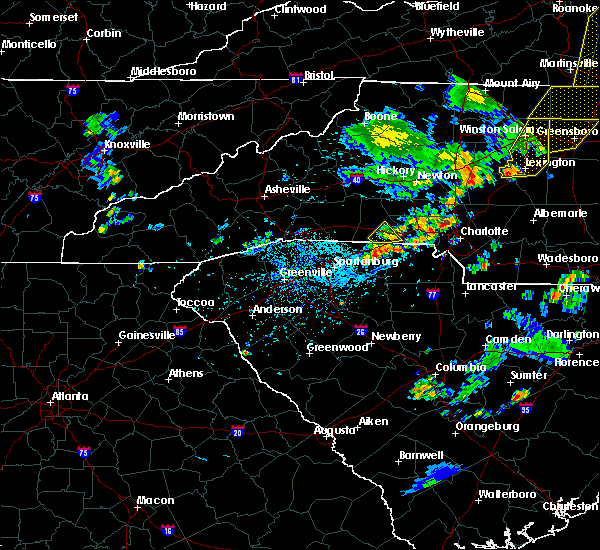 The national weather service in greenville-spartanburg has issued a * severe thunderstorm warning for. central mecklenburg county in the piedmont of north carolina. until 445 pm edt. At 419 pm edt, a severe thunderstorm was located 5 miles south of huntersville, or near northeast charlotte, moving east at 20 mph. The national weather service in greenville-spartanburg has issued a * severe thunderstorm warning for. central mecklenburg county in the piedmont of north carolina. until 445 pm edt. At 419 pm edt, a severe thunderstorm was located 5 miles south of huntersville, or near northeast charlotte, moving east at 20 mph.
|
| 8/21/2019 6:56 PM EDT |
 The severe thunderstorm warning for northern cabarrus county will expire at 700 pm edt. the storm which prompted the warning has weakened below severe limits, and no longer poses an immediate threat to life or property. therefore the warning will be allowed to expire. However frequent lightning, gusty winds, heavy rain are still possible across. The severe thunderstorm warning for northern cabarrus county will expire at 700 pm edt. the storm which prompted the warning has weakened below severe limits, and no longer poses an immediate threat to life or property. therefore the warning will be allowed to expire. However frequent lightning, gusty winds, heavy rain are still possible across.
|
| 8/21/2019 6:27 PM EDT |
 At 626 pm edt, a severe thunderstorm was located near downtown concord, moving southeast at 30 mph (radar indicated). Hazards include 60 mph wind gusts and penny size hail. Expect damage to trees and power lines. Locations impacted include, kannapolis, concord, mt pleasant, coddle creek reservoir, and enochville. At 626 pm edt, a severe thunderstorm was located near downtown concord, moving southeast at 30 mph (radar indicated). Hazards include 60 mph wind gusts and penny size hail. Expect damage to trees and power lines. Locations impacted include, kannapolis, concord, mt pleasant, coddle creek reservoir, and enochville.
|
| 8/21/2019 6:13 PM EDT |
 At 612 pm edt, a severe thunderstorm was located 4 miles west of kannapolis, or near enochville, moving east at 20 mph (radar indicated). Hazards include 60 mph wind gusts. Expect damage to trees and power lines. Locations impacted include, kannapolis, concord, china grove, landis, enochville, rockwell, mt pleasant, gold hill, and coddle creek reservoir. At 612 pm edt, a severe thunderstorm was located 4 miles west of kannapolis, or near enochville, moving east at 20 mph (radar indicated). Hazards include 60 mph wind gusts. Expect damage to trees and power lines. Locations impacted include, kannapolis, concord, china grove, landis, enochville, rockwell, mt pleasant, gold hill, and coddle creek reservoir.
|
| 8/21/2019 5:47 PM EDT |
 At 546 pm edt, a severe thunderstorm was located 11 miles northwest of kannapolis, or near mooresville, moving east at 25 mph (radar indicated). Hazards include 60 mph wind gusts and penny size hail. expect damage to trees and power lines At 546 pm edt, a severe thunderstorm was located 11 miles northwest of kannapolis, or near mooresville, moving east at 25 mph (radar indicated). Hazards include 60 mph wind gusts and penny size hail. expect damage to trees and power lines
|
| 8/17/2019 5:26 PM EDT |
 At 507 pm edt, a severe thunderstorm was located near huntersville, moving south at 10 mph (radar indicated). Hazards include 60 mph wind gusts and quarter size hail. Minor hail damage to vehicles is expected. Expect wind damage to trees and power lines. At 507 pm edt, a severe thunderstorm was located near huntersville, moving south at 10 mph (radar indicated). Hazards include 60 mph wind gusts and quarter size hail. Minor hail damage to vehicles is expected. Expect wind damage to trees and power lines.
|
| 8/17/2019 5:07 PM EDT |
 The national weather service in greenville-spartanburg has issued a * severe thunderstorm warning for. west central cabarrus county in the piedmont of north carolina. north central mecklenburg county in the piedmont of north carolina. Until 545 pm edt. The national weather service in greenville-spartanburg has issued a * severe thunderstorm warning for. west central cabarrus county in the piedmont of north carolina. north central mecklenburg county in the piedmont of north carolina. Until 545 pm edt.
|
| 8/13/2019 6:39 PM EDT |
 The severe thunderstorm warning for western cabarrus, mecklenburg and northeastern gaston counties will expire at 645 pm edt, the storms which prompted the warning have weakened below severe limits, and no longer pose an immediate threat to life or property. therefore the warning will be allowed to expire. however gusty winds are still possible with these thunderstorms. a severe thunderstorm watch remains in effect until 700 pm edt for the piedmont of north carolina. if you observed large hail or wind damage, please report it to the national weather service greenville-spartanburg by calling toll free, 1, 800, 2 6 7, 8 1 0 1, or by posting on our facebook page, or tweet it using hashtag nwsgsp. your message should describe the event and the specific location where it occurred. The severe thunderstorm warning for western cabarrus, mecklenburg and northeastern gaston counties will expire at 645 pm edt, the storms which prompted the warning have weakened below severe limits, and no longer pose an immediate threat to life or property. therefore the warning will be allowed to expire. however gusty winds are still possible with these thunderstorms. a severe thunderstorm watch remains in effect until 700 pm edt for the piedmont of north carolina. if you observed large hail or wind damage, please report it to the national weather service greenville-spartanburg by calling toll free, 1, 800, 2 6 7, 8 1 0 1, or by posting on our facebook page, or tweet it using hashtag nwsgsp. your message should describe the event and the specific location where it occurred.
|
| 8/13/2019 6:06 PM EDT |
 At 606 pm edt, severe thunderstorms were located along a line extending from 7 miles north of huntersville to 9 miles northeast of gastonia, moving southeast at 30 mph (radar indicated). Hazards include 60 mph wind gusts and penny size hail. expect damage to trees and power lines At 606 pm edt, severe thunderstorms were located along a line extending from 7 miles north of huntersville to 9 miles northeast of gastonia, moving southeast at 30 mph (radar indicated). Hazards include 60 mph wind gusts and penny size hail. expect damage to trees and power lines
|
| 8/1/2019 5:51 PM EDT |
 At 551 pm edt, a severe thunderstorm was located near huntersville, or near northeast charlotte, and is nearly stationary (radar indicated). Hazards include 60 mph wind gusts. expect damage to trees and power lines At 551 pm edt, a severe thunderstorm was located near huntersville, or near northeast charlotte, and is nearly stationary (radar indicated). Hazards include 60 mph wind gusts. expect damage to trees and power lines
|
| 7/4/2019 4:10 PM EDT | Fire dept/rescue reported trees down on power lines on hoover ave at reed s in cabarrus county NC, 3.2 miles SW of Concord, NC |
| 7/4/2019 4:10 PM EDT | Fire dept/rescue reported a tree down on power lines on meadowview ave sw in cabarrus county NC, 1.5 miles WSW of Concord, NC |
| 7/4/2019 4:10 PM EDT |
 The severe thunderstorm warning for northwestern cabarrus county will expire at 415 pm edt, the storm which prompted the warning has weakened below severe limits, and no longer poses an immediate threat to life or property. therefore the warning will be allowed to expire. however heavy rain is still possible with this thunderstorm. if you observed large hail or wind damage, please report it to the national weather service greenville-spartanburg by calling toll free, 1, 800, 2 6 7, 8 1 0 1, or by posting on our facebook page, or tweet it using hashtag nwsgsp. your message should describe the event and the specific location where it occurred. The severe thunderstorm warning for northwestern cabarrus county will expire at 415 pm edt, the storm which prompted the warning has weakened below severe limits, and no longer poses an immediate threat to life or property. therefore the warning will be allowed to expire. however heavy rain is still possible with this thunderstorm. if you observed large hail or wind damage, please report it to the national weather service greenville-spartanburg by calling toll free, 1, 800, 2 6 7, 8 1 0 1, or by posting on our facebook page, or tweet it using hashtag nwsgsp. your message should describe the event and the specific location where it occurred.
|
| 7/4/2019 3:57 PM EDT |
 At 354 pm edt, a severe thunderstorm was located 5 miles southwest of downtown concord, or near harrisburg, moving northeast at 10 mph (radar indicated). Hazards include 60 mph wind gusts and quarter size hail. Minor hail damage to vehicles is expected. expect wind damage to trees and power lines. Locations impacted include, concord, harrisburg, charlotte motor speedway and mt pleasant. At 354 pm edt, a severe thunderstorm was located 5 miles southwest of downtown concord, or near harrisburg, moving northeast at 10 mph (radar indicated). Hazards include 60 mph wind gusts and quarter size hail. Minor hail damage to vehicles is expected. expect wind damage to trees and power lines. Locations impacted include, concord, harrisburg, charlotte motor speedway and mt pleasant.
|
| 7/4/2019 3:42 PM EDT |
 At 342 pm edt, a severe thunderstorm was located 6 miles southwest of downtown concord, or over harrisburg, moving northeast at 5 mph (radar indicated). Hazards include 70 mph wind gusts and half dollar size hail. Minor hail damage to vehicles is expected. expect considerable tree damage. wind damage is also likely to mobile homes, roofs, and outbuildings. Locations impacted include, concord, harrisburg, university city, charlotte motor speedway, northeast charlotte and mt pleasant. At 342 pm edt, a severe thunderstorm was located 6 miles southwest of downtown concord, or over harrisburg, moving northeast at 5 mph (radar indicated). Hazards include 70 mph wind gusts and half dollar size hail. Minor hail damage to vehicles is expected. expect considerable tree damage. wind damage is also likely to mobile homes, roofs, and outbuildings. Locations impacted include, concord, harrisburg, university city, charlotte motor speedway, northeast charlotte and mt pleasant.
|
| 7/4/2019 3:30 PM EDT |
 At 330 pm edt, a severe thunderstorm was located 6 miles southwest of downtown concord, or near charlotte motor speedway, moving northeast at 10 mph (radar indicated). Hazards include 60 mph wind gusts and quarter size hail. Minor hail damage to vehicles is expected. Expect wind damage to trees and power lines. At 330 pm edt, a severe thunderstorm was located 6 miles southwest of downtown concord, or near charlotte motor speedway, moving northeast at 10 mph (radar indicated). Hazards include 60 mph wind gusts and quarter size hail. Minor hail damage to vehicles is expected. Expect wind damage to trees and power lines.
|
| 7/4/2019 2:43 PM EDT |
 At 242 pm edt, severe thunderstorms were located along a line extending from 13 miles northwest of badin lake to 11 miles south of salisbury, moving northeast at 10 mph (radar indicated). Hazards include 60 mph wind gusts and nickel size hail. Expect damage to trees and power lines. Locations impacted include, rockwell, gold hill, high rock, mt pleasant, concord and high rock lake. At 242 pm edt, severe thunderstorms were located along a line extending from 13 miles northwest of badin lake to 11 miles south of salisbury, moving northeast at 10 mph (radar indicated). Hazards include 60 mph wind gusts and nickel size hail. Expect damage to trees and power lines. Locations impacted include, rockwell, gold hill, high rock, mt pleasant, concord and high rock lake.
|
| 7/4/2019 2:16 PM EDT |
 At 216 pm edt, severe thunderstorms were located along a line extending from 13 miles northwest of badin lake to 9 miles northeast of downtown concord, moving east at 20 mph (radar indicated). Hazards include 60 mph wind gusts and nickel size hail. expect damage to trees and power lines At 216 pm edt, severe thunderstorms were located along a line extending from 13 miles northwest of badin lake to 9 miles northeast of downtown concord, moving east at 20 mph (radar indicated). Hazards include 60 mph wind gusts and nickel size hail. expect damage to trees and power lines
|
| 6/24/2019 10:03 PM EDT |
 At 1003 pm edt, severe thunderstorms were located along a line extending from 12 miles southwest of winston-salem to 5 miles southeast of mocksville to 12 miles south of lexington to near downtown concord to 16 miles southwest of albemarle to 11 miles southwest of monroe to 13 miles south of lancaster, moving east at 40 mph (radar indicated). Hazards include 60 mph wind gusts. Expect damage to trees and power lines. Locations impacted include, rock hill, kannapolis, downtown concord, monroe, salisbury, mocksville, central charlotte, south charlotte, southwest charlotte and east charlotte. At 1003 pm edt, severe thunderstorms were located along a line extending from 12 miles southwest of winston-salem to 5 miles southeast of mocksville to 12 miles south of lexington to near downtown concord to 16 miles southwest of albemarle to 11 miles southwest of monroe to 13 miles south of lancaster, moving east at 40 mph (radar indicated). Hazards include 60 mph wind gusts. Expect damage to trees and power lines. Locations impacted include, rock hill, kannapolis, downtown concord, monroe, salisbury, mocksville, central charlotte, south charlotte, southwest charlotte and east charlotte.
|
| 6/24/2019 9:48 PM EDT |
 At 948 pm edt, severe thunderstorms were located along a line extending from 7 miles south of yadkinville to 7 miles southwest of mocksville to 4 miles east of salisbury to 6 miles east of huntersville to 14 miles north of monroe to 8 miles south of indian land to 14 miles southwest of lancaster, moving east at 25 mph (radar indicated). Hazards include 60 mph wind gusts. Expect damage to trees and power lines. Locations impacted include, rock hill, uptown charlotte, huntersville, kannapolis, downtown concord, monroe, salisbury, chester, mocksville and central charlotte. At 948 pm edt, severe thunderstorms were located along a line extending from 7 miles south of yadkinville to 7 miles southwest of mocksville to 4 miles east of salisbury to 6 miles east of huntersville to 14 miles north of monroe to 8 miles south of indian land to 14 miles southwest of lancaster, moving east at 25 mph (radar indicated). Hazards include 60 mph wind gusts. Expect damage to trees and power lines. Locations impacted include, rock hill, uptown charlotte, huntersville, kannapolis, downtown concord, monroe, salisbury, chester, mocksville and central charlotte.
|
| 6/24/2019 9:27 PM EDT |
 At 927 pm edt, severe thunderstorms were located along a line extending from 6 miles south of yadkinville to 4 miles north of statesville to 8 miles north of kannapolis to near huntersville to 7 miles northeast of indian land to 4 miles southwest of rock hill to 11 miles north of winnsboro, moving east at 40 mph (radar indicated). Hazards include 70 mph wind gusts. Expect considerable tree damage. Damage is likely to mobile homes, roofs, and outbuildings. At 927 pm edt, severe thunderstorms were located along a line extending from 6 miles south of yadkinville to 4 miles north of statesville to 8 miles north of kannapolis to near huntersville to 7 miles northeast of indian land to 4 miles southwest of rock hill to 11 miles north of winnsboro, moving east at 40 mph (radar indicated). Hazards include 70 mph wind gusts. Expect considerable tree damage. Damage is likely to mobile homes, roofs, and outbuildings.
|
| 6/24/2019 9:16 PM EDT |
 At 916 pm edt, severe thunderstorms were located along a line extending from 15 miles east of taylorsville to 7 miles northwest of statesville to 14 miles northwest of kannapolis to 5 miles west of huntersville to 6 miles southwest of uptown charlotte to 7 miles south of york to 6 miles south of chester, moving northeast at 70 mph (radar indicated). Hazards include 70 mph wind gusts. Expect considerable tree damage. damage is likely to mobile homes, roofs, and outbuildings. Locations impacted include, gastonia, rock hill, uptown charlotte, huntersville, statesville, lincolnton, york, chester, mocksville and central charlotte. At 916 pm edt, severe thunderstorms were located along a line extending from 15 miles east of taylorsville to 7 miles northwest of statesville to 14 miles northwest of kannapolis to 5 miles west of huntersville to 6 miles southwest of uptown charlotte to 7 miles south of york to 6 miles south of chester, moving northeast at 70 mph (radar indicated). Hazards include 70 mph wind gusts. Expect considerable tree damage. damage is likely to mobile homes, roofs, and outbuildings. Locations impacted include, gastonia, rock hill, uptown charlotte, huntersville, statesville, lincolnton, york, chester, mocksville and central charlotte.
|
| 6/24/2019 9:00 PM EDT |
 At 859 pm edt, severe thunderstorms were located along a line extending from 4 miles southeast of taylorsville to 10 miles southwest of statesville to 7 miles southeast of lincolnton to 8 miles southeast of gastonia to 7 miles southwest of york to 16 miles southeast of union, moving northeast at 50 mph (radar indicated). Hazards include 70 mph wind gusts. Expect considerable tree damage. Damage is likely to mobile homes, roofs, and outbuildings. At 859 pm edt, severe thunderstorms were located along a line extending from 4 miles southeast of taylorsville to 10 miles southwest of statesville to 7 miles southeast of lincolnton to 8 miles southeast of gastonia to 7 miles southwest of york to 16 miles southeast of union, moving northeast at 50 mph (radar indicated). Hazards include 70 mph wind gusts. Expect considerable tree damage. Damage is likely to mobile homes, roofs, and outbuildings.
|
| 6/22/2019 4:26 PM EDT |
 At 426 pm edt, severe thunderstorms were located along a line extending from 6 miles southeast of downtown concord to 5 miles east of indian land, moving east at 50 mph (radar indicated). Hazards include 60 mph wind gusts and quarter size hail. Minor hail damage to vehicles is expected. Expect wind damage to trees and power lines. At 426 pm edt, severe thunderstorms were located along a line extending from 6 miles southeast of downtown concord to 5 miles east of indian land, moving east at 50 mph (radar indicated). Hazards include 60 mph wind gusts and quarter size hail. Minor hail damage to vehicles is expected. Expect wind damage to trees and power lines.
|
| 6/20/2019 5:13 PM EDT |
 The severe thunderstorm warning for cabarrus, central mecklenburg and southeastern rowan counties will expire at 515 pm edt, the storms which prompted the warning have weakened below severe limits, and no longer pose an immediate threat to life or property. therefore the warning will be allowed to expire. however gusty winds and heavy rain are still possible with these thunderstorms. a severe thunderstorm watch remains in effect until 1000 pm edt for the piedmont of north carolina. if you observed large hail or wind damage, please report it to the national weather service greenville-spartanburg by calling toll free, 1, 800, 2 6 7, 8 1 0 1, or by posting on our facebook page, or tweet it using hashtag nwsgsp. your message should describe the event and the specific location where it occurred. The severe thunderstorm warning for cabarrus, central mecklenburg and southeastern rowan counties will expire at 515 pm edt, the storms which prompted the warning have weakened below severe limits, and no longer pose an immediate threat to life or property. therefore the warning will be allowed to expire. however gusty winds and heavy rain are still possible with these thunderstorms. a severe thunderstorm watch remains in effect until 1000 pm edt for the piedmont of north carolina. if you observed large hail or wind damage, please report it to the national weather service greenville-spartanburg by calling toll free, 1, 800, 2 6 7, 8 1 0 1, or by posting on our facebook page, or tweet it using hashtag nwsgsp. your message should describe the event and the specific location where it occurred.
|
| 6/20/2019 5:01 PM EDT |
 At 500 pm edt, severe thunderstorms were located along a line extending from 12 miles northwest of badin lake to 3 miles southwest of uptown charlotte, moving east at 40 mph (radar indicated). Hazards include 60 mph wind gusts. Expect damage to trees and power lines. Locations impacted include, uptown charlotte, downtown concord, central charlotte, east charlotte, harrisburg, rockwell, mt pleasant, freedom park, university city and reedy creek park. At 500 pm edt, severe thunderstorms were located along a line extending from 12 miles northwest of badin lake to 3 miles southwest of uptown charlotte, moving east at 40 mph (radar indicated). Hazards include 60 mph wind gusts. Expect damage to trees and power lines. Locations impacted include, uptown charlotte, downtown concord, central charlotte, east charlotte, harrisburg, rockwell, mt pleasant, freedom park, university city and reedy creek park.
|
| 6/20/2019 4:43 PM EDT |
 At 443 pm edt, severe thunderstorms were located along a line extending from 8 miles south of salisbury to 6 miles west of uptown charlotte, moving east at 40 mph (radar indicated). Hazards include 60 mph wind gusts. expect damage to trees and power lines At 443 pm edt, severe thunderstorms were located along a line extending from 8 miles south of salisbury to 6 miles west of uptown charlotte, moving east at 40 mph (radar indicated). Hazards include 60 mph wind gusts. expect damage to trees and power lines
|
| 6/20/2019 4:40 PM EDT | Amateur radio reported trees down on yorktown st in concord. time estimated from rada in cabarrus county NC, 2.4 miles WSW of Concord, NC |
| 6/20/2019 4:40 PM EDT | 911 call center reported numerous trees down in concord. time estimated from rada in cabarrus county NC, 3.4 miles WSW of Concord, NC |
| 6/20/2019 4:15 PM EDT |
 At 415 pm edt, a severe thunderstorm was located 5 miles southwest of huntersville, moving east at 40 mph (radar indicated). Hazards include 60 mph wind gusts. expect damage to trees and power lines At 415 pm edt, a severe thunderstorm was located 5 miles southwest of huntersville, moving east at 40 mph (radar indicated). Hazards include 60 mph wind gusts. expect damage to trees and power lines
|
| 5/31/2019 5:22 PM EDT |
 At 521 pm edt, a severe thunderstorm capable of producing a tornado was located near kannapolis, moving east at 35 mph (radar indicated rotation). Hazards include tornado. Flying debris will be dangerous to those caught without shelter. mobile homes will be damaged or destroyed. damage to roofs, windows, and vehicles will occur. tree damage is likely. this dangerous storm will be near, rockwell around 540 pm edt. Other locations impacted by this dangerous thunderstorm include gold hill. At 521 pm edt, a severe thunderstorm capable of producing a tornado was located near kannapolis, moving east at 35 mph (radar indicated rotation). Hazards include tornado. Flying debris will be dangerous to those caught without shelter. mobile homes will be damaged or destroyed. damage to roofs, windows, and vehicles will occur. tree damage is likely. this dangerous storm will be near, rockwell around 540 pm edt. Other locations impacted by this dangerous thunderstorm include gold hill.
|
| 5/31/2019 5:15 PM EDT |
 At 515 pm edt, a severe thunderstorm was located 4 miles west of kannapolis, or near enochville, moving east at 30 mph (radar indicated). Hazards include 60 mph wind gusts and quarter size hail. Minor hail damage to vehicles is expected. expect wind damage to trees and power lines. Locations impacted include, kannapolis, salisbury, china grove, landis, enochville, coddle creek reservoir, mount ulla, downtown concord, piedmont research station and west concord. At 515 pm edt, a severe thunderstorm was located 4 miles west of kannapolis, or near enochville, moving east at 30 mph (radar indicated). Hazards include 60 mph wind gusts and quarter size hail. Minor hail damage to vehicles is expected. expect wind damage to trees and power lines. Locations impacted include, kannapolis, salisbury, china grove, landis, enochville, coddle creek reservoir, mount ulla, downtown concord, piedmont research station and west concord.
|
| 5/31/2019 4:55 PM EDT |
 A severe thunderstorm warning remains in effect until 530 pm edt for northwestern cabarrus. southeastern iredell. north central mecklenburg and southwestern rowan counties. at 455 pm edt, a severe thunderstorm was located 7 miles north of huntersville, or near davidson, moving east at 30 mph. hazard. 60 mph wind gusts and quarter size hail. A severe thunderstorm warning remains in effect until 530 pm edt for northwestern cabarrus. southeastern iredell. north central mecklenburg and southwestern rowan counties. at 455 pm edt, a severe thunderstorm was located 7 miles north of huntersville, or near davidson, moving east at 30 mph. hazard. 60 mph wind gusts and quarter size hail.
|
| 5/31/2019 4:41 PM EDT |
 At 441 pm edt, a severe thunderstorm was located 12 miles northwest of huntersville, or over denver, moving east at 30 mph (radar indicated). Hazards include 60 mph wind gusts and quarter size hail. Minor hail damage to vehicles is expected. Expect wind damage to trees and power lines. At 441 pm edt, a severe thunderstorm was located 12 miles northwest of huntersville, or over denver, moving east at 30 mph (radar indicated). Hazards include 60 mph wind gusts and quarter size hail. Minor hail damage to vehicles is expected. Expect wind damage to trees and power lines.
|
| 5/11/2019 3:50 PM EDT |
 At 349 pm edt, a severe thunderstorm was located 8 miles south of downtown concord, or 5 miles northwest of midland, moving east at 30 mph (radar indicated). Hazards include 60 mph wind gusts and quarter size hail. Minor hail damage to vehicles is expected. Expect wind damage to trees and power lines. At 349 pm edt, a severe thunderstorm was located 8 miles south of downtown concord, or 5 miles northwest of midland, moving east at 30 mph (radar indicated). Hazards include 60 mph wind gusts and quarter size hail. Minor hail damage to vehicles is expected. Expect wind damage to trees and power lines.
|
| 5/11/2019 3:10 PM EDT |
 The national weather service in greenville-spartanburg has issued a * severe thunderstorm warning for. central cabarrus county in the piedmont of north carolina. central mecklenburg county in the piedmont of north carolina. until 345 pm edt. At 308 pm edt, a severe thunderstorm was located near uptown. The national weather service in greenville-spartanburg has issued a * severe thunderstorm warning for. central cabarrus county in the piedmont of north carolina. central mecklenburg county in the piedmont of north carolina. until 345 pm edt. At 308 pm edt, a severe thunderstorm was located near uptown.
|
| 5/4/2019 5:51 PM EDT |
 The severe thunderstorm warning for central cabarrus county will expire at 600 pm edt, the storm which prompted the warning has weakened below severe limits, and no longer poses an immediate threat to life or property. therefore the warning will be allowed to expire. however gusty winds and heavy rain are still possible with multiple thunderstorms impacting cabarrus county. The severe thunderstorm warning for central cabarrus county will expire at 600 pm edt, the storm which prompted the warning has weakened below severe limits, and no longer poses an immediate threat to life or property. therefore the warning will be allowed to expire. however gusty winds and heavy rain are still possible with multiple thunderstorms impacting cabarrus county.
|
| 5/4/2019 5:12 PM EDT | Several trees blown down on hwy 601 near the intersection of hwy 4 in cabarrus county NC, 4.5 miles WNW of Concord, NC |
| 5/4/2019 5:12 PM EDT |
 At 512 pm edt, a severe thunderstorm was located 4 miles southeast of downtown concord, moving east at 20 mph (radar indicated). Hazards include 60 mph wind gusts and quarter size hail. Minor hail damage to vehicles is expected. Expect wind damage to trees and power lines. At 512 pm edt, a severe thunderstorm was located 4 miles southeast of downtown concord, moving east at 20 mph (radar indicated). Hazards include 60 mph wind gusts and quarter size hail. Minor hail damage to vehicles is expected. Expect wind damage to trees and power lines.
|
| 5/4/2019 4:55 PM EDT | Quarter sized hail reported 2.5 miles NE of Concord, NC, report of large hail up to quarter size. |
| 5/4/2019 4:37 PM EDT | Ping Pong Ball sized hail reported 3.3 miles S of Concord, NC, ping pong size hail on pless street. |
| 5/4/2019 4:33 PM EDT |
 At 433 pm edt, a severe thunderstorm was located 10 miles northeast of downtown concord, or 5 miles north of mt pleasant, moving east at 25 mph (radar indicated). Hazards include golf ball size hail and 60 mph wind gusts. People and animals outdoors will be injured. expect hail damage to roofs, siding, windows, and vehicles. expect wind damage to trees and power lines. Locations impacted include, rockwell, mt pleasant and gold hill. At 433 pm edt, a severe thunderstorm was located 10 miles northeast of downtown concord, or 5 miles north of mt pleasant, moving east at 25 mph (radar indicated). Hazards include golf ball size hail and 60 mph wind gusts. People and animals outdoors will be injured. expect hail damage to roofs, siding, windows, and vehicles. expect wind damage to trees and power lines. Locations impacted include, rockwell, mt pleasant and gold hill.
|
| 5/4/2019 3:58 PM EDT |
 At 358 pm edt, a severe thunderstorm was located near kannapolis, or near coddle creek reservoir, moving east at 25 mph (radar indicated). Hazards include golf ball size hail and 60 mph wind gusts. People and animals outdoors will be injured. expect hail damage to roofs, siding, windows, and vehicles. expect wind damage to trees and power lines. Locations impacted include, kannapolis, downtown concord, landis, enochville, rockwell, mt pleasant, coddle creek reservoir, gold hill, faith and west concord. At 358 pm edt, a severe thunderstorm was located near kannapolis, or near coddle creek reservoir, moving east at 25 mph (radar indicated). Hazards include golf ball size hail and 60 mph wind gusts. People and animals outdoors will be injured. expect hail damage to roofs, siding, windows, and vehicles. expect wind damage to trees and power lines. Locations impacted include, kannapolis, downtown concord, landis, enochville, rockwell, mt pleasant, coddle creek reservoir, gold hill, faith and west concord.
|
| 5/4/2019 3:50 PM EDT |
 At 350 pm edt, a severe thunderstorm was located 6 miles west of kannapolis, or near coddle creek reservoir, moving east at 25 mph (radar indicated). Hazards include 60 mph wind gusts and half dollar size hail. Minor hail damage to vehicles is expected. Expect wind damage to trees and power lines. At 350 pm edt, a severe thunderstorm was located 6 miles west of kannapolis, or near coddle creek reservoir, moving east at 25 mph (radar indicated). Hazards include 60 mph wind gusts and half dollar size hail. Minor hail damage to vehicles is expected. Expect wind damage to trees and power lines.
|
| 4/14/2019 11:56 PM EDT |
 At 1156 pm edt, a severe thunderstorm capable of producing a tornado was located 10 miles west of huntersville, or 5 miles northeast of stanley, moving northeast at 50 mph (radar indicated rotation). Hazards include tornado. Flying debris will be dangerous to those caught without shelter. mobile homes will be damaged or destroyed. damage to roofs, windows, and vehicles will occur. tree damage is likely. this dangerous storm will be near, huntersville, cornelius, westport and denver around 1200 am edt. davidson, ramsey creek park and mooresville around 1210 am edt. Other locations impacted by this dangerous storm include lowesville, doolie and lucia. At 1156 pm edt, a severe thunderstorm capable of producing a tornado was located 10 miles west of huntersville, or 5 miles northeast of stanley, moving northeast at 50 mph (radar indicated rotation). Hazards include tornado. Flying debris will be dangerous to those caught without shelter. mobile homes will be damaged or destroyed. damage to roofs, windows, and vehicles will occur. tree damage is likely. this dangerous storm will be near, huntersville, cornelius, westport and denver around 1200 am edt. davidson, ramsey creek park and mooresville around 1210 am edt. Other locations impacted by this dangerous storm include lowesville, doolie and lucia.
|
| 4/14/2019 11:44 PM EDT |
 At 1144 pm edt, a severe thunderstorm capable of producing a tornado was located 7 miles north of gastonia, or near high shoals, moving northeast at 50 mph (radar indicated rotation). Hazards include tornado. Flying debris will be dangerous to those caught without shelter. mobile homes will be damaged or destroyed. damage to roofs, windows, and vehicles will occur. tree damage is likely. this dangerous storm will be near, mt holly around 1150 pm edt. huntersville, cornelius, westport and denver around 1200 am edt. davidson, mooresville and ramsey creek park around 1210 am edt. Other locations impacted by this dangerous thunderstorm include lowesville, doolie and lucia. At 1144 pm edt, a severe thunderstorm capable of producing a tornado was located 7 miles north of gastonia, or near high shoals, moving northeast at 50 mph (radar indicated rotation). Hazards include tornado. Flying debris will be dangerous to those caught without shelter. mobile homes will be damaged or destroyed. damage to roofs, windows, and vehicles will occur. tree damage is likely. this dangerous storm will be near, mt holly around 1150 pm edt. huntersville, cornelius, westport and denver around 1200 am edt. davidson, mooresville and ramsey creek park around 1210 am edt. Other locations impacted by this dangerous thunderstorm include lowesville, doolie and lucia.
|
| 4/8/2019 4:24 PM EDT |
 At 424 pm edt, a severe thunderstorm was located 7 miles northwest of kannapolis, or 4 miles northwest of enochville, moving northeast at 45 mph (radar indicated). Hazards include 60 mph wind gusts and quarter size hail. Minor hail damage to vehicles is expected. expect wind damage to trees and power lines. Locations impacted include, kannapolis, downtown concord, west concord, cornelius, mooresville, davidson, china grove, landis, enochville and rockwell. At 424 pm edt, a severe thunderstorm was located 7 miles northwest of kannapolis, or 4 miles northwest of enochville, moving northeast at 45 mph (radar indicated). Hazards include 60 mph wind gusts and quarter size hail. Minor hail damage to vehicles is expected. expect wind damage to trees and power lines. Locations impacted include, kannapolis, downtown concord, west concord, cornelius, mooresville, davidson, china grove, landis, enochville and rockwell.
|
| 4/8/2019 4:16 PM EDT |
 At 416 pm edt, a severe thunderstorm was located 5 miles northeast of huntersville, or near davidson, moving northeast at 45 mph (radar indicated). Hazards include 60 mph wind gusts and quarter size hail. Minor hail damage to vehicles is expected. expect wind damage to trees and power lines. Locations impacted include, huntersville, kannapolis, downtown concord, northeast charlotte, west concord, cornelius, mooresville, davidson, china grove and landis. At 416 pm edt, a severe thunderstorm was located 5 miles northeast of huntersville, or near davidson, moving northeast at 45 mph (radar indicated). Hazards include 60 mph wind gusts and quarter size hail. Minor hail damage to vehicles is expected. expect wind damage to trees and power lines. Locations impacted include, huntersville, kannapolis, downtown concord, northeast charlotte, west concord, cornelius, mooresville, davidson, china grove and landis.
|
| 4/8/2019 4:05 PM EDT |
 At 404 pm edt, a severe thunderstorm was located near huntersville, moving northeast at 45 mph (radar indicated). Hazards include 60 mph wind gusts and quarter size hail. Minor hail damage to vehicles is expected. Expect wind damage to trees and power lines. At 404 pm edt, a severe thunderstorm was located near huntersville, moving northeast at 45 mph (radar indicated). Hazards include 60 mph wind gusts and quarter size hail. Minor hail damage to vehicles is expected. Expect wind damage to trees and power lines.
|
| 2/12/2019 5:31 PM EST |
 At 530 pm est, rain showers capable of producing damaging winds were located along a line extending from 3 miles northeast of downtown concord to near monroe, moving east at 50 mph (radar indicated). Hazards include 60 mph wind gusts. expect damage to trees and power lines At 530 pm est, rain showers capable of producing damaging winds were located along a line extending from 3 miles northeast of downtown concord to near monroe, moving east at 50 mph (radar indicated). Hazards include 60 mph wind gusts. expect damage to trees and power lines
|
| 9/27/2018 9:50 PM EDT |
 At 949 pm edt, severe thunderstorms were located along a line extending from near salisbury to 9 miles southeast of downtown concord to 5 miles southwest of monroe, moving northeast at 45 mph (law enforcement reported widespread tree damage as these storms crossed the north carolina piedmont). Hazards include 60 mph wind gusts. Expect damage to trees and power lines. Locations impacted include, monroe, salisbury, unionville, wingate, spencer, marshville, granite quarry, rockwell, mt pleasant and faith. At 949 pm edt, severe thunderstorms were located along a line extending from near salisbury to 9 miles southeast of downtown concord to 5 miles southwest of monroe, moving northeast at 45 mph (law enforcement reported widespread tree damage as these storms crossed the north carolina piedmont). Hazards include 60 mph wind gusts. Expect damage to trees and power lines. Locations impacted include, monroe, salisbury, unionville, wingate, spencer, marshville, granite quarry, rockwell, mt pleasant and faith.
|
| 9/27/2018 9:27 PM EDT |
 At 925 pm edt, severe thunderstorms were located along a line extending from 9 miles north of kannapolis to 7 miles northwest of lancaster, moving east at 40 mph (law enforcement reported widespread wind damage as this line of storms moved through the western parts of the charlotte metropolitan area). Hazards include 60 mph wind gusts. expect damage to trees and power lines At 925 pm edt, severe thunderstorms were located along a line extending from 9 miles north of kannapolis to 7 miles northwest of lancaster, moving east at 40 mph (law enforcement reported widespread wind damage as this line of storms moved through the western parts of the charlotte metropolitan area). Hazards include 60 mph wind gusts. expect damage to trees and power lines
|
| 9/27/2018 8:45 PM EDT |
 The national weather service in greenville-spartanburg has issued a * severe thunderstorm warning for. western cabarrus county in the piedmont of north carolina. southeastern catawba county in the piedmont of north carolina. lincoln county in the piedmont of north carolina. Southeastern iredell county in the piedmont of north carolina. The national weather service in greenville-spartanburg has issued a * severe thunderstorm warning for. western cabarrus county in the piedmont of north carolina. southeastern catawba county in the piedmont of north carolina. lincoln county in the piedmont of north carolina. Southeastern iredell county in the piedmont of north carolina.
|
| 9/27/2018 8:45 PM EDT |
 At 845 pm edt, severe thunderstorms were located along a line extending from 8 miles southwest of lincolnton to near gastonia to 5 miles east of york, moving northeast at 50 mph (radar indicated). Hazards include 60 mph wind gusts. expect damage to trees and power lines At 845 pm edt, severe thunderstorms were located along a line extending from 8 miles southwest of lincolnton to near gastonia to 5 miles east of york, moving northeast at 50 mph (radar indicated). Hazards include 60 mph wind gusts. expect damage to trees and power lines
|
| 9/27/2018 3:46 PM EDT |
 At 345 pm edt, a severe thunderstorm was located 4 miles north of uptown charlotte, or near hidden valley, moving northeast at 25 mph (radar indicated). Hazards include quarter size hail. Minor damage to vehicles is expected. Locations impacted include, uptown charlotte, northeast charlotte, west concord, harrisburg, reedy creek park, charlotte motor speedway, hidden valley, unc-charlotte, croft and the plaza. At 345 pm edt, a severe thunderstorm was located 4 miles north of uptown charlotte, or near hidden valley, moving northeast at 25 mph (radar indicated). Hazards include quarter size hail. Minor damage to vehicles is expected. Locations impacted include, uptown charlotte, northeast charlotte, west concord, harrisburg, reedy creek park, charlotte motor speedway, hidden valley, unc-charlotte, croft and the plaza.
|
| 9/27/2018 3:30 PM EDT |
 At 330 pm edt, a severe thunderstorm was located 4 miles west of uptown charlotte, or near charlotte douglas airport, moving northeast at 25 mph (radar indicated). Hazards include 60 mph wind gusts and quarter size hail. Minor hail damage to vehicles is expected. Expect wind damage to trees and power lines. At 330 pm edt, a severe thunderstorm was located 4 miles west of uptown charlotte, or near charlotte douglas airport, moving northeast at 25 mph (radar indicated). Hazards include 60 mph wind gusts and quarter size hail. Minor hail damage to vehicles is expected. Expect wind damage to trees and power lines.
|
| 8/30/2018 10:02 PM EDT |
 At 1001 pm edt, a severe thunderstorm was located 6 miles northeast of kannapolis, or over china grove, moving northeast at 10 mph. a new severe thunderstorm cell was also developing between china grove and salisbury, also moving slowly northeast at around 10 mph (radar indicated). Hazards include 60 mph wind gusts and quarter size hail. Minor hail damage to vehicles is expected. expect wind damage to trees and power lines. Locations impacted include, kannapolis, salisbury, china grove, spencer, landis, enochville, granite quarry, faith, piedmont research station and woodleaf. At 1001 pm edt, a severe thunderstorm was located 6 miles northeast of kannapolis, or over china grove, moving northeast at 10 mph. a new severe thunderstorm cell was also developing between china grove and salisbury, also moving slowly northeast at around 10 mph (radar indicated). Hazards include 60 mph wind gusts and quarter size hail. Minor hail damage to vehicles is expected. expect wind damage to trees and power lines. Locations impacted include, kannapolis, salisbury, china grove, spencer, landis, enochville, granite quarry, faith, piedmont research station and woodleaf.
|
| 8/30/2018 9:48 PM EDT |
 At 948 pm edt, a severe thunderstorm was located 4 miles north of kannapolis, or near landis, moving north at 15 mph (radar indicated). Hazards include 60 mph wind gusts and quarter size hail. Minor hail damage to vehicles is expected. Expect wind damage to trees and power lines. At 948 pm edt, a severe thunderstorm was located 4 miles north of kannapolis, or near landis, moving north at 15 mph (radar indicated). Hazards include 60 mph wind gusts and quarter size hail. Minor hail damage to vehicles is expected. Expect wind damage to trees and power lines.
|
| 8/8/2018 6:36 PM EDT |
 At 636 pm edt, severe thunderstorms were located along a line extending from 7 miles east of statesville to near kannapolis to 9 miles southeast of uptown charlotte, moving east at 30 mph (radar indicated). Hazards include 60 mph wind gusts and penny size hail. Expect damage to trees and power lines. Locations impacted include, kannapolis, concord, east charlotte, matthews, harrisburg, landis, enochville and cleveland. At 636 pm edt, severe thunderstorms were located along a line extending from 7 miles east of statesville to near kannapolis to 9 miles southeast of uptown charlotte, moving east at 30 mph (radar indicated). Hazards include 60 mph wind gusts and penny size hail. Expect damage to trees and power lines. Locations impacted include, kannapolis, concord, east charlotte, matthews, harrisburg, landis, enochville and cleveland.
|
| 8/8/2018 6:35 PM EDT | Scanner reports of fds dispatched to numerous trees and powerlines downed countywide in cabarrus county NC, 2.8 miles WSW of Concord, NC |
| 8/8/2018 6:30 PM EDT |
 At 629 pm edt, severe thunderstorms were located along a line extending from 12 miles southeast of statesville to 3 miles southwest of kannapolis to 6 miles east of uptown charlotte, moving east at 45 mph (radar indicated). Hazards include 60 mph wind gusts and penny size hail. expect damage to trees and power lines At 629 pm edt, severe thunderstorms were located along a line extending from 12 miles southeast of statesville to 3 miles southwest of kannapolis to 6 miles east of uptown charlotte, moving east at 45 mph (radar indicated). Hazards include 60 mph wind gusts and penny size hail. expect damage to trees and power lines
|
| 8/8/2018 6:18 PM EDT |
 At 617 pm edt, severe thunderstorms were located along a line extending from near statesville to 4 miles northeast of huntersville to 5 miles south of uptown charlotte, moving east at 35 mph (radar indicated). Hazards include 60 mph wind gusts and quarter size hail. Minor hail damage to vehicles is expected. expect wind damage to trees and power lines. Locations impacted include, charlotte, huntersville, kannapolis, concord, and statesville. At 617 pm edt, severe thunderstorms were located along a line extending from near statesville to 4 miles northeast of huntersville to 5 miles south of uptown charlotte, moving east at 35 mph (radar indicated). Hazards include 60 mph wind gusts and quarter size hail. Minor hail damage to vehicles is expected. expect wind damage to trees and power lines. Locations impacted include, charlotte, huntersville, kannapolis, concord, and statesville.
|
| 8/8/2018 5:48 PM EDT |
 At 547 pm edt, severe thunderstorms were located along a line extending from 7 miles southeast of taylorsville to 9 miles south of gastonia, moving east at 20 mph (radar indicated). Hazards include 70 mph wind gusts and quarter size hail. Minor hail damage to vehicles is expected. expect considerable tree damage. Wind damage is also likely to mobile homes, roofs, and outbuildings. At 547 pm edt, severe thunderstorms were located along a line extending from 7 miles southeast of taylorsville to 9 miles south of gastonia, moving east at 20 mph (radar indicated). Hazards include 70 mph wind gusts and quarter size hail. Minor hail damage to vehicles is expected. expect considerable tree damage. Wind damage is also likely to mobile homes, roofs, and outbuildings.
|
| 8/7/2018 10:10 PM EDT |
 At 1010 pm edt, severe thunderstorms were located along a line extending from 10 miles southeast of downtown concord to 12 miles northwest of monroe, moving east at 20 mph (radar indicated). Hazards include 60 mph wind gusts and quarter size hail. Minor hail damage to vehicles is expected. expect wind damage to trees and power lines. Locations impacted include, downtown concord, east charlotte, matthews, mint hill, unionville, harrisburg, hemby bridge, mt pleasant, reedy creek park and midland. At 1010 pm edt, severe thunderstorms were located along a line extending from 10 miles southeast of downtown concord to 12 miles northwest of monroe, moving east at 20 mph (radar indicated). Hazards include 60 mph wind gusts and quarter size hail. Minor hail damage to vehicles is expected. expect wind damage to trees and power lines. Locations impacted include, downtown concord, east charlotte, matthews, mint hill, unionville, harrisburg, hemby bridge, mt pleasant, reedy creek park and midland.
|
| 8/7/2018 9:53 PM EDT |
 At 953 pm edt, severe thunderstorms were located along a line extending from 6 miles east of downtown concord to 7 miles southeast of uptown charlotte, moving east at 25 mph (radar indicated). Hazards include 60 mph wind gusts and quarter size hail. Minor hail damage to vehicles is expected. Expect wind damage to trees and power lines. At 953 pm edt, severe thunderstorms were located along a line extending from 6 miles east of downtown concord to 7 miles southeast of uptown charlotte, moving east at 25 mph (radar indicated). Hazards include 60 mph wind gusts and quarter size hail. Minor hail damage to vehicles is expected. Expect wind damage to trees and power lines.
|
| 7/23/2018 3:49 PM EDT |
 At 349 pm edt, severe thunderstorms were located along a line extending from near kannapolis to 3 miles southeast of uptown charlotte, moving northwest at 15 mph (radar indicated). Hazards include 60 mph wind gusts and penny size hail. expect damage to trees and power lines At 349 pm edt, severe thunderstorms were located along a line extending from near kannapolis to 3 miles southeast of uptown charlotte, moving northwest at 15 mph (radar indicated). Hazards include 60 mph wind gusts and penny size hail. expect damage to trees and power lines
|
| 7/22/2018 7:30 PM EDT |
 At 730 pm edt, a severe thunderstorm was located near downtown concord, moving northeast at 15 mph (radar indicated). Hazards include 60 mph wind gusts and quarter size hail. Minor hail damage to vehicles is expected. expect wind damage to trees and power lines. Locations impacted include, kannapolis, downtown concord, china grove, landis, rockwell, mt pleasant, gold hill, faith and enochville. At 730 pm edt, a severe thunderstorm was located near downtown concord, moving northeast at 15 mph (radar indicated). Hazards include 60 mph wind gusts and quarter size hail. Minor hail damage to vehicles is expected. expect wind damage to trees and power lines. Locations impacted include, kannapolis, downtown concord, china grove, landis, rockwell, mt pleasant, gold hill, faith and enochville.
|
| 7/22/2018 7:25 PM EDT | 911 call center reported numerous trees down in the concord area. time estimated from rada in cabarrus county NC, 3.2 miles SW of Concord, NC |
| 7/22/2018 7:25 PM EDT | Fire dept/rescue reported roof blown off the old armory building on church st. in concord. time estimated from rada in cabarrus county NC, 2.8 miles WSW of Concord, NC |
| 7/22/2018 7:11 PM EDT |
 The national weather service in greenville-spartanburg has issued a * severe thunderstorm warning for. northern cabarrus county in the piedmont of north carolina. south central rowan county in the piedmont of north carolina. until 800 pm edt. At 711 pm edt, a severe thunderstorm was located near downtown. The national weather service in greenville-spartanburg has issued a * severe thunderstorm warning for. northern cabarrus county in the piedmont of north carolina. south central rowan county in the piedmont of north carolina. until 800 pm edt. At 711 pm edt, a severe thunderstorm was located near downtown.
|
| 6/25/2018 7:00 PM EDT |
 At 700 pm edt, severe thunderstorms were located along a line extending from 8 miles south of winston-salem to 5 miles southwest of kannapolis, moving east at 30 mph (radar indicated). Hazards include 60 mph wind gusts and quarter size hail. Minor hail damage to vehicles is expected. expect wind damage to trees and power lines. Locations impacted include, kannapolis, downtown concord, salisbury, mocksville, west concord, china grove, spencer, landis, enochville and granite quarry. At 700 pm edt, severe thunderstorms were located along a line extending from 8 miles south of winston-salem to 5 miles southwest of kannapolis, moving east at 30 mph (radar indicated). Hazards include 60 mph wind gusts and quarter size hail. Minor hail damage to vehicles is expected. expect wind damage to trees and power lines. Locations impacted include, kannapolis, downtown concord, salisbury, mocksville, west concord, china grove, spencer, landis, enochville and granite quarry.
|
| 6/25/2018 6:43 PM EDT |
 At 643 pm edt, severe thunderstorms were located along a line extending from 9 miles northeast of mocksville to 3 miles northeast of huntersville, moving east at 30 mph (radar indicated). Hazards include 60 mph wind gusts and quarter size hail. Minor hail damage to vehicles is expected. Expect wind damage to trees and power lines. At 643 pm edt, severe thunderstorms were located along a line extending from 9 miles northeast of mocksville to 3 miles northeast of huntersville, moving east at 30 mph (radar indicated). Hazards include 60 mph wind gusts and quarter size hail. Minor hail damage to vehicles is expected. Expect wind damage to trees and power lines.
|
| 6/25/2018 6:24 PM EDT |
 At 623 pm edt, severe thunderstorms were located along a line extending from near winston-salem to 10 miles west of huntersville, moving east at 50 mph (radar indicated). Hazards include 60 mph wind gusts and quarter size hail. Minor hail damage to vehicles is expected. expect wind damage to trees and power lines. Locations impacted include, huntersville, statesville, lincolnton, mocksville, cornelius, mooresville, davidson, china grove, maiden and landis. At 623 pm edt, severe thunderstorms were located along a line extending from near winston-salem to 10 miles west of huntersville, moving east at 50 mph (radar indicated). Hazards include 60 mph wind gusts and quarter size hail. Minor hail damage to vehicles is expected. expect wind damage to trees and power lines. Locations impacted include, huntersville, statesville, lincolnton, mocksville, cornelius, mooresville, davidson, china grove, maiden and landis.
|
| 6/25/2018 5:57 PM EDT |
 The national weather service in greenville-spartanburg has issued a * severe thunderstorm warning for. northwestern cabarrus county in the piedmont of north carolina. catawba county in the piedmont of north carolina. davie county in the piedmont of north carolina. Alexander county in the piedmont of north carolina. The national weather service in greenville-spartanburg has issued a * severe thunderstorm warning for. northwestern cabarrus county in the piedmont of north carolina. catawba county in the piedmont of north carolina. davie county in the piedmont of north carolina. Alexander county in the piedmont of north carolina.
|
| 6/14/2018 9:43 PM EDT |
 At 942 pm edt, a severe thunderstorm was located 11 miles north of huntersville, or near lake norman, moving southeast at 15 mph (radar indicated). Hazards include 60 mph wind gusts and quarter size hail. Minor hail damage to vehicles is expected. Expect wind damage to trees and power lines. At 942 pm edt, a severe thunderstorm was located 11 miles north of huntersville, or near lake norman, moving southeast at 15 mph (radar indicated). Hazards include 60 mph wind gusts and quarter size hail. Minor hail damage to vehicles is expected. Expect wind damage to trees and power lines.
|
| 6/3/2018 8:53 PM EDT |
 At 853 pm edt, a severe thunderstorm was located 12 miles east of downtown concord, or 4 miles northeast of mt pleasant, moving southeast at 30 mph (radar indicated). Hazards include 60 mph wind gusts and quarter size hail. Minor hail damage to vehicles is expected. expect wind damage to trees and power lines. Locations impacted include, kannapolis, downtown concord, salisbury, west concord, china grove, landis, enochville, granite quarry, rockwell and mt pleasant. At 853 pm edt, a severe thunderstorm was located 12 miles east of downtown concord, or 4 miles northeast of mt pleasant, moving southeast at 30 mph (radar indicated). Hazards include 60 mph wind gusts and quarter size hail. Minor hail damage to vehicles is expected. expect wind damage to trees and power lines. Locations impacted include, kannapolis, downtown concord, salisbury, west concord, china grove, landis, enochville, granite quarry, rockwell and mt pleasant.
|
| 6/3/2018 8:39 PM EDT |
 At 839 pm edt, a severe thunderstorm was located 7 miles south of salisbury, or near faith, moving southeast at 30 mph (radar indicated). Hazards include 60 mph wind gusts and quarter size hail. Minor hail damage to vehicles is expected. expect wind damage to trees and power lines. Locations impacted include, kannapolis, downtown concord, salisbury, west concord, mooresville, davidson, harrisburg, china grove, landis and enochville. At 839 pm edt, a severe thunderstorm was located 7 miles south of salisbury, or near faith, moving southeast at 30 mph (radar indicated). Hazards include 60 mph wind gusts and quarter size hail. Minor hail damage to vehicles is expected. expect wind damage to trees and power lines. Locations impacted include, kannapolis, downtown concord, salisbury, west concord, mooresville, davidson, harrisburg, china grove, landis and enochville.
|
| 6/3/2018 8:31 PM EDT |
 At 831 pm edt, a severe thunderstorm was located near uptown charlotte, moving southeast at 20 mph (radar indicated). Hazards include 60 mph wind gusts and quarter size hail. Minor hail damage to vehicles is expected. expect wind damage to trees and power lines. Locations impacted include, uptown charlotte, huntersville, central charlotte, south charlotte, northeast charlotte, southwest charlotte, east charlotte, northwest charlotte, west concord and matthews. At 831 pm edt, a severe thunderstorm was located near uptown charlotte, moving southeast at 20 mph (radar indicated). Hazards include 60 mph wind gusts and quarter size hail. Minor hail damage to vehicles is expected. expect wind damage to trees and power lines. Locations impacted include, uptown charlotte, huntersville, central charlotte, south charlotte, northeast charlotte, southwest charlotte, east charlotte, northwest charlotte, west concord and matthews.
|
| 6/3/2018 8:25 PM EDT |
 At 825 pm edt, a severe thunderstorm was located 12 miles southeast of statesville, or near mooresville, moving southeast at 25 mph (radar indicated). Hazards include 60 mph wind gusts and quarter size hail. Minor hail damage to vehicles is expected. Expect wind damage to trees and power lines. At 825 pm edt, a severe thunderstorm was located 12 miles southeast of statesville, or near mooresville, moving southeast at 25 mph (radar indicated). Hazards include 60 mph wind gusts and quarter size hail. Minor hail damage to vehicles is expected. Expect wind damage to trees and power lines.
|
| 6/3/2018 8:18 PM EDT |
 At 818 pm edt, a severe thunderstorm was located near uptown charlotte, or near northwest charlotte, moving southeast at 35 mph (radar indicated). Hazards include 60 mph wind gusts and quarter size hail. Minor hail damage to vehicles is expected. expect wind damage to trees and power lines. Locations impacted include, uptown charlotte, huntersville, central charlotte, south charlotte, northeast charlotte, southwest charlotte, east charlotte, northwest charlotte, west concord and matthews. At 818 pm edt, a severe thunderstorm was located near uptown charlotte, or near northwest charlotte, moving southeast at 35 mph (radar indicated). Hazards include 60 mph wind gusts and quarter size hail. Minor hail damage to vehicles is expected. expect wind damage to trees and power lines. Locations impacted include, uptown charlotte, huntersville, central charlotte, south charlotte, northeast charlotte, southwest charlotte, east charlotte, northwest charlotte, west concord and matthews.
|
| 6/3/2018 7:48 PM EDT |
 At 747 pm edt, severe thunderstorms were located along a line extending from 6 miles west of huntersville to 10 miles northwest of uptown charlotte, moving southeast at 20 mph (radar indicated). Hazards include 60 mph wind gusts and quarter size hail. Minor hail damage to vehicles is expected. Expect wind damage to trees and power lines. At 747 pm edt, severe thunderstorms were located along a line extending from 6 miles west of huntersville to 10 miles northwest of uptown charlotte, moving southeast at 20 mph (radar indicated). Hazards include 60 mph wind gusts and quarter size hail. Minor hail damage to vehicles is expected. Expect wind damage to trees and power lines.
|
| 6/1/2018 6:41 PM EDT |
 The severe thunderstorm warning for western cabarrus, mecklenburg and northeastern york counties will expire at 645 pm edt, the storms which prompted the warning have weakened below severe limits, and no longer pose an immediate threat to life or property. therefore the warning will be allowed to expire. however heavy rain is still possible with these thunderstorms. The severe thunderstorm warning for western cabarrus, mecklenburg and northeastern york counties will expire at 645 pm edt, the storms which prompted the warning have weakened below severe limits, and no longer pose an immediate threat to life or property. therefore the warning will be allowed to expire. however heavy rain is still possible with these thunderstorms.
|
| 6/1/2018 6:23 PM EDT |
 At 621 pm edt, severe thunderstorms were located along a line extending from near huntersville to near uptown charlotte to 12 miles north of rock hill, moving east at 30 mph. the line of storms was weakening. if new storms do not form or strengthen, the warning will be cancelled (radar indicated). Hazards include 60 mph wind gusts. Expect damage to trees and power lines. Locations impacted include, uptown charlotte, huntersville, kannapolis, downtown concord, central charlotte, south charlotte, northeast charlotte, southwest charlotte, east charlotte and northwest charlotte. At 621 pm edt, severe thunderstorms were located along a line extending from near huntersville to near uptown charlotte to 12 miles north of rock hill, moving east at 30 mph. the line of storms was weakening. if new storms do not form or strengthen, the warning will be cancelled (radar indicated). Hazards include 60 mph wind gusts. Expect damage to trees and power lines. Locations impacted include, uptown charlotte, huntersville, kannapolis, downtown concord, central charlotte, south charlotte, northeast charlotte, southwest charlotte, east charlotte and northwest charlotte.
|
| 6/1/2018 5:59 PM EDT |
 At 558 pm edt, severe thunderstorms were located along a line extending from 8 miles west of huntersville to 5 miles east of gastonia to 7 miles north of york, moving east at 30 mph (radar indicated). Hazards include 60 mph wind gusts. expect damage to trees and power lines At 558 pm edt, severe thunderstorms were located along a line extending from 8 miles west of huntersville to 5 miles east of gastonia to 7 miles north of york, moving east at 30 mph (radar indicated). Hazards include 60 mph wind gusts. expect damage to trees and power lines
|
| 4/24/2018 5:38 PM EDT | A bradford pear tree split not far from charlotte motor speedwa in cabarrus county NC, 4.2 miles NE of Concord, NC |
| 4/15/2018 4:14 PM EDT |
 At 414 pm edt, a severe thunderstorm was located 9 miles south of salisbury, or near rockwell, moving northeast at 55 mph (radar indicated). Hazards include 60 mph wind gusts and quarter size hail. Minor hail damage to vehicles is expected. Expect wind damage to trees and power lines. At 414 pm edt, a severe thunderstorm was located 9 miles south of salisbury, or near rockwell, moving northeast at 55 mph (radar indicated). Hazards include 60 mph wind gusts and quarter size hail. Minor hail damage to vehicles is expected. Expect wind damage to trees and power lines.
|
| 4/15/2018 3:58 PM EDT | Tree down at hayden way and dakeita circle. time estimated from rada in cabarrus county NC, 9.1 miles NW of Concord, NC |
| 4/15/2018 3:58 PM EDT |
 At 357 pm edt, severe thunderstorms were located along a line extending from 4 miles west of downtown concord to 11 miles west of albemarle, moving northeast at 55 mph (radar indicated). Hazards include 60 mph wind gusts and quarter size hail. Minor hail damage to vehicles is expected. expect wind damage to trees and power lines. locations impacted include, downtown concord, west concord, wingate, marshville, granite quarry and rockwell. A tornado watch remains in effect until 700 pm edt for the piedmont of north carolina. At 357 pm edt, severe thunderstorms were located along a line extending from 4 miles west of downtown concord to 11 miles west of albemarle, moving northeast at 55 mph (radar indicated). Hazards include 60 mph wind gusts and quarter size hail. Minor hail damage to vehicles is expected. expect wind damage to trees and power lines. locations impacted include, downtown concord, west concord, wingate, marshville, granite quarry and rockwell. A tornado watch remains in effect until 700 pm edt for the piedmont of north carolina.
|
| 4/15/2018 3:56 PM EDT | Tree down on miami church rd. time estimated from rada in cabarrus county NC, 8.2 miles WNW of Concord, NC |
| 4/15/2018 3:41 PM EDT |
 At 340 pm edt, severe thunderstorms were located along a line extending from 4 miles southeast of uptown charlotte to 17 miles south of downtown concord to 9 miles east of monroe, moving northeast at 55 mph (radar indicated). Hazards include 60 mph wind gusts and quarter size hail. Minor hail damage to vehicles is expected. Expect wind damage to trees and power lines. At 340 pm edt, severe thunderstorms were located along a line extending from 4 miles southeast of uptown charlotte to 17 miles south of downtown concord to 9 miles east of monroe, moving northeast at 55 mph (radar indicated). Hazards include 60 mph wind gusts and quarter size hail. Minor hail damage to vehicles is expected. Expect wind damage to trees and power lines.
|
| 4/15/2018 3:25 PM EDT |
 At 324 pm edt, a severe thunderstorm was located 4 miles southwest of huntersville, moving northeast at 50 mph (radar indicated). Hazards include 60 mph wind gusts and quarter size hail. Minor hail damage to vehicles is expected. Expect wind damage to trees and power lines. At 324 pm edt, a severe thunderstorm was located 4 miles southwest of huntersville, moving northeast at 50 mph (radar indicated). Hazards include 60 mph wind gusts and quarter size hail. Minor hail damage to vehicles is expected. Expect wind damage to trees and power lines.
|
| 10/23/2017 5:55 PM EDT |
 At 554 pm edt, severe thunderstorms were located along a line extending from 11 miles north of badin lake to 6 miles east of albemarle to 15 miles north of wadesboro, moving northeast at 40 mph (radar indicated). Hazards include 60 mph wind gusts. Expect damage to trees and power lines. locations impacted include, kannapolis, downtown concord, monroe, west concord, unionville, harrisburg, wesley chapel, wingate, waxhaw and lake park. A tornado watch remains in effect until 900 pm edt for the piedmont of north carolina. At 554 pm edt, severe thunderstorms were located along a line extending from 11 miles north of badin lake to 6 miles east of albemarle to 15 miles north of wadesboro, moving northeast at 40 mph (radar indicated). Hazards include 60 mph wind gusts. Expect damage to trees and power lines. locations impacted include, kannapolis, downtown concord, monroe, west concord, unionville, harrisburg, wesley chapel, wingate, waxhaw and lake park. A tornado watch remains in effect until 900 pm edt for the piedmont of north carolina.
|
| 10/23/2017 5:26 PM EDT |
 At 526 pm edt, severe thunderstorms were located along a line extending from 5 miles southeast of huntersville to 9 miles southeast of uptown charlotte to 13 miles east of rock hill, moving northeast at 40 mph (radar indicated). Hazards include 60 mph wind gusts. expect damage to trees and power lines At 526 pm edt, severe thunderstorms were located along a line extending from 5 miles southeast of huntersville to 9 miles southeast of uptown charlotte to 13 miles east of rock hill, moving northeast at 40 mph (radar indicated). Hazards include 60 mph wind gusts. expect damage to trees and power lines
|
| 9/1/2017 8:37 PM EDT | Several trees down in concord and a few powerlines. time derived from radar dat in cabarrus county NC, 2.4 miles WSW of Concord, NC |
| 9/1/2017 7:23 PM EDT |
 At 723 pm edt, a severe thunderstorm capable of producing a tornado was located near kannapolis, or near coddle creek reservoir, moving northeast at 45 mph (radar indicated rotation). Hazards include tornado. Flying debris will be dangerous to those caught without shelter. mobile homes will be damaged or destroyed. damage to roofs, windows, and vehicles will occur. tree damage is likely. this dangerous storm will be near, landis around 730 pm edt. Salisbury, faith, china grove, granite quarry and rockwell around 740 pm edt. At 723 pm edt, a severe thunderstorm capable of producing a tornado was located near kannapolis, or near coddle creek reservoir, moving northeast at 45 mph (radar indicated rotation). Hazards include tornado. Flying debris will be dangerous to those caught without shelter. mobile homes will be damaged or destroyed. damage to roofs, windows, and vehicles will occur. tree damage is likely. this dangerous storm will be near, landis around 730 pm edt. Salisbury, faith, china grove, granite quarry and rockwell around 740 pm edt.
|
| 9/1/2017 7:18 PM EDT |
 At 717 pm edt, a severe thunderstorm was located 6 miles northwest of salisbury, or 5 miles east of cleveland, moving northeast at 50 mph (radar indicated). Hazards include 60 mph wind gusts and quarter size hail. Minor hail damage to vehicles is expected. expect wind damage to trees and power lines. locations impacted include, huntersville, kannapolis, salisbury, northeast charlotte, cornelius, mooresville, davidson, china grove, spencer and landis. A tornado watch remains in effect until 1000 pm edt for the piedmont of north carolina. At 717 pm edt, a severe thunderstorm was located 6 miles northwest of salisbury, or 5 miles east of cleveland, moving northeast at 50 mph (radar indicated). Hazards include 60 mph wind gusts and quarter size hail. Minor hail damage to vehicles is expected. expect wind damage to trees and power lines. locations impacted include, huntersville, kannapolis, salisbury, northeast charlotte, cornelius, mooresville, davidson, china grove, spencer and landis. A tornado watch remains in effect until 1000 pm edt for the piedmont of north carolina.
|
| 9/1/2017 7:12 PM EDT |
 At 711 pm edt, a severe thunderstorm capable of producing a tornado was located near huntersville, moving northeast at 45 mph (radar indicated rotation). Hazards include tornado. Flying debris will be dangerous to those caught without shelter. mobile homes will be damaged or destroyed. damage to roofs, windows, and vehicles will occur. tree damage is likely. this dangerous storm will be near, coddle creek reservoir around 720 pm edt. kannapolis, enochville and landis around 730 pm edt. china grove, faith, granite quarry and rockwell around 740 pm edt. Other locations impacted by this dangerous thunderstorm include croft. At 711 pm edt, a severe thunderstorm capable of producing a tornado was located near huntersville, moving northeast at 45 mph (radar indicated rotation). Hazards include tornado. Flying debris will be dangerous to those caught without shelter. mobile homes will be damaged or destroyed. damage to roofs, windows, and vehicles will occur. tree damage is likely. this dangerous storm will be near, coddle creek reservoir around 720 pm edt. kannapolis, enochville and landis around 730 pm edt. china grove, faith, granite quarry and rockwell around 740 pm edt. Other locations impacted by this dangerous thunderstorm include croft.
|
| 9/1/2017 6:58 PM EDT |
 At 658 pm edt, a severe thunderstorm capable of producing a tornado was located 6 miles northeast of huntersville, or near coddle creek reservoir, moving northeast at 50 mph (radar indicated rotation). Hazards include tornado and quarter size hail. Flying debris will be dangerous to those caught without shelter. mobile homes will be damaged or destroyed. damage to roofs, windows, and vehicles will occur. tree damage is likely. this dangerous storm will be near, coddle creek reservoir around 700 pm edt. kannapolis, landis, enochville and china grove around 710 pm edt. granite quarry and faith around 720 pm edt. salisbury around 730 pm edt. Other locations impacted by this dangerous thunderstorm include piedmont research station. At 658 pm edt, a severe thunderstorm capable of producing a tornado was located 6 miles northeast of huntersville, or near coddle creek reservoir, moving northeast at 50 mph (radar indicated rotation). Hazards include tornado and quarter size hail. Flying debris will be dangerous to those caught without shelter. mobile homes will be damaged or destroyed. damage to roofs, windows, and vehicles will occur. tree damage is likely. this dangerous storm will be near, coddle creek reservoir around 700 pm edt. kannapolis, landis, enochville and china grove around 710 pm edt. granite quarry and faith around 720 pm edt. salisbury around 730 pm edt. Other locations impacted by this dangerous thunderstorm include piedmont research station.
|
| 9/1/2017 6:49 PM EDT |
 At 648 pm edt, a severe thunderstorm was located near huntersville, moving northeast at 50 mph (radar indicated). Hazards include 60 mph wind gusts and quarter size hail. Minor hail damage to vehicles is expected. Expect wind damage to trees and power lines. At 648 pm edt, a severe thunderstorm was located near huntersville, moving northeast at 50 mph (radar indicated). Hazards include 60 mph wind gusts and quarter size hail. Minor hail damage to vehicles is expected. Expect wind damage to trees and power lines.
|
| 9/1/2017 3:14 PM EDT |
 At 313 pm edt, a severe thunderstorm was located 5 miles east of salisbury, or near spencer, moving northeast at 55 mph (radar indicated). Hazards include 60 mph wind gusts and quarter size hail. Minor hail damage to vehicles is expected. expect wind damage to trees and power lines. locations impacted include, kannapolis, downtown concord, salisbury, west concord, harrisburg, china grove, spencer, landis, enochville and granite quarry. A tornado watch remains in effect until 1000 pm edt for the piedmont of north carolina. At 313 pm edt, a severe thunderstorm was located 5 miles east of salisbury, or near spencer, moving northeast at 55 mph (radar indicated). Hazards include 60 mph wind gusts and quarter size hail. Minor hail damage to vehicles is expected. expect wind damage to trees and power lines. locations impacted include, kannapolis, downtown concord, salisbury, west concord, harrisburg, china grove, spencer, landis, enochville and granite quarry. A tornado watch remains in effect until 1000 pm edt for the piedmont of north carolina.
|
| 9/1/2017 2:45 PM EDT |
 At 245 pm edt, a severe thunderstorm was located 7 miles southwest of downtown concord, or near charlotte motor speedway, moving northeast at 55 mph (radar indicated). Hazards include 60 mph wind gusts and quarter size hail. Minor hail damage to vehicles is expected. Expect wind damage to trees and power lines. At 245 pm edt, a severe thunderstorm was located 7 miles southwest of downtown concord, or near charlotte motor speedway, moving northeast at 55 mph (radar indicated). Hazards include 60 mph wind gusts and quarter size hail. Minor hail damage to vehicles is expected. Expect wind damage to trees and power lines.
|
| 7/28/2017 5:30 PM EDT |
 At 530 pm edt, severe thunderstorms were located along a line extending from 9 miles northeast of downtown concord to 10 miles northeast of monroe to 19 miles southwest of wadesboro, moving east at 45 mph (radar indicated). Hazards include 60 mph wind gusts. expect damage to trees and power lines At 530 pm edt, severe thunderstorms were located along a line extending from 9 miles northeast of downtown concord to 10 miles northeast of monroe to 19 miles southwest of wadesboro, moving east at 45 mph (radar indicated). Hazards include 60 mph wind gusts. expect damage to trees and power lines
|
| 7/28/2017 5:01 PM EDT |
 At 501 pm edt, severe thunderstorms were located along a line extending from 6 miles northeast of huntersville to 4 miles southeast of uptown charlotte to 11 miles northeast of lancaster, moving east at 30 mph (radar indicated). Hazards include 70 mph wind gusts. Expect considerable tree damage. damage is likely to mobile homes, roofs, and outbuildings. Locations impacted include, uptown charlotte, huntersville, kannapolis, downtown concord, monroe, central charlotte, south charlotte, northeast charlotte, southwest charlotte and east charlotte. At 501 pm edt, severe thunderstorms were located along a line extending from 6 miles northeast of huntersville to 4 miles southeast of uptown charlotte to 11 miles northeast of lancaster, moving east at 30 mph (radar indicated). Hazards include 70 mph wind gusts. Expect considerable tree damage. damage is likely to mobile homes, roofs, and outbuildings. Locations impacted include, uptown charlotte, huntersville, kannapolis, downtown concord, monroe, central charlotte, south charlotte, northeast charlotte, southwest charlotte and east charlotte.
|
| 7/28/2017 4:47 PM EDT |
 At 447 pm edt, severe thunderstorms were located along a line extending from 5 miles northwest of huntersville to 3 miles southwest of uptown charlotte to 6 miles northeast of lancaster, moving east at 30 mph (radar indicated). Hazards include 70 mph wind gusts. Expect considerable tree damage. damage is likely to mobile homes, roofs, and outbuildings. Locations impacted include, rock hill, uptown charlotte, huntersville, kannapolis, downtown concord, monroe, central charlotte, south charlotte, northeast charlotte and southwest charlotte. At 447 pm edt, severe thunderstorms were located along a line extending from 5 miles northwest of huntersville to 3 miles southwest of uptown charlotte to 6 miles northeast of lancaster, moving east at 30 mph (radar indicated). Hazards include 70 mph wind gusts. Expect considerable tree damage. damage is likely to mobile homes, roofs, and outbuildings. Locations impacted include, rock hill, uptown charlotte, huntersville, kannapolis, downtown concord, monroe, central charlotte, south charlotte, northeast charlotte and southwest charlotte.
|
| 7/28/2017 4:22 PM EDT |
 At 422 pm edt, severe thunderstorms were located along a line extending from 10 miles northeast of lincolnton to 9 miles southeast of gastonia to 8 miles south of rock hill, moving east at 30 mph (radar indicated). Hazards include 60 mph wind gusts. expect damage to trees and power lines At 422 pm edt, severe thunderstorms were located along a line extending from 10 miles northeast of lincolnton to 9 miles southeast of gastonia to 8 miles south of rock hill, moving east at 30 mph (radar indicated). Hazards include 60 mph wind gusts. expect damage to trees and power lines
|
| 7/23/2017 3:45 PM EDT | Trained spotter estimated 60 mph winds. nickel sized hail also observe in cabarrus county NC, 2.4 miles WSW of Concord, NC |
| 7/23/2017 3:35 PM EDT |
 At 335 pm edt, a severe thunderstorm was located 5 miles southwest of downtown concord, or near harrisburg, moving southeast at 20 mph (radar indicated). Hazards include 60 mph wind gusts and quarter size hail. Minor hail damage to vehicles is expected. expect wind damage to trees and power lines. Locations impacted include, huntersville, kannapolis, downtown concord, northeast charlotte, west concord, cornelius, davidson, harrisburg, reedy creek park and charlotte motor speedway. At 335 pm edt, a severe thunderstorm was located 5 miles southwest of downtown concord, or near harrisburg, moving southeast at 20 mph (radar indicated). Hazards include 60 mph wind gusts and quarter size hail. Minor hail damage to vehicles is expected. expect wind damage to trees and power lines. Locations impacted include, huntersville, kannapolis, downtown concord, northeast charlotte, west concord, cornelius, davidson, harrisburg, reedy creek park and charlotte motor speedway.
|
| 7/23/2017 3:22 PM EDT |
 At 322 pm edt, a severe thunderstorm was located 6 miles southeast of huntersville, or near charlotte motor speedway, moving southeast at 20 mph (radar indicated). Hazards include 60 mph wind gusts and quarter size hail. Minor hail damage to vehicles is expected. Expect wind damage to trees and power lines. At 322 pm edt, a severe thunderstorm was located 6 miles southeast of huntersville, or near charlotte motor speedway, moving southeast at 20 mph (radar indicated). Hazards include 60 mph wind gusts and quarter size hail. Minor hail damage to vehicles is expected. Expect wind damage to trees and power lines.
|
| 7/18/2017 8:43 PM EDT |
 The severe thunderstorm warning for southwestern cabarrus. southeastern mecklenburg and north central union counties will expire at 845 pm edt. the storm which prompted the warning has weakened below severe limits, and no longer poses an immediate threat to life or property. Therefore the warning will be allowed to expire. The severe thunderstorm warning for southwestern cabarrus. southeastern mecklenburg and north central union counties will expire at 845 pm edt. the storm which prompted the warning has weakened below severe limits, and no longer poses an immediate threat to life or property. Therefore the warning will be allowed to expire.
|
| 7/18/2017 8:07 PM EDT |
 At 806 pm edt, a severe thunderstorm was located 11 miles south of downtown concord, or 5 miles northeast of mint hill, moving south at 15 mph (radar indicated). Hazards include 60 mph wind gusts and quarter size hail. Minor hail damage to vehicles is expected. Expect wind damage to trees and power lines. At 806 pm edt, a severe thunderstorm was located 11 miles south of downtown concord, or 5 miles northeast of mint hill, moving south at 15 mph (radar indicated). Hazards include 60 mph wind gusts and quarter size hail. Minor hail damage to vehicles is expected. Expect wind damage to trees and power lines.
|
| 7/15/2017 5:27 PM EDT |
 At 527 pm edt, severe thunderstorms were located along a line extending from 8 miles south of mocksville to 8 miles northeast of huntersville, moving southeast at 20 mph (radar indicated). Hazards include 60 mph wind gusts. Expect damage to trees and power lines. Locations impacted include, kannapolis, salisbury, cornelius, mooresville, davidson, china grove, spencer, landis, enochville and cooleemee. At 527 pm edt, severe thunderstorms were located along a line extending from 8 miles south of mocksville to 8 miles northeast of huntersville, moving southeast at 20 mph (radar indicated). Hazards include 60 mph wind gusts. Expect damage to trees and power lines. Locations impacted include, kannapolis, salisbury, cornelius, mooresville, davidson, china grove, spencer, landis, enochville and cooleemee.
|
| 7/15/2017 5:05 PM EDT |
 At 505 pm edt, severe thunderstorms were located along a line extending from 9 miles southwest of mocksville to 12 miles north of huntersville, moving southeast at 25 mph (radar indicated). Hazards include 60 mph wind gusts and quarter size hail. Minor hail damage to vehicles is expected. Expect wind damage to trees and power lines. At 505 pm edt, severe thunderstorms were located along a line extending from 9 miles southwest of mocksville to 12 miles north of huntersville, moving southeast at 25 mph (radar indicated). Hazards include 60 mph wind gusts and quarter size hail. Minor hail damage to vehicles is expected. Expect wind damage to trees and power lines.
|
| 7/8/2017 5:49 PM EDT |
 At 548 pm edt, a severe thunderstorm was located 5 miles north of huntersville, or over cornelius, moving east at 20 mph (radar indicated). Hazards include 60 mph wind gusts and quarter size hail. Minor hail damage to vehicles is expected. expect wind damage to trees and power lines. Locations impacted include, huntersville, cornelius, mooresville, davidson, enochville, westport, lake norman, coddle creek reservoir, denver and ramsey creek park. At 548 pm edt, a severe thunderstorm was located 5 miles north of huntersville, or over cornelius, moving east at 20 mph (radar indicated). Hazards include 60 mph wind gusts and quarter size hail. Minor hail damage to vehicles is expected. expect wind damage to trees and power lines. Locations impacted include, huntersville, cornelius, mooresville, davidson, enochville, westport, lake norman, coddle creek reservoir, denver and ramsey creek park.
|
| 7/8/2017 5:23 PM EDT |
 At 523 pm edt, a severe thunderstorm was located 10 miles northwest of huntersville, or near westport, moving east at 20 mph (radar indicated). Hazards include 60 mph wind gusts and quarter size hail. Minor hail damage to vehicles is expected. Expect wind damage to trees and power lines. At 523 pm edt, a severe thunderstorm was located 10 miles northwest of huntersville, or near westport, moving east at 20 mph (radar indicated). Hazards include 60 mph wind gusts and quarter size hail. Minor hail damage to vehicles is expected. Expect wind damage to trees and power lines.
|
| 7/6/2017 5:53 PM EDT |
 At 553 pm edt, a severe thunderstorm was located near downtown concord, or near west concord, moving east at 25 mph (radar indicated). Hazards include 60 mph wind gusts and penny size hail. Expect damage to trees and power lines. Locations impacted include, kannapolis, downtown concord, west concord, harrisburg, mt pleasant, coddle creek reservoir, charlotte motor speedway, unc charlotte, enochville and northeast charlotte. At 553 pm edt, a severe thunderstorm was located near downtown concord, or near west concord, moving east at 25 mph (radar indicated). Hazards include 60 mph wind gusts and penny size hail. Expect damage to trees and power lines. Locations impacted include, kannapolis, downtown concord, west concord, harrisburg, mt pleasant, coddle creek reservoir, charlotte motor speedway, unc charlotte, enochville and northeast charlotte.
|
| 7/6/2017 5:28 PM EDT |
 At 528 pm edt, a severe thunderstorm was located near huntersville, moving east at 25 mph (radar indicated). Hazards include 60 mph wind gusts and quarter size hail. Minor hail damage to vehicles is expected. Expect wind damage to trees and power lines. At 528 pm edt, a severe thunderstorm was located near huntersville, moving east at 25 mph (radar indicated). Hazards include 60 mph wind gusts and quarter size hail. Minor hail damage to vehicles is expected. Expect wind damage to trees and power lines.
|
| 7/6/2017 5:09 PM EDT |
 At 508 pm edt, a severe thunderstorm was located 7 miles west of huntersville, or 5 miles northeast of mt holly, moving east at 25 mph (radar indicated). Hazards include 60 mph wind gusts and quarter size hail. Minor hail damage to vehicles is expected. expect wind damage to trees and power lines. Locations impacted include, huntersville, northeast charlotte, northwest charlotte, cornelius, mt holly, davidson, dallas, stanley, lowell and ranlo. At 508 pm edt, a severe thunderstorm was located 7 miles west of huntersville, or 5 miles northeast of mt holly, moving east at 25 mph (radar indicated). Hazards include 60 mph wind gusts and quarter size hail. Minor hail damage to vehicles is expected. expect wind damage to trees and power lines. Locations impacted include, huntersville, northeast charlotte, northwest charlotte, cornelius, mt holly, davidson, dallas, stanley, lowell and ranlo.
|
| 7/6/2017 4:49 PM EDT |
 At 449 pm edt, a severe thunderstorm was located 9 miles north of gastonia, or near stanley, moving east at 25 mph (radar indicated). Hazards include 60 mph wind gusts and quarter size hail. Minor hail damage to vehicles is expected. Expect wind damage to trees and power lines. At 449 pm edt, a severe thunderstorm was located 9 miles north of gastonia, or near stanley, moving east at 25 mph (radar indicated). Hazards include 60 mph wind gusts and quarter size hail. Minor hail damage to vehicles is expected. Expect wind damage to trees and power lines.
|
| 7/5/2017 5:49 PM EDT |
 At 549 pm edt, a severe thunderstorm was located 4 miles north of uptown charlotte, or near hidden valley, moving east at 20 mph (public reports). Hazards include 60 mph wind gusts and penny size hail. Expect damage to trees and power lines. Locations impacted include, uptown charlotte, huntersville, downtown concord, northeast charlotte, east charlotte, northwest charlotte, west concord, mint hill, mt holly and harrisburg. At 549 pm edt, a severe thunderstorm was located 4 miles north of uptown charlotte, or near hidden valley, moving east at 20 mph (public reports). Hazards include 60 mph wind gusts and penny size hail. Expect damage to trees and power lines. Locations impacted include, uptown charlotte, huntersville, downtown concord, northeast charlotte, east charlotte, northwest charlotte, west concord, mint hill, mt holly and harrisburg.
|
| 7/5/2017 5:28 PM EDT |
 At 527 pm edt, a severe thunderstorm was located 7 miles southwest of huntersville, or 4 miles north of paw creek, moving east at 20 mph (radar indicated). Hazards include 60 mph wind gusts and quarter size hail. Minor hail damage to vehicles is expected. Expect wind damage to trees and power lines. At 527 pm edt, a severe thunderstorm was located 7 miles southwest of huntersville, or 4 miles north of paw creek, moving east at 20 mph (radar indicated). Hazards include 60 mph wind gusts and quarter size hail. Minor hail damage to vehicles is expected. Expect wind damage to trees and power lines.
|
| 6/13/2017 6:40 PM EDT |
 At 640 pm edt, a severe thunderstorm was located 11 miles southeast of uptown charlotte, or near south charlotte, moving southeast at 15 mph (radar indicated). Hazards include 60 mph wind gusts and quarter size hail. Minor hail damage to vehicles is expected. expect wind damage to trees and power lines. Locations impacted include, uptown charlotte, central charlotte, south charlotte, northeast charlotte, southwest charlotte, east charlotte, northwest charlotte, matthews, mint hill and indian trail. At 640 pm edt, a severe thunderstorm was located 11 miles southeast of uptown charlotte, or near south charlotte, moving southeast at 15 mph (radar indicated). Hazards include 60 mph wind gusts and quarter size hail. Minor hail damage to vehicles is expected. expect wind damage to trees and power lines. Locations impacted include, uptown charlotte, central charlotte, south charlotte, northeast charlotte, southwest charlotte, east charlotte, northwest charlotte, matthews, mint hill and indian trail.
|
| 6/13/2017 6:20 PM EDT | Tree down on blackberry trai in cabarrus county NC, 5.5 miles ESE of Concord, NC |
| 6/13/2017 6:17 PM EDT |
 At 616 pm edt, a severe thunderstorm was located near uptown charlotte, or near northwest charlotte, moving east at 10 mph. other severe storms were developing over southern mecklenburg county to the west of matthews and west of mint hill (radar indicated). Hazards include 60 mph wind gusts and quarter size hail. Minor hail damage to vehicles is expected. Expect wind damage to trees and power lines. At 616 pm edt, a severe thunderstorm was located near uptown charlotte, or near northwest charlotte, moving east at 10 mph. other severe storms were developing over southern mecklenburg county to the west of matthews and west of mint hill (radar indicated). Hazards include 60 mph wind gusts and quarter size hail. Minor hail damage to vehicles is expected. Expect wind damage to trees and power lines.
|
| 6/13/2017 5:55 PM EDT | Tree down on memory lan in cabarrus county NC, 4 miles WNW of Concord, NC |
| 6/13/2017 5:52 PM EDT |
 At 551 pm edt, a severe thunderstorm was located 5 miles southwest of huntersville, or 4 miles north of northwest charlotte, moving east at 10 mph. another severe thunderstorm was located just south of harrisburg (radar indicated). Hazards include 60 mph wind gusts and quarter size hail. Minor hail damage to vehicles is expected. expect wind damage to trees and power lines. Locations impacted include, huntersville, northeast charlotte, east charlotte, west concord, cornelius, mooresville, mint hill, davidson, harrisburg and enochville. At 551 pm edt, a severe thunderstorm was located 5 miles southwest of huntersville, or 4 miles north of northwest charlotte, moving east at 10 mph. another severe thunderstorm was located just south of harrisburg (radar indicated). Hazards include 60 mph wind gusts and quarter size hail. Minor hail damage to vehicles is expected. expect wind damage to trees and power lines. Locations impacted include, huntersville, northeast charlotte, east charlotte, west concord, cornelius, mooresville, mint hill, davidson, harrisburg and enochville.
|
| 6/13/2017 5:38 PM EDT |
 At 537 pm edt, a severe thunderstorm was located 12 miles northwest of albemarle, or 5 miles south of rockwell, moving southeast at 15 mph. another severe storm was located between concord and mount pleasant (radar indicated). Hazards include 60 mph wind gusts and quarter size hail. Minor hail damage to vehicles is expected. expect wind damage to trees and power lines. Locations impacted include, kannapolis, downtown concord, salisbury, china grove, spencer, landis, granite quarry, rockwell, mt pleasant and faith. At 537 pm edt, a severe thunderstorm was located 12 miles northwest of albemarle, or 5 miles south of rockwell, moving southeast at 15 mph. another severe storm was located between concord and mount pleasant (radar indicated). Hazards include 60 mph wind gusts and quarter size hail. Minor hail damage to vehicles is expected. expect wind damage to trees and power lines. Locations impacted include, kannapolis, downtown concord, salisbury, china grove, spencer, landis, granite quarry, rockwell, mt pleasant and faith.
|
| 6/13/2017 5:29 PM EDT |
 At 529 pm edt, a severe thunderstorm was located 6 miles northwest of huntersville, or near ramsey creek park, moving southeast at 10 mph (radar indicated). Hazards include 60 mph wind gusts and quarter size hail. Minor hail damage to vehicles is expected. Expect wind damage to trees and power lines. At 529 pm edt, a severe thunderstorm was located 6 miles northwest of huntersville, or near ramsey creek park, moving southeast at 10 mph (radar indicated). Hazards include 60 mph wind gusts and quarter size hail. Minor hail damage to vehicles is expected. Expect wind damage to trees and power lines.
|
| 6/13/2017 5:24 PM EDT |
 At 524 pm edt, a severe thunderstorm was located 7 miles northeast of uptown charlotte, or near unc charlotte, moving east at 10 mph (radar indicated). Hazards include 60 mph wind gusts and quarter size hail. Minor hail damage to vehicles is expected. expect wind damage to trees and power lines. Locations impacted include, uptown charlotte, northeast charlotte, east charlotte, reedy creek park, the plaza, unc charlotte, hidden valley, croft, northwest charlotte and harrisburg. At 524 pm edt, a severe thunderstorm was located 7 miles northeast of uptown charlotte, or near unc charlotte, moving east at 10 mph (radar indicated). Hazards include 60 mph wind gusts and quarter size hail. Minor hail damage to vehicles is expected. expect wind damage to trees and power lines. Locations impacted include, uptown charlotte, northeast charlotte, east charlotte, reedy creek park, the plaza, unc charlotte, hidden valley, croft, northwest charlotte and harrisburg.
|
| 6/13/2017 5:23 PM EDT |
 At 523 pm edt, a severe thunderstorm was located 7 miles northeast of kannapolis, or 4 miles southwest of faith, moving southeast at 15 mph (radar indicated). Hazards include 60 mph wind gusts and quarter size hail. Minor hail damage to vehicles is expected. expect wind damage to trees and power lines. Locations impacted include, kannapolis, salisbury, west concord, mooresville, china grove, spencer, landis, enochville, granite quarry and cleveland. At 523 pm edt, a severe thunderstorm was located 7 miles northeast of kannapolis, or 4 miles southwest of faith, moving southeast at 15 mph (radar indicated). Hazards include 60 mph wind gusts and quarter size hail. Minor hail damage to vehicles is expected. expect wind damage to trees and power lines. Locations impacted include, kannapolis, salisbury, west concord, mooresville, china grove, spencer, landis, enochville, granite quarry and cleveland.
|
| 6/13/2017 5:16 PM EDT |
 At 515 pm edt, a severe thunderstorm was located 8 miles northeast of downtown concord, or 4 miles north of mt pleasant, moving southeast at 10 mph. other storms will likely develop into eastern rowan county (radar indicated). Hazards include 60 mph wind gusts and quarter size hail. Minor hail damage to vehicles is expected. Expect wind damage to trees and power lines. At 515 pm edt, a severe thunderstorm was located 8 miles northeast of downtown concord, or 4 miles north of mt pleasant, moving southeast at 10 mph. other storms will likely develop into eastern rowan county (radar indicated). Hazards include 60 mph wind gusts and quarter size hail. Minor hail damage to vehicles is expected. Expect wind damage to trees and power lines.
|
| 6/13/2017 4:59 PM EDT |
 At 459 pm edt, a severe thunderstorm was located near uptown charlotte, or near hidden valley, moving southeast at 10 mph (radar indicated). Hazards include 60 mph wind gusts and quarter size hail. Minor hail damage to vehicles is expected. Expect wind damage to trees and power lines. At 459 pm edt, a severe thunderstorm was located near uptown charlotte, or near hidden valley, moving southeast at 10 mph (radar indicated). Hazards include 60 mph wind gusts and quarter size hail. Minor hail damage to vehicles is expected. Expect wind damage to trees and power lines.
|
| 6/13/2017 4:56 PM EDT |
 At 455 pm edt, a severe thunderstorm was located 9 miles north of kannapolis, or 5 miles northwest of china grove, moving southeast at 10 mph. another severe storm was located east of woodleaf. additional severe storms will develop toward kannapolis and concord (radar indicated). Hazards include 60 mph wind gusts and quarter size hail. Minor hail damage to vehicles is expected. Expect wind damage to trees and power lines. At 455 pm edt, a severe thunderstorm was located 9 miles north of kannapolis, or 5 miles northwest of china grove, moving southeast at 10 mph. another severe storm was located east of woodleaf. additional severe storms will develop toward kannapolis and concord (radar indicated). Hazards include 60 mph wind gusts and quarter size hail. Minor hail damage to vehicles is expected. Expect wind damage to trees and power lines.
|
| 6/4/2017 4:58 PM EDT |
 At 457 pm edt, severe thunderstorms were located along a line extending from near statesville to 7 miles southeast of huntersville, moving northeast at 25 mph (radar indicated). Hazards include 60 mph wind gusts and nickel size hail. Expect damage to trees and power lines. Locations impacted include, huntersville, kannapolis, downtown concord, statesville, northeast charlotte, west concord, cornelius, mooresville, davidson and harrisburg. At 457 pm edt, severe thunderstorms were located along a line extending from near statesville to 7 miles southeast of huntersville, moving northeast at 25 mph (radar indicated). Hazards include 60 mph wind gusts and nickel size hail. Expect damage to trees and power lines. Locations impacted include, huntersville, kannapolis, downtown concord, statesville, northeast charlotte, west concord, cornelius, mooresville, davidson and harrisburg.
|
| 6/4/2017 4:30 PM EDT |
 At 430 pm edt, severe thunderstorms were located along a line extending from 8 miles southwest of statesville to 4 miles northwest of uptown charlotte, moving northeast at 25 mph (radar indicated). Hazards include 60 mph wind gusts and nickel size hail. expect damage to trees and power lines At 430 pm edt, severe thunderstorms were located along a line extending from 8 miles southwest of statesville to 4 miles northwest of uptown charlotte, moving northeast at 25 mph (radar indicated). Hazards include 60 mph wind gusts and nickel size hail. expect damage to trees and power lines
|
| 5/31/2017 5:21 PM EDT |
 At 521 pm edt, severe thunderstorms were located along a line extending from 7 miles south of downtown concord to 3 miles west of uptown charlotte, moving southeast at 20 mph (radar indicated). Hazards include 60 mph wind gusts. expect damage to trees and power lines At 521 pm edt, severe thunderstorms were located along a line extending from 7 miles south of downtown concord to 3 miles west of uptown charlotte, moving southeast at 20 mph (radar indicated). Hazards include 60 mph wind gusts. expect damage to trees and power lines
|
| 5/31/2017 5:06 PM EDT |
 At 506 pm edt, a severe thunderstorm was located 5 miles northwest of uptown charlotte, or near northwest charlotte, moving southeast at 20 mph (radar indicated). Hazards include 60 mph wind gusts and penny size hail. Expect damage to trees and power lines. Locations impacted include, uptown charlotte, huntersville, central charlotte, south charlotte, northeast charlotte, east charlotte, northwest charlotte, matthews, mint hill and mt holly. At 506 pm edt, a severe thunderstorm was located 5 miles northwest of uptown charlotte, or near northwest charlotte, moving southeast at 20 mph (radar indicated). Hazards include 60 mph wind gusts and penny size hail. Expect damage to trees and power lines. Locations impacted include, uptown charlotte, huntersville, central charlotte, south charlotte, northeast charlotte, east charlotte, northwest charlotte, matthews, mint hill and mt holly.
|
| 5/31/2017 4:29 PM EDT |
 At 428 pm edt, a severe thunderstorm was located 9 miles west of huntersville, or 5 miles northeast of stanley, moving southeast at 30 mph (radar indicated). Hazards include 60 mph wind gusts and quarter size hail. Minor hail damage to vehicles is expected. Expect wind damage to trees and power lines. At 428 pm edt, a severe thunderstorm was located 9 miles west of huntersville, or 5 miles northeast of stanley, moving southeast at 30 mph (radar indicated). Hazards include 60 mph wind gusts and quarter size hail. Minor hail damage to vehicles is expected. Expect wind damage to trees and power lines.
|
| 5/29/2017 6:24 PM EDT |
 At 623 pm edt, a severe thunderstorm was located 4 miles west of huntersville, or 4 miles south of ramsey creek park, moving east at 40 mph (radar indicated). Hazards include 60 mph wind gusts and quarter size hail. Minor hail damage to vehicles is expected. expect wind damage to trees and power lines. Locations impacted include, huntersville, northeast charlotte, cornelius, mooresville, mt holly, davidson, stanley, westport, unc charlotte and denver. At 623 pm edt, a severe thunderstorm was located 4 miles west of huntersville, or 4 miles south of ramsey creek park, moving east at 40 mph (radar indicated). Hazards include 60 mph wind gusts and quarter size hail. Minor hail damage to vehicles is expected. expect wind damage to trees and power lines. Locations impacted include, huntersville, northeast charlotte, cornelius, mooresville, mt holly, davidson, stanley, westport, unc charlotte and denver.
|
| 5/29/2017 6:05 PM EDT |
 At 604 pm edt, a severe thunderstorm was located 8 miles southeast of lincolnton, or near high shoals, moving east at 40 mph (radar indicated). Hazards include 60 mph wind gusts and quarter size hail. Minor hail damage to vehicles is expected. Expect wind damage to trees and power lines. At 604 pm edt, a severe thunderstorm was located 8 miles southeast of lincolnton, or near high shoals, moving east at 40 mph (radar indicated). Hazards include 60 mph wind gusts and quarter size hail. Minor hail damage to vehicles is expected. Expect wind damage to trees and power lines.
|
| 5/28/2017 2:57 AM EDT |
 At 257 am edt, severe thunderstorms were located along a line extending from 10 miles northeast of mocksville to 8 miles south of salisbury to near downtown concord, moving east at 40 mph (radar indicated). Hazards include 60 mph wind gusts. Expect damage to trees and power lines. Locations impacted include, kannapolis, downtown concord, salisbury, mocksville, china grove, spencer, landis, granite quarry, rockwell and mt pleasant. At 257 am edt, severe thunderstorms were located along a line extending from 10 miles northeast of mocksville to 8 miles south of salisbury to near downtown concord, moving east at 40 mph (radar indicated). Hazards include 60 mph wind gusts. Expect damage to trees and power lines. Locations impacted include, kannapolis, downtown concord, salisbury, mocksville, china grove, spencer, landis, granite quarry, rockwell and mt pleasant.
|
| 5/28/2017 2:38 AM EDT |
 At 238 am edt, severe thunderstorms were located along a line extending from 6 miles south of yadkinville to 6 miles southwest of uptown charlotte, moving east at 40 mph (radar indicated). Hazards include 60 mph wind gusts. Expect damage to trees and power lines. Locations impacted include, kannapolis, downtown concord, salisbury, mocksville, west concord, harrisburg, china grove, spencer, landis and enochville. At 238 am edt, severe thunderstorms were located along a line extending from 6 miles south of yadkinville to 6 miles southwest of uptown charlotte, moving east at 40 mph (radar indicated). Hazards include 60 mph wind gusts. Expect damage to trees and power lines. Locations impacted include, kannapolis, downtown concord, salisbury, mocksville, west concord, harrisburg, china grove, spencer, landis and enochville.
|
| 5/28/2017 2:05 AM EDT |
 At 204 am edt, severe thunderstorms were located along a line extending from 10 miles southeast of wilkesboro to 9 miles southwest of gastonia, moving east at 40 mph (radar indicated). Hazards include 60 mph wind gusts. expect damage to trees and power lines At 204 am edt, severe thunderstorms were located along a line extending from 10 miles southeast of wilkesboro to 9 miles southwest of gastonia, moving east at 40 mph (radar indicated). Hazards include 60 mph wind gusts. expect damage to trees and power lines
|
| 5/24/2017 4:38 PM EDT |
 The severe thunderstorm warning for western cabarrus and northeastern mecklenburg counties will expire at 445 pm edt, the storm which prompted the warning has weakened below severe limits, and no longer poses an immediate threat to life or property. therefore the warning will be allowed to expire. however heavy rain is still possible with this thunderstorm. a tornado watch remains in effect until 600 pm edt for the piedmont of north carolina. The severe thunderstorm warning for western cabarrus and northeastern mecklenburg counties will expire at 445 pm edt, the storm which prompted the warning has weakened below severe limits, and no longer poses an immediate threat to life or property. therefore the warning will be allowed to expire. however heavy rain is still possible with this thunderstorm. a tornado watch remains in effect until 600 pm edt for the piedmont of north carolina.
|
| 5/24/2017 4:27 PM EDT |
 At 427 pm edt, a severe thunderstorm was located 6 miles southwest of downtown concord, or over charlotte motor speedway, moving northeast at 35 mph (radar indicated). Hazards include 60 mph wind gusts. Expect damage to trees and power lines. locations impacted include, kannapolis, downtown concord, west concord, harrisburg, coddle creek reservoir, charlotte motor speedway, unc charlotte, reedy creek park, northeast charlotte and croft. A tornado watch remains in effect until 600 pm edt for the piedmont of north carolina. At 427 pm edt, a severe thunderstorm was located 6 miles southwest of downtown concord, or over charlotte motor speedway, moving northeast at 35 mph (radar indicated). Hazards include 60 mph wind gusts. Expect damage to trees and power lines. locations impacted include, kannapolis, downtown concord, west concord, harrisburg, coddle creek reservoir, charlotte motor speedway, unc charlotte, reedy creek park, northeast charlotte and croft. A tornado watch remains in effect until 600 pm edt for the piedmont of north carolina.
|
| 5/24/2017 4:00 PM EDT |
 At 400 pm edt, a severe thunderstorm was located near uptown charlotte, or over freedom park, moving northeast at 25 mph (radar indicated). Hazards include 60 mph wind gusts and penny size hail. expect damage to trees and power lines At 400 pm edt, a severe thunderstorm was located near uptown charlotte, or over freedom park, moving northeast at 25 mph (radar indicated). Hazards include 60 mph wind gusts and penny size hail. expect damage to trees and power lines
|
| 4/3/2017 4:05 PM EDT |
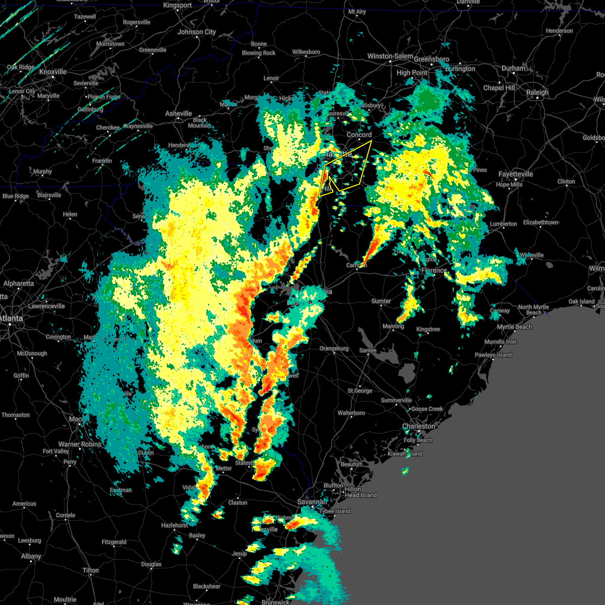 At 405 pm edt, severe thunderstorms were located along a line extending from 7 miles southwest of uptown charlotte to 5 miles northeast of rock hill, moving northeast at 55 mph (radar indicated). Hazards include 60 mph wind gusts. expect damage to trees and minor damage to roofs and siding At 405 pm edt, severe thunderstorms were located along a line extending from 7 miles southwest of uptown charlotte to 5 miles northeast of rock hill, moving northeast at 55 mph (radar indicated). Hazards include 60 mph wind gusts. expect damage to trees and minor damage to roofs and siding
|
| 4/3/2017 4:02 PM EDT |
 At 402 pm edt, severe thunderstorms were located along a line extending from 9 miles east of newton to 10 miles west of huntersville to 4 miles southeast of gastonia, moving east at 45 mph (radar indicated). Hazards include 60 mph wind gusts. Expect damage to trees and minor damage to roofs and siding. locations impacted include, gastonia, uptown charlotte, huntersville, central charlotte, northeast charlotte, southwest charlotte, northwest charlotte, cornelius, mooresville and mt holly. A tornado watch remains in effect until 900 pm edt for the piedmont of north carolina, and upstate south carolina. At 402 pm edt, severe thunderstorms were located along a line extending from 9 miles east of newton to 10 miles west of huntersville to 4 miles southeast of gastonia, moving east at 45 mph (radar indicated). Hazards include 60 mph wind gusts. Expect damage to trees and minor damage to roofs and siding. locations impacted include, gastonia, uptown charlotte, huntersville, central charlotte, northeast charlotte, southwest charlotte, northwest charlotte, cornelius, mooresville and mt holly. A tornado watch remains in effect until 900 pm edt for the piedmont of north carolina, and upstate south carolina.
|
| 4/3/2017 3:52 PM EDT |
 At 351 pm edt, severe thunderstorms were located along a line extending from 5 miles south of newton to 10 miles southeast of lincolnton to 5 miles southwest of gastonia, moving east at 45 mph (radar indicated). Hazards include 60 mph wind gusts. expect damage to trees and minor damage to roofs and siding At 351 pm edt, severe thunderstorms were located along a line extending from 5 miles south of newton to 10 miles southeast of lincolnton to 5 miles southwest of gastonia, moving east at 45 mph (radar indicated). Hazards include 60 mph wind gusts. expect damage to trees and minor damage to roofs and siding
|
| 3/21/2017 9:07 PM EDT |
 At 907 pm edt, a severe thunderstorm was located 10 miles east of downtown concord, or 4 miles north of mt pleasant, moving east at 30 mph (radar indicated). Hazards include 60 mph wind gusts and quarter size hail. Hail damage to vehicles is expected. expect wind damage to roofs, siding and trees. Locations impacted include, kannapolis, landis, enochville, rockwell, mt pleasant, gold hill, china grove and downtown concord. At 907 pm edt, a severe thunderstorm was located 10 miles east of downtown concord, or 4 miles north of mt pleasant, moving east at 30 mph (radar indicated). Hazards include 60 mph wind gusts and quarter size hail. Hail damage to vehicles is expected. expect wind damage to roofs, siding and trees. Locations impacted include, kannapolis, landis, enochville, rockwell, mt pleasant, gold hill, china grove and downtown concord.
|
| 3/21/2017 8:39 PM EDT |
 At 839 pm edt, a severe thunderstorm was located near kannapolis, moving east at 30 mph (radar indicated). Hazards include 60 mph wind gusts and half dollar size hail. Hail damage to vehicles is expected. Expect wind damage to roofs, siding and trees. At 839 pm edt, a severe thunderstorm was located near kannapolis, moving east at 30 mph (radar indicated). Hazards include 60 mph wind gusts and half dollar size hail. Hail damage to vehicles is expected. Expect wind damage to roofs, siding and trees.
|
| 3/21/2017 8:27 PM EDT | Tennis Ball sized hail reported 4.4 miles NE of Concord, NC, golf ball to tennis ball hail approx 12 miles ne of uptown charlotte |
| 3/21/2017 8:26 PM EDT |
 At 825 pm edt, another severe thunderstorm was located 5 miles northeast of huntersville, or near coddle creek reservoir, moving east at 30 mph. the first severe thunderstorm was located two miles east of harrisburg, also moving east at 30 mph (radar indicated). Hazards include 60 mph wind gusts and half dollar size hail. Hail damage to vehicles is expected. expect wind damage to roofs, siding and trees. Locations impacted include, huntersville, downtown concord, northeast charlotte, northwest charlotte, west concord, cornelius, mt holly, harrisburg, coddle creek reservoir and hidden valley. At 825 pm edt, another severe thunderstorm was located 5 miles northeast of huntersville, or near coddle creek reservoir, moving east at 30 mph. the first severe thunderstorm was located two miles east of harrisburg, also moving east at 30 mph (radar indicated). Hazards include 60 mph wind gusts and half dollar size hail. Hail damage to vehicles is expected. expect wind damage to roofs, siding and trees. Locations impacted include, huntersville, downtown concord, northeast charlotte, northwest charlotte, west concord, cornelius, mt holly, harrisburg, coddle creek reservoir and hidden valley.
|
| 3/21/2017 8:02 PM EDT |
 At 802 pm edt, a severe thunderstorm was located 6 miles southeast of huntersville, or over northeast charlotte, moving east at 25 mph (radar indicated). Hazards include 60 mph wind gusts and quarter size hail. Hail damage to vehicles is expected. Expect wind damage to roofs, siding and trees. At 802 pm edt, a severe thunderstorm was located 6 miles southeast of huntersville, or over northeast charlotte, moving east at 25 mph (radar indicated). Hazards include 60 mph wind gusts and quarter size hail. Hail damage to vehicles is expected. Expect wind damage to roofs, siding and trees.
|
| 3/1/2017 8:21 PM EST |
 At 820 pm est, severe thunderstorms were located along a line extending from 9 miles east of uptown charlotte to 3 miles south of rock hill to 16 miles southwest of chester, moving east at 60 mph. several of these storms have already produced damaging winds and large hail (indicated by radar and public reports). Hazards include 60 mph wind gusts and quarter size hail. Hail damage to vehicles is expected. expect wind damage to roofs, siding and trees. Locations impacted include, rock hill, uptown charlotte, monroe, chester, central charlotte, south charlotte, southwest charlotte, east charlotte, matthews and mint hill. At 820 pm est, severe thunderstorms were located along a line extending from 9 miles east of uptown charlotte to 3 miles south of rock hill to 16 miles southwest of chester, moving east at 60 mph. several of these storms have already produced damaging winds and large hail (indicated by radar and public reports). Hazards include 60 mph wind gusts and quarter size hail. Hail damage to vehicles is expected. expect wind damage to roofs, siding and trees. Locations impacted include, rock hill, uptown charlotte, monroe, chester, central charlotte, south charlotte, southwest charlotte, east charlotte, matthews and mint hill.
|
| 3/1/2017 7:45 PM EST |
 At 745 pm est, severe thunderstorms were located along a line extending from 11 miles northwest of york to 10 miles northeast of union to 18 miles northeast of newberry, moving east at 55 mph (radar indicated). Hazards include 60 mph wind gusts and quarter size hail. Hail damage to vehicles is expected. Expect wind damage to roofs, siding and trees. At 745 pm est, severe thunderstorms were located along a line extending from 11 miles northwest of york to 10 miles northeast of union to 18 miles northeast of newberry, moving east at 55 mph (radar indicated). Hazards include 60 mph wind gusts and quarter size hail. Hail damage to vehicles is expected. Expect wind damage to roofs, siding and trees.
|
| 3/1/2017 7:27 PM EST |
 At 726 pm est, a severe thunderstorm was located 4 miles southwest of uptown charlotte, moving east at 60 mph (radar indicated wind. public report of hail). Hazards include 60 mph wind gusts and penny size hail. Expect damage to roofs. siding and trees. Locations impacted include, uptown charlotte, central charlotte, southwest charlotte, east charlotte, matthews, mint hill, freedom park, reedy creek park, the plaza and charlotte douglas airport. At 726 pm est, a severe thunderstorm was located 4 miles southwest of uptown charlotte, moving east at 60 mph (radar indicated wind. public report of hail). Hazards include 60 mph wind gusts and penny size hail. Expect damage to roofs. siding and trees. Locations impacted include, uptown charlotte, central charlotte, southwest charlotte, east charlotte, matthews, mint hill, freedom park, reedy creek park, the plaza and charlotte douglas airport.
|
| 3/1/2017 7:12 PM EST |
 At 712 pm est, a severe thunderstorm was located 9 miles south of gastonia, or 4 miles west of town of lake wylie, moving east at 55 mph (radar indicated). Hazards include 60 mph wind gusts and quarter size hail. Hail damage to vehicles is expected. Expect wind damage to roofs, siding and trees. At 712 pm est, a severe thunderstorm was located 9 miles south of gastonia, or 4 miles west of town of lake wylie, moving east at 55 mph (radar indicated). Hazards include 60 mph wind gusts and quarter size hail. Hail damage to vehicles is expected. Expect wind damage to roofs, siding and trees.
|
| 3/1/2017 6:56 PM EST |
 At 655 pm est, a severe thunderstorm was located near kannapolis, moving east at 55 mph (radar indicated). Hazards include 60 mph wind gusts and penny size hail. Expect damage to roofs. siding and trees. Locations impacted include, kannapolis, downtown concord, west concord, landis, enochville, rockwell, faith, gold hill, high rock and mt pleasant. At 655 pm est, a severe thunderstorm was located near kannapolis, moving east at 55 mph (radar indicated). Hazards include 60 mph wind gusts and penny size hail. Expect damage to roofs. siding and trees. Locations impacted include, kannapolis, downtown concord, west concord, landis, enochville, rockwell, faith, gold hill, high rock and mt pleasant.
|
| 3/1/2017 6:40 PM EST |
 At 639 pm est, a severe thunderstorm was located over huntersville, moving east at 55 mph (radar indicated). Hazards include 60 mph wind gusts and quarter size hail. Hail damage to vehicles is expected. expect wind damage to roofs, siding and trees. Locations impacted include, huntersville, kannapolis, downtown concord, west concord, cornelius, davidson, landis, enochville, rockwell and mt pleasant. At 639 pm est, a severe thunderstorm was located over huntersville, moving east at 55 mph (radar indicated). Hazards include 60 mph wind gusts and quarter size hail. Hail damage to vehicles is expected. expect wind damage to roofs, siding and trees. Locations impacted include, huntersville, kannapolis, downtown concord, west concord, cornelius, davidson, landis, enochville, rockwell and mt pleasant.
|
| 3/1/2017 6:19 PM EST |
 At 618 pm est, a severe thunderstorm was located 7 miles southeast of lincolnton, or near high shoals, moving east at 50 mph (public). Hazards include 60 mph wind gusts and quarter size hail. Hail damage to vehicles is expected. Expect wind damage to roofs, siding and trees. At 618 pm est, a severe thunderstorm was located 7 miles southeast of lincolnton, or near high shoals, moving east at 50 mph (public). Hazards include 60 mph wind gusts and quarter size hail. Hail damage to vehicles is expected. Expect wind damage to roofs, siding and trees.
|
| 11/30/2016 7:25 PM EST |
 The severe thunderstorm warning for rowan, union, eastern cabarrus and davie counties will expire at 730 pm est, the storms which prompted the warning have moved out of the area. therefore the warning will be allowed to expire. The severe thunderstorm warning for rowan, union, eastern cabarrus and davie counties will expire at 730 pm est, the storms which prompted the warning have moved out of the area. therefore the warning will be allowed to expire.
|
| 11/30/2016 7:11 PM EST |
 At 711 pm est, severe thunderstorms were located along a line extending from 9 miles northeast of mocksville to 9 miles southeast of monroe, moving northeast at 30 mph (radar indicated). Hazards include 60 mph wind gusts. Expect damage to roofs. siding and trees. Locations impacted include, monroe, salisbury, mocksville, unionville, wingate, spencer, marshville, granite quarry, rockwell and mt pleasant. At 711 pm est, severe thunderstorms were located along a line extending from 9 miles northeast of mocksville to 9 miles southeast of monroe, moving northeast at 30 mph (radar indicated). Hazards include 60 mph wind gusts. Expect damage to roofs. siding and trees. Locations impacted include, monroe, salisbury, mocksville, unionville, wingate, spencer, marshville, granite quarry, rockwell and mt pleasant.
|
| 11/30/2016 6:57 PM EST |
 The tornado warning for southeastern mecklenburg. northern union and central cabarrus counties will expire at 700 pm est. the storm which prompted the warning has weakened below severe limits. and no longer appears capable of producing a tornado. therefore the warning will be allowed to expire. However strong and gusty winds are still possible with this thunderstorm. The tornado warning for southeastern mecklenburg. northern union and central cabarrus counties will expire at 700 pm est. the storm which prompted the warning has weakened below severe limits. and no longer appears capable of producing a tornado. therefore the warning will be allowed to expire. However strong and gusty winds are still possible with this thunderstorm.
|
| 11/30/2016 6:56 PM EST |
 At 656 pm est, severe thunderstorms were located along a line extending from 5 miles northeast of mocksville to 12 miles south of monroe, moving northeast at 60 mph (radar indicated). Hazards include 60 mph wind gusts. Expect damage to roofs. Siding and trees. At 656 pm est, severe thunderstorms were located along a line extending from 5 miles northeast of mocksville to 12 miles south of monroe, moving northeast at 60 mph (radar indicated). Hazards include 60 mph wind gusts. Expect damage to roofs. Siding and trees.
|
| 11/30/2016 6:46 PM EST |
 At 646 pm est, a severe thunderstorm capable of producing a tornado was located 6 miles east of uptown charlotte, or near east charlotte, moving northeast at 45 mph (radar indicated rotation). Hazards include tornado. Flying debris will be dangerous to those caught without shelter. mobile homes will be damaged or destroyed. damage to roofs, windows and vehicles will occur. tree damage is likely. This dangerous storm will be near, downtown concord, midland, harrisburg and mt pleasant around 700 pm est. At 646 pm est, a severe thunderstorm capable of producing a tornado was located 6 miles east of uptown charlotte, or near east charlotte, moving northeast at 45 mph (radar indicated rotation). Hazards include tornado. Flying debris will be dangerous to those caught without shelter. mobile homes will be damaged or destroyed. damage to roofs, windows and vehicles will occur. tree damage is likely. This dangerous storm will be near, downtown concord, midland, harrisburg and mt pleasant around 700 pm est.
|
| 11/30/2016 6:40 PM EST |
 At 639 pm est, severe thunderstorms were located along a line extending from 9 miles southeast of yadkinville to 7 miles southeast of statesville to 10 miles north of huntersville to 10 miles southeast of uptown charlotte to 13 miles south of lancaster, moving east at 25 mph (radar indicated). Hazards include 60 mph wind gusts. Expect damage to roofs. siding and trees. Locations impacted include, uptown charlotte, huntersville, kannapolis, downtown concord, monroe, salisbury, statesville, mocksville, central charlotte and south charlotte. At 639 pm est, severe thunderstorms were located along a line extending from 9 miles southeast of yadkinville to 7 miles southeast of statesville to 10 miles north of huntersville to 10 miles southeast of uptown charlotte to 13 miles south of lancaster, moving east at 25 mph (radar indicated). Hazards include 60 mph wind gusts. Expect damage to roofs. siding and trees. Locations impacted include, uptown charlotte, huntersville, kannapolis, downtown concord, monroe, salisbury, statesville, mocksville, central charlotte and south charlotte.
|
| 11/30/2016 6:35 PM EST |
 At 635 pm est, a severe thunderstorm capable of producing a tornado was located 5 miles south of uptown charlotte, or over southpark mall, moving east at 50 mph (radar indicated rotation). Hazards include tornado. Flying debris will be dangerous to those caught without shelter. mobile homes will be damaged or destroyed. damage to roofs, windows and vehicles will occur. tree damage is likely. this dangerous storm will be near, matthews and east charlotte around 640 pm est. mint hill, stallings, hemby bridge, indian trail and fairview in union county around 650 pm est. Midland and mt pleasant around 700 pm est. At 635 pm est, a severe thunderstorm capable of producing a tornado was located 5 miles south of uptown charlotte, or over southpark mall, moving east at 50 mph (radar indicated rotation). Hazards include tornado. Flying debris will be dangerous to those caught without shelter. mobile homes will be damaged or destroyed. damage to roofs, windows and vehicles will occur. tree damage is likely. this dangerous storm will be near, matthews and east charlotte around 640 pm est. mint hill, stallings, hemby bridge, indian trail and fairview in union county around 650 pm est. Midland and mt pleasant around 700 pm est.
|
| 11/30/2016 6:26 PM EST |
 At 626 pm est, a severe thunderstorm capable of producing a tornado was located 8 miles southwest of uptown charlotte, or near carowinds, moving east at 55 mph (radar indicated rotation). Hazards include tornado. Flying debris will be dangerous to those caught without shelter. mobile homes will be damaged or destroyed. damage to roofs, windows and vehicles will occur. tree damage is likely. this dangerous storm will be near, uptown charlotte, southpark mall, the arboretum and freedom park around 630 pm est. matthews, south charlotte, east charlotte, the plaza and reedy creek park around 640 pm est. downtown concord, mint hill, midland and stallings around 650 pm est. Mt pleasant around 700 pm est. At 626 pm est, a severe thunderstorm capable of producing a tornado was located 8 miles southwest of uptown charlotte, or near carowinds, moving east at 55 mph (radar indicated rotation). Hazards include tornado. Flying debris will be dangerous to those caught without shelter. mobile homes will be damaged or destroyed. damage to roofs, windows and vehicles will occur. tree damage is likely. this dangerous storm will be near, uptown charlotte, southpark mall, the arboretum and freedom park around 630 pm est. matthews, south charlotte, east charlotte, the plaza and reedy creek park around 640 pm est. downtown concord, mint hill, midland and stallings around 650 pm est. Mt pleasant around 700 pm est.
|
| 11/30/2016 6:13 PM EST |
 At 613 pm est, severe thunderstorms were located along a line extending from 6 miles north of mocksville to 9 miles southwest of statesville to 10 miles northeast of lincolnton to 9 miles north of winnsboro, moving east at 35 mph (radar indicated). Hazards include 60 mph wind gusts. Expect damage to roofs. Siding and trees. At 613 pm est, severe thunderstorms were located along a line extending from 6 miles north of mocksville to 9 miles southwest of statesville to 10 miles northeast of lincolnton to 9 miles north of winnsboro, moving east at 35 mph (radar indicated). Hazards include 60 mph wind gusts. Expect damage to roofs. Siding and trees.
|
| 9/28/2016 7:46 PM EDT |
 At 745 pm edt, a severe thunderstorm was located 5 miles east of downtown concord, or near mt pleasant, moving northeast at 20 mph (radar indicated). Hazards include 60 mph wind gusts and penny size hail. Expect damage to roofs. siding and trees. Locations impacted include, downtown concord, mt pleasant, harrisburg and west concord. At 745 pm edt, a severe thunderstorm was located 5 miles east of downtown concord, or near mt pleasant, moving northeast at 20 mph (radar indicated). Hazards include 60 mph wind gusts and penny size hail. Expect damage to roofs. siding and trees. Locations impacted include, downtown concord, mt pleasant, harrisburg and west concord.
|
| 9/28/2016 7:30 PM EDT |
 At 730 pm edt, a severe thunderstorm was located 9 miles east of uptown charlotte, or near reedy creek park, moving northeast at 25 mph (radar indicated). Hazards include 60 mph wind gusts and penny size hail. Expect damage to roofs. Siding and trees. At 730 pm edt, a severe thunderstorm was located 9 miles east of uptown charlotte, or near reedy creek park, moving northeast at 25 mph (radar indicated). Hazards include 60 mph wind gusts and penny size hail. Expect damage to roofs. Siding and trees.
|
| 9/28/2016 6:41 PM EDT |
 At 640 pm edt, a severe thunderstorm was located 11 miles south of downtown concord, or 5 miles northeast of mint hill, moving northeast at 25 mph (radar indicated). Hazards include 60 mph wind gusts and quarter size hail. Hail damage to vehicles is expected. expect wind damage to roofs, siding and trees. Locations impacted include, downtown concord, harrisburg, midland, charlotte motor speedway, west concord and mt pleasant. At 640 pm edt, a severe thunderstorm was located 11 miles south of downtown concord, or 5 miles northeast of mint hill, moving northeast at 25 mph (radar indicated). Hazards include 60 mph wind gusts and quarter size hail. Hail damage to vehicles is expected. expect wind damage to roofs, siding and trees. Locations impacted include, downtown concord, harrisburg, midland, charlotte motor speedway, west concord and mt pleasant.
|
| 9/28/2016 6:20 PM EDT |
 At 620 pm edt, a severe thunderstorm was located 8 miles east of uptown charlotte, or near mint hill, moving northeast at 25 mph (radar indicated). Hazards include 60 mph wind gusts and quarter size hail. Hail damage to vehicles is expected. Expect wind damage to roofs, siding and trees. At 620 pm edt, a severe thunderstorm was located 8 miles east of uptown charlotte, or near mint hill, moving northeast at 25 mph (radar indicated). Hazards include 60 mph wind gusts and quarter size hail. Hail damage to vehicles is expected. Expect wind damage to roofs, siding and trees.
|
| 8/27/2016 3:34 PM EDT |
 At 334 pm edt, a severe thunderstorm was located 11 miles northwest of kannapolis, or near mooresville, moving west at 20 mph (radar indicated). Hazards include 60 mph wind gusts. Expect damage to roofs. siding and trees. Locations impacted include, huntersville, kannapolis, cornelius, mooresville, davidson, landis, enochville, coddle creek reservoir, ramsey creek park and doolie. At 334 pm edt, a severe thunderstorm was located 11 miles northwest of kannapolis, or near mooresville, moving west at 20 mph (radar indicated). Hazards include 60 mph wind gusts. Expect damage to roofs. siding and trees. Locations impacted include, huntersville, kannapolis, cornelius, mooresville, davidson, landis, enochville, coddle creek reservoir, ramsey creek park and doolie.
|
| 8/27/2016 3:12 PM EDT |
 At 311 pm edt, a severe thunderstorm was located 5 miles north of kannapolis, or near landis, moving west at 20 mph (radar indicated). Hazards include 60 mph wind gusts. Expect damage to roofs. siding and trees. Locations impacted include, huntersville, kannapolis, cornelius, mooresville, davidson, china grove, landis, enochville, coddle creek reservoir and ramsey creek park. At 311 pm edt, a severe thunderstorm was located 5 miles north of kannapolis, or near landis, moving west at 20 mph (radar indicated). Hazards include 60 mph wind gusts. Expect damage to roofs. siding and trees. Locations impacted include, huntersville, kannapolis, cornelius, mooresville, davidson, china grove, landis, enochville, coddle creek reservoir and ramsey creek park.
|
| 8/27/2016 2:58 PM EDT |
 At 257 pm edt, a severe thunderstorm was located 7 miles southwest of salisbury, or near china grove, moving west at 20 mph (radar indicated). Hazards include 60 mph wind gusts. Expect damage to roofs. Siding and trees. At 257 pm edt, a severe thunderstorm was located 7 miles southwest of salisbury, or near china grove, moving west at 20 mph (radar indicated). Hazards include 60 mph wind gusts. Expect damage to roofs. Siding and trees.
|
| 8/17/2016 7:09 PM EDT |
 The severe thunderstorm warning for north central mecklenburg county will expire at 715 pm edt, the storm which prompted the warning has weakened below severe limits, and no longer poses an immediate threat to life or property. therefore the warning will be allowed to expire. however gusty winds are still possible with this thunderstorm. The severe thunderstorm warning for north central mecklenburg county will expire at 715 pm edt, the storm which prompted the warning has weakened below severe limits, and no longer poses an immediate threat to life or property. therefore the warning will be allowed to expire. however gusty winds are still possible with this thunderstorm.
|
| 8/17/2016 6:59 PM EDT |
 At 658 pm edt, a severe thunderstorm was located near kannapolis, moving east at 5 mph (radar indicated). Hazards include 60 mph wind gusts. Expect damage to roofs. siding and trees. Locations impacted include, kannapolis, downtown concord, west concord, china grove, landis, enochville, charlotte motor speedway, coddle creek reservoir and harrisburg. At 658 pm edt, a severe thunderstorm was located near kannapolis, moving east at 5 mph (radar indicated). Hazards include 60 mph wind gusts. Expect damage to roofs. siding and trees. Locations impacted include, kannapolis, downtown concord, west concord, china grove, landis, enochville, charlotte motor speedway, coddle creek reservoir and harrisburg.
|
| 8/17/2016 6:47 PM EDT |
 At 646 pm edt, a severe thunderstorm was located 4 miles southeast of huntersville, or near northeast charlotte, moving northeast at 15 mph (radar indicated). Hazards include 60 mph wind gusts. Expect damage to roofs. siding and trees. Locations impacted include, huntersville, northeast charlotte, croft, unc-charlotte, hidden valley, northwest charlotte, davidson and central charlotte. At 646 pm edt, a severe thunderstorm was located 4 miles southeast of huntersville, or near northeast charlotte, moving northeast at 15 mph (radar indicated). Hazards include 60 mph wind gusts. Expect damage to roofs. siding and trees. Locations impacted include, huntersville, northeast charlotte, croft, unc-charlotte, hidden valley, northwest charlotte, davidson and central charlotte.
|
| 8/17/2016 6:38 PM EDT |
 At 638 pm edt, a severe thunderstorm was located 4 miles west of kannapolis, or near coddle creek reservoir, moving east at 10 mph (radar indicated). Hazards include 60 mph wind gusts and penny size hail. Expect damage to roofs. Siding and trees. At 638 pm edt, a severe thunderstorm was located 4 miles west of kannapolis, or near coddle creek reservoir, moving east at 10 mph (radar indicated). Hazards include 60 mph wind gusts and penny size hail. Expect damage to roofs. Siding and trees.
|
| 8/17/2016 6:24 PM EDT |
 At 623 pm edt, a severe thunderstorm was located near huntersville, moving east at 15 mph (radar indicated). Hazards include 60 mph wind gusts. Expect damage to roofs. siding and trees. Locations impacted include, huntersville, northeast charlotte, northwest charlotte, unc-charlotte, ramsey creek park, paw creek, croft, cornelius, hidden valley and davidson. At 623 pm edt, a severe thunderstorm was located near huntersville, moving east at 15 mph (radar indicated). Hazards include 60 mph wind gusts. Expect damage to roofs. siding and trees. Locations impacted include, huntersville, northeast charlotte, northwest charlotte, unc-charlotte, ramsey creek park, paw creek, croft, cornelius, hidden valley and davidson.
|
| 8/17/2016 6:08 PM EDT |
 At 608 pm edt, a severe thunderstorm was located 5 miles southwest of huntersville, moving east at 30 mph (radar indicated). Hazards include 60 mph wind gusts and penny size hail. Expect damage to roofs. Siding and trees. At 608 pm edt, a severe thunderstorm was located 5 miles southwest of huntersville, moving east at 30 mph (radar indicated). Hazards include 60 mph wind gusts and penny size hail. Expect damage to roofs. Siding and trees.
|
| 8/17/2016 4:53 PM EDT |
 The severe thunderstorm warning for south central rowan and northern cabarrus counties will expire at 500 pm edt, the storm which prompted the warning has weakened below severe limits, and no longer poses an immediate threat to life or property. therefore the warning will be allowed to expire. The severe thunderstorm warning for south central rowan and northern cabarrus counties will expire at 500 pm edt, the storm which prompted the warning has weakened below severe limits, and no longer poses an immediate threat to life or property. therefore the warning will be allowed to expire.
|
| 8/17/2016 4:43 PM EDT |
 At 443 pm edt, a severe thunderstorm was located near kannapolis, moving east at 10 mph (radar indicated). Hazards include 60 mph wind gusts. Expect damage to roofs. siding and trees. Locations impacted include, kannapolis, downtown concord, west concord, china grove, landis, enochville, mt pleasant, faith, coddle creek reservoir and granite quarry. At 443 pm edt, a severe thunderstorm was located near kannapolis, moving east at 10 mph (radar indicated). Hazards include 60 mph wind gusts. Expect damage to roofs. siding and trees. Locations impacted include, kannapolis, downtown concord, west concord, china grove, landis, enochville, mt pleasant, faith, coddle creek reservoir and granite quarry.
|
| 8/17/2016 4:19 PM EDT |
 At 419 pm edt, a severe thunderstorm was located near kannapolis, or near coddle creek reservoir, moving east at 10 mph (radar indicated). Hazards include 60 mph wind gusts. Expect damage to roofs. Siding and trees. At 419 pm edt, a severe thunderstorm was located near kannapolis, or near coddle creek reservoir, moving east at 10 mph (radar indicated). Hazards include 60 mph wind gusts. Expect damage to roofs. Siding and trees.
|
| 8/15/2016 6:43 PM EDT |
 At 642 pm edt, a severe thunderstorm was located 8 miles west of uptown charlotte, or near charlotte douglas airport, moving north at 30 mph (radar indicated). Hazards include 60 mph wind gusts and penny size hail. Expect damage to roofs. Siding and trees. At 642 pm edt, a severe thunderstorm was located 8 miles west of uptown charlotte, or near charlotte douglas airport, moving north at 30 mph (radar indicated). Hazards include 60 mph wind gusts and penny size hail. Expect damage to roofs. Siding and trees.
|
| 7/26/2016 5:58 PM EDT | The severe thunderstorm warning for northeastern mecklenburg and cabarrus counties will expire at 600 pm edt, the storm which prompted the warning has weakened below severe limits, and no longer poses an immediate threat to life or property. therefore the warning will be allowed to expire. however gusty winds are still possible with this thunderstorm. |
| 7/26/2016 5:41 PM EDT |
 At 541 pm edt, a severe thunderstorm was located 8 miles northeast of uptown charlotte, or near unc-charlotte, moving east at 10 mph (radar indicated). Hazards include 60 mph wind gusts. Expect damage to roofs. siding and trees. Locations impacted include, downtown concord, west concord, harrisburg, mt pleasant, charlotte motor speedway, coddle creek reservoir, reedy creek park, unc-charlotte, northeast charlotte and midland. At 541 pm edt, a severe thunderstorm was located 8 miles northeast of uptown charlotte, or near unc-charlotte, moving east at 10 mph (radar indicated). Hazards include 60 mph wind gusts. Expect damage to roofs. siding and trees. Locations impacted include, downtown concord, west concord, harrisburg, mt pleasant, charlotte motor speedway, coddle creek reservoir, reedy creek park, unc-charlotte, northeast charlotte and midland.
|
| 7/26/2016 5:29 PM EDT |
 At 529 pm edt, a severe thunderstorm was located 6 miles west of downtown concord, or near coddle creek reservoir, and is nearly stationary (radar indicated). Hazards include 60 mph wind gusts. Expect damage to roofs. siding and trees. Locations impacted include, downtown concord, west concord, harrisburg, mt pleasant, charlotte motor speedway, coddle creek reservoir, reedy creek park, unc-charlotte, northeast charlotte and midland. At 529 pm edt, a severe thunderstorm was located 6 miles west of downtown concord, or near coddle creek reservoir, and is nearly stationary (radar indicated). Hazards include 60 mph wind gusts. Expect damage to roofs. siding and trees. Locations impacted include, downtown concord, west concord, harrisburg, mt pleasant, charlotte motor speedway, coddle creek reservoir, reedy creek park, unc-charlotte, northeast charlotte and midland.
|
| 7/26/2016 5:14 PM EDT |
 At 514 pm edt, a severe thunderstorm was located 5 miles west of downtown concord, or near west concord, moving southeast at 10 mph (radar indicated). Hazards include 60 mph wind gusts. Expect damage to roofs. Siding and trees. At 514 pm edt, a severe thunderstorm was located 5 miles west of downtown concord, or near west concord, moving southeast at 10 mph (radar indicated). Hazards include 60 mph wind gusts. Expect damage to roofs. Siding and trees.
|
| 7/23/2016 5:58 PM EDT | The severe thunderstorm warning for central mecklenburg and western cabarrus counties will expire at 600 pm edt, the storm which prompted the warning has weakened below severe limits, and no longer poses an immediate threat to life or property. therefore the warning will be allowed to expire. however gusty winds and heavy rain are still possible with this thunderstorm. |
| 7/23/2016 5:45 PM EDT |
 At 543 pm edt, a severe thunderstorm was located 7 miles west of downtown concord, or near charlotte motor speedway, moving east at 10 mph (radar indicated). Hazards include 60 mph wind gusts. Expect damage to roofs. siding and trees. Locations impacted include, uptown charlotte, huntersville, east charlotte, northeast charlotte, west concord, harrisburg, the plaza, hidden valley, charlotte motor speedway and reedy creek park. At 543 pm edt, a severe thunderstorm was located 7 miles west of downtown concord, or near charlotte motor speedway, moving east at 10 mph (radar indicated). Hazards include 60 mph wind gusts. Expect damage to roofs. siding and trees. Locations impacted include, uptown charlotte, huntersville, east charlotte, northeast charlotte, west concord, harrisburg, the plaza, hidden valley, charlotte motor speedway and reedy creek park.
|
| 7/23/2016 5:40 PM EDT | One tree down near the intersection of odell school road and shiloh church roa in cabarrus county NC, 8.9 miles SE of Concord, NC |
| 7/23/2016 5:19 PM EDT |
 At 519 pm edt, a severe thunderstorm was located 5 miles southeast of huntersville, or near northeast charlotte, moving south at 25 mph (radar indicated). Hazards include 60 mph wind gusts. Expect damage to roofs. Siding and trees. At 519 pm edt, a severe thunderstorm was located 5 miles southeast of huntersville, or near northeast charlotte, moving south at 25 mph (radar indicated). Hazards include 60 mph wind gusts. Expect damage to roofs. Siding and trees.
|
| 7/20/2016 12:20 AM EDT |
 The severe thunderstorm warning for southwestern rowan and northwestern cabarrus counties will expire at 1230 am edt, the storm which prompted the warning has weakened below severe limits, and no longer poses an immediate threat to life or property. therefore the warning will be allowed to expire. however gusty winds are still possible with this thunderstorm. The severe thunderstorm warning for southwestern rowan and northwestern cabarrus counties will expire at 1230 am edt, the storm which prompted the warning has weakened below severe limits, and no longer poses an immediate threat to life or property. therefore the warning will be allowed to expire. however gusty winds are still possible with this thunderstorm.
|
| 7/20/2016 12:07 AM EDT |
 At 1206 am edt, a severe thunderstorm was located near kannapolis, moving south at 5 mph (radar indicated). Hazards include 60 mph wind gusts. Expect damage to roofs. siding and trees. Locations impacted include, kannapolis, china grove, landis, enochville, coddle creek reservoir, west concord and downtown concord. At 1206 am edt, a severe thunderstorm was located near kannapolis, moving south at 5 mph (radar indicated). Hazards include 60 mph wind gusts. Expect damage to roofs. siding and trees. Locations impacted include, kannapolis, china grove, landis, enochville, coddle creek reservoir, west concord and downtown concord.
|
| 7/19/2016 11:46 PM EDT |
 At 1146 pm edt, a severe thunderstorm was located near kannapolis, or near enochville, moving south at 10 mph (radar indicated). Hazards include 60 mph wind gusts. Expect damage to roofs. siding and trees. Locations impacted include, kannapolis, china grove, landis, enochville, coddle creek reservoir, mount ulla, west concord and downtown concord. At 1146 pm edt, a severe thunderstorm was located near kannapolis, or near enochville, moving south at 10 mph (radar indicated). Hazards include 60 mph wind gusts. Expect damage to roofs. siding and trees. Locations impacted include, kannapolis, china grove, landis, enochville, coddle creek reservoir, mount ulla, west concord and downtown concord.
|
| 7/19/2016 11:35 PM EDT |
 At 1135 pm edt, a severe thunderstorm was located 9 miles south of downtown concord, or 4 miles northwest of midland, moving south at 15 mph (radar indicated). Hazards include 60 mph wind gusts. Expect damage to roofs. siding and trees. Locations impacted include, downtown concord, west concord, mint hill, harrisburg, charlotte motor speedway, reedy creek park, midland, unc-charlotte, matthews and east charlotte. At 1135 pm edt, a severe thunderstorm was located 9 miles south of downtown concord, or 4 miles northwest of midland, moving south at 15 mph (radar indicated). Hazards include 60 mph wind gusts. Expect damage to roofs. siding and trees. Locations impacted include, downtown concord, west concord, mint hill, harrisburg, charlotte motor speedway, reedy creek park, midland, unc-charlotte, matthews and east charlotte.
|
| 7/19/2016 11:26 PM EDT |
 At 1126 pm edt, a severe thunderstorm was located 4 miles north of kannapolis, or over landis, moving south at 25 mph (radar indicated). Hazards include 60 mph wind gusts. Expect damage to roofs. Siding and trees. At 1126 pm edt, a severe thunderstorm was located 4 miles north of kannapolis, or over landis, moving south at 25 mph (radar indicated). Hazards include 60 mph wind gusts. Expect damage to roofs. Siding and trees.
|
| 7/19/2016 11:19 PM EDT |
 At 1119 pm edt, a severe thunderstorm was located 5 miles south of downtown concord, or 5 miles east of harrisburg, moving south at 25 mph (radar indicated). Hazards include 60 mph wind gusts and penny size hail. Expect damage to roofs. siding and trees. Locations impacted include, downtown concord, west concord, mint hill, harrisburg, charlotte motor speedway, reedy creek park, midland, unc-charlotte, matthews and east charlotte. At 1119 pm edt, a severe thunderstorm was located 5 miles south of downtown concord, or 5 miles east of harrisburg, moving south at 25 mph (radar indicated). Hazards include 60 mph wind gusts and penny size hail. Expect damage to roofs. siding and trees. Locations impacted include, downtown concord, west concord, mint hill, harrisburg, charlotte motor speedway, reedy creek park, midland, unc-charlotte, matthews and east charlotte.
|
| 7/19/2016 10:59 PM EDT |
 At 1059 pm edt, a severe thunderstorm was located 10 miles south of downtown concord, or 5 miles southeast of harrisburg, moving south at 15 mph (radar indicated). Hazards include 60 mph wind gusts and penny size hail. Expect damage to roofs. siding and trees. Locations impacted include, downtown concord, west concord, mint hill, harrisburg, charlotte motor speedway, reedy creek park, midland, unc-charlotte, matthews and east charlotte. At 1059 pm edt, a severe thunderstorm was located 10 miles south of downtown concord, or 5 miles southeast of harrisburg, moving south at 15 mph (radar indicated). Hazards include 60 mph wind gusts and penny size hail. Expect damage to roofs. siding and trees. Locations impacted include, downtown concord, west concord, mint hill, harrisburg, charlotte motor speedway, reedy creek park, midland, unc-charlotte, matthews and east charlotte.
|
| 7/19/2016 10:52 PM EDT | Tree blown down blocking rocky river road near lower rocky river r in cabarrus county NC, 5.8 miles NNW of Concord, NC |
| 7/19/2016 10:42 PM EDT | The severe thunderstorm warning for southwestern rowan and northwestern cabarrus counties will expire at 1045 pm edt, the storm which prompted the warning has weakened below severe limits, and no longer poses an immediate threat to life or property. therefore the warning will be allowed to expire. |
| 7/19/2016 10:38 PM EDT |
 At 1037 pm edt, a severe thunderstorm was located 5 miles southwest of downtown concord, or near harrisburg, moving south at 15 mph (radar indicated). Hazards include 60 mph wind gusts and penny size hail. Expect damage to roofs. Siding and trees. At 1037 pm edt, a severe thunderstorm was located 5 miles southwest of downtown concord, or near harrisburg, moving south at 15 mph (radar indicated). Hazards include 60 mph wind gusts and penny size hail. Expect damage to roofs. Siding and trees.
|
| 7/19/2016 10:22 PM EDT |
 At 1022 pm edt, a severe thunderstorm was located near kannapolis, moving southeast at 15 mph (radar indicated). Hazards include 60 mph wind gusts. Expect damage to roofs. siding and trees. Locations impacted include, kannapolis, china grove, landis, enochville, piedmont research station, mount ulla, faith, coddle creek reservoir, salisbury and west concord. At 1022 pm edt, a severe thunderstorm was located near kannapolis, moving southeast at 15 mph (radar indicated). Hazards include 60 mph wind gusts. Expect damage to roofs. siding and trees. Locations impacted include, kannapolis, china grove, landis, enochville, piedmont research station, mount ulla, faith, coddle creek reservoir, salisbury and west concord.
|
| 7/19/2016 9:46 PM EDT |
 At 946 pm edt, a severe thunderstorm was located 9 miles north of kannapolis, or 5 miles northwest of china grove, moving south at 15 mph (radar indicated). Hazards include 60 mph wind gusts and quarter size hail. Hail damage to vehicles is expected. Expect wind damage to roofs, siding and trees. At 946 pm edt, a severe thunderstorm was located 9 miles north of kannapolis, or 5 miles northwest of china grove, moving south at 15 mph (radar indicated). Hazards include 60 mph wind gusts and quarter size hail. Hail damage to vehicles is expected. Expect wind damage to roofs, siding and trees.
|
| 7/16/2016 6:28 PM EDT | The severe thunderstorm warning for southeastern rowan and northeastern cabarrus counties will expire at 630 pm edt. the storms which prompted the warning have weakened and were moving out of the area. Therefore the warning will be allowed to expire. |
| 7/16/2016 6:02 PM EDT |
 At 602 pm edt, severe thunderstorms were located along a line extending from 5 miles east of kannapolis to 5 miles east of downtown concord, moving east at 20 mph (radar indicated). Hazards include 60 mph wind gusts and penny size hail. Expect damage to roofs. siding and trees. Locations impacted include, kannapolis, downtown concord, mt pleasant, gold hill and west concord. At 602 pm edt, severe thunderstorms were located along a line extending from 5 miles east of kannapolis to 5 miles east of downtown concord, moving east at 20 mph (radar indicated). Hazards include 60 mph wind gusts and penny size hail. Expect damage to roofs. siding and trees. Locations impacted include, kannapolis, downtown concord, mt pleasant, gold hill and west concord.
|
| 7/16/2016 5:43 PM EDT |
 At 542 pm edt, a severe thunderstorm was located over downtown concord, moving east at 25 mph (radar indicated). Hazards include 60 mph wind gusts and nickel size hail. Expect damage to roofs. Siding and trees. At 542 pm edt, a severe thunderstorm was located over downtown concord, moving east at 25 mph (radar indicated). Hazards include 60 mph wind gusts and nickel size hail. Expect damage to roofs. Siding and trees.
|
| 7/11/2016 6:25 PM EDT |
 At 625 pm edt, severe thunderstorms were located along a line extending from 3 miles northeast of kannapolis to 9 miles east of downtown concord, moving east at 30 mph (radar indicated). Hazards include 60 mph wind gusts and penny size hail. Expect damage to roofs. Siding and trees. At 625 pm edt, severe thunderstorms were located along a line extending from 3 miles northeast of kannapolis to 9 miles east of downtown concord, moving east at 30 mph (radar indicated). Hazards include 60 mph wind gusts and penny size hail. Expect damage to roofs. Siding and trees.
|
| 7/11/2016 6:16 PM EDT |
 At 615 pm edt, a severe thunderstorm was located 13 miles southeast of downtown concord, or near midland, moving east at 15 mph (radar indicated). Hazards include 60 mph wind gusts and quarter size hail. Hail damage to vehicles is expected. expect wind damage to roofs, siding and trees. Locations impacted include, mt pleasant, fairview in union county, midland, new salem and harrisburg. At 615 pm edt, a severe thunderstorm was located 13 miles southeast of downtown concord, or near midland, moving east at 15 mph (radar indicated). Hazards include 60 mph wind gusts and quarter size hail. Hail damage to vehicles is expected. expect wind damage to roofs, siding and trees. Locations impacted include, mt pleasant, fairview in union county, midland, new salem and harrisburg.
|
| 7/11/2016 5:43 PM EDT |
 At 543 pm edt, a severe thunderstorm was located 12 miles east of uptown charlotte, or near mint hill, moving east at 15 mph (radar indicated). Hazards include 60 mph wind gusts and quarter size hail. Hail damage to vehicles is expected. Expect wind damage to roofs, siding and trees. At 543 pm edt, a severe thunderstorm was located 12 miles east of uptown charlotte, or near mint hill, moving east at 15 mph (radar indicated). Hazards include 60 mph wind gusts and quarter size hail. Hail damage to vehicles is expected. Expect wind damage to roofs, siding and trees.
|
| 7/8/2016 8:55 PM EDT | Trees down on powerlines on burlwood and lower rocky river roa in cabarrus county NC, 7.3 miles NNW of Concord, NC |
| 7/8/2016 8:49 PM EDT |
 At 848 pm edt, severe thunderstorms were located along a line extending from 4 miles east of kannapolis to 5 miles east of uptown charlotte to 13 miles northeast of rock hill, moving east at 40 mph (radar indicated). Hazards include 60 mph wind gusts and quarter size hail. Hail damage to vehicles is expected. expect wind damage to roofs, siding and trees. Locations impacted include, uptown charlotte, huntersville, kannapolis, downtown concord, central charlotte, south charlotte, east charlotte, southwest charlotte, northeast charlotte and northwest charlotte. At 848 pm edt, severe thunderstorms were located along a line extending from 4 miles east of kannapolis to 5 miles east of uptown charlotte to 13 miles northeast of rock hill, moving east at 40 mph (radar indicated). Hazards include 60 mph wind gusts and quarter size hail. Hail damage to vehicles is expected. expect wind damage to roofs, siding and trees. Locations impacted include, uptown charlotte, huntersville, kannapolis, downtown concord, central charlotte, south charlotte, east charlotte, southwest charlotte, northeast charlotte and northwest charlotte.
|
| 7/8/2016 8:45 PM EDT | City em reported 15 trees down in the city... one on a house. numerous power outages from concord to mount pleasan in cabarrus county NC, 2.4 miles WSW of Concord, NC |
| 7/8/2016 8:30 PM EDT |
 At 829 pm edt, severe thunderstorms were located along a line extending from 9 miles west of kannapolis to 4 miles south of huntersville to 8 miles southeast of gastonia, moving east at 45 mph (radar indicated). Hazards include 60 mph wind gusts and quarter size hail. Hail damage to vehicles is expected. Expect wind damage to roofs, siding and trees. At 829 pm edt, severe thunderstorms were located along a line extending from 9 miles west of kannapolis to 4 miles south of huntersville to 8 miles southeast of gastonia, moving east at 45 mph (radar indicated). Hazards include 60 mph wind gusts and quarter size hail. Hail damage to vehicles is expected. Expect wind damage to roofs, siding and trees.
|
| 7/8/2016 8:08 PM EDT |
 At 807 pm edt, a severe thunderstorm was located 11 miles west of huntersville, or near stanley, moving southeast at 20 mph (radar indicated). Hazards include 60 mph wind gusts and quarter size hail. Hail damage to vehicles is expected. Expect wind damage to roofs, siding and trees. At 807 pm edt, a severe thunderstorm was located 11 miles west of huntersville, or near stanley, moving southeast at 20 mph (radar indicated). Hazards include 60 mph wind gusts and quarter size hail. Hail damage to vehicles is expected. Expect wind damage to roofs, siding and trees.
|
| 7/5/2016 4:18 PM EDT |
 At 417 pm edt, severe thunderstorms were located along a line extending from 5 miles north of uptown charlotte to 6 miles south of gastonia to 4 miles southwest of gaffney, moving east at 30 mph (law enforcement). Hazards include damaging 60 mph wind gusts. Expect damage to roofs. Siding and trees. At 417 pm edt, severe thunderstorms were located along a line extending from 5 miles north of uptown charlotte to 6 miles south of gastonia to 4 miles southwest of gaffney, moving east at 30 mph (law enforcement). Hazards include damaging 60 mph wind gusts. Expect damage to roofs. Siding and trees.
|
| 6/29/2016 5:11 PM EDT |
 At 508 pm edt, a severe thunderstorm was located 6 miles southwest of kannapolis, or near coddle creek reservoir, moving southeast at 25 mph (radar indicated). Hazards include 60 mph wind gusts. Expect damage to roofs. siding and trees. this storm produced wind damage in the form of downed trees in the davidson area. however, it has since weakened. if it weakens further, the warning will be cancelled before 545 pm. Locations impacted include, downtown concord, west concord, harrisburg, mt pleasant, charlotte motor speedway, coddle creek reservoir, midland and kannapolis. At 508 pm edt, a severe thunderstorm was located 6 miles southwest of kannapolis, or near coddle creek reservoir, moving southeast at 25 mph (radar indicated). Hazards include 60 mph wind gusts. Expect damage to roofs. siding and trees. this storm produced wind damage in the form of downed trees in the davidson area. however, it has since weakened. if it weakens further, the warning will be cancelled before 545 pm. Locations impacted include, downtown concord, west concord, harrisburg, mt pleasant, charlotte motor speedway, coddle creek reservoir, midland and kannapolis.
|
| 6/29/2016 4:46 PM EDT |
 At 446 pm edt, a severe thunderstorm was located 5 miles north of huntersville, or over davidson, moving southeast at 25 mph (radar indicated). Hazards include 60 mph wind gusts and quarter size hail. Hail damage to vehicles is expected. Expect wind damage to roofs, siding and trees. At 446 pm edt, a severe thunderstorm was located 5 miles north of huntersville, or over davidson, moving southeast at 25 mph (radar indicated). Hazards include 60 mph wind gusts and quarter size hail. Hail damage to vehicles is expected. Expect wind damage to roofs, siding and trees.
|
| 6/22/2016 5:27 PM EDT |
 At 527 pm edt, a severe thunderstorm was located 9 miles southeast of downtown concord, or 4 miles north of midland, moving east at 20 mph (radar indicated). Hazards include 60 mph wind gusts and quarter size hail. Hail damage to vehicles is expected. expect wind damage to roofs, siding and trees. Locations impacted include, midland, harrisburg, mt pleasant and downtown concord. At 527 pm edt, a severe thunderstorm was located 9 miles southeast of downtown concord, or 4 miles north of midland, moving east at 20 mph (radar indicated). Hazards include 60 mph wind gusts and quarter size hail. Hail damage to vehicles is expected. expect wind damage to roofs, siding and trees. Locations impacted include, midland, harrisburg, mt pleasant and downtown concord.
|
| 6/22/2016 5:19 PM EDT | Tree fell on house on vanderhorst dr. occupants inside but no injurie in cabarrus county NC, 6 miles NW of Concord, NC |
| 6/22/2016 5:13 PM EDT |
 At 513 pm edt, a severe thunderstorm was located 5 miles south of downtown concord, moving southeast at 20 mph (radar indicated). Hazards include 60 mph wind gusts and quarter size hail. Hail damage to vehicles is expected. Expect wind damage to roofs, siding and trees. At 513 pm edt, a severe thunderstorm was located 5 miles south of downtown concord, moving southeast at 20 mph (radar indicated). Hazards include 60 mph wind gusts and quarter size hail. Hail damage to vehicles is expected. Expect wind damage to roofs, siding and trees.
|
| 6/22/2016 5:11 PM EDT | Powerlines down near hwy 49 and lacoma l in cabarrus county NC, 3.5 miles WNW of Concord, NC |
| 6/14/2016 9:06 PM EDT |
 The severe thunderstorm warning for central mecklenburg and western cabarrus counties will expire at 915 pm edt, the storm which prompted the warning has weakened below severe limits, and no longer poses an immediate threat to life or property. therefore the warning will be allowed to expire. however gusty winds and heavy rain are still possible with this thunderstorm. The severe thunderstorm warning for central mecklenburg and western cabarrus counties will expire at 915 pm edt, the storm which prompted the warning has weakened below severe limits, and no longer poses an immediate threat to life or property. therefore the warning will be allowed to expire. however gusty winds and heavy rain are still possible with this thunderstorm.
|
| 6/14/2016 8:40 PM EDT |
 At 839 pm edt, a severe thunderstorm was located 6 miles northeast of uptown charlotte, or near unc charlotte, moving northeast at 10 mph (radar indicated). Hazards include 60 mph wind gusts and penny size hail. Expect damage to roofs. siding and trees. Locations impacted include, uptown charlotte, downtown concord, east charlotte, northeast charlotte, west concord, harrisburg, unc charlotte, freedom park, the plaza and hidden valley. At 839 pm edt, a severe thunderstorm was located 6 miles northeast of uptown charlotte, or near unc charlotte, moving northeast at 10 mph (radar indicated). Hazards include 60 mph wind gusts and penny size hail. Expect damage to roofs. siding and trees. Locations impacted include, uptown charlotte, downtown concord, east charlotte, northeast charlotte, west concord, harrisburg, unc charlotte, freedom park, the plaza and hidden valley.
|
| 6/14/2016 8:11 PM EDT |
 At 811 pm edt, a severe thunderstorm was located near uptown charlotte, or over the plaza, moving northeast at 15 mph (radar indicated). Hazards include 60 mph wind gusts and quarter size hail. Hail damage to vehicles is expected. Expect wind damage to roofs, siding and trees. At 811 pm edt, a severe thunderstorm was located near uptown charlotte, or over the plaza, moving northeast at 15 mph (radar indicated). Hazards include 60 mph wind gusts and quarter size hail. Hail damage to vehicles is expected. Expect wind damage to roofs, siding and trees.
|
| 5/2/2016 3:37 PM EDT |
 At 336 pm edt, a severe thunderstorm was located near huntersville, moving northeast at 15 mph (radar indicated). Hazards include 60 mph wind gusts and quarter size hail. Hail damage to vehicles is expected. Expect wind damage to roofs, siding and trees. At 336 pm edt, a severe thunderstorm was located near huntersville, moving northeast at 15 mph (radar indicated). Hazards include 60 mph wind gusts and quarter size hail. Hail damage to vehicles is expected. Expect wind damage to roofs, siding and trees.
|
| 5/2/2016 3:20 PM EDT | Quarter sized hail reported 4.5 miles WNW of Concord, NC, quarter hail at highways 49 and 601. |
| 5/2/2016 2:54 PM EDT |
 At 254 pm edt, a severe thunderstorm was located 7 miles southeast of downtown concord, or 6 miles southwest of mt pleasant, moving north at 15 mph (radar indicated). Hazards include 60 mph wind gusts and quarter size hail. Hail damage to vehicles is expected. expect wind damage to roofs, siding and trees. Locations impacted include, downtown concord, mt pleasant, midland, harrisburg, kannapolis and west concord. At 254 pm edt, a severe thunderstorm was located 7 miles southeast of downtown concord, or 6 miles southwest of mt pleasant, moving north at 15 mph (radar indicated). Hazards include 60 mph wind gusts and quarter size hail. Hail damage to vehicles is expected. expect wind damage to roofs, siding and trees. Locations impacted include, downtown concord, mt pleasant, midland, harrisburg, kannapolis and west concord.
|
| 5/2/2016 2:39 PM EDT |
 At 239 pm edt, a severe thunderstorm was located 9 miles south of downtown concord, or near midland, moving north at 15 mph (radar indicated). Hazards include 60 mph wind gusts and quarter size hail. Hail damage to vehicles is expected. Expect wind damage to roofs, siding and trees. At 239 pm edt, a severe thunderstorm was located 9 miles south of downtown concord, or near midland, moving north at 15 mph (radar indicated). Hazards include 60 mph wind gusts and quarter size hail. Hail damage to vehicles is expected. Expect wind damage to roofs, siding and trees.
|
| 2/24/2016 1:35 PM EST |
 At 134 pm est, doppler radar indicated a line of severe thunderstorms with a history of producing damaging winds in excess of 60 mph, along with numerous downed trees. these storms were located along a line extending from 8 miles southwest of lexington to 9 miles south of salisbury to 10 miles northeast of lancaster, moving northeast at 50 mph. locations impacted include, kannapolis, downtown concord, monroe, salisbury, west concord, matthews, mint hill, indian trail, weddington and stallings. a tornado watch remains in effect until 700 pm est for central north carolina. At 134 pm est, doppler radar indicated a line of severe thunderstorms with a history of producing damaging winds in excess of 60 mph, along with numerous downed trees. these storms were located along a line extending from 8 miles southwest of lexington to 9 miles south of salisbury to 10 miles northeast of lancaster, moving northeast at 50 mph. locations impacted include, kannapolis, downtown concord, monroe, salisbury, west concord, matthews, mint hill, indian trail, weddington and stallings. a tornado watch remains in effect until 700 pm est for central north carolina.
|
| 2/24/2016 1:14 PM EST |
 At 113 pm est, doppler radar indicated a line of severe thunderstorms with a history of producing hurricane force winds in excess of 70 mph, along with numerous downed trees. these storms were located along a line extending from 8 miles northeast of mocksville to 5 miles southeast of salisbury to near downtown concord to 6 miles north of lancaster, and moving northeast at 80 mph. * locations in the warning include, kannapolis, downtown concord, monroe, salisbury, mocksville, west concord, matthews, mint hill, indian trail and weddington. At 113 pm est, doppler radar indicated a line of severe thunderstorms with a history of producing hurricane force winds in excess of 70 mph, along with numerous downed trees. these storms were located along a line extending from 8 miles northeast of mocksville to 5 miles southeast of salisbury to near downtown concord to 6 miles north of lancaster, and moving northeast at 80 mph. * locations in the warning include, kannapolis, downtown concord, monroe, salisbury, mocksville, west concord, matthews, mint hill, indian trail and weddington.
|
| 2/24/2016 1:03 PM EST |
 At 102 pm est, doppler radar indicated a line of severe thunderstorms with a history of producing hurricane force winds in excess of 70 mph, along with downing numerous trees. these storms were located along a line extending from 8 miles northeast of mocksville to 6 miles northeast of kannapolis to 11 miles east of rock hill, moving northeast at 85 mph. locations impacted include, uptown charlotte, huntersville, kannapolis, downtown concord, monroe, salisbury, mocksville, central charlotte, south charlotte and southwest charlotte. a tornado watch remains in effect until 700 pm est for central north carolina and central south carolina. At 102 pm est, doppler radar indicated a line of severe thunderstorms with a history of producing hurricane force winds in excess of 70 mph, along with downing numerous trees. these storms were located along a line extending from 8 miles northeast of mocksville to 6 miles northeast of kannapolis to 11 miles east of rock hill, moving northeast at 85 mph. locations impacted include, uptown charlotte, huntersville, kannapolis, downtown concord, monroe, salisbury, mocksville, central charlotte, south charlotte and southwest charlotte. a tornado watch remains in effect until 700 pm est for central north carolina and central south carolina.
|
| 2/24/2016 12:55 PM EST |
 At 1255 pm est, doppler radar indicated a line of severe thunderstorms capable of producing damaging winds in excess of 60 mph. these storms were located along a line extending from 4 miles southeast of mocksville to near downtown concord to 7 miles southeast of rock hill, moving northeast at 70 mph. locations impacted include, rock hill, uptown charlotte, huntersville, kannapolis, downtown concord, monroe, salisbury, york, chester and mocksville. a tornado watch remains in effect until 700 pm est for central north carolina and central south carolina. At 1255 pm est, doppler radar indicated a line of severe thunderstorms capable of producing damaging winds in excess of 60 mph. these storms were located along a line extending from 4 miles southeast of mocksville to near downtown concord to 7 miles southeast of rock hill, moving northeast at 70 mph. locations impacted include, rock hill, uptown charlotte, huntersville, kannapolis, downtown concord, monroe, salisbury, york, chester and mocksville. a tornado watch remains in effect until 700 pm est for central north carolina and central south carolina.
|
| 2/24/2016 12:13 PM EST |
 At 1212 pm est, doppler radar indicated a line of severe thunderstorms capable of producing damaging winds in excess of 60 mph. these storms were located along a line extending from 8 miles east of gastonia to 15 miles west of winnsboro, and moving northeast at 85 mph. * locations in the warning include, rock hill, uptown charlotte, huntersville, kannapolis, downtown concord, monroe, salisbury, york, chester and mocksville. At 1212 pm est, doppler radar indicated a line of severe thunderstorms capable of producing damaging winds in excess of 60 mph. these storms were located along a line extending from 8 miles east of gastonia to 15 miles west of winnsboro, and moving northeast at 85 mph. * locations in the warning include, rock hill, uptown charlotte, huntersville, kannapolis, downtown concord, monroe, salisbury, york, chester and mocksville.
|
| 2/3/2016 12:35 PM EST | 5 living trees down...lots of dead trees blown dow in cabarrus county NC, 2.4 miles WSW of Concord, NC |
| 2/3/2016 12:35 PM EST |
 At 1235 pm est, doppler radar indicated a line of severe thunderstorms capable of producing damaging winds in excess of 60 mph. these storms were located along a line extending from 6 miles northeast of downtown concord to 15 miles southeast of huntersville to 10 miles south of uptown charlotte, moving east at 40 mph. locations impacted include, downtown concord, south charlotte, east charlotte, matthews, mint hill, indian trail, weddington, fort mill, stallings and pineville. At 1235 pm est, doppler radar indicated a line of severe thunderstorms capable of producing damaging winds in excess of 60 mph. these storms were located along a line extending from 6 miles northeast of downtown concord to 15 miles southeast of huntersville to 10 miles south of uptown charlotte, moving east at 40 mph. locations impacted include, downtown concord, south charlotte, east charlotte, matthews, mint hill, indian trail, weddington, fort mill, stallings and pineville.
|
| 2/3/2016 12:21 PM EST |
 At 1220 pm est, doppler radar indicated a line of severe thunderstorms capable of producing damaging winds in excess of 60 mph. these storms were located along a line extending from 5 miles west of downtown concord to 4 miles east of uptown charlotte to 7 miles northeast of rock hill, and moving east at 45 mph. * locations in the warning include, downtown concord, south charlotte, southwest charlotte, east charlotte, west concord, matthews, mint hill, indian trail, weddington and fort mill. At 1220 pm est, doppler radar indicated a line of severe thunderstorms capable of producing damaging winds in excess of 60 mph. these storms were located along a line extending from 5 miles west of downtown concord to 4 miles east of uptown charlotte to 7 miles northeast of rock hill, and moving east at 45 mph. * locations in the warning include, downtown concord, south charlotte, southwest charlotte, east charlotte, west concord, matthews, mint hill, indian trail, weddington and fort mill.
|
| 9/10/2015 6:25 PM EDT |
 At 625 pm edt, doppler radar indicated a severe thunderstorm capable of producing damaging winds in excess of 60 mph. this storm was located 10 miles east of east concord, or near mt pleasant, moving east at 25 mph. locations impacted include, mt pleasant and east concord. At 625 pm edt, doppler radar indicated a severe thunderstorm capable of producing damaging winds in excess of 60 mph. this storm was located 10 miles east of east concord, or near mt pleasant, moving east at 25 mph. locations impacted include, mt pleasant and east concord.
|
| 9/10/2015 6:19 PM EDT |
 At 619 pm edt, doppler radar indicated a severe thunderstorm capable of producing quarter size hail and damaging winds in excess of 60 mph. this storm was located 8 miles east of east concord, or near mt pleasant, and moving east at 25 mph. * locations in the warning include, mt pleasant and east concord. At 619 pm edt, doppler radar indicated a severe thunderstorm capable of producing quarter size hail and damaging winds in excess of 60 mph. this storm was located 8 miles east of east concord, or near mt pleasant, and moving east at 25 mph. * locations in the warning include, mt pleasant and east concord.
|
| 9/10/2015 6:12 PM EDT | The severe thunderstorm warning for central mecklenburg and northwestern cabarrus counties will expire at 615 pm edt, the storm which prompted the warning has weakened below severe limits, and no longer poses an immediate threat to life or property. therefore the warning will be allowed to expire. however, strong thunderstorms were developing to the east of concord in cabarrus county, and over the southeast corner of gaston county south of lowell and belmont. additional warnings may be needed for parts of mecklenburg and cabarrus counties. |
| 9/10/2015 5:58 PM EDT |
 At 557 pm edt, doppler radar indicated a severe thunderstorm capable of producing quarter size hail and damaging winds in excess of 60 mph. this storm was located near kannapolis, moving east at 25 mph. another strong to severe thunderstorm will move across concord through 615 pm. locations impacted include, east concord, kannapolis, salisbury, china grove, spencer, landis, enochville, granite quarry, rockwell and faith. At 557 pm edt, doppler radar indicated a severe thunderstorm capable of producing quarter size hail and damaging winds in excess of 60 mph. this storm was located near kannapolis, moving east at 25 mph. another strong to severe thunderstorm will move across concord through 615 pm. locations impacted include, east concord, kannapolis, salisbury, china grove, spencer, landis, enochville, granite quarry, rockwell and faith.
|
| 9/10/2015 5:51 PM EDT |
 At 550 pm edt, doppler radar indicated a severe thunderstorm capable of producing damaging winds in excess of 60 mph. this storm was located 6 miles north of uptown charlotte, or near northeast charlotte, moving east at 25 mph. locations impacted include, huntersville, harrisburg, hidden valley, northwest charlotte, paw creek, charlotte motor speedway, reedy creek park, northeast charlotte, west concord and unc charlotte. At 550 pm edt, doppler radar indicated a severe thunderstorm capable of producing damaging winds in excess of 60 mph. this storm was located 6 miles north of uptown charlotte, or near northeast charlotte, moving east at 25 mph. locations impacted include, huntersville, harrisburg, hidden valley, northwest charlotte, paw creek, charlotte motor speedway, reedy creek park, northeast charlotte, west concord and unc charlotte.
|
| 9/10/2015 5:50 PM EDT | Tree down along branson road in cabarrus county NC, 3 miles SSE of Concord, NC |
| 9/10/2015 5:38 PM EDT |
 At 537 pm edt, doppler radar indicated a severe thunderstorm capable of producing quarter size hail and damaging winds in excess of 60 mph. this storm was located 5 miles west of kannapolis, or near enochville, and moving east at 25 mph. other strong to severe storms in rowan county will move east at 25 mph across the area near salisbury and spencer. * locations in the warning include, east concord, kannapolis, salisbury, cornelius, davidson, china grove, spencer, landis, enochville and granite quarry. At 537 pm edt, doppler radar indicated a severe thunderstorm capable of producing quarter size hail and damaging winds in excess of 60 mph. this storm was located 5 miles west of kannapolis, or near enochville, and moving east at 25 mph. other strong to severe storms in rowan county will move east at 25 mph across the area near salisbury and spencer. * locations in the warning include, east concord, kannapolis, salisbury, cornelius, davidson, china grove, spencer, landis, enochville and granite quarry.
|
| 9/10/2015 5:28 PM EDT |
 At 527 pm edt, doppler radar indicated a severe thunderstorm capable of producing quarter size hail and damaging winds in excess of 60 mph. this storm was located 10 miles southwest of huntersville, or near mt holly, and moving east at 25 mph. * locations in the warning include, huntersville, mt holly, harrisburg, stanley, hidden valley, northwest charlotte, paw creek, charlotte motor speedway, reedy creek park and northeast charlotte. At 527 pm edt, doppler radar indicated a severe thunderstorm capable of producing quarter size hail and damaging winds in excess of 60 mph. this storm was located 10 miles southwest of huntersville, or near mt holly, and moving east at 25 mph. * locations in the warning include, huntersville, mt holly, harrisburg, stanley, hidden valley, northwest charlotte, paw creek, charlotte motor speedway, reedy creek park and northeast charlotte.
|
| 9/4/2015 6:48 PM EDT | Several trees blown dow in cabarrus county NC, 0.8 miles NNE of Concord, NC |
| 9/4/2015 6:45 PM EDT | Billboards damaged at charlotte motor speedwa in cabarrus county NC, 4.2 miles NE of Concord, NC |
| 9/4/2015 6:35 PM EDT |
 At 635 pm edt, doppler radar indicated a severe thunderstorm capable of producing quarter size hail and damaging winds in excess of 60 mph. this storm was located near kannapolis, moving southwest at 15 mph. locations impacted include, east concord, kannapolis, mt pleasant, coddle creek reservoir, west concord, enochville and harrisburg. At 635 pm edt, doppler radar indicated a severe thunderstorm capable of producing quarter size hail and damaging winds in excess of 60 mph. this storm was located near kannapolis, moving southwest at 15 mph. locations impacted include, east concord, kannapolis, mt pleasant, coddle creek reservoir, west concord, enochville and harrisburg.
|
| 9/4/2015 6:12 PM EDT |
 At 612 pm edt, doppler radar indicated a severe thunderstorm capable of producing quarter size hail and damaging winds in excess of 60 mph. this storm was located 7 miles east of kannapolis, or 6 miles southwest of rockwell, and moving southwest at 15 mph. * locations in the warning include, east concord, kannapolis, landis, enochville, mt pleasant, coddle creek reservoir, west concord and harrisburg. At 612 pm edt, doppler radar indicated a severe thunderstorm capable of producing quarter size hail and damaging winds in excess of 60 mph. this storm was located 7 miles east of kannapolis, or 6 miles southwest of rockwell, and moving southwest at 15 mph. * locations in the warning include, east concord, kannapolis, landis, enochville, mt pleasant, coddle creek reservoir, west concord and harrisburg.
|
| 8/19/2015 5:01 PM EDT |
 At 501 pm edt, doppler radar indicated a severe thunderstorm capable of producing quarter size hail and damaging winds in excess of 60 mph. this storm was located 4 miles east of east concord, moving northeast at 10 mph. locations impacted include, east concord, kannapolis, china grove, landis, granite quarry, rockwell, mt pleasant, faith, high rock lake and gold hill. At 501 pm edt, doppler radar indicated a severe thunderstorm capable of producing quarter size hail and damaging winds in excess of 60 mph. this storm was located 4 miles east of east concord, moving northeast at 10 mph. locations impacted include, east concord, kannapolis, china grove, landis, granite quarry, rockwell, mt pleasant, faith, high rock lake and gold hill.
|
| 8/19/2015 4:38 PM EDT |
 At 438 pm edt, doppler radar indicated a severe thunderstorm capable of producing quarter size hail and damaging winds in excess of 60 mph. this storm was located near east concord, moving northeast at 10 mph. locations impacted include, east concord, kannapolis, china grove, landis, enochville, granite quarry, rockwell, mount pleasant, faith and high rock lake. At 438 pm edt, doppler radar indicated a severe thunderstorm capable of producing quarter size hail and damaging winds in excess of 60 mph. this storm was located near east concord, moving northeast at 10 mph. locations impacted include, east concord, kannapolis, china grove, landis, enochville, granite quarry, rockwell, mount pleasant, faith and high rock lake.
|
| 8/19/2015 4:35 PM EDT | A few trees fell when the storm came through concord. radar indicates greater wind max on the east side of the city after 430 p in cabarrus county NC, 2.8 miles WSW of Concord, NC |
| 8/19/2015 4:24 PM EDT |
 At 424 pm edt, doppler radar indicated a severe thunderstorm capable of producing quarter size hail and damaging winds in excess of 60 mph. this storm was located 8 miles east of kannapolis, or 4 miles southwest of rockwell, and moving east at 10 mph. * locations in the warning include, east concord, kannapolis, china grove, landis, enochville, granite quarry, rockwell, mt pleasant, faith and high rock lake. At 424 pm edt, doppler radar indicated a severe thunderstorm capable of producing quarter size hail and damaging winds in excess of 60 mph. this storm was located 8 miles east of kannapolis, or 4 miles southwest of rockwell, and moving east at 10 mph. * locations in the warning include, east concord, kannapolis, china grove, landis, enochville, granite quarry, rockwell, mt pleasant, faith and high rock lake.
|
| 8/11/2015 9:20 PM EDT |
 At 920 pm edt, doppler radar indicated a severe thunderstorm capable of producing damaging winds in excess of 60 mph. this storm was located 9 miles east of uptown charlotte, or near mint hill, moving southeast at 25 mph. locations impacted include, uptown charlotte, matthews, mint hill, indian trail, weddington, stallings, harrisburg, wesley chapel, lake park and hemby bridge. At 920 pm edt, doppler radar indicated a severe thunderstorm capable of producing damaging winds in excess of 60 mph. this storm was located 9 miles east of uptown charlotte, or near mint hill, moving southeast at 25 mph. locations impacted include, uptown charlotte, matthews, mint hill, indian trail, weddington, stallings, harrisburg, wesley chapel, lake park and hemby bridge.
|
| 8/11/2015 9:06 PM EDT |
 At 906 pm edt, doppler radar indicated a severe thunderstorm capable of producing damaging winds in excess of 60 mph. this storm was located 5 miles northeast of uptown charlotte, or near hidden valley, and moving southeast at 25 mph. * locations in the warning include, uptown charlotte, matthews, mint hill, indian trail, weddington, stallings, harrisburg, wesley chapel, lake park and hemby bridge. At 906 pm edt, doppler radar indicated a severe thunderstorm capable of producing damaging winds in excess of 60 mph. this storm was located 5 miles northeast of uptown charlotte, or near hidden valley, and moving southeast at 25 mph. * locations in the warning include, uptown charlotte, matthews, mint hill, indian trail, weddington, stallings, harrisburg, wesley chapel, lake park and hemby bridge.
|
| 8/11/2015 3:29 PM EDT |
 At 328 pm edt, doppler radar indicated a severe thunderstorm capable of producing damaging winds in excess of 60 mph. this storm was located 5 miles west of huntersville, or 4 miles southwest of cornelius, moving southeast at 20 mph. penny size hail may also accompany the damaging winds. another potentially severe thunderstorm was located between lincolnton and iron station, also moving southeast at 20 mph. boaters on mountain island lake should seek shelter. locations impacted include, huntersville, kannapolis, lincolnton, cornelius, davidson, westport, northwest charlotte, boger city, iron station and coddle creek reservoir. At 328 pm edt, doppler radar indicated a severe thunderstorm capable of producing damaging winds in excess of 60 mph. this storm was located 5 miles west of huntersville, or 4 miles southwest of cornelius, moving southeast at 20 mph. penny size hail may also accompany the damaging winds. another potentially severe thunderstorm was located between lincolnton and iron station, also moving southeast at 20 mph. boaters on mountain island lake should seek shelter. locations impacted include, huntersville, kannapolis, lincolnton, cornelius, davidson, westport, northwest charlotte, boger city, iron station and coddle creek reservoir.
|
| 8/11/2015 3:11 PM EDT |
 At 310 pm edt, doppler radar indicated a severe thunderstorm capable of producing damaging winds in excess of 60 mph. this storm was located 10 miles northwest of huntersville, or near westport, and moving east at 20 mph. * locations in the warning include, huntersville, kannapolis, lincolnton, cornelius, davidson, westport, northwest charlotte, boger city, iron station and coddle creek reservoir. At 310 pm edt, doppler radar indicated a severe thunderstorm capable of producing damaging winds in excess of 60 mph. this storm was located 10 miles northwest of huntersville, or near westport, and moving east at 20 mph. * locations in the warning include, huntersville, kannapolis, lincolnton, cornelius, davidson, westport, northwest charlotte, boger city, iron station and coddle creek reservoir.
|
| 7/21/2015 4:30 PM EDT |
 At 429 pm edt, doppler radar indicated a severe thunderstorm capable of producing damaging winds in excess of 60 mph. this storm was located 11 miles southeast of statesville, or 4 miles northeast of mooresville, moving southeast at 20 mph. locations impacted include, kannapolis, salisbury, mooresville, china grove, landis, enochville, mount ulla, piedmont research station, doolie and east concord. At 429 pm edt, doppler radar indicated a severe thunderstorm capable of producing damaging winds in excess of 60 mph. this storm was located 11 miles southeast of statesville, or 4 miles northeast of mooresville, moving southeast at 20 mph. locations impacted include, kannapolis, salisbury, mooresville, china grove, landis, enochville, mount ulla, piedmont research station, doolie and east concord.
|
| 7/21/2015 4:07 PM EDT |
 At 406 pm edt, doppler radar indicated a severe thunderstorm capable of producing damaging winds in excess of 60 mph. this storm was located 6 miles south of statesville, or near troutman, and moving southeast at 20 mph. * locations in the warning include, kannapolis, salisbury, statesville, mooresville, china grove, landis, enochville, troutman, cleveland and lake norman state park. At 406 pm edt, doppler radar indicated a severe thunderstorm capable of producing damaging winds in excess of 60 mph. this storm was located 6 miles south of statesville, or near troutman, and moving southeast at 20 mph. * locations in the warning include, kannapolis, salisbury, statesville, mooresville, china grove, landis, enochville, troutman, cleveland and lake norman state park.
|
| 7/18/2015 2:10 PM EDT |
 The severe thunderstorm warning for mecklenburg and northeastern gaston counties will expire at 215 pm edt, the storm which prompted the warning has weakened below severe limits, and no longer poses an immediate threat to life or property. therefore the warning will be allowed to expire. however gusty winds and heavy rain are still possible with this thunderstorm as it moves south across both counties. The severe thunderstorm warning for mecklenburg and northeastern gaston counties will expire at 215 pm edt, the storm which prompted the warning has weakened below severe limits, and no longer poses an immediate threat to life or property. therefore the warning will be allowed to expire. however gusty winds and heavy rain are still possible with this thunderstorm as it moves south across both counties.
|
| 7/18/2015 1:43 PM EDT |
 At 142 pm edt, doppler radar indicated a severe thunderstorm capable of producing quarter size hail and damaging winds in excess of 60 mph. this storm was located 9 miles southwest of huntersville, or near mt holly, moving south at 15 mph. locations impacted include, uptown charlotte, huntersville, matthews, mint hill, mt holly, stanley, hidden valley, freedom park, northwest charlotte and paw creek. At 142 pm edt, doppler radar indicated a severe thunderstorm capable of producing quarter size hail and damaging winds in excess of 60 mph. this storm was located 9 miles southwest of huntersville, or near mt holly, moving south at 15 mph. locations impacted include, uptown charlotte, huntersville, matthews, mint hill, mt holly, stanley, hidden valley, freedom park, northwest charlotte and paw creek.
|
| 7/18/2015 1:24 PM EDT |
 At 124 pm edt, doppler radar indicated a severe thunderstorm capable of producing quarter size hail and damaging winds in excess of 60 mph. this storm was located 7 miles west of huntersville, or 7 miles northeast of mt holly, and moving southeast at 25 mph. * locations in the warning include, uptown charlotte, huntersville, matthews, mint hill, mt holly, stanley, hidden valley, freedom park, northwest charlotte and paw creek. At 124 pm edt, doppler radar indicated a severe thunderstorm capable of producing quarter size hail and damaging winds in excess of 60 mph. this storm was located 7 miles west of huntersville, or 7 miles northeast of mt holly, and moving southeast at 25 mph. * locations in the warning include, uptown charlotte, huntersville, matthews, mint hill, mt holly, stanley, hidden valley, freedom park, northwest charlotte and paw creek.
|
| 7/13/2015 8:58 PM EDT |
 At 858 pm edt, doppler radar indicated a line of severe thunderstorms capable of producing damaging winds in excess of 60 mph. these storms were located along a line extending from 7 miles south of mocksville to 7 miles south of salisbury to 12 miles southeast of east concord, and moving east at 30 mph. At 858 pm edt, doppler radar indicated a line of severe thunderstorms capable of producing damaging winds in excess of 60 mph. these storms were located along a line extending from 7 miles south of mocksville to 7 miles south of salisbury to 12 miles southeast of east concord, and moving east at 30 mph.
|
| 7/13/2015 8:40 PM EDT |
 At 840 pm edt, doppler radar indicated a line of severe thunderstorms capable of producing damaging winds in excess of 60 mph. these storms were located along a line extending from 11 miles north of huntersville to 7 miles south of east concord, moving east at 15 mph. nickel size hail may also accompany the damaging winds. locations impacted include, concord, kannapolis, cornelius, mooresville, davidson, harrisburg, landis, enochville, charlotte motor speedway and coddle creek reservoir. At 840 pm edt, doppler radar indicated a line of severe thunderstorms capable of producing damaging winds in excess of 60 mph. these storms were located along a line extending from 11 miles north of huntersville to 7 miles south of east concord, moving east at 15 mph. nickel size hail may also accompany the damaging winds. locations impacted include, concord, kannapolis, cornelius, mooresville, davidson, harrisburg, landis, enochville, charlotte motor speedway and coddle creek reservoir.
|
| 7/13/2015 8:27 PM EDT |
 At 826 pm edt, doppler radar indicated a line of severe thunderstorms capable of producing damaging winds in excess of 60 mph. these storms were located along a line extending from 11 miles north of huntersville to 6 miles southwest of east concord, and moving east at 15 mph. penny size hail may also accompany the damaging winds. At 826 pm edt, doppler radar indicated a line of severe thunderstorms capable of producing damaging winds in excess of 60 mph. these storms were located along a line extending from 11 miles north of huntersville to 6 miles southwest of east concord, and moving east at 15 mph. penny size hail may also accompany the damaging winds.
|
| 7/8/2015 5:39 PM EDT |
 The severe thunderstorm warning for mecklenburg, southwestern rowan, eastern gaston, northwestern cabarrus, southeastern iredell and southeastern lincoln counties will expire at 545 pm edt, the line of storms which prompted the warning have weakened below severe limits, and no longer poses an immediate threat to life or property. therefore the warning will be allowed to expire. however gusty winds and heavy rain are still possible with these thunderstorms. The severe thunderstorm warning for mecklenburg, southwestern rowan, eastern gaston, northwestern cabarrus, southeastern iredell and southeastern lincoln counties will expire at 545 pm edt, the line of storms which prompted the warning have weakened below severe limits, and no longer poses an immediate threat to life or property. therefore the warning will be allowed to expire. however gusty winds and heavy rain are still possible with these thunderstorms.
|
| 7/8/2015 5:19 PM EDT |
 At 518 pm edt, doppler radar indicated a line of severe thunderstorms capable of producing damaging winds in excess of 60 mph. these storms were located along a line extending from 7 miles north of huntersville to 8 miles northwest of uptown charlotte, moving east at 25 mph. penny size hail may also accompany the damaging winds. locations impacted include, uptown charlotte, huntersville, kannapolis, cornelius, mt holly, davidson, belmont, harrisburg, landis and cramerton. At 518 pm edt, doppler radar indicated a line of severe thunderstorms capable of producing damaging winds in excess of 60 mph. these storms were located along a line extending from 7 miles north of huntersville to 8 miles northwest of uptown charlotte, moving east at 25 mph. penny size hail may also accompany the damaging winds. locations impacted include, uptown charlotte, huntersville, kannapolis, cornelius, mt holly, davidson, belmont, harrisburg, landis and cramerton.
|
| 7/8/2015 4:51 PM EDT |
 At 450 pm edt, doppler radar indicated a line of severe thunderstorms capable of producing damaging winds in excess of 60 mph. these storms were located along a line extending from 10 miles east of lincolnton to near gastonia, and moving east at 25 mph. penny size hail may also accompany the damaging winds. At 450 pm edt, doppler radar indicated a line of severe thunderstorms capable of producing damaging winds in excess of 60 mph. these storms were located along a line extending from 10 miles east of lincolnton to near gastonia, and moving east at 25 mph. penny size hail may also accompany the damaging winds.
|
| 6/26/2015 10:23 PM EDT | At 1022 pm edt, doppler radar indicated a severe thunderstorm capable of producing quarter size hail and damaging winds in excess of 60 mph. this storm was located near northeast charlotte, moving northeast at 10 mph. locations impacted include, northwest charlotte, uptown charlotte, northeast charlotte, huntersville, charlotte douglas airport, hidden valley, freedom park, paw creek, the plaza and east charlotte. |
| 6/26/2015 9:47 PM EDT | At 947 pm edt, doppler radar indicated a severe thunderstorm capable of producing quarter size hail and damaging winds in excess of 60 mph. this storm was located near northwest charlotte, or over paw creek, and moving northeast at 10 mph. |
| 6/22/2015 7:12 PM EDT | The severe thunderstorm warning for cabarrus county will expire at 715 pm edt, the storm which prompted the warning has weakened below severe limits, and no longer poses an immediate threat to life or property. therefore the warning will be allowed to expire. however gusty winds and frequent lightning are still possible with this thunderstorm. |
| 6/22/2015 6:50 PM EDT | Tree down at virginia st and corbin st in cabarrus county NC, 2.4 miles WSW of Concord, NC |
| 6/22/2015 6:46 PM EDT |
 At 645 pm edt, doppler radar indicated a severe thunderstorm capable of producing quarter size hail and damaging winds in excess of 60 mph. this storm was located near downtown concord, moving east at 15 mph. locations impacted include, downtown concord, harrisburg, mt pleasant, charlotte motor speedway, west concord, midland and kannapolis. At 645 pm edt, doppler radar indicated a severe thunderstorm capable of producing quarter size hail and damaging winds in excess of 60 mph. this storm was located near downtown concord, moving east at 15 mph. locations impacted include, downtown concord, harrisburg, mt pleasant, charlotte motor speedway, west concord, midland and kannapolis.
|
| 6/22/2015 6:45 PM EDT | Dime-sized hail and limbs blown down near downtown concord in cabarrus county NC, 2.4 miles WSW of Concord, NC |
| 6/22/2015 6:25 PM EDT |
 At 625 pm edt, doppler radar indicated a severe thunderstorm capable of producing quarter size hail and damaging winds in excess of 60 mph. this storm was located 6 miles southwest of downtown concord, or near charlotte motor speedway, and moving east at 15 mph. At 625 pm edt, doppler radar indicated a severe thunderstorm capable of producing quarter size hail and damaging winds in excess of 60 mph. this storm was located 6 miles southwest of downtown concord, or near charlotte motor speedway, and moving east at 15 mph.
|
| 6/20/2015 5:05 PM EDT | Spotter reports multiple trees down near concord in cabarrus county NC, 5.2 miles ESE of Concord, NC |
| 6/19/2015 6:12 PM EDT | The severe thunderstorm warning for southeastern mecklenburg, northeastern union and cabarrus counties will expire at 615 pm edt, the severe thunderstorm which prompted the warning has weakened. therefore the warning will be allowed to expire. |
| 6/19/2015 5:48 PM EDT |
 At 548 pm edt, doppler radar indicated a severe thunderstorm capable of producing quarter size hail and damaging winds in excess of 60 mph. this storm was located 10 miles east of uptown charlotte, or near mint hill, moving east at 25 mph. locations impacted include, downtown concord, mint hill, harrisburg, mt pleasant, fairview in union county, west concord, midland, new salem, hemby bridge and matthews. At 548 pm edt, doppler radar indicated a severe thunderstorm capable of producing quarter size hail and damaging winds in excess of 60 mph. this storm was located 10 miles east of uptown charlotte, or near mint hill, moving east at 25 mph. locations impacted include, downtown concord, mint hill, harrisburg, mt pleasant, fairview in union county, west concord, midland, new salem, hemby bridge and matthews.
|
| 6/19/2015 5:29 PM EDT |
 At 529 pm edt, doppler radar indicated a severe thunderstorm capable of producing quarter size hail and damaging winds in excess of 60 mph. this storm was located 9 miles southeast of northeast charlotte, or near reedy creek park, and moving east at 35 mph. At 529 pm edt, doppler radar indicated a severe thunderstorm capable of producing quarter size hail and damaging winds in excess of 60 mph. this storm was located 9 miles southeast of northeast charlotte, or near reedy creek park, and moving east at 35 mph.
|
| 6/18/2015 7:09 PM EDT | At 709 pm edt, doppler radar indicated a severe thunderstorm capable of producing quarter size hail and damaging winds in excess of 60 mph. this storm was located 10 miles east of downtown concord, or near mt pleasant, and moving east at 15 mph. |
| 6/2/2015 3:06 PM EDT | The severe thunderstorm warning for southeastern mecklenburg, northern union and south central cabarrus counties will expire at 315 pm edt, the storm which prompted the warning is weakening below severe limits, and no longer poses an immediate threat to life or property. therefore the warning will be allowed to expire. |
| 6/2/2015 2:59 PM EDT | At 259 pm edt, doppler radar indicated a severe thunderstorm capable of producing quarter size hail and damaging winds in excess of 60 mph. this storm was located 11 miles south of uptown charlotte, or over the arboretum, moving northeast at 15 mph. locations impacted include, matthews, mint hill, indian trail, weddington, stallings, unionville, wesley chapel, lake park, hemby bridge and south charlotte. |
| 6/2/2015 2:36 PM EDT | At 235 pm edt, doppler radar indicated a severe thunderstorm capable of producing quarter size hail and damaging winds in excess of 60 mph. this storm was located 10 miles southeast of uptown charlotte, or over the arboretum, and moving northeast at 25 mph. |
| 4/20/2015 6:39 PM EDT | At 638 pm edt, national weather service doppler radar indicated a severe thunderstorm capable of producing quarter size hail, and damaging winds in excess of 60 mph. this storm was located near harrisburg, or near concord, and moving east at 55 mph. * the severe thunderstorm will be near, mount pleasant by 650 pm edt,. |
| 4/20/2015 5:40 PM EDT | At 531 pm edt, the public reported a severe thunderstorm capable of producing quarter size hail. this storm was located near harrisburg, or near concord, moving east at 45 mph. other locations in the warning include but are not limited to mount pleasant. |
| 4/20/2015 5:20 PM EDT | At 511 pm edt, the public reported a severe thunderstorm capable of producing quarter size hail. this storm was located near paw creek, or near center city charlo, and moving east at 45 mph. * the severe thunderstorm will be near, unc charlotte by 525 pm edt, harrisburg by 530 pm edt, concord and 8 miles south of kannapolis by 535 pm edt, mount pleasant by 550 pm edt,. |
| 4/20/2015 4:41 PM EDT | At 434 pm edt, national weather service doppler radar indicated a severe thunderstorm capable of producing quarter size hail. this storm was located near rockwell, or 11 miles northeast of concord, and moving east at 45 mph. * other locations in the warning include but are not limited to gold hill. |
| 4/20/2015 4:30 PM EDT | Quarter sized hail reported 2.4 miles WSW of Concord, NC |
| 4/20/2015 4:27 PM EDT | Quarter sized hail reported 2.4 miles WSW of Concord, NC |
| 4/20/2015 3:58 PM EDT | At 350 pm edt, national weather service doppler radar indicated a severe thunderstorm capable of producing quarter size hail. this storm was located near mount holly, or 12 miles northwest of center city charlo, and moving east at 45 mph. * other locations in the warning include but are not limited to huntersville, harrisburg, enochville, concord, kannapolis, landis, mount pleasant and rockwell. |
| 4/20/2015 3:36 PM EDT | At 326 pm edt, national weather service doppler radar continued to indicate a severe thunderstorm capable of producing large damaging hail up to golf ball size. this storm was located near dallas, or near gastonia, moving east at 45 mph. other locations in the warning include but are not limited to mount holly, lucia, lowesville, paw creek, croft, huntersville, cornelius, davidson and unc charlotte. |
| 4/20/2015 3:12 PM EDT | The national weather service in columbia has issued a * severe thunderstorm warning for. cleveland county in north carolina. this includes the city of shelby. gaston county in north carolina. This includes the city of gastonia. |
| 4/20/2015 10:35 AM EDT | At 1034 am edt, doppler radar indicated a severe thunderstorm capable of producing damaging winds in excess of 60 mph. this storm was located 6 miles east of downtown concord, or over mt pleasant, and moving east at 40 mph. |
| 4/20/2015 10:00 AM EDT | At 958 am edt, doppler radar indicated a severe thunderstorm capable of producing damaging winds in excess of 60 mph. this storm was located near northwest charlotte, moving east at 50 mph. locations impacted include, northwest charlotte, uptown charlotte, northeast charlotte, charlotte douglas airport, hidden valley, paw creek, the plaza, reedy creek park, unc charlotte and croft. |
| 4/20/2015 9:30 AM EDT | At 930 am edt, doppler radar indicated a severe thunderstorm capable of producing damaging winds in excess of 60 mph. this storm was located 9 miles west of gastonia, or over kings mountain, and moving east at 50 mph. |
| 8/22/2014 11:15 PM EDT | A tree fell on a house and shed near the intersection of piney church road and zion church road. the shed is smashed but only minimal damage to the house. time is from in cabarrus county NC, 4.2 miles NW of Concord, NC |
| 5/10/2014 3:46 PM EDT | Several powerlines dow in cabarrus county NC, 2.4 miles WSW of Concord, NC |
| 5/10/2014 3:10 PM EDT | Quarter sized hail reported 2.4 miles WSW of Concord, NC, quarter size hail reported by two separate individuals in concord. |
| 8/12/2013 6:35 PM EDT | An officer heard there were trees and limbs down with the storm but could not specify locations. also heard another officer say hail fell but nobody knew a hail siz in cabarrus county NC, 2.4 miles WSW of Concord, NC |
| 8/12/2013 6:35 PM EDT | A more detailed report. trees down in the southern and eastern part of concord primarily along or near the intersection of warren c coleman blvd and north carolina high in cabarrus county NC, 2.6 miles WSW of Concord, NC |
| 8/12/2013 6:32 PM EDT | 1 tree down 3 miles south of concor in cabarrus county NC, 3 miles NW of Concord, NC |
| 6/28/2013 8:15 PM EDT | Social media report of several large trees down off roberta r in cabarrus county NC, 1.2 miles NW of Concord, NC |
| 6/28/2013 8:10 PM EDT | A couple trees blown dow in cabarrus county NC, 2.4 miles WSW of Concord, NC |
| 6/13/2013 5:41 PM EDT | Golf Ball sized hail reported 2 miles W of Concord, NC |
| 6/13/2013 5:26 PM EDT | Several large branches blown down and pwr outage in cabarrus county NC, 2 miles W of Concord, NC |
| 6/13/2013 5:20 PM EDT | Multiple reports of trees and utility lines down...some on cars and houses...across concor in cabarrus county NC, 2.4 miles WSW of Concord, NC |
| 6/13/2013 5:10 PM EDT | Concord airport in cabarrus county NC, 4.8 miles E of Concord, NC |
| 6/10/2013 3:28 PM EDT | Muiltple trees...limbs...and power lines down east of us 29 in co in cabarrus county NC, 2.4 miles WSW of Concord, NC |
| 4/19/2013 4:00 PM EDT | A couple power poles blown down across hwy 2 in cabarrus county NC, 3.5 miles WNW of Concord, NC |
| 1/30/2013 8:35 PM EST | Several trees and power poles reported down near the intersection of spring st and blume st in co in cabarrus county NC, 2.4 miles WSW of Concord, NC |
| 9/18/2012 1:20 PM EDT | A large tree limb knocked down a power line on morrison roa in cabarrus county NC, 3 miles NW of Concord, NC |
| 1/1/0001 12:00 AM | A robinson r22 helicopter was blown over onto its side.a tied down airplane was lifted up nearby...but returned to its original positio in cabarrus county NC, 3.9 miles WSW of Concord, NC |
| 1/1/0001 12:00 AM | Trees down near intersection of mcgill ave and kerr s in cabarrus county NC, 2.4 miles WSW of Concord, NC |
| 1/1/0001 12:00 AM | Part of a roof blown off of an old converted textile mil in cabarrus county NC, 2.4 miles WSW of Concord, NC |
| 1/1/0001 12:00 AM | Storm damage reported in cabarrus county NC, 1.5 miles SSE of Concord, NC |
| 1/1/0001 12:00 AM | Power poles cut in half on us hwy 29. roof blown off building on lyle lane and speedway blvd. funnel cloud reported by concord airport official in cabarrus county NC, 2.4 miles WSW of Concord, NC |
| 1/1/0001 12:00 AM | Spotter took a photograph of approaching storm at fire department which verified this time. several large limbs were downed from this storm as it went through the are in cabarrus county NC, 1.7 miles NNE of Concord, NC |
| 1/1/0001 12:00 AM | Six aircraft damaged and one tree down at kjqf concord regional airpor in cabarrus county NC, 4 miles ENE of Concord, NC |
| 1/1/0001 12:00 AM | Trees down in west and east concor in cabarrus county NC, 2.4 miles WSW of Concord, NC |
| 1/1/0001 12:00 AM | Tree down on cold springs road in cabarrus county NC, 5 miles WSW of Concord, NC |
| 1/1/0001 12:00 AM | Quarter sized hail reported 2.8 miles ESE of Concord, NC, hail at least quarter size in poplar tent area...near intersection of poplar tent rd. and george liles pkwy. dented cars. |
| 1/1/0001 12:00 AM | Three trees down in concord area. hail of unknown size along i-8 in cabarrus county NC, 2.4 miles WSW of Concord, NC |
| 1/1/0001 12:00 AM | Measured on a home weather statio in cabarrus county NC, 1 miles SE of Concord, NC |
| 5/27/2011 4:25 PM EDT | Golf Ball sized hail reported 2.4 miles WSW of Concord, NC, golf ball hail on international drive near interstate 85 |
| 1/1/0001 12:00 AM | Quarter sized hail reported 2.4 miles WSW of Concord, NC |
Hail Maps for Concord, NC

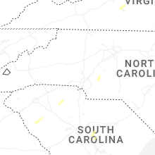


Connect with Interactive Hail Maps