

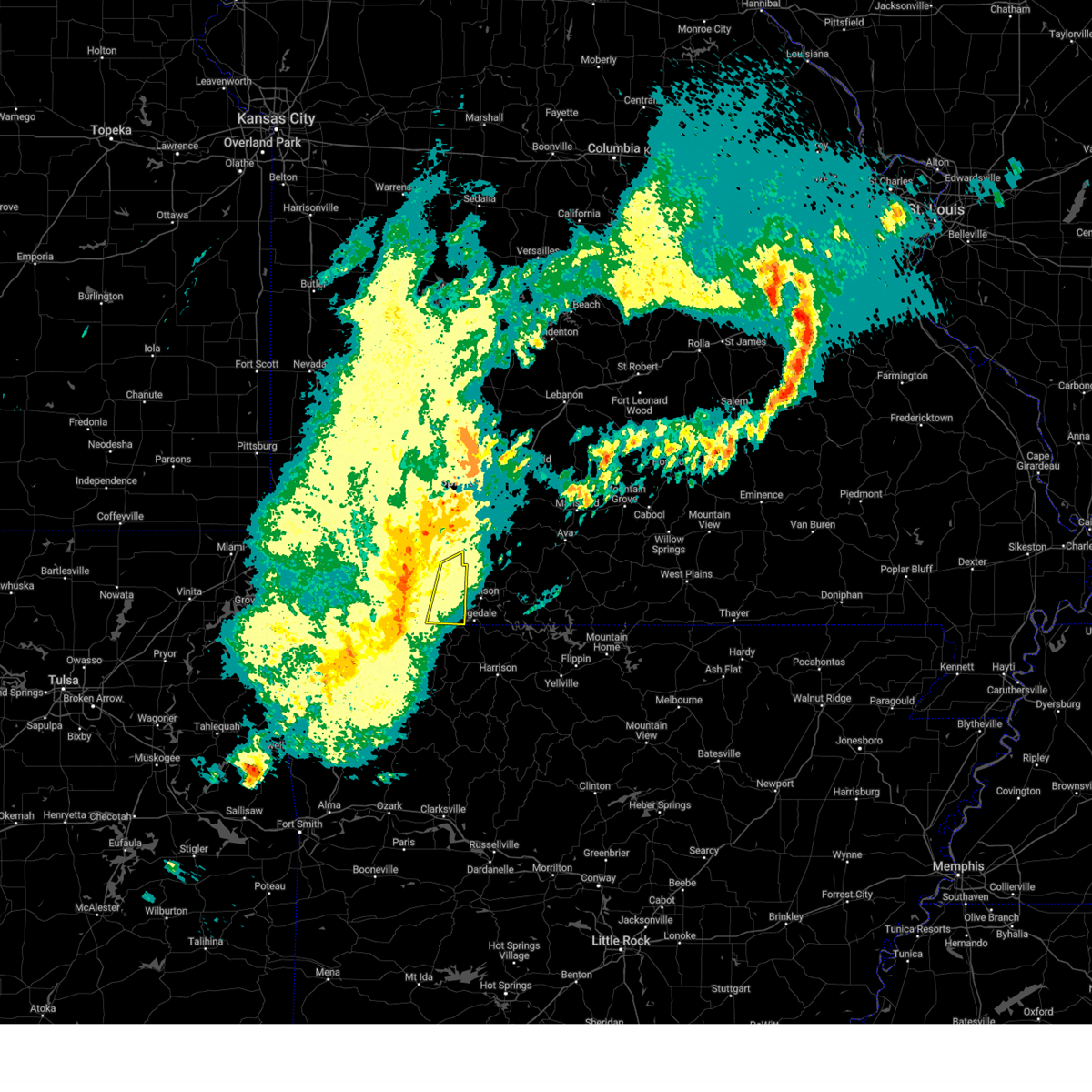
Hail Map for Coney Island, MO
The Coney Island, MO area has had 4 reports of on-the-ground hail by trained spotters, and has been under severe weather warnings 24 times during the past 12 months. Doppler radar has detected hail at or near Coney Island, MO on 48 occasions, including 1 occasion during the past year.
| Name: | Coney Island, MO |
| Where Located: | 42.8 miles S of Springfield, MO |
| Map: | Google Map for Coney Island, MO |
| Population: | 75 |
| Housing Units: | 96 |
| More Info: | Search Google for Coney Island, MO |
0
The Top Recent Hail Date for Coney Island, MO is Thursday, January 11, 2024 (48th out of 48)

Hail and Wind Damage Spotted near Coney Island, MO
| Date / Time | Report Details |
|---|---|
| 4/2/2024 1:15 AM CDT |
 the severe thunderstorm warning has been cancelled and is no longer in effect the severe thunderstorm warning has been cancelled and is no longer in effect
|
| 4/2/2024 1:15 AM CDT |
 At 115 am cdt, severe thunderstorms were located along a line extending from 6 miles west of highlandville to reeds spring to near urbanette, moving east at 55 mph (radar indicated). Hazards include 60 mph wind gusts and penny size hail. Expect damage to roofs, siding, and trees. Locations impacted include, table rock lake, silver dollar city, kimberling city, reeds spring, indian point, branson west, galena, blue eye, coney island, ponce de leon, lampe, and cape fair. At 115 am cdt, severe thunderstorms were located along a line extending from 6 miles west of highlandville to reeds spring to near urbanette, moving east at 55 mph (radar indicated). Hazards include 60 mph wind gusts and penny size hail. Expect damage to roofs, siding, and trees. Locations impacted include, table rock lake, silver dollar city, kimberling city, reeds spring, indian point, branson west, galena, blue eye, coney island, ponce de leon, lampe, and cape fair.
|
| 4/2/2024 12:40 AM CDT |
 Svrsgf the national weather service in springfield has issued a * severe thunderstorm warning for, stone county in southwestern missouri, barry county in southwestern missouri, * until 130 am cdt. * at 1240 am cdt, severe thunderstorms were located along a line extending from near purdy to near washburn to near rogers, moving east at 55 mph (radar indicated). Hazards include 60 mph wind gusts and penny size hail. expect damage to roofs, siding, and trees Svrsgf the national weather service in springfield has issued a * severe thunderstorm warning for, stone county in southwestern missouri, barry county in southwestern missouri, * until 130 am cdt. * at 1240 am cdt, severe thunderstorms were located along a line extending from near purdy to near washburn to near rogers, moving east at 55 mph (radar indicated). Hazards include 60 mph wind gusts and penny size hail. expect damage to roofs, siding, and trees
|
| 3/14/2024 3:44 PM CDT |
 Svrsgf the national weather service in springfield has issued a * severe thunderstorm warning for, western taney county in southwestern missouri, central christian county in southwestern missouri, eastern stone county in southwestern missouri, southeastern greene county in southwestern missouri, * until 415 pm cdt. * at 344 pm cdt, severe thunderstorms were located along a line extending from near willard to highlandville to 6 miles north of urbanette, moving east at 30 mph (radar indicated). Hazards include 60 mph wind gusts and quarter size hail. Hail damage to vehicles is expected. Expect wind damage to roofs, siding, and trees. Svrsgf the national weather service in springfield has issued a * severe thunderstorm warning for, western taney county in southwestern missouri, central christian county in southwestern missouri, eastern stone county in southwestern missouri, southeastern greene county in southwestern missouri, * until 415 pm cdt. * at 344 pm cdt, severe thunderstorms were located along a line extending from near willard to highlandville to 6 miles north of urbanette, moving east at 30 mph (radar indicated). Hazards include 60 mph wind gusts and quarter size hail. Hail damage to vehicles is expected. Expect wind damage to roofs, siding, and trees.
|
| 3/14/2024 3:31 PM CDT |
 At 331 pm cdt, severe thunderstorms were located along a line extending from springfield to near highlandville to near kimberling city, moving east at 50 mph (radar indicated). Hazards include 70 mph wind gusts and quarter size hail. Hail damage to vehicles is expected. expect considerable tree damage. wind damage is also likely to mobile homes, roofs, and outbuildings. locations impacted include, springfield, nixa, ozark, republic, branson, table rock lake, lake taneycomo, roaring river state park, table rock state park, shepherd of the hills state park, aurora, battlefield, rogersville, silver dollar city, kimberling city, strafford, marionville, clever, crane, and fair grove. This includes interstate 44 between mile markers 64 and 90. At 331 pm cdt, severe thunderstorms were located along a line extending from springfield to near highlandville to near kimberling city, moving east at 50 mph (radar indicated). Hazards include 70 mph wind gusts and quarter size hail. Hail damage to vehicles is expected. expect considerable tree damage. wind damage is also likely to mobile homes, roofs, and outbuildings. locations impacted include, springfield, nixa, ozark, republic, branson, table rock lake, lake taneycomo, roaring river state park, table rock state park, shepherd of the hills state park, aurora, battlefield, rogersville, silver dollar city, kimberling city, strafford, marionville, clever, crane, and fair grove. This includes interstate 44 between mile markers 64 and 90.
|
| 3/14/2024 3:16 PM CDT |
 At 315 pm cdt, severe thunderstorms were located along a line extending from 8 miles northwest of republic to crane to 10 miles east of cassville, moving east at 50 mph (radar indicated). Hazards include 70 mph wind gusts and quarter size hail. Hail damage to vehicles is expected. expect considerable tree damage. wind damage is also likely to mobile homes, roofs, and outbuildings. locations impacted include, springfield, nixa, ozark, republic, branson, table rock lake, lake taneycomo, roaring river state park, table rock state park, shepherd of the hills state park, aurora, battlefield, rogersville, silver dollar city, kimberling city, strafford, marionville, clever, crane, and fair grove. This includes interstate 44 between mile markers 64 and 90. At 315 pm cdt, severe thunderstorms were located along a line extending from 8 miles northwest of republic to crane to 10 miles east of cassville, moving east at 50 mph (radar indicated). Hazards include 70 mph wind gusts and quarter size hail. Hail damage to vehicles is expected. expect considerable tree damage. wind damage is also likely to mobile homes, roofs, and outbuildings. locations impacted include, springfield, nixa, ozark, republic, branson, table rock lake, lake taneycomo, roaring river state park, table rock state park, shepherd of the hills state park, aurora, battlefield, rogersville, silver dollar city, kimberling city, strafford, marionville, clever, crane, and fair grove. This includes interstate 44 between mile markers 64 and 90.
|
| 3/14/2024 2:59 PM CDT |
 At 258 pm cdt, severe thunderstorms were located along a line extending from mount vernon to 7 miles south of verona to near seligman, moving east at 45 mph (radar indicated). Hazards include 60 mph wind gusts and half dollar size hail. Hail damage to vehicles is expected. expect wind damage to roofs, siding, and trees. locations impacted include, springfield, nixa, ozark, republic, branson, table rock lake, lake taneycomo, roaring river state park, table rock state park, shepherd of the hills state park, aurora, battlefield, willard, mount vernon, cassville, rogersville, silver dollar city, kimberling city, strafford, and marionville. This includes interstate 44 between mile markers 40 and 90. At 258 pm cdt, severe thunderstorms were located along a line extending from mount vernon to 7 miles south of verona to near seligman, moving east at 45 mph (radar indicated). Hazards include 60 mph wind gusts and half dollar size hail. Hail damage to vehicles is expected. expect wind damage to roofs, siding, and trees. locations impacted include, springfield, nixa, ozark, republic, branson, table rock lake, lake taneycomo, roaring river state park, table rock state park, shepherd of the hills state park, aurora, battlefield, willard, mount vernon, cassville, rogersville, silver dollar city, kimberling city, strafford, and marionville. This includes interstate 44 between mile markers 40 and 90.
|
| 3/14/2024 2:51 PM CDT |
 Svrsgf the national weather service in springfield has issued a * severe thunderstorm warning for, northwestern taney county in southwestern missouri, central christian county in southwestern missouri, stone county in southwestern missouri, eastern barry county in southwestern missouri, southeastern lawrence county in southwestern missouri, greene county in southwestern missouri, * until 345 pm cdt. * at 251 pm cdt, severe thunderstorms were located along a line extending from near mount vernon to near purdy to near seligman, moving east at 50 mph (radar indicated). Hazards include 60 mph wind gusts and half dollar size hail. Hail damage to vehicles is expected. Expect wind damage to roofs, siding, and trees. Svrsgf the national weather service in springfield has issued a * severe thunderstorm warning for, northwestern taney county in southwestern missouri, central christian county in southwestern missouri, stone county in southwestern missouri, eastern barry county in southwestern missouri, southeastern lawrence county in southwestern missouri, greene county in southwestern missouri, * until 345 pm cdt. * at 251 pm cdt, severe thunderstorms were located along a line extending from near mount vernon to near purdy to near seligman, moving east at 50 mph (radar indicated). Hazards include 60 mph wind gusts and half dollar size hail. Hail damage to vehicles is expected. Expect wind damage to roofs, siding, and trees.
|
| 1/11/2024 11:57 PM CST |
 At 1157 pm cst, severe thunderstorms were located along a line extending from 6 miles west of crane to 6 miles west of galena to 9 miles west of indian point to near kimberling city to near urbanette, moving northeast at 60 mph (radar indicated). Hazards include 60 mph wind gusts and quarter size hail. Hail damage to vehicles is expected. expect wind damage to roofs, siding, and trees. locations impacted include, branson, table rock lake, table rock state park, silver dollar city, kimberling city, crane, shell knob, reeds spring, indian point, branson west, galena, mccord bend, hurley, blue eye, coney island, cape fair, wheelerville, jenkins, ponce de leon, and lampe. hail threat, radar indicated max hail size, 1. 00 in wind threat, radar indicated max wind gust, 60 mph. At 1157 pm cst, severe thunderstorms were located along a line extending from 6 miles west of crane to 6 miles west of galena to 9 miles west of indian point to near kimberling city to near urbanette, moving northeast at 60 mph (radar indicated). Hazards include 60 mph wind gusts and quarter size hail. Hail damage to vehicles is expected. expect wind damage to roofs, siding, and trees. locations impacted include, branson, table rock lake, table rock state park, silver dollar city, kimberling city, crane, shell knob, reeds spring, indian point, branson west, galena, mccord bend, hurley, blue eye, coney island, cape fair, wheelerville, jenkins, ponce de leon, and lampe. hail threat, radar indicated max hail size, 1. 00 in wind threat, radar indicated max wind gust, 60 mph.
|
| 1/11/2024 11:39 PM CST |
 At 1138 pm cst, severe thunderstorms were located along a line extending from exeter to near beaver to near eureka springs, moving northeast at 60 mph (radar indicated). Hazards include 60 mph wind gusts and quarter size hail. Hail damage to vehicles is expected. expect wind damage to roofs, siding, and trees. locations impacted include, branson, table rock lake, roaring river state park, table rock state park, cassville, silver dollar city, kimberling city, crane, shell knob, reeds spring, seligman, exeter, indian point, branson west, butterfield, galena, washburn, mccord bend, golden, and emerald beach. hail threat, radar indicated max hail size, 1. 00 in wind threat, radar indicated max wind gust, 60 mph. At 1138 pm cst, severe thunderstorms were located along a line extending from exeter to near beaver to near eureka springs, moving northeast at 60 mph (radar indicated). Hazards include 60 mph wind gusts and quarter size hail. Hail damage to vehicles is expected. expect wind damage to roofs, siding, and trees. locations impacted include, branson, table rock lake, roaring river state park, table rock state park, cassville, silver dollar city, kimberling city, crane, shell knob, reeds spring, seligman, exeter, indian point, branson west, butterfield, galena, washburn, mccord bend, golden, and emerald beach. hail threat, radar indicated max hail size, 1. 00 in wind threat, radar indicated max wind gust, 60 mph.
|
| 1/11/2024 11:19 PM CST |
 At 1118 pm cst, severe thunderstorms were located along a line extending from 8 miles southwest of washburn to near pea ridge to near rogers, moving northeast at 60 mph (radar indicated). Hazards include 60 mph wind gusts and quarter size hail. Hail damage to vehicles is expected. Expect wind damage to roofs, siding, and trees. At 1118 pm cst, severe thunderstorms were located along a line extending from 8 miles southwest of washburn to near pea ridge to near rogers, moving northeast at 60 mph (radar indicated). Hazards include 60 mph wind gusts and quarter size hail. Hail damage to vehicles is expected. Expect wind damage to roofs, siding, and trees.
|
| 7/31/2023 12:05 AM CDT |
 The severe thunderstorm warning for stone and barry counties will expire at 1215 am cdt, the storms which prompted the warning have moved out of the area. therefore, the warning will be allowed to expire. a severe thunderstorm watch remains in effect until 100 am cdt for southwestern missouri. to report severe weather, contact your nearest law enforcement agency. they will relay your report to the national weather service springfield. The severe thunderstorm warning for stone and barry counties will expire at 1215 am cdt, the storms which prompted the warning have moved out of the area. therefore, the warning will be allowed to expire. a severe thunderstorm watch remains in effect until 100 am cdt for southwestern missouri. to report severe weather, contact your nearest law enforcement agency. they will relay your report to the national weather service springfield.
|
| 7/30/2023 11:33 PM CDT |
 At 1132 pm cdt, severe thunderstorms were located along a line extending from near nixa to 7 miles southwest of highlandville to 6 miles northwest of kimberling city to near seligman, moving southeast at 50 mph (emergency management). Hazards include 70 mph wind gusts. Expect considerable tree damage. damage is likely to mobile homes, roofs, and outbuildings. locations impacted include, nixa, ozark, branson, lake taneycomo, table rock lake, roaring river state park, table rock state park, shepherd of the hills state park, hollister, cassville, silver dollar city, kimberling city, forsyth, clever, merriam woods, sparta, crane, shell knob, purdy and billings. thunderstorm damage threat, considerable hail threat, radar indicated max hail size, <. 75 in wind threat, observed max wind gust, 70 mph. At 1132 pm cdt, severe thunderstorms were located along a line extending from near nixa to 7 miles southwest of highlandville to 6 miles northwest of kimberling city to near seligman, moving southeast at 50 mph (emergency management). Hazards include 70 mph wind gusts. Expect considerable tree damage. damage is likely to mobile homes, roofs, and outbuildings. locations impacted include, nixa, ozark, branson, lake taneycomo, table rock lake, roaring river state park, table rock state park, shepherd of the hills state park, hollister, cassville, silver dollar city, kimberling city, forsyth, clever, merriam woods, sparta, crane, shell knob, purdy and billings. thunderstorm damage threat, considerable hail threat, radar indicated max hail size, <. 75 in wind threat, observed max wind gust, 70 mph.
|
| 7/30/2023 11:31 PM CDT |
 At 1131 pm cdt, severe thunderstorms were located along a line extending from near highlandville to 6 miles southwest of galena to 6 miles north of beaver, moving southeast at 50 mph (law enforcement). Hazards include 70 mph wind gusts. Expect considerable tree damage. damage is likely to mobile homes, roofs, and outbuildings. locations impacted include, table rock lake, roaring river state park, cassville, silver dollar city, kimberling city, crane, shell knob, purdy, reeds spring, exeter, indian point, branson west, butterfield, galena, mccord bend, golden, emerald beach, eagle rock, hurley and blue eye. thunderstorm damage threat, considerable hail threat, radar indicated max hail size, <. 75 in wind threat, observed max wind gust, 70 mph. At 1131 pm cdt, severe thunderstorms were located along a line extending from near highlandville to 6 miles southwest of galena to 6 miles north of beaver, moving southeast at 50 mph (law enforcement). Hazards include 70 mph wind gusts. Expect considerable tree damage. damage is likely to mobile homes, roofs, and outbuildings. locations impacted include, table rock lake, roaring river state park, cassville, silver dollar city, kimberling city, crane, shell knob, purdy, reeds spring, exeter, indian point, branson west, butterfield, galena, mccord bend, golden, emerald beach, eagle rock, hurley and blue eye. thunderstorm damage threat, considerable hail threat, radar indicated max hail size, <. 75 in wind threat, observed max wind gust, 70 mph.
|
| 7/30/2023 11:10 PM CDT |
 At 1109 pm cdt, severe thunderstorms were located along a line extending from near billings to near aurora to near purdy, moving southeast at 50 mph. these are destructive storms for aurora cassville crane and surrounding areas (law enforcement). Hazards include 80 mph wind gusts. Flying debris will be dangerous to those caught without shelter. mobile homes will be heavily damaged. expect considerable damage to roofs, windows, and vehicles. Extensive tree damage and power outages are likely. At 1109 pm cdt, severe thunderstorms were located along a line extending from near billings to near aurora to near purdy, moving southeast at 50 mph. these are destructive storms for aurora cassville crane and surrounding areas (law enforcement). Hazards include 80 mph wind gusts. Flying debris will be dangerous to those caught without shelter. mobile homes will be heavily damaged. expect considerable damage to roofs, windows, and vehicles. Extensive tree damage and power outages are likely.
|
| 7/30/2023 10:57 PM CDT |
 At 1057 pm cdt, severe thunderstorms were located along a line extending from near everton to 8 miles northwest of billings to near mount vernon to diamond, moving east at 45 mph (emergency management). Hazards include 70 mph wind gusts. Expect considerable tree damage. Damage is likely to mobile homes, roofs, and outbuildings. At 1057 pm cdt, severe thunderstorms were located along a line extending from near everton to 8 miles northwest of billings to near mount vernon to diamond, moving east at 45 mph (emergency management). Hazards include 70 mph wind gusts. Expect considerable tree damage. Damage is likely to mobile homes, roofs, and outbuildings.
|
| 7/14/2023 8:37 PM CDT |
 At 837 pm cdt, severe thunderstorms were located along a line extending from near highlandville to 6 miles south of forsyth to near self, moving east at 30 mph (trained weather spotters). Hazards include 70 mph wind gusts and penny size hail. Expect considerable tree damage. damage is likely to mobile homes, roofs, and outbuildings. locations impacted include, branson, lake taneycomo, bull shoals lake, table rock lake, table rock state park, shepherd of the hills state park, hollister, silver dollar city, forsyth, merriam woods, kissee mills, reeds spring, highlandville, rockaway beach, bull creek, indian point, branson west, taneyville, table rock and kirbyville. thunderstorm damage threat, considerable hail threat, radar indicated max hail size, 0. 75 in wind threat, observed max wind gust, 70 mph. At 837 pm cdt, severe thunderstorms were located along a line extending from near highlandville to 6 miles south of forsyth to near self, moving east at 30 mph (trained weather spotters). Hazards include 70 mph wind gusts and penny size hail. Expect considerable tree damage. damage is likely to mobile homes, roofs, and outbuildings. locations impacted include, branson, lake taneycomo, bull shoals lake, table rock lake, table rock state park, shepherd of the hills state park, hollister, silver dollar city, forsyth, merriam woods, kissee mills, reeds spring, highlandville, rockaway beach, bull creek, indian point, branson west, taneyville, table rock and kirbyville. thunderstorm damage threat, considerable hail threat, radar indicated max hail size, 0. 75 in wind threat, observed max wind gust, 70 mph.
|
| 7/14/2023 8:25 PM CDT | Tree branches on roof and part of roof blew of in stone county MO, 1.9 miles E of Coney Island, MO |
| 7/14/2023 8:21 PM CDT |
 At 821 pm cdt, severe thunderstorms were located along a line extending from near highlandville to near hollister to 6 miles west of roberson hollow, moving east at 40 mph (trained weather spotters). Hazards include 70 mph wind gusts and penny size hail. Expect considerable tree damage. Damage is likely to mobile homes, roofs, and outbuildings. At 821 pm cdt, severe thunderstorms were located along a line extending from near highlandville to near hollister to 6 miles west of roberson hollow, moving east at 40 mph (trained weather spotters). Hazards include 70 mph wind gusts and penny size hail. Expect considerable tree damage. Damage is likely to mobile homes, roofs, and outbuildings.
|
| 7/14/2023 8:11 PM CDT |
 At 811 pm cdt, severe thunderstorms were located along a line extending from near fair play to near willard to near billings to galena to near kimberling city to near beaver, moving southeast at 40 mph (trained weather spotters). Hazards include 60 mph wind gusts and penny size hail. Expect damage to roofs, siding, and trees. locations impacted include, springfield, nixa, ozark, republic, branson, table rock lake, lake taneycomo, stockton lake, roaring river state park, table rock state park, shepherd of the hills state park, battlefield, willard, hollister, silver dollar city, kimberling city, strafford, clever, merriam woods and sparta. this includes interstate 44 between mile markers 59 and 90. hail threat, radar indicated max hail size, 0. 75 in wind threat, observed max wind gust, 60 mph. At 811 pm cdt, severe thunderstorms were located along a line extending from near fair play to near willard to near billings to galena to near kimberling city to near beaver, moving southeast at 40 mph (trained weather spotters). Hazards include 60 mph wind gusts and penny size hail. Expect damage to roofs, siding, and trees. locations impacted include, springfield, nixa, ozark, republic, branson, table rock lake, lake taneycomo, stockton lake, roaring river state park, table rock state park, shepherd of the hills state park, battlefield, willard, hollister, silver dollar city, kimberling city, strafford, clever, merriam woods and sparta. this includes interstate 44 between mile markers 59 and 90. hail threat, radar indicated max hail size, 0. 75 in wind threat, observed max wind gust, 60 mph.
|
| 7/14/2023 8:03 PM CDT |
 At 803 pm cdt, severe thunderstorms were located along a line extending from near stockton to near walnut grove to near billings to near galena to near kimberling city to near beaver, moving east at 45 mph (trained weather spotters). Hazards include 60 mph wind gusts and nickel size hail. Expect damage to roofs, siding, and trees. locations impacted include, springfield, nixa, ozark, republic, branson, table rock lake, lake taneycomo, stockton lake, roaring river state park, table rock state park, shepherd of the hills state park, aurora, battlefield, willard, hollister, cassville, silver dollar city, kimberling city, strafford and marionville. this includes interstate 44 between mile markers 53 and 90. hail threat, radar indicated max hail size, 0. 88 in wind threat, observed max wind gust, 60 mph. At 803 pm cdt, severe thunderstorms were located along a line extending from near stockton to near walnut grove to near billings to near galena to near kimberling city to near beaver, moving east at 45 mph (trained weather spotters). Hazards include 60 mph wind gusts and nickel size hail. Expect damage to roofs, siding, and trees. locations impacted include, springfield, nixa, ozark, republic, branson, table rock lake, lake taneycomo, stockton lake, roaring river state park, table rock state park, shepherd of the hills state park, aurora, battlefield, willard, hollister, cassville, silver dollar city, kimberling city, strafford and marionville. this includes interstate 44 between mile markers 53 and 90. hail threat, radar indicated max hail size, 0. 88 in wind threat, observed max wind gust, 60 mph.
|
| 7/14/2023 7:55 PM CDT |
 At 755 pm cdt, severe thunderstorms were located along a line extending from near stockton to near walnut grove to near marionville to 10 miles southwest of crane to near seligman, moving east at 40 mph (trained weather spotters). Hazards include 60 mph wind gusts and nickel size hail. Expect damage to roofs, siding, and trees. locations impacted include, springfield, nixa, ozark, republic, branson, bolivar, stockton lake, table rock lake, lake taneycomo, table rock state park, shepherd of the hills state park, roaring river state park, stockton state park, aurora, battlefield, willard, hollister, cassville, silver dollar city and kimberling city. this includes interstate 44 between mile markers 48 and 90. hail threat, radar indicated max hail size, 0. 88 in wind threat, observed max wind gust, 60 mph. At 755 pm cdt, severe thunderstorms were located along a line extending from near stockton to near walnut grove to near marionville to 10 miles southwest of crane to near seligman, moving east at 40 mph (trained weather spotters). Hazards include 60 mph wind gusts and nickel size hail. Expect damage to roofs, siding, and trees. locations impacted include, springfield, nixa, ozark, republic, branson, bolivar, stockton lake, table rock lake, lake taneycomo, table rock state park, shepherd of the hills state park, roaring river state park, stockton state park, aurora, battlefield, willard, hollister, cassville, silver dollar city and kimberling city. this includes interstate 44 between mile markers 48 and 90. hail threat, radar indicated max hail size, 0. 88 in wind threat, observed max wind gust, 60 mph.
|
| 7/14/2023 7:35 PM CDT |
 At 735 pm cdt, severe thunderstorms were located along a line extending from 7 miles south of el dorado springs to near greenfield to near mount vernon to near purdy to 7 miles northwest of washburn, moving southeast at 40 mph (trained weather spotters). Hazards include 70 mph wind gusts. Expect considerable tree damage. Damage is likely to mobile homes, roofs, and outbuildings. At 735 pm cdt, severe thunderstorms were located along a line extending from 7 miles south of el dorado springs to near greenfield to near mount vernon to near purdy to 7 miles northwest of washburn, moving southeast at 40 mph (trained weather spotters). Hazards include 70 mph wind gusts. Expect considerable tree damage. Damage is likely to mobile homes, roofs, and outbuildings.
|
| 6/18/2023 3:06 AM CDT |
 At 305 am cdt, severe thunderstorms were located along a line extending from near crane to near branson west to 7 miles northeast of omaha, moving northeast at 40 mph (trained weather spotters. this line of storms has a long history of producing wind damage). Hazards include 60 mph wind gusts. Expect damage to roofs, siding, and trees. these severe storms will be near, forsyth, merriam woods and rockaway beach around 310 am cdt. clever around 320 am cdt. taneyville around 325 am cdt. highlandville around 330 am cdt. nixa around 335 am cdt. ozark and sparta around 340 am cdt. other locations impacted by these severe thunderstorms include lake taneycomo, table rock lake, bull shoals lake, table rock state park, shepherd of the hills state park, shell knob, kissee mills, fremont hills, bull creek and mccord bend. hail threat, radar indicated max hail size, <. 75 in wind threat, observed max wind gust, 60 mph. At 305 am cdt, severe thunderstorms were located along a line extending from near crane to near branson west to 7 miles northeast of omaha, moving northeast at 40 mph (trained weather spotters. this line of storms has a long history of producing wind damage). Hazards include 60 mph wind gusts. Expect damage to roofs, siding, and trees. these severe storms will be near, forsyth, merriam woods and rockaway beach around 310 am cdt. clever around 320 am cdt. taneyville around 325 am cdt. highlandville around 330 am cdt. nixa around 335 am cdt. ozark and sparta around 340 am cdt. other locations impacted by these severe thunderstorms include lake taneycomo, table rock lake, bull shoals lake, table rock state park, shepherd of the hills state park, shell knob, kissee mills, fremont hills, bull creek and mccord bend. hail threat, radar indicated max hail size, <. 75 in wind threat, observed max wind gust, 60 mph.
|
| 6/18/2023 2:33 AM CDT |
 At 231 am cdt, severe thunderstorms were located along a line extending from near cassville to near eureka springs to near clifty, moving northeast at 60 mph (trained weather spotters. these storms have a long history of producing damaging winds). Hazards include 60 mph wind gusts. Expect damage to roofs, siding, and trees. severe thunderstorms will be near, kimberling city, crane and galena around 255 am cdt. silver dollar city, reeds spring and branson west around 300 am cdt. branson and indian point around 305 am cdt. nixa, highlandville and hollister around 310 am cdt. ozark, forsyth, merriam woods and rockaway beach around 315 am cdt. sparta and taneyville around 320 am cdt. other locations impacted by these severe thunderstorms include lake taneycomo, table rock lake, bull shoals lake, table rock state park, shepherd of the hills state park, shell knob, kissee mills, fremont hills, bull creek and mccord bend. hail threat, radar indicated max hail size, <. 75 in wind threat, observed max wind gust, 60 mph. At 231 am cdt, severe thunderstorms were located along a line extending from near cassville to near eureka springs to near clifty, moving northeast at 60 mph (trained weather spotters. these storms have a long history of producing damaging winds). Hazards include 60 mph wind gusts. Expect damage to roofs, siding, and trees. severe thunderstorms will be near, kimberling city, crane and galena around 255 am cdt. silver dollar city, reeds spring and branson west around 300 am cdt. branson and indian point around 305 am cdt. nixa, highlandville and hollister around 310 am cdt. ozark, forsyth, merriam woods and rockaway beach around 315 am cdt. sparta and taneyville around 320 am cdt. other locations impacted by these severe thunderstorms include lake taneycomo, table rock lake, bull shoals lake, table rock state park, shepherd of the hills state park, shell knob, kissee mills, fremont hills, bull creek and mccord bend. hail threat, radar indicated max hail size, <. 75 in wind threat, observed max wind gust, 60 mph.
|
| 4/20/2023 2:26 PM CDT |
 The severe thunderstorm warning for western taney, central christian, stone and southeastern barry counties will expire at 230 pm cdt, the storms which prompted the warning have weakened below severe limits, and no longer pose an immediate threat to life or property. therefore, the warning will be allowed to expire. however small hail, gusty winds and heavy rain are still possible with these thunderstorms. a severe thunderstorm watch remains in effect until 800 pm cdt for southwestern missouri. to report severe weather, contact your nearest law enforcement agency. they will relay your report to the national weather service springfield. The severe thunderstorm warning for western taney, central christian, stone and southeastern barry counties will expire at 230 pm cdt, the storms which prompted the warning have weakened below severe limits, and no longer pose an immediate threat to life or property. therefore, the warning will be allowed to expire. however small hail, gusty winds and heavy rain are still possible with these thunderstorms. a severe thunderstorm watch remains in effect until 800 pm cdt for southwestern missouri. to report severe weather, contact your nearest law enforcement agency. they will relay your report to the national weather service springfield.
|
| 4/20/2023 2:16 PM CDT |
 At 216 pm cdt, severe thunderstorms were located along a line extending from near rogersville to 6 miles northeast of reeds spring to 6 miles north of grandview, moving east at 25 mph (radar indicated). Hazards include 60 mph wind gusts and quarter size hail. Hail damage to vehicles is expected. expect wind damage to roofs, siding, and trees. these severe storms will be near, ozark and sparta around 220 pm cdt. kimberling city around 250 pm cdt. silver dollar city and indian point around 305 pm cdt. branson around 310 pm cdt. hollister around 315 pm cdt. other locations impacted by these severe thunderstorms include table rock lake, lake taneycomo, table rock state park, shepherd of the hills state park, shell knob, fremont hills, bull creek, mccord bend, golden and table rock. hail threat, radar indicated max hail size, 1. 00 in wind threat, radar indicated max wind gust, 60 mph. At 216 pm cdt, severe thunderstorms were located along a line extending from near rogersville to 6 miles northeast of reeds spring to 6 miles north of grandview, moving east at 25 mph (radar indicated). Hazards include 60 mph wind gusts and quarter size hail. Hail damage to vehicles is expected. expect wind damage to roofs, siding, and trees. these severe storms will be near, ozark and sparta around 220 pm cdt. kimberling city around 250 pm cdt. silver dollar city and indian point around 305 pm cdt. branson around 310 pm cdt. hollister around 315 pm cdt. other locations impacted by these severe thunderstorms include table rock lake, lake taneycomo, table rock state park, shepherd of the hills state park, shell knob, fremont hills, bull creek, mccord bend, golden and table rock. hail threat, radar indicated max hail size, 1. 00 in wind threat, radar indicated max wind gust, 60 mph.
|
| 4/20/2023 2:01 PM CDT |
 At 200 pm cdt, severe thunderstorms were located along a line extending from near ozark to near galena to near beaver, moving northeast at 40 mph (radar indicated). Hazards include 60 mph wind gusts and quarter size hail. Hail damage to vehicles is expected. expect wind damage to roofs, siding, and trees. these severe storms will be near, ozark around 205 pm cdt. highlandville around 215 pm cdt. kimberling city around 225 pm cdt. sparta around 230 pm cdt. branson, silver dollar city, reeds spring, indian point and branson west around 235 pm cdt. hollister around 245 pm cdt. merriam woods and rockaway beach around 250 pm cdt. other locations impacted by these severe thunderstorms include table rock lake, lake taneycomo, table rock state park, shepherd of the hills state park, roaring river state park, shell knob, fremont hills, bull creek, mccord bend and golden. hail threat, radar indicated max hail size, 1. 00 in wind threat, radar indicated max wind gust, 60 mph. At 200 pm cdt, severe thunderstorms were located along a line extending from near ozark to near galena to near beaver, moving northeast at 40 mph (radar indicated). Hazards include 60 mph wind gusts and quarter size hail. Hail damage to vehicles is expected. expect wind damage to roofs, siding, and trees. these severe storms will be near, ozark around 205 pm cdt. highlandville around 215 pm cdt. kimberling city around 225 pm cdt. sparta around 230 pm cdt. branson, silver dollar city, reeds spring, indian point and branson west around 235 pm cdt. hollister around 245 pm cdt. merriam woods and rockaway beach around 250 pm cdt. other locations impacted by these severe thunderstorms include table rock lake, lake taneycomo, table rock state park, shepherd of the hills state park, roaring river state park, shell knob, fremont hills, bull creek, mccord bend and golden. hail threat, radar indicated max hail size, 1. 00 in wind threat, radar indicated max wind gust, 60 mph.
|
| 4/20/2023 1:46 PM CDT |
 At 145 pm cdt, severe thunderstorms were located along a line extending from near nixa to near galena to near beaver, moving northeast at 35 mph (radar indicated). Hazards include 60 mph wind gusts and quarter size hail. Hail damage to vehicles is expected. expect wind damage to roofs, siding, and trees. these severe storms will be near, nixa and ozark around 150 pm cdt. galena around 155 pm cdt. highlandville around 215 pm cdt. kimberling city around 225 pm cdt. indian point around 230 pm cdt. branson, silver dollar city, sparta, reeds spring and branson west around 235 pm cdt. hollister, merriam woods and rockaway beach around 245 pm cdt. other locations impacted by these severe thunderstorms include table rock lake, lake taneycomo, roaring river state park, table rock state park, shepherd of the hills state park, shell knob, fremont hills, bull creek, mccord bend and golden. hail threat, radar indicated max hail size, 1. 00 in wind threat, radar indicated max wind gust, 60 mph. At 145 pm cdt, severe thunderstorms were located along a line extending from near nixa to near galena to near beaver, moving northeast at 35 mph (radar indicated). Hazards include 60 mph wind gusts and quarter size hail. Hail damage to vehicles is expected. expect wind damage to roofs, siding, and trees. these severe storms will be near, nixa and ozark around 150 pm cdt. galena around 155 pm cdt. highlandville around 215 pm cdt. kimberling city around 225 pm cdt. indian point around 230 pm cdt. branson, silver dollar city, sparta, reeds spring and branson west around 235 pm cdt. hollister, merriam woods and rockaway beach around 245 pm cdt. other locations impacted by these severe thunderstorms include table rock lake, lake taneycomo, roaring river state park, table rock state park, shepherd of the hills state park, shell knob, fremont hills, bull creek, mccord bend and golden. hail threat, radar indicated max hail size, 1. 00 in wind threat, radar indicated max wind gust, 60 mph.
|
| 4/20/2023 1:34 PM CDT |
 At 133 pm cdt, severe thunderstorms were located along a line extending from near battlefield to 8 miles southwest of crane to seligman, moving northeast at 45 mph (radar indicated). Hazards include 60 mph wind gusts and quarter size hail. Hail damage to vehicles is expected. expect wind damage to roofs, siding, and trees. these severe storms will be near, nixa around 140 pm cdt. crane and galena around 145 pm cdt. highlandville around 205 pm cdt. kimberling city around 210 pm cdt. ozark around 215 pm cdt. silver dollar city, sparta, reeds spring and branson west around 220 pm cdt. other locations impacted by these severe thunderstorms include table rock lake, lake taneycomo, roaring river state park, table rock state park, shepherd of the hills state park, shell knob, fremont hills, bull creek, mccord bend and golden. hail threat, radar indicated max hail size, 1. 00 in wind threat, radar indicated max wind gust, 60 mph. At 133 pm cdt, severe thunderstorms were located along a line extending from near battlefield to 8 miles southwest of crane to seligman, moving northeast at 45 mph (radar indicated). Hazards include 60 mph wind gusts and quarter size hail. Hail damage to vehicles is expected. expect wind damage to roofs, siding, and trees. these severe storms will be near, nixa around 140 pm cdt. crane and galena around 145 pm cdt. highlandville around 205 pm cdt. kimberling city around 210 pm cdt. ozark around 215 pm cdt. silver dollar city, sparta, reeds spring and branson west around 220 pm cdt. other locations impacted by these severe thunderstorms include table rock lake, lake taneycomo, roaring river state park, table rock state park, shepherd of the hills state park, shell knob, fremont hills, bull creek, mccord bend and golden. hail threat, radar indicated max hail size, 1. 00 in wind threat, radar indicated max wind gust, 60 mph.
|
| 4/20/2023 1:28 PM CDT |
 At 128 pm cdt, severe thunderstorms were located along a line extending from near battlefield to 10 miles southwest of crane to seligman, moving northeast at 40 mph (radar indicated). Hazards include 60 mph wind gusts and quarter size hail. Hail damage to vehicles is expected. expect wind damage to roofs, siding, and trees. severe thunderstorms will be near, nixa around 135 pm cdt. crane and galena around 145 pm cdt. highlandville around 205 pm cdt. kimberling city around 210 pm cdt. ozark and silver dollar city around 215 pm cdt. sparta, reeds spring and branson west around 220 pm cdt. other locations impacted by these severe thunderstorms include table rock lake, lake taneycomo, roaring river state park, table rock state park, shepherd of the hills state park, shell knob, fremont hills, bull creek, mccord bend and golden. hail threat, radar indicated max hail size, 1. 00 in wind threat, radar indicated max wind gust, 60 mph. At 128 pm cdt, severe thunderstorms were located along a line extending from near battlefield to 10 miles southwest of crane to seligman, moving northeast at 40 mph (radar indicated). Hazards include 60 mph wind gusts and quarter size hail. Hail damage to vehicles is expected. expect wind damage to roofs, siding, and trees. severe thunderstorms will be near, nixa around 135 pm cdt. crane and galena around 145 pm cdt. highlandville around 205 pm cdt. kimberling city around 210 pm cdt. ozark and silver dollar city around 215 pm cdt. sparta, reeds spring and branson west around 220 pm cdt. other locations impacted by these severe thunderstorms include table rock lake, lake taneycomo, roaring river state park, table rock state park, shepherd of the hills state park, shell knob, fremont hills, bull creek, mccord bend and golden. hail threat, radar indicated max hail size, 1. 00 in wind threat, radar indicated max wind gust, 60 mph.
|
| 4/15/2023 4:18 PM CDT |
 At 418 pm cdt, a severe thunderstorm was located near indian point, or near kimberling city, moving northeast at 40 mph (radar indicated). Hazards include ping pong ball size hail and 60 mph wind gusts. People and animals outdoors will be injured. expect hail damage to roofs, siding, windows, and vehicles. Expect wind damage to roofs, siding, and trees. At 418 pm cdt, a severe thunderstorm was located near indian point, or near kimberling city, moving northeast at 40 mph (radar indicated). Hazards include ping pong ball size hail and 60 mph wind gusts. People and animals outdoors will be injured. expect hail damage to roofs, siding, windows, and vehicles. Expect wind damage to roofs, siding, and trees.
|
| 4/5/2023 6:54 AM CDT |
 At 654 am cdt, a severe thunderstorm was located near branson west, or near branson, moving northeast at 65 mph (radar indicated). Hazards include 60 mph wind gusts and quarter size hail. Hail damage to vehicles is expected. expect wind damage to roofs, siding, and trees. locations impacted include, branson, lake taneycomo, table rock lake, table rock state park, shepherd of the hills state park, hollister, silver dollar city, kimberling city, forsyth, merriam woods, shell knob, kissee mills, reeds spring, rockaway beach, bull creek, indian point, branson west, taneyville, table rock and kirbyville. hail threat, radar indicated max hail size, 1. 00 in wind threat, radar indicated max wind gust, 60 mph. At 654 am cdt, a severe thunderstorm was located near branson west, or near branson, moving northeast at 65 mph (radar indicated). Hazards include 60 mph wind gusts and quarter size hail. Hail damage to vehicles is expected. expect wind damage to roofs, siding, and trees. locations impacted include, branson, lake taneycomo, table rock lake, table rock state park, shepherd of the hills state park, hollister, silver dollar city, kimberling city, forsyth, merriam woods, shell knob, kissee mills, reeds spring, rockaway beach, bull creek, indian point, branson west, taneyville, table rock and kirbyville. hail threat, radar indicated max hail size, 1. 00 in wind threat, radar indicated max wind gust, 60 mph.
|
| 4/5/2023 6:36 AM CDT |
 At 635 am cdt, a severe thunderstorm was located 8 miles north of grandview, or 11 miles northeast of eureka springs, moving northeast at 65 mph (radar indicated). Hazards include 60 mph wind gusts and quarter size hail. Hail damage to vehicles is expected. Expect wind damage to roofs, siding, and trees. At 635 am cdt, a severe thunderstorm was located 8 miles north of grandview, or 11 miles northeast of eureka springs, moving northeast at 65 mph (radar indicated). Hazards include 60 mph wind gusts and quarter size hail. Hail damage to vehicles is expected. Expect wind damage to roofs, siding, and trees.
|
| 4/5/2023 5:39 AM CDT |
 At 539 am cdt, a severe thunderstorm was located over berryville, moving northeast at 65 mph (radar indicated). Hazards include 60 mph wind gusts and half dollar size hail. Hail damage to vehicles is expected. Expect wind damage to roofs, siding, and trees. At 539 am cdt, a severe thunderstorm was located over berryville, moving northeast at 65 mph (radar indicated). Hazards include 60 mph wind gusts and half dollar size hail. Hail damage to vehicles is expected. Expect wind damage to roofs, siding, and trees.
|
| 3/23/2023 6:59 PM CDT |
 At 658 pm cdt, a severe thunderstorm was located near kimberling city, moving northeast at 55 mph (radar indicated). Hazards include 60 mph wind gusts and half dollar size hail. Hail damage to vehicles is expected. Expect wind damage to roofs, siding, and trees. At 658 pm cdt, a severe thunderstorm was located near kimberling city, moving northeast at 55 mph (radar indicated). Hazards include 60 mph wind gusts and half dollar size hail. Hail damage to vehicles is expected. Expect wind damage to roofs, siding, and trees.
|
| 2/15/2023 11:52 PM CST |
 At 1152 pm cst, a severe thunderstorm was located over indian point, or over kimberling city, moving northeast at 50 mph (radar indicated). Hazards include 60 mph wind gusts and quarter size hail. Hail damage to vehicles is expected. expect wind damage to roofs, siding, and trees. locations impacted include, table rock lake, silver dollar city, kimberling city, indian point, blue eye, coney island and lampe. hail threat, radar indicated max hail size, 1. 00 in wind threat, radar indicated max wind gust, 60 mph. At 1152 pm cst, a severe thunderstorm was located over indian point, or over kimberling city, moving northeast at 50 mph (radar indicated). Hazards include 60 mph wind gusts and quarter size hail. Hail damage to vehicles is expected. expect wind damage to roofs, siding, and trees. locations impacted include, table rock lake, silver dollar city, kimberling city, indian point, blue eye, coney island and lampe. hail threat, radar indicated max hail size, 1. 00 in wind threat, radar indicated max wind gust, 60 mph.
|
| 2/15/2023 11:37 PM CST |
 At 1137 pm cst, a severe thunderstorm was located 9 miles southwest of kimberling city, moving northeast at 50 mph (radar indicated). Hazards include 60 mph wind gusts and half dollar size hail. Hail damage to vehicles is expected. expect wind damage to roofs, siding, and trees. Locations impacted include, table rock lake, silver dollar city, kimberling city, shell knob, indian point, golden, emerald beach, blue eye, arrow point, coney island and lampe. At 1137 pm cst, a severe thunderstorm was located 9 miles southwest of kimberling city, moving northeast at 50 mph (radar indicated). Hazards include 60 mph wind gusts and half dollar size hail. Hail damage to vehicles is expected. expect wind damage to roofs, siding, and trees. Locations impacted include, table rock lake, silver dollar city, kimberling city, shell knob, indian point, golden, emerald beach, blue eye, arrow point, coney island and lampe.
|
| 2/15/2023 11:25 PM CST |
 At 1125 pm cst, a severe thunderstorm was located over beaver, or near eureka springs, moving northeast at 55 mph (radar indicated). Hazards include 60 mph wind gusts and half dollar size hail. Hail damage to vehicles is expected. Expect wind damage to roofs, siding, and trees. At 1125 pm cst, a severe thunderstorm was located over beaver, or near eureka springs, moving northeast at 55 mph (radar indicated). Hazards include 60 mph wind gusts and half dollar size hail. Hail damage to vehicles is expected. Expect wind damage to roofs, siding, and trees.
|
| 8/29/2022 2:50 PM CDT |
 The severe thunderstorm warning for northwestern taney and southern stone counties will expire at 300 pm cdt, the storm which prompted the warning has weakened below severe limits, and no longer poses an immediate threat to life or property. therefore, the warning will be allowed to expire. however heavy rain is still possible with this thunderstorm. The severe thunderstorm warning for northwestern taney and southern stone counties will expire at 300 pm cdt, the storm which prompted the warning has weakened below severe limits, and no longer poses an immediate threat to life or property. therefore, the warning will be allowed to expire. however heavy rain is still possible with this thunderstorm.
|
| 8/29/2022 2:21 PM CDT | At 221 pm cdt, a severe thunderstorm was located over kimberling city, moving northeast at 10 mph (radar indicated). Hazards include 60 mph wind gusts and penny size hail. expect damage to roofs, siding, and trees |
| 8/8/2022 7:33 PM CDT |
 At 733 pm cdt, severe thunderstorms were located along a line extending from 11 miles west of ava to near taneyville to 6 miles east of hollister to indian point to 9 miles east of cassville, moving southeast at 25 mph (radar indicated). Hazards include 60 mph wind gusts and quarter size hail. Hail damage to vehicles is expected. expect wind damage to roofs, siding, and trees. locations impacted include, branson, lake taneycomo, table rock lake, table rock state park, hollister, cassville, silver dollar city, kimberling city, forsyth, merriam woods, sparta, shell knob, kissee mills, reeds spring, rockaway beach, bull creek, indian point, branson west, galena, taneyville, hail threat, radar indicated max hail size, 1. 00 in wind threat, radar indicated max wind gust, 60 mph. At 733 pm cdt, severe thunderstorms were located along a line extending from 11 miles west of ava to near taneyville to 6 miles east of hollister to indian point to 9 miles east of cassville, moving southeast at 25 mph (radar indicated). Hazards include 60 mph wind gusts and quarter size hail. Hail damage to vehicles is expected. expect wind damage to roofs, siding, and trees. locations impacted include, branson, lake taneycomo, table rock lake, table rock state park, hollister, cassville, silver dollar city, kimberling city, forsyth, merriam woods, sparta, shell knob, kissee mills, reeds spring, rockaway beach, bull creek, indian point, branson west, galena, taneyville, hail threat, radar indicated max hail size, 1. 00 in wind threat, radar indicated max wind gust, 60 mph.
|
| 8/8/2022 6:56 PM CDT |
 At 655 pm cdt, severe thunderstorms were located along a line extending from rogersville to 8 miles southeast of highlandville to near branson west to near galena to near purdy, moving southeast at 25 mph (radar indicated). Hazards include 60 mph wind gusts and quarter size hail. Hail damage to vehicles is expected. Expect wind damage to roofs, siding, and trees. At 655 pm cdt, severe thunderstorms were located along a line extending from rogersville to 8 miles southeast of highlandville to near branson west to near galena to near purdy, moving southeast at 25 mph (radar indicated). Hazards include 60 mph wind gusts and quarter size hail. Hail damage to vehicles is expected. Expect wind damage to roofs, siding, and trees.
|
| 5/18/2022 10:26 PM CDT |
 The severe thunderstorm warning for southern stone and east central barry counties will expire at 1030 pm cdt, the storm which prompted the warning has weakened below severe limits, and no longer poses an immediate threat to life or property. therefore, the warning will be allowed to expire. however heavy rain is still possible with this thunderstorm. The severe thunderstorm warning for southern stone and east central barry counties will expire at 1030 pm cdt, the storm which prompted the warning has weakened below severe limits, and no longer poses an immediate threat to life or property. therefore, the warning will be allowed to expire. however heavy rain is still possible with this thunderstorm.
|
| 5/18/2022 9:44 PM CDT |
 At 943 pm cdt, a severe thunderstorm was located 8 miles southwest of kimberling city, and is nearly stationary (radar indicated). Hazards include 60 mph wind gusts and quarter size hail. Hail damage to vehicles is expected. Expect wind damage to roofs, siding, and trees. At 943 pm cdt, a severe thunderstorm was located 8 miles southwest of kimberling city, and is nearly stationary (radar indicated). Hazards include 60 mph wind gusts and quarter size hail. Hail damage to vehicles is expected. Expect wind damage to roofs, siding, and trees.
|
| 5/18/2022 9:08 PM CDT |
 At 908 pm cdt, a severe thunderstorm was located over kimberling city, moving east at 20 mph (radar indicated). Hazards include ping pong ball size hail and 60 mph wind gusts. People and animals outdoors will be injured. expect hail damage to roofs, siding, windows, and vehicles. expect wind damage to roofs, siding, and trees. locations impacted include, branson, lake taneycomo, table rock lake, table rock state park, hollister, silver dollar city, kimberling city, forsyth, merriam woods, shell knob, reeds spring, rockaway beach, bull creek, indian point, branson west, table rock, kirbyville, blue eye, coney island, powersite, hail threat, radar indicated max hail size, 1. 50 in wind threat, radar indicated max wind gust, 60 mph. At 908 pm cdt, a severe thunderstorm was located over kimberling city, moving east at 20 mph (radar indicated). Hazards include ping pong ball size hail and 60 mph wind gusts. People and animals outdoors will be injured. expect hail damage to roofs, siding, windows, and vehicles. expect wind damage to roofs, siding, and trees. locations impacted include, branson, lake taneycomo, table rock lake, table rock state park, hollister, silver dollar city, kimberling city, forsyth, merriam woods, shell knob, reeds spring, rockaway beach, bull creek, indian point, branson west, table rock, kirbyville, blue eye, coney island, powersite, hail threat, radar indicated max hail size, 1. 50 in wind threat, radar indicated max wind gust, 60 mph.
|
| 5/18/2022 9:04 PM CDT |
 At 904 pm cdt, a severe thunderstorm was located over kimberling city, moving east at 60 mph (radar indicated). Hazards include ping pong ball size hail and 60 mph wind gusts. People and animals outdoors will be injured. expect hail damage to roofs, siding, windows, and vehicles. Expect wind damage to roofs, siding, and trees. At 904 pm cdt, a severe thunderstorm was located over kimberling city, moving east at 60 mph (radar indicated). Hazards include ping pong ball size hail and 60 mph wind gusts. People and animals outdoors will be injured. expect hail damage to roofs, siding, windows, and vehicles. Expect wind damage to roofs, siding, and trees.
|
| 5/18/2022 8:55 PM CDT |
 At 854 pm cdt, a severe thunderstorm was located near hollister, or near branson, moving east at 45 mph. spotters reported ping pong size hail just north of lampe (radar indicated). Hazards include ping pong ball size hail and 60 mph wind gusts. People and animals outdoors will be injured. expect hail damage to roofs, siding, windows, and vehicles. expect wind damage to roofs, siding, and trees. locations impacted include, branson, lake taneycomo, table rock lake, table rock state park, hollister, silver dollar city, kimberling city, forsyth, merriam woods, kissee mills, rockaway beach, bull creek, indian point, branson west, taneyville, table rock, kirbyville, blue eye, coney island, powersite, hail threat, observed max hail size, 1. 50 in wind threat, radar indicated max wind gust, 60 mph. At 854 pm cdt, a severe thunderstorm was located near hollister, or near branson, moving east at 45 mph. spotters reported ping pong size hail just north of lampe (radar indicated). Hazards include ping pong ball size hail and 60 mph wind gusts. People and animals outdoors will be injured. expect hail damage to roofs, siding, windows, and vehicles. expect wind damage to roofs, siding, and trees. locations impacted include, branson, lake taneycomo, table rock lake, table rock state park, hollister, silver dollar city, kimberling city, forsyth, merriam woods, kissee mills, rockaway beach, bull creek, indian point, branson west, taneyville, table rock, kirbyville, blue eye, coney island, powersite, hail threat, observed max hail size, 1. 50 in wind threat, radar indicated max wind gust, 60 mph.
|
| 5/18/2022 8:50 PM CDT | Ping Pong Ball sized hail reported 2.1 miles ENE of Coney Island, MO, most of the hail was quarter size but a few ping pong size hail stones were also occurring. |
| 5/18/2022 8:29 PM CDT |
 At 829 pm cdt, a severe thunderstorm was located over indian point, or near kimberling city, moving east at 20 mph (radar indicated). Hazards include 60 mph wind gusts and quarter size hail. Hail damage to vehicles is expected. Expect wind damage to roofs, siding, and trees. At 829 pm cdt, a severe thunderstorm was located over indian point, or near kimberling city, moving east at 20 mph (radar indicated). Hazards include 60 mph wind gusts and quarter size hail. Hail damage to vehicles is expected. Expect wind damage to roofs, siding, and trees.
|
| 5/15/2022 12:40 PM CDT |
 At 1240 pm cdt, severe thunderstorms were located along a line extending from 8 miles north of taneyville to near forsyth to near roberson hollow, moving east at 30 mph (radar indicated). Hazards include 60 mph wind gusts and quarter size hail. Hail damage to vehicles is expected. expect wind damage to roofs, siding, and trees. locations impacted include, branson, lake taneycomo, bull shoals lake, table rock lake, table rock state park, hollister, forsyth, merriam woods, kissee mills, rockaway beach, bull creek, indian point, taneyville, table rock, kirbyville, blue eye, coney island, powersite, protem, lampe, hail threat, radar indicated max hail size, 1. 00 in wind threat, radar indicated max wind gust, 60 mph. At 1240 pm cdt, severe thunderstorms were located along a line extending from 8 miles north of taneyville to near forsyth to near roberson hollow, moving east at 30 mph (radar indicated). Hazards include 60 mph wind gusts and quarter size hail. Hail damage to vehicles is expected. expect wind damage to roofs, siding, and trees. locations impacted include, branson, lake taneycomo, bull shoals lake, table rock lake, table rock state park, hollister, forsyth, merriam woods, kissee mills, rockaway beach, bull creek, indian point, taneyville, table rock, kirbyville, blue eye, coney island, powersite, protem, lampe, hail threat, radar indicated max hail size, 1. 00 in wind threat, radar indicated max wind gust, 60 mph.
|
| 5/15/2022 12:25 PM CDT |
 At 1225 pm cdt, severe thunderstorms were located along a line extending from 7 miles south of sparta to branson to near urbanette, moving southeast at 25 mph (radar indicated). Hazards include 60 mph wind gusts and quarter size hail. Hail damage to vehicles is expected. Expect wind damage to roofs, siding, and trees. At 1225 pm cdt, severe thunderstorms were located along a line extending from 7 miles south of sparta to branson to near urbanette, moving southeast at 25 mph (radar indicated). Hazards include 60 mph wind gusts and quarter size hail. Hail damage to vehicles is expected. Expect wind damage to roofs, siding, and trees.
|
| 5/15/2022 12:05 PM CDT | At 1205 pm cdt, severe thunderstorms were located along a line extending from 6 miles northeast of reeds spring to near kimberling city to near beaver, moving southeast at 35 mph (radar indicated). Hazards include 70 mph wind gusts and half dollar size hail. Hail damage to vehicles is expected. expect considerable tree damage. wind damage is also likely to mobile homes, roofs, and outbuildings. these severe storms will be near, kimberling city, silver dollar city, indian point and branson west around 1210 pm cdt. branson around 1215 pm cdt. merriam woods and rockaway beach around 1225 pm cdt. forsyth and hollister around 1230 pm cdt. other locations impacted by these severe thunderstorms include lake taneycomo, table rock lake, roaring river state park, table rock state park, shell knob, bull creek, golden, table rock, emerald beach and kirbyville. thunderstorm damage threat, considerable hail threat, radar indicated max hail size, 1. 25 in wind threat, radar indicated max wind gust, 70 mph. |
| 5/15/2022 12:01 PM CDT | At 1201 pm cdt, severe thunderstorms were located along a line extending from 6 miles southwest of highlandville to near kimberling city to 6 miles northeast of seligman, moving southeast at 40 mph (radar indicated). Hazards include 70 mph wind gusts and ping pong ball size hail. People and animals outdoors will be injured. expect hail damage to roofs, siding, windows, and vehicles. expect considerable tree damage. wind damage is also likely to mobile homes, roofs, and outbuildings. these severe storms will be near, kimberling city around 1205 pm cdt. reeds spring and branson west around 1210 pm cdt. branson and indian point around 1215 pm cdt. merriam woods around 1220 pm cdt. forsyth and rockaway beach around 1225 pm cdt. hollister around 1230 pm cdt. other locations impacted by these severe thunderstorms include lake taneycomo, table rock lake, roaring river state park, table rock state park, shell knob, bull creek, golden, table rock, emerald beach and kirbyville. thunderstorm damage threat, considerable hail threat, radar indicated max hail size, 1. 50 in wind threat, radar indicated max wind gust, 70 mph. |
| 5/15/2022 11:49 AM CDT |
 At 1148 am cdt, severe thunderstorms were located along a line extending from near highlandville to 8 miles southwest of galena to near cassville, moving southeast at 35 mph (radar indicated). Hazards include golf ball size hail and 70 mph wind gusts. People and animals outdoors will be injured. expect hail damage to roofs, siding, windows, and vehicles. expect considerable tree damage. wind damage is also likely to mobile homes, roofs, and outbuildings. these severe storms will be near, kimberling city and reeds spring around 1205 pm cdt. branson west around 1210 pm cdt. silver dollar city and merriam woods around 1220 pm cdt. forsyth, rockaway beach and indian point around 1225 pm cdt. branson and hollister around 1230 pm cdt. other locations impacted by these severe thunderstorms include lake taneycomo, table rock lake, roaring river state park, table rock state park, shell knob, bull creek, golden, table rock, emerald beach and kirbyville. thunderstorm damage threat, considerable hail threat, radar indicated max hail size, 1. 75 in wind threat, radar indicated max wind gust, 70 mph. At 1148 am cdt, severe thunderstorms were located along a line extending from near highlandville to 8 miles southwest of galena to near cassville, moving southeast at 35 mph (radar indicated). Hazards include golf ball size hail and 70 mph wind gusts. People and animals outdoors will be injured. expect hail damage to roofs, siding, windows, and vehicles. expect considerable tree damage. wind damage is also likely to mobile homes, roofs, and outbuildings. these severe storms will be near, kimberling city and reeds spring around 1205 pm cdt. branson west around 1210 pm cdt. silver dollar city and merriam woods around 1220 pm cdt. forsyth, rockaway beach and indian point around 1225 pm cdt. branson and hollister around 1230 pm cdt. other locations impacted by these severe thunderstorms include lake taneycomo, table rock lake, roaring river state park, table rock state park, shell knob, bull creek, golden, table rock, emerald beach and kirbyville. thunderstorm damage threat, considerable hail threat, radar indicated max hail size, 1. 75 in wind threat, radar indicated max wind gust, 70 mph.
|
| 5/15/2022 11:37 AM CDT |
 At 1136 am cdt, severe thunderstorms were located along a line extending from near clever to near crane to near purdy, moving southeast at 50 mph (radar indicated). Hazards include golf ball size hail and 70 mph wind gusts. People and animals outdoors will be injured. expect hail damage to roofs, siding, windows, and vehicles. expect considerable tree damage. wind damage is also likely to mobile homes, roofs, and outbuildings. severe thunderstorms will be near, highlandville and reeds spring around 1150 am cdt. kimberling city, silver dollar city and branson west around 1155 am cdt. indian point around 1200 pm cdt. branson around 1205 pm cdt. forsyth, merriam woods and rockaway beach around 1210 pm cdt. hollister around 1215 pm cdt. other locations impacted by these severe thunderstorms include lake taneycomo, table rock lake, roaring river state park, table rock state park, shell knob, bull creek, golden, table rock, emerald beach and kirbyville. thunderstorm damage threat, considerable hail threat, radar indicated max hail size, 1. 75 in wind threat, radar indicated max wind gust, 70 mph. At 1136 am cdt, severe thunderstorms were located along a line extending from near clever to near crane to near purdy, moving southeast at 50 mph (radar indicated). Hazards include golf ball size hail and 70 mph wind gusts. People and animals outdoors will be injured. expect hail damage to roofs, siding, windows, and vehicles. expect considerable tree damage. wind damage is also likely to mobile homes, roofs, and outbuildings. severe thunderstorms will be near, highlandville and reeds spring around 1150 am cdt. kimberling city, silver dollar city and branson west around 1155 am cdt. indian point around 1200 pm cdt. branson around 1205 pm cdt. forsyth, merriam woods and rockaway beach around 1210 pm cdt. hollister around 1215 pm cdt. other locations impacted by these severe thunderstorms include lake taneycomo, table rock lake, roaring river state park, table rock state park, shell knob, bull creek, golden, table rock, emerald beach and kirbyville. thunderstorm damage threat, considerable hail threat, radar indicated max hail size, 1. 75 in wind threat, radar indicated max wind gust, 70 mph.
|
| 5/14/2022 4:23 PM CDT |
 At 423 pm cdt, a severe thunderstorm was located near indian point, or near branson, moving southwest at 10 mph (radar indicated). Hazards include 60 mph wind gusts and quarter size hail. Hail damage to vehicles is expected. expect wind damage to roofs, siding, and trees. locations impacted include, branson, table rock lake, lake taneycomo, table rock state park, hollister, indian point, table rock, blue eye, coney island, lampe, ridgedale, hail threat, radar indicated max hail size, 1. 00 in wind threat, radar indicated max wind gust, 60 mph. At 423 pm cdt, a severe thunderstorm was located near indian point, or near branson, moving southwest at 10 mph (radar indicated). Hazards include 60 mph wind gusts and quarter size hail. Hail damage to vehicles is expected. expect wind damage to roofs, siding, and trees. locations impacted include, branson, table rock lake, lake taneycomo, table rock state park, hollister, indian point, table rock, blue eye, coney island, lampe, ridgedale, hail threat, radar indicated max hail size, 1. 00 in wind threat, radar indicated max wind gust, 60 mph.
|
| 5/14/2022 4:11 PM CDT |
 At 411 pm cdt, a severe thunderstorm was located over hollister, or near branson, moving southwest at 5 mph (public). Hazards include 60 mph wind gusts and quarter size hail. Hail damage to vehicles is expected. Expect wind damage to roofs, siding, and trees. At 411 pm cdt, a severe thunderstorm was located over hollister, or near branson, moving southwest at 5 mph (public). Hazards include 60 mph wind gusts and quarter size hail. Hail damage to vehicles is expected. Expect wind damage to roofs, siding, and trees.
|
| 5/2/2022 10:44 PM CDT |
 At 1043 pm cdt, severe thunderstorms were located along a line extending from 7 miles northeast of galena to 7 miles west of roberson hollow, moving east at 40 mph (radar indicated). Hazards include 60 mph wind gusts. expect damage to roofs, siding, and trees At 1043 pm cdt, severe thunderstorms were located along a line extending from 7 miles northeast of galena to 7 miles west of roberson hollow, moving east at 40 mph (radar indicated). Hazards include 60 mph wind gusts. expect damage to roofs, siding, and trees
|
| 4/11/2022 2:52 AM CDT |
 The severe thunderstorm warning for taney, christian and stone counties will expire at 300 am cdt, the storms which prompted the warning have weakened below severe limits, and no longer pose an immediate threat to life or property. therefore, the warning will be allowed to expire. 40 to 50 mph winds will still be possible. a severe thunderstorm watch remains in effect until 400 am cdt for southwestern missouri. The severe thunderstorm warning for taney, christian and stone counties will expire at 300 am cdt, the storms which prompted the warning have weakened below severe limits, and no longer pose an immediate threat to life or property. therefore, the warning will be allowed to expire. 40 to 50 mph winds will still be possible. a severe thunderstorm watch remains in effect until 400 am cdt for southwestern missouri.
|
| 4/11/2022 2:18 AM CDT |
 At 217 am cdt, severe thunderstorms were located along a line extending from 6 miles northwest of marionville to near aurora to near cassville to gateway, moving east at 60 mph (radar indicated). Hazards include 60 mph wind gusts and nickel size hail. expect damage to roofs, siding, and trees At 217 am cdt, severe thunderstorms were located along a line extending from 6 miles northwest of marionville to near aurora to near cassville to gateway, moving east at 60 mph (radar indicated). Hazards include 60 mph wind gusts and nickel size hail. expect damage to roofs, siding, and trees
|
| 3/18/2022 4:50 AM CDT |
 At 448 am cdt, severe thunderstorms were located along a line extending from billings to near galena to indian point to 7 miles southeast of kimberling city, moving northeast at 35 mph (radar indicated). Hazards include 60 mph wind gusts and nickel size hail. Expect damage to roofs, siding, and trees. locations impacted include, nixa, republic, branson, lake taneycomo, table rock lake, table rock state park, battlefield, hollister, silver dollar city, kimberling city, forsyth, marionville, clever, merriam woods, crane, kissee mills, billings, reeds spring, highlandville, rockaway beach, this includes interstate 44 near mile marker 69. hail threat, radar indicated max hail size, 0. 88 in wind threat, radar indicated max wind gust, 60 mph. At 448 am cdt, severe thunderstorms were located along a line extending from billings to near galena to indian point to 7 miles southeast of kimberling city, moving northeast at 35 mph (radar indicated). Hazards include 60 mph wind gusts and nickel size hail. Expect damage to roofs, siding, and trees. locations impacted include, nixa, republic, branson, lake taneycomo, table rock lake, table rock state park, battlefield, hollister, silver dollar city, kimberling city, forsyth, marionville, clever, merriam woods, crane, kissee mills, billings, reeds spring, highlandville, rockaway beach, this includes interstate 44 near mile marker 69. hail threat, radar indicated max hail size, 0. 88 in wind threat, radar indicated max wind gust, 60 mph.
|
| 3/18/2022 4:38 AM CDT |
 At 438 am cdt, severe thunderstorms were located along a line extending from 6 miles west of billings to galena to near kimberling city, moving northeast at 35 mph (radar indicated). Hazards include 60 mph wind gusts and quarter size hail. Hail damage to vehicles is expected. expect wind damage to roofs, siding, and trees. locations impacted include, nixa, republic, branson, lake taneycomo, table rock lake, table rock state park, aurora, battlefield, hollister, silver dollar city, kimberling city, forsyth, marionville, clever, merriam woods, crane, shell knob, kissee mills, billings, reeds spring, this includes interstate 44 near mile marker 69. hail threat, radar indicated max hail size, 1. 00 in wind threat, radar indicated max wind gust, 60 mph. At 438 am cdt, severe thunderstorms were located along a line extending from 6 miles west of billings to galena to near kimberling city, moving northeast at 35 mph (radar indicated). Hazards include 60 mph wind gusts and quarter size hail. Hail damage to vehicles is expected. expect wind damage to roofs, siding, and trees. locations impacted include, nixa, republic, branson, lake taneycomo, table rock lake, table rock state park, aurora, battlefield, hollister, silver dollar city, kimberling city, forsyth, marionville, clever, merriam woods, crane, shell knob, kissee mills, billings, reeds spring, this includes interstate 44 near mile marker 69. hail threat, radar indicated max hail size, 1. 00 in wind threat, radar indicated max wind gust, 60 mph.
|
| 3/18/2022 4:29 AM CDT |
 At 429 am cdt, severe thunderstorms were located along a line extending from near aurora to near galena to 6 miles southwest of kimberling city, moving northeast at 35 mph (radar indicated). Hazards include 60 mph wind gusts and quarter size hail. Hail damage to vehicles is expected. Expect wind damage to roofs, siding, and trees. At 429 am cdt, severe thunderstorms were located along a line extending from near aurora to near galena to 6 miles southwest of kimberling city, moving northeast at 35 mph (radar indicated). Hazards include 60 mph wind gusts and quarter size hail. Hail damage to vehicles is expected. Expect wind damage to roofs, siding, and trees.
|
| 12/5/2021 9:50 PM CST |
 At 949 pm cst, a severe thunderstorm was located 7 miles south of kimberling city, moving east at 45 mph (radar indicated). Hazards include 60 mph wind gusts and quarter size hail. Hail damage to vehicles is expected. Expect wind damage to roofs, siding, and trees. At 949 pm cst, a severe thunderstorm was located 7 miles south of kimberling city, moving east at 45 mph (radar indicated). Hazards include 60 mph wind gusts and quarter size hail. Hail damage to vehicles is expected. Expect wind damage to roofs, siding, and trees.
|
| 5/9/2021 9:56 AM CDT |
 At 956 am cdt, a severe thunderstorm was located near kimberling city, moving east at 35 mph (radar indicated). Hazards include quarter size hail. Damage to vehicles is expected. this severe thunderstorm will be near, branson, silver dollar city and indian point around 1005 am cdt. hollister around 1015 am cdt. rockaway beach around 1020 am cdt. Other locations impacted by this severe thunderstorm include lake taneycomo, table rock state park, table rock lake, bull creek, table rock, kirbyville, blue eye, coney island, powersite and lampe. At 956 am cdt, a severe thunderstorm was located near kimberling city, moving east at 35 mph (radar indicated). Hazards include quarter size hail. Damage to vehicles is expected. this severe thunderstorm will be near, branson, silver dollar city and indian point around 1005 am cdt. hollister around 1015 am cdt. rockaway beach around 1020 am cdt. Other locations impacted by this severe thunderstorm include lake taneycomo, table rock state park, table rock lake, bull creek, table rock, kirbyville, blue eye, coney island, powersite and lampe.
|
| 4/28/2021 9:28 AM CDT |
 The severe thunderstorm warning for stone county will expire at 930 am cdt, the storm which prompted the warning has moved out of the area. therefore, the warning will be allowed to expire. a tornado watch remains in effect until 300 pm cdt for southwestern missouri. The severe thunderstorm warning for stone county will expire at 930 am cdt, the storm which prompted the warning has moved out of the area. therefore, the warning will be allowed to expire. a tornado watch remains in effect until 300 pm cdt for southwestern missouri.
|
| 4/28/2021 9:28 AM CDT |
 The tornado warning for southeastern stone county will expire at 930 am cdt, the storm which prompted the warning has moved out of the area. therefore, the warning will be allowed to expire. however heavy rain is still possible with this thunderstorm. a tornado watch remains in effect until 300 pm cdt for southwestern missouri. The tornado warning for southeastern stone county will expire at 930 am cdt, the storm which prompted the warning has moved out of the area. therefore, the warning will be allowed to expire. however heavy rain is still possible with this thunderstorm. a tornado watch remains in effect until 300 pm cdt for southwestern missouri.
|
| 4/28/2021 9:03 AM CDT |
 At 903 am cdt, a severe thunderstorm capable of producing a tornado was located near kimberling city, moving east at 25 mph (radar indicated rotation). Hazards include tornado. Flying debris will be dangerous to those caught without shelter. mobile homes will be damaged or destroyed. damage to roofs, windows, and vehicles will occur. Tree damage is likely. At 903 am cdt, a severe thunderstorm capable of producing a tornado was located near kimberling city, moving east at 25 mph (radar indicated rotation). Hazards include tornado. Flying debris will be dangerous to those caught without shelter. mobile homes will be damaged or destroyed. damage to roofs, windows, and vehicles will occur. Tree damage is likely.
|
| 4/28/2021 8:51 AM CDT |
 At 851 am cdt, a severe thunderstorm was located 10 miles west of kimberling city, moving northeast at 30 mph (radar indicated). Hazards include 60 mph wind gusts and penny size hail. expect damage to roofs, siding, and trees At 851 am cdt, a severe thunderstorm was located 10 miles west of kimberling city, moving northeast at 30 mph (radar indicated). Hazards include 60 mph wind gusts and penny size hail. expect damage to roofs, siding, and trees
|
| 4/9/2021 3:05 PM CDT |
 At 304 pm cdt, severe thunderstorms were located along a line extending from near gateway to near grandview to roberson hollow to self, moving north at 45 mph (radar indicated). Hazards include 60 mph wind gusts and half dollar size hail. Hail damage to vehicles is expected. expect wind damage to roofs, siding, and trees. Locations impacted include, branson, lake taneycomo, table rock lake, bull shoals lake, roaring river state park, table rock state park, hollister, cassville, silver dollar city, kimberling city, forsyth, merriam woods, shell knob, kissee mills, purdy, reeds spring, seligman, rockaway beach, exeter, bull creek,. At 304 pm cdt, severe thunderstorms were located along a line extending from near gateway to near grandview to roberson hollow to self, moving north at 45 mph (radar indicated). Hazards include 60 mph wind gusts and half dollar size hail. Hail damage to vehicles is expected. expect wind damage to roofs, siding, and trees. Locations impacted include, branson, lake taneycomo, table rock lake, bull shoals lake, roaring river state park, table rock state park, hollister, cassville, silver dollar city, kimberling city, forsyth, merriam woods, shell knob, kissee mills, purdy, reeds spring, seligman, rockaway beach, exeter, bull creek,.
|
| 4/9/2021 2:54 PM CDT |
 At 253 pm cdt, severe thunderstorms were located along a line extending from 6 miles southeast of gateway to near urbanette to 6 miles north of carrollton to near harrison, moving north at 30 mph (radar indicated). Hazards include half dollar size hail. damage to vehicles is expected At 253 pm cdt, severe thunderstorms were located along a line extending from 6 miles southeast of gateway to near urbanette to 6 miles north of carrollton to near harrison, moving north at 30 mph (radar indicated). Hazards include half dollar size hail. damage to vehicles is expected
|
| 11/14/2020 9:16 PM CST |
 At 916 pm cst, a severe thunderstorm was located over hollister, or near branson, moving northeast at 55 mph (radar indicated). Hazards include 60 mph wind gusts and quarter size hail. Hail damage to vehicles is expected. Expect wind damage to roofs, siding, and trees. At 916 pm cst, a severe thunderstorm was located over hollister, or near branson, moving northeast at 55 mph (radar indicated). Hazards include 60 mph wind gusts and quarter size hail. Hail damage to vehicles is expected. Expect wind damage to roofs, siding, and trees.
|
| 11/14/2020 8:27 PM CST |
 At 826 pm cst, a severe thunderstorm capable of producing a tornado was located near urbanette, or 8 miles north of berryville, moving northeast at 55 mph (radar indicated rotation). Hazards include tornado and ping pong ball size hail. Flying debris will be dangerous to those caught without shelter. mobile homes will be damaged or destroyed. damage to roofs, windows, and vehicles will occur. Tree damage is likely. At 826 pm cst, a severe thunderstorm capable of producing a tornado was located near urbanette, or 8 miles north of berryville, moving northeast at 55 mph (radar indicated rotation). Hazards include tornado and ping pong ball size hail. Flying debris will be dangerous to those caught without shelter. mobile homes will be damaged or destroyed. damage to roofs, windows, and vehicles will occur. Tree damage is likely.
|
| 11/14/2020 8:22 PM CST |
 At 822 pm cst, a severe thunderstorm was located over grandview, or near berryville, moving northeast at 55 mph (radar indicated). Hazards include 60 mph wind gusts and half dollar size hail. Hail damage to vehicles is expected. Expect wind damage to roofs, siding, and trees. At 822 pm cst, a severe thunderstorm was located over grandview, or near berryville, moving northeast at 55 mph (radar indicated). Hazards include 60 mph wind gusts and half dollar size hail. Hail damage to vehicles is expected. Expect wind damage to roofs, siding, and trees.
|
| 6/4/2020 5:51 AM CDT |
 At 551 am cdt, severe thunderstorms were located along a line extending from 7 miles northwest of roberson hollow to near urbanette to grandview, moving east at 50 mph (radar indicated). Hazards include 60 mph wind gusts. Expect damage to roofs, siding, and trees. Locations impacted include, table rock lake, table rock state park, roaring river state park, kimberling city, shell knob, indian point, golden, emerald beach, eagle rock, blue eye, chain-o-lakes, arrow point, coney island, lampe,. At 551 am cdt, severe thunderstorms were located along a line extending from 7 miles northwest of roberson hollow to near urbanette to grandview, moving east at 50 mph (radar indicated). Hazards include 60 mph wind gusts. Expect damage to roofs, siding, and trees. Locations impacted include, table rock lake, table rock state park, roaring river state park, kimberling city, shell knob, indian point, golden, emerald beach, eagle rock, blue eye, chain-o-lakes, arrow point, coney island, lampe,.
|
| 6/4/2020 5:50 AM CDT | Power lines and poles were reported down causing power outages in tow in stone county MO, 3.3 miles NE of Coney Island, MO |
| 6/4/2020 5:18 AM CDT |
 At 518 am cdt, severe thunderstorms were located along a line extending from near crane to 9 miles west of galena to near cassville, moving south at 55 mph (radar indicated). Hazards include 70 mph wind gusts. Expect considerable tree damage. Damage is likely to mobile homes, roofs, and outbuildings. At 518 am cdt, severe thunderstorms were located along a line extending from near crane to 9 miles west of galena to near cassville, moving south at 55 mph (radar indicated). Hazards include 70 mph wind gusts. Expect considerable tree damage. Damage is likely to mobile homes, roofs, and outbuildings.
|
| 5/22/2020 11:05 AM CDT |
 The severe thunderstorm warning for christian, western taney, stone and greene counties will expire at 1115 am cdt, the storms which prompted the warning have weakened below severe limits, and no longer pose an immediate threat to life or property. therefore, the warning will be allowed to expire. however small hail and gusty winds are still possible with these thunderstorms. The severe thunderstorm warning for christian, western taney, stone and greene counties will expire at 1115 am cdt, the storms which prompted the warning have weakened below severe limits, and no longer pose an immediate threat to life or property. therefore, the warning will be allowed to expire. however small hail and gusty winds are still possible with these thunderstorms.
|
| 5/22/2020 10:55 AM CDT |
 At 1055 am cdt, severe thunderstorms were located along a line extending from near willard to near highlandville to near roberson hollow, moving east at 40 mph (radar indicated). Hazards include 60 mph wind gusts and quarter size hail. Hail damage to vehicles is expected. expect wind damage to roofs, siding, and trees. Locations impacted include, springfield, nixa, ozark, republic, branson, lake taneycomo, table rock lake, table rock state park, battlefield, willard, hollister, rogersville, silver dollar city, kimberling city, strafford, forsyth, clever, merriam woods, sparta, fair grove, this includes interstate 44 between mile markers 64 and 90. At 1055 am cdt, severe thunderstorms were located along a line extending from near willard to near highlandville to near roberson hollow, moving east at 40 mph (radar indicated). Hazards include 60 mph wind gusts and quarter size hail. Hail damage to vehicles is expected. expect wind damage to roofs, siding, and trees. Locations impacted include, springfield, nixa, ozark, republic, branson, lake taneycomo, table rock lake, table rock state park, battlefield, willard, hollister, rogersville, silver dollar city, kimberling city, strafford, forsyth, clever, merriam woods, sparta, fair grove, this includes interstate 44 between mile markers 64 and 90.
|
| 5/22/2020 10:28 AM CDT |
 At 1028 am cdt, severe thunderstorms were located along a line extending from near greenfield to marionville to 6 miles northeast of beaver, moving east at 40 mph (radar indicated). Hazards include 60 mph wind gusts and quarter size hail. Hail damage to vehicles is expected. Expect wind damage to roofs, siding, and trees. At 1028 am cdt, severe thunderstorms were located along a line extending from near greenfield to marionville to 6 miles northeast of beaver, moving east at 40 mph (radar indicated). Hazards include 60 mph wind gusts and quarter size hail. Hail damage to vehicles is expected. Expect wind damage to roofs, siding, and trees.
|
| 5/3/2020 11:37 AM CDT |
 The severe thunderstorm warning for southeastern stone county will expire at 1145 am cdt, the storm which prompted the warning has moved out of the area. therefore, the warning will be allowed to expire. a severe thunderstorm watch remains in effect until 400 pm cdt for southwestern missouri. The severe thunderstorm warning for southeastern stone county will expire at 1145 am cdt, the storm which prompted the warning has moved out of the area. therefore, the warning will be allowed to expire. a severe thunderstorm watch remains in effect until 400 pm cdt for southwestern missouri.
|
| 5/3/2020 11:32 AM CDT |
 At 1131 am cdt, a severe thunderstorm was located over indian point, or near kimberling city, moving east at 35 mph (radar indicated). Hazards include 60 mph wind gusts and quarter size hail. Hail damage to vehicles is expected. expect wind damage to roofs, siding, and trees. Locations impacted include, branson, table rock lake, table rock state park, silver dollar city, kimberling city, reeds spring, indian point, branson west, blue eye, coney island, lampe,. At 1131 am cdt, a severe thunderstorm was located over indian point, or near kimberling city, moving east at 35 mph (radar indicated). Hazards include 60 mph wind gusts and quarter size hail. Hail damage to vehicles is expected. expect wind damage to roofs, siding, and trees. Locations impacted include, branson, table rock lake, table rock state park, silver dollar city, kimberling city, reeds spring, indian point, branson west, blue eye, coney island, lampe,.
|
| 5/3/2020 11:17 AM CDT |
 At 1116 am cdt, a severe thunderstorm was located near kimberling city, moving east at 25 mph (radar indicated). Hazards include 60 mph wind gusts and quarter size hail. Hail damage to vehicles is expected. expect wind damage to roofs, siding, and trees. Locations impacted include, branson, table rock lake, table rock state park, silver dollar city, kimberling city, shell knob, reeds spring, indian point, branson west, galena, mccord bend, blue eye, coney island, cape fair, lampe, ponce de leon, elsey,. At 1116 am cdt, a severe thunderstorm was located near kimberling city, moving east at 25 mph (radar indicated). Hazards include 60 mph wind gusts and quarter size hail. Hail damage to vehicles is expected. expect wind damage to roofs, siding, and trees. Locations impacted include, branson, table rock lake, table rock state park, silver dollar city, kimberling city, shell knob, reeds spring, indian point, branson west, galena, mccord bend, blue eye, coney island, cape fair, lampe, ponce de leon, elsey,.
|
| 5/3/2020 10:57 AM CDT |
 At 1057 am cdt, a severe thunderstorm was located 8 miles southwest of galena, or 10 miles northwest of kimberling city, moving east at 35 mph. additional strong to severe storms were located near madrid and south of cassville (radar indicated). Hazards include 60 mph wind gusts and quarter size hail. Hail damage to vehicles is expected. Expect wind damage to roofs, siding, and trees. At 1057 am cdt, a severe thunderstorm was located 8 miles southwest of galena, or 10 miles northwest of kimberling city, moving east at 35 mph. additional strong to severe storms were located near madrid and south of cassville (radar indicated). Hazards include 60 mph wind gusts and quarter size hail. Hail damage to vehicles is expected. Expect wind damage to roofs, siding, and trees.
|
| 5/3/2020 10:32 AM CDT |
 At 1031 am cdt, a severe thunderstorm was located over indian point, or near kimberling city, moving east at 35 mph (trained weather spotters reported quarter size hail in kimberling city). Hazards include golf ball size hail. People and animals outdoors will be injured. expect damage to roofs, siding, windows, and vehicles. Locations impacted include, branson, table rock lake, table rock state park, silver dollar city, kimberling city, reeds spring, indian point, branson west, coney island, lampe, cape fair,. At 1031 am cdt, a severe thunderstorm was located over indian point, or near kimberling city, moving east at 35 mph (trained weather spotters reported quarter size hail in kimberling city). Hazards include golf ball size hail. People and animals outdoors will be injured. expect damage to roofs, siding, windows, and vehicles. Locations impacted include, branson, table rock lake, table rock state park, silver dollar city, kimberling city, reeds spring, indian point, branson west, coney island, lampe, cape fair,.
|
| 5/3/2020 10:23 AM CDT | Hen Egg sized hail reported 2.1 miles ENE of Coney Island, MO, at least hen egg sized hail in lampe. confirmed by pictures and video via social media. |
| 5/3/2020 10:21 AM CDT |
 At 1020 am cdt, a severe thunderstorm was located over kimberling city, moving east at 35 mph (radar indicated). Hazards include golf ball size hail and 60 mph wind gusts. People and animals outdoors will be injured. expect hail damage to roofs, siding, windows, and vehicles. Expect wind damage to roofs, siding, and trees. At 1020 am cdt, a severe thunderstorm was located over kimberling city, moving east at 35 mph (radar indicated). Hazards include golf ball size hail and 60 mph wind gusts. People and animals outdoors will be injured. expect hail damage to roofs, siding, windows, and vehicles. Expect wind damage to roofs, siding, and trees.
|
| 1/10/2020 5:38 PM CST |
 At 538 pm cst, severe thunderstorms were located along a line extending from ozark to near branson west to near silver dollar city to near hollister to near roberson hollow, moving east at 35 mph (radar indicated). Hazards include 60 mph wind gusts. Expect damage to roofs, siding, and trees. Locations impacted include, nixa, ozark, branson, lake taneycomo, table rock lake, table rock state park, hollister, silver dollar city, kimberling city, forsyth, clever, merriam woods, sparta, crane, shell knob, billings, reeds spring, highlandville, rockaway beach, fremont hills,. At 538 pm cst, severe thunderstorms were located along a line extending from ozark to near branson west to near silver dollar city to near hollister to near roberson hollow, moving east at 35 mph (radar indicated). Hazards include 60 mph wind gusts. Expect damage to roofs, siding, and trees. Locations impacted include, nixa, ozark, branson, lake taneycomo, table rock lake, table rock state park, hollister, silver dollar city, kimberling city, forsyth, clever, merriam woods, sparta, crane, shell knob, billings, reeds spring, highlandville, rockaway beach, fremont hills,.
|
| 1/10/2020 4:54 PM CST |
 At 453 pm cst, severe thunderstorms were located along a line extending from near marionville to 12 miles southwest of crane to 8 miles east of cassville to 13 miles east of exeter to near beaver, moving east at 35 mph (radar indicated). Hazards include 60 mph wind gusts. expect damage to roofs, siding, and trees At 453 pm cst, severe thunderstorms were located along a line extending from near marionville to 12 miles southwest of crane to 8 miles east of cassville to 13 miles east of exeter to near beaver, moving east at 35 mph (radar indicated). Hazards include 60 mph wind gusts. expect damage to roofs, siding, and trees
|
| 10/21/2019 1:16 AM CDT |
 At 116 am cdt, a severe thunderstorm was located over indian point, or near kimberling city, moving east at 55 mph (radar indicated). Hazards include 60 mph wind gusts and nickel size hail. expect damage to roofs, siding, and trees At 116 am cdt, a severe thunderstorm was located over indian point, or near kimberling city, moving east at 55 mph (radar indicated). Hazards include 60 mph wind gusts and nickel size hail. expect damage to roofs, siding, and trees
|
| 10/21/2019 1:08 AM CDT |
 At 108 am cdt, a severe thunderstorm capable of producing a tornado was located 7 miles northeast of urbanette, or 9 miles south of kimberling city, moving east at 60 mph (radar indicated rotation). Hazards include tornado. Flying debris will be dangerous to those caught without shelter. mobile homes will be damaged or destroyed. damage to roofs, windows, and vehicles will occur. Tree damage is likely. At 108 am cdt, a severe thunderstorm capable of producing a tornado was located 7 miles northeast of urbanette, or 9 miles south of kimberling city, moving east at 60 mph (radar indicated rotation). Hazards include tornado. Flying debris will be dangerous to those caught without shelter. mobile homes will be damaged or destroyed. damage to roofs, windows, and vehicles will occur. Tree damage is likely.
|
| 10/21/2019 12:40 AM CDT |
 At 1239 am cdt, a severe thunderstorm was located near garfield, or 7 miles east of rogers, moving east at 60 mph (radar indicated). Hazards include 70 mph wind gusts and quarter size hail. Hail damage to vehicles is expected. expect considerable tree damage. Wind damage is also likely to mobile homes, roofs, and outbuildings. At 1239 am cdt, a severe thunderstorm was located near garfield, or 7 miles east of rogers, moving east at 60 mph (radar indicated). Hazards include 70 mph wind gusts and quarter size hail. Hail damage to vehicles is expected. expect considerable tree damage. Wind damage is also likely to mobile homes, roofs, and outbuildings.
|
| 8/26/2019 3:36 PM CDT |
 At 336 pm cdt, a severe thunderstorm was located near reeds spring, or 8 miles south of highlandville, moving southeast at 30 mph (radar indicated). Hazards include 60 mph wind gusts and quarter size hail. Hail damage to vehicles is expected. expect wind damage to roofs, siding, and trees. Locations impacted include, nixa, branson, lake taneycomo, table rock lake, table rock state park, hollister, silver dollar city, kimberling city, forsyth, merriam woods, crane, kissee mills, reeds spring, highlandville, rockaway beach, bull creek, indian point, branson west, galena, taneyville,. At 336 pm cdt, a severe thunderstorm was located near reeds spring, or 8 miles south of highlandville, moving southeast at 30 mph (radar indicated). Hazards include 60 mph wind gusts and quarter size hail. Hail damage to vehicles is expected. expect wind damage to roofs, siding, and trees. Locations impacted include, nixa, branson, lake taneycomo, table rock lake, table rock state park, hollister, silver dollar city, kimberling city, forsyth, merriam woods, crane, kissee mills, reeds spring, highlandville, rockaway beach, bull creek, indian point, branson west, galena, taneyville,.
|
| 8/26/2019 3:13 PM CDT |
 The national weather service in springfield has issued a * severe thunderstorm warning for. western christian county in southwestern missouri. northwestern taney county in southwestern missouri. stone county in southwestern missouri. Southeastern lawrence county in southwestern missouri. The national weather service in springfield has issued a * severe thunderstorm warning for. western christian county in southwestern missouri. northwestern taney county in southwestern missouri. stone county in southwestern missouri. Southeastern lawrence county in southwestern missouri.
|
| 7/10/2019 2:06 PM CDT |
 The severe thunderstorm warning for west central taney and southeastern stone counties will expire at 215 pm cdt, the storm which prompted the warning has weakened below severe limits, and no longer poses an immediate threat to life or property. therefore, the warning will be allowed to expire. however gusty winds are still possible with this thunderstorm. The severe thunderstorm warning for west central taney and southeastern stone counties will expire at 215 pm cdt, the storm which prompted the warning has weakened below severe limits, and no longer poses an immediate threat to life or property. therefore, the warning will be allowed to expire. however gusty winds are still possible with this thunderstorm.
|
| 7/10/2019 1:41 PM CDT |
 At 141 pm cdt, a severe thunderstorm was located over kimberling city, moving south at 10 mph (radar indicated). Hazards include 60 mph wind gusts. expect damage to roofs, siding, and trees At 141 pm cdt, a severe thunderstorm was located over kimberling city, moving south at 10 mph (radar indicated). Hazards include 60 mph wind gusts. expect damage to roofs, siding, and trees
|
| 7/5/2019 4:45 PM CDT |
 At 444 pm cdt, severe thunderstorms were located along a line extending from 11 miles southeast of taneyville to 9 miles southwest of kimberling city, moving southeast at 15 mph (radar indicated). Hazards include 60 mph wind gusts. Expect damage to roofs, siding, and trees. Locations impacted include, branson, lake taneycomo, table rock lake, bull shoals lake, table rock state park, hollister, silver dollar city, kimberling city, forsyth, merriam woods, shell knob, kissee mills, rockaway beach, bull creek, indian point, branson west, taneyville, golden, table rock, emerald beach,. At 444 pm cdt, severe thunderstorms were located along a line extending from 11 miles southeast of taneyville to 9 miles southwest of kimberling city, moving southeast at 15 mph (radar indicated). Hazards include 60 mph wind gusts. Expect damage to roofs, siding, and trees. Locations impacted include, branson, lake taneycomo, table rock lake, bull shoals lake, table rock state park, hollister, silver dollar city, kimberling city, forsyth, merriam woods, shell knob, kissee mills, rockaway beach, bull creek, indian point, branson west, taneyville, golden, table rock, emerald beach,.
|
| 7/5/2019 4:13 PM CDT |
 At 412 pm cdt, severe thunderstorms were located along a line extending from near taneyville to 11 miles east of cassville, moving east at 15 mph (radar indicated). Hazards include 60 mph wind gusts. expect damage to roofs, siding, and trees At 412 pm cdt, severe thunderstorms were located along a line extending from near taneyville to 11 miles east of cassville, moving east at 15 mph (radar indicated). Hazards include 60 mph wind gusts. expect damage to roofs, siding, and trees
|
| 5/29/2019 1:12 PM CDT |
 At 112 pm cdt, severe thunderstorms were located along a line extending from near branson west to near kimberling city to 6 miles west of roberson hollow, moving east at 40 mph (radar indicated). Hazards include 60 mph wind gusts and quarter size hail. Hail damage to vehicles is expected. expect wind damage to roofs, siding, and trees. Locations impacted include, branson, table rock lake, table rock state park, silver dollar city, kimberling city, indian point, branson west, blue eye, coney island, lampe,. At 112 pm cdt, severe thunderstorms were located along a line extending from near branson west to near kimberling city to 6 miles west of roberson hollow, moving east at 40 mph (radar indicated). Hazards include 60 mph wind gusts and quarter size hail. Hail damage to vehicles is expected. expect wind damage to roofs, siding, and trees. Locations impacted include, branson, table rock lake, table rock state park, silver dollar city, kimberling city, indian point, branson west, blue eye, coney island, lampe,.
|
| 5/29/2019 1:00 PM CDT |
 At 1259 pm cdt, severe thunderstorms were located along a line extending from 11 miles southwest of galena to 6 miles southwest of kimberling city to near urbanette, moving northeast at 45 mph (radar indicated). Hazards include 60 mph wind gusts and penny size hail. Expect damage to roofs, siding, and trees. Locations impacted include, branson, table rock lake, table rock state park, silver dollar city, kimberling city, shell knob, reeds spring, indian point, branson west, galena, blue eye, coney island, cape fair, lampe,. At 1259 pm cdt, severe thunderstorms were located along a line extending from 11 miles southwest of galena to 6 miles southwest of kimberling city to near urbanette, moving northeast at 45 mph (radar indicated). Hazards include 60 mph wind gusts and penny size hail. Expect damage to roofs, siding, and trees. Locations impacted include, branson, table rock lake, table rock state park, silver dollar city, kimberling city, shell knob, reeds spring, indian point, branson west, galena, blue eye, coney island, cape fair, lampe,.
|
| 5/29/2019 12:42 PM CDT |
 At 1241 pm cdt, severe thunderstorms were located along a line extending from 6 miles north of beaver to eureka springs to near clifty, moving east at 35 mph (radar indicated). Hazards include 60 mph wind gusts and quarter size hail. Hail damage to vehicles is expected. Expect wind damage to roofs, siding, and trees. At 1241 pm cdt, severe thunderstorms were located along a line extending from 6 miles north of beaver to eureka springs to near clifty, moving east at 35 mph (radar indicated). Hazards include 60 mph wind gusts and quarter size hail. Hail damage to vehicles is expected. Expect wind damage to roofs, siding, and trees.
|
| 5/18/2019 3:31 PM CDT |
 At 313 pm cdt, severe thunderstorms were located along a line extending from near marionville to 11 miles southwest of galena to 7 miles south of kimberling city, moving northeast at 55 mph (radar indicated). Hazards include 60 mph wind gusts and quarter size hail. Hail damage to vehicles is expected. expect wind damage to roofs, siding, and trees. Locations impacted include, nixa, branson, lake taneycomo, table rock lake, bull shoals lake, table rock state park, hollister, silver dollar city, kimberling city, forsyth, clever, merriam woods, crane, shell knob, kissee mills, billings, reeds spring, highlandville, rockaway beach, bull creek,. At 313 pm cdt, severe thunderstorms were located along a line extending from near marionville to 11 miles southwest of galena to 7 miles south of kimberling city, moving northeast at 55 mph (radar indicated). Hazards include 60 mph wind gusts and quarter size hail. Hail damage to vehicles is expected. expect wind damage to roofs, siding, and trees. Locations impacted include, nixa, branson, lake taneycomo, table rock lake, bull shoals lake, table rock state park, hollister, silver dollar city, kimberling city, forsyth, clever, merriam woods, crane, shell knob, kissee mills, billings, reeds spring, highlandville, rockaway beach, bull creek,.
|
| 5/18/2019 3:14 PM CDT |
 At 313 pm cdt, severe thunderstorms were located along a line extending from near marionville to 11 miles southwest of galena to 7 miles south of kimberling city, moving northeast at 55 mph (radar indicated). Hazards include 60 mph wind gusts and quarter size hail. Hail damage to vehicles is expected. expect wind damage to roofs, siding, and trees. Locations impacted include, nixa, branson, lake taneycomo, table rock lake, bull shoals lake, table rock state park, hollister, silver dollar city, kimberling city, forsyth, clever, merriam woods, crane, shell knob, kissee mills, billings, reeds spring, highlandville, rockaway beach, bull creek,. At 313 pm cdt, severe thunderstorms were located along a line extending from near marionville to 11 miles southwest of galena to 7 miles south of kimberling city, moving northeast at 55 mph (radar indicated). Hazards include 60 mph wind gusts and quarter size hail. Hail damage to vehicles is expected. expect wind damage to roofs, siding, and trees. Locations impacted include, nixa, branson, lake taneycomo, table rock lake, bull shoals lake, table rock state park, hollister, silver dollar city, kimberling city, forsyth, clever, merriam woods, crane, shell knob, kissee mills, billings, reeds spring, highlandville, rockaway beach, bull creek,.
|
| 5/18/2019 2:54 PM CDT |
 At 253 pm cdt, severe thunderstorms were located along a line extending from near cassville to beaver to near eureka springs, moving northeast at 55 mph (radar indicated). Hazards include 60 mph wind gusts and half dollar size hail. Hail damage to vehicles is expected. Expect wind damage to roofs, siding, and trees. At 253 pm cdt, severe thunderstorms were located along a line extending from near cassville to beaver to near eureka springs, moving northeast at 55 mph (radar indicated). Hazards include 60 mph wind gusts and half dollar size hail. Hail damage to vehicles is expected. Expect wind damage to roofs, siding, and trees.
|
| 12/1/2018 12:25 AM CST |
 At 1224 am cst, severe thunderstorms were located along a line extending from 11 miles south of golden city to green forest, moving northeast at 55 mph (radar indicated). Hazards include 70 mph wind gusts and quarter size hail. Hail damage to vehicles is expected. expect considerable tree damage. wind damage is also likely to mobile homes, roofs, and outbuildings. locations impacted include, table rock lake, monett, aurora, mount vernon, silver dollar city, kimberling city, marionville, clever, crane, shell knob, sarcoxie, pierce city, billings, reeds spring, miller, verona, indian point, branson west, galena, mccord bend, this includes interstate 44 between mile markers 28 and 58. A tornado watch remains in effect until 500 am cst for southwestern missouri. At 1224 am cst, severe thunderstorms were located along a line extending from 11 miles south of golden city to green forest, moving northeast at 55 mph (radar indicated). Hazards include 70 mph wind gusts and quarter size hail. Hail damage to vehicles is expected. expect considerable tree damage. wind damage is also likely to mobile homes, roofs, and outbuildings. locations impacted include, table rock lake, monett, aurora, mount vernon, silver dollar city, kimberling city, marionville, clever, crane, shell knob, sarcoxie, pierce city, billings, reeds spring, miller, verona, indian point, branson west, galena, mccord bend, this includes interstate 44 between mile markers 28 and 58. A tornado watch remains in effect until 500 am cst for southwestern missouri.
|
| 12/1/2018 12:17 AM CST |
 At 1216 am cst, severe thunderstorms were located along a line extending from 6 miles east of carthage to near berryville, moving northeast at 55 mph (radar indicated). Hazards include 70 mph wind gusts and quarter size hail. Hail damage to vehicles is expected. expect considerable tree damage. wind damage is also likely to mobile homes, roofs, and outbuildings. locations impacted include, carthage, table rock lake, roaring river state park, monett, aurora, mount vernon, cassville, silver dollar city, kimberling city, marionville, clever, crane, shell knob, sarcoxie, pierce city, purdy, billings, reeds spring, exeter, miller, this includes the following highways, interstate 44 between mile markers 20 and 58. interstate 49 near mile marker 39. A tornado watch remains in effect until 500 am cst for southwestern missouri. At 1216 am cst, severe thunderstorms were located along a line extending from 6 miles east of carthage to near berryville, moving northeast at 55 mph (radar indicated). Hazards include 70 mph wind gusts and quarter size hail. Hail damage to vehicles is expected. expect considerable tree damage. wind damage is also likely to mobile homes, roofs, and outbuildings. locations impacted include, carthage, table rock lake, roaring river state park, monett, aurora, mount vernon, cassville, silver dollar city, kimberling city, marionville, clever, crane, shell knob, sarcoxie, pierce city, purdy, billings, reeds spring, exeter, miller, this includes the following highways, interstate 44 between mile markers 20 and 58. interstate 49 near mile marker 39. A tornado watch remains in effect until 500 am cst for southwestern missouri.
|
| 12/1/2018 12:04 AM CST |
 At 1203 am cst, severe thunderstorms were located along a line extending from near duenweg to near forum, moving northeast at 55 mph (radar indicated). Hazards include 70 mph wind gusts and quarter size hail. Hail damage to vehicles is expected. expect considerable tree damage. Wind damage is also likely to mobile homes, roofs, and outbuildings. At 1203 am cst, severe thunderstorms were located along a line extending from near duenweg to near forum, moving northeast at 55 mph (radar indicated). Hazards include 70 mph wind gusts and quarter size hail. Hail damage to vehicles is expected. expect considerable tree damage. Wind damage is also likely to mobile homes, roofs, and outbuildings.
|
| 8/11/2018 3:40 PM CDT |
 The severe thunderstorm warning for stone and northeastern barry counties will expire at 345 pm cdt, the storms which prompted the warning have weakened below severe limits, and no longer pose an immediate threat to life or property. therefore, the warning will be allowed to expire. The severe thunderstorm warning for stone and northeastern barry counties will expire at 345 pm cdt, the storms which prompted the warning have weakened below severe limits, and no longer pose an immediate threat to life or property. therefore, the warning will be allowed to expire.
|
| 8/11/2018 3:15 PM CDT |
 At 314 pm cdt, severe thunderstorm were located near galena and near wheelerville moving northwest at 10 mph. other strong storms were located near branson west and southeast of hurley (radar indicated). Hazards include 60 mph wind gusts and quarter size hail. Hail damage to vehicles is expected. Expect wind damage to roofs, siding, and trees. At 314 pm cdt, severe thunderstorm were located near galena and near wheelerville moving northwest at 10 mph. other strong storms were located near branson west and southeast of hurley (radar indicated). Hazards include 60 mph wind gusts and quarter size hail. Hail damage to vehicles is expected. Expect wind damage to roofs, siding, and trees.
|
| 8/8/2018 5:02 PM CDT |
 At 501 pm cdt, a cluster of strong to severe thunderstorms was located over southern stone county, moving north at 15 mph (radar indicated). Hazards include 60 mph wind gusts and penny size hail. Expect damage to roofs, siding, and trees. Locations impacted include, branson, table rock lake, table rock state park, silver dollar city, kimberling city, shell knob, reeds spring, indian point, branson west, galena, mccord bend, blue eye, coney island, cape fair, lampe,. At 501 pm cdt, a cluster of strong to severe thunderstorms was located over southern stone county, moving north at 15 mph (radar indicated). Hazards include 60 mph wind gusts and penny size hail. Expect damage to roofs, siding, and trees. Locations impacted include, branson, table rock lake, table rock state park, silver dollar city, kimberling city, shell knob, reeds spring, indian point, branson west, galena, mccord bend, blue eye, coney island, cape fair, lampe,.
|
| 8/8/2018 4:50 PM CDT |
 At 450 pm cdt, a severe thunderstorm was located near urbanette, or 10 miles southwest of kimberling city, moving north at 15 mph (radar indicated). Hazards include 60 mph wind gusts and quarter size hail. Hail damage to vehicles is expected. Expect wind damage to roofs, siding, and trees. At 450 pm cdt, a severe thunderstorm was located near urbanette, or 10 miles southwest of kimberling city, moving north at 15 mph (radar indicated). Hazards include 60 mph wind gusts and quarter size hail. Hail damage to vehicles is expected. Expect wind damage to roofs, siding, and trees.
|
| 7/19/2018 7:18 PM CDT |
 At 718 pm cdt, severe thunderstorms were located along a line extending from near taneyville to branson to 10 miles north of grandview to near seligman, moving south at 25 mph (radar indicated). Hazards include 70 mph wind gusts. Expect considerable tree damage. damage is likely to mobile homes, roofs, and outbuildings. Locations impacted include, branson, lake taneycomo, table rock lake, bull shoals lake, roaring river state park, table rock state park, hollister, kimberling city, forsyth, merriam woods, shell knob, kissee mills, seligman, rockaway beach, indian point, taneyville, golden, table rock, emerald beach, kirbyville,. At 718 pm cdt, severe thunderstorms were located along a line extending from near taneyville to branson to 10 miles north of grandview to near seligman, moving south at 25 mph (radar indicated). Hazards include 70 mph wind gusts. Expect considerable tree damage. damage is likely to mobile homes, roofs, and outbuildings. Locations impacted include, branson, lake taneycomo, table rock lake, bull shoals lake, roaring river state park, table rock state park, hollister, kimberling city, forsyth, merriam woods, shell knob, kissee mills, seligman, rockaway beach, indian point, taneyville, golden, table rock, emerald beach, kirbyville,.
|
| 7/19/2018 7:02 PM CDT |
 At 702 pm cdt, severe thunderstorms were located along a line extending from near taneyville to washburn, moving south at 30 mph (radar indicated). Hazards include 70 mph wind gusts. Expect considerable tree damage. damage is likely to mobile homes, roofs, and outbuildings. Locations impacted include, branson, lake taneycomo, table rock lake, bull shoals lake, roaring river state park, table rock state park, hollister, cassville, silver dollar city, kimberling city, forsyth, merriam woods, shell knob, kissee mills, reeds spring, seligman, rockaway beach, exeter, bull creek, indian point,. At 702 pm cdt, severe thunderstorms were located along a line extending from near taneyville to washburn, moving south at 30 mph (radar indicated). Hazards include 70 mph wind gusts. Expect considerable tree damage. damage is likely to mobile homes, roofs, and outbuildings. Locations impacted include, branson, lake taneycomo, table rock lake, bull shoals lake, roaring river state park, table rock state park, hollister, cassville, silver dollar city, kimberling city, forsyth, merriam woods, shell knob, kissee mills, reeds spring, seligman, rockaway beach, exeter, bull creek, indian point,.
|
| 7/19/2018 6:32 PM CDT |
 At 631 pm cdt, severe thunderstorms were located along a line extending from near sparta to near wheaton, moving southeast at 50 mph (radar indicated). Hazards include 60 mph wind gusts. expect damage to roofs, siding, and trees At 631 pm cdt, severe thunderstorms were located along a line extending from near sparta to near wheaton, moving southeast at 50 mph (radar indicated). Hazards include 60 mph wind gusts. expect damage to roofs, siding, and trees
|
| 7/17/2018 3:38 PM CDT |
 The severe thunderstorm warning for stone and southeastern barry counties will expire at 345 pm cdt, the storms which prompted the warning have weakened below severe limits, and no longer pose an immediate threat to life or property. therefore, the warning will be allowed to expire. however heavy rain is still possible with these thunderstorms. The severe thunderstorm warning for stone and southeastern barry counties will expire at 345 pm cdt, the storms which prompted the warning have weakened below severe limits, and no longer pose an immediate threat to life or property. therefore, the warning will be allowed to expire. however heavy rain is still possible with these thunderstorms.
|
| 7/17/2018 3:06 PM CDT |
 At 306 pm cdt, severe thunderstorms were located along a line extending from 10 miles northeast of cassville to near beaver, moving east at 25 mph (radar indicated). Hazards include 60 mph wind gusts. Expect damage to roofs, siding, and trees. Locations impacted include, table rock lake, roaring river state park, silver dollar city, kimberling city, shell knob, reeds spring, indian point, branson west, galena, mccord bend, golden, emerald beach, eagle rock, blue eye, chain-o-lakes, arrow point, coney island, cape fair, jenkins, lampe,. At 306 pm cdt, severe thunderstorms were located along a line extending from 10 miles northeast of cassville to near beaver, moving east at 25 mph (radar indicated). Hazards include 60 mph wind gusts. Expect damage to roofs, siding, and trees. Locations impacted include, table rock lake, roaring river state park, silver dollar city, kimberling city, shell knob, reeds spring, indian point, branson west, galena, mccord bend, golden, emerald beach, eagle rock, blue eye, chain-o-lakes, arrow point, coney island, cape fair, jenkins, lampe,.
|
| 7/17/2018 2:40 PM CDT |
 At 240 pm cdt, severe thunderstorms were located along a line extending from 6 miles southeast of purdy to gateway, moving east at 25 mph (radar indicated). Hazards include 60 mph wind gusts. expect damage to roofs, siding, and trees At 240 pm cdt, severe thunderstorms were located along a line extending from 6 miles southeast of purdy to gateway, moving east at 25 mph (radar indicated). Hazards include 60 mph wind gusts. expect damage to roofs, siding, and trees
|
| 7/5/2018 9:10 PM CDT |
 The severe thunderstorm warning for west central taney and southern stone counties will expire at 915 pm cdt, the storm which prompted the warning has weakened below severe limits, and no longer poses an immediate threat to life or property. therefore the warning will be allowed to expire. however gusty winds and heavy rain are still possible with this thunderstorm. The severe thunderstorm warning for west central taney and southern stone counties will expire at 915 pm cdt, the storm which prompted the warning has weakened below severe limits, and no longer poses an immediate threat to life or property. therefore the warning will be allowed to expire. however gusty winds and heavy rain are still possible with this thunderstorm.
|
| 7/5/2018 8:55 PM CDT |
 At 855 pm cdt, a severe thunderstorm was located over indian point, or over kimberling city, moving southwest at 10 mph (radar indicated). Hazards include 60 mph wind gusts and penny size hail. Expect damage to roofs, siding, and trees. Locations impacted include, branson, table rock lake, lake taneycomo, table rock state park, hollister, silver dollar city, kimberling city, shell knob, indian point, branson west, table rock, blue eye, coney island, lampe,. At 855 pm cdt, a severe thunderstorm was located over indian point, or over kimberling city, moving southwest at 10 mph (radar indicated). Hazards include 60 mph wind gusts and penny size hail. Expect damage to roofs, siding, and trees. Locations impacted include, branson, table rock lake, lake taneycomo, table rock state park, hollister, silver dollar city, kimberling city, shell knob, indian point, branson west, table rock, blue eye, coney island, lampe,.
|
| 7/5/2018 8:26 PM CDT |
 At 826 pm cdt, a severe thunderstorm was located over silver dollar city, or near kimberling city, moving southwest at 10 mph (radar indicated). Hazards include 60 mph wind gusts and penny size hail. expect damage to roofs, siding, and trees At 826 pm cdt, a severe thunderstorm was located over silver dollar city, or near kimberling city, moving southwest at 10 mph (radar indicated). Hazards include 60 mph wind gusts and penny size hail. expect damage to roofs, siding, and trees
|
| 6/26/2018 5:33 PM CDT |
 At 533 pm cdt, severe thunderstorms were located along a line extending from near marshfield to seymour to 6 miles northeast of taneyville to near urbanette, moving east at 45 mph (radar indicated). Hazards include 60 mph wind gusts. Expect damage to roofs, siding, and trees. Locations impacted include, branson, lake taneycomo, table rock lake, bull shoals lake, table rock state park, marshfield, hollister, silver dollar city, ava, kimberling city, forsyth, seymour, merriam woods, sparta, mansfield, kissee mills, rockaway beach, fordland, hartville, bull creek, this includes interstate 44 near mile marker 103, near mile marker 105, and between mile markers 107 and 109. At 533 pm cdt, severe thunderstorms were located along a line extending from near marshfield to seymour to 6 miles northeast of taneyville to near urbanette, moving east at 45 mph (radar indicated). Hazards include 60 mph wind gusts. Expect damage to roofs, siding, and trees. Locations impacted include, branson, lake taneycomo, table rock lake, bull shoals lake, table rock state park, marshfield, hollister, silver dollar city, ava, kimberling city, forsyth, seymour, merriam woods, sparta, mansfield, kissee mills, rockaway beach, fordland, hartville, bull creek, this includes interstate 44 near mile marker 103, near mile marker 105, and between mile markers 107 and 109.
|
| 6/26/2018 5:09 PM CDT |
 At 508 pm cdt, severe thunderstorms were located along a line extending from fair grove to near strafford to near highlandville to near gateway, moving east at 45 mph (radar indicated). Hazards include 70 mph wind gusts. Expect considerable tree damage. Damage is likely to mobile homes, roofs, and outbuildings. At 508 pm cdt, severe thunderstorms were located along a line extending from fair grove to near strafford to near highlandville to near gateway, moving east at 45 mph (radar indicated). Hazards include 70 mph wind gusts. Expect considerable tree damage. Damage is likely to mobile homes, roofs, and outbuildings.
|
| 6/14/2018 7:30 PM CDT |
 At 730 pm cdt, a severe thunderstorm was located near kimberling city, moving northeast at 25 mph (radar indicated). Hazards include 60 mph wind gusts and quarter size hail. Hail damage to vehicles is expected. Expect wind damage to roofs, siding, and trees. At 730 pm cdt, a severe thunderstorm was located near kimberling city, moving northeast at 25 mph (radar indicated). Hazards include 60 mph wind gusts and quarter size hail. Hail damage to vehicles is expected. Expect wind damage to roofs, siding, and trees.
|
| 4/13/2018 5:28 PM CDT |
 At 527 pm cdt, a severe thunderstorm was located near green forest, or 9 miles east of berryville, moving northeast at 50 mph (radar indicated). Hazards include 60 mph wind gusts and quarter size hail. Hail damage to vehicles is expected. Expect wind damage to roofs, siding, and trees. At 527 pm cdt, a severe thunderstorm was located near green forest, or 9 miles east of berryville, moving northeast at 50 mph (radar indicated). Hazards include 60 mph wind gusts and quarter size hail. Hail damage to vehicles is expected. Expect wind damage to roofs, siding, and trees.
|
| 5/27/2017 9:52 PM CDT |
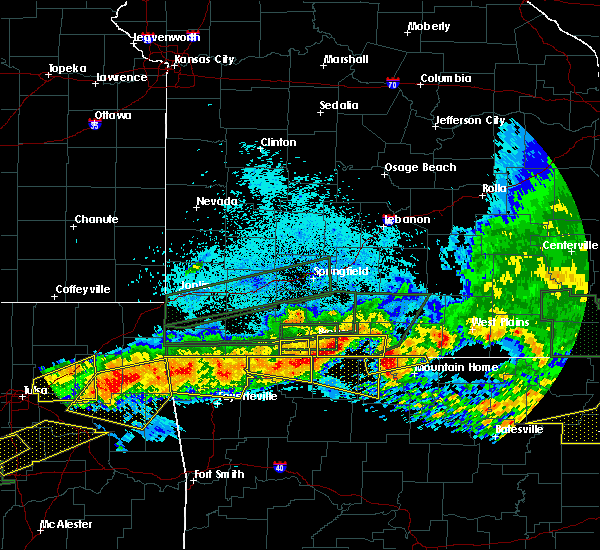 The severe thunderstorm warning for southern stone county will expire at 1000 pm cdt, the storm which prompted the warning has moved out of the area. therefore the warning will be allowed to expire. however heavy rain is still possible with this thunderstorm. a tornado watch remains in effect until 200 am cdt for southwestern missouri. to report severe weather, contact your nearest law enforcement agency. they will relay your report to the national weather service springfield. The severe thunderstorm warning for southern stone county will expire at 1000 pm cdt, the storm which prompted the warning has moved out of the area. therefore the warning will be allowed to expire. however heavy rain is still possible with this thunderstorm. a tornado watch remains in effect until 200 am cdt for southwestern missouri. to report severe weather, contact your nearest law enforcement agency. they will relay your report to the national weather service springfield.
|
| 5/27/2017 9:41 PM CDT |
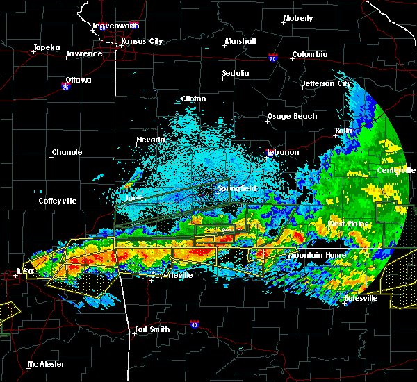 At 940 pm cdt, a severe thunderstorm was located near urbanette, or 10 miles southwest of kimberling city, moving east at 35 mph (radar indicated). Hazards include 60 mph wind gusts and quarter size hail. Hail damage to vehicles is expected. expect wind damage to roofs, siding, and trees. Locations impacted include, table rock lake, kimberling city, shell knob, indian point, blue eye, coney island, lampe, a tornado watch remains in effect until 200 am cdt for southwestern missouri. At 940 pm cdt, a severe thunderstorm was located near urbanette, or 10 miles southwest of kimberling city, moving east at 35 mph (radar indicated). Hazards include 60 mph wind gusts and quarter size hail. Hail damage to vehicles is expected. expect wind damage to roofs, siding, and trees. Locations impacted include, table rock lake, kimberling city, shell knob, indian point, blue eye, coney island, lampe, a tornado watch remains in effect until 200 am cdt for southwestern missouri.
|
| 5/27/2017 9:22 PM CDT |
 At 921 pm cdt, a severe thunderstorm was located near beaver, or 9 miles north of eureka springs, moving east at 35 mph (radar indicated). Hazards include 60 mph wind gusts and quarter size hail. Hail damage to vehicles is expected. Expect wind damage to roofs, siding, and trees. At 921 pm cdt, a severe thunderstorm was located near beaver, or 9 miles north of eureka springs, moving east at 35 mph (radar indicated). Hazards include 60 mph wind gusts and quarter size hail. Hail damage to vehicles is expected. Expect wind damage to roofs, siding, and trees.
|
| 5/27/2017 8:23 PM CDT |
 At 823 pm cdt, severe thunderstorms were located along a line extending from near lanagan to rockaway beach, moving east at 40 mph (radar indicated). Hazards include quarter size hail. damage to vehicles is expected At 823 pm cdt, severe thunderstorms were located along a line extending from near lanagan to rockaway beach, moving east at 40 mph (radar indicated). Hazards include quarter size hail. damage to vehicles is expected
|
| 5/27/2017 8:04 PM CDT |
 At 804 pm cdt, severe thunderstorms were located along a line extending from 11 miles south of ava to near forsyth to 10 miles southwest of wheaton, moving southeast at 40 mph (trained weather spotters). Hazards include ping pong ball size hail and 60 mph wind gusts. People and animals outdoors will be injured. expect hail damage to roofs, siding, windows, and vehicles. expect wind damage to roofs, siding, and trees. Locations impacted include, branson, lake taneycomo, table rock lake, bull shoals lake, roaring river state park, big sugar creek state park, table rock state park, hollister, cassville, silver dollar city, kimberling city, forsyth, anderson, noel, merriam woods, sparta, dodge, shell knob, goodman, kissee mills, a tornado watch remains in effect until 200 am cdt for southwestern missouri. At 804 pm cdt, severe thunderstorms were located along a line extending from 11 miles south of ava to near forsyth to 10 miles southwest of wheaton, moving southeast at 40 mph (trained weather spotters). Hazards include ping pong ball size hail and 60 mph wind gusts. People and animals outdoors will be injured. expect hail damage to roofs, siding, windows, and vehicles. expect wind damage to roofs, siding, and trees. Locations impacted include, branson, lake taneycomo, table rock lake, bull shoals lake, roaring river state park, big sugar creek state park, table rock state park, hollister, cassville, silver dollar city, kimberling city, forsyth, anderson, noel, merriam woods, sparta, dodge, shell knob, goodman, kissee mills, a tornado watch remains in effect until 200 am cdt for southwestern missouri.
|
| 5/27/2017 7:28 PM CDT |
 At 728 pm cdt, severe thunderstorms were located along a line extending from near sparta to near galena to near seneca, moving southeast at 40 mph (trained weather spotters). Hazards include golf ball size hail and 60 mph wind gusts. People and animals outdoors will be injured. expect hail damage to roofs, siding, windows, and vehicles. Expect wind damage to roofs, siding, and trees. At 728 pm cdt, severe thunderstorms were located along a line extending from near sparta to near galena to near seneca, moving southeast at 40 mph (trained weather spotters). Hazards include golf ball size hail and 60 mph wind gusts. People and animals outdoors will be injured. expect hail damage to roofs, siding, windows, and vehicles. Expect wind damage to roofs, siding, and trees.
|
| 5/27/2017 1:21 AM CDT |
 The severe thunderstorm warning for southeastern stone county will expire at 130 am cdt, the severe thunderstorm which prompted the warning has moved out of the warned area. therefore, the warning will be allowed to expire. however heavy rain is still possible with this thunderstorm. a severe thunderstorm watch remains in effect until 700 am cdt for southwestern missouri. to report severe weather, contact your nearest law enforcement agency. they will relay your report to the national weather service springfield. The severe thunderstorm warning for southeastern stone county will expire at 130 am cdt, the severe thunderstorm which prompted the warning has moved out of the warned area. therefore, the warning will be allowed to expire. however heavy rain is still possible with this thunderstorm. a severe thunderstorm watch remains in effect until 700 am cdt for southwestern missouri. to report severe weather, contact your nearest law enforcement agency. they will relay your report to the national weather service springfield.
|
| 5/27/2017 1:09 AM CDT |
 At 108 am cdt, a severe thunderstorm was located near roberson hollow, or 9 miles southeast of kimberling city, moving east at 30 mph (law enforcement. this storm has a long history of producing quarter to ping pong ball sized hail). Hazards include golf ball size hail and 60 mph wind gusts. People and animals outdoors will be injured. expect hail damage to roofs, siding, windows, and vehicles. expect wind damage to roofs, siding, and trees. Locations impacted include, branson, table rock lake, table rock state park, silver dollar city, kimberling city, indian point, blue eye, coney island, lampe,. At 108 am cdt, a severe thunderstorm was located near roberson hollow, or 9 miles southeast of kimberling city, moving east at 30 mph (law enforcement. this storm has a long history of producing quarter to ping pong ball sized hail). Hazards include golf ball size hail and 60 mph wind gusts. People and animals outdoors will be injured. expect hail damage to roofs, siding, windows, and vehicles. expect wind damage to roofs, siding, and trees. Locations impacted include, branson, table rock lake, table rock state park, silver dollar city, kimberling city, indian point, blue eye, coney island, lampe,.
|
| 5/27/2017 1:00 AM CDT |
 At 1259 am cdt, a severe thunderstorm was located 7 miles south of kimberling city, moving east at 40 mph (law enforcement. this storm has a history of producing quarter to ping pong ball sized hail). Hazards include ping pong ball size hail and 60 mph wind gusts. People and animals outdoors will be injured. expect hail damage to roofs, siding, windows, and vehicles. expect wind damage to roofs, siding, and trees. Locations impacted include, branson, table rock lake, table rock state park, silver dollar city, kimberling city, shell knob, indian point, branson west, blue eye, coney island, lampe,. At 1259 am cdt, a severe thunderstorm was located 7 miles south of kimberling city, moving east at 40 mph (law enforcement. this storm has a history of producing quarter to ping pong ball sized hail). Hazards include ping pong ball size hail and 60 mph wind gusts. People and animals outdoors will be injured. expect hail damage to roofs, siding, windows, and vehicles. expect wind damage to roofs, siding, and trees. Locations impacted include, branson, table rock lake, table rock state park, silver dollar city, kimberling city, shell knob, indian point, branson west, blue eye, coney island, lampe,.
|
| 5/27/2017 12:48 AM CDT |
 At 1247 am cdt, a severe thunderstorm was located 7 miles north of grandview, or 10 miles southwest of kimberling city, moving east at 25 mph (law enforcement. this storm has a history of producing quarter to ping pong ball sized hail). Hazards include two inch hail and 60 mph wind gusts. People and animals outdoors will be injured. expect hail damage to roofs, siding, windows, and vehicles. expect wind damage to roofs, siding, and trees. Locations impacted include, branson, table rock lake, table rock state park, silver dollar city, kimberling city, shell knob, indian point, branson west, golden, emerald beach, blue eye, arrow point, coney island, lampe,. At 1247 am cdt, a severe thunderstorm was located 7 miles north of grandview, or 10 miles southwest of kimberling city, moving east at 25 mph (law enforcement. this storm has a history of producing quarter to ping pong ball sized hail). Hazards include two inch hail and 60 mph wind gusts. People and animals outdoors will be injured. expect hail damage to roofs, siding, windows, and vehicles. expect wind damage to roofs, siding, and trees. Locations impacted include, branson, table rock lake, table rock state park, silver dollar city, kimberling city, shell knob, indian point, branson west, golden, emerald beach, blue eye, arrow point, coney island, lampe,.
|
| 5/27/2017 12:40 AM CDT |
 At 1239 am cdt, a severe thunderstorm was located near grandview, or 11 miles northeast of eureka springs, moving east at 25 mph (law enforcement. this storm has a history of producing quarter to ping pong ball sized hail). Hazards include ping pong ball size hail and 60 mph wind gusts. People and animals outdoors will be injured. expect hail damage to roofs, siding, windows, and vehicles. expect wind damage to roofs, siding, and trees. Locations impacted include, branson, table rock lake, table rock state park, silver dollar city, kimberling city, shell knob, indian point, branson west, golden, emerald beach, blue eye, chain-o-lakes, arrow point, coney island, lampe,. At 1239 am cdt, a severe thunderstorm was located near grandview, or 11 miles northeast of eureka springs, moving east at 25 mph (law enforcement. this storm has a history of producing quarter to ping pong ball sized hail). Hazards include ping pong ball size hail and 60 mph wind gusts. People and animals outdoors will be injured. expect hail damage to roofs, siding, windows, and vehicles. expect wind damage to roofs, siding, and trees. Locations impacted include, branson, table rock lake, table rock state park, silver dollar city, kimberling city, shell knob, indian point, branson west, golden, emerald beach, blue eye, chain-o-lakes, arrow point, coney island, lampe,.
|
| 5/27/2017 12:26 AM CDT |
 At 1225 am cdt, a severe thunderstorm was located near beaver, or 10 miles north of eureka springs, moving east at 30 mph (law enforcement. this storm has a history of producing quarter to ping pong ball sized hail). Hazards include 60 mph wind gusts and half dollar size hail. Hail damage to vehicles is expected. Expect wind damage to roofs, siding, and trees. At 1225 am cdt, a severe thunderstorm was located near beaver, or 10 miles north of eureka springs, moving east at 30 mph (law enforcement. this storm has a history of producing quarter to ping pong ball sized hail). Hazards include 60 mph wind gusts and half dollar size hail. Hail damage to vehicles is expected. Expect wind damage to roofs, siding, and trees.
|
| 5/19/2017 4:55 PM CDT |
 At 455 pm cdt, severe thunderstorms were located along a line extending from near fair grove to 6 miles northwest of roberson hollow, moving east at 25 mph (radar indicated). Hazards include 60 mph wind gusts. Expect damage to roofs, siding, and trees. locations impacted include, springfield, nixa, ozark, branson, lake taneycomo, bull shoals lake, table rock lake, table rock state park, hollister, rogersville, silver dollar city, kimberling city, strafford, forsyth, merriam woods, sparta, fair grove, kissee mills, reeds spring, highlandville, this includes interstate 44 between mile markers 77 and 90. A tornado watch remains in effect until 1000 pm cdt for southwestern missouri. At 455 pm cdt, severe thunderstorms were located along a line extending from near fair grove to 6 miles northwest of roberson hollow, moving east at 25 mph (radar indicated). Hazards include 60 mph wind gusts. Expect damage to roofs, siding, and trees. locations impacted include, springfield, nixa, ozark, branson, lake taneycomo, bull shoals lake, table rock lake, table rock state park, hollister, rogersville, silver dollar city, kimberling city, strafford, forsyth, merriam woods, sparta, fair grove, kissee mills, reeds spring, highlandville, this includes interstate 44 between mile markers 77 and 90. A tornado watch remains in effect until 1000 pm cdt for southwestern missouri.
|
| 5/19/2017 4:11 PM CDT |
 At 411 pm cdt, severe thunderstorms were located along a line extending from 7 miles south of ash grove to 6 miles north of grandview, moving northeast at 45 mph (radar indicated). Hazards include 60 mph wind gusts. expect damage to roofs, siding, and trees At 411 pm cdt, severe thunderstorms were located along a line extending from 7 miles south of ash grove to 6 miles north of grandview, moving northeast at 45 mph (radar indicated). Hazards include 60 mph wind gusts. expect damage to roofs, siding, and trees
|
| 5/19/2017 1:28 AM CDT |
 The tornado warning for stone and northeastern barry counties will expire at 130 am cdt. the storms which prompted the warning have moved out of the area. therefore the warning will be allowed to expire. however heavy rain is still possible with these thunderstorms. A tornado watch remains in effect until 600 am cdt for southwestern. The tornado warning for stone and northeastern barry counties will expire at 130 am cdt. the storms which prompted the warning have moved out of the area. therefore the warning will be allowed to expire. however heavy rain is still possible with these thunderstorms. A tornado watch remains in effect until 600 am cdt for southwestern.
|
| 5/19/2017 1:06 AM CDT |
 At 106 am cdt, a severe squall line capable of producing both tornadoes and extensive straight line wind damage was located along a line extending from 7 miles northeast of cassville to 8 miles southwest of kimberling city, moving northeast at 35 mph (radar indicated rotation). Hazards include tornado. Flying debris will be dangerous to those caught without shelter. mobile homes will be damaged or destroyed. damage to roofs, windows, and vehicles will occur. tree damage is likely. Locations impacted include, branson, table rock lake, table rock state park, silver dollar city, kimberling city, crane, shell knob, reeds spring, indian point, branson west, galena, mccord bend, blue eye, arrow point, coney island, cape fair, wheelerville, jenkins, lampe, madry,. At 106 am cdt, a severe squall line capable of producing both tornadoes and extensive straight line wind damage was located along a line extending from 7 miles northeast of cassville to 8 miles southwest of kimberling city, moving northeast at 35 mph (radar indicated rotation). Hazards include tornado. Flying debris will be dangerous to those caught without shelter. mobile homes will be damaged or destroyed. damage to roofs, windows, and vehicles will occur. tree damage is likely. Locations impacted include, branson, table rock lake, table rock state park, silver dollar city, kimberling city, crane, shell knob, reeds spring, indian point, branson west, galena, mccord bend, blue eye, arrow point, coney island, cape fair, wheelerville, jenkins, lampe, madry,.
|
| 5/19/2017 12:38 AM CDT |
 At 1238 am cdt, severe thunderstorms capable of producing both tornadoes and extensive straight line wind damage were located along a line extending from 7 miles south of wheaton to seligman, moving northeast at 40 mph (radar indicated rotation). Hazards include tornado. Flying debris will be dangerous to those caught without shelter. mobile homes will be damaged or destroyed. damage to roofs, windows, and vehicles will occur. Tree damage is likely. At 1238 am cdt, severe thunderstorms capable of producing both tornadoes and extensive straight line wind damage were located along a line extending from 7 miles south of wheaton to seligman, moving northeast at 40 mph (radar indicated rotation). Hazards include tornado. Flying debris will be dangerous to those caught without shelter. mobile homes will be damaged or destroyed. damage to roofs, windows, and vehicles will occur. Tree damage is likely.
|
| 4/29/2017 3:01 AM CDT |
 At 301 am cdt, a severe thunderstorm was located 9 miles west of kimberling city, moving northeast at 45 mph (radar indicated). Hazards include 60 mph wind gusts and quarter size hail. Hail damage to vehicles is expected. Expect wind damage to roofs, siding, and trees. At 301 am cdt, a severe thunderstorm was located 9 miles west of kimberling city, moving northeast at 45 mph (radar indicated). Hazards include 60 mph wind gusts and quarter size hail. Hail damage to vehicles is expected. Expect wind damage to roofs, siding, and trees.
|
| 4/29/2017 2:22 AM CDT |
 At 221 am cdt, a severe thunderstorm was located near reeds spring, or near kimberling city, moving northeast at 50 mph (radar indicated). Hazards include 60 mph wind gusts and quarter size hail. Hail damage to vehicles is expected. Expect wind damage to roofs, siding, and trees. At 221 am cdt, a severe thunderstorm was located near reeds spring, or near kimberling city, moving northeast at 50 mph (radar indicated). Hazards include 60 mph wind gusts and quarter size hail. Hail damage to vehicles is expected. Expect wind damage to roofs, siding, and trees.
|
| 4/29/2017 2:13 AM CDT |
 At 212 am cdt, a severe thunderstorm was located 9 miles southwest of galena, or 10 miles northwest of kimberling city, moving northeast at 50 mph (radar indicated). Hazards include 60 mph wind gusts and half dollar size hail. Hail damage to vehicles is expected. expect wind damage to roofs, siding, and trees. Locations impacted include, table rock lake, silver dollar city, kimberling city, crane, shell knob, reeds spring, indian point, branson west, galena, mccord bend, hurley, blue eye, coney island, cape fair, ponce de leon, lampe, elsey,. At 212 am cdt, a severe thunderstorm was located 9 miles southwest of galena, or 10 miles northwest of kimberling city, moving northeast at 50 mph (radar indicated). Hazards include 60 mph wind gusts and half dollar size hail. Hail damage to vehicles is expected. expect wind damage to roofs, siding, and trees. Locations impacted include, table rock lake, silver dollar city, kimberling city, crane, shell knob, reeds spring, indian point, branson west, galena, mccord bend, hurley, blue eye, coney island, cape fair, ponce de leon, lampe, elsey,.
|
| 4/29/2017 1:38 AM CDT |
 At 138 am cdt, a severe thunderstorm was located near seligman, or 9 miles south of cassville, moving northeast at 50 mph (radar indicated). Hazards include 60 mph wind gusts and quarter size hail. Hail damage to vehicles is expected. Expect wind damage to roofs, siding, and trees. At 138 am cdt, a severe thunderstorm was located near seligman, or 9 miles south of cassville, moving northeast at 50 mph (radar indicated). Hazards include 60 mph wind gusts and quarter size hail. Hail damage to vehicles is expected. Expect wind damage to roofs, siding, and trees.
|
| 4/29/2017 12:24 AM CDT |
 The severe thunderstorm warning for western taney and southern stone counties will expire at 1230 am cdt, the storm which prompted the warning has weakened below severe limits, and has exited the warned area. therefore, the warning will be allowed to expire. a severe thunderstorm watch remains in effect until 500 am cdt for southwestern missouri. The severe thunderstorm warning for western taney and southern stone counties will expire at 1230 am cdt, the storm which prompted the warning has weakened below severe limits, and has exited the warned area. therefore, the warning will be allowed to expire. a severe thunderstorm watch remains in effect until 500 am cdt for southwestern missouri.
|
| 4/28/2017 11:46 PM CDT |
 At 1146 pm cdt, a severe thunderstorm was located near urbanette, or 8 miles north of berryville, moving northeast at 45 mph (radar indicated). Hazards include half dollar size hail. damage to vehicles is expected At 1146 pm cdt, a severe thunderstorm was located near urbanette, or 8 miles north of berryville, moving northeast at 45 mph (radar indicated). Hazards include half dollar size hail. damage to vehicles is expected
|
| 4/26/2017 1:34 AM CDT |
 At 134 am cdt, a severe thunderstorm was located 10 miles east of cassville, moving east at 60 mph (radar indicated). Hazards include 60 mph wind gusts and quarter size hail. Hail damage to vehicles is expected. Expect wind damage to roofs, siding, and trees. At 134 am cdt, a severe thunderstorm was located 10 miles east of cassville, moving east at 60 mph (radar indicated). Hazards include 60 mph wind gusts and quarter size hail. Hail damage to vehicles is expected. Expect wind damage to roofs, siding, and trees.
|
| 4/4/2017 9:09 PM CDT |
 At 909 pm cdt, a severe thunderstorm was located over silver dollar city, or near branson, moving northeast at 40 mph (radar indicated). Hazards include 60 mph wind gusts and quarter size hail. Hail damage to vehicles is expected. Expect wind damage to roofs, siding, and trees. At 909 pm cdt, a severe thunderstorm was located over silver dollar city, or near branson, moving northeast at 40 mph (radar indicated). Hazards include 60 mph wind gusts and quarter size hail. Hail damage to vehicles is expected. Expect wind damage to roofs, siding, and trees.
|
| 3/9/2017 7:34 PM CST |
 At 733 pm cst, a severe thunderstorm capable of producing a tornado was located near kimberling city, moving southeast at 45 mph. another storm capable of producing a tornado was located south of shell knob (radar indicated rotation). Hazards include tornado and golf ball size hail. Flying debris will be dangerous to those caught without shelter. mobile homes will be damaged or destroyed. damage to roofs, windows, and vehicles will occur. tree damage is likely. Locations impacted include, table rock lake, table rock state park, kimberling city, shell knob, indian point, golden, emerald beach, blue eye, arrow point, coney island, lampe,. At 733 pm cst, a severe thunderstorm capable of producing a tornado was located near kimberling city, moving southeast at 45 mph. another storm capable of producing a tornado was located south of shell knob (radar indicated rotation). Hazards include tornado and golf ball size hail. Flying debris will be dangerous to those caught without shelter. mobile homes will be damaged or destroyed. damage to roofs, windows, and vehicles will occur. tree damage is likely. Locations impacted include, table rock lake, table rock state park, kimberling city, shell knob, indian point, golden, emerald beach, blue eye, arrow point, coney island, lampe,.
|
| 3/9/2017 7:22 PM CST |
 At 722 pm cst, a confirmed tornado was located 12 miles southeast of cassville or near shell knob, moving southeast at 40 mph (public confirmed tornado). Hazards include damaging tornado and golf ball size hail. Flying debris will be dangerous to those caught without shelter. mobile homes will be damaged or destroyed. damage to roofs, windows, and vehicles will occur. tree damage is likely. Locations impacted include, table rock lake, table rock state park, kimberling city, shell knob, indian point, golden, emerald beach, blue eye, arrow point, coney island, lampe,. At 722 pm cst, a confirmed tornado was located 12 miles southeast of cassville or near shell knob, moving southeast at 40 mph (public confirmed tornado). Hazards include damaging tornado and golf ball size hail. Flying debris will be dangerous to those caught without shelter. mobile homes will be damaged or destroyed. damage to roofs, windows, and vehicles will occur. tree damage is likely. Locations impacted include, table rock lake, table rock state park, kimberling city, shell knob, indian point, golden, emerald beach, blue eye, arrow point, coney island, lampe,.
|
| 3/9/2017 7:12 PM CST |
 At 711 pm cst, a severe thunderstorm capable of producing a tornado was located 12 miles west of kimberling city, moving southeast at 30 mph (radar indicated rotation). Hazards include tornado and golf ball size hail. Flying debris will be dangerous to those caught without shelter. mobile homes will be damaged or destroyed. damage to roofs, windows, and vehicles will occur. Tree damage is likely. At 711 pm cst, a severe thunderstorm capable of producing a tornado was located 12 miles west of kimberling city, moving southeast at 30 mph (radar indicated rotation). Hazards include tornado and golf ball size hail. Flying debris will be dangerous to those caught without shelter. mobile homes will be damaged or destroyed. damage to roofs, windows, and vehicles will occur. Tree damage is likely.
|
| 3/6/2017 11:59 PM CST |
 At 1158 pm cst, severe thunderstorms were located along a line extending from ava to 7 miles southeast of hollister, moving east at 65 mph (public. numerous reports of 60 to 70 mph wind gusts have been reported with this line of storms). Hazards include 70 mph wind gusts and nickel size hail. Expect considerable tree damage. damage is likely to mobile homes, roofs, and outbuildings. Locations impacted include, ozark, branson, lake taneycomo, table rock lake, roaring river state park, table rock state park, hollister, silver dollar city, ava, kimberling city, forsyth, merriam woods, sparta, shell knob, kissee mills, reeds spring, highlandville, seligman, rockaway beach, bull creek, a tornado watch remains in effect until 300 am cst for southwestern missouri. At 1158 pm cst, severe thunderstorms were located along a line extending from ava to 7 miles southeast of hollister, moving east at 65 mph (public. numerous reports of 60 to 70 mph wind gusts have been reported with this line of storms). Hazards include 70 mph wind gusts and nickel size hail. Expect considerable tree damage. damage is likely to mobile homes, roofs, and outbuildings. Locations impacted include, ozark, branson, lake taneycomo, table rock lake, roaring river state park, table rock state park, hollister, silver dollar city, ava, kimberling city, forsyth, merriam woods, sparta, shell knob, kissee mills, reeds spring, highlandville, seligman, rockaway beach, bull creek, a tornado watch remains in effect until 300 am cst for southwestern missouri.
|
| 3/6/2017 11:09 PM CST |
 At 1109 pm cst, severe thunderstorms were located along a line extending from near crane to near washburn, moving east at 60 mph (public. numerous reports of wind damage have been reported with these storms across southwest missouri). Hazards include 70 mph wind gusts and nickel size hail. Expect considerable tree damage. Damage is likely to mobile homes, roofs, and outbuildings. At 1109 pm cst, severe thunderstorms were located along a line extending from near crane to near washburn, moving east at 60 mph (public. numerous reports of wind damage have been reported with these storms across southwest missouri). Hazards include 70 mph wind gusts and nickel size hail. Expect considerable tree damage. Damage is likely to mobile homes, roofs, and outbuildings.
|
| 3/1/2017 2:31 AM CST |
 At 231 am cst, severe thunderstorms were located along a line extending from 6 miles northeast of taneyville to 7 miles northeast of urbanette, moving east at 55 mph (radar indicated). Hazards include 60 mph wind gusts and quarter size hail. Hail damage to vehicles is expected. Expect wind damage to roofs, siding, and trees. At 231 am cst, severe thunderstorms were located along a line extending from 6 miles northeast of taneyville to 7 miles northeast of urbanette, moving east at 55 mph (radar indicated). Hazards include 60 mph wind gusts and quarter size hail. Hail damage to vehicles is expected. Expect wind damage to roofs, siding, and trees.
|
| 3/1/2017 1:37 AM CST |
 At 137 am cst, severe thunderstorms were located along a line extending from near rogersville to 6 miles northeast of cassville, moving east at 70 mph (radar indicated). Hazards include 60 mph wind gusts and quarter size hail. Hail damage to vehicles is expected. Expect wind damage to roofs, siding, and trees. At 137 am cst, severe thunderstorms were located along a line extending from near rogersville to 6 miles northeast of cassville, moving east at 70 mph (radar indicated). Hazards include 60 mph wind gusts and quarter size hail. Hail damage to vehicles is expected. Expect wind damage to roofs, siding, and trees.
|
| 9/16/2016 4:22 PM CDT |
 At 421 pm cdt, a severe thunderstorm was located over kimberling city, moving northeast at 25 mph (radar indicated). Hazards include 60 mph wind gusts and quarter size hail. Hail damage to vehicles is expected. Expect wind damage to roofs, siding, and trees. At 421 pm cdt, a severe thunderstorm was located over kimberling city, moving northeast at 25 mph (radar indicated). Hazards include 60 mph wind gusts and quarter size hail. Hail damage to vehicles is expected. Expect wind damage to roofs, siding, and trees.
|
| 7/10/2016 8:21 PM CDT |
 The severe thunderstorm warning for southeastern barry and southern stone counties will expire at 830 pm cdt, the storm which prompted the warning has weakened below severe limits, and no longer pose an immediate threat to life or property. therefore the warning will be allowed to expire. The severe thunderstorm warning for southeastern barry and southern stone counties will expire at 830 pm cdt, the storm which prompted the warning has weakened below severe limits, and no longer pose an immediate threat to life or property. therefore the warning will be allowed to expire.
|
| 7/10/2016 7:47 PM CDT |
 At 746 pm cdt, a severe thunderstorm was located near kimberling city, moving northwest at 25 mph (radar indicated). Hazards include 60 mph wind gusts and quarter size hail. Hail damage to vehicles is expected. Expect wind damage to roofs, siding, and trees. At 746 pm cdt, a severe thunderstorm was located near kimberling city, moving northwest at 25 mph (radar indicated). Hazards include 60 mph wind gusts and quarter size hail. Hail damage to vehicles is expected. Expect wind damage to roofs, siding, and trees.
|
| 7/8/2016 1:57 AM CDT | The severe thunderstorm warning for central christian. northwestern taney. barry and stone counties will expire at 200 am cdt. the storms which prompted the warning have weakened below severe limits. and have exited the warned area. therefore the warning will be allowed to expire. However gusty winds and heavy rain are still. |
| 7/8/2016 1:49 AM CDT |
 At 148 am cdt, severe thunderstorms were located along a line extending from 7 miles north of merriam woods to kimberling city to near washburn, moving southeast at 50 mph (radar indicated). Hazards include 60 mph wind gusts. Expect damage to roofs. siding. and trees. Locations impacted include, nixa, ozark, branson, lake taneycomo, table rock lake, table rock state park, roaring river state park, hollister, cassville, silver dollar city, kimberling city, forsyth, merriam woods, sparta, shell knob, reeds spring, highlandville, seligman, rockaway beach, fremont hills,. At 148 am cdt, severe thunderstorms were located along a line extending from 7 miles north of merriam woods to kimberling city to near washburn, moving southeast at 50 mph (radar indicated). Hazards include 60 mph wind gusts. Expect damage to roofs. siding. and trees. Locations impacted include, nixa, ozark, branson, lake taneycomo, table rock lake, table rock state park, roaring river state park, hollister, cassville, silver dollar city, kimberling city, forsyth, merriam woods, sparta, shell knob, reeds spring, highlandville, seligman, rockaway beach, fremont hills,.
|
| 7/8/2016 1:14 AM CDT |
 At 113 am cdt, severe thunderstorms were located along a line extending from near billings to near verona to near neosho, moving southeast at 50 mph (trained weather spotters. these storms have a long history of downing trees and powerlines across western missouri). Hazards include 60 mph wind gusts. Expect damage to roofs. siding. and trees. Locations impacted include, nixa, ozark, branson, lake taneycomo, table rock lake, table rock state park, big sugar creek state park, roaring river state park, hollister, cassville, silver dollar city, kimberling city, forsyth, clever, anderson, noel, merriam woods, sparta, dodge, crane,. At 113 am cdt, severe thunderstorms were located along a line extending from near billings to near verona to near neosho, moving southeast at 50 mph (trained weather spotters. these storms have a long history of downing trees and powerlines across western missouri). Hazards include 60 mph wind gusts. Expect damage to roofs. siding. and trees. Locations impacted include, nixa, ozark, branson, lake taneycomo, table rock lake, table rock state park, big sugar creek state park, roaring river state park, hollister, cassville, silver dollar city, kimberling city, forsyth, clever, anderson, noel, merriam woods, sparta, dodge, crane,.
|
| 7/8/2016 12:58 AM CDT |
 At 1257 am cdt, severe thunderstorms were located along a line extending from near miller to near pierce city to near shoal creek drive, moving southeast at 50 mph (emergency management. these storms have a long history of producing wind damage across western missouri). Hazards include 60 mph wind gusts and nickel size hail. Expect damage to roofs. siding. And trees. At 1257 am cdt, severe thunderstorms were located along a line extending from near miller to near pierce city to near shoal creek drive, moving southeast at 50 mph (emergency management. these storms have a long history of producing wind damage across western missouri). Hazards include 60 mph wind gusts and nickel size hail. Expect damage to roofs. siding. And trees.
|
| 4/27/2016 1:30 AM CDT |
 At 129 am cdt, severe thunderstorms were located along a line extending from 9 miles west of humansville to 7 miles northeast of beaver, moving east at 40 mph (radar indicated). Hazards include 60 mph wind gusts and penny size hail. Expect damage to roofs. siding. And trees. At 129 am cdt, severe thunderstorms were located along a line extending from 9 miles west of humansville to 7 miles northeast of beaver, moving east at 40 mph (radar indicated). Hazards include 60 mph wind gusts and penny size hail. Expect damage to roofs. siding. And trees.
|
| 8/23/2015 5:34 AM CDT |
 At 534 am cdt, severe thunderstorms were located along a line extending from near noel to near exeter to near branson, moving southeast at 45 mph (radar indicated). Hazards include 60 mph wind gusts. Expect damage to roofs. siding and trees. Locations impacted include, branson, table rock lake, lake taneycomo, big sugar creek state park, roaring river state park, table rock state park, hollister, cassville, silver dollar city, kimberling city, anderson, noel, shell knob, reeds spring, seligman, rockaway beach, pineville, exeter, bull creek, indian point,. At 534 am cdt, severe thunderstorms were located along a line extending from near noel to near exeter to near branson, moving southeast at 45 mph (radar indicated). Hazards include 60 mph wind gusts. Expect damage to roofs. siding and trees. Locations impacted include, branson, table rock lake, lake taneycomo, big sugar creek state park, roaring river state park, table rock state park, hollister, cassville, silver dollar city, kimberling city, anderson, noel, shell knob, reeds spring, seligman, rockaway beach, pineville, exeter, bull creek, indian point,.
|
| 8/23/2015 5:20 AM CDT |
 At 520 am cdt, severe thunderstorms were located along a line extending from near noel to near exeter to 7 miles northeast of galena, moving southeast at 40 mph (radar indicated). Hazards include 60 mph wind gusts. Expect damage to roofs. siding and trees. Locations impacted include, branson, lake taneycomo, table rock lake, bull shoals lake, table rock state park, big sugar creek state park, roaring river state park, hollister, cassville, silver dollar city, kimberling city, forsyth, anderson, noel, merriam woods, crane, shell knob, goodman, kissee mills, purdy,. At 520 am cdt, severe thunderstorms were located along a line extending from near noel to near exeter to 7 miles northeast of galena, moving southeast at 40 mph (radar indicated). Hazards include 60 mph wind gusts. Expect damage to roofs. siding and trees. Locations impacted include, branson, lake taneycomo, table rock lake, bull shoals lake, table rock state park, big sugar creek state park, roaring river state park, hollister, cassville, silver dollar city, kimberling city, forsyth, anderson, noel, merriam woods, crane, shell knob, goodman, kissee mills, purdy,.
|
| 8/23/2015 5:07 AM CDT |
 At 506 am cdt, severe thunderstorms were located along a line extending from 7 miles northwest of noel to near exeter to near clever, and are nearly stationary (radar indicated). Hazards include 60 mph wind gusts. Expect damage to roofs. siding and trees. Locations impacted include, neosho, branson, lake taneycomo, table rock lake, bull shoals lake, table rock state park, big sugar creek state park, roaring river state park, monett, aurora, hollister, cassville, silver dollar city, kimberling city, seneca, forsyth, marionville, granby, anderson, noel,. At 506 am cdt, severe thunderstorms were located along a line extending from 7 miles northwest of noel to near exeter to near clever, and are nearly stationary (radar indicated). Hazards include 60 mph wind gusts. Expect damage to roofs. siding and trees. Locations impacted include, neosho, branson, lake taneycomo, table rock lake, bull shoals lake, table rock state park, big sugar creek state park, roaring river state park, monett, aurora, hollister, cassville, silver dollar city, kimberling city, seneca, forsyth, marionville, granby, anderson, noel,.
|
| 8/23/2015 5:00 AM CDT |
 At 459 am cdt, severe thunderstorms were located along a line extending from 7 miles west of lanagan to near exeter to near clever, moving southeast at 40 mph (radar indicated). Hazards include 60 mph wind gusts. Expect damage to roofs. Siding and trees. At 459 am cdt, severe thunderstorms were located along a line extending from 7 miles west of lanagan to near exeter to near clever, moving southeast at 40 mph (radar indicated). Hazards include 60 mph wind gusts. Expect damage to roofs. Siding and trees.
|
| 8/7/2015 5:55 AM CDT |
 The severe thunderstorm warning for southwestern taney and southeastern stone counties will expire at 600 am cdt, the storm which prompted the warning has moved out of the area. therefore the warning will be allowed to expire. to report severe weather, contact your nearest law enforcement agency. they will relay your report to the national weather service springfield. The severe thunderstorm warning for southwestern taney and southeastern stone counties will expire at 600 am cdt, the storm which prompted the warning has moved out of the area. therefore the warning will be allowed to expire. to report severe weather, contact your nearest law enforcement agency. they will relay your report to the national weather service springfield.
|
| 8/7/2015 5:37 AM CDT |
 At 537 am cdt, a severe thunderstorm was located near hollister, or near branson, and is moving to the southeast at 25 mph (radar indicated). Hazards include 60 mph wind gusts and quarter size hail. Hail damage to vehicles is expected. expect wind damage to roofs, siding and trees. Locations impacted include, branson, table rock lake, lake taneycomo, table rock state park, hollister, indian point, table rock, blue eye, coney island, lampe, ridgedale,. At 537 am cdt, a severe thunderstorm was located near hollister, or near branson, and is moving to the southeast at 25 mph (radar indicated). Hazards include 60 mph wind gusts and quarter size hail. Hail damage to vehicles is expected. expect wind damage to roofs, siding and trees. Locations impacted include, branson, table rock lake, lake taneycomo, table rock state park, hollister, indian point, table rock, blue eye, coney island, lampe, ridgedale,.
|
| 8/7/2015 5:21 AM CDT |
 At 521 am cdt, a severe thunderstorm was located over branson west, or near kimberling city, moving southeast at 25 mph (radar indicated). Hazards include 60 mph wind gusts and quarter size hail. Hail damage to vehicles is expected. Expect wind damage to roofs, siding and trees. At 521 am cdt, a severe thunderstorm was located over branson west, or near kimberling city, moving southeast at 25 mph (radar indicated). Hazards include 60 mph wind gusts and quarter size hail. Hail damage to vehicles is expected. Expect wind damage to roofs, siding and trees.
|
| 7/24/2015 9:55 PM CDT |
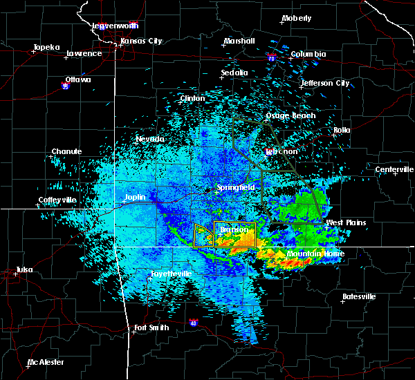 At 954 pm cdt, severe thunderstorms were located along a line extending from 10 miles northwest of kimberling city to indian point, and moving south at 35 mph (radar indicated). Hazards include 60 mph wind gusts. Expect damage to roofs. siding and trees. locations impacted include, cape fair, indian point, kimberling city and lampe. this warning also includes table rock lake. A severe thunderstorm watch remains in effect until midnight cdt saturday morning for southwest missouri. At 954 pm cdt, severe thunderstorms were located along a line extending from 10 miles northwest of kimberling city to indian point, and moving south at 35 mph (radar indicated). Hazards include 60 mph wind gusts. Expect damage to roofs. siding and trees. locations impacted include, cape fair, indian point, kimberling city and lampe. this warning also includes table rock lake. A severe thunderstorm watch remains in effect until midnight cdt saturday morning for southwest missouri.
|
| 7/24/2015 9:20 PM CDT |
 At 917 pm cdt, severe thunderstorms were located along a line extending from southwest christian county, and moving south southwest at 35 mph (radar indicated). Hazards include 60 mph wind gusts. Expect damage to roofs. Siding and trees. At 917 pm cdt, severe thunderstorms were located along a line extending from southwest christian county, and moving south southwest at 35 mph (radar indicated). Hazards include 60 mph wind gusts. Expect damage to roofs. Siding and trees.
|
| 7/20/2015 6:53 PM CDT |
 The severe thunderstorm warning for western taney, southern stone, southeastern mcdonald and southern barry counties will expire at 700 pm cdt, the line of storms which prompted the warning has weakened. however, gusty winds and heavy rain are still possible with these thunderstorms over the next hour. frequent lightning can also be expected. The severe thunderstorm warning for western taney, southern stone, southeastern mcdonald and southern barry counties will expire at 700 pm cdt, the line of storms which prompted the warning has weakened. however, gusty winds and heavy rain are still possible with these thunderstorms over the next hour. frequent lightning can also be expected.
|
| 7/20/2015 6:39 PM CDT |
 At 636 pm cdt, severe thunderstorms were located along a line extending from forsyth to seligman, and moving southeast at 20 mph (emergency management. a few trees have been reported down in and around the galena, cape fair, and kimberling city areas). Hazards include 60 mph wind gusts and penny size hail. Expect damage to roofs. siding and trees. locations impacted include, branson west, branson, forsyth, hollister, indian point, kimberling city, merriam woods, reeds spring, rockaway beach, seligman and washburn. This warning also includes bull shoals lake, lake taneycomo, roaring river state park, table rock lake and table rock state park. At 636 pm cdt, severe thunderstorms were located along a line extending from forsyth to seligman, and moving southeast at 20 mph (emergency management. a few trees have been reported down in and around the galena, cape fair, and kimberling city areas). Hazards include 60 mph wind gusts and penny size hail. Expect damage to roofs. siding and trees. locations impacted include, branson west, branson, forsyth, hollister, indian point, kimberling city, merriam woods, reeds spring, rockaway beach, seligman and washburn. This warning also includes bull shoals lake, lake taneycomo, roaring river state park, table rock lake and table rock state park.
|
| 7/20/2015 6:16 PM CDT | Emergency management reported a tree down on highway dd se of kimberling city. time estimated by rada in stone county MO, 1 miles WNW of Coney Island, MO |
| 7/20/2015 6:11 PM CDT |
 At 609 pm cdt, severe thunderstorms were located along a line extending from merriam woods to washburn, and moving southeast at 20 mph (radar indicated). Hazards include 60 mph wind gusts and penny size hail. Expect damage to roofs. Siding and trees. At 609 pm cdt, severe thunderstorms were located along a line extending from merriam woods to washburn, and moving southeast at 20 mph (radar indicated). Hazards include 60 mph wind gusts and penny size hail. Expect damage to roofs. Siding and trees.
|
| 6/26/2015 10:53 AM CDT |
 At 1050 am cdt, severe thunderstorms were located along a line extending from reeds spring to golden, and moving east at 30 mph (radar indicated). Hazards include 60 mph wind gusts. Expect damage to roofs. siding and trees. locations impacted include, branson west, indian point, kimberling city and reeds spring. This warning also includes table rock lake. At 1050 am cdt, severe thunderstorms were located along a line extending from reeds spring to golden, and moving east at 30 mph (radar indicated). Hazards include 60 mph wind gusts. Expect damage to roofs. siding and trees. locations impacted include, branson west, indian point, kimberling city and reeds spring. This warning also includes table rock lake.
|
| 6/26/2015 10:33 AM CDT |
 At 1030 am cdt, severe thunderstorms were located along a line extending from hurley to roaring river state park, and moving east at 30 mph (radar indicated). Hazards include 60 mph wind gusts. Expect damage to roofs. siding and trees. locations impacted include, branson west, galena, indian point, kimberling city, reeds spring and seligman. This warning also includes roaring river state park and table rock lake. At 1030 am cdt, severe thunderstorms were located along a line extending from hurley to roaring river state park, and moving east at 30 mph (radar indicated). Hazards include 60 mph wind gusts. Expect damage to roofs. siding and trees. locations impacted include, branson west, galena, indian point, kimberling city, reeds spring and seligman. This warning also includes roaring river state park and table rock lake.
|
| 6/26/2015 10:16 AM CDT |
 At 1015 am cdt, severe thunderstorms were located along a line extending from crane to seligman, and moving east at 25 mph (radar indicated). Hazards include 60 mph wind gusts. Expect damage to roofs. Siding and trees. At 1015 am cdt, severe thunderstorms were located along a line extending from crane to seligman, and moving east at 25 mph (radar indicated). Hazards include 60 mph wind gusts. Expect damage to roofs. Siding and trees.
|
| 5/17/2015 2:08 AM CDT | At 203 am cdt, severe thunderstorms were located along a line extending from walnut grove to ash grove to republic to 10 miles southwest of galena, and moving northeast at 60 mph (emergency management. several reports of tree and power line damage with these storms). Hazards include 60 mph wind gusts. Expect damage to roofs. Siding and trees. |
| 5/10/2015 12:46 PM CDT | At 1243 pm cdt, severe thunderstorms were located along a line extending from branson west to hollister to 10 miles south of hollister, and moving northeast at 55 mph (radar indicated). Hazards include 60 mph wind gusts and penny size hail. Expect damage to roofs. siding and trees. locations impacted include, branson west, branson, forsyth, hollister, indian point, kimberling city, merriam woods, reeds spring, rockaway beach and taneyville. this warning also includes bull shoals lake, lake taneycomo, table rock lake and table rock state park. 0. 75in. |
| 5/10/2015 12:27 PM CDT | At 1226 pm cdt, severe thunderstorms were located along a line extending from 7 miles southwest of kimberling city to 12 miles south of kimberling city to 21 miles south of kimberling city, and moving northeast at 55 mph (radar indicated). Hazards include 60 mph wind gusts and penny size hail. Expect damage to roofs. Siding and trees. |
| 4/3/2015 4:42 AM CDT | A severe thunderstorm warning remains in effect for taney. southern stone. northwestern ozark. douglas and eastern christian counties until 515 am cdt. at 441 am cdt. severe thunderstorms were located along a line extending from 8 miles northwest of ava to taneyville to branson. And moving east at 55 mph. |
| 4/3/2015 4:28 AM CDT | The national weather service in springfield has issued a * severe thunderstorm warning for. east central barry county in southwest missouri. christian county in southwest missouri. douglas county in southwest missouri. Northwestern ozark county in southwest missouri. |
| 4/3/2015 12:02 AM CDT | The national weather service in springfield has issued a * tornado warning for. southeastern stone county in southwest missouri. southern taney county in southwest missouri. until 1245 am cdt * at 1159 pm cdt. A severe thunderstorm capable of producing a. |
| 4/2/2015 11:48 PM CDT | A tornado warning remains in effect for southern stone and southeastern barry counties until midnight cdt. at 1146 pm cdt. a severe thunderstorm capable of producing a tornado was located 13 miles southwest of kimberling city. and moving east at 45 mph. hazard. Tornado and quarter size hail. |
| 4/2/2015 11:36 PM CDT | A tornado warning remains in effect for southern stone and southeastern barry counties until midnight cdt. at 1134 pm cdt. a severe thunderstorm capable of producing a tornado was located over eagle rock or 19 miles west of kimberling city. and moving east at 40 mph. hazard. Tornado and quarter size hail. |
| 4/2/2015 11:20 PM CDT | The national weather service in springfield has issued a * tornado warning for. southern barry county in southwest missouri. southern stone county in southwest missouri. until midnight cdt * at 1117 pm cdt. A severe thunderstorm capable of producing a. |
| 3/25/2015 7:04 PM CDT | A severe thunderstorm warning remains in effect for taney and southern stone counties until 730 pm cdt. at 701 pm cdt. a severe thunderstorm was located 10 miles south of forsyth. other severe thunderstorms were located near blue eye and near protem. all storms were moving east at 40 mph. hazard. 60 mph wind gusts and quarter size hail. |
| 3/25/2015 6:35 PM CDT | The national weather service in springfield has issued a * severe thunderstorm warning for. southern stone county in southwest missouri. taney county in southwest missouri. until 730 pm cdt * at 631 pm cdt. A severe thunderstorm was located 8 miles south of. |
| 3/24/2015 5:32 PM CST | Quarter sized hail reported 3.3 miles NE of Coney Island, MO |
| 3/24/2015 6:32 PM CDT | A severe thunderstorm warning remains in effect for taney and stone counties until 715 pm cdt. at 629 pm cdt. a severe thunderstorm was located near kimberling city. and moving east at 60 mph. hazard. golf ball size hail. source. Radar indicated. |
| 3/24/2015 6:26 PM CDT | A severe thunderstorm warning remains in effect for southern taney and southern stone counties until 715 pm cdt. at 624 pm cdt. a severe thunderstorm was located 6 miles southwest of kimberling city. and moving east at 60 mph. hazard. quarter size hail. source. Radar indicated. |
| 3/24/2015 6:15 PM CDT | The national weather service in springfield has issued a * severe thunderstorm warning for. southeastern barry county in southwest missouri. southern stone county in southwest missouri. southern taney county in southwest missouri. Until 715 pm cdt. |
| 6/5/2014 3:18 AM CDT | Golf Ball sized hail reported 3.3 miles NE of Coney Island, MO, relayed via media. |
| 12/19/2012 10:30 PM CST | Several trees blown ove in stone county MO, 1.3 miles ESE of Coney Island, MO |
Hail Maps for Coney Island, MO


Connect with Interactive Hail Maps