

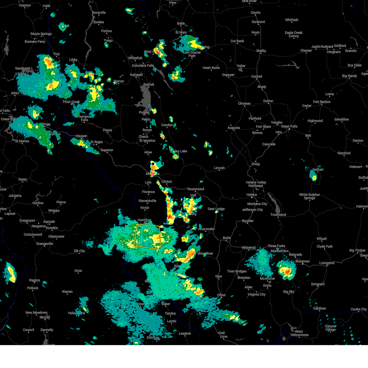
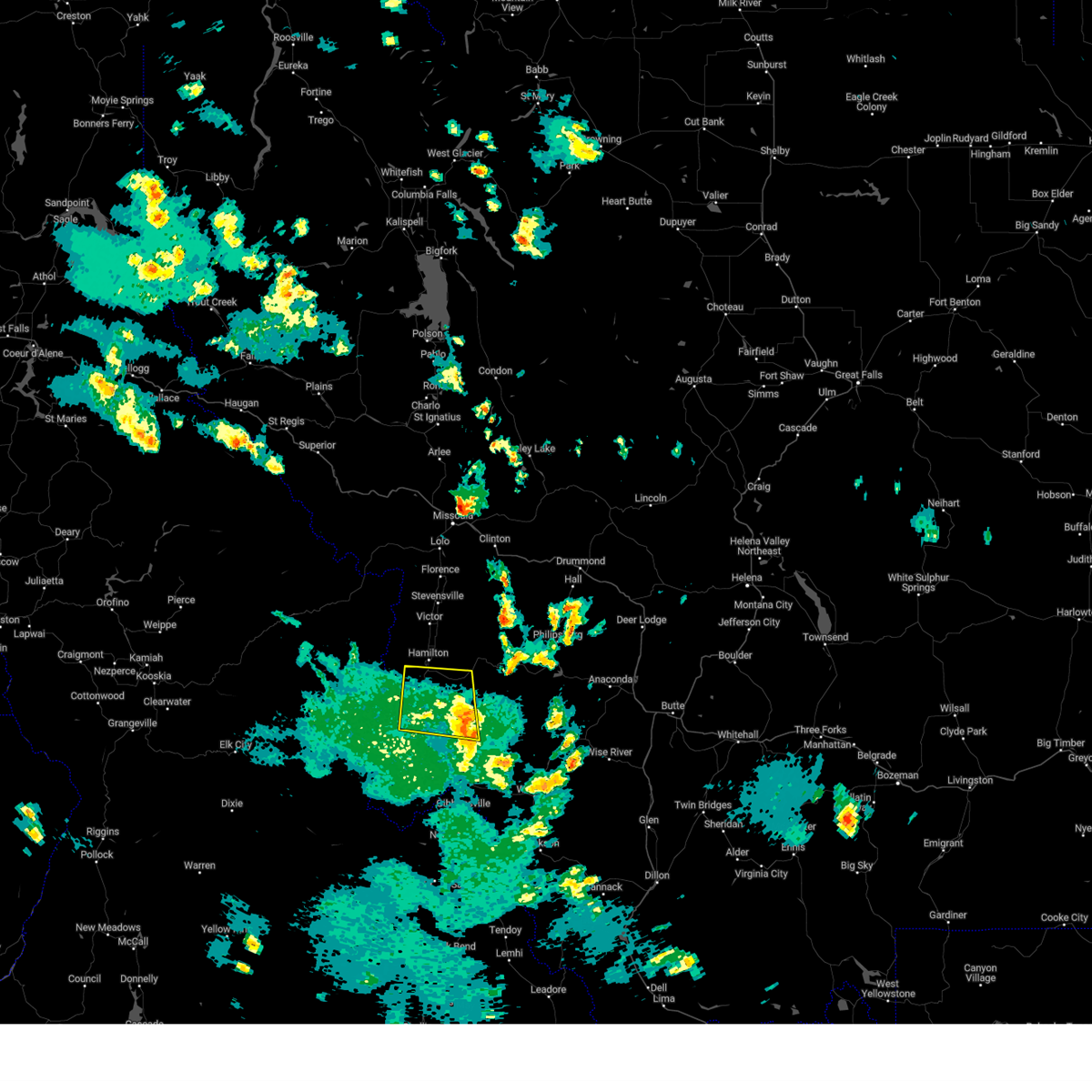
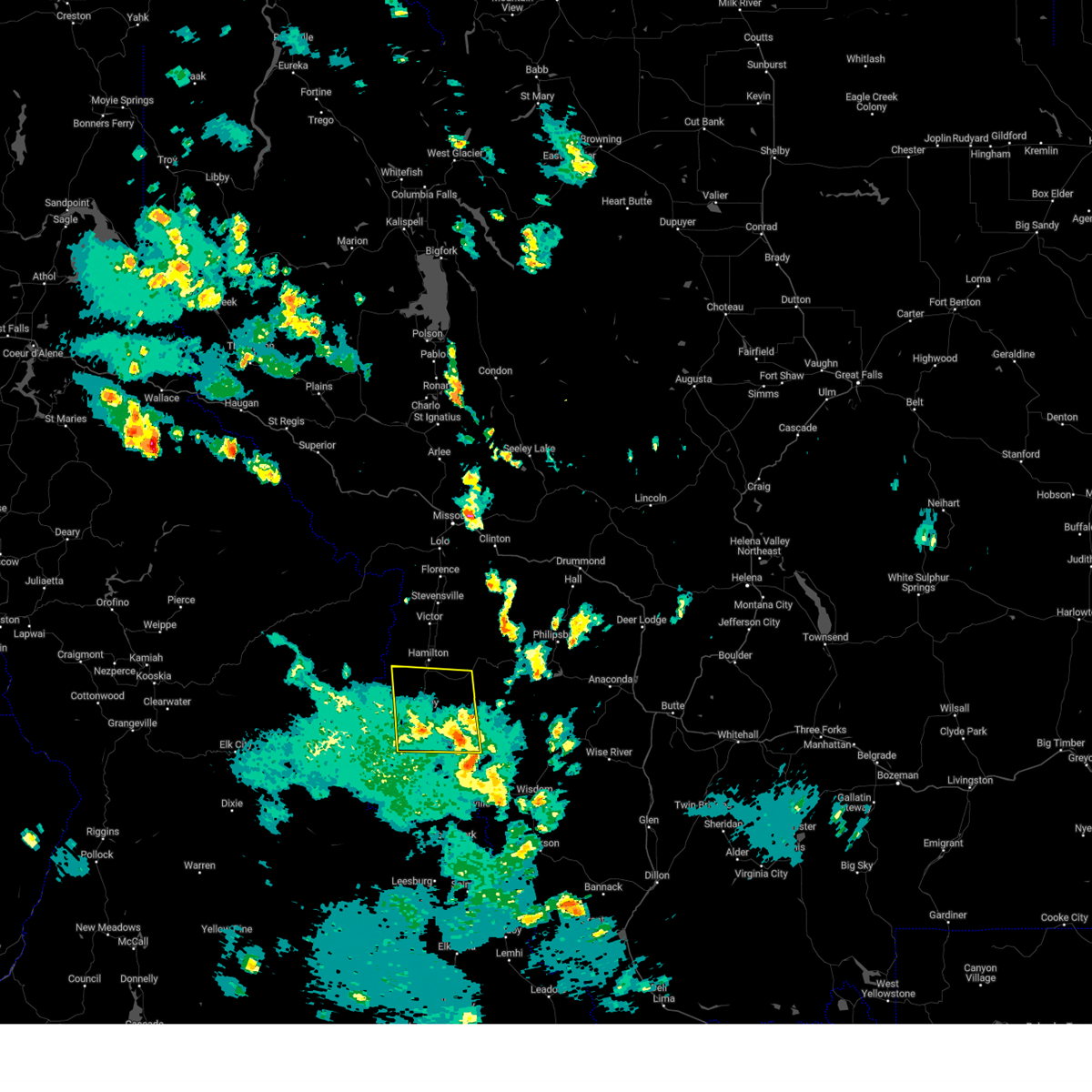
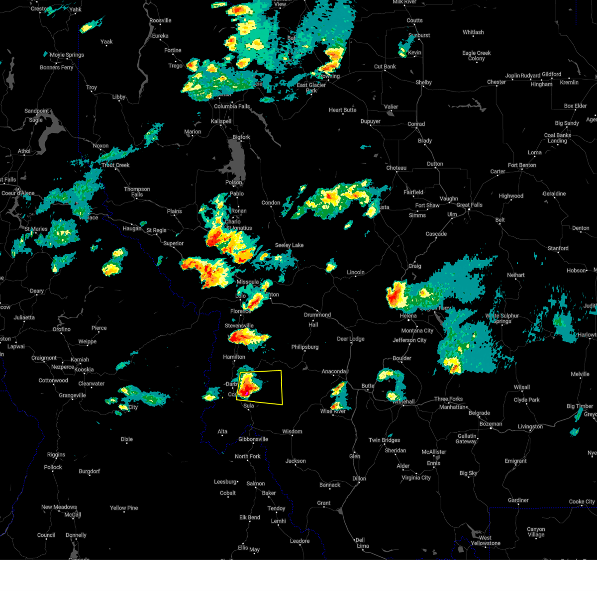
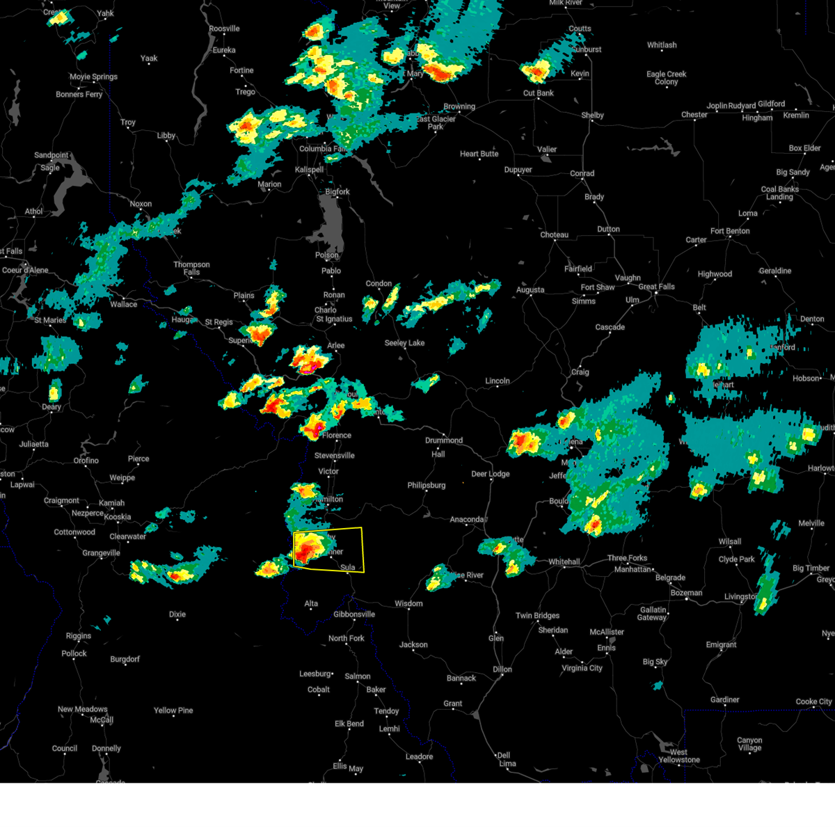
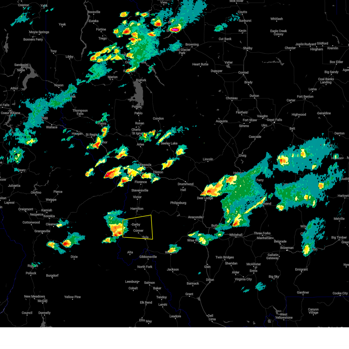
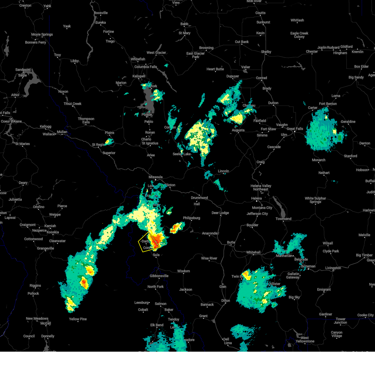
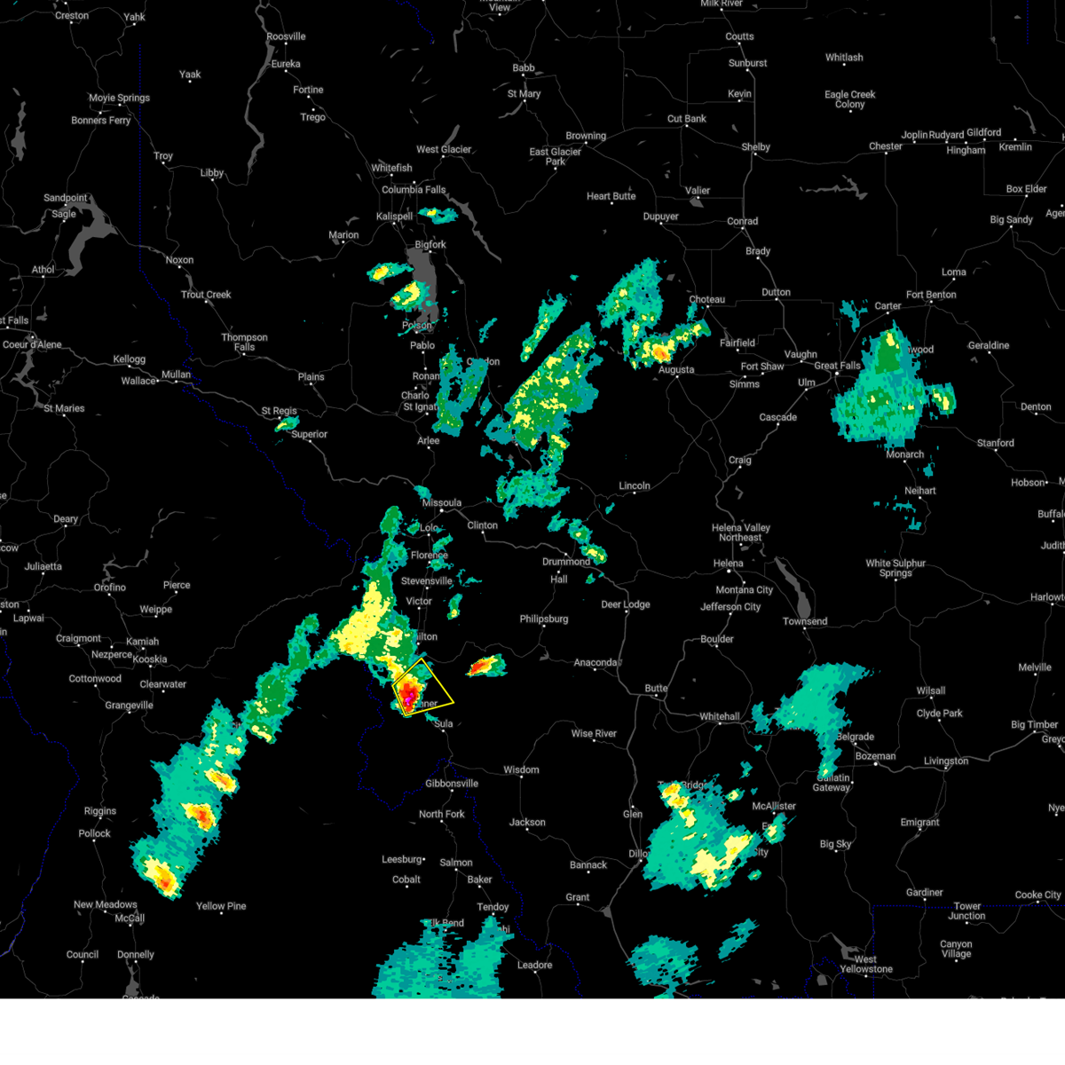
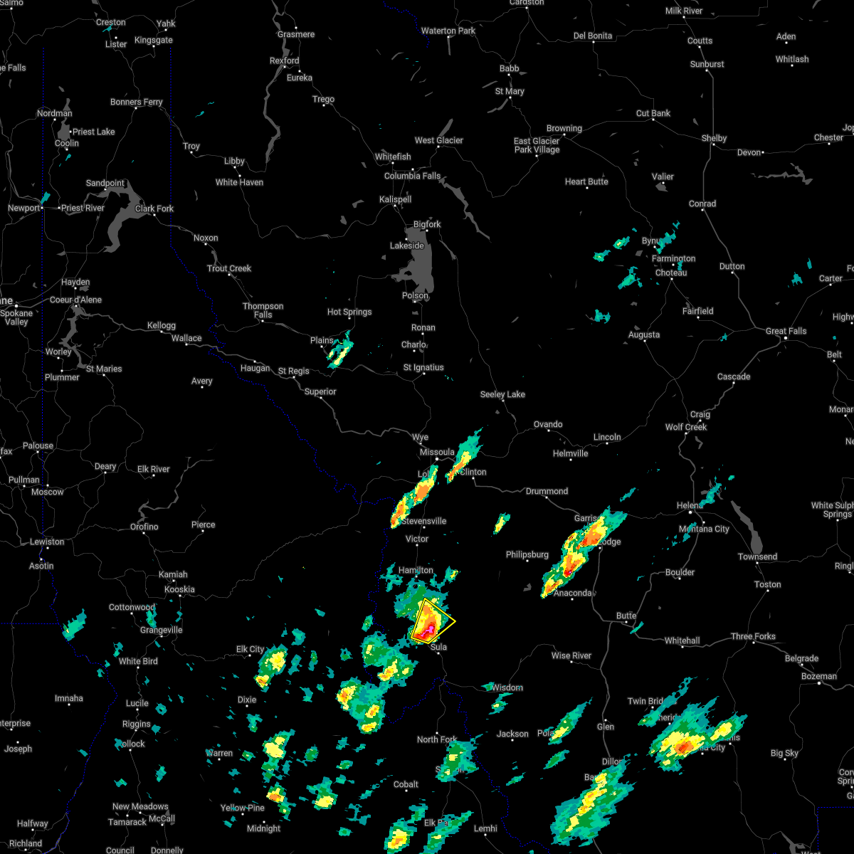
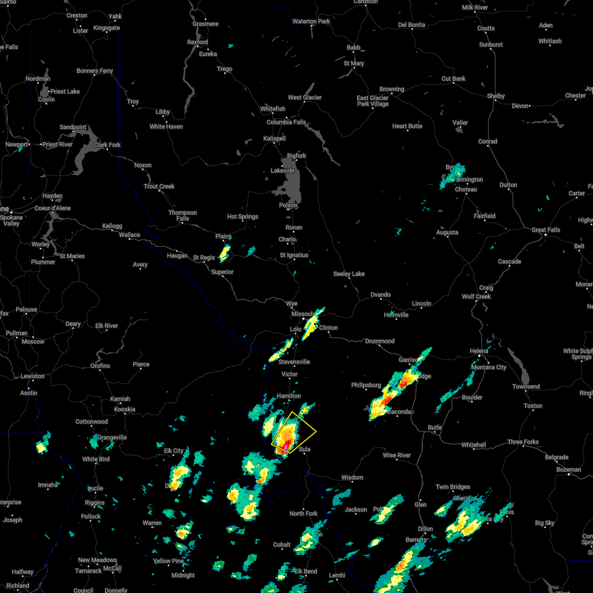
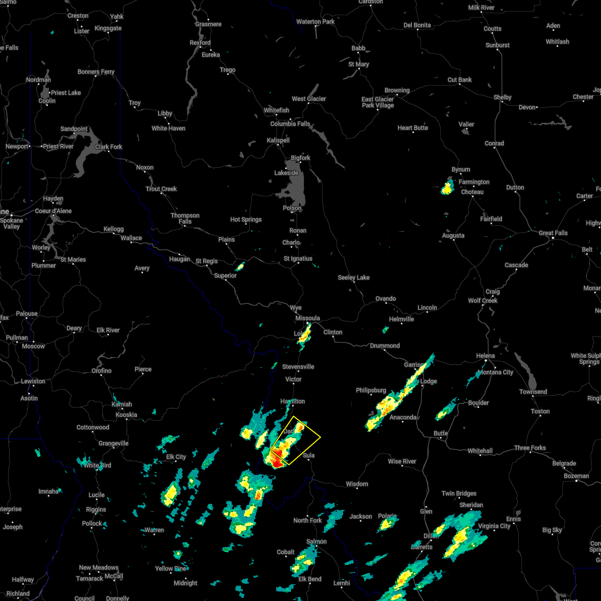
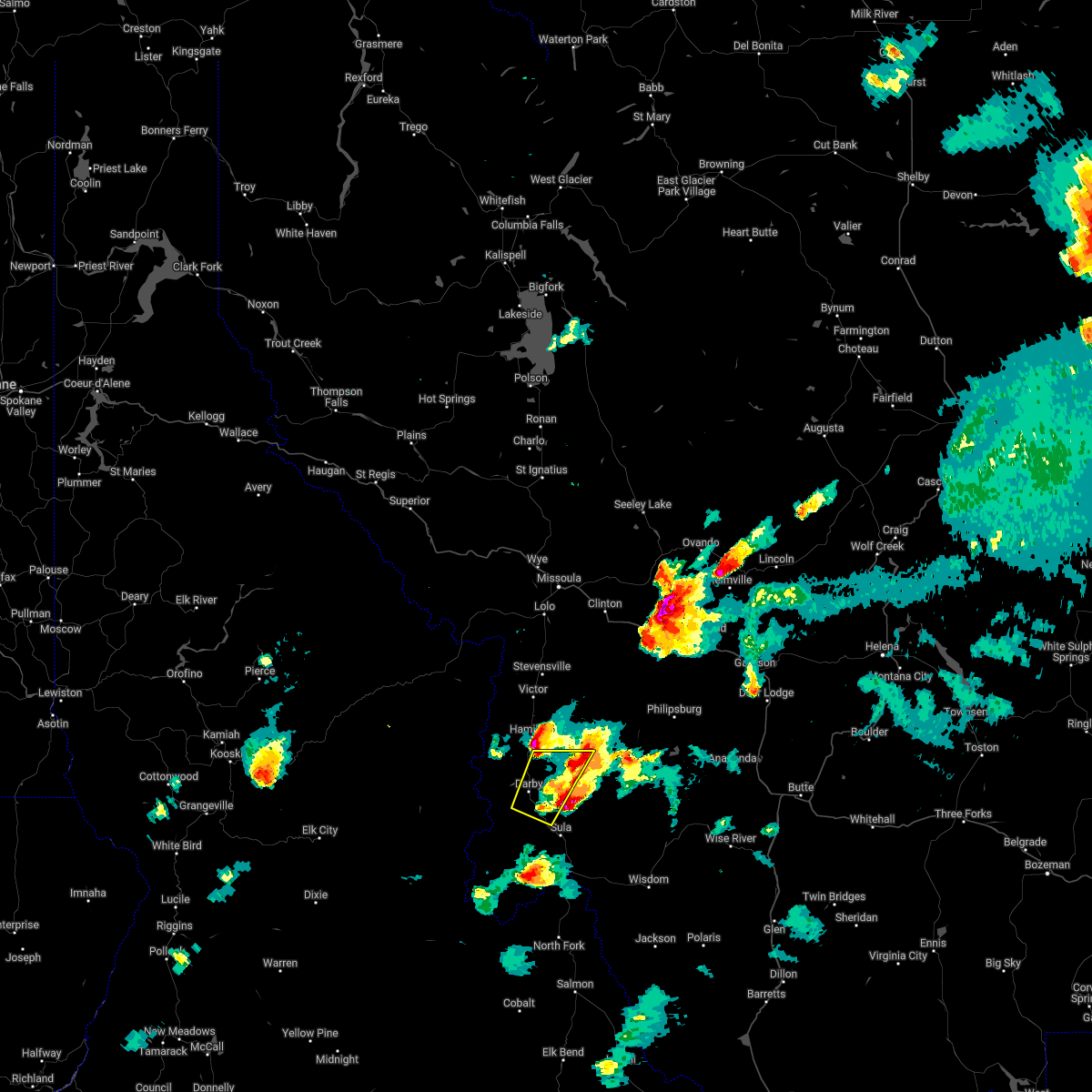
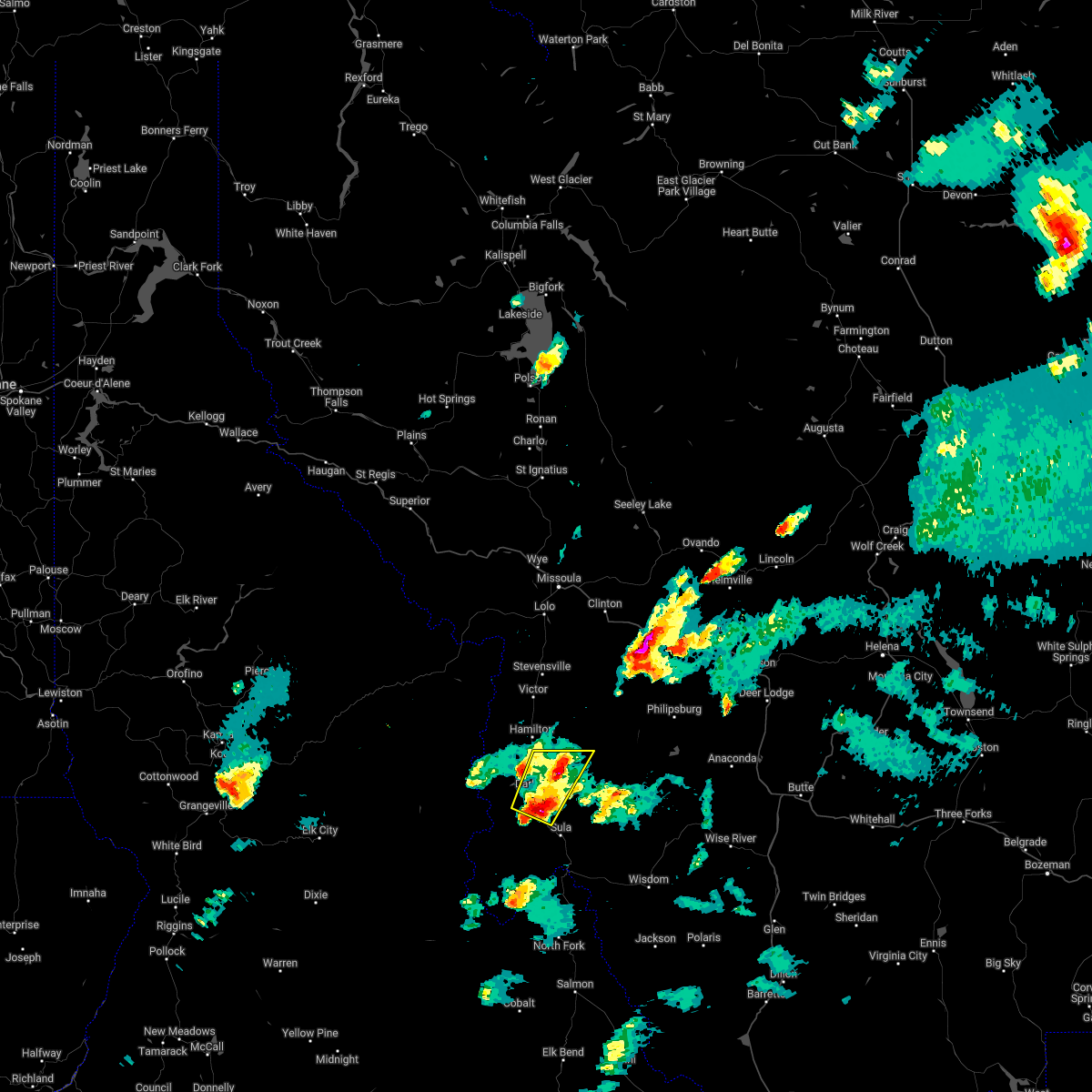
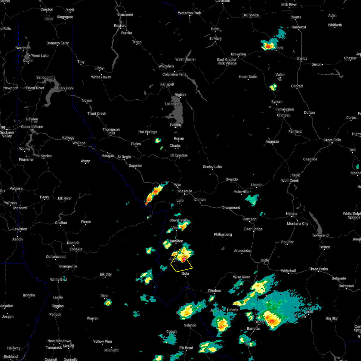
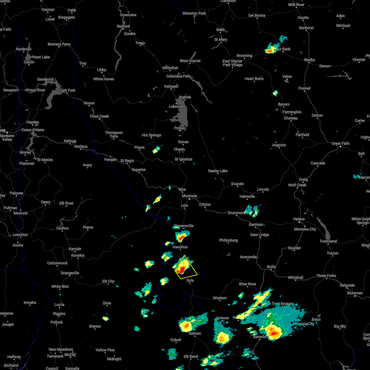
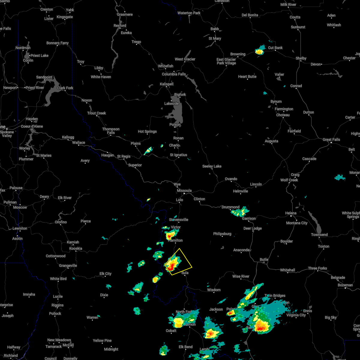
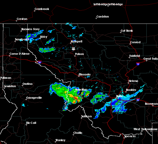
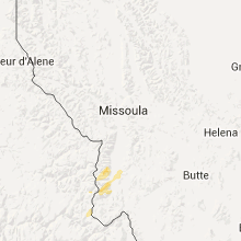
Hail Map for Conner, MT
The Conner, MT area has had 1 report of on-the-ground hail by trained spotters, and has been under severe weather warnings 0 times during the past 12 months. Doppler radar has detected hail at or near Conner, MT on 17 occasions.
| Name: | Conner, MT |
| Where Located: | 53.3 miles NNW of Salmon, ID |
| Map: | Google Map for Conner, MT |
| Population: | 216 |
| Housing Units: | 110 |
| More Info: | Search Google for Conner, MT |
3
The Top Recent Hail Date for Conner, MT is Wednesday, June 26, 2024 (5th out of 17)

Hail and Wind Damage Spotted near Conner, MT
| Date / Time | Report Details |
|---|---|
| 8/15/2024 5:07 PM MDT |
 The storms which prompted the warning have weakened below severe limits, and no longer pose an immediate threat to life or property. therefore, the warning will be allowed to expire. The storms which prompted the warning have weakened below severe limits, and no longer pose an immediate threat to life or property. therefore, the warning will be allowed to expire.
|
| 8/15/2024 4:49 PM MDT |
 At 449 pm mdt, severe thunderstorms were located along a line extending from 13 miles east of conner to near darby, moving north at 15 mph (radar indicated). Hazards include 60 mph wind gusts. Expect damage to roofs, siding, and trees. Locations impacted include, hamilton, darby, conner, grantsdale, charlos heights, and como. At 449 pm mdt, severe thunderstorms were located along a line extending from 13 miles east of conner to near darby, moving north at 15 mph (radar indicated). Hazards include 60 mph wind gusts. Expect damage to roofs, siding, and trees. Locations impacted include, hamilton, darby, conner, grantsdale, charlos heights, and como.
|
| 8/15/2024 4:31 PM MDT |
 Svrmso the national weather service in missoula has issued a * severe thunderstorm warning for, central ravalli county in west central montana, * until 515 pm mdt. * at 431 pm mdt, severe thunderstorms were located along a line extending from 17 miles southeast of darby to 7 miles west of conner, moving north at 20 mph (radar indicated). Hazards include 60 mph wind gusts. expect damage to roofs, siding, and trees Svrmso the national weather service in missoula has issued a * severe thunderstorm warning for, central ravalli county in west central montana, * until 515 pm mdt. * at 431 pm mdt, severe thunderstorms were located along a line extending from 17 miles southeast of darby to 7 miles west of conner, moving north at 20 mph (radar indicated). Hazards include 60 mph wind gusts. expect damage to roofs, siding, and trees
|
| 8/6/2024 6:20 PM MDT |
 Svrmso the national weather service in missoula has issued a * severe thunderstorm warning for, southwestern granite county in west central montana, east central ravalli county in west central montana, * until 645 pm mdt. * at 619 pm mdt, a severe thunderstorm was located 12 miles east of conner, or 21 miles southeast of hamilton, moving east at 50 mph (radar indicated). Hazards include 60 mph wind gusts and quarter size hail. Hail damage to vehicles is expected. Expect wind damage to roofs, siding, and trees. Svrmso the national weather service in missoula has issued a * severe thunderstorm warning for, southwestern granite county in west central montana, east central ravalli county in west central montana, * until 645 pm mdt. * at 619 pm mdt, a severe thunderstorm was located 12 miles east of conner, or 21 miles southeast of hamilton, moving east at 50 mph (radar indicated). Hazards include 60 mph wind gusts and quarter size hail. Hail damage to vehicles is expected. Expect wind damage to roofs, siding, and trees.
|
| 8/6/2024 5:55 PM MDT |
 At 555 pm mdt/455 pm pdt/, a severe thunderstorm was located near conner, or 22 miles south of hamilton, moving east at 25 mph (radar indicated). Hazards include quarter size hail. Damage to vehicles is expected. Locations impacted include, darby, conner, and como. At 555 pm mdt/455 pm pdt/, a severe thunderstorm was located near conner, or 22 miles south of hamilton, moving east at 25 mph (radar indicated). Hazards include quarter size hail. Damage to vehicles is expected. Locations impacted include, darby, conner, and como.
|
| 8/6/2024 5:39 PM MDT |
 Svrmso the national weather service in missoula has issued a * severe thunderstorm warning for, east central idaho county in central idaho, central ravalli county in west central montana, * until 615 pm mdt/515 pm pdt/. * at 539 pm mdt/439 pm pdt/, a severe thunderstorm was located 7 miles west of darby, or 18 miles southwest of hamilton, moving east at 45 mph (radar indicated). Hazards include quarter size hail. damage to vehicles is expected Svrmso the national weather service in missoula has issued a * severe thunderstorm warning for, east central idaho county in central idaho, central ravalli county in west central montana, * until 615 pm mdt/515 pm pdt/. * at 539 pm mdt/439 pm pdt/, a severe thunderstorm was located 7 miles west of darby, or 18 miles southwest of hamilton, moving east at 45 mph (radar indicated). Hazards include quarter size hail. damage to vehicles is expected
|
| 6/26/2024 9:25 PM MDT |
 The severe thunderstorm which prompted the warning has weakened. moved out of the warned area.therefore, the warning will be allowed to expire. The severe thunderstorm which prompted the warning has weakened. moved out of the warned area.therefore, the warning will be allowed to expire.
|
| 6/26/2024 9:06 PM MDT |
 Svrmso the national weather service in missoula has issued a * severe thunderstorm warning for, central ravalli county in west central montana, * until 930 pm mdt. * at 905 pm mdt, a severe thunderstorm was located over darby, or 15 miles south of hamilton, moving northeast at 20 mph (radar indicated). Hazards include 60 mph wind gusts and half dollar size hail. Hail damage to vehicles is expected. Expect wind damage to roofs, siding, and trees. Svrmso the national weather service in missoula has issued a * severe thunderstorm warning for, central ravalli county in west central montana, * until 930 pm mdt. * at 905 pm mdt, a severe thunderstorm was located over darby, or 15 miles south of hamilton, moving northeast at 20 mph (radar indicated). Hazards include 60 mph wind gusts and half dollar size hail. Hail damage to vehicles is expected. Expect wind damage to roofs, siding, and trees.
|
| 7/9/2022 3:09 PM MDT |
 At 309 pm mdt, a severe thunderstorm was located 9 miles southeast of hamilton, moving northeast at 35 mph (radar indicated). Hazards include ping pong ball size hail and 60 mph wind gusts. People and animals outdoors will be injured. expect hail damage to roofs, siding, windows, and vehicles. expect wind damage to roofs, siding, and trees. locations impacted include, conner. hail threat, radar indicated max hail size, 1. 50 in wind threat, radar indicated max wind gust, 60 mph. At 309 pm mdt, a severe thunderstorm was located 9 miles southeast of hamilton, moving northeast at 35 mph (radar indicated). Hazards include ping pong ball size hail and 60 mph wind gusts. People and animals outdoors will be injured. expect hail damage to roofs, siding, windows, and vehicles. expect wind damage to roofs, siding, and trees. locations impacted include, conner. hail threat, radar indicated max hail size, 1. 50 in wind threat, radar indicated max wind gust, 60 mph.
|
| 7/9/2022 3:02 PM MDT |
 At 302 pm mdt, a severe thunderstorm was located 7 miles northeast of darby, or 10 miles southeast of hamilton, moving northeast at 35 mph (radar indicated). Hazards include ping pong ball size hail and 60 mph wind gusts. People and animals outdoors will be injured. expect hail damage to roofs, siding, windows, and vehicles. expect wind damage to roofs, siding, and trees. locations impacted include, darby, conner and como. hail threat, radar indicated max hail size, 1. 50 in wind threat, radar indicated max wind gust, 60 mph. At 302 pm mdt, a severe thunderstorm was located 7 miles northeast of darby, or 10 miles southeast of hamilton, moving northeast at 35 mph (radar indicated). Hazards include ping pong ball size hail and 60 mph wind gusts. People and animals outdoors will be injured. expect hail damage to roofs, siding, windows, and vehicles. expect wind damage to roofs, siding, and trees. locations impacted include, darby, conner and como. hail threat, radar indicated max hail size, 1. 50 in wind threat, radar indicated max wind gust, 60 mph.
|
| 7/9/2022 2:47 PM MDT |
 At 246 pm mdt, a severe thunderstorm was located near darby, or 18 miles south of hamilton, moving northeast at 35 mph (radar indicated). Hazards include 60 mph wind gusts and quarter size hail. Hail damage to vehicles is expected. Expect wind damage to roofs, siding, and trees. At 246 pm mdt, a severe thunderstorm was located near darby, or 18 miles south of hamilton, moving northeast at 35 mph (radar indicated). Hazards include 60 mph wind gusts and quarter size hail. Hail damage to vehicles is expected. Expect wind damage to roofs, siding, and trees.
|
| 7/8/2022 7:23 PM MDT |
 The severe thunderstorm warning for central ravalli and southwestern granite counties will expire at 730 pm mdt, the storm which prompted the warning has moved out of the area. therefore, the warning will be allowed to expire. a severe thunderstorm watch remains in effect until 1000 pm mdt for west central montana. The severe thunderstorm warning for central ravalli and southwestern granite counties will expire at 730 pm mdt, the storm which prompted the warning has moved out of the area. therefore, the warning will be allowed to expire. a severe thunderstorm watch remains in effect until 1000 pm mdt for west central montana.
|
| 7/8/2022 7:07 PM MDT |
 At 707 pm mdt, a severe thunderstorm was located near darby, or 17 miles south of hamilton, moving north at 25 mph (radar indicated). Hazards include 60 mph wind gusts and quarter size hail. Hail damage to vehicles is expected. Expect wind damage to roofs, siding, and trees. At 707 pm mdt, a severe thunderstorm was located near darby, or 17 miles south of hamilton, moving north at 25 mph (radar indicated). Hazards include 60 mph wind gusts and quarter size hail. Hail damage to vehicles is expected. Expect wind damage to roofs, siding, and trees.
|
| 7/8/2022 3:12 PM MDT |
 The severe thunderstorm warning for central ravalli county will expire at 315 pm mdt, the storm which prompted the warning has moved out of the area. therefore, the warning will be allowed to expire. a severe thunderstorm watch remains in effect until 1000 pm mdt for west central montana. The severe thunderstorm warning for central ravalli county will expire at 315 pm mdt, the storm which prompted the warning has moved out of the area. therefore, the warning will be allowed to expire. a severe thunderstorm watch remains in effect until 1000 pm mdt for west central montana.
|
| 7/8/2022 3:00 PM MDT |
 At 259 pm mdt, a severe thunderstorm was located near darby, or 16 miles south of hamilton, moving northeast at 20 mph (radar indicated). Hazards include 60 mph wind gusts and quarter size hail. Hail damage to vehicles is expected. expect wind damage to roofs, siding, and trees. locations impacted include, darby and conner. hail threat, radar indicated max hail size, 1. 00 in wind threat, radar indicated max wind gust, 60 mph. At 259 pm mdt, a severe thunderstorm was located near darby, or 16 miles south of hamilton, moving northeast at 20 mph (radar indicated). Hazards include 60 mph wind gusts and quarter size hail. Hail damage to vehicles is expected. expect wind damage to roofs, siding, and trees. locations impacted include, darby and conner. hail threat, radar indicated max hail size, 1. 00 in wind threat, radar indicated max wind gust, 60 mph.
|
| 7/8/2022 2:49 PM MDT |
 At 248 pm mdt, a severe thunderstorm was located near conner, or 18 miles south of hamilton, moving northeast at 20 mph (radar indicated). Hazards include 60 mph wind gusts and quarter size hail. Hail damage to vehicles is expected. Expect wind damage to roofs, siding, and trees. At 248 pm mdt, a severe thunderstorm was located near conner, or 18 miles south of hamilton, moving northeast at 20 mph (radar indicated). Hazards include 60 mph wind gusts and quarter size hail. Hail damage to vehicles is expected. Expect wind damage to roofs, siding, and trees.
|
| 7/3/2022 3:25 PM MDT | Quarter sized hail reported 8.1 miles WNW of Conner, MT, picture with measurement of 1 inch hail stones. |
| 7/3/2022 3:06 PM MDT |
 At 305 pm mdt, severe thunderstorms were located along a line extending from conner to 16 miles north of gibbonsville, moving northeast at 30 mph (radar indicated). Hazards include 60 mph wind gusts and half dollar size hail. Hail damage to vehicles is expected. expect wind damage to roofs, siding, and trees. locations impacted include, conner and sula. hail threat, radar indicated max hail size, 1. 25 in wind threat, radar indicated max wind gust, 60 mph. At 305 pm mdt, severe thunderstorms were located along a line extending from conner to 16 miles north of gibbonsville, moving northeast at 30 mph (radar indicated). Hazards include 60 mph wind gusts and half dollar size hail. Hail damage to vehicles is expected. expect wind damage to roofs, siding, and trees. locations impacted include, conner and sula. hail threat, radar indicated max hail size, 1. 25 in wind threat, radar indicated max wind gust, 60 mph.
|
| 7/3/2022 2:39 PM MDT |
 At 238 pm mdt, severe thunderstorms were located along a line extending from 9 miles southwest of conner to 18 miles northwest of gibbonsville, moving northeast at 25 mph (radar indicated). Hazards include 60 mph wind gusts and half dollar size hail. Hail damage to vehicles is expected. Expect wind damage to roofs, siding, and trees. At 238 pm mdt, severe thunderstorms were located along a line extending from 9 miles southwest of conner to 18 miles northwest of gibbonsville, moving northeast at 25 mph (radar indicated). Hazards include 60 mph wind gusts and half dollar size hail. Hail damage to vehicles is expected. Expect wind damage to roofs, siding, and trees.
|
| 8/26/2020 6:12 PM MDT |
 The severe thunderstorm warning for east central ravalli county will expire at 615 pm mdt, the storm which prompted the warning has weakened below severe limits, and no longer poses an immediate threat to life or property. therefore, the warning will be allowed to expire. to report severe weather, contact your nearest law enforcement agency. they will relay your report to the national weather service missoula. The severe thunderstorm warning for east central ravalli county will expire at 615 pm mdt, the storm which prompted the warning has weakened below severe limits, and no longer poses an immediate threat to life or property. therefore, the warning will be allowed to expire. to report severe weather, contact your nearest law enforcement agency. they will relay your report to the national weather service missoula.
|
| 8/26/2020 5:53 PM MDT |
 At 552 pm mdt, a severe thunderstorm was located near conner, or 25 miles south of hamilton, moving northeast at 35 mph (radar indicated). Hazards include 60 mph wind gusts and quarter size hail. Hail damage to vehicles is expected. Expect wind damage to roofs, siding, and trees. At 552 pm mdt, a severe thunderstorm was located near conner, or 25 miles south of hamilton, moving northeast at 35 mph (radar indicated). Hazards include 60 mph wind gusts and quarter size hail. Hail damage to vehicles is expected. Expect wind damage to roofs, siding, and trees.
|
| 7/3/2019 8:28 AM MDT |
 At 828 am mdt, a severe thunderstorm was located near darby, or 17 miles south of hamilton, moving east at 30 mph (radar indicated). Hazards include 60 mph wind gusts and half dollar size hail. Hail damage to vehicles is expected. expect wind damage to roofs, siding, and trees. Locations impacted include, darby and conner. At 828 am mdt, a severe thunderstorm was located near darby, or 17 miles south of hamilton, moving east at 30 mph (radar indicated). Hazards include 60 mph wind gusts and half dollar size hail. Hail damage to vehicles is expected. expect wind damage to roofs, siding, and trees. Locations impacted include, darby and conner.
|
| 7/3/2019 8:25 AM MDT |
 At 825 am mdt, a severe thunderstorm was located over darby, or 18 miles south of hamilton, moving east at 30 mph (radar indicated). Hazards include 60 mph wind gusts and quarter size hail. Hail damage to vehicles is expected. Expect wind damage to roofs, siding, and trees. At 825 am mdt, a severe thunderstorm was located over darby, or 18 miles south of hamilton, moving east at 30 mph (radar indicated). Hazards include 60 mph wind gusts and quarter size hail. Hail damage to vehicles is expected. Expect wind damage to roofs, siding, and trees.
|
| 8/10/2015 5:00 PM MDT | Storm damage reported in ravalli county MT, 6.5 miles NE of Conner, MT |
| 8/10/2015 5:00 PM MDT |
 At 459 pm mdt /359 pm pdt/, doppler radar indicated a severe thunderstorm capable of producing damaging winds in excess of 60 mph. this storm was located near conner, or 26 miles south of hamilton, and moving north at 30 mph. At 459 pm mdt /359 pm pdt/, doppler radar indicated a severe thunderstorm capable of producing damaging winds in excess of 60 mph. this storm was located near conner, or 26 miles south of hamilton, and moving north at 30 mph.
|
| 7/20/2012 2:00 PM MDT | An imet on the chrandel fire reported a strong wind gust that destroyed the kitchen tent in ravalli county MT, 20.6 miles NNE of Conner, MT |
Hail Maps for Conner, MT


Connect with Interactive Hail Maps