

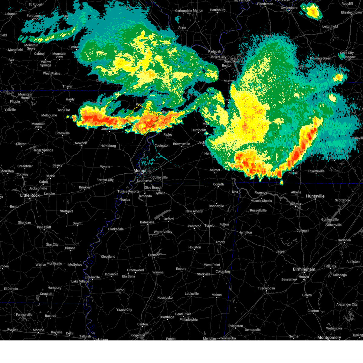
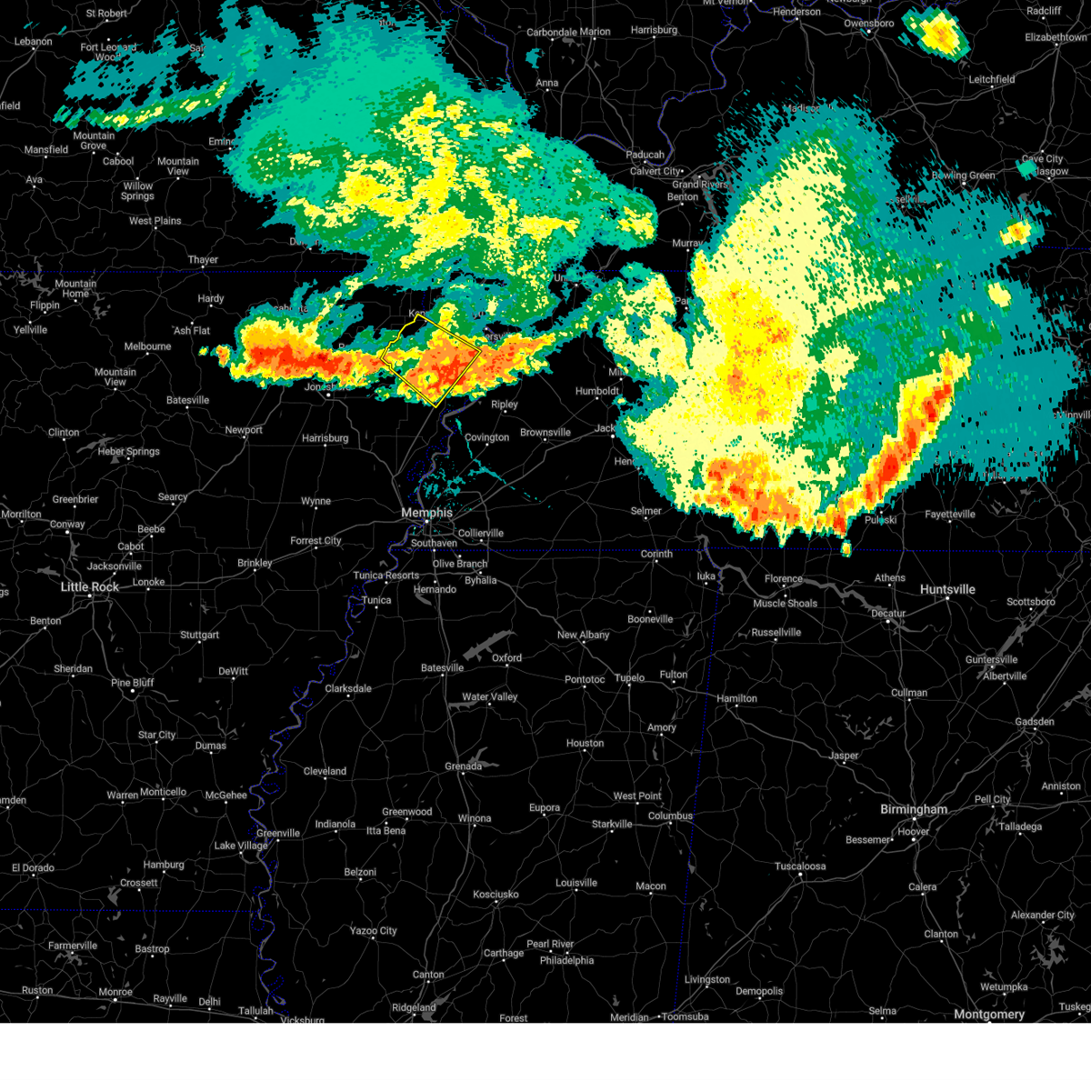
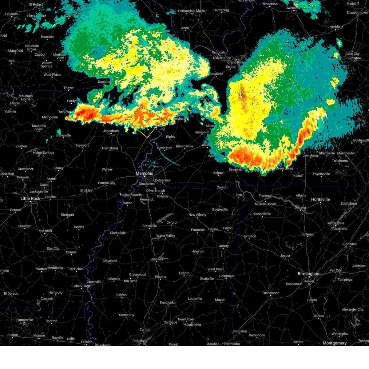
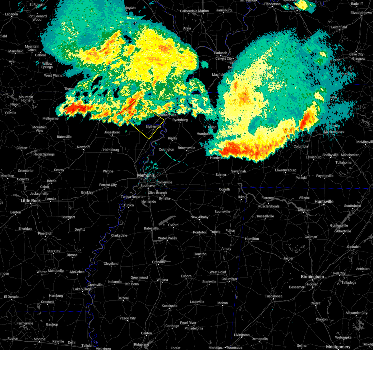
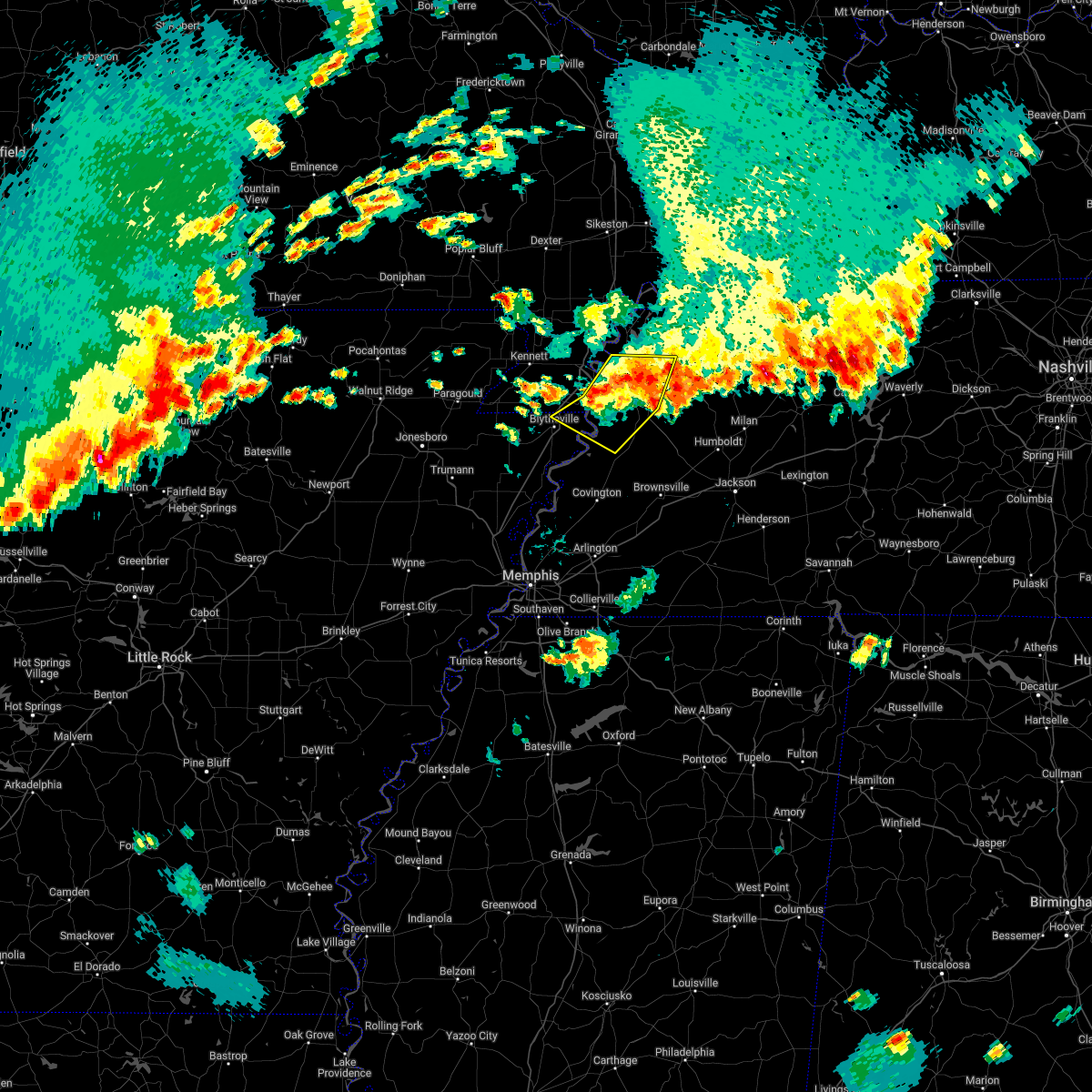
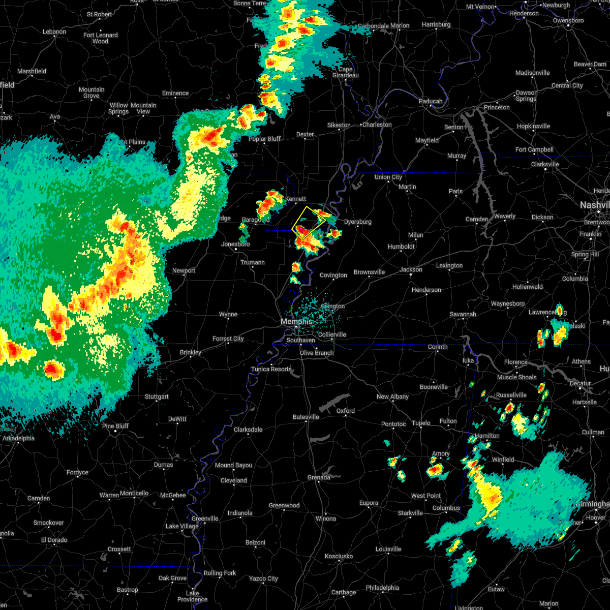
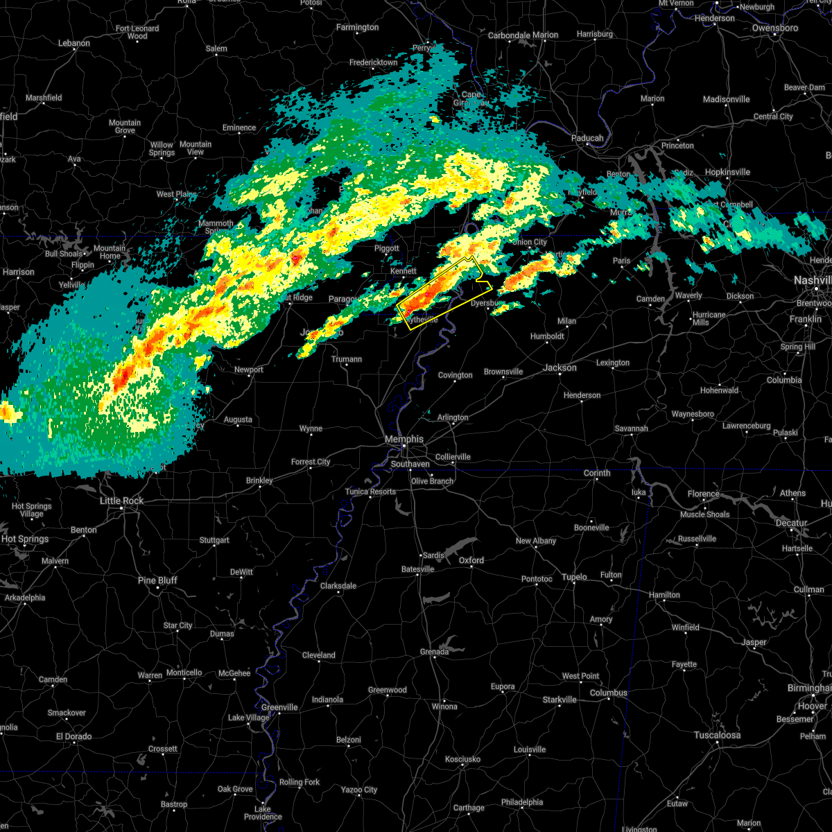
Hail Map for Cooter, MO
The Cooter, MO area has had 1 report of on-the-ground hail by trained spotters, and has been under severe weather warnings 16 times during the past 12 months. Doppler radar has detected hail at or near Cooter, MO on 49 occasions, including 2 occasions during the past year.
| Name: | Cooter, MO |
| Where Located: | 63.4 miles NNE of Memphis, TN |
| Map: | Google Map for Cooter, MO |
| Population: | 469 |
| Housing Units: | 191 |
| More Info: | Search Google for Cooter, MO |
0
The Top Recent Hail Date for Cooter, MO is Sunday, April 7, 2024 (21st out of 49)

Hail and Wind Damage Spotted near Cooter, MO
| Date / Time | Report Details |
|---|---|
| 7/18/2023 5:05 PM CDT |
 The severe thunderstorm warning for northeastern mississippi, southwestern pemiscot, west central crockett, southwestern dyer, lauderdale and northwestern haywood counties will expire at 515 pm cdt, the storm which prompted the warning has moved out of the area. therefore, the warning will be allowed to expire. a severe thunderstorm watch remains in effect until midnight cdt for eastern arkansas, and west tennessee. The severe thunderstorm warning for northeastern mississippi, southwestern pemiscot, west central crockett, southwestern dyer, lauderdale and northwestern haywood counties will expire at 515 pm cdt, the storm which prompted the warning has moved out of the area. therefore, the warning will be allowed to expire. a severe thunderstorm watch remains in effect until midnight cdt for eastern arkansas, and west tennessee.
|
| 7/18/2023 4:35 PM CDT |
 The severe thunderstorm warning for northwestern mississippi, southwestern pemiscot and southern dunklin counties will expire at 445 pm cdt, the storm which prompted the warning has moved out of the area. therefore, the warning will be allowed to expire. a severe thunderstorm watch remains in effect until 500 pm cdt for eastern arkansas, and southeastern missouri. The severe thunderstorm warning for northwestern mississippi, southwestern pemiscot and southern dunklin counties will expire at 445 pm cdt, the storm which prompted the warning has moved out of the area. therefore, the warning will be allowed to expire. a severe thunderstorm watch remains in effect until 500 pm cdt for eastern arkansas, and southeastern missouri.
|
| 7/18/2023 4:31 PM CDT |
 At 430 pm cdt, a severe thunderstorm was located near blytheville, moving southeast at 45 mph (radar indicated). Hazards include 60 mph wind gusts and penny size hail. expect damage to roofs, siding, and trees At 430 pm cdt, a severe thunderstorm was located near blytheville, moving southeast at 45 mph (radar indicated). Hazards include 60 mph wind gusts and penny size hail. expect damage to roofs, siding, and trees
|
| 7/18/2023 4:20 PM CDT |
 At 420 pm cdt, a severe thunderstorm was located over hornersville, or near senath, moving southeast at 40 mph (radar indicated). Hazards include 60 mph wind gusts. Expect damage to roofs, siding, and trees. locations impacted include, blytheville, kennett, gosnell, manila, steele, senath, cardwell, hornersville, arbyrd, cooter, dell, burdette, holland, calumet, dearman, buckeye, arkmo, noland, lens ford and stark city. hail threat, radar indicated max hail size, <. 75 in wind threat, radar indicated max wind gust, 60 mph. At 420 pm cdt, a severe thunderstorm was located over hornersville, or near senath, moving southeast at 40 mph (radar indicated). Hazards include 60 mph wind gusts. Expect damage to roofs, siding, and trees. locations impacted include, blytheville, kennett, gosnell, manila, steele, senath, cardwell, hornersville, arbyrd, cooter, dell, burdette, holland, calumet, dearman, buckeye, arkmo, noland, lens ford and stark city. hail threat, radar indicated max hail size, <. 75 in wind threat, radar indicated max wind gust, 60 mph.
|
| 7/18/2023 4:03 PM CDT |
 At 402 pm cdt, a severe thunderstorm was located near senath, moving southeast at 40 mph (radar indicated). Hazards include 60 mph wind gusts and penny size hail. expect damage to roofs, siding, and trees At 402 pm cdt, a severe thunderstorm was located near senath, moving southeast at 40 mph (radar indicated). Hazards include 60 mph wind gusts and penny size hail. expect damage to roofs, siding, and trees
|
| 7/18/2023 2:05 PM CDT |
 At 205 pm cdt, severe thunderstorms were located along a line extending from near union city to near newbern to near heloise, moving southeast at 35 mph (radar indicated). Hazards include 60 mph wind gusts. Expect damage to roofs, siding, and trees. locations impacted include, dyersburg, martin, union city, caruthersville, hayti, steele, reelfoot lake state park, tiptonville, newbern, dresden, dyer, greenfield, ridgely, gleason, troy, kenton, rutherford, obion, sharon and hayti heights. hail threat, radar indicated max hail size, <. 75 in wind threat, radar indicated max wind gust, 60 mph. At 205 pm cdt, severe thunderstorms were located along a line extending from near union city to near newbern to near heloise, moving southeast at 35 mph (radar indicated). Hazards include 60 mph wind gusts. Expect damage to roofs, siding, and trees. locations impacted include, dyersburg, martin, union city, caruthersville, hayti, steele, reelfoot lake state park, tiptonville, newbern, dresden, dyer, greenfield, ridgely, gleason, troy, kenton, rutherford, obion, sharon and hayti heights. hail threat, radar indicated max hail size, <. 75 in wind threat, radar indicated max wind gust, 60 mph.
|
| 7/18/2023 1:47 PM CDT |
 At 146 pm cdt, severe thunderstorms were located along a line extending from near union city to near hayti heights, moving southeast at 40 mph (radar indicated). Hazards include 60 mph wind gusts and nickel size hail. expect damage to roofs, siding, and trees At 146 pm cdt, severe thunderstorms were located along a line extending from near union city to near hayti heights, moving southeast at 40 mph (radar indicated). Hazards include 60 mph wind gusts and nickel size hail. expect damage to roofs, siding, and trees
|
| 4/15/2023 8:55 PM CDT |
 The severe thunderstorm warning for northern mississippi, pemiscot, southeastern dunklin, dyer, western obion, northeastern lauderdale and lake counties will expire at 900 pm cdt, the storms which prompted the warning have weakened below severe limits, and no longer pose an immediate threat to life or property. therefore, the warning will be allowed to expire. however gusty winds are still possible with these thunderstorms. a severe thunderstorm watch remains in effect until 200 am cdt for eastern arkansas, southeastern missouri, and west tennessee. to report severe weather, contact your nearest law enforcement agency. they will relay your report to the national weather service memphis. The severe thunderstorm warning for northern mississippi, pemiscot, southeastern dunklin, dyer, western obion, northeastern lauderdale and lake counties will expire at 900 pm cdt, the storms which prompted the warning have weakened below severe limits, and no longer pose an immediate threat to life or property. therefore, the warning will be allowed to expire. however gusty winds are still possible with these thunderstorms. a severe thunderstorm watch remains in effect until 200 am cdt for eastern arkansas, southeastern missouri, and west tennessee. to report severe weather, contact your nearest law enforcement agency. they will relay your report to the national weather service memphis.
|
| 4/15/2023 8:42 PM CDT |
 At 842 pm cdt, severe thunderstorms were located along a line extending from near risco to heloise to fort pillow state park, moving east at 60 mph (radar indicated). Hazards include 60 mph wind gusts. Expect damage to roofs, siding, and trees. locations impacted include, dyersburg, blytheville, kennett, ripley, caruthersville, gosnell, manila, portageville, hayti, steele, reelfoot lake state park, tiptonville, malden, newbern, halls, ridgely, troy, obion, hornersville and hayti heights. hail threat, radar indicated max hail size, <. 75 in wind threat, radar indicated max wind gust, 60 mph. At 842 pm cdt, severe thunderstorms were located along a line extending from near risco to heloise to fort pillow state park, moving east at 60 mph (radar indicated). Hazards include 60 mph wind gusts. Expect damage to roofs, siding, and trees. locations impacted include, dyersburg, blytheville, kennett, ripley, caruthersville, gosnell, manila, portageville, hayti, steele, reelfoot lake state park, tiptonville, malden, newbern, halls, ridgely, troy, obion, hornersville and hayti heights. hail threat, radar indicated max hail size, <. 75 in wind threat, radar indicated max wind gust, 60 mph.
|
| 4/15/2023 8:20 PM CDT |
 At 820 pm cdt, severe thunderstorms were located along a line extending from chalk bluff natural area to near gosnell to dyess, moving east at 60 mph (radar indicated). Hazards include 60 mph wind gusts. expect damage to roofs, siding, and trees At 820 pm cdt, severe thunderstorms were located along a line extending from chalk bluff natural area to near gosnell to dyess, moving east at 60 mph (radar indicated). Hazards include 60 mph wind gusts. expect damage to roofs, siding, and trees
|
| 5/21/2022 7:47 PM CDT |
 At 747 pm cdt, severe thunderstorms were located along a line extending from near lilbourn to near miston to burdette, moving east at 50 mph (radar indicated). Hazards include 60 mph wind gusts and quarter size hail. Hail damage to vehicles is expected. expect wind damage to roofs, siding, and trees. locations impacted include, blytheville, caruthersville, gosnell, portageville, hayti, steele, luxora, reelfoot lake state park, tiptonville, ridgely, hayti heights, cooter, wardell, dell, burdette, bolton, heloise, miston, ashport and cottonwood grove. hail threat, radar indicated max hail size, 1. 00 in wind threat, radar indicated max wind gust, 60 mph. At 747 pm cdt, severe thunderstorms were located along a line extending from near lilbourn to near miston to burdette, moving east at 50 mph (radar indicated). Hazards include 60 mph wind gusts and quarter size hail. Hail damage to vehicles is expected. expect wind damage to roofs, siding, and trees. locations impacted include, blytheville, caruthersville, gosnell, portageville, hayti, steele, luxora, reelfoot lake state park, tiptonville, ridgely, hayti heights, cooter, wardell, dell, burdette, bolton, heloise, miston, ashport and cottonwood grove. hail threat, radar indicated max hail size, 1. 00 in wind threat, radar indicated max wind gust, 60 mph.
|
| 5/21/2022 7:38 PM CDT |
 At 737 pm cdt, severe thunderstorms were located along a line extending from risco to near caruthersville to near dell, moving east at 50 mph (radar indicated). Hazards include 60 mph wind gusts and quarter size hail. Hail damage to vehicles is expected. expect wind damage to roofs, siding, and trees. locations impacted include, blytheville, caruthersville, malden, gosnell, manila, portageville, hayti, steele, campbell, luxora, reelfoot lake state park, tiptonville, ridgely, holcomb, hayti heights, cooter, wardell, dell, burdette and deering. hail threat, radar indicated max hail size, 1. 00 in wind threat, radar indicated max wind gust, 60 mph. At 737 pm cdt, severe thunderstorms were located along a line extending from risco to near caruthersville to near dell, moving east at 50 mph (radar indicated). Hazards include 60 mph wind gusts and quarter size hail. Hail damage to vehicles is expected. expect wind damage to roofs, siding, and trees. locations impacted include, blytheville, caruthersville, malden, gosnell, manila, portageville, hayti, steele, campbell, luxora, reelfoot lake state park, tiptonville, ridgely, holcomb, hayti heights, cooter, wardell, dell, burdette and deering. hail threat, radar indicated max hail size, 1. 00 in wind threat, radar indicated max wind gust, 60 mph.
|
| 5/21/2022 7:20 PM CDT |
 At 719 pm cdt, severe thunderstorms were located along a line extending from campbell to near steele to caraway, moving east at 50 mph (radar indicated). Hazards include 60 mph wind gusts and quarter size hail. Hail damage to vehicles is expected. expect wind damage to roofs, siding, and trees. locations impacted include, blytheville, kennett, caruthersville, malden, piggott, gosnell, manila, portageville, hayti, steele, leachville, campbell, caraway, luxora, reelfoot lake state park, chalk bluff natural area, tiptonville, ridgely, hornersville and holcomb. hail threat, radar indicated max hail size, 1. 00 in wind threat, radar indicated max wind gust, 60 mph. At 719 pm cdt, severe thunderstorms were located along a line extending from campbell to near steele to caraway, moving east at 50 mph (radar indicated). Hazards include 60 mph wind gusts and quarter size hail. Hail damage to vehicles is expected. expect wind damage to roofs, siding, and trees. locations impacted include, blytheville, kennett, caruthersville, malden, piggott, gosnell, manila, portageville, hayti, steele, leachville, campbell, caraway, luxora, reelfoot lake state park, chalk bluff natural area, tiptonville, ridgely, hornersville and holcomb. hail threat, radar indicated max hail size, 1. 00 in wind threat, radar indicated max wind gust, 60 mph.
|
| 5/21/2022 7:01 PM CDT |
 At 701 pm cdt, severe thunderstorms were located along a line extending from near mcdougal to near arbyrd to near bay, moving east at 50 mph (radar indicated). Hazards include 60 mph wind gusts and quarter size hail. Hail damage to vehicles is expected. Expect wind damage to roofs, siding, and trees. At 701 pm cdt, severe thunderstorms were located along a line extending from near mcdougal to near arbyrd to near bay, moving east at 50 mph (radar indicated). Hazards include 60 mph wind gusts and quarter size hail. Hail damage to vehicles is expected. Expect wind damage to roofs, siding, and trees.
|
| 5/21/2022 4:53 PM CDT |
 The severe thunderstorm warning for northeastern mississippi, southeastern pemiscot, dyer, southwestern obion, northeastern lauderdale and southeastern lake counties will expire at 500 pm cdt, the storms which prompted the warning have weakened below severe limits, and no longer pose an immediate threat to life or property. therefore, the warning will be allowed to expire. however small hail and gusty winds are still possible with these thunderstorms. a severe thunderstorm watch remains in effect until 1000 pm cdt for eastern arkansas, southeastern missouri, and west tennessee. The severe thunderstorm warning for northeastern mississippi, southeastern pemiscot, dyer, southwestern obion, northeastern lauderdale and southeastern lake counties will expire at 500 pm cdt, the storms which prompted the warning have weakened below severe limits, and no longer pose an immediate threat to life or property. therefore, the warning will be allowed to expire. however small hail and gusty winds are still possible with these thunderstorms. a severe thunderstorm watch remains in effect until 1000 pm cdt for eastern arkansas, southeastern missouri, and west tennessee.
|
| 5/21/2022 4:35 PM CDT |
 At 435 pm cdt, severe thunderstorms were located along a line extending from near miston to near heloise to 8 miles southeast of cooter, moving east at 15 mph (radar indicated). Hazards include 60 mph wind gusts and quarter size hail. Hail damage to vehicles is expected. expect wind damage to roofs, siding, and trees. locations impacted include, dyersburg, caruthersville, newbern, ridgely, obion, cooter, cloverdale, bradleytown, heloise, unionville, miston, cottonwood grove, trimble, cat corner, edith, fowlkes, locust grove, jenkinsville, maxey and elbridge. hail threat, radar indicated max hail size, 1. 00 in wind threat, radar indicated max wind gust, 60 mph. At 435 pm cdt, severe thunderstorms were located along a line extending from near miston to near heloise to 8 miles southeast of cooter, moving east at 15 mph (radar indicated). Hazards include 60 mph wind gusts and quarter size hail. Hail damage to vehicles is expected. expect wind damage to roofs, siding, and trees. locations impacted include, dyersburg, caruthersville, newbern, ridgely, obion, cooter, cloverdale, bradleytown, heloise, unionville, miston, cottonwood grove, trimble, cat corner, edith, fowlkes, locust grove, jenkinsville, maxey and elbridge. hail threat, radar indicated max hail size, 1. 00 in wind threat, radar indicated max wind gust, 60 mph.
|
| 5/21/2022 4:15 PM CDT |
 At 415 pm cdt, severe thunderstorms were located along a line extending from cottonwood grove to heloise to 6 miles east of blytheville, moving east at 15 mph (radar indicated). Hazards include 60 mph wind gusts and quarter size hail. Hail damage to vehicles is expected. Expect wind damage to roofs, siding, and trees. At 415 pm cdt, severe thunderstorms were located along a line extending from cottonwood grove to heloise to 6 miles east of blytheville, moving east at 15 mph (radar indicated). Hazards include 60 mph wind gusts and quarter size hail. Hail damage to vehicles is expected. Expect wind damage to roofs, siding, and trees.
|
| 5/21/2022 3:55 PM CDT |
 The severe thunderstorm warning for pemiscot and southwestern lake counties will expire at 400 pm cdt, the storm which prompted the warning has weakened below severe limits, and no longer poses an immediate threat to life or property. therefore, the warning will be allowed to expire. a severe thunderstorm watch remains in effect until 1000 pm cdt for southeastern missouri, and west tennessee. The severe thunderstorm warning for pemiscot and southwestern lake counties will expire at 400 pm cdt, the storm which prompted the warning has weakened below severe limits, and no longer poses an immediate threat to life or property. therefore, the warning will be allowed to expire. a severe thunderstorm watch remains in effect until 1000 pm cdt for southeastern missouri, and west tennessee.
|
| 5/21/2022 3:20 PM CDT |
 At 319 pm cdt, a severe thunderstorm was located over steele, moving northeast at 30 mph (radar indicated). Hazards include 60 mph wind gusts and quarter size hail. Hail damage to vehicles is expected. Expect wind damage to roofs, siding, and trees. At 319 pm cdt, a severe thunderstorm was located over steele, moving northeast at 30 mph (radar indicated). Hazards include 60 mph wind gusts and quarter size hail. Hail damage to vehicles is expected. Expect wind damage to roofs, siding, and trees.
|
| 5/15/2022 3:49 PM CDT |
 At 349 pm cdt, a severe thunderstorm was located over steele, moving east at 15 mph (radar indicated). Hazards include quarter size hail. Damage to vehicles is expected. locations impacted include, steele, cooter, holland, west hermondale, samford, hermondale, temples corner, new survey, channel, denton and covington. hail threat, radar indicated max hail size, 1. 00 in wind threat, radar indicated max wind gust, <50 mph. At 349 pm cdt, a severe thunderstorm was located over steele, moving east at 15 mph (radar indicated). Hazards include quarter size hail. Damage to vehicles is expected. locations impacted include, steele, cooter, holland, west hermondale, samford, hermondale, temples corner, new survey, channel, denton and covington. hail threat, radar indicated max hail size, 1. 00 in wind threat, radar indicated max wind gust, <50 mph.
|
| 5/15/2022 3:23 PM CDT |
 At 322 pm cdt, a severe thunderstorm was located near gosnell, moving northeast at 10 mph (radar indicated). Hazards include quarter size hail. damage to vehicles is expected At 322 pm cdt, a severe thunderstorm was located near gosnell, moving northeast at 10 mph (radar indicated). Hazards include quarter size hail. damage to vehicles is expected
|
| 5/13/2022 1:32 PM CDT |
 At 132 pm cdt, a severe thunderstorm was located near steele, moving northeast at 5 mph (radar indicated). Hazards include 60 mph wind gusts and quarter size hail. Hail damage to vehicles is expected. Expect wind damage to roofs, siding, and trees. At 132 pm cdt, a severe thunderstorm was located near steele, moving northeast at 5 mph (radar indicated). Hazards include 60 mph wind gusts and quarter size hail. Hail damage to vehicles is expected. Expect wind damage to roofs, siding, and trees.
|
| 4/13/2022 3:34 PM CDT |
 At 333 pm cdt, severe thunderstorms were located along a line extending from near portageville to near cooter to near dixonville, moving east at 40 mph (radar indicated). Hazards include 70 mph wind gusts and quarter size hail. Hail damage to vehicles is expected. expect considerable tree damage. wind damage is also likely to mobile homes, roofs, and outbuildings. locations impacted include, dyersburg, blytheville, ripley, osceola, caruthersville, portageville, hayti, steele, luxora, wilson, reelfoot lake state park, fort pillow state park, munford, tiptonville, newbern, brighton, halls, ridgely, hayti heights and joiner. thunderstorm damage threat, considerable hail threat, radar indicated max hail size, 1. 00 in wind threat, radar indicated max wind gust, 70 mph. At 333 pm cdt, severe thunderstorms were located along a line extending from near portageville to near cooter to near dixonville, moving east at 40 mph (radar indicated). Hazards include 70 mph wind gusts and quarter size hail. Hail damage to vehicles is expected. expect considerable tree damage. wind damage is also likely to mobile homes, roofs, and outbuildings. locations impacted include, dyersburg, blytheville, ripley, osceola, caruthersville, portageville, hayti, steele, luxora, wilson, reelfoot lake state park, fort pillow state park, munford, tiptonville, newbern, brighton, halls, ridgely, hayti heights and joiner. thunderstorm damage threat, considerable hail threat, radar indicated max hail size, 1. 00 in wind threat, radar indicated max wind gust, 70 mph.
|
| 4/13/2022 3:11 PM CDT |
 At 311 pm cdt, severe thunderstorms were located along a line extending from clarkton to gosnell to near gilmore, moving east at 40 mph (radar indicated). Hazards include 70 mph wind gusts and quarter size hail. Hail damage to vehicles is expected. expect considerable tree damage. Wind damage is also likely to mobile homes, roofs, and outbuildings. At 311 pm cdt, severe thunderstorms were located along a line extending from clarkton to gosnell to near gilmore, moving east at 40 mph (radar indicated). Hazards include 70 mph wind gusts and quarter size hail. Hail damage to vehicles is expected. expect considerable tree damage. Wind damage is also likely to mobile homes, roofs, and outbuildings.
|
| 4/13/2022 3:07 PM CDT |
 At 307 pm cdt, a severe thunderstorm producing a tornado was located near steele, moving northeast at 55 mph (radar indicated rotation). Hazards include tornado. Flying debris will be dangerous to those caught without shelter. mobile homes will be damaged or destroyed. damage to roofs, windows, and vehicles will occur. Tree damage is likely. At 307 pm cdt, a severe thunderstorm producing a tornado was located near steele, moving northeast at 55 mph (radar indicated rotation). Hazards include tornado. Flying debris will be dangerous to those caught without shelter. mobile homes will be damaged or destroyed. damage to roofs, windows, and vehicles will occur. Tree damage is likely.
|
| 3/30/2022 3:45 PM CDT |
 At 345 pm cdt, severe thunderstorms were located along a line extending from cooter to near wilson, moving east at 30 mph (radar indicated). Hazards include 60 mph wind gusts. Expect damage to roofs, siding, and trees. locations impacted include, blytheville, covington, ripley, osceola, gosnell, manila, steele, luxora, wilson, keiser, fort pillow state park, hornersville, joiner, cooter, dell, burdette, bassett, marie, heloise and ashport. hail threat, radar indicated max hail size, <. 75 in wind threat, radar indicated max wind gust, 60 mph. At 345 pm cdt, severe thunderstorms were located along a line extending from cooter to near wilson, moving east at 30 mph (radar indicated). Hazards include 60 mph wind gusts. Expect damage to roofs, siding, and trees. locations impacted include, blytheville, covington, ripley, osceola, gosnell, manila, steele, luxora, wilson, keiser, fort pillow state park, hornersville, joiner, cooter, dell, burdette, bassett, marie, heloise and ashport. hail threat, radar indicated max hail size, <. 75 in wind threat, radar indicated max wind gust, 60 mph.
|
| 3/30/2022 3:16 PM CDT |
 At 316 pm cdt, severe thunderstorms were located along a line extending from 6 miles north of gosnell to near wilson, moving east at 35 mph (radar indicated). Hazards include 60 mph wind gusts. expect damage to roofs, siding, and trees At 316 pm cdt, severe thunderstorms were located along a line extending from 6 miles north of gosnell to near wilson, moving east at 35 mph (radar indicated). Hazards include 60 mph wind gusts. expect damage to roofs, siding, and trees
|
| 2/22/2022 6:10 AM CST |
 The severe thunderstorm warning for north central mississippi, pemiscot and southeastern dunklin counties will expire at 615 am cst, the storms which prompted the warning have weakened below severe limits, and have exited the warned area. therefore, the warning will be allowed to expire. a tornado watch remains in effect until 1100 am cst for eastern arkansas, southeastern missouri, and western tennessee. The severe thunderstorm warning for north central mississippi, pemiscot and southeastern dunklin counties will expire at 615 am cst, the storms which prompted the warning have weakened below severe limits, and have exited the warned area. therefore, the warning will be allowed to expire. a tornado watch remains in effect until 1100 am cst for eastern arkansas, southeastern missouri, and western tennessee.
|
| 2/22/2022 6:09 AM CST |
 The tornado warning for central pemiscot county will expire at 615 am cst, the storm which prompted the warning has weakened below severe limits, and has exited the warned area. therefore, the warning will be allowed to expire. a tornado watch remains in effect until 1100 am cst for southeastern missouri, and western tennessee. The tornado warning for central pemiscot county will expire at 615 am cst, the storm which prompted the warning has weakened below severe limits, and has exited the warned area. therefore, the warning will be allowed to expire. a tornado watch remains in effect until 1100 am cst for southeastern missouri, and western tennessee.
|
| 2/22/2022 6:06 AM CST |
 At 606 am cst, severe thunderstorms were located along a line extending from near east prairie to near cottonwood grove to near blytheville, moving east at 60 mph (radar indicated). Hazards include 60 mph wind gusts. Expect damage to roofs, siding, and trees. Locations impacted include, blytheville, caruthersville, gosnell, hayti, steele, hayti heights, cooter, deering, holland, pascola, calumet, woodland corner, poplar corner, number nine, yarbro, rives, west hermondale, new survey, gilbert and denton. At 606 am cst, severe thunderstorms were located along a line extending from near east prairie to near cottonwood grove to near blytheville, moving east at 60 mph (radar indicated). Hazards include 60 mph wind gusts. Expect damage to roofs, siding, and trees. Locations impacted include, blytheville, caruthersville, gosnell, hayti, steele, hayti heights, cooter, deering, holland, pascola, calumet, woodland corner, poplar corner, number nine, yarbro, rives, west hermondale, new survey, gilbert and denton.
|
| 2/22/2022 6:05 AM CST |
 At 605 am cst, a severe thunderstorm producing a tornado was located over caruthersville, moving east at 55 mph (radar indicated rotation). Hazards include tornado. Flying debris will be dangerous to those caught without shelter. mobile homes will be damaged or destroyed. damage to roofs, windows, and vehicles will occur. tree damage is likely. Locations impacted include, caruthersville, hayti, hayti heights, cooter, stubtown, cottonwood point, canady and shade. At 605 am cst, a severe thunderstorm producing a tornado was located over caruthersville, moving east at 55 mph (radar indicated rotation). Hazards include tornado. Flying debris will be dangerous to those caught without shelter. mobile homes will be damaged or destroyed. damage to roofs, windows, and vehicles will occur. tree damage is likely. Locations impacted include, caruthersville, hayti, hayti heights, cooter, stubtown, cottonwood point, canady and shade.
|
| 2/22/2022 5:53 AM CST |
 At 553 am cst, a severe thunderstorm producing a tornado was located near steele, moving east at 55 mph (radar indicated rotation). Hazards include tornado. Flying debris will be dangerous to those caught without shelter. mobile homes will be damaged or destroyed. damage to roofs, windows, and vehicles will occur. tree damage is likely. Locations impacted include, caruthersville, hayti, steele, hayti heights, cooter, deering, holland, braggadocio, samford, new survey, channel, denton, covington, shade, bakerville, stubtown, cottonwood point and canady. At 553 am cst, a severe thunderstorm producing a tornado was located near steele, moving east at 55 mph (radar indicated rotation). Hazards include tornado. Flying debris will be dangerous to those caught without shelter. mobile homes will be damaged or destroyed. damage to roofs, windows, and vehicles will occur. tree damage is likely. Locations impacted include, caruthersville, hayti, steele, hayti heights, cooter, deering, holland, braggadocio, samford, new survey, channel, denton, covington, shade, bakerville, stubtown, cottonwood point and canady.
|
| 2/22/2022 5:44 AM CST |
 At 543 am cst, a severe thunderstorm producing a tornado was located 8 miles southwest of deering, or 8 miles south of kennett, moving east at 55 mph (radar indicated rotation). Hazards include tornado. Flying debris will be dangerous to those caught without shelter. mobile homes will be damaged or destroyed. damage to roofs, windows, and vehicles will occur. Tree damage is likely. At 543 am cst, a severe thunderstorm producing a tornado was located 8 miles southwest of deering, or 8 miles south of kennett, moving east at 55 mph (radar indicated rotation). Hazards include tornado. Flying debris will be dangerous to those caught without shelter. mobile homes will be damaged or destroyed. damage to roofs, windows, and vehicles will occur. Tree damage is likely.
|
| 2/22/2022 5:27 AM CST |
 At 526 am cst, severe thunderstorms were located along a line extending from near glennonville to near senath to near lake city, moving east at 60 mph (radar indicated). Hazards include 60 mph wind gusts and penny size hail. expect damage to roofs, siding, and trees At 526 am cst, severe thunderstorms were located along a line extending from near glennonville to near senath to near lake city, moving east at 60 mph (radar indicated). Hazards include 60 mph wind gusts and penny size hail. expect damage to roofs, siding, and trees
|
| 1/1/2022 12:36 AM CST |
 At 1235 am cst, a severe thunderstorm was located over caruthersville, moving northeast at 55 mph (radar indicated). Hazards include 60 mph wind gusts and quarter size hail. Hail damage to vehicles is expected. expect wind damage to roofs, siding, and trees. locations impacted include, caruthersville, hayti, steele, ridgely, hayti heights, cooter, heloise, miston, cottonwood grove, holland, ayers, hathaway, broadmoor, madie, mooring, bogota, haynes, tennemo, boothspoint and owl hoot. hail threat, radar indicated max hail size, 1. 00 in wind threat, radar indicated max wind gust, 60 mph. At 1235 am cst, a severe thunderstorm was located over caruthersville, moving northeast at 55 mph (radar indicated). Hazards include 60 mph wind gusts and quarter size hail. Hail damage to vehicles is expected. expect wind damage to roofs, siding, and trees. locations impacted include, caruthersville, hayti, steele, ridgely, hayti heights, cooter, heloise, miston, cottonwood grove, holland, ayers, hathaway, broadmoor, madie, mooring, bogota, haynes, tennemo, boothspoint and owl hoot. hail threat, radar indicated max hail size, 1. 00 in wind threat, radar indicated max wind gust, 60 mph.
|
| 1/1/2022 12:17 AM CST |
 At 1216 am cst, a severe thunderstorm was located near gosnell, moving northeast at 55 mph (radar indicated). Hazards include 60 mph wind gusts and quarter size hail. Hail damage to vehicles is expected. Expect wind damage to roofs, siding, and trees. At 1216 am cst, a severe thunderstorm was located near gosnell, moving northeast at 55 mph (radar indicated). Hazards include 60 mph wind gusts and quarter size hail. Hail damage to vehicles is expected. Expect wind damage to roofs, siding, and trees.
|
| 12/10/2021 9:52 PM CST |
 At 951 pm cst, a severe thunderstorm producing a tornado was located over blytheville, moving east at 55 mph (radar indicated rotation). Hazards include tornado and quarter size hail. Flying debris will be dangerous to those caught without shelter. mobile homes will be damaged or destroyed. damage to roofs, windows, and vehicles will occur. tree damage is likely. this dangerous storm will be near, cooter around 1000 pm cst. heloise around 1010 pm cst. unionville around 1020 pm cst. bradleytown and miston around 1025 pm cst. dyersburg and newbern around 1030 pm cst. Other locations impacted by this tornadic thunderstorm include cat corner, fowlkes, jenkinsville, maxey, broadmoor, madie, parker, lane, bogota and tennemo. At 951 pm cst, a severe thunderstorm producing a tornado was located over blytheville, moving east at 55 mph (radar indicated rotation). Hazards include tornado and quarter size hail. Flying debris will be dangerous to those caught without shelter. mobile homes will be damaged or destroyed. damage to roofs, windows, and vehicles will occur. tree damage is likely. this dangerous storm will be near, cooter around 1000 pm cst. heloise around 1010 pm cst. unionville around 1020 pm cst. bradleytown and miston around 1025 pm cst. dyersburg and newbern around 1030 pm cst. Other locations impacted by this tornadic thunderstorm include cat corner, fowlkes, jenkinsville, maxey, broadmoor, madie, parker, lane, bogota and tennemo.
|
| 12/10/2021 7:53 PM CST |
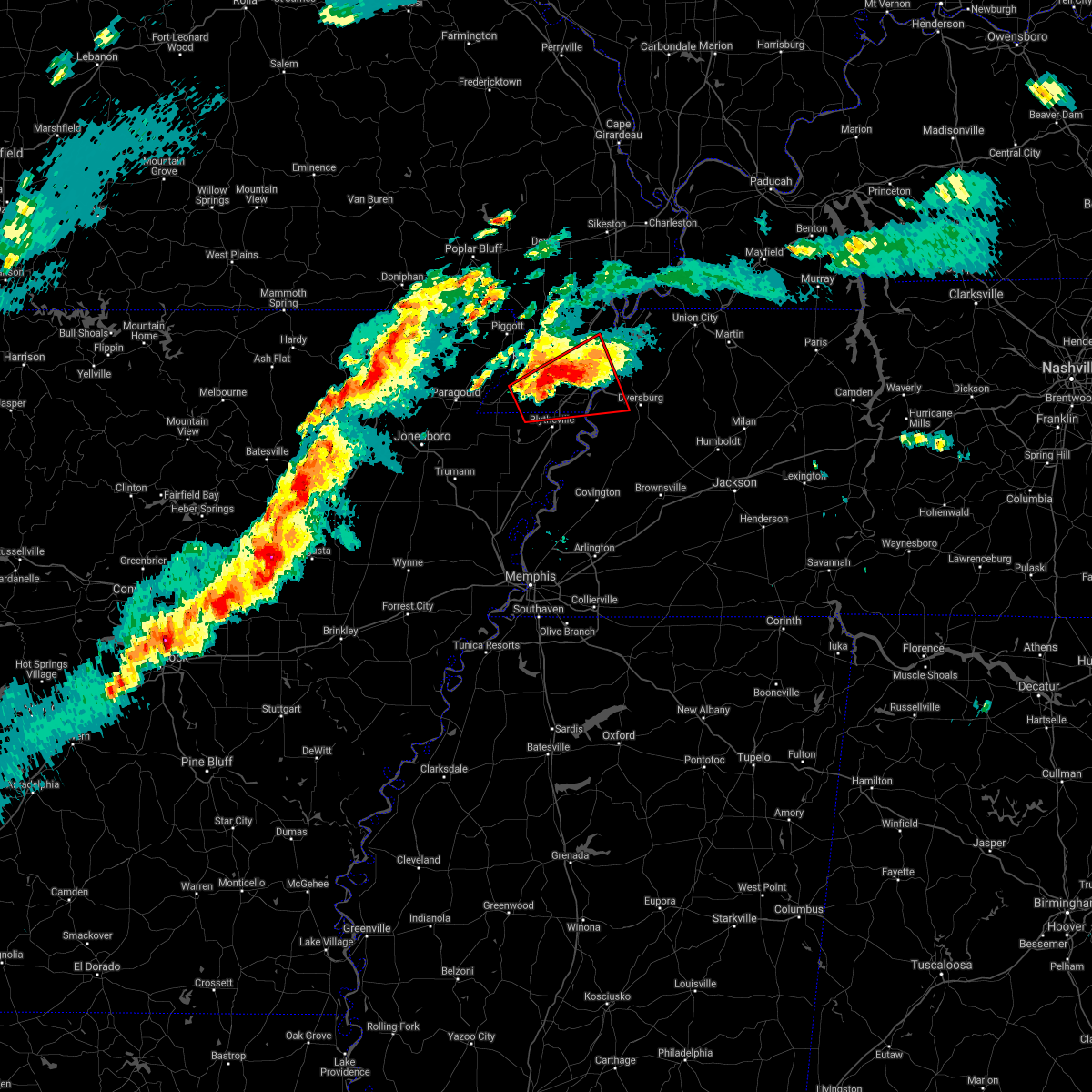 At 751 pm cst, a confirmed large and destructive tornado was located near hornersville, or 7 miles north of gosnell, moving northeast at 50 mph. tornado emergency for southern dunklin and pemiscot counties including denton and steele. this is a particularly dangerous situation. take cover now! (radar confirmed tornado). Hazards include deadly tornado. You are in a life-threatening situation. flying debris may be deadly to those caught without shelter. mobile homes will be destroyed. considerable damage to homes, businesses, and vehicles is likely and complete destruction is possible. the tornado will be near, cooter around 800 pm cst. steele and deering around 805 pm cst. caruthersville, hayti and hayti heights around 815 pm cst. Other locations impacted by this tornadic thunderstorm include lenox, ayers, calumet, hathaway, woodland corner, pascola, holland, tennemo, number nine and boothspoint. At 751 pm cst, a confirmed large and destructive tornado was located near hornersville, or 7 miles north of gosnell, moving northeast at 50 mph. tornado emergency for southern dunklin and pemiscot counties including denton and steele. this is a particularly dangerous situation. take cover now! (radar confirmed tornado). Hazards include deadly tornado. You are in a life-threatening situation. flying debris may be deadly to those caught without shelter. mobile homes will be destroyed. considerable damage to homes, businesses, and vehicles is likely and complete destruction is possible. the tornado will be near, cooter around 800 pm cst. steele and deering around 805 pm cst. caruthersville, hayti and hayti heights around 815 pm cst. Other locations impacted by this tornadic thunderstorm include lenox, ayers, calumet, hathaway, woodland corner, pascola, holland, tennemo, number nine and boothspoint.
|
| 7/31/2021 9:33 PM CDT |
 At 933 pm cdt, a severe thunderstorm was located over ashport, or 8 miles east of luxora, moving southeast at 50 mph (radar indicated). Hazards include 60 mph wind gusts. Expect damage to roofs, siding, and trees. Locations impacted include, blytheville, ripley, osceola, gosnell, luxora, fort pillow state park, cooter, dell, burdette, fulton, ashport, ft pillow, barr, edith, calumet, dearman, barfield, o`donnell bend, tomato and hightower. At 933 pm cdt, a severe thunderstorm was located over ashport, or 8 miles east of luxora, moving southeast at 50 mph (radar indicated). Hazards include 60 mph wind gusts. Expect damage to roofs, siding, and trees. Locations impacted include, blytheville, ripley, osceola, gosnell, luxora, fort pillow state park, cooter, dell, burdette, fulton, ashport, ft pillow, barr, edith, calumet, dearman, barfield, o`donnell bend, tomato and hightower.
|
| 7/31/2021 8:57 PM CDT |
 At 857 pm cdt, a severe thunderstorm was located over hornersville, or near senath, moving southeast at 50 mph (radar indicated). Hazards include 60 mph wind gusts. expect damage to roofs, siding, and trees At 857 pm cdt, a severe thunderstorm was located over hornersville, or near senath, moving southeast at 50 mph (radar indicated). Hazards include 60 mph wind gusts. expect damage to roofs, siding, and trees
|
| 6/12/2021 7:56 PM CDT |
 At 756 pm cdt, a severe thunderstorm was located 10 miles south of heloise, or 10 miles east of blytheville, moving south at 10 mph (radar indicated). Hazards include 60 mph wind gusts and quarter size hail. Hail damage to vehicles is expected. expect wind damage to roofs, siding, and trees. Locations impacted include, blytheville, cooter, ashport, heloise, holland, barr, hickman, barfield, o`donnell bend, tomato, burton, number nine, armorel, huffman, chic, tyler, chickasaw national wildlife refuge and cottonwood point. At 756 pm cdt, a severe thunderstorm was located 10 miles south of heloise, or 10 miles east of blytheville, moving south at 10 mph (radar indicated). Hazards include 60 mph wind gusts and quarter size hail. Hail damage to vehicles is expected. expect wind damage to roofs, siding, and trees. Locations impacted include, blytheville, cooter, ashport, heloise, holland, barr, hickman, barfield, o`donnell bend, tomato, burton, number nine, armorel, huffman, chic, tyler, chickasaw national wildlife refuge and cottonwood point.
|
| 6/12/2021 7:56 PM CDT |
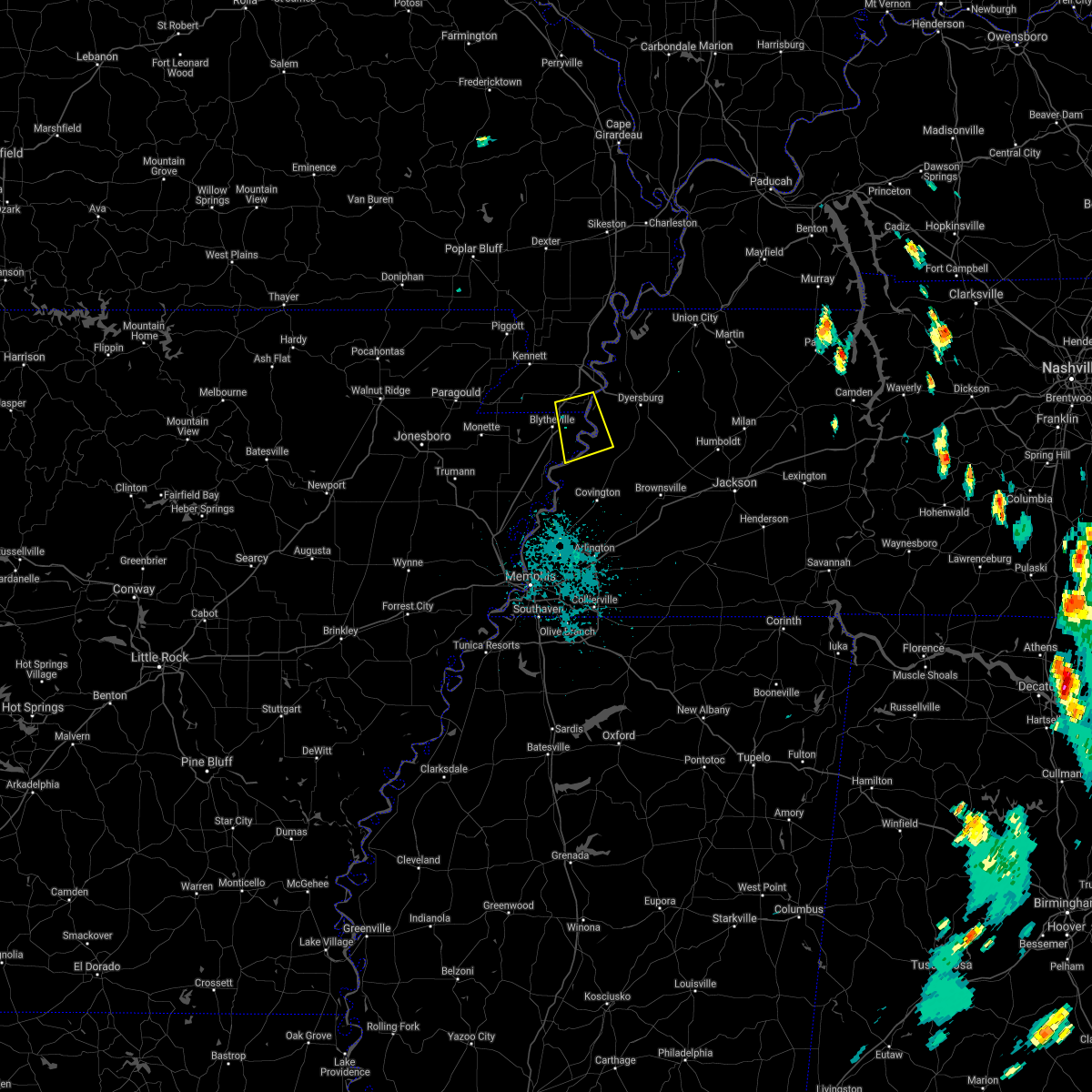 At 756 pm cdt, a severe thunderstorm was located 10 miles south of heloise, or 10 miles east of blytheville, moving south at 10 mph (radar indicated). Hazards include 60 mph wind gusts and quarter size hail. Hail damage to vehicles is expected. expect wind damage to roofs, siding, and trees. Locations impacted include, blytheville, cooter, ashport, heloise, holland, barr, hickman, barfield, o`donnell bend, tomato, burton, number nine, armorel, huffman, chic, tyler, chickasaw national wildlife refuge and cottonwood point. At 756 pm cdt, a severe thunderstorm was located 10 miles south of heloise, or 10 miles east of blytheville, moving south at 10 mph (radar indicated). Hazards include 60 mph wind gusts and quarter size hail. Hail damage to vehicles is expected. expect wind damage to roofs, siding, and trees. Locations impacted include, blytheville, cooter, ashport, heloise, holland, barr, hickman, barfield, o`donnell bend, tomato, burton, number nine, armorel, huffman, chic, tyler, chickasaw national wildlife refuge and cottonwood point.
|
| 6/12/2021 7:39 PM CDT |
 At 739 pm cdt, a severe thunderstorm was located 8 miles southeast of cooter, or 9 miles east of blytheville, moving south at 10 mph (radar indicated). Hazards include 60 mph wind gusts and quarter size hail. Hail damage to vehicles is expected. Expect wind damage to roofs, siding, and trees. At 739 pm cdt, a severe thunderstorm was located 8 miles southeast of cooter, or 9 miles east of blytheville, moving south at 10 mph (radar indicated). Hazards include 60 mph wind gusts and quarter size hail. Hail damage to vehicles is expected. Expect wind damage to roofs, siding, and trees.
|
| 5/4/2021 3:07 AM CDT |
 At 307 am cdt, severe thunderstorms were located along a line extending from 6 miles southeast of marston to cooter, moving east at 45 mph (radar indicated). Hazards include 60 mph wind gusts and quarter size hail. Hail damage to vehicles is expected. expect wind damage to roofs, siding, and trees. Locations impacted include, blytheville, kennett, osceola, caruthersville, malden, gosnell, manila, portageville, hayti, steele, caraway, luxora, hornersville, holcomb, hayti heights, cooter, wardell, dell, burdette and bolton. At 307 am cdt, severe thunderstorms were located along a line extending from 6 miles southeast of marston to cooter, moving east at 45 mph (radar indicated). Hazards include 60 mph wind gusts and quarter size hail. Hail damage to vehicles is expected. expect wind damage to roofs, siding, and trees. Locations impacted include, blytheville, kennett, osceola, caruthersville, malden, gosnell, manila, portageville, hayti, steele, caraway, luxora, hornersville, holcomb, hayti heights, cooter, wardell, dell, burdette and bolton.
|
| 5/4/2021 2:59 AM CDT |
 At 258 am cdt, severe thunderstorms were located along a line extending from near bolton to near caruthersville to near marie, moving east at 65 mph (radar indicated). Hazards include 60 mph wind gusts and quarter size hail. Hail damage to vehicles is expected. Expect wind damage to roofs, siding, and trees. At 258 am cdt, severe thunderstorms were located along a line extending from near bolton to near caruthersville to near marie, moving east at 65 mph (radar indicated). Hazards include 60 mph wind gusts and quarter size hail. Hail damage to vehicles is expected. Expect wind damage to roofs, siding, and trees.
|
| 5/4/2021 2:40 AM CDT |
 At 240 am cdt, severe thunderstorms were located along a line extending from near gideon to near hornersville, moving east at 45 mph (radar indicated). Hazards include 60 mph wind gusts and quarter size hail. Hail damage to vehicles is expected. expect wind damage to roofs, siding, and trees. Locations impacted include, blytheville, kennett, osceola, caruthersville, malden, piggott, gosnell, manila, portageville, hayti, steele, leachville, campbell, senath, caraway, luxora, cardwell, hornersville, holcomb and hayti heights. At 240 am cdt, severe thunderstorms were located along a line extending from near gideon to near hornersville, moving east at 45 mph (radar indicated). Hazards include 60 mph wind gusts and quarter size hail. Hail damage to vehicles is expected. expect wind damage to roofs, siding, and trees. Locations impacted include, blytheville, kennett, osceola, caruthersville, malden, piggott, gosnell, manila, portageville, hayti, steele, leachville, campbell, senath, caraway, luxora, cardwell, hornersville, holcomb and hayti heights.
|
| 5/4/2021 2:25 AM CDT |
 At 224 am cdt, severe thunderstorms were located along a line extending from near holcomb to near cardwell, moving east at 45 mph (radar indicated). Hazards include 60 mph wind gusts and quarter size hail. Hail damage to vehicles is expected. Expect wind damage to roofs, siding, and trees. At 224 am cdt, severe thunderstorms were located along a line extending from near holcomb to near cardwell, moving east at 45 mph (radar indicated). Hazards include 60 mph wind gusts and quarter size hail. Hail damage to vehicles is expected. Expect wind damage to roofs, siding, and trees.
|
| 2/28/2021 3:40 PM CST |
 At 340 pm cst, a severe thunderstorm was located over steele, moving east at 40 mph (radar indicated). Hazards include 60 mph wind gusts. Expect damage to roofs, siding, and trees. Locations impacted include, caruthersville, hayti, steele, hayti heights, cooter, deering, heloise, holland, pascola, lenox, ayers, hathaway, tennemo, boothspoint, big boy junction, mengelwood, finley, west hermondale, new survey and denton. At 340 pm cst, a severe thunderstorm was located over steele, moving east at 40 mph (radar indicated). Hazards include 60 mph wind gusts. Expect damage to roofs, siding, and trees. Locations impacted include, caruthersville, hayti, steele, hayti heights, cooter, deering, heloise, holland, pascola, lenox, ayers, hathaway, tennemo, boothspoint, big boy junction, mengelwood, finley, west hermondale, new survey and denton.
|
| 2/28/2021 3:40 PM CST |
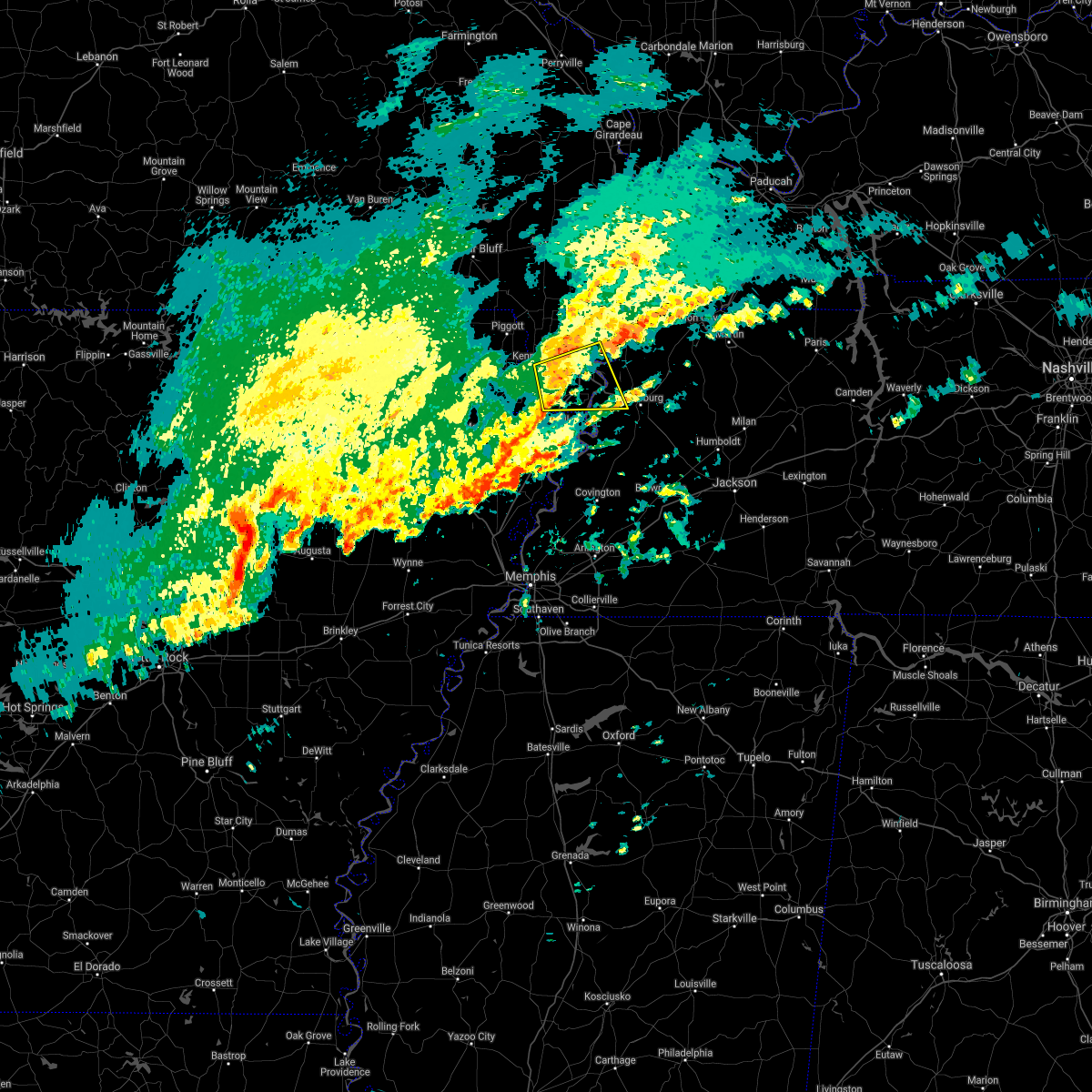 At 340 pm cst, a severe thunderstorm was located over steele, moving east at 40 mph (radar indicated). Hazards include 60 mph wind gusts. Expect damage to roofs, siding, and trees. Locations impacted include, caruthersville, hayti, steele, hayti heights, cooter, deering, heloise, holland, pascola, lenox, ayers, hathaway, tennemo, boothspoint, big boy junction, mengelwood, finley, west hermondale, new survey and denton. At 340 pm cst, a severe thunderstorm was located over steele, moving east at 40 mph (radar indicated). Hazards include 60 mph wind gusts. Expect damage to roofs, siding, and trees. Locations impacted include, caruthersville, hayti, steele, hayti heights, cooter, deering, heloise, holland, pascola, lenox, ayers, hathaway, tennemo, boothspoint, big boy junction, mengelwood, finley, west hermondale, new survey and denton.
|
| 2/28/2021 3:31 PM CST |
 At 331 pm cst, a severe thunderstorm was located near steele, moving east at 40 mph (radar indicated). Hazards include 60 mph wind gusts. Expect damage to roofs, siding, and trees. Locations impacted include, kennett, caruthersville, hayti, steele, hayti heights, cooter, deering, heloise, holland, pascola, lenox, ayers, hathaway, noland, tennemo, boothspoint, big boy junction, mengelwood, finley and rives. At 331 pm cst, a severe thunderstorm was located near steele, moving east at 40 mph (radar indicated). Hazards include 60 mph wind gusts. Expect damage to roofs, siding, and trees. Locations impacted include, kennett, caruthersville, hayti, steele, hayti heights, cooter, deering, heloise, holland, pascola, lenox, ayers, hathaway, noland, tennemo, boothspoint, big boy junction, mengelwood, finley and rives.
|
| 2/28/2021 3:15 PM CST |
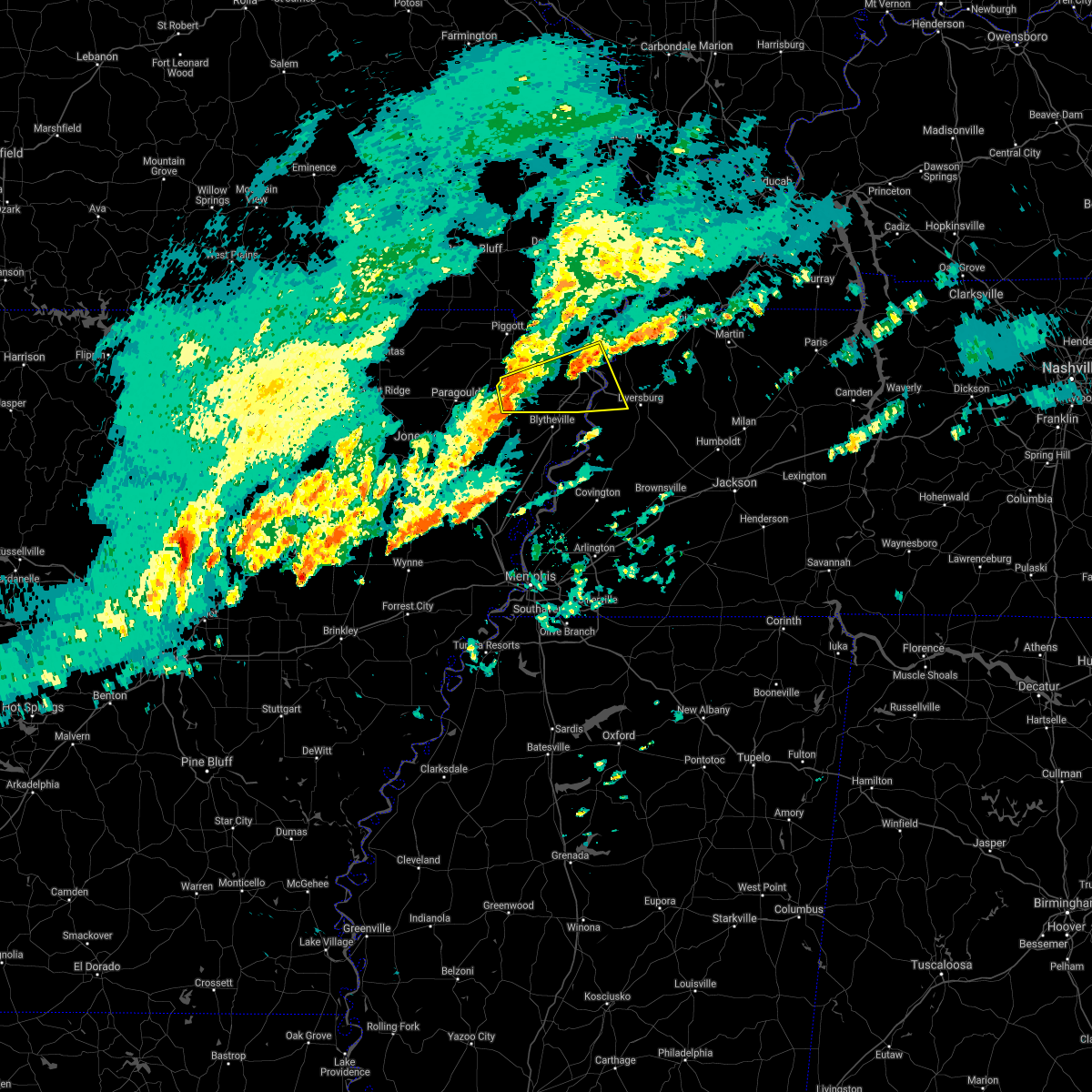 At 314 pm cst, a severe thunderstorm was located over hornersville, or near senath, moving east at 40 mph (radar indicated). Hazards include 60 mph wind gusts. expect damage to roofs, siding, and trees At 314 pm cst, a severe thunderstorm was located over hornersville, or near senath, moving east at 40 mph (radar indicated). Hazards include 60 mph wind gusts. expect damage to roofs, siding, and trees
|
| 8/27/2020 10:39 PM CDT |
 At 1039 pm cdt, doppler radar indicated a severe thunderstorm producing a tornado was located near steele, moving north at 60 mph (radar indicated rotation). Hazards include tornado. Flying debris will be dangerous to those caught without shelter. mobile homes will be damaged or destroyed. damage to roofs, windows, and vehicles will occur. tree damage is likely. Locations impacted include, kennett, hayti, steele, senath, hayti heights, cooter, wardell, greenway, bolton, deering, holland, bragg city, pascola, nimmons, west kennett, bell city, pratt, noland, carryville and lorine. At 1039 pm cdt, doppler radar indicated a severe thunderstorm producing a tornado was located near steele, moving north at 60 mph (radar indicated rotation). Hazards include tornado. Flying debris will be dangerous to those caught without shelter. mobile homes will be damaged or destroyed. damage to roofs, windows, and vehicles will occur. tree damage is likely. Locations impacted include, kennett, hayti, steele, senath, hayti heights, cooter, wardell, greenway, bolton, deering, holland, bragg city, pascola, nimmons, west kennett, bell city, pratt, noland, carryville and lorine.
|
| 8/27/2020 10:39 PM CDT |
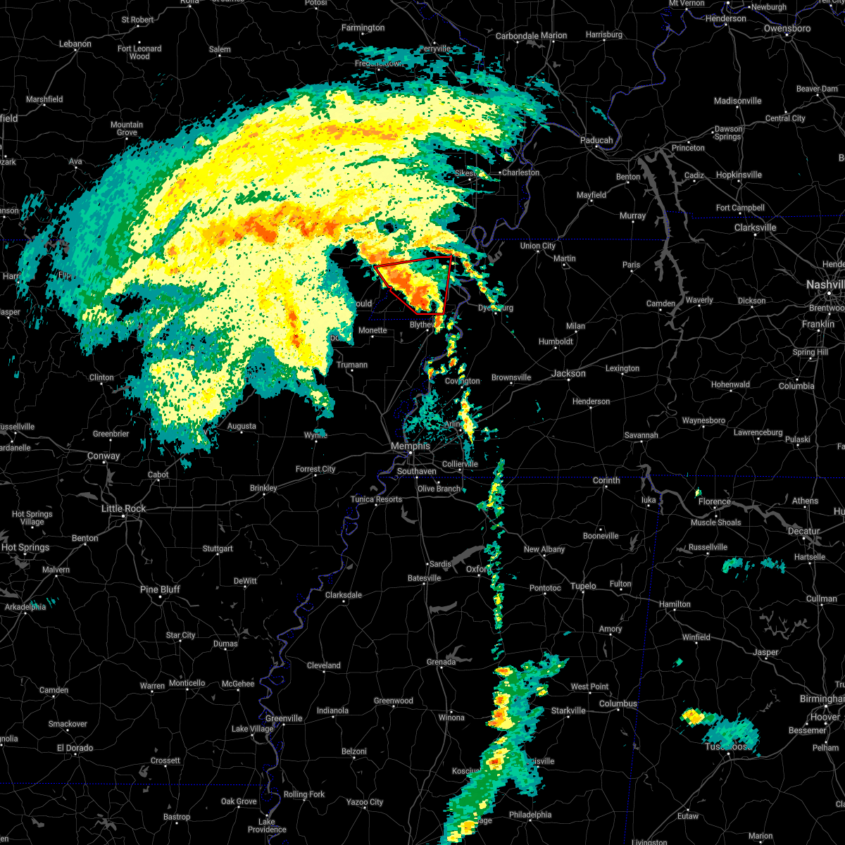 At 1039 pm cdt, doppler radar indicated a severe thunderstorm producing a tornado was located near steele, moving north at 60 mph (radar indicated rotation). Hazards include tornado. Flying debris will be dangerous to those caught without shelter. mobile homes will be damaged or destroyed. damage to roofs, windows, and vehicles will occur. tree damage is likely. Locations impacted include, kennett, hayti, steele, senath, hayti heights, cooter, wardell, greenway, bolton, deering, holland, bragg city, pascola, nimmons, west kennett, bell city, pratt, noland, carryville and lorine. At 1039 pm cdt, doppler radar indicated a severe thunderstorm producing a tornado was located near steele, moving north at 60 mph (radar indicated rotation). Hazards include tornado. Flying debris will be dangerous to those caught without shelter. mobile homes will be damaged or destroyed. damage to roofs, windows, and vehicles will occur. tree damage is likely. Locations impacted include, kennett, hayti, steele, senath, hayti heights, cooter, wardell, greenway, bolton, deering, holland, bragg city, pascola, nimmons, west kennett, bell city, pratt, noland, carryville and lorine.
|
| 8/27/2020 10:29 PM CDT |
 At 1029 pm cdt, doppler radar indicated a severe thunderstorm producing a tornado was located over blytheville, moving north at 60 mph (radar indicated rotation). Hazards include tornado. Flying debris will be dangerous to those caught without shelter. mobile homes will be damaged or destroyed. damage to roofs, windows, and vehicles will occur. Tree damage is likely. At 1029 pm cdt, doppler radar indicated a severe thunderstorm producing a tornado was located over blytheville, moving north at 60 mph (radar indicated rotation). Hazards include tornado. Flying debris will be dangerous to those caught without shelter. mobile homes will be damaged or destroyed. damage to roofs, windows, and vehicles will occur. Tree damage is likely.
|
| 8/27/2020 10:29 PM CDT |
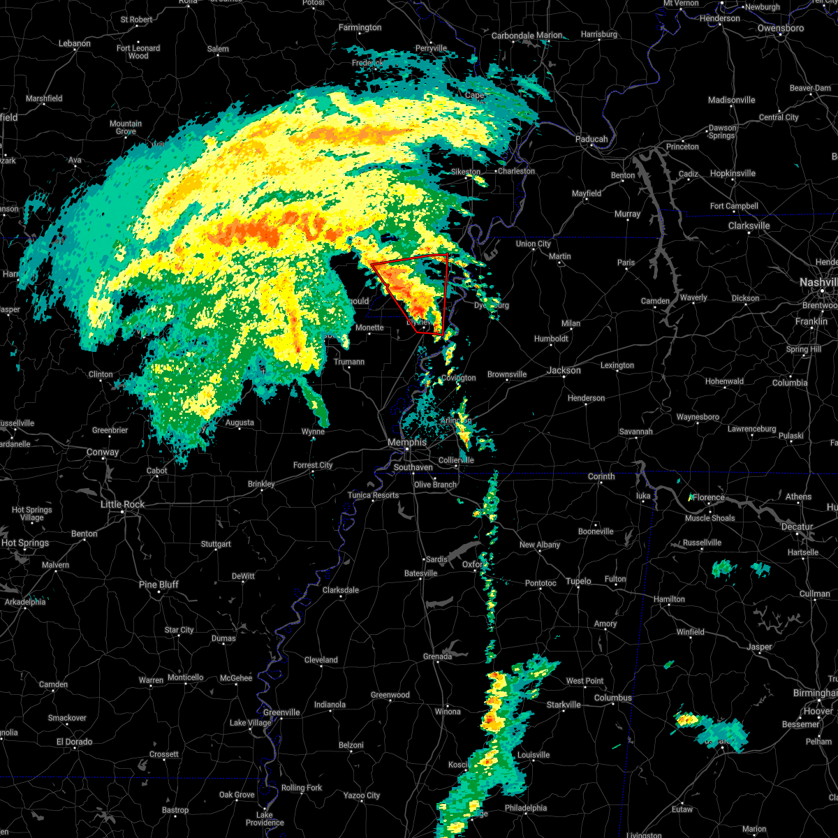 At 1029 pm cdt, doppler radar indicated a severe thunderstorm producing a tornado was located over blytheville, moving north at 60 mph (radar indicated rotation). Hazards include tornado. Flying debris will be dangerous to those caught without shelter. mobile homes will be damaged or destroyed. damage to roofs, windows, and vehicles will occur. Tree damage is likely. At 1029 pm cdt, doppler radar indicated a severe thunderstorm producing a tornado was located over blytheville, moving north at 60 mph (radar indicated rotation). Hazards include tornado. Flying debris will be dangerous to those caught without shelter. mobile homes will be damaged or destroyed. damage to roofs, windows, and vehicles will occur. Tree damage is likely.
|
| 5/3/2020 2:40 PM CDT |
 At 239 pm cdt, severe thunderstorms were located along a line extending from 6 miles southwest of unionville to near ft pillow to bassett, moving east at 50 mph (radar indicated). Hazards include 70 mph wind gusts and quarter size hail. Hail damage to vehicles is expected. expect considerable tree damage. wind damage is also likely to mobile homes, roofs, and outbuildings. Locations impacted include, dyersburg, blytheville, covington, ripley, osceola, gosnell, luxora, wilson, keiser, fort pillow state park, munford, brighton, halls, joiner, cooter, dyess, dell, burdette, bassett and marie. At 239 pm cdt, severe thunderstorms were located along a line extending from 6 miles southwest of unionville to near ft pillow to bassett, moving east at 50 mph (radar indicated). Hazards include 70 mph wind gusts and quarter size hail. Hail damage to vehicles is expected. expect considerable tree damage. wind damage is also likely to mobile homes, roofs, and outbuildings. Locations impacted include, dyersburg, blytheville, covington, ripley, osceola, gosnell, luxora, wilson, keiser, fort pillow state park, munford, brighton, halls, joiner, cooter, dyess, dell, burdette, bassett and marie.
|
| 5/3/2020 2:29 PM CDT |
 At 229 pm cdt, severe thunderstorms were located along a line extending from near union city to near newbern, moving east at 65 mph (radar indicated). Hazards include 70 mph wind gusts and quarter size hail. Hail damage to vehicles is expected. expect considerable tree damage. wind damage is also likely to mobile homes, roofs, and outbuildings. Locations impacted include, dyersburg, blytheville, martin, union city, caruthersville, gosnell, fulton, steele, newbern, south fulton, ridgely, troy, kenton, obion, cooter, clayton, bradleytown, heloise, unionville and latham. At 229 pm cdt, severe thunderstorms were located along a line extending from near union city to near newbern, moving east at 65 mph (radar indicated). Hazards include 70 mph wind gusts and quarter size hail. Hail damage to vehicles is expected. expect considerable tree damage. wind damage is also likely to mobile homes, roofs, and outbuildings. Locations impacted include, dyersburg, blytheville, martin, union city, caruthersville, gosnell, fulton, steele, newbern, south fulton, ridgely, troy, kenton, obion, cooter, clayton, bradleytown, heloise, unionville and latham.
|
| 5/3/2020 2:15 PM CDT |
 At 215 pm cdt, severe thunderstorms were located along a line extending from near gosnell to near trumann, moving east at 55 mph (radar indicated). Hazards include 70 mph wind gusts and quarter size hail. Hail damage to vehicles is expected. expect considerable tree damage. Wind damage is also likely to mobile homes, roofs, and outbuildings. At 215 pm cdt, severe thunderstorms were located along a line extending from near gosnell to near trumann, moving east at 55 mph (radar indicated). Hazards include 70 mph wind gusts and quarter size hail. Hail damage to vehicles is expected. expect considerable tree damage. Wind damage is also likely to mobile homes, roofs, and outbuildings.
|
| 5/3/2020 2:09 PM CDT |
 At 208 pm cdt, severe thunderstorms were located along a line extending from near clayton to near gosnell, moving east at 55 mph (radar indicated). Hazards include 70 mph wind gusts and quarter size hail. Hail damage to vehicles is expected. expect considerable tree damage. Wind damage is also likely to mobile homes, roofs, and outbuildings. At 208 pm cdt, severe thunderstorms were located along a line extending from near clayton to near gosnell, moving east at 55 mph (radar indicated). Hazards include 70 mph wind gusts and quarter size hail. Hail damage to vehicles is expected. expect considerable tree damage. Wind damage is also likely to mobile homes, roofs, and outbuildings.
|
| 5/3/2020 1:50 PM CDT |
 At 149 pm cdt, severe thunderstorms were located along a line extending from near parma to near senath, moving east at 55 mph (radar indicated). Hazards include 70 mph wind gusts and half dollar size hail. Hail damage to vehicles is expected. expect considerable tree damage. wind damage is also likely to mobile homes, roofs, and outbuildings. Locations impacted include, paragould, dyersburg, kennett, caruthersville, piggott, portageville, hayti, steele, campbell, rector, senath, marmaduke, reelfoot lake state park, chalk bluff natural area, tiptonville, malden, ridgely, oak grove heights, cardwell and hornersville. At 149 pm cdt, severe thunderstorms were located along a line extending from near parma to near senath, moving east at 55 mph (radar indicated). Hazards include 70 mph wind gusts and half dollar size hail. Hail damage to vehicles is expected. expect considerable tree damage. wind damage is also likely to mobile homes, roofs, and outbuildings. Locations impacted include, paragould, dyersburg, kennett, caruthersville, piggott, portageville, hayti, steele, campbell, rector, senath, marmaduke, reelfoot lake state park, chalk bluff natural area, tiptonville, malden, ridgely, oak grove heights, cardwell and hornersville.
|
| 5/3/2020 1:30 PM CDT |
 At 130 pm cdt, severe thunderstorms were located along a line extending from near glennonville to near oak grove heights, moving east at 70 mph (radar indicated). Hazards include 70 mph wind gusts and half dollar size hail. Hail damage to vehicles is expected. expect considerable tree damage. Wind damage is also likely to mobile homes, roofs, and outbuildings. At 130 pm cdt, severe thunderstorms were located along a line extending from near glennonville to near oak grove heights, moving east at 70 mph (radar indicated). Hazards include 70 mph wind gusts and half dollar size hail. Hail damage to vehicles is expected. expect considerable tree damage. Wind damage is also likely to mobile homes, roofs, and outbuildings.
|
| 4/29/2020 12:25 AM CDT |
 The severe thunderstorm warning for southeastern craighead, mississippi, southeastern clay, pemiscot, dunklin, western dyer, central lauderdale and central lake counties will expire at 1230 am cdt, the storm which prompted the warning has weakened below severe limits, and has exited the warned area. therefore, the warning will be allowed to expire. a severe thunderstorm watch remains in effect until 300 am cdt for eastern arkansas, southeastern missouri, and western tennessee. The severe thunderstorm warning for southeastern craighead, mississippi, southeastern clay, pemiscot, dunklin, western dyer, central lauderdale and central lake counties will expire at 1230 am cdt, the storm which prompted the warning has weakened below severe limits, and has exited the warned area. therefore, the warning will be allowed to expire. a severe thunderstorm watch remains in effect until 300 am cdt for eastern arkansas, southeastern missouri, and western tennessee.
|
| 4/28/2020 11:43 PM CDT |
 At 1139 pm cdt, a severe thunderstorm was located near steele, moving east at 65 mph (radar indicated). Hazards include 70 mph wind gusts. Expect considerable tree damage. Damage is likely to mobile homes, roofs, and outbuildings. At 1139 pm cdt, a severe thunderstorm was located near steele, moving east at 65 mph (radar indicated). Hazards include 70 mph wind gusts. Expect considerable tree damage. Damage is likely to mobile homes, roofs, and outbuildings.
|
| 4/28/2020 11:43 PM CDT |
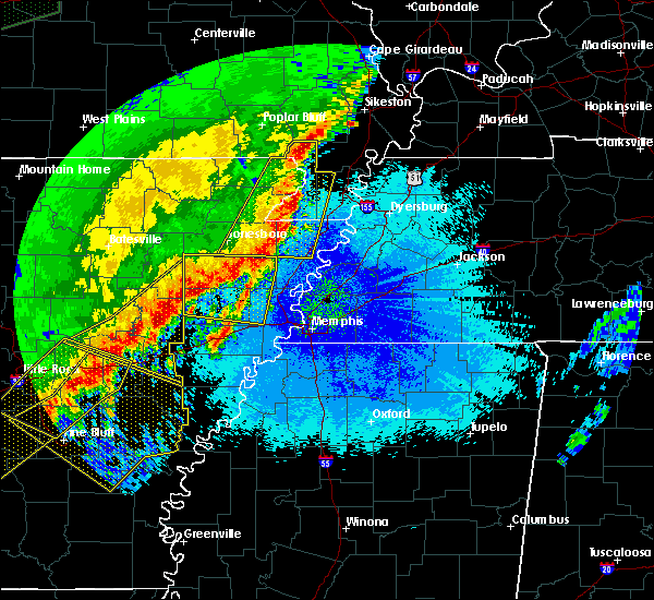 At 1139 pm cdt, a severe thunderstorm was located near steele, moving east at 65 mph (radar indicated). Hazards include 70 mph wind gusts. Expect considerable tree damage. Damage is likely to mobile homes, roofs, and outbuildings. At 1139 pm cdt, a severe thunderstorm was located near steele, moving east at 65 mph (radar indicated). Hazards include 70 mph wind gusts. Expect considerable tree damage. Damage is likely to mobile homes, roofs, and outbuildings.
|
| 3/28/2020 6:56 PM CDT |
 At 656 pm cdt, doppler radar indicated a severe thunderstorm producing a tornado was located over blytheville, moving northeast at 40 mph (radar indicated rotation). Hazards include tornado. Flying debris will be dangerous to those caught without shelter. mobile homes will be damaged or destroyed. damage to roofs, windows, and vehicles will occur. Tree damage is likely. At 656 pm cdt, doppler radar indicated a severe thunderstorm producing a tornado was located over blytheville, moving northeast at 40 mph (radar indicated rotation). Hazards include tornado. Flying debris will be dangerous to those caught without shelter. mobile homes will be damaged or destroyed. damage to roofs, windows, and vehicles will occur. Tree damage is likely.
|
| 3/28/2020 6:56 PM CDT |
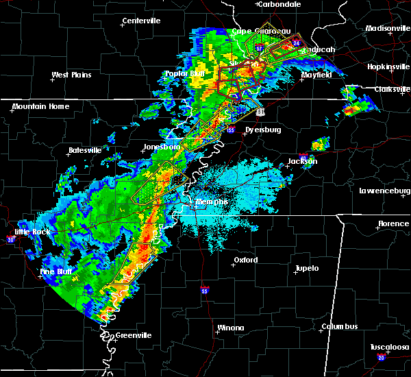 At 656 pm cdt, doppler radar indicated a severe thunderstorm producing a tornado was located over blytheville, moving northeast at 40 mph (radar indicated rotation). Hazards include tornado. Flying debris will be dangerous to those caught without shelter. mobile homes will be damaged or destroyed. damage to roofs, windows, and vehicles will occur. Tree damage is likely. At 656 pm cdt, doppler radar indicated a severe thunderstorm producing a tornado was located over blytheville, moving northeast at 40 mph (radar indicated rotation). Hazards include tornado. Flying debris will be dangerous to those caught without shelter. mobile homes will be damaged or destroyed. damage to roofs, windows, and vehicles will occur. Tree damage is likely.
|
| 3/28/2020 6:51 PM CDT |
 At 651 pm cdt, a severe thunderstorm was located near steele, moving northeast at 40 mph (radar indicated). Hazards include 60 mph wind gusts and quarter size hail. Hail damage to vehicles is expected. Expect wind damage to roofs, siding, and trees. At 651 pm cdt, a severe thunderstorm was located near steele, moving northeast at 40 mph (radar indicated). Hazards include 60 mph wind gusts and quarter size hail. Hail damage to vehicles is expected. Expect wind damage to roofs, siding, and trees.
|
| 3/28/2020 6:26 PM CDT |
 At 625 pm cdt, a severe thunderstorm was located near manila, moving northeast at 40 mph (radar indicated). Hazards include 60 mph wind gusts and quarter size hail. Hail damage to vehicles is expected. expect wind damage to roofs, siding, and trees. Locations impacted include, blytheville, gosnell, manila, steele, hornersville, cooter, dell, holland, calumet, dearman, buckeye, woodland corner, roseland, wilson junction, poplar corner, stark city, number nine, yarbro, rives and west hermondale. At 625 pm cdt, a severe thunderstorm was located near manila, moving northeast at 40 mph (radar indicated). Hazards include 60 mph wind gusts and quarter size hail. Hail damage to vehicles is expected. expect wind damage to roofs, siding, and trees. Locations impacted include, blytheville, gosnell, manila, steele, hornersville, cooter, dell, holland, calumet, dearman, buckeye, woodland corner, roseland, wilson junction, poplar corner, stark city, number nine, yarbro, rives and west hermondale.
|
| 3/28/2020 6:13 PM CDT |
 At 613 pm cdt, a severe thunderstorm was located near manila, moving northeast at 40 mph (radar indicated). Hazards include 60 mph wind gusts and quarter size hail. Hail damage to vehicles is expected. Expect wind damage to roofs, siding, and trees. At 613 pm cdt, a severe thunderstorm was located near manila, moving northeast at 40 mph (radar indicated). Hazards include 60 mph wind gusts and quarter size hail. Hail damage to vehicles is expected. Expect wind damage to roofs, siding, and trees.
|
| 3/28/2020 6:13 PM CDT |
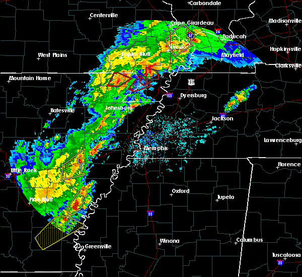 At 613 pm cdt, a severe thunderstorm was located near manila, moving northeast at 40 mph (radar indicated). Hazards include 60 mph wind gusts and quarter size hail. Hail damage to vehicles is expected. Expect wind damage to roofs, siding, and trees. At 613 pm cdt, a severe thunderstorm was located near manila, moving northeast at 40 mph (radar indicated). Hazards include 60 mph wind gusts and quarter size hail. Hail damage to vehicles is expected. Expect wind damage to roofs, siding, and trees.
|
| 1/11/2020 3:54 AM CST |
 At 353 am cst, a severe thunderstorm was located 10 miles north of ashport, or 10 miles east of blytheville, moving northeast at 45 mph (radar indicated). Hazards include 60 mph wind gusts. expect damage to roofs, siding, and trees At 353 am cst, a severe thunderstorm was located 10 miles north of ashport, or 10 miles east of blytheville, moving northeast at 45 mph (radar indicated). Hazards include 60 mph wind gusts. expect damage to roofs, siding, and trees
|
| 1/11/2020 3:38 AM CST |
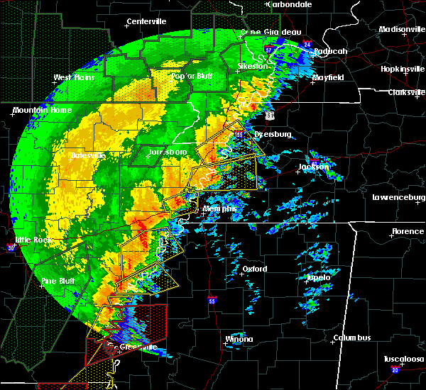 At 337 am cst, a severe thunderstorm was located 7 miles south of heloise, or 13 miles southeast of steele, moving northeast at 45 mph (radar indicated). Hazards include 60 mph wind gusts. Expect damage to roofs, siding, and trees. Locations impacted include, dyersburg, blytheville, osceola, caruthersville, gosnell, steele, luxora, halls, cooter, dell, burdette, bradleytown, heloise, unionville, miston, ashport, cottonwood grove, holland, edith and calumet. At 337 am cst, a severe thunderstorm was located 7 miles south of heloise, or 13 miles southeast of steele, moving northeast at 45 mph (radar indicated). Hazards include 60 mph wind gusts. Expect damage to roofs, siding, and trees. Locations impacted include, dyersburg, blytheville, osceola, caruthersville, gosnell, steele, luxora, halls, cooter, dell, burdette, bradleytown, heloise, unionville, miston, ashport, cottonwood grove, holland, edith and calumet.
|
| 1/11/2020 3:16 AM CST |
 At 316 am cst, a severe thunderstorm was located over burdette, or near blytheville, moving northeast at 45 mph (radar indicated). Hazards include 60 mph wind gusts. expect damage to roofs, siding, and trees At 316 am cst, a severe thunderstorm was located over burdette, or near blytheville, moving northeast at 45 mph (radar indicated). Hazards include 60 mph wind gusts. expect damage to roofs, siding, and trees
|
| 1/11/2020 2:47 AM CST |
 At 247 am cst, severe thunderstorms were located along a line extending from near portageville to near osceola, moving east at 40 mph (radar indicated). Hazards include 60 mph wind gusts. Expect damage to roofs, siding, and trees. Locations impacted include, dyersburg, blytheville, kennett, osceola, caruthersville, gosnell, manila, portageville, hayti, steele, caraway, luxora, keiser, reelfoot lake state park, tiptonville, ridgely, hornersville, hayti heights, cooter and wardell. At 247 am cst, severe thunderstorms were located along a line extending from near portageville to near osceola, moving east at 40 mph (radar indicated). Hazards include 60 mph wind gusts. Expect damage to roofs, siding, and trees. Locations impacted include, dyersburg, blytheville, kennett, osceola, caruthersville, gosnell, manila, portageville, hayti, steele, caraway, luxora, keiser, reelfoot lake state park, tiptonville, ridgely, hornersville, hayti heights, cooter and wardell.
|
| 1/11/2020 2:26 AM CST |
 At 225 am cst, severe thunderstorms were located along a line extending from near gideon to near caraway, moving northeast at 40 mph (radar indicated). Hazards include 60 mph wind gusts. expect damage to roofs, siding, and trees At 225 am cst, severe thunderstorms were located along a line extending from near gideon to near caraway, moving northeast at 40 mph (radar indicated). Hazards include 60 mph wind gusts. expect damage to roofs, siding, and trees
|
| 1/11/2020 1:52 AM CST |
 At 152 am cst, severe thunderstorms were located along a line extending from near clarkton to trumann, moving northeast at 45 mph (radar indicated). Hazards include 70 mph wind gusts. Expect considerable tree damage. Damage is likely to mobile homes, roofs, and outbuildings. At 152 am cst, severe thunderstorms were located along a line extending from near clarkton to trumann, moving northeast at 45 mph (radar indicated). Hazards include 70 mph wind gusts. Expect considerable tree damage. Damage is likely to mobile homes, roofs, and outbuildings.
|
| 6/23/2019 4:11 PM CDT |
 At 410 pm cdt, severe thunderstorms were located along a line extending from 6 miles northwest of clayton to 7 miles northwest of ripley to 7 miles northeast of meeman shelby forest state park, moving east at 40 mph (radar indicated). Hazards include 60 mph wind gusts. expect damage to roofs, siding, and trees At 410 pm cdt, severe thunderstorms were located along a line extending from 6 miles northwest of clayton to 7 miles northwest of ripley to 7 miles northeast of meeman shelby forest state park, moving east at 40 mph (radar indicated). Hazards include 60 mph wind gusts. expect damage to roofs, siding, and trees
|
| 6/23/2019 3:55 PM CDT |
 At 354 pm cdt, severe thunderstorms were located along a line extending from near marston to near heloise to near fort pillow state park, moving east at 45 mph (trained weather spotters. at 335 pm cdt, a 59 mph wind gust was measured in kennett. trees were down across southern dunklin county). Hazards include 60 mph wind gusts. Expect damage to roofs, siding, and trees. Locations impacted include, blytheville, osceola, caruthersville, gosnell, manila, portageville, hayti, steele, luxora, keiser, reelfoot lake state park, tiptonville, ridgely, hayti heights, cooter, wardell, dell, burdette, deering and heloise. At 354 pm cdt, severe thunderstorms were located along a line extending from near marston to near heloise to near fort pillow state park, moving east at 45 mph (trained weather spotters. at 335 pm cdt, a 59 mph wind gust was measured in kennett. trees were down across southern dunklin county). Hazards include 60 mph wind gusts. Expect damage to roofs, siding, and trees. Locations impacted include, blytheville, osceola, caruthersville, gosnell, manila, portageville, hayti, steele, luxora, keiser, reelfoot lake state park, tiptonville, ridgely, hayti heights, cooter, wardell, dell, burdette, deering and heloise.
|
| 6/23/2019 3:28 PM CDT |
 At 327 pm cdt, severe thunderstorms were located along a line extending from near gideon to near gosnell to near dyess, moving east at 45 mph (radar indicated). Hazards include 60 mph wind gusts. expect damage to roofs, siding, and trees At 327 pm cdt, severe thunderstorms were located along a line extending from near gideon to near gosnell to near dyess, moving east at 45 mph (radar indicated). Hazards include 60 mph wind gusts. expect damage to roofs, siding, and trees
|
| 6/21/2019 6:42 PM CDT |
 The severe thunderstorm warning for greene, central craighead, northwestern mississippi, southeastern clay, pemiscot, southern dunklin, northwestern dyer and southwestern lake counties will expire at 645 pm cdt, the storms which prompted the warning have moved out of the area. therefore, the warning will be allowed to expire. however wind gusts to 50 mph are still possible with the remaining thunderstorms. a severe thunderstorm watch remains in effect until 100 am cdt for eastern arkansas, southeastern missouri, and western tennessee. The severe thunderstorm warning for greene, central craighead, northwestern mississippi, southeastern clay, pemiscot, southern dunklin, northwestern dyer and southwestern lake counties will expire at 645 pm cdt, the storms which prompted the warning have moved out of the area. therefore, the warning will be allowed to expire. however wind gusts to 50 mph are still possible with the remaining thunderstorms. a severe thunderstorm watch remains in effect until 100 am cdt for eastern arkansas, southeastern missouri, and western tennessee.
|
| 6/21/2019 6:24 PM CDT |
 At 624 pm cdt, severe thunderstorms were located along a line extending from near cloverdale to near brookland, moving southeast at 25 mph (radar indicated). Hazards include 60 mph wind gusts. Expect damage to roofs, siding, and trees. Locations impacted include, jonesboro, paragould, blytheville, kennett, caruthersville, gosnell, hayti, steele, bono, leachville, senath, brookland, monette, marmaduke, crowleys ridge state park, lake frierson state park, oak grove heights, cardwell, hornersville and hayti heights. At 624 pm cdt, severe thunderstorms were located along a line extending from near cloverdale to near brookland, moving southeast at 25 mph (radar indicated). Hazards include 60 mph wind gusts. Expect damage to roofs, siding, and trees. Locations impacted include, jonesboro, paragould, blytheville, kennett, caruthersville, gosnell, hayti, steele, bono, leachville, senath, brookland, monette, marmaduke, crowleys ridge state park, lake frierson state park, oak grove heights, cardwell, hornersville and hayti heights.
|
| 6/21/2019 5:46 PM CDT |
 At 544 pm cdt, severe thunderstorms were located along a line extending from near tiptonville to near o`kean, moving southeast at 25 mph (radar indicated, measured at kennett missouri airport). Hazards include 60 mph wind gusts. expect damage to roofs, siding, and trees At 544 pm cdt, severe thunderstorms were located along a line extending from near tiptonville to near o`kean, moving southeast at 25 mph (radar indicated, measured at kennett missouri airport). Hazards include 60 mph wind gusts. expect damage to roofs, siding, and trees
|
| 6/21/2019 5:46 PM CDT |
 The national weather service in memphis has issued a * severe thunderstorm warning for. greene county in eastern arkansas. central craighead county in eastern arkansas. northwestern mississippi county in eastern arkansas. Clay county in eastern arkansas. The national weather service in memphis has issued a * severe thunderstorm warning for. greene county in eastern arkansas. central craighead county in eastern arkansas. northwestern mississippi county in eastern arkansas. Clay county in eastern arkansas.
|
| 5/2/2019 5:42 PM CDT |
 At 542 pm cdt, a severe thunderstorm was located near steele, moving northeast at 20 mph (radar indicated). Hazards include 60 mph wind gusts and quarter size hail. Hail damage to vehicles is expected. expect wind damage to roofs, siding, and trees. locations impacted include, caruthersville, hayti, steele, hayti heights, cooter, deering, bolton, holland, bragg city, pascola, hathaway, mooring, homestown, west hermondale, new survey, denton, covington, shade, bakerville and canady. A tornado watch remains in effect until 1000 pm cdt for eastern arkansas, southeastern missouri, and western tennessee. At 542 pm cdt, a severe thunderstorm was located near steele, moving northeast at 20 mph (radar indicated). Hazards include 60 mph wind gusts and quarter size hail. Hail damage to vehicles is expected. expect wind damage to roofs, siding, and trees. locations impacted include, caruthersville, hayti, steele, hayti heights, cooter, deering, bolton, holland, bragg city, pascola, hathaway, mooring, homestown, west hermondale, new survey, denton, covington, shade, bakerville and canady. A tornado watch remains in effect until 1000 pm cdt for eastern arkansas, southeastern missouri, and western tennessee.
|
| 5/2/2019 5:42 PM CDT |
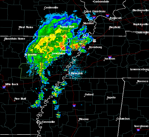 At 542 pm cdt, a severe thunderstorm was located near steele, moving northeast at 20 mph (radar indicated). Hazards include 60 mph wind gusts and quarter size hail. Hail damage to vehicles is expected. expect wind damage to roofs, siding, and trees. locations impacted include, caruthersville, hayti, steele, hayti heights, cooter, deering, bolton, holland, bragg city, pascola, hathaway, mooring, homestown, west hermondale, new survey, denton, covington, shade, bakerville and canady. A tornado watch remains in effect until 1000 pm cdt for eastern arkansas, southeastern missouri, and western tennessee. At 542 pm cdt, a severe thunderstorm was located near steele, moving northeast at 20 mph (radar indicated). Hazards include 60 mph wind gusts and quarter size hail. Hail damage to vehicles is expected. expect wind damage to roofs, siding, and trees. locations impacted include, caruthersville, hayti, steele, hayti heights, cooter, deering, bolton, holland, bragg city, pascola, hathaway, mooring, homestown, west hermondale, new survey, denton, covington, shade, bakerville and canady. A tornado watch remains in effect until 1000 pm cdt for eastern arkansas, southeastern missouri, and western tennessee.
|
| 5/2/2019 5:26 PM CDT |
 At 526 pm cdt, a severe thunderstorm was located over steele, moving northeast at 25 mph (radar indicated). Hazards include 60 mph wind gusts and half dollar size hail. Hail damage to vehicles is expected. Expect wind damage to roofs, siding, and trees. At 526 pm cdt, a severe thunderstorm was located over steele, moving northeast at 25 mph (radar indicated). Hazards include 60 mph wind gusts and half dollar size hail. Hail damage to vehicles is expected. Expect wind damage to roofs, siding, and trees.
|
| 5/2/2019 5:16 PM CDT |
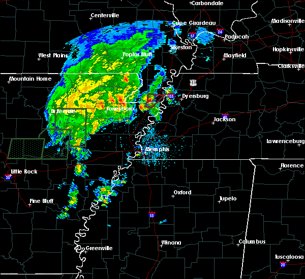 At 515 pm cdt, doppler radar indicated a severe thunderstorm producing a tornado was located 5 miles north of blytheville, moving northeast at 25 mph (radar indicated rotation). Hazards include tornado and half dollar size hail. Flying debris will be dangerous to those caught without shelter. mobile homes will be damaged or destroyed. damage to roofs, windows, and vehicles will occur. tree damage is likely. Locations impacted include, blytheville, gosnell, steele, cooter, holland, yarbro, number nine, west hermondale, samford, new survey, channel, denton, covington, hermondale and temples corner. At 515 pm cdt, doppler radar indicated a severe thunderstorm producing a tornado was located 5 miles north of blytheville, moving northeast at 25 mph (radar indicated rotation). Hazards include tornado and half dollar size hail. Flying debris will be dangerous to those caught without shelter. mobile homes will be damaged or destroyed. damage to roofs, windows, and vehicles will occur. tree damage is likely. Locations impacted include, blytheville, gosnell, steele, cooter, holland, yarbro, number nine, west hermondale, samford, new survey, channel, denton, covington, hermondale and temples corner.
|
| 5/2/2019 5:06 PM CDT |
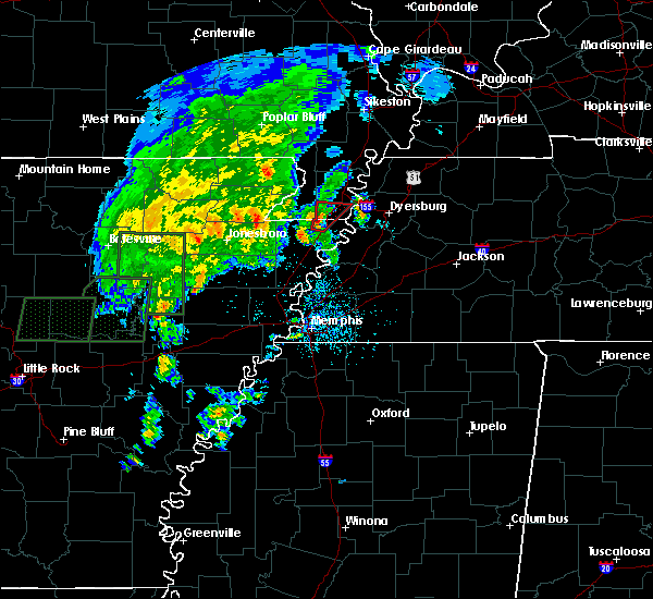 At 506 pm cdt, doppler radar indicated a severe thunderstorm producing a tornado was located over blytheville, moving northeast at 25 mph (radar indicated rotation). Hazards include tornado. Flying debris will be dangerous to those caught without shelter. mobile homes will be damaged or destroyed. damage to roofs, windows, and vehicles will occur. Tree damage is likely. At 506 pm cdt, doppler radar indicated a severe thunderstorm producing a tornado was located over blytheville, moving northeast at 25 mph (radar indicated rotation). Hazards include tornado. Flying debris will be dangerous to those caught without shelter. mobile homes will be damaged or destroyed. damage to roofs, windows, and vehicles will occur. Tree damage is likely.
|
| 3/14/2019 7:57 AM CDT |
 At 756 am cdt, a severe thunderstorm was located near gosnell, moving northeast at 65 mph (radar indicated). Hazards include 60 mph wind gusts. expect damage to roofs, siding, and trees At 756 am cdt, a severe thunderstorm was located near gosnell, moving northeast at 65 mph (radar indicated). Hazards include 60 mph wind gusts. expect damage to roofs, siding, and trees
|
| 3/14/2019 6:45 AM CDT |
 At 645 am cdt, a severe thunderstorm was located near lake city, moving northeast at 45 mph (radar indicated). Hazards include 60 mph wind gusts. expect damage to roofs, siding, and trees At 645 am cdt, a severe thunderstorm was located near lake city, moving northeast at 45 mph (radar indicated). Hazards include 60 mph wind gusts. expect damage to roofs, siding, and trees
|
| 6/28/2018 10:37 PM CDT |
 At 1037 pm cdt, a severe thunderstorm was located near heloise, or 9 miles southeast of steele, moving southwest at 35 mph (radar indicated). Hazards include 60 mph wind gusts and quarter size hail. Hail damage to vehicles is expected. expect wind damage to roofs, siding, and trees. Locations impacted include, dyersburg, blytheville, caruthersville, gosnell, manila, hayti, steele, newbern, halls, hornersville, hayti heights, cooter, dell, burdette, chestnut bluff, deering, bradleytown, heloise, unionville and bolton. At 1037 pm cdt, a severe thunderstorm was located near heloise, or 9 miles southeast of steele, moving southwest at 35 mph (radar indicated). Hazards include 60 mph wind gusts and quarter size hail. Hail damage to vehicles is expected. expect wind damage to roofs, siding, and trees. Locations impacted include, dyersburg, blytheville, caruthersville, gosnell, manila, hayti, steele, newbern, halls, hornersville, hayti heights, cooter, dell, burdette, chestnut bluff, deering, bradleytown, heloise, unionville and bolton.
|
| 6/28/2018 10:01 PM CDT |
 At 1000 pm cdt, a severe thunderstorm was located near miston, or 10 miles south of reelfoot lake state park, moving southwest at 35 mph (radar indicated). Hazards include 60 mph wind gusts and quarter size hail. Hail damage to vehicles is expected. Expect wind damage to roofs, siding, and trees. At 1000 pm cdt, a severe thunderstorm was located near miston, or 10 miles south of reelfoot lake state park, moving southwest at 35 mph (radar indicated). Hazards include 60 mph wind gusts and quarter size hail. Hail damage to vehicles is expected. Expect wind damage to roofs, siding, and trees.
|
| 6/28/2018 9:22 PM CDT |
 At 922 pm cdt, a severe thunderstorm was located near troy, or 8 miles west of union city, moving south at 60 mph (radar indicated). Hazards include 60 mph wind gusts and quarter size hail. Hail damage to vehicles is expected. Expect wind damage to roofs, siding, and trees. At 922 pm cdt, a severe thunderstorm was located near troy, or 8 miles west of union city, moving south at 60 mph (radar indicated). Hazards include 60 mph wind gusts and quarter size hail. Hail damage to vehicles is expected. Expect wind damage to roofs, siding, and trees.
|
| 6/1/2018 5:24 AM CDT |
 At 524 am cdt, a severe thunderstorm was located over cooter, or near steele, moving east at 45 mph (radar indicated). Hazards include 60 mph wind gusts and quarter size hail. Hail damage to vehicles is expected. Expect wind damage to roofs, siding, and trees. At 524 am cdt, a severe thunderstorm was located over cooter, or near steele, moving east at 45 mph (radar indicated). Hazards include 60 mph wind gusts and quarter size hail. Hail damage to vehicles is expected. Expect wind damage to roofs, siding, and trees.
|
| 6/1/2018 5:24 AM CDT |
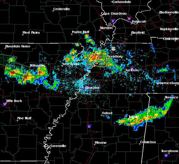 At 524 am cdt, a severe thunderstorm was located over cooter, or near steele, moving east at 45 mph (radar indicated). Hazards include 60 mph wind gusts and quarter size hail. Hail damage to vehicles is expected. Expect wind damage to roofs, siding, and trees. At 524 am cdt, a severe thunderstorm was located over cooter, or near steele, moving east at 45 mph (radar indicated). Hazards include 60 mph wind gusts and quarter size hail. Hail damage to vehicles is expected. Expect wind damage to roofs, siding, and trees.
|
| 6/1/2018 1:19 AM CDT |
 At 119 am cdt, severe thunderstorms were located along a line extending from near heloise to near weiner, moving southeast at 35 mph (radar indicated). Hazards include 70 mph wind gusts. Expect considerable tree damage. damage is likely to mobile homes, roofs, and outbuildings. Locations impacted include, jonesboro, blytheville, ripley, osceola, trumann, caruthersville, gosnell, manila, marked tree, harrisburg, steele, lake city, leachville, lepanto, bay, monette, caraway, luxora, wilson and tyronza. At 119 am cdt, severe thunderstorms were located along a line extending from near heloise to near weiner, moving southeast at 35 mph (radar indicated). Hazards include 70 mph wind gusts. Expect considerable tree damage. damage is likely to mobile homes, roofs, and outbuildings. Locations impacted include, jonesboro, blytheville, ripley, osceola, trumann, caruthersville, gosnell, manila, marked tree, harrisburg, steele, lake city, leachville, lepanto, bay, monette, caraway, luxora, wilson and tyronza.
|
| 6/1/2018 12:58 AM CDT |
 At 1258 am cdt, severe thunderstorms were located along a line extending from near cooter to 6 miles northeast of grubbs, moving southeast at 35 mph (radar indicated). Hazards include 70 mph wind gusts. Expect considerable tree damage. Damage is likely to mobile homes, roofs, and outbuildings. At 1258 am cdt, severe thunderstorms were located along a line extending from near cooter to 6 miles northeast of grubbs, moving southeast at 35 mph (radar indicated). Hazards include 70 mph wind gusts. Expect considerable tree damage. Damage is likely to mobile homes, roofs, and outbuildings.
|
| 6/1/2018 12:18 AM CDT |
 At 1218 am cdt, a severe thunderstorm was located over cooter, or near steele, moving southeast at 45 mph (radar indicated). Hazards include 60 mph wind gusts and quarter size hail. Hail damage to vehicles is expected. Expect wind damage to roofs, siding, and trees. At 1218 am cdt, a severe thunderstorm was located over cooter, or near steele, moving southeast at 45 mph (radar indicated). Hazards include 60 mph wind gusts and quarter size hail. Hail damage to vehicles is expected. Expect wind damage to roofs, siding, and trees.
|
| 6/1/2018 12:00 AM CDT |
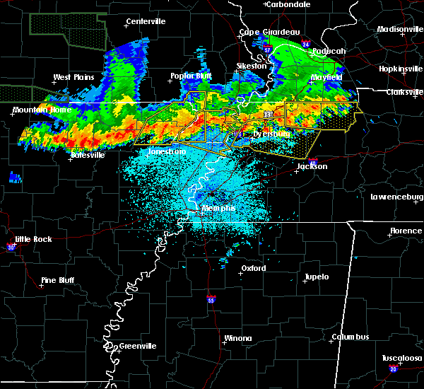 At 1200 am cdt, a severe thunderstorm was located over kennett, moving east at 50 mph (radar indicated). Hazards include 60 mph wind gusts. expect damage to roofs, siding, and trees At 1200 am cdt, a severe thunderstorm was located over kennett, moving east at 50 mph (radar indicated). Hazards include 60 mph wind gusts. expect damage to roofs, siding, and trees
|
| 5/20/2018 3:30 PM CDT |
 At 330 pm cdt, a severe thunderstorm was located near marston, or near portageville, moving east at 25 mph (radar indicated). Hazards include golf ball size hail and 60 mph wind gusts. People and animals outdoors will be injured. expect hail damage to roofs, siding, windows, and vehicles. Expect wind damage to roofs, siding, and trees. At 330 pm cdt, a severe thunderstorm was located near marston, or near portageville, moving east at 25 mph (radar indicated). Hazards include golf ball size hail and 60 mph wind gusts. People and animals outdoors will be injured. expect hail damage to roofs, siding, windows, and vehicles. Expect wind damage to roofs, siding, and trees.
|
| 5/20/2018 2:59 PM CDT |
 At 259 pm cdt, a severe thunderstorm was located near gosnell, moving northeast at 20 mph (radar indicated). Hazards include tennis ball size hail and 60 mph wind gusts. People and animals outdoors will be injured. expect hail damage to roofs, siding, windows, and vehicles. Expect wind damage to roofs, siding, and trees. At 259 pm cdt, a severe thunderstorm was located near gosnell, moving northeast at 20 mph (radar indicated). Hazards include tennis ball size hail and 60 mph wind gusts. People and animals outdoors will be injured. expect hail damage to roofs, siding, windows, and vehicles. Expect wind damage to roofs, siding, and trees.
|
| 5/19/2018 3:02 PM CDT |
 At 302 pm cdt, a severe thunderstorm was located over heloise, or 9 miles southeast of steele, moving northeast at 15 mph (radar indicated). Hazards include 60 mph wind gusts and quarter size hail. Hail damage to vehicles is expected. Expect wind damage to roofs, siding, and trees. At 302 pm cdt, a severe thunderstorm was located over heloise, or 9 miles southeast of steele, moving northeast at 15 mph (radar indicated). Hazards include 60 mph wind gusts and quarter size hail. Hail damage to vehicles is expected. Expect wind damage to roofs, siding, and trees.
|
| 4/14/2018 12:27 AM CDT |
 The severe thunderstorm warning for eastern greene, eastern craighead, eastern poinsett, mississippi, southeastern clay, pemiscot and southern dunklin counties will expire at 1230 am cdt, the storms which prompted the warning have moved out of the area. therefore the warning will be allowed to expire. a tornado watch remains in effect until 600 am cdt for eastern arkansas, southeastern missouri, and southwestern and northwestern tennessee. The severe thunderstorm warning for eastern greene, eastern craighead, eastern poinsett, mississippi, southeastern clay, pemiscot and southern dunklin counties will expire at 1230 am cdt, the storms which prompted the warning have moved out of the area. therefore the warning will be allowed to expire. a tornado watch remains in effect until 600 am cdt for eastern arkansas, southeastern missouri, and southwestern and northwestern tennessee.
|
| 4/13/2018 11:42 PM CDT |
 At 1142 pm cdt, severe thunderstorms were located along a line extending from near marmaduke to near harrisburg, moving east at 45 mph (radar indicated). Hazards include 60 mph wind gusts. expect damage to roofs, siding, and trees At 1142 pm cdt, severe thunderstorms were located along a line extending from near marmaduke to near harrisburg, moving east at 45 mph (radar indicated). Hazards include 60 mph wind gusts. expect damage to roofs, siding, and trees
|
| 4/3/2018 6:50 PM CDT |
 The tornado warning for northeastern mississippi and southern pemiscot counties will expire at 700 pm cdt, the storm which prompted the warning has weakened below severe limits, and has exited the warned area. therefore, the warning will be allowed to expire. however heavy rain is still possible with this thunderstorm. a tornado watch remains in effect until 800 pm cdt for eastern arkansas, southeastern missouri, and northwestern tennessee. The tornado warning for northeastern mississippi and southern pemiscot counties will expire at 700 pm cdt, the storm which prompted the warning has weakened below severe limits, and has exited the warned area. therefore, the warning will be allowed to expire. however heavy rain is still possible with this thunderstorm. a tornado watch remains in effect until 800 pm cdt for eastern arkansas, southeastern missouri, and northwestern tennessee.
|
| 4/3/2018 6:50 PM CDT |
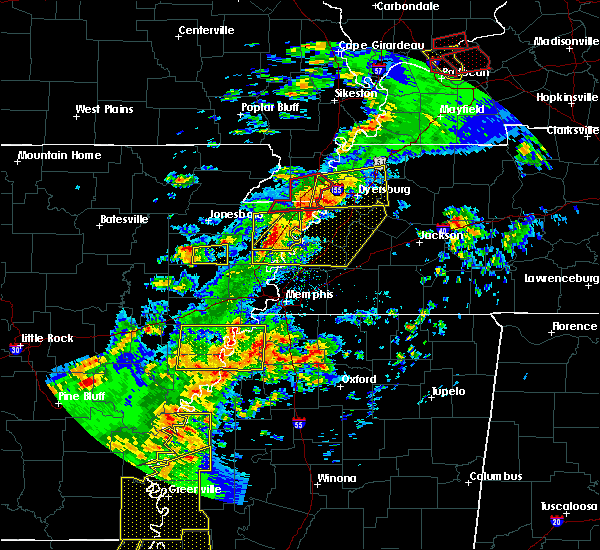 The tornado warning for northeastern mississippi and southern pemiscot counties will expire at 700 pm cdt, the storm which prompted the warning has weakened below severe limits, and has exited the warned area. therefore, the warning will be allowed to expire. however heavy rain is still possible with this thunderstorm. a tornado watch remains in effect until 800 pm cdt for eastern arkansas, southeastern missouri, and northwestern tennessee. The tornado warning for northeastern mississippi and southern pemiscot counties will expire at 700 pm cdt, the storm which prompted the warning has weakened below severe limits, and has exited the warned area. therefore, the warning will be allowed to expire. however heavy rain is still possible with this thunderstorm. a tornado watch remains in effect until 800 pm cdt for eastern arkansas, southeastern missouri, and northwestern tennessee.
|
| 4/3/2018 6:36 PM CDT |
 At 636 pm cdt, a severe thunderstorm producing a tornado was located over cooter, or near steele, moving east at 50 mph (radar indicated rotation). Hazards include tornado and half dollar size hail. Flying debris will be dangerous to those caught without shelter. mobile homes will be damaged or destroyed. damage to roofs, windows, and vehicles will occur. tree damage is likely. Locations impacted include, blytheville, caruthersville, gosnell, manila, hayti, steele, hayti heights, cooter, deering, holland, calumet, burton, woodland corner, hickman, stark city, number nine, huffman, yarbro, west hermondale and new survey. At 636 pm cdt, a severe thunderstorm producing a tornado was located over cooter, or near steele, moving east at 50 mph (radar indicated rotation). Hazards include tornado and half dollar size hail. Flying debris will be dangerous to those caught without shelter. mobile homes will be damaged or destroyed. damage to roofs, windows, and vehicles will occur. tree damage is likely. Locations impacted include, blytheville, caruthersville, gosnell, manila, hayti, steele, hayti heights, cooter, deering, holland, calumet, burton, woodland corner, hickman, stark city, number nine, huffman, yarbro, west hermondale and new survey.
|
| 4/3/2018 6:19 PM CDT |
 At 613 pm cdt, a severe thunderstorm producing a tornado was located over hornersville, or 8 miles south of senath, moving east at 45 mph (weather spotters reported a funnel cloud). Hazards include tornado and quarter size hail. Flying debris will be dangerous to those caught without shelter. mobile homes will be damaged or destroyed. damage to roofs, windows, and vehicles will occur. tree damage is likely. Locations impacted include, blytheville, caruthersville, gosnell, manila, hayti, steele, leachville, senath, cardwell, hornersville, hayti heights, arbyrd, cooter, deering, holland, calumet, buckeye, arkmo, stark city and huffman. At 613 pm cdt, a severe thunderstorm producing a tornado was located over hornersville, or 8 miles south of senath, moving east at 45 mph (weather spotters reported a funnel cloud). Hazards include tornado and quarter size hail. Flying debris will be dangerous to those caught without shelter. mobile homes will be damaged or destroyed. damage to roofs, windows, and vehicles will occur. tree damage is likely. Locations impacted include, blytheville, caruthersville, gosnell, manila, hayti, steele, leachville, senath, cardwell, hornersville, hayti heights, arbyrd, cooter, deering, holland, calumet, buckeye, arkmo, stark city and huffman.
|
| 4/3/2018 6:19 PM CDT |
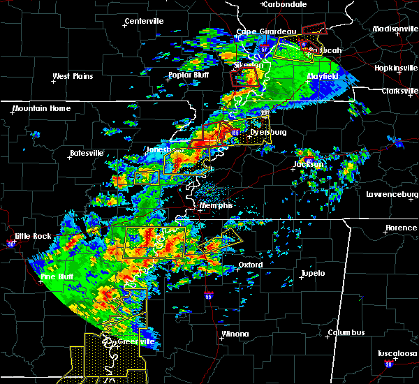 At 613 pm cdt, a severe thunderstorm producing a tornado was located over hornersville, or 8 miles south of senath, moving east at 45 mph (weather spotters reported a funnel cloud). Hazards include tornado and quarter size hail. Flying debris will be dangerous to those caught without shelter. mobile homes will be damaged or destroyed. damage to roofs, windows, and vehicles will occur. tree damage is likely. Locations impacted include, blytheville, caruthersville, gosnell, manila, hayti, steele, leachville, senath, cardwell, hornersville, hayti heights, arbyrd, cooter, deering, holland, calumet, buckeye, arkmo, stark city and huffman. At 613 pm cdt, a severe thunderstorm producing a tornado was located over hornersville, or 8 miles south of senath, moving east at 45 mph (weather spotters reported a funnel cloud). Hazards include tornado and quarter size hail. Flying debris will be dangerous to those caught without shelter. mobile homes will be damaged or destroyed. damage to roofs, windows, and vehicles will occur. tree damage is likely. Locations impacted include, blytheville, caruthersville, gosnell, manila, hayti, steele, leachville, senath, cardwell, hornersville, hayti heights, arbyrd, cooter, deering, holland, calumet, buckeye, arkmo, stark city and huffman.
|
| 4/3/2018 6:13 PM CDT |
 At 613 pm cdt, a severe thunderstorm producing a tornado was located over hornersville, or 8 miles south of senath, moving east at 45 mph (weather spotters reported a funnel cloud). Hazards include tornado and quarter size hail. Flying debris will be dangerous to those caught without shelter. mobile homes will be damaged or destroyed. damage to roofs, windows, and vehicles will occur. tree damage is likely. Locations impacted include, blytheville, caruthersville, gosnell, manila, hayti, steele, leachville, senath, cardwell, hornersville, hayti heights, arbyrd, cooter, deering, holland, calumet, buckeye, arkmo, stark city and huffman. At 613 pm cdt, a severe thunderstorm producing a tornado was located over hornersville, or 8 miles south of senath, moving east at 45 mph (weather spotters reported a funnel cloud). Hazards include tornado and quarter size hail. Flying debris will be dangerous to those caught without shelter. mobile homes will be damaged or destroyed. damage to roofs, windows, and vehicles will occur. tree damage is likely. Locations impacted include, blytheville, caruthersville, gosnell, manila, hayti, steele, leachville, senath, cardwell, hornersville, hayti heights, arbyrd, cooter, deering, holland, calumet, buckeye, arkmo, stark city and huffman.
|
| 4/3/2018 6:08 PM CDT |
 At 607 pm cdt, a severe thunderstorm producing a tornado was located near arbyrd, or near leachville, moving east at 50 mph (weather spotters reported funnel cloud). Hazards include tornado and quarter size hail. Flying debris will be dangerous to those caught without shelter. mobile homes will be damaged or destroyed. damage to roofs, windows, and vehicles will occur. Tree damage is likely. At 607 pm cdt, a severe thunderstorm producing a tornado was located near arbyrd, or near leachville, moving east at 50 mph (weather spotters reported funnel cloud). Hazards include tornado and quarter size hail. Flying debris will be dangerous to those caught without shelter. mobile homes will be damaged or destroyed. damage to roofs, windows, and vehicles will occur. Tree damage is likely.
|
| 2/24/2018 6:53 PM CST |
 The severe thunderstorm warning for northeastern mississippi, pemiscot, dyer, western obion, northeastern lauderdale and lake counties will expire at 700 pm cst, the storms which prompted the warning have moved out of the area. therefore the warning will be allowed to expire. a tornado watch remains in effect until 900 pm cst for eastern arkansas, southeastern missouri, and southwestern and northwestern tennessee. The severe thunderstorm warning for northeastern mississippi, pemiscot, dyer, western obion, northeastern lauderdale and lake counties will expire at 700 pm cst, the storms which prompted the warning have moved out of the area. therefore the warning will be allowed to expire. a tornado watch remains in effect until 900 pm cst for eastern arkansas, southeastern missouri, and southwestern and northwestern tennessee.
|
| 2/24/2018 6:22 PM CST |
 At 622 pm cst, severe thunderstorms were located along a line extending from near parma to near burdette, moving east at 50 mph (radar indicated). Hazards include 60 mph wind gusts. expect damage to roofs, siding, and trees At 622 pm cst, severe thunderstorms were located along a line extending from near parma to near burdette, moving east at 50 mph (radar indicated). Hazards include 60 mph wind gusts. expect damage to roofs, siding, and trees
|
| 2/24/2018 6:22 PM CST |
 The national weather service in memphis has issued a * severe thunderstorm warning for. northeastern mississippi county in eastern arkansas. pemiscot county in southeastern missouri. dyer county in northwestern tennessee. Western obion county in northwestern tennessee. The national weather service in memphis has issued a * severe thunderstorm warning for. northeastern mississippi county in eastern arkansas. pemiscot county in southeastern missouri. dyer county in northwestern tennessee. Western obion county in northwestern tennessee.
|
| 2/24/2018 6:22 PM CST |
 At 622 pm cst, severe thunderstorms were located along a line extending from near parma to near burdette, moving east at 50 mph (radar indicated). Hazards include 60 mph wind gusts. expect damage to roofs, siding, and trees At 622 pm cst, severe thunderstorms were located along a line extending from near parma to near burdette, moving east at 50 mph (radar indicated). Hazards include 60 mph wind gusts. expect damage to roofs, siding, and trees
|
| 2/24/2018 6:04 PM CST |
 At 603 pm cst, severe thunderstorms were located along a line extending from kennett to bassett, moving northeast at 60 mph (radar indicated). Hazards include 60 mph wind gusts. Expect damage to roofs, siding, and trees. locations impacted include, blytheville, kennett, osceola, gosnell, manila, portageville, hayti, marked tree, steele, leachville, lepanto, senath, caraway, luxora, wilson, tyronza, keiser, fort pillow state park, hornersville and hayti heights. A tornado watch remains in effect until 900 pm cst for eastern arkansas, southeastern missouri, and southwestern and northwestern tennessee. At 603 pm cst, severe thunderstorms were located along a line extending from kennett to bassett, moving northeast at 60 mph (radar indicated). Hazards include 60 mph wind gusts. Expect damage to roofs, siding, and trees. locations impacted include, blytheville, kennett, osceola, gosnell, manila, portageville, hayti, marked tree, steele, leachville, lepanto, senath, caraway, luxora, wilson, tyronza, keiser, fort pillow state park, hornersville and hayti heights. A tornado watch remains in effect until 900 pm cst for eastern arkansas, southeastern missouri, and southwestern and northwestern tennessee.
|
| 2/24/2018 5:42 PM CST |
 At 542 pm cst, severe thunderstorms were located along a line extending from near cardwell to near tyronza, moving northeast at 55 mph (radar indicated). Hazards include 60 mph wind gusts. expect damage to roofs, siding, and trees At 542 pm cst, severe thunderstorms were located along a line extending from near cardwell to near tyronza, moving northeast at 55 mph (radar indicated). Hazards include 60 mph wind gusts. expect damage to roofs, siding, and trees
|
| 9/18/2017 5:35 PM CDT |
 The severe thunderstorm warning for southeastern pemiscot, western dyer and southwestern lake counties will expire at 545 pm cdt, the severe thunderstorm which prompted the warning has weakened. therefore, the warning will be allowed to expire. The severe thunderstorm warning for southeastern pemiscot, western dyer and southwestern lake counties will expire at 545 pm cdt, the severe thunderstorm which prompted the warning has weakened. therefore, the warning will be allowed to expire.
|
| 9/18/2017 5:16 PM CDT |
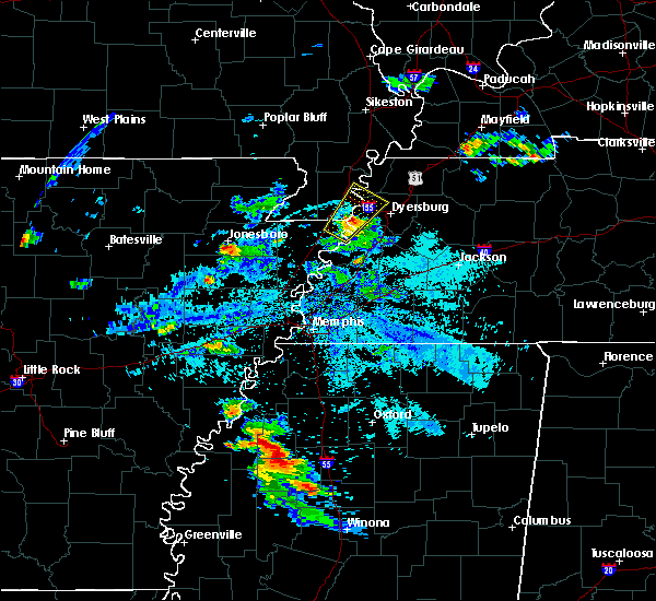 At 514 pm cdt, a severe thunderstorm was located near heloise, or 9 miles southeast of steele, moving northeast at 25 mph. a wind gust of 56 mph was recorded at blytheville (radar indicated). Hazards include 60 mph wind gusts and quarter size hail. Hail damage to vehicles is expected. expect wind damage to roofs, siding, and trees. Locations impacted include, caruthersville, hayti, cooter, heloise, miston, lenox, ayers, bogota, tennemo, hathaway, boothspoint, big boy junction, mengelwood, tylersville, owl hoot, chic, stinger, tyler, stubtown and cottonwood point. At 514 pm cdt, a severe thunderstorm was located near heloise, or 9 miles southeast of steele, moving northeast at 25 mph. a wind gust of 56 mph was recorded at blytheville (radar indicated). Hazards include 60 mph wind gusts and quarter size hail. Hail damage to vehicles is expected. expect wind damage to roofs, siding, and trees. Locations impacted include, caruthersville, hayti, cooter, heloise, miston, lenox, ayers, bogota, tennemo, hathaway, boothspoint, big boy junction, mengelwood, tylersville, owl hoot, chic, stinger, tyler, stubtown and cottonwood point.
|
| 9/18/2017 5:16 PM CDT |
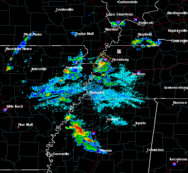 At 514 pm cdt, a severe thunderstorm was located near heloise, or 9 miles southeast of steele, moving northeast at 25 mph. a wind gust of 56 mph was recorded at blytheville (radar indicated). Hazards include 60 mph wind gusts and quarter size hail. Hail damage to vehicles is expected. expect wind damage to roofs, siding, and trees. Locations impacted include, caruthersville, hayti, cooter, heloise, miston, lenox, ayers, bogota, tennemo, hathaway, boothspoint, big boy junction, mengelwood, tylersville, owl hoot, chic, stinger, tyler, stubtown and cottonwood point. At 514 pm cdt, a severe thunderstorm was located near heloise, or 9 miles southeast of steele, moving northeast at 25 mph. a wind gust of 56 mph was recorded at blytheville (radar indicated). Hazards include 60 mph wind gusts and quarter size hail. Hail damage to vehicles is expected. expect wind damage to roofs, siding, and trees. Locations impacted include, caruthersville, hayti, cooter, heloise, miston, lenox, ayers, bogota, tennemo, hathaway, boothspoint, big boy junction, mengelwood, tylersville, owl hoot, chic, stinger, tyler, stubtown and cottonwood point.
|
| 9/18/2017 5:01 PM CDT |
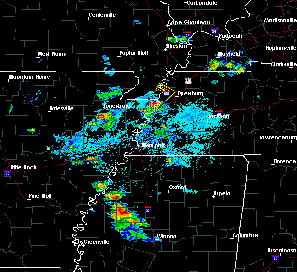 At 501 pm cdt, a severe thunderstorm was located 8 miles south of cooter, or 8 miles east of blytheville, moving northeast at 25 mph (radar indicated). Hazards include 60 mph wind gusts and quarter size hail. Hail damage to vehicles is expected. Expect wind damage to roofs, siding, and trees. At 501 pm cdt, a severe thunderstorm was located 8 miles south of cooter, or 8 miles east of blytheville, moving northeast at 25 mph (radar indicated). Hazards include 60 mph wind gusts and quarter size hail. Hail damage to vehicles is expected. Expect wind damage to roofs, siding, and trees.
|
| 9/18/2017 5:01 PM CDT |
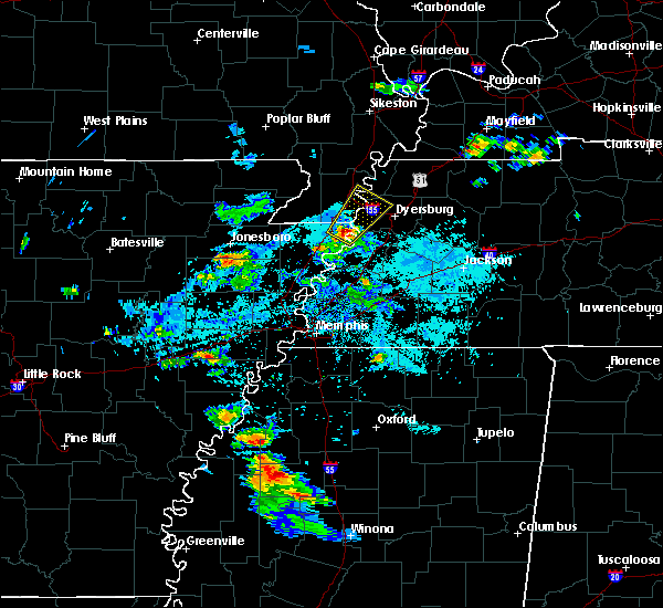 At 501 pm cdt, a severe thunderstorm was located 8 miles south of cooter, or 8 miles east of blytheville, moving northeast at 25 mph (radar indicated). Hazards include 60 mph wind gusts and quarter size hail. Hail damage to vehicles is expected. Expect wind damage to roofs, siding, and trees. At 501 pm cdt, a severe thunderstorm was located 8 miles south of cooter, or 8 miles east of blytheville, moving northeast at 25 mph (radar indicated). Hazards include 60 mph wind gusts and quarter size hail. Hail damage to vehicles is expected. Expect wind damage to roofs, siding, and trees.
|
| 9/18/2017 5:01 PM CDT |
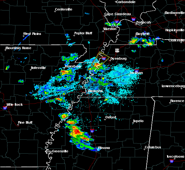 At 501 pm cdt, a severe thunderstorm was located 8 miles south of cooter, or 8 miles east of blytheville, moving northeast at 25 mph (radar indicated). Hazards include 60 mph wind gusts and quarter size hail. Hail damage to vehicles is expected. Expect wind damage to roofs, siding, and trees. At 501 pm cdt, a severe thunderstorm was located 8 miles south of cooter, or 8 miles east of blytheville, moving northeast at 25 mph (radar indicated). Hazards include 60 mph wind gusts and quarter size hail. Hail damage to vehicles is expected. Expect wind damage to roofs, siding, and trees.
|
| 5/27/2017 10:16 PM CDT | Numerous trees dow in pemiscot county MO, 0.1 miles S of Cooter, MO |
| 5/27/2017 10:16 PM CDT |
 At 1016 pm cdt, a severe thunderstorm was located near caruthersville, moving southeast at 70 mph. this is a very dangerous storm (radar indicated). Hazards include 80 mph wind gusts and quarter size hail. Flying debris will be dangerous to those caught without shelter. mobile homes will be heavily damaged. expect considerable damage to roofs, windows, and vehicles. extensive tree damage and power outages are likely. locations impacted include, dyersburg, blytheville, kennett, ripley, caruthersville, gosnell, portageville, hayti, steele, senath, reelfoot lake state park, tiptonville, ridgely, clarkton, hornersville, holcomb, hayti heights, arbyrd, cooter and wardell. a tornado watch remains in effect until 200 am cdt for eastern arkansas, and southeastern missouri. A tornado watch also remains in effect until 500 am cdt for western tennessee. At 1016 pm cdt, a severe thunderstorm was located near caruthersville, moving southeast at 70 mph. this is a very dangerous storm (radar indicated). Hazards include 80 mph wind gusts and quarter size hail. Flying debris will be dangerous to those caught without shelter. mobile homes will be heavily damaged. expect considerable damage to roofs, windows, and vehicles. extensive tree damage and power outages are likely. locations impacted include, dyersburg, blytheville, kennett, ripley, caruthersville, gosnell, portageville, hayti, steele, senath, reelfoot lake state park, tiptonville, ridgely, clarkton, hornersville, holcomb, hayti heights, arbyrd, cooter and wardell. a tornado watch remains in effect until 200 am cdt for eastern arkansas, and southeastern missouri. A tornado watch also remains in effect until 500 am cdt for western tennessee.
|
| 5/27/2017 9:55 PM CDT |
 At 955 pm cdt, a severe thunderstorm was located near holcomb, or near kennett, moving southeast at 70 mph (radar indicated). Hazards include 70 mph wind gusts and quarter size hail. Hail damage to vehicles is expected. expect considerable tree damage. Wind damage is also likely to mobile homes, roofs, and outbuildings. At 955 pm cdt, a severe thunderstorm was located near holcomb, or near kennett, moving southeast at 70 mph (radar indicated). Hazards include 70 mph wind gusts and quarter size hail. Hail damage to vehicles is expected. expect considerable tree damage. Wind damage is also likely to mobile homes, roofs, and outbuildings.
|
| 5/27/2017 6:45 AM CDT |
 At 645 am cdt, severe thunderstorms were located along a line extending from near arbyrd to near leachville to near caraway, moving east at 45 mph (radar indicated). Hazards include 60 mph wind gusts and quarter size hail. Hail damage to vehicles is expected. Expect wind damage to roofs, siding, and trees. At 645 am cdt, severe thunderstorms were located along a line extending from near arbyrd to near leachville to near caraway, moving east at 45 mph (radar indicated). Hazards include 60 mph wind gusts and quarter size hail. Hail damage to vehicles is expected. Expect wind damage to roofs, siding, and trees.
|
| 4/30/2017 2:27 AM CDT |
 At 227 am cdt, a severe thunderstorm producing a tornado was located near heloise, or 11 miles southeast of steele, moving east at 60 mph (radar indicated rotation). Hazards include tornado. Flying debris will be dangerous to those caught without shelter. mobile homes will be damaged or destroyed. damage to roofs, windows, and vehicles will occur. tree damage is likely. this dangerous storm will be near, unionville around 240 am cdt. bradleytown around 245 am cdt. dyersburg around 250 am cdt. newbern around 255 am cdt. dyer around 305 am cdt. kenton and rutherford around 310 am cdt. Other locations impacted by this tornadic thunderstorm include cat corner, grizzard, fowlkes, lapata, bonicord, central, tyler, locust grove, jenkinsville and maxey. At 227 am cdt, a severe thunderstorm producing a tornado was located near heloise, or 11 miles southeast of steele, moving east at 60 mph (radar indicated rotation). Hazards include tornado. Flying debris will be dangerous to those caught without shelter. mobile homes will be damaged or destroyed. damage to roofs, windows, and vehicles will occur. tree damage is likely. this dangerous storm will be near, unionville around 240 am cdt. bradleytown around 245 am cdt. dyersburg around 250 am cdt. newbern around 255 am cdt. dyer around 305 am cdt. kenton and rutherford around 310 am cdt. Other locations impacted by this tornadic thunderstorm include cat corner, grizzard, fowlkes, lapata, bonicord, central, tyler, locust grove, jenkinsville and maxey.
|
| 4/30/2017 2:00 AM CDT |
 At 200 am cdt, a severe thunderstorm producing a tornado was located near arbyrd, or near leachville, moving east at 60 mph (radar indicated rotation). Hazards include tornado. Flying debris will be dangerous to those caught without shelter. mobile homes will be damaged or destroyed. damage to roofs, windows, and vehicles will occur. tree damage is likely. this dangerous storm will be near, hornersville around 210 am cdt. blytheville and gosnell around 215 am cdt. steele and cooter around 225 am cdt. hayti and hayti heights around 230 am cdt. caruthersville around 235 am cdt. Other locations impacted by this tornadic thunderstorm include jolliff store, west hermondale, paulding, delfore, calumet, dearman, new survey, vail, denton and tomato. At 200 am cdt, a severe thunderstorm producing a tornado was located near arbyrd, or near leachville, moving east at 60 mph (radar indicated rotation). Hazards include tornado. Flying debris will be dangerous to those caught without shelter. mobile homes will be damaged or destroyed. damage to roofs, windows, and vehicles will occur. tree damage is likely. this dangerous storm will be near, hornersville around 210 am cdt. blytheville and gosnell around 215 am cdt. steele and cooter around 225 am cdt. hayti and hayti heights around 230 am cdt. caruthersville around 235 am cdt. Other locations impacted by this tornadic thunderstorm include jolliff store, west hermondale, paulding, delfore, calumet, dearman, new survey, vail, denton and tomato.
|
| 4/29/2017 9:06 PM CDT |
 The severe thunderstorm warning for mississippi, eastern clay, southwestern pemiscot, southern dunklin and northwestern lauderdale counties will expire at 915 pm cdt, the storms which prompted the warning have weakened below severe limits, and have exited the warned area. therefore, the warning will be allowed to expire. however heavy rain is still possible with these thunderstorms. The severe thunderstorm warning for mississippi, eastern clay, southwestern pemiscot, southern dunklin and northwestern lauderdale counties will expire at 915 pm cdt, the storms which prompted the warning have weakened below severe limits, and have exited the warned area. therefore, the warning will be allowed to expire. however heavy rain is still possible with these thunderstorms.
|
| 4/29/2017 8:49 PM CDT |
 At 849 pm cdt, severe thunderstorms were located along a line extending from near senath to 6 miles north of ashport, moving northeast at 50 mph (radar indicated). Hazards include 60 mph wind gusts. Expect damage to roofs, siding, and trees. Locations impacted include, blytheville, kennett, osceola, piggott, gosnell, manila, steele, leachville, rector, senath, caraway, luxora, keiser, cardwell, hornersville, arbyrd, cooter, dell, pollard and greenway. At 849 pm cdt, severe thunderstorms were located along a line extending from near senath to 6 miles north of ashport, moving northeast at 50 mph (radar indicated). Hazards include 60 mph wind gusts. Expect damage to roofs, siding, and trees. Locations impacted include, blytheville, kennett, osceola, piggott, gosnell, manila, steele, leachville, rector, senath, caraway, luxora, keiser, cardwell, hornersville, arbyrd, cooter, dell, pollard and greenway.
|
| 4/29/2017 8:18 PM CDT |
 At 817 pm cdt, a severe thunderstorm was located over caraway, moving northeast at 40 mph (radar indicated). Hazards include 60 mph wind gusts. expect damage to roofs, siding, and trees At 817 pm cdt, a severe thunderstorm was located over caraway, moving northeast at 40 mph (radar indicated). Hazards include 60 mph wind gusts. expect damage to roofs, siding, and trees
|
| 4/26/2017 6:22 PM CDT |
 The severe thunderstorm warning for mississippi, southwestern pemiscot, southeastern dunklin, northwestern tipton and western lauderdale counties will expire at 630 pm cdt, the storms which prompted the warning have weakened below severe limits, and no longer pose an immediate threat to life or property. therefore, the warning will be allowed to expire. a severe thunderstorm watch remains in effect until 1100 pm cdt for eastern arkansas, southeastern missouri, and western tennessee. The severe thunderstorm warning for mississippi, southwestern pemiscot, southeastern dunklin, northwestern tipton and western lauderdale counties will expire at 630 pm cdt, the storms which prompted the warning have weakened below severe limits, and no longer pose an immediate threat to life or property. therefore, the warning will be allowed to expire. a severe thunderstorm watch remains in effect until 1100 pm cdt for eastern arkansas, southeastern missouri, and western tennessee.
|
| 4/26/2017 6:13 PM CDT |
 At 613 pm cdt, severe thunderstorms were located along a line extending from near steele to ashport to near millington, moving east at 65 mph (radar indicated). Hazards include 60 mph wind gusts and quarter size hail. Hail damage to vehicles is expected. expect wind damage to roofs, siding, and trees. Locations impacted include, blytheville, osceola, gosnell, manila, steele, luxora, wilson, keiser, fort pillow state park, hornersville, joiner, cooter, dyess, dell, burdette, bassett, marie, fulton, ashport and ft pillow. At 613 pm cdt, severe thunderstorms were located along a line extending from near steele to ashport to near millington, moving east at 65 mph (radar indicated). Hazards include 60 mph wind gusts and quarter size hail. Hail damage to vehicles is expected. expect wind damage to roofs, siding, and trees. Locations impacted include, blytheville, osceola, gosnell, manila, steele, luxora, wilson, keiser, fort pillow state park, hornersville, joiner, cooter, dyess, dell, burdette, bassett, marie, fulton, ashport and ft pillow.
|
| 4/26/2017 5:43 PM CDT |
 At 543 pm cdt, severe thunderstorms were located along a line extending from near cardwell to near lepanto to near crawfordsville, moving east at 65 mph (radar indicated). Hazards include ping pong ball size hail and 60 mph wind gusts. People and animals outdoors will be injured. expect hail damage to roofs, siding, windows, and vehicles. Expect wind damage to roofs, siding, and trees. At 543 pm cdt, severe thunderstorms were located along a line extending from near cardwell to near lepanto to near crawfordsville, moving east at 65 mph (radar indicated). Hazards include ping pong ball size hail and 60 mph wind gusts. People and animals outdoors will be injured. expect hail damage to roofs, siding, windows, and vehicles. Expect wind damage to roofs, siding, and trees.
|
| 3/17/2017 6:50 PM CDT |
 At 650 pm cdt, a severe thunderstorm was located near gosnell, moving east at 45 mph (radar indicated). Hazards include quarter size hail. Damage to vehicles is expected. Locations impacted include, blytheville, gosnell, steele, hornersville, cooter, holland, calumet, burton, number nine, armorel, yarbro, hornersville junction, west hermondale, samford, new survey, channel, gilbert, denton, tyler and covington. At 650 pm cdt, a severe thunderstorm was located near gosnell, moving east at 45 mph (radar indicated). Hazards include quarter size hail. Damage to vehicles is expected. Locations impacted include, blytheville, gosnell, steele, hornersville, cooter, holland, calumet, burton, number nine, armorel, yarbro, hornersville junction, west hermondale, samford, new survey, channel, gilbert, denton, tyler and covington.
|
| 3/17/2017 6:50 PM CDT |
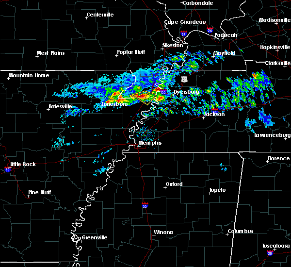 At 650 pm cdt, a severe thunderstorm was located near gosnell, moving east at 45 mph (radar indicated). Hazards include quarter size hail. Damage to vehicles is expected. Locations impacted include, blytheville, gosnell, steele, hornersville, cooter, holland, calumet, burton, number nine, armorel, yarbro, hornersville junction, west hermondale, samford, new survey, channel, gilbert, denton, tyler and covington. At 650 pm cdt, a severe thunderstorm was located near gosnell, moving east at 45 mph (radar indicated). Hazards include quarter size hail. Damage to vehicles is expected. Locations impacted include, blytheville, gosnell, steele, hornersville, cooter, holland, calumet, burton, number nine, armorel, yarbro, hornersville junction, west hermondale, samford, new survey, channel, gilbert, denton, tyler and covington.
|
| 3/17/2017 6:35 PM CDT |
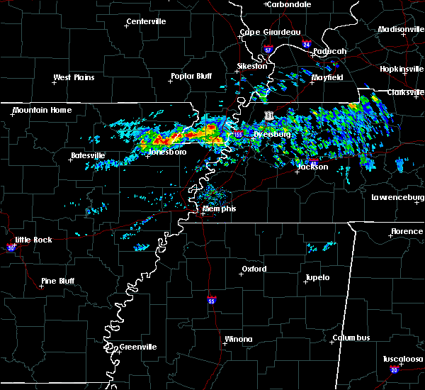 At 635 pm cdt, a severe thunderstorm was located over hornersville, or near senath, moving east at 50 mph (radar indicated). Hazards include quarter size hail. damage to vehicles is expected At 635 pm cdt, a severe thunderstorm was located over hornersville, or near senath, moving east at 50 mph (radar indicated). Hazards include quarter size hail. damage to vehicles is expected
|
| 3/9/2017 8:10 PM CST |
 At 810 pm cst, severe thunderstorms were located along a line extending from near wardell to 6 miles south of mcdougal to near maynard, moving southeast at 40 mph (radar indicated). Hazards include 60 mph wind gusts and quarter size hail. Hail damage to vehicles is expected. Expect wind damage to roofs, siding, and trees. At 810 pm cst, severe thunderstorms were located along a line extending from near wardell to 6 miles south of mcdougal to near maynard, moving southeast at 40 mph (radar indicated). Hazards include 60 mph wind gusts and quarter size hail. Hail damage to vehicles is expected. Expect wind damage to roofs, siding, and trees.
|
| 3/1/2017 4:24 AM CST |
 At 423 am cst, severe thunderstorms producing both tornadoes and extensive straight line wind damage were located along a line extending from 6 miles west of wardell to near blytheville to near gilmore, moving east at 65 mph (radar indicated rotation). Hazards include tornado. Flying debris will be dangerous to those caught without shelter. mobile homes will be damaged or destroyed. damage to roofs, windows, and vehicles will occur. tree damage is likely. these dangerous storms will be near, hayti heights around 430 am cst. hayti and dixonville around 435 am cst. ripley and munford around 445 am cst. brighton, halls and unionville around 450 am cst. Other locations impacted by these tornadic storms include burlison, calumet, new survey, grider, gobler, covington, atoka, poplar grove, shippen and victoria. At 423 am cst, severe thunderstorms producing both tornadoes and extensive straight line wind damage were located along a line extending from 6 miles west of wardell to near blytheville to near gilmore, moving east at 65 mph (radar indicated rotation). Hazards include tornado. Flying debris will be dangerous to those caught without shelter. mobile homes will be damaged or destroyed. damage to roofs, windows, and vehicles will occur. tree damage is likely. these dangerous storms will be near, hayti heights around 430 am cst. hayti and dixonville around 435 am cst. ripley and munford around 445 am cst. brighton, halls and unionville around 450 am cst. Other locations impacted by these tornadic storms include burlison, calumet, new survey, grider, gobler, covington, atoka, poplar grove, shippen and victoria.
|
| 3/1/2017 3:57 AM CST |
 At 354 am cst, severe thunderstorms were located along a line extending from near harviell to near oak grove heights to 6 miles northeast of cherry valley, moving east at 75 mph (radar indicated). Hazards include 75 mph wind gusts. Expect considerable tree damage. damage is likely to mobile homes, roofs, and outbuildings. this line of storms produced a 76 mph gust at walnut ridge at 335 am cst. A 68 mph gust was reported at the jonesboro airport at 350 am cst. At 354 am cst, severe thunderstorms were located along a line extending from near harviell to near oak grove heights to 6 miles northeast of cherry valley, moving east at 75 mph (radar indicated). Hazards include 75 mph wind gusts. Expect considerable tree damage. damage is likely to mobile homes, roofs, and outbuildings. this line of storms produced a 76 mph gust at walnut ridge at 335 am cst. A 68 mph gust was reported at the jonesboro airport at 350 am cst.
|
| 12/26/2016 3:54 PM CST |
 At 353 pm cst, a severe thunderstorm was located near deering, or near steele, moving northeast at 45 mph (radar indicated). Hazards include 60 mph wind gusts. expect damage to roofs, siding, and trees At 353 pm cst, a severe thunderstorm was located near deering, or near steele, moving northeast at 45 mph (radar indicated). Hazards include 60 mph wind gusts. expect damage to roofs, siding, and trees
|
| 12/17/2016 5:51 PM CST |
 At 551 pm cst, a severe thunderstorm was located over blytheville, moving northeast at 70 mph (radar indicated). Hazards include 60 mph wind gusts. expect damage to roofs, siding, and trees At 551 pm cst, a severe thunderstorm was located over blytheville, moving northeast at 70 mph (radar indicated). Hazards include 60 mph wind gusts. expect damage to roofs, siding, and trees
|
| 3/31/2016 11:41 AM CDT | The severe thunderstorm warning for pemiscot county will expire at 1145 am cdt, the storms which prompted the warning have weakened below severe limits, and exited the warned area. therefore the warning will be allowed to expire. however gusty winds up to 50 mph and heavy rain are still possible with these thunderstorms. a severe thunderstorm watch remains in effect until 400 pm cdt for southeastern missouri and western tennessee. |
| 3/31/2016 11:36 AM CDT |
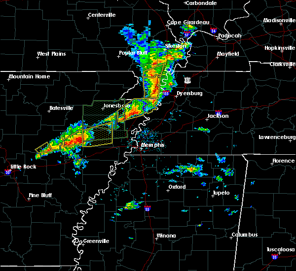 At 1136 am cdt, severe thunderstorms were located along a line extending from near portageville to near cooter, moving east at 50 mph (radar indicated). Hazards include 60 mph wind gusts and quarter size hail. Hail damage to vehicles is expected. expect wind damage to roofs, siding, and trees. Locations impacted include, caruthersville, portageville, hayti, steele, hayti heights, cooter, wardell, bolton, deering, holland, bragg city, pascola, north wardell, homestown, canady, braggadocio, stubtown, samford, denton and hayward. At 1136 am cdt, severe thunderstorms were located along a line extending from near portageville to near cooter, moving east at 50 mph (radar indicated). Hazards include 60 mph wind gusts and quarter size hail. Hail damage to vehicles is expected. expect wind damage to roofs, siding, and trees. Locations impacted include, caruthersville, portageville, hayti, steele, hayti heights, cooter, wardell, bolton, deering, holland, bragg city, pascola, north wardell, homestown, canady, braggadocio, stubtown, samford, denton and hayward.
|
| 3/31/2016 11:12 AM CDT |
 At 1112 am cdt, severe thunderstorms were located along a line extending from near piggott to near hornersville, moving east at 50 mph (radar indicated). Hazards include 60 mph wind gusts and quarter size hail. Hail damage to vehicles is expected. expect wind damage to roofs, siding, and trees. Locations impacted include, kennett, caruthersville, piggott, portageville, hayti, steele, senath, clarkton, hornersville, holcomb, hayti heights, arbyrd, cooter, wardell, greenway, deering, bolton, holland, bragg city and pascola. At 1112 am cdt, severe thunderstorms were located along a line extending from near piggott to near hornersville, moving east at 50 mph (radar indicated). Hazards include 60 mph wind gusts and quarter size hail. Hail damage to vehicles is expected. expect wind damage to roofs, siding, and trees. Locations impacted include, kennett, caruthersville, piggott, portageville, hayti, steele, senath, clarkton, hornersville, holcomb, hayti heights, arbyrd, cooter, wardell, greenway, deering, bolton, holland, bragg city and pascola.
|
| 3/31/2016 11:12 AM CDT |
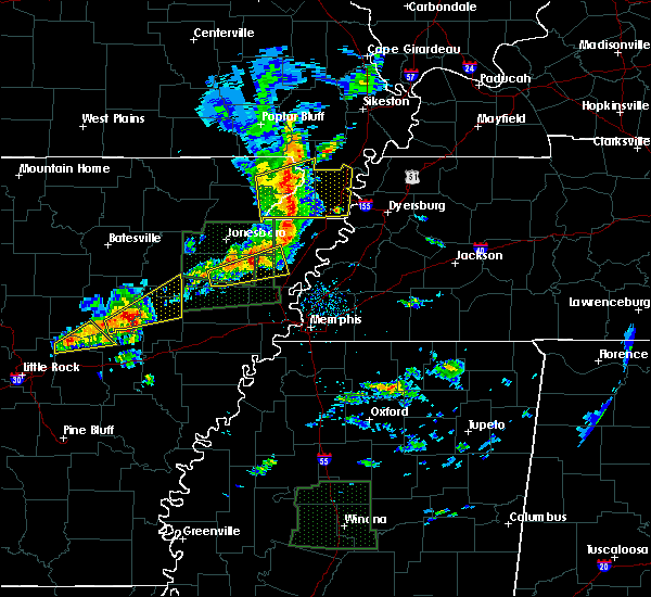 At 1112 am cdt, severe thunderstorms were located along a line extending from near piggott to near hornersville, moving east at 50 mph (radar indicated). Hazards include 60 mph wind gusts and quarter size hail. Hail damage to vehicles is expected. expect wind damage to roofs, siding, and trees. Locations impacted include, kennett, caruthersville, piggott, portageville, hayti, steele, senath, clarkton, hornersville, holcomb, hayti heights, arbyrd, cooter, wardell, greenway, deering, bolton, holland, bragg city and pascola. At 1112 am cdt, severe thunderstorms were located along a line extending from near piggott to near hornersville, moving east at 50 mph (radar indicated). Hazards include 60 mph wind gusts and quarter size hail. Hail damage to vehicles is expected. expect wind damage to roofs, siding, and trees. Locations impacted include, kennett, caruthersville, piggott, portageville, hayti, steele, senath, clarkton, hornersville, holcomb, hayti heights, arbyrd, cooter, wardell, greenway, deering, bolton, holland, bragg city and pascola.
|
| 3/31/2016 10:59 AM CDT |
 At 1059 am cdt, severe thunderstorms were located along a line extending from near rector to near leachville, moving east at 50 mph (radar indicated). Hazards include 60 mph wind gusts and quarter size hail. Hail damage to vehicles is expected. Expect wind damage to roofs, siding, and trees. At 1059 am cdt, severe thunderstorms were located along a line extending from near rector to near leachville, moving east at 50 mph (radar indicated). Hazards include 60 mph wind gusts and quarter size hail. Hail damage to vehicles is expected. Expect wind damage to roofs, siding, and trees.
|
| 3/31/2016 10:59 AM CDT |
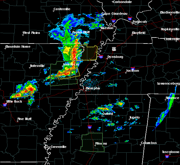 At 1059 am cdt, severe thunderstorms were located along a line extending from near rector to near leachville, moving east at 50 mph (radar indicated). Hazards include 60 mph wind gusts and quarter size hail. Hail damage to vehicles is expected. Expect wind damage to roofs, siding, and trees. At 1059 am cdt, severe thunderstorms were located along a line extending from near rector to near leachville, moving east at 50 mph (radar indicated). Hazards include 60 mph wind gusts and quarter size hail. Hail damage to vehicles is expected. Expect wind damage to roofs, siding, and trees.
|
| 12/23/2015 3:08 PM CST | At 250 pm cst, a severe thunderstorm was located over dell, or near blytheville, moving northeast at 60 mph (radar indicated). Hazards include 60 mph wind gusts and nickel size hail. Expect damage to roofs. siding and trees. this severe thunderstorm will be near, gosnell around 255 pm cst. blytheville around 300 pm cst. cooter around 305 pm cst. steele around 310 pm cst. heloise around 315 pm cst. other locations impacted by this severe thunderstorm include canady, braggadocio, channel, yarbro, armorel, samford, holland, denton, buckeye and gobler. A tornado watch remains in effect until 500 pm cst for eastern arkansas, southeastern missouri and western tennessee. |
| 12/23/2015 3:08 PM CST | A severe thunderstorm warning remains in effect until 315 pm cst for northeastern mississippi. southwestern pemiscot and west central dyer counties. at 308 pm cst. a severe thunderstorm was located near cooter. or near steele. moving northeast at 60 mph. hazard. 60 mph wind gusts and nickel size hail. |
| 12/23/2015 3:08 PM CST | At 250 pm cst, a severe thunderstorm was located over dell, or near blytheville, moving northeast at 60 mph (radar indicated). Hazards include 60 mph wind gusts and nickel size hail. Expect damage to roofs. siding and trees. this severe thunderstorm will be near, gosnell around 255 pm cst. blytheville around 300 pm cst. cooter around 305 pm cst. steele around 310 pm cst. heloise around 315 pm cst. other locations impacted by this severe thunderstorm include canady, braggadocio, channel, yarbro, armorel, samford, holland, denton, buckeye and gobler. A tornado watch remains in effect until 500 pm cst for eastern arkansas, southeastern missouri and western tennessee. |
| 12/23/2015 3:05 PM CST | At 305 pm cst, a severe thunderstorm producing a tornado was located over cooter, or near steele, moving northeast at 65 mph (radar indicated rotation). Hazards include tornado. Flying debris will be dangerous to those caught without shelter. mobile homes will be damaged or destroyed. damage to roofs, windows and vehicles will occur. tree damage is likely. this dangerous storm will be near, heloise around 310 pm cst. caruthersville around 315 pm cst. Other locations impacted by this tornadic thunderstorm include boothspoint, number nine, mengelwood, tennemo, lenox, hathaway, ayers, huffman, cottonwood point and stubtown. |
| 12/23/2015 3:05 PM CST | At 305 pm cst, a severe thunderstorm producing a tornado was located over cooter, or near steele, moving northeast at 65 mph (radar indicated rotation). Hazards include tornado. Flying debris will be dangerous to those caught without shelter. mobile homes will be damaged or destroyed. damage to roofs, windows and vehicles will occur. tree damage is likely. this dangerous storm will be near, heloise around 310 pm cst. caruthersville around 315 pm cst. Other locations impacted by this tornadic thunderstorm include boothspoint, number nine, mengelwood, tennemo, lenox, hathaway, ayers, huffman, cottonwood point and stubtown. |
| 12/23/2015 3:05 PM CST | At 305 pm cst, a severe thunderstorm producing a tornado was located over cooter, or near steele, moving northeast at 65 mph (radar indicated rotation). Hazards include tornado. Flying debris will be dangerous to those caught without shelter. mobile homes will be damaged or destroyed. damage to roofs, windows and vehicles will occur. tree damage is likely. this dangerous storm will be near, heloise around 310 pm cst. caruthersville around 315 pm cst. Other locations impacted by this tornadic thunderstorm include boothspoint, number nine, mengelwood, tennemo, lenox, hathaway, ayers, huffman, cottonwood point and stubtown. |
| 12/23/2015 2:53 PM CST | At 253 pm cst, a severe thunderstorm producing a tornado was located over blytheville, moving northeast at 65 mph (radar indicated rotation). Hazards include tornado. Flying debris will be dangerous to those caught without shelter. mobile homes will be damaged or destroyed. damage to roofs, windows and vehicles will occur. tree damage is likely. this dangerous storm will be near, steele and cooter around 305 pm cst. heloise around 310 pm cst. caruthersville around 315 pm cst. Other locations impacted by this tornadic thunderstorm include canady, yarbro, stubtown, armorel, holland, hermondale, lenox, tennemo, huffman and hickman. |
| 12/23/2015 2:53 PM CST | The national weather service in memphis has issued a * tornado warning for. northeastern mississippi county in eastern arkansas. southern pemiscot county in southeastern missouri. northwestern dyer county in west tennessee. Until 330 pm cst. |
| 12/23/2015 2:53 PM CST | At 253 pm cst, a severe thunderstorm producing a tornado was located over blytheville, moving northeast at 65 mph (radar indicated rotation). Hazards include tornado. Flying debris will be dangerous to those caught without shelter. mobile homes will be damaged or destroyed. damage to roofs, windows and vehicles will occur. tree damage is likely. this dangerous storm will be near, steele and cooter around 305 pm cst. heloise around 310 pm cst. caruthersville around 315 pm cst. Other locations impacted by this tornadic thunderstorm include canady, yarbro, stubtown, armorel, holland, hermondale, lenox, tennemo, huffman and hickman. |
| 12/23/2015 2:50 PM CST | At 250 pm cst, a severe thunderstorm was located over dell, or near blytheville, moving northeast at 60 mph (radar indicated). Hazards include 60 mph wind gusts and nickel size hail. Expect damage to roofs. siding and trees. this severe thunderstorm will be near, gosnell around 255 pm cst. blytheville around 300 pm cst. cooter around 305 pm cst. steele around 310 pm cst. heloise around 315 pm cst. other locations impacted by this severe thunderstorm include canady, braggadocio, channel, yarbro, armorel, samford, holland, denton, buckeye and gobler. A tornado watch remains in effect until 500 pm cst for eastern arkansas, southeastern missouri and western tennessee. |
| 12/23/2015 2:50 PM CST | At 250 pm cst, a severe thunderstorm was located over dell, or near blytheville, moving northeast at 60 mph (radar indicated). Hazards include 60 mph wind gusts and nickel size hail. Expect damage to roofs. siding and trees. this severe thunderstorm will be near, gosnell around 255 pm cst. blytheville around 300 pm cst. cooter around 305 pm cst. steele around 310 pm cst. heloise around 315 pm cst. other locations impacted by this severe thunderstorm include canady, braggadocio, channel, yarbro, armorel, samford, holland, denton, buckeye and gobler. A tornado watch remains in effect until 500 pm cst for eastern arkansas, southeastern missouri and western tennessee. |
| 12/23/2015 2:50 PM CST | At 250 pm cst, a severe thunderstorm was located over dell, or near blytheville, moving northeast at 60 mph (radar indicated). Hazards include 60 mph wind gusts and nickel size hail. Expect damage to roofs. siding and trees. this severe thunderstorm will be near, gosnell around 255 pm cst. blytheville around 300 pm cst. cooter around 305 pm cst. steele around 310 pm cst. heloise around 315 pm cst. other locations impacted by this severe thunderstorm include canady, braggadocio, channel, yarbro, armorel, samford, holland, denton, buckeye and gobler. A tornado watch remains in effect until 500 pm cst for eastern arkansas, southeastern missouri and western tennessee. |
| 6/26/2015 4:35 PM CDT | At 435 pm cdt, severe thunderstorms were located along a line extending from near caruthersville to bassett, moving east at 35 mph (radar indicated). Hazards include 60 mph wind gusts and quarter size hail. Hail damage to vehicles is expected. Expect wind damage to roofs, siding and trees. |
| 6/26/2015 4:35 PM CDT | At 435 pm cdt, severe thunderstorms were located along a line extending from near caruthersville to bassett, moving east at 35 mph (radar indicated). Hazards include 60 mph wind gusts and quarter size hail. Hail damage to vehicles is expected. Expect wind damage to roofs, siding and trees. |
| 6/26/2015 4:35 PM CDT | At 435 pm cdt, severe thunderstorms were located along a line extending from near caruthersville to bassett, moving east at 35 mph (radar indicated). Hazards include 60 mph wind gusts and quarter size hail. Hail damage to vehicles is expected. Expect wind damage to roofs, siding and trees. |
| 4/19/2015 8:56 PM CDT | At 856 pm cdt, a severe thunderstorm was located over hayti heights, or over hayti, moving east at 55 mph (radar indicated). Hazards include 60 mph wind gusts. Expect damage to roofs. siding and trees. locations impacted include, kennett, caruthersville, hayti, steele, senath, hornersville, holcomb, hayti heights, cooter, wardell, deering, bolton, holland, bragg city, pascola, nimmons, west kennett, bell city, rhyne and lorine. a tornado watch remains in effect until 300 am cdt for southeastern missouri and northwestern tennessee. 75in. |
| 4/19/2015 8:56 PM CDT | At 856 pm cdt, a severe thunderstorm was located over hayti heights, or over hayti, moving east at 55 mph (radar indicated). Hazards include 60 mph wind gusts. Expect damage to roofs. siding and trees. locations impacted include, kennett, caruthersville, hayti, steele, senath, hornersville, holcomb, hayti heights, cooter, wardell, deering, bolton, holland, bragg city, pascola, nimmons, west kennett, bell city, rhyne and lorine. a tornado watch remains in effect until 300 am cdt for southeastern missouri and northwestern tennessee. 75in. |
| 4/19/2015 8:32 PM CDT | At 832 pm cdt, a severe thunderstorm was located near senath, moving east at 55 mph (radar indicated). Hazards include 60 mph wind gusts. Expect damage to roofs. Siding and trees. |
| 4/19/2015 8:32 PM CDT | At 832 pm cdt, a severe thunderstorm was located near senath, moving east at 55 mph (radar indicated). Hazards include 60 mph wind gusts. Expect damage to roofs. Siding and trees. |
| 3/31/2015 8:35 PM CDT | A severe thunderstorm warning remains in effect until 900 pm cdt for pemiscot and western dyer counties. at 834 pm cdt. doppler radar indicated a severe thunderstorm producing half dollar size hail and damaging winds in excess of 60 mph. this storm was located over deering. or 7 miles north of steele. Moving east at 35 mph. |
| 3/31/2015 8:35 PM CDT | A severe thunderstorm warning remains in effect until 900 pm cdt for pemiscot and western dyer counties. at 834 pm cdt. doppler radar indicated a severe thunderstorm producing half dollar size hail and damaging winds in excess of 60 mph. this storm was located over deering. or 7 miles north of steele. Moving east at 35 mph. |
| 3/31/2015 8:18 PM CDT | The national weather service in memphis has issued a * severe thunderstorm warning for. pemiscot county in southeastern missouri. southeastern dunklin county in southeastern missouri. western dyer county in northwestern tennessee. Until 900 pm cdt. |
| 3/31/2015 8:18 PM CDT | The national weather service in memphis has issued a * severe thunderstorm warning for. pemiscot county in southeastern missouri. southeastern dunklin county in southeastern missouri. western dyer county in northwestern tennessee. Until 900 pm cdt. |
| 1/1/0001 12:00 AM | Quarter sized hail reported 0.1 miles S of Cooter, MO |
| 1/1/0001 12:00 AM | There is some wind damag in pemiscot county MO, 0.1 miles S of Cooter, MO |
| 1/1/0001 12:00 AM | 65 mph winds with large tree limbs down in pemiscot county MO, 0.1 miles S of Cooter, MO |
Hail Maps for Cooter, MO


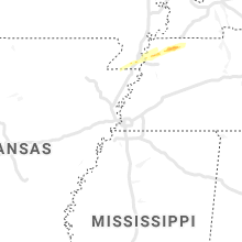


Connect with Interactive Hail Maps