

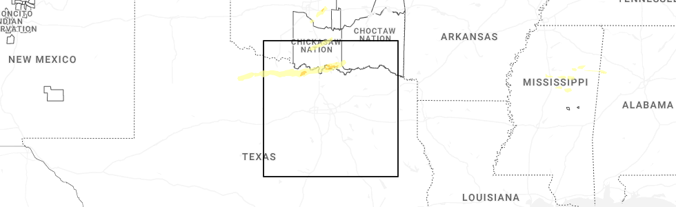
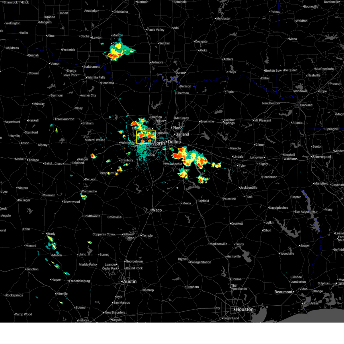
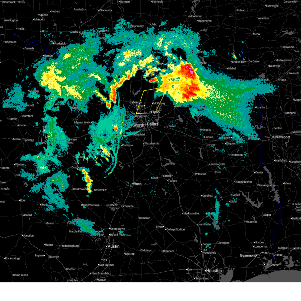
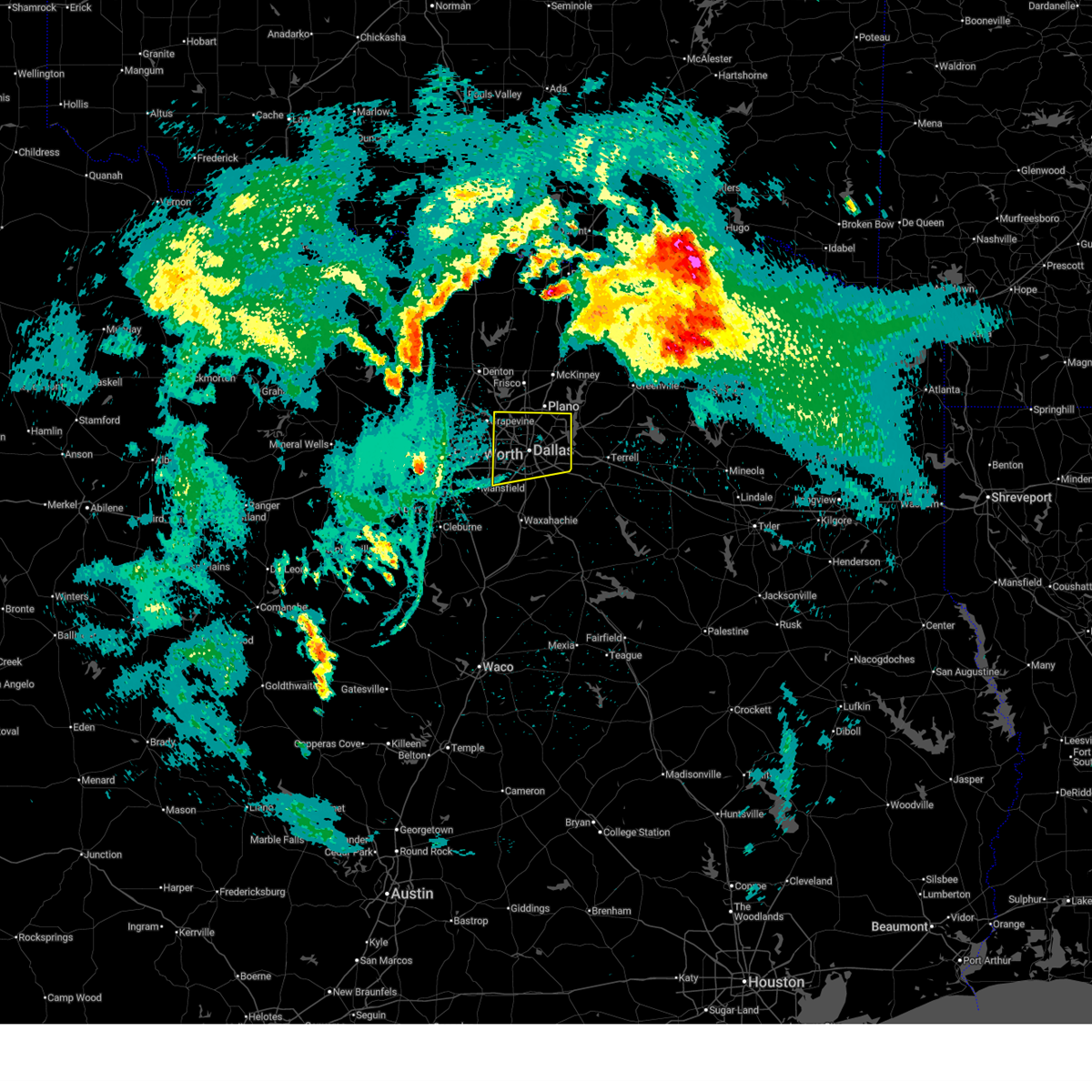
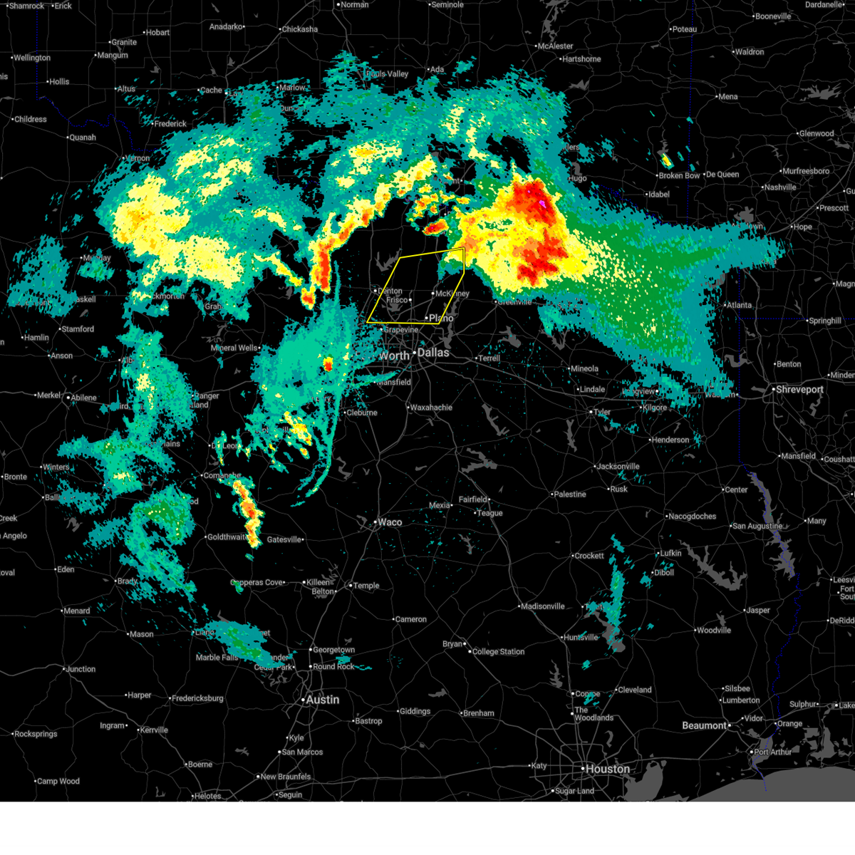
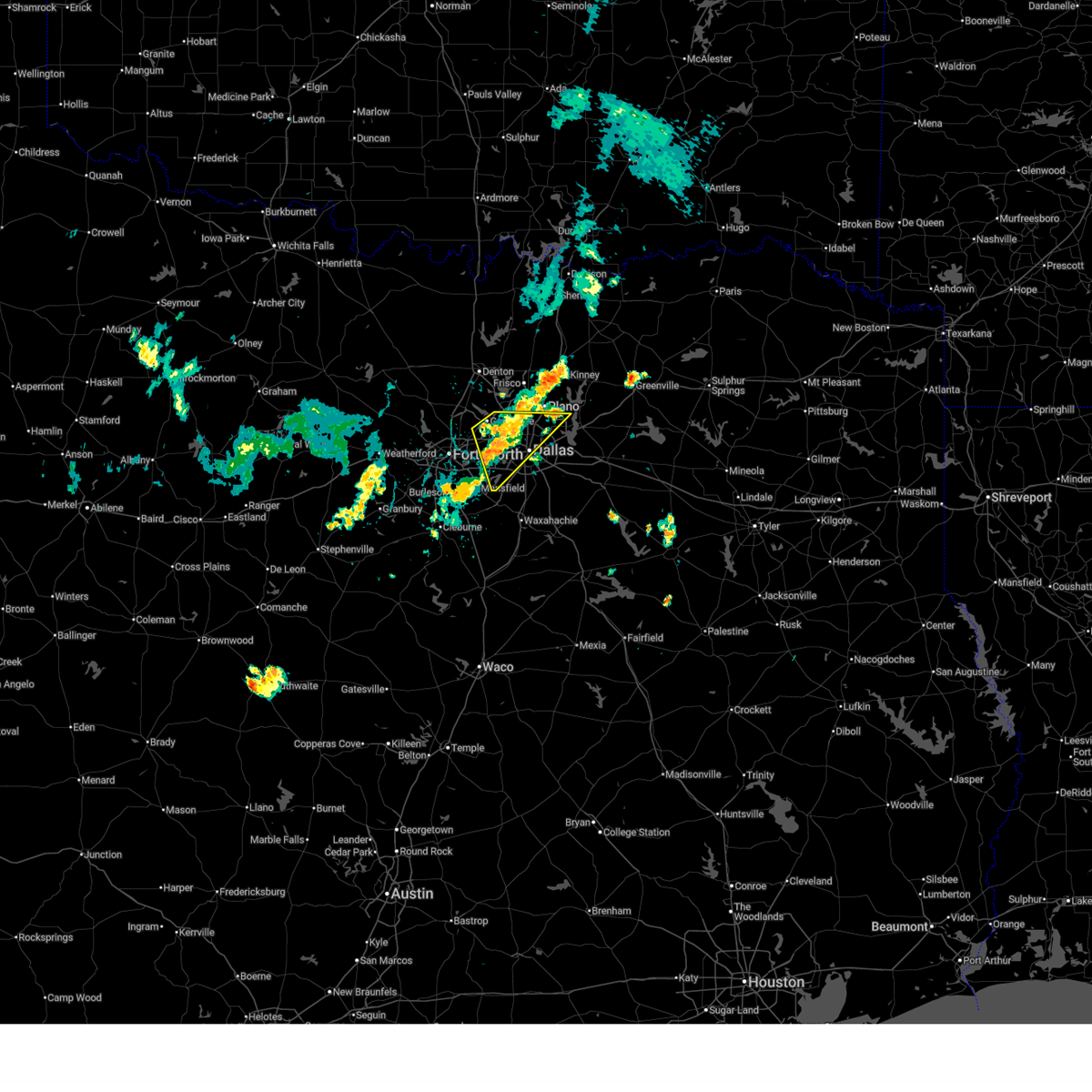
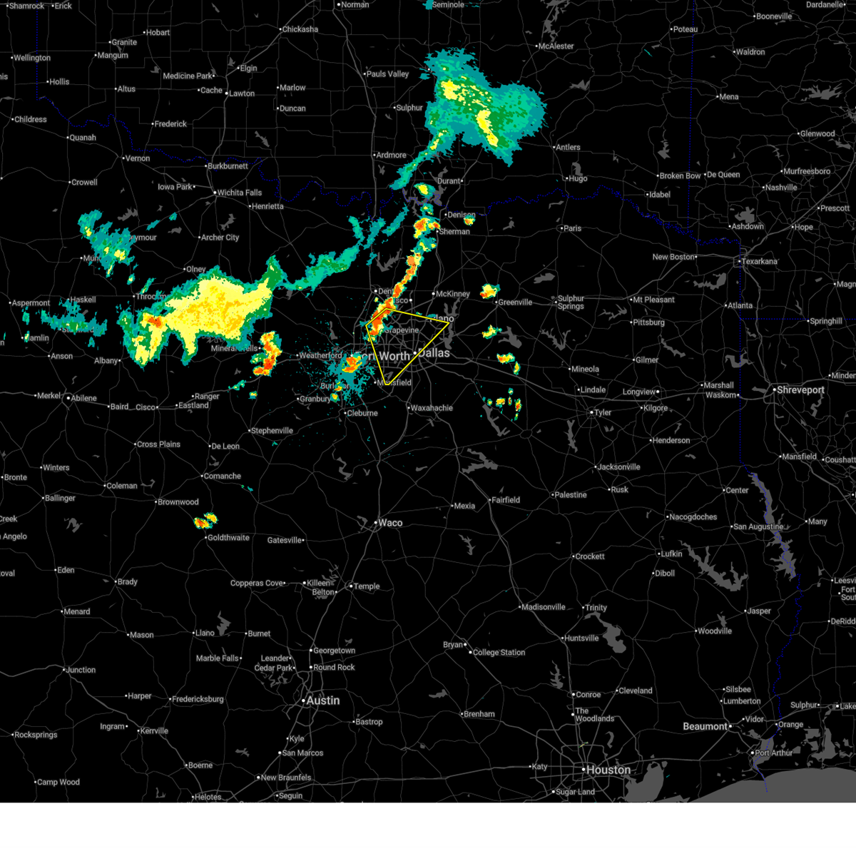
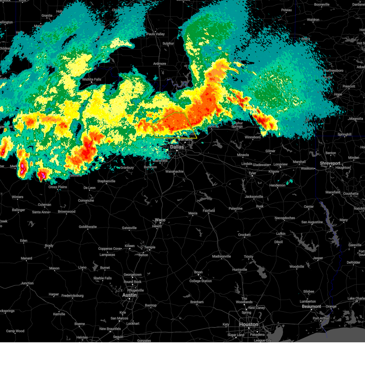
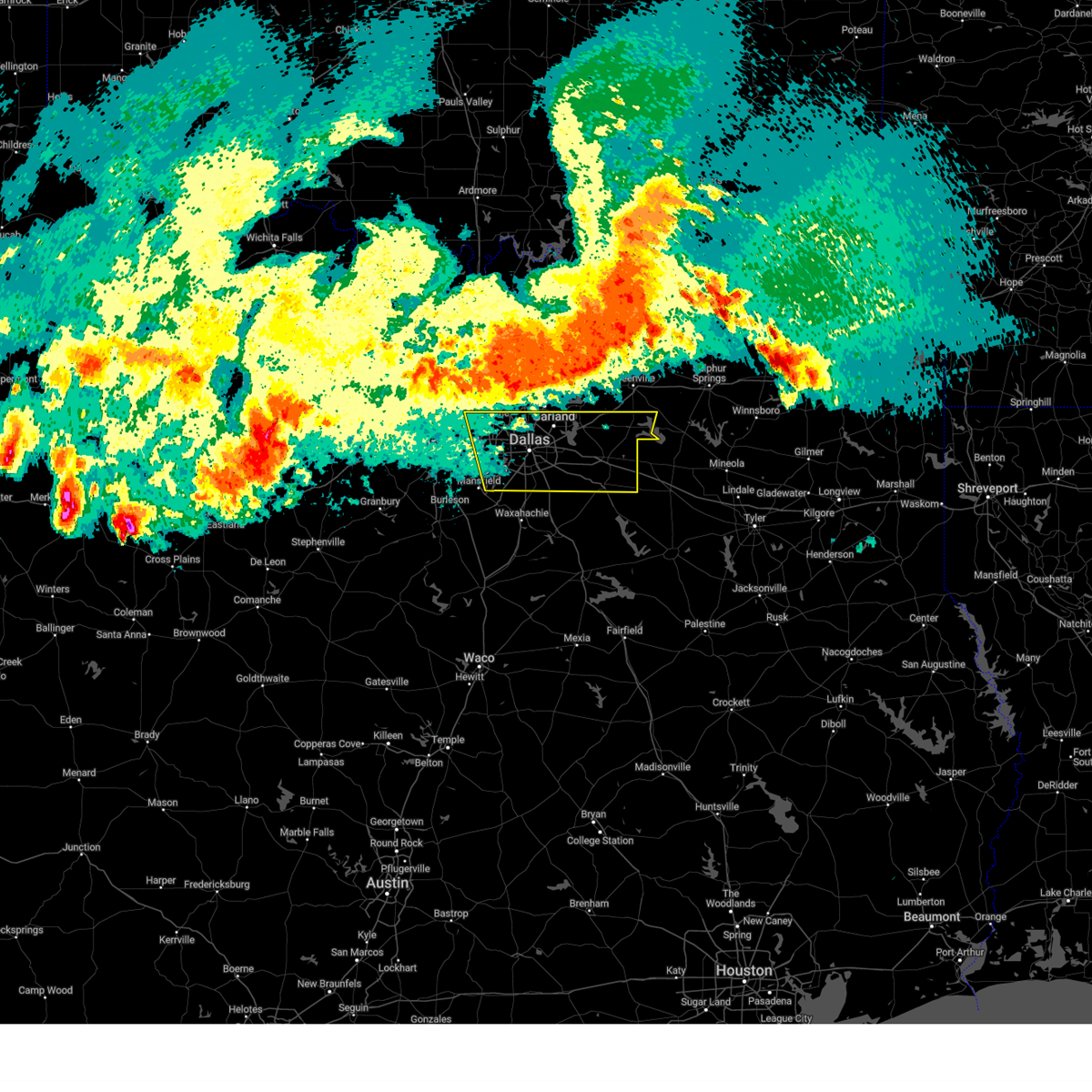
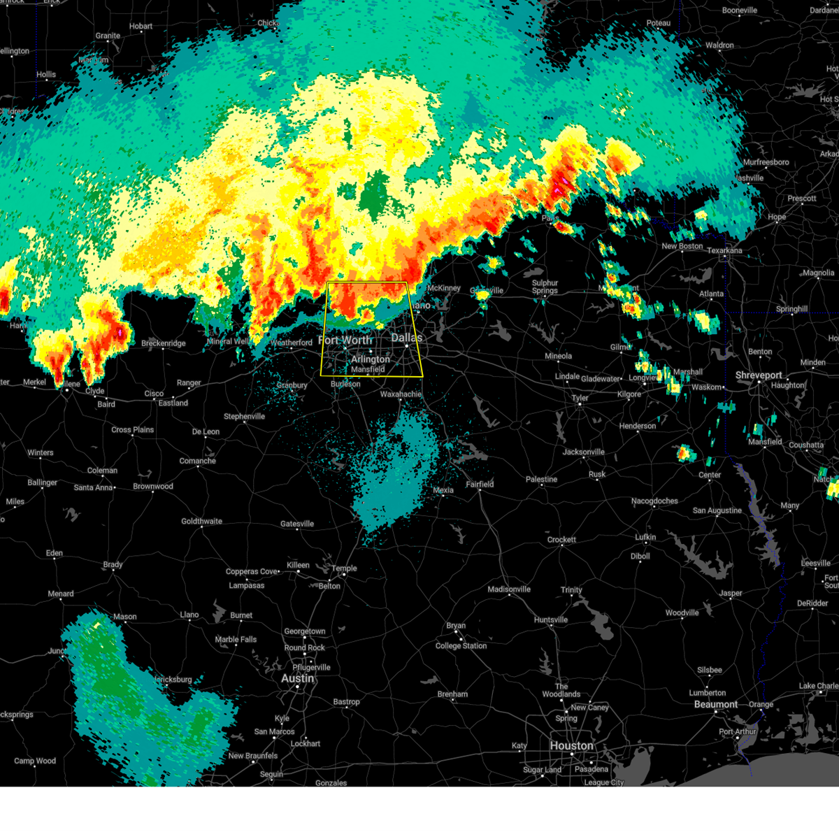
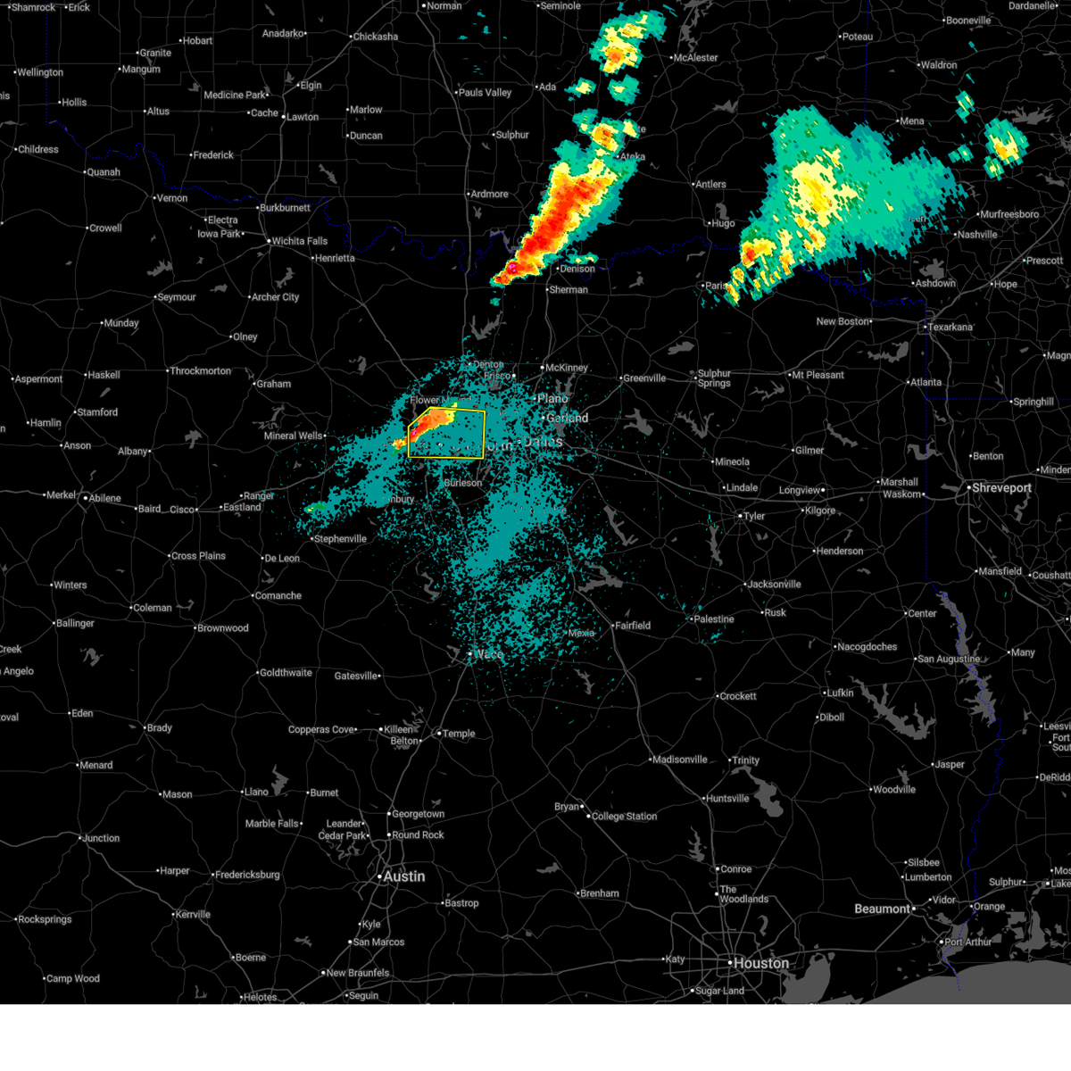
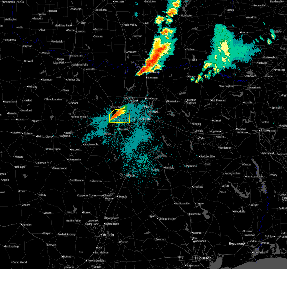
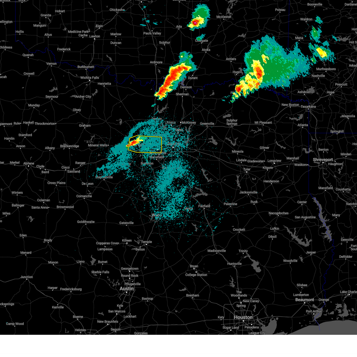
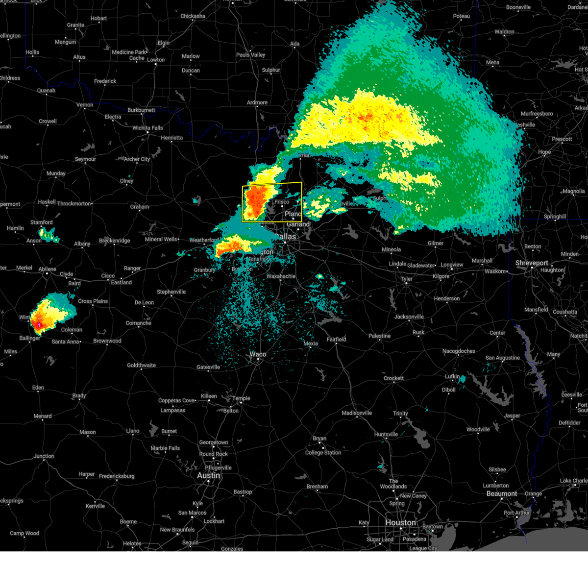
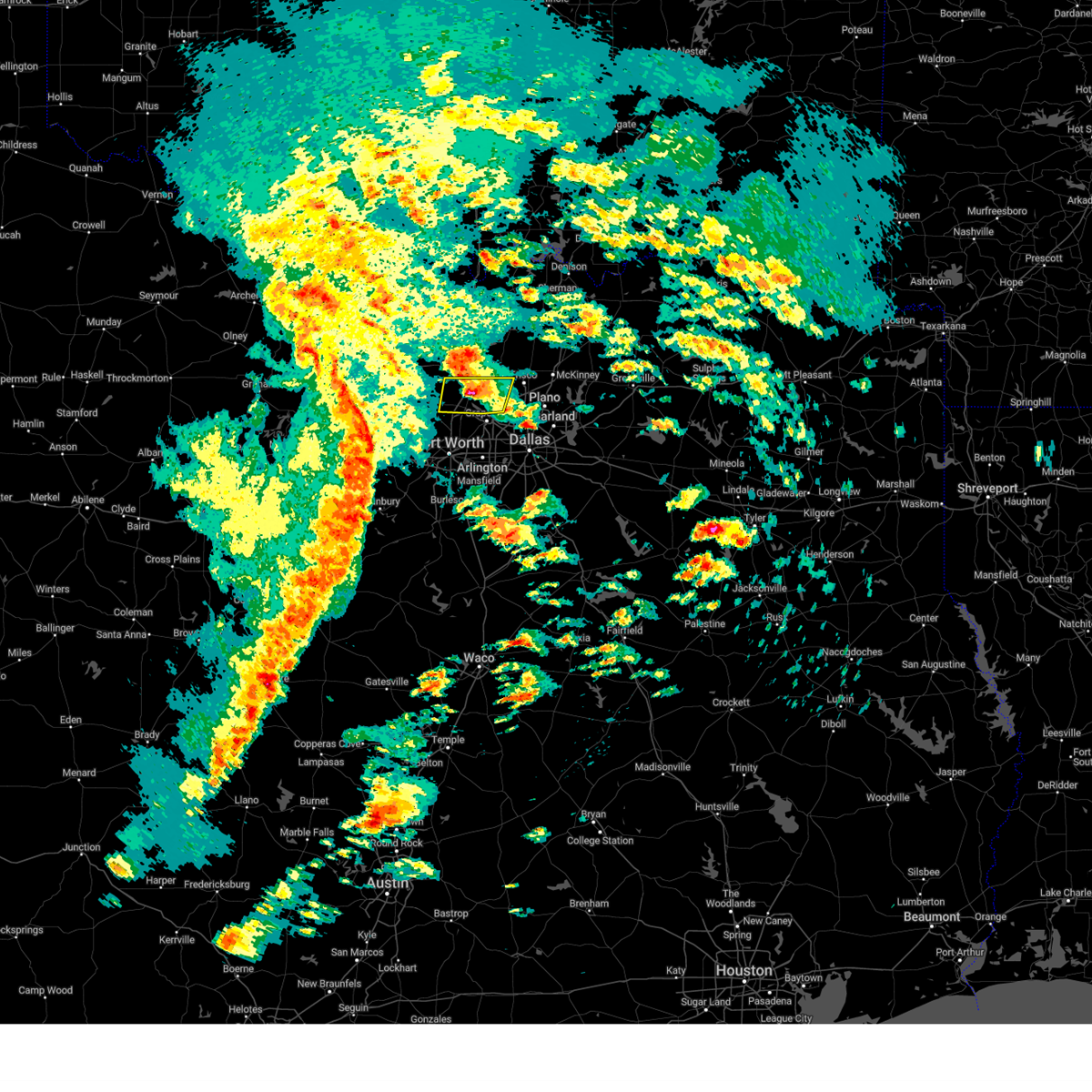
Hail Map for Coppell, TX
The Coppell, TX area has had 10 reports of on-the-ground hail by trained spotters, and has been under severe weather warnings 48 times during the past 12 months. Doppler radar has detected hail at or near Coppell, TX on 101 occasions, including 8 occasions during the past year.
| Name: | Coppell, TX |
| Where Located: | 16.6 miles NW of Dallas, TX |
| Map: | Google Map for Coppell, TX |
| Population: | 38659 |
| Housing Units: | 14343 |
| More Info: | Search Google for Coppell, TX |
1
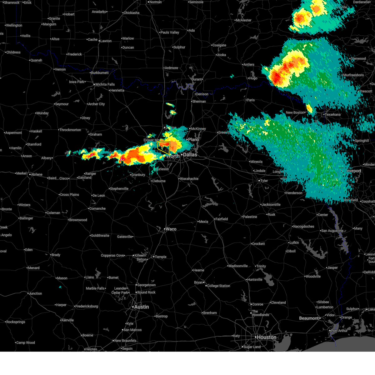
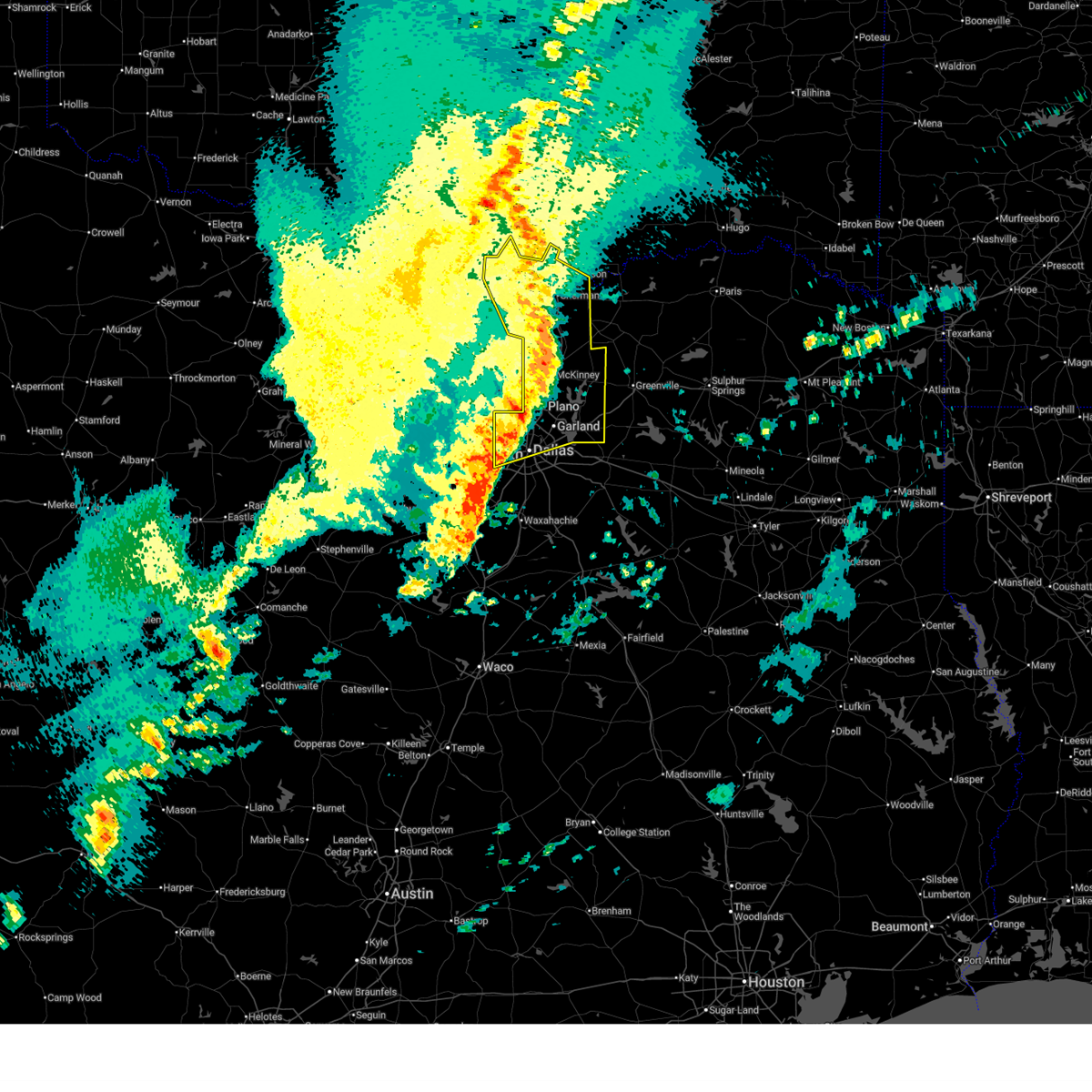
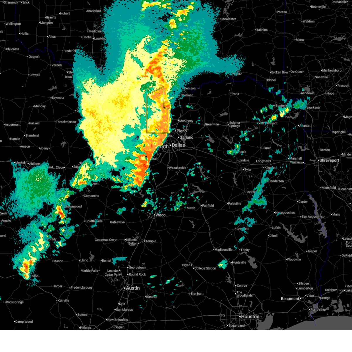
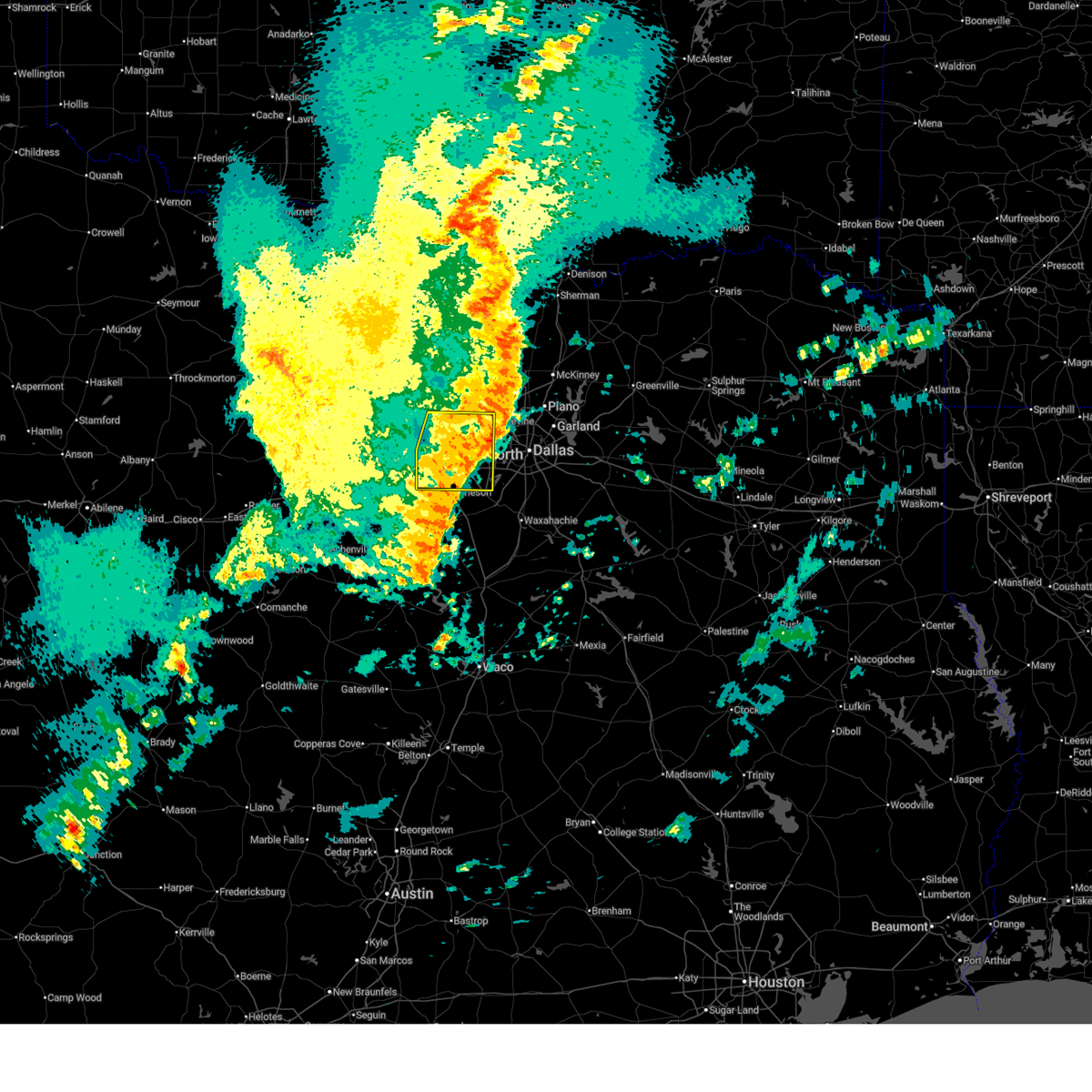
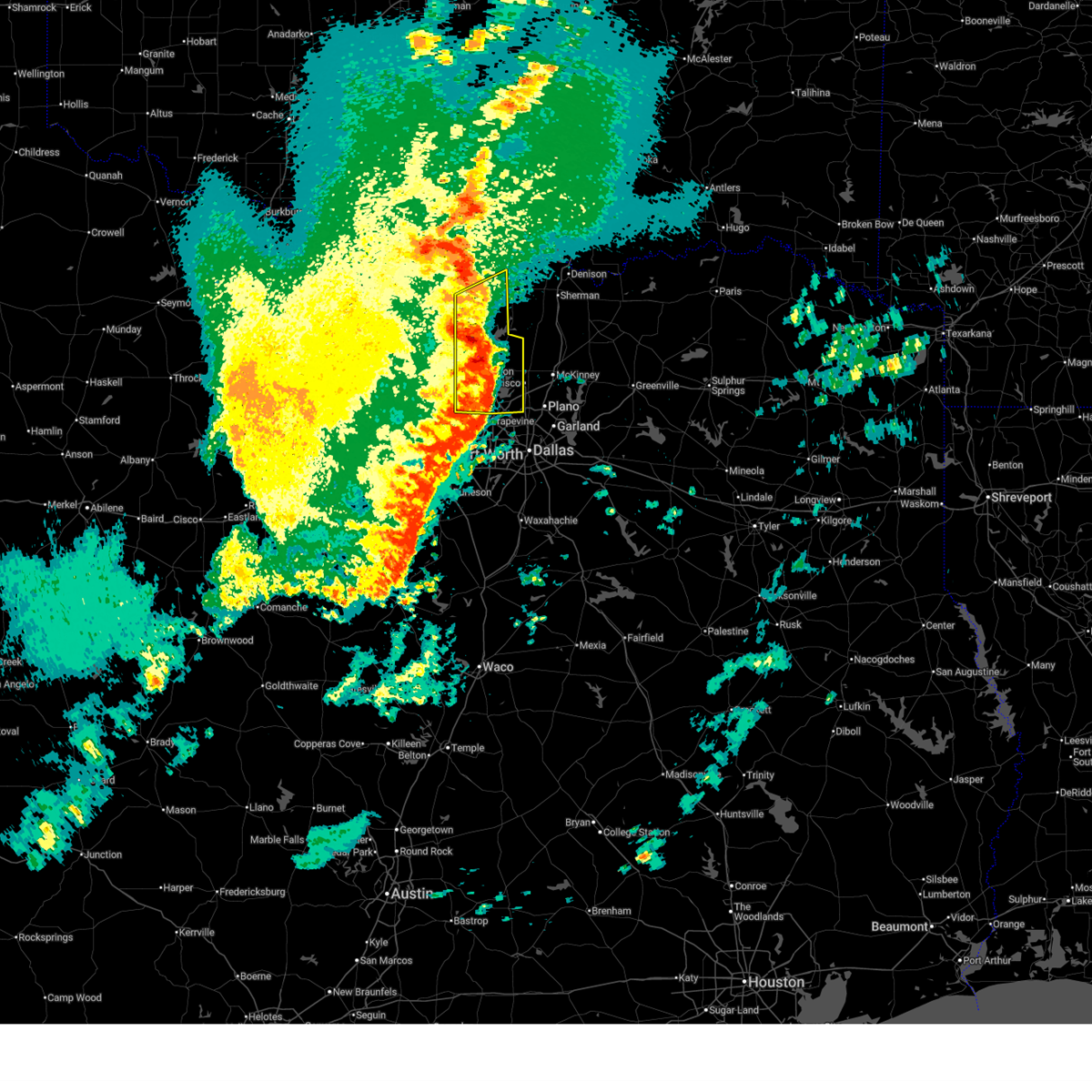
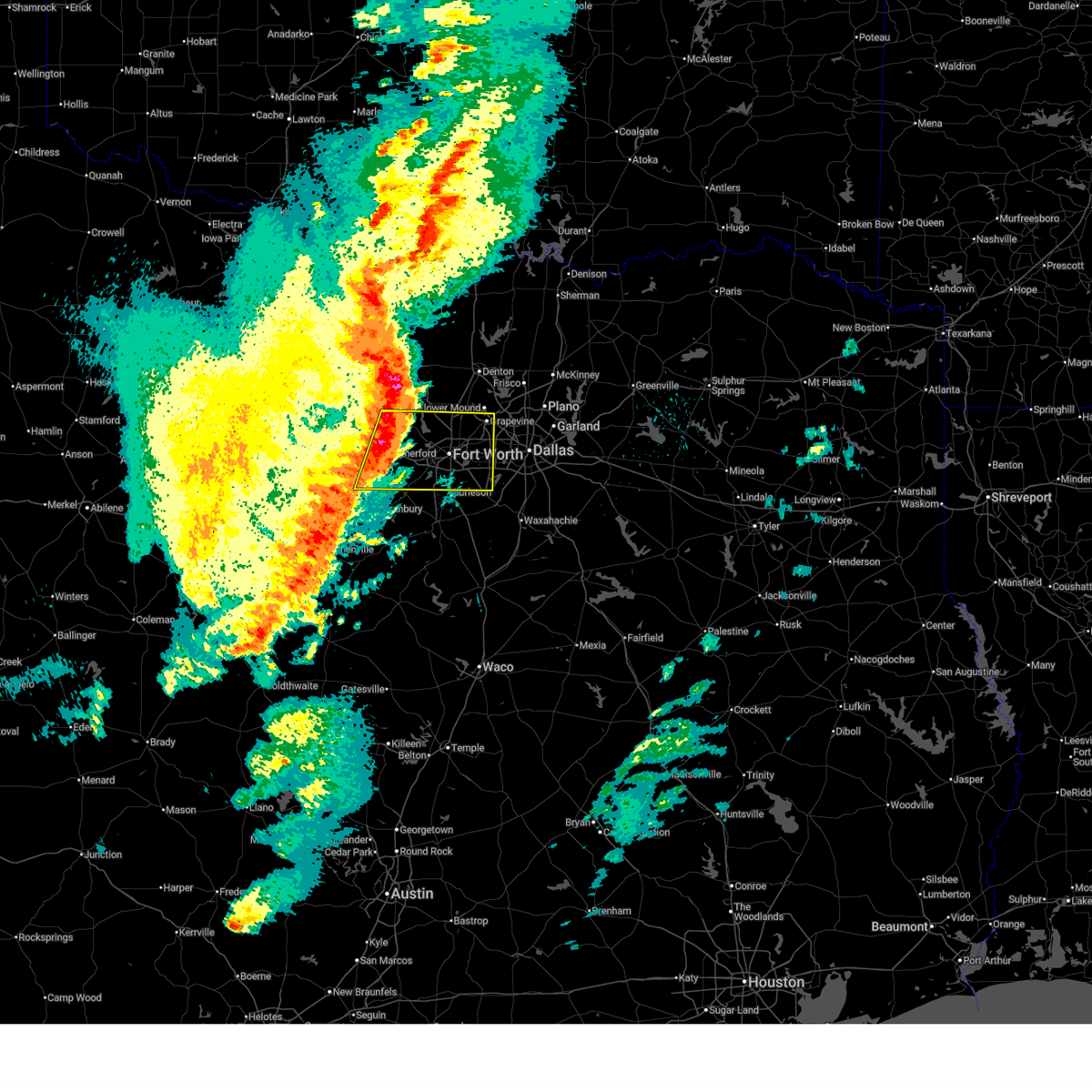
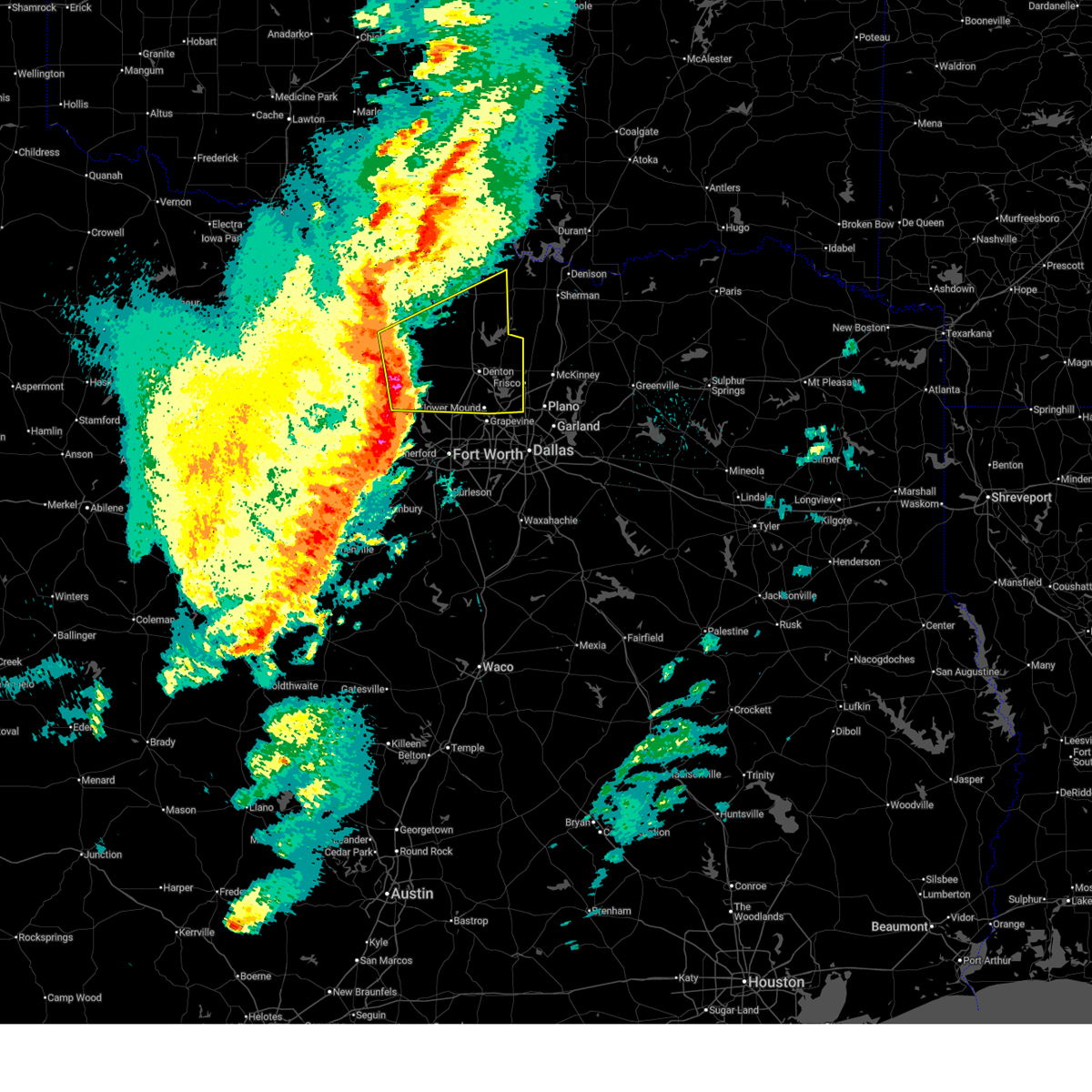
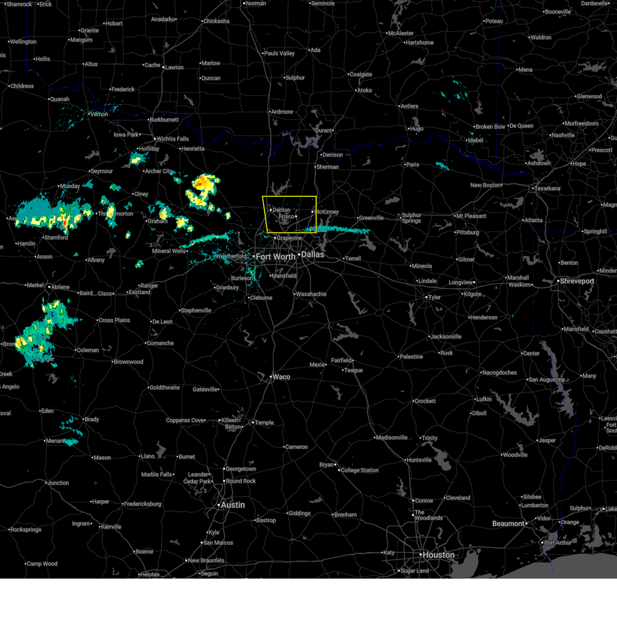
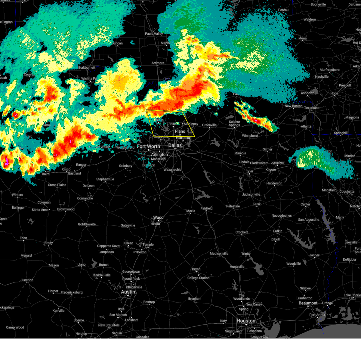
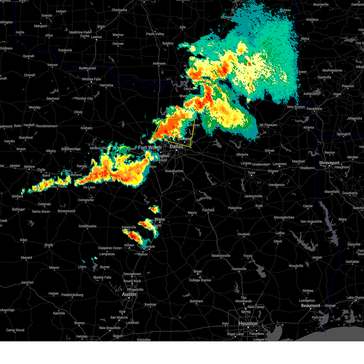
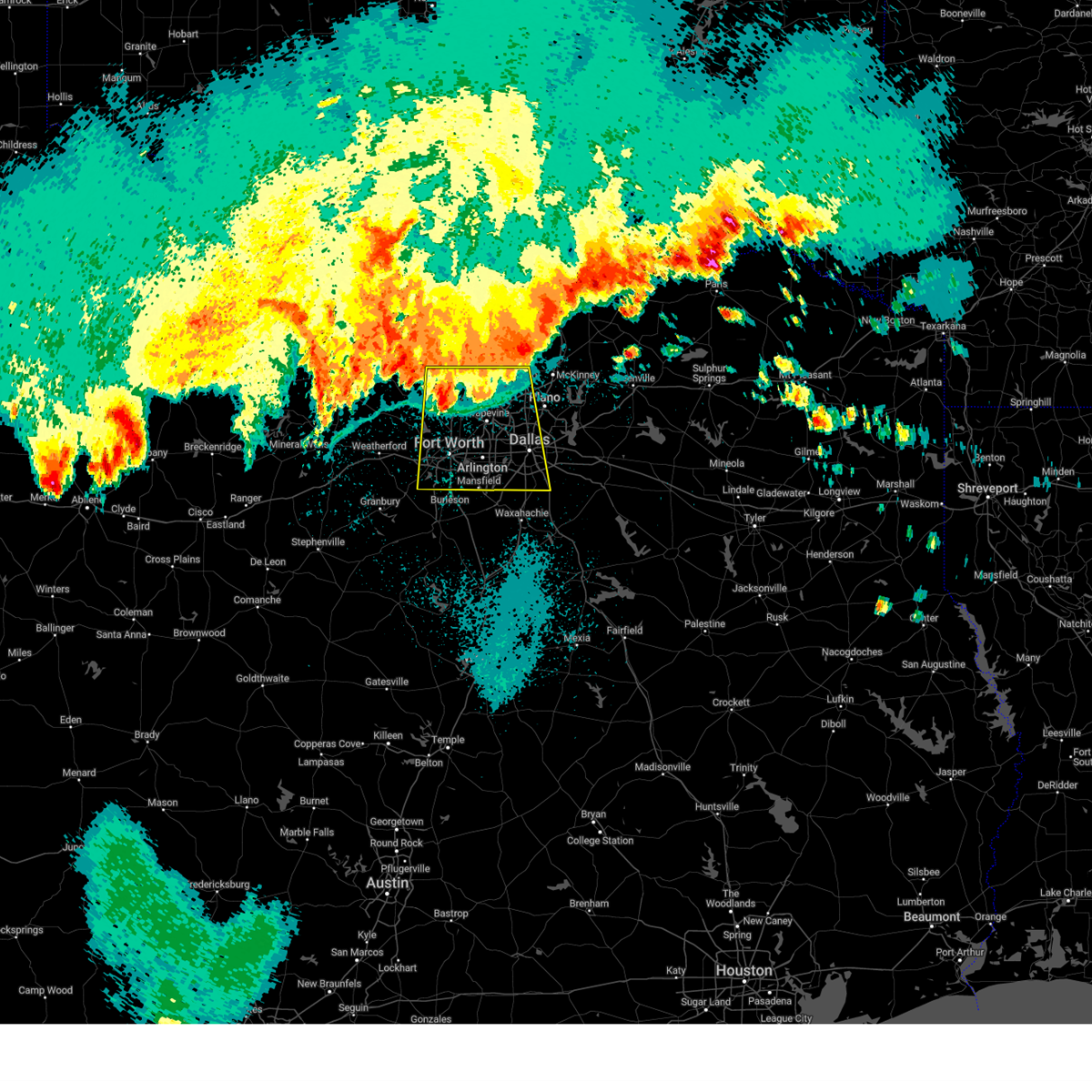
The Top Recent Hail Date for Coppell, TX is Tuesday, April 28, 2026 (22nd out of 101)
Hail and Wind Damage Spotted near Coppell, TX
| Date / Time | Report Details |
|---|---|
| 7/6/2026 7:45 PM CDT |
 Svrfwd the national weather service in fort worth has issued a * severe thunderstorm warning for, southeastern denton county in north central texas, northeastern tarrant county in north central texas, northwestern dallas county in north central texas, * until 830 pm cdt. * at 745 pm cdt, a severe thunderstorm was located over coppell, and is nearly stationary (radar indicated). Hazards include 60 mph wind gusts and quarter size hail. Hail damage to vehicles is expected. expect wind damage to roofs, siding, and trees. this severe thunderstorm will be near, irving, lewisville, and coppell around 750 pm cdt. other locations impacted by this severe thunderstorm include lewisville lake and grapevine lake. This includes interstate 35e between mile markers 439 and 453. Svrfwd the national weather service in fort worth has issued a * severe thunderstorm warning for, southeastern denton county in north central texas, northeastern tarrant county in north central texas, northwestern dallas county in north central texas, * until 830 pm cdt. * at 745 pm cdt, a severe thunderstorm was located over coppell, and is nearly stationary (radar indicated). Hazards include 60 mph wind gusts and quarter size hail. Hail damage to vehicles is expected. expect wind damage to roofs, siding, and trees. this severe thunderstorm will be near, irving, lewisville, and coppell around 750 pm cdt. other locations impacted by this severe thunderstorm include lewisville lake and grapevine lake. This includes interstate 35e between mile markers 439 and 453.
|
| 6/2/2026 5:30 PM CDT |
 At 530 pm cdt, severe thunderstorms were located along a line extending from grapevine to near venus, moving west at 10 mph (radar indicated). Hazards include 60 mph wind gusts and quarter size hail. Hail damage to vehicles is expected. expect wind damage to roofs, siding, and trees. Locations impacted include, dallas, fort worth, arlington, irving, grand prairie, carrollton, mansfield, euless, bedford, grapevine, cedar hill, haltom city, keller, coppell, duncanville, hurst, burleson, cleburne, farmers branch, and southlake. At 530 pm cdt, severe thunderstorms were located along a line extending from grapevine to near venus, moving west at 10 mph (radar indicated). Hazards include 60 mph wind gusts and quarter size hail. Hail damage to vehicles is expected. expect wind damage to roofs, siding, and trees. Locations impacted include, dallas, fort worth, arlington, irving, grand prairie, carrollton, mansfield, euless, bedford, grapevine, cedar hill, haltom city, keller, coppell, duncanville, hurst, burleson, cleburne, farmers branch, and southlake.
|
| 6/2/2026 5:07 PM CDT |
 Svrfwd the national weather service in fort worth has issued a * severe thunderstorm warning for, northeastern johnson county in north central texas, tarrant county in north central texas, northwestern ellis county in north central texas, western dallas county in north central texas, * until 600 pm cdt. * at 506 pm cdt, severe thunderstorms were located along a line extending from coppell to near venus, moving west at 10 mph (radar indicated). Hazards include 60 mph wind gusts and quarter size hail. Hail damage to vehicles is expected. Expect wind damage to roofs, siding, and trees. Svrfwd the national weather service in fort worth has issued a * severe thunderstorm warning for, northeastern johnson county in north central texas, tarrant county in north central texas, northwestern ellis county in north central texas, western dallas county in north central texas, * until 600 pm cdt. * at 506 pm cdt, severe thunderstorms were located along a line extending from coppell to near venus, moving west at 10 mph (radar indicated). Hazards include 60 mph wind gusts and quarter size hail. Hail damage to vehicles is expected. Expect wind damage to roofs, siding, and trees.
|
| 5/24/2026 3:54 PM CDT |
 Svrfwd the national weather service in fort worth has issued a * severe thunderstorm warning for, northern tarrant county in north central texas, * until 445 pm cdt. * at 353 pm cdt, a severe thunderstorm was located over saginaw, and is nearly stationary (radar indicated). Hazards include 60 mph wind gusts and quarter size hail. Hail damage to vehicles is expected. expect wind damage to roofs, siding, and trees. this severe thunderstorm will be near, fort worth, saginaw, blue mound, and haslet around 400 pm cdt. other locations impacted by this severe thunderstorm include westover hills, westlake, lake worth, and grapevine lake. this includes the following highways, interstate 35w between mile markers 51 and 66. Interstate 30 between mile markers 16 and 31. Svrfwd the national weather service in fort worth has issued a * severe thunderstorm warning for, northern tarrant county in north central texas, * until 445 pm cdt. * at 353 pm cdt, a severe thunderstorm was located over saginaw, and is nearly stationary (radar indicated). Hazards include 60 mph wind gusts and quarter size hail. Hail damage to vehicles is expected. expect wind damage to roofs, siding, and trees. this severe thunderstorm will be near, fort worth, saginaw, blue mound, and haslet around 400 pm cdt. other locations impacted by this severe thunderstorm include westover hills, westlake, lake worth, and grapevine lake. this includes the following highways, interstate 35w between mile markers 51 and 66. Interstate 30 between mile markers 16 and 31.
|
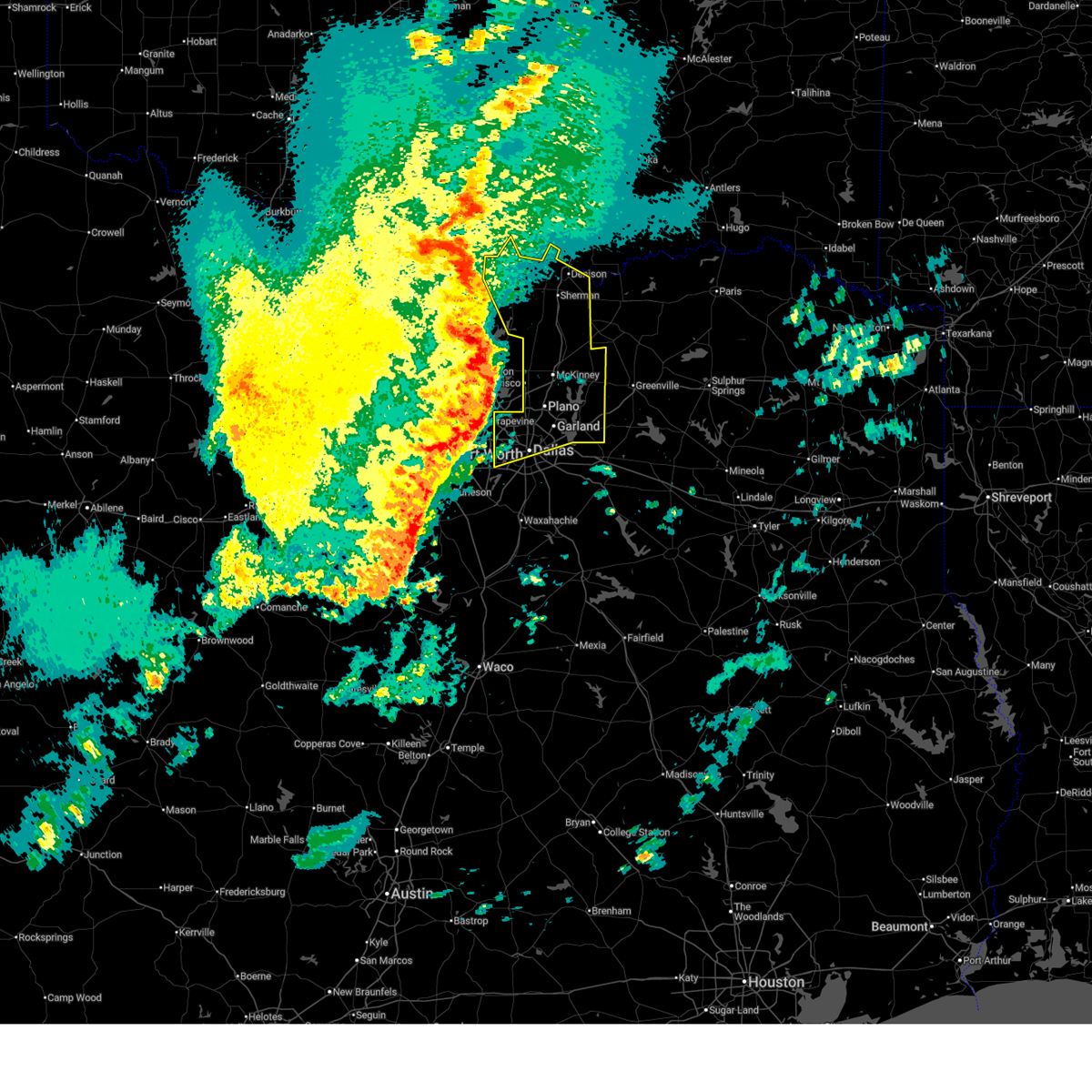
| 5/23/2026 2:14 AM CDT |
 Svrfwd the national weather service in fort worth has issued a * severe thunderstorm warning for, eastern denton county in north central texas, northeastern tarrant county in north central texas, western collin county in north central texas, northwestern dallas county in north central texas, * until 300 am cdt. * at 214 am cdt, a severe thunderstorm was located over grapevine, moving northeast at 45 mph (radar indicated). Hazards include 60 mph wind gusts and half dollar size hail. Hail damage to vehicles is expected. expect wind damage to roofs, siding, and trees. this severe thunderstorm will be near, carrollton, lewisville, flower mound, coppell, and hebron around 220 am cdt. frisco, the colony, lake lewisville, and hickory creek around 225 am cdt. plano, little elm, and hackberry around 230 am cdt. mckinney and prosper around 240 am cdt. celina around 245 am cdt. other locations impacted by this severe thunderstorm include westlake, lewisville lake, branch, oak point, lincoln park, new hope, lakewood village, grapevine lake, providence village, and weston. this includes the following highways, interstate 35w between mile markers 79 and 82. Interstate 35e between mile markers 437 and 465. Svrfwd the national weather service in fort worth has issued a * severe thunderstorm warning for, eastern denton county in north central texas, northeastern tarrant county in north central texas, western collin county in north central texas, northwestern dallas county in north central texas, * until 300 am cdt. * at 214 am cdt, a severe thunderstorm was located over grapevine, moving northeast at 45 mph (radar indicated). Hazards include 60 mph wind gusts and half dollar size hail. Hail damage to vehicles is expected. expect wind damage to roofs, siding, and trees. this severe thunderstorm will be near, carrollton, lewisville, flower mound, coppell, and hebron around 220 am cdt. frisco, the colony, lake lewisville, and hickory creek around 225 am cdt. plano, little elm, and hackberry around 230 am cdt. mckinney and prosper around 240 am cdt. celina around 245 am cdt. other locations impacted by this severe thunderstorm include westlake, lewisville lake, branch, oak point, lincoln park, new hope, lakewood village, grapevine lake, providence village, and weston. this includes the following highways, interstate 35w between mile markers 79 and 82. Interstate 35e between mile markers 437 and 465.
|
| 4/28/2026 6:11 PM CDT |
 the severe thunderstorm warning has been cancelled and is no longer in effect the severe thunderstorm warning has been cancelled and is no longer in effect
|
| 4/28/2026 6:11 PM CDT |
 At 610 pm cdt, a severe thunderstorm was located over farmers branch, moving east at 40 mph (radar indicated). Hazards include 60 mph wind gusts and quarter size hail. Hail damage to vehicles is expected. expect wind damage to roofs, siding, and trees. Locations impacted include, dallas, garland, irving, mesquite, carrollton, richardson, rowlett, grapevine, wylie, coppell, farmers branch, university park, sachse, addison, highland park, sunnyvale, dallas love field, dfw intl airport, white rock lake, and buckingham. At 610 pm cdt, a severe thunderstorm was located over farmers branch, moving east at 40 mph (radar indicated). Hazards include 60 mph wind gusts and quarter size hail. Hail damage to vehicles is expected. expect wind damage to roofs, siding, and trees. Locations impacted include, dallas, garland, irving, mesquite, carrollton, richardson, rowlett, grapevine, wylie, coppell, farmers branch, university park, sachse, addison, highland park, sunnyvale, dallas love field, dfw intl airport, white rock lake, and buckingham.
|
| 4/28/2026 5:55 PM CDT |
 Svrfwd the national weather service in fort worth has issued a * severe thunderstorm warning for, northeastern tarrant county in north central texas, northern dallas county in north central texas, * until 700 pm cdt. * at 555 pm cdt, a severe thunderstorm was located over dfw airport, or near grapevine, moving east at 30 mph (radar indicated). Hazards include 60 mph wind gusts and quarter size hail. Hail damage to vehicles is expected. Expect wind damage to roofs, siding, and trees. Svrfwd the national weather service in fort worth has issued a * severe thunderstorm warning for, northeastern tarrant county in north central texas, northern dallas county in north central texas, * until 700 pm cdt. * at 555 pm cdt, a severe thunderstorm was located over dfw airport, or near grapevine, moving east at 30 mph (radar indicated). Hazards include 60 mph wind gusts and quarter size hail. Hail damage to vehicles is expected. Expect wind damage to roofs, siding, and trees.
|
| 4/28/2026 5:46 PM CDT |
 At 545 pm cdt, a severe thunderstorm was located over grapevine, moving east at 30 mph (radar indicated). Hazards include 60 mph wind gusts and quarter size hail. Hail damage to vehicles is expected. expect wind damage to roofs, siding, and trees. Locations impacted include, fort worth, arlington, grand prairie, euless, bedford, grapevine, keller, hurst, southlake, watauga, colleyville, north richland hills, roanoke, dfw intl airport, westlake, and grapevine lake. At 545 pm cdt, a severe thunderstorm was located over grapevine, moving east at 30 mph (radar indicated). Hazards include 60 mph wind gusts and quarter size hail. Hail damage to vehicles is expected. expect wind damage to roofs, siding, and trees. Locations impacted include, fort worth, arlington, grand prairie, euless, bedford, grapevine, keller, hurst, southlake, watauga, colleyville, north richland hills, roanoke, dfw intl airport, westlake, and grapevine lake.
|
| 4/28/2026 5:46 PM CDT |
 the severe thunderstorm warning has been cancelled and is no longer in effect the severe thunderstorm warning has been cancelled and is no longer in effect
|
| 3/10/2026 10:13 PM CDT |
 The storms which prompted the warning have weakened below severe limits. therefore the warning will be allowed to expire. however gusty winds and heavy rain are still possible with these thunderstorms. a tornado watch remains in effect until 1100 pm cdt for north central texas. a severe thunderstorm watch remains in effect until 200 am cdt for north central texas. The storms which prompted the warning have weakened below severe limits. therefore the warning will be allowed to expire. however gusty winds and heavy rain are still possible with these thunderstorms. a tornado watch remains in effect until 1100 pm cdt for north central texas. a severe thunderstorm watch remains in effect until 200 am cdt for north central texas.
|
| 3/10/2026 9:55 PM CDT |
 The storm which prompted the warning is moving out of the area. therefore the warning will be allowed to expire. however gusty winds and heavy rain are still possible with this thunderstorm. a tornado watch remains in effect until 1100 pm cdt for north central texas. a severe thunderstorm watch remains in effect until 200 am cdt for north central texas. The storm which prompted the warning is moving out of the area. therefore the warning will be allowed to expire. however gusty winds and heavy rain are still possible with this thunderstorm. a tornado watch remains in effect until 1100 pm cdt for north central texas. a severe thunderstorm watch remains in effect until 200 am cdt for north central texas.
|
| 3/10/2026 9:54 PM CDT |
 The storm which prompted the warning is moving out of the area. therefore the warning will be allowed to expire. however gusty winds and heavy rain are still possible with this thunderstorm. a tornado watch remains in effect until 1100 pm cdt for north central texas. a severe thunderstorm watch remains in effect until 200 am cdt for north central texas. The storm which prompted the warning is moving out of the area. therefore the warning will be allowed to expire. however gusty winds and heavy rain are still possible with this thunderstorm. a tornado watch remains in effect until 1100 pm cdt for north central texas. a severe thunderstorm watch remains in effect until 200 am cdt for north central texas.
|
| 3/10/2026 9:39 PM CDT |
 the severe thunderstorm warning has been cancelled and is no longer in effect the severe thunderstorm warning has been cancelled and is no longer in effect
|
| 3/10/2026 9:39 PM CDT |
 At 939 pm cdt, a severe thunderstorm was located over pilot point, or 11 miles east of sanger, moving east at 50 mph (radar indicated). Hazards include 65 mph wind gusts. Expect damage to roofs, siding, and trees. This severe thunderstorm will remain over mainly rural areas of denton and southeastern cooke counties, including the following locations, road runner, valley view, oak point, sturgeon, lois, providence village, ponder, lake ray roberts, lewisville lake, and era. At 939 pm cdt, a severe thunderstorm was located over pilot point, or 11 miles east of sanger, moving east at 50 mph (radar indicated). Hazards include 65 mph wind gusts. Expect damage to roofs, siding, and trees. This severe thunderstorm will remain over mainly rural areas of denton and southeastern cooke counties, including the following locations, road runner, valley view, oak point, sturgeon, lois, providence village, ponder, lake ray roberts, lewisville lake, and era.
|
| 3/10/2026 9:37 PM CDT |
 Svrfwd the national weather service in fort worth has issued a * severe thunderstorm warning for, rockwall county in north central texas, collin county in north central texas, northern dallas county in north central texas, northeastern cooke county in north central texas, grayson county in north central texas, * until 1015 pm cdt. * at 936 pm cdt, severe thunderstorms were located along a line extending from near gainesville to grapevine, moving northeast at 55 mph (radar indicated). Hazards include 60 mph wind gusts. Expect damage to roofs, siding, and trees. severe thunderstorms will be near, irving, carrollton, grapevine, coppell, whitesboro, callisburg, lake kiowa, and dfw intl airport around 940 pm cdt. collinsville around 945 pm cdt. dallas, plano, frisco, addison, prosper, celina, lake texoma, and southeastern lake texoma around 950 pm cdt. mckinney, allen, pottsboro, gunter, and dorchester around 955 pm cdt. sherman around 1000 pm cdt. Other locations impacted by these severe thunderstorms include westminster, cannon, preston, tioga, frognot, ida, sadler, elmont, mountain creek lake, and locust. Svrfwd the national weather service in fort worth has issued a * severe thunderstorm warning for, rockwall county in north central texas, collin county in north central texas, northern dallas county in north central texas, northeastern cooke county in north central texas, grayson county in north central texas, * until 1015 pm cdt. * at 936 pm cdt, severe thunderstorms were located along a line extending from near gainesville to grapevine, moving northeast at 55 mph (radar indicated). Hazards include 60 mph wind gusts. Expect damage to roofs, siding, and trees. severe thunderstorms will be near, irving, carrollton, grapevine, coppell, whitesboro, callisburg, lake kiowa, and dfw intl airport around 940 pm cdt. collinsville around 945 pm cdt. dallas, plano, frisco, addison, prosper, celina, lake texoma, and southeastern lake texoma around 950 pm cdt. mckinney, allen, pottsboro, gunter, and dorchester around 955 pm cdt. sherman around 1000 pm cdt. Other locations impacted by these severe thunderstorms include westminster, cannon, preston, tioga, frognot, ida, sadler, elmont, mountain creek lake, and locust.
|
| 3/10/2026 9:23 PM CDT |
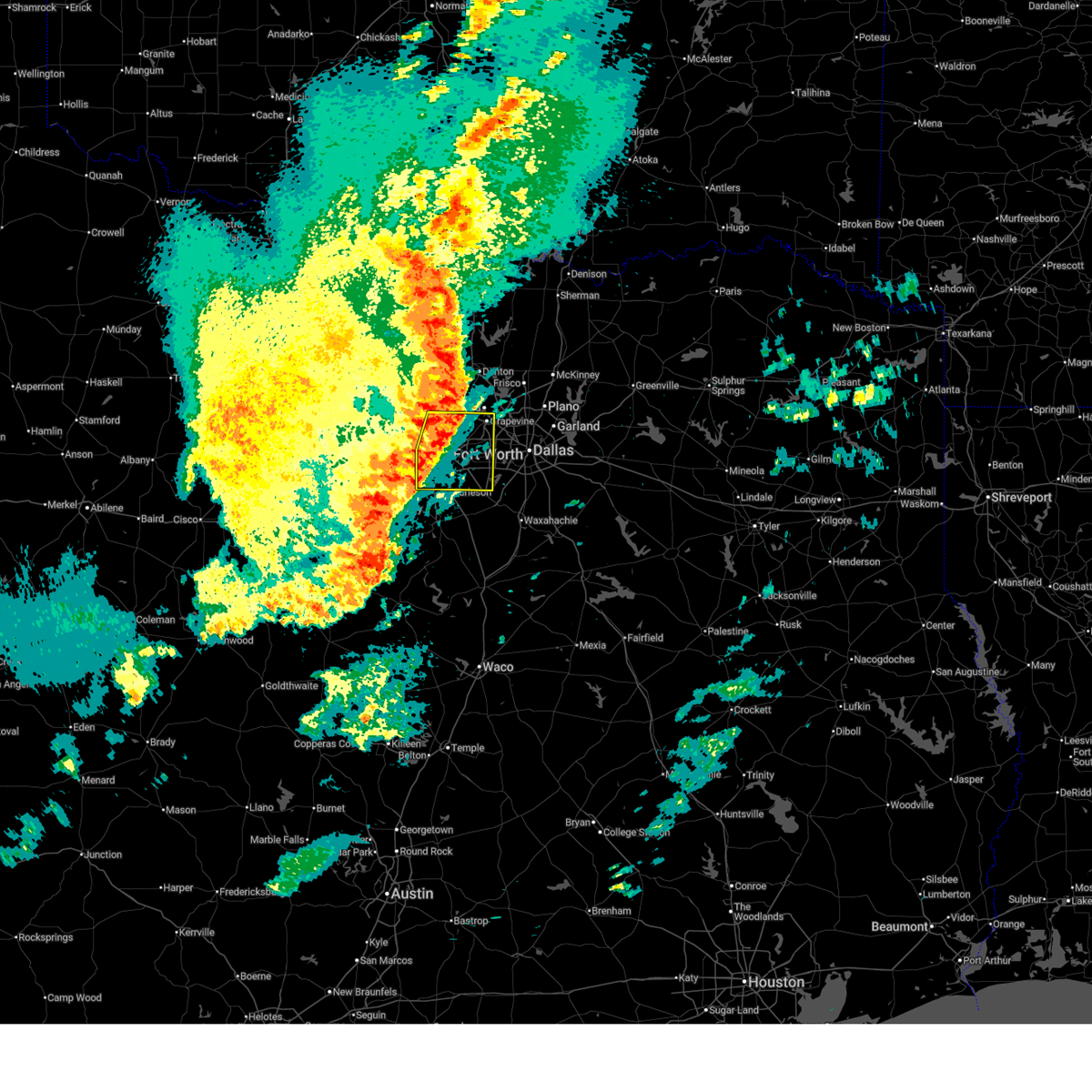 At 922 pm cdt, a severe thunderstorm was located over fort worth, moving east at 40 mph (radar indicated). Hazards include 60 mph wind gusts and penny size hail. Expect damage to roofs, siding, and trees. this severe storm will be near, fort worth, arlington, euless, bedford, haltom city, hurst, richland hills, and north richland hills around 930 pm cdt. grand prairie around 940 pm cdt. dfw intl airport around 945 pm cdt. Other locations impacted by this severe thunderstorm include benbrook lake, lake arlington, lake worth, lakeside, westover hills, dalworthington gardens, westlake, newark, grapevine lake, and joe pool lake. At 922 pm cdt, a severe thunderstorm was located over fort worth, moving east at 40 mph (radar indicated). Hazards include 60 mph wind gusts and penny size hail. Expect damage to roofs, siding, and trees. this severe storm will be near, fort worth, arlington, euless, bedford, haltom city, hurst, richland hills, and north richland hills around 930 pm cdt. grand prairie around 940 pm cdt. dfw intl airport around 945 pm cdt. Other locations impacted by this severe thunderstorm include benbrook lake, lake arlington, lake worth, lakeside, westover hills, dalworthington gardens, westlake, newark, grapevine lake, and joe pool lake.
|
| 3/10/2026 9:23 PM CDT |
 the severe thunderstorm warning has been cancelled and is no longer in effect the severe thunderstorm warning has been cancelled and is no longer in effect
|
| 3/10/2026 9:21 PM CDT |
 the severe thunderstorm warning has been cancelled and is no longer in effect the severe thunderstorm warning has been cancelled and is no longer in effect
|
| 3/10/2026 9:21 PM CDT |
 At 921 pm cdt, a severe thunderstorm was located near sanger, moving east at 45 mph (radar indicated). Hazards include 60 mph wind gusts and penny size hail. Expect damage to roofs, siding, and trees. this severe storm will be near, sanger around 925 pm cdt. ray roberts park isle du bois and ray roberts park johnson branch around 930 pm cdt. pilot point around 935 pm cdt. Other locations impacted by this severe thunderstorm include rosston, valley view, providence village, stony, ponder, lake ray roberts, lewisville lake, bolivar, lincoln park, and dish. At 921 pm cdt, a severe thunderstorm was located near sanger, moving east at 45 mph (radar indicated). Hazards include 60 mph wind gusts and penny size hail. Expect damage to roofs, siding, and trees. this severe storm will be near, sanger around 925 pm cdt. ray roberts park isle du bois and ray roberts park johnson branch around 930 pm cdt. pilot point around 935 pm cdt. Other locations impacted by this severe thunderstorm include rosston, valley view, providence village, stony, ponder, lake ray roberts, lewisville lake, bolivar, lincoln park, and dish.
|
| 3/10/2026 8:56 PM CDT |
 Svrfwd the national weather service in fort worth has issued a * severe thunderstorm warning for, parker county in north central texas, tarrant county in north central texas, * until 1000 pm cdt. * at 855 pm cdt, a severe thunderstorm was located over willow park, or 8 miles east of weatherford, moving east at 40 mph (radar indicated). Hazards include 65 mph wind gusts and quarter size hail. Hail damage to vehicles is expected. expect wind damage to roofs, siding, and trees. this severe thunderstorm will be near, white settlement, lake worth, and westworth village around 905 pm cdt. saginaw and fort worth around 915 pm cdt. haltom city around 920 pm cdt. richland hills and north richland hills around 925 pm cdt. hurst around 930 pm cdt. arlington, euless, and bedford around 935 pm cdt. Other locations impacted by this severe thunderstorm include lake arlington, dennis, annetta south, benbrook lake, lake worth, lakeside, westover hills, tin top, horseshoe bend, and annetta north. Svrfwd the national weather service in fort worth has issued a * severe thunderstorm warning for, parker county in north central texas, tarrant county in north central texas, * until 1000 pm cdt. * at 855 pm cdt, a severe thunderstorm was located over willow park, or 8 miles east of weatherford, moving east at 40 mph (radar indicated). Hazards include 65 mph wind gusts and quarter size hail. Hail damage to vehicles is expected. expect wind damage to roofs, siding, and trees. this severe thunderstorm will be near, white settlement, lake worth, and westworth village around 905 pm cdt. saginaw and fort worth around 915 pm cdt. haltom city around 920 pm cdt. richland hills and north richland hills around 925 pm cdt. hurst around 930 pm cdt. arlington, euless, and bedford around 935 pm cdt. Other locations impacted by this severe thunderstorm include lake arlington, dennis, annetta south, benbrook lake, lake worth, lakeside, westover hills, tin top, horseshoe bend, and annetta north.
|
| 3/10/2026 8:54 PM CDT |
 Svrfwd the national weather service in fort worth has issued a * severe thunderstorm warning for, southeastern montague county in north central texas, wise county in north central texas, denton county in north central texas, southern cooke county in north central texas, * until 1000 pm cdt. * at 854 pm cdt, a severe thunderstorm was located over decatur, moving east at 50 mph (radar indicated). Hazards include 65 mph wind gusts and quarter size hail. Hail damage to vehicles is expected. expect wind damage to roofs, siding, and trees. this severe thunderstorm will be near, sanger around 915 pm cdt. ray roberts park isle du bois and ray roberts park johnson branch around 930 pm cdt. pilot point around 935 pm cdt. other locations impacted by this severe thunderstorm include rosston, valley view, cottondale, providence village, stony, ponder, lake ray roberts, lewisville lake, bolivar, and lincoln park. this includes the following highways, interstate 35 between mile markers 468 and 501. interstate 35w between mile markers 68 and 85. Interstate 35e between mile markers 446 and 466. Svrfwd the national weather service in fort worth has issued a * severe thunderstorm warning for, southeastern montague county in north central texas, wise county in north central texas, denton county in north central texas, southern cooke county in north central texas, * until 1000 pm cdt. * at 854 pm cdt, a severe thunderstorm was located over decatur, moving east at 50 mph (radar indicated). Hazards include 65 mph wind gusts and quarter size hail. Hail damage to vehicles is expected. expect wind damage to roofs, siding, and trees. this severe thunderstorm will be near, sanger around 915 pm cdt. ray roberts park isle du bois and ray roberts park johnson branch around 930 pm cdt. pilot point around 935 pm cdt. other locations impacted by this severe thunderstorm include rosston, valley view, cottondale, providence village, stony, ponder, lake ray roberts, lewisville lake, bolivar, and lincoln park. this includes the following highways, interstate 35 between mile markers 468 and 501. interstate 35w between mile markers 68 and 85. Interstate 35e between mile markers 446 and 466.
|
| 10/24/2025 10:08 PM CDT | The storms which prompted the warning have weakened below severe limits. therefore the warning will be allowed to expire. however gusty winds are still possible with these thunderstorms. a severe thunderstorm watch remains in effect until midnight cdt for north central texas. |
| 10/24/2025 9:55 PM CDT | At 955 pm cdt, severe thunderstorms were located along a line extending from hebron to university park to lancaster, moving northeast at 35 mph (radar indicated). Hazards include 60 mph wind gusts. Expect damage to roofs, siding, and trees. these severe storms will be near, dallas, garland, mesquite, richardson, lancaster, balch springs, addison, hutchins, and wilmer around 1000 pm cdt. rowlett around 1005 pm cdt. sachse around 1010 pm cdt. Other locations impacted by these severe thunderstorms include joe pool lake, mountain creek lake, buckingham, white rock lake, and lake ray hubbard. |
| 10/24/2025 9:55 PM CDT | the severe thunderstorm warning has been cancelled and is no longer in effect |
| 10/24/2025 9:37 PM CDT | At 937 pm cdt, severe thunderstorms were located along a line extending from near grapevine to near irving to cedar hill, moving east at 45 mph (radar indicated). Hazards include 60 mph wind gusts. Expect damage to roofs, siding, and trees. these severe storms will be near, dallas, irving, carrollton, desoto, coppell, duncanville, lancaster, farmers branch, university park, and addison around 945 pm cdt. garland, mesquite, richardson, hutchins, and wilmer around 950 pm cdt. balch springs around 955 pm cdt. Rowlett and sachse around 1000 pm cdt. |
| 10/24/2025 9:21 PM CDT | Svrfwd the national weather service in fort worth has issued a * severe thunderstorm warning for, eastern tarrant county in north central texas, dallas county in north central texas, * until 1015 pm cdt. * at 920 pm cdt, severe thunderstorms were located along a line extending from near keller to arlington, moving east at 45 mph (radar indicated). Hazards include 65 mph wind gusts. Expect damage to roofs, siding, and trees. severe thunderstorms will be near, dallas, fort worth, arlington, irving, grand prairie, euless, desoto, bedford, grapevine, and cedar hill around 925 pm cdt. carrollton, lancaster, farmers branch, and cockrell hill around 930 pm cdt. dallas love field around 935 pm cdt. university park, addison, highland park, and hutchins around 940 pm cdt. mesquite, richardson, and balch springs around 945 pm cdt. garland around 950 pm cdt. Rowlett and sachse around 955 pm cdt. |
| 10/24/2025 9:07 PM CDT | At 907 pm cdt, severe thunderstorms were located along a line extending from fort worth to near whitney, moving east at 30 mph (radar indicated). Hazards include 65 mph wind gusts. Expect damage to roofs, siding, and trees. these severe storms will be near, fort worth, arlington, mansfield, euless, bedford, grapevine, hurst, southlake, colleyville, and kennedale around 910 pm cdt. grand prairie, coppell, and hillsboro around 915 pm cdt. carl's corner around 920 pm cdt. Bynum around 930 pm cdt. |
| 10/24/2025 8:44 PM CDT | At 843 pm cdt, severe thunderstorms were located along a line extending from near haslet to just southwest of blum, moving east at 30 mph (radar indicated). Hazards include 65 mph wind gusts. Expect damage to roofs, siding, and trees. these severe storms will be near, fort worth, haltom city, keller, burleson, cleburne, watauga, saginaw, crowley, forest hill, and richland hills around 850 pm cdt. arlington, hurst, southlake, colleyville, kennedale, alvarado, and covington around 855 pm cdt. mansfield, euless, bedford, pantego, and aquilla lake around 900 pm cdt. grapevine, venus, and grandview around 905 pm cdt. Grand prairie, hillsboro, itasca, and dfw intl airport around 910 pm cdt. |
| 10/24/2025 8:22 PM CDT | Svrfwd the national weather service in fort worth has issued a * severe thunderstorm warning for, johnson county in north central texas, tarrant county in north central texas, hill county in central texas, * until 930 pm cdt. * at 821 pm cdt, severe thunderstorms were located along a line extending from near azle to near meridian, moving east at 30 mph (radar indicated). Hazards include 60 mph wind gusts. Expect damage to roofs, siding, and trees. severe thunderstorms will be near, fort worth, benbrook, white settlement, azle, briar, eagle mountain, pecan acres, pelican bay, godley, and cleburne state park around 825 pm cdt. cleburne, lake worth, westworth village, haslet, and lake whitney around 830 pm cdt. burleson, saginaw, river oaks, sansom park, and lake pat cleburne around 835 pm cdt. crowley, joshua, edgecliff village, blue mound, blum, and edgecliff around 840 pm cdt. haltom city, keller, watauga, everman, keene, and cross timber around 845 pm cdt. forest hill, richland hills, rendon, north richland hills, whitney, and lake whitney state park around 850 pm cdt. arlington, hurst, southlake, colleyville, kennedale, alvarado, and covington around 855 pm cdt. Mansfield, euless, bedford, grapevine, pantego, and aquilla lake around 900 pm cdt. |
| 9/21/2025 7:07 PM CDT | the severe thunderstorm warning has been cancelled and is no longer in effect |
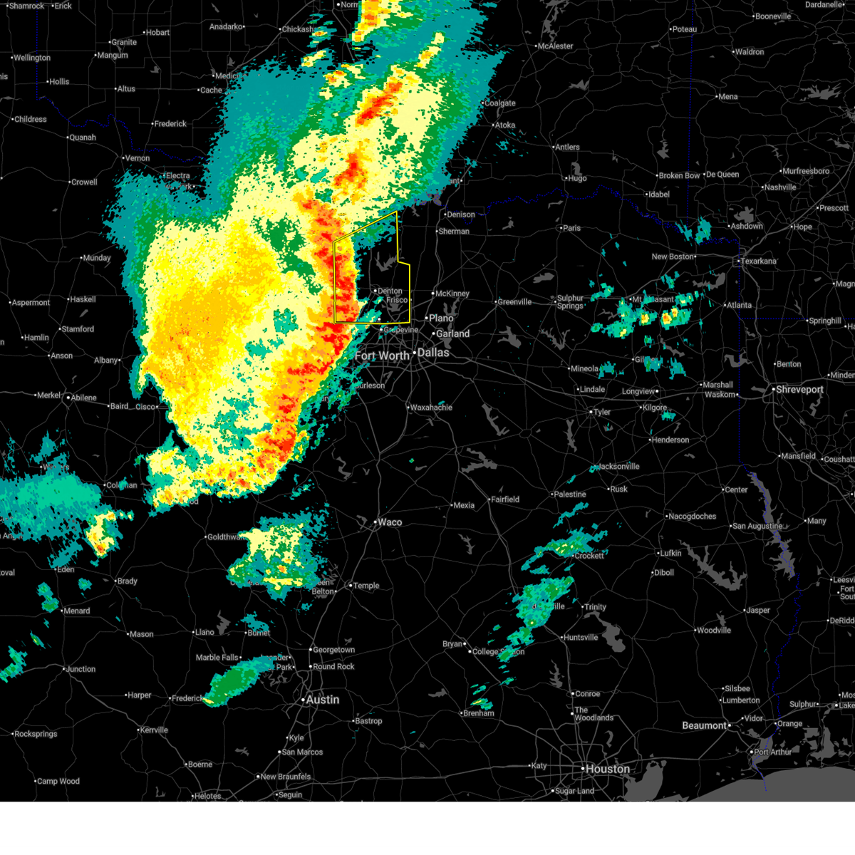
| 9/21/2025 7:02 PM CDT | At 702 pm cdt, a severe thunderstorm was located over highland village, moving south at 20 mph (radar indicated). Hazards include 60 mph wind gusts and penny size hail. Expect damage to roofs, siding, and trees. this severe storm will be near, lewisville, flower mound, highland village, hickory creek, double oak, bartonville, and copper canyon around 705 pm cdt. grapevine and coppell around 715 pm cdt. irving and dfw intl airport around 725 pm cdt. farmers branch around 745 pm cdt. Other locations impacted by this severe thunderstorm include oak point, lewisville lake, lakewood village, grapevine lake, and westlake. |
| 9/21/2025 6:41 PM CDT | Svrfwd the national weather service in fort worth has issued a * severe thunderstorm warning for, southeastern denton county in north central texas, northeastern tarrant county in north central texas, northwestern dallas county in north central texas, * until 745 pm cdt. * at 641 pm cdt, a severe thunderstorm was located over corinth, moving south at 20 mph (radar indicated). Hazards include 65 mph wind gusts and quarter size hail. Hail damage to vehicles is expected. expect wind damage to roofs, siding, and trees. this severe thunderstorm will be near, denton, lewisville, flower mound, corinth, highland village, lake dallas, hickory creek, shady shores, bartonville, and copper canyon around 645 pm cdt. double oak around 650 pm cdt. grapevine and coppell around 710 pm cdt. irving and carrollton around 720 pm cdt. dfw intl airport around 725 pm cdt. farmers branch around 735 pm cdt. other locations impacted by this severe thunderstorm include westlake, lewisville lake, oak point, lincoln park, lakewood village, grapevine lake, and providence village. this includes the following highways, interstate 35w between mile markers 79 and 85. Interstate 35e between mile markers 438 and 466. |
| 9/21/2025 6:20 PM CDT | At 620 pm cdt, a severe thunderstorm was located over denton, moving south at 25 mph (radar indicated). Hazards include ping pong ball size hail and 60 mph wind gusts. People and animals outdoors will be injured. expect hail damage to roofs, siding, windows, and vehicles. expect wind damage to roofs, siding, and trees. this severe storm will be near, denton, corinth, highland village, argyle, shady shores, bartonville, and copper canyon around 625 pm cdt. flower mound, hickory creek, and double oak around 630 pm cdt. lewisville around 640 pm cdt. grapevine and southlake around 645 pm cdt. Other locations impacted by this severe thunderstorm include lewisville lake, oak point, lincoln park, lakewood village, marshall creek, grapevine lake, providence village, and westlake. |
| 9/21/2025 6:09 PM CDT | the severe thunderstorm warning has been cancelled and is no longer in effect |
| 9/21/2025 6:09 PM CDT | At 608 pm cdt, a severe thunderstorm was located near denton, moving south at 20 mph (emergency management). Hazards include two inch hail and 65 mph wind gusts. People and animals outdoors will be injured. expect hail damage to roofs, siding, windows, and vehicles. expect wind damage to roofs, siding, and trees. this severe storm will be near, denton around 615 pm cdt. corinth around 620 pm cdt. argyle, shady shores, and copper canyon around 625 pm cdt. highland village and bartonville around 630 pm cdt. flower mound, hickory creek, and double oak around 635 pm cdt. Other locations impacted by this severe thunderstorm include lewisville lake, oak point, lincoln park, lakewood village, marshall creek, grapevine lake, providence village, westlake, and lake ray roberts. |
| 9/21/2025 5:46 PM CDT | Svrfwd the national weather service in fort worth has issued a * severe thunderstorm warning for, central denton county in north central texas, south central cooke county in north central texas, * until 645 pm cdt. * at 546 pm cdt, a severe thunderstorm was located near sanger, moving south at 25 mph (emergency management). Hazards include two inch hail and 65 mph wind gusts. People and animals outdoors will be injured. expect hail damage to roofs, siding, windows, and vehicles. expect wind damage to roofs, siding, and trees. this severe thunderstorm will be near, denton and krum around 550 pm cdt. corinth and argyle around 605 pm cdt. bartonville and copper canyon around 610 pm cdt. highland village and double oak around 615 pm cdt. flower mound and hickory creek around 620 pm cdt. grapevine, southlake, and trophy club around 630 pm cdt. other locations impacted by this severe thunderstorm include lewisville lake, bolivar, road runner, oak point, lincoln park, lakewood village, marshall creek, grapevine lake, providence village, and lake ray roberts. this includes the following highways, interstate 35 between mile markers 468 and 484. interstate 35w between mile markers 71 and 85. Interstate 35e between mile markers 446 and 466. |
| 9/5/2025 11:06 PM CDT |
 the severe thunderstorm warning has been cancelled and is no longer in effect the severe thunderstorm warning has been cancelled and is no longer in effect
|
| 9/5/2025 10:51 PM CDT |
 At 1050 pm cdt, severe thunderstorms were located along a line extending from near van alstyne to near carrollton, moving east at 30 mph (radar indicated). Hazards include 60 mph wind gusts and nickel size hail. Expect damage to roofs, siding, and trees. Locations impacted include, plano, garland, mckinney, carrollton, frisco, richardson, lewisville, allen, wylie, coppell, the colony, sachse, addison, lake lewisville, little elm, murphy, prosper, anna, fairview, and princeton. At 1050 pm cdt, severe thunderstorms were located along a line extending from near van alstyne to near carrollton, moving east at 30 mph (radar indicated). Hazards include 60 mph wind gusts and nickel size hail. Expect damage to roofs, siding, and trees. Locations impacted include, plano, garland, mckinney, carrollton, frisco, richardson, lewisville, allen, wylie, coppell, the colony, sachse, addison, lake lewisville, little elm, murphy, prosper, anna, fairview, and princeton.
|
| 9/5/2025 10:50 PM CDT |
 Svrfwd the national weather service in fort worth has issued a * severe thunderstorm warning for, dallas county in north central texas, * until 1130 pm cdt. * at 1049 pm cdt, severe thunderstorms were located along a line extending from coppell to dallas love field to near duncanville, moving east at 25 mph (radar indicated). Hazards include 60 mph wind gusts and nickel size hail. expect damage to roofs, siding, and trees Svrfwd the national weather service in fort worth has issued a * severe thunderstorm warning for, dallas county in north central texas, * until 1130 pm cdt. * at 1049 pm cdt, severe thunderstorms were located along a line extending from coppell to dallas love field to near duncanville, moving east at 25 mph (radar indicated). Hazards include 60 mph wind gusts and nickel size hail. expect damage to roofs, siding, and trees
|
| 9/5/2025 10:29 PM CDT |
 Svrfwd the national weather service in fort worth has issued a * severe thunderstorm warning for, eastern denton county in north central texas, collin county in north central texas, southern grayson county in north central texas, * until 1130 pm cdt. * at 1029 pm cdt, severe thunderstorms were located along a line extending from near pilot point to near flower mound, moving east at 20 mph (radar indicated). Hazards include 60 mph wind gusts and quarter size hail. Hail damage to vehicles is expected. expect wind damage to roofs, siding, and trees. severe thunderstorms will be near, frisco, lewisville, flower mound, coppell, the colony, highland village, lake dallas, lake lewisville, little elm, and prosper around 1035 pm cdt. carrollton, gunter, and hebron around 1040 pm cdt. plano around 1050 pm cdt. north dallas and mckinney around 1055 pm cdt. addison and van alstyne around 1100 pm cdt. allen around 1105 pm cdt. anna and melissa around 1110 pm cdt. richardson around 1115 pm cdt. other locations impacted by these severe thunderstorms include westminster, cannon, oak point, elmont, pilot grove, providence village, altoga, weston, lewisville lake, and lincoln park. This includes interstate 35e between mile markers 446 and 461. Svrfwd the national weather service in fort worth has issued a * severe thunderstorm warning for, eastern denton county in north central texas, collin county in north central texas, southern grayson county in north central texas, * until 1130 pm cdt. * at 1029 pm cdt, severe thunderstorms were located along a line extending from near pilot point to near flower mound, moving east at 20 mph (radar indicated). Hazards include 60 mph wind gusts and quarter size hail. Hail damage to vehicles is expected. expect wind damage to roofs, siding, and trees. severe thunderstorms will be near, frisco, lewisville, flower mound, coppell, the colony, highland village, lake dallas, lake lewisville, little elm, and prosper around 1035 pm cdt. carrollton, gunter, and hebron around 1040 pm cdt. plano around 1050 pm cdt. north dallas and mckinney around 1055 pm cdt. addison and van alstyne around 1100 pm cdt. allen around 1105 pm cdt. anna and melissa around 1110 pm cdt. richardson around 1115 pm cdt. other locations impacted by these severe thunderstorms include westminster, cannon, oak point, elmont, pilot grove, providence village, altoga, weston, lewisville lake, and lincoln park. This includes interstate 35e between mile markers 446 and 461.
|
| 9/5/2025 7:09 PM CDT |
 At 708 pm cdt, a severe thunderstorm was located near prosper, or 8 miles northwest of frisco, moving east at 40 mph. quarter to half dollar sized hail was observed between denton and prosper (radar indicated). Hazards include 65 mph wind gusts and half dollar size hail. Hail damage to vehicles is expected. expect wind damage to roofs, siding, and trees. this severe storm will be near, mckinney, frisco, prosper, and celina around 715 pm cdt. melissa around 725 pm cdt. Other locations impacted by this severe thunderstorm include oak point, lincoln park, weston, lewisville lake, lakewood village, and providence village. At 708 pm cdt, a severe thunderstorm was located near prosper, or 8 miles northwest of frisco, moving east at 40 mph. quarter to half dollar sized hail was observed between denton and prosper (radar indicated). Hazards include 65 mph wind gusts and half dollar size hail. Hail damage to vehicles is expected. expect wind damage to roofs, siding, and trees. this severe storm will be near, mckinney, frisco, prosper, and celina around 715 pm cdt. melissa around 725 pm cdt. Other locations impacted by this severe thunderstorm include oak point, lincoln park, weston, lewisville lake, lakewood village, and providence village.
|
| 9/5/2025 6:49 PM CDT |
 Svrfwd the national weather service in fort worth has issued a * severe thunderstorm warning for, eastern denton county in north central texas, western collin county in north central texas, * until 745 pm cdt. * at 649 pm cdt, a severe thunderstorm was located over cross roads, or near corinth, moving east at 20 mph (radar indicated). Hazards include 65 mph wind gusts and nickel size hail. Expect damage to roofs, siding, and trees. this severe thunderstorm will be near, frisco, little elm, prosper, celina, and cross roads around 655 pm cdt. mckinney around 715 pm cdt. other locations impacted by this severe thunderstorm include weston, lewisville lake, oak point, lincoln park, lakewood village, grapevine lake, and providence village. this includes the following highways, interstate 35 between mile markers 468 and 476. interstate 35w between mile markers 81 and 85. Interstate 35e between mile markers 446 and 466. Svrfwd the national weather service in fort worth has issued a * severe thunderstorm warning for, eastern denton county in north central texas, western collin county in north central texas, * until 745 pm cdt. * at 649 pm cdt, a severe thunderstorm was located over cross roads, or near corinth, moving east at 20 mph (radar indicated). Hazards include 65 mph wind gusts and nickel size hail. Expect damage to roofs, siding, and trees. this severe thunderstorm will be near, frisco, little elm, prosper, celina, and cross roads around 655 pm cdt. mckinney around 715 pm cdt. other locations impacted by this severe thunderstorm include weston, lewisville lake, oak point, lincoln park, lakewood village, grapevine lake, and providence village. this includes the following highways, interstate 35 between mile markers 468 and 476. interstate 35w between mile markers 81 and 85. Interstate 35e between mile markers 446 and 466.
|
| 8/4/2025 3:36 AM CDT |
 Svrfwd the national weather service in fort worth has issued a * severe thunderstorm warning for, southwestern denton county in north central texas, * until 400 am cdt. * at 336 am cdt, a severe thunderstorm was located near krum, or near sanger, moving southeast at 35 mph (radar indicated). Hazards include 60 mph wind gusts and penny size hail. Expect damage to roofs, siding, and trees. this severe thunderstorm will be near, denton around 340 am cdt. other locations impacted by this severe thunderstorm include lewisville lake. this includes the following highways, interstate 35 near mile marker 468. interstate 35w between mile markers 80 and 85. Interstate 35e between mile markers 446 and 457, and between mile markers 465 and 466. Svrfwd the national weather service in fort worth has issued a * severe thunderstorm warning for, southwestern denton county in north central texas, * until 400 am cdt. * at 336 am cdt, a severe thunderstorm was located near krum, or near sanger, moving southeast at 35 mph (radar indicated). Hazards include 60 mph wind gusts and penny size hail. Expect damage to roofs, siding, and trees. this severe thunderstorm will be near, denton around 340 am cdt. other locations impacted by this severe thunderstorm include lewisville lake. this includes the following highways, interstate 35 near mile marker 468. interstate 35w between mile markers 80 and 85. Interstate 35e between mile markers 446 and 457, and between mile markers 465 and 466.
|
| 8/3/2025 1:53 PM CDT |
 The storm which prompted the warning has weakened below severe limits. therefore the warning will be allowed to expire. however gusty winds and heavy rain are still possible with this thunderstorm. The storm which prompted the warning has weakened below severe limits. therefore the warning will be allowed to expire. however gusty winds and heavy rain are still possible with this thunderstorm.
|
| 8/3/2025 1:32 PM CDT |
 the severe thunderstorm warning has been cancelled and is no longer in effect the severe thunderstorm warning has been cancelled and is no longer in effect
|
| 8/3/2025 1:32 PM CDT |
 At 131 pm cdt, a severe thunderstorm was located near dallas love field, or near irving, moving southeast at 25 mph (radar indicated). Hazards include 60 mph wind gusts and penny size hail. Expect damage to roofs, siding, and trees. this severe storm will be near, dallas, irving, university park, highland park, and dallas love field around 135 pm cdt. Other locations impacted by this severe thunderstorm include joe pool lake, mountain creek lake, buckingham, white rock lake, and grapevine lake. At 131 pm cdt, a severe thunderstorm was located near dallas love field, or near irving, moving southeast at 25 mph (radar indicated). Hazards include 60 mph wind gusts and penny size hail. Expect damage to roofs, siding, and trees. this severe storm will be near, dallas, irving, university park, highland park, and dallas love field around 135 pm cdt. Other locations impacted by this severe thunderstorm include joe pool lake, mountain creek lake, buckingham, white rock lake, and grapevine lake.
|
| 8/3/2025 1:03 PM CDT |
 Svrfwd the national weather service in fort worth has issued a * severe thunderstorm warning for, southeastern denton county in north central texas, eastern tarrant county in north central texas, southwestern collin county in north central texas, northwestern dallas county in north central texas, * until 200 pm cdt. * at 103 pm cdt, a severe thunderstorm was located near grapevine, moving southeast at 20 mph (radar indicated). Hazards include 60 mph wind gusts and penny size hail. Expect damage to roofs, siding, and trees. this severe thunderstorm will be near, dallas, irving, grapevine, coppell, southlake, and dfw intl airport around 110 pm cdt. euless around 115 pm cdt. grand prairie around 130 pm cdt. cockrell hill around 145 pm cdt. other locations impacted by this severe thunderstorm include white rock lake, joe pool lake, mountain creek lake, buckingham, grapevine lake, lewisville lake, and westlake. this includes the following highways, interstate 35e between mile markers 423 and 454. interstate 20 between mile markers 451 and 462. interstate 30 between mile markers 27 and 49. Interstate 45 near mile marker 284. Svrfwd the national weather service in fort worth has issued a * severe thunderstorm warning for, southeastern denton county in north central texas, eastern tarrant county in north central texas, southwestern collin county in north central texas, northwestern dallas county in north central texas, * until 200 pm cdt. * at 103 pm cdt, a severe thunderstorm was located near grapevine, moving southeast at 20 mph (radar indicated). Hazards include 60 mph wind gusts and penny size hail. Expect damage to roofs, siding, and trees. this severe thunderstorm will be near, dallas, irving, grapevine, coppell, southlake, and dfw intl airport around 110 pm cdt. euless around 115 pm cdt. grand prairie around 130 pm cdt. cockrell hill around 145 pm cdt. other locations impacted by this severe thunderstorm include white rock lake, joe pool lake, mountain creek lake, buckingham, grapevine lake, lewisville lake, and westlake. this includes the following highways, interstate 35e between mile markers 423 and 454. interstate 20 between mile markers 451 and 462. interstate 30 between mile markers 27 and 49. Interstate 45 near mile marker 284.
|
| 6/8/2025 10:18 PM CDT |
 At 1017 pm cdt, a severe thunderstorm was located over the colony, moving southeast at 35 mph (radar indicated). Hazards include 70 mph wind gusts and nickel size hail. Expect considerable tree damage. damage is likely to mobile homes, roofs, and outbuildings. this severe storm will be near, hebron, plano, carrollton, lewisville, frisco, and the colony around 1020 pm cdt. dallas and addison around 1025 pm cdt. richardson around 1030 pm cdt. other locations impacted by this severe thunderstorm include st. Paul, oak point, providence village, ponder, lewisville lake, weston, branch, lavon lake, lincoln park, and new hope. At 1017 pm cdt, a severe thunderstorm was located over the colony, moving southeast at 35 mph (radar indicated). Hazards include 70 mph wind gusts and nickel size hail. Expect considerable tree damage. damage is likely to mobile homes, roofs, and outbuildings. this severe storm will be near, hebron, plano, carrollton, lewisville, frisco, and the colony around 1020 pm cdt. dallas and addison around 1025 pm cdt. richardson around 1030 pm cdt. other locations impacted by this severe thunderstorm include st. Paul, oak point, providence village, ponder, lewisville lake, weston, branch, lavon lake, lincoln park, and new hope.
|
| 6/8/2025 10:14 PM CDT |
 Svrfwd the national weather service in fort worth has issued a * severe thunderstorm warning for, rockwall county in north central texas, southern hunt county in north central texas, kaufman county in north central texas, eastern tarrant county in north central texas, dallas county in north central texas, * until 1130 pm cdt. * at 1013 pm cdt, severe thunderstorms were located along a line extending from lake dallas to near celeste, moving southeast at 45 mph (radar indicated). Hazards include 65 mph wind gusts and penny size hail. Expect damage to roofs, siding, and trees. severe thunderstorms will be near, carrollton and coppell around 1020 pm cdt. irving, dallas, richardson, addison, and farmers branch around 1025 pm cdt. rowlett, rockwall, garland, murphy, sachse, and wylie around 1030 pm cdt. university park, fate, royse city, and dallas love field around 1035 pm cdt. mesquite, heath, mobile city, highland park, and lake tawakoni around 1040 pm cdt. balch springs, forney, and hawk cove around 1050 pm cdt. hutchins, seagoville, terrell, and lake tawakoni state park around 1055 pm cdt. Other locations impacted by these severe thunderstorms include heartland, ola, lawrence, lake ray hubbard, elmo, joe pool lake, mountain creek lake, sand branch, union valley, and westlake. Svrfwd the national weather service in fort worth has issued a * severe thunderstorm warning for, rockwall county in north central texas, southern hunt county in north central texas, kaufman county in north central texas, eastern tarrant county in north central texas, dallas county in north central texas, * until 1130 pm cdt. * at 1013 pm cdt, severe thunderstorms were located along a line extending from lake dallas to near celeste, moving southeast at 45 mph (radar indicated). Hazards include 65 mph wind gusts and penny size hail. Expect damage to roofs, siding, and trees. severe thunderstorms will be near, carrollton and coppell around 1020 pm cdt. irving, dallas, richardson, addison, and farmers branch around 1025 pm cdt. rowlett, rockwall, garland, murphy, sachse, and wylie around 1030 pm cdt. university park, fate, royse city, and dallas love field around 1035 pm cdt. mesquite, heath, mobile city, highland park, and lake tawakoni around 1040 pm cdt. balch springs, forney, and hawk cove around 1050 pm cdt. hutchins, seagoville, terrell, and lake tawakoni state park around 1055 pm cdt. Other locations impacted by these severe thunderstorms include heartland, ola, lawrence, lake ray hubbard, elmo, joe pool lake, mountain creek lake, sand branch, union valley, and westlake.
|
| 6/8/2025 9:48 PM CDT |
 Svrfwd the national weather service in fort worth has issued a * severe thunderstorm warning for, denton county in north central texas, western collin county in north central texas, * until 1030 pm cdt. * at 946 pm cdt, a severe thunderstorm was located over ray roberts park isle du bois, or 7 miles east of sanger, moving southeast at 35 mph. this is a destructive storm for denton county and western collin county (trained spotters reported). Hazards include 80 mph wind gusts and nickel size hail. Flying debris will be dangerous to those caught without shelter. mobile homes will be heavily damaged. expect considerable damage to roofs, windows, and vehicles. extensive tree damage and power outages are likely. this severe thunderstorm will be near, denton, krugerville, aubrey, and cross roads around 950 pm cdt. prosper around 1000 pm cdt. hackberry, frisco, and little elm around 1005 pm cdt. the colony around 1010 pm cdt. hebron, plano, carrollton, and lewisville around 1020 pm cdt. other locations impacted by this severe thunderstorm include st. Paul, oak point, providence village, ponder, lewisville lake, weston, bolivar, branch, lavon lake, and lincoln park. Svrfwd the national weather service in fort worth has issued a * severe thunderstorm warning for, denton county in north central texas, western collin county in north central texas, * until 1030 pm cdt. * at 946 pm cdt, a severe thunderstorm was located over ray roberts park isle du bois, or 7 miles east of sanger, moving southeast at 35 mph. this is a destructive storm for denton county and western collin county (trained spotters reported). Hazards include 80 mph wind gusts and nickel size hail. Flying debris will be dangerous to those caught without shelter. mobile homes will be heavily damaged. expect considerable damage to roofs, windows, and vehicles. extensive tree damage and power outages are likely. this severe thunderstorm will be near, denton, krugerville, aubrey, and cross roads around 950 pm cdt. prosper around 1000 pm cdt. hackberry, frisco, and little elm around 1005 pm cdt. the colony around 1010 pm cdt. hebron, plano, carrollton, and lewisville around 1020 pm cdt. other locations impacted by this severe thunderstorm include st. Paul, oak point, providence village, ponder, lewisville lake, weston, bolivar, branch, lavon lake, and lincoln park.
|
| 6/8/2025 6:01 PM CDT |
 the severe thunderstorm warning has been cancelled and is no longer in effect the severe thunderstorm warning has been cancelled and is no longer in effect
|
| 6/8/2025 5:34 PM CDT |
 Svrfwd the national weather service in fort worth has issued a * severe thunderstorm warning for, southeastern denton county in north central texas, southwestern collin county in north central texas, northern dallas county in north central texas, * until 630 pm cdt. * at 534 pm cdt, a severe thunderstorm was located over lake lewisville, moving southeast at 20 mph (radar indicated). Hazards include 60 mph wind gusts and quarter size hail. Hail damage to vehicles is expected. expect wind damage to roofs, siding, and trees. this severe thunderstorm will be near, lake lewisville, lewisville, hackberry, frisco, hickory creek, little elm, and the colony around 540 pm cdt. hebron around 545 pm cdt. plano and carrollton around 550 pm cdt. dallas around 600 pm cdt. addison around 610 pm cdt. other locations impacted by this severe thunderstorm include lewisville lake, st. paul, oak point, lavon lake, lincoln park, buckingham, lakewood village, providence village, and white rock lake. This includes interstate 35e between mile markers 434 and 462. Svrfwd the national weather service in fort worth has issued a * severe thunderstorm warning for, southeastern denton county in north central texas, southwestern collin county in north central texas, northern dallas county in north central texas, * until 630 pm cdt. * at 534 pm cdt, a severe thunderstorm was located over lake lewisville, moving southeast at 20 mph (radar indicated). Hazards include 60 mph wind gusts and quarter size hail. Hail damage to vehicles is expected. expect wind damage to roofs, siding, and trees. this severe thunderstorm will be near, lake lewisville, lewisville, hackberry, frisco, hickory creek, little elm, and the colony around 540 pm cdt. hebron around 545 pm cdt. plano and carrollton around 550 pm cdt. dallas around 600 pm cdt. addison around 610 pm cdt. other locations impacted by this severe thunderstorm include lewisville lake, st. paul, oak point, lavon lake, lincoln park, buckingham, lakewood village, providence village, and white rock lake. This includes interstate 35e between mile markers 434 and 462.
|
| 6/3/2025 10:28 PM CDT |
 the severe thunderstorm warning has been cancelled and is no longer in effect the severe thunderstorm warning has been cancelled and is no longer in effect
|
| 6/3/2025 10:15 PM CDT |
 Svrfwd the national weather service in fort worth has issued a * severe thunderstorm warning for, southeastern denton county in north central texas, southwestern collin county in north central texas, northern dallas county in north central texas, * until 1115 pm cdt. * at 1015 pm cdt, a severe thunderstorm was located over hackberry, or near lake lewisville, moving east at 30 mph (radar indicated). Hazards include 60 mph wind gusts and nickel size hail. expect damage to roofs, siding, and trees Svrfwd the national weather service in fort worth has issued a * severe thunderstorm warning for, southeastern denton county in north central texas, southwestern collin county in north central texas, northern dallas county in north central texas, * until 1115 pm cdt. * at 1015 pm cdt, a severe thunderstorm was located over hackberry, or near lake lewisville, moving east at 30 mph (radar indicated). Hazards include 60 mph wind gusts and nickel size hail. expect damage to roofs, siding, and trees
|
| 5/26/2025 2:48 AM CDT |
 At 248 am cdt, severe thunderstorms were located along a line extending from caddo mills to near balch springs to near rendon, moving southeast at 35 mph (radar indicated). Hazards include 65 mph wind gusts and quarter size hail. Hail damage to vehicles is expected. expect wind damage to roofs, siding, and trees. these severe storms will be near, cedar hill state park, hutchins, cedar hill, duncanville, rendon, dallas, red oak, glenn heights, talty, and grand prairie around 255 am cdt. ferris, hawk cove, and greenville club lake around 300 am cdt. new terrell city lake, west tawakoni, waxahachie, venus, and kaufman around 305 am cdt. east tawakoni and lake tawakoni state park around 310 am cdt. ennis, cottonwood, palmer, and grays prairie around 315 am cdt. point and wills point around 320 am cdt. maypearl and kemp around 325 am cdt. Other locations impacted by these severe thunderstorms include ola, elmo, mountain creek lake, sand branch, lewisville lake, bristol, pecan hill, floyd, new hope, and hermits cove. At 248 am cdt, severe thunderstorms were located along a line extending from caddo mills to near balch springs to near rendon, moving southeast at 35 mph (radar indicated). Hazards include 65 mph wind gusts and quarter size hail. Hail damage to vehicles is expected. expect wind damage to roofs, siding, and trees. these severe storms will be near, cedar hill state park, hutchins, cedar hill, duncanville, rendon, dallas, red oak, glenn heights, talty, and grand prairie around 255 am cdt. ferris, hawk cove, and greenville club lake around 300 am cdt. new terrell city lake, west tawakoni, waxahachie, venus, and kaufman around 305 am cdt. east tawakoni and lake tawakoni state park around 310 am cdt. ennis, cottonwood, palmer, and grays prairie around 315 am cdt. point and wills point around 320 am cdt. maypearl and kemp around 325 am cdt. Other locations impacted by these severe thunderstorms include ola, elmo, mountain creek lake, sand branch, lewisville lake, bristol, pecan hill, floyd, new hope, and hermits cove.
|
| 5/26/2025 2:23 AM CDT |
 Svrfwd the national weather service in fort worth has issued a * severe thunderstorm warning for, rockwall county in north central texas, southern hunt county in north central texas, kaufman county in north central texas, northeastern johnson county in north central texas, northwestern van zandt county in north central texas, southern denton county in north central texas, tarrant county in north central texas, western rains county in north central texas, northern ellis county in north central texas, collin county in north central texas, dallas county in north central texas, * until 330 am cdt. * at 222 am cdt, severe thunderstorms were located along a line extending from farmersville to near dallas to benbrook, moving southeast at 35 mph (radar indicated). Hazards include 60 mph wind gusts and quarter size hail. Hail damage to vehicles is expected. expect wind damage to roofs, siding, and trees. severe thunderstorms will be near, edgecliff village, sunnyvale, duncanville, fate, pantego, mesquite, heath, edgecliff, rendon, and rowlett around 230 am cdt. cedar hill state park, hutchins, cedar hill, caddo mills, burleson, mobile city, mansfield, and desoto around 235 am cdt. greenville, forney, seagoville, and lancaster around 240 am cdt. wilmer around 245 am cdt. red oak, glenn heights, talty, alvarado, ovilla, midlothian, quinlan, crandall, combine, and terrell around 250 am cdt. ferris, oak leaf, and lake tawakoni around 255 am cdt. new terrell city lake, west tawakoni, hawk cove, waxahachie, venus, and greenville club lake around 300 am cdt. east tawakoni, kaufman, and lake tawakoni state park around 305 am cdt. other locations impacted by these severe thunderstorms include ola, elmo, mountain creek lake, sand branch, lewisville lake, bristol, pecan hill, floyd, new hope, and hermits cove. this includes the following highways, interstate 35w between mile markers 27 and 71. interstate 35e between mile markers 395 and 456. interstate 20 between mile markers 427 and 517. interstate 30 between mile markers 6 and 95. Interstate 45 between mile markers 254 and 284. Svrfwd the national weather service in fort worth has issued a * severe thunderstorm warning for, rockwall county in north central texas, southern hunt county in north central texas, kaufman county in north central texas, northeastern johnson county in north central texas, northwestern van zandt county in north central texas, southern denton county in north central texas, tarrant county in north central texas, western rains county in north central texas, northern ellis county in north central texas, collin county in north central texas, dallas county in north central texas, * until 330 am cdt. * at 222 am cdt, severe thunderstorms were located along a line extending from farmersville to near dallas to benbrook, moving southeast at 35 mph (radar indicated). Hazards include 60 mph wind gusts and quarter size hail. Hail damage to vehicles is expected. expect wind damage to roofs, siding, and trees. severe thunderstorms will be near, edgecliff village, sunnyvale, duncanville, fate, pantego, mesquite, heath, edgecliff, rendon, and rowlett around 230 am cdt. cedar hill state park, hutchins, cedar hill, caddo mills, burleson, mobile city, mansfield, and desoto around 235 am cdt. greenville, forney, seagoville, and lancaster around 240 am cdt. wilmer around 245 am cdt. red oak, glenn heights, talty, alvarado, ovilla, midlothian, quinlan, crandall, combine, and terrell around 250 am cdt. ferris, oak leaf, and lake tawakoni around 255 am cdt. new terrell city lake, west tawakoni, hawk cove, waxahachie, venus, and greenville club lake around 300 am cdt. east tawakoni, kaufman, and lake tawakoni state park around 305 am cdt. other locations impacted by these severe thunderstorms include ola, elmo, mountain creek lake, sand branch, lewisville lake, bristol, pecan hill, floyd, new hope, and hermits cove. this includes the following highways, interstate 35w between mile markers 27 and 71. interstate 35e between mile markers 395 and 456. interstate 20 between mile markers 427 and 517. interstate 30 between mile markers 6 and 95. Interstate 45 between mile markers 254 and 284.
|
| 5/26/2025 1:58 AM CDT |
 At 158 am cdt, a severe thunderstorm was located near bedford, moving south at 25 mph (radar indicated). Hazards include 60 mph wind gusts and nickel size hail. Expect damage to roofs, siding, and trees. this severe storm will be near, pantego, grand prairie, and arlington around 205 am cdt. mansfield around 220 am cdt. cedar hill state park and cedar hill around 230 am cdt. Other locations impacted by this severe thunderstorm include lake arlington, oak point, joe pool lake, mountain creek lake, providence village, westlake, stony, ponder, benbrook lake, and lewisville lake. At 158 am cdt, a severe thunderstorm was located near bedford, moving south at 25 mph (radar indicated). Hazards include 60 mph wind gusts and nickel size hail. Expect damage to roofs, siding, and trees. this severe storm will be near, pantego, grand prairie, and arlington around 205 am cdt. mansfield around 220 am cdt. cedar hill state park and cedar hill around 230 am cdt. Other locations impacted by this severe thunderstorm include lake arlington, oak point, joe pool lake, mountain creek lake, providence village, westlake, stony, ponder, benbrook lake, and lewisville lake.
|
| 5/26/2025 1:43 AM CDT |
 At 143 am cdt, a severe thunderstorm was located over colleyville, moving south at 25 mph (radar indicated). Hazards include 60 mph wind gusts and penny size hail. Expect damage to roofs, siding, and trees. this severe storm will be near, euless, north richland hills, fort worth, colleyville, bedford, arlington, and hurst around 150 am cdt. grand prairie around 155 am cdt. pantego around 205 am cdt. mansfield around 220 am cdt. cedar hill state park and cedar hill around 230 am cdt. Other locations impacted by this severe thunderstorm include lake arlington, oak point, joe pool lake, mountain creek lake, providence village, westlake, stony, ponder, benbrook lake, and lewisville lake. At 143 am cdt, a severe thunderstorm was located over colleyville, moving south at 25 mph (radar indicated). Hazards include 60 mph wind gusts and penny size hail. Expect damage to roofs, siding, and trees. this severe storm will be near, euless, north richland hills, fort worth, colleyville, bedford, arlington, and hurst around 150 am cdt. grand prairie around 155 am cdt. pantego around 205 am cdt. mansfield around 220 am cdt. cedar hill state park and cedar hill around 230 am cdt. Other locations impacted by this severe thunderstorm include lake arlington, oak point, joe pool lake, mountain creek lake, providence village, westlake, stony, ponder, benbrook lake, and lewisville lake.
|
| 5/26/2025 1:32 AM CDT |
 Svrfwd the national weather service in fort worth has issued a * severe thunderstorm warning for, southeastern wise county in north central texas, southern denton county in north central texas, tarrant county in north central texas, southwestern collin county in north central texas, dallas county in north central texas, * until 230 am cdt. * at 132 am cdt, a severe thunderstorm was located over southlake, moving south at 25 mph (radar indicated). Hazards include 60 mph wind gusts and penny size hail. Expect damage to roofs, siding, and trees. this severe thunderstorm will be near, euless, north richland hills, keller, colleyville, bedford, grapevine, hurst, southlake, and dfw intl airport around 140 am cdt. fort worth and arlington around 150 am cdt. grand prairie around 155 am cdt. pantego around 205 am cdt. other locations impacted by this severe thunderstorm include lake arlington, oak point, joe pool lake, mountain creek lake, providence village, westlake, stony, ponder, benbrook lake, and lewisville lake. this includes the following highways, interstate 35 between mile markers 468 and 469. interstate 35w between mile markers 38 and 85. interstate 35e between mile markers 412 and 466. interstate 20 between mile markers 424 and 475. interstate 30 between mile markers 3 and 51. Interstate 45 between mile markers 267 and 284. Svrfwd the national weather service in fort worth has issued a * severe thunderstorm warning for, southeastern wise county in north central texas, southern denton county in north central texas, tarrant county in north central texas, southwestern collin county in north central texas, dallas county in north central texas, * until 230 am cdt. * at 132 am cdt, a severe thunderstorm was located over southlake, moving south at 25 mph (radar indicated). Hazards include 60 mph wind gusts and penny size hail. Expect damage to roofs, siding, and trees. this severe thunderstorm will be near, euless, north richland hills, keller, colleyville, bedford, grapevine, hurst, southlake, and dfw intl airport around 140 am cdt. fort worth and arlington around 150 am cdt. grand prairie around 155 am cdt. pantego around 205 am cdt. other locations impacted by this severe thunderstorm include lake arlington, oak point, joe pool lake, mountain creek lake, providence village, westlake, stony, ponder, benbrook lake, and lewisville lake. this includes the following highways, interstate 35 between mile markers 468 and 469. interstate 35w between mile markers 38 and 85. interstate 35e between mile markers 412 and 466. interstate 20 between mile markers 424 and 475. interstate 30 between mile markers 3 and 51. Interstate 45 between mile markers 267 and 284.
|
| 5/20/2025 12:38 AM CDT |
 At 1237 am cdt, a severe thunderstorm was located over irving, moving east at 45 mph (radar indicated. measured winds as high as 71 mph have occurred with this storm). Hazards include 65 mph wind gusts and penny size hail. Expect damage to roofs, siding, and trees. this severe storm will be near, university park, irving, dallas, highland park, farmers branch, and dallas love field around 1240 am cdt. garland and richardson around 1250 am cdt. mesquite around 1255 am cdt. sunnyvale and rowlett around 100 am cdt. other locations impacted by this severe thunderstorm include lake arlington, white rock lake, st. Paul, lavon lake, mountain creek lake, buckingham, dalworthington gardens, lake ray hubbard, and grapevine lake. At 1237 am cdt, a severe thunderstorm was located over irving, moving east at 45 mph (radar indicated. measured winds as high as 71 mph have occurred with this storm). Hazards include 65 mph wind gusts and penny size hail. Expect damage to roofs, siding, and trees. this severe storm will be near, university park, irving, dallas, highland park, farmers branch, and dallas love field around 1240 am cdt. garland and richardson around 1250 am cdt. mesquite around 1255 am cdt. sunnyvale and rowlett around 100 am cdt. other locations impacted by this severe thunderstorm include lake arlington, white rock lake, st. Paul, lavon lake, mountain creek lake, buckingham, dalworthington gardens, lake ray hubbard, and grapevine lake.
|
| 5/20/2025 12:24 AM CDT |
 Svrfwd the national weather service in fort worth has issued a * severe thunderstorm warning for, southeastern denton county in north central texas, northern tarrant county in north central texas, southwestern collin county in north central texas, dallas county in north central texas, * until 130 am cdt. * at 1223 am cdt, a severe thunderstorm was located over bedford, moving east at 45 mph (radar indicated). Hazards include 70 mph wind gusts and quarter size hail. Hail damage to vehicles is expected. expect considerable tree damage. wind damage is also likely to mobile homes, roofs, and outbuildings. this severe thunderstorm will be near, irving, grand prairie, and dfw intl airport around 1230 am cdt. dallas and farmers branch around 1235 am cdt. dallas love field around 1240 am cdt. richardson around 1250 am cdt. mesquite and garland around 1255 am cdt. rowlett around 100 am cdt. other locations impacted by this severe thunderstorm include lake arlington, white rock lake, st. Paul, lavon lake, mountain creek lake, grapevine lake, buckingham, dalworthington gardens, lake ray hubbard, and westlake. Svrfwd the national weather service in fort worth has issued a * severe thunderstorm warning for, southeastern denton county in north central texas, northern tarrant county in north central texas, southwestern collin county in north central texas, dallas county in north central texas, * until 130 am cdt. * at 1223 am cdt, a severe thunderstorm was located over bedford, moving east at 45 mph (radar indicated). Hazards include 70 mph wind gusts and quarter size hail. Hail damage to vehicles is expected. expect considerable tree damage. wind damage is also likely to mobile homes, roofs, and outbuildings. this severe thunderstorm will be near, irving, grand prairie, and dfw intl airport around 1230 am cdt. dallas and farmers branch around 1235 am cdt. dallas love field around 1240 am cdt. richardson around 1250 am cdt. mesquite and garland around 1255 am cdt. rowlett around 100 am cdt. other locations impacted by this severe thunderstorm include lake arlington, white rock lake, st. Paul, lavon lake, mountain creek lake, grapevine lake, buckingham, dalworthington gardens, lake ray hubbard, and westlake.
|
| 5/20/2025 12:04 AM CDT |
 At 1203 am cdt, a severe thunderstorm was located over sansom park, moving east at 30 mph (radar indicated). Hazards include 60 mph wind gusts and quarter size hail. Hail damage to vehicles is expected. expect wind damage to roofs, siding, and trees. this severe storm will be near, blue mound, north richland hills, haltom city, richland hills, fort worth, saginaw, and watauga around 1210 am cdt. hurst around 1215 am cdt. euless, colleyville, and bedford around 1220 am cdt. arlington around 1225 am cdt. grand prairie and dfw intl airport around 1230 am cdt. Other locations impacted by this severe thunderstorm include lake arlington, lake worth, dalworthington gardens, westover hills, and lakeside. At 1203 am cdt, a severe thunderstorm was located over sansom park, moving east at 30 mph (radar indicated). Hazards include 60 mph wind gusts and quarter size hail. Hail damage to vehicles is expected. expect wind damage to roofs, siding, and trees. this severe storm will be near, blue mound, north richland hills, haltom city, richland hills, fort worth, saginaw, and watauga around 1210 am cdt. hurst around 1215 am cdt. euless, colleyville, and bedford around 1220 am cdt. arlington around 1225 am cdt. grand prairie and dfw intl airport around 1230 am cdt. Other locations impacted by this severe thunderstorm include lake arlington, lake worth, dalworthington gardens, westover hills, and lakeside.
|
| 5/20/2025 12:04 AM CDT |
 the severe thunderstorm warning has been cancelled and is no longer in effect the severe thunderstorm warning has been cancelled and is no longer in effect
|
| 5/19/2025 11:39 PM CDT |
 Svrfwd the national weather service in fort worth has issued a * severe thunderstorm warning for, northeastern parker county in north central texas, tarrant county in north central texas, * until 1230 am cdt. * at 1138 pm cdt, a severe thunderstorm was located near azle, moving east at 35 mph (radar indicated). Hazards include 60 mph wind gusts and half dollar size hail. Hail damage to vehicles is expected. expect wind damage to roofs, siding, and trees. this severe thunderstorm will be near, white settlement, lake worth, eagle mountain, fort worth, and azle around 1145 pm cdt. sansom park, river oaks, saginaw, and westworth village around 1150 pm cdt. blue mound around 1155 pm cdt. haltom city around 1200 am cdt. north richland hills, richland hills, and watauga around 1205 am cdt. hurst around 1210 am cdt. euless, colleyville, and bedford around 1215 am cdt. arlington around 1220 am cdt. other locations impacted by this severe thunderstorm include lake arlington, lake worth, westover hills, lakeside, sanctuary, highland addition, dalworthington gardens, la junta, and annetta north. this includes the following highways, interstate 35w between mile markers 47 and 65. interstate 20 between mile markers 413 and 427. Interstate 30 between mile markers 1 and 32. Svrfwd the national weather service in fort worth has issued a * severe thunderstorm warning for, northeastern parker county in north central texas, tarrant county in north central texas, * until 1230 am cdt. * at 1138 pm cdt, a severe thunderstorm was located near azle, moving east at 35 mph (radar indicated). Hazards include 60 mph wind gusts and half dollar size hail. Hail damage to vehicles is expected. expect wind damage to roofs, siding, and trees. this severe thunderstorm will be near, white settlement, lake worth, eagle mountain, fort worth, and azle around 1145 pm cdt. sansom park, river oaks, saginaw, and westworth village around 1150 pm cdt. blue mound around 1155 pm cdt. haltom city around 1200 am cdt. north richland hills, richland hills, and watauga around 1205 am cdt. hurst around 1210 am cdt. euless, colleyville, and bedford around 1215 am cdt. arlington around 1220 am cdt. other locations impacted by this severe thunderstorm include lake arlington, lake worth, westover hills, lakeside, sanctuary, highland addition, dalworthington gardens, la junta, and annetta north. this includes the following highways, interstate 35w between mile markers 47 and 65. interstate 20 between mile markers 413 and 427. Interstate 30 between mile markers 1 and 32.
|
| 5/18/2025 9:23 PM CDT |
 Svrfwd the national weather service in fort worth has issued a * severe thunderstorm warning for, denton county in north central texas, western collin county in north central texas, * until 1030 pm cdt. * at 923 pm cdt, a severe thunderstorm was located over denton, moving east at 30 mph (radar indicated). Hazards include 60 mph wind gusts and quarter size hail. Hail damage to vehicles is expected. Expect wind damage to roofs, siding, and trees. Svrfwd the national weather service in fort worth has issued a * severe thunderstorm warning for, denton county in north central texas, western collin county in north central texas, * until 1030 pm cdt. * at 923 pm cdt, a severe thunderstorm was located over denton, moving east at 30 mph (radar indicated). Hazards include 60 mph wind gusts and quarter size hail. Hail damage to vehicles is expected. Expect wind damage to roofs, siding, and trees.
|
| 5/6/2025 9:24 AM CDT |
 The storm which prompted the warning has weakened below severe limits. therefore the warning will be allowed to expire. however small hail and gusty winds are still possible with this thunderstorm. a severe thunderstorm watch remains in effect until 1000 am cdt for north central texas. The storm which prompted the warning has weakened below severe limits. therefore the warning will be allowed to expire. however small hail and gusty winds are still possible with this thunderstorm. a severe thunderstorm watch remains in effect until 1000 am cdt for north central texas.
|
| 5/6/2025 9:14 AM CDT |
 At 913 am cdt, a severe thunderstorm was located over trophy club, moving north at 40 mph (radar indicated). Hazards include quarter size hail. Damage to vehicles is possible. this severe storm will be near, denton, double oak, copper canyon, flower mound, bartonville, corral city, northlake, and argyle around 920 am cdt. corinth around 925 am cdt. Other locations impacted by this severe thunderstorm include westlake, ponder, lewisville lake, dish, grapevine lake, marshall creek, lakewood village, and oak point. At 913 am cdt, a severe thunderstorm was located over trophy club, moving north at 40 mph (radar indicated). Hazards include quarter size hail. Damage to vehicles is possible. this severe storm will be near, denton, double oak, copper canyon, flower mound, bartonville, corral city, northlake, and argyle around 920 am cdt. corinth around 925 am cdt. Other locations impacted by this severe thunderstorm include westlake, ponder, lewisville lake, dish, grapevine lake, marshall creek, lakewood village, and oak point.
|
| 5/6/2025 9:14 AM CDT |
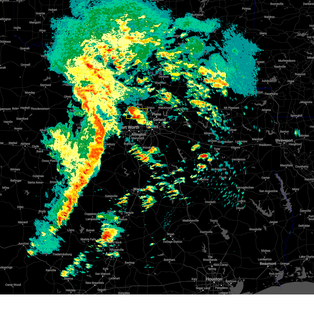 the severe thunderstorm warning has been cancelled and is no longer in effect the severe thunderstorm warning has been cancelled and is no longer in effect
|
| 5/6/2025 9:01 AM CDT |
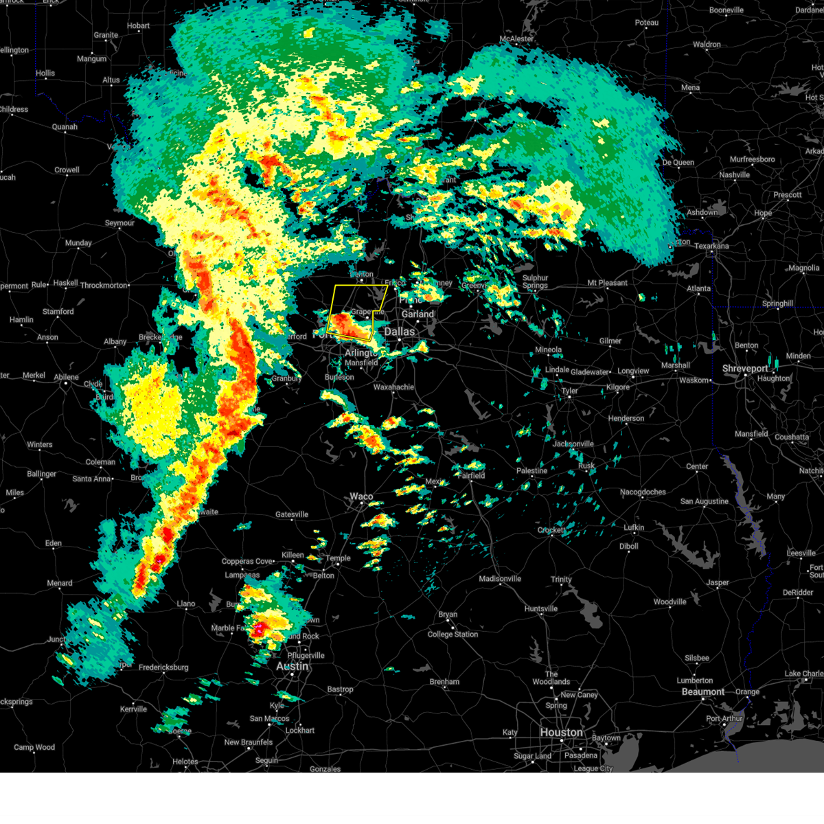 At 900 am cdt, a severe thunderstorm was located over watauga, moving north at 40 mph (radar indicated). Hazards include quarter size hail. Damage to vehicles is possible. this severe storm will be near, roanoke, north richland hills, keller, fort worth, colleyville, hurst, and southlake around 905 am cdt. flower mound, northlake, and trophy club around 910 am cdt. bartonville and argyle around 915 am cdt. denton, double oak, and corral city around 920 am cdt. copper canyon around 925 am cdt. corinth around 930 am cdt. Other locations impacted by this severe thunderstorm include westlake, ponder, lewisville lake, dish, grapevine lake, marshall creek, lakewood village, and oak point. At 900 am cdt, a severe thunderstorm was located over watauga, moving north at 40 mph (radar indicated). Hazards include quarter size hail. Damage to vehicles is possible. this severe storm will be near, roanoke, north richland hills, keller, fort worth, colleyville, hurst, and southlake around 905 am cdt. flower mound, northlake, and trophy club around 910 am cdt. bartonville and argyle around 915 am cdt. denton, double oak, and corral city around 920 am cdt. copper canyon around 925 am cdt. corinth around 930 am cdt. Other locations impacted by this severe thunderstorm include westlake, ponder, lewisville lake, dish, grapevine lake, marshall creek, lakewood village, and oak point.
|
| 5/6/2025 8:48 AM CDT |
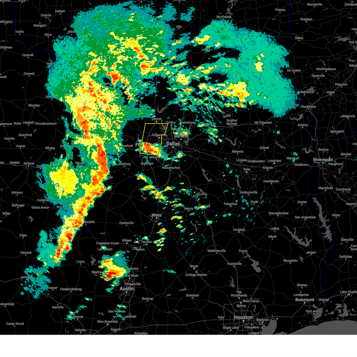 Svrfwd the national weather service in fort worth has issued a * severe thunderstorm warning for, southern denton county in north central texas, central tarrant county in north central texas, * until 930 am cdt. * at 847 am cdt, a severe thunderstorm was located near fort worth, moving north at 40 mph (radar indicated). Hazards include quarter size hail. Damage to vehicles is possible. this severe thunderstorm will be near, north richland hills, keller, haltom city, richland hills, fort worth, colleyville, bedford, hurst, and watauga around 855 am cdt. southlake around 900 am cdt. grapevine and trophy club around 905 am cdt. flower mound and roanoke around 910 am cdt. double oak and bartonville around 915 am cdt. copper canyon, highland village, and argyle around 920 am cdt. Other locations impacted by this severe thunderstorm include westlake, ponder, lake arlington, lewisville lake, westover hills, dish, grapevine lake, marshall creek, lakewood village, and dalworthington gardens. Svrfwd the national weather service in fort worth has issued a * severe thunderstorm warning for, southern denton county in north central texas, central tarrant county in north central texas, * until 930 am cdt. * at 847 am cdt, a severe thunderstorm was located near fort worth, moving north at 40 mph (radar indicated). Hazards include quarter size hail. Damage to vehicles is possible. this severe thunderstorm will be near, north richland hills, keller, haltom city, richland hills, fort worth, colleyville, bedford, hurst, and watauga around 855 am cdt. southlake around 900 am cdt. grapevine and trophy club around 905 am cdt. flower mound and roanoke around 910 am cdt. double oak and bartonville around 915 am cdt. copper canyon, highland village, and argyle around 920 am cdt. Other locations impacted by this severe thunderstorm include westlake, ponder, lake arlington, lewisville lake, westover hills, dish, grapevine lake, marshall creek, lakewood village, and dalworthington gardens.
|
| 4/30/2025 9:44 AM CDT |
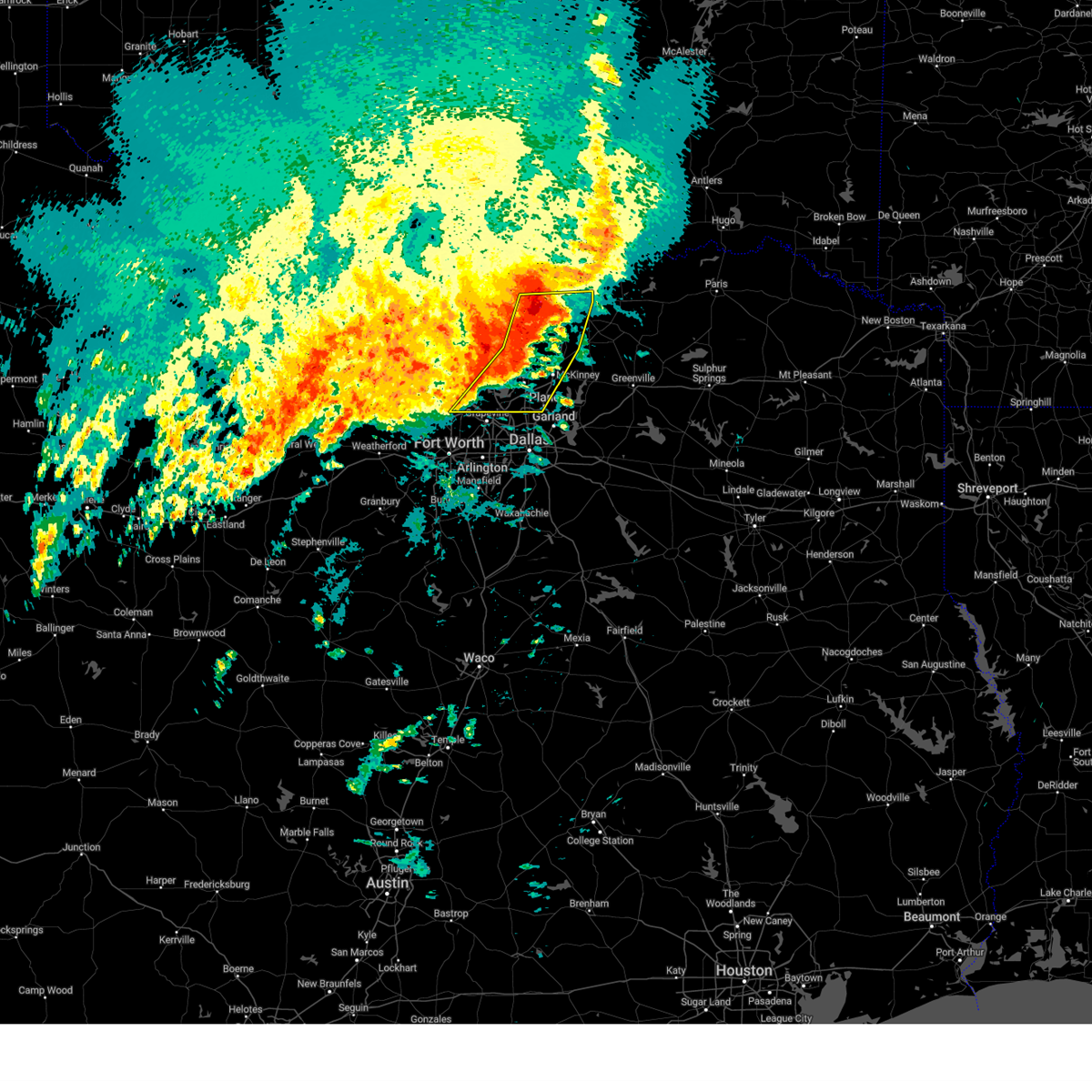 the severe thunderstorm warning has been cancelled and is no longer in effect the severe thunderstorm warning has been cancelled and is no longer in effect
|
| 4/30/2025 9:44 AM CDT |
 At 943 am cdt, severe thunderstorms were located along a line extending from near knollwood to near celina to near flower mound, moving east at 25 mph (radar indicated). Hazards include 65 mph wind gusts and nickel size hail. Expect damage to roofs, siding, and trees. Locations impacted include, tioga, ida, fairview, melissa, mckinney, cross roads, lewisville lake, hickory creek, howe, white mound, prosper, flower mound, new hope, corinth, southmayd, oak point, allen, double oak, hackberry, and highland village. At 943 am cdt, severe thunderstorms were located along a line extending from near knollwood to near celina to near flower mound, moving east at 25 mph (radar indicated). Hazards include 65 mph wind gusts and nickel size hail. Expect damage to roofs, siding, and trees. Locations impacted include, tioga, ida, fairview, melissa, mckinney, cross roads, lewisville lake, hickory creek, howe, white mound, prosper, flower mound, new hope, corinth, southmayd, oak point, allen, double oak, hackberry, and highland village.
|
| 4/30/2025 9:20 AM CDT |
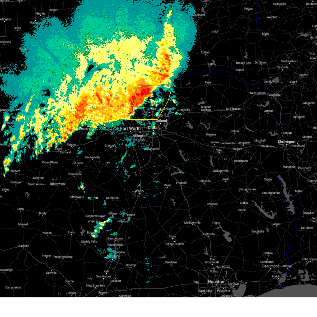 Svrfwd the national weather service in fort worth has issued a * severe thunderstorm warning for, denton county in north central texas, western collin county in north central texas, southeastern cooke county in north central texas, southern grayson county in north central texas, * until 1015 am cdt. * at 920 am cdt, severe thunderstorms were located along a line extending from near whitesboro to ray roberts park isle du bois to near justin, moving east at 25 mph (radar indicated). Hazards include 60 mph wind gusts and nickel size hail. expect damage to roofs, siding, and trees Svrfwd the national weather service in fort worth has issued a * severe thunderstorm warning for, denton county in north central texas, western collin county in north central texas, southeastern cooke county in north central texas, southern grayson county in north central texas, * until 1015 am cdt. * at 920 am cdt, severe thunderstorms were located along a line extending from near whitesboro to ray roberts park isle du bois to near justin, moving east at 25 mph (radar indicated). Hazards include 60 mph wind gusts and nickel size hail. expect damage to roofs, siding, and trees
|
| 4/23/2025 5:27 AM CDT |
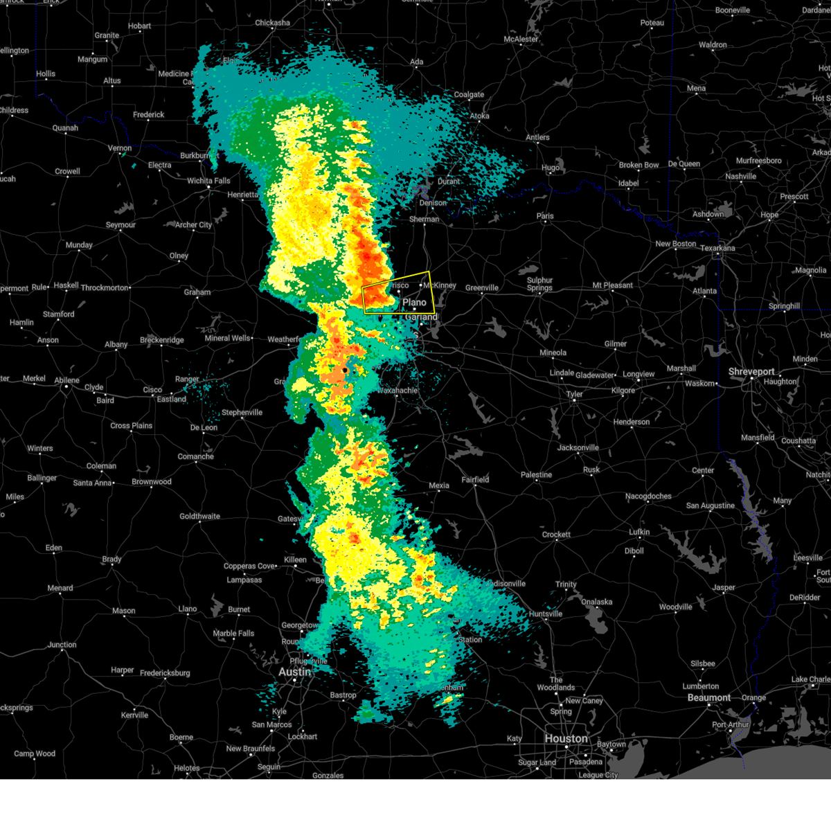 Svrfwd the national weather service in fort worth has issued a * severe thunderstorm warning for, southeastern denton county in north central texas, southwestern collin county in north central texas, * until 630 am cdt. * at 527 am cdt, a severe thunderstorm was located over hickory creek, or over lake dallas, moving east at 30 mph (radar indicated). Hazards include 60 mph wind gusts and quarter size hail. Hail damage to vehicles is expected. expect wind damage to roofs, siding, and trees. this severe thunderstorm will be near, corinth, lake lewisville, lewisville, frisco, lake dallas, hickory creek, shady shores, little elm, and the colony around 530 am cdt. hackberry around 535 am cdt. mckinney and prosper around 550 am cdt. melissa around 615 am cdt. other locations impacted by this severe thunderstorm include lewisville lake, st. paul, oak point, new hope, grapevine lake, lakewood village, lavon lake, and weston. This includes interstate 35e between mile markers 446 and 463. Svrfwd the national weather service in fort worth has issued a * severe thunderstorm warning for, southeastern denton county in north central texas, southwestern collin county in north central texas, * until 630 am cdt. * at 527 am cdt, a severe thunderstorm was located over hickory creek, or over lake dallas, moving east at 30 mph (radar indicated). Hazards include 60 mph wind gusts and quarter size hail. Hail damage to vehicles is expected. expect wind damage to roofs, siding, and trees. this severe thunderstorm will be near, corinth, lake lewisville, lewisville, frisco, lake dallas, hickory creek, shady shores, little elm, and the colony around 530 am cdt. hackberry around 535 am cdt. mckinney and prosper around 550 am cdt. melissa around 615 am cdt. other locations impacted by this severe thunderstorm include lewisville lake, st. paul, oak point, new hope, grapevine lake, lakewood village, lavon lake, and weston. This includes interstate 35e between mile markers 446 and 463.
|
| 4/23/2025 5:08 AM CDT |
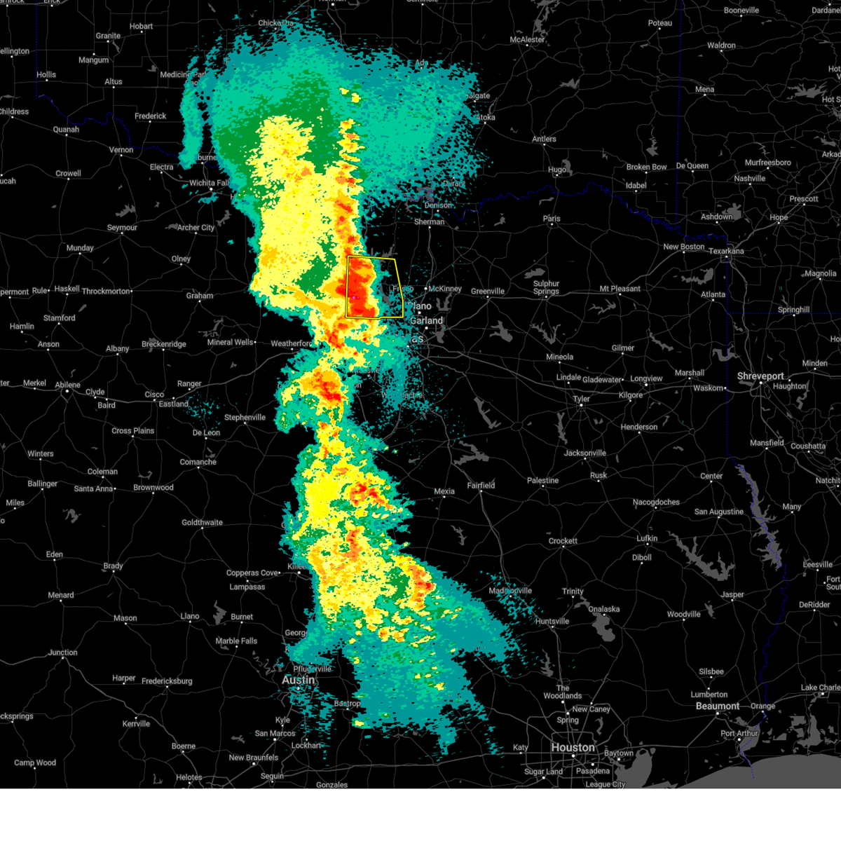 the severe thunderstorm warning has been cancelled and is no longer in effect the severe thunderstorm warning has been cancelled and is no longer in effect
|
| 4/23/2025 5:08 AM CDT |
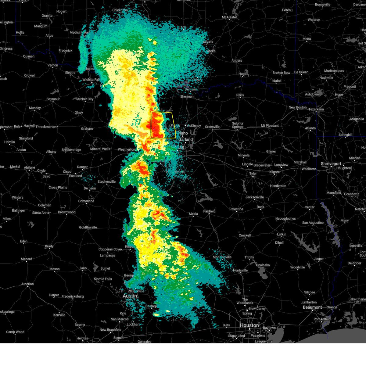 At 507 am cdt, a severe thunderstorm was located over highland village, moving east at 30 mph (radar indicated). Hazards include 65 mph wind gusts and quarter size hail. Hail damage to vehicles is expected. expect wind damage to roofs, siding, and trees. this severe storm will be near, lake lewisville, lewisville, lake dallas, hickory creek, shady shores, little elm, and the colony around 515 am cdt. hackberry and frisco around 520 am cdt. hebron and plano around 525 am cdt. Other locations impacted by this severe thunderstorm include westlake, ponder, lewisville lake, bolivar, oak point, lincoln park, dish, grapevine lake, marshall creek, and lakewood village. At 507 am cdt, a severe thunderstorm was located over highland village, moving east at 30 mph (radar indicated). Hazards include 65 mph wind gusts and quarter size hail. Hail damage to vehicles is expected. expect wind damage to roofs, siding, and trees. this severe storm will be near, lake lewisville, lewisville, lake dallas, hickory creek, shady shores, little elm, and the colony around 515 am cdt. hackberry and frisco around 520 am cdt. hebron and plano around 525 am cdt. Other locations impacted by this severe thunderstorm include westlake, ponder, lewisville lake, bolivar, oak point, lincoln park, dish, grapevine lake, marshall creek, and lakewood village.
|
| 4/23/2025 4:27 AM CDT |
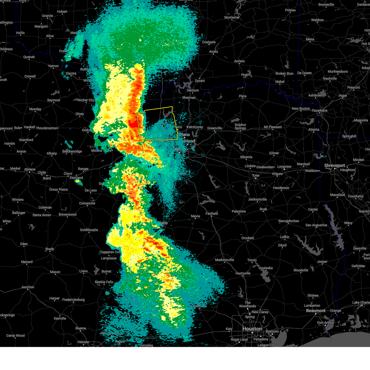 Svrfwd the national weather service in fort worth has issued a * severe thunderstorm warning for, eastern wise county in north central texas, denton county in north central texas, southern cooke county in north central texas, * until 530 am cdt. * at 427 am cdt, severe thunderstorms were located along a line extending from near alvord to aurora, moving east at 30 mph (radar indicated). Hazards include 60 mph wind gusts and quarter size hail. Hail damage to vehicles is expected. expect wind damage to roofs, siding, and trees. severe thunderstorms will be near, aurora, pecan acres, new fairview, decatur, and rhome around 430 am cdt. fort worth around 440 am cdt. justin and northlake around 445 am cdt. denton, flower mound, and argyle around 450 am cdt. bartonville, roanoke, corral city, and krum around 455 am cdt. sanger around 500 am cdt. double oak and copper canyon around 505 am cdt. corinth, highland village, hickory creek, and shady shores around 510 am cdt. other locations impacted by these severe thunderstorms include greenwood, road runner, valley view, oak point, lois, providence village, westlake, stony, ponder, and lake ray roberts. this includes the following highways, interstate 35 between mile markers 468 and 487. interstate 35w between mile markers 68 and 85. Interstate 35e between mile markers 446 and 466. Svrfwd the national weather service in fort worth has issued a * severe thunderstorm warning for, eastern wise county in north central texas, denton county in north central texas, southern cooke county in north central texas, * until 530 am cdt. * at 427 am cdt, severe thunderstorms were located along a line extending from near alvord to aurora, moving east at 30 mph (radar indicated). Hazards include 60 mph wind gusts and quarter size hail. Hail damage to vehicles is expected. expect wind damage to roofs, siding, and trees. severe thunderstorms will be near, aurora, pecan acres, new fairview, decatur, and rhome around 430 am cdt. fort worth around 440 am cdt. justin and northlake around 445 am cdt. denton, flower mound, and argyle around 450 am cdt. bartonville, roanoke, corral city, and krum around 455 am cdt. sanger around 500 am cdt. double oak and copper canyon around 505 am cdt. corinth, highland village, hickory creek, and shady shores around 510 am cdt. other locations impacted by these severe thunderstorms include greenwood, road runner, valley view, oak point, lois, providence village, westlake, stony, ponder, and lake ray roberts. this includes the following highways, interstate 35 between mile markers 468 and 487. interstate 35w between mile markers 68 and 85. Interstate 35e between mile markers 446 and 466.
|
| 3/4/2025 5:35 AM CST |
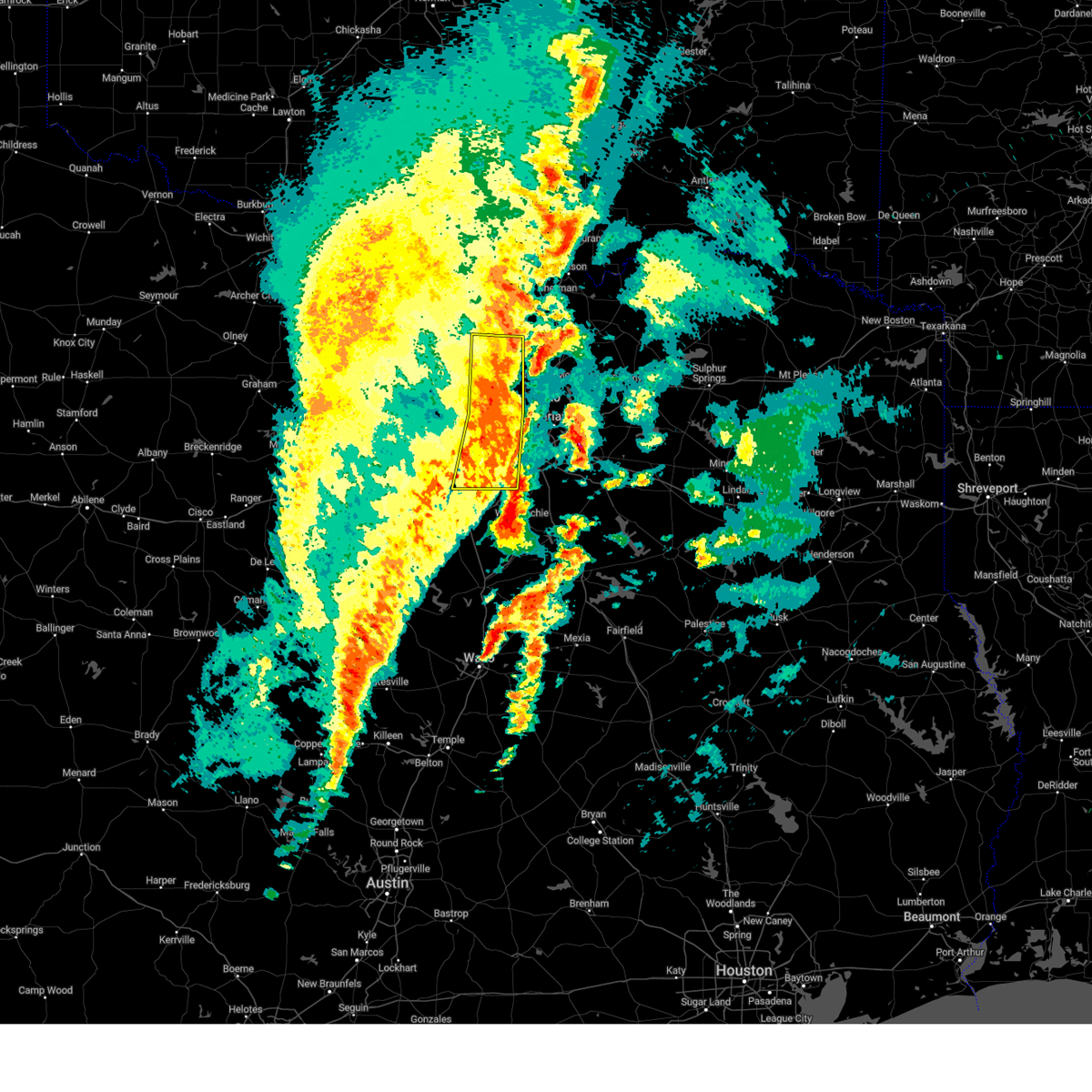 At 534 am cst, severe thunderstorms were located along a line extending from near gunter to near addison to near duncanville, moving east at 55 mph (radar indicated). Hazards include 70 mph wind gusts and quarter size hail. Hail damage to vehicles is expected. expect considerable tree damage. wind damage is also likely to mobile homes, roofs, and outbuildings. These severe thunderstorms will remain over mainly rural areas of denton, eastern tarrant and western dallas counties, including the following locations, westlake, lake arlington, lewisville lake, oak point, joe pool lake, lincoln park, mountain creek lake, grapevine lake, lakewood village, and dalworthington gardens. At 534 am cst, severe thunderstorms were located along a line extending from near gunter to near addison to near duncanville, moving east at 55 mph (radar indicated). Hazards include 70 mph wind gusts and quarter size hail. Hail damage to vehicles is expected. expect considerable tree damage. wind damage is also likely to mobile homes, roofs, and outbuildings. These severe thunderstorms will remain over mainly rural areas of denton, eastern tarrant and western dallas counties, including the following locations, westlake, lake arlington, lewisville lake, oak point, joe pool lake, lincoln park, mountain creek lake, grapevine lake, lakewood village, and dalworthington gardens.
|
| 3/4/2025 5:35 AM CST |
 the severe thunderstorm warning has been cancelled and is no longer in effect the severe thunderstorm warning has been cancelled and is no longer in effect
|
| 3/4/2025 5:09 AM CST |
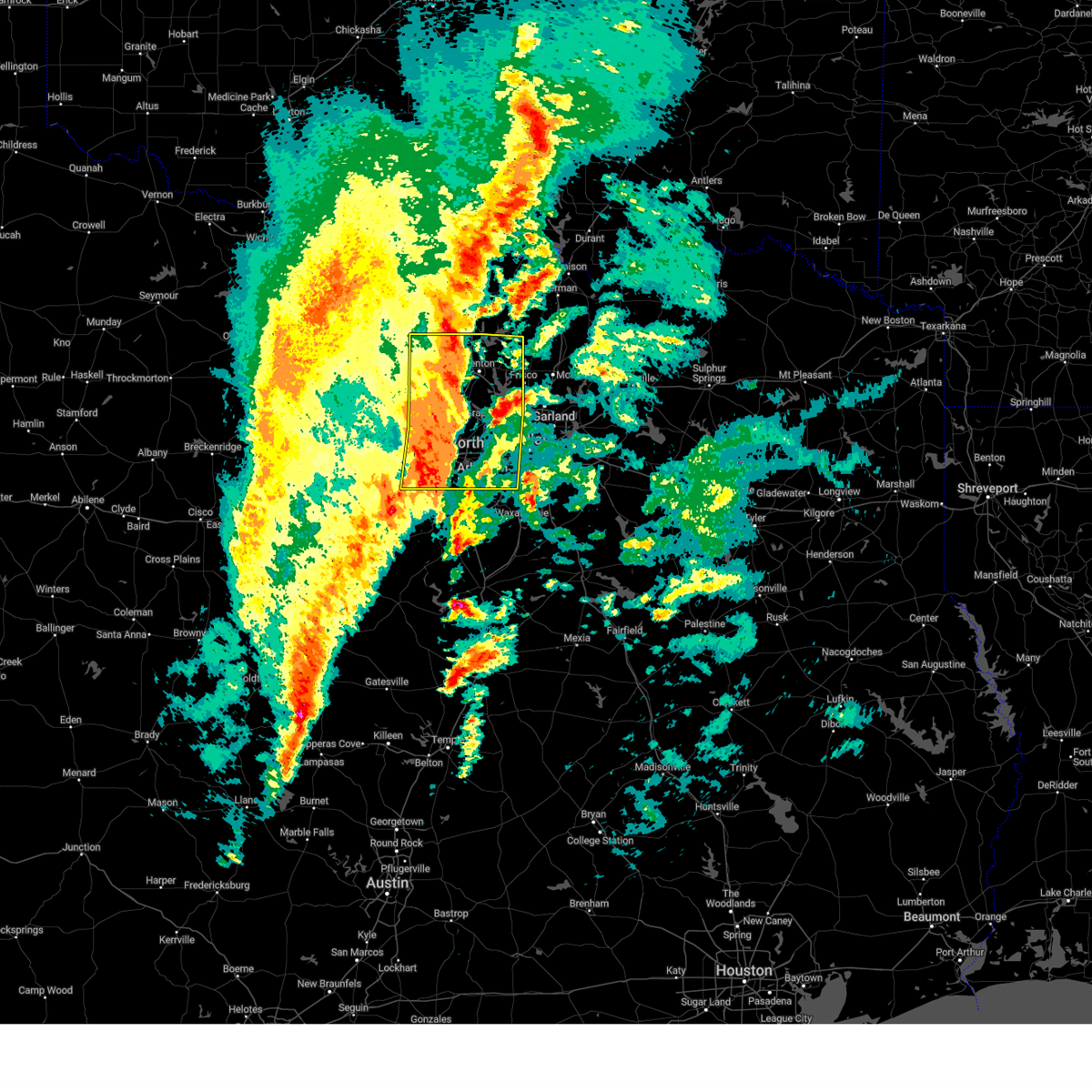 At 508 am cst, severe thunderstorms were located along a line extending from near sanger to trophy club to near crowley, moving east at 50 mph. this storm is currently producing widespread wind gusts of 70 to 75 mph! (radar indicated). Hazards include 75 mph wind gusts and quarter size hail. Hail damage to vehicles is expected. expect considerable tree damage. wind damage is also likely to mobile homes, roofs, and outbuildings. these severe storms will be near, denton, double oak, copper canyon, flower mound, bartonville, pantego, irving, euless, corinth, and rendon around 515 am cst. krugerville, hebron, dallas, carrollton, lake lewisville, pilot point, little elm, and the colony around 520 am cst. cedar hill state park, cedar hill, plano, hackberry, frisco, prosper, farmers branch, and celina around 525 am cst. duncanville, cockrell hill, addison, desoto, and dallas love field around 530 am cst. Other locations impacted by these severe thunderstorms include joe pool lake, mountain creek lake, providence village, stony, ponder, lewisville lake, bolivar, lincoln park, dish, and grapevine lake. At 508 am cst, severe thunderstorms were located along a line extending from near sanger to trophy club to near crowley, moving east at 50 mph. this storm is currently producing widespread wind gusts of 70 to 75 mph! (radar indicated). Hazards include 75 mph wind gusts and quarter size hail. Hail damage to vehicles is expected. expect considerable tree damage. wind damage is also likely to mobile homes, roofs, and outbuildings. these severe storms will be near, denton, double oak, copper canyon, flower mound, bartonville, pantego, irving, euless, corinth, and rendon around 515 am cst. krugerville, hebron, dallas, carrollton, lake lewisville, pilot point, little elm, and the colony around 520 am cst. cedar hill state park, cedar hill, plano, hackberry, frisco, prosper, farmers branch, and celina around 525 am cst. duncanville, cockrell hill, addison, desoto, and dallas love field around 530 am cst. Other locations impacted by these severe thunderstorms include joe pool lake, mountain creek lake, providence village, stony, ponder, lewisville lake, bolivar, lincoln park, dish, and grapevine lake.
|
| 3/4/2025 4:42 AM CST |
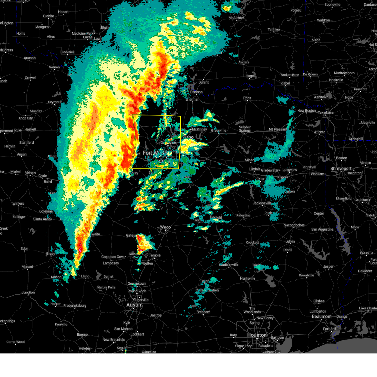 Svrfwd the national weather service in fort worth has issued a * severe thunderstorm warning for, wise county in north central texas, denton county in north central texas, eastern parker county in north central texas, tarrant county in north central texas, western dallas county in north central texas, * until 545 am cst. * at 440 am cst, severe thunderstorms were located along a line extending from alvord to springtown to near western lake, moving east at 50 mph. this storm is currently producing 70 mph winds and wind damage near decatur in wise county! (radar indicated). Hazards include 70 mph wind gusts and quarter size hail. Expect considerable tree damage. wind damage is also likely to mobile homes, roofs, and outbuildings. severe thunderstorms will be near, lake weatherford, aurora, alvord, boyd, pecan acres, eagle mountain, annetta, aledo, new fairview, and fort worth around 445 am cst. haslet and rhome around 450 am cst. white settlement, lake worth, sansom park, benbrook, saginaw, and westworth village around 455 am cst. justin, blue mound, and river oaks around 500 am cst. denton, edgecliff village, flower mound, edgecliff, roanoke, keller, haltom city, northlake, crowley, and watauga around 505 am cst. bartonville, sanger, north richland hills, richland hills, corral city, krum, forest hill, trophy club, argyle, and everman around 510 am cst. double oak, copper canyon, euless, rendon, kennedale, colleyville, bedford, arlington, grapevine, and hurst around 515 am cst. pantego, corinth, highland village, lewisville, hickory creek, mansfield, shady shores, and dfw intl airport around 520 am cst. other locations impacted by these severe thunderstorms include cottondale, joe pool lake, mountain creek lake, providence village, stony, ponder, lewisville lake, bolivar, lincoln park, and dish. this includes the following highways, interstate 35 between mile markers 468 and 481. interstate 35w between mile markers 38 and 85. interstate 35e between mile markers 432 and 466. interstate 20 between mile markers 410 and 463. Interstate 30 between mile markers 1 and 42. Svrfwd the national weather service in fort worth has issued a * severe thunderstorm warning for, wise county in north central texas, denton county in north central texas, eastern parker county in north central texas, tarrant county in north central texas, western dallas county in north central texas, * until 545 am cst. * at 440 am cst, severe thunderstorms were located along a line extending from alvord to springtown to near western lake, moving east at 50 mph. this storm is currently producing 70 mph winds and wind damage near decatur in wise county! (radar indicated). Hazards include 70 mph wind gusts and quarter size hail. Expect considerable tree damage. wind damage is also likely to mobile homes, roofs, and outbuildings. severe thunderstorms will be near, lake weatherford, aurora, alvord, boyd, pecan acres, eagle mountain, annetta, aledo, new fairview, and fort worth around 445 am cst. haslet and rhome around 450 am cst. white settlement, lake worth, sansom park, benbrook, saginaw, and westworth village around 455 am cst. justin, blue mound, and river oaks around 500 am cst. denton, edgecliff village, flower mound, edgecliff, roanoke, keller, haltom city, northlake, crowley, and watauga around 505 am cst. bartonville, sanger, north richland hills, richland hills, corral city, krum, forest hill, trophy club, argyle, and everman around 510 am cst. double oak, copper canyon, euless, rendon, kennedale, colleyville, bedford, arlington, grapevine, and hurst around 515 am cst. pantego, corinth, highland village, lewisville, hickory creek, mansfield, shady shores, and dfw intl airport around 520 am cst. other locations impacted by these severe thunderstorms include cottondale, joe pool lake, mountain creek lake, providence village, stony, ponder, lewisville lake, bolivar, lincoln park, and dish. this includes the following highways, interstate 35 between mile markers 468 and 481. interstate 35w between mile markers 38 and 85. interstate 35e between mile markers 432 and 466. interstate 20 between mile markers 410 and 463. Interstate 30 between mile markers 1 and 42.
|
| 12/16/2024 4:34 PM CST |
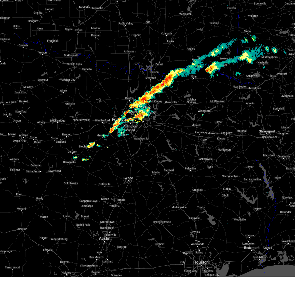 the severe thunderstorm warning has been cancelled and is no longer in effect the severe thunderstorm warning has been cancelled and is no longer in effect
|
| 12/16/2024 4:26 PM CST |
 At 426 pm cst, a severe thunderstorm was located over irving, moving east at 10 mph (radar indicated). Hazards include quarter size hail. Damage to vehicles is possible. this severe storm will be near, dallas, irving, and farmers branch around 430 pm cst. dallas love field around 435 pm cst. University park and highland park around 450 pm cst. At 426 pm cst, a severe thunderstorm was located over irving, moving east at 10 mph (radar indicated). Hazards include quarter size hail. Damage to vehicles is possible. this severe storm will be near, dallas, irving, and farmers branch around 430 pm cst. dallas love field around 435 pm cst. University park and highland park around 450 pm cst.
|
| 12/16/2024 4:16 PM CST |
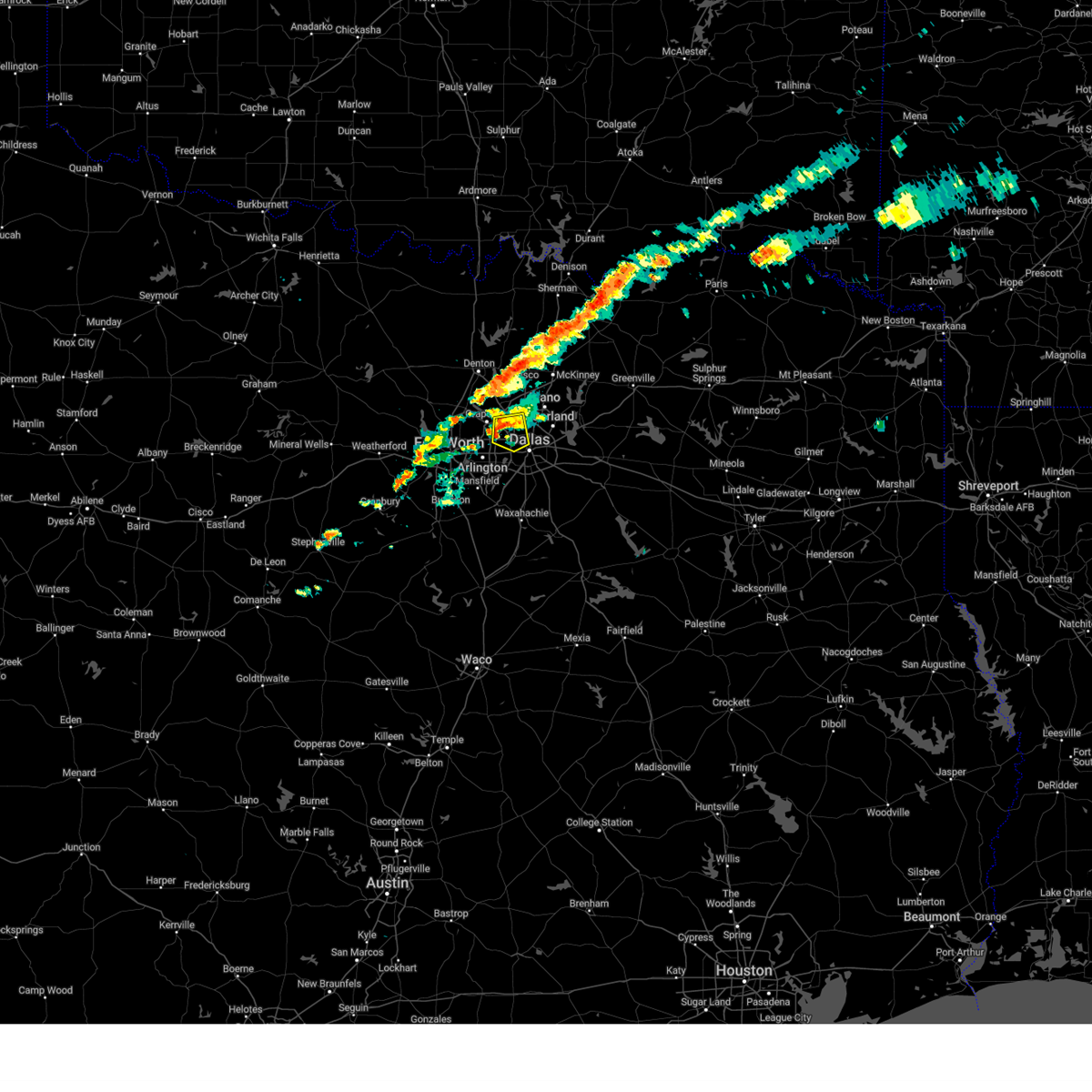 Svrfwd the national weather service in fort worth has issued a * severe thunderstorm warning for, northwestern dallas county in north central texas, * until 500 pm cst. * at 415 pm cst, a severe thunderstorm was located over irving, moving east at 10 mph (radar indicated). Hazards include quarter size hail. Damage to vehicles is possible. this severe thunderstorm will be near, dallas, irving, and dfw intl airport around 420 pm cst. This includes interstate 35e between mile markers 430 and 443. Svrfwd the national weather service in fort worth has issued a * severe thunderstorm warning for, northwestern dallas county in north central texas, * until 500 pm cst. * at 415 pm cst, a severe thunderstorm was located over irving, moving east at 10 mph (radar indicated). Hazards include quarter size hail. Damage to vehicles is possible. this severe thunderstorm will be near, dallas, irving, and dfw intl airport around 420 pm cst. This includes interstate 35e between mile markers 430 and 443.
|
| 11/18/2024 9:28 AM CST |
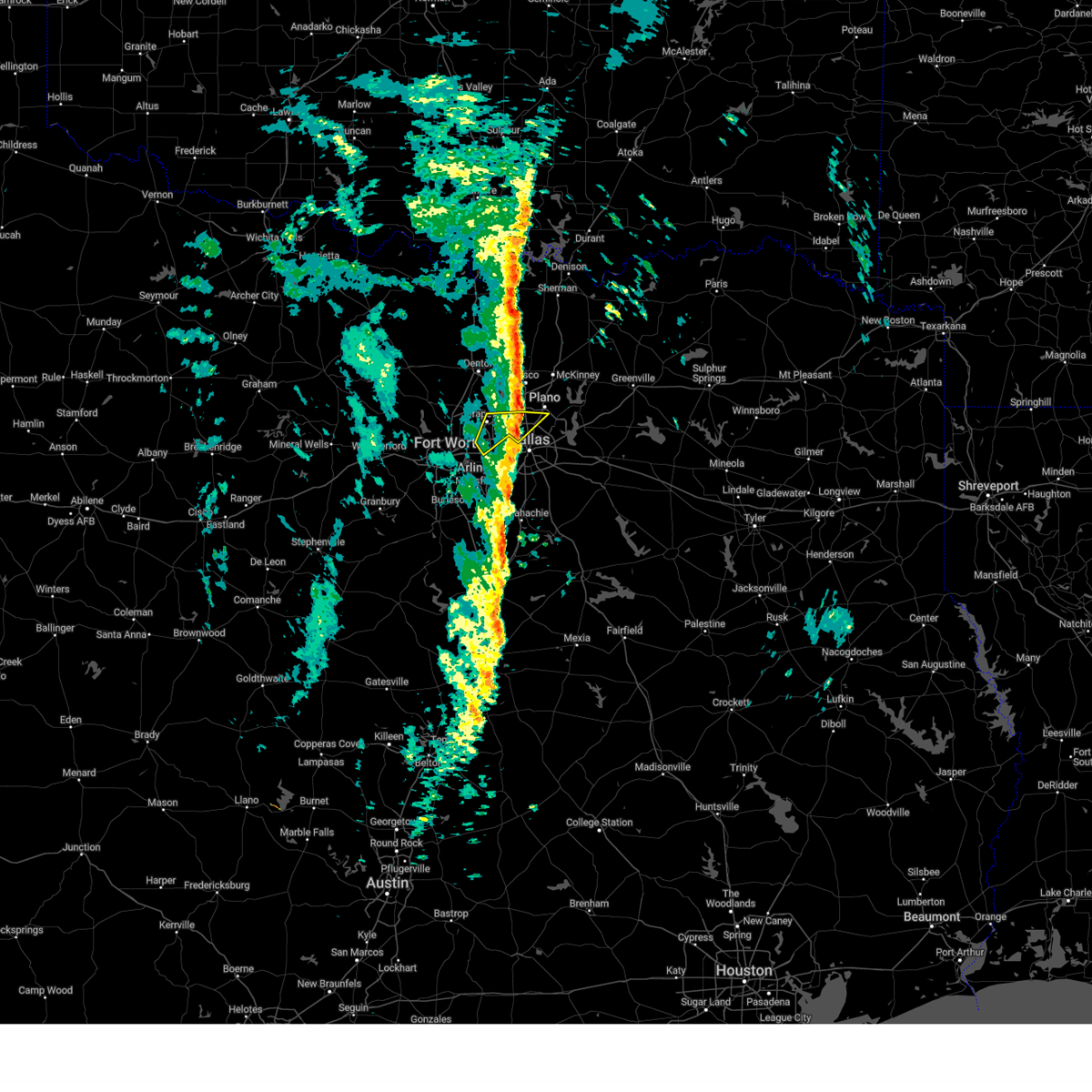 The storm which prompted the warning has exited the warned area. therefore, the warning will be allowed to expire. however, gusty winds are still possible with this thunderstorm. The storm which prompted the warning has exited the warned area. therefore, the warning will be allowed to expire. however, gusty winds are still possible with this thunderstorm.
|
| 11/18/2024 9:04 AM CST |
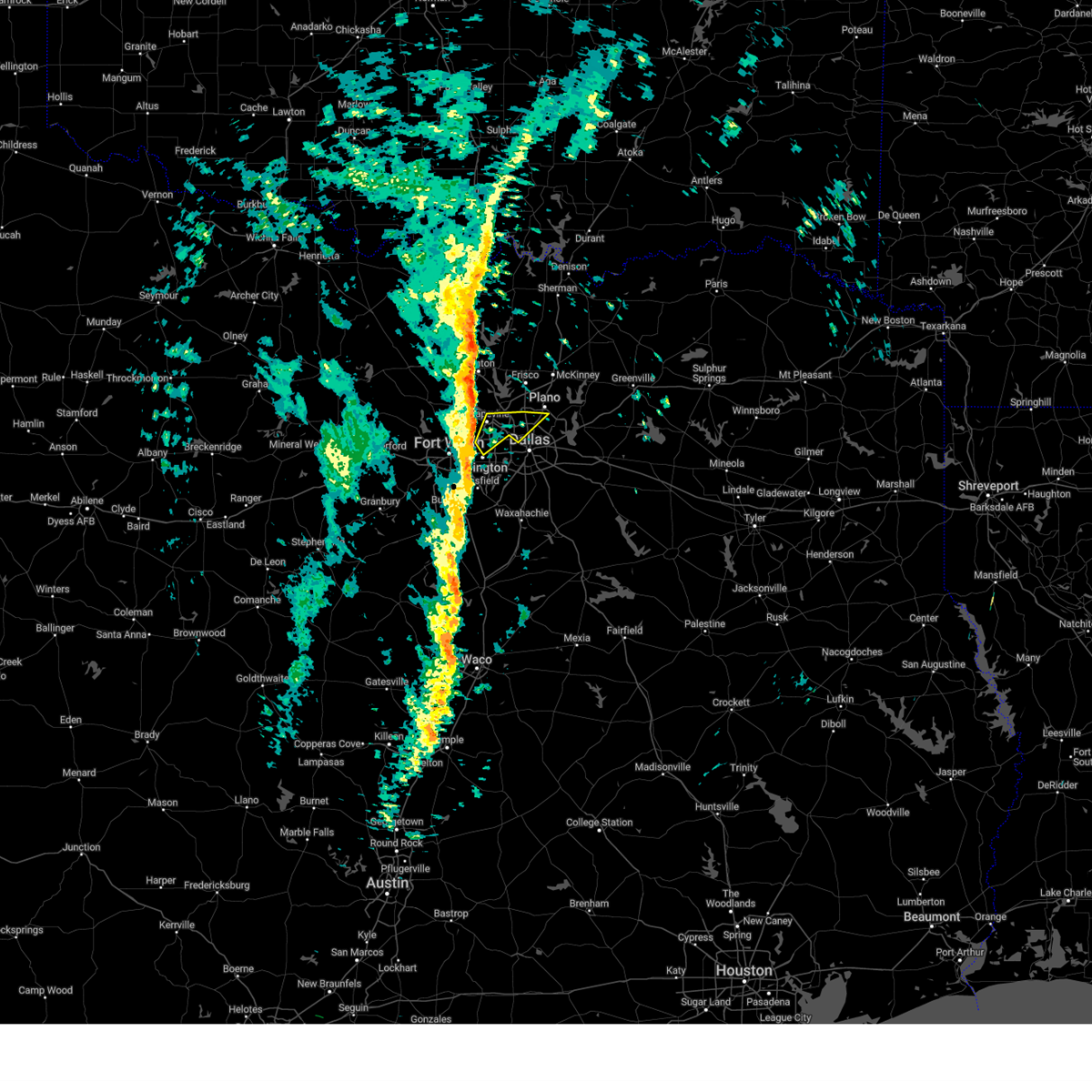 Svrfwd the national weather service in fort worth has issued a * severe thunderstorm warning for, northeastern tarrant county in north central texas, northwestern dallas county in north central texas, * until 930 am cst. * at 903 am cst, a severe thunderstorm was located over euless, moving northeast at 45 mph (radar indicated). Hazards include 65 mph wind gusts. Expect damage to roofs, siding, and trees. this severe thunderstorm will be near, dallas, irving, carrollton, grapevine, coppell, farmers branch, and dfw intl airport around 910 am cst. addison around 915 am cst. richardson around 920 am cst. other locations impacted by this severe thunderstorm include grapevine lake. this includes the following highways, interstate 35e between mile markers 433 and 445. Interstate 30 near mile marker 28. Svrfwd the national weather service in fort worth has issued a * severe thunderstorm warning for, northeastern tarrant county in north central texas, northwestern dallas county in north central texas, * until 930 am cst. * at 903 am cst, a severe thunderstorm was located over euless, moving northeast at 45 mph (radar indicated). Hazards include 65 mph wind gusts. Expect damage to roofs, siding, and trees. this severe thunderstorm will be near, dallas, irving, carrollton, grapevine, coppell, farmers branch, and dfw intl airport around 910 am cst. addison around 915 am cst. richardson around 920 am cst. other locations impacted by this severe thunderstorm include grapevine lake. this includes the following highways, interstate 35e between mile markers 433 and 445. Interstate 30 near mile marker 28.
|
| 9/25/2024 3:39 AM CDT |
 the severe thunderstorm warning has been cancelled and is no longer in effect the severe thunderstorm warning has been cancelled and is no longer in effect
|
| 9/25/2024 3:39 AM CDT |
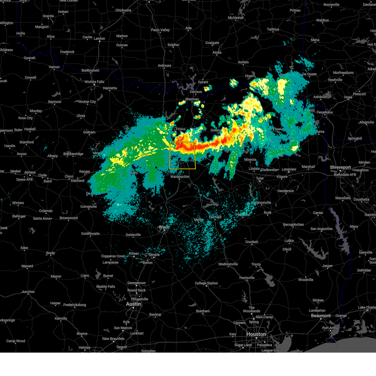 At 339 am cdt, a severe thunderstorm was located over highland park, moving south at 30 mph (radar indicated). Hazards include 60 mph wind gusts and half dollar size hail. Hail damage to vehicles is expected. expect wind damage to roofs, siding, and trees. this severe storm will be near, dallas around 345 am cdt. cockrell hill around 350 am cdt. lancaster around 355 am cdt. desoto around 400 am cdt. duncanville around 405 am cdt. glenn heights around 410 am cdt. ovilla around 415 am cdt. Other locations impacted by this severe thunderstorm include joe pool lake, sand branch, mountain creek lake, buckingham, white rock lake, and lake ray hubbard. At 339 am cdt, a severe thunderstorm was located over highland park, moving south at 30 mph (radar indicated). Hazards include 60 mph wind gusts and half dollar size hail. Hail damage to vehicles is expected. expect wind damage to roofs, siding, and trees. this severe storm will be near, dallas around 345 am cdt. cockrell hill around 350 am cdt. lancaster around 355 am cdt. desoto around 400 am cdt. duncanville around 405 am cdt. glenn heights around 410 am cdt. ovilla around 415 am cdt. Other locations impacted by this severe thunderstorm include joe pool lake, sand branch, mountain creek lake, buckingham, white rock lake, and lake ray hubbard.
|
| 9/25/2024 3:15 AM CDT |
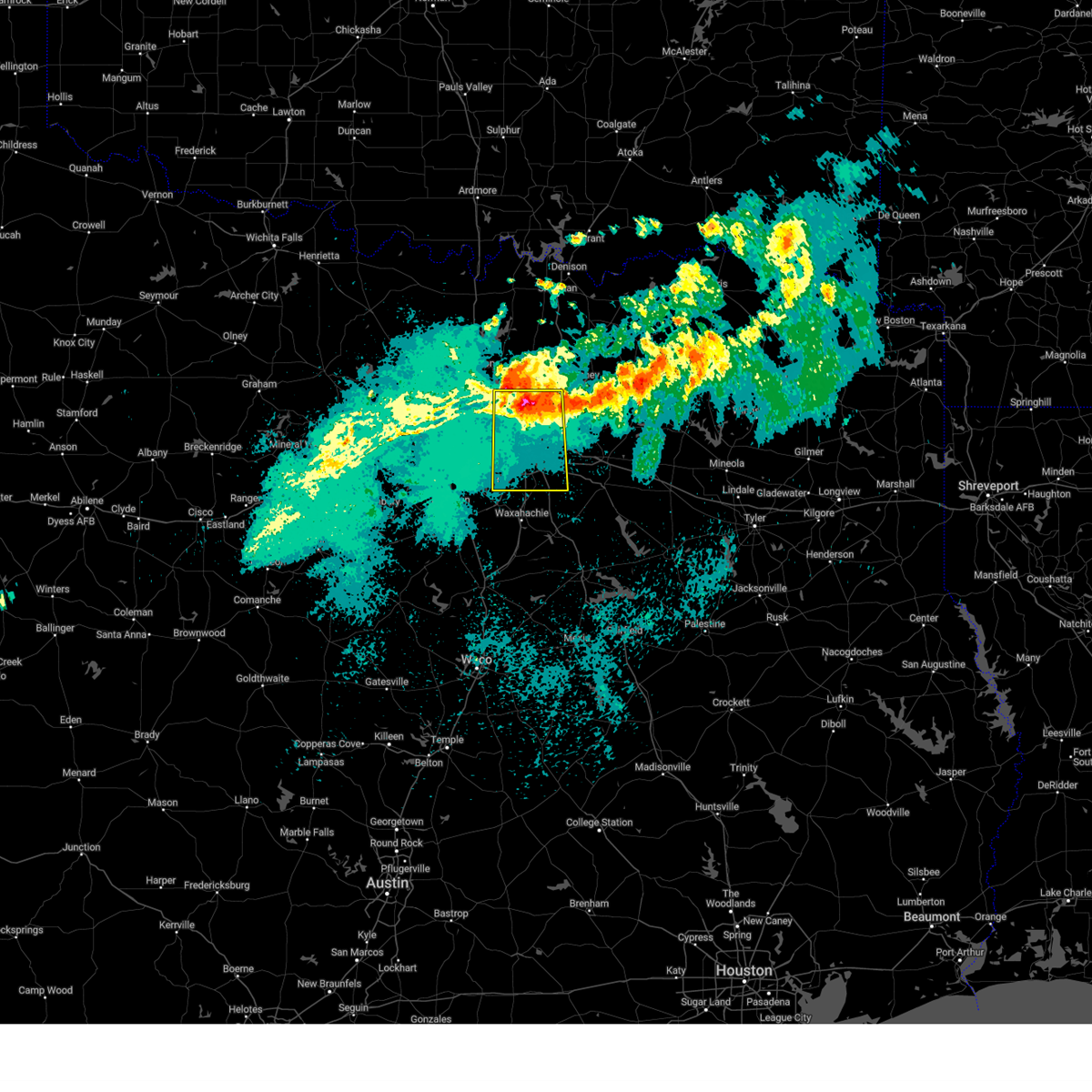 At 315 am cdt, a severe thunderstorm was located over carrollton, moving south at 30 mph (radar indicated). Hazards include 60 mph wind gusts and half dollar size hail. Hail damage to vehicles is expected. expect wind damage to roofs, siding, and trees. this severe storm will be near, dallas, richardson, farmers branch, university park, and addison around 320 am cdt. highland park and dallas love field around 325 am cdt. lancaster around 350 am cdt. desoto around 355 am cdt. glenn heights around 405 am cdt. Other locations impacted by this severe thunderstorm include lewisville lake, white rock lake, joe pool lake, sand branch, mountain creek lake, buckingham, and lake ray hubbard. At 315 am cdt, a severe thunderstorm was located over carrollton, moving south at 30 mph (radar indicated). Hazards include 60 mph wind gusts and half dollar size hail. Hail damage to vehicles is expected. expect wind damage to roofs, siding, and trees. this severe storm will be near, dallas, richardson, farmers branch, university park, and addison around 320 am cdt. highland park and dallas love field around 325 am cdt. lancaster around 350 am cdt. desoto around 355 am cdt. glenn heights around 405 am cdt. Other locations impacted by this severe thunderstorm include lewisville lake, white rock lake, joe pool lake, sand branch, mountain creek lake, buckingham, and lake ray hubbard.
|
| 9/25/2024 3:07 AM CDT |
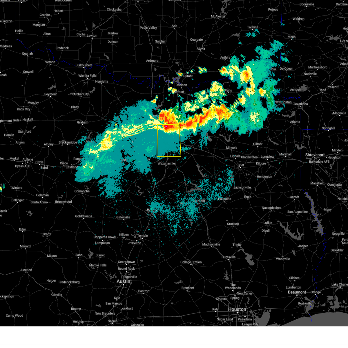 Svrfwd the national weather service in fort worth has issued a * severe thunderstorm warning for, southeastern denton county in north central texas, southwestern collin county in north central texas, dallas county in north central texas, * until 400 am cdt. * at 307 am cdt, a severe thunderstorm was located near addison, moving south at 30 mph (radar indicated). Hazards include 60 mph wind gusts and quarter size hail. Hail damage to vehicles is expected. expect wind damage to roofs, siding, and trees. this severe thunderstorm will be near, dallas, carrollton, richardson, farmers branch, and addison around 310 am cdt. university park, highland park, and dallas love field around 315 am cdt. cockrell hill around 330 am cdt. duncanville and lancaster around 340 am cdt. desoto around 345 am cdt. glenn heights around 350 am cdt. cedar hill and ovilla around 355 am cdt. Other locations impacted by this severe thunderstorm include lewisville lake, white rock lake, joe pool lake, sand branch, mountain creek lake, buckingham, and lake ray hubbard. Svrfwd the national weather service in fort worth has issued a * severe thunderstorm warning for, southeastern denton county in north central texas, southwestern collin county in north central texas, dallas county in north central texas, * until 400 am cdt. * at 307 am cdt, a severe thunderstorm was located near addison, moving south at 30 mph (radar indicated). Hazards include 60 mph wind gusts and quarter size hail. Hail damage to vehicles is expected. expect wind damage to roofs, siding, and trees. this severe thunderstorm will be near, dallas, carrollton, richardson, farmers branch, and addison around 310 am cdt. university park, highland park, and dallas love field around 315 am cdt. cockrell hill around 330 am cdt. duncanville and lancaster around 340 am cdt. desoto around 345 am cdt. glenn heights around 350 am cdt. cedar hill and ovilla around 355 am cdt. Other locations impacted by this severe thunderstorm include lewisville lake, white rock lake, joe pool lake, sand branch, mountain creek lake, buckingham, and lake ray hubbard.
|
| 9/25/2024 2:51 AM CDT |
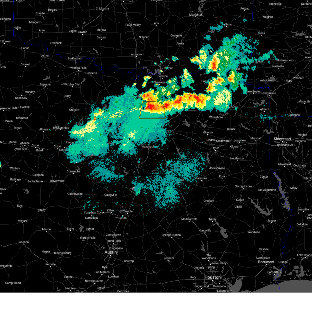 At 251 am cdt, a severe thunderstorm was located over the colony, moving south at 35 mph (radar indicated). Hazards include 65 mph wind gusts and quarter size hail. Hail damage to vehicles is expected. expect wind damage to roofs, siding, and trees. this severe storm will be near, plano, carrollton, lewisville, the colony, and hebron around 255 am cdt. coppell around 300 am cdt. other locations impacted by this severe thunderstorm include lewisville lake, branch, st. Paul, oak point, lavon lake, lincoln park, new hope, lakewood village, providence village, and weston. At 251 am cdt, a severe thunderstorm was located over the colony, moving south at 35 mph (radar indicated). Hazards include 65 mph wind gusts and quarter size hail. Hail damage to vehicles is expected. expect wind damage to roofs, siding, and trees. this severe storm will be near, plano, carrollton, lewisville, the colony, and hebron around 255 am cdt. coppell around 300 am cdt. other locations impacted by this severe thunderstorm include lewisville lake, branch, st. Paul, oak point, lavon lake, lincoln park, new hope, lakewood village, providence village, and weston.
|
| 9/25/2024 2:31 AM CDT |
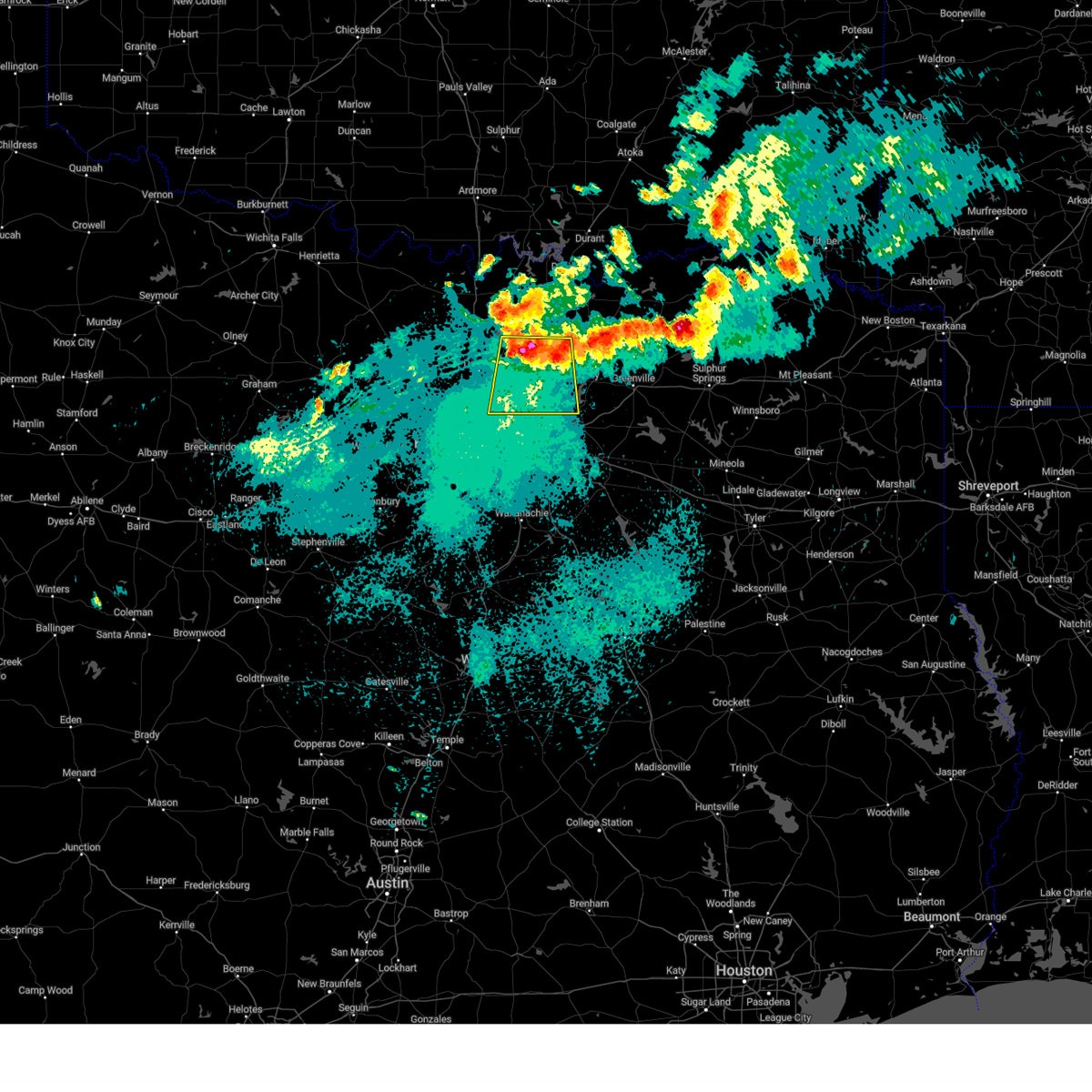 Svrfwd the national weather service in fort worth has issued a * severe thunderstorm warning for, eastern denton county in north central texas, collin county in north central texas, * until 315 am cdt. * at 230 am cdt, a severe thunderstorm was located near prosper, or near frisco, moving south at 35 mph (radar indicated). Hazards include 65 mph wind gusts and quarter size hail. Hail damage to vehicles is expected. expect wind damage to roofs, siding, and trees. this severe thunderstorm will be near, frisco and little elm around 235 am cdt. plano and the colony around 240 am cdt. carrollton, lewisville, and hebron around 245 am cdt. dallas around 250 am cdt. addison around 255 am cdt. other locations impacted by this severe thunderstorm include weston, lewisville lake, branch, st. paul, oak point, lavon lake, lincoln park, new hope, lakewood village, and providence village. This includes interstate 35e between mile markers 445 and 457. Svrfwd the national weather service in fort worth has issued a * severe thunderstorm warning for, eastern denton county in north central texas, collin county in north central texas, * until 315 am cdt. * at 230 am cdt, a severe thunderstorm was located near prosper, or near frisco, moving south at 35 mph (radar indicated). Hazards include 65 mph wind gusts and quarter size hail. Hail damage to vehicles is expected. expect wind damage to roofs, siding, and trees. this severe thunderstorm will be near, frisco and little elm around 235 am cdt. plano and the colony around 240 am cdt. carrollton, lewisville, and hebron around 245 am cdt. dallas around 250 am cdt. addison around 255 am cdt. other locations impacted by this severe thunderstorm include weston, lewisville lake, branch, st. paul, oak point, lavon lake, lincoln park, new hope, lakewood village, and providence village. This includes interstate 35e between mile markers 445 and 457.
|
| 8/3/2024 4:09 AM CDT |
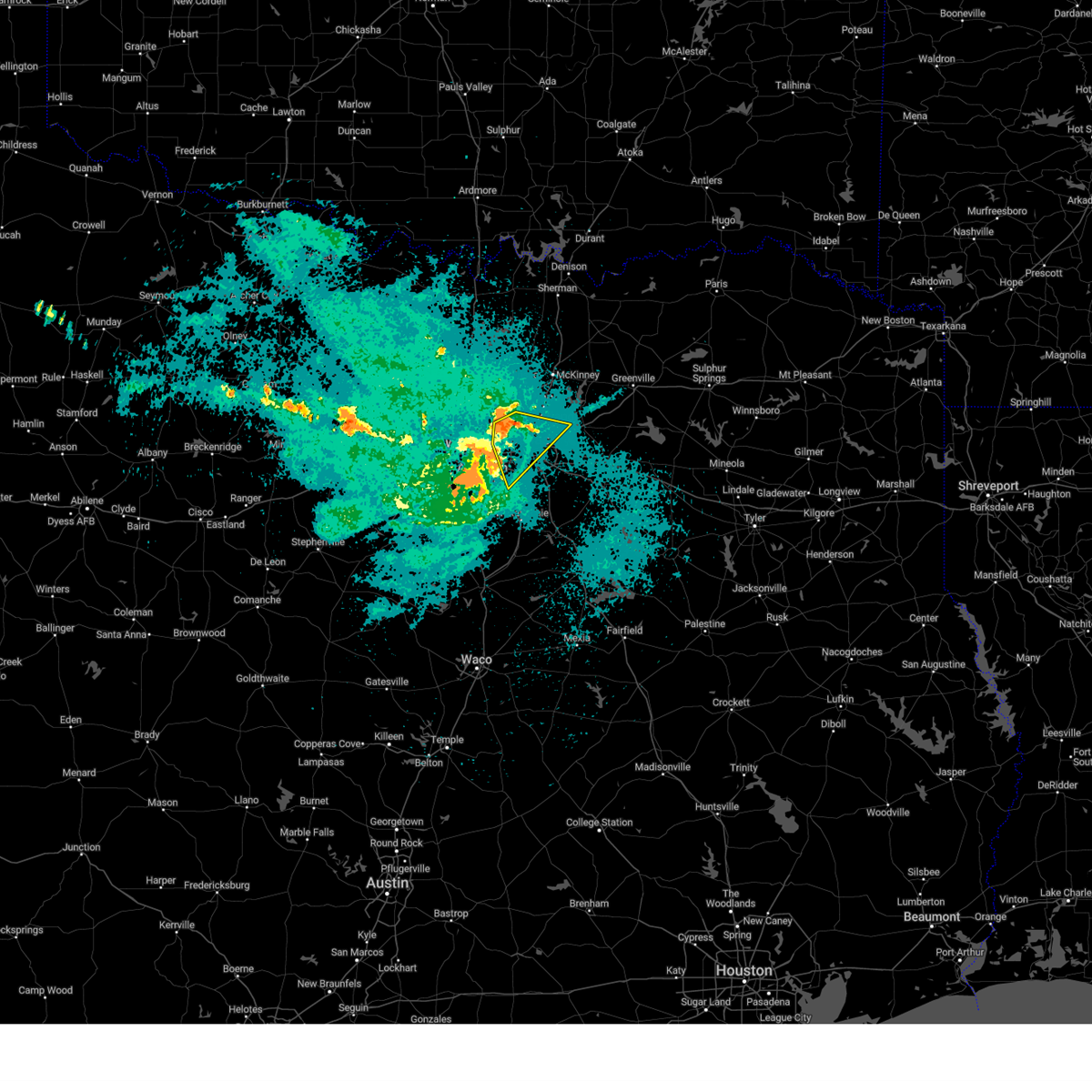 Svrfwd the national weather service in fort worth has issued a * severe thunderstorm warning for, central dallas county in north central texas, * until 445 am cdt. * at 409 am cdt, a severe thunderstorm was located over irving, moving southeast at 25 mph (radar indicated). Hazards include 60 mph wind gusts. Expect damage to roofs, siding, and trees. this severe thunderstorm will be near, dallas, irving, and dallas love field around 415 am cdt. university park and highland park around 420 am cdt. cockrell hill around 425 am cdt. other locations impacted by this severe thunderstorm include mountain creek lake, buckingham, white rock lake, and lake ray hubbard. this includes the following highways, interstate 35e between mile markers 419 and 444. interstate 20 between mile markers 457 and 465. interstate 30 between mile markers 33 and 55. Interstate 45 between mile markers 280 and 284. Svrfwd the national weather service in fort worth has issued a * severe thunderstorm warning for, central dallas county in north central texas, * until 445 am cdt. * at 409 am cdt, a severe thunderstorm was located over irving, moving southeast at 25 mph (radar indicated). Hazards include 60 mph wind gusts. Expect damage to roofs, siding, and trees. this severe thunderstorm will be near, dallas, irving, and dallas love field around 415 am cdt. university park and highland park around 420 am cdt. cockrell hill around 425 am cdt. other locations impacted by this severe thunderstorm include mountain creek lake, buckingham, white rock lake, and lake ray hubbard. this includes the following highways, interstate 35e between mile markers 419 and 444. interstate 20 between mile markers 457 and 465. interstate 30 between mile markers 33 and 55. Interstate 45 between mile markers 280 and 284.
|
| 8/3/2024 3:52 AM CDT |
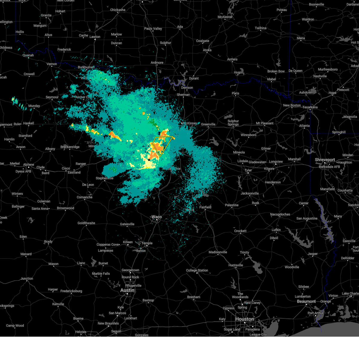 The storm which prompted the warning has weakened below severe limits. therefore the warning will be allowed to expire. however gusty winds are still possible with this thunderstorm. The storm which prompted the warning has weakened below severe limits. therefore the warning will be allowed to expire. however gusty winds are still possible with this thunderstorm.
|
| 8/3/2024 3:32 AM CDT |
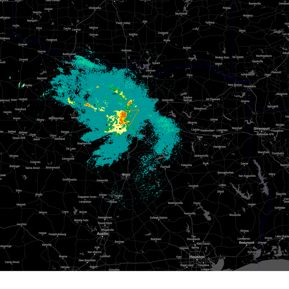 Svrfwd the national weather service in fort worth has issued a * severe thunderstorm warning for, northeastern tarrant county in north central texas, northwestern dallas county in north central texas, * until 400 am cdt. * at 332 am cdt, a severe thunderstorm was located over bedford, moving southeast at 30 mph (radar indicated). Hazards include 60 mph wind gusts. Expect damage to roofs, siding, and trees. this severe thunderstorm will be near, fort worth, arlington, grand prairie, euless, bedford, grapevine, hurst, colleyville, and dfw intl airport around 335 am cdt. irving around 340 am cdt. other locations impacted by this severe thunderstorm include grapevine lake. this includes the following highways, interstate 35e between mile markers 437 and 443. interstate 20 between mile markers 450 and 453. Interstate 30 between mile markers 25 and 34. Svrfwd the national weather service in fort worth has issued a * severe thunderstorm warning for, northeastern tarrant county in north central texas, northwestern dallas county in north central texas, * until 400 am cdt. * at 332 am cdt, a severe thunderstorm was located over bedford, moving southeast at 30 mph (radar indicated). Hazards include 60 mph wind gusts. Expect damage to roofs, siding, and trees. this severe thunderstorm will be near, fort worth, arlington, grand prairie, euless, bedford, grapevine, hurst, colleyville, and dfw intl airport around 335 am cdt. irving around 340 am cdt. other locations impacted by this severe thunderstorm include grapevine lake. this includes the following highways, interstate 35e between mile markers 437 and 443. interstate 20 between mile markers 450 and 453. Interstate 30 between mile markers 25 and 34.
|
| 6/5/2024 2:15 AM CDT |
 Svrfwd the national weather service in fort worth has issued a * severe thunderstorm warning for, eastern denton county in north central texas, northern collin county in north central texas, southeastern cooke county in north central texas, southwestern grayson county in north central texas, * until 315 am cdt. * at 214 am cdt, severe thunderstorms were located along a line extending from near whitesboro to 6 miles north of sanger, moving southeast at 25 mph. at 210 am, 60 mph winds were reported with this storm in collinsville (radar indicated). Hazards include 60 mph wind gusts and quarter size hail. Hail damage to vehicles is expected. expect wind damage to roofs, siding, and trees. severe thunderstorms will be near, sanger, collinsville, and ray roberts park johnson branch around 220 am cdt. pilot point, dorchester, and ray roberts park isle du bois around 225 am cdt. denton around 230 am cdt. aubrey and gunter around 235 am cdt. celina and krugerville around 240 am cdt. howe and cross roads around 245 am cdt. van alstyne around 250 am cdt. prosper around 255 am cdt. other locations impacted by these severe thunderstorms include westminster, ethel, tioga, road runner, valley view, oak point, lois, elmont, providence village, and lake ray roberts. this includes the following highways, interstate 35 between mile markers 471 and 489. Interstate 35e between mile markers 447 and 464. Svrfwd the national weather service in fort worth has issued a * severe thunderstorm warning for, eastern denton county in north central texas, northern collin county in north central texas, southeastern cooke county in north central texas, southwestern grayson county in north central texas, * until 315 am cdt. * at 214 am cdt, severe thunderstorms were located along a line extending from near whitesboro to 6 miles north of sanger, moving southeast at 25 mph. at 210 am, 60 mph winds were reported with this storm in collinsville (radar indicated). Hazards include 60 mph wind gusts and quarter size hail. Hail damage to vehicles is expected. expect wind damage to roofs, siding, and trees. severe thunderstorms will be near, sanger, collinsville, and ray roberts park johnson branch around 220 am cdt. pilot point, dorchester, and ray roberts park isle du bois around 225 am cdt. denton around 230 am cdt. aubrey and gunter around 235 am cdt. celina and krugerville around 240 am cdt. howe and cross roads around 245 am cdt. van alstyne around 250 am cdt. prosper around 255 am cdt. other locations impacted by these severe thunderstorms include westminster, ethel, tioga, road runner, valley view, oak point, lois, elmont, providence village, and lake ray roberts. this includes the following highways, interstate 35 between mile markers 471 and 489. Interstate 35e between mile markers 447 and 464.
|
| 6/2/2024 6:24 PM CDT |
 The severe thunderstorm that prompted the warning has weakened, and the warning will be allowed to expire on time. however small hail, gusty winds, and heavy rain are still possible with the thunderstorms remaining in dallas county. The severe thunderstorm that prompted the warning has weakened, and the warning will be allowed to expire on time. however small hail, gusty winds, and heavy rain are still possible with the thunderstorms remaining in dallas county.
|
| 6/2/2024 6:15 PM CDT |
 At 614 pm cdt, a severe thunderstorm was located over university park, moving east at 15 mph (radar indicated). Hazards include 60 mph wind gusts and quarter size hail. Hail damage to vehicles is expected. Expect wind damage to roofs, siding, and trees. At 614 pm cdt, a severe thunderstorm was located over university park, moving east at 15 mph (radar indicated). Hazards include 60 mph wind gusts and quarter size hail. Hail damage to vehicles is expected. Expect wind damage to roofs, siding, and trees.
|
| 6/2/2024 6:04 PM CDT |
 the severe thunderstorm warning has been cancelled and is no longer in effect the severe thunderstorm warning has been cancelled and is no longer in effect
|
| 6/2/2024 5:49 PM CDT |
 Svrfwd the national weather service in fort worth has issued a * severe thunderstorm warning for, dallas county in north central texas, * until 630 pm cdt. * at 546 pm cdt, a severe thunderstorm was located near dallas love field, or near farmers branch, moving east at 10 mph (radar indicated). Hazards include 60 mph wind gusts and quarter size hail. Hail damage to vehicles is expected. expect wind damage to roofs, siding, and trees. this severe thunderstorm will be near, irving, farmers branch, and dallas love field around 550 pm cdt. university park around 555 pm cdt. Highland park around 600 pm cdt. Svrfwd the national weather service in fort worth has issued a * severe thunderstorm warning for, dallas county in north central texas, * until 630 pm cdt. * at 546 pm cdt, a severe thunderstorm was located near dallas love field, or near farmers branch, moving east at 10 mph (radar indicated). Hazards include 60 mph wind gusts and quarter size hail. Hail damage to vehicles is expected. expect wind damage to roofs, siding, and trees. this severe thunderstorm will be near, irving, farmers branch, and dallas love field around 550 pm cdt. university park around 555 pm cdt. Highland park around 600 pm cdt.
|
| 6/2/2024 5:31 PM CDT |
 At 530 pm cdt, there were two severe thunderstorm cores within the warned area. one was near melissa in collin county, and the other was near justin in denton county. both were moving east at 20 mph (radar indicated). Hazards include 60 mph wind gusts and quarter size hail. Hail damage to vehicles is expected. Expect wind damage to roofs, siding, and trees. At 530 pm cdt, there were two severe thunderstorm cores within the warned area. one was near melissa in collin county, and the other was near justin in denton county. both were moving east at 20 mph (radar indicated). Hazards include 60 mph wind gusts and quarter size hail. Hail damage to vehicles is expected. Expect wind damage to roofs, siding, and trees.
|
| 6/2/2024 5:15 PM CDT |
 Svrfwd the national weather service in fort worth has issued a * severe thunderstorm warning for, denton county in north central texas, collin county in north central texas, * until 615 pm cdt. * at 515 pm cdt, severe thunderstorms were located near melissa and near little elm, moving east at 25 mph (radar indicated). Hazards include 60 mph wind gusts and quarter size hail. Hail damage to vehicles is expected. expect wind damage to roofs, siding, and trees. severe thunderstorms will be near, mckinney, frisco, little elm, prosper, princeton, celina, melissa, and hackberry around 520 pm cdt. Anna around 545 pm cdt. Svrfwd the national weather service in fort worth has issued a * severe thunderstorm warning for, denton county in north central texas, collin county in north central texas, * until 615 pm cdt. * at 515 pm cdt, severe thunderstorms were located near melissa and near little elm, moving east at 25 mph (radar indicated). Hazards include 60 mph wind gusts and quarter size hail. Hail damage to vehicles is expected. expect wind damage to roofs, siding, and trees. severe thunderstorms will be near, mckinney, frisco, little elm, prosper, princeton, celina, melissa, and hackberry around 520 pm cdt. Anna around 545 pm cdt.
|
| 6/2/2024 4:58 PM CDT |
 the severe thunderstorm warning has been cancelled and is no longer in effect the severe thunderstorm warning has been cancelled and is no longer in effect
|
| 6/2/2024 4:58 PM CDT |
 At 454 pm cdt, a large cluster of severe thunderstorms continues to impact the warned area. the strongest cores were located near pilot point and near denton. the activity is moving east at 25 mph (radar indicated). Hazards include ping pong ball size hail and 60 mph wind gusts. People and animals outdoors will be injured. expect hail damage to roofs, siding, windows, and vehicles. expect wind damage to roofs, siding, and trees. large hail may be near, celina, aubrey, krugerville, and cross roads around 500 pm cdt. prosper around 505 pm cdt. frisco around 515 pm cdt. mckinney and little elm around 520 pm cdt. ping pong ball size hail was reported in denton with these storms. In addition, there have been multiple reports of winds in excess of 50 mph. At 454 pm cdt, a large cluster of severe thunderstorms continues to impact the warned area. the strongest cores were located near pilot point and near denton. the activity is moving east at 25 mph (radar indicated). Hazards include ping pong ball size hail and 60 mph wind gusts. People and animals outdoors will be injured. expect hail damage to roofs, siding, windows, and vehicles. expect wind damage to roofs, siding, and trees. large hail may be near, celina, aubrey, krugerville, and cross roads around 500 pm cdt. prosper around 505 pm cdt. frisco around 515 pm cdt. mckinney and little elm around 520 pm cdt. ping pong ball size hail was reported in denton with these storms. In addition, there have been multiple reports of winds in excess of 50 mph.
|
| 6/2/2024 4:22 PM CDT |
 Svrfwd the national weather service in fort worth has issued a * severe thunderstorm warning for, denton county in north central texas, northwestern collin county in north central texas, southeastern cooke county in north central texas, southwestern grayson county in north central texas, * until 515 pm cdt. * at 420 pm cdt, the leading edge of outflow associated with a cluster of severe thunderstorms was located along a line extending from near collinsville to near ray roberts park isle du bois to near krum, moving south at 25 mph (radar indicated). Hazards include 60 mph wind gusts and quarter size hail. Hail damage to vehicles is expected. expect wind damage to roofs, siding, and trees. the strong outflow winds will be near, denton, krum, pilot point, aubrey, krugerville, and cross roads around 425 pm cdt. northlake around 430 pm cdt. corinth, celina, argyle, and shady shores around 435 pm cdt. Flower mound, lake dallas, little elm, prosper, justin, and corral city around 440 pm cdt. Svrfwd the national weather service in fort worth has issued a * severe thunderstorm warning for, denton county in north central texas, northwestern collin county in north central texas, southeastern cooke county in north central texas, southwestern grayson county in north central texas, * until 515 pm cdt. * at 420 pm cdt, the leading edge of outflow associated with a cluster of severe thunderstorms was located along a line extending from near collinsville to near ray roberts park isle du bois to near krum, moving south at 25 mph (radar indicated). Hazards include 60 mph wind gusts and quarter size hail. Hail damage to vehicles is expected. expect wind damage to roofs, siding, and trees. the strong outflow winds will be near, denton, krum, pilot point, aubrey, krugerville, and cross roads around 425 pm cdt. northlake around 430 pm cdt. corinth, celina, argyle, and shady shores around 435 pm cdt. Flower mound, lake dallas, little elm, prosper, justin, and corral city around 440 pm cdt.
|
| 6/1/2024 12:58 PM CDT |
 The storm which prompted the warning has weakened below severe limits. therefore the warning will be allowed to expire. however small hail and gusty winds are still possible with this thunderstorm. The storm which prompted the warning has weakened below severe limits. therefore the warning will be allowed to expire. however small hail and gusty winds are still possible with this thunderstorm.
|
| 6/1/2024 12:48 PM CDT |
 At 1247 pm cdt, a severe thunderstorm was located over coppell, moving east at 35 mph (radar indicated). Hazards include quarter size hail. Damage to vehicles is possible. Locations impacted include, dallas, plano, irving, carrollton, lewisville, flower mound, euless, bedford, grapevine, coppell, the colony, farmers branch, southlake, colleyville, highland village, addison, double oak, hebron, dfw intl airport, and dallas love field. At 1247 pm cdt, a severe thunderstorm was located over coppell, moving east at 35 mph (radar indicated). Hazards include quarter size hail. Damage to vehicles is possible. Locations impacted include, dallas, plano, irving, carrollton, lewisville, flower mound, euless, bedford, grapevine, coppell, the colony, farmers branch, southlake, colleyville, highland village, addison, double oak, hebron, dfw intl airport, and dallas love field.
|
| 6/1/2024 12:34 PM CDT |
 At 1234 pm cdt, a severe thunderstorm was located over grapevine, moving east at 35 mph (radar indicated). Hazards include quarter size hail. Damage to vehicles is possible. Locations impacted include, dallas, plano, irving, carrollton, lewisville, flower mound, euless, bedford, grapevine, keller, coppell, hurst, the colony, farmers branch, southlake, colleyville, highland village, addison, trophy club, and north richland hills. At 1234 pm cdt, a severe thunderstorm was located over grapevine, moving east at 35 mph (radar indicated). Hazards include quarter size hail. Damage to vehicles is possible. Locations impacted include, dallas, plano, irving, carrollton, lewisville, flower mound, euless, bedford, grapevine, keller, coppell, hurst, the colony, farmers branch, southlake, colleyville, highland village, addison, trophy club, and north richland hills.
|
| 6/1/2024 12:22 PM CDT |
 Svrfwd the national weather service in fort worth has issued a * severe thunderstorm warning for, southeastern denton county in north central texas, northeastern tarrant county in north central texas, northwestern dallas county in north central texas, * until 100 pm cdt. * at 1222 pm cdt, a severe thunderstorm was located over keller, moving east at 40 mph (radar indicated). Hazards include quarter size hail. damage to vehicles is possible Svrfwd the national weather service in fort worth has issued a * severe thunderstorm warning for, southeastern denton county in north central texas, northeastern tarrant county in north central texas, northwestern dallas county in north central texas, * until 100 pm cdt. * at 1222 pm cdt, a severe thunderstorm was located over keller, moving east at 40 mph (radar indicated). Hazards include quarter size hail. damage to vehicles is possible
|
| 5/28/2024 6:14 AM CDT |
 the severe thunderstorm warning has been cancelled and is no longer in effect the severe thunderstorm warning has been cancelled and is no longer in effect
|
| 5/28/2024 6:14 AM CDT |
 At 613 am cdt, severe thunderstorms were located along a line extending from near farmersville to near mesquite to near blue mound, moving southeast at 50 mph (radar indicated). Hazards include tennis ball size hail and 70 mph wind gusts. People and animals outdoors will be injured. expect hail damage to roofs, siding, windows, and vehicles. expect considerable tree damage. wind damage is also likely to mobile homes, roofs, and outbuildings. these severe storms will be near, dallas, fort worth, arlington, irving, grand prairie, mesquite, rowlett, haltom city, duncanville, and rockwall around 620 am cdt. desoto, cedar hill, lancaster, kennedale, crandall, combine, talty, caddo mills, and cedar hill state park around 625 am cdt. mansfield, terrell, and wilmer around 630 am cdt. glenn heights, ovilla, ferris, quinlan, and lake tawakoni around 635 am cdt. west tawakoni and hawk cove around 640 am cdt. other locations impacted by these severe thunderstorms include heartland, lake arlington, st. Paul, lawrence, lake ray hubbard, joe pool lake, sand branch, mountain creek lake, union valley, and westlake. At 613 am cdt, severe thunderstorms were located along a line extending from near farmersville to near mesquite to near blue mound, moving southeast at 50 mph (radar indicated). Hazards include tennis ball size hail and 70 mph wind gusts. People and animals outdoors will be injured. expect hail damage to roofs, siding, windows, and vehicles. expect considerable tree damage. wind damage is also likely to mobile homes, roofs, and outbuildings. these severe storms will be near, dallas, fort worth, arlington, irving, grand prairie, mesquite, rowlett, haltom city, duncanville, and rockwall around 620 am cdt. desoto, cedar hill, lancaster, kennedale, crandall, combine, talty, caddo mills, and cedar hill state park around 625 am cdt. mansfield, terrell, and wilmer around 630 am cdt. glenn heights, ovilla, ferris, quinlan, and lake tawakoni around 635 am cdt. west tawakoni and hawk cove around 640 am cdt. other locations impacted by these severe thunderstorms include heartland, lake arlington, st. Paul, lawrence, lake ray hubbard, joe pool lake, sand branch, mountain creek lake, union valley, and westlake.
|
| 5/28/2024 5:45 AM CDT |
 Svrfwd the national weather service in fort worth has issued a * severe thunderstorm warning for, northwestern kaufman county in north central texas, southeastern denton county in north central texas, northeastern tarrant county in north central texas, southwestern collin county in north central texas, dallas county in north central texas, * until 630 am cdt. * at 543 am cdt, a severe thunderstorm was located over lewisville, moving southeast at 50 mph. this is a destructive storm for the dallas area (radar indicated). Hazards include 80 mph wind gusts and half dollar size hail. Flying debris will be dangerous to those caught without shelter. mobile homes will be heavily damaged. expect considerable damage to roofs, windows, and vehicles. extensive tree damage and power outages are likely. this severe thunderstorm will be near, dallas, irving, carrollton, coppell, farmers branch, addison, and hebron around 550 am cdt. dallas love field around 555 am cdt. university park and highland park around 600 am cdt. hutchins around 615 am cdt. lancaster and wilmer around 620 am cdt. seagoville around 625 am cdt. other locations impacted by this severe thunderstorm include heartland, lewisville lake, white rock lake, joe pool lake, sand branch, mountain creek lake, buckingham, lakewood village, grapevine lake, and lake ray hubbard. this includes the following highways, interstate 35e between mile markers 411 and 455. interstate 20 between mile markers 453 and 494. interstate 30 between mile markers 30 and 61. Interstate 45 between mile markers 267 and 284. Svrfwd the national weather service in fort worth has issued a * severe thunderstorm warning for, northwestern kaufman county in north central texas, southeastern denton county in north central texas, northeastern tarrant county in north central texas, southwestern collin county in north central texas, dallas county in north central texas, * until 630 am cdt. * at 543 am cdt, a severe thunderstorm was located over lewisville, moving southeast at 50 mph. this is a destructive storm for the dallas area (radar indicated). Hazards include 80 mph wind gusts and half dollar size hail. Flying debris will be dangerous to those caught without shelter. mobile homes will be heavily damaged. expect considerable damage to roofs, windows, and vehicles. extensive tree damage and power outages are likely. this severe thunderstorm will be near, dallas, irving, carrollton, coppell, farmers branch, addison, and hebron around 550 am cdt. dallas love field around 555 am cdt. university park and highland park around 600 am cdt. hutchins around 615 am cdt. lancaster and wilmer around 620 am cdt. seagoville around 625 am cdt. other locations impacted by this severe thunderstorm include heartland, lewisville lake, white rock lake, joe pool lake, sand branch, mountain creek lake, buckingham, lakewood village, grapevine lake, and lake ray hubbard. this includes the following highways, interstate 35e between mile markers 411 and 455. interstate 20 between mile markers 453 and 494. interstate 30 between mile markers 30 and 61. Interstate 45 between mile markers 267 and 284.
|
| 5/28/2024 5:32 AM CDT |
 Svrfwd the national weather service in fort worth has issued a * severe thunderstorm warning for, rockwall county in north central texas, southwestern hunt county in north central texas, northern kaufman county in north central texas, southern denton county in north central texas, eastern parker county in north central texas, tarrant county in north central texas, collin county in north central texas, dallas county in north central texas, * until 630 am cdt. * at 530 am cdt, severe thunderstorms were located along a line extending from 6 miles east of celina to near springtown, moving southeast at 50 mph (radar indicated). Hazards include 70 mph wind gusts and half dollar size hail. Hail damage to vehicles is expected. expect considerable tree damage. wind damage is also likely to mobile homes, roofs, and outbuildings. severe thunderstorms will be near, fort worth, mckinney, frisco, lewisville, flower mound, the colony, corinth, highland village, azle, and trophy club around 535 am cdt. grapevine, keller, southlake, and princeton around 540 am cdt. plano, carrollton, allen, coppell, watauga, colleyville, saginaw, north richland hills, fairview, and lucas around 545 am cdt. dallas, irving, bedford, haltom city, wylie, hurst, addison, sansom park, lake worth, and parker around 550 am cdt. garland, richardson, euless, farmers branch, richland hills, river oaks, and murphy around 555 am cdt. arlington, grand prairie, and sachse around 600 am cdt. rowlett, rockwall, university park, highland park, royse city, pantego, caddo mills, and dallas love field around 605 am cdt. mesquite, cockrell hill, fate, and mobile city around 610 am cdt. other locations impacted by these severe thunderstorms include joe pool lake, cash, sand branch, mountain creek lake, union valley, lewisville lake, branch, lavon lake, josephine, and new hope. this includes the following highways, interstate 35w between mile markers 37 and 73. interstate 35e between mile markers 411 and 458. interstate 20 between mile markers 417 and 499. interstate 30 between mile markers 1 and 87. Interstate 45 between mile markers 267 and 284. Svrfwd the national weather service in fort worth has issued a * severe thunderstorm warning for, rockwall county in north central texas, southwestern hunt county in north central texas, northern kaufman county in north central texas, southern denton county in north central texas, eastern parker county in north central texas, tarrant county in north central texas, collin county in north central texas, dallas county in north central texas, * until 630 am cdt. * at 530 am cdt, severe thunderstorms were located along a line extending from 6 miles east of celina to near springtown, moving southeast at 50 mph (radar indicated). Hazards include 70 mph wind gusts and half dollar size hail. Hail damage to vehicles is expected. expect considerable tree damage. wind damage is also likely to mobile homes, roofs, and outbuildings. severe thunderstorms will be near, fort worth, mckinney, frisco, lewisville, flower mound, the colony, corinth, highland village, azle, and trophy club around 535 am cdt. grapevine, keller, southlake, and princeton around 540 am cdt. plano, carrollton, allen, coppell, watauga, colleyville, saginaw, north richland hills, fairview, and lucas around 545 am cdt. dallas, irving, bedford, haltom city, wylie, hurst, addison, sansom park, lake worth, and parker around 550 am cdt. garland, richardson, euless, farmers branch, richland hills, river oaks, and murphy around 555 am cdt. arlington, grand prairie, and sachse around 600 am cdt. rowlett, rockwall, university park, highland park, royse city, pantego, caddo mills, and dallas love field around 605 am cdt. mesquite, cockrell hill, fate, and mobile city around 610 am cdt. other locations impacted by these severe thunderstorms include joe pool lake, cash, sand branch, mountain creek lake, union valley, lewisville lake, branch, lavon lake, josephine, and new hope. this includes the following highways, interstate 35w between mile markers 37 and 73. interstate 35e between mile markers 411 and 458. interstate 20 between mile markers 417 and 499. interstate 30 between mile markers 1 and 87. Interstate 45 between mile markers 267 and 284.
|
| 5/27/2024 7:38 PM CDT |
 At 738 pm cdt, a severe thunderstorm was located near arlington, moving southeast at 20 mph (radar indicated). Hazards include golf ball size hail and 65 mph wind gusts. People and animals outdoors will be injured. expect hail damage to roofs, siding, windows, and vehicles. expect wind damage to roofs, siding, and trees. this severe storm will be near, dallas, arlington, and grand prairie around 745 pm cdt. Other locations impacted by this severe thunderstorm include mountain creek lake, dalworthington gardens, and lake arlington. At 738 pm cdt, a severe thunderstorm was located near arlington, moving southeast at 20 mph (radar indicated). Hazards include golf ball size hail and 65 mph wind gusts. People and animals outdoors will be injured. expect hail damage to roofs, siding, windows, and vehicles. expect wind damage to roofs, siding, and trees. this severe storm will be near, dallas, arlington, and grand prairie around 745 pm cdt. Other locations impacted by this severe thunderstorm include mountain creek lake, dalworthington gardens, and lake arlington.
|
| 5/27/2024 7:14 PM CDT |
 At 713 pm cdt, a severe thunderstorm was located over hurst, moving south at 20 mph (radar indicated). Hazards include baseball size hail and 70 mph wind gusts. People and animals outdoors will be severely injured. expect shattered windows, extensive damage to roofs, siding, and vehicles. this severe storm will be near, fort worth, arlington, euless, bedford, hurst, and richland hills around 720 pm cdt. grand prairie and pantego around 730 pm cdt. Other locations impacted by this severe thunderstorm include mountain creek lake, dalworthington gardens, and lake arlington. At 713 pm cdt, a severe thunderstorm was located over hurst, moving south at 20 mph (radar indicated). Hazards include baseball size hail and 70 mph wind gusts. People and animals outdoors will be severely injured. expect shattered windows, extensive damage to roofs, siding, and vehicles. this severe storm will be near, fort worth, arlington, euless, bedford, hurst, and richland hills around 720 pm cdt. grand prairie and pantego around 730 pm cdt. Other locations impacted by this severe thunderstorm include mountain creek lake, dalworthington gardens, and lake arlington.
|
| 5/27/2024 7:11 PM CDT |
 the severe thunderstorm warning has been cancelled and is no longer in effect the severe thunderstorm warning has been cancelled and is no longer in effect
|
| 5/27/2024 7:11 PM CDT |
 At 710 pm cdt, a severe thunderstorm was located over bedford, moving south at 15 mph (trained weather spotters). Hazards include ping pong ball size hail and 60 mph wind gusts. People and animals outdoors will be injured. expect hail damage to roofs, siding, windows, and vehicles. expect wind damage to roofs, siding, and trees. this severe storm will be near, fort worth, arlington, euless, bedford, hurst, richland hills, and north richland hills around 715 pm cdt. grand prairie around 725 pm cdt. pantego around 730 pm cdt. Other locations impacted by this severe thunderstorm include lake arlington, mountain creek lake, dalworthington gardens, westlake, and grapevine lake. At 710 pm cdt, a severe thunderstorm was located over bedford, moving south at 15 mph (trained weather spotters). Hazards include ping pong ball size hail and 60 mph wind gusts. People and animals outdoors will be injured. expect hail damage to roofs, siding, windows, and vehicles. expect wind damage to roofs, siding, and trees. this severe storm will be near, fort worth, arlington, euless, bedford, hurst, richland hills, and north richland hills around 715 pm cdt. grand prairie around 725 pm cdt. pantego around 730 pm cdt. Other locations impacted by this severe thunderstorm include lake arlington, mountain creek lake, dalworthington gardens, westlake, and grapevine lake.
|
| 5/27/2024 7:08 PM CDT |
 At 707 pm cdt, a severe thunderstorm was located over hurst, moving south at 20 mph (radar indicated). Hazards include 60 mph wind gusts and half dollar size hail. Hail damage to vehicles is expected. expect wind damage to roofs, siding, and trees. this severe storm will be near, fort worth, arlington, euless, bedford, hurst, richland hills, and north richland hills around 715 pm cdt. grand prairie and pantego around 730 pm cdt. Other locations impacted by this severe thunderstorm include westlake, lake arlington, mountain creek lake, grapevine lake, marshall creek, and dalworthington gardens. At 707 pm cdt, a severe thunderstorm was located over hurst, moving south at 20 mph (radar indicated). Hazards include 60 mph wind gusts and half dollar size hail. Hail damage to vehicles is expected. expect wind damage to roofs, siding, and trees. this severe storm will be near, fort worth, arlington, euless, bedford, hurst, richland hills, and north richland hills around 715 pm cdt. grand prairie and pantego around 730 pm cdt. Other locations impacted by this severe thunderstorm include westlake, lake arlington, mountain creek lake, grapevine lake, marshall creek, and dalworthington gardens.
|
| 5/27/2024 6:53 PM CDT |
 Svrfwd the national weather service in fort worth has issued a * severe thunderstorm warning for, south central denton county in north central texas, eastern tarrant county in north central texas, northern dallas county in north central texas, * until 800 pm cdt. * at 652 pm cdt, a severe thunderstorm was located over southlake, moving southeast at 10 mph (radar indicated). Hazards include 60 mph wind gusts and half dollar size hail. Hail damage to vehicles is expected. expect wind damage to roofs, siding, and trees. this severe thunderstorm will be near, euless, bedford, grapevine, keller, hurst, southlake, colleyville, and north richland hills around 700 pm cdt. dfw intl airport around 705 pm cdt. fort worth around 715 pm cdt. arlington around 720 pm cdt. grand prairie around 730 pm cdt. other locations impacted by this severe thunderstorm include westlake, lake arlington, lewisville lake, mountain creek lake, grapevine lake, marshall creek, dalworthington gardens, and white rock lake. this includes the following highways, interstate 35w between mile markers 53 and 69. interstate 35e between mile markers 421 and 453. interstate 20 between mile markers 438 and 460. interstate 30 between mile markers 16 and 52. Interstate 45 between mile markers 279 and 284. Svrfwd the national weather service in fort worth has issued a * severe thunderstorm warning for, south central denton county in north central texas, eastern tarrant county in north central texas, northern dallas county in north central texas, * until 800 pm cdt. * at 652 pm cdt, a severe thunderstorm was located over southlake, moving southeast at 10 mph (radar indicated). Hazards include 60 mph wind gusts and half dollar size hail. Hail damage to vehicles is expected. expect wind damage to roofs, siding, and trees. this severe thunderstorm will be near, euless, bedford, grapevine, keller, hurst, southlake, colleyville, and north richland hills around 700 pm cdt. dfw intl airport around 705 pm cdt. fort worth around 715 pm cdt. arlington around 720 pm cdt. grand prairie around 730 pm cdt. other locations impacted by this severe thunderstorm include westlake, lake arlington, lewisville lake, mountain creek lake, grapevine lake, marshall creek, dalworthington gardens, and white rock lake. this includes the following highways, interstate 35w between mile markers 53 and 69. interstate 35e between mile markers 421 and 453. interstate 20 between mile markers 438 and 460. interstate 30 between mile markers 16 and 52. Interstate 45 between mile markers 279 and 284.
|
| 5/27/2024 6:30 PM CDT |
 At 630 pm cdt, a severe thunderstorm was located over roanoke, or over trophy club, moving south at 10 mph (trained weather spotters). Hazards include ping pong ball size hail and 60 mph wind gusts. People and animals outdoors will be injured. expect hail damage to roofs, siding, windows, and vehicles. expect wind damage to roofs, siding, and trees. this severe storm will be near, fort worth, keller, southlake, trophy club, and roanoke around 635 pm cdt. north richland hills around 650 pm cdt. watauga and colleyville around 655 pm cdt. hurst around 705 pm cdt. Other locations impacted by this severe thunderstorm include westlake, lewisville lake, grapevine lake, and marshall creek. At 630 pm cdt, a severe thunderstorm was located over roanoke, or over trophy club, moving south at 10 mph (trained weather spotters). Hazards include ping pong ball size hail and 60 mph wind gusts. People and animals outdoors will be injured. expect hail damage to roofs, siding, windows, and vehicles. expect wind damage to roofs, siding, and trees. this severe storm will be near, fort worth, keller, southlake, trophy club, and roanoke around 635 pm cdt. north richland hills around 650 pm cdt. watauga and colleyville around 655 pm cdt. hurst around 705 pm cdt. Other locations impacted by this severe thunderstorm include westlake, lewisville lake, grapevine lake, and marshall creek.
|
| 5/27/2024 6:04 PM CDT |
 Svrfwd the national weather service in fort worth has issued a * severe thunderstorm warning for, southern denton county in north central texas, northeastern tarrant county in north central texas, northwestern dallas county in north central texas, * until 700 pm cdt. * at 604 pm cdt, a severe thunderstorm was located over northlake, or near trophy club, moving southeast at 10 mph (radar indicated). Hazards include 60 mph wind gusts and half dollar size hail. Hail damage to vehicles is expected. expect wind damage to roofs, siding, and trees. this severe thunderstorm will be near, flower mound, southlake, trophy club, roanoke, and bartonville around 610 pm cdt. keller around 615 pm cdt. double oak around 620 pm cdt. grapevine around 625 pm cdt. other locations impacted by this severe thunderstorm include westlake, lewisville lake, grapevine lake, and marshall creek. this includes the following highways, interstate 35w between mile markers 62 and 77. interstate 35e between mile markers 434 and 457. Interstate 30 between mile markers 17 and 22. Svrfwd the national weather service in fort worth has issued a * severe thunderstorm warning for, southern denton county in north central texas, northeastern tarrant county in north central texas, northwestern dallas county in north central texas, * until 700 pm cdt. * at 604 pm cdt, a severe thunderstorm was located over northlake, or near trophy club, moving southeast at 10 mph (radar indicated). Hazards include 60 mph wind gusts and half dollar size hail. Hail damage to vehicles is expected. expect wind damage to roofs, siding, and trees. this severe thunderstorm will be near, flower mound, southlake, trophy club, roanoke, and bartonville around 610 pm cdt. keller around 615 pm cdt. double oak around 620 pm cdt. grapevine around 625 pm cdt. other locations impacted by this severe thunderstorm include westlake, lewisville lake, grapevine lake, and marshall creek. this includes the following highways, interstate 35w between mile markers 62 and 77. interstate 35e between mile markers 434 and 457. Interstate 30 between mile markers 17 and 22.
|
| 5/27/2024 4:32 PM CDT |
 At 431 pm cdt, a severe thunderstorm was located over cockrell hill, moving southeast at 10 mph (radar indicated). Hazards include golf ball size hail and 60 mph wind gusts. People and animals outdoors will be injured. expect hail damage to roofs, siding, windows, and vehicles. expect wind damage to roofs, siding, and trees. this severe storm will be near, dallas around 435 pm cdt. Other locations impacted by this severe thunderstorm include white rock lake. At 431 pm cdt, a severe thunderstorm was located over cockrell hill, moving southeast at 10 mph (radar indicated). Hazards include golf ball size hail and 60 mph wind gusts. People and animals outdoors will be injured. expect hail damage to roofs, siding, windows, and vehicles. expect wind damage to roofs, siding, and trees. this severe storm will be near, dallas around 435 pm cdt. Other locations impacted by this severe thunderstorm include white rock lake.
|
| 5/27/2024 4:15 PM CDT |
 Svrfwd the national weather service in fort worth has issued a * severe thunderstorm warning for, northern dallas county in north central texas, * until 500 pm cdt. * at 414 pm cdt, a severe thunderstorm was located near dallas love field, or near cockrell hill, moving northeast at 5 mph (radar indicated). Hazards include 60 mph wind gusts and quarter size hail. Hail damage to vehicles is expected. expect wind damage to roofs, siding, and trees. this severe thunderstorm will be near, dallas, irving, highland park, and dallas love field around 420 pm cdt. university park around 430 pm cdt. other locations impacted by this severe thunderstorm include white rock lake. this includes the following highways, interstate 35e between mile markers 424 and 444. interstate 30 between mile markers 39 and 55. Interstate 45 between mile markers 279 and 284. Svrfwd the national weather service in fort worth has issued a * severe thunderstorm warning for, northern dallas county in north central texas, * until 500 pm cdt. * at 414 pm cdt, a severe thunderstorm was located near dallas love field, or near cockrell hill, moving northeast at 5 mph (radar indicated). Hazards include 60 mph wind gusts and quarter size hail. Hail damage to vehicles is expected. expect wind damage to roofs, siding, and trees. this severe thunderstorm will be near, dallas, irving, highland park, and dallas love field around 420 pm cdt. university park around 430 pm cdt. other locations impacted by this severe thunderstorm include white rock lake. this includes the following highways, interstate 35e between mile markers 424 and 444. interstate 30 between mile markers 39 and 55. Interstate 45 between mile markers 279 and 284.
|
| 5/24/2024 7:00 PM CDT |
 the severe thunderstorm warning has been cancelled and is no longer in effect the severe thunderstorm warning has been cancelled and is no longer in effect
|
| 5/24/2024 6:41 PM CDT |
 At 641 pm cdt, a severe thunderstorm was located over double oak, or near flower mound, moving east at 15 mph (radar indicated). Hazards include 60 mph wind gusts and quarter size hail. Hail damage to vehicles is expected. expect wind damage to roofs, siding, and trees. this severe storm will be near, flower mound, grapevine, southlake, highland village, double oak, bartonville, and copper canyon around 645 pm cdt. lewisville around 650 pm cdt. coppell around 700 pm cdt. carrollton and hebron around 715 pm cdt. irving around 720 pm cdt. farmers branch and addison around 740 pm cdt. plano around 745 pm cdt. Other locations impacted by this severe thunderstorm include westlake, lewisville lake, grapevine lake, and marshall creek. At 641 pm cdt, a severe thunderstorm was located over double oak, or near flower mound, moving east at 15 mph (radar indicated). Hazards include 60 mph wind gusts and quarter size hail. Hail damage to vehicles is expected. expect wind damage to roofs, siding, and trees. this severe storm will be near, flower mound, grapevine, southlake, highland village, double oak, bartonville, and copper canyon around 645 pm cdt. lewisville around 650 pm cdt. coppell around 700 pm cdt. carrollton and hebron around 715 pm cdt. irving around 720 pm cdt. farmers branch and addison around 740 pm cdt. plano around 745 pm cdt. Other locations impacted by this severe thunderstorm include westlake, lewisville lake, grapevine lake, and marshall creek.
|
| 5/24/2024 6:27 PM CDT |
 Svrfwd the national weather service in fort worth has issued a * severe thunderstorm warning for, southern denton county in north central texas, northeastern tarrant county in north central texas, northwestern dallas county in north central texas, * until 745 pm cdt. * at 627 pm cdt, a severe thunderstorm was located over roanoke, or over trophy club, moving east at 15 mph (radar indicated). Hazards include 60 mph wind gusts and half dollar size hail. Hail damage to vehicles is expected. expect wind damage to roofs, siding, and trees. this severe thunderstorm will be near, flower mound, grapevine, keller, southlake, and trophy club around 635 pm cdt. coppell and dfw intl airport around 700 pm cdt. irving and lewisville around 705 pm cdt. carrollton around 725 pm cdt. other locations impacted by this severe thunderstorm include westlake, lewisville lake, grapevine lake, and marshall creek. this includes the following highways, interstate 35w between mile markers 64 and 80. Interstate 35e between mile markers 431 and 457. Svrfwd the national weather service in fort worth has issued a * severe thunderstorm warning for, southern denton county in north central texas, northeastern tarrant county in north central texas, northwestern dallas county in north central texas, * until 745 pm cdt. * at 627 pm cdt, a severe thunderstorm was located over roanoke, or over trophy club, moving east at 15 mph (radar indicated). Hazards include 60 mph wind gusts and half dollar size hail. Hail damage to vehicles is expected. expect wind damage to roofs, siding, and trees. this severe thunderstorm will be near, flower mound, grapevine, keller, southlake, and trophy club around 635 pm cdt. coppell and dfw intl airport around 700 pm cdt. irving and lewisville around 705 pm cdt. carrollton around 725 pm cdt. other locations impacted by this severe thunderstorm include westlake, lewisville lake, grapevine lake, and marshall creek. this includes the following highways, interstate 35w between mile markers 64 and 80. Interstate 35e between mile markers 431 and 457.
|
| 5/24/2024 6:01 PM CDT |
 At 601 pm cdt, a severe thunderstorm was located near justin, or 8 miles west of trophy club, moving east at 10 mph (radar indicated). Hazards include quarter size hail. Damage to vehicles is possible. this severe storm will be near, fort worth, roanoke, justin, and northlake around 605 pm cdt. flower mound around 615 pm cdt. trophy club around 620 pm cdt. argyle around 630 pm cdt. southlake and bartonville around 635 pm cdt. double oak around 645 pm cdt. Other locations impacted by this severe thunderstorm include dish, lewisville lake, marshall creek, grapevine lake, ponder, and westlake. At 601 pm cdt, a severe thunderstorm was located near justin, or 8 miles west of trophy club, moving east at 10 mph (radar indicated). Hazards include quarter size hail. Damage to vehicles is possible. this severe storm will be near, fort worth, roanoke, justin, and northlake around 605 pm cdt. flower mound around 615 pm cdt. trophy club around 620 pm cdt. argyle around 630 pm cdt. southlake and bartonville around 635 pm cdt. double oak around 645 pm cdt. Other locations impacted by this severe thunderstorm include dish, lewisville lake, marshall creek, grapevine lake, ponder, and westlake.
|
| 5/24/2024 6:01 PM CDT |
 the severe thunderstorm warning has been cancelled and is no longer in effect the severe thunderstorm warning has been cancelled and is no longer in effect
|
| 5/24/2024 5:39 PM CDT |
 At 539 pm cdt, a severe thunderstorm was located over denton, moving east at 20 mph. another severe thunderstorm was located near rhome, moving east at 20 mph (radar indicated). Hazards include ping pong ball size hail. People and animals outdoors will be injured. expect damage to roofs, siding, windows, and vehicles. this severe storm will be near, denton around 545 pm cdt. cross roads around 550 pm cdt. aubrey and krugerville around 555 pm cdt. prosper and celina around 610 pm cdt. Other locations impacted by this severe thunderstorm include oak point, providence village, ponder, stony, lewisville lake, bolivar, lincoln park, dish, marshall creek, and lakewood village. At 539 pm cdt, a severe thunderstorm was located over denton, moving east at 20 mph. another severe thunderstorm was located near rhome, moving east at 20 mph (radar indicated). Hazards include ping pong ball size hail. People and animals outdoors will be injured. expect damage to roofs, siding, windows, and vehicles. this severe storm will be near, denton around 545 pm cdt. cross roads around 550 pm cdt. aubrey and krugerville around 555 pm cdt. prosper and celina around 610 pm cdt. Other locations impacted by this severe thunderstorm include oak point, providence village, ponder, stony, lewisville lake, bolivar, lincoln park, dish, marshall creek, and lakewood village.
|
| 5/24/2024 5:19 PM CDT |
 Svrfwd the national weather service in fort worth has issued a * severe thunderstorm warning for, southeastern wise county in north central texas, denton county in north central texas, * until 630 pm cdt. * at 518 pm cdt, a severe thunderstorm was located near new fairview, or 10 miles northeast of briar, moving east at 15 mph. another severe thunderstorm is located just west of denton, moving east at 15 mph (radar indicated). Hazards include ping pong ball size hail. People and animals outdoors will be injured. expect damage to roofs, siding, windows, and vehicles. this severe thunderstorm will be near, justin and northlake around 525 pm cdt. denton around 530 pm cdt. flower mound, argyle, and corral city around 540 pm cdt. bartonville around 555 pm cdt. corinth and copper canyon around 605 pm cdt. shady shores around 615 pm cdt. hickory creek around 620 pm cdt. Other locations impacted by this severe thunderstorm include oak point, keeter, providence village, ponder, stony, lewisville lake, bolivar, lincoln park, dish, and marshall creek. Svrfwd the national weather service in fort worth has issued a * severe thunderstorm warning for, southeastern wise county in north central texas, denton county in north central texas, * until 630 pm cdt. * at 518 pm cdt, a severe thunderstorm was located near new fairview, or 10 miles northeast of briar, moving east at 15 mph. another severe thunderstorm is located just west of denton, moving east at 15 mph (radar indicated). Hazards include ping pong ball size hail. People and animals outdoors will be injured. expect damage to roofs, siding, windows, and vehicles. this severe thunderstorm will be near, justin and northlake around 525 pm cdt. denton around 530 pm cdt. flower mound, argyle, and corral city around 540 pm cdt. bartonville around 555 pm cdt. corinth and copper canyon around 605 pm cdt. shady shores around 615 pm cdt. hickory creek around 620 pm cdt. Other locations impacted by this severe thunderstorm include oak point, keeter, providence village, ponder, stony, lewisville lake, bolivar, lincoln park, dish, and marshall creek.
|
| 5/22/2024 2:30 PM CDT |
 At 229 pm cdt, a severe thunderstorm was located over the colony, moving northeast at 30 mph (radar indicated). Hazards include 60 mph wind gusts and quarter size hail. Hail damage to vehicles is expected. expect wind damage to roofs, siding, and trees. this severe storm will be near, frisco around 235 pm cdt. Other locations impacted by this severe thunderstorm include lewisville lake, lakewood village, grapevine lake, and oak point. At 229 pm cdt, a severe thunderstorm was located over the colony, moving northeast at 30 mph (radar indicated). Hazards include 60 mph wind gusts and quarter size hail. Hail damage to vehicles is expected. expect wind damage to roofs, siding, and trees. this severe storm will be near, frisco around 235 pm cdt. Other locations impacted by this severe thunderstorm include lewisville lake, lakewood village, grapevine lake, and oak point.
|
| 5/22/2024 2:30 PM CDT |
 the severe thunderstorm warning has been cancelled and is no longer in effect the severe thunderstorm warning has been cancelled and is no longer in effect
|
| 5/22/2024 1:52 PM CDT |
 Svrfwd the national weather service in fort worth has issued a * severe thunderstorm warning for, southeastern denton county in north central texas, northeastern tarrant county in north central texas, northwestern dallas county in north central texas, * until 245 pm cdt. * at 152 pm cdt, a severe thunderstorm was located over southlake, moving northeast at 30 mph (radar indicated). Hazards include 60 mph wind gusts and quarter size hail. Hail damage to vehicles is expected. expect wind damage to roofs, siding, and trees. this severe thunderstorm will be near, flower mound, grapevine, southlake, and double oak around 155 pm cdt. lewisville, coppell, and highland village around 200 pm cdt. carrollton, the colony, hickory creek, and hebron around 210 pm cdt. plano and frisco around 220 pm cdt. other locations impacted by this severe thunderstorm include westlake, lewisville lake, oak point, lincoln park, grapevine lake, marshall creek, lakewood village, and providence village. this includes the following highways, interstate 35w between mile markers 59 and 75. Interstate 35e between mile markers 439 and 461. Svrfwd the national weather service in fort worth has issued a * severe thunderstorm warning for, southeastern denton county in north central texas, northeastern tarrant county in north central texas, northwestern dallas county in north central texas, * until 245 pm cdt. * at 152 pm cdt, a severe thunderstorm was located over southlake, moving northeast at 30 mph (radar indicated). Hazards include 60 mph wind gusts and quarter size hail. Hail damage to vehicles is expected. expect wind damage to roofs, siding, and trees. this severe thunderstorm will be near, flower mound, grapevine, southlake, and double oak around 155 pm cdt. lewisville, coppell, and highland village around 200 pm cdt. carrollton, the colony, hickory creek, and hebron around 210 pm cdt. plano and frisco around 220 pm cdt. other locations impacted by this severe thunderstorm include westlake, lewisville lake, oak point, lincoln park, grapevine lake, marshall creek, lakewood village, and providence village. this includes the following highways, interstate 35w between mile markers 59 and 75. Interstate 35e between mile markers 439 and 461.
|
| 5/22/2024 1:17 PM CDT |
 At 115 pm cdt, severe thunderstorms were located along a line extending from near sanger to bartonville, moving northeast at 40 mph (trained weather spotters). Hazards include 60 mph wind gusts and quarter size hail. Hail damage to vehicles is expected. expect wind damage to roofs, siding, and trees. these severe storms will be near, denton, lewisville, flower mound, corinth, highland village, lake dallas, pilot point, hickory creek, shady shores, and aubrey around 120 pm cdt. the colony, lake lewisville, and little elm around 125 pm cdt. frisco, prosper, celina, and hackberry around 130 pm cdt. mckinney around 145 pm cdt. Other locations impacted by these severe thunderstorms include road runner, valley view, oak point, lois, providence village, ponder, stony, lake ray roberts, lewisville lake, and bolivar. At 115 pm cdt, severe thunderstorms were located along a line extending from near sanger to bartonville, moving northeast at 40 mph (trained weather spotters). Hazards include 60 mph wind gusts and quarter size hail. Hail damage to vehicles is expected. expect wind damage to roofs, siding, and trees. these severe storms will be near, denton, lewisville, flower mound, corinth, highland village, lake dallas, pilot point, hickory creek, shady shores, and aubrey around 120 pm cdt. the colony, lake lewisville, and little elm around 125 pm cdt. frisco, prosper, celina, and hackberry around 130 pm cdt. mckinney around 145 pm cdt. Other locations impacted by these severe thunderstorms include road runner, valley view, oak point, lois, providence village, ponder, stony, lake ray roberts, lewisville lake, and bolivar.
|
| 5/22/2024 1:17 PM CDT |
 the severe thunderstorm warning has been cancelled and is no longer in effect the severe thunderstorm warning has been cancelled and is no longer in effect
|
| 5/22/2024 1:07 PM CDT |
 The storm which prompted the warning has moved out of the area. therefore the warning will be allowed to expire. a tornado watch remains in effect until 800 pm cdt for north central texas. a severe thunderstorm watch remains in effect until 800 pm cdt for north central texas. remember, a severe thunderstorm warning still remains in effect for northern tarrant and southern denton counties!. The storm which prompted the warning has moved out of the area. therefore the warning will be allowed to expire. a tornado watch remains in effect until 800 pm cdt for north central texas. a severe thunderstorm watch remains in effect until 800 pm cdt for north central texas. remember, a severe thunderstorm warning still remains in effect for northern tarrant and southern denton counties!.
|
| 5/22/2024 1:02 PM CDT |
 Svrfwd the national weather service in fort worth has issued a * severe thunderstorm warning for, denton county in north central texas, northeastern tarrant county in north central texas, southwestern collin county in north central texas, south central cooke county in north central texas, * until 200 pm cdt. * at 101 pm cdt, severe thunderstorms were located along a line extending from krum to near northlake, moving northeast at 35 mph (radar indicated). Hazards include 60 mph wind gusts and quarter size hail. Hail damage to vehicles is expected. expect wind damage to roofs, siding, and trees. severe thunderstorms will be near, denton, flower mound, sanger, krum, argyle, double oak, northlake, bartonville, copper canyon, and corral city around 105 pm cdt. corinth, highland village, and hickory creek around 110 pm cdt. lake dallas, shady shores, and ray roberts park johnson branch around 115 pm cdt. aubrey, krugerville, cross roads, and ray roberts park isle du bois around 120 pm cdt. little elm and pilot point around 125 pm cdt. frisco, prosper, and celina around 135 pm cdt. other locations impacted by these severe thunderstorms include road runner, valley view, oak point, lois, providence village, westlake, ponder, stony, lake ray roberts, and lewisville lake. this includes the following highways, interstate 35 between mile markers 468 and 487. interstate 35w between mile markers 62 and 85. Interstate 35e between mile markers 446 and 466. Svrfwd the national weather service in fort worth has issued a * severe thunderstorm warning for, denton county in north central texas, northeastern tarrant county in north central texas, southwestern collin county in north central texas, south central cooke county in north central texas, * until 200 pm cdt. * at 101 pm cdt, severe thunderstorms were located along a line extending from krum to near northlake, moving northeast at 35 mph (radar indicated). Hazards include 60 mph wind gusts and quarter size hail. Hail damage to vehicles is expected. expect wind damage to roofs, siding, and trees. severe thunderstorms will be near, denton, flower mound, sanger, krum, argyle, double oak, northlake, bartonville, copper canyon, and corral city around 105 pm cdt. corinth, highland village, and hickory creek around 110 pm cdt. lake dallas, shady shores, and ray roberts park johnson branch around 115 pm cdt. aubrey, krugerville, cross roads, and ray roberts park isle du bois around 120 pm cdt. little elm and pilot point around 125 pm cdt. frisco, prosper, and celina around 135 pm cdt. other locations impacted by these severe thunderstorms include road runner, valley view, oak point, lois, providence village, westlake, ponder, stony, lake ray roberts, and lewisville lake. this includes the following highways, interstate 35 between mile markers 468 and 487. interstate 35w between mile markers 62 and 85. Interstate 35e between mile markers 446 and 466.
|
| 5/22/2024 12:32 PM CDT |
 At 1232 pm cdt, a severe thunderstorm was located over aurora, or near briar, moving northeast at 35 mph (trained weather spotters). Hazards include 60 mph wind gusts and quarter size hail. Hail damage to vehicles is expected. expect wind damage to roofs, siding, and trees. this severe storm will be near, rhome and new fairview around 1240 pm cdt. justin and northlake around 1250 pm cdt. Other locations impacted by this severe thunderstorm include westlake, newark, dish, keeter, grapevine lake, marshall creek, cottondale, and lewisville lake. At 1232 pm cdt, a severe thunderstorm was located over aurora, or near briar, moving northeast at 35 mph (trained weather spotters). Hazards include 60 mph wind gusts and quarter size hail. Hail damage to vehicles is expected. expect wind damage to roofs, siding, and trees. this severe storm will be near, rhome and new fairview around 1240 pm cdt. justin and northlake around 1250 pm cdt. Other locations impacted by this severe thunderstorm include westlake, newark, dish, keeter, grapevine lake, marshall creek, cottondale, and lewisville lake.
|
| 4/26/2024 12:45 PM CDT |
 the severe thunderstorm warning has been cancelled and is no longer in effect the severe thunderstorm warning has been cancelled and is no longer in effect
|
| 4/26/2024 12:33 PM CDT |
 the severe thunderstorm warning has been cancelled and is no longer in effect the severe thunderstorm warning has been cancelled and is no longer in effect
|
| 4/26/2024 12:33 PM CDT |
 At 1233 pm cdt, a severe thunderstorm was located near farmers branch, moving northeast at 45 mph (radar indicated). Hazards include 60 mph wind gusts and quarter size hail. Hail damage to vehicles is expected. expect wind damage to roofs, siding, and trees. this severe storm will be near, dallas, carrollton, richardson, farmers branch, and addison around 1240 pm cdt. Other locations impacted by this severe thunderstorm include buckingham. At 1233 pm cdt, a severe thunderstorm was located near farmers branch, moving northeast at 45 mph (radar indicated). Hazards include 60 mph wind gusts and quarter size hail. Hail damage to vehicles is expected. expect wind damage to roofs, siding, and trees. this severe storm will be near, dallas, carrollton, richardson, farmers branch, and addison around 1240 pm cdt. Other locations impacted by this severe thunderstorm include buckingham.
|
| 4/26/2024 12:21 PM CDT |
 the severe thunderstorm warning has been cancelled and is no longer in effect the severe thunderstorm warning has been cancelled and is no longer in effect
|
| 4/26/2024 12:21 PM CDT |
 At 1221 pm cdt, a severe thunderstorm was located near pantego, or near arlington, moving northeast at 45 mph (trained weather spotters). Hazards include golf ball size hail and 65 mph wind gusts. People and animals outdoors will be injured. expect hail damage to roofs, siding, windows, and vehicles. expect wind damage to roofs, siding, and trees. this severe storm will be near, fort worth, arlington, irving, grand prairie, euless, and dfw intl airport around 1225 pm cdt. dallas and grapevine around 1230 pm cdt. carrollton, coppell, and farmers branch around 1235 pm cdt. addison around 1240 pm cdt. richardson around 1250 pm cdt. Other locations impacted by this severe thunderstorm include white rock lake, joe pool lake, mountain creek lake, buckingham, dalworthington gardens, lake arlington, and grapevine lake. At 1221 pm cdt, a severe thunderstorm was located near pantego, or near arlington, moving northeast at 45 mph (trained weather spotters). Hazards include golf ball size hail and 65 mph wind gusts. People and animals outdoors will be injured. expect hail damage to roofs, siding, windows, and vehicles. expect wind damage to roofs, siding, and trees. this severe storm will be near, fort worth, arlington, irving, grand prairie, euless, and dfw intl airport around 1225 pm cdt. dallas and grapevine around 1230 pm cdt. carrollton, coppell, and farmers branch around 1235 pm cdt. addison around 1240 pm cdt. richardson around 1250 pm cdt. Other locations impacted by this severe thunderstorm include white rock lake, joe pool lake, mountain creek lake, buckingham, dalworthington gardens, lake arlington, and grapevine lake.
|
| 4/26/2024 12:01 PM CDT |
 Svrfwd the national weather service in fort worth has issued a * severe thunderstorm warning for, northeastern johnson county in north central texas, southeastern tarrant county in north central texas, northwestern ellis county in north central texas, western dallas county in north central texas, * until 100 pm cdt. * at 1201 pm cdt, a severe thunderstorm was located near cross timber, or near burleson, moving northeast at 45 mph (radar indicated). Hazards include 65 mph wind gusts and quarter size hail. Hail damage to vehicles is expected. expect wind damage to roofs, siding, and trees. this severe thunderstorm will be near, mansfield, burleson, and rendon around 1205 pm cdt. arlington and kennedale around 1210 pm cdt. grand prairie around 1215 pm cdt. dallas around 1225 pm cdt. irving around 1230 pm cdt. cockrell hill around 1235 pm cdt. university park, highland park, and dallas love field around 1240 pm cdt. richardson around 1250 pm cdt. other locations impacted by this severe thunderstorm include lillian, lake arlington, white rock lake, joe pool lake, mountain creek lake, buckingham, briaroaks, coyote flats, dalworthington gardens, and egan. this includes the following highways, interstate 35w between mile markers 25 and 44. interstate 35e between mile markers 413 and 445. interstate 20 between mile markers 438 and 471. interstate 30 between mile markers 19 and 51. Interstate 45 between mile markers 277 and 284. Svrfwd the national weather service in fort worth has issued a * severe thunderstorm warning for, northeastern johnson county in north central texas, southeastern tarrant county in north central texas, northwestern ellis county in north central texas, western dallas county in north central texas, * until 100 pm cdt. * at 1201 pm cdt, a severe thunderstorm was located near cross timber, or near burleson, moving northeast at 45 mph (radar indicated). Hazards include 65 mph wind gusts and quarter size hail. Hail damage to vehicles is expected. expect wind damage to roofs, siding, and trees. this severe thunderstorm will be near, mansfield, burleson, and rendon around 1205 pm cdt. arlington and kennedale around 1210 pm cdt. grand prairie around 1215 pm cdt. dallas around 1225 pm cdt. irving around 1230 pm cdt. cockrell hill around 1235 pm cdt. university park, highland park, and dallas love field around 1240 pm cdt. richardson around 1250 pm cdt. other locations impacted by this severe thunderstorm include lillian, lake arlington, white rock lake, joe pool lake, mountain creek lake, buckingham, briaroaks, coyote flats, dalworthington gardens, and egan. this includes the following highways, interstate 35w between mile markers 25 and 44. interstate 35e between mile markers 413 and 445. interstate 20 between mile markers 438 and 471. interstate 30 between mile markers 19 and 51. Interstate 45 between mile markers 277 and 284.
|
| 4/9/2024 3:17 AM CDT |
 the severe thunderstorm warning has been cancelled and is no longer in effect the severe thunderstorm warning has been cancelled and is no longer in effect
|
| 4/9/2024 2:54 AM CDT |
 At 253 am cdt, a severe thunderstorm was located over dallas love field, or near highland park, moving east at 25 mph (radar indicated). Hazards include 60 mph wind gusts and penny size hail. Expect damage to roofs, siding, and trees. Locations impacted include, dallas, garland, irving, grand prairie, mesquite, carrollton, richardson, rowlett, grapevine, wylie, coppell, duncanville, lancaster, farmers branch, balch springs, university park, sachse, addison, highland park, and hutchins. At 253 am cdt, a severe thunderstorm was located over dallas love field, or near highland park, moving east at 25 mph (radar indicated). Hazards include 60 mph wind gusts and penny size hail. Expect damage to roofs, siding, and trees. Locations impacted include, dallas, garland, irving, grand prairie, mesquite, carrollton, richardson, rowlett, grapevine, wylie, coppell, duncanville, lancaster, farmers branch, balch springs, university park, sachse, addison, highland park, and hutchins.
|
| 4/9/2024 2:54 AM CDT |
 the severe thunderstorm warning has been cancelled and is no longer in effect the severe thunderstorm warning has been cancelled and is no longer in effect
|
| 4/9/2024 2:34 AM CDT |
 Svrfwd the national weather service in fort worth has issued a * severe thunderstorm warning for, northeastern tarrant county in north central texas, dallas county in north central texas, * until 330 am cdt. * at 234 am cdt, a severe thunderstorm was located over dfw intl airport, or over euless, moving southeast at 20 mph (radar indicated). Hazards include 60 mph wind gusts and quarter size hail. Hail damage to vehicles is expected. expect wind damage to roofs, siding, and trees. this severe thunderstorm will be near, irving, euless, grapevine, and dfw intl airport around 240 am cdt. dallas around 250 am cdt. farmers branch around 255 am cdt. Other locations impacted by this severe thunderstorm include mountain creek lake, buckingham, white rock lake, lake ray hubbard, and grapevine lake. Svrfwd the national weather service in fort worth has issued a * severe thunderstorm warning for, northeastern tarrant county in north central texas, dallas county in north central texas, * until 330 am cdt. * at 234 am cdt, a severe thunderstorm was located over dfw intl airport, or over euless, moving southeast at 20 mph (radar indicated). Hazards include 60 mph wind gusts and quarter size hail. Hail damage to vehicles is expected. expect wind damage to roofs, siding, and trees. this severe thunderstorm will be near, irving, euless, grapevine, and dfw intl airport around 240 am cdt. dallas around 250 am cdt. farmers branch around 255 am cdt. Other locations impacted by this severe thunderstorm include mountain creek lake, buckingham, white rock lake, lake ray hubbard, and grapevine lake.
|
| 4/9/2024 2:15 AM CDT |
 At 214 am cdt, a severe thunderstorm was located over little elm, or over lake lewisville, moving east at 25 mph (radar indicated). Hazards include 60 mph wind gusts and quarter size hail. Hail damage to vehicles is expected. expect wind damage to roofs, siding, and trees. Locations impacted include, plano, mckinney, carrollton, frisco, denton, richardson, lewisville, allen, flower mound, wylie, coppell, the colony, southlake, sachse, corinth, highland village, trophy club, lake dallas, lake lewisville, and little elm. At 214 am cdt, a severe thunderstorm was located over little elm, or over lake lewisville, moving east at 25 mph (radar indicated). Hazards include 60 mph wind gusts and quarter size hail. Hail damage to vehicles is expected. expect wind damage to roofs, siding, and trees. Locations impacted include, plano, mckinney, carrollton, frisco, denton, richardson, lewisville, allen, flower mound, wylie, coppell, the colony, southlake, sachse, corinth, highland village, trophy club, lake dallas, lake lewisville, and little elm.
|
| 4/9/2024 1:41 AM CDT |
 Svrfwd the national weather service in fort worth has issued a * severe thunderstorm warning for, denton county in north central texas, western collin county in north central texas, * until 245 am cdt. * at 140 am cdt, a severe thunderstorm was located over argyle, or near denton, moving east at 30 mph (radar indicated). Hazards include 60 mph wind gusts and quarter size hail. Hail damage to vehicles is expected. expect wind damage to roofs, siding, and trees. other locations impacted by this severe thunderstorm include st. paul, oak point, providence village, weston, lewisville lake, lincoln park, new hope, grapevine lake, marshall creek, and lakewood village. this includes the following highways, interstate 35 between mile markers 468 and 477. interstate 35w between mile markers 68 and 85. Interstate 35e between mile markers 446 and 466. Svrfwd the national weather service in fort worth has issued a * severe thunderstorm warning for, denton county in north central texas, western collin county in north central texas, * until 245 am cdt. * at 140 am cdt, a severe thunderstorm was located over argyle, or near denton, moving east at 30 mph (radar indicated). Hazards include 60 mph wind gusts and quarter size hail. Hail damage to vehicles is expected. expect wind damage to roofs, siding, and trees. other locations impacted by this severe thunderstorm include st. paul, oak point, providence village, weston, lewisville lake, lincoln park, new hope, grapevine lake, marshall creek, and lakewood village. this includes the following highways, interstate 35 between mile markers 468 and 477. interstate 35w between mile markers 68 and 85. Interstate 35e between mile markers 446 and 466.
|
| 4/1/2024 7:57 PM CDT |
 The storm which prompted the warning has weakened below severe limits. therefore the warning will be allowed to expire. however small hail and gusty winds are still possible with this thunderstorm. The storm which prompted the warning has weakened below severe limits. therefore the warning will be allowed to expire. however small hail and gusty winds are still possible with this thunderstorm.
|
| 4/1/2024 7:39 PM CDT |
 At 739 pm cdt, a severe thunderstorm was located over copper canyon, or over corinth, moving east at 30 mph (radar indicated). Hazards include golf ball size hail and 60 mph wind gusts. People and animals outdoors will be injured. expect damage to roofs, siding, windows, and vehicles. Locations impacted include, plano, carrollton, frisco, denton, lewisville, flower mound, coppell, the colony, southlake, corinth, highland village, trophy club, lake dallas, lake lewisville, little elm, prosper, celina, roanoke, argyle, and hickory creek. At 739 pm cdt, a severe thunderstorm was located over copper canyon, or over corinth, moving east at 30 mph (radar indicated). Hazards include golf ball size hail and 60 mph wind gusts. People and animals outdoors will be injured. expect damage to roofs, siding, windows, and vehicles. Locations impacted include, plano, carrollton, frisco, denton, lewisville, flower mound, coppell, the colony, southlake, corinth, highland village, trophy club, lake dallas, lake lewisville, little elm, prosper, celina, roanoke, argyle, and hickory creek.
|
| 4/1/2024 7:18 PM CDT |
 At 717 pm cdt, a severe thunderstorm was located over northlake and trophy club, moving east at 35 mph (radar indicated). Hazards include golf ball size hail and 60 mph wind gusts. People and animals outdoors will be injured. expect damage to roofs, siding, windows, and vehicles. Locations impacted include, plano, carrollton, frisco, denton, lewisville, flower mound, coppell, the colony, southlake, corinth, highland village, trophy club, lake dallas, lake lewisville, little elm, prosper, celina, roanoke, argyle, and hickory creek. At 717 pm cdt, a severe thunderstorm was located over northlake and trophy club, moving east at 35 mph (radar indicated). Hazards include golf ball size hail and 60 mph wind gusts. People and animals outdoors will be injured. expect damage to roofs, siding, windows, and vehicles. Locations impacted include, plano, carrollton, frisco, denton, lewisville, flower mound, coppell, the colony, southlake, corinth, highland village, trophy club, lake dallas, lake lewisville, little elm, prosper, celina, roanoke, argyle, and hickory creek.
|
| 4/1/2024 7:18 PM CDT |
 the severe thunderstorm warning has been cancelled and is no longer in effect the severe thunderstorm warning has been cancelled and is no longer in effect
|
| 4/1/2024 6:58 PM CDT |
 At 658 pm cdt, a severe thunderstorm was located over rhome, moving east at 30 mph (radar indicated). Hazards include two inch hail and 60 mph wind gusts. People and animals outdoors will be injured. expect damage to roofs, siding, windows, and vehicles. Locations impacted include, plano, carrollton, frisco, denton, lewisville, flower mound, grapevine, keller, coppell, the colony, southlake, corinth, highland village, trophy club, lake dallas, lake lewisville, briar, little elm, prosper, and celina. At 658 pm cdt, a severe thunderstorm was located over rhome, moving east at 30 mph (radar indicated). Hazards include two inch hail and 60 mph wind gusts. People and animals outdoors will be injured. expect damage to roofs, siding, windows, and vehicles. Locations impacted include, plano, carrollton, frisco, denton, lewisville, flower mound, grapevine, keller, coppell, the colony, southlake, corinth, highland village, trophy club, lake dallas, lake lewisville, briar, little elm, prosper, and celina.
|
| 4/1/2024 6:53 PM CDT |
 Svrfwd the national weather service in fort worth has issued a * severe thunderstorm warning for, southeastern wise county in north central texas, denton county in north central texas, northern tarrant county in north central texas, * until 800 pm cdt. * at 653 pm cdt, a severe thunderstorm was located over rhome, or near briar, moving east at 35 mph (radar indicated). Hazards include ping pong ball size hail and 60 mph wind gusts. People and animals outdoors will be injured. expect hail damage to roofs, siding, windows, and vehicles. expect wind damage to roofs, siding, and trees. this severe thunderstorm will be near, rhome, haslet, and new fairview around 700 pm cdt. justin and northlake around 705 pm cdt. flower mound, roanoke, argyle, and corral city around 710 pm cdt. denton and bartonville around 715 pm cdt. double oak and copper canyon around 720 pm cdt. corinth, highland village, and hickory creek around 725 pm cdt. lewisville, lake dallas, and shady shores around 730 pm cdt. the colony, lake lewisville, and little elm around 735 pm cdt. other locations impacted by this severe thunderstorm include westlake, ponder, lewisville lake, oak point, lincoln park, newark, dish, grapevine lake, marshall creek, and lakewood village. this includes the following highways, interstate 35 between mile markers 468 and 469. interstate 35w between mile markers 66 and 85. Interstate 35e between mile markers 446 and 466. Svrfwd the national weather service in fort worth has issued a * severe thunderstorm warning for, southeastern wise county in north central texas, denton county in north central texas, northern tarrant county in north central texas, * until 800 pm cdt. * at 653 pm cdt, a severe thunderstorm was located over rhome, or near briar, moving east at 35 mph (radar indicated). Hazards include ping pong ball size hail and 60 mph wind gusts. People and animals outdoors will be injured. expect hail damage to roofs, siding, windows, and vehicles. expect wind damage to roofs, siding, and trees. this severe thunderstorm will be near, rhome, haslet, and new fairview around 700 pm cdt. justin and northlake around 705 pm cdt. flower mound, roanoke, argyle, and corral city around 710 pm cdt. denton and bartonville around 715 pm cdt. double oak and copper canyon around 720 pm cdt. corinth, highland village, and hickory creek around 725 pm cdt. lewisville, lake dallas, and shady shores around 730 pm cdt. the colony, lake lewisville, and little elm around 735 pm cdt. other locations impacted by this severe thunderstorm include westlake, ponder, lewisville lake, oak point, lincoln park, newark, dish, grapevine lake, marshall creek, and lakewood village. this includes the following highways, interstate 35 between mile markers 468 and 469. interstate 35w between mile markers 66 and 85. Interstate 35e between mile markers 446 and 466.
|
| 3/14/2024 6:32 PM CDT |
 At 630 pm cdt, a severe thunderstorm was located over little elm, or near lake lewisville, moving northeast at 30 mph (radar indicated). Hazards include golf ball size hail and 60 mph wind gusts. People and animals outdoors will be injured. expect hail damage to roofs, siding, windows, and vehicles. this severe storm will be near, frisco, little elm, prosper, celina, cross roads, and hackberry around 640 pm cdt. Other locations impacted by this severe thunderstorm include oak point, lincoln park, lewisville lake, lakewood village, providence village, and weston. At 630 pm cdt, a severe thunderstorm was located over little elm, or near lake lewisville, moving northeast at 30 mph (radar indicated). Hazards include golf ball size hail and 60 mph wind gusts. People and animals outdoors will be injured. expect hail damage to roofs, siding, windows, and vehicles. this severe storm will be near, frisco, little elm, prosper, celina, cross roads, and hackberry around 640 pm cdt. Other locations impacted by this severe thunderstorm include oak point, lincoln park, lewisville lake, lakewood village, providence village, and weston.
|
| 3/14/2024 6:12 PM CDT |
 Svrfwd the national weather service in fort worth has issued a * severe thunderstorm warning for, eastern denton county in north central texas, western collin county in north central texas, * until 715 pm cdt. * at 611 pm cdt, a severe thunderstorm was located over copper canyon, or over corinth, moving northeast at 30 mph. this is a destructive storm capable of very large hail (radar indicated). Hazards include baseball size hail and 60 mph wind gusts. People and animals outdoors will be severely injured. expect shattered windows, extensive damage to roofs, siding, and vehicles. this severe thunderstorm will be near, denton, lewisville, corinth, highland village, lake dallas, hickory creek, and shady shores around 615 pm cdt. little elm and cross roads around 620 pm cdt. frisco and prosper around 630 pm cdt. celina around 635 pm cdt. other locations impacted by this severe thunderstorm include lewisville lake, oak point, lincoln park, lakewood village, providence village, weston, and lake ray roberts. this includes the following highways, interstate 35 between mile markers 468 and 469. interstate 35w between mile markers 79 and 85. Interstate 35e between mile markers 448 and 466. Svrfwd the national weather service in fort worth has issued a * severe thunderstorm warning for, eastern denton county in north central texas, western collin county in north central texas, * until 715 pm cdt. * at 611 pm cdt, a severe thunderstorm was located over copper canyon, or over corinth, moving northeast at 30 mph. this is a destructive storm capable of very large hail (radar indicated). Hazards include baseball size hail and 60 mph wind gusts. People and animals outdoors will be severely injured. expect shattered windows, extensive damage to roofs, siding, and vehicles. this severe thunderstorm will be near, denton, lewisville, corinth, highland village, lake dallas, hickory creek, and shady shores around 615 pm cdt. little elm and cross roads around 620 pm cdt. frisco and prosper around 630 pm cdt. celina around 635 pm cdt. other locations impacted by this severe thunderstorm include lewisville lake, oak point, lincoln park, lakewood village, providence village, weston, and lake ray roberts. this includes the following highways, interstate 35 between mile markers 468 and 469. interstate 35w between mile markers 79 and 85. Interstate 35e between mile markers 448 and 466.
|
| 9/19/2023 7:11 PM CDT |
 The severe thunderstorm warning for southeastern denton, northeastern tarrant and northern dallas counties will expire at 715 pm cdt, the storm which prompted the warning has weakened below severe limits. therefore the warning will be allowed to expire. however gusty winds and heavy rain are still possible with this thunderstorm. The severe thunderstorm warning for southeastern denton, northeastern tarrant and northern dallas counties will expire at 715 pm cdt, the storm which prompted the warning has weakened below severe limits. therefore the warning will be allowed to expire. however gusty winds and heavy rain are still possible with this thunderstorm.
|
| 9/19/2023 6:42 PM CDT |
 At 642 pm cdt, a severe thunderstorm was located over farmers branch, moving southeast at 20 mph (radar indicated). Hazards include 60 mph wind gusts and penny size hail. Expect damage to roofs, siding, and trees. locations impacted include, dallas, arlington, plano, irving, grand prairie, mesquite, carrollton, lewisville, flower mound, euless, bedford, grapevine, keller, coppell, the colony, farmers branch, southlake, balch springs, university park, and colleyville. hail threat, radar indicated max hail size, 0. 75 in wind threat, radar indicated max wind gust, 60 mph. At 642 pm cdt, a severe thunderstorm was located over farmers branch, moving southeast at 20 mph (radar indicated). Hazards include 60 mph wind gusts and penny size hail. Expect damage to roofs, siding, and trees. locations impacted include, dallas, arlington, plano, irving, grand prairie, mesquite, carrollton, lewisville, flower mound, euless, bedford, grapevine, keller, coppell, the colony, farmers branch, southlake, balch springs, university park, and colleyville. hail threat, radar indicated max hail size, 0. 75 in wind threat, radar indicated max wind gust, 60 mph.
|
| 9/19/2023 6:28 PM CDT |
 At 628 pm cdt, a severe thunderstorm was located over flower mound, moving southeast at 20 mph (radar indicated). Hazards include 60 mph wind gusts and nickel size hail. Expect damage to roofs, siding, and trees. locations impacted include, denton, lewisville, flower mound, coppell, southlake, corinth, highland village, trophy club, lake dallas, roanoke, argyle, hickory creek, double oak, shady shores, northlake, bartonville, copper canyon, corral city, westlake, and marshall creek. hail threat, radar indicated max hail size, 0. 88 in wind threat, radar indicated max wind gust, 60 mph. At 628 pm cdt, a severe thunderstorm was located over flower mound, moving southeast at 20 mph (radar indicated). Hazards include 60 mph wind gusts and nickel size hail. Expect damage to roofs, siding, and trees. locations impacted include, denton, lewisville, flower mound, coppell, southlake, corinth, highland village, trophy club, lake dallas, roanoke, argyle, hickory creek, double oak, shady shores, northlake, bartonville, copper canyon, corral city, westlake, and marshall creek. hail threat, radar indicated max hail size, 0. 88 in wind threat, radar indicated max wind gust, 60 mph.
|
| 9/19/2023 6:22 PM CDT | Quarter sized hail reported 0.8 miles WSW of Coppell, TX, broadcast media relays report of up to quarter size hail in the valley ranch neighborhood (n macarthur blvd and sandy lake rd). time estimated by radar. |
| 9/19/2023 6:15 PM CDT |
 At 615 pm cdt, a severe thunderstorm was located over coppell, moving southeast at 20 mph (radar indicated). Hazards include 60 mph wind gusts and nickel size hail. expect damage to roofs, siding, and trees At 615 pm cdt, a severe thunderstorm was located over coppell, moving southeast at 20 mph (radar indicated). Hazards include 60 mph wind gusts and nickel size hail. expect damage to roofs, siding, and trees
|
| 9/19/2023 6:05 PM CDT |
 At 604 pm cdt, a severe thunderstorm was located over bartonville, or near flower mound, moving southeast at 20 mph (radar indicated). Hazards include 60 mph wind gusts and nickel size hail. Expect damage to roofs, siding, and trees. locations impacted include, denton, lewisville, flower mound, coppell, southlake, corinth, highland village, trophy club, lake dallas, roanoke, argyle, hickory creek, justin, double oak, shady shores, northlake, bartonville, copper canyon, corral city, and ponder. hail threat, radar indicated max hail size, 0. 88 in wind threat, radar indicated max wind gust, 60 mph. At 604 pm cdt, a severe thunderstorm was located over bartonville, or near flower mound, moving southeast at 20 mph (radar indicated). Hazards include 60 mph wind gusts and nickel size hail. Expect damage to roofs, siding, and trees. locations impacted include, denton, lewisville, flower mound, coppell, southlake, corinth, highland village, trophy club, lake dallas, roanoke, argyle, hickory creek, justin, double oak, shady shores, northlake, bartonville, copper canyon, corral city, and ponder. hail threat, radar indicated max hail size, 0. 88 in wind threat, radar indicated max wind gust, 60 mph.
|
| 9/19/2023 5:42 PM CDT |
 At 541 pm cdt, a severe thunderstorm was located near krum, or 8 miles west of denton, moving southeast at 20 mph (radar indicated). Hazards include 60 mph wind gusts and quarter size hail. Hail damage to vehicles is expected. Expect wind damage to roofs, siding, and trees. At 541 pm cdt, a severe thunderstorm was located near krum, or 8 miles west of denton, moving southeast at 20 mph (radar indicated). Hazards include 60 mph wind gusts and quarter size hail. Hail damage to vehicles is expected. Expect wind damage to roofs, siding, and trees.
|
| 8/9/2023 9:12 PM CDT |
 The severe thunderstorm warning for southeastern denton, northeastern tarrant, southwestern collin and northwestern dallas counties will expire at 915 pm cdt, the storm which prompted the warning has weakened below severe limits. therefore the warning will be allowed to expire. however gusty winds are still possible with this thunderstorm. a severe thunderstorm watch remains in effect until 1000 pm cdt for north central texas. The severe thunderstorm warning for southeastern denton, northeastern tarrant, southwestern collin and northwestern dallas counties will expire at 915 pm cdt, the storm which prompted the warning has weakened below severe limits. therefore the warning will be allowed to expire. however gusty winds are still possible with this thunderstorm. a severe thunderstorm watch remains in effect until 1000 pm cdt for north central texas.
|
| 8/9/2023 9:02 PM CDT |
 At 901 pm cdt, severe outflow winds due to severe thunderstorm was located over carrollton, moving southeast at 30 mph (radar indicated). Hazards include 60 mph wind gusts. Expect damage to roofs, siding, and trees. locations impacted include, dallas, plano, garland, irving, grand prairie, mckinney, carrollton, frisco, richardson, lewisville, allen, flower mound, euless, grapevine, wylie, coppell, the colony, farmers branch, southlake, and sachse. hail threat, radar indicated max hail size, <. 75 in wind threat, radar indicated max wind gust, 60 mph. At 901 pm cdt, severe outflow winds due to severe thunderstorm was located over carrollton, moving southeast at 30 mph (radar indicated). Hazards include 60 mph wind gusts. Expect damage to roofs, siding, and trees. locations impacted include, dallas, plano, garland, irving, grand prairie, mckinney, carrollton, frisco, richardson, lewisville, allen, flower mound, euless, grapevine, wylie, coppell, the colony, farmers branch, southlake, and sachse. hail threat, radar indicated max hail size, <. 75 in wind threat, radar indicated max wind gust, 60 mph.
|
| 8/9/2023 8:40 PM CDT |
 At 839 pm cdt, a severe thunderstorm and associated outflow boundary were located over hickory creek, or over lake dallas, moving southeast at 30 mph (radar indicated). Hazards include 60 mph wind gusts. expect damage to roofs, siding, and trees At 839 pm cdt, a severe thunderstorm and associated outflow boundary were located over hickory creek, or over lake dallas, moving southeast at 30 mph (radar indicated). Hazards include 60 mph wind gusts. expect damage to roofs, siding, and trees
|
| 6/15/2023 10:24 PM CDT |
 At 1024 pm cdt, a severe thunderstorm was located over prosper, or near mckinney, moving southeast at 40 mph (radar indicated). Hazards include two inch hail and 70 mph wind gusts. People and animals outdoors will be injured. expect hail damage to roofs, siding, windows, and vehicles. expect considerable tree damage. Wind damage is also likely to mobile homes, roofs, and outbuildings. At 1024 pm cdt, a severe thunderstorm was located over prosper, or near mckinney, moving southeast at 40 mph (radar indicated). Hazards include two inch hail and 70 mph wind gusts. People and animals outdoors will be injured. expect hail damage to roofs, siding, windows, and vehicles. expect considerable tree damage. Wind damage is also likely to mobile homes, roofs, and outbuildings.
|
| 6/13/2023 6:53 AM CDT |
 At 653 am cdt, a severe thunderstorm was located near bedford, moving southeast at 40 mph (radar indicated). Hazards include half dollar size hail. Damage to vehicles is possible. locations impacted include, dallas, fort worth, arlington, irving, grand prairie, carrollton, euless, bedford, grapevine, cedar hill, haltom city, coppell, duncanville, hurst, farmers branch, southlake, watauga, colleyville, addison and richland hills. hail threat, radar indicated max hail size, 1. 25 in wind threat, radar indicated max wind gust, <50 mph. At 653 am cdt, a severe thunderstorm was located near bedford, moving southeast at 40 mph (radar indicated). Hazards include half dollar size hail. Damage to vehicles is possible. locations impacted include, dallas, fort worth, arlington, irving, grand prairie, carrollton, euless, bedford, grapevine, cedar hill, haltom city, coppell, duncanville, hurst, farmers branch, southlake, watauga, colleyville, addison and richland hills. hail threat, radar indicated max hail size, 1. 25 in wind threat, radar indicated max wind gust, <50 mph.
|
| 6/13/2023 6:37 AM CDT |
 At 636 am cdt, a severe thunderstorm was located over haltom city, moving southeast at 40 mph (radar indicated). Hazards include ping pong ball size hail. People and animals outdoors will be injured. Expect damage to roofs, siding, windows, and vehicles. At 636 am cdt, a severe thunderstorm was located over haltom city, moving southeast at 40 mph (radar indicated). Hazards include ping pong ball size hail. People and animals outdoors will be injured. Expect damage to roofs, siding, windows, and vehicles.
|
| 6/11/2023 8:42 PM CDT |
 The severe thunderstorm warning for eastern tarrant and dallas counties will expire at 845 pm cdt, the storm which prompted the warning has moved out of the area. therefore the warning will be allowed to expire. however gusty winds and heavy rain are still possible with this thunderstorm. a severe thunderstorm watch remains in effect until midnight cdt for north central texas. The severe thunderstorm warning for eastern tarrant and dallas counties will expire at 845 pm cdt, the storm which prompted the warning has moved out of the area. therefore the warning will be allowed to expire. however gusty winds and heavy rain are still possible with this thunderstorm. a severe thunderstorm watch remains in effect until midnight cdt for north central texas.
|
| 6/11/2023 8:41 PM CDT |
 At 841 pm cdt, a severe thunderstorm was located over hebron, or over the colony, moving east at 25 mph (radar indicated). Hazards include two inch hail and 60 mph wind gusts. People and animals outdoors will be injured. expect hail damage to roofs, siding, windows, and vehicles. Expect wind damage to roofs, siding, and trees. At 841 pm cdt, a severe thunderstorm was located over hebron, or over the colony, moving east at 25 mph (radar indicated). Hazards include two inch hail and 60 mph wind gusts. People and animals outdoors will be injured. expect hail damage to roofs, siding, windows, and vehicles. Expect wind damage to roofs, siding, and trees.
|
| 6/11/2023 8:28 PM CDT |
 At 827 pm cdt, a cluster of severe thunderstorms was located over mansfield and across parts of dallas county. these storms are slowly moving east at 10 mph (radar indicated). Hazards include 60 mph wind gusts and quarter size hail. Hail damage to vehicles is expected. expect wind damage to roofs, siding, and trees. locations impacted include, dallas, arlington, garland, irving, grand prairie, mesquite, carrollton, richardson, flower mound, mansfield, rowlett, euless, desoto, bedford, grapevine, cedar hill, wylie, coppell, duncanville and burleson. hail threat, radar indicated max hail size, 1. 00 in wind threat, radar indicated max wind gust, 60 mph. At 827 pm cdt, a cluster of severe thunderstorms was located over mansfield and across parts of dallas county. these storms are slowly moving east at 10 mph (radar indicated). Hazards include 60 mph wind gusts and quarter size hail. Hail damage to vehicles is expected. expect wind damage to roofs, siding, and trees. locations impacted include, dallas, arlington, garland, irving, grand prairie, mesquite, carrollton, richardson, flower mound, mansfield, rowlett, euless, desoto, bedford, grapevine, cedar hill, wylie, coppell, duncanville and burleson. hail threat, radar indicated max hail size, 1. 00 in wind threat, radar indicated max wind gust, 60 mph.
|
| 6/11/2023 8:26 PM CDT |
 At 825 pm cdt, a severe thunderstorm was located over highland village, moving east at 15 mph. this is a destructive storm for flower mound and highland village (radar indicated). Hazards include baseball size hail and 60 mph wind gusts. People and animals outdoors will be severely injured. expect shattered windows, extensive damage to roofs, siding, and vehicles. locations impacted include, plano, carrollton, frisco, denton, lewisville, flower mound, coppell, the colony, southlake, corinth, highland village, trophy club, lake dallas, lake lewisville, little elm, prosper, celina, argyle, hickory creek and double oak. thunderstorm damage threat, destructive hail threat, observed max hail size, 2. 75 in wind threat, radar indicated max wind gust, 60 mph. At 825 pm cdt, a severe thunderstorm was located over highland village, moving east at 15 mph. this is a destructive storm for flower mound and highland village (radar indicated). Hazards include baseball size hail and 60 mph wind gusts. People and animals outdoors will be severely injured. expect shattered windows, extensive damage to roofs, siding, and vehicles. locations impacted include, plano, carrollton, frisco, denton, lewisville, flower mound, coppell, the colony, southlake, corinth, highland village, trophy club, lake dallas, lake lewisville, little elm, prosper, celina, argyle, hickory creek and double oak. thunderstorm damage threat, destructive hail threat, observed max hail size, 2. 75 in wind threat, radar indicated max wind gust, 60 mph.
|
| 6/11/2023 8:21 PM CDT |
 At 821 pm cdt, a severe thunderstorm was located over double oak, or over flower mound, moving east at 15 mph. this is a destructive storm for double oak and flower mound (radar indicated). Hazards include baseball size hail and 60 mph wind gusts. People and animals outdoors will be severely injured. expect shattered windows, extensive damage to roofs, siding, and vehicles. locations impacted include, plano, carrollton, frisco, denton, lewisville, flower mound, coppell, the colony, southlake, corinth, highland village, trophy club, lake dallas, lake lewisville, little elm, prosper, celina, argyle, hickory creek and double oak. thunderstorm damage threat, destructive hail threat, observed max hail size, 2. 75 in wind threat, radar indicated max wind gust, 60 mph. At 821 pm cdt, a severe thunderstorm was located over double oak, or over flower mound, moving east at 15 mph. this is a destructive storm for double oak and flower mound (radar indicated). Hazards include baseball size hail and 60 mph wind gusts. People and animals outdoors will be severely injured. expect shattered windows, extensive damage to roofs, siding, and vehicles. locations impacted include, plano, carrollton, frisco, denton, lewisville, flower mound, coppell, the colony, southlake, corinth, highland village, trophy club, lake dallas, lake lewisville, little elm, prosper, celina, argyle, hickory creek and double oak. thunderstorm damage threat, destructive hail threat, observed max hail size, 2. 75 in wind threat, radar indicated max wind gust, 60 mph.
|
| 6/11/2023 8:14 PM CDT |
 At 814 pm cdt, a severe thunderstorm was located over double oak, or over flower mound, moving east at 15 mph (radar indicated). Hazards include two inch hail and 60 mph wind gusts. People and animals outdoors will be injured. expect hail damage to roofs, siding, windows, and vehicles. expect wind damage to roofs, siding, and trees. locations impacted include, plano, carrollton, frisco, denton, lewisville, flower mound, coppell, the colony, southlake, corinth, highland village, trophy club, lake dallas, lake lewisville, little elm, prosper, celina, argyle, hickory creek and double oak. thunderstorm damage threat, considerable hail threat, radar indicated max hail size, 2. 00 in wind threat, radar indicated max wind gust, 60 mph. At 814 pm cdt, a severe thunderstorm was located over double oak, or over flower mound, moving east at 15 mph (radar indicated). Hazards include two inch hail and 60 mph wind gusts. People and animals outdoors will be injured. expect hail damage to roofs, siding, windows, and vehicles. expect wind damage to roofs, siding, and trees. locations impacted include, plano, carrollton, frisco, denton, lewisville, flower mound, coppell, the colony, southlake, corinth, highland village, trophy club, lake dallas, lake lewisville, little elm, prosper, celina, argyle, hickory creek and double oak. thunderstorm damage threat, considerable hail threat, radar indicated max hail size, 2. 00 in wind threat, radar indicated max wind gust, 60 mph.
|
| 6/11/2023 8:05 PM CDT |
 At 804 pm cdt, a cluster of severe thunderstorms was located from forest hill to mesquite, generally moving southeast at 15 mph (radar indicated). Hazards include ping pong ball size hail and 60 mph wind gusts. People and animals outdoors will be injured. expect hail damage to roofs, siding, windows, and vehicles. expect wind damage to roofs, siding, and trees. locations impacted include, dallas, fort worth, arlington, garland, irving, grand prairie, mesquite, carrollton, richardson, mansfield, rowlett, euless, desoto, bedford, grapevine, cedar hill, haltom city, keller, coppell and duncanville. hail threat, radar indicated max hail size, 1. 50 in wind threat, radar indicated max wind gust, 60 mph. At 804 pm cdt, a cluster of severe thunderstorms was located from forest hill to mesquite, generally moving southeast at 15 mph (radar indicated). Hazards include ping pong ball size hail and 60 mph wind gusts. People and animals outdoors will be injured. expect hail damage to roofs, siding, windows, and vehicles. expect wind damage to roofs, siding, and trees. locations impacted include, dallas, fort worth, arlington, garland, irving, grand prairie, mesquite, carrollton, richardson, mansfield, rowlett, euless, desoto, bedford, grapevine, cedar hill, haltom city, keller, coppell and duncanville. hail threat, radar indicated max hail size, 1. 50 in wind threat, radar indicated max wind gust, 60 mph.
|
| 6/11/2023 8:02 PM CDT |
 At 801 pm cdt, a severe thunderstorm was located over trophy club, moving east at 15 mph (radar indicated). Hazards include ping pong ball size hail and 65 mph wind gusts. People and animals outdoors will be injured. expect hail damage to roofs, siding, windows, and vehicles. expect wind damage to roofs, siding, and trees. locations impacted include, plano, carrollton, frisco, denton, lewisville, flower mound, coppell, the colony, southlake, corinth, highland village, trophy club, lake dallas, lake lewisville, little elm, prosper, celina, roanoke, argyle and hickory creek. hail threat, radar indicated max hail size, 1. 50 in wind threat, radar indicated max wind gust, 65 mph. At 801 pm cdt, a severe thunderstorm was located over trophy club, moving east at 15 mph (radar indicated). Hazards include ping pong ball size hail and 65 mph wind gusts. People and animals outdoors will be injured. expect hail damage to roofs, siding, windows, and vehicles. expect wind damage to roofs, siding, and trees. locations impacted include, plano, carrollton, frisco, denton, lewisville, flower mound, coppell, the colony, southlake, corinth, highland village, trophy club, lake dallas, lake lewisville, little elm, prosper, celina, roanoke, argyle and hickory creek. hail threat, radar indicated max hail size, 1. 50 in wind threat, radar indicated max wind gust, 65 mph.
|
| 6/11/2023 7:42 PM CDT |
 At 742 pm cdt, a severe thunderstorm was located over roanoke, or near trophy club, moving east at 15 mph (radar indicated). Hazards include ping pong ball size hail and 65 mph wind gusts. People and animals outdoors will be injured. expect hail damage to roofs, siding, windows, and vehicles. Expect wind damage to roofs, siding, and trees. At 742 pm cdt, a severe thunderstorm was located over roanoke, or near trophy club, moving east at 15 mph (radar indicated). Hazards include ping pong ball size hail and 65 mph wind gusts. People and animals outdoors will be injured. expect hail damage to roofs, siding, windows, and vehicles. Expect wind damage to roofs, siding, and trees.
|
| 6/11/2023 7:38 PM CDT |
 At 738 pm cdt, a severe thunderstorm was located near westworth village, or near river oaks, moving southeast at 5 mph. another storm is located in dallas county, between dallas and mesquite, moving east at 5 mph (radar indicated). Hazards include 65 mph wind gusts and half dollar size hail. Hail damage to vehicles is expected. Expect wind damage to roofs, siding, and trees. At 738 pm cdt, a severe thunderstorm was located near westworth village, or near river oaks, moving southeast at 5 mph. another storm is located in dallas county, between dallas and mesquite, moving east at 5 mph (radar indicated). Hazards include 65 mph wind gusts and half dollar size hail. Hail damage to vehicles is expected. Expect wind damage to roofs, siding, and trees.
|
| 6/7/2023 7:34 PM CDT |
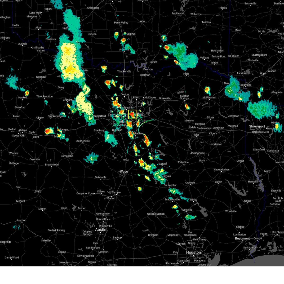 At 733 pm cdt, a severe thunderstorm was located over irving, and is nearly stationary. this storm will also produce very heavy rainfall (radar indicated). Hazards include 60 mph wind gusts. Expect damage to roofs, siding, and trees. locations impacted include, dallas, irving, grand prairie, carrollton, coppell, farmers branch, cockrell hill, dallas love field and dfw intl airport. hail threat, radar indicated max hail size, <. 75 in wind threat, radar indicated max wind gust, 60 mph. At 733 pm cdt, a severe thunderstorm was located over irving, and is nearly stationary. this storm will also produce very heavy rainfall (radar indicated). Hazards include 60 mph wind gusts. Expect damage to roofs, siding, and trees. locations impacted include, dallas, irving, grand prairie, carrollton, coppell, farmers branch, cockrell hill, dallas love field and dfw intl airport. hail threat, radar indicated max hail size, <. 75 in wind threat, radar indicated max wind gust, 60 mph.
|
| 6/7/2023 7:20 PM CDT |
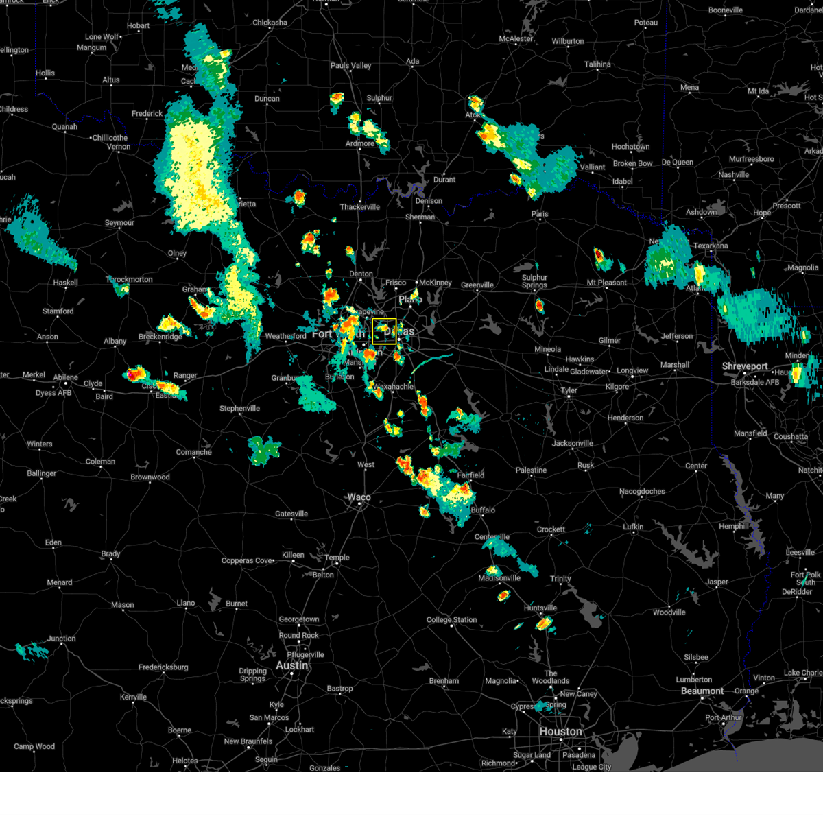 At 720 pm cdt, a severe thunderstorm was located over irving, and is nearly stationary (radar indicated). Hazards include 60 mph wind gusts. expect damage to roofs, siding, and trees At 720 pm cdt, a severe thunderstorm was located over irving, and is nearly stationary (radar indicated). Hazards include 60 mph wind gusts. expect damage to roofs, siding, and trees
|
| 5/19/2023 3:43 PM CDT |
 At 343 pm cdt, a severe thunderstorm was located over euless, moving east at 25 mph (radar indicated). Hazards include 60 mph wind gusts and quarter size hail. Hail damage to vehicles is expected. expect wind damage to roofs, siding, and trees. locations impacted include, fort worth, arlington, irving, grand prairie, euless, bedford, grapevine, haltom city, keller, coppell, hurst, southlake, watauga, colleyville, richland hills, north richland hills, dfw intl airport and grapevine lake. hail threat, radar indicated max hail size, 1. 00 in wind threat, radar indicated max wind gust, 60 mph. At 343 pm cdt, a severe thunderstorm was located over euless, moving east at 25 mph (radar indicated). Hazards include 60 mph wind gusts and quarter size hail. Hail damage to vehicles is expected. expect wind damage to roofs, siding, and trees. locations impacted include, fort worth, arlington, irving, grand prairie, euless, bedford, grapevine, haltom city, keller, coppell, hurst, southlake, watauga, colleyville, richland hills, north richland hills, dfw intl airport and grapevine lake. hail threat, radar indicated max hail size, 1. 00 in wind threat, radar indicated max wind gust, 60 mph.
|
| 5/19/2023 3:42 PM CDT |
 The severe thunderstorm warning for southeastern denton and western collin counties will expire at 345 pm cdt, the storm which prompted the warning has weakened below severe limits. therefore the warning will be allowed to expire. however small hail and gusty winds are still possible with this thunderstorm. a severe thunderstorm watch remains in effect until 800 pm cdt for north central texas. The severe thunderstorm warning for southeastern denton and western collin counties will expire at 345 pm cdt, the storm which prompted the warning has weakened below severe limits. therefore the warning will be allowed to expire. however small hail and gusty winds are still possible with this thunderstorm. a severe thunderstorm watch remains in effect until 800 pm cdt for north central texas.
|
| 5/19/2023 3:24 PM CDT |
 At 324 pm cdt, a severe thunderstorm was located over mckinney, moving east at 30 mph (radar indicated). Hazards include 60 mph wind gusts and quarter size hail. Hail damage to vehicles is expected. expect wind damage to roofs, siding, and trees. locations impacted include, plano, mckinney, carrollton, frisco, richardson, lewisville, allen, flower mound, coppell, the colony, highland village, lake dallas, lake lewisville, little elm, murphy, prosper, fairview, celina, lucas and melissa. hail threat, radar indicated max hail size, 1. 00 in wind threat, radar indicated max wind gust, 60 mph. At 324 pm cdt, a severe thunderstorm was located over mckinney, moving east at 30 mph (radar indicated). Hazards include 60 mph wind gusts and quarter size hail. Hail damage to vehicles is expected. expect wind damage to roofs, siding, and trees. locations impacted include, plano, mckinney, carrollton, frisco, richardson, lewisville, allen, flower mound, coppell, the colony, highland village, lake dallas, lake lewisville, little elm, murphy, prosper, fairview, celina, lucas and melissa. hail threat, radar indicated max hail size, 1. 00 in wind threat, radar indicated max wind gust, 60 mph.
|
| 5/19/2023 3:15 PM CDT |
 At 315 pm cdt, a cluster of severe thunderstorms was located over richland hills, moving east at 30 mph (radar indicated). Hazards include 60 mph wind gusts and quarter size hail. Hail damage to vehicles is expected. Expect wind damage to roofs, siding, and trees. At 315 pm cdt, a cluster of severe thunderstorms was located over richland hills, moving east at 30 mph (radar indicated). Hazards include 60 mph wind gusts and quarter size hail. Hail damage to vehicles is expected. Expect wind damage to roofs, siding, and trees.
|
| 5/19/2023 2:58 PM CDT |
 At 257 pm cdt, a cluster of severe thunderstorms was located over hackberry, or over lake lewisville, moving east at 30 mph (radar indicated). Hazards include 60 mph wind gusts and quarter size hail. Hail damage to vehicles is expected. Expect wind damage to roofs, siding, and trees. At 257 pm cdt, a cluster of severe thunderstorms was located over hackberry, or over lake lewisville, moving east at 30 mph (radar indicated). Hazards include 60 mph wind gusts and quarter size hail. Hail damage to vehicles is expected. Expect wind damage to roofs, siding, and trees.
|
| 4/20/2023 10:09 PM CDT |
 At 1009 pm cdt, a severe thunderstorm was located near farmers branch, moving northeast at 35 mph (emergency management). Hazards include quarter size hail. Damage to vehicles is possible. locations impacted include, dallas, plano, garland, irving, carrollton, frisco, richardson, lewisville, rowlett, grapevine, coppell, the colony, farmers branch, university park, addison, highland park, hebron, dfw intl airport, dallas love field and white rock lake. hail threat, observed max hail size, 1. 00 in wind threat, radar indicated max wind gust, <50 mph. At 1009 pm cdt, a severe thunderstorm was located near farmers branch, moving northeast at 35 mph (emergency management). Hazards include quarter size hail. Damage to vehicles is possible. locations impacted include, dallas, plano, garland, irving, carrollton, frisco, richardson, lewisville, rowlett, grapevine, coppell, the colony, farmers branch, university park, addison, highland park, hebron, dfw intl airport, dallas love field and white rock lake. hail threat, observed max hail size, 1. 00 in wind threat, radar indicated max wind gust, <50 mph.
|
| 4/20/2023 9:54 PM CDT |
 At 953 pm cdt, a severe thunderstorm was located over irving, moving northeast at 40 mph (radar indicated). Hazards include quarter size hail. damage to vehicles is possible At 953 pm cdt, a severe thunderstorm was located over irving, moving northeast at 40 mph (radar indicated). Hazards include quarter size hail. damage to vehicles is possible
|
| 4/2/2023 7:53 PM CDT |
 At 752 pm cdt, a severe thunderstorm was located near dallas love field, or near irving, moving east at 45 mph (radar indicated). Hazards include 60 mph wind gusts and quarter size hail. Hail damage to vehicles is expected. expect wind damage to roofs, siding, and trees. locations impacted include, dallas, garland, irving, grand prairie, mesquite, carrollton, rowlett, coppell, farmers branch, balch springs, university park, seagoville, highland park, hutchins, cockrell hill, sunnyvale, combine, dallas love field, dfw intl airport and white rock lake. hail threat, radar indicated max hail size, 1. 00 in wind threat, radar indicated max wind gust, 60 mph. At 752 pm cdt, a severe thunderstorm was located near dallas love field, or near irving, moving east at 45 mph (radar indicated). Hazards include 60 mph wind gusts and quarter size hail. Hail damage to vehicles is expected. expect wind damage to roofs, siding, and trees. locations impacted include, dallas, garland, irving, grand prairie, mesquite, carrollton, rowlett, coppell, farmers branch, balch springs, university park, seagoville, highland park, hutchins, cockrell hill, sunnyvale, combine, dallas love field, dfw intl airport and white rock lake. hail threat, radar indicated max hail size, 1. 00 in wind threat, radar indicated max wind gust, 60 mph.
|
| 4/2/2023 7:41 PM CDT |
 At 741 pm cdt, a severe thunderstorm was located over euless, moving east at 40 mph (radar indicated). Hazards include 60 mph wind gusts and quarter size hail. Hail damage to vehicles is expected. Expect wind damage to roofs, siding, and trees. At 741 pm cdt, a severe thunderstorm was located over euless, moving east at 40 mph (radar indicated). Hazards include 60 mph wind gusts and quarter size hail. Hail damage to vehicles is expected. Expect wind damage to roofs, siding, and trees.
|
| 4/2/2023 7:31 PM CDT |
 At 731 pm cdt, a severe thunderstorm was located over colleyville, moving east at 40 mph (radar indicated). Hazards include 60 mph wind gusts and nickel size hail. Expect damage to roofs, siding, and trees. locations impacted include, fort worth, lewisville, flower mound, euless, bedford, grapevine, haltom city, keller, coppell, hurst, the colony, southlake, watauga, colleyville, highland village, trophy club, north richland hills, hickory creek, double oak and copper canyon. hail threat, radar indicated max hail size, 0. 88 in wind threat, radar indicated max wind gust, 60 mph. At 731 pm cdt, a severe thunderstorm was located over colleyville, moving east at 40 mph (radar indicated). Hazards include 60 mph wind gusts and nickel size hail. Expect damage to roofs, siding, and trees. locations impacted include, fort worth, lewisville, flower mound, euless, bedford, grapevine, haltom city, keller, coppell, hurst, the colony, southlake, watauga, colleyville, highland village, trophy club, north richland hills, hickory creek, double oak and copper canyon. hail threat, radar indicated max hail size, 0. 88 in wind threat, radar indicated max wind gust, 60 mph.
|
| 4/2/2023 7:18 PM CDT |
 At 717 pm cdt, a severe thunderstorm was located over trophy club, moving east at 45 mph (radar indicated). Hazards include 60 mph wind gusts and nickel size hail. Expect damage to roofs, siding, and trees. locations impacted include, fort worth, grand prairie, denton, lewisville, flower mound, euless, bedford, grapevine, haltom city, keller, coppell, hurst, the colony, southlake, watauga, colleyville, corinth, saginaw, highland village and trophy club. hail threat, radar indicated max hail size, 0. 88 in wind threat, radar indicated max wind gust, 60 mph. At 717 pm cdt, a severe thunderstorm was located over trophy club, moving east at 45 mph (radar indicated). Hazards include 60 mph wind gusts and nickel size hail. Expect damage to roofs, siding, and trees. locations impacted include, fort worth, grand prairie, denton, lewisville, flower mound, euless, bedford, grapevine, haltom city, keller, coppell, hurst, the colony, southlake, watauga, colleyville, corinth, saginaw, highland village and trophy club. hail threat, radar indicated max hail size, 0. 88 in wind threat, radar indicated max wind gust, 60 mph.
|
| 4/2/2023 7:07 PM CDT |
 At 706 pm cdt, a severe thunderstorm was located over justin, or 7 miles northwest of trophy club, moving east at 35 mph (radar indicated). Hazards include 60 mph wind gusts and quarter size hail. Hail damage to vehicles is expected. expect wind damage to roofs, siding, and trees. locations impacted include, fort worth, grand prairie, denton, lewisville, flower mound, euless, bedford, grapevine, haltom city, keller, coppell, hurst, the colony, southlake, watauga, colleyville, corinth, saginaw, highland village and azle. hail threat, radar indicated max hail size, 1. 00 in wind threat, radar indicated max wind gust, 60 mph. At 706 pm cdt, a severe thunderstorm was located over justin, or 7 miles northwest of trophy club, moving east at 35 mph (radar indicated). Hazards include 60 mph wind gusts and quarter size hail. Hail damage to vehicles is expected. expect wind damage to roofs, siding, and trees. locations impacted include, fort worth, grand prairie, denton, lewisville, flower mound, euless, bedford, grapevine, haltom city, keller, coppell, hurst, the colony, southlake, watauga, colleyville, corinth, saginaw, highland village and azle. hail threat, radar indicated max hail size, 1. 00 in wind threat, radar indicated max wind gust, 60 mph.
|
| 4/2/2023 6:51 PM CDT |
 At 651 pm cdt, a severe thunderstorm was located over rhome, or near briar, moving east at 40 mph (radar indicated). Hazards include 60 mph wind gusts and quarter size hail. Hail damage to vehicles is expected. Expect wind damage to roofs, siding, and trees. At 651 pm cdt, a severe thunderstorm was located over rhome, or near briar, moving east at 40 mph (radar indicated). Hazards include 60 mph wind gusts and quarter size hail. Hail damage to vehicles is expected. Expect wind damage to roofs, siding, and trees.
|
| 4/2/2023 4:06 PM CDT |
 At 406 pm cdt, a severe thunderstorm was located over carrollton, moving northeast at 55 mph (radar indicated). Hazards include 60 mph wind gusts and quarter size hail. Hail damage to vehicles is expected. Expect wind damage to roofs, siding, and trees. At 406 pm cdt, a severe thunderstorm was located over carrollton, moving northeast at 55 mph (radar indicated). Hazards include 60 mph wind gusts and quarter size hail. Hail damage to vehicles is expected. Expect wind damage to roofs, siding, and trees.
|
| 4/2/2023 4:01 PM CDT |
 At 401 pm cdt, a severe thunderstorm was located over coppell, moving northeast at 60 mph (radar indicated). Hazards include 60 mph wind gusts and half dollar size hail. Hail damage to vehicles is expected. expect wind damage to roofs, siding, and trees. locations impacted include, dallas, arlington, plano, irving, grand prairie, carrollton, frisco, lewisville, flower mound, euless, bedford, grapevine, keller, coppell, hurst, the colony, farmers branch, southlake, watauga and colleyville. hail threat, radar indicated max hail size, 1. 25 in wind threat, radar indicated max wind gust, 60 mph. At 401 pm cdt, a severe thunderstorm was located over coppell, moving northeast at 60 mph (radar indicated). Hazards include 60 mph wind gusts and half dollar size hail. Hail damage to vehicles is expected. expect wind damage to roofs, siding, and trees. locations impacted include, dallas, arlington, plano, irving, grand prairie, carrollton, frisco, lewisville, flower mound, euless, bedford, grapevine, keller, coppell, hurst, the colony, farmers branch, southlake, watauga and colleyville. hail threat, radar indicated max hail size, 1. 25 in wind threat, radar indicated max wind gust, 60 mph.
|
| 4/2/2023 3:48 PM CDT |
 At 348 pm cdt, a severe thunderstorm was located over hurst, moving northeast at 60 mph (radar indicated). Hazards include golf ball size hail and 60 mph wind gusts. People and animals outdoors will be injured. expect hail damage to roofs, siding, windows, and vehicles. expect wind damage to roofs, siding, and trees. locations impacted include, dallas, fort worth, arlington, plano, irving, grand prairie, carrollton, frisco, lewisville, flower mound, mansfield, euless, desoto, bedford, grapevine, cedar hill, haltom city, keller, coppell and duncanville. thunderstorm damage threat, considerable hail threat, radar indicated max hail size, 1. 75 in wind threat, radar indicated max wind gust, 60 mph. At 348 pm cdt, a severe thunderstorm was located over hurst, moving northeast at 60 mph (radar indicated). Hazards include golf ball size hail and 60 mph wind gusts. People and animals outdoors will be injured. expect hail damage to roofs, siding, windows, and vehicles. expect wind damage to roofs, siding, and trees. locations impacted include, dallas, fort worth, arlington, plano, irving, grand prairie, carrollton, frisco, lewisville, flower mound, mansfield, euless, desoto, bedford, grapevine, cedar hill, haltom city, keller, coppell and duncanville. thunderstorm damage threat, considerable hail threat, radar indicated max hail size, 1. 75 in wind threat, radar indicated max wind gust, 60 mph.
|
| 4/2/2023 3:38 PM CDT |
 At 338 pm cdt, a severe thunderstorm was located over blue mound, or over saginaw, moving northeast at 55 mph (radar indicated). Hazards include golf ball size hail and 60 mph wind gusts. People and animals outdoors will be injured. expect hail damage to roofs, siding, windows, and vehicles. expect wind damage to roofs, siding, and trees. locations impacted include, dallas, fort worth, arlington, plano, irving, grand prairie, carrollton, frisco, lewisville, flower mound, mansfield, euless, desoto, bedford, grapevine, cedar hill, haltom city, keller, coppell and duncanville. thunderstorm damage threat, considerable hail threat, radar indicated max hail size, 1. 75 in wind threat, radar indicated max wind gust, 60 mph. At 338 pm cdt, a severe thunderstorm was located over blue mound, or over saginaw, moving northeast at 55 mph (radar indicated). Hazards include golf ball size hail and 60 mph wind gusts. People and animals outdoors will be injured. expect hail damage to roofs, siding, windows, and vehicles. expect wind damage to roofs, siding, and trees. locations impacted include, dallas, fort worth, arlington, plano, irving, grand prairie, carrollton, frisco, lewisville, flower mound, mansfield, euless, desoto, bedford, grapevine, cedar hill, haltom city, keller, coppell and duncanville. thunderstorm damage threat, considerable hail threat, radar indicated max hail size, 1. 75 in wind threat, radar indicated max wind gust, 60 mph.
|
| 4/2/2023 3:31 PM CDT |
 At 331 pm cdt, a severe thunderstorm was located over white settlement, moving northeast at 55 mph (radar indicated). Hazards include ping pong ball size hail and 60 mph wind gusts. People and animals outdoors will be injured. expect hail damage to roofs, siding, windows, and vehicles. Expect wind damage to roofs, siding, and trees. At 331 pm cdt, a severe thunderstorm was located over white settlement, moving northeast at 55 mph (radar indicated). Hazards include ping pong ball size hail and 60 mph wind gusts. People and animals outdoors will be injured. expect hail damage to roofs, siding, windows, and vehicles. Expect wind damage to roofs, siding, and trees.
|
| 3/24/2023 6:08 AM CDT |
 The severe thunderstorm warning for denton, southeastern cooke and southwestern grayson counties will expire at 615 am cdt, the storm which prompted the warning has weakened below severe limits. therefore the warning will be allowed to expire. however gusty winds are still possible with this thunderstorm. a severe thunderstorm watch remains in effect until 700 am cdt for north central texas. a severe thunderstorm watch also remains in effect until 900 am cdt for north central texas. The severe thunderstorm warning for denton, southeastern cooke and southwestern grayson counties will expire at 615 am cdt, the storm which prompted the warning has weakened below severe limits. therefore the warning will be allowed to expire. however gusty winds are still possible with this thunderstorm. a severe thunderstorm watch remains in effect until 700 am cdt for north central texas. a severe thunderstorm watch also remains in effect until 900 am cdt for north central texas.
|
| 3/24/2023 6:03 AM CDT |
 At 602 am cdt, a severe thunderstorm was located over cross roads, or 8 miles north of lake lewisville, moving east at 45 mph (radar indicated). Hazards include 60 mph wind gusts. Expect damage to roofs, siding, and trees. locations impacted include, plano, carrollton, frisco, denton, lewisville, flower mound, coppell, the colony, southlake, corinth, gainesville, highland village, trophy club, lake dallas, sanger, whitesboro, lake lewisville, little elm, prosper and celina. hail threat, radar indicated max hail size, <. 75 in wind threat, radar indicated max wind gust, 60 mph. At 602 am cdt, a severe thunderstorm was located over cross roads, or 8 miles north of lake lewisville, moving east at 45 mph (radar indicated). Hazards include 60 mph wind gusts. Expect damage to roofs, siding, and trees. locations impacted include, plano, carrollton, frisco, denton, lewisville, flower mound, coppell, the colony, southlake, corinth, gainesville, highland village, trophy club, lake dallas, sanger, whitesboro, lake lewisville, little elm, prosper and celina. hail threat, radar indicated max hail size, <. 75 in wind threat, radar indicated max wind gust, 60 mph.
|
| 3/24/2023 5:54 AM CDT |
 At 553 am cdt, a severe thunderstorm was located near ray roberts park johnson branch, or 13 miles northeast of sanger, moving northeast at 65 mph (radar indicated). Hazards include 60 mph wind gusts. Expect damage to roofs, siding, and trees. locations impacted include, plano, carrollton, frisco, denton, lewisville, flower mound, coppell, the colony, southlake, corinth, gainesville, highland village, trophy club, lake dallas, sanger, whitesboro, lake lewisville, little elm, prosper and celina. hail threat, radar indicated max hail size, <. 75 in wind threat, radar indicated max wind gust, 60 mph. At 553 am cdt, a severe thunderstorm was located near ray roberts park johnson branch, or 13 miles northeast of sanger, moving northeast at 65 mph (radar indicated). Hazards include 60 mph wind gusts. Expect damage to roofs, siding, and trees. locations impacted include, plano, carrollton, frisco, denton, lewisville, flower mound, coppell, the colony, southlake, corinth, gainesville, highland village, trophy club, lake dallas, sanger, whitesboro, lake lewisville, little elm, prosper and celina. hail threat, radar indicated max hail size, <. 75 in wind threat, radar indicated max wind gust, 60 mph.
|
| 3/24/2023 5:23 AM CDT |
 At 522 am cdt, a severe thunderstorm was located near new fairview, or near decatur, moving northeast at 65 mph (radar indicated). Hazards include 65 mph wind gusts. expect damage to roofs, siding, and trees At 522 am cdt, a severe thunderstorm was located near new fairview, or near decatur, moving northeast at 65 mph (radar indicated). Hazards include 65 mph wind gusts. expect damage to roofs, siding, and trees
|
| 3/16/2023 5:25 PM CDT |
 At 524 pm cdt, a severe thunderstorm was located over arlington, moving east at 50 mph (radar indicated). Hazards include 60 mph wind gusts and half dollar size hail. Hail damage to vehicles is expected. expect wind damage to roofs, siding, and trees. locations impacted include, fort worth, arlington, grand prairie, euless, bedford, grapevine, haltom city, hurst, colleyville, benbrook, forest hill, richland hills, river oaks, kennedale, everman, north richland hills, edgecliff village, westworth village, pantego and dfw intl airport. hail threat, observed max hail size, 1. 25 in wind threat, radar indicated max wind gust, 60 mph. At 524 pm cdt, a severe thunderstorm was located over arlington, moving east at 50 mph (radar indicated). Hazards include 60 mph wind gusts and half dollar size hail. Hail damage to vehicles is expected. expect wind damage to roofs, siding, and trees. locations impacted include, fort worth, arlington, grand prairie, euless, bedford, grapevine, haltom city, hurst, colleyville, benbrook, forest hill, richland hills, river oaks, kennedale, everman, north richland hills, edgecliff village, westworth village, pantego and dfw intl airport. hail threat, observed max hail size, 1. 25 in wind threat, radar indicated max wind gust, 60 mph.
|
| 3/16/2023 4:58 PM CDT |
 At 456 pm cdt, a severe thunderstorm was located along a line from benbrook to sansom park to the hurst-euless-bedford area, moving east at 40 mph (radar indicated). Hazards include 60 mph wind gusts and half dollar size hail. Hail damage to vehicles is expected. Expect wind damage to roofs, siding, and trees. At 456 pm cdt, a severe thunderstorm was located along a line from benbrook to sansom park to the hurst-euless-bedford area, moving east at 40 mph (radar indicated). Hazards include 60 mph wind gusts and half dollar size hail. Hail damage to vehicles is expected. Expect wind damage to roofs, siding, and trees.
|
| 3/16/2023 4:46 PM CDT |
 At 446 pm cdt, a severe thunderstorm was located over euless, moving east at 35 mph (radar indicated). Hazards include 60 mph wind gusts and half dollar size hail. Hail damage to vehicles is expected. Expect wind damage to roofs, siding, and trees. At 446 pm cdt, a severe thunderstorm was located over euless, moving east at 35 mph (radar indicated). Hazards include 60 mph wind gusts and half dollar size hail. Hail damage to vehicles is expected. Expect wind damage to roofs, siding, and trees.
|
| 3/16/2023 4:11 PM CDT |
 At 410 pm cdt, a severe thunderstorm was located over haltom city, moving east at 40 mph (radar indicated). Hazards include 60 mph wind gusts and quarter size hail. Hail damage to vehicles is expected. expect wind damage to roofs, siding, and trees. locations impacted include, fort worth, arlington, grand prairie, euless, bedford, grapevine, haltom city, keller, coppell, hurst, southlake, watauga, colleyville, benbrook, saginaw, white settlement, forest hill, richland hills, river oaks and kennedale. hail threat, radar indicated max hail size, 1. 00 in wind threat, radar indicated max wind gust, 60 mph. At 410 pm cdt, a severe thunderstorm was located over haltom city, moving east at 40 mph (radar indicated). Hazards include 60 mph wind gusts and quarter size hail. Hail damage to vehicles is expected. expect wind damage to roofs, siding, and trees. locations impacted include, fort worth, arlington, grand prairie, euless, bedford, grapevine, haltom city, keller, coppell, hurst, southlake, watauga, colleyville, benbrook, saginaw, white settlement, forest hill, richland hills, river oaks and kennedale. hail threat, radar indicated max hail size, 1. 00 in wind threat, radar indicated max wind gust, 60 mph.
|
| 3/16/2023 3:51 PM CDT |
 At 351 pm cdt, a severe thunderstorm was located near lake worth, moving east at 40 mph (trained weather spotters). Hazards include ping pong ball size hail and 60 mph wind gusts. People and animals outdoors will be injured. expect hail damage to roofs, siding, windows, and vehicles. Expect wind damage to roofs, siding, and trees. At 351 pm cdt, a severe thunderstorm was located near lake worth, moving east at 40 mph (trained weather spotters). Hazards include ping pong ball size hail and 60 mph wind gusts. People and animals outdoors will be injured. expect hail damage to roofs, siding, windows, and vehicles. Expect wind damage to roofs, siding, and trees.
|
| 3/2/2023 6:54 PM CST |
 The severe thunderstorm warning for denton and tarrant counties will expire at 700 pm cst, the storms which prompted the warning have moved out of the area. therefore the warning will be allowed to expire. however gusty winds are still possible with these thunderstorms. The severe thunderstorm warning for denton and tarrant counties will expire at 700 pm cst, the storms which prompted the warning have moved out of the area. therefore the warning will be allowed to expire. however gusty winds are still possible with these thunderstorms.
|
| 3/2/2023 6:28 PM CST |
 At 628 pm cst, severe thunderstorms were located along a line extending from near prosper to near dfw airport to near rendon, moving east at 35 mph. the strongest winds with this line has moved east of the denton and tarrant counties (radar indicated). Hazards include 60 mph wind gusts. expect damage to roofs, siding, and trees At 628 pm cst, severe thunderstorms were located along a line extending from near prosper to near dfw airport to near rendon, moving east at 35 mph. the strongest winds with this line has moved east of the denton and tarrant counties (radar indicated). Hazards include 60 mph wind gusts. expect damage to roofs, siding, and trees
|
| 3/2/2023 6:09 PM CST |
 At 607 pm cst, a line of dangerous storms extends from near keller to burleson, moving east at 40 mph. this is a destructive storm with tornado like wind speeds (multiple reports of wind damage and wind gusts near 80 mph). Hazards include 80 mph wind gusts. Flying debris will be dangerous to those caught without shelter. mobile homes will be heavily damaged. expect considerable damage to roofs, windows, and vehicles. extensive tree damage and power outages are likely. locations impacted include, fort worth, arlington, grand prairie, mansfield, euless, bedford, grapevine, haltom city, keller, coppell, hurst, burleson, southlake, watauga, colleyville, benbrook, saginaw, white settlement, crowley and forest hill. thunderstorm damage threat, destructive hail threat, radar indicated max hail size, <. 75 in wind threat, radar indicated max wind gust, 80 mph. At 607 pm cst, a line of dangerous storms extends from near keller to burleson, moving east at 40 mph. this is a destructive storm with tornado like wind speeds (multiple reports of wind damage and wind gusts near 80 mph). Hazards include 80 mph wind gusts. Flying debris will be dangerous to those caught without shelter. mobile homes will be heavily damaged. expect considerable damage to roofs, windows, and vehicles. extensive tree damage and power outages are likely. locations impacted include, fort worth, arlington, grand prairie, mansfield, euless, bedford, grapevine, haltom city, keller, coppell, hurst, burleson, southlake, watauga, colleyville, benbrook, saginaw, white settlement, crowley and forest hill. thunderstorm damage threat, destructive hail threat, radar indicated max hail size, <. 75 in wind threat, radar indicated max wind gust, 80 mph.
|
| 3/2/2023 6:06 PM CST |
 At 605 pm cst, severe thunderstorms were located along a line extending from near celina to near mansfield, moving east at 40 mph. these are destructive storms with tornado like wind speeds (radar indicated). Hazards include 80 mph wind gusts. Flying debris will be dangerous to those caught without shelter. mobile homes will be heavily damaged. expect considerable damage to roofs, windows, and vehicles. Extensive tree damage and power outages are likely. At 605 pm cst, severe thunderstorms were located along a line extending from near celina to near mansfield, moving east at 40 mph. these are destructive storms with tornado like wind speeds (radar indicated). Hazards include 80 mph wind gusts. Flying debris will be dangerous to those caught without shelter. mobile homes will be heavily damaged. expect considerable damage to roofs, windows, and vehicles. Extensive tree damage and power outages are likely.
|
| 3/2/2023 6:03 PM CST |
 At 602 pm cst, a severe thunderstorm was located over cross roads, or near lake dallas, moving east at 40 mph (radar indicated). Hazards include 70 mph wind gusts and nickel size hail. Expect considerable tree damage. damage is likely to mobile homes, roofs, and outbuildings. locations impacted include, plano, carrollton, frisco, denton, lewisville, flower mound, coppell, the colony, southlake, corinth, highland village, trophy club, lake dallas, sanger, lake lewisville, little elm, prosper, celina, roanoke and krum. thunderstorm damage threat, considerable hail threat, radar indicated max hail size, 0. 88 in wind threat, radar indicated max wind gust, 70 mph. At 602 pm cst, a severe thunderstorm was located over cross roads, or near lake dallas, moving east at 40 mph (radar indicated). Hazards include 70 mph wind gusts and nickel size hail. Expect considerable tree damage. damage is likely to mobile homes, roofs, and outbuildings. locations impacted include, plano, carrollton, frisco, denton, lewisville, flower mound, coppell, the colony, southlake, corinth, highland village, trophy club, lake dallas, sanger, lake lewisville, little elm, prosper, celina, roanoke and krum. thunderstorm damage threat, considerable hail threat, radar indicated max hail size, 0. 88 in wind threat, radar indicated max wind gust, 70 mph.
|
| 3/2/2023 5:56 PM CST |
 At 555 pm cst, a severe thunderstorm was located over copper canyon, or near highland village, moving southeast at 50 mph. this is a destructive storm for southeast denton county including flower mound and lewisville (radar indicated). Hazards include 80 mph wind gusts. Flying debris will be dangerous to those caught without shelter. mobile homes will be heavily damaged. expect considerable damage to roofs, windows, and vehicles. Extensive tree damage and power outages are likely. At 555 pm cst, a severe thunderstorm was located over copper canyon, or near highland village, moving southeast at 50 mph. this is a destructive storm for southeast denton county including flower mound and lewisville (radar indicated). Hazards include 80 mph wind gusts. Flying debris will be dangerous to those caught without shelter. mobile homes will be heavily damaged. expect considerable damage to roofs, windows, and vehicles. Extensive tree damage and power outages are likely.
|
| 3/2/2023 5:35 PM CST |
 At 534 pm cst, a severe thunderstorm was located near white settlement, moving east at 40 mph. this is a destructive storm for tarrant county including white settlement, benbrook, and fort worth. Hazards include 80 mph wind gusts. Flying debris will be dangerous to those caught without shelter. mobile homes will be heavily damaged. expect considerable damage to roofs, windows, and vehicles. Extensive tree damage and power outages are likely. At 534 pm cst, a severe thunderstorm was located near white settlement, moving east at 40 mph. this is a destructive storm for tarrant county including white settlement, benbrook, and fort worth. Hazards include 80 mph wind gusts. Flying debris will be dangerous to those caught without shelter. mobile homes will be heavily damaged. expect considerable damage to roofs, windows, and vehicles. Extensive tree damage and power outages are likely.
|
| 3/2/2023 5:27 PM CST |
 At 527 pm cst, a line of severe thunderstorms was located from alvord to boyd, moving east at 40 mph (radar indicated). Hazards include 60 mph wind gusts and nickel size hail. expect damage to roofs, siding, and trees At 527 pm cst, a line of severe thunderstorms was located from alvord to boyd, moving east at 40 mph (radar indicated). Hazards include 60 mph wind gusts and nickel size hail. expect damage to roofs, siding, and trees
|
| 12/13/2022 9:15 AM CST |
 At 915 am cst, a severe thunderstorm was located over plano, moving northeast at 40 mph (radar indicated). Hazards include 60 mph wind gusts and nickel size hail. Expect damage to roofs, siding, and trees. locations impacted include, dallas, plano, garland, irving, grand prairie, mckinney, carrollton, frisco, richardson, lewisville, allen, rowlett, wylie, coppell, the colony, farmers branch, university park, sachse, addison and highland park. hail threat, radar indicated max hail size, 0. 88 in wind threat, radar indicated max wind gust, 60 mph. At 915 am cst, a severe thunderstorm was located over plano, moving northeast at 40 mph (radar indicated). Hazards include 60 mph wind gusts and nickel size hail. Expect damage to roofs, siding, and trees. locations impacted include, dallas, plano, garland, irving, grand prairie, mckinney, carrollton, frisco, richardson, lewisville, allen, rowlett, wylie, coppell, the colony, farmers branch, university park, sachse, addison and highland park. hail threat, radar indicated max hail size, 0. 88 in wind threat, radar indicated max wind gust, 60 mph.
|
| 12/13/2022 9:12 AM CST |
 The tornado warning for southeastern denton and northwestern dallas counties will expire at 915 am cst, the storm which prompted the warning has moved out of the area. therefore the warning will be allowed to expire. a tornado watch remains in effect until 1100 am cst for north central texas. The tornado warning for southeastern denton and northwestern dallas counties will expire at 915 am cst, the storm which prompted the warning has moved out of the area. therefore the warning will be allowed to expire. a tornado watch remains in effect until 1100 am cst for north central texas.
|
| 12/13/2022 9:02 AM CST |
 At 902 am cst, a severe thunderstorm capable of producing a tornado was located over lewisville, moving northeast at 35 mph (radar indicated rotation). Hazards include tornado. Flying debris will be dangerous to those caught without shelter. mobile homes will be damaged or destroyed. damage to roofs, windows, and vehicles will occur. tree damage is likely. this dangerous storm will be near, hebron around 910 am cst. the colony around 915 am cst. plano around 925 am cst. Other locations impacted by this tornadic thunderstorm include lewisville lake. At 902 am cst, a severe thunderstorm capable of producing a tornado was located over lewisville, moving northeast at 35 mph (radar indicated rotation). Hazards include tornado. Flying debris will be dangerous to those caught without shelter. mobile homes will be damaged or destroyed. damage to roofs, windows, and vehicles will occur. tree damage is likely. this dangerous storm will be near, hebron around 910 am cst. the colony around 915 am cst. plano around 925 am cst. Other locations impacted by this tornadic thunderstorm include lewisville lake.
|
| 12/13/2022 8:48 AM CST |
 At 847 am cst, a severe thunderstorm capable of producing a tornado was located over grapevine, moving northeast at 35 mph (radar indicated rotation). Hazards include tornado. Flying debris will be dangerous to those caught without shelter. mobile homes will be damaged or destroyed. damage to roofs, windows, and vehicles will occur. tree damage is likely. this dangerous storm will be near, lewisville around 905 am cst. carrollton and hebron around 910 am cst. the colony around 915 am cst. other locations impacted by this tornadic thunderstorm include grapevine lake and lewisville lake. This includes interstate 35e between mile markers 443 and 452. At 847 am cst, a severe thunderstorm capable of producing a tornado was located over grapevine, moving northeast at 35 mph (radar indicated rotation). Hazards include tornado. Flying debris will be dangerous to those caught without shelter. mobile homes will be damaged or destroyed. damage to roofs, windows, and vehicles will occur. tree damage is likely. this dangerous storm will be near, lewisville around 905 am cst. carrollton and hebron around 910 am cst. the colony around 915 am cst. other locations impacted by this tornadic thunderstorm include grapevine lake and lewisville lake. This includes interstate 35e between mile markers 443 and 452.
|
| 12/13/2022 8:45 AM CST |
 At 844 am cst, a severe thunderstorm was located over dfw intl airport, or over grapevine, moving northeast at 40 mph (radar indicated). Hazards include 60 mph wind gusts and nickel size hail. expect damage to roofs, siding, and trees At 844 am cst, a severe thunderstorm was located over dfw intl airport, or over grapevine, moving northeast at 40 mph (radar indicated). Hazards include 60 mph wind gusts and nickel size hail. expect damage to roofs, siding, and trees
|
| 12/13/2022 8:14 AM CST |
 At 814 am cst, a confirmed tornado was located over river oaks, moving east at 30 mph (radar confirmed tornado). Hazards include damaging tornado. Flying debris will be dangerous to those caught without shelter. mobile homes will be damaged or destroyed. damage to roofs, windows, and vehicles will occur. tree damage is likely. this tornado will be near, saginaw and blue mound around 825 am cst. haltom city around 830 am cst. watauga and richland hills around 835 am cst. fort worth, arlington, grand prairie, euless, bedford, hurst, colleyville, north richland hills and dfw intl airport around 845 am cst. Other locations impacted by this tornadic thunderstorm include lake arlington, dalworthington gardens, westover hills and lake worth. At 814 am cst, a confirmed tornado was located over river oaks, moving east at 30 mph (radar confirmed tornado). Hazards include damaging tornado. Flying debris will be dangerous to those caught without shelter. mobile homes will be damaged or destroyed. damage to roofs, windows, and vehicles will occur. tree damage is likely. this tornado will be near, saginaw and blue mound around 825 am cst. haltom city around 830 am cst. watauga and richland hills around 835 am cst. fort worth, arlington, grand prairie, euless, bedford, hurst, colleyville, north richland hills and dfw intl airport around 845 am cst. Other locations impacted by this tornadic thunderstorm include lake arlington, dalworthington gardens, westover hills and lake worth.
|
| 12/13/2022 8:11 AM CST |
 At 810 am cst, a severe thunderstorm capable of producing a tornado was located over westworth village, or over river oaks, moving east at 30 mph (radar indicated rotation). Hazards include tornado. Flying debris will be dangerous to those caught without shelter. mobile homes will be damaged or destroyed. damage to roofs, windows, and vehicles will occur. tree damage is likely. this dangerous storm will be near, blue mound around 820 am cst. haltom city around 830 am cst. watauga and richland hills around 835 am cst. hurst around 840 am cst. fort worth, arlington, grand prairie, euless, bedford and pantego around 845 am cst. other locations impacted by this tornadic thunderstorm include lake arlington, dalworthington gardens, westover hills and lake worth. this includes the following highways, interstate 35w between mile markers 48 and 58. Interstate 30 between mile markers 8 and 31. At 810 am cst, a severe thunderstorm capable of producing a tornado was located over westworth village, or over river oaks, moving east at 30 mph (radar indicated rotation). Hazards include tornado. Flying debris will be dangerous to those caught without shelter. mobile homes will be damaged or destroyed. damage to roofs, windows, and vehicles will occur. tree damage is likely. this dangerous storm will be near, blue mound around 820 am cst. haltom city around 830 am cst. watauga and richland hills around 835 am cst. hurst around 840 am cst. fort worth, arlington, grand prairie, euless, bedford and pantego around 845 am cst. other locations impacted by this tornadic thunderstorm include lake arlington, dalworthington gardens, westover hills and lake worth. this includes the following highways, interstate 35w between mile markers 48 and 58. Interstate 30 between mile markers 8 and 31.
|
| 11/4/2022 4:03 PM CDT |
 At 403 pm cdt, severe thunderstorms were located along a line extending from near gunter to near celina to little elm, moving northeast at 50 mph (radar indicated). Hazards include 60 mph wind gusts and quarter size hail. Hail damage to vehicles is expected. expect wind damage to roofs, siding, and trees. locations impacted include, plano, mckinney, carrollton, frisco, richardson, lewisville, allen, flower mound, grapevine, coppell, sherman, the colony, corinth, highland village, lake dallas, lake lewisville, little elm, prosper, celina and pilot point. hail threat, radar indicated max hail size, 1. 00 in wind threat, radar indicated max wind gust, 60 mph. At 403 pm cdt, severe thunderstorms were located along a line extending from near gunter to near celina to little elm, moving northeast at 50 mph (radar indicated). Hazards include 60 mph wind gusts and quarter size hail. Hail damage to vehicles is expected. expect wind damage to roofs, siding, and trees. locations impacted include, plano, mckinney, carrollton, frisco, richardson, lewisville, allen, flower mound, grapevine, coppell, sherman, the colony, corinth, highland village, lake dallas, lake lewisville, little elm, prosper, celina and pilot point. hail threat, radar indicated max hail size, 1. 00 in wind threat, radar indicated max wind gust, 60 mph.
|
| 11/4/2022 3:50 PM CDT |
 At 349 pm cdt, severe thunderstorms were located along a line extending from pilot point to near highland village, moving northeast at 50 mph (radar indicated). Hazards include 60 mph wind gusts and quarter size hail. Hail damage to vehicles is expected. Expect wind damage to roofs, siding, and trees. At 349 pm cdt, severe thunderstorms were located along a line extending from pilot point to near highland village, moving northeast at 50 mph (radar indicated). Hazards include 60 mph wind gusts and quarter size hail. Hail damage to vehicles is expected. Expect wind damage to roofs, siding, and trees.
|
| 11/4/2022 3:44 PM CDT |
 At 344 pm cdt, a severe thunderstorm was located over pantego, or near arlington, moving northeast at 45 mph (radar indicated). Hazards include 60 mph wind gusts and quarter size hail. Hail damage to vehicles is expected. Expect wind damage to roofs, siding, and trees. At 344 pm cdt, a severe thunderstorm was located over pantego, or near arlington, moving northeast at 45 mph (radar indicated). Hazards include 60 mph wind gusts and quarter size hail. Hail damage to vehicles is expected. Expect wind damage to roofs, siding, and trees.
|
| 11/4/2022 3:37 PM CDT |
 At 336 pm cdt, severe thunderstorms were located along a line extending from near denton to near argyle to near keller, moving northeast at 50 mph (radar indicated). Hazards include 60 mph wind gusts and quarter size hail. Hail damage to vehicles is expected. expect wind damage to roofs, siding, and trees. locations impacted include, fort worth, arlington, irving, grand prairie, denton, lewisville, flower mound, euless, bedford, grapevine, haltom city, keller, coppell, hurst, southlake, watauga, colleyville, corinth, saginaw and highland village. hail threat, radar indicated max hail size, 1. 00 in wind threat, radar indicated max wind gust, 60 mph. At 336 pm cdt, severe thunderstorms were located along a line extending from near denton to near argyle to near keller, moving northeast at 50 mph (radar indicated). Hazards include 60 mph wind gusts and quarter size hail. Hail damage to vehicles is expected. expect wind damage to roofs, siding, and trees. locations impacted include, fort worth, arlington, irving, grand prairie, denton, lewisville, flower mound, euless, bedford, grapevine, haltom city, keller, coppell, hurst, southlake, watauga, colleyville, corinth, saginaw and highland village. hail threat, radar indicated max hail size, 1. 00 in wind threat, radar indicated max wind gust, 60 mph.
|
| 11/4/2022 3:20 PM CDT |
 At 320 pm cdt, severe thunderstorms were located along a line extending from near roanoke to near westworth village, moving northeast at 50 mph (radar indicated). Hazards include 60 mph wind gusts and quarter size hail. Hail damage to vehicles is expected. Expect wind damage to roofs, siding, and trees. At 320 pm cdt, severe thunderstorms were located along a line extending from near roanoke to near westworth village, moving northeast at 50 mph (radar indicated). Hazards include 60 mph wind gusts and quarter size hail. Hail damage to vehicles is expected. Expect wind damage to roofs, siding, and trees.
|
| 11/4/2022 2:34 PM CDT |
 At 233 pm cdt, a severe thunderstorm was located over allen, moving northeast at 65 mph (radar indicated). Hazards include 60 mph wind gusts and quarter size hail. Hail damage to vehicles is expected. expect wind damage to roofs, siding, and trees. locations impacted include, dallas, plano, garland, irving, mesquite, mckinney, carrollton, frisco, richardson, lewisville, allen, rowlett, wylie, coppell, the colony, farmers branch, sachse, addison, murphy and fairview. hail threat, radar indicated max hail size, 1. 00 in wind threat, radar indicated max wind gust, 60 mph. At 233 pm cdt, a severe thunderstorm was located over allen, moving northeast at 65 mph (radar indicated). Hazards include 60 mph wind gusts and quarter size hail. Hail damage to vehicles is expected. expect wind damage to roofs, siding, and trees. locations impacted include, dallas, plano, garland, irving, mesquite, mckinney, carrollton, frisco, richardson, lewisville, allen, rowlett, wylie, coppell, the colony, farmers branch, sachse, addison, murphy and fairview. hail threat, radar indicated max hail size, 1. 00 in wind threat, radar indicated max wind gust, 60 mph.
|
| 11/4/2022 2:07 PM CDT |
 At 207 pm cdt, severe thunderstorms were located along a line extending from near southlake to near kennedale, moving northeast at 50 mph (radar indicated). Hazards include 60 mph wind gusts and quarter size hail. Hail damage to vehicles is expected. Expect wind damage to roofs, siding, and trees. At 207 pm cdt, severe thunderstorms were located along a line extending from near southlake to near kennedale, moving northeast at 50 mph (radar indicated). Hazards include 60 mph wind gusts and quarter size hail. Hail damage to vehicles is expected. Expect wind damage to roofs, siding, and trees.
|
| 10/24/2022 10:53 AM CDT |
 The severe thunderstorm warning for southern denton, tarrant and western dallas counties will expire at 1100 am cdt, the storms which prompted the warning have weakened below severe limits. therefore the warning will be allowed to expire. however gusty winds and brief heavy rain are still possible with these thunderstorms. The severe thunderstorm warning for southern denton, tarrant and western dallas counties will expire at 1100 am cdt, the storms which prompted the warning have weakened below severe limits. therefore the warning will be allowed to expire. however gusty winds and brief heavy rain are still possible with these thunderstorms.
|
| 10/24/2022 10:35 AM CDT |
 At 1035 am cdt, severe thunderstorms were located along a line extending from near denton to near watauga to near crowley, moving east at 50 mph (radar indicated). Hazards include 60 mph wind gusts. Expect damage to roofs, siding, and trees. locations impacted include, dallas, fort worth, arlington, plano, irving, grand prairie, carrollton, frisco, denton, lewisville, flower mound, mansfield, euless, bedford, grapevine, cedar hill, haltom city, keller, coppell and duncanville. hail threat, radar indicated max hail size, <. 75 in wind threat, radar indicated max wind gust, 60 mph. At 1035 am cdt, severe thunderstorms were located along a line extending from near denton to near watauga to near crowley, moving east at 50 mph (radar indicated). Hazards include 60 mph wind gusts. Expect damage to roofs, siding, and trees. locations impacted include, dallas, fort worth, arlington, plano, irving, grand prairie, carrollton, frisco, denton, lewisville, flower mound, mansfield, euless, bedford, grapevine, cedar hill, haltom city, keller, coppell and duncanville. hail threat, radar indicated max hail size, <. 75 in wind threat, radar indicated max wind gust, 60 mph.
|
| 10/24/2022 10:13 AM CDT |
 At 1012 am cdt, severe thunderstorms were located along a line extending from 6 miles west of krum to azle to 8 miles south of aledo, moving east at 55 mph (radar indicated). Hazards include 60 mph wind gusts. expect damage to roofs, siding, and trees At 1012 am cdt, severe thunderstorms were located along a line extending from 6 miles west of krum to azle to 8 miles south of aledo, moving east at 55 mph (radar indicated). Hazards include 60 mph wind gusts. expect damage to roofs, siding, and trees
|
| 9/25/2022 4:56 PM CDT |
 The severe thunderstorm warning for northern dallas county will expire at 500 pm cdt, the severe thunderstorm which prompted the warning has weakened below severe limits. therefore, the warning will be allowed to expire. wind gusts between 40 and 50 mph can still be expected with this storm. The severe thunderstorm warning for northern dallas county will expire at 500 pm cdt, the severe thunderstorm which prompted the warning has weakened below severe limits. therefore, the warning will be allowed to expire. wind gusts between 40 and 50 mph can still be expected with this storm.
|
| 9/25/2022 4:39 PM CDT |
 At 438 pm cdt, a severe thunderstorm was located over university park, moving south at 15 mph (radar indicated). Hazards include 60 mph wind gusts. Expect damage to roofs, siding, and trees. locations impacted include, dallas, garland, irving, mesquite, carrollton, richardson, coppell, farmers branch, university park, addison, highland park, dallas love field, white rock lake and buckingham. hail threat, radar indicated max hail size, <. 75 in wind threat, radar indicated max wind gust, 60 mph. At 438 pm cdt, a severe thunderstorm was located over university park, moving south at 15 mph (radar indicated). Hazards include 60 mph wind gusts. Expect damage to roofs, siding, and trees. locations impacted include, dallas, garland, irving, mesquite, carrollton, richardson, coppell, farmers branch, university park, addison, highland park, dallas love field, white rock lake and buckingham. hail threat, radar indicated max hail size, <. 75 in wind threat, radar indicated max wind gust, 60 mph.
|
| 9/25/2022 4:18 PM CDT |
 At 418 pm cdt, a severe thunderstorm was located over addison, moving south at 10 mph (radar indicated). Hazards include 60 mph wind gusts. expect damage to roofs, siding, and trees At 418 pm cdt, a severe thunderstorm was located over addison, moving south at 10 mph (radar indicated). Hazards include 60 mph wind gusts. expect damage to roofs, siding, and trees
|
| 9/4/2022 3:12 PM CDT |
 At 311 pm cdt, a severe thunderstorm was located over highland park, moving south at 20 mph (radar indicated). Hazards include 60 mph wind gusts and quarter size hail. Hail damage to vehicles is expected. expect wind damage to roofs, siding, and trees. locations impacted include, dallas, garland, irving, grand prairie, mesquite, carrollton, richardson, rowlett, desoto, cedar hill, wylie, coppell, duncanville, rockwall, lancaster, farmers branch, balch springs, university park, sachse and terrell. hail threat, radar indicated max hail size, 1. 00 in wind threat, radar indicated max wind gust, 60 mph. At 311 pm cdt, a severe thunderstorm was located over highland park, moving south at 20 mph (radar indicated). Hazards include 60 mph wind gusts and quarter size hail. Hail damage to vehicles is expected. expect wind damage to roofs, siding, and trees. locations impacted include, dallas, garland, irving, grand prairie, mesquite, carrollton, richardson, rowlett, desoto, cedar hill, wylie, coppell, duncanville, rockwall, lancaster, farmers branch, balch springs, university park, sachse and terrell. hail threat, radar indicated max hail size, 1. 00 in wind threat, radar indicated max wind gust, 60 mph.
|
| 9/4/2022 2:43 PM CDT |
 At 242 pm cdt, a severe thunderstorm was located over plano, moving south at 15 mph (radar indicated). Hazards include 60 mph wind gusts and quarter size hail. Hail damage to vehicles is expected. Expect wind damage to roofs, siding, and trees. At 242 pm cdt, a severe thunderstorm was located over plano, moving south at 15 mph (radar indicated). Hazards include 60 mph wind gusts and quarter size hail. Hail damage to vehicles is expected. Expect wind damage to roofs, siding, and trees.
|
| 8/10/2022 5:21 PM CDT |
 The severe thunderstorm warning for tarrant county will expire at 530 pm cdt, the storm which prompted the warning has weakened below severe limits. therefore the warning will be allowed to expire. however gusty winds are still possible with this thunderstorm. The severe thunderstorm warning for tarrant county will expire at 530 pm cdt, the storm which prompted the warning has weakened below severe limits. therefore the warning will be allowed to expire. however gusty winds are still possible with this thunderstorm.
|
| 8/10/2022 5:04 PM CDT |
 At 504 pm cdt, a severe thunderstorm was located over haltom city, moving south at 15 mph (radar indicated). Hazards include 60 mph wind gusts. Expect damage to roofs, siding, and trees. locations impacted include, fort worth, arlington, grand prairie, euless, bedford, grapevine, haltom city, keller, coppell, hurst, southlake, watauga, colleyville, benbrook, saginaw, white settlement, forest hill, richland hills, river oaks and kennedale. hail threat, radar indicated max hail size, <. 75 in wind threat, radar indicated max wind gust, 60 mph. At 504 pm cdt, a severe thunderstorm was located over haltom city, moving south at 15 mph (radar indicated). Hazards include 60 mph wind gusts. Expect damage to roofs, siding, and trees. locations impacted include, fort worth, arlington, grand prairie, euless, bedford, grapevine, haltom city, keller, coppell, hurst, southlake, watauga, colleyville, benbrook, saginaw, white settlement, forest hill, richland hills, river oaks and kennedale. hail threat, radar indicated max hail size, <. 75 in wind threat, radar indicated max wind gust, 60 mph.
|
| 8/10/2022 4:50 PM CDT |
 At 450 pm cdt, a severe thunderstorm was located over north richland hills, or over watauga, moving south at 25 mph (radar indicated). Hazards include 60 mph wind gusts. expect damage to roofs, siding, and trees At 450 pm cdt, a severe thunderstorm was located over north richland hills, or over watauga, moving south at 25 mph (radar indicated). Hazards include 60 mph wind gusts. expect damage to roofs, siding, and trees
|
| 5/15/2022 10:41 PM CDT |
 At 1040 pm cdt, a severe thunderstorm was located 9 miles northwest of sanger, moving south at 40 mph (radar indicated). Hazards include ping pong ball size hail and 60 mph wind gusts. People and animals outdoors will be injured. expect hail damage to roofs, siding, windows, and vehicles. Expect wind damage to roofs, siding, and trees. At 1040 pm cdt, a severe thunderstorm was located 9 miles northwest of sanger, moving south at 40 mph (radar indicated). Hazards include ping pong ball size hail and 60 mph wind gusts. People and animals outdoors will be injured. expect hail damage to roofs, siding, windows, and vehicles. Expect wind damage to roofs, siding, and trees.
|
| 5/15/2022 10:14 PM CDT |
 At 1013 pm cdt, severe thunderstorms were located along a line extending from 7 miles northwest of greenville to fairview, moving south at 60 mph (radar indicated). Hazards include 60 mph wind gusts and quarter size hail. Hail damage to vehicles is expected. expect wind damage to roofs, siding, and trees. locations impacted include, plano, mckinney, carrollton, frisco, denton, richardson, lewisville, allen, flower mound, wylie, coppell, sherman, the colony, greenville, sachse, corinth, highland village, commerce, lake dallas and lake lewisville. hail threat, radar indicated max hail size, 1. 00 in wind threat, radar indicated max wind gust, 60 mph. At 1013 pm cdt, severe thunderstorms were located along a line extending from 7 miles northwest of greenville to fairview, moving south at 60 mph (radar indicated). Hazards include 60 mph wind gusts and quarter size hail. Hail damage to vehicles is expected. expect wind damage to roofs, siding, and trees. locations impacted include, plano, mckinney, carrollton, frisco, denton, richardson, lewisville, allen, flower mound, wylie, coppell, sherman, the colony, greenville, sachse, corinth, highland village, commerce, lake dallas and lake lewisville. hail threat, radar indicated max hail size, 1. 00 in wind threat, radar indicated max wind gust, 60 mph.
|
| 5/15/2022 9:30 PM CDT |
 At 929 pm cdt, severe thunderstorms were located along a line extending from near honey grove to collinsville, moving south at 40 mph (radar indicated). Hazards include 70 mph wind gusts and ping pong ball size hail. People and animals outdoors will be injured. expect hail damage to roofs, siding, windows, and vehicles. expect considerable tree damage. Wind damage is also likely to mobile homes, roofs, and outbuildings. At 929 pm cdt, severe thunderstorms were located along a line extending from near honey grove to collinsville, moving south at 40 mph (radar indicated). Hazards include 70 mph wind gusts and ping pong ball size hail. People and animals outdoors will be injured. expect hail damage to roofs, siding, windows, and vehicles. expect considerable tree damage. Wind damage is also likely to mobile homes, roofs, and outbuildings.
|
| 4/12/2022 6:14 PM CDT |
 At 614 pm cdt, severe thunderstorms were located along a line extending from keller to near venus, moving east at 35 mph (radar indicated). Hazards include 60 mph wind gusts and quarter size hail. Hail damage to vehicles is expected. expect wind damage to roofs, siding, and trees. locations impacted include, dallas, fort worth, arlington, irving, grand prairie, carrollton, mansfield, euless, desoto, bedford, grapevine, cedar hill, haltom city, keller, coppell, duncanville, hurst, farmers branch, southlake and watauga. hail threat, radar indicated max hail size, 1. 00 in wind threat, radar indicated max wind gust, 60 mph. At 614 pm cdt, severe thunderstorms were located along a line extending from keller to near venus, moving east at 35 mph (radar indicated). Hazards include 60 mph wind gusts and quarter size hail. Hail damage to vehicles is expected. expect wind damage to roofs, siding, and trees. locations impacted include, dallas, fort worth, arlington, irving, grand prairie, carrollton, mansfield, euless, desoto, bedford, grapevine, cedar hill, haltom city, keller, coppell, duncanville, hurst, farmers branch, southlake and watauga. hail threat, radar indicated max hail size, 1. 00 in wind threat, radar indicated max wind gust, 60 mph.
|
| 4/12/2022 5:56 PM CDT |
 At 555 pm cdt, severe thunderstorms were located along a line extending from near haslet to near alvarado, moving east at 40 mph (radar indicated). Hazards include 60 mph wind gusts and quarter size hail. Hail damage to vehicles is expected. expect wind damage to roofs, siding, and trees. locations impacted include, dallas, fort worth, arlington, irving, grand prairie, carrollton, mansfield, euless, desoto, bedford, grapevine, cedar hill, haltom city, keller, coppell, duncanville, hurst, burleson, cleburne and farmers branch. hail threat, radar indicated max hail size, 1. 00 in wind threat, radar indicated max wind gust, 60 mph. At 555 pm cdt, severe thunderstorms were located along a line extending from near haslet to near alvarado, moving east at 40 mph (radar indicated). Hazards include 60 mph wind gusts and quarter size hail. Hail damage to vehicles is expected. expect wind damage to roofs, siding, and trees. locations impacted include, dallas, fort worth, arlington, irving, grand prairie, carrollton, mansfield, euless, desoto, bedford, grapevine, cedar hill, haltom city, keller, coppell, duncanville, hurst, burleson, cleburne and farmers branch. hail threat, radar indicated max hail size, 1. 00 in wind threat, radar indicated max wind gust, 60 mph.
|
| 4/12/2022 5:25 PM CDT |
 At 525 pm cdt, severe thunderstorms were located along a line extending from near willow park to near godley, moving northeast at 45 mph (radar indicated). Hazards include 65 mph wind gusts and quarter size hail. Hail damage to vehicles is expected. Expect wind damage to roofs, siding, and trees. At 525 pm cdt, severe thunderstorms were located along a line extending from near willow park to near godley, moving northeast at 45 mph (radar indicated). Hazards include 65 mph wind gusts and quarter size hail. Hail damage to vehicles is expected. Expect wind damage to roofs, siding, and trees.
|
| 4/4/2022 10:27 PM CDT |
 At 1026 pm cdt, a severe thunderstorm was located over farmers branch, moving east at 25 mph (radar indicated). Hazards include 60 mph wind gusts and half dollar size hail. Hail damage to vehicles is expected. expect wind damage to roofs, siding, and trees. locations impacted include, dallas, garland, irving, grand prairie, carrollton, richardson, rowlett, wylie, coppell, farmers branch, university park, sachse, addison, highland park, cockrell hill and buckingham. hail threat, radar indicated max hail size, 1. 25 in wind threat, radar indicated max wind gust, 60 mph. At 1026 pm cdt, a severe thunderstorm was located over farmers branch, moving east at 25 mph (radar indicated). Hazards include 60 mph wind gusts and half dollar size hail. Hail damage to vehicles is expected. expect wind damage to roofs, siding, and trees. locations impacted include, dallas, garland, irving, grand prairie, carrollton, richardson, rowlett, wylie, coppell, farmers branch, university park, sachse, addison, highland park, cockrell hill and buckingham. hail threat, radar indicated max hail size, 1. 25 in wind threat, radar indicated max wind gust, 60 mph.
|
| 4/4/2022 10:14 PM CDT |
 At 1014 pm cdt, a severe thunderstorm was located near coppell, moving east at 30 mph (radar indicated). Hazards include 60 mph wind gusts and half dollar size hail. Hail damage to vehicles is expected. expect wind damage to roofs, siding, and trees. locations impacted include, dallas, arlington, garland, irving, grand prairie, carrollton, richardson, flower mound, rowlett, euless, bedford, grapevine, wylie, coppell, farmers branch, university park, sachse, addison, highland park and cockrell hill. hail threat, radar indicated max hail size, 1. 25 in wind threat, radar indicated max wind gust, 60 mph. At 1014 pm cdt, a severe thunderstorm was located near coppell, moving east at 30 mph (radar indicated). Hazards include 60 mph wind gusts and half dollar size hail. Hail damage to vehicles is expected. expect wind damage to roofs, siding, and trees. locations impacted include, dallas, arlington, garland, irving, grand prairie, carrollton, richardson, flower mound, rowlett, euless, bedford, grapevine, wylie, coppell, farmers branch, university park, sachse, addison, highland park and cockrell hill. hail threat, radar indicated max hail size, 1. 25 in wind threat, radar indicated max wind gust, 60 mph.
|
| 4/4/2022 10:09 PM CDT |
 The severe thunderstorm warning for southeastern denton and southwestern collin counties will expire at 1015 pm cdt, the storm which prompted the warning has weakened below severe limits. therefore, the warning will be allowed to expire. however, heavy rain is still possible with this thunderstorm. a tornado watch remains in effect until 200 am cdt for north central texas. The severe thunderstorm warning for southeastern denton and southwestern collin counties will expire at 1015 pm cdt, the storm which prompted the warning has weakened below severe limits. therefore, the warning will be allowed to expire. however, heavy rain is still possible with this thunderstorm. a tornado watch remains in effect until 200 am cdt for north central texas.
|
| 4/4/2022 10:05 PM CDT | Quarter sized hail reported 1.1 miles ENE of Coppell, TX, quarter hail in coppell. |
| 4/4/2022 9:49 PM CDT |
 At 949 pm cdt, a severe thunderstorm was located over plano, moving east at 35 mph (radar indicated). Hazards include 60 mph wind gusts and quarter size hail. Hail damage to vehicles is expected. expect wind damage to roofs, siding, and trees. locations impacted include, plano, mckinney, carrollton, frisco, richardson, lewisville, allen, flower mound, coppell, the colony, highland village, lake dallas, lake lewisville, little elm, murphy, prosper, fairview, lucas, parker and hickory creek. hail threat, radar indicated max hail size, 1. 00 in wind threat, radar indicated max wind gust, 60 mph. At 949 pm cdt, a severe thunderstorm was located over plano, moving east at 35 mph (radar indicated). Hazards include 60 mph wind gusts and quarter size hail. Hail damage to vehicles is expected. expect wind damage to roofs, siding, and trees. locations impacted include, plano, mckinney, carrollton, frisco, richardson, lewisville, allen, flower mound, coppell, the colony, highland village, lake dallas, lake lewisville, little elm, murphy, prosper, fairview, lucas, parker and hickory creek. hail threat, radar indicated max hail size, 1. 00 in wind threat, radar indicated max wind gust, 60 mph.
|
| 4/4/2022 9:45 PM CDT |
 At 945 pm cdt, severe thunderstorms were located along a line extending from grapevine to fort worth, moving east at 25 mph (radar indicated). Hazards include 60 mph wind gusts and quarter size hail. Hail damage to vehicles is expected. Expect wind damage to roofs, siding, and trees. At 945 pm cdt, severe thunderstorms were located along a line extending from grapevine to fort worth, moving east at 25 mph (radar indicated). Hazards include 60 mph wind gusts and quarter size hail. Hail damage to vehicles is expected. Expect wind damage to roofs, siding, and trees.
|
| 4/4/2022 9:16 PM CDT |
 At 915 pm cdt, a severe thunderstorm was located over bartonville, or near trophy club, moving east at 25 mph (radar indicated). Hazards include 60 mph wind gusts and half dollar size hail. Hail damage to vehicles is expected. Expect wind damage to roofs, siding, and trees. At 915 pm cdt, a severe thunderstorm was located over bartonville, or near trophy club, moving east at 25 mph (radar indicated). Hazards include 60 mph wind gusts and half dollar size hail. Hail damage to vehicles is expected. Expect wind damage to roofs, siding, and trees.
|
| 3/21/2022 6:28 PM CDT |
 At 628 pm cdt, a severe thunderstorm capable of producing a tornado was located over carrollton, moving northeast at 45 mph (radar indicated rotation). Hazards include tornado. Flying debris will be dangerous to those caught without shelter. mobile homes will be damaged or destroyed. damage to roofs, windows, and vehicles will occur. Tree damage is likely. At 628 pm cdt, a severe thunderstorm capable of producing a tornado was located over carrollton, moving northeast at 45 mph (radar indicated rotation). Hazards include tornado. Flying debris will be dangerous to those caught without shelter. mobile homes will be damaged or destroyed. damage to roofs, windows, and vehicles will occur. Tree damage is likely.
|
| 3/21/2022 6:15 PM CDT |
 At 615 pm cdt, a severe thunderstorm capable of producing a tornado was located over euless or near dfw airport, moving northeast at 45 mph (radar indicated rotation). Hazards include tornado. Flying debris will be dangerous to those caught without shelter. mobile homes will be damaged or destroyed. damage to roofs, windows, and vehicles will occur. tree damage is likely. other locations impacted by this tornadic thunderstorm include dfw airport and carrollton. This includes interstate 35e between mile markers 436 and 450. At 615 pm cdt, a severe thunderstorm capable of producing a tornado was located over euless or near dfw airport, moving northeast at 45 mph (radar indicated rotation). Hazards include tornado. Flying debris will be dangerous to those caught without shelter. mobile homes will be damaged or destroyed. damage to roofs, windows, and vehicles will occur. tree damage is likely. other locations impacted by this tornadic thunderstorm include dfw airport and carrollton. This includes interstate 35e between mile markers 436 and 450.
|
| 3/21/2022 5:48 PM CDT |
 At 548 pm cdt, a severe thunderstorm was located over haslet, or near keller, moving northeast at 50 mph (radar indicated). Hazards include ping pong ball size hail and 60 mph wind gusts. People and animals outdoors will be injured. expect hail damage to roofs, siding, windows, and vehicles. Expect wind damage to roofs, siding, and trees. At 548 pm cdt, a severe thunderstorm was located over haslet, or near keller, moving northeast at 50 mph (radar indicated). Hazards include ping pong ball size hail and 60 mph wind gusts. People and animals outdoors will be injured. expect hail damage to roofs, siding, windows, and vehicles. Expect wind damage to roofs, siding, and trees.
|
| 3/21/2022 5:43 PM CDT |
 At 543 pm cdt, a severe thunderstorm capable of producing a tornado was located over sansom park, moving northeast at 40 mph (radar indicated rotation). Hazards include tornado and ping pong ball size hail. Flying debris will be dangerous to those caught without shelter. mobile homes will be damaged or destroyed. damage to roofs, windows, and vehicles will occur. tree damage is likely. this dangerous storm will be near, haltom city, watauga and richland hills around 555 pm cdt. north richland hills around 600 pm cdt. bedford, hurst and colleyville around 605 pm cdt. fort worth, euless and southlake around 610 pm cdt. grapevine around 620 pm cdt. irving and coppell around 625 pm cdt. Other locations impacted by this tornadic thunderstorm include westover hills and westlake. At 543 pm cdt, a severe thunderstorm capable of producing a tornado was located over sansom park, moving northeast at 40 mph (radar indicated rotation). Hazards include tornado and ping pong ball size hail. Flying debris will be dangerous to those caught without shelter. mobile homes will be damaged or destroyed. damage to roofs, windows, and vehicles will occur. tree damage is likely. this dangerous storm will be near, haltom city, watauga and richland hills around 555 pm cdt. north richland hills around 600 pm cdt. bedford, hurst and colleyville around 605 pm cdt. fort worth, euless and southlake around 610 pm cdt. grapevine around 620 pm cdt. irving and coppell around 625 pm cdt. Other locations impacted by this tornadic thunderstorm include westover hills and westlake.
|
| 2/22/2022 3:18 AM CST |
 At 318 am cst, a severe thunderstorm was located over lake dallas, moving northeast at 55 mph (radar indicated). Hazards include quarter size hail. damage to vehicles is possible At 318 am cst, a severe thunderstorm was located over lake dallas, moving northeast at 55 mph (radar indicated). Hazards include quarter size hail. damage to vehicles is possible
|
| 11/10/2021 9:56 PM CST |
 The severe thunderstorm warning for rockwall, southwestern hunt, southern denton, tarrant, collin and northern dallas counties will expire at 1000 pm cst, the storms which prompted the warning have weakened below severe limits. therefore the warning will be allowed to expire. however small hail, gusty winds, and heavy rain are still possible with these thunderstorms. a severe thunderstorm watch remains in effect until 100 am cst for north central texas. The severe thunderstorm warning for rockwall, southwestern hunt, southern denton, tarrant, collin and northern dallas counties will expire at 1000 pm cst, the storms which prompted the warning have weakened below severe limits. therefore the warning will be allowed to expire. however small hail, gusty winds, and heavy rain are still possible with these thunderstorms. a severe thunderstorm watch remains in effect until 100 am cst for north central texas.
|
| 11/10/2021 9:26 PM CST |
 At 925 pm cst, severe thunderstorms were located along a line extending from 7 miles south of celeste to saginaw, moving southeast at 40 mph (radar indicated). Hazards include 60 mph wind gusts and penny size hail. Expect damage to roofs, siding, and trees. locations impacted include, dallas, fort worth, arlington, plano, garland, irving, grand prairie, mesquite, mckinney, carrollton, frisco, richardson, lewisville, allen, flower mound, rowlett, euless, bedford, grapevine and haltom city. hail threat, radar indicated max hail size, 0. 75 in wind threat, radar indicated max wind gust, 60 mph. At 925 pm cst, severe thunderstorms were located along a line extending from 7 miles south of celeste to saginaw, moving southeast at 40 mph (radar indicated). Hazards include 60 mph wind gusts and penny size hail. Expect damage to roofs, siding, and trees. locations impacted include, dallas, fort worth, arlington, plano, garland, irving, grand prairie, mesquite, mckinney, carrollton, frisco, richardson, lewisville, allen, flower mound, rowlett, euless, bedford, grapevine and haltom city. hail threat, radar indicated max hail size, 0. 75 in wind threat, radar indicated max wind gust, 60 mph.
|
| 11/10/2021 8:56 PM CST |
 At 856 pm cst, severe thunderstorms were located along a line extending from near anna to near boonsville, moving southeast at 30 mph (radar indicated). Hazards include 65 mph wind gusts and penny size hail. expect damage to roofs, siding, and trees At 856 pm cst, severe thunderstorms were located along a line extending from near anna to near boonsville, moving southeast at 30 mph (radar indicated). Hazards include 65 mph wind gusts and penny size hail. expect damage to roofs, siding, and trees
|
| 11/10/2021 8:23 PM CST |
 At 821 pm cst, severe thunderstorms were located along a line extending from near krum to near jacksboro, moving southeast at 40 mph (radar indicated). Hazards include 60 mph wind gusts and quarter size hail. Hail damage to vehicles is expected. Expect wind damage to roofs, siding, and trees. At 821 pm cst, severe thunderstorms were located along a line extending from near krum to near jacksboro, moving southeast at 40 mph (radar indicated). Hazards include 60 mph wind gusts and quarter size hail. Hail damage to vehicles is expected. Expect wind damage to roofs, siding, and trees.
|
| 10/27/2021 2:55 AM CDT |
 At 254 am cdt, severe thunderstorms were located along a line extending from sanger to edgecliff village, moving east at 45 mph (radar indicated). Hazards include 60 mph wind gusts. Expect damage to roofs, siding, and trees. locations impacted include, fort worth, arlington, plano, grand prairie, carrollton, frisco, denton, lewisville, flower mound, mansfield, euless, bedford, grapevine, haltom city, keller, coppell, hurst, burleson, the colony and southlake. hail threat, radar indicated max hail size, <. 75 in wind threat, radar indicated max wind gust, 60 mph. At 254 am cdt, severe thunderstorms were located along a line extending from sanger to edgecliff village, moving east at 45 mph (radar indicated). Hazards include 60 mph wind gusts. Expect damage to roofs, siding, and trees. locations impacted include, fort worth, arlington, plano, grand prairie, carrollton, frisco, denton, lewisville, flower mound, mansfield, euless, bedford, grapevine, haltom city, keller, coppell, hurst, burleson, the colony and southlake. hail threat, radar indicated max hail size, <. 75 in wind threat, radar indicated max wind gust, 60 mph.
|
| 10/27/2021 2:30 AM CDT |
 At 229 am cdt, severe thunderstorms were located along a line extending from 7 miles northeast of decatur to near aledo, moving east at 40 mph (radar indicated). Hazards include 60 mph wind gusts. expect damage to roofs, siding, and trees At 229 am cdt, severe thunderstorms were located along a line extending from 7 miles northeast of decatur to near aledo, moving east at 40 mph (radar indicated). Hazards include 60 mph wind gusts. expect damage to roofs, siding, and trees
|
| 10/10/2021 9:40 PM CDT |
 At 938 pm cdt, severe thunderstorms were located along a line extending from near pottsboro to frisco to rendon, moving east at 40 mph (radar indicated and observations. at 9:35 pm cdt, a wind gust to 70 mph was measured at dallas/fort worth international airport). Hazards include 60 mph wind gusts and penny size hail. expect damage to roofs, siding, and trees At 938 pm cdt, severe thunderstorms were located along a line extending from near pottsboro to frisco to rendon, moving east at 40 mph (radar indicated and observations. at 9:35 pm cdt, a wind gust to 70 mph was measured at dallas/fort worth international airport). Hazards include 60 mph wind gusts and penny size hail. expect damage to roofs, siding, and trees
|
| 10/10/2021 9:33 PM CDT |
 At 933 pm cdt, severe thunderstorms were located along a line extending from near willis to lewisville to burleson, moving east at 45 mph (radar indicated). Hazards include 60 mph wind gusts and quarter size hail. Hail damage to vehicles is expected. expect wind damage to roofs, siding, and trees. locations impacted include, dallas, fort worth, arlington, plano, garland, irving, grand prairie, mesquite, mckinney, carrollton, frisco, denton, richardson, lewisville, allen, flower mound, mansfield, rowlett, euless and desoto. hail threat, radar indicated max hail size, 1. 00 in wind threat, radar indicated max wind gust, 60 mph. At 933 pm cdt, severe thunderstorms were located along a line extending from near willis to lewisville to burleson, moving east at 45 mph (radar indicated). Hazards include 60 mph wind gusts and quarter size hail. Hail damage to vehicles is expected. expect wind damage to roofs, siding, and trees. locations impacted include, dallas, fort worth, arlington, plano, garland, irving, grand prairie, mesquite, mckinney, carrollton, frisco, denton, richardson, lewisville, allen, flower mound, mansfield, rowlett, euless and desoto. hail threat, radar indicated max hail size, 1. 00 in wind threat, radar indicated max wind gust, 60 mph.
|
| 10/10/2021 8:50 PM CDT |
 At 850 pm cdt, severe thunderstorms were located along a line extending from 8 miles south of burneyville to aurora to oak trail shores, moving east at 50 mph (radar indicated). Hazards include 60 mph wind gusts and quarter size hail. Hail damage to vehicles is expected. Expect wind damage to roofs, siding, and trees. At 850 pm cdt, severe thunderstorms were located along a line extending from 8 miles south of burneyville to aurora to oak trail shores, moving east at 50 mph (radar indicated). Hazards include 60 mph wind gusts and quarter size hail. Hail damage to vehicles is expected. Expect wind damage to roofs, siding, and trees.
|
| 8/1/2021 5:02 PM CDT |
 At 502 pm cdt, a severe thunderstorm was located over plano, moving southwest at 15 mph (radar indicated). Hazards include 60 mph wind gusts and nickel size hail. expect damage to roofs, siding, and trees At 502 pm cdt, a severe thunderstorm was located over plano, moving southwest at 15 mph (radar indicated). Hazards include 60 mph wind gusts and nickel size hail. expect damage to roofs, siding, and trees
|
| 8/1/2021 4:10 PM CDT |
 At 409 pm cdt, a severe thunderstorm was located over euless, moving west at 15 mph (radar indicated). Hazards include ping pong ball size hail and 60 mph wind gusts. People and animals outdoors will be injured. expect hail damage to roofs, siding, windows, and vehicles. expect wind damage to roofs, siding, and trees. Locations impacted include, fort worth, arlington, irving, grand prairie, euless, bedford, grapevine, keller, coppell, hurst, southlake, colleyville, richland hills, north richland hills and westlake. At 409 pm cdt, a severe thunderstorm was located over euless, moving west at 15 mph (radar indicated). Hazards include ping pong ball size hail and 60 mph wind gusts. People and animals outdoors will be injured. expect hail damage to roofs, siding, windows, and vehicles. expect wind damage to roofs, siding, and trees. Locations impacted include, fort worth, arlington, irving, grand prairie, euless, bedford, grapevine, keller, coppell, hurst, southlake, colleyville, richland hills, north richland hills and westlake.
|
| 8/1/2021 3:50 PM CDT |
 At 350 pm cdt, a severe thunderstorm was located over irving, moving west at 15 mph (radar indicated). Hazards include 60 mph wind gusts and penny size hail. expect damage to roofs, siding, and trees At 350 pm cdt, a severe thunderstorm was located over irving, moving west at 15 mph (radar indicated). Hazards include 60 mph wind gusts and penny size hail. expect damage to roofs, siding, and trees
|
| 5/10/2021 7:00 PM CDT |
 At 623 pm cdt, a severe thunderstorm was located near justin, or 11 miles west of denton, moving northeast at 45 mph (trained weather spotters). Hazards include golf ball size hail. People and animals outdoors will be injured. expect damage to roofs, siding, windows, and vehicles. this severe thunderstorm will be near, krum and argyle around 635 pm cdt. Corinth around 640 pm cdt. At 623 pm cdt, a severe thunderstorm was located near justin, or 11 miles west of denton, moving northeast at 45 mph (trained weather spotters). Hazards include golf ball size hail. People and animals outdoors will be injured. expect damage to roofs, siding, windows, and vehicles. this severe thunderstorm will be near, krum and argyle around 635 pm cdt. Corinth around 640 pm cdt.
|
| 5/10/2021 6:43 PM CDT |
 The severe thunderstorm warning for tarrant county will expire at 645 pm cdt, the storm that prompted the warning weakened and moved into dallas county. therefore, the warning will be allowed to expire. however small hail is still possible with the thunderstorms in the southern part of the county. The severe thunderstorm warning for tarrant county will expire at 645 pm cdt, the storm that prompted the warning weakened and moved into dallas county. therefore, the warning will be allowed to expire. however small hail is still possible with the thunderstorms in the southern part of the county.
|
| 5/10/2021 6:24 PM CDT |
 At 623 pm cdt, a severe thunderstorm was located near justin, or 11 miles west of denton, moving northeast at 45 mph (trained weather spotters). Hazards include golf ball size hail. People and animals outdoors will be injured. expect damage to roofs, siding, windows, and vehicles. this severe thunderstorm will be near, krum and argyle around 635 pm cdt. Corinth around 640 pm cdt. At 623 pm cdt, a severe thunderstorm was located near justin, or 11 miles west of denton, moving northeast at 45 mph (trained weather spotters). Hazards include golf ball size hail. People and animals outdoors will be injured. expect damage to roofs, siding, windows, and vehicles. this severe thunderstorm will be near, krum and argyle around 635 pm cdt. Corinth around 640 pm cdt.
|
| 5/10/2021 6:21 PM CDT |
 The national weather service in fort worth has issued a * severe thunderstorm warning for. tarrant county in north central texas. until 645 pm cdt. At 620 pm cdt, a severe thunderstorm was located over haslet, or near saginaw, moving northeast at 50 mph. The national weather service in fort worth has issued a * severe thunderstorm warning for. tarrant county in north central texas. until 645 pm cdt. At 620 pm cdt, a severe thunderstorm was located over haslet, or near saginaw, moving northeast at 50 mph.
|
| 5/3/2021 7:07 PM CDT |
 At 707 pm cdt, a severe thunderstorm was located over farmers branch, moving northeast at 35 mph (radar indicated). Hazards include 60 mph wind gusts and quarter size hail. Hail damage to vehicles is expected. Expect wind damage to roofs, siding, and trees. At 707 pm cdt, a severe thunderstorm was located over farmers branch, moving northeast at 35 mph (radar indicated). Hazards include 60 mph wind gusts and quarter size hail. Hail damage to vehicles is expected. Expect wind damage to roofs, siding, and trees.
|
| 5/3/2021 6:53 PM CDT |
 At 651 pm cdt, a severe thunderstorm was located near corinth, moving northeast at 25 mph. broad rotation was observed over oak point and new hope associated with this thunderstorm (radar indicated). Hazards include 60 mph wind gusts and quarter size hail. Hail damage to vehicles is expected. expect wind damage to roofs, siding, and trees. locations impacted include, plano, carrollton, frisco, denton, lewisville, flower mound, sherman, the colony, southlake, corinth, gainesville, highland village, trophy club, lake dallas, sanger, whitesboro, lake lewisville, little elm, prosper and celina. A tornado watch remains in effect until 1100 pm cdt for north central texas. At 651 pm cdt, a severe thunderstorm was located near corinth, moving northeast at 25 mph. broad rotation was observed over oak point and new hope associated with this thunderstorm (radar indicated). Hazards include 60 mph wind gusts and quarter size hail. Hail damage to vehicles is expected. expect wind damage to roofs, siding, and trees. locations impacted include, plano, carrollton, frisco, denton, lewisville, flower mound, sherman, the colony, southlake, corinth, gainesville, highland village, trophy club, lake dallas, sanger, whitesboro, lake lewisville, little elm, prosper and celina. A tornado watch remains in effect until 1100 pm cdt for north central texas.
|
| 5/3/2021 6:26 PM CDT |
 At 625 pm cdt, a severe thunderstorm was located over denton, moving northeast at 30 mph (radar indicated). Hazards include 60 mph wind gusts and quarter size hail. Hail damage to vehicles is expected. Expect wind damage to roofs, siding, and trees. At 625 pm cdt, a severe thunderstorm was located over denton, moving northeast at 30 mph (radar indicated). Hazards include 60 mph wind gusts and quarter size hail. Hail damage to vehicles is expected. Expect wind damage to roofs, siding, and trees.
|
| 4/28/2021 8:59 PM CDT |
 At 858 pm cdt, a severe thunderstorm was located over flower mound, moving northeast at 25 mph. this storm has produced golf ball size hail throughout northern tarrant county over the last hour (radar indicated). Hazards include golf ball size hail and 60 mph wind gusts. People and animals outdoors will be injured. expect hail damage to roofs, siding, windows, and vehicles. expect wind damage to roofs, siding, and trees. A tornado watch remains in effect until 200 am cdt for north central texas. At 858 pm cdt, a severe thunderstorm was located over flower mound, moving northeast at 25 mph. this storm has produced golf ball size hail throughout northern tarrant county over the last hour (radar indicated). Hazards include golf ball size hail and 60 mph wind gusts. People and animals outdoors will be injured. expect hail damage to roofs, siding, windows, and vehicles. expect wind damage to roofs, siding, and trees. A tornado watch remains in effect until 200 am cdt for north central texas.
|
| 4/28/2021 8:54 PM CDT |
 At 853 pm cdt, a severe thunderstorm was located over grapevine, moving east at 30 mph (radar indicated). Hazards include ping pong ball size hail. People and animals outdoors will be injured. expect damage to roofs, siding, windows, and vehicles. A tornado watch remains in effect until 200 am cdt for north central texas. At 853 pm cdt, a severe thunderstorm was located over grapevine, moving east at 30 mph (radar indicated). Hazards include ping pong ball size hail. People and animals outdoors will be injured. expect damage to roofs, siding, windows, and vehicles. A tornado watch remains in effect until 200 am cdt for north central texas.
|
| 4/28/2021 8:42 PM CDT |
 At 842 pm cdt, a severe thunderstorm was located over southlake, moving east at 25 mph (radar indicated). Hazards include golf ball size hail and 60 mph wind gusts. People and animals outdoors will be injured. expect hail damage to roofs, siding, windows, and vehicles. expect wind damage to roofs, siding, and trees. this includes the following highways, interstate 35w between mile markers 70 and 78. Interstate 35e between mile markers 446 and 460. At 842 pm cdt, a severe thunderstorm was located over southlake, moving east at 25 mph (radar indicated). Hazards include golf ball size hail and 60 mph wind gusts. People and animals outdoors will be injured. expect hail damage to roofs, siding, windows, and vehicles. expect wind damage to roofs, siding, and trees. this includes the following highways, interstate 35w between mile markers 70 and 78. Interstate 35e between mile markers 446 and 460.
|
| 4/28/2021 8:31 PM CDT |
 At 831 pm cdt, a severe thunderstorm was located over keller, moving east at 25 mph. this storm has produced 2 inch hail in saginaw (radar indicated). Hazards include golf ball size hail and 65 mph wind gusts. People and animals outdoors will be injured. expect hail damage to roofs, siding, windows, and vehicles. expect wind damage to roofs, siding, and trees. locations impacted include, fort worth, euless, bedford, grapevine, haltom city, keller, hurst, southlake, watauga, colleyville, saginaw, north richland hills, blue mound, haslet and westlake. A tornado watch remains in effect until 200 am cdt for north central texas. At 831 pm cdt, a severe thunderstorm was located over keller, moving east at 25 mph. this storm has produced 2 inch hail in saginaw (radar indicated). Hazards include golf ball size hail and 65 mph wind gusts. People and animals outdoors will be injured. expect hail damage to roofs, siding, windows, and vehicles. expect wind damage to roofs, siding, and trees. locations impacted include, fort worth, euless, bedford, grapevine, haltom city, keller, hurst, southlake, watauga, colleyville, saginaw, north richland hills, blue mound, haslet and westlake. A tornado watch remains in effect until 200 am cdt for north central texas.
|
| 4/28/2021 8:29 PM CDT |
 At 817 pm cdt, a severe thunderstorm capable of producing a tornado was located over saginaw, moving east at 30 mph. this tornado will cross business 287 in saginaw shortly and approach i-35w near the alliance corridor in the next 15 minutes. seek shelter now! (radar indicated rotation). Hazards include tornado and two inch hail. Flying debris will be dangerous to those caught without shelter. mobile homes will be damaged or destroyed. damage to roofs, windows, and vehicles will occur. Tree damage is likely. At 817 pm cdt, a severe thunderstorm capable of producing a tornado was located over saginaw, moving east at 30 mph. this tornado will cross business 287 in saginaw shortly and approach i-35w near the alliance corridor in the next 15 minutes. seek shelter now! (radar indicated rotation). Hazards include tornado and two inch hail. Flying debris will be dangerous to those caught without shelter. mobile homes will be damaged or destroyed. damage to roofs, windows, and vehicles will occur. Tree damage is likely.
|
| 4/28/2021 8:18 PM CDT |
 At 817 pm cdt, a severe thunderstorm capable of producing a tornado was located over saginaw, moving east at 30 mph. this tornado will cross business 287 in saginaw shortly and approach i-35w near the alliance corridor in the next 15 minutes. seek shelter now! (radar indicated rotation). Hazards include tornado and two inch hail. Flying debris will be dangerous to those caught without shelter. mobile homes will be damaged or destroyed. damage to roofs, windows, and vehicles will occur. Tree damage is likely. At 817 pm cdt, a severe thunderstorm capable of producing a tornado was located over saginaw, moving east at 30 mph. this tornado will cross business 287 in saginaw shortly and approach i-35w near the alliance corridor in the next 15 minutes. seek shelter now! (radar indicated rotation). Hazards include tornado and two inch hail. Flying debris will be dangerous to those caught without shelter. mobile homes will be damaged or destroyed. damage to roofs, windows, and vehicles will occur. Tree damage is likely.
|
| 4/28/2021 8:10 PM CDT |
 At 809 pm cdt, a severe thunderstorm capable of producing a tornado was located over lake worth, moving east at 30 mph (radar indicated rotation). Hazards include tornado and hail up to two inches in diameter. Flying debris will be dangerous to those caught without shelter. mobile homes will be damaged or destroyed. damage to roofs, windows, and vehicles will occur. tree damage is likely. this dangerous storm will be near, saginaw and blue mound around 825 pm cdt. haltom city and haslet around 830 pm cdt. watauga and richland hills around 835 pm cdt. north richland hills around 840 pm cdt. Other locations impacted by this tornadic thunderstorm include westlake and westover hills. At 809 pm cdt, a severe thunderstorm capable of producing a tornado was located over lake worth, moving east at 30 mph (radar indicated rotation). Hazards include tornado and hail up to two inches in diameter. Flying debris will be dangerous to those caught without shelter. mobile homes will be damaged or destroyed. damage to roofs, windows, and vehicles will occur. tree damage is likely. this dangerous storm will be near, saginaw and blue mound around 825 pm cdt. haltom city and haslet around 830 pm cdt. watauga and richland hills around 835 pm cdt. north richland hills around 840 pm cdt. Other locations impacted by this tornadic thunderstorm include westlake and westover hills.
|
| 4/28/2021 7:56 PM CDT |
 At 755 pm cdt, a severe thunderstorm was located along the tarrant parker county line just south of azle, moving east at 30 mph (radar indicated). Hazards include golf ball size hail and 65 mph wind gusts. People and animals outdoors will be injured. expect hail damage to roofs, siding, windows, and vehicles. expect wind damage to roofs, siding, and trees. locations impacted include, fort worth, arlington, grand prairie, euless, bedford, grapevine, haltom city, keller, coppell, hurst, southlake, watauga, colleyville, benbrook, saginaw, white settlement, azle, richland hills, river oaks and sansom park. A tornado watch remains in effect until 200 am cdt for north central texas. At 755 pm cdt, a severe thunderstorm was located along the tarrant parker county line just south of azle, moving east at 30 mph (radar indicated). Hazards include golf ball size hail and 65 mph wind gusts. People and animals outdoors will be injured. expect hail damage to roofs, siding, windows, and vehicles. expect wind damage to roofs, siding, and trees. locations impacted include, fort worth, arlington, grand prairie, euless, bedford, grapevine, haltom city, keller, coppell, hurst, southlake, watauga, colleyville, benbrook, saginaw, white settlement, azle, richland hills, river oaks and sansom park. A tornado watch remains in effect until 200 am cdt for north central texas.
|
| 4/28/2021 7:47 PM CDT |
 At 746 pm cdt, a severe thunderstorm was located between weatherford and fort worth, moving east at 30 mph (radar indicated). Hazards include ping pong ball size hail and 60 mph wind gusts. People and animals outdoors will be injured. expect hail damage to roofs, siding, windows, and vehicles. Expect wind damage to roofs, siding, and trees. At 746 pm cdt, a severe thunderstorm was located between weatherford and fort worth, moving east at 30 mph (radar indicated). Hazards include ping pong ball size hail and 60 mph wind gusts. People and animals outdoors will be injured. expect hail damage to roofs, siding, windows, and vehicles. Expect wind damage to roofs, siding, and trees.
|
| 3/24/2021 10:06 PM CDT |
 At 1006 pm cdt, a severe thunderstorm was located over little elm, or over lake lewisville, moving northeast at 25 mph (radar indicated). Hazards include 60 mph wind gusts and quarter size hail. Hail damage to vehicles is expected. expect wind damage to roofs, siding, and trees. A tornado watch remains in effect until 400 am cdt for north central texas. At 1006 pm cdt, a severe thunderstorm was located over little elm, or over lake lewisville, moving northeast at 25 mph (radar indicated). Hazards include 60 mph wind gusts and quarter size hail. Hail damage to vehicles is expected. expect wind damage to roofs, siding, and trees. A tornado watch remains in effect until 400 am cdt for north central texas.
|
| 3/24/2021 9:49 PM CDT |
 At 948 pm cdt, a severe thunderstorm was located over copper canyon, or over highland village, moving northeast at 25 mph (radar indicated). Hazards include ping pong ball size hail and 60 mph wind gusts. People and animals outdoors will be injured. expect hail damage to roofs, siding, windows, and vehicles. expect wind damage to roofs, siding, and trees. Locations impacted include, carrollton, frisco, denton, lewisville, flower mound, coppell, the colony, southlake, corinth, highland village, trophy club, lake dallas, lake lewisville, little elm, roanoke, pilot point, argyle, hickory creek, double oak and shady shores. At 948 pm cdt, a severe thunderstorm was located over copper canyon, or over highland village, moving northeast at 25 mph (radar indicated). Hazards include ping pong ball size hail and 60 mph wind gusts. People and animals outdoors will be injured. expect hail damage to roofs, siding, windows, and vehicles. expect wind damage to roofs, siding, and trees. Locations impacted include, carrollton, frisco, denton, lewisville, flower mound, coppell, the colony, southlake, corinth, highland village, trophy club, lake dallas, lake lewisville, little elm, roanoke, pilot point, argyle, hickory creek, double oak and shady shores.
|
| 3/24/2021 9:45 PM CDT |
 At 944 pm cdt, a severe thunderstorm capable of producing a tornado was located over flower mound, moving northeast at 25 mph (radar indicated rotation). Hazards include tornado and golf ball size hail. Flying debris will be dangerous to those caught without shelter. mobile homes will be damaged or destroyed. damage to roofs, windows, and vehicles will occur. tree damage is likely. Other locations impacted by this tornadic thunderstorm include oak point, lakewood village and westlake. At 944 pm cdt, a severe thunderstorm capable of producing a tornado was located over flower mound, moving northeast at 25 mph (radar indicated rotation). Hazards include tornado and golf ball size hail. Flying debris will be dangerous to those caught without shelter. mobile homes will be damaged or destroyed. damage to roofs, windows, and vehicles will occur. tree damage is likely. Other locations impacted by this tornadic thunderstorm include oak point, lakewood village and westlake.
|
| 3/24/2021 9:37 PM CDT |
 At 937 pm cdt, a severe thunderstorm capable of producing a tornado was located over flower mound, moving northeast at 25 mph (radar indicated rotation). Hazards include tornado and hail up to two inches in diameter. Flying debris will be dangerous to those caught without shelter. mobile homes will be damaged or destroyed. damage to roofs, windows, and vehicles will occur. tree damage is likely. this dangerous storm will be near, highland village and copper canyon around 950 pm cdt. corinth and hickory creek around 955 pm cdt. lewisville, lake dallas, lake lewisville and shady shores around 1000 pm cdt. the colony and hackberry around 1010 pm cdt. little elm and cross roads around 1015 pm cdt. frisco around 1025 pm cdt. Other locations impacted by this tornadic thunderstorm include oak point, lakewood village and westlake. At 937 pm cdt, a severe thunderstorm capable of producing a tornado was located over flower mound, moving northeast at 25 mph (radar indicated rotation). Hazards include tornado and hail up to two inches in diameter. Flying debris will be dangerous to those caught without shelter. mobile homes will be damaged or destroyed. damage to roofs, windows, and vehicles will occur. tree damage is likely. this dangerous storm will be near, highland village and copper canyon around 950 pm cdt. corinth and hickory creek around 955 pm cdt. lewisville, lake dallas, lake lewisville and shady shores around 1000 pm cdt. the colony and hackberry around 1010 pm cdt. little elm and cross roads around 1015 pm cdt. frisco around 1025 pm cdt. Other locations impacted by this tornadic thunderstorm include oak point, lakewood village and westlake.
|
| 3/24/2021 9:29 PM CDT |
 At 929 pm cdt, a severe thunderstorm was located near trophy club, moving northeast at 25 mph (radar indicated). Hazards include golf ball size hail and 60 mph wind gusts. People and animals outdoors will be injured. expect hail damage to roofs, siding, windows, and vehicles. Expect wind damage to roofs, siding, and trees. At 929 pm cdt, a severe thunderstorm was located near trophy club, moving northeast at 25 mph (radar indicated). Hazards include golf ball size hail and 60 mph wind gusts. People and animals outdoors will be injured. expect hail damage to roofs, siding, windows, and vehicles. Expect wind damage to roofs, siding, and trees.
|
| 3/17/2021 5:50 AM CDT |
 The severe thunderstorm warning for ellis and dallas counties will expire at 600 am cdt, the storms which prompted the warning have moved out of the area. therefore the warning will be allowed to expire. however gusty winds are still possible with these thunderstorms. a severe thunderstorm watch remains in effect until 1000 am cdt for central and north central texas. The severe thunderstorm warning for ellis and dallas counties will expire at 600 am cdt, the storms which prompted the warning have moved out of the area. therefore the warning will be allowed to expire. however gusty winds are still possible with these thunderstorms. a severe thunderstorm watch remains in effect until 1000 am cdt for central and north central texas.
|
| 3/17/2021 5:14 AM CDT |
 At 513 am cdt, severe thunderstorms were located along a line extending from university park to ferris, moving northeast at 60 mph (radar indicated). Hazards include 70 mph wind gusts and nickel size hail. Expect considerable tree damage. damage is likely to mobile homes, roofs, and outbuildings. Locations impacted include, dallas, garland, irving, grand prairie, mesquite, carrollton, richardson, rowlett, desoto, grapevine, cedar hill, wylie, coppell, duncanville, lancaster, waxahachie, farmers branch, balch springs, university park and sachse. At 513 am cdt, severe thunderstorms were located along a line extending from university park to ferris, moving northeast at 60 mph (radar indicated). Hazards include 70 mph wind gusts and nickel size hail. Expect considerable tree damage. damage is likely to mobile homes, roofs, and outbuildings. Locations impacted include, dallas, garland, irving, grand prairie, mesquite, carrollton, richardson, rowlett, desoto, grapevine, cedar hill, wylie, coppell, duncanville, lancaster, waxahachie, farmers branch, balch springs, university park and sachse.
|
| 3/17/2021 5:01 AM CDT |
 At 459 am cdt, severe thunderstorms were located along a line extending from arlington to waxahachie, moving east at 55 mph (radar indicated. winds over 60 mph were measured in arlington and cleburne). Hazards include 70 mph wind gusts and nickel size hail. Expect considerable tree damage. damage is likely to mobile homes, roofs, and outbuildings. Locations impacted include, dallas, fort worth, arlington, garland, irving, grand prairie, mesquite, carrollton, richardson, flower mound, mansfield, rowlett, euless, desoto, bedford, grapevine, cedar hill, haltom city, wylie and keller. At 459 am cdt, severe thunderstorms were located along a line extending from arlington to waxahachie, moving east at 55 mph (radar indicated. winds over 60 mph were measured in arlington and cleburne). Hazards include 70 mph wind gusts and nickel size hail. Expect considerable tree damage. damage is likely to mobile homes, roofs, and outbuildings. Locations impacted include, dallas, fort worth, arlington, garland, irving, grand prairie, mesquite, carrollton, richardson, flower mound, mansfield, rowlett, euless, desoto, bedford, grapevine, cedar hill, haltom city, wylie and keller.
|
| 3/17/2021 4:38 AM CDT |
 At 437 am cdt, severe thunderstorms were located along a line extending from near benbrook to itasca, moving northeast at 50 mph (radar indicated). Hazards include 65 mph wind gusts and quarter size hail. Hail damage to vehicles is expected. Expect wind damage to roofs, siding, and trees. At 437 am cdt, severe thunderstorms were located along a line extending from near benbrook to itasca, moving northeast at 50 mph (radar indicated). Hazards include 65 mph wind gusts and quarter size hail. Hail damage to vehicles is expected. Expect wind damage to roofs, siding, and trees.
|
| 3/17/2021 4:19 AM CDT |
 At 418 am cdt, severe thunderstorms were located along a line extending from decatur to near annetta, moving east at 45 mph (radar indicated). Hazards include 60 mph wind gusts and nickel size hail. Expect damage to roofs, siding, and trees. Locations impacted include, fort worth, arlington, irving, grand prairie, denton, lewisville, flower mound, mansfield, euless, bedford, grapevine, haltom city, keller, coppell, hurst, burleson, southlake, weatherford, watauga and colleyville. At 418 am cdt, severe thunderstorms were located along a line extending from decatur to near annetta, moving east at 45 mph (radar indicated). Hazards include 60 mph wind gusts and nickel size hail. Expect damage to roofs, siding, and trees. Locations impacted include, fort worth, arlington, irving, grand prairie, denton, lewisville, flower mound, mansfield, euless, bedford, grapevine, haltom city, keller, coppell, hurst, burleson, southlake, weatherford, watauga and colleyville.
|
| 3/17/2021 3:40 AM CDT |
 The national weather service in fort worth has issued a * severe thunderstorm warning for. wise county in north central texas. denton county in north central texas. parker county in north central texas. Tarrant county in north central texas. The national weather service in fort worth has issued a * severe thunderstorm warning for. wise county in north central texas. denton county in north central texas. parker county in north central texas. Tarrant county in north central texas.
|
| 11/24/2020 9:40 PM CST |
 The severe thunderstorm warning for dallas county will expire at 945 pm cst, the storm which prompted the warning has weakened below severe limits. therefore the warning will be allowed to expire. however gusty winds are still possible with this thunderstorm. a severe thunderstorm watch remains in effect until 200 am cst for north central texas. The severe thunderstorm warning for dallas county will expire at 945 pm cst, the storm which prompted the warning has weakened below severe limits. therefore the warning will be allowed to expire. however gusty winds are still possible with this thunderstorm. a severe thunderstorm watch remains in effect until 200 am cst for north central texas.
|
| 11/24/2020 9:18 PM CST |
 At 917 pm cst, a severe thunderstorm was located over highland park, moving east at 50 mph (radar indicated). Hazards include 60 mph wind gusts. Expect damage to roofs, siding, and trees. Locations impacted include, dallas, garland, irving, grand prairie, mesquite, carrollton, richardson, rowlett, desoto, cedar hill, coppell, duncanville, lancaster, farmers branch, balch springs, university park, sachse, seagoville, addison and glenn heights. At 917 pm cst, a severe thunderstorm was located over highland park, moving east at 50 mph (radar indicated). Hazards include 60 mph wind gusts. Expect damage to roofs, siding, and trees. Locations impacted include, dallas, garland, irving, grand prairie, mesquite, carrollton, richardson, rowlett, desoto, cedar hill, coppell, duncanville, lancaster, farmers branch, balch springs, university park, sachse, seagoville, addison and glenn heights.
|
| 11/24/2020 8:56 PM CST |
 At 856 pm cst, a severe thunderstorm was located over arlington, moving east at 50 mph (radar indicated). Hazards include 60 mph wind gusts. expect damage to roofs, siding, and trees At 856 pm cst, a severe thunderstorm was located over arlington, moving east at 50 mph (radar indicated). Hazards include 60 mph wind gusts. expect damage to roofs, siding, and trees
|
| 11/24/2020 8:52 PM CST |
 At 852 pm cst, severe thunderstorms were located along a line extending from near whitewright to near hebron, moving east at 50 mph (radar indicated). Hazards include 60 mph wind gusts. expect damage to roofs, siding, and trees At 852 pm cst, severe thunderstorms were located along a line extending from near whitewright to near hebron, moving east at 50 mph (radar indicated). Hazards include 60 mph wind gusts. expect damage to roofs, siding, and trees
|
| 11/24/2020 8:09 PM CST |
 At 808 pm cst, severe thunderstorms were located along a line extending from pilot point to near pecan acres, moving east at 35 mph (radar indicated). Hazards include 60 mph wind gusts. expect damage to roofs, siding, and trees At 808 pm cst, severe thunderstorms were located along a line extending from pilot point to near pecan acres, moving east at 35 mph (radar indicated). Hazards include 60 mph wind gusts. expect damage to roofs, siding, and trees
|
| 8/29/2020 8:07 PM CDT |
 At 806 pm cdt, severe thunderstorms were located along a line extending from coppell to near benbrook, moving east-southeast at 20 mph (radar indicated). Hazards include 60 mph wind gusts and penny size hail. expect damage to roofs, siding, and trees At 806 pm cdt, severe thunderstorms were located along a line extending from coppell to near benbrook, moving east-southeast at 20 mph (radar indicated). Hazards include 60 mph wind gusts and penny size hail. expect damage to roofs, siding, and trees
|
| 8/29/2020 7:46 PM CDT |
 At 746 pm cdt, a severe thunderstorm was located over grapevine, moving southeast at 10 mph (radar indicated). Hazards include 60 mph wind gusts. expect damage to roofs, siding, and trees At 746 pm cdt, a severe thunderstorm was located over grapevine, moving southeast at 10 mph (radar indicated). Hazards include 60 mph wind gusts. expect damage to roofs, siding, and trees
|
| 8/16/2020 7:42 PM CDT |
 At 741 pm cdt, severe thunderstorms were located along a line extending from near garland to forest hill, moving southeast at 25 mph (radar indicated). Hazards include 60 mph wind gusts and quarter size hail. Hail damage to vehicles is expected. Expect wind damage to roofs, siding, and trees. At 741 pm cdt, severe thunderstorms were located along a line extending from near garland to forest hill, moving southeast at 25 mph (radar indicated). Hazards include 60 mph wind gusts and quarter size hail. Hail damage to vehicles is expected. Expect wind damage to roofs, siding, and trees.
|
| 8/16/2020 7:15 PM CDT |
 At 714 pm cdt, a severe thunderstorm was located over university park, moving southwest at 20 mph (radar indicated). Hazards include 60 mph wind gusts and nickel size hail. Expect damage to roofs, siding, and trees. Locations impacted include, dallas, garland, irving, grand prairie, mesquite, carrollton, richardson, rowlett, desoto, grapevine, cedar hill, wylie, coppell, duncanville, lancaster, farmers branch, balch springs, university park, sachse and seagoville. At 714 pm cdt, a severe thunderstorm was located over university park, moving southwest at 20 mph (radar indicated). Hazards include 60 mph wind gusts and nickel size hail. Expect damage to roofs, siding, and trees. Locations impacted include, dallas, garland, irving, grand prairie, mesquite, carrollton, richardson, rowlett, desoto, grapevine, cedar hill, wylie, coppell, duncanville, lancaster, farmers branch, balch springs, university park, sachse and seagoville.
|
| 8/16/2020 7:13 PM CDT |
 At 713 pm cdt, severe thunderstorms were located along a line extending from near sherman to near plano, moving south at 20 mph (radar indicated). Hazards include 60 mph wind gusts and quarter size hail. Hail damage to vehicles is expected. expect wind damage to roofs, siding, and trees. Locations impacted include, plano, mckinney, carrollton, frisco, denton, richardson, lewisville, allen, flower mound, wylie, coppell, sherman, the colony, southlake, sachse, corinth, highland village, addison, lake dallas and lake lewisville. At 713 pm cdt, severe thunderstorms were located along a line extending from near sherman to near plano, moving south at 20 mph (radar indicated). Hazards include 60 mph wind gusts and quarter size hail. Hail damage to vehicles is expected. expect wind damage to roofs, siding, and trees. Locations impacted include, plano, mckinney, carrollton, frisco, denton, richardson, lewisville, allen, flower mound, wylie, coppell, sherman, the colony, southlake, sachse, corinth, highland village, addison, lake dallas and lake lewisville.
|
| 8/16/2020 6:51 PM CDT |
 At 650 pm cdt, severe thunderstorms were located along a line extending from near collinsville to near farmersville, moving southeast at 20 mph (radar indicated). Hazards include 60 mph wind gusts and quarter size hail. Hail damage to vehicles is expected. expect wind damage to roofs, siding, and trees. Locations impacted include, plano, mckinney, carrollton, frisco, denton, richardson, lewisville, allen, flower mound, wylie, coppell, sherman, the colony, southlake, sachse, corinth, highland village, addison, lake dallas and whitesboro. At 650 pm cdt, severe thunderstorms were located along a line extending from near collinsville to near farmersville, moving southeast at 20 mph (radar indicated). Hazards include 60 mph wind gusts and quarter size hail. Hail damage to vehicles is expected. expect wind damage to roofs, siding, and trees. Locations impacted include, plano, mckinney, carrollton, frisco, denton, richardson, lewisville, allen, flower mound, wylie, coppell, sherman, the colony, southlake, sachse, corinth, highland village, addison, lake dallas and whitesboro.
|
| 8/16/2020 6:45 PM CDT |
 At 644 pm cdt, a severe thunderstorm was located near allen, moving southwest at 20 mph (radar indicated). Hazards include 60 mph wind gusts and nickel size hail. expect damage to roofs, siding, and trees At 644 pm cdt, a severe thunderstorm was located near allen, moving southwest at 20 mph (radar indicated). Hazards include 60 mph wind gusts and nickel size hail. expect damage to roofs, siding, and trees
|
| 8/16/2020 6:30 PM CDT |
 At 629 pm cdt, severe thunderstorms were located along a line extending from whitesboro to near princeton, moving southeast at 20 mph (radar indicated). Hazards include 60 mph wind gusts and quarter size hail. Hail damage to vehicles is expected. Expect wind damage to roofs, siding, and trees. At 629 pm cdt, severe thunderstorms were located along a line extending from whitesboro to near princeton, moving southeast at 20 mph (radar indicated). Hazards include 60 mph wind gusts and quarter size hail. Hail damage to vehicles is expected. Expect wind damage to roofs, siding, and trees.
|
| 7/12/2020 3:43 AM CDT |
 At 342 am cdt, strong winds associated with dissipating thunderstorms were located over the dfw metroplex (radar indicated). Hazards include 60 mph wind gusts. Expect damage to roofs, siding, and trees. Locations impacted include, dallas, fort worth, arlington, garland, irving, grand prairie, carrollton, richardson, mansfield, euless, desoto, bedford, grapevine, cedar hill, haltom city, keller, coppell, duncanville, hurst and burleson. At 342 am cdt, strong winds associated with dissipating thunderstorms were located over the dfw metroplex (radar indicated). Hazards include 60 mph wind gusts. Expect damage to roofs, siding, and trees. Locations impacted include, dallas, fort worth, arlington, garland, irving, grand prairie, carrollton, richardson, mansfield, euless, desoto, bedford, grapevine, cedar hill, haltom city, keller, coppell, duncanville, hurst and burleson.
|
| 7/12/2020 3:42 AM CDT |
 At 340 am cdt, strong winds associated with dissipating thunderstorms were lcoated over the dfw metroplex (radar indicated). Hazards include 60 mph wind gusts. expect damage to roofs, siding, and trees At 340 am cdt, strong winds associated with dissipating thunderstorms were lcoated over the dfw metroplex (radar indicated). Hazards include 60 mph wind gusts. expect damage to roofs, siding, and trees
|
| 7/5/2020 5:40 PM CDT |
 The severe thunderstorm warning for southern rockwall, northern kaufman and northern dallas counties will expire at 545 pm cdt, the storms which prompted the warning have weakened below severe limits. therefore the warning will be allowed to expire. however small hail, gusty winds and heavy rain are still possible with these thunderstorms. The severe thunderstorm warning for southern rockwall, northern kaufman and northern dallas counties will expire at 545 pm cdt, the storms which prompted the warning have weakened below severe limits. therefore the warning will be allowed to expire. however small hail, gusty winds and heavy rain are still possible with these thunderstorms.
|
| 7/5/2020 4:47 PM CDT |
 At 447 pm cdt, severe thunderstorms were located along a line extending from farmers branch to near terrell, moving southeast at 10 mph (radar indicated). Hazards include 60 mph wind gusts and quarter size hail. Hail damage to vehicles is expected. Expect wind damage to roofs, siding, and trees. At 447 pm cdt, severe thunderstorms were located along a line extending from farmers branch to near terrell, moving southeast at 10 mph (radar indicated). Hazards include 60 mph wind gusts and quarter size hail. Hail damage to vehicles is expected. Expect wind damage to roofs, siding, and trees.
|
| 6/21/2020 8:03 AM CDT |
 At 801 am cdt, severe thunderstorms were located along a line extending from near denton to near corral city to near new fairview, moving south at 25 mph (trained weather spotters measured 58 mph winds near u.s. highway 380 and jackson road just after 730 am cdt). Hazards include 60 mph wind gusts and quarter size hail. Hail damage to vehicles is expected. expect wind damage to roofs, siding, and trees. Locations impacted include, denton, lewisville, flower mound, coppell, southlake, corinth, highland village, trophy club, lake dallas, sanger, briar, roanoke, pecan acres, krum, argyle, hickory creek, justin, double oak, shady shores and northlake. At 801 am cdt, severe thunderstorms were located along a line extending from near denton to near corral city to near new fairview, moving south at 25 mph (trained weather spotters measured 58 mph winds near u.s. highway 380 and jackson road just after 730 am cdt). Hazards include 60 mph wind gusts and quarter size hail. Hail damage to vehicles is expected. expect wind damage to roofs, siding, and trees. Locations impacted include, denton, lewisville, flower mound, coppell, southlake, corinth, highland village, trophy club, lake dallas, sanger, briar, roanoke, pecan acres, krum, argyle, hickory creek, justin, double oak, shady shores and northlake.
|
| 6/21/2020 7:21 AM CDT |
 At 720 am cdt, a severe thunderstorm was located 8 miles northwest of sanger, moving south at 50 mph (radar indicated). Hazards include 60 mph wind gusts and quarter size hail. Hail damage to vehicles is expected. Expect wind damage to roofs, siding, and trees. At 720 am cdt, a severe thunderstorm was located 8 miles northwest of sanger, moving south at 50 mph (radar indicated). Hazards include 60 mph wind gusts and quarter size hail. Hail damage to vehicles is expected. Expect wind damage to roofs, siding, and trees.
|
| 6/19/2020 9:26 PM CDT |
 The severe thunderstorm warning for western rockwall, northern johnson, tarrant, northwestern ellis, collin and dallas counties will expire at 930 pm cdt, the storms which prompted the warning have weakened below severe limits. therefore the warning will be allowed to expire. however gusty winds to 50 mph are still possible with these thunderstorms. The severe thunderstorm warning for western rockwall, northern johnson, tarrant, northwestern ellis, collin and dallas counties will expire at 930 pm cdt, the storms which prompted the warning have weakened below severe limits. therefore the warning will be allowed to expire. however gusty winds to 50 mph are still possible with these thunderstorms.
|
| 6/19/2020 9:01 PM CDT |
 At 900 pm cdt, severe thunderstorms were located along a line extending from north of mckinney to irving to fort worth, moving southeast at 30 mph. a 63 mph wind gust was measured at dfw airport in the last few minutes (radar indicated). Hazards include 60 mph wind gusts. Expect damage to roofs, siding, and trees. Locations impacted include, dallas, fort worth, arlington, plano, garland, irving, grand prairie, mesquite, mckinney, carrollton, frisco, richardson, allen, flower mound, mansfield, rowlett, euless, desoto, bedford and grapevine. At 900 pm cdt, severe thunderstorms were located along a line extending from north of mckinney to irving to fort worth, moving southeast at 30 mph. a 63 mph wind gust was measured at dfw airport in the last few minutes (radar indicated). Hazards include 60 mph wind gusts. Expect damage to roofs, siding, and trees. Locations impacted include, dallas, fort worth, arlington, plano, garland, irving, grand prairie, mesquite, mckinney, carrollton, frisco, richardson, allen, flower mound, mansfield, rowlett, euless, desoto, bedford and grapevine.
|
| 6/19/2020 8:35 PM CDT |
 At 834 pm cdt, severe thunderstorms were located along a line extending from near celina to dfw airport to north fort worth, moving southeast at 30 mph. multiple 60 mph wind gusts have been reported with this line (radar indicated). Hazards include 60 mph wind gusts. expect damage to roofs, siding, and trees At 834 pm cdt, severe thunderstorms were located along a line extending from near celina to dfw airport to north fort worth, moving southeast at 30 mph. multiple 60 mph wind gusts have been reported with this line (radar indicated). Hazards include 60 mph wind gusts. expect damage to roofs, siding, and trees
|
| 6/19/2020 8:27 PM CDT |
 The severe thunderstorm warning for southeastern denton, northeastern tarrant, southwestern collin and northwestern dallas counties will expire at 830 pm cdt, the storm which prompted the warning has weakened below severe limits. therefore the warning will be allowed to expire. however gusty winds to 50 mph will still possible with this thunderstorm. The severe thunderstorm warning for southeastern denton, northeastern tarrant, southwestern collin and northwestern dallas counties will expire at 830 pm cdt, the storm which prompted the warning has weakened below severe limits. therefore the warning will be allowed to expire. however gusty winds to 50 mph will still possible with this thunderstorm.
|
| 6/19/2020 8:04 PM CDT |
 At 804 pm cdt, a severe thunderstorm was located over lake lewisville, moving southeast at 20 mph (radar indicated). Hazards include 60 mph wind gusts. Expect damage to roofs, siding, and trees. Locations impacted include, north fort worth, plano, irving, mckinney, carrollton, frisco, denton, lewisville, allen, flower mound, grapevine, keller, coppell, hurst, the colony, farmers branch, southlake, watauga, colleyville and corinth. At 804 pm cdt, a severe thunderstorm was located over lake lewisville, moving southeast at 20 mph (radar indicated). Hazards include 60 mph wind gusts. Expect damage to roofs, siding, and trees. Locations impacted include, north fort worth, plano, irving, mckinney, carrollton, frisco, denton, lewisville, allen, flower mound, grapevine, keller, coppell, hurst, the colony, farmers branch, southlake, watauga, colleyville and corinth.
|
| 6/19/2020 7:47 PM CDT |
 At 746 pm cdt, a severe thunderstorm was located near denton, moving southeast at 20 mph. a 62 mph wind gust was reported at denton airport in the last few minutes (radar indicated). Hazards include 60 mph wind gusts. expect damage to roofs, siding, and trees At 746 pm cdt, a severe thunderstorm was located near denton, moving southeast at 20 mph. a 62 mph wind gust was reported at denton airport in the last few minutes (radar indicated). Hazards include 60 mph wind gusts. expect damage to roofs, siding, and trees
|
| 5/4/2020 11:32 PM CDT |
 At 1130 pm cdt, a cluster of severe thunderstorms were located along a line extending from frisco to hebron to flower mound, moving southeast at 20 mph (numerous public and spotter reports of quarter to half dollar size hail across southeast denton county). Hazards include ping pong ball size hail and 65 mph wind gusts. People and animals outdoors will be injured. expect hail damage to roofs, siding, windows, and vehicles. expect wind damage to roofs, siding, and trees. Locations impacted include, plano, mckinney, carrollton, frisco, lewisville, flower mound, coppell, the colony, corinth, highland village, lake dallas, lake lewisville, little elm, prosper, argyle, hickory creek, double oak, shady shores and northlake. At 1130 pm cdt, a cluster of severe thunderstorms were located along a line extending from frisco to hebron to flower mound, moving southeast at 20 mph (numerous public and spotter reports of quarter to half dollar size hail across southeast denton county). Hazards include ping pong ball size hail and 65 mph wind gusts. People and animals outdoors will be injured. expect hail damage to roofs, siding, windows, and vehicles. expect wind damage to roofs, siding, and trees. Locations impacted include, plano, mckinney, carrollton, frisco, lewisville, flower mound, coppell, the colony, corinth, highland village, lake dallas, lake lewisville, little elm, prosper, argyle, hickory creek, double oak, shady shores and northlake.
|
| 5/4/2020 11:19 PM CDT |
 At 1119 pm cdt, a severe thunderstorm was located over the colony, moving southeast at 35 mph (radar indicated). Hazards include ping pong ball size hail and 65 mph wind gusts. People and animals outdoors will be injured. expect hail damage to roofs, siding, windows, and vehicles. expect wind damage to roofs, siding, and trees. Locations impacted include, plano, mckinney, carrollton, frisco, lewisville, flower mound, coppell, the colony, corinth, highland village, lake dallas, lake lewisville, little elm, prosper, celina, argyle, hickory creek, double oak and shady shores. At 1119 pm cdt, a severe thunderstorm was located over the colony, moving southeast at 35 mph (radar indicated). Hazards include ping pong ball size hail and 65 mph wind gusts. People and animals outdoors will be injured. expect hail damage to roofs, siding, windows, and vehicles. expect wind damage to roofs, siding, and trees. Locations impacted include, plano, mckinney, carrollton, frisco, lewisville, flower mound, coppell, the colony, corinth, highland village, lake dallas, lake lewisville, little elm, prosper, celina, argyle, hickory creek, double oak and shady shores.
|
| 5/4/2020 11:11 PM CDT |
 At 1111 pm cdt, a severe thunderstorm was located over lake lewisville, moving east at 35 mph (radar indicated). Hazards include ping pong ball size hail and 65 mph wind gusts. People and animals outdoors will be injured. expect hail damage to roofs, siding, windows, and vehicles. expect wind damage to roofs, siding, and trees. Locations impacted include, plano, mckinney, carrollton, frisco, denton, lewisville, flower mound, coppell, the colony, corinth, highland village, lake dallas, lake lewisville, little elm, prosper, celina, pilot point, argyle, hickory creek and double oak. At 1111 pm cdt, a severe thunderstorm was located over lake lewisville, moving east at 35 mph (radar indicated). Hazards include ping pong ball size hail and 65 mph wind gusts. People and animals outdoors will be injured. expect hail damage to roofs, siding, windows, and vehicles. expect wind damage to roofs, siding, and trees. Locations impacted include, plano, mckinney, carrollton, frisco, denton, lewisville, flower mound, coppell, the colony, corinth, highland village, lake dallas, lake lewisville, little elm, prosper, celina, pilot point, argyle, hickory creek and double oak.
|
| 5/4/2020 10:56 PM CDT |
 At 1055 pm cdt, a severe thunderstorm was located near krugerville, or near denton, moving southeast at 20 mph (radar indicated. storm spotters have reported quarter sized hail near sanger). Hazards include 60 mph wind gusts and half dollar size hail. Hail damage to vehicles is expected. Expect wind damage to roofs, siding, and trees. At 1055 pm cdt, a severe thunderstorm was located near krugerville, or near denton, moving southeast at 20 mph (radar indicated. storm spotters have reported quarter sized hail near sanger). Hazards include 60 mph wind gusts and half dollar size hail. Hail damage to vehicles is expected. Expect wind damage to roofs, siding, and trees.
|
| 4/28/2020 11:42 PM CDT |
 At 1142 pm cdt, a severe thunderstorm was located over watauga, moving southeast at 30 mph (radar indicated). Hazards include 60 mph wind gusts and quarter size hail. Hail damage to vehicles is expected. Expect wind damage to roofs, siding, and trees. At 1142 pm cdt, a severe thunderstorm was located over watauga, moving southeast at 30 mph (radar indicated). Hazards include 60 mph wind gusts and quarter size hail. Hail damage to vehicles is expected. Expect wind damage to roofs, siding, and trees.
|
| 4/28/2020 11:17 PM CDT |
 At 1116 pm cdt, severe thunderstorms were located along a line extending from near wylie to garland to irving, moving southeast at 50 mph. at 1112 pm cdt, a 78 mph wind gust was measured 1 mile south of plano (radar indicated). Hazards include 70 mph wind gusts and quarter size hail. Hail damage to vehicles is expected. expect considerable tree damage. wind damage is also likely to mobile homes, roofs, and outbuildings. other locations impacted by these severe thunderstorms include st. Paul, lavon, lakewood village, buckingham, mclendon-chisholm, nevada and oak point. At 1116 pm cdt, severe thunderstorms were located along a line extending from near wylie to garland to irving, moving southeast at 50 mph. at 1112 pm cdt, a 78 mph wind gust was measured 1 mile south of plano (radar indicated). Hazards include 70 mph wind gusts and quarter size hail. Hail damage to vehicles is expected. expect considerable tree damage. wind damage is also likely to mobile homes, roofs, and outbuildings. other locations impacted by these severe thunderstorms include st. Paul, lavon, lakewood village, buckingham, mclendon-chisholm, nevada and oak point.
|
| 4/28/2020 10:55 PM CDT |
 At 1054 pm cdt, a severe thunderstorm was located near fort worth, moving southeast at 45 mph (radar indicated). Hazards include 60 mph wind gusts and quarter size hail. Hail damage to vehicles is expected. Expect wind damage to roofs, siding, and trees. At 1054 pm cdt, a severe thunderstorm was located near fort worth, moving southeast at 45 mph (radar indicated). Hazards include 60 mph wind gusts and quarter size hail. Hail damage to vehicles is expected. Expect wind damage to roofs, siding, and trees.
|
| 4/28/2020 10:46 PM CDT |
 At 1045 pm cdt, a severe thunderstorm was located over hackberry, or over lake lewisville, moving southeast at 50 mph (radar indicated). Hazards include 70 mph wind gusts and quarter size hail. Hail damage to vehicles is expected. expect considerable tree damage. Wind damage is also likely to mobile homes, roofs, and outbuildings. At 1045 pm cdt, a severe thunderstorm was located over hackberry, or over lake lewisville, moving southeast at 50 mph (radar indicated). Hazards include 70 mph wind gusts and quarter size hail. Hail damage to vehicles is expected. expect considerable tree damage. Wind damage is also likely to mobile homes, roofs, and outbuildings.
|
| 4/28/2020 4:39 AM CDT |
 At 437 am cdt, a severe thunderstorm was located over richland hills, moving east at 25 mph. at 435 am cdt, this storm was producing hail up to the size of ping pong balls in haltom city (trained weather spotters). Hazards include golf ball size hail. People and animals outdoors will be injured. expect damage to roofs, siding, windows, and vehicles. Locations impacted include, dallas, fort worth, arlington, garland, irving, grand prairie, carrollton, richardson, mansfield, euless, desoto, bedford, grapevine, cedar hill, haltom city, keller, coppell, duncanville, hurst and lancaster. At 437 am cdt, a severe thunderstorm was located over richland hills, moving east at 25 mph. at 435 am cdt, this storm was producing hail up to the size of ping pong balls in haltom city (trained weather spotters). Hazards include golf ball size hail. People and animals outdoors will be injured. expect damage to roofs, siding, windows, and vehicles. Locations impacted include, dallas, fort worth, arlington, garland, irving, grand prairie, carrollton, richardson, mansfield, euless, desoto, bedford, grapevine, cedar hill, haltom city, keller, coppell, duncanville, hurst and lancaster.
|
| 4/28/2020 4:30 AM CDT |
 At 429 am cdt, a severe thunderstorm was located over haltom city, moving southeast at 20 mph. this storm is producing copious amounts of ping pong to golf ball size hail (trained weather spotters). Hazards include golf ball size hail. People and animals outdoors will be injured. expect damage to roofs, siding, windows, and vehicles. Locations impacted include, dallas, fort worth, arlington, garland, irving, grand prairie, carrollton, richardson, lewisville, flower mound, mansfield, euless, desoto, bedford, grapevine, cedar hill, haltom city, keller, coppell and duncanville. At 429 am cdt, a severe thunderstorm was located over haltom city, moving southeast at 20 mph. this storm is producing copious amounts of ping pong to golf ball size hail (trained weather spotters). Hazards include golf ball size hail. People and animals outdoors will be injured. expect damage to roofs, siding, windows, and vehicles. Locations impacted include, dallas, fort worth, arlington, garland, irving, grand prairie, carrollton, richardson, lewisville, flower mound, mansfield, euless, desoto, bedford, grapevine, cedar hill, haltom city, keller, coppell and duncanville.
|
| 4/28/2020 4:22 AM CDT |
 At 419 am cdt, a severe thunderstorm was located just north of downtown fort worth along highway 820, moving southeast at 20 mph. at 417 am cdt, ping pong ball size hail was reported with this storm near north richland hills (trained weather spotters). Hazards include golf ball size hail. People and animals outdoors will be injured. expect damage to roofs, siding, windows, and vehicles. Locations impacted include, dallas, fort worth, arlington, garland, irving, grand prairie, carrollton, richardson, lewisville, flower mound, mansfield, euless, desoto, bedford, grapevine, cedar hill, haltom city, keller, coppell and duncanville. At 419 am cdt, a severe thunderstorm was located just north of downtown fort worth along highway 820, moving southeast at 20 mph. at 417 am cdt, ping pong ball size hail was reported with this storm near north richland hills (trained weather spotters). Hazards include golf ball size hail. People and animals outdoors will be injured. expect damage to roofs, siding, windows, and vehicles. Locations impacted include, dallas, fort worth, arlington, garland, irving, grand prairie, carrollton, richardson, lewisville, flower mound, mansfield, euless, desoto, bedford, grapevine, cedar hill, haltom city, keller, coppell and duncanville.
|
| 4/28/2020 4:16 AM CDT |
 At 415 am cdt, a severe thunderstorm was located over southern denton and northern tarrant counties, along i-35, moving southeast at 20 mph (radar indicated). Hazards include half dollar size hail. damage to vehicles is possible At 415 am cdt, a severe thunderstorm was located over southern denton and northern tarrant counties, along i-35, moving southeast at 20 mph (radar indicated). Hazards include half dollar size hail. damage to vehicles is possible
|
| 4/19/2020 10:54 AM CDT |
 At 1053 am cdt, a severe thunderstorm was located near university park, moving northeast at 40 mph (trained weather spotters). Hazards include quarter size hail. Damage to vehicles is possible. Locations impacted include, dallas, garland, irving, carrollton, richardson, coppell, farmers branch, addison and buckingham. At 1053 am cdt, a severe thunderstorm was located near university park, moving northeast at 40 mph (trained weather spotters). Hazards include quarter size hail. Damage to vehicles is possible. Locations impacted include, dallas, garland, irving, carrollton, richardson, coppell, farmers branch, addison and buckingham.
|
| 4/19/2020 10:40 AM CDT |
 At 1039 am cdt, a severe thunderstorm was located near irving, moving east at 50 mph. several reports of quarter to ping pong ball size hail has been reported with this storm (trained weather spotters). Hazards include golf ball size hail. People and animals outdoors will be injured. expect damage to roofs, siding, windows, and vehicles. Locations impacted include, dallas, fort worth, arlington, garland, irving, grand prairie, carrollton, richardson, euless, bedford, grapevine, coppell, hurst, farmers branch, southlake, university park, colleyville, addison, richland hills and north richland hills. At 1039 am cdt, a severe thunderstorm was located near irving, moving east at 50 mph. several reports of quarter to ping pong ball size hail has been reported with this storm (trained weather spotters). Hazards include golf ball size hail. People and animals outdoors will be injured. expect damage to roofs, siding, windows, and vehicles. Locations impacted include, dallas, fort worth, arlington, garland, irving, grand prairie, carrollton, richardson, euless, bedford, grapevine, coppell, hurst, farmers branch, southlake, university park, colleyville, addison, richland hills and north richland hills.
|
| 4/19/2020 10:29 AM CDT |
 At 1029 am cdt, a severe thunderstorm was located near pantego, or near richland hills, moving northeast at 45 mph (trained weather spotters). Hazards include golf ball size hail. People and animals outdoors will be injured. expect damage to roofs, siding, windows, and vehicles. Locations impacted include, dallas, fort worth, arlington, garland, irving, grand prairie, carrollton, richardson, flower mound, euless, bedford, grapevine, haltom city, keller, coppell, hurst, farmers branch, southlake, watauga and university park. At 1029 am cdt, a severe thunderstorm was located near pantego, or near richland hills, moving northeast at 45 mph (trained weather spotters). Hazards include golf ball size hail. People and animals outdoors will be injured. expect damage to roofs, siding, windows, and vehicles. Locations impacted include, dallas, fort worth, arlington, garland, irving, grand prairie, carrollton, richardson, flower mound, euless, bedford, grapevine, haltom city, keller, coppell, hurst, farmers branch, southlake, watauga and university park.
|
| 4/19/2020 10:19 AM CDT |
 At 1018 am cdt, a severe thunderstorm was located over fort worth, moving northeast at 40 mph. at 1017 am cdt, golf ball size hail was reported on seminary drive (trained weather spotters). Hazards include golf ball size hail. People and animals outdoors will be injured. expect damage to roofs, siding, windows, and vehicles. Locations impacted include, dallas, fort worth, arlington, garland, irving, grand prairie, carrollton, richardson, flower mound, euless, bedford, grapevine, haltom city, keller, coppell, hurst, farmers branch, southlake, watauga and university park. At 1018 am cdt, a severe thunderstorm was located over fort worth, moving northeast at 40 mph. at 1017 am cdt, golf ball size hail was reported on seminary drive (trained weather spotters). Hazards include golf ball size hail. People and animals outdoors will be injured. expect damage to roofs, siding, windows, and vehicles. Locations impacted include, dallas, fort worth, arlington, garland, irving, grand prairie, carrollton, richardson, flower mound, euless, bedford, grapevine, haltom city, keller, coppell, hurst, farmers branch, southlake, watauga and university park.
|
| 4/19/2020 10:12 AM CDT |
 At 1010 am cdt, a severe thunderstorm was located over benbrook, moving northeast at 40 mph. another thunderstorms is located near mansfield moving northeast at 40 mph. quarter size hail has been reported with both storms (radar indicated). Hazards include half dollar size hail. damage to vehicles is possible At 1010 am cdt, a severe thunderstorm was located over benbrook, moving northeast at 40 mph. another thunderstorms is located near mansfield moving northeast at 40 mph. quarter size hail has been reported with both storms (radar indicated). Hazards include half dollar size hail. damage to vehicles is possible
|
| 3/13/2020 10:53 AM CDT |
 At 1052 am cdt, a severe thunderstorm was located over hebron, or near the colony, moving east at 50 mph (radar indicated). Hazards include 60 mph wind gusts. expect damage to roofs, siding, and trees At 1052 am cdt, a severe thunderstorm was located over hebron, or near the colony, moving east at 50 mph (radar indicated). Hazards include 60 mph wind gusts. expect damage to roofs, siding, and trees
|
| 3/13/2020 10:42 AM CDT |
 At 1042 am cdt, a severe thunderstorm was located over lewisville, moving east at 45 mph (radar indicated). Hazards include 60 mph wind gusts. expect damage to roofs, siding, and trees At 1042 am cdt, a severe thunderstorm was located over lewisville, moving east at 45 mph (radar indicated). Hazards include 60 mph wind gusts. expect damage to roofs, siding, and trees
|
| 3/13/2020 10:29 AM CDT |
 At 1028 am cdt, a severe thunderstorm was located near trophy club, moving east at 55 mph. a 53 mph wind gust was reported at alliance airport with this storm (radar indicated). Hazards include 60 mph wind gusts. Expect damage to roofs, siding, and trees. this includes the following highways, interstate 35w between mile markers 60 and 64, and between mile markers 69 and 82. Interstate 35e between mile markers 437 and 461. At 1028 am cdt, a severe thunderstorm was located near trophy club, moving east at 55 mph. a 53 mph wind gust was reported at alliance airport with this storm (radar indicated). Hazards include 60 mph wind gusts. Expect damage to roofs, siding, and trees. this includes the following highways, interstate 35w between mile markers 60 and 64, and between mile markers 69 and 82. Interstate 35e between mile markers 437 and 461.
|
| 1/10/2020 6:46 PM CST |
 At 646 pm cst, a severe thunderstorm capable of producing a tornado was located near coppell, moving northeast at 40 mph (radar indicated rotation). Hazards include tornado. Flying debris will be dangerous to those caught without shelter. mobile homes will be damaged or destroyed. damage to roofs, windows, and vehicles will occur. tree damage is likely. this dangerous storm will be near, farmers branch around 655 pm cst. carrollton, addison and hebron around 700 pm cst. This includes interstate 35e between mile markers 439 and 447. At 646 pm cst, a severe thunderstorm capable of producing a tornado was located near coppell, moving northeast at 40 mph (radar indicated rotation). Hazards include tornado. Flying debris will be dangerous to those caught without shelter. mobile homes will be damaged or destroyed. damage to roofs, windows, and vehicles will occur. tree damage is likely. this dangerous storm will be near, farmers branch around 655 pm cst. carrollton, addison and hebron around 700 pm cst. This includes interstate 35e between mile markers 439 and 447.
|
| 1/10/2020 6:16 PM CST |
 At 614 pm cst, a severe thunderstorm capable of producing a tornado was located near pantego, or near richland hills, moving northeast at 35 mph. at 613 pm cst, spotters reported a funnel cloud close to the 287 and 820 split near forest hill (weather spotters reported a funnel cloud). Hazards include tornado and quarter size hail. Flying debris will be dangerous to those caught without shelter. mobile homes will be damaged or destroyed. damage to roofs, windows, and vehicles will occur. tree damage is likely. this dangerous storm will be near, richland hills around 625 pm cst. arlington, bedford and hurst around 630 pm cst. fort worth, grand prairie, euless, colleyville and north richland hills around 635 pm cst. dfw airport around 640 pm cst. irving, flower mound, grapevine, coppell and southlake around 645 pm cst. Other locations impacted by this tornadic thunderstorm include westlake. At 614 pm cst, a severe thunderstorm capable of producing a tornado was located near pantego, or near richland hills, moving northeast at 35 mph. at 613 pm cst, spotters reported a funnel cloud close to the 287 and 820 split near forest hill (weather spotters reported a funnel cloud). Hazards include tornado and quarter size hail. Flying debris will be dangerous to those caught without shelter. mobile homes will be damaged or destroyed. damage to roofs, windows, and vehicles will occur. tree damage is likely. this dangerous storm will be near, richland hills around 625 pm cst. arlington, bedford and hurst around 630 pm cst. fort worth, grand prairie, euless, colleyville and north richland hills around 635 pm cst. dfw airport around 640 pm cst. irving, flower mound, grapevine, coppell and southlake around 645 pm cst. Other locations impacted by this tornadic thunderstorm include westlake.
|
| 1/10/2020 6:09 PM CST |
 At 609 pm cst, a severe thunderstorm capable of producing a tornado was located over forest hill, moving northeast at 35 mph (radar indicated rotation). Hazards include tornado and quarter size hail. Flying debris will be dangerous to those caught without shelter. mobile homes will be damaged or destroyed. damage to roofs, windows, and vehicles will occur. tree damage is likely. this dangerous storm will be near, pantego around 620 pm cst. richland hills around 625 pm cst. watauga around 630 pm cst. fort worth, arlington, grand prairie, euless, bedford, hurst, colleyville and north richland hills around 635 pm cst. dfw airport around 640 pm cst. Irving, grapevine, coppell and southlake around 645 pm cst. At 609 pm cst, a severe thunderstorm capable of producing a tornado was located over forest hill, moving northeast at 35 mph (radar indicated rotation). Hazards include tornado and quarter size hail. Flying debris will be dangerous to those caught without shelter. mobile homes will be damaged or destroyed. damage to roofs, windows, and vehicles will occur. tree damage is likely. this dangerous storm will be near, pantego around 620 pm cst. richland hills around 625 pm cst. watauga around 630 pm cst. fort worth, arlington, grand prairie, euless, bedford, hurst, colleyville and north richland hills around 635 pm cst. dfw airport around 640 pm cst. Irving, grapevine, coppell and southlake around 645 pm cst.
|
| 10/21/2019 1:07 AM CDT |
 At 105 am cdt, a line of severe thunderstorms continues from north richland hills to irving moving east at 50 mph. another severe storm is moving through hunt county (radar indicated). Hazards include 60 mph wind gusts. Expect damage to roofs, siding, and trees. A tornado watch remains in effect until 200 am cdt for north central texas. At 105 am cdt, a line of severe thunderstorms continues from north richland hills to irving moving east at 50 mph. another severe storm is moving through hunt county (radar indicated). Hazards include 60 mph wind gusts. Expect damage to roofs, siding, and trees. A tornado watch remains in effect until 200 am cdt for north central texas.
|
| 10/21/2019 12:55 AM CDT | Spotter estimated 60 mph in coppel in dallas county TX, 3 miles ENE of Coppell, TX |
| 10/21/2019 12:06 AM CDT |
 At 1205 am cdt, a line of severe thunderstorms extends from denton to fort worth, moving east at 50 mph. a 61 mph wind gust was reported at denton airport (radar indicated). Hazards include 65 mph wind gusts. expect damage to roofs, siding, and trees At 1205 am cdt, a line of severe thunderstorms extends from denton to fort worth, moving east at 50 mph. a 61 mph wind gust was reported at denton airport (radar indicated). Hazards include 65 mph wind gusts. expect damage to roofs, siding, and trees
|
| 10/20/2019 8:56 PM CDT |
 At 855 pm cdt, a severe thunderstorm was located over farmers branch, moving east at 20 mph (radar indicated). Hazards include 60 mph wind gusts and quarter size hail. Hail damage to vehicles is expected. Expect wind damage to roofs, siding, and trees. At 855 pm cdt, a severe thunderstorm was located over farmers branch, moving east at 20 mph (radar indicated). Hazards include 60 mph wind gusts and quarter size hail. Hail damage to vehicles is expected. Expect wind damage to roofs, siding, and trees.
|
| 10/20/2019 8:54 PM CDT | Quarter sized hail reported 2 miles NE of Coppell, TX, quarter size hail reported 1 mile east of coppell |
| 10/20/2019 8:51 PM CDT |
 At 850 pm cdt, a severe thunderstorm was located over coppell, moving east at 20 mph (radar indicated). Hazards include quarter size hail. Damage to vehicles is possible. locations impacted include, dallas, plano, irving, carrollton, frisco, lewisville, flower mound, euless, bedford, grapevine, coppell, the colony, farmers branch, southlake, colleyville, highland village, addison, lake lewisville, dallas love field and dfw airport. A tornado watch remains in effect until 200 am cdt for north central texas. At 850 pm cdt, a severe thunderstorm was located over coppell, moving east at 20 mph (radar indicated). Hazards include quarter size hail. Damage to vehicles is possible. locations impacted include, dallas, plano, irving, carrollton, frisco, lewisville, flower mound, euless, bedford, grapevine, coppell, the colony, farmers branch, southlake, colleyville, highland village, addison, lake lewisville, dallas love field and dfw airport. A tornado watch remains in effect until 200 am cdt for north central texas.
|
| 10/20/2019 8:29 PM CDT |
 At 829 pm cdt, a severe thunderstorm was located over southlake, moving east at 20 mph. this storm produced quarter size hail in keller at 826 pm (radar indicated). Hazards include quarter size hail. Damage to vehicles is possible. locations impacted include, dallas, fort worth, plano, irving, carrollton, frisco, lewisville, flower mound, euless, bedford, grapevine, keller, coppell, hurst, the colony, farmers branch, southlake, watauga, colleyville and highland village. A tornado watch remains in effect until 200 am cdt for north central texas. At 829 pm cdt, a severe thunderstorm was located over southlake, moving east at 20 mph. this storm produced quarter size hail in keller at 826 pm (radar indicated). Hazards include quarter size hail. Damage to vehicles is possible. locations impacted include, dallas, fort worth, plano, irving, carrollton, frisco, lewisville, flower mound, euless, bedford, grapevine, keller, coppell, hurst, the colony, farmers branch, southlake, watauga, colleyville and highland village. A tornado watch remains in effect until 200 am cdt for north central texas.
|
| 10/20/2019 8:19 PM CDT |
 At 819 pm cdt, a severe thunderstorm was located over keller, moving east at 20 mph (radar indicated). Hazards include quarter size hail. Damage to vehicles is possible. locations impacted include, dallas, fort worth, plano, irving, carrollton, frisco, lewisville, flower mound, euless, bedford, grapevine, haltom city, keller, coppell, hurst, the colony, farmers branch, southlake, watauga and colleyville. A tornado watch remains in effect until 200 am cdt for north central texas. At 819 pm cdt, a severe thunderstorm was located over keller, moving east at 20 mph (radar indicated). Hazards include quarter size hail. Damage to vehicles is possible. locations impacted include, dallas, fort worth, plano, irving, carrollton, frisco, lewisville, flower mound, euless, bedford, grapevine, haltom city, keller, coppell, hurst, the colony, farmers branch, southlake, watauga and colleyville. A tornado watch remains in effect until 200 am cdt for north central texas.
|
| 10/20/2019 8:08 PM CDT |
 At 808 pm cdt, a severe thunderstorm was located over keller, moving northeast at 20 mph (radar indicated). Hazards include quarter size hail. damage to vehicles is possible At 808 pm cdt, a severe thunderstorm was located over keller, moving northeast at 20 mph (radar indicated). Hazards include quarter size hail. damage to vehicles is possible
|
| 10/10/2019 9:53 PM CDT |
 At 951 pm cdt, severe thunderstorms were located along a line extending from keene to near desoto to near mesquite, moving east at 45 mph. very weak rotation was noted on radar near duncanville. enhanced wind damage may occur in this area (radar indicated). Hazards include 70 mph wind gusts and ping pong ball size hail. People and animals outdoors will be injured. expect hail damage to roofs, siding, windows, and vehicles. expect considerable tree damage. wind damage is also likely to mobile homes, roofs, and outbuildings. Locations impacted include, dallas, fort worth, arlington, garland, irving, grand prairie, mesquite, carrollton, richardson, mansfield, rowlett, euless, desoto, bedford, grapevine, cedar hill, haltom city, wylie, keller and coppell. At 951 pm cdt, severe thunderstorms were located along a line extending from keene to near desoto to near mesquite, moving east at 45 mph. very weak rotation was noted on radar near duncanville. enhanced wind damage may occur in this area (radar indicated). Hazards include 70 mph wind gusts and ping pong ball size hail. People and animals outdoors will be injured. expect hail damage to roofs, siding, windows, and vehicles. expect considerable tree damage. wind damage is also likely to mobile homes, roofs, and outbuildings. Locations impacted include, dallas, fort worth, arlington, garland, irving, grand prairie, mesquite, carrollton, richardson, mansfield, rowlett, euless, desoto, bedford, grapevine, cedar hill, haltom city, wylie, keller and coppell.
|
| 10/10/2019 9:47 PM CDT |
 At 946 pm cdt, severe thunderstorms were located along a line extending from near keene to duncanville to near dallas, moving east at 45 mph (radar indicated). Hazards include ping pong ball size hail and 60 mph wind gusts. People and animals outdoors will be injured. expect hail damage to roofs, siding, windows, and vehicles. expect wind damage to roofs, siding, and trees. Locations impacted include, dallas, fort worth, arlington, garland, irving, grand prairie, mesquite, carrollton, richardson, mansfield, rowlett, euless, desoto, bedford, grapevine, cedar hill, haltom city, wylie, keller and coppell. At 946 pm cdt, severe thunderstorms were located along a line extending from near keene to duncanville to near dallas, moving east at 45 mph (radar indicated). Hazards include ping pong ball size hail and 60 mph wind gusts. People and animals outdoors will be injured. expect hail damage to roofs, siding, windows, and vehicles. expect wind damage to roofs, siding, and trees. Locations impacted include, dallas, fort worth, arlington, garland, irving, grand prairie, mesquite, carrollton, richardson, mansfield, rowlett, euless, desoto, bedford, grapevine, cedar hill, haltom city, wylie, keller and coppell.
|
| 10/10/2019 9:31 PM CDT |
 At 929 pm cdt, multiple severe thunderstorms were located along a line extending from dallas to eastern fort worth to cleburne. each storm is moving moving northeast at 20 mph (radar indicated). Hazards include 60 mph wind gusts and half dollar size hail. Hail damage to vehicles is expected. Expect wind damage to roofs, siding, and trees. At 929 pm cdt, multiple severe thunderstorms were located along a line extending from dallas to eastern fort worth to cleburne. each storm is moving moving northeast at 20 mph (radar indicated). Hazards include 60 mph wind gusts and half dollar size hail. Hail damage to vehicles is expected. Expect wind damage to roofs, siding, and trees.
|
| 10/10/2019 9:27 PM CDT |
 At 926 pm cdt, a severe thunderstorm was located near cockrell hill, moving east at 20 mph (radar indicated). Hazards include 60 mph wind gusts and half dollar size hail. Hail damage to vehicles is expected. Expect wind damage to roofs, siding, and trees. At 926 pm cdt, a severe thunderstorm was located near cockrell hill, moving east at 20 mph (radar indicated). Hazards include 60 mph wind gusts and half dollar size hail. Hail damage to vehicles is expected. Expect wind damage to roofs, siding, and trees.
|
| 10/10/2019 9:15 PM CDT |
 At 915 pm cdt, a severe thunderstorm was located over cockrell hill, moving east at 30 mph (radar indicated). Hazards include tennis ball size hail and 65 mph wind gusts. People and animals outdoors will be injured. expect hail damage to roofs, siding, windows, and vehicles. expect wind damage to roofs, siding, and trees. Locations impacted include, dallas, fort worth, arlington, garland, irving, grand prairie, mesquite, carrollton, richardson, mansfield, rowlett, euless, desoto, bedford, grapevine, cedar hill, haltom city, wylie, coppell and duncanville. At 915 pm cdt, a severe thunderstorm was located over cockrell hill, moving east at 30 mph (radar indicated). Hazards include tennis ball size hail and 65 mph wind gusts. People and animals outdoors will be injured. expect hail damage to roofs, siding, windows, and vehicles. expect wind damage to roofs, siding, and trees. Locations impacted include, dallas, fort worth, arlington, garland, irving, grand prairie, mesquite, carrollton, richardson, mansfield, rowlett, euless, desoto, bedford, grapevine, cedar hill, haltom city, wylie, coppell and duncanville.
|
| 10/10/2019 9:06 PM CDT |
 At 906 pm cdt, a severe thunderstorm was located near cockrell hill, moving east at 25 mph (radar indicated). Hazards include ping pong ball size hail and 65 mph wind gusts. People and animals outdoors will be injured. expect hail damage to roofs, siding, windows, and vehicles. expect wind damage to roofs, siding, and trees. Locations impacted include, dallas, fort worth, arlington, garland, irving, grand prairie, mesquite, carrollton, richardson, mansfield, rowlett, euless, desoto, bedford, grapevine, cedar hill, haltom city, wylie, coppell and duncanville. At 906 pm cdt, a severe thunderstorm was located near cockrell hill, moving east at 25 mph (radar indicated). Hazards include ping pong ball size hail and 65 mph wind gusts. People and animals outdoors will be injured. expect hail damage to roofs, siding, windows, and vehicles. expect wind damage to roofs, siding, and trees. Locations impacted include, dallas, fort worth, arlington, garland, irving, grand prairie, mesquite, carrollton, richardson, mansfield, rowlett, euless, desoto, bedford, grapevine, cedar hill, haltom city, wylie, coppell and duncanville.
|
| 10/10/2019 8:51 PM CDT |
 At 851 pm cdt, a severe thunderstorm was located near grand prairie, moving east at 25 mph (radar indicated). Hazards include ping pong ball size hail and 65 mph wind gusts. People and animals outdoors will be injured. expect hail damage to roofs, siding, windows, and vehicles. expect wind damage to roofs, siding, and trees. Locations impacted include, dallas, fort worth, arlington, garland, irving, grand prairie, mesquite, carrollton, richardson, mansfield, rowlett, euless, desoto, bedford, grapevine, cedar hill, haltom city, wylie, coppell and duncanville. At 851 pm cdt, a severe thunderstorm was located near grand prairie, moving east at 25 mph (radar indicated). Hazards include ping pong ball size hail and 65 mph wind gusts. People and animals outdoors will be injured. expect hail damage to roofs, siding, windows, and vehicles. expect wind damage to roofs, siding, and trees. Locations impacted include, dallas, fort worth, arlington, garland, irving, grand prairie, mesquite, carrollton, richardson, mansfield, rowlett, euless, desoto, bedford, grapevine, cedar hill, haltom city, wylie, coppell and duncanville.
|
| 10/10/2019 8:25 PM CDT |
 At 825 pm cdt, a severe thunderstorm was located over pantego, or near arlington, moving east at 30 mph (radar indicated). Hazards include 60 mph wind gusts and quarter size hail. Hail damage to vehicles is expected. Expect wind damage to roofs, siding, and trees. At 825 pm cdt, a severe thunderstorm was located over pantego, or near arlington, moving east at 30 mph (radar indicated). Hazards include 60 mph wind gusts and quarter size hail. Hail damage to vehicles is expected. Expect wind damage to roofs, siding, and trees.
|
| 10/10/2019 7:40 PM CDT |
 At 740 pm cdt, a severe thunderstorm was located over haltom city, moving northeast at 30 mph (radar indicated). Hazards include 60 mph wind gusts and quarter size hail. Hail damage to vehicles is expected. Expect wind damage to roofs, siding, and trees. At 740 pm cdt, a severe thunderstorm was located over haltom city, moving northeast at 30 mph (radar indicated). Hazards include 60 mph wind gusts and quarter size hail. Hail damage to vehicles is expected. Expect wind damage to roofs, siding, and trees.
|
| 7/10/2019 6:33 PM CDT |
 At 632 pm cdt, severe thunderstorms were located along a line extending from cockrell hill to arlington, moving south at 25 mph (radar indicated). Hazards include 60 mph wind gusts and penny size hail. Expect damage to roofs, siding, and trees. Locations impacted include, dallas, fort worth, arlington, irving, grand prairie, carrollton, richardson, euless, desoto, bedford, grapevine, cedar hill, keller, coppell, duncanville, hurst, lancaster, farmers branch, southlake and watauga. At 632 pm cdt, severe thunderstorms were located along a line extending from cockrell hill to arlington, moving south at 25 mph (radar indicated). Hazards include 60 mph wind gusts and penny size hail. Expect damage to roofs, siding, and trees. Locations impacted include, dallas, fort worth, arlington, irving, grand prairie, carrollton, richardson, euless, desoto, bedford, grapevine, cedar hill, keller, coppell, duncanville, hurst, lancaster, farmers branch, southlake and watauga.
|
| 7/10/2019 5:51 PM CDT |
 The national weather service in fort worth has issued a * severe thunderstorm warning for. southeastern wise county in north central texas. southern denton county in north central texas. northwestern tarrant county in north central texas. Until 645 pm cdt. The national weather service in fort worth has issued a * severe thunderstorm warning for. southeastern wise county in north central texas. southern denton county in north central texas. northwestern tarrant county in north central texas. Until 645 pm cdt.
|
| 7/10/2019 5:45 PM CDT |
 At 544 pm cdt, severe thunderstorms were located along a line extending from frisco to near hebron to near southlake, moving southeast at 35 mph (radar indicated). Hazards include 65 mph wind gusts and penny size hail. expect damage to roofs, siding, and trees At 544 pm cdt, severe thunderstorms were located along a line extending from frisco to near hebron to near southlake, moving southeast at 35 mph (radar indicated). Hazards include 65 mph wind gusts and penny size hail. expect damage to roofs, siding, and trees
|
| 7/10/2019 5:24 PM CDT |
 At 523 pm cdt, severe thunderstorms were located along a line extending from aubrey to near denton to krum, moving south at 25 mph (radar indicated). Hazards include 70 mph wind gusts and nickel size hail. Expect considerable tree damage. damage is likely to mobile homes, roofs, and outbuildings. Locations impacted include, plano, carrollton, frisco, denton, lewisville, flower mound, coppell, the colony, southlake, corinth, highland village, lake dallas, sanger, lake lewisville, little elm, krum, pilot point, argyle, hickory creek and double oak. At 523 pm cdt, severe thunderstorms were located along a line extending from aubrey to near denton to krum, moving south at 25 mph (radar indicated). Hazards include 70 mph wind gusts and nickel size hail. Expect considerable tree damage. damage is likely to mobile homes, roofs, and outbuildings. Locations impacted include, plano, carrollton, frisco, denton, lewisville, flower mound, coppell, the colony, southlake, corinth, highland village, lake dallas, sanger, lake lewisville, little elm, krum, pilot point, argyle, hickory creek and double oak.
|
| 7/10/2019 5:08 PM CDT |
 At 507 pm cdt, a severe thunderstorm was located near sanger, moving south at 25 mph (radar indicated). Hazards include 70 mph wind gusts and nickel size hail. Expect considerable tree damage. damage is likely to mobile homes, roofs, and outbuildings. Locations impacted include, plano, carrollton, frisco, denton, lewisville, flower mound, coppell, the colony, corinth, highland village, lake dallas, sanger, lake lewisville, little elm, krum, pilot point, argyle, hickory creek and double oak. At 507 pm cdt, a severe thunderstorm was located near sanger, moving south at 25 mph (radar indicated). Hazards include 70 mph wind gusts and nickel size hail. Expect considerable tree damage. damage is likely to mobile homes, roofs, and outbuildings. Locations impacted include, plano, carrollton, frisco, denton, lewisville, flower mound, coppell, the colony, corinth, highland village, lake dallas, sanger, lake lewisville, little elm, krum, pilot point, argyle, hickory creek and double oak.
|
| 7/10/2019 4:58 PM CDT |
 At 457 pm cdt, a severe thunderstorm was located 7 miles south of lindsay, or 8 miles southwest of gainesville, moving south at 20 mph (radar indicated). Hazards include 60 mph wind gusts and nickel size hail. expect damage to roofs, siding, and trees At 457 pm cdt, a severe thunderstorm was located 7 miles south of lindsay, or 8 miles southwest of gainesville, moving south at 20 mph (radar indicated). Hazards include 60 mph wind gusts and nickel size hail. expect damage to roofs, siding, and trees
|
| 6/29/2019 6:27 PM CDT |
 At 626 pm cdt, a severe thunderstorm was located near prosper, or near frisco, moving south at 30 mph (radar indicated). Hazards include 70 mph wind gusts and quarter size hail. Hail damage to vehicles is expected. expect considerable tree damage. Wind damage is also likely to mobile homes, roofs, and outbuildings. At 626 pm cdt, a severe thunderstorm was located near prosper, or near frisco, moving south at 30 mph (radar indicated). Hazards include 70 mph wind gusts and quarter size hail. Hail damage to vehicles is expected. expect considerable tree damage. Wind damage is also likely to mobile homes, roofs, and outbuildings.
|
| 6/23/2019 9:31 PM CDT |
 At 930 pm cdt, a severe thunderstorm was located over dallas, moving southeast at 45 mph (radar indicated). Hazards include 60 mph wind gusts and nickel size hail. Expect damage to roofs, siding, and trees. Locations impacted include, dallas, garland, irving, grand prairie, mesquite, carrollton, richardson, flower mound, rowlett, euless, desoto, grapevine, cedar hill, wylie, coppell, duncanville, lancaster, farmers branch, southlake and balch springs. At 930 pm cdt, a severe thunderstorm was located over dallas, moving southeast at 45 mph (radar indicated). Hazards include 60 mph wind gusts and nickel size hail. Expect damage to roofs, siding, and trees. Locations impacted include, dallas, garland, irving, grand prairie, mesquite, carrollton, richardson, flower mound, rowlett, euless, desoto, grapevine, cedar hill, wylie, coppell, duncanville, lancaster, farmers branch, southlake and balch springs.
|
| 6/23/2019 9:12 PM CDT |
 At 911 pm cdt, a severe thunderstorm was located over coppell, moving southeast at 45 mph (radar indicated). Hazards include 60 mph wind gusts and nickel size hail. expect damage to roofs, siding, and trees At 911 pm cdt, a severe thunderstorm was located over coppell, moving southeast at 45 mph (radar indicated). Hazards include 60 mph wind gusts and nickel size hail. expect damage to roofs, siding, and trees
|
| 6/16/2019 4:00 PM CDT |
 At 400 pm cdt, severe thunderstorms were located along a line extending from lake lewisville to near university park to near hutchins to glenn heights, moving east at 45 mph (radar indicated). Hazards include 65 mph wind gusts and quarter size hail. Hail damage to vehicles is expected. expect wind damage to roofs, siding, and trees. Locations impacted include, dallas, plano, garland, irving, mesquite, mckinney, carrollton, frisco, richardson, lewisville, allen, rowlett, desoto, cedar hill, wylie, coppell, duncanville, lancaster, the colony and farmers branch. At 400 pm cdt, severe thunderstorms were located along a line extending from lake lewisville to near university park to near hutchins to glenn heights, moving east at 45 mph (radar indicated). Hazards include 65 mph wind gusts and quarter size hail. Hail damage to vehicles is expected. expect wind damage to roofs, siding, and trees. Locations impacted include, dallas, plano, garland, irving, mesquite, mckinney, carrollton, frisco, richardson, lewisville, allen, rowlett, desoto, cedar hill, wylie, coppell, duncanville, lancaster, the colony and farmers branch.
|
| 6/16/2019 3:28 PM CDT |
 At 328 pm cdt, a severe thunderstorm was located over euless, moving east at 45 mph (radar indicated). Hazards include 65 mph wind gusts and quarter size hail. Hail damage to vehicles is expected. Expect wind damage to roofs, siding, and trees. At 328 pm cdt, a severe thunderstorm was located over euless, moving east at 45 mph (radar indicated). Hazards include 65 mph wind gusts and quarter size hail. Hail damage to vehicles is expected. Expect wind damage to roofs, siding, and trees.
|
| 6/9/2019 1:32 PM CDT |
 At 131 pm cdt, severe thunderstorms were located along a line extending from near addison to irving to reno, moving south at 45 mph (radar indicated. numerous reports of wind damage and hail have been received by the national weather service). Hazards include 70 mph wind gusts and quarter size hail. Hail damage to vehicles is expected. expect considerable tree damage. wind damage is also likely to mobile homes, roofs, and outbuildings. Locations impacted include, dallas, fort worth, arlington, garland, irving, grand prairie, mesquite, carrollton, richardson, mansfield, rowlett, euless, desoto, bedford, grapevine, cedar hill, haltom city, keller, coppell and duncanville. At 131 pm cdt, severe thunderstorms were located along a line extending from near addison to irving to reno, moving south at 45 mph (radar indicated. numerous reports of wind damage and hail have been received by the national weather service). Hazards include 70 mph wind gusts and quarter size hail. Hail damage to vehicles is expected. expect considerable tree damage. wind damage is also likely to mobile homes, roofs, and outbuildings. Locations impacted include, dallas, fort worth, arlington, garland, irving, grand prairie, mesquite, carrollton, richardson, mansfield, rowlett, euless, desoto, bedford, grapevine, cedar hill, haltom city, keller, coppell and duncanville.
|
| 6/9/2019 1:16 PM CDT |
 At 114 pm cdt, severe thunderstorms were located along a line extending from near frisco to near flower mound to near boyd, moving south at 45 mph (radar indicated. at 111 pm a wind gust to 64 mph was reported in corinth). Hazards include 70 mph wind gusts. Expect considerable tree damage. Damage is likely to mobile homes, roofs, and outbuildings. At 114 pm cdt, severe thunderstorms were located along a line extending from near frisco to near flower mound to near boyd, moving south at 45 mph (radar indicated. at 111 pm a wind gust to 64 mph was reported in corinth). Hazards include 70 mph wind gusts. Expect considerable tree damage. Damage is likely to mobile homes, roofs, and outbuildings.
|
| 6/9/2019 1:09 PM CDT |
 At 107 pm cdt, severe thunderstorms were located along a line extending from near anna to near little elm to 7 miles west of krum, moving south at 45 mph (radar indicated. at 1257 pm, a wind gust to 60 mph was reported at denton enterprise airport). Hazards include 60 mph wind gusts and nickel size hail. Expect damage to roofs, siding, and trees. Locations impacted include, plano, mckinney, carrollton, frisco, denton, richardson, lewisville, allen, flower mound, wylie, coppell, the colony, southlake, sachse, corinth, highland village, addison, trophy club, lake dallas and sanger. At 107 pm cdt, severe thunderstorms were located along a line extending from near anna to near little elm to 7 miles west of krum, moving south at 45 mph (radar indicated. at 1257 pm, a wind gust to 60 mph was reported at denton enterprise airport). Hazards include 60 mph wind gusts and nickel size hail. Expect damage to roofs, siding, and trees. Locations impacted include, plano, mckinney, carrollton, frisco, denton, richardson, lewisville, allen, flower mound, wylie, coppell, the colony, southlake, sachse, corinth, highland village, addison, trophy club, lake dallas and sanger.
|
| 6/9/2019 12:42 PM CDT |
 At 1241 pm cdt, severe thunderstorms were located along a line extending from near howe to near ray roberts park johnson branch to 10 miles northwest of sanger, moving southeast at 35 mph (radar indicated). Hazards include 60 mph wind gusts and quarter size hail. Hail damage to vehicles is expected. Expect wind damage to roofs, siding, and trees. At 1241 pm cdt, severe thunderstorms were located along a line extending from near howe to near ray roberts park johnson branch to 10 miles northwest of sanger, moving southeast at 35 mph (radar indicated). Hazards include 60 mph wind gusts and quarter size hail. Hail damage to vehicles is expected. Expect wind damage to roofs, siding, and trees.
|
| 5/29/2019 2:50 PM CDT |
 At 250 pm cdt, a severe thunderstorm was located over addison, moving northeast at 40 mph (radar indicated). Hazards include 60 mph wind gusts and quarter size hail. Hail damage to vehicles is expected. expect wind damage to roofs, siding, and trees. locations impacted include, dallas, plano, garland, irving, grand prairie, carrollton, richardson, desoto, coppell, duncanville, farmers branch, university park, addison, highland park, cockrell hill and buckingham. A tornado watch remains in effect until 800 pm cdt for north central texas. At 250 pm cdt, a severe thunderstorm was located over addison, moving northeast at 40 mph (radar indicated). Hazards include 60 mph wind gusts and quarter size hail. Hail damage to vehicles is expected. expect wind damage to roofs, siding, and trees. locations impacted include, dallas, plano, garland, irving, grand prairie, carrollton, richardson, desoto, coppell, duncanville, farmers branch, university park, addison, highland park, cockrell hill and buckingham. A tornado watch remains in effect until 800 pm cdt for north central texas.
|
| 5/29/2019 2:23 PM CDT |
 At 222 pm cdt, severe thunderstorms were located along a line extending from lake lewisville to bedford, moving northeast at 20 mph (radar indicated). Hazards include 60 mph wind gusts and quarter size hail. Hail damage to vehicles is expected. expect wind damage to roofs, siding, and trees. locations impacted include, dallas, fort worth, arlington, plano, garland, irving, grand prairie, mckinney, carrollton, frisco, denton, richardson, lewisville, allen, flower mound, euless, desoto, bedford, grapevine and cedar hill. A tornado watch remains in effect until 800 pm cdt for north central texas. At 222 pm cdt, severe thunderstorms were located along a line extending from lake lewisville to bedford, moving northeast at 20 mph (radar indicated). Hazards include 60 mph wind gusts and quarter size hail. Hail damage to vehicles is expected. expect wind damage to roofs, siding, and trees. locations impacted include, dallas, fort worth, arlington, plano, garland, irving, grand prairie, mckinney, carrollton, frisco, denton, richardson, lewisville, allen, flower mound, euless, desoto, bedford, grapevine and cedar hill. A tornado watch remains in effect until 800 pm cdt for north central texas.
|
| 5/29/2019 2:06 PM CDT |
 At 205 pm cdt, a severe thunderstorm capable of producing a tornado was located over flower mound, moving northeast at 50 mph (radar indicated rotation). Hazards include tornado and quarter size hail. Flying debris will be dangerous to those caught without shelter. mobile homes will be damaged or destroyed. damage to roofs, windows, and vehicles will occur. tree damage is likely. this dangerous storm will be near, carrollton, the colony, lake lewisville and hebron around 215 pm cdt. Little elm around 220 pm cdt. At 205 pm cdt, a severe thunderstorm capable of producing a tornado was located over flower mound, moving northeast at 50 mph (radar indicated rotation). Hazards include tornado and quarter size hail. Flying debris will be dangerous to those caught without shelter. mobile homes will be damaged or destroyed. damage to roofs, windows, and vehicles will occur. tree damage is likely. this dangerous storm will be near, carrollton, the colony, lake lewisville and hebron around 215 pm cdt. Little elm around 220 pm cdt.
|
| 5/29/2019 1:57 PM CDT |
 The national weather service in fort worth has issued a * severe thunderstorm warning for. southern denton county in north central texas. tarrant county in north central texas. southwestern collin county in north central texas. Western dallas county in north central texas. The national weather service in fort worth has issued a * severe thunderstorm warning for. southern denton county in north central texas. tarrant county in north central texas. southwestern collin county in north central texas. Western dallas county in north central texas.
|
| 5/29/2019 1:54 PM CDT |
 At 153 pm cdt, a severe thunderstorm capable of producing a tornado was located over trophy club, moving northeast at 25 mph (radar indicated rotation). Hazards include tornado and quarter size hail. Flying debris will be dangerous to those caught without shelter. mobile homes will be damaged or destroyed. damage to roofs, windows, and vehicles will occur. tree damage is likely. this dangerous storm will be near, grapevine, double oak and bartonville around 215 pm cdt. flower mound, coppell and copper canyon around 220 pm cdt. highland village and hickory creek around 225 pm cdt. Lewisville, the colony, corinth, lake dallas, lake lewisville, shady shores and hebron around 230 pm cdt. At 153 pm cdt, a severe thunderstorm capable of producing a tornado was located over trophy club, moving northeast at 25 mph (radar indicated rotation). Hazards include tornado and quarter size hail. Flying debris will be dangerous to those caught without shelter. mobile homes will be damaged or destroyed. damage to roofs, windows, and vehicles will occur. tree damage is likely. this dangerous storm will be near, grapevine, double oak and bartonville around 215 pm cdt. flower mound, coppell and copper canyon around 220 pm cdt. highland village and hickory creek around 225 pm cdt. Lewisville, the colony, corinth, lake dallas, lake lewisville, shady shores and hebron around 230 pm cdt.
|
| 5/29/2019 1:38 PM CDT |
 At 137 pm cdt, a severe thunderstorm capable of producing a tornado was located near keller, moving northeast at 30 mph (radar indicated rotation). Hazards include tornado and quarter size hail. Flying debris will be dangerous to those caught without shelter. mobile homes will be damaged or destroyed. damage to roofs, windows, and vehicles will occur. tree damage is likely. this dangerous storm will be near, colleyville, roanoke and northlake around 150 pm cdt. trophy club around 155 pm cdt. southlake around 200 pm cdt. double oak and bartonville around 205 pm cdt. flower mound, grapevine, highland village and copper canyon around 210 pm cdt. irving, coppell and hickory creek around 215 pm cdt. lake dallas around 220 pm cdt. lewisville and lake lewisville around 225 pm cdt. Other locations impacted by this tornadic thunderstorm include westlake, lakewood village, marshall creek and oak point. At 137 pm cdt, a severe thunderstorm capable of producing a tornado was located near keller, moving northeast at 30 mph (radar indicated rotation). Hazards include tornado and quarter size hail. Flying debris will be dangerous to those caught without shelter. mobile homes will be damaged or destroyed. damage to roofs, windows, and vehicles will occur. tree damage is likely. this dangerous storm will be near, colleyville, roanoke and northlake around 150 pm cdt. trophy club around 155 pm cdt. southlake around 200 pm cdt. double oak and bartonville around 205 pm cdt. flower mound, grapevine, highland village and copper canyon around 210 pm cdt. irving, coppell and hickory creek around 215 pm cdt. lake dallas around 220 pm cdt. lewisville and lake lewisville around 225 pm cdt. Other locations impacted by this tornadic thunderstorm include westlake, lakewood village, marshall creek and oak point.
|
| 5/29/2019 1:23 PM CDT |
 At 123 pm cdt, a severe thunderstorm capable of producing a tornado was located over saginaw, moving northeast at 25 mph (radar indicated rotation). Hazards include tornado and golf ball size hail. Flying debris will be dangerous to those caught without shelter. mobile homes will be damaged or destroyed. damage to roofs, windows, and vehicles will occur. tree damage is likely. this dangerous storm will be near, haltom city and haslet around 135 pm cdt. watauga and richland hills around 140 pm cdt. Bedford, keller, hurst, southlake, colleyville and north richland hills around 145 pm cdt. At 123 pm cdt, a severe thunderstorm capable of producing a tornado was located over saginaw, moving northeast at 25 mph (radar indicated rotation). Hazards include tornado and golf ball size hail. Flying debris will be dangerous to those caught without shelter. mobile homes will be damaged or destroyed. damage to roofs, windows, and vehicles will occur. tree damage is likely. this dangerous storm will be near, haltom city and haslet around 135 pm cdt. watauga and richland hills around 140 pm cdt. Bedford, keller, hurst, southlake, colleyville and north richland hills around 145 pm cdt.
|
| 5/29/2019 1:11 PM CDT |
 At 109 pm cdt, severe thunderstorms were located along a line extending from near haslet to near lakeside to near benbrook, moving east at 40 mph (radar indicated). Hazards include golf ball size hail and 60 mph wind gusts. People and animals outdoors will be injured. expect hail damage to roofs, siding, windows, and vehicles. expect wind damage to roofs, siding, and trees. locations impacted include, fort worth, arlington, grand prairie, denton, lewisville, flower mound, mansfield, euless, bedford, grapevine, haltom city, keller, coppell, hurst, burleson, southlake, watauga, colleyville, benbrook and corinth. A tornado watch remains in effect until 800 pm cdt for north central texas. At 109 pm cdt, severe thunderstorms were located along a line extending from near haslet to near lakeside to near benbrook, moving east at 40 mph (radar indicated). Hazards include golf ball size hail and 60 mph wind gusts. People and animals outdoors will be injured. expect hail damage to roofs, siding, windows, and vehicles. expect wind damage to roofs, siding, and trees. locations impacted include, fort worth, arlington, grand prairie, denton, lewisville, flower mound, mansfield, euless, bedford, grapevine, haltom city, keller, coppell, hurst, burleson, southlake, watauga, colleyville, benbrook and corinth. A tornado watch remains in effect until 800 pm cdt for north central texas.
|
| 5/29/2019 1:08 PM CDT |
 At 107 pm cdt, a severe thunderstorm capable of producing a tornado was located over lakeside, or near lake worth, moving east at 35 mph (radar indicated rotation). Hazards include tornado and golf ball size hail. Flying debris will be dangerous to those caught without shelter. mobile homes will be damaged or destroyed. damage to roofs, windows, and vehicles will occur. tree damage is likely. this dangerous storm will be near, river oaks and sansom park around 115 pm cdt. saginaw, blue mound and haslet around 125 pm cdt. haltom city around 130 pm cdt. watauga and richland hills around 135 pm cdt. bedford, hurst, colleyville and north richland hills around 140 pm cdt. fort worth, arlington, grand prairie and euless around 145 pm cdt. Other locations impacted by this tornadic thunderstorm include westover hills. At 107 pm cdt, a severe thunderstorm capable of producing a tornado was located over lakeside, or near lake worth, moving east at 35 mph (radar indicated rotation). Hazards include tornado and golf ball size hail. Flying debris will be dangerous to those caught without shelter. mobile homes will be damaged or destroyed. damage to roofs, windows, and vehicles will occur. tree damage is likely. this dangerous storm will be near, river oaks and sansom park around 115 pm cdt. saginaw, blue mound and haslet around 125 pm cdt. haltom city around 130 pm cdt. watauga and richland hills around 135 pm cdt. bedford, hurst, colleyville and north richland hills around 140 pm cdt. fort worth, arlington, grand prairie and euless around 145 pm cdt. Other locations impacted by this tornadic thunderstorm include westover hills.
|
| 5/29/2019 12:58 PM CDT |
 The national weather service in fort worth has issued a * tornado warning for. east central parker county in north central texas. central tarrant county in north central texas. until 145 pm cdt. At 1257 pm cdt, a severe thunderstorm capable of producing a. The national weather service in fort worth has issued a * tornado warning for. east central parker county in north central texas. central tarrant county in north central texas. until 145 pm cdt. At 1257 pm cdt, a severe thunderstorm capable of producing a.
|
| 5/29/2019 12:55 PM CDT |
 At 1255 pm cdt, severe thunderstorms were located along a line extending from near pecan acres to near willow park to near annetta, moving east at 40 mph (radar indicated). Hazards include 60 mph wind gusts and quarter size hail. Hail damage to vehicles is expected. Expect wind damage to roofs, siding, and trees. At 1255 pm cdt, severe thunderstorms were located along a line extending from near pecan acres to near willow park to near annetta, moving east at 40 mph (radar indicated). Hazards include 60 mph wind gusts and quarter size hail. Hail damage to vehicles is expected. Expect wind damage to roofs, siding, and trees.
|
| 5/18/2019 7:32 PM CDT |
 At 732 pm cdt, a severe thunderstorm was located over westworth village, or over white settlement, moving east at 35 mph (radar indicated). Hazards include 60 mph wind gusts and nickel size hail. expect damage to roofs, siding, and trees At 732 pm cdt, a severe thunderstorm was located over westworth village, or over white settlement, moving east at 35 mph (radar indicated). Hazards include 60 mph wind gusts and nickel size hail. expect damage to roofs, siding, and trees
|
| 5/18/2019 2:23 PM CDT |
 At 222 pm cdt, severe thunderstorms were located along a line extending from near addison to lancaster to near maypearl, moving northeast at 40 mph (radar indicated). Hazards include 65 mph wind gusts and quarter size hail. Hail damage to vehicles is expected. expect wind damage to roofs, siding, and trees. locations impacted include, dallas, garland, irving, grand prairie, mesquite, carrollton, richardson, rowlett, desoto, cedar hill, coppell, duncanville, lancaster, waxahachie, farmers branch, balch springs, university park, sachse, ennis and midlothian. A tornado watch remains in effect until 500 pm cdt for north central texas. At 222 pm cdt, severe thunderstorms were located along a line extending from near addison to lancaster to near maypearl, moving northeast at 40 mph (radar indicated). Hazards include 65 mph wind gusts and quarter size hail. Hail damage to vehicles is expected. expect wind damage to roofs, siding, and trees. locations impacted include, dallas, garland, irving, grand prairie, mesquite, carrollton, richardson, rowlett, desoto, cedar hill, coppell, duncanville, lancaster, waxahachie, farmers branch, balch springs, university park, sachse, ennis and midlothian. A tornado watch remains in effect until 500 pm cdt for north central texas.
|
| 5/18/2019 1:55 PM CDT |
 At 155 pm cdt, a severe thunderstorm was located near mansfield, moving northeast at 35 mph (radar indicated). Hazards include 60 mph wind gusts and quarter size hail. Hail damage to vehicles is expected. Expect wind damage to roofs, siding, and trees. At 155 pm cdt, a severe thunderstorm was located near mansfield, moving northeast at 35 mph (radar indicated). Hazards include 60 mph wind gusts and quarter size hail. Hail damage to vehicles is expected. Expect wind damage to roofs, siding, and trees.
|
| 5/18/2019 1:33 PM CDT |
 At 133 pm cdt, severe thunderstorms were located along a line extending from near blue ridge to duncanville, moving east at 25 mph (radar indicated). Hazards include 60 mph wind gusts and quarter size hail. Hail damage to vehicles is expected. expect wind damage to roofs, siding, and trees. locations impacted include, dallas, plano, garland, irving, grand prairie, mesquite, mckinney, carrollton, frisco, richardson, allen, rowlett, desoto, grapevine, cedar hill, wylie, coppell, duncanville, lancaster and farmers branch. A tornado watch remains in effect until 500 pm cdt for north central texas. At 133 pm cdt, severe thunderstorms were located along a line extending from near blue ridge to duncanville, moving east at 25 mph (radar indicated). Hazards include 60 mph wind gusts and quarter size hail. Hail damage to vehicles is expected. expect wind damage to roofs, siding, and trees. locations impacted include, dallas, plano, garland, irving, grand prairie, mesquite, mckinney, carrollton, frisco, richardson, allen, rowlett, desoto, grapevine, cedar hill, wylie, coppell, duncanville, lancaster and farmers branch. A tornado watch remains in effect until 500 pm cdt for north central texas.
|
| 5/18/2019 1:28 PM CDT |
 The severe thunderstorm warning for eastern denton county will expire at 130 pm cdt, the storm which prompted the warning has moved out of the area. therefore the warning will be allowed to expire. brief heavy rain is and residual flooding remain possible over southeastern parts of denton county. a tornado watch remains in effect until 500 pm cdt for north central texas. to report severe weather, contact your nearest law enforcement agency. they will relay your report to the national weather service fort worth. The severe thunderstorm warning for eastern denton county will expire at 130 pm cdt, the storm which prompted the warning has moved out of the area. therefore the warning will be allowed to expire. brief heavy rain is and residual flooding remain possible over southeastern parts of denton county. a tornado watch remains in effect until 500 pm cdt for north central texas. to report severe weather, contact your nearest law enforcement agency. they will relay your report to the national weather service fort worth.
|
| 5/18/2019 1:18 PM CDT |
 At 115 pm cdt, severe thunderstorms were located along a line extending from 6 miles east of anna to near university park to near grand prairie, moving east at 35 mph (addison airport measured 58 mph at 1:14 p.m. several downed trees have been reported in the allen area). Hazards include 60 mph wind gusts and quarter size hail. Hail damage to vehicles is expected. expect wind damage to roofs, siding, and trees. locations impacted include, dallas, plano, garland, irving, grand prairie, mesquite, mckinney, carrollton, frisco, richardson, allen, rowlett, desoto, grapevine, cedar hill, wylie, coppell, duncanville, lancaster and farmers branch. A tornado watch remains in effect until 500 pm cdt for north central texas. At 115 pm cdt, severe thunderstorms were located along a line extending from 6 miles east of anna to near university park to near grand prairie, moving east at 35 mph (addison airport measured 58 mph at 1:14 p.m. several downed trees have been reported in the allen area). Hazards include 60 mph wind gusts and quarter size hail. Hail damage to vehicles is expected. expect wind damage to roofs, siding, and trees. locations impacted include, dallas, plano, garland, irving, grand prairie, mesquite, mckinney, carrollton, frisco, richardson, allen, rowlett, desoto, grapevine, cedar hill, wylie, coppell, duncanville, lancaster and farmers branch. A tornado watch remains in effect until 500 pm cdt for north central texas.
|
| 5/18/2019 1:11 PM CDT |
 At 110 pm cdt, severe thunderstorms extended from near a grapevine to north richland hills to crowley line, moving east at 30 mph (d/fw airport measured a 62 mph wind gusts at 1:06 p.m). Hazards include 60 mph wind gusts and quarter size hail. Hail damage to vehicles is expected. expect wind damage to roofs, siding, and trees. locations impacted include, fort worth, arlington, grand prairie, mansfield, euless, bedford, grapevine, haltom city, keller, coppell, hurst, burleson, southlake, watauga, colleyville, crowley, forest hill, richland hills, kennedale and everman. A tornado watch remains in effect until 500 pm cdt for north central texas. At 110 pm cdt, severe thunderstorms extended from near a grapevine to north richland hills to crowley line, moving east at 30 mph (d/fw airport measured a 62 mph wind gusts at 1:06 p.m). Hazards include 60 mph wind gusts and quarter size hail. Hail damage to vehicles is expected. expect wind damage to roofs, siding, and trees. locations impacted include, fort worth, arlington, grand prairie, mansfield, euless, bedford, grapevine, haltom city, keller, coppell, hurst, burleson, southlake, watauga, colleyville, crowley, forest hill, richland hills, kennedale and everman. A tornado watch remains in effect until 500 pm cdt for north central texas.
|
| 5/18/2019 1:09 PM CDT |
 At 109 pm cdt, a severe thunderstorm was located over the colony, moving east at 30 mph (radar indicated). Hazards include 60 mph wind gusts and quarter size hail. Hail damage to vehicles is expected. expect wind damage to roofs, siding, and trees. locations impacted include, plano, carrollton, frisco, denton, lewisville, flower mound, coppell, the colony, southlake, corinth, highland village, trophy club, lake dallas, lake lewisville, little elm, roanoke, argyle, hickory creek, double oak and shady shores. A tornado watch remains in effect until 500 pm cdt for north central texas. At 109 pm cdt, a severe thunderstorm was located over the colony, moving east at 30 mph (radar indicated). Hazards include 60 mph wind gusts and quarter size hail. Hail damage to vehicles is expected. expect wind damage to roofs, siding, and trees. locations impacted include, plano, carrollton, frisco, denton, lewisville, flower mound, coppell, the colony, southlake, corinth, highland village, trophy club, lake dallas, lake lewisville, little elm, roanoke, argyle, hickory creek, double oak and shady shores. A tornado watch remains in effect until 500 pm cdt for north central texas.
|
| 5/18/2019 1:00 PM CDT |
 At 100 pm cdt, a severe thunderstorm was located over lewisville, moving east at 30 mph. torrential rainfall is occurring with this storm which could cause urban flash flooding (radar indicated). Hazards include 60 mph wind gusts and quarter size hail. Hail damage to vehicles is expected. expect wind damage to roofs, siding, and trees. locations impacted include, plano, carrollton, frisco, denton, lewisville, flower mound, coppell, the colony, southlake, corinth, highland village, trophy club, lake dallas, lake lewisville, little elm, roanoke, argyle, hickory creek, justin and double oak. A tornado watch remains in effect until 500 pm cdt for north central texas. At 100 pm cdt, a severe thunderstorm was located over lewisville, moving east at 30 mph. torrential rainfall is occurring with this storm which could cause urban flash flooding (radar indicated). Hazards include 60 mph wind gusts and quarter size hail. Hail damage to vehicles is expected. expect wind damage to roofs, siding, and trees. locations impacted include, plano, carrollton, frisco, denton, lewisville, flower mound, coppell, the colony, southlake, corinth, highland village, trophy club, lake dallas, lake lewisville, little elm, roanoke, argyle, hickory creek, justin and double oak. A tornado watch remains in effect until 500 pm cdt for north central texas.
|
| 5/18/2019 12:59 PM CDT |
 At 1258 pm cdt, severe thunderstorms were located along a line extending from near anna to fort worth, moving east at 30 mph. torrential rainfall is occurring with this line of storms (radar indicated). Hazards include 60 mph wind gusts and quarter size hail. Hail damage to vehicles is expected. Expect wind damage to roofs, siding, and trees. At 1258 pm cdt, severe thunderstorms were located along a line extending from near anna to fort worth, moving east at 30 mph. torrential rainfall is occurring with this line of storms (radar indicated). Hazards include 60 mph wind gusts and quarter size hail. Hail damage to vehicles is expected. Expect wind damage to roofs, siding, and trees.
|
| 5/18/2019 12:51 PM CDT |
 At 1250 pm cdt, a severe thunderstorm was located near fort worth, moving east at 30 mph. torrential rainfall is occurring with this storm which will result in urban flash flooding (radar indicated). Hazards include 60 mph wind gusts and quarter size hail. Hail damage to vehicles is expected. expect wind damage to roofs, siding, and trees. locations impacted include, fort worth, arlington, grand prairie, mansfield, euless, bedford, grapevine, haltom city, keller, coppell, hurst, burleson, southlake, watauga, colleyville, benbrook, saginaw, white settlement, crowley and forest hill. A tornado watch remains in effect until 500 pm cdt for north central texas. At 1250 pm cdt, a severe thunderstorm was located near fort worth, moving east at 30 mph. torrential rainfall is occurring with this storm which will result in urban flash flooding (radar indicated). Hazards include 60 mph wind gusts and quarter size hail. Hail damage to vehicles is expected. expect wind damage to roofs, siding, and trees. locations impacted include, fort worth, arlington, grand prairie, mansfield, euless, bedford, grapevine, haltom city, keller, coppell, hurst, burleson, southlake, watauga, colleyville, benbrook, saginaw, white settlement, crowley and forest hill. A tornado watch remains in effect until 500 pm cdt for north central texas.
|
| 5/18/2019 12:36 PM CDT |
 At 1236 pm cdt, a severe thunderstorm was located over roanoke, or over trophy club, moving east at 30 mph (radar indicated). Hazards include 60 mph wind gusts and quarter size hail. Hail damage to vehicles is expected. Expect wind damage to roofs, siding, and trees. At 1236 pm cdt, a severe thunderstorm was located over roanoke, or over trophy club, moving east at 30 mph (radar indicated). Hazards include 60 mph wind gusts and quarter size hail. Hail damage to vehicles is expected. Expect wind damage to roofs, siding, and trees.
|
| 5/18/2019 12:32 PM CDT |
 At 1231 pm cdt, a severe thunderstorm was located over benbrook, moving east at 30 mph. another severe storm is located near haslet (radar indicated). Hazards include 60 mph wind gusts and quarter size hail. Hail damage to vehicles is expected. Expect wind damage to roofs, siding, and trees. At 1231 pm cdt, a severe thunderstorm was located over benbrook, moving east at 30 mph. another severe storm is located near haslet (radar indicated). Hazards include 60 mph wind gusts and quarter size hail. Hail damage to vehicles is expected. Expect wind damage to roofs, siding, and trees.
|
| 4/23/2019 10:32 PM CDT |
 At 1031 pm cdt, a severe thunderstorm was located near irving, moving east at 20 mph. at 1027 pm, a 63 mph wind gust was measured at dfw airport. these strong winds have moved into dallas county (radar indicated). Hazards include 60 mph wind gusts and penny size hail. Expect damage to roofs, siding, and trees. Locations impacted include, dallas, garland, irving, grand prairie, mesquite, carrollton, richardson, rowlett, cedar hill, coppell, duncanville, farmers branch, balch springs, university park, sachse, addison, highland park, cockrell hill, sunnyvale and buckingham. At 1031 pm cdt, a severe thunderstorm was located near irving, moving east at 20 mph. at 1027 pm, a 63 mph wind gust was measured at dfw airport. these strong winds have moved into dallas county (radar indicated). Hazards include 60 mph wind gusts and penny size hail. Expect damage to roofs, siding, and trees. Locations impacted include, dallas, garland, irving, grand prairie, mesquite, carrollton, richardson, rowlett, cedar hill, coppell, duncanville, farmers branch, balch springs, university park, sachse, addison, highland park, cockrell hill, sunnyvale and buckingham.
|
| 4/23/2019 10:15 PM CDT |
 At 1014 pm cdt, a severe thunderstorm was located over irving, moving east at 20 mph. the strongest winds with this storm are just south of dfw airport (radar indicated). Hazards include 65 mph wind gusts and penny size hail. Expect damage to roofs, siding, and trees. Locations impacted include, dallas, fort worth, arlington, garland, irving, grand prairie, mesquite, carrollton, richardson, mansfield, rowlett, euless, desoto, bedford, grapevine, cedar hill, keller, coppell, duncanville and hurst. At 1014 pm cdt, a severe thunderstorm was located over irving, moving east at 20 mph. the strongest winds with this storm are just south of dfw airport (radar indicated). Hazards include 65 mph wind gusts and penny size hail. Expect damage to roofs, siding, and trees. Locations impacted include, dallas, fort worth, arlington, garland, irving, grand prairie, mesquite, carrollton, richardson, mansfield, rowlett, euless, desoto, bedford, grapevine, cedar hill, keller, coppell, duncanville and hurst.
|
| 4/23/2019 9:59 PM CDT |
 At 958 pm cdt, a severe thunderstorm was located over euless, moving east at 20 mph. this storm has produced 70 mph winds in fort worth (radar indicated). Hazards include 70 mph wind gusts and penny size hail. Expect considerable tree damage. Damage is likely to mobile homes, roofs, and outbuildings. At 958 pm cdt, a severe thunderstorm was located over euless, moving east at 20 mph. this storm has produced 70 mph winds in fort worth (radar indicated). Hazards include 70 mph wind gusts and penny size hail. Expect considerable tree damage. Damage is likely to mobile homes, roofs, and outbuildings.
|
| 4/18/2019 8:59 PM CDT |
 At 859 pm cdt, a severe thunderstorm was located over krugerville, or 7 miles northeast of denton, moving southeast at 50 mph (radar indicated). Hazards include 65 mph wind gusts. expect damage to roofs, siding, and trees At 859 pm cdt, a severe thunderstorm was located over krugerville, or 7 miles northeast of denton, moving southeast at 50 mph (radar indicated). Hazards include 65 mph wind gusts. expect damage to roofs, siding, and trees
|
| 4/18/2019 12:00 AM CDT |
 At 1159 pm cdt, a severe thunderstorm was located over cross roads, or near corinth, moving east at 35 mph (radar indicated and airport observations). Hazards include 70 mph wind gusts and quarter size hail. Hail damage to vehicles is expected. expect considerable tree damage. wind damage is also likely to mobile homes, roofs, and outbuildings. Locations impacted include, plano, carrollton, frisco, denton, lewisville, flower mound, grapevine, coppell, the colony, southlake, corinth, highland village, trophy club, lake dallas, lake lewisville, little elm, roanoke, argyle, hickory creek and double oak. At 1159 pm cdt, a severe thunderstorm was located over cross roads, or near corinth, moving east at 35 mph (radar indicated and airport observations). Hazards include 70 mph wind gusts and quarter size hail. Hail damage to vehicles is expected. expect considerable tree damage. wind damage is also likely to mobile homes, roofs, and outbuildings. Locations impacted include, plano, carrollton, frisco, denton, lewisville, flower mound, grapevine, coppell, the colony, southlake, corinth, highland village, trophy club, lake dallas, lake lewisville, little elm, roanoke, argyle, hickory creek and double oak.
|
| 4/17/2019 11:41 PM CDT |
 At 1140 pm cdt, a severe thunderstorm was located over denton, moving east at 45 mph. this is a very dangerous storm (denton airport measured 73 mph winds around 11:35 pm). Hazards include 80 mph wind gusts and quarter size hail. Flying debris will be dangerous to those caught without shelter. mobile homes will be heavily damaged. expect considerable damage to roofs, windows, and vehicles. extensive tree damage and power outages are likely. Locations impacted include, plano, carrollton, frisco, denton, lewisville, flower mound, grapevine, coppell, the colony, southlake, corinth, highland village, trophy club, lake dallas, lake lewisville, little elm, roanoke, krum, argyle and hickory creek. At 1140 pm cdt, a severe thunderstorm was located over denton, moving east at 45 mph. this is a very dangerous storm (denton airport measured 73 mph winds around 11:35 pm). Hazards include 80 mph wind gusts and quarter size hail. Flying debris will be dangerous to those caught without shelter. mobile homes will be heavily damaged. expect considerable damage to roofs, windows, and vehicles. extensive tree damage and power outages are likely. Locations impacted include, plano, carrollton, frisco, denton, lewisville, flower mound, grapevine, coppell, the colony, southlake, corinth, highland village, trophy club, lake dallas, lake lewisville, little elm, roanoke, krum, argyle and hickory creek.
|
| 4/17/2019 11:38 PM CDT |
 At 1138 pm cdt, a severe thunderstorm was located over denton, moving east at 45 mph. this is a very dangerous storm (denton airpor measured 73 mph winds). Hazards include 80 mph wind gusts and quarter size hail. Flying debris will be dangerous to those caught without shelter. mobile homes will be heavily damaged. expect considerable damage to roofs, windows, and vehicles. extensive tree damage and power outages are likely. Locations impacted include, plano, carrollton, frisco, denton, lewisville, flower mound, grapevine, coppell, the colony, southlake, corinth, highland village, trophy club, lake dallas, lake lewisville, little elm, roanoke, krum, argyle and hickory creek. At 1138 pm cdt, a severe thunderstorm was located over denton, moving east at 45 mph. this is a very dangerous storm (denton airpor measured 73 mph winds). Hazards include 80 mph wind gusts and quarter size hail. Flying debris will be dangerous to those caught without shelter. mobile homes will be heavily damaged. expect considerable damage to roofs, windows, and vehicles. extensive tree damage and power outages are likely. Locations impacted include, plano, carrollton, frisco, denton, lewisville, flower mound, grapevine, coppell, the colony, southlake, corinth, highland village, trophy club, lake dallas, lake lewisville, little elm, roanoke, krum, argyle and hickory creek.
|
| 4/17/2019 11:27 PM CDT |
 At 1127 pm cdt, a severe thunderstorm was located near argyle, or near denton, moving east at 45 mph (radar indicated). Hazards include 65 mph wind gusts and quarter size hail. Hail damage to vehicles is expected. Expect wind damage to roofs, siding, and trees. At 1127 pm cdt, a severe thunderstorm was located near argyle, or near denton, moving east at 45 mph (radar indicated). Hazards include 65 mph wind gusts and quarter size hail. Hail damage to vehicles is expected. Expect wind damage to roofs, siding, and trees.
|
| 4/13/2019 10:52 AM CDT |
 At 1052 am cdt, a severe thunderstorm was located over coppell, moving north at 50 mph (radar indicated). Hazards include quarter size hail. damage to vehicles is possible At 1052 am cdt, a severe thunderstorm was located over coppell, moving north at 50 mph (radar indicated). Hazards include quarter size hail. damage to vehicles is possible
|
| 4/13/2019 10:41 AM CDT |
 At 1041 am cdt, a severe thunderstorm was located near irving, moving north at 45 mph (radar indicated). Hazards include quarter size hail. Damage to vehicles is possible. Locations impacted include, dallas fort worth airport, irving, grand prairie, carrollton, flower mound, euless, bedford, grapevine, coppell, farmers branch, southlake and colleyville. At 1041 am cdt, a severe thunderstorm was located near irving, moving north at 45 mph (radar indicated). Hazards include quarter size hail. Damage to vehicles is possible. Locations impacted include, dallas fort worth airport, irving, grand prairie, carrollton, flower mound, euless, bedford, grapevine, coppell, farmers branch, southlake and colleyville.
|
| 4/13/2019 10:17 AM CDT |
 At 1017 am cdt, a severe thunderstorm was located over cedar hill, moving north at 40 mph (radar indicated). Hazards include quarter size hail. damage to vehicles is possible At 1017 am cdt, a severe thunderstorm was located over cedar hill, moving north at 40 mph (radar indicated). Hazards include quarter size hail. damage to vehicles is possible
|
| 3/25/2019 12:34 AM CDT |
 At 1234 am cdt, severe thunderstorms were located along a line extending from near addison to euless to benbrook, moving east at 35 mph (radar indicated). Hazards include quarter size hail. Damage to vehicles is possible. these severe storms will be near, grand prairie, farmers branch and addison around 1240 am cdt. garland and irving around 1245 am cdt. Richardson, sachse, kennedale and cockrell hill around 1255 am cdt. At 1234 am cdt, severe thunderstorms were located along a line extending from near addison to euless to benbrook, moving east at 35 mph (radar indicated). Hazards include quarter size hail. Damage to vehicles is possible. these severe storms will be near, grand prairie, farmers branch and addison around 1240 am cdt. garland and irving around 1245 am cdt. Richardson, sachse, kennedale and cockrell hill around 1255 am cdt.
|
| 3/25/2019 12:13 AM CDT |
 At 1212 am cdt, severe thunderstorms were located along a line extending from grapevine to south of azle, moving east at 35 mph (radar indicated). Hazards include quarter size hail. Damage to vehicles is possible. severe thunderstorms will be near, irving, grapevine and coppell around 1220 am cdt. farmers branch around 1230 am cdt. haltom city, watauga and addison around 1235 am cdt. university park, highland park, richland hills and kennedale around 1240 am cdt. Bedford and pantego around 1245 am cdt. At 1212 am cdt, severe thunderstorms were located along a line extending from grapevine to south of azle, moving east at 35 mph (radar indicated). Hazards include quarter size hail. Damage to vehicles is possible. severe thunderstorms will be near, irving, grapevine and coppell around 1220 am cdt. farmers branch around 1230 am cdt. haltom city, watauga and addison around 1235 am cdt. university park, highland park, richland hills and kennedale around 1240 am cdt. Bedford and pantego around 1245 am cdt.
|
| 3/24/2019 10:30 PM CDT |
 At 1028 pm cdt, a severe thunderstorm was located over addison, moving east at 40 mph (social media report of quarter sized hail in las colinas around 1020 pm). Hazards include ping pong ball size hail will be possible. People and animals outdoors will be injured. expect damage to roofs, siding, windows, and vehicles. Locations impacted include, dallas, plano, garland, irving, mesquite, carrollton, richardson, lewisville, allen, rowlett, wylie, coppell, the colony, farmers branch, university park, sachse, addison, highland park, murphy and fairview. At 1028 pm cdt, a severe thunderstorm was located over addison, moving east at 40 mph (social media report of quarter sized hail in las colinas around 1020 pm). Hazards include ping pong ball size hail will be possible. People and animals outdoors will be injured. expect damage to roofs, siding, windows, and vehicles. Locations impacted include, dallas, plano, garland, irving, mesquite, carrollton, richardson, lewisville, allen, rowlett, wylie, coppell, the colony, farmers branch, university park, sachse, addison, highland park, murphy and fairview.
|
| 3/24/2019 10:08 PM CDT |
 At 1007 pm cdt, a severe thunderstorm was located over euless, moving east at 30 mph (trained weather spotters reported ping pong ball sized hail between colleyville and grapevine). Hazards include half dollar size hail. Damage to vehicles is possible. Locations impacted include, fort worth, arlington, irving, grand prairie, euless, bedford, grapevine, keller, coppell, hurst, southlake, colleyville, richland hills, north richland hills and westlake. At 1007 pm cdt, a severe thunderstorm was located over euless, moving east at 30 mph (trained weather spotters reported ping pong ball sized hail between colleyville and grapevine). Hazards include half dollar size hail. Damage to vehicles is possible. Locations impacted include, fort worth, arlington, irving, grand prairie, euless, bedford, grapevine, keller, coppell, hurst, southlake, colleyville, richland hills, north richland hills and westlake.
|
| 3/24/2019 10:04 PM CDT |
 At 1003 pm cdt, a severe thunderstorm was located over euless, moving east at 40 mph. this storm has a history of producing quarter to half-dollar sized hail (radar indicated). Hazards include half dollar size hail. damage to vehicles is possible At 1003 pm cdt, a severe thunderstorm was located over euless, moving east at 40 mph. this storm has a history of producing quarter to half-dollar sized hail (radar indicated). Hazards include half dollar size hail. damage to vehicles is possible
|
| 3/24/2019 9:49 PM CDT |
 At 947 pm cdt, a severe thunderstorm was located over haltom city, moving east at 30 mph (nws meteorologists measured 1 inch diameter hail at the nws office in north fort worth). Hazards include half dollar size hail. Damage to vehicles is possible. Locations impacted include, fort worth, arlington, irving, grand prairie, euless, bedford, grapevine, haltom city, keller, coppell, hurst, southlake, watauga, colleyville, saginaw, richland hills, eagle mountain, north richland hills, roanoke and blue mound. At 947 pm cdt, a severe thunderstorm was located over haltom city, moving east at 30 mph (nws meteorologists measured 1 inch diameter hail at the nws office in north fort worth). Hazards include half dollar size hail. Damage to vehicles is possible. Locations impacted include, fort worth, arlington, irving, grand prairie, euless, bedford, grapevine, haltom city, keller, coppell, hurst, southlake, watauga, colleyville, saginaw, richland hills, eagle mountain, north richland hills, roanoke and blue mound.
|
| 3/24/2019 9:33 PM CDT |
 At 932 pm cdt, a severe thunderstorm was located over lake worth, moving east at 30 mph (radar indicated). Hazards include half dollar size hail. damage to vehicles is possible At 932 pm cdt, a severe thunderstorm was located over lake worth, moving east at 30 mph (radar indicated). Hazards include half dollar size hail. damage to vehicles is possible
|
| 3/24/2019 8:01 PM CDT |
 At 800 pm cdt, a severe thunderstorm was located over the colony, moving east at 45 mph (public reported hail near the city of lewisville at 755pm). Hazards include quarter size hail. Damage to vehicles is possible. Locations impacted include, plano, carrollton, frisco, lewisville, flower mound, coppell, the colony, corinth, highland village, lake dallas, lake lewisville, little elm, hickory creek, double oak, copper canyon, hackberry, hebron and lakewood village. At 800 pm cdt, a severe thunderstorm was located over the colony, moving east at 45 mph (public reported hail near the city of lewisville at 755pm). Hazards include quarter size hail. Damage to vehicles is possible. Locations impacted include, plano, carrollton, frisco, lewisville, flower mound, coppell, the colony, corinth, highland village, lake dallas, lake lewisville, little elm, hickory creek, double oak, copper canyon, hackberry, hebron and lakewood village.
|
| 3/24/2019 7:56 PM CDT |
 At 755 pm cdt, a severe thunderstorm was located over colleyville, moving east at 20 mph (trained weather spotters reported quarter sized hail in keller at 755 pm). Hazards include 60 mph wind gusts and half dollar size hail. Hail damage to vehicles is expected. expect wind damage to roofs, siding, and trees. this severe storm will be near, euless around 810 pm cdt. grand prairie and grapevine around 820 pm cdt. coppell around 825 pm cdt. irving around 830 pm cdt. farmers branch, university park, addison and highland park around 845 pm cdt. Other locations impacted by this severe thunderstorm include westlake. At 755 pm cdt, a severe thunderstorm was located over colleyville, moving east at 20 mph (trained weather spotters reported quarter sized hail in keller at 755 pm). Hazards include 60 mph wind gusts and half dollar size hail. Hail damage to vehicles is expected. expect wind damage to roofs, siding, and trees. this severe storm will be near, euless around 810 pm cdt. grand prairie and grapevine around 820 pm cdt. coppell around 825 pm cdt. irving around 830 pm cdt. farmers branch, university park, addison and highland park around 845 pm cdt. Other locations impacted by this severe thunderstorm include westlake.
|
| 3/24/2019 7:52 PM CDT |
 At 752 pm cdt, a severe thunderstorm was located over keller, moving east at 20 mph (radar indicated). Hazards include 60 mph wind gusts and quarter size hail. Hail damage to vehicles is expected. expect wind damage to roofs, siding, and trees. this severe thunderstorm will be near, bedford, hurst and colleyville around 800 pm cdt. southlake around 810 pm cdt. fort worth and euless around 815 pm cdt. Other locations impacted by this severe thunderstorm include westlake. At 752 pm cdt, a severe thunderstorm was located over keller, moving east at 20 mph (radar indicated). Hazards include 60 mph wind gusts and quarter size hail. Hail damage to vehicles is expected. expect wind damage to roofs, siding, and trees. this severe thunderstorm will be near, bedford, hurst and colleyville around 800 pm cdt. southlake around 810 pm cdt. fort worth and euless around 815 pm cdt. Other locations impacted by this severe thunderstorm include westlake.
|
| 3/24/2019 7:40 PM CDT |
 At 739 pm cdt, a severe thunderstorm was located over flower mound, moving east at 45 mph (radar indicated). Hazards include half dollar size hail. Damage to vehicles is possible. this severe thunderstorm will be near, corinth and highland village around 745 pm cdt. coppell, lake dallas, hickory creek and shady shores around 750 pm cdt. lewisville and lake lewisville around 755 pm cdt. carrollton, the colony, little elm, hackberry and hebron around 800 pm cdt. Other locations impacted by this severe thunderstorm include lakewood village, marshall creek, oak point and westlake. At 739 pm cdt, a severe thunderstorm was located over flower mound, moving east at 45 mph (radar indicated). Hazards include half dollar size hail. Damage to vehicles is possible. this severe thunderstorm will be near, corinth and highland village around 745 pm cdt. coppell, lake dallas, hickory creek and shady shores around 750 pm cdt. lewisville and lake lewisville around 755 pm cdt. carrollton, the colony, little elm, hackberry and hebron around 800 pm cdt. Other locations impacted by this severe thunderstorm include lakewood village, marshall creek, oak point and westlake.
|
| 3/13/2019 4:58 AM CDT |
 At 456 am cdt, severe thunderstorms were located along a line extending from carrollton to near mayperal, moving east at 50 mph. intense winds to 80 mph will be possible in the carrollton area along with grand prairie. dfw airport reported a 78 mph wind gust. these are very dangerous storms! (radar indicated). Hazards include 80 mph wind gusts. Flying debris will be dangerous to those caught without shelter. mobile homes will be heavily damaged. expect considerable damage to roofs, windows, and vehicles. extensive tree damage and power outages are likely. Locations impacted include, dallas, garland, irving, grand prairie, mesquite, carrollton, richardson, mansfield, rowlett, desoto, grapevine, cedar hill, wylie, coppell, duncanville, lancaster, waxahachie, farmers branch, balch springs and university park. At 456 am cdt, severe thunderstorms were located along a line extending from carrollton to near mayperal, moving east at 50 mph. intense winds to 80 mph will be possible in the carrollton area along with grand prairie. dfw airport reported a 78 mph wind gust. these are very dangerous storms! (radar indicated). Hazards include 80 mph wind gusts. Flying debris will be dangerous to those caught without shelter. mobile homes will be heavily damaged. expect considerable damage to roofs, windows, and vehicles. extensive tree damage and power outages are likely. Locations impacted include, dallas, garland, irving, grand prairie, mesquite, carrollton, richardson, mansfield, rowlett, desoto, grapevine, cedar hill, wylie, coppell, duncanville, lancaster, waxahachie, farmers branch, balch springs and university park.
|
| 3/13/2019 4:48 AM CDT |
 At 447 am cdt, severe thunderstorms were located along a line extending from near grapevine to alvarado, moving east at 50 mph (radar indicated). Hazards include 65 mph wind gusts. expect damage to roofs, siding, and trees At 447 am cdt, severe thunderstorms were located along a line extending from near grapevine to alvarado, moving east at 50 mph (radar indicated). Hazards include 65 mph wind gusts. expect damage to roofs, siding, and trees
|
| 3/13/2019 4:27 AM CDT |
 At 427 am cdt, severe thunderstorms were located along a line extending from krum to cleburne, moving east at 45 mph (radar indicated). Hazards include 70 mph wind gusts. Expect considerable tree damage. damage is likely to mobile homes, roofs, and outbuildings. Locations impacted include, fort worth, arlington, plano, grand prairie, carrollton, frisco, denton, lewisville, flower mound, mansfield, euless, bedford, grapevine, haltom city, keller, coppell, hurst, burleson, the colony and cleburne. At 427 am cdt, severe thunderstorms were located along a line extending from krum to cleburne, moving east at 45 mph (radar indicated). Hazards include 70 mph wind gusts. Expect considerable tree damage. damage is likely to mobile homes, roofs, and outbuildings. Locations impacted include, fort worth, arlington, plano, grand prairie, carrollton, frisco, denton, lewisville, flower mound, mansfield, euless, bedford, grapevine, haltom city, keller, coppell, hurst, burleson, the colony and cleburne.
|
| 3/13/2019 4:08 AM CDT |
 At 407 am cdt, severe thunderstorms were located along a line extending from near decatur to near glen rose, moving east at 45 mph (radar indicated). Hazards include 60 mph wind gusts. expect damage to roofs, siding, and trees At 407 am cdt, severe thunderstorms were located along a line extending from near decatur to near glen rose, moving east at 45 mph (radar indicated). Hazards include 60 mph wind gusts. expect damage to roofs, siding, and trees
|
| 3/9/2019 5:05 AM CST |
 At 504 am cst, a severe thunderstorm was located over watauga, moving northeast at 55 mph (radar indicated). Hazards include 60 mph wind gusts and quarter size hail. Hail damage to vehicles is expected. Expect wind damage to roofs, siding, and trees. At 504 am cst, a severe thunderstorm was located over watauga, moving northeast at 55 mph (radar indicated). Hazards include 60 mph wind gusts and quarter size hail. Hail damage to vehicles is expected. Expect wind damage to roofs, siding, and trees.
|
| 3/9/2019 4:54 AM CST |
 At 454 am cst, a severe thunderstorm was located over blue mound, or over saginaw, moving northeast at 60 mph (radar indicated). Hazards include half dollar size hail. Damage to vehicles is possible. Locations impacted include, fort worth, arlington, grand prairie, euless, bedford, grapevine, haltom city, keller, coppell, hurst, southlake, watauga, colleyville, benbrook, saginaw, white settlement, forest hill, azle, richland hills and river oaks. At 454 am cst, a severe thunderstorm was located over blue mound, or over saginaw, moving northeast at 60 mph (radar indicated). Hazards include half dollar size hail. Damage to vehicles is possible. Locations impacted include, fort worth, arlington, grand prairie, euless, bedford, grapevine, haltom city, keller, coppell, hurst, southlake, watauga, colleyville, benbrook, saginaw, white settlement, forest hill, azle, richland hills and river oaks.
|
| 3/9/2019 4:34 AM CST |
 At 433 am cst, a severe thunderstorm was located over annetta, or near weatherford, moving northeast at 55 mph (radar indicated). Hazards include half dollar size hail. damage to vehicles is possible At 433 am cst, a severe thunderstorm was located over annetta, or near weatherford, moving northeast at 55 mph (radar indicated). Hazards include half dollar size hail. damage to vehicles is possible
|
| 2/7/2019 4:34 AM CST |
 At 434 am cst, a severe thunderstorm was located over carrollton, moving northeast at 50 mph (radar indicated). Hazards include 60 mph wind gusts and nickel size hail. Expect damage to roofs, siding, and trees. Locations impacted include, dallas, plano, garland, irving, grand prairie, carrollton, frisco, richardson, lewisville, grapevine, coppell, the colony, farmers branch, addison, hebron and buckingham. At 434 am cst, a severe thunderstorm was located over carrollton, moving northeast at 50 mph (radar indicated). Hazards include 60 mph wind gusts and nickel size hail. Expect damage to roofs, siding, and trees. Locations impacted include, dallas, plano, garland, irving, grand prairie, carrollton, frisco, richardson, lewisville, grapevine, coppell, the colony, farmers branch, addison, hebron and buckingham.
|
| 2/7/2019 4:18 AM CST |
 At 418 am cst, a severe thunderstorm was located over richland hills, moving northeast at 60 mph (radar indicated). Hazards include 60 mph wind gusts and quarter size hail. Hail damage to vehicles is expected. Expect wind damage to roofs, siding, and trees. At 418 am cst, a severe thunderstorm was located over richland hills, moving northeast at 60 mph (radar indicated). Hazards include 60 mph wind gusts and quarter size hail. Hail damage to vehicles is expected. Expect wind damage to roofs, siding, and trees.
|
| 12/26/2018 8:18 PM CST |
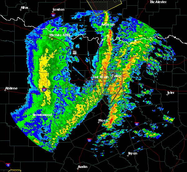 At 817 pm cst, severe thunderstorms were located along a line extending from near lewisville to near grandview, moving east at 40 mph. severe thunderstorms occasionally produce short-lived tornadoes, and this may be the case with this line of storms (radar indicated). Hazards include 60 mph wind gusts. expect damage to roofs, siding, and trees At 817 pm cst, severe thunderstorms were located along a line extending from near lewisville to near grandview, moving east at 40 mph. severe thunderstorms occasionally produce short-lived tornadoes, and this may be the case with this line of storms (radar indicated). Hazards include 60 mph wind gusts. expect damage to roofs, siding, and trees
|
| 11/30/2018 8:38 PM CST |
 At 837 pm cst, severe thunderstorms were located along a line extending from sanger to haslet, moving northeast at 45 mph (radar indicated). Hazards include 60 mph wind gusts and quarter size hail. Hail damage to vehicles is expected. expect wind damage to roofs, siding, and trees. locations impacted include, fort worth, plano, carrollton, frisco, denton, lewisville, flower mound, grapevine, keller, coppell, the colony, southlake, watauga, colleyville, corinth, saginaw, highland village, azle, trophy club and lake dallas. A tornado watch remains in effect until midnight cst for north central texas. At 837 pm cst, severe thunderstorms were located along a line extending from sanger to haslet, moving northeast at 45 mph (radar indicated). Hazards include 60 mph wind gusts and quarter size hail. Hail damage to vehicles is expected. expect wind damage to roofs, siding, and trees. locations impacted include, fort worth, plano, carrollton, frisco, denton, lewisville, flower mound, grapevine, keller, coppell, the colony, southlake, watauga, colleyville, corinth, saginaw, highland village, azle, trophy club and lake dallas. A tornado watch remains in effect until midnight cst for north central texas.
|
| 11/30/2018 8:04 PM CST |
 At 803 pm cst, severe thunderstorms were located along a line extending from 11 miles southeast of forestburg to near springtown, moving east at 40 mph (radar indicated). Hazards include 60 mph wind gusts and quarter size hail. Hail damage to vehicles is expected. Expect wind damage to roofs, siding, and trees. At 803 pm cst, severe thunderstorms were located along a line extending from 11 miles southeast of forestburg to near springtown, moving east at 40 mph (radar indicated). Hazards include 60 mph wind gusts and quarter size hail. Hail damage to vehicles is expected. Expect wind damage to roofs, siding, and trees.
|
| 8/18/2018 6:25 PM CDT |
 At 624 pm cdt, a severe thunderstorm was located near coppell, and is nearly stationary. another severe storm was located near grand prairie and was also stationary (radar indicated). Hazards include 60 mph wind gusts and quarter size hail. Hail damage to vehicles is expected. Expect wind damage to roofs, siding, and trees. At 624 pm cdt, a severe thunderstorm was located near coppell, and is nearly stationary. another severe storm was located near grand prairie and was also stationary (radar indicated). Hazards include 60 mph wind gusts and quarter size hail. Hail damage to vehicles is expected. Expect wind damage to roofs, siding, and trees.
|
| 8/9/2018 9:21 PM CDT |
 The severe thunderstorm warning for southeastern denton county will expire at 930 pm cdt, the storm which prompted the warning has weakened below severe limits. therefore the warning will be allowed to expire. however, gusty winds and heavy rain are likely to continue with minor flooding of low lying areas from denton to the colony, as well as street flooding. if you see flooded roads, turn around, don`t drown!. The severe thunderstorm warning for southeastern denton county will expire at 930 pm cdt, the storm which prompted the warning has weakened below severe limits. therefore the warning will be allowed to expire. however, gusty winds and heavy rain are likely to continue with minor flooding of low lying areas from denton to the colony, as well as street flooding. if you see flooded roads, turn around, don`t drown!.
|
| 8/9/2018 9:09 PM CDT |
 At 909 pm cdt, a severe thunderstorm was located over shady shores, or over corinth, and is nearly stationary (radar indicated). Hazards include 60 mph wind gusts and nickel size hail. Expect damage to roofs, siding, and trees. Locations impacted include, plano, carrollton, frisco, denton, lewisville, flower mound, grapevine, coppell, the colony, southlake, corinth, highland village, trophy club, lake dallas, lake lewisville, little elm, argyle, hickory creek, double oak and shady shores. At 909 pm cdt, a severe thunderstorm was located over shady shores, or over corinth, and is nearly stationary (radar indicated). Hazards include 60 mph wind gusts and nickel size hail. Expect damage to roofs, siding, and trees. Locations impacted include, plano, carrollton, frisco, denton, lewisville, flower mound, grapevine, coppell, the colony, southlake, corinth, highland village, trophy club, lake dallas, lake lewisville, little elm, argyle, hickory creek, double oak and shady shores.
|
| 8/9/2018 8:52 PM CDT |
 At 852 pm cdt, a severe thunderstorm was located over cross roads, or near lake dallas, and is nearly stationary (radar indicated). Hazards include 60 mph wind gusts and nickel size hail. expect damage to roofs, siding, and trees At 852 pm cdt, a severe thunderstorm was located over cross roads, or near lake dallas, and is nearly stationary (radar indicated). Hazards include 60 mph wind gusts and nickel size hail. expect damage to roofs, siding, and trees
|
| 7/10/2018 3:13 PM CDT |
 At 312 pm cdt, a severe thunderstorm was located over euless, moving northeast at 5 mph. this storm is moving over the southern end of dfw airport (radar indicated). Hazards include 60 mph wind gusts. Expect damage to roofs, siding, and trees. This severe storm will be near, irving, grapevine and coppell around 330 pm cdt. At 312 pm cdt, a severe thunderstorm was located over euless, moving northeast at 5 mph. this storm is moving over the southern end of dfw airport (radar indicated). Hazards include 60 mph wind gusts. Expect damage to roofs, siding, and trees. This severe storm will be near, irving, grapevine and coppell around 330 pm cdt.
|
| 7/10/2018 2:57 PM CDT |
 At 256 pm cdt, a severe thunderstorm was located over bedford, and is nearly stationary. this storm appears to be producing a microburst at this time southwest of dfw airport (radar indicated). Hazards include 60 mph wind gusts. Expect damage to roofs, siding, and trees. this severe thunderstorm will be near, euless around 320 pm cdt. This includes interstate 35e near mile marker 445. At 256 pm cdt, a severe thunderstorm was located over bedford, and is nearly stationary. this storm appears to be producing a microburst at this time southwest of dfw airport (radar indicated). Hazards include 60 mph wind gusts. Expect damage to roofs, siding, and trees. this severe thunderstorm will be near, euless around 320 pm cdt. This includes interstate 35e near mile marker 445.
|
| 6/20/2018 10:49 PM CDT |
 At 1048 pm cdt, a severe thunderstorm was located over central portions of fort worth, moving southwest at 25 mph (radar indicated). Hazards include 60 mph wind gusts. Expect damage to roofs, siding, and trees. Through 11 pm, the strongest portions of the storm will impact areas along and just south of i-30, west of i-35w. At 1048 pm cdt, a severe thunderstorm was located over central portions of fort worth, moving southwest at 25 mph (radar indicated). Hazards include 60 mph wind gusts. Expect damage to roofs, siding, and trees. Through 11 pm, the strongest portions of the storm will impact areas along and just south of i-30, west of i-35w.
|
| 6/20/2018 10:27 PM CDT |
 At 1022 pm cdt, a cluster of severe thunderstorms was located over north fort worth and the mid cities, moving south at 25 mph (radar indicated). Hazards include 60 mph wind gusts. Expect damage to roofs, siding, and trees. the leading edge of the strong outflow winds stretches from azle to just north of downtown fort worth to euless. these damaging winds will be near, river oaks and westworth village around 1030 pm cdt. benbrook and white settlement around 1035 pm cdt. the strongest winds may lag several minutes behind the initial gust front. Pea hail will also be possible this cluster of storms. At 1022 pm cdt, a cluster of severe thunderstorms was located over north fort worth and the mid cities, moving south at 25 mph (radar indicated). Hazards include 60 mph wind gusts. Expect damage to roofs, siding, and trees. the leading edge of the strong outflow winds stretches from azle to just north of downtown fort worth to euless. these damaging winds will be near, river oaks and westworth village around 1030 pm cdt. benbrook and white settlement around 1035 pm cdt. the strongest winds may lag several minutes behind the initial gust front. Pea hail will also be possible this cluster of storms.
|
| 6/20/2018 10:15 PM CDT |
 At 1014 pm cdt, a severe thunderstorm was located over colleyville, moving south at 20 mph (radar indicated). Hazards include 60 mph wind gusts. Expect damage to roofs, siding, and trees. this severe thunderstorm will be near, bedford, hurst and north richland hills around 1020 pm cdt. Richland hills around 1030 pm cdt. At 1014 pm cdt, a severe thunderstorm was located over colleyville, moving south at 20 mph (radar indicated). Hazards include 60 mph wind gusts. Expect damage to roofs, siding, and trees. this severe thunderstorm will be near, bedford, hurst and north richland hills around 1020 pm cdt. Richland hills around 1030 pm cdt.
|
| 6/20/2018 10:07 PM CDT |
 At 1006 pm cdt, a severe thunderstorm was located over colleyville, moving south at 30 mph (radar indicated). Hazards include 65 mph wind gusts. Expect damage to roofs, siding, and trees. the damaging winds will be near, bedford, hurst and north richland hills around 1010 pm cdt. euless and watauga around 1015 pm cdt. Dime size hail may also accompany the storm. At 1006 pm cdt, a severe thunderstorm was located over colleyville, moving south at 30 mph (radar indicated). Hazards include 65 mph wind gusts. Expect damage to roofs, siding, and trees. the damaging winds will be near, bedford, hurst and north richland hills around 1010 pm cdt. euless and watauga around 1015 pm cdt. Dime size hail may also accompany the storm.
|
| 6/20/2018 10:02 PM CDT |
 At 1001 pm cdt, a severe thunderstorm was located over trophy club, moving southwest at 20 mph (radar indicated). Hazards include 65 mph wind gusts. Expect damage to roofs, siding, and trees. this damaging winds will be near, keller around 1005 pm cdt. bedford, hurst and north richland hills around 1010 pm cdt. Watauga around 1015 pm cdt. At 1001 pm cdt, a severe thunderstorm was located over trophy club, moving southwest at 20 mph (radar indicated). Hazards include 65 mph wind gusts. Expect damage to roofs, siding, and trees. this damaging winds will be near, keller around 1005 pm cdt. bedford, hurst and north richland hills around 1010 pm cdt. Watauga around 1015 pm cdt.
|
| 6/20/2018 9:54 PM CDT |
 At 952 pm cdt, a severe thunderstorm was located over flower mound, moving south at 20 mph (radar indicated). Hazards include 60 mph wind gusts. Expect damage to roofs, siding, and trees. this severe thunderstorm will be near, grapevine, keller and southlake around 1000 pm cdt. colleyville around 1005 pm cdt. north richland hills around 1010 pm cdt. euless, bedford, hurst and watauga around 1015 pm cdt. The strongest winds will occur several minutes behind the initial outflow surge. At 952 pm cdt, a severe thunderstorm was located over flower mound, moving south at 20 mph (radar indicated). Hazards include 60 mph wind gusts. Expect damage to roofs, siding, and trees. this severe thunderstorm will be near, grapevine, keller and southlake around 1000 pm cdt. colleyville around 1005 pm cdt. north richland hills around 1010 pm cdt. euless, bedford, hurst and watauga around 1015 pm cdt. The strongest winds will occur several minutes behind the initial outflow surge.
|
| 6/7/2018 6:34 PM CDT |
 At 633 pm cdt, a severe thunderstorm was located over grand prairie, moving south at 25 mph (radar indicated). Hazards include 60 mph wind gusts and quarter size hail. Hail damage to vehicles is expected. expect wind damage to roofs, siding, and trees. Locations impacted include, dallas, fort worth, arlington, irving, grand prairie, carrollton, mansfield, euless, desoto, bedford, grapevine, cedar hill, coppell, duncanville, hurst, lancaster, farmers branch, southlake, colleyville and glenn heights. At 633 pm cdt, a severe thunderstorm was located over grand prairie, moving south at 25 mph (radar indicated). Hazards include 60 mph wind gusts and quarter size hail. Hail damage to vehicles is expected. expect wind damage to roofs, siding, and trees. Locations impacted include, dallas, fort worth, arlington, irving, grand prairie, carrollton, mansfield, euless, desoto, bedford, grapevine, cedar hill, coppell, duncanville, hurst, lancaster, farmers branch, southlake, colleyville and glenn heights.
|
| 6/7/2018 5:54 PM CDT |
 At 553 pm cdt, a severe thunderstorm was located over grapevine, moving south at 25 mph (radar indicated). Hazards include 65 mph wind gusts and quarter size hail. Hail damage to vehicles is expected. Expect wind damage to roofs, siding, and trees. At 553 pm cdt, a severe thunderstorm was located over grapevine, moving south at 25 mph (radar indicated). Hazards include 65 mph wind gusts and quarter size hail. Hail damage to vehicles is expected. Expect wind damage to roofs, siding, and trees.
|
| 6/7/2018 5:20 PM CDT |
 At 519 pm cdt, a severe thunderstorm was located over denton, moving southeast at 15 mph (denton airport measured 67 mph wind gust at 5:13 pm). Hazards include 65 mph wind gusts and quarter size hail. Hail damage to vehicles is expected. Expect wind damage to roofs, siding, and trees. At 519 pm cdt, a severe thunderstorm was located over denton, moving southeast at 15 mph (denton airport measured 67 mph wind gust at 5:13 pm). Hazards include 65 mph wind gusts and quarter size hail. Hail damage to vehicles is expected. Expect wind damage to roofs, siding, and trees.
|
| 6/6/2018 3:29 AM CDT |
 At 329 am cdt, a severe thunderstorm was located over corinth, moving southwest at 20 mph (radar indicated). Hazards include quarter size hail. Damage to vehicles is possible. Locations impacted include, plano, carrollton, frisco, denton, lewisville, flower mound, coppell, the colony, southlake, corinth, highland village, trophy club, lake dallas, lake lewisville, little elm, roanoke, krum, pilot point, argyle and hickory creek. At 329 am cdt, a severe thunderstorm was located over corinth, moving southwest at 20 mph (radar indicated). Hazards include quarter size hail. Damage to vehicles is possible. Locations impacted include, plano, carrollton, frisco, denton, lewisville, flower mound, coppell, the colony, southlake, corinth, highland village, trophy club, lake dallas, lake lewisville, little elm, roanoke, krum, pilot point, argyle and hickory creek.
|
| 6/6/2018 3:19 AM CDT |
 At 319 am cdt, a severe thunderstorm was located over shady shores, or near corinth, moving southwest at 20 mph (radar indicated). Hazards include ping pong ball size hail and 60 mph wind gusts. People and animals outdoors will be injured. expect hail damage to roofs, siding, windows, and vehicles. expect wind damage to roofs, siding, and trees. Locations impacted include, plano, carrollton, frisco, lewisville, flower mound, coppell, the colony, lake dallas, lake lewisville, little elm, pilot point, hickory creek, aubrey, cross roads, hackberry, hebron, oak point, lakewood village and lincoln park. At 319 am cdt, a severe thunderstorm was located over shady shores, or near corinth, moving southwest at 20 mph (radar indicated). Hazards include ping pong ball size hail and 60 mph wind gusts. People and animals outdoors will be injured. expect hail damage to roofs, siding, windows, and vehicles. expect wind damage to roofs, siding, and trees. Locations impacted include, plano, carrollton, frisco, lewisville, flower mound, coppell, the colony, lake dallas, lake lewisville, little elm, pilot point, hickory creek, aubrey, cross roads, hackberry, hebron, oak point, lakewood village and lincoln park.
|
| 6/6/2018 3:17 AM CDT |
 At 317 am cdt, a severe thunderstorm was located over cross roads, or near corinth, moving southwest at 20 mph (radar indicated). Hazards include ping pong ball size hail and 60 mph wind gusts. People and animals outdoors will be injured. expect hail damage to roofs, siding, windows, and vehicles. Expect wind damage to roofs, siding, and trees. At 317 am cdt, a severe thunderstorm was located over cross roads, or near corinth, moving southwest at 20 mph (radar indicated). Hazards include ping pong ball size hail and 60 mph wind gusts. People and animals outdoors will be injured. expect hail damage to roofs, siding, windows, and vehicles. Expect wind damage to roofs, siding, and trees.
|
| 6/6/2018 3:07 AM CDT |
 At 306 am cdt, a severe thunderstorm was located near cross roads, or 7 miles north of lake lewisville, moving south at 15 mph (radar indicated). Hazards include ping pong ball size hail and 60 mph wind gusts. People and animals outdoors will be injured. expect hail damage to roofs, siding, windows, and vehicles. expect wind damage to roofs, siding, and trees. Locations impacted include, plano, mckinney, carrollton, frisco, richardson, lewisville, allen, flower mound, coppell, the colony, lake dallas, lake lewisville, little elm, prosper, celina, pilot point, hickory creek, aubrey, cross roads and hackberry. At 306 am cdt, a severe thunderstorm was located near cross roads, or 7 miles north of lake lewisville, moving south at 15 mph (radar indicated). Hazards include ping pong ball size hail and 60 mph wind gusts. People and animals outdoors will be injured. expect hail damage to roofs, siding, windows, and vehicles. expect wind damage to roofs, siding, and trees. Locations impacted include, plano, mckinney, carrollton, frisco, richardson, lewisville, allen, flower mound, coppell, the colony, lake dallas, lake lewisville, little elm, prosper, celina, pilot point, hickory creek, aubrey, cross roads and hackberry.
|
| 6/6/2018 2:47 AM CDT |
 At 246 am cdt, a severe thunderstorm was located near celina, or 11 miles north of frisco, moving south at 10 mph (radar indicated). Hazards include golf ball size hail and 60 mph wind gusts. People and animals outdoors will be injured. expect hail damage to roofs, siding, windows, and vehicles. expect wind damage to roofs, siding, and trees. Locations impacted include, plano, mckinney, carrollton, frisco, richardson, lewisville, allen, flower mound, coppell, the colony, sachse, lake dallas, lake lewisville, little elm, murphy, prosper, fairview, celina, lucas and pilot point. At 246 am cdt, a severe thunderstorm was located near celina, or 11 miles north of frisco, moving south at 10 mph (radar indicated). Hazards include golf ball size hail and 60 mph wind gusts. People and animals outdoors will be injured. expect hail damage to roofs, siding, windows, and vehicles. expect wind damage to roofs, siding, and trees. Locations impacted include, plano, mckinney, carrollton, frisco, richardson, lewisville, allen, flower mound, coppell, the colony, sachse, lake dallas, lake lewisville, little elm, murphy, prosper, fairview, celina, lucas and pilot point.
|
| 6/6/2018 2:31 AM CDT |
 At 230 am cdt, a severe thunderstorm was located near celina, or 10 miles north of frisco, moving south at 15 mph (radar indicated). Hazards include 60 mph wind gusts and quarter size hail. Hail damage to vehicles is expected. Expect wind damage to roofs, siding, and trees. At 230 am cdt, a severe thunderstorm was located near celina, or 10 miles north of frisco, moving south at 15 mph (radar indicated). Hazards include 60 mph wind gusts and quarter size hail. Hail damage to vehicles is expected. Expect wind damage to roofs, siding, and trees.
|
| 6/6/2018 2:00 AM CDT |
 At 200 am cdt, a severe thunderstorm was located near irving, moving southwest at 15 mph (radar indicated). Hazards include tennis ball size hail and 60 mph wind gusts. People and animals outdoors will be injured. expect hail damage to roofs, siding, windows, and vehicles. expect wind damage to roofs, siding, and trees. Locations impacted include, fort worth, arlington, irving, grand prairie, lewisville, flower mound, euless, bedford, grapevine, haltom city, keller, coppell, hurst, southlake, watauga, colleyville, richland hills, north richland hills and westlake. At 200 am cdt, a severe thunderstorm was located near irving, moving southwest at 15 mph (radar indicated). Hazards include tennis ball size hail and 60 mph wind gusts. People and animals outdoors will be injured. expect hail damage to roofs, siding, windows, and vehicles. expect wind damage to roofs, siding, and trees. Locations impacted include, fort worth, arlington, irving, grand prairie, lewisville, flower mound, euless, bedford, grapevine, haltom city, keller, coppell, hurst, southlake, watauga, colleyville, richland hills, north richland hills and westlake.
|
| 6/6/2018 1:58 AM CDT |
 At 157 am cdt, a severe thunderstorm was located over irving, moving southwest at 25 mph (radar indicated). Hazards include tennis ball size hail and 60 mph wind gusts. People and animals outdoors will be injured. expect hail damage to roofs, siding, windows, and vehicles. expect wind damage to roofs, siding, and trees. Locations impacted include, dallas, plano, garland, irving, grand prairie, mesquite, carrollton, frisco, richardson, lewisville, allen, coppell, the colony, farmers branch, university park, addison, highland park, cockrell hill, hebron and buckingham. At 157 am cdt, a severe thunderstorm was located over irving, moving southwest at 25 mph (radar indicated). Hazards include tennis ball size hail and 60 mph wind gusts. People and animals outdoors will be injured. expect hail damage to roofs, siding, windows, and vehicles. expect wind damage to roofs, siding, and trees. Locations impacted include, dallas, plano, garland, irving, grand prairie, mesquite, carrollton, frisco, richardson, lewisville, allen, coppell, the colony, farmers branch, university park, addison, highland park, cockrell hill, hebron and buckingham.
|
| 6/6/2018 1:50 AM CDT | Baseball sized hail reported 1.6 miles E of Coppell, TX, baseball size hail reported in coppell near denton tap road and sandy lake road. |
| 6/6/2018 1:50 AM CDT |
 At 149 am cdt, a severe thunderstorm was located near coppell, moving southwest at 25 mph (radar indicated). Hazards include tennis ball size hail and 60 mph wind gusts. People and animals outdoors will be injured. expect hail damage to roofs, siding, windows, and vehicles. expect wind damage to roofs, siding, and trees. Locations impacted include, fort worth, arlington, irving, grand prairie, lewisville, flower mound, euless, bedford, grapevine, haltom city, keller, coppell, hurst, southlake, watauga, colleyville, trophy club, richland hills, north richland hills and roanoke. At 149 am cdt, a severe thunderstorm was located near coppell, moving southwest at 25 mph (radar indicated). Hazards include tennis ball size hail and 60 mph wind gusts. People and animals outdoors will be injured. expect hail damage to roofs, siding, windows, and vehicles. expect wind damage to roofs, siding, and trees. Locations impacted include, fort worth, arlington, irving, grand prairie, lewisville, flower mound, euless, bedford, grapevine, haltom city, keller, coppell, hurst, southlake, watauga, colleyville, trophy club, richland hills, north richland hills and roanoke.
|
| 6/6/2018 1:48 AM CDT |
 At 147 am cdt, a severe thunderstorm with significant hail was located over coppell, moving southwest at 20 mph. another storm was located near wylie moving southeast at 10 mph (radar indicated). Hazards include tennis ball size hail and 60 mph wind gusts. People and animals outdoors will be injured. expect hail damage to roofs, siding, windows, and vehicles. expect wind damage to roofs, siding, and trees. Locations impacted include, dallas, plano, garland, irving, grand prairie, mesquite, mckinney, carrollton, frisco, richardson, lewisville, allen, rowlett, wylie, coppell, the colony, farmers branch, university park, sachse and addison. At 147 am cdt, a severe thunderstorm with significant hail was located over coppell, moving southwest at 20 mph. another storm was located near wylie moving southeast at 10 mph (radar indicated). Hazards include tennis ball size hail and 60 mph wind gusts. People and animals outdoors will be injured. expect hail damage to roofs, siding, windows, and vehicles. expect wind damage to roofs, siding, and trees. Locations impacted include, dallas, plano, garland, irving, grand prairie, mesquite, mckinney, carrollton, frisco, richardson, lewisville, allen, rowlett, wylie, coppell, the colony, farmers branch, university park, sachse and addison.
|
| 6/6/2018 1:41 AM CDT |
 At 140 am cdt, a severe thunderstorm was located over coppell, moving southwest at 20 mph (radar indicated). Hazards include golf ball size hail and 60 mph wind gusts. People and animals outdoors will be injured. expect hail damage to roofs, siding, windows, and vehicles. Expect wind damage to roofs, siding, and trees. At 140 am cdt, a severe thunderstorm was located over coppell, moving southwest at 20 mph (radar indicated). Hazards include golf ball size hail and 60 mph wind gusts. People and animals outdoors will be injured. expect hail damage to roofs, siding, windows, and vehicles. Expect wind damage to roofs, siding, and trees.
|
| 6/6/2018 1:35 AM CDT | Tea Cup sized hail reported 3 miles ENE of Coppell, TX, three inch-diameter hail reported in coppell. |
| 6/6/2018 1:34 AM CDT |
 At 132 am cdt, a pair of severe thunderstorms were located over farmers branch and lucas, moving south at 20 mph (radar indicated). Hazards include 60 mph wind gusts and half dollar size hail. Hail damage to vehicles is expected. expect wind damage to roofs, siding, and trees. Locations impacted include, dallas, plano, garland, irving, grand prairie, mesquite, mckinney, carrollton, frisco, richardson, lewisville, allen, rowlett, wylie, coppell, the colony, farmers branch, university park, sachse and addison. At 132 am cdt, a pair of severe thunderstorms were located over farmers branch and lucas, moving south at 20 mph (radar indicated). Hazards include 60 mph wind gusts and half dollar size hail. Hail damage to vehicles is expected. expect wind damage to roofs, siding, and trees. Locations impacted include, dallas, plano, garland, irving, grand prairie, mesquite, mckinney, carrollton, frisco, richardson, lewisville, allen, rowlett, wylie, coppell, the colony, farmers branch, university park, sachse and addison.
|
| 6/6/2018 1:21 AM CDT |
 At 120 am cdt, a severe thunderstorm was located over carrollton, moving south at 20 mph (radar indicated). Hazards include 60 mph wind gusts and quarter size hail. Hail damage to vehicles is expected. Expect wind damage to roofs, siding, and trees. At 120 am cdt, a severe thunderstorm was located over carrollton, moving south at 20 mph (radar indicated). Hazards include 60 mph wind gusts and quarter size hail. Hail damage to vehicles is expected. Expect wind damage to roofs, siding, and trees.
|
| 4/6/2018 6:32 PM CDT |
 At 610 pm cdt, a severe thunderstorm was located over irving, moving east at 20 mph (radar indicated). Hazards include 60 mph wind gusts and quarter size hail. Hail damage to vehicles is expected. expect wind damage to roofs, siding, and trees. Quarter size hail was reported in irving with this storm. At 610 pm cdt, a severe thunderstorm was located over irving, moving east at 20 mph (radar indicated). Hazards include 60 mph wind gusts and quarter size hail. Hail damage to vehicles is expected. expect wind damage to roofs, siding, and trees. Quarter size hail was reported in irving with this storm.
|
| 4/6/2018 6:11 PM CDT |
 At 610 pm cdt, a severe thunderstorm was located over irving, moving east at 20 mph (radar indicated). Hazards include 60 mph wind gusts and quarter size hail. Hail damage to vehicles is expected. expect wind damage to roofs, siding, and trees. Quarter size hail was reported in irving with this storm. At 610 pm cdt, a severe thunderstorm was located over irving, moving east at 20 mph (radar indicated). Hazards include 60 mph wind gusts and quarter size hail. Hail damage to vehicles is expected. expect wind damage to roofs, siding, and trees. Quarter size hail was reported in irving with this storm.
|
| 4/6/2018 5:58 PM CDT |
 At 557 pm cdt, a severe thunderstorm was located over euless, moving east at 25 mph (radar indicated). Hazards include 60 mph wind gusts and quarter size hail. Hail damage to vehicles is expected. Expect wind damage to roofs, siding, and trees. At 557 pm cdt, a severe thunderstorm was located over euless, moving east at 25 mph (radar indicated). Hazards include 60 mph wind gusts and quarter size hail. Hail damage to vehicles is expected. Expect wind damage to roofs, siding, and trees.
|
| 4/6/2018 5:28 PM CDT |
 At 527 pm cdt, a severe thunderstorm was located over north richland hills and watauga, moving east at 15 mph (radar indicated). Hazards include 60 mph wind gusts and quarter size hail. Hail damage to vehicles is expected. expect wind damage to roofs, siding, and trees. this severe storm will be near, richland hills around 530 pm cdt. hurst and colleyville around 540 pm cdt. bedford around 545 pm cdt. Fort worth, arlington, grand prairie and euless around 600 pm cdt. At 527 pm cdt, a severe thunderstorm was located over north richland hills and watauga, moving east at 15 mph (radar indicated). Hazards include 60 mph wind gusts and quarter size hail. Hail damage to vehicles is expected. expect wind damage to roofs, siding, and trees. this severe storm will be near, richland hills around 530 pm cdt. hurst and colleyville around 540 pm cdt. bedford around 545 pm cdt. Fort worth, arlington, grand prairie and euless around 600 pm cdt.
|
| 4/6/2018 5:12 PM CDT |
 At 508 pm cdt, a severe thunderstorm was located over north fort worth, north of 820 near the intersection of i-35w and 287. the storm is moving east at 30 mph (radar indicated). Hazards include 60 mph wind gusts and quarter size hail. Hail damage to vehicles is expected. expect wind damage to roofs, siding, and trees. this severe storm will be near, keller around 515 pm cdt. richland hills and north richland hills around 520 pm cdt. bedford, hurst and colleyville around 525 pm cdt. fort worth, arlington and euless around 540 pm cdt. grand prairie around 545 pm cdt. Cockrell hill around 600 pm cdt. At 508 pm cdt, a severe thunderstorm was located over north fort worth, north of 820 near the intersection of i-35w and 287. the storm is moving east at 30 mph (radar indicated). Hazards include 60 mph wind gusts and quarter size hail. Hail damage to vehicles is expected. expect wind damage to roofs, siding, and trees. this severe storm will be near, keller around 515 pm cdt. richland hills and north richland hills around 520 pm cdt. bedford, hurst and colleyville around 525 pm cdt. fort worth, arlington and euless around 540 pm cdt. grand prairie around 545 pm cdt. Cockrell hill around 600 pm cdt.
|
| 4/6/2018 4:54 PM CDT |
 At 453 pm cdt, a severe thunderstorm was located over eagle mountain, moving east at 25 mph (radar indicated). Hazards include 60 mph wind gusts and quarter size hail. Hail damage to vehicles is expected. Expect wind damage to roofs, siding, and trees. At 453 pm cdt, a severe thunderstorm was located over eagle mountain, moving east at 25 mph (radar indicated). Hazards include 60 mph wind gusts and quarter size hail. Hail damage to vehicles is expected. Expect wind damage to roofs, siding, and trees.
|
| 5/23/2017 1:12 AM CDT |
 At 111 am cdt, a severe thunderstorm was located over corinth, moving southeast at 30 mph (radar indicated). Hazards include 60 mph wind gusts and penny size hail. expect damage to roofs, siding, and trees At 111 am cdt, a severe thunderstorm was located over corinth, moving southeast at 30 mph (radar indicated). Hazards include 60 mph wind gusts and penny size hail. expect damage to roofs, siding, and trees
|
| 5/23/2017 12:50 AM CDT |
 At 1249 am cdt, a severe thunderstorm was located near krum, or near denton, moving southeast at 30 mph (radar indicated). Hazards include 60 mph wind gusts and quarter size hail. Hail damage to vehicles is expected. expect wind damage to roofs, siding, and trees. this severe storm will be near, argyle and corral city around 100 am cdt. corinth around 105 am cdt. highland village, lake dallas, hickory creek, double oak, shady shores, bartonville and copper canyon around 110 am cdt. lewisville, flower mound, coppell and lake lewisville around 115 am cdt. Other locations impacted by this severe thunderstorm include oak point, ponder, lincoln park, lakewood village, marshall creek and westlake. At 1249 am cdt, a severe thunderstorm was located near krum, or near denton, moving southeast at 30 mph (radar indicated). Hazards include 60 mph wind gusts and quarter size hail. Hail damage to vehicles is expected. expect wind damage to roofs, siding, and trees. this severe storm will be near, argyle and corral city around 100 am cdt. corinth around 105 am cdt. highland village, lake dallas, hickory creek, double oak, shady shores, bartonville and copper canyon around 110 am cdt. lewisville, flower mound, coppell and lake lewisville around 115 am cdt. Other locations impacted by this severe thunderstorm include oak point, ponder, lincoln park, lakewood village, marshall creek and westlake.
|
| 5/23/2017 12:30 AM CDT |
 At 1229 am cdt, a severe thunderstorm was located near krum, or near sanger, moving southeast at 55 mph (radar indicated). Hazards include 60 mph wind gusts and quarter size hail. Hail damage to vehicles is expected. expect wind damage to roofs, siding, and trees. this severe thunderstorm will be near, corinth, argyle, cross roads, bartonville and copper canyon around 1245 am cdt. flower mound, highland village, lake dallas, hickory creek, double oak and shady shores around 1250 am cdt. lewisville, the colony, lake lewisville and hackberry around 1255 am cdt. Other locations impacted by this severe thunderstorm include oak point, ponder, lincoln park, lakewood village, marshall creek and westlake. At 1229 am cdt, a severe thunderstorm was located near krum, or near sanger, moving southeast at 55 mph (radar indicated). Hazards include 60 mph wind gusts and quarter size hail. Hail damage to vehicles is expected. expect wind damage to roofs, siding, and trees. this severe thunderstorm will be near, corinth, argyle, cross roads, bartonville and copper canyon around 1245 am cdt. flower mound, highland village, lake dallas, hickory creek, double oak and shady shores around 1250 am cdt. lewisville, the colony, lake lewisville and hackberry around 1255 am cdt. Other locations impacted by this severe thunderstorm include oak point, ponder, lincoln park, lakewood village, marshall creek and westlake.
|
| 4/26/2017 6:42 AM CDT |
 The severe thunderstorm warning for northern dallas county will expire at 645 am cdt, the storm which prompted the warning has moved out of the area. therefore the warning will be allowed to expire. a severe thunderstorm watch remains in effect until 100 pm cdt for north central texas. The severe thunderstorm warning for northern dallas county will expire at 645 am cdt, the storm which prompted the warning has moved out of the area. therefore the warning will be allowed to expire. a severe thunderstorm watch remains in effect until 100 pm cdt for north central texas.
|
| 4/26/2017 6:20 AM CDT |
 At 620 am cdt, a severe thunderstorm was located over mesquite, moving northeast at 55 mph (radar indicated). Hazards include ping pong ball size hail. People and animals outdoors will be injured. expect damage to roofs, siding, windows, and vehicles. Locations impacted include, dallas, irving, grand prairie, carrollton, coppell, duncanville, farmers branch, balch springs, university park, addison, highland park and cockrell hill. At 620 am cdt, a severe thunderstorm was located over mesquite, moving northeast at 55 mph (radar indicated). Hazards include ping pong ball size hail. People and animals outdoors will be injured. expect damage to roofs, siding, windows, and vehicles. Locations impacted include, dallas, irving, grand prairie, carrollton, coppell, duncanville, farmers branch, balch springs, university park, addison, highland park and cockrell hill.
|
| 4/26/2017 5:56 AM CDT |
 At 555 am cdt, a severe thunderstorm was located over cedar hill state park, or over cedar hill, moving northeast at 50 mph (radar indicated). Hazards include half dollar size hail. Damage to vehicles is possible. Locations impacted include, dallas, fort worth, arlington, irving, grand prairie, carrollton, mansfield, euless, desoto, grapevine, cedar hill, coppell, duncanville, burleson, lancaster, farmers branch, balch springs, university park, seagoville and addison. At 555 am cdt, a severe thunderstorm was located over cedar hill state park, or over cedar hill, moving northeast at 50 mph (radar indicated). Hazards include half dollar size hail. Damage to vehicles is possible. Locations impacted include, dallas, fort worth, arlington, irving, grand prairie, carrollton, mansfield, euless, desoto, grapevine, cedar hill, coppell, duncanville, burleson, lancaster, farmers branch, balch springs, university park, seagoville and addison.
|
| 4/26/2017 5:46 AM CDT |
 At 545 am cdt, a severe thunderstorm was located over mansfield, moving northeast at 50 mph (radar indicated). Hazards include quarter size hail. damage to vehicles is possible At 545 am cdt, a severe thunderstorm was located over mansfield, moving northeast at 50 mph (radar indicated). Hazards include quarter size hail. damage to vehicles is possible
|
| 4/21/2017 10:45 PM CDT |
 At 1045 pm cdt, a severe thunderstorm was located over hebron, or near the colony, moving southeast at 35 mph (radar indicated). Hazards include quarter size hail. Damage to vehicles is possible. this severe storm will be near, addison around 1050 pm cdt. plano around 1055 pm cdt. garland and parker around 1105 pm cdt. richardson, sachse and murphy around 1110 pm cdt. A tornado watch remains in effect until 100 am cdt for north central texas. At 1045 pm cdt, a severe thunderstorm was located over hebron, or near the colony, moving southeast at 35 mph (radar indicated). Hazards include quarter size hail. Damage to vehicles is possible. this severe storm will be near, addison around 1050 pm cdt. plano around 1055 pm cdt. garland and parker around 1105 pm cdt. richardson, sachse and murphy around 1110 pm cdt. A tornado watch remains in effect until 100 am cdt for north central texas.
|
| 4/21/2017 10:25 PM CDT |
 At 1024 pm cdt, a severe thunderstorm was located over lewisville, moving southeast at 35 mph (radar indicated). Hazards include quarter size hail. damage to vehicles is possible At 1024 pm cdt, a severe thunderstorm was located over lewisville, moving southeast at 35 mph (radar indicated). Hazards include quarter size hail. damage to vehicles is possible
|
| 4/11/2017 12:01 AM CDT |
 At 1200 am cdt, a severe thunderstorm was located over lake lewisville, moving northeast at 30 mph (radar indicated). Hazards include ping pong ball size hail. People and animals outdoors will be injured. Expect damage to roofs, siding, windows, and vehicles. At 1200 am cdt, a severe thunderstorm was located over lake lewisville, moving northeast at 30 mph (radar indicated). Hazards include ping pong ball size hail. People and animals outdoors will be injured. Expect damage to roofs, siding, windows, and vehicles.
|
| 4/10/2017 11:56 PM CDT |
 At 1155 pm cdt, a severe thunderstorm was located over flower mound, moving northeast at 20 mph. this storm has a history of producing quarter sized hail in flower mound (radar indicated). Hazards include ping pong ball size hail. People and animals outdoors will be injured. expect damage to roofs, siding, windows, and vehicles. Locations impacted include, plano, carrollton, denton, lewisville, flower mound, coppell, the colony, southlake, corinth, highland village, lake dallas, lake lewisville, argyle, hickory creek, double oak, shady shores, bartonville, copper canyon, hebron and oak point. At 1155 pm cdt, a severe thunderstorm was located over flower mound, moving northeast at 20 mph. this storm has a history of producing quarter sized hail in flower mound (radar indicated). Hazards include ping pong ball size hail. People and animals outdoors will be injured. expect damage to roofs, siding, windows, and vehicles. Locations impacted include, plano, carrollton, denton, lewisville, flower mound, coppell, the colony, southlake, corinth, highland village, lake dallas, lake lewisville, argyle, hickory creek, double oak, shady shores, bartonville, copper canyon, hebron and oak point.
|
| 4/10/2017 11:33 PM CDT |
 At 1132 pm cdt, a severe thunderstorm was located over southlake, moving northeast at 20 mph (radar indicated). Hazards include golf ball size hail. People and animals outdoors will be injured. expect damage to roofs, siding, windows, and vehicles. Locations impacted include, plano, carrollton, denton, lewisville, flower mound, grapevine, keller, coppell, hurst, the colony, southlake, colleyville, corinth, highland village, trophy club, lake dallas, lake lewisville, north richland hills, roanoke and argyle. At 1132 pm cdt, a severe thunderstorm was located over southlake, moving northeast at 20 mph (radar indicated). Hazards include golf ball size hail. People and animals outdoors will be injured. expect damage to roofs, siding, windows, and vehicles. Locations impacted include, plano, carrollton, denton, lewisville, flower mound, grapevine, keller, coppell, hurst, the colony, southlake, colleyville, corinth, highland village, trophy club, lake dallas, lake lewisville, north richland hills, roanoke and argyle.
|
| 4/10/2017 11:23 PM CDT |
 At 1123 pm cdt, a severe thunderstorm was located over keller, moving northeast at 20 mph (radar indicated). Hazards include half dollar size hail. damage to vehicles is possible At 1123 pm cdt, a severe thunderstorm was located over keller, moving northeast at 20 mph (radar indicated). Hazards include half dollar size hail. damage to vehicles is possible
|
| 4/2/2017 1:25 AM CDT |
 At 124 am cdt, a severe thunderstorm was located over haltom city, moving northeast at 35 mph (radar indicated). Hazards include quarter size hail. Damage to vehicles is possible. this severe thunderstorm will be near, watauga around 130 am cdt. bedford and haslet around 135 am cdt. southlake, trophy club, roanoke and northlake around 150 am cdt. grapevine and corral city around 155 am cdt. highland village, argyle and copper canyon around 205 am cdt. Other locations impacted by this severe thunderstorm include westlake and marshall creek. At 124 am cdt, a severe thunderstorm was located over haltom city, moving northeast at 35 mph (radar indicated). Hazards include quarter size hail. Damage to vehicles is possible. this severe thunderstorm will be near, watauga around 130 am cdt. bedford and haslet around 135 am cdt. southlake, trophy club, roanoke and northlake around 150 am cdt. grapevine and corral city around 155 am cdt. highland village, argyle and copper canyon around 205 am cdt. Other locations impacted by this severe thunderstorm include westlake and marshall creek.
|
| 3/29/2017 2:57 AM CDT |
 At 256 am cdt, severe thunderstorms were located along a line extending from ray roberts park johnson branch to near dallas, moving northeast at 40 mph (radar indicated). Hazards include 60 mph wind gusts and nickel size hail. Expect damage to roofs, siding, and trees. these severe storms will be near, pilot point around 300 am cdt. mesquite around 305 am cdt. dallas around 315 am cdt. Other locations impacted by these severe thunderstorms include oak point, lincoln park, buckingham and lakewood village. At 256 am cdt, severe thunderstorms were located along a line extending from ray roberts park johnson branch to near dallas, moving northeast at 40 mph (radar indicated). Hazards include 60 mph wind gusts and nickel size hail. Expect damage to roofs, siding, and trees. these severe storms will be near, pilot point around 300 am cdt. mesquite around 305 am cdt. dallas around 315 am cdt. Other locations impacted by these severe thunderstorms include oak point, lincoln park, buckingham and lakewood village.
|
| 3/29/2017 2:43 AM CDT |
 At 242 am cdt, severe thunderstorms were located along a line extending from sanger to cockrell hill, moving northeast at 50 mph (radar indicated). Hazards include 65 mph wind gusts and nickel size hail. Expect damage to roofs, siding, and trees. these severe storms will be near, university park, highland park and ray roberts park isle du bois around 250 am cdt. pilot point and aubrey around 255 am cdt. mesquite around 300 am cdt. dallas around 310 am cdt. Other locations impacted by these severe thunderstorms include oak point, lincoln park, buckingham and lakewood village. At 242 am cdt, severe thunderstorms were located along a line extending from sanger to cockrell hill, moving northeast at 50 mph (radar indicated). Hazards include 65 mph wind gusts and nickel size hail. Expect damage to roofs, siding, and trees. these severe storms will be near, university park, highland park and ray roberts park isle du bois around 250 am cdt. pilot point and aubrey around 255 am cdt. mesquite around 300 am cdt. dallas around 310 am cdt. Other locations impacted by these severe thunderstorms include oak point, lincoln park, buckingham and lakewood village.
|
| 3/29/2017 2:26 AM CDT |
 At 225 am cdt, severe thunderstorms were located along a line extending from ponder to near mansfield, moving northeast at 40 mph (radar indicated). Hazards include 65 mph wind gusts and nickel size hail. Expect damage to roofs, siding, and trees. severe thunderstorms will be near, sanger around 245 am cdt. cockrell hill around 250 am cdt. mesquite around 315 am cdt. other locations impacted by these severe thunderstorms include oak point, lincoln park, buckingham and lakewood village. this includes the following interstates, interstate 35 between mile markers 468 and 481. interstate 30 between mile markers 32 and 55. Interstate 45 between mile markers 279 and 284. At 225 am cdt, severe thunderstorms were located along a line extending from ponder to near mansfield, moving northeast at 40 mph (radar indicated). Hazards include 65 mph wind gusts and nickel size hail. Expect damage to roofs, siding, and trees. severe thunderstorms will be near, sanger around 245 am cdt. cockrell hill around 250 am cdt. mesquite around 315 am cdt. other locations impacted by these severe thunderstorms include oak point, lincoln park, buckingham and lakewood village. this includes the following interstates, interstate 35 between mile markers 468 and 481. interstate 30 between mile markers 32 and 55. Interstate 45 between mile markers 279 and 284.
|
| 3/29/2017 2:22 AM CDT |
 At 222 am cdt, a severe thunderstorm capable of producing a tornado was located over trophy club, moving northeast at 45 mph (radar indicated rotation). Hazards include tornado. Flying debris will be dangerous to those caught without shelter. mobile homes will be damaged or destroyed. damage to roofs, windows, and vehicles will occur. tree damage is likely. this dangerous storm will be near, southlake around 225 am cdt. double oak and bartonville around 230 am cdt. flower mound, grapevine, highland village and copper canyon around 235 am cdt. Other locations impacted by this tornadic thunderstorm include westlake and marshall creek. At 222 am cdt, a severe thunderstorm capable of producing a tornado was located over trophy club, moving northeast at 45 mph (radar indicated rotation). Hazards include tornado. Flying debris will be dangerous to those caught without shelter. mobile homes will be damaged or destroyed. damage to roofs, windows, and vehicles will occur. tree damage is likely. this dangerous storm will be near, southlake around 225 am cdt. double oak and bartonville around 230 am cdt. flower mound, grapevine, highland village and copper canyon around 235 am cdt. Other locations impacted by this tornadic thunderstorm include westlake and marshall creek.
|
| 3/29/2017 2:13 AM CDT |
 At 213 am cdt, a severe thunderstorm capable of producing a tornado was located over haslet, or near saginaw, moving east at 40 mph (radar indicated rotation). Hazards include tornado. Flying debris will be dangerous to those caught without shelter. mobile homes will be damaged or destroyed. damage to roofs, windows, and vehicles will occur. tree damage is likely. this dangerous storm will be near, keller, trophy club, roanoke and northlake around 225 am cdt. southlake around 230 am cdt. double oak and bartonville around 235 am cdt. flower mound, grapevine, highland village and copper canyon around 240 am cdt. other locations impacted by this tornadic thunderstorm include westlake and marshall creek. This includes interstate 35w between mile markers 63 and 70. At 213 am cdt, a severe thunderstorm capable of producing a tornado was located over haslet, or near saginaw, moving east at 40 mph (radar indicated rotation). Hazards include tornado. Flying debris will be dangerous to those caught without shelter. mobile homes will be damaged or destroyed. damage to roofs, windows, and vehicles will occur. tree damage is likely. this dangerous storm will be near, keller, trophy club, roanoke and northlake around 225 am cdt. southlake around 230 am cdt. double oak and bartonville around 235 am cdt. flower mound, grapevine, highland village and copper canyon around 240 am cdt. other locations impacted by this tornadic thunderstorm include westlake and marshall creek. This includes interstate 35w between mile markers 63 and 70.
|
| 3/26/2017 8:11 PM CDT |
 At 810 pm cdt, a large severe thunderstorm was located from flower mound to highland village to corinth, moving east at 30 mph. this is a very dangerous storm! seek immediate shelter! (radar indicated). Hazards include baseball size hail and 65 mph wind gusts. People and animals outdoors will be severely injured. expect shattered windows, extensive damage to roofs, siding, and vehicles. this severe thunderstorm will be near, lake lewisville around 815 pm cdt. the colony and hackberry around 820 pm cdt. frisco, little elm and hebron around 825 pm cdt. plano, mckinney and prosper around 840 pm cdt. A tornado watch remains in effect until 1100 pm cdt for north central texas. At 810 pm cdt, a large severe thunderstorm was located from flower mound to highland village to corinth, moving east at 30 mph. this is a very dangerous storm! seek immediate shelter! (radar indicated). Hazards include baseball size hail and 65 mph wind gusts. People and animals outdoors will be severely injured. expect shattered windows, extensive damage to roofs, siding, and vehicles. this severe thunderstorm will be near, lake lewisville around 815 pm cdt. the colony and hackberry around 820 pm cdt. frisco, little elm and hebron around 825 pm cdt. plano, mckinney and prosper around 840 pm cdt. A tornado watch remains in effect until 1100 pm cdt for north central texas.
|
| 1/15/2017 9:30 PM CST |
 The national weather service in fort worth has issued a * severe thunderstorm warning for. eastern denton county in north central texas. collin county in north central texas. Until 1030 pm cst * at 929 pm cst, a line of severe thunderstorms was located from. The national weather service in fort worth has issued a * severe thunderstorm warning for. eastern denton county in north central texas. collin county in north central texas. Until 1030 pm cst * at 929 pm cst, a line of severe thunderstorms was located from.
|
| 1/15/2017 9:26 PM CST |
 At 925 pm cst, severe thunderstorms were located along a line extending from addison to near cedar hill, moving east at 30 mph (radar indicated). Hazards include 60 mph wind gusts and penny size hail. Expect damage to roofs, siding, and trees. these severe storms will be near, carrollton, farmers branch, university park and addison around 930 pm cst. duncanville around 940 pm cst. garland, richardson, desoto, lancaster and glenn heights around 945 pm cst. other locations impacted by these severe thunderstorms include buckingham. A tornado watch remains in effect until midnight cst for north central texas. At 925 pm cst, severe thunderstorms were located along a line extending from addison to near cedar hill, moving east at 30 mph (radar indicated). Hazards include 60 mph wind gusts and penny size hail. Expect damage to roofs, siding, and trees. these severe storms will be near, carrollton, farmers branch, university park and addison around 930 pm cst. duncanville around 940 pm cst. garland, richardson, desoto, lancaster and glenn heights around 945 pm cst. other locations impacted by these severe thunderstorms include buckingham. A tornado watch remains in effect until midnight cst for north central texas.
|
| 1/15/2017 9:01 PM CST |
 At 900 pm cst, a cluster of severe thunderstorms from arlington to irving will move east at 35 mph through dallas county (radar indicated). Hazards include 60 mph wind gusts and penny size hail. Expect damage to roofs, siding, and trees. this severe thunderstorm will be near, cedar hill around 905 pm cst. desoto, duncanville and cockrell hill around 915 pm cst. lancaster around 925 pm cst. hutchins around 935 pm cst. A tornado watch remains in effect until midnight cst for north central texas. At 900 pm cst, a cluster of severe thunderstorms from arlington to irving will move east at 35 mph through dallas county (radar indicated). Hazards include 60 mph wind gusts and penny size hail. Expect damage to roofs, siding, and trees. this severe thunderstorm will be near, cedar hill around 905 pm cst. desoto, duncanville and cockrell hill around 915 pm cst. lancaster around 925 pm cst. hutchins around 935 pm cst. A tornado watch remains in effect until midnight cst for north central texas.
|
| 1/2/2017 5:22 AM CST |
 At 522 am cst, severe thunderstorms were located along a line extending from hackberry to desoto, moving northeast at 40 mph (radar indicated). Hazards include 60 mph wind gusts. Expect damage to roofs, siding, and trees. severe thunderstorms will be near, frisco, the colony, little elm and hackberry around 530 am cst. plano around 535 am cst. mckinney around 540 am cst. allen, balch springs, prosper, celina and combine around 545 am cst. seagoville around 550 am cst. sunnyvale around 555 am cst. forney, anna, princeton and talty around 600 am cst. heath around 605 am cst. other locations impacted by these severe thunderstorms include josephine, new hope, st. Paul, blue ridge, melissa, mclendon-chisholm, buckingham, lakewood village, lincoln park and lawrence. At 522 am cst, severe thunderstorms were located along a line extending from hackberry to desoto, moving northeast at 40 mph (radar indicated). Hazards include 60 mph wind gusts. Expect damage to roofs, siding, and trees. severe thunderstorms will be near, frisco, the colony, little elm and hackberry around 530 am cst. plano around 535 am cst. mckinney around 540 am cst. allen, balch springs, prosper, celina and combine around 545 am cst. seagoville around 550 am cst. sunnyvale around 555 am cst. forney, anna, princeton and talty around 600 am cst. heath around 605 am cst. other locations impacted by these severe thunderstorms include josephine, new hope, st. Paul, blue ridge, melissa, mclendon-chisholm, buckingham, lakewood village, lincoln park and lawrence.
|
| 8/12/2016 4:01 PM CDT |
 At 401 pm cdt, a severe thunderstorm was located over irving, and is nearly stationary (radar indicated). Hazards include 60 mph wind gusts. Expect damage to roofs. siding. and trees. this severe thunderstorm will be near, university park, highland park and cockrell hill around 430 pm cdt. other locations impacted by this severe thunderstorm include westlake. this includes the following interstates, interstate 35e between mile markers 421 and 441. interstate 30 between mile markers 33 and 52. Interstate 45 between mile markers 279 and 284. At 401 pm cdt, a severe thunderstorm was located over irving, and is nearly stationary (radar indicated). Hazards include 60 mph wind gusts. Expect damage to roofs. siding. and trees. this severe thunderstorm will be near, university park, highland park and cockrell hill around 430 pm cdt. other locations impacted by this severe thunderstorm include westlake. this includes the following interstates, interstate 35e between mile markers 421 and 441. interstate 30 between mile markers 33 and 52. Interstate 45 between mile markers 279 and 284.
|
| 7/15/2016 8:50 AM CDT | At 849 am cdt, a severe thunderstorm was located over argyle, or near corinth, moving east at 40 mph (trained weather spotters). Hazards include 65 mph wind gusts. Expect damage to roofs. siding. and trees. this severe thunderstorm will be near, corinth, highland village and hickory creek around 855 am cdt. lewisville, lake dallas and shady shores around 900 am cdt. lake lewisville around 905 am cdt. frisco, the colony, little elm, hackberry and hebron around 910 am cdt. plano, mckinney, prosper and celina around 925 am cdt. allen around 930 am cdt. fairview and parker around 935 am cdt. other locations impacted by this severe thunderstorm include marshall creek, lincoln park, lakewood village, oak point, westlake and weston. this includes the following interstates, interstate 35 near mile marker 468. interstate 35w between mile markers 72 and 85. Interstate 35e between mile markers 446 and 466. |
| 7/9/2016 5:07 PM CDT |
 The severe thunderstorm warning for western dallas and eastern tarrant counties will expire at 515 pm cdt, the storm which prompted the warning has weakened below severe limits. therefore the warning will be allowed to expire. however, strong and gusty winds to 40 mph will remain possible. The severe thunderstorm warning for western dallas and eastern tarrant counties will expire at 515 pm cdt, the storm which prompted the warning has weakened below severe limits. therefore the warning will be allowed to expire. however, strong and gusty winds to 40 mph will remain possible.
|
| 7/9/2016 4:51 PM CDT |
 At 450 pm cdt, a severe thunderstorm was located over kennedale, moving south at 35 mph (radar indicated). Hazards include up to 60 mph wind gusts. Expect damage to roofs. siding. and trees. this severe storm will be near, mansfield and everman around 455 pm cdt. rendon around 500 pm cdt. Burleson around 505 pm cdt. At 450 pm cdt, a severe thunderstorm was located over kennedale, moving south at 35 mph (radar indicated). Hazards include up to 60 mph wind gusts. Expect damage to roofs. siding. and trees. this severe storm will be near, mansfield and everman around 455 pm cdt. rendon around 500 pm cdt. Burleson around 505 pm cdt.
|
| 7/9/2016 4:36 PM CDT | 65 mph wind gust reported at moore/sandy lake in coppel in dallas county TX, 3 miles ENE of Coppell, TX |
| 7/9/2016 4:36 PM CDT |
 At 436 pm cdt, a severe thunderstorm was located over flower mound, moving south at 10 mph (trained weather spotters). Hazards include up to 60 mph wind gusts. Expect damage to roofs. siding. and trees. this severe storm will be near, flower mound around 440 pm cdt. trophy club around 455 pm cdt. coppell and southlake around 500 pm cdt. Other locations impacted by this severe thunderstorm include marshall creek and westlake. At 436 pm cdt, a severe thunderstorm was located over flower mound, moving south at 10 mph (trained weather spotters). Hazards include up to 60 mph wind gusts. Expect damage to roofs. siding. and trees. this severe storm will be near, flower mound around 440 pm cdt. trophy club around 455 pm cdt. coppell and southlake around 500 pm cdt. Other locations impacted by this severe thunderstorm include marshall creek and westlake.
|
| 7/9/2016 4:25 PM CDT |
 At 424 pm cdt, a severe thunderstorm was located over highland village, moving south at 10 mph. this thunderstorm has a history of producing wind damage (radar indicated). Hazards include 60 mph wind gusts. Expect damage to roofs. siding. and trees. this severe storm will be near, lewisville, flower mound and double oak around 430 pm cdt. trophy club around 455 pm cdt. coppell and southlake around 500 pm cdt. Other locations impacted by this severe thunderstorm include marshall creek, lakewood village, oak point and westlake. At 424 pm cdt, a severe thunderstorm was located over highland village, moving south at 10 mph. this thunderstorm has a history of producing wind damage (radar indicated). Hazards include 60 mph wind gusts. Expect damage to roofs. siding. and trees. this severe storm will be near, lewisville, flower mound and double oak around 430 pm cdt. trophy club around 455 pm cdt. coppell and southlake around 500 pm cdt. Other locations impacted by this severe thunderstorm include marshall creek, lakewood village, oak point and westlake.
|
| 7/9/2016 4:18 PM CDT |
 At 418 pm cdt, a severe thunderstorm was located over southlake, moving south at 35 mph (radar indicated). Hazards include 60 mph wind gusts. Expect damage to roofs. siding. and trees. this severe thunderstorm will be near, hurst, watauga, colleyville and north richland hills around 425 pm cdt. fort worth, grand prairie, euless, bedford and haltom city around 430 pm cdt. arlington and richland hills around 435 pm cdt. mansfield and everman around 455 pm cdt. rendon around 500 pm cdt. burleson around 505 pm cdt. other locations impacted by this severe thunderstorm include westlake. this includes the following interstates, interstate 35w between mile markers 38 and 48. interstate 35e between mile markers 412 and 445. interstate 20 between mile markers 437 and 473. interstate 30 between mile markers 16 and 48. interstate 635 between mile markers 23 and 36. interstate 820 between mile markers 19 and 35. Interstate 45 between mile markers 267 and 284. At 418 pm cdt, a severe thunderstorm was located over southlake, moving south at 35 mph (radar indicated). Hazards include 60 mph wind gusts. Expect damage to roofs. siding. and trees. this severe thunderstorm will be near, hurst, watauga, colleyville and north richland hills around 425 pm cdt. fort worth, grand prairie, euless, bedford and haltom city around 430 pm cdt. arlington and richland hills around 435 pm cdt. mansfield and everman around 455 pm cdt. rendon around 500 pm cdt. burleson around 505 pm cdt. other locations impacted by this severe thunderstorm include westlake. this includes the following interstates, interstate 35w between mile markers 38 and 48. interstate 35e between mile markers 412 and 445. interstate 20 between mile markers 437 and 473. interstate 30 between mile markers 16 and 48. interstate 635 between mile markers 23 and 36. interstate 820 between mile markers 19 and 35. Interstate 45 between mile markers 267 and 284.
|
| 7/9/2016 3:56 PM CDT |
 At 354 pm cdt, a line of severe thunderstorms was located from denton, to corinth and lewisville, flower mount, moving south at 10 to 15 mph (emergency management). Hazards include up to 60 mph wind gusts. small hail less than one half inch in diameter. Expect damage to roofs. siding. and trees. this severe thunderstorm will be near, lake dallas and hickory creek around 400 pm cdt. lake lewisville and argyle around 405 pm cdt. highland village and copper canyon around 410 pm cdt. lewisville and bartonville around 415 pm cdt. flower mound and double oak around 430 pm cdt. trophy club around 455 pm cdt. coppell and southlake around 500 pm cdt. other locations impacted by this severe thunderstorm include marshall creek, lincoln park, lakewood village, oak point and westlake. this includes the following interstates, interstate 35 near mile marker 468. interstate 35w between mile markers 81 and 85. Interstate 35e between mile markers 446 and 466. At 354 pm cdt, a line of severe thunderstorms was located from denton, to corinth and lewisville, flower mount, moving south at 10 to 15 mph (emergency management). Hazards include up to 60 mph wind gusts. small hail less than one half inch in diameter. Expect damage to roofs. siding. and trees. this severe thunderstorm will be near, lake dallas and hickory creek around 400 pm cdt. lake lewisville and argyle around 405 pm cdt. highland village and copper canyon around 410 pm cdt. lewisville and bartonville around 415 pm cdt. flower mound and double oak around 430 pm cdt. trophy club around 455 pm cdt. coppell and southlake around 500 pm cdt. other locations impacted by this severe thunderstorm include marshall creek, lincoln park, lakewood village, oak point and westlake. this includes the following interstates, interstate 35 near mile marker 468. interstate 35w between mile markers 81 and 85. Interstate 35e between mile markers 446 and 466.
|
| 7/5/2016 1:06 AM CDT |
 At 105 am cdt, a severe thunderstorm was located over dallas, moving east at 35 mph (radar indicated). Hazards include 60 mph wind gusts. Expect damage to roofs. siding. and trees. this severe storm will be near, mesquite, balch springs and hutchins around 115 am cdt. sunnyvale around 120 am cdt. seagoville and combine around 130 am cdt. Other locations impacted by this severe thunderstorm include buckingham. At 105 am cdt, a severe thunderstorm was located over dallas, moving east at 35 mph (radar indicated). Hazards include 60 mph wind gusts. Expect damage to roofs. siding. and trees. this severe storm will be near, mesquite, balch springs and hutchins around 115 am cdt. sunnyvale around 120 am cdt. seagoville and combine around 130 am cdt. Other locations impacted by this severe thunderstorm include buckingham.
|
| 7/5/2016 12:40 AM CDT |
 At 1240 am cdt, a severe thunderstorm was located near euless, moving southeast at 35 mph (radar indicated). Hazards include 60 mph wind gusts. Expect damage to roofs. siding. and trees. this severe thunderstorm will be near, grand prairie around 1245 am cdt. duncanville and cockrell hill around 1255 am cdt. desoto and highland park around 100 am cdt. lancaster around 110 am cdt. hutchins around 115 am cdt. balch springs and wilmer around 120 am cdt. seagoville around 130 am cdt. combine around 135 am cdt. other locations impacted by this severe thunderstorm include westlake and buckingham. this includes the following interstates, interstate 35w between mile markers 38 and 39. interstate 35e between mile markers 412 and 445. interstate 20 between mile markers 439 and 484. interstate 30 between mile markers 18 and 63. interstate 635 between mile markers 1 and 36. interstate 820 between mile markers 21 and 35. Interstate 45 between mile markers 267 and 284. At 1240 am cdt, a severe thunderstorm was located near euless, moving southeast at 35 mph (radar indicated). Hazards include 60 mph wind gusts. Expect damage to roofs. siding. and trees. this severe thunderstorm will be near, grand prairie around 1245 am cdt. duncanville and cockrell hill around 1255 am cdt. desoto and highland park around 100 am cdt. lancaster around 110 am cdt. hutchins around 115 am cdt. balch springs and wilmer around 120 am cdt. seagoville around 130 am cdt. combine around 135 am cdt. other locations impacted by this severe thunderstorm include westlake and buckingham. this includes the following interstates, interstate 35w between mile markers 38 and 39. interstate 35e between mile markers 412 and 445. interstate 20 between mile markers 439 and 484. interstate 30 between mile markers 18 and 63. interstate 635 between mile markers 1 and 36. interstate 820 between mile markers 21 and 35. Interstate 45 between mile markers 267 and 284.
|
| 7/4/2016 4:28 AM CDT |
 At 427 am cdt, a severe thunderstorm was located over southlake, moving southeast at 25 mph (radar indicated). Hazards include 60 mph wind gusts. Expect damage to roofs. siding. and trees. this severe storm will be near, bedford around 435 am cdt. arlington, grand prairie and euless around 445 am cdt. Other locations impacted by this severe thunderstorm include marshall creek and westlake. At 427 am cdt, a severe thunderstorm was located over southlake, moving southeast at 25 mph (radar indicated). Hazards include 60 mph wind gusts. Expect damage to roofs. siding. and trees. this severe storm will be near, bedford around 435 am cdt. arlington, grand prairie and euless around 445 am cdt. Other locations impacted by this severe thunderstorm include marshall creek and westlake.
|
| 7/4/2016 4:08 AM CDT |
 At 408 am cdt, a severe thunderstorm was located over keller, moving southeast at 35 mph (radar indicated). Hazards include 60 mph wind gusts. Expect damage to roofs. siding. and trees. this severe thunderstorm will be near, bedford, hurst, colleyville and richland hills around 415 am cdt. arlington and euless around 425 am cdt. grand prairie and pantego around 430 am cdt. cockrell hill around 445 am cdt. other locations impacted by this severe thunderstorm include marshall creek and westlake. this includes the following interstates, interstate 35w between mile markers 51 and 78. interstate 35e between mile markers 422 and 426, and between mile markers 432 and 433. interstate 20 between mile markers 439 and 457. interstate 30 between mile markers 15 and 45. interstate 635 between mile markers 32 and 36. Interstate 820 between mile markers 15 and 35. At 408 am cdt, a severe thunderstorm was located over keller, moving southeast at 35 mph (radar indicated). Hazards include 60 mph wind gusts. Expect damage to roofs. siding. and trees. this severe thunderstorm will be near, bedford, hurst, colleyville and richland hills around 415 am cdt. arlington and euless around 425 am cdt. grand prairie and pantego around 430 am cdt. cockrell hill around 445 am cdt. other locations impacted by this severe thunderstorm include marshall creek and westlake. this includes the following interstates, interstate 35w between mile markers 51 and 78. interstate 35e between mile markers 422 and 426, and between mile markers 432 and 433. interstate 20 between mile markers 439 and 457. interstate 30 between mile markers 15 and 45. interstate 635 between mile markers 32 and 36. Interstate 820 between mile markers 15 and 35.
|
| 6/12/2016 5:09 PM CDT | The severe thunderstorm warning for northwestern dallas and northeastern tarrant counties will expire at 515 pm cdt, the storm which prompted the warning has weakened below severe limits and exited the warned area. therefore the warning will be allowed to expire. however gusty winds and heavy rain are still possible with this thunderstorm. |
| 6/12/2016 4:48 PM CDT |
 At 448 pm cdt, a severe thunderstorm was located near coppell, moving east at 30 mph (radar indicated). Hazards include 60 mph wind gusts. Expect damage to roofs. siding. and trees. this severe thunderstorm will be near, carrollton, farmers branch and university park around 505 pm cdt. addison around 510 pm cdt. this includes the following interstates, interstate 35e between mile markers 434 and 445. Interstate 635 between mile markers 23 and 36. At 448 pm cdt, a severe thunderstorm was located near coppell, moving east at 30 mph (radar indicated). Hazards include 60 mph wind gusts. Expect damage to roofs. siding. and trees. this severe thunderstorm will be near, carrollton, farmers branch and university park around 505 pm cdt. addison around 510 pm cdt. this includes the following interstates, interstate 35e between mile markers 434 and 445. Interstate 635 between mile markers 23 and 36.
|
| 5/26/2016 11:07 PM CDT |
 The severe thunderstorm warning for northern johnson and tarrant counties will expire at 1115 pm cdt, the storms which prompted the warning has weakened below severe limits and exited the warned area. therefore the warning will be allowed to expire. however small hail, gusty winds and heavy rain are still possible with these thunderstorms. a severe thunderstorm watch remains in effect until 100 am cdt for north central texas. The severe thunderstorm warning for northern johnson and tarrant counties will expire at 1115 pm cdt, the storms which prompted the warning has weakened below severe limits and exited the warned area. therefore the warning will be allowed to expire. however small hail, gusty winds and heavy rain are still possible with these thunderstorms. a severe thunderstorm watch remains in effect until 100 am cdt for north central texas.
|
| 5/26/2016 10:40 PM CDT |
 At 1039 pm cdt, a severe thunderstorm was located over haltom city, moving northeast at 45 mph (radar indicated). Hazards include 60 mph wind gusts and quarter size hail. Hail damage to vehicles is expected. expect wind damage to roofs, siding, and trees. Locations impacted include, fort worth, arlington, grand prairie, mansfield, euless, bedford, grapevine, haltom city, keller, coppell, hurst, burleson, cleburne, southlake, watauga, colleyville, benbrook, saginaw, white settlement and crowley. At 1039 pm cdt, a severe thunderstorm was located over haltom city, moving northeast at 45 mph (radar indicated). Hazards include 60 mph wind gusts and quarter size hail. Hail damage to vehicles is expected. expect wind damage to roofs, siding, and trees. Locations impacted include, fort worth, arlington, grand prairie, mansfield, euless, bedford, grapevine, haltom city, keller, coppell, hurst, burleson, cleburne, southlake, watauga, colleyville, benbrook, saginaw, white settlement and crowley.
|
| 5/26/2016 10:16 PM CDT |
 At 1015 pm cdt, a severe thunderstorm was located near aledo, or near benbrook, moving northeast at 45 mph (radar indicated). Hazards include 70 mph wind gusts and quarter size hail. Hail damage to vehicles is expected. expect considerable tree damage. Wind damage is also likely to mobile homes, roofs, and outbuildings. At 1015 pm cdt, a severe thunderstorm was located near aledo, or near benbrook, moving northeast at 45 mph (radar indicated). Hazards include 70 mph wind gusts and quarter size hail. Hail damage to vehicles is expected. expect considerable tree damage. Wind damage is also likely to mobile homes, roofs, and outbuildings.
|
| 5/11/2016 11:12 PM CDT | The severe thunderstorm warning for southwestern collin, northwestern dallas and southeastern denton counties will expire at 1115 pm cdt, the storm which prompted the warning has weakened below severe limits. therefore the warning will be allowed to expire. however gusty winds are still possible with this thunderstorm. |
| 5/11/2016 10:49 PM CDT |
 At 1049 pm cdt, a severe thunderstorm was located over grapevine, moving east at 40 mph (radar indicated). Hazards include 60 mph wind gusts. Expect damage to roofs. siding. and trees. this severe thunderstorm will be near, carrollton, farmers branch and hebron around 1105 pm cdt. addison around 1110 pm cdt. plano around 1115 pm cdt. other locations impacted by this severe thunderstorm include lakewood village, oak point and buckingham. this includes the following interstates, interstate 35e between mile markers 437 and 460. Interstate 635 between mile markers 19 and 36. At 1049 pm cdt, a severe thunderstorm was located over grapevine, moving east at 40 mph (radar indicated). Hazards include 60 mph wind gusts. Expect damage to roofs. siding. and trees. this severe thunderstorm will be near, carrollton, farmers branch and hebron around 1105 pm cdt. addison around 1110 pm cdt. plano around 1115 pm cdt. other locations impacted by this severe thunderstorm include lakewood village, oak point and buckingham. this includes the following interstates, interstate 35e between mile markers 437 and 460. Interstate 635 between mile markers 19 and 36.
|
| 5/11/2016 10:41 PM CDT |
 The severe thunderstorm warning for tarrant county will expire at 1045 pm cdt, the storm which prompted the warning has weakened below severe limits and exited the warned area. therefore the warning will be allowed to expire. however gusty winds are still possible with this thunderstorm. The severe thunderstorm warning for tarrant county will expire at 1045 pm cdt, the storm which prompted the warning has weakened below severe limits and exited the warned area. therefore the warning will be allowed to expire. however gusty winds are still possible with this thunderstorm.
|
| 5/11/2016 10:20 PM CDT |
 At 1019 pm cdt, a severe thunderstorm was located over blue mound, or over saginaw, moving east at 40 mph (radar indicated). Hazards include 60 mph wind gusts. Expect damage to roofs. siding. and trees. this severe storm will be near, haltom city around 1025 pm cdt. watauga and richland hills around 1030 pm cdt. hurst and north richland hills around 1035 pm cdt. bedford and colleyville around 1040 pm cdt. fort worth, arlington, grand prairie and euless around 1045 pm cdt. Other locations impacted by this severe thunderstorm include westover hills, westlake and newark. At 1019 pm cdt, a severe thunderstorm was located over blue mound, or over saginaw, moving east at 40 mph (radar indicated). Hazards include 60 mph wind gusts. Expect damage to roofs. siding. and trees. this severe storm will be near, haltom city around 1025 pm cdt. watauga and richland hills around 1030 pm cdt. hurst and north richland hills around 1035 pm cdt. bedford and colleyville around 1040 pm cdt. fort worth, arlington, grand prairie and euless around 1045 pm cdt. Other locations impacted by this severe thunderstorm include westover hills, westlake and newark.
|
| 5/11/2016 9:42 PM CDT |
 At 941 pm cdt, a severe thunderstorm was located 7 miles northwest of weatherford, moving east at 35 mph (radar indicated). Hazards include 60 mph wind gusts. Expect damage to roofs. siding. and trees. this severe thunderstorm will be near, weatherford and hudson oaks around 955 pm cdt. willow park around 1000 pm cdt. azle and briar around 1010 pm cdt. eagle mountain, pelican bay and lakeside around 1015 pm cdt. white settlement and lake worth around 1020 pm cdt. saginaw, river oaks, sansom park and westworth village around 1025 pm cdt. blue mound around 1030 pm cdt. Haltom city and haslet around 1035 pm cdt. At 941 pm cdt, a severe thunderstorm was located 7 miles northwest of weatherford, moving east at 35 mph (radar indicated). Hazards include 60 mph wind gusts. Expect damage to roofs. siding. and trees. this severe thunderstorm will be near, weatherford and hudson oaks around 955 pm cdt. willow park around 1000 pm cdt. azle and briar around 1010 pm cdt. eagle mountain, pelican bay and lakeside around 1015 pm cdt. white settlement and lake worth around 1020 pm cdt. saginaw, river oaks, sansom park and westworth village around 1025 pm cdt. blue mound around 1030 pm cdt. Haltom city and haslet around 1035 pm cdt.
|
| 5/10/2016 8:18 PM CDT |
 At 817 pm cdt, a severe thunderstorm was located over carrollton, moving northeast at 40 mph (radar indicated). Hazards include 60 mph wind gusts and quarter size hail. Hail damage to vehicles is expected. expect wind damage to roofs, siding, and trees. Locations impacted include, north dallas, plano, garland, irving, grand prairie, mesquite, mckinney, carrollton, frisco, richardson, lewisville, allen, rowlett, grapevine, wylie, coppell, the colony, farmers branch, university park and sachse. At 817 pm cdt, a severe thunderstorm was located over carrollton, moving northeast at 40 mph (radar indicated). Hazards include 60 mph wind gusts and quarter size hail. Hail damage to vehicles is expected. expect wind damage to roofs, siding, and trees. Locations impacted include, north dallas, plano, garland, irving, grand prairie, mesquite, mckinney, carrollton, frisco, richardson, lewisville, allen, rowlett, grapevine, wylie, coppell, the colony, farmers branch, university park and sachse.
|
| 5/10/2016 7:53 PM CDT |
 At 753 pm cdt, a severe thunderstorm was located over colleyville, moving northeast at 40 mph (radar indicated). Hazards include 65 mph wind gusts and quarter size hail. Hail damage to vehicles is expected. Expect wind damage to roofs, siding, and trees. At 753 pm cdt, a severe thunderstorm was located over colleyville, moving northeast at 40 mph (radar indicated). Hazards include 65 mph wind gusts and quarter size hail. Hail damage to vehicles is expected. Expect wind damage to roofs, siding, and trees.
|
| 5/10/2016 7:46 PM CDT |
 At 744 pm cdt, severe thunderstorms were located along a line extending from keller to near pantego, moving east at 30 mph (radar indicated. several reports of wind gusts over 65 mph have already been received across tarrant county). Hazards include 70 mph wind gusts and quarter size hail. Hail damage to vehicles is expected. expect considerable tree damage. wind damage is also likely to mobile homes, roofs, and outbuildings. these severe storms will be near, bedford, hurst and roanoke around 750 pm cdt. southlake and colleyville around 755 pm cdt. Fort worth, arlington, grand prairie, euless, grapevine and coppell around 800 pm cdt. At 744 pm cdt, severe thunderstorms were located along a line extending from keller to near pantego, moving east at 30 mph (radar indicated. several reports of wind gusts over 65 mph have already been received across tarrant county). Hazards include 70 mph wind gusts and quarter size hail. Hail damage to vehicles is expected. expect considerable tree damage. wind damage is also likely to mobile homes, roofs, and outbuildings. these severe storms will be near, bedford, hurst and roanoke around 750 pm cdt. southlake and colleyville around 755 pm cdt. Fort worth, arlington, grand prairie, euless, grapevine and coppell around 800 pm cdt.
|
| 5/10/2016 7:27 PM CDT |
 At 725 pm cdt, severe thunderstorms were located along a line extending from near sansom park to near crowley, moving east at 35 mph (radar indicated. at 720 pm a 70 mph wind gust was reported at jrb navy base in nw fort worth. other spotters are reporting 60 to 65 mph winds across western tarrant county). Hazards include 70 mph wind gusts and quarter size hail. Hail damage to vehicles is expected. expect considerable tree damage. wind damage is also likely to mobile homes, roofs, and outbuildings. these severe storms will be near, saginaw and blue mound around 730 pm cdt. haltom city, burleson, watauga, edgecliff village and edgecliff around 735 pm cdt. forest hill and richland hills around 740 pm cdt. bedford, hurst, kennedale, everman, rendon and north richland hills around 745 pm cdt. colleyville around 750 pm cdt. fort worth, arlington, mansfield, euless and pantego around 755 pm cdt. grand prairie around 800 pm cdt. Other locations impacted by these severe thunderstorms include annetta north, sanctuary, westover hills, annetta south and westlake. At 725 pm cdt, severe thunderstorms were located along a line extending from near sansom park to near crowley, moving east at 35 mph (radar indicated. at 720 pm a 70 mph wind gust was reported at jrb navy base in nw fort worth. other spotters are reporting 60 to 65 mph winds across western tarrant county). Hazards include 70 mph wind gusts and quarter size hail. Hail damage to vehicles is expected. expect considerable tree damage. wind damage is also likely to mobile homes, roofs, and outbuildings. these severe storms will be near, saginaw and blue mound around 730 pm cdt. haltom city, burleson, watauga, edgecliff village and edgecliff around 735 pm cdt. forest hill and richland hills around 740 pm cdt. bedford, hurst, kennedale, everman, rendon and north richland hills around 745 pm cdt. colleyville around 750 pm cdt. fort worth, arlington, mansfield, euless and pantego around 755 pm cdt. grand prairie around 800 pm cdt. Other locations impacted by these severe thunderstorms include annetta north, sanctuary, westover hills, annetta south and westlake.
|
| 5/10/2016 7:11 PM CDT |
 At 709 pm cdt, severe thunderstorms were located along a line extending from near lakeside to 8 miles south of aledo, moving east at 35 mph (radar indicated). Hazards include 65 mph wind gusts and quarter size hail. Hail damage to vehicles is possible. expect wind damage to roofs, siding, and trees. these severe storms will be near, benbrook, white settlement and lakeside around 715 pm cdt. river oaks, sansom park, lake worth and westworth village around 720 pm cdt. saginaw and fort worth around 725 pm cdt. blue mound around 730 pm cdt. haltom city, burleson, watauga, crowley and edgecliff around 735 pm. forest hill, richland hills and edgecliff village around 740 pm cdt. hurst, everman, rendon and north richland hills around 745 pm cdt. Bedford, colleyville and kennedale around 750 pm cdt. At 709 pm cdt, severe thunderstorms were located along a line extending from near lakeside to 8 miles south of aledo, moving east at 35 mph (radar indicated). Hazards include 65 mph wind gusts and quarter size hail. Hail damage to vehicles is possible. expect wind damage to roofs, siding, and trees. these severe storms will be near, benbrook, white settlement and lakeside around 715 pm cdt. river oaks, sansom park, lake worth and westworth village around 720 pm cdt. saginaw and fort worth around 725 pm cdt. blue mound around 730 pm cdt. haltom city, burleson, watauga, crowley and edgecliff around 735 pm. forest hill, richland hills and edgecliff village around 740 pm cdt. hurst, everman, rendon and north richland hills around 745 pm cdt. Bedford, colleyville and kennedale around 750 pm cdt.
|
| 5/10/2016 6:53 PM CDT |
 At 651 pm cdt, a severe thunderstorm was located over weatherford, moving east at 30 mph (radar indicated). Hazards include ping pong ball size hail and 65 mph wind gusts. People and animals outdoors will be injured. expect hail damage to roofs, siding, windows, and vehicles. expect wind damage to roofs, siding, and trees. this severe thunderstorm will be near, annetta around 655 pm cdt. willow park around 700 pm cdt. aledo around 705 pm cdt. lakeside around 720 pm cdt. benbrook, white settlement and lake worth around 725 pm cdt. fort worth around 730 pm cdt. edgecliff village and edgecliff around 735 pm cdt. Blue mound around 740 pm cdt. At 651 pm cdt, a severe thunderstorm was located over weatherford, moving east at 30 mph (radar indicated). Hazards include ping pong ball size hail and 65 mph wind gusts. People and animals outdoors will be injured. expect hail damage to roofs, siding, windows, and vehicles. expect wind damage to roofs, siding, and trees. this severe thunderstorm will be near, annetta around 655 pm cdt. willow park around 700 pm cdt. aledo around 705 pm cdt. lakeside around 720 pm cdt. benbrook, white settlement and lake worth around 725 pm cdt. fort worth around 730 pm cdt. edgecliff village and edgecliff around 735 pm cdt. Blue mound around 740 pm cdt.
|
| 4/29/2016 5:08 PM CDT |
 At 507 pm cdt, a severe thunderstorm was located over krugerville, or 7 miles northeast of denton, moving northeast at 60 mph (radar indicated). Hazards include 60 mph wind gusts and quarter size hail. Hail damage to vehicles is expected. expect wind damage to roofs, siding, and trees. this severe thunderstorm will remain over mainly rural areas of southwestern denton county, including the following locations: marshall creek and westlake. A tornado watch remains in effect until 1000 pm cdt for north central texas. At 507 pm cdt, a severe thunderstorm was located over krugerville, or 7 miles northeast of denton, moving northeast at 60 mph (radar indicated). Hazards include 60 mph wind gusts and quarter size hail. Hail damage to vehicles is expected. expect wind damage to roofs, siding, and trees. this severe thunderstorm will remain over mainly rural areas of southwestern denton county, including the following locations: marshall creek and westlake. A tornado watch remains in effect until 1000 pm cdt for north central texas.
|
| 4/29/2016 4:45 PM CDT |
 At 445 pm cdt, a severe thunderstorm was located over prosper, or near frisco, moving northeast at 45 mph (radar indicated). Hazards include 60 mph wind gusts and quarter size hail. Hail damage to vehicles is expected. expect wind damage to roofs, siding, and trees. this severe thunderstorm will be near, mckinney and celina around 450 pm cdt. anna and van alstyne around 510 pm cdt. other locations impacted by this severe thunderstorm include lakewood village, new hope, lincoln park, blue ridge, melissa, oak point, weston and westminster. A tornado watch remains in effect until 1000 pm cdt for north central texas. At 445 pm cdt, a severe thunderstorm was located over prosper, or near frisco, moving northeast at 45 mph (radar indicated). Hazards include 60 mph wind gusts and quarter size hail. Hail damage to vehicles is expected. expect wind damage to roofs, siding, and trees. this severe thunderstorm will be near, mckinney and celina around 450 pm cdt. anna and van alstyne around 510 pm cdt. other locations impacted by this severe thunderstorm include lakewood village, new hope, lincoln park, blue ridge, melissa, oak point, weston and westminster. A tornado watch remains in effect until 1000 pm cdt for north central texas.
|
| 4/29/2016 4:40 PM CDT |
 At 439 pm cdt, a severe thunderstorm was located over keller, moving northeast at 60 mph (radar indicated). Hazards include 60 mph wind gusts and quarter size hail. Hail damage to vehicles is expected. expect wind damage to roofs, siding, and trees. this severe thunderstorm will be near, trophy club and roanoke around 445 pm cdt. northlake and corral city around 450 pm cdt. lewisville, flower mound, highland village, argyle, double oak, bartonville and copper canyon around 455 pm cdt. corinth, lake dallas, hickory creek and shady shores around 500 pm cdt. denton around 515 pm cdt. other locations impacted by this severe thunderstorm include marshall creek and westlake. this includes the following interstates, interstate 35w between mile markers 59 and 77. interstate 35e between mile markers 453 and 462. A tornado watch remains in effect until 1000 pm cdt for north central texas. At 439 pm cdt, a severe thunderstorm was located over keller, moving northeast at 60 mph (radar indicated). Hazards include 60 mph wind gusts and quarter size hail. Hail damage to vehicles is expected. expect wind damage to roofs, siding, and trees. this severe thunderstorm will be near, trophy club and roanoke around 445 pm cdt. northlake and corral city around 450 pm cdt. lewisville, flower mound, highland village, argyle, double oak, bartonville and copper canyon around 455 pm cdt. corinth, lake dallas, hickory creek and shady shores around 500 pm cdt. denton around 515 pm cdt. other locations impacted by this severe thunderstorm include marshall creek and westlake. this includes the following interstates, interstate 35w between mile markers 59 and 77. interstate 35e between mile markers 453 and 462. A tornado watch remains in effect until 1000 pm cdt for north central texas.
|
| 4/26/2016 9:44 PM CDT |
 At 944 pm cdt, severe thunderstorms were located along a line extending from pilot point to flower mound to fort worth, moving east at 35 mph (radar indicated). Hazards include 60 mph wind gusts. Expect damage to roofs. siding. and trees. these severe storms will be near, lewisville, pilot point, hickory creek, aubrey and ray roberts park isle du bois around 950 pm cdt. coppell around 955 pm cdt. lake lewisville around 1000 pm cdt. carrollton, bedford, the colony and hebron around 1005 pm cdt. fort worth, arlington and euless around 1010 pm cdt. plano and grand prairie around 1015 pm cdt. A tornado watch remains in effect until midnight cdt for north central texas. At 944 pm cdt, severe thunderstorms were located along a line extending from pilot point to flower mound to fort worth, moving east at 35 mph (radar indicated). Hazards include 60 mph wind gusts. Expect damage to roofs. siding. and trees. these severe storms will be near, lewisville, pilot point, hickory creek, aubrey and ray roberts park isle du bois around 950 pm cdt. coppell around 955 pm cdt. lake lewisville around 1000 pm cdt. carrollton, bedford, the colony and hebron around 1005 pm cdt. fort worth, arlington and euless around 1010 pm cdt. plano and grand prairie around 1015 pm cdt. A tornado watch remains in effect until midnight cdt for north central texas.
|
| 4/26/2016 9:17 PM CDT |
 At 916 pm cdt, severe thunderstorms were located along a line extending from east of decatur to south of weatherford, moving east at 45 mph (radar indicated). Hazards include 60 mph wind gusts. Expect damage to roofs. siding. and trees. severe thunderstorms will be near, krum and corral city around 930 pm cdt. benbrook, white settlement, argyle and lakeside around 935 pm cdt. corinth, river oaks, sansom park, lake worth, westworth village, lewisville, highland village, lake dallas, hickory creek, frisco, the colony, richland hills, kennedale, rendon, little elm and hackberry around 955 pm cdt. mansfield and pantego around 1000 pm cdt. arlington and grand prairie around 1005 pm cdt. A tornado watch remains in effect until midnight cdt for north central texas. At 916 pm cdt, severe thunderstorms were located along a line extending from east of decatur to south of weatherford, moving east at 45 mph (radar indicated). Hazards include 60 mph wind gusts. Expect damage to roofs. siding. and trees. severe thunderstorms will be near, krum and corral city around 930 pm cdt. benbrook, white settlement, argyle and lakeside around 935 pm cdt. corinth, river oaks, sansom park, lake worth, westworth village, lewisville, highland village, lake dallas, hickory creek, frisco, the colony, richland hills, kennedale, rendon, little elm and hackberry around 955 pm cdt. mansfield and pantego around 1000 pm cdt. arlington and grand prairie around 1005 pm cdt. A tornado watch remains in effect until midnight cdt for north central texas.
|
| 3/23/2016 10:20 PM CDT |
 At 1018 pm cdt, a severe thunderstorm was located over plano, moving east at 30 mph (trained weather spotters reported golf ball sized hail at the corner of dallas north tollway and parker just after 1015 pm). Hazards include golf ball size hail and 60 mph wind gusts. People and animals outdoors will be injured. expect hail damage to roofs, siding, windows, and vehicles. expect wind damage to roofs, siding, and trees. Locations impacted include, dallas, plano, garland, irving, mckinney, carrollton, frisco, richardson, lewisville, allen, rowlett, wylie, coppell, the colony, farmers branch, sachse, addison, lake lewisville, little elm and murphy. At 1018 pm cdt, a severe thunderstorm was located over plano, moving east at 30 mph (trained weather spotters reported golf ball sized hail at the corner of dallas north tollway and parker just after 1015 pm). Hazards include golf ball size hail and 60 mph wind gusts. People and animals outdoors will be injured. expect hail damage to roofs, siding, windows, and vehicles. expect wind damage to roofs, siding, and trees. Locations impacted include, dallas, plano, garland, irving, mckinney, carrollton, frisco, richardson, lewisville, allen, rowlett, wylie, coppell, the colony, farmers branch, sachse, addison, lake lewisville, little elm and murphy.
|
| 3/23/2016 10:06 PM CDT |
 At 1005 pm cdt, a severe thunderstorm was located over hebron, or over carrollton, moving east at 30 mph (radar indicated). Hazards include 60 mph wind gusts and half dollar size hail. Hail damage to vehicles is expected. Expect wind damage to roofs, siding, and trees. At 1005 pm cdt, a severe thunderstorm was located over hebron, or over carrollton, moving east at 30 mph (radar indicated). Hazards include 60 mph wind gusts and half dollar size hail. Hail damage to vehicles is expected. Expect wind damage to roofs, siding, and trees.
|
| 3/23/2016 10:05 PM CDT | Quarter sized hail reported 3 miles ENE of Coppell, TX, reported on auburn way in coppell |
| 3/23/2016 10:00 PM CDT | 70 mph estimated on coppell/irving line near west belt line in dallas county TX, 2.9 miles NE of Coppell, TX |
| 3/23/2016 9:35 PM CDT |
 At 935 pm cdt, a severe thunderstorm was located near westlake, moving east at 40 mph (radar indicated). Hazards include golf ball size hail and 60 mph wind gusts. People and animals outdoors will be injured. expect hail damage to roofs, siding, windows, and vehicles. expect wind damage to roofs, siding, and trees. Locations impacted include, fort worth, plano, irving, carrollton, frisco, denton, lewisville, flower mound, euless, bedford, grapevine, haltom city, keller, coppell, hurst, the colony, farmers branch, southlake, watauga and colleyville. At 935 pm cdt, a severe thunderstorm was located near westlake, moving east at 40 mph (radar indicated). Hazards include golf ball size hail and 60 mph wind gusts. People and animals outdoors will be injured. expect hail damage to roofs, siding, windows, and vehicles. expect wind damage to roofs, siding, and trees. Locations impacted include, fort worth, plano, irving, carrollton, frisco, denton, lewisville, flower mound, euless, bedford, grapevine, haltom city, keller, coppell, hurst, the colony, farmers branch, southlake, watauga and colleyville.
|
| 3/23/2016 9:25 PM CDT |
 The national weather service in fort worth has issued a * severe thunderstorm warning for. northwestern dallas county in north central texas. southern denton county in north central texas. northeastern tarrant county in north central texas. Until 1030 pm cdt. The national weather service in fort worth has issued a * severe thunderstorm warning for. northwestern dallas county in north central texas. southern denton county in north central texas. northeastern tarrant county in north central texas. Until 1030 pm cdt.
|
| 3/17/2016 6:10 AM CDT |
 At 610 am cdt, a severe thunderstorm was located near hudson oaks, or near weatherford, moving east at 40 mph (radar indicated). Hazards include 60 mph wind gusts and half dollar size hail. Hail damage to vehicles is expected. Expect wind damage to roofs, siding, and trees. At 610 am cdt, a severe thunderstorm was located near hudson oaks, or near weatherford, moving east at 40 mph (radar indicated). Hazards include 60 mph wind gusts and half dollar size hail. Hail damage to vehicles is expected. Expect wind damage to roofs, siding, and trees.
|
| 3/8/2016 9:20 AM CST |
 The severe thunderstorm warning for eastern denton county will expire at 930 am cst, the storm which prompted the warning has moved out of the area. therefore the warning will be allowed to expire. however gusty winds are still possible with this thunderstorm. a severe thunderstorm watch remains in effect until 1100 am cst for north central texas. The severe thunderstorm warning for eastern denton county will expire at 930 am cst, the storm which prompted the warning has moved out of the area. therefore the warning will be allowed to expire. however gusty winds are still possible with this thunderstorm. a severe thunderstorm watch remains in effect until 1100 am cst for north central texas.
|
| 3/8/2016 9:00 AM CST |
 At 859 am cst, a severe thunderstorm was located near prosper, or near frisco, moving northeast at 55 mph (radar indicated). Hazards include 65 mph wind gusts and penny size hail. Expect damage to roofs. siding. And trees. At 859 am cst, a severe thunderstorm was located near prosper, or near frisco, moving northeast at 55 mph (radar indicated). Hazards include 65 mph wind gusts and penny size hail. Expect damage to roofs. siding. And trees.
|
| 3/8/2016 8:58 AM CST | The severe thunderstorm warning for eastern tarrant county will expire at 900 am cst, the storm which prompted the warning has moved out of the area. therefore the warning will be allowed to expire. however gusty winds are still possible with this thunderstorm. a severe thunderstorm watch remains in effect until 1100 am cst for north central texas. |
| 3/8/2016 8:39 AM CST |
 At 838 am cst, a severe thunderstorm was located over grapevine, moving northeast at 45 mph. the strongest winds are moving through southlake, grapevine and colleyville now (radar indicated). Hazards include 70 mph wind gusts and penny size hail. Expect considerable tree damage. Damage is likely to mobile homes, roofs, and outbuildings. At 838 am cst, a severe thunderstorm was located over grapevine, moving northeast at 45 mph. the strongest winds are moving through southlake, grapevine and colleyville now (radar indicated). Hazards include 70 mph wind gusts and penny size hail. Expect considerable tree damage. Damage is likely to mobile homes, roofs, and outbuildings.
|
| 3/8/2016 8:36 AM CST |
 At 836 am cst, a severe thunderstorm was located near irving, moving northeast at 50 mph (radar indicated). Hazards include 60 mph wind gusts and penny size hail. Expect damage to roofs. siding. and trees. this severe thunderstorm will be near, cockrell hill around 840 am cst. farmers branch, university park and highland park around 850 am cst. addison around 855 am cst. garland around 900 am cst. richardson and sachse around 905 am cst. dallas and rowlett around 910 am cst. Wylie around 915 am cst. At 836 am cst, a severe thunderstorm was located near irving, moving northeast at 50 mph (radar indicated). Hazards include 60 mph wind gusts and penny size hail. Expect damage to roofs. siding. and trees. this severe thunderstorm will be near, cockrell hill around 840 am cst. farmers branch, university park and highland park around 850 am cst. addison around 855 am cst. garland around 900 am cst. richardson and sachse around 905 am cst. dallas and rowlett around 910 am cst. Wylie around 915 am cst.
|
| 3/8/2016 8:27 AM CST |
 At 826 am cst, a severe thunderstorm was located over keller, moving northeast at 55 mph (radar indicated). Hazards include 70 mph wind gusts and penny size hail. Expect considerable tree damage. Damage is likely to mobile homes, roofs, and outbuildings. At 826 am cst, a severe thunderstorm was located over keller, moving northeast at 55 mph (radar indicated). Hazards include 70 mph wind gusts and penny size hail. Expect considerable tree damage. Damage is likely to mobile homes, roofs, and outbuildings.
|
| 3/8/2016 8:19 AM CST |
 At 817 am cst, a severe thunderstorm was located over blue mound, or over saginaw, moving northeast at 50 mph. saginaw and keller are in the path of the strongest winds. this storm has produced a 67 mph gust at the fort worth navy base and a 66 mph wind at fort worth meacham (radar indicated). Hazards include 70 mph wind gusts and penny size hail. Expect considerable tree damage. damage is likely to mobile homes, roofs, and outbuildings. this severe storm will be near, bedford around 825 am cst. keller, southlake and colleyville around 830 am cst. grapevine and coppell around 830 am cst. Other locations impacted by this severe thunderstorm include westover hills, westlake and newark. At 817 am cst, a severe thunderstorm was located over blue mound, or over saginaw, moving northeast at 50 mph. saginaw and keller are in the path of the strongest winds. this storm has produced a 67 mph gust at the fort worth navy base and a 66 mph wind at fort worth meacham (radar indicated). Hazards include 70 mph wind gusts and penny size hail. Expect considerable tree damage. damage is likely to mobile homes, roofs, and outbuildings. this severe storm will be near, bedford around 825 am cst. keller, southlake and colleyville around 830 am cst. grapevine and coppell around 830 am cst. Other locations impacted by this severe thunderstorm include westover hills, westlake and newark.
|
| 3/8/2016 8:09 AM CST |
 At 808 am cst, a severe thunderstorm was located over white settlement, moving northeast at 45 mph (radar indicated). Hazards include 70 mph wind gusts and nickel size hail. Expect considerable tree damage. damage is likely to mobile homes, roofs, and outbuildings. this severe storm will be near, saginaw and blue mound around 820 am cst. haltom city around 825 am cst. watauga and richland hills around 830 am cst. hurst around 835 am cst. bedford, keller and north richland hills around 840 am cst. Other locations impacted by this severe thunderstorm include westover hills, westlake and newark. At 808 am cst, a severe thunderstorm was located over white settlement, moving northeast at 45 mph (radar indicated). Hazards include 70 mph wind gusts and nickel size hail. Expect considerable tree damage. damage is likely to mobile homes, roofs, and outbuildings. this severe storm will be near, saginaw and blue mound around 820 am cst. haltom city around 825 am cst. watauga and richland hills around 830 am cst. hurst around 835 am cst. bedford, keller and north richland hills around 840 am cst. Other locations impacted by this severe thunderstorm include westover hills, westlake and newark.
|
| 3/8/2016 8:02 AM CST |
 At 802 am cst, a severe thunderstorm was located over benbrook, moving northeast at 50 mph (radar indicated). Hazards include 65 mph wind gusts and nickel size hail. Expect damage to roofs. siding. and trees. this severe thunderstorm will be near, crowley around 805 am cst. forest hill, river oaks, everman, sansom park, edgecliff village, westworth village and edgecliff around 810 am cst. kennedale around 815 am cst. haltom city, richland hills and pantego around 820 am cst. bedford, hurst and north richland hills around 825 am cst. Other locations impacted by this severe thunderstorm include westover hills, westlake and newark. At 802 am cst, a severe thunderstorm was located over benbrook, moving northeast at 50 mph (radar indicated). Hazards include 65 mph wind gusts and nickel size hail. Expect damage to roofs. siding. and trees. this severe thunderstorm will be near, crowley around 805 am cst. forest hill, river oaks, everman, sansom park, edgecliff village, westworth village and edgecliff around 810 am cst. kennedale around 815 am cst. haltom city, richland hills and pantego around 820 am cst. bedford, hurst and north richland hills around 825 am cst. Other locations impacted by this severe thunderstorm include westover hills, westlake and newark.
|
| 12/13/2015 2:56 AM CST | The severe thunderstorm warning for northern ellis and dallas counties will expire at 300 am cst, the storms which prompted the warning have weakened below severe limits, and no longer pose an immediate threat to life or property. therefore the warning will be allowed to expire. however gusty winds and heavy rain are still possible with these thunderstorms. |
| 12/13/2015 2:34 AM CST |
 At 233 am cst, severe thunderstorms were located along a line extending from near irving to near waxahachie, moving northeast at 40 mph (radar indicated). Hazards include 60 mph wind gusts. Expect damage to roofs. siding and trees. locations impacted include, dallas, garland, irving, grand prairie, mesquite, carrollton, richardson, rowlett, desoto, cedar hill, coppell, duncanville, lancaster, waxahachie, farmers branch, balch springs, university park, sachse, ennis and midlothian. this includes the following interstates, interstate 35e between mile markers 394 and 444. interstate 20 between mile markers 454 and 485. interstate 30 between mile markers 32 and 63. Interstate 45 between mile markers 253 and 284. At 233 am cst, severe thunderstorms were located along a line extending from near irving to near waxahachie, moving northeast at 40 mph (radar indicated). Hazards include 60 mph wind gusts. Expect damage to roofs. siding and trees. locations impacted include, dallas, garland, irving, grand prairie, mesquite, carrollton, richardson, rowlett, desoto, cedar hill, coppell, duncanville, lancaster, waxahachie, farmers branch, balch springs, university park, sachse, ennis and midlothian. this includes the following interstates, interstate 35e between mile markers 394 and 444. interstate 20 between mile markers 454 and 485. interstate 30 between mile markers 32 and 63. Interstate 45 between mile markers 253 and 284.
|
| 12/13/2015 2:06 AM CST |
 At 205 am cst, severe thunderstorms were located along a line extending from arlington to near grandview, moving east at 40 mph (radar indicated). Hazards include 60 mph wind gusts. Expect damage to roofs. Siding and trees. At 205 am cst, severe thunderstorms were located along a line extending from arlington to near grandview, moving east at 40 mph (radar indicated). Hazards include 60 mph wind gusts. Expect damage to roofs. Siding and trees.
|
| 11/17/2015 3:54 AM CST |
 The severe thunderstorm warning for eastern tarrant county will expire at 400 am cst, the storm which prompted the warning has weakened below severe limits, and no longer pose an immediate threat to life or property. therefore the warning will be allowed to expire. however gusty winds and heavy rain are still possible with this thunderstorm. a tornado watch remains in effect until 600 am cst for north central texas. The severe thunderstorm warning for eastern tarrant county will expire at 400 am cst, the storm which prompted the warning has weakened below severe limits, and no longer pose an immediate threat to life or property. therefore the warning will be allowed to expire. however gusty winds and heavy rain are still possible with this thunderstorm. a tornado watch remains in effect until 600 am cst for north central texas.
|
| 11/17/2015 3:46 AM CST |
 At 345 am cst, a severe thunderstorm was located over lake lewisville, moving east at 45 mph (radar indicated). Hazards include 60 mph wind gusts. Expect damage to roofs. siding and trees. locations impacted include, plano, carrollton, frisco, denton, lewisville, flower mound, coppell, the colony, southlake, corinth, highland village, trophy club, lake dallas, sanger, lake lewisville, little elm, roanoke, pilot point, argyle and hickory creek. this includes the following interstates, interstate 35 between mile markers 468 and 474. interstate 35w between mile markers 73 and 85. interstate 35e between mile markers 446 and 466. interstate 30 between mile markers 468 and 474. A tornado watch remains in effect until 600 am cst for north central texas. At 345 am cst, a severe thunderstorm was located over lake lewisville, moving east at 45 mph (radar indicated). Hazards include 60 mph wind gusts. Expect damage to roofs. siding and trees. locations impacted include, plano, carrollton, frisco, denton, lewisville, flower mound, coppell, the colony, southlake, corinth, highland village, trophy club, lake dallas, sanger, lake lewisville, little elm, roanoke, pilot point, argyle and hickory creek. this includes the following interstates, interstate 35 between mile markers 468 and 474. interstate 35w between mile markers 73 and 85. interstate 35e between mile markers 446 and 466. interstate 30 between mile markers 468 and 474. A tornado watch remains in effect until 600 am cst for north central texas.
|
| 11/17/2015 3:46 AM CST |
 At 346 am cst, a severe thunderstorm capable of producing a tornado was located over lewisville, moving northeast at 40 mph (radar indicated rotation). Hazards include tornado. Flying debris will be dangerous to those caught without shelter. mobile homes will be damaged or destroyed. damage to roofs, windows and vehicles will occur. tree damage is likely. this dangerous storm will be near, carrollton, lake lewisville and hebron around 355 am cst. the colony and hackberry around 400 am cst. little elm around 405 am cst. plano and frisco around 410 am cst. mckinney, prosper and celina around 415 am cst. Other locations impacted by this tornadic thunderstorm include lakewood village and oak point. At 346 am cst, a severe thunderstorm capable of producing a tornado was located over lewisville, moving northeast at 40 mph (radar indicated rotation). Hazards include tornado. Flying debris will be dangerous to those caught without shelter. mobile homes will be damaged or destroyed. damage to roofs, windows and vehicles will occur. tree damage is likely. this dangerous storm will be near, carrollton, lake lewisville and hebron around 355 am cst. the colony and hackberry around 400 am cst. little elm around 405 am cst. plano and frisco around 410 am cst. mckinney, prosper and celina around 415 am cst. Other locations impacted by this tornadic thunderstorm include lakewood village and oak point.
|
| 11/17/2015 3:45 AM CST |
 At 344 am cst, a severe thunderstorm was located over grapevine, moving east at 45 mph (radar indicated). Hazards include 60 mph wind gusts. Expect damage to roofs. siding and trees. locations impacted include, fort worth, arlington, grand prairie, mansfield, euless, bedford, grapevine, haltom city, keller, coppell, hurst, burleson, southlake, watauga, colleyville, crowley, forest hill, richland hills, kennedale and everman. A tornado watch remains in effect until 600 am cst for north central texas. At 344 am cst, a severe thunderstorm was located over grapevine, moving east at 45 mph (radar indicated). Hazards include 60 mph wind gusts. Expect damage to roofs. siding and trees. locations impacted include, fort worth, arlington, grand prairie, mansfield, euless, bedford, grapevine, haltom city, keller, coppell, hurst, burleson, southlake, watauga, colleyville, crowley, forest hill, richland hills, kennedale and everman. A tornado watch remains in effect until 600 am cst for north central texas.
|
| 11/17/2015 3:41 AM CST |
 At 340 am cst, a severe thunderstorm was located near bedford, moving northeast at 50 mph (radar indicated). Hazards include 60 mph wind gusts. Expect damage to roofs. Siding and trees. At 340 am cst, a severe thunderstorm was located near bedford, moving northeast at 50 mph (radar indicated). Hazards include 60 mph wind gusts. Expect damage to roofs. Siding and trees.
|
| 11/17/2015 3:27 AM CST |
 At 326 am cst, a severe thunderstorm was located over krum, or near denton, moving east at 35 mph (radar indicated). Hazards include 60 mph wind gusts. Expect damage to roofs. siding and trees. locations impacted include, plano, carrollton, frisco, denton, lewisville, flower mound, coppell, the colony, southlake, corinth, highland village, trophy club, lake dallas, sanger, lake lewisville, little elm, roanoke, krum, pilot point and argyle. A tornado watch remains in effect until 600 am cst for north central texas. At 326 am cst, a severe thunderstorm was located over krum, or near denton, moving east at 35 mph (radar indicated). Hazards include 60 mph wind gusts. Expect damage to roofs. siding and trees. locations impacted include, plano, carrollton, frisco, denton, lewisville, flower mound, coppell, the colony, southlake, corinth, highland village, trophy club, lake dallas, sanger, lake lewisville, little elm, roanoke, krum, pilot point and argyle. A tornado watch remains in effect until 600 am cst for north central texas.
|
| 11/17/2015 3:16 AM CST |
 At 316 am cst, a severe thunderstorm was located over river oaks, moving east at 40 mph (radar indicated). Hazards include 60 mph wind gusts and penny size hail. Expect damage to roofs. siding and trees. locations impacted include, fort worth, arlington, grand prairie, mansfield, euless, bedford, grapevine, haltom city, keller, coppell, hurst, burleson, southlake, watauga, colleyville, benbrook, saginaw, white settlement, crowley and forest hill. A tornado watch remains in effect until 600 am cst for north central texas. At 316 am cst, a severe thunderstorm was located over river oaks, moving east at 40 mph (radar indicated). Hazards include 60 mph wind gusts and penny size hail. Expect damage to roofs. siding and trees. locations impacted include, fort worth, arlington, grand prairie, mansfield, euless, bedford, grapevine, haltom city, keller, coppell, hurst, burleson, southlake, watauga, colleyville, benbrook, saginaw, white settlement, crowley and forest hill. A tornado watch remains in effect until 600 am cst for north central texas.
|
| 11/17/2015 3:15 AM CST |
 At 314 am cst, a line of severe thunderstorms was located from west of sanger to west of roanoke, moving northeast at 45 mph (radar indicated). Hazards include 60 mph wind gusts. Expect damage to roofs. Siding and trees. At 314 am cst, a line of severe thunderstorms was located from west of sanger to west of roanoke, moving northeast at 45 mph (radar indicated). Hazards include 60 mph wind gusts. Expect damage to roofs. Siding and trees.
|
| 11/17/2015 3:01 AM CST |
 At 300 am cst, a line of severe thunderstorms was located from near briar to anetta south, moving east at 45 mph. some damage was reported in southern parker county with these storms (radar indicated). Hazards include 60 mph wind gusts. Expect damage to roofs. Siding and trees. At 300 am cst, a line of severe thunderstorms was located from near briar to anetta south, moving east at 45 mph. some damage was reported in southern parker county with these storms (radar indicated). Hazards include 60 mph wind gusts. Expect damage to roofs. Siding and trees.
|
| 11/5/2015 5:51 PM CST |
 At 550 pm cst, a severe thunderstorm was located near corral city, or 7 miles southwest of denton, moving east at 50 mph. this is a very dangerous storm (trained weather spotters). Hazards include baseball size hail and 60 mph wind gusts. People and animals outdoors will be severely injured. expect shattered windows, extensive damage to roofs, siding and vehicles. large hail may be wind driven in to the sides of vehicles and structures. find a sturdy shelter immediately! locations impacted include, plano, carrollton, frisco, denton, lewisville, flower mound, the colony, southlake, corinth, highland village, trophy club, lake dallas, lake lewisville, little elm, roanoke, argyle, hickory creek, justin, double oak and shady shores. this includes the following interstates, interstate 35 between mile markers 468 and 469. interstate 35w between mile markers 69 and 85. interstate 35e between mile markers 446 and 466. interstate 30 between mile markers 468 and 469. A tornado watch remains in effect until 800 pm cst for north central texas. At 550 pm cst, a severe thunderstorm was located near corral city, or 7 miles southwest of denton, moving east at 50 mph. this is a very dangerous storm (trained weather spotters). Hazards include baseball size hail and 60 mph wind gusts. People and animals outdoors will be severely injured. expect shattered windows, extensive damage to roofs, siding and vehicles. large hail may be wind driven in to the sides of vehicles and structures. find a sturdy shelter immediately! locations impacted include, plano, carrollton, frisco, denton, lewisville, flower mound, the colony, southlake, corinth, highland village, trophy club, lake dallas, lake lewisville, little elm, roanoke, argyle, hickory creek, justin, double oak and shady shores. this includes the following interstates, interstate 35 between mile markers 468 and 469. interstate 35w between mile markers 69 and 85. interstate 35e between mile markers 446 and 466. interstate 30 between mile markers 468 and 469. A tornado watch remains in effect until 800 pm cst for north central texas.
|
| 11/5/2015 5:37 PM CST |
 At 536 pm cst, a severe thunderstorm was located over new fairview, or 11 miles northeast of briar, moving east at 55 mph (radar indicated). Hazards include 60 to 65 mph wind gusts and quarter size hail. Hail damage to vehicles is expected. expect wind damage to roofs, siding and trees. 60 to 65 mph winds are very likely to impact people camping outside near texas motor speedway. If you are near this area, find a sturdy shelter immediately!. At 536 pm cst, a severe thunderstorm was located over new fairview, or 11 miles northeast of briar, moving east at 55 mph (radar indicated). Hazards include 60 to 65 mph wind gusts and quarter size hail. Hail damage to vehicles is expected. expect wind damage to roofs, siding and trees. 60 to 65 mph winds are very likely to impact people camping outside near texas motor speedway. If you are near this area, find a sturdy shelter immediately!.
|
| 5/25/2015 3:32 PM CDT | At 330 pm cdt, severe thunderstorms were located along a line extending from near carrollton to near dallas to near red oak, moving east at 55 mph (radar indicated). Hazards include 70 mph wind gusts and quarter size hail. Expect considerable tree damage. wind damage is also likely to mobile homes, roofs and outbuildings. locations impacted include, dallas, irving, grand prairie, mesquite, carrollton, mansfield, desoto, grapevine, cedar hill, coppell, duncanville, lancaster, waxahachie, farmers branch, balch springs, university park, midlothian, seagoville, addison and glenn heights. A tornado watch remains in effect until 600 pm cdt for north central texas. |
| 5/25/2015 3:20 PM CDT | At 319 pm cdt, severe thunderstorms were located along a line extending from keller to near grand prairie to near midlothian, moving east at 55 mph (radar indicated). Hazards include 70 mph wind gusts and quarter size hail. Hail damage to vehicles is expected. expect considerable tree damage. wind damage is also likely to mobile homes, roofs and outbuildings. locations impacted include, dallas, fort worth, arlington, irving, grand prairie, mesquite, carrollton, flower mound, mansfield, euless, desoto, bedford, grapevine, cedar hill, haltom city, keller, coppell, duncanville, hurst and lancaster. A tornado watch remains in effect until 600 pm cdt for north central texas. |
| 5/25/2015 3:11 PM CDT | The severe thunderstorm warning for denton county will expire at 315 pm cdt, the storm which prompted the warning has weakened below severe limits, and no longer pose an immediate threat to life or property. therefore the warning will be allowed to expire. however gusty winds are still possible with this thunderstorm. a tornado watch remains in effect until 600 pm cdt for north central texas. |
| 5/25/2015 3:10 PM CDT | At 309 pm cdt, severe thunderstorms were located along a line extending from saginaw to arlington to venus, moving east at 50 mph (radar indicated). Hazards include 70 mph wind gusts and quarter size hail. Hail damage to vehicles is expected. expect considerable tree damage. wind damage is also likely to mobile homes, roofs and outbuildings. locations impacted include, dallas, fort worth, arlington, irving, grand prairie, mesquite, carrollton, flower mound, mansfield, euless, desoto, bedford, grapevine, cedar hill, haltom city, keller, coppell, duncanville, hurst and burleson. this includes the following interstates, interstate 35w between mile markers 15 and 67. interstate 35e between mile markers 399 and 445. interstate 20 between mile markers 429 and 485. interstate 30 between mile markers 6 and 56. interstate 635 between mile markers 1 and 8, and between mile markers 20 and 36. interstate 820 between mile markers 5 and 35. interstate 45 between mile markers 262 and 284. A tornado watch remains in effect until 600 pm cdt for north central texas. |
| 5/25/2015 2:55 PM CDT | At 254 pm cdt, severe thunderstorms were located along a line extending from near willow park to keene, moving east at 55 mph (radar indicated). Hazards include 70 mph wind gusts and quarter size hail. Hail damage to vehicles is expected. expect considerable tree damage. Wind damage is also likely to mobile homes, roofs and outbuildings. |
| 5/25/2015 2:47 PM CDT | At 247 pm cdt, severe thunderstorms were located along a line extending from willow park to joshua, moving east at 45 mph (radar indicated). Hazards include 70 mph wind gusts and penny size hail. Expect considerable tree damage. damage is likely to mobile homes, roofs and outbuildings. locations impacted include, fort worth, arlington, grand prairie, mansfield, euless, bedford, grapevine, haltom city, keller, coppell, hurst, burleson, southlake, weatherford, watauga, colleyville, benbrook, saginaw, white settlement and crowley. this includes the following interstates, interstate 35w between mile markers 38 and 67. interstate 20 between mile markers 401 and 453. interstate 30 between mile markers 1 and 31. interstate 820 between mile markers 1 and 35. A tornado watch remains in effect until 600 pm cdt for north central texas. |
| 5/25/2015 2:30 PM CDT | At 230 pm cdt, a severe thunderstorm was located near argyle, or near denton, moving east at 50 mph (radar indicated). Hazards include 60 mph wind gusts. Expect damage to roofs. Siding and trees. |
| 5/25/2015 2:10 PM CDT | At 208 pm cdt, severe thunderstorms were located along a line extending from near reno to 6 miles southwest of annetta, moving east at 40 mph (radar indicated). Hazards include 70 mph wind gusts and penny size hail. Expect considerable tree damage. damage is likely to mobile homes, roofs and outbuildings. locations impacted include, fort worth, arlington, grand prairie, mansfield, euless, bedford, grapevine, haltom city, keller, coppell, hurst, burleson, southlake, weatherford, watauga, colleyville, benbrook, saginaw, white settlement and crowley. this includes the following interstates, interstate 35w between mile markers 38 and 67. interstate 20 between mile markers 398 and 453. interstate 30 between mile markers 1 and 31. interstate 820 between mile markers 1 and 35. A tornado watch remains in effect until 600 pm cdt for north central texas. |
| 5/25/2015 1:41 PM CDT | At 141 pm cdt, severe thunderstorms were located along a line extending from near springtown to near oak trail shores, moving east at 30 mph (radar indicated). Hazards include 60 mph wind gusts and penny size hail. Expect damage to roofs. Siding and trees. |
| 5/23/2015 5:55 PM CDT | At 554 pm cdt, a severe thunderstorm was located near cockrell hill, moving north at 35 mph (radar indicated and automated weather station report). Hazards include 60 mph wind gusts. Expect damage to roofs. siding and trees. Locations impacted include, dallas, garland, irving, grand prairie, mesquite, carrollton, richardson, rowlett, desoto, coppell, duncanville, lancaster, farmers branch, balch springs, university park, sachse, addison, highland park, hutchins and cockrell hill. |
| 5/23/2015 5:34 PM CDT | At 534 pm cdt, a severe thunderstorm was located over red oak, moving north at 35 mph (radar indicated). Hazards include 60 mph wind gusts. Expect damage to roofs. Siding and trees. |
| 5/19/2015 10:59 PM CDT | At 1058 pm cdt, a severe thunderstorm was located near krum, or 11 miles southwest of sanger, moving east at 30 mph (radar indicated). Hazards include 60 mph wind gusts and half dollar size hail. Hail damage to vehicles is expected. Expect wind damage to roofs, siding and trees. |
| 5/17/2015 12:30 AM CDT | At 1229 am cdt, severe thunderstorms were located along a line extending from near decatur to justin to white settlement, moving east at 60 mph (radar indicated). Hazards include 60 mph wind gusts. Expect damage to roofs. siding and trees. locations impacted include, fort worth, denton, lewisville, flower mound, euless, bedford, grapevine, haltom city, keller, coppell, hurst, the colony, southlake, watauga, colleyville, benbrook, corinth, saginaw, white settlement and highland village. 75in. |
| 5/17/2015 12:07 AM CDT | At 1205 am cdt, severe thunderstorms were located along a line extending from near poolville to near springtown to willow park, moving east at 60 mph (radar indicated). Hazards include 70 mph wind gusts. Expect considerable tree damage. Damage is likely to mobile homes, roofs and outbuildings. |
| 5/10/2015 7:07 AM CDT | At 707 am cdt, a severe thunderstorm was located near little elm, or 7 miles northwest of frisco, moving northeast at 40 mph (radar indicated). Hazards include 60 mph wind gusts. Expect damage to roofs. siding and trees. locations impacted include, plano, carrollton, frisco, denton, lewisville, flower mound, coppell, the colony, corinth, highland village, lake dallas, lake lewisville, little elm, pilot point, hickory creek, shady shores, aubrey, krugerville, cross roads and copper canyon. 75in. |
| 5/10/2015 6:50 AM CDT | At 649 am cdt, a severe thunderstorm capable of producing a tornado was located over lewisville, moving northeast at 55 mph (radar indicated rotation). Hazards include tornado. Flying debris will be dangerous to those caught without shelter. mobile homes will be damaged or destroyed. damage to roofs, windows and vehicles will occur. tree damage is likely. this dangerous storm will be near, the colony around 655 am cdt. little elm and hackberry around 700 am cdt. frisco around 705 am cdt. other locations impacted by this tornadic thunderstorm include lakewood village. this includes interstate 35e between mile markers 446 and 454. Radar indicated. |
| 5/10/2015 6:43 AM CDT | At 643 am cdt, a severe thunderstorm was located over denton, moving northeast at 45 mph. a 61 mph wind gust was reported at denton airport (radar indicated). Hazards include 60 mph wind gusts. Expect damage to roofs. Siding and trees. |
| 5/10/2015 6:41 AM CDT | At 641 am cdt, a severe thunderstorm capable of producing a tornado was located near grapevine, moving northeast at 45 mph (radar indicated rotation). Hazards include tornado. Flying debris will be dangerous to those caught without shelter. mobile homes will be damaged or destroyed. damage to roofs, windows and vehicles will occur. tree damage is likely. this dangerous storm will be near, coppell around 645 am cdt. lewisville, highland village and hickory creek around 650 am cdt. carrollton, lake dallas, lake lewisville and hebron around 655 am cdt. the colony and hackberry around 700 am cdt. frisco and little elm around 705 am cdt. plano around 710 am cdt. other locations impacted by this tornadic thunderstorm include lakewood village. this includes interstate 35e between mile markers 446 and 456. Radar indicated. |
| 5/10/2015 5:57 AM CDT | At 556 am cdt, a severe thunderstorm was located near aledo, or near white settlement, moving northeast at 50 mph (radar indicated). Hazards include 60 mph wind gusts. Expect damage to roofs. siding and trees. this severe thunderstorm will be near, benbrook around 600 am cdt. white settlement, westworth village and lakeside around 605 am cdt. bedford, hurst and north richland hills around 625 am cdt. keller, southlake and colleyville around 630 am cdt. irving, grapevine and coppell around 640 am cdt. other locations impacted by this severe thunderstorm include westover hills, westlake and newark. 75in. |
| 5/7/2015 10:47 PM CDT | At 1047 pm cdt, severe thunderstorms were located along a line extending from near garland to mansfield, moving east at 30 mph (trained weather spotters). Hazards include 60 mph wind gusts and quarter size hail. Hail damage to vehicles is expected. expect wind damage to roofs, siding and trees. locations impacted include, dallas, arlington, garland, irving, grand prairie, mesquite, carrollton, richardson, mansfield, rowlett, euless, desoto, grapevine, cedar hill, wylie, coppell, duncanville, lancaster, farmers branch and balch springs. 1. 00in. |
| 5/7/2015 10:12 PM CDT | At 1012 pm cdt, severe thunderstorms were located along a line extending from near coppell to near crowley, moving southeast at 25 mph (trained weather spotters). Hazards include 60 mph wind gusts and quarter size hail. Hail damage to vehicles is expected. Expect wind damage to roofs, siding and trees. |
| 5/7/2015 9:48 PM CDT | At 948 pm cdt, a severe thunderstorm was located over shady shores, or near lake dallas, moving east at 35 mph (radar indicated). Hazards include 60 mph wind gusts and quarter size hail. Hail damage to vehicles is expected. Expect wind damage to roofs, siding and trees. |
| 5/7/2015 9:38 PM CDT | At 936 pm cdt, severe thunderstorms were located along a line extending from sanger to near corinth to near haslet, moving east at 50 mph (radar indicated). Hazards include 60 mph wind gusts and quarter size hail. Hail damage to vehicles is expected. expect wind damage to roofs, siding and trees. locations impacted include, fort worth, arlington, plano, grand prairie, carrollton, frisco, denton, lewisville, flower mound, euless, bedford, grapevine, haltom city, keller, coppell, hurst, the colony, southlake, watauga and colleyville. 1. 00in. |
| 5/7/2015 8:54 PM CDT | At 854 pm cdt, severe thunderstorms were located along a line extending from near decatur to near boyd to 6 miles north of weatherford, moving east at 50 mph (radar indicated). Hazards include 70 mph wind gusts and quarter size hail. Hail damage to vehicles is expected. expect considerable tree damage. Wind damage is also likely to mobile homes, roofs and outbuildings. |
| 4/18/2015 8:26 PM CDT | At 826 pm cdt, a severe thunderstorm was located over lake dallas, moving east at 35 mph (radar indicated). Hazards include 60 mph wind gusts and quarter size hail. Hail damage to vehicles is expected. expect wind damage to roofs, siding and trees. locations impacted include, plano, carrollton, frisco, denton, lewisville, flower mound, coppell, the colony, corinth, highland village, lake dallas, sanger, lake lewisville, little elm, pilot point, argyle, hickory creek, double oak, shady shores and aubrey. 1. 00in. |
| 4/18/2015 8:23 PM CDT | At 821 pm cdt, severe thunderstorms were located along a line extending from frisco to near ferris to near bardwell, moving east at 45 mph (radar indicated). Hazards include 70 mph wind gusts and quarter size hail. Hail damage to vehicles is expected. expect considerable tree damage. wind damage is also likely to mobile homes, roofs and outbuildings. widespread wind damage across northern ellis county is likely at this time! locations impacted include, dallas, garland, irving, grand prairie, mesquite, carrollton, richardson, rowlett, desoto, cedar hill, coppell, duncanville, lancaster, waxahachie, farmers branch, balch springs, university park, sachse, ennis and midlothian. 1. 00in. |
| 4/18/2015 8:09 PM CDT | At 808 pm cdt, a severe thunderstorm was located over copper canyon, or over highland village, moving east at 25 mph (radar indicated). Hazards include 60 mph wind gusts and quarter size hail. Hail damage to vehicles is expected. expect wind damage to roofs, siding and trees. flash flooding is a major concern with storms in southern denton county as well. 1. 00in. |
| 4/18/2015 8:07 PM CDT | At 805 pm cdt, severe thunderstorms were located along a line extending from coppell to near duncanville to near italy, moving east at 35 mph (radar indicated. this line of storms has been producing a swath of wind damage across much of tarrant county, wind damage is very likely in these storms). Hazards include 70 mph wind gusts and quarter size hail. Hail damage to vehicles is expected. expect considerable tree damage. wind damage is also likely to mobile homes, roofs and outbuildings. locations impacted include, dallas, fort worth, arlington, garland, irving, grand prairie, mesquite, carrollton, richardson, mansfield, rowlett, euless, desoto, bedford, grapevine, cedar hill, haltom city, keller, coppell and duncanville. 1. 00in. |
| 4/18/2015 7:46 PM CDT | At 745 pm cdt, a severe thunderstorm was located over roanoke, or over trophy club, moving east at 45 mph (radar indicated). Hazards include 60 mph wind gusts and quarter size hail. Hail damage to vehicles is expected. Expect wind damage to roofs, siding and trees. |
| 4/18/2015 7:44 PM CDT | At 742 pm cdt, severe thunderstorms were located along a line extending from near haslet to arlington to near maypearl, moving east at 45 mph (radar indicated). Hazards include 70 mph wind gusts especially from downtown fort worth into arlington. Expect considerable tree damage. Damage is likely to mobile homes, roofs and outbuildings. |
| 4/9/2015 6:06 PM CDT | The national weather service in fort worth has issued a * severe thunderstorm warning for. eastern tarrant county in north central texas. until 645 pm cdt * at 605 pm cdt. a severe thunderstorm was located over haltom city. Moving east at 25 mph. |
| 4/3/2012 2:23 PM CDT | Tea Cup sized hail reported 3 miles ENE of Coppell, TX, teacup size hail reported in coppell |
| 4/3/2012 2:21 PM CDT | Baseball sized hail reported 3 miles ENE of Coppell, TX, near duncan drive |
| 5/24/2011 8:28 PM CDT | Golf Ball sized hail reported 3 miles ENE of Coppell, TX |
| 5/24/2011 8:14 PM CDT | Quarter sized hail reported 3 miles ENE of Coppell, TX |
Hail Maps for Coppell, TX
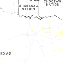
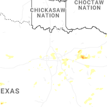
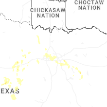
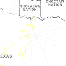

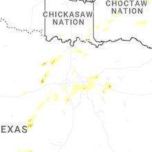
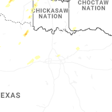
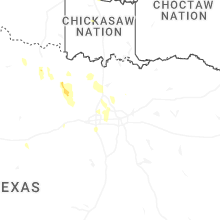


Connect with Interactive Hail Maps