

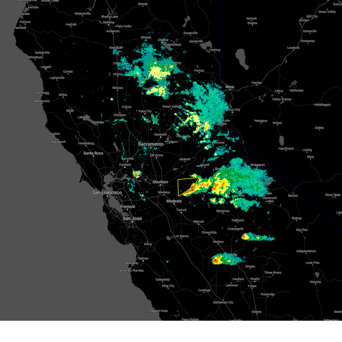
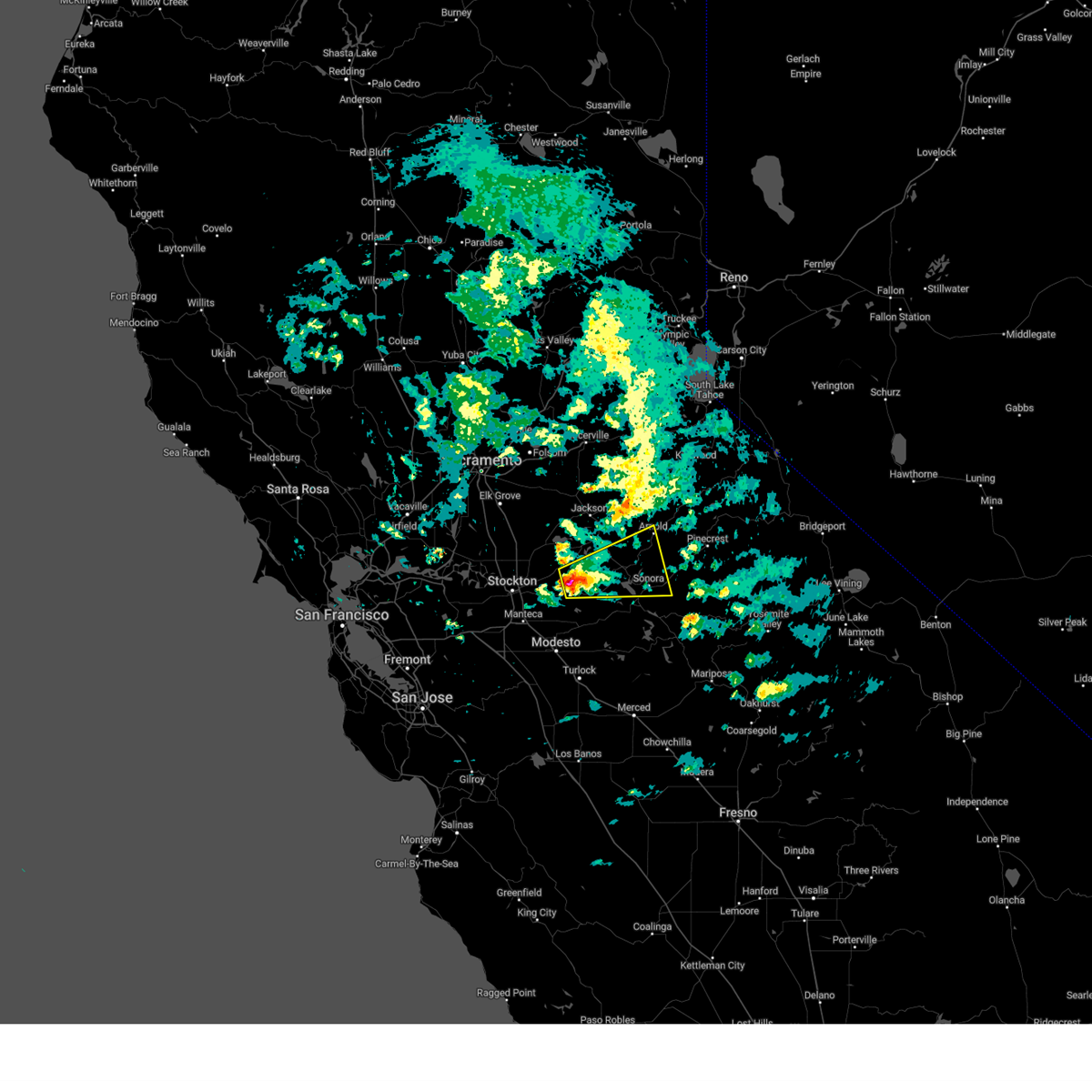
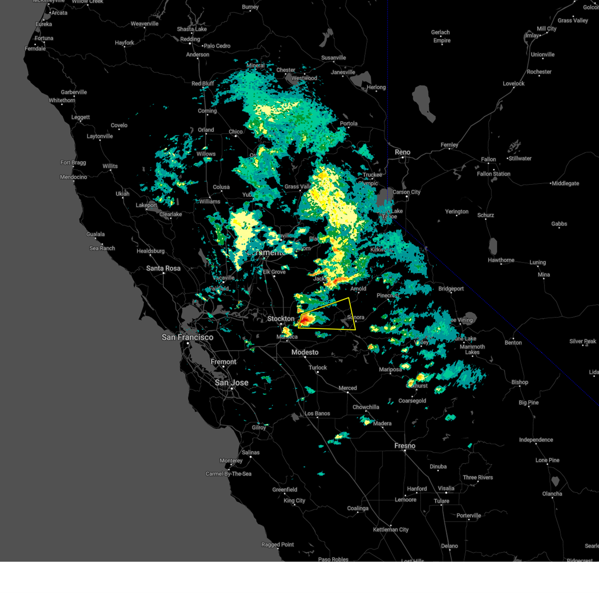
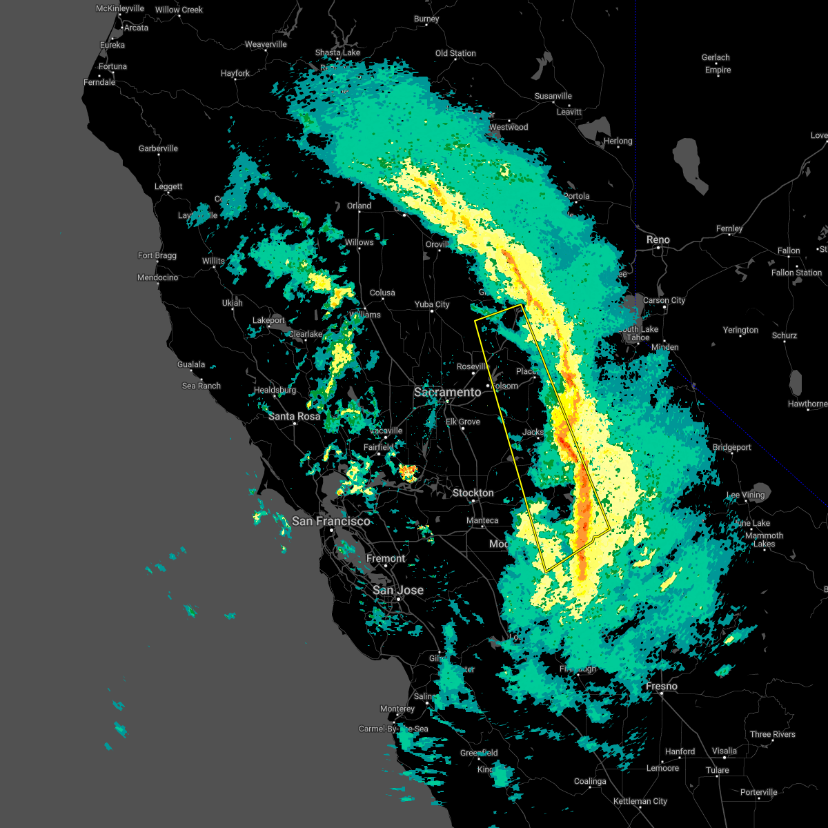
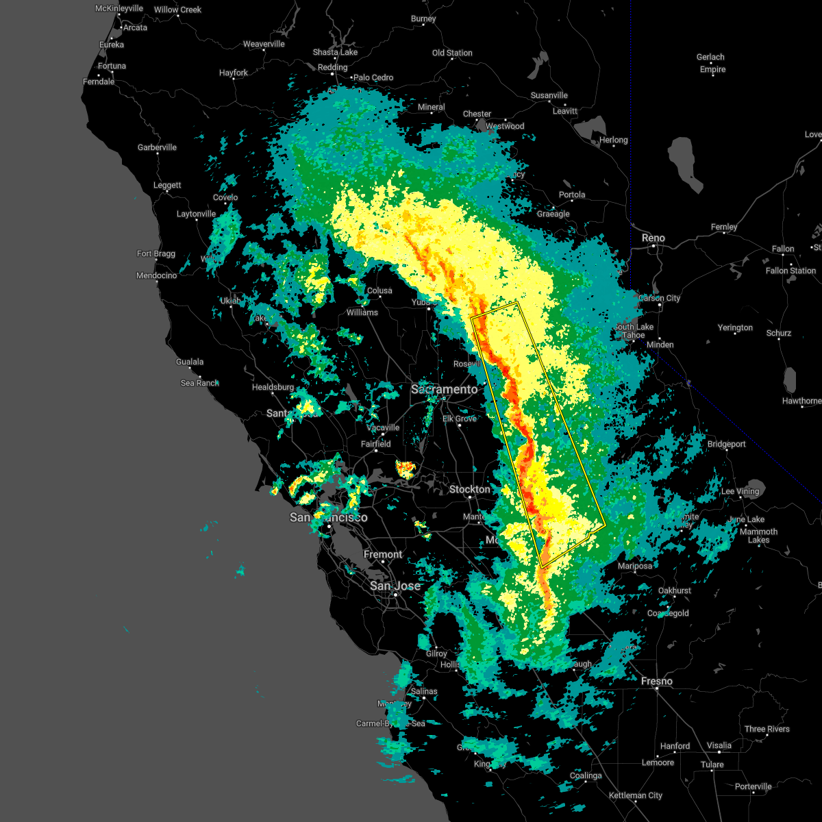
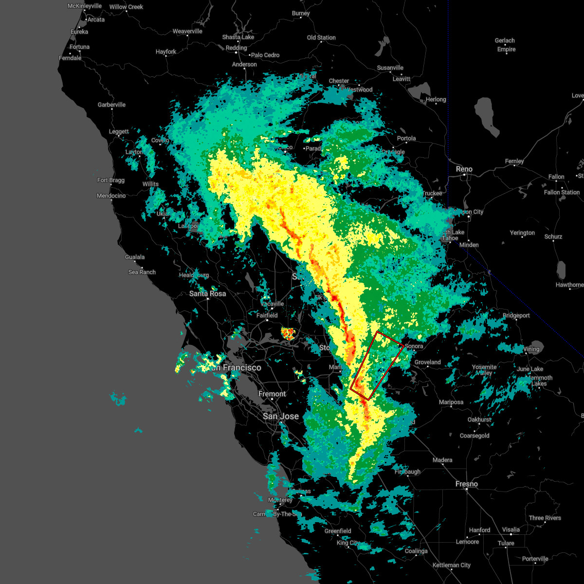
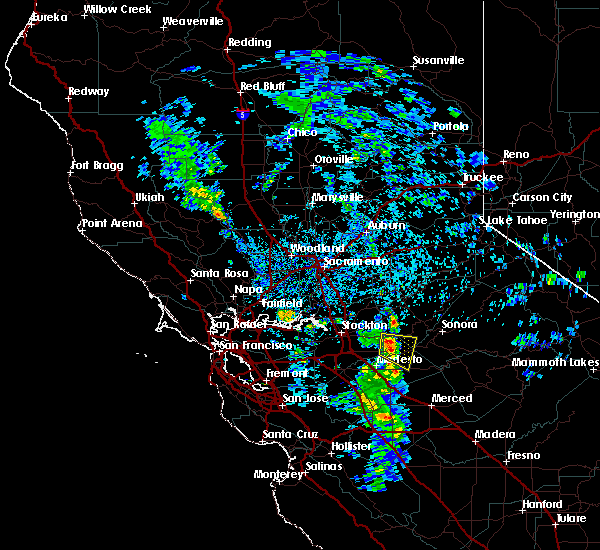
Hail Map for Copperopolis, CA
The Copperopolis, CA area has had 0 reports of on-the-ground hail by trained spotters, and has been under severe weather warnings 0 times during the past 12 months. Doppler radar has detected hail at or near Copperopolis, CA on 1 occasion.
| Name: | Copperopolis, CA |
| Where Located: | 63.4 miles SSE of Citrus Heights, CA |
| Map: | Google Map for Copperopolis, CA |
| Population: | 3671 |
| Housing Units: | 2336 |
| More Info: | Search Google for Copperopolis, CA |
5
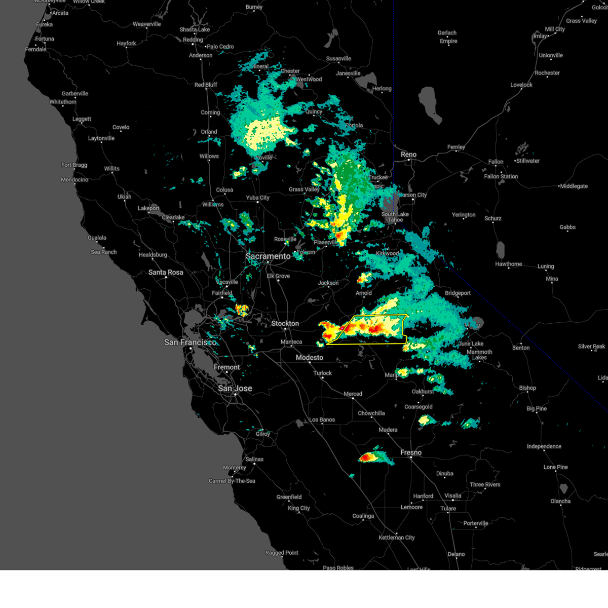
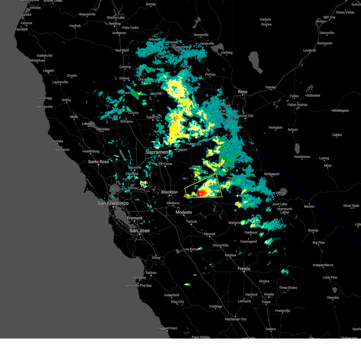
The Top Recent Hail Date for Copperopolis, CA is Saturday, March 11, 2023 (1st out of 1)

Hail and Wind Damage Spotted near Copperopolis, CA
| Date / Time | Report Details |
|---|---|
| 3/11/2023 3:57 PM PST |
 The severe thunderstorm warning for north central stanislaus and southwestern calaveras counties will expire at 400 pm pst, the storms which prompted the warning have weakened below severe limits, and are exiting the warned area. therefore, the warning will be allowed to expire. The severe thunderstorm warning for north central stanislaus and southwestern calaveras counties will expire at 400 pm pst, the storms which prompted the warning have weakened below severe limits, and are exiting the warned area. therefore, the warning will be allowed to expire.
|
| 3/11/2023 3:23 PM PST |
 At 323 pm pst, a severe thunderstorm was located 10 miles south of long barn, or 10 miles east of sonora, moving east at 15 mph (radar indicated). Hazards include quarter size hail. damage to vehicles is expected At 323 pm pst, a severe thunderstorm was located 10 miles south of long barn, or 10 miles east of sonora, moving east at 15 mph (radar indicated). Hazards include quarter size hail. damage to vehicles is expected
|
| 3/11/2023 3:09 PM PST |
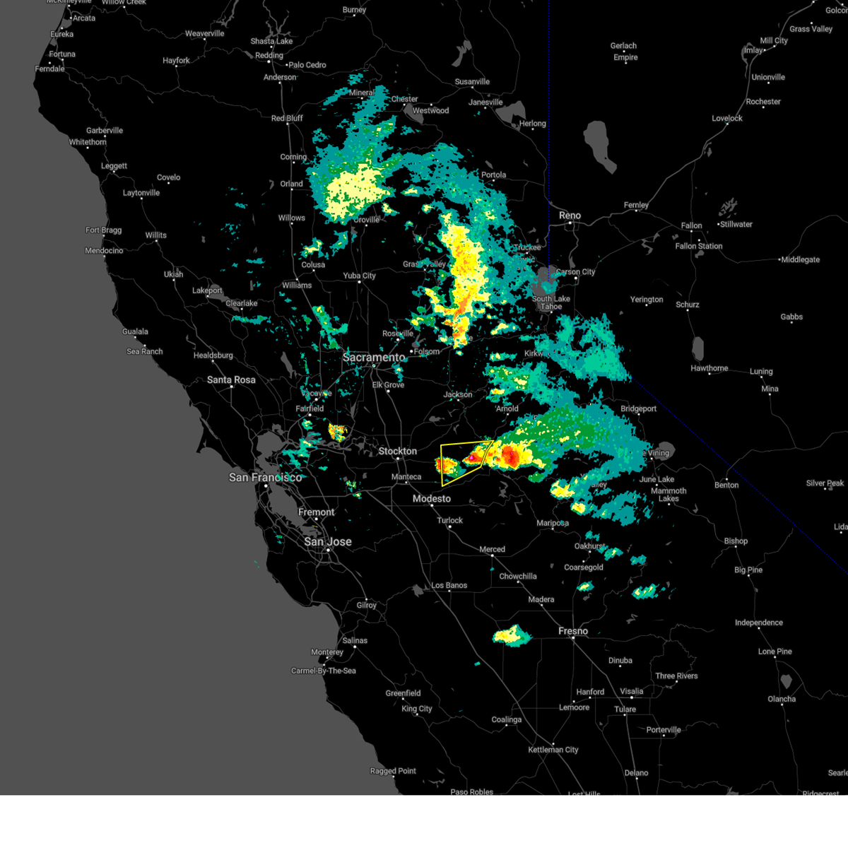 At 308 pm pst, a severe thunderstorm was located over copper cove village, or 13 miles west of sonora, moving east at 20 mph (radar indicated). Hazards include quarter size hail. damage to vehicles is expected At 308 pm pst, a severe thunderstorm was located over copper cove village, or 13 miles west of sonora, moving east at 20 mph (radar indicated). Hazards include quarter size hail. damage to vehicles is expected
|
| 3/11/2023 2:37 PM PST |
 At 236 pm pst, a severe thunderstorm capable of producing a tornado was located over tuttletown, or near sonora, moving east at 25 mph (radar indicated rotation). Hazards include tornado and quarter size hail. Flying debris will be dangerous to those caught without shelter. mobile homes will be damaged or destroyed. damage to roofs, windows, and vehicles will occur. tree damage is likely. this dangerous storm will be near, tuttletown around 245 pm pst. springfield and chinese camp around 250 pm pst. sonora around 255 pm pst. Other locations impacted by this tornadic thunderstorm include mono vista, phoenix lake-cedar, columbia, jamestown, groveland-big oak, phoenix lake-cedar ridge, east sonora, twain harte, tuolumne city and soulsbyville. At 236 pm pst, a severe thunderstorm capable of producing a tornado was located over tuttletown, or near sonora, moving east at 25 mph (radar indicated rotation). Hazards include tornado and quarter size hail. Flying debris will be dangerous to those caught without shelter. mobile homes will be damaged or destroyed. damage to roofs, windows, and vehicles will occur. tree damage is likely. this dangerous storm will be near, tuttletown around 245 pm pst. springfield and chinese camp around 250 pm pst. sonora around 255 pm pst. Other locations impacted by this tornadic thunderstorm include mono vista, phoenix lake-cedar, columbia, jamestown, groveland-big oak, phoenix lake-cedar ridge, east sonora, twain harte, tuolumne city and soulsbyville.
|
| 3/11/2023 2:23 PM PST |
 At 220 pm pst, a severe thunderstorm was located over copperopolis, moving east at 30 mph (there was a public report of quarter sized hail in stockton). Hazards include quarter size hail. Damage to vehicles is expected. locations impacted include, sonora, san andreas, carson hill, tuttletown, vallecito, copper cove village, springfield, telegraph city, angels city, milton, avery, hodson, forest meadows, copperopolis, mountain ranch, rancho calaveras, angels camp, tuolumne city, and murphys. hail threat, observed max hail size, 1. 00 in wind threat, radar indicated max wind gust, <50 mph. At 220 pm pst, a severe thunderstorm was located over copperopolis, moving east at 30 mph (there was a public report of quarter sized hail in stockton). Hazards include quarter size hail. Damage to vehicles is expected. locations impacted include, sonora, san andreas, carson hill, tuttletown, vallecito, copper cove village, springfield, telegraph city, angels city, milton, avery, hodson, forest meadows, copperopolis, mountain ranch, rancho calaveras, angels camp, tuolumne city, and murphys. hail threat, observed max hail size, 1. 00 in wind threat, radar indicated max wind gust, <50 mph.
|
| 3/11/2023 1:46 PM PST |
 At 145 pm pst, a severe thunderstorm was located over milton, or 12 miles southwest of san andreas, moving east at 30 mph (the public has reported quarter size hail in stockton). Hazards include quarter size hail. damage to vehicles is expected At 145 pm pst, a severe thunderstorm was located over milton, or 12 miles southwest of san andreas, moving east at 30 mph (the public has reported quarter size hail in stockton). Hazards include quarter size hail. damage to vehicles is expected
|
| 3/11/2023 1:32 PM PST |
 At 129 pm pst, a severe thunderstorm was located near milton, or 17 miles north of oakdale, moving east northeast at 30 mph (the public has reported quarter size hail in stockton). Hazards include quarter size hail. damage to vehicles is expected At 129 pm pst, a severe thunderstorm was located near milton, or 17 miles north of oakdale, moving east northeast at 30 mph (the public has reported quarter size hail in stockton). Hazards include quarter size hail. damage to vehicles is expected
|
| 1/10/2023 4:40 AM PST |
 The severe thunderstorm warning for southwestern tuolumne, northeastern sacramento, northeastern stanislaus, western el dorado, southwestern placer, calaveras, southeastern yuba, southwestern nevada and amador counties will expire at 445 am pst, the storms which prompted the warning have weakened, and have exited the warned area. therefore, the warning will be allowed to expire. however gusty winds and heavy rain are still possible with these thunderstorms. The severe thunderstorm warning for southwestern tuolumne, northeastern sacramento, northeastern stanislaus, western el dorado, southwestern placer, calaveras, southeastern yuba, southwestern nevada and amador counties will expire at 445 am pst, the storms which prompted the warning have weakened, and have exited the warned area. therefore, the warning will be allowed to expire. however gusty winds and heavy rain are still possible with these thunderstorms.
|
| 1/10/2023 4:30 AM PST | Storm damage reported in calaveras county CA, 6.2 miles SSW of Copperopolis, CA |
| 1/10/2023 4:09 AM PST |
 At 407 am pst, severe thunderstorms were located along a line extending from 5 miles east of lincoln to turlock, moving east at 45 mph (radar indicated). Hazards include 60 mph wind gusts. expect damage to roofs, siding, and trees At 407 am pst, severe thunderstorms were located along a line extending from 5 miles east of lincoln to turlock, moving east at 45 mph (radar indicated). Hazards include 60 mph wind gusts. expect damage to roofs, siding, and trees
|
| 1/10/2023 3:43 AM PST |
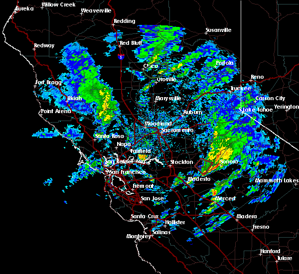
 At 343 am pst, severe thunderstorms capable of producing both tornadoes and extensive straight line wind damage were located over modesto, moving northeast at 55 mph (radar indicated rotation). Hazards include tornado. Flying debris will be dangerous to those caught without shelter. mobile homes will be damaged or destroyed. damage to roofs, windows, and vehicles will occur. tree damage is likely. these dangerous storms will be near, escalon around 350 am pst. oakdale around 355 am pst. eugene and east oakdale around 400 am pst. telegraph city and milton around 410 am pst. hodson, copperopolis and copper cove village around 415 am pst. Other locations impacted by this tornadic thunderstorm include hughson and keyes. At 343 am pst, severe thunderstorms capable of producing both tornadoes and extensive straight line wind damage were located over modesto, moving northeast at 55 mph (radar indicated rotation). Hazards include tornado. Flying debris will be dangerous to those caught without shelter. mobile homes will be damaged or destroyed. damage to roofs, windows, and vehicles will occur. tree damage is likely. these dangerous storms will be near, escalon around 350 am pst. oakdale around 355 am pst. eugene and east oakdale around 400 am pst. telegraph city and milton around 410 am pst. hodson, copperopolis and copper cove village around 415 am pst. Other locations impacted by this tornadic thunderstorm include hughson and keyes.
|
| 1/20/2019 4:09 PM PST |
 The tornado warning for north central stanislaus and southwestern calaveras counties will expire at 415 pm pst, the storm which prompted the warning has moved out of the area. therefore, the warning will be allowed to expire. The tornado warning for north central stanislaus and southwestern calaveras counties will expire at 415 pm pst, the storm which prompted the warning has moved out of the area. therefore, the warning will be allowed to expire.
|
| 1/20/2019 3:41 PM PST |
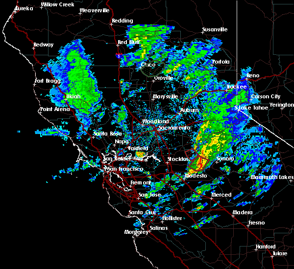 At 339 pm pst, a severe thunderstorm capable of producing a tornado was located over telegraph city, or 13 miles northeast of oakdale, moving northeast at 30 mph (radar indicated rotation). Hazards include tornado. Flying debris will be dangerous to those caught without shelter. damage to roofs, windows, and vehicles will occur. tree damage is likely. this dangerous storm will be near, hodson around 345 pm pst. Copper cove village and copperopolis around 350 pm pst. At 339 pm pst, a severe thunderstorm capable of producing a tornado was located over telegraph city, or 13 miles northeast of oakdale, moving northeast at 30 mph (radar indicated rotation). Hazards include tornado. Flying debris will be dangerous to those caught without shelter. damage to roofs, windows, and vehicles will occur. tree damage is likely. this dangerous storm will be near, hodson around 345 pm pst. Copper cove village and copperopolis around 350 pm pst.
|
| 1/20/2019 3:29 PM PST |
 At 328 pm pst, a severe thunderstorm capable of producing a tornado was located over eugene, or near oakdale, moving east at 20 mph (radar indicated rotation). Hazards include tornado. Flying debris will be dangerous to those caught without shelter. damage to roofs, windows, and vehicles will occur. tree damage is likely. this dangerous storm will be near, telegraph city around 350 pm pst. hodson around 400 pm pst. copper cove village around 405 pm pst. Copperopolis around 410 pm pst. At 328 pm pst, a severe thunderstorm capable of producing a tornado was located over eugene, or near oakdale, moving east at 20 mph (radar indicated rotation). Hazards include tornado. Flying debris will be dangerous to those caught without shelter. damage to roofs, windows, and vehicles will occur. tree damage is likely. this dangerous storm will be near, telegraph city around 350 pm pst. hodson around 400 pm pst. copper cove village around 405 pm pst. Copperopolis around 410 pm pst.
|
| 4/27/2016 1:22 PM PDT |
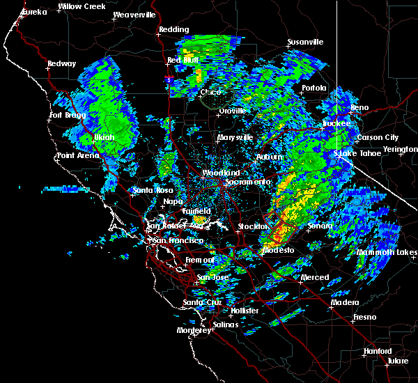
 At 121 pm pdt, doppler radar indicated a severe thunderstorm capable of producing quarter size hail. this storm was located over eugene, or near oakdale, moving east at 10 mph. locations impacted include, oakdale, east oakdale, eugene, telegraph city and copperopolis. At 121 pm pdt, doppler radar indicated a severe thunderstorm capable of producing quarter size hail. this storm was located over eugene, or near oakdale, moving east at 10 mph. locations impacted include, oakdale, east oakdale, eugene, telegraph city and copperopolis.
|
| 4/27/2016 1:06 PM PDT |
 At 106 pm pdt, doppler radar indicated a severe thunderstorm capable of producing quarter size hail. this storm was located near eugene, or near oakdale, and moving east at 15 mph. At 106 pm pdt, doppler radar indicated a severe thunderstorm capable of producing quarter size hail. this storm was located near eugene, or near oakdale, and moving east at 15 mph.
|
Hail Maps for Copperopolis, CA

Connect with Interactive Hail Maps