

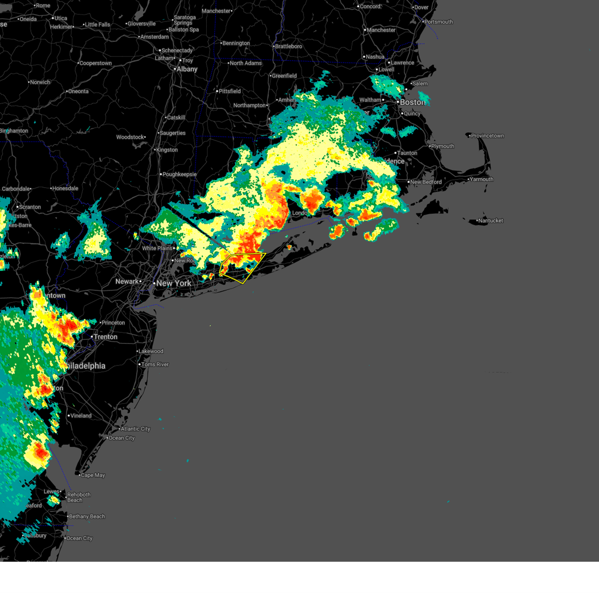
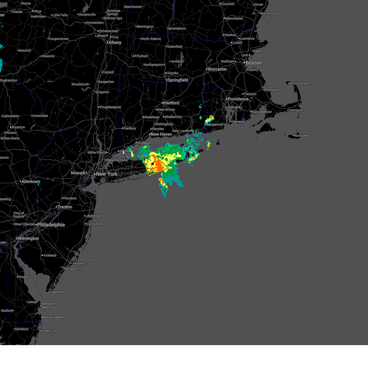
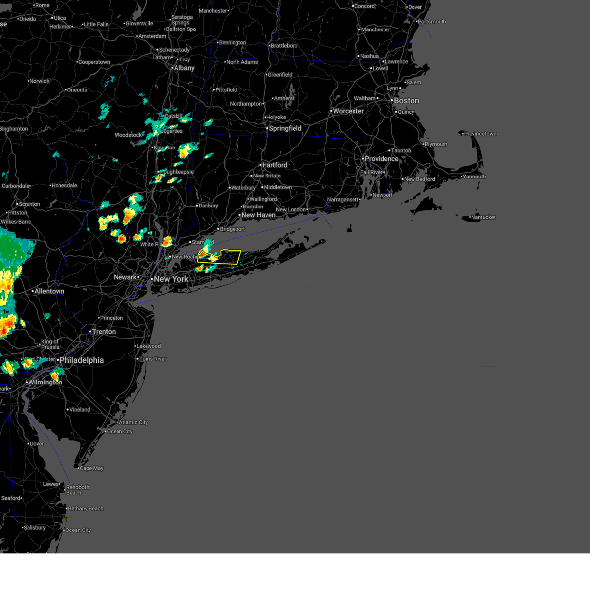
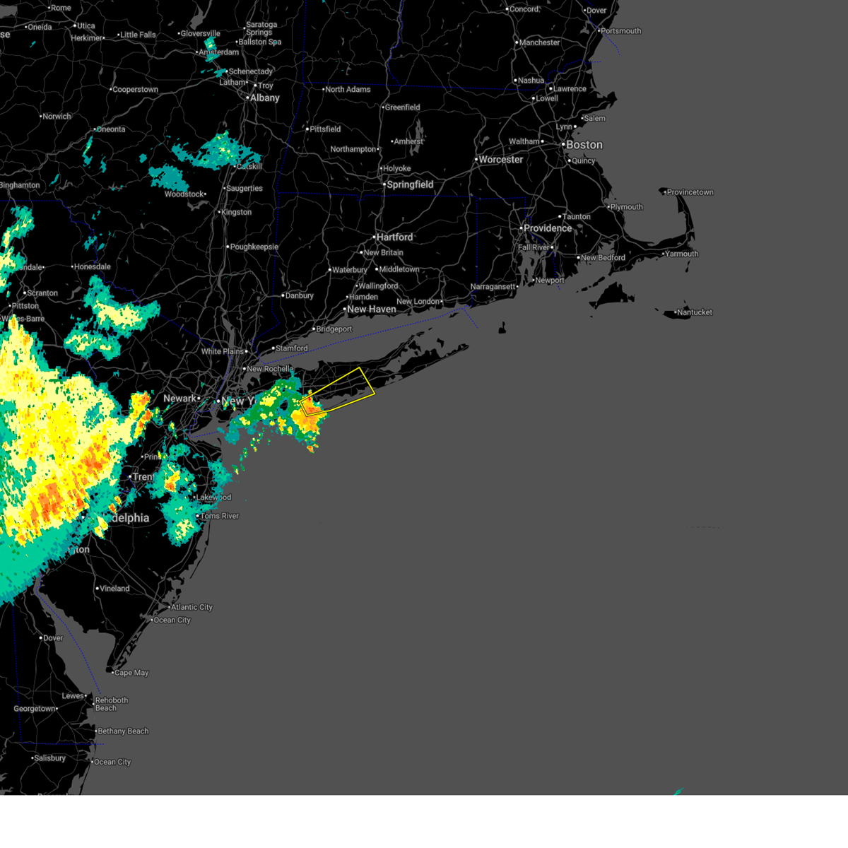
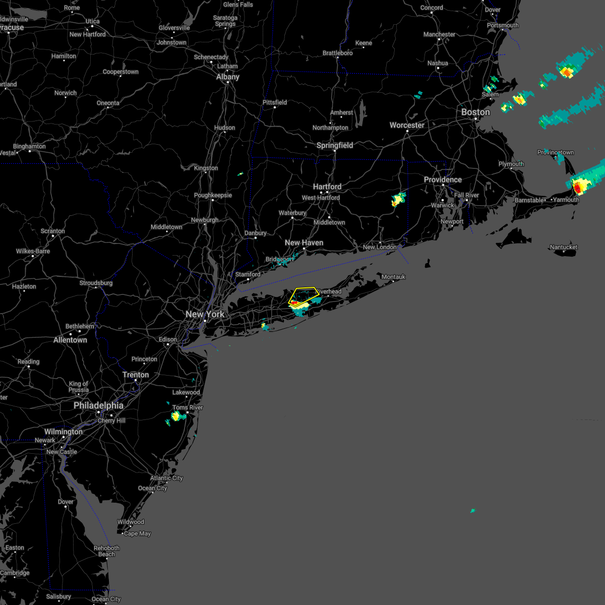
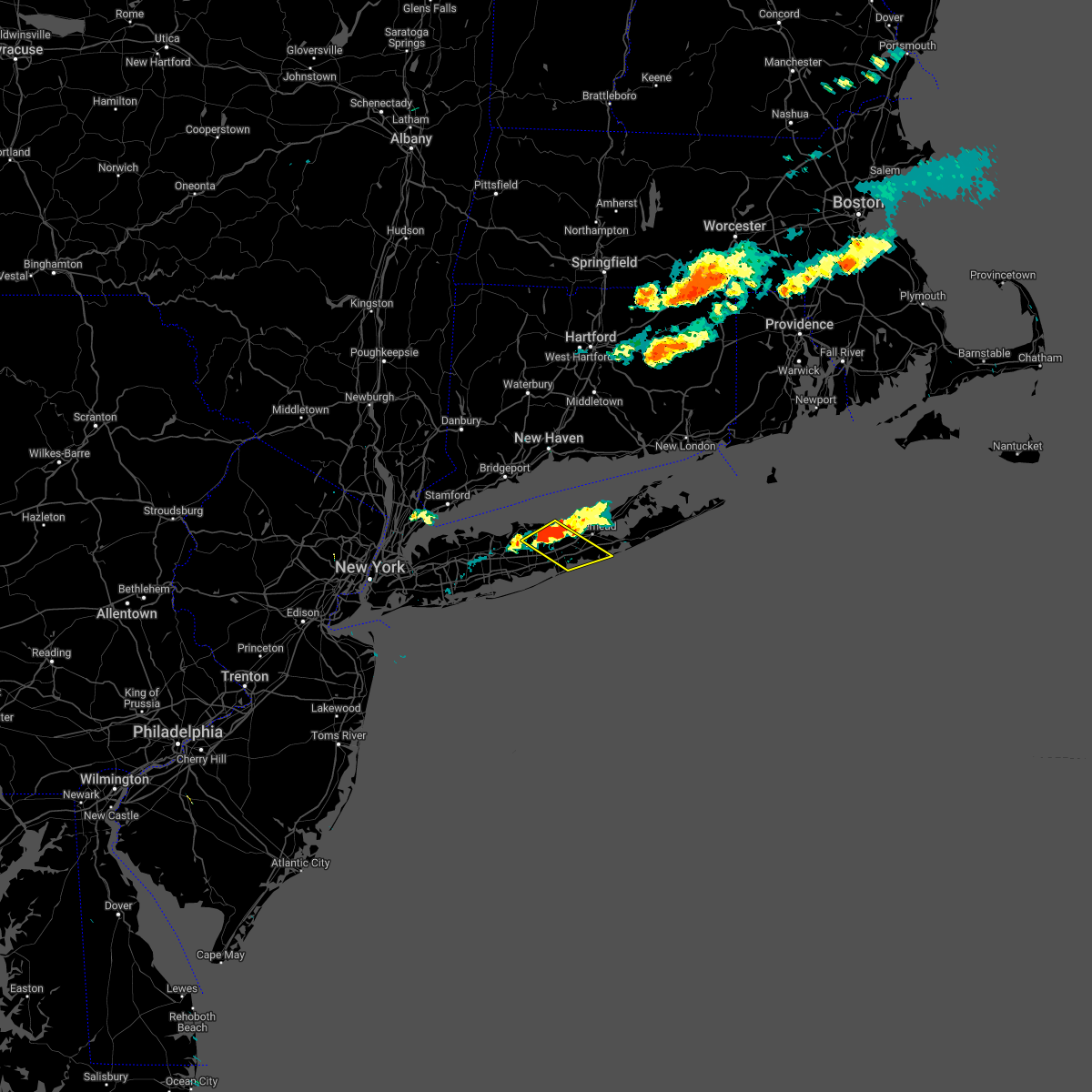
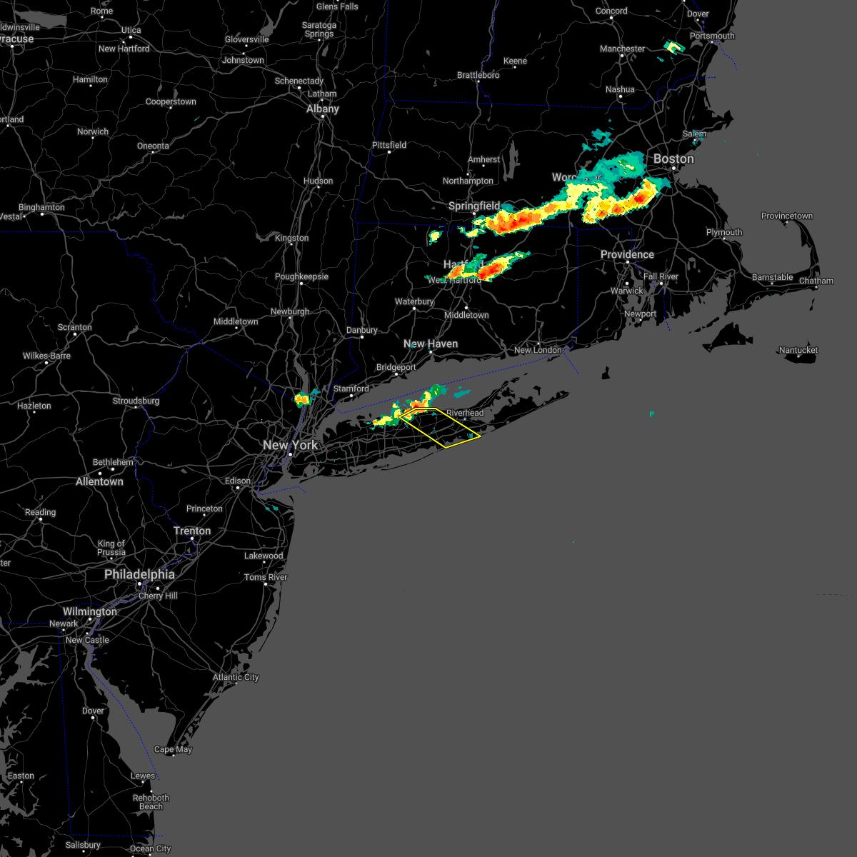
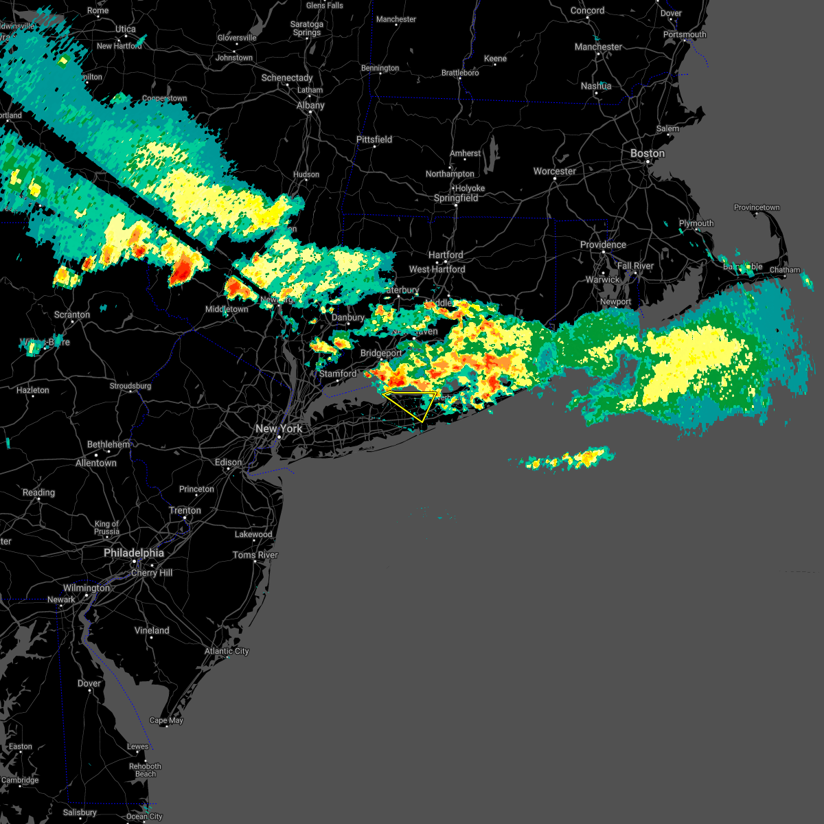
Hail Map for Coram, NY
The Coram, NY area has had 0 reports of on-the-ground hail by trained spotters, and has been under severe weather warnings 12 times during the past 12 months. Doppler radar has detected hail at or near Coram, NY on 12 occasions.
| Name: | Coram, NY |
| Where Located: | 53.5 miles ENE of Brooklyn, NY |
| Map: | Google Map for Coram, NY |
| Population: | 39113 |
| Housing Units: | 15437 |
| More Info: | Search Google for Coram, NY |
5
The Top Recent Hail Date for Coram, NY is Thursday, June 9, 2011 (1st out of 12)

Hail and Wind Damage Spotted near Coram, NY
| Date / Time | Report Details |
|---|---|
| 7/4/2026 9:24 PM EDT | Tree fell and blocking route 112 southbound at patchogue mt sinai roa in suffolk county NY, 0.5 miles E of Coram, NY |
| 7/4/2026 9:17 PM EDT |
 At 916 pm edt, severe thunderstorms were located along a line extending from 6 miles northwest of rocky point to near hauppauge, moving southeast at 35 mph (radar indicated). Hazards include 60 mph wind gusts. Expect damage to trees and power lines. these severe storms will be near, centereach and ronkonkoma around 920 pm edt. medford and patchogue around 925 pm edt. brookhaven national laboratory around 930 pm edt. Shirley and manorville around 935 pm edt. At 916 pm edt, severe thunderstorms were located along a line extending from 6 miles northwest of rocky point to near hauppauge, moving southeast at 35 mph (radar indicated). Hazards include 60 mph wind gusts. Expect damage to trees and power lines. these severe storms will be near, centereach and ronkonkoma around 920 pm edt. medford and patchogue around 925 pm edt. brookhaven national laboratory around 930 pm edt. Shirley and manorville around 935 pm edt.
|
| 7/4/2026 8:57 PM EDT |
 Svrokx the national weather service in upton ny has issued a * severe thunderstorm warning for, western suffolk county in southeastern new york, * until 945 pm edt. * at 856 pm edt, severe thunderstorms were located along a line extending from near bridgeport to huntington, moving southeast at 35 mph. these are destructive storms for western suffolk county (radar indicated). Hazards include 80 mph wind gusts. Flying debris will be dangerous to those caught without shelter. mobile homes will be heavily damaged. expect considerable damage to roofs, windows, and vehicles. extensive tree damage and power outages are likely. severe thunderstorms will be near, commack and huntington around 900 pm edt. smithtown around 905 pm edt. hauppauge and stony brook around 910 pm edt. centereach and ronkonkoma around 915 pm edt. coram and holbrook around 920 pm edt. medford and patchogue around 925 pm edt. calverton and yaphank around 930 pm edt. Shirley and manorville around 935 pm edt. Svrokx the national weather service in upton ny has issued a * severe thunderstorm warning for, western suffolk county in southeastern new york, * until 945 pm edt. * at 856 pm edt, severe thunderstorms were located along a line extending from near bridgeport to huntington, moving southeast at 35 mph. these are destructive storms for western suffolk county (radar indicated). Hazards include 80 mph wind gusts. Flying debris will be dangerous to those caught without shelter. mobile homes will be heavily damaged. expect considerable damage to roofs, windows, and vehicles. extensive tree damage and power outages are likely. severe thunderstorms will be near, commack and huntington around 900 pm edt. smithtown around 905 pm edt. hauppauge and stony brook around 910 pm edt. centereach and ronkonkoma around 915 pm edt. coram and holbrook around 920 pm edt. medford and patchogue around 925 pm edt. calverton and yaphank around 930 pm edt. Shirley and manorville around 935 pm edt.
|
| 6/11/2026 6:35 PM EDT |
 The storms which prompted the warning have weakened below severe limits, and have exited the warned area. therefore, the warning will be allowed to expire. The storms which prompted the warning have weakened below severe limits, and have exited the warned area. therefore, the warning will be allowed to expire.
|
| 6/11/2026 6:19 PM EDT |
 At 618 pm edt, severe thunderstorms were located along a line extending from near westhampton to 6 miles southeast of center moriches to yaphank, moving southeast at 45 mph (radar indicated). Hazards include 60 mph wind gusts. Expect damage to trees and power lines. These severe storms will be near, shirley and mastic beach around 625 pm edt. At 618 pm edt, severe thunderstorms were located along a line extending from near westhampton to 6 miles southeast of center moriches to yaphank, moving southeast at 45 mph (radar indicated). Hazards include 60 mph wind gusts. Expect damage to trees and power lines. These severe storms will be near, shirley and mastic beach around 625 pm edt.
|
| 6/11/2026 6:18 PM EDT |
 the severe thunderstorm warning has been cancelled and is no longer in effect the severe thunderstorm warning has been cancelled and is no longer in effect
|
| 6/11/2026 5:54 PM EDT |
 Svrokx the national weather service in upton ny has issued a * severe thunderstorm warning for, central suffolk county in southeastern new york, * until 645 pm edt. * at 553 pm edt, a severe thunderstorm was located over rocky point, or near middle island, moving southeast at 30 mph. this is a destructive storm for central suffolk county (radar indicated). Hazards include 80 mph wind gusts. Flying debris will be dangerous to those caught without shelter. mobile homes will be heavily damaged. expect considerable damage to roofs, windows, and vehicles. extensive tree damage and power outages are likely. this severe thunderstorm will be near, middle island and brookhaven national laboratory around 600 pm edt. manorville around 605 pm edt. shirley and center moriches around 610 pm edt. Mastic beach around 615 pm edt. Svrokx the national weather service in upton ny has issued a * severe thunderstorm warning for, central suffolk county in southeastern new york, * until 645 pm edt. * at 553 pm edt, a severe thunderstorm was located over rocky point, or near middle island, moving southeast at 30 mph. this is a destructive storm for central suffolk county (radar indicated). Hazards include 80 mph wind gusts. Flying debris will be dangerous to those caught without shelter. mobile homes will be heavily damaged. expect considerable damage to roofs, windows, and vehicles. extensive tree damage and power outages are likely. this severe thunderstorm will be near, middle island and brookhaven national laboratory around 600 pm edt. manorville around 605 pm edt. shirley and center moriches around 610 pm edt. Mastic beach around 615 pm edt.
|
| 6/11/2026 5:40 PM EDT |
 At 540 pm edt, severe thunderstorms were located along a line extending from 8 miles southeast of milford to near port jefferson to near fairfield, moving southeast at 45 mph (radar indicated). Hazards include 70 mph wind gusts. Expect considerable tree damage. damage is likely to mobile homes, roofs, and outbuildings. these severe storms will be near, port jefferson and rocky point around 545 pm edt. middle island and wading river around 550 pm edt. stony brook and coram around 555 pm edt. centereach and manorville around 600 pm edt. riverhead and shirley around 605 pm edt. Westhampton and mastic beach around 610 pm edt. At 540 pm edt, severe thunderstorms were located along a line extending from 8 miles southeast of milford to near port jefferson to near fairfield, moving southeast at 45 mph (radar indicated). Hazards include 70 mph wind gusts. Expect considerable tree damage. damage is likely to mobile homes, roofs, and outbuildings. these severe storms will be near, port jefferson and rocky point around 545 pm edt. middle island and wading river around 550 pm edt. stony brook and coram around 555 pm edt. centereach and manorville around 600 pm edt. riverhead and shirley around 605 pm edt. Westhampton and mastic beach around 610 pm edt.
|
| 5/20/2026 5:04 PM EDT |
 the severe thunderstorm warning has been cancelled and is no longer in effect the severe thunderstorm warning has been cancelled and is no longer in effect
|
| 5/20/2026 4:52 PM EDT |
 At 452 pm edt, a severe thunderstorm was located over port jefferson, moving east at 30 mph (radar indicated). Hazards include 60 mph wind gusts and penny size hail. Expect damage to trees and power lines. This severe storm will be near, port jefferson and mount sinai around 455 pm edt. At 452 pm edt, a severe thunderstorm was located over port jefferson, moving east at 30 mph (radar indicated). Hazards include 60 mph wind gusts and penny size hail. Expect damage to trees and power lines. This severe storm will be near, port jefferson and mount sinai around 455 pm edt.
|
| 5/20/2026 4:32 PM EDT |
 Svrokx the national weather service in upton ny has issued a * severe thunderstorm warning for, west central suffolk county in southeastern new york, * until 515 pm edt. * at 432 pm edt, a severe thunderstorm was located over northport, moving east at 30 mph (radar indicated). Hazards include 60 mph wind gusts and quarter size hail. Minor hail damage to vehicles is possible. expect wind damage to trees and power lines. this severe thunderstorm will be near, stony brook around 445 pm edt. port jefferson around 450 pm edt. mount sinai around 455 pm edt. Rocky point around 505 pm edt. Svrokx the national weather service in upton ny has issued a * severe thunderstorm warning for, west central suffolk county in southeastern new york, * until 515 pm edt. * at 432 pm edt, a severe thunderstorm was located over northport, moving east at 30 mph (radar indicated). Hazards include 60 mph wind gusts and quarter size hail. Minor hail damage to vehicles is possible. expect wind damage to trees and power lines. this severe thunderstorm will be near, stony brook around 445 pm edt. port jefferson around 450 pm edt. mount sinai around 455 pm edt. Rocky point around 505 pm edt.
|
| 12/19/2025 4:53 PM EST |
 Svrokx the national weather service in upton ny has issued a * severe thunderstorm warning for, southern fairfield county in southern connecticut, southeastern new haven county in southern connecticut, west central suffolk county in southeastern new york, * until 530 pm est. * at 451 pm est, showers with embedded thunderstorms were located along a line extending from georgetown to fairfield to 9 miles northwest of stony brook to commack, moving east at 50 mph (trained spotter reported). Hazards include 60 mph wind gusts. Expect damage to trees and power lines. severe thunderstorms will be near, bridgeport and hauppauge around 455 pm est. milford and shelton around 500 pm est. coram and orange around 505 pm est. middle island and rocky point around 510 pm est. new haven and wading river around 515 pm est. North haven and north branford around 520 pm est. Svrokx the national weather service in upton ny has issued a * severe thunderstorm warning for, southern fairfield county in southern connecticut, southeastern new haven county in southern connecticut, west central suffolk county in southeastern new york, * until 530 pm est. * at 451 pm est, showers with embedded thunderstorms were located along a line extending from georgetown to fairfield to 9 miles northwest of stony brook to commack, moving east at 50 mph (trained spotter reported). Hazards include 60 mph wind gusts. Expect damage to trees and power lines. severe thunderstorms will be near, bridgeport and hauppauge around 455 pm est. milford and shelton around 500 pm est. coram and orange around 505 pm est. middle island and rocky point around 510 pm est. new haven and wading river around 515 pm est. North haven and north branford around 520 pm est.
|
| 7/25/2025 4:26 PM EDT |
 Svrokx the national weather service in upton ny has issued a * severe thunderstorm warning for, western suffolk county in southeastern new york, * until 515 pm edt. * at 426 pm edt, a severe thunderstorm was located over medford, moving southeast at 30 mph (radar indicated). Hazards include 60 mph wind gusts and penny size hail. Expect damage to trees and power lines. this severe thunderstorm will be near, shirley and mastic around 430 pm edt. mastic beach around 435 pm edt. Center moriches around 440 pm edt. Svrokx the national weather service in upton ny has issued a * severe thunderstorm warning for, western suffolk county in southeastern new york, * until 515 pm edt. * at 426 pm edt, a severe thunderstorm was located over medford, moving southeast at 30 mph (radar indicated). Hazards include 60 mph wind gusts and penny size hail. Expect damage to trees and power lines. this severe thunderstorm will be near, shirley and mastic around 430 pm edt. mastic beach around 435 pm edt. Center moriches around 440 pm edt.
|
| 7/1/2025 1:38 AM EDT |
 the severe thunderstorm warning has been cancelled and is no longer in effect the severe thunderstorm warning has been cancelled and is no longer in effect
|
| 7/1/2025 1:19 AM EDT |
 Svrokx the national weather service in upton ny has issued a * severe thunderstorm warning for, western suffolk county in southeastern new york, * until 200 am edt. * at 118 am edt, a severe thunderstorm was located near islip, moving northeast at 35 mph (radar indicated. at fire island mesonet there was a 52 mph wind gust reported). Hazards include 60 mph wind gusts. Expect damage to trees and power lines. this severe thunderstorm will be near, patchogue and sayville around 125 am edt. shirley and mastic around 140 am edt. center moriches and yaphank around 145 am edt. Manorville around 150 am edt. Svrokx the national weather service in upton ny has issued a * severe thunderstorm warning for, western suffolk county in southeastern new york, * until 200 am edt. * at 118 am edt, a severe thunderstorm was located near islip, moving northeast at 35 mph (radar indicated. at fire island mesonet there was a 52 mph wind gust reported). Hazards include 60 mph wind gusts. Expect damage to trees and power lines. this severe thunderstorm will be near, patchogue and sayville around 125 am edt. shirley and mastic around 140 am edt. center moriches and yaphank around 145 am edt. Manorville around 150 am edt.
|
| 6/19/2025 6:02 PM EDT |
 the severe thunderstorm warning has been cancelled and is no longer in effect the severe thunderstorm warning has been cancelled and is no longer in effect
|
| 6/19/2025 5:39 PM EDT |
 Svrokx the national weather service in upton ny has issued a * severe thunderstorm warning for, west central suffolk county in southeastern new york, * until 630 pm edt. * at 539 pm edt, a severe thunderstorm was located over huntington, moving northeast at 30 mph (radar indicated). Hazards include 60 mph wind gusts and penny size hail. Expect damage to trees and power lines. this severe thunderstorm will be near, northport and centerport around 545 pm edt. Port jefferson around 615 pm edt. Svrokx the national weather service in upton ny has issued a * severe thunderstorm warning for, west central suffolk county in southeastern new york, * until 630 pm edt. * at 539 pm edt, a severe thunderstorm was located over huntington, moving northeast at 30 mph (radar indicated). Hazards include 60 mph wind gusts and penny size hail. Expect damage to trees and power lines. this severe thunderstorm will be near, northport and centerport around 545 pm edt. Port jefferson around 615 pm edt.
|
| 6/26/2024 10:00 PM EDT |
 the severe thunderstorm warning has been cancelled and is no longer in effect the severe thunderstorm warning has been cancelled and is no longer in effect
|
| 6/26/2024 9:20 PM EDT |
 Svrokx the national weather service in upton ny has issued a * severe thunderstorm warning for, western suffolk county in southeastern new york, * until 1015 pm edt. * at 918 pm edt, an area of severe thunderstorms were located over little neck, or near jamaica, moving east at 40 mph (radar indicated). Hazards include 60 mph wind gusts. Expect damage to trees and power lines. the severe thunderstorms will be near, deer park and dix hills around 940 pm edt. brentwood and bay shore around 945 pm edt. islip and hauppauge around 950 pm edt. ronkonkoma and holbrook around 955 pm edt. patchogue around 1000 pm edt. medford around 1005 pm edt. Yaphank around 1010 pm edt. Svrokx the national weather service in upton ny has issued a * severe thunderstorm warning for, western suffolk county in southeastern new york, * until 1015 pm edt. * at 918 pm edt, an area of severe thunderstorms were located over little neck, or near jamaica, moving east at 40 mph (radar indicated). Hazards include 60 mph wind gusts. Expect damage to trees and power lines. the severe thunderstorms will be near, deer park and dix hills around 940 pm edt. brentwood and bay shore around 945 pm edt. islip and hauppauge around 950 pm edt. ronkonkoma and holbrook around 955 pm edt. patchogue around 1000 pm edt. medford around 1005 pm edt. Yaphank around 1010 pm edt.
|
| 6/14/2024 8:21 PM EDT |
 The storm which prompted the warning has weakened below severe limits, and no longer poses an immediate threat to life or property. therefore, the warning will be allowed to expire. however, gusty winds and heavy rain are still possible with this thunderstorm. The storm which prompted the warning has weakened below severe limits, and no longer poses an immediate threat to life or property. therefore, the warning will be allowed to expire. however, gusty winds and heavy rain are still possible with this thunderstorm.
|
| 6/14/2024 7:48 PM EDT |
 Svrokx the national weather service in upton ny has issued a * severe thunderstorm warning for, central suffolk county in southeastern new york, * until 830 pm edt. * at 748 pm edt, a severe thunderstorm was located near mount sinai, or near port jefferson, moving east at 25 mph (radar indicated). Hazards include 60 mph wind gusts. Expect damage to trees and power lines. this severe thunderstorm will be near, rocky point around 755 pm edt. wading river around 800 pm edt. Calverton around 810 pm edt. Svrokx the national weather service in upton ny has issued a * severe thunderstorm warning for, central suffolk county in southeastern new york, * until 830 pm edt. * at 748 pm edt, a severe thunderstorm was located near mount sinai, or near port jefferson, moving east at 25 mph (radar indicated). Hazards include 60 mph wind gusts. Expect damage to trees and power lines. this severe thunderstorm will be near, rocky point around 755 pm edt. wading river around 800 pm edt. Calverton around 810 pm edt.
|
| 8/13/2023 2:58 AM EDT |
 At 257 am edt, severe thunderstorms were located along a line extending from near bayville to westbury to near long beach, moving east at 50 mph (radar indicated). Hazards include 60 mph wind gusts. Expect damage to trees and power lines. severe thunderstorms will be near, plainview and massapequa around 300 am edt. huntington station and huntington around 305 am edt. commack and deer park around 310 am edt. islip and brentwood around 315 am edt. ronkonkoma and stony brook around 320 am edt. centereach and port jefferson around 325 am edt. medford and patchogue around 330 am edt. middle island and rocky point around 335 am edt. shirley and wading river around 340 am edt. manorville and center moriches around 345 am edt. westhampton around 350 am edt. riverhead around 355 am edt. hail threat, radar indicated max hail size, <. 75 in wind threat, radar indicated max wind gust, 60 mph. At 257 am edt, severe thunderstorms were located along a line extending from near bayville to westbury to near long beach, moving east at 50 mph (radar indicated). Hazards include 60 mph wind gusts. Expect damage to trees and power lines. severe thunderstorms will be near, plainview and massapequa around 300 am edt. huntington station and huntington around 305 am edt. commack and deer park around 310 am edt. islip and brentwood around 315 am edt. ronkonkoma and stony brook around 320 am edt. centereach and port jefferson around 325 am edt. medford and patchogue around 330 am edt. middle island and rocky point around 335 am edt. shirley and wading river around 340 am edt. manorville and center moriches around 345 am edt. westhampton around 350 am edt. riverhead around 355 am edt. hail threat, radar indicated max hail size, <. 75 in wind threat, radar indicated max wind gust, 60 mph.
|
| 7/29/2023 8:06 PM EDT |
 At 805 pm edt, severe thunderstorms were located along a line extending from westport to garden city, moving east at 45 mph (radar indicated). Hazards include 70 mph wind gusts. Expect considerable tree damage. damage is likely to mobile homes, roofs, and outbuildings. locations impacted include, islip, brentwood, commack, huntington station, centereach, deer park, lindenhurst, plainview, medford, massapequa, hauppauge, ronkonkoma, huntington, stony brook, and babylon. thunderstorm damage threat, considerable hail threat, radar indicated max hail size, <. 75 in wind threat, radar indicated max wind gust, 70 mph. At 805 pm edt, severe thunderstorms were located along a line extending from westport to garden city, moving east at 45 mph (radar indicated). Hazards include 70 mph wind gusts. Expect considerable tree damage. damage is likely to mobile homes, roofs, and outbuildings. locations impacted include, islip, brentwood, commack, huntington station, centereach, deer park, lindenhurst, plainview, medford, massapequa, hauppauge, ronkonkoma, huntington, stony brook, and babylon. thunderstorm damage threat, considerable hail threat, radar indicated max hail size, <. 75 in wind threat, radar indicated max wind gust, 70 mph.
|
| 7/29/2023 7:41 PM EDT |
 At 741 pm edt, severe thunderstorms were located along a line extending from near greenwich to near jackson heights, moving east at 45 mph (radar indicated). Hazards include 60 mph wind gusts. expect damage to trees and power lines At 741 pm edt, severe thunderstorms were located along a line extending from near greenwich to near jackson heights, moving east at 45 mph (radar indicated). Hazards include 60 mph wind gusts. expect damage to trees and power lines
|
| 12/23/2022 1:14 PM EST |
 At 112 pm est, showers with isolated thunderstorms producing damaging winds were located along a line extending from plainview to 11 miles south of robert moses state park, moving northeast at 45 mph (radar indicated). Hazards include 60 mph wind gusts. expect damage to trees and power lines At 112 pm est, showers with isolated thunderstorms producing damaging winds were located along a line extending from plainview to 11 miles south of robert moses state park, moving northeast at 45 mph (radar indicated). Hazards include 60 mph wind gusts. expect damage to trees and power lines
|
| 9/25/2022 10:39 PM EDT |
 The severe thunderstorm warning for west central suffolk county will expire at 1045 pm edt, the storm which prompted the warning has moved out of the area. therefore, the warning will be allowed to expire. however heavy rain is still possible with this thunderstorm. The severe thunderstorm warning for west central suffolk county will expire at 1045 pm edt, the storm which prompted the warning has moved out of the area. therefore, the warning will be allowed to expire. however heavy rain is still possible with this thunderstorm.
|
| 9/25/2022 10:35 PM EDT |
 At 1035 pm edt, a severe thunderstorm was located over ronkonkoma, moving east at 35 mph (radar indicated). Hazards include 60 mph wind gusts and penny size hail. Expect damage to trees and power lines. this severe thunderstorm will be near, farmingville around 1040 pm edt. medford and port jefferson around 1045 pm edt. middle island and mount sinai around 1050 pm edt. shirley and mastic around 1055 pm edt. brookhaven national laboratory around 1100 pm edt. manorville and wading river around 1105 pm edt. calverton around 1110 pm edt. riverhead and westhampton around 1115 pm edt. hail threat, radar indicated max hail size, 0. 75 in wind threat, radar indicated max wind gust, 60 mph. At 1035 pm edt, a severe thunderstorm was located over ronkonkoma, moving east at 35 mph (radar indicated). Hazards include 60 mph wind gusts and penny size hail. Expect damage to trees and power lines. this severe thunderstorm will be near, farmingville around 1040 pm edt. medford and port jefferson around 1045 pm edt. middle island and mount sinai around 1050 pm edt. shirley and mastic around 1055 pm edt. brookhaven national laboratory around 1100 pm edt. manorville and wading river around 1105 pm edt. calverton around 1110 pm edt. riverhead and westhampton around 1115 pm edt. hail threat, radar indicated max hail size, 0. 75 in wind threat, radar indicated max wind gust, 60 mph.
|
| 9/25/2022 10:31 PM EDT |
 At 1031 pm edt, a severe thunderstorm was located over northport, moving east at 35 mph (radar indicated). Hazards include 60 mph wind gusts and penny size hail. Expect damage to trees and power lines. this severe storm will be near, brentwood around 1035 pm edt. hauppauge and smithtown around 1040 pm edt. centereach and stony brook around 1050 pm edt. hail threat, radar indicated max hail size, 0. 75 in wind threat, radar indicated max wind gust, 60 mph. At 1031 pm edt, a severe thunderstorm was located over northport, moving east at 35 mph (radar indicated). Hazards include 60 mph wind gusts and penny size hail. Expect damage to trees and power lines. this severe storm will be near, brentwood around 1035 pm edt. hauppauge and smithtown around 1040 pm edt. centereach and stony brook around 1050 pm edt. hail threat, radar indicated max hail size, 0. 75 in wind threat, radar indicated max wind gust, 60 mph.
|
| 9/25/2022 10:07 PM EDT |
 At 1007 pm edt, a severe thunderstorm was located over brookville, or over westbury, moving east at 35 mph (radar indicated). Hazards include 60 mph wind gusts and penny size hail. Expect damage to trees and power lines. this severe thunderstorm will be near, levittown and hicksville around 1010 pm edt. plainview and syosset around 1015 pm edt. melville and cold spring harbor around 1020 pm edt. huntington station and deer park around 1025 pm edt. northport and dix hills around 1030 pm edt. brentwood and commack around 1035 pm edt. hauppauge and smithtown around 1040 pm edt. centereach and stony brook around 1045 pm edt. hail threat, radar indicated max hail size, 0. 75 in wind threat, radar indicated max wind gust, 60 mph. At 1007 pm edt, a severe thunderstorm was located over brookville, or over westbury, moving east at 35 mph (radar indicated). Hazards include 60 mph wind gusts and penny size hail. Expect damage to trees and power lines. this severe thunderstorm will be near, levittown and hicksville around 1010 pm edt. plainview and syosset around 1015 pm edt. melville and cold spring harbor around 1020 pm edt. huntington station and deer park around 1025 pm edt. northport and dix hills around 1030 pm edt. brentwood and commack around 1035 pm edt. hauppauge and smithtown around 1040 pm edt. centereach and stony brook around 1045 pm edt. hail threat, radar indicated max hail size, 0. 75 in wind threat, radar indicated max wind gust, 60 mph.
|
| 9/25/2022 10:03 PM EDT |
 At 1003 pm edt, a severe thunderstorm was located over brookville, or over westbury, moving east at 35 mph (radar indicated). Hazards include 60 mph wind gusts and penny size hail. Expect damage to trees and power lines. this severe thunderstorm will be near, bayville around 1010 pm edt. huntington station and plainview around 1015 pm edt. hail threat, radar indicated max hail size, 0. 75 in wind threat, radar indicated max wind gust, 60 mph. At 1003 pm edt, a severe thunderstorm was located over brookville, or over westbury, moving east at 35 mph (radar indicated). Hazards include 60 mph wind gusts and penny size hail. Expect damage to trees and power lines. this severe thunderstorm will be near, bayville around 1010 pm edt. huntington station and plainview around 1015 pm edt. hail threat, radar indicated max hail size, 0. 75 in wind threat, radar indicated max wind gust, 60 mph.
|
| 8/9/2022 4:15 PM EDT |
 At 414 pm edt, severe thunderstorms were located along a line extending from 9 miles northeast of wading river to brookhaven national laboratory, moving east at 30 mph (radar indicated). Hazards include 60 mph wind gusts and quarter size hail. Minor hail damage to vehicles is possible. expect wind damage to trees and power lines. locations impacted include, riverhead, middle island, wading river, mattituck, calverton, brookhaven national laboratory, ridge, flanders, aquebogue, jamesport, laurel and shoreham. hail threat, radar indicated max hail size, 1. 00 in wind threat, radar indicated max wind gust, 60 mph. At 414 pm edt, severe thunderstorms were located along a line extending from 9 miles northeast of wading river to brookhaven national laboratory, moving east at 30 mph (radar indicated). Hazards include 60 mph wind gusts and quarter size hail. Minor hail damage to vehicles is possible. expect wind damage to trees and power lines. locations impacted include, riverhead, middle island, wading river, mattituck, calverton, brookhaven national laboratory, ridge, flanders, aquebogue, jamesport, laurel and shoreham. hail threat, radar indicated max hail size, 1. 00 in wind threat, radar indicated max wind gust, 60 mph.
|
| 8/9/2022 3:55 PM EDT |
 At 354 pm edt, severe thunderstorms were located along a line extending from 8 miles north of rocky point to farmingville, moving east at 30 mph (radar indicated). Hazards include 60 mph wind gusts and quarter size hail. Minor hail damage to vehicles is possible. Expect wind damage to trees and power lines. At 354 pm edt, severe thunderstorms were located along a line extending from 8 miles north of rocky point to farmingville, moving east at 30 mph (radar indicated). Hazards include 60 mph wind gusts and quarter size hail. Minor hail damage to vehicles is possible. Expect wind damage to trees and power lines.
|
| 7/21/2022 3:36 PM EDT |
 At 335 pm edt, a severe thunderstorm was located over medford, moving east at 35 mph (radar indicated). Hazards include 60 mph wind gusts and penny size hail. Expect damage to trees and power lines. this severe storm will be near, yaphank around 345 pm edt. shirley, mastic, mastic beach and brookhaven national laboratory around 350 pm edt. manorville and center moriches around 355 pm edt. other locations that could be impacted by this severe thunderstorm include east patchogue, bayport, north bellport, blue point, oakdale, north patchogue, west sayville, bellport, east moriches and lake ronkonkoma. hail threat, radar indicated max hail size, 0. 75 in wind threat, radar indicated max wind gust, 60 mph. At 335 pm edt, a severe thunderstorm was located over medford, moving east at 35 mph (radar indicated). Hazards include 60 mph wind gusts and penny size hail. Expect damage to trees and power lines. this severe storm will be near, yaphank around 345 pm edt. shirley, mastic, mastic beach and brookhaven national laboratory around 350 pm edt. manorville and center moriches around 355 pm edt. other locations that could be impacted by this severe thunderstorm include east patchogue, bayport, north bellport, blue point, oakdale, north patchogue, west sayville, bellport, east moriches and lake ronkonkoma. hail threat, radar indicated max hail size, 0. 75 in wind threat, radar indicated max wind gust, 60 mph.
|
| 7/21/2022 3:14 PM EDT |
 At 314 pm edt, severe thunderstorms were located along a line extending from hauppauge to islip, moving east at 30 mph (radar indicated). Hazards include 60 mph wind gusts and quarter size hail. Minor hail damage to vehicles is possible. expect wind damage to trees and power lines. severe thunderstorms will be near, ronkonkoma around 320 pm edt. centereach, holbrook and sayville around 325 pm edt. farmingville around 330 pm edt. medford, patchogue, coram and davis park around 335 pm edt. middle island and yaphank around 340 pm edt. shirley and brookhaven national laboratory around 345 pm edt. mastic and mastic beach around 350 pm edt. manorville, center moriches and calverton around 355 pm edt. Other locations impacted by these severe thunderstorms include islip terrace, nesconset, bayport, blue point, oakdale, north patchogue, east islip, west sayville, east moriches and central islip. At 314 pm edt, severe thunderstorms were located along a line extending from hauppauge to islip, moving east at 30 mph (radar indicated). Hazards include 60 mph wind gusts and quarter size hail. Minor hail damage to vehicles is possible. expect wind damage to trees and power lines. severe thunderstorms will be near, ronkonkoma around 320 pm edt. centereach, holbrook and sayville around 325 pm edt. farmingville around 330 pm edt. medford, patchogue, coram and davis park around 335 pm edt. middle island and yaphank around 340 pm edt. shirley and brookhaven national laboratory around 345 pm edt. mastic and mastic beach around 350 pm edt. manorville, center moriches and calverton around 355 pm edt. Other locations impacted by these severe thunderstorms include islip terrace, nesconset, bayport, blue point, oakdale, north patchogue, east islip, west sayville, east moriches and central islip.
|
| 7/18/2022 4:22 PM EDT |
 The severe thunderstorm warning for west central suffolk and northern nassau counties will expire at 430 pm edt, the storm which prompted the warning has weakened below severe limits, and no longer poses an immediate threat to life or property. therefore, the warning will be allowed to expire. however heavy rain is still possible with this thunderstorm. a severe thunderstorm watch remains in effect until 1000 pm edt for southeastern new york. The severe thunderstorm warning for west central suffolk and northern nassau counties will expire at 430 pm edt, the storm which prompted the warning has weakened below severe limits, and no longer poses an immediate threat to life or property. therefore, the warning will be allowed to expire. however heavy rain is still possible with this thunderstorm. a severe thunderstorm watch remains in effect until 1000 pm edt for southeastern new york.
|
| 7/18/2022 3:59 PM EDT |
 At 359 pm edt, a severe thunderstorm was located over northport, moving east at 30 mph (radar indicated). Hazards include 60 mph wind gusts and penny size hail. Expect damage to trees and power lines. this severe storm will be near, smithtown around 410 pm edt. stony brook around 420 pm edt. centereach around 425 pm edt. port jefferson around 430 pm edt. hail threat, radar indicated max hail size, 0. 75 in wind threat, radar indicated max wind gust, 60 mph. At 359 pm edt, a severe thunderstorm was located over northport, moving east at 30 mph (radar indicated). Hazards include 60 mph wind gusts and penny size hail. Expect damage to trees and power lines. this severe storm will be near, smithtown around 410 pm edt. stony brook around 420 pm edt. centereach around 425 pm edt. port jefferson around 430 pm edt. hail threat, radar indicated max hail size, 0. 75 in wind threat, radar indicated max wind gust, 60 mph.
|
| 7/18/2022 3:27 PM EDT |
 At 326 pm edt, a severe thunderstorm was located over glen cove, moving east at 35 mph (radar indicated). Hazards include 60 mph wind gusts and penny size hail. Expect damage to trees and power lines. this severe thunderstorm will be near, bayville around 335 pm edt. oyster bay around 340 pm edt. huntington station and huntington around 350 pm edt. centerport around 355 pm edt. northport around 400 pm edt. commack around 405 pm edt. smithtown around 410 pm edt. stony brook around 420 pm edt. centereach and port jefferson around 425 pm edt. hail threat, radar indicated max hail size, 0. 75 in wind threat, radar indicated max wind gust, 60 mph. At 326 pm edt, a severe thunderstorm was located over glen cove, moving east at 35 mph (radar indicated). Hazards include 60 mph wind gusts and penny size hail. Expect damage to trees and power lines. this severe thunderstorm will be near, bayville around 335 pm edt. oyster bay around 340 pm edt. huntington station and huntington around 350 pm edt. centerport around 355 pm edt. northport around 400 pm edt. commack around 405 pm edt. smithtown around 410 pm edt. stony brook around 420 pm edt. centereach and port jefferson around 425 pm edt. hail threat, radar indicated max hail size, 0. 75 in wind threat, radar indicated max wind gust, 60 mph.
|
| 7/14/2022 7:09 PM EDT |
 The severe thunderstorm warning for central suffolk county will expire at 715 pm edt, the storm which prompted the warning has weakened below severe limits, and no longer poses an immediate threat to life or property. therefore, the warning will be allowed to expire. however gusty winds are still possible with this thunderstorm. The severe thunderstorm warning for central suffolk county will expire at 715 pm edt, the storm which prompted the warning has weakened below severe limits, and no longer poses an immediate threat to life or property. therefore, the warning will be allowed to expire. however gusty winds are still possible with this thunderstorm.
|
| 7/14/2022 6:53 PM EDT | Tree down on clunan drive in cora in suffolk county NY, 1.1 miles W of Coram, NY |
| 7/14/2022 6:48 PM EDT |
 At 647 pm edt, a severe thunderstorm was located over coram, or near medford, moving northeast at 20 mph (radar indicated). Hazards include quarter size hail. Minor damage to vehicles is possible. this severe storm will be near, middle island around 700 pm edt. rocky point around 710 pm edt. wading river around 720 pm edt. hail threat, radar indicated max hail size, 1. 00 in wind threat, radar indicated max wind gust, <50 mph. At 647 pm edt, a severe thunderstorm was located over coram, or near medford, moving northeast at 20 mph (radar indicated). Hazards include quarter size hail. Minor damage to vehicles is possible. this severe storm will be near, middle island around 700 pm edt. rocky point around 710 pm edt. wading river around 720 pm edt. hail threat, radar indicated max hail size, 1. 00 in wind threat, radar indicated max wind gust, <50 mph.
|
| 7/14/2022 6:28 PM EDT |
 At 628 pm edt, a severe thunderstorm was located over ronkonkoma, moving northeast at 25 mph (radar indicated). Hazards include quarter size hail. Minor damage to vehicles is possible. this severe thunderstorm will be near, farmingville around 635 pm edt. medford around 640 pm edt. coram and mount sinai around 645 pm edt. middle island around 650 pm edt. rocky point around 655 pm edt. brookhaven national laboratory around 700 pm edt. wading river around 710 pm edt. calverton around 715 pm edt. hail threat, radar indicated max hail size, 1. 00 in wind threat, radar indicated max wind gust, <50 mph. At 628 pm edt, a severe thunderstorm was located over ronkonkoma, moving northeast at 25 mph (radar indicated). Hazards include quarter size hail. Minor damage to vehicles is possible. this severe thunderstorm will be near, farmingville around 635 pm edt. medford around 640 pm edt. coram and mount sinai around 645 pm edt. middle island around 650 pm edt. rocky point around 655 pm edt. brookhaven national laboratory around 700 pm edt. wading river around 710 pm edt. calverton around 715 pm edt. hail threat, radar indicated max hail size, 1. 00 in wind threat, radar indicated max wind gust, <50 mph.
|
| 6/17/2022 2:15 PM EDT |
 At 215 pm edt, a severe thunderstorm was located over manorville, moving southeast at 40 mph (radar indicated). Hazards include 60 mph wind gusts and penny size hail. Expect damage to trees and power lines. this severe storm will be near, westhampton around 225 pm edt. hail threat, radar indicated max hail size, 0. 75 in wind threat, radar indicated max wind gust, 60 mph. At 215 pm edt, a severe thunderstorm was located over manorville, moving southeast at 40 mph (radar indicated). Hazards include 60 mph wind gusts and penny size hail. Expect damage to trees and power lines. this severe storm will be near, westhampton around 225 pm edt. hail threat, radar indicated max hail size, 0. 75 in wind threat, radar indicated max wind gust, 60 mph.
|
| 6/17/2022 1:53 PM EDT |
 At 153 pm edt, a severe thunderstorm was located over mount sinai, or over port jefferson, moving southeast at 40 mph (radar indicated). Hazards include 60 mph wind gusts and quarter size hail. Minor hail damage to vehicles is possible. expect wind damage to trees and power lines. this severe thunderstorm will be near, rocky point around 200 pm edt. middle island and wading river around 205 pm edt. brookhaven national laboratory around 210 pm edt. shirley and manorville around 215 pm edt. center moriches around 220 pm edt. westhampton around 225 pm edt. hail threat, radar indicated max hail size, 1. 00 in wind threat, radar indicated max wind gust, 60 mph. At 153 pm edt, a severe thunderstorm was located over mount sinai, or over port jefferson, moving southeast at 40 mph (radar indicated). Hazards include 60 mph wind gusts and quarter size hail. Minor hail damage to vehicles is possible. expect wind damage to trees and power lines. this severe thunderstorm will be near, rocky point around 200 pm edt. middle island and wading river around 205 pm edt. brookhaven national laboratory around 210 pm edt. shirley and manorville around 215 pm edt. center moriches around 220 pm edt. westhampton around 225 pm edt. hail threat, radar indicated max hail size, 1. 00 in wind threat, radar indicated max wind gust, 60 mph.
|
| 3/7/2022 9:44 PM EST |
 At 944 pm est, severe thunderstorms were located along a line extending from near bayville to near jamaica to near sandy hook, moving east at 55 mph (radar indicated). Hazards include 60 mph wind gusts. Expect damage to trees and power lines. severe thunderstorms will be near, long beach and garden city around 950 pm est. levittown and freeport around 955 pm est. massapequa and farmingdale around 1000 pm est. brentwood and commack around 1005 pm est. islip and hauppauge around 1010 pm est. centereach and ronkonkoma around 1015 pm est. hail threat, radar indicated max hail size, <. 75 in wind threat, radar indicated max wind gust, 60 mph. At 944 pm est, severe thunderstorms were located along a line extending from near bayville to near jamaica to near sandy hook, moving east at 55 mph (radar indicated). Hazards include 60 mph wind gusts. Expect damage to trees and power lines. severe thunderstorms will be near, long beach and garden city around 950 pm est. levittown and freeport around 955 pm est. massapequa and farmingdale around 1000 pm est. brentwood and commack around 1005 pm est. islip and hauppauge around 1010 pm est. centereach and ronkonkoma around 1015 pm est. hail threat, radar indicated max hail size, <. 75 in wind threat, radar indicated max wind gust, 60 mph.
|
| 12/6/2021 9:27 PM EST |
 At 925 pm est, showers producing damaging winds were located along a line extending from 10 miles south of branford to near captree state park, moving east at 55 mph (radar indicated). Hazards include 60 mph wind gusts. expect damage to trees and power lines At 925 pm est, showers producing damaging winds were located along a line extending from 10 miles south of branford to near captree state park, moving east at 55 mph (radar indicated). Hazards include 60 mph wind gusts. expect damage to trees and power lines
|
| 11/13/2021 3:34 PM EST |
 At 334 pm est, a severe thunderstorm capable of producing a tornado was located over medford, moving northeast at 50 mph (radar indicated rotation). Hazards include tornado and quarter size hail. Flying debris will be dangerous to those caught without shelter. mobile homes will be damaged or destroyed. damage to roofs, windows, and vehicles will occur. tree damage is likely. This tornadic thunderstorm will remain over mainly rural areas of western suffolk county. At 334 pm est, a severe thunderstorm capable of producing a tornado was located over medford, moving northeast at 50 mph (radar indicated rotation). Hazards include tornado and quarter size hail. Flying debris will be dangerous to those caught without shelter. mobile homes will be damaged or destroyed. damage to roofs, windows, and vehicles will occur. tree damage is likely. This tornadic thunderstorm will remain over mainly rural areas of western suffolk county.
|
| 11/13/2021 3:20 PM EST |
 At 320 pm est, a severe thunderstorm capable of producing a tornado was located over islip, moving northeast at 50 mph (radar indicated rotation). Hazards include tornado and quarter size hail. Flying debris will be dangerous to those caught without shelter. mobile homes will be damaged or destroyed. damage to roofs, windows, and vehicles will occur. tree damage is likely. this dangerous storm will be near, ronkonkoma and patchogue around 330 pm est. Medford and farmingville around 335 pm est. At 320 pm est, a severe thunderstorm capable of producing a tornado was located over islip, moving northeast at 50 mph (radar indicated rotation). Hazards include tornado and quarter size hail. Flying debris will be dangerous to those caught without shelter. mobile homes will be damaged or destroyed. damage to roofs, windows, and vehicles will occur. tree damage is likely. this dangerous storm will be near, ronkonkoma and patchogue around 330 pm est. Medford and farmingville around 335 pm est.
|
| 9/1/2021 11:11 PM EDT |
 At 1111 pm edt, severe thunderstorms were located along a line extending from bridgeport to smithtown, moving east at 25 mph (radar indicated). Hazards include 60 mph wind gusts. Expect damage to trees and power lines. severe thunderstorms will be near, trumbull around 1115 pm edt. ronkonkoma and stony brook around 1120 pm edt. milford and centereach around 1125 pm edt. port jefferson and farmingville around 1130 pm edt. medford and coram around 1135 pm edt. middle island and orange around 1140 pm edt. rocky point around 1145 pm edt. new haven and brookhaven national laboratory around 1150 pm edt. wading river around 1155 pm edt. manorville and branford around 1200 am edt. calverton around 1205 am edt. Riverhead and clinton around 1215 am edt. At 1111 pm edt, severe thunderstorms were located along a line extending from bridgeport to smithtown, moving east at 25 mph (radar indicated). Hazards include 60 mph wind gusts. Expect damage to trees and power lines. severe thunderstorms will be near, trumbull around 1115 pm edt. ronkonkoma and stony brook around 1120 pm edt. milford and centereach around 1125 pm edt. port jefferson and farmingville around 1130 pm edt. medford and coram around 1135 pm edt. middle island and orange around 1140 pm edt. rocky point around 1145 pm edt. new haven and brookhaven national laboratory around 1150 pm edt. wading river around 1155 pm edt. manorville and branford around 1200 am edt. calverton around 1205 am edt. Riverhead and clinton around 1215 am edt.
|
| 7/6/2021 7:37 PM EDT |
 The severe thunderstorm warning for suffolk county will expire at 745 pm edt, the storms which prompted the warning will move out of the area shortly. therefore, the warning will be allowed to expire. a severe thunderstorm watch remains in effect until 1000 pm edt for southeastern new york. to report severe weather, contact your nearest law enforcement agency. they will relay your report to the national weather service upton ny. The severe thunderstorm warning for suffolk county will expire at 745 pm edt, the storms which prompted the warning will move out of the area shortly. therefore, the warning will be allowed to expire. a severe thunderstorm watch remains in effect until 1000 pm edt for southeastern new york. to report severe weather, contact your nearest law enforcement agency. they will relay your report to the national weather service upton ny.
|
| 7/6/2021 7:12 PM EDT |
 The severe thunderstorm warning for southern fairfield, hudson, southeastern union, southeastern bergen, southern westchester, queens, richmond, bronx, western suffolk, kings, new york (manhattan) and nassau counties will expire at 715 pm edt, the storms which prompted the warning are exiting the warned area. therefore, the warning will be allowed to expire. a severe thunderstorm watch remains in effect until 1000 pm edt for southern connecticut, northeastern new jersey, and southeastern new york. to report severe weather, contact your nearest law enforcement agency. they will relay your report to the national weather service upton ny. The severe thunderstorm warning for southern fairfield, hudson, southeastern union, southeastern bergen, southern westchester, queens, richmond, bronx, western suffolk, kings, new york (manhattan) and nassau counties will expire at 715 pm edt, the storms which prompted the warning are exiting the warned area. therefore, the warning will be allowed to expire. a severe thunderstorm watch remains in effect until 1000 pm edt for southern connecticut, northeastern new jersey, and southeastern new york. to report severe weather, contact your nearest law enforcement agency. they will relay your report to the national weather service upton ny.
|
| 7/6/2021 6:58 PM EDT |
 At 658 pm edt, severe thunderstorms were located along a line extending from near gardiners island to ronkonkoma, moving east at 45 mph (radar indicated). Hazards include 60 mph wind gusts and penny size hail. Expect damage to trees and power lines. severe thunderstorms will be near, shirley and mastic around 715 pm edt. Center moriches and mastic beach around 720 pm edt. At 658 pm edt, severe thunderstorms were located along a line extending from near gardiners island to ronkonkoma, moving east at 45 mph (radar indicated). Hazards include 60 mph wind gusts and penny size hail. Expect damage to trees and power lines. severe thunderstorms will be near, shirley and mastic around 715 pm edt. Center moriches and mastic beach around 720 pm edt.
|
| 7/6/2021 6:28 PM EDT |
 At 626 pm edt, severe thunderstorms were located along a line extending from near dobbs ferry to flushing to huguenot, moving southeast at 60 mph (radar indicated). Hazards include 70 mph wind gusts. Expect damage to trees and power lines. severe thunderstorms will be near, jamaica and new rochelle around 630 pm edt. valley stream and port chester around 635 pm edt. long beach and glen cove around 640 pm edt. levittown and freeport around 645 pm edt. plainview and massapequa around 650 pm edt. huntington station and lindenhurst around 655 pm edt. brentwood and commack around 700 pm edt. islip and hauppauge around 705 pm edt. Centereach and ronkonkoma around 710 pm edt. At 626 pm edt, severe thunderstorms were located along a line extending from near dobbs ferry to flushing to huguenot, moving southeast at 60 mph (radar indicated). Hazards include 70 mph wind gusts. Expect damage to trees and power lines. severe thunderstorms will be near, jamaica and new rochelle around 630 pm edt. valley stream and port chester around 635 pm edt. long beach and glen cove around 640 pm edt. levittown and freeport around 645 pm edt. plainview and massapequa around 650 pm edt. huntington station and lindenhurst around 655 pm edt. brentwood and commack around 700 pm edt. islip and hauppauge around 705 pm edt. Centereach and ronkonkoma around 710 pm edt.
|
| 6/30/2021 9:24 PM EDT |
 At 923 pm edt, a severe thunderstorm was located over glen cove, moving east at 30 mph (radar indicated). Hazards include 60 mph wind gusts and quarter size hail. Minor hail damage to vehicles is possible. expect wind damage to trees and power lines. this severe thunderstorm will be near, plainview and syosset around 935 pm edt. melville and cold spring harbor around 940 pm edt. huntington station and huntington around 945 pm edt. northport and dix hills around 950 pm edt. commack around 955 pm edt. brentwood around 1000 pm edt. hauppauge and smithtown around 1005 pm edt. ronkonkoma and stony brook around 1010 pm edt. centereach and port jefferson around 1015 pm edt. This includes the following new york state covid tent site suny stony brook. At 923 pm edt, a severe thunderstorm was located over glen cove, moving east at 30 mph (radar indicated). Hazards include 60 mph wind gusts and quarter size hail. Minor hail damage to vehicles is possible. expect wind damage to trees and power lines. this severe thunderstorm will be near, plainview and syosset around 935 pm edt. melville and cold spring harbor around 940 pm edt. huntington station and huntington around 945 pm edt. northport and dix hills around 950 pm edt. commack around 955 pm edt. brentwood around 1000 pm edt. hauppauge and smithtown around 1005 pm edt. ronkonkoma and stony brook around 1010 pm edt. centereach and port jefferson around 1015 pm edt. This includes the following new york state covid tent site suny stony brook.
|
| 5/26/2021 7:44 PM EDT |
 At 744 pm edt, a severe thunderstorm was located over farmingdale, moving east at 45 mph (radar indicated). Hazards include 60 mph wind gusts and penny size hail. Expect damage to trees and power lines. this severe thunderstorm will be near, deer park and babylon around 750 pm edt. commack and bay shore around 755 pm edt. islip and brentwood around 800 pm edt. ronkonkoma around 805 pm edt. centereach and holbrook around 810 pm edt. medford and patchogue around 815 pm edt. middle island and yaphank around 820 pm edt. shirley and mastic around 825 pm edt. This includes the following new york state covid tent site suny stony brook. At 744 pm edt, a severe thunderstorm was located over farmingdale, moving east at 45 mph (radar indicated). Hazards include 60 mph wind gusts and penny size hail. Expect damage to trees and power lines. this severe thunderstorm will be near, deer park and babylon around 750 pm edt. commack and bay shore around 755 pm edt. islip and brentwood around 800 pm edt. ronkonkoma around 805 pm edt. centereach and holbrook around 810 pm edt. medford and patchogue around 815 pm edt. middle island and yaphank around 820 pm edt. shirley and mastic around 825 pm edt. This includes the following new york state covid tent site suny stony brook.
|
| 4/21/2021 3:17 PM EDT |
 At 317 pm edt, severe thunderstorms were located along a line extending from darien to 10 miles south of lido beach, moving east at 20 mph (radar indicated). Hazards include 60 mph wind gusts. expect damage to trees and power lines At 317 pm edt, severe thunderstorms were located along a line extending from darien to 10 miles south of lido beach, moving east at 20 mph (radar indicated). Hazards include 60 mph wind gusts. expect damage to trees and power lines
|
| 11/15/2020 9:44 PM EST |
 At 944 pm est, a severe thunderstorm capable of producing a tornado was located over brookhaven national laboratory, or near manorville, moving east at 50 mph (radar indicated rotation). Hazards include tornado. Flying debris will be dangerous to those caught without shelter. mobile homes will be damaged or destroyed. damage to roofs, windows, and vehicles will occur. tree damage is likely. This dangerous storm will be near, calverton around 950 pm est. At 944 pm est, a severe thunderstorm capable of producing a tornado was located over brookhaven national laboratory, or near manorville, moving east at 50 mph (radar indicated rotation). Hazards include tornado. Flying debris will be dangerous to those caught without shelter. mobile homes will be damaged or destroyed. damage to roofs, windows, and vehicles will occur. tree damage is likely. This dangerous storm will be near, calverton around 950 pm est.
|
| 11/15/2020 9:39 PM EST |
 At 938 pm est, severe thunderstorms were located along a line extending from near rocky point to robert moses state park, moving east at 60 mph (radar indicated). Hazards include 60 mph wind gusts. Expect damage to trees and power lines. severe thunderstorms will be near, wading river and calverton around 945 pm est. mattituck and mastic beach around 1000 pm est. southold and peconic around 1005 pm est. sag harbor and noyack around 1010 pm est. Plum island around 1020 pm est. At 938 pm est, severe thunderstorms were located along a line extending from near rocky point to robert moses state park, moving east at 60 mph (radar indicated). Hazards include 60 mph wind gusts. Expect damage to trees and power lines. severe thunderstorms will be near, wading river and calverton around 945 pm est. mattituck and mastic beach around 1000 pm est. southold and peconic around 1005 pm est. sag harbor and noyack around 1010 pm est. Plum island around 1020 pm est.
|
| 11/15/2020 9:29 PM EST |
 At 928 pm est, a severe thunderstorm capable of producing a tornado was located over ronkonkoma, moving east at 50 mph (radar indicated rotation). Hazards include tornado. Flying debris will be dangerous to those caught without shelter. mobile homes will be damaged or destroyed. damage to roofs, windows, and vehicles will occur. tree damage is likely. this dangerous storm will be near, medford and coram around 935 pm est. middle island and yaphank around 940 pm est. brookhaven national laboratory around 945 pm est. Manorville and wading river around 950 pm est. At 928 pm est, a severe thunderstorm capable of producing a tornado was located over ronkonkoma, moving east at 50 mph (radar indicated rotation). Hazards include tornado. Flying debris will be dangerous to those caught without shelter. mobile homes will be damaged or destroyed. damage to roofs, windows, and vehicles will occur. tree damage is likely. this dangerous storm will be near, medford and coram around 935 pm est. middle island and yaphank around 940 pm est. brookhaven national laboratory around 945 pm est. Manorville and wading river around 950 pm est.
|
| 11/15/2020 9:24 PM EST |
 At 924 pm est, severe thunderstorms were located along a line extending from near southington to near gilgo state park, moving east at 50 mph (radar indicated). Hazards include 60 mph wind gusts. Expect damage to trees and power lines. these severe storms will be near, wallingford and wolcott around 930 pm est. meriden and middletown around 935 pm est. sayville and cromwell around 940 pm est. patchogue and portland around 945 pm est. shirley and mastic around 955 pm est. Center moriches around 1000 pm est. At 924 pm est, severe thunderstorms were located along a line extending from near southington to near gilgo state park, moving east at 50 mph (radar indicated). Hazards include 60 mph wind gusts. Expect damage to trees and power lines. these severe storms will be near, wallingford and wolcott around 930 pm est. meriden and middletown around 935 pm est. sayville and cromwell around 940 pm est. patchogue and portland around 945 pm est. shirley and mastic around 955 pm est. Center moriches around 1000 pm est.
|
| 11/15/2020 8:41 PM EST |
 At 840 pm est, severe thunderstorms were located along a line extending from lake carmel to near sandy hook, moving east at 70 mph (radar indicated). Hazards include 60 mph wind gusts. Expect damage to trees and power lines. severe thunderstorms will be near, brewster around 845 pm est. danbury and bethel around 850 pm est. long beach and newtown around 855 pm est. freeport and jones beach around 900 pm est. massapequa and southbury around 905 pm est. waterbury and lindenhurst around 910 pm est. islip and brentwood around 915 pm est. ronkonkoma and sayville around 920 pm est. patchogue and holbrook around 925 pm est. shirley and medford around 930 pm est. manorville and center moriches around 935 pm est. Calverton around 940 pm est. At 840 pm est, severe thunderstorms were located along a line extending from lake carmel to near sandy hook, moving east at 70 mph (radar indicated). Hazards include 60 mph wind gusts. Expect damage to trees and power lines. severe thunderstorms will be near, brewster around 845 pm est. danbury and bethel around 850 pm est. long beach and newtown around 855 pm est. freeport and jones beach around 900 pm est. massapequa and southbury around 905 pm est. waterbury and lindenhurst around 910 pm est. islip and brentwood around 915 pm est. ronkonkoma and sayville around 920 pm est. patchogue and holbrook around 925 pm est. shirley and medford around 930 pm est. manorville and center moriches around 935 pm est. Calverton around 940 pm est.
|
| 8/27/2020 8:41 PM EDT |
 The severe thunderstorm warning for west central suffolk county will expire at 845 pm edt, the storms which prompted the warning have weakened below severe limits, and have exited the warned area. therefore, the warning will be allowed to expire. The severe thunderstorm warning for west central suffolk county will expire at 845 pm edt, the storms which prompted the warning have weakened below severe limits, and have exited the warned area. therefore, the warning will be allowed to expire.
|
| 8/27/2020 8:27 PM EDT |
 At 827 pm edt, severe thunderstorms were located along a line extending from 6 miles north of rocky point to commack, moving southeast at 30 mph (radar indicated). Hazards include 60 mph wind gusts and penny size hail. Expect damage to trees and power lines. these severe storms will be near, port jefferson and mount sinai around 830 pm edt. hauppauge and stony brook around 835 pm edt. brentwood and middle island around 840 pm edt. ronkonkoma around 845 pm edt. Farmingville around 850 pm edt. At 827 pm edt, severe thunderstorms were located along a line extending from 6 miles north of rocky point to commack, moving southeast at 30 mph (radar indicated). Hazards include 60 mph wind gusts and penny size hail. Expect damage to trees and power lines. these severe storms will be near, port jefferson and mount sinai around 830 pm edt. hauppauge and stony brook around 835 pm edt. brentwood and middle island around 840 pm edt. ronkonkoma around 845 pm edt. Farmingville around 850 pm edt.
|
| 8/27/2020 8:06 PM EDT |
 At 805 pm edt, severe thunderstorms were located along a line extending from near stratford to 6 miles south of darien, moving southeast at 35 mph (radar indicated). Hazards include 60 mph wind gusts and penny size hail. Expect damage to trees and power lines. severe thunderstorms will be near, northport and huntington station around 820 pm edt. port jefferson and dix hills around 825 pm edt. commack and deer park around 830 pm edt. hauppauge and brentwood around 835 pm edt. ronkonkoma and middle island around 840 pm edt. Farmingville around 845 pm edt. At 805 pm edt, severe thunderstorms were located along a line extending from near stratford to 6 miles south of darien, moving southeast at 35 mph (radar indicated). Hazards include 60 mph wind gusts and penny size hail. Expect damage to trees and power lines. severe thunderstorms will be near, northport and huntington station around 820 pm edt. port jefferson and dix hills around 825 pm edt. commack and deer park around 830 pm edt. hauppauge and brentwood around 835 pm edt. ronkonkoma and middle island around 840 pm edt. Farmingville around 845 pm edt.
|
| 8/27/2020 5:59 PM EDT |
 At 558 pm edt, a severe thunderstorm was located near rocky point, or near port jefferson, moving southeast at 50 mph (radar indicated). Hazards include 60 mph wind gusts and quarter size hail. Minor hail damage to vehicles is possible. expect wind damage to trees and power lines. This severe thunderstorm will be near, wading river and brookhaven national laboratory around 605 pm edt. At 558 pm edt, a severe thunderstorm was located near rocky point, or near port jefferson, moving southeast at 50 mph (radar indicated). Hazards include 60 mph wind gusts and quarter size hail. Minor hail damage to vehicles is possible. expect wind damage to trees and power lines. This severe thunderstorm will be near, wading river and brookhaven national laboratory around 605 pm edt.
|
| 8/27/2020 5:09 PM EDT |
 The severe thunderstorm warning for southwestern new london, new haven, middlesex and central suffolk counties will expire at 515 pm edt, the storms which prompted the warning have weakened below severe limits, and have exited the warned area. therefore, the warning will be allowed to expire. however gusty winds and heavy rain are still possible with these thunderstorms. a tornado watch remains in effect until 800 pm edt for southern connecticut, and southeastern new york. The severe thunderstorm warning for southwestern new london, new haven, middlesex and central suffolk counties will expire at 515 pm edt, the storms which prompted the warning have weakened below severe limits, and have exited the warned area. therefore, the warning will be allowed to expire. however gusty winds and heavy rain are still possible with these thunderstorms. a tornado watch remains in effect until 800 pm edt for southern connecticut, and southeastern new york.
|
| 8/27/2020 4:32 PM EDT |
 At 432 pm edt, severe thunderstorms were located along a line extending from near old saybrook to 10 miles north of rocky point, moving southeast at 50 mph (radar indicated). Hazards include 70 mph wind gusts and quarter size hail. Minor hail damage to vehicles is possible. expect considerable tree damage. wind damage is also likely to mobile homes, roofs, and outbuildings. these severe storms will be near, greenport around 440 pm edt. wading river and shelter island around 445 pm edt. sag harbor and calverton around 450 pm edt. riverhead and manorville around 455 pm edt. Westhampton and center moriches around 500 pm edt. At 432 pm edt, severe thunderstorms were located along a line extending from near old saybrook to 10 miles north of rocky point, moving southeast at 50 mph (radar indicated). Hazards include 70 mph wind gusts and quarter size hail. Minor hail damage to vehicles is possible. expect considerable tree damage. wind damage is also likely to mobile homes, roofs, and outbuildings. these severe storms will be near, greenport around 440 pm edt. wading river and shelter island around 445 pm edt. sag harbor and calverton around 450 pm edt. riverhead and manorville around 455 pm edt. Westhampton and center moriches around 500 pm edt.
|
| 8/27/2020 4:11 PM EDT |
 At 411 pm edt, severe thunderstorms were located along a line extending from near east haddam to near orange, moving southeast at 50 mph (radar indicated). Hazards include 70 mph wind gusts and quarter size hail. Minor hail damage to vehicles is possible. expect considerable tree damage. wind damage is also likely to mobile homes, roofs, and outbuildings. severe thunderstorms will be near, chester and killingworth around 415 pm edt. clinton and old saybrook around 420 pm edt. westbrook around 425 pm edt. southold and greenport around 440 pm edt. wading river and shelter island around 445 pm edt. riverhead and sag harbor around 450 pm edt. westhampton and bridgehampton around 455 pm edt. Mastic beach around 500 pm edt. At 411 pm edt, severe thunderstorms were located along a line extending from near east haddam to near orange, moving southeast at 50 mph (radar indicated). Hazards include 70 mph wind gusts and quarter size hail. Minor hail damage to vehicles is possible. expect considerable tree damage. wind damage is also likely to mobile homes, roofs, and outbuildings. severe thunderstorms will be near, chester and killingworth around 415 pm edt. clinton and old saybrook around 420 pm edt. westbrook around 425 pm edt. southold and greenport around 440 pm edt. wading river and shelter island around 445 pm edt. riverhead and sag harbor around 450 pm edt. westhampton and bridgehampton around 455 pm edt. Mastic beach around 500 pm edt.
|
| 8/25/2020 6:57 PM EDT |
 The severe thunderstorm warning for western suffolk county will expire at 700 pm edt, the storms which prompted the warning have weakened below severe limits, and no longer pose an immediate threat to life or property. therefore, the warning will be allowed to expire. a severe thunderstorm watch remains in effect until 1000 pm edt for southeastern new york. The severe thunderstorm warning for western suffolk county will expire at 700 pm edt, the storms which prompted the warning have weakened below severe limits, and no longer pose an immediate threat to life or property. therefore, the warning will be allowed to expire. a severe thunderstorm watch remains in effect until 1000 pm edt for southeastern new york.
|
| 8/25/2020 6:40 PM EDT |
 At 639 pm edt, severe thunderstorms were located along a line extending from wading river to commack, moving southeast at 35 mph (radar indicated). Hazards include 60 mph wind gusts. Expect damage to trees and power lines. Locations impacted include, islip, huntington, patchogue, port jefferson, northport, commack, manorville, stony brook, deer park, shirley, brentwood, medford, huntington station, hauppauge and wading river. At 639 pm edt, severe thunderstorms were located along a line extending from wading river to commack, moving southeast at 35 mph (radar indicated). Hazards include 60 mph wind gusts. Expect damage to trees and power lines. Locations impacted include, islip, huntington, patchogue, port jefferson, northport, commack, manorville, stony brook, deer park, shirley, brentwood, medford, huntington station, hauppauge and wading river.
|
| 8/25/2020 6:22 PM EDT |
 At 622 pm edt, severe thunderstorms were located along a line extending from near rocky point to near centerport, moving southeast at 35 mph (radar indicated). Hazards include 60 mph wind gusts and quarter size hail. Minor hail damage to vehicles is possible. Expect wind damage to trees and power lines. At 622 pm edt, severe thunderstorms were located along a line extending from near rocky point to near centerport, moving southeast at 35 mph (radar indicated). Hazards include 60 mph wind gusts and quarter size hail. Minor hail damage to vehicles is possible. Expect wind damage to trees and power lines.
|
| 7/31/2020 3:02 AM EDT |
 At 300 am edt, a severe thunderstorm was located over brookhaven national laboratory and near middle island, moving northeast at 40 mph (radar indicated). Hazards include 60 mph wind gusts. Expect damage to trees and power lines. This severe thunderstorm will remain over portions of western suffolk county. At 300 am edt, a severe thunderstorm was located over brookhaven national laboratory and near middle island, moving northeast at 40 mph (radar indicated). Hazards include 60 mph wind gusts. Expect damage to trees and power lines. This severe thunderstorm will remain over portions of western suffolk county.
|
| 7/31/2020 2:30 AM EDT |
 At 230 am edt, a severe thunderstorm was located over islip, moving northeast at 40 mph (radar indicated). Hazards include 60 mph wind gusts. Expect damage to trees and power lines. this severe thunderstorm will be near, hauppauge around 235 am edt. ronkonkoma and sayville around 240 am edt. patchogue and holbrook around 245 am edt. medford and centereach around 250 am edt. middle island and shirley around 255 am edt. Center moriches and brookhaven national laboratory around 300 am edt. At 230 am edt, a severe thunderstorm was located over islip, moving northeast at 40 mph (radar indicated). Hazards include 60 mph wind gusts. Expect damage to trees and power lines. this severe thunderstorm will be near, hauppauge around 235 am edt. ronkonkoma and sayville around 240 am edt. patchogue and holbrook around 245 am edt. medford and centereach around 250 am edt. middle island and shirley around 255 am edt. Center moriches and brookhaven national laboratory around 300 am edt.
|
| 4/21/2020 3:40 PM EDT |
 At 339 pm edt, severe thunderstorms were located along a line extending from 7 miles north of rocky point to near gilgo state park, moving northeast at 70 mph (radar indicated). Hazards include 60 mph wind gusts and penny size hail. Expect damage to trees and power lines. severe thunderstorms will be near, patchogue and davis park around 355 pm edt. center moriches and shirley around 405 pm edt. manorville around 410 pm edt. riverhead and westhampton around 415 pm edt. southampton and shinnecock hills around 425 pm edt. Sag harbor and bridgehampton around 430 pm edt. At 339 pm edt, severe thunderstorms were located along a line extending from 7 miles north of rocky point to near gilgo state park, moving northeast at 70 mph (radar indicated). Hazards include 60 mph wind gusts and penny size hail. Expect damage to trees and power lines. severe thunderstorms will be near, patchogue and davis park around 355 pm edt. center moriches and shirley around 405 pm edt. manorville around 410 pm edt. riverhead and westhampton around 415 pm edt. southampton and shinnecock hills around 425 pm edt. Sag harbor and bridgehampton around 430 pm edt.
|
| 4/21/2020 3:33 PM EDT |
 At 332 pm edt, severe thunderstorms were located along a line extending from 7 miles north of port jefferson to 9 miles southeast of lido beach, moving east at 45 mph (radar indicated). Hazards include 60 mph wind gusts. Expect damage to trees and power lines. These severe thunderstorms will remain over mainly rural areas of western suffolk and eastern nassau counties. At 332 pm edt, severe thunderstorms were located along a line extending from 7 miles north of port jefferson to 9 miles southeast of lido beach, moving east at 45 mph (radar indicated). Hazards include 60 mph wind gusts. Expect damage to trees and power lines. These severe thunderstorms will remain over mainly rural areas of western suffolk and eastern nassau counties.
|
| 4/21/2020 2:56 PM EDT |
 At 255 pm edt, severe thunderstorms were located along a line extending from near stamford to navesink, moving east at 45 mph (radar indicated). Hazards include 60 mph wind gusts. Expect damage to trees and power lines. severe thunderstorms will be near, northport and centerport around 305 pm edt. Port jefferson around 325 pm edt. At 255 pm edt, severe thunderstorms were located along a line extending from near stamford to navesink, moving east at 45 mph (radar indicated). Hazards include 60 mph wind gusts. Expect damage to trees and power lines. severe thunderstorms will be near, northport and centerport around 305 pm edt. Port jefferson around 325 pm edt.
|
| 4/9/2020 2:43 PM EDT |
 At 243 pm edt, severe thunderstorms were located along a line extending from mount sinai to 23 miles east of asbury park, moving east at 60 mph (radar indicated). Hazards include 60 mph wind gusts and quarter size hail. Minor hail damage to vehicles is possible. expect wind damage to trees and power lines. These severe storms will be near, middle island and mount sinai around 250 pm edt. At 243 pm edt, severe thunderstorms were located along a line extending from mount sinai to 23 miles east of asbury park, moving east at 60 mph (radar indicated). Hazards include 60 mph wind gusts and quarter size hail. Minor hail damage to vehicles is possible. expect wind damage to trees and power lines. These severe storms will be near, middle island and mount sinai around 250 pm edt.
|
| 4/9/2020 2:15 PM EDT |
 At 215 pm edt, severe thunderstorms were located along a line extending from near oyster bay to manasquan, moving east at 55 mph (radar indicated). Hazards include 60 mph wind gusts and quarter size hail. Minor hail damage to vehicles is possible. expect wind damage to trees and power lines. severe thunderstorms will be near, oyster bay and glen cove around 220 pm edt. huntington and huntington station around 225 pm edt. northport and commack around 230 pm edt. hauppauge and brentwood around 235 pm edt. stony brook and ronkonkoma around 240 pm edt. patchogue and port jefferson around 245 pm edt. Middle island and medford around 250 pm edt. At 215 pm edt, severe thunderstorms were located along a line extending from near oyster bay to manasquan, moving east at 55 mph (radar indicated). Hazards include 60 mph wind gusts and quarter size hail. Minor hail damage to vehicles is possible. expect wind damage to trees and power lines. severe thunderstorms will be near, oyster bay and glen cove around 220 pm edt. huntington and huntington station around 225 pm edt. northport and commack around 230 pm edt. hauppauge and brentwood around 235 pm edt. stony brook and ronkonkoma around 240 pm edt. patchogue and port jefferson around 245 pm edt. Middle island and medford around 250 pm edt.
|
| 8/22/2019 9:55 PM EDT |
 The national weather service in upton ny has issued a * severe thunderstorm warning for. central suffolk county in southeastern new york. until 1100 pm edt. At 954 pm edt, a severe thunderstorm was located over farmingville, or over centereach, moving east at 45 mph. The national weather service in upton ny has issued a * severe thunderstorm warning for. central suffolk county in southeastern new york. until 1100 pm edt. At 954 pm edt, a severe thunderstorm was located over farmingville, or over centereach, moving east at 45 mph.
|
| 7/22/2019 7:14 PM EDT |
 At 713 pm edt, severe thunderstorms were located along a line extending from near brookville to near farmingdale to near islip to 9 miles southeast of robert moses state park to 27 miles south of captree state park, moving northeast at 85 mph (radar indicated). Hazards include 60 mph wind gusts. Expect damage to trees and power lines. severe thunderstorms will be near, islip and brentwood around 720 pm edt. centereach and medford around 725 pm edt. shirley and middle island around 730 pm edt. manorville and wading river around 735 pm edt. riverhead and westhampton around 740 pm edt. mattituck around 745 pm edt. peconic around 750 pm edt. southold and southampton around 755 pm edt. Sag harbor and bridgehampton around 800 pm edt. At 713 pm edt, severe thunderstorms were located along a line extending from near brookville to near farmingdale to near islip to 9 miles southeast of robert moses state park to 27 miles south of captree state park, moving northeast at 85 mph (radar indicated). Hazards include 60 mph wind gusts. Expect damage to trees and power lines. severe thunderstorms will be near, islip and brentwood around 720 pm edt. centereach and medford around 725 pm edt. shirley and middle island around 730 pm edt. manorville and wading river around 735 pm edt. riverhead and westhampton around 740 pm edt. mattituck around 745 pm edt. peconic around 750 pm edt. southold and southampton around 755 pm edt. Sag harbor and bridgehampton around 800 pm edt.
|
| 6/30/2019 3:11 PM EDT |
 The severe thunderstorm warning for central suffolk county will expire at 315 pm edt, the severe thunderstorm which prompted the warning has moved out of the warned area. therefore, the warning will be allowed to expire. The severe thunderstorm warning for central suffolk county will expire at 315 pm edt, the severe thunderstorm which prompted the warning has moved out of the warned area. therefore, the warning will be allowed to expire.
|
| 6/30/2019 3:03 PM EDT |
 At 303 pm edt, a severe thunderstorm was located over farmingville, or over medford, moving southeast at 35 mph (radar indicated). Hazards include 60 mph wind gusts and quarter size hail. Minor hail damage to vehicles is possible. expect wind damage to trees and power lines. this severe storm will be near, yaphank around 310 pm edt. Shirley and mastic around 315 pm edt. At 303 pm edt, a severe thunderstorm was located over farmingville, or over medford, moving southeast at 35 mph (radar indicated). Hazards include 60 mph wind gusts and quarter size hail. Minor hail damage to vehicles is possible. expect wind damage to trees and power lines. this severe storm will be near, yaphank around 310 pm edt. Shirley and mastic around 315 pm edt.
|
| 6/30/2019 2:55 PM EDT |
 At 255 pm edt, a severe thunderstorm was located over centereach, moving southeast at 35 mph (radar indicated). Hazards include 60 mph wind gusts and quarter size hail. Minor hail damage to vehicles is possible. expect wind damage to trees and power lines. this severe storm will be near, coram and farmingville around 300 pm edt. middle island around 305 pm edt. medford and yaphank around 310 pm edt. Shirley and mastic around 315 pm edt. At 255 pm edt, a severe thunderstorm was located over centereach, moving southeast at 35 mph (radar indicated). Hazards include 60 mph wind gusts and quarter size hail. Minor hail damage to vehicles is possible. expect wind damage to trees and power lines. this severe storm will be near, coram and farmingville around 300 pm edt. middle island around 305 pm edt. medford and yaphank around 310 pm edt. Shirley and mastic around 315 pm edt.
|
| 6/30/2019 2:54 PM EDT |
 At 255 pm edt, a severe thunderstorm was located over centereach, moving southeast at 35 mph (radar indicated). Hazards include 60 mph wind gusts and quarter size hail. Minor hail damage to vehicles is possible. expect wind damage to trees and power lines. this severe storm will be near, coram and farmingville around 300 pm edt. middle island around 305 pm edt. medford and yaphank around 310 pm edt. Shirley and mastic around 315 pm edt. At 255 pm edt, a severe thunderstorm was located over centereach, moving southeast at 35 mph (radar indicated). Hazards include 60 mph wind gusts and quarter size hail. Minor hail damage to vehicles is possible. expect wind damage to trees and power lines. this severe storm will be near, coram and farmingville around 300 pm edt. middle island around 305 pm edt. medford and yaphank around 310 pm edt. Shirley and mastic around 315 pm edt.
|
| 6/30/2019 2:30 PM EDT |
 At 230 pm edt, a severe thunderstorm was located 7 miles northwest of stony brook, moving southeast at 25 mph (radar indicated). Hazards include 60 mph wind gusts and quarter size hail. Minor hail damage to vehicles is possible. expect wind damage to trees and power lines. this severe thunderstorm will be near, smithtown around 245 pm edt. hauppauge and stony brook around 250 pm edt. centereach around 255 pm edt. ronkonkoma and coram around 300 pm edt. middle island and holbrook around 305 pm edt. medford and sayville around 310 pm edt. Shirley and patchogue around 315 pm edt. At 230 pm edt, a severe thunderstorm was located 7 miles northwest of stony brook, moving southeast at 25 mph (radar indicated). Hazards include 60 mph wind gusts and quarter size hail. Minor hail damage to vehicles is possible. expect wind damage to trees and power lines. this severe thunderstorm will be near, smithtown around 245 pm edt. hauppauge and stony brook around 250 pm edt. centereach around 255 pm edt. ronkonkoma and coram around 300 pm edt. middle island and holbrook around 305 pm edt. medford and sayville around 310 pm edt. Shirley and patchogue around 315 pm edt.
|
| 6/30/2019 12:33 PM EDT |
 At 1233 pm edt, a severe thunderstorm was located over brookhaven national laboratory, or near middle island, moving southeast at 35 mph (radar indicated). Hazards include 60 mph wind gusts. Expect damage to trees and power lines. this severe storm will be near, manorville and mastic around 1240 pm edt. Center moriches around 1245 pm edt. At 1233 pm edt, a severe thunderstorm was located over brookhaven national laboratory, or near middle island, moving southeast at 35 mph (radar indicated). Hazards include 60 mph wind gusts. Expect damage to trees and power lines. this severe storm will be near, manorville and mastic around 1240 pm edt. Center moriches around 1245 pm edt.
|
| 6/30/2019 12:19 PM EDT |
 At 1219 pm edt, a severe thunderstorm was located over mount sinai, or near port jefferson, moving southeast at 35 mph (radar indicated). Hazards include 60 mph wind gusts. Expect damage to trees and power lines. this severe thunderstorm will be near, rocky point around 1225 pm edt. medford and middle island around 1230 pm edt. wading river and yaphank around 1235 pm edt. shirley and manorville around 1240 pm edt. Center moriches around 1245 pm edt. At 1219 pm edt, a severe thunderstorm was located over mount sinai, or near port jefferson, moving southeast at 35 mph (radar indicated). Hazards include 60 mph wind gusts. Expect damage to trees and power lines. this severe thunderstorm will be near, rocky point around 1225 pm edt. medford and middle island around 1230 pm edt. wading river and yaphank around 1235 pm edt. shirley and manorville around 1240 pm edt. Center moriches around 1245 pm edt.
|
| 6/2/2019 10:23 PM EDT |
 At 1021 pm edt, an outflow from severe thunderstorms were located along a line extending from cold spring harbor to dix hills to islip to near bay shore, moving northeast at 50 mph. this outflow could regenerate additional storms approaching from northern nassau county (radar indicated). Hazards include 60 mph wind gusts and penny size hail. Expect damage to trees and power lines. these severe storms will be near, commack and hauppauge around 1025 pm edt. ronkonkoma and northport around 1030 pm edt. centereach and stony brook around 1035 pm edt. medford and port jefferson around 1040 pm edt. Middle island and rocky point around 1045 pm edt. At 1021 pm edt, an outflow from severe thunderstorms were located along a line extending from cold spring harbor to dix hills to islip to near bay shore, moving northeast at 50 mph. this outflow could regenerate additional storms approaching from northern nassau county (radar indicated). Hazards include 60 mph wind gusts and penny size hail. Expect damage to trees and power lines. these severe storms will be near, commack and hauppauge around 1025 pm edt. ronkonkoma and northport around 1030 pm edt. centereach and stony brook around 1035 pm edt. medford and port jefferson around 1040 pm edt. Middle island and rocky point around 1045 pm edt.
|
| 6/2/2019 10:02 PM EDT |
 At 1001 pm edt, severe thunderstorms were located along a line extending from lynbrook to near jones beach to 6 miles southeast of lido beach, moving northeast at 45 mph (radar indicated). Hazards include 60 mph wind gusts and penny size hail. Expect damage to trees and power lines. severe thunderstorms will be near, massapequa and westbury around 1010 pm edt. levittown and lindenhurst around 1015 pm edt. plainview and syosset around 1020 pm edt. huntington station and deer park around 1025 pm edt. islip and brentwood around 1030 pm edt. hauppauge and northport around 1035 pm edt. ronkonkoma and patchogue around 1040 pm edt. Centereach and medford around 1045 pm edt. At 1001 pm edt, severe thunderstorms were located along a line extending from lynbrook to near jones beach to 6 miles southeast of lido beach, moving northeast at 45 mph (radar indicated). Hazards include 60 mph wind gusts and penny size hail. Expect damage to trees and power lines. severe thunderstorms will be near, massapequa and westbury around 1010 pm edt. levittown and lindenhurst around 1015 pm edt. plainview and syosset around 1020 pm edt. huntington station and deer park around 1025 pm edt. islip and brentwood around 1030 pm edt. hauppauge and northport around 1035 pm edt. ronkonkoma and patchogue around 1040 pm edt. Centereach and medford around 1045 pm edt.
|
| 10/2/2018 11:54 PM EDT |
 The severe thunderstorm warning for western suffolk county will expire at midnight edt, the storm which prompted the warning has weakened below severe limits for the time being, so the warning will be allowed to expire. gusty winds and heavy rain are still possible with this thunderstorm, and additional warnings may be required as it moves across eastern long island. The severe thunderstorm warning for western suffolk county will expire at midnight edt, the storm which prompted the warning has weakened below severe limits for the time being, so the warning will be allowed to expire. gusty winds and heavy rain are still possible with this thunderstorm, and additional warnings may be required as it moves across eastern long island.
|
| 10/2/2018 11:33 PM EDT |
 At 1132 pm edt, a severe thunderstorm was located over medford, moving east at 35 mph (radar indicated). Hazards include 60 mph wind gusts. Expect damage to trees and power lines. this severe storm will be near, shirley around 1140 pm edt. mastic and mastic beach around 1145 pm edt. manorville and center moriches around 1150 pm edt. Riverhead and westhampton around 1200 am edt. At 1132 pm edt, a severe thunderstorm was located over medford, moving east at 35 mph (radar indicated). Hazards include 60 mph wind gusts. Expect damage to trees and power lines. this severe storm will be near, shirley around 1140 pm edt. mastic and mastic beach around 1145 pm edt. manorville and center moriches around 1150 pm edt. Riverhead and westhampton around 1200 am edt.
|
| 10/2/2018 11:18 PM EDT |
 At 1118 pm edt, a severe thunderstorm was located over ronkonkoma, moving northeast at 30 mph (radar indicated). Hazards include 60 mph wind gusts and penny size hail. Expect damage to trees and power lines. this severe storm will be near, holbrook around 1125 pm edt. centereach and patchogue around 1130 pm edt. medford and coram around 1135 pm edt. middle island and yaphank around 1140 pm edt. shirley and mastic around 1145 pm edt. center moriches and brookhaven national laboratory around 1150 pm edt. manorville around 1155 pm edt. Riverhead and westhampton around 1200 am edt. At 1118 pm edt, a severe thunderstorm was located over ronkonkoma, moving northeast at 30 mph (radar indicated). Hazards include 60 mph wind gusts and penny size hail. Expect damage to trees and power lines. this severe storm will be near, holbrook around 1125 pm edt. centereach and patchogue around 1130 pm edt. medford and coram around 1135 pm edt. middle island and yaphank around 1140 pm edt. shirley and mastic around 1145 pm edt. center moriches and brookhaven national laboratory around 1150 pm edt. manorville around 1155 pm edt. Riverhead and westhampton around 1200 am edt.
|
| 10/2/2018 11:09 PM EDT |
 At 1108 pm edt, a severe thunderstorm was located over brentwood, moving east at 40 mph (radar indicated). Hazards include 60 mph wind gusts and penny size hail. Expect damage to trees and power lines. this severe thunderstorm will be near, ronkonkoma around 1115 pm edt. centereach and holbrook around 1120 pm edt. medford and patchogue around 1125 pm edt. middle island and yaphank around 1130 pm edt. shirley and brookhaven national laboratory around 1135 pm edt. manorville and center moriches around 1140 pm edt. westhampton around 1150 pm edt. Riverhead around 1155 pm edt. At 1108 pm edt, a severe thunderstorm was located over brentwood, moving east at 40 mph (radar indicated). Hazards include 60 mph wind gusts and penny size hail. Expect damage to trees and power lines. this severe thunderstorm will be near, ronkonkoma around 1115 pm edt. centereach and holbrook around 1120 pm edt. medford and patchogue around 1125 pm edt. middle island and yaphank around 1130 pm edt. shirley and brookhaven national laboratory around 1135 pm edt. manorville and center moriches around 1140 pm edt. westhampton around 1150 pm edt. Riverhead around 1155 pm edt.
|
| 10/2/2018 7:36 PM EDT |
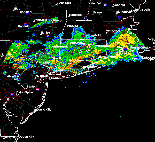 At 736 pm edt, severe thunderstorms were located along a line extending from 6 miles north of port jefferson to near stony brook, moving southeast at 35 mph (radar indicated). Hazards include 60 mph wind gusts. Expect damage to trees and power lines. severe thunderstorms will be near, stony brook around 740 pm edt. centereach and port jefferson around 745 pm edt. coram and farmingville around 750 pm edt. medford and middle island around 755 pm edt. Shirley and manorville around 800 pm edt. At 736 pm edt, severe thunderstorms were located along a line extending from 6 miles north of port jefferson to near stony brook, moving southeast at 35 mph (radar indicated). Hazards include 60 mph wind gusts. Expect damage to trees and power lines. severe thunderstorms will be near, stony brook around 740 pm edt. centereach and port jefferson around 745 pm edt. coram and farmingville around 750 pm edt. medford and middle island around 755 pm edt. Shirley and manorville around 800 pm edt.
|
| 8/11/2018 5:42 AM EDT |
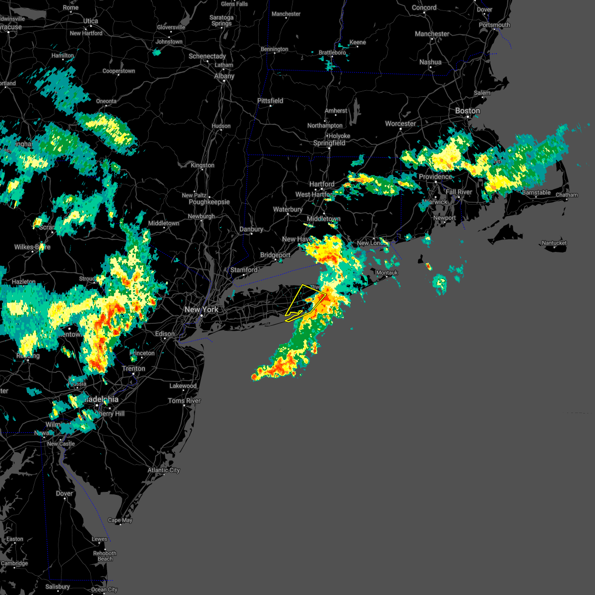 The severe thunderstorm warning for central suffolk county will expire at 545 am edt, the severe thunderstorm which prompted the warning has weakened and moved out of the warned area. therefore, the warning will be allowed to expire. The severe thunderstorm warning for central suffolk county will expire at 545 am edt, the severe thunderstorm which prompted the warning has weakened and moved out of the warned area. therefore, the warning will be allowed to expire.
|
| 8/11/2018 4:56 AM EDT |
 At 456 am edt, a severe thunderstorm was located over davis park, or near patchogue, moving northeast at 25 mph (radar indicated). Hazards include 60 mph wind gusts. Expect damage to trees and power lines. this severe thunderstorm will be near, patchogue around 505 am edt. medford and mastic beach around 515 am edt. shirley and mastic around 520 am edt. middle island and center moriches around 525 am edt. manorville and brookhaven national laboratory around 530 am edt. wading river around 540 am edt. Calverton around 545 am edt. At 456 am edt, a severe thunderstorm was located over davis park, or near patchogue, moving northeast at 25 mph (radar indicated). Hazards include 60 mph wind gusts. Expect damage to trees and power lines. this severe thunderstorm will be near, patchogue around 505 am edt. medford and mastic beach around 515 am edt. shirley and mastic around 520 am edt. middle island and center moriches around 525 am edt. manorville and brookhaven national laboratory around 530 am edt. wading river around 540 am edt. Calverton around 545 am edt.
|
| 8/9/2018 3:38 AM EDT |
 The severe thunderstorm warning for west central suffolk county will expire at 345 am edt, the storm which prompted the warning has weakened below severe limits, and no longer poses an immediate threat to life or property. therefore, the warning will be allowed to expire. however gusty winds to 40 mph are still possible with this thunderstorm. The severe thunderstorm warning for west central suffolk county will expire at 345 am edt, the storm which prompted the warning has weakened below severe limits, and no longer poses an immediate threat to life or property. therefore, the warning will be allowed to expire. however gusty winds to 40 mph are still possible with this thunderstorm.
|
| 8/9/2018 3:04 AM EDT |
 At 304 am edt, a severe thunderstorm was located over centerport, or over northport, moving east at 30 mph (radar indicated). Hazards include 60 mph wind gusts. Expect damage to trees and power lines. this severe thunderstorm will be near, smithtown around 320 am edt. stony brook around 330 am edt. centereach and port jefferson around 335 am edt. farmingville and mount sinai around 340 am edt. Middle island and coram around 345 am edt. At 304 am edt, a severe thunderstorm was located over centerport, or over northport, moving east at 30 mph (radar indicated). Hazards include 60 mph wind gusts. Expect damage to trees and power lines. this severe thunderstorm will be near, smithtown around 320 am edt. stony brook around 330 am edt. centereach and port jefferson around 335 am edt. farmingville and mount sinai around 340 am edt. Middle island and coram around 345 am edt.
|
| 5/15/2018 6:11 PM EDT |
 The severe thunderstorm warning for new london, southeastern new haven, middlesex, queens, suffolk, kings and nassau counties will expire at 615 pm edt, the storms which prompted the warning have weakened below severe limits, and no longer pose an immediate threat to life or property. therefore, the warning will be allowed to expire. however small hail and gusty winds are still possible with these thunderstorms across far eastern new london county in connecticut, and across the south shore and east end of long island. The severe thunderstorm warning for new london, southeastern new haven, middlesex, queens, suffolk, kings and nassau counties will expire at 615 pm edt, the storms which prompted the warning have weakened below severe limits, and no longer pose an immediate threat to life or property. therefore, the warning will be allowed to expire. however small hail and gusty winds are still possible with these thunderstorms across far eastern new london county in connecticut, and across the south shore and east end of long island.
|
| 5/15/2018 5:28 PM EDT |
 At 527 pm edt, severe thunderstorms were located along a line extending from near colchester to near guilford to port jefferson to sheepshead bay, moving east at 60 mph (radar indicated). Hazards include 60 mph wind gusts. Expect damage to trees and power lines. severe thunderstorms will be near, colchester and middle island around 535 pm edt. manorville and wading river around 540 pm edt. jewett city and freeport around 545 pm edt. massapequa and mattituck around 550 pm edt. fishers island and shinnecock hills around 555 pm edt. southampton and bridgehampton around 600 pm edt. East hampton around 605 pm edt. At 527 pm edt, severe thunderstorms were located along a line extending from near colchester to near guilford to port jefferson to sheepshead bay, moving east at 60 mph (radar indicated). Hazards include 60 mph wind gusts. Expect damage to trees and power lines. severe thunderstorms will be near, colchester and middle island around 535 pm edt. manorville and wading river around 540 pm edt. jewett city and freeport around 545 pm edt. massapequa and mattituck around 550 pm edt. fishers island and shinnecock hills around 555 pm edt. southampton and bridgehampton around 600 pm edt. East hampton around 605 pm edt.
|
| 4/6/2017 5:44 PM EDT |
 At 544 pm edt, a severe thunderstorm was located near patchogue, moving north at 80 mph (radar indicated). Hazards include 60 mph wind gusts. Expect damage to roofs, siding, and trees. this severe thunderstorm will be near, middle island and coram around 550 pm edt. Port jefferson and wading river around 555 pm edt. At 544 pm edt, a severe thunderstorm was located near patchogue, moving north at 80 mph (radar indicated). Hazards include 60 mph wind gusts. Expect damage to roofs, siding, and trees. this severe thunderstorm will be near, middle island and coram around 550 pm edt. Port jefferson and wading river around 555 pm edt.
|
| 6/21/2016 5:11 AM EDT |
 At 511 am edt, severe thunderstorms were located along a line extending from near rocky point to near port jefferson, moving southeast at 40 mph (radar indicated). Hazards include 60 mph wind gusts and quarter size hail. Hail damage to vehicles is expected. expect wind damage to roofs, siding, and trees. severe thunderstorms will be near, rocky point around 515 am edt. coram around 520 am edt. middle island and wading river around 525 am edt. brookhaven national laboratory, calverton and yaphank around 530 am edt. manorville, shirley, mastic and mastic beach around 535 am edt. riverhead and center moriches around 540 am edt. westhampton and shinnecock hills around 545 am edt. Other locations impacted by these severe thunderstorms include sound beach, old field, aquebogue, miller place, quogue, belle terre, nesconset highway, setauket-east setauket, flanders and hampton bays. At 511 am edt, severe thunderstorms were located along a line extending from near rocky point to near port jefferson, moving southeast at 40 mph (radar indicated). Hazards include 60 mph wind gusts and quarter size hail. Hail damage to vehicles is expected. expect wind damage to roofs, siding, and trees. severe thunderstorms will be near, rocky point around 515 am edt. coram around 520 am edt. middle island and wading river around 525 am edt. brookhaven national laboratory, calverton and yaphank around 530 am edt. manorville, shirley, mastic and mastic beach around 535 am edt. riverhead and center moriches around 540 am edt. westhampton and shinnecock hills around 545 am edt. Other locations impacted by these severe thunderstorms include sound beach, old field, aquebogue, miller place, quogue, belle terre, nesconset highway, setauket-east setauket, flanders and hampton bays.
|
| 6/7/2016 4:40 PM EDT |
 At 439 pm edt, a severe thunderstorm was located over rocky point, or near middle island, moving northeast at 25 mph (radar indicated). Hazards include 60 mph wind gusts. Expect damage to roofs. siding. and trees. this severe thunderstorm will be near, wading river around 455 pm edt. calverton around 500 pm edt. Other locations impacted by this severe thunderstorm include sound avenue, sound beach, jamesport, aquebogue, miller place, shoreham and ridge. At 439 pm edt, a severe thunderstorm was located over rocky point, or near middle island, moving northeast at 25 mph (radar indicated). Hazards include 60 mph wind gusts. Expect damage to roofs. siding. and trees. this severe thunderstorm will be near, wading river around 455 pm edt. calverton around 500 pm edt. Other locations impacted by this severe thunderstorm include sound avenue, sound beach, jamesport, aquebogue, miller place, shoreham and ridge.
|
| 8/4/2015 5:08 AM EDT |
 At 505 am edt, an extremely severe thunderstorm producing large hail up to ping pong ball size and destructive winds in excess of 80 mph was over port jefferson moving east. seek shelter of an interior room immediately. this severe storm will be near, middle island around 510 am edt. rocky point around 515 am edt. wading river around 520 am edt. calverton around 525 am edt. At 505 am edt, an extremely severe thunderstorm producing large hail up to ping pong ball size and destructive winds in excess of 80 mph was over port jefferson moving east. seek shelter of an interior room immediately. this severe storm will be near, middle island around 510 am edt. rocky point around 515 am edt. wading river around 520 am edt. calverton around 525 am edt.
|
| 8/4/2015 4:56 AM EDT |
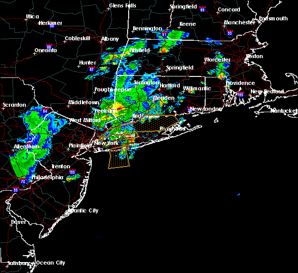 At 455 am edt, doppler radar indicated a severe thunderstorm capable of producing damaging winds in excess of 60 mph approaching stony brook, and moving east at 45 mph. * this severe thunderstorm will be near, farmingville around 500 am edt. port jefferson, mount sinai and coram around 505 am edt. middle island and rocky point around 510 am edt. wading river and calverton around 520 am edt. At 455 am edt, doppler radar indicated a severe thunderstorm capable of producing damaging winds in excess of 60 mph approaching stony brook, and moving east at 45 mph. * this severe thunderstorm will be near, farmingville around 500 am edt. port jefferson, mount sinai and coram around 505 am edt. middle island and rocky point around 510 am edt. wading river and calverton around 520 am edt.
|
| 7/1/2015 6:26 AM EDT |
 The severe thunderstorm warning for central suffolk county will expire at 630 am edt, the storms which prompted the warning will move northeast of the warned area by 630 pm. therefore the warning will be allowed to expire. remember, a severe thunderstorm warning remains in effect for orient and montauk point until at least 645 pm. The severe thunderstorm warning for central suffolk county will expire at 630 am edt, the storms which prompted the warning will move northeast of the warned area by 630 pm. therefore the warning will be allowed to expire. remember, a severe thunderstorm warning remains in effect for orient and montauk point until at least 645 pm.
|
| 7/1/2015 6:02 AM EDT |
 At 601 am edt, doppler radar indicated a line of severe thunderstorms capable of producing damaging winds in excess of 60 mph. these storms were located along a line extending from coram to 16 miles southeast of southhampton, moving northeast at 40 mph. these severe storms will be near, wading river around 615 am edt. calverton around 620 am edt. other locations impacted by these severe thunderstorms include sound beach, springs, aquebogue, miller place, quogue, laurel, cutchogue, flanders, hampton bays and carmans river. At 601 am edt, doppler radar indicated a line of severe thunderstorms capable of producing damaging winds in excess of 60 mph. these storms were located along a line extending from coram to 16 miles southeast of southhampton, moving northeast at 40 mph. these severe storms will be near, wading river around 615 am edt. calverton around 620 am edt. other locations impacted by these severe thunderstorms include sound beach, springs, aquebogue, miller place, quogue, laurel, cutchogue, flanders, hampton bays and carmans river.
|
| 7/1/2015 5:34 AM EDT |
 At 532 am edt, doppler radar indicated a line of severe thunderstorms capable of producing destructive winds in excess of 65 mph. these storms were located along a line extending from 5 miles south of islip to 35 miles southeast of davis park, and moving northeast at 65 mph. * severe thunderstorms will be near, medford, centereach and farmingville around 540 am edt. middle island, shirley, coram, yaphank, mount sinai and mastic around 545 am edt. wading river, manorville, rocky point and brookhaven national laboratory around 550 am edt. calverton around 555 am edt. mattituck around 605 am edt. southold and peconic around 610 am edt. other locations impacted by these severe thunderstorms include springs, aquebogue, laurel, long island express, hampton bays, islandia, selden, north bellport, oakdale and bayport. At 532 am edt, doppler radar indicated a line of severe thunderstorms capable of producing destructive winds in excess of 65 mph. these storms were located along a line extending from 5 miles south of islip to 35 miles southeast of davis park, and moving northeast at 65 mph. * severe thunderstorms will be near, medford, centereach and farmingville around 540 am edt. middle island, shirley, coram, yaphank, mount sinai and mastic around 545 am edt. wading river, manorville, rocky point and brookhaven national laboratory around 550 am edt. calverton around 555 am edt. mattituck around 605 am edt. southold and peconic around 610 am edt. other locations impacted by these severe thunderstorms include springs, aquebogue, laurel, long island express, hampton bays, islandia, selden, north bellport, oakdale and bayport.
|
| 6/23/2015 7:18 PM EDT |
 At 718 pm edt, doppler radar indicated a severe thunderstorm capable of producing damaging winds in excess of 60 mph. this storm was located over stony brook, moving east at 35 mph. locations impacted include, port jefferson, commack, stony brook, hauppauge, middle island, centereach, smithtown, rocky point, coram, mount sinai, farmingville, lake grove, islandia, nissequogue, head of the harbor, poquott, old field, belle terre, st. james and east northport. At 718 pm edt, doppler radar indicated a severe thunderstorm capable of producing damaging winds in excess of 60 mph. this storm was located over stony brook, moving east at 35 mph. locations impacted include, port jefferson, commack, stony brook, hauppauge, middle island, centereach, smithtown, rocky point, coram, mount sinai, farmingville, lake grove, islandia, nissequogue, head of the harbor, poquott, old field, belle terre, st. james and east northport.
|
| 6/23/2015 6:43 PM EDT |
 At 642 pm edt, doppler radar indicated a severe thunderstorm capable of producing quarter size hail and destructive winds in excess of 70 mph. this storm was located over brookville, or over syosset, and moving east at 35 mph. At 642 pm edt, doppler radar indicated a severe thunderstorm capable of producing quarter size hail and destructive winds in excess of 70 mph. this storm was located over brookville, or over syosset, and moving east at 35 mph.
|
Hail Maps for Coram, NY


Connect with Interactive Hail Maps