

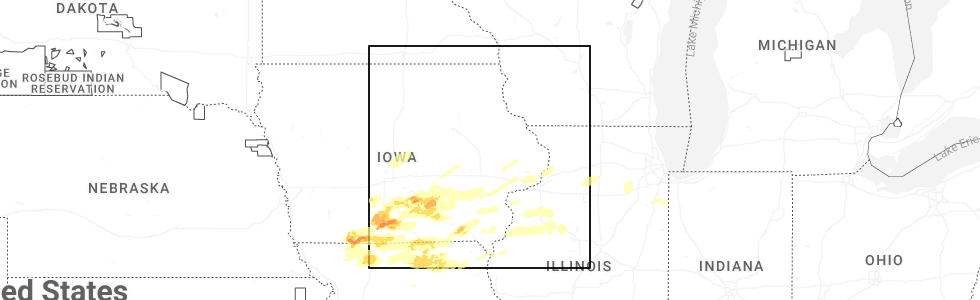
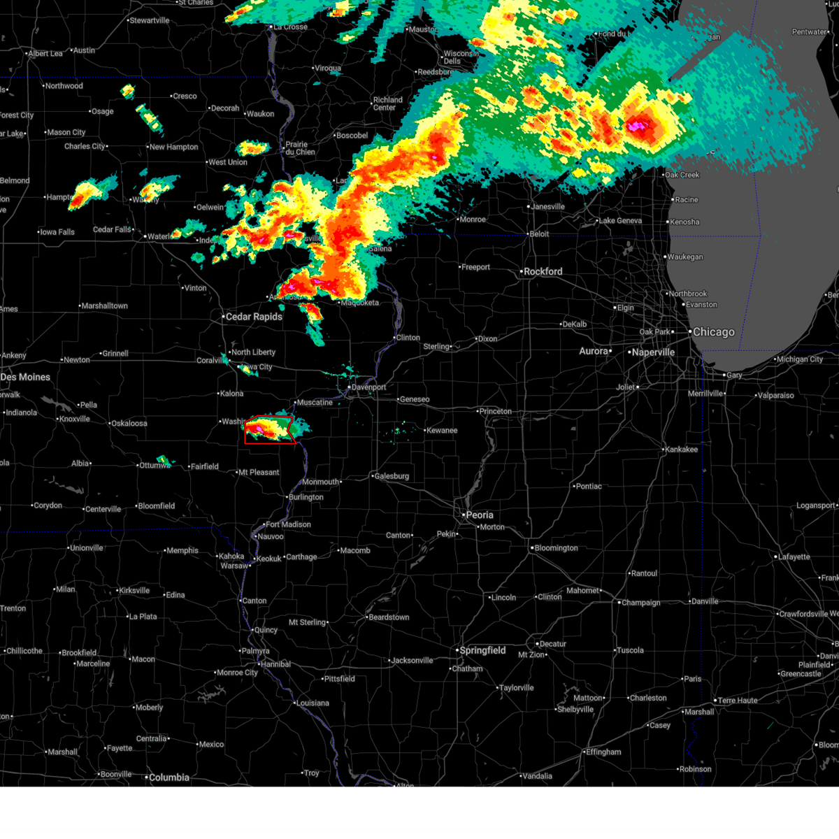
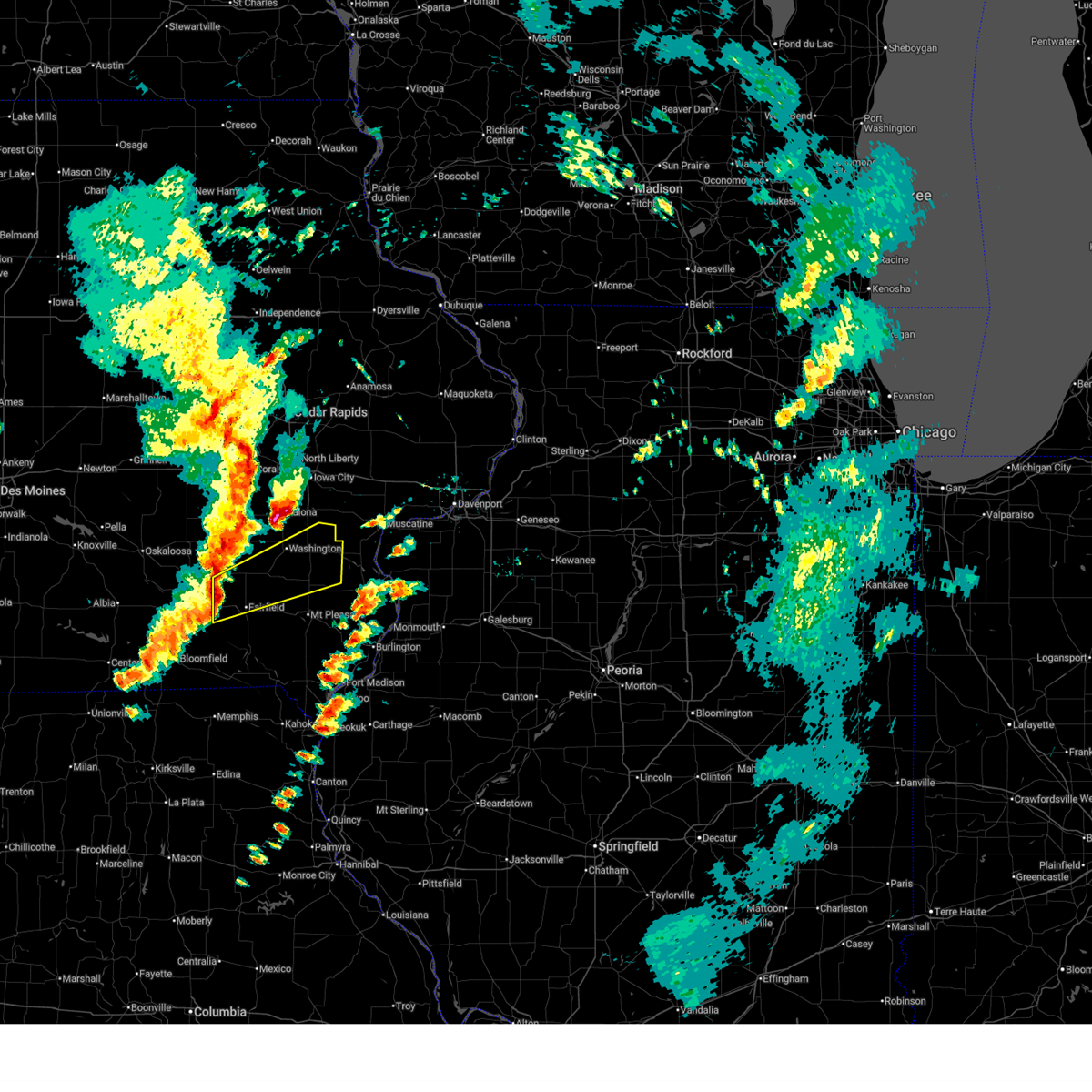
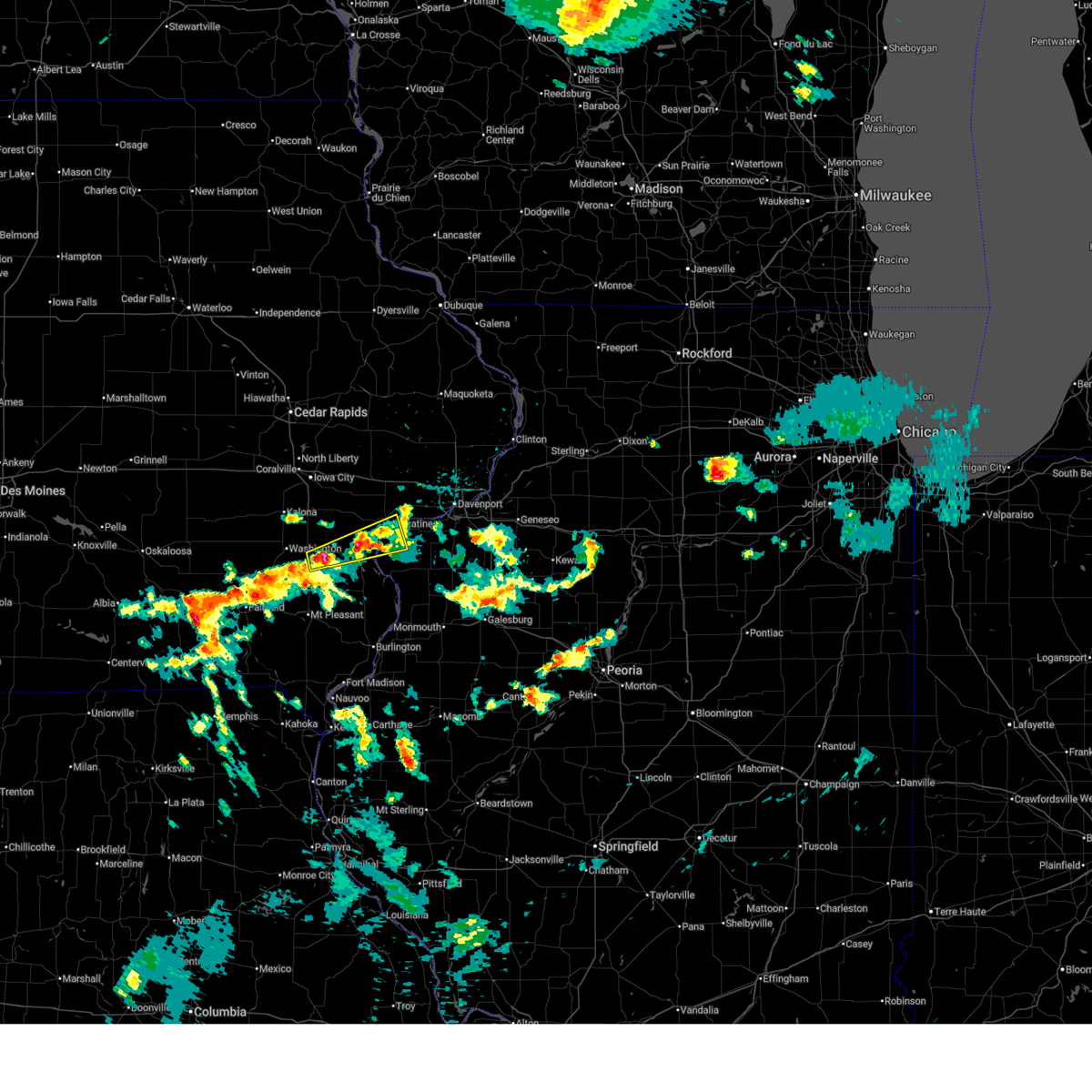
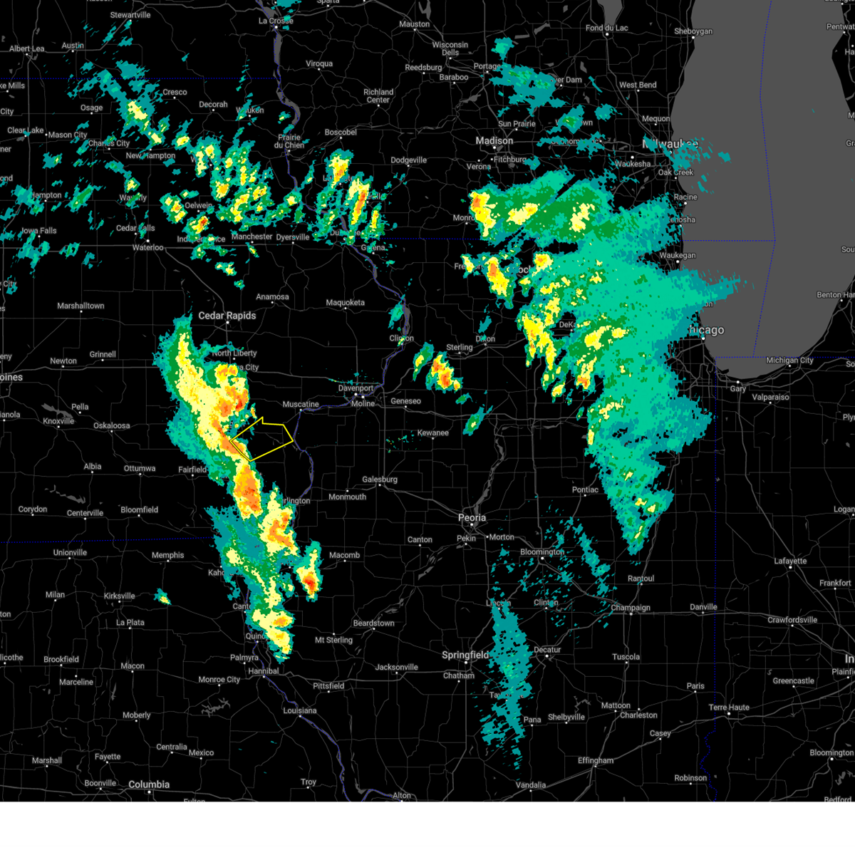
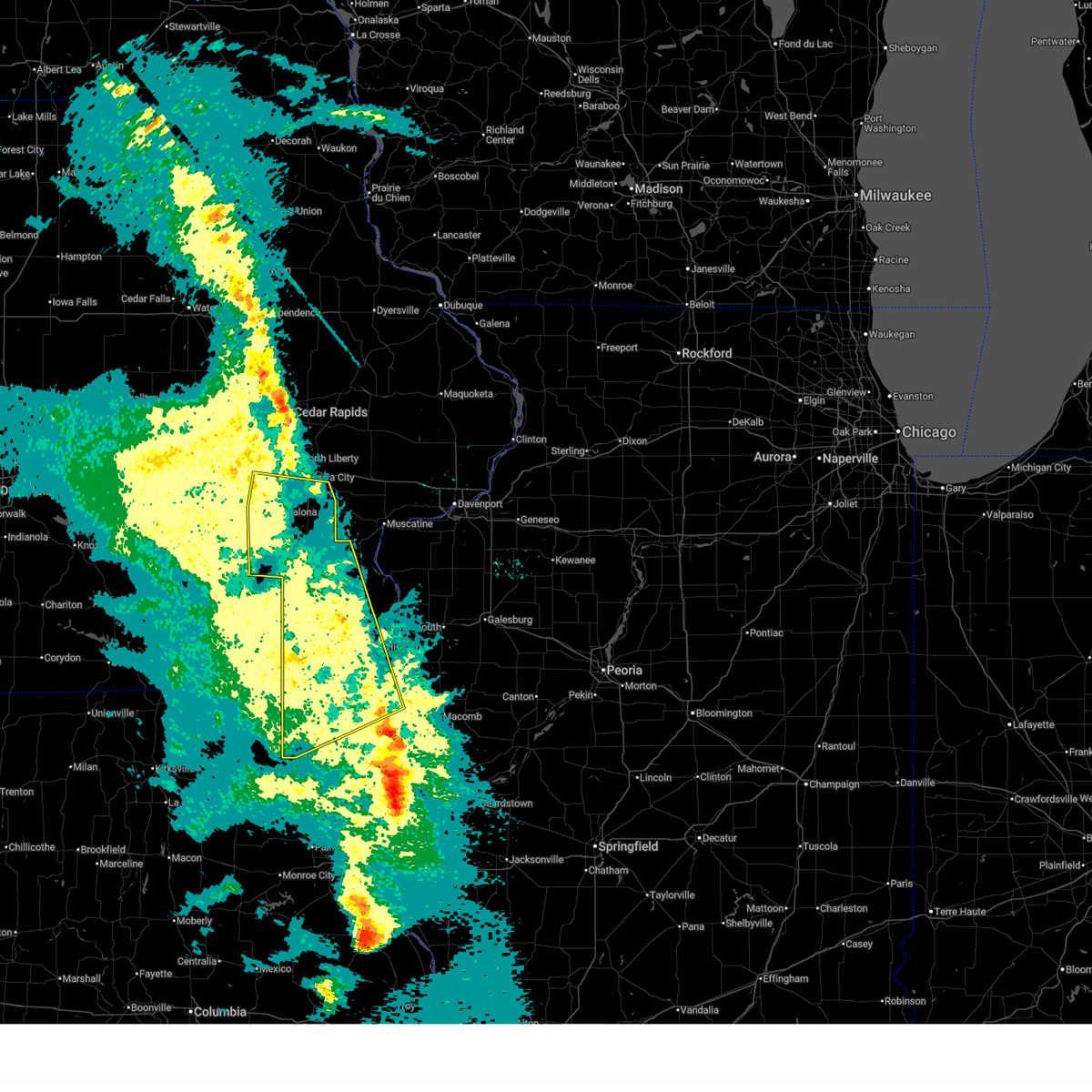
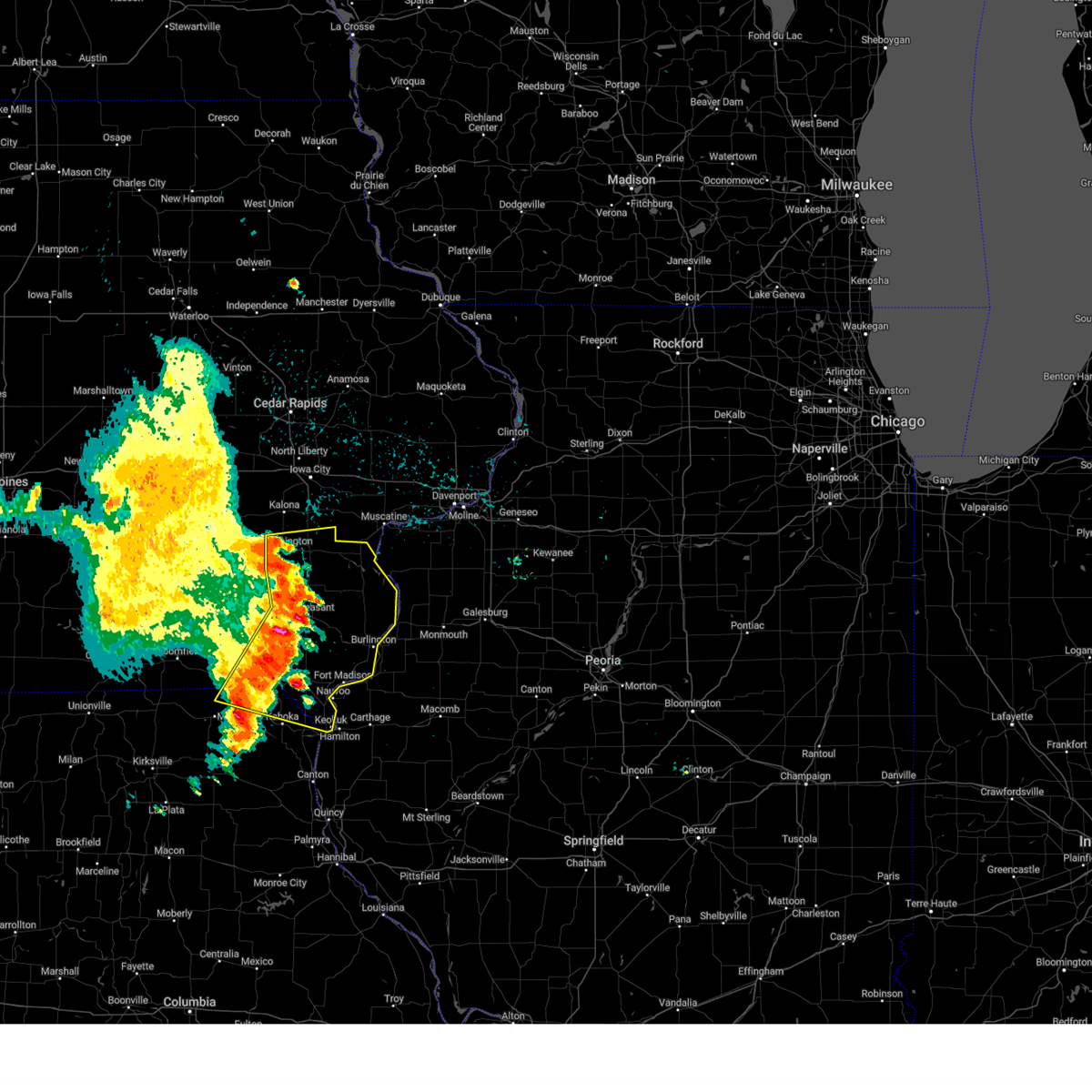
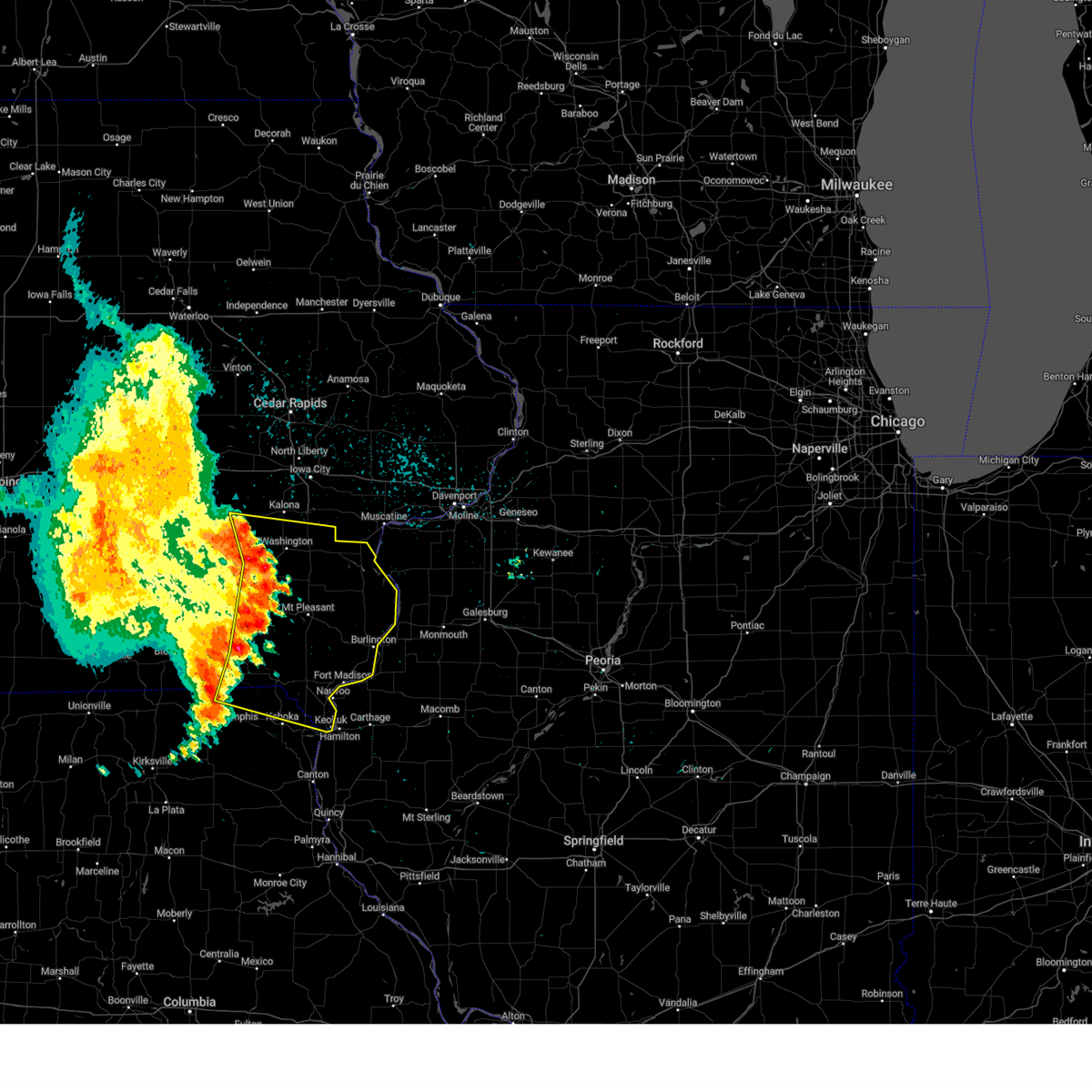
Hail Map for Cotter, IA
The Cotter, IA area has had 0 reports of on-the-ground hail by trained spotters, and has been under severe weather warnings 29 times during the past 12 months. Doppler radar has detected hail at or near Cotter, IA on 67 occasions, including 8 occasions during the past year.
| Name: | Cotter, IA |
| Where Located: | 48.3 miles SSE of Cedar Rapids, IA |
| Map: | Google Map for Cotter, IA |
| Population: | 48 |
| Housing Units: | 24 |
| More Info: | Search Google for Cotter, IA |
0
The Top Recent Hail Date for Cotter, IA is Thursday, June 11, 2026 (55th out of 67)
Hail and Wind Damage Spotted near Cotter, IA
| Date / Time | Report Details |
|---|---|
| 6/17/2026 7:17 AM CDT |
 Svrdvn the national weather service in the quad cities has issued a * severe thunderstorm warning for, henry county in southeastern iowa, des moines county in southeastern iowa, louisa county in southeastern iowa, southeastern keokuk county in southeastern iowa, southern washington county in southeastern iowa, jefferson county in southeastern iowa, * until 815 am cdt. * at 716 am cdt, severe thunderstorms were located along a line extending from near richmond to near rubio to near hedrick, moving southeast at 60 mph (trained weather spotters. this line of storms has a history of producing winds up to 70 mph). Hazards include 70 mph wind gusts. Expect considerable tree damage. Damage is likely to mobile homes, roofs, and outbuildings. Svrdvn the national weather service in the quad cities has issued a * severe thunderstorm warning for, henry county in southeastern iowa, des moines county in southeastern iowa, louisa county in southeastern iowa, southeastern keokuk county in southeastern iowa, southern washington county in southeastern iowa, jefferson county in southeastern iowa, * until 815 am cdt. * at 716 am cdt, severe thunderstorms were located along a line extending from near richmond to near rubio to near hedrick, moving southeast at 60 mph (trained weather spotters. this line of storms has a history of producing winds up to 70 mph). Hazards include 70 mph wind gusts. Expect considerable tree damage. Damage is likely to mobile homes, roofs, and outbuildings.
|
| 6/17/2026 6:10 AM CDT |
 At 610 am cdt, a severe thunderstorm was located over gladwin, or near columbus junction, moving east at 40 mph (radar indicated). Hazards include 60 mph wind gusts and quarter size hail. Hail damage to vehicles is expected. expect wind damage to roofs, siding, and trees. Locations impacted include, muscatine, columbus junction, lone tree, riverside, fruitland, ainsworth, grandview, conesville, columbus city, letts, nichols, crawfordsville, cotter, fredonia, sand springs, cranston, haskins, saulsbury bridge campground, ardon, and muscatine municipal airport. At 610 am cdt, a severe thunderstorm was located over gladwin, or near columbus junction, moving east at 40 mph (radar indicated). Hazards include 60 mph wind gusts and quarter size hail. Hail damage to vehicles is expected. expect wind damage to roofs, siding, and trees. Locations impacted include, muscatine, columbus junction, lone tree, riverside, fruitland, ainsworth, grandview, conesville, columbus city, letts, nichols, crawfordsville, cotter, fredonia, sand springs, cranston, haskins, saulsbury bridge campground, ardon, and muscatine municipal airport.
|
| 6/17/2026 5:52 AM CDT |
 Svrdvn the national weather service in the quad cities has issued a * severe thunderstorm warning for, northwestern louisa county in southeastern iowa, southeastern johnson county in east central iowa, washington county in southeastern iowa, southwestern muscatine county in east central iowa, * until 645 am cdt. * at 551 am cdt, a severe thunderstorm was located over washington, moving east at 40 mph (radar indicated). Hazards include 60 mph wind gusts and half dollar size hail. Hail damage to vehicles is expected. Expect wind damage to roofs, siding, and trees. Svrdvn the national weather service in the quad cities has issued a * severe thunderstorm warning for, northwestern louisa county in southeastern iowa, southeastern johnson county in east central iowa, washington county in southeastern iowa, southwestern muscatine county in east central iowa, * until 645 am cdt. * at 551 am cdt, a severe thunderstorm was located over washington, moving east at 40 mph (radar indicated). Hazards include 60 mph wind gusts and half dollar size hail. Hail damage to vehicles is expected. Expect wind damage to roofs, siding, and trees.
|
| 6/11/2026 9:30 AM CDT |
 At 930 am cdt, severe thunderstorms were located along a line extending from near lisbon to rochester to sand springs, moving east at 60 mph (radar indicated). Hazards include 60 mph wind gusts and penny size hail. Expect damage to roofs, siding, and trees. locations impacted include, davenport, iowa city, moline, rock island, bettendorf, clinton, muscatine, east moline, tipton, west branch, columbus junction, durant, coralville, north liberty, silvis, eldridge, dewitt, milan, camanche, and le claire. this includes the following highways, interstate 74 in iowa between mile markers 1 and 5. interstate 80 in iowa between mile markers 242 and 306. interstate 380 between mile markers 3 and 4. interstate 80 in illinois between mile markers 1 and 5. interstate 74 in illinois between mile markers 1 and 7. interstate 88 between mile markers 1 and 11. Interstate 280 between mile markers 1 and 18. At 930 am cdt, severe thunderstorms were located along a line extending from near lisbon to rochester to sand springs, moving east at 60 mph (radar indicated). Hazards include 60 mph wind gusts and penny size hail. Expect damage to roofs, siding, and trees. locations impacted include, davenport, iowa city, moline, rock island, bettendorf, clinton, muscatine, east moline, tipton, west branch, columbus junction, durant, coralville, north liberty, silvis, eldridge, dewitt, milan, camanche, and le claire. this includes the following highways, interstate 74 in iowa between mile markers 1 and 5. interstate 80 in iowa between mile markers 242 and 306. interstate 380 between mile markers 3 and 4. interstate 80 in illinois between mile markers 1 and 5. interstate 74 in illinois between mile markers 1 and 7. interstate 88 between mile markers 1 and 11. Interstate 280 between mile markers 1 and 18.
|
| 6/11/2026 9:18 AM CDT |
 Svrdvn the national weather service in the quad cities has issued a * severe thunderstorm warning for, rock island county in northwestern illinois, northwestern mercer county in northwestern illinois, northwestern louisa county in southeastern iowa, southeastern jackson county in east central iowa, cedar county in east central iowa, scott county in east central iowa, eastern johnson county in east central iowa, muscatine county in east central iowa, clinton county in east central iowa, * until 1030 am cdt. * at 917 am cdt, severe thunderstorms were located along a line extending from twin view heights to near west branch to columbus junction, moving east at 55 mph (radar indicated). Hazards include 70 mph wind gusts and penny size hail. Expect considerable tree damage. Damage is likely to mobile homes, roofs, and outbuildings. Svrdvn the national weather service in the quad cities has issued a * severe thunderstorm warning for, rock island county in northwestern illinois, northwestern mercer county in northwestern illinois, northwestern louisa county in southeastern iowa, southeastern jackson county in east central iowa, cedar county in east central iowa, scott county in east central iowa, eastern johnson county in east central iowa, muscatine county in east central iowa, clinton county in east central iowa, * until 1030 am cdt. * at 917 am cdt, severe thunderstorms were located along a line extending from twin view heights to near west branch to columbus junction, moving east at 55 mph (radar indicated). Hazards include 70 mph wind gusts and penny size hail. Expect considerable tree damage. Damage is likely to mobile homes, roofs, and outbuildings.
|
| 6/11/2026 8:22 AM CDT |
 At 822 am cdt, severe thunderstorms were located along a line extending from near montezuma to near oskaloosa municipal airport to near blakesburg, moving east at 65 mph (radar indicated). Hazards include 70 mph wind gusts and quarter size hail. Hail damage to vehicles is expected. expect considerable tree damage. wind damage is also likely to mobile homes, roofs, and outbuildings. locations impacted include, iowa city, fairfield, washington, sigourney, columbus junction, coralville, williamsburg, kalona, tiffin, wellman, lone tree, university heights, north english, riverside, wayland, hedrick, hills, brighton, what cheer, and richland. This includes interstate 80 in iowa between mile markers 205 and 253. At 822 am cdt, severe thunderstorms were located along a line extending from near montezuma to near oskaloosa municipal airport to near blakesburg, moving east at 65 mph (radar indicated). Hazards include 70 mph wind gusts and quarter size hail. Hail damage to vehicles is expected. expect considerable tree damage. wind damage is also likely to mobile homes, roofs, and outbuildings. locations impacted include, iowa city, fairfield, washington, sigourney, columbus junction, coralville, williamsburg, kalona, tiffin, wellman, lone tree, university heights, north english, riverside, wayland, hedrick, hills, brighton, what cheer, and richland. This includes interstate 80 in iowa between mile markers 205 and 253.
|
| 6/11/2026 8:19 AM CDT |
 Svrdvn the national weather service in the quad cities has issued a * severe thunderstorm warning for, northern henry county in southeastern iowa, northwestern louisa county in southeastern iowa, keokuk county in southeastern iowa, central johnson county in east central iowa, washington county in southeastern iowa, jefferson county in southeastern iowa, southern iowa county in east central iowa, * until 930 am cdt. * at 818 am cdt, severe thunderstorms were located along a line extending from near barnes city to near oskaloosa municipal airport to near blakesburg, moving east at 65 mph (radar indicated). Hazards include 70 mph wind gusts and quarter size hail. Hail damage to vehicles is expected. expect considerable tree damage. Wind damage is also likely to mobile homes, roofs, and outbuildings. Svrdvn the national weather service in the quad cities has issued a * severe thunderstorm warning for, northern henry county in southeastern iowa, northwestern louisa county in southeastern iowa, keokuk county in southeastern iowa, central johnson county in east central iowa, washington county in southeastern iowa, jefferson county in southeastern iowa, southern iowa county in east central iowa, * until 930 am cdt. * at 818 am cdt, severe thunderstorms were located along a line extending from near barnes city to near oskaloosa municipal airport to near blakesburg, moving east at 65 mph (radar indicated). Hazards include 70 mph wind gusts and quarter size hail. Hail damage to vehicles is expected. expect considerable tree damage. Wind damage is also likely to mobile homes, roofs, and outbuildings.
|
| 6/10/2026 5:45 PM CDT |
 the severe thunderstorm warning has been cancelled and is no longer in effect the severe thunderstorm warning has been cancelled and is no longer in effect
|
| 6/10/2026 5:45 PM CDT |
 At 545 pm cdt, severe thunderstorms were located along a line extending from conesville to near olds, moving east at 55 mph (radar indicated). Hazards include 70 mph wind gusts and penny size hail. Expect considerable tree damage. damage is likely to mobile homes, roofs, and outbuildings. Locations impacted include, washington, wapello, columbus junction, winfield, wayland, morning sun, brighton, ainsworth, grandview, conesville, columbus city, letts, crawfordsville, olds, pleasant plain, cotter, coppock, wyman, fredonia, and west chester. At 545 pm cdt, severe thunderstorms were located along a line extending from conesville to near olds, moving east at 55 mph (radar indicated). Hazards include 70 mph wind gusts and penny size hail. Expect considerable tree damage. damage is likely to mobile homes, roofs, and outbuildings. Locations impacted include, washington, wapello, columbus junction, winfield, wayland, morning sun, brighton, ainsworth, grandview, conesville, columbus city, letts, crawfordsville, olds, pleasant plain, cotter, coppock, wyman, fredonia, and west chester.
|
| 6/10/2026 5:25 PM CDT |
 At 525 pm cdt, a severe thunderstorm was located near brighton, or 7 miles southwest of washington, moving east at 50 mph (radar indicated). Hazards include 70 mph wind gusts and penny size hail. Expect considerable tree damage. damage is likely to mobile homes, roofs, and outbuildings. Locations impacted include, washington, wapello, columbus junction, winfield, wayland, morning sun, brighton, richland, ainsworth, grandview, conesville, columbus city, letts, crawfordsville, olds, packwood, pleasant plain, cotter, coppock, and abingdon. At 525 pm cdt, a severe thunderstorm was located near brighton, or 7 miles southwest of washington, moving east at 50 mph (radar indicated). Hazards include 70 mph wind gusts and penny size hail. Expect considerable tree damage. damage is likely to mobile homes, roofs, and outbuildings. Locations impacted include, washington, wapello, columbus junction, winfield, wayland, morning sun, brighton, richland, ainsworth, grandview, conesville, columbus city, letts, crawfordsville, olds, packwood, pleasant plain, cotter, coppock, and abingdon.
|
| 6/10/2026 11:26 AM CDT |
 Svrdvn the national weather service in the quad cities has issued a * severe thunderstorm warning for, rock island county in northwestern illinois, northern mercer county in northwestern illinois, northwestern louisa county in southeastern iowa, cedar county in east central iowa, scott county in east central iowa, southeastern johnson county in east central iowa, muscatine county in east central iowa, southwestern clinton county in east central iowa, * until 1230 pm cdt. * at 1126 am cdt, severe thunderstorms were located along a line extending from near sharon center to near nichols to morning sun, moving northeast at 50 mph (radar indicated). Hazards include 60 mph wind gusts. expect damage to roofs, siding, and trees Svrdvn the national weather service in the quad cities has issued a * severe thunderstorm warning for, rock island county in northwestern illinois, northern mercer county in northwestern illinois, northwestern louisa county in southeastern iowa, cedar county in east central iowa, scott county in east central iowa, southeastern johnson county in east central iowa, muscatine county in east central iowa, southwestern clinton county in east central iowa, * until 1230 pm cdt. * at 1126 am cdt, severe thunderstorms were located along a line extending from near sharon center to near nichols to morning sun, moving northeast at 50 mph (radar indicated). Hazards include 60 mph wind gusts. expect damage to roofs, siding, and trees
|
| 4/17/2026 5:35 PM CDT |
 At 535 pm cdt, severe thunderstorms were located along a line extending from muscatine county fairgrounds to near letts, moving east at 50 mph. these are destructive storms for west liberty, atalissa, and towards wilton iowa (trained weather spotters). Hazards include 80 mph wind gusts and nickel size hail. Flying debris will be dangerous to those caught without shelter. mobile homes will be heavily damaged. expect considerable damage to roofs, windows, and vehicles. extensive tree damage and power outages are likely. locations impacted include, iowa city, muscatine, tipton, west branch, columbus junction, durant, west liberty, wilton, lone tree, riverside, fruitland, hills, ainsworth, grandview, conesville, bennett, columbus city, letts, nichols, and atalissa. This includes interstate 80 in iowa between mile markers 252 and 278. At 535 pm cdt, severe thunderstorms were located along a line extending from muscatine county fairgrounds to near letts, moving east at 50 mph. these are destructive storms for west liberty, atalissa, and towards wilton iowa (trained weather spotters). Hazards include 80 mph wind gusts and nickel size hail. Flying debris will be dangerous to those caught without shelter. mobile homes will be heavily damaged. expect considerable damage to roofs, windows, and vehicles. extensive tree damage and power outages are likely. locations impacted include, iowa city, muscatine, tipton, west branch, columbus junction, durant, west liberty, wilton, lone tree, riverside, fruitland, hills, ainsworth, grandview, conesville, bennett, columbus city, letts, nichols, and atalissa. This includes interstate 80 in iowa between mile markers 252 and 278.
|
| 4/17/2026 5:12 PM CDT |
 Svrdvn the national weather service in the quad cities has issued a * severe thunderstorm warning for, northwestern louisa county in southeastern iowa, southern cedar county in east central iowa, southeastern johnson county in east central iowa, eastern washington county in southeastern iowa, muscatine county in east central iowa, * until 615 pm cdt. * at 511 pm cdt, severe thunderstorms were located along a line extending from near riverside to near noble, moving east at 50 mph. these are destructive storms for lone tree iowa to wilton iowa (radar indicated). Hazards include 90 mph wind gusts and quarter size hail. You are in a life-threatening situation. flying debris may be deadly to those caught without shelter. mobile homes will be heavily damaged or destroyed. homes and businesses will have substantial roof and window damage. Expect extensive tree damage and power outages. Svrdvn the national weather service in the quad cities has issued a * severe thunderstorm warning for, northwestern louisa county in southeastern iowa, southern cedar county in east central iowa, southeastern johnson county in east central iowa, eastern washington county in southeastern iowa, muscatine county in east central iowa, * until 615 pm cdt. * at 511 pm cdt, severe thunderstorms were located along a line extending from near riverside to near noble, moving east at 50 mph. these are destructive storms for lone tree iowa to wilton iowa (radar indicated). Hazards include 90 mph wind gusts and quarter size hail. You are in a life-threatening situation. flying debris may be deadly to those caught without shelter. mobile homes will be heavily damaged or destroyed. homes and businesses will have substantial roof and window damage. Expect extensive tree damage and power outages.
|
| 4/15/2026 7:44 PM CDT |
 At 744 pm cdt, severe thunderstorms were located along a line extending from near johnson county fairgrounds to haskins, moving northeast at 30 mph (trained weather spotters reported quarter sized hail in riverside). Hazards include 60 mph wind gusts and half dollar size hail. Hail damage to vehicles is expected. expect wind damage to roofs, siding, and trees. locations impacted include, iowa city, washington, kalona, wellman, lone tree, university heights, riverside, hills, richland, ainsworth, cotter, richmond, keota, ollie, west chester, frytown, washington airport, johnson county fairgrounds, haskins, and washington county fairgrounds. This includes interstate 80 in iowa between mile markers 249 and 253. At 744 pm cdt, severe thunderstorms were located along a line extending from near johnson county fairgrounds to haskins, moving northeast at 30 mph (trained weather spotters reported quarter sized hail in riverside). Hazards include 60 mph wind gusts and half dollar size hail. Hail damage to vehicles is expected. expect wind damage to roofs, siding, and trees. locations impacted include, iowa city, washington, kalona, wellman, lone tree, university heights, riverside, hills, richland, ainsworth, cotter, richmond, keota, ollie, west chester, frytown, washington airport, johnson county fairgrounds, haskins, and washington county fairgrounds. This includes interstate 80 in iowa between mile markers 249 and 253.
|
| 4/15/2026 7:26 PM CDT |
 At 726 pm cdt, severe thunderstorms were located along a line extending from near parnell to lake darling state park, moving east at 45 mph (radar indicated). Hazards include 60 mph wind gusts and quarter size hail. Hail damage to vehicles is expected. expect wind damage to roofs, siding, and trees. locations impacted include, iowa city, washington, sigourney, kalona, wellman, lone tree, university heights, north english, riverside, hills, richland, ainsworth, south english, harper, martinsburg, kinross, hayesville, cotter, richmond, and keota. This includes interstate 80 in iowa between mile markers 249 and 253. At 726 pm cdt, severe thunderstorms were located along a line extending from near parnell to lake darling state park, moving east at 45 mph (radar indicated). Hazards include 60 mph wind gusts and quarter size hail. Hail damage to vehicles is expected. expect wind damage to roofs, siding, and trees. locations impacted include, iowa city, washington, sigourney, kalona, wellman, lone tree, university heights, north english, riverside, hills, richland, ainsworth, south english, harper, martinsburg, kinross, hayesville, cotter, richmond, and keota. This includes interstate 80 in iowa between mile markers 249 and 253.
|
| 4/15/2026 7:22 PM CDT |
 At 722 pm cdt, severe thunderstorms were located along a line extending from near north english to rubio, moving east at 45 mph (radar indicated). Hazards include 60 mph wind gusts and quarter size hail. Hail damage to vehicles is expected. expect wind damage to roofs, siding, and trees. locations impacted include, iowa city, washington, sigourney, kalona, wellman, lone tree, university heights, north english, riverside, hills, richland, ainsworth, south english, harper, martinsburg, kinross, hayesville, cotter, richmond, and keota. This includes interstate 80 in iowa between mile markers 249 and 253. At 722 pm cdt, severe thunderstorms were located along a line extending from near north english to rubio, moving east at 45 mph (radar indicated). Hazards include 60 mph wind gusts and quarter size hail. Hail damage to vehicles is expected. expect wind damage to roofs, siding, and trees. locations impacted include, iowa city, washington, sigourney, kalona, wellman, lone tree, university heights, north english, riverside, hills, richland, ainsworth, south english, harper, martinsburg, kinross, hayesville, cotter, richmond, and keota. This includes interstate 80 in iowa between mile markers 249 and 253.
|
| 4/15/2026 7:09 PM CDT |
 Svrdvn the national weather service in the quad cities has issued a * severe thunderstorm warning for, northwestern louisa county in southeastern iowa, keokuk county in southeastern iowa, southern johnson county in east central iowa, washington county in southeastern iowa, southeastern iowa county in east central iowa, * until 815 pm cdt. * at 708 pm cdt, severe thunderstorms were located along a line extending from near webster to linby, moving east at 45 mph (radar indicated). Hazards include 60 mph wind gusts and quarter size hail. Hail damage to vehicles is expected. Expect wind damage to roofs, siding, and trees. Svrdvn the national weather service in the quad cities has issued a * severe thunderstorm warning for, northwestern louisa county in southeastern iowa, keokuk county in southeastern iowa, southern johnson county in east central iowa, washington county in southeastern iowa, southeastern iowa county in east central iowa, * until 815 pm cdt. * at 708 pm cdt, severe thunderstorms were located along a line extending from near webster to linby, moving east at 45 mph (radar indicated). Hazards include 60 mph wind gusts and quarter size hail. Hail damage to vehicles is expected. Expect wind damage to roofs, siding, and trees.
|
| 4/14/2026 6:47 PM CDT |
 the tornado warning has been cancelled and is no longer in effect the tornado warning has been cancelled and is no longer in effect
|
| 4/14/2026 6:47 PM CDT |
 At 646 pm cdt, a severe thunderstorm capable of producing a tornado was located 2 miles southwest of columbus junction, moving east at 40 mph (radar indicated rotation). Hazards include tornado and golf ball size hail. Flying debris will be dangerous to those caught without shelter. mobile homes will be damaged or destroyed. damage to roofs, windows, and vehicles will occur. tree damage is likely. this dangerous storm will be near, columbus junction, grandview, columbus city, letts, fredonia, cairo, and louisa county fairgrounds around 650 pm cdt. Other locations in the path of this tornadic thunderstorm include wapello, sand springs and flaming prairie park. At 646 pm cdt, a severe thunderstorm capable of producing a tornado was located 2 miles southwest of columbus junction, moving east at 40 mph (radar indicated rotation). Hazards include tornado and golf ball size hail. Flying debris will be dangerous to those caught without shelter. mobile homes will be damaged or destroyed. damage to roofs, windows, and vehicles will occur. tree damage is likely. this dangerous storm will be near, columbus junction, grandview, columbus city, letts, fredonia, cairo, and louisa county fairgrounds around 650 pm cdt. Other locations in the path of this tornadic thunderstorm include wapello, sand springs and flaming prairie park.
|
| 4/14/2026 6:45 PM CDT |
 At 644 pm cdt, a severe thunderstorm was located near wyman, or near columbus junction, moving east at 35 mph (trained weather spotters). Hazards include golf ball size hail and 60 mph wind gusts. People and animals outdoors will be injured. expect hail damage to roofs, siding, windows, and vehicles. expect wind damage to roofs, siding, and trees. Locations impacted include, muscatine, wapello, columbus junction, fruitland, grandview, columbus city, letts, cotter, wyman, fredonia, sand springs, cairo, louisa county fairgrounds, snively access campground, ardon, muscatine municipal airport, and flaming prairie park. At 644 pm cdt, a severe thunderstorm was located near wyman, or near columbus junction, moving east at 35 mph (trained weather spotters). Hazards include golf ball size hail and 60 mph wind gusts. People and animals outdoors will be injured. expect hail damage to roofs, siding, windows, and vehicles. expect wind damage to roofs, siding, and trees. Locations impacted include, muscatine, wapello, columbus junction, fruitland, grandview, columbus city, letts, cotter, wyman, fredonia, sand springs, cairo, louisa county fairgrounds, snively access campground, ardon, muscatine municipal airport, and flaming prairie park.
|
| 4/14/2026 6:34 PM CDT |
 Tordvn the national weather service in the quad cities has issued a * tornado warning for, central louisa county in southeastern iowa, southeastern washington county in southeastern iowa, * until 730 pm cdt. * at 634 pm cdt, a severe thunderstorm capable of producing a tornado was located over crawfordsville, or 9 miles southeast of washington, moving east at 30 mph (radar indicated rotation). Hazards include tornado. Flying debris will be dangerous to those caught without shelter. mobile homes will be damaged or destroyed. damage to roofs, windows, and vehicles will occur. tree damage is likely. this dangerous storm will be near, columbus junction, columbus city, crawfordsville, cotter, wyman, and louisa county fairgrounds around 640 pm cdt. fredonia and cairo around 645 pm cdt. Other locations in the path of this tornadic thunderstorm include grandview, letts, wapello, sand springs, flaming prairie park and snively access campground. Tordvn the national weather service in the quad cities has issued a * tornado warning for, central louisa county in southeastern iowa, southeastern washington county in southeastern iowa, * until 730 pm cdt. * at 634 pm cdt, a severe thunderstorm capable of producing a tornado was located over crawfordsville, or 9 miles southeast of washington, moving east at 30 mph (radar indicated rotation). Hazards include tornado. Flying debris will be dangerous to those caught without shelter. mobile homes will be damaged or destroyed. damage to roofs, windows, and vehicles will occur. tree damage is likely. this dangerous storm will be near, columbus junction, columbus city, crawfordsville, cotter, wyman, and louisa county fairgrounds around 640 pm cdt. fredonia and cairo around 645 pm cdt. Other locations in the path of this tornadic thunderstorm include grandview, letts, wapello, sand springs, flaming prairie park and snively access campground.
|
| 4/14/2026 6:32 PM CDT |
 Svrdvn the national weather service in the quad cities has issued a * severe thunderstorm warning for, louisa county in southeastern iowa, southeastern washington county in southeastern iowa, southwestern muscatine county in east central iowa, * until 745 pm cdt. * at 632 pm cdt, a severe thunderstorm was located over crawfordsville, or 9 miles southeast of washington, moving east at 30 mph. trained spotters reported golf ball size hail with this storm north of wayland (trained weather spotters). Hazards include two inch hail and 60 mph wind gusts. People and animals outdoors will be injured. expect hail damage to roofs, siding, windows, and vehicles. Expect wind damage to roofs, siding, and trees. Svrdvn the national weather service in the quad cities has issued a * severe thunderstorm warning for, louisa county in southeastern iowa, southeastern washington county in southeastern iowa, southwestern muscatine county in east central iowa, * until 745 pm cdt. * at 632 pm cdt, a severe thunderstorm was located over crawfordsville, or 9 miles southeast of washington, moving east at 30 mph. trained spotters reported golf ball size hail with this storm north of wayland (trained weather spotters). Hazards include two inch hail and 60 mph wind gusts. People and animals outdoors will be injured. expect hail damage to roofs, siding, windows, and vehicles. Expect wind damage to roofs, siding, and trees.
|
| 4/2/2026 4:46 PM CDT |
 the severe thunderstorm warning has been cancelled and is no longer in effect the severe thunderstorm warning has been cancelled and is no longer in effect
|
| 4/2/2026 4:46 PM CDT |
 At 445 pm cdt, a severe thunderstorm was located over marr park, or near washington, moving northeast at 45 mph (radar indicated). Hazards include 60 mph wind gusts. Expect damage to roofs, siding, and trees. Locations impacted include, columbus junction, ainsworth, crawfordsville, cotter, haskins, gladwin, marr park, columbus city, fredonia and louisa county fairgrounds. At 445 pm cdt, a severe thunderstorm was located over marr park, or near washington, moving northeast at 45 mph (radar indicated). Hazards include 60 mph wind gusts. Expect damage to roofs, siding, and trees. Locations impacted include, columbus junction, ainsworth, crawfordsville, cotter, haskins, gladwin, marr park, columbus city, fredonia and louisa county fairgrounds.
|
| 4/2/2026 4:12 PM CDT |
 Svrdvn the national weather service in the quad cities has issued a * severe thunderstorm warning for, northern henry county in southeastern iowa, western louisa county in southeastern iowa, southeastern keokuk county in southeastern iowa, southern washington county in southeastern iowa, jefferson county in southeastern iowa, * until 515 pm cdt. * at 412 pm cdt, a severe thunderstorm was located over packwood, or 8 miles northwest of fairfield, moving northeast at 55 mph (radar indicated). Hazards include 60 mph wind gusts. Expect damage to roofs, siding, and trees. this severe thunderstorm will be near, fairfield, richland, maharishi vedic city, packwood, pleasant plain, ollie, fairfield municipal airport, jefferson county fairgrounds, perlee, and east pleasant plain around 415 pm cdt. brighton around 420 pm cdt. coppock, germanville, and washington county fairgrounds around 425 pm cdt. washington, wayland, washington airport, and noble around 430 pm cdt. Other locations in the path of this severe thunderstorm include ainsworth, crawfordsville, marr park, cotter, haskins, columbus junction, columbus city, wyman, louisa county fairgrounds, gladwin and fredonia. Svrdvn the national weather service in the quad cities has issued a * severe thunderstorm warning for, northern henry county in southeastern iowa, western louisa county in southeastern iowa, southeastern keokuk county in southeastern iowa, southern washington county in southeastern iowa, jefferson county in southeastern iowa, * until 515 pm cdt. * at 412 pm cdt, a severe thunderstorm was located over packwood, or 8 miles northwest of fairfield, moving northeast at 55 mph (radar indicated). Hazards include 60 mph wind gusts. Expect damage to roofs, siding, and trees. this severe thunderstorm will be near, fairfield, richland, maharishi vedic city, packwood, pleasant plain, ollie, fairfield municipal airport, jefferson county fairgrounds, perlee, and east pleasant plain around 415 pm cdt. brighton around 420 pm cdt. coppock, germanville, and washington county fairgrounds around 425 pm cdt. washington, wayland, washington airport, and noble around 430 pm cdt. Other locations in the path of this severe thunderstorm include ainsworth, crawfordsville, marr park, cotter, haskins, columbus junction, columbus city, wyman, louisa county fairgrounds, gladwin and fredonia.
|
| 3/31/2026 10:17 AM CDT |
 the severe thunderstorm warning has been cancelled and is no longer in effect the severe thunderstorm warning has been cancelled and is no longer in effect
|
| 3/31/2026 10:17 AM CDT |
 At 1016 am cdt, a severe thunderstorm was located over columbus city, or near columbus junction, moving east at 30 mph (radar indicated). Hazards include quarter size hail. Damage to vehicles is expected. Locations impacted include, columbus junction, columbus city, cotter, fredonia, and louisa county fairgrounds. At 1016 am cdt, a severe thunderstorm was located over columbus city, or near columbus junction, moving east at 30 mph (radar indicated). Hazards include quarter size hail. Damage to vehicles is expected. Locations impacted include, columbus junction, columbus city, cotter, fredonia, and louisa county fairgrounds.
|
| 3/31/2026 10:10 AM CDT |
 Svrdvn the national weather service in the quad cities has issued a * severe thunderstorm warning for, west central louisa county in southeastern iowa, southeastern washington county in southeastern iowa, * until 1045 am cdt. * at 1010 am cdt, a severe thunderstorm was located near crawfordsville, or near columbus junction, moving east at 30 mph (radar indicated). Hazards include quarter size hail. damage to vehicles is expected Svrdvn the national weather service in the quad cities has issued a * severe thunderstorm warning for, west central louisa county in southeastern iowa, southeastern washington county in southeastern iowa, * until 1045 am cdt. * at 1010 am cdt, a severe thunderstorm was located near crawfordsville, or near columbus junction, moving east at 30 mph (radar indicated). Hazards include quarter size hail. damage to vehicles is expected
|
| 3/31/2026 8:11 AM CDT |
 Svrdvn the national weather service in the quad cities has issued a * severe thunderstorm warning for, southwestern rock island county in northwestern illinois, northwestern mercer county in northwestern illinois, west central louisa county in southeastern iowa, southeastern washington county in southeastern iowa, southwestern muscatine county in east central iowa, * until 900 am cdt. * at 811 am cdt, a severe thunderstorm was located over cotter, or near columbus junction, moving east at 40 mph (radar indicated). Hazards include 60 mph wind gusts and quarter size hail. Hail damage to vehicles is expected. Expect wind damage to roofs, siding, and trees. Svrdvn the national weather service in the quad cities has issued a * severe thunderstorm warning for, southwestern rock island county in northwestern illinois, northwestern mercer county in northwestern illinois, west central louisa county in southeastern iowa, southeastern washington county in southeastern iowa, southwestern muscatine county in east central iowa, * until 900 am cdt. * at 811 am cdt, a severe thunderstorm was located over cotter, or near columbus junction, moving east at 40 mph (radar indicated). Hazards include 60 mph wind gusts and quarter size hail. Hail damage to vehicles is expected. Expect wind damage to roofs, siding, and trees.
|
| 3/19/2025 12:26 PM CDT |
 The storm which prompted the warning has weakened below severe limits, and no longer poses an immediate threat to life or property. therefore, the warning will be allowed to expire. however, gusty winds are still possible with this thunderstorm. The storm which prompted the warning has weakened below severe limits, and no longer poses an immediate threat to life or property. therefore, the warning will be allowed to expire. however, gusty winds are still possible with this thunderstorm.
|
| 3/19/2025 12:18 PM CDT |
 At 1218 pm cdt, a severe thunderstorm was located over letts, or near columbus junction, moving northeast at 45 mph (radar indicated). Hazards include 60 mph wind gusts. Expect damage to roofs, siding, and trees. Locations impacted include, sand springs, columbus junction, letts, cairo, fredonia, louisa county fairgrounds, grandview, cotter, and columbus city. At 1218 pm cdt, a severe thunderstorm was located over letts, or near columbus junction, moving northeast at 45 mph (radar indicated). Hazards include 60 mph wind gusts. Expect damage to roofs, siding, and trees. Locations impacted include, sand springs, columbus junction, letts, cairo, fredonia, louisa county fairgrounds, grandview, cotter, and columbus city.
|
| 3/19/2025 12:10 PM CDT |
 At 1210 pm cdt, a severe thunderstorm was located over fredonia, or over columbus junction, moving northeast at 35 mph (radar indicated). Hazards include 60 mph wind gusts. Expect damage to roofs, siding, and trees. Locations impacted include, sand springs, columbus junction, letts, cairo, fredonia, louisa county fairgrounds, grandview, cotter, and columbus city. At 1210 pm cdt, a severe thunderstorm was located over fredonia, or over columbus junction, moving northeast at 35 mph (radar indicated). Hazards include 60 mph wind gusts. Expect damage to roofs, siding, and trees. Locations impacted include, sand springs, columbus junction, letts, cairo, fredonia, louisa county fairgrounds, grandview, cotter, and columbus city.
|
| 3/19/2025 12:10 PM CDT |
 the severe thunderstorm warning has been cancelled and is no longer in effect the severe thunderstorm warning has been cancelled and is no longer in effect
|
| 3/19/2025 12:05 PM CDT |
 At 1205 pm cdt, a severe thunderstorm was located over columbus city, or over columbus junction, moving northeast at 35 mph (radar indicated). Hazards include 60 mph wind gusts. Expect damage to roofs, siding, and trees. Locations impacted include, sand springs, columbus junction, letts, cairo, fredonia, louisa county fairgrounds, winfield, wyman, grandview, cotter, columbus city, and crawfordsville. At 1205 pm cdt, a severe thunderstorm was located over columbus city, or over columbus junction, moving northeast at 35 mph (radar indicated). Hazards include 60 mph wind gusts. Expect damage to roofs, siding, and trees. Locations impacted include, sand springs, columbus junction, letts, cairo, fredonia, louisa county fairgrounds, winfield, wyman, grandview, cotter, columbus city, and crawfordsville.
|
| 3/19/2025 11:57 AM CDT |
 At 1156 am cdt, a severe thunderstorm was located over wyman, or near columbus junction, moving northeast at 35 mph (radar indicated). Hazards include 60 mph wind gusts. Expect damage to roofs, siding, and trees. Locations impacted include, sand springs, columbus junction, letts, cairo, fredonia, louisa county fairgrounds, winfield, wyman, crawfordsville, grandview, cotter, and columbus city. At 1156 am cdt, a severe thunderstorm was located over wyman, or near columbus junction, moving northeast at 35 mph (radar indicated). Hazards include 60 mph wind gusts. Expect damage to roofs, siding, and trees. Locations impacted include, sand springs, columbus junction, letts, cairo, fredonia, louisa county fairgrounds, winfield, wyman, crawfordsville, grandview, cotter, and columbus city.
|
| 3/19/2025 11:51 AM CDT |
 At 1151 am cdt, a severe thunderstorm was located over crawfordsville, or 10 miles southwest of columbus junction, moving northeast at 35 mph (radar indicated). Hazards include 60 mph wind gusts. Expect damage to roofs, siding, and trees. Locations impacted include, sand springs, columbus junction, letts, noble, fredonia, winfield, olds, crawfordsville, columbus city, cairo, louisa county fairgrounds, swedesburg, wyman, grandview, cotter, and wayland. At 1151 am cdt, a severe thunderstorm was located over crawfordsville, or 10 miles southwest of columbus junction, moving northeast at 35 mph (radar indicated). Hazards include 60 mph wind gusts. Expect damage to roofs, siding, and trees. Locations impacted include, sand springs, columbus junction, letts, noble, fredonia, winfield, olds, crawfordsville, columbus city, cairo, louisa county fairgrounds, swedesburg, wyman, grandview, cotter, and wayland.
|
| 3/19/2025 11:46 AM CDT |
 Svrdvn the national weather service in the quad cities has issued a * severe thunderstorm warning for, northeastern henry county in southeastern iowa, western louisa county in southeastern iowa, southeastern washington county in southeastern iowa, * until 1230 pm cdt. * at 1145 am cdt, a severe thunderstorm was located over noble, or 11 miles southeast of washington, moving northeast at 35 mph (radar indicated). Hazards include 60 mph wind gusts. expect damage to roofs, siding, and trees Svrdvn the national weather service in the quad cities has issued a * severe thunderstorm warning for, northeastern henry county in southeastern iowa, western louisa county in southeastern iowa, southeastern washington county in southeastern iowa, * until 1230 pm cdt. * at 1145 am cdt, a severe thunderstorm was located over noble, or 11 miles southeast of washington, moving northeast at 35 mph (radar indicated). Hazards include 60 mph wind gusts. expect damage to roofs, siding, and trees
|
| 3/14/2025 8:40 PM CDT |
 At 840 pm cdt, a severe thunderstorm was located over sutliff, or 7 miles southwest of mechanicsville, moving north at 70 mph (radar indicated). Hazards include 70 mph wind gusts. Expect considerable tree damage. damage is likely to mobile homes, roofs, and outbuildings. locations impacted include, muscatine county fairgrounds, amber, sugar bottom camp ground, ainsworth, johnson county fairgrounds, morning sun, lake macbride state park, hills, tipton matthews airport, waubeek, swedesburg, stone city, wyman, muscatine municipal airport, flaming prairie park, cotter, columbus junction, matsell bridge natural area, lisbon, and bertram. This includes interstate 80 in iowa between mile markers 241 and 274. At 840 pm cdt, a severe thunderstorm was located over sutliff, or 7 miles southwest of mechanicsville, moving north at 70 mph (radar indicated). Hazards include 70 mph wind gusts. Expect considerable tree damage. damage is likely to mobile homes, roofs, and outbuildings. locations impacted include, muscatine county fairgrounds, amber, sugar bottom camp ground, ainsworth, johnson county fairgrounds, morning sun, lake macbride state park, hills, tipton matthews airport, waubeek, swedesburg, stone city, wyman, muscatine municipal airport, flaming prairie park, cotter, columbus junction, matsell bridge natural area, lisbon, and bertram. This includes interstate 80 in iowa between mile markers 241 and 274.
|
| 3/14/2025 8:26 PM CDT |
 At 826 pm cdt, a severe thunderstorm was located near west branch, moving north at 70 mph (radar indicated). Hazards include 70 mph wind gusts. Expect considerable tree damage. damage is likely to mobile homes, roofs, and outbuildings. locations impacted include, cedar bluff, cedar valley, oasis, iowa city, newport, morse, elmira, springdale, cedar valley park, herbert hoover national historic site, buchanan, solon, sutliff, lisbon, mechanicsville, mount vernon, morley, martelle, paralta, viola, anamosa, wapsipinicon state park, olin, stone city, springville, central park and matsell bridge natural area. This includes interstate 80 in iowa between mile markers 241 and 274. At 826 pm cdt, a severe thunderstorm was located near west branch, moving north at 70 mph (radar indicated). Hazards include 70 mph wind gusts. Expect considerable tree damage. damage is likely to mobile homes, roofs, and outbuildings. locations impacted include, cedar bluff, cedar valley, oasis, iowa city, newport, morse, elmira, springdale, cedar valley park, herbert hoover national historic site, buchanan, solon, sutliff, lisbon, mechanicsville, mount vernon, morley, martelle, paralta, viola, anamosa, wapsipinicon state park, olin, stone city, springville, central park and matsell bridge natural area. This includes interstate 80 in iowa between mile markers 241 and 274.
|
| 3/14/2025 8:21 PM CDT |
 At 821 pm cdt, severe thunderstorms were located along a line extending from near kalona to denmark, moving north at 40 mph (trained weather spotters). Hazards include 70 mph wind gusts. Expect considerable tree damage. damage is likely to mobile homes, roofs, and outbuildings. Locations impacted include, geode state park, olds, haskins, cotter, ainsworth, new london, frytown, wyman, mount union, sharon center, marsh, prairie grove, iowa city, pleasant grove, yarmouth, river junction, cairo, columbus city, gladwin, hills, columbus junction, big hollow recreation area, hills access, virginia grove recreation area, iowa city municipal airport, morning sun, johnson county fairgrounds, louisa county fairgrounds, lone tree, garland, fredonia and amber. At 821 pm cdt, severe thunderstorms were located along a line extending from near kalona to denmark, moving north at 40 mph (trained weather spotters). Hazards include 70 mph wind gusts. Expect considerable tree damage. damage is likely to mobile homes, roofs, and outbuildings. Locations impacted include, geode state park, olds, haskins, cotter, ainsworth, new london, frytown, wyman, mount union, sharon center, marsh, prairie grove, iowa city, pleasant grove, yarmouth, river junction, cairo, columbus city, gladwin, hills, columbus junction, big hollow recreation area, hills access, virginia grove recreation area, iowa city municipal airport, morning sun, johnson county fairgrounds, louisa county fairgrounds, lone tree, garland, fredonia and amber.
|
| 3/14/2025 8:03 PM CDT |
 Svrdvn the national weather service in the quad cities has issued a * severe thunderstorm warning for, northeastern henry county in southeastern iowa, louisa county in southeastern iowa, cedar county in east central iowa, eastern johnson county in east central iowa, eastern washington county in southeastern iowa, southern jones county in east central iowa, muscatine county in east central iowa, southeastern linn county in east central iowa, * until 900 pm cdt. * at 801 pm cdt, a severe thunderstorm was located over wyman, or 8 miles southwest of columbus junction, moving north at 70 mph. a trained spotter reported a wind gust of 77 mph in new london iowa at 748 pm. this is a destructive storm for henry county and washington county (trained weather spotters). Hazards include 80 mph wind gusts. Flying debris will be dangerous to those caught without shelter. mobile homes will be heavily damaged. expect considerable damage to roofs, windows, and vehicles. extensive tree damage and power outages are likely. this severe thunderstorm will be near, haskins, cotter, ainsworth, cairo, wyman, columbus city, crawfordsville, gladwin, fredonia, and columbus junction around 805 pm cdt. conesville around 810 pm cdt. lone tree, river junction, riverside, and nichols around 815 pm cdt. west liberty, iowa city, hills, and hills access around 820 pm cdt. other locations in the path of this severe thunderstorm include oasis, springdale, herbert hoover national historic site, muscatine county fairgrounds, west branch, cedar bluff, cedar valley, newport, morse, elmira, cedar valley park, buchanan, solon, sutliff, lisbon, mechanicsville and mount vernon. This includes interstate 80 in iowa between mile markers 241 and 274. Svrdvn the national weather service in the quad cities has issued a * severe thunderstorm warning for, northeastern henry county in southeastern iowa, louisa county in southeastern iowa, cedar county in east central iowa, eastern johnson county in east central iowa, eastern washington county in southeastern iowa, southern jones county in east central iowa, muscatine county in east central iowa, southeastern linn county in east central iowa, * until 900 pm cdt. * at 801 pm cdt, a severe thunderstorm was located over wyman, or 8 miles southwest of columbus junction, moving north at 70 mph. a trained spotter reported a wind gust of 77 mph in new london iowa at 748 pm. this is a destructive storm for henry county and washington county (trained weather spotters). Hazards include 80 mph wind gusts. Flying debris will be dangerous to those caught without shelter. mobile homes will be heavily damaged. expect considerable damage to roofs, windows, and vehicles. extensive tree damage and power outages are likely. this severe thunderstorm will be near, haskins, cotter, ainsworth, cairo, wyman, columbus city, crawfordsville, gladwin, fredonia, and columbus junction around 805 pm cdt. conesville around 810 pm cdt. lone tree, river junction, riverside, and nichols around 815 pm cdt. west liberty, iowa city, hills, and hills access around 820 pm cdt. other locations in the path of this severe thunderstorm include oasis, springdale, herbert hoover national historic site, muscatine county fairgrounds, west branch, cedar bluff, cedar valley, newport, morse, elmira, cedar valley park, buchanan, solon, sutliff, lisbon, mechanicsville and mount vernon. This includes interstate 80 in iowa between mile markers 241 and 274.
|
| 3/14/2025 7:53 PM CDT |
 At 750 pm cdt, severe thunderstorms were located along a line extending from near brighton to sandusky, moving north at 40 mph. a trained spotter reported a wind gust of 77 mph in new london iowa at 748 pm. these are destructive storms for henry county and washington county (trained weather spotters). Hazards include 80 mph wind gusts. Flying debris will be dangerous to those caught without shelter. mobile homes will be heavily damaged. expect considerable damage to roofs, windows, and vehicles. extensive tree damage and power outages are likely. these severe storms will be near, coppock, washington airport, west point, bluff park, merrimac, westwood, rome, noble, galland, and washington around 755 pm cdt. fort madison municipal arpt, sawyer, swedesburg, and lowell around 800 pm cdt. Other locations in the path of these severe thunderstorms include geode state park, olds, denmark, new london, niota, richmond, ainsworth, crawfordsville, wellman, kalona, camp l-kee-ta, marr park, augusta, amish, danville, winfield, welter recreation area, haskins, frytown, wyman, mount union, sharon center, riverside, middletown, cotter, cosgrove, windham, marsh, prairie grove, iowa city, pleasant grove and yarmouth. At 750 pm cdt, severe thunderstorms were located along a line extending from near brighton to sandusky, moving north at 40 mph. a trained spotter reported a wind gust of 77 mph in new london iowa at 748 pm. these are destructive storms for henry county and washington county (trained weather spotters). Hazards include 80 mph wind gusts. Flying debris will be dangerous to those caught without shelter. mobile homes will be heavily damaged. expect considerable damage to roofs, windows, and vehicles. extensive tree damage and power outages are likely. these severe storms will be near, coppock, washington airport, west point, bluff park, merrimac, westwood, rome, noble, galland, and washington around 755 pm cdt. fort madison municipal arpt, sawyer, swedesburg, and lowell around 800 pm cdt. Other locations in the path of these severe thunderstorms include geode state park, olds, denmark, new london, niota, richmond, ainsworth, crawfordsville, wellman, kalona, camp l-kee-ta, marr park, augusta, amish, danville, winfield, welter recreation area, haskins, frytown, wyman, mount union, sharon center, riverside, middletown, cotter, cosgrove, windham, marsh, prairie grove, iowa city, pleasant grove and yarmouth.
|
| 3/14/2025 7:41 PM CDT |
 Svrdvn the national weather service in the quad cities has issued a * severe thunderstorm warning for, northern hancock county in west central illinois, southwestern henderson county in west central illinois, henry county in southeastern iowa, des moines county in southeastern iowa, louisa county in southeastern iowa, southern johnson county in east central iowa, washington county in southeastern iowa, southeastern iowa county in east central iowa, lee county in southeastern iowa, central clark county in northeastern missouri, * until 830 pm cdt. * at 741 pm cdt, severe thunderstorms were located along a line extending from near brighton to keokuk, moving north at 40 mph (radar indicated). Hazards include 70 mph wind gusts. Expect considerable tree damage. damage is likely to mobile homes, roofs, and outbuildings. severe thunderstorms will be near, new boston, coppock, summitville, west point, bluff park, merrimac, westwood, mooar, rome, and mt hamill around 745 pm cdt. washington, henry county fairgrounds, and washington county fairgrounds around 750 pm cdt. washington airport, noble, mount pleasant municipal arpt, west chester, lowell, and stephenson park around 755 pm cdt. olds, fort madison municipal arpt, sawyer, and swedesburg around 800 pm cdt. Other locations in the path of these severe thunderstorms include geode state park, denmark, new london, niota, richmond, ainsworth, crawfordsville, kalona, camp l-kee-ta, marr park, augusta, amish, danville, winfield, welter recreation area, haskins, frytown, wyman, mount union, sharon center and middletown. Svrdvn the national weather service in the quad cities has issued a * severe thunderstorm warning for, northern hancock county in west central illinois, southwestern henderson county in west central illinois, henry county in southeastern iowa, des moines county in southeastern iowa, louisa county in southeastern iowa, southern johnson county in east central iowa, washington county in southeastern iowa, southeastern iowa county in east central iowa, lee county in southeastern iowa, central clark county in northeastern missouri, * until 830 pm cdt. * at 741 pm cdt, severe thunderstorms were located along a line extending from near brighton to keokuk, moving north at 40 mph (radar indicated). Hazards include 70 mph wind gusts. Expect considerable tree damage. damage is likely to mobile homes, roofs, and outbuildings. severe thunderstorms will be near, new boston, coppock, summitville, west point, bluff park, merrimac, westwood, mooar, rome, and mt hamill around 745 pm cdt. washington, henry county fairgrounds, and washington county fairgrounds around 750 pm cdt. washington airport, noble, mount pleasant municipal arpt, west chester, lowell, and stephenson park around 755 pm cdt. olds, fort madison municipal arpt, sawyer, and swedesburg around 800 pm cdt. Other locations in the path of these severe thunderstorms include geode state park, denmark, new london, niota, richmond, ainsworth, crawfordsville, kalona, camp l-kee-ta, marr park, augusta, amish, danville, winfield, welter recreation area, haskins, frytown, wyman, mount union, sharon center and middletown.
|
| 10/24/2024 8:15 PM CDT |
 At 814 pm cdt, severe thunderstorms were located along a line extending from lone tree to near crawfordsville, moving east at 50 mph (radar indicated). Hazards include quarter size hail. Damage to vehicles is expected. Locations impacted include, columbus junction, lone tree, riverside, ainsworth, conesville, columbus city, letts, nichols, crawfordsville, cotter, wyman, fredonia, cranston, noble, marr park, haskins, cairo, louisa county fairgrounds, river junction, and gladwin. At 814 pm cdt, severe thunderstorms were located along a line extending from lone tree to near crawfordsville, moving east at 50 mph (radar indicated). Hazards include quarter size hail. Damage to vehicles is expected. Locations impacted include, columbus junction, lone tree, riverside, ainsworth, conesville, columbus city, letts, nichols, crawfordsville, cotter, wyman, fredonia, cranston, noble, marr park, haskins, cairo, louisa county fairgrounds, river junction, and gladwin.
|
| 10/24/2024 7:59 PM CDT |
 Svrdvn the national weather service in the quad cities has issued a * severe thunderstorm warning for, northwestern louisa county in southeastern iowa, southeastern johnson county in east central iowa, eastern washington county in southeastern iowa, southwestern muscatine county in east central iowa, * until 845 pm cdt. * at 758 pm cdt, severe thunderstorms were located along a line extending from near richmond to near coppock, moving east at 50 mph. the strongest storm was located 4 miles southwest of washington (radar indicated). Hazards include half dollar size hail. damage to vehicles is expected Svrdvn the national weather service in the quad cities has issued a * severe thunderstorm warning for, northwestern louisa county in southeastern iowa, southeastern johnson county in east central iowa, eastern washington county in southeastern iowa, southwestern muscatine county in east central iowa, * until 845 pm cdt. * at 758 pm cdt, severe thunderstorms were located along a line extending from near richmond to near coppock, moving east at 50 mph. the strongest storm was located 4 miles southwest of washington (radar indicated). Hazards include half dollar size hail. damage to vehicles is expected
|
| 7/30/2024 5:30 AM CDT |
 the severe thunderstorm warning has been cancelled and is no longer in effect the severe thunderstorm warning has been cancelled and is no longer in effect
|
| 7/30/2024 5:30 AM CDT |
 At 530 am cdt, severe thunderstorms were located along a line extending from near conesville to near wapello to big hollow recreation area to near sawyer to near montrose, moving east at 45 mph (radar indicated). Hazards include 60 mph wind gusts and nickel size hail. Expect damage to roofs, siding, and trees. these severe storms will be near, burlington, fort madison, keokuk, wapello, west burlington, mediapolis, montrose, grandview, letts, and oakville around 535 am cdt. Kingston and 4th pumping station campground around 540 am cdt. At 530 am cdt, severe thunderstorms were located along a line extending from near conesville to near wapello to big hollow recreation area to near sawyer to near montrose, moving east at 45 mph (radar indicated). Hazards include 60 mph wind gusts and nickel size hail. Expect damage to roofs, siding, and trees. these severe storms will be near, burlington, fort madison, keokuk, wapello, west burlington, mediapolis, montrose, grandview, letts, and oakville around 535 am cdt. Kingston and 4th pumping station campground around 540 am cdt.
|
| 7/30/2024 5:24 AM CDT |
 At 524 am cdt, severe thunderstorms were located along a line extending from gladwin to cairo to pleasant grove to sawyer to near vincennes, moving east at 50 mph (radar indicated). Hazards include 60 mph wind gusts and nickel size hail. Expect damage to roofs, siding, and trees. these severe storms will be near, burlington, fort madison, keokuk, wapello, columbus junction, nauvoo, west burlington, mediapolis, montrose, and morning sun around 530 am cdt. Other locations in the path of these severe thunderstorms include oakville, gulf port, toolesboro, kingston, flaming prairie park and 4th pumping station campground. At 524 am cdt, severe thunderstorms were located along a line extending from gladwin to cairo to pleasant grove to sawyer to near vincennes, moving east at 50 mph (radar indicated). Hazards include 60 mph wind gusts and nickel size hail. Expect damage to roofs, siding, and trees. these severe storms will be near, burlington, fort madison, keokuk, wapello, columbus junction, nauvoo, west burlington, mediapolis, montrose, and morning sun around 530 am cdt. Other locations in the path of these severe thunderstorms include oakville, gulf port, toolesboro, kingston, flaming prairie park and 4th pumping station campground.
|
| 7/30/2024 5:24 AM CDT |
 the severe thunderstorm warning has been cancelled and is no longer in effect the severe thunderstorm warning has been cancelled and is no longer in effect
|
| 7/30/2024 5:13 AM CDT |
 At 513 am cdt, severe thunderstorms were located along a line extending from near washington to olds to mount pleasant municipal arpt to primrose to near peaksville, moving east at 55 mph (radar indicated). Hazards include 60 mph wind gusts and nickel size hail. Expect damage to roofs, siding, and trees. these severe storms will be near, fort madison, new london, winfield, west point, danville, donnellson, ainsworth, crawfordsville, franklin, and st. paul around 520 am cdt. Other locations in the path of these severe thunderstorms include keokuk, columbus junction, nauvoo, montrose, morning sun, columbus city, middletown, denmark, garland, sawyer, burlington, west burlington, mediapolis, iowa army ammunition plant, amber, fredonia, pontoosuc, dodgeville, sperry, beaverdale, wapello, gulf port, kossuth, burlington regional airport, elrick junction, spring grove, northfield, starr's cave park and preserve, oakville, kingston, snively access campground, toolesboro and 4th pumping station campground. At 513 am cdt, severe thunderstorms were located along a line extending from near washington to olds to mount pleasant municipal arpt to primrose to near peaksville, moving east at 55 mph (radar indicated). Hazards include 60 mph wind gusts and nickel size hail. Expect damage to roofs, siding, and trees. these severe storms will be near, fort madison, new london, winfield, west point, danville, donnellson, ainsworth, crawfordsville, franklin, and st. paul around 520 am cdt. Other locations in the path of these severe thunderstorms include keokuk, columbus junction, nauvoo, montrose, morning sun, columbus city, middletown, denmark, garland, sawyer, burlington, west burlington, mediapolis, iowa army ammunition plant, amber, fredonia, pontoosuc, dodgeville, sperry, beaverdale, wapello, gulf port, kossuth, burlington regional airport, elrick junction, spring grove, northfield, starr's cave park and preserve, oakville, kingston, snively access campground, toolesboro and 4th pumping station campground.
|
| 7/30/2024 5:13 AM CDT |
 the severe thunderstorm warning has been cancelled and is no longer in effect the severe thunderstorm warning has been cancelled and is no longer in effect
|
| 7/30/2024 5:03 AM CDT |
 Svrdvn the national weather service in the quad cities has issued a * severe thunderstorm warning for, henry county in southeastern iowa, des moines county in southeastern iowa, van buren county in southeastern iowa, louisa county in southeastern iowa, eastern keokuk county in southeastern iowa, washington county in southeastern iowa, jefferson county in southeastern iowa, lee county in southeastern iowa, northeastern scotland county in northeastern missouri, northern clark county in northeastern missouri, * until 545 am cdt. * at 502 am cdt, severe thunderstorms were located along a line extending from near keota to near washington county fairgrounds to near lockridge to near bentonsport/vernon to azen, moving east at 45 mph (radar indicated). Hazards include 60 mph wind gusts. Expect damage to roofs, siding, and trees. severe thunderstorms will be near, mount pleasant, washington, wayland, bonaparte, salem, olds, hillsboro, rome, westwood, and coppock around 510 am cdt. ainsworth, crawfordsville, croton, battle of athens campground, mt hamill, shimek state forest, mount pleasant municipal arpt, primrose, henry county fairgrounds, and marr park around 515 am cdt. winfield, donnellson, franklin, st. paul, cotter, wyman, pilot grove, revere, haskins, and peaksville around 520 am cdt. other locations in the path of these severe thunderstorms include new london, west point, columbus city, mount union, lowell, cairo, marsh, geode state park, argyle, vincennes, fort madison, columbus junction, danville, morning sun, denmark, new boston, st. Francisville, fredonia, sawyer, pleasant grove, montrose and fort madison municipal arpt. Svrdvn the national weather service in the quad cities has issued a * severe thunderstorm warning for, henry county in southeastern iowa, des moines county in southeastern iowa, van buren county in southeastern iowa, louisa county in southeastern iowa, eastern keokuk county in southeastern iowa, washington county in southeastern iowa, jefferson county in southeastern iowa, lee county in southeastern iowa, northeastern scotland county in northeastern missouri, northern clark county in northeastern missouri, * until 545 am cdt. * at 502 am cdt, severe thunderstorms were located along a line extending from near keota to near washington county fairgrounds to near lockridge to near bentonsport/vernon to azen, moving east at 45 mph (radar indicated). Hazards include 60 mph wind gusts. Expect damage to roofs, siding, and trees. severe thunderstorms will be near, mount pleasant, washington, wayland, bonaparte, salem, olds, hillsboro, rome, westwood, and coppock around 510 am cdt. ainsworth, crawfordsville, croton, battle of athens campground, mt hamill, shimek state forest, mount pleasant municipal arpt, primrose, henry county fairgrounds, and marr park around 515 am cdt. winfield, donnellson, franklin, st. paul, cotter, wyman, pilot grove, revere, haskins, and peaksville around 520 am cdt. other locations in the path of these severe thunderstorms include new london, west point, columbus city, mount union, lowell, cairo, marsh, geode state park, argyle, vincennes, fort madison, columbus junction, danville, morning sun, denmark, new boston, st. Francisville, fredonia, sawyer, pleasant grove, montrose and fort madison municipal arpt.
|
| 7/15/2024 7:26 PM CDT |
 At 726 pm cdt, severe thunderstorms were located along a line extending from near morning sun to near douds, moving south at 45 mph (radar indicated). Hazards include 70 mph wind gusts and penny size hail. Expect considerable tree damage. damage is likely to mobile homes, roofs, and outbuildings. Locations impacted include, fairfield, mount pleasant, wapello, columbus junction, keosauqua, new london, mediapolis, winfield, fruitland, wayland, danville, morning sun, new boston, brighton, ainsworth, grandview, batavia, birmingham, milton, and eliza. At 726 pm cdt, severe thunderstorms were located along a line extending from near morning sun to near douds, moving south at 45 mph (radar indicated). Hazards include 70 mph wind gusts and penny size hail. Expect considerable tree damage. damage is likely to mobile homes, roofs, and outbuildings. Locations impacted include, fairfield, mount pleasant, wapello, columbus junction, keosauqua, new london, mediapolis, winfield, fruitland, wayland, danville, morning sun, new boston, brighton, ainsworth, grandview, batavia, birmingham, milton, and eliza.
|
| 7/15/2024 7:04 PM CDT |
 At 704 pm cdt, severe thunderstorms were located along a line extending from near conesville to near fairfield municipal airport, moving south at 50 mph (radar indicated). Hazards include 70 mph wind gusts and penny size hail. Expect considerable tree damage. damage is likely to mobile homes, roofs, and outbuildings. Locations impacted include, fairfield, mount pleasant, wapello, columbus junction, keosauqua, new london, mediapolis, winfield, fruitland, wayland, danville, morning sun, new boston, brighton, ainsworth, grandview, batavia, birmingham, milton, and eliza. At 704 pm cdt, severe thunderstorms were located along a line extending from near conesville to near fairfield municipal airport, moving south at 50 mph (radar indicated). Hazards include 70 mph wind gusts and penny size hail. Expect considerable tree damage. damage is likely to mobile homes, roofs, and outbuildings. Locations impacted include, fairfield, mount pleasant, wapello, columbus junction, keosauqua, new london, mediapolis, winfield, fruitland, wayland, danville, morning sun, new boston, brighton, ainsworth, grandview, batavia, birmingham, milton, and eliza.
|
| 7/15/2024 6:55 PM CDT |
 Svrdvn the national weather service in the quad cities has issued a * severe thunderstorm warning for, northwestern mercer county in northwestern illinois, henry county in southeastern iowa, northwestern des moines county in southeastern iowa, van buren county in southeastern iowa, louisa county in southeastern iowa, southern washington county in southeastern iowa, southwestern muscatine county in east central iowa, jefferson county in southeastern iowa, * until 745 pm cdt. * at 655 pm cdt, severe thunderstorms were located along a line extending from near river junction to ollie, moving south at 45 mph (radar indicated). Hazards include 70 mph wind gusts and penny size hail. Expect considerable tree damage. Damage is likely to mobile homes, roofs, and outbuildings. Svrdvn the national weather service in the quad cities has issued a * severe thunderstorm warning for, northwestern mercer county in northwestern illinois, henry county in southeastern iowa, northwestern des moines county in southeastern iowa, van buren county in southeastern iowa, louisa county in southeastern iowa, southern washington county in southeastern iowa, southwestern muscatine county in east central iowa, jefferson county in southeastern iowa, * until 745 pm cdt. * at 655 pm cdt, severe thunderstorms were located along a line extending from near river junction to ollie, moving south at 45 mph (radar indicated). Hazards include 70 mph wind gusts and penny size hail. Expect considerable tree damage. Damage is likely to mobile homes, roofs, and outbuildings.
|
| 7/2/2024 6:34 PM CDT |
 the severe thunderstorm warning has been cancelled and is no longer in effect the severe thunderstorm warning has been cancelled and is no longer in effect
|
| 7/2/2024 6:34 PM CDT |
 At 634 pm cdt, severe thunderstorms were located along a line extending from near marr park to near rome to near stockport, moving east at 30 mph (radar indicated). Hazards include 60 mph wind gusts. Expect damage to roofs, siding, and trees. these severe storms will be near, mount pleasant, ainsworth, lockridge, crawfordsville, olds, rome, westwood, cotter, wyman, and glasgow around 640 pm cdt. Other locations in the path of these severe thunderstorms include mount pleasant municipal arpt and henry county fairgrounds. At 634 pm cdt, severe thunderstorms were located along a line extending from near marr park to near rome to near stockport, moving east at 30 mph (radar indicated). Hazards include 60 mph wind gusts. Expect damage to roofs, siding, and trees. these severe storms will be near, mount pleasant, ainsworth, lockridge, crawfordsville, olds, rome, westwood, cotter, wyman, and glasgow around 640 pm cdt. Other locations in the path of these severe thunderstorms include mount pleasant municipal arpt and henry county fairgrounds.
|
| 7/2/2024 6:30 PM CDT |
 Svrdvn the national weather service in the quad cities has issued a * severe thunderstorm warning for, southwestern rock island county in northwestern illinois, western mercer county in northwestern illinois, northern henry county in southeastern iowa, louisa county in southeastern iowa, southeastern washington county in southeastern iowa, southwestern muscatine county in east central iowa, * until 715 pm cdt. * at 630 pm cdt, severe thunderstorms were located along a line extending from near cranston to olds, moving east at 35 mph (radar indicated). Hazards include 60 mph wind gusts. Expect damage to roofs, siding, and trees. severe thunderstorms will be near, muscatine, columbus junction, winfield, fruitland, grandview, columbus city, letts, wyman, fredonia, and cairo around 635 pm cdt. marsh and virginia grove recreation area around 640 pm cdt. wapello and flaming prairie park around 645 pm cdt. morning sun and amber around 650 pm cdt. Other locations in the path of these severe thunderstorms include eliza, snively access campground, new boston, mannon, toolesboro, petersville and elrick junction. Svrdvn the national weather service in the quad cities has issued a * severe thunderstorm warning for, southwestern rock island county in northwestern illinois, western mercer county in northwestern illinois, northern henry county in southeastern iowa, louisa county in southeastern iowa, southeastern washington county in southeastern iowa, southwestern muscatine county in east central iowa, * until 715 pm cdt. * at 630 pm cdt, severe thunderstorms were located along a line extending from near cranston to olds, moving east at 35 mph (radar indicated). Hazards include 60 mph wind gusts. Expect damage to roofs, siding, and trees. severe thunderstorms will be near, muscatine, columbus junction, winfield, fruitland, grandview, columbus city, letts, wyman, fredonia, and cairo around 635 pm cdt. marsh and virginia grove recreation area around 640 pm cdt. wapello and flaming prairie park around 645 pm cdt. morning sun and amber around 650 pm cdt. Other locations in the path of these severe thunderstorms include eliza, snively access campground, new boston, mannon, toolesboro, petersville and elrick junction.
|
| 7/2/2024 6:21 PM CDT |
 At 621 pm cdt, severe thunderstorms were located along a line extending from near washington to near mac coon access to collett, moving east at 45 mph (radar indicated). Hazards include 60 mph wind gusts. Expect damage to roofs, siding, and trees. Locations impacted include, washington, wayland, ainsworth, birmingham, stockport, lockridge, rome, coppock, washington airport, glasgow, crawfordsville, olds, westwood, cotter, haskins, swedesburg, morris park, mount pleasant, wyman, water works park, oakland mills, oakland mills park, mount pleasant municipal arpt and henry county fairgrounds. At 621 pm cdt, severe thunderstorms were located along a line extending from near washington to near mac coon access to collett, moving east at 45 mph (radar indicated). Hazards include 60 mph wind gusts. Expect damage to roofs, siding, and trees. Locations impacted include, washington, wayland, ainsworth, birmingham, stockport, lockridge, rome, coppock, washington airport, glasgow, crawfordsville, olds, westwood, cotter, haskins, swedesburg, morris park, mount pleasant, wyman, water works park, oakland mills, oakland mills park, mount pleasant municipal arpt and henry county fairgrounds.
|
| 7/2/2024 6:04 PM CDT |
 At 604 pm cdt, severe thunderstorms were located along a line extending from richland to libertyville to near selma, moving east at 30 mph (radar indicated). Hazards include 60 mph wind gusts. Expect damage to roofs, siding, and trees. these severe storms will be near, fairfield, brighton, birmingham, libertyville, pleasant plain, leando, douds, selma, collett, and fairfield municipal airport around 610 pm cdt. salina around 615 pm cdt. lockridge, coppock, glasgow, germanville, kilbourn, and round prairie park around 620 pm cdt. wayland, stockport, merrimac, mac coon access, and morris park around 625 pm cdt. rome, noble, and mount zion around 630 pm cdt. westwood, utica, and trenton around 635 pm cdt. mount pleasant, crawfordsville, olds, hillsboro, oakland mills, swedesburg, oakland mills park, and water works park around 640 pm cdt. henry county fairgrounds around 645 pm cdt. Other locations impacted by these severe thunderstorms include henry county fairgrounds, oakland mills, west chester, washington airport, glasgow, morris park, utica, mount zion, germanville, and selma. At 604 pm cdt, severe thunderstorms were located along a line extending from richland to libertyville to near selma, moving east at 30 mph (radar indicated). Hazards include 60 mph wind gusts. Expect damage to roofs, siding, and trees. these severe storms will be near, fairfield, brighton, birmingham, libertyville, pleasant plain, leando, douds, selma, collett, and fairfield municipal airport around 610 pm cdt. salina around 615 pm cdt. lockridge, coppock, glasgow, germanville, kilbourn, and round prairie park around 620 pm cdt. wayland, stockport, merrimac, mac coon access, and morris park around 625 pm cdt. rome, noble, and mount zion around 630 pm cdt. westwood, utica, and trenton around 635 pm cdt. mount pleasant, crawfordsville, olds, hillsboro, oakland mills, swedesburg, oakland mills park, and water works park around 640 pm cdt. henry county fairgrounds around 645 pm cdt. Other locations impacted by these severe thunderstorms include henry county fairgrounds, oakland mills, west chester, washington airport, glasgow, morris park, utica, mount zion, germanville, and selma.
|
| 7/2/2024 5:49 PM CDT |
 Svrdvn the national weather service in the quad cities has issued a * severe thunderstorm warning for, western henry county in southeastern iowa, northern van buren county in southeastern iowa, west central louisa county in southeastern iowa, southeastern keokuk county in southeastern iowa, southern washington county in southeastern iowa, jefferson county in southeastern iowa, * until 645 pm cdt. * at 548 pm cdt, severe thunderstorms were located along a line extending from ollie to batavia to near floris, moving east at 30 mph (radar indicated). Hazards include 60 mph wind gusts. Expect damage to roofs, siding, and trees. severe thunderstorms will be near, fairfield, richland, libertyville, maharishi vedic city, packwood, selma, brookville, fairfield municipal airport, rubio, and jefferson county park around 555 pm cdt. douds, collett, and lake darling state park around 600 pm cdt. pleasant plain, leando, perlee, and east pleasant plain around 605 pm cdt. brighton, birmingham, salina, and beckwith around 610 pm cdt. germanville around 615 pm cdt. lockridge, coppock, glasgow, kilbourn, mac coon access, and round prairie park around 620 pm cdt. wayland, stockport, merrimac, mount zion, and morris park around 625 pm cdt. rome and noble around 630 pm cdt. Other locations impacted by these severe thunderstorms include henry county fairgrounds, oakland mills, west chester, washington airport, glasgow, morris park, utica, mount zion, germanville, and selma. Svrdvn the national weather service in the quad cities has issued a * severe thunderstorm warning for, western henry county in southeastern iowa, northern van buren county in southeastern iowa, west central louisa county in southeastern iowa, southeastern keokuk county in southeastern iowa, southern washington county in southeastern iowa, jefferson county in southeastern iowa, * until 645 pm cdt. * at 548 pm cdt, severe thunderstorms were located along a line extending from ollie to batavia to near floris, moving east at 30 mph (radar indicated). Hazards include 60 mph wind gusts. Expect damage to roofs, siding, and trees. severe thunderstorms will be near, fairfield, richland, libertyville, maharishi vedic city, packwood, selma, brookville, fairfield municipal airport, rubio, and jefferson county park around 555 pm cdt. douds, collett, and lake darling state park around 600 pm cdt. pleasant plain, leando, perlee, and east pleasant plain around 605 pm cdt. brighton, birmingham, salina, and beckwith around 610 pm cdt. germanville around 615 pm cdt. lockridge, coppock, glasgow, kilbourn, mac coon access, and round prairie park around 620 pm cdt. wayland, stockport, merrimac, mount zion, and morris park around 625 pm cdt. rome and noble around 630 pm cdt. Other locations impacted by these severe thunderstorms include henry county fairgrounds, oakland mills, west chester, washington airport, glasgow, morris park, utica, mount zion, germanville, and selma.
|
| 5/24/2024 7:20 AM CDT |
 the severe thunderstorm warning has been cancelled and is no longer in effect the severe thunderstorm warning has been cancelled and is no longer in effect
|
| 5/24/2024 7:20 AM CDT |
 At 720 am cdt, severe thunderstorms were located along a line extending from near olin to near sweetland center to near mount union, moving east at 60 mph (radar indicated). Hazards include 70 mph wind gusts and penny size hail. Expect considerable tree damage. damage is likely to mobile homes, roofs, and outbuildings. locations impacted include, davenport, iowa city, muscatine, mount pleasant, tipton, west branch, wapello, columbus junction, durant, coralville, north liberty, west liberty, wilton, solon, tiffin, new london, walcott, mediapolis, blue grass, and lone tree. this includes the following highways, interstate 80 in iowa between mile markers 235 and 292. interstate 380 between mile markers 1 and 11. Interstate 280 between mile markers 1 and 8. At 720 am cdt, severe thunderstorms were located along a line extending from near olin to near sweetland center to near mount union, moving east at 60 mph (radar indicated). Hazards include 70 mph wind gusts and penny size hail. Expect considerable tree damage. damage is likely to mobile homes, roofs, and outbuildings. locations impacted include, davenport, iowa city, muscatine, mount pleasant, tipton, west branch, wapello, columbus junction, durant, coralville, north liberty, west liberty, wilton, solon, tiffin, new london, walcott, mediapolis, blue grass, and lone tree. this includes the following highways, interstate 80 in iowa between mile markers 235 and 292. interstate 380 between mile markers 1 and 11. Interstate 280 between mile markers 1 and 8.
|
| 5/24/2024 7:09 AM CDT |
 At 709 am cdt, severe thunderstorms were located along a line extending from near lisbon to near saulsbury bridge campground to mount pleasant, moving east at 60 mph (radar indicated). Hazards include 70 mph wind gusts and penny size hail. Expect considerable tree damage. damage is likely to mobile homes, roofs, and outbuildings. locations impacted include, davenport, iowa city, muscatine, fairfield, mount pleasant, washington, tipton, west branch, wapello, columbus junction, durant, coralville, north liberty, west liberty, wilton, kalona, solon, tiffin, new london, and walcott. this includes the following highways, interstate 80 in iowa between mile markers 231 and 292. interstate 380 between mile markers 1 and 11. Interstate 280 between mile markers 1 and 8. At 709 am cdt, severe thunderstorms were located along a line extending from near lisbon to near saulsbury bridge campground to mount pleasant, moving east at 60 mph (radar indicated). Hazards include 70 mph wind gusts and penny size hail. Expect considerable tree damage. damage is likely to mobile homes, roofs, and outbuildings. locations impacted include, davenport, iowa city, muscatine, fairfield, mount pleasant, washington, tipton, west branch, wapello, columbus junction, durant, coralville, north liberty, west liberty, wilton, kalona, solon, tiffin, new london, and walcott. this includes the following highways, interstate 80 in iowa between mile markers 231 and 292. interstate 380 between mile markers 1 and 11. Interstate 280 between mile markers 1 and 8.
|
| 5/24/2024 7:09 AM CDT |
 the severe thunderstorm warning has been cancelled and is no longer in effect the severe thunderstorm warning has been cancelled and is no longer in effect
|
| 5/24/2024 6:57 AM CDT |
 At 657 am cdt, severe thunderstorms were located along a line extending from palisades-kepler state park to nichols to near glasgow, moving east at 60 mph (radar indicated). Hazards include 70 mph wind gusts and penny size hail. Expect considerable tree damage. damage is likely to mobile homes, roofs, and outbuildings. locations impacted include, davenport, iowa city, muscatine, fairfield, mount pleasant, washington, tipton, west branch, wapello, columbus junction, durant, coralville, north liberty, west liberty, wilton, kalona, solon, tiffin, new london, and walcott. this includes the following highways, interstate 80 in iowa between mile markers 222 and 292. interstate 380 between mile markers 1 and 11. Interstate 280 between mile markers 1 and 8. At 657 am cdt, severe thunderstorms were located along a line extending from palisades-kepler state park to nichols to near glasgow, moving east at 60 mph (radar indicated). Hazards include 70 mph wind gusts and penny size hail. Expect considerable tree damage. damage is likely to mobile homes, roofs, and outbuildings. locations impacted include, davenport, iowa city, muscatine, fairfield, mount pleasant, washington, tipton, west branch, wapello, columbus junction, durant, coralville, north liberty, west liberty, wilton, kalona, solon, tiffin, new london, and walcott. this includes the following highways, interstate 80 in iowa between mile markers 222 and 292. interstate 380 between mile markers 1 and 11. Interstate 280 between mile markers 1 and 8.
|
| 5/24/2024 6:55 AM CDT |
 At 654 am cdt, tornado producing storms were located along a line extending from near walford to near oakdale to river junction, moving northeast at 55 mph (weather spotters have confirmed tornado earlier in the kalona and wellman areas). Hazards include damaging tornado and ping pong ball size hail. Flying debris will be dangerous to those caught without shelter. mobile homes will be damaged or destroyed. damage to roofs, windows, and vehicles will occur. tree damage is likely. these tornadic storms will be near, iowa city, coralville, north liberty, solon, university heights, swisher, shueyville, lake macbride state park, oakdale, and sugar bottom camp ground around 700 am cdt. oasis around 705 am cdt. other locations in the path of these tornadic storms include sutliff. this includes the following highways, interstate 80 in iowa between mile markers 233 and 253. Interstate 380 between mile markers 1 and 11. At 654 am cdt, tornado producing storms were located along a line extending from near walford to near oakdale to river junction, moving northeast at 55 mph (weather spotters have confirmed tornado earlier in the kalona and wellman areas). Hazards include damaging tornado and ping pong ball size hail. Flying debris will be dangerous to those caught without shelter. mobile homes will be damaged or destroyed. damage to roofs, windows, and vehicles will occur. tree damage is likely. these tornadic storms will be near, iowa city, coralville, north liberty, solon, university heights, swisher, shueyville, lake macbride state park, oakdale, and sugar bottom camp ground around 700 am cdt. oasis around 705 am cdt. other locations in the path of these tornadic storms include sutliff. this includes the following highways, interstate 80 in iowa between mile markers 233 and 253. Interstate 380 between mile markers 1 and 11.
|
| 5/24/2024 6:48 AM CDT |
 At 647 am cdt, tornado producing storms were located along a line extending from near west amana to frytown to near richmond, moving northeast at 50 mph (weather spotters confirmed tornado. at 645 pm, spotters reported a tornado on the ground 2 miles north of kalona). Hazards include damaging tornado and ping pong ball size hail. Flying debris will be dangerous to those caught without shelter. mobile homes will be damaged or destroyed. damage to roofs, windows, and vehicles will occur. tree damage is likely. these tornadic storms will be near, iowa city, coralville, north liberty, tiffin, riverside, oxford, hills, amana, homestead, and east amana around 650 am cdt. lone tree, university heights, swisher, oakdale, cou falls, iowa city municipal airport, university of iowa, hills access, and johnson county fairgrounds around 655 am cdt. other locations in the path of these tornadic storms include shueyville, lake macbride state park, sugar bottom camp ground, west overlook, newport, twin view heights, sandy beach camp ground, coralville lake dam complex, solon, oasis, morse, elmira and sutliff. this includes the following highways, interstate 80 in iowa between mile markers 224 and 253. Interstate 380 between mile markers 1 and 11. At 647 am cdt, tornado producing storms were located along a line extending from near west amana to frytown to near richmond, moving northeast at 50 mph (weather spotters confirmed tornado. at 645 pm, spotters reported a tornado on the ground 2 miles north of kalona). Hazards include damaging tornado and ping pong ball size hail. Flying debris will be dangerous to those caught without shelter. mobile homes will be damaged or destroyed. damage to roofs, windows, and vehicles will occur. tree damage is likely. these tornadic storms will be near, iowa city, coralville, north liberty, tiffin, riverside, oxford, hills, amana, homestead, and east amana around 650 am cdt. lone tree, university heights, swisher, oakdale, cou falls, iowa city municipal airport, university of iowa, hills access, and johnson county fairgrounds around 655 am cdt. other locations in the path of these tornadic storms include shueyville, lake macbride state park, sugar bottom camp ground, west overlook, newport, twin view heights, sandy beach camp ground, coralville lake dam complex, solon, oasis, morse, elmira and sutliff. this includes the following highways, interstate 80 in iowa between mile markers 224 and 253. Interstate 380 between mile markers 1 and 11.
|
| 5/24/2024 6:38 AM CDT |
 Svrdvn the national weather service in the quad cities has issued a * severe thunderstorm warning for, southwestern rock island county in northwestern illinois, northwestern mercer county in northwestern illinois, southeastern keokuk county in southeastern iowa, cedar county in east central iowa, washington county in southeastern iowa, muscatine county in east central iowa, jefferson county in southeastern iowa, henry county in southeastern iowa, northwestern des moines county in southeastern iowa, louisa county in southeastern iowa, western scott county in east central iowa, johnson county in east central iowa, southwestern clinton county in east central iowa, eastern iowa county in east central iowa, * until 745 am cdt. * at 638 am cdt, severe thunderstorms were located along a line extending from near walford to near richmond to near libertyville, moving east at 55 mph (radar indicated). Hazards include 70 mph wind gusts and penny size hail. Expect considerable tree damage. Damage is likely to mobile homes, roofs, and outbuildings. Svrdvn the national weather service in the quad cities has issued a * severe thunderstorm warning for, southwestern rock island county in northwestern illinois, northwestern mercer county in northwestern illinois, southeastern keokuk county in southeastern iowa, cedar county in east central iowa, washington county in southeastern iowa, muscatine county in east central iowa, jefferson county in southeastern iowa, henry county in southeastern iowa, northwestern des moines county in southeastern iowa, louisa county in southeastern iowa, western scott county in east central iowa, johnson county in east central iowa, southwestern clinton county in east central iowa, eastern iowa county in east central iowa, * until 745 am cdt. * at 638 am cdt, severe thunderstorms were located along a line extending from near walford to near richmond to near libertyville, moving east at 55 mph (radar indicated). Hazards include 70 mph wind gusts and penny size hail. Expect considerable tree damage. Damage is likely to mobile homes, roofs, and outbuildings.
|
| 5/24/2024 6:35 AM CDT |
 At 634 am cdt, tornado producing storms were located along a line extending from genoa bluff to wellman to near west chester, moving northeast at 45 mph (weather spotters confirmed tornado. at 636 am, spotters reported a tornado on the ground near wellman). Hazards include damaging tornado and ping pong ball size hail. Flying debris will be dangerous to those caught without shelter. mobile homes will be damaged or destroyed. damage to roofs, windows, and vehicles will occur. tree damage is likely. these tornadic storms will be near, marengo, williamsburg, kalona, wellman, conroy, richmond, amish, upper south amana, west amana, and frytown around 640 am cdt. oxford, amana, homestead, high amana, middle amana, sharon center, and cosgrove around 645 am cdt. other locations in the path of these tornadic storms include iowa city, tiffin, riverside, east amana, f. w. kent park, coralville, north liberty, university heights, hills, oakdale, iowa city municipal airport, university of iowa, hills access, johnson county fairgrounds, swisher, shueyville, sugar bottom camp ground, river junction, cou falls, west overlook, sandy beach camp ground, coralville lake dam complex, lake macbride state park, newport and twin view heights. this includes the following highways, interstate 80 in iowa between mile markers 216 and 253. Interstate 380 between mile markers 1 and 11. At 634 am cdt, tornado producing storms were located along a line extending from genoa bluff to wellman to near west chester, moving northeast at 45 mph (weather spotters confirmed tornado. at 636 am, spotters reported a tornado on the ground near wellman). Hazards include damaging tornado and ping pong ball size hail. Flying debris will be dangerous to those caught without shelter. mobile homes will be damaged or destroyed. damage to roofs, windows, and vehicles will occur. tree damage is likely. these tornadic storms will be near, marengo, williamsburg, kalona, wellman, conroy, richmond, amish, upper south amana, west amana, and frytown around 640 am cdt. oxford, amana, homestead, high amana, middle amana, sharon center, and cosgrove around 645 am cdt. other locations in the path of these tornadic storms include iowa city, tiffin, riverside, east amana, f. w. kent park, coralville, north liberty, university heights, hills, oakdale, iowa city municipal airport, university of iowa, hills access, johnson county fairgrounds, swisher, shueyville, sugar bottom camp ground, river junction, cou falls, west overlook, sandy beach camp ground, coralville lake dam complex, lake macbride state park, newport and twin view heights. this includes the following highways, interstate 80 in iowa between mile markers 216 and 253. Interstate 380 between mile markers 1 and 11.
|
| 5/24/2024 6:29 AM CDT |
 Tordvn the national weather service in the quad cities has issued a * tornado warning for, northwestern louisa county in southeastern iowa, johnson county in east central iowa, washington county in southeastern iowa, eastern iowa county in east central iowa, * until 715 am cdt. * at 628 am cdt, severe thunderstorms capable of producing both tornadoes and extensive straight line wind damage were located along a line extending from genoa bluff to parnell to near washington county fairgrounds, moving northeast at 55 mph (radar indicated rotation). Hazards include tornado and ping pong ball size hail. Flying debris will be dangerous to those caught without shelter. mobile homes will be damaged or destroyed. damage to roofs, windows, and vehicles will occur. tree damage is likely. these dangerous storms will be near, washington, marengo, williamsburg, kalona, wellman, conroy, richmond, west chester, amish, and upper south amana around 635 am cdt. oxford, amana, homestead, east amana, high amana, middle amana, sharon center, cosgrove, and f. w. kent park around 640 am cdt. iowa city, coralville, north liberty, tiffin, and riverside around 645 am cdt. other locations in the path of these tornadic storms include university heights, swisher, hills, shueyville, oakdale, sugar bottom camp ground, river junction, cou falls, iowa city municipal airport, sandy beach camp ground, solon, lone tree, lake macbride state park, west overlook, newport, twin view heights, coralville lake dam complex, oasis, morse, elmira and sutliff. this includes the following highways, interstate 80 in iowa between mile markers 216 and 253. Interstate 380 between mile markers 1 and 11. Tordvn the national weather service in the quad cities has issued a * tornado warning for, northwestern louisa county in southeastern iowa, johnson county in east central iowa, washington county in southeastern iowa, eastern iowa county in east central iowa, * until 715 am cdt. * at 628 am cdt, severe thunderstorms capable of producing both tornadoes and extensive straight line wind damage were located along a line extending from genoa bluff to parnell to near washington county fairgrounds, moving northeast at 55 mph (radar indicated rotation). Hazards include tornado and ping pong ball size hail. Flying debris will be dangerous to those caught without shelter. mobile homes will be damaged or destroyed. damage to roofs, windows, and vehicles will occur. tree damage is likely. these dangerous storms will be near, washington, marengo, williamsburg, kalona, wellman, conroy, richmond, west chester, amish, and upper south amana around 635 am cdt. oxford, amana, homestead, east amana, high amana, middle amana, sharon center, cosgrove, and f. w. kent park around 640 am cdt. iowa city, coralville, north liberty, tiffin, and riverside around 645 am cdt. other locations in the path of these tornadic storms include university heights, swisher, hills, shueyville, oakdale, sugar bottom camp ground, river junction, cou falls, iowa city municipal airport, sandy beach camp ground, solon, lone tree, lake macbride state park, west overlook, newport, twin view heights, coralville lake dam complex, oasis, morse, elmira and sutliff. this includes the following highways, interstate 80 in iowa between mile markers 216 and 253. Interstate 380 between mile markers 1 and 11.
|
| 5/24/2024 4:47 AM CDT |
 Svrdvn the national weather service in the quad cities has issued a * severe thunderstorm warning for, western rock island county in northwestern illinois, northwestern louisa county in southeastern iowa, east central washington county in southeastern iowa, muscatine county in east central iowa, * until 530 am cdt. * at 447 am cdt, a severe thunderstorm was located near columbus junction, moving northeast at 45 mph (radar indicated). Hazards include 60 mph wind gusts and nickel size hail. expect damage to roofs, siding, and trees Svrdvn the national weather service in the quad cities has issued a * severe thunderstorm warning for, western rock island county in northwestern illinois, northwestern louisa county in southeastern iowa, east central washington county in southeastern iowa, muscatine county in east central iowa, * until 530 am cdt. * at 447 am cdt, a severe thunderstorm was located near columbus junction, moving northeast at 45 mph (radar indicated). Hazards include 60 mph wind gusts and nickel size hail. expect damage to roofs, siding, and trees
|
| 5/7/2024 4:06 AM CDT |
 At 406 am cdt, severe thunderstorms were located along a line extending from north liberty to near conesville to amber, moving north at 50 mph (radar indicated). Hazards include 60 mph wind gusts and nickel size hail. Expect damage to roofs, siding, and trees. locations impacted include, iowa city, muscatine, west branch, wapello, columbus junction, coralville, north liberty, west liberty, wilton, tiffin, lone tree, university heights, riverside, fruitland, morning sun, oxford, hills, new boston, grandview, and conesville. this includes the following highways, interstate 80 in iowa between mile markers 231 and 270. Interstate 380 between mile markers 1 and 2. At 406 am cdt, severe thunderstorms were located along a line extending from north liberty to near conesville to amber, moving north at 50 mph (radar indicated). Hazards include 60 mph wind gusts and nickel size hail. Expect damage to roofs, siding, and trees. locations impacted include, iowa city, muscatine, west branch, wapello, columbus junction, coralville, north liberty, west liberty, wilton, tiffin, lone tree, university heights, riverside, fruitland, morning sun, oxford, hills, new boston, grandview, and conesville. this includes the following highways, interstate 80 in iowa between mile markers 231 and 270. Interstate 380 between mile markers 1 and 2.
|
| 5/7/2024 4:01 AM CDT |
 At 400 am cdt, severe thunderstorms were located along a line extending from hills to near fredonia to big hollow recreation area, moving northeast at 45 mph (radar indicated). Hazards include 60 mph wind gusts and nickel size hail. Expect damage to roofs, siding, and trees. locations impacted include, iowa city, muscatine, west branch, wapello, columbus junction, coralville, north liberty, west liberty, wilton, tiffin, lone tree, university heights, riverside, fruitland, morning sun, oxford, hills, new boston, grandview, and conesville. this includes the following highways, interstate 80 in iowa between mile markers 231 and 270. Interstate 380 between mile markers 1 and 2. At 400 am cdt, severe thunderstorms were located along a line extending from hills to near fredonia to big hollow recreation area, moving northeast at 45 mph (radar indicated). Hazards include 60 mph wind gusts and nickel size hail. Expect damage to roofs, siding, and trees. locations impacted include, iowa city, muscatine, west branch, wapello, columbus junction, coralville, north liberty, west liberty, wilton, tiffin, lone tree, university heights, riverside, fruitland, morning sun, oxford, hills, new boston, grandview, and conesville. this includes the following highways, interstate 80 in iowa between mile markers 231 and 270. Interstate 380 between mile markers 1 and 2.
|
| 5/7/2024 3:51 AM CDT |
 Svrdvn the national weather service in the quad cities has issued a * severe thunderstorm warning for, southwestern rock island county in northwestern illinois, northwestern mercer county in northwestern illinois, northeastern henry county in southeastern iowa, louisa county in southeastern iowa, southwestern cedar county in east central iowa, johnson county in east central iowa, northeastern washington county in southeastern iowa, muscatine county in east central iowa, * until 430 am cdt. * at 351 am cdt, severe thunderstorms were located along a line extending from near sharon center to near cairo to danville, moving northeast at 45 mph (radar indicated). Hazards include 60 mph wind gusts. expect damage to roofs, siding, and trees Svrdvn the national weather service in the quad cities has issued a * severe thunderstorm warning for, southwestern rock island county in northwestern illinois, northwestern mercer county in northwestern illinois, northeastern henry county in southeastern iowa, louisa county in southeastern iowa, southwestern cedar county in east central iowa, johnson county in east central iowa, northeastern washington county in southeastern iowa, muscatine county in east central iowa, * until 430 am cdt. * at 351 am cdt, severe thunderstorms were located along a line extending from near sharon center to near cairo to danville, moving northeast at 45 mph (radar indicated). Hazards include 60 mph wind gusts. expect damage to roofs, siding, and trees
|
| 4/27/2024 8:12 PM CDT |
 The storms which prompted the warning have moved out of the area. therefore, the warning will be allowed to expire. a tornado watch remains in effect until midnight cdt for southeastern and east central iowa. The storms which prompted the warning have moved out of the area. therefore, the warning will be allowed to expire. a tornado watch remains in effect until midnight cdt for southeastern and east central iowa.
|
| 4/27/2024 7:41 PM CDT |
 Svrdvn the national weather service in the quad cities has issued a * severe thunderstorm warning for, northwestern louisa county in southeastern iowa, southeastern washington county in southeastern iowa, southwestern muscatine county in east central iowa, * until 815 pm cdt. * at 741 pm cdt, severe thunderstorms were located along a line extending from near riverside to near marr park to noble, moving east at 35 mph (radar indicated). Hazards include 60 mph wind gusts. expect damage to roofs, siding, and trees Svrdvn the national weather service in the quad cities has issued a * severe thunderstorm warning for, northwestern louisa county in southeastern iowa, southeastern washington county in southeastern iowa, southwestern muscatine county in east central iowa, * until 815 pm cdt. * at 741 pm cdt, severe thunderstorms were located along a line extending from near riverside to near marr park to noble, moving east at 35 mph (radar indicated). Hazards include 60 mph wind gusts. expect damage to roofs, siding, and trees
|
| 4/16/2024 4:41 PM CDT |
 At 440 pm cdt, severe thunderstorms were located along a line extending from herbert hoover national historic site to muscatine county fairgrounds to cotter, moving northeast at 60 mph (radar indicated). Hazards include 60 mph wind gusts. Expect damage to roofs, siding, and trees. Locations impacted include, muscatine, columbus junction, lone tree, riverside, fruitland, ainsworth, conesville, columbus city, letts, nichols, crawfordsville, cotter, montpelier, fairport, fredonia, cranston, clark's ferry recreation area, new era, pleasant prairie, and haskins. At 440 pm cdt, severe thunderstorms were located along a line extending from herbert hoover national historic site to muscatine county fairgrounds to cotter, moving northeast at 60 mph (radar indicated). Hazards include 60 mph wind gusts. Expect damage to roofs, siding, and trees. Locations impacted include, muscatine, columbus junction, lone tree, riverside, fruitland, ainsworth, conesville, columbus city, letts, nichols, crawfordsville, cotter, montpelier, fairport, fredonia, cranston, clark's ferry recreation area, new era, pleasant prairie, and haskins.
|
| 4/16/2024 4:41 PM CDT |
 the severe thunderstorm warning has been cancelled and is no longer in effect the severe thunderstorm warning has been cancelled and is no longer in effect
|
| 4/16/2024 4:25 PM CDT |
 Svrdvn the national weather service in the quad cities has issued a * severe thunderstorm warning for, northwestern henry county in southeastern iowa, northwestern louisa county in southeastern iowa, southeastern johnson county in east central iowa, eastern washington county in southeastern iowa, muscatine county in east central iowa, * until 515 pm cdt. * at 425 pm cdt, severe thunderstorms were located along a line extending from near hills access to near gladwin to noble, moving northeast at 60 mph (radar indicated). Hazards include 60 mph wind gusts. expect damage to roofs, siding, and trees Svrdvn the national weather service in the quad cities has issued a * severe thunderstorm warning for, northwestern henry county in southeastern iowa, northwestern louisa county in southeastern iowa, southeastern johnson county in east central iowa, eastern washington county in southeastern iowa, muscatine county in east central iowa, * until 515 pm cdt. * at 425 pm cdt, severe thunderstorms were located along a line extending from near hills access to near gladwin to noble, moving northeast at 60 mph (radar indicated). Hazards include 60 mph wind gusts. expect damage to roofs, siding, and trees
|
| 3/29/2024 8:35 PM CDT |
 Svrdvn the national weather service in the quad cities has issued a * severe thunderstorm warning for, southwestern rock island county in northwestern illinois, northwestern mercer county in northwestern illinois, northwestern louisa county in southeastern iowa, east central washington county in southeastern iowa, southeastern muscatine county in east central iowa, * until 915 pm cdt. * at 834 pm cdt, a severe thunderstorm was located over columbus city, or over columbus junction, moving northeast at 40 mph (radar indicated). Hazards include quarter size hail. Damage to vehicles is expected. this severe thunderstorm will be near, columbus junction, grandview, conesville, letts, fredonia, sand springs, and cranston around 840 pm cdt. muscatine, fruitland, ardon, and muscatine municipal airport around 845 pm cdt. flaming prairie park around 855 pm cdt. Other locations impacted by this severe thunderstorm include sand springs, cranston, cairo, fredonia, louisa county fairgrounds, ardon, muscatine municipal airport, flaming prairie park, sweetland center, and fairport recreation area. Svrdvn the national weather service in the quad cities has issued a * severe thunderstorm warning for, southwestern rock island county in northwestern illinois, northwestern mercer county in northwestern illinois, northwestern louisa county in southeastern iowa, east central washington county in southeastern iowa, southeastern muscatine county in east central iowa, * until 915 pm cdt. * at 834 pm cdt, a severe thunderstorm was located over columbus city, or over columbus junction, moving northeast at 40 mph (radar indicated). Hazards include quarter size hail. Damage to vehicles is expected. this severe thunderstorm will be near, columbus junction, grandview, conesville, letts, fredonia, sand springs, and cranston around 840 pm cdt. muscatine, fruitland, ardon, and muscatine municipal airport around 845 pm cdt. flaming prairie park around 855 pm cdt. Other locations impacted by this severe thunderstorm include sand springs, cranston, cairo, fredonia, louisa county fairgrounds, ardon, muscatine municipal airport, flaming prairie park, sweetland center, and fairport recreation area.
|
| 7/28/2023 9:42 PM CDT |
 The severe thunderstorm warning for southwestern rock island, mercer, southwestern henry, louisa, southern washington and southern muscatine counties will expire at 945 pm cdt, the storms which prompted the warning have weakened below severe limits, and no longer pose an immediate threat to life or property. therefore, the warning will be allowed to expire. however, gusty winds are still possible with these thunderstorms. a severe thunderstorm watch remains in effect until midnight cdt for east central iowa. a severe thunderstorm watch also remains in effect until 200 am cdt for northwestern illinois, and southeastern and east central iowa. The severe thunderstorm warning for southwestern rock island, mercer, southwestern henry, louisa, southern washington and southern muscatine counties will expire at 945 pm cdt, the storms which prompted the warning have weakened below severe limits, and no longer pose an immediate threat to life or property. therefore, the warning will be allowed to expire. however, gusty winds are still possible with these thunderstorms. a severe thunderstorm watch remains in effect until midnight cdt for east central iowa. a severe thunderstorm watch also remains in effect until 200 am cdt for northwestern illinois, and southeastern and east central iowa.
|
| 7/28/2023 9:18 PM CDT |
 At 918 pm cdt, strong thunderstorm outflow winds were located along a line extending from near marston to near brighton, moving southeast at 55 mph (radar indicated). Hazards include 60 mph wind gusts. Expect damage to roofs, siding, and trees. locations impacted include, muscatine, washington, aledo, wapello, columbus junction, andalusia, fruitland, viola, woodhull, millersburg, matherville, new boston, alpha, brighton, sherrard, ainsworth, grandview, reynolds, conesville and eliza. hail threat, radar indicated max hail size, <. 75 in wind threat, observed max wind gust, 60 mph. At 918 pm cdt, strong thunderstorm outflow winds were located along a line extending from near marston to near brighton, moving southeast at 55 mph (radar indicated). Hazards include 60 mph wind gusts. Expect damage to roofs, siding, and trees. locations impacted include, muscatine, washington, aledo, wapello, columbus junction, andalusia, fruitland, viola, woodhull, millersburg, matherville, new boston, alpha, brighton, sherrard, ainsworth, grandview, reynolds, conesville and eliza. hail threat, radar indicated max hail size, <. 75 in wind threat, observed max wind gust, 60 mph.
|
| 7/28/2023 8:45 PM CDT |
 At 844 pm cdt, strong thunderstorm outflow winds were located along a line extending from near west liberty to webster, moving southeast at 55 mph (radar indicated). Hazards include 60 mph wind gusts. expect damage to roofs, siding, and trees At 844 pm cdt, strong thunderstorm outflow winds were located along a line extending from near west liberty to webster, moving southeast at 55 mph (radar indicated). Hazards include 60 mph wind gusts. expect damage to roofs, siding, and trees
|
| 6/29/2023 11:15 AM CDT |
 At 1115 am cdt, a severe thunderstorm was located over flaming prairie park, or 7 miles north of wapello, moving northeast at 50 mph (radar indicated). Hazards include 60 mph wind gusts. Expect damage to roofs, siding, and trees. Locations impacted include, columbus junction, morning sun, columbus city, letts, cotter, wyman, fredonia, cairo, virginia grove recreation area, louisa county fairgrounds and marsh. At 1115 am cdt, a severe thunderstorm was located over flaming prairie park, or 7 miles north of wapello, moving northeast at 50 mph (radar indicated). Hazards include 60 mph wind gusts. Expect damage to roofs, siding, and trees. Locations impacted include, columbus junction, morning sun, columbus city, letts, cotter, wyman, fredonia, cairo, virginia grove recreation area, louisa county fairgrounds and marsh.
|
| 6/29/2023 10:57 AM CDT |
 At 1057 am cdt, a severe thunderstorm was located over coppock, or 11 miles south of washington, moving east at 40 mph (radar indicated). Hazards include 60 mph wind gusts. Expect damage to roofs, siding, and trees. this severe thunderstorm will be near, noble around 1105 am cdt. olds and swedesburg around 1110 am cdt. ainsworth and crawfordsville around 1115 am cdt. Other locations in the path of this severe thunderstorm include winfield, cotter, wyman, columbus city, marsh, columbus junction, fredonia, cairo, louisa county fairgrounds, virginia grove recreation area and letts. At 1057 am cdt, a severe thunderstorm was located over coppock, or 11 miles south of washington, moving east at 40 mph (radar indicated). Hazards include 60 mph wind gusts. Expect damage to roofs, siding, and trees. this severe thunderstorm will be near, noble around 1105 am cdt. olds and swedesburg around 1110 am cdt. ainsworth and crawfordsville around 1115 am cdt. Other locations in the path of this severe thunderstorm include winfield, cotter, wyman, columbus city, marsh, columbus junction, fredonia, cairo, louisa county fairgrounds, virginia grove recreation area and letts.
|
| 6/29/2023 10:40 AM CDT |
 At 1039 am cdt, severe thunderstorms were located along a line extending from near pekin to near fairfield municipal airport to collett, moving northeast at 40 mph (radar indicated). Hazards include 60 mph wind gusts. Expect damage to roofs, siding, and trees. locations impacted include, burlington, fairfield, washington, wapello, columbus junction, west burlington, new london, mediapolis, winfield, wayland, danville, morning sun, brighton, richland, ainsworth, grandview, batavia, columbus city, letts and middletown. hail threat, radar indicated max hail size, <. 75 in wind threat, radar indicated max wind gust, 60 mph. At 1039 am cdt, severe thunderstorms were located along a line extending from near pekin to near fairfield municipal airport to collett, moving northeast at 40 mph (radar indicated). Hazards include 60 mph wind gusts. Expect damage to roofs, siding, and trees. locations impacted include, burlington, fairfield, washington, wapello, columbus junction, west burlington, new london, mediapolis, winfield, wayland, danville, morning sun, brighton, richland, ainsworth, grandview, batavia, columbus city, letts and middletown. hail threat, radar indicated max hail size, <. 75 in wind threat, radar indicated max wind gust, 60 mph.
|
| 6/29/2023 10:33 AM CDT |
 At 1033 am cdt, severe thunderstorms were located along a line extending from near west chester to near ainsworth to near mount pleasant municipal arpt, moving northeast at 35 mph (radar indicated). Hazards include 60 mph wind gusts. Expect damage to roofs, siding, and trees. locations impacted include, burlington, fairfield, washington, wapello, columbus junction, west burlington, new london, mediapolis, winfield, wayland, danville, morning sun, brighton, richland, ainsworth, grandview, batavia, columbus city, letts and salem. hail threat, radar indicated max hail size, <. 75 in wind threat, radar indicated max wind gust, 60 mph. At 1033 am cdt, severe thunderstorms were located along a line extending from near west chester to near ainsworth to near mount pleasant municipal arpt, moving northeast at 35 mph (radar indicated). Hazards include 60 mph wind gusts. Expect damage to roofs, siding, and trees. locations impacted include, burlington, fairfield, washington, wapello, columbus junction, west burlington, new london, mediapolis, winfield, wayland, danville, morning sun, brighton, richland, ainsworth, grandview, batavia, columbus city, letts and salem. hail threat, radar indicated max hail size, <. 75 in wind threat, radar indicated max wind gust, 60 mph.
|
| 6/29/2023 10:20 AM CDT |
 At 1020 am cdt, severe thunderstorms were located along a line extending from near washington county fairgrounds to near noble to salem, moving northeast at 35 mph (radar indicated). Hazards include 60 mph wind gusts. Expect damage to roofs, siding, and trees. locations impacted include, burlington, fairfield, mount pleasant, washington, wapello, columbus junction, west burlington, new london, mediapolis, winfield, wayland, danville, morning sun, brighton, richland, ainsworth, grandview, batavia, columbus city and letts. hail threat, radar indicated max hail size, <. 75 in wind threat, radar indicated max wind gust, 60 mph. At 1020 am cdt, severe thunderstorms were located along a line extending from near washington county fairgrounds to near noble to salem, moving northeast at 35 mph (radar indicated). Hazards include 60 mph wind gusts. Expect damage to roofs, siding, and trees. locations impacted include, burlington, fairfield, mount pleasant, washington, wapello, columbus junction, west burlington, new london, mediapolis, winfield, wayland, danville, morning sun, brighton, richland, ainsworth, grandview, batavia, columbus city and letts. hail threat, radar indicated max hail size, <. 75 in wind threat, radar indicated max wind gust, 60 mph.
|
| 6/29/2023 10:10 AM CDT |
 At 1010 am cdt, severe thunderstorms were located along a line extending from rubio to wayland to near hillsboro, moving northeast at 45 mph (radar indicated). Hazards include 60 mph wind gusts. expect damage to roofs, siding, and trees At 1010 am cdt, severe thunderstorms were located along a line extending from rubio to wayland to near hillsboro, moving northeast at 45 mph (radar indicated). Hazards include 60 mph wind gusts. expect damage to roofs, siding, and trees
|
| 5/7/2023 6:43 PM CDT |
 At 643 pm cdt, severe thunderstorms were located along a line extending from ogle to near beckwith, moving southeast at 35 mph (law enforcement). Hazards include 60 mph wind gusts and quarter size hail. Hail damage to vehicles is expected. expect wind damage to roofs, siding, and trees. these severe storms will be near, keithsburg, seaton, ogle, bald bluff and big river state forest around 650 pm cdt. stockport around 655 pm cdt. other locations in the path of these severe thunderstorms include hillsboro, westwood, mount pleasant, oakland mills, oakland mills park, water works park, salem, henry county fairgrounds and mount pleasant municipal arpt. hail threat, radar indicated max hail size, 1. 00 in wind threat, radar indicated max wind gust, 60 mph. At 643 pm cdt, severe thunderstorms were located along a line extending from ogle to near beckwith, moving southeast at 35 mph (law enforcement). Hazards include 60 mph wind gusts and quarter size hail. Hail damage to vehicles is expected. expect wind damage to roofs, siding, and trees. these severe storms will be near, keithsburg, seaton, ogle, bald bluff and big river state forest around 650 pm cdt. stockport around 655 pm cdt. other locations in the path of these severe thunderstorms include hillsboro, westwood, mount pleasant, oakland mills, oakland mills park, water works park, salem, henry county fairgrounds and mount pleasant municipal arpt. hail threat, radar indicated max hail size, 1. 00 in wind threat, radar indicated max wind gust, 60 mph.
|
| 5/7/2023 6:37 PM CDT |
 At 637 pm cdt, severe thunderstorms were located along a line extending from near joy to near beckwith, moving east at 40 mph (law enforcement). Hazards include ping pong ball size hail and 60 mph wind gusts. People and animals outdoors will be injured. expect hail damage to roofs, siding, windows, and vehicles. expect wind damage to roofs, siding, and trees. these severe storms will be near, seaton and ogle around 645 pm cdt. other locations in the path of these severe thunderstorms include trenton, westwood, water works park, oakland mills park, oakland mills, mount pleasant, henry county fairgrounds, mount pleasant municipal arpt, new london, mount union and pleasant grove. hail threat, radar indicated max hail size, 1. 50 in wind threat, radar indicated max wind gust, 60 mph. At 637 pm cdt, severe thunderstorms were located along a line extending from near joy to near beckwith, moving east at 40 mph (law enforcement). Hazards include ping pong ball size hail and 60 mph wind gusts. People and animals outdoors will be injured. expect hail damage to roofs, siding, windows, and vehicles. expect wind damage to roofs, siding, and trees. these severe storms will be near, seaton and ogle around 645 pm cdt. other locations in the path of these severe thunderstorms include trenton, westwood, water works park, oakland mills park, oakland mills, mount pleasant, henry county fairgrounds, mount pleasant municipal arpt, new london, mount union and pleasant grove. hail threat, radar indicated max hail size, 1. 50 in wind threat, radar indicated max wind gust, 60 mph.
|
| 5/7/2023 6:25 PM CDT |
 At 625 pm cdt, severe thunderstorms were located along a line extending from near new boston to near brookville, moving east at 40 mph (radar indicated). Hazards include 60 mph wind gusts and quarter size hail. Hail damage to vehicles is expected. expect wind damage to roofs, siding, and trees. severe thunderstorms will be near, new boston, keithsburg, oakville, toolesboro and snively access campground around 630 pm cdt. pleasant plain and 4th pumping station campground around 635 pm cdt. ogle, salina and east pleasant plain around 640 pm cdt. seaton, germanville and round prairie park around 645 pm cdt. other locations in the path of these severe thunderstorms include lockridge, mac coon access, glasgow, merrimac, rome, trenton, mount pleasant, westwood, water works park, oakland mills park, oakland mills, henry county fairgrounds and mount pleasant municipal arpt. hail threat, radar indicated max hail size, 1. 00 in wind threat, radar indicated max wind gust, 60 mph. At 625 pm cdt, severe thunderstorms were located along a line extending from near new boston to near brookville, moving east at 40 mph (radar indicated). Hazards include 60 mph wind gusts and quarter size hail. Hail damage to vehicles is expected. expect wind damage to roofs, siding, and trees. severe thunderstorms will be near, new boston, keithsburg, oakville, toolesboro and snively access campground around 630 pm cdt. pleasant plain and 4th pumping station campground around 635 pm cdt. ogle, salina and east pleasant plain around 640 pm cdt. seaton, germanville and round prairie park around 645 pm cdt. other locations in the path of these severe thunderstorms include lockridge, mac coon access, glasgow, merrimac, rome, trenton, mount pleasant, westwood, water works park, oakland mills park, oakland mills, henry county fairgrounds and mount pleasant municipal arpt. hail threat, radar indicated max hail size, 1. 00 in wind threat, radar indicated max wind gust, 60 mph.
|
| 5/7/2023 12:43 AM CDT |
 At 1243 am cdt, a severe thunderstorm was located over wyman, or 7 miles southwest of columbus junction, moving east at 35 mph (radar indicated). Hazards include ping pong ball size hail. People and animals outdoors will be injured. expect damage to roofs, siding, windows, and vehicles. locations impacted include, columbus junction, winfield, wayland, columbus city, crawfordsville, olds, rome, mount union, cotter, coppock, wyman, noble, swedesburg, marsh, trenton and merrimac. hail threat, radar indicated max hail size, 1. 50 in wind threat, radar indicated max wind gust, <50 mph. At 1243 am cdt, a severe thunderstorm was located over wyman, or 7 miles southwest of columbus junction, moving east at 35 mph (radar indicated). Hazards include ping pong ball size hail. People and animals outdoors will be injured. expect damage to roofs, siding, windows, and vehicles. locations impacted include, columbus junction, winfield, wayland, columbus city, crawfordsville, olds, rome, mount union, cotter, coppock, wyman, noble, swedesburg, marsh, trenton and merrimac. hail threat, radar indicated max hail size, 1. 50 in wind threat, radar indicated max wind gust, <50 mph.
|
| 5/7/2023 12:32 AM CDT |
 At 1232 am cdt, a severe thunderstorm was located over noble, or 9 miles southeast of washington, moving east at 35 mph (radar indicated). Hazards include ping pong ball size hail. People and animals outdoors will be injured. expect damage to roofs, siding, windows, and vehicles. locations impacted include, crawfordsville, winfield, cotter, wyman, columbus junction and columbus city. hail threat, radar indicated max hail size, 1. 50 in wind threat, radar indicated max wind gust, <50 mph. At 1232 am cdt, a severe thunderstorm was located over noble, or 9 miles southeast of washington, moving east at 35 mph (radar indicated). Hazards include ping pong ball size hail. People and animals outdoors will be injured. expect damage to roofs, siding, windows, and vehicles. locations impacted include, crawfordsville, winfield, cotter, wyman, columbus junction and columbus city. hail threat, radar indicated max hail size, 1. 50 in wind threat, radar indicated max wind gust, <50 mph.
|
| 5/7/2023 12:19 AM CDT |
 At 1219 am cdt, a severe thunderstorm was located over coppock, or 9 miles south of washington, moving east at 35 mph (radar indicated). Hazards include ping pong ball size hail. People and animals outdoors will be injured. expect damage to roofs, siding, windows, and vehicles. this severe thunderstorm will be near, wayland and trenton around 1225 am cdt. noble around 1230 am cdt. olds and swedesburg around 1235 am cdt. other locations in the path of this severe thunderstorm include crawfordsville, winfield, wyman, cotter, columbus junction and columbus city. hail threat, radar indicated max hail size, 1. 50 in wind threat, radar indicated max wind gust, <50 mph. At 1219 am cdt, a severe thunderstorm was located over coppock, or 9 miles south of washington, moving east at 35 mph (radar indicated). Hazards include ping pong ball size hail. People and animals outdoors will be injured. expect damage to roofs, siding, windows, and vehicles. this severe thunderstorm will be near, wayland and trenton around 1225 am cdt. noble around 1230 am cdt. olds and swedesburg around 1235 am cdt. other locations in the path of this severe thunderstorm include crawfordsville, winfield, wyman, cotter, columbus junction and columbus city. hail threat, radar indicated max hail size, 1. 50 in wind threat, radar indicated max wind gust, <50 mph.
|
| 4/5/2023 1:59 AM CDT |
 At 159 am cdt, a severe thunderstorm was located near gladwin, or 10 miles northwest of columbus junction, moving northeast at 60 mph (radar indicated). Hazards include 60 mph wind gusts and quarter size hail. Hail damage to vehicles is expected. expect wind damage to roofs, siding, and trees. locations impacted include, west liberty, lone tree, ainsworth, conesville, nichols, atalissa, cotter, muscatine county fairgrounds, marr park, haskins, saulsbury bridge campground, river junction and gladwin. hail threat, radar indicated max hail size, 1. 00 in wind threat, radar indicated max wind gust, 60 mph. At 159 am cdt, a severe thunderstorm was located near gladwin, or 10 miles northwest of columbus junction, moving northeast at 60 mph (radar indicated). Hazards include 60 mph wind gusts and quarter size hail. Hail damage to vehicles is expected. expect wind damage to roofs, siding, and trees. locations impacted include, west liberty, lone tree, ainsworth, conesville, nichols, atalissa, cotter, muscatine county fairgrounds, marr park, haskins, saulsbury bridge campground, river junction and gladwin. hail threat, radar indicated max hail size, 1. 00 in wind threat, radar indicated max wind gust, 60 mph.
|
| 4/5/2023 1:54 AM CDT |
 At 153 am cdt, a severe thunderstorm was located near marr park, or near washington, moving northeast at 60 mph (radar indicated). Hazards include quarter size hail. Damage to vehicles is expected. this severe thunderstorm will be near, gladwin around 200 am cdt. river junction around 205 am cdt. lone tree and conesville around 210 am cdt. other locations in the path of this severe thunderstorm include nichols, west liberty, muscatine county fairgrounds, saulsbury bridge campground and atalissa. hail threat, radar indicated max hail size, 1. 00 in wind threat, radar indicated max wind gust, <50 mph. At 153 am cdt, a severe thunderstorm was located near marr park, or near washington, moving northeast at 60 mph (radar indicated). Hazards include quarter size hail. Damage to vehicles is expected. this severe thunderstorm will be near, gladwin around 200 am cdt. river junction around 205 am cdt. lone tree and conesville around 210 am cdt. other locations in the path of this severe thunderstorm include nichols, west liberty, muscatine county fairgrounds, saulsbury bridge campground and atalissa. hail threat, radar indicated max hail size, 1. 00 in wind threat, radar indicated max wind gust, <50 mph.
|
| 8/19/2022 7:54 PM CDT |
 At 754 pm cdt, a severe thunderstorm was located over conesville, or near columbus junction, moving east at 20 mph (radar indicated). Hazards include 60 mph wind gusts and quarter size hail. Hail damage to vehicles is expected. expect wind damage to roofs, siding, and trees. locations impacted include, columbus junction, conesville, columbus city, letts, cotter, fredonia, cranston, louisa county fairgrounds and gladwin. hail threat, radar indicated max hail size, 1. 00 in wind threat, radar indicated max wind gust, 60 mph. At 754 pm cdt, a severe thunderstorm was located over conesville, or near columbus junction, moving east at 20 mph (radar indicated). Hazards include 60 mph wind gusts and quarter size hail. Hail damage to vehicles is expected. expect wind damage to roofs, siding, and trees. locations impacted include, columbus junction, conesville, columbus city, letts, cotter, fredonia, cranston, louisa county fairgrounds and gladwin. hail threat, radar indicated max hail size, 1. 00 in wind threat, radar indicated max wind gust, 60 mph.
|
| 8/19/2022 7:38 PM CDT |
 At 738 pm cdt, a severe thunderstorm was located over gladwin, or 7 miles northwest of columbus junction, moving east at 15 mph (radar indicated). Hazards include quarter size hail. damage to vehicles is expected At 738 pm cdt, a severe thunderstorm was located over gladwin, or 7 miles northwest of columbus junction, moving east at 15 mph (radar indicated). Hazards include quarter size hail. damage to vehicles is expected
|
| 7/11/2022 6:54 AM CDT |
 The severe thunderstorm warning for northeastern henry, louisa, southeastern washington and muscatine counties will expire at 700 am cdt, the storms which prompted the warning have weakened below severe limits, and no longer pose an immediate threat to life or property. therefore, the warning will be allowed to expire. however gusty winds and heavy rain are still possible with these thunderstorms. a severe thunderstorm watch remains in effect until 1100 am cdt for northwestern illinois, and east central iowa. The severe thunderstorm warning for northeastern henry, louisa, southeastern washington and muscatine counties will expire at 700 am cdt, the storms which prompted the warning have weakened below severe limits, and no longer pose an immediate threat to life or property. therefore, the warning will be allowed to expire. however gusty winds and heavy rain are still possible with these thunderstorms. a severe thunderstorm watch remains in effect until 1100 am cdt for northwestern illinois, and east central iowa.
|
| 7/11/2022 6:49 AM CDT |
 At 649 am cdt, severe thunderstorms were located along a line extending from atalissa to virginia grove recreation area, moving east at 50 mph (radar indicated). Hazards include 60 mph wind gusts and quarter size hail. Hail damage to vehicles is expected. expect wind damage to roofs, siding, and trees. locations impacted include, muscatine, wapello, columbus junction, west liberty, wilton, winfield, fruitland, morning sun, ainsworth, grandview, conesville, columbus city, letts, nichols, atalissa, crawfordsville, olds, oakville, cotter and amber. hail threat, radar indicated max hail size, 1. 00 in wind threat, radar indicated max wind gust, 60 mph. At 649 am cdt, severe thunderstorms were located along a line extending from atalissa to virginia grove recreation area, moving east at 50 mph (radar indicated). Hazards include 60 mph wind gusts and quarter size hail. Hail damage to vehicles is expected. expect wind damage to roofs, siding, and trees. locations impacted include, muscatine, wapello, columbus junction, west liberty, wilton, winfield, fruitland, morning sun, ainsworth, grandview, conesville, columbus city, letts, nichols, atalissa, crawfordsville, olds, oakville, cotter and amber. hail threat, radar indicated max hail size, 1. 00 in wind threat, radar indicated max wind gust, 60 mph.
|
| 7/11/2022 6:22 AM CDT |
 At 622 am cdt, severe thunderstorms were located along a line extending from sharon center to coppock, moving east at 25 mph (radar indicated). Hazards include 60 mph wind gusts and quarter size hail. Hail damage to vehicles is expected. Expect wind damage to roofs, siding, and trees. At 622 am cdt, severe thunderstorms were located along a line extending from sharon center to coppock, moving east at 25 mph (radar indicated). Hazards include 60 mph wind gusts and quarter size hail. Hail damage to vehicles is expected. Expect wind damage to roofs, siding, and trees.
|
| 7/5/2022 10:04 PM CDT |
 At 1003 pm cdt, severe thunderstorms were located along a line extending from olds to kilbourn to near lancaster, moving south at 65 mph (radar indicated). Hazards include 60 mph wind gusts. Expect damage to roofs, siding, and trees. locations impacted include, fairfield, mount pleasant, washington, kahoka, memphis, keosauqua, new london, winfield, west point, wayland, donnellson, brighton, ainsworth, batavia, birmingham, milton, bonaparte, salem, libertyville and stockport. hail threat, radar indicated max hail size, <. 75 in wind threat, radar indicated max wind gust, 60 mph. At 1003 pm cdt, severe thunderstorms were located along a line extending from olds to kilbourn to near lancaster, moving south at 65 mph (radar indicated). Hazards include 60 mph wind gusts. Expect damage to roofs, siding, and trees. locations impacted include, fairfield, mount pleasant, washington, kahoka, memphis, keosauqua, new london, winfield, west point, wayland, donnellson, brighton, ainsworth, batavia, birmingham, milton, bonaparte, salem, libertyville and stockport. hail threat, radar indicated max hail size, <. 75 in wind threat, radar indicated max wind gust, 60 mph.
|
| 7/5/2022 10:01 PM CDT |
 At 959 pm cdt, severe thunderstorms were located along a line extending from near noble to birmingham to 7 miles northeast of lancaster, moving south at 65 mph (radar indicated. at 10 pm, 55 to 58 mph were reported from ottumwa airport, through fairfield iowa airport). Hazards include 60 mph wind gusts. Expect damage to roofs, siding, and trees. locations impacted include, fairfield, mount pleasant, washington, kahoka, memphis, keosauqua, new london, winfield, west point, wayland, donnellson, brighton, richland, ainsworth, batavia, birmingham, milton, bonaparte, salem and libertyville. hail threat, radar indicated max hail size, <. 75 in wind threat, radar indicated max wind gust, 60 mph. At 959 pm cdt, severe thunderstorms were located along a line extending from near noble to birmingham to 7 miles northeast of lancaster, moving south at 65 mph (radar indicated. at 10 pm, 55 to 58 mph were reported from ottumwa airport, through fairfield iowa airport). Hazards include 60 mph wind gusts. Expect damage to roofs, siding, and trees. locations impacted include, fairfield, mount pleasant, washington, kahoka, memphis, keosauqua, new london, winfield, west point, wayland, donnellson, brighton, richland, ainsworth, batavia, birmingham, milton, bonaparte, salem and libertyville. hail threat, radar indicated max hail size, <. 75 in wind threat, radar indicated max wind gust, 60 mph.
|
| 7/5/2022 9:53 PM CDT |
 At 952 pm cdt, severe thunderstorms were located along a line extending from near marr park to near fairfield to near bloomfield municipal airport, moving south at 65 mph (radar indicated). Hazards include 60 mph wind gusts. expect damage to roofs, siding, and trees At 952 pm cdt, severe thunderstorms were located along a line extending from near marr park to near fairfield to near bloomfield municipal airport, moving south at 65 mph (radar indicated). Hazards include 60 mph wind gusts. expect damage to roofs, siding, and trees
|
| 5/25/2022 6:53 PM CDT |
 At 652 pm cdt, a severe thunderstorm capable of producing a tornado was located over wyman, or 10 miles southwest of columbus junction, moving north at 30 mph (radar indicated rotation). Hazards include tornado. Flying debris will be dangerous to those caught without shelter. mobile homes will be damaged or destroyed. damage to roofs, windows, and vehicles will occur. tree damage is likely. Locations impacted include, columbus junction, ainsworth, cotter, marr park and haskins. At 652 pm cdt, a severe thunderstorm capable of producing a tornado was located over wyman, or 10 miles southwest of columbus junction, moving north at 30 mph (radar indicated rotation). Hazards include tornado. Flying debris will be dangerous to those caught without shelter. mobile homes will be damaged or destroyed. damage to roofs, windows, and vehicles will occur. tree damage is likely. Locations impacted include, columbus junction, ainsworth, cotter, marr park and haskins.
|
| 5/25/2022 6:42 PM CDT |
 At 642 pm cdt, a severe thunderstorm capable of producing a tornado was located near swedesburg, or 8 miles north of mount pleasant, moving north at 30 mph (radar indicated rotation). Hazards include tornado. Flying debris will be dangerous to those caught without shelter. mobile homes will be damaged or destroyed. damage to roofs, windows, and vehicles will occur. tree damage is likely. this dangerous storm will be near, crawfordsville and wyman around 700 pm cdt. Other locations in the path of this tornadic thunderstorm include columbus city, columbus junction, ainsworth, cotter, marr park and haskins. At 642 pm cdt, a severe thunderstorm capable of producing a tornado was located near swedesburg, or 8 miles north of mount pleasant, moving north at 30 mph (radar indicated rotation). Hazards include tornado. Flying debris will be dangerous to those caught without shelter. mobile homes will be damaged or destroyed. damage to roofs, windows, and vehicles will occur. tree damage is likely. this dangerous storm will be near, crawfordsville and wyman around 700 pm cdt. Other locations in the path of this tornadic thunderstorm include columbus city, columbus junction, ainsworth, cotter, marr park and haskins.
|
| 12/15/2021 9:40 PM CST |
 The severe thunderstorm warning for louisa, cedar and muscatine counties will expire at 945 pm cst, the storms which prompted the warning have moved out of the warned area. therefore, the warning will be allowed to expire. very strong winds are expected to continue behind the line of showers and thunderstorms. a tornado watch remains in effect until 1100 pm cst for northwestern illinois, and southeastern and east central iowa. The severe thunderstorm warning for louisa, cedar and muscatine counties will expire at 945 pm cst, the storms which prompted the warning have moved out of the warned area. therefore, the warning will be allowed to expire. very strong winds are expected to continue behind the line of showers and thunderstorms. a tornado watch remains in effect until 1100 pm cst for northwestern illinois, and southeastern and east central iowa.
|
| 12/15/2021 9:16 PM CST |
 At 915 pm cst, severe thunderstorms were located along a line extending from wyoming to mediapolis, moving east at 60 mph (trained weather spotters). Hazards include 70 mph wind gusts. Expect considerable tree damage. damage is likely to mobile homes, roofs, and outbuildings. locations impacted include, muscatine, tipton, west branch, wapello, columbus junction, durant, mechanicsville, stanwood, west liberty, wilton, walcott, fruitland, morning sun, lowden, new boston, grandview, conesville, bennett, columbus city and letts. thunderstorm damage threat, considerable hail threat, radar indicated max hail size, <. 75 in wind threat, observed max wind gust, 70 mph. At 915 pm cst, severe thunderstorms were located along a line extending from wyoming to mediapolis, moving east at 60 mph (trained weather spotters). Hazards include 70 mph wind gusts. Expect considerable tree damage. damage is likely to mobile homes, roofs, and outbuildings. locations impacted include, muscatine, tipton, west branch, wapello, columbus junction, durant, mechanicsville, stanwood, west liberty, wilton, walcott, fruitland, morning sun, lowden, new boston, grandview, conesville, bennett, columbus city and letts. thunderstorm damage threat, considerable hail threat, radar indicated max hail size, <. 75 in wind threat, observed max wind gust, 70 mph.
|
| 12/15/2021 9:05 PM CST |
 At 905 pm cst, severe thunderstorms were located along a line extending from sageville to millersburg, moving east at 65 mph (trained weather spotters). Hazards include 70 mph wind gusts. Expect considerable tree damage. damage is likely to mobile homes, roofs, and outbuildings. Locations impacted include, cedar rapids, iowa city, washington, manchester, columbus junction, marion, coralville, north liberty, hiawatha, mount vernon, robins, center point, kalona, lisbon, fairfax, solon, tiffin, ely, walford and wellman. At 905 pm cst, severe thunderstorms were located along a line extending from sageville to millersburg, moving east at 65 mph (trained weather spotters). Hazards include 70 mph wind gusts. Expect considerable tree damage. damage is likely to mobile homes, roofs, and outbuildings. Locations impacted include, cedar rapids, iowa city, washington, manchester, columbus junction, marion, coralville, north liberty, hiawatha, mount vernon, robins, center point, kalona, lisbon, fairfax, solon, tiffin, ely, walford and wellman.
|
| 12/15/2021 8:50 PM CST |
 At 850 pm cst, severe thunderstorms were located along a line extending from near morley to near mount pleasant, moving northeast at 65 mph (trained weather spotters). Hazards include 70 mph wind gusts. Expect considerable tree damage. damage is likely to mobile homes, roofs, and outbuildings. severe thunderstorms will be near, morning sun around 905 pm cst. amber around 910 pm cst. other locations in the path of these severe thunderstorms include oakville, toolesboro and new boston. thunderstorm damage threat, considerable hail threat, radar indicated max hail size, <. 75 in wind threat, observed max wind gust, 70 mph. At 850 pm cst, severe thunderstorms were located along a line extending from near morley to near mount pleasant, moving northeast at 65 mph (trained weather spotters). Hazards include 70 mph wind gusts. Expect considerable tree damage. damage is likely to mobile homes, roofs, and outbuildings. severe thunderstorms will be near, morning sun around 905 pm cst. amber around 910 pm cst. other locations in the path of these severe thunderstorms include oakville, toolesboro and new boston. thunderstorm damage threat, considerable hail threat, radar indicated max hail size, <. 75 in wind threat, observed max wind gust, 70 mph.
|
| 12/15/2021 8:37 PM CST |
 At 836 pm cst, severe thunderstorms were located along a line extending from greeley to columbus junction, moving east at 65 mph (trained weather spotters). Hazards include 70 mph wind gusts. a wind gust of 66 mph was measured at the eastern iowa airport at 830 pm. Expect considerable tree damage. damage is likely to mobile homes, roofs, and outbuildings. Locations impacted include, cedar rapids, iowa city, washington, manchester, columbus junction, marion, coralville, north liberty, hiawatha, mount vernon, robins, center point, kalona, lisbon, fairfax, solon, tiffin, ely, walford and wellman. At 836 pm cst, severe thunderstorms were located along a line extending from greeley to columbus junction, moving east at 65 mph (trained weather spotters). Hazards include 70 mph wind gusts. a wind gust of 66 mph was measured at the eastern iowa airport at 830 pm. Expect considerable tree damage. damage is likely to mobile homes, roofs, and outbuildings. Locations impacted include, cedar rapids, iowa city, washington, manchester, columbus junction, marion, coralville, north liberty, hiawatha, mount vernon, robins, center point, kalona, lisbon, fairfax, solon, tiffin, ely, walford and wellman.
|
| 12/15/2021 8:30 PM CST |
 At 830 pm cst, severe thunderstorms were located along a line extending from near edgewood to cotter, moving east at 65 mph (radar indicated). Hazards include 70 mph wind gusts and penny size hail. Expect considerable tree damage. damage is likely to mobile homes, roofs, and outbuildings. Locations impacted include, cedar rapids, iowa city, washington, manchester, columbus junction, marion, coralville, north liberty, hiawatha, mount vernon, robins, center point, kalona, lisbon, fairfax, solon, tiffin, ely, walford and wellman. At 830 pm cst, severe thunderstorms were located along a line extending from near edgewood to cotter, moving east at 65 mph (radar indicated). Hazards include 70 mph wind gusts and penny size hail. Expect considerable tree damage. damage is likely to mobile homes, roofs, and outbuildings. Locations impacted include, cedar rapids, iowa city, washington, manchester, columbus junction, marion, coralville, north liberty, hiawatha, mount vernon, robins, center point, kalona, lisbon, fairfax, solon, tiffin, ely, walford and wellman.
|
| 12/15/2021 8:27 PM CST |
 At 826 pm cst, severe thunderstorms were located along a line extending from near dundee to ainsworth, moving east at 65 mph (trained weather spotters. a trained spotter measured 70 mph winds in norway). Hazards include 70 mph wind gusts and penny size hail. Expect considerable tree damage. damage is likely to mobile homes, roofs, and outbuildings. Locations impacted include, cedar rapids, iowa city, washington, manchester, columbus junction, marion, coralville, north liberty, hiawatha, mount vernon, robins, center point, kalona, lisbon, fairfax, solon, tiffin, ely, walford and wellman. At 826 pm cst, severe thunderstorms were located along a line extending from near dundee to ainsworth, moving east at 65 mph (trained weather spotters. a trained spotter measured 70 mph winds in norway). Hazards include 70 mph wind gusts and penny size hail. Expect considerable tree damage. damage is likely to mobile homes, roofs, and outbuildings. Locations impacted include, cedar rapids, iowa city, washington, manchester, columbus junction, marion, coralville, north liberty, hiawatha, mount vernon, robins, center point, kalona, lisbon, fairfax, solon, tiffin, ely, walford and wellman.
|
| 12/15/2021 8:08 PM CST |
 At 808 pm cst, severe thunderstorms were located along a line extending from near hazleton to 8 miles southeast of harper, moving east at 65 mph (radar indicated). Hazards include 70 mph wind gusts and penny size hail. Expect considerable tree damage. Damage is likely to mobile homes, roofs, and outbuildings. At 808 pm cst, severe thunderstorms were located along a line extending from near hazleton to 8 miles southeast of harper, moving east at 65 mph (radar indicated). Hazards include 70 mph wind gusts and penny size hail. Expect considerable tree damage. Damage is likely to mobile homes, roofs, and outbuildings.
|
| 7/9/2021 7:47 PM CDT |
 At 747 pm cdt, a severe thunderstorm was located near washington, moving southeast at 45 mph (radar indicated). Hazards include 60 mph wind gusts and quarter size hail. Hail damage to vehicles is expected. expect wind damage to roofs, siding, and trees. Locations impacted include, washington, ainsworth, cotter, richmond, west chester, haskins, washington airport, washington county fairgrounds, marr park and gladwin. At 747 pm cdt, a severe thunderstorm was located near washington, moving southeast at 45 mph (radar indicated). Hazards include 60 mph wind gusts and quarter size hail. Hail damage to vehicles is expected. expect wind damage to roofs, siding, and trees. Locations impacted include, washington, ainsworth, cotter, richmond, west chester, haskins, washington airport, washington county fairgrounds, marr park and gladwin.
|
| 7/9/2021 7:41 PM CDT |
 At 740 pm cdt, a severe thunderstorm was located near richmond, or 7 miles northwest of washington, moving southeast at 45 mph (radar indicated). Hazards include 60 mph wind gusts and quarter size hail. Hail damage to vehicles is expected. expect wind damage to roofs, siding, and trees. Locations impacted include, washington, ainsworth and cotter. At 740 pm cdt, a severe thunderstorm was located near richmond, or 7 miles northwest of washington, moving southeast at 45 mph (radar indicated). Hazards include 60 mph wind gusts and quarter size hail. Hail damage to vehicles is expected. expect wind damage to roofs, siding, and trees. Locations impacted include, washington, ainsworth and cotter.
|
| 7/9/2021 7:29 PM CDT |
 At 729 pm cdt, a severe thunderstorm was located near kinross, or 16 miles northwest of washington, moving southeast at 45 mph (radar indicated). Hazards include 60 mph wind gusts and quarter size hail. Hail damage to vehicles is expected. expect wind damage to roofs, siding, and trees. this severe thunderstorm will be near, kalona around 740 pm cdt. richmond around 745 pm cdt. Other locations in the path of this severe thunderstorm include washington, ainsworth and cotter. At 729 pm cdt, a severe thunderstorm was located near kinross, or 16 miles northwest of washington, moving southeast at 45 mph (radar indicated). Hazards include 60 mph wind gusts and quarter size hail. Hail damage to vehicles is expected. expect wind damage to roofs, siding, and trees. this severe thunderstorm will be near, kalona around 740 pm cdt. richmond around 745 pm cdt. Other locations in the path of this severe thunderstorm include washington, ainsworth and cotter.
|
| 6/19/2021 12:01 AM CDT |
 At 1201 am cdt, a severe thunderstorm was located over cotter, or 7 miles west of columbus junction, moving east at 35 mph (radar indicated). Hazards include quarter size hail. Damage to vehicles is expected. this severe storm will be near, columbus junction around 1210 am cdt. columbus city around 1215 am cdt. Other locations in the path of this severe thunderstorm include letts. At 1201 am cdt, a severe thunderstorm was located over cotter, or 7 miles west of columbus junction, moving east at 35 mph (radar indicated). Hazards include quarter size hail. Damage to vehicles is expected. this severe storm will be near, columbus junction around 1210 am cdt. columbus city around 1215 am cdt. Other locations in the path of this severe thunderstorm include letts.
|
| 6/18/2021 11:57 PM CDT |
 At 1147 pm cdt, a severe thunderstorm was located over washington, moving east at 35 mph (radar indicated). Hazards include quarter size hail. Damage to vehicles is expected. this severe thunderstorm will be near, ainsworth around 1155 pm cdt. crawfordsville around 1200 am cdt. cotter and wyman around 1205 am cdt. Other locations in the path of this severe thunderstorm include columbus junction, columbus city and letts. At 1147 pm cdt, a severe thunderstorm was located over washington, moving east at 35 mph (radar indicated). Hazards include quarter size hail. Damage to vehicles is expected. this severe thunderstorm will be near, ainsworth around 1155 pm cdt. crawfordsville around 1200 am cdt. cotter and wyman around 1205 am cdt. Other locations in the path of this severe thunderstorm include columbus junction, columbus city and letts.
|
| 6/18/2021 11:47 PM CDT |
 At 1147 pm cdt, a severe thunderstorm was located over washington, moving east at 35 mph (radar indicated). Hazards include quarter size hail. Damage to vehicles is expected. this severe thunderstorm will be near, ainsworth around 1155 pm cdt. crawfordsville around 1200 am cdt. cotter and wyman around 1205 am cdt. Other locations in the path of this severe thunderstorm include columbus junction, columbus city and letts. At 1147 pm cdt, a severe thunderstorm was located over washington, moving east at 35 mph (radar indicated). Hazards include quarter size hail. Damage to vehicles is expected. this severe thunderstorm will be near, ainsworth around 1155 pm cdt. crawfordsville around 1200 am cdt. cotter and wyman around 1205 am cdt. Other locations in the path of this severe thunderstorm include columbus junction, columbus city and letts.
|
| 6/18/2021 10:38 PM CDT |
 At 1038 pm cdt, a severe thunderstorm was located over wapello, moving east at 40 mph (radar indicated). Hazards include ping pong ball size hail. People and animals outdoors will be injured. expect damage to roofs, siding, windows, and vehicles. this severe storm will be near, toolesboro around 1050 pm cdt. Other locations in the path of this severe thunderstorm include new boston, oakville, keithsburg, mannon, joy, millersburg, aledo and seaton. At 1038 pm cdt, a severe thunderstorm was located over wapello, moving east at 40 mph (radar indicated). Hazards include ping pong ball size hail. People and animals outdoors will be injured. expect damage to roofs, siding, windows, and vehicles. this severe storm will be near, toolesboro around 1050 pm cdt. Other locations in the path of this severe thunderstorm include new boston, oakville, keithsburg, mannon, joy, millersburg, aledo and seaton.
|
| 6/18/2021 10:30 PM CDT |
 At 1030 pm cdt, a severe thunderstorm was located near columbus city, or near columbus junction, moving east at 35 mph (radar indicated). Hazards include ping pong ball size hail. People and animals outdoors will be injured. expect damage to roofs, siding, windows, and vehicles. this severe storm will be near, wapello and grandview around 1040 pm cdt. Other locations in the path of this severe thunderstorm include amber, oakville, toolesboro, new boston, keithsburg, mannon, joy, millersburg, aledo and seaton. At 1030 pm cdt, a severe thunderstorm was located near columbus city, or near columbus junction, moving east at 35 mph (radar indicated). Hazards include ping pong ball size hail. People and animals outdoors will be injured. expect damage to roofs, siding, windows, and vehicles. this severe storm will be near, wapello and grandview around 1040 pm cdt. Other locations in the path of this severe thunderstorm include amber, oakville, toolesboro, new boston, keithsburg, mannon, joy, millersburg, aledo and seaton.
|
| 6/18/2021 10:22 PM CDT |
 At 1021 pm cdt, a severe thunderstorm was located near columbus city, or near columbus junction, moving east at 35 mph (radar indicated). Hazards include ping pong ball size hail. People and animals outdoors will be injured. expect damage to roofs, siding, windows, and vehicles. this severe storm will be near, morning sun around 1035 pm cdt. Other locations in the path of this severe thunderstorm include wapello, grandview, amber, toolesboro, oakville, new boston, keithsburg, mannon, joy, aledo, millersburg and seaton. At 1021 pm cdt, a severe thunderstorm was located near columbus city, or near columbus junction, moving east at 35 mph (radar indicated). Hazards include ping pong ball size hail. People and animals outdoors will be injured. expect damage to roofs, siding, windows, and vehicles. this severe storm will be near, morning sun around 1035 pm cdt. Other locations in the path of this severe thunderstorm include wapello, grandview, amber, toolesboro, oakville, new boston, keithsburg, mannon, joy, aledo, millersburg and seaton.
|
| 6/18/2021 10:17 PM CDT |
 At 1016 pm cdt, a severe thunderstorm was located over wyman, or near columbus junction, moving east at 40 mph (radar indicated). Hazards include ping pong ball size hail. People and animals outdoors will be injured. expect damage to roofs, siding, windows, and vehicles. this severe thunderstorm will be near, columbus junction and columbus city around 1020 pm cdt. wapello, morning sun and grandview around 1035 pm cdt. Other locations in the path of this severe thunderstorm include amber, oakville, toolesboro, new boston, mannon, keithsburg, joy, millersburg and seaton. At 1016 pm cdt, a severe thunderstorm was located over wyman, or near columbus junction, moving east at 40 mph (radar indicated). Hazards include ping pong ball size hail. People and animals outdoors will be injured. expect damage to roofs, siding, windows, and vehicles. this severe thunderstorm will be near, columbus junction and columbus city around 1020 pm cdt. wapello, morning sun and grandview around 1035 pm cdt. Other locations in the path of this severe thunderstorm include amber, oakville, toolesboro, new boston, mannon, keithsburg, joy, millersburg and seaton.
|
| 8/10/2020 12:42 PM CDT |
 At 1242 pm cdt, severe thunderstorms were located along a line extending from near lone tree to near lockridge, moving east at 65 mph (trained weather spotters). Hazards include 60 mph wind gusts. expect damage to roofs, siding, and trees At 1242 pm cdt, severe thunderstorms were located along a line extending from near lone tree to near lockridge, moving east at 65 mph (trained weather spotters). Hazards include 60 mph wind gusts. expect damage to roofs, siding, and trees
|
| 7/11/2020 6:52 PM CDT |
 At 652 pm cdt, severe thunderstorms were located along a line extending from near wilton to near nichols to near cotter, moving southeast at 50 mph (radar indicated). Hazards include 60 mph wind gusts. Expect damage to roofs, siding, and trees. Locations impacted include, muscatine, aledo, wapello, columbus junction, west liberty, wilton, lone tree, andalusia, riverside, fruitland, morning sun, millersburg, new boston, keithsburg, grandview, reynolds, conesville, eliza, joy and columbus city. At 652 pm cdt, severe thunderstorms were located along a line extending from near wilton to near nichols to near cotter, moving southeast at 50 mph (radar indicated). Hazards include 60 mph wind gusts. Expect damage to roofs, siding, and trees. Locations impacted include, muscatine, aledo, wapello, columbus junction, west liberty, wilton, lone tree, andalusia, riverside, fruitland, morning sun, millersburg, new boston, keithsburg, grandview, reynolds, conesville, eliza, joy and columbus city.
|
| 7/11/2020 6:46 PM CDT |
 At 646 pm cdt, severe thunderstorms were located along a line extending from near atalissa to nichols to 6 miles north of ainsworth, moving southeast at 50 mph (radar indicated). Hazards include 60 mph wind gusts. expect damage to roofs, siding, and trees At 646 pm cdt, severe thunderstorms were located along a line extending from near atalissa to nichols to 6 miles north of ainsworth, moving southeast at 50 mph (radar indicated). Hazards include 60 mph wind gusts. expect damage to roofs, siding, and trees
|
| 5/14/2020 8:13 PM CDT |
 The severe thunderstorm warning for northwestern henry, northwestern louisa, southeastern washington and northeastern jefferson counties will expire at 815 pm cdt, the storms which prompted the warning have moved out of the area. therefore, the warning will be allowed to expire. however heavy rain is still possible with these thunderstorms. a severe thunderstorm watch remains in effect until 100 am cdt for southeastern iowa. to report severe weather, contact your nearest law enforcement agency. they will relay your report to the national weather service the quad cities. The severe thunderstorm warning for northwestern henry, northwestern louisa, southeastern washington and northeastern jefferson counties will expire at 815 pm cdt, the storms which prompted the warning have moved out of the area. therefore, the warning will be allowed to expire. however heavy rain is still possible with these thunderstorms. a severe thunderstorm watch remains in effect until 100 am cdt for southeastern iowa. to report severe weather, contact your nearest law enforcement agency. they will relay your report to the national weather service the quad cities.
|
| 5/14/2020 8:11 PM CDT |
 At 810 pm cdt, severe thunderstorms were located along a line extending from ainsworth to near wayland, moving east at 30 mph (radar indicated). Hazards include 70 mph wind gusts and quarter size hail. Hail damage to vehicles is expected. expect considerable tree damage. wind damage is also likely to mobile homes, roofs, and outbuildings. Damage to trees has been reported in brighton. At 810 pm cdt, severe thunderstorms were located along a line extending from ainsworth to near wayland, moving east at 30 mph (radar indicated). Hazards include 70 mph wind gusts and quarter size hail. Hail damage to vehicles is expected. expect considerable tree damage. wind damage is also likely to mobile homes, roofs, and outbuildings. Damage to trees has been reported in brighton.
|
| 5/14/2020 7:59 PM CDT |
 At 759 pm cdt, severe thunderstorms were located along a line extending from washington to near lockridge, moving east at 30 mph (trained weather spotters). Hazards include 70 mph wind gusts and quarter size hail. Hail damage to vehicles is expected. expect considerable tree damage. wind damage is also likely to mobile homes, roofs, and outbuildings. Locations impacted include, washington, wayland, ainsworth, crawfordsville, olds, cotter, coppock, wyman, noble, washington airport, marr park, merrimac, germanville, haskins, mac coon access, swedesburg and trenton. At 759 pm cdt, severe thunderstorms were located along a line extending from washington to near lockridge, moving east at 30 mph (trained weather spotters). Hazards include 70 mph wind gusts and quarter size hail. Hail damage to vehicles is expected. expect considerable tree damage. wind damage is also likely to mobile homes, roofs, and outbuildings. Locations impacted include, washington, wayland, ainsworth, crawfordsville, olds, cotter, coppock, wyman, noble, washington airport, marr park, merrimac, germanville, haskins, mac coon access, swedesburg and trenton.
|
| 5/14/2020 7:51 PM CDT |
 At 751 pm cdt, severe thunderstorms were located along a line extending from near washington to 6 miles northwest of lockridge, moving east at 35 mph (trained weather spotters). Hazards include 70 mph wind gusts and quarter size hail. Hail damage to vehicles is expected. expect considerable tree damage. wind damage is also likely to mobile homes, roofs, and outbuildings. Locations impacted include, washington, wayland, brighton, ainsworth, crawfordsville, olds, pleasant plain, cotter, coppock, wyman, noble, washington airport, perlee, east pleasant plain, marr park, merrimac, germanville, haskins, mac coon access and salina. At 751 pm cdt, severe thunderstorms were located along a line extending from near washington to 6 miles northwest of lockridge, moving east at 35 mph (trained weather spotters). Hazards include 70 mph wind gusts and quarter size hail. Hail damage to vehicles is expected. expect considerable tree damage. wind damage is also likely to mobile homes, roofs, and outbuildings. Locations impacted include, washington, wayland, brighton, ainsworth, crawfordsville, olds, pleasant plain, cotter, coppock, wyman, noble, washington airport, perlee, east pleasant plain, marr park, merrimac, germanville, haskins, mac coon access and salina.
|
| 5/14/2020 7:39 PM CDT |
 At 737 pm cdt, severe thunderstorms were located along a line extending from 7 miles north of brighton to fairfield, moving east at 30 mph (radar indicated). Hazards include 70 mph wind gusts and quarter size hail. Hail damage to vehicles is expected. expect considerable tree damage. Wind damage is also likely to mobile homes, roofs, and outbuildings. At 737 pm cdt, severe thunderstorms were located along a line extending from 7 miles north of brighton to fairfield, moving east at 30 mph (radar indicated). Hazards include 70 mph wind gusts and quarter size hail. Hail damage to vehicles is expected. expect considerable tree damage. Wind damage is also likely to mobile homes, roofs, and outbuildings.
|
| 8/20/2019 7:38 AM CDT |
 At 737 am cdt, severe thunderstorms were located along a line extending from columbus junction to near new london to near bonaparte, moving east at 60 mph (radar indicated). Hazards include 70 mph wind gusts. Expect considerable tree damage. damage is likely to mobile homes, roofs, and outbuildings. Locations impacted include, burlington, fort madison, mount pleasant, washington, wapello, columbus junction, oquawka, nauvoo, keosauqua, west burlington, new london, mediapolis, winfield, west point, wayland, danville, donnellson, montrose, morning sun and ainsworth. At 737 am cdt, severe thunderstorms were located along a line extending from columbus junction to near new london to near bonaparte, moving east at 60 mph (radar indicated). Hazards include 70 mph wind gusts. Expect considerable tree damage. damage is likely to mobile homes, roofs, and outbuildings. Locations impacted include, burlington, fort madison, mount pleasant, washington, wapello, columbus junction, oquawka, nauvoo, keosauqua, west burlington, new london, mediapolis, winfield, west point, wayland, danville, donnellson, montrose, morning sun and ainsworth.
|
| 8/20/2019 7:27 AM CDT |
 The severe thunderstorm warning for northwestern henry, northwestern louisa, eastern keokuk, johnson, washington, western muscatine, jefferson and southeastern iowa counties will expire at 730 am cdt, the storms which prompted the warning have moved out of the area. therefore, the warning will be allowed to expire. however gusty winds and heavy rain are still possible with these thunderstorms. a severe thunderstorm watch remains in effect until 300 pm cdt for southeastern and east central iowa. The severe thunderstorm warning for northwestern henry, northwestern louisa, eastern keokuk, johnson, washington, western muscatine, jefferson and southeastern iowa counties will expire at 730 am cdt, the storms which prompted the warning have moved out of the area. therefore, the warning will be allowed to expire. however gusty winds and heavy rain are still possible with these thunderstorms. a severe thunderstorm watch remains in effect until 300 pm cdt for southeastern and east central iowa.
|
| 8/20/2019 7:18 AM CDT |
 At 716 am cdt, severe thunderstorms were located along a line extending from near oxford to 8 miles west of washington to near leando, moving east at 35 mph (radar indicated). Hazards include 60 mph wind gusts and penny size hail. 70 mph wind gusts from around keota and washington on southward. Expect damage to roofs, siding, and trees. locations impacted include, iowa city, fairfield, washington, west branch, columbus junction, coralville, north liberty, williamsburg, kalona, tiffin, wellman, lone tree, university heights, north english, riverside, wayland, oxford, hills, brighton and richland. this includes the following highways, interstate 80 in iowa between mile markers 215 and 253. Interstate 380 between mile markers 1 and 2. At 716 am cdt, severe thunderstorms were located along a line extending from near oxford to 8 miles west of washington to near leando, moving east at 35 mph (radar indicated). Hazards include 60 mph wind gusts and penny size hail. 70 mph wind gusts from around keota and washington on southward. Expect damage to roofs, siding, and trees. locations impacted include, iowa city, fairfield, washington, west branch, columbus junction, coralville, north liberty, williamsburg, kalona, tiffin, wellman, lone tree, university heights, north english, riverside, wayland, oxford, hills, brighton and richland. this includes the following highways, interstate 80 in iowa between mile markers 215 and 253. Interstate 380 between mile markers 1 and 2.
|
| 8/20/2019 7:08 AM CDT |
 At 707 am cdt, severe thunderstorms were located along a line extending from 6 miles southeast of kinross to near fairfield to near bloomfield, moving east at 60 mph (radar indicated). Hazards include 70 mph wind gusts. Expect considerable tree damage. Damage is likely to mobile homes, roofs, and outbuildings. At 707 am cdt, severe thunderstorms were located along a line extending from 6 miles southeast of kinross to near fairfield to near bloomfield, moving east at 60 mph (radar indicated). Hazards include 70 mph wind gusts. Expect considerable tree damage. Damage is likely to mobile homes, roofs, and outbuildings.
|
| 8/20/2019 6:53 AM CDT |
 A severe thunderstorm warning remains in effect until 730 am cdt for northwestern henry. northwestern louisa. keokuk. johnson. washington. western muscatine. jefferson and iowa counties. At 653 am cdt, severe thunderstorms were located along a line extending from near ladora to near harper to 7 miles northwest of bloomfield, moving east at 60 mph. A severe thunderstorm warning remains in effect until 730 am cdt for northwestern henry. northwestern louisa. keokuk. johnson. washington. western muscatine. jefferson and iowa counties. At 653 am cdt, severe thunderstorms were located along a line extending from near ladora to near harper to 7 miles northwest of bloomfield, moving east at 60 mph.
|
| 8/20/2019 6:28 AM CDT |
 At 627 am cdt, severe thunderstorms were located along a line extending from near brooklyn to near what cheer to near rathbun lake, moving east at 60 mph (radar indicated). Hazards include 60 mph wind gusts. expect damage to roofs, siding, and trees At 627 am cdt, severe thunderstorms were located along a line extending from near brooklyn to near what cheer to near rathbun lake, moving east at 60 mph (radar indicated). Hazards include 60 mph wind gusts. expect damage to roofs, siding, and trees
|
| 6/30/2019 7:45 PM CDT |
 At 744 pm cdt, severe thunderstorms were located along a line extending from abingdon to stronghurst to rome, moving east at 45 mph (radar indicated. a 58 mph wind gust was measured at the burlington airport). Hazards include 60 mph wind gusts. Expect damage to roofs, siding, and trees. Locations impacted include, burlington, macomb, fort madison, keokuk, fairfield, monmouth, mount pleasant, washington, aledo, carthage, kahoka, wapello, columbus junction, oquawka, nauvoo, bushnell, west burlington, hamilton, burgess and new london. At 744 pm cdt, severe thunderstorms were located along a line extending from abingdon to stronghurst to rome, moving east at 45 mph (radar indicated. a 58 mph wind gust was measured at the burlington airport). Hazards include 60 mph wind gusts. Expect damage to roofs, siding, and trees. Locations impacted include, burlington, macomb, fort madison, keokuk, fairfield, monmouth, mount pleasant, washington, aledo, carthage, kahoka, wapello, columbus junction, oquawka, nauvoo, bushnell, west burlington, hamilton, burgess and new london.
|
| 6/30/2019 7:43 PM CDT |
 The severe thunderstorm warning for northeastern henderson, northern warren, rock island, mercer, south central whiteside, henry, northeastern des moines, louisa, southern johnson, washington, southwestern muscatine and southeastern iowa counties will expire at 745 pm cdt, the storms which prompted the warning have moved out of the area. therefore, the warning will be allowed to expire. however gusty winds and heavy rain are still possible with these thunderstorms. a severe thunderstorm watch remains in effect until 900 pm cdt for northwestern and west central illinois, and southeastern and east central iowa. The severe thunderstorm warning for northeastern henderson, northern warren, rock island, mercer, south central whiteside, henry, northeastern des moines, louisa, southern johnson, washington, southwestern muscatine and southeastern iowa counties will expire at 745 pm cdt, the storms which prompted the warning have moved out of the area. therefore, the warning will be allowed to expire. however gusty winds and heavy rain are still possible with these thunderstorms. a severe thunderstorm watch remains in effect until 900 pm cdt for northwestern and west central illinois, and southeastern and east central iowa.
|
| 6/30/2019 7:32 PM CDT |
 At 732 pm cdt, severe thunderstorms were located along a line extending from near galesburg to near gladstone to near lockridge, moving south at 45 mph (radar indicated). Hazards include 60 mph wind gusts. expect damage to roofs, siding, and trees At 732 pm cdt, severe thunderstorms were located along a line extending from near galesburg to near gladstone to near lockridge, moving south at 45 mph (radar indicated). Hazards include 60 mph wind gusts. expect damage to roofs, siding, and trees
|
| 6/30/2019 7:12 PM CDT |
 At 705 pm cdt, severe thunderstorms were located along a line extending from near atkinson to joy to kalona, moving southeast at 40 mph (radar indicated). Hazards include 60 mph wind gusts. Expect damage to roofs, siding, and trees. locations impacted include, davenport, moline, rock island, bettendorf, muscatine, east moline, kewanee, washington, aledo, cambridge, wapello, columbus junction, silvis, geneseo, milan, colona, coal valley, galva, burgess and kalona. if you are at henry county fairgrounds in cambridge you should seek safe shelter immediately! this includes the following highways, interstate 74 in iowa near mile marker 5. interstate 80 in illinois between mile markers 1 and 35. interstate 74 in illinois between mile markers 1 and 33. interstate 88 between mile markers 1 and 11. Interstate 280 between mile markers 8 and 18. At 705 pm cdt, severe thunderstorms were located along a line extending from near atkinson to joy to kalona, moving southeast at 40 mph (radar indicated). Hazards include 60 mph wind gusts. Expect damage to roofs, siding, and trees. locations impacted include, davenport, moline, rock island, bettendorf, muscatine, east moline, kewanee, washington, aledo, cambridge, wapello, columbus junction, silvis, geneseo, milan, colona, coal valley, galva, burgess and kalona. if you are at henry county fairgrounds in cambridge you should seek safe shelter immediately! this includes the following highways, interstate 74 in iowa near mile marker 5. interstate 80 in illinois between mile markers 1 and 35. interstate 74 in illinois between mile markers 1 and 33. interstate 88 between mile markers 1 and 11. Interstate 280 between mile markers 8 and 18.
|
| 6/30/2019 7:12 PM CDT |
 A severe thunderstorm warning remains in effect until 745 pm cdt for northeastern henderson. northern warren. rock island. mercer. south central whiteside. henry. northeastern des moines. louisa. southern johnson. washington. southwestern muscatine and southeastern iowa counties. At 712 pm cdt, severe thunderstorms were located along a line. A severe thunderstorm warning remains in effect until 745 pm cdt for northeastern henderson. northern warren. rock island. mercer. south central whiteside. henry. northeastern des moines. louisa. southern johnson. washington. southwestern muscatine and southeastern iowa counties. At 712 pm cdt, severe thunderstorms were located along a line.
|
| 6/30/2019 7:06 PM CDT |
 At 705 pm cdt, severe thunderstorms were located along a line extending from near atkinson to joy to kalona, moving southeast at 40 mph (radar indicated). Hazards include 60 mph wind gusts. Expect damage to roofs, siding, and trees. locations impacted include, davenport, moline, rock island, bettendorf, muscatine, east moline, kewanee, washington, aledo, cambridge, wapello, columbus junction, silvis, geneseo, milan, colona, coal valley, galva, burgess and kalona. if you are at henry county fairgrounds in cambridge you should seek safe shelter immediately! this includes the following highways, interstate 74 in iowa near mile marker 5. interstate 80 in illinois between mile markers 1 and 35. interstate 74 in illinois between mile markers 1 and 33. interstate 88 between mile markers 1 and 11. Interstate 280 between mile markers 8 and 18. At 705 pm cdt, severe thunderstorms were located along a line extending from near atkinson to joy to kalona, moving southeast at 40 mph (radar indicated). Hazards include 60 mph wind gusts. Expect damage to roofs, siding, and trees. locations impacted include, davenport, moline, rock island, bettendorf, muscatine, east moline, kewanee, washington, aledo, cambridge, wapello, columbus junction, silvis, geneseo, milan, colona, coal valley, galva, burgess and kalona. if you are at henry county fairgrounds in cambridge you should seek safe shelter immediately! this includes the following highways, interstate 74 in iowa near mile marker 5. interstate 80 in illinois between mile markers 1 and 35. interstate 74 in illinois between mile markers 1 and 33. interstate 88 between mile markers 1 and 11. Interstate 280 between mile markers 8 and 18.
|
| 6/30/2019 7:03 PM CDT |
 At 702 pm cdt, severe thunderstorms were located along a line extending from near hooppole to joy to near kalona, moving southeast at 40 mph (radar indicated). Hazards include 60 mph wind gusts. Expect damage to roofs, siding, and trees. locations impacted include, davenport, iowa city, moline, rock island, bettendorf, muscatine, east moline, kewanee, washington, aledo, cambridge, wapello, columbus junction, silvis, geneseo, milan, colona, le claire, coal valley and west liberty. if you are at henry county fairgrounds in cambridge you should seek safe shelter immediately! this includes the following highways, interstate 74 in iowa between mile markers 1 and 5. interstate 80 in iowa between mile markers 295 and 306. interstate 80 in illinois between mile markers 1 and 35. interstate 74 in illinois between mile markers 1 and 33. interstate 88 between mile markers 1 and 15. Interstate 280 between mile markers 2 and 18. At 702 pm cdt, severe thunderstorms were located along a line extending from near hooppole to joy to near kalona, moving southeast at 40 mph (radar indicated). Hazards include 60 mph wind gusts. Expect damage to roofs, siding, and trees. locations impacted include, davenport, iowa city, moline, rock island, bettendorf, muscatine, east moline, kewanee, washington, aledo, cambridge, wapello, columbus junction, silvis, geneseo, milan, colona, le claire, coal valley and west liberty. if you are at henry county fairgrounds in cambridge you should seek safe shelter immediately! this includes the following highways, interstate 74 in iowa between mile markers 1 and 5. interstate 80 in iowa between mile markers 295 and 306. interstate 80 in illinois between mile markers 1 and 35. interstate 74 in illinois between mile markers 1 and 33. interstate 88 between mile markers 1 and 15. Interstate 280 between mile markers 2 and 18.
|
| 6/30/2019 6:56 PM CDT |
 At 654 pm cdt, severe thunderstorms were located along a line extending from near erie to near eliza to 6 miles southwest of tiffin, moving south at 45 mph (radar indicated). Hazards include 60 mph wind gusts. expect damage to roofs, siding, and trees At 654 pm cdt, severe thunderstorms were located along a line extending from near erie to near eliza to 6 miles southwest of tiffin, moving south at 45 mph (radar indicated). Hazards include 60 mph wind gusts. expect damage to roofs, siding, and trees
|
| 6/30/2019 6:56 PM CDT |
 The national weather service in the quad cities has issued a * severe thunderstorm warning for. northeastern henderson county in west central illinois. rock island county in northwestern illinois. mercer county in northwestern illinois. Southwestern whiteside county in northwestern illinois. The national weather service in the quad cities has issued a * severe thunderstorm warning for. northeastern henderson county in west central illinois. rock island county in northwestern illinois. mercer county in northwestern illinois. Southwestern whiteside county in northwestern illinois.
|
| 6/30/2019 6:45 PM CDT |
 At 645 pm cdt, severe thunderstorms were located along a line extending from near erie to illinois city to near oxford, moving south at 45 mph (trained weather spotters). Hazards include 70 mph wind gusts. Expect considerable tree damage. damage is likely to mobile homes, roofs, and outbuildings. locations impacted include, davenport, iowa city, moline, rock island, bettendorf, muscatine, east moline, sterling, kewanee, rock falls, washington, morrison, aledo, cambridge, wapello, columbus junction, durant, silvis, geneseo and eldridge. if you are at henry county fairgrounds in cambridge, or davenport airport you should seek safe shelter immediately! this includes the following highways, interstate 74 in iowa between mile markers 1 and 5. interstate 80 in iowa between mile markers 280 and 306. interstate 80 in illinois between mile markers 1 and 45. interstate 74 in illinois between mile markers 1 and 33. interstate 88 between mile markers 1 and 43. Interstate 280 between mile markers 1 and 18. At 645 pm cdt, severe thunderstorms were located along a line extending from near erie to illinois city to near oxford, moving south at 45 mph (trained weather spotters). Hazards include 70 mph wind gusts. Expect considerable tree damage. damage is likely to mobile homes, roofs, and outbuildings. locations impacted include, davenport, iowa city, moline, rock island, bettendorf, muscatine, east moline, sterling, kewanee, rock falls, washington, morrison, aledo, cambridge, wapello, columbus junction, durant, silvis, geneseo and eldridge. if you are at henry county fairgrounds in cambridge, or davenport airport you should seek safe shelter immediately! this includes the following highways, interstate 74 in iowa between mile markers 1 and 5. interstate 80 in iowa between mile markers 280 and 306. interstate 80 in illinois between mile markers 1 and 45. interstate 74 in illinois between mile markers 1 and 33. interstate 88 between mile markers 1 and 43. Interstate 280 between mile markers 1 and 18.
|
| 6/30/2019 6:37 PM CDT |
 At 637 pm cdt, severe thunderstorms were located along a line extending from near fulton to fairport to oxford, moving south at 45 mph (trained weather spotters). Hazards include 70 mph wind gusts. Expect considerable tree damage. damage is likely to mobile homes, roofs, and outbuildings. locations impacted include, davenport, iowa city, moline, rock island, bettendorf, muscatine, east moline, sterling, kewanee, rock falls, washington, morrison, aledo, cambridge, wapello, columbus junction, durant, silvis, geneseo and eldridge. if you are at henry county fairgrounds in cambridge, or davenport airport you should seek safe shelter immediately! this includes the following highways, interstate 74 in iowa between mile markers 1 and 5. interstate 80 in iowa between mile markers 280 and 306. interstate 80 in illinois between mile markers 1 and 45. interstate 74 in illinois between mile markers 1 and 33. interstate 88 between mile markers 1 and 43. Interstate 280 between mile markers 1 and 18. At 637 pm cdt, severe thunderstorms were located along a line extending from near fulton to fairport to oxford, moving south at 45 mph (trained weather spotters). Hazards include 70 mph wind gusts. Expect considerable tree damage. damage is likely to mobile homes, roofs, and outbuildings. locations impacted include, davenport, iowa city, moline, rock island, bettendorf, muscatine, east moline, sterling, kewanee, rock falls, washington, morrison, aledo, cambridge, wapello, columbus junction, durant, silvis, geneseo and eldridge. if you are at henry county fairgrounds in cambridge, or davenport airport you should seek safe shelter immediately! this includes the following highways, interstate 74 in iowa between mile markers 1 and 5. interstate 80 in iowa between mile markers 280 and 306. interstate 80 in illinois between mile markers 1 and 45. interstate 74 in illinois between mile markers 1 and 33. interstate 88 between mile markers 1 and 43. Interstate 280 between mile markers 1 and 18.
|
| 6/30/2019 6:29 PM CDT |
 At 622 pm cdt, severe thunderstorms were located along a line extending from near charlotte to near rochester to amana, moving south at 45 mph (trained weather spotters). Hazards include 70 mph wind gusts. Expect considerable tree damage. Damage is likely to mobile homes, roofs, and outbuildings. At 622 pm cdt, severe thunderstorms were located along a line extending from near charlotte to near rochester to amana, moving south at 45 mph (trained weather spotters). Hazards include 70 mph wind gusts. Expect considerable tree damage. Damage is likely to mobile homes, roofs, and outbuildings.
|
| 6/30/2019 6:22 PM CDT |
 At 622 pm cdt, severe thunderstorms were located along a line extending from near charlotte to near rochester to amana, moving south at 45 mph (trained weather spotters). Hazards include 70 mph wind gusts. Expect considerable tree damage. Damage is likely to mobile homes, roofs, and outbuildings. At 622 pm cdt, severe thunderstorms were located along a line extending from near charlotte to near rochester to amana, moving south at 45 mph (trained weather spotters). Hazards include 70 mph wind gusts. Expect considerable tree damage. Damage is likely to mobile homes, roofs, and outbuildings.
|
| 6/15/2019 7:48 PM CDT |
 At 747 pm cdt, severe thunderstorms were located along a line extending from near atalissa to near letts to near lockridge, moving east at 45 mph (radar indicated). Hazards include 60 mph wind gusts and quarter size hail. Hail damage to vehicles is expected. expect wind damage to roofs, siding, and trees. Locations impacted include, muscatine, fairfield, washington, wapello, columbus junction, durant, west liberty, wilton, winfield, fruitland, wayland, morning sun, brighton, ainsworth, grandview, conesville, columbus city, letts, nichols and atalissa. At 747 pm cdt, severe thunderstorms were located along a line extending from near atalissa to near letts to near lockridge, moving east at 45 mph (radar indicated). Hazards include 60 mph wind gusts and quarter size hail. Hail damage to vehicles is expected. expect wind damage to roofs, siding, and trees. Locations impacted include, muscatine, fairfield, washington, wapello, columbus junction, durant, west liberty, wilton, winfield, fruitland, wayland, morning sun, brighton, ainsworth, grandview, conesville, columbus city, letts, nichols and atalissa.
|
| 6/15/2019 7:20 PM CDT |
 At 720 pm cdt, severe thunderstorms were located along a line extending from near lone tree to near ainsworth to near abingdon, moving east at 40 mph (radar indicated). Hazards include 60 mph wind gusts and quarter size hail. Hail damage to vehicles is expected. Expect wind damage to roofs, siding, and trees. At 720 pm cdt, severe thunderstorms were located along a line extending from near lone tree to near ainsworth to near abingdon, moving east at 40 mph (radar indicated). Hazards include 60 mph wind gusts and quarter size hail. Hail damage to vehicles is expected. Expect wind damage to roofs, siding, and trees.
|
| 9/18/2018 12:08 PM CDT |
 At 1208 pm cdt, severe thunderstorms were located along a line extending from durant to near fruitland to near wyman, moving southeast at 25 mph (radar indicated). Hazards include 60 mph wind gusts and penny size hail. Expect damage to roofs, siding, and trees. locations impacted include, davenport, rock island, muscatine, wapello, columbus junction, durant, west liberty, wilton, blue grass, buffalo, andalusia, fruitland, ainsworth, grandview, conesville, eliza, columbus city, letts, nichols and atalissa. This includes interstate 280 between mile markers 4 and 10. At 1208 pm cdt, severe thunderstorms were located along a line extending from durant to near fruitland to near wyman, moving southeast at 25 mph (radar indicated). Hazards include 60 mph wind gusts and penny size hail. Expect damage to roofs, siding, and trees. locations impacted include, davenport, rock island, muscatine, wapello, columbus junction, durant, west liberty, wilton, blue grass, buffalo, andalusia, fruitland, ainsworth, grandview, conesville, eliza, columbus city, letts, nichols and atalissa. This includes interstate 280 between mile markers 4 and 10.
|
| 9/18/2018 11:54 AM CDT |
 At 1153 am cdt, severe thunderstorms were located along a line extending from near wilton to near conesville to ainsworth, moving southeast at 25 mph (radar indicated). Hazards include 60 mph wind gusts and penny size hail. Expect damage to roofs, siding, and trees. locations impacted include, davenport, rock island, muscatine, washington, wapello, columbus junction, durant, west liberty, wilton, walcott, blue grass, buffalo, andalusia, fruitland, ainsworth, grandview, conesville, eliza, columbus city and letts. this includes the following highways, interstate 80 in iowa between mile markers 261 and 288. Interstate 280 between mile markers 1 and 10. At 1153 am cdt, severe thunderstorms were located along a line extending from near wilton to near conesville to ainsworth, moving southeast at 25 mph (radar indicated). Hazards include 60 mph wind gusts and penny size hail. Expect damage to roofs, siding, and trees. locations impacted include, davenport, rock island, muscatine, washington, wapello, columbus junction, durant, west liberty, wilton, walcott, blue grass, buffalo, andalusia, fruitland, ainsworth, grandview, conesville, eliza, columbus city and letts. this includes the following highways, interstate 80 in iowa between mile markers 261 and 288. Interstate 280 between mile markers 1 and 10.
|
| 9/18/2018 11:47 AM CDT |
 At 1146 am cdt, severe thunderstorms were located along a line extending from near bennett to near conesville to ainsworth, moving southeast at 25 mph (radar indicated). Hazards include 60 mph wind gusts and penny size hail. expect damage to roofs, siding, and trees At 1146 am cdt, severe thunderstorms were located along a line extending from near bennett to near conesville to ainsworth, moving southeast at 25 mph (radar indicated). Hazards include 60 mph wind gusts and penny size hail. expect damage to roofs, siding, and trees
|
| 8/28/2018 6:52 PM CDT |
 The severe thunderstorm warning for western mercer, northern henry, louisa and southeastern washington counties will expire at 700 pm cdt, the storms which prompted the warning have moved out of the area. therefore, the warning will be allowed to expire. however gusty winds and heavy rain are still possible with these thunderstorms. a severe thunderstorm watch remains in effect until 1100 pm cdt for northwestern and west central illinois, and southeastern and east central iowa. The severe thunderstorm warning for western mercer, northern henry, louisa and southeastern washington counties will expire at 700 pm cdt, the storms which prompted the warning have moved out of the area. therefore, the warning will be allowed to expire. however gusty winds and heavy rain are still possible with these thunderstorms. a severe thunderstorm watch remains in effect until 1100 pm cdt for northwestern and west central illinois, and southeastern and east central iowa.
|
| 8/28/2018 6:29 PM CDT |
 At 629 pm cdt, severe thunderstorms were located along a line extending from letts to winfield, moving east at 55 mph (radar indicated). Hazards include 60 mph wind gusts and penny size hail. Expect damage to roofs, siding, and trees. Locations impacted include, washington, wapello, columbus junction, winfield, fruitland, wayland, morning sun, new boston, keithsburg, ainsworth, grandview, eliza, columbus city, letts, crawfordsville, olds, oakville, cotter, toolesboro and wyman. At 629 pm cdt, severe thunderstorms were located along a line extending from letts to winfield, moving east at 55 mph (radar indicated). Hazards include 60 mph wind gusts and penny size hail. Expect damage to roofs, siding, and trees. Locations impacted include, washington, wapello, columbus junction, winfield, fruitland, wayland, morning sun, new boston, keithsburg, ainsworth, grandview, eliza, columbus city, letts, crawfordsville, olds, oakville, cotter, toolesboro and wyman.
|
| 8/28/2018 6:18 PM CDT |
 At 617 pm cdt, a severe thunderstorm was located over cotter, or near columbus junction, moving east at 60 mph (radar indicated). Hazards include 60 mph wind gusts and penny size hail. expect damage to roofs, siding, and trees At 617 pm cdt, a severe thunderstorm was located over cotter, or near columbus junction, moving east at 60 mph (radar indicated). Hazards include 60 mph wind gusts and penny size hail. expect damage to roofs, siding, and trees
|
| 7/13/2018 4:16 PM CDT |
 At 416 pm cdt, a severe thunderstorm was located over conesville, or 9 miles north of columbus junction, moving northeast at 35 mph (trained weather spotters reported downed limbs in ainsworth at 354 pm). Hazards include 60 mph wind gusts and penny size hail. Expect damage to roofs, siding, and trees. locations impacted include, muscatine, west liberty, wilton, lone tree, conesville, nichols, atalissa, cotter, rochester, cranston, muscatine county fairgrounds, moscow, haskins, saulsbury bridge campground, ardon, sweetland center and gladwin. This includes interstate 80 in iowa between mile markers 262 and 266. At 416 pm cdt, a severe thunderstorm was located over conesville, or 9 miles north of columbus junction, moving northeast at 35 mph (trained weather spotters reported downed limbs in ainsworth at 354 pm). Hazards include 60 mph wind gusts and penny size hail. Expect damage to roofs, siding, and trees. locations impacted include, muscatine, west liberty, wilton, lone tree, conesville, nichols, atalissa, cotter, rochester, cranston, muscatine county fairgrounds, moscow, haskins, saulsbury bridge campground, ardon, sweetland center and gladwin. This includes interstate 80 in iowa between mile markers 262 and 266.
|
| 7/13/2018 4:07 PM CDT |
 At 407 pm cdt, a severe thunderstorm was located near conesville, or near columbus junction, moving northeast at 35 mph (trained weather spotters). Hazards include 60 mph wind gusts. expect damage to roofs, siding, and trees At 407 pm cdt, a severe thunderstorm was located near conesville, or near columbus junction, moving northeast at 35 mph (trained weather spotters). Hazards include 60 mph wind gusts. expect damage to roofs, siding, and trees
|
| 6/20/2018 4:07 PM CDT |
 The severe thunderstorm warning for northwestern louisa, johnson and northeastern washington counties will expire at 415 pm cdt, the storms which prompted the warning have weakened below severe limits, and no longer pose an immediate threat to life or property. therefore, the warning will be allowed to expire. however gusty winds and heavy rain are still possible with these thunderstorms. a tornado watch remains in effect until 700 pm cdt for southeastern and east central iowa. to report severe weather, contact your nearest law enforcement agency. they will relay your report to the national weather service the quad cities. The severe thunderstorm warning for northwestern louisa, johnson and northeastern washington counties will expire at 415 pm cdt, the storms which prompted the warning have weakened below severe limits, and no longer pose an immediate threat to life or property. therefore, the warning will be allowed to expire. however gusty winds and heavy rain are still possible with these thunderstorms. a tornado watch remains in effect until 700 pm cdt for southeastern and east central iowa. to report severe weather, contact your nearest law enforcement agency. they will relay your report to the national weather service the quad cities.
|
| 6/20/2018 3:46 PM CDT |
 At 346 pm cdt, severe thunderstorms were located along a line extending from near oxford to hills to columbus junction, moving northeast at 35 mph (radar indicated). Hazards include 60 mph wind gusts. Expect damage to roofs, siding, and trees. locations impacted include, iowa city, columbus junction, coralville, north liberty, kalona, tiffin, lone tree, university heights, riverside, oxford, hills, ainsworth, columbus city, cotter, oakdale, lake macbride state park, richmond, fredonia, frytown and windham. this includes the following highways, interstate 80 in iowa between mile markers 231 and 249. interstate 380 between mile markers 1 and 6. A tornado watch remains in effect until 700 pm cdt for southeastern and east central iowa. At 346 pm cdt, severe thunderstorms were located along a line extending from near oxford to hills to columbus junction, moving northeast at 35 mph (radar indicated). Hazards include 60 mph wind gusts. Expect damage to roofs, siding, and trees. locations impacted include, iowa city, columbus junction, coralville, north liberty, kalona, tiffin, lone tree, university heights, riverside, oxford, hills, ainsworth, columbus city, cotter, oakdale, lake macbride state park, richmond, fredonia, frytown and windham. this includes the following highways, interstate 80 in iowa between mile markers 231 and 249. interstate 380 between mile markers 1 and 6. A tornado watch remains in effect until 700 pm cdt for southeastern and east central iowa.
|
| 6/20/2018 3:26 PM CDT |
 At 326 pm cdt, severe thunderstorms were located along a line extending from 6 miles southwest of oxford to kalona to near coppock, moving east at 40 mph (radar indicated). Hazards include 60 mph wind gusts. Expect damage to roofs, siding, and trees. locations impacted include, iowa city, washington, columbus junction, coralville, north liberty, williamsburg, kalona, tiffin, wellman, lone tree, university heights, riverside, oxford, hills, ainsworth, columbus city, parnell, cotter, oakdale and lake macbride state park. this includes the following highways, interstate 80 in iowa between mile markers 222 and 250. interstate 380 between mile markers 1 and 7. A tornado watch remains in effect until 700 pm cdt for southeastern and east central iowa. At 326 pm cdt, severe thunderstorms were located along a line extending from 6 miles southwest of oxford to kalona to near coppock, moving east at 40 mph (radar indicated). Hazards include 60 mph wind gusts. Expect damage to roofs, siding, and trees. locations impacted include, iowa city, washington, columbus junction, coralville, north liberty, williamsburg, kalona, tiffin, wellman, lone tree, university heights, riverside, oxford, hills, ainsworth, columbus city, parnell, cotter, oakdale and lake macbride state park. this includes the following highways, interstate 80 in iowa between mile markers 222 and 250. interstate 380 between mile markers 1 and 7. A tornado watch remains in effect until 700 pm cdt for southeastern and east central iowa.
|
| 6/20/2018 3:20 PM CDT |
 At 320 pm cdt, severe thunderstorms were located along a line extending from near williamsburg to kalona to near brighton, moving northeast at 40 mph (radar indicated). Hazards include 60 mph wind gusts. Expect damage to roofs, siding, and trees. locations impacted include, iowa city, washington, columbus junction, coralville, north liberty, williamsburg, kalona, tiffin, wellman, lone tree, university heights, north english, riverside, oxford, hills, brighton, ainsworth, columbus city, crawfordsville and parnell. this includes the following highways, interstate 80 in iowa between mile markers 222 and 250. interstate 380 between mile markers 1 and 7. A tornado watch remains in effect until 700 pm cdt for southeastern and east central iowa. At 320 pm cdt, severe thunderstorms were located along a line extending from near williamsburg to kalona to near brighton, moving northeast at 40 mph (radar indicated). Hazards include 60 mph wind gusts. Expect damage to roofs, siding, and trees. locations impacted include, iowa city, washington, columbus junction, coralville, north liberty, williamsburg, kalona, tiffin, wellman, lone tree, university heights, north english, riverside, oxford, hills, brighton, ainsworth, columbus city, crawfordsville and parnell. this includes the following highways, interstate 80 in iowa between mile markers 222 and 250. interstate 380 between mile markers 1 and 7. A tornado watch remains in effect until 700 pm cdt for southeastern and east central iowa.
|
| 6/20/2018 3:10 PM CDT |
 At 309 pm cdt, severe thunderstorms were located along a line extending from parnell to 6 miles northwest of washington to near fairfield, moving east at 35 mph (radar indicated). Hazards include 60 mph wind gusts. expect damage to roofs, siding, and trees At 309 pm cdt, severe thunderstorms were located along a line extending from parnell to 6 miles northwest of washington to near fairfield, moving east at 35 mph (radar indicated). Hazards include 60 mph wind gusts. expect damage to roofs, siding, and trees
|
| 5/12/2018 4:24 AM CDT |
 The severe thunderstorm warning for northwestern louisa and southeastern washington counties will expire at 430 am cdt, the storm which prompted the warning has weakened below severe limits, and no longer poses an immediate threat to life or property. therefore, the warning will be allowed to expire. however dime size hail and gusty winds are still possible with this thunderstorm through 5 am. The severe thunderstorm warning for northwestern louisa and southeastern washington counties will expire at 430 am cdt, the storm which prompted the warning has weakened below severe limits, and no longer poses an immediate threat to life or property. therefore, the warning will be allowed to expire. however dime size hail and gusty winds are still possible with this thunderstorm through 5 am.
|
| 5/12/2018 4:11 AM CDT |
 At 411 am cdt, a severe thunderstorm was located over washington, moving east at 40 mph (radar indicated). Hazards include quarter size hail. Damage to vehicles is expected. Locations impacted include, washington, columbus junction, ainsworth, columbus city, crawfordsville, cotter, wyman, haskins, louisa county fairgrounds, washington airport, marr park and gladwin. At 411 am cdt, a severe thunderstorm was located over washington, moving east at 40 mph (radar indicated). Hazards include quarter size hail. Damage to vehicles is expected. Locations impacted include, washington, columbus junction, ainsworth, columbus city, crawfordsville, cotter, wyman, haskins, louisa county fairgrounds, washington airport, marr park and gladwin.
|
| 5/12/2018 3:59 AM CDT |
 At 358 am cdt, a severe thunderstorm was located 7 miles northwest of washington, moving east at 40 mph (radar indicated). Hazards include quarter size hail. Damage to vehicles is expected. Locations impacted include, washington, columbus junction, ainsworth, columbus city, crawfordsville, cotter, wyman, west chester, washington airport, marr park, haskins, louisa county fairgrounds, washington county fairgrounds and gladwin. At 358 am cdt, a severe thunderstorm was located 7 miles northwest of washington, moving east at 40 mph (radar indicated). Hazards include quarter size hail. Damage to vehicles is expected. Locations impacted include, washington, columbus junction, ainsworth, columbus city, crawfordsville, cotter, wyman, west chester, washington airport, marr park, haskins, louisa county fairgrounds, washington county fairgrounds and gladwin.
|
| 5/12/2018 3:50 AM CDT |
 The national weather service in the quad cities has issued a * severe thunderstorm warning for. northwestern louisa county in southeastern iowa. east central keokuk county in southeastern iowa. washington county in southeastern iowa. Until 430 am cdt. The national weather service in the quad cities has issued a * severe thunderstorm warning for. northwestern louisa county in southeastern iowa. east central keokuk county in southeastern iowa. washington county in southeastern iowa. Until 430 am cdt.
|
| 8/10/2017 4:19 PM CDT |
 At 417 pm cdt, a severe thunderstorm was located over cotter, or near columbus junction, moving southeast at 30 mph (trained weather spotters reported trees down and ping pong ball size hail northwest of ainsworth around 4 pm). Hazards include 70 mph wind gusts and ping pong ball size hail. People and animals outdoors will be injured. expect hail damage to roofs, siding, windows, and vehicles. expect considerable tree damage. wind damage is also likely to mobile homes, roofs, and outbuildings. Locations impacted include, columbus junction, columbus city, cotter and gladwin. At 417 pm cdt, a severe thunderstorm was located over cotter, or near columbus junction, moving southeast at 30 mph (trained weather spotters reported trees down and ping pong ball size hail northwest of ainsworth around 4 pm). Hazards include 70 mph wind gusts and ping pong ball size hail. People and animals outdoors will be injured. expect hail damage to roofs, siding, windows, and vehicles. expect considerable tree damage. wind damage is also likely to mobile homes, roofs, and outbuildings. Locations impacted include, columbus junction, columbus city, cotter and gladwin.
|
| 8/10/2017 4:19 PM CDT |
 At 419 pm cdt, a severe thunderstorm was located over columbus city, or over columbus junction, moving southeast at 35 mph (trained weather spotters). Hazards include golf ball size hail and 70 mph wind gusts. People and animals outdoors will be injured. expect hail damage to roofs, siding, windows, and vehicles. expect considerable tree damage. Wind damage is also likely to mobile homes, roofs, and outbuildings. At 419 pm cdt, a severe thunderstorm was located over columbus city, or over columbus junction, moving southeast at 35 mph (trained weather spotters). Hazards include golf ball size hail and 70 mph wind gusts. People and animals outdoors will be injured. expect hail damage to roofs, siding, windows, and vehicles. expect considerable tree damage. Wind damage is also likely to mobile homes, roofs, and outbuildings.
|
| 8/10/2017 4:11 PM CDT |
 At 410 pm cdt, a severe thunderstorm was located near cotter, or 8 miles northwest of columbus junction, moving southeast at 25 mph (public). Hazards include golf ball size hail and 60 mph wind gusts. People and animals outdoors will be injured. expect hail damage to roofs, siding, windows, and vehicles. expect wind damage to roofs, siding, and trees. Locations impacted include, columbus junction, ainsworth, columbus city, cotter, haskins and gladwin. At 410 pm cdt, a severe thunderstorm was located near cotter, or 8 miles northwest of columbus junction, moving southeast at 25 mph (public). Hazards include golf ball size hail and 60 mph wind gusts. People and animals outdoors will be injured. expect hail damage to roofs, siding, windows, and vehicles. expect wind damage to roofs, siding, and trees. Locations impacted include, columbus junction, ainsworth, columbus city, cotter, haskins and gladwin.
|
| 8/10/2017 4:00 PM CDT |
 At 359 pm cdt, a severe thunderstorm was located near riverside, or 8 miles northeast of washington, moving southeast at 35 mph (radar indicated). Hazards include two inch hail and 60 mph wind gusts. People and animals outdoors will be injured. expect hail damage to roofs, siding, windows, and vehicles. expect wind damage to roofs, siding, and trees. Locations impacted include, columbus junction, riverside, ainsworth, columbus city, cotter, haskins and gladwin. At 359 pm cdt, a severe thunderstorm was located near riverside, or 8 miles northeast of washington, moving southeast at 35 mph (radar indicated). Hazards include two inch hail and 60 mph wind gusts. People and animals outdoors will be injured. expect hail damage to roofs, siding, windows, and vehicles. expect wind damage to roofs, siding, and trees. Locations impacted include, columbus junction, riverside, ainsworth, columbus city, cotter, haskins and gladwin.
|
| 8/10/2017 3:49 PM CDT |
 At 349 pm cdt, a severe thunderstorm was located over richmond, or 10 miles north of washington, moving southeast at 25 mph (radar indicated). Hazards include two inch hail and 60 mph wind gusts. People and animals outdoors will be injured. expect hail damage to roofs, siding, windows, and vehicles. expect wind damage to roofs, siding, and trees. Locations impacted include, columbus junction, kalona, riverside, ainsworth, columbus city, cotter, richmond, haskins and gladwin. At 349 pm cdt, a severe thunderstorm was located over richmond, or 10 miles north of washington, moving southeast at 25 mph (radar indicated). Hazards include two inch hail and 60 mph wind gusts. People and animals outdoors will be injured. expect hail damage to roofs, siding, windows, and vehicles. expect wind damage to roofs, siding, and trees. Locations impacted include, columbus junction, kalona, riverside, ainsworth, columbus city, cotter, richmond, haskins and gladwin.
|
| 8/10/2017 3:37 PM CDT |
 At 337 pm cdt, a severe thunderstorm was located near wellman, or 14 miles north of washington, moving east at 25 mph (radar indicated). Hazards include 60 mph wind gusts and half dollar size hail. Hail damage to vehicles is expected. expect wind damage to roofs, siding, and trees. Locations impacted include, columbus junction, kalona, wellman, lone tree, riverside, hills, ainsworth, columbus city, cotter, richmond, frytown, hills access, haskins, amish, river junction, sharon center and gladwin. At 337 pm cdt, a severe thunderstorm was located near wellman, or 14 miles north of washington, moving east at 25 mph (radar indicated). Hazards include 60 mph wind gusts and half dollar size hail. Hail damage to vehicles is expected. expect wind damage to roofs, siding, and trees. Locations impacted include, columbus junction, kalona, wellman, lone tree, riverside, hills, ainsworth, columbus city, cotter, richmond, frytown, hills access, haskins, amish, river junction, sharon center and gladwin.
|
| 8/10/2017 3:28 PM CDT |
 At 328 pm cdt, a severe thunderstorm was located near wellman, or 17 miles northwest of washington, moving east at 20 mph (radar indicated). Hazards include 60 mph wind gusts and half dollar size hail. Hail damage to vehicles is expected. Expect wind damage to roofs, siding, and trees. At 328 pm cdt, a severe thunderstorm was located near wellman, or 17 miles northwest of washington, moving east at 20 mph (radar indicated). Hazards include 60 mph wind gusts and half dollar size hail. Hail damage to vehicles is expected. Expect wind damage to roofs, siding, and trees.
|
| 5/17/2017 7:16 PM CDT |
 At 716 pm cdt, severe thunderstorms were located along a line extending from near nichols to near morning sun, moving northeast at 50 mph (trained weather spotters). Hazards include golf ball size hail and 70 mph wind gusts. People and animals outdoors will be injured. expect hail damage to roofs, siding, windows, and vehicles. expect considerable tree damage. wind damage is also likely to mobile homes, roofs, and outbuildings. locations impacted include, muscatine, wapello, columbus junction, west liberty, wilton, winfield, fruitland, morning sun, new boston, keithsburg, grandview, conesville, eliza, columbus city, letts, nichols, atalissa, oakville, cotter and toolesboro. A tornado watch remains in effect until 1100 pm cdt for northwestern illinois, and southeastern and east central iowa. At 716 pm cdt, severe thunderstorms were located along a line extending from near nichols to near morning sun, moving northeast at 50 mph (trained weather spotters). Hazards include golf ball size hail and 70 mph wind gusts. People and animals outdoors will be injured. expect hail damage to roofs, siding, windows, and vehicles. expect considerable tree damage. wind damage is also likely to mobile homes, roofs, and outbuildings. locations impacted include, muscatine, wapello, columbus junction, west liberty, wilton, winfield, fruitland, morning sun, new boston, keithsburg, grandview, conesville, eliza, columbus city, letts, nichols, atalissa, oakville, cotter and toolesboro. A tornado watch remains in effect until 1100 pm cdt for northwestern illinois, and southeastern and east central iowa.
|
| 5/17/2017 7:07 PM CDT |
 At 707 pm cdt, severe thunderstorms were located along a line extending from near west liberty to near wapello, moving northeast at 65 mph (trained weather spotters). Hazards include 70 mph wind gusts and quarter size hail. Hail damage to vehicles is expected. expect considerable tree damage. wind damage is also likely to mobile homes, roofs, and outbuildings. locations impacted include, muscatine, wapello, columbus junction, west liberty, wilton, winfield, fruitland, wayland, morning sun, new boston, keithsburg, ainsworth, grandview, conesville, eliza, columbus city, letts, nichols, atalissa and crawfordsville. A tornado watch remains in effect until 1100 pm cdt for northwestern illinois, and southeastern and east central iowa. At 707 pm cdt, severe thunderstorms were located along a line extending from near west liberty to near wapello, moving northeast at 65 mph (trained weather spotters). Hazards include 70 mph wind gusts and quarter size hail. Hail damage to vehicles is expected. expect considerable tree damage. wind damage is also likely to mobile homes, roofs, and outbuildings. locations impacted include, muscatine, wapello, columbus junction, west liberty, wilton, winfield, fruitland, wayland, morning sun, new boston, keithsburg, ainsworth, grandview, conesville, eliza, columbus city, letts, nichols, atalissa and crawfordsville. A tornado watch remains in effect until 1100 pm cdt for northwestern illinois, and southeastern and east central iowa.
|
| 5/17/2017 6:55 PM CDT |
 At 655 pm cdt, severe thunderstorms were located along a line extending from lone tree to near winfield, moving northeast at 60 mph (radar indicated). Hazards include 70 mph wind gusts and quarter size hail. Hail damage to vehicles is expected. expect considerable tree damage. wind damage is also likely to mobile homes, roofs, and outbuildings. locations impacted include, muscatine, washington, wapello, columbus junction, west liberty, wilton, winfield, riverside, fruitland, wayland, morning sun, new boston, keithsburg, ainsworth, grandview, conesville, eliza, columbus city, letts and nichols. A tornado watch remains in effect until 1100 pm cdt for northwestern illinois, and southeastern and east central iowa. At 655 pm cdt, severe thunderstorms were located along a line extending from lone tree to near winfield, moving northeast at 60 mph (radar indicated). Hazards include 70 mph wind gusts and quarter size hail. Hail damage to vehicles is expected. expect considerable tree damage. wind damage is also likely to mobile homes, roofs, and outbuildings. locations impacted include, muscatine, washington, wapello, columbus junction, west liberty, wilton, winfield, riverside, fruitland, wayland, morning sun, new boston, keithsburg, ainsworth, grandview, conesville, eliza, columbus city, letts and nichols. A tornado watch remains in effect until 1100 pm cdt for northwestern illinois, and southeastern and east central iowa.
|
| 5/17/2017 6:49 PM CDT |
 At 649 pm cdt, severe thunderstorms were located along a line extending from near lone tree to winfield, moving northeast at 55 mph (radar indicated). Hazards include golf ball size hail and 70 mph wind gusts. People and animals outdoors will be injured. expect hail damage to roofs, siding, windows, and vehicles. expect considerable tree damage. wind damage is also likely to mobile homes, roofs, and outbuildings. locations impacted include, muscatine, washington, wapello, columbus junction, west liberty, wilton, winfield, riverside, fruitland, wayland, morning sun, new boston, keithsburg, ainsworth, grandview, conesville, eliza, columbus city, letts and nichols. A tornado watch remains in effect until 1100 pm cdt for northwestern illinois, and southeastern and east central iowa. At 649 pm cdt, severe thunderstorms were located along a line extending from near lone tree to winfield, moving northeast at 55 mph (radar indicated). Hazards include golf ball size hail and 70 mph wind gusts. People and animals outdoors will be injured. expect hail damage to roofs, siding, windows, and vehicles. expect considerable tree damage. wind damage is also likely to mobile homes, roofs, and outbuildings. locations impacted include, muscatine, washington, wapello, columbus junction, west liberty, wilton, winfield, riverside, fruitland, wayland, morning sun, new boston, keithsburg, ainsworth, grandview, conesville, eliza, columbus city, letts and nichols. A tornado watch remains in effect until 1100 pm cdt for northwestern illinois, and southeastern and east central iowa.
|
| 5/17/2017 6:38 PM CDT |
 At 638 pm cdt, severe thunderstorms were located along a line extending from near iowa city to near crawfordsville, moving northeast at 65 mph (radar indicated). Hazards include 70 mph wind gusts. Expect considerable tree damage. Damage is likely to mobile homes, roofs, and outbuildings. At 638 pm cdt, severe thunderstorms were located along a line extending from near iowa city to near crawfordsville, moving northeast at 65 mph (radar indicated). Hazards include 70 mph wind gusts. Expect considerable tree damage. Damage is likely to mobile homes, roofs, and outbuildings.
|
| 5/17/2017 6:29 PM CDT |
 At 629 pm cdt, a severe thunderstorm capable of producing a tornado was located near washington, moving northeast at 45 mph (radar indicated rotation). Hazards include tornado and quarter size hail. Flying debris will be dangerous to those caught without shelter. mobile homes will be damaged or destroyed. damage to roofs, windows, and vehicles will occur. tree damage is likely. this dangerous storm will be near, ainsworth around 640 pm cdt. riverside around 650 pm cdt. lone tree around 700 pm cdt. Other locations impacted by this tornadic thunderstorm include haskins, west chester, washington airport, washington county fairgrounds, marr park, river junction and gladwin. At 629 pm cdt, a severe thunderstorm capable of producing a tornado was located near washington, moving northeast at 45 mph (radar indicated rotation). Hazards include tornado and quarter size hail. Flying debris will be dangerous to those caught without shelter. mobile homes will be damaged or destroyed. damage to roofs, windows, and vehicles will occur. tree damage is likely. this dangerous storm will be near, ainsworth around 640 pm cdt. riverside around 650 pm cdt. lone tree around 700 pm cdt. Other locations impacted by this tornadic thunderstorm include haskins, west chester, washington airport, washington county fairgrounds, marr park, river junction and gladwin.
|
| 5/17/2017 6:19 PM CDT |
 At 619 pm cdt, a severe thunderstorm capable of producing a tornado was located near brighton, or 10 miles southwest of washington, moving northeast at 55 mph (radar indicated rotation). Hazards include tornado and quarter size hail. Flying debris will be dangerous to those caught without shelter. mobile homes will be damaged or destroyed. damage to roofs, windows, and vehicles will occur. tree damage is likely. this dangerous storm will be near, washington around 630 pm cdt. ainsworth around 635 pm cdt. riverside around 645 pm cdt. lone tree around 650 pm cdt. Other locations impacted by this tornadic thunderstorm include haskins, west chester, lake darling state park, washington airport, washington county fairgrounds, marr park, river junction, rubio and gladwin. At 619 pm cdt, a severe thunderstorm capable of producing a tornado was located near brighton, or 10 miles southwest of washington, moving northeast at 55 mph (radar indicated rotation). Hazards include tornado and quarter size hail. Flying debris will be dangerous to those caught without shelter. mobile homes will be damaged or destroyed. damage to roofs, windows, and vehicles will occur. tree damage is likely. this dangerous storm will be near, washington around 630 pm cdt. ainsworth around 635 pm cdt. riverside around 645 pm cdt. lone tree around 650 pm cdt. Other locations impacted by this tornadic thunderstorm include haskins, west chester, lake darling state park, washington airport, washington county fairgrounds, marr park, river junction, rubio and gladwin.
|
| 3/6/2017 9:31 PM CST |
 At 930 pm cst, severe thunderstorms were located along a line extending from near washington to near rome to near rutledge, moving east at 45 mph (this line of storms has a history of producing damaging winds). Hazards include 70 mph wind gusts. Expect considerable tree damage. Damage is likely to mobile homes, roofs, and outbuildings. At 930 pm cst, severe thunderstorms were located along a line extending from near washington to near rome to near rutledge, moving east at 45 mph (this line of storms has a history of producing damaging winds). Hazards include 70 mph wind gusts. Expect considerable tree damage. Damage is likely to mobile homes, roofs, and outbuildings.
|
| 7/13/2016 2:51 PM CDT |
 At 250 pm cdt, severe thunderstorms were located along a line extending from near west liberty to near nichols to near winfield, moving east at 50 mph (this storm has a history of wind damage with downed trees in portions of keokuk and washington counites). Hazards include 70 mph wind gusts. Expect considerable tree damage. damage is likely to mobile homes, roofs, and outbuildings. locations impacted include, muscatine, west branch, wapello, columbus junction, west liberty, lone tree, grandview, conesville, columbus city, letts, nichols, atalissa, cotter, wyman, rochester, fredonia, muscatine county fairgrounds, springdale, saulsbury bridge campground and ardon. This includes interstate 80 in iowa between mile markers 251 and 265. At 250 pm cdt, severe thunderstorms were located along a line extending from near west liberty to near nichols to near winfield, moving east at 50 mph (this storm has a history of wind damage with downed trees in portions of keokuk and washington counites). Hazards include 70 mph wind gusts. Expect considerable tree damage. damage is likely to mobile homes, roofs, and outbuildings. locations impacted include, muscatine, west branch, wapello, columbus junction, west liberty, lone tree, grandview, conesville, columbus city, letts, nichols, atalissa, cotter, wyman, rochester, fredonia, muscatine county fairgrounds, springdale, saulsbury bridge campground and ardon. This includes interstate 80 in iowa between mile markers 251 and 265.
|
| 7/13/2016 2:35 PM CDT |
 At 234 pm cdt, severe thunderstorms were located along a line extending from iowa city to near riverside to wayland, moving east at 55 mph (this storm has a history of wind damage with downed trees reported in portions of keokuk county). Hazards include 70 mph wind gusts. Expect considerable tree damage. damage is likely to mobile homes, roofs, and outbuildings. locations impacted include, iowa city, muscatine, washington, west branch, wapello, columbus junction, west liberty, kalona, lone tree, university heights, riverside, hills, ainsworth, grandview, conesville, columbus city, letts, nichols, atalissa and crawfordsville. This includes interstate 80 in iowa between mile markers 250 and 265. At 234 pm cdt, severe thunderstorms were located along a line extending from iowa city to near riverside to wayland, moving east at 55 mph (this storm has a history of wind damage with downed trees reported in portions of keokuk county). Hazards include 70 mph wind gusts. Expect considerable tree damage. damage is likely to mobile homes, roofs, and outbuildings. locations impacted include, iowa city, muscatine, washington, west branch, wapello, columbus junction, west liberty, kalona, lone tree, university heights, riverside, hills, ainsworth, grandview, conesville, columbus city, letts, nichols, atalissa and crawfordsville. This includes interstate 80 in iowa between mile markers 250 and 265.
|
| 7/13/2016 2:23 PM CDT |
 At 222 pm cdt, severe thunderstorms were located along a line extending from 8 miles northwest of kalona to coppock, moving east at 50 mph (trained spotters reported downed trees in portions of keokuk county with this storm). Hazards include 70 mph wind gusts. Expect considerable tree damage. damage is likely to mobile homes, roofs, and outbuildings. locations impacted include, iowa city, muscatine, washington, west branch, wapello, columbus junction, west liberty, kalona, wellman, lone tree, university heights, riverside, hills, brighton, ainsworth, grandview, conesville, columbus city, letts and nichols. This includes interstate 80 in iowa between mile markers 250 and 265. At 222 pm cdt, severe thunderstorms were located along a line extending from 8 miles northwest of kalona to coppock, moving east at 50 mph (trained spotters reported downed trees in portions of keokuk county with this storm). Hazards include 70 mph wind gusts. Expect considerable tree damage. damage is likely to mobile homes, roofs, and outbuildings. locations impacted include, iowa city, muscatine, washington, west branch, wapello, columbus junction, west liberty, kalona, wellman, lone tree, university heights, riverside, hills, brighton, ainsworth, grandview, conesville, columbus city, letts and nichols. This includes interstate 80 in iowa between mile markers 250 and 265.
|
| 7/13/2016 2:01 PM CDT |
 At 200 pm cdt, severe thunderstorms were located along a line extending from north english to near richland, moving east at 50 mph (radar indicated). Hazards include 70 mph wind gusts. Expect considerable tree damage. Damage is likely to mobile homes, roofs, and outbuildings. At 200 pm cdt, severe thunderstorms were located along a line extending from north english to near richland, moving east at 50 mph (radar indicated). Hazards include 70 mph wind gusts. Expect considerable tree damage. Damage is likely to mobile homes, roofs, and outbuildings.
|
| 3/15/2016 6:39 PM CDT |
 The severe thunderstorm warning for northeastern henry, louisa, northwestern des moines and southeastern washington counties will expire at 645 pm cdt, the storm which prompted the warning has moved out of the area. therefore the warning will be allowed to expire. a tornado watch remains in effect until 900 pm cdt for northwestern illinois and southeastern iowa. The severe thunderstorm warning for northeastern henry, louisa, northwestern des moines and southeastern washington counties will expire at 645 pm cdt, the storm which prompted the warning has moved out of the area. therefore the warning will be allowed to expire. a tornado watch remains in effect until 900 pm cdt for northwestern illinois and southeastern iowa.
|
| 3/15/2016 6:13 PM CDT |
 At 612 pm cdt, a severe thunderstorm was located near wyman, or near columbus junction, moving northeast at 45 mph (trained weather spotters). Hazards include 60 mph wind gusts and quarter size hail. Hail damage to vehicles is expected. expect wind damage to roofs, siding, and trees. this severe storm will be near, wapello and grandview around 625 pm cdt. letts around 630 pm cdt. other locations impacted by this severe thunderstorm include marsh, cairo, noble, elrick junction, fredonia, flaming prairie park, yarmouth, garland, virginia grove recreation area and snively access campground. A tornado watch remains in effect until 900 pm cdt for northwestern illinois and southeastern iowa. At 612 pm cdt, a severe thunderstorm was located near wyman, or near columbus junction, moving northeast at 45 mph (trained weather spotters). Hazards include 60 mph wind gusts and quarter size hail. Hail damage to vehicles is expected. expect wind damage to roofs, siding, and trees. this severe storm will be near, wapello and grandview around 625 pm cdt. letts around 630 pm cdt. other locations impacted by this severe thunderstorm include marsh, cairo, noble, elrick junction, fredonia, flaming prairie park, yarmouth, garland, virginia grove recreation area and snively access campground. A tornado watch remains in effect until 900 pm cdt for northwestern illinois and southeastern iowa.
|
| 3/15/2016 5:58 PM CDT |
 At 558 pm cdt, a severe thunderstorm was located near olds, or 8 miles north of mount pleasant, moving northeast at 50 mph (trained weather spotters). Hazards include quarter size hail. damage to vehicles is expected At 558 pm cdt, a severe thunderstorm was located near olds, or 8 miles north of mount pleasant, moving northeast at 50 mph (trained weather spotters). Hazards include quarter size hail. damage to vehicles is expected
|
| 11/11/2015 5:32 PM CST |
 At 532 pm cst, severe thunderstorms were located along a line extending from waubeek to 6 miles west of tipton to near wapello, moving northeast at 55 mph (radar indicated). Hazards include 60 mph wind gusts. Expect damage to roofs. siding and trees. locations impacted include, iowa city, west branch, columbus junction, marion, mount vernon, lisbon, solon, lone tree, central city, winfield, springville, alburnett, coggon, columbus city, bertram, martelle, prairieburg, cotter, whittier and viola. this includes interstate 80 in iowa between mile markers 247 and 254. A tornado watch remains in effect until 900 pm cst for southeastern iowa. At 532 pm cst, severe thunderstorms were located along a line extending from waubeek to 6 miles west of tipton to near wapello, moving northeast at 55 mph (radar indicated). Hazards include 60 mph wind gusts. Expect damage to roofs. siding and trees. locations impacted include, iowa city, west branch, columbus junction, marion, mount vernon, lisbon, solon, lone tree, central city, winfield, springville, alburnett, coggon, columbus city, bertram, martelle, prairieburg, cotter, whittier and viola. this includes interstate 80 in iowa between mile markers 247 and 254. A tornado watch remains in effect until 900 pm cst for southeastern iowa.
|
| 11/11/2015 4:44 PM CST |
 At 444 pm cst, severe thunderstorms were located along a line extending from near marengo to 6 miles south of wellman to near leando, moving northeast at 60 mph (radar indicated). Hazards include 70 mph wind gusts. Expect considerable tree damage. Damage is likely to mobile homes, roofs and outbuildings. At 444 pm cst, severe thunderstorms were located along a line extending from near marengo to 6 miles south of wellman to near leando, moving northeast at 60 mph (radar indicated). Hazards include 70 mph wind gusts. Expect considerable tree damage. Damage is likely to mobile homes, roofs and outbuildings.
|
| 9/17/2015 9:04 PM CDT |
 At 904 pm cdt, a severe thunderstorm was located over columbus junction, moving northeast at 40 mph (radar indicated). Hazards include golf ball size hail and 60 mph wind gusts. People and animals outdoors will be injured. expect hail damage to roofs, siding, windows and vehicles. expect wind damage to roofs, siding and trees. this severe storm will be near, fruitland, grandview and letts around 915 pm cdt. Other locations impacted by this severe thunderstorm include ardon, fredonia, cranston, flaming prairie park, louisa county fairgrounds, muscatine municipal airport and cairo. At 904 pm cdt, a severe thunderstorm was located over columbus junction, moving northeast at 40 mph (radar indicated). Hazards include golf ball size hail and 60 mph wind gusts. People and animals outdoors will be injured. expect hail damage to roofs, siding, windows and vehicles. expect wind damage to roofs, siding and trees. this severe storm will be near, fruitland, grandview and letts around 915 pm cdt. Other locations impacted by this severe thunderstorm include ardon, fredonia, cranston, flaming prairie park, louisa county fairgrounds, muscatine municipal airport and cairo.
|
| 9/17/2015 9:02 PM CDT |
 At 901 pm cdt, a severe thunderstorm was located over columbus junction, moving northeast at 35 mph (radar indicated). Hazards include ping pong ball size hail and 60 mph wind gusts. People and animals outdoors will be injured. expect hail damage to roofs, siding, windows and vehicles. expect wind damage to roofs, siding and trees. this severe storm will be near, conesville around 910 pm cdt. fruitland, grandview and letts around 915 pm cdt. Other locations impacted by this severe thunderstorm include ardon, fredonia, cranston, flaming prairie park, louisa county fairgrounds, muscatine municipal airport and cairo. At 901 pm cdt, a severe thunderstorm was located over columbus junction, moving northeast at 35 mph (radar indicated). Hazards include ping pong ball size hail and 60 mph wind gusts. People and animals outdoors will be injured. expect hail damage to roofs, siding, windows and vehicles. expect wind damage to roofs, siding and trees. this severe storm will be near, conesville around 910 pm cdt. fruitland, grandview and letts around 915 pm cdt. Other locations impacted by this severe thunderstorm include ardon, fredonia, cranston, flaming prairie park, louisa county fairgrounds, muscatine municipal airport and cairo.
|
| 9/17/2015 8:50 PM CDT |
 At 850 pm cdt, a severe thunderstorm was located over crawfordsville, or 7 miles southwest of columbus junction, moving northeast at 40 mph (radar indicated). Hazards include ping pong ball size hail and 60 mph wind gusts. People and animals outdoors will be injured. expect hail damage to roofs, siding, windows and vehicles. Expect wind damage to roofs, siding and trees. At 850 pm cdt, a severe thunderstorm was located over crawfordsville, or 7 miles southwest of columbus junction, moving northeast at 40 mph (radar indicated). Hazards include ping pong ball size hail and 60 mph wind gusts. People and animals outdoors will be injured. expect hail damage to roofs, siding, windows and vehicles. Expect wind damage to roofs, siding and trees.
|
| 9/17/2015 12:04 PM CDT |
 At 1203 pm cdt, severe thunderstorms were located along a line extending from kalona to near washington to 7 miles north of brighton, moving east at 35 mph (radar indicated). Hazards include quarter size hail. Damage to vehicles is expected. Locations impacted include, washington, columbus junction, kalona, wellman, lone tree, riverside, ainsworth, crawfordsville, cotter, richmond, wyman, west chester, marr park, haskins, washington airport, river junction, gladwin and washington county fairgrounds. At 1203 pm cdt, severe thunderstorms were located along a line extending from kalona to near washington to 7 miles north of brighton, moving east at 35 mph (radar indicated). Hazards include quarter size hail. Damage to vehicles is expected. Locations impacted include, washington, columbus junction, kalona, wellman, lone tree, riverside, ainsworth, crawfordsville, cotter, richmond, wyman, west chester, marr park, haskins, washington airport, river junction, gladwin and washington county fairgrounds.
|
| 9/17/2015 11:57 AM CDT |
 At 1156 am cdt, severe thunderstorms were located along a line extending from kalona to near washington to 6 miles north of brighton, moving east at 30 mph (radar indicated). Hazards include ping pong ball size hail and 60 mph wind gusts. People and animals outdoors will be injured. expect hail damage to roofs, siding, windows and vehicles. expect wind damage to roofs, siding and trees. Locations impacted include, washington, columbus junction, kalona, wellman, lone tree, riverside, hills, ainsworth, crawfordsville, cotter, richmond, wyman, west chester, marr park, haskins, washington airport, river junction, amish, gladwin and hills access. At 1156 am cdt, severe thunderstorms were located along a line extending from kalona to near washington to 6 miles north of brighton, moving east at 30 mph (radar indicated). Hazards include ping pong ball size hail and 60 mph wind gusts. People and animals outdoors will be injured. expect hail damage to roofs, siding, windows and vehicles. expect wind damage to roofs, siding and trees. Locations impacted include, washington, columbus junction, kalona, wellman, lone tree, riverside, hills, ainsworth, crawfordsville, cotter, richmond, wyman, west chester, marr park, haskins, washington airport, river junction, amish, gladwin and hills access.
|
| 9/17/2015 11:51 AM CDT |
 At 1151 am cdt, severe thunderstorms were located along a line extending from near kalona to 7 miles south of wellman to near richland, and are nearly stationary (radar indicated). Hazards include ping pong ball size hail and 60 mph wind gusts. People and animals outdoors will be injured. expect hail damage to roofs, siding, windows and vehicles. expect wind damage to roofs, siding and trees. Locations impacted include, washington, columbus junction, kalona, wellman, lone tree, riverside, hills, brighton, richland, ainsworth, crawfordsville, cotter, coppock, richmond, wyman, keota, west chester, marr park, haskins and lake darling state park. At 1151 am cdt, severe thunderstorms were located along a line extending from near kalona to 7 miles south of wellman to near richland, and are nearly stationary (radar indicated). Hazards include ping pong ball size hail and 60 mph wind gusts. People and animals outdoors will be injured. expect hail damage to roofs, siding, windows and vehicles. expect wind damage to roofs, siding and trees. Locations impacted include, washington, columbus junction, kalona, wellman, lone tree, riverside, hills, brighton, richland, ainsworth, crawfordsville, cotter, coppock, richmond, wyman, keota, west chester, marr park, haskins and lake darling state park.
|
| 9/17/2015 11:47 AM CDT |
 At 1146 am cdt, severe thunderstorms were located along a line extending from near kalona to 6 miles southwest of richmond to near richland, moving east at 45 mph (radar indicated). Hazards include 60 mph wind gusts and quarter size hail. Hail damage to vehicles is expected. Expect wind damage to roofs, siding and trees. At 1146 am cdt, severe thunderstorms were located along a line extending from near kalona to 6 miles southwest of richmond to near richland, moving east at 45 mph (radar indicated). Hazards include 60 mph wind gusts and quarter size hail. Hail damage to vehicles is expected. Expect wind damage to roofs, siding and trees.
|
| 4/9/2015 4:47 PM CDT | A severe thunderstorm warning remains in effect for southern cedar. southeastern johnson. northwestern louisa. northwestern muscatine and northeastern washington counties until 500 pm cdt. at 443 pm cdt. a severe thunderstorm was located near west liberty. and moving northeast at 40 mph. A second severe thunderstorm was located just south of lone tree. |
| 4/9/2015 4:25 PM CDT | A severe thunderstorm warning remains in effect for southern cedar. southeastern johnson. northwestern louisa. northwestern muscatine and northeastern washington counties until 500 pm cdt. at 422 pm cdt. severe thunderstorms were located along a line extending from hills to conesville. and moving northeast at 40 mph. at 415 pm the public reported 1. 25 inch hail. |
| 4/9/2015 4:14 PM CDT | The national weather service in the quad cities has issued a * severe thunderstorm warning for. southern cedar county in east central iowa. southeastern johnson county in east central iowa. northwestern louisa county in southeast iowa. Northwestern muscatine county in east central iowa. |
| 6/24/2013 3:00 PM CDT | Time estimate in louisa county IA, 3.9 miles S of Cotter, IA |
Hail Maps for Cotter, IA
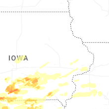


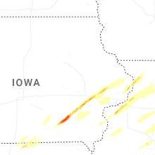
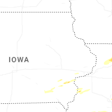
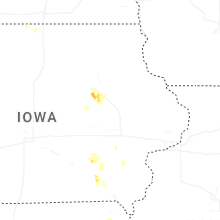

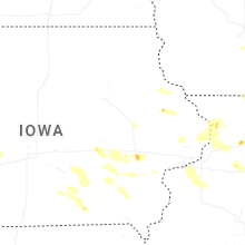


Connect with Interactive Hail Maps