

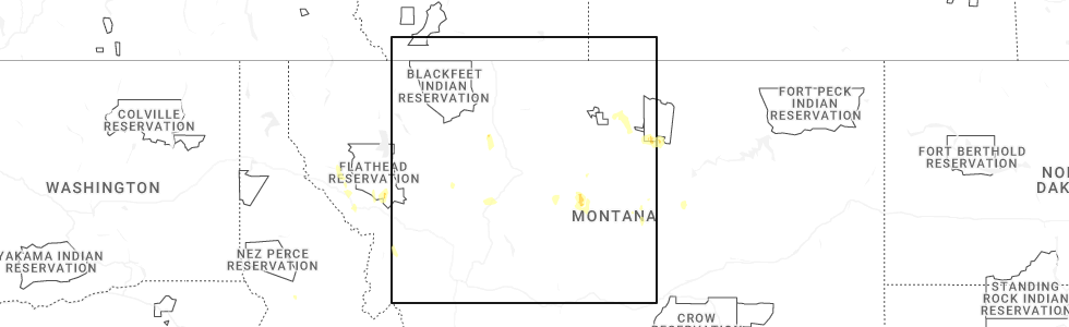
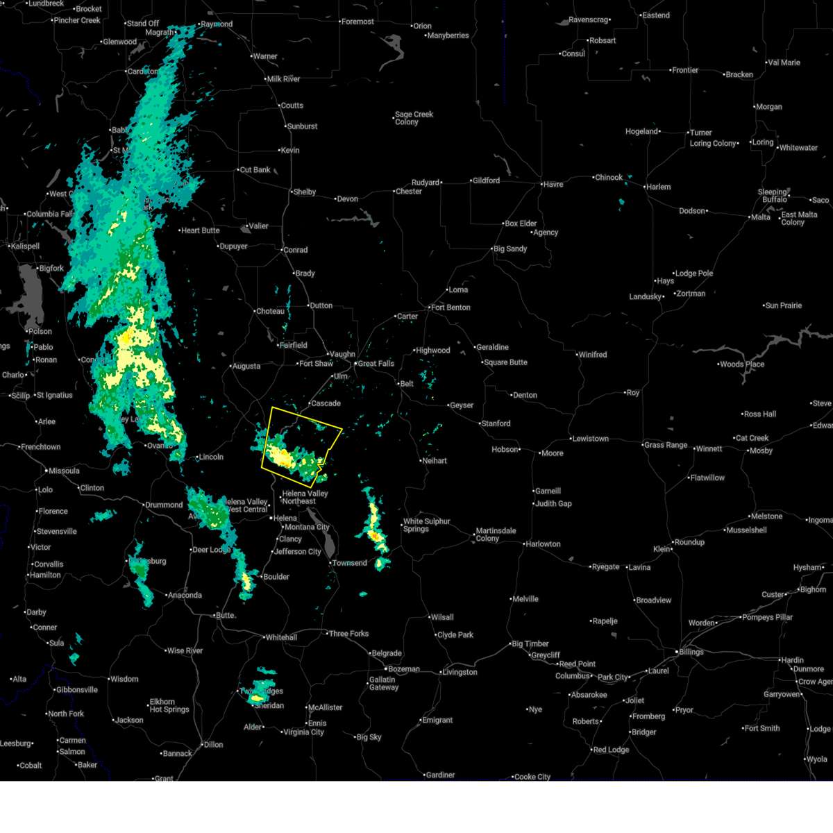
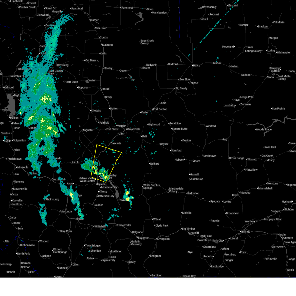
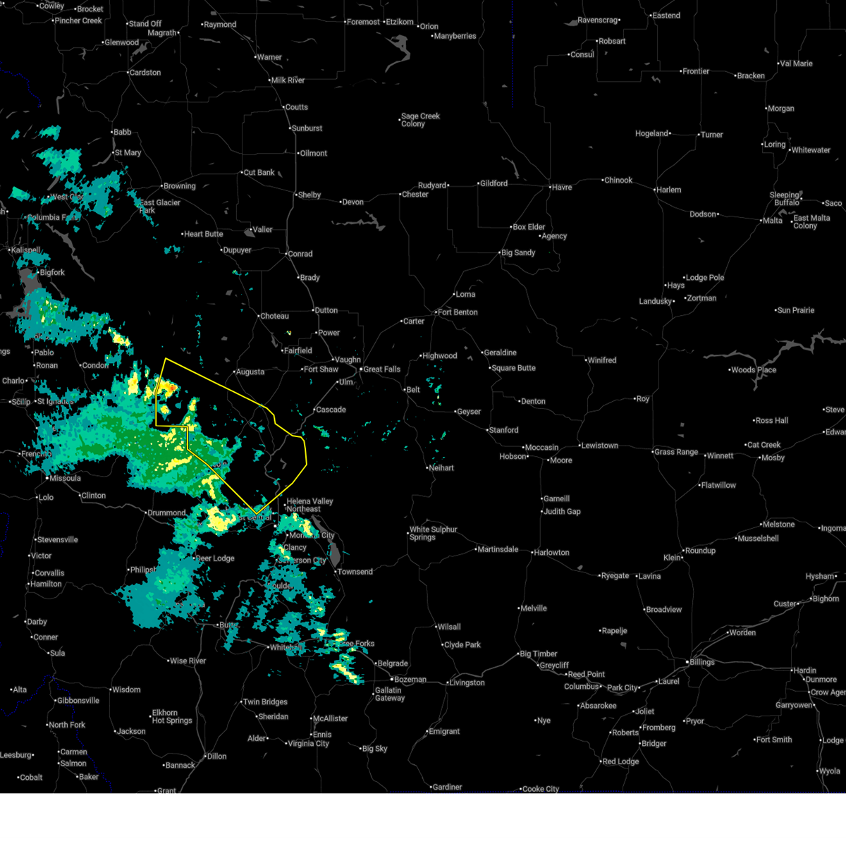
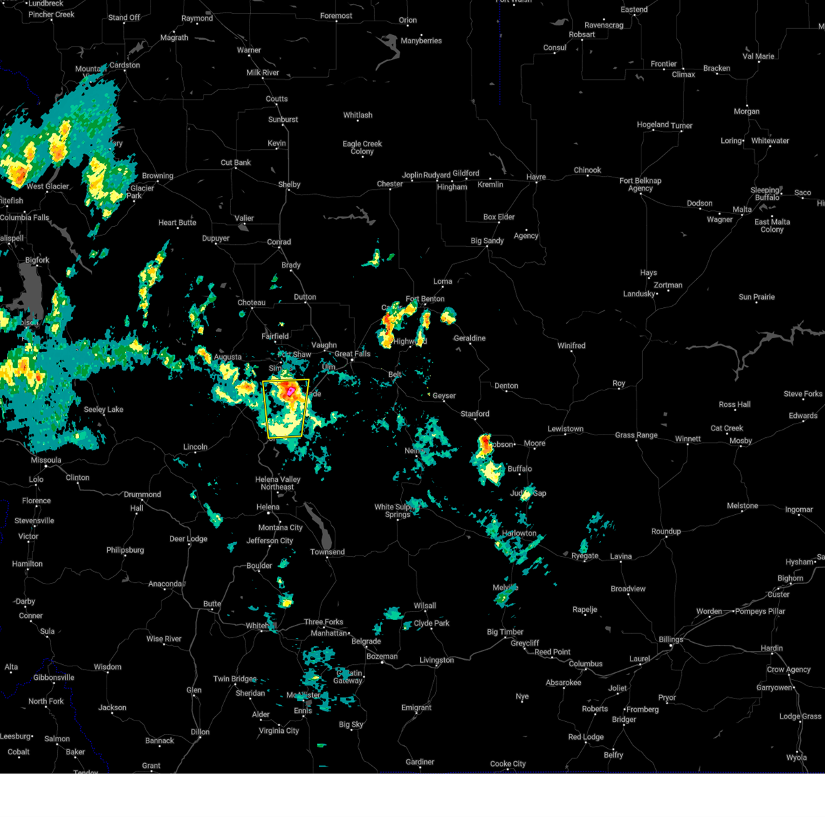
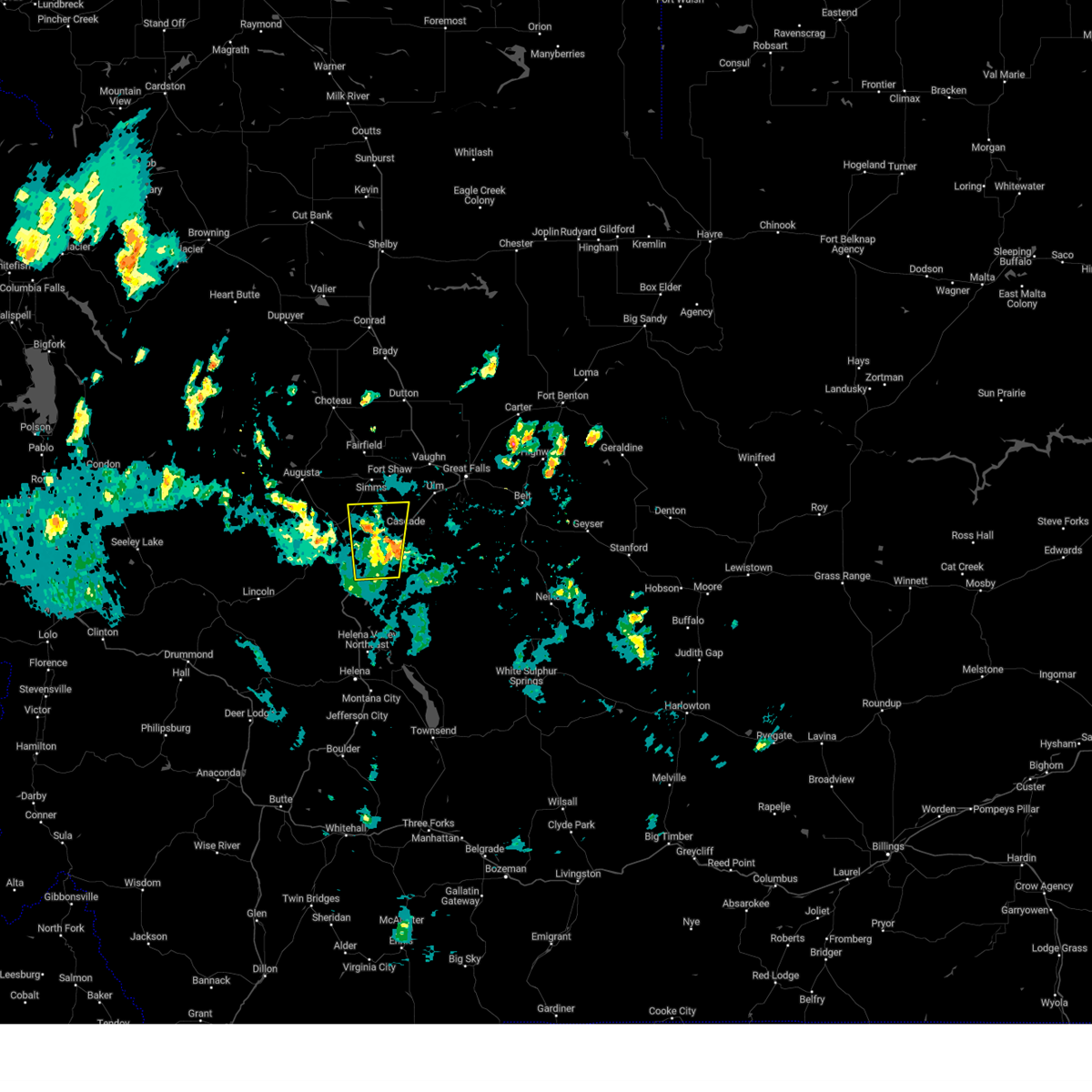
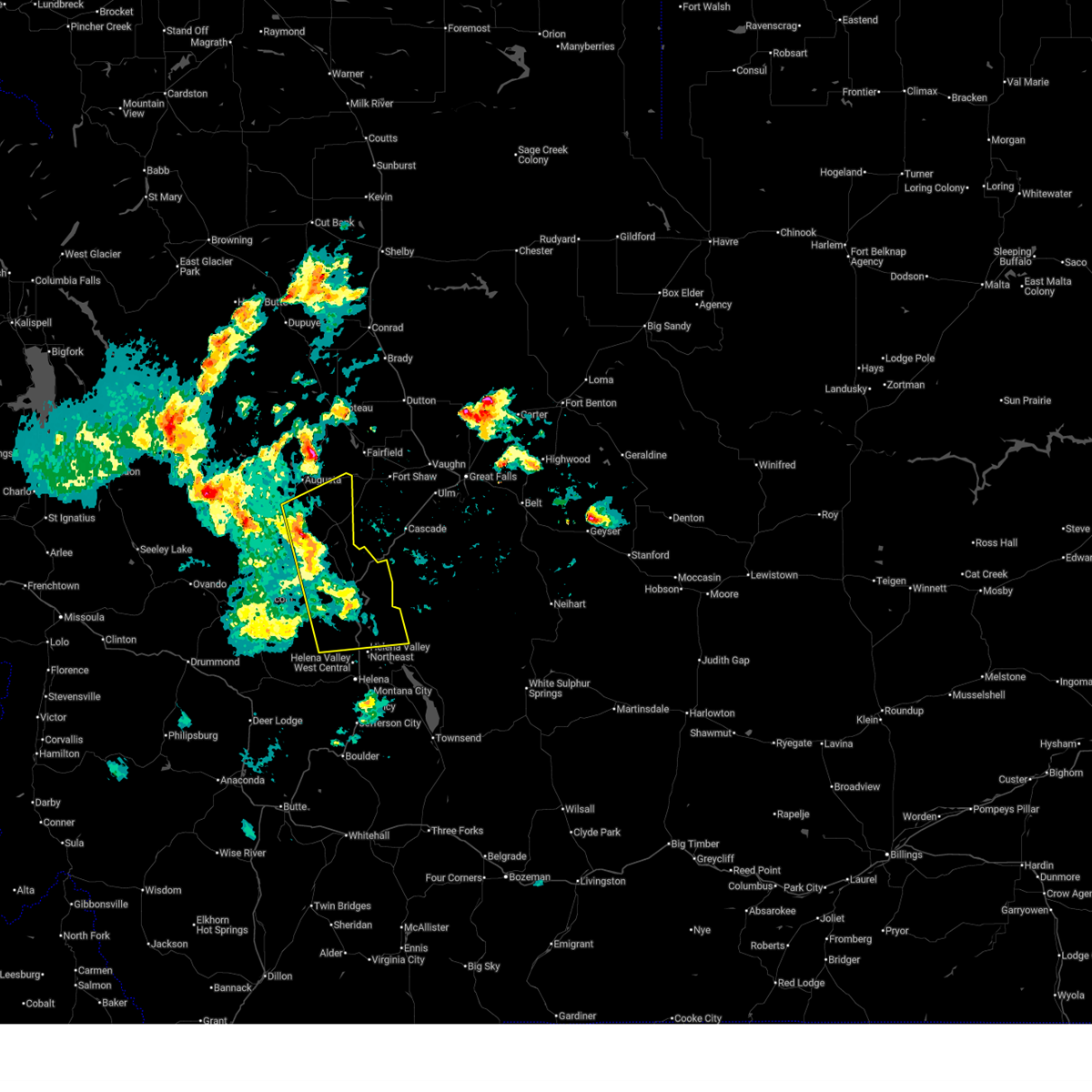
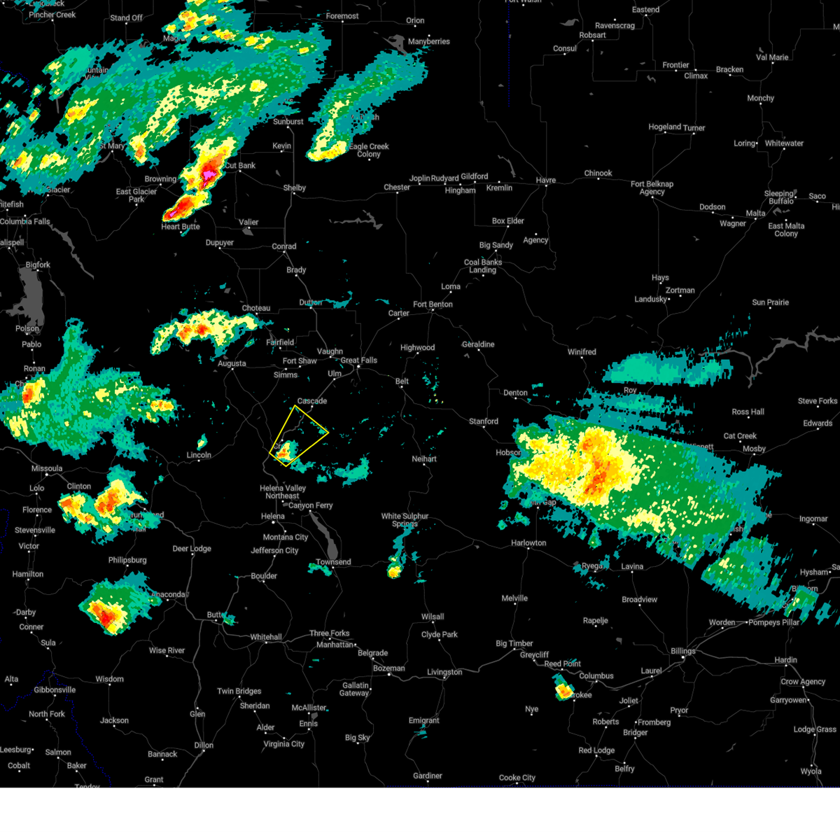
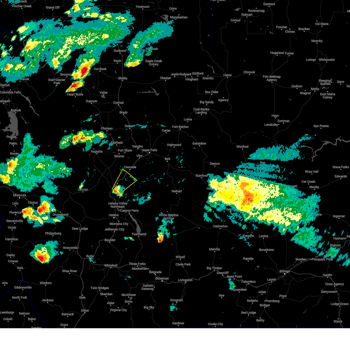
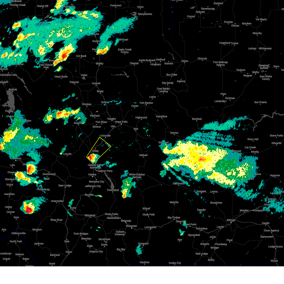
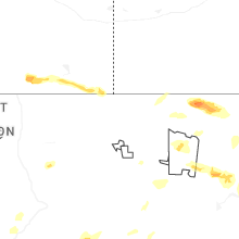
Hail Map for Craig, MT
The Craig, MT area has had 1 report of on-the-ground hail by trained spotters, and has been under severe weather warnings 8 times during the past 12 months. Doppler radar has detected hail at or near Craig, MT on 21 occasions, including 4 occasions during the past year.
| Name: | Craig, MT |
| Where Located: | 43 miles SW of Great Falls, MT |
| Map: | Google Map for Craig, MT |
| Population: | 43 |
| Housing Units: | 59 |
| More Info: | Search Google for Craig, MT |
2
The Top Recent Hail Date for Craig, MT is Friday, May 29, 2026 (7th out of 21)
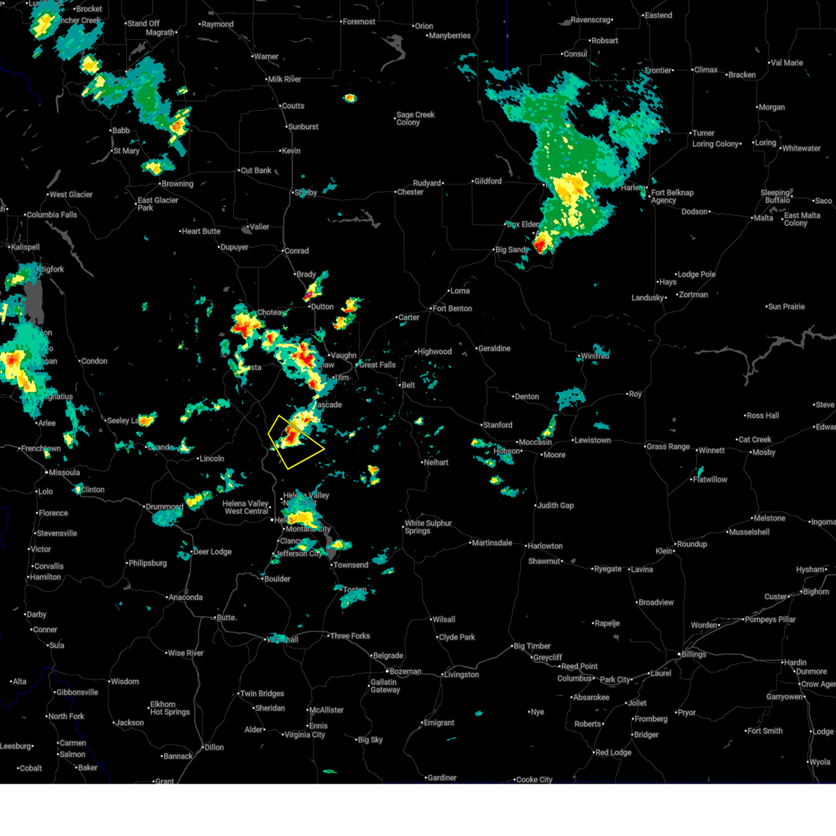
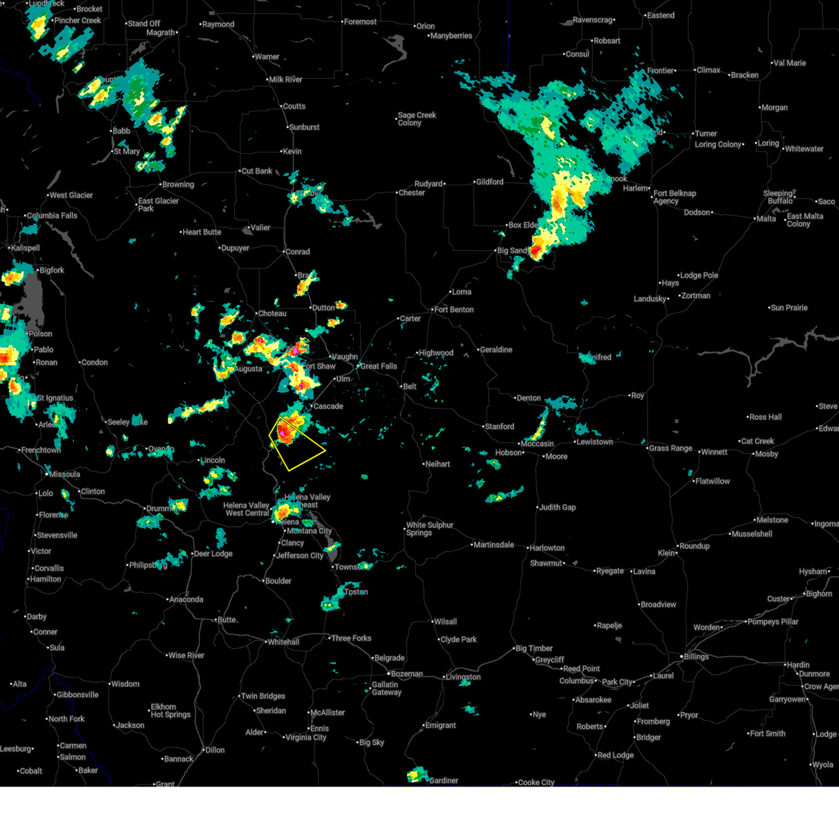
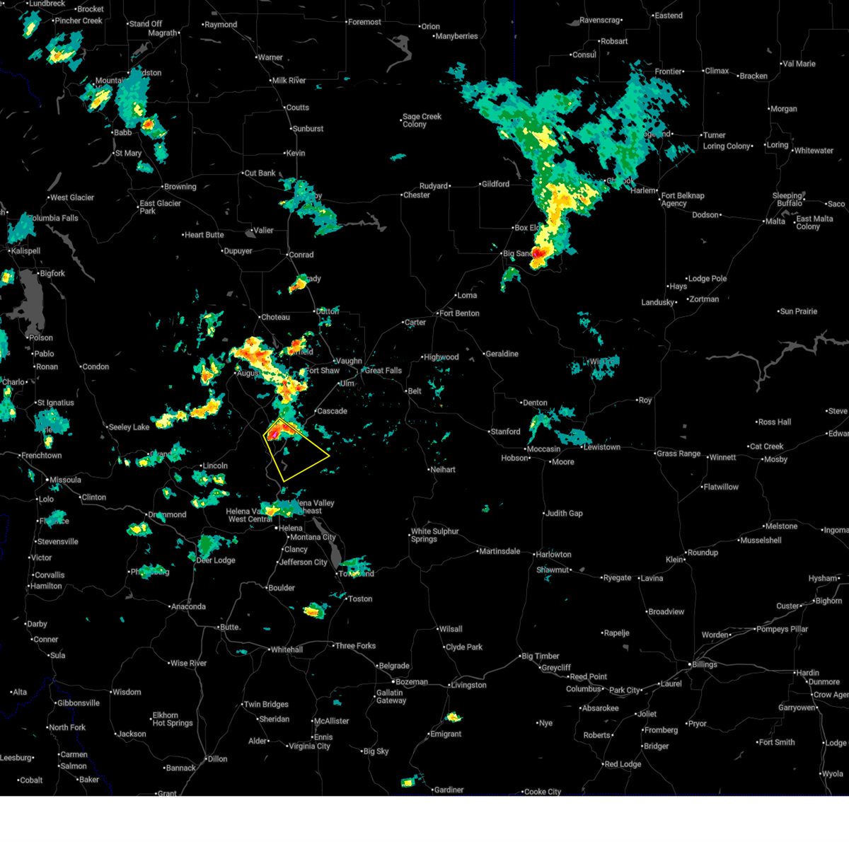
Hail and Wind Damage Spotted near Craig, MT
| Date / Time | Report Details |
|---|---|
| 6/25/2026 2:36 PM MDT |
 The storm which prompted the warning has weakened below severe limits, and no longer poses an immediate threat to life or property. therefore, the warning will be allowed to expire. however, small hail is still possible with this thunderstorm. The storm which prompted the warning has weakened below severe limits, and no longer poses an immediate threat to life or property. therefore, the warning will be allowed to expire. however, small hail is still possible with this thunderstorm.
|
| 6/25/2026 2:18 PM MDT |
 At 217 pm mdt, a severe thunderstorm was located 9 miles northeast of wolf creek, or 16 miles southwest of cascade, moving southeast at 20 mph (radar indicated). Hazards include quarter size hail. Damage to vehicles is expected. Locations impacted include, craig. At 217 pm mdt, a severe thunderstorm was located 9 miles northeast of wolf creek, or 16 miles southwest of cascade, moving southeast at 20 mph (radar indicated). Hazards include quarter size hail. Damage to vehicles is expected. Locations impacted include, craig.
|
| 6/25/2026 2:06 PM MDT |
 Svrtfx the national weather service in great falls has issued a * severe thunderstorm warning for, east central lewis and clark county in west central montana, southwestern cascade county in central montana, * until 245 pm mdt. * at 206 pm mdt, a severe thunderstorm was located 8 miles north of wolf creek, or 18 miles southwest of cascade, moving southeast at 25 mph (radar indicated). Hazards include quarter size hail. damage to vehicles is expected Svrtfx the national weather service in great falls has issued a * severe thunderstorm warning for, east central lewis and clark county in west central montana, southwestern cascade county in central montana, * until 245 pm mdt. * at 206 pm mdt, a severe thunderstorm was located 8 miles north of wolf creek, or 18 miles southwest of cascade, moving southeast at 25 mph (radar indicated). Hazards include quarter size hail. damage to vehicles is expected
|
| 5/13/2026 2:12 PM MDT |
 At 212 pm mdt, a severe thunderstorm was located 10 miles east of wolf creek, or 23 miles south of cascade, moving north at 50 mph (radar indicated). Hazards include 60 mph wind gusts and quarter size hail. Hail damage to vehicles is expected. expect wind damage to roofs, siding, and trees. Locations impacted include, wolf creek, tower rock state park, and craig. At 212 pm mdt, a severe thunderstorm was located 10 miles east of wolf creek, or 23 miles south of cascade, moving north at 50 mph (radar indicated). Hazards include 60 mph wind gusts and quarter size hail. Hail damage to vehicles is expected. expect wind damage to roofs, siding, and trees. Locations impacted include, wolf creek, tower rock state park, and craig.
|
| 5/13/2026 1:59 PM MDT |
 Svrtfx the national weather service in great falls has issued a * severe thunderstorm warning for, southeastern lewis and clark county in west central montana, southwestern cascade county in central montana, * until 245 pm mdt. * at 159 pm mdt, a severe thunderstorm was located 14 miles southeast of wolf creek, or 15 miles north of helena, moving north at 35 mph (radar indicated). Hazards include 60 mph wind gusts. expect damage to roofs, siding, and trees Svrtfx the national weather service in great falls has issued a * severe thunderstorm warning for, southeastern lewis and clark county in west central montana, southwestern cascade county in central montana, * until 245 pm mdt. * at 159 pm mdt, a severe thunderstorm was located 14 miles southeast of wolf creek, or 15 miles north of helena, moving north at 35 mph (radar indicated). Hazards include 60 mph wind gusts. expect damage to roofs, siding, and trees
|
| 9/14/2025 7:55 PM MDT |
 The storms which prompted the warning have weakened below severe limits, and have exited the warned area. therefore, the warning will be allowed to expire. however, gusty winds are still possible with these thunderstorms. The storms which prompted the warning have weakened below severe limits, and have exited the warned area. therefore, the warning will be allowed to expire. however, gusty winds are still possible with these thunderstorms.
|
| 9/14/2025 7:35 PM MDT | At 735 pm mdt, severe thunderstorms were located along a line extending from 16 miles northeast of seeley lake to 8 miles northeast of lincoln to 14 miles north of helena, moving northeast at 30 mph (radar indicated). Hazards include 60 mph wind gusts. Expect damage to roofs, siding, and trees. Locations impacted include, wolf creek, bowmans corner, marysville, canyon creek, bean lake, and craig. |
| 9/14/2025 7:00 PM MDT | Svrtfx the national weather service in great falls has issued a * severe thunderstorm warning for, lewis and clark county in west central montana, * until 800 pm mdt. * at 659 pm mdt, severe thunderstorms were located along a line extending from 6 miles southeast of seeley lake to 9 miles southwest of lincoln to 15 miles west of helena, moving northeast at 35 mph (radar indicated). Hazards include 60 mph wind gusts. expect damage to roofs, siding, and trees |
| 8/23/2024 5:05 PM MDT |
 The storm which prompted the warning has weakened below severe limits, and has exited the warned area. therefore, the warning will be allowed to expire. a severe thunderstorm watch remains in effect until 900 pm mdt for central and west central montana. remember, a severe thunderstorm warning still remains in effect for cascade county until 530 pm. The storm which prompted the warning has weakened below severe limits, and has exited the warned area. therefore, the warning will be allowed to expire. a severe thunderstorm watch remains in effect until 900 pm mdt for central and west central montana. remember, a severe thunderstorm warning still remains in effect for cascade county until 530 pm.
|
| 8/23/2024 4:45 PM MDT |
 Svrtfx the national weather service in great falls has issued a * severe thunderstorm warning for, east central lewis and clark county in west central montana, west central cascade county in central montana, * until 515 pm mdt. * at 443 pm mdt, a severe thunderstorm was located 11 miles northeast of wolf creek, or 13 miles southwest of cascade, moving north at 30 mph (trained weather spotters. at 430 pm wolf creek mesonet station reported 61 mph). Hazards include 60 mph wind gusts. expect damage to roofs, siding, and trees Svrtfx the national weather service in great falls has issued a * severe thunderstorm warning for, east central lewis and clark county in west central montana, west central cascade county in central montana, * until 515 pm mdt. * at 443 pm mdt, a severe thunderstorm was located 11 miles northeast of wolf creek, or 13 miles southwest of cascade, moving north at 30 mph (trained weather spotters. at 430 pm wolf creek mesonet station reported 61 mph). Hazards include 60 mph wind gusts. expect damage to roofs, siding, and trees
|
| 8/23/2024 4:30 PM MDT | Station ew3831 had a 61 mph wind gus in lewis and clark county MT, 5 miles NNE of Craig, MT |
| 8/18/2024 7:54 PM MDT |
 Svrtfx the national weather service in great falls has issued a * severe thunderstorm warning for, central lewis and clark county in west central montana, * until 830 pm mdt. * at 754 pm mdt, severe thunderstorms were located along a line extending from 15 miles south of augusta to 11 miles west of wolf creek, moving northeast at 50 mph (radar indicated). Hazards include 60 mph wind gusts. expect damage to roofs, siding, and trees Svrtfx the national weather service in great falls has issued a * severe thunderstorm warning for, central lewis and clark county in west central montana, * until 830 pm mdt. * at 754 pm mdt, severe thunderstorms were located along a line extending from 15 miles south of augusta to 11 miles west of wolf creek, moving northeast at 50 mph (radar indicated). Hazards include 60 mph wind gusts. expect damage to roofs, siding, and trees
|
| 8/6/2024 7:00 PM MDT |
 the severe thunderstorm warning has been cancelled and is no longer in effect the severe thunderstorm warning has been cancelled and is no longer in effect
|
| 8/6/2024 6:53 PM MDT |
 At 652 pm mdt, a severe thunderstorm was located near wolf creek, or 23 miles southwest of cascade, moving northeast at 30 mph (radar indicated). Hazards include quarter size hail. Damage to vehicles is expected. Locations impacted include, tower rock state park and craig. At 652 pm mdt, a severe thunderstorm was located near wolf creek, or 23 miles southwest of cascade, moving northeast at 30 mph (radar indicated). Hazards include quarter size hail. Damage to vehicles is expected. Locations impacted include, tower rock state park and craig.
|
| 8/6/2024 6:41 PM MDT |
 Svrtfx the national weather service in great falls has issued a * severe thunderstorm warning for, east central lewis and clark county in west central montana, southwestern cascade county in central montana, * until 730 pm mdt. * at 641 pm mdt, a severe thunderstorm was located near wolf creek, or 23 miles north of helena, moving northeast at 30 mph (radar indicated). Hazards include quarter size hail. damage to vehicles is expected Svrtfx the national weather service in great falls has issued a * severe thunderstorm warning for, east central lewis and clark county in west central montana, southwestern cascade county in central montana, * until 730 pm mdt. * at 641 pm mdt, a severe thunderstorm was located near wolf creek, or 23 miles north of helena, moving northeast at 30 mph (radar indicated). Hazards include quarter size hail. damage to vehicles is expected
|
| 8/25/2022 6:24 PM MDT | At 624 pm mdt, a severe thunderstorm was located near wolf creek, or 18 miles southwest of cascade, moving east at 10 mph (radar indicated). Hazards include quarter size hail. damage to vehicles is expected |
| 6/18/2022 2:03 PM MDT |
 At 203 pm mdt, severe thunderstorms were located along a line extending from 13 miles south of augusta to 14 miles northwest of wolf creek to 13 miles east of lincoln, moving northeast at 40 mph (radar indicated). Hazards include 70 mph wind gusts and quarter size hail. Hail damage to vehicles is expected. expect considerable tree damage. Wind damage is also likely to mobile homes, roofs, and outbuildings. At 203 pm mdt, severe thunderstorms were located along a line extending from 13 miles south of augusta to 14 miles northwest of wolf creek to 13 miles east of lincoln, moving northeast at 40 mph (radar indicated). Hazards include 70 mph wind gusts and quarter size hail. Hail damage to vehicles is expected. expect considerable tree damage. Wind damage is also likely to mobile homes, roofs, and outbuildings.
|
| 8/5/2021 6:24 PM MDT |
 At 623 pm mdt, a severe thunderstorm was located over wolf creek, or 27 miles southwest of cascade, moving northeast at 10 mph (radar indicated). Hazards include 60 mph wind gusts and quarter size hail. Hail damage to vehicles is expected. Expect wind damage to roofs, siding, and trees. At 623 pm mdt, a severe thunderstorm was located over wolf creek, or 27 miles southwest of cascade, moving northeast at 10 mph (radar indicated). Hazards include 60 mph wind gusts and quarter size hail. Hail damage to vehicles is expected. Expect wind damage to roofs, siding, and trees.
|
| 6/26/2019 5:56 PM MDT |
 At 556 pm mdt, a severe thunderstorm was located near wolf creek, or 20 miles southwest of cascade, moving northeast at 30 mph (radar indicated). Hazards include 60 mph wind gusts and quarter size hail. Hail damage to vehicles is expected. expect wind damage to roofs, siding, and trees. Locations impacted include, wolf creek and craig. At 556 pm mdt, a severe thunderstorm was located near wolf creek, or 20 miles southwest of cascade, moving northeast at 30 mph (radar indicated). Hazards include 60 mph wind gusts and quarter size hail. Hail damage to vehicles is expected. expect wind damage to roofs, siding, and trees. Locations impacted include, wolf creek and craig.
|
| 6/26/2019 5:42 PM MDT |
 At 541 pm mdt, a severe thunderstorm was located over wolf creek, or 26 miles north of helena, moving northeast at 30 mph (radar indicated). Hazards include 60 mph wind gusts and quarter size hail. Hail damage to vehicles is expected. Expect wind damage to roofs, siding, and trees. At 541 pm mdt, a severe thunderstorm was located over wolf creek, or 26 miles north of helena, moving northeast at 30 mph (radar indicated). Hazards include 60 mph wind gusts and quarter size hail. Hail damage to vehicles is expected. Expect wind damage to roofs, siding, and trees.
|
| 5/31/2018 5:11 PM MDT |
 The severe thunderstorm warning for east central lewis and clark and southwestern cascade counties will expire at 515 pm mdt, the storm which prompted the warning has weakened below severe limits, and no longer poses an immediate threat to life or property. therefore, the warning will be allowed to expire. however heavy rain is still possible with this thunderstorm. a severe thunderstorm watch remains in effect until 1000 pm mdt for central and west central montana. The severe thunderstorm warning for east central lewis and clark and southwestern cascade counties will expire at 515 pm mdt, the storm which prompted the warning has weakened below severe limits, and no longer poses an immediate threat to life or property. therefore, the warning will be allowed to expire. however heavy rain is still possible with this thunderstorm. a severe thunderstorm watch remains in effect until 1000 pm mdt for central and west central montana.
|
| 5/31/2018 4:58 PM MDT |
 At 458 pm mdt, a severe thunderstorm was located over wolf creek, or 25 miles southwest of cascade, moving northeast at 30 mph (radar indicated). Hazards include 60 mph wind gusts and quarter size hail. Hail damage to vehicles is expected. expect wind damage to roofs, siding, and trees. Locations impacted include, wolf creek and craig. At 458 pm mdt, a severe thunderstorm was located over wolf creek, or 25 miles southwest of cascade, moving northeast at 30 mph (radar indicated). Hazards include 60 mph wind gusts and quarter size hail. Hail damage to vehicles is expected. expect wind damage to roofs, siding, and trees. Locations impacted include, wolf creek and craig.
|
| 5/31/2018 4:39 PM MDT |
 At 438 pm mdt, a severe thunderstorm was located 8 miles southwest of wolf creek, or 22 miles north of helena, moving northeast at 35 mph (spotter reported quarter size hail in canyon creek). Hazards include 60 mph wind gusts and quarter size hail. Hail damage to vehicles is expected. Expect wind damage to roofs, siding, and trees. At 438 pm mdt, a severe thunderstorm was located 8 miles southwest of wolf creek, or 22 miles north of helena, moving northeast at 35 mph (spotter reported quarter size hail in canyon creek). Hazards include 60 mph wind gusts and quarter size hail. Hail damage to vehicles is expected. Expect wind damage to roofs, siding, and trees.
|
| 6/1/2017 4:10 PM MDT | Winds estimated 60 mph or more... in addition to dime sized hail and very heavy rainfal in lewis and clark county MT, 7.2 miles NE of Craig, MT |
| 6/1/2017 3:56 PM MDT |
 At 355 pm mdt, a severe thunderstorm was located near wolf creek, or 24 miles north of helena, moving northeast at 30 mph (radar indicated). Hazards include 60 mph wind gusts and quarter size hail. Hail damage to vehicles is expected. Expect wind damage to roofs, siding, and trees. At 355 pm mdt, a severe thunderstorm was located near wolf creek, or 24 miles north of helena, moving northeast at 30 mph (radar indicated). Hazards include 60 mph wind gusts and quarter size hail. Hail damage to vehicles is expected. Expect wind damage to roofs, siding, and trees.
|
| 5/6/2017 5:24 PM MDT |
 At 524 pm mdt, a severe thunderstorm was located 11 miles southwest of great falls, moving northeast at 40 mph (radar indicated). Hazards include 60 mph wind gusts and half dollar size hail. Hail damage to vehicles is expected. expect wind damage to roofs, siding, and trees. Locations impacted include, great falls, cascade, black eagle, fort shaw, fort shaw, portage, malmstrom afb, eden, stockett, tracy, vaughn, first peoples buffalo jump state park, centerville, sun river, tower rock state park, craig, ulm and sand coulee. At 524 pm mdt, a severe thunderstorm was located 11 miles southwest of great falls, moving northeast at 40 mph (radar indicated). Hazards include 60 mph wind gusts and half dollar size hail. Hail damage to vehicles is expected. expect wind damage to roofs, siding, and trees. Locations impacted include, great falls, cascade, black eagle, fort shaw, fort shaw, portage, malmstrom afb, eden, stockett, tracy, vaughn, first peoples buffalo jump state park, centerville, sun river, tower rock state park, craig, ulm and sand coulee.
|
| 5/6/2017 5:14 PM MDT |
 At 513 pm mdt, a severe thunderstorm was located near cascade, moving northeast at 60 mph (radar indicated). Hazards include 60 mph wind gusts and half dollar size hail. Hail damage to vehicles is expected. expect wind damage to roofs, siding, and trees. Locations impacted include, great falls, cascade, black eagle, fort shaw, fort shaw, portage, malmstrom afb, eden, stockett, tracy, vaughn, first peoples buffalo jump state park, centerville, sun river, tower rock state park, craig, ulm and sand coulee. At 513 pm mdt, a severe thunderstorm was located near cascade, moving northeast at 60 mph (radar indicated). Hazards include 60 mph wind gusts and half dollar size hail. Hail damage to vehicles is expected. expect wind damage to roofs, siding, and trees. Locations impacted include, great falls, cascade, black eagle, fort shaw, fort shaw, portage, malmstrom afb, eden, stockett, tracy, vaughn, first peoples buffalo jump state park, centerville, sun river, tower rock state park, craig, ulm and sand coulee.
|
| 5/6/2017 4:59 PM MDT |
 At 458 pm mdt, a severe thunderstorm was located 13 miles east of wolf creek, or 14 miles south of cascade, moving northeast at 60 mph (radar indicated along). Hazards include 60 mph wind gusts and penny size hail. expect damage to roofs, siding, and trees At 458 pm mdt, a severe thunderstorm was located 13 miles east of wolf creek, or 14 miles south of cascade, moving northeast at 60 mph (radar indicated along). Hazards include 60 mph wind gusts and penny size hail. expect damage to roofs, siding, and trees
|
| 5/6/2017 4:53 PM MDT |
 At 452 pm mdt, a severe thunderstorm was located over wolf creek, or 23 miles southwest of cascade, moving northeast at 65 mph (radar indicated). Hazards include 60 mph wind gusts and penny size hail. Expect damage to roofs, siding, and trees. Locations impacted include, cascade, wolf creek, tower rock state park and craig. At 452 pm mdt, a severe thunderstorm was located over wolf creek, or 23 miles southwest of cascade, moving northeast at 65 mph (radar indicated). Hazards include 60 mph wind gusts and penny size hail. Expect damage to roofs, siding, and trees. Locations impacted include, cascade, wolf creek, tower rock state park and craig.
|
| 5/6/2017 4:45 PM MDT |
 At 445 pm mdt, a severe thunderstorm was located 7 miles southwest of wolf creek, or 22 miles north of helena, moving northeast at 65 mph (radar indicated). Hazards include 60 mph wind gusts and penny size hail. expect damage to roofs, siding, and trees At 445 pm mdt, a severe thunderstorm was located 7 miles southwest of wolf creek, or 22 miles north of helena, moving northeast at 65 mph (radar indicated). Hazards include 60 mph wind gusts and penny size hail. expect damage to roofs, siding, and trees
|
| 6/5/2012 5:00 PM MDT | Half Dollar sized hail reported 6.3 miles NNE of Craig, MT, hail up to walnut size in the holter lake area. |
| 1/1/0001 12:00 AM | Storm damage reported in cascade county MT, 6.7 miles SW of Craig, MT |
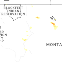
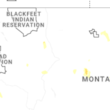
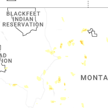
Hail Maps for Craig, MT


Connect with Interactive Hail Maps