

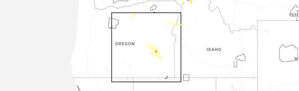
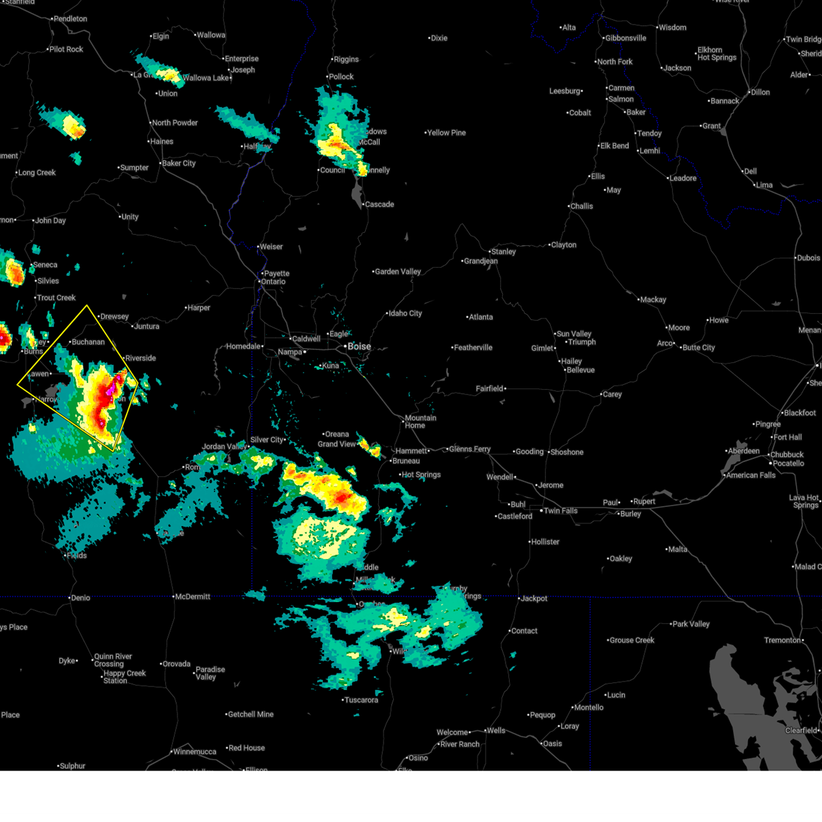
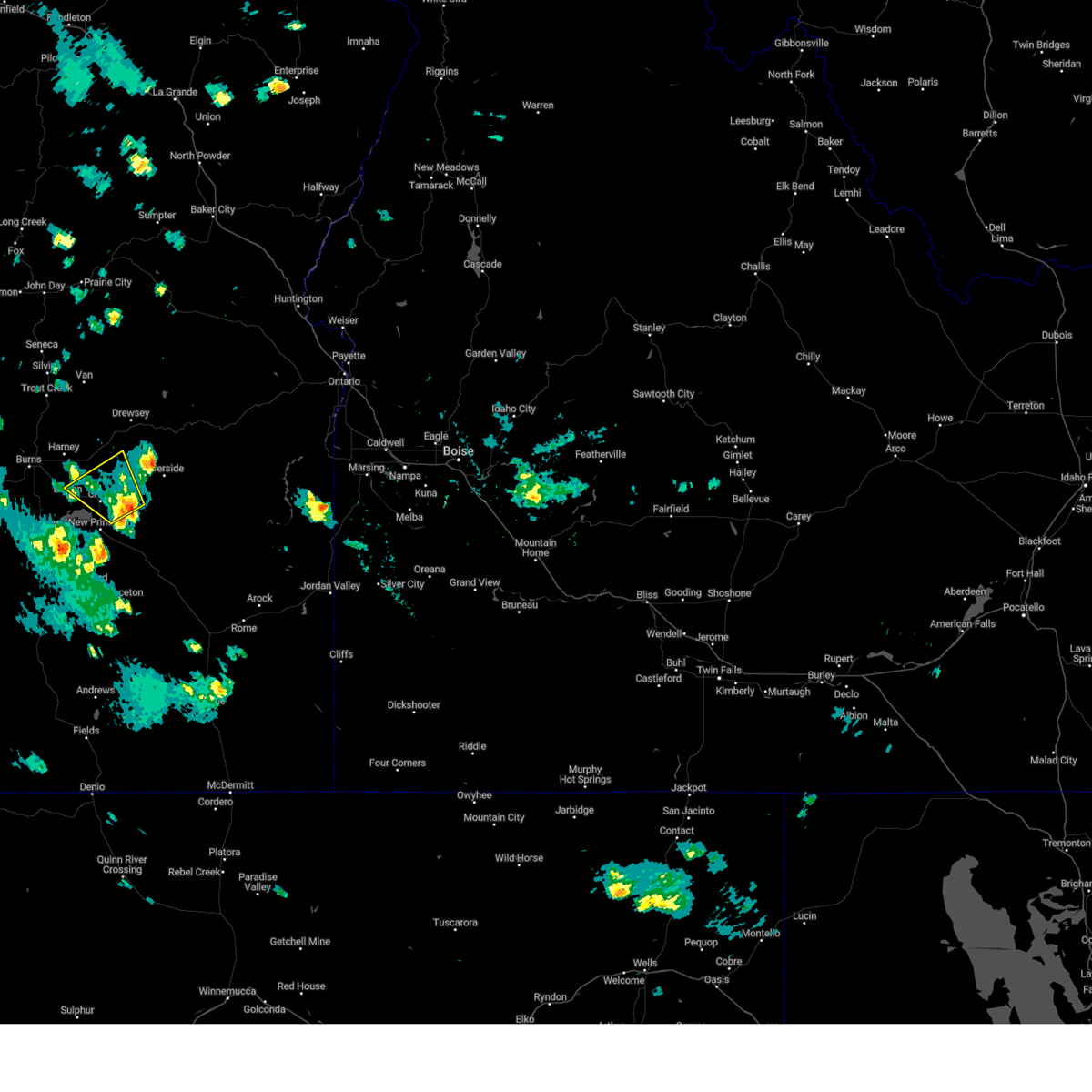
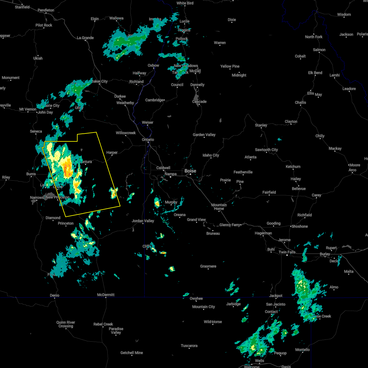
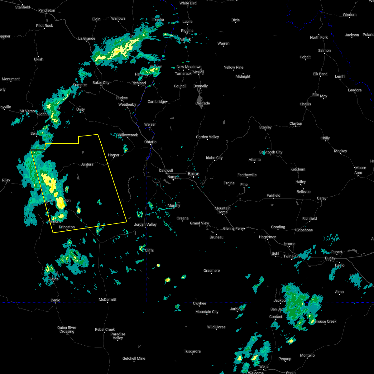
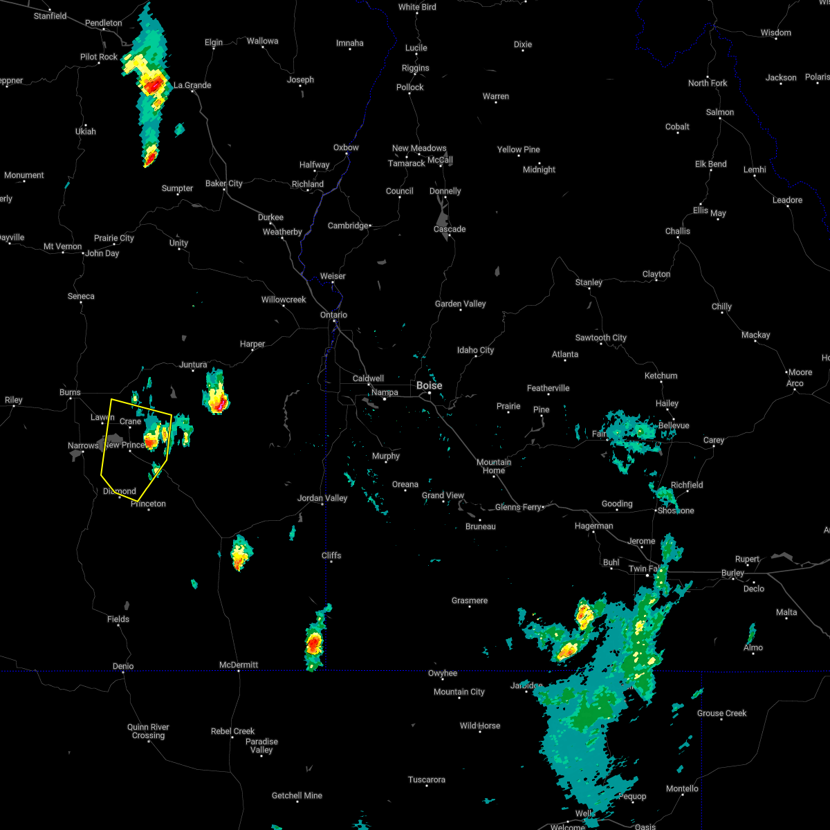
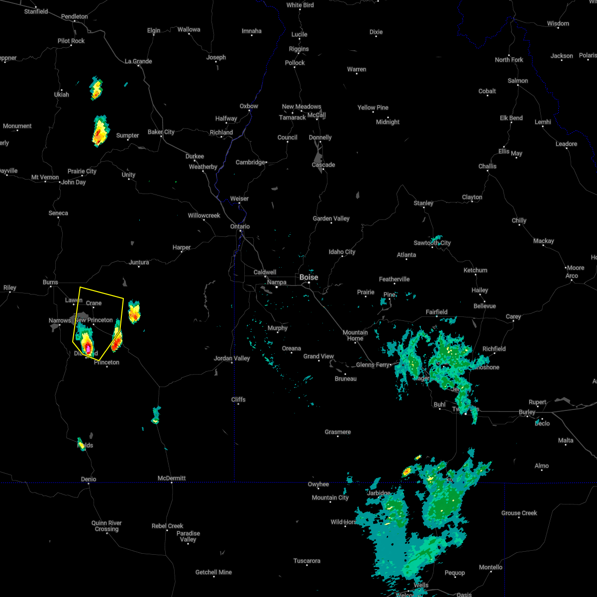
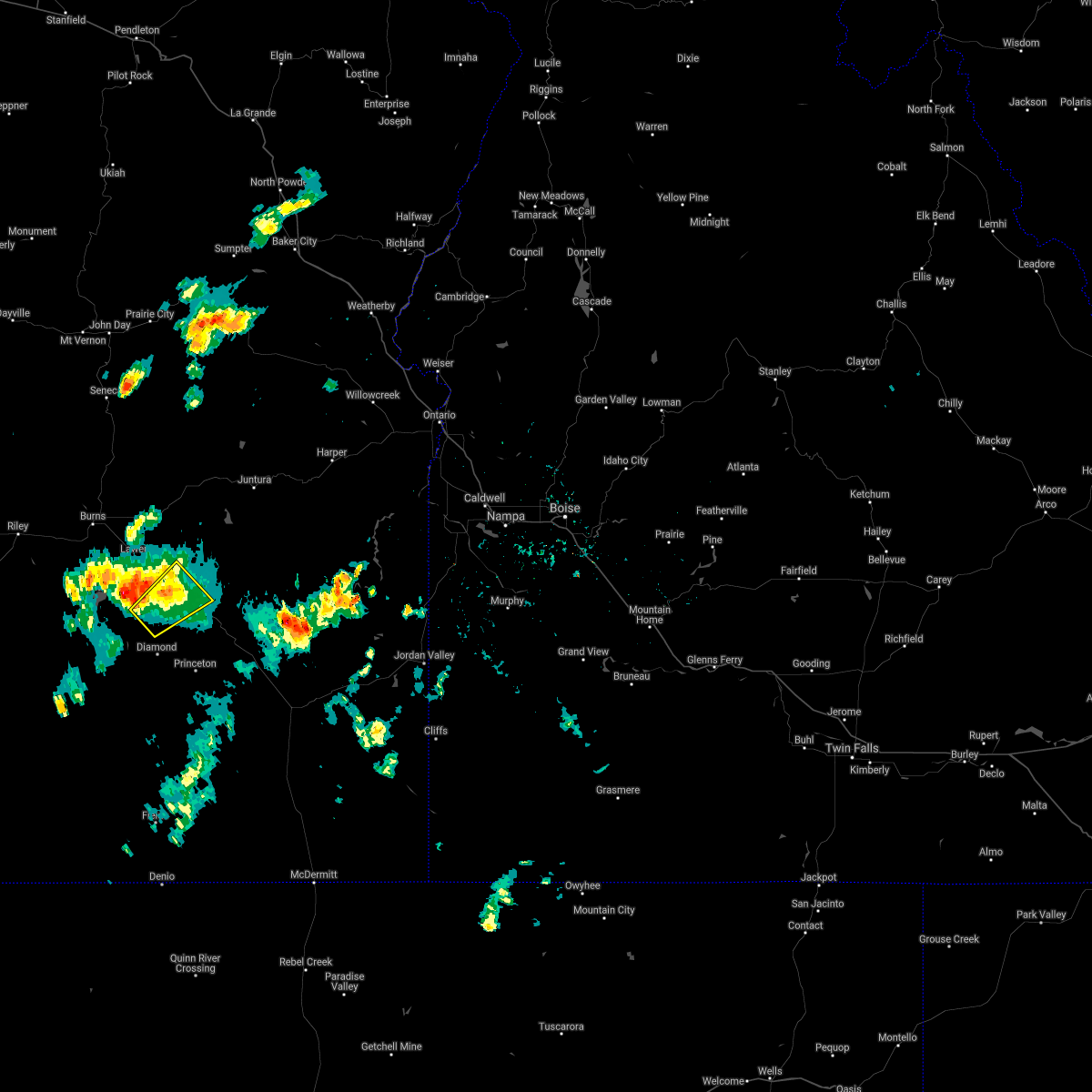
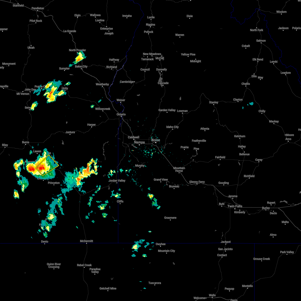
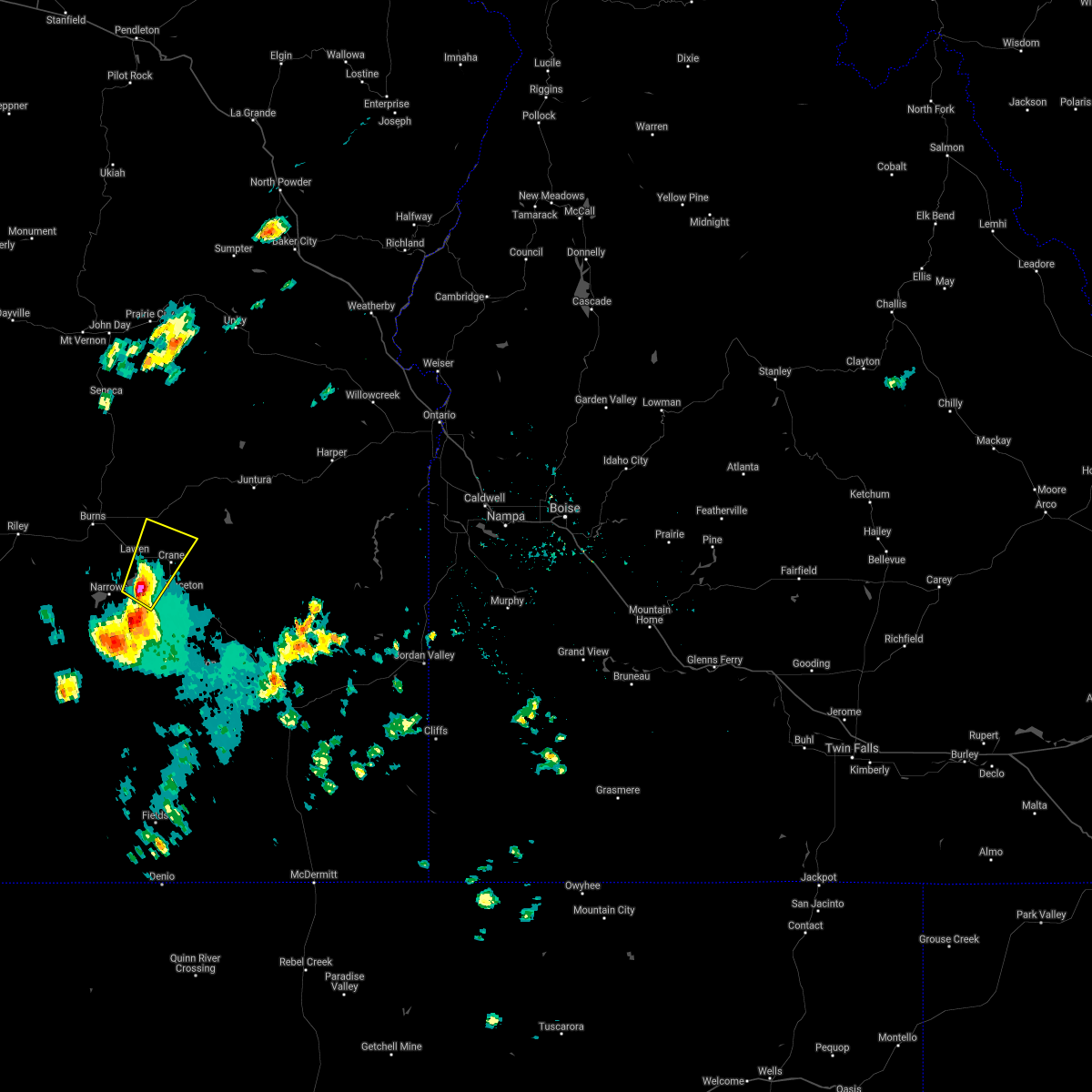
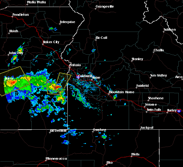
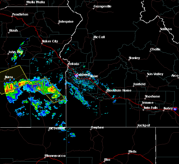
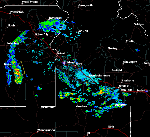
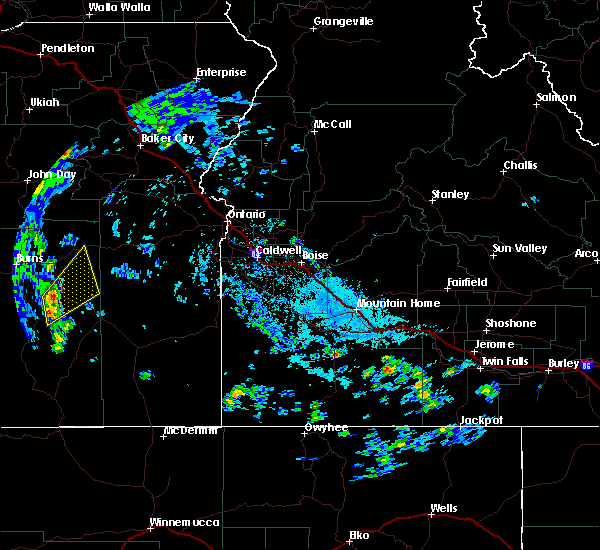
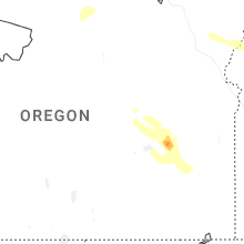
Hail Map for Crane, OR
The Crane, OR area has had 0 reports of on-the-ground hail by trained spotters, and has been under severe weather warnings 4 times during the past 12 months. Doppler radar has detected hail at or near Crane, OR on 5 occasions, including 1 occasion during the past year.
| Name: | Crane, OR |
| Where Located: | 26.8 miles ESE of Burns, OR |
| Map: | Google Map for Crane, OR |
| Population: | 129 |
| Housing Units: | 64 |
| More Info: | Search Google for Crane, OR |
2
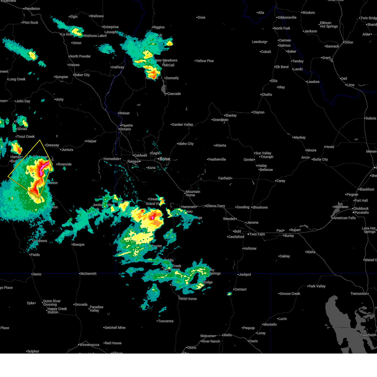
The Top Recent Hail Date for Crane, OR is Thursday, May 28, 2026 (3rd out of 5)
Hail and Wind Damage Spotted near Crane, OR
| Date / Time | Report Details |
|---|---|
| 5/28/2026 2:18 PM PDT |
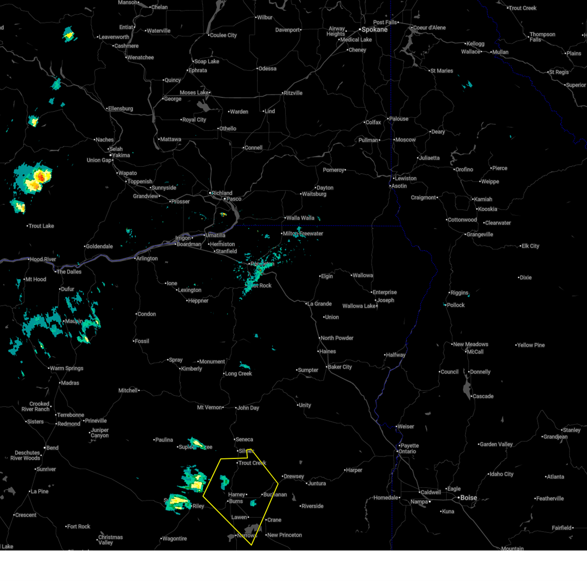 Svrboi the national weather service in boise has issued a * severe thunderstorm warning for, northeastern harney county in southeastern oregon, * until 300 pm pdt. * at 217 pm pdt, severe thunderstorms were located along a line extending from stinkingwater pass to malheur lake, moving northwest at 50 mph. these are destructive storms for harney county (radar indicated). Hazards include 80 mph wind gusts and two inch hail. Flying debris will be dangerous to those caught without shelter. mobile homes will be heavily damaged. expect considerable damage to roofs, windows, and vehicles. extensive tree damage and power outages are likely. severe thunderstorms will be near, stinkingwater pass, malheur refuge headquarters, lawen, and malheur lake around 220 pm pdt. sand hill, wrights point, fort harney, and call meadow around 230 pm pdt. burns, hines, idlewild campground, and crow flat guard station around 240 pm pdt. Burnt mountain around 250 pm pdt. Svrboi the national weather service in boise has issued a * severe thunderstorm warning for, northeastern harney county in southeastern oregon, * until 300 pm pdt. * at 217 pm pdt, severe thunderstorms were located along a line extending from stinkingwater pass to malheur lake, moving northwest at 50 mph. these are destructive storms for harney county (radar indicated). Hazards include 80 mph wind gusts and two inch hail. Flying debris will be dangerous to those caught without shelter. mobile homes will be heavily damaged. expect considerable damage to roofs, windows, and vehicles. extensive tree damage and power outages are likely. severe thunderstorms will be near, stinkingwater pass, malheur refuge headquarters, lawen, and malheur lake around 220 pm pdt. sand hill, wrights point, fort harney, and call meadow around 230 pm pdt. burns, hines, idlewild campground, and crow flat guard station around 240 pm pdt. Burnt mountain around 250 pm pdt.
|
| 5/28/2026 2:01 PM PDT |
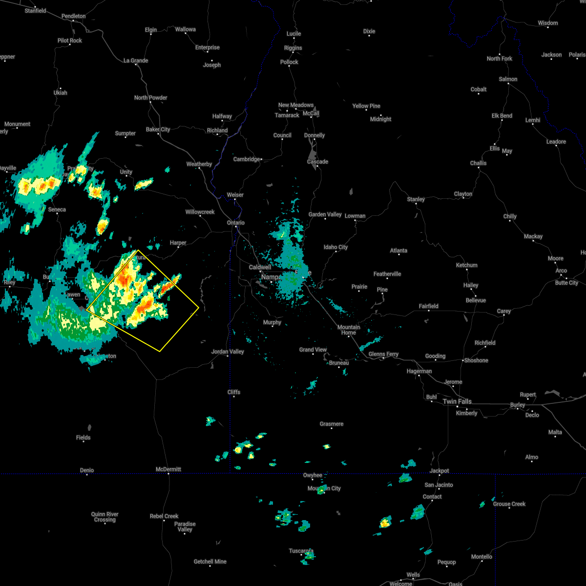
 At 200 pm pdt, a severe thunderstorm was located near coleman mountain, or 29 miles east of burns, moving northwest at 45 mph (radar indicated). Hazards include tennis ball size hail and 70 mph wind gusts. People and animals outdoors will be injured. expect hail damage to roofs, siding, windows, and vehicles. expect considerable tree damage. wind damage is also likely to mobile homes, roofs, and outbuildings. This severe storm will be near, stinkingwater pass around 210 pm pdt. At 200 pm pdt, a severe thunderstorm was located near coleman mountain, or 29 miles east of burns, moving northwest at 45 mph (radar indicated). Hazards include tennis ball size hail and 70 mph wind gusts. People and animals outdoors will be injured. expect hail damage to roofs, siding, windows, and vehicles. expect considerable tree damage. wind damage is also likely to mobile homes, roofs, and outbuildings. This severe storm will be near, stinkingwater pass around 210 pm pdt.
|
| 5/28/2026 1:51 PM PDT |
 At 151 pm pdt, a severe thunderstorm was located near coleman mountain, or 34 miles east of burns, moving northwest at 45 mph (radar indicated). Hazards include tennis ball size hail and 70 mph wind gusts. People and animals outdoors will be injured. expect hail damage to roofs, siding, windows, and vehicles. expect considerable tree damage. wind damage is also likely to mobile homes, roofs, and outbuildings. this severe storm will be near, coleman mountain around 200 pm pdt. Stinkingwater pass around 210 pm pdt. At 151 pm pdt, a severe thunderstorm was located near coleman mountain, or 34 miles east of burns, moving northwest at 45 mph (radar indicated). Hazards include tennis ball size hail and 70 mph wind gusts. People and animals outdoors will be injured. expect hail damage to roofs, siding, windows, and vehicles. expect considerable tree damage. wind damage is also likely to mobile homes, roofs, and outbuildings. this severe storm will be near, coleman mountain around 200 pm pdt. Stinkingwater pass around 210 pm pdt.
|
| 5/28/2026 1:36 PM PDT |
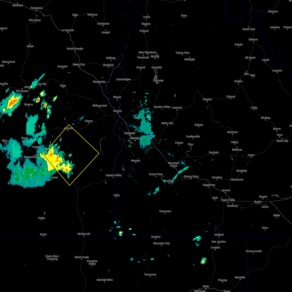
 Svrboi the national weather service in boise has issued a * severe thunderstorm warning for, northeastern harney county in southeastern oregon, west central malheur county in southeastern oregon, * until 215 pm pdt. * at 133 pm pdt, a severe thunderstorm was located over venator reservoir, or 45 miles southeast of burns, moving northwest at 45 mph (radar indicated). Hazards include 70 mph wind gusts and ping pong ball size hail. People and animals outdoors will be injured. expect hail damage to roofs, siding, windows, and vehicles. expect considerable tree damage. wind damage is also likely to mobile homes, roofs, and outbuildings. this severe thunderstorm will be near, venator around 140 pm pdt. coleman mountain around 150 pm pdt. Stinkingwater pass around 210 pm pdt. Svrboi the national weather service in boise has issued a * severe thunderstorm warning for, northeastern harney county in southeastern oregon, west central malheur county in southeastern oregon, * until 215 pm pdt. * at 133 pm pdt, a severe thunderstorm was located over venator reservoir, or 45 miles southeast of burns, moving northwest at 45 mph (radar indicated). Hazards include 70 mph wind gusts and ping pong ball size hail. People and animals outdoors will be injured. expect hail damage to roofs, siding, windows, and vehicles. expect considerable tree damage. wind damage is also likely to mobile homes, roofs, and outbuildings. this severe thunderstorm will be near, venator around 140 pm pdt. coleman mountain around 150 pm pdt. Stinkingwater pass around 210 pm pdt.
|
| 6/7/2023 3:24 PM PDT |
 At 324 pm pdt, a severe thunderstorm was located near circle bar, or 32 miles east of burns, moving northwest at 15 mph (radar indicated). Hazards include 60 mph wind gusts and half dollar size hail. Hail damage to vehicles is expected. expect wind damage to roofs, siding, and trees. this severe thunderstorm will be near, crane and coleman mountain around 340 pm pdt. hail threat, radar indicated max hail size, 1. 25 in wind threat, radar indicated max wind gust, 60 mph. At 324 pm pdt, a severe thunderstorm was located near circle bar, or 32 miles east of burns, moving northwest at 15 mph (radar indicated). Hazards include 60 mph wind gusts and half dollar size hail. Hail damage to vehicles is expected. expect wind damage to roofs, siding, and trees. this severe thunderstorm will be near, crane and coleman mountain around 340 pm pdt. hail threat, radar indicated max hail size, 1. 25 in wind threat, radar indicated max wind gust, 60 mph.
|
| 9/7/2022 4:13 PM PDT |
 At 412 pm pdt, severe thunderstorms were located along a line extending from near cottonwood creek reservoir to near dowell butte, moving northeast at 60 mph (radar indicated). Hazards include 60 mph wind gusts. Expect damage to roofs, siding, and trees. these severe storms will be near, juntura around 520 pm mdt. copeland butte, sheep rock, cedar mountain and westfall butte around 530 pm mdt. brushy hollow, knottingham butte, rufino butte and red butte around 540 pm mdt. hail threat, radar indicated max hail size, <. 75 in wind threat, observed max wind gust, 60 mph. At 412 pm pdt, severe thunderstorms were located along a line extending from near cottonwood creek reservoir to near dowell butte, moving northeast at 60 mph (radar indicated). Hazards include 60 mph wind gusts. Expect damage to roofs, siding, and trees. these severe storms will be near, juntura around 520 pm mdt. copeland butte, sheep rock, cedar mountain and westfall butte around 530 pm mdt. brushy hollow, knottingham butte, rufino butte and red butte around 540 pm mdt. hail threat, radar indicated max hail size, <. 75 in wind threat, observed max wind gust, 60 mph.
|
| 9/7/2022 3:46 PM PDT |
 At 344 pm pdt, severe thunderstorms were located along a line extending from near calamity butte to 6 miles southeast of riddle mountain, moving east at 55 mph. burns airport reported a wind gust of 60 mph (radar indicated). Hazards include 60 mph wind gusts. Expect damage to roofs, siding, and trees. severe thunderstorms will be near, battle mountain around 400 pm pdt. drewsey around 410 pm pdt. saddle butte around 510 pm mdt. juntura around 520 pm mdt. birch creek campground around 530 pm mdt. hail threat, radar indicated max hail size, <. 75 in wind threat, observed max wind gust, 60 mph. At 344 pm pdt, severe thunderstorms were located along a line extending from near calamity butte to 6 miles southeast of riddle mountain, moving east at 55 mph. burns airport reported a wind gust of 60 mph (radar indicated). Hazards include 60 mph wind gusts. Expect damage to roofs, siding, and trees. severe thunderstorms will be near, battle mountain around 400 pm pdt. drewsey around 410 pm pdt. saddle butte around 510 pm mdt. juntura around 520 pm mdt. birch creek campground around 530 pm mdt. hail threat, radar indicated max hail size, <. 75 in wind threat, observed max wind gust, 60 mph.
|
| 8/10/2022 1:41 PM PDT |
 The severe thunderstorm warning for east central harney county will expire at 145 pm pdt, the storm which prompted the warning has weakened below severe limits, and no longer poses an immediate threat to life or property. therefore, the warning will be allowed to expire. when safe to do so, please relay storm reports to the national weather service in boise via local law enforcement, or national weather service boise facebook and twitter accounts. The severe thunderstorm warning for east central harney county will expire at 145 pm pdt, the storm which prompted the warning has weakened below severe limits, and no longer poses an immediate threat to life or property. therefore, the warning will be allowed to expire. when safe to do so, please relay storm reports to the national weather service in boise via local law enforcement, or national weather service boise facebook and twitter accounts.
|
| 8/10/2022 12:53 PM PDT |
 At 1252 pm pdt, a severe thunderstorm was located near barton lake, or 40 miles southeast of burns, moving northeast at 30 mph (radar indicated). Hazards include 60 mph wind gusts and quarter size hail. Hail damage to vehicles is expected. Expect wind damage to roofs, siding, and trees. At 1252 pm pdt, a severe thunderstorm was located near barton lake, or 40 miles southeast of burns, moving northeast at 30 mph (radar indicated). Hazards include 60 mph wind gusts and quarter size hail. Hail damage to vehicles is expected. Expect wind damage to roofs, siding, and trees.
|
| 6/3/2021 4:23 PM PDT |
 The severe thunderstorm warning for east central harney county will expire at 430 pm pdt, the storm which prompted the warning has weakened below severe limits, and no longer poses an immediate threat to life or property. therefore, the warning will be allowed to expire. however small hail and gusty winds are still possible with this thunderstorm. when safe to do so, please relay storm reports to the national weather service in boise via local law enforcement, or national weather service boise facebook and twitter accounts. The severe thunderstorm warning for east central harney county will expire at 430 pm pdt, the storm which prompted the warning has weakened below severe limits, and no longer poses an immediate threat to life or property. therefore, the warning will be allowed to expire. however small hail and gusty winds are still possible with this thunderstorm. when safe to do so, please relay storm reports to the national weather service in boise via local law enforcement, or national weather service boise facebook and twitter accounts.
|
| 6/3/2021 4:06 PM PDT |
 At 405 pm pdt, a severe thunderstorm was located near barton lake, or 32 miles southeast of burns, moving northeast at 20 mph (radar indicated). Hazards include 60 mph wind gusts and quarter size hail. Hail damage to vehicles is expected. expect wind damage to roofs, siding, and trees. This severe thunderstorm will be near, new princeton around 420 pm pdt. At 405 pm pdt, a severe thunderstorm was located near barton lake, or 32 miles southeast of burns, moving northeast at 20 mph (radar indicated). Hazards include 60 mph wind gusts and quarter size hail. Hail damage to vehicles is expected. expect wind damage to roofs, siding, and trees. This severe thunderstorm will be near, new princeton around 420 pm pdt.
|
| 6/3/2021 3:49 PM PDT |
 At 348 pm pdt, a severe thunderstorm was located over northeastern malheur lake, or 23 miles southeast of burns, moving northeast at 30 mph (radar indicated). Hazards include 70 mph wind gusts and quarter size hail. Hail damage to vehicles is expected. expect considerable tree damage. wind damage is also likely to mobile homes, roofs, and outbuildings. this severe thunderstorm will be near, lawen around 400 pm pdt. Crane around 410 pm pdt. At 348 pm pdt, a severe thunderstorm was located over northeastern malheur lake, or 23 miles southeast of burns, moving northeast at 30 mph (radar indicated). Hazards include 70 mph wind gusts and quarter size hail. Hail damage to vehicles is expected. expect considerable tree damage. wind damage is also likely to mobile homes, roofs, and outbuildings. this severe thunderstorm will be near, lawen around 400 pm pdt. Crane around 410 pm pdt.
|
| 8/17/2020 3:55 PM MDT |
 At 354 pm mdt/254 pm pdt/, a severe thunderstorm was located near monumental rock, or 47 miles northwest of rome, moving northeast at 35 mph (radar indicated). Hazards include 60 mph wind gusts. expect damage to roofs, siding, and trees At 354 pm mdt/254 pm pdt/, a severe thunderstorm was located near monumental rock, or 47 miles northwest of rome, moving northeast at 35 mph (radar indicated). Hazards include 60 mph wind gusts. expect damage to roofs, siding, and trees
|
| 8/17/2020 3:28 PM MDT |
 At 328 pm mdt/228 pm pdt/, a severe thunderstorm was located over hat butte, or 42 miles northwest of rome, moving northeast at 35 mph (radar indicated). Hazards include 70 mph wind gusts. Expect damage to roofs, siding, and trees. this severe thunderstorm will be near, dowell butte around 330 pm mdt. swamp creek buttes, dunnean, coleman mountain and sacramento butte around 340 pm mdt. turnbull mountain, crowley and cedar mountain around 350 pm mdt. monumental rock, riverside and warm springs reservoir around 400 pm mdt. Juntura, red butte, monument peak and mosquito mountain around 410 pm mdt. At 328 pm mdt/228 pm pdt/, a severe thunderstorm was located over hat butte, or 42 miles northwest of rome, moving northeast at 35 mph (radar indicated). Hazards include 70 mph wind gusts. Expect damage to roofs, siding, and trees. this severe thunderstorm will be near, dowell butte around 330 pm mdt. swamp creek buttes, dunnean, coleman mountain and sacramento butte around 340 pm mdt. turnbull mountain, crowley and cedar mountain around 350 pm mdt. monumental rock, riverside and warm springs reservoir around 400 pm mdt. Juntura, red butte, monument peak and mosquito mountain around 410 pm mdt.
|
| 5/25/2018 4:42 PM PDT |
 The severe thunderstorm warning for northeastern harney county will expire at 445 pm pdt, the storms which prompted the warning have weakened below severe limits, and no longer pose an immediate threat to life or property. therefore the warning will be allowed to expire. however gusty winds and heavy rain are still possible with these thunderstorms. when safe to do so, please relay storm reports to the national weather service in boise via local law enforcement, or national weather service boise facebook and twitter accounts. The severe thunderstorm warning for northeastern harney county will expire at 445 pm pdt, the storms which prompted the warning have weakened below severe limits, and no longer pose an immediate threat to life or property. therefore the warning will be allowed to expire. however gusty winds and heavy rain are still possible with these thunderstorms. when safe to do so, please relay storm reports to the national weather service in boise via local law enforcement, or national weather service boise facebook and twitter accounts.
|
| 5/25/2018 4:16 PM PDT |
 At 415 pm pdt, severe thunderstorms were located along a line extending from near bartlett mountain to near weaver lake, moving north at 25 mph (radar indicated). Hazards include 70 mph wind gusts and quarter size hail. Hail damage to vehicles is expected. expect considerable tree damage. wind damage is also likely to mobile homes, roofs, and outbuildings. these severe storms will be near, stinkingwater pass, moon reservoir and buchanan around 420 pm pdt. burns, hines, sagehen hill and sand hill around 430 pm pdt. Oakerman butte, bald butte, riley and battle mountain around 440 pm pdt. At 415 pm pdt, severe thunderstorms were located along a line extending from near bartlett mountain to near weaver lake, moving north at 25 mph (radar indicated). Hazards include 70 mph wind gusts and quarter size hail. Hail damage to vehicles is expected. expect considerable tree damage. wind damage is also likely to mobile homes, roofs, and outbuildings. these severe storms will be near, stinkingwater pass, moon reservoir and buchanan around 420 pm pdt. burns, hines, sagehen hill and sand hill around 430 pm pdt. Oakerman butte, bald butte, riley and battle mountain around 440 pm pdt.
|
| 5/25/2018 3:44 PM PDT |
 At 343 pm pdt, severe thunderstorms were located along a line extending from near coleman mountain to near harney lake, moving northwest at 30 mph (radar indicated). Hazards include 70 mph wind gusts and quarter size hail. Hail damage to vehicles is expected. expect considerable tree damage. wind damage is also likely to mobile homes, roofs, and outbuildings. severe thunderstorms will be near, harney lake around 350 pm pdt. double o station and lawen around 400 pm pdt. stinkingwater pass, weaver lake, freeman butte and buchanan around 410 pm pdt. moon reservoir and fort harney around 420 pm pdt. Burns, hines, sagehen hill and sand hill around 430 pm pdt. At 343 pm pdt, severe thunderstorms were located along a line extending from near coleman mountain to near harney lake, moving northwest at 30 mph (radar indicated). Hazards include 70 mph wind gusts and quarter size hail. Hail damage to vehicles is expected. expect considerable tree damage. wind damage is also likely to mobile homes, roofs, and outbuildings. severe thunderstorms will be near, harney lake around 350 pm pdt. double o station and lawen around 400 pm pdt. stinkingwater pass, weaver lake, freeman butte and buchanan around 410 pm pdt. moon reservoir and fort harney around 420 pm pdt. Burns, hines, sagehen hill and sand hill around 430 pm pdt.
|
| 6/26/2017 2:42 PM PDT |
 At 242 pm pdt, severe thunderstorms were located along a line extending from crane to near new princeton, moving northeast at 30 mph (radar indicated). Hazards include 60 mph wind gusts and quarter size hail. Hail damage to vehicles is expected. expect wind damage to roofs, siding, and trees. these severe storms will be near, crane around 245 pm pdt. Circle bar, coleman mountain, venator and bartlett mountain around 300 pm pdt. At 242 pm pdt, severe thunderstorms were located along a line extending from crane to near new princeton, moving northeast at 30 mph (radar indicated). Hazards include 60 mph wind gusts and quarter size hail. Hail damage to vehicles is expected. expect wind damage to roofs, siding, and trees. these severe storms will be near, crane around 245 pm pdt. Circle bar, coleman mountain, venator and bartlett mountain around 300 pm pdt.
|
| 6/26/2017 2:18 PM PDT |
 At 218 pm pdt, severe thunderstorms were located along a line extending from near malheur lake to near diamond craters, moving northeast at 30 mph (radar indicated). Hazards include 60 mph wind gusts and quarter size hail. Hail damage to vehicles is expected. expect wind damage to roofs, siding, and trees. severe thunderstorms will be near, eastern malheur lake around 220 pm pdt. barton lake around 230 pm pdt. crane and new princeton around 240 pm pdt. Circle bar, coleman mountain, venator and bartlett mountain around 300 pm pdt. At 218 pm pdt, severe thunderstorms were located along a line extending from near malheur lake to near diamond craters, moving northeast at 30 mph (radar indicated). Hazards include 60 mph wind gusts and quarter size hail. Hail damage to vehicles is expected. expect wind damage to roofs, siding, and trees. severe thunderstorms will be near, eastern malheur lake around 220 pm pdt. barton lake around 230 pm pdt. crane and new princeton around 240 pm pdt. Circle bar, coleman mountain, venator and bartlett mountain around 300 pm pdt.
|
| 9/3/2013 2:30 PM PDT | High winds blew at least one tree down on ranc in harney county OR, 20.3 miles S of Crane, OR |
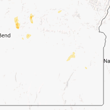
Hail Maps for Crane, OR


Connect with Interactive Hail Maps