

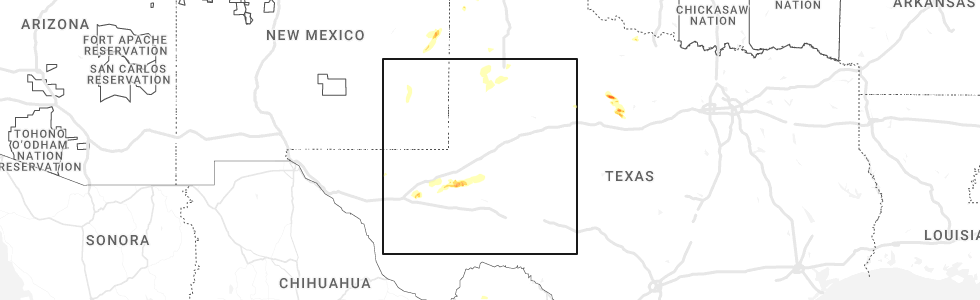
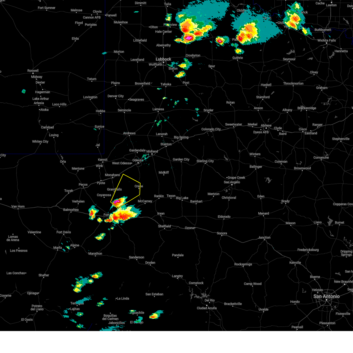
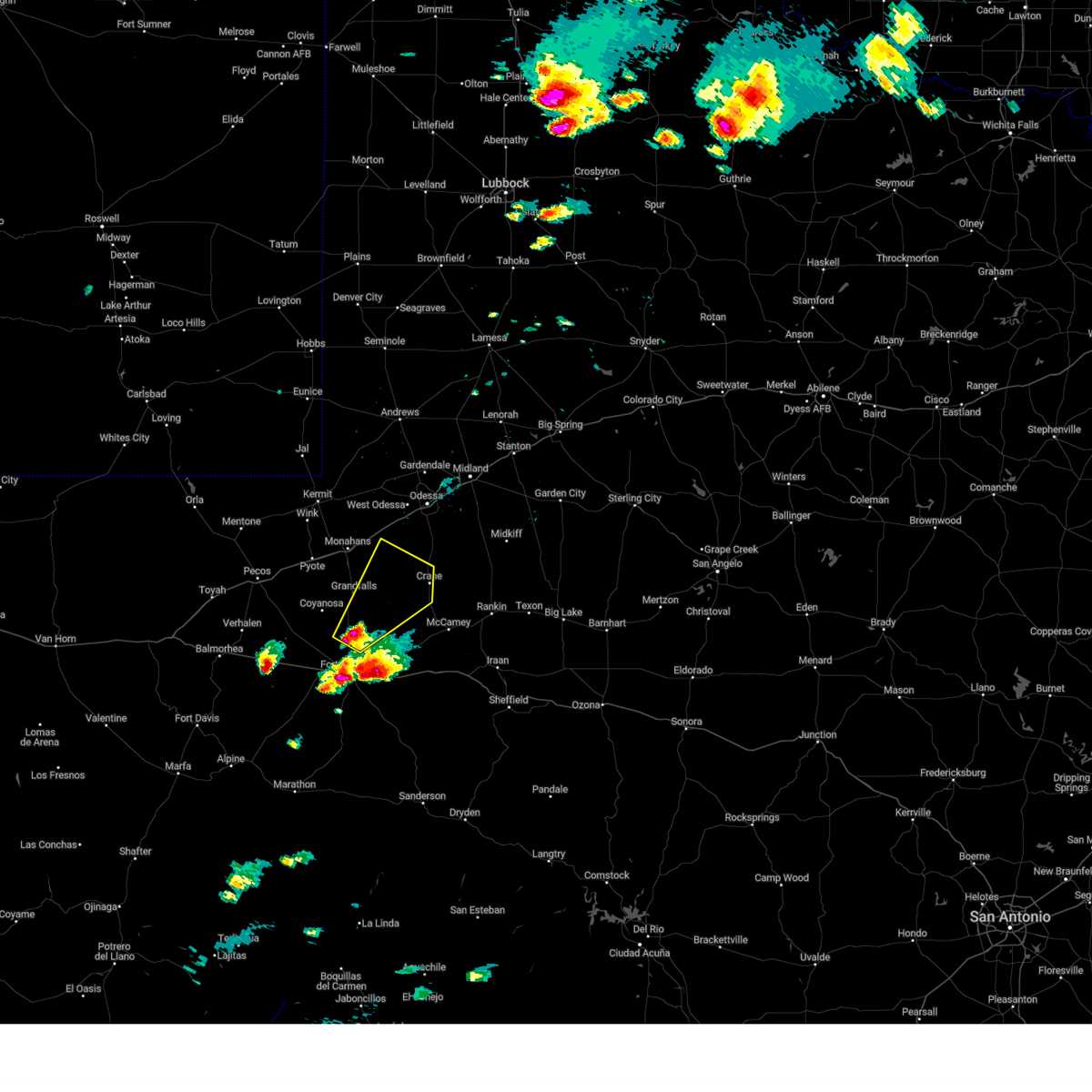
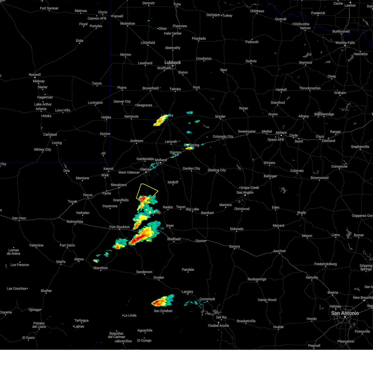
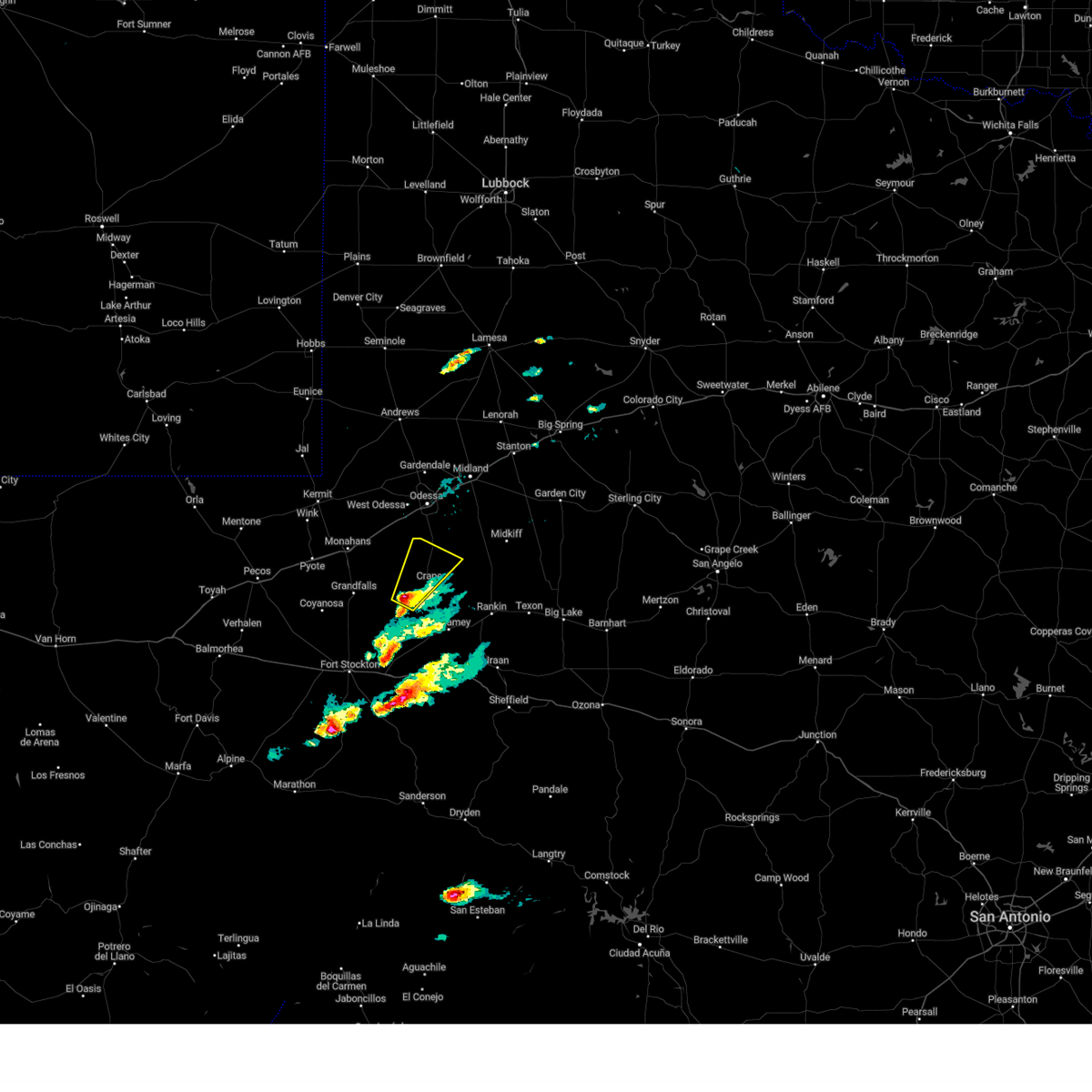
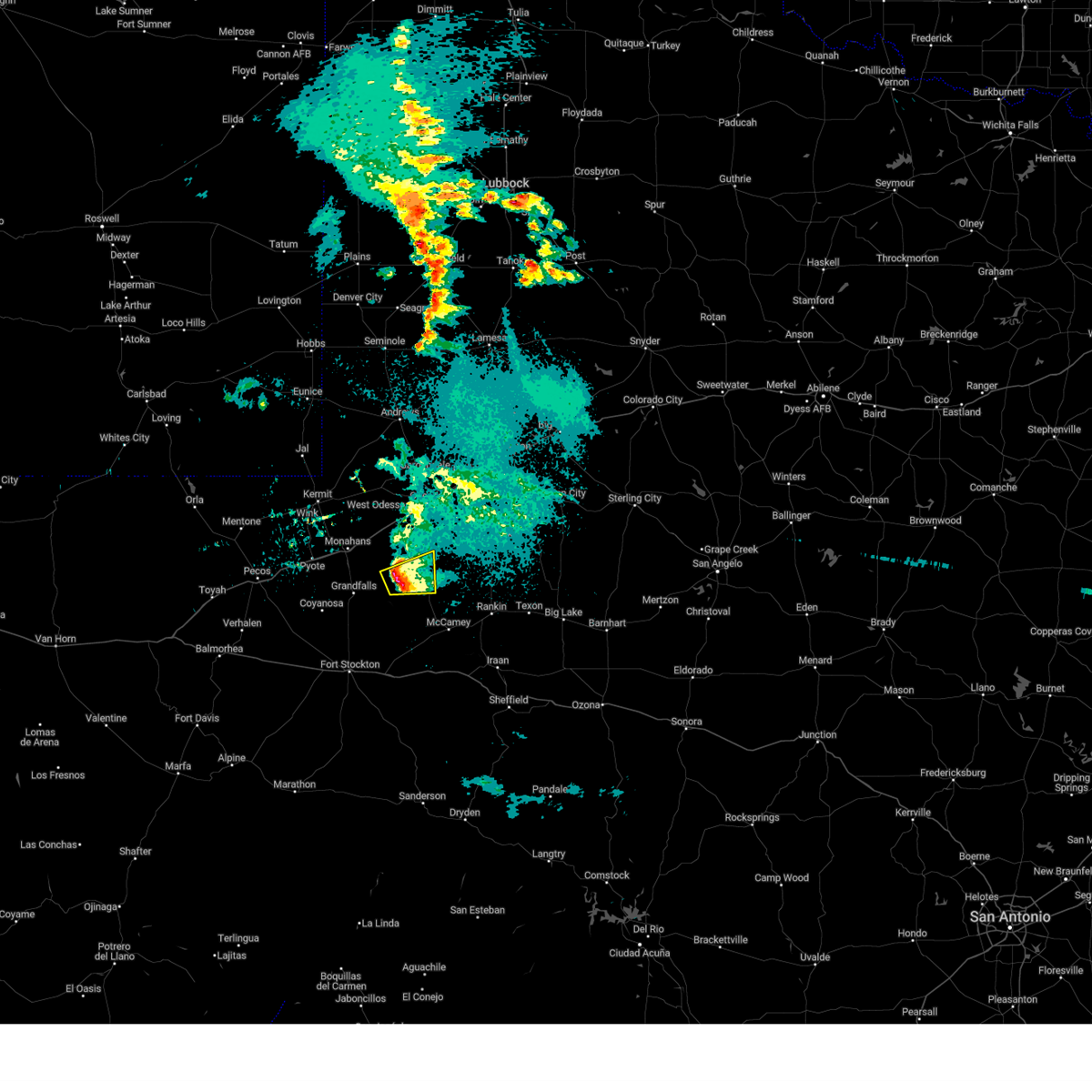
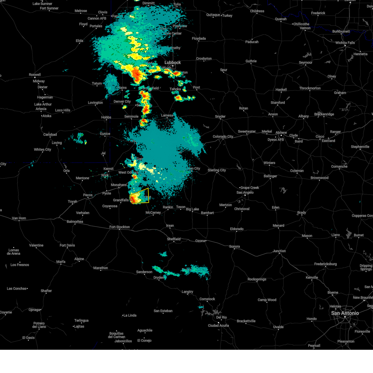
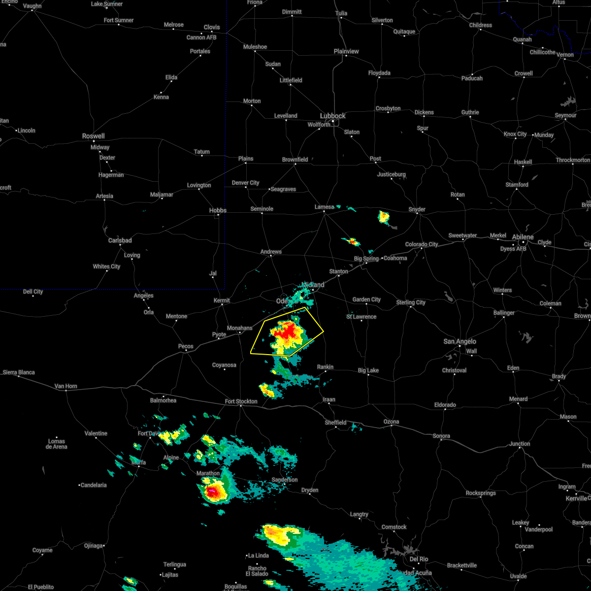
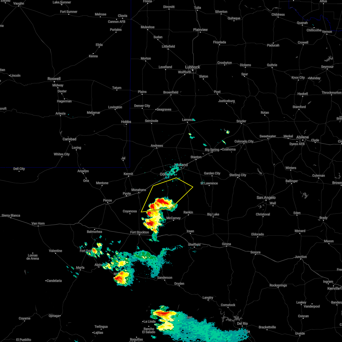
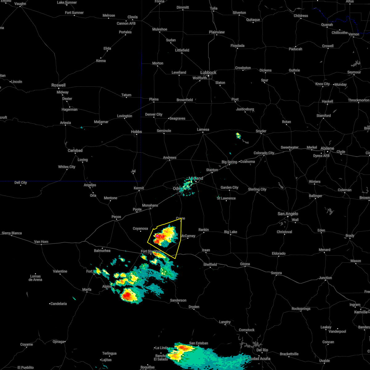
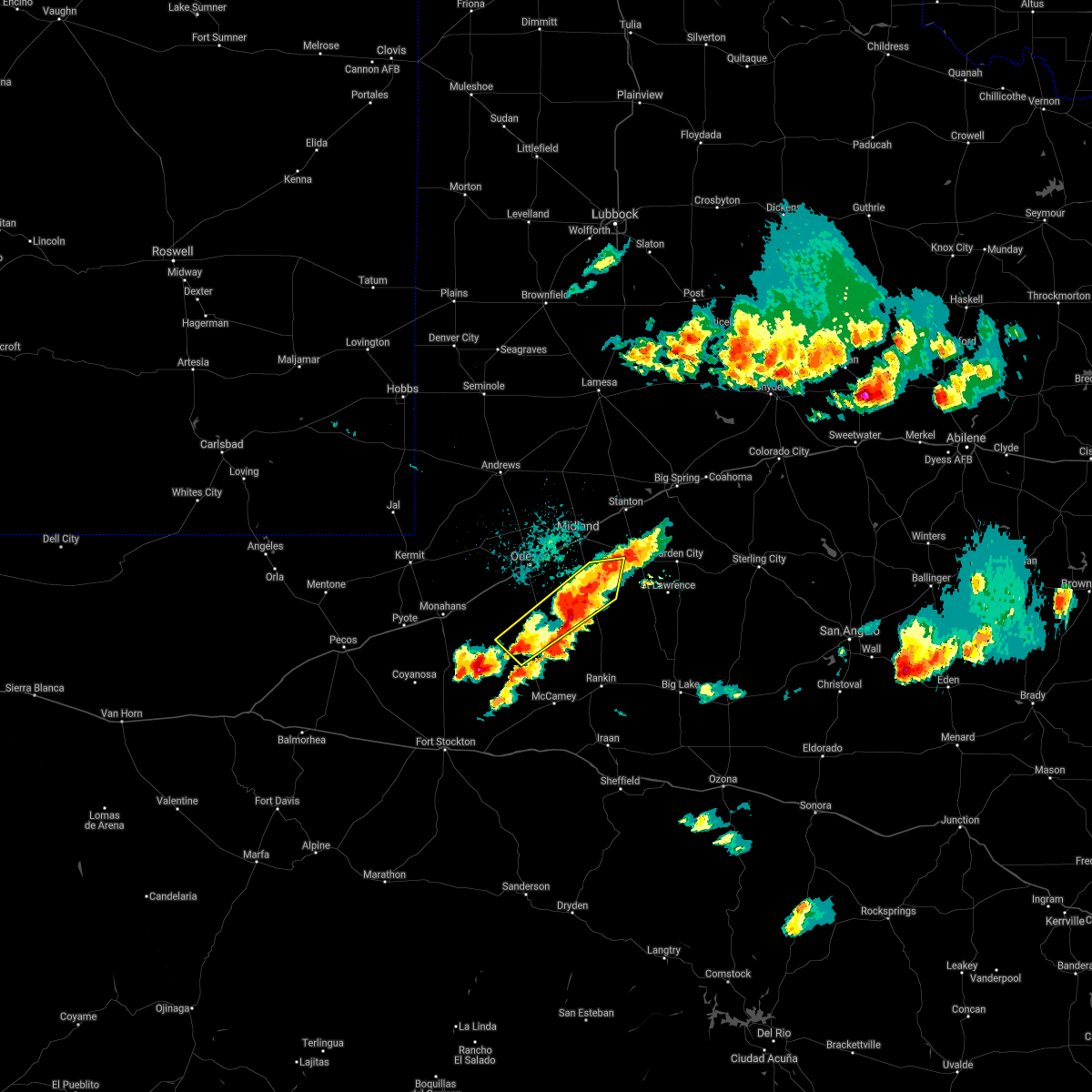
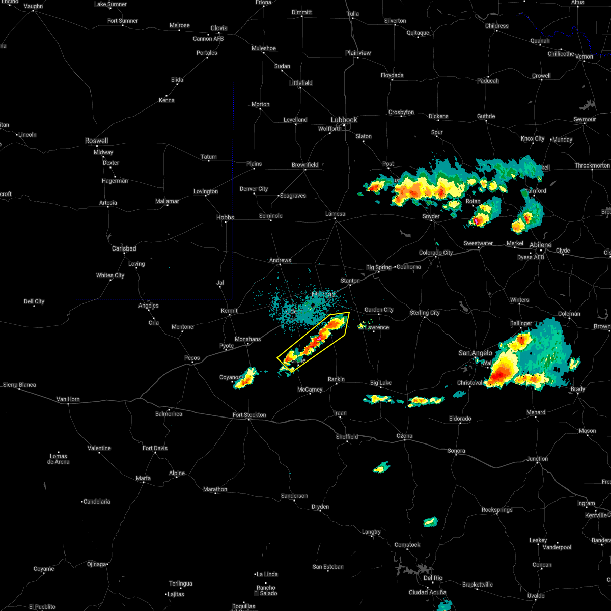
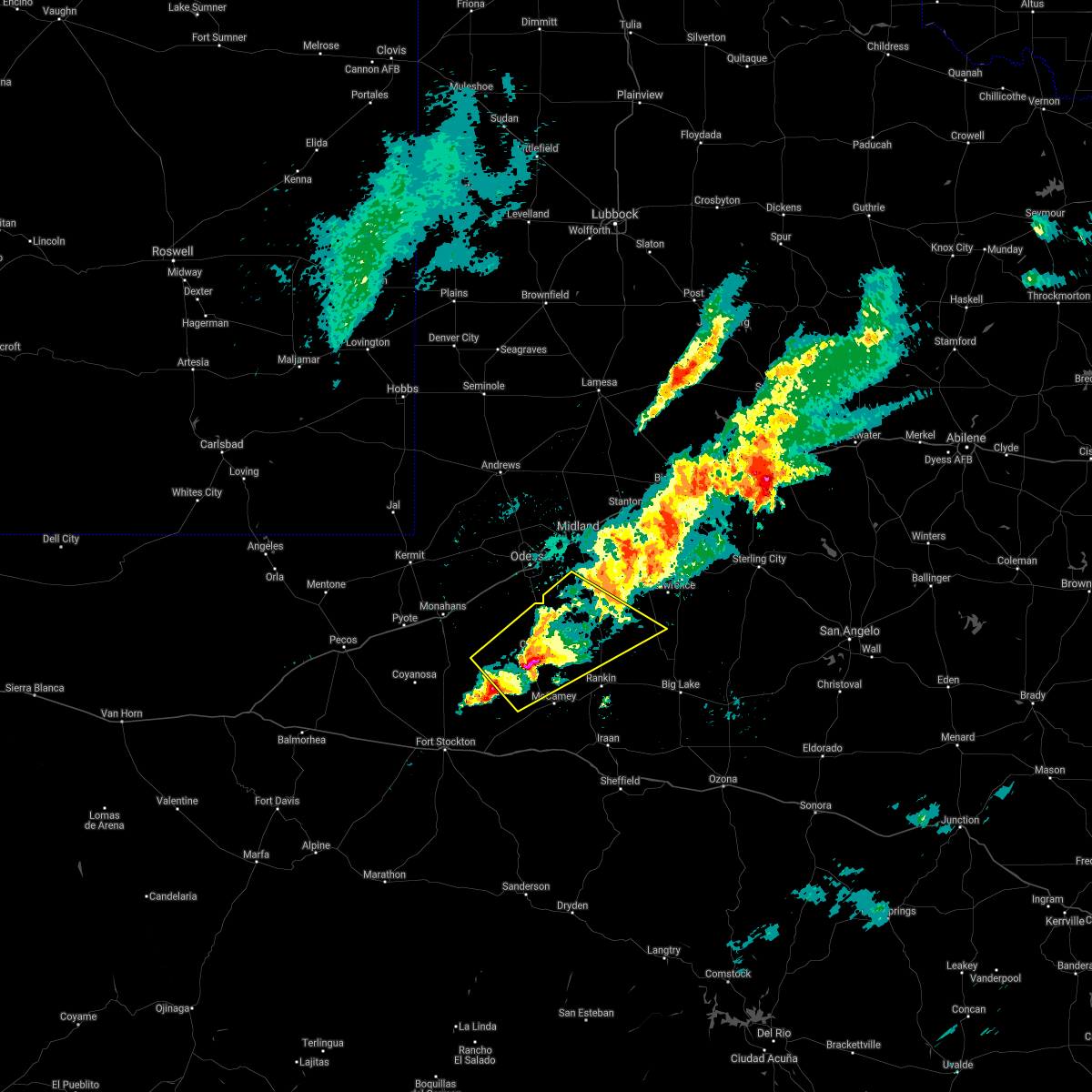
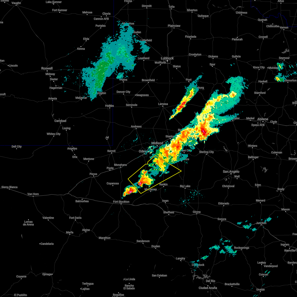
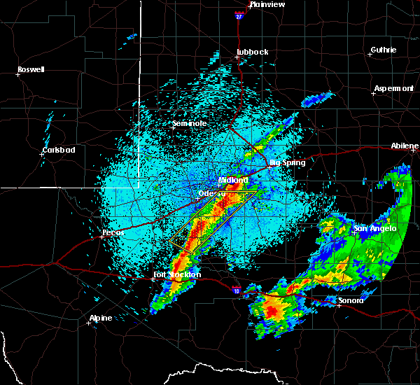
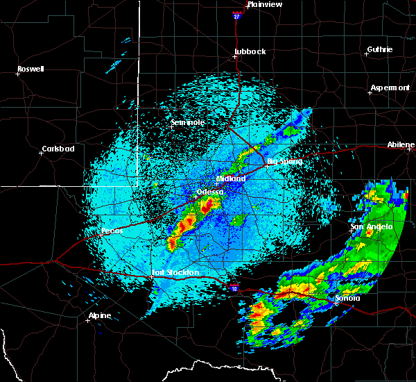
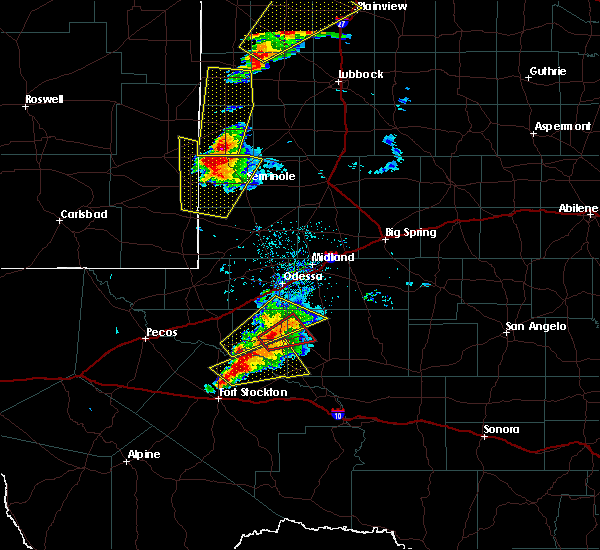
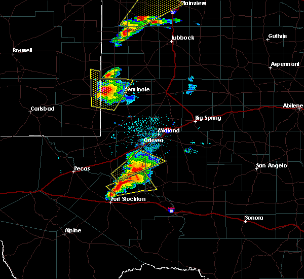
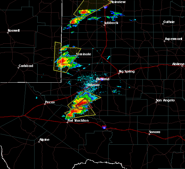
Hail Map for Crane, TX
The Crane, TX area has had 20 reports of on-the-ground hail by trained spotters, and has been under severe weather warnings 9 times during the past 12 months. Doppler radar has detected hail at or near Crane, TX on 52 occasions, including 3 occasions during the past year.
| Name: | Crane, TX |
| Where Located: | 31.5 miles S of Odessa, TX |
| Map: | Google Map for Crane, TX |
| Population: | 3353 |
| Housing Units: | 1253 |
| More Info: | Search Google for Crane, TX |
1
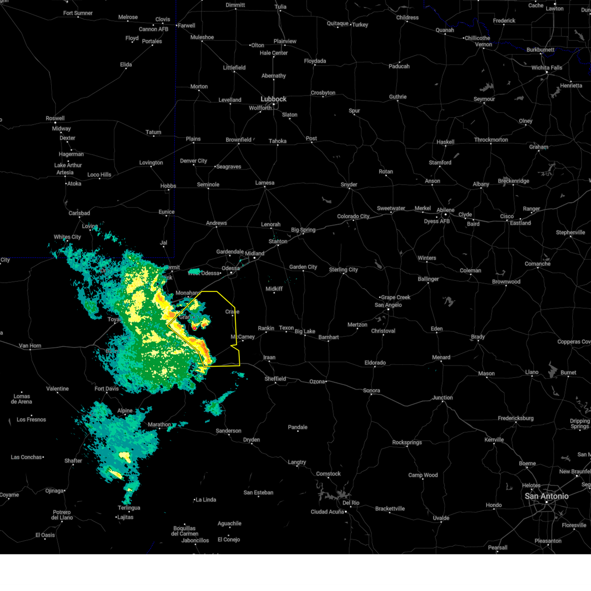
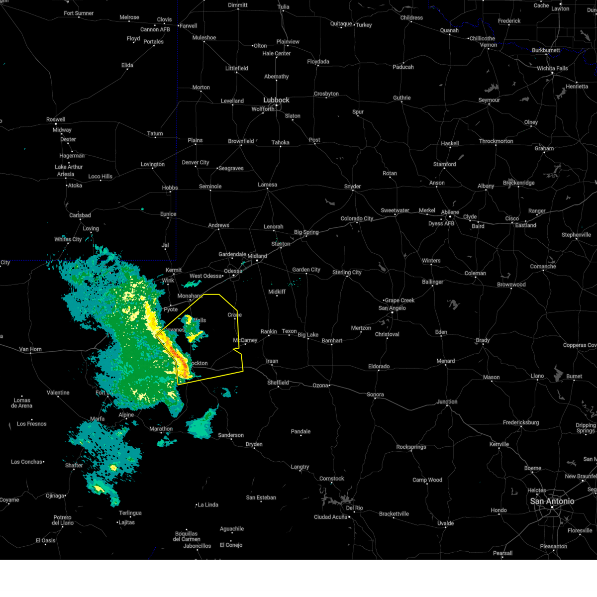
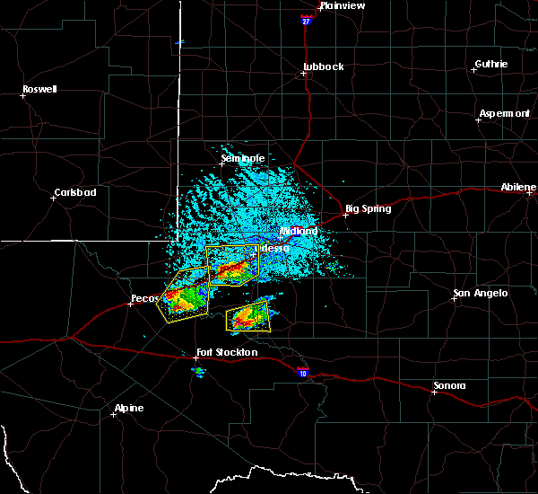
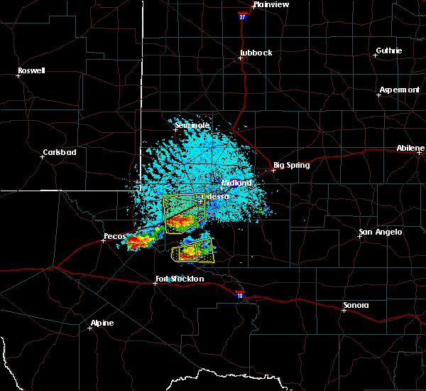
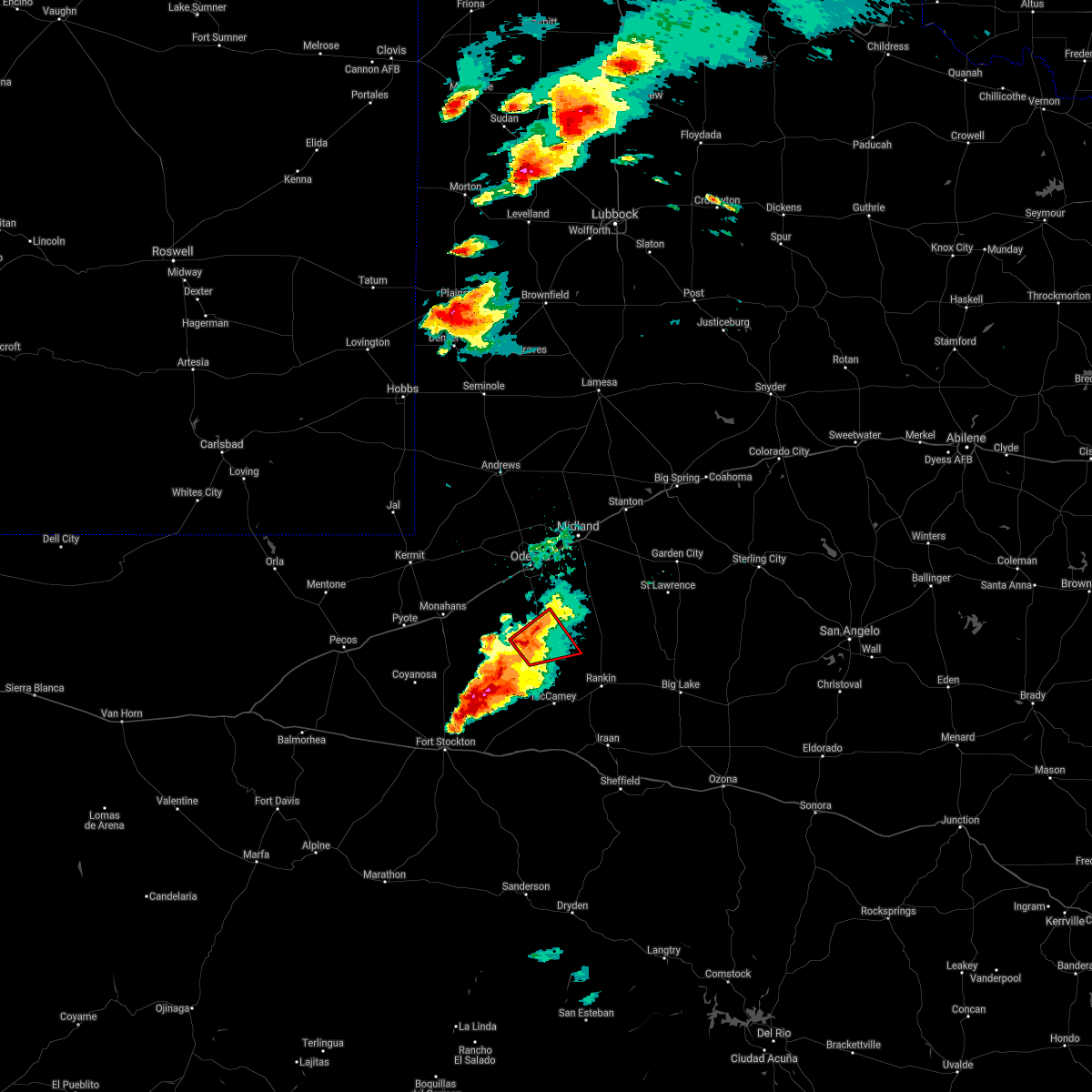
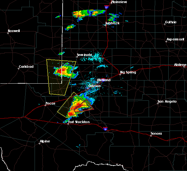
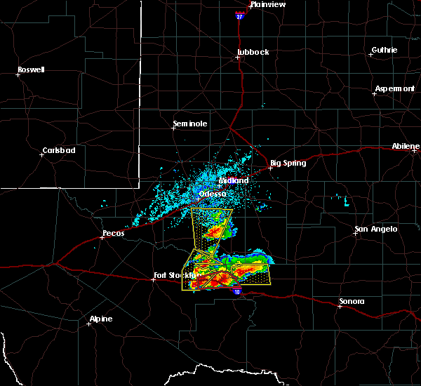
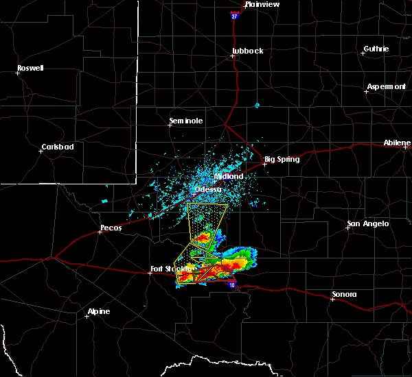
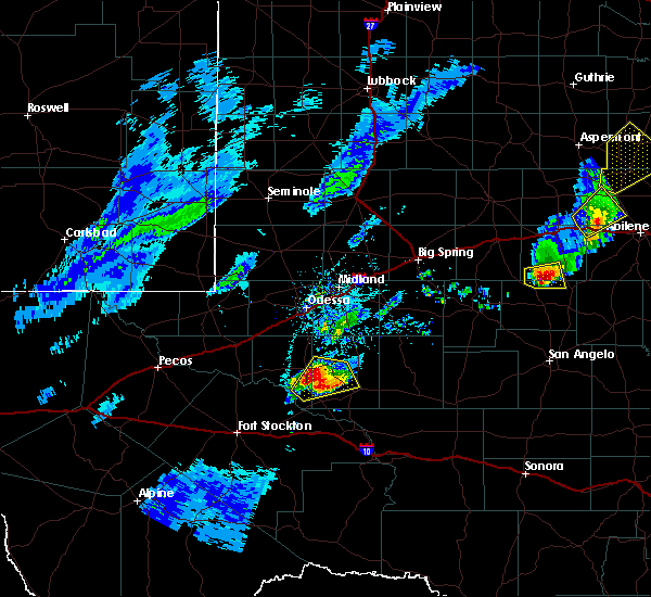
The Top Recent Hail Date for Crane, TX is Wednesday, May 3, 2023 (22nd out of 52)
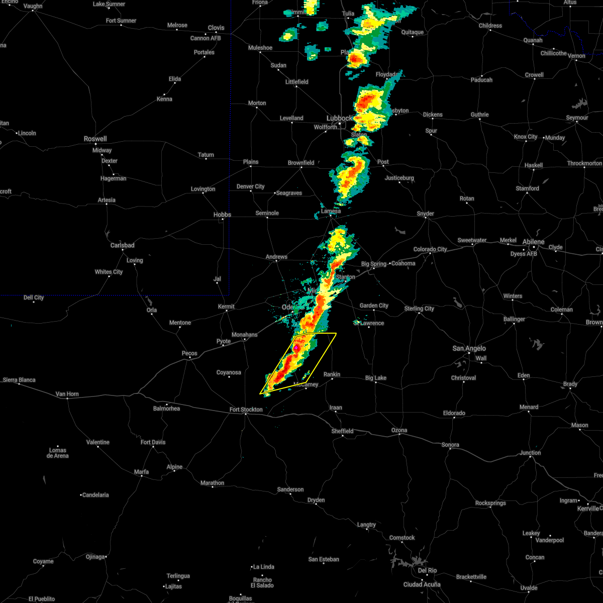
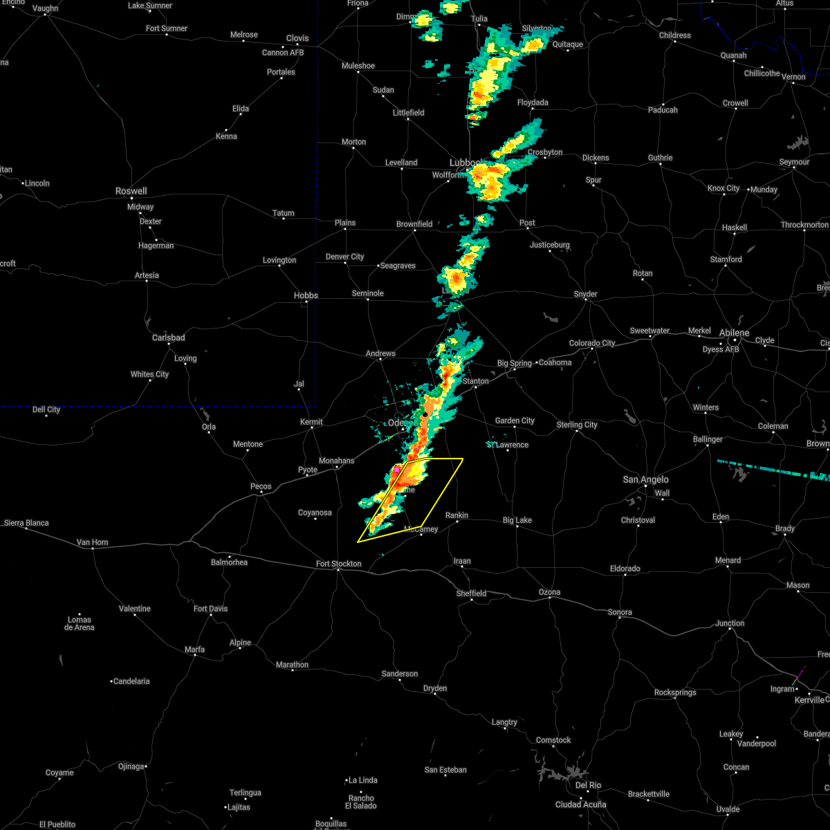
Hail and Wind Damage Spotted near Crane, TX
| Date / Time | Report Details |
|---|---|
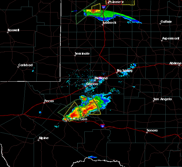
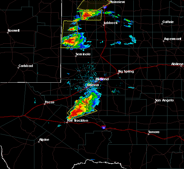
| 1/23/2024 8:40 PM CST |
 At 840 pm cst, severe thunderstorms were located along a line extending from 10 miles west of grandfalls to 26 miles southwest of crane to 15 miles northeast of fort stockton, moving northeast at 50 mph (radar indicated). Hazards include 60 mph wind gusts. Expect damage to roofs, siding, and trees. locations impacted include, crane, grandfalls, royalty, coyanosa, imperial reservoir, crane county airport, imperial, bakersfield, girvin, and cordona lake. this includes interstate 10 between mile markers 270 and 277, and between mile markers 283 and 297. hail threat, radar indicated max hail size, <. 75 in wind threat, radar indicated max wind gust, 60 mph. At 840 pm cst, severe thunderstorms were located along a line extending from 10 miles west of grandfalls to 26 miles southwest of crane to 15 miles northeast of fort stockton, moving northeast at 50 mph (radar indicated). Hazards include 60 mph wind gusts. Expect damage to roofs, siding, and trees. locations impacted include, crane, grandfalls, royalty, coyanosa, imperial reservoir, crane county airport, imperial, bakersfield, girvin, and cordona lake. this includes interstate 10 between mile markers 270 and 277, and between mile markers 283 and 297. hail threat, radar indicated max hail size, <. 75 in wind threat, radar indicated max wind gust, 60 mph.
|
| 1/23/2024 8:16 PM CST |
 At 816 pm cst, severe thunderstorms were located along a line extending from 20 miles southeast of barstow to 21 miles south of grandfalls to 7 miles southwest of fort stockton, moving northeast at 45 mph (belding mesonet reported a 58 mph wind gust at 802 pm cst). Hazards include 60 mph wind gusts. expect damage to roofs, siding, and trees At 816 pm cst, severe thunderstorms were located along a line extending from 20 miles southeast of barstow to 21 miles south of grandfalls to 7 miles southwest of fort stockton, moving northeast at 45 mph (belding mesonet reported a 58 mph wind gust at 802 pm cst). Hazards include 60 mph wind gusts. expect damage to roofs, siding, and trees
|
| 10/4/2023 3:45 PM CDT | Ping Pong Ball sized hail reported 18.3 miles E of Crane, TX, public report of pea to ping pong ball size hail between grandfalls and crane. time and location are estimated from radar. |
| 10/4/2023 3:28 PM CDT |
 At 328 pm cdt, a severe thunderstorm was located 7 miles east of grandfalls, or 21 miles southeast of monahans, moving northeast at 30 mph (emergency management reported ping pong ball sized hail in imperial). Hazards include ping pong ball size hail and 60 mph wind gusts. People and animals outdoors will be injured. expect hail damage to roofs, siding, windows, and vehicles. expect wind damage to roofs, siding, and trees. locations impacted include, crane, imperial, cordona lake, and crane county airport. hail threat, observed max hail size, 1. 50 in wind threat, radar indicated max wind gust, 60 mph. At 328 pm cdt, a severe thunderstorm was located 7 miles east of grandfalls, or 21 miles southeast of monahans, moving northeast at 30 mph (emergency management reported ping pong ball sized hail in imperial). Hazards include ping pong ball size hail and 60 mph wind gusts. People and animals outdoors will be injured. expect hail damage to roofs, siding, windows, and vehicles. expect wind damage to roofs, siding, and trees. locations impacted include, crane, imperial, cordona lake, and crane county airport. hail threat, observed max hail size, 1. 50 in wind threat, radar indicated max wind gust, 60 mph.
|
| 10/4/2023 3:10 PM CDT |
 At 310 pm cdt, a severe thunderstorm was located 10 miles south of grandfalls, or 21 miles north of fort stockton, moving northeast at 30 mph (radar indicated). Hazards include tennis ball size hail and 60 mph wind gusts. People and animals outdoors will be injured. expect hail damage to roofs, siding, windows, and vehicles. expect wind damage to roofs, siding, and trees. locations impacted include, crane, imperial, imperial reservoir, cordona lake, and crane county airport. thunderstorm damage threat, considerable hail threat, radar indicated max hail size, 2. 50 in wind threat, radar indicated max wind gust, 60 mph. At 310 pm cdt, a severe thunderstorm was located 10 miles south of grandfalls, or 21 miles north of fort stockton, moving northeast at 30 mph (radar indicated). Hazards include tennis ball size hail and 60 mph wind gusts. People and animals outdoors will be injured. expect hail damage to roofs, siding, windows, and vehicles. expect wind damage to roofs, siding, and trees. locations impacted include, crane, imperial, imperial reservoir, cordona lake, and crane county airport. thunderstorm damage threat, considerable hail threat, radar indicated max hail size, 2. 50 in wind threat, radar indicated max wind gust, 60 mph.
|
| 10/4/2023 2:59 PM CDT |
 At 259 pm cdt, a severe thunderstorm was located 15 miles south of grandfalls, or 15 miles north of fort stockton, moving northeast at 30 mph (radar indicated). Hazards include ping pong ball size hail and 60 mph wind gusts. People and animals outdoors will be injured. expect hail damage to roofs, siding, windows, and vehicles. Expect wind damage to roofs, siding, and trees. At 259 pm cdt, a severe thunderstorm was located 15 miles south of grandfalls, or 15 miles north of fort stockton, moving northeast at 30 mph (radar indicated). Hazards include ping pong ball size hail and 60 mph wind gusts. People and animals outdoors will be injured. expect hail damage to roofs, siding, windows, and vehicles. Expect wind damage to roofs, siding, and trees.
|
| 10/3/2023 4:25 PM CDT |
 At 424 pm cdt, a severe thunderstorm was located near crane, moving northeast at 35 mph (radar indicated). Hazards include golf ball size hail and 60 mph wind gusts. People and animals outdoors will be injured. expect hail damage to roofs, siding, windows, and vehicles. expect wind damage to roofs, siding, and trees. locations impacted include, crane and crane county airport. thunderstorm damage threat, considerable hail threat, radar indicated max hail size, 1. 75 in wind threat, radar indicated max wind gust, 60 mph. At 424 pm cdt, a severe thunderstorm was located near crane, moving northeast at 35 mph (radar indicated). Hazards include golf ball size hail and 60 mph wind gusts. People and animals outdoors will be injured. expect hail damage to roofs, siding, windows, and vehicles. expect wind damage to roofs, siding, and trees. locations impacted include, crane and crane county airport. thunderstorm damage threat, considerable hail threat, radar indicated max hail size, 1. 75 in wind threat, radar indicated max wind gust, 60 mph.
|
| 10/3/2023 4:10 PM CDT |
 At 410 pm cdt, a severe thunderstorm was located 9 miles southwest of crane, moving northeast at 20 mph (radar indicated). Hazards include ping pong ball size hail and 60 mph wind gusts. People and animals outdoors will be injured. expect hail damage to roofs, siding, windows, and vehicles. Expect wind damage to roofs, siding, and trees. At 410 pm cdt, a severe thunderstorm was located 9 miles southwest of crane, moving northeast at 20 mph (radar indicated). Hazards include ping pong ball size hail and 60 mph wind gusts. People and animals outdoors will be injured. expect hail damage to roofs, siding, windows, and vehicles. Expect wind damage to roofs, siding, and trees.
|
| 5/3/2023 11:01 PM CDT |
 At 1100 pm cdt, a severe thunderstorm was located 9 miles west of crane, moving east at 25 mph (radar indicated). Hazards include 60 mph wind gusts and quarter size hail. Hail damage to vehicles is expected. expect wind damage to roofs, siding, and trees. locations impacted include, crane and crane county airport. hail threat, radar indicated max hail size, 1. 00 in wind threat, radar indicated max wind gust, 60 mph. At 1100 pm cdt, a severe thunderstorm was located 9 miles west of crane, moving east at 25 mph (radar indicated). Hazards include 60 mph wind gusts and quarter size hail. Hail damage to vehicles is expected. expect wind damage to roofs, siding, and trees. locations impacted include, crane and crane county airport. hail threat, radar indicated max hail size, 1. 00 in wind threat, radar indicated max wind gust, 60 mph.
|
| 5/3/2023 10:44 PM CDT |
 At 1044 pm cdt, a severe thunderstorm was located 15 miles west of crane, moving east at 25 mph (radar indicated). Hazards include 60 mph wind gusts and quarter size hail. Hail damage to vehicles is expected. Expect wind damage to roofs, siding, and trees. At 1044 pm cdt, a severe thunderstorm was located 15 miles west of crane, moving east at 25 mph (radar indicated). Hazards include 60 mph wind gusts and quarter size hail. Hail damage to vehicles is expected. Expect wind damage to roofs, siding, and trees.
|
| 6/3/2022 10:51 PM CDT |
 At 1050 pm cdt, severe thunderstorms were located along a line extending from 20 miles southwest of garden city to 7 miles north of rankin to 8 miles northwest of mccamey, moving east at 45 mph (west texas mesonet). Hazards include 70 mph wind gusts and quarter size hail. Hail damage to vehicles is expected. expect considerable tree damage. wind damage is also likely to mobile homes, roofs, and outbuildings. locations impacted include, crane, mccamey, rankin, stiles, midkiff, crane county airport, best, upton county airport, saint lawrence and king mountain. thunderstorm damage threat, considerable hail threat, radar indicated max hail size, 1. 00 in wind threat, radar indicated max wind gust, 70 mph. At 1050 pm cdt, severe thunderstorms were located along a line extending from 20 miles southwest of garden city to 7 miles north of rankin to 8 miles northwest of mccamey, moving east at 45 mph (west texas mesonet). Hazards include 70 mph wind gusts and quarter size hail. Hail damage to vehicles is expected. expect considerable tree damage. wind damage is also likely to mobile homes, roofs, and outbuildings. locations impacted include, crane, mccamey, rankin, stiles, midkiff, crane county airport, best, upton county airport, saint lawrence and king mountain. thunderstorm damage threat, considerable hail threat, radar indicated max hail size, 1. 00 in wind threat, radar indicated max wind gust, 70 mph.
|
| 6/3/2022 10:36 PM CDT |
 At 1035 pm cdt, severe thunderstorms were located along a line extending from 19 miles southwest of garden city to 13 miles north of rankin to near crane, moving southeast at 40 mph (west texas mesonet). Hazards include 70 mph wind gusts and nickel size hail. Expect considerable tree damage. Damage is likely to mobile homes, roofs, and outbuildings. At 1035 pm cdt, severe thunderstorms were located along a line extending from 19 miles southwest of garden city to 13 miles north of rankin to near crane, moving southeast at 40 mph (west texas mesonet). Hazards include 70 mph wind gusts and nickel size hail. Expect considerable tree damage. Damage is likely to mobile homes, roofs, and outbuildings.
|
| 6/3/2022 10:20 PM CDT | At the crane mesone in crane county TX, 2 miles SSE of Crane, TX |
| 5/4/2022 4:58 PM CDT |
 At 458 pm cdt, a severe thunderstorm was located 7 miles north of mccamey, moving northeast at 35 mph (radar indicated). Hazards include 60 mph wind gusts and quarter size hail. Hail damage to vehicles is expected. Expect wind damage to roofs, siding, and trees. At 458 pm cdt, a severe thunderstorm was located 7 miles north of mccamey, moving northeast at 35 mph (radar indicated). Hazards include 60 mph wind gusts and quarter size hail. Hail damage to vehicles is expected. Expect wind damage to roofs, siding, and trees.
|
| 2/16/2022 9:51 PM CST |
 At 950 pm cst, severe thunderstorms were located along a line extending from near greenwood to 20 miles southeast of odessa to near crane, moving east at 35 mph (trained weather spotters). Hazards include 70 mph wind gusts and nickel size hail. Expect considerable tree damage. damage is likely to mobile homes, roofs, and outbuildings. locations impacted include, midland, odessa, crane, greenwood, midland international air and space port, cotton flat, midkiff, crane county airport, warfield, midland airpark, skywest airport, king mountain, spraberry, pleasant farms and cordona lake. this includes interstate 20 between mile markers 114 and 150. thunderstorm damage threat, considerable hail threat, radar indicated max hail size, 0. 88 in wind threat, observed max wind gust, 70 mph. At 950 pm cst, severe thunderstorms were located along a line extending from near greenwood to 20 miles southeast of odessa to near crane, moving east at 35 mph (trained weather spotters). Hazards include 70 mph wind gusts and nickel size hail. Expect considerable tree damage. damage is likely to mobile homes, roofs, and outbuildings. locations impacted include, midland, odessa, crane, greenwood, midland international air and space port, cotton flat, midkiff, crane county airport, warfield, midland airpark, skywest airport, king mountain, spraberry, pleasant farms and cordona lake. this includes interstate 20 between mile markers 114 and 150. thunderstorm damage threat, considerable hail threat, radar indicated max hail size, 0. 88 in wind threat, observed max wind gust, 70 mph.
|
| 2/16/2022 9:30 PM CST |
 At 930 pm cst, severe thunderstorms were located along a line extending from near midland to crane, moving east at 45 mph (trained weather spotters). Hazards include 70 mph wind gusts and nickel size hail. Expect considerable tree damage. Damage is likely to mobile homes, roofs, and outbuildings. At 930 pm cst, severe thunderstorms were located along a line extending from near midland to crane, moving east at 45 mph (trained weather spotters). Hazards include 70 mph wind gusts and nickel size hail. Expect considerable tree damage. Damage is likely to mobile homes, roofs, and outbuildings.
|
| 6/9/2021 7:37 PM CDT | Storm damage reported in crane county TX, 1.4 miles SSE of Crane, TX |
| 5/31/2021 5:35 PM CDT | Hen Egg sized hail reported 19.5 miles ESE of Crane, TX, 2 inch hail reported at sand hills oil field. |
| 5/28/2021 7:17 PM CDT |
 At 717 pm cdt, a severe thunderstorm was located near crane, moving east at 25 mph (radar indicated). Hazards include two inch hail and 70 mph wind gusts. People and animals outdoors will be injured. expect hail damage to roofs, siding, windows, and vehicles. expect considerable tree damage. Wind damage is also likely to mobile homes, roofs, and outbuildings. At 717 pm cdt, a severe thunderstorm was located near crane, moving east at 25 mph (radar indicated). Hazards include two inch hail and 70 mph wind gusts. People and animals outdoors will be injured. expect hail damage to roofs, siding, windows, and vehicles. expect considerable tree damage. Wind damage is also likely to mobile homes, roofs, and outbuildings.
|
| 5/28/2021 6:42 PM CDT | Hen Egg sized hail reported 4.7 miles E of Crane, TX, 65 mph wind gust measured |
| 5/28/2021 6:15 PM CDT |
 At 615 pm cdt, a severe thunderstorm was located 15 miles northeast of grandfalls, or 17 miles southeast of monahans, moving northeast at 20 mph (radar indicated). Hazards include two inch hail and 60 mph wind gusts. People and animals outdoors will be injured. expect hail damage to roofs, siding, windows, and vehicles. expect wind damage to roofs, siding, and trees. Locations impacted include, crane, grandfalls, royalty, coyanosa, imperial reservoir, crane county airport, imperial, king mountain and cordona lake. At 615 pm cdt, a severe thunderstorm was located 15 miles northeast of grandfalls, or 17 miles southeast of monahans, moving northeast at 20 mph (radar indicated). Hazards include two inch hail and 60 mph wind gusts. People and animals outdoors will be injured. expect hail damage to roofs, siding, windows, and vehicles. expect wind damage to roofs, siding, and trees. Locations impacted include, crane, grandfalls, royalty, coyanosa, imperial reservoir, crane county airport, imperial, king mountain and cordona lake.
|
| 5/28/2021 6:09 PM CDT | Hen Egg sized hail reported 20.7 miles E of Crane, TX |
| 5/28/2021 6:05 PM CDT |
 At 605 pm cdt, a severe thunderstorm was located 8 miles east of grandfalls, or 16 miles southeast of monahans, moving northeast at 25 mph (radar indicated). Hazards include 70 mph wind gusts and ping pong ball size hail. People and animals outdoors will be injured. expect hail damage to roofs, siding, windows, and vehicles. expect considerable tree damage. wind damage is also likely to mobile homes, roofs, and outbuildings. Locations impacted include, crane, grandfalls, royalty, coyanosa, imperial reservoir, crane county airport, imperial, king mountain and cordona lake. At 605 pm cdt, a severe thunderstorm was located 8 miles east of grandfalls, or 16 miles southeast of monahans, moving northeast at 25 mph (radar indicated). Hazards include 70 mph wind gusts and ping pong ball size hail. People and animals outdoors will be injured. expect hail damage to roofs, siding, windows, and vehicles. expect considerable tree damage. wind damage is also likely to mobile homes, roofs, and outbuildings. Locations impacted include, crane, grandfalls, royalty, coyanosa, imperial reservoir, crane county airport, imperial, king mountain and cordona lake.
|
| 5/28/2021 5:46 PM CDT |
 At 546 pm cdt, a severe thunderstorm was located over grandfalls, or 19 miles south of monahans, moving northeast at 25 mph (radar indicated). Hazards include golf ball size hail and 70 mph wind gusts. People and animals outdoors will be injured. expect hail damage to roofs, siding, windows, and vehicles. expect considerable tree damage. Wind damage is also likely to mobile homes, roofs, and outbuildings. At 546 pm cdt, a severe thunderstorm was located over grandfalls, or 19 miles south of monahans, moving northeast at 25 mph (radar indicated). Hazards include golf ball size hail and 70 mph wind gusts. People and animals outdoors will be injured. expect hail damage to roofs, siding, windows, and vehicles. expect considerable tree damage. Wind damage is also likely to mobile homes, roofs, and outbuildings.
|
| 5/25/2021 5:19 PM CDT |
 At 518 pm cdt, a severe thunderstorm was located 15 miles southeast of west odessa, or 16 miles south of odessa, moving north at 35 mph (radar indicated). Hazards include 60 mph wind gusts and half dollar size hail. Hail damage to vehicles is expected. expect wind damage to roofs, siding, and trees. Locations impacted include, crane, pleasant farms and crane county airport. At 518 pm cdt, a severe thunderstorm was located 15 miles southeast of west odessa, or 16 miles south of odessa, moving north at 35 mph (radar indicated). Hazards include 60 mph wind gusts and half dollar size hail. Hail damage to vehicles is expected. expect wind damage to roofs, siding, and trees. Locations impacted include, crane, pleasant farms and crane county airport.
|
| 5/25/2021 4:50 PM CDT |
 At 450 pm cdt, a severe thunderstorm was located 17 miles northeast of fort stockton, moving southeast at 20 mph (radar indicated). Hazards include 60 mph wind gusts and half dollar size hail. Hail damage to vehicles is expected. expect wind damage to roofs, siding, and trees. locations impacted include, crane, imperial, girvin, cordona lake, crane county airport and imperial reservoir. This includes interstate 10 between mile markers 282 and 287. At 450 pm cdt, a severe thunderstorm was located 17 miles northeast of fort stockton, moving southeast at 20 mph (radar indicated). Hazards include 60 mph wind gusts and half dollar size hail. Hail damage to vehicles is expected. expect wind damage to roofs, siding, and trees. locations impacted include, crane, imperial, girvin, cordona lake, crane county airport and imperial reservoir. This includes interstate 10 between mile markers 282 and 287.
|
| 5/25/2021 4:49 PM CDT |
 At 448 pm cdt, a severe thunderstorm was located near crane, moving northeast at 30 mph (radar indicated). Hazards include 60 mph wind gusts and quarter size hail. Hail damage to vehicles is expected. Expect wind damage to roofs, siding, and trees. At 448 pm cdt, a severe thunderstorm was located near crane, moving northeast at 30 mph (radar indicated). Hazards include 60 mph wind gusts and quarter size hail. Hail damage to vehicles is expected. Expect wind damage to roofs, siding, and trees.
|
| 5/25/2021 4:33 PM CDT |
 At 433 pm cdt, a severe thunderstorm was located 19 miles southeast of grandfalls, or 22 miles southwest of crane, moving east at 10 mph (radar indicated). Hazards include 60 mph wind gusts and quarter size hail. Hail damage to vehicles is expected. expect wind damage to roofs, siding, and trees. locations impacted include, crane, imperial, girvin, cordona lake, crane county airport and imperial reservoir. This includes interstate 10 between mile markers 282 and 287. At 433 pm cdt, a severe thunderstorm was located 19 miles southeast of grandfalls, or 22 miles southwest of crane, moving east at 10 mph (radar indicated). Hazards include 60 mph wind gusts and quarter size hail. Hail damage to vehicles is expected. expect wind damage to roofs, siding, and trees. locations impacted include, crane, imperial, girvin, cordona lake, crane county airport and imperial reservoir. This includes interstate 10 between mile markers 282 and 287.
|
| 5/25/2021 4:18 PM CDT |
 At 417 pm cdt, a severe thunderstorm was located 17 miles southeast of grandfalls, or 22 miles northeast of fort stockton, moving east at 10 mph (radar indicated). Hazards include 60 mph wind gusts and quarter size hail. Hail damage to vehicles is expected. Expect wind damage to roofs, siding, and trees. At 417 pm cdt, a severe thunderstorm was located 17 miles southeast of grandfalls, or 22 miles northeast of fort stockton, moving east at 10 mph (radar indicated). Hazards include 60 mph wind gusts and quarter size hail. Hail damage to vehicles is expected. Expect wind damage to roofs, siding, and trees.
|
| 5/19/2021 4:00 PM CDT |
 At 359 pm cdt, a severe thunderstorm was located near crane, moving east at 30 mph (radar indicated). Hazards include 60 mph wind gusts and quarter size hail. Hail damage to vehicles is expected. expect wind damage to roofs, siding, and trees. Locations impacted include, crane, mccamey, king mountain, cordona lake and crane county airport. At 359 pm cdt, a severe thunderstorm was located near crane, moving east at 30 mph (radar indicated). Hazards include 60 mph wind gusts and quarter size hail. Hail damage to vehicles is expected. expect wind damage to roofs, siding, and trees. Locations impacted include, crane, mccamey, king mountain, cordona lake and crane county airport.
|
| 5/19/2021 3:36 PM CDT |
 At 335 pm cdt, a severe thunderstorm was located 13 miles northeast of grandfalls, or 17 miles west of crane, moving east at 35 mph (radar indicated). Hazards include 60 mph wind gusts and quarter size hail. Hail damage to vehicles is expected. Expect wind damage to roofs, siding, and trees. At 335 pm cdt, a severe thunderstorm was located 13 miles northeast of grandfalls, or 17 miles west of crane, moving east at 35 mph (radar indicated). Hazards include 60 mph wind gusts and quarter size hail. Hail damage to vehicles is expected. Expect wind damage to roofs, siding, and trees.
|
| 5/18/2021 3:53 AM CDT |
 At 352 am cdt, a line of severe thunderstorms was located south of garden city extending back to crane, moving southeast at 25 mph (radar indicated). Hazards include 60 mph wind gusts and quarter size hail. Hail damage to vehicles is expected. Expect wind damage to roofs, siding, and trees. At 352 am cdt, a line of severe thunderstorms was located south of garden city extending back to crane, moving southeast at 25 mph (radar indicated). Hazards include 60 mph wind gusts and quarter size hail. Hail damage to vehicles is expected. Expect wind damage to roofs, siding, and trees.
|
| 5/18/2021 3:30 AM CDT | Quarter sized hail reported 0.1 miles N of Crane, TX |
| 5/18/2021 3:01 AM CDT |
 At 242 am cdt, a line of severe thunderstorms was located 9 miles northeast of crane to south of stanton, moving northeast at 10 mph (radar indicated). Hazards include ping pong ball size hail and 60 mph wind gusts. People and animals outdoors will be injured. expect hail damage to roofs, siding, windows, and vehicles. Expect wind damage to roofs, siding, and trees. At 242 am cdt, a line of severe thunderstorms was located 9 miles northeast of crane to south of stanton, moving northeast at 10 mph (radar indicated). Hazards include ping pong ball size hail and 60 mph wind gusts. People and animals outdoors will be injured. expect hail damage to roofs, siding, windows, and vehicles. Expect wind damage to roofs, siding, and trees.
|
| 5/18/2021 2:43 AM CDT |
 At 242 am cdt, a line of severe thunderstorms was located 9 miles northeast of crane to south of stanton, moving northeast at 10 mph (radar indicated). Hazards include ping pong ball size hail and 60 mph wind gusts. People and animals outdoors will be injured. expect hail damage to roofs, siding, windows, and vehicles. Expect wind damage to roofs, siding, and trees. At 242 am cdt, a line of severe thunderstorms was located 9 miles northeast of crane to south of stanton, moving northeast at 10 mph (radar indicated). Hazards include ping pong ball size hail and 60 mph wind gusts. People and animals outdoors will be injured. expect hail damage to roofs, siding, windows, and vehicles. Expect wind damage to roofs, siding, and trees.
|
| 5/18/2021 2:30 AM CDT |
 At 230 am cdt, a severe thunderstorm was located 14 miles east of grandfalls, or 15 miles west of crane, moving east at 15 mph (radar indicated). Hazards include ping pong ball size hail and 60 mph wind gusts. People and animals outdoors will be injured. expect hail damage to roofs, siding, windows, and vehicles. Expect wind damage to roofs, siding, and trees. At 230 am cdt, a severe thunderstorm was located 14 miles east of grandfalls, or 15 miles west of crane, moving east at 15 mph (radar indicated). Hazards include ping pong ball size hail and 60 mph wind gusts. People and animals outdoors will be injured. expect hail damage to roofs, siding, windows, and vehicles. Expect wind damage to roofs, siding, and trees.
|
| 5/18/2021 2:13 AM CDT |
 At 213 am cdt, a line of severe thunderstorms was located 20 miles south of midland international air and space port, or 21 miles southeast of odessa, and is nearly stationary (radar indicated). Hazards include 60 mph wind gusts and half dollar size hail. Hail damage to vehicles is expected. expect wind damage to roofs, siding, and trees. Locations impacted include, crane and crane county airport. At 213 am cdt, a line of severe thunderstorms was located 20 miles south of midland international air and space port, or 21 miles southeast of odessa, and is nearly stationary (radar indicated). Hazards include 60 mph wind gusts and half dollar size hail. Hail damage to vehicles is expected. expect wind damage to roofs, siding, and trees. Locations impacted include, crane and crane county airport.
|
| 5/18/2021 1:43 AM CDT |
 At 143 am cdt, a line of severe thunderstorms was located 21 miles south of midland international air and space port, or 21 miles southeast of odessa, and is nearly stationary (radar indicated). Hazards include 60 mph wind gusts and half dollar size hail. Hail damage to vehicles is expected. Expect wind damage to roofs, siding, and trees. At 143 am cdt, a line of severe thunderstorms was located 21 miles south of midland international air and space port, or 21 miles southeast of odessa, and is nearly stationary (radar indicated). Hazards include 60 mph wind gusts and half dollar size hail. Hail damage to vehicles is expected. Expect wind damage to roofs, siding, and trees.
|
| 4/28/2021 12:45 AM CDT | Hen Egg sized hail reported 1.6 miles NNW of Crane, TX, ping pong to 2 inch hail stones |
| 4/28/2021 12:43 AM CDT |
 At 1243 am cdt, a severe thunderstorm was located near crane, moving northeast at 50 mph (radar indicated). Hazards include golf ball size hail and 70 mph wind gusts. People and animals outdoors will be injured. expect hail damage to roofs, siding, windows, and vehicles. expect considerable tree damage. wind damage is also likely to mobile homes, roofs, and outbuildings. Locations impacted include, crane, king mountain, midkiff, cordona lake and crane county airport. At 1243 am cdt, a severe thunderstorm was located near crane, moving northeast at 50 mph (radar indicated). Hazards include golf ball size hail and 70 mph wind gusts. People and animals outdoors will be injured. expect hail damage to roofs, siding, windows, and vehicles. expect considerable tree damage. wind damage is also likely to mobile homes, roofs, and outbuildings. Locations impacted include, crane, king mountain, midkiff, cordona lake and crane county airport.
|
| 4/28/2021 12:36 AM CDT |
 At 1235 am cdt, a severe thunderstorm was located 7 miles southwest of crane, moving northeast at 50 mph (radar indicated). Hazards include 60 mph wind gusts and half dollar size hail. Hail damage to vehicles is expected. Expect wind damage to roofs, siding, and trees. At 1235 am cdt, a severe thunderstorm was located 7 miles southwest of crane, moving northeast at 50 mph (radar indicated). Hazards include 60 mph wind gusts and half dollar size hail. Hail damage to vehicles is expected. Expect wind damage to roofs, siding, and trees.
|
| 3/13/2021 5:16 PM CST |
 At 516 pm cst, severe thunderstorms were located along a line extending from 23 miles southwest of garden city to 11 miles north of rankin to near mccamey, moving east at 30 mph (radar indicated). Hazards include 70 mph wind gusts and half dollar size hail. Hail damage to vehicles is expected. expect considerable tree damage. wind damage is also likely to mobile homes, roofs, and outbuildings. Locations impacted include, crane, mccamey, rankin, midkiff, crane county airport, upton county airport, saint lawrence and king mountain. At 516 pm cst, severe thunderstorms were located along a line extending from 23 miles southwest of garden city to 11 miles north of rankin to near mccamey, moving east at 30 mph (radar indicated). Hazards include 70 mph wind gusts and half dollar size hail. Hail damage to vehicles is expected. expect considerable tree damage. wind damage is also likely to mobile homes, roofs, and outbuildings. Locations impacted include, crane, mccamey, rankin, midkiff, crane county airport, upton county airport, saint lawrence and king mountain.
|
| 3/13/2021 4:56 PM CST |
 The national weather service in midland has issued a * severe thunderstorm warning for. north central pecos county in southwestern texas. southwestern glasscock county in western texas. southeastern midland county in western texas. Northwestern reagan county in western texas. The national weather service in midland has issued a * severe thunderstorm warning for. north central pecos county in southwestern texas. southwestern glasscock county in western texas. southeastern midland county in western texas. Northwestern reagan county in western texas.
|
| 3/13/2021 4:24 PM CST |
 At 424 pm cst, severe thunderstorms were located along a line extending from 21 miles south of midland international air and space port to 22 miles northwest of rankin to near crane to 13 miles west of mccamey, moving east at 25 mph (radar indicated). Hazards include 70 mph wind gusts and half dollar size hail. Hail damage to vehicles is expected. expect considerable tree damage. wind damage is also likely to mobile homes, roofs, and outbuildings. Locations impacted include, crane, king mountain, cordona lake and crane county airport. At 424 pm cst, severe thunderstorms were located along a line extending from 21 miles south of midland international air and space port to 22 miles northwest of rankin to near crane to 13 miles west of mccamey, moving east at 25 mph (radar indicated). Hazards include 70 mph wind gusts and half dollar size hail. Hail damage to vehicles is expected. expect considerable tree damage. wind damage is also likely to mobile homes, roofs, and outbuildings. Locations impacted include, crane, king mountain, cordona lake and crane county airport.
|
| 3/13/2021 4:10 PM CST |
 At 410 pm cst, severe thunderstorms were located along a line extending from 19 miles southeast of odessa to 25 miles northwest of rankin to near crane to 18 miles west of mccamey, moving northeast at 25 mph (radar indicated). Hazards include 70 mph wind gusts and quarter size hail. Hail damage to vehicles is expected. expect considerable tree damage. Wind damage is also likely to mobile homes, roofs, and outbuildings. At 410 pm cst, severe thunderstorms were located along a line extending from 19 miles southeast of odessa to 25 miles northwest of rankin to near crane to 18 miles west of mccamey, moving northeast at 25 mph (radar indicated). Hazards include 70 mph wind gusts and quarter size hail. Hail damage to vehicles is expected. expect considerable tree damage. Wind damage is also likely to mobile homes, roofs, and outbuildings.
|
| 6/23/2020 1:20 AM CDT |
 At 119 am cdt, a severe thunderstorm was located 10 miles north of midland, moving southeast at 50 mph. winds are in association with a strong outflow boundary moving ahead of a line of storms to the north. winds will arrive before lightning and any rain (radar indicated). Hazards include 70 mph wind gusts. Expect considerable tree damage. Damage is likely to mobile homes, roofs, and outbuildings. At 119 am cdt, a severe thunderstorm was located 10 miles north of midland, moving southeast at 50 mph. winds are in association with a strong outflow boundary moving ahead of a line of storms to the north. winds will arrive before lightning and any rain (radar indicated). Hazards include 70 mph wind gusts. Expect considerable tree damage. Damage is likely to mobile homes, roofs, and outbuildings.
|
| 4/12/2020 1:00 AM CDT | Quarter sized hail reported 0.1 miles N of Crane, TX |
| 4/12/2020 12:50 AM CDT |
 At 1249 am cdt, severe thunderstorms were located along a line extending from 12 miles south of midland international air and space port to 9 miles northwest of crane, moving east at 10 mph (trained weather spotters reported quarter size hail at 1233 am). Hazards include quarter size hail. Hail damage to vehicles is expected. expect wind damage to roofs, siding, and trees. Locations impacted include, crane, spraberry, skywest airport, cordona lake and crane county airport. At 1249 am cdt, severe thunderstorms were located along a line extending from 12 miles south of midland international air and space port to 9 miles northwest of crane, moving east at 10 mph (trained weather spotters reported quarter size hail at 1233 am). Hazards include quarter size hail. Hail damage to vehicles is expected. expect wind damage to roofs, siding, and trees. Locations impacted include, crane, spraberry, skywest airport, cordona lake and crane county airport.
|
| 4/12/2020 12:48 AM CDT |
 At 1247 am cdt, severe thunderstorms were located along a line extending from 13 miles southeast of midland international air and space port to 8 miles northwest of crane, moving east at 10 mph (radar indicated). Hazards include 60 mph wind gusts and quarter size hail. Hail damage to vehicles is expected. expect wind damage to roofs, siding, and trees. Locations impacted include, crane, spraberry, skywest airport, cordona lake and crane county airport. At 1247 am cdt, severe thunderstorms were located along a line extending from 13 miles southeast of midland international air and space port to 8 miles northwest of crane, moving east at 10 mph (radar indicated). Hazards include 60 mph wind gusts and quarter size hail. Hail damage to vehicles is expected. expect wind damage to roofs, siding, and trees. Locations impacted include, crane, spraberry, skywest airport, cordona lake and crane county airport.
|
| 4/12/2020 12:21 AM CDT |
 At 1221 am cdt, severe thunderstorms were located along a line extending from 12 miles south of midland international air and space port to 11 miles northwest of crane, moving east at 10 mph (radar indicated). Hazards include 60 mph wind gusts and quarter size hail. Hail damage to vehicles is expected. Expect wind damage to roofs, siding, and trees. At 1221 am cdt, severe thunderstorms were located along a line extending from 12 miles south of midland international air and space port to 11 miles northwest of crane, moving east at 10 mph (radar indicated). Hazards include 60 mph wind gusts and quarter size hail. Hail damage to vehicles is expected. Expect wind damage to roofs, siding, and trees.
|
| 4/10/2020 6:16 PM CDT |
 At 616 pm cdt, a severe thunderstorm was located 14 miles southwest of crane, moving east at 10 mph (radar indicated). Hazards include ping pong ball size hail and 60 mph wind gusts. People and animals outdoors will be injured. expect hail damage to roofs, siding, windows, and vehicles. expect wind damage to roofs, siding, and trees. Locations impacted include, crane and king mountain. At 616 pm cdt, a severe thunderstorm was located 14 miles southwest of crane, moving east at 10 mph (radar indicated). Hazards include ping pong ball size hail and 60 mph wind gusts. People and animals outdoors will be injured. expect hail damage to roofs, siding, windows, and vehicles. expect wind damage to roofs, siding, and trees. Locations impacted include, crane and king mountain.
|
| 4/10/2020 5:59 PM CDT |
 At 559 pm cdt, a severe thunderstorm was located 14 miles southwest of crane, moving east at 15 mph (radar indicated). Hazards include ping pong ball size hail and 60 mph wind gusts. People and animals outdoors will be injured. expect hail damage to roofs, siding, windows, and vehicles. Expect wind damage to roofs, siding, and trees. At 559 pm cdt, a severe thunderstorm was located 14 miles southwest of crane, moving east at 15 mph (radar indicated). Hazards include ping pong ball size hail and 60 mph wind gusts. People and animals outdoors will be injured. expect hail damage to roofs, siding, windows, and vehicles. Expect wind damage to roofs, siding, and trees.
|
| 8/23/2019 7:44 PM CDT | Via the west texas mesonet in crane county TX, 1.4 miles SSE of Crane, TX |
| 6/30/2019 5:28 PM CDT |
 At 526 pm cdt, several severe thunderstorms in western upton county, moving west at 20 mph into crane and pecos counties (radar indicated). Hazards include 60 mph wind gusts and quarter size hail. Hail damage to vehicles is expected. Expect wind damage to roofs, siding, and trees. At 526 pm cdt, several severe thunderstorms in western upton county, moving west at 20 mph into crane and pecos counties (radar indicated). Hazards include 60 mph wind gusts and quarter size hail. Hail damage to vehicles is expected. Expect wind damage to roofs, siding, and trees.
|
| 5/25/2019 7:08 PM CDT |
 At 707 pm cdt, a severe thunderstorm was located 10 miles northeast of rankin, moving northeast at 35 mph. multiple reports of golf ball to two inch hail have been reported with this storm over mccamey (public). Hazards include two inch hail and 60 mph wind gusts. People and animals outdoors will be injured. expect hail damage to roofs, siding, windows, and vehicles. expect wind damage to roofs, siding, and trees. Locations impacted include, crane, mccamey, rankin, stiles, best, upton county airport, girvin and king mountain. At 707 pm cdt, a severe thunderstorm was located 10 miles northeast of rankin, moving northeast at 35 mph. multiple reports of golf ball to two inch hail have been reported with this storm over mccamey (public). Hazards include two inch hail and 60 mph wind gusts. People and animals outdoors will be injured. expect hail damage to roofs, siding, windows, and vehicles. expect wind damage to roofs, siding, and trees. Locations impacted include, crane, mccamey, rankin, stiles, best, upton county airport, girvin and king mountain.
|
| 5/25/2019 6:44 PM CDT |
 The national weather service in midland has issued a * severe thunderstorm warning for. north central pecos county in southwestern texas. western reagan county in western texas. southeastern crane county in western texas. Upton county in western texas. The national weather service in midland has issued a * severe thunderstorm warning for. north central pecos county in southwestern texas. western reagan county in western texas. southeastern crane county in western texas. Upton county in western texas.
|
| 5/25/2019 6:06 PM CDT |
 At 606 pm cdt, a severe thunderstorm was located 16 miles northeast of fort stockton, moving northeast at 30 mph (radar indicated). Hazards include ping pong ball size hail and 60 mph wind gusts. People and animals outdoors will be injured. expect hail damage to roofs, siding, windows, and vehicles. Expect wind damage to roofs, siding, and trees. At 606 pm cdt, a severe thunderstorm was located 16 miles northeast of fort stockton, moving northeast at 30 mph (radar indicated). Hazards include ping pong ball size hail and 60 mph wind gusts. People and animals outdoors will be injured. expect hail damage to roofs, siding, windows, and vehicles. Expect wind damage to roofs, siding, and trees.
|
| 5/25/2019 5:19 PM CDT |
 At 518 pm cdt, a severe thunderstorm was located 8 miles southwest of crane, moving northeast at 20 mph (radar indicated). Hazards include golf ball size hail and 60 mph wind gusts. People and animals outdoors will be injured. expect hail damage to roofs, siding, windows, and vehicles. expect wind damage to roofs, siding, and trees. Locations impacted include, crane, imperial, king mountain, cordona lake and crane county airport. At 518 pm cdt, a severe thunderstorm was located 8 miles southwest of crane, moving northeast at 20 mph (radar indicated). Hazards include golf ball size hail and 60 mph wind gusts. People and animals outdoors will be injured. expect hail damage to roofs, siding, windows, and vehicles. expect wind damage to roofs, siding, and trees. Locations impacted include, crane, imperial, king mountain, cordona lake and crane county airport.
|
| 5/25/2019 5:03 PM CDT |
 At 502 pm cdt, a severe thunderstorm was located 14 miles southwest of crane, moving northeast at 20 mph (radar indicated). Hazards include golf ball size hail and 60 mph wind gusts. People and animals outdoors will be injured. expect hail damage to roofs, siding, windows, and vehicles. expect wind damage to roofs, siding, and trees. Locations impacted include, crane, imperial, king mountain, cordona lake and crane county airport. At 502 pm cdt, a severe thunderstorm was located 14 miles southwest of crane, moving northeast at 20 mph (radar indicated). Hazards include golf ball size hail and 60 mph wind gusts. People and animals outdoors will be injured. expect hail damage to roofs, siding, windows, and vehicles. expect wind damage to roofs, siding, and trees. Locations impacted include, crane, imperial, king mountain, cordona lake and crane county airport.
|
| 5/25/2019 4:46 PM CDT |
 At 446 pm cdt, a severe thunderstorm was located 17 miles southeast of grandfalls, or 19 miles southwest of crane, moving northeast at 20 mph (radar indicated). Hazards include ping pong ball size hail and 60 mph wind gusts. People and animals outdoors will be injured. expect hail damage to roofs, siding, windows, and vehicles. Expect wind damage to roofs, siding, and trees. At 446 pm cdt, a severe thunderstorm was located 17 miles southeast of grandfalls, or 19 miles southwest of crane, moving northeast at 20 mph (radar indicated). Hazards include ping pong ball size hail and 60 mph wind gusts. People and animals outdoors will be injured. expect hail damage to roofs, siding, windows, and vehicles. Expect wind damage to roofs, siding, and trees.
|
| 5/25/2019 4:44 PM CDT |
 The tornado warning for east central crane and northwestern upton counties will expire at 445 pm cdt, the storm which prompted the warning has weakened below severe limits, and no longer appears capable of producing a tornado. therefore, the warning will be allowed to expire. however heavy rain is still possible with this thunderstorm. a severe thunderstorm watch remains in effect until 900 pm cdt for western texas. The tornado warning for east central crane and northwestern upton counties will expire at 445 pm cdt, the storm which prompted the warning has weakened below severe limits, and no longer appears capable of producing a tornado. therefore, the warning will be allowed to expire. however heavy rain is still possible with this thunderstorm. a severe thunderstorm watch remains in effect until 900 pm cdt for western texas.
|
| 5/25/2019 4:31 PM CDT |
 At 430 pm cdt, a severe thunderstorm capable of producing a tornado was located over crane, moving northeast at 20 mph. multiple reports of rotation have been reported near and over the town of crane (radar indicated rotation). Hazards include tornado and quarter size hail. Flying debris will be dangerous to those caught without shelter. mobile homes will be damaged or destroyed. damage to roofs, windows, and vehicles will occur. tree damage is likely. this dangerous storm will be near, crane around 435 pm cdt. Other locations impacted by this tornadic thunderstorm include crane county airport. At 430 pm cdt, a severe thunderstorm capable of producing a tornado was located over crane, moving northeast at 20 mph. multiple reports of rotation have been reported near and over the town of crane (radar indicated rotation). Hazards include tornado and quarter size hail. Flying debris will be dangerous to those caught without shelter. mobile homes will be damaged or destroyed. damage to roofs, windows, and vehicles will occur. tree damage is likely. this dangerous storm will be near, crane around 435 pm cdt. Other locations impacted by this tornadic thunderstorm include crane county airport.
|
| 5/25/2019 4:28 PM CDT |
 At 427 pm cdt, a severe thunderstorm was located 13 miles north of fort stockton, moving northeast at 30 mph (radar indicated). Hazards include 60 mph wind gusts and half dollar size hail. Hail damage to vehicles is expected. expect wind damage to roofs, siding, and trees. Locations impacted include, crane, mccamey, imperial, upton county airport, king mountain, cordona lake and crane county airport. At 427 pm cdt, a severe thunderstorm was located 13 miles north of fort stockton, moving northeast at 30 mph (radar indicated). Hazards include 60 mph wind gusts and half dollar size hail. Hail damage to vehicles is expected. expect wind damage to roofs, siding, and trees. Locations impacted include, crane, mccamey, imperial, upton county airport, king mountain, cordona lake and crane county airport.
|
| 5/25/2019 4:15 PM CDT |
 At 415 pm cdt, a severe thunderstorm capable of producing a tornado was located 7 miles west of crane, moving northeast at 20 mph (radar indicated rotation). Hazards include tornado and hail up to two inches in diameter. Flying debris will be dangerous to those caught without shelter. mobile homes will be damaged or destroyed. damage to roofs, windows, and vehicles will occur. tree damage is likely. this dangerous storm will be near, crane around 440 pm cdt. Other locations impacted by this tornadic thunderstorm include crane county airport. At 415 pm cdt, a severe thunderstorm capable of producing a tornado was located 7 miles west of crane, moving northeast at 20 mph (radar indicated rotation). Hazards include tornado and hail up to two inches in diameter. Flying debris will be dangerous to those caught without shelter. mobile homes will be damaged or destroyed. damage to roofs, windows, and vehicles will occur. tree damage is likely. this dangerous storm will be near, crane around 440 pm cdt. Other locations impacted by this tornadic thunderstorm include crane county airport.
|
| 5/25/2019 4:09 PM CDT |
 At 348 pm cdt, a severe thunderstorm was located 21 miles west of fort stockton, moving northeast at 30 mph (radar indicated). Hazards include 60 mph wind gusts and half dollar size hail. Hail damage to vehicles is expected. Expect wind damage to roofs, siding, and trees. At 348 pm cdt, a severe thunderstorm was located 21 miles west of fort stockton, moving northeast at 30 mph (radar indicated). Hazards include 60 mph wind gusts and half dollar size hail. Hail damage to vehicles is expected. Expect wind damage to roofs, siding, and trees.
|
| 5/25/2019 4:00 PM CDT |
 At 359 pm cdt, a severe thunderstorm capable of producing a tornado was located near crane, moving northeast at 30 mph (radar indicated rotation). Hazards include tornado and two inch hail. Flying debris will be dangerous to those caught without shelter. mobile homes will be damaged or destroyed. damage to roofs, windows, and vehicles will occur. tree damage is likely. This tornadic thunderstorm will remain over mainly rural areas of northeastern crane and west central upton counties, including the following locations, cordona lake and crane county airport. At 359 pm cdt, a severe thunderstorm capable of producing a tornado was located near crane, moving northeast at 30 mph (radar indicated rotation). Hazards include tornado and two inch hail. Flying debris will be dangerous to those caught without shelter. mobile homes will be damaged or destroyed. damage to roofs, windows, and vehicles will occur. tree damage is likely. This tornadic thunderstorm will remain over mainly rural areas of northeastern crane and west central upton counties, including the following locations, cordona lake and crane county airport.
|
| 5/25/2019 3:48 PM CDT |
 At 348 pm cdt, a severe thunderstorm was located 21 miles west of fort stockton, moving northeast at 30 mph (radar indicated). Hazards include 60 mph wind gusts and half dollar size hail. Hail damage to vehicles is expected. Expect wind damage to roofs, siding, and trees. At 348 pm cdt, a severe thunderstorm was located 21 miles west of fort stockton, moving northeast at 30 mph (radar indicated). Hazards include 60 mph wind gusts and half dollar size hail. Hail damage to vehicles is expected. Expect wind damage to roofs, siding, and trees.
|
| 5/25/2019 3:41 PM CDT |
 At 340 pm cdt, a severe thunderstorm capable of producing a tornado was located 12 miles west of crane, moving northeast at 30 mph (radar indicated rotation). Hazards include tornado and three inch hail. Flying debris will be dangerous to those caught without shelter. mobile homes will be damaged or destroyed. damage to roofs, windows, and vehicles will occur. tree damage is likely. this dangerous storm will be near, crane around 400 pm cdt. Other locations impacted by this tornadic thunderstorm include cordona lake, imperial and crane county airport. At 340 pm cdt, a severe thunderstorm capable of producing a tornado was located 12 miles west of crane, moving northeast at 30 mph (radar indicated rotation). Hazards include tornado and three inch hail. Flying debris will be dangerous to those caught without shelter. mobile homes will be damaged or destroyed. damage to roofs, windows, and vehicles will occur. tree damage is likely. this dangerous storm will be near, crane around 400 pm cdt. Other locations impacted by this tornadic thunderstorm include cordona lake, imperial and crane county airport.
|
| 5/25/2019 3:23 PM CDT |
 At 323 pm cdt, a severe thunderstorm capable of producing a tornado was located 13 miles east of grandfalls, or 17 miles southwest of crane, moving northeast at 30 mph (radar indicated rotation). Hazards include tornado and hail up to three inches in diameter. Flying debris will be dangerous to those caught without shelter. mobile homes will be damaged or destroyed. damage to roofs, windows, and vehicles will occur. tree damage is likely. this dangerous storm will be near, crane around 400 pm cdt. Other locations impacted by this tornadic thunderstorm include cordona lake, imperial and crane county airport. At 323 pm cdt, a severe thunderstorm capable of producing a tornado was located 13 miles east of grandfalls, or 17 miles southwest of crane, moving northeast at 30 mph (radar indicated rotation). Hazards include tornado and hail up to three inches in diameter. Flying debris will be dangerous to those caught without shelter. mobile homes will be damaged or destroyed. damage to roofs, windows, and vehicles will occur. tree damage is likely. this dangerous storm will be near, crane around 400 pm cdt. Other locations impacted by this tornadic thunderstorm include cordona lake, imperial and crane county airport.
|
| 5/25/2019 3:02 PM CDT |
 At 302 pm cdt, a severe thunderstorm was located near grandfalls, or 19 miles southeast of monahans, moving northeast at 30 mph. trained spotter has reported hail to baseball sized near imperial reservoir. this is a very dangerous storm (trained weather spotters). Hazards include three inch hail and 60 mph wind gusts. People and animals outdoors will be severely injured. expect shattered windows, extensive damage to roofs, siding, and vehicles. locations impacted include, monahans, crane, grandfalls, royalty, coyanosa, imperial reservoir, crane county airport, imperial, monahans sandhills state park and cordona lake. This includes interstate 20 between mile markers 81 and 96. At 302 pm cdt, a severe thunderstorm was located near grandfalls, or 19 miles southeast of monahans, moving northeast at 30 mph. trained spotter has reported hail to baseball sized near imperial reservoir. this is a very dangerous storm (trained weather spotters). Hazards include three inch hail and 60 mph wind gusts. People and animals outdoors will be severely injured. expect shattered windows, extensive damage to roofs, siding, and vehicles. locations impacted include, monahans, crane, grandfalls, royalty, coyanosa, imperial reservoir, crane county airport, imperial, monahans sandhills state park and cordona lake. This includes interstate 20 between mile markers 81 and 96.
|
| 5/25/2019 2:58 PM CDT |
 At 257 pm cdt, a severe thunderstorm was located near grandfalls, or 19 miles south of monahans, moving northeast at 30 mph. trained spotter near imperial reservoir reported ping pong ball sized at 252 pm cdt (trained weather spotters). Hazards include two inch hail and 70 mph wind gusts. People and animals outdoors will be injured. expect hail damage to roofs, siding, windows, and vehicles. expect wind damage to roofs, siding, and trees. locations impacted include, monahans, crane, grandfalls, royalty, coyanosa, imperial reservoir, crane county airport, imperial, monahans sandhills state park and cordona lake. This includes interstate 20 between mile markers 81 and 96. At 257 pm cdt, a severe thunderstorm was located near grandfalls, or 19 miles south of monahans, moving northeast at 30 mph. trained spotter near imperial reservoir reported ping pong ball sized at 252 pm cdt (trained weather spotters). Hazards include two inch hail and 70 mph wind gusts. People and animals outdoors will be injured. expect hail damage to roofs, siding, windows, and vehicles. expect wind damage to roofs, siding, and trees. locations impacted include, monahans, crane, grandfalls, royalty, coyanosa, imperial reservoir, crane county airport, imperial, monahans sandhills state park and cordona lake. This includes interstate 20 between mile markers 81 and 96.
|
| 5/25/2019 2:44 PM CDT |
 At 243 pm cdt, a severe thunderstorm was located near grandfalls, or 22 miles south of monahans, moving northeast at 30 mph (radar indicated). Hazards include golf ball size hail and 60 mph wind gusts. People and animals outdoors will be injured. expect hail damage to roofs, siding, windows, and vehicles. Expect wind damage to roofs, siding, and trees. At 243 pm cdt, a severe thunderstorm was located near grandfalls, or 22 miles south of monahans, moving northeast at 30 mph (radar indicated). Hazards include golf ball size hail and 60 mph wind gusts. People and animals outdoors will be injured. expect hail damage to roofs, siding, windows, and vehicles. Expect wind damage to roofs, siding, and trees.
|
| 5/20/2019 6:39 PM CDT |
 A severe thunderstorm warning remains in effect until 730 pm cdt for southwestern glasscock. southeastern midland. northwestern reagan. northeastern crane and northern upton counties. At 639 pm cdt, a severe thunderstorm was located 20 miles south of midland international air and space port, or 20 miles southeast of odessa, moving northeast at 45 mph. A severe thunderstorm warning remains in effect until 730 pm cdt for southwestern glasscock. southeastern midland. northwestern reagan. northeastern crane and northern upton counties. At 639 pm cdt, a severe thunderstorm was located 20 miles south of midland international air and space port, or 20 miles southeast of odessa, moving northeast at 45 mph.
|
| 5/20/2019 6:29 PM CDT |
 At 629 pm cdt, a severe thunderstorm was located 17 miles northeast of crane, moving northeast at 50 mph (radar indicated). Hazards include 60 mph wind gusts and quarter size hail. Hail damage to vehicles is expected. Expect wind damage to roofs, siding, and trees. At 629 pm cdt, a severe thunderstorm was located 17 miles northeast of crane, moving northeast at 50 mph (radar indicated). Hazards include 60 mph wind gusts and quarter size hail. Hail damage to vehicles is expected. Expect wind damage to roofs, siding, and trees.
|
| 5/17/2019 7:04 PM CDT |
 At 703 pm cdt, a severe thunderstorm was located 12 miles northwest of rankin, moving northeast at 30 mph (radar indicated). Hazards include 60 mph wind gusts and quarter size hail. Hail damage to vehicles is expected. expect wind damage to roofs, siding, and trees. Locations impacted include, crane, king mountain, pleasant farms and crane county airport. At 703 pm cdt, a severe thunderstorm was located 12 miles northwest of rankin, moving northeast at 30 mph (radar indicated). Hazards include 60 mph wind gusts and quarter size hail. Hail damage to vehicles is expected. expect wind damage to roofs, siding, and trees. Locations impacted include, crane, king mountain, pleasant farms and crane county airport.
|
| 5/17/2019 6:36 PM CDT |
 At 636 pm cdt, a severe thunderstorm was located 12 miles northeast of crane, moving north at 30 mph (radar indicated). Hazards include ping pong ball size hail and 60 mph wind gusts. People and animals outdoors will be injured. expect hail damage to roofs, siding, windows, and vehicles. expect wind damage to roofs, siding, and trees. Locations impacted include, crane, king mountain, pleasant farms and crane county airport. At 636 pm cdt, a severe thunderstorm was located 12 miles northeast of crane, moving north at 30 mph (radar indicated). Hazards include ping pong ball size hail and 60 mph wind gusts. People and animals outdoors will be injured. expect hail damage to roofs, siding, windows, and vehicles. expect wind damage to roofs, siding, and trees. Locations impacted include, crane, king mountain, pleasant farms and crane county airport.
|
| 5/17/2019 6:19 PM CDT |
 At 618 pm cdt, a severe thunderstorm was located near crane, moving north at 30 mph (radar indicated). Hazards include golf ball size hail and 60 mph wind gusts. People and animals outdoors will be injured. expect hail damage to roofs, siding, windows, and vehicles. Expect wind damage to roofs, siding, and trees. At 618 pm cdt, a severe thunderstorm was located near crane, moving north at 30 mph (radar indicated). Hazards include golf ball size hail and 60 mph wind gusts. People and animals outdoors will be injured. expect hail damage to roofs, siding, windows, and vehicles. Expect wind damage to roofs, siding, and trees.
|
| 5/7/2019 7:25 PM CDT |
 At 722 pm cdt, a severe thunderstorm was located 10 miles west of mccamey, moving northeast at 25 mph (radar indicated). Hazards include 60 mph wind gusts and quarter size hail. Hail damage to vehicles is expected. expect wind damage to roofs, siding, and trees. Locations impacted include, open country of southeastern crane and southwestern upton counties. At 722 pm cdt, a severe thunderstorm was located 10 miles west of mccamey, moving northeast at 25 mph (radar indicated). Hazards include 60 mph wind gusts and quarter size hail. Hail damage to vehicles is expected. expect wind damage to roofs, siding, and trees. Locations impacted include, open country of southeastern crane and southwestern upton counties.
|
| 5/7/2019 6:39 PM CDT |
 At 638 pm cdt, a severe thunderstorm was located 9 miles west of mccamey, moving northeast at 25 mph (radar indicated). Hazards include golf ball size hail and 60 mph wind gusts. People and animals outdoors will be injured. expect hail damage to roofs, siding, windows, and vehicles. Expect wind damage to roofs, siding, and trees. At 638 pm cdt, a severe thunderstorm was located 9 miles west of mccamey, moving northeast at 25 mph (radar indicated). Hazards include golf ball size hail and 60 mph wind gusts. People and animals outdoors will be injured. expect hail damage to roofs, siding, windows, and vehicles. Expect wind damage to roofs, siding, and trees.
|
| 4/23/2019 10:22 PM CDT |
 At 1021 pm cdt, a severe thunderstorm was located 12 miles southwest of crane, moving east at 35 mph (radar indicated). Hazards include two inch hail and 60 mph wind gusts. People and animals outdoors will be injured. expect hail damage to roofs, siding, windows, and vehicles. expect wind damage to roofs, siding, and trees. Locations impacted include, crane, mccamey, upton county airport, king mountain, cordona lake and crane county airport. At 1021 pm cdt, a severe thunderstorm was located 12 miles southwest of crane, moving east at 35 mph (radar indicated). Hazards include two inch hail and 60 mph wind gusts. People and animals outdoors will be injured. expect hail damage to roofs, siding, windows, and vehicles. expect wind damage to roofs, siding, and trees. Locations impacted include, crane, mccamey, upton county airport, king mountain, cordona lake and crane county airport.
|
| 4/23/2019 10:03 PM CDT |
 At 1002 pm cdt, a severe thunderstorm was located 12 miles southeast of grandfalls, or 22 miles southwest of crane, moving east at 30 mph (radar indicated). Hazards include two inch hail and 60 mph wind gusts. People and animals outdoors will be injured. expect hail damage to roofs, siding, windows, and vehicles. expect wind damage to roofs, siding, and trees. Locations impacted include, crane, mccamey, crane county airport, imperial, upton county airport, king mountain and cordona lake. At 1002 pm cdt, a severe thunderstorm was located 12 miles southeast of grandfalls, or 22 miles southwest of crane, moving east at 30 mph (radar indicated). Hazards include two inch hail and 60 mph wind gusts. People and animals outdoors will be injured. expect hail damage to roofs, siding, windows, and vehicles. expect wind damage to roofs, siding, and trees. Locations impacted include, crane, mccamey, crane county airport, imperial, upton county airport, king mountain and cordona lake.
|
| 4/23/2019 9:43 PM CDT |
 At 942 pm cdt, a severe thunderstorm was located 8 miles south of grandfalls, or 22 miles north of fort stockton, moving east at 40 mph (radar indicated). Hazards include golf ball size hail and 60 mph wind gusts. People and animals outdoors will be injured. expect hail damage to roofs, siding, windows, and vehicles. Expect wind damage to roofs, siding, and trees. At 942 pm cdt, a severe thunderstorm was located 8 miles south of grandfalls, or 22 miles north of fort stockton, moving east at 40 mph (radar indicated). Hazards include golf ball size hail and 60 mph wind gusts. People and animals outdoors will be injured. expect hail damage to roofs, siding, windows, and vehicles. Expect wind damage to roofs, siding, and trees.
|
| 4/23/2019 8:11 PM CDT |
 At 809 pm cdt, a severe thunderstorm was located 14 miles east of grandfalls, or 16 miles west of crane, moving northeast at 35 mph. this is a very dangerous storm (radar indicated). Hazards include baseball size hail and 60 mph wind gusts. People and animals outdoors will be severely injured. expect shattered windows, extensive damage to roofs, siding, and vehicles. Locations impacted include, highway 329 west of crane, imperial, king mountain, cordona lake. At 809 pm cdt, a severe thunderstorm was located 14 miles east of grandfalls, or 16 miles west of crane, moving northeast at 35 mph. this is a very dangerous storm (radar indicated). Hazards include baseball size hail and 60 mph wind gusts. People and animals outdoors will be severely injured. expect shattered windows, extensive damage to roofs, siding, and vehicles. Locations impacted include, highway 329 west of crane, imperial, king mountain, cordona lake.
|
| 4/23/2019 8:01 PM CDT |
 At 801 pm cdt, a severe thunderstorm was located 14 miles southeast of grandfalls, or 19 miles southwest of crane, moving northeast at 30 mph (radar indicated). Hazards include 60 mph wind gusts and half dollar size hail. Hail damage to vehicles is expected. Expect wind damage to roofs, siding, and trees. At 801 pm cdt, a severe thunderstorm was located 14 miles southeast of grandfalls, or 19 miles southwest of crane, moving northeast at 30 mph (radar indicated). Hazards include 60 mph wind gusts and half dollar size hail. Hail damage to vehicles is expected. Expect wind damage to roofs, siding, and trees.
|
| 4/23/2019 5:19 PM CDT |
 At 519 pm cdt, a severe thunderstorm was located near crane, moving northeast at 35 mph (radar indicated). Hazards include 60 mph wind gusts and quarter size hail. Hail damage to vehicles is expected. Expect wind damage to roofs, siding, and trees. At 519 pm cdt, a severe thunderstorm was located near crane, moving northeast at 35 mph (radar indicated). Hazards include 60 mph wind gusts and quarter size hail. Hail damage to vehicles is expected. Expect wind damage to roofs, siding, and trees.
|
| 4/6/2019 2:48 AM CDT |
 At 244 am cdt, a line of severe thunderstorms were located from near midkiff southwest to mccamey to bakersfield. the line was moving to the northeast at 25 mph (radar indicated). Hazards include 60 mph wind gusts and quarter size hail. Hail damage to vehicles is expected. expect wind damage to roofs, siding, and trees. locations impacted include, crane, mccamey, rankin, sheffield, iraan, stiles, crane county airport, upton county airport, bakersfield, girvin, king mountain, iraan municipal airport and best. This includes interstate 10 between mile markers 272 and 327. At 244 am cdt, a line of severe thunderstorms were located from near midkiff southwest to mccamey to bakersfield. the line was moving to the northeast at 25 mph (radar indicated). Hazards include 60 mph wind gusts and quarter size hail. Hail damage to vehicles is expected. expect wind damage to roofs, siding, and trees. locations impacted include, crane, mccamey, rankin, sheffield, iraan, stiles, crane county airport, upton county airport, bakersfield, girvin, king mountain, iraan municipal airport and best. This includes interstate 10 between mile markers 272 and 327.
|
| 4/6/2019 2:11 AM CDT |
 At 208 am cdt, a line of severe thunderstorms were located from near crane southwest to mccamey to 15 miles southeast of fort stockton near highway 285. the storms were moving northeast at 35 mph while the line was moving northeast at 25 mph (radar indicated). Hazards include 60 mph wind gusts and quarter size hail. Hail damage to vehicles is expected. Expect wind damage to roofs, siding, and trees. At 208 am cdt, a line of severe thunderstorms were located from near crane southwest to mccamey to 15 miles southeast of fort stockton near highway 285. the storms were moving northeast at 35 mph while the line was moving northeast at 25 mph (radar indicated). Hazards include 60 mph wind gusts and quarter size hail. Hail damage to vehicles is expected. Expect wind damage to roofs, siding, and trees.
|
| 3/12/2019 8:38 PM CDT | Storm damage reported in crane county TX, 1.4 miles SSE of Crane, TX |
| 10/13/2018 2:26 AM CDT |
 At 224 am cdt, severe thunderstorms were located along a line extending from 12 miles west of crane to 16 miles west of mccamey to 19 miles east of fort stockton, moving east at 35 mph (radar indicated). Hazards include 70 mph wind gusts and half dollar size hail. Hail damage to vehicles is expected. expect considerable tree damage. Wind damage is also likely to mobile homes, roofs, and outbuildings. At 224 am cdt, severe thunderstorms were located along a line extending from 12 miles west of crane to 16 miles west of mccamey to 19 miles east of fort stockton, moving east at 35 mph (radar indicated). Hazards include 70 mph wind gusts and half dollar size hail. Hail damage to vehicles is expected. expect considerable tree damage. Wind damage is also likely to mobile homes, roofs, and outbuildings.
|
| 6/3/2018 11:43 PM CDT |
 At 1143 pm cdt, severe thunderstorms were located along a line extending from 14 miles east of kermit to 14 miles east of monahans to 14 miles southeast of grandfalls to 10 miles northwest of fort stockton, moving east at 25 mph (radar indicated). Hazards include 60 mph wind gusts and quarter size hail. Hail damage to vehicles is expected. expect wind damage to roofs, siding, and trees. locations impacted include, monahans, crane, wink, thorntonville, grandfalls, pyote, west odessa, wickett, coyanosa, imperial reservoir, crane county airport, roy hurd memorial airport, monahans sandhills state park, royalty, b f goodrich testing track, penwell, imperial and cordona lake. This includes interstate 20 between mile markers 60 and 109. At 1143 pm cdt, severe thunderstorms were located along a line extending from 14 miles east of kermit to 14 miles east of monahans to 14 miles southeast of grandfalls to 10 miles northwest of fort stockton, moving east at 25 mph (radar indicated). Hazards include 60 mph wind gusts and quarter size hail. Hail damage to vehicles is expected. expect wind damage to roofs, siding, and trees. locations impacted include, monahans, crane, wink, thorntonville, grandfalls, pyote, west odessa, wickett, coyanosa, imperial reservoir, crane county airport, roy hurd memorial airport, monahans sandhills state park, royalty, b f goodrich testing track, penwell, imperial and cordona lake. This includes interstate 20 between mile markers 60 and 109.
|
| 6/3/2018 11:28 PM CDT |
 At 1128 pm cdt, severe thunderstorms were located along a line extending from 8 miles east of kermit to 9 miles southeast of monahans to 12 miles south of grandfalls to 12 miles northwest of fort stockton, moving east at 20 mph (radar indicated). Hazards include 60 mph wind gusts and quarter size hail. Hail damage to vehicles is expected. Expect wind damage to roofs, siding, and trees. At 1128 pm cdt, severe thunderstorms were located along a line extending from 8 miles east of kermit to 9 miles southeast of monahans to 12 miles south of grandfalls to 12 miles northwest of fort stockton, moving east at 20 mph (radar indicated). Hazards include 60 mph wind gusts and quarter size hail. Hail damage to vehicles is expected. Expect wind damage to roofs, siding, and trees.
|
| 3/26/2018 7:40 PM CDT |
 At 739 pm cdt, a severe thunderstorm was located over near crane, moving north at 45 mph (radar indicated). Hazards include golf ball size hail and 60 mph wind gusts. People and animals outdoors will be injured. expect hail damage to roofs, siding, windows, and vehicles. expect wind damage to roofs, siding, and trees. Locations impacted include, crane and king mountain. At 739 pm cdt, a severe thunderstorm was located over near crane, moving north at 45 mph (radar indicated). Hazards include golf ball size hail and 60 mph wind gusts. People and animals outdoors will be injured. expect hail damage to roofs, siding, windows, and vehicles. expect wind damage to roofs, siding, and trees. Locations impacted include, crane and king mountain.
|
| 3/26/2018 7:28 PM CDT |
 At 727 pm cdt, a severe thunderstorm was located 9 miles northwest of mccamey, moving northeast at 30 mph (radar indicated). Hazards include 60 mph wind gusts and quarter size hail. Hail damage to vehicles is expected. Expect wind damage to roofs, siding, and trees. At 727 pm cdt, a severe thunderstorm was located 9 miles northwest of mccamey, moving northeast at 30 mph (radar indicated). Hazards include 60 mph wind gusts and quarter size hail. Hail damage to vehicles is expected. Expect wind damage to roofs, siding, and trees.
|
| 7/22/2017 6:25 PM CDT | Downed powerlines at w. 6th st. and katherine s in crane county TX, 0.1 miles N of Crane, TX |
| 6/23/2017 7:23 PM CDT |
 At 714 pm cdt a wind gust of 64 mph was reported in pecos. this storm was moving south at 30 mph (radar indicated). Hazards include 70 mph wind gusts and quarter size hail. Hail damage to vehicles is expected. expect considerable tree damage. wind damage is also likely to mobile homes, roofs, and outbuildings. Locations impacted include, pecos, monahans, crane, grandfalls, wickett, thorntonville, barstow, pyote, coyanosa, imperial reservoir, girvin, royalty, imperial, monahans sandhills state park, fort stockton-pecos county airport, toyah lake, crane county airport, pecos municipal airport, roy hurd memorial airport and b f goodrich testing track. At 714 pm cdt a wind gust of 64 mph was reported in pecos. this storm was moving south at 30 mph (radar indicated). Hazards include 70 mph wind gusts and quarter size hail. Hail damage to vehicles is expected. expect considerable tree damage. wind damage is also likely to mobile homes, roofs, and outbuildings. Locations impacted include, pecos, monahans, crane, grandfalls, wickett, thorntonville, barstow, pyote, coyanosa, imperial reservoir, girvin, royalty, imperial, monahans sandhills state park, fort stockton-pecos county airport, toyah lake, crane county airport, pecos municipal airport, roy hurd memorial airport and b f goodrich testing track.
|
| 6/23/2017 6:46 PM CDT |
 At 646 pm cdt, a severe thunderstorm was located over monahans, moving south at 25 mph (radar indicated). Hazards include 70 mph wind gusts and quarter size hail. Hail damage to vehicles is expected. expect considerable tree damage. Wind damage is also likely to mobile homes, roofs, and outbuildings. At 646 pm cdt, a severe thunderstorm was located over monahans, moving south at 25 mph (radar indicated). Hazards include 70 mph wind gusts and quarter size hail. Hail damage to vehicles is expected. expect considerable tree damage. Wind damage is also likely to mobile homes, roofs, and outbuildings.
|
| 5/22/2017 10:30 PM CDT |
 At 1029 pm cdt, a severe thunderstorm was located over texon, or 13 miles west of big lake, moving southeast at 45 mph (radar indicated). Hazards include 60 mph wind gusts and quarter size hail. Hail damage to vehicles is expected. expect wind damage to roofs, siding, and trees. Locations impacted include, crane, big lake, mccamey, rankin, stiles, midkiff, texon, reagan county airport, best, crane county airport, upton county airport, king mountain and cordona lake. At 1029 pm cdt, a severe thunderstorm was located over texon, or 13 miles west of big lake, moving southeast at 45 mph (radar indicated). Hazards include 60 mph wind gusts and quarter size hail. Hail damage to vehicles is expected. expect wind damage to roofs, siding, and trees. Locations impacted include, crane, big lake, mccamey, rankin, stiles, midkiff, texon, reagan county airport, best, crane county airport, upton county airport, king mountain and cordona lake.
|
| 5/22/2017 9:58 PM CDT |
 At 957 pm cdt, a severe thunderstorm was located 14 miles west of midkiff, or 20 miles northeast of crane, moving southeast at 45 mph (radar indicated). Hazards include 60 mph wind gusts and quarter size hail. Hail damage to vehicles is expected. Expect wind damage to roofs, siding, and trees. At 957 pm cdt, a severe thunderstorm was located 14 miles west of midkiff, or 20 miles northeast of crane, moving southeast at 45 mph (radar indicated). Hazards include 60 mph wind gusts and quarter size hail. Hail damage to vehicles is expected. Expect wind damage to roofs, siding, and trees.
|
| 5/22/2017 9:23 PM CDT |
 At 922 pm cdt, a severe thunderstorm was located 8 miles southeast of penwell, or 10 miles south of west odessa, moving southeast at 55 mph (radar indicated). Hazards include 70 mph wind gusts and quarter size hail. Hail damage to vehicles is expected. expect considerable tree damage. wind damage is also likely to mobile homes, roofs, and outbuildings. locations impacted include, midland, odessa, monahans, crane, wink, grandfalls, west odessa, wickett, thorntonville, goldsmith, pyote, cotton flat, monahans sandhills state park, midland international air and space port, royalty, penwell, midkiff, notrees, tubbs corner and crane county airport. This includes interstate 20 between mile markers 67 and 135. At 922 pm cdt, a severe thunderstorm was located 8 miles southeast of penwell, or 10 miles south of west odessa, moving southeast at 55 mph (radar indicated). Hazards include 70 mph wind gusts and quarter size hail. Hail damage to vehicles is expected. expect considerable tree damage. wind damage is also likely to mobile homes, roofs, and outbuildings. locations impacted include, midland, odessa, monahans, crane, wink, grandfalls, west odessa, wickett, thorntonville, goldsmith, pyote, cotton flat, monahans sandhills state park, midland international air and space port, royalty, penwell, midkiff, notrees, tubbs corner and crane county airport. This includes interstate 20 between mile markers 67 and 135.
|
| 5/22/2017 9:05 PM CDT |
 At 904 pm cdt, a severe thunderstorm was located near goldsmith, or 9 miles northwest of west odessa, moving southeast at 55 mph (winkler asos reported a gust of 54 knots). Hazards include 70 mph wind gusts and quarter size hail. Hail damage to vehicles is expected. expect considerable tree damage. Wind damage is also likely to mobile homes, roofs, and outbuildings. At 904 pm cdt, a severe thunderstorm was located near goldsmith, or 9 miles northwest of west odessa, moving southeast at 55 mph (winkler asos reported a gust of 54 knots). Hazards include 70 mph wind gusts and quarter size hail. Hail damage to vehicles is expected. expect considerable tree damage. Wind damage is also likely to mobile homes, roofs, and outbuildings.
|
| 5/22/2017 7:30 PM CDT |
 At 729 pm cdt, severe thunderstorms were located along a line extending from near crane to 10 miles south of imperial, moving southeast at 25 mph (radar indicated). Hazards include 60 mph wind gusts and quarter size hail. Hail damage to vehicles is expected. expect wind damage to roofs, siding, and trees. Locations impacted include, crane, mccamey, girvin, upton county airport and king mountain. At 729 pm cdt, severe thunderstorms were located along a line extending from near crane to 10 miles south of imperial, moving southeast at 25 mph (radar indicated). Hazards include 60 mph wind gusts and quarter size hail. Hail damage to vehicles is expected. expect wind damage to roofs, siding, and trees. Locations impacted include, crane, mccamey, girvin, upton county airport and king mountain.
|
| 5/22/2017 7:08 PM CDT |
 At 708 pm cdt, severe thunderstorms were located along a line extending from 11 miles west of crane to near imperial, moving east at 35 mph (radar indicated). Hazards include 60 mph wind gusts and quarter size hail. Hail damage to vehicles is expected. Expect wind damage to roofs, siding, and trees. At 708 pm cdt, severe thunderstorms were located along a line extending from 11 miles west of crane to near imperial, moving east at 35 mph (radar indicated). Hazards include 60 mph wind gusts and quarter size hail. Hail damage to vehicles is expected. Expect wind damage to roofs, siding, and trees.
|
| 5/16/2017 9:39 PM CDT |
 At 937 pm cdt, severe thunderstorms were located along a line extending from near ackerly to 7 miles northwest of girvin, moving east at 50 mph (trained weather spotters and nws employees). Hazards include golf ball size hail. People and animals outdoors will be injured. Expect damage to roofs, siding, windows, and vehicles. At 937 pm cdt, severe thunderstorms were located along a line extending from near ackerly to 7 miles northwest of girvin, moving east at 50 mph (trained weather spotters and nws employees). Hazards include golf ball size hail. People and animals outdoors will be injured. Expect damage to roofs, siding, windows, and vehicles.
|
| 3/28/2017 6:55 PM CDT | Golf Ball sized hail reported 7.7 miles N of Crane, TX |
| 3/28/2017 2:47 PM CDT |
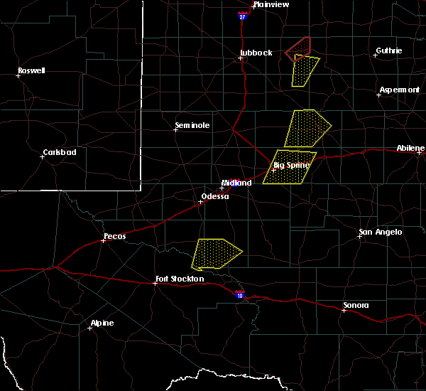 At 246 pm cdt, a severe thunderstorm was located 10 miles north of mccamey, moving northeast at 40 mph (radar indicated). Hazards include golf ball size hail and 60 mph wind gusts. People and animals outdoors will be injured. expect hail damage to roofs, siding, windows, and vehicles. expect wind damage to roofs, siding, and trees. Locations impacted include, crane and king mountain. At 246 pm cdt, a severe thunderstorm was located 10 miles north of mccamey, moving northeast at 40 mph (radar indicated). Hazards include golf ball size hail and 60 mph wind gusts. People and animals outdoors will be injured. expect hail damage to roofs, siding, windows, and vehicles. expect wind damage to roofs, siding, and trees. Locations impacted include, crane and king mountain.
|
| 3/28/2017 2:20 PM CDT |
 At 219 pm cdt, a severe thunderstorm was located near mccamey, moving northeast at 40 mph (radar indicated). Hazards include golf ball size hail and 60 mph wind gusts. People and animals outdoors will be injured. expect hail damage to roofs, siding, windows, and vehicles. expect wind damage to roofs, siding, and trees. Locations impacted include, crane, mccamey, rankin, girvin, crane county airport, upton county airport and king mountain. At 219 pm cdt, a severe thunderstorm was located near mccamey, moving northeast at 40 mph (radar indicated). Hazards include golf ball size hail and 60 mph wind gusts. People and animals outdoors will be injured. expect hail damage to roofs, siding, windows, and vehicles. expect wind damage to roofs, siding, and trees. Locations impacted include, crane, mccamey, rankin, girvin, crane county airport, upton county airport and king mountain.
|
| 3/28/2017 2:07 PM CDT |
 At 207 pm cdt, a severe thunderstorm was located over girvin, or 13 miles northwest of bakersfield, moving northeast at 25 mph (radar indicated). Hazards include 60 mph wind gusts and half dollar size hail. Hail damage to vehicles is expected. Expect wind damage to roofs, siding, and trees. At 207 pm cdt, a severe thunderstorm was located over girvin, or 13 miles northwest of bakersfield, moving northeast at 25 mph (radar indicated). Hazards include 60 mph wind gusts and half dollar size hail. Hail damage to vehicles is expected. Expect wind damage to roofs, siding, and trees.
|
| 1/1/2017 9:17 PM CST |
 At 916 pm cst, severe thunderstorms were located along a line extending from near midland to near crane, moving east at 40 mph (midland international airport asos). Hazards include 60 mph wind gusts. Expect damage to roofs, siding, and trees. locations impacted include, midland, crane, rankin, greenwood, cotton flat, midkiff, midland international air and space port, spraberry, crane county airport, warfield, midland airpark, skywest airport and king mountain. This includes interstate 20 between mile markers 123 and 148. At 916 pm cst, severe thunderstorms were located along a line extending from near midland to near crane, moving east at 40 mph (midland international airport asos). Hazards include 60 mph wind gusts. Expect damage to roofs, siding, and trees. locations impacted include, midland, crane, rankin, greenwood, cotton flat, midkiff, midland international air and space port, spraberry, crane county airport, warfield, midland airpark, skywest airport and king mountain. This includes interstate 20 between mile markers 123 and 148.
|
| 1/1/2017 8:59 PM CST |
 At 857 pm cst, severe thunderstorms were located along a line extending from 8 miles northwest of midland international air and space port to 9 miles west of crane, moving east at 40 mph (a 60 mph wind gust was reported at midland international airport). Hazards include 60 mph wind gusts. Expect damage to roofs, siding, and trees. locations impacted include, midland, odessa, crane, rankin, greenwood, west odessa, cotton flat, midkiff, midland international air and space port, penwell, spraberry, crane county airport, warfield, midland airpark, skywest airport, king mountain, mission dorado, odessa schelemeyer field, north cowden and tubbs corner. This includes interstate 20 between mile markers 101 and 149. At 857 pm cst, severe thunderstorms were located along a line extending from 8 miles northwest of midland international air and space port to 9 miles west of crane, moving east at 40 mph (a 60 mph wind gust was reported at midland international airport). Hazards include 60 mph wind gusts. Expect damage to roofs, siding, and trees. locations impacted include, midland, odessa, crane, rankin, greenwood, west odessa, cotton flat, midkiff, midland international air and space port, penwell, spraberry, crane county airport, warfield, midland airpark, skywest airport, king mountain, mission dorado, odessa schelemeyer field, north cowden and tubbs corner. This includes interstate 20 between mile markers 101 and 149.
|
| 1/1/2017 8:44 PM CST |
 At 844 pm cst, severe thunderstorms were located along a line extending from 8 miles east of goldsmith to 8 miles northeast of imperial, moving east at 40 mph (radar indicated). Hazards include 60 mph wind gusts. expect damage to roofs, siding, and trees At 844 pm cst, severe thunderstorms were located along a line extending from 8 miles east of goldsmith to 8 miles northeast of imperial, moving east at 40 mph (radar indicated). Hazards include 60 mph wind gusts. expect damage to roofs, siding, and trees
|
| 9/16/2016 5:53 PM CDT |
 At 540 pm cdt, the public reported a severe thunderstorm passed over grandfalls producing hail up to quarter size. locations impacted include, crane, grandfalls, imperial reservoir, imperial, royalty, crane county airport, cordona lake and tubbs corner. At 540 pm cdt, the public reported a severe thunderstorm passed over grandfalls producing hail up to quarter size. locations impacted include, crane, grandfalls, imperial reservoir, imperial, royalty, crane county airport, cordona lake and tubbs corner.
|
| 9/16/2016 5:38 PM CDT |
 At 537 pm cdt, a severe thunderstorm was located over grandfalls, moving northeast at 30 mph (radar indicated). Hazards include ping pong ball size hail and 60 mph wind gusts. People and animals outdoors will be injured. expect hail damage to roofs, siding, windows, and vehicles. Expect wind damage to roofs, siding, and trees. At 537 pm cdt, a severe thunderstorm was located over grandfalls, moving northeast at 30 mph (radar indicated). Hazards include ping pong ball size hail and 60 mph wind gusts. People and animals outdoors will be injured. expect hail damage to roofs, siding, windows, and vehicles. Expect wind damage to roofs, siding, and trees.
|
| 6/1/2016 10:29 PM CDT |
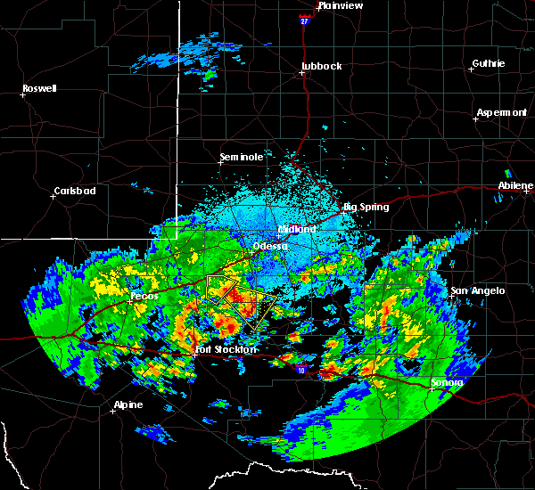 At 1029 pm cdt, a severe thunderstorm was located 7 miles northeast of tubbs corner, or 9 miles west of crane, moving southeast at 25 mph (radar indicated). Hazards include 60 mph wind gusts and quarter size hail. Hail damage to vehicles is expected. Expect wind damage to roofs, siding, and trees. At 1029 pm cdt, a severe thunderstorm was located 7 miles northeast of tubbs corner, or 9 miles west of crane, moving southeast at 25 mph (radar indicated). Hazards include 60 mph wind gusts and quarter size hail. Hail damage to vehicles is expected. Expect wind damage to roofs, siding, and trees.
|
| 6/1/2016 10:25 PM CDT | Quarter sized hail reported 0.1 miles N of Crane, TX, nickel to quarter size hail observed for around 20 minutes |
| 6/1/2016 10:00 PM CDT |
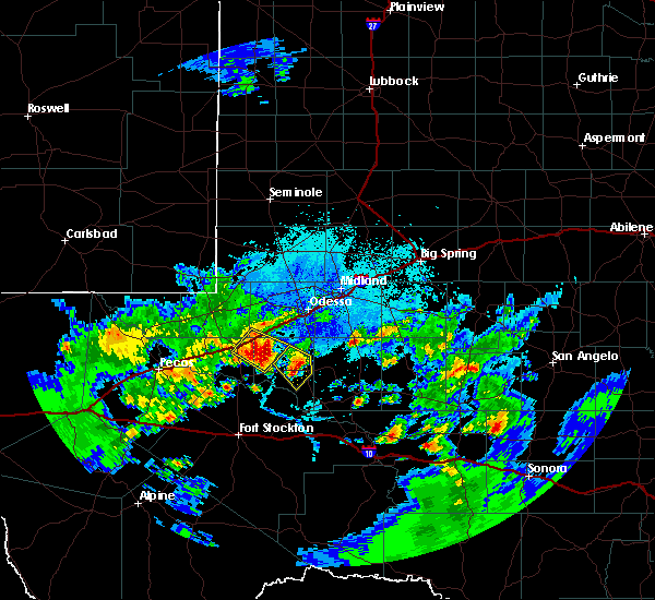 At 1000 pm cdt, a severe thunderstorm was located over crane county airport, or near crane, moving southeast at 15 mph (radar indicated). Hazards include 60 mph wind gusts and quarter size hail. Hail damage to vehicles is expected. expect wind damage to roofs, siding, and trees. Locations impacted include, crane and crane county airport. At 1000 pm cdt, a severe thunderstorm was located over crane county airport, or near crane, moving southeast at 15 mph (radar indicated). Hazards include 60 mph wind gusts and quarter size hail. Hail damage to vehicles is expected. expect wind damage to roofs, siding, and trees. Locations impacted include, crane and crane county airport.
|
| 6/1/2016 9:32 PM CDT |
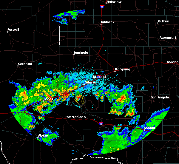 At 932 pm cdt, a severe thunderstorm was located 8 miles northwest of crane county airport, or 9 miles northwest of crane, moving southeast at 10 mph (radar indicated). Hazards include 60 mph wind gusts and quarter size hail. Hail damage to vehicles is expected. Expect wind damage to roofs, siding, and trees. At 932 pm cdt, a severe thunderstorm was located 8 miles northwest of crane county airport, or 9 miles northwest of crane, moving southeast at 10 mph (radar indicated). Hazards include 60 mph wind gusts and quarter size hail. Hail damage to vehicles is expected. Expect wind damage to roofs, siding, and trees.
|
| 5/17/2016 2:42 PM CDT | Quarter sized hail reported 10.8 miles W of Crane, TX |
| 5/17/2016 2:30 PM CDT |
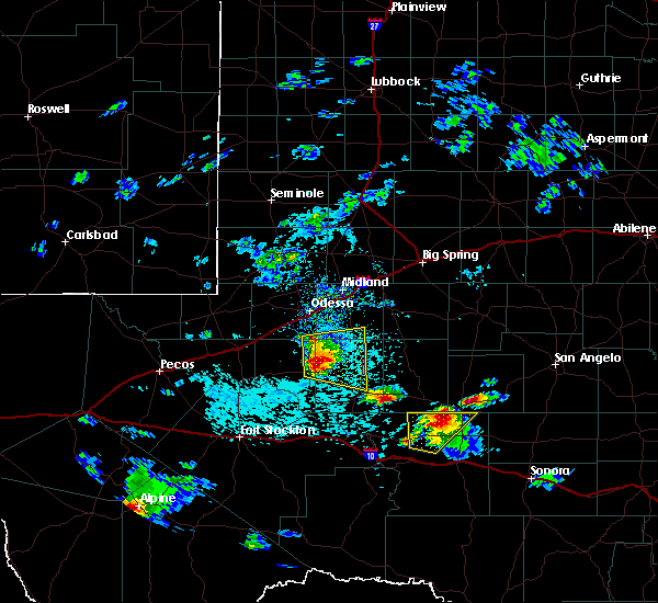 At 229 pm cdt, a severe thunderstorm was located 8 miles northeast of crane county airport, or 8 miles northeast of crane, moving east at 20 mph (radar indicated). Hazards include 60 mph wind gusts and quarter size hail. Hail damage to vehicles is expected. Expect wind damage to roofs, siding, and trees. At 229 pm cdt, a severe thunderstorm was located 8 miles northeast of crane county airport, or 8 miles northeast of crane, moving east at 20 mph (radar indicated). Hazards include 60 mph wind gusts and quarter size hail. Hail damage to vehicles is expected. Expect wind damage to roofs, siding, and trees.
|
| 4/16/2016 8:03 PM CDT |
 At 803 pm cdt, a severe thunderstorm was located near rankin, moving east at 35 mph (radar indicated). Hazards include golf ball size hail and 70 mph wind gusts. People and animals outdoors will be injured. expect hail damage to roofs, siding, windows, and vehicles. expect considerable tree damage. wind damage is also likely to mobile homes, roofs, and outbuildings. locations impacted include, crane, mccamey, rankin, best, king mountain, texon and upton county airport. A tornado watch remains in effect until midnight cdt for southwestern texas. At 803 pm cdt, a severe thunderstorm was located near rankin, moving east at 35 mph (radar indicated). Hazards include golf ball size hail and 70 mph wind gusts. People and animals outdoors will be injured. expect hail damage to roofs, siding, windows, and vehicles. expect considerable tree damage. wind damage is also likely to mobile homes, roofs, and outbuildings. locations impacted include, crane, mccamey, rankin, best, king mountain, texon and upton county airport. A tornado watch remains in effect until midnight cdt for southwestern texas.
|
| 4/16/2016 7:39 PM CDT |
 At 739 pm cdt, a severe thunderstorm was located 7 miles northeast of mccamey, moving northeast at 35 mph (radar indicated). Hazards include golf ball size hail and 70 mph wind gusts. People and animals outdoors will be injured. expect hail damage to roofs, siding, windows, and vehicles. expect considerable tree damage. Wind damage is also likely to mobile homes, roofs, and outbuildings. At 739 pm cdt, a severe thunderstorm was located 7 miles northeast of mccamey, moving northeast at 35 mph (radar indicated). Hazards include golf ball size hail and 70 mph wind gusts. People and animals outdoors will be injured. expect hail damage to roofs, siding, windows, and vehicles. expect considerable tree damage. Wind damage is also likely to mobile homes, roofs, and outbuildings.
|
| 6/12/2015 4:56 PM CDT |
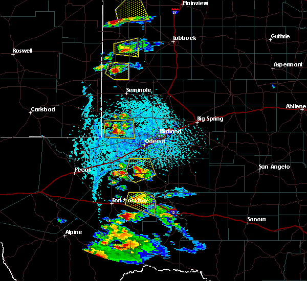 At 455 pm cdt, a severe thunderstorm was located 8 miles north of crane county airport, and moving northeast at 25 mph (radar indicated). Hazards include 60 mph wind gusts and half dollar size hail. Hail damage to vehicles is expected. expect wind damage to roofs, siding and trees. Locations impacted include, mainly rural areas of extreme northwestern upton and northeastern crane counties. At 455 pm cdt, a severe thunderstorm was located 8 miles north of crane county airport, and moving northeast at 25 mph (radar indicated). Hazards include 60 mph wind gusts and half dollar size hail. Hail damage to vehicles is expected. expect wind damage to roofs, siding and trees. Locations impacted include, mainly rural areas of extreme northwestern upton and northeastern crane counties.
|
| 6/12/2015 4:24 PM CDT |
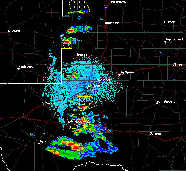 At 423 pm cdt, a severe thunderstorm was located near cordona lake, and moving northeast at 15 mph (radar indicated). Hazards include 60 mph wind gusts and half dollar size hail. Hail damage to vehicles is expected. Expect wind damage to roofs, siding and trees. At 423 pm cdt, a severe thunderstorm was located near cordona lake, and moving northeast at 15 mph (radar indicated). Hazards include 60 mph wind gusts and half dollar size hail. Hail damage to vehicles is expected. Expect wind damage to roofs, siding and trees.
|
| 5/28/2015 5:41 PM CDT | At 540 pm cdt, a severe thunderstorm was located 8 miles northwest of girvin, and moving east at 20 mph (radar indicated). Hazards include 60 mph wind gusts and quarter size hail. Hail damage to vehicles is expected. expect wind damage to roofs, siding and trees. Locations impacted include, crane, girvin, king mountain and crane county airport. |
| 5/28/2015 5:05 PM CDT | At 503 pm cdt, a severe thunderstorm was located 8 miles south of imperial, and moving east at 25 mph (radar indicated). Hazards include 60 mph wind gusts and quarter size hail. Hail damage to vehicles is expected. Expect wind damage to roofs, siding and trees. |
| 5/23/2015 5:42 PM CDT | At 539 pm cdt, severe thunderstorms were located along a line extending from 7 miles west of pleasant farms to 13 miles southwest of bakersfield, and moving east at 60 mph (radar indicated). Hazards include 60 mph wind gusts and quarter size hail. Hail damage to vehicles is expected. expect wind damage to roofs, siding and trees. Locations impacted include, crane, bakersfield, girvin, pleasant farms, crane county airport and king mountain. |
| 5/23/2015 5:16 PM CDT | At 511 pm cdt, severe thunderstorms were located along a line extending from 5 miles northwest of roy hurd memorial airport to 6 miles east of belding, and moving east at 50 mph (radar indicated). Hazards include 60 mph wind gusts and quarter size hail. Hail damage to vehicles is expected. Expect wind damage to roofs, siding and trees. |
| 5/19/2015 4:24 PM CDT | At 416 pm cdt, a severe thunderstorm was located near crane, and moving east at 5 mph (radar indicated). Hazards include 60 mph wind gusts and quarter size hail. Hail damage to vehicles is expected. expect wind damage to roofs, siding and trees. Locations impacted include, crane, crane county airport and king mountain. |
| 5/19/2015 3:54 PM CDT | At 344 pm cdt, a severe thunderstorm was located 6 miles southwest of crane, and moving east at 10 mph (radar indicated). Hazards include 60 mph wind gusts and quarter size hail. Hail damage to vehicles is expected. Expect wind damage to roofs, siding and trees. |
| 5/18/2015 11:23 PM CDT | At 1118 pm cdt, a severe thunderstorm was centered 6 miles southwest of king mountain, and moving northeast at 30 mph (radar indicated). Hazards include 60 mph wind gusts and half dollar size hail. Hail damage to vehicles is expected. expect wind damage to roofs, siding and trees. locations impacted include, mccamey, crane, crane county airport, king mountain and upton county airport. 1. 25in. |
| 5/18/2015 10:57 PM CDT | At 1056 pm cdt, a severe thunderstorm was located 9 miles southwest of king mountain, and moving northeast at 30 mph (radar indicated). Hazards include 60 mph wind gusts and quarter size hail. Hail damage to vehicles is expected. Expect wind damage to roofs, siding and trees. |
| 5/6/2015 8:06 PM CDT | At 802 pm cdt, a severe thunderstorm was located near mccamey, and moving northeast at 20 mph. this is a very dangerous storm (radar indicated). Hazards include baseball size hail and 70 mph wind gusts. People and animals outdoors will be severely injured. expect shattered windows, extensive damage to roofs, siding and vehicles. locations impacted include, crane, rankin and crane county airport. Possible. |
| 5/6/2015 7:30 PM CDT | At 723 pm cdt, a severe thunderstorm was located 6 miles north of mccamey, and moving east at 15 mph. this is a very dangerous storm (radar indicated). Hazards include baseball size hail and 60 mph wind gusts. People and animals outdoors will be severely injured. Expect shattered windows, extensive damage to roofs, siding and vehicles. |
| 5/6/2015 6:58 PM CDT | At 656 pm cdt, a severe thunderstorm was located near king mountain or 15 miles west of rankin, and moving east at 20 mph. this is a very dangerous storm (radar indicated). Hazards include baseball size hail and 70 mph wind gusts. People and animals outdoors will be severely injured. expect shattered windows, extensive damage to roofs, siding and vehicles. locations impacted include, crane, king mountain and crane county airport. 2. 75in. |
| 5/6/2015 6:46 PM CDT | At 643 pm cdt, a severe thunderstorm was located near king mountain, and moving northeast at 25 mph (radar indicated). Hazards include golf ball size hail and 60 mph wind gusts. People and animals outdoors will be injured. expect hail damage to roofs, siding, windows and vehicles. Expect wind damage to roofs, siding and trees. |
| 5/6/2015 6:42 PM CDT | At 639 pm cdt, law enforcement reported quarter size hail 15 miles north of mccamey along highway 385. at 639 pm cdt doppler radar indicated a severe thunderstorm 15 miles north of mccamey. the storm was moving to the northeast at 20 mph (law enforcement). Hazards include golf ball size hail. People and animals outdoors will be injured. expect damage to roofs, siding, windows and vehicles. Locations impacted include, , possible. |
| 5/6/2015 6:37 PM CDT | Golf Ball sized hail reported 8.2 miles WNW of Crane, TX, hwy 385. also reported by trained spotter. |
| 5/6/2015 6:29 PM CDT | Quarter sized hail reported 4.9 miles N of Crane, TX, roadside park south of crane on hwy 385. |
| 5/6/2015 6:13 PM CDT | At 611 pm cdt, a severe thunderstorm was located near crane, and moving northeast at 25 mph. crane fire department reports golfball to baseball size hail falling in crane. this is a very dangerous storm (law enforcement). Hazards include baseball size hail. People and animals outdoors will be severely injured. expect shattered windows, extensive damage to roofs, siding and vehicles. locations impacted include, mainly rural areas of eastern crane and extreme western upton counties. 2. 75in. |
| 5/6/2015 6:10 PM CDT | Baseball sized hail reported 0.1 miles N of Crane, TX |
| 5/6/2015 6:10 PM CDT | At 611 pm cdt, a severe thunderstorm was located near crane, and moving northeast at 25 mph. crane fire department reports golfball to baseball size hail falling in crane. this is a very dangerous storm (law enforcement). Hazards include baseball size hail. People and animals outdoors will be severely injured. expect shattered windows, extensive damage to roofs, siding and vehicles. locations impacted include, mainly rural areas of eastern crane and extreme western upton counties. 2. 75in. |
| 5/6/2015 6:03 PM CDT | At 602 pm cdt, a severe thunderstorm was located 7 miles southwest of crane, and moving northeast at 25 mph (radar indicated). Hazards include golf ball size hail and 70 mph wind gusts. People and animals outdoors will be injured. expect hail damage to roofs, siding, windows and vehicles. expect considerable tree damage. wind damage is also likely to mobile homes, roofs and outbuildings. locations impacted include, crane, king mountain and crane county airport. 1. 75in. |
| 5/6/2015 5:49 PM CDT | At 545 pm cdt, a severe thunderstorm was located 7 miles southeast of cordona lake, and moving northeast at 20 mph. this storm may cross us. hwy 385 (radar indicated). Hazards include 60 mph wind gusts and quarter size hail. Hail damage to vehicles is expected. Expect wind damage to roofs, siding and trees. |
| 4/16/2015 7:24 PM CDT | At 654 pm cdt, a severe thunderstorm was located near imperial, and moving east at 20 mph (radar indicated). Hazards include golf ball size hail and 60 mph wind gusts. People and animals outdoors will be injured. expect hail damage to roofs, siding, windows and vehicles. Expect wind damage to roofs, siding and trees. |
| 4/16/2015 7:00 PM CDT | At 654 pm cdt, a severe thunderstorm was located near imperial, and moving east at 20 mph (radar indicated). Hazards include golf ball size hail and 60 mph wind gusts. People and animals outdoors will be injured. expect hail damage to roofs, siding, windows and vehicles. Expect wind damage to roofs, siding and trees. |
| 4/12/2015 6:06 PM CDT | A severe thunderstorm warning remains in effect for southeastern ward. western upton. north central pecos and crane counties until 615 pm cdt. at 551 pm cdt. a severe thunderstorm was located 12 miles northeast of tubbs corner. and moving northeast at 20 mph. hazard. 60 mph wind gusts. |
| 4/12/2015 5:33 PM CDT | The national weather service in midland has issued a * severe thunderstorm warning for. crane county in west texas. north central pecos county in southwest texas. western upton county in west texas. Southeastern ward county in west texas. |
| 4/12/2015 3:56 PM CDT | The national weather service in midland has issued a * severe thunderstorm warning for. crane county in west texas. southern ector county in west texas. northwestern upton county in west texas. Eastern ward county in west texas. |
| 4/6/2012 10:16 PM CDT | Half Dollar sized hail reported 0.8 miles N of Crane, TX, quarter to half dollar size. |
| 4/6/2012 10:11 PM CDT | Ping Pong Ball sized hail reported 0.8 miles N of Crane, TX |
| 4/6/2012 9:58 PM CDT | Half Dollar sized hail reported 5 miles NE of Crane, TX, quarter to half dollar size. |
| 4/6/2012 9:17 PM CDT | Storm damage reported in crane county TX, 3.6 miles ENE of Crane, TX |
| 4/6/2012 9:17 PM CDT | Hen Egg sized hail reported 3.6 miles ENE of Crane, TX, golfball to 2 inch size hail. |
| 4/6/2012 9:09 PM CDT | Half Dollar sized hail reported 8.7 miles ESE of Crane, TX, quarter to half dollar size hail. possible wall cloud. |
| 4/6/2012 8:50 PM CDT | Half Dollar sized hail reported 11.7 miles ESE of Crane, TX, mainly quarter size |
| 1/1/0001 12:00 AM | Quarter sized hail reported 12.9 miles SE of Crane, TX |
Hail Maps for Crane, TX


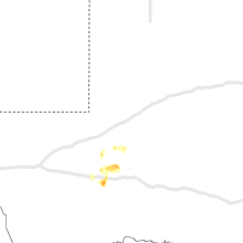


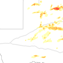


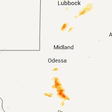


Connect with Interactive Hail Maps