

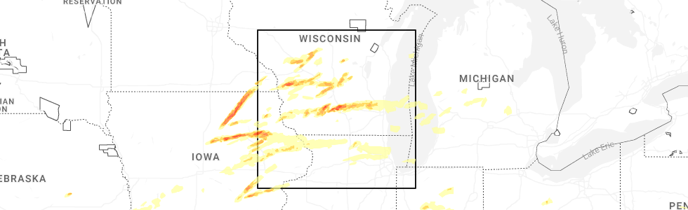
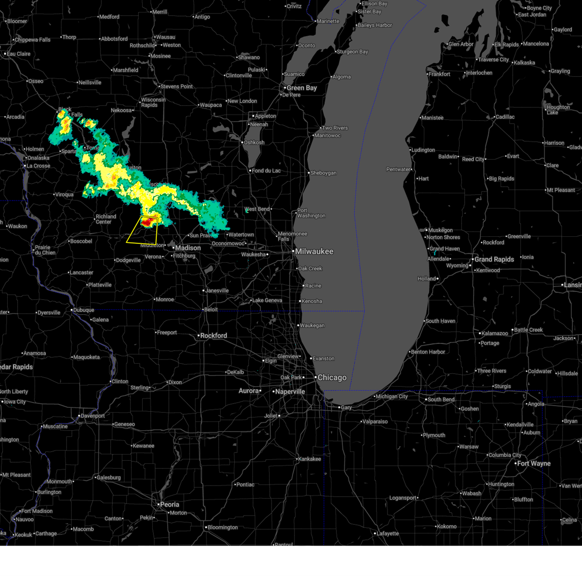
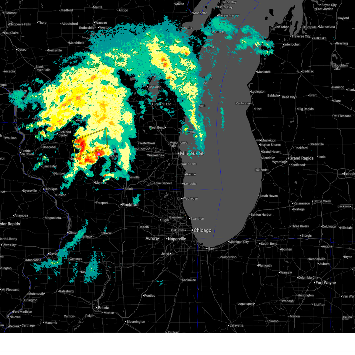
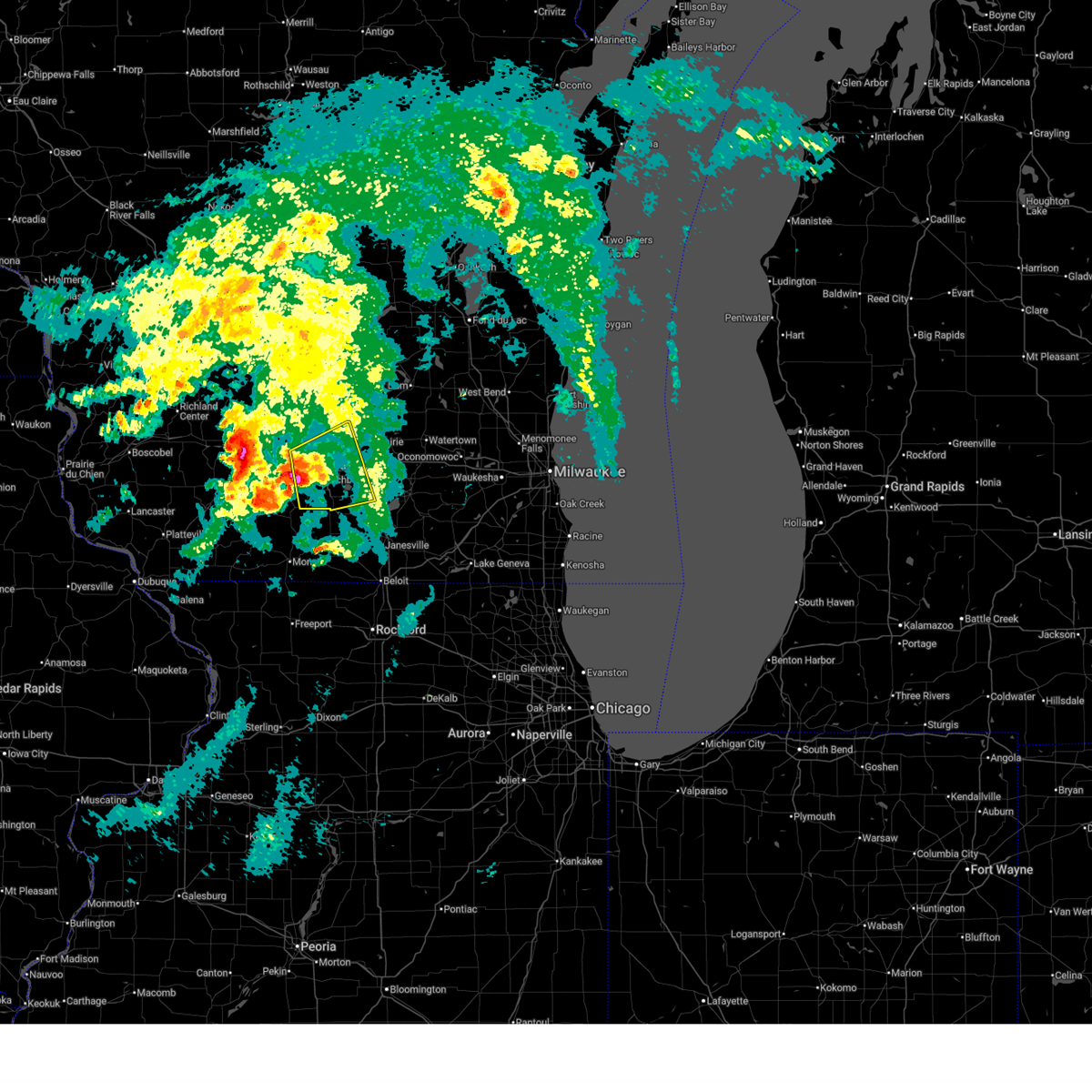
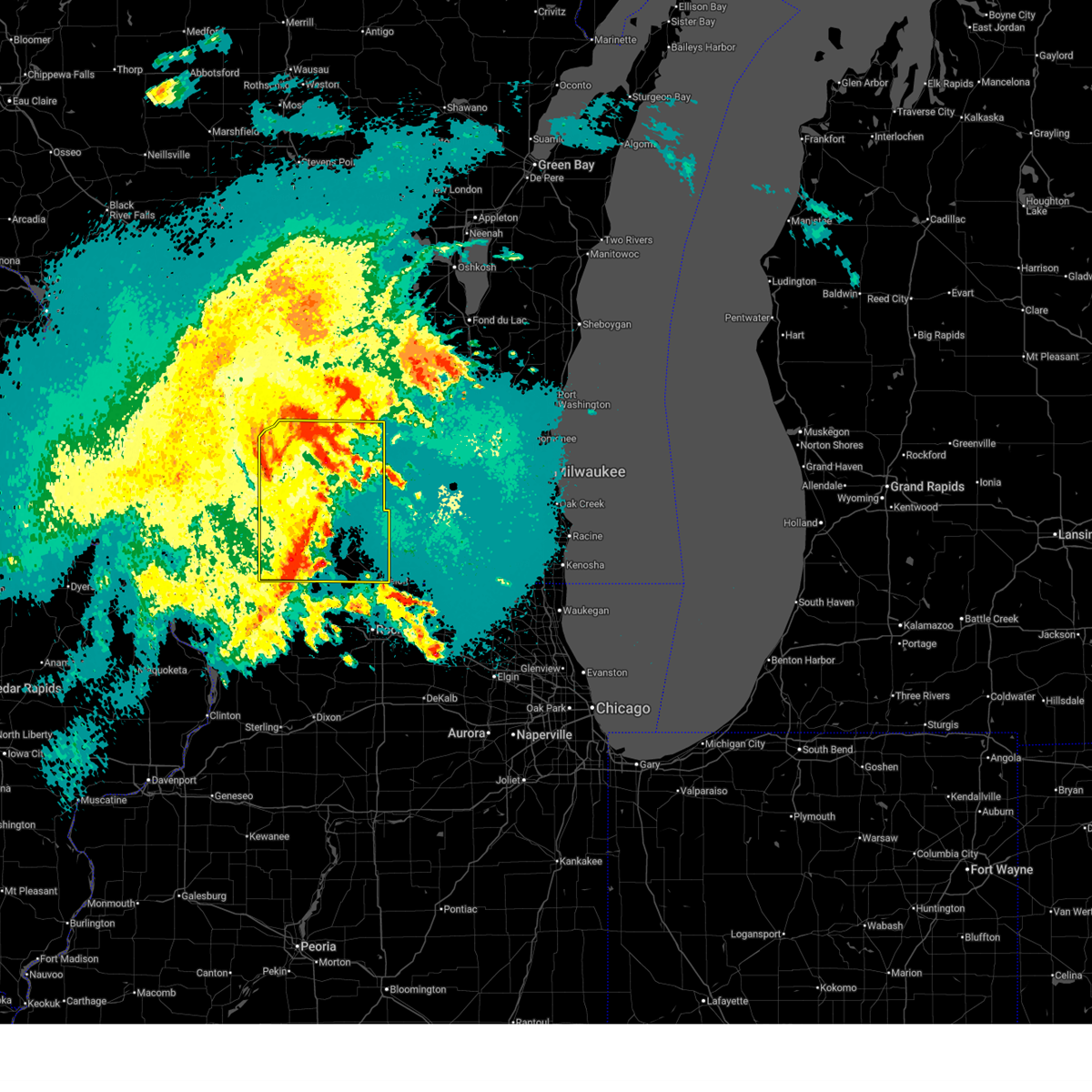
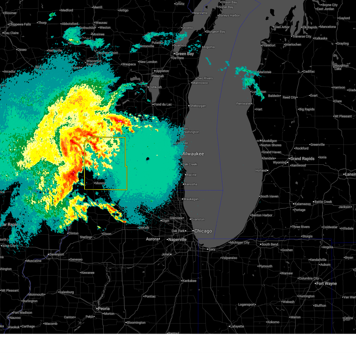
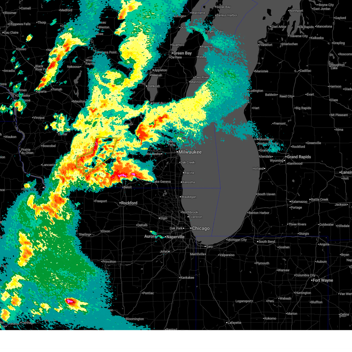
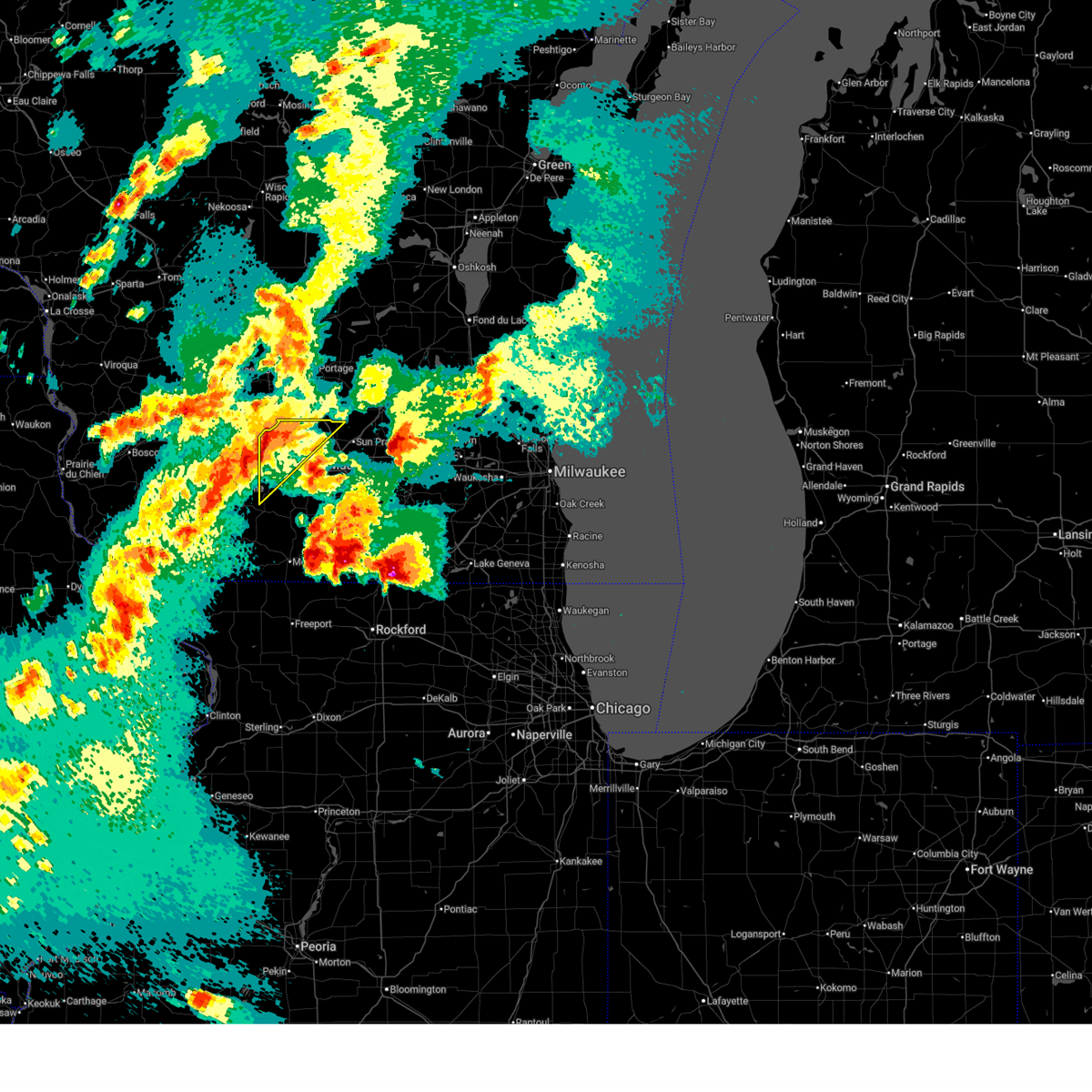
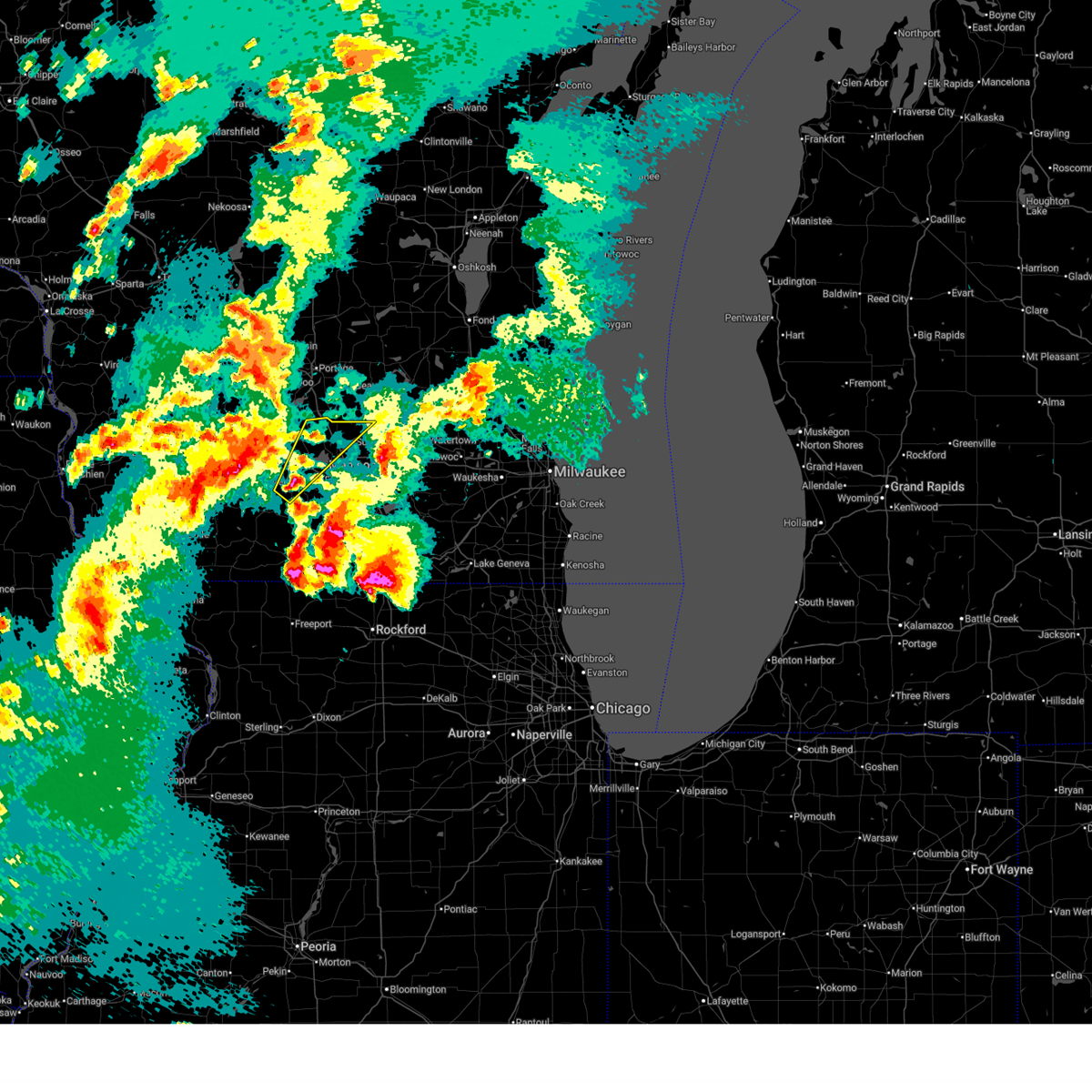
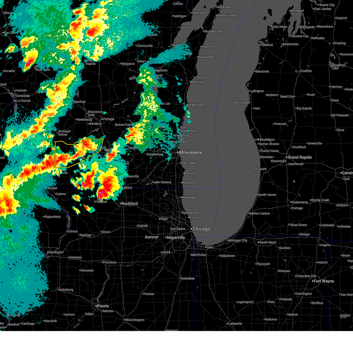
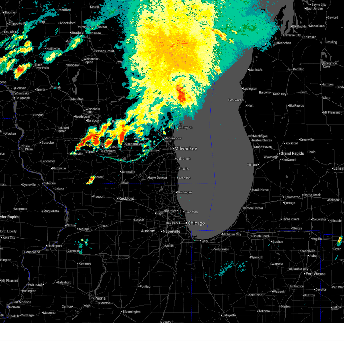
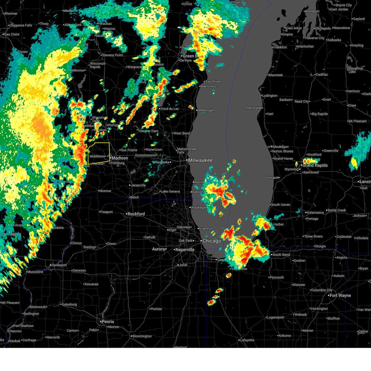
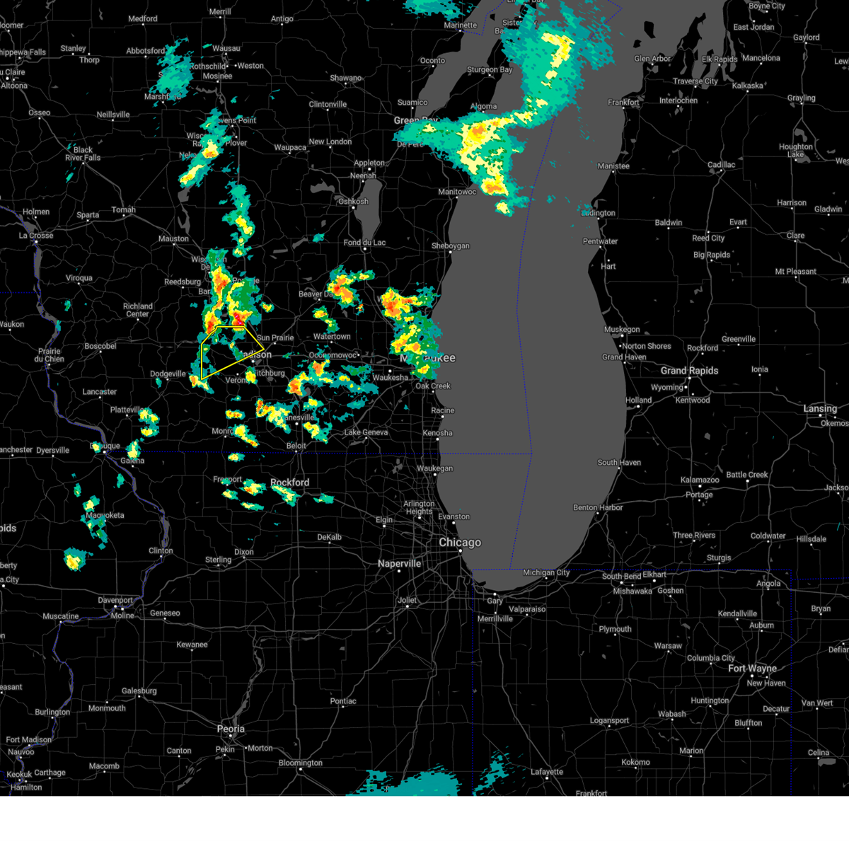
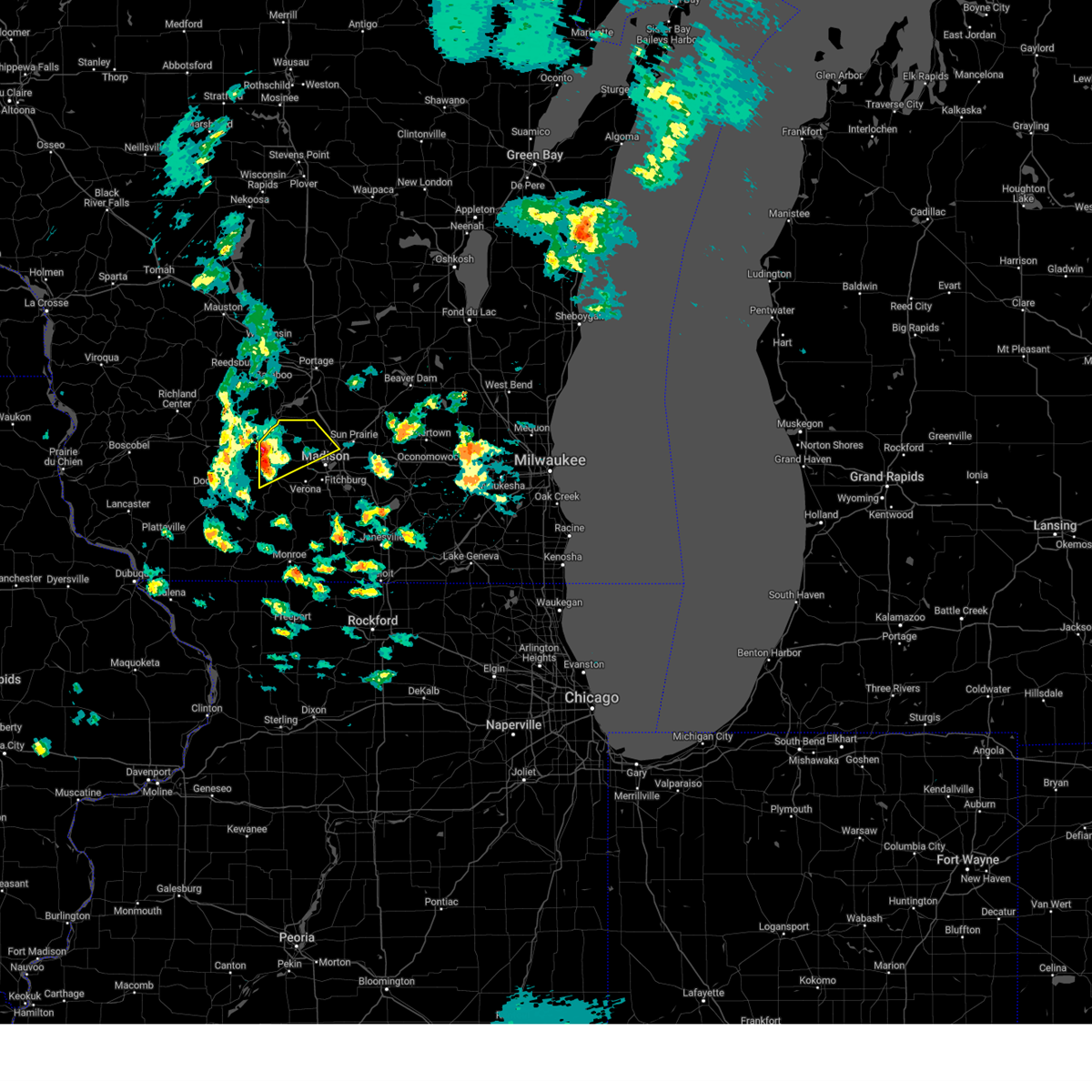
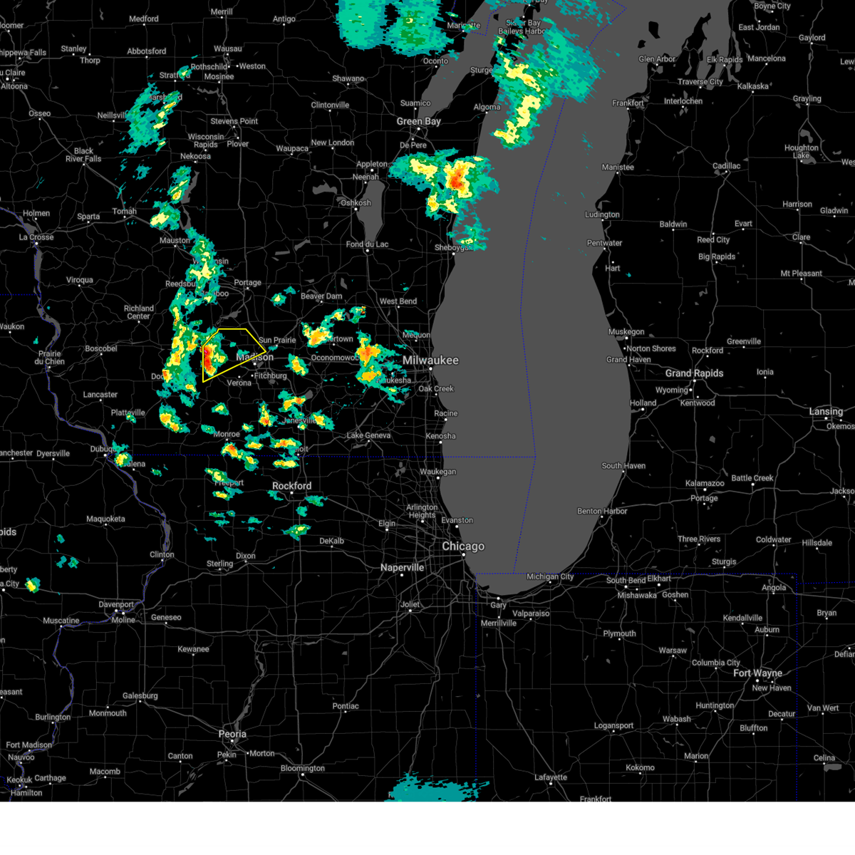
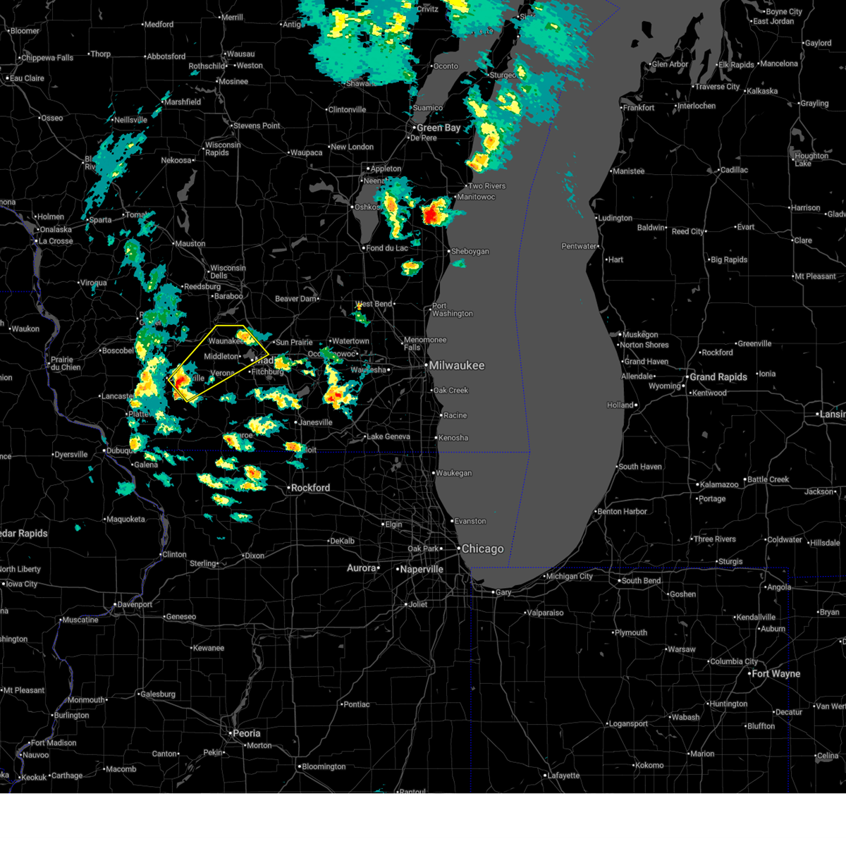
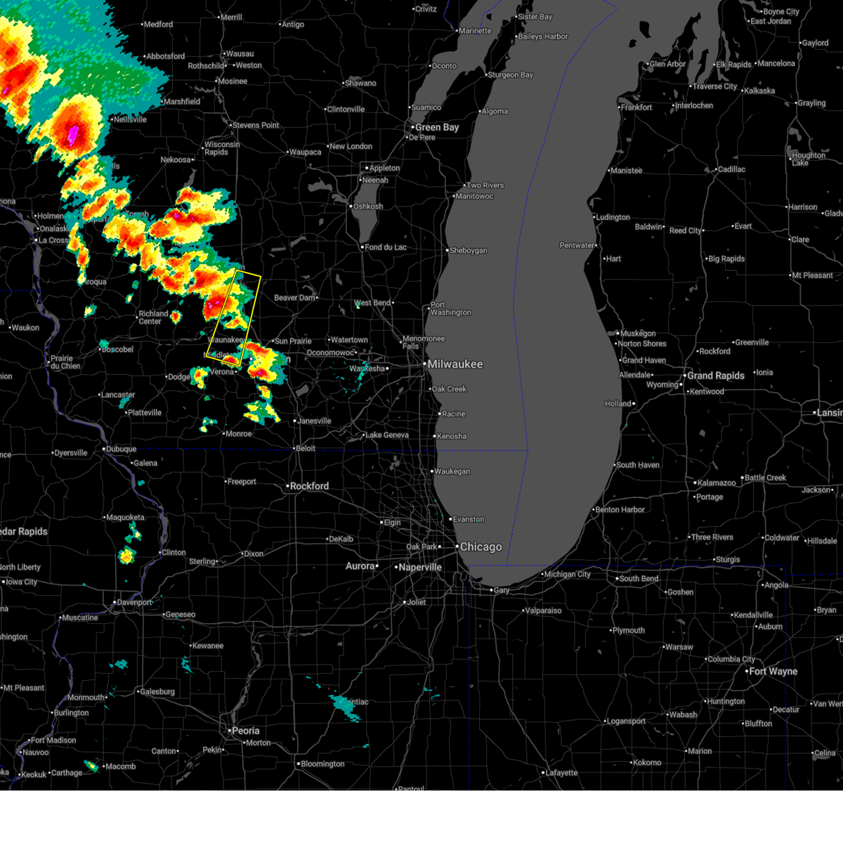
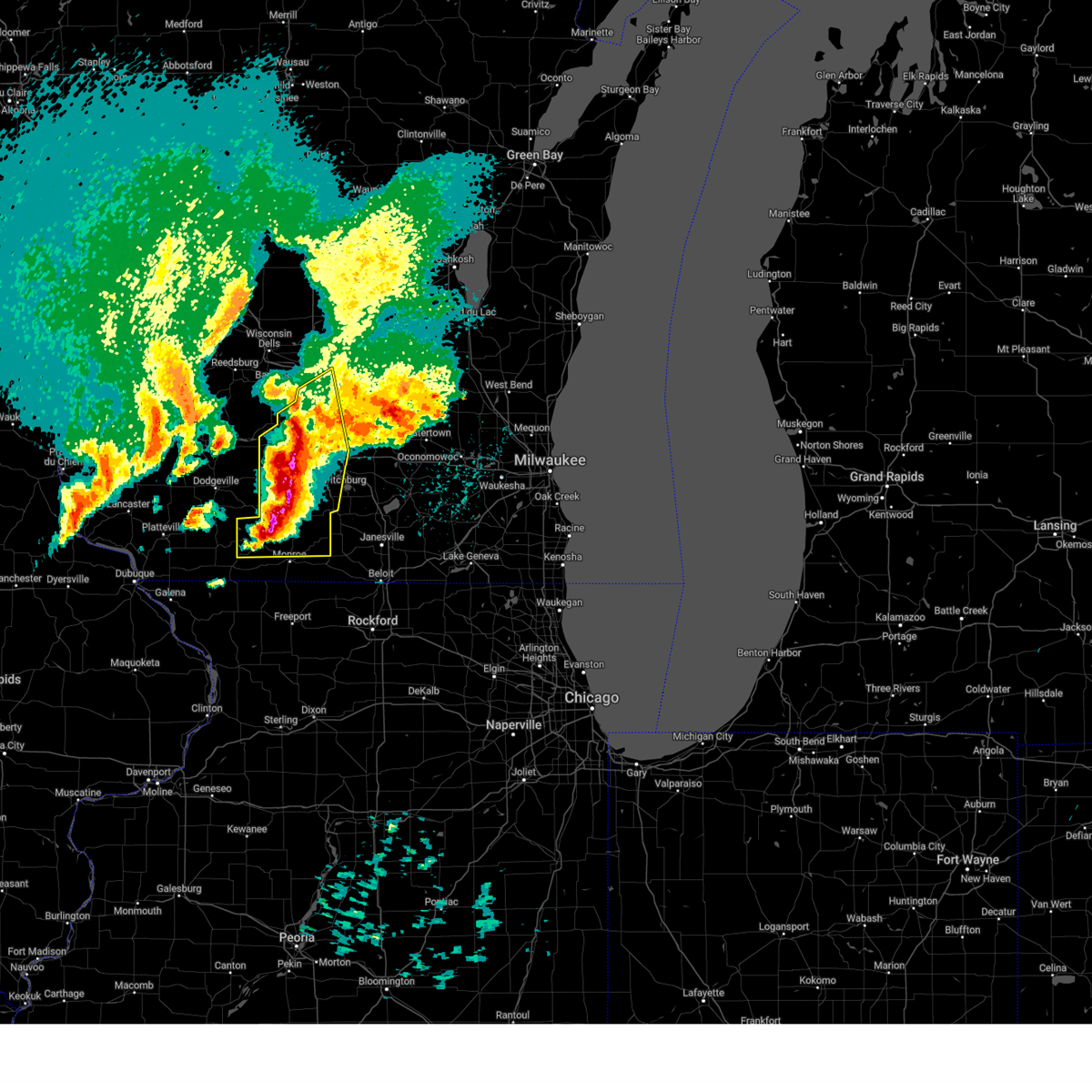
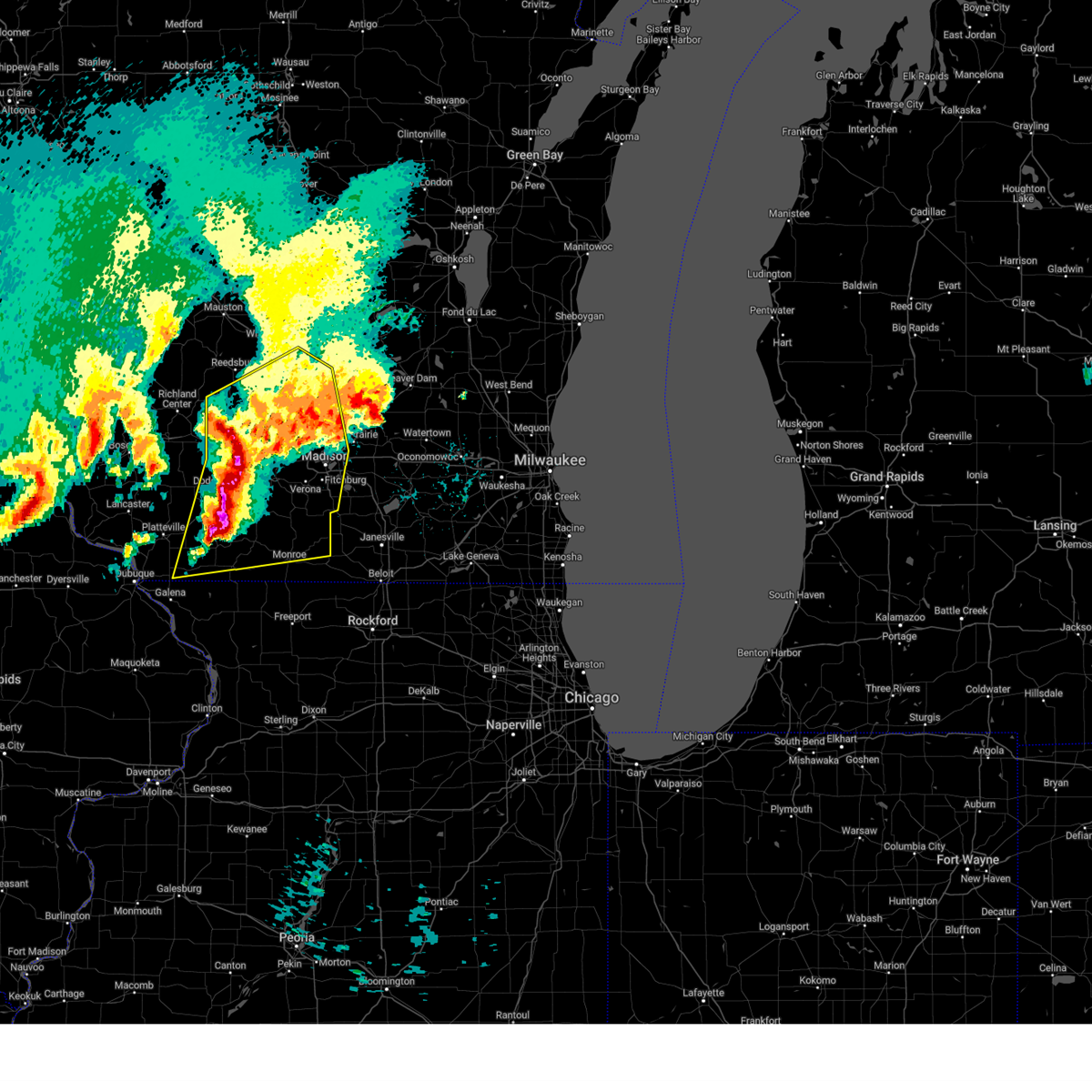
Hail Map for Cross Plains, WI
The Cross Plains, WI area has had 7 reports of on-the-ground hail by trained spotters, and has been under severe weather warnings 42 times during the past 12 months. Doppler radar has detected hail at or near Cross Plains, WI on 68 occasions, including 4 occasions during the past year.
| Name: | Cross Plains, WI |
| Where Located: | 13.5 miles WNW of Madison, WI |
| Map: | Google Map for Cross Plains, WI |
| Population: | 3538 |
| Housing Units: | 1452 |
| More Info: | Search Google for Cross Plains, WI |
1
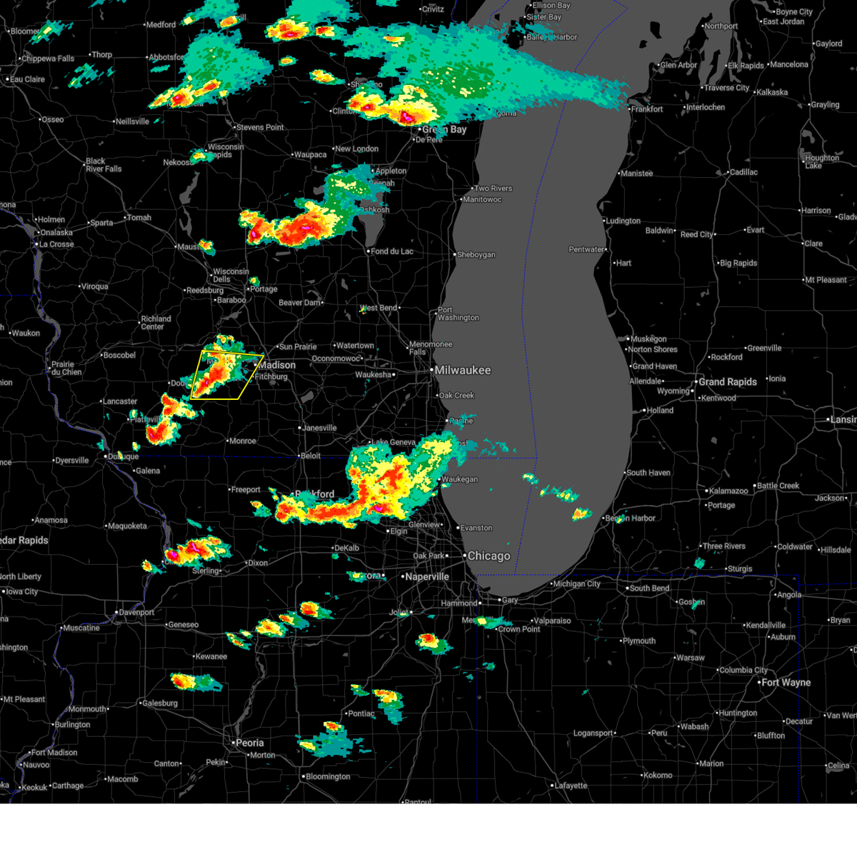
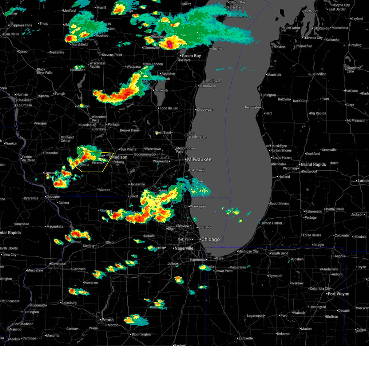
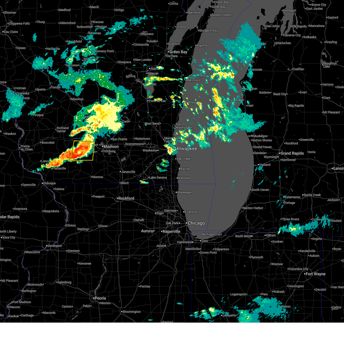
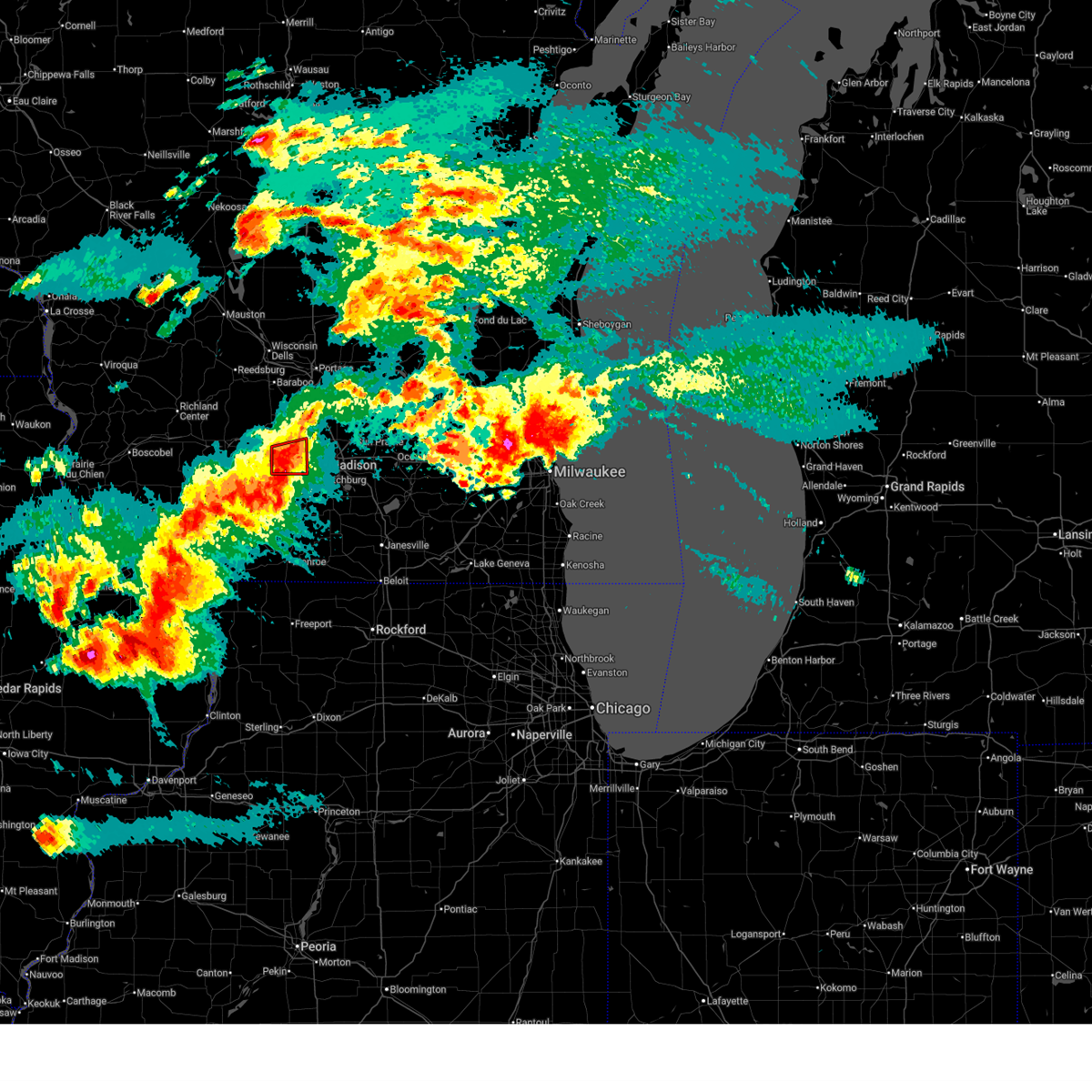
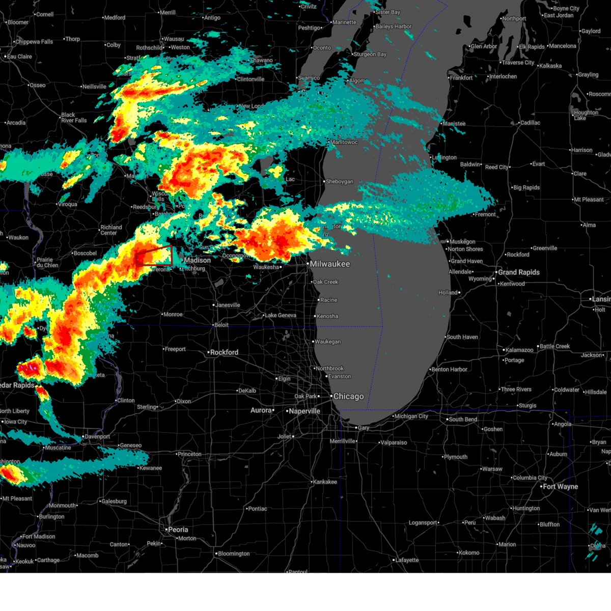
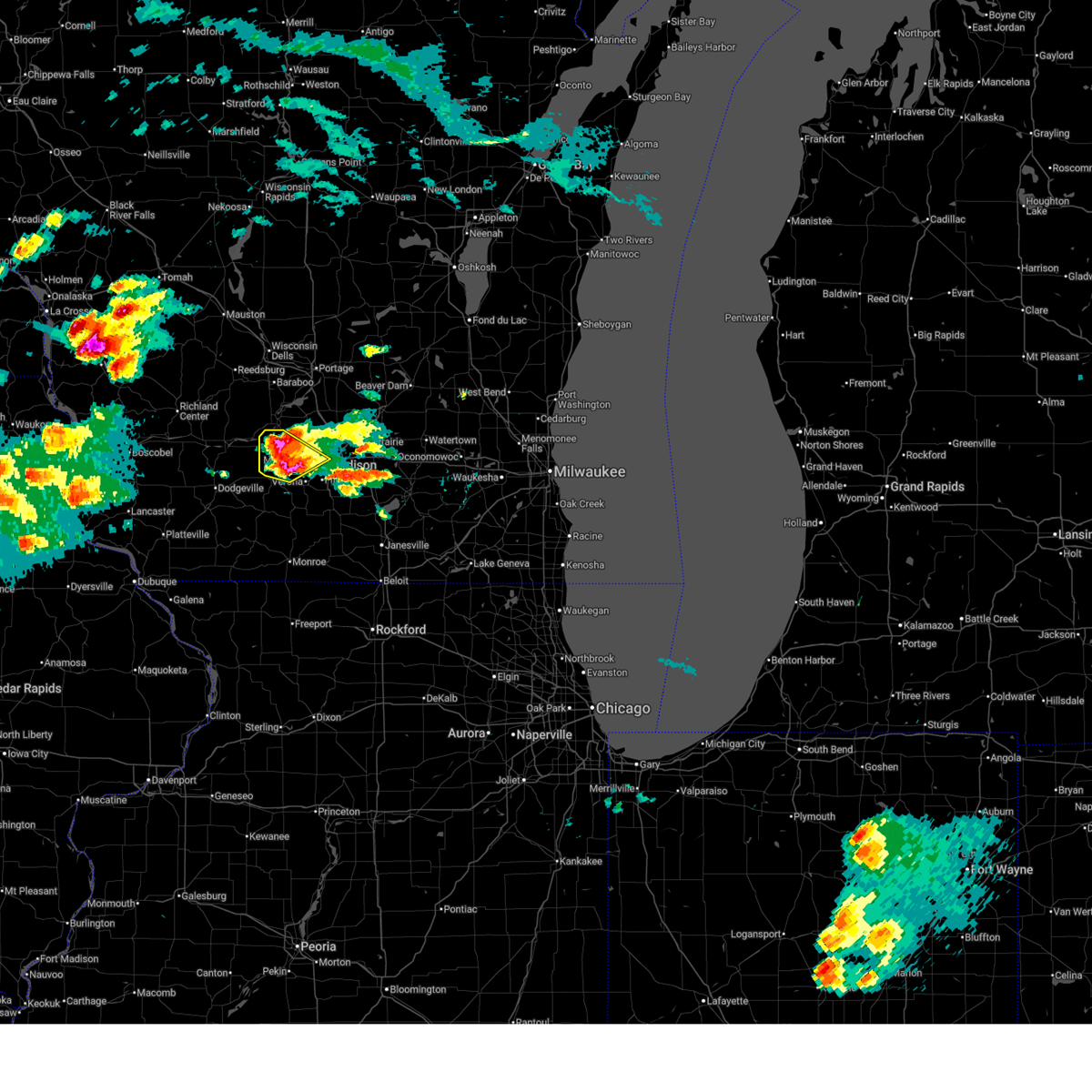
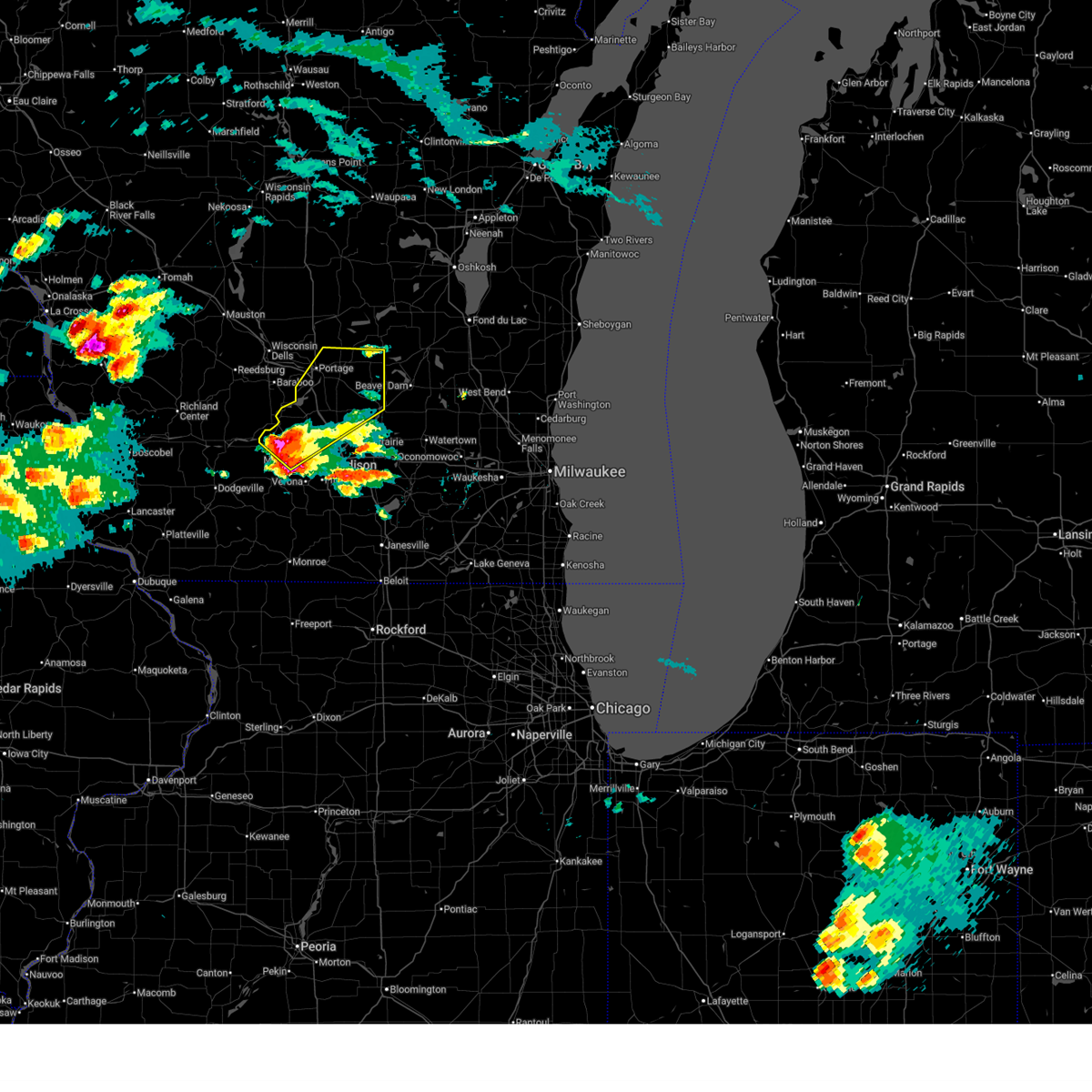
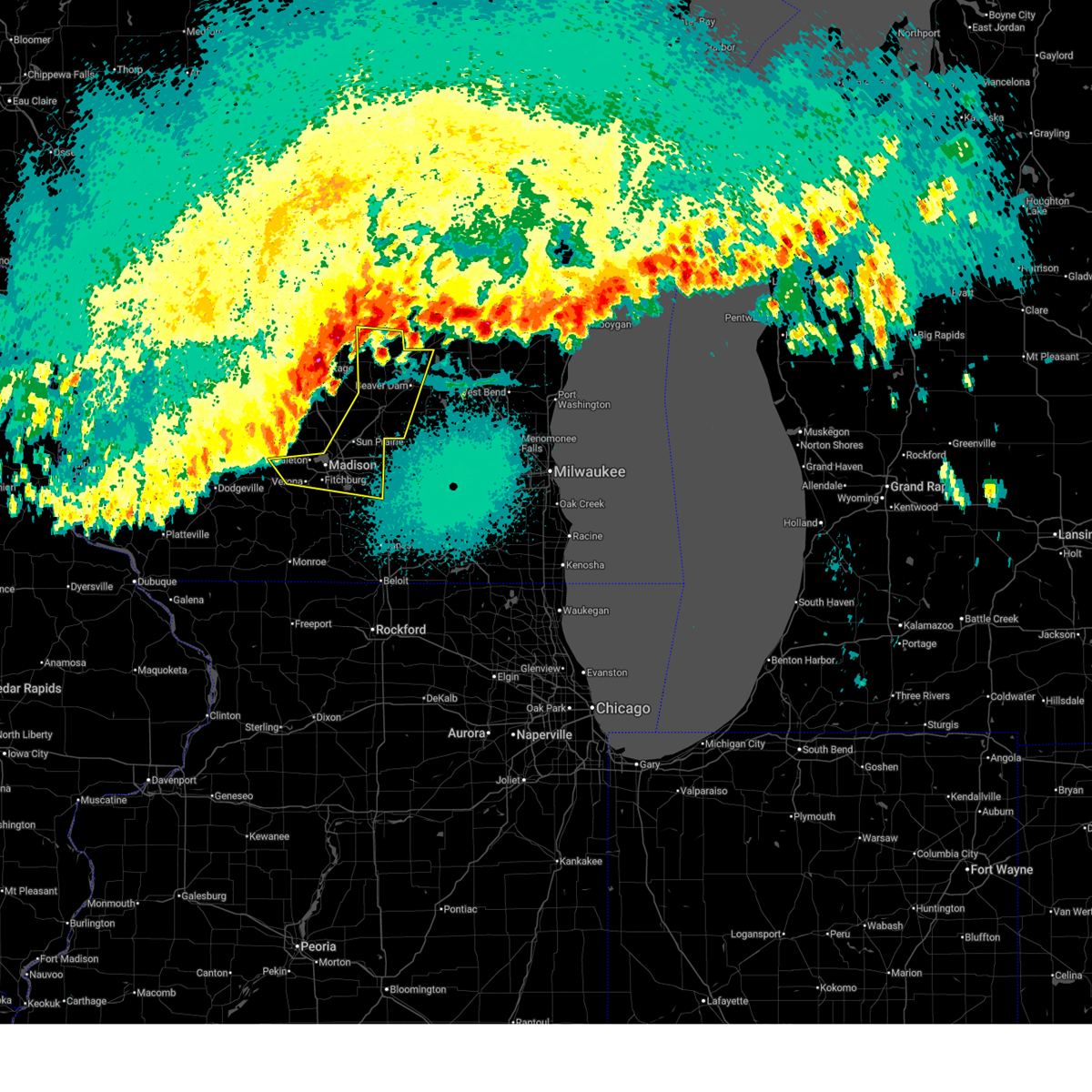
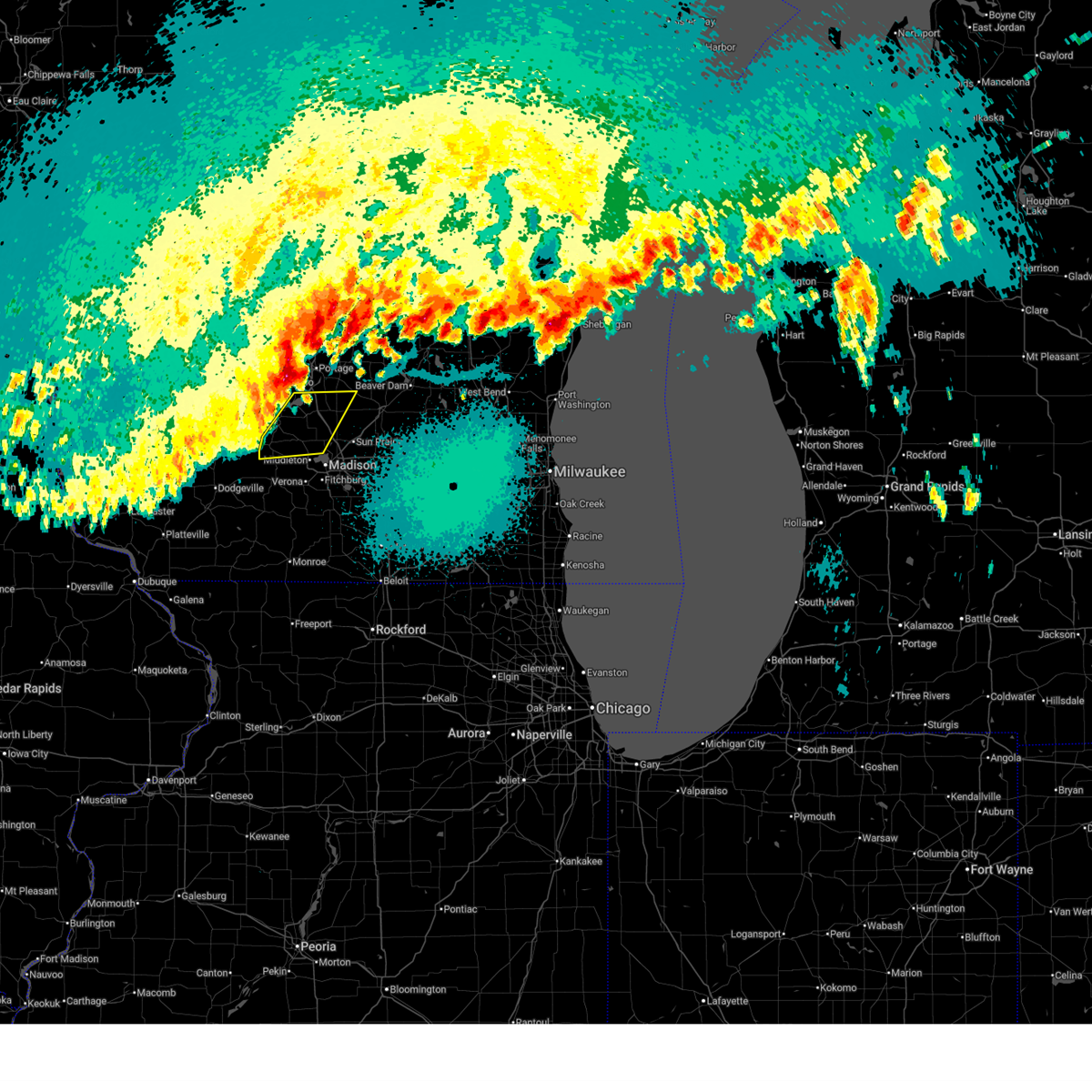
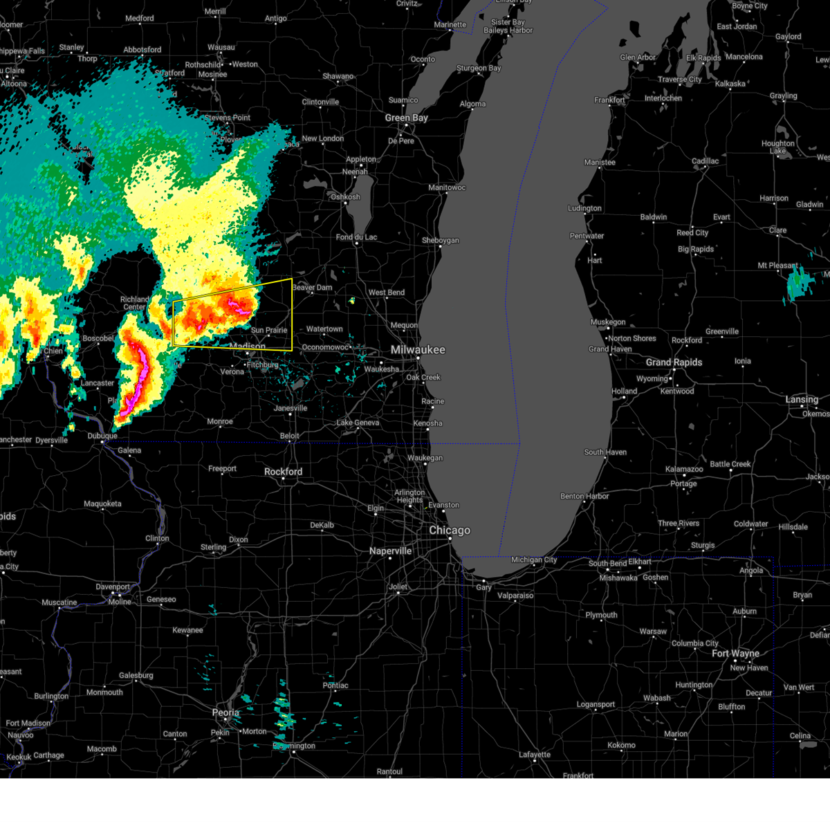
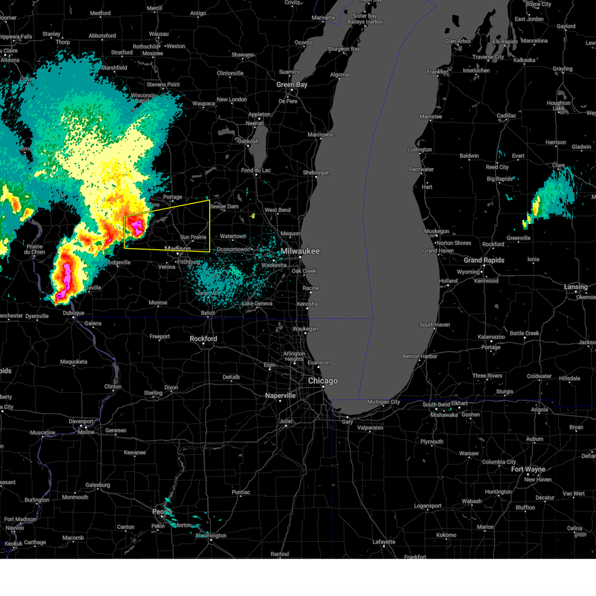
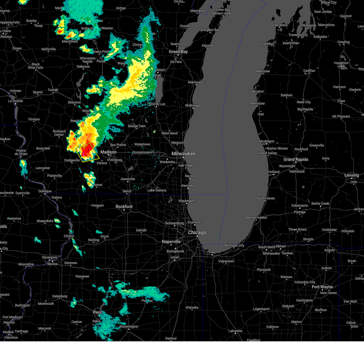
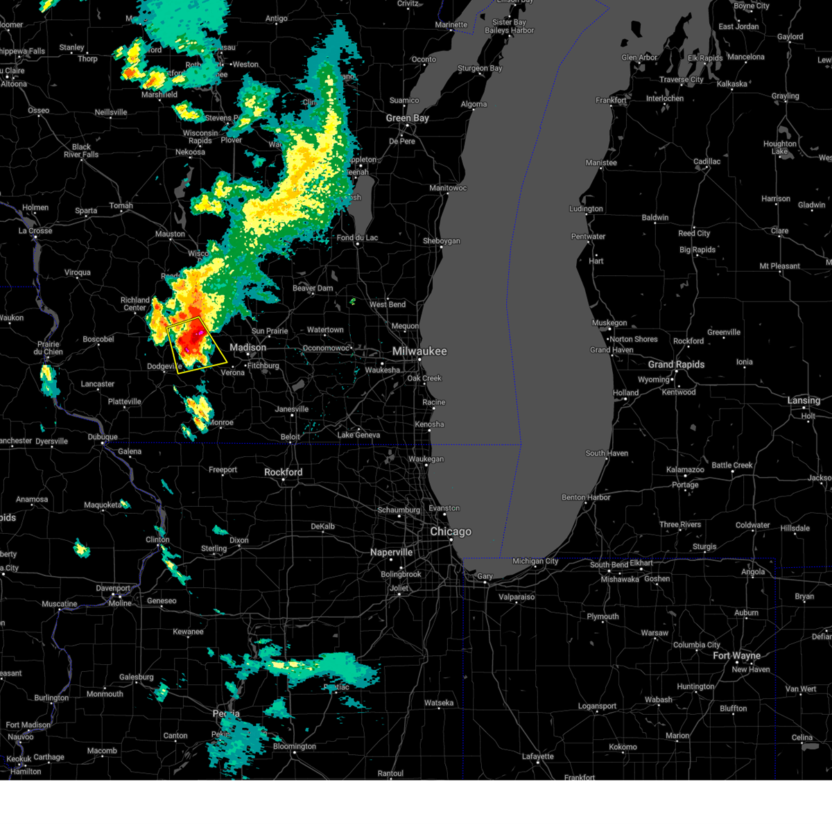
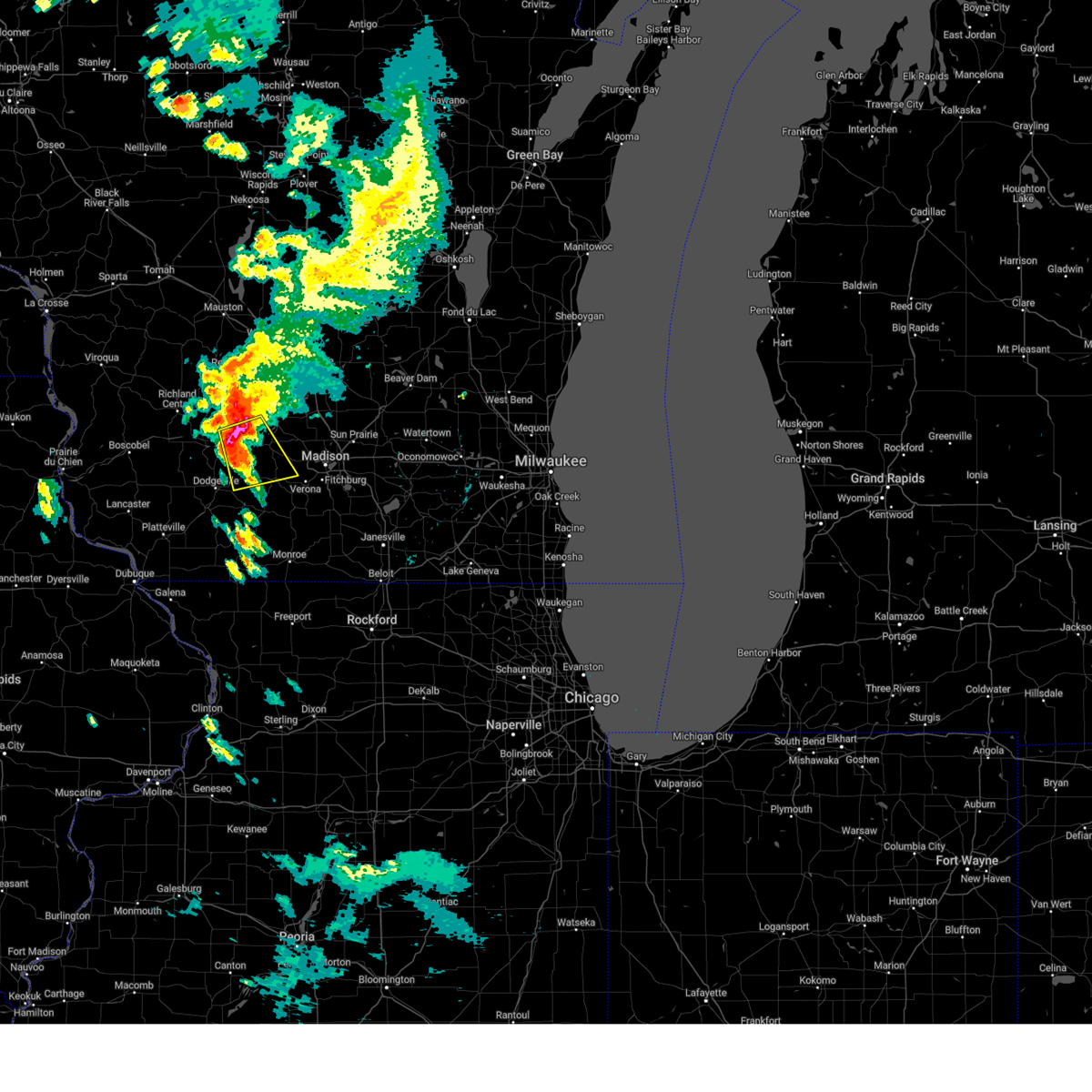
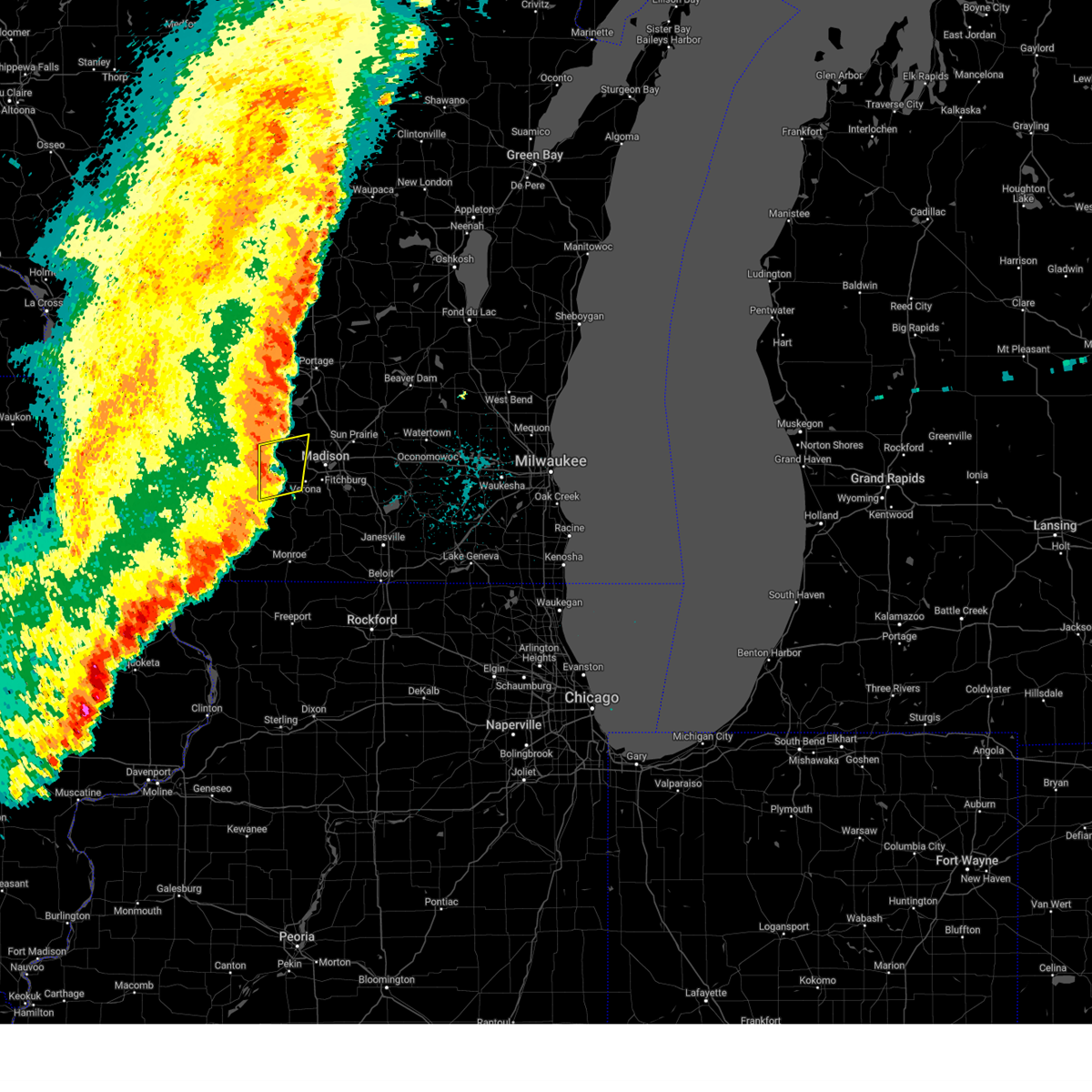
The Top Recent Hail Date for Cross Plains, WI is Tuesday, April 14, 2026 (2nd out of 68)
Hail and Wind Damage Spotted near Cross Plains, WI
| Date / Time | Report Details |
|---|---|
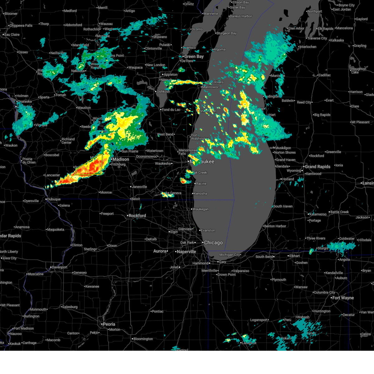
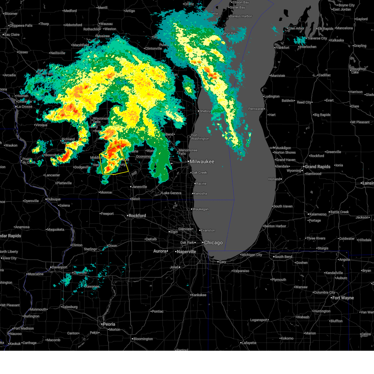
| 6/24/2026 5:46 PM CDT |
 At 546 pm cdt, a severe thunderstorm was located over mount horeb, moving southeast at 30 mph (radar indicated). Hazards include 60 mph wind gusts and quarter size hail. Hail damage to vehicles is expected. expect wind damage to roofs, siding, and trees. Locations impacted include, madison, fitchburg, middleton, verona, mount horeb, cross plains, belleville, shorewood hills, black earth, maple bluff, barneveld, blue mounds, hollandale, camp randall stadium, paoli, pine bluff, blue mound st park, henry vilas zoo, mount vernon, and uw-madison. At 546 pm cdt, a severe thunderstorm was located over mount horeb, moving southeast at 30 mph (radar indicated). Hazards include 60 mph wind gusts and quarter size hail. Hail damage to vehicles is expected. expect wind damage to roofs, siding, and trees. Locations impacted include, madison, fitchburg, middleton, verona, mount horeb, cross plains, belleville, shorewood hills, black earth, maple bluff, barneveld, blue mounds, hollandale, camp randall stadium, paoli, pine bluff, blue mound st park, henry vilas zoo, mount vernon, and uw-madison.
|
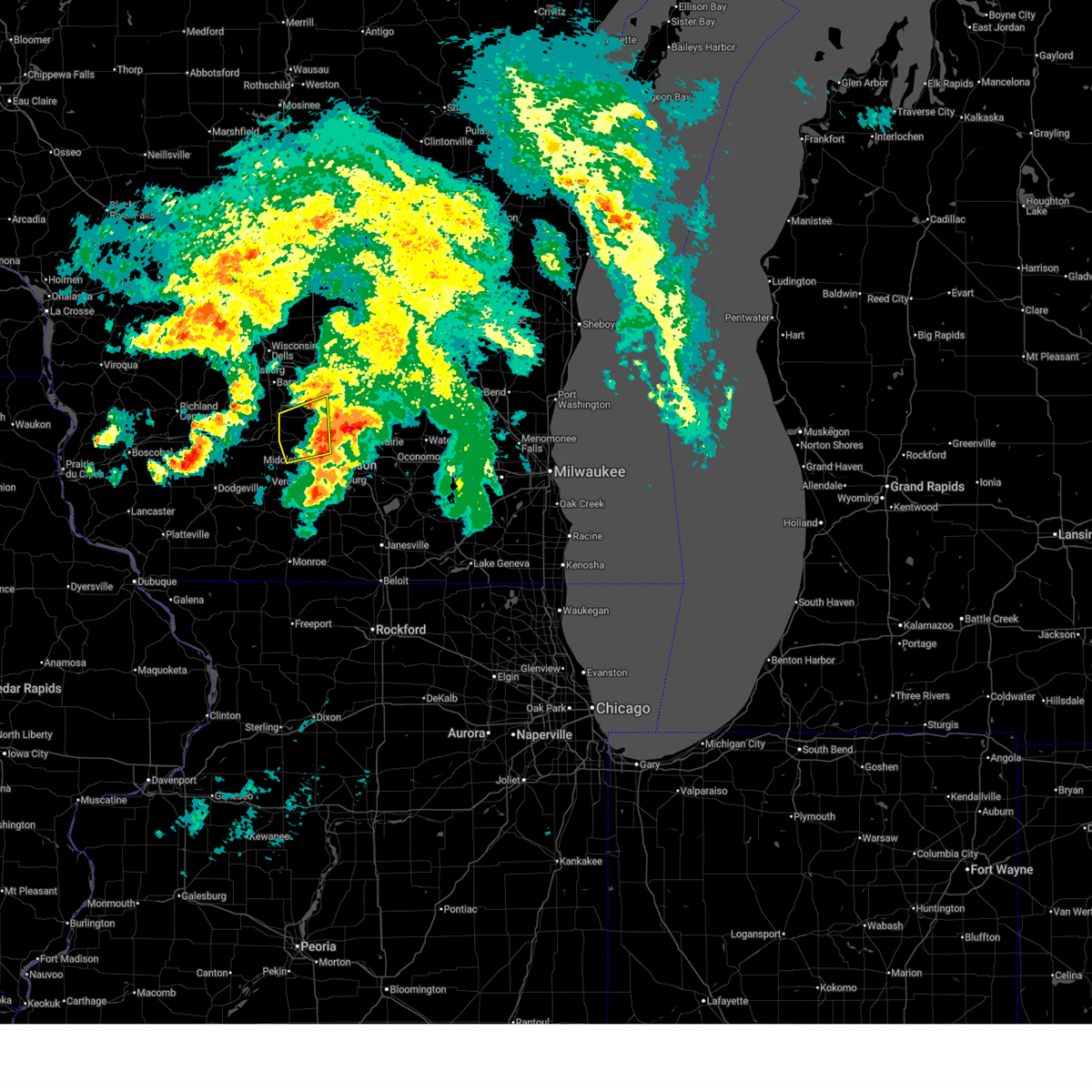
| 6/24/2026 5:28 PM CDT |
 Svrmkx the national weather service in milwaukee/sullivan has issued a * severe thunderstorm warning for, eastern iowa county in south central wisconsin, southwestern dane county in south central wisconsin, * until 630 pm cdt. * at 527 pm cdt, a severe thunderstorm was located 7 miles northwest of mount horeb, moving east at 35 mph (radar indicated). Hazards include 60 mph wind gusts and quarter size hail. Hail damage to vehicles is expected. Expect wind damage to roofs, siding, and trees. Svrmkx the national weather service in milwaukee/sullivan has issued a * severe thunderstorm warning for, eastern iowa county in south central wisconsin, southwestern dane county in south central wisconsin, * until 630 pm cdt. * at 527 pm cdt, a severe thunderstorm was located 7 miles northwest of mount horeb, moving east at 35 mph (radar indicated). Hazards include 60 mph wind gusts and quarter size hail. Hail damage to vehicles is expected. Expect wind damage to roofs, siding, and trees.
|
| 6/17/2026 6:52 PM CDT |
 At 652 pm cdt, severe thunderstorms were located along a line extending from near mount horeb to near blanchardville, moving east at 35 mph (radar indicated). Hazards include 60 mph wind gusts. Expect damage to roofs, siding, and trees. Locations impacted include, mount horeb, cross plains, barneveld, blue mounds, hollandale, pine bluff, blue mound st park, mount vernon, and jonesdale. At 652 pm cdt, severe thunderstorms were located along a line extending from near mount horeb to near blanchardville, moving east at 35 mph (radar indicated). Hazards include 60 mph wind gusts. Expect damage to roofs, siding, and trees. Locations impacted include, mount horeb, cross plains, barneveld, blue mounds, hollandale, pine bluff, blue mound st park, mount vernon, and jonesdale.
|
| 6/17/2026 6:36 PM CDT |
 At 636 pm cdt, severe thunderstorms were located along a line extending from 9 miles southeast of spring green to 7 miles southeast of dodgeville, moving east at 40 mph (radar indicated). Hazards include 60 mph wind gusts. Expect damage to roofs, siding, and trees. Locations impacted include, mount horeb, cross plains, black earth, barneveld, blue mounds, ridgeway, hollandale, pine bluff, blue mound st park, mount vernon, and jonesdale. At 636 pm cdt, severe thunderstorms were located along a line extending from 9 miles southeast of spring green to 7 miles southeast of dodgeville, moving east at 40 mph (radar indicated). Hazards include 60 mph wind gusts. Expect damage to roofs, siding, and trees. Locations impacted include, mount horeb, cross plains, black earth, barneveld, blue mounds, ridgeway, hollandale, pine bluff, blue mound st park, mount vernon, and jonesdale.
|
| 6/17/2026 6:23 PM CDT |
 Svrmkx the national weather service in milwaukee/sullivan has issued a * severe thunderstorm warning for, eastern iowa county in south central wisconsin, southwestern dane county in south central wisconsin, * until 715 pm cdt. * at 622 pm cdt, a severe thunderstorm was located near dodgeville, moving east at 35 mph (radar indicated). Hazards include 60 mph wind gusts. expect damage to roofs, siding, and trees Svrmkx the national weather service in milwaukee/sullivan has issued a * severe thunderstorm warning for, eastern iowa county in south central wisconsin, southwestern dane county in south central wisconsin, * until 715 pm cdt. * at 622 pm cdt, a severe thunderstorm was located near dodgeville, moving east at 35 mph (radar indicated). Hazards include 60 mph wind gusts. expect damage to roofs, siding, and trees
|
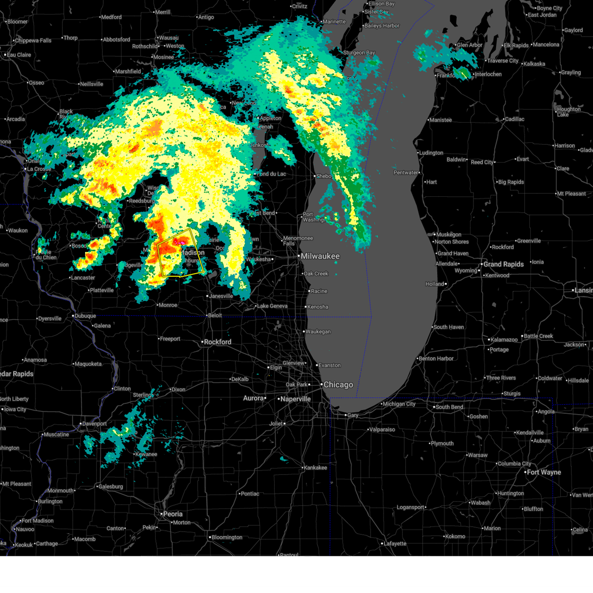
| 6/10/2026 1:39 PM CDT |
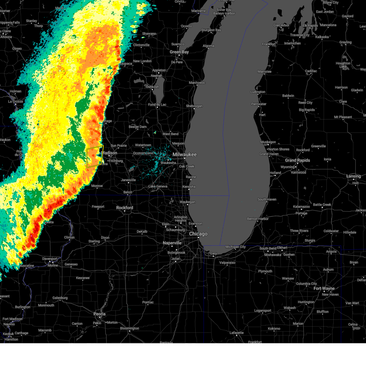
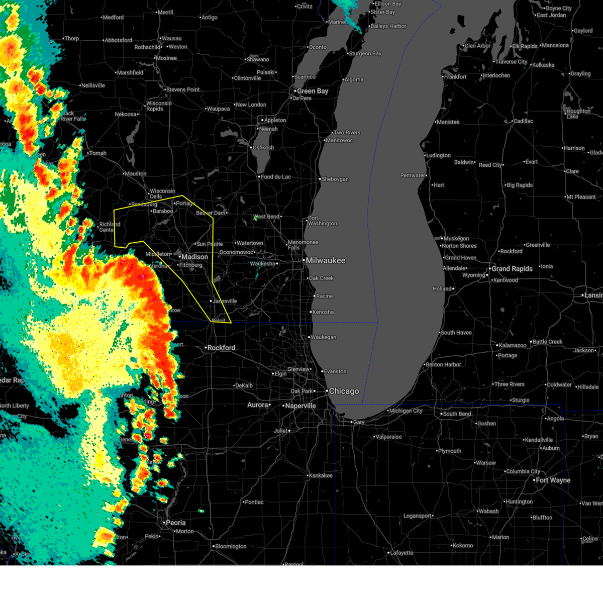 Svrmkx the national weather service in milwaukee/sullivan has issued a * severe thunderstorm warning for, central rock county in south central wisconsin, columbia county in south central wisconsin, dane county in south central wisconsin, sauk county in south central wisconsin, * until 300 pm cdt. * at 138 pm cdt, severe thunderstorms were located along a line extending from 11 miles south of muscoda to near spring green to near new glarus to near german valley, moving northeast at 55 mph. these are destructive storms for sauk, columbia, dane, and rock counties (radar indicated). Hazards include 80 mph wind gusts and penny size hail. Flying debris will be dangerous to those caught without shelter. mobile homes will be heavily damaged. expect considerable damage to roofs, windows, and vehicles. Extensive tree damage and power outages are likely. Svrmkx the national weather service in milwaukee/sullivan has issued a * severe thunderstorm warning for, central rock county in south central wisconsin, columbia county in south central wisconsin, dane county in south central wisconsin, sauk county in south central wisconsin, * until 300 pm cdt. * at 138 pm cdt, severe thunderstorms were located along a line extending from 11 miles south of muscoda to near spring green to near new glarus to near german valley, moving northeast at 55 mph. these are destructive storms for sauk, columbia, dane, and rock counties (radar indicated). Hazards include 80 mph wind gusts and penny size hail. Flying debris will be dangerous to those caught without shelter. mobile homes will be heavily damaged. expect considerable damage to roofs, windows, and vehicles. Extensive tree damage and power outages are likely.
|
| 5/27/2026 8:26 PM CDT |
 Svrmkx the national weather service in milwaukee/sullivan has issued a * severe thunderstorm warning for, northeastern iowa county in south central wisconsin, southwestern columbia county in south central wisconsin, northwestern dane county in south central wisconsin, southeastern sauk county in south central wisconsin, * until 900 pm cdt. * at 826 pm cdt, a severe thunderstorm was located over prairie du sac, moving south at 30 mph (radar indicated). Hazards include 60 mph wind gusts and quarter size hail. Hail damage to vehicles is expected. Expect wind damage to roofs, siding, and trees. Svrmkx the national weather service in milwaukee/sullivan has issued a * severe thunderstorm warning for, northeastern iowa county in south central wisconsin, southwestern columbia county in south central wisconsin, northwestern dane county in south central wisconsin, southeastern sauk county in south central wisconsin, * until 900 pm cdt. * at 826 pm cdt, a severe thunderstorm was located over prairie du sac, moving south at 30 mph (radar indicated). Hazards include 60 mph wind gusts and quarter size hail. Hail damage to vehicles is expected. Expect wind damage to roofs, siding, and trees.
|
| 5/17/2026 11:51 AM CDT |
 The storm which prompted the warning has weakened below severe limits, and no longer poses an immediate threat to life or property. therefore, the warning will be allowed to expire. however, gusty winds and heavy rain are still possible with this thunderstorm. The storm which prompted the warning has weakened below severe limits, and no longer poses an immediate threat to life or property. therefore, the warning will be allowed to expire. however, gusty winds and heavy rain are still possible with this thunderstorm.
|
| 5/17/2026 11:50 AM CDT |
 the severe thunderstorm warning has been cancelled and is no longer in effect the severe thunderstorm warning has been cancelled and is no longer in effect
|
| 5/17/2026 11:39 AM CDT |
 the severe thunderstorm warning has been cancelled and is no longer in effect the severe thunderstorm warning has been cancelled and is no longer in effect
|
| 5/17/2026 11:39 AM CDT |
 At 1139 am cdt, a severe thunderstorm was located near cross plains, or near sauk city, moving east at 30 mph (radar indicated). Hazards include 60 mph wind gusts. Expect damage to roofs, siding, and trees. Locations impacted include, madison, middleton, waunakee, lake wisconsin, cross plains, lodi, poynette, dane, and marxville. At 1139 am cdt, a severe thunderstorm was located near cross plains, or near sauk city, moving east at 30 mph (radar indicated). Hazards include 60 mph wind gusts. Expect damage to roofs, siding, and trees. Locations impacted include, madison, middleton, waunakee, lake wisconsin, cross plains, lodi, poynette, dane, and marxville.
|
| 5/17/2026 11:36 AM CDT |
 At 1136 am cdt, a severe thunderstorm was located over eastern madison, moving east at 35 mph (radar indicated). Hazards include 60 mph wind gusts and quarter size hail. Hail damage to vehicles is expected. expect wind damage to roofs, siding, and trees. locations impacted include, madison, sun prairie, fitchburg, middleton, stoughton, waunakee, verona, oregon, mcfarland, monona, windsor, deforest, cottage grove, cross plains, belleville, shorewood hills, brooklyn, maple bluff, utica, and camp randall stadium. People attending stoughton syttende mai , and the sun prairie dirt race should seek safe shelter immediately!. At 1136 am cdt, a severe thunderstorm was located over eastern madison, moving east at 35 mph (radar indicated). Hazards include 60 mph wind gusts and quarter size hail. Hail damage to vehicles is expected. expect wind damage to roofs, siding, and trees. locations impacted include, madison, sun prairie, fitchburg, middleton, stoughton, waunakee, verona, oregon, mcfarland, monona, windsor, deforest, cottage grove, cross plains, belleville, shorewood hills, brooklyn, maple bluff, utica, and camp randall stadium. People attending stoughton syttende mai , and the sun prairie dirt race should seek safe shelter immediately!.
|
| 5/17/2026 11:23 AM CDT |
 At 1123 am cdt, a severe thunderstorm was located over mazomanie, or 8 miles southwest of sauk city, moving east at 30 mph (radar indicated). Hazards include 60 mph wind gusts and penny size hail. Expect damage to roofs, siding, and trees. Locations impacted include, madison, middleton, waunakee, prairie du sac, sauk city, lake wisconsin, cross plains, lodi, poynette, mazomanie, black earth, dane, blue mounds, okee, marxville, and pine bluff. At 1123 am cdt, a severe thunderstorm was located over mazomanie, or 8 miles southwest of sauk city, moving east at 30 mph (radar indicated). Hazards include 60 mph wind gusts and penny size hail. Expect damage to roofs, siding, and trees. Locations impacted include, madison, middleton, waunakee, prairie du sac, sauk city, lake wisconsin, cross plains, lodi, poynette, mazomanie, black earth, dane, blue mounds, okee, marxville, and pine bluff.
|
| 5/17/2026 11:12 AM CDT |
 Svrmkx the national weather service in milwaukee/sullivan has issued a * severe thunderstorm warning for, northeastern iowa county in south central wisconsin, southwestern columbia county in south central wisconsin, northwestern dane county in south central wisconsin, southeastern sauk county in south central wisconsin, * until 1215 pm cdt. * at 1112 am cdt, a severe thunderstorm was located near mazomanie, or 12 miles southwest of sauk city, moving east at 30 mph (radar indicated). Hazards include 60 mph wind gusts and penny size hail. expect damage to roofs, siding, and trees Svrmkx the national weather service in milwaukee/sullivan has issued a * severe thunderstorm warning for, northeastern iowa county in south central wisconsin, southwestern columbia county in south central wisconsin, northwestern dane county in south central wisconsin, southeastern sauk county in south central wisconsin, * until 1215 pm cdt. * at 1112 am cdt, a severe thunderstorm was located near mazomanie, or 12 miles southwest of sauk city, moving east at 30 mph (radar indicated). Hazards include 60 mph wind gusts and penny size hail. expect damage to roofs, siding, and trees
|
| 5/17/2026 11:09 AM CDT |
 Svrmkx the national weather service in milwaukee/sullivan has issued a * severe thunderstorm warning for, central dane county in south central wisconsin, * until noon cdt. * at 1109 am cdt, a severe thunderstorm was located over verona, moving east at 35 mph (radar indicated). Hazards include 60 mph wind gusts and quarter size hail. Hail damage to vehicles is expected. Expect wind damage to roofs, siding, and trees. Svrmkx the national weather service in milwaukee/sullivan has issued a * severe thunderstorm warning for, central dane county in south central wisconsin, * until noon cdt. * at 1109 am cdt, a severe thunderstorm was located over verona, moving east at 35 mph (radar indicated). Hazards include 60 mph wind gusts and quarter size hail. Hail damage to vehicles is expected. Expect wind damage to roofs, siding, and trees.
|
| 5/16/2026 12:55 AM CDT |
 At 1253 am cdt, severe thunderstorms were located along a line extending from near deforest to near rock city, moving east at 50 mph (radar indicated. at 1228 am, the sensor near dodgeville measured 58 mph wind gusts). Hazards include 60 mph wind gusts. Expect damage to roofs, siding, and trees. Locations impacted include, madison, janesville, beloit, sun prairie, fitchburg, middleton, stoughton, waunakee, monroe, verona, oregon, mcfarland, monona, mount horeb, windsor, edgerton, evansville, prairie du sac, marshall, and sauk city. At 1253 am cdt, severe thunderstorms were located along a line extending from near deforest to near rock city, moving east at 50 mph (radar indicated. at 1228 am, the sensor near dodgeville measured 58 mph wind gusts). Hazards include 60 mph wind gusts. Expect damage to roofs, siding, and trees. Locations impacted include, madison, janesville, beloit, sun prairie, fitchburg, middleton, stoughton, waunakee, monroe, verona, oregon, mcfarland, monona, mount horeb, windsor, edgerton, evansville, prairie du sac, marshall, and sauk city.
|
| 5/16/2026 12:24 AM CDT |
 Svrmkx the national weather service in milwaukee/sullivan has issued a * severe thunderstorm warning for, green county in south central wisconsin, rock county in south central wisconsin, dane county in south central wisconsin, * until 130 am cdt. * at 1224 am cdt, severe thunderstorms were located along a line extending from 6 miles west of sauk city to near winslow, moving east at 60 mph (radar indicated). Hazards include 60 mph wind gusts and penny size hail. expect damage to roofs, siding, and trees Svrmkx the national weather service in milwaukee/sullivan has issued a * severe thunderstorm warning for, green county in south central wisconsin, rock county in south central wisconsin, dane county in south central wisconsin, * until 130 am cdt. * at 1224 am cdt, severe thunderstorms were located along a line extending from 6 miles west of sauk city to near winslow, moving east at 60 mph (radar indicated). Hazards include 60 mph wind gusts and penny size hail. expect damage to roofs, siding, and trees
|
| 4/17/2026 5:54 PM CDT |
 Svrmkx the national weather service in milwaukee/sullivan has issued a * severe thunderstorm warning for, northwestern green county in south central wisconsin, southeastern iowa county in south central wisconsin, central dane county in south central wisconsin, * until 645 pm cdt. * at 554 pm cdt, severe thunderstorms were located along a line extending from near lodi to near verona to blanchardville, moving east at 25 mph (radar indicated). Hazards include 60 mph wind gusts and quarter size hail. Hail damage to vehicles is expected. Expect wind damage to roofs, siding, and trees. Svrmkx the national weather service in milwaukee/sullivan has issued a * severe thunderstorm warning for, northwestern green county in south central wisconsin, southeastern iowa county in south central wisconsin, central dane county in south central wisconsin, * until 645 pm cdt. * at 554 pm cdt, severe thunderstorms were located along a line extending from near lodi to near verona to blanchardville, moving east at 25 mph (radar indicated). Hazards include 60 mph wind gusts and quarter size hail. Hail damage to vehicles is expected. Expect wind damage to roofs, siding, and trees.
|
| 4/17/2026 5:19 PM CDT |
 Svrmkx the national weather service in milwaukee/sullivan has issued a * severe thunderstorm warning for, northwestern dane county in south central wisconsin, * until 600 pm cdt. * at 519 pm cdt, severe thunderstorms were located along a line extending from near sauk city to 9 miles west of mount horeb to near mineral point, moving northeast at 30 mph (radar indicated). Hazards include 70 mph wind gusts and ping pong ball size hail. People and animals outdoors will be injured. expect hail damage to roofs, siding, windows, and vehicles. expect considerable tree damage. Wind damage is also likely to mobile homes, roofs, and outbuildings. Svrmkx the national weather service in milwaukee/sullivan has issued a * severe thunderstorm warning for, northwestern dane county in south central wisconsin, * until 600 pm cdt. * at 519 pm cdt, severe thunderstorms were located along a line extending from near sauk city to 9 miles west of mount horeb to near mineral point, moving northeast at 30 mph (radar indicated). Hazards include 70 mph wind gusts and ping pong ball size hail. People and animals outdoors will be injured. expect hail damage to roofs, siding, windows, and vehicles. expect considerable tree damage. Wind damage is also likely to mobile homes, roofs, and outbuildings.
|
| 4/17/2026 5:09 PM CDT |
 Svrmkx the national weather service in milwaukee/sullivan has issued a * severe thunderstorm warning for, central dane county in south central wisconsin, * until 545 pm cdt. * at 508 pm cdt, a severe thunderstorm was located near verona, moving northeast at 50 mph (radar indicated). Hazards include quarter size hail. damage to vehicles is expected Svrmkx the national weather service in milwaukee/sullivan has issued a * severe thunderstorm warning for, central dane county in south central wisconsin, * until 545 pm cdt. * at 508 pm cdt, a severe thunderstorm was located near verona, moving northeast at 50 mph (radar indicated). Hazards include quarter size hail. damage to vehicles is expected
|
| 4/17/2026 4:30 PM CDT |
 At 429 pm cdt, severe thunderstorms were located along a line extending from 10 miles northeast of dodgeville to mazomanie to near cross plains, moving northeast at 55 mph (radar indicated). Hazards include 60 mph wind gusts and quarter size hail. Hail damage to vehicles is expected. expect wind damage to roofs, siding, and trees. Locations impacted include, western madison, middleton, waunakee, mount horeb, dodgeville, mineral point, cross plains, mazomanie, black earth, barneveld, blue mounds, highland, arena, ridgeway, centerville, avoca, orion, linden, cobb, and clyde. At 429 pm cdt, severe thunderstorms were located along a line extending from 10 miles northeast of dodgeville to mazomanie to near cross plains, moving northeast at 55 mph (radar indicated). Hazards include 60 mph wind gusts and quarter size hail. Hail damage to vehicles is expected. expect wind damage to roofs, siding, and trees. Locations impacted include, western madison, middleton, waunakee, mount horeb, dodgeville, mineral point, cross plains, mazomanie, black earth, barneveld, blue mounds, highland, arena, ridgeway, centerville, avoca, orion, linden, cobb, and clyde.
|
| 4/17/2026 4:30 PM CDT |
 the severe thunderstorm warning has been cancelled and is no longer in effect the severe thunderstorm warning has been cancelled and is no longer in effect
|
| 4/17/2026 4:21 PM CDT |
 At 420 pm cdt, severe thunderstorms were located along a line extending from near dodgeville to near mazomanie to near mount horeb, moving northeast at 55 mph (radar indicated). Hazards include 60 mph wind gusts and half dollar size hail. Hail damage to vehicles is expected. expect wind damage to roofs, siding, and trees. Locations impacted include, western madison, middleton, waunakee, verona, mount horeb, dodgeville, mineral point, cross plains, new glarus, mazomanie, black earth, belmont, blanchardville, barneveld, blue mounds, highland, arena, ridgeway, centerville, and avoca. At 420 pm cdt, severe thunderstorms were located along a line extending from near dodgeville to near mazomanie to near mount horeb, moving northeast at 55 mph (radar indicated). Hazards include 60 mph wind gusts and half dollar size hail. Hail damage to vehicles is expected. expect wind damage to roofs, siding, and trees. Locations impacted include, western madison, middleton, waunakee, verona, mount horeb, dodgeville, mineral point, cross plains, new glarus, mazomanie, black earth, belmont, blanchardville, barneveld, blue mounds, highland, arena, ridgeway, centerville, and avoca.
|
| 4/17/2026 4:07 PM CDT |
 Svrmkx the national weather service in milwaukee/sullivan has issued a * severe thunderstorm warning for, lafayette county in south central wisconsin, northwestern green county in south central wisconsin, iowa county in south central wisconsin, western dane county in south central wisconsin, * until 445 pm cdt. * at 407 pm cdt, severe thunderstorms were located along a line extending from near mineral point to near dodgeville to 8 miles north of blanchardville, moving northeast at 55 mph (radar indicated). Hazards include 60 mph wind gusts and half dollar size hail. Hail damage to vehicles is expected. Expect wind damage to roofs, siding, and trees. Svrmkx the national weather service in milwaukee/sullivan has issued a * severe thunderstorm warning for, lafayette county in south central wisconsin, northwestern green county in south central wisconsin, iowa county in south central wisconsin, western dane county in south central wisconsin, * until 445 pm cdt. * at 407 pm cdt, severe thunderstorms were located along a line extending from near mineral point to near dodgeville to 8 miles north of blanchardville, moving northeast at 55 mph (radar indicated). Hazards include 60 mph wind gusts and half dollar size hail. Hail damage to vehicles is expected. Expect wind damage to roofs, siding, and trees.
|
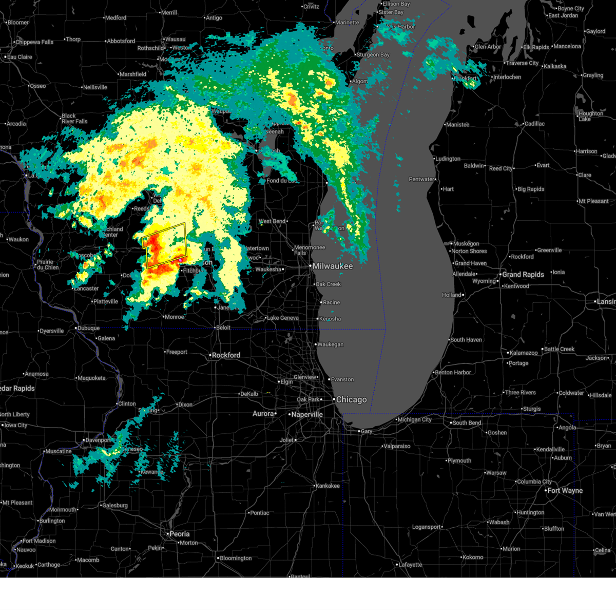
| 4/14/2026 7:09 PM CDT |
 The storm which prompted the warning has weakened below severe limits, and has exited the warned area. therefore, the warning will be allowed to expire. a tornado watch remains in effect until 1000 pm cdt for south central wisconsin. The storm which prompted the warning has weakened below severe limits, and has exited the warned area. therefore, the warning will be allowed to expire. a tornado watch remains in effect until 1000 pm cdt for south central wisconsin.
|
| 4/14/2026 6:55 PM CDT |
 At 655 pm cdt, a severe thunderstorm capable of producing a tornado was located over cross plains, or near mount horeb, moving east at 25 mph (radar indicated rotation). Hazards include tornado and two inch hail. Flying debris will be dangerous to those caught without shelter. mobile homes will be damaged or destroyed. damage to roofs, windows, and vehicles will occur. tree damage is likely. this dangerous storm will be near, western madison, middleton, and cross plains around 700 pm cdt. Other locations impacted by this tornadic thunderstorm include pine bluff. At 655 pm cdt, a severe thunderstorm capable of producing a tornado was located over cross plains, or near mount horeb, moving east at 25 mph (radar indicated rotation). Hazards include tornado and two inch hail. Flying debris will be dangerous to those caught without shelter. mobile homes will be damaged or destroyed. damage to roofs, windows, and vehicles will occur. tree damage is likely. this dangerous storm will be near, western madison, middleton, and cross plains around 700 pm cdt. Other locations impacted by this tornadic thunderstorm include pine bluff.
|
| 4/14/2026 6:32 PM CDT |
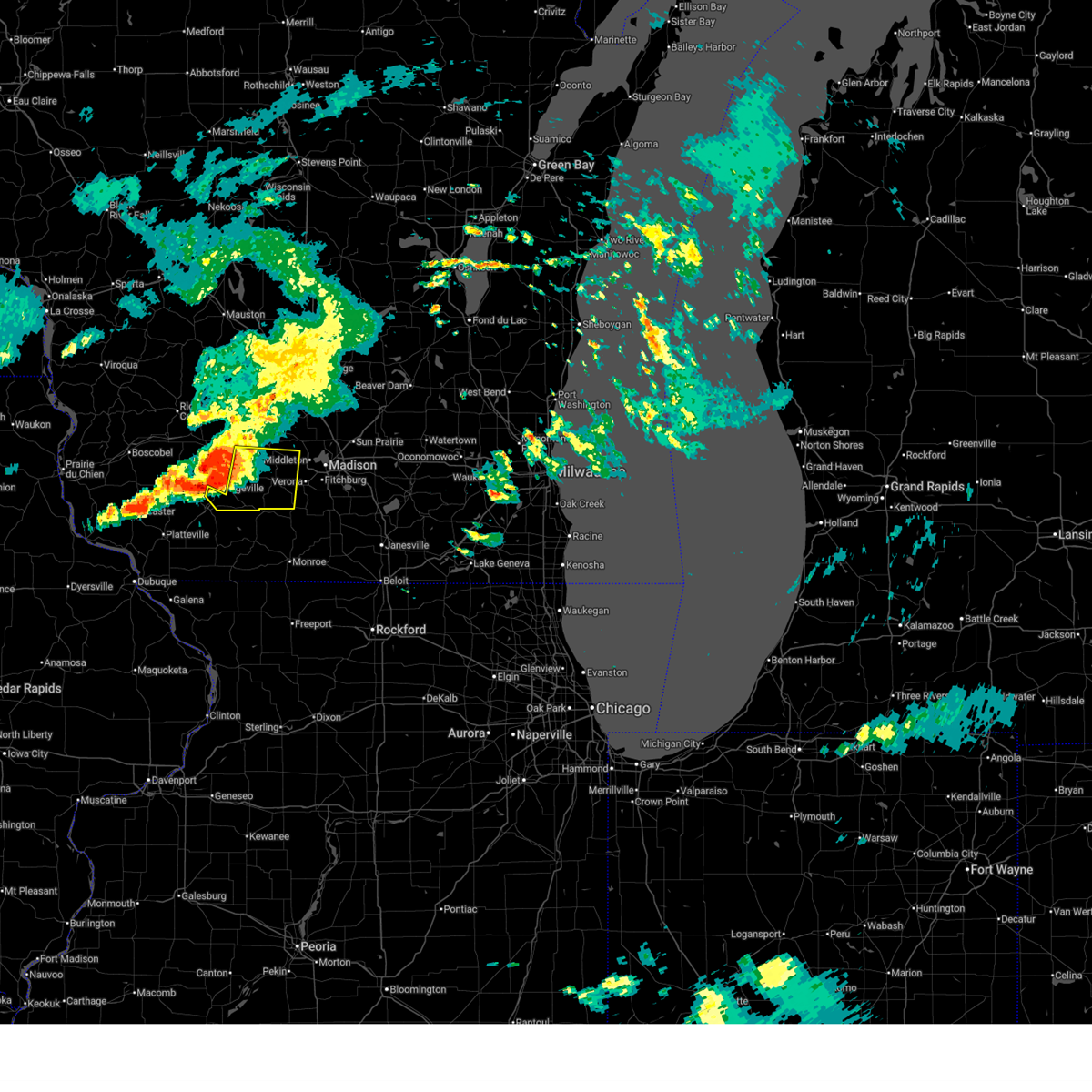
 Tormkx the national weather service in milwaukee/sullivan has issued a * tornado warning for, east central iowa county in south central wisconsin, northwestern dane county in south central wisconsin, * until 715 pm cdt. * at 632 pm cdt, a severe thunderstorm capable of producing a tornado was located 7 miles southwest of black earth, or 8 miles northwest of mount horeb, moving east at 35 mph (radar indicated rotation). Hazards include tornado and hail up to two inches in diameter. Flying debris will be dangerous to those caught without shelter. mobile homes will be damaged or destroyed. damage to roofs, windows, and vehicles will occur. tree damage is likely. this dangerous storm will be near, cross plains and black earth around 635 pm cdt. western madison and middleton around 645 pm cdt. Other locations impacted by this tornadic thunderstorm include pine bluff. Tormkx the national weather service in milwaukee/sullivan has issued a * tornado warning for, east central iowa county in south central wisconsin, northwestern dane county in south central wisconsin, * until 715 pm cdt. * at 632 pm cdt, a severe thunderstorm capable of producing a tornado was located 7 miles southwest of black earth, or 8 miles northwest of mount horeb, moving east at 35 mph (radar indicated rotation). Hazards include tornado and hail up to two inches in diameter. Flying debris will be dangerous to those caught without shelter. mobile homes will be damaged or destroyed. damage to roofs, windows, and vehicles will occur. tree damage is likely. this dangerous storm will be near, cross plains and black earth around 635 pm cdt. western madison and middleton around 645 pm cdt. Other locations impacted by this tornadic thunderstorm include pine bluff.
|
| 4/14/2026 6:27 PM CDT |
 Svrmkx the national weather service in milwaukee/sullivan has issued a * severe thunderstorm warning for, western dane county in south central wisconsin, * until 730 pm cdt. * at 627 pm cdt, a severe thunderstorm was located 9 miles northeast of dodgeville, moving east at 30 mph (radar indicated). Hazards include two inch hail and 60 mph wind gusts. People and animals outdoors will be injured. expect hail damage to roofs, siding, windows, and vehicles. Expect wind damage to roofs, siding, and trees. Svrmkx the national weather service in milwaukee/sullivan has issued a * severe thunderstorm warning for, western dane county in south central wisconsin, * until 730 pm cdt. * at 627 pm cdt, a severe thunderstorm was located 9 miles northeast of dodgeville, moving east at 30 mph (radar indicated). Hazards include two inch hail and 60 mph wind gusts. People and animals outdoors will be injured. expect hail damage to roofs, siding, windows, and vehicles. Expect wind damage to roofs, siding, and trees.
|
| 4/14/2026 5:06 PM CDT |
 At 505 pm cdt, a severe thunderstorm was located over poynette, or 9 miles east of lake wisconsin, moving northeast at 45 mph (radar indicated). Hazards include 60 mph wind gusts and quarter size hail. Hail damage to vehicles is expected. expect wind damage to roofs, siding, and trees. Locations impacted include, middleton, waunakee, portage, windsor, columbus, lake wisconsin, deforest, lodi, poynette, pardeeville, randolph, fall river, rio, cambria, dane, arlington, wyocena, otsego, merrimac, and friesland. At 505 pm cdt, a severe thunderstorm was located over poynette, or 9 miles east of lake wisconsin, moving northeast at 45 mph (radar indicated). Hazards include 60 mph wind gusts and quarter size hail. Hail damage to vehicles is expected. expect wind damage to roofs, siding, and trees. Locations impacted include, middleton, waunakee, portage, windsor, columbus, lake wisconsin, deforest, lodi, poynette, pardeeville, randolph, fall river, rio, cambria, dane, arlington, wyocena, otsego, merrimac, and friesland.
|
| 4/14/2026 4:40 PM CDT |
 At 439 pm cdt, a severe thunderstorm was located over black earth, or 8 miles south of sauk city, moving northeast at 40 mph. this is a destructive storm (trained weather spotters). Hazards include baseball size hail and 60 mph wind gusts. People and animals outdoors will be severely injured. expect shattered windows, extensive damage to roofs, siding, and vehicles. Locations impacted include, madison, middleton, mount horeb, cross plains, mazomanie, shorewood hills, black earth, pine bluff, and marxville. At 439 pm cdt, a severe thunderstorm was located over black earth, or 8 miles south of sauk city, moving northeast at 40 mph. this is a destructive storm (trained weather spotters). Hazards include baseball size hail and 60 mph wind gusts. People and animals outdoors will be severely injured. expect shattered windows, extensive damage to roofs, siding, and vehicles. Locations impacted include, madison, middleton, mount horeb, cross plains, mazomanie, shorewood hills, black earth, pine bluff, and marxville.
|
| 4/14/2026 4:40 PM CDT |
 Svrmkx the national weather service in milwaukee/sullivan has issued a * severe thunderstorm warning for, columbia county in south central wisconsin, northwestern dane county in south central wisconsin, * until 545 pm cdt. * at 439 pm cdt, a severe thunderstorm was located near black earth, or near sauk city, moving northeast at 45 mph. this is a destructive storm for dane (radar indicated). Hazards include baseball size hail and 60 mph wind gusts. People and animals outdoors will be severely injured. Expect shattered windows, extensive damage to roofs, siding, and vehicles. Svrmkx the national weather service in milwaukee/sullivan has issued a * severe thunderstorm warning for, columbia county in south central wisconsin, northwestern dane county in south central wisconsin, * until 545 pm cdt. * at 439 pm cdt, a severe thunderstorm was located near black earth, or near sauk city, moving northeast at 45 mph. this is a destructive storm for dane (radar indicated). Hazards include baseball size hail and 60 mph wind gusts. People and animals outdoors will be severely injured. Expect shattered windows, extensive damage to roofs, siding, and vehicles.
|
| 4/14/2026 4:36 PM CDT |
 At 435 pm cdt, a severe thunderstorm was located near black earth, or near mount horeb, moving northeast at 35 mph (trained weather spotters near arena reports 2 inch hail). Hazards include tennis ball size hail and 60 mph wind gusts. People and animals outdoors will be injured. expect hail damage to roofs, siding, windows, and vehicles. expect wind damage to roofs, siding, and trees. Locations impacted include, madison, middleton, mount horeb, cross plains, mazomanie, shorewood hills, black earth, blue mounds, arena, pine bluff, blue mound st park, and marxville. At 435 pm cdt, a severe thunderstorm was located near black earth, or near mount horeb, moving northeast at 35 mph (trained weather spotters near arena reports 2 inch hail). Hazards include tennis ball size hail and 60 mph wind gusts. People and animals outdoors will be injured. expect hail damage to roofs, siding, windows, and vehicles. expect wind damage to roofs, siding, and trees. Locations impacted include, madison, middleton, mount horeb, cross plains, mazomanie, shorewood hills, black earth, blue mounds, arena, pine bluff, blue mound st park, and marxville.
|
| 4/14/2026 4:26 PM CDT |
 At 425 pm cdt, a severe thunderstorm was located near mount horeb, moving northeast at 35 mph (trained weather spotters 2 mi west of barneveld reports 1.5 inch hail). Hazards include ping pong ball size hail and 60 mph wind gusts. People and animals outdoors will be injured. expect hail damage to roofs, siding, windows, and vehicles. expect wind damage to roofs, siding, and trees. Locations impacted include, madison, middleton, mount horeb, cross plains, mazomanie, shorewood hills, black earth, barneveld, blue mounds, arena, pine bluff, blue mound st park, and marxville. At 425 pm cdt, a severe thunderstorm was located near mount horeb, moving northeast at 35 mph (trained weather spotters 2 mi west of barneveld reports 1.5 inch hail). Hazards include ping pong ball size hail and 60 mph wind gusts. People and animals outdoors will be injured. expect hail damage to roofs, siding, windows, and vehicles. expect wind damage to roofs, siding, and trees. Locations impacted include, madison, middleton, mount horeb, cross plains, mazomanie, shorewood hills, black earth, barneveld, blue mounds, arena, pine bluff, blue mound st park, and marxville.
|
| 4/14/2026 4:14 PM CDT |
 At 414 pm cdt, a severe thunderstorm was located 8 miles east of dodgeville, moving northeast at 30 mph (radar indicated). Hazards include 60 mph wind gusts and half dollar size hail. Hail damage to vehicles is expected. expect wind damage to roofs, siding, and trees. Locations impacted include, madison, middleton, mount horeb, cross plains, mazomanie, shorewood hills, black earth, barneveld, blue mounds, arena, ridgeway, governor dodge st park, pine bluff, blue mound st park, and marxville. At 414 pm cdt, a severe thunderstorm was located 8 miles east of dodgeville, moving northeast at 30 mph (radar indicated). Hazards include 60 mph wind gusts and half dollar size hail. Hail damage to vehicles is expected. expect wind damage to roofs, siding, and trees. Locations impacted include, madison, middleton, mount horeb, cross plains, mazomanie, shorewood hills, black earth, barneveld, blue mounds, arena, ridgeway, governor dodge st park, pine bluff, blue mound st park, and marxville.
|
| 4/14/2026 12:16 AM CDT |
 Svrmkx the national weather service in milwaukee/sullivan has issued a * severe thunderstorm warning for, southern green lake county in south central wisconsin, eastern columbia county in south central wisconsin, dane county in south central wisconsin, western dodge county in southeastern wisconsin, * until 100 am cdt. * at 1216 am cdt, severe thunderstorms were located along a line extending from 10 miles southeast of montello to near cross plains, moving east at 50 mph (radar indicated). Hazards include 60 mph wind gusts. expect damage to roofs, siding, and trees Svrmkx the national weather service in milwaukee/sullivan has issued a * severe thunderstorm warning for, southern green lake county in south central wisconsin, eastern columbia county in south central wisconsin, dane county in south central wisconsin, western dodge county in southeastern wisconsin, * until 100 am cdt. * at 1216 am cdt, severe thunderstorms were located along a line extending from 10 miles southeast of montello to near cross plains, moving east at 50 mph (radar indicated). Hazards include 60 mph wind gusts. expect damage to roofs, siding, and trees
|
| 4/14/2026 12:05 AM CDT |
 Svrmkx the national weather service in milwaukee/sullivan has issued a * severe thunderstorm warning for, southwestern columbia county in south central wisconsin, northwestern dane county in south central wisconsin, southeastern sauk county in south central wisconsin, * until 1245 am cdt. * at 1205 am cdt, severe thunderstorms were located along a line extending from near lake wisconsin to 9 miles southwest of mazomanie, moving east at 50 mph (radar indicated). Hazards include 60 mph wind gusts. expect damage to roofs, siding, and trees Svrmkx the national weather service in milwaukee/sullivan has issued a * severe thunderstorm warning for, southwestern columbia county in south central wisconsin, northwestern dane county in south central wisconsin, southeastern sauk county in south central wisconsin, * until 1245 am cdt. * at 1205 am cdt, severe thunderstorms were located along a line extending from near lake wisconsin to 9 miles southwest of mazomanie, moving east at 50 mph (radar indicated). Hazards include 60 mph wind gusts. expect damage to roofs, siding, and trees
|
| 4/2/2026 6:35 PM CDT |
 Svrmkx the national weather service in milwaukee/sullivan has issued a * severe thunderstorm warning for, northern green county in south central wisconsin, southeastern iowa county in south central wisconsin, western dane county in south central wisconsin, * until 715 pm cdt. * at 635 pm cdt, severe thunderstorms were located along a line extending from 9 miles west of mount horeb to near blanchardville, moving northeast at 50 mph (radar indicated). Hazards include 60 mph wind gusts and quarter size hail. Hail damage to vehicles is expected. Expect wind damage to roofs, siding, and trees. Svrmkx the national weather service in milwaukee/sullivan has issued a * severe thunderstorm warning for, northern green county in south central wisconsin, southeastern iowa county in south central wisconsin, western dane county in south central wisconsin, * until 715 pm cdt. * at 635 pm cdt, severe thunderstorms were located along a line extending from 9 miles west of mount horeb to near blanchardville, moving northeast at 50 mph (radar indicated). Hazards include 60 mph wind gusts and quarter size hail. Hail damage to vehicles is expected. Expect wind damage to roofs, siding, and trees.
|
| 8/16/2025 1:32 PM CDT |
 Svrmkx the national weather service in milwaukee/sullivan has issued a * severe thunderstorm warning for, west central dane county in south central wisconsin, * until 145 pm cdt. * at 132 pm cdt, a severe thunderstorm was located over cross plains, or near middleton, moving east at 25 mph (radar indicated). Hazards include 60 mph wind gusts and quarter size hail. Hail damage to vehicles is expected. Expect wind damage to roofs, siding, and trees. Svrmkx the national weather service in milwaukee/sullivan has issued a * severe thunderstorm warning for, west central dane county in south central wisconsin, * until 145 pm cdt. * at 132 pm cdt, a severe thunderstorm was located over cross plains, or near middleton, moving east at 25 mph (radar indicated). Hazards include 60 mph wind gusts and quarter size hail. Hail damage to vehicles is expected. Expect wind damage to roofs, siding, and trees.
|
| 8/16/2025 1:15 PM CDT |
 At 115 pm cdt, a severe thunderstorm was located near black earth, or near sauk city, moving east at 30 mph (radar indicated). Hazards include 60 mph wind gusts and quarter size hail. Hail damage to vehicles is expected. expect wind damage to roofs, siding, and trees. Locations impacted include, cross plains, mazomanie, black earth, and marxville. At 115 pm cdt, a severe thunderstorm was located near black earth, or near sauk city, moving east at 30 mph (radar indicated). Hazards include 60 mph wind gusts and quarter size hail. Hail damage to vehicles is expected. expect wind damage to roofs, siding, and trees. Locations impacted include, cross plains, mazomanie, black earth, and marxville.
|
| 8/16/2025 1:15 PM CDT |
 the severe thunderstorm warning has been cancelled and is no longer in effect the severe thunderstorm warning has been cancelled and is no longer in effect
|
| 8/16/2025 12:42 PM CDT |
 Svrmkx the national weather service in milwaukee/sullivan has issued a * severe thunderstorm warning for, northeastern iowa county in south central wisconsin, northwestern dane county in south central wisconsin, southeastern sauk county in south central wisconsin, * until 130 pm cdt. * at 1242 pm cdt, a severe thunderstorm was located 7 miles northeast of spring green, or 13 miles west of sauk city, moving east at 30 mph (radar indicated). Hazards include 60 mph wind gusts and quarter size hail. Hail damage to vehicles is expected. Expect wind damage to roofs, siding, and trees. Svrmkx the national weather service in milwaukee/sullivan has issued a * severe thunderstorm warning for, northeastern iowa county in south central wisconsin, northwestern dane county in south central wisconsin, southeastern sauk county in south central wisconsin, * until 130 pm cdt. * at 1242 pm cdt, a severe thunderstorm was located 7 miles northeast of spring green, or 13 miles west of sauk city, moving east at 30 mph (radar indicated). Hazards include 60 mph wind gusts and quarter size hail. Hail damage to vehicles is expected. Expect wind damage to roofs, siding, and trees.
|
| 7/11/2025 5:39 PM CDT |
 Svrmkx the national weather service in milwaukee/sullivan has issued a * severe thunderstorm warning for, northern lafayette county in south central wisconsin, northern green county in south central wisconsin, iowa county in south central wisconsin, southwestern dane county in south central wisconsin, * until 630 pm cdt. * at 539 pm cdt, severe thunderstorms were located along a line extending from 13 miles west of dodgeville to near mineral point to near argyle, moving northeast at 50 mph (radar indicated). Hazards include 70 mph wind gusts and quarter size hail. Hail damage to vehicles is expected. expect considerable tree damage. Wind damage is also likely to mobile homes, roofs, and outbuildings. Svrmkx the national weather service in milwaukee/sullivan has issued a * severe thunderstorm warning for, northern lafayette county in south central wisconsin, northern green county in south central wisconsin, iowa county in south central wisconsin, southwestern dane county in south central wisconsin, * until 630 pm cdt. * at 539 pm cdt, severe thunderstorms were located along a line extending from 13 miles west of dodgeville to near mineral point to near argyle, moving northeast at 50 mph (radar indicated). Hazards include 70 mph wind gusts and quarter size hail. Hail damage to vehicles is expected. expect considerable tree damage. Wind damage is also likely to mobile homes, roofs, and outbuildings.
|
| 6/26/2025 9:06 PM CDT |
 Svrmkx the national weather service in milwaukee/sullivan has issued a * severe thunderstorm warning for, northwestern dane county in south central wisconsin, * until 945 pm cdt. * at 906 pm cdt, severe thunderstorms were located along a line extending from 7 miles west of prairie du sac to 7 miles southeast of spring green to 10 miles west of mount horeb, moving northeast at 40 mph (radar indicated). Hazards include 60 mph wind gusts and nickel size hail. expect damage to roofs, siding, and trees Svrmkx the national weather service in milwaukee/sullivan has issued a * severe thunderstorm warning for, northwestern dane county in south central wisconsin, * until 945 pm cdt. * at 906 pm cdt, severe thunderstorms were located along a line extending from 7 miles west of prairie du sac to 7 miles southeast of spring green to 10 miles west of mount horeb, moving northeast at 40 mph (radar indicated). Hazards include 60 mph wind gusts and nickel size hail. expect damage to roofs, siding, and trees
|
| 5/16/2025 4:08 PM CDT |
 The storm which prompted the warning has moved out of the area. therefore, the warning will be allowed to expire. The storm which prompted the warning has moved out of the area. therefore, the warning will be allowed to expire.
|
| 5/16/2025 3:47 PM CDT |
 the severe thunderstorm warning has been cancelled and is no longer in effect the severe thunderstorm warning has been cancelled and is no longer in effect
|
| 5/16/2025 3:47 PM CDT |
 At 345 pm cdt, a severe thunderstorm was located over black earth, or 8 miles north of mount horeb, moving northeast at 50 mph (radar indicated). Hazards include 60 mph wind gusts and penny size hail. Expect damage to roofs, siding, and trees. Locations impacted include, western madison, middleton, waunakee, mount horeb, sauk city, cross plains, mazomanie, black earth, dane, blue mounds, pine bluff, and marxville. At 345 pm cdt, a severe thunderstorm was located over black earth, or 8 miles north of mount horeb, moving northeast at 50 mph (radar indicated). Hazards include 60 mph wind gusts and penny size hail. Expect damage to roofs, siding, and trees. Locations impacted include, western madison, middleton, waunakee, mount horeb, sauk city, cross plains, mazomanie, black earth, dane, blue mounds, pine bluff, and marxville.
|
| 5/16/2025 3:27 PM CDT |
 Svrmkx the national weather service in milwaukee/sullivan has issued a * severe thunderstorm warning for, southeastern iowa county in south central wisconsin, western dane county in south central wisconsin, * until 415 pm cdt. * at 327 pm cdt, a severe thunderstorm was located 9 miles east of dodgeville, moving northeast at 50 mph (radar indicated). Hazards include 60 mph wind gusts and penny size hail. expect damage to roofs, siding, and trees Svrmkx the national weather service in milwaukee/sullivan has issued a * severe thunderstorm warning for, southeastern iowa county in south central wisconsin, western dane county in south central wisconsin, * until 415 pm cdt. * at 327 pm cdt, a severe thunderstorm was located 9 miles east of dodgeville, moving northeast at 50 mph (radar indicated). Hazards include 60 mph wind gusts and penny size hail. expect damage to roofs, siding, and trees
|
| 5/15/2025 4:18 PM CDT |
 Svrmkx the national weather service in milwaukee/sullivan has issued a * severe thunderstorm warning for, western columbia county in south central wisconsin, northwestern dane county in south central wisconsin, east central sauk county in south central wisconsin, * until 515 pm cdt. * at 418 pm cdt, a severe thunderstorm was located over middleton, moving north at 45 mph (radar indicated). Hazards include ping pong ball size hail and 60 mph wind gusts. People and animals outdoors will be injured. expect hail damage to roofs, siding, windows, and vehicles. Expect wind damage to roofs, siding, and trees. Svrmkx the national weather service in milwaukee/sullivan has issued a * severe thunderstorm warning for, western columbia county in south central wisconsin, northwestern dane county in south central wisconsin, east central sauk county in south central wisconsin, * until 515 pm cdt. * at 418 pm cdt, a severe thunderstorm was located over middleton, moving north at 45 mph (radar indicated). Hazards include ping pong ball size hail and 60 mph wind gusts. People and animals outdoors will be injured. expect hail damage to roofs, siding, windows, and vehicles. Expect wind damage to roofs, siding, and trees.
|
| 4/18/2025 6:45 AM CDT |
 Svrmkx the national weather service in milwaukee/sullivan has issued a * severe thunderstorm warning for, northern green county in south central wisconsin, northern rock county in south central wisconsin, southeastern columbia county in south central wisconsin, dane county in south central wisconsin, jefferson county in southeastern wisconsin, southwestern dodge county in southeastern wisconsin, * until 730 am cdt. * at 644 am cdt, severe thunderstorms were located along a line extending from near poynette to near maple bluff to brooklyn to near monticello, moving east at 60 mph. ping pong ball size hail was reported in new glarus by a trained spotter at 641 am cdt (trained weather spotters). Hazards include two inch hail and 60 mph wind gusts. People and animals outdoors will be injured. expect hail damage to roofs, siding, windows, and vehicles. Expect wind damage to roofs, siding, and trees. Svrmkx the national weather service in milwaukee/sullivan has issued a * severe thunderstorm warning for, northern green county in south central wisconsin, northern rock county in south central wisconsin, southeastern columbia county in south central wisconsin, dane county in south central wisconsin, jefferson county in southeastern wisconsin, southwestern dodge county in southeastern wisconsin, * until 730 am cdt. * at 644 am cdt, severe thunderstorms were located along a line extending from near poynette to near maple bluff to brooklyn to near monticello, moving east at 60 mph. ping pong ball size hail was reported in new glarus by a trained spotter at 641 am cdt (trained weather spotters). Hazards include two inch hail and 60 mph wind gusts. People and animals outdoors will be injured. expect hail damage to roofs, siding, windows, and vehicles. Expect wind damage to roofs, siding, and trees.
|
| 4/18/2025 6:32 AM CDT |
 At 632 am cdt, severe thunderstorms were located along a line extending from near lake wisconsin to near waunakee to belleville to near argyle, moving east at 70 mph (radar indicated). Hazards include two inch hail and 60 mph wind gusts. People and animals outdoors will be injured. expect hail damage to roofs, siding, windows, and vehicles. expect wind damage to roofs, siding, and trees. Locations impacted include, harmony grove, lake wisconsin, shorewood hills, wiota, token creek, mount vernon, henry vilas zoo, mazomanie, arlington, blue mounds, albany, camp randall stadium, monticello, jordan center, new glarus, pine bluff, dane, interstate 90/94 interchange, okee, and poynette. At 632 am cdt, severe thunderstorms were located along a line extending from near lake wisconsin to near waunakee to belleville to near argyle, moving east at 70 mph (radar indicated). Hazards include two inch hail and 60 mph wind gusts. People and animals outdoors will be injured. expect hail damage to roofs, siding, windows, and vehicles. expect wind damage to roofs, siding, and trees. Locations impacted include, harmony grove, lake wisconsin, shorewood hills, wiota, token creek, mount vernon, henry vilas zoo, mazomanie, arlington, blue mounds, albany, camp randall stadium, monticello, jordan center, new glarus, pine bluff, dane, interstate 90/94 interchange, okee, and poynette.
|
| 4/18/2025 6:32 AM CDT |
 the severe thunderstorm warning has been cancelled and is no longer in effect the severe thunderstorm warning has been cancelled and is no longer in effect
|
| 4/18/2025 6:15 AM CDT |
 Svrmkx the national weather service in milwaukee/sullivan has issued a * severe thunderstorm warning for, lafayette county in south central wisconsin, green county in south central wisconsin, iowa county in south central wisconsin, western columbia county in south central wisconsin, dane county in south central wisconsin, sauk county in south central wisconsin, * until 700 am cdt. * at 614 am cdt, severe thunderstorms were located along a line extending from 11 miles southwest of reedsburg to near mazomanie to near blanchardville to near darlington, moving northeast at 70 mph (radar indicated). Hazards include two inch hail and 60 mph wind gusts. People and animals outdoors will be injured. expect hail damage to roofs, siding, windows, and vehicles. Expect wind damage to roofs, siding, and trees. Svrmkx the national weather service in milwaukee/sullivan has issued a * severe thunderstorm warning for, lafayette county in south central wisconsin, green county in south central wisconsin, iowa county in south central wisconsin, western columbia county in south central wisconsin, dane county in south central wisconsin, sauk county in south central wisconsin, * until 700 am cdt. * at 614 am cdt, severe thunderstorms were located along a line extending from 11 miles southwest of reedsburg to near mazomanie to near blanchardville to near darlington, moving northeast at 70 mph (radar indicated). Hazards include two inch hail and 60 mph wind gusts. People and animals outdoors will be injured. expect hail damage to roofs, siding, windows, and vehicles. Expect wind damage to roofs, siding, and trees.
|
| 4/18/2025 5:58 AM CDT |
 At 558 am cdt, a severe thunderstorm was located near deforest, or 7 miles north of windsor, moving east at 55 mph (radar indicated). Hazards include ping pong ball size hail. People and animals outdoors will be injured. expect damage to roofs, siding, windows, and vehicles. Locations impacted include, wyocena, windsor, harmony grove, lake wisconsin, morrisonville, lodi, bluffview, prairie du sac, sauk city, fall river, token creek, sun prairie, otsego, mazomanie, arlington, doylestown, deansville, east bristol, waunakee, and marshall. At 558 am cdt, a severe thunderstorm was located near deforest, or 7 miles north of windsor, moving east at 55 mph (radar indicated). Hazards include ping pong ball size hail. People and animals outdoors will be injured. expect damage to roofs, siding, windows, and vehicles. Locations impacted include, wyocena, windsor, harmony grove, lake wisconsin, morrisonville, lodi, bluffview, prairie du sac, sauk city, fall river, token creek, sun prairie, otsego, mazomanie, arlington, doylestown, deansville, east bristol, waunakee, and marshall.
|
| 4/18/2025 5:35 AM CDT |
 Svrmkx the national weather service in milwaukee/sullivan has issued a * severe thunderstorm warning for, northeastern iowa county in south central wisconsin, columbia county in south central wisconsin, northern dane county in south central wisconsin, southeastern sauk county in south central wisconsin, * until 630 am cdt. * at 534 am cdt, a severe thunderstorm was located near prairie du sac, moving east at 65 mph (radar indicated). Hazards include ping pong ball size hail. People and animals outdoors will be injured. Expect damage to roofs, siding, windows, and vehicles. Svrmkx the national weather service in milwaukee/sullivan has issued a * severe thunderstorm warning for, northeastern iowa county in south central wisconsin, columbia county in south central wisconsin, northern dane county in south central wisconsin, southeastern sauk county in south central wisconsin, * until 630 am cdt. * at 534 am cdt, a severe thunderstorm was located near prairie du sac, moving east at 65 mph (radar indicated). Hazards include ping pong ball size hail. People and animals outdoors will be injured. Expect damage to roofs, siding, windows, and vehicles.
|
| 9/22/2024 2:05 AM CDT |
 Svrmkx the national weather service in milwaukee/sullivan has issued a * severe thunderstorm warning for, east central iowa county in south central wisconsin, southwestern dane county in south central wisconsin, * until 230 am cdt. * at 204 am cdt, a severe thunderstorm was located near mount horeb, moving east at 20 mph (radar indicated). Hazards include 60 mph wind gusts. expect damage to roofs, siding, and trees Svrmkx the national weather service in milwaukee/sullivan has issued a * severe thunderstorm warning for, east central iowa county in south central wisconsin, southwestern dane county in south central wisconsin, * until 230 am cdt. * at 204 am cdt, a severe thunderstorm was located near mount horeb, moving east at 20 mph (radar indicated). Hazards include 60 mph wind gusts. expect damage to roofs, siding, and trees
|
| 9/21/2024 3:24 PM CDT |
 Svrmkx the national weather service in milwaukee/sullivan has issued a * severe thunderstorm warning for, southwestern dane county in south central wisconsin, * until 400 pm cdt. * at 324 pm cdt, severe thunderstorms were located along a line extending from near verona to near mount horeb, moving southeast at 35 mph (radar indicated). Hazards include 60 mph wind gusts and quarter size hail. Hail damage to vehicles is expected. Expect wind damage to roofs, siding, and trees. Svrmkx the national weather service in milwaukee/sullivan has issued a * severe thunderstorm warning for, southwestern dane county in south central wisconsin, * until 400 pm cdt. * at 324 pm cdt, severe thunderstorms were located along a line extending from near verona to near mount horeb, moving southeast at 35 mph (radar indicated). Hazards include 60 mph wind gusts and quarter size hail. Hail damage to vehicles is expected. Expect wind damage to roofs, siding, and trees.
|
| 9/21/2024 3:12 PM CDT |
 the severe thunderstorm warning has been cancelled and is no longer in effect the severe thunderstorm warning has been cancelled and is no longer in effect
|
| 9/21/2024 3:12 PM CDT |
 At 311 pm cdt, severe thunderstorms were located along a line extending from mazomanie to 8 miles west of black earth, moving southeast at 35 mph (trained weather spotters). Hazards include 60 mph wind gusts and quarter size hail. Hail damage to vehicles is expected. expect wind damage to roofs, siding, and trees. Locations impacted include, mount horeb, cross plains, mazomanie, black earth, barneveld, blue mounds, arena, pine bluff, and blue mound st park. At 311 pm cdt, severe thunderstorms were located along a line extending from mazomanie to 8 miles west of black earth, moving southeast at 35 mph (trained weather spotters). Hazards include 60 mph wind gusts and quarter size hail. Hail damage to vehicles is expected. expect wind damage to roofs, siding, and trees. Locations impacted include, mount horeb, cross plains, mazomanie, black earth, barneveld, blue mounds, arena, pine bluff, and blue mound st park.
|
| 9/21/2024 3:07 PM CDT |
 At 307 pm cdt, severe thunderstorms were located along a line extending from mazomanie to 7 miles east of spring green, moving southeast at 35 mph (trained weather spotters reported quarter sized hail in spring green). Hazards include quarter size hail. Damage to vehicles is expected. Locations impacted include, mount horeb, cross plains, mazomanie, spring green, black earth, barneveld, blue mounds, arena, ridgeway, pine bluff, and blue mound st park. At 307 pm cdt, severe thunderstorms were located along a line extending from mazomanie to 7 miles east of spring green, moving southeast at 35 mph (trained weather spotters reported quarter sized hail in spring green). Hazards include quarter size hail. Damage to vehicles is expected. Locations impacted include, mount horeb, cross plains, mazomanie, spring green, black earth, barneveld, blue mounds, arena, ridgeway, pine bluff, and blue mound st park.
|
| 9/21/2024 2:58 PM CDT |
 Svrmkx the national weather service in milwaukee/sullivan has issued a * severe thunderstorm warning for, northeastern iowa county in south central wisconsin, west central dane county in south central wisconsin, south central sauk county in south central wisconsin, * until 330 pm cdt. * at 257 pm cdt, severe thunderstorms were located along a line extending from near mazomanie to near spring green, moving southeast at 35 mph (radar indicated). Hazards include quarter size hail. damage to vehicles is expected Svrmkx the national weather service in milwaukee/sullivan has issued a * severe thunderstorm warning for, northeastern iowa county in south central wisconsin, west central dane county in south central wisconsin, south central sauk county in south central wisconsin, * until 330 pm cdt. * at 257 pm cdt, severe thunderstorms were located along a line extending from near mazomanie to near spring green, moving southeast at 35 mph (radar indicated). Hazards include quarter size hail. damage to vehicles is expected
|
| 8/30/2024 12:51 AM CDT |
 The storm which prompted the warning has weakened below severe limits, and has exited the warned area. therefore, the warning will be allowed to expire. however, gusty winds are still possible with this thunderstorm. The storm which prompted the warning has weakened below severe limits, and has exited the warned area. therefore, the warning will be allowed to expire. however, gusty winds are still possible with this thunderstorm.
|
| 8/30/2024 12:39 AM CDT |
 the severe thunderstorm warning has been cancelled and is no longer in effect the severe thunderstorm warning has been cancelled and is no longer in effect
|
| 8/30/2024 12:39 AM CDT |
 At 1238 am cdt, a severe thunderstorm was located near mount horeb, moving northeast at 35 mph (public). Hazards include 60 mph wind gusts. Expect damage to roofs, siding, and trees. Locations impacted include, western madison, middleton, verona, mount horeb, cross plains, mazomanie, black earth, blue mounds, pine bluff, and mount vernon. At 1238 am cdt, a severe thunderstorm was located near mount horeb, moving northeast at 35 mph (public). Hazards include 60 mph wind gusts. Expect damage to roofs, siding, and trees. Locations impacted include, western madison, middleton, verona, mount horeb, cross plains, mazomanie, black earth, blue mounds, pine bluff, and mount vernon.
|
| 8/30/2024 12:25 AM CDT |
 At 1224 am cdt, a severe thunderstorm was located near mount horeb, moving northeast at 35 mph. storm has produced a measured gust of 59 mph on personal weather station in dodgeville (public). Hazards include 60 mph wind gusts. Expect damage to roofs, siding, and trees. Locations impacted include, western madison, middleton, verona, mount horeb, cross plains, mazomanie, black earth, barneveld, blue mounds, arena, ridgeway, hollandale, pine bluff, blue mound st park, mount vernon, and jonesdale. At 1224 am cdt, a severe thunderstorm was located near mount horeb, moving northeast at 35 mph. storm has produced a measured gust of 59 mph on personal weather station in dodgeville (public). Hazards include 60 mph wind gusts. Expect damage to roofs, siding, and trees. Locations impacted include, western madison, middleton, verona, mount horeb, cross plains, mazomanie, black earth, barneveld, blue mounds, arena, ridgeway, hollandale, pine bluff, blue mound st park, mount vernon, and jonesdale.
|
| 8/30/2024 12:12 AM CDT |
 Svrmkx the national weather service in milwaukee/sullivan has issued a * severe thunderstorm warning for, eastern iowa county in south central wisconsin, western dane county in south central wisconsin, * until 100 am cdt. * at 1212 am cdt, a severe thunderstorm was located 7 miles east of dodgeville, moving northeast at 35 mph (radar indicated). Hazards include 60 mph wind gusts. expect damage to roofs, siding, and trees Svrmkx the national weather service in milwaukee/sullivan has issued a * severe thunderstorm warning for, eastern iowa county in south central wisconsin, western dane county in south central wisconsin, * until 100 am cdt. * at 1212 am cdt, a severe thunderstorm was located 7 miles east of dodgeville, moving northeast at 35 mph (radar indicated). Hazards include 60 mph wind gusts. expect damage to roofs, siding, and trees
|
| 8/6/2024 12:28 AM CDT | A tree down on a house. other reports of small branches down and power lines dow in dane county WI, 0.4 miles S of Cross Plains, WI |
| 7/14/2024 7:21 PM CDT |
 At 721 pm cdt, a severe thunderstorm was located over middleton, moving east at 25 mph (radar indicated). Hazards include 60 mph wind gusts and quarter size hail. Hail damage to vehicles is expected. expect wind damage to roofs, siding, and trees. Locations impacted include, madison, sun prairie, fitchburg, middleton, waunakee, monona, windsor, cross plains, shorewood hills, maple bluff, camp randall stadium, token creek, henry vilas zoo, and uw-madison. At 721 pm cdt, a severe thunderstorm was located over middleton, moving east at 25 mph (radar indicated). Hazards include 60 mph wind gusts and quarter size hail. Hail damage to vehicles is expected. expect wind damage to roofs, siding, and trees. Locations impacted include, madison, sun prairie, fitchburg, middleton, waunakee, monona, windsor, cross plains, shorewood hills, maple bluff, camp randall stadium, token creek, henry vilas zoo, and uw-madison.
|
| 7/14/2024 7:18 PM CDT | Ping Pong Ball sized hail reported 4.1 miles SSW of Cross Plains, WI, report from mping: ping pong ball (1.50 in.). |
| 7/14/2024 7:15 PM CDT | Trees and power lines down in the cross plains are in dane county WI, 0.4 miles S of Cross Plains, WI |
| 7/14/2024 7:10 PM CDT |
 Svrmkx the national weather service in milwaukee/sullivan has issued a * severe thunderstorm warning for, central dane county in south central wisconsin, * until 745 pm cdt. * at 709 pm cdt, a severe thunderstorm was located over cross plains, or near middleton, moving east at 25 mph (radar indicated). Hazards include 60 mph wind gusts and quarter size hail. Hail damage to vehicles is expected. Expect wind damage to roofs, siding, and trees. Svrmkx the national weather service in milwaukee/sullivan has issued a * severe thunderstorm warning for, central dane county in south central wisconsin, * until 745 pm cdt. * at 709 pm cdt, a severe thunderstorm was located over cross plains, or near middleton, moving east at 25 mph (radar indicated). Hazards include 60 mph wind gusts and quarter size hail. Hail damage to vehicles is expected. Expect wind damage to roofs, siding, and trees.
|
| 6/22/2024 6:53 PM CDT |
 Svrmkx the national weather service in milwaukee/sullivan has issued a * severe thunderstorm warning for, northern lafayette county in south central wisconsin, northern green county in south central wisconsin, iowa county in south central wisconsin, northwestern rock county in south central wisconsin, dane county in south central wisconsin, western jefferson county in southeastern wisconsin, * until 745 pm cdt. * at 652 pm cdt, severe thunderstorms were located along a line extending from cross plains to near belmont, moving east at 45 mph (radar indicated). Hazards include 60 mph wind gusts and nickel size hail. expect damage to roofs, siding, and trees Svrmkx the national weather service in milwaukee/sullivan has issued a * severe thunderstorm warning for, northern lafayette county in south central wisconsin, northern green county in south central wisconsin, iowa county in south central wisconsin, northwestern rock county in south central wisconsin, dane county in south central wisconsin, western jefferson county in southeastern wisconsin, * until 745 pm cdt. * at 652 pm cdt, severe thunderstorms were located along a line extending from cross plains to near belmont, moving east at 45 mph (radar indicated). Hazards include 60 mph wind gusts and nickel size hail. expect damage to roofs, siding, and trees
|
| 6/22/2024 6:21 PM CDT |
 At 621 pm cdt, a severe thunderstorm capable of producing a tornado was located near waunakee, moving east at 45 mph (radar indicated rotation). Hazards include tornado. Flying debris will be dangerous to those caught without shelter. mobile homes will be damaged or destroyed. damage to roofs, windows, and vehicles will occur. tree damage is likely. Locations impacted include, western madison, middleton, cross plains, and dane. At 621 pm cdt, a severe thunderstorm capable of producing a tornado was located near waunakee, moving east at 45 mph (radar indicated rotation). Hazards include tornado. Flying debris will be dangerous to those caught without shelter. mobile homes will be damaged or destroyed. damage to roofs, windows, and vehicles will occur. tree damage is likely. Locations impacted include, western madison, middleton, cross plains, and dane.
|
| 6/22/2024 6:21 PM CDT |
 the tornado warning has been cancelled and is no longer in effect the tornado warning has been cancelled and is no longer in effect
|
| 6/22/2024 6:12 PM CDT |
 Svrmkx the national weather service in milwaukee/sullivan has issued a * severe thunderstorm warning for, southeastern columbia county in south central wisconsin, northwestern dane county in south central wisconsin, * until 700 pm cdt. * at 612 pm cdt, severe thunderstorms were located along a line extending from near lake wisconsin to near black earth to 8 miles southwest of mazomanie, moving east at 35 mph (radar indicated). Hazards include 60 mph wind gusts and quarter size hail. Hail damage to vehicles is expected. Expect wind damage to roofs, siding, and trees. Svrmkx the national weather service in milwaukee/sullivan has issued a * severe thunderstorm warning for, southeastern columbia county in south central wisconsin, northwestern dane county in south central wisconsin, * until 700 pm cdt. * at 612 pm cdt, severe thunderstorms were located along a line extending from near lake wisconsin to near black earth to 8 miles southwest of mazomanie, moving east at 35 mph (radar indicated). Hazards include 60 mph wind gusts and quarter size hail. Hail damage to vehicles is expected. Expect wind damage to roofs, siding, and trees.
|
| 6/22/2024 5:55 PM CDT |
 Tormkx the national weather service in milwaukee/sullivan has issued a * tornado warning for, northeastern iowa county in south central wisconsin, northwestern dane county in south central wisconsin, southeastern sauk county in south central wisconsin, * until 630 pm cdt. * at 555 pm cdt, a severe thunderstorm capable of producing a tornado was located near mazomanie, or 8 miles west of sauk city, moving east at 45 mph (radar indicated rotation). Hazards include tornado. Flying debris will be dangerous to those caught without shelter. mobile homes will be damaged or destroyed. damage to roofs, windows, and vehicles will occur. Tree damage is likely. Tormkx the national weather service in milwaukee/sullivan has issued a * tornado warning for, northeastern iowa county in south central wisconsin, northwestern dane county in south central wisconsin, southeastern sauk county in south central wisconsin, * until 630 pm cdt. * at 555 pm cdt, a severe thunderstorm capable of producing a tornado was located near mazomanie, or 8 miles west of sauk city, moving east at 45 mph (radar indicated rotation). Hazards include tornado. Flying debris will be dangerous to those caught without shelter. mobile homes will be damaged or destroyed. damage to roofs, windows, and vehicles will occur. Tree damage is likely.
|
| 6/22/2024 5:51 PM CDT |
 Svrmkx the national weather service in milwaukee/sullivan has issued a * severe thunderstorm warning for, northeastern iowa county in south central wisconsin, southwestern columbia county in south central wisconsin, western dane county in south central wisconsin, southern sauk county in south central wisconsin, * until 630 pm cdt. * at 551 pm cdt, a severe thunderstorm was located near spring green, or 13 miles west of sauk city, moving east at 40 mph (radar indicated). Hazards include 60 mph wind gusts and quarter size hail. Hail damage to vehicles is expected. Expect wind damage to roofs, siding, and trees. Svrmkx the national weather service in milwaukee/sullivan has issued a * severe thunderstorm warning for, northeastern iowa county in south central wisconsin, southwestern columbia county in south central wisconsin, western dane county in south central wisconsin, southern sauk county in south central wisconsin, * until 630 pm cdt. * at 551 pm cdt, a severe thunderstorm was located near spring green, or 13 miles west of sauk city, moving east at 40 mph (radar indicated). Hazards include 60 mph wind gusts and quarter size hail. Hail damage to vehicles is expected. Expect wind damage to roofs, siding, and trees.
|
| 6/12/2024 5:38 PM CDT |
 the severe thunderstorm warning has been cancelled and is no longer in effect the severe thunderstorm warning has been cancelled and is no longer in effect
|
| 6/12/2024 5:30 PM CDT |
 At 529 pm cdt, severe thunderstorms were located along a line extending from near mazomanie to near blanchardville to near woodbine, moving east at 25 mph (emergency management. several trees were reported down in dodgeville, with estimated wind gusts of 60 mph). Hazards include 60 mph wind gusts and quarter size hail. Hail damage to vehicles is expected. expect wind damage to roofs, siding, and trees. Locations impacted include, western madison, middleton, waunakee, monroe, verona, mount horeb, darlington, cross plains, belleville, new glarus, mazomanie, shorewood hills, black earth, shullsburg, monticello, argyle, blanchardville, apple river, barneveld, and wiota. At 529 pm cdt, severe thunderstorms were located along a line extending from near mazomanie to near blanchardville to near woodbine, moving east at 25 mph (emergency management. several trees were reported down in dodgeville, with estimated wind gusts of 60 mph). Hazards include 60 mph wind gusts and quarter size hail. Hail damage to vehicles is expected. expect wind damage to roofs, siding, and trees. Locations impacted include, western madison, middleton, waunakee, monroe, verona, mount horeb, darlington, cross plains, belleville, new glarus, mazomanie, shorewood hills, black earth, shullsburg, monticello, argyle, blanchardville, apple river, barneveld, and wiota.
|
| 6/12/2024 5:30 PM CDT |
 the severe thunderstorm warning has been cancelled and is no longer in effect the severe thunderstorm warning has been cancelled and is no longer in effect
|
| 6/12/2024 5:07 PM CDT |
 Svrmkx the national weather service in milwaukee/sullivan has issued a * severe thunderstorm warning for, lafayette county in south central wisconsin, western green county in south central wisconsin, eastern iowa county in south central wisconsin, western dane county in south central wisconsin, southeastern sauk county in south central wisconsin, * until 600 pm cdt. * at 506 pm cdt, severe thunderstorms were located along a line extending from near spring green to near mineral point to near schapville, moving east at 25 mph (trained weather spotters. these storms have a history of producing tree and power line damage, along with numerous measured gusts of 55 to 65 mph). Hazards include 60 mph wind gusts and quarter size hail. Hail damage to vehicles is expected. Expect wind damage to roofs, siding, and trees. Svrmkx the national weather service in milwaukee/sullivan has issued a * severe thunderstorm warning for, lafayette county in south central wisconsin, western green county in south central wisconsin, eastern iowa county in south central wisconsin, western dane county in south central wisconsin, southeastern sauk county in south central wisconsin, * until 600 pm cdt. * at 506 pm cdt, severe thunderstorms were located along a line extending from near spring green to near mineral point to near schapville, moving east at 25 mph (trained weather spotters. these storms have a history of producing tree and power line damage, along with numerous measured gusts of 55 to 65 mph). Hazards include 60 mph wind gusts and quarter size hail. Hail damage to vehicles is expected. Expect wind damage to roofs, siding, and trees.
|
| 5/21/2024 8:44 PM CDT |
 Svrmkx the national weather service in milwaukee/sullivan has issued a * severe thunderstorm warning for, lafayette county in south central wisconsin, green county in south central wisconsin, iowa county in south central wisconsin, southwestern dane county in south central wisconsin, * until 930 pm cdt. * at 843 pm cdt, severe thunderstorms were located along a line extending from near cuba city to near monroe, moving northeast at 55 mph (radar indicated). Hazards include 60 mph wind gusts. expect damage to roofs, siding, and trees Svrmkx the national weather service in milwaukee/sullivan has issued a * severe thunderstorm warning for, lafayette county in south central wisconsin, green county in south central wisconsin, iowa county in south central wisconsin, southwestern dane county in south central wisconsin, * until 930 pm cdt. * at 843 pm cdt, severe thunderstorms were located along a line extending from near cuba city to near monroe, moving northeast at 55 mph (radar indicated). Hazards include 60 mph wind gusts. expect damage to roofs, siding, and trees
|
| 5/21/2024 8:01 PM CDT |
 At 800 pm cdt, severe thunderstorms were located along a line extending from near cross plains to near verona to near blanchardville to warren, moving northeast at 65 mph. these are destructive storms for eastern lafayette and western green county (radar indicated). Hazards include 80 mph wind gusts and quarter size hail. Flying debris will be dangerous to those caught without shelter. mobile homes will be heavily damaged. expect considerable damage to roofs, windows, and vehicles. extensive tree damage and power outages are likely. locations impacted include, madison, sun prairie, fitchburg, middleton, stoughton, waunakee, monroe, verona, oregon, mcfarland, monona, mount horeb, windsor, brodhead, darlington, deforest, cross plains, belleville, new glarus, and shorewood hills. People attending bratfest in madison should seek safe shelter immediately!. At 800 pm cdt, severe thunderstorms were located along a line extending from near cross plains to near verona to near blanchardville to warren, moving northeast at 65 mph. these are destructive storms for eastern lafayette and western green county (radar indicated). Hazards include 80 mph wind gusts and quarter size hail. Flying debris will be dangerous to those caught without shelter. mobile homes will be heavily damaged. expect considerable damage to roofs, windows, and vehicles. extensive tree damage and power outages are likely. locations impacted include, madison, sun prairie, fitchburg, middleton, stoughton, waunakee, monroe, verona, oregon, mcfarland, monona, mount horeb, windsor, brodhead, darlington, deforest, cross plains, belleville, new glarus, and shorewood hills. People attending bratfest in madison should seek safe shelter immediately!.
|
| 5/21/2024 7:58 PM CDT |
 Tormkx the national weather service in milwaukee/sullivan has issued a * tornado warning for, central dane county in south central wisconsin, * until 830 pm cdt. * at 757 pm cdt, a severe thunderstorm capable of producing a tornado was located over verona, moving northeast at 65 mph (radar indicated rotation). Hazards include tornado and quarter size hail. Flying debris will be dangerous to those caught without shelter. mobile homes will be damaged or destroyed. damage to roofs, windows, and vehicles will occur. Tree damage is likely. Tormkx the national weather service in milwaukee/sullivan has issued a * tornado warning for, central dane county in south central wisconsin, * until 830 pm cdt. * at 757 pm cdt, a severe thunderstorm capable of producing a tornado was located over verona, moving northeast at 65 mph (radar indicated rotation). Hazards include tornado and quarter size hail. Flying debris will be dangerous to those caught without shelter. mobile homes will be damaged or destroyed. damage to roofs, windows, and vehicles will occur. Tree damage is likely.
|
| 5/21/2024 7:41 PM CDT |
 Svrmkx the national weather service in milwaukee/sullivan has issued a * severe thunderstorm warning for, eastern lafayette county in south central wisconsin, green county in south central wisconsin, southeastern iowa county in south central wisconsin, dane county in south central wisconsin, * until 845 pm cdt. * at 741 pm cdt, severe thunderstorms were located along a line extending from 8 miles southwest of mount horeb to near blanchardville to near warren to near massbach, moving northeast at 65 mph (radar indicated). Hazards include 70 mph wind gusts and quarter size hail. Hail damage to vehicles is expected. expect considerable tree damage. Wind damage is also likely to mobile homes, roofs, and outbuildings. Svrmkx the national weather service in milwaukee/sullivan has issued a * severe thunderstorm warning for, eastern lafayette county in south central wisconsin, green county in south central wisconsin, southeastern iowa county in south central wisconsin, dane county in south central wisconsin, * until 845 pm cdt. * at 741 pm cdt, severe thunderstorms were located along a line extending from 8 miles southwest of mount horeb to near blanchardville to near warren to near massbach, moving northeast at 65 mph (radar indicated). Hazards include 70 mph wind gusts and quarter size hail. Hail damage to vehicles is expected. expect considerable tree damage. Wind damage is also likely to mobile homes, roofs, and outbuildings.
|
| 5/21/2024 7:38 PM CDT |
 At 737 pm cdt, severe thunderstorms were located along a line extending from near portage to near monticello, moving east at 40 mph (radar indicated). Hazards include 70 mph wind gusts and quarter size hail. Hail damage to vehicles is expected. expect considerable tree damage. wind damage is also likely to mobile homes, roofs, and outbuildings. locations impacted include, madison, sun prairie, fitchburg, middleton, waunakee, baraboo, verona, portage, oregon, mcfarland, monona, mount horeb, windsor, prairie du sac, sauk city, wisconsin dells, lake wisconsin, deforest, cross plains, and lodi. People attending bratfest in madison should seek safe shelter immediately!. At 737 pm cdt, severe thunderstorms were located along a line extending from near portage to near monticello, moving east at 40 mph (radar indicated). Hazards include 70 mph wind gusts and quarter size hail. Hail damage to vehicles is expected. expect considerable tree damage. wind damage is also likely to mobile homes, roofs, and outbuildings. locations impacted include, madison, sun prairie, fitchburg, middleton, waunakee, baraboo, verona, portage, oregon, mcfarland, monona, mount horeb, windsor, prairie du sac, sauk city, wisconsin dells, lake wisconsin, deforest, cross plains, and lodi. People attending bratfest in madison should seek safe shelter immediately!.
|
| 5/21/2024 7:38 PM CDT |
 the severe thunderstorm warning has been cancelled and is no longer in effect the severe thunderstorm warning has been cancelled and is no longer in effect
|
| 5/21/2024 7:23 PM CDT |
 At 722 pm cdt, severe thunderstorms were located along a line extending from near baraboo to near monticello, moving northeast at 40 mph (radar indicated). Hazards include 70 mph wind gusts and quarter size hail. Hail damage to vehicles is expected. expect considerable tree damage. wind damage is also likely to mobile homes, roofs, and outbuildings. Locations impacted include, madison, sun prairie, fitchburg, middleton, stoughton, waunakee, baraboo, monroe, verona, portage, oregon, mcfarland, monona, mount horeb, windsor, prairie du sac, sauk city, wisconsin dells, lake wisconsin, and deforest. At 722 pm cdt, severe thunderstorms were located along a line extending from near baraboo to near monticello, moving northeast at 40 mph (radar indicated). Hazards include 70 mph wind gusts and quarter size hail. Hail damage to vehicles is expected. expect considerable tree damage. wind damage is also likely to mobile homes, roofs, and outbuildings. Locations impacted include, madison, sun prairie, fitchburg, middleton, stoughton, waunakee, baraboo, monroe, verona, portage, oregon, mcfarland, monona, mount horeb, windsor, prairie du sac, sauk city, wisconsin dells, lake wisconsin, and deforest.
|
| 5/21/2024 7:18 PM CDT |
 Tormkx the national weather service in milwaukee/sullivan has issued a * tornado warning for, northeastern iowa county in south central wisconsin, south central columbia county in south central wisconsin, western dane county in south central wisconsin, southeastern sauk county in south central wisconsin, * until 800 pm cdt. * at 717 pm cdt, severe thunderstorms capable of producing tornadoes were located along a line extending from near mazomanie to near black earth to near blanchardville, moving northeast at 50 mph (radar indicated rotation). Hazards include tornado and half dollar size hail. Flying debris will be dangerous to those caught without shelter. mobile homes will be damaged or destroyed. damage to roofs, windows, and vehicles will occur. Tree damage is likely. Tormkx the national weather service in milwaukee/sullivan has issued a * tornado warning for, northeastern iowa county in south central wisconsin, south central columbia county in south central wisconsin, western dane county in south central wisconsin, southeastern sauk county in south central wisconsin, * until 800 pm cdt. * at 717 pm cdt, severe thunderstorms capable of producing tornadoes were located along a line extending from near mazomanie to near black earth to near blanchardville, moving northeast at 50 mph (radar indicated rotation). Hazards include tornado and half dollar size hail. Flying debris will be dangerous to those caught without shelter. mobile homes will be damaged or destroyed. damage to roofs, windows, and vehicles will occur. Tree damage is likely.
|
| 5/21/2024 7:07 PM CDT |
 Tormkx the national weather service in milwaukee/sullivan has issued a * tornado warning for, southeastern iowa county in south central wisconsin, west central dane county in south central wisconsin, * until 730 pm cdt. * at 704 pm cdt, a severe thunderstorm capable of producing a tornado was located 8 miles northwest of blanchardville, or 9 miles southeast of dodgeville, moving northeast at 65 mph (radar indicated rotation). Hazards include tornado and ping pong ball size hail. Flying debris will be dangerous to those caught without shelter. mobile homes will be damaged or destroyed. damage to roofs, windows, and vehicles will occur. Tree damage is likely. Tormkx the national weather service in milwaukee/sullivan has issued a * tornado warning for, southeastern iowa county in south central wisconsin, west central dane county in south central wisconsin, * until 730 pm cdt. * at 704 pm cdt, a severe thunderstorm capable of producing a tornado was located 8 miles northwest of blanchardville, or 9 miles southeast of dodgeville, moving northeast at 65 mph (radar indicated rotation). Hazards include tornado and ping pong ball size hail. Flying debris will be dangerous to those caught without shelter. mobile homes will be damaged or destroyed. damage to roofs, windows, and vehicles will occur. Tree damage is likely.
|
| 5/21/2024 7:04 PM CDT |
 Svrmkx the national weather service in milwaukee/sullivan has issued a * severe thunderstorm warning for, green county in south central wisconsin, columbia county in south central wisconsin, dane county in south central wisconsin, eastern sauk county in south central wisconsin, * until 800 pm cdt. * at 704 pm cdt, severe thunderstorms were located along a line extending from 8 miles southwest of west baraboo to near argyle, moving northeast at 35 mph (radar indicated). Hazards include 60 mph wind gusts and quarter size hail. Hail damage to vehicles is expected. Expect wind damage to roofs, siding, and trees. Svrmkx the national weather service in milwaukee/sullivan has issued a * severe thunderstorm warning for, green county in south central wisconsin, columbia county in south central wisconsin, dane county in south central wisconsin, eastern sauk county in south central wisconsin, * until 800 pm cdt. * at 704 pm cdt, severe thunderstorms were located along a line extending from 8 miles southwest of west baraboo to near argyle, moving northeast at 35 mph (radar indicated). Hazards include 60 mph wind gusts and quarter size hail. Hail damage to vehicles is expected. Expect wind damage to roofs, siding, and trees.
|
| 5/21/2024 6:48 PM CDT |
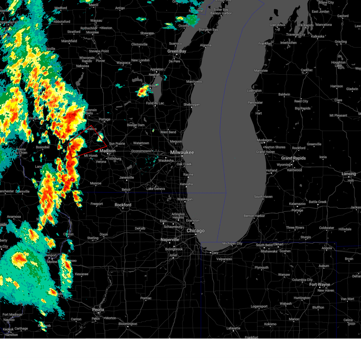 Tormkx the national weather service in milwaukee/sullivan has issued a * tornado warning for, northeastern iowa county in south central wisconsin, southwestern columbia county in south central wisconsin, northwestern dane county in south central wisconsin, southern sauk county in south central wisconsin, * until 715 pm cdt. * at 648 pm cdt, a severe thunderstorm capable of producing a tornado was located near spring green, or 10 miles north of dodgeville, moving northeast at 40 mph (radar indicated rotation). Hazards include tornado and half dollar size hail. Flying debris will be dangerous to those caught without shelter. mobile homes will be damaged or destroyed. damage to roofs, windows, and vehicles will occur. Tree damage is likely. Tormkx the national weather service in milwaukee/sullivan has issued a * tornado warning for, northeastern iowa county in south central wisconsin, southwestern columbia county in south central wisconsin, northwestern dane county in south central wisconsin, southern sauk county in south central wisconsin, * until 715 pm cdt. * at 648 pm cdt, a severe thunderstorm capable of producing a tornado was located near spring green, or 10 miles north of dodgeville, moving northeast at 40 mph (radar indicated rotation). Hazards include tornado and half dollar size hail. Flying debris will be dangerous to those caught without shelter. mobile homes will be damaged or destroyed. damage to roofs, windows, and vehicles will occur. Tree damage is likely.
|
| 5/12/2024 4:42 PM CDT |
 The storm which prompted the warning has weakened below severe limits, and has exited the warned area. therefore, the warning will be allowed to expire. remaining scattered storms will be capable of producing 40 to 50 mph winds and hail to the size of pennies. The storm which prompted the warning has weakened below severe limits, and has exited the warned area. therefore, the warning will be allowed to expire. remaining scattered storms will be capable of producing 40 to 50 mph winds and hail to the size of pennies.
|
| 5/12/2024 4:26 PM CDT |
 At 425 pm cdt, a severe thunderstorm was located over cross plains, or 7 miles north of mount horeb, moving east at 35 mph (radar indicated). Hazards include 60 mph wind gusts and quarter size hail. Hail damage to vehicles is expected. expect wind damage to roofs, siding, and trees. Locations impacted include, western madison, middleton, verona, mount horeb, cross plains, mazomanie, black earth, blue mounds, pine bluff, and marxville. At 425 pm cdt, a severe thunderstorm was located over cross plains, or 7 miles north of mount horeb, moving east at 35 mph (radar indicated). Hazards include 60 mph wind gusts and quarter size hail. Hail damage to vehicles is expected. expect wind damage to roofs, siding, and trees. Locations impacted include, western madison, middleton, verona, mount horeb, cross plains, mazomanie, black earth, blue mounds, pine bluff, and marxville.
|
| 5/12/2024 4:26 PM CDT |
 the severe thunderstorm warning has been cancelled and is no longer in effect the severe thunderstorm warning has been cancelled and is no longer in effect
|
| 5/12/2024 4:25 PM CDT | Report of trees down. no specific location given at this time. time estimated from rada in dane county WI, 1 miles WSW of Cross Plains, WI |
| 5/12/2024 4:13 PM CDT |
 At 412 pm cdt, a severe thunderstorm was located near mazomanie, or 8 miles northwest of mount horeb, moving east at 35 mph (radar indicated). Hazards include 60 mph wind gusts and quarter size hail. Hail damage to vehicles is expected. expect wind damage to roofs, siding, and trees. Locations impacted include, western madison, middleton, verona, mount horeb, cross plains, mazomanie, black earth, blue mounds, arena, pine bluff, blue mound st park, and marxville. At 412 pm cdt, a severe thunderstorm was located near mazomanie, or 8 miles northwest of mount horeb, moving east at 35 mph (radar indicated). Hazards include 60 mph wind gusts and quarter size hail. Hail damage to vehicles is expected. expect wind damage to roofs, siding, and trees. Locations impacted include, western madison, middleton, verona, mount horeb, cross plains, mazomanie, black earth, blue mounds, arena, pine bluff, blue mound st park, and marxville.
|
| 5/12/2024 3:59 PM CDT |
 Svrmkx the national weather service in milwaukee/sullivan has issued a * severe thunderstorm warning for, northeastern iowa county in south central wisconsin, northwestern dane county in south central wisconsin, * until 445 pm cdt. * at 358 pm cdt, a severe thunderstorm was located near spring green, or 11 miles northeast of dodgeville, moving east at 35 mph (radar indicated). Hazards include 60 mph wind gusts and quarter size hail. Hail damage to vehicles is expected. Expect wind damage to roofs, siding, and trees. Svrmkx the national weather service in milwaukee/sullivan has issued a * severe thunderstorm warning for, northeastern iowa county in south central wisconsin, northwestern dane county in south central wisconsin, * until 445 pm cdt. * at 358 pm cdt, a severe thunderstorm was located near spring green, or 11 miles northeast of dodgeville, moving east at 35 mph (radar indicated). Hazards include 60 mph wind gusts and quarter size hail. Hail damage to vehicles is expected. Expect wind damage to roofs, siding, and trees.
|
| 5/7/2024 7:08 PM CDT |
 Svrmkx the national weather service in milwaukee/sullivan has issued a * severe thunderstorm warning for, central dane county in south central wisconsin, * until 745 pm cdt. * at 708 pm cdt, a severe thunderstorm was located near cross plains, or near middleton, moving northeast at 45 mph (radar indicated). Hazards include quarter size hail. damage to vehicles is expected Svrmkx the national weather service in milwaukee/sullivan has issued a * severe thunderstorm warning for, central dane county in south central wisconsin, * until 745 pm cdt. * at 708 pm cdt, a severe thunderstorm was located near cross plains, or near middleton, moving northeast at 45 mph (radar indicated). Hazards include quarter size hail. damage to vehicles is expected
|
| 4/27/2024 6:48 PM CDT | Quarter sized hail reported 4.1 miles SSW of Cross Plains, WI |
| 4/16/2024 8:13 PM CDT |
 Svrmkx the national weather service in milwaukee/sullivan has issued a * severe thunderstorm warning for, central dane county in south central wisconsin, * until 900 pm cdt. * at 813 pm cdt, severe thunderstorms were located along a line extending from near mount horeb to 6 miles southwest of verona to near belleville, moving northeast at 45 mph (radar indicated). Hazards include 60 mph wind gusts. expect damage to roofs, siding, and trees Svrmkx the national weather service in milwaukee/sullivan has issued a * severe thunderstorm warning for, central dane county in south central wisconsin, * until 900 pm cdt. * at 813 pm cdt, severe thunderstorms were located along a line extending from near mount horeb to 6 miles southwest of verona to near belleville, moving northeast at 45 mph (radar indicated). Hazards include 60 mph wind gusts. expect damage to roofs, siding, and trees
|
| 4/16/2024 6:43 PM CDT |
 The storm which prompted the warning has weakened below severe limits, and no longer poses an immediate threat to life or property. therefore, the warning will be allowed to expire. a tornado watch remains in effect until 1000 pm cdt for south central wisconsin. The storm which prompted the warning has weakened below severe limits, and no longer poses an immediate threat to life or property. therefore, the warning will be allowed to expire. a tornado watch remains in effect until 1000 pm cdt for south central wisconsin.
|
| 4/16/2024 6:21 PM CDT |
 Svrmkx the national weather service in milwaukee/sullivan has issued a * severe thunderstorm warning for, western dane county in south central wisconsin, * until 645 pm cdt. * at 620 pm cdt, a severe thunderstorm was located near mount horeb, moving north at 50 mph (radar indicated). Hazards include 60 mph wind gusts. expect damage to roofs, siding, and trees Svrmkx the national weather service in milwaukee/sullivan has issued a * severe thunderstorm warning for, western dane county in south central wisconsin, * until 645 pm cdt. * at 620 pm cdt, a severe thunderstorm was located near mount horeb, moving north at 50 mph (radar indicated). Hazards include 60 mph wind gusts. expect damage to roofs, siding, and trees
|
| 10/23/2023 3:10 PM CDT |
 The severe thunderstorm warning for west central dane county will expire at 315 pm cdt, the storm which prompted the warning has weakened below severe limits, and has exited the warned area. therefore, the warning will be allowed to expire. however, small hail is still possible with this thunderstorm. The severe thunderstorm warning for west central dane county will expire at 315 pm cdt, the storm which prompted the warning has weakened below severe limits, and has exited the warned area. therefore, the warning will be allowed to expire. however, small hail is still possible with this thunderstorm.
|
| 10/23/2023 2:59 PM CDT |
 At 258 pm cdt, a severe thunderstorm was located over mount horeb, moving east at 50 mph (radar indicated). Hazards include 60 mph wind gusts and quarter size hail. Hail damage to vehicles is expected. expect wind damage to roofs, siding, and trees. locations impacted include, western madison, fitchburg, verona, mount horeb, cross plains, black earth, and pine bluff. hail threat, radar indicated max hail size, 1. 00 in wind threat, radar indicated max wind gust, 60 mph. At 258 pm cdt, a severe thunderstorm was located over mount horeb, moving east at 50 mph (radar indicated). Hazards include 60 mph wind gusts and quarter size hail. Hail damage to vehicles is expected. expect wind damage to roofs, siding, and trees. locations impacted include, western madison, fitchburg, verona, mount horeb, cross plains, black earth, and pine bluff. hail threat, radar indicated max hail size, 1. 00 in wind threat, radar indicated max wind gust, 60 mph.
|
| 10/23/2023 2:55 PM CDT | Quarter sized hail reported 2.7 miles SSW of Cross Plains, WI |
| 10/23/2023 2:44 PM CDT |
 At 243 pm cdt, a severe thunderstorm was located 10 miles northeast of dodgeville, moving northeast at 55 mph (radar indicated). Hazards include 60 mph wind gusts and quarter size hail. Hail damage to vehicles is expected. expect wind damage to roofs, siding, and trees. locations impacted include, western madison, fitchburg, verona, mount horeb, cross plains, mazomanie, black earth, barneveld, blue mounds, arena, ridgeway, hollandale, pine bluff, blue mound st park, mount vernon, and jonesdale. hail threat, radar indicated max hail size, 1. 00 in wind threat, radar indicated max wind gust, 60 mph. At 243 pm cdt, a severe thunderstorm was located 10 miles northeast of dodgeville, moving northeast at 55 mph (radar indicated). Hazards include 60 mph wind gusts and quarter size hail. Hail damage to vehicles is expected. expect wind damage to roofs, siding, and trees. locations impacted include, western madison, fitchburg, verona, mount horeb, cross plains, mazomanie, black earth, barneveld, blue mounds, arena, ridgeway, hollandale, pine bluff, blue mound st park, mount vernon, and jonesdale. hail threat, radar indicated max hail size, 1. 00 in wind threat, radar indicated max wind gust, 60 mph.
|
| 10/23/2023 2:26 PM CDT |
 At 226 pm cdt, a severe thunderstorm was located near mineral point, moving northeast at 55 mph (radar indicated). Hazards include 60 mph wind gusts and quarter size hail. Hail damage to vehicles is expected. Expect wind damage to roofs, siding, and trees. At 226 pm cdt, a severe thunderstorm was located near mineral point, moving northeast at 55 mph (radar indicated). Hazards include 60 mph wind gusts and quarter size hail. Hail damage to vehicles is expected. Expect wind damage to roofs, siding, and trees.
|
| 8/11/2023 10:20 PM CDT |
 At 1020 pm cdt, a severe thunderstorm was located 10 miles east of dodgeville, moving southeast at 40 mph (radar indicated). Hazards include 60 mph wind gusts and quarter size hail. Hail damage to vehicles is expected. expect wind damage to roofs, siding, and trees. locations impacted include, mount horeb, dodgeville, mineral point, cross plains, mazomanie, black earth, barneveld, blue mounds, arena, ridgeway, waldwick, hollandale, blue mound st park, and jonesdale. hail threat, radar indicated max hail size, 1. 00 in wind threat, radar indicated max wind gust, 60 mph. At 1020 pm cdt, a severe thunderstorm was located 10 miles east of dodgeville, moving southeast at 40 mph (radar indicated). Hazards include 60 mph wind gusts and quarter size hail. Hail damage to vehicles is expected. expect wind damage to roofs, siding, and trees. locations impacted include, mount horeb, dodgeville, mineral point, cross plains, mazomanie, black earth, barneveld, blue mounds, arena, ridgeway, waldwick, hollandale, blue mound st park, and jonesdale. hail threat, radar indicated max hail size, 1. 00 in wind threat, radar indicated max wind gust, 60 mph.
|
| 8/11/2023 9:51 PM CDT |
 At 951 pm cdt, a severe thunderstorm was located 8 miles southwest of spring green, or 11 miles northwest of dodgeville, moving southeast at 40 mph (radar indicated). Hazards include 60 mph wind gusts and quarter size hail. Hail damage to vehicles is expected. Expect wind damage to roofs, siding, and trees. At 951 pm cdt, a severe thunderstorm was located 8 miles southwest of spring green, or 11 miles northwest of dodgeville, moving southeast at 40 mph (radar indicated). Hazards include 60 mph wind gusts and quarter size hail. Hail damage to vehicles is expected. Expect wind damage to roofs, siding, and trees.
|
| 7/28/2023 9:27 PM CDT |
 At 927 pm cdt, severe thunderstorms were located along a line extending from near princeton to poynette to prairie du sac to 9 miles southeast of muscoda, moving southeast at 40 mph (radar indicated). Hazards include 70 mph wind gusts and quarter size hail. Hail damage to vehicles is expected. expect considerable tree damage. Wind damage is also likely to mobile homes, roofs, and outbuildings. At 927 pm cdt, severe thunderstorms were located along a line extending from near princeton to poynette to prairie du sac to 9 miles southeast of muscoda, moving southeast at 40 mph (radar indicated). Hazards include 70 mph wind gusts and quarter size hail. Hail damage to vehicles is expected. expect considerable tree damage. Wind damage is also likely to mobile homes, roofs, and outbuildings.
|
| 4/5/2023 5:41 AM CDT |
 The severe thunderstorm warning for northern green and southwestern dane counties will expire at 545 am cdt, the storm which prompted the warning has moved out of the area. therefore, the warning will be allowed to expire. The severe thunderstorm warning for northern green and southwestern dane counties will expire at 545 am cdt, the storm which prompted the warning has moved out of the area. therefore, the warning will be allowed to expire.
|
| 4/5/2023 5:32 AM CDT |
 At 532 am cdt, severe thunderstorms were located along a line extending from near middleton to near verona, moving northeast at 60 mph (radar indicated). Hazards include quarter size hail. damage to vehicles is expected At 532 am cdt, severe thunderstorms were located along a line extending from near middleton to near verona, moving northeast at 60 mph (radar indicated). Hazards include quarter size hail. damage to vehicles is expected
|
| 4/5/2023 5:18 AM CDT |
 At 518 am cdt, a severe thunderstorm was located near mount horeb, moving northeast at 55 mph (radar indicated). Hazards include quarter size hail. Damage to vehicles is expected. locations impacted include, western madison, fitchburg, middleton, verona, oregon, mount horeb, cross plains, belleville, new glarus, brooklyn, monticello, blue mounds, dayton, attica, paoli, pine bluff, and mount vernon. hail threat, radar indicated max hail size, 1. 00 in wind threat, radar indicated max wind gust, <50 mph. At 518 am cdt, a severe thunderstorm was located near mount horeb, moving northeast at 55 mph (radar indicated). Hazards include quarter size hail. Damage to vehicles is expected. locations impacted include, western madison, fitchburg, middleton, verona, oregon, mount horeb, cross plains, belleville, new glarus, brooklyn, monticello, blue mounds, dayton, attica, paoli, pine bluff, and mount vernon. hail threat, radar indicated max hail size, 1. 00 in wind threat, radar indicated max wind gust, <50 mph.
|
| 4/5/2023 5:01 AM CDT |
 At 500 am cdt, a severe thunderstorm was located near blanchardville, or 12 miles northeast of darlington, moving northeast at 55 mph (radar indicated). Hazards include quarter size hail. damage to vehicles is expected At 500 am cdt, a severe thunderstorm was located near blanchardville, or 12 miles northeast of darlington, moving northeast at 55 mph (radar indicated). Hazards include quarter size hail. damage to vehicles is expected
|
| 4/4/2023 10:32 PM CDT |
 At 1031 pm cdt, severe thunderstorms were located along a line extending from near richland center to madison, moving northeast at 55 mph (trained weather spotters. there have been numerous reports of quarter to ping pong ball sized hail with these storms over the last 30 minutes). Hazards include half dollar size hail. damage to vehicles is expected At 1031 pm cdt, severe thunderstorms were located along a line extending from near richland center to madison, moving northeast at 55 mph (trained weather spotters. there have been numerous reports of quarter to ping pong ball sized hail with these storms over the last 30 minutes). Hazards include half dollar size hail. damage to vehicles is expected
|
| 8/3/2022 12:04 PM CDT |
 At 1203 pm cdt, a severe thunderstorm was located over waunakee, moving east at 45 mph (radar indicated). Hazards include 60 mph wind gusts. Expect damage to roofs, siding, and trees. locations impacted include, madison, sun prairie, middleton, waunakee, mcfarland, monona, windsor, sauk city, lake wisconsin, deforest, cottage grove, cross plains, lodi, shorewood hills, black earth, maple bluff, dane, arlington, morrisonville and token creek. people attending the crossfit games in madison should seek safe shelter immediately! hail threat, radar indicated max hail size, <. 75 in wind threat, radar indicated max wind gust, 60 mph. At 1203 pm cdt, a severe thunderstorm was located over waunakee, moving east at 45 mph (radar indicated). Hazards include 60 mph wind gusts. Expect damage to roofs, siding, and trees. locations impacted include, madison, sun prairie, middleton, waunakee, mcfarland, monona, windsor, sauk city, lake wisconsin, deforest, cottage grove, cross plains, lodi, shorewood hills, black earth, maple bluff, dane, arlington, morrisonville and token creek. people attending the crossfit games in madison should seek safe shelter immediately! hail threat, radar indicated max hail size, <. 75 in wind threat, radar indicated max wind gust, 60 mph.
|
| 8/3/2022 11:48 AM CDT |
 At 1148 am cdt, a severe thunderstorm was located near black earth, or near sauk city, moving east at 45 mph (radar indicated). Hazards include 60 mph wind gusts. expect damage to roofs, siding, and trees At 1148 am cdt, a severe thunderstorm was located near black earth, or near sauk city, moving east at 45 mph (radar indicated). Hazards include 60 mph wind gusts. expect damage to roofs, siding, and trees
|
| 7/24/2022 1:55 AM CDT |
 At 154 am cdt, severe thunderstorms were located along a line extending from near lake delton to near waunakee to near oregon, moving east at 55 mph (radar indicated). Hazards include 60 mph wind gusts. Expect damage to roofs, siding, and trees. locations impacted include, madison, sun prairie, fitchburg, middleton, stoughton, waunakee, baraboo, verona, portage, oregon, mcfarland, monona, windsor, prairie du sac, sauk city, lake wisconsin, deforest, cross plains, lodi and poynette. people attending the dane county fair in madison should seek safe shelter immediately! hail threat, radar indicated max hail size, <. 75 in wind threat, radar indicated max wind gust, 60 mph. At 154 am cdt, severe thunderstorms were located along a line extending from near lake delton to near waunakee to near oregon, moving east at 55 mph (radar indicated). Hazards include 60 mph wind gusts. Expect damage to roofs, siding, and trees. locations impacted include, madison, sun prairie, fitchburg, middleton, stoughton, waunakee, baraboo, verona, portage, oregon, mcfarland, monona, windsor, prairie du sac, sauk city, lake wisconsin, deforest, cross plains, lodi and poynette. people attending the dane county fair in madison should seek safe shelter immediately! hail threat, radar indicated max hail size, <. 75 in wind threat, radar indicated max wind gust, 60 mph.
|
| 7/24/2022 1:44 AM CDT | Estimated winds 60-65 relayed on social medi in dane county WI, 0.3 miles NNE of Cross Plains, WI |
| 7/24/2022 1:31 AM CDT |
 At 130 am cdt, severe thunderstorms were located along a line extending from 10 miles northwest of prairie du sac to 7 miles south of mount horeb, moving northeast at 40 mph (radar indicated). Hazards include 60 mph wind gusts. expect damage to roofs, siding, and trees At 130 am cdt, severe thunderstorms were located along a line extending from 10 miles northwest of prairie du sac to 7 miles south of mount horeb, moving northeast at 40 mph (radar indicated). Hazards include 60 mph wind gusts. expect damage to roofs, siding, and trees
|
| 7/23/2022 6:45 PM CDT |
 At 644 pm cdt, severe thunderstorms were located along a line extending from near waterloo to near mount horeb, moving east at 15 mph (radar indicated). Hazards include 60 mph wind gusts and penny size hail. Expect damage to roofs, siding, and trees. locations impacted include, madison, sun prairie, fitchburg, watertown, middleton, stoughton, waunakee, verona, oregon, jefferson, mcfarland, monona, mount horeb, windsor, lake mills, marshall, waterloo, okauchee lake, oconomowoc and deforest. people attending the dane county fair in madison should seek safe shelter immediately! hail threat, radar indicated max hail size, 0. 75 in wind threat, radar indicated max wind gust, 60 mph. At 644 pm cdt, severe thunderstorms were located along a line extending from near waterloo to near mount horeb, moving east at 15 mph (radar indicated). Hazards include 60 mph wind gusts and penny size hail. Expect damage to roofs, siding, and trees. locations impacted include, madison, sun prairie, fitchburg, watertown, middleton, stoughton, waunakee, verona, oregon, jefferson, mcfarland, monona, mount horeb, windsor, lake mills, marshall, waterloo, okauchee lake, oconomowoc and deforest. people attending the dane county fair in madison should seek safe shelter immediately! hail threat, radar indicated max hail size, 0. 75 in wind threat, radar indicated max wind gust, 60 mph.
|
| 7/23/2022 6:28 PM CDT |
 At 627 pm cdt, severe thunderstorms were located along a line extending from near columbus to 8 miles northwest of mount horeb, moving southeast at 25 mph (radar indicated). Hazards include 70 mph wind gusts and half dollar size hail. Hail damage to vehicles is expected. expect considerable tree damage. wind damage is also likely to mobile homes, roofs, and outbuildings. locations impacted include, madison, sun prairie, fitchburg, watertown, middleton, stoughton, waunakee, verona, oregon, jefferson, mcfarland, monona, mount horeb, windsor, lake mills, columbus, dodgeville, marshall, waterloo and okauchee lake. people attending the dane county fair in madison should seek safe shelter immediately! thunderstorm damage threat, considerable hail threat, radar indicated max hail size, 1. 25 in wind threat, radar indicated max wind gust, 70 mph. At 627 pm cdt, severe thunderstorms were located along a line extending from near columbus to 8 miles northwest of mount horeb, moving southeast at 25 mph (radar indicated). Hazards include 70 mph wind gusts and half dollar size hail. Hail damage to vehicles is expected. expect considerable tree damage. wind damage is also likely to mobile homes, roofs, and outbuildings. locations impacted include, madison, sun prairie, fitchburg, watertown, middleton, stoughton, waunakee, verona, oregon, jefferson, mcfarland, monona, mount horeb, windsor, lake mills, columbus, dodgeville, marshall, waterloo and okauchee lake. people attending the dane county fair in madison should seek safe shelter immediately! thunderstorm damage threat, considerable hail threat, radar indicated max hail size, 1. 25 in wind threat, radar indicated max wind gust, 70 mph.
|
| 7/23/2022 6:12 PM CDT |
 At 611 pm cdt, severe thunderstorms were located along a line extending from near columbus to 8 miles northeast of dodgeville, moving southeast at 25 mph (radar indicated). Hazards include 60 mph wind gusts. expect damage to roofs, siding, and trees At 611 pm cdt, severe thunderstorms were located along a line extending from near columbus to 8 miles northeast of dodgeville, moving southeast at 25 mph (radar indicated). Hazards include 60 mph wind gusts. expect damage to roofs, siding, and trees
|
| 6/13/2022 2:51 PM CDT |
 At 251 pm cdt, a severe thunderstorm was located over northwestern madison, moving east at 45 mph (radar indicated). Hazards include golf ball size hail and 60 mph wind gusts. People and animals outdoors will be injured. expect hail damage to roofs, siding, windows, and vehicles. expect wind damage to roofs, siding, and trees. locations impacted include, madison, middleton, monona, cross plains, shorewood hills, maple bluff, pine bluff, henry vilas zoo, camp randall stadium and uw- madison. thunderstorm damage threat, considerable hail threat, radar indicated max hail size, 1. 75 in wind threat, radar indicated max wind gust, 60 mph. At 251 pm cdt, a severe thunderstorm was located over northwestern madison, moving east at 45 mph (radar indicated). Hazards include golf ball size hail and 60 mph wind gusts. People and animals outdoors will be injured. expect hail damage to roofs, siding, windows, and vehicles. expect wind damage to roofs, siding, and trees. locations impacted include, madison, middleton, monona, cross plains, shorewood hills, maple bluff, pine bluff, henry vilas zoo, camp randall stadium and uw- madison. thunderstorm damage threat, considerable hail threat, radar indicated max hail size, 1. 75 in wind threat, radar indicated max wind gust, 60 mph.
|
| 6/13/2022 2:47 PM CDT | Quarter sized hail reported 4.1 miles SSW of Cross Plains, WI, report from mping: quarter (1.00 in.). |
| 6/13/2022 2:44 PM CDT |
 At 244 pm cdt, a severe thunderstorm was located over middleton, moving east at 45 mph (radar indicated). Hazards include 60 mph wind gusts and quarter size hail. Hail damage to vehicles is expected. Expect wind damage to roofs, siding, and trees. At 244 pm cdt, a severe thunderstorm was located over middleton, moving east at 45 mph (radar indicated). Hazards include 60 mph wind gusts and quarter size hail. Hail damage to vehicles is expected. Expect wind damage to roofs, siding, and trees.
|
| 9/7/2021 10:51 AM CDT | Quarter sized hail reported 4.1 miles SSW of Cross Plains, WI |
| 8/27/2021 9:35 AM CDT | Tree snapped off at bas in dane county WI, 4.1 miles SSW of Cross Plains, WI |
| 8/27/2021 9:27 AM CDT |
 At 927 am cdt, severe thunderstorms were located along a line extending from near prairie du sac to near black earth, moving east at 35 mph (radar indicated). Hazards include 60 mph wind gusts and penny size hail. expect damage to roofs, siding, and trees At 927 am cdt, severe thunderstorms were located along a line extending from near prairie du sac to near black earth, moving east at 35 mph (radar indicated). Hazards include 60 mph wind gusts and penny size hail. expect damage to roofs, siding, and trees
|
| 8/10/2021 5:56 PM CDT |
 At 556 pm cdt, severe thunderstorms were located along a line extending from near princeton to near oregon to monroe, moving east at 35 mph (trees were reported down in madison). Hazards include 60 mph wind gusts. Expect damage to roofs, siding, and trees. locations impacted include, madison, sun prairie, fitchburg, middleton, stoughton, waunakee, baraboo, monroe, verona, portage, oregon, reedsburg, mcfarland, monona, mount horeb, windsor, columbus, prairie du sac, marshall and sauk city. hail threat, radar indicated max hail size, <. 75 in wind threat, observed max wind gust, 60 mph. At 556 pm cdt, severe thunderstorms were located along a line extending from near princeton to near oregon to monroe, moving east at 35 mph (trees were reported down in madison). Hazards include 60 mph wind gusts. Expect damage to roofs, siding, and trees. locations impacted include, madison, sun prairie, fitchburg, middleton, stoughton, waunakee, baraboo, monroe, verona, portage, oregon, reedsburg, mcfarland, monona, mount horeb, windsor, columbus, prairie du sac, marshall and sauk city. hail threat, radar indicated max hail size, <. 75 in wind threat, observed max wind gust, 60 mph.
|
| 8/10/2021 5:47 PM CDT |
 At 546 pm cdt, severe thunderstorms were located along a line extending from near montello to near brooklyn to near monroe, moving south at 80 mph (radar indicated). Hazards include 60 mph wind gusts. Expect damage to roofs, siding, and trees. locations impacted include, madison, sun prairie, fitchburg, middleton, stoughton, waunakee, baraboo, monroe, verona, portage, oregon, reedsburg, mcfarland, monona, mount horeb, windsor, columbus, prairie du sac, marshall and sauk city. hail threat, radar indicated max hail size, <. 75 in wind threat, radar indicated max wind gust, 60 mph. At 546 pm cdt, severe thunderstorms were located along a line extending from near montello to near brooklyn to near monroe, moving south at 80 mph (radar indicated). Hazards include 60 mph wind gusts. Expect damage to roofs, siding, and trees. locations impacted include, madison, sun prairie, fitchburg, middleton, stoughton, waunakee, baraboo, monroe, verona, portage, oregon, reedsburg, mcfarland, monona, mount horeb, windsor, columbus, prairie du sac, marshall and sauk city. hail threat, radar indicated max hail size, <. 75 in wind threat, radar indicated max wind gust, 60 mph.
|
| 8/10/2021 5:30 PM CDT | Trees and wires dow in dane county WI, 0.3 miles NNE of Cross Plains, WI |
| 8/10/2021 5:28 PM CDT |
 At 527 pm cdt, severe thunderstorms were located along a line extending from 9 miles north of portage to near lodi to near warren, moving east at 20 mph (radar indicated). Hazards include 60 mph wind gusts. Expect damage to roofs, siding, and trees. locations impacted include, madison, sun prairie, fitchburg, middleton, stoughton, waunakee, baraboo, monroe, verona, portage, oregon, reedsburg, mcfarland, monona, mount horeb, windsor, columbus, dodgeville, prairie du sac and marshall. hail threat, radar indicated max hail size, <. 75 in wind threat, radar indicated max wind gust, 60 mph. At 527 pm cdt, severe thunderstorms were located along a line extending from 9 miles north of portage to near lodi to near warren, moving east at 20 mph (radar indicated). Hazards include 60 mph wind gusts. Expect damage to roofs, siding, and trees. locations impacted include, madison, sun prairie, fitchburg, middleton, stoughton, waunakee, baraboo, monroe, verona, portage, oregon, reedsburg, mcfarland, monona, mount horeb, windsor, columbus, dodgeville, prairie du sac and marshall. hail threat, radar indicated max hail size, <. 75 in wind threat, radar indicated max wind gust, 60 mph.
|
| 8/10/2021 5:08 PM CDT |
 At 507 pm cdt, severe thunderstorms were located along a line extending from 10 miles north of portage to near sauk city to near apple river, moving northeast at 35 mph (radar indicated). Hazards include 60 mph wind gusts. expect damage to roofs, siding, and trees At 507 pm cdt, severe thunderstorms were located along a line extending from 10 miles north of portage to near sauk city to near apple river, moving northeast at 35 mph (radar indicated). Hazards include 60 mph wind gusts. expect damage to roofs, siding, and trees
|
| 8/7/2021 6:09 PM CDT |
 At 609 pm cdt, a severe thunderstorm was located 8 miles west of mount horeb, moving southeast at 30 mph (radar indicated). Hazards include 60 mph wind gusts and quarter size hail. Hail damage to vehicles is expected. Expect wind damage to roofs, siding, and trees. At 609 pm cdt, a severe thunderstorm was located 8 miles west of mount horeb, moving southeast at 30 mph (radar indicated). Hazards include 60 mph wind gusts and quarter size hail. Hail damage to vehicles is expected. Expect wind damage to roofs, siding, and trees.
|
| 8/7/2021 4:59 PM CDT |
 At 459 pm cdt, severe thunderstorms were located along a line extending from near wisconsin dells to near baraboo to near spring green, moving east at 35 mph (radar indicated). Hazards include 60 mph wind gusts. Expect damage to roofs, siding, and trees. Locations impacted include, baraboo, portage, reedsburg, prairie du sac, sauk city, wisconsin dells, lake wisconsin, cross plains, lodi, lake delton, mazomanie, spring green, west baraboo, black earth, dane, blue mounds, arena, plain, bluffview and north freedom. At 459 pm cdt, severe thunderstorms were located along a line extending from near wisconsin dells to near baraboo to near spring green, moving east at 35 mph (radar indicated). Hazards include 60 mph wind gusts. Expect damage to roofs, siding, and trees. Locations impacted include, baraboo, portage, reedsburg, prairie du sac, sauk city, wisconsin dells, lake wisconsin, cross plains, lodi, lake delton, mazomanie, spring green, west baraboo, black earth, dane, blue mounds, arena, plain, bluffview and north freedom.
|
| 8/7/2021 4:33 PM CDT |
 At 432 pm cdt, severe thunderstorms were located along a line extending from near reedsburg to 14 miles southeast of wonewoc to near richland center, moving southeast at 35 mph (radar indicated). Hazards include 70 mph wind gusts and quarter size hail. Hail damage to vehicles is expected. expect considerable tree damage. Wind damage is also likely to mobile homes, roofs, and outbuildings. At 432 pm cdt, severe thunderstorms were located along a line extending from near reedsburg to 14 miles southeast of wonewoc to near richland center, moving southeast at 35 mph (radar indicated). Hazards include 70 mph wind gusts and quarter size hail. Hail damage to vehicles is expected. expect considerable tree damage. Wind damage is also likely to mobile homes, roofs, and outbuildings.
|
| 7/29/2021 12:47 AM CDT | Multiple trees down on power lines. relayed from social medi in dane county WI, 0.3 miles NNE of Cross Plains, WI |
| 7/29/2021 12:45 AM CDT |
 At 1245 am cdt, severe thunderstorms were located along a line extending from near fall river to near marshall to near cross plains, moving southeast at 50 mph (radar indicated). Hazards include 60 mph wind gusts. expect damage to roofs, siding, and trees At 1245 am cdt, severe thunderstorms were located along a line extending from near fall river to near marshall to near cross plains, moving southeast at 50 mph (radar indicated). Hazards include 60 mph wind gusts. expect damage to roofs, siding, and trees
|
| 8/10/2020 1:26 PM CDT |
 At 125 pm cdt, severe thunderstorms were located along a line extending from near dodgeville to near woodbine, moving northeast at 40 mph (trained weather spotters. these storms have a history of producing wind damage and power outages). Hazards include 70 mph wind gusts and quarter size hail. Hail damage to vehicles is expected. expect considerable tree damage. Wind damage is also likely to mobile homes, roofs, and outbuildings. At 125 pm cdt, severe thunderstorms were located along a line extending from near dodgeville to near woodbine, moving northeast at 40 mph (trained weather spotters. these storms have a history of producing wind damage and power outages). Hazards include 70 mph wind gusts and quarter size hail. Hail damage to vehicles is expected. expect considerable tree damage. Wind damage is also likely to mobile homes, roofs, and outbuildings.
|
| 7/14/2020 10:32 PM CDT |
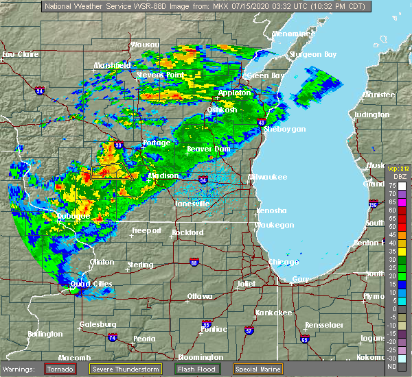 At 1032 pm cdt, a severe thunderstorm was located over spring green, or 15 miles west of sauk city, moving east at 20 mph (radar indicated). Hazards include 60 mph wind gusts and penny size hail. Expect damage to roofs, siding, and trees. Locations impacted include, prairie du sac, sauk city, cross plains, mazomanie, spring green, black earth, arena and plain. At 1032 pm cdt, a severe thunderstorm was located over spring green, or 15 miles west of sauk city, moving east at 20 mph (radar indicated). Hazards include 60 mph wind gusts and penny size hail. Expect damage to roofs, siding, and trees. Locations impacted include, prairie du sac, sauk city, cross plains, mazomanie, spring green, black earth, arena and plain.
|
| 7/14/2020 10:13 PM CDT |
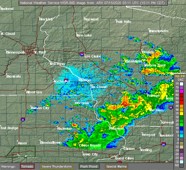 At 1013 pm cdt, a severe thunderstorm was located over spring green, or 15 miles north of dodgeville, moving east at 30 mph (radar indicated). Hazards include 60 mph wind gusts and penny size hail. expect damage to roofs, siding, and trees At 1013 pm cdt, a severe thunderstorm was located over spring green, or 15 miles north of dodgeville, moving east at 30 mph (radar indicated). Hazards include 60 mph wind gusts and penny size hail. expect damage to roofs, siding, and trees
|
| 7/9/2020 5:42 PM CDT |
 The severe thunderstorm warning for columbia, northwestern dane, marquette and eastern sauk counties will expire at 545 pm cdt, the storms which prompted the warning have moved out of the area. therefore, the warning will be allowed to expire. however gusty winds and heavy rain are still possible with these thunderstorms. a severe thunderstorm watch remains in effect until 1100 pm cdt for south central wisconsin. remember, a severe thunderstorm warning still remains in effect for northeastern dane and eastern columbia counties. The severe thunderstorm warning for columbia, northwestern dane, marquette and eastern sauk counties will expire at 545 pm cdt, the storms which prompted the warning have moved out of the area. therefore, the warning will be allowed to expire. however gusty winds and heavy rain are still possible with these thunderstorms. a severe thunderstorm watch remains in effect until 1100 pm cdt for south central wisconsin. remember, a severe thunderstorm warning still remains in effect for northeastern dane and eastern columbia counties.
|
| 7/9/2020 5:19 PM CDT |
 At 518 pm cdt, severe thunderstorms were located along a line extending from near lake delton to windsor, moving northeast at 35 mph (emergency management. trees and powerlines have been reported down in arena and in sauk city). Hazards include 60 mph wind gusts and nickel size hail. Expect damage to roofs, siding, and trees. Locations impacted include, middleton, waunakee, baraboo, portage, mount horeb, windsor, prairie du sac, sauk city, wisconsin dells, lake wisconsin, deforest, cross plains, lodi, lake delton, poynette, pardeeville, montello, west baraboo, black earth and westfield. At 518 pm cdt, severe thunderstorms were located along a line extending from near lake delton to windsor, moving northeast at 35 mph (emergency management. trees and powerlines have been reported down in arena and in sauk city). Hazards include 60 mph wind gusts and nickel size hail. Expect damage to roofs, siding, and trees. Locations impacted include, middleton, waunakee, baraboo, portage, mount horeb, windsor, prairie du sac, sauk city, wisconsin dells, lake wisconsin, deforest, cross plains, lodi, lake delton, poynette, pardeeville, montello, west baraboo, black earth and westfield.
|
| 7/9/2020 5:09 PM CDT |
 At 508 pm cdt, severe thunderstorms were located along a line extending from near wisconsin dells to near lodi, moving northeast at 45 mph (emergency management. trees and powerlines were reported down in the arena area). Hazards include 60 mph wind gusts and nickel size hail. Expect damage to roofs, siding, and trees. Locations impacted include, middleton, waunakee, baraboo, portage, mount horeb, windsor, prairie du sac, sauk city, wisconsin dells, lake wisconsin, deforest, cross plains, lodi, lake delton, poynette, pardeeville, mazomanie, montello, west baraboo and black earth. At 508 pm cdt, severe thunderstorms were located along a line extending from near wisconsin dells to near lodi, moving northeast at 45 mph (emergency management. trees and powerlines were reported down in the arena area). Hazards include 60 mph wind gusts and nickel size hail. Expect damage to roofs, siding, and trees. Locations impacted include, middleton, waunakee, baraboo, portage, mount horeb, windsor, prairie du sac, sauk city, wisconsin dells, lake wisconsin, deforest, cross plains, lodi, lake delton, poynette, pardeeville, mazomanie, montello, west baraboo and black earth.
|
| 7/9/2020 4:55 PM CDT |
 At 455 pm cdt, severe thunderstorms were located along a line extending from reedsburg to near cross plains, moving northeast at 45 mph (radar indicated). Hazards include 60 mph wind gusts and nickel size hail. expect damage to roofs, siding, and trees At 455 pm cdt, severe thunderstorms were located along a line extending from reedsburg to near cross plains, moving northeast at 45 mph (radar indicated). Hazards include 60 mph wind gusts and nickel size hail. expect damage to roofs, siding, and trees
|
| 7/9/2020 4:28 PM CDT |
 At 428 pm cdt, severe thunderstorms were located along a line extending from near spring green to near blanchardville, moving north at 45 mph (radar indicated). Hazards include 60 mph wind gusts and nickel size hail. expect damage to roofs, siding, and trees At 428 pm cdt, severe thunderstorms were located along a line extending from near spring green to near blanchardville, moving north at 45 mph (radar indicated). Hazards include 60 mph wind gusts and nickel size hail. expect damage to roofs, siding, and trees
|
| 7/7/2020 5:28 PM CDT |
 At 527 pm cdt, a severe thunderstorm was located near middleton, moving east at 30 mph (radar indicated). Hazards include 60 mph wind gusts. Expect damage to roofs, siding, and trees. Locations impacted include, verona, mount horeb, sauk city, cross plains, belleville, mazomanie, black earth, blue mounds, pine bluff, mount vernon, marxville and paoli. At 527 pm cdt, a severe thunderstorm was located near middleton, moving east at 30 mph (radar indicated). Hazards include 60 mph wind gusts. Expect damage to roofs, siding, and trees. Locations impacted include, verona, mount horeb, sauk city, cross plains, belleville, mazomanie, black earth, blue mounds, pine bluff, mount vernon, marxville and paoli.
|
| 7/7/2020 4:42 PM CDT |
 At 442 pm cdt, a severe thunderstorm was located near dodgeville, moving east at 30 mph (radar indicated). Hazards include 60 mph wind gusts and quarter size hail. Hail damage to vehicles is expected. Expect wind damage to roofs, siding, and trees. At 442 pm cdt, a severe thunderstorm was located near dodgeville, moving east at 30 mph (radar indicated). Hazards include 60 mph wind gusts and quarter size hail. Hail damage to vehicles is expected. Expect wind damage to roofs, siding, and trees.
|
| 6/29/2020 12:59 PM CDT |
 At 1244 pm cdt, severe thunderstorms were located along a broken line extending from near spring green to 7 miles west of sauk city to near middleton, moving north at 30 mph (radar indicated). Hazards include 60 mph wind gusts and quarter size hail. Hail damage to vehicles is expected. Expect wind damage to roofs, siding, and trees. At 1244 pm cdt, severe thunderstorms were located along a broken line extending from near spring green to 7 miles west of sauk city to near middleton, moving north at 30 mph (radar indicated). Hazards include 60 mph wind gusts and quarter size hail. Hail damage to vehicles is expected. Expect wind damage to roofs, siding, and trees.
|
| 6/29/2020 12:45 PM CDT |
 At 1244 pm cdt, severe thunderstorms were located along a broken line extending from near spring green to 7 miles west of sauk city to near middleton, moving north at 30 mph (radar indicated). Hazards include 60 mph wind gusts and quarter size hail. Hail damage to vehicles is expected. Expect wind damage to roofs, siding, and trees. At 1244 pm cdt, severe thunderstorms were located along a broken line extending from near spring green to 7 miles west of sauk city to near middleton, moving north at 30 mph (radar indicated). Hazards include 60 mph wind gusts and quarter size hail. Hail damage to vehicles is expected. Expect wind damage to roofs, siding, and trees.
|
| 6/26/2020 5:24 PM CDT |
 The severe thunderstorm warning for central dane county will expire at 530 pm cdt, the storms which prompted the warning have weakened below severe limits, and no longer pose an immediate threat to life or property. therefore, the warning will be allowed to expire. a severe thunderstorm watch remains in effect until 900 pm cdt for south central wisconsin. to report severe weather, contact your nearest law enforcement agency. they will relay your report to the national weather service milwaukee/sullivan. The severe thunderstorm warning for central dane county will expire at 530 pm cdt, the storms which prompted the warning have weakened below severe limits, and no longer pose an immediate threat to life or property. therefore, the warning will be allowed to expire. a severe thunderstorm watch remains in effect until 900 pm cdt for south central wisconsin. to report severe weather, contact your nearest law enforcement agency. they will relay your report to the national weather service milwaukee/sullivan.
|
| 6/26/2020 5:16 PM CDT |
 At 516 pm cdt, severe thunderstorms were located along a line extending from near shorewood hills to madison to near mount horeb, moving east at 40 mph (radar indicated). Hazards include 60 mph wind gusts. Expect damage to roofs, siding, and trees. Locations impacted include, madison, fitchburg, middleton, waunakee, verona, oregon, monona, windsor, deforest, cross plains, shorewood hills, maple bluff, dane, camp randall stadium, paoli, pine bluff, mount vernon, token creek, henry vilas zoo and uw-madison. At 516 pm cdt, severe thunderstorms were located along a line extending from near shorewood hills to madison to near mount horeb, moving east at 40 mph (radar indicated). Hazards include 60 mph wind gusts. Expect damage to roofs, siding, and trees. Locations impacted include, madison, fitchburg, middleton, waunakee, verona, oregon, monona, windsor, deforest, cross plains, shorewood hills, maple bluff, dane, camp randall stadium, paoli, pine bluff, mount vernon, token creek, henry vilas zoo and uw-madison.
|
| 6/26/2020 5:02 PM CDT |
 At 502 pm cdt, severe thunderstorms were located along a line extending from near middleton to near cross plains to near mount horeb, moving east at 40 mph (radar indicated). Hazards include 60 mph wind gusts. Expect damage to roofs, siding, and trees. Locations impacted include, madison, fitchburg, middleton, waunakee, verona, oregon, monona, mount horeb, windsor, deforest, cross plains, shorewood hills, black earth, maple bluff, dane, blue mounds, camp randall stadium, paoli, pine bluff and mount vernon. At 502 pm cdt, severe thunderstorms were located along a line extending from near middleton to near cross plains to near mount horeb, moving east at 40 mph (radar indicated). Hazards include 60 mph wind gusts. Expect damage to roofs, siding, and trees. Locations impacted include, madison, fitchburg, middleton, waunakee, verona, oregon, monona, mount horeb, windsor, deforest, cross plains, shorewood hills, black earth, maple bluff, dane, blue mounds, camp randall stadium, paoli, pine bluff and mount vernon.
|
| 6/26/2020 4:45 PM CDT |
 At 444 pm cdt, severe thunderstorms were located along a line extending from mazomanie to 6 miles southwest of black earth to near dodgeville, moving east at 40 mph (radar indicated). Hazards include 60 mph wind gusts. expect damage to roofs, siding, and trees At 444 pm cdt, severe thunderstorms were located along a line extending from mazomanie to 6 miles southwest of black earth to near dodgeville, moving east at 40 mph (radar indicated). Hazards include 60 mph wind gusts. expect damage to roofs, siding, and trees
|
| 6/2/2020 8:53 PM CDT |
 The severe thunderstorm warning for iowa and dane counties will expire at 900 pm cdt, the storms which prompted the warning have weakened below severe limits, and no longer pose an immediate threat to life or property. therefore, the warning will be allowed to expire. however gusty winds of 35 to 45 mph are still possible with these thunderstorms. a severe thunderstorm watch remains in effect until midnight cdt for south central wisconsin. The severe thunderstorm warning for iowa and dane counties will expire at 900 pm cdt, the storms which prompted the warning have weakened below severe limits, and no longer pose an immediate threat to life or property. therefore, the warning will be allowed to expire. however gusty winds of 35 to 45 mph are still possible with these thunderstorms. a severe thunderstorm watch remains in effect until midnight cdt for south central wisconsin.
|
| 6/2/2020 8:23 PM CDT |
 At 822 pm cdt, severe thunderstorms were located along a line extending from near marshall to near mineral point, moving southeast at 50 mph (radar indicated). Hazards include 60 mph wind gusts. Expect damage to roofs, siding, and trees. Locations impacted include, madison, sun prairie, fitchburg, middleton, stoughton, waunakee, verona, oregon, mcfarland, monona, mount horeb, windsor, edgerton, dodgeville, marshall, sauk city, mineral point, deforest, cottage grove and cross plains. At 822 pm cdt, severe thunderstorms were located along a line extending from near marshall to near mineral point, moving southeast at 50 mph (radar indicated). Hazards include 60 mph wind gusts. Expect damage to roofs, siding, and trees. Locations impacted include, madison, sun prairie, fitchburg, middleton, stoughton, waunakee, verona, oregon, mcfarland, monona, mount horeb, windsor, edgerton, dodgeville, marshall, sauk city, mineral point, deforest, cottage grove and cross plains.
|
| 6/2/2020 8:06 PM CDT |
 At 805 pm cdt, severe thunderstorms were located along a line extending from near poynette to 10 miles southwest of spring green, moving south at 60 mph (radar indicated). Hazards include 60 mph wind gusts. expect damage to roofs, siding, and trees At 805 pm cdt, severe thunderstorms were located along a line extending from near poynette to 10 miles southwest of spring green, moving south at 60 mph (radar indicated). Hazards include 60 mph wind gusts. expect damage to roofs, siding, and trees
|
| 7/20/2019 2:55 PM CDT |
 The severe thunderstorm warning for northeastern lafayette, green, eastern iowa and dane counties will expire at 300 pm cdt, the storms which prompted the warning have weakened below severe limits, and no longer pose an immediate threat to life or property. therefore, the warning will be allowed to expire. however gusty winds and heavy rain are still possible with these thunderstorms. a severe thunderstorm watch remains in effect until 400 pm cdt for south central wisconsin. a severe thunderstorm watch also remains in effect until 900 pm cdt for south central wisconsin. The severe thunderstorm warning for northeastern lafayette, green, eastern iowa and dane counties will expire at 300 pm cdt, the storms which prompted the warning have weakened below severe limits, and no longer pose an immediate threat to life or property. therefore, the warning will be allowed to expire. however gusty winds and heavy rain are still possible with these thunderstorms. a severe thunderstorm watch remains in effect until 400 pm cdt for south central wisconsin. a severe thunderstorm watch also remains in effect until 900 pm cdt for south central wisconsin.
|
| 7/20/2019 2:33 PM CDT |
 At 233 pm cdt, severe thunderstorms were located along a line extending from waunakee to near argyle, moving east at 55 mph (radar indicated). Hazards include 60 mph wind gusts. Expect damage to roofs, siding, and trees. locations impacted include, madison, fitchburg, middleton, waunakee, verona, oregon, monona, mount horeb, windsor, sauk city, brodhead, darlington, deforest, cross plains, belleville, new glarus, mazomanie, shorewood hills, brooklyn and black earth. People attending the dane county fair in madison should seek safe shelter immediately!. At 233 pm cdt, severe thunderstorms were located along a line extending from waunakee to near argyle, moving east at 55 mph (radar indicated). Hazards include 60 mph wind gusts. Expect damage to roofs, siding, and trees. locations impacted include, madison, fitchburg, middleton, waunakee, verona, oregon, monona, mount horeb, windsor, sauk city, brodhead, darlington, deforest, cross plains, belleville, new glarus, mazomanie, shorewood hills, brooklyn and black earth. People attending the dane county fair in madison should seek safe shelter immediately!.
|
| 7/20/2019 2:10 PM CDT |
 At 209 pm cdt, severe thunderstorms were located along a line extending from near mazomanie to 6 miles northwest of darlington, moving east at 45 mph (emergency management. a 60 mph wind gust was reported in the dodgeville area). Hazards include 60 mph wind gusts. expect damage to roofs, siding, and trees At 209 pm cdt, severe thunderstorms were located along a line extending from near mazomanie to 6 miles northwest of darlington, moving east at 45 mph (emergency management. a 60 mph wind gust was reported in the dodgeville area). Hazards include 60 mph wind gusts. expect damage to roofs, siding, and trees
|
| 7/19/2019 2:20 AM CDT |
 At 220 am cdt, a severe thunderstorm was located over windsor, moving southeast at 35 mph (radar indicated). Hazards include 60 mph wind gusts. Expect damage to roofs, siding, and trees. Locations impacted include, madison, sun prairie, fitchburg, middleton, stoughton, waunakee, verona, oregon, mcfarland, monona, windsor, edgerton, columbus, marshall, deforest, cottage grove, cross plains, lodi, poynette and belleville. At 220 am cdt, a severe thunderstorm was located over windsor, moving southeast at 35 mph (radar indicated). Hazards include 60 mph wind gusts. Expect damage to roofs, siding, and trees. Locations impacted include, madison, sun prairie, fitchburg, middleton, stoughton, waunakee, verona, oregon, mcfarland, monona, windsor, edgerton, columbus, marshall, deforest, cottage grove, cross plains, lodi, poynette and belleville.
|
| 7/19/2019 1:38 AM CDT |
 At 137 am cdt, a severe thunderstorm was located over lake wisconsin, moving east at 55 mph (radar indicated). Hazards include 60 mph wind gusts. expect damage to roofs, siding, and trees At 137 am cdt, a severe thunderstorm was located over lake wisconsin, moving east at 55 mph (radar indicated). Hazards include 60 mph wind gusts. expect damage to roofs, siding, and trees
|
| 6/30/2019 11:29 AM CDT |
 At 1128 am cdt, severe thunderstorms were located along a line extending from near campbellsport to oregon, moving east at 45 mph (law enforcement. there have been numerous reports of tree damage and power outages). Hazards include 60 mph wind gusts. Expect damage to roofs, siding, and trees. locations impacted include, madison, sun prairie, fitchburg, watertown, middleton, beaver dam, stoughton, waunakee, verona, oregon, mcfarland, monona, mount horeb, windsor, mayville, columbus, marshall, horicon, sauk city and juneau. People attending the columbus baseball tournament should seek safe shelter immediately!. At 1128 am cdt, severe thunderstorms were located along a line extending from near campbellsport to oregon, moving east at 45 mph (law enforcement. there have been numerous reports of tree damage and power outages). Hazards include 60 mph wind gusts. Expect damage to roofs, siding, and trees. locations impacted include, madison, sun prairie, fitchburg, watertown, middleton, beaver dam, stoughton, waunakee, verona, oregon, mcfarland, monona, mount horeb, windsor, mayville, columbus, marshall, horicon, sauk city and juneau. People attending the columbus baseball tournament should seek safe shelter immediately!.
|
| 6/30/2019 11:10 AM CDT |
 At 1110 am cdt, severe thunderstorms were located along a line extending from near oakfield to near verona, moving east at 40 mph (law enforcement. there have been numerous reports of tree damage and power outages). Hazards include 60 mph wind gusts and quarter size hail. Hail damage to vehicles is possible. expect wind damage to roofs, siding, and trees. locations impacted include, madison, sun prairie, fitchburg, watertown, middleton, beaver dam, stoughton, waunakee, waupun, verona, oregon, mcfarland, monona, mount horeb, windsor, mayville, columbus, marshall, horicon and sauk city. People attending the columbus baseball tournament should seek safe shelter immediately!. At 1110 am cdt, severe thunderstorms were located along a line extending from near oakfield to near verona, moving east at 40 mph (law enforcement. there have been numerous reports of tree damage and power outages). Hazards include 60 mph wind gusts and quarter size hail. Hail damage to vehicles is possible. expect wind damage to roofs, siding, and trees. locations impacted include, madison, sun prairie, fitchburg, watertown, middleton, beaver dam, stoughton, waunakee, waupun, verona, oregon, mcfarland, monona, mount horeb, windsor, mayville, columbus, marshall, horicon and sauk city. People attending the columbus baseball tournament should seek safe shelter immediately!.
|
| 6/30/2019 10:48 AM CDT |
 At 1047 am cdt, severe thunderstorms were located along a line extending from near oshkosh to near cross plains, moving east at 45 mph (radar indicated. there have been reports of tree damage and power outages upstream). Hazards include 60 mph wind gusts and quarter size hail. Hail damage to vehicles is expected. Expect wind damage to roofs, siding, and trees. At 1047 am cdt, severe thunderstorms were located along a line extending from near oshkosh to near cross plains, moving east at 45 mph (radar indicated. there have been reports of tree damage and power outages upstream). Hazards include 60 mph wind gusts and quarter size hail. Hail damage to vehicles is expected. Expect wind damage to roofs, siding, and trees.
|
| 6/27/2019 4:21 PM CDT |
 The severe thunderstorm warning for columbia and dane counties will expire at 430 pm cdt, the strongest winds with the storms will move to the east of the warned area by 430 pm cdt. therefore, the warning will be allowed to expire. a severe thunderstorm watch remains in effect until 700 pm cdt for south central wisconsin. a severe thunderstorm watch also remains in effect until 900 pm cdt for southeastern wisconsin. The severe thunderstorm warning for columbia and dane counties will expire at 430 pm cdt, the strongest winds with the storms will move to the east of the warned area by 430 pm cdt. therefore, the warning will be allowed to expire. a severe thunderstorm watch remains in effect until 700 pm cdt for south central wisconsin. a severe thunderstorm watch also remains in effect until 900 pm cdt for southeastern wisconsin.
|
| 6/27/2019 4:14 PM CDT |
 At 414 pm cdt, severe thunderstorms were located along a line extending from 6 miles south of markesan to edgerton, moving east at 40 mph (radar indicated). Hazards include 60 mph wind gusts and penny size hail. Expect damage to roofs, siding, and trees. Locations impacted include, madison, sun prairie, fitchburg, middleton, stoughton, waunakee, verona, portage, oregon, mcfarland, monona, mount horeb, windsor, edgerton, columbus, marshall, sauk city, lake wisconsin, deforest and cottage grove. At 414 pm cdt, severe thunderstorms were located along a line extending from 6 miles south of markesan to edgerton, moving east at 40 mph (radar indicated). Hazards include 60 mph wind gusts and penny size hail. Expect damage to roofs, siding, and trees. Locations impacted include, madison, sun prairie, fitchburg, middleton, stoughton, waunakee, verona, portage, oregon, mcfarland, monona, mount horeb, windsor, edgerton, columbus, marshall, sauk city, lake wisconsin, deforest and cottage grove.
|
| 6/27/2019 3:51 PM CDT |
 At 351 pm cdt, severe thunderstorms were located along a line extending from 8 miles southwest of montello to near belleville, moving east at 45 mph (radar indicated). Hazards include 60 mph wind gusts and penny size hail. Expect damage to roofs, siding, and trees. Locations impacted include, madison, sun prairie, fitchburg, middleton, stoughton, waunakee, verona, portage, oregon, mcfarland, monona, mount horeb, windsor, edgerton, columbus, prairie du sac, marshall, sauk city, wisconsin dells and lake wisconsin. At 351 pm cdt, severe thunderstorms were located along a line extending from 8 miles southwest of montello to near belleville, moving east at 45 mph (radar indicated). Hazards include 60 mph wind gusts and penny size hail. Expect damage to roofs, siding, and trees. Locations impacted include, madison, sun prairie, fitchburg, middleton, stoughton, waunakee, verona, portage, oregon, mcfarland, monona, mount horeb, windsor, edgerton, columbus, prairie du sac, marshall, sauk city, wisconsin dells and lake wisconsin.
|
| 6/27/2019 3:36 PM CDT |
 At 336 pm cdt, severe thunderstorms were located along a line extending from 8 miles north of portage to near blanchardville, moving east at 40 mph (radar indicated). Hazards include 60 mph wind gusts and penny size hail. expect damage to roofs, siding, and trees At 336 pm cdt, severe thunderstorms were located along a line extending from 8 miles north of portage to near blanchardville, moving east at 40 mph (radar indicated). Hazards include 60 mph wind gusts and penny size hail. expect damage to roofs, siding, and trees
|
| 5/5/2019 6:31 PM CDT |
 At 630 pm cdt, a severe thunderstorm was located over northeastern madison, moving east at 30 mph. wind gusts to 45 mph were reported in arlington at 615 pm cdt (radar indicated). Hazards include 60 mph wind gusts and quarter size hail. Hail damage to vehicles is expected. expect wind damage to roofs, siding, and trees. Locations impacted include, madison, sun prairie, middleton, waunakee, mcfarland, monona, windsor, columbus, deforest, cottage grove, shorewood hills, maple bluff, dane, arlington, deansville, east bristol, camp randall stadium, morrisonville, token creek and henry vilas zoo. At 630 pm cdt, a severe thunderstorm was located over northeastern madison, moving east at 30 mph. wind gusts to 45 mph were reported in arlington at 615 pm cdt (radar indicated). Hazards include 60 mph wind gusts and quarter size hail. Hail damage to vehicles is expected. expect wind damage to roofs, siding, and trees. Locations impacted include, madison, sun prairie, middleton, waunakee, mcfarland, monona, windsor, columbus, deforest, cottage grove, shorewood hills, maple bluff, dane, arlington, deansville, east bristol, camp randall stadium, morrisonville, token creek and henry vilas zoo.
|
| 5/5/2019 6:12 PM CDT |
 The severe thunderstorm warning for southwestern columbia and northwestern dane counties will expire at 615 pm cdt, the storm which prompted the warning has moved out of the area. therefore, the warning will be allowed to expire. The severe thunderstorm warning for southwestern columbia and northwestern dane counties will expire at 615 pm cdt, the storm which prompted the warning has moved out of the area. therefore, the warning will be allowed to expire.
|
| 5/5/2019 6:10 PM CDT |
 At 609 pm cdt, a severe thunderstorm was located over waunakee, moving east at 30 mph (radar indicated). Hazards include 60 mph wind gusts and quarter size hail. Hail damage to vehicles is expected. Expect wind damage to roofs, siding, and trees. At 609 pm cdt, a severe thunderstorm was located over waunakee, moving east at 30 mph (radar indicated). Hazards include 60 mph wind gusts and quarter size hail. Hail damage to vehicles is expected. Expect wind damage to roofs, siding, and trees.
|
| 5/5/2019 6:05 PM CDT |
 At 605 pm cdt, a severe thunderstorm was located near waunakee, moving southeast at 30 mph (radar indicated). Hazards include 60 mph wind gusts and quarter size hail. Hail damage to vehicles is expected. expect wind damage to roofs, siding, and trees. Locations impacted include, sauk city, lake wisconsin, cross plains, lodi, mazomanie, black earth, dane and marxville. At 605 pm cdt, a severe thunderstorm was located near waunakee, moving southeast at 30 mph (radar indicated). Hazards include 60 mph wind gusts and quarter size hail. Hail damage to vehicles is expected. expect wind damage to roofs, siding, and trees. Locations impacted include, sauk city, lake wisconsin, cross plains, lodi, mazomanie, black earth, dane and marxville.
|
| 5/5/2019 5:51 PM CDT |
 At 551 pm cdt, a severe thunderstorm was located near sauk city, moving southeast at 30 mph (radar indicated). Hazards include 60 mph wind gusts and quarter size hail. Hail damage to vehicles is expected. expect wind damage to roofs, siding, and trees. Locations impacted include, prairie du sac, sauk city, lake wisconsin, cross plains, lodi, mazomanie, black earth, dane, merrimac and marxville. At 551 pm cdt, a severe thunderstorm was located near sauk city, moving southeast at 30 mph (radar indicated). Hazards include 60 mph wind gusts and quarter size hail. Hail damage to vehicles is expected. expect wind damage to roofs, siding, and trees. Locations impacted include, prairie du sac, sauk city, lake wisconsin, cross plains, lodi, mazomanie, black earth, dane, merrimac and marxville.
|
| 5/5/2019 5:34 PM CDT |
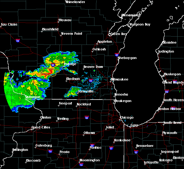 At 534 pm cdt, a severe thunderstorm was located near prairie du sac, moving southeast at 35 mph (radar indicated). Hazards include 60 mph wind gusts and quarter size hail. Hail damage to vehicles is expected. Expect wind damage to roofs, siding, and trees. At 534 pm cdt, a severe thunderstorm was located near prairie du sac, moving southeast at 35 mph (radar indicated). Hazards include 60 mph wind gusts and quarter size hail. Hail damage to vehicles is expected. Expect wind damage to roofs, siding, and trees.
|
| 8/26/2018 4:42 PM CDT |
 At 442 pm cdt, severe thunderstorms were located along a line extending from 7 miles northeast of deforest to near fitchburg, moving east at 25 mph (radar indicated). Hazards include 60 mph wind gusts and nickel size hail. Expect damage to roofs, siding, and trees. Locations impacted include, madison, sun prairie, fitchburg, middleton, stoughton, waunakee, verona, oregon, mcfarland, monona, windsor, columbus, marshall, deforest, cottage grove, cross plains, deerfield, fall river, shorewood hills and cambridge. At 442 pm cdt, severe thunderstorms were located along a line extending from 7 miles northeast of deforest to near fitchburg, moving east at 25 mph (radar indicated). Hazards include 60 mph wind gusts and nickel size hail. Expect damage to roofs, siding, and trees. Locations impacted include, madison, sun prairie, fitchburg, middleton, stoughton, waunakee, verona, oregon, mcfarland, monona, windsor, columbus, marshall, deforest, cottage grove, cross plains, deerfield, fall river, shorewood hills and cambridge.
|
| 8/26/2018 4:11 PM CDT |
 At 410 pm cdt, severe thunderstorms were located along a line extending from near lodi to 6 miles southeast of mount horeb, moving east at 25 mph (radar indicated). Hazards include 60 mph wind gusts and nickel size hail. expect damage to roofs, siding, and trees At 410 pm cdt, severe thunderstorms were located along a line extending from near lodi to 6 miles southeast of mount horeb, moving east at 25 mph (radar indicated). Hazards include 60 mph wind gusts and nickel size hail. expect damage to roofs, siding, and trees
|
| 7/19/2017 8:02 PM CDT |
 At 802 pm cdt, a severe thunderstorm was located over stoughton, moving east at 50 mph. this storm has a history of producing wind damage. seek shelter now! (trained weather spotters). Hazards include 70 mph wind gusts. Expect considerable tree damage. damage is likely to mobile homes, roofs, and outbuildings. locations impacted include, madison, janesville, beloit, sun prairie, fitchburg, middleton, stoughton, waunakee, verona, oregon, mcfarland, monona, windsor, edgerton, evansville, marshall, sauk city, brodhead, deforest and cottage grove. People attending the dane county fair, and concerts on the square in madison should seek safe shelter immediately!. At 802 pm cdt, a severe thunderstorm was located over stoughton, moving east at 50 mph. this storm has a history of producing wind damage. seek shelter now! (trained weather spotters). Hazards include 70 mph wind gusts. Expect considerable tree damage. damage is likely to mobile homes, roofs, and outbuildings. locations impacted include, madison, janesville, beloit, sun prairie, fitchburg, middleton, stoughton, waunakee, verona, oregon, mcfarland, monona, windsor, edgerton, evansville, marshall, sauk city, brodhead, deforest and cottage grove. People attending the dane county fair, and concerts on the square in madison should seek safe shelter immediately!.
|
| 7/19/2017 7:10 PM CDT |
 At 710 pm cdt, a severe thunderstorm was located near mineral point, moving east at 50 mph. this thunderstorm has a history of producing damaging wind. seek shelter now! (radar indicated). Hazards include 70 mph wind gusts. Expect considerable tree damage. Damage is likely to mobile homes, roofs, and outbuildings. At 710 pm cdt, a severe thunderstorm was located near mineral point, moving east at 50 mph. this thunderstorm has a history of producing damaging wind. seek shelter now! (radar indicated). Hazards include 70 mph wind gusts. Expect considerable tree damage. Damage is likely to mobile homes, roofs, and outbuildings.
|
| 7/10/2017 12:20 AM CDT |
 At 1219 am cdt, a severe thunderstorm was located near mazomanie, or 7 miles southwest of sauk city, moving northeast at 10 mph. at 1204 pm cdt, quarter size hail was reported in arena from this storm (radar indicated). Hazards include half dollar size hail. Damage to vehicles is expected. Locations impacted include, western madison, middleton, verona, mount horeb, prairie du sac, sauk city, cross plains, mazomanie, black earth, blue mounds, arena, paoli, pine bluff, blue mound st park and marxville. At 1219 am cdt, a severe thunderstorm was located near mazomanie, or 7 miles southwest of sauk city, moving northeast at 10 mph. at 1204 pm cdt, quarter size hail was reported in arena from this storm (radar indicated). Hazards include half dollar size hail. Damage to vehicles is expected. Locations impacted include, western madison, middleton, verona, mount horeb, prairie du sac, sauk city, cross plains, mazomanie, black earth, blue mounds, arena, paoli, pine bluff, blue mound st park and marxville.
|
| 7/10/2017 12:07 AM CDT |
 At 1206 am cdt, a severe thunderstorm was located over arena, with an additional severe thunderstorm located near mount horeb. these storms are moving northeast at 15 mph. at 1204 pm cdt, quarter size hail was reported in arena (radar indicated). Hazards include half dollar size hail. Damage to vehicles is expected. Locations impacted include, western madison, middleton, verona, mount horeb, prairie du sac, sauk city, cross plains, mazomanie, black earth, barneveld, blue mounds, arena, paoli, pine bluff, blue mound st park, mount vernon and marxville. At 1206 am cdt, a severe thunderstorm was located over arena, with an additional severe thunderstorm located near mount horeb. these storms are moving northeast at 15 mph. at 1204 pm cdt, quarter size hail was reported in arena (radar indicated). Hazards include half dollar size hail. Damage to vehicles is expected. Locations impacted include, western madison, middleton, verona, mount horeb, prairie du sac, sauk city, cross plains, mazomanie, black earth, barneveld, blue mounds, arena, paoli, pine bluff, blue mound st park, mount vernon and marxville.
|
| 7/9/2017 11:54 PM CDT |
 At 1154 pm cdt, a severe thunderstorm was located near mazomanie, or 9 miles southwest of sauk city, moving northeast at 15 mph (radar indicated). Hazards include ping pong ball size hail. People and animals outdoors will be injured. expect damage to roofs, siding, windows, and vehicles. Locations impacted include, western madison, middleton, verona, mount horeb, prairie du sac, sauk city, cross plains, mazomanie, spring green, black earth, barneveld, blue mounds, arena, paoli, pine bluff, blue mound st park, mount vernon and marxville. At 1154 pm cdt, a severe thunderstorm was located near mazomanie, or 9 miles southwest of sauk city, moving northeast at 15 mph (radar indicated). Hazards include ping pong ball size hail. People and animals outdoors will be injured. expect damage to roofs, siding, windows, and vehicles. Locations impacted include, western madison, middleton, verona, mount horeb, prairie du sac, sauk city, cross plains, mazomanie, spring green, black earth, barneveld, blue mounds, arena, paoli, pine bluff, blue mound st park, mount vernon and marxville.
|
| 7/2/2017 6:19 PM CDT |
 At 619 pm cdt, a severe thunderstorm was located near mount horeb, moving southeast at 25 mph (radar indicated). Hazards include 60 mph wind gusts and quarter size hail. Hail damage to vehicles is expected. expect wind damage to roofs, siding, and trees. Locations impacted include, western madison, fitchburg, verona, mount horeb, cross plains, belleville, pine bluff, mount vernon and paoli. At 619 pm cdt, a severe thunderstorm was located near mount horeb, moving southeast at 25 mph (radar indicated). Hazards include 60 mph wind gusts and quarter size hail. Hail damage to vehicles is expected. expect wind damage to roofs, siding, and trees. Locations impacted include, western madison, fitchburg, verona, mount horeb, cross plains, belleville, pine bluff, mount vernon and paoli.
|
| 7/2/2017 6:09 PM CDT |
 At 609 pm cdt, a severe thunderstorm was located near black earth, or near mount horeb, moving southeast at 25 mph (radar indicated). Hazards include 60 mph wind gusts and quarter size hail. Hail damage to vehicles is expected. Expect wind damage to roofs, siding, and trees. At 609 pm cdt, a severe thunderstorm was located near black earth, or near mount horeb, moving southeast at 25 mph (radar indicated). Hazards include 60 mph wind gusts and quarter size hail. Hail damage to vehicles is expected. Expect wind damage to roofs, siding, and trees.
|
| 7/2/2017 4:11 PM CDT |
 At 410 pm cdt, a severe thunderstorm was located near middleton, moving southeast at 20 mph (radar indicated). Hazards include 60 mph wind gusts and half dollar size hail. Hail damage to vehicles is expected. expect wind damage to roofs, siding, and trees. Locations impacted include, madison, sun prairie, fitchburg, middleton, waunakee, mcfarland, monona, shorewood hills, maple bluff, henry vilas zoo, camp randall stadium and uw-madison. At 410 pm cdt, a severe thunderstorm was located near middleton, moving southeast at 20 mph (radar indicated). Hazards include 60 mph wind gusts and half dollar size hail. Hail damage to vehicles is expected. expect wind damage to roofs, siding, and trees. Locations impacted include, madison, sun prairie, fitchburg, middleton, waunakee, mcfarland, monona, shorewood hills, maple bluff, henry vilas zoo, camp randall stadium and uw-madison.
|
| 7/2/2017 4:03 PM CDT |
 At 402 pm cdt, a severe thunderstorm was located over cross plains, or near middleton, moving southeast at 40 mph (radar indicated). Hazards include 60 mph wind gusts and half dollar size hail. Hail damage to vehicles is expected. Expect wind damage to roofs, siding, and trees. At 402 pm cdt, a severe thunderstorm was located over cross plains, or near middleton, moving southeast at 40 mph (radar indicated). Hazards include 60 mph wind gusts and half dollar size hail. Hail damage to vehicles is expected. Expect wind damage to roofs, siding, and trees.
|
| 7/2/2017 4:02 PM CDT | Quarter sized hail reported 1.8 miles SW of Cross Plains, WI |
| 6/14/2017 2:36 PM CDT |
 At 236 pm cdt, severe thunderstorms were located along a line extending from near middleton to near fitchburg, moving northeast at 45 mph (law enforcement. trees were reported down across madison). Hazards include 70 mph wind gusts and quarter size hail. Hail damage to vehicles is expected. expect considerable tree damage. wind damage is also likely to mobile homes, roofs, and outbuildings. Locations impacted include, madison, fitchburg, middleton, verona, monona, cross plains, shorewood hills, maple bluff, camp randall stadium, paoli, pine bluff, henry vilas zoo and uw-madison. At 236 pm cdt, severe thunderstorms were located along a line extending from near middleton to near fitchburg, moving northeast at 45 mph (law enforcement. trees were reported down across madison). Hazards include 70 mph wind gusts and quarter size hail. Hail damage to vehicles is expected. expect considerable tree damage. wind damage is also likely to mobile homes, roofs, and outbuildings. Locations impacted include, madison, fitchburg, middleton, verona, monona, cross plains, shorewood hills, maple bluff, camp randall stadium, paoli, pine bluff, henry vilas zoo and uw-madison.
|
| 6/14/2017 2:28 PM CDT |
 A severe thunderstorm warning remains in effect until 300 pm cdt for northeastern green and southwestern dane counties. at 228 pm cdt, severe thunderstorms were located along a line extending from near black earth to near fitchburg, moving northeast at 45 mph. hazard. 70 mph wind gusts and quarter size hail. A severe thunderstorm warning remains in effect until 300 pm cdt for northeastern green and southwestern dane counties. at 228 pm cdt, severe thunderstorms were located along a line extending from near black earth to near fitchburg, moving northeast at 45 mph. hazard. 70 mph wind gusts and quarter size hail.
|
| 6/14/2017 2:17 PM CDT |
 At 217 pm cdt, severe thunderstorms were located along a line extending from near black earth to near belleville, moving northeast at 55 mph (radar indicated). Hazards include 70 mph wind gusts and ping pong ball size hail. People and animals outdoors will be injured. expect hail damage to roofs, siding, windows, and vehicles. expect considerable tree damage. wind damage is also likely to mobile homes, roofs, and outbuildings. Locations impacted include, madison, fitchburg, middleton, verona, monona, mount horeb, cross plains, belleville, new glarus, shorewood hills, black earth, maple bluff, monticello, barneveld, blue mounds, dayton, camp randall stadium, paoli, pine bluff and blue mound st park. At 217 pm cdt, severe thunderstorms were located along a line extending from near black earth to near belleville, moving northeast at 55 mph (radar indicated). Hazards include 70 mph wind gusts and ping pong ball size hail. People and animals outdoors will be injured. expect hail damage to roofs, siding, windows, and vehicles. expect considerable tree damage. wind damage is also likely to mobile homes, roofs, and outbuildings. Locations impacted include, madison, fitchburg, middleton, verona, monona, mount horeb, cross plains, belleville, new glarus, shorewood hills, black earth, maple bluff, monticello, barneveld, blue mounds, dayton, camp randall stadium, paoli, pine bluff and blue mound st park.
|
| 6/14/2017 2:03 PM CDT |
 At 202 pm cdt, a severe thunderstorm was located over blanchardville, or 14 miles southwest of mount horeb, moving northeast at 45 mph (radar indicated). Hazards include 70 mph wind gusts and ping pong ball size hail. People and animals outdoors will be injured. expect hail damage to roofs, siding, windows, and vehicles. expect considerable tree damage. Wind damage is also likely to mobile homes, roofs, and outbuildings. At 202 pm cdt, a severe thunderstorm was located over blanchardville, or 14 miles southwest of mount horeb, moving northeast at 45 mph (radar indicated). Hazards include 70 mph wind gusts and ping pong ball size hail. People and animals outdoors will be injured. expect hail damage to roofs, siding, windows, and vehicles. expect considerable tree damage. Wind damage is also likely to mobile homes, roofs, and outbuildings.
|
| 5/17/2017 8:53 PM CDT |
 At 852 pm cdt, severe thunderstorms were located along a line extending from near waunakee to near belleville to near winslow, moving east at 35 mph (radar indicated). Hazards include 60 mph wind gusts and penny size hail. expect damage to roofs, siding, and trees At 852 pm cdt, severe thunderstorms were located along a line extending from near waunakee to near belleville to near winslow, moving east at 35 mph (radar indicated). Hazards include 60 mph wind gusts and penny size hail. expect damage to roofs, siding, and trees
|
| 5/17/2017 8:52 PM CDT |
 At 852 pm cdt, severe thunderstorms were located along a line extending from near lodi to near fitchburg to near monroe, moving east at 35 mph (radar indicated). Hazards include 60 mph wind gusts and nickel size hail. Expect damage to roofs, siding, and trees. locations impacted include, madison, sun prairie, fitchburg, middleton, stoughton, waunakee, monroe, verona, oregon, mcfarland, monona, mount horeb, windsor, evansville, sauk city, brodhead, deforest, cross plains, belleville and new glarus. A tornado watch remains in effect until 100 am cdt for south central wisconsin. At 852 pm cdt, severe thunderstorms were located along a line extending from near lodi to near fitchburg to near monroe, moving east at 35 mph (radar indicated). Hazards include 60 mph wind gusts and nickel size hail. Expect damage to roofs, siding, and trees. locations impacted include, madison, sun prairie, fitchburg, middleton, stoughton, waunakee, monroe, verona, oregon, mcfarland, monona, mount horeb, windsor, evansville, sauk city, brodhead, deforest, cross plains, belleville and new glarus. A tornado watch remains in effect until 100 am cdt for south central wisconsin.
|
| 5/17/2017 8:41 PM CDT |
 At 840 pm cdt, severe thunderstorms were located along a line extending from near sauk city to near verona to near monroe, moving east at 40 mph (law enforcement. at 756 pm, damaging winds were reported in darlington and mineral point). Hazards include 70 mph wind gusts and quarter size hail. Hail damage to vehicles is expected. expect considerable tree damage. wind damage is also likely to mobile homes, roofs, and outbuildings. locations impacted include, madison, sun prairie, fitchburg, middleton, stoughton, waunakee, monroe, verona, oregon, mcfarland, monona, mount horeb, windsor, evansville, sauk city, brodhead, darlington, deforest, cross plains and belleville. A tornado watch remains in effect until 1100 pm cdt for south central wisconsin. At 840 pm cdt, severe thunderstorms were located along a line extending from near sauk city to near verona to near monroe, moving east at 40 mph (law enforcement. at 756 pm, damaging winds were reported in darlington and mineral point). Hazards include 70 mph wind gusts and quarter size hail. Hail damage to vehicles is expected. expect considerable tree damage. wind damage is also likely to mobile homes, roofs, and outbuildings. locations impacted include, madison, sun prairie, fitchburg, middleton, stoughton, waunakee, monroe, verona, oregon, mcfarland, monona, mount horeb, windsor, evansville, sauk city, brodhead, darlington, deforest, cross plains and belleville. A tornado watch remains in effect until 1100 pm cdt for south central wisconsin.
|
| 5/17/2017 8:30 PM CDT |
 At 829 pm cdt, severe thunderstorms were located along a line extending from near mazomanie to 6 miles northeast of blanchardville to near nora, moving east at 35 mph (law enforcement. trees and powerlines were down in dodgeville and mineral point at 756 pm). Hazards include 60 mph wind gusts and quarter size hail. Hail damage to vehicles is expected. expect wind damage to roofs, siding, and trees. locations impacted include, madison, sun prairie, fitchburg, middleton, stoughton, waunakee, monroe, verona, oregon, mcfarland, monona, mount horeb, windsor, evansville, sauk city, brodhead, darlington, deforest, cross plains and belleville. A tornado watch remains in effect until 1100 pm cdt for south central wisconsin. At 829 pm cdt, severe thunderstorms were located along a line extending from near mazomanie to 6 miles northeast of blanchardville to near nora, moving east at 35 mph (law enforcement. trees and powerlines were down in dodgeville and mineral point at 756 pm). Hazards include 60 mph wind gusts and quarter size hail. Hail damage to vehicles is expected. expect wind damage to roofs, siding, and trees. locations impacted include, madison, sun prairie, fitchburg, middleton, stoughton, waunakee, monroe, verona, oregon, mcfarland, monona, mount horeb, windsor, evansville, sauk city, brodhead, darlington, deforest, cross plains and belleville. A tornado watch remains in effect until 1100 pm cdt for south central wisconsin.
|
| 5/17/2017 8:20 PM CDT |
 At 819 pm cdt, severe thunderstorms were located along a line extending from 7 miles northeast of spring green to near blanchardville to warren, moving east at 35 mph (radar indicated). Hazards include 60 mph wind gusts and quarter size hail. Hail damage to vehicles is expected. Expect wind damage to roofs, siding, and trees. At 819 pm cdt, severe thunderstorms were located along a line extending from 7 miles northeast of spring green to near blanchardville to warren, moving east at 35 mph (radar indicated). Hazards include 60 mph wind gusts and quarter size hail. Hail damage to vehicles is expected. Expect wind damage to roofs, siding, and trees.
|
| 5/17/2017 8:16 PM CDT |
 At 815 pm cdt, severe thunderstorms were located along a line extending from near cashton to near wonewoc to 11 miles south of reedsburg to 8 miles southwest of mazomanie to 6 miles southeast of darlington, moving northeast at 55 mph (law enforcement. tree damage was reported in belmont at 753 pm). Hazards include 60 mph wind gusts and quarter size hail. Hail damage to vehicles is expected. expect wind damage to roofs, siding, and trees. locations impacted include, western madison, middleton, baraboo, monroe, verona, reedsburg, mount horeb, dodgeville, prairie du sac, sauk city, wisconsin dells, mineral point, darlington, lake wisconsin, cross plains, lodi, lake delton, belleville, new glarus and mazomanie. A tornado watch remains in effect until 1100 pm cdt for south central wisconsin. At 815 pm cdt, severe thunderstorms were located along a line extending from near cashton to near wonewoc to 11 miles south of reedsburg to 8 miles southwest of mazomanie to 6 miles southeast of darlington, moving northeast at 55 mph (law enforcement. tree damage was reported in belmont at 753 pm). Hazards include 60 mph wind gusts and quarter size hail. Hail damage to vehicles is expected. expect wind damage to roofs, siding, and trees. locations impacted include, western madison, middleton, baraboo, monroe, verona, reedsburg, mount horeb, dodgeville, prairie du sac, sauk city, wisconsin dells, mineral point, darlington, lake wisconsin, cross plains, lodi, lake delton, belleville, new glarus and mazomanie. A tornado watch remains in effect until 1100 pm cdt for south central wisconsin.
|
| 5/17/2017 8:07 PM CDT |
 At 806 pm cdt, severe thunderstorms were located along a line extending from westby to 10 miles south of hillsboro to 10 miles east of richland center to near dodgeville to near apple river, moving northeast at 55 mph (law enforcement reporting trees down in lafayette county). Hazards include 60 mph wind gusts and quarter size hail. Hail damage to vehicles is expected. expect wind damage to roofs, siding, and trees. locations impacted include, western madison, middleton, baraboo, monroe, verona, reedsburg, mount horeb, dodgeville, prairie du sac, sauk city, wisconsin dells, mineral point, darlington, lake wisconsin, cross plains, lodi, lake delton, belleville, new glarus and mazomanie. A tornado watch remains in effect until 1100 pm cdt for south central wisconsin. At 806 pm cdt, severe thunderstorms were located along a line extending from westby to 10 miles south of hillsboro to 10 miles east of richland center to near dodgeville to near apple river, moving northeast at 55 mph (law enforcement reporting trees down in lafayette county). Hazards include 60 mph wind gusts and quarter size hail. Hail damage to vehicles is expected. expect wind damage to roofs, siding, and trees. locations impacted include, western madison, middleton, baraboo, monroe, verona, reedsburg, mount horeb, dodgeville, prairie du sac, sauk city, wisconsin dells, mineral point, darlington, lake wisconsin, cross plains, lodi, lake delton, belleville, new glarus and mazomanie. A tornado watch remains in effect until 1100 pm cdt for south central wisconsin.
|
| 5/17/2017 7:54 PM CDT |
 At 752 pm cdt, severe thunderstorms were located along a line extending from 8 miles west of viroqua to near muscoda to council hill, moving northeast at 65 mph (radar indicated). Hazards include 60 mph wind gusts and quarter size hail. Hail damage to vehicles is expected. Expect wind damage to roofs, siding, and trees. At 752 pm cdt, severe thunderstorms were located along a line extending from 8 miles west of viroqua to near muscoda to council hill, moving northeast at 65 mph (radar indicated). Hazards include 60 mph wind gusts and quarter size hail. Hail damage to vehicles is expected. Expect wind damage to roofs, siding, and trees.
|
| 5/15/2017 9:42 PM CDT |
 At 942 pm cdt, severe thunderstorms were located along a line extending from near poynette to near stoughton, moving east at 55 mph (radar indicated). Hazards include 60 mph wind gusts. Expect damage to roofs, siding, and trees. Locations impacted include, madison, sun prairie, fitchburg, middleton, stoughton, waunakee, verona, oregon, mcfarland, monona, windsor, edgerton, columbus, prairie du sac, marshall, sauk city, lake wisconsin, deforest, cottage grove and cross plains. At 942 pm cdt, severe thunderstorms were located along a line extending from near poynette to near stoughton, moving east at 55 mph (radar indicated). Hazards include 60 mph wind gusts. Expect damage to roofs, siding, and trees. Locations impacted include, madison, sun prairie, fitchburg, middleton, stoughton, waunakee, verona, oregon, mcfarland, monona, windsor, edgerton, columbus, prairie du sac, marshall, sauk city, lake wisconsin, deforest, cottage grove and cross plains.
|
| 5/15/2017 9:26 PM CDT |
 At 926 pm cdt, severe thunderstorms were located along a line extending from near lake wisconsin to belleville, moving east at 60 mph (radar indicated). Hazards include 60 mph wind gusts. expect damage to roofs, siding, and trees At 926 pm cdt, severe thunderstorms were located along a line extending from near lake wisconsin to belleville, moving east at 60 mph (radar indicated). Hazards include 60 mph wind gusts. expect damage to roofs, siding, and trees
|
| 3/23/2017 7:03 PM CDT |
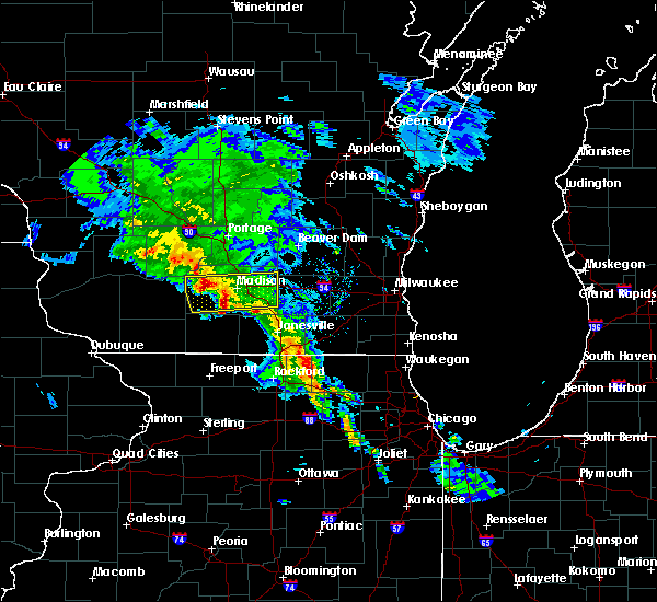 At 702 pm cdt, a severe thunderstorm was located over southern madison, with an additional severe thunderstorm near cross plains. these storms are moving east at 50 mph (radar indicated). Hazards include quarter size hail. Damage to vehicles is expected. Locations impacted include, madison, sun prairie, fitchburg, middleton, stoughton, waunakee, verona, oregon, mcfarland, monona, windsor, marshall, cottage grove, cross plains, deerfield, shorewood hills, cambridge, maple bluff, utica and rockdale. At 702 pm cdt, a severe thunderstorm was located over southern madison, with an additional severe thunderstorm near cross plains. these storms are moving east at 50 mph (radar indicated). Hazards include quarter size hail. Damage to vehicles is expected. Locations impacted include, madison, sun prairie, fitchburg, middleton, stoughton, waunakee, verona, oregon, mcfarland, monona, windsor, marshall, cottage grove, cross plains, deerfield, shorewood hills, cambridge, maple bluff, utica and rockdale.
|
| 3/23/2017 6:50 PM CDT |
 At 650 pm cdt, a severe thunderstorm was located near verona, moving east at 45 mph (radar indicated). Hazards include quarter size hail. damage to vehicles is expected At 650 pm cdt, a severe thunderstorm was located near verona, moving east at 45 mph (radar indicated). Hazards include quarter size hail. damage to vehicles is expected
|
| 3/6/2017 11:13 PM CST |
 At 1113 pm cst, severe thunderstorms were located along a line extending from near belleville to near lena, moving northeast at 85 mph (radar indicated). Hazards include 60 mph wind gusts and penny size hail. expect damage to roofs, siding, and trees At 1113 pm cst, severe thunderstorms were located along a line extending from near belleville to near lena, moving northeast at 85 mph (radar indicated). Hazards include 60 mph wind gusts and penny size hail. expect damage to roofs, siding, and trees
|
| 3/6/2017 11:00 PM CST |
 At 1100 pm cst, severe thunderstorms were located along a line extending from near mount horeb to monticello, moving northeast at 55 mph (radar indicated). Hazards include 60 mph wind gusts and penny size hail. Expect damage to roofs, siding, and trees. Locations impacted include, western madison, fitchburg, middleton, monroe, verona, oregon, mount horeb, cross plains, belleville, new glarus, shorewood hills, brooklyn, monticello, albany, argyle, blanchardville, somers, barneveld, wiota and blue mounds. At 1100 pm cst, severe thunderstorms were located along a line extending from near mount horeb to monticello, moving northeast at 55 mph (radar indicated). Hazards include 60 mph wind gusts and penny size hail. Expect damage to roofs, siding, and trees. Locations impacted include, western madison, fitchburg, middleton, monroe, verona, oregon, mount horeb, cross plains, belleville, new glarus, shorewood hills, brooklyn, monticello, albany, argyle, blanchardville, somers, barneveld, wiota and blue mounds.
|
| 3/6/2017 10:42 PM CST |
 At 1041 pm cst, severe thunderstorms were located along a line extending from 6 miles northwest of blanchardville to near argyle, moving northeast at 65 mph (law enforcement). Hazards include 60 mph wind gusts and penny size hail. expect damage to roofs, siding, and trees At 1041 pm cst, severe thunderstorms were located along a line extending from 6 miles northwest of blanchardville to near argyle, moving northeast at 65 mph (law enforcement). Hazards include 60 mph wind gusts and penny size hail. expect damage to roofs, siding, and trees
|
| 2/28/2017 9:42 AM CST |
 At 941 am cst, a severe thunderstorm was located near waunakee, moving northeast at 45 mph. an additional storm was located near sun prairie (radar indicated). Hazards include quarter size hail. damage to vehicles is expected At 941 am cst, a severe thunderstorm was located near waunakee, moving northeast at 45 mph. an additional storm was located near sun prairie (radar indicated). Hazards include quarter size hail. damage to vehicles is expected
|
| 9/19/2016 4:06 PM CDT |
 At 406 pm cdt, a severe thunderstorm was located over fitchburg, moving southeast at 50 mph (radar indicated). Hazards include two inch hail and 60 mph wind gusts. People and animals outdoors will be injured. expect hail damage to roofs, siding, windows, and vehicles. expect wind damage to roofs, siding, and trees. Locations impacted include, western madison, middleton, verona, cross plains and pine bluff. At 406 pm cdt, a severe thunderstorm was located over fitchburg, moving southeast at 50 mph (radar indicated). Hazards include two inch hail and 60 mph wind gusts. People and animals outdoors will be injured. expect hail damage to roofs, siding, windows, and vehicles. expect wind damage to roofs, siding, and trees. Locations impacted include, western madison, middleton, verona, cross plains and pine bluff.
|
| 9/19/2016 4:01 PM CDT |
 At 400 pm cdt, a severe thunderstorm was located over cross plains, or near middleton, moving southeast at 40 mph (radar indicated). Hazards include two inch hail and 60 mph wind gusts. People and animals outdoors will be injured. expect hail damage to roofs, siding, windows, and vehicles. Expect wind damage to roofs, siding, and trees. At 400 pm cdt, a severe thunderstorm was located over cross plains, or near middleton, moving southeast at 40 mph (radar indicated). Hazards include two inch hail and 60 mph wind gusts. People and animals outdoors will be injured. expect hail damage to roofs, siding, windows, and vehicles. Expect wind damage to roofs, siding, and trees.
|
| 9/19/2016 3:57 PM CDT |
 At 356 pm cdt, a severe thunderstorm was located near verona, moving southeast at 50 mph. this storm is likely producing damaging hail! (radar indicated). Hazards include two inch hail and 60 mph wind gusts. People and animals outdoors will be injured. expect hail damage to roofs, siding, windows, and vehicles. expect wind damage to roofs, siding, and trees. Locations impacted include, western madison, middleton, waunakee, verona, cross plains, mazomanie, black earth, pine bluff and marxville. At 356 pm cdt, a severe thunderstorm was located near verona, moving southeast at 50 mph. this storm is likely producing damaging hail! (radar indicated). Hazards include two inch hail and 60 mph wind gusts. People and animals outdoors will be injured. expect hail damage to roofs, siding, windows, and vehicles. expect wind damage to roofs, siding, and trees. Locations impacted include, western madison, middleton, waunakee, verona, cross plains, mazomanie, black earth, pine bluff and marxville.
|
| 9/19/2016 3:48 PM CDT |
 At 347 pm cdt, a severe thunderstorm was located over cross plains, or 7 miles west of middleton, moving southeast at 50 mph. this storm is capable of producing large and damaging hail! (radar indicated). Hazards include golf ball size hail and 60 mph wind gusts. People and animals outdoors will be injured. expect hail damage to roofs, siding, windows, and vehicles. expect wind damage to roofs, siding, and trees. Locations impacted include, western madison, middleton, waunakee, verona, sauk city, cross plains, mazomanie, black earth, dane, arena, pine bluff and marxville. At 347 pm cdt, a severe thunderstorm was located over cross plains, or 7 miles west of middleton, moving southeast at 50 mph. this storm is capable of producing large and damaging hail! (radar indicated). Hazards include golf ball size hail and 60 mph wind gusts. People and animals outdoors will be injured. expect hail damage to roofs, siding, windows, and vehicles. expect wind damage to roofs, siding, and trees. Locations impacted include, western madison, middleton, waunakee, verona, sauk city, cross plains, mazomanie, black earth, dane, arena, pine bluff and marxville.
|
| 9/19/2016 3:37 PM CDT |
 At 336 pm cdt, a severe thunderstorm was located over mazomanie, or near sauk city, moving southeast at 50 mph (radar indicated). Hazards include golf ball size hail and 60 mph wind gusts. People and animals outdoors will be injured. expect hail damage to roofs, siding, windows, and vehicles. expect wind damage to roofs, siding, and trees. Locations impacted include, western madison, middleton, waunakee, verona, prairie du sac, sauk city, cross plains, mazomanie, spring green, black earth, dane, arena, marxville and pine bluff. At 336 pm cdt, a severe thunderstorm was located over mazomanie, or near sauk city, moving southeast at 50 mph (radar indicated). Hazards include golf ball size hail and 60 mph wind gusts. People and animals outdoors will be injured. expect hail damage to roofs, siding, windows, and vehicles. expect wind damage to roofs, siding, and trees. Locations impacted include, western madison, middleton, waunakee, verona, prairie du sac, sauk city, cross plains, mazomanie, spring green, black earth, dane, arena, marxville and pine bluff.
|
| 9/19/2016 3:25 PM CDT |
 At 324 pm cdt, a severe thunderstorm was located 8 miles northeast of spring green, or 12 miles west of sauk city, moving southeast at 50 mph (radar indicated). Hazards include golf ball size hail and 60 mph wind gusts. People and animals outdoors will be injured. expect hail damage to roofs, siding, windows, and vehicles. Expect wind damage to roofs, siding, and trees. At 324 pm cdt, a severe thunderstorm was located 8 miles northeast of spring green, or 12 miles west of sauk city, moving southeast at 50 mph (radar indicated). Hazards include golf ball size hail and 60 mph wind gusts. People and animals outdoors will be injured. expect hail damage to roofs, siding, windows, and vehicles. Expect wind damage to roofs, siding, and trees.
|
| 7/23/2016 2:18 PM CDT |
 At 218 pm cdt, a severe thunderstorm was located over southwestern madison, moving northeast at 30 mph (radar indicated). Hazards include 60 mph wind gusts. Expect damage to roofs. siding. and trees. locations impacted include, madison, fitchburg, middleton, waunakee, mcfarland, monona, cross plains, shorewood hills, maple bluff, camp randall stadium, henry vilas zoo and uw-madison. People attending the dane county fair should seek safe shelter immediately!. At 218 pm cdt, a severe thunderstorm was located over southwestern madison, moving northeast at 30 mph (radar indicated). Hazards include 60 mph wind gusts. Expect damage to roofs. siding. and trees. locations impacted include, madison, fitchburg, middleton, waunakee, mcfarland, monona, cross plains, shorewood hills, maple bluff, camp randall stadium, henry vilas zoo and uw-madison. People attending the dane county fair should seek safe shelter immediately!.
|
| 7/23/2016 2:09 PM CDT |
 At 207 pm cdt, a severe thunderstorm was located near verona, moving northeast at 30 mph. this storm is moving into western portions of the city of madison. take cover now! (radar indicated). Hazards include 70 mph wind gusts. Expect considerable tree damage. damage is likely to mobile homes, roofs, and outbuildings. locations impacted include, madison, fitchburg, middleton, waunakee, verona, mcfarland, monona, cross plains, shorewood hills, maple bluff, uw-madison, camp randall stadium, paoli, pine bluff and henry vilas zoo. People attending the dane county fair should seek safe shelter immediately!. At 207 pm cdt, a severe thunderstorm was located near verona, moving northeast at 30 mph. this storm is moving into western portions of the city of madison. take cover now! (radar indicated). Hazards include 70 mph wind gusts. Expect considerable tree damage. damage is likely to mobile homes, roofs, and outbuildings. locations impacted include, madison, fitchburg, middleton, waunakee, verona, mcfarland, monona, cross plains, shorewood hills, maple bluff, uw-madison, camp randall stadium, paoli, pine bluff and henry vilas zoo. People attending the dane county fair should seek safe shelter immediately!.
|
| 7/23/2016 2:00 PM CDT |
 At 159 pm cdt, a severe thunderstorm was located near mount horeb, moving northeast at 25 mph (radar indicated). Hazards include 70 mph wind gusts. Expect considerable tree damage. Damage is likely to mobile homes, roofs, and outbuildings. At 159 pm cdt, a severe thunderstorm was located near mount horeb, moving northeast at 25 mph (radar indicated). Hazards include 70 mph wind gusts. Expect considerable tree damage. Damage is likely to mobile homes, roofs, and outbuildings.
|
| 7/23/2016 1:55 PM CDT |
 At 154 pm cdt, a severe thunderstorm was located near mount horeb, or near verona, moving northeast at 30 mph (radar indicated). Hazards include 60 mph wind gusts. Expect damage to roofs. siding. and trees. Locations impacted include, western madison, fitchburg, middleton, verona, oregon, mount horeb, cross plains, belleville, new glarus, brooklyn, blue mounds, dayton, mount vernon, paoli and pine bluff. At 154 pm cdt, a severe thunderstorm was located near mount horeb, or near verona, moving northeast at 30 mph (radar indicated). Hazards include 60 mph wind gusts. Expect damage to roofs. siding. and trees. Locations impacted include, western madison, fitchburg, middleton, verona, oregon, mount horeb, cross plains, belleville, new glarus, brooklyn, blue mounds, dayton, mount vernon, paoli and pine bluff.
|
| 7/23/2016 1:41 PM CDT |
 At 139 pm cdt, a severe thunderstorm was located near mount horeb, moving northeast at 30 mph (radar indicated. velocity values of up to 55 knots were observed). Hazards include 60 mph wind gusts. Expect damage to roofs. siding. and trees. Locations impacted include, western madison, fitchburg, middleton, verona, oregon, mount horeb, cross plains, belleville, new glarus, brooklyn, blue mounds, dayton, mount vernon, paoli and pine bluff. At 139 pm cdt, a severe thunderstorm was located near mount horeb, moving northeast at 30 mph (radar indicated. velocity values of up to 55 knots were observed). Hazards include 60 mph wind gusts. Expect damage to roofs. siding. and trees. Locations impacted include, western madison, fitchburg, middleton, verona, oregon, mount horeb, cross plains, belleville, new glarus, brooklyn, blue mounds, dayton, mount vernon, paoli and pine bluff.
|
| 7/23/2016 1:23 PM CDT |
 At 122 pm cdt, a severe thunderstorm was located near blanchardville, or 10 miles southwest of mount horeb, moving northeast at 30 mph (radar indicated). Hazards include 60 mph wind gusts. Expect damage to roofs. siding. And trees. At 122 pm cdt, a severe thunderstorm was located near blanchardville, or 10 miles southwest of mount horeb, moving northeast at 30 mph (radar indicated). Hazards include 60 mph wind gusts. Expect damage to roofs. siding. And trees.
|
| 7/21/2016 6:23 PM CDT |
 At 622 pm cdt, a severe thunderstorm was located over belleville, or 7 miles southwest of oregon, moving south at 45 mph (law enforcement). Hazards include 60 mph wind gusts. Expect damage to roofs. siding. and trees. locations impacted include, madison, janesville, fitchburg, middleton, stoughton, verona, oregon, mcfarland, monona, milton, edgerton, sauk city, cross plains, shorewood hills, maple bluff, lake koshkonong, fulton, albion, utica and rockdale. People attending the dane county fair should seek safe shelter immediately!. At 622 pm cdt, a severe thunderstorm was located over belleville, or 7 miles southwest of oregon, moving south at 45 mph (law enforcement). Hazards include 60 mph wind gusts. Expect damage to roofs. siding. and trees. locations impacted include, madison, janesville, fitchburg, middleton, stoughton, verona, oregon, mcfarland, monona, milton, edgerton, sauk city, cross plains, shorewood hills, maple bluff, lake koshkonong, fulton, albion, utica and rockdale. People attending the dane county fair should seek safe shelter immediately!.
|
| 7/21/2016 6:03 PM CDT |
 At 602 pm cdt, a severe thunderstorm was located over eastern madison, moving southeast at 45 mph. at 600 pm, the madison airport reported a wind gust to 60 mph with this storm (radar indicated). Hazards include 60 mph wind gusts. Expect damage to roofs. siding. And trees. At 602 pm cdt, a severe thunderstorm was located over eastern madison, moving southeast at 45 mph. at 600 pm, the madison airport reported a wind gust to 60 mph with this storm (radar indicated). Hazards include 60 mph wind gusts. Expect damage to roofs. siding. And trees.
|
| 7/6/2016 12:38 AM CDT | At 1238 am cdt, severe thunderstorms were located along a line extending from near waterloo to near brooklyn, moving east at 45 mph (radar indicated). Hazards include 70 mph wind gusts. Expect considerable tree damage. damage is likely to mobile homes, roofs, and outbuildings. Locations impacted include, madison, sun prairie, fitchburg, middleton, stoughton, waunakee, verona, mcfarland, monona, windsor, marshall, sauk city, deforest, cottage grove, cross plains, deerfield, mazomanie, shorewood hills, cambridge and black earth. |
| 7/6/2016 12:21 AM CDT | Storm damage reported in dane county WI, 3.2 miles NE of Cross Plains, WI |
| 7/6/2016 12:15 AM CDT |
 At 1212 am cdt, severe thunderstorms were located along a line extending from near deforest to near mount horeb, moving east at 50 mph (radar indicated). Hazards include 70 mph wind gusts. Expect considerable tree damage. damage is likely to mobile homes, roofs, and outbuildings. Locations impacted include, madison, sun prairie, fitchburg, middleton, stoughton, waunakee, verona, mcfarland, monona, windsor, marshall, sauk city, deforest, cottage grove, cross plains, deerfield, mazomanie, shorewood hills, cambridge and black earth. At 1212 am cdt, severe thunderstorms were located along a line extending from near deforest to near mount horeb, moving east at 50 mph (radar indicated). Hazards include 70 mph wind gusts. Expect considerable tree damage. damage is likely to mobile homes, roofs, and outbuildings. Locations impacted include, madison, sun prairie, fitchburg, middleton, stoughton, waunakee, verona, mcfarland, monona, windsor, marshall, sauk city, deforest, cottage grove, cross plains, deerfield, mazomanie, shorewood hills, cambridge and black earth.
|
| 7/5/2016 11:51 PM CDT |
 At 1151 pm cdt, a severe thunderstorm was located over mazomanie, or 7 miles south of sauk city, moving east at 45 mph (radar indicated). Hazards include 70 mph wind gusts. Expect considerable tree damage. Damage is likely to mobile homes, roofs, and outbuildings. At 1151 pm cdt, a severe thunderstorm was located over mazomanie, or 7 miles south of sauk city, moving east at 45 mph (radar indicated). Hazards include 70 mph wind gusts. Expect considerable tree damage. Damage is likely to mobile homes, roofs, and outbuildings.
|
| 5/28/2016 6:14 PM CDT |
 At 613 pm cdt, severe thunderstorms were located along a line extending from portage to near pardeeville to deforest, moving northeast at 40 mph (radar indicated. pea size hail was reported 3 miles south of portage). Hazards include 60 mph wind gusts and quarter size hail. Hail damage to vehicles is expected. expect wind damage to roofs, siding, and trees. Locations impacted include, madison, fitchburg, middleton, waunakee, portage, windsor, lake wisconsin, deforest, cross plains, lodi, poynette, pardeeville, shorewood hills, maple bluff, rio, dane, arlington, wyocena, otsego and merrimac. At 613 pm cdt, severe thunderstorms were located along a line extending from portage to near pardeeville to deforest, moving northeast at 40 mph (radar indicated. pea size hail was reported 3 miles south of portage). Hazards include 60 mph wind gusts and quarter size hail. Hail damage to vehicles is expected. expect wind damage to roofs, siding, and trees. Locations impacted include, madison, fitchburg, middleton, waunakee, portage, windsor, lake wisconsin, deforest, cross plains, lodi, poynette, pardeeville, shorewood hills, maple bluff, rio, dane, arlington, wyocena, otsego and merrimac.
|
| 5/28/2016 5:59 PM CDT |
 At 559 pm cdt, severe thunderstorms were located along a line extending from near lake wisconsin to near poynette to near middleton, moving northeast at 40 mph (radar indicated). Hazards include 60 mph wind gusts and quarter size hail. Hail damage to vehicles is expected. Expect wind damage to roofs, siding, and trees. At 559 pm cdt, severe thunderstorms were located along a line extending from near lake wisconsin to near poynette to near middleton, moving northeast at 40 mph (radar indicated). Hazards include 60 mph wind gusts and quarter size hail. Hail damage to vehicles is expected. Expect wind damage to roofs, siding, and trees.
|
| 5/28/2016 5:41 PM CDT |
 At 539 pm cdt, severe thunderstorms were located along a line extending from near baraboo to near sauk city to near mount horeb, moving northeast at 40 mph (radar indicated. dane county dispatch has received reports that trees and power lines have been knocked down in mazomanie, northwest dane county). Hazards include 60 mph wind gusts and quarter size hail. Hail damage to vehicles is expected. expect wind damage to roofs, siding, and trees. Locations impacted include, middleton, waunakee, mount horeb, prairie du sac, sauk city, lake wisconsin, deforest, cross plains, lodi, poynette, mazomanie, black earth, barneveld, dane, blue mounds, arena, arlington, ridgeway, merrimac and hollandale. At 539 pm cdt, severe thunderstorms were located along a line extending from near baraboo to near sauk city to near mount horeb, moving northeast at 40 mph (radar indicated. dane county dispatch has received reports that trees and power lines have been knocked down in mazomanie, northwest dane county). Hazards include 60 mph wind gusts and quarter size hail. Hail damage to vehicles is expected. expect wind damage to roofs, siding, and trees. Locations impacted include, middleton, waunakee, mount horeb, prairie du sac, sauk city, lake wisconsin, deforest, cross plains, lodi, poynette, mazomanie, black earth, barneveld, dane, blue mounds, arena, arlington, ridgeway, merrimac and hollandale.
|
| 5/28/2016 5:29 PM CDT |
 At 529 pm cdt, severe thunderstorms were located along a line extending from near prairie du sac to near black earth to 6 miles northwest of blanchardville, moving northeast at 40 mph (radar indicated). Hazards include 60 mph wind gusts and quarter size hail. Hail damage to vehicles is expected. Expect wind damage to roofs, siding, and trees. At 529 pm cdt, severe thunderstorms were located along a line extending from near prairie du sac to near black earth to 6 miles northwest of blanchardville, moving northeast at 40 mph (radar indicated). Hazards include 60 mph wind gusts and quarter size hail. Hail damage to vehicles is expected. Expect wind damage to roofs, siding, and trees.
|
| 5/28/2016 5:13 PM CDT |
 At 512 pm cdt, a severe thunderstorm was located 7 miles southwest of black earth, or 8 miles northwest of mount horeb, moving northeast at 40 mph (radar indicated). Hazards include 60 mph wind gusts and nickel size hail. Expect damage to roofs. siding. and trees. Locations impacted include, mount horeb, dodgeville, prairie du sac, sauk city, mineral point, darlington, cross plains, mazomanie, spring green, black earth, barneveld, blue mounds, arena, plain, ridgeway, linden, hollandale, edmund, leland and yellowstone lake st park. At 512 pm cdt, a severe thunderstorm was located 7 miles southwest of black earth, or 8 miles northwest of mount horeb, moving northeast at 40 mph (radar indicated). Hazards include 60 mph wind gusts and nickel size hail. Expect damage to roofs. siding. and trees. Locations impacted include, mount horeb, dodgeville, prairie du sac, sauk city, mineral point, darlington, cross plains, mazomanie, spring green, black earth, barneveld, blue mounds, arena, plain, ridgeway, linden, hollandale, edmund, leland and yellowstone lake st park.
|
| 5/28/2016 4:59 PM CDT |
 At 459 pm cdt, a severe thunderstorm was located near dodgeville, moving northeast at 45 mph (radar indicated). Hazards include 60 mph wind gusts and nickel size hail. Expect damage to roofs. siding. And trees. At 459 pm cdt, a severe thunderstorm was located near dodgeville, moving northeast at 45 mph (radar indicated). Hazards include 60 mph wind gusts and nickel size hail. Expect damage to roofs. siding. And trees.
|
| 7/13/2015 4:17 AM CDT |
 At 416 am cdt, severe thunderstorms were located along a line extending from near lomira to near watertown to near mount horeb, moving southeast at 55 mph (radar indicated). Hazards include 70 mph wind gusts. Expect considerable tree damage. damage is likely to mobile homes, roofs and outbuildings. Locations impacted include, madison, fond du lac, sun prairie, middleton, beaver dam, waunakee, waupun, ripon, mount horeb, windsor, mayville, columbus, prairie du sac, marshall, horicon, sauk city, juneau, deforest, cross plains and lodi. At 416 am cdt, severe thunderstorms were located along a line extending from near lomira to near watertown to near mount horeb, moving southeast at 55 mph (radar indicated). Hazards include 70 mph wind gusts. Expect considerable tree damage. damage is likely to mobile homes, roofs and outbuildings. Locations impacted include, madison, fond du lac, sun prairie, middleton, beaver dam, waunakee, waupun, ripon, mount horeb, windsor, mayville, columbus, prairie du sac, marshall, horicon, sauk city, juneau, deforest, cross plains and lodi.
|
| 7/13/2015 4:05 AM CDT | Power lines and branches dow in dane county WI, 0.3 miles NNE of Cross Plains, WI |
| 7/13/2015 4:05 AM CDT | Large trees down on houses. streets flooded and blocke in dane county WI, 0.3 miles NNE of Cross Plains, WI |
| 7/13/2015 4:01 AM CDT |
 At 359 am cdt, severe thunderstorms were located along a line extending from near brandon to columbus to 7 miles northeast of dodgeville, moving southeast at 55 mph. at 334 am, a wind gust of 68 mph was reported at lone rock (radar indicated). Hazards include 70 mph wind gusts. Expect considerable tree damage. damage is likely to mobile homes, roofs and outbuildings. Locations impacted include, madison, fond du lac, sun prairie, middleton, beaver dam, waunakee, waupun, ripon, mount horeb, windsor, mayville, columbus, prairie du sac, marshall, horicon, sauk city, juneau, lake wisconsin, deforest and cross plains. At 359 am cdt, severe thunderstorms were located along a line extending from near brandon to columbus to 7 miles northeast of dodgeville, moving southeast at 55 mph. at 334 am, a wind gust of 68 mph was reported at lone rock (radar indicated). Hazards include 70 mph wind gusts. Expect considerable tree damage. damage is likely to mobile homes, roofs and outbuildings. Locations impacted include, madison, fond du lac, sun prairie, middleton, beaver dam, waunakee, waupun, ripon, mount horeb, windsor, mayville, columbus, prairie du sac, marshall, horicon, sauk city, juneau, lake wisconsin, deforest and cross plains.
|
| 7/13/2015 3:49 AM CDT |
 At 347 am cdt, severe thunderstorms were located along a line extending from near markesan to near rio to 9 miles southwest of spring green, moving southeast at 55 mph. at 334 am cdt, a wind gust of 68 mph was reported at lone rock (radar indicated). Hazards include 70 mph wind gusts. Expect considerable tree damage. damage is likely to mobile homes, roofs and outbuildings. Locations impacted include, madison, fond du lac, sun prairie, middleton, beaver dam, waunakee, waupun, portage, ripon, mount horeb, windsor, mayville, columbus, prairie du sac, marshall, horicon, sauk city, juneau, lake wisconsin and deforest. At 347 am cdt, severe thunderstorms were located along a line extending from near markesan to near rio to 9 miles southwest of spring green, moving southeast at 55 mph. at 334 am cdt, a wind gust of 68 mph was reported at lone rock (radar indicated). Hazards include 70 mph wind gusts. Expect considerable tree damage. damage is likely to mobile homes, roofs and outbuildings. Locations impacted include, madison, fond du lac, sun prairie, middleton, beaver dam, waunakee, waupun, portage, ripon, mount horeb, windsor, mayville, columbus, prairie du sac, marshall, horicon, sauk city, juneau, lake wisconsin and deforest.
|
| 7/13/2015 3:35 AM CDT |
 At 335 am cdt, severe thunderstorms were located along a line extending from princeton to near poynette to near muscoda, moving southeast at 55 mph (radar indicated). Hazards include 60 mph wind gusts. Expect damage to roofs. Siding and trees. At 335 am cdt, severe thunderstorms were located along a line extending from princeton to near poynette to near muscoda, moving southeast at 55 mph (radar indicated). Hazards include 60 mph wind gusts. Expect damage to roofs. Siding and trees.
|
| 6/22/2015 10:31 AM CDT |
 At 1028 am cdt, severe thunderstorms were located along a line extending from near markesan to waterloo to 6 miles south of whitewater to near pecatonica, moving east at 60 mph. this storm has a history of producing widespread tree and power line damage, including hollandale and blanchardville (radar indicated). Hazards include 70 mph wind gusts. Expect considerable tree damage. damage is likely to mobile homes, roofs and outbuildings. these severe storms will be near, watertown, elkhorn and johnson creek around 1040 am cdt. waupun and lac la belle around 1050 am cdt. Other locations impacted by these severe thunderstorms include east bristol, shopiere, millard, lake lac la belle, johnstown center, fox lake, magnolia, merrimac, burnett and paoli. At 1028 am cdt, severe thunderstorms were located along a line extending from near markesan to waterloo to 6 miles south of whitewater to near pecatonica, moving east at 60 mph. this storm has a history of producing widespread tree and power line damage, including hollandale and blanchardville (radar indicated). Hazards include 70 mph wind gusts. Expect considerable tree damage. damage is likely to mobile homes, roofs and outbuildings. these severe storms will be near, watertown, elkhorn and johnson creek around 1040 am cdt. waupun and lac la belle around 1050 am cdt. Other locations impacted by these severe thunderstorms include east bristol, shopiere, millard, lake lac la belle, johnstown center, fox lake, magnolia, merrimac, burnett and paoli.
|
| 6/22/2015 10:16 AM CDT |
 At 1013 am cdt, severe thunderstorms were located along a line extending from montello to near sun prairie to 6 miles south of edgerton to near forreston, moving east at 60 mph. widespread tree and power line damage was reported in iowa and lafayette counties (radar indicated). Hazards include 70 mph wind gusts and quarter size hail. Expect considerable tree damage. wind damage is also likely to mobile homes, roofs and outbuildings. these severe storms will be near, milton and edgerton around 1020 am cdt. marshall and waterloo around 1025 am cdt. lake mills around 1030 am cdt. whitewater around 1035 am cdt. watertown and palmyra around 1040 am cdt. lac la belle around 1050 am cdt. Other locations impacted by these severe thunderstorms include east bristol, mount vernon, shopiere, pine bluff, millard, lake lac la belle, johnstown center, fox lake, magnolia and merrimac. At 1013 am cdt, severe thunderstorms were located along a line extending from montello to near sun prairie to 6 miles south of edgerton to near forreston, moving east at 60 mph. widespread tree and power line damage was reported in iowa and lafayette counties (radar indicated). Hazards include 70 mph wind gusts and quarter size hail. Expect considerable tree damage. wind damage is also likely to mobile homes, roofs and outbuildings. these severe storms will be near, milton and edgerton around 1020 am cdt. marshall and waterloo around 1025 am cdt. lake mills around 1030 am cdt. whitewater around 1035 am cdt. watertown and palmyra around 1040 am cdt. lac la belle around 1050 am cdt. Other locations impacted by these severe thunderstorms include east bristol, mount vernon, shopiere, pine bluff, millard, lake lac la belle, johnstown center, fox lake, magnolia and merrimac.
|
| 6/22/2015 9:58 AM CDT |
 At 958 am cdt, severe thunderstorms were located along a line extending from 8 miles south of plainfield to near belleville to near pearl city, moving east at 65 mph (radar indicated). Hazards include 70 mph wind gusts. Expect considerable tree damage. damage is likely to mobile homes, roofs and outbuildings. severe thunderstorms will be near, brooklyn around 1005 am cdt. evansville around 1010 am cdt. edgerton around 1020 am cdt. milton around 1025 am cdt. lake koshkonong around 1030 am cdt. whitewater around 1035 am cdt. palmyra around 1040 am cdt. Other locations impacted by these severe thunderstorms include east bristol, mount vernon, shopiere, pine bluff, millard, lake lac la belle, johnstown center, fox lake, magnolia and merrimac. At 958 am cdt, severe thunderstorms were located along a line extending from 8 miles south of plainfield to near belleville to near pearl city, moving east at 65 mph (radar indicated). Hazards include 70 mph wind gusts. Expect considerable tree damage. damage is likely to mobile homes, roofs and outbuildings. severe thunderstorms will be near, brooklyn around 1005 am cdt. evansville around 1010 am cdt. edgerton around 1020 am cdt. milton around 1025 am cdt. lake koshkonong around 1030 am cdt. whitewater around 1035 am cdt. palmyra around 1040 am cdt. Other locations impacted by these severe thunderstorms include east bristol, mount vernon, shopiere, pine bluff, millard, lake lac la belle, johnstown center, fox lake, magnolia and merrimac.
|
| 6/22/2015 9:56 AM CDT |
 At 954 am cdt, severe thunderstorms were located along a line extending from 9 miles southwest of westfield to near waunakee to 6 miles east of monroe to near pearl city, moving east at 60 mph. reports of widespread trees and power lines down in iowa and lafayette counties have been reported (radar indicated). Hazards include 70 mph wind gusts and quarter size hail. Hail damage to vehicles is expected. expect considerable tree damage. wind damage is also likely to mobile homes, roofs and outbuildings. widespread trees and power lines down in iowa and lafayette counites have been reported. these severe storms will be near, waunakee, windsor, brodhead, deforest, maple bluff and albany around 1000 am cdt. Other locations impacted by these severe thunderstorms include east bristol, mount vernon, pine bluff, magnolia, merrimac, somers, plain, paoli, arena and leland. At 954 am cdt, severe thunderstorms were located along a line extending from 9 miles southwest of westfield to near waunakee to 6 miles east of monroe to near pearl city, moving east at 60 mph. reports of widespread trees and power lines down in iowa and lafayette counties have been reported (radar indicated). Hazards include 70 mph wind gusts and quarter size hail. Hail damage to vehicles is expected. expect considerable tree damage. wind damage is also likely to mobile homes, roofs and outbuildings. widespread trees and power lines down in iowa and lafayette counites have been reported. these severe storms will be near, waunakee, windsor, brodhead, deforest, maple bluff and albany around 1000 am cdt. Other locations impacted by these severe thunderstorms include east bristol, mount vernon, pine bluff, magnolia, merrimac, somers, plain, paoli, arena and leland.
|
| 6/22/2015 9:47 AM CDT |
 At 945 am cdt, severe thunderstorms were located along a line extending from 6 miles north of wisconsin dells to mazomanie to near winslow to near massbach, moving east at 50 mph. the mineral point airport reported winds of 51 miles per hour at 941 am cdt (radar indicated). Hazards include 70 mph wind gusts and quarter size hail. Hail damage to vehicles is expected. expect considerable tree damage. wind damage is also likely to mobile homes, roofs and outbuildings. these severe storms will be near, cross plains around 955 am cdt. madison, middleton, waunakee and shorewood hills around 1000 am cdt. Other locations impacted by these severe thunderstorms include east bristol, mount vernon, pine bluff, magnolia, merrimac, somers, plain, paoli, arena and leland. At 945 am cdt, severe thunderstorms were located along a line extending from 6 miles north of wisconsin dells to mazomanie to near winslow to near massbach, moving east at 50 mph. the mineral point airport reported winds of 51 miles per hour at 941 am cdt (radar indicated). Hazards include 70 mph wind gusts and quarter size hail. Hail damage to vehicles is expected. expect considerable tree damage. wind damage is also likely to mobile homes, roofs and outbuildings. these severe storms will be near, cross plains around 955 am cdt. madison, middleton, waunakee and shorewood hills around 1000 am cdt. Other locations impacted by these severe thunderstorms include east bristol, mount vernon, pine bluff, magnolia, merrimac, somers, plain, paoli, arena and leland.
|
| 6/22/2015 9:38 AM CDT |
 At 937 am cdt, severe thunderstorms were located along a line extending from 9 miles southeast of mauston to near mazomanie to 7 miles southwest of argyle to near hanover, moving east at 50 mph (radar indicated). Hazards include 70 mph wind gusts and quarter size hail. Hail damage to vehicles is expected. expect considerable tree damage. wind damage is also likely to mobile homes, roofs and outbuildings. these severe storms will be near, argyle around 940 am cdt. wisconsin dells, mazomanie and black earth around 945 am cdt. lake delton around 950 am cdt. monroe and cross plains around 955 am cdt. madison, fitchburg, middleton, verona, portage and shorewood hills around 1000 am cdt. Other locations impacted by these severe thunderstorms include east bristol, mount vernon, pine bluff, magnolia, merrimac, somers, plain, paoli, arena and leland. At 937 am cdt, severe thunderstorms were located along a line extending from 9 miles southeast of mauston to near mazomanie to 7 miles southwest of argyle to near hanover, moving east at 50 mph (radar indicated). Hazards include 70 mph wind gusts and quarter size hail. Hail damage to vehicles is expected. expect considerable tree damage. wind damage is also likely to mobile homes, roofs and outbuildings. these severe storms will be near, argyle around 940 am cdt. wisconsin dells, mazomanie and black earth around 945 am cdt. lake delton around 950 am cdt. monroe and cross plains around 955 am cdt. madison, fitchburg, middleton, verona, portage and shorewood hills around 1000 am cdt. Other locations impacted by these severe thunderstorms include east bristol, mount vernon, pine bluff, magnolia, merrimac, somers, plain, paoli, arena and leland.
|
| 6/22/2015 9:24 AM CDT |
 At 923 am cdt, severe thunderstorms were located along a line extending from near mauston to near spring green to near belmont to springbrook, moving east at 50 mph (radar indicated). Hazards include 70 mph wind gusts and quarter size hail. Hail damage to vehicles is expected. expect considerable tree damage. wind damage is also likely to mobile homes, roofs and outbuildings. these severe storms will be near, darlington around 930 am cdt. wisconsin dells, mazomanie and black earth around 940 am cdt. lake delton and argyle around 945 am cdt. cross plains around 950 am cdt. waunakee and verona around 955 am cdt. madison, fitchburg, middleton, monroe, portage, monona, shorewood hills and maple bluff around 1000 am cdt. Other locations impacted by these severe thunderstorms include east bristol, mount vernon, pine bluff, magnolia, merrimac, somers, plain, paoli, arena and leland. At 923 am cdt, severe thunderstorms were located along a line extending from near mauston to near spring green to near belmont to springbrook, moving east at 50 mph (radar indicated). Hazards include 70 mph wind gusts and quarter size hail. Hail damage to vehicles is expected. expect considerable tree damage. wind damage is also likely to mobile homes, roofs and outbuildings. these severe storms will be near, darlington around 930 am cdt. wisconsin dells, mazomanie and black earth around 940 am cdt. lake delton and argyle around 945 am cdt. cross plains around 950 am cdt. waunakee and verona around 955 am cdt. madison, fitchburg, middleton, monroe, portage, monona, shorewood hills and maple bluff around 1000 am cdt. Other locations impacted by these severe thunderstorms include east bristol, mount vernon, pine bluff, magnolia, merrimac, somers, plain, paoli, arena and leland.
|
| 6/22/2015 9:00 AM CDT |
 At 900 am cdt, severe thunderstorms were located along a line extending from near hillsboro to near cascade, moving east at 70 mph (radar indicated). Hazards include 60 mph wind gusts and quarter size hail. Hail damage to vehicles is expected. expect wind damage to roofs, siding and trees. severe thunderstorms will be near, wisconsin dells around 920 am cdt. lake delton around 925 am cdt. Other locations impacted by these severe thunderstorms include east bristol, mount vernon, pine bluff, magnolia, merrimac, somers, plain, paoli, arena and leland. At 900 am cdt, severe thunderstorms were located along a line extending from near hillsboro to near cascade, moving east at 70 mph (radar indicated). Hazards include 60 mph wind gusts and quarter size hail. Hail damage to vehicles is expected. expect wind damage to roofs, siding and trees. severe thunderstorms will be near, wisconsin dells around 920 am cdt. lake delton around 925 am cdt. Other locations impacted by these severe thunderstorms include east bristol, mount vernon, pine bluff, magnolia, merrimac, somers, plain, paoli, arena and leland.
|
| 6/20/2015 2:19 PM CDT | Quarter sized hail reported 2.8 miles ENE of Cross Plains, WI, time estimated from radar. |
| 5/4/2015 12:22 AM CDT | At 1221 am cdt, a severe thunderstorm was located near verona, moving northeast at 20 mph (radar indicated). Hazards include quarter size hail. Damage to vehicles is expected. locations impacted include, madison, fitchburg, middleton, waunakee, verona, mcfarland, monona, mount horeb, cross plains, shorewood hills, maple bluff, mount vernon, pine bluff, camp randall stadium, paoli, henry vilas zoo and uw-madison. 1. 00in. |
| 5/4/2015 12:10 AM CDT | At 1209 am cdt, a severe thunderstorm was located near mount horeb, moving northeast at 40 mph (radar indicated). Hazards include 60 mph wind gusts and quarter size hail. Hail damage to vehicles is expected. Expect wind damage to roofs, siding and trees. |
| 4/9/2015 6:07 PM CDT | A severe thunderstorm warning remains in effect until 615 pm cdt for northwestern dane and southwestern columbia counties. at 607 pm cdt. a severe thunderstorm was located near lodi. or near sauk city. moving northeast at 35 mph. hazard. 60 mph wind gusts and quarter size hail. source. public. At 544 cdt quarter size hail was reported. |
| 4/9/2015 5:55 PM CDT | A severe thunderstorm warning remains in effect until 615 pm cdt for southeastern sauk. northwestern dane and southwestern columbia counties. at 554 pm cdt. a severe thunderstorm was located near sauk city. moving northeast at 35 mph. hazard. 60 mph wind gusts and quarter size hail. |
| 4/9/2015 5:39 PM CDT | The national weather service in milwaukee/sullivan has issued a * severe thunderstorm warning for. southeastern sauk county in south central wisconsin. northwestern dane county in south central wisconsin. northeastern iowa county in south central wisconsin. Southwestern columbia county in south central wisconsin. |
| 5/20/2013 1:00 AM CDT | 20 minutes of strong winds centered around 1 am in cross plains. two old oak trees down along with branches from other tree in dane county WI, 1.7 miles NW of Cross Plains, WI |
Hail Maps for Cross Plains, WI
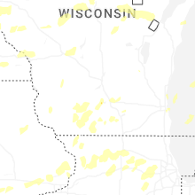


Connect with Interactive Hail Maps