

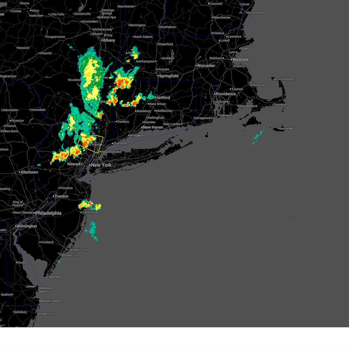
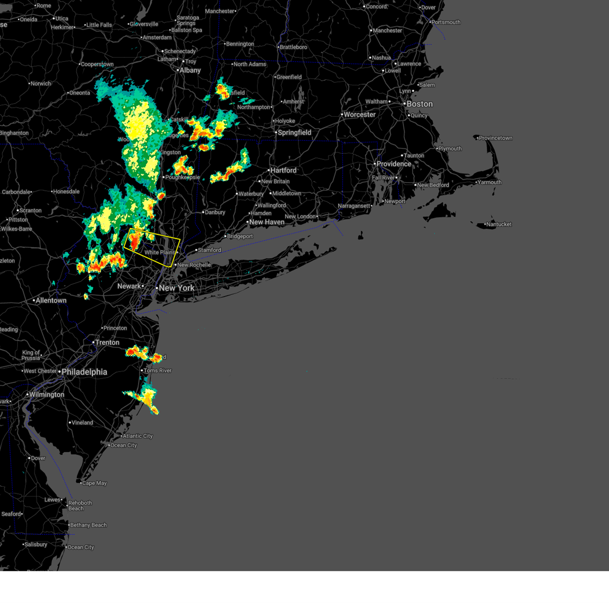
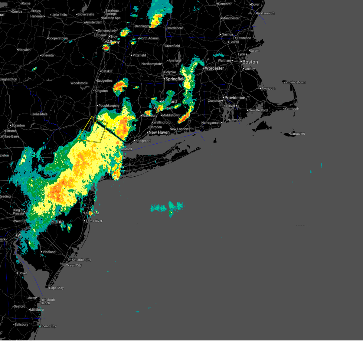
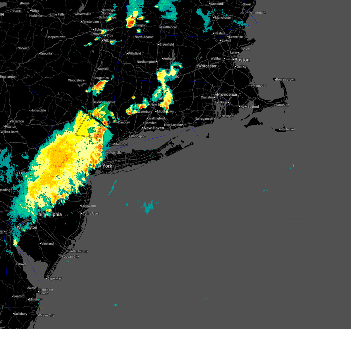
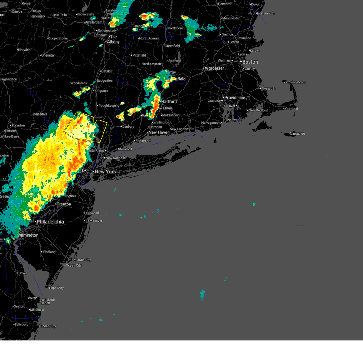
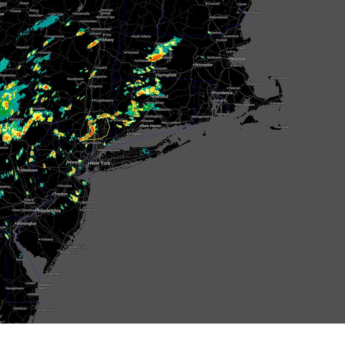
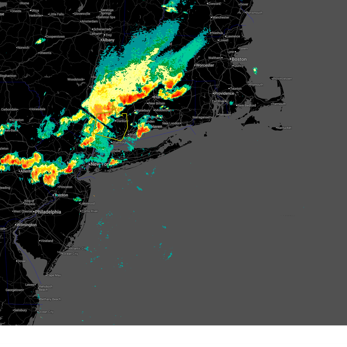
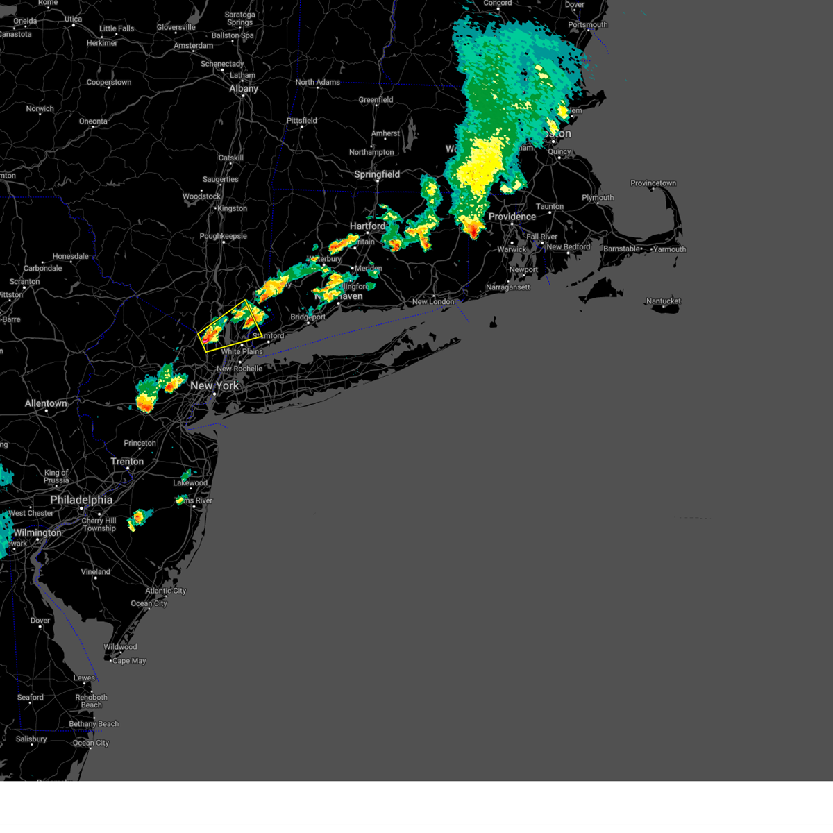
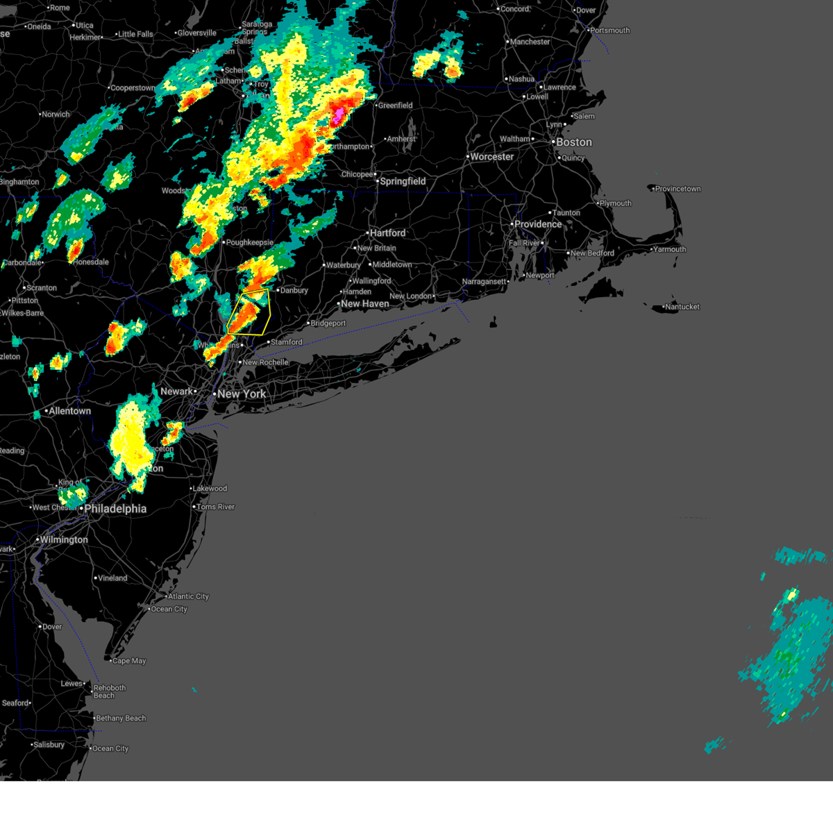
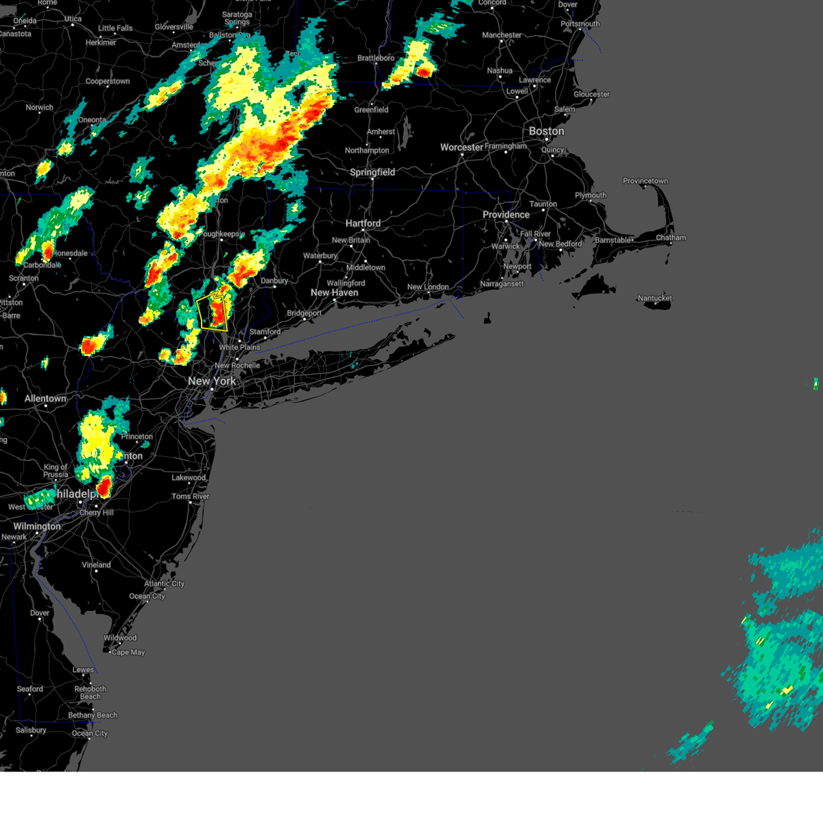
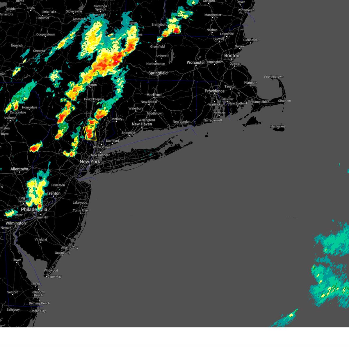
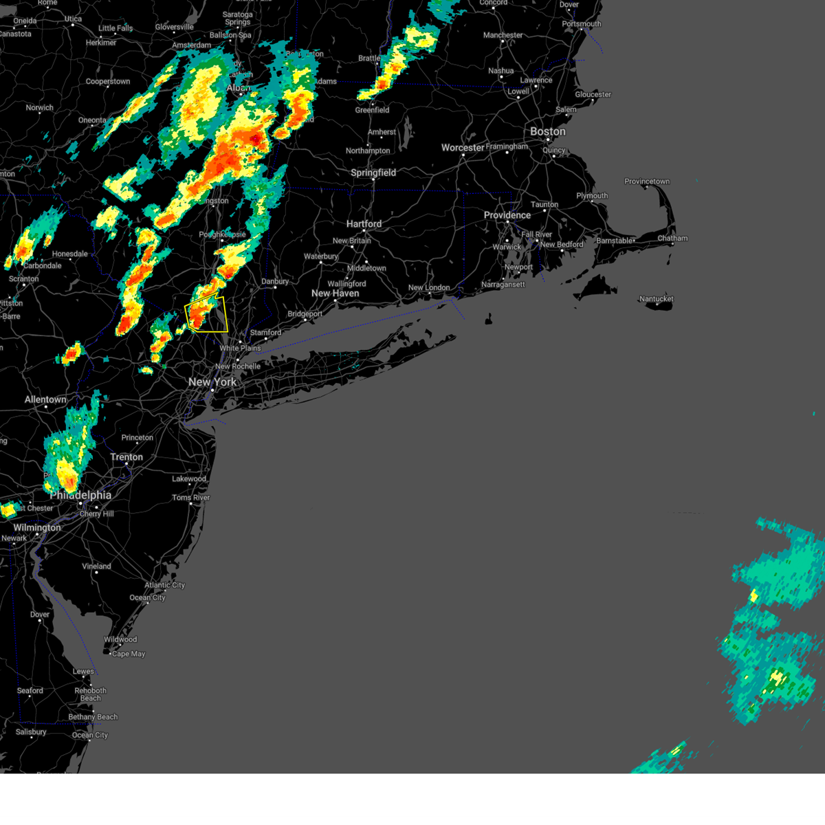
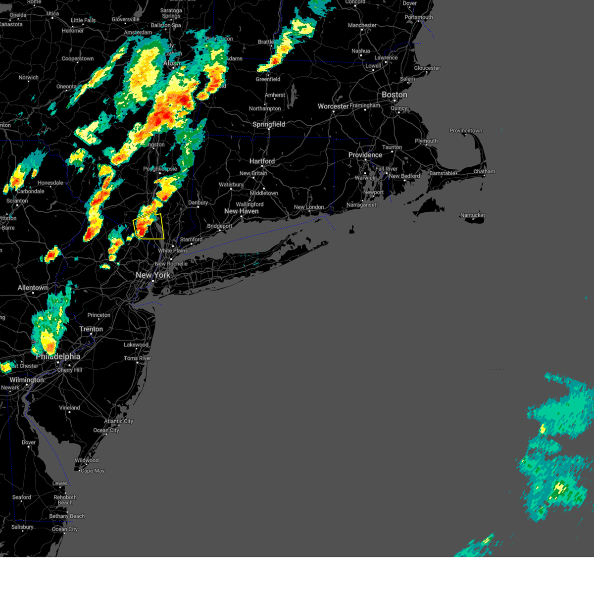
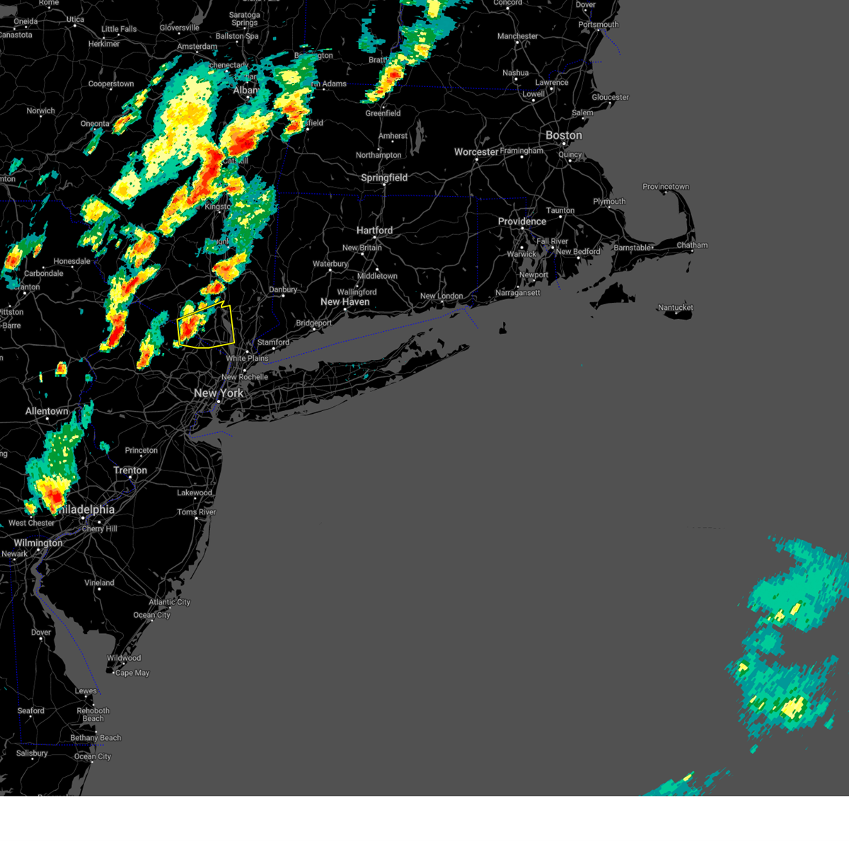
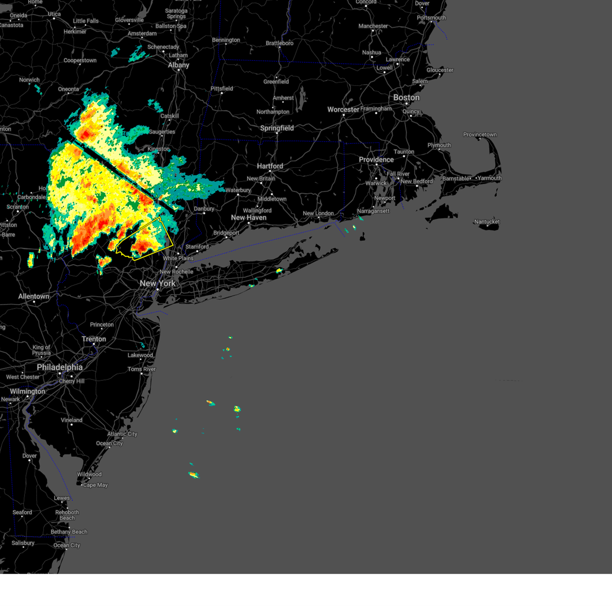
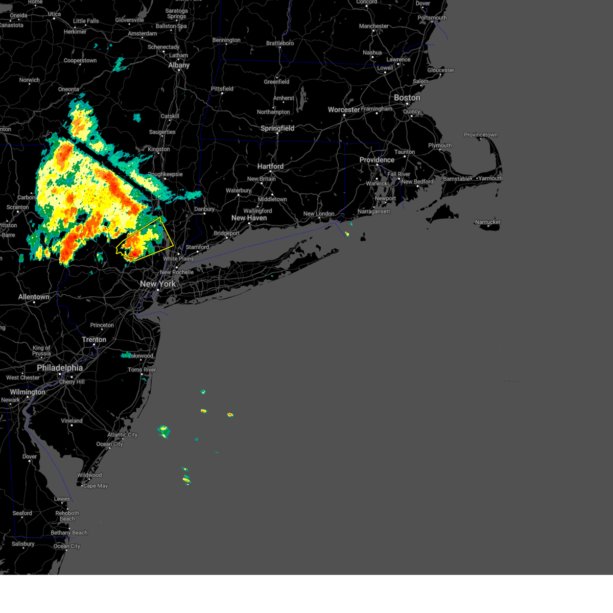
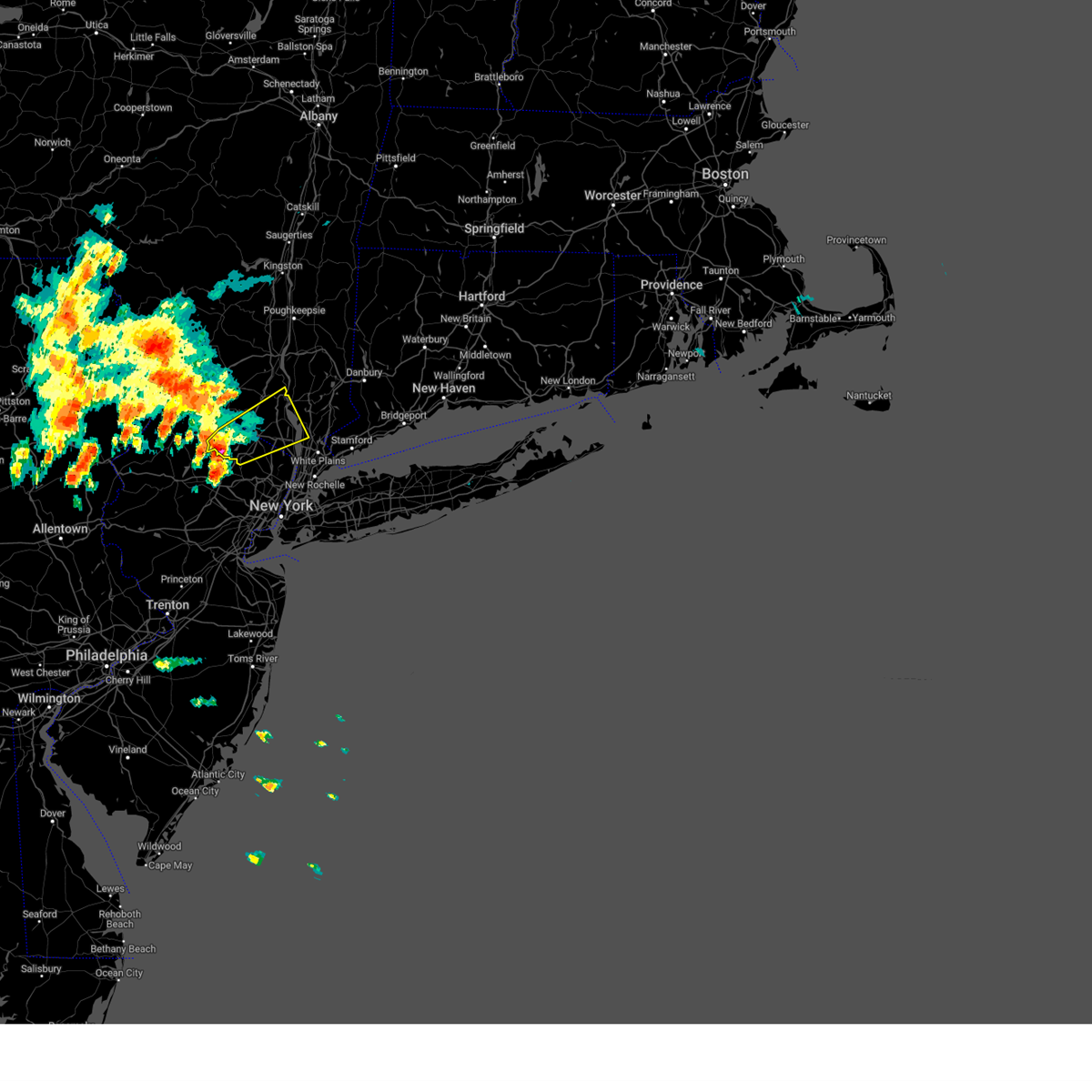
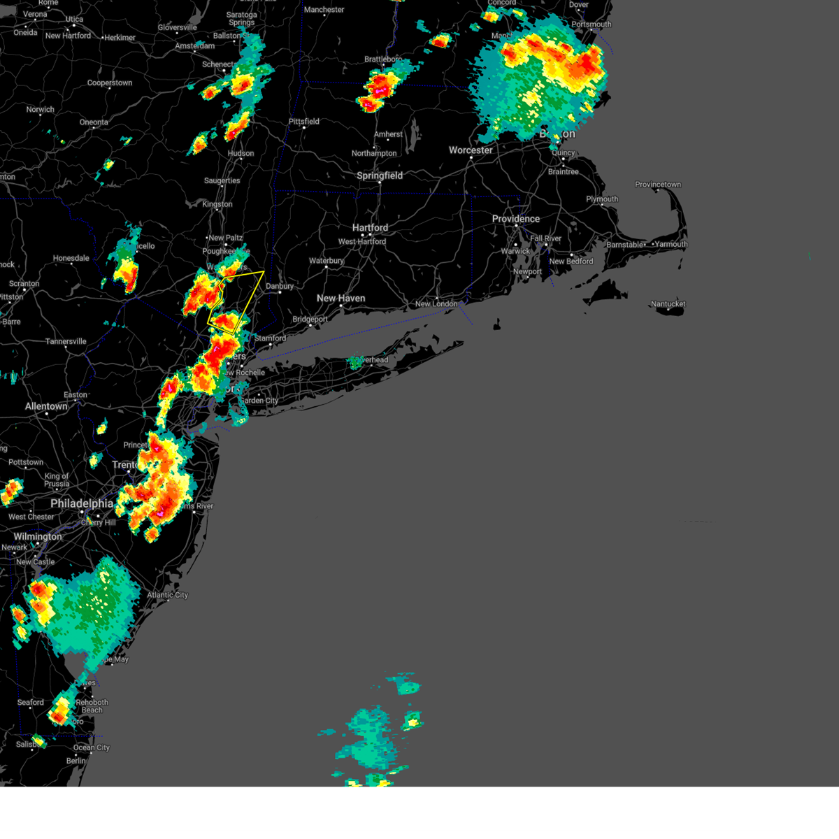
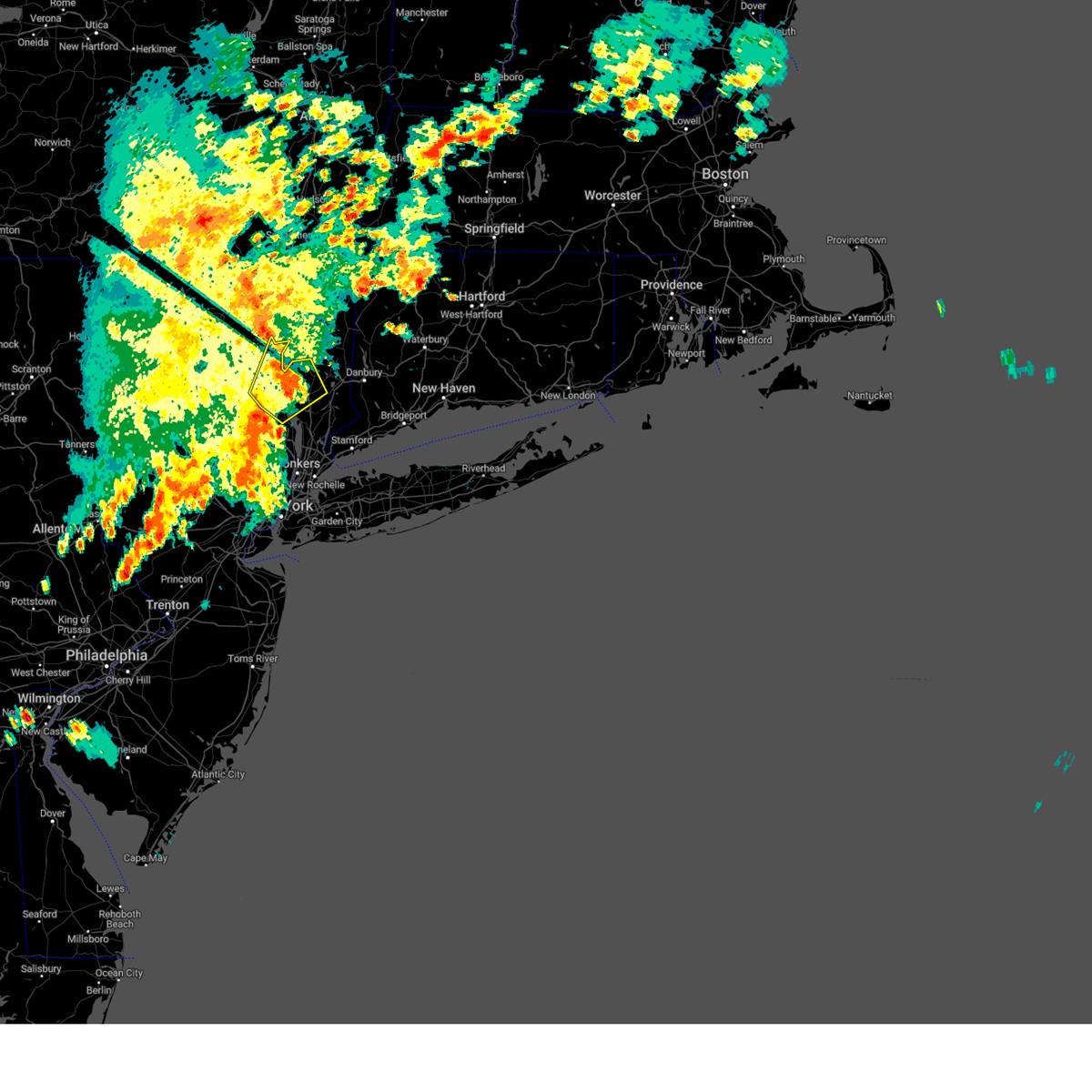
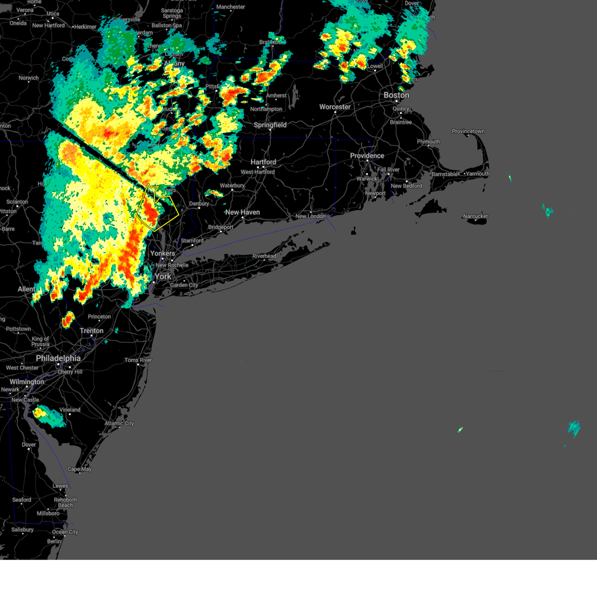
Hail Map for Croton-on-Hudson, NY
The Croton-on-Hudson, NY area has had 2 reports of on-the-ground hail by trained spotters, and has been under severe weather warnings 17 times during the past 12 months. Doppler radar has detected hail at or near Croton-on-Hudson, NY on 31 occasions, including 1 occasion during the past year.
| Name: | Croton-on-Hudson, NY |
| Where Located: | 35.6 miles N of Brooklyn, NY |
| Map: | Google Map for Croton-on-Hudson, NY |
| Population: | 8070 |
| Housing Units: | 3123 |
| More Info: | Search Google for Croton-on-Hudson, NY |
1
The Top Recent Hail Date for Croton-on-Hudson, NY is Tuesday, July 8, 2025 (10th out of 31)

Hail and Wind Damage Spotted near Croton-on-Hudson, NY
| Date / Time | Report Details |
|---|---|
| 6/12/2026 6:20 PM EDT |
 At 619 pm edt, a severe thunderstorm was located over ramsey, moving southeast at 35 mph (radar indicated). Hazards include 60 mph wind gusts. Expect damage to trees and power lines. this severe storm will be near, norwood around 630 pm edt. tappan around 635 pm edt. yonkers around 640 pm edt. Bronxville around 645 pm edt. At 619 pm edt, a severe thunderstorm was located over ramsey, moving southeast at 35 mph (radar indicated). Hazards include 60 mph wind gusts. Expect damage to trees and power lines. this severe storm will be near, norwood around 630 pm edt. tappan around 635 pm edt. yonkers around 640 pm edt. Bronxville around 645 pm edt.
|
| 6/12/2026 6:03 PM EDT |
 Svrokx the national weather service in upton ny has issued a * severe thunderstorm warning for, central passaic county in northeastern new jersey, northern bergen county in northeastern new jersey, southern westchester county in southeastern new york, southern orange county in southeastern new york, rockland county in southeastern new york, * until 645 pm edt. * at 602 pm edt, a severe thunderstorm was located over ringwood, moving east at 25 mph (radar indicated). Hazards include 60 mph wind gusts. Expect damage to trees and power lines. this severe thunderstorm will be near, suffern and sloatsburg around 610 pm edt. ramsey around 615 pm edt. monsey around 620 pm edt. nanuet around 625 pm edt. Pearl river around 630 pm edt. Svrokx the national weather service in upton ny has issued a * severe thunderstorm warning for, central passaic county in northeastern new jersey, northern bergen county in northeastern new jersey, southern westchester county in southeastern new york, southern orange county in southeastern new york, rockland county in southeastern new york, * until 645 pm edt. * at 602 pm edt, a severe thunderstorm was located over ringwood, moving east at 25 mph (radar indicated). Hazards include 60 mph wind gusts. Expect damage to trees and power lines. this severe thunderstorm will be near, suffern and sloatsburg around 610 pm edt. ramsey around 615 pm edt. monsey around 620 pm edt. nanuet around 625 pm edt. Pearl river around 630 pm edt.
|
| 6/6/2026 8:20 PM EDT |
 The storm which prompted the warning has weakened below severe limits, and has exited the warned area. therefore, the warning will be allowed to expire. however, gusty winds are still possible with this thunderstorm. a severe thunderstorm watch remains in effect until 1000 pm edt for southeastern new york. The storm which prompted the warning has weakened below severe limits, and has exited the warned area. therefore, the warning will be allowed to expire. however, gusty winds are still possible with this thunderstorm. a severe thunderstorm watch remains in effect until 1000 pm edt for southeastern new york.
|
| 6/6/2026 7:56 PM EDT |
 At 756 pm edt, a severe thunderstorm was located over carmel, or over brewster, moving east at 60 mph (radar indicated). Hazards include 60 mph wind gusts. Expect damage to trees and power lines. This severe thunderstorm will remain over mainly rural areas of northern westchester, southeastern orange, western putnam and rockland counties. At 756 pm edt, a severe thunderstorm was located over carmel, or over brewster, moving east at 60 mph (radar indicated). Hazards include 60 mph wind gusts. Expect damage to trees and power lines. This severe thunderstorm will remain over mainly rural areas of northern westchester, southeastern orange, western putnam and rockland counties.
|
| 6/6/2026 7:26 PM EDT |
 Svrokx the national weather service in upton ny has issued a * severe thunderstorm warning for, northern westchester county in southeastern new york, orange county in southeastern new york, western putnam county in southeastern new york, rockland county in southeastern new york, * until 830 pm edt. * at 726 pm edt, a severe thunderstorm was located near montgomery, or near goshen, moving east at 60 mph (radar indicated). Hazards include 60 mph wind gusts and penny size hail. Expect damage to trees and power lines. this severe thunderstorm will be near, newburgh and cold spring around 735 pm edt. Fahnestock state park around 745 pm edt. Svrokx the national weather service in upton ny has issued a * severe thunderstorm warning for, northern westchester county in southeastern new york, orange county in southeastern new york, western putnam county in southeastern new york, rockland county in southeastern new york, * until 830 pm edt. * at 726 pm edt, a severe thunderstorm was located near montgomery, or near goshen, moving east at 60 mph (radar indicated). Hazards include 60 mph wind gusts and penny size hail. Expect damage to trees and power lines. this severe thunderstorm will be near, newburgh and cold spring around 735 pm edt. Fahnestock state park around 745 pm edt.
|
| 12/19/2025 4:12 PM EST |
 Svrokx the national weather service in upton ny has issued a * severe thunderstorm warning for, fairfield county in southern connecticut, westchester county in southeastern new york, east central orange county in southeastern new york, putnam county in southeastern new york, queens county in southeastern new york, bronx county in southeastern new york, western suffolk county in southeastern new york, kings county in southeastern new york, rockland county in southeastern new york, nassau county in southeastern new york, * until 500 pm est. * at 410 pm est, showers with embedded thunderstorms were located along a line extending from near chester to near nyack to east tremont to flatbush, moving east at 45 mph (trained weather spotters). Hazards include 60 mph wind gusts. Expect damage to trees and power lines. severe thunderstorms will be near, jamaica and yonkers around 415 pm est. valley stream and port chester around 420 pm est. garden city and lynbrook around 425 pm est. stamford and westbury around 430 pm est. levittown and plainview around 435 pm est. norwalk and huntington station around 440 pm est. danbury and dix hills around 445 pm est. Commack and deer park around 450 pm est. Svrokx the national weather service in upton ny has issued a * severe thunderstorm warning for, fairfield county in southern connecticut, westchester county in southeastern new york, east central orange county in southeastern new york, putnam county in southeastern new york, queens county in southeastern new york, bronx county in southeastern new york, western suffolk county in southeastern new york, kings county in southeastern new york, rockland county in southeastern new york, nassau county in southeastern new york, * until 500 pm est. * at 410 pm est, showers with embedded thunderstorms were located along a line extending from near chester to near nyack to east tremont to flatbush, moving east at 45 mph (trained weather spotters). Hazards include 60 mph wind gusts. Expect damage to trees and power lines. severe thunderstorms will be near, jamaica and yonkers around 415 pm est. valley stream and port chester around 420 pm est. garden city and lynbrook around 425 pm est. stamford and westbury around 430 pm est. levittown and plainview around 435 pm est. norwalk and huntington station around 440 pm est. danbury and dix hills around 445 pm est. Commack and deer park around 450 pm est.
|
| 12/19/2025 3:18 PM EST |
 Svrokx the national weather service in upton ny has issued a * severe thunderstorm warning for, hudson county in northeastern new jersey, passaic county in northeastern new jersey, union county in northeastern new jersey, bergen county in northeastern new jersey, essex county in northeastern new jersey, southern orange county in southeastern new york, queens county in southeastern new york, richmond county in southeastern new york, bronx county in southeastern new york, kings county in southeastern new york, rockland county in southeastern new york, westchester county in southeastern new york, new york (manhattan) county in southeastern new york, southwestern nassau county in southeastern new york, * until 415 pm est. * at 314 pm est, showers with embedded thunderstorms were located along a line extending from 6 miles east of pecks pond to greendell to near bridgewater to near windsor, moving east at 50 mph (trained weather spotters). Hazards include 60 mph wind gusts. Expect damage to trees and power lines. severe thunderstorms will be near, plainfield around 325 pm est. summit and port jervis around 330 pm est. linden and west milford around 335 pm est. newark and elizabeth around 340 pm est. paterson and passaic around 345 pm est. jersey city and hoboken around 350 pm est. flatbush and bergenfield around 355 pm est. flushing and mott haven around 400 pm est. Jamaica and yonkers around 405 pm est. Svrokx the national weather service in upton ny has issued a * severe thunderstorm warning for, hudson county in northeastern new jersey, passaic county in northeastern new jersey, union county in northeastern new jersey, bergen county in northeastern new jersey, essex county in northeastern new jersey, southern orange county in southeastern new york, queens county in southeastern new york, richmond county in southeastern new york, bronx county in southeastern new york, kings county in southeastern new york, rockland county in southeastern new york, westchester county in southeastern new york, new york (manhattan) county in southeastern new york, southwestern nassau county in southeastern new york, * until 415 pm est. * at 314 pm est, showers with embedded thunderstorms were located along a line extending from 6 miles east of pecks pond to greendell to near bridgewater to near windsor, moving east at 50 mph (trained weather spotters). Hazards include 60 mph wind gusts. Expect damage to trees and power lines. severe thunderstorms will be near, plainfield around 325 pm est. summit and port jervis around 330 pm est. linden and west milford around 335 pm est. newark and elizabeth around 340 pm est. paterson and passaic around 345 pm est. jersey city and hoboken around 350 pm est. flatbush and bergenfield around 355 pm est. flushing and mott haven around 400 pm est. Jamaica and yonkers around 405 pm est.
|
| 7/14/2025 3:44 PM EDT |
 The storms which prompted the warning have weakened below severe limits, and no longer pose an immediate threat to life or property. therefore, the warning will be allowed to expire. however, gusty winds are still possible with these thunderstorms. The storms which prompted the warning have weakened below severe limits, and no longer pose an immediate threat to life or property. therefore, the warning will be allowed to expire. however, gusty winds are still possible with these thunderstorms.
|
| 7/14/2025 3:32 PM EDT |
 the severe thunderstorm warning has been cancelled and is no longer in effect the severe thunderstorm warning has been cancelled and is no longer in effect
|
| 7/14/2025 3:32 PM EDT |
 At 332 pm edt, severe thunderstorms were located along a line extending from near mahopac to near yorktown heights to upper nyack, moving east at 15 mph (radar indicated). Hazards include 60 mph wind gusts. Expect damage to trees and power lines. these severe storms will be near, ossining and mount kisco around 335 pm edt. Bedford around 350 pm edt. At 332 pm edt, severe thunderstorms were located along a line extending from near mahopac to near yorktown heights to upper nyack, moving east at 15 mph (radar indicated). Hazards include 60 mph wind gusts. Expect damage to trees and power lines. these severe storms will be near, ossining and mount kisco around 335 pm edt. Bedford around 350 pm edt.
|
| 7/14/2025 3:26 PM EDT |
 At 326 pm edt, severe thunderstorms were located along a line extending from near mahopac to near yorktown heights to upper nyack, moving east at 15 mph (radar indicated). Hazards include 60 mph wind gusts. Expect damage to trees and power lines. these severe storms will be near, ossining and mount kisco around 330 pm edt. carmel and bedford around 345 pm edt. Hawthorne around 350 pm edt. At 326 pm edt, severe thunderstorms were located along a line extending from near mahopac to near yorktown heights to upper nyack, moving east at 15 mph (radar indicated). Hazards include 60 mph wind gusts. Expect damage to trees and power lines. these severe storms will be near, ossining and mount kisco around 330 pm edt. carmel and bedford around 345 pm edt. Hawthorne around 350 pm edt.
|
| 7/14/2025 3:03 PM EDT |
 Svrokx the national weather service in upton ny has issued a * severe thunderstorm warning for, northern westchester county in southeastern new york, eastern putnam county in southeastern new york, rockland county in southeastern new york, * until 345 pm edt. * at 303 pm edt, severe thunderstorms were located along a line extending from near peekskill to near yorktown heights to nanuet, moving east at 15 mph (radar indicated). Hazards include 60 mph wind gusts. Expect damage to trees and power lines. severe thunderstorms will be near, new city and ossining around 310 pm edt. mount kisco around 315 pm edt. Mahopac around 325 pm edt. Svrokx the national weather service in upton ny has issued a * severe thunderstorm warning for, northern westchester county in southeastern new york, eastern putnam county in southeastern new york, rockland county in southeastern new york, * until 345 pm edt. * at 303 pm edt, severe thunderstorms were located along a line extending from near peekskill to near yorktown heights to nanuet, moving east at 15 mph (radar indicated). Hazards include 60 mph wind gusts. Expect damage to trees and power lines. severe thunderstorms will be near, new city and ossining around 310 pm edt. mount kisco around 315 pm edt. Mahopac around 325 pm edt.
|
| 7/8/2025 2:30 PM EDT |
 The storm which prompted the warning has weakened below severe limits, and has exited the warned area. therefore, the warning will be allowed to expire. a severe thunderstorm watch remains in effect until 900 pm edt for southeastern new york. The storm which prompted the warning has weakened below severe limits, and has exited the warned area. therefore, the warning will be allowed to expire. a severe thunderstorm watch remains in effect until 900 pm edt for southeastern new york.
|
| 7/8/2025 2:07 PM EDT | Dot tree down across rte 129. all lanes blocke in westchester county NY, 2.8 miles SSW of Croton-on-Hudson, NY |
| 7/8/2025 2:02 PM EDT |
 At 202 pm edt, a severe thunderstorm was located near ossining, moving east at 25 mph (radar indicated). Hazards include 60 mph wind gusts and quarter size hail. Minor hail damage to vehicles is possible. expect wind damage to trees and power lines. This severe thunderstorm will remain over mainly rural areas of northern westchester county. At 202 pm edt, a severe thunderstorm was located near ossining, moving east at 25 mph (radar indicated). Hazards include 60 mph wind gusts and quarter size hail. Minor hail damage to vehicles is possible. expect wind damage to trees and power lines. This severe thunderstorm will remain over mainly rural areas of northern westchester county.
|
| 7/8/2025 2:02 PM EDT |
 the severe thunderstorm warning has been cancelled and is no longer in effect the severe thunderstorm warning has been cancelled and is no longer in effect
|
| 7/8/2025 1:55 PM EDT | Large tree down on power line in westchester county NY, 2 miles SE of Croton-on-Hudson, NY |
| 7/8/2025 1:34 PM EDT |
 Svrokx the national weather service in upton ny has issued a * severe thunderstorm warning for, northern westchester county in southeastern new york, southeastern orange county in southeastern new york, rockland county in southeastern new york, * until 230 pm edt. * at 133 pm edt, a severe thunderstorm was located near harriman, or 7 miles southeast of monroe, moving east at 25 mph (radar indicated). Hazards include 60 mph wind gusts and quarter size hail. Minor hail damage to vehicles is possible. expect wind damage to trees and power lines. This severe thunderstorm will be near, peekskill and haverstraw around 145 pm edt. Svrokx the national weather service in upton ny has issued a * severe thunderstorm warning for, northern westchester county in southeastern new york, southeastern orange county in southeastern new york, rockland county in southeastern new york, * until 230 pm edt. * at 133 pm edt, a severe thunderstorm was located near harriman, or 7 miles southeast of monroe, moving east at 25 mph (radar indicated). Hazards include 60 mph wind gusts and quarter size hail. Minor hail damage to vehicles is possible. expect wind damage to trees and power lines. This severe thunderstorm will be near, peekskill and haverstraw around 145 pm edt.
|
| 7/3/2025 6:05 PM EDT |
 Svrokx the national weather service in upton ny has issued a * severe thunderstorm warning for, fairfield county in southern connecticut, western new haven county in southern connecticut, northern westchester county in southeastern new york, putnam county in southeastern new york, * until 645 pm edt. * at 604 pm edt, severe thunderstorms were located along a line extending from near hopewell junction to 6 miles east of fishkill to near fahnestock state park to near yorktown heights, moving east at 55 mph (radar indicated). Hazards include 60 mph wind gusts and quarter size hail. Minor hail damage to vehicles is possible. expect wind damage to trees and power lines. severe thunderstorms will be near, mount kisco and mahopac around 610 pm edt. danbury and sherman around 615 pm edt. stamford and new canaan around 620 pm edt. norwalk and southbury around 625 pm edt. Fairfield and trumbull around 630 pm edt. Svrokx the national weather service in upton ny has issued a * severe thunderstorm warning for, fairfield county in southern connecticut, western new haven county in southern connecticut, northern westchester county in southeastern new york, putnam county in southeastern new york, * until 645 pm edt. * at 604 pm edt, severe thunderstorms were located along a line extending from near hopewell junction to 6 miles east of fishkill to near fahnestock state park to near yorktown heights, moving east at 55 mph (radar indicated). Hazards include 60 mph wind gusts and quarter size hail. Minor hail damage to vehicles is possible. expect wind damage to trees and power lines. severe thunderstorms will be near, mount kisco and mahopac around 610 pm edt. danbury and sherman around 615 pm edt. stamford and new canaan around 620 pm edt. norwalk and southbury around 625 pm edt. Fairfield and trumbull around 630 pm edt.
|
| 5/3/2025 6:45 PM EDT |
 The storm which prompted the warning has moved out of the area. therefore, the warning has been allowed to expire. The storm which prompted the warning has moved out of the area. therefore, the warning has been allowed to expire.
|
| 5/3/2025 6:28 PM EDT |
 Svrokx the national weather service in upton ny has issued a * severe thunderstorm warning for, fairfield county in southern connecticut, northern westchester county in southeastern new york, * until 715 pm edt. * at 627 pm edt, a severe thunderstorm was located over mount kisco, moving east at 35 mph (radar indicated). Hazards include 60 mph wind gusts and quarter size hail. Minor hail damage to vehicles is possible. expect wind damage to trees and power lines. this severe thunderstorm will be near, stamford and new canaan around 635 pm edt. ridgefield and wilton around 640 pm edt. weston and redding around 645 pm edt. fairfield around 655 pm edt. Newtown and trumbull around 700 pm edt. Svrokx the national weather service in upton ny has issued a * severe thunderstorm warning for, fairfield county in southern connecticut, northern westchester county in southeastern new york, * until 715 pm edt. * at 627 pm edt, a severe thunderstorm was located over mount kisco, moving east at 35 mph (radar indicated). Hazards include 60 mph wind gusts and quarter size hail. Minor hail damage to vehicles is possible. expect wind damage to trees and power lines. this severe thunderstorm will be near, stamford and new canaan around 635 pm edt. ridgefield and wilton around 640 pm edt. weston and redding around 645 pm edt. fairfield around 655 pm edt. Newtown and trumbull around 700 pm edt.
|
| 5/3/2025 6:21 PM EDT |
 the severe thunderstorm warning has been cancelled and is no longer in effect the severe thunderstorm warning has been cancelled and is no longer in effect
|
| 5/3/2025 6:21 PM EDT |
 At 620 pm edt, a severe thunderstorm was located over ossining, moving northeast at 30 mph (radar indicated). Hazards include 60 mph wind gusts and quarter size hail. Minor hail damage to vehicles is possible. expect wind damage to trees and power lines. this severe storm will be near, hawthorne around 625 pm edt. mount kisco around 630 pm edt. Bedford around 635 pm edt. At 620 pm edt, a severe thunderstorm was located over ossining, moving northeast at 30 mph (radar indicated). Hazards include 60 mph wind gusts and quarter size hail. Minor hail damage to vehicles is possible. expect wind damage to trees and power lines. this severe storm will be near, hawthorne around 625 pm edt. mount kisco around 630 pm edt. Bedford around 635 pm edt.
|
| 5/3/2025 5:58 PM EDT |
 Svrokx the national weather service in upton ny has issued a * severe thunderstorm warning for, southern fairfield county in southern connecticut, northeastern bergen county in northeastern new jersey, central westchester county in southeastern new york, rockland county in southeastern new york, * until 645 pm edt. * at 558 pm edt, a severe thunderstorm was located over nanuet, moving northeast at 30 mph (radar indicated). Hazards include 60 mph wind gusts and penny size hail. Expect damage to trees and power lines. this severe thunderstorm will be near, new city and nanuet around 605 pm edt. ossining around 615 pm edt. hawthorne around 620 pm edt. mount kisco around 630 pm edt. Bedford around 635 pm edt. Svrokx the national weather service in upton ny has issued a * severe thunderstorm warning for, southern fairfield county in southern connecticut, northeastern bergen county in northeastern new jersey, central westchester county in southeastern new york, rockland county in southeastern new york, * until 645 pm edt. * at 558 pm edt, a severe thunderstorm was located over nanuet, moving northeast at 30 mph (radar indicated). Hazards include 60 mph wind gusts and penny size hail. Expect damage to trees and power lines. this severe thunderstorm will be near, new city and nanuet around 605 pm edt. ossining around 615 pm edt. hawthorne around 620 pm edt. mount kisco around 630 pm edt. Bedford around 635 pm edt.
|
| 8/3/2024 4:02 PM EDT |
 At 401 pm edt, a severe thunderstorm was located near hawthorne, or near ossining, moving east at 30 mph (radar indicated). Hazards include 60 mph wind gusts and quarter size hail. Minor hail damage to vehicles is possible. expect wind damage to trees and power lines. this severe storm will be near, mount kisco around 405 pm edt. bedford around 410 pm edt. new canaan around 420 pm edt. Ridgefield around 425 pm edt. At 401 pm edt, a severe thunderstorm was located near hawthorne, or near ossining, moving east at 30 mph (radar indicated). Hazards include 60 mph wind gusts and quarter size hail. Minor hail damage to vehicles is possible. expect wind damage to trees and power lines. this severe storm will be near, mount kisco around 405 pm edt. bedford around 410 pm edt. new canaan around 420 pm edt. Ridgefield around 425 pm edt.
|
| 8/3/2024 3:46 PM EDT |
 Svrokx the national weather service in upton ny has issued a * severe thunderstorm warning for, northern westchester county in southeastern new york, rockland county in southeastern new york, * until 430 pm edt. * at 345 pm edt, a severe thunderstorm was located over ossining, moving northeast at 20 mph (radar indicated). Hazards include 60 mph wind gusts and quarter size hail. Minor hail damage to vehicles is possible. expect wind damage to trees and power lines. this severe thunderstorm will be near, mount kisco around 400 pm edt. yorktown heights around 405 pm edt. Bedford around 415 pm edt. Svrokx the national weather service in upton ny has issued a * severe thunderstorm warning for, northern westchester county in southeastern new york, rockland county in southeastern new york, * until 430 pm edt. * at 345 pm edt, a severe thunderstorm was located over ossining, moving northeast at 20 mph (radar indicated). Hazards include 60 mph wind gusts and quarter size hail. Minor hail damage to vehicles is possible. expect wind damage to trees and power lines. this severe thunderstorm will be near, mount kisco around 400 pm edt. yorktown heights around 405 pm edt. Bedford around 415 pm edt.
|
| 8/3/2024 3:28 PM EDT |
 Svrokx the national weather service in upton ny has issued a * severe thunderstorm warning for, northern westchester county in southeastern new york, rockland county in southeastern new york, * until 415 pm edt. * at 328 pm edt, a severe thunderstorm was located over nanuet, moving northeast at 15 mph (radar indicated). Hazards include 60 mph wind gusts and quarter size hail. Minor hail damage to vehicles is possible. expect wind damage to trees and power lines. This severe thunderstorm will be near, new city and haverstraw around 335 pm edt. Svrokx the national weather service in upton ny has issued a * severe thunderstorm warning for, northern westchester county in southeastern new york, rockland county in southeastern new york, * until 415 pm edt. * at 328 pm edt, a severe thunderstorm was located over nanuet, moving northeast at 15 mph (radar indicated). Hazards include 60 mph wind gusts and quarter size hail. Minor hail damage to vehicles is possible. expect wind damage to trees and power lines. This severe thunderstorm will be near, new city and haverstraw around 335 pm edt.
|
| 7/17/2024 4:40 PM EDT |
 The storms which prompted the warning have moved out of the area. therefore, the warning will be allowed to expire. a new severe thunderstorm warning has been issued. a severe thunderstorm watch remains in effect until 800 pm edt for southern connecticut, and southeastern new york. The storms which prompted the warning have moved out of the area. therefore, the warning will be allowed to expire. a new severe thunderstorm warning has been issued. a severe thunderstorm watch remains in effect until 800 pm edt for southern connecticut, and southeastern new york.
|
| 7/17/2024 4:27 PM EDT |
 the severe thunderstorm warning has been cancelled and is no longer in effect the severe thunderstorm warning has been cancelled and is no longer in effect
|
| 7/17/2024 4:27 PM EDT |
 At 427 pm edt, severe thunderstorms were located along a line extending from near brewster to 6 miles east of mount kisco to near bedford, moving east at 30 mph (radar indicated). Hazards include 60 mph wind gusts and penny size hail. Expect damage to trees and power lines. These severe storms will be near, stamford and greenwich around 430 pm edt. At 427 pm edt, severe thunderstorms were located along a line extending from near brewster to 6 miles east of mount kisco to near bedford, moving east at 30 mph (radar indicated). Hazards include 60 mph wind gusts and penny size hail. Expect damage to trees and power lines. These severe storms will be near, stamford and greenwich around 430 pm edt.
|
| 7/17/2024 4:00 PM EDT | Multiple tree limbs down throughout croton-on-hudson blocking roadway in westchester county NY, 1.2 miles ESE of Croton-on-Hudson, NY |
| 7/17/2024 3:59 PM EDT |
 The storm which prompted the warning has moved out of the area. therefore, the warning will be allowed to expire. a new severe thunderstorm warning was issued. a severe thunderstorm watch remains in effect until 800 pm edt for southeastern new york. The storm which prompted the warning has moved out of the area. therefore, the warning will be allowed to expire. a new severe thunderstorm warning was issued. a severe thunderstorm watch remains in effect until 800 pm edt for southeastern new york.
|
| 7/17/2024 3:52 PM EDT |
 Svrokx the national weather service in upton ny has issued a * severe thunderstorm warning for, southern fairfield county in southern connecticut, westchester county in southeastern new york, putnam county in southeastern new york, rockland county in southeastern new york, * until 445 pm edt. * at 352 pm edt, severe thunderstorms were located along a line extending from peekskill to near haverstraw to near nanuet, moving east at 25 mph (radar indicated). Hazards include 60 mph wind gusts and penny size hail. Expect damage to trees and power lines. severe thunderstorms will be near, ossining and upper nyack around 400 pm edt. mount kisco and hawthorne around 405 pm edt. greenwich and bedford around 415 pm edt. stamford around 420 pm edt. Ridgefield around 425 pm edt. Svrokx the national weather service in upton ny has issued a * severe thunderstorm warning for, southern fairfield county in southern connecticut, westchester county in southeastern new york, putnam county in southeastern new york, rockland county in southeastern new york, * until 445 pm edt. * at 352 pm edt, severe thunderstorms were located along a line extending from peekskill to near haverstraw to near nanuet, moving east at 25 mph (radar indicated). Hazards include 60 mph wind gusts and penny size hail. Expect damage to trees and power lines. severe thunderstorms will be near, ossining and upper nyack around 400 pm edt. mount kisco and hawthorne around 405 pm edt. greenwich and bedford around 415 pm edt. stamford around 420 pm edt. Ridgefield around 425 pm edt.
|
| 7/17/2024 3:49 PM EDT |
 At 349 pm edt, a severe thunderstorm was located over haverstraw, moving east at 25 mph (radar indicated). Hazards include 60 mph wind gusts and penny size hail. Expect damage to trees and power lines. This severe thunderstorm will remain over mainly rural areas of northern westchester, southeastern orange and rockland counties. At 349 pm edt, a severe thunderstorm was located over haverstraw, moving east at 25 mph (radar indicated). Hazards include 60 mph wind gusts and penny size hail. Expect damage to trees and power lines. This severe thunderstorm will remain over mainly rural areas of northern westchester, southeastern orange and rockland counties.
|
| 7/17/2024 3:36 PM EDT |
 At 336 pm edt, a severe thunderstorm was located over pomona, or near monsey, moving east at 25 mph (radar indicated). Hazards include 60 mph wind gusts. Expect damage to trees and power lines. This severe storm will be near, new city and haverstraw around 340 pm edt. At 336 pm edt, a severe thunderstorm was located over pomona, or near monsey, moving east at 25 mph (radar indicated). Hazards include 60 mph wind gusts. Expect damage to trees and power lines. This severe storm will be near, new city and haverstraw around 340 pm edt.
|
| 7/17/2024 3:36 PM EDT |
 the severe thunderstorm warning has been cancelled and is no longer in effect the severe thunderstorm warning has been cancelled and is no longer in effect
|
| 7/17/2024 3:21 PM EDT |
 Svrokx the national weather service in upton ny has issued a * severe thunderstorm warning for, central passaic county in northeastern new jersey, northwestern bergen county in northeastern new jersey, northern westchester county in southeastern new york, southeastern orange county in southeastern new york, rockland county in southeastern new york, * until 400 pm edt. * at 320 pm edt, a severe thunderstorm was located over sloatsburg, moving east at 25 mph (radar indicated). Hazards include 60 mph wind gusts. Expect damage to trees and power lines. this severe thunderstorm will be near, suffern and sloatsburg around 325 pm edt. pomona around 335 pm edt. new city around 340 pm edt. Haverstraw around 345 pm edt. Svrokx the national weather service in upton ny has issued a * severe thunderstorm warning for, central passaic county in northeastern new jersey, northwestern bergen county in northeastern new jersey, northern westchester county in southeastern new york, southeastern orange county in southeastern new york, rockland county in southeastern new york, * until 400 pm edt. * at 320 pm edt, a severe thunderstorm was located over sloatsburg, moving east at 25 mph (radar indicated). Hazards include 60 mph wind gusts. Expect damage to trees and power lines. this severe thunderstorm will be near, suffern and sloatsburg around 325 pm edt. pomona around 335 pm edt. new city around 340 pm edt. Haverstraw around 345 pm edt.
|
| 7/6/2024 5:00 AM EDT |
 The storm which prompted the warning has weakened below severe limits, and no longer poses an immediate threat to life or property. therefore, the warning will be allowed to expire. The storm which prompted the warning has weakened below severe limits, and no longer poses an immediate threat to life or property. therefore, the warning will be allowed to expire.
|
| 7/6/2024 4:38 AM EDT |
 At 438 am edt, a severe thunderstorm was located over pompton lakes, moving northeast at 25 mph (radar indicated). Hazards include 60 mph wind gusts and quarter size hail. Minor hail damage to vehicles is possible. expect wind damage to trees and power lines. this severe storm will be near, ramsey around 445 am edt. suffern around 450 am edt. monsey around 500 am edt. new city and nanuet around 510 am edt. Haverstraw around 515 am edt. At 438 am edt, a severe thunderstorm was located over pompton lakes, moving northeast at 25 mph (radar indicated). Hazards include 60 mph wind gusts and quarter size hail. Minor hail damage to vehicles is possible. expect wind damage to trees and power lines. this severe storm will be near, ramsey around 445 am edt. suffern around 450 am edt. monsey around 500 am edt. new city and nanuet around 510 am edt. Haverstraw around 515 am edt.
|
| 7/6/2024 4:15 AM EDT |
 Svrokx the national weather service in upton ny has issued a * severe thunderstorm warning for, passaic county in northeastern new jersey, northwestern bergen county in northeastern new jersey, central westchester county in southeastern new york, southeastern orange county in southeastern new york, rockland county in southeastern new york, * until 500 am edt. * at 415 am edt, a severe thunderstorm was located near west milford, moving northeast at 30 mph (radar indicated). Hazards include 60 mph wind gusts and quarter size hail. Minor hail damage to vehicles is possible. expect wind damage to trees and power lines. this severe thunderstorm will be near, west milford and ringwood around 420 am edt. suffern and sloatsburg around 435 am edt. monsey around 445 am edt. pomona around 450 am edt. New city around 455 am edt. Svrokx the national weather service in upton ny has issued a * severe thunderstorm warning for, passaic county in northeastern new jersey, northwestern bergen county in northeastern new jersey, central westchester county in southeastern new york, southeastern orange county in southeastern new york, rockland county in southeastern new york, * until 500 am edt. * at 415 am edt, a severe thunderstorm was located near west milford, moving northeast at 30 mph (radar indicated). Hazards include 60 mph wind gusts and quarter size hail. Minor hail damage to vehicles is possible. expect wind damage to trees and power lines. this severe thunderstorm will be near, west milford and ringwood around 420 am edt. suffern and sloatsburg around 435 am edt. monsey around 445 am edt. pomona around 450 am edt. New city around 455 am edt.
|
| 6/26/2024 9:17 PM EDT |
 The storms which prompted the warning will move east of the expired warned area, but will move into the new downstream warned area. a severe thunderstorm watch remains in effect until midnight edt for southern connecticut, and southeastern new york. The storms which prompted the warning will move east of the expired warned area, but will move into the new downstream warned area. a severe thunderstorm watch remains in effect until midnight edt for southern connecticut, and southeastern new york.
|
| 6/26/2024 9:11 PM EDT |
 The storms which prompted the warning have moved out of the area. therefore, the warning will be allowed to expire. a severe thunderstorm watch remains in effect until midnight edt for northeastern new jersey, and southeastern new york. The storms which prompted the warning have moved out of the area. therefore, the warning will be allowed to expire. a severe thunderstorm watch remains in effect until midnight edt for northeastern new jersey, and southeastern new york.
|
| 6/26/2024 8:32 PM EDT |
 The storms which prompted the warning have moved into eastern orange and western rockland counties and have been replaced by a new warning. a severe thunderstorm watch remains in effect until midnight edt for northeastern new jersey, and southeastern new york. to report severe weather, contact your nearest law enforcement agency. they will relay your report to the national weather service upton ny. The storms which prompted the warning have moved into eastern orange and western rockland counties and have been replaced by a new warning. a severe thunderstorm watch remains in effect until midnight edt for northeastern new jersey, and southeastern new york. to report severe weather, contact your nearest law enforcement agency. they will relay your report to the national weather service upton ny.
|
| 6/26/2024 8:26 PM EDT |
 Svrokx the national weather service in upton ny has issued a * severe thunderstorm warning for, fairfield county in southern connecticut, westchester county in southeastern new york, eastern orange county in southeastern new york, putnam county in southeastern new york, rockland county in southeastern new york, * until 915 pm edt. * at 826 pm edt, severe thunderstorms were located along a line extending from near phillipsport to near west point to near monsey, moving east at 50 mph (radar indicated). Hazards include 60 mph wind gusts. Expect damage to trees and power lines. severe thunderstorms will be near, new city and peekskill around 830 pm edt. newburgh and ossining around 835 pm edt. yorktown heights and fahnestock state park around 840 pm edt. mount kisco and mahopac around 845 pm edt. stamford and brewster around 850 pm edt. danbury and new canaan around 855 pm edt. darien and wilton around 900 pm edt. norwalk and sherman around 905 pm edt. Newtown around 910 pm edt. Svrokx the national weather service in upton ny has issued a * severe thunderstorm warning for, fairfield county in southern connecticut, westchester county in southeastern new york, eastern orange county in southeastern new york, putnam county in southeastern new york, rockland county in southeastern new york, * until 915 pm edt. * at 826 pm edt, severe thunderstorms were located along a line extending from near phillipsport to near west point to near monsey, moving east at 50 mph (radar indicated). Hazards include 60 mph wind gusts. Expect damage to trees and power lines. severe thunderstorms will be near, new city and peekskill around 830 pm edt. newburgh and ossining around 835 pm edt. yorktown heights and fahnestock state park around 840 pm edt. mount kisco and mahopac around 845 pm edt. stamford and brewster around 850 pm edt. danbury and new canaan around 855 pm edt. darien and wilton around 900 pm edt. norwalk and sherman around 905 pm edt. Newtown around 910 pm edt.
|
| 6/26/2024 8:17 PM EDT |
 Svrokx the national weather service in upton ny has issued a * severe thunderstorm warning for, southern westchester county in southeastern new york, queens county in southeastern new york, bronx county in southeastern new york, kings county in southeastern new york, new york (manhattan) county in southeastern new york, * until 915 pm edt. * at 816 pm edt, severe thunderstorms were located along a line extending from near greenwood lake to near east hanover to edison, moving east at 30 mph (radar indicated). Hazards include 60 mph wind gusts. Expect damage to trees and power lines. severe thunderstorms will be near, the verrazano narrows bridge and bay ridge around 840 pm edt. coney island and midtown manhattan around 845 pm edt. flatbush and mott haven around 850 pm edt. yonkers and east tremont around 855 pm edt. flushing and throgs neck bridge around 900 pm edt. Jamaica and new rochelle around 905 pm edt. Svrokx the national weather service in upton ny has issued a * severe thunderstorm warning for, southern westchester county in southeastern new york, queens county in southeastern new york, bronx county in southeastern new york, kings county in southeastern new york, new york (manhattan) county in southeastern new york, * until 915 pm edt. * at 816 pm edt, severe thunderstorms were located along a line extending from near greenwood lake to near east hanover to edison, moving east at 30 mph (radar indicated). Hazards include 60 mph wind gusts. Expect damage to trees and power lines. severe thunderstorms will be near, the verrazano narrows bridge and bay ridge around 840 pm edt. coney island and midtown manhattan around 845 pm edt. flatbush and mott haven around 850 pm edt. yonkers and east tremont around 855 pm edt. flushing and throgs neck bridge around 900 pm edt. Jamaica and new rochelle around 905 pm edt.
|
| 6/26/2024 7:49 PM EDT |
 Svrokx the national weather service in upton ny has issued a * severe thunderstorm warning for, northern westchester county in southeastern new york, orange county in southeastern new york, western putnam county in southeastern new york, rockland county in southeastern new york, * until 830 pm edt. * at 749 pm edt, severe thunderstorms were located along a line extending from near smallwood to near unionville to near vernon valley, moving east at 55 mph (radar indicated). Hazards include 60 mph wind gusts and penny size hail. Expect damage to trees and power lines. severe thunderstorms will be near, warwick and florida around 755 pm edt. middletown and goshen around 800 pm edt. monroe around 805 pm edt. pomona and harriman around 810 pm edt. haverstraw and west point around 815 pm edt. Ossining and peekskill around 820 pm edt. Svrokx the national weather service in upton ny has issued a * severe thunderstorm warning for, northern westchester county in southeastern new york, orange county in southeastern new york, western putnam county in southeastern new york, rockland county in southeastern new york, * until 830 pm edt. * at 749 pm edt, severe thunderstorms were located along a line extending from near smallwood to near unionville to near vernon valley, moving east at 55 mph (radar indicated). Hazards include 60 mph wind gusts and penny size hail. Expect damage to trees and power lines. severe thunderstorms will be near, warwick and florida around 755 pm edt. middletown and goshen around 800 pm edt. monroe around 805 pm edt. pomona and harriman around 810 pm edt. haverstraw and west point around 815 pm edt. Ossining and peekskill around 820 pm edt.
|
| 6/21/2024 6:25 PM EDT | Tree down on ny 129 west of batten rd... all of 2 lanes close in westchester county NY, 0.6 miles S of Croton-on-Hudson, NY |
| 5/23/2024 10:40 AM EDT |
 The storms which prompted the warning have exited and weakened below severe limits. therefore, the warning will be allowed to expire. The storms which prompted the warning have exited and weakened below severe limits. therefore, the warning will be allowed to expire.
|
| 5/23/2024 9:54 AM EDT |
 Svrokx the national weather service in upton ny has issued a * severe thunderstorm warning for, fairfield county in southern connecticut, west central new haven county in southern connecticut, hudson county in northeastern new jersey, eastern bergen county in northeastern new jersey, eastern putnam county in southeastern new york, queens county in southeastern new york, bronx county in southeastern new york, richmond county in southeastern new york, kings county in southeastern new york, rockland county in southeastern new york, westchester county in southeastern new york, west central suffolk county in southeastern new york, new york (manhattan) county in southeastern new york, nassau county in southeastern new york, * until 1045 am edt. * at 954 am edt, severe thunderstorms were located along a line extending from yorktown heights to yonkers to park slope, moving east at 55 mph (radar indicated). Hazards include 60 mph wind gusts. Expect damage to trees and power lines. severe thunderstorms will be near, jamaica and new rochelle around 1000 am edt. stamford and danbury around 1005 am edt. garden city and mineola around 1010 am edt. norwalk and syosset around 1015 am edt. levittown and huntington station around 1020 am edt. bridgeport and shelton around 1025 am edt. commack and deer park around 1030 am edt. Naugatuck and middlebury around 1035 am edt. Svrokx the national weather service in upton ny has issued a * severe thunderstorm warning for, fairfield county in southern connecticut, west central new haven county in southern connecticut, hudson county in northeastern new jersey, eastern bergen county in northeastern new jersey, eastern putnam county in southeastern new york, queens county in southeastern new york, bronx county in southeastern new york, richmond county in southeastern new york, kings county in southeastern new york, rockland county in southeastern new york, westchester county in southeastern new york, west central suffolk county in southeastern new york, new york (manhattan) county in southeastern new york, nassau county in southeastern new york, * until 1045 am edt. * at 954 am edt, severe thunderstorms were located along a line extending from yorktown heights to yonkers to park slope, moving east at 55 mph (radar indicated). Hazards include 60 mph wind gusts. Expect damage to trees and power lines. severe thunderstorms will be near, jamaica and new rochelle around 1000 am edt. stamford and danbury around 1005 am edt. garden city and mineola around 1010 am edt. norwalk and syosset around 1015 am edt. levittown and huntington station around 1020 am edt. bridgeport and shelton around 1025 am edt. commack and deer park around 1030 am edt. Naugatuck and middlebury around 1035 am edt.
|
| 5/23/2024 9:37 AM EDT | Ping Pong Ball sized hail reported 1.2 miles ESE of Croton-on-Hudson, NY, 1.5 hail reported. |
| 5/23/2024 7:54 AM EDT |
 Svrokx the national weather service in upton ny has issued a * severe thunderstorm warning for, central fairfield county in southern connecticut, northern westchester county in southeastern new york, eastern putnam county in southeastern new york, * until 845 am edt. * at 754 am edt, a severe thunderstorm was located near yorktown heights, or near peekskill, moving east at 40 mph (radar indicated). Hazards include quarter size hail. Minor damage to vehicles is possible. this severe thunderstorm will be near, yorktown heights around 800 am edt. danbury and ridgefield around 815 am edt. redding around 820 am edt. bethel around 825 am edt. Newtown and brookfield around 830 am edt. Svrokx the national weather service in upton ny has issued a * severe thunderstorm warning for, central fairfield county in southern connecticut, northern westchester county in southeastern new york, eastern putnam county in southeastern new york, * until 845 am edt. * at 754 am edt, a severe thunderstorm was located near yorktown heights, or near peekskill, moving east at 40 mph (radar indicated). Hazards include quarter size hail. Minor damage to vehicles is possible. this severe thunderstorm will be near, yorktown heights around 800 am edt. danbury and ridgefield around 815 am edt. redding around 820 am edt. bethel around 825 am edt. Newtown and brookfield around 830 am edt.
|
| 5/23/2024 7:44 AM EDT |
 At 743 am edt, a severe thunderstorm was located near haverstraw, moving east at 35 mph (radar indicated). Hazards include ping pong ball size hail. People and animals outdoors will be injured. expect damage to roofs, siding, windows, and vehicles. this severe storm will be near, peekskill around 750 am edt. Yorktown heights around 755 am edt. At 743 am edt, a severe thunderstorm was located near haverstraw, moving east at 35 mph (radar indicated). Hazards include ping pong ball size hail. People and animals outdoors will be injured. expect damage to roofs, siding, windows, and vehicles. this severe storm will be near, peekskill around 750 am edt. Yorktown heights around 755 am edt.
|
| 5/23/2024 7:44 AM EDT |
 the severe thunderstorm warning has been cancelled and is no longer in effect the severe thunderstorm warning has been cancelled and is no longer in effect
|
| 5/23/2024 7:28 AM EDT |
 Svrokx the national weather service in upton ny has issued a * severe thunderstorm warning for, northern westchester county in southeastern new york, southeastern orange county in southeastern new york, western putnam county in southeastern new york, rockland county in southeastern new york, * until 800 am edt. * at 727 am edt, a severe thunderstorm was located near sloatsburg, moving east at 45 mph (radar indicated). Hazards include quarter size hail. Minor damage to vehicles is possible. this severe thunderstorm will be near, pomona around 735 am edt. peekskill around 740 am edt. Yorktown heights around 750 am edt. Svrokx the national weather service in upton ny has issued a * severe thunderstorm warning for, northern westchester county in southeastern new york, southeastern orange county in southeastern new york, western putnam county in southeastern new york, rockland county in southeastern new york, * until 800 am edt. * at 727 am edt, a severe thunderstorm was located near sloatsburg, moving east at 45 mph (radar indicated). Hazards include quarter size hail. Minor damage to vehicles is possible. this severe thunderstorm will be near, pomona around 735 am edt. peekskill around 740 am edt. Yorktown heights around 750 am edt.
|
| 4/29/2024 5:44 PM EDT |
 The severe thunderstorm which prompted the warning has weakened. therefore, the warning will be allowed to expire. The severe thunderstorm which prompted the warning has weakened. therefore, the warning will be allowed to expire.
|
| 4/29/2024 5:32 PM EDT |
 At 531 pm edt, a severe thunderstorm was located over haverstraw, moving southeast at 10 mph (radar indicated). Hazards include 60 mph wind gusts and quarter size hail and lightning strikes. Minor hail damage to vehicles is possible. expect wind damage to trees and power lines. this severe storm will be near, ossining and upper nyack around 535 pm edt. Nyack around 540 pm edt. At 531 pm edt, a severe thunderstorm was located over haverstraw, moving southeast at 10 mph (radar indicated). Hazards include 60 mph wind gusts and quarter size hail and lightning strikes. Minor hail damage to vehicles is possible. expect wind damage to trees and power lines. this severe storm will be near, ossining and upper nyack around 535 pm edt. Nyack around 540 pm edt.
|
| 4/29/2024 5:20 PM EDT |
 Svrokx the national weather service in upton ny has issued a * severe thunderstorm warning for, southern westchester county in southeastern new york, rockland county in southeastern new york, * until 545 pm edt. * at 520 pm edt, a severe thunderstorm was located over new city, moving southeast at 10 mph (radar indicated). Hazards include 60 mph wind gusts and quarter size hail. Minor hail damage to vehicles is possible. This severe thunderstorm will be near, haverstraw around 525 pm edt. Svrokx the national weather service in upton ny has issued a * severe thunderstorm warning for, southern westchester county in southeastern new york, rockland county in southeastern new york, * until 545 pm edt. * at 520 pm edt, a severe thunderstorm was located over new city, moving southeast at 10 mph (radar indicated). Hazards include 60 mph wind gusts and quarter size hail. Minor hail damage to vehicles is possible. This severe thunderstorm will be near, haverstraw around 525 pm edt.
|
| 9/8/2023 4:11 PM EDT |
 The severe thunderstorm warning for northern westchester, putnam and rockland counties will expire at 415 pm edt, the storm which prompted the warning has moved out of the area. therefore, the warning will be allowed to expire. a severe thunderstorm watch remains in effect until 1100 pm edt for southeastern new york. The severe thunderstorm warning for northern westchester, putnam and rockland counties will expire at 415 pm edt, the storm which prompted the warning has moved out of the area. therefore, the warning will be allowed to expire. a severe thunderstorm watch remains in effect until 1100 pm edt for southeastern new york.
|
| 9/8/2023 3:30 PM EDT |
 At 330 pm edt, a severe thunderstorm was located near haverstraw, moving north at 35 mph (radar indicated). Hazards include 60 mph wind gusts and quarter size hail. Minor hail damage to vehicles is possible. expect wind damage to trees and power lines. this severe thunderstorm will be near, peekskill around 335 pm edt. fahnestock state park around 350 pm edt. hail threat, radar indicated max hail size, 1. 00 in wind threat, radar indicated max wind gust, 60 mph. At 330 pm edt, a severe thunderstorm was located near haverstraw, moving north at 35 mph (radar indicated). Hazards include 60 mph wind gusts and quarter size hail. Minor hail damage to vehicles is possible. expect wind damage to trees and power lines. this severe thunderstorm will be near, peekskill around 335 pm edt. fahnestock state park around 350 pm edt. hail threat, radar indicated max hail size, 1. 00 in wind threat, radar indicated max wind gust, 60 mph.
|
| 9/7/2023 7:41 PM EDT |
 At 741 pm edt, severe thunderstorms were located along a line extending from near walden to near hawthorne, moving east at 20 mph (radar indicated). Hazards include 60 mph wind gusts. Expect damage to trees and power lines. severe thunderstorms will be near, ridgewood and ramsey around 745 pm edt. newburgh and monsey around 750 pm edt. nanuet and cold spring around 800 pm edt. new city and pearl river around 805 pm edt. peekskill and haverstraw around 810 pm edt. tappan and orangeburg around 815 pm edt. nyack and upper nyack around 820 pm edt. ossining and fahnestock state park around 825 pm edt. tarrytown around 830 pm edt. hail threat, radar indicated max hail size, <. 75 in wind threat, observed max wind gust, 60 mph. At 741 pm edt, severe thunderstorms were located along a line extending from near walden to near hawthorne, moving east at 20 mph (radar indicated). Hazards include 60 mph wind gusts. Expect damage to trees and power lines. severe thunderstorms will be near, ridgewood and ramsey around 745 pm edt. newburgh and monsey around 750 pm edt. nanuet and cold spring around 800 pm edt. new city and pearl river around 805 pm edt. peekskill and haverstraw around 810 pm edt. tappan and orangeburg around 815 pm edt. nyack and upper nyack around 820 pm edt. ossining and fahnestock state park around 825 pm edt. tarrytown around 830 pm edt. hail threat, radar indicated max hail size, <. 75 in wind threat, observed max wind gust, 60 mph.
|
| 8/13/2023 2:15 AM EDT |
 At 215 am edt, severe thunderstorms were located along a line extending from mountain lakes to elizabeth to east freehold, moving northeast at 50 mph (radar indicated). Hazards include 60 mph wind gusts. Expect damage to trees and power lines. severe thunderstorms will be near, flatbush and ridgefield around 225 am edt. mott haven and hackensack around 230 am edt. flushing and east tremont around 235 am edt. jamaica and yonkers around 240 am edt. new rochelle and valley stream around 245 am edt. white plains and long beach around 250 am edt. freeport and port chester around 255 am edt. stamford and levittown around 300 am edt. huntington station and huntington around 305 am edt. hail threat, radar indicated max hail size, <. 75 in wind threat, radar indicated max wind gust, 60 mph. At 215 am edt, severe thunderstorms were located along a line extending from mountain lakes to elizabeth to east freehold, moving northeast at 50 mph (radar indicated). Hazards include 60 mph wind gusts. Expect damage to trees and power lines. severe thunderstorms will be near, flatbush and ridgefield around 225 am edt. mott haven and hackensack around 230 am edt. flushing and east tremont around 235 am edt. jamaica and yonkers around 240 am edt. new rochelle and valley stream around 245 am edt. white plains and long beach around 250 am edt. freeport and port chester around 255 am edt. stamford and levittown around 300 am edt. huntington station and huntington around 305 am edt. hail threat, radar indicated max hail size, <. 75 in wind threat, radar indicated max wind gust, 60 mph.
|
| 7/27/2023 5:40 PM EDT |
 At 540 pm edt, a severe thunderstorm was located over peekskill, moving east at 55 mph (radar indicated). Hazards include 70 mph wind gusts. Expect considerable tree damage. Damage is likely to mobile homes, roofs, and outbuildings. At 540 pm edt, a severe thunderstorm was located over peekskill, moving east at 55 mph (radar indicated). Hazards include 70 mph wind gusts. Expect considerable tree damage. Damage is likely to mobile homes, roofs, and outbuildings.
|
| 7/3/2023 5:09 PM EDT |
 The severe thunderstorm warning for northern westchester, southeastern orange, western putnam and rockland counties will expire at 515 pm edt, the storm which prompted the warning has moved out of the area. therefore, the warning will be allowed to expire. a severe thunderstorm watch remains in effect until 800 pm edt for southeastern new york. remember, a severe thunderstorm warning still remains in effect for portions of putnam and westchester counties. The severe thunderstorm warning for northern westchester, southeastern orange, western putnam and rockland counties will expire at 515 pm edt, the storm which prompted the warning has moved out of the area. therefore, the warning will be allowed to expire. a severe thunderstorm watch remains in effect until 800 pm edt for southeastern new york. remember, a severe thunderstorm warning still remains in effect for portions of putnam and westchester counties.
|
| 7/3/2023 5:01 PM EDT |
 At 500 pm edt, a severe thunderstorm was located near peekskill, moving east at 20 mph (radar indicated). Hazards include ping pong ball size hail and 60 mph wind gusts. People and animals outdoors will be injured. expect hail damage to roofs, siding, windows, and vehicles. expect wind damage to trees and power lines. this severe thunderstorm will be near, yorktown heights around 510 pm edt. mount kisco and mahopac around 520 pm edt. bedford around 530 pm edt. Stamford and new canaan around 545 pm edt. At 500 pm edt, a severe thunderstorm was located near peekskill, moving east at 20 mph (radar indicated). Hazards include ping pong ball size hail and 60 mph wind gusts. People and animals outdoors will be injured. expect hail damage to roofs, siding, windows, and vehicles. expect wind damage to trees and power lines. this severe thunderstorm will be near, yorktown heights around 510 pm edt. mount kisco and mahopac around 520 pm edt. bedford around 530 pm edt. Stamford and new canaan around 545 pm edt.
|
| 7/3/2023 4:43 PM EDT |
 At 443 pm edt, a severe thunderstorm was located near peekskill, moving east at 25 mph (radar indicated). Hazards include 60 mph wind gusts and quarter size hail. Minor hail damage to vehicles is possible. expect wind damage to trees and power lines. This severe storm will be near, peekskill around 450 pm edt. At 443 pm edt, a severe thunderstorm was located near peekskill, moving east at 25 mph (radar indicated). Hazards include 60 mph wind gusts and quarter size hail. Minor hail damage to vehicles is possible. expect wind damage to trees and power lines. This severe storm will be near, peekskill around 450 pm edt.
|
| 7/3/2023 4:29 PM EDT |
 At 428 pm edt, a severe thunderstorm was located over harriman, or near monroe, moving east at 15 mph (radar indicated). Hazards include 60 mph wind gusts and quarter size hail. Minor hail damage to vehicles is possible. expect wind damage to trees and power lines. this severe thunderstorm will be near, pomona around 440 pm edt. west point around 450 pm edt. haverstraw around 505 pm edt. peekskill around 515 pm edt. hail threat, radar indicated max hail size, 1. 00 in wind threat, radar indicated max wind gust, 60 mph. At 428 pm edt, a severe thunderstorm was located over harriman, or near monroe, moving east at 15 mph (radar indicated). Hazards include 60 mph wind gusts and quarter size hail. Minor hail damage to vehicles is possible. expect wind damage to trees and power lines. this severe thunderstorm will be near, pomona around 440 pm edt. west point around 450 pm edt. haverstraw around 505 pm edt. peekskill around 515 pm edt. hail threat, radar indicated max hail size, 1. 00 in wind threat, radar indicated max wind gust, 60 mph.
|
| 6/26/2023 5:53 PM EDT |
 The severe thunderstorm warning for northern westchester, northeastern orange, western putnam and rockland counties will expire at 600 pm edt, the storms which prompted the warning have weakened below severe limits, and no longer pose an immediate threat to life or property. therefore, the warning will be allowed to expire. however gusty winds are still possible with these thunderstorms. The severe thunderstorm warning for northern westchester, northeastern orange, western putnam and rockland counties will expire at 600 pm edt, the storms which prompted the warning have weakened below severe limits, and no longer pose an immediate threat to life or property. therefore, the warning will be allowed to expire. however gusty winds are still possible with these thunderstorms.
|
| 6/26/2023 5:39 PM EDT |
 At 539 pm edt, severe thunderstorms were located along a line extending from gardnertown to near peekskill, moving northeast at 30 mph (radar indicated). Hazards include 60 mph wind gusts and penny size hail. Expect damage to trees and power lines. locations impacted include, newburgh, peekskill, mahopac, monroe, west point, cold spring, new windsor, gardnertown, harriman, fahnestock state park, kiryas joel, stony point, jefferson valley, putnam valley and woodbury. hail threat, radar indicated max hail size, 0. 75 in wind threat, radar indicated max wind gust, 60 mph. At 539 pm edt, severe thunderstorms were located along a line extending from gardnertown to near peekskill, moving northeast at 30 mph (radar indicated). Hazards include 60 mph wind gusts and penny size hail. Expect damage to trees and power lines. locations impacted include, newburgh, peekskill, mahopac, monroe, west point, cold spring, new windsor, gardnertown, harriman, fahnestock state park, kiryas joel, stony point, jefferson valley, putnam valley and woodbury. hail threat, radar indicated max hail size, 0. 75 in wind threat, radar indicated max wind gust, 60 mph.
|
| 6/26/2023 5:14 PM EDT |
 At 514 pm edt, severe thunderstorms were located along a line extending from near monroe to nanuet, moving northeast at 35 mph (radar indicated). Hazards include 60 mph wind gusts and quarter size hail. Minor hail damage to vehicles is possible. Expect wind damage to trees and power lines. At 514 pm edt, severe thunderstorms were located along a line extending from near monroe to nanuet, moving northeast at 35 mph (radar indicated). Hazards include 60 mph wind gusts and quarter size hail. Minor hail damage to vehicles is possible. Expect wind damage to trees and power lines.
|
| 6/6/2023 2:53 PM EDT |
 At 252 pm edt, a severe thunderstorm was located near hawthorne, or near white plains, moving southeast at 35 mph (radar indicated). Hazards include 60 mph wind gusts and quarter size hail. Minor hail damage to vehicles is possible. expect wind damage to trees and power lines. this severe thunderstorm will be near, greenwich around 300 pm edt. port chester around 305 pm edt. rye around 310 pm edt. hail threat, radar indicated max hail size, 1. 00 in wind threat, radar indicated max wind gust, 60 mph. At 252 pm edt, a severe thunderstorm was located near hawthorne, or near white plains, moving southeast at 35 mph (radar indicated). Hazards include 60 mph wind gusts and quarter size hail. Minor hail damage to vehicles is possible. expect wind damage to trees and power lines. this severe thunderstorm will be near, greenwich around 300 pm edt. port chester around 305 pm edt. rye around 310 pm edt. hail threat, radar indicated max hail size, 1. 00 in wind threat, radar indicated max wind gust, 60 mph.
|
| 6/2/2023 6:09 PM EDT |
 At 608 pm edt, a severe thunderstorm was located over hawthorne, or over tarrytown, moving south at 25 mph (radar indicated). Hazards include ping pong ball size hail and 60 mph wind gusts. People and animals outdoors will be injured. expect hail damage to roofs, siding, windows, and vehicles. expect wind damage to trees and power lines. this severe storm will be near, tappan around 615 pm edt. white plains and port chester around 620 pm edt. scarsdale around 625 pm edt. yonkers and rye around 630 pm edt. new rochelle around 635 pm edt. riverdale around 640 pm edt. east tremont and co-op city around 645 pm edt. mott haven and throgs neck bridge around 650 pm edt. great neck and laguardia airport around 655 pm edt. jamaica and flushing around 700 pm edt. hail threat, radar indicated max hail size, 1. 50 in wind threat, radar indicated max wind gust, 60 mph. At 608 pm edt, a severe thunderstorm was located over hawthorne, or over tarrytown, moving south at 25 mph (radar indicated). Hazards include ping pong ball size hail and 60 mph wind gusts. People and animals outdoors will be injured. expect hail damage to roofs, siding, windows, and vehicles. expect wind damage to trees and power lines. this severe storm will be near, tappan around 615 pm edt. white plains and port chester around 620 pm edt. scarsdale around 625 pm edt. yonkers and rye around 630 pm edt. new rochelle around 635 pm edt. riverdale around 640 pm edt. east tremont and co-op city around 645 pm edt. mott haven and throgs neck bridge around 650 pm edt. great neck and laguardia airport around 655 pm edt. jamaica and flushing around 700 pm edt. hail threat, radar indicated max hail size, 1. 50 in wind threat, radar indicated max wind gust, 60 mph.
|
| 6/2/2023 6:06 PM EDT |
 At 605 pm edt, a severe thunderstorm was located near mahopac, moving south at 15 mph (radar indicated). Hazards include 60 mph wind gusts and quarter size hail. Minor hail damage to vehicles is possible. expect wind damage to trees and power lines. this severe thunderstorm will be near, peekskill around 625 pm edt. yorktown heights around 630 pm edt. mount kisco around 650 pm edt. ossining and haverstraw around 700 pm edt. hail threat, radar indicated max hail size, 1. 00 in wind threat, radar indicated max wind gust, 60 mph. At 605 pm edt, a severe thunderstorm was located near mahopac, moving south at 15 mph (radar indicated). Hazards include 60 mph wind gusts and quarter size hail. Minor hail damage to vehicles is possible. expect wind damage to trees and power lines. this severe thunderstorm will be near, peekskill around 625 pm edt. yorktown heights around 630 pm edt. mount kisco around 650 pm edt. ossining and haverstraw around 700 pm edt. hail threat, radar indicated max hail size, 1. 00 in wind threat, radar indicated max wind gust, 60 mph.
|
| 6/2/2023 6:02 PM EDT |
 At 602 pm edt, a severe thunderstorm was located over hawthorne, or near tarrytown, moving south at 25 mph (radar indicated). Hazards include 60 mph wind gusts and quarter size hail. Minor hail damage to vehicles is possible. expect wind damage to trees and power lines. this severe thunderstorm will be near, nyack around 605 pm edt. tarrytown and orangeburg around 610 pm edt. tappan around 615 pm edt. white plains and port chester around 620 pm edt. scarsdale around 625 pm edt. yonkers and rye around 630 pm edt. new rochelle and riverdale around 635 pm edt. co-op city and city island around 640 pm edt. east tremont and sands point around 645 pm edt. mott haven and throgs neck bridge around 650 pm edt. great neck and laguardia airport around 655 pm edt. jamaica and flushing around 700 pm edt. hail threat, radar indicated max hail size, 1. 00 in wind threat, radar indicated max wind gust, 60 mph. At 602 pm edt, a severe thunderstorm was located over hawthorne, or near tarrytown, moving south at 25 mph (radar indicated). Hazards include 60 mph wind gusts and quarter size hail. Minor hail damage to vehicles is possible. expect wind damage to trees and power lines. this severe thunderstorm will be near, nyack around 605 pm edt. tarrytown and orangeburg around 610 pm edt. tappan around 615 pm edt. white plains and port chester around 620 pm edt. scarsdale around 625 pm edt. yonkers and rye around 630 pm edt. new rochelle and riverdale around 635 pm edt. co-op city and city island around 640 pm edt. east tremont and sands point around 645 pm edt. mott haven and throgs neck bridge around 650 pm edt. great neck and laguardia airport around 655 pm edt. jamaica and flushing around 700 pm edt. hail threat, radar indicated max hail size, 1. 00 in wind threat, radar indicated max wind gust, 60 mph.
|
| 7/21/2022 1:29 PM EDT |
 At 128 pm edt, a severe thunderstorm was located over mount kisco, moving northeast at 45 mph (radar indicated). Hazards include golf ball size hail and 60 mph wind gusts. up to 2 inch diameter hail is possible. People and animals outdoors will be injured. expect hail damage to roofs, siding, windows, and vehicles. expect wind damage to trees and power lines. This severe storm will be near, mahopac around 140 pm edt. At 128 pm edt, a severe thunderstorm was located over mount kisco, moving northeast at 45 mph (radar indicated). Hazards include golf ball size hail and 60 mph wind gusts. up to 2 inch diameter hail is possible. People and animals outdoors will be injured. expect hail damage to roofs, siding, windows, and vehicles. expect wind damage to trees and power lines. This severe storm will be near, mahopac around 140 pm edt.
|
| 7/21/2022 1:14 PM EDT |
 At 114 pm edt, a severe thunderstorm was located over nyack, moving northeast at 30 mph (radar indicated). Hazards include 60 mph wind gusts and quarter size hail. Minor hail damage to vehicles is possible. expect wind damage to trees and power lines. this severe thunderstorm will be near, ossining and hawthorne around 120 pm edt. mount kisco and bedford around 130 pm edt. yorktown heights around 135 pm edt. mahopac around 140 pm edt. hail threat, radar indicated max hail size, 1. 00 in wind threat, radar indicated max wind gust, 60 mph. At 114 pm edt, a severe thunderstorm was located over nyack, moving northeast at 30 mph (radar indicated). Hazards include 60 mph wind gusts and quarter size hail. Minor hail damage to vehicles is possible. expect wind damage to trees and power lines. this severe thunderstorm will be near, ossining and hawthorne around 120 pm edt. mount kisco and bedford around 130 pm edt. yorktown heights around 135 pm edt. mahopac around 140 pm edt. hail threat, radar indicated max hail size, 1. 00 in wind threat, radar indicated max wind gust, 60 mph.
|
| 5/28/2022 1:12 PM EDT |
 The severe thunderstorm warning for bergen, southern westchester and rockland counties will expire at 115 pm edt, the storm which prompted the warning has moved out of the area. therefore, the warning will be allowed to expire. however heavy rain is still possible with this thunderstorm. The severe thunderstorm warning for bergen, southern westchester and rockland counties will expire at 115 pm edt, the storm which prompted the warning has moved out of the area. therefore, the warning will be allowed to expire. however heavy rain is still possible with this thunderstorm.
|
| 5/28/2022 12:40 PM EDT |
 At 1240 pm edt, a severe thunderstorm was located over ridgewood, moving northeast at 15 mph (radar indicated). Hazards include 60 mph wind gusts and quarter size hail. Minor hail damage to vehicles is possible. expect wind damage to trees and power lines. this severe storm will be near, bergenfield and oradell around 1250 pm edt. monsey around 100 pm edt. nanuet and pearl river around 105 pm edt. tappan around 110 pm edt. new city and orangeburg around 115 pm edt. dobbs ferry and nyack around 125 pm edt. tarrytown around 130 pm edt. hail threat, observed max hail size, 1. 00 in wind threat, radar indicated max wind gust, 60 mph. At 1240 pm edt, a severe thunderstorm was located over ridgewood, moving northeast at 15 mph (radar indicated). Hazards include 60 mph wind gusts and quarter size hail. Minor hail damage to vehicles is possible. expect wind damage to trees and power lines. this severe storm will be near, bergenfield and oradell around 1250 pm edt. monsey around 100 pm edt. nanuet and pearl river around 105 pm edt. tappan around 110 pm edt. new city and orangeburg around 115 pm edt. dobbs ferry and nyack around 125 pm edt. tarrytown around 130 pm edt. hail threat, observed max hail size, 1. 00 in wind threat, radar indicated max wind gust, 60 mph.
|
| 5/28/2022 12:23 PM EDT |
 At 1223 pm edt, a severe thunderstorm was located over hawthorne, or over wayne, moving northeast at 20 mph (radar indicated). Hazards include 60 mph wind gusts and quarter size hail. Minor hail damage to vehicles is possible. expect wind damage to trees and power lines. this severe thunderstorm will be near, hackensack and paramus around 1240 pm edt. bergenfield and oradell around 1250 pm edt. monsey around 100 pm edt. nanuet and pearl river around 105 pm edt. tappan and orangeburg around 110 pm edt. yonkers and new city around 115 pm edt. hail threat, radar indicated max hail size, 1. 00 in wind threat, radar indicated max wind gust, 60 mph. At 1223 pm edt, a severe thunderstorm was located over hawthorne, or over wayne, moving northeast at 20 mph (radar indicated). Hazards include 60 mph wind gusts and quarter size hail. Minor hail damage to vehicles is possible. expect wind damage to trees and power lines. this severe thunderstorm will be near, hackensack and paramus around 1240 pm edt. bergenfield and oradell around 1250 pm edt. monsey around 100 pm edt. nanuet and pearl river around 105 pm edt. tappan and orangeburg around 110 pm edt. yonkers and new city around 115 pm edt. hail threat, radar indicated max hail size, 1. 00 in wind threat, radar indicated max wind gust, 60 mph.
|
| 3/7/2022 9:30 PM EST |
 At 928 pm est, a severe thunderstorm was located over mahopac, moving east at 55 mph (radar indicated). Hazards include 60 mph wind gusts. Expect damage to trees and power lines. this severe storm will be near, brewster around 935 pm est. ridgefield and bethel around 945 pm est. wilton and weston around 950 pm est. monroe around 1000 pm est. hail threat, radar indicated max hail size, <. 75 in wind threat, radar indicated max wind gust, 60 mph. At 928 pm est, a severe thunderstorm was located over mahopac, moving east at 55 mph (radar indicated). Hazards include 60 mph wind gusts. Expect damage to trees and power lines. this severe storm will be near, brewster around 935 pm est. ridgefield and bethel around 945 pm est. wilton and weston around 950 pm est. monroe around 1000 pm est. hail threat, radar indicated max hail size, <. 75 in wind threat, radar indicated max wind gust, 60 mph.
|
| 3/7/2022 9:26 PM EST |
 At 925 pm est, severe thunderstorms were located along a line extending from near ossining to near bayonne to elizabeth to princeton, moving east at 60 mph (radar indicated). Hazards include 60 mph wind gusts. Expect damage to trees and power lines. these severe storms will be near, jersey city and bayonne around 930 pm est. coney island and crown heights around 935 pm est. stamford and flatbush around 940 pm est. jamaica and norwalk around 945 pm est. valley stream and lynbrook around 950 pm est. long beach and garden city around 955 pm est. hail threat, radar indicated max hail size, <. 75 in wind threat, radar indicated max wind gust, 60 mph. At 925 pm est, severe thunderstorms were located along a line extending from near ossining to near bayonne to elizabeth to princeton, moving east at 60 mph (radar indicated). Hazards include 60 mph wind gusts. Expect damage to trees and power lines. these severe storms will be near, jersey city and bayonne around 930 pm est. coney island and crown heights around 935 pm est. stamford and flatbush around 940 pm est. jamaica and norwalk around 945 pm est. valley stream and lynbrook around 950 pm est. long beach and garden city around 955 pm est. hail threat, radar indicated max hail size, <. 75 in wind threat, radar indicated max wind gust, 60 mph.
|
| 3/7/2022 9:01 PM EST |
 At 901 pm est, a severe thunderstorm was located near goshen, moving east at 55 mph (radar indicated). Hazards include 60 mph wind gusts. Expect damage to trees and power lines. this severe thunderstorm will be near, newburgh and west point around 915 pm est. peekskill around 920 pm est. fahnestock state park around 925 pm est. mahopac and lake carmel around 930 pm est. brewster around 935 pm est. new canaan and ridgefield around 945 pm est. wilton and weston around 950 pm est. monroe around 1000 pm est. hail threat, radar indicated max hail size, <. 75 in wind threat, radar indicated max wind gust, 60 mph. At 901 pm est, a severe thunderstorm was located near goshen, moving east at 55 mph (radar indicated). Hazards include 60 mph wind gusts. Expect damage to trees and power lines. this severe thunderstorm will be near, newburgh and west point around 915 pm est. peekskill around 920 pm est. fahnestock state park around 925 pm est. mahopac and lake carmel around 930 pm est. brewster around 935 pm est. new canaan and ridgefield around 945 pm est. wilton and weston around 950 pm est. monroe around 1000 pm est. hail threat, radar indicated max hail size, <. 75 in wind threat, radar indicated max wind gust, 60 mph.
|
| 3/7/2022 8:52 PM EST |
 At 852 pm est, severe thunderstorms were located along a line extending from near warwick to near peapack and gladstone to near white house station to dublin, moving east at 60 mph (radar indicated). Hazards include 70 mph wind gusts. Expect considerable tree damage. damage is likely to mobile homes, roofs, and outbuildings. severe thunderstorms will be near, warwick and greenwood lake around 855 pm est. ringwood and sloatsburg around 900 pm est. suffern around 905 pm est. plainfield and summit around 910 pm est. new city and millburn around 915 pm est. newark and elizabeth around 920 pm est. jersey city and bayonne around 925 pm est. hoboken and the verrazano narrows bridge around 930 pm est. stamford and flatbush around 935 pm est. jamaica and new canaan around 940 pm est. norwalk and valley stream around 945 pm est. thunderstorm damage threat, considerable hail threat, radar indicated max hail size, <. 75 in wind threat, radar indicated max wind gust, 70 mph. At 852 pm est, severe thunderstorms were located along a line extending from near warwick to near peapack and gladstone to near white house station to dublin, moving east at 60 mph (radar indicated). Hazards include 70 mph wind gusts. Expect considerable tree damage. damage is likely to mobile homes, roofs, and outbuildings. severe thunderstorms will be near, warwick and greenwood lake around 855 pm est. ringwood and sloatsburg around 900 pm est. suffern around 905 pm est. plainfield and summit around 910 pm est. new city and millburn around 915 pm est. newark and elizabeth around 920 pm est. jersey city and bayonne around 925 pm est. hoboken and the verrazano narrows bridge around 930 pm est. stamford and flatbush around 935 pm est. jamaica and new canaan around 940 pm est. norwalk and valley stream around 945 pm est. thunderstorm damage threat, considerable hail threat, radar indicated max hail size, <. 75 in wind threat, radar indicated max wind gust, 70 mph.
|
| 11/13/2021 1:26 PM EST |
 At 126 pm est, a severe thunderstorm was located near ringwood, moving northeast at 45 mph (radar indicated). Hazards include 60 mph wind gusts and quarter size hail. Minor hail damage to vehicles is possible. expect wind damage to trees and power lines. this severe thunderstorm will be near, ramsey and suffern around 135 pm est. monsey and nanuet around 140 pm est. new city and pomona around 145 pm est. haverstraw around 150 pm est. west point around 155 pm est. peekskill around 200 pm est. cold spring and yorktown heights around 205 pm est. mahopac and fahnestock state park around 210 pm est. hail threat, radar indicated max hail size, 1. 00 in wind threat, radar indicated max wind gust, 60 mph. At 126 pm est, a severe thunderstorm was located near ringwood, moving northeast at 45 mph (radar indicated). Hazards include 60 mph wind gusts and quarter size hail. Minor hail damage to vehicles is possible. expect wind damage to trees and power lines. this severe thunderstorm will be near, ramsey and suffern around 135 pm est. monsey and nanuet around 140 pm est. new city and pomona around 145 pm est. haverstraw around 150 pm est. west point around 155 pm est. peekskill around 200 pm est. cold spring and yorktown heights around 205 pm est. mahopac and fahnestock state park around 210 pm est. hail threat, radar indicated max hail size, 1. 00 in wind threat, radar indicated max wind gust, 60 mph.
|
| 10/16/2021 5:22 PM EDT |
 At 521 pm edt, severe thunderstorms were located along a line extending from near marlboro to oradell, moving northeast at 45 mph (radar indicated). Hazards include 60 mph wind gusts. Expect damage to trees and power lines. locations impacted include, new city, newburgh, paramus, ossining, ridgewood, peekskill, monsey, nanuet, ramsey, haverstraw, tarrytown, mount kisco, suffern, mahopac and lake carmel. hail threat, radar indicated max hail size, <. 75 in wind threat, radar indicated max wind gust, 60 mph. At 521 pm edt, severe thunderstorms were located along a line extending from near marlboro to oradell, moving northeast at 45 mph (radar indicated). Hazards include 60 mph wind gusts. Expect damage to trees and power lines. locations impacted include, new city, newburgh, paramus, ossining, ridgewood, peekskill, monsey, nanuet, ramsey, haverstraw, tarrytown, mount kisco, suffern, mahopac and lake carmel. hail threat, radar indicated max hail size, <. 75 in wind threat, radar indicated max wind gust, 60 mph.
|
| 10/16/2021 4:53 PM EDT |
 At 453 pm edt, severe thunderstorms were located along a line extending from chester to east hanover, moving northeast at 45 mph (radar indicated). Hazards include 60 mph wind gusts. expect damage to trees and power lines At 453 pm edt, severe thunderstorms were located along a line extending from chester to east hanover, moving northeast at 45 mph (radar indicated). Hazards include 60 mph wind gusts. expect damage to trees and power lines
|
| 9/1/2021 9:25 PM EDT |
 At 925 pm edt, severe thunderstorms were located along a line extending from norwood to sands point, moving northeast at 30 mph (radar indicated). Hazards include 60 mph wind gusts. Expect damage to trees and power lines. severe thunderstorms will be near, glen cove around 930 pm edt. rye and nyack around 935 pm edt. white plains and tarrytown around 940 pm edt. port chester and harrison around 945 pm edt. ossining and hawthorne around 950 pm edt. mount kisco and greenwich around 1005 pm edt. darien around 1010 pm edt. stamford and norwalk around 1015 pm edt. new canaan around 1020 pm edt. Fairfield and westport around 1030 pm edt. At 925 pm edt, severe thunderstorms were located along a line extending from norwood to sands point, moving northeast at 30 mph (radar indicated). Hazards include 60 mph wind gusts. Expect damage to trees and power lines. severe thunderstorms will be near, glen cove around 930 pm edt. rye and nyack around 935 pm edt. white plains and tarrytown around 940 pm edt. port chester and harrison around 945 pm edt. ossining and hawthorne around 950 pm edt. mount kisco and greenwich around 1005 pm edt. darien around 1010 pm edt. stamford and norwalk around 1015 pm edt. new canaan around 1020 pm edt. Fairfield and westport around 1030 pm edt.
|
| 8/19/2021 5:02 AM EDT |
 At 501 am edt, a severe thunderstorm capable of producing a tornado was located over yorktown heights, or near mount kisco, moving northeast at 30 mph (radar indicated rotation). Hazards include tornado. Flying debris will be dangerous to those caught without shelter. mobile homes will be damaged or destroyed. damage to roofs, windows, and vehicles will occur. tree damage is likely. this dangerous storm will be near, yorktown heights around 505 am edt. Mahopac around 520 am edt. At 501 am edt, a severe thunderstorm capable of producing a tornado was located over yorktown heights, or near mount kisco, moving northeast at 30 mph (radar indicated rotation). Hazards include tornado. Flying debris will be dangerous to those caught without shelter. mobile homes will be damaged or destroyed. damage to roofs, windows, and vehicles will occur. tree damage is likely. this dangerous storm will be near, yorktown heights around 505 am edt. Mahopac around 520 am edt.
|
| 8/19/2021 4:44 AM EDT |
 At 443 am edt, a severe thunderstorm capable of producing a tornado was located over upper nyack, or over nyack, moving northeast at 30 mph (radar indicated rotation). Hazards include tornado. Flying debris will be dangerous to those caught without shelter. mobile homes will be damaged or destroyed. damage to roofs, windows, and vehicles will occur. tree damage is likely. this dangerous storm will be near, mount kisco around 500 am edt. yorktown heights around 505 am edt. Mahopac around 515 am edt. At 443 am edt, a severe thunderstorm capable of producing a tornado was located over upper nyack, or over nyack, moving northeast at 30 mph (radar indicated rotation). Hazards include tornado. Flying debris will be dangerous to those caught without shelter. mobile homes will be damaged or destroyed. damage to roofs, windows, and vehicles will occur. tree damage is likely. this dangerous storm will be near, mount kisco around 500 am edt. yorktown heights around 505 am edt. Mahopac around 515 am edt.
|
| 8/19/2021 4:34 AM EDT |
 At 433 am edt, a severe thunderstorm capable of producing a tornado was located over new city, moving north at 30 mph (radar indicated rotation). Hazards include tornado. Flying debris will be dangerous to those caught without shelter. mobile homes will be damaged or destroyed. damage to roofs, windows, and vehicles will occur. tree damage is likely. this dangerous storm will be near, ossining and haverstraw around 440 am edt. peekskill around 455 am edt. Yorktown heights around 500 am edt. At 433 am edt, a severe thunderstorm capable of producing a tornado was located over new city, moving north at 30 mph (radar indicated rotation). Hazards include tornado. Flying debris will be dangerous to those caught without shelter. mobile homes will be damaged or destroyed. damage to roofs, windows, and vehicles will occur. tree damage is likely. this dangerous storm will be near, ossining and haverstraw around 440 am edt. peekskill around 455 am edt. Yorktown heights around 500 am edt.
|
| 8/19/2021 4:17 AM EDT |
 At 417 am edt, a severe thunderstorm capable of producing a tornado was located near pearl river, or near ridgewood, moving north at 30 mph (radar indicated rotation). Hazards include tornado. Flying debris will be dangerous to those caught without shelter. mobile homes will be damaged or destroyed. damage to roofs, windows, and vehicles will occur. tree damage is likely. this dangerous storm will be near, monsey and nanuet around 430 am edt. new city and upper nyack around 435 am edt. ossining and haverstraw around 440 am edt. Peekskill around 445 am edt. At 417 am edt, a severe thunderstorm capable of producing a tornado was located near pearl river, or near ridgewood, moving north at 30 mph (radar indicated rotation). Hazards include tornado. Flying debris will be dangerous to those caught without shelter. mobile homes will be damaged or destroyed. damage to roofs, windows, and vehicles will occur. tree damage is likely. this dangerous storm will be near, monsey and nanuet around 430 am edt. new city and upper nyack around 435 am edt. ossining and haverstraw around 440 am edt. Peekskill around 445 am edt.
|
| 8/19/2021 4:06 AM EDT |
 At 406 am edt, a severe thunderstorm capable of producing a tornado was located near pomona, or near haverstraw, moving northeast at 35 mph (radar indicated rotation). Hazards include tornado. Flying debris will be dangerous to those caught without shelter. mobile homes will be damaged or destroyed. damage to roofs, windows, and vehicles will occur. tree damage is likely. this dangerous storm will be near, ossining around 410 am edt. Peekskill around 420 am edt. At 406 am edt, a severe thunderstorm capable of producing a tornado was located near pomona, or near haverstraw, moving northeast at 35 mph (radar indicated rotation). Hazards include tornado. Flying debris will be dangerous to those caught without shelter. mobile homes will be damaged or destroyed. damage to roofs, windows, and vehicles will occur. tree damage is likely. this dangerous storm will be near, ossining around 410 am edt. Peekskill around 420 am edt.
|
| 8/19/2021 3:48 AM EDT |
 At 347 am edt, a severe thunderstorm capable of producing a tornado was located over monsey, moving northeast at 25 mph (radar indicated rotation). Hazards include tornado. Flying debris will be dangerous to those caught without shelter. mobile homes will be damaged or destroyed. damage to roofs, windows, and vehicles will occur. tree damage is likely. this dangerous storm will be near, nanuet around 355 am edt. pomona around 400 am edt. new city and nyack around 405 am edt. haverstraw around 410 am edt. Ossining and peekskill around 415 am edt. At 347 am edt, a severe thunderstorm capable of producing a tornado was located over monsey, moving northeast at 25 mph (radar indicated rotation). Hazards include tornado. Flying debris will be dangerous to those caught without shelter. mobile homes will be damaged or destroyed. damage to roofs, windows, and vehicles will occur. tree damage is likely. this dangerous storm will be near, nanuet around 355 am edt. pomona around 400 am edt. new city and nyack around 405 am edt. haverstraw around 410 am edt. Ossining and peekskill around 415 am edt.
|
| 8/12/2021 5:04 PM EDT |
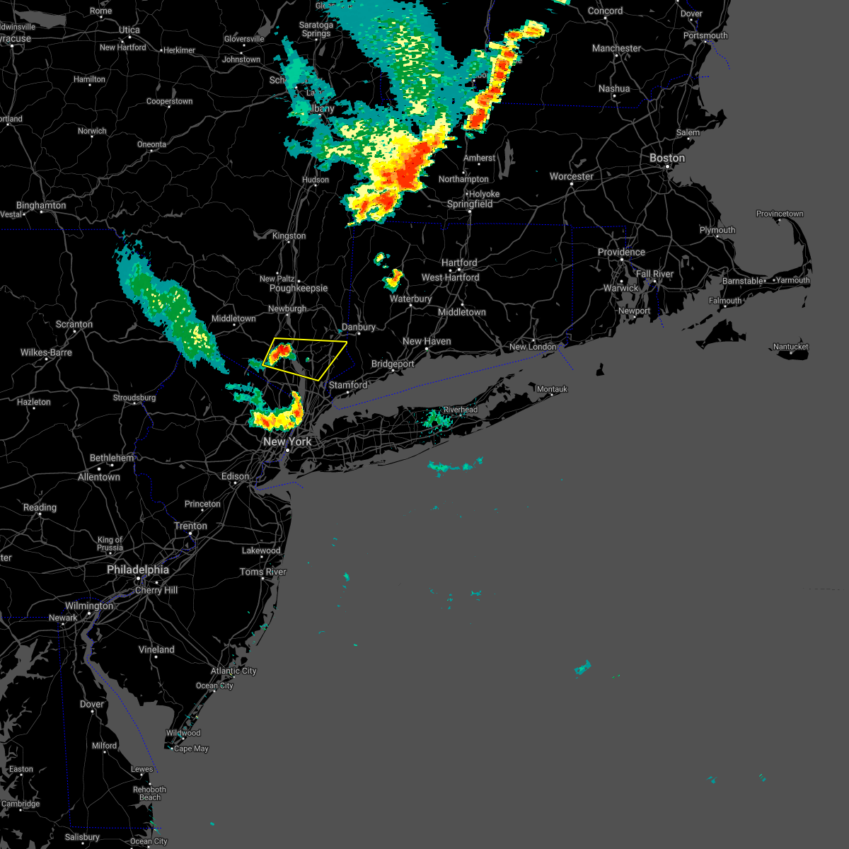 At 504 pm edt, a severe thunderstorm was located near peekskill, moving east at 25 mph (radar indicated). Hazards include 60 mph wind gusts and penny size hail. Expect damage to trees and power lines. this severe thunderstorm will be near, peekskill and haverstraw around 515 pm edt. ossining around 525 pm edt. yorktown heights around 535 pm edt. mount kisco around 540 pm edt. hail threat, radar indicated max hail size, 0. 75 in wind threat, radar indicated max wind gust, 60 mph. At 504 pm edt, a severe thunderstorm was located near peekskill, moving east at 25 mph (radar indicated). Hazards include 60 mph wind gusts and penny size hail. Expect damage to trees and power lines. this severe thunderstorm will be near, peekskill and haverstraw around 515 pm edt. ossining around 525 pm edt. yorktown heights around 535 pm edt. mount kisco around 540 pm edt. hail threat, radar indicated max hail size, 0. 75 in wind threat, radar indicated max wind gust, 60 mph.
|
| 8/12/2021 4:28 PM EDT |
 At 427 pm edt, severe thunderstorms were located along a line extending from unionville to near kinnelon to hackettstown, moving east at 55 mph (radar indicated). Hazards include 60 mph wind gusts. Expect damage to trees and power lines. locations impacted include, new city, west milford, monsey, nanuet, ramsey, ringwood, haverstraw, pompton lakes, suffern, warwick, sloatsburg, pearl river, bloomingdale, greenwood lake and pomona. hail threat, radar indicated max hail size, <. 75 in wind threat, radar indicated max wind gust, 60 mph. At 427 pm edt, severe thunderstorms were located along a line extending from unionville to near kinnelon to hackettstown, moving east at 55 mph (radar indicated). Hazards include 60 mph wind gusts. Expect damage to trees and power lines. locations impacted include, new city, west milford, monsey, nanuet, ramsey, ringwood, haverstraw, pompton lakes, suffern, warwick, sloatsburg, pearl river, bloomingdale, greenwood lake and pomona. hail threat, radar indicated max hail size, <. 75 in wind threat, radar indicated max wind gust, 60 mph.
|
| 8/12/2021 4:07 PM EDT |
 At 406 pm edt, severe thunderstorms were located along a line extending from montague to near branchville to blairstown, moving east at 40 mph (radar indicated). Hazards include 60 mph wind gusts. expect damage to trees and power lines At 406 pm edt, severe thunderstorms were located along a line extending from montague to near branchville to blairstown, moving east at 40 mph (radar indicated). Hazards include 60 mph wind gusts. expect damage to trees and power lines
|
| 7/8/2021 1:24 PM EDT |
 At 124 pm edt, a severe thunderstorm was located over ramsey, moving northeast at 20 mph (radar indicated). Hazards include 60 mph wind gusts and quarter size hail. Minor hail damage to vehicles is possible. expect wind damage to trees and power lines. this severe thunderstorm will be near, ridgewood and ramsey around 130 pm edt. suffern around 140 pm edt. monsey around 150 pm edt. nanuet, tappan, pearl river and norwood around 155 pm edt. orangeburg and pomona around 200 pm edt. new city around 205 pm edt. Haverstraw, nyack and upper nyack around 210 pm edt. At 124 pm edt, a severe thunderstorm was located over ramsey, moving northeast at 20 mph (radar indicated). Hazards include 60 mph wind gusts and quarter size hail. Minor hail damage to vehicles is possible. expect wind damage to trees and power lines. this severe thunderstorm will be near, ridgewood and ramsey around 130 pm edt. suffern around 140 pm edt. monsey around 150 pm edt. nanuet, tappan, pearl river and norwood around 155 pm edt. orangeburg and pomona around 200 pm edt. new city around 205 pm edt. Haverstraw, nyack and upper nyack around 210 pm edt.
|
| 7/6/2021 6:11 PM EDT |
 At 611 pm edt, a severe thunderstorm was located near new canaan, moving east at 40 mph (radar indicated). Hazards include 60 mph wind gusts and quarter size hail. Minor hail damage to vehicles is possible. expect wind damage to trees and power lines. this severe storm will be near, norwalk and darien around 615 pm edt. weston around 620 pm edt. westport around 625 pm edt. Bridgeport and fairfield around 630 pm edt. At 611 pm edt, a severe thunderstorm was located near new canaan, moving east at 40 mph (radar indicated). Hazards include 60 mph wind gusts and quarter size hail. Minor hail damage to vehicles is possible. expect wind damage to trees and power lines. this severe storm will be near, norwalk and darien around 615 pm edt. weston around 620 pm edt. westport around 625 pm edt. Bridgeport and fairfield around 630 pm edt.
|
| 7/6/2021 5:53 PM EDT |
 At 549 pm edt, severe thunderstorms were located along a line extending from near vernon valley to near lake telemark to near chester, moving east at 55 mph (radar indicated). Hazards include 70 mph wind gusts. Expect considerable tree damage. damage is likely to mobile homes, outbuildings. severe thunderstorms will be near, bloomingdale around 555 pm edt. wayne, ringwood, pompton lakes, fairfield and greenwood lake around 600 pm edt. sloatsburg and hawthorne around 605 pm edt. paterson, paramus, summit, and caldwell around 610 pm edt. bloomfield and hackensack around 615 pm edt. newark, ridgefield, harlem and riverdale around 620 pm edt. jersey city, yonkers, bayonne, and secaucus around 625 pm edt. Flatbush, flushing, hoboken, coney island, crown heights, the throgs neck bridge and midtown manhattan around 630 pm edt. At 549 pm edt, severe thunderstorms were located along a line extending from near vernon valley to near lake telemark to near chester, moving east at 55 mph (radar indicated). Hazards include 70 mph wind gusts. Expect considerable tree damage. damage is likely to mobile homes, outbuildings. severe thunderstorms will be near, bloomingdale around 555 pm edt. wayne, ringwood, pompton lakes, fairfield and greenwood lake around 600 pm edt. sloatsburg and hawthorne around 605 pm edt. paterson, paramus, summit, and caldwell around 610 pm edt. bloomfield and hackensack around 615 pm edt. newark, ridgefield, harlem and riverdale around 620 pm edt. jersey city, yonkers, bayonne, and secaucus around 625 pm edt. Flatbush, flushing, hoboken, coney island, crown heights, the throgs neck bridge and midtown manhattan around 630 pm edt.
|
| 7/6/2021 5:49 PM EDT |
 At 549 pm edt, a severe thunderstorm was located over yorktown heights, or near mount kisco, moving east at 40 mph (radar indicated). Hazards include 60 mph wind gusts and quarter size hail. Minor hail damage to vehicles is possible. expect wind damage to trees and power lines. this severe thunderstorm will be near, bedford around 600 pm edt. greenwich around 605 pm edt. stamford around 610 pm edt. new canaan and darien around 615 pm edt. norwalk and weston around 620 pm edt. westport around 625 pm edt. Bridgeport and fairfield around 630 pm edt. At 549 pm edt, a severe thunderstorm was located over yorktown heights, or near mount kisco, moving east at 40 mph (radar indicated). Hazards include 60 mph wind gusts and quarter size hail. Minor hail damage to vehicles is possible. expect wind damage to trees and power lines. this severe thunderstorm will be near, bedford around 600 pm edt. greenwich around 605 pm edt. stamford around 610 pm edt. new canaan and darien around 615 pm edt. norwalk and weston around 620 pm edt. westport around 625 pm edt. Bridgeport and fairfield around 630 pm edt.
|
| 6/21/2021 10:11 PM EDT |
 The severe thunderstorm warning for northwestern bergen, northern westchester, southeastern orange, putnam and rockland counties will expire at 1015 pm edt, the storms which prompted the warning have weakened below severe limits, and no longer pose an immediate threat to life or property. therefore, the warning will be allowed to expire. The severe thunderstorm warning for northwestern bergen, northern westchester, southeastern orange, putnam and rockland counties will expire at 1015 pm edt, the storms which prompted the warning have weakened below severe limits, and no longer pose an immediate threat to life or property. therefore, the warning will be allowed to expire.
|
| 6/21/2021 9:53 PM EDT |
 At 952 pm edt, severe thunderstorms were located along a broken line extending from new windsor to near cold spring to near pomona to suffern, moving northeast at 20 mph (radar indicated). Hazards include 60 mph wind gusts. Expect damage to trees and power lines. these severe storms will be near, newburgh and cold spring around 1000 pm edt. peekskill around 1010 pm edt. fahnestock state park around 1020 pm edt. ossining and yorktown heights around 1025 pm edt. mahopac around 1040 pm edt. This includes the following new york state covid tent site, anthony wayne rec center. At 952 pm edt, severe thunderstorms were located along a broken line extending from new windsor to near cold spring to near pomona to suffern, moving northeast at 20 mph (radar indicated). Hazards include 60 mph wind gusts. Expect damage to trees and power lines. these severe storms will be near, newburgh and cold spring around 1000 pm edt. peekskill around 1010 pm edt. fahnestock state park around 1020 pm edt. ossining and yorktown heights around 1025 pm edt. mahopac around 1040 pm edt. This includes the following new york state covid tent site, anthony wayne rec center.
|
| 6/21/2021 9:44 PM EDT |
 At 944 pm edt, a severe thunderstorm capable of producing a tornado was located over suffern, moving east at 25 mph (radar indicated rotation). Hazards include tornado. Flying debris will be dangerous to those caught without shelter. mobile homes will be damaged or destroyed. damage to roofs, windows, and vehicles will occur. tree damage is likely. this dangerous storm will be near, monsey around 950 pm edt. nanuet and pomona around 955 pm edt. new city and pearl river around 1000 pm edt. haverstraw and orangeburg around 1005 pm edt. nyack and upper nyack around 1010 pm edt. ossining around 1015 pm edt. tarrytown around 1020 pm edt. hawthorne around 1025 pm edt. Mount kisco and yorktown heights around 1030 pm edt. At 944 pm edt, a severe thunderstorm capable of producing a tornado was located over suffern, moving east at 25 mph (radar indicated rotation). Hazards include tornado. Flying debris will be dangerous to those caught without shelter. mobile homes will be damaged or destroyed. damage to roofs, windows, and vehicles will occur. tree damage is likely. this dangerous storm will be near, monsey around 950 pm edt. nanuet and pomona around 955 pm edt. new city and pearl river around 1000 pm edt. haverstraw and orangeburg around 1005 pm edt. nyack and upper nyack around 1010 pm edt. ossining around 1015 pm edt. tarrytown around 1020 pm edt. hawthorne around 1025 pm edt. Mount kisco and yorktown heights around 1030 pm edt.
|
| 6/21/2021 9:26 PM EDT |
 At 926 pm edt, severe thunderstorms were located along a broken line extending from phillipsport to near montgomery to near goshen to near monroe to near ringwood to bloomingdale, moving east at 35 mph (radar indicated). Hazards include 60 mph wind gusts. Expect damage to trees and power lines. severe thunderstorms will be near, monroe and montgomery around 930 pm edt. walden around 935 pm edt. suffern and west point around 945 pm edt. newburgh and monsey around 950 pm edt. peekskill and nanuet around 955 pm edt. new city and nyack around 1000 pm edt. mahopac and upper nyack around 1005 pm edt. ossining and carmel around 1010 pm edt. mount kisco and lake carmel around 1015 pm edt. This includes the following new york state covid tent site, anthony wayne rec center. At 926 pm edt, severe thunderstorms were located along a broken line extending from phillipsport to near montgomery to near goshen to near monroe to near ringwood to bloomingdale, moving east at 35 mph (radar indicated). Hazards include 60 mph wind gusts. Expect damage to trees and power lines. severe thunderstorms will be near, monroe and montgomery around 930 pm edt. walden around 935 pm edt. suffern and west point around 945 pm edt. newburgh and monsey around 950 pm edt. peekskill and nanuet around 955 pm edt. new city and nyack around 1000 pm edt. mahopac and upper nyack around 1005 pm edt. ossining and carmel around 1010 pm edt. mount kisco and lake carmel around 1015 pm edt. This includes the following new york state covid tent site, anthony wayne rec center.
|
| 6/8/2021 2:40 PM EDT |
 At 236 pm edt, an area of severe thunderstorms was located in the area, moving northeast at 15 mph (radar indicated). Hazards include 60 mph wind gusts and penny size hail. expect damage to trees and power lines At 236 pm edt, an area of severe thunderstorms was located in the area, moving northeast at 15 mph (radar indicated). Hazards include 60 mph wind gusts and penny size hail. expect damage to trees and power lines
|
| 5/26/2021 6:54 PM EDT |
 At 653 pm edt, severe thunderstorms were located along a line extending from near ringwood to wayne, moving east at 25 mph (radar indicated). Hazards include 60 mph wind gusts. Expect damage to trees and power lines. severe thunderstorms will be near, suffern and sloatsburg around 705 pm edt. ridgewood and ramsey around 710 pm edt. monsey around 715 pm edt. pomona around 720 pm edt. new city and nanuet around 725 pm edt. haverstraw and tappan around 730 pm edt. orangeburg around 735 pm edt. peekskill and dobbs ferry around 740 pm edt. This includes the following new york state covid tent site anthony wayne rec center. At 653 pm edt, severe thunderstorms were located along a line extending from near ringwood to wayne, moving east at 25 mph (radar indicated). Hazards include 60 mph wind gusts. Expect damage to trees and power lines. severe thunderstorms will be near, suffern and sloatsburg around 705 pm edt. ridgewood and ramsey around 710 pm edt. monsey around 715 pm edt. pomona around 720 pm edt. new city and nanuet around 725 pm edt. haverstraw and tappan around 730 pm edt. orangeburg around 735 pm edt. peekskill and dobbs ferry around 740 pm edt. This includes the following new york state covid tent site anthony wayne rec center.
|
| 4/28/2021 8:45 PM EDT |
 At 844 pm edt, a severe thunderstorm was located over highland lake, or near west milford, moving east at 45 mph (radar indicated). Hazards include 60 mph wind gusts. Expect damage to trees and power lines. this severe thunderstorm will be near, ringwood and pompton lakes around 855 pm edt. sloatsburg around 900 pm edt. ramsey and suffern around 905 pm edt. new city and paramus around 910 pm edt. Bergenfield and nyack around 915 pm edt. At 844 pm edt, a severe thunderstorm was located over highland lake, or near west milford, moving east at 45 mph (radar indicated). Hazards include 60 mph wind gusts. Expect damage to trees and power lines. this severe thunderstorm will be near, ringwood and pompton lakes around 855 pm edt. sloatsburg around 900 pm edt. ramsey and suffern around 905 pm edt. new city and paramus around 910 pm edt. Bergenfield and nyack around 915 pm edt.
|
| 11/15/2020 8:31 PM EST |
 At 830 pm est, severe thunderstorms were located along a line extending from near myers corner to peekskill to near hackensack to union city to near east brunswick, moving east at 55 mph (radar indicated). Hazards include 60 mph wind gusts. Expect damage to trees and power lines. these severe storms will be near, peekskill and harlem around 835 pm est. flushing and mott haven around 840 pm est. jamaica and yonkers around 845 pm est. new rochelle and white plains around 850 pm est. ridgefield around 855 pm est. Rockaway beach around 905 pm est. At 830 pm est, severe thunderstorms were located along a line extending from near myers corner to peekskill to near hackensack to union city to near east brunswick, moving east at 55 mph (radar indicated). Hazards include 60 mph wind gusts. Expect damage to trees and power lines. these severe storms will be near, peekskill and harlem around 835 pm est. flushing and mott haven around 840 pm est. jamaica and yonkers around 845 pm est. new rochelle and white plains around 850 pm est. ridgefield around 855 pm est. Rockaway beach around 905 pm est.
|
| 11/15/2020 7:57 PM EST |
 At 757 pm est, severe thunderstorms were located along a line extending from 6 miles northwest of wallkill to near franklin to chester to near bridgewater to near doylestown, moving east at 55 mph (radar indicated). Hazards include 60 mph wind gusts. Expect damage to trees and power lines. severe thunderstorms will be near, west milford around 800 pm est. upper greenwood lake around 805 pm est. plainfield and ringwood around 810 pm est. summit and millburn around 815 pm est. orange and monsey around 820 pm est. newark and paterson around 825 pm est. jersey city and passaic around 830 pm est. hoboken and hackensack around 835 pm est. mott haven and nanuet around 840 pm est. yonkers and east tremont around 845 pm est. new rochelle and white plains around 850 pm est. Todt hill and port richmond around 855 pm est. At 757 pm est, severe thunderstorms were located along a line extending from 6 miles northwest of wallkill to near franklin to chester to near bridgewater to near doylestown, moving east at 55 mph (radar indicated). Hazards include 60 mph wind gusts. Expect damage to trees and power lines. severe thunderstorms will be near, west milford around 800 pm est. upper greenwood lake around 805 pm est. plainfield and ringwood around 810 pm est. summit and millburn around 815 pm est. orange and monsey around 820 pm est. newark and paterson around 825 pm est. jersey city and passaic around 830 pm est. hoboken and hackensack around 835 pm est. mott haven and nanuet around 840 pm est. yonkers and east tremont around 845 pm est. new rochelle and white plains around 850 pm est. Todt hill and port richmond around 855 pm est.
|
| 8/27/2020 7:21 PM EDT |
 At 721 pm edt, a severe thunderstorm was located over ossining, moving east at 45 mph (radar indicated). Hazards include 60 mph wind gusts and penny size hail. Expect damage to trees and power lines. this severe thunderstorm will be near, yorktown heights around 725 pm edt. mount kisco and hawthorne around 730 pm edt. bedford around 735 pm edt. stamford around 740 pm edt. new canaan and greenwich around 745 pm edt. Norwalk and wilton around 750 pm edt. At 721 pm edt, a severe thunderstorm was located over ossining, moving east at 45 mph (radar indicated). Hazards include 60 mph wind gusts and penny size hail. Expect damage to trees and power lines. this severe thunderstorm will be near, yorktown heights around 725 pm edt. mount kisco and hawthorne around 730 pm edt. bedford around 735 pm edt. stamford around 740 pm edt. new canaan and greenwich around 745 pm edt. Norwalk and wilton around 750 pm edt.
|
| 8/27/2020 6:08 PM EDT |
 The severe thunderstorm warning for southern fairfield, northern westchester and putnam counties will expire at 615 pm edt, the storm which prompted the warning has weakened below severe limits, and has exited the warned area. therefore, the warning will be allowed to expire. however gusty winds are still possible with this thunderstorm. a tornado watch remains in effect until 800 pm edt for southern connecticut, and southeastern new york. The severe thunderstorm warning for southern fairfield, northern westchester and putnam counties will expire at 615 pm edt, the storm which prompted the warning has weakened below severe limits, and has exited the warned area. therefore, the warning will be allowed to expire. however gusty winds are still possible with this thunderstorm. a tornado watch remains in effect until 800 pm edt for southern connecticut, and southeastern new york.
|
| 8/27/2020 5:29 PM EDT |
 At 529 pm edt, a severe thunderstorm was located near peekskill, moving southeast at 40 mph (radar indicated). Hazards include 60 mph wind gusts. Expect damage to trees and power lines. this severe thunderstorm will be near, mahopac around 535 pm edt. yorktown heights around 540 pm edt. mount kisco around 545 pm edt. bedford around 555 pm edt. stamford and ridgefield around 600 pm edt. new canaan and darien around 605 pm edt. wilton and weston around 610 pm edt. Norwalk and westport around 615 pm edt. At 529 pm edt, a severe thunderstorm was located near peekskill, moving southeast at 40 mph (radar indicated). Hazards include 60 mph wind gusts. Expect damage to trees and power lines. this severe thunderstorm will be near, mahopac around 535 pm edt. yorktown heights around 540 pm edt. mount kisco around 545 pm edt. bedford around 555 pm edt. stamford and ridgefield around 600 pm edt. new canaan and darien around 605 pm edt. wilton and weston around 610 pm edt. Norwalk and westport around 615 pm edt.
|
| 8/27/2020 5:07 PM EDT |
 At 507 pm edt, a severe thunderstorm was located near new windsor, or near west point, moving southeast at 45 mph (radar indicated). Hazards include 60 mph wind gusts. Expect damage to trees and power lines. this severe storm will be near, new windsor around 510 pm edt. cold spring around 515 pm edt. west point around 520 pm edt. peekskill around 525 pm edt. Mahopac around 530 pm edt. At 507 pm edt, a severe thunderstorm was located near new windsor, or near west point, moving southeast at 45 mph (radar indicated). Hazards include 60 mph wind gusts. Expect damage to trees and power lines. this severe storm will be near, new windsor around 510 pm edt. cold spring around 515 pm edt. west point around 520 pm edt. peekskill around 525 pm edt. Mahopac around 530 pm edt.
|
| 8/27/2020 4:49 PM EDT |
 At 448 pm edt, a severe thunderstorm was located near bloomingburg, or 7 miles northeast of middletown, moving southeast at 45 mph (radar indicated). Hazards include 60 mph wind gusts. Expect damage to trees and power lines. this severe thunderstorm will be near, walden and goshen around 455 pm edt. gardnertown around 505 pm edt. newburgh and new windsor around 510 pm edt. cold spring around 515 pm edt. west point around 520 pm edt. peekskill around 525 pm edt. Mahopac around 530 pm edt. At 448 pm edt, a severe thunderstorm was located near bloomingburg, or 7 miles northeast of middletown, moving southeast at 45 mph (radar indicated). Hazards include 60 mph wind gusts. Expect damage to trees and power lines. this severe thunderstorm will be near, walden and goshen around 455 pm edt. gardnertown around 505 pm edt. newburgh and new windsor around 510 pm edt. cold spring around 515 pm edt. west point around 520 pm edt. peekskill around 525 pm edt. Mahopac around 530 pm edt.
|
| 7/30/2020 3:52 PM EDT |
 At 352 pm edt, a severe thunderstorm was located near ossining, moving east at 20 mph (radar indicated). Hazards include 60 mph wind gusts. Expect damage to trees and power lines. this severe storm will be near, hawthorne around 400 pm edt. yorktown heights around 405 pm edt. mount kisco around 410 pm edt. Stamford and bedford around 430 pm edt. At 352 pm edt, a severe thunderstorm was located near ossining, moving east at 20 mph (radar indicated). Hazards include 60 mph wind gusts. Expect damage to trees and power lines. this severe storm will be near, hawthorne around 400 pm edt. yorktown heights around 405 pm edt. mount kisco around 410 pm edt. Stamford and bedford around 430 pm edt.
|
| 7/30/2020 3:37 PM EDT |
 At 336 pm edt, a severe thunderstorm was located over haverstraw, moving east at 20 mph (radar indicated). Hazards include 60 mph wind gusts. Expect damage to trees and power lines. this severe thunderstorm will be near, upper nyack around 340 pm edt. ossining and sleepy hollow around 350 pm edt. hawthorne around 400 pm edt. yorktown heights around 405 pm edt. mount kisco around 410 pm edt. Bedford around 415 pm edt. At 336 pm edt, a severe thunderstorm was located over haverstraw, moving east at 20 mph (radar indicated). Hazards include 60 mph wind gusts. Expect damage to trees and power lines. this severe thunderstorm will be near, upper nyack around 340 pm edt. ossining and sleepy hollow around 350 pm edt. hawthorne around 400 pm edt. yorktown heights around 405 pm edt. mount kisco around 410 pm edt. Bedford around 415 pm edt.
|
| 7/11/2020 7:50 PM EDT |
 At 749 pm edt, a severe thunderstorm was located over ossining, moving northeast at 15 mph (radar indicated). Hazards include 60 mph wind gusts and penny size hail. Expect damage to trees and power lines. this severe thunderstorm will be near, peekskill around 805 pm edt. mount kisco around 820 pm edt. yorktown heights around 825 pm edt. Mahopac around 830 pm edt. At 749 pm edt, a severe thunderstorm was located over ossining, moving northeast at 15 mph (radar indicated). Hazards include 60 mph wind gusts and penny size hail. Expect damage to trees and power lines. this severe thunderstorm will be near, peekskill around 805 pm edt. mount kisco around 820 pm edt. yorktown heights around 825 pm edt. Mahopac around 830 pm edt.
|
| 6/29/2020 5:37 PM EDT |
 At 536 pm edt, a severe thunderstorm was located over nanuet, moving south at 25 mph (radar indicated). Hazards include quarter size hail. Minor damage to vehicles is possible. this severe storm will be near, ramsey around 540 pm edt. nyack and sleepy hollow around 545 pm edt. tarrytown and orangeburg around 550 pm edt. ridgewood and tappan around 555 pm edt. dobbs ferry and norwood around 600 pm edt. paramus and oradell around 605 pm edt. Yonkers around 610 pm edt. At 536 pm edt, a severe thunderstorm was located over nanuet, moving south at 25 mph (radar indicated). Hazards include quarter size hail. Minor damage to vehicles is possible. this severe storm will be near, ramsey around 540 pm edt. nyack and sleepy hollow around 545 pm edt. tarrytown and orangeburg around 550 pm edt. ridgewood and tappan around 555 pm edt. dobbs ferry and norwood around 600 pm edt. paramus and oradell around 605 pm edt. Yonkers around 610 pm edt.
|
| 6/29/2020 5:21 PM EDT |
 At 521 pm edt, a severe thunderstorm was located over pomona, or near new city, moving south at 25 mph (radar indicated). Hazards include quarter size hail. Minor damage to vehicles is possible. this severe thunderstorm will be near, haverstraw around 525 pm edt. new city around 530 pm edt. suffern and monsey around 535 pm edt. ramsey and nanuet around 540 pm edt. nyack and pearl river around 545 pm edt. tarrytown and orangeburg around 550 pm edt. ridgewood and tappan around 555 pm edt. Yonkers and paramus around 600 pm edt. At 521 pm edt, a severe thunderstorm was located over pomona, or near new city, moving south at 25 mph (radar indicated). Hazards include quarter size hail. Minor damage to vehicles is possible. this severe thunderstorm will be near, haverstraw around 525 pm edt. new city around 530 pm edt. suffern and monsey around 535 pm edt. ramsey and nanuet around 540 pm edt. nyack and pearl river around 545 pm edt. tarrytown and orangeburg around 550 pm edt. ridgewood and tappan around 555 pm edt. Yonkers and paramus around 600 pm edt.
|
| 6/28/2020 6:09 PM EDT |
 The severe thunderstorm warning for passaic, northwestern bergen, northern westchester, eastern orange, western putnam and rockland counties will expire at 615 pm edt, the storm which prompted the warning has weakened below severe limits, and has exited the warned area. therefore, the warning will be allowed to expire. a severe thunderstorm watch remains in effect until 800 pm edt for northeastern new jersey, and southeastern new york. The severe thunderstorm warning for passaic, northwestern bergen, northern westchester, eastern orange, western putnam and rockland counties will expire at 615 pm edt, the storm which prompted the warning has weakened below severe limits, and has exited the warned area. therefore, the warning will be allowed to expire. a severe thunderstorm watch remains in effect until 800 pm edt for northeastern new jersey, and southeastern new york.
|
| 6/28/2020 5:24 PM EDT |
 At 520 pm edt, a line of severe thunderstorm was located over eastern passaic county and eastern orange county, moving east at 25 mph (radar indicated). Hazards include 60 mph wind gusts and quarter size hail. Hail damage to vehicles is possible. expect wind damage to trees and power lines. This severe thunderstorm will be near, peekskill around 525 pm edt. At 520 pm edt, a line of severe thunderstorm was located over eastern passaic county and eastern orange county, moving east at 25 mph (radar indicated). Hazards include 60 mph wind gusts and quarter size hail. Hail damage to vehicles is possible. expect wind damage to trees and power lines. This severe thunderstorm will be near, peekskill around 525 pm edt.
|
| 6/28/2020 4:21 PM EDT |
 At 420 pm edt, a severe thunderstorm was located near greenwich, or near new canaan, moving east at 40 mph (radar indicated). Hazards include 60 mph wind gusts and quarter size hail. Hail damage to vehicles is possible. expect wind damage to trees and power lines. Locations impacted include, ossining, haverstraw, tarrytown, dobbs ferry, suffern, nyack, monsey, new city, tappan, nanuet, sleepy hollow, pomona, upper nyack, pearl river and orangeburg. At 420 pm edt, a severe thunderstorm was located near greenwich, or near new canaan, moving east at 40 mph (radar indicated). Hazards include 60 mph wind gusts and quarter size hail. Hail damage to vehicles is possible. expect wind damage to trees and power lines. Locations impacted include, ossining, haverstraw, tarrytown, dobbs ferry, suffern, nyack, monsey, new city, tappan, nanuet, sleepy hollow, pomona, upper nyack, pearl river and orangeburg.
|
| 6/28/2020 3:48 PM EDT |
 At 347 pm edt, a severe thunderstorm was located over new city, moving east at 40 mph (radar indicated). Hazards include 60 mph wind gusts and quarter size hail. Hail damage to vehicles is possible. Expect wind damage to roofs, siding, and trees. At 347 pm edt, a severe thunderstorm was located over new city, moving east at 40 mph (radar indicated). Hazards include 60 mph wind gusts and quarter size hail. Hail damage to vehicles is possible. Expect wind damage to roofs, siding, and trees.
|
| 6/28/2020 2:58 PM EDT |
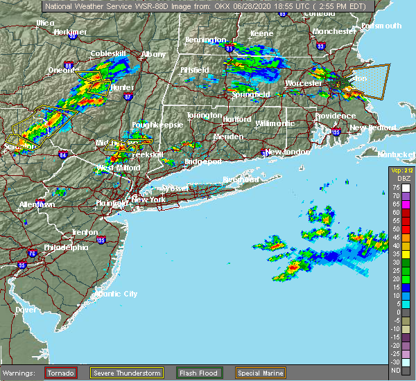 At 258 pm edt, a severe thunderstorm was located near harriman, or near monroe, moving east at 35 mph (radar indicated). Hazards include golf ball size hail and 60 mph wind gusts. People and animals outdoors will be injured. expect hail damage to roofs, siding, windows, and vehicles. Expect wind damage to trees and power lines. At 258 pm edt, a severe thunderstorm was located near harriman, or near monroe, moving east at 35 mph (radar indicated). Hazards include golf ball size hail and 60 mph wind gusts. People and animals outdoors will be injured. expect hail damage to roofs, siding, windows, and vehicles. Expect wind damage to trees and power lines.
|
| 6/3/2020 8:39 PM EDT |
 The severe thunderstorm warning for central fairfield, west central new haven, northeastern bergen, westchester, southeastern orange, putnam and rockland counties will expire at 845 pm edt, the storms which prompted the warning have weakened below severe limits and are about to move out of the warned area, and no longer pose an immediate threat to life or property. therefore, the warning will be allowed to expire. The severe thunderstorm warning for central fairfield, west central new haven, northeastern bergen, westchester, southeastern orange, putnam and rockland counties will expire at 845 pm edt, the storms which prompted the warning have weakened below severe limits and are about to move out of the warned area, and no longer pose an immediate threat to life or property. therefore, the warning will be allowed to expire.
|
| 6/3/2020 8:17 PM EDT |
 At 817 pm edt, severe thunderstorms were located along a line extending from brewster to new city, moving east at 70 mph (radar indicated). Hazards include 60 mph wind gusts. Expect damage to trees and power lines. these severe storms will be near, danbury and bethel around 825 pm edt. newtown and redding around 830 pm edt. bedford around 835 pm edt. Greenwich around 840 pm edt. At 817 pm edt, severe thunderstorms were located along a line extending from brewster to new city, moving east at 70 mph (radar indicated). Hazards include 60 mph wind gusts. Expect damage to trees and power lines. these severe storms will be near, danbury and bethel around 825 pm edt. newtown and redding around 830 pm edt. bedford around 835 pm edt. Greenwich around 840 pm edt.
|
| 6/3/2020 7:57 PM EDT |
 At 757 pm edt, severe thunderstorms were located along a line extending from near new windsor to near vernon valley, moving east at 70 mph (radar indicated). Hazards include 60 mph wind gusts. Expect damage to trees and power lines. severe thunderstorms will be near, newburgh and cold spring around 800 pm edt. fahnestock state park around 805 pm edt. suffern and sloatsburg around 810 pm edt. brewster and monsey around 815 pm edt. haverstraw and nyack around 820 pm edt. danbury and ossining around 825 pm edt. mount kisco and newtown around 830 pm edt. Greenwich and bedford around 835 pm edt. At 757 pm edt, severe thunderstorms were located along a line extending from near new windsor to near vernon valley, moving east at 70 mph (radar indicated). Hazards include 60 mph wind gusts. Expect damage to trees and power lines. severe thunderstorms will be near, newburgh and cold spring around 800 pm edt. fahnestock state park around 805 pm edt. suffern and sloatsburg around 810 pm edt. brewster and monsey around 815 pm edt. haverstraw and nyack around 820 pm edt. danbury and ossining around 825 pm edt. mount kisco and newtown around 830 pm edt. Greenwich and bedford around 835 pm edt.
|
| 4/21/2020 2:40 PM EDT |
 At 239 pm edt, severe thunderstorms were located along a line extending from 6 miles east of yorktown heights to cardinal spellman hs, moving east at 45 mph (radar indicated). Hazards include 60 mph wind gusts. Expect damage to trees and power lines. severe thunderstorms will be near, bedford around 245 pm edt. port chester and rye around 250 pm edt. new canaan and georgetown around 255 pm edt. wilton and redding around 300 pm edt. westport and weston around 305 pm edt. Fairfield and trumbull around 310 pm edt. At 239 pm edt, severe thunderstorms were located along a line extending from 6 miles east of yorktown heights to cardinal spellman hs, moving east at 45 mph (radar indicated). Hazards include 60 mph wind gusts. Expect damage to trees and power lines. severe thunderstorms will be near, bedford around 245 pm edt. port chester and rye around 250 pm edt. new canaan and georgetown around 255 pm edt. wilton and redding around 300 pm edt. westport and weston around 305 pm edt. Fairfield and trumbull around 310 pm edt.
|
| 11/1/2019 12:50 AM EDT |
 At 1249 am edt, showers and thunderstorms were located along a line extending from newburgh to near oradell to port richmond, moving east at 55 mph (radar indicated). Hazards include 60 mph wind gusts. Expect damage to trees and power lines. these severe storms will be near, newburgh and nyack around 1255 am edt. new york and yonkers around 100 am edt. new rochelle and white plains around 105 am edt. port chester and rye around 110 am edt. Valley stream and lynbrook around 115 am edt. At 1249 am edt, showers and thunderstorms were located along a line extending from newburgh to near oradell to port richmond, moving east at 55 mph (radar indicated). Hazards include 60 mph wind gusts. Expect damage to trees and power lines. these severe storms will be near, newburgh and nyack around 1255 am edt. new york and yonkers around 100 am edt. new rochelle and white plains around 105 am edt. port chester and rye around 110 am edt. Valley stream and lynbrook around 115 am edt.
|
| 11/1/2019 12:28 AM EDT |
 At 1226 am edt, showers and possible thunderstorms were located along a line extending from near goshen to near boonton to society hill, moving northeast at 50 mph (radar indicated). Hazards include 60 mph wind gusts. Expect damage to trees and power lines. severe thunderstorms will be near, goshen and chester around 1230 am edt. wayne and pompton lakes around 1235 am edt. paterson and linden around 1240 am edt. elizabeth and newburgh around 1245 am edt. newark and bayonne around 1250 am edt. jersey city and secaucus around 1255 am edt. hoboken and tarrytown around 100 am edt. new york and white plains around 105 am edt. flushing and laguardia airport around 110 am edt. mount kisco and great neck around 115 am edt. sherman and bedford around 120 am edt. Stamford and glen cove around 125 am edt. At 1226 am edt, showers and possible thunderstorms were located along a line extending from near goshen to near boonton to society hill, moving northeast at 50 mph (radar indicated). Hazards include 60 mph wind gusts. Expect damage to trees and power lines. severe thunderstorms will be near, goshen and chester around 1230 am edt. wayne and pompton lakes around 1235 am edt. paterson and linden around 1240 am edt. elizabeth and newburgh around 1245 am edt. newark and bayonne around 1250 am edt. jersey city and secaucus around 1255 am edt. hoboken and tarrytown around 100 am edt. new york and white plains around 105 am edt. flushing and laguardia airport around 110 am edt. mount kisco and great neck around 115 am edt. sherman and bedford around 120 am edt. Stamford and glen cove around 125 am edt.
|
| 11/1/2019 12:07 AM EDT |
 At 1206 am edt, a severe thunderstorm was located over fahnestock state park, or 7 miles northeast of cold spring, moving northeast at 70 mph (radar indicated). Hazards include 60 mph wind gusts. Expect damage to trees and power lines. this severe storm will be near, lake carmel and carmel around 1210 am edt. new york--newark around 1215 am edt. new fairfield around 1220 am edt. Sherman around 1225 am edt. At 1206 am edt, a severe thunderstorm was located over fahnestock state park, or 7 miles northeast of cold spring, moving northeast at 70 mph (radar indicated). Hazards include 60 mph wind gusts. Expect damage to trees and power lines. this severe storm will be near, lake carmel and carmel around 1210 am edt. new york--newark around 1215 am edt. new fairfield around 1220 am edt. Sherman around 1225 am edt.
|
| 11/1/2019 12:07 AM EDT |
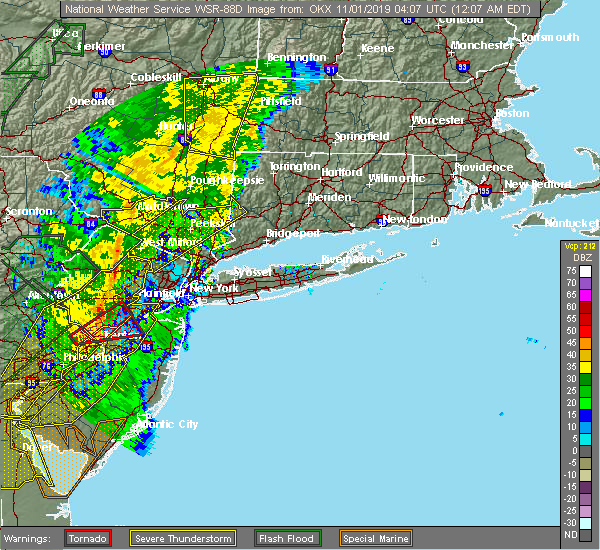 At 1206 am edt, a severe thunderstorm was located over fahnestock state park, or 7 miles northeast of cold spring, moving northeast at 70 mph (radar indicated). Hazards include 60 mph wind gusts. Expect damage to trees and power lines. this severe storm will be near, lake carmel and carmel around 1210 am edt. new york--newark around 1215 am edt. new fairfield around 1220 am edt. Sherman around 1225 am edt. At 1206 am edt, a severe thunderstorm was located over fahnestock state park, or 7 miles northeast of cold spring, moving northeast at 70 mph (radar indicated). Hazards include 60 mph wind gusts. Expect damage to trees and power lines. this severe storm will be near, lake carmel and carmel around 1210 am edt. new york--newark around 1215 am edt. new fairfield around 1220 am edt. Sherman around 1225 am edt.
|
| 10/31/2019 11:34 PM EDT |
 At 1133 pm edt, a severe thunderstorm was located over west milford, moving northeast at 70 mph (radar indicated). Hazards include 60 mph wind gusts. Expect damage to trees and power lines. this severe thunderstorm will be near, greenwood lake around 1140 pm edt. sloatsburg around 1145 pm edt. monroe and pomona around 1150 pm edt. peekskill around 1155 pm edt. cold spring and west point around 1200 am edt. mahopac and fahnestock state park around 1205 am edt. lake carmel and carmel around 1210 am edt. new york--newark around 1215 am edt. new fairfield around 1220 am edt. Sherman around 1225 am edt. At 1133 pm edt, a severe thunderstorm was located over west milford, moving northeast at 70 mph (radar indicated). Hazards include 60 mph wind gusts. Expect damage to trees and power lines. this severe thunderstorm will be near, greenwood lake around 1140 pm edt. sloatsburg around 1145 pm edt. monroe and pomona around 1150 pm edt. peekskill around 1155 pm edt. cold spring and west point around 1200 am edt. mahopac and fahnestock state park around 1205 am edt. lake carmel and carmel around 1210 am edt. new york--newark around 1215 am edt. new fairfield around 1220 am edt. Sherman around 1225 am edt.
|
| 8/8/2019 7:12 PM EDT |
 The severe thunderstorm warning for central fairfield, northern westchester, eastern orange, putnam and rockland counties will expire at 715 pm edt, the storms which prompted the warning have moved out of the warned area. therefore, the warning will be allowed to expire. a severe thunderstorm watch remains in effect until midnight edt for southern connecticut, and southeastern new york. The severe thunderstorm warning for central fairfield, northern westchester, eastern orange, putnam and rockland counties will expire at 715 pm edt, the storms which prompted the warning have moved out of the warned area. therefore, the warning will be allowed to expire. a severe thunderstorm watch remains in effect until midnight edt for southern connecticut, and southeastern new york.
|
| 8/8/2019 6:36 PM EDT |
 At 636 pm edt, severe thunderstorms were located along a line extending from near pawling to near fahnestock state park to near sloatsburg, moving east at 45 mph (radar indicated). Hazards include 60 mph wind gusts. Expect damage to trees and power lines. these severe storms will be near, new fairfield around 640 pm edt. mahopac and brookfield around 645 pm edt. danbury and new city around 650 pm edt. haverstraw and brewster around 655 pm edt. ossining and upper nyack around 700 pm edt. mount kisco and ridgefield around 710 pm edt. Redding and bedford around 715 pm edt. At 636 pm edt, severe thunderstorms were located along a line extending from near pawling to near fahnestock state park to near sloatsburg, moving east at 45 mph (radar indicated). Hazards include 60 mph wind gusts. Expect damage to trees and power lines. these severe storms will be near, new fairfield around 640 pm edt. mahopac and brookfield around 645 pm edt. danbury and new city around 650 pm edt. haverstraw and brewster around 655 pm edt. ossining and upper nyack around 700 pm edt. mount kisco and ridgefield around 710 pm edt. Redding and bedford around 715 pm edt.
|
| 8/8/2019 6:15 PM EDT |
 At 614 pm edt, severe thunderstorms were located along a line extending from near hopewell junction to near new windsor to near vernon valley, moving southeast at 45 mph. this line of storms has a history of bringing down trees and power lines (radar indicated). Hazards include 60 mph wind gusts. Expect damage to trees and power lines. severe thunderstorms will be near, newburgh and new windsor around 620 pm edt. west point around 625 pm edt. monroe and cold spring around 630 pm edt. sherman and sloatsburg around 635 pm edt. new fairfield around 640 pm edt. danbury and monsey around 645 pm edt. new city and lake carmel around 650 pm edt. haverstraw and brewster around 655 pm edt. ossining and upper nyack around 700 pm edt. ridgefield around 705 pm edt. mount kisco around 710 pm edt. Redding and bedford around 715 pm edt. At 614 pm edt, severe thunderstorms were located along a line extending from near hopewell junction to near new windsor to near vernon valley, moving southeast at 45 mph. this line of storms has a history of bringing down trees and power lines (radar indicated). Hazards include 60 mph wind gusts. Expect damage to trees and power lines. severe thunderstorms will be near, newburgh and new windsor around 620 pm edt. west point around 625 pm edt. monroe and cold spring around 630 pm edt. sherman and sloatsburg around 635 pm edt. new fairfield around 640 pm edt. danbury and monsey around 645 pm edt. new city and lake carmel around 650 pm edt. haverstraw and brewster around 655 pm edt. ossining and upper nyack around 700 pm edt. ridgefield around 705 pm edt. mount kisco around 710 pm edt. Redding and bedford around 715 pm edt.
|
| 7/22/2019 5:58 PM EDT |
 The severe thunderstorm warning for hudson, eastern passaic, bergen, northeastern essex, westchester, bronx, rockland and new york (manhattan) counties will expire at 600 pm edt, the storms which prompted the warning have weakened below severe limits, and no longer pose an immediate threat to life or property. therefore, the warning will be allowed to expire. however flash flooding is still expected from the training thunderstorm activity. a severe thunderstorm watch remains in effect until 1000 pm edt for southern connecticut, northeastern new jersey, and southeastern new york. The severe thunderstorm warning for hudson, eastern passaic, bergen, northeastern essex, westchester, bronx, rockland and new york (manhattan) counties will expire at 600 pm edt, the storms which prompted the warning have weakened below severe limits, and no longer pose an immediate threat to life or property. therefore, the warning will be allowed to expire. however flash flooding is still expected from the training thunderstorm activity. a severe thunderstorm watch remains in effect until 1000 pm edt for southern connecticut, northeastern new jersey, and southeastern new york.
|
| 7/22/2019 5:52 PM EDT |
 The severe thunderstorm warning for central passaic, northern bergen, central westchester, southeastern orange and rockland counties will expire at 600 pm edt, the storm which prompted the warning has weakened below severe limits, and is exiting the warned area. therefore, the warning will be allowed to expire. however flash flooding is still likely with the thunderstorm activity. a severe thunderstorm watch remains in effect until 1000 pm edt for northeastern new jersey, and southeastern new york. The severe thunderstorm warning for central passaic, northern bergen, central westchester, southeastern orange and rockland counties will expire at 600 pm edt, the storm which prompted the warning has weakened below severe limits, and is exiting the warned area. therefore, the warning will be allowed to expire. however flash flooding is still likely with the thunderstorm activity. a severe thunderstorm watch remains in effect until 1000 pm edt for northeastern new jersey, and southeastern new york.
|
| 7/22/2019 5:16 PM EDT |
 At 516 pm edt, severe thunderstorms were located along a line extending from wayne to lyndhurst, moving northeast at 30 mph (radar indicated). Hazards include 60 mph wind gusts and quarter size hail. Minor hail damage to vehicles is possible. expect wind damage to trees and power lines. severe thunderstorms will be near, paterson and secaucus around 520 pm edt. ridgefield and hawthorne around 525 pm edt. hackensack and paramus around 530 pm edt. bergenfield and harlem around 535 pm edt. east tremont and riverdale around 540 pm edt. monsey and co-op city around 545 pm edt. yonkers and nanuet around 550 pm edt. new rochelle and new city around 555 pm edt. White plains and port chester around 600 pm edt. At 516 pm edt, severe thunderstorms were located along a line extending from wayne to lyndhurst, moving northeast at 30 mph (radar indicated). Hazards include 60 mph wind gusts and quarter size hail. Minor hail damage to vehicles is possible. expect wind damage to trees and power lines. severe thunderstorms will be near, paterson and secaucus around 520 pm edt. ridgefield and hawthorne around 525 pm edt. hackensack and paramus around 530 pm edt. bergenfield and harlem around 535 pm edt. east tremont and riverdale around 540 pm edt. monsey and co-op city around 545 pm edt. yonkers and nanuet around 550 pm edt. new rochelle and new city around 555 pm edt. White plains and port chester around 600 pm edt.
|
| 7/22/2019 5:01 PM EDT |
 At 501 pm edt, a severe thunderstorm was located over bloomingdale, or over pompton lakes, moving northeast at 25 mph (radar indicated). Hazards include 60 mph wind gusts and quarter size hail. Minor hail damage to vehicles is possible. expect wind damage to trees and power lines. this severe thunderstorm will be near, ringwood around 515 pm edt. ramsey and suffern around 525 pm edt. monsey around 535 pm edt. nanuet and pearl river around 540 pm edt. new city and pomona around 545 pm edt. nyack and upper nyack around 550 pm edt. haverstraw around 555 pm edt. Ossining around 600 pm edt. At 501 pm edt, a severe thunderstorm was located over bloomingdale, or over pompton lakes, moving northeast at 25 mph (radar indicated). Hazards include 60 mph wind gusts and quarter size hail. Minor hail damage to vehicles is possible. expect wind damage to trees and power lines. this severe thunderstorm will be near, ringwood around 515 pm edt. ramsey and suffern around 525 pm edt. monsey around 535 pm edt. nanuet and pearl river around 540 pm edt. new city and pomona around 545 pm edt. nyack and upper nyack around 550 pm edt. haverstraw around 555 pm edt. Ossining around 600 pm edt.
|
| 7/22/2019 4:26 PM EDT |
 The severe thunderstorm warning for central passaic, bergen, southern westchester and rockland counties will expire at 430 pm edt, the storm which prompted the warning has weakened below severe limits, and is exiting the warned area. therefore, the warning will be allowed to expire. a severe thunderstorm watch remains in effect until 1000 pm edt for southern connecticut, northeastern new jersey, and southeastern new york. The severe thunderstorm warning for central passaic, bergen, southern westchester and rockland counties will expire at 430 pm edt, the storm which prompted the warning has weakened below severe limits, and is exiting the warned area. therefore, the warning will be allowed to expire. a severe thunderstorm watch remains in effect until 1000 pm edt for southern connecticut, northeastern new jersey, and southeastern new york.
|
| 7/22/2019 4:00 PM EDT |
 At 359 pm edt, a severe thunderstorm was located near yorktown heights, or near mahopac, and is nearly stationary (radar indicated). Hazards include ping pong to possibly golf ball size hail and 60 mph wind gusts. People and animals outdoors will be injured. expect hail damage to roofs, siding, windows, and vehicles. expect wind damage to trees and power lines. This severe thunderstorm will remain over mainly rural areas of central passaic, bergen, southern westchester and rockland counties. At 359 pm edt, a severe thunderstorm was located near yorktown heights, or near mahopac, and is nearly stationary (radar indicated). Hazards include ping pong to possibly golf ball size hail and 60 mph wind gusts. People and animals outdoors will be injured. expect hail damage to roofs, siding, windows, and vehicles. expect wind damage to trees and power lines. This severe thunderstorm will remain over mainly rural areas of central passaic, bergen, southern westchester and rockland counties.
|
| 7/22/2019 3:56 PM EDT |
 At 355 pm edt, severe thunderstorms were located along a line extending from near fahnestock state park to near yorktown heights to ossining, moving east at 35 mph (radar indicated). Hazards include 60 mph wind gusts. Expect damage to trees and power lines. severe thunderstorms will be near, mahopac around 400 pm edt. lake carmel and carmel around 405 pm edt. mount kisco and brewster around 410 pm edt. new fairfield and bedford around 420 pm edt. ridgefield and brookfield around 425 pm edt. stamford and danbury around 430 pm edt. norwalk and new canaan around 435 pm edt. Bridgeport and shelton around 445 pm edt. At 355 pm edt, severe thunderstorms were located along a line extending from near fahnestock state park to near yorktown heights to ossining, moving east at 35 mph (radar indicated). Hazards include 60 mph wind gusts. Expect damage to trees and power lines. severe thunderstorms will be near, mahopac around 400 pm edt. lake carmel and carmel around 405 pm edt. mount kisco and brewster around 410 pm edt. new fairfield and bedford around 420 pm edt. ridgefield and brookfield around 425 pm edt. stamford and danbury around 430 pm edt. norwalk and new canaan around 435 pm edt. Bridgeport and shelton around 445 pm edt.
|
| 7/22/2019 3:38 PM EDT |
 At 338 pm edt, a severe thunderstorm was located over kinnelon, or near pompton lakes, moving east at 40 mph (radar indicated). Hazards include 60 mph wind gusts and quarter size hail. Minor hail damage to vehicles is possible. expect wind damage to trees and power lines. this severe thunderstorm will be near, pompton lakes around 345 pm edt. wayne around 350 pm edt. paterson and hawthorne around 355 pm edt. paramus and ridgewood around 400 pm edt. monsey and oradell around 405 pm edt. bergenfield and nanuet around 410 pm edt. tappan and norwood around 415 pm edt. yonkers and tarrytown around 420 pm edt. ossining and scarsdale around 425 pm edt. White plains and harrison around 430 pm edt. At 338 pm edt, a severe thunderstorm was located over kinnelon, or near pompton lakes, moving east at 40 mph (radar indicated). Hazards include 60 mph wind gusts and quarter size hail. Minor hail damage to vehicles is possible. expect wind damage to trees and power lines. this severe thunderstorm will be near, pompton lakes around 345 pm edt. wayne around 350 pm edt. paterson and hawthorne around 355 pm edt. paramus and ridgewood around 400 pm edt. monsey and oradell around 405 pm edt. bergenfield and nanuet around 410 pm edt. tappan and norwood around 415 pm edt. yonkers and tarrytown around 420 pm edt. ossining and scarsdale around 425 pm edt. White plains and harrison around 430 pm edt.
|
| 7/22/2019 2:59 PM EDT |
 The national weather service in upton ny has issued a * severe thunderstorm warning for. western passaic county in northeastern new jersey. northwestern bergen county in northeastern new jersey. northern westchester county in southeastern new york. Orange county in southeastern new york. The national weather service in upton ny has issued a * severe thunderstorm warning for. western passaic county in northeastern new jersey. northwestern bergen county in northeastern new jersey. northern westchester county in southeastern new york. Orange county in southeastern new york.
|
| 7/17/2019 7:33 PM EDT |
 At 733 pm edt, severe thunderstorms were located along a line extending from florida to lake telemark to near clinton, moving east at 50 mph (radar indicated). Hazards include 60 mph wind gusts. Expect damage to trees and power lines. these severe storms will be near, pompton lakes and caldwell around 745 pm edt. wayne around 750 pm edt. paterson and passaic around 755 pm edt. Plainfield and hackensack around 800 pm edt. At 733 pm edt, severe thunderstorms were located along a line extending from florida to lake telemark to near clinton, moving east at 50 mph (radar indicated). Hazards include 60 mph wind gusts. Expect damage to trees and power lines. these severe storms will be near, pompton lakes and caldwell around 745 pm edt. wayne around 750 pm edt. paterson and passaic around 755 pm edt. Plainfield and hackensack around 800 pm edt.
|
| 7/17/2019 7:19 PM EDT |
 At 718 pm edt, severe thunderstorms were located along a line extending from near unionville to near stanhope to ferndale, moving east at 50 mph (radar indicated). Hazards include 60 mph wind gusts. Expect damage to trees and power lines. severe thunderstorms will be near, pompton lakes and caldwell around 745 pm edt. wayne around 750 pm edt. paterson and passaic around 755 pm edt. Plainfield and hackensack around 800 pm edt. At 718 pm edt, severe thunderstorms were located along a line extending from near unionville to near stanhope to ferndale, moving east at 50 mph (radar indicated). Hazards include 60 mph wind gusts. Expect damage to trees and power lines. severe thunderstorms will be near, pompton lakes and caldwell around 745 pm edt. wayne around 750 pm edt. paterson and passaic around 755 pm edt. Plainfield and hackensack around 800 pm edt.
|
| 7/17/2019 7:19 PM EDT |
 The national weather service in upton ny has issued a * severe thunderstorm warning for. southern fairfield county in southern connecticut. hudson county in northeastern new jersey. passaic county in northeastern new jersey. Union county in northeastern new jersey. The national weather service in upton ny has issued a * severe thunderstorm warning for. southern fairfield county in southern connecticut. hudson county in northeastern new jersey. passaic county in northeastern new jersey. Union county in northeastern new jersey.
|
| 7/17/2019 7:19 PM EDT |
 At 718 pm edt, severe thunderstorms were located along a line extending from near unionville to near stanhope to ferndale, moving east at 50 mph (radar indicated). Hazards include 60 mph wind gusts. Expect damage to trees and power lines. severe thunderstorms will be near, pompton lakes and caldwell around 745 pm edt. wayne around 750 pm edt. paterson and passaic around 755 pm edt. Plainfield and hackensack around 800 pm edt. At 718 pm edt, severe thunderstorms were located along a line extending from near unionville to near stanhope to ferndale, moving east at 50 mph (radar indicated). Hazards include 60 mph wind gusts. Expect damage to trees and power lines. severe thunderstorms will be near, pompton lakes and caldwell around 745 pm edt. wayne around 750 pm edt. paterson and passaic around 755 pm edt. Plainfield and hackensack around 800 pm edt.
|
| 3/15/2019 7:55 PM EDT |
 The severe thunderstorm warning for northern westchester county will expire at 800 pm edt, the severe thunderstorm which prompted the warning has moved out of the warned area. therefore, the warning will be allowed to expire. The severe thunderstorm warning for northern westchester county will expire at 800 pm edt, the severe thunderstorm which prompted the warning has moved out of the warned area. therefore, the warning will be allowed to expire.
|
| 3/15/2019 7:40 PM EDT |
 At 739 pm edt, a severe thunderstorm was located over peekskill, moving northeast at 45 mph (radar indicated). Hazards include 60 mph wind gusts and quarter size hail. Minor hail damage to vehicles is possible. expect wind damage to trees and power lines. This severe storm will be near, mount kisco and yorktown heights around 750 pm edt. At 739 pm edt, a severe thunderstorm was located over peekskill, moving northeast at 45 mph (radar indicated). Hazards include 60 mph wind gusts and quarter size hail. Minor hail damage to vehicles is possible. expect wind damage to trees and power lines. This severe storm will be near, mount kisco and yorktown heights around 750 pm edt.
|
| 3/15/2019 7:20 PM EDT |
 At 720 pm edt, a severe thunderstorm was located over sloatsburg, moving northeast at 40 mph (radar indicated). Hazards include 60 mph wind gusts and quarter size hail. Minor hail damage to vehicles is possible. expect wind damage to trees and power lines. this severe thunderstorm will be near, monsey around 725 pm edt. new city and pomona around 730 pm edt. haverstraw around 735 pm edt. Mount kisco and yorktown heights around 750 pm edt. At 720 pm edt, a severe thunderstorm was located over sloatsburg, moving northeast at 40 mph (radar indicated). Hazards include 60 mph wind gusts and quarter size hail. Minor hail damage to vehicles is possible. expect wind damage to trees and power lines. this severe thunderstorm will be near, monsey around 725 pm edt. new city and pomona around 730 pm edt. haverstraw around 735 pm edt. Mount kisco and yorktown heights around 750 pm edt.
|
| 11/3/2018 1:01 AM EDT |
 At 100 am edt, a severe thunderstorm was located over monsey, moving northeast at 50 mph (radar indicated). Hazards include 60 mph wind gusts. Expect damage to trees and power lines. this severe storm will be near, tappan and orangeburg around 105 am edt. new city and haverstraw around 110 am edt. Ossining and peekskill around 115 am edt. At 100 am edt, a severe thunderstorm was located over monsey, moving northeast at 50 mph (radar indicated). Hazards include 60 mph wind gusts. Expect damage to trees and power lines. this severe storm will be near, tappan and orangeburg around 105 am edt. new city and haverstraw around 110 am edt. Ossining and peekskill around 115 am edt.
|
| 11/3/2018 12:50 AM EDT |
 At 1250 am edt, a severe thunderstorm was located near wayne, moving northeast at 45 mph (radar indicated). Hazards include 60 mph wind gusts. Expect damage to trees and power lines. this severe thunderstorm will be near, paramus and ridgewood around 1255 am edt. ramsey and suffern around 100 am edt. monsey and nanuet around 105 am edt. new city and nyack around 110 am edt. Ossining and haverstraw around 115 am edt. At 1250 am edt, a severe thunderstorm was located near wayne, moving northeast at 45 mph (radar indicated). Hazards include 60 mph wind gusts. Expect damage to trees and power lines. this severe thunderstorm will be near, paramus and ridgewood around 1255 am edt. ramsey and suffern around 100 am edt. monsey and nanuet around 105 am edt. new city and nyack around 110 am edt. Ossining and haverstraw around 115 am edt.
|
| 10/2/2018 4:43 PM EDT |
 At 443 pm edt, a severe thunderstorm capable of producing a tornado was located near yorktown heights, or near mount kisco, moving east at 20 mph (radar indicated rotation). Hazards include tornado. Flying debris will be dangerous to those caught without shelter. mobile homes will be damaged or destroyed. damage to roofs, windows, and vehicles will occur. tree damage is likely. this dangerous storm will be near, mount kisco around 455 pm edt. bedford around 505 pm edt. Greenwich around 510 pm edt. At 443 pm edt, a severe thunderstorm capable of producing a tornado was located near yorktown heights, or near mount kisco, moving east at 20 mph (radar indicated rotation). Hazards include tornado. Flying debris will be dangerous to those caught without shelter. mobile homes will be damaged or destroyed. damage to roofs, windows, and vehicles will occur. tree damage is likely. this dangerous storm will be near, mount kisco around 455 pm edt. bedford around 505 pm edt. Greenwich around 510 pm edt.
|
| 10/2/2018 4:31 PM EDT |
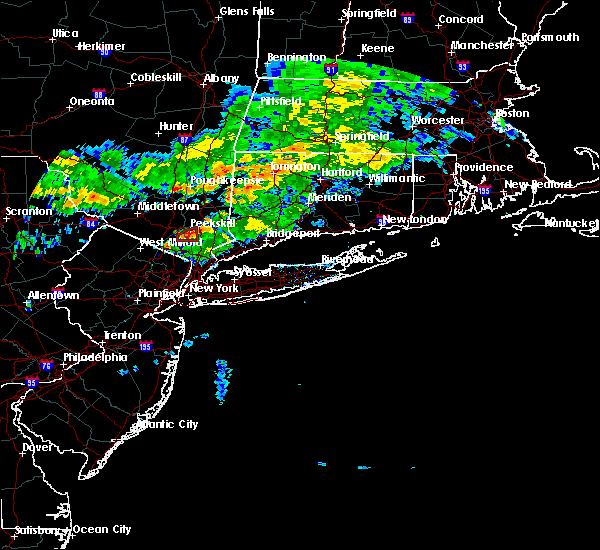 At 431 pm edt, a severe thunderstorm capable of producing a tornado was located near haverstraw, moving east at 15 mph (radar indicated rotation). Hazards include tornado. Flying debris will be dangerous to those caught without shelter. mobile homes will be damaged or destroyed. damage to roofs, windows, and vehicles will occur. tree damage is likely. Locations impacted include, peekskill, stony point, west haverstraw, croton-on-hudson, mount ivy, thiells and buchanan. At 431 pm edt, a severe thunderstorm capable of producing a tornado was located near haverstraw, moving east at 15 mph (radar indicated rotation). Hazards include tornado. Flying debris will be dangerous to those caught without shelter. mobile homes will be damaged or destroyed. damage to roofs, windows, and vehicles will occur. tree damage is likely. Locations impacted include, peekskill, stony point, west haverstraw, croton-on-hudson, mount ivy, thiells and buchanan.
|
| 10/2/2018 4:12 PM EDT |
 At 412 pm edt, a severe thunderstorm capable of producing a tornado was located near pomona, or 7 miles northwest of haverstraw, moving east at 15 mph (radar indicated rotation). Hazards include tornado. Flying debris will be dangerous to those caught without shelter. mobile homes will be damaged or destroyed. damage to roofs, windows, and vehicles will occur. tree damage is likely. This dangerous storm will be near, peekskill around 445 pm edt. At 412 pm edt, a severe thunderstorm capable of producing a tornado was located near pomona, or 7 miles northwest of haverstraw, moving east at 15 mph (radar indicated rotation). Hazards include tornado. Flying debris will be dangerous to those caught without shelter. mobile homes will be damaged or destroyed. damage to roofs, windows, and vehicles will occur. tree damage is likely. This dangerous storm will be near, peekskill around 445 pm edt.
|
| 8/17/2018 7:29 PM EDT |
 At 729 pm edt, severe thunderstorms were located along a line extending from near yorktown heights to greenwich, moving northeast at 40 mph (radar indicated). Hazards include 60 mph wind gusts and quarter size hail. Minor hail damage to vehicles is possible. expect wind damage to trees and power lines. severe thunderstorms will be near, norwalk and new canaan around 745 pm edt. westport and wilton around 755 pm edt. ridgefield and weston around 800 pm edt. danbury and redding around 805 pm edt. Bethel around 810 pm edt. At 729 pm edt, severe thunderstorms were located along a line extending from near yorktown heights to greenwich, moving northeast at 40 mph (radar indicated). Hazards include 60 mph wind gusts and quarter size hail. Minor hail damage to vehicles is possible. expect wind damage to trees and power lines. severe thunderstorms will be near, norwalk and new canaan around 745 pm edt. westport and wilton around 755 pm edt. ridgefield and weston around 800 pm edt. danbury and redding around 805 pm edt. Bethel around 810 pm edt.
|
| 8/17/2018 7:13 PM EDT |
 At 712 pm edt, severe thunderstorms were located along a line extending from near mount kisco to scarsdale, moving northeast at 35 mph (radar indicated). Hazards include 60 mph wind gusts and quarter size hail. Minor hail damage to vehicles is possible. expect wind damage to trees and power lines. these severe storms will be near, mount kisco and bedford around 720 pm edt. Stamford and greenwich around 730 pm edt. At 712 pm edt, severe thunderstorms were located along a line extending from near mount kisco to scarsdale, moving northeast at 35 mph (radar indicated). Hazards include 60 mph wind gusts and quarter size hail. Minor hail damage to vehicles is possible. expect wind damage to trees and power lines. these severe storms will be near, mount kisco and bedford around 720 pm edt. Stamford and greenwich around 730 pm edt.
|
| 8/17/2018 7:03 PM EDT |
 At 702 pm edt, severe thunderstorms were located along a line extending from upper nyack to near yonkers, moving northeast at 40 mph (radar indicated). Hazards include 60 mph wind gusts and quarter size hail. Minor hail damage to vehicles is possible. expect wind damage to trees and power lines. severe thunderstorms will be near, ossining and tarrytown around 705 pm edt. white plains around 710 pm edt. harrison and hawthorne around 715 pm edt. mount kisco around 720 pm edt. Stamford and greenwich around 730 pm edt. At 702 pm edt, severe thunderstorms were located along a line extending from upper nyack to near yonkers, moving northeast at 40 mph (radar indicated). Hazards include 60 mph wind gusts and quarter size hail. Minor hail damage to vehicles is possible. expect wind damage to trees and power lines. severe thunderstorms will be near, ossining and tarrytown around 705 pm edt. white plains around 710 pm edt. harrison and hawthorne around 715 pm edt. mount kisco around 720 pm edt. Stamford and greenwich around 730 pm edt.
|
| 8/3/2018 4:07 PM EDT |
 The severe thunderstorm warning for northern westchester, east central orange and western putnam counties will expire at 415 pm edt, the storm which prompted the warning has moved out of the area. therefore, the warning will be allowed to expire. The severe thunderstorm warning for northern westchester, east central orange and western putnam counties will expire at 415 pm edt, the storm which prompted the warning has moved out of the area. therefore, the warning will be allowed to expire.
|
| 8/3/2018 3:39 PM EDT |
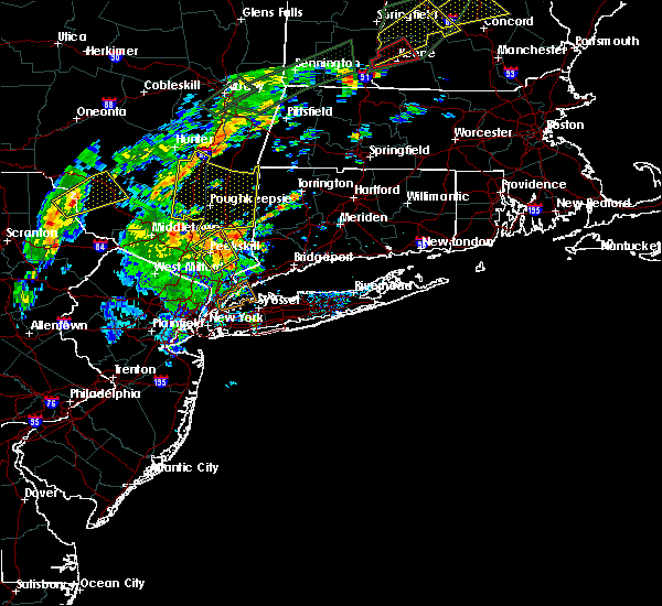 A severe thunderstorm warning remains in effect until 415 pm edt for northern westchester. east central orange and western putnam counties. at 339 pm edt, a severe thunderstorm was located over peekskill, moving northeast at 30 mph. hazard. 60 mph wind gusts. A severe thunderstorm warning remains in effect until 415 pm edt for northern westchester. east central orange and western putnam counties. at 339 pm edt, a severe thunderstorm was located over peekskill, moving northeast at 30 mph. hazard. 60 mph wind gusts.
|
| 8/3/2018 3:23 PM EDT | Tree branch down blocking teatown roa in westchester county NY, 0.5 miles ENE of Croton-on-Hudson, NY |
| 8/3/2018 3:12 PM EDT |
 At 311 pm edt, a severe thunderstorm was located over suffern, moving northeast at 30 mph (radar indicated). Hazards include 60 mph wind gusts. expect damage to trees and power lines At 311 pm edt, a severe thunderstorm was located over suffern, moving northeast at 30 mph (radar indicated). Hazards include 60 mph wind gusts. expect damage to trees and power lines
|
| 6/24/2018 7:50 PM EDT | Large tree branch down (11-12" diameter) in westchester county NY, 1.2 miles ESE of Croton-on-Hudson, NY |
| 5/15/2018 4:51 PM EDT |
 At 448 pm edt, severe thunderstorms were located along a line extending from near windsor locks to sherman to danbury to near pomona to boonton to near bloomsbury, moving east at 45 mph (mesonet observations and trained weather spotters. the new york state mesonet site at beacon reported winds of 78 mph at 420 pm). Hazards include 70 mph wind gusts and quarter size hail. Minor hail damage to vehicles is possible. expect considerable tree damage. Wind damage is also likely to mobile homes, roofs, and outbuildings. At 448 pm edt, severe thunderstorms were located along a line extending from near windsor locks to sherman to danbury to near pomona to boonton to near bloomsbury, moving east at 45 mph (mesonet observations and trained weather spotters. the new york state mesonet site at beacon reported winds of 78 mph at 420 pm). Hazards include 70 mph wind gusts and quarter size hail. Minor hail damage to vehicles is possible. expect considerable tree damage. Wind damage is also likely to mobile homes, roofs, and outbuildings.
|
| 5/15/2018 4:38 PM EDT | Storm damage reported in westchester county NY, 0.5 miles ENE of Croton-on-Hudson, NY |
| 5/15/2018 4:38 PM EDT |
 At 437 pm edt, severe thunderstorms were located along a line extending from lake carmel to near west point to victory gardens to washington to near coffeetown, moving east at 45 mph. these are very dangerous storms (the new york state mesonet site at beacon reported winds of 78 mph at 420 pm). Hazards include 80 mph wind gusts and penny size hail. Flying debris will be dangerous to those caught without shelter. mobile homes will be heavily damaged. expect considerable damage to roofs, windows, and vehicles. extensive tree damage and power outages are likely. Locations impacted include, yonkers, paterson, stamford, waterbury, danbury, passaic, white plains, wayne, bloomfield, hackensack, shelton, new city, naugatuck, orange and newburgh. At 437 pm edt, severe thunderstorms were located along a line extending from lake carmel to near west point to victory gardens to washington to near coffeetown, moving east at 45 mph. these are very dangerous storms (the new york state mesonet site at beacon reported winds of 78 mph at 420 pm). Hazards include 80 mph wind gusts and penny size hail. Flying debris will be dangerous to those caught without shelter. mobile homes will be heavily damaged. expect considerable damage to roofs, windows, and vehicles. extensive tree damage and power outages are likely. Locations impacted include, yonkers, paterson, stamford, waterbury, danbury, passaic, white plains, wayne, bloomfield, hackensack, shelton, new city, naugatuck, orange and newburgh.
|
| 5/15/2018 4:06 PM EDT |
 At 405 pm edt, severe thunderstorms were located along a line extending from near wallkill to near high point to near dingmans ferry to stormville to near tamaqua, moving east at 110 mph (radar indicated). Hazards include 70 mph wind gusts and quarter size hail. Minor hail damage to vehicles is possible. expect considerable tree damage. wind damage is also likely to mobile homes, roofs, and outbuildings. Locations that could be impacted include, yonkers, paterson, stamford, waterbury, danbury, passaic, white plains, wayne, bloomfield, hackensack, shelton, new city, naugatuck, orange and newburgh. At 405 pm edt, severe thunderstorms were located along a line extending from near wallkill to near high point to near dingmans ferry to stormville to near tamaqua, moving east at 110 mph (radar indicated). Hazards include 70 mph wind gusts and quarter size hail. Minor hail damage to vehicles is possible. expect considerable tree damage. wind damage is also likely to mobile homes, roofs, and outbuildings. Locations that could be impacted include, yonkers, paterson, stamford, waterbury, danbury, passaic, white plains, wayne, bloomfield, hackensack, shelton, new city, naugatuck, orange and newburgh.
|
| 5/15/2018 3:34 PM EDT |
 At 331 pm edt, severe thunderstorms were located along a line extending from hazel to near lava to new boston-morea, moving east at 70 mph (radar indicated). Hazards include 70 mph wind gusts and quarter size hail. Minor hail damage to vehicles is possible. expect considerable tree damage. wind damage is also likely to mobile homes, roofs, and outbuildings. severe thunderstorms will be near, howells around 350 pm edt. montgomery around 400 pm edt. walden around 405 pm edt. newburgh and new windsor around 410 pm edt. fahnestock state park around 420 pm edt. lake carmel around 425 pm edt. brookfield and new fairfield around 435 pm edt. danbury and newtown around 440 pm edt. summit and southbury around 450 pm edt. waterbury and naugatuck around 455 pm edt. Bloomfield and rutherford around 500 pm edt. At 331 pm edt, severe thunderstorms were located along a line extending from hazel to near lava to new boston-morea, moving east at 70 mph (radar indicated). Hazards include 70 mph wind gusts and quarter size hail. Minor hail damage to vehicles is possible. expect considerable tree damage. wind damage is also likely to mobile homes, roofs, and outbuildings. severe thunderstorms will be near, howells around 350 pm edt. montgomery around 400 pm edt. walden around 405 pm edt. newburgh and new windsor around 410 pm edt. fahnestock state park around 420 pm edt. lake carmel around 425 pm edt. brookfield and new fairfield around 435 pm edt. danbury and newtown around 440 pm edt. summit and southbury around 450 pm edt. waterbury and naugatuck around 455 pm edt. Bloomfield and rutherford around 500 pm edt.
|
| 5/3/2018 6:45 PM EDT |
 At 644 pm edt, showers and thunderstorms capable of producing damaging winds were located along a line extending from near yorktown heights to near upper nyack to near nanuet, moving east at 50 mph (radar indicated). Hazards include 60 mph wind gusts. Expect damage to trees and power lines. severe thunderstorms will be near, tarrytown and mount kisco around 650 pm edt. dobbs ferry and hawthorne around 655 pm edt. yonkers and stamford around 700 pm edt. new rochelle and white plains around 705 pm edt. norwalk and port chester around 710 pm edt. Westport around 715 pm edt. At 644 pm edt, showers and thunderstorms capable of producing damaging winds were located along a line extending from near yorktown heights to near upper nyack to near nanuet, moving east at 50 mph (radar indicated). Hazards include 60 mph wind gusts. Expect damage to trees and power lines. severe thunderstorms will be near, tarrytown and mount kisco around 650 pm edt. dobbs ferry and hawthorne around 655 pm edt. yonkers and stamford around 700 pm edt. new rochelle and white plains around 705 pm edt. norwalk and port chester around 710 pm edt. Westport around 715 pm edt.
|
| 7/13/2017 2:27 PM EDT |
 At 226 pm edt, a severe thunderstorm was located near yorktown heights, or near peekskill, moving east at 20 mph (radar indicated). Hazards include 60 mph wind gusts. Expect damage to roofs, siding, and trees. this severe thunderstorm will be near, mount kisco around 250 pm edt. bedford around 300 pm edt. stamford around 315 pm edt. ridgefield around 320 pm edt. new canaan around 325 pm edt. Norwalk and wilton around 330 pm edt. At 226 pm edt, a severe thunderstorm was located near yorktown heights, or near peekskill, moving east at 20 mph (radar indicated). Hazards include 60 mph wind gusts. Expect damage to roofs, siding, and trees. this severe thunderstorm will be near, mount kisco around 250 pm edt. bedford around 300 pm edt. stamford around 315 pm edt. ridgefield around 320 pm edt. new canaan around 325 pm edt. Norwalk and wilton around 330 pm edt.
|
| 6/19/2017 5:36 PM EDT |
 The severe thunderstorm warning for hudson, eastern passaic, union, bergen, essex, southern westchester, richmond, bronx, new york and rockland counties will expire at 545 pm edt, the storms which prompted the warning have moved out of the warned area. therefore, the warning will be allowed to expire. a severe thunderstorm watch remains in effect until 800 pm edt for northeastern new jersey, and southeastern new york. The severe thunderstorm warning for hudson, eastern passaic, union, bergen, essex, southern westchester, richmond, bronx, new york and rockland counties will expire at 545 pm edt, the storms which prompted the warning have moved out of the warned area. therefore, the warning will be allowed to expire. a severe thunderstorm watch remains in effect until 800 pm edt for northeastern new jersey, and southeastern new york.
|
| 6/19/2017 5:01 PM EDT |
 At 500 pm edt, severe thunderstorms were located along a line extending from millstone to bound brook to society hill to near edison to near new brunswick, moving northeast at 45 mph (radar indicated). Hazards include 60 mph wind gusts. Expect damage to roofs, siding, and trees. severe thunderstorms will be near, plainfield around 505 pm edt. clark around 510 pm edt. elizabeth and linden around 515 pm edt. newark and jersey city around 520 pm edt. passaic and hoboken around 525 pm edt. paterson and hackensack around 530 pm edt. wayne and bergenfield around 535 pm edt. yonkers and tappan around 540 pm edt. White plains and new city around 545 pm edt. At 500 pm edt, severe thunderstorms were located along a line extending from millstone to bound brook to society hill to near edison to near new brunswick, moving northeast at 45 mph (radar indicated). Hazards include 60 mph wind gusts. Expect damage to roofs, siding, and trees. severe thunderstorms will be near, plainfield around 505 pm edt. clark around 510 pm edt. elizabeth and linden around 515 pm edt. newark and jersey city around 520 pm edt. passaic and hoboken around 525 pm edt. paterson and hackensack around 530 pm edt. wayne and bergenfield around 535 pm edt. yonkers and tappan around 540 pm edt. White plains and new city around 545 pm edt.
|
| 6/19/2017 12:43 PM EDT |
 At 1242 pm edt, a severe thunderstorm was located over peekskill, moving northeast at 20 mph (radar indicated). Hazards include 60 mph wind gusts and quarter size hail. Hail damage to vehicles is expected. expect wind damage to roofs, siding, and trees. this severe storm will be near, peekskill and west point around 1250 pm edt. yorktown heights around 100 pm edt. Cold spring around 105 pm edt. At 1242 pm edt, a severe thunderstorm was located over peekskill, moving northeast at 20 mph (radar indicated). Hazards include 60 mph wind gusts and quarter size hail. Hail damage to vehicles is expected. expect wind damage to roofs, siding, and trees. this severe storm will be near, peekskill and west point around 1250 pm edt. yorktown heights around 100 pm edt. Cold spring around 105 pm edt.
|
| 6/19/2017 12:13 PM EDT |
 At 1211 pm edt, a severe thunderstorm was located over monsey, moving northeast at 20 mph (radar indicated). Hazards include 60 mph wind gusts and quarter size hail. Hail damage to vehicles is expected. expect wind damage to roofs, siding, and trees. this severe thunderstorm will be near, new city and pomona around 1220 pm edt. ossining and haverstraw around 1230 pm edt. peekskill and west point around 1250 pm edt. yorktown heights around 100 pm edt. Cold spring around 105 pm edt. At 1211 pm edt, a severe thunderstorm was located over monsey, moving northeast at 20 mph (radar indicated). Hazards include 60 mph wind gusts and quarter size hail. Hail damage to vehicles is expected. expect wind damage to roofs, siding, and trees. this severe thunderstorm will be near, new city and pomona around 1220 pm edt. ossining and haverstraw around 1230 pm edt. peekskill and west point around 1250 pm edt. yorktown heights around 100 pm edt. Cold spring around 105 pm edt.
|
| 6/13/2017 7:10 PM EDT |
 At 709 pm edt, a severe thunderstorm was located over harriman, or near monroe, moving southeast at 5 mph (radar indicated). Hazards include 60 mph wind gusts and quarter size hail. Hail damage to vehicles is expected. expect wind damage to roofs, siding, and trees. flash flooding is possible. This severe storm will be near, west point around 730 pm edt. At 709 pm edt, a severe thunderstorm was located over harriman, or near monroe, moving southeast at 5 mph (radar indicated). Hazards include 60 mph wind gusts and quarter size hail. Hail damage to vehicles is expected. expect wind damage to roofs, siding, and trees. flash flooding is possible. This severe storm will be near, west point around 730 pm edt.
|
| 6/13/2017 6:37 PM EDT |
 At 637 pm edt, a severe thunderstorm was located near monroe, moving southeast at 10 mph (radar indicated). Hazards include 60 mph wind gusts and penny size hail. Expect damage to roofs, siding, and trees. this severe thunderstorm will be near, harriman around 650 pm edt. west point around 700 pm edt. New city and peekskill around 730 pm edt. At 637 pm edt, a severe thunderstorm was located near monroe, moving southeast at 10 mph (radar indicated). Hazards include 60 mph wind gusts and penny size hail. Expect damage to roofs, siding, and trees. this severe thunderstorm will be near, harriman around 650 pm edt. west point around 700 pm edt. New city and peekskill around 730 pm edt.
|
| 2/25/2017 6:29 PM EST |
 At 629 pm est, severe thunderstorms were located along a line extending from near pawling to near yorktown heights to near pearl river, moving northeast at 65 mph (radar indicated). Hazards include 60 mph wind gusts. Expect damage to roofs, siding, and trees. these severe storms will be near, mahopac and sherman around 640 pm est. lake carmel around 645 pm est. danbury and bethel around 650 pm est. brookfield around 655 pm est. Brewster and ridgefield around 700 pm est. At 629 pm est, severe thunderstorms were located along a line extending from near pawling to near yorktown heights to near pearl river, moving northeast at 65 mph (radar indicated). Hazards include 60 mph wind gusts. Expect damage to roofs, siding, and trees. these severe storms will be near, mahopac and sherman around 640 pm est. lake carmel around 645 pm est. danbury and bethel around 650 pm est. brookfield around 655 pm est. Brewster and ridgefield around 700 pm est.
|
| 2/25/2017 6:10 PM EST |
 At 609 pm est, severe thunderstorms were located along a line extending from near fahnestock state park to near suffern to near ridgewood, moving northeast at 45 mph (radar indicated). Hazards include 60 mph wind gusts and penny size hail. Expect damage to roofs, siding, and trees. severe thunderstorms will be near, cold spring and fahnestock state park around 615 pm est. tarrytown and lake carmel around 625 pm est. ossining and peekskill around 630 pm est. new fairfield and yorktown heights around 635 pm est. mount kisco and greenwich around 640 pm est. mahopac and sherman around 645 pm est. stamford and brewster around 650 pm est. new canaan around 655 pm est. Danbury and ridgefield around 700 pm est. At 609 pm est, severe thunderstorms were located along a line extending from near fahnestock state park to near suffern to near ridgewood, moving northeast at 45 mph (radar indicated). Hazards include 60 mph wind gusts and penny size hail. Expect damage to roofs, siding, and trees. severe thunderstorms will be near, cold spring and fahnestock state park around 615 pm est. tarrytown and lake carmel around 625 pm est. ossining and peekskill around 630 pm est. new fairfield and yorktown heights around 635 pm est. mount kisco and greenwich around 640 pm est. mahopac and sherman around 645 pm est. stamford and brewster around 650 pm est. new canaan around 655 pm est. Danbury and ridgefield around 700 pm est.
|
| 8/14/2016 12:07 AM EDT |
 At 1206 am edt, a severe thunderstorm was located over ossining, moving east at 30 mph (radar indicated). Hazards include 60 mph wind gusts. Expect damage to roofs. siding. and trees. this severe storm will be near, hawthorne around 1210 am edt. mount kisco and yorktown heights around 1220 am edt. stamford, greenwich and bedford around 1230 am edt. Other locations impacted by this severe thunderstorm include armonk, pleasantville, golden`s bridge, buchanan, jefferson valley, crotonoon-hudson, briarcliff manor, thornwood and peach lake. At 1206 am edt, a severe thunderstorm was located over ossining, moving east at 30 mph (radar indicated). Hazards include 60 mph wind gusts. Expect damage to roofs. siding. and trees. this severe storm will be near, hawthorne around 1210 am edt. mount kisco and yorktown heights around 1220 am edt. stamford, greenwich and bedford around 1230 am edt. Other locations impacted by this severe thunderstorm include armonk, pleasantville, golden`s bridge, buchanan, jefferson valley, crotonoon-hudson, briarcliff manor, thornwood and peach lake.
|
| 8/13/2016 11:49 PM EDT |
 At 1148 pm edt, a severe thunderstorm was located over new city, moving east at 25 mph (radar indicated). Hazards include 60 mph wind gusts. Expect damage to roofs. siding. and trees. this severe thunderstorm will be near, haverstraw and nyack around 1155 pm edt. north tarrytown and upper nyack around 1200 am edt. ossining and peekskill around 1205 am edt. hawthorne around 1210 am edt. mount kisco and yorktown heights around 1220 am edt. stamford, greenwich and bedford around 1230 am edt. Other locations impacted by this severe thunderstorm include west haverstraw, pleasantville, west nyack, blauvelt, valley cottage, spring valley, thornwood, armonk, thiells and chestnut ridge. At 1148 pm edt, a severe thunderstorm was located over new city, moving east at 25 mph (radar indicated). Hazards include 60 mph wind gusts. Expect damage to roofs. siding. and trees. this severe thunderstorm will be near, haverstraw and nyack around 1155 pm edt. north tarrytown and upper nyack around 1200 am edt. ossining and peekskill around 1205 am edt. hawthorne around 1210 am edt. mount kisco and yorktown heights around 1220 am edt. stamford, greenwich and bedford around 1230 am edt. Other locations impacted by this severe thunderstorm include west haverstraw, pleasantville, west nyack, blauvelt, valley cottage, spring valley, thornwood, armonk, thiells and chestnut ridge.
|
| 7/25/2016 6:32 PM EDT |
 At 631 pm edt, severe thunderstorms were located along a line extending from near peekskill to new city to hawthorne, moving east at 40 mph (radar indicated). Hazards include 60 mph wind gusts. Expect damage to roofs. siding. and trees. severe thunderstorms will be near, peekskill, haverstraw, nyack, upper nyack and orangeburg around 635 pm edt. englewood and hawthorne around 645 pm edt. yonkers, dobbs ferry and bedford around 655 pm edt. stamford, white plains, new canaan, harrison and ridgefield around 705 pm edt. Port chester, rye, darien, wilton and georgetown around 710 pm edt. At 631 pm edt, severe thunderstorms were located along a line extending from near peekskill to new city to hawthorne, moving east at 40 mph (radar indicated). Hazards include 60 mph wind gusts. Expect damage to roofs. siding. and trees. severe thunderstorms will be near, peekskill, haverstraw, nyack, upper nyack and orangeburg around 635 pm edt. englewood and hawthorne around 645 pm edt. yonkers, dobbs ferry and bedford around 655 pm edt. stamford, white plains, new canaan, harrison and ridgefield around 705 pm edt. Port chester, rye, darien, wilton and georgetown around 710 pm edt.
|
| 7/1/2016 6:06 PM EDT |
 At 606 pm edt, a severe thunderstorm was located over hawthorne, or near mount kisco, moving east at 25 mph (radar indicated). Hazards include 60 mph wind gusts. Expect damage to roofs. siding. and trees. this severe thunderstorm will be near, mount kisco around 610 pm edt. greenwich around 620 pm edt. bedford around 630 pm edt. stamford and darien around 635 pm edt. new canaan around 640 pm edt. norwalk, westport, wilton and georgetown around 645 pm edt. other locations impacted by this severe thunderstorm include armonk, pleasantville, golden`s bridge, rye brook, briarcliff manor, thornwood, hartsdale, elmsford, greenville and easton. A tornado watch remains in effect until 1000 pm edt for southern connecticut, and southeastern new york. At 606 pm edt, a severe thunderstorm was located over hawthorne, or near mount kisco, moving east at 25 mph (radar indicated). Hazards include 60 mph wind gusts. Expect damage to roofs. siding. and trees. this severe thunderstorm will be near, mount kisco around 610 pm edt. greenwich around 620 pm edt. bedford around 630 pm edt. stamford and darien around 635 pm edt. new canaan around 640 pm edt. norwalk, westport, wilton and georgetown around 645 pm edt. other locations impacted by this severe thunderstorm include armonk, pleasantville, golden`s bridge, rye brook, briarcliff manor, thornwood, hartsdale, elmsford, greenville and easton. A tornado watch remains in effect until 1000 pm edt for southern connecticut, and southeastern new york.
|
| 7/1/2016 5:12 PM EDT |
 At 512 pm edt, severe thunderstorms were located along a line extending from near wappingers falls to near upper greenwood lake, moving east at 35 mph (radar indicated). Hazards include 60 mph wind gusts. Expect damage to roofs. siding. and trees. severe thunderstorms will be near, newburgh and gardnertown around 515 pm edt. ramsey and suffern around 530 pm edt. monsey and new york--newark around 535 pm edt. nanuet, pomona and pearl river around 540 pm edt. new city around 545 pm edt. peekskill, haverstraw, nyack, new fairfield and upper nyack around 550 pm edt. ossining, tarrytown, sherman and north tarrytown around 555 pm edt. mount kisco, brookfield, hawthorne and yorktown heights around 600 pm edt. other locations impacted by these severe thunderstorms include west haverstraw, pleasantville, upper saddle river, west nyack, balmville, highland mills, spring valley, montvale, brewster hill and thiells. A tornado watch remains in effect until 1000 pm edt for southern connecticut, northeastern new jersey, and southeastern new york. At 512 pm edt, severe thunderstorms were located along a line extending from near wappingers falls to near upper greenwood lake, moving east at 35 mph (radar indicated). Hazards include 60 mph wind gusts. Expect damage to roofs. siding. and trees. severe thunderstorms will be near, newburgh and gardnertown around 515 pm edt. ramsey and suffern around 530 pm edt. monsey and new york--newark around 535 pm edt. nanuet, pomona and pearl river around 540 pm edt. new city around 545 pm edt. peekskill, haverstraw, nyack, new fairfield and upper nyack around 550 pm edt. ossining, tarrytown, sherman and north tarrytown around 555 pm edt. mount kisco, brookfield, hawthorne and yorktown heights around 600 pm edt. other locations impacted by these severe thunderstorms include west haverstraw, pleasantville, upper saddle river, west nyack, balmville, highland mills, spring valley, montvale, brewster hill and thiells. A tornado watch remains in effect until 1000 pm edt for southern connecticut, northeastern new jersey, and southeastern new york.
|
| 7/1/2016 4:15 PM EDT |
 At 414 pm edt, severe thunderstorms were located along a line extending from ramsey to bergenfield, moving northeast at 30 mph (radar indicated). Hazards include 60 mph wind gusts. Expect damage to roofs. siding. and trees. severe thunderstorms will be near, norwood around 420 pm edt. yonkers, monsey, tappan and pearl river around 425 pm edt. dobbs ferry, nanuet and orangeburg around 430 pm edt. tarrytown, nyack, new city, north tarrytown, scarsdale, pomona and upper nyack around 435 pm edt. white plains, haverstraw and harrison around 440 pm edt. ossining and hawthorne around 445 pm edt. peekskill around 450 pm edt. mount kisco around 455 pm edt. other locations impacted by these severe thunderstorms include west haverstraw, rockleigh, pleasantville, upper saddle river, west nyack, haworth, wyckoff, spring valley, montvale and bogota. A tornado watch remains in effect until 1000 pm edt for southern connecticut, northeastern new jersey, and southeastern new york. At 414 pm edt, severe thunderstorms were located along a line extending from ramsey to bergenfield, moving northeast at 30 mph (radar indicated). Hazards include 60 mph wind gusts. Expect damage to roofs. siding. and trees. severe thunderstorms will be near, norwood around 420 pm edt. yonkers, monsey, tappan and pearl river around 425 pm edt. dobbs ferry, nanuet and orangeburg around 430 pm edt. tarrytown, nyack, new city, north tarrytown, scarsdale, pomona and upper nyack around 435 pm edt. white plains, haverstraw and harrison around 440 pm edt. ossining and hawthorne around 445 pm edt. peekskill around 450 pm edt. mount kisco around 455 pm edt. other locations impacted by these severe thunderstorms include west haverstraw, rockleigh, pleasantville, upper saddle river, west nyack, haworth, wyckoff, spring valley, montvale and bogota. A tornado watch remains in effect until 1000 pm edt for southern connecticut, northeastern new jersey, and southeastern new york.
|
| 6/5/2016 6:40 PM EDT |
 The severe thunderstorm warning for essex, union, eastern passaic, hudson, east central bergen, rockland and southeastern orange counties will expire at 645 pm edt, the storms which prompted the warning are moving out of the warned area. therefore, the warning will be allowed to expire. The severe thunderstorm warning for essex, union, eastern passaic, hudson, east central bergen, rockland and southeastern orange counties will expire at 645 pm edt, the storms which prompted the warning are moving out of the warned area. therefore, the warning will be allowed to expire.
|
| 6/5/2016 6:27 PM EDT |
 At 626 pm edt, severe thunderstorms were located along a line extending from haverstraw to hackensack to colonia, moving east at 45 mph (radar indicated). Hazards include 60 mph wind gusts. Expect damage to roofs. siding. and trees. severe thunderstorms will be near, new york, ossining, tarrytown, north tarrytown, midtown manhattan, morningside heights and upper west side around 630 pm edt. mott haven, rfk bridge, riverdale, harlem, hawthorne, central park, astoria and long island city around 635 pm edt. yonkers, mount kisco, east tremont, todt hill, laguardia airport, flushing, bronxville, cardinal spellman hs, co-op city and port richmond around 640 pm edt. new rochelle, bayonne, verrazano- narrows bridge, throgs neck bridge, city island, oakwood, tompkinsville and whitestone around 645 pm edt. coney island, bedford, arturo toscanini ps, bay ridge, bensonhurst and park slope around 650 pm edt. flatbush, crown heights and sheepshead bay around 655 pm edt. canarsie around 700 pm edt. Other locations impacted by these severe thunderstorms include pleasantville, hastings-on-hudson, tuckahoe, rye brook, mount vernon, thornwood, washington heights, elmsford, armonk and greenwich village. At 626 pm edt, severe thunderstorms were located along a line extending from haverstraw to hackensack to colonia, moving east at 45 mph (radar indicated). Hazards include 60 mph wind gusts. Expect damage to roofs. siding. and trees. severe thunderstorms will be near, new york, ossining, tarrytown, north tarrytown, midtown manhattan, morningside heights and upper west side around 630 pm edt. mott haven, rfk bridge, riverdale, harlem, hawthorne, central park, astoria and long island city around 635 pm edt. yonkers, mount kisco, east tremont, todt hill, laguardia airport, flushing, bronxville, cardinal spellman hs, co-op city and port richmond around 640 pm edt. new rochelle, bayonne, verrazano- narrows bridge, throgs neck bridge, city island, oakwood, tompkinsville and whitestone around 645 pm edt. coney island, bedford, arturo toscanini ps, bay ridge, bensonhurst and park slope around 650 pm edt. flatbush, crown heights and sheepshead bay around 655 pm edt. canarsie around 700 pm edt. Other locations impacted by these severe thunderstorms include pleasantville, hastings-on-hudson, tuckahoe, rye brook, mount vernon, thornwood, washington heights, elmsford, armonk and greenwich village.
|
| 6/5/2016 6:15 PM EDT |
 At 614 pm edt, severe thunderstorms were located along a line extending from near pomona to near paterson to middlesex, moving east at 45 mph (radar indicated). Hazards include 60 mph wind gusts. Expect damage to roofs. siding. and trees. these severe storms will be near, paterson, passaic, bloomfield, ridgewood, lyndhurst, rutherford, suffern, monsey, nanuet and hawthorne around 620 pm edt. hackensack, paramus, secaucus, haverstraw, new city, oradell and teterboro around 625 pm edt. bergenfield, ridgefield, nyack, fort lee, englewood, union and upper nyack around 630 pm edt. elizabeth and linden around 635 pm edt. bayonne around 640 pm edt. Other locations impacted by these severe thunderstorms include west haverstraw, upper saddle river, wyckoff, springfield, montclair, spring valley, hillside, clifton, montvale and bogota. At 614 pm edt, severe thunderstorms were located along a line extending from near pomona to near paterson to middlesex, moving east at 45 mph (radar indicated). Hazards include 60 mph wind gusts. Expect damage to roofs. siding. and trees. these severe storms will be near, paterson, passaic, bloomfield, ridgewood, lyndhurst, rutherford, suffern, monsey, nanuet and hawthorne around 620 pm edt. hackensack, paramus, secaucus, haverstraw, new city, oradell and teterboro around 625 pm edt. bergenfield, ridgefield, nyack, fort lee, englewood, union and upper nyack around 630 pm edt. elizabeth and linden around 635 pm edt. bayonne around 640 pm edt. Other locations impacted by these severe thunderstorms include west haverstraw, upper saddle river, wyckoff, springfield, montclair, spring valley, hillside, clifton, montvale and bogota.
|
| 6/5/2016 5:47 PM EDT |
 At 545 pm edt, severe thunderstorms were located along a line extending from near franklin to near califon, moving east at 45 mph (radar indicated). Hazards include 60 mph wind gusts. Expect damage to roofs. siding. and trees. severe thunderstorms will be near, west milford and upper greenwood lake around 555 pm edt. bloomingdale and poughkeepsie-- newburgh around 600 pm edt. ringwood and pompton lakes around 605 pm edt. plainfield and sloatsburg around 610 pm edt. ridgewood, summit, millburn, ramsey and suffern around 615 pm edt. monsey, clark, union, pomona and colonia around 620 pm edt. elizabeth, linden, haverstraw, nanuet, new city, orange and pearl river around 625 pm edt. newark, harrison, nyack, tappan, kearny, norwood, upper nyack and orangeburg around 630 pm edt. Other locations impacted by these severe thunderstorms include west haverstraw, upper saddle river, wyckoff, springfield, montclair, spring valley, hillside, clifton, montvale and bogota. At 545 pm edt, severe thunderstorms were located along a line extending from near franklin to near califon, moving east at 45 mph (radar indicated). Hazards include 60 mph wind gusts. Expect damage to roofs. siding. and trees. severe thunderstorms will be near, west milford and upper greenwood lake around 555 pm edt. bloomingdale and poughkeepsie-- newburgh around 600 pm edt. ringwood and pompton lakes around 605 pm edt. plainfield and sloatsburg around 610 pm edt. ridgewood, summit, millburn, ramsey and suffern around 615 pm edt. monsey, clark, union, pomona and colonia around 620 pm edt. elizabeth, linden, haverstraw, nanuet, new city, orange and pearl river around 625 pm edt. newark, harrison, nyack, tappan, kearny, norwood, upper nyack and orangeburg around 630 pm edt. Other locations impacted by these severe thunderstorms include west haverstraw, upper saddle river, wyckoff, springfield, montclair, spring valley, hillside, clifton, montvale and bogota.
|
| 2/25/2016 12:27 AM EST | The severe thunderstorm warning for western new haven, fairfield, union, essex, hudson, eastern passaic, bergen, eastern orange, kings, queens, richmond, rockland, westchester, new york, bronx, central nassau and putnam counties will expire at 1230 am est, the storms which prompted the warning have moved out of the warned area. therefore the warning will be allowed to expire. |
| 2/25/2016 12:27 AM EST | The severe thunderstorm warning for western new haven, fairfield, union, essex, hudson, eastern passaic, bergen, eastern orange, kings, queens, richmond, rockland, westchester, new york, bronx, central nassau and putnam counties will expire at 1230 am est, the storms which prompted the warning have moved out of the warned area. therefore the warning will be allowed to expire. |
| 2/25/2016 12:27 AM EST | The severe thunderstorm warning for western new haven, fairfield, union, essex, hudson, eastern passaic, bergen, eastern orange, kings, queens, richmond, rockland, westchester, new york, bronx, central nassau and putnam counties will expire at 1230 am est, the storms which prompted the warning have moved out of the warned area. therefore the warning will be allowed to expire. |
| 2/25/2016 12:00 AM EST |
 At 1159 pm est, doppler radar indicated a line of severe thunderstorms capable of producing damaging winds in excess of 60 mph. these storms were located along a line extending from near myers corner to near new city to lyndhurst, moving northeast at 50 mph. these severe storms will be near, peekskill around 1205 am est. ridgewood, yorktown heights and riverdale around 1210 am est. yonkers, dobbs ferry, tappan, mahopac, bronxville, norwood and pearl river around 1215 am est. white plains, tarrytown, nyack, brewster, north tarrytown, lake carmel, nanuet, carmel, upper nyack and orangeburg around 1220 am est. new york--newark and hawthorne around 1225 am est. mount kisco, pawling and new fairfield around 1230 am est. other locations impacted by these severe thunderstorms include west hempstead, thomaston, west haverstraw, pleasantville, springfield, mount vernon, montclair, spring valley, hillside and washington heights. At 1159 pm est, doppler radar indicated a line of severe thunderstorms capable of producing damaging winds in excess of 60 mph. these storms were located along a line extending from near myers corner to near new city to lyndhurst, moving northeast at 50 mph. these severe storms will be near, peekskill around 1205 am est. ridgewood, yorktown heights and riverdale around 1210 am est. yonkers, dobbs ferry, tappan, mahopac, bronxville, norwood and pearl river around 1215 am est. white plains, tarrytown, nyack, brewster, north tarrytown, lake carmel, nanuet, carmel, upper nyack and orangeburg around 1220 am est. new york--newark and hawthorne around 1225 am est. mount kisco, pawling and new fairfield around 1230 am est. other locations impacted by these severe thunderstorms include west hempstead, thomaston, west haverstraw, pleasantville, springfield, mount vernon, montclair, spring valley, hillside and washington heights.
|
| 2/24/2016 11:26 PM EST |
 At 1122 pm est, doppler radar indicated a line of severe thunderstorms capable of producing damaging winds in excess of 60 mph. this line extending across the lower hudson valley of new york through portions of new york city and portions of northeast new jersey. it was moving northeast at 40 mph. * severe thunderstorms will be near, bergenfield, and riverdale around 1130 pm est. yonkers, tappan, norwood and orangeburg around 1135 pm est. new rochelle, tarrytown, dobbs ferry, nyack, bronxville and upper nyack around 1140 pm est. north tarrytown and scarsdale around 1145 pm est. white plains, perth amboy, harrison, hawthorne and colonia around 1150 pm est. port chester around 1155 pm est. linden, greenwich and carteret around 1200 am est. bedford and port richmond around 1205 am est. other locations impacted by these severe thunderstorms include west hempstead, thomaston, west haverstraw, pleasantville, springfield, mount vernon, montclair, spring valley, hillside and washington heights. At 1122 pm est, doppler radar indicated a line of severe thunderstorms capable of producing damaging winds in excess of 60 mph. this line extending across the lower hudson valley of new york through portions of new york city and portions of northeast new jersey. it was moving northeast at 40 mph. * severe thunderstorms will be near, bergenfield, and riverdale around 1130 pm est. yonkers, tappan, norwood and orangeburg around 1135 pm est. new rochelle, tarrytown, dobbs ferry, nyack, bronxville and upper nyack around 1140 pm est. north tarrytown and scarsdale around 1145 pm est. white plains, perth amboy, harrison, hawthorne and colonia around 1150 pm est. port chester around 1155 pm est. linden, greenwich and carteret around 1200 am est. bedford and port richmond around 1205 am est. other locations impacted by these severe thunderstorms include west hempstead, thomaston, west haverstraw, pleasantville, springfield, mount vernon, montclair, spring valley, hillside and washington heights.
|
| 2/24/2016 11:00 PM EST |
 At 1058 pm est, doppler radar indicated a severe thunderstorms moving across the warning area capable of producing damaging winds in excess of 60 mph. these storms were moving northeast at 0 to 50 mph. locations impacted include, white plains, newburgh, middletown, ossining, peekskill, haverstraw, tarrytown, mount kisco, dobbs ferry, port jervis, monroe, walden, nyack, warwick, goshen, sloatsburg, cold spring, nanuet, new city and north tarrytown. At 1058 pm est, doppler radar indicated a severe thunderstorms moving across the warning area capable of producing damaging winds in excess of 60 mph. these storms were moving northeast at 0 to 50 mph. locations impacted include, white plains, newburgh, middletown, ossining, peekskill, haverstraw, tarrytown, mount kisco, dobbs ferry, port jervis, monroe, walden, nyack, warwick, goshen, sloatsburg, cold spring, nanuet, new city and north tarrytown.
|
| 2/24/2016 10:35 PM EST |
 At 1032 pm est, doppler radar indicated an area of thunderstorms capable of producing damaging winds in excess of 60 mph. this activity will move across much of the lower hudson valley of new york. other locations impacted by this severe thunderstorm include west haverstraw, pleasantville, west nyack, balmville, highland mills, spring valley, thiells, irvington, grand view-on-huds and new hempstead. expect strong winds and heavy downpours with this activity. At 1032 pm est, doppler radar indicated an area of thunderstorms capable of producing damaging winds in excess of 60 mph. this activity will move across much of the lower hudson valley of new york. other locations impacted by this severe thunderstorm include west haverstraw, pleasantville, west nyack, balmville, highland mills, spring valley, thiells, irvington, grand view-on-huds and new hempstead. expect strong winds and heavy downpours with this activity.
|
| 7/21/2015 6:37 PM EDT |
 At 636 pm edt, doppler radar indicated a severe thunderstorm capable of producing quarter size hail and damaging winds in excess of 60 mph. this storm was located over monsey, and moving east at 20 mph. * this severe thunderstorm will be near, monsey around 640 pm edt. haverstraw, nanuet and new city around 650 pm edt. pearl river around 655 pm edt. ossining, tarrytown, dobbs ferry, nyack, north tarrytown, tappan, norwood, upper nyack, orangeburg and hawthorne around 700 pm edt. other locations impacted by this severe thunderstorm include airmont, west haverstraw, rockleigh, pleasantville, upper saddle river, west nyack, blauvelt, hastings-on-hudson, valley cottage and tuckahoe. At 636 pm edt, doppler radar indicated a severe thunderstorm capable of producing quarter size hail and damaging winds in excess of 60 mph. this storm was located over monsey, and moving east at 20 mph. * this severe thunderstorm will be near, monsey around 640 pm edt. haverstraw, nanuet and new city around 650 pm edt. pearl river around 655 pm edt. ossining, tarrytown, dobbs ferry, nyack, north tarrytown, tappan, norwood, upper nyack, orangeburg and hawthorne around 700 pm edt. other locations impacted by this severe thunderstorm include airmont, west haverstraw, rockleigh, pleasantville, upper saddle river, west nyack, blauvelt, hastings-on-hudson, valley cottage and tuckahoe.
|
| 6/23/2015 3:44 PM EDT |
 At 343 pm edt, doppler radar indicated an area of severe thunderstorms capable of producing destructive winds in excess of 60 mph. these storms are located near yorktown heights, or near mount kisco, and moving east at 60 mph. penny size hail may also accompany the damaging winds. At 343 pm edt, doppler radar indicated an area of severe thunderstorms capable of producing destructive winds in excess of 60 mph. these storms are located near yorktown heights, or near mount kisco, and moving east at 60 mph. penny size hail may also accompany the damaging winds.
|
| 7/18/2012 2:15 PM EDT | Storm damage reported in westchester county NY, 0.5 miles ENE of Croton-on-Hudson, NY |
| 1/1/0001 12:00 AM | Quarter sized hail reported 0.5 miles ENE of Croton-on-Hudson, NY |
Hail Maps for Croton-on-Hudson, NY


Connect with Interactive Hail Maps