

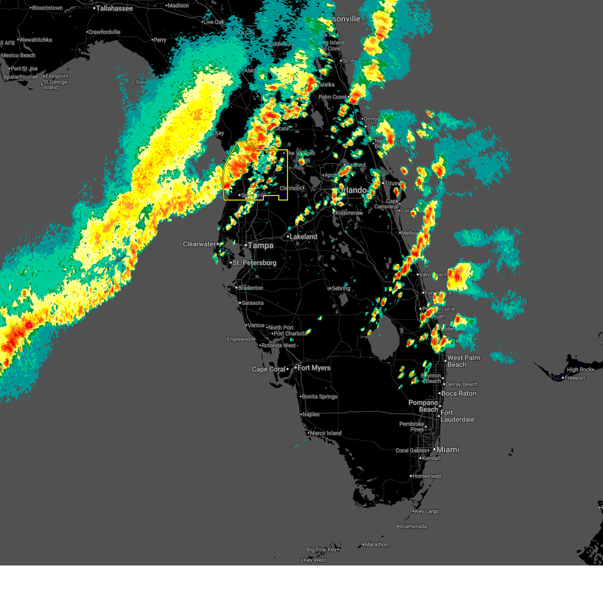
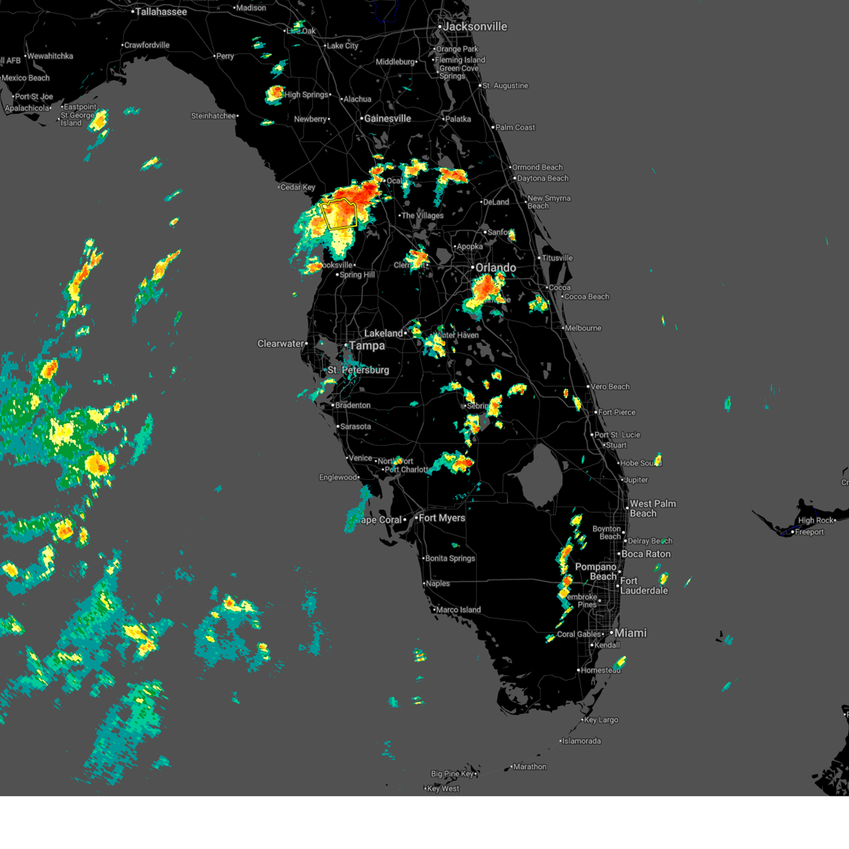
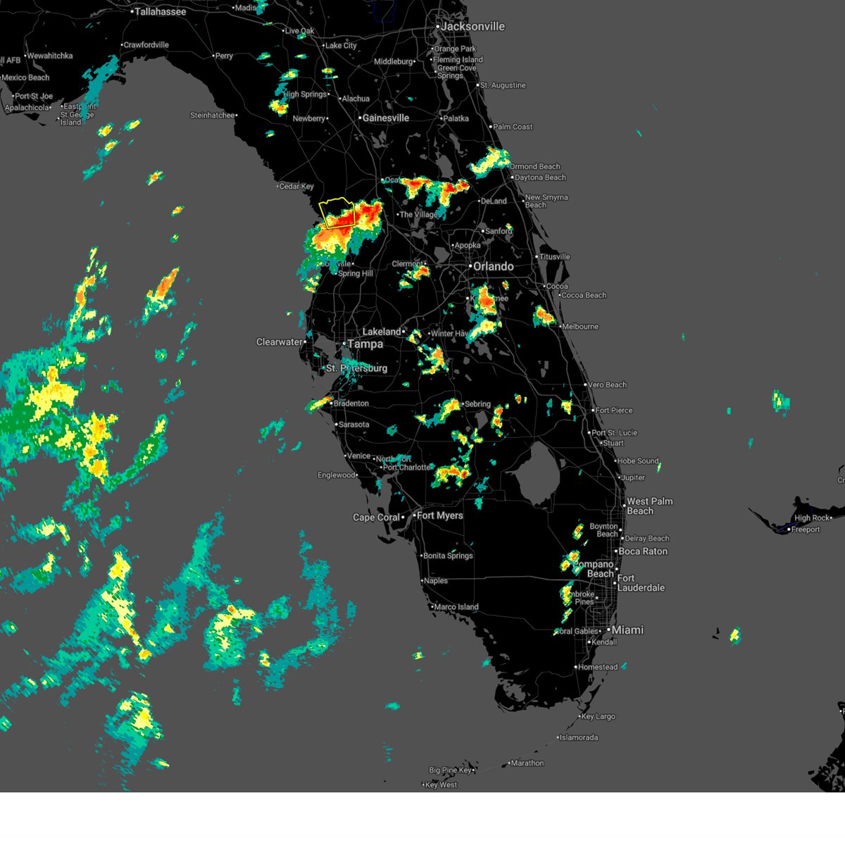
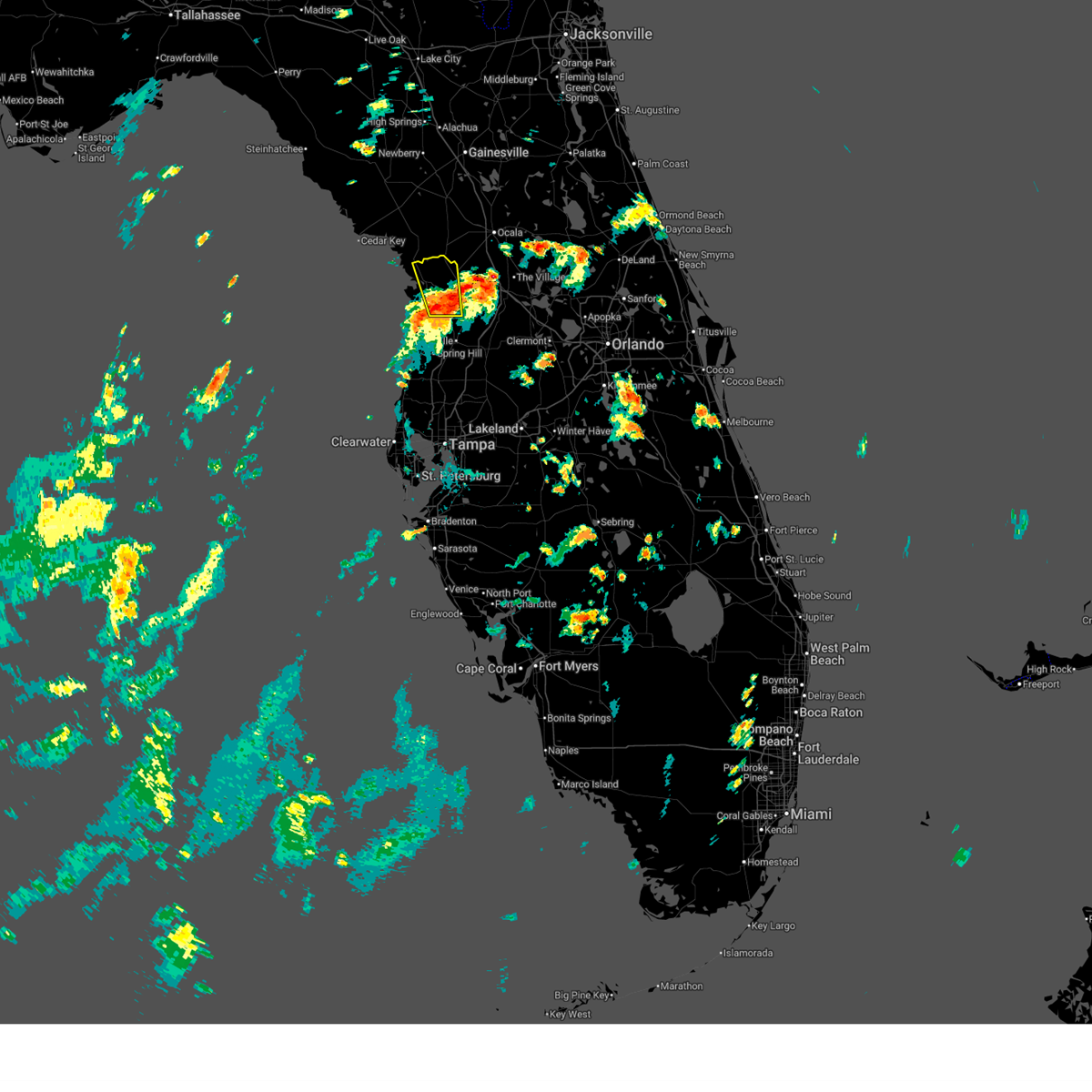
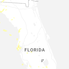
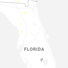
Hail Map for Crystal River, FL
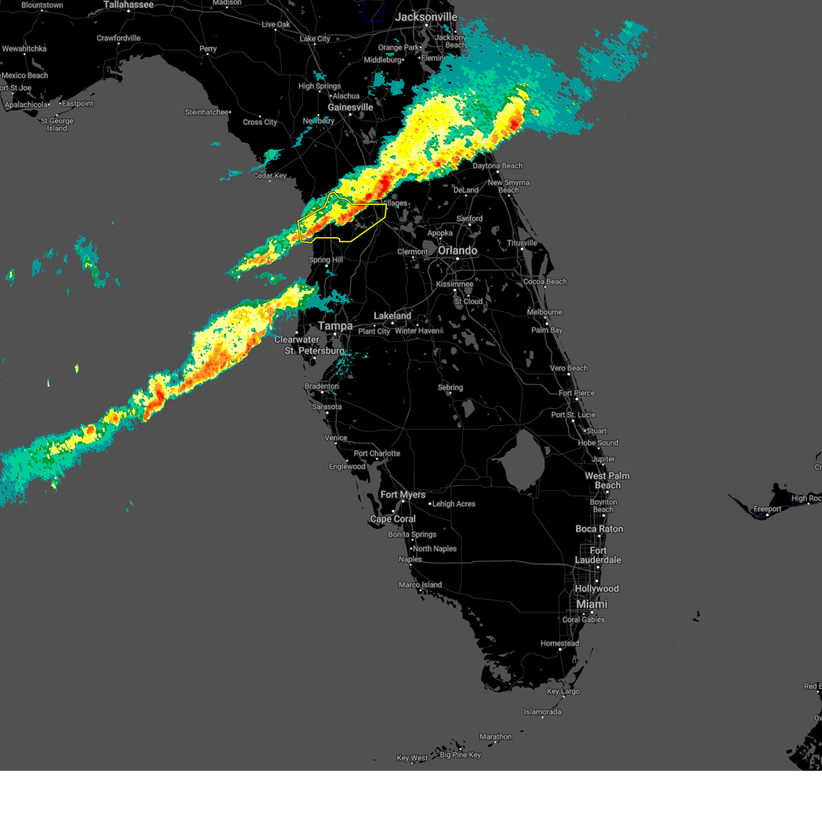
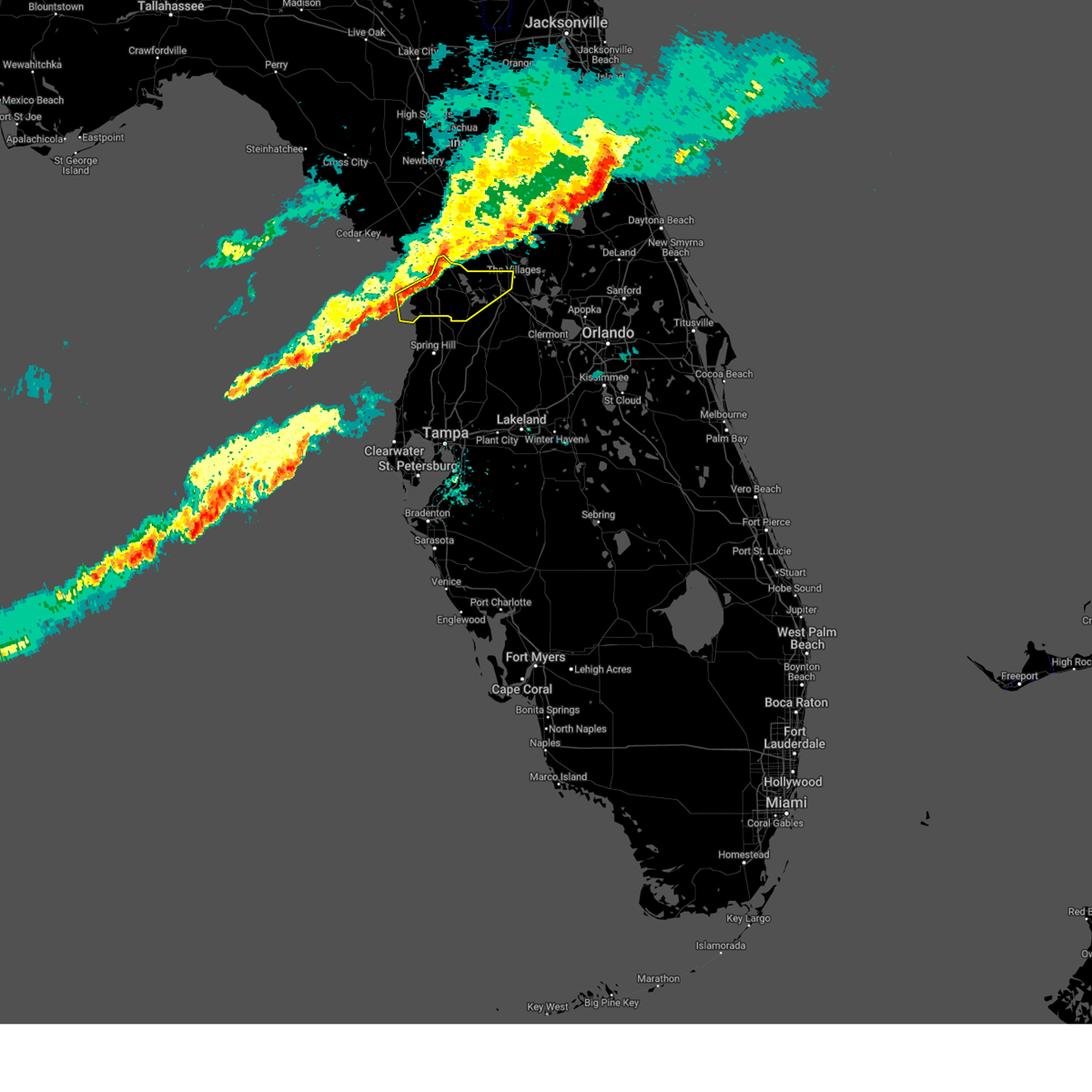
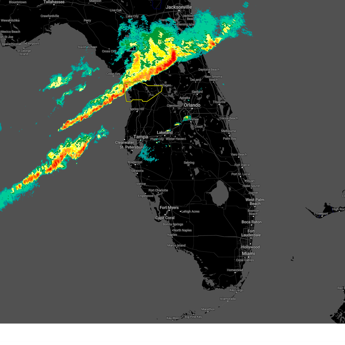
The Crystal River, FL area has had 3 reports of on-the-ground hail by trained spotters, and has been under severe weather warnings 4 times during the past 12 months. Doppler radar has detected hail at or near Crystal River, FL on 39 occasions.
| Name: | Crystal River, FL |
| Where Located: | 78.6 miles WNW of Orlando, FL |
| Map: | Google Map for Crystal River, FL |
| Population: | 3108 |
| Housing Units: | 2036 |
| More Info: | Search Google for Crystal River, FL |
2
The Top Recent Hail Date for Crystal River, FL is Wednesday, June 25, 2025 (5th out of 39)

Hail and Wind Damage Spotted near Crystal River, FL
| Date / Time | Report Details |
|---|---|
| 3/16/2026 3:06 PM EDT |
 Svrtbw the national weather service in ruskin has issued a * severe thunderstorm warning for, citrus county in west central florida, sumter county in central florida, hernando county in west central florida, * until 345 pm edt. * at 305 pm edt, severe thunderstorms were located along a line extending from near rainbow lakes estates to near homosassa, moving northeast at 65 mph (radar indicated). Hazards include 60 mph wind gusts and quarter size hail. Hail damage to vehicles is expected. Expect wind damage to roofs, siding, and trees. Svrtbw the national weather service in ruskin has issued a * severe thunderstorm warning for, citrus county in west central florida, sumter county in central florida, hernando county in west central florida, * until 345 pm edt. * at 305 pm edt, severe thunderstorms were located along a line extending from near rainbow lakes estates to near homosassa, moving northeast at 65 mph (radar indicated). Hazards include 60 mph wind gusts and quarter size hail. Hail damage to vehicles is expected. Expect wind damage to roofs, siding, and trees.
|
| 7/16/2025 6:11 PM EDT |
 The storm which prompted the warning has weakened below severe limits, and has exited the warned area. therefore, the warning will be allowed to expire. however, gusty winds are still possible with this thunderstorm. The storm which prompted the warning has weakened below severe limits, and has exited the warned area. therefore, the warning will be allowed to expire. however, gusty winds are still possible with this thunderstorm.
|
| 7/16/2025 5:54 PM EDT |
 At 554 pm edt, a severe thunderstorm was located near black diamond, or near beverly hills, moving north at 25 mph (radar indicated). Hazards include 60 mph wind gusts. Expect damage to roofs, siding, and trees. Locations impacted include, lecanto, citronelle, crystal manor, crystal oaks, inverness highlands north, citrus springs, crystal river airport, pine ridge, beverly hills, and citrus hills. At 554 pm edt, a severe thunderstorm was located near black diamond, or near beverly hills, moving north at 25 mph (radar indicated). Hazards include 60 mph wind gusts. Expect damage to roofs, siding, and trees. Locations impacted include, lecanto, citronelle, crystal manor, crystal oaks, inverness highlands north, citrus springs, crystal river airport, pine ridge, beverly hills, and citrus hills.
|
| 7/16/2025 5:41 PM EDT |
 Svrtbw the national weather service in ruskin has issued a * severe thunderstorm warning for, central citrus county in west central florida, * until 615 pm edt. * at 541 pm edt, a severe thunderstorm was located near homosassa springs, moving north at 25 mph (radar indicated). Hazards include 60 mph wind gusts. expect damage to roofs, siding, and trees Svrtbw the national weather service in ruskin has issued a * severe thunderstorm warning for, central citrus county in west central florida, * until 615 pm edt. * at 541 pm edt, a severe thunderstorm was located near homosassa springs, moving north at 25 mph (radar indicated). Hazards include 60 mph wind gusts. expect damage to roofs, siding, and trees
|
| 1/19/2025 8:26 AM EST |
 The storms which prompted the warning have weakened below severe limits, and no longer pose an immediate threat to life or property. therefore, the warning will be allowed to expire. however, gusty winds are still possible with these thunderstorms. The storms which prompted the warning have weakened below severe limits, and no longer pose an immediate threat to life or property. therefore, the warning will be allowed to expire. however, gusty winds are still possible with these thunderstorms.
|
| 1/19/2025 8:00 AM EST |
 At 800 am est, severe thunderstorms were located along a line extending from 6 miles southwest of rainbow lakes estates to black diamond to 13 miles northwest of pine island, moving east at 40 mph (radar indicated). Hazards include 60 mph wind gusts. Expect damage to roofs, siding, and trees. Locations impacted include, hernando, sugarmill woods, inverness, wildwood, lake panasoffkee, arbor lakes, lecanto, homosassa springs, leisure acres, and inverness highlands. At 800 am est, severe thunderstorms were located along a line extending from 6 miles southwest of rainbow lakes estates to black diamond to 13 miles northwest of pine island, moving east at 40 mph (radar indicated). Hazards include 60 mph wind gusts. Expect damage to roofs, siding, and trees. Locations impacted include, hernando, sugarmill woods, inverness, wildwood, lake panasoffkee, arbor lakes, lecanto, homosassa springs, leisure acres, and inverness highlands.
|
| 1/19/2025 7:38 AM EST |
 Svrtbw the national weather service in ruskin has issued a * severe thunderstorm warning for, citrus county in west central florida, northwestern sumter county in central florida, * until 830 am est. * at 738 am est, severe thunderstorms were located along a line extending from 14 miles northwest of crystal river airport to 11 miles west of homosassa to 28 miles west of pine island, moving east at 50 mph (radar indicated). Hazards include 60 mph wind gusts. expect damage to roofs, siding, and trees Svrtbw the national weather service in ruskin has issued a * severe thunderstorm warning for, citrus county in west central florida, northwestern sumter county in central florida, * until 830 am est. * at 738 am est, severe thunderstorms were located along a line extending from 14 miles northwest of crystal river airport to 11 miles west of homosassa to 28 miles west of pine island, moving east at 50 mph (radar indicated). Hazards include 60 mph wind gusts. expect damage to roofs, siding, and trees
|
| 5/17/2024 9:35 AM EDT |
 the severe thunderstorm warning has been cancelled and is no longer in effect the severe thunderstorm warning has been cancelled and is no longer in effect
|
| 5/17/2024 8:42 AM EDT |
 Svrtbw the national weather service in ruskin has issued a * severe thunderstorm warning for, citrus county in west central florida, northwestern sumter county in central florida, central pasco county in west central florida, hernando county in west central florida, southeastern levy county in northern florida, * until 945 am edt. * at 841 am edt, a severe thunderstorm was located 15 miles west of pine island, or 20 miles northwest of hudson, moving east at 40 mph (radar indicated). Hazards include 60 mph wind gusts. expect damage to roofs, siding, and trees Svrtbw the national weather service in ruskin has issued a * severe thunderstorm warning for, citrus county in west central florida, northwestern sumter county in central florida, central pasco county in west central florida, hernando county in west central florida, southeastern levy county in northern florida, * until 945 am edt. * at 841 am edt, a severe thunderstorm was located 15 miles west of pine island, or 20 miles northwest of hudson, moving east at 40 mph (radar indicated). Hazards include 60 mph wind gusts. expect damage to roofs, siding, and trees
|
| 4/11/2024 11:29 AM EDT |
 Svrtbw the national weather service in ruskin has issued a * severe thunderstorm warning for, citrus county in west central florida, northern sumter county in central florida, northern hernando county in west central florida, southeastern levy county in northern florida, * until noon edt. * at 1129 am edt, severe thunderstorms were located along a line extending from 7 miles northwest of crystal river airport to black diamond to near inverness highlands north, moving northeast at 50 mph (radar indicated). Hazards include 60 mph wind gusts. expect damage to roofs, siding, and trees Svrtbw the national weather service in ruskin has issued a * severe thunderstorm warning for, citrus county in west central florida, northern sumter county in central florida, northern hernando county in west central florida, southeastern levy county in northern florida, * until noon edt. * at 1129 am edt, severe thunderstorms were located along a line extending from 7 miles northwest of crystal river airport to black diamond to near inverness highlands north, moving northeast at 50 mph (radar indicated). Hazards include 60 mph wind gusts. expect damage to roofs, siding, and trees
|
| 4/11/2024 11:01 AM EDT |
 Svrtbw the national weather service in ruskin has issued a * severe thunderstorm warning for, citrus county in west central florida, northwestern hernando county in west central florida, * until 1130 am edt. * at 1101 am edt, severe thunderstorms were located along a line extending from 14 miles west of homosassa to 12 miles west of pine island, moving northeast at 50 mph (radar indicated). Hazards include 60 mph wind gusts. expect damage to roofs, siding, and trees Svrtbw the national weather service in ruskin has issued a * severe thunderstorm warning for, citrus county in west central florida, northwestern hernando county in west central florida, * until 1130 am edt. * at 1101 am edt, severe thunderstorms were located along a line extending from 14 miles west of homosassa to 12 miles west of pine island, moving northeast at 50 mph (radar indicated). Hazards include 60 mph wind gusts. expect damage to roofs, siding, and trees
|
| 1/9/2024 4:13 PM EST |
 The severe thunderstorm warning for central citrus and northern sumter counties will expire at 415 pm est. the storm which prompted the warning has weakened below severe limits, and has exited the warned area. therefore, the warning will be allowed to expire. A tornado watch remains in effect until 900 pm est for central and. The severe thunderstorm warning for central citrus and northern sumter counties will expire at 415 pm est. the storm which prompted the warning has weakened below severe limits, and has exited the warned area. therefore, the warning will be allowed to expire. A tornado watch remains in effect until 900 pm est for central and.
|
| 1/9/2024 3:41 PM EST |
 At 340 pm est, a severe thunderstorm was located near black diamond, or near beverly hills, moving northeast at 45 mph (radar indicated). Hazards include 60 mph wind gusts. expect damage to roofs, siding, and trees At 340 pm est, a severe thunderstorm was located near black diamond, or near beverly hills, moving northeast at 45 mph (radar indicated). Hazards include 60 mph wind gusts. expect damage to roofs, siding, and trees
|
| 10/12/2023 7:31 AM EDT |
 At 730 am edt, a radar indicated waterspout was located just offshore near homosassa, or 9 miles west of homosassa springs, moving northeast at 45 mph (radar indicated rotation). Hazards include tornado. Flying debris will be dangerous to those caught without shelter. mobile homes will be damaged or destroyed. damage to roofs, windows, and vehicles will occur. tree damage is likely. this tornado will be near, homosassa springs, homosassa, crystal river airport, and black diamond around 735 am edt. beverly hills around 740 am edt. inverness and inverness highlands north around 750 am edt. Other locations impacted by this tornadic thunderstorm include pine ridge, arbor lakes, citrus hills, lecanto, green acres, gospel island, leisure acres, crystal oaks, citrus springs, and brent wood. At 730 am edt, a radar indicated waterspout was located just offshore near homosassa, or 9 miles west of homosassa springs, moving northeast at 45 mph (radar indicated rotation). Hazards include tornado. Flying debris will be dangerous to those caught without shelter. mobile homes will be damaged or destroyed. damage to roofs, windows, and vehicles will occur. tree damage is likely. this tornado will be near, homosassa springs, homosassa, crystal river airport, and black diamond around 735 am edt. beverly hills around 740 am edt. inverness and inverness highlands north around 750 am edt. Other locations impacted by this tornadic thunderstorm include pine ridge, arbor lakes, citrus hills, lecanto, green acres, gospel island, leisure acres, crystal oaks, citrus springs, and brent wood.
|
| 10/12/2023 5:34 AM EDT |
 At 533 am edt, a severe thunderstorm capable of producing a tornado was located 11 miles northwest of crystal river airport, or 15 miles northwest of homosassa springs, moving northeast at 45 mph (radar indicated rotation). Hazards include tornado. Flying debris will be dangerous to those caught without shelter. mobile homes will be damaged or destroyed. damage to roofs, windows, and vehicles will occur. tree damage is likely. This tornadic thunderstorm will remain over mainly rural areas of northwestern citrus and southeastern levy counties, including the following locations, lebanon, citronelle, crystal manor, inglis, and citrus springs. At 533 am edt, a severe thunderstorm capable of producing a tornado was located 11 miles northwest of crystal river airport, or 15 miles northwest of homosassa springs, moving northeast at 45 mph (radar indicated rotation). Hazards include tornado. Flying debris will be dangerous to those caught without shelter. mobile homes will be damaged or destroyed. damage to roofs, windows, and vehicles will occur. tree damage is likely. This tornadic thunderstorm will remain over mainly rural areas of northwestern citrus and southeastern levy counties, including the following locations, lebanon, citronelle, crystal manor, inglis, and citrus springs.
|
| 10/12/2023 3:30 AM EDT |
 At 329 am edt, a severe thunderstorm capable of producing a tornado was located near crystal river airport, or near homosassa springs, moving northeast at 40 mph (radar indicated rotation). Hazards include tornado. Flying debris will be dangerous to those caught without shelter. mobile homes will be damaged or destroyed. damage to roofs, windows, and vehicles will occur. tree damage is likely. this dangerous storm will be near, beverly hills, homosassa springs, crystal river airport, and black diamond around 335 am edt. Other locations impacted by this tornadic thunderstorm include pine ridge, citrus hills, lecanto, citronelle, crystal oaks, brent wood, hernando, and citrus springs. At 329 am edt, a severe thunderstorm capable of producing a tornado was located near crystal river airport, or near homosassa springs, moving northeast at 40 mph (radar indicated rotation). Hazards include tornado. Flying debris will be dangerous to those caught without shelter. mobile homes will be damaged or destroyed. damage to roofs, windows, and vehicles will occur. tree damage is likely. this dangerous storm will be near, beverly hills, homosassa springs, crystal river airport, and black diamond around 335 am edt. Other locations impacted by this tornadic thunderstorm include pine ridge, citrus hills, lecanto, citronelle, crystal oaks, brent wood, hernando, and citrus springs.
|
| 10/12/2023 3:15 AM EDT |
 At 315 am edt, a severe thunderstorm capable of producing a tornado was located 7 miles west of homosassa, or 12 miles southwest of homosassa springs, moving northeast at 40 mph (radar indicated rotation). Hazards include tornado. Flying debris will be dangerous to those caught without shelter. mobile homes will be damaged or destroyed. damage to roofs, windows, and vehicles will occur. tree damage is likely. this dangerous storm will be near, homosassa springs, homosassa, and crystal river airport around 320 am edt. beverly hills and black diamond around 330 am edt. Other locations impacted by this tornadic thunderstorm include pine ridge, citrus hills, lecanto, green acres, citronelle, crystal oaks, brent wood, hernando, and citrus springs. At 315 am edt, a severe thunderstorm capable of producing a tornado was located 7 miles west of homosassa, or 12 miles southwest of homosassa springs, moving northeast at 40 mph (radar indicated rotation). Hazards include tornado. Flying debris will be dangerous to those caught without shelter. mobile homes will be damaged or destroyed. damage to roofs, windows, and vehicles will occur. tree damage is likely. this dangerous storm will be near, homosassa springs, homosassa, and crystal river airport around 320 am edt. beverly hills and black diamond around 330 am edt. Other locations impacted by this tornadic thunderstorm include pine ridge, citrus hills, lecanto, green acres, citronelle, crystal oaks, brent wood, hernando, and citrus springs.
|
| 10/12/2023 2:20 AM EDT |
 At 220 am edt, a severe thunderstorm capable of producing a tornado was located over crystal river airport, or near homosassa springs, moving northeast at 30 mph (radar indicated rotation). Hazards include tornado. Flying debris will be dangerous to those caught without shelter. mobile homes will be damaged or destroyed. damage to roofs, windows, and vehicles will occur. tree damage is likely. this dangerous storm will be near, beverly hills and black diamond around 225 am edt. Other locations impacted by this tornadic thunderstorm include pine ridge, arbor lakes, citrus hills, stokes ferry, citronelle, river lakes manor, citrus springs, brent wood, hernando, and lecanto. At 220 am edt, a severe thunderstorm capable of producing a tornado was located over crystal river airport, or near homosassa springs, moving northeast at 30 mph (radar indicated rotation). Hazards include tornado. Flying debris will be dangerous to those caught without shelter. mobile homes will be damaged or destroyed. damage to roofs, windows, and vehicles will occur. tree damage is likely. this dangerous storm will be near, beverly hills and black diamond around 225 am edt. Other locations impacted by this tornadic thunderstorm include pine ridge, arbor lakes, citrus hills, stokes ferry, citronelle, river lakes manor, citrus springs, brent wood, hernando, and lecanto.
|
| 10/12/2023 1:46 AM EDT |
 At 145 am edt, a radar indicated waterspout was located just offshore 11 miles west of homosassa, or 15 miles west of homosassa springs, moving northeast at 30 mph (radar indicated rotation). Hazards include tornado. Flying debris will be dangerous to those caught without shelter. mobile homes will be damaged or destroyed. damage to roofs, windows, and vehicles will occur. tree damage is likely. this tornado will be near, homosassa around 150 am edt. homosassa springs and crystal river airport around 200 am edt. black diamond around 210 am edt. beverly hills around 215 am edt. Other locations impacted by this tornadic thunderstorm include arbor lakes, lecanto, green acres, citronelle, leisure acres, crystal manor, crystal oaks, river lakes manor, citrus springs, and pine ridge. At 145 am edt, a radar indicated waterspout was located just offshore 11 miles west of homosassa, or 15 miles west of homosassa springs, moving northeast at 30 mph (radar indicated rotation). Hazards include tornado. Flying debris will be dangerous to those caught without shelter. mobile homes will be damaged or destroyed. damage to roofs, windows, and vehicles will occur. tree damage is likely. this tornado will be near, homosassa around 150 am edt. homosassa springs and crystal river airport around 200 am edt. black diamond around 210 am edt. beverly hills around 215 am edt. Other locations impacted by this tornadic thunderstorm include arbor lakes, lecanto, green acres, citronelle, leisure acres, crystal manor, crystal oaks, river lakes manor, citrus springs, and pine ridge.
|
| 5/12/2023 7:02 PM EDT |
 At 702 pm edt, a severe thunderstorm was located 12 miles northwest of crystal river airport, or 14 miles northwest of beverly hills, moving southwest at 10 mph (radar indicated). Hazards include quarter size hail. damage to vehicles is expected At 702 pm edt, a severe thunderstorm was located 12 miles northwest of crystal river airport, or 14 miles northwest of beverly hills, moving southwest at 10 mph (radar indicated). Hazards include quarter size hail. damage to vehicles is expected
|
| 5/11/2023 6:17 PM EDT |
 At 617 pm edt, a severe thunderstorm was located 7 miles north of crystal river airport, or 9 miles northwest of beverly hills, moving east at 10 mph (radar indicated). Hazards include 60 mph wind gusts and quarter size hail. Hail damage to vehicles is expected. expect wind damage to roofs, siding, and trees. locations impacted include, inglis, pine ridge, citronelle, crystal manor, crystal river airport, homosassa springs, homosassa, black diamond, and citrus springs. hail threat, radar indicated max hail size, 1. 00 in wind threat, radar indicated max wind gust, 60 mph. At 617 pm edt, a severe thunderstorm was located 7 miles north of crystal river airport, or 9 miles northwest of beverly hills, moving east at 10 mph (radar indicated). Hazards include 60 mph wind gusts and quarter size hail. Hail damage to vehicles is expected. expect wind damage to roofs, siding, and trees. locations impacted include, inglis, pine ridge, citronelle, crystal manor, crystal river airport, homosassa springs, homosassa, black diamond, and citrus springs. hail threat, radar indicated max hail size, 1. 00 in wind threat, radar indicated max wind gust, 60 mph.
|
| 5/11/2023 5:59 PM EDT |
 At 558 pm edt, a severe thunderstorm was located near crystal river airport, or 9 miles west of beverly hills, moving north at 10 mph (radar indicated). Hazards include 60 mph wind gusts and quarter size hail. Hail damage to vehicles is expected. Expect wind damage to roofs, siding, and trees. At 558 pm edt, a severe thunderstorm was located near crystal river airport, or 9 miles west of beverly hills, moving north at 10 mph (radar indicated). Hazards include 60 mph wind gusts and quarter size hail. Hail damage to vehicles is expected. Expect wind damage to roofs, siding, and trees.
|
| 5/11/2023 5:37 PM EDT |
 At 537 pm edt, a severe thunderstorm was located over homosassa springs, moving southwest at 10 mph (radar indicated). Hazards include 60 mph wind gusts and quarter size hail. Hail damage to vehicles is expected. Expect wind damage to roofs, siding, and trees. At 537 pm edt, a severe thunderstorm was located over homosassa springs, moving southwest at 10 mph (radar indicated). Hazards include 60 mph wind gusts and quarter size hail. Hail damage to vehicles is expected. Expect wind damage to roofs, siding, and trees.
|
| 6/19/2022 1:49 PM EDT |
 At 149 pm edt, a severe thunderstorm was located near beverly hills, moving southwest at 10 mph (radar indicated). Hazards include 60 mph wind gusts and quarter size hail. Hail damage to vehicles is expected. Expect wind damage to roofs, siding, and trees. At 149 pm edt, a severe thunderstorm was located near beverly hills, moving southwest at 10 mph (radar indicated). Hazards include 60 mph wind gusts and quarter size hail. Hail damage to vehicles is expected. Expect wind damage to roofs, siding, and trees.
|
| 5/31/2022 5:10 PM EDT |
 The severe thunderstorm warning for northwestern citrus county will expire at 515 pm edt, the storm which prompted the warning has weakened below severe limits, and no longer poses an immediate threat to life or property. therefore, the warning will be allowed to expire. The severe thunderstorm warning for northwestern citrus county will expire at 515 pm edt, the storm which prompted the warning has weakened below severe limits, and no longer poses an immediate threat to life or property. therefore, the warning will be allowed to expire.
|
| 5/31/2022 5:05 PM EDT | Quarter sized hail reported 5.7 miles SSW of Crystal River, FL, time estimated by radar. |
| 5/31/2022 5:01 PM EDT |
 At 500 pm edt, a severe thunderstorm was located near crystal river airport, or 10 miles northwest of homosassa springs, moving southwest at 15 mph (radar indicated). Hazards include 60 mph wind gusts and quarter size hail. Hail damage to vehicles is expected. expect wind damage to roofs, siding, and trees. locations impacted include, pine ridge, crystal river airport, black diamond, crystal manor, beverly hills and lecanto. hail threat, radar indicated max hail size, 1. 00 in wind threat, radar indicated max wind gust, 60 mph. At 500 pm edt, a severe thunderstorm was located near crystal river airport, or 10 miles northwest of homosassa springs, moving southwest at 15 mph (radar indicated). Hazards include 60 mph wind gusts and quarter size hail. Hail damage to vehicles is expected. expect wind damage to roofs, siding, and trees. locations impacted include, pine ridge, crystal river airport, black diamond, crystal manor, beverly hills and lecanto. hail threat, radar indicated max hail size, 1. 00 in wind threat, radar indicated max wind gust, 60 mph.
|
| 5/31/2022 4:49 PM EDT |
 At 448 pm edt, a severe thunderstorm was located near crystal river airport, or 9 miles west of beverly hills, moving southwest at 15 mph (radar indicated). Hazards include 60 mph wind gusts and quarter size hail. Hail damage to vehicles is expected. Expect wind damage to roofs, siding, and trees. At 448 pm edt, a severe thunderstorm was located near crystal river airport, or 9 miles west of beverly hills, moving southwest at 15 mph (radar indicated). Hazards include 60 mph wind gusts and quarter size hail. Hail damage to vehicles is expected. Expect wind damage to roofs, siding, and trees.
|
| 4/7/2022 9:00 AM EDT |
 At 900 am edt, a severe thunderstorm was located 18 miles northwest of crystal river airport, or 22 miles northwest of homosassa springs, moving east at 35 mph (radar indicated). Hazards include 60 mph wind gusts and quarter size hail. Hail damage to vehicles is expected. Expect wind damage to roofs, siding, and trees. At 900 am edt, a severe thunderstorm was located 18 miles northwest of crystal river airport, or 22 miles northwest of homosassa springs, moving east at 35 mph (radar indicated). Hazards include 60 mph wind gusts and quarter size hail. Hail damage to vehicles is expected. Expect wind damage to roofs, siding, and trees.
|
| 3/12/2022 7:55 AM EST |
 At 754 am est, severe thunderstorms were located along a line extending from 7 miles south of rainbow lakes estates to 17 miles northwest of beacon square, moving east at 40 mph (radar indicated). Hazards include 60 mph wind gusts. expect damage to roofs, siding, and trees At 754 am est, severe thunderstorms were located along a line extending from 7 miles south of rainbow lakes estates to 17 miles northwest of beacon square, moving east at 40 mph (radar indicated). Hazards include 60 mph wind gusts. expect damage to roofs, siding, and trees
|
| 3/12/2022 7:22 AM EST |
 At 721 am est, severe thunderstorms were located along a line extending from 16 miles west of rainbow lakes estates to 28 miles west of pine island, moving east at 40 mph (radar indicated). Hazards include 60 mph wind gusts. expect damage to roofs, siding, and trees At 721 am est, severe thunderstorms were located along a line extending from 16 miles west of rainbow lakes estates to 28 miles west of pine island, moving east at 40 mph (radar indicated). Hazards include 60 mph wind gusts. expect damage to roofs, siding, and trees
|
| 12/24/2020 6:24 PM EST |
 At 624 pm est, severe thunderstorms were located along a line extending from 16 miles west of homosassa to 18 miles west of beacon square to 25 miles west of harbor bluffs, moving east at 50 mph (radar indicated). Hazards include 60 mph wind gusts. expect damage to roofs, siding, and trees At 624 pm est, severe thunderstorms were located along a line extending from 16 miles west of homosassa to 18 miles west of beacon square to 25 miles west of harbor bluffs, moving east at 50 mph (radar indicated). Hazards include 60 mph wind gusts. expect damage to roofs, siding, and trees
|
| 8/24/2020 5:25 PM EDT |
 At 525 pm edt, a severe thunderstorm was located over inverness highlands north, or near inverness, moving northwest at 30 mph (radar indicated). Hazards include 60 mph wind gusts. expect damage to roofs, siding, and trees At 525 pm edt, a severe thunderstorm was located over inverness highlands north, or near inverness, moving northwest at 30 mph (radar indicated). Hazards include 60 mph wind gusts. expect damage to roofs, siding, and trees
|
| 4/24/2020 4:59 AM EDT |
 At 458 am edt, severe thunderstorms were located along a line extending from near inverness highlands north to 27 miles west of harbor bluffs, moving east at 30 mph (radar indicated). Hazards include 60 mph wind gusts. expect damage to roofs, siding, and trees At 458 am edt, severe thunderstorms were located along a line extending from near inverness highlands north to 27 miles west of harbor bluffs, moving east at 30 mph (radar indicated). Hazards include 60 mph wind gusts. expect damage to roofs, siding, and trees
|
| 2/6/2020 10:28 PM EST |
 At 1026 pm est, severe thunderstorms were located along a line extending from near ocala airport to 7 miles south of homosassa springs to near new port richey to 23 miles west of anna maria, moving east at 35 mph (radar indicated). Hazards include 60 mph wind gusts. Expect damage to roofs, siding, and trees. locations impacted include, tampa, spring hill, clearwater, largo, pinellas park, seminole, new port richey, brooksville, inverness, wildwood, bushnell, downtown saint petersburg, hudson, beverly hills, holiday, homosassa springs, saint petersburg, lutz, fort desoto park and st. Petersburg. At 1026 pm est, severe thunderstorms were located along a line extending from near ocala airport to 7 miles south of homosassa springs to near new port richey to 23 miles west of anna maria, moving east at 35 mph (radar indicated). Hazards include 60 mph wind gusts. Expect damage to roofs, siding, and trees. locations impacted include, tampa, spring hill, clearwater, largo, pinellas park, seminole, new port richey, brooksville, inverness, wildwood, bushnell, downtown saint petersburg, hudson, beverly hills, holiday, homosassa springs, saint petersburg, lutz, fort desoto park and st. Petersburg.
|
| 2/6/2020 10:02 PM EST |
 At 1002 pm est, severe thunderstorms were located along a line extending from near williston to 8 miles southwest of homosassa to 36 miles southwest of harbor bluffs, moving east at 30 mph (radar indicated). Hazards include 60 mph wind gusts. expect damage to roofs, siding, and trees At 1002 pm est, severe thunderstorms were located along a line extending from near williston to 8 miles southwest of homosassa to 36 miles southwest of harbor bluffs, moving east at 30 mph (radar indicated). Hazards include 60 mph wind gusts. expect damage to roofs, siding, and trees
|
| 2/6/2020 9:28 PM EST |
 At 928 pm est, severe thunderstorms were located along a line extending from 8 miles northwest of archer to 37 miles west of harbor bluffs, moving east at 35 mph (radar indicated). Hazards include 60 mph wind gusts. expect damage to roofs, siding, and trees At 928 pm est, severe thunderstorms were located along a line extending from 8 miles northwest of archer to 37 miles west of harbor bluffs, moving east at 35 mph (radar indicated). Hazards include 60 mph wind gusts. expect damage to roofs, siding, and trees
|
| 4/19/2019 12:12 PM EDT |
 At 1212 pm edt, a severe thunderstorm was located near homosassa, or 8 miles southwest of homosassa springs, moving northeast at 60 mph (radar indicated). Hazards include 60 mph wind gusts. expect damage to roofs, siding, and trees At 1212 pm edt, a severe thunderstorm was located near homosassa, or 8 miles southwest of homosassa springs, moving northeast at 60 mph (radar indicated). Hazards include 60 mph wind gusts. expect damage to roofs, siding, and trees
|
| 4/19/2019 11:50 AM EDT | Weatherstem marine science station reported a 50 knot wind gus in citrus county FL, 2.7 miles E of Crystal River, FL |
| 4/19/2019 11:42 AM EDT |
 At 1142 am edt, a severe thunderstorm was located 7 miles northwest of crystal river airport, or 12 miles west of beverly hills, moving northeast at 60 mph (radar indicated). Hazards include 60 mph wind gusts. expect damage to roofs, siding, and trees At 1142 am edt, a severe thunderstorm was located 7 miles northwest of crystal river airport, or 12 miles west of beverly hills, moving northeast at 60 mph (radar indicated). Hazards include 60 mph wind gusts. expect damage to roofs, siding, and trees
|
| 1/24/2019 4:19 AM EST |
 At 418 am est, severe thunderstorms were located along a line extending from near homosassa to 5 miles west of weeki wachee gardens to 10 miles west of beacon square, moving northeast at 60 mph (radar indicated). Hazards include 60 mph wind gusts. expect damage to roofs, siding, and trees At 418 am est, severe thunderstorms were located along a line extending from near homosassa to 5 miles west of weeki wachee gardens to 10 miles west of beacon square, moving northeast at 60 mph (radar indicated). Hazards include 60 mph wind gusts. expect damage to roofs, siding, and trees
|
| 7/22/2018 7:38 PM EDT |
 The severe thunderstorm warning for central citrus and northwestern sumter counties will expire at 745 pm edt, the storm which prompted the warning has weakened below severe limits, and no longer poses an immediate threat to life or property. therefore, the warning will be allowed to expire. The severe thunderstorm warning for central citrus and northwestern sumter counties will expire at 745 pm edt, the storm which prompted the warning has weakened below severe limits, and no longer poses an immediate threat to life or property. therefore, the warning will be allowed to expire.
|
| 7/22/2018 7:32 PM EDT |
 At 731 pm edt, a severe thunderstorm was located over beverly hills, moving east at 25 mph (radar indicated). Hazards include 60 mph wind gusts and nickel size hail. Expect damage to roofs, siding, and trees. Locations impacted include, inverness, homosassa springs, beverly hills, crystal river airport, black diamond, homosassa, inverness highlands south, inverness highlands north, inverness airport, hernando, sugarmill woods, arbor lakes, lecanto, leisure acres, inverness highlands, pine ridge, heatherwood, citrus hills, gospel island and brent wood. At 731 pm edt, a severe thunderstorm was located over beverly hills, moving east at 25 mph (radar indicated). Hazards include 60 mph wind gusts and nickel size hail. Expect damage to roofs, siding, and trees. Locations impacted include, inverness, homosassa springs, beverly hills, crystal river airport, black diamond, homosassa, inverness highlands south, inverness highlands north, inverness airport, hernando, sugarmill woods, arbor lakes, lecanto, leisure acres, inverness highlands, pine ridge, heatherwood, citrus hills, gospel island and brent wood.
|
| 7/22/2018 7:15 PM EDT |
 At 713 pm edt, a severe thunderstorm was located near crystal river airport, or 7 miles west of beverly hills, moving east at 25 mph (radar indicated). Hazards include 60 mph wind gusts and nickel size hail. expect damage to roofs, siding, and trees At 713 pm edt, a severe thunderstorm was located near crystal river airport, or 7 miles west of beverly hills, moving east at 25 mph (radar indicated). Hazards include 60 mph wind gusts and nickel size hail. expect damage to roofs, siding, and trees
|
| 8/24/2017 8:07 PM EDT |
 At 806 pm edt, a severe thunderstorm was located near black diamond, or 7 miles northwest of beverly hills, and is nearly stationary (radar indicated). Hazards include 60 mph wind gusts and nickel size hail. expect damage to roofs, siding, and trees At 806 pm edt, a severe thunderstorm was located near black diamond, or 7 miles northwest of beverly hills, and is nearly stationary (radar indicated). Hazards include 60 mph wind gusts and nickel size hail. expect damage to roofs, siding, and trees
|
| 2/7/2017 10:17 PM EST |
 At 1017 pm est, severe thunderstorms were located along a line extending from 6 miles northeast of williston to 12 miles northwest of black diamond to 15 miles west of weeki wachee gardens, moving east at 45 mph (radar indicated). Hazards include 60 mph wind gusts and penny size hail. Expect damage to roofs, siding, and trees. Locations impacted include, williston, beverly hills, homosassa springs, williston highlands, crystal river airport, williston municipal airport, black diamond, homosassa, east bronson, inglis, citronelle, crystal manor, crystal oaks, citrus springs, lebanon, pine ridge and lecanto. At 1017 pm est, severe thunderstorms were located along a line extending from 6 miles northeast of williston to 12 miles northwest of black diamond to 15 miles west of weeki wachee gardens, moving east at 45 mph (radar indicated). Hazards include 60 mph wind gusts and penny size hail. Expect damage to roofs, siding, and trees. Locations impacted include, williston, beverly hills, homosassa springs, williston highlands, crystal river airport, williston municipal airport, black diamond, homosassa, east bronson, inglis, citronelle, crystal manor, crystal oaks, citrus springs, lebanon, pine ridge and lecanto.
|
| 2/7/2017 10:03 PM EST |
 At 1002 pm est, severe thunderstorms were located along a line extending from near east bronson to 19 miles northwest of crystal river airport to 30 miles west of weeki wachee gardens, moving east at 35 mph (radar indicated). Hazards include 60 mph wind gusts and penny size hail. Expect damage to roofs, siding, and trees. Locations impacted include, williston, bronson, beverly hills, homosassa springs, williston highlands, east bronson, crystal river airport, williston municipal airport, black diamond, homosassa, inglis, otter creek, citronelle, crystal manor, crystal oaks, citrus springs, lebanon, pine ridge and lecanto. At 1002 pm est, severe thunderstorms were located along a line extending from near east bronson to 19 miles northwest of crystal river airport to 30 miles west of weeki wachee gardens, moving east at 35 mph (radar indicated). Hazards include 60 mph wind gusts and penny size hail. Expect damage to roofs, siding, and trees. Locations impacted include, williston, bronson, beverly hills, homosassa springs, williston highlands, east bronson, crystal river airport, williston municipal airport, black diamond, homosassa, inglis, otter creek, citronelle, crystal manor, crystal oaks, citrus springs, lebanon, pine ridge and lecanto.
|
| 2/7/2017 9:40 PM EST |
 At 939 pm est, severe thunderstorms were located along a line extending from near trenton to 21 miles south of fowlers bluff to 38 miles west of homosassa, moving east at 45 mph (radar indicated). Hazards include 60 mph wind gusts and penny size hail. expect damage to roofs, siding, and trees At 939 pm est, severe thunderstorms were located along a line extending from near trenton to 21 miles south of fowlers bluff to 38 miles west of homosassa, moving east at 45 mph (radar indicated). Hazards include 60 mph wind gusts and penny size hail. expect damage to roofs, siding, and trees
|
| 1/22/2017 6:10 PM EST | 50 acre brush fire caused by downed powerlines. time estimated by rada in citrus county FL, 3.1 miles SSW of Crystal River, FL |
| 1/22/2017 5:59 PM EST |
 At 559 pm est, severe thunderstorms were located along a line extending from 11 miles west of homosassa to 17 miles west of weeki wachee gardens to 21 miles west of hudson, moving east at 45 mph (radar indicated). Hazards include 60 mph wind gusts and penny size hail. expect damage to roofs, siding, and trees At 559 pm est, severe thunderstorms were located along a line extending from 11 miles west of homosassa to 17 miles west of weeki wachee gardens to 21 miles west of hudson, moving east at 45 mph (radar indicated). Hazards include 60 mph wind gusts and penny size hail. expect damage to roofs, siding, and trees
|
| 1/7/2017 1:48 AM EST |
 At 148 am est, a severe thunderstorm capable of producing a tornado was located 7 miles northwest of crystal river airport, or 11 miles northwest of homosassa springs, moving east at 30 mph (radar indicated rotation). Hazards include tornado. Flying debris will be dangerous to those caught without shelter. mobile homes will be damaged or destroyed. damage to roofs, windows, and vehicles will occur. Tree damage is likely. At 148 am est, a severe thunderstorm capable of producing a tornado was located 7 miles northwest of crystal river airport, or 11 miles northwest of homosassa springs, moving east at 30 mph (radar indicated rotation). Hazards include tornado. Flying debris will be dangerous to those caught without shelter. mobile homes will be damaged or destroyed. damage to roofs, windows, and vehicles will occur. Tree damage is likely.
|
| 1/15/2016 8:38 AM EST |
 At 838 am est, severe thunderstorms were located along a line extending from 6 miles south of bronson to 12 miles west of rainbow lakes estates to 25 miles west of weeki wachee gardens, moving east at 55 mph (radar indicated). Hazards include 60 mph wind gusts. Expect damage to roofs. siding and trees. Locations impacted include, inverness, williston, bronson, homosassa springs, beverly hills, inverness highlands north, crystal river airport, black diamond, east bronson, homosassa, williston highlands, inverness highlands south, inverness airport, williston municipal airport, hernando, sugarmill woods, inglis, green acres, brent wood and lebanon. At 838 am est, severe thunderstorms were located along a line extending from 6 miles south of bronson to 12 miles west of rainbow lakes estates to 25 miles west of weeki wachee gardens, moving east at 55 mph (radar indicated). Hazards include 60 mph wind gusts. Expect damage to roofs. siding and trees. Locations impacted include, inverness, williston, bronson, homosassa springs, beverly hills, inverness highlands north, crystal river airport, black diamond, east bronson, homosassa, williston highlands, inverness highlands south, inverness airport, williston municipal airport, hernando, sugarmill woods, inglis, green acres, brent wood and lebanon.
|
| 1/15/2016 7:47 AM EST |
 At 746 am est, severe thunderstorms were located along a line extending from 12 miles south of horseshoe point to 32 miles southwest of fowlers bluff to 63 miles west of beacon square, moving east at 60 mph (radar indicated). Hazards include 60 mph wind gusts and penny size hail. Expect damage to roofs. Siding and trees. At 746 am est, severe thunderstorms were located along a line extending from 12 miles south of horseshoe point to 32 miles southwest of fowlers bluff to 63 miles west of beacon square, moving east at 60 mph (radar indicated). Hazards include 60 mph wind gusts and penny size hail. Expect damage to roofs. Siding and trees.
|
| 6/16/2015 5:47 PM EDT | Quarter sized hail reported 5 miles WNW of Crystal River, FL, cocorahs spotter reported dime to quarter sized hail and shredded leaves 4.7 miles ese of crystal river. |
| 1/1/0001 12:00 AM | Quarter sized hail reported 0.7 miles SSW of Crystal River, FL, quarter sized hail reported by sheriffs office. report relayed by emergency management. |
| 1/1/0001 12:00 AM | The public reported to 911 wind damage and a possible tornado at west fort island trail roa in citrus county FL, 1.1 miles SE of Crystal River, FL |
Hail Maps for Crystal River, FL


Connect with Interactive Hail Maps