

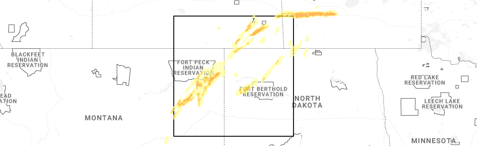
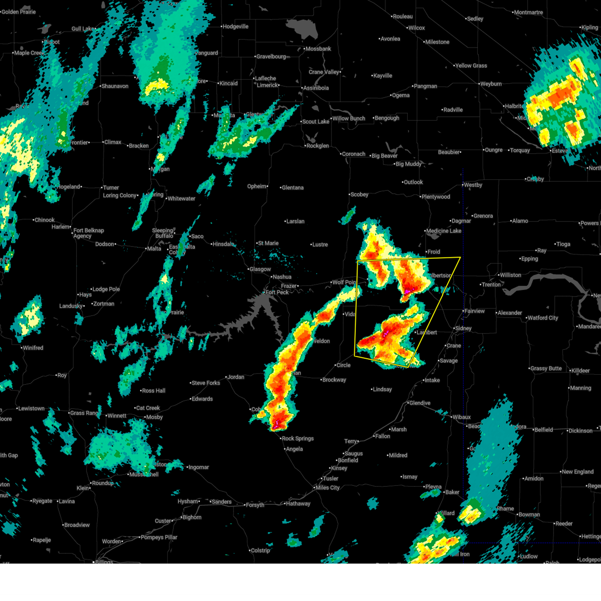
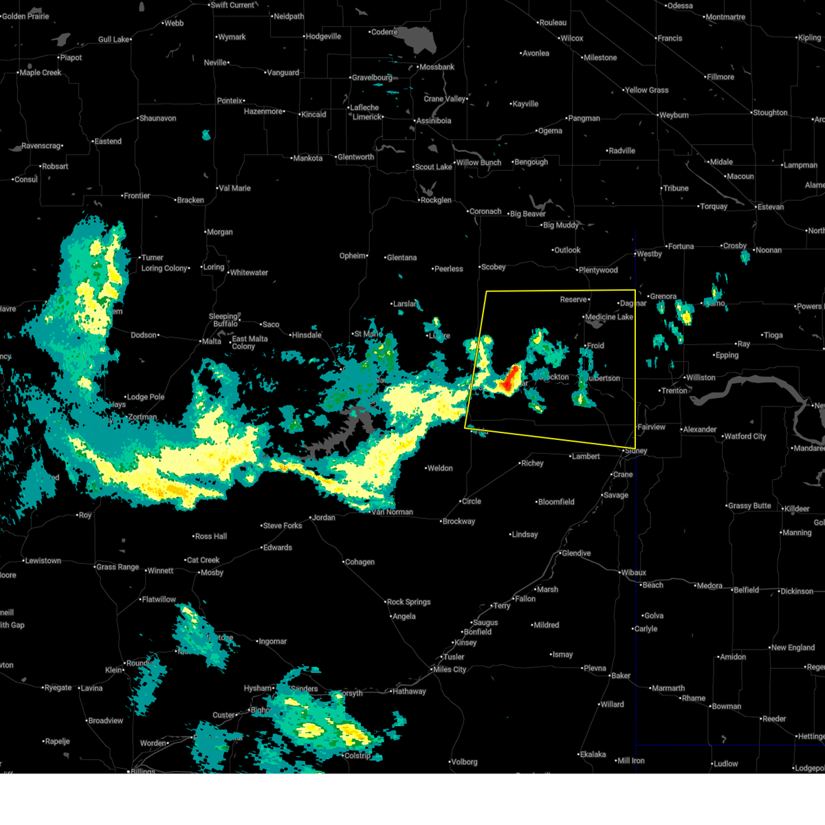
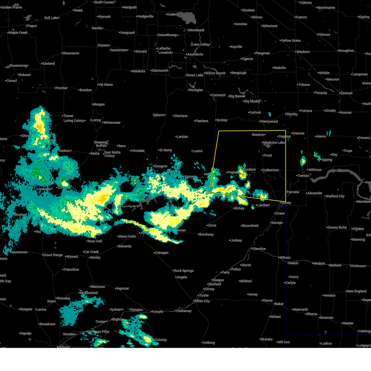
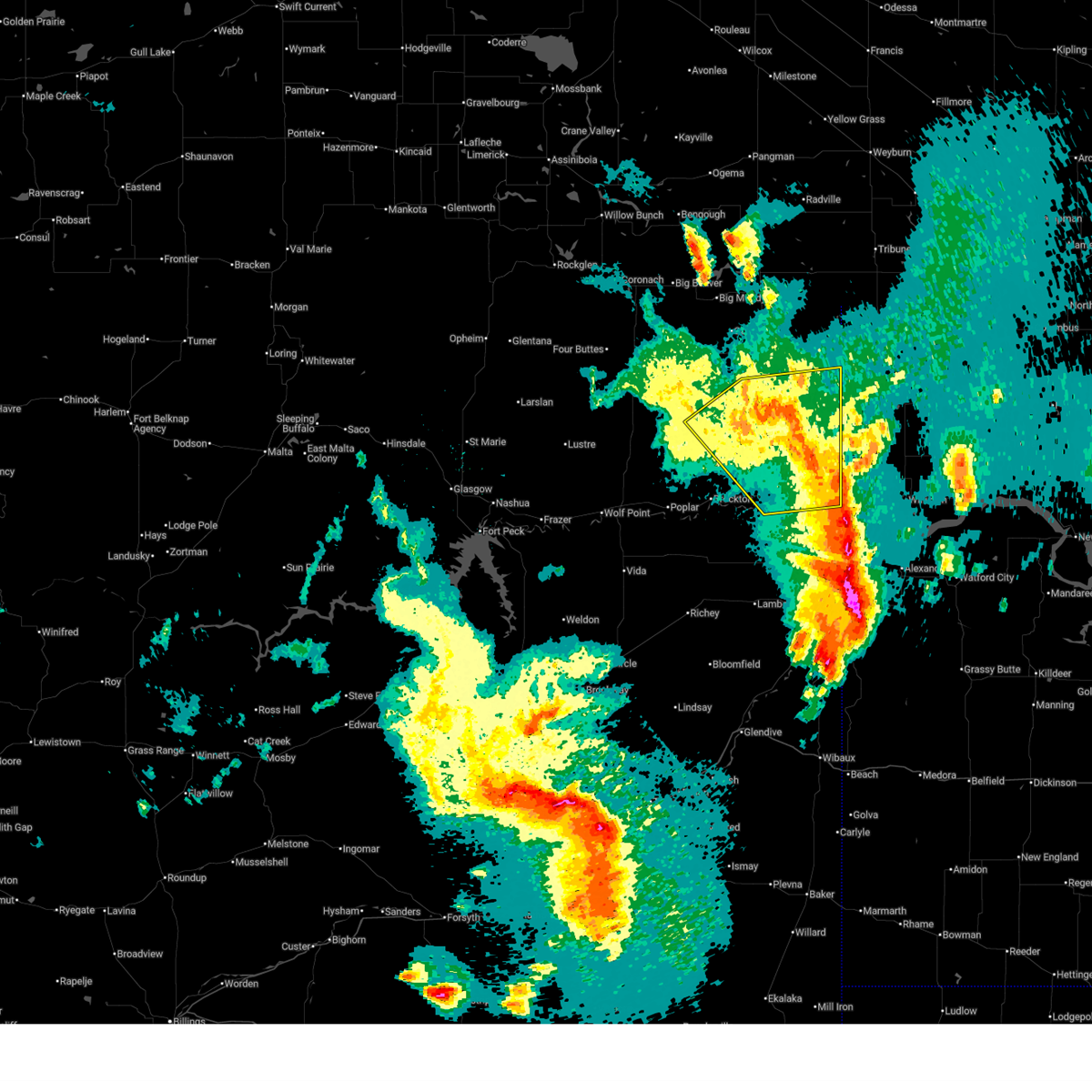
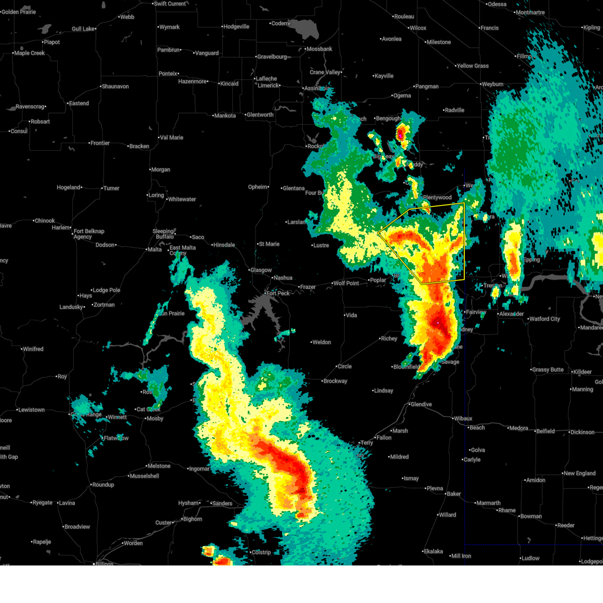
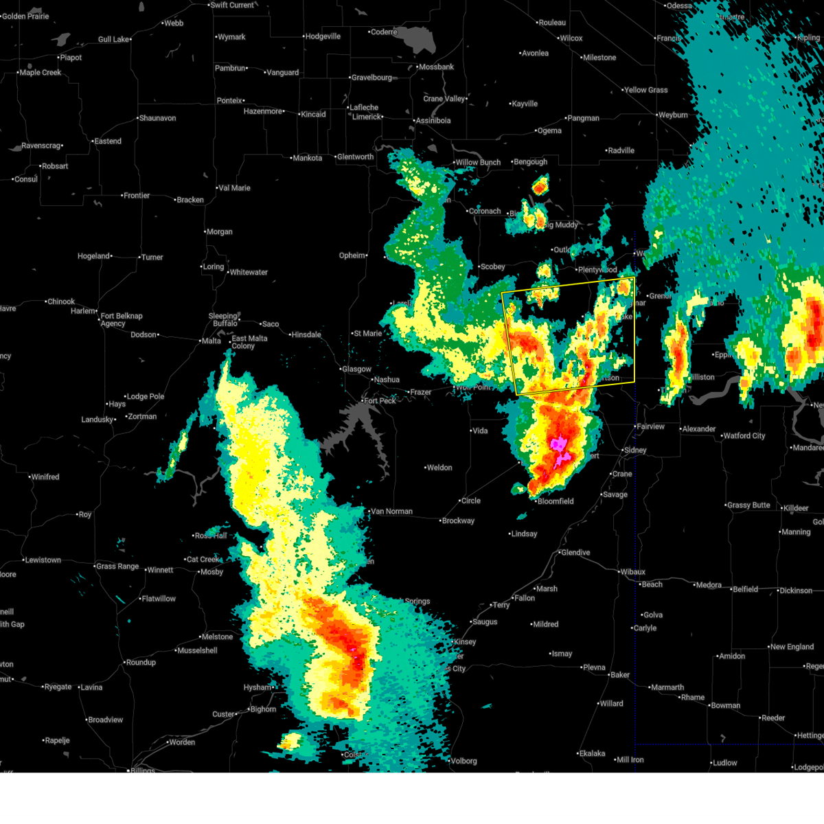
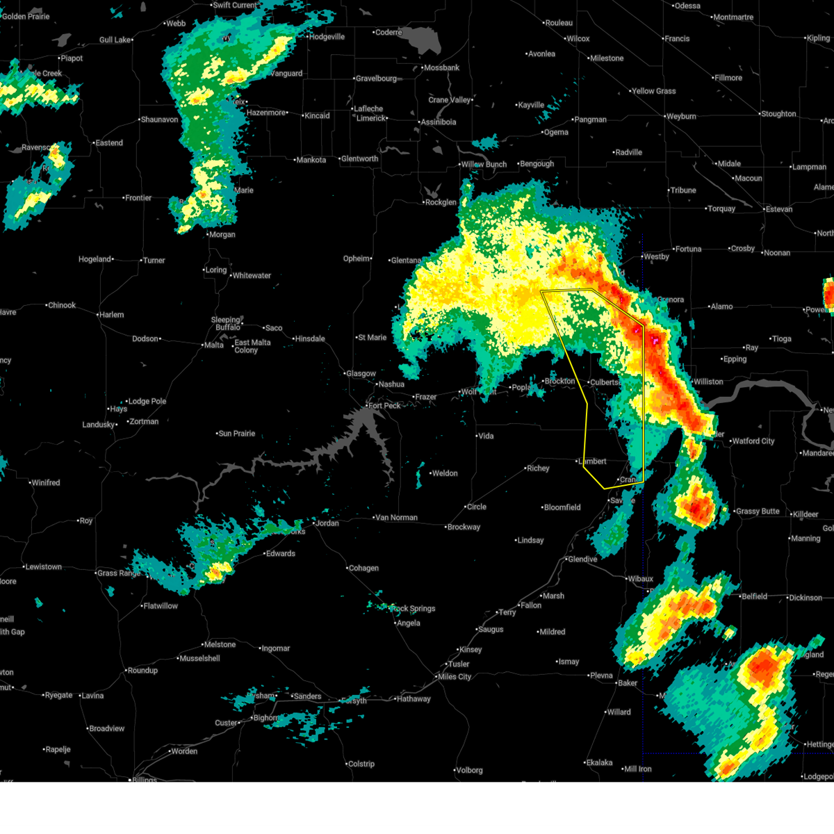
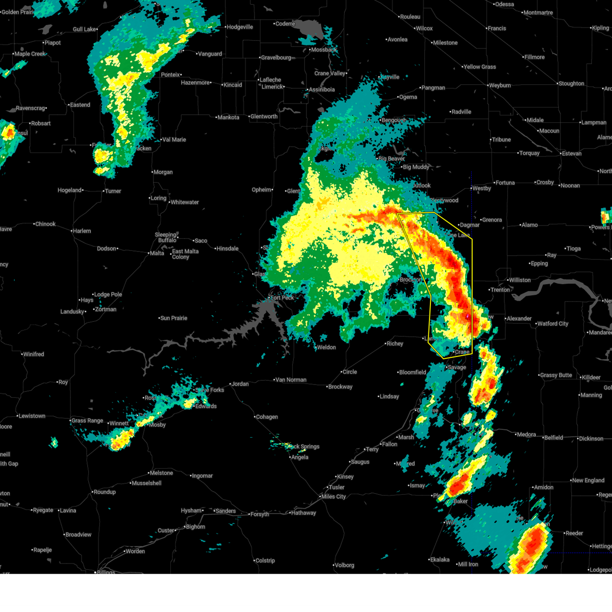
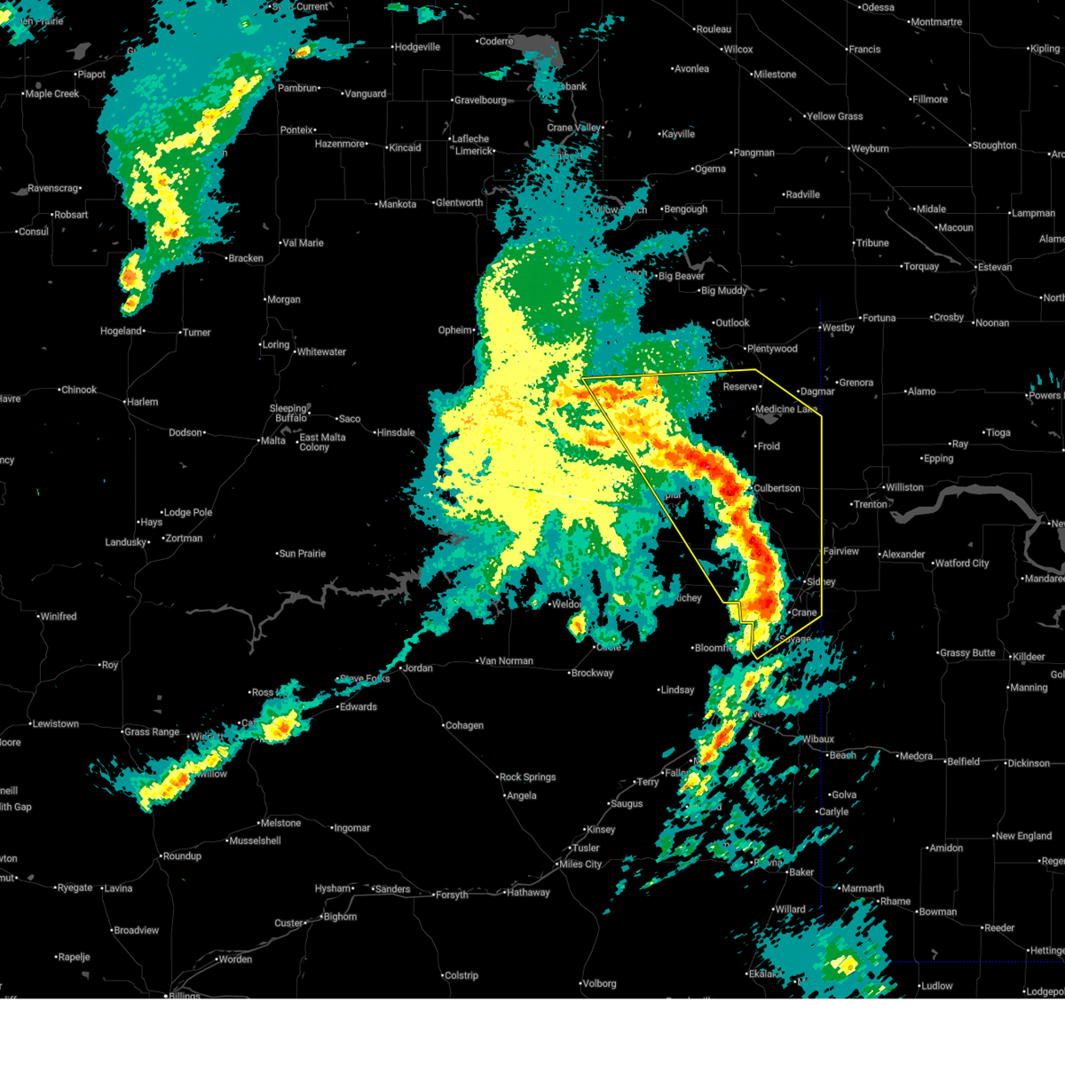
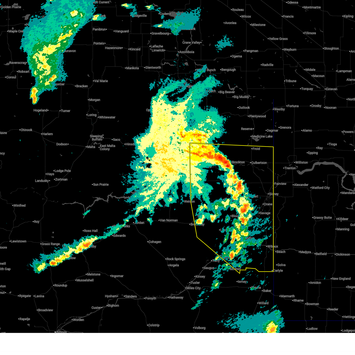
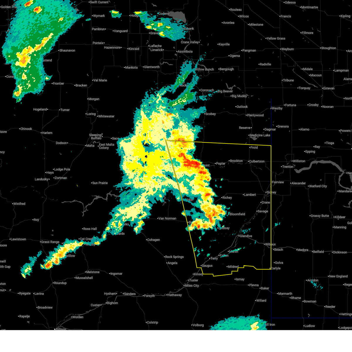
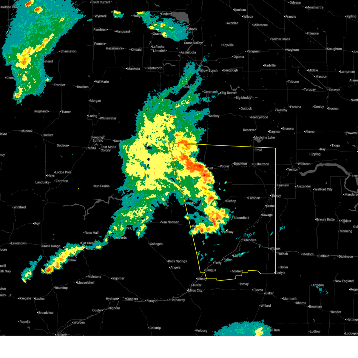
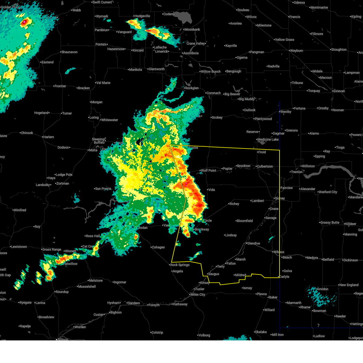
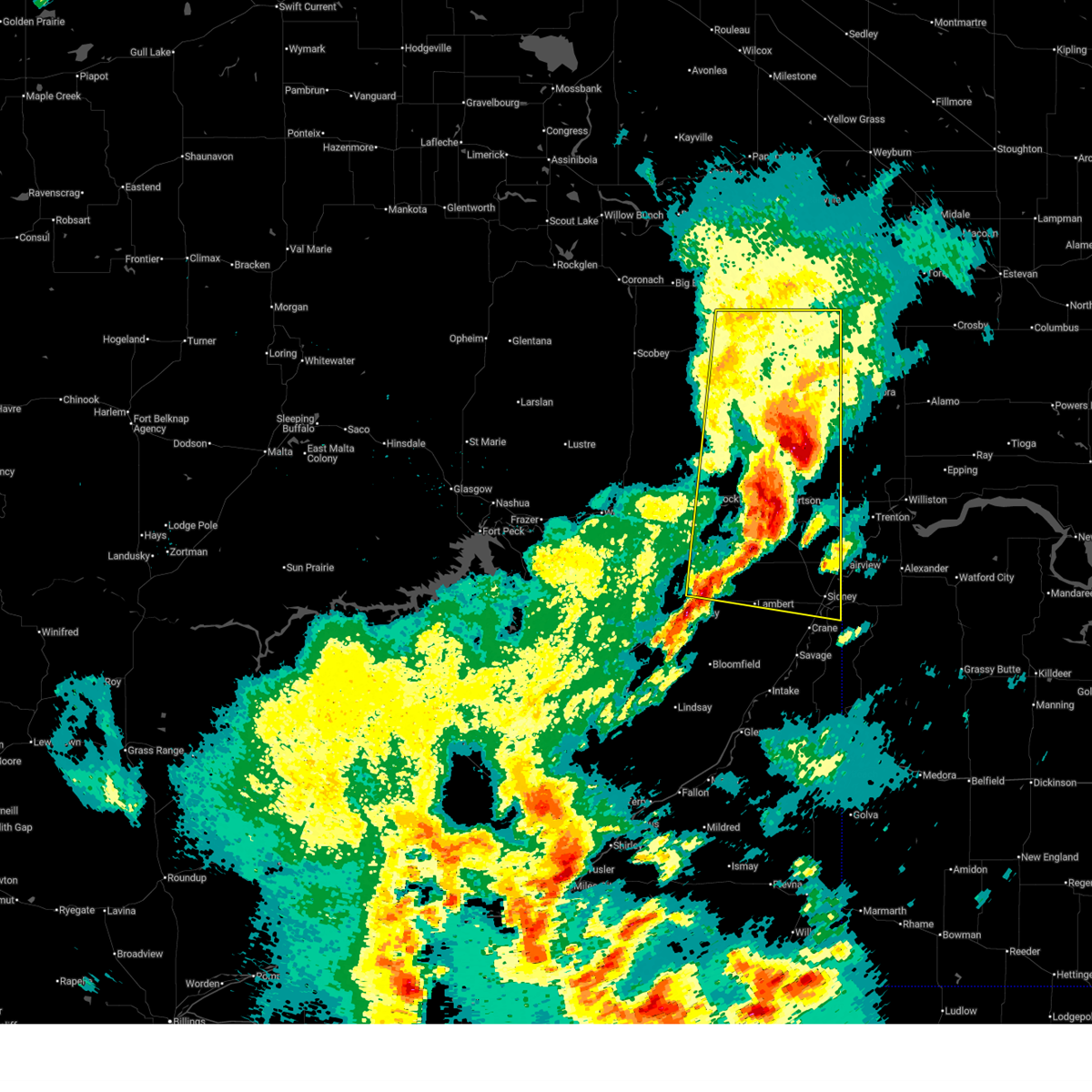
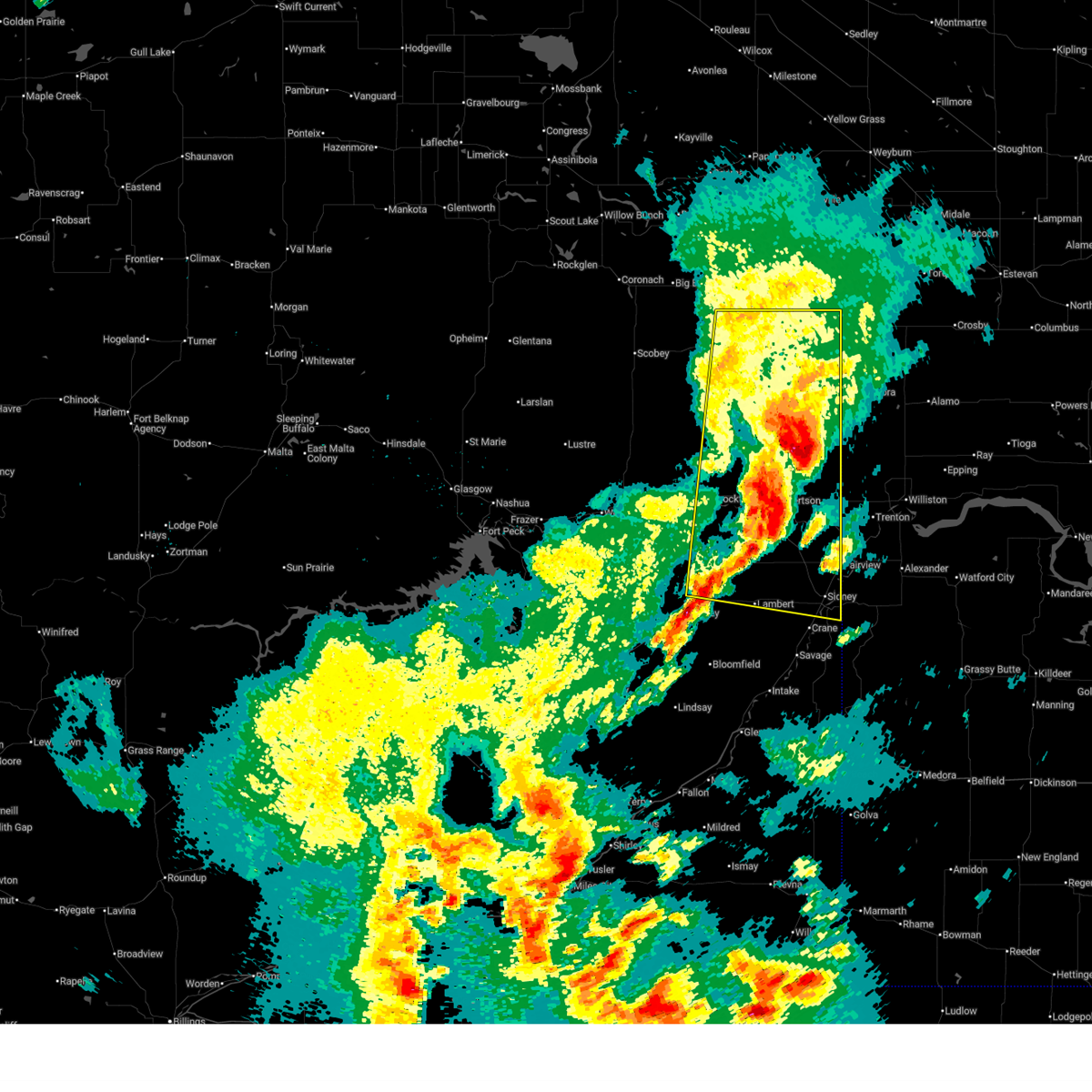
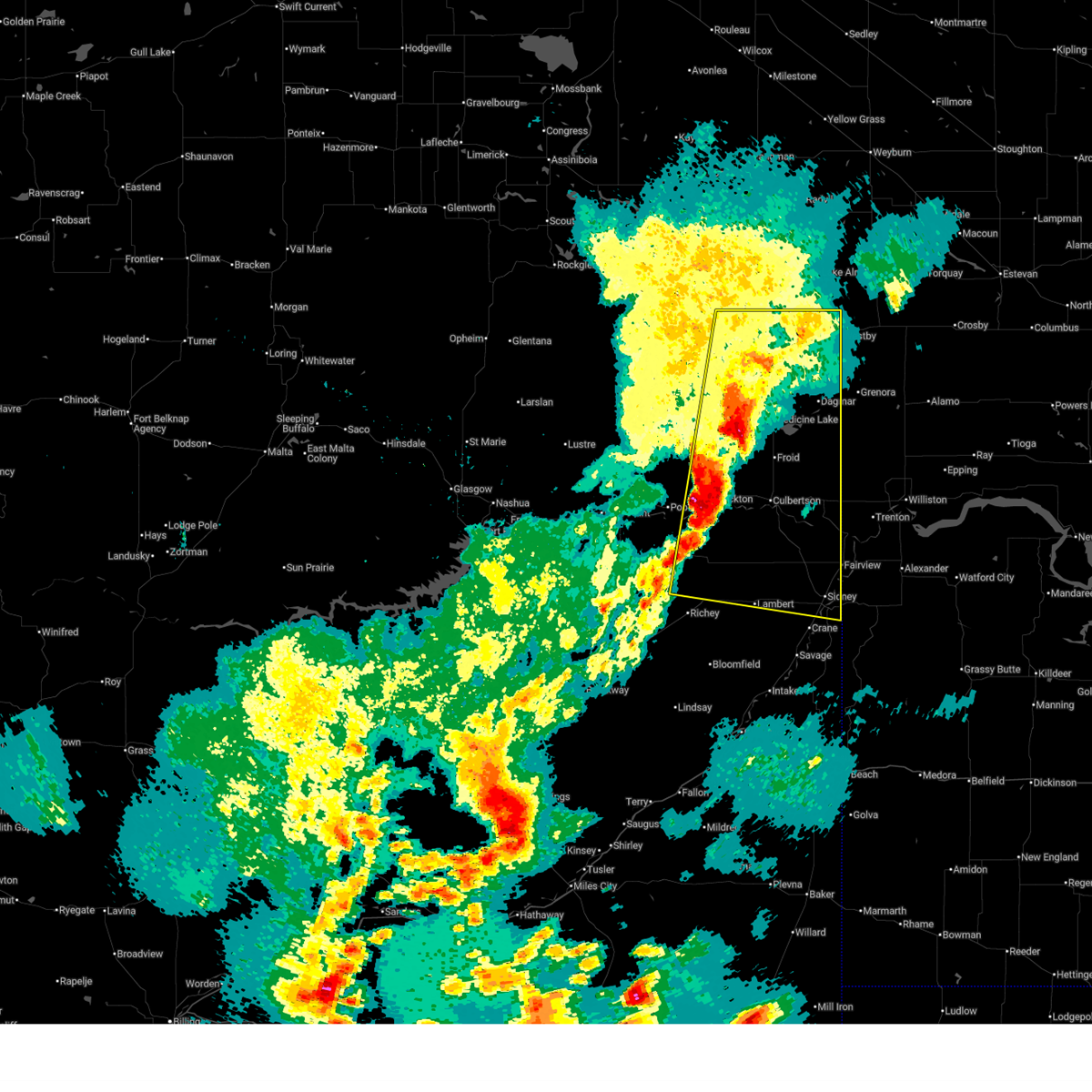
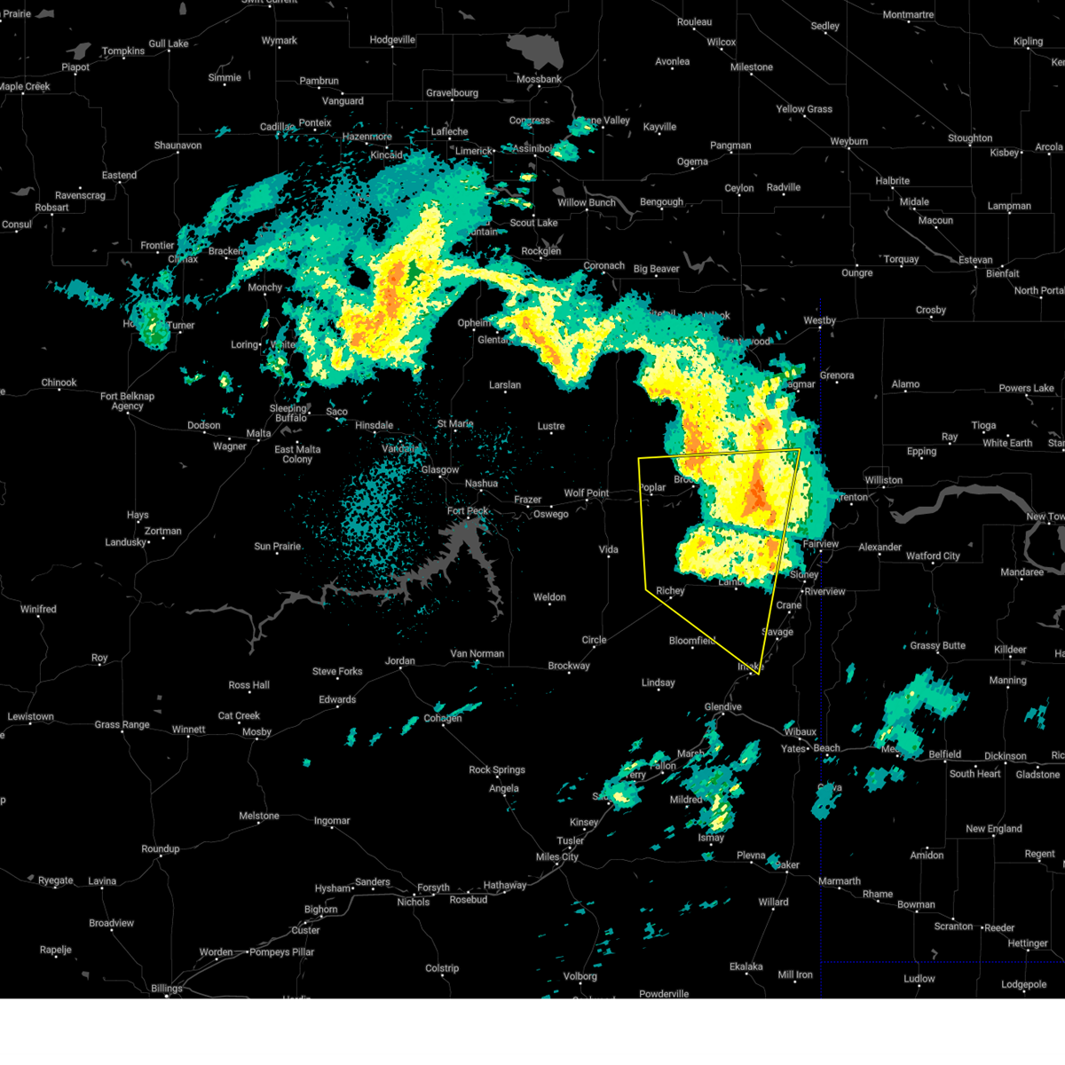
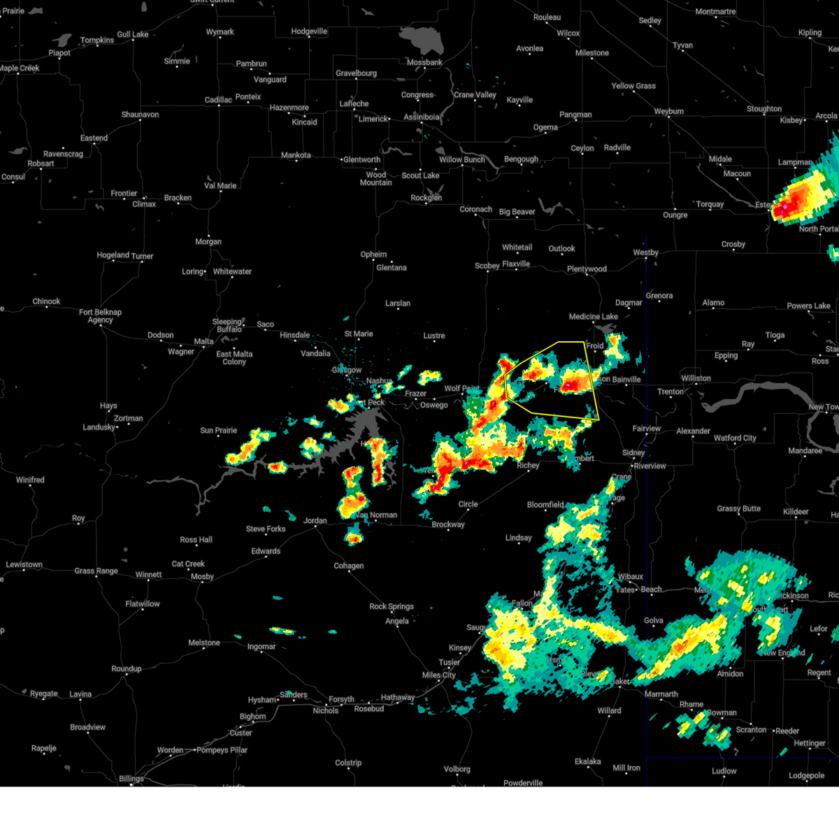
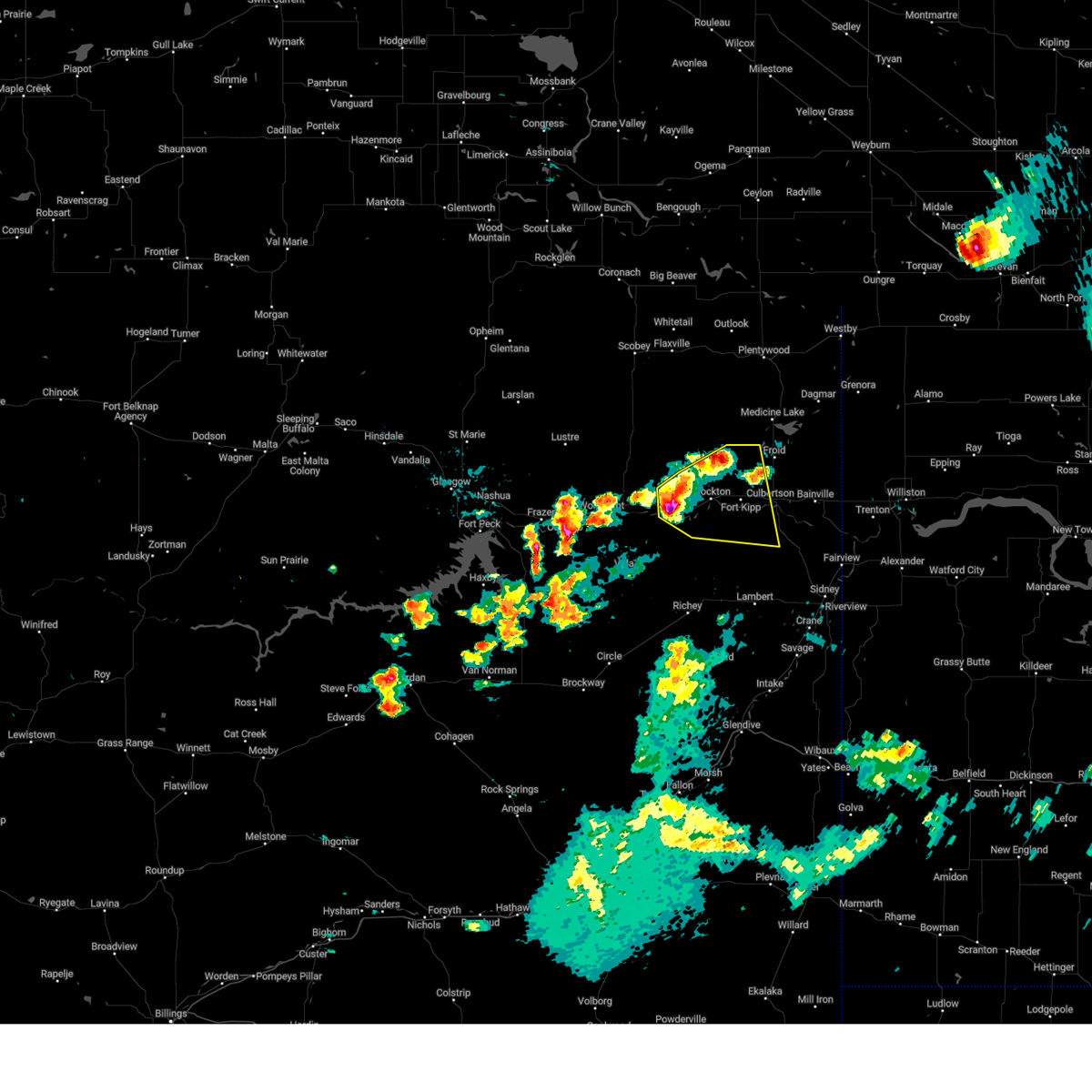
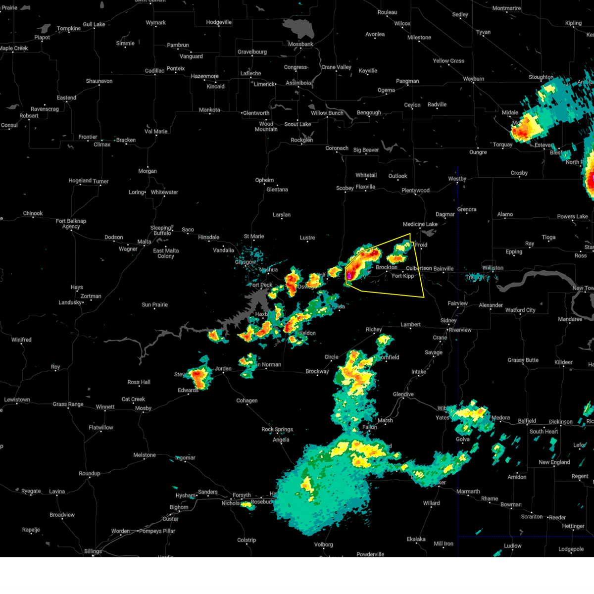
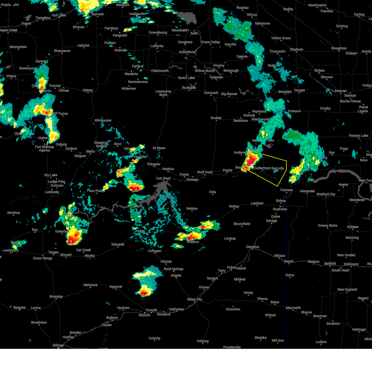
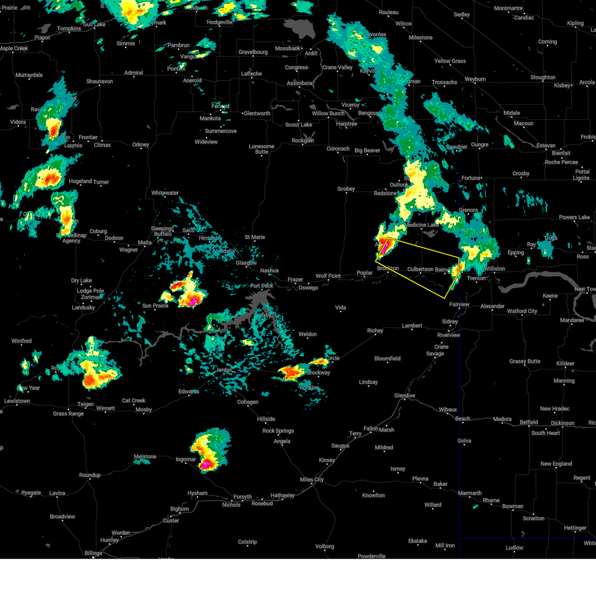
Hail Map for Culbertson, MT
The Culbertson, MT area has had 11 reports of on-the-ground hail by trained spotters, and has been under severe weather warnings 29 times during the past 12 months. Doppler radar has detected hail at or near Culbertson, MT on 34 occasions, including 4 occasions during the past year.
| Name: | Culbertson, MT |
| Where Located: | 41.2 miles W of Williston, ND |
| Map: | Google Map for Culbertson, MT |
| Population: | 714 |
| Housing Units: | 336 |
| More Info: | Search Google for Culbertson, MT |
4
The Top Recent Hail Date for Culbertson, MT is Saturday, June 6, 2026 (2nd out of 34)
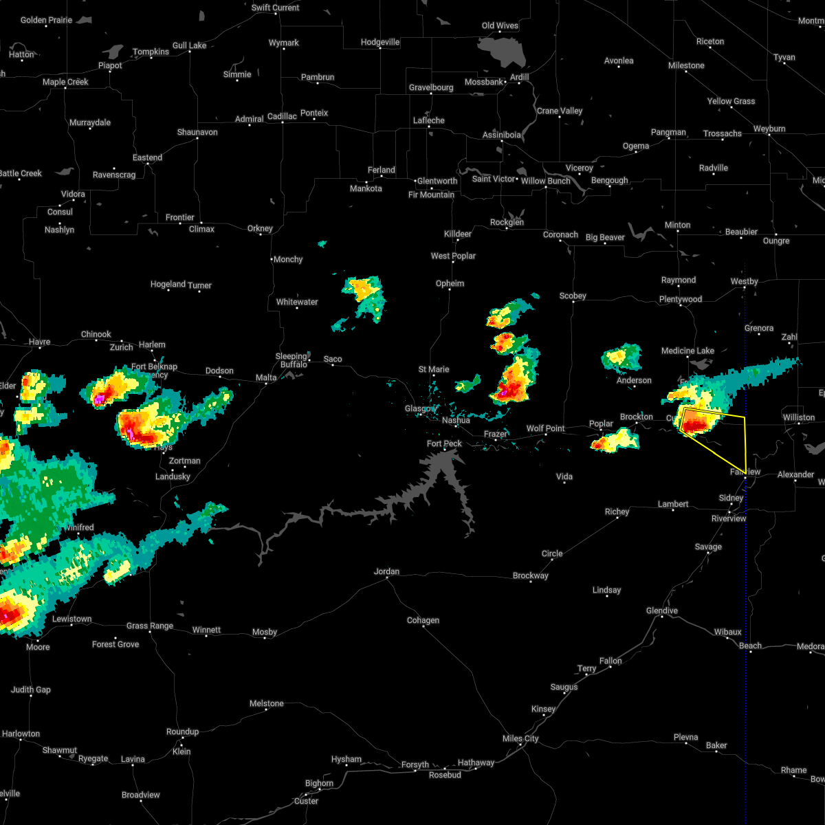
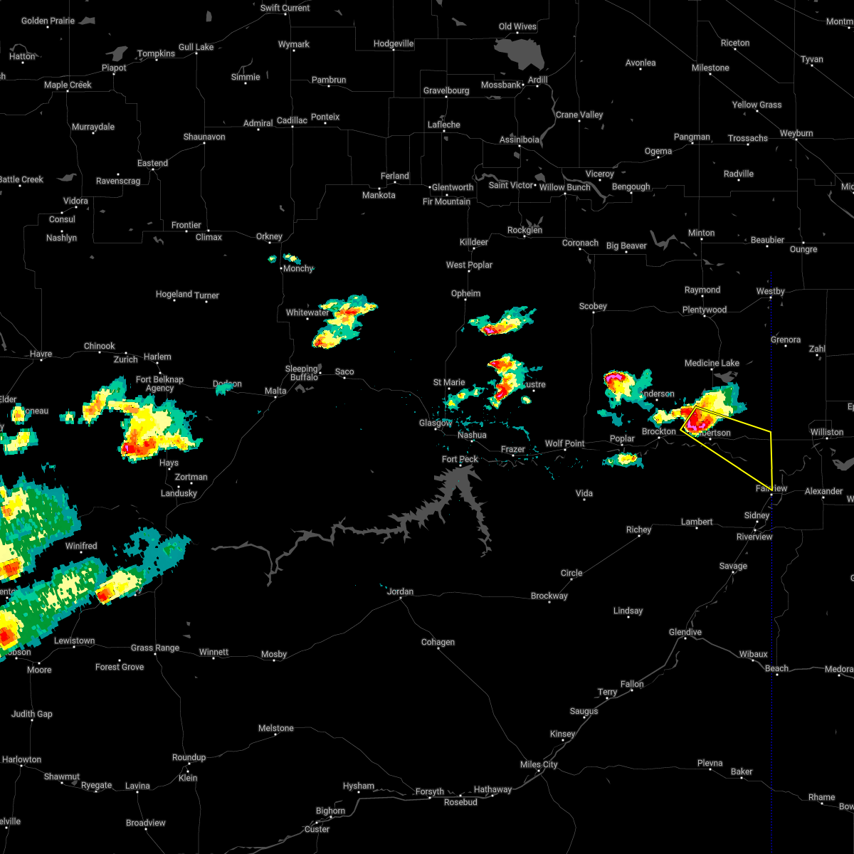
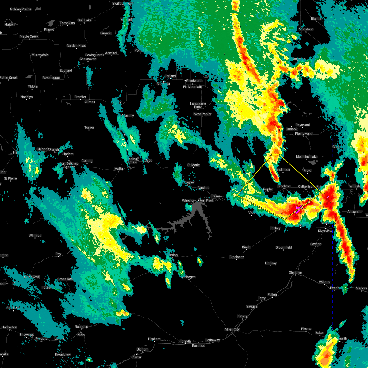
Hail and Wind Damage Spotted near Culbertson, MT
| Date / Time | Report Details |
|---|---|
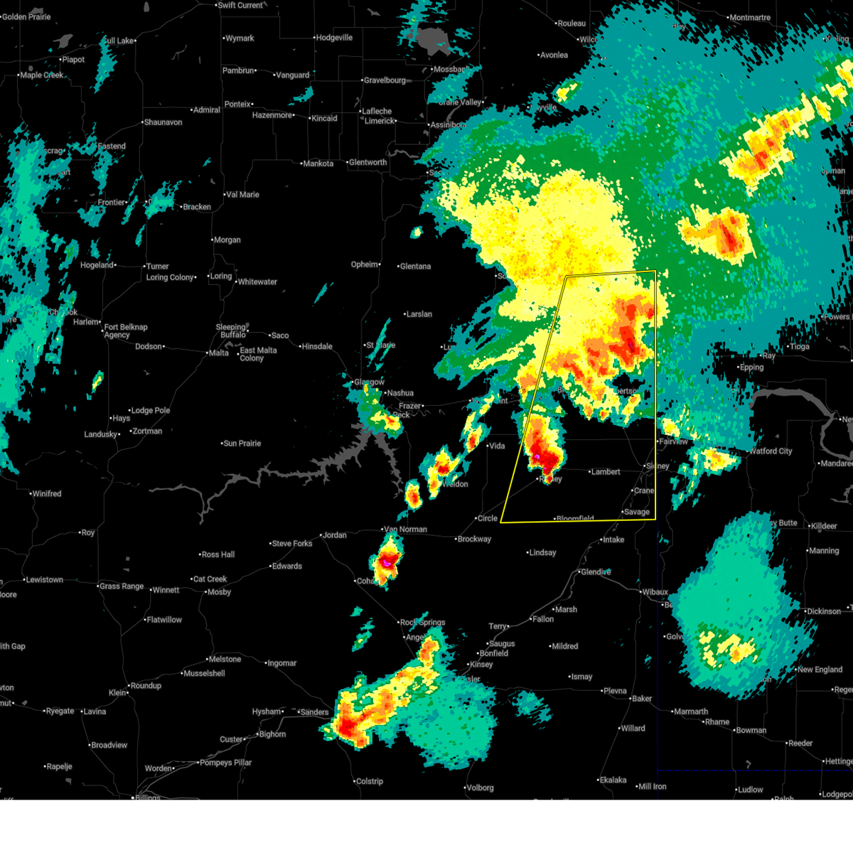
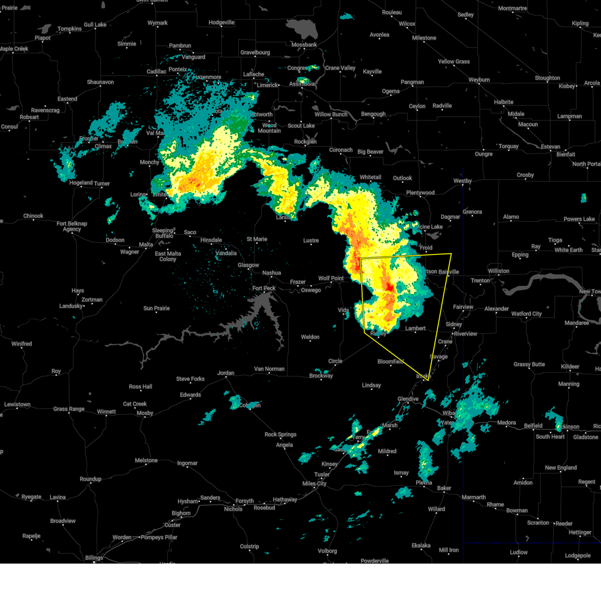
| 6/7/2026 1:36 AM MDT |
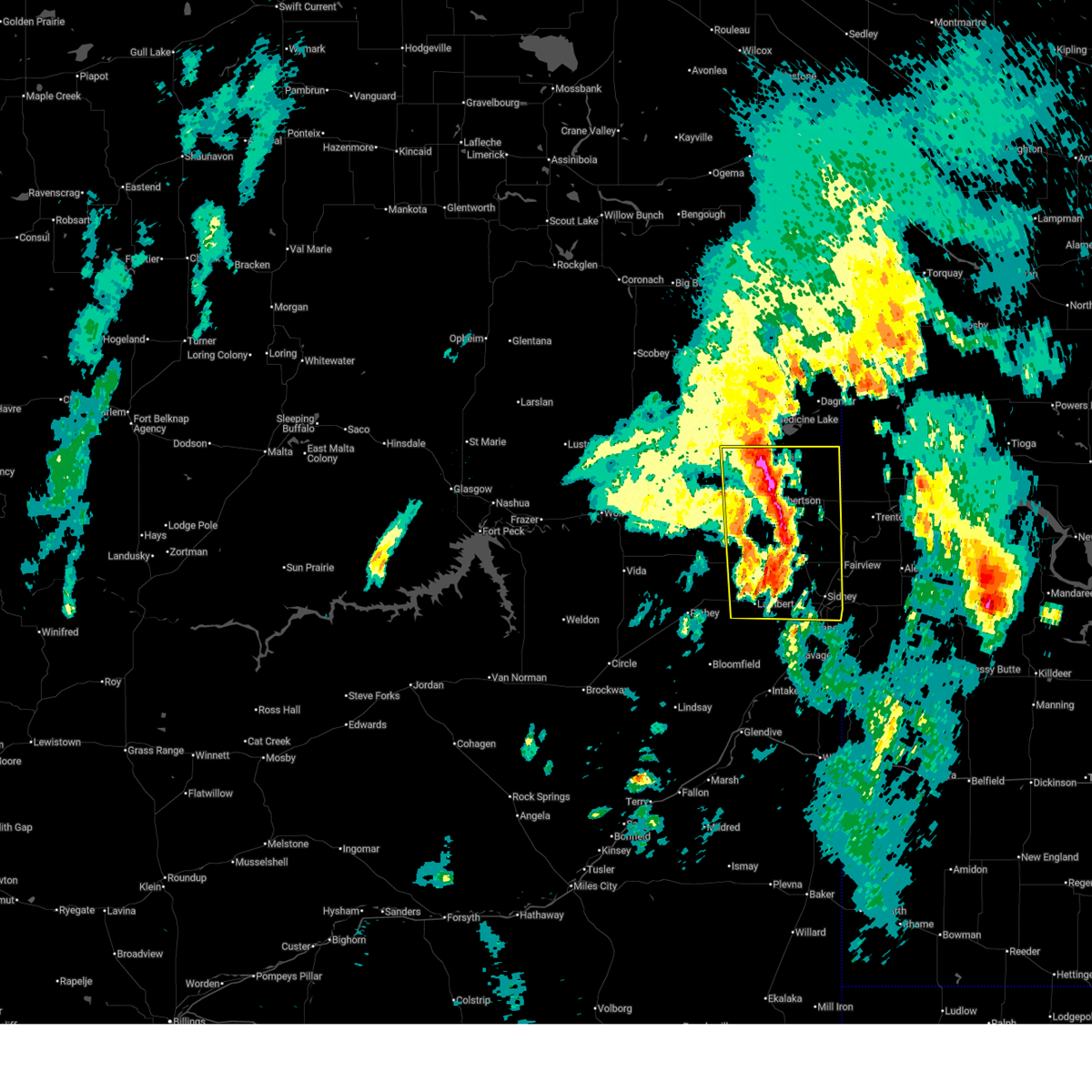 At 135 am mdt, severe thunderstorms were located along a line extending from 9 miles southwest of medicine lake to 13 miles northwest of sidney, moving northeast at 40 mph (radar indicated). Hazards include 60 mph wind gusts and half dollar size hail. Hail damage to vehicles is expected. expect wind damage to roofs, siding, and trees. Locations impacted include, sidney, culbertson, fairview, bainville, froid, lambert, mccabe, snowden, fort kipp, enid, nohly, and wooley. At 135 am mdt, severe thunderstorms were located along a line extending from 9 miles southwest of medicine lake to 13 miles northwest of sidney, moving northeast at 40 mph (radar indicated). Hazards include 60 mph wind gusts and half dollar size hail. Hail damage to vehicles is expected. expect wind damage to roofs, siding, and trees. Locations impacted include, sidney, culbertson, fairview, bainville, froid, lambert, mccabe, snowden, fort kipp, enid, nohly, and wooley.
|
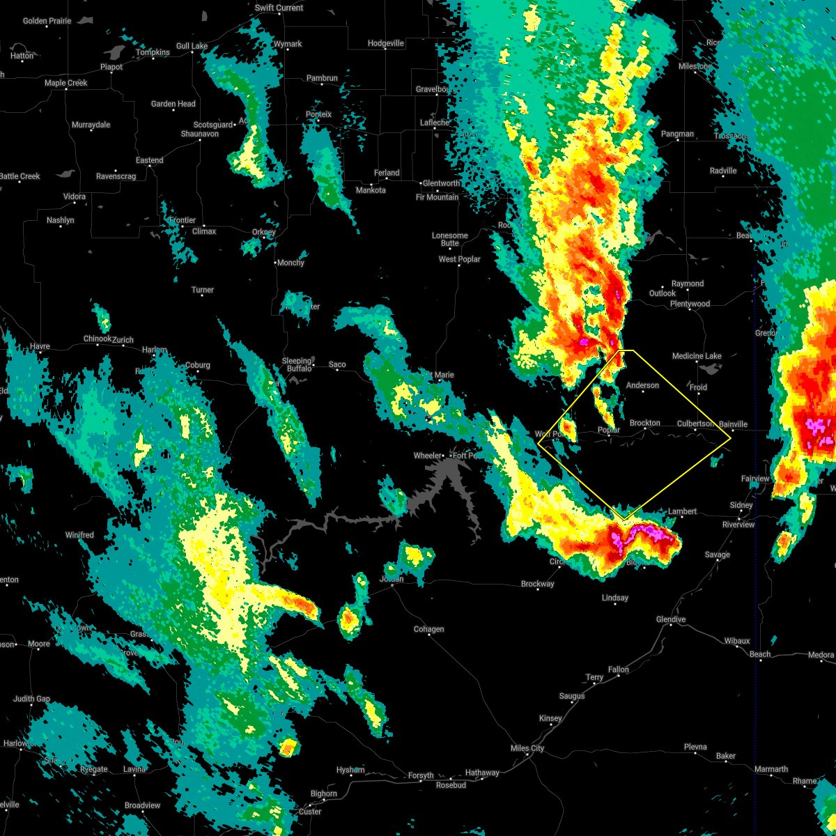
| 6/7/2026 1:30 AM MDT | Quarter sized hail reported 0.3 miles ESE of Culbertson, MT, social media reports of hail the size of quarters. |
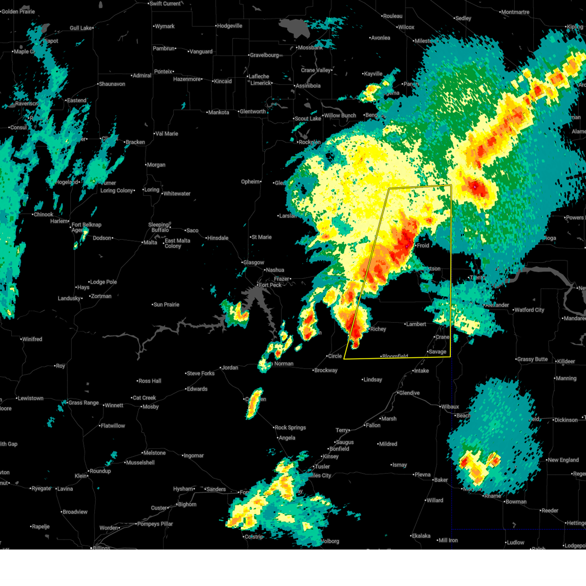
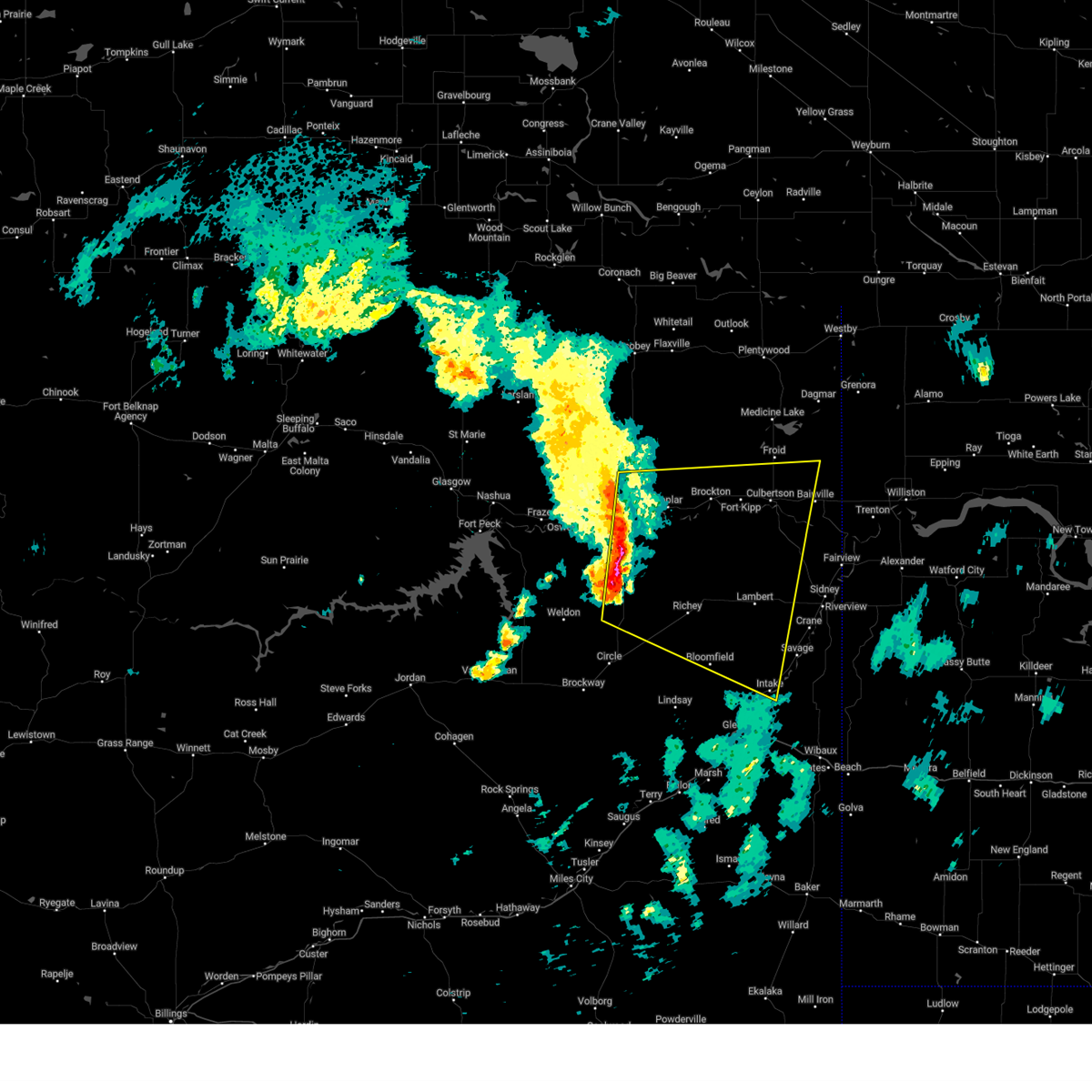
| 6/7/2026 1:04 AM MDT |
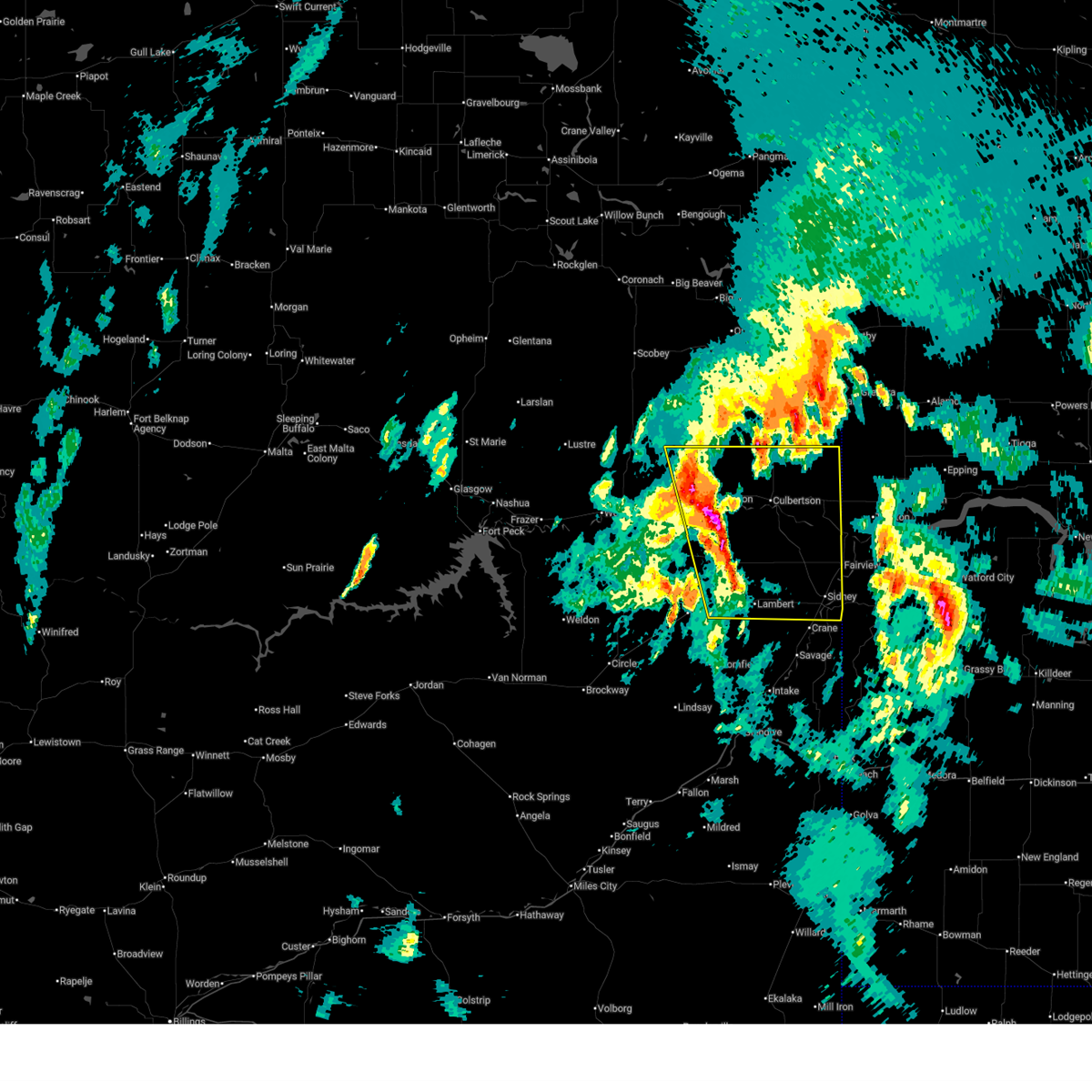 Svrggw the national weather service in glasgow has issued a * severe thunderstorm warning for, southeastern roosevelt county in northeastern montana, richland county in northeastern montana, * until 200 am mdt. * at 104 am mdt, severe thunderstorms were located along a line extending from 8 miles northeast of poplar to 7 miles west of lambert, moving northeast at 40 mph (radar indicated). Hazards include 60 mph wind gusts and half dollar size hail. Hail damage to vehicles is expected. Expect wind damage to roofs, siding, and trees. Svrggw the national weather service in glasgow has issued a * severe thunderstorm warning for, southeastern roosevelt county in northeastern montana, richland county in northeastern montana, * until 200 am mdt. * at 104 am mdt, severe thunderstorms were located along a line extending from 8 miles northeast of poplar to 7 miles west of lambert, moving northeast at 40 mph (radar indicated). Hazards include 60 mph wind gusts and half dollar size hail. Hail damage to vehicles is expected. Expect wind damage to roofs, siding, and trees.
|
| 6/6/2026 11:28 PM MDT |
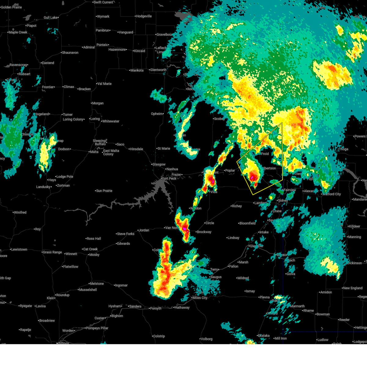 Svrggw the national weather service in glasgow has issued a * severe thunderstorm warning for, southeastern roosevelt county in northeastern montana, southeastern sheridan county in northeastern montana, northeastern richland county in northeastern montana, * until 1230 am mdt. * at 1128 pm mdt, a severe thunderstorm was located 9 miles southwest of culbertson, moving northeast at 40 mph (radar indicated). Hazards include 60 mph wind gusts and half dollar size hail. Hail damage to vehicles is expected. Expect wind damage to roofs, siding, and trees. Svrggw the national weather service in glasgow has issued a * severe thunderstorm warning for, southeastern roosevelt county in northeastern montana, southeastern sheridan county in northeastern montana, northeastern richland county in northeastern montana, * until 1230 am mdt. * at 1128 pm mdt, a severe thunderstorm was located 9 miles southwest of culbertson, moving northeast at 40 mph (radar indicated). Hazards include 60 mph wind gusts and half dollar size hail. Hail damage to vehicles is expected. Expect wind damage to roofs, siding, and trees.
|
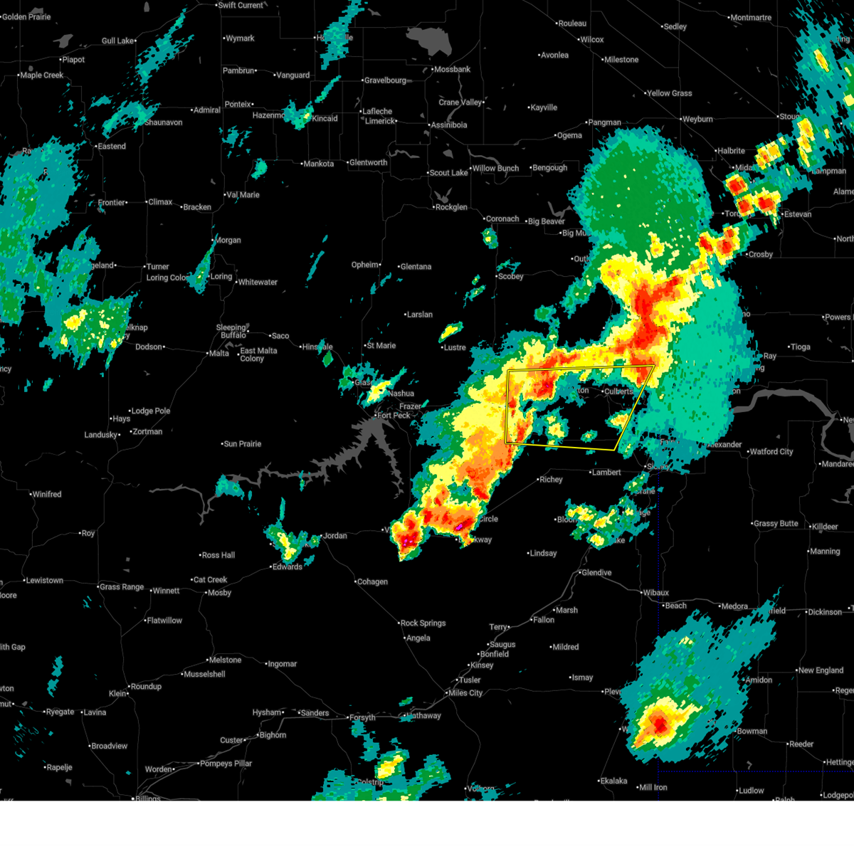
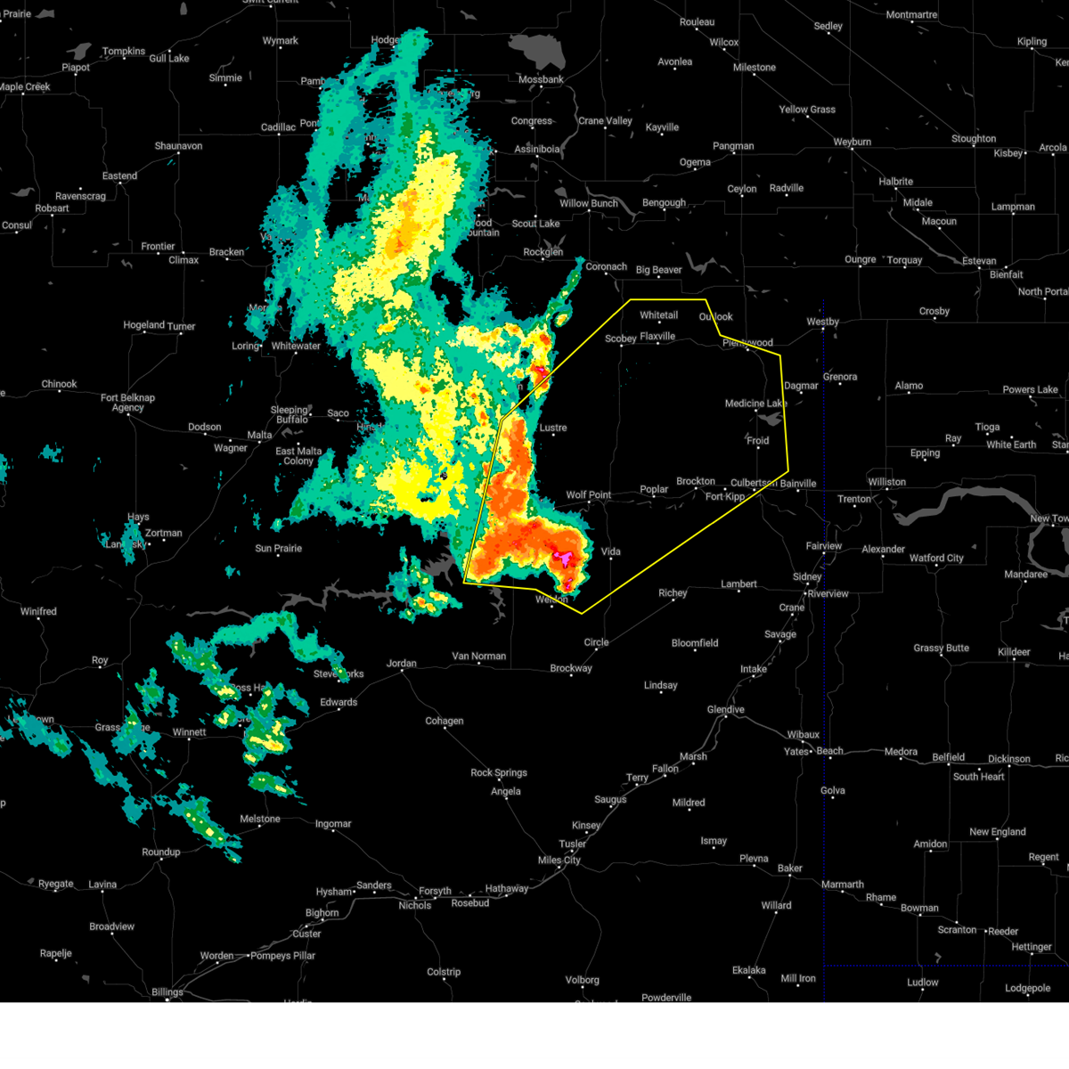
| 6/6/2026 10:55 PM MDT |
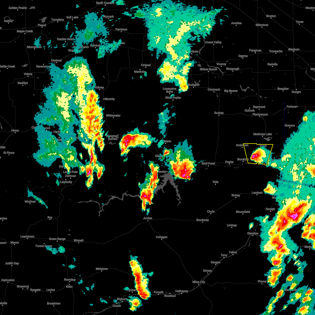
 At 1054 pm mdt, severe thunderstorms were located along a line extending from 6 miles west of grenora to near richey, moving northeast at 70 mph (radar indicated). Hazards include 70 mph wind gusts and half dollar size hail. Hail damage to vehicles is expected. expect considerable tree damage. wind damage is also likely to mobile homes, roofs, and outbuildings. Locations impacted include, sidney, plentywood, culbertson, fairview, brockton, medicine lake, bainville, froid, richey, savage, bloomfield, lambert, reserve, enid, nohly, crane, wooley, mccabe, midway, and coalridge. At 1054 pm mdt, severe thunderstorms were located along a line extending from 6 miles west of grenora to near richey, moving northeast at 70 mph (radar indicated). Hazards include 70 mph wind gusts and half dollar size hail. Hail damage to vehicles is expected. expect considerable tree damage. wind damage is also likely to mobile homes, roofs, and outbuildings. Locations impacted include, sidney, plentywood, culbertson, fairview, brockton, medicine lake, bainville, froid, richey, savage, bloomfield, lambert, reserve, enid, nohly, crane, wooley, mccabe, midway, and coalridge.
|
| 6/6/2026 10:30 PM MDT |
 Svrggw the national weather service in glasgow has issued a * severe thunderstorm warning for, eastern roosevelt county in northeastern montana, southern sheridan county in northeastern montana, northern dawson county in northeastern montana, richland county in northeastern montana, * until 1130 pm mdt. * at 1030 pm mdt, severe thunderstorms were located along a line extending from 9 miles northeast of medicine lake to 11 miles southwest of richey, moving east at 90 mph (radar indicated). Hazards include 60 mph wind gusts and half dollar size hail. Hail damage to vehicles is expected. Expect wind damage to roofs, siding, and trees. Svrggw the national weather service in glasgow has issued a * severe thunderstorm warning for, eastern roosevelt county in northeastern montana, southern sheridan county in northeastern montana, northern dawson county in northeastern montana, richland county in northeastern montana, * until 1130 pm mdt. * at 1030 pm mdt, severe thunderstorms were located along a line extending from 9 miles northeast of medicine lake to 11 miles southwest of richey, moving east at 90 mph (radar indicated). Hazards include 60 mph wind gusts and half dollar size hail. Hail damage to vehicles is expected. Expect wind damage to roofs, siding, and trees.
|
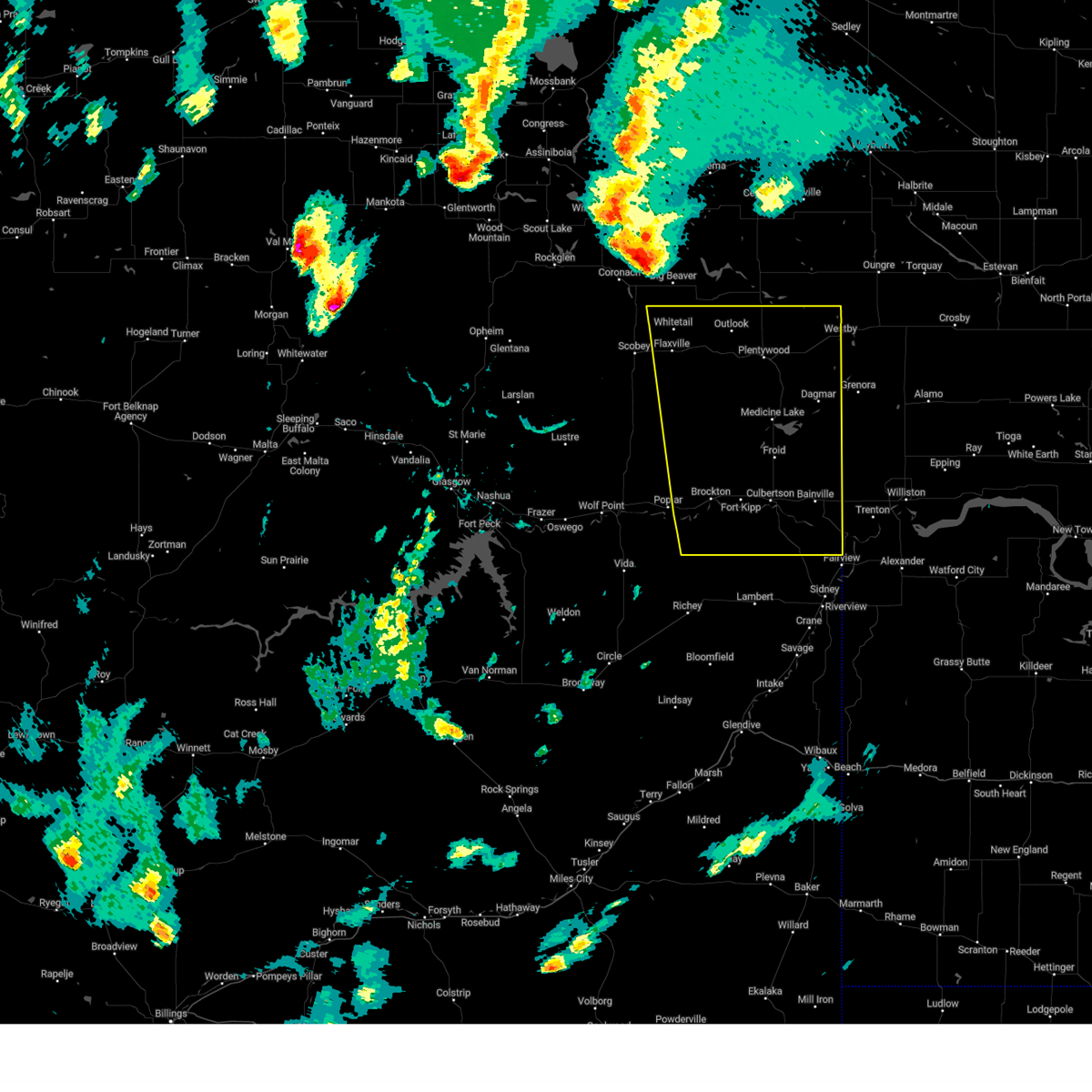
| 6/6/2026 9:52 PM MDT |
 The storm which prompted the warning has moved out of the area. therefore, the warning has been allowed to expire. a severe thunderstorm watch remains in effect until 200 am mdt for northeastern montana. The storm which prompted the warning has moved out of the area. therefore, the warning has been allowed to expire. a severe thunderstorm watch remains in effect until 200 am mdt for northeastern montana.
|
| 6/6/2026 9:14 PM MDT |
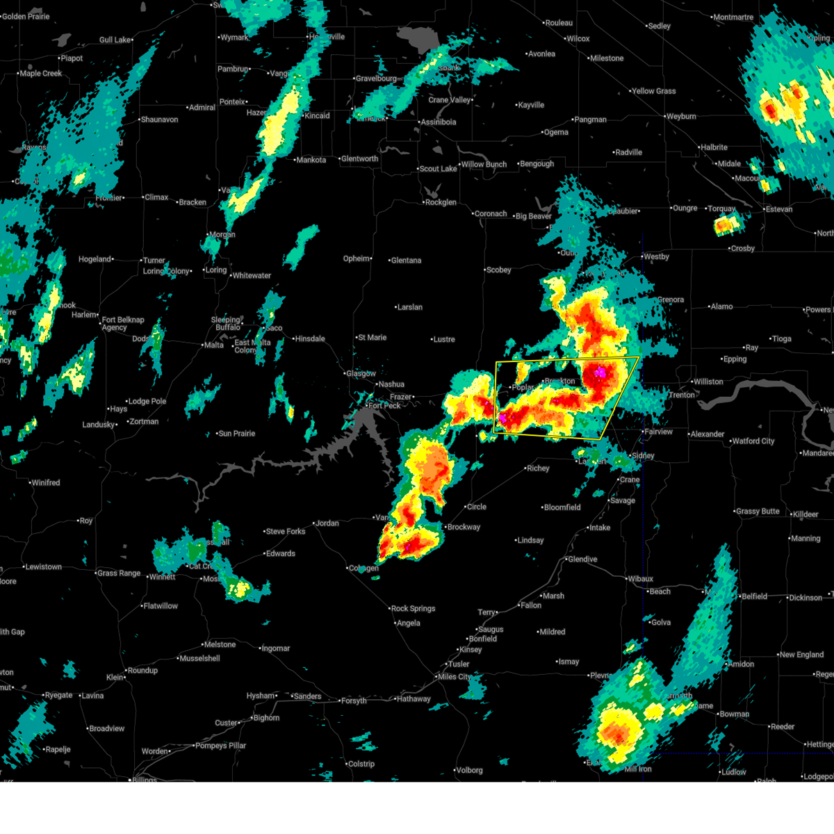 At 914 pm mdt, a severe thunderstorm was located over culbertson, moving northeast at 45 mph (radar indicated). Hazards include ping pong ball size hail and 60 mph wind gusts. People and animals outdoors will be injured. expect hail damage to roofs, siding, windows, and vehicles. expect wind damage to roofs, siding, and trees. Locations impacted include, poplar, culbertson, brockton, bainville, sprole, mccabe, and fort kipp. At 914 pm mdt, a severe thunderstorm was located over culbertson, moving northeast at 45 mph (radar indicated). Hazards include ping pong ball size hail and 60 mph wind gusts. People and animals outdoors will be injured. expect hail damage to roofs, siding, windows, and vehicles. expect wind damage to roofs, siding, and trees. Locations impacted include, poplar, culbertson, brockton, bainville, sprole, mccabe, and fort kipp.
|
| 6/6/2026 9:05 PM MDT | Half Dollar sized hail reported 4.1 miles NE of Culbertson, MT, with heavy rain and power outage. |
| 6/6/2026 8:40 PM MDT |
 Svrggw the national weather service in glasgow has issued a * severe thunderstorm warning for, southeastern roosevelt county in northeastern montana, northeastern mccone county in northeastern montana, northwestern dawson county in northeastern montana, northwestern richland county in northeastern montana, * until 945 pm mdt. * at 840 pm mdt, a severe thunderstorm was located 11 miles northwest of lambert, or 26 miles southwest of culbertson, moving northeast at 50 mph (radar indicated). Hazards include 60 mph wind gusts and quarter size hail. Hail damage to vehicles is expected. Expect wind damage to roofs, siding, and trees. Svrggw the national weather service in glasgow has issued a * severe thunderstorm warning for, southeastern roosevelt county in northeastern montana, northeastern mccone county in northeastern montana, northwestern dawson county in northeastern montana, northwestern richland county in northeastern montana, * until 945 pm mdt. * at 840 pm mdt, a severe thunderstorm was located 11 miles northwest of lambert, or 26 miles southwest of culbertson, moving northeast at 50 mph (radar indicated). Hazards include 60 mph wind gusts and quarter size hail. Hail damage to vehicles is expected. Expect wind damage to roofs, siding, and trees.
|
| 4/22/2026 7:34 PM MDT |
 At 733 pm mdt, severe thunderstorms were located along a line extending from 14 miles north of poplar to 7 miles north of bainville, moving north at 35 mph (radar indicated). Hazards include 60 mph wind gusts. Expect damage to roofs, siding, and trees. Locations impacted include, poplar, culbertson, fairview, brockton, medicine lake, bainville, froid, bredette, reserve, snowden, dagmar, fort kipp, homestead, nohly, wooley, sprole, and mccabe. At 733 pm mdt, severe thunderstorms were located along a line extending from 14 miles north of poplar to 7 miles north of bainville, moving north at 35 mph (radar indicated). Hazards include 60 mph wind gusts. Expect damage to roofs, siding, and trees. Locations impacted include, poplar, culbertson, fairview, brockton, medicine lake, bainville, froid, bredette, reserve, snowden, dagmar, fort kipp, homestead, nohly, wooley, sprole, and mccabe.
|
| 4/22/2026 7:07 PM MDT |
 Svrggw the national weather service in glasgow has issued a * severe thunderstorm warning for, southeastern daniels county in northeastern montana, roosevelt county in northeastern montana, southern sheridan county in northeastern montana, northeastern mccone county in northeastern montana, northern richland county in northeastern montana, * until 800 pm mdt. * at 706 pm mdt, a gust front from severe thunderstorms was located along a line extending from near poplar to near bainville, moving north at 35 mph (radar indicated). Hazards include 60 mph wind gusts. expect damage to roofs, siding, and trees Svrggw the national weather service in glasgow has issued a * severe thunderstorm warning for, southeastern daniels county in northeastern montana, roosevelt county in northeastern montana, southern sheridan county in northeastern montana, northeastern mccone county in northeastern montana, northern richland county in northeastern montana, * until 800 pm mdt. * at 706 pm mdt, a gust front from severe thunderstorms was located along a line extending from near poplar to near bainville, moving north at 35 mph (radar indicated). Hazards include 60 mph wind gusts. expect damage to roofs, siding, and trees
|
| 8/7/2025 8:30 PM MDT |
 the severe thunderstorm warning has been cancelled and is no longer in effect the severe thunderstorm warning has been cancelled and is no longer in effect
|
| 8/7/2025 8:12 PM MDT |
 the severe thunderstorm warning has been cancelled and is no longer in effect the severe thunderstorm warning has been cancelled and is no longer in effect
|
| 8/7/2025 8:12 PM MDT |
 At 812 pm mdt, a severe thunderstorm was located 8 miles east of froid, or 17 miles northeast of culbertson, moving east at 50 mph (radar indicated). Hazards include 60 mph wind gusts and quarter size hail. Hail damage to vehicles is expected. expect wind damage to roofs, siding, and trees. Locations impacted include, culbertson, medicine lake, bainville, froid, reserve, mccabe, dagmar, homestead, antelope, and coalridge. At 812 pm mdt, a severe thunderstorm was located 8 miles east of froid, or 17 miles northeast of culbertson, moving east at 50 mph (radar indicated). Hazards include 60 mph wind gusts and quarter size hail. Hail damage to vehicles is expected. expect wind damage to roofs, siding, and trees. Locations impacted include, culbertson, medicine lake, bainville, froid, reserve, mccabe, dagmar, homestead, antelope, and coalridge.
|
| 8/7/2025 7:43 PM MDT |
 Svrggw the national weather service in glasgow has issued a * severe thunderstorm warning for, southeastern daniels county in northeastern montana, eastern roosevelt county in northeastern montana, southern sheridan county in northeastern montana, northwestern richland county in northeastern montana, * until 845 pm mdt. * at 743 pm mdt, a severe thunderstorm was located 12 miles north of brockton, or 18 miles northwest of culbertson, moving east at 50 mph (radar indicated). Hazards include 60 mph wind gusts and quarter size hail. Hail damage to vehicles is expected. Expect wind damage to roofs, siding, and trees. Svrggw the national weather service in glasgow has issued a * severe thunderstorm warning for, southeastern daniels county in northeastern montana, eastern roosevelt county in northeastern montana, southern sheridan county in northeastern montana, northwestern richland county in northeastern montana, * until 845 pm mdt. * at 743 pm mdt, a severe thunderstorm was located 12 miles north of brockton, or 18 miles northwest of culbertson, moving east at 50 mph (radar indicated). Hazards include 60 mph wind gusts and quarter size hail. Hail damage to vehicles is expected. Expect wind damage to roofs, siding, and trees.
|
| 7/27/2025 1:11 AM MDT |
 The storms which prompted the warning have moved out of the area. therefore, the warning will be allowed to expire. The storms which prompted the warning have moved out of the area. therefore, the warning will be allowed to expire.
|
| 7/27/2025 12:40 AM MDT |
 the severe thunderstorm warning has been cancelled and is no longer in effect the severe thunderstorm warning has been cancelled and is no longer in effect
|
| 7/27/2025 12:40 AM MDT |
 At 1240 am mdt, severe thunderstorms were located along a line extending from near medicine lake to 7 miles east of bainville to 8 miles southeast of sidney, moving east at 45 mph (radar indicated). Hazards include 60 mph wind gusts and nickel size hail. Expect damage to roofs, siding, and trees. Locations impacted include, sidney, culbertson, fairview, medicine lake, bainville, froid, fort union trading post, east fairview, reserve, snowden, homestead, nohly, wooley, fort union, crane, and mccabe. At 1240 am mdt, severe thunderstorms were located along a line extending from near medicine lake to 7 miles east of bainville to 8 miles southeast of sidney, moving east at 45 mph (radar indicated). Hazards include 60 mph wind gusts and nickel size hail. Expect damage to roofs, siding, and trees. Locations impacted include, sidney, culbertson, fairview, medicine lake, bainville, froid, fort union trading post, east fairview, reserve, snowden, homestead, nohly, wooley, fort union, crane, and mccabe.
|
| 7/27/2025 12:11 AM MDT |
 Svrggw the national weather service in glasgow has issued a * severe thunderstorm warning for, southeastern daniels county in northeastern montana, roosevelt county in northeastern montana, southern sheridan county in northeastern montana, richland county in northeastern montana, * until 115 am mdt. * at 1211 am mdt, severe thunderstorms were located along a line extending from 11 miles southeast of bredette to 6 miles south of culbertson to near intake, moving east at 45 mph (radar indicated). Hazards include 60 mph wind gusts. expect damage to roofs, siding, and trees Svrggw the national weather service in glasgow has issued a * severe thunderstorm warning for, southeastern daniels county in northeastern montana, roosevelt county in northeastern montana, southern sheridan county in northeastern montana, richland county in northeastern montana, * until 115 am mdt. * at 1211 am mdt, severe thunderstorms were located along a line extending from 11 miles southeast of bredette to 6 miles south of culbertson to near intake, moving east at 45 mph (radar indicated). Hazards include 60 mph wind gusts. expect damage to roofs, siding, and trees
|
| 7/26/2025 11:50 PM MDT |
 At 1148 pm mdt, severe thunderstorms were located along a line extending from 13 miles southeast of bredette to 10 miles west of savage to 10 miles south of glendive, moving east at 45 mph (radar indicated. at 1135 pm, 60 mph wind was reported in poplar). Hazards include 60 mph wind gusts. Expect damage to roofs, siding, and trees. Locations impacted include, sidney, glendive, wolf point, poplar, culbertson, circle, wibaux, fallon, fairview, brockton, bainville, froid, richey, savage, west glendive, intake, bloomfield, lambert, vida, and carlyle. At 1148 pm mdt, severe thunderstorms were located along a line extending from 13 miles southeast of bredette to 10 miles west of savage to 10 miles south of glendive, moving east at 45 mph (radar indicated. at 1135 pm, 60 mph wind was reported in poplar). Hazards include 60 mph wind gusts. Expect damage to roofs, siding, and trees. Locations impacted include, sidney, glendive, wolf point, poplar, culbertson, circle, wibaux, fallon, fairview, brockton, bainville, froid, richey, savage, west glendive, intake, bloomfield, lambert, vida, and carlyle.
|
| 7/26/2025 11:50 PM MDT |
 the severe thunderstorm warning has been cancelled and is no longer in effect the severe thunderstorm warning has been cancelled and is no longer in effect
|
| 7/26/2025 11:23 PM MDT |
 At 1121 pm mdt, severe thunderstorms were located along a line extending from 14 miles west of bredette to near bloomfield to 12 miles south of lindsay, moving east at 45 mph (radar indicated). Hazards include 60 mph wind gusts. Expect damage to roofs, siding, and trees. Locations impacted include, sidney, glendive, wolf point, poplar, culbertson, circle, terry, wibaux, fallon, fairview, brockton, bainville, froid, richey, savage, west glendive, brockway, intake, bloomfield, and lustre. At 1121 pm mdt, severe thunderstorms were located along a line extending from 14 miles west of bredette to near bloomfield to 12 miles south of lindsay, moving east at 45 mph (radar indicated). Hazards include 60 mph wind gusts. Expect damage to roofs, siding, and trees. Locations impacted include, sidney, glendive, wolf point, poplar, culbertson, circle, terry, wibaux, fallon, fairview, brockton, bainville, froid, richey, savage, west glendive, brockway, intake, bloomfield, and lustre.
|
| 7/26/2025 11:23 PM MDT |
 the severe thunderstorm warning has been cancelled and is no longer in effect the severe thunderstorm warning has been cancelled and is no longer in effect
|
| 7/26/2025 10:54 PM MDT |
 Svrggw the national weather service in glasgow has issued a * severe thunderstorm warning for, wibaux county in northeastern montana, southeastern garfield county in northeastern montana, roosevelt county in northeastern montana, east central valley county in northeastern montana, mccone county in northeastern montana, prairie county in northeastern montana, dawson county in northeastern montana, richland county in northeastern montana, * until 1215 am mdt. * at 1053 pm mdt, severe thunderstorms were located along a line extending from 7 miles northwest of lustre to 7 miles south of vida to 21 miles south of brockway, moving east at 40 mph (radar indicated). Hazards include 60 mph wind gusts. expect damage to roofs, siding, and trees Svrggw the national weather service in glasgow has issued a * severe thunderstorm warning for, wibaux county in northeastern montana, southeastern garfield county in northeastern montana, roosevelt county in northeastern montana, east central valley county in northeastern montana, mccone county in northeastern montana, prairie county in northeastern montana, dawson county in northeastern montana, richland county in northeastern montana, * until 1215 am mdt. * at 1053 pm mdt, severe thunderstorms were located along a line extending from 7 miles northwest of lustre to 7 miles south of vida to 21 miles south of brockway, moving east at 40 mph (radar indicated). Hazards include 60 mph wind gusts. expect damage to roofs, siding, and trees
|
| 6/26/2025 7:21 PM MDT |
 At 721 pm mdt, a severe thunderstorm was located near culbertson, moving northeast at 35 mph (radar indicated). Hazards include 60 mph wind gusts and quarter size hail. Hail damage to vehicles is expected. expect wind damage to roofs, siding, and trees. Locations impacted include, culbertson, bainville, fort union trading post, mccabe, snowden, nohly, and fort union. At 721 pm mdt, a severe thunderstorm was located near culbertson, moving northeast at 35 mph (radar indicated). Hazards include 60 mph wind gusts and quarter size hail. Hail damage to vehicles is expected. expect wind damage to roofs, siding, and trees. Locations impacted include, culbertson, bainville, fort union trading post, mccabe, snowden, nohly, and fort union.
|
| 6/26/2025 6:34 PM MDT |
 Svrggw the national weather service in glasgow has issued a * severe thunderstorm warning for, southeastern roosevelt county in northeastern montana, northeastern richland county in northeastern montana, * until 730 pm mdt. * at 634 pm mdt, a severe thunderstorm was located near brockton, or 12 miles west of culbertson, moving east at 45 mph (radar indicated). Hazards include 60 mph wind gusts and quarter size hail. Hail damage to vehicles is expected. Expect wind damage to roofs, siding, and trees. Svrggw the national weather service in glasgow has issued a * severe thunderstorm warning for, southeastern roosevelt county in northeastern montana, northeastern richland county in northeastern montana, * until 730 pm mdt. * at 634 pm mdt, a severe thunderstorm was located near brockton, or 12 miles west of culbertson, moving east at 45 mph (radar indicated). Hazards include 60 mph wind gusts and quarter size hail. Hail damage to vehicles is expected. Expect wind damage to roofs, siding, and trees.
|
| 6/15/2025 10:41 PM MDT |
 The storms which prompted the warning have weakened below severe limits, and no longer pose an immediate threat to life or property. therefore, the warning will be allowed to expire. however, gusty winds are still possible with these thunderstorms. a severe thunderstorm watch remains in effect until 100 am mdt for northeastern montana. The storms which prompted the warning have weakened below severe limits, and no longer pose an immediate threat to life or property. therefore, the warning will be allowed to expire. however, gusty winds are still possible with these thunderstorms. a severe thunderstorm watch remains in effect until 100 am mdt for northeastern montana.
|
| 6/15/2025 10:14 PM MDT |
 the severe thunderstorm warning has been cancelled and is no longer in effect the severe thunderstorm warning has been cancelled and is no longer in effect
|
| 6/15/2025 10:14 PM MDT |
 At 1013 pm mdt, severe thunderstorms were located along a line extending from 7 miles northwest of grenora to 6 miles north of lambert, moving east at 40 mph (radar indicated). Hazards include 70 mph wind gusts and quarter size hail. Hail damage to vehicles is expected. expect considerable tree damage. wind damage is also likely to mobile homes, roofs, and outbuildings. Locations impacted include, reserve, medicine lake, archer, raymond, bainville, enid, outlook, comertown, nohly, wooley, fairview, froid, mccabe, westby, plentywood, coalridge, culbertson, snowden, fort kipp, and dagmar. At 1013 pm mdt, severe thunderstorms were located along a line extending from 7 miles northwest of grenora to 6 miles north of lambert, moving east at 40 mph (radar indicated). Hazards include 70 mph wind gusts and quarter size hail. Hail damage to vehicles is expected. expect considerable tree damage. wind damage is also likely to mobile homes, roofs, and outbuildings. Locations impacted include, reserve, medicine lake, archer, raymond, bainville, enid, outlook, comertown, nohly, wooley, fairview, froid, mccabe, westby, plentywood, coalridge, culbertson, snowden, fort kipp, and dagmar.
|
| 6/15/2025 9:40 PM MDT |
 Svrggw the national weather service in glasgow has issued a * severe thunderstorm warning for, southeastern daniels county in northeastern montana, eastern roosevelt county in northeastern montana, sheridan county in northeastern montana, richland county in northeastern montana, * until 1045 pm mdt. * at 939 pm mdt, severe thunderstorms were located along a line extending from 8 miles north of medicine lake to 6 miles north of richey, moving east at 35 mph (radar indicated). Hazards include 60 mph wind gusts and quarter size hail. Hail damage to vehicles is expected. Expect wind damage to roofs, siding, and trees. Svrggw the national weather service in glasgow has issued a * severe thunderstorm warning for, southeastern daniels county in northeastern montana, eastern roosevelt county in northeastern montana, sheridan county in northeastern montana, richland county in northeastern montana, * until 1045 pm mdt. * at 939 pm mdt, severe thunderstorms were located along a line extending from 8 miles north of medicine lake to 6 miles north of richey, moving east at 35 mph (radar indicated). Hazards include 60 mph wind gusts and quarter size hail. Hail damage to vehicles is expected. Expect wind damage to roofs, siding, and trees.
|
| 9/20/2024 8:45 PM MDT |
 The storm which prompted the warning has weakened below severe limits, and has exited the warned area. therefore, the warning will be allowed to expire. however, gusty winds are still possible behind this thunderstorm. The storm which prompted the warning has weakened below severe limits, and has exited the warned area. therefore, the warning will be allowed to expire. however, gusty winds are still possible behind this thunderstorm.
|
| 9/20/2024 8:15 PM MDT |
 At 815 pm mdt, a severe thunderstorm was located 14 miles south of brockton, or 18 miles southeast of poplar, moving east at 50 mph (radar indicated). Hazards include 60 mph wind gusts. Expect damage to roofs, siding, and trees. Locations impacted include, poplar, culbertson, brockton, richey, lambert, sprole, mccabe, fort kipp, and enid. At 815 pm mdt, a severe thunderstorm was located 14 miles south of brockton, or 18 miles southeast of poplar, moving east at 50 mph (radar indicated). Hazards include 60 mph wind gusts. Expect damage to roofs, siding, and trees. Locations impacted include, poplar, culbertson, brockton, richey, lambert, sprole, mccabe, fort kipp, and enid.
|
| 9/20/2024 7:44 PM MDT |
 Svrggw the national weather service in glasgow has issued a * severe thunderstorm warning for, southern roosevelt county in northeastern montana, northeastern mccone county in northeastern montana, richland county in northeastern montana, northern dawson county in northeastern montana, * until 845 pm mdt. * at 743 pm mdt, a severe thunderstorm was located 11 miles northeast of vida, or 12 miles southwest of poplar, moving east at 50 mph (trained weather spotters). Hazards include 70 mph wind gusts. Expect considerable tree damage. Damage is likely to mobile homes, roofs, and outbuildings. Svrggw the national weather service in glasgow has issued a * severe thunderstorm warning for, southern roosevelt county in northeastern montana, northeastern mccone county in northeastern montana, richland county in northeastern montana, northern dawson county in northeastern montana, * until 845 pm mdt. * at 743 pm mdt, a severe thunderstorm was located 11 miles northeast of vida, or 12 miles southwest of poplar, moving east at 50 mph (trained weather spotters). Hazards include 70 mph wind gusts. Expect considerable tree damage. Damage is likely to mobile homes, roofs, and outbuildings.
|
| 8/24/2024 11:51 PM MDT |
 Svrggw the national weather service in glasgow has issued a * severe thunderstorm warning for, northeastern garfield county in northeastern montana, daniels county in northeastern montana, roosevelt county in northeastern montana, east central valley county in northeastern montana, western sheridan county in northeastern montana, northern mccone county in northeastern montana, northwestern richland county in northeastern montana, northwestern dawson county in northeastern montana, * until 100 am mdt. * at 1150 pm mdt, severe thunderstorms were located along a line extending from 10 miles northwest of lustre to 7 miles northeast of frazer to near wolf point to 7 miles southeast of vida, moving northeast at 45 mph (radar indicated). Hazards include 70 mph wind gusts and quarter size hail. Hail damage to vehicles is expected. expect considerable tree damage. Wind damage is also likely to mobile homes, roofs, and outbuildings. Svrggw the national weather service in glasgow has issued a * severe thunderstorm warning for, northeastern garfield county in northeastern montana, daniels county in northeastern montana, roosevelt county in northeastern montana, east central valley county in northeastern montana, western sheridan county in northeastern montana, northern mccone county in northeastern montana, northwestern richland county in northeastern montana, northwestern dawson county in northeastern montana, * until 100 am mdt. * at 1150 pm mdt, severe thunderstorms were located along a line extending from 10 miles northwest of lustre to 7 miles northeast of frazer to near wolf point to 7 miles southeast of vida, moving northeast at 45 mph (radar indicated). Hazards include 70 mph wind gusts and quarter size hail. Hail damage to vehicles is expected. expect considerable tree damage. Wind damage is also likely to mobile homes, roofs, and outbuildings.
|
| 8/21/2024 9:12 PM MDT |
 At 911 pm mdt, severe thunderstorms were located along a line extending from 9 miles north of port of raymond to near bainville, moving east at 40 mph (radar indicated). Hazards include 60 mph wind gusts and quarter size hail. Hail damage to vehicles is expected. expect wind damage to roofs, siding, and trees. Locations impacted include, plentywood, culbertson, brockton, medicine lake, bainville, froid, westby, archer, redstone, fort union trading post, outlook, reserve, raymond, comertown, nohly, mccabe, coalridge, snowden, dagmar, and fort kipp. At 911 pm mdt, severe thunderstorms were located along a line extending from 9 miles north of port of raymond to near bainville, moving east at 40 mph (radar indicated). Hazards include 60 mph wind gusts and quarter size hail. Hail damage to vehicles is expected. expect wind damage to roofs, siding, and trees. Locations impacted include, plentywood, culbertson, brockton, medicine lake, bainville, froid, westby, archer, redstone, fort union trading post, outlook, reserve, raymond, comertown, nohly, mccabe, coalridge, snowden, dagmar, and fort kipp.
|
| 8/21/2024 9:12 PM MDT |
 the severe thunderstorm warning has been cancelled and is no longer in effect the severe thunderstorm warning has been cancelled and is no longer in effect
|
| 8/21/2024 8:47 PM MDT |
 At 847 pm mdt, severe thunderstorms were located along a line extending from 10 miles northeast of port of whitetail to 8 miles south of culbertson, moving northeast at 45 mph (radar indicated). Hazards include 60 mph wind gusts and quarter size hail. Hail damage to vehicles is expected. expect wind damage to roofs, siding, and trees. Locations impacted include, plentywood, culbertson, brockton, medicine lake, bainville, froid, westby, flaxville, archer, port of raymond, port of whitetail, madoc, redstone, whitetail, fort union trading post, outlook, reserve, raymond, comertown, and nohly. At 847 pm mdt, severe thunderstorms were located along a line extending from 10 miles northeast of port of whitetail to 8 miles south of culbertson, moving northeast at 45 mph (radar indicated). Hazards include 60 mph wind gusts and quarter size hail. Hail damage to vehicles is expected. expect wind damage to roofs, siding, and trees. Locations impacted include, plentywood, culbertson, brockton, medicine lake, bainville, froid, westby, flaxville, archer, port of raymond, port of whitetail, madoc, redstone, whitetail, fort union trading post, outlook, reserve, raymond, comertown, and nohly.
|
| 8/21/2024 8:34 PM MDT |
 Svrggw the national weather service in glasgow has issued a * severe thunderstorm warning for, eastern daniels county in northeastern montana, roosevelt county in northeastern montana, sheridan county in northeastern montana, northern richland county in northeastern montana, * until 945 pm mdt. * at 833 pm mdt, severe thunderstorms were located along a line extending from near port of whitetail to 13 miles southeast of brockton, moving northeast at 45 mph (radar indicated). Hazards include 60 mph wind gusts and quarter size hail. Hail damage to vehicles is expected. Expect wind damage to roofs, siding, and trees. Svrggw the national weather service in glasgow has issued a * severe thunderstorm warning for, eastern daniels county in northeastern montana, roosevelt county in northeastern montana, sheridan county in northeastern montana, northern richland county in northeastern montana, * until 945 pm mdt. * at 833 pm mdt, severe thunderstorms were located along a line extending from near port of whitetail to 13 miles southeast of brockton, moving northeast at 45 mph (radar indicated). Hazards include 60 mph wind gusts and quarter size hail. Hail damage to vehicles is expected. Expect wind damage to roofs, siding, and trees.
|
| 6/24/2024 1:06 AM MDT |
 The storm which prompted the warning has weakened below severe limits, and no longer poses an immediate threat to life or property. therefore, the warning will be allowed to expire. to report severe weather, contact your nearest law enforcement agency. they will relay your report to the national weather service glasgow. The storm which prompted the warning has weakened below severe limits, and no longer poses an immediate threat to life or property. therefore, the warning will be allowed to expire. to report severe weather, contact your nearest law enforcement agency. they will relay your report to the national weather service glasgow.
|
| 6/24/2024 12:36 AM MDT |
 At 1235 am mdt, a severe thunderstorm was located over poplar, moving east at 35 mph (radar indicated). Hazards include ping pong ball size hail. People and animals outdoors will be injured. expect damage to roofs, siding, windows, and vehicles. Locations impacted include, poplar, culbertson, brockton, sprole, and fort kipp. At 1235 am mdt, a severe thunderstorm was located over poplar, moving east at 35 mph (radar indicated). Hazards include ping pong ball size hail. People and animals outdoors will be injured. expect damage to roofs, siding, windows, and vehicles. Locations impacted include, poplar, culbertson, brockton, sprole, and fort kipp.
|
| 6/24/2024 12:26 AM MDT |
 Svrggw the national weather service in glasgow has issued a * severe thunderstorm warning for, central roosevelt county in northeastern montana, northeastern mccone county in northeastern montana, northwestern richland county in northeastern montana, * until 115 am mdt. * at 1225 am mdt, a severe thunderstorm was located near poplar, moving east at 35 mph (radar indicated). Hazards include quarter size hail. damage to vehicles is expected Svrggw the national weather service in glasgow has issued a * severe thunderstorm warning for, central roosevelt county in northeastern montana, northeastern mccone county in northeastern montana, northwestern richland county in northeastern montana, * until 115 am mdt. * at 1225 am mdt, a severe thunderstorm was located near poplar, moving east at 35 mph (radar indicated). Hazards include quarter size hail. damage to vehicles is expected
|
| 6/15/2024 9:12 PM MDT |
 The storms which prompted the warning have weakened below severe limits, and no longer pose an immediate threat to life or property. therefore, the warning will be allowed to expire. however, gusty winds are still possible with these thunderstorms. The storms which prompted the warning have weakened below severe limits, and no longer pose an immediate threat to life or property. therefore, the warning will be allowed to expire. however, gusty winds are still possible with these thunderstorms.
|
| 6/15/2024 8:49 PM MDT |
 At 849 pm mdt, severe thunderstorms were located along a line extending from 12 miles northeast of plentywood to 6 miles east of bainville to near skaar, moving east at 50 mph (radar indicated). Hazards include 70 mph wind gusts and quarter size hail. Hail damage to vehicles is expected. expect considerable tree damage. wind damage is also likely to mobile homes, roofs, and outbuildings. Locations impacted include, sidney, plentywood, culbertson, fairview, medicine lake, bainville, froid, westby, archer, savage, lambert, outlook, reserve, raymond, comertown, nohly, wooley, crane, mccabe, and midway. At 849 pm mdt, severe thunderstorms were located along a line extending from 12 miles northeast of plentywood to 6 miles east of bainville to near skaar, moving east at 50 mph (radar indicated). Hazards include 70 mph wind gusts and quarter size hail. Hail damage to vehicles is expected. expect considerable tree damage. wind damage is also likely to mobile homes, roofs, and outbuildings. Locations impacted include, sidney, plentywood, culbertson, fairview, medicine lake, bainville, froid, westby, archer, savage, lambert, outlook, reserve, raymond, comertown, nohly, wooley, crane, mccabe, and midway.
|
| 6/15/2024 8:49 PM MDT |
 the severe thunderstorm warning has been cancelled and is no longer in effect the severe thunderstorm warning has been cancelled and is no longer in effect
|
| 6/15/2024 8:26 PM MDT |
 Svrggw the national weather service in glasgow has issued a * severe thunderstorm warning for, eastern daniels county in northeastern montana, eastern roosevelt county in northeastern montana, sheridan county in northeastern montana, richland county in northeastern montana, northeastern dawson county in northeastern montana, * until 915 pm mdt. * at 826 pm mdt, severe thunderstorms were located along a line extending from 6 miles southwest of port of raymond to near culbertson to 7 miles north of intake, moving east at 50 mph (radar indicated). Hazards include 70 mph wind gusts and quarter size hail. Hail damage to vehicles is expected. expect considerable tree damage. Wind damage is also likely to mobile homes, roofs, and outbuildings. Svrggw the national weather service in glasgow has issued a * severe thunderstorm warning for, eastern daniels county in northeastern montana, eastern roosevelt county in northeastern montana, sheridan county in northeastern montana, richland county in northeastern montana, northeastern dawson county in northeastern montana, * until 915 pm mdt. * at 826 pm mdt, severe thunderstorms were located along a line extending from 6 miles southwest of port of raymond to near culbertson to 7 miles north of intake, moving east at 50 mph (radar indicated). Hazards include 70 mph wind gusts and quarter size hail. Hail damage to vehicles is expected. expect considerable tree damage. Wind damage is also likely to mobile homes, roofs, and outbuildings.
|
| 6/15/2024 8:13 PM MDT |
 At 812 pm mdt, severe thunderstorms were located along a line extending from 6 miles southwest of redstone to 7 miles northwest of culbertson to 11 miles east of bloomfield, moving east at 40 mph (radar indicated). Hazards include 70 mph wind gusts and quarter size hail. Hail damage to vehicles is expected. expect considerable tree damage. wind damage is also likely to mobile homes, roofs, and outbuildings. Locations impacted include, poplar, culbertson, brockton, medicine lake, bainville, froid, richey, archer, lambert, bredette, redstone, reserve, fort kipp, homestead, enid, navajo, sprole, and mccabe. At 812 pm mdt, severe thunderstorms were located along a line extending from 6 miles southwest of redstone to 7 miles northwest of culbertson to 11 miles east of bloomfield, moving east at 40 mph (radar indicated). Hazards include 70 mph wind gusts and quarter size hail. Hail damage to vehicles is expected. expect considerable tree damage. wind damage is also likely to mobile homes, roofs, and outbuildings. Locations impacted include, poplar, culbertson, brockton, medicine lake, bainville, froid, richey, archer, lambert, bredette, redstone, reserve, fort kipp, homestead, enid, navajo, sprole, and mccabe.
|
| 6/15/2024 8:13 PM MDT |
 the severe thunderstorm warning has been cancelled and is no longer in effect the severe thunderstorm warning has been cancelled and is no longer in effect
|
| 6/15/2024 7:27 PM MDT |
 Svrggw the national weather service in glasgow has issued a * severe thunderstorm warning for, southern daniels county in northeastern montana, roosevelt county in northeastern montana, east central valley county in northeastern montana, western sheridan county in northeastern montana, northeastern mccone county in northeastern montana, richland county in northeastern montana, northern dawson county in northeastern montana, * until 830 pm mdt. * at 726 pm mdt, severe thunderstorms were located along a line extending from 12 miles south of peerless to 6 miles west of poplar to 6 miles south of circle, moving east at 45 mph (radar indicated). Hazards include 70 mph wind gusts and quarter size hail. Hail damage to vehicles is expected. expect considerable tree damage. Wind damage is also likely to mobile homes, roofs, and outbuildings. Svrggw the national weather service in glasgow has issued a * severe thunderstorm warning for, southern daniels county in northeastern montana, roosevelt county in northeastern montana, east central valley county in northeastern montana, western sheridan county in northeastern montana, northeastern mccone county in northeastern montana, richland county in northeastern montana, northern dawson county in northeastern montana, * until 830 pm mdt. * at 726 pm mdt, severe thunderstorms were located along a line extending from 12 miles south of peerless to 6 miles west of poplar to 6 miles south of circle, moving east at 45 mph (radar indicated). Hazards include 70 mph wind gusts and quarter size hail. Hail damage to vehicles is expected. expect considerable tree damage. Wind damage is also likely to mobile homes, roofs, and outbuildings.
|
| 4/22/2024 4:47 PM MDT |
 The storms which prompted the warning have weakened below severe limits, and no longer pose an immediate threat to life or property. therefore, the warning has been allowed to expire. however, gusty winds are still possible with these thunderstorms. The storms which prompted the warning have weakened below severe limits, and no longer pose an immediate threat to life or property. therefore, the warning has been allowed to expire. however, gusty winds are still possible with these thunderstorms.
|
| 4/22/2024 3:42 PM MDT |
 Svrggw the national weather service in glasgow has issued a * severe thunderstorm warning for, southwestern roosevelt county in northeastern montana, east central valley county in northeastern montana, northeastern mccone county in northeastern montana, northwestern richland county in northeastern montana, northwestern dawson county in northeastern montana, * until 445 pm mdt. * at 341 pm mdt, showers with damaging gusts were located along a line extending from 13 miles southwest of bredette to 8 miles southeast of st. marie, moving southeast at 60 mph (radar indicated). Hazards include 60 mph wind gusts. expect damage to roofs, siding, and trees Svrggw the national weather service in glasgow has issued a * severe thunderstorm warning for, southwestern roosevelt county in northeastern montana, east central valley county in northeastern montana, northeastern mccone county in northeastern montana, northwestern richland county in northeastern montana, northwestern dawson county in northeastern montana, * until 445 pm mdt. * at 341 pm mdt, showers with damaging gusts were located along a line extending from 13 miles southwest of bredette to 8 miles southeast of st. marie, moving southeast at 60 mph (radar indicated). Hazards include 60 mph wind gusts. expect damage to roofs, siding, and trees
|
| 4/22/2024 1:54 PM MDT |
 The severe winds with showers which prompted the warning has weakened. therefore, the warning will be allowed to expire. however, gusty winds will continue for the remainder of the afternoon. The severe winds with showers which prompted the warning has weakened. therefore, the warning will be allowed to expire. however, gusty winds will continue for the remainder of the afternoon.
|
| 4/22/2024 12:59 PM MDT |
 Svrggw the national weather service in glasgow has issued a * severe thunderstorm warning for, southern roosevelt county in northeastern montana, northeastern mccone county in northeastern montana, richland county in northeastern montana, northwestern dawson county in northeastern montana, * until 200 pm mdt. * at 1258 pm mdt, severe winds with showers were located 9 miles east of wolf point, moving east at 55 mph (radar indicated). Hazards include 60 mph wind gusts. Expect damage to roofs, siding, and trees. Also expect blowing dust and dirt. Svrggw the national weather service in glasgow has issued a * severe thunderstorm warning for, southern roosevelt county in northeastern montana, northeastern mccone county in northeastern montana, richland county in northeastern montana, northwestern dawson county in northeastern montana, * until 200 pm mdt. * at 1258 pm mdt, severe winds with showers were located 9 miles east of wolf point, moving east at 55 mph (radar indicated). Hazards include 60 mph wind gusts. Expect damage to roofs, siding, and trees. Also expect blowing dust and dirt.
|
| 8/30/2023 8:52 PM MDT |
 At 851 pm mdt, severe thunderstorms were located along a line extending from 6 miles northwest of medicine lake to 7 miles north of skaar, moving northeast at 35 mph (radar indicated). Hazards include 60 mph wind gusts. expect damage to roofs, siding, and trees At 851 pm mdt, severe thunderstorms were located along a line extending from 6 miles northwest of medicine lake to 7 miles north of skaar, moving northeast at 35 mph (radar indicated). Hazards include 60 mph wind gusts. expect damage to roofs, siding, and trees
|
| 7/30/2023 5:43 PM MDT |
 At 541 pm mdt, a severe thunderstorm was located 8 miles south of poplar, moving southeast at 45 mph. this is a destructive storm for areas near wolf point (at 510 pm an nws employee reported an estimated wind gust of 80 mph). Hazards include 80 mph wind gusts and half dollar size hail. Flying debris will be dangerous to those caught without shelter. mobile homes will be heavily damaged. expect considerable damage to roofs, windows, and vehicles. Extensive tree damage and power outages are likely. At 541 pm mdt, a severe thunderstorm was located 8 miles south of poplar, moving southeast at 45 mph. this is a destructive storm for areas near wolf point (at 510 pm an nws employee reported an estimated wind gust of 80 mph). Hazards include 80 mph wind gusts and half dollar size hail. Flying debris will be dangerous to those caught without shelter. mobile homes will be heavily damaged. expect considerable damage to roofs, windows, and vehicles. Extensive tree damage and power outages are likely.
|
| 7/30/2023 4:28 AM MDT |
 At 428 am mdt, a severe thunderstorm was located near froid, or 10 miles north of culbertson, moving southeast at 40 mph (radar indicated). Hazards include quarter size hail. damage to vehicles is expected At 428 am mdt, a severe thunderstorm was located near froid, or 10 miles north of culbertson, moving southeast at 40 mph (radar indicated). Hazards include quarter size hail. damage to vehicles is expected
|
| 7/23/2023 12:27 AM MDT |
 The severe thunderstorm warning for southeastern roosevelt and northeastern richland counties will expire at 1230 am mdt, the storm which prompted the warning has moved out of the area. therefore, the warning will be allowed to expire. The severe thunderstorm warning for southeastern roosevelt and northeastern richland counties will expire at 1230 am mdt, the storm which prompted the warning has moved out of the area. therefore, the warning will be allowed to expire.
|
| 7/23/2023 12:06 AM MDT |
 At 1206 am mdt, a severe thunderstorm was located 10 miles southwest of bainville, or 12 miles southeast of culbertson, moving southeast at 45 mph (radar indicated). Hazards include 60 mph wind gusts and quarter size hail. Hail damage to vehicles is expected. expect wind damage to roofs, siding, and trees. locations impacted include, sidney, culbertson, fairview, bainville, mccabe, snowden, nohly and wooley. hail threat, radar indicated max hail size, 1. 00 in wind threat, observed max wind gust, 60 mph. At 1206 am mdt, a severe thunderstorm was located 10 miles southwest of bainville, or 12 miles southeast of culbertson, moving southeast at 45 mph (radar indicated). Hazards include 60 mph wind gusts and quarter size hail. Hail damage to vehicles is expected. expect wind damage to roofs, siding, and trees. locations impacted include, sidney, culbertson, fairview, bainville, mccabe, snowden, nohly and wooley. hail threat, radar indicated max hail size, 1. 00 in wind threat, observed max wind gust, 60 mph.
|
| 7/22/2023 11:55 PM MDT | Awos station ks85 culbertso in roosevelt county MT, 0.6 miles W of Culbertson, MT |
| 7/22/2023 11:43 PM MDT |
 At 1142 pm mdt, a severe thunderstorm was located near culbertson, moving southeast at 45 mph (radar indicated). Hazards include ping pong ball size hail and 60 mph wind gusts. People and animals outdoors will be injured. expect hail damage to roofs, siding, windows, and vehicles. expect wind damage to roofs, siding, and trees. locations impacted include, sidney, culbertson, fairview, bainville, froid, mccabe, snowden, fort kipp, homestead, nohly and wooley. hail threat, radar indicated max hail size, 1. 50 in wind threat, radar indicated max wind gust, 60 mph. At 1142 pm mdt, a severe thunderstorm was located near culbertson, moving southeast at 45 mph (radar indicated). Hazards include ping pong ball size hail and 60 mph wind gusts. People and animals outdoors will be injured. expect hail damage to roofs, siding, windows, and vehicles. expect wind damage to roofs, siding, and trees. locations impacted include, sidney, culbertson, fairview, bainville, froid, mccabe, snowden, fort kipp, homestead, nohly and wooley. hail threat, radar indicated max hail size, 1. 50 in wind threat, radar indicated max wind gust, 60 mph.
|
| 7/22/2023 11:24 PM MDT |
 At 1124 pm mdt, a severe thunderstorm was located 11 miles west of froid, or 14 miles northwest of culbertson, moving southeast at 45 mph (radar indicated). Hazards include ping pong ball size hail and 60 mph wind gusts. People and animals outdoors will be injured. expect hail damage to roofs, siding, windows, and vehicles. Expect wind damage to roofs, siding, and trees. At 1124 pm mdt, a severe thunderstorm was located 11 miles west of froid, or 14 miles northwest of culbertson, moving southeast at 45 mph (radar indicated). Hazards include ping pong ball size hail and 60 mph wind gusts. People and animals outdoors will be injured. expect hail damage to roofs, siding, windows, and vehicles. Expect wind damage to roofs, siding, and trees.
|
| 7/11/2023 3:25 PM MDT |
 At 325 pm mdt, a severe thunderstorm was located near culbertson, moving southeast at 40 mph (radar indicated). Hazards include 60 mph wind gusts and half dollar size hail. Hail damage to vehicles is expected. Expect wind damage to roofs, siding, and trees. At 325 pm mdt, a severe thunderstorm was located near culbertson, moving southeast at 40 mph (radar indicated). Hazards include 60 mph wind gusts and half dollar size hail. Hail damage to vehicles is expected. Expect wind damage to roofs, siding, and trees.
|
| 7/11/2023 3:23 PM MDT | Ping Pong Ball sized hail reported 0.3 miles ESE of Culbertson, MT, facebook photos showed hail measuring up to ping pong ball size and accumulating on the roadways. |
| 7/11/2023 3:20 PM MDT | Quarter sized hail reported 0.3 miles ESE of Culbertson, MT, also noted that hail was accumulating in town (at least one inch deep). |
| 7/11/2023 3:15 PM MDT | Golf Ball sized hail reported 0.2 miles WSW of Culbertson, MT, picture of hailstone submitted via facebook. |
| 7/11/2023 3:03 PM MDT |
 At 302 pm mdt, a severe thunderstorm was located near froid, or 8 miles north of culbertson, moving southeast at 35 mph (radar indicated). Hazards include ping pong ball size hail and 60 mph wind gusts. People and animals outdoors will be injured. expect hail damage to roofs, siding, windows, and vehicles. expect wind damage to roofs, siding, and trees. locations impacted include, culbertson, bainville, froid, mccabe and fort kipp. hail threat, radar indicated max hail size, 1. 50 in wind threat, radar indicated max wind gust, 60 mph. At 302 pm mdt, a severe thunderstorm was located near froid, or 8 miles north of culbertson, moving southeast at 35 mph (radar indicated). Hazards include ping pong ball size hail and 60 mph wind gusts. People and animals outdoors will be injured. expect hail damage to roofs, siding, windows, and vehicles. expect wind damage to roofs, siding, and trees. locations impacted include, culbertson, bainville, froid, mccabe and fort kipp. hail threat, radar indicated max hail size, 1. 50 in wind threat, radar indicated max wind gust, 60 mph.
|
| 7/11/2023 2:37 PM MDT |
 At 237 pm mdt, a severe thunderstorm was located 12 miles north of brockton, or 19 miles northwest of culbertson, moving southeast at 35 mph (radar indicated). Hazards include 60 mph wind gusts and half dollar size hail. Hail damage to vehicles is expected. Expect wind damage to roofs, siding, and trees. At 237 pm mdt, a severe thunderstorm was located 12 miles north of brockton, or 19 miles northwest of culbertson, moving southeast at 35 mph (radar indicated). Hazards include 60 mph wind gusts and half dollar size hail. Hail damage to vehicles is expected. Expect wind damage to roofs, siding, and trees.
|
| 6/4/2023 5:21 PM MDT |
 At 520 pm mdt, severe thunderstorms were located along a line extending from near east fairview to 17 miles southwest of terry, moving northwest at 25 mph (trained weather spotter reported an estimated wind gust of 60 mph at 5:20 pm). Hazards include 60 mph wind gusts and penny size hail. expect damage to roofs, siding, and trees At 520 pm mdt, severe thunderstorms were located along a line extending from near east fairview to 17 miles southwest of terry, moving northwest at 25 mph (trained weather spotter reported an estimated wind gust of 60 mph at 5:20 pm). Hazards include 60 mph wind gusts and penny size hail. expect damage to roofs, siding, and trees
|
| 9/7/2022 7:40 PM MDT | Measured via the big sky field asos sit in roosevelt county MT, 0.6 miles W of Culbertson, MT |
| 7/30/2022 6:25 PM MDT | Thunderstorm outflow winds from a downburst... which passed directly through culbertson. measured by the big sky field airport awos at 1 ne culbertso in roosevelt county MT, 0.6 miles W of Culbertson, MT |
| 7/18/2022 8:07 PM MDT |
 At 807 pm mdt, severe thunderstorms were located along a line extending from 7 miles southwest of medicine lake to near froid to culbertson, moving east at 50 mph (radar indicated). Hazards include 70 mph wind gusts and quarter size hail. Hail damage to vehicles is expected. expect considerable tree damage. Wind damage is also likely to mobile homes, roofs, and outbuildings. At 807 pm mdt, severe thunderstorms were located along a line extending from 7 miles southwest of medicine lake to near froid to culbertson, moving east at 50 mph (radar indicated). Hazards include 70 mph wind gusts and quarter size hail. Hail damage to vehicles is expected. expect considerable tree damage. Wind damage is also likely to mobile homes, roofs, and outbuildings.
|
| 7/10/2022 12:20 AM MDT |
 At 1219 am mdt, severe thunderstorms were located along a line extending from near westby to near fort union trading post, moving east at 25 mph (radar indicated). Hazards include 60 mph wind gusts and quarter size hail. Hail damage to vehicles is expected. Expect wind damage to roofs, siding, and trees. At 1219 am mdt, severe thunderstorms were located along a line extending from near westby to near fort union trading post, moving east at 25 mph (radar indicated). Hazards include 60 mph wind gusts and quarter size hail. Hail damage to vehicles is expected. Expect wind damage to roofs, siding, and trees.
|
| 7/9/2022 11:53 PM MDT |
 At 1153 pm mdt, severe thunderstorms were located along a line extending from 9 miles west of westby to 7 miles south of bainville, moving east at 25 mph (radar indicated). Hazards include 60 mph wind gusts and nickel size hail. Expect damage to roofs, siding, and trees. locations impacted include, plentywood, scobey, poplar, culbertson, brockton, medicine lake, bainville, froid, westby, flaxville, archer, port of raymond, port of whitetail, fort union trading post, madoc, bredette, port of scobey, redstone, whitetail and outlook. hail threat, radar indicated max hail size, 0. 88 in wind threat, observed max wind gust, 60 mph. At 1153 pm mdt, severe thunderstorms were located along a line extending from 9 miles west of westby to 7 miles south of bainville, moving east at 25 mph (radar indicated). Hazards include 60 mph wind gusts and nickel size hail. Expect damage to roofs, siding, and trees. locations impacted include, plentywood, scobey, poplar, culbertson, brockton, medicine lake, bainville, froid, westby, flaxville, archer, port of raymond, port of whitetail, fort union trading post, madoc, bredette, port of scobey, redstone, whitetail and outlook. hail threat, radar indicated max hail size, 0. 88 in wind threat, observed max wind gust, 60 mph.
|
| 7/9/2022 11:23 PM MDT |
 At 1123 pm mdt, severe thunderstorms were located along a line extending from 6 miles north of redstone to 8 miles south of brockton, moving east at 85 mph (radar indicated). Hazards include 60 mph wind gusts and nickel size hail. expect damage to roofs, siding, and trees At 1123 pm mdt, severe thunderstorms were located along a line extending from 6 miles north of redstone to 8 miles south of brockton, moving east at 85 mph (radar indicated). Hazards include 60 mph wind gusts and nickel size hail. expect damage to roofs, siding, and trees
|
| 7/9/2022 10:36 PM MDT |
 At 1036 pm mdt, severe thunderstorms were located along a line extending from near richland to 6 miles east of frazer, moving east at 75 mph (radar indicated). Hazards include 70 mph wind gusts and nickel size hail. Expect considerable tree damage. Damage is likely to mobile homes, roofs, and outbuildings. At 1036 pm mdt, severe thunderstorms were located along a line extending from near richland to 6 miles east of frazer, moving east at 75 mph (radar indicated). Hazards include 70 mph wind gusts and nickel size hail. Expect considerable tree damage. Damage is likely to mobile homes, roofs, and outbuildings.
|
| 7/9/2022 1:09 AM MDT | At 108 am mdt, severe thunderstorms were located along a line extending from 8 miles north of archer to 7 miles east of richey, moving east at 70 mph (radar indicated). Hazards include 60 mph wind gusts and penny size hail. Expect damage to roofs, siding, and trees. locations impacted include, sidney, glendive, plentywood, culbertson, wibaux, fairview, medicine lake, bainville, froid, westby, port of raymond, savage, west glendive, intake, lambert, reserve, raymond, enid, comertown and nohly. hail threat, radar indicated max hail size, 0. 75 in wind threat, observed max wind gust, 60 mph. |
| 7/9/2022 12:53 AM MDT | At 1252 am mdt, severe thunderstorms were located along a line extending from 6 miles north of redstone to near richey, moving east at 60 mph (radar indicated). Hazards include 60 mph wind gusts and nickel size hail. Expect considerable tree damage. damage is likely to mobile homes, roofs, and outbuildings. locations impacted include, sidney, glendive, plentywood, poplar, culbertson, wibaux, fairview, brockton, medicine lake, bainville, froid, richey, westby, archer, port of raymond, savage, west glendive, intake, bloomfield and lambert. thunderstorm damage threat, considerable hail threat, radar indicated max hail size, 0. 88 in wind threat, observed max wind gust, 70 mph. |
| 7/9/2022 12:38 AM MDT | At 1237 am mdt, severe thunderstorms were located along a line extending from 6 miles north of redstone to richey, moving east at 70 mph (radar indicated). Hazards include 60 mph wind gusts and nickel size hail. expect damage to roofs, siding, and trees |
| 7/9/2022 12:07 AM MDT | At 1206 am mdt, severe thunderstorms were located along a line extending from 6 miles southeast of port of scobey to 11 miles southeast of vida, moving east at 60 mph (radar indicated). Hazards include 60 mph wind gusts and penny size hail. Expect damage to roofs, siding, and trees. locations impacted include, sidney, wolf point, plentywood, scobey, poplar, culbertson, fairview, brockton, medicine lake, bainville, froid, richey, westby, flaxville, archer, port of raymond, madoc, lambert, bredette and redstone. hail threat, radar indicated max hail size, 0. 75 in wind threat, observed max wind gust, 60 mph. |
| 7/8/2022 11:41 PM MDT | At 1140 pm mdt, severe thunderstorms were located along a line extending from 11 miles north of peerless to 12 miles west of vida, moving east at 60 mph (radar indicated). Hazards include 70 mph wind gusts and penny size hail. Expect considerable tree damage. Damage is likely to mobile homes, roofs, and outbuildings. |
| 7/6/2022 3:46 PM MDT |
 At 346 pm mdt, a severe thunderstorm was located near bainville, or 14 miles east of culbertson, moving southeast at 40 mph (radar indicated). Hazards include 60 mph wind gusts and quarter size hail. Hail damage to vehicles is expected. expect wind damage to roofs, siding, and trees. locations impacted include, culbertson, bainville, nohly, snowden and fort union. hail threat, radar indicated max hail size, 1. 00 in wind threat, radar indicated max wind gust, 60 mph. At 346 pm mdt, a severe thunderstorm was located near bainville, or 14 miles east of culbertson, moving southeast at 40 mph (radar indicated). Hazards include 60 mph wind gusts and quarter size hail. Hail damage to vehicles is expected. expect wind damage to roofs, siding, and trees. locations impacted include, culbertson, bainville, nohly, snowden and fort union. hail threat, radar indicated max hail size, 1. 00 in wind threat, radar indicated max wind gust, 60 mph.
|
| 7/6/2022 3:30 PM MDT | Quarter sized hail reported 4.9 miles S of Culbertson, MT, report relayed via twitter. |
| 7/6/2022 3:19 PM MDT |
 At 319 pm mdt, a severe thunderstorm was located near culbertson, moving southeast at 40 mph (radar indicated). Hazards include 60 mph wind gusts and quarter size hail. Hail damage to vehicles is expected. Expect wind damage to roofs, siding, and trees. At 319 pm mdt, a severe thunderstorm was located near culbertson, moving southeast at 40 mph (radar indicated). Hazards include 60 mph wind gusts and quarter size hail. Hail damage to vehicles is expected. Expect wind damage to roofs, siding, and trees.
|
| 7/5/2022 8:52 PM MDT |
 The severe thunderstorm warning for eastern roosevelt and sheridan counties will expire at 900 pm mdt, the storm which prompted the warning has moved out of the area. therefore, the warning will be allowed to expire. however heavy rain is still possible with this thunderstorm. a severe thunderstorm watch remains in effect until 1000 pm mdt for northeastern montana. The severe thunderstorm warning for eastern roosevelt and sheridan counties will expire at 900 pm mdt, the storm which prompted the warning has moved out of the area. therefore, the warning will be allowed to expire. however heavy rain is still possible with this thunderstorm. a severe thunderstorm watch remains in effect until 1000 pm mdt for northeastern montana.
|
| 7/5/2022 8:29 PM MDT |
 At 829 pm mdt, a severe thunderstorm was located 8 miles east of medicine lake, or 23 miles southeast of plentywood, moving east at 45 mph (radar indicated). Hazards include golf ball size hail and 60 mph wind gusts. People and animals outdoors will be injured. expect hail damage to roofs, siding, windows, and vehicles. expect wind damage to roofs, siding, and trees. locations impacted include, plentywood, culbertson, medicine lake, bainville, froid, westby, archer, reserve, raymond, snowden, dagmar, fort kipp, homestead, dooley, comertown, mccabe, antelope and coalridge. thunderstorm damage threat, considerable hail threat, observed max hail size, 1. 75 in wind threat, radar indicated max wind gust, 60 mph. At 829 pm mdt, a severe thunderstorm was located 8 miles east of medicine lake, or 23 miles southeast of plentywood, moving east at 45 mph (radar indicated). Hazards include golf ball size hail and 60 mph wind gusts. People and animals outdoors will be injured. expect hail damage to roofs, siding, windows, and vehicles. expect wind damage to roofs, siding, and trees. locations impacted include, plentywood, culbertson, medicine lake, bainville, froid, westby, archer, reserve, raymond, snowden, dagmar, fort kipp, homestead, dooley, comertown, mccabe, antelope and coalridge. thunderstorm damage threat, considerable hail threat, observed max hail size, 1. 75 in wind threat, radar indicated max wind gust, 60 mph.
|
| 7/5/2022 7:58 PM MDT |
 At 757 pm mdt, severe thunderstorms were located along a line extending from 12 miles south of archer to 18 miles west of medicine lake, moving east at 45 mph (radar indicated). Hazards include 60 mph wind gusts and quarter size hail. Hail damage to vehicles is expected. expect wind damage to roofs, siding, and trees. locations impacted include, plentywood, culbertson, medicine lake, bainville, froid, westby, archer, reserve, raymond, snowden, dagmar, fort kipp, homestead, dooley, comertown, mccabe, antelope and coalridge. hail threat, radar indicated max hail size, 1. 00 in wind threat, radar indicated max wind gust, 60 mph. At 757 pm mdt, severe thunderstorms were located along a line extending from 12 miles south of archer to 18 miles west of medicine lake, moving east at 45 mph (radar indicated). Hazards include 60 mph wind gusts and quarter size hail. Hail damage to vehicles is expected. expect wind damage to roofs, siding, and trees. locations impacted include, plentywood, culbertson, medicine lake, bainville, froid, westby, archer, reserve, raymond, snowden, dagmar, fort kipp, homestead, dooley, comertown, mccabe, antelope and coalridge. hail threat, radar indicated max hail size, 1. 00 in wind threat, radar indicated max wind gust, 60 mph.
|
| 7/5/2022 7:40 PM MDT |
 At 739 pm mdt, severe thunderstorms were located along a line extending from 13 miles south of redstone to 7 miles southeast of bredette, moving east at 45 mph (radar indicated). Hazards include 60 mph wind gusts and quarter size hail. Hail damage to vehicles is expected. Expect wind damage to roofs, siding, and trees. At 739 pm mdt, severe thunderstorms were located along a line extending from 13 miles south of redstone to 7 miles southeast of bredette, moving east at 45 mph (radar indicated). Hazards include 60 mph wind gusts and quarter size hail. Hail damage to vehicles is expected. Expect wind damage to roofs, siding, and trees.
|
| 7/8/2021 5:55 PM MDT |
 The severe thunderstorm warning for southeastern roosevelt and northeastern richland counties will expire at 600 pm mdt, the severe thunderstorm which prompted the warning has moved out of the warned area. therefore, the warning will be allowed to expire. a severe thunderstorm watch remains in effect until 800 pm mdt for northeastern montana. The severe thunderstorm warning for southeastern roosevelt and northeastern richland counties will expire at 600 pm mdt, the severe thunderstorm which prompted the warning has moved out of the warned area. therefore, the warning will be allowed to expire. a severe thunderstorm watch remains in effect until 800 pm mdt for northeastern montana.
|
| 7/8/2021 5:32 PM MDT |
 At 532 pm mdt, a severe thunderstorm was located 12 miles southeast of culbertson, moving east at 50 mph (radar indicated). Hazards include 60 mph wind gusts and penny size hail. Expect damage to roofs, siding, and trees. Locations impacted include, culbertson, fairview, bainville, east fairview, mccabe, snowden, nohly and fort union. At 532 pm mdt, a severe thunderstorm was located 12 miles southeast of culbertson, moving east at 50 mph (radar indicated). Hazards include 60 mph wind gusts and penny size hail. Expect damage to roofs, siding, and trees. Locations impacted include, culbertson, fairview, bainville, east fairview, mccabe, snowden, nohly and fort union.
|
| 7/8/2021 4:57 PM MDT |
 At 457 pm mdt, a severe thunderstorm was located 8 miles south of brockton, or 11 miles southeast of poplar, moving east at 50 mph (radar indicated). Hazards include 60 mph wind gusts and penny size hail. expect damage to roofs, siding, and trees At 457 pm mdt, a severe thunderstorm was located 8 miles south of brockton, or 11 miles southeast of poplar, moving east at 50 mph (radar indicated). Hazards include 60 mph wind gusts and penny size hail. expect damage to roofs, siding, and trees
|
| 7/8/2021 4:14 PM MDT |
 At 413 pm mdt, severe thunderstorms were located along a line extending from 7 miles southwest of grenora to near bainville to near lambert, moving east at 40 mph (radar indicated). Hazards include 60 mph wind gusts and quarter size hail. Hail damage to vehicles is expected. Expect wind damage to roofs, siding, and trees. At 413 pm mdt, severe thunderstorms were located along a line extending from 7 miles southwest of grenora to near bainville to near lambert, moving east at 40 mph (radar indicated). Hazards include 60 mph wind gusts and quarter size hail. Hail damage to vehicles is expected. Expect wind damage to roofs, siding, and trees.
|
| 6/24/2021 5:32 PM MDT | Very heavy rainfall with winds estimated to be about 60 mp in roosevelt county MT, 7.8 miles E of Culbertson, MT |
| 6/24/2021 5:15 PM MDT |
 At 515 pm mdt, a severe thunderstorm was located 9 miles northeast of brockton, or 14 miles northwest of culbertson, moving east at 35 mph (radar indicated). Hazards include 60 mph wind gusts and quarter size hail. Hail damage to vehicles is expected. Expect wind damage to roofs, siding, and trees. At 515 pm mdt, a severe thunderstorm was located 9 miles northeast of brockton, or 14 miles northwest of culbertson, moving east at 35 mph (radar indicated). Hazards include 60 mph wind gusts and quarter size hail. Hail damage to vehicles is expected. Expect wind damage to roofs, siding, and trees.
|
| 6/10/2021 9:33 PM MDT |
 At 933 pm mdt, severe thunderstorms were located along a line extending from 12 miles northwest of poplar to 14 miles southeast of brockton, moving northeast at 55 mph (radar indicated). Hazards include 60 mph wind gusts and quarter size hail. Hail damage to vehicles is expected. expect wind damage to roofs, siding, and trees. Locations impacted include, wolf point, poplar, culbertson, brockton, sprole and fort kipp. At 933 pm mdt, severe thunderstorms were located along a line extending from 12 miles northwest of poplar to 14 miles southeast of brockton, moving northeast at 55 mph (radar indicated). Hazards include 60 mph wind gusts and quarter size hail. Hail damage to vehicles is expected. expect wind damage to roofs, siding, and trees. Locations impacted include, wolf point, poplar, culbertson, brockton, sprole and fort kipp.
|
| 6/10/2021 9:03 PM MDT |
 At 903 pm mdt, severe thunderstorms were located along a line extending from wolf point to 7 miles north of richey, moving northeast at 35 mph (radar indicated). Hazards include 60 mph wind gusts. expect damage to roofs, siding, and trees At 903 pm mdt, severe thunderstorms were located along a line extending from wolf point to 7 miles north of richey, moving northeast at 35 mph (radar indicated). Hazards include 60 mph wind gusts. expect damage to roofs, siding, and trees
|
| 6/10/2021 3:49 PM MDT |
 At 348 pm mdt, severe thunderstorms were located along a line extending from 8 miles west of bonetrail to 10 miles east of fort union trading post to 14 miles southwest of alexander, moving northeast at 35 mph (public). Hazards include ping pong ball size hail and 60 mph wind gusts. People and animals outdoors will be injured. expect hail damage to roofs, siding, windows, and vehicles. expect wind damage to roofs, siding, and trees. Locations impacted include, sidney, culbertson, fairview, bainville, froid, mccabe, snowden, homestead, midway, nohly, wooley and crane. At 348 pm mdt, severe thunderstorms were located along a line extending from 8 miles west of bonetrail to 10 miles east of fort union trading post to 14 miles southwest of alexander, moving northeast at 35 mph (public). Hazards include ping pong ball size hail and 60 mph wind gusts. People and animals outdoors will be injured. expect hail damage to roofs, siding, windows, and vehicles. expect wind damage to roofs, siding, and trees. Locations impacted include, sidney, culbertson, fairview, bainville, froid, mccabe, snowden, homestead, midway, nohly, wooley and crane.
|
| 6/10/2021 3:37 PM MDT | Quarter sized hail reported 5 miles S of Culbertson, MT, and heavy rain |
| 6/10/2021 3:14 PM MDT |
 At 314 pm mdt, severe thunderstorms were located along a line extending from 6 miles southeast of froid to 8 miles northwest of fairview to 9 miles northeast of savage, moving northeast at 35 mph (radar indicated). Hazards include ping pong ball size hail and 60 mph wind gusts. People and animals outdoors will be injured. expect hail damage to roofs, siding, windows, and vehicles. Expect wind damage to roofs, siding, and trees. At 314 pm mdt, severe thunderstorms were located along a line extending from 6 miles southeast of froid to 8 miles northwest of fairview to 9 miles northeast of savage, moving northeast at 35 mph (radar indicated). Hazards include ping pong ball size hail and 60 mph wind gusts. People and animals outdoors will be injured. expect hail damage to roofs, siding, windows, and vehicles. Expect wind damage to roofs, siding, and trees.
|
| 6/8/2021 6:39 PM MDT |
 At 639 pm mdt, a severe thunderstorm was located 8 miles northwest of culbertson, moving north at 40 mph (radar indicated). Hazards include two inch hail and 60 mph wind gusts. People and animals outdoors will be injured. expect hail damage to roofs, siding, windows, and vehicles. expect wind damage to roofs, siding, and trees. Locations impacted include, culbertson, froid, mccabe and fort kipp. At 639 pm mdt, a severe thunderstorm was located 8 miles northwest of culbertson, moving north at 40 mph (radar indicated). Hazards include two inch hail and 60 mph wind gusts. People and animals outdoors will be injured. expect hail damage to roofs, siding, windows, and vehicles. expect wind damage to roofs, siding, and trees. Locations impacted include, culbertson, froid, mccabe and fort kipp.
|
| 6/8/2021 6:19 PM MDT |
 At 618 pm mdt, a severe thunderstorm was located 9 miles southwest of culbertson, moving north at 45 mph (radar indicated). Hazards include two inch hail and 60 mph wind gusts. People and animals outdoors will be injured. expect hail damage to roofs, siding, windows, and vehicles. expect wind damage to roofs, siding, and trees. Locations impacted include, culbertson, froid, mccabe and fort kipp. At 618 pm mdt, a severe thunderstorm was located 9 miles southwest of culbertson, moving north at 45 mph (radar indicated). Hazards include two inch hail and 60 mph wind gusts. People and animals outdoors will be injured. expect hail damage to roofs, siding, windows, and vehicles. expect wind damage to roofs, siding, and trees. Locations impacted include, culbertson, froid, mccabe and fort kipp.
|
| 6/8/2021 5:57 PM MDT |
 At 556 pm mdt, a severe thunderstorm was located 8 miles north of lambert, or 23 miles west of sidney, moving north at 45 mph (radar indicated). Hazards include ping pong ball size hail and 60 mph wind gusts. People and animals outdoors will be injured. expect hail damage to roofs, siding, windows, and vehicles. Expect wind damage to roofs, siding, and trees. At 556 pm mdt, a severe thunderstorm was located 8 miles north of lambert, or 23 miles west of sidney, moving north at 45 mph (radar indicated). Hazards include ping pong ball size hail and 60 mph wind gusts. People and animals outdoors will be injured. expect hail damage to roofs, siding, windows, and vehicles. Expect wind damage to roofs, siding, and trees.
|
| 6/8/2021 5:27 PM MDT |
 At 527 pm mdt, severe thunderstorms were located along a line extending from 8 miles southwest of lambert to 13 miles north of wibaux, moving north at 40 mph (radar indicated). Hazards include ping pong ball size hail and 60 mph wind gusts. People and animals outdoors will be injured. expect hail damage to roofs, siding, windows, and vehicles. Expect wind damage to roofs, siding, and trees. At 527 pm mdt, severe thunderstorms were located along a line extending from 8 miles southwest of lambert to 13 miles north of wibaux, moving north at 40 mph (radar indicated). Hazards include ping pong ball size hail and 60 mph wind gusts. People and animals outdoors will be injured. expect hail damage to roofs, siding, windows, and vehicles. Expect wind damage to roofs, siding, and trees.
|
| 10/30/2020 7:56 PM MDT |
 At 756 pm mdt, showers were located along a line extending from 7 miles southeast of port of whitetail to 11 miles southeast of bredette to 6 miles west of poplar, moving east at 45 mph. these showers have a history of mixing down wind gusts to around 60 mph (radar indicated). Hazards include 60 mph wind gusts. expect damage to roofs, siding, and trees At 756 pm mdt, showers were located along a line extending from 7 miles southeast of port of whitetail to 11 miles southeast of bredette to 6 miles west of poplar, moving east at 45 mph. these showers have a history of mixing down wind gusts to around 60 mph (radar indicated). Hazards include 60 mph wind gusts. expect damage to roofs, siding, and trees
|
| 8/20/2020 11:35 PM MDT |
 The severe thunderstorm warning for western wibaux, southeastern daniels, roosevelt, southwestern sheridan, prairie, dawson and richland counties will expire at 1145 pm mdt, the storms which prompted the warning have weakened below severe limits, and no longer pose an immediate threat to life or property. therefore, the warning will be allowed to expire. however gusty winds are still possible with these thunderstorms. The severe thunderstorm warning for western wibaux, southeastern daniels, roosevelt, southwestern sheridan, prairie, dawson and richland counties will expire at 1145 pm mdt, the storms which prompted the warning have weakened below severe limits, and no longer pose an immediate threat to life or property. therefore, the warning will be allowed to expire. however gusty winds are still possible with these thunderstorms.
|
| 8/20/2020 11:23 PM MDT |
 At 1122 pm mdt, severe thunderstorms were located along a line extending from 12 miles south of redstone to 10 miles northwest of culbertson to 9 miles south of lambert to 24 miles south of fallon, moving east at 45 mph (radar indicated). Hazards include 60 mph wind gusts. Expect damage to roofs, siding, and trees. Locations impacted include, glendive, poplar, culbertson, terry, fallon, brockton, medicine lake, froid, richey, savage, west glendive, intake, bloomfield, lambert, bredette, lindsay, enid, crane, mildred and mccabe. At 1122 pm mdt, severe thunderstorms were located along a line extending from 12 miles south of redstone to 10 miles northwest of culbertson to 9 miles south of lambert to 24 miles south of fallon, moving east at 45 mph (radar indicated). Hazards include 60 mph wind gusts. Expect damage to roofs, siding, and trees. Locations impacted include, glendive, poplar, culbertson, terry, fallon, brockton, medicine lake, froid, richey, savage, west glendive, intake, bloomfield, lambert, bredette, lindsay, enid, crane, mildred and mccabe.
|
| 8/20/2020 11:05 PM MDT |
 At 1104 pm mdt, severe thunderstorms were located along a line extending from 9 miles north of bredette to 6 miles north of brockton to 10 miles north of bloomfield to 20 miles south of terry, moving east at 45 mph (radar indicated). Hazards include 60 mph wind gusts. Expect damage to roofs, siding, and trees. Locations impacted include, glendive, wolf point, poplar, culbertson, circle, terry, fallon, brockton, medicine lake, froid, richey, savage, west glendive, brockway, intake, bloomfield, lambert, bredette, vida and lindsay. At 1104 pm mdt, severe thunderstorms were located along a line extending from 9 miles north of bredette to 6 miles north of brockton to 10 miles north of bloomfield to 20 miles south of terry, moving east at 45 mph (radar indicated). Hazards include 60 mph wind gusts. Expect damage to roofs, siding, and trees. Locations impacted include, glendive, wolf point, poplar, culbertson, circle, terry, fallon, brockton, medicine lake, froid, richey, savage, west glendive, brockway, intake, bloomfield, lambert, bredette, vida and lindsay.
|
| 8/20/2020 10:43 PM MDT |
 At 1039 pm mdt, severe thunderstorms were located along a line extending from 11 miles southeast of peerless to 11 miles northwest of poplar to 8 miles southwest of richey to 15 miles northeast of miles city, moving east at 45 mph (radar indicated). Hazards include 60 mph wind gusts. expect damage to roofs, siding, and trees At 1039 pm mdt, severe thunderstorms were located along a line extending from 11 miles southeast of peerless to 11 miles northwest of poplar to 8 miles southwest of richey to 15 miles northeast of miles city, moving east at 45 mph (radar indicated). Hazards include 60 mph wind gusts. expect damage to roofs, siding, and trees
|
| 8/12/2020 6:13 PM MDT |
 At 611 pm mdt, severe thunderstorms were located along a line extending from near culbertson to 9 miles northwest of sidney, moving northeast at 30 mph (radar indicated). Hazards include 60 mph wind gusts and quarter size hail. Hail damage to vehicles is expected. Expect wind damage to roofs, siding, and trees. At 611 pm mdt, severe thunderstorms were located along a line extending from near culbertson to 9 miles northwest of sidney, moving northeast at 30 mph (radar indicated). Hazards include 60 mph wind gusts and quarter size hail. Hail damage to vehicles is expected. Expect wind damage to roofs, siding, and trees.
|
| 7/7/2020 8:04 PM MDT |
 At 803 pm mdt, severe thunderstorms were located along a line extending from near bonetrail to near east fairview to west glendive, moving east at 60 mph (radar indicated). Hazards include 60 mph wind gusts. Expect damage to roofs, siding, and trees. Locations impacted include, sidney, glendive, culbertson, wibaux, fallon, fairview, bainville, froid, savage, west glendive, intake, lambert, carlyle, nohly, wooley, crane, mildred, mccabe, midway and hoyt. At 803 pm mdt, severe thunderstorms were located along a line extending from near bonetrail to near east fairview to west glendive, moving east at 60 mph (radar indicated). Hazards include 60 mph wind gusts. Expect damage to roofs, siding, and trees. Locations impacted include, sidney, glendive, culbertson, wibaux, fallon, fairview, bainville, froid, savage, west glendive, intake, lambert, carlyle, nohly, wooley, crane, mildred, mccabe, midway and hoyt.
|
| 7/7/2020 7:24 PM MDT |
 At 724 pm mdt, severe thunderstorms were located along a line extending from 9 miles southwest of froid to 12 miles northwest of lambert to 14 miles northwest of terry, moving east at 55 mph (radar indicated). Hazards include 70 mph wind gusts. Expect considerable tree damage. Damage is likely to mobile homes, roofs, and outbuildings. At 724 pm mdt, severe thunderstorms were located along a line extending from 9 miles southwest of froid to 12 miles northwest of lambert to 14 miles northwest of terry, moving east at 55 mph (radar indicated). Hazards include 70 mph wind gusts. Expect considerable tree damage. Damage is likely to mobile homes, roofs, and outbuildings.
|
| 7/7/2020 7:11 PM MDT |
 At 710 pm mdt, severe thunderstorms were located along a line extending from 6 miles east of froid to 10 miles northeast of lambert to 11 miles south of lindsay, moving east at 90 mph (radar indicated). Hazards include 60 mph wind gusts. Expect damage to roofs, siding, and trees. Locations impacted include, sidney, glendive, wolf point, poplar, culbertson, circle, fairview, brockton, bainville, froid, richey, savage, west glendive, brockway, skaar, intake, bloomfield, lambert, vida and lindsay. At 710 pm mdt, severe thunderstorms were located along a line extending from 6 miles east of froid to 10 miles northeast of lambert to 11 miles south of lindsay, moving east at 90 mph (radar indicated). Hazards include 60 mph wind gusts. Expect damage to roofs, siding, and trees. Locations impacted include, sidney, glendive, wolf point, poplar, culbertson, circle, fairview, brockton, bainville, froid, richey, savage, west glendive, brockway, skaar, intake, bloomfield, lambert, vida and lindsay.
|
| 7/7/2020 6:27 PM MDT |
 At 627 pm mdt, severe thunderstorms were located along a line extending from 12 miles north of wolf point to 14 miles southwest of vida to near hillside, moving east at 70 mph (radar indicated). Hazards include 70 mph wind gusts and quarter size hail. Hail damage to vehicles is expected. expect considerable tree damage. Wind damage is also likely to mobile homes, roofs, and outbuildings. At 627 pm mdt, severe thunderstorms were located along a line extending from 12 miles north of wolf point to 14 miles southwest of vida to near hillside, moving east at 70 mph (radar indicated). Hazards include 70 mph wind gusts and quarter size hail. Hail damage to vehicles is expected. expect considerable tree damage. Wind damage is also likely to mobile homes, roofs, and outbuildings.
|
| 7/5/2020 4:09 PM MDT |
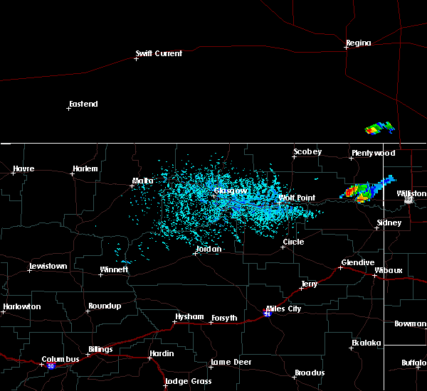 At 408 pm mdt, a severe thunderstorm was located near bainville, or 7 miles east of culbertson, moving east at 30 mph (trained weather spotters). Hazards include half dollar size hail. damage to vehicles is expected At 408 pm mdt, a severe thunderstorm was located near bainville, or 7 miles east of culbertson, moving east at 30 mph (trained weather spotters). Hazards include half dollar size hail. damage to vehicles is expected
|
| 7/5/2020 3:56 PM MDT | Half Dollar sized hail reported 0.7 miles NNE of Culbertson, MT, a lot of dime to penny sized hail with some as large as half dollars. pictures sent in via social media. |
| 7/4/2020 11:09 PM MDT |
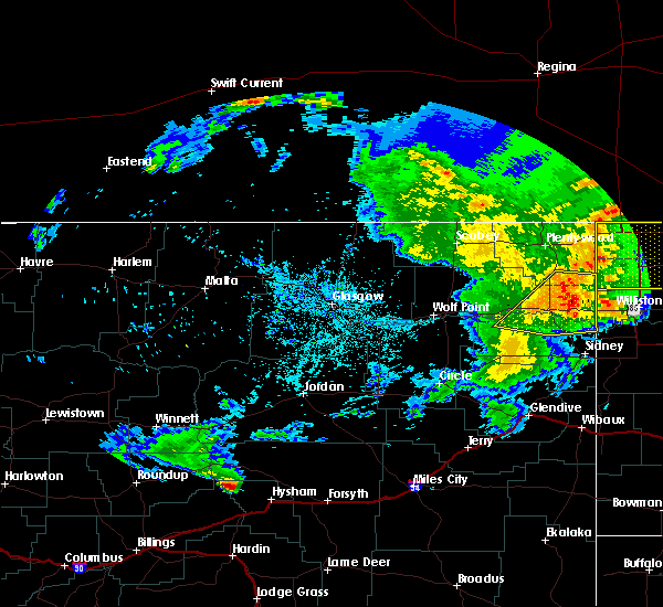 At 1109 pm mdt, a severe thunderstorm was located near culbertson, moving northeast at 40 mph (radar indicated). Hazards include 60 mph wind gusts. Expect damage to roofs, siding, and trees. Locations impacted include, culbertson, bainville, froid, mccabe, snowden, fort kipp and homestead. At 1109 pm mdt, a severe thunderstorm was located near culbertson, moving northeast at 40 mph (radar indicated). Hazards include 60 mph wind gusts. Expect damage to roofs, siding, and trees. Locations impacted include, culbertson, bainville, froid, mccabe, snowden, fort kipp and homestead.
|
| 7/4/2020 10:45 PM MDT |
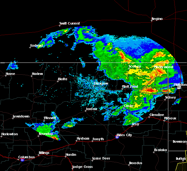 At 1045 pm mdt, a severe thunderstorm was located 10 miles southwest of culbertson, moving northeast at 40 mph (radar indicated). Hazards include 70 mph wind gusts and quarter size hail. Hail damage to vehicles is expected. expect considerable tree damage. Wind damage is also likely to mobile homes, roofs, and outbuildings. At 1045 pm mdt, a severe thunderstorm was located 10 miles southwest of culbertson, moving northeast at 40 mph (radar indicated). Hazards include 70 mph wind gusts and quarter size hail. Hail damage to vehicles is expected. expect considerable tree damage. Wind damage is also likely to mobile homes, roofs, and outbuildings.
|
| 5/20/2020 9:35 PM MDT |
 At 935 pm mdt, a severe thunderstorm was located over bredette, or 23 miles south of scobey, moving north at 80 mph (radar indicated). Hazards include 70 mph wind gusts. Expect considerable tree damage. Damage is likely to mobile homes, roofs, and outbuildings. At 935 pm mdt, a severe thunderstorm was located over bredette, or 23 miles south of scobey, moving north at 80 mph (radar indicated). Hazards include 70 mph wind gusts. Expect considerable tree damage. Damage is likely to mobile homes, roofs, and outbuildings.
|
| 5/20/2020 9:05 PM MDT |
 At 905 pm mdt, severe thunderstorms were located along a line extending from 7 miles northeast of vida to 9 miles northwest of sidney, moving north at 65 mph (radar indicated). Hazards include 60 mph wind gusts. Expect damage to roofs, siding, and trees. Locations impacted include, sidney, poplar, culbertson, brockton, richey, lambert, sprole, mccabe, fort kipp, enid and crane. At 905 pm mdt, severe thunderstorms were located along a line extending from 7 miles northeast of vida to 9 miles northwest of sidney, moving north at 65 mph (radar indicated). Hazards include 60 mph wind gusts. Expect damage to roofs, siding, and trees. Locations impacted include, sidney, poplar, culbertson, brockton, richey, lambert, sprole, mccabe, fort kipp, enid and crane.
|
| 5/20/2020 8:36 PM MDT |
 At 835 pm mdt, severe thunderstorms were located along a line extending from 10 miles northeast of circle to near savage, moving north at 65 mph (radar indicated). Hazards include 70 mph wind gusts. Expect considerable tree damage. Damage is likely to mobile homes, roofs, and outbuildings. At 835 pm mdt, severe thunderstorms were located along a line extending from 10 miles northeast of circle to near savage, moving north at 65 mph (radar indicated). Hazards include 70 mph wind gusts. Expect considerable tree damage. Damage is likely to mobile homes, roofs, and outbuildings.
|
| 8/14/2019 10:11 PM MDT |
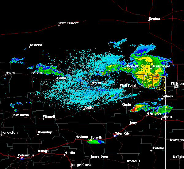 At 1011 pm mdt, a severe thunderstorm was located near froid, or 10 miles northeast of culbertson, moving east at 30 mph (radar indicated). Hazards include 60 mph wind gusts. Expect damage to roofs, siding, and trees. Locations impacted include, culbertson, medicine lake, bainville, froid, mccabe, snowden and homestead. At 1011 pm mdt, a severe thunderstorm was located near froid, or 10 miles northeast of culbertson, moving east at 30 mph (radar indicated). Hazards include 60 mph wind gusts. Expect damage to roofs, siding, and trees. Locations impacted include, culbertson, medicine lake, bainville, froid, mccabe, snowden and homestead.
|
| 8/14/2019 9:43 PM MDT |
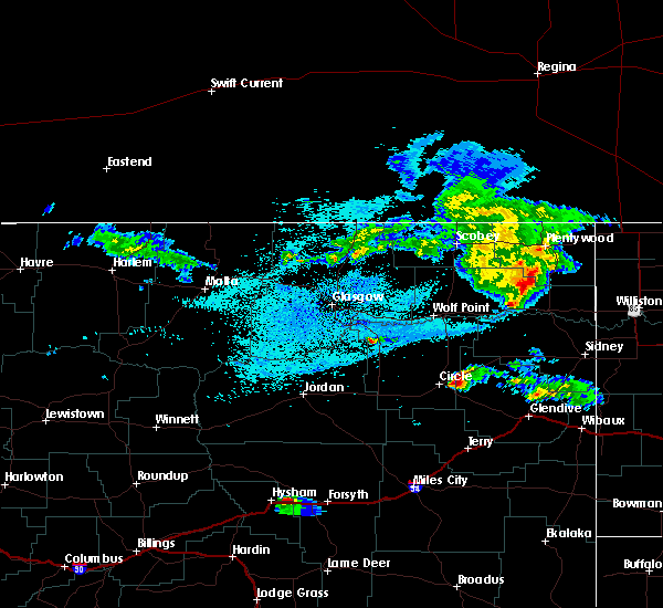 At 943 pm mdt, a severe thunderstorm was located 10 miles west of froid, or 16 miles northwest of culbertson, moving east at 30 mph (radar indicated). Hazards include 60 mph wind gusts and penny size hail. expect damage to roofs, siding, and trees At 943 pm mdt, a severe thunderstorm was located 10 miles west of froid, or 16 miles northwest of culbertson, moving east at 30 mph (radar indicated). Hazards include 60 mph wind gusts and penny size hail. expect damage to roofs, siding, and trees
|
| 8/5/2018 7:08 PM MDT |
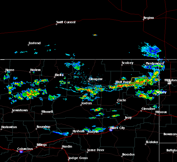 The severe thunderstorm warning for central roosevelt and north central richland counties will expire at 715 pm mdt, the storm which prompted the warning has weakened below severe limits, and no longer poses an immediate threat to life or property. therefore, the warning will be allowed to expire. however heavy rain is still possible with this thunderstorm. The severe thunderstorm warning for central roosevelt and north central richland counties will expire at 715 pm mdt, the storm which prompted the warning has weakened below severe limits, and no longer poses an immediate threat to life or property. therefore, the warning will be allowed to expire. however heavy rain is still possible with this thunderstorm.
|
| 8/5/2018 6:35 PM MDT |
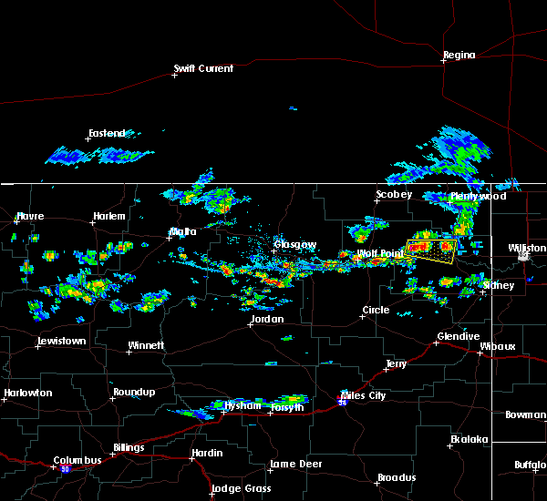 At 634 pm mdt, a severe thunderstorm was located near brockton, or 14 miles northeast of poplar, moving east at 20 mph (radar indicated). Hazards include quarter size hail. damage to vehicles is expected At 634 pm mdt, a severe thunderstorm was located near brockton, or 14 miles northeast of poplar, moving east at 20 mph (radar indicated). Hazards include quarter size hail. damage to vehicles is expected
|
| 7/21/2018 5:05 PM MDT | Storm damage reported in richland county MT, 12.4 miles NNW of Culbertson, MT |
| 7/21/2018 4:19 PM MDT | 10 to 11 bnsf train cars deraile in roosevelt county MT, 7.1 miles W of Culbertson, MT |
| 7/21/2018 4:15 PM MDT | Storm damage reported in roosevelt county MT, 5 miles S of Culbertson, MT |
| 7/21/2018 4:15 PM MDT | Quarter sized hail reported 6 miles SW of Culbertson, MT |
| 7/21/2018 3:52 PM MDT |
 At 352 pm mdt, a severe thunderstorm was located near froid, or 11 miles north of culbertson, moving east at 30 mph. this is a very dangerous storm (radar indicated). Hazards include 80 mph wind gusts and tennis ball size hail. Flying debris will be dangerous to those caught without shelter. mobile homes will be heavily damaged. expect considerable damage to roofs, windows, and vehicles. extensive tree damage and power outages are likely. Locations impacted include, culbertson, medicine lake, bainville, froid, mccabe, snowden, fort kipp and homestead. At 352 pm mdt, a severe thunderstorm was located near froid, or 11 miles north of culbertson, moving east at 30 mph. this is a very dangerous storm (radar indicated). Hazards include 80 mph wind gusts and tennis ball size hail. Flying debris will be dangerous to those caught without shelter. mobile homes will be heavily damaged. expect considerable damage to roofs, windows, and vehicles. extensive tree damage and power outages are likely. Locations impacted include, culbertson, medicine lake, bainville, froid, mccabe, snowden, fort kipp and homestead.
|
| 7/21/2018 3:30 PM MDT |
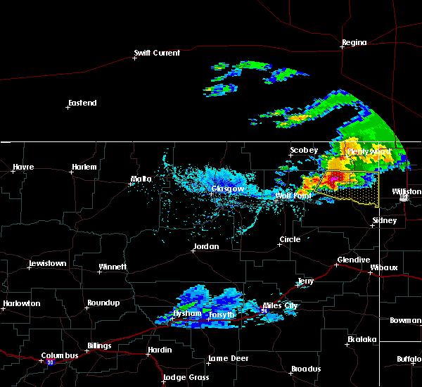 At 330 pm mdt, a severe thunderstorm was located near froid, or 14 miles northwest of culbertson, moving east at 35 mph. this is a very dangerous storm (radar indicated). Hazards include 80 mph wind gusts and tennis ball size hail. Flying debris will be dangerous to those caught without shelter. mobile homes will be heavily damaged. expect considerable damage to roofs, windows, and vehicles. extensive tree damage and power outages are likely. Locations impacted include, culbertson, medicine lake, bainville, froid, mccabe, snowden, fort kipp and homestead. At 330 pm mdt, a severe thunderstorm was located near froid, or 14 miles northwest of culbertson, moving east at 35 mph. this is a very dangerous storm (radar indicated). Hazards include 80 mph wind gusts and tennis ball size hail. Flying debris will be dangerous to those caught without shelter. mobile homes will be heavily damaged. expect considerable damage to roofs, windows, and vehicles. extensive tree damage and power outages are likely. Locations impacted include, culbertson, medicine lake, bainville, froid, mccabe, snowden, fort kipp and homestead.
|
| 7/21/2018 3:11 PM MDT |
 At 311 pm mdt, a severe thunderstorm was located 16 miles north of brockton, or 23 miles northeast of poplar, moving east at 35 mph (radar indicated). Hazards include ping pong ball size hail and 60 mph wind gusts. People and animals outdoors will be injured. expect hail damage to roofs, siding, windows, and vehicles. Expect wind damage to roofs, siding, and trees. At 311 pm mdt, a severe thunderstorm was located 16 miles north of brockton, or 23 miles northeast of poplar, moving east at 35 mph (radar indicated). Hazards include ping pong ball size hail and 60 mph wind gusts. People and animals outdoors will be injured. expect hail damage to roofs, siding, windows, and vehicles. Expect wind damage to roofs, siding, and trees.
|
| 7/10/2018 8:40 PM MDT |
 At 839 pm mdt, severe thunderstorms were located along a line extending from 9 miles northwest of fortuna to 7 miles southwest of grenora to 10 miles southeast of brockton, moving east at 60 mph (radar indicated). Hazards include 70 mph wind gusts and nickel size hail. Expect considerable tree damage. Damage is likely to mobile homes, roofs, and outbuildings. At 839 pm mdt, severe thunderstorms were located along a line extending from 9 miles northwest of fortuna to 7 miles southwest of grenora to 10 miles southeast of brockton, moving east at 60 mph (radar indicated). Hazards include 70 mph wind gusts and nickel size hail. Expect considerable tree damage. Damage is likely to mobile homes, roofs, and outbuildings.
|
| 7/10/2018 7:48 PM MDT |
 At 748 pm mdt, severe thunderstorms were located along a line extending from 11 miles east of port of whitetail to near poplar, moving east at 35 mph (radar indicated). Hazards include 60 mph wind gusts. expect damage to roofs, siding, and trees At 748 pm mdt, severe thunderstorms were located along a line extending from 11 miles east of port of whitetail to near poplar, moving east at 35 mph (radar indicated). Hazards include 60 mph wind gusts. expect damage to roofs, siding, and trees
|
| 7/9/2018 10:26 PM MDT |
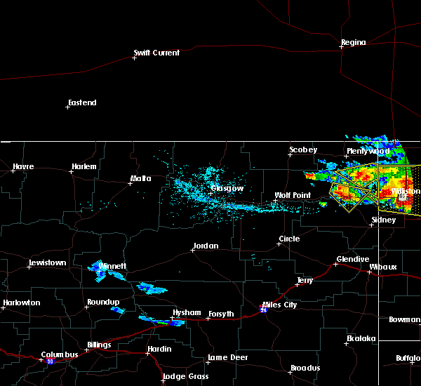 At 1025 pm mdt, a severe thunderstorm was located 9 miles east of brockton, or 9 miles west of culbertson, moving southeast at 35 mph (radar indicated). Hazards include 60 mph wind gusts and quarter size hail. Hail damage to vehicles is expected. expect wind damage to roofs, siding, and trees. Locations impacted include, culbertson, fort kipp and mccabe. At 1025 pm mdt, a severe thunderstorm was located 9 miles east of brockton, or 9 miles west of culbertson, moving southeast at 35 mph (radar indicated). Hazards include 60 mph wind gusts and quarter size hail. Hail damage to vehicles is expected. expect wind damage to roofs, siding, and trees. Locations impacted include, culbertson, fort kipp and mccabe.
|
| 7/9/2018 10:03 PM MDT |
 At 1003 pm mdt, a severe thunderstorm was located 10 miles north of brockton, or 17 miles northeast of poplar, moving southeast at 35 mph (radar indicated). Hazards include 60 mph wind gusts and quarter size hail. Hail damage to vehicles is expected. Expect wind damage to roofs, siding, and trees. At 1003 pm mdt, a severe thunderstorm was located 10 miles north of brockton, or 17 miles northeast of poplar, moving southeast at 35 mph (radar indicated). Hazards include 60 mph wind gusts and quarter size hail. Hail damage to vehicles is expected. Expect wind damage to roofs, siding, and trees.
|
| 6/28/2018 7:58 PM MDT | Several pine trees snapped. estimated winds of 70 mp in roosevelt county MT, 6 miles SW of Culbertson, MT |
| 6/28/2018 7:34 PM MDT |
 At 734 pm mdt, severe thunderstorms were located along a line extending from 8 miles north of poplar to 12 miles northeast of richey, moving east at 50 mph. a 64 mph wind gust was measured at the poplar airport at 725 pm (trained weather spotters). Hazards include 70 mph wind gusts and nickel size hail. Expect considerable tree damage. damage is likely to mobile homes, roofs, and outbuildings. locations impacted include, poplar, culbertson, brockton, froid, sprole and fort kipp. A tornado watch remains in effect until 1100 pm mdt for northeastern montana. At 734 pm mdt, severe thunderstorms were located along a line extending from 8 miles north of poplar to 12 miles northeast of richey, moving east at 50 mph. a 64 mph wind gust was measured at the poplar airport at 725 pm (trained weather spotters). Hazards include 70 mph wind gusts and nickel size hail. Expect considerable tree damage. damage is likely to mobile homes, roofs, and outbuildings. locations impacted include, poplar, culbertson, brockton, froid, sprole and fort kipp. A tornado watch remains in effect until 1100 pm mdt for northeastern montana.
|
| 6/28/2018 7:05 PM MDT |
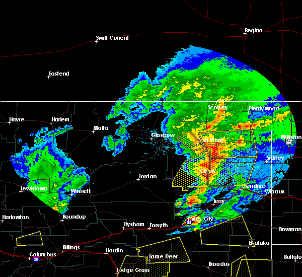 At 704 pm mdt, severe thunderstorms were located along a line extending from 12 miles north of wolf point to near vida, moving east at 50 mph (radar indicated). Hazards include 60 mph wind gusts and nickel size hail. expect damage to roofs, siding, and trees At 704 pm mdt, severe thunderstorms were located along a line extending from 12 miles north of wolf point to near vida, moving east at 50 mph (radar indicated). Hazards include 60 mph wind gusts and nickel size hail. expect damage to roofs, siding, and trees
|
| 6/7/2018 9:03 PM MDT |
 At 902 pm mdt, a severe thunderstorm was located 7 miles east of brockton, or 11 miles west of culbertson, moving northeast at 35 mph. this storm has a history of winds up to 90 miles per hour and silver dollar sized hail (radar indicated). Hazards include 60 mph wind gusts and quarter size hail. Hail damage to vehicles is expected. Expect wind damage to roofs, siding, and trees. At 902 pm mdt, a severe thunderstorm was located 7 miles east of brockton, or 11 miles west of culbertson, moving northeast at 35 mph. this storm has a history of winds up to 90 miles per hour and silver dollar sized hail (radar indicated). Hazards include 60 mph wind gusts and quarter size hail. Hail damage to vehicles is expected. Expect wind damage to roofs, siding, and trees.
|
| 6/7/2018 8:38 PM MDT |
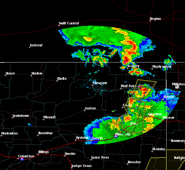 At 836 pm mdt, a severe thunderstorm was located 8 miles south of brockton, or 14 miles southeast of poplar, moving north at 25 mph. this is a very dangerous storm (trained weather spotters). Hazards include 90 mph wind gusts and half dollar size hail. You are in a life-threatening situation. flying debris may be deadly to those caught without shelter. mobile homes will be heavily damaged or destroyed. homes and businesses will have substantial roof and window damage. expect extensive tree damage and power outages. Locations impacted include, culbertson, brockton, froid, sprole and fort kipp. At 836 pm mdt, a severe thunderstorm was located 8 miles south of brockton, or 14 miles southeast of poplar, moving north at 25 mph. this is a very dangerous storm (trained weather spotters). Hazards include 90 mph wind gusts and half dollar size hail. You are in a life-threatening situation. flying debris may be deadly to those caught without shelter. mobile homes will be heavily damaged or destroyed. homes and businesses will have substantial roof and window damage. expect extensive tree damage and power outages. Locations impacted include, culbertson, brockton, froid, sprole and fort kipp.
|
| 6/7/2018 8:16 PM MDT |
 At 815 pm mdt, a severe thunderstorm was located 17 miles south of brockton, or 17 miles southeast of poplar, moving north at 25 mph. this is a very dangerous storm (trained weather spotters). Hazards include 80 mph wind gusts and half dollar size hail. Flying debris will be dangerous to those caught without shelter. mobile homes will be heavily damaged. expect considerable damage to roofs, windows, and vehicles. extensive tree damage and power outages are likely. Locations impacted include, culbertson, brockton, froid, sprole and fort kipp. At 815 pm mdt, a severe thunderstorm was located 17 miles south of brockton, or 17 miles southeast of poplar, moving north at 25 mph. this is a very dangerous storm (trained weather spotters). Hazards include 80 mph wind gusts and half dollar size hail. Flying debris will be dangerous to those caught without shelter. mobile homes will be heavily damaged. expect considerable damage to roofs, windows, and vehicles. extensive tree damage and power outages are likely. Locations impacted include, culbertson, brockton, froid, sprole and fort kipp.
|
| 6/7/2018 8:08 PM MDT |
 At 807 pm mdt, a severe thunderstorm was located 14 miles north of richey, or 20 miles southeast of poplar, moving northeast at 25 mph (trained weather spotters). Hazards include 60 mph wind gusts and half dollar size hail. Hail damage to vehicles is expected. Expect wind damage to roofs, siding, and trees. At 807 pm mdt, a severe thunderstorm was located 14 miles north of richey, or 20 miles southeast of poplar, moving northeast at 25 mph (trained weather spotters). Hazards include 60 mph wind gusts and half dollar size hail. Hail damage to vehicles is expected. Expect wind damage to roofs, siding, and trees.
|
| 6/1/2018 4:03 PM MDT |
 At 402 pm mdt, a severe thunderstorm was located 13 miles south of culbertson, moving northeast at 35 mph (trained weather spotters). Hazards include 70 mph wind gusts and quarter size hail. Hail damage to vehicles is expected. expect considerable tree damage. Wind damage is also likely to mobile homes, roofs, and outbuildings. At 402 pm mdt, a severe thunderstorm was located 13 miles south of culbertson, moving northeast at 35 mph (trained weather spotters). Hazards include 70 mph wind gusts and quarter size hail. Hail damage to vehicles is expected. expect considerable tree damage. Wind damage is also likely to mobile homes, roofs, and outbuildings.
|
| 5/23/2018 10:25 AM MDT |
 At 1023 am mdt, a severe thunderstorm was located near mccabe, or 8 miles northeast of culbertson, moving northwest at 20 mph (radar indicated). Hazards include 60 mph wind gusts and quarter size hail. Hail damage to vehicles is expected. Expect wind damage to roofs, siding, and trees. At 1023 am mdt, a severe thunderstorm was located near mccabe, or 8 miles northeast of culbertson, moving northwest at 20 mph (radar indicated). Hazards include 60 mph wind gusts and quarter size hail. Hail damage to vehicles is expected. Expect wind damage to roofs, siding, and trees.
|
| 8/31/2017 7:54 PM MDT |
 The severe thunderstorm warning for southeastern roosevelt, southeastern sheridan and northeastern richland counties will expire at 800 pm mdt, the storm which prompted the warning has weakened below severe limits, and no longer poses an immediate threat to life or property. therefore the warning will be allowed to expire. however small hail and heavy rain are still possible with this thunderstorm. The severe thunderstorm warning for southeastern roosevelt, southeastern sheridan and northeastern richland counties will expire at 800 pm mdt, the storm which prompted the warning has weakened below severe limits, and no longer poses an immediate threat to life or property. therefore the warning will be allowed to expire. however small hail and heavy rain are still possible with this thunderstorm.
|
| 8/31/2017 7:34 PM MDT |
 At 734 pm mdt, a severe thunderstorm was located 12 miles west of bonetrail, or 24 miles northeast of culbertson, moving northeast at 30 mph (radar indicated). Hazards include quarter size hail. Damage to vehicles is expected. Locations impacted include, culbertson, bainville, froid, mccabe, snowden and dagmar. At 734 pm mdt, a severe thunderstorm was located 12 miles west of bonetrail, or 24 miles northeast of culbertson, moving northeast at 30 mph (radar indicated). Hazards include quarter size hail. Damage to vehicles is expected. Locations impacted include, culbertson, bainville, froid, mccabe, snowden and dagmar.
|
| 8/31/2017 7:01 PM MDT |
 At 700 pm mdt, a cluster of severe thunderstorms were located near culbertson, moving northeast at 30 mph (radar indicated). Hazards include quarter size hail. damage to vehicles is expected At 700 pm mdt, a cluster of severe thunderstorms were located near culbertson, moving northeast at 30 mph (radar indicated). Hazards include quarter size hail. damage to vehicles is expected
|
| 6/24/2016 8:19 PM MDT |
 At 819 pm mdt, severe thunderstorms were located along a line extending from 13 miles west of medicine lake to 11 miles northwest of sidney, moving east at 55 mph (radar indicated). Hazards include 70 mph wind gusts and nickel size hail. Expect considerable tree damage. damage is likely to mobile homes, roofs, and outbuildings. Locations impacted include, poplar, culbertson, fairview, brockton, medicine lake, bainville, froid, bredette, east fairview, mccabe, reserve, homestead, fort kipp, nohly, snowden, sprole, fort union and dagmar. At 819 pm mdt, severe thunderstorms were located along a line extending from 13 miles west of medicine lake to 11 miles northwest of sidney, moving east at 55 mph (radar indicated). Hazards include 70 mph wind gusts and nickel size hail. Expect considerable tree damage. damage is likely to mobile homes, roofs, and outbuildings. Locations impacted include, poplar, culbertson, fairview, brockton, medicine lake, bainville, froid, bredette, east fairview, mccabe, reserve, homestead, fort kipp, nohly, snowden, sprole, fort union and dagmar.
|
| 6/24/2016 7:50 PM MDT |
 At 750 pm mdt, severe thunderstorms were located along a line extending from 8 miles northwest of bredette to near richey, moving east at 65 mph (radar indicated). Hazards include 70 mph wind gusts and nickel size hail. Expect considerable tree damage. Damage is likely to mobile homes, roofs, and outbuildings. At 750 pm mdt, severe thunderstorms were located along a line extending from 8 miles northwest of bredette to near richey, moving east at 65 mph (radar indicated). Hazards include 70 mph wind gusts and nickel size hail. Expect considerable tree damage. Damage is likely to mobile homes, roofs, and outbuildings.
|
| 6/21/2016 7:57 PM MDT |
 At 756 pm mdt, a tornado producing storm was located 15 miles southwest of bainville, or 15 miles southeast of culbertson, moving east at 50 mph (radar confirmed tornado). Hazards include damaging tornado and quarter size hail. Flying debris will be dangerous to those caught without shelter. mobile homes will be damaged or destroyed. damage to roofs, windows, and vehicles will occur. Tree damage is likely. At 756 pm mdt, a tornado producing storm was located 15 miles southwest of bainville, or 15 miles southeast of culbertson, moving east at 50 mph (radar confirmed tornado). Hazards include damaging tornado and quarter size hail. Flying debris will be dangerous to those caught without shelter. mobile homes will be damaged or destroyed. damage to roofs, windows, and vehicles will occur. Tree damage is likely.
|
| 6/21/2016 7:13 PM MDT |
 At 711 pm mdt, a severe thunderstorm was located over poplar, moving east at 60 mph (trained weather spotters reported quarter size hail 7 ne of wolf point at 658 pm mdt). Hazards include 60 mph wind gusts and quarter size hail. Hail damage to vehicles is expected. Expect wind damage to roofs, siding, and trees. At 711 pm mdt, a severe thunderstorm was located over poplar, moving east at 60 mph (trained weather spotters reported quarter size hail 7 ne of wolf point at 658 pm mdt). Hazards include 60 mph wind gusts and quarter size hail. Hail damage to vehicles is expected. Expect wind damage to roofs, siding, and trees.
|
| 6/18/2016 10:54 PM MDT |
 The severe thunderstorm warning for sheridan, richland and eastern roosevelt counties will expire at 1100 pm mdt, the storms which prompted the warning have moved out of the area. therefore, the warning will be allowed to expire. a severe thunderstorm watch remains in effect until midnight mdt for northeastern montana. The severe thunderstorm warning for sheridan, richland and eastern roosevelt counties will expire at 1100 pm mdt, the storms which prompted the warning have moved out of the area. therefore, the warning will be allowed to expire. a severe thunderstorm watch remains in effect until midnight mdt for northeastern montana.
|
| 6/18/2016 10:19 PM MDT |
 At 1019 pm mdt, severe thunderstorms were located along a line extending from 10 miles west of westby to 14 miles northwest of sidney, moving east at 50 mph (trained weather spotters). Hazards include two inch hail and 70 mph wind gusts. People and animals outdoors will be injured. expect hail damage to roofs, siding, windows, and vehicles. expect considerable tree damage. wind damage is also likely to mobile homes, roofs, and outbuildings. Locations impacted include, sidney, plentywood, culbertson, fairview, medicine lake, bainville, froid, westby, port of raymond, lambert, mccabe, wooley, coalridge, comertown, homestead, crane, fort union, dooley, reserve and enid. At 1019 pm mdt, severe thunderstorms were located along a line extending from 10 miles west of westby to 14 miles northwest of sidney, moving east at 50 mph (trained weather spotters). Hazards include two inch hail and 70 mph wind gusts. People and animals outdoors will be injured. expect hail damage to roofs, siding, windows, and vehicles. expect considerable tree damage. wind damage is also likely to mobile homes, roofs, and outbuildings. Locations impacted include, sidney, plentywood, culbertson, fairview, medicine lake, bainville, froid, westby, port of raymond, lambert, mccabe, wooley, coalridge, comertown, homestead, crane, fort union, dooley, reserve and enid.
|
| 6/18/2016 9:54 PM MDT |
 At 952 pm mdt, severe thunderstorms were located along a line extending from 7 miles south of port of raymond to 15 miles south of brockton, moving east at 45 mph (trained weather spotters). Hazards include two inch hail and 70 mph wind gusts. People and animals outdoors will be injured. expect hail damage to roofs, siding, windows, and vehicles. expect considerable tree damage. Wind damage is also likely to mobile homes, roofs, and outbuildings. At 952 pm mdt, severe thunderstorms were located along a line extending from 7 miles south of port of raymond to 15 miles south of brockton, moving east at 45 mph (trained weather spotters). Hazards include two inch hail and 70 mph wind gusts. People and animals outdoors will be injured. expect hail damage to roofs, siding, windows, and vehicles. expect considerable tree damage. Wind damage is also likely to mobile homes, roofs, and outbuildings.
|
| 7/27/2015 8:20 PM MDT |
 At 815 pm mdt, severe thunderstorms were located along a line extending from flaxville to 12 miles south of westby, and moving north at 85 mph (radar indicated. up to 65 mph wind gusts were reported in sidney with this storm). Hazards include 60 mph wind gusts and quarter size hail. Hail damage to crops and plants is expected. some damage to vehicles is possible. expect wind damage to roofs, siding and trees. Locations impacted include, whitetail, westby, raymond, dooley, daleview, outlook and comertown. At 815 pm mdt, severe thunderstorms were located along a line extending from flaxville to 12 miles south of westby, and moving north at 85 mph (radar indicated. up to 65 mph wind gusts were reported in sidney with this storm). Hazards include 60 mph wind gusts and quarter size hail. Hail damage to crops and plants is expected. some damage to vehicles is possible. expect wind damage to roofs, siding and trees. Locations impacted include, whitetail, westby, raymond, dooley, daleview, outlook and comertown.
|
| 7/27/2015 7:40 PM MDT |
 At 738 pm mdt, severe thunderstorms were located along a line extending from 9 miles south of poplar to 6 miles north of fairview, and moving north at 85 mph. these are very dangerous storms (trained weather spotters). Hazards include 80 mph wind gusts and quarter size hail. Flying debris will be dangerous to those caught without shelter. mobile homes will be heavily damaged. expect considerable damage to roofs, windows and vehicles. extensive tree damage and power outages are likely. severe thunderstorms will be near, poplar and culbertson around 745 pm mdt. bainville around 750 pm mdt. froid around 755 pm mdt. bredette and medicine lake around 805 pm mdt. flaxville and plentywood around 815 pm mdt. madoc and whitetail around 820 pm mdt. Other locations in the warning include sprole, snowden, fort kipp, mccabe, homestead, reserve, dagmar, navajo, coalridge and antelope. At 738 pm mdt, severe thunderstorms were located along a line extending from 9 miles south of poplar to 6 miles north of fairview, and moving north at 85 mph. these are very dangerous storms (trained weather spotters). Hazards include 80 mph wind gusts and quarter size hail. Flying debris will be dangerous to those caught without shelter. mobile homes will be heavily damaged. expect considerable damage to roofs, windows and vehicles. extensive tree damage and power outages are likely. severe thunderstorms will be near, poplar and culbertson around 745 pm mdt. bainville around 750 pm mdt. froid around 755 pm mdt. bredette and medicine lake around 805 pm mdt. flaxville and plentywood around 815 pm mdt. madoc and whitetail around 820 pm mdt. Other locations in the warning include sprole, snowden, fort kipp, mccabe, homestead, reserve, dagmar, navajo, coalridge and antelope.
|
| 7/4/2015 3:45 PM MDT |
 At 342 pm mdt, a severe thunderstorm was located 7 miles southeast of culbertson, and moving east at 30 mph (radar indicated). Hazards include 60 mph wind gusts and quarter size hail. Hail damage to crops and plants is expected. some damage to vehicles is possible. expect wind damage to roofs, siding and trees. the severe thunderstorm will be near, bainville around 405 pm mdt. Other locations in the warning include snowden, fort union and nohly. At 342 pm mdt, a severe thunderstorm was located 7 miles southeast of culbertson, and moving east at 30 mph (radar indicated). Hazards include 60 mph wind gusts and quarter size hail. Hail damage to crops and plants is expected. some damage to vehicles is possible. expect wind damage to roofs, siding and trees. the severe thunderstorm will be near, bainville around 405 pm mdt. Other locations in the warning include snowden, fort union and nohly.
|
| 7/4/2015 3:15 PM MDT |
 At 312 pm mdt, a severe thunderstorm was located 11 miles southeast of brockton, and moving east at 30 mph (radar indicated). Hazards include 60 mph wind gusts and quarter size hail. Hail damage to crops and plants is expected. some damage to vehicles is possible. expect wind damage to roofs, siding and trees. the severe thunderstorm will be near, culbertson around 335 pm mdt. bainville around 405 pm mdt. Other locations in the warning include snowden, fort union and nohly. At 312 pm mdt, a severe thunderstorm was located 11 miles southeast of brockton, and moving east at 30 mph (radar indicated). Hazards include 60 mph wind gusts and quarter size hail. Hail damage to crops and plants is expected. some damage to vehicles is possible. expect wind damage to roofs, siding and trees. the severe thunderstorm will be near, culbertson around 335 pm mdt. bainville around 405 pm mdt. Other locations in the warning include snowden, fort union and nohly.
|
| 6/19/2015 4:12 PM MDT |
 At 411 pm mdt, a severe thunderstorm was located 13 miles southwest of bainville, and moving east at 60 mph (radar indicated). Hazards include 60 mph wind gusts and half dollar size hail. Hail damage to vehicles is expected. expect wind damage to roofs, siding and trees. the severe thunderstorm will be near, fairview around 425 pm mdt. Other locations in the warning include snowden, nohly and fort union. At 411 pm mdt, a severe thunderstorm was located 13 miles southwest of bainville, and moving east at 60 mph (radar indicated). Hazards include 60 mph wind gusts and half dollar size hail. Hail damage to vehicles is expected. expect wind damage to roofs, siding and trees. the severe thunderstorm will be near, fairview around 425 pm mdt. Other locations in the warning include snowden, nohly and fort union.
|
| 6/19/2015 3:44 PM MDT |
 At 341 pm mdt, a severe thunderstorm was located 7 miles south of poplar, and moving east at 30 mph (radar indicated). Hazards include 60 mph wind gusts and quarter size hail. Hail damage to crops and plants is expected. some damage to vehicles is possible. expect wind damage to roofs, siding and trees. The severe thunderstorm will affect mainly rural areas of northern richland and southeastern roosevelt counties. At 341 pm mdt, a severe thunderstorm was located 7 miles south of poplar, and moving east at 30 mph (radar indicated). Hazards include 60 mph wind gusts and quarter size hail. Hail damage to crops and plants is expected. some damage to vehicles is possible. expect wind damage to roofs, siding and trees. The severe thunderstorm will affect mainly rural areas of northern richland and southeastern roosevelt counties.
|
| 6/19/2015 3:15 PM MDT |
 At 312 pm mdt, a severe thunderstorm was located 8 miles east of wolf point, and moving east at 30 mph (radar indicated). Hazards include 60 mph wind gusts and quarter size hail. Hail damage to crops and plants is expected. some damage to vehicles is possible. expect wind damage to roofs, siding and trees. The severe thunderstorm will be near, poplar around 335 pm mdt. At 312 pm mdt, a severe thunderstorm was located 8 miles east of wolf point, and moving east at 30 mph (radar indicated). Hazards include 60 mph wind gusts and quarter size hail. Hail damage to crops and plants is expected. some damage to vehicles is possible. expect wind damage to roofs, siding and trees. The severe thunderstorm will be near, poplar around 335 pm mdt.
|
| 8/5/2013 6:39 PM MDT | Power flickering on and of in richland county MT, 14.7 miles NNW of Culbertson, MT |
| 7/15/2013 7:30 PM MDT | Quarter sized hail reported 8 miles SW of Culbertson, MT |
| 6/24/2012 11:58 AM MDT | Quarter sized hail reported 14.7 miles NNW of Culbertson, MT, hail covering the ground along with heavy rain |
| 6/24/2012 11:57 AM MDT | 5 utility poles down in richland county MT, 12.6 miles NNW of Culbertson, MT |
| 6/24/2012 11:15 AM MDT | *** 1 inj *** barrel tanks and trailer overturned. the trailer rolled 4 times with 1 minor injury reported in richland county MT, 6.8 miles NE of Culbertson, MT |
| 6/24/2012 11:15 AM MDT | Barrel tanks and trailer overturned. the trailer rolled 4 times with 1 minor injury reported in richland county MT, 6.8 miles NE of Culbertson, MT |
| 6/24/2012 8:15 AM MDT | 50 to 60 mph wind gust with some nikel sized hail...heavy rain...still rainin in richland county MT, 6.1 miles N of Culbertson, MT |
| 6/24/2012 8:10 AM MDT | Penny sized hail partially covering the ground...heavy rain...still rainin in richland county MT, 14.7 miles NNW of Culbertson, MT |
Hail Maps for Culbertson, MT
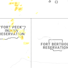


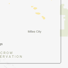
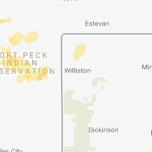

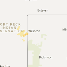


Connect with Interactive Hail Maps