

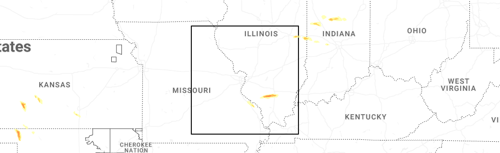
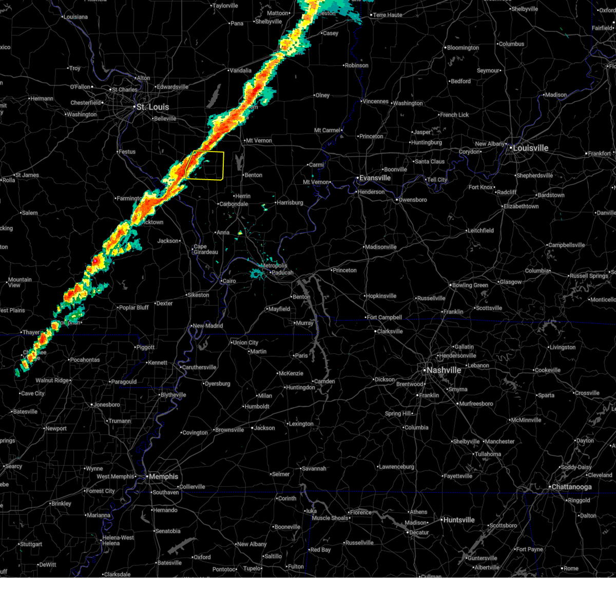
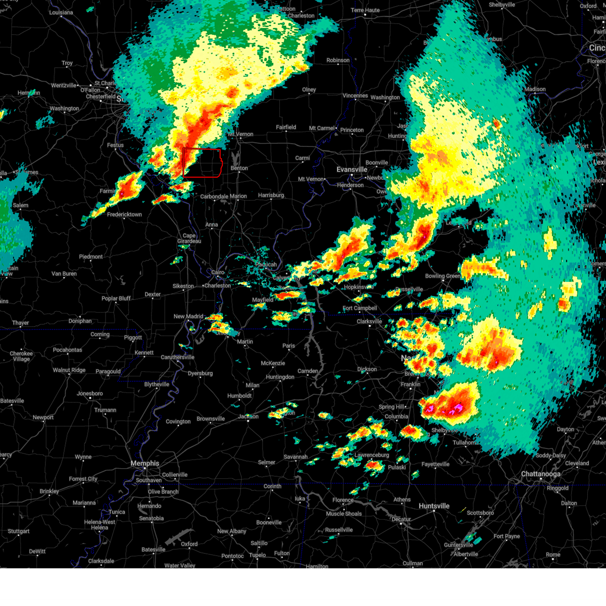
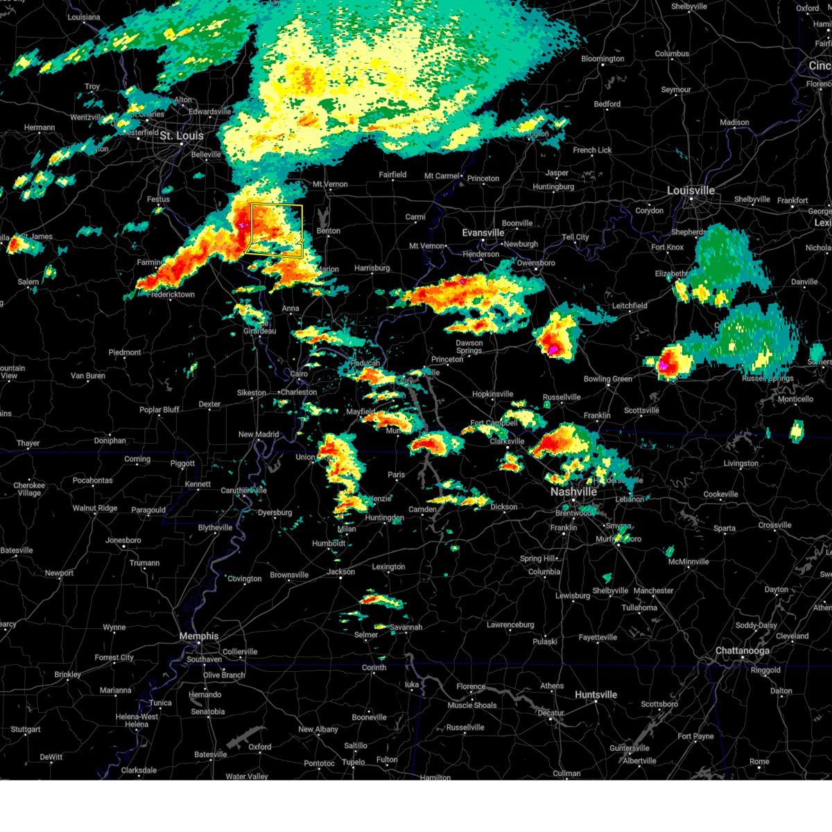
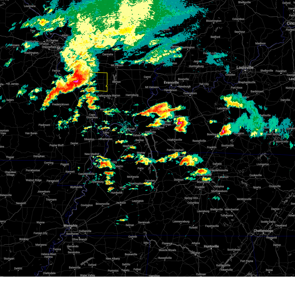
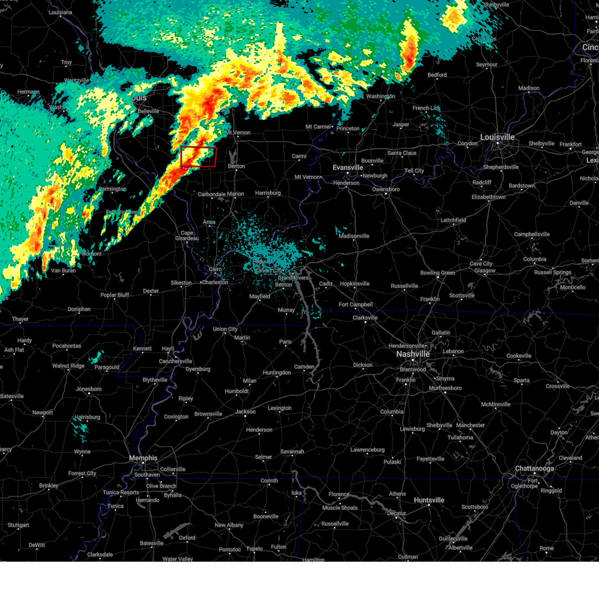
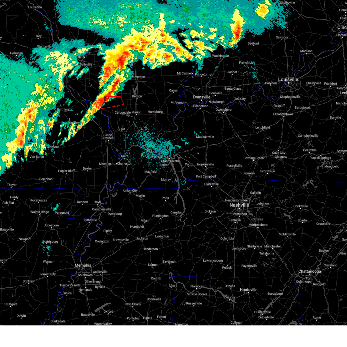
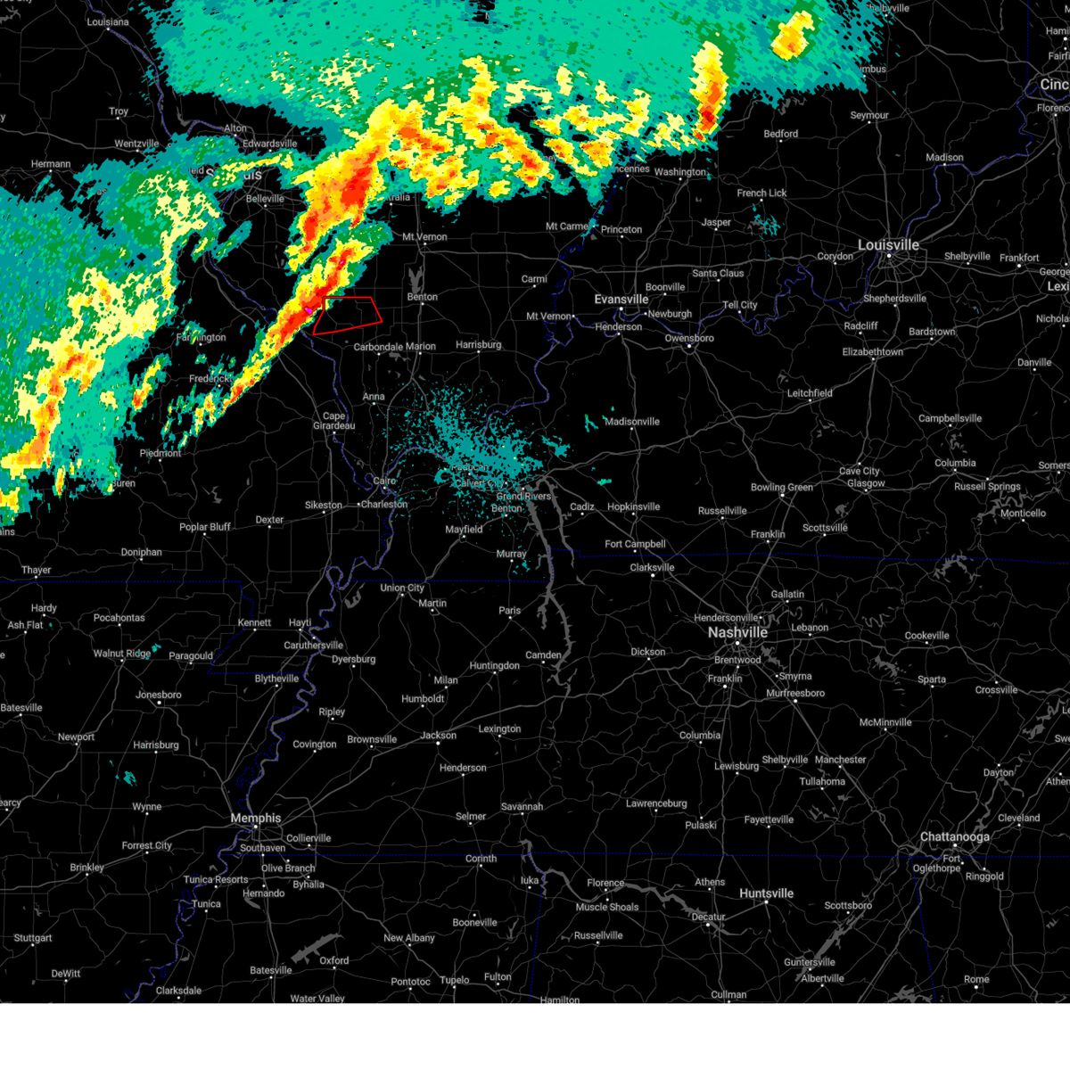
Hail Map for Cutler, IL
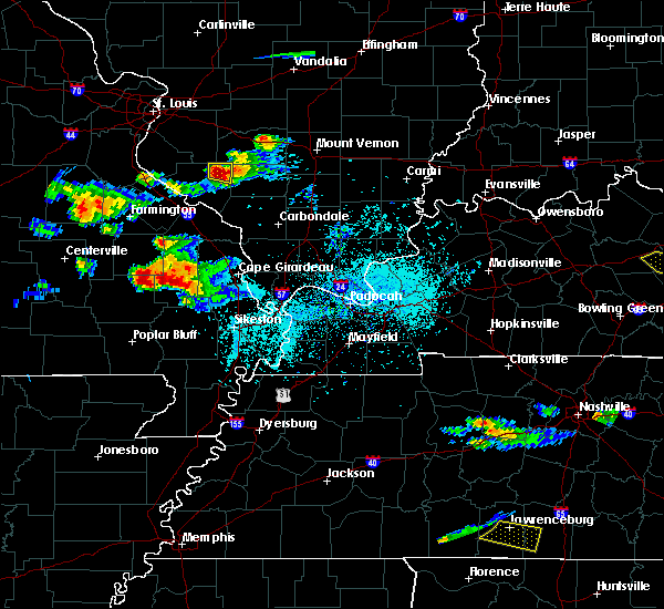
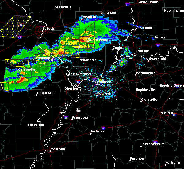
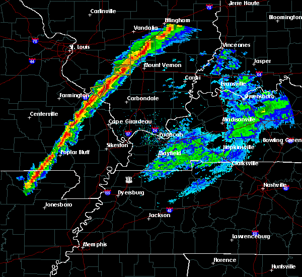
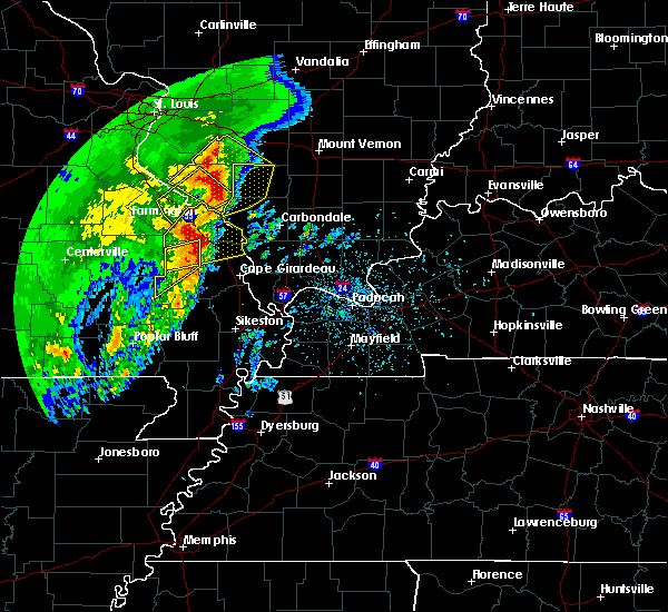
The Cutler, IL area has had 2 reports of on-the-ground hail by trained spotters, and has been under severe weather warnings 5 times during the past 12 months. Doppler radar has detected hail at or near Cutler, IL on 65 occasions, including 2 occasions during the past year.
| Name: | Cutler, IL |
| Where Located: | 50.5 miles N of Cape Girardeau, MO |
| Map: | Google Map for Cutler, IL |
| Population: | 441 |
| Housing Units: | 207 |
| More Info: | Search Google for Cutler, IL |
0
The Top Recent Hail Date for Cutler, IL is Tuesday, June 16, 2026 (39th out of 65)
Hail and Wind Damage Spotted near Cutler, IL
| Date / Time | Report Details |
|---|---|
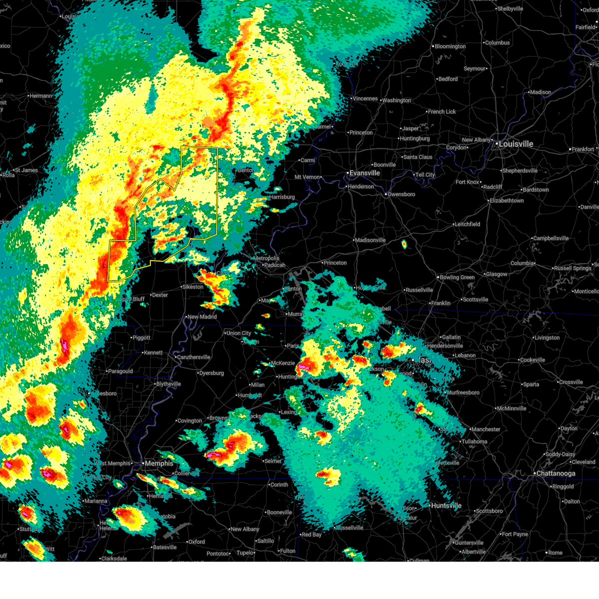
| 4/27/2026 8:55 PM CDT |
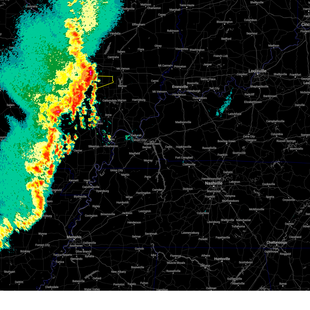
 At 854 pm cdt, severe thunderstorms were located along a line extending from 7 miles west of helm to near pinckneyville, moving east at 50 mph (radar indicated). Hazards include 60 mph wind gusts and quarter size hail. Hail damage to vehicles is expected. expect wind damage to roofs, siding, and trees. locations impacted include, mount vernon, pinckneyville, woodlawn, tamaroa, willisville, dix, cutler, and waltonville. this includes the following highways, interstate 57 in illinois between mile markers 93 and 105. Interstate 64 in illinois between mile markers 63 and 77. At 854 pm cdt, severe thunderstorms were located along a line extending from 7 miles west of helm to near pinckneyville, moving east at 50 mph (radar indicated). Hazards include 60 mph wind gusts and quarter size hail. Hail damage to vehicles is expected. expect wind damage to roofs, siding, and trees. locations impacted include, mount vernon, pinckneyville, woodlawn, tamaroa, willisville, dix, cutler, and waltonville. this includes the following highways, interstate 57 in illinois between mile markers 93 and 105. Interstate 64 in illinois between mile markers 63 and 77.
|
| 4/27/2026 8:26 PM CDT |
 Svrpah the national weather service in paducah has issued a * severe thunderstorm warning for, perry county in south central illinois, northwestern jefferson county in south central illinois, * until 930 pm cdt. * at 825 pm cdt, severe thunderstorms were located along a line extending from 8 miles west of wamac to near evansville, moving east at 50 mph (radar indicated). Hazards include 60 mph wind gusts and quarter size hail. Hail damage to vehicles is expected. Expect wind damage to roofs, siding, and trees. Svrpah the national weather service in paducah has issued a * severe thunderstorm warning for, perry county in south central illinois, northwestern jefferson county in south central illinois, * until 930 pm cdt. * at 825 pm cdt, severe thunderstorms were located along a line extending from 8 miles west of wamac to near evansville, moving east at 50 mph (radar indicated). Hazards include 60 mph wind gusts and quarter size hail. Hail damage to vehicles is expected. Expect wind damage to roofs, siding, and trees.
|
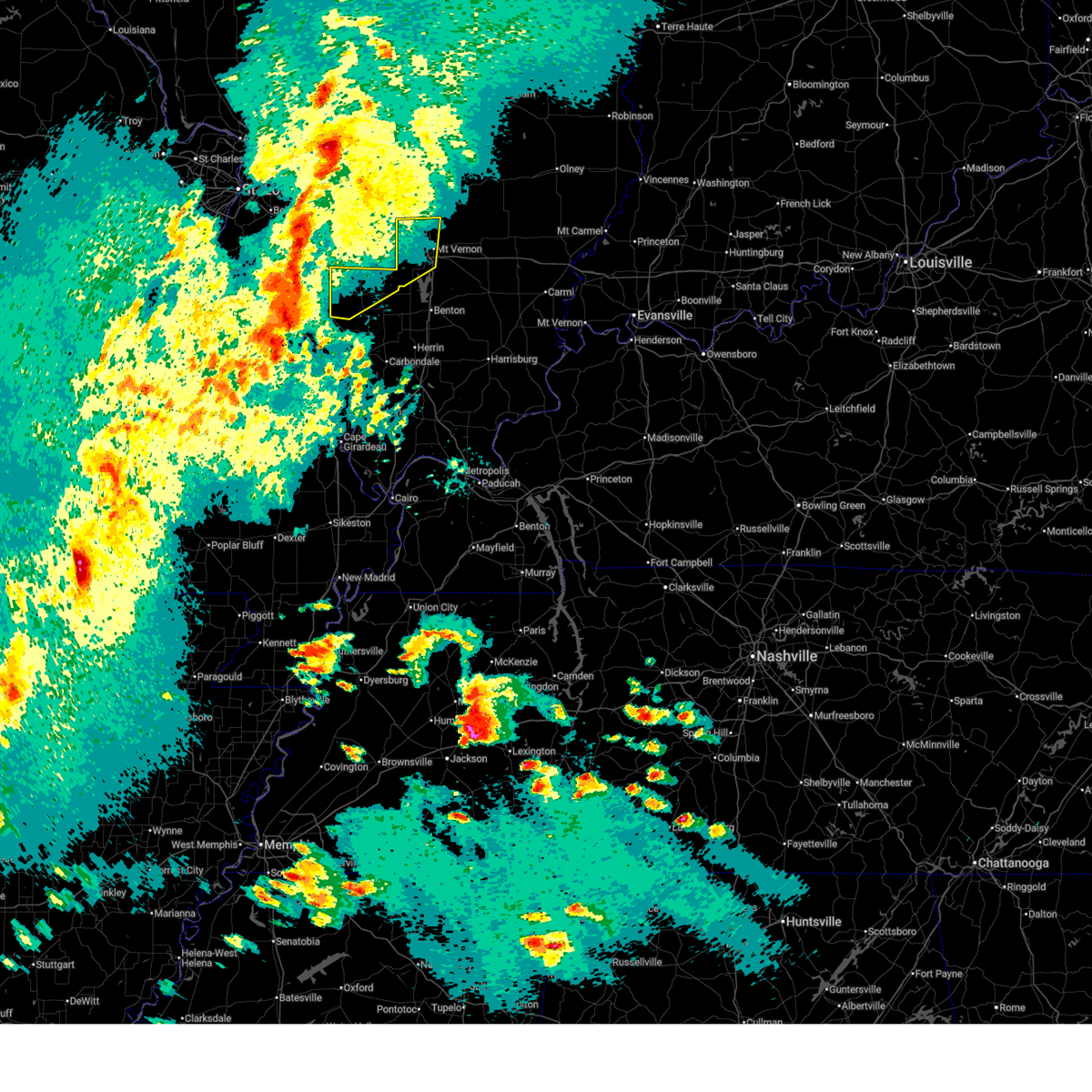
| 3/15/2026 6:05 PM CDT |
 At 605 pm cdt, a severe squall line capable of producing both tornadoes and extensive straight line wind damage was located along a line extending from near lively grove to near coulterville to sparta to near bremen, moving northeast at 60 mph (radar indicated rotation). Hazards include tornado. Flying debris will be dangerous to those caught without shelter. mobile homes will be damaged or destroyed. damage to roofs, windows, and vehicles will occur. tree damage is likely. These tornadic storms will remain over mainly rural areas of perry county, including the following locations, cutler. At 605 pm cdt, a severe squall line capable of producing both tornadoes and extensive straight line wind damage was located along a line extending from near lively grove to near coulterville to sparta to near bremen, moving northeast at 60 mph (radar indicated rotation). Hazards include tornado. Flying debris will be dangerous to those caught without shelter. mobile homes will be damaged or destroyed. damage to roofs, windows, and vehicles will occur. tree damage is likely. These tornadic storms will remain over mainly rural areas of perry county, including the following locations, cutler.
|
| 3/15/2026 5:50 PM CDT |
 Torpah the national weather service in paducah has issued a * tornado warning for, perry county in south central illinois, * until 630 pm cdt. * at 549 pm cdt, severe thunderstorms capable of producing both tornadoes and extensive straight line wind damage were located along a line extending from near new athens to near evansville to near st. mary, moving east at 60 mph (radar indicated rotation). Hazards include tornado. Flying debris will be dangerous to those caught without shelter. mobile homes will be damaged or destroyed. damage to roofs, windows, and vehicles will occur. tree damage is likely. these dangerous storms will be near, pinckneyville around 615 pm cdt. Other locations impacted by these tornadic storms include cutler. Torpah the national weather service in paducah has issued a * tornado warning for, perry county in south central illinois, * until 630 pm cdt. * at 549 pm cdt, severe thunderstorms capable of producing both tornadoes and extensive straight line wind damage were located along a line extending from near new athens to near evansville to near st. mary, moving east at 60 mph (radar indicated rotation). Hazards include tornado. Flying debris will be dangerous to those caught without shelter. mobile homes will be damaged or destroyed. damage to roofs, windows, and vehicles will occur. tree damage is likely. these dangerous storms will be near, pinckneyville around 615 pm cdt. Other locations impacted by these tornadic storms include cutler.
|
| 12/28/2025 4:41 PM CST |
 Svrpah the national weather service in paducah has issued a * severe thunderstorm warning for, perry county in south central illinois, * until 530 pm cst. * at 441 pm cst, severe thunderstorms were located along a line extending from 6 miles northwest of pinckneyville to willisville, moving east at 30 mph (radar indicated). Hazards include 60 mph wind gusts. expect damage to roofs, siding, and trees Svrpah the national weather service in paducah has issued a * severe thunderstorm warning for, perry county in south central illinois, * until 530 pm cst. * at 441 pm cst, severe thunderstorms were located along a line extending from 6 miles northwest of pinckneyville to willisville, moving east at 30 mph (radar indicated). Hazards include 60 mph wind gusts. expect damage to roofs, siding, and trees
|
| 5/16/2025 4:23 PM CDT |
 Svrpah the national weather service in paducah has issued a * severe thunderstorm warning for, perry county in south central illinois, northern franklin county in south central illinois, * until 515 pm cdt. * at 423 pm cdt, a severe thunderstorm was located near willisville, or 9 miles southwest of pinckneyville, moving east at 70 mph (radar indicated). Hazards include ping pong ball size hail and 60 mph wind gusts. People and animals outdoors will be injured. expect hail damage to roofs, siding, windows, and vehicles. Expect wind damage to roofs, siding, and trees. Svrpah the national weather service in paducah has issued a * severe thunderstorm warning for, perry county in south central illinois, northern franklin county in south central illinois, * until 515 pm cdt. * at 423 pm cdt, a severe thunderstorm was located near willisville, or 9 miles southwest of pinckneyville, moving east at 70 mph (radar indicated). Hazards include ping pong ball size hail and 60 mph wind gusts. People and animals outdoors will be injured. expect hail damage to roofs, siding, windows, and vehicles. Expect wind damage to roofs, siding, and trees.
|
| 4/2/2025 6:43 PM CDT |
 At 643 pm cdt, severe thunderstorms were located along a line extending from willisville to 6 miles north of grand tower to near delta, moving northeast at 65 mph (radar indicated). Hazards include 60 mph wind gusts and quarter size hail. Hail damage to vehicles is expected. expect wind damage to roofs, siding, and trees. locations impacted include, cape girardeau, pocahontas, millersville, jackson, cutler, alto pass, bollinger mill state historic site, gorham, dutchtown, jonesboro, frohna, allenville, elkville, grand tower, murphysboro, pinckneyville, oak ridge, anna, old appleton, and dowell. This includes interstate 55 between mile markers 93 and 124. At 643 pm cdt, severe thunderstorms were located along a line extending from willisville to 6 miles north of grand tower to near delta, moving northeast at 65 mph (radar indicated). Hazards include 60 mph wind gusts and quarter size hail. Hail damage to vehicles is expected. expect wind damage to roofs, siding, and trees. locations impacted include, cape girardeau, pocahontas, millersville, jackson, cutler, alto pass, bollinger mill state historic site, gorham, dutchtown, jonesboro, frohna, allenville, elkville, grand tower, murphysboro, pinckneyville, oak ridge, anna, old appleton, and dowell. This includes interstate 55 between mile markers 93 and 124.
|
| 4/2/2025 6:28 PM CDT |
 Torpah the national weather service in paducah has issued a * tornado warning for, perry county in south central illinois, southern jefferson county in south central illinois, northern williamson county in southern illinois, jackson county in southern illinois, franklin county in south central illinois, * until 715 pm cdt. * at 628 pm cdt, severe thunderstorms capable of producing both tornadoes and extensive straight line wind damage were located along a line extending from near st. mary to 8 miles east of perryville to 6 miles southwest of altenburg, moving east at 85 mph (radar indicated rotation). Hazards include tornado. Flying debris will be dangerous to those caught without shelter. mobile homes will be damaged or destroyed. damage to roofs, windows, and vehicles will occur. tree damage is likely. these dangerous storms will be near, grand tower around 635 pm cdt. willisville, ava, murphysboro, and carbondale around 640 pm cdt. de soto around 645 pm cdt. royalton, energy, elkville, hurst, crainville, herrin, cambria, carterville, and du quoin around 650 pm cdt. johnston city, west frankfort, marion, christopher, and zeigler around 655 pm cdt. benton, west city, sesser, valier, rend lake area, and pittsburg around 700 pm cdt. thompsonville around 705 pm cdt. other locations impacted by these tornadic storms include whiteash, orient, spillertown, dowell, bonnie, north city, nason, buckner, hanaford, and campbell hill. This includes interstate 57 in illinois between mile markers 53 and 87. Torpah the national weather service in paducah has issued a * tornado warning for, perry county in south central illinois, southern jefferson county in south central illinois, northern williamson county in southern illinois, jackson county in southern illinois, franklin county in south central illinois, * until 715 pm cdt. * at 628 pm cdt, severe thunderstorms capable of producing both tornadoes and extensive straight line wind damage were located along a line extending from near st. mary to 8 miles east of perryville to 6 miles southwest of altenburg, moving east at 85 mph (radar indicated rotation). Hazards include tornado. Flying debris will be dangerous to those caught without shelter. mobile homes will be damaged or destroyed. damage to roofs, windows, and vehicles will occur. tree damage is likely. these dangerous storms will be near, grand tower around 635 pm cdt. willisville, ava, murphysboro, and carbondale around 640 pm cdt. de soto around 645 pm cdt. royalton, energy, elkville, hurst, crainville, herrin, cambria, carterville, and du quoin around 650 pm cdt. johnston city, west frankfort, marion, christopher, and zeigler around 655 pm cdt. benton, west city, sesser, valier, rend lake area, and pittsburg around 700 pm cdt. thompsonville around 705 pm cdt. other locations impacted by these tornadic storms include whiteash, orient, spillertown, dowell, bonnie, north city, nason, buckner, hanaford, and campbell hill. This includes interstate 57 in illinois between mile markers 53 and 87.
|
| 4/2/2025 6:01 PM CDT |
 Svrpah the national weather service in paducah has issued a * severe thunderstorm warning for, perry county in south central illinois, union county in southern illinois, jackson county in southern illinois, bollinger county in southeastern missouri, perry county in southeastern missouri, eastern wayne county in southeastern missouri, cape girardeau county in southeastern missouri, * until 700 pm cdt. * at 601 pm cdt, severe thunderstorms were located along a line extending from near womac to marquand to hendrickson, moving northeast at 65 mph (radar indicated). Hazards include 60 mph wind gusts and quarter size hail. Hail damage to vehicles is expected. Expect wind damage to roofs, siding, and trees. Svrpah the national weather service in paducah has issued a * severe thunderstorm warning for, perry county in south central illinois, union county in southern illinois, jackson county in southern illinois, bollinger county in southeastern missouri, perry county in southeastern missouri, eastern wayne county in southeastern missouri, cape girardeau county in southeastern missouri, * until 700 pm cdt. * at 601 pm cdt, severe thunderstorms were located along a line extending from near womac to marquand to hendrickson, moving northeast at 65 mph (radar indicated). Hazards include 60 mph wind gusts and quarter size hail. Hail damage to vehicles is expected. Expect wind damage to roofs, siding, and trees.
|
| 4/2/2025 5:16 PM CDT |
 Svrpah the national weather service in paducah has issued a * severe thunderstorm warning for, perry county in south central illinois, western jefferson county in south central illinois, * until 600 pm cdt. * at 516 pm cdt, severe thunderstorms were located along a line extending from near aviston to near marissa to near chester, moving northeast at 75 mph (radar indicated). Hazards include 60 mph wind gusts and nickel size hail. expect damage to roofs, siding, and trees Svrpah the national weather service in paducah has issued a * severe thunderstorm warning for, perry county in south central illinois, western jefferson county in south central illinois, * until 600 pm cdt. * at 516 pm cdt, severe thunderstorms were located along a line extending from near aviston to near marissa to near chester, moving northeast at 75 mph (radar indicated). Hazards include 60 mph wind gusts and nickel size hail. expect damage to roofs, siding, and trees
|
| 8/15/2024 5:38 PM CDT |
 the severe thunderstorm warning has been cancelled and is no longer in effect the severe thunderstorm warning has been cancelled and is no longer in effect
|
| 8/15/2024 5:15 PM CDT |
 Svrpah the national weather service in paducah has issued a * severe thunderstorm warning for, central perry county in south central illinois, * until 600 pm cdt. * at 515 pm cdt, a severe thunderstorm was located near coulterville, or 8 miles east of sparta, moving east at 15 mph (radar indicated). Hazards include 60 mph wind gusts and quarter size hail. Hail damage to vehicles is expected. Expect wind damage to roofs, siding, and trees. Svrpah the national weather service in paducah has issued a * severe thunderstorm warning for, central perry county in south central illinois, * until 600 pm cdt. * at 515 pm cdt, a severe thunderstorm was located near coulterville, or 8 miles east of sparta, moving east at 15 mph (radar indicated). Hazards include 60 mph wind gusts and quarter size hail. Hail damage to vehicles is expected. Expect wind damage to roofs, siding, and trees.
|
| 5/26/2024 7:28 PM CDT |
 At 727 pm cdt, severe thunderstorms were located along a line extending from 10 miles north of mount vernon to near tamaroa to near ava, moving east at 55 mph (radar indicated). Hazards include 70 mph wind gusts and quarter size hail. Hail damage to vehicles is expected. expect considerable tree damage. wind damage is also likely to mobile homes, roofs, and outbuildings. locations impacted include, mount vernon, benton, du quoin, pinckneyville, christopher, rend lake area, sesser, royalton, elkville, woodlawn, bluford, valier, west city, ava, tamaroa, willisville, ina, north city, buckner, and dix. this includes the following highways, interstate 57 in illinois between mile markers 71 and 105. Interstate 64 in illinois between mile markers 63 and 91. At 727 pm cdt, severe thunderstorms were located along a line extending from 10 miles north of mount vernon to near tamaroa to near ava, moving east at 55 mph (radar indicated). Hazards include 70 mph wind gusts and quarter size hail. Hail damage to vehicles is expected. expect considerable tree damage. wind damage is also likely to mobile homes, roofs, and outbuildings. locations impacted include, mount vernon, benton, du quoin, pinckneyville, christopher, rend lake area, sesser, royalton, elkville, woodlawn, bluford, valier, west city, ava, tamaroa, willisville, ina, north city, buckner, and dix. this includes the following highways, interstate 57 in illinois between mile markers 71 and 105. Interstate 64 in illinois between mile markers 63 and 91.
|
| 5/26/2024 6:58 PM CDT |
 Svrpah the national weather service in paducah has issued a * severe thunderstorm warning for, perry county in south central illinois, jefferson county in south central illinois, northern jackson county in southern illinois, central franklin county in south central illinois, * until 815 pm cdt. * at 658 pm cdt, severe thunderstorms were located along a line extending from near carlyle to near lively grove to ste. genevieve, moving east at 60 mph (radar indicated). Hazards include 70 mph wind gusts and quarter size hail. Hail damage to vehicles is expected. expect considerable tree damage. Wind damage is also likely to mobile homes, roofs, and outbuildings. Svrpah the national weather service in paducah has issued a * severe thunderstorm warning for, perry county in south central illinois, jefferson county in south central illinois, northern jackson county in southern illinois, central franklin county in south central illinois, * until 815 pm cdt. * at 658 pm cdt, severe thunderstorms were located along a line extending from near carlyle to near lively grove to ste. genevieve, moving east at 60 mph (radar indicated). Hazards include 70 mph wind gusts and quarter size hail. Hail damage to vehicles is expected. expect considerable tree damage. Wind damage is also likely to mobile homes, roofs, and outbuildings.
|
| 5/8/2024 6:55 PM CDT |
 At 654 pm cdt, a severe squall line capable of producing both tornadoes and extensive straight line wind damage was located along a line extending from 7 miles east of coulterville to near willisville, moving east at 50 mph. rotation is strong enough that a signifcant tornado is possible near and south of pickneyville (radar indicated rotation). Hazards include tornado and two inch hail. 70 mph straight line winds. Flying debris will be dangerous to those caught without shelter. mobile homes will be damaged or destroyed. damage to roofs, windows, and vehicles will occur. tree damage is likely. these dangerous storms will be near, pinckneyville around 700 pm cdt. du quoin and tamaroa around 705 pm cdt. other locations impacted by these tornadic storms include cutler and st. Johns. At 654 pm cdt, a severe squall line capable of producing both tornadoes and extensive straight line wind damage was located along a line extending from 7 miles east of coulterville to near willisville, moving east at 50 mph. rotation is strong enough that a signifcant tornado is possible near and south of pickneyville (radar indicated rotation). Hazards include tornado and two inch hail. 70 mph straight line winds. Flying debris will be dangerous to those caught without shelter. mobile homes will be damaged or destroyed. damage to roofs, windows, and vehicles will occur. tree damage is likely. these dangerous storms will be near, pinckneyville around 700 pm cdt. du quoin and tamaroa around 705 pm cdt. other locations impacted by these tornadic storms include cutler and st. Johns.
|
| 5/8/2024 6:46 PM CDT |
 At 645 pm cdt, a severe squall line capable of producing both tornadoes and extensive straight line wind damage was located along a line extending from near tilden to near steeleville, moving east at 50 mph (radar indicated rotation). Hazards include tornado and two inch hail. straight line winds to 70 mph. Flying debris will be dangerous to those caught without shelter. mobile homes will be damaged or destroyed. damage to roofs, windows, and vehicles will occur. tree damage is likely. these dangerous storms will be near, willisville around 650 pm cdt. pinckneyville around 700 pm cdt. du quoin and tamaroa around 710 pm cdt. other locations impacted by these tornadic storms include cutler and st. Johns. At 645 pm cdt, a severe squall line capable of producing both tornadoes and extensive straight line wind damage was located along a line extending from near tilden to near steeleville, moving east at 50 mph (radar indicated rotation). Hazards include tornado and two inch hail. straight line winds to 70 mph. Flying debris will be dangerous to those caught without shelter. mobile homes will be damaged or destroyed. damage to roofs, windows, and vehicles will occur. tree damage is likely. these dangerous storms will be near, willisville around 650 pm cdt. pinckneyville around 700 pm cdt. du quoin and tamaroa around 710 pm cdt. other locations impacted by these tornadic storms include cutler and st. Johns.
|
| 5/8/2024 6:39 PM CDT |
 Torpah the national weather service in paducah has issued a * tornado warning for, perry county in south central illinois, * until 730 pm cdt. * at 638 pm cdt, severe thunderstorms capable of producing both tornadoes and extensive straight line wind damage were located along a line extending from tilden to near bremen, moving east at 50 mph (radar indicated rotation). Hazards include tornado and staight line winds to 70 mph. Flying debris will be dangerous to those caught without shelter. mobile homes will be damaged or destroyed. damage to roofs, windows, and vehicles will occur. tree damage is likely. these dangerous storms will be near, willisville around 645 pm cdt. pinckneyville around 655 pm cdt. du quoin and tamaroa around 705 pm cdt. other locations impacted by these tornadic storms include cutler and st. Johns. Torpah the national weather service in paducah has issued a * tornado warning for, perry county in south central illinois, * until 730 pm cdt. * at 638 pm cdt, severe thunderstorms capable of producing both tornadoes and extensive straight line wind damage were located along a line extending from tilden to near bremen, moving east at 50 mph (radar indicated rotation). Hazards include tornado and staight line winds to 70 mph. Flying debris will be dangerous to those caught without shelter. mobile homes will be damaged or destroyed. damage to roofs, windows, and vehicles will occur. tree damage is likely. these dangerous storms will be near, willisville around 645 pm cdt. pinckneyville around 655 pm cdt. du quoin and tamaroa around 705 pm cdt. other locations impacted by these tornadic storms include cutler and st. Johns.
|
| 5/8/2024 6:27 PM CDT |
 Svrpah the national weather service in paducah has issued a * severe thunderstorm warning for, perry county in south central illinois, * until 730 pm cdt. * at 626 pm cdt, severe thunderstorms were located along a line extending from near baldwin to near chester, moving east at 55 mph (broadcast media). Hazards include 70 mph wind gusts and half dollar size hail. reports of 65 to 70 mph wind near ste. genevive. Hail damage to vehicles is expected. expect considerable tree damage. Wind damage is also likely to mobile homes, roofs, and outbuildings. Svrpah the national weather service in paducah has issued a * severe thunderstorm warning for, perry county in south central illinois, * until 730 pm cdt. * at 626 pm cdt, severe thunderstorms were located along a line extending from near baldwin to near chester, moving east at 55 mph (broadcast media). Hazards include 70 mph wind gusts and half dollar size hail. reports of 65 to 70 mph wind near ste. genevive. Hail damage to vehicles is expected. expect considerable tree damage. Wind damage is also likely to mobile homes, roofs, and outbuildings.
|
| 5/8/2024 3:00 PM CDT |
 Svrpah the national weather service in paducah has issued a * severe thunderstorm warning for, perry county in south central illinois, northern jackson county in southern illinois, perry county in southeastern missouri, * until 345 pm cdt. * at 259 pm cdt, severe thunderstorms were located over mainly rural areas of perry and randolph counties moving east at 35 mph (radar indicated). Hazards include ping pong ball size hail and 60 mph wind gusts. People and animals outdoors will be injured. expect hail damage to roofs, siding, windows, and vehicles. Expect wind damage to roofs, siding, and trees. Svrpah the national weather service in paducah has issued a * severe thunderstorm warning for, perry county in south central illinois, northern jackson county in southern illinois, perry county in southeastern missouri, * until 345 pm cdt. * at 259 pm cdt, severe thunderstorms were located over mainly rural areas of perry and randolph counties moving east at 35 mph (radar indicated). Hazards include ping pong ball size hail and 60 mph wind gusts. People and animals outdoors will be injured. expect hail damage to roofs, siding, windows, and vehicles. Expect wind damage to roofs, siding, and trees.
|
| 5/8/2024 2:49 PM CDT |
 At 249 pm cdt, a severe thunderstorm was located over percy, or 10 miles southeast of sparta, moving east at 40 mph. the storm was moving into far west perry county and northwest jackson county (radar indicated). Hazards include 70 mph wind gusts and ping pong ball size hail. People and animals outdoors will be injured. expect hail damage to roofs, siding, windows, and vehicles. expect considerable tree damage. wind damage is also likely to mobile homes, roofs, and outbuildings. locations impacted include, du quoin, pinckneyville, elkville, ava, tamaroa, willisville, cutler, dowell, campbell hill, vergennes, and st. Johns. At 249 pm cdt, a severe thunderstorm was located over percy, or 10 miles southeast of sparta, moving east at 40 mph. the storm was moving into far west perry county and northwest jackson county (radar indicated). Hazards include 70 mph wind gusts and ping pong ball size hail. People and animals outdoors will be injured. expect hail damage to roofs, siding, windows, and vehicles. expect considerable tree damage. wind damage is also likely to mobile homes, roofs, and outbuildings. locations impacted include, du quoin, pinckneyville, elkville, ava, tamaroa, willisville, cutler, dowell, campbell hill, vergennes, and st. Johns.
|
| 5/8/2024 2:14 PM CDT |
 Svrpah the national weather service in paducah has issued a * severe thunderstorm warning for, perry county in south central illinois, northern jackson county in southern illinois, * until 315 pm cdt. * at 213 pm cdt, a severe thunderstorm was located near steeleville, or 10 miles southwest of sparta, moving east at 30 mph (radar indicated). Hazards include golf ball size hail and 70 mph wind gusts. People and animals outdoors will be injured. expect hail damage to roofs, siding, windows, and vehicles. expect considerable tree damage. Wind damage is also likely to mobile homes, roofs, and outbuildings. Svrpah the national weather service in paducah has issued a * severe thunderstorm warning for, perry county in south central illinois, northern jackson county in southern illinois, * until 315 pm cdt. * at 213 pm cdt, a severe thunderstorm was located near steeleville, or 10 miles southwest of sparta, moving east at 30 mph (radar indicated). Hazards include golf ball size hail and 70 mph wind gusts. People and animals outdoors will be injured. expect hail damage to roofs, siding, windows, and vehicles. expect considerable tree damage. Wind damage is also likely to mobile homes, roofs, and outbuildings.
|
| 4/18/2024 7:11 PM CDT |
 At 710 pm cdt, severe thunderstorms were located along a line extending from 6 miles west of irvington to near chester, moving east at 50 mph (trained weather spotters). Hazards include 70 mph wind gusts and quarter size hail. Hail damage to vehicles is expected. expect considerable tree damage. wind damage is also likely to mobile homes, roofs, and outbuildings. locations impacted include, mount vernon, du quoin, pinckneyville, rend lake area, de soto, elkville, woodlawn, ava, tamaroa, willisville, dix, cutler, waltonville, dowell, bonnie, campbell hill, vergennes, nason, and st. johns. this includes the following highways, interstate 57 in illinois between mile markers 87 and 105. Interstate 64 in illinois between mile markers 63 and 82. At 710 pm cdt, severe thunderstorms were located along a line extending from 6 miles west of irvington to near chester, moving east at 50 mph (trained weather spotters). Hazards include 70 mph wind gusts and quarter size hail. Hail damage to vehicles is expected. expect considerable tree damage. wind damage is also likely to mobile homes, roofs, and outbuildings. locations impacted include, mount vernon, du quoin, pinckneyville, rend lake area, de soto, elkville, woodlawn, ava, tamaroa, willisville, dix, cutler, waltonville, dowell, bonnie, campbell hill, vergennes, nason, and st. johns. this includes the following highways, interstate 57 in illinois between mile markers 87 and 105. Interstate 64 in illinois between mile markers 63 and 82.
|
| 4/18/2024 6:48 PM CDT |
 Svrpah the national weather service in paducah has issued a * severe thunderstorm warning for, perry county in south central illinois, jefferson county in south central illinois, northern jackson county in southern illinois, * until 745 pm cdt. * at 647 pm cdt, severe thunderstorms were located along a line extending from near okawville to rocky ridge, moving east at 50 mph (trained weather spotters. these storms have a history of widespread wind damage across parts of missouri and illinois). Hazards include 70 mph wind gusts and quarter size hail. Hail damage to vehicles is expected. expect considerable tree damage. Wind damage is also likely to mobile homes, roofs, and outbuildings. Svrpah the national weather service in paducah has issued a * severe thunderstorm warning for, perry county in south central illinois, jefferson county in south central illinois, northern jackson county in southern illinois, * until 745 pm cdt. * at 647 pm cdt, severe thunderstorms were located along a line extending from near okawville to rocky ridge, moving east at 50 mph (trained weather spotters. these storms have a history of widespread wind damage across parts of missouri and illinois). Hazards include 70 mph wind gusts and quarter size hail. Hail damage to vehicles is expected. expect considerable tree damage. Wind damage is also likely to mobile homes, roofs, and outbuildings.
|
| 4/2/2024 3:00 AM CDT |
 the tornado warning has been cancelled and is no longer in effect the tornado warning has been cancelled and is no longer in effect
|
| 4/2/2024 2:59 AM CDT |
 The tornado threat has diminished and the tornado warning has been cancelled. however, large hail and damaging winds remain likely and a severe thunderstorm warning remains in effect for the area. however, small hail and gusty winds are still possible with this thunderstorm. a tornado watch remains in effect until 800 am cdt for south central illinois. The tornado threat has diminished and the tornado warning has been cancelled. however, large hail and damaging winds remain likely and a severe thunderstorm warning remains in effect for the area. however, small hail and gusty winds are still possible with this thunderstorm. a tornado watch remains in effect until 800 am cdt for south central illinois.
|
| 4/2/2024 2:52 AM CDT |
 At 252 am cdt, a severe thunderstorm capable of producing a tornado was located near willisville, or 7 miles southwest of pinckneyville, moving east at 40 mph (radar indicated rotation). Hazards include tornado and ping pong ball size hail. Flying debris will be dangerous to those caught without shelter. mobile homes will be damaged or destroyed. damage to roofs, windows, and vehicles will occur. tree damage is likely. This tornadic thunderstorm will remain over mainly rural areas of southwestern perry and northern jackson counties, including the following locations, campbell hill, dowell, vergennes, and cutler. At 252 am cdt, a severe thunderstorm capable of producing a tornado was located near willisville, or 7 miles southwest of pinckneyville, moving east at 40 mph (radar indicated rotation). Hazards include tornado and ping pong ball size hail. Flying debris will be dangerous to those caught without shelter. mobile homes will be damaged or destroyed. damage to roofs, windows, and vehicles will occur. tree damage is likely. This tornadic thunderstorm will remain over mainly rural areas of southwestern perry and northern jackson counties, including the following locations, campbell hill, dowell, vergennes, and cutler.
|
| 4/2/2024 2:51 AM CDT |
 At 251 am cdt, a severe thunderstorm capable of producing a tornado was located near pinckneyville, moving east at 45 mph (radar indicated rotation). Hazards include tornado and ping pong ball size hail. Flying debris will be dangerous to those caught without shelter. mobile homes will be damaged or destroyed. damage to roofs, windows, and vehicles will occur. tree damage is likely. this dangerous storm will be near, pinckneyville around 255 am cdt. tamaroa around 300 am cdt. other locations impacted by this tornadic thunderstorm include cutler and st. Johns. At 251 am cdt, a severe thunderstorm capable of producing a tornado was located near pinckneyville, moving east at 45 mph (radar indicated rotation). Hazards include tornado and ping pong ball size hail. Flying debris will be dangerous to those caught without shelter. mobile homes will be damaged or destroyed. damage to roofs, windows, and vehicles will occur. tree damage is likely. this dangerous storm will be near, pinckneyville around 255 am cdt. tamaroa around 300 am cdt. other locations impacted by this tornadic thunderstorm include cutler and st. Johns.
|
| 4/2/2024 2:41 AM CDT |
 the tornado warning has been cancelled and is no longer in effect the tornado warning has been cancelled and is no longer in effect
|
| 4/2/2024 2:41 AM CDT |
 At 240 am cdt, a severe thunderstorm capable of producing a tornado was located near bremen, or 8 miles east of chester, moving east at 45 mph (radar indicated rotation). Hazards include tornado and golf ball size hail. Flying debris will be dangerous to those caught without shelter. mobile homes will be damaged or destroyed. damage to roofs, windows, and vehicles will occur. tree damage is likely. this dangerous storm will be near, ava and willisville around 245 am cdt. elkville around 305 am cdt. Other locations impacted by this tornadic thunderstorm include campbell hill, dowell, vergennes, and cutler. At 240 am cdt, a severe thunderstorm capable of producing a tornado was located near bremen, or 8 miles east of chester, moving east at 45 mph (radar indicated rotation). Hazards include tornado and golf ball size hail. Flying debris will be dangerous to those caught without shelter. mobile homes will be damaged or destroyed. damage to roofs, windows, and vehicles will occur. tree damage is likely. this dangerous storm will be near, ava and willisville around 245 am cdt. elkville around 305 am cdt. Other locations impacted by this tornadic thunderstorm include campbell hill, dowell, vergennes, and cutler.
|
| 4/2/2024 2:38 AM CDT |
 At 238 am cdt, a severe thunderstorm capable of producing a tornado was located near coulterville, or 9 miles northwest of pinckneyville, moving east at 45 mph (radar indicated rotation). Hazards include tornado and quarter size hail. Flying debris will be dangerous to those caught without shelter. mobile homes will be damaged or destroyed. damage to roofs, windows, and vehicles will occur. tree damage is likely. this dangerous storm will be near, pinckneyville around 245 am cdt. tamaroa around 250 am cdt. other locations impacted by this tornadic thunderstorm include cutler and st. Johns. At 238 am cdt, a severe thunderstorm capable of producing a tornado was located near coulterville, or 9 miles northwest of pinckneyville, moving east at 45 mph (radar indicated rotation). Hazards include tornado and quarter size hail. Flying debris will be dangerous to those caught without shelter. mobile homes will be damaged or destroyed. damage to roofs, windows, and vehicles will occur. tree damage is likely. this dangerous storm will be near, pinckneyville around 245 am cdt. tamaroa around 250 am cdt. other locations impacted by this tornadic thunderstorm include cutler and st. Johns.
|
| 4/2/2024 2:33 AM CDT |
 At 233 am cdt, a severe thunderstorm capable of producing a tornado was located near chester, moving east at 50 mph (radar indicated rotation). Hazards include tornado and half dollar size hail. Flying debris will be dangerous to those caught without shelter. mobile homes will be damaged or destroyed. damage to roofs, windows, and vehicles will occur. tree damage is likely. this dangerous storm will be near, ava and willisville around 240 am cdt. elkville around 300 am cdt. other locations impacted by this tornadic thunderstorm include lithium, campbell hill, dowell, vergennes, and cutler. This includes interstate 55 between mile markers 135 and 137. At 233 am cdt, a severe thunderstorm capable of producing a tornado was located near chester, moving east at 50 mph (radar indicated rotation). Hazards include tornado and half dollar size hail. Flying debris will be dangerous to those caught without shelter. mobile homes will be damaged or destroyed. damage to roofs, windows, and vehicles will occur. tree damage is likely. this dangerous storm will be near, ava and willisville around 240 am cdt. elkville around 300 am cdt. other locations impacted by this tornadic thunderstorm include lithium, campbell hill, dowell, vergennes, and cutler. This includes interstate 55 between mile markers 135 and 137.
|
| 4/2/2024 2:30 AM CDT |
 At 229 am cdt, a severe thunderstorm capable of producing a tornado was located near coulterville, or near sparta, moving east at 45 mph (radar indicated rotation). Hazards include tornado and quarter size hail. Flying debris will be dangerous to those caught without shelter. mobile homes will be damaged or destroyed. damage to roofs, windows, and vehicles will occur. tree damage is likely. this dangerous storm will be near, pinckneyville around 235 am cdt. tamaroa around 245 am cdt. other locations impacted by this tornadic thunderstorm include cutler and st. Johns. At 229 am cdt, a severe thunderstorm capable of producing a tornado was located near coulterville, or near sparta, moving east at 45 mph (radar indicated rotation). Hazards include tornado and quarter size hail. Flying debris will be dangerous to those caught without shelter. mobile homes will be damaged or destroyed. damage to roofs, windows, and vehicles will occur. tree damage is likely. this dangerous storm will be near, pinckneyville around 235 am cdt. tamaroa around 245 am cdt. other locations impacted by this tornadic thunderstorm include cutler and st. Johns.
|
| 4/2/2024 2:25 AM CDT |
 Torpah the national weather service in paducah has issued a * tornado warning for, southwestern perry county in south central illinois, northern jackson county in southern illinois, north central perry county in southeastern missouri, * until 315 am cdt. * at 225 am cdt, a severe thunderstorm capable of producing a tornado was located near chester, moving east at 50 mph (radar indicated rotation). Hazards include tornado and quarter size hail. Flying debris will be dangerous to those caught without shelter. mobile homes will be damaged or destroyed. damage to roofs, windows, and vehicles will occur. tree damage is likely. this dangerous storm will be near, chester around 230 am cdt. willisville around 235 am cdt. ava around 240 am cdt. elkville around 300 am cdt. other locations impacted by this tornadic thunderstorm include lithium, campbell hill, dowell, vergennes, and cutler. This includes interstate 55 between mile markers 135 and 137. Torpah the national weather service in paducah has issued a * tornado warning for, southwestern perry county in south central illinois, northern jackson county in southern illinois, north central perry county in southeastern missouri, * until 315 am cdt. * at 225 am cdt, a severe thunderstorm capable of producing a tornado was located near chester, moving east at 50 mph (radar indicated rotation). Hazards include tornado and quarter size hail. Flying debris will be dangerous to those caught without shelter. mobile homes will be damaged or destroyed. damage to roofs, windows, and vehicles will occur. tree damage is likely. this dangerous storm will be near, chester around 230 am cdt. willisville around 235 am cdt. ava around 240 am cdt. elkville around 300 am cdt. other locations impacted by this tornadic thunderstorm include lithium, campbell hill, dowell, vergennes, and cutler. This includes interstate 55 between mile markers 135 and 137.
|
| 4/2/2024 2:21 AM CDT |
 Torpah the national weather service in paducah has issued a * tornado warning for, perry county in south central illinois, * until 300 am cdt. * at 221 am cdt, a severe thunderstorm capable of producing a tornado was located near sparta, moving east at 45 mph (radar indicated rotation). Hazards include tornado and quarter size hail. Flying debris will be dangerous to those caught without shelter. mobile homes will be damaged or destroyed. damage to roofs, windows, and vehicles will occur. tree damage is likely. this dangerous storm will be near, pinckneyville around 235 am cdt. tamaroa around 245 am cdt. other locations impacted by this tornadic thunderstorm include cutler and st. Johns. Torpah the national weather service in paducah has issued a * tornado warning for, perry county in south central illinois, * until 300 am cdt. * at 221 am cdt, a severe thunderstorm capable of producing a tornado was located near sparta, moving east at 45 mph (radar indicated rotation). Hazards include tornado and quarter size hail. Flying debris will be dangerous to those caught without shelter. mobile homes will be damaged or destroyed. damage to roofs, windows, and vehicles will occur. tree damage is likely. this dangerous storm will be near, pinckneyville around 235 am cdt. tamaroa around 245 am cdt. other locations impacted by this tornadic thunderstorm include cutler and st. Johns.
|
| 7/29/2023 5:22 PM CDT |
 At 522 pm cdt, severe thunderstorms were located along a line extending from near tamaroa to near elkville to near ava, moving east at 45 mph (radar indicated). Hazards include 70 mph wind gusts and quarter size hail. Hail damage to vehicles is expected. expect considerable tree damage. wind damage is also likely to mobile homes, roofs, and outbuildings. locations impacted include, murphysboro, du quoin, pinckneyville, de soto, elkville, hurst, ava, tamaroa, willisville, cutler, dowell, campbell hill, vergennes and st. johns. thunderstorm damage threat, considerable hail threat, radar indicated max hail size, 1. 00 in wind threat, observed max wind gust, 70 mph. At 522 pm cdt, severe thunderstorms were located along a line extending from near tamaroa to near elkville to near ava, moving east at 45 mph (radar indicated). Hazards include 70 mph wind gusts and quarter size hail. Hail damage to vehicles is expected. expect considerable tree damage. wind damage is also likely to mobile homes, roofs, and outbuildings. locations impacted include, murphysboro, du quoin, pinckneyville, de soto, elkville, hurst, ava, tamaroa, willisville, cutler, dowell, campbell hill, vergennes and st. johns. thunderstorm damage threat, considerable hail threat, radar indicated max hail size, 1. 00 in wind threat, observed max wind gust, 70 mph.
|
| 7/29/2023 5:09 PM CDT |
 At 507 pm cdt, severe thunderstorms were located along a line extending from near coulterville to near ava to 6 miles west of perryville, moving east at 50 mph (radar indicated. wind gusts to near 60 mph were measured at the airports in sparta illinois and perryville missouri within the past 10 to 15 minutes). Hazards include 70 mph wind gusts and quarter size hail. Hail damage to vehicles is expected. expect considerable tree damage. wind damage is also likely to mobile homes, roofs, and outbuildings. locations impacted include, carbondale, perryville, murphysboro, du quoin, pinckneyville, de soto, elkville, hurst, ava, tamaroa, willisville, grand tower, altenburg, cutler, dowell, campbell hill, vergennes, frohna, gorham and st. johns. this includes interstate 55 between mile markers 122 and 139. thunderstorm damage threat, considerable hail threat, radar indicated max hail size, 1. 00 in wind threat, observed max wind gust, 70 mph. At 507 pm cdt, severe thunderstorms were located along a line extending from near coulterville to near ava to 6 miles west of perryville, moving east at 50 mph (radar indicated. wind gusts to near 60 mph were measured at the airports in sparta illinois and perryville missouri within the past 10 to 15 minutes). Hazards include 70 mph wind gusts and quarter size hail. Hail damage to vehicles is expected. expect considerable tree damage. wind damage is also likely to mobile homes, roofs, and outbuildings. locations impacted include, carbondale, perryville, murphysboro, du quoin, pinckneyville, de soto, elkville, hurst, ava, tamaroa, willisville, grand tower, altenburg, cutler, dowell, campbell hill, vergennes, frohna, gorham and st. johns. this includes interstate 55 between mile markers 122 and 139. thunderstorm damage threat, considerable hail threat, radar indicated max hail size, 1. 00 in wind threat, observed max wind gust, 70 mph.
|
| 7/29/2023 4:53 PM CDT |
 At 453 pm cdt, severe thunderstorms were located along a line extending from near lively grove to near bremen to near coffman, moving east at 35 mph (radar indicated. this line of storms has a history of producing widespread wind damage and gusts in excess of 70 mph as it tracked across the st. louis metro area). Hazards include 70 mph wind gusts and quarter size hail. Hail damage to vehicles is expected. expect considerable tree damage. Wind damage is also likely to mobile homes, roofs, and outbuildings. At 453 pm cdt, severe thunderstorms were located along a line extending from near lively grove to near bremen to near coffman, moving east at 35 mph (radar indicated. this line of storms has a history of producing widespread wind damage and gusts in excess of 70 mph as it tracked across the st. louis metro area). Hazards include 70 mph wind gusts and quarter size hail. Hail damage to vehicles is expected. expect considerable tree damage. Wind damage is also likely to mobile homes, roofs, and outbuildings.
|
| 7/1/2023 4:57 PM CDT |
 At 456 pm cdt, severe thunderstorms were located along a line extending from near wamac to near tamaroa to 6 miles east of willisville, moving east at 40 mph (radar indicated). Hazards include 70 mph wind gusts. Expect considerable tree damage. damage is likely to mobile homes, roofs, and outbuildings. locations impacted include, du quoin, pinckneyville, woodlawn, tamaroa, cutler, waltonville and st. johns. this includes the following highways, interstate 57 in illinois near mile marker 105. interstate 64 in illinois between mile markers 63 and 71. thunderstorm damage threat, considerable hail threat, radar indicated max hail size, <. 75 in wind threat, radar indicated max wind gust, 70 mph. At 456 pm cdt, severe thunderstorms were located along a line extending from near wamac to near tamaroa to 6 miles east of willisville, moving east at 40 mph (radar indicated). Hazards include 70 mph wind gusts. Expect considerable tree damage. damage is likely to mobile homes, roofs, and outbuildings. locations impacted include, du quoin, pinckneyville, woodlawn, tamaroa, cutler, waltonville and st. johns. this includes the following highways, interstate 57 in illinois near mile marker 105. interstate 64 in illinois between mile markers 63 and 71. thunderstorm damage threat, considerable hail threat, radar indicated max hail size, <. 75 in wind threat, radar indicated max wind gust, 70 mph.
|
| 7/1/2023 4:38 PM CDT |
 At 438 pm cdt, severe thunderstorms were located along a line extending from wamac to near coulterville to near chester, moving southeast at 35 mph (radar indicated). Hazards include 60 mph wind gusts. expect damage to roofs, siding, and trees At 438 pm cdt, severe thunderstorms were located along a line extending from wamac to near coulterville to near chester, moving southeast at 35 mph (radar indicated). Hazards include 60 mph wind gusts. expect damage to roofs, siding, and trees
|
| 5/8/2023 10:47 PM CDT |
 At 1047 pm cdt, severe thunderstorms were located along a line extending from near coulterville to near percy to near willisville, moving east at 40 mph (radar indicated). Hazards include 60 mph wind gusts and quarter size hail. Hail damage to vehicles is expected. Expect wind damage to roofs, siding, and trees. At 1047 pm cdt, severe thunderstorms were located along a line extending from near coulterville to near percy to near willisville, moving east at 40 mph (radar indicated). Hazards include 60 mph wind gusts and quarter size hail. Hail damage to vehicles is expected. Expect wind damage to roofs, siding, and trees.
|
| 4/15/2023 7:22 PM CDT |
 At 721 pm cdt, severe thunderstorms were located along a line extending from near coulterville to near percy to bremen, moving east northeast at 40 mph (radar indicated). Hazards include 60 mph wind gusts and quarter size hail. Hail damage to vehicles is expected. Expect wind damage to roofs, siding, and trees. At 721 pm cdt, severe thunderstorms were located along a line extending from near coulterville to near percy to bremen, moving east northeast at 40 mph (radar indicated). Hazards include 60 mph wind gusts and quarter size hail. Hail damage to vehicles is expected. Expect wind damage to roofs, siding, and trees.
|
| 2/22/2023 2:32 PM CST |
 At 232 pm cst, severe thunderstorms were located along a line extending from near new athens to near bremen to near alliance, moving east at 50 mph (radar indicated). Hazards include 60 mph wind gusts. Expect damage to roofs, siding, and trees. severe thunderstorms will be near, willisville around 250 pm cst. other locations in the path of these severe thunderstorms include ava, altenburg, grand tower, du quoin, de soto, elkville and hurst. this includes interstate 55 between mile markers 121 and 139. hail threat, radar indicated max hail size, <. 75 in wind threat, radar indicated max wind gust, 60 mph. At 232 pm cst, severe thunderstorms were located along a line extending from near new athens to near bremen to near alliance, moving east at 50 mph (radar indicated). Hazards include 60 mph wind gusts. Expect damage to roofs, siding, and trees. severe thunderstorms will be near, willisville around 250 pm cst. other locations in the path of these severe thunderstorms include ava, altenburg, grand tower, du quoin, de soto, elkville and hurst. this includes interstate 55 between mile markers 121 and 139. hail threat, radar indicated max hail size, <. 75 in wind threat, radar indicated max wind gust, 60 mph.
|
| 5/19/2022 5:54 PM CDT |
 At 552 pm cdt, a severe thunderstorm was located near percy, or 10 miles west of pinckneyville, moving northeast at 70 mph (trained weather spotters. at 549 pm 73 mph winds were reported in cutler). Hazards include 70 mph wind gusts. Expect considerable tree damage. damage is likely to mobile homes, roofs, and outbuildings. this severe storm will be near, pinckneyville around 600 pm cdt. other locations in the path of this severe thunderstorm include tamaroa. thunderstorm damage threat, considerable hail threat, radar indicated max hail size, <. 75 in wind threat, radar indicated max wind gust, 70 mph. At 552 pm cdt, a severe thunderstorm was located near percy, or 10 miles west of pinckneyville, moving northeast at 70 mph (trained weather spotters. at 549 pm 73 mph winds were reported in cutler). Hazards include 70 mph wind gusts. Expect considerable tree damage. damage is likely to mobile homes, roofs, and outbuildings. this severe storm will be near, pinckneyville around 600 pm cdt. other locations in the path of this severe thunderstorm include tamaroa. thunderstorm damage threat, considerable hail threat, radar indicated max hail size, <. 75 in wind threat, radar indicated max wind gust, 70 mph.
|
| 5/19/2022 5:49 PM CDT | Storm damage reported in perry county IL, 0.4 miles NNE of Cutler, IL |
| 5/19/2022 5:43 PM CDT |
 At 542 pm cdt, a severe thunderstorm was located over bremen, or near chester, moving northeast at 65 mph (radar indicated). Hazards include 60 mph wind gusts. Expect damage to roofs, siding, and trees. this severe thunderstorm will be near, willisville around 550 pm cdt. pinckneyville around 600 pm cdt. hail threat, radar indicated max hail size, <. 75 in wind threat, observed max wind gust, 60 mph. At 542 pm cdt, a severe thunderstorm was located over bremen, or near chester, moving northeast at 65 mph (radar indicated). Hazards include 60 mph wind gusts. Expect damage to roofs, siding, and trees. this severe thunderstorm will be near, willisville around 550 pm cdt. pinckneyville around 600 pm cdt. hail threat, radar indicated max hail size, <. 75 in wind threat, observed max wind gust, 60 mph.
|
| 5/18/2022 6:53 AM CDT |
 At 653 am cdt, severe thunderstorms were located along a line extending from 6 miles southwest of nashville to near ava to near altenburg, moving east at 35 mph (radar indicated). Hazards include 60 mph wind gusts and nickel size hail. expect damage to roofs, siding, and trees At 653 am cdt, severe thunderstorms were located along a line extending from 6 miles southwest of nashville to near ava to near altenburg, moving east at 35 mph (radar indicated). Hazards include 60 mph wind gusts and nickel size hail. expect damage to roofs, siding, and trees
|
| 4/30/2022 8:03 PM CDT | Quarter sized hail reported 0.4 miles NNE of Cutler, IL |
| 4/30/2022 8:03 PM CDT |
 At 802 pm cdt, a severe thunderstorm was located near willisville, or 10 miles southwest of pinckneyville, moving east at 35 mph (trained weather spotters). Hazards include 60 mph wind gusts and quarter size hail. Hail damage to vehicles is expected. expect wind damage to roofs, siding, and trees. this severe thunderstorm will be near, pinckneyville around 815 pm cdt. other locations in the path of this severe thunderstorm include du quoin and tamaroa. hail threat, radar indicated max hail size, 1. 00 in wind threat, radar indicated max wind gust, 60 mph. At 802 pm cdt, a severe thunderstorm was located near willisville, or 10 miles southwest of pinckneyville, moving east at 35 mph (trained weather spotters). Hazards include 60 mph wind gusts and quarter size hail. Hail damage to vehicles is expected. expect wind damage to roofs, siding, and trees. this severe thunderstorm will be near, pinckneyville around 815 pm cdt. other locations in the path of this severe thunderstorm include du quoin and tamaroa. hail threat, radar indicated max hail size, 1. 00 in wind threat, radar indicated max wind gust, 60 mph.
|
| 7/10/2021 4:36 PM CDT |
 At 435 pm cdt, severe thunderstorms were located along a line extending from near irvington to near sparta, moving east at 20 mph (radar indicated). Hazards include 60 mph wind gusts and penny size hail. expect damage to roofs, siding, and trees At 435 pm cdt, severe thunderstorms were located along a line extending from near irvington to near sparta, moving east at 20 mph (radar indicated). Hazards include 60 mph wind gusts and penny size hail. expect damage to roofs, siding, and trees
|
| 8/10/2020 7:16 PM CDT |
 At 714 pm cdt, severe thunderstorms were located along a line extending from near nashville to near pinckneyville to near willisville, moving east at 50 mph (trained spotters reported winds near 70 mph and tree damage in cutler around 708 pm). Hazards include 70 mph wind gusts. Expect considerable tree damage. damage is likely to mobile homes, roofs, and outbuildings. locations impacted include, du quoin, pinckneyville, tamaroa, willisville, cutler and st. Johns. At 714 pm cdt, severe thunderstorms were located along a line extending from near nashville to near pinckneyville to near willisville, moving east at 50 mph (trained spotters reported winds near 70 mph and tree damage in cutler around 708 pm). Hazards include 70 mph wind gusts. Expect considerable tree damage. damage is likely to mobile homes, roofs, and outbuildings. locations impacted include, du quoin, pinckneyville, tamaroa, willisville, cutler and st. Johns.
|
| 8/10/2020 7:08 PM CDT | Power out... 5 inch tree limbs down... wind gust estimated around 75 mp in perry county IL, 0.5 miles SW of Cutler, IL |
| 8/10/2020 6:49 PM CDT |
 At 648 pm cdt, severe thunderstorms were located along a line extending from 7 miles southwest of new memphis to baldwin to near evansville, moving east at 50 mph (radar indicated). Hazards include 60 mph wind gusts. expect damage to roofs, siding, and trees At 648 pm cdt, severe thunderstorms were located along a line extending from 7 miles southwest of new memphis to baldwin to near evansville, moving east at 50 mph (radar indicated). Hazards include 60 mph wind gusts. expect damage to roofs, siding, and trees
|
| 5/25/2020 8:04 PM CDT |
 At 803 pm cdt, a severe thunderstorm was located over percy, or 10 miles southeast of sparta, moving northwest at 20 mph (trained weather spotters reported some trees and tree limbs down near cutler. one tree was on a power line). Hazards include 60 mph wind gusts. expect damage to roofs, siding, and trees At 803 pm cdt, a severe thunderstorm was located over percy, or 10 miles southeast of sparta, moving northwest at 20 mph (trained weather spotters reported some trees and tree limbs down near cutler. one tree was on a power line). Hazards include 60 mph wind gusts. expect damage to roofs, siding, and trees
|
| 5/25/2020 8:02 PM CDT | *** 1 inj *** one female was injured by a falling six inch tree branch. several trees and tree branches down across the town of cutler. one tree on power line. branches in perry county IL, 0.4 miles SSE of Cutler, IL |
| 4/8/2020 6:02 PM CDT | Ping Pong Ball sized hail reported 0.4 miles NNE of Cutler, IL |
| 4/8/2020 5:49 PM CDT |
 At 549 pm cdt, a severe thunderstorm was located near percy, or 9 miles west of pinckneyville, moving east at 35 mph (radar indicated). Hazards include 60 mph wind gusts and quarter size hail. Hail damage to vehicles is expected. expect wind damage to roofs, siding, and trees. locations impacted include, du quoin, pinckneyville, tamaroa, cutler and st. Johns. At 549 pm cdt, a severe thunderstorm was located near percy, or 9 miles west of pinckneyville, moving east at 35 mph (radar indicated). Hazards include 60 mph wind gusts and quarter size hail. Hail damage to vehicles is expected. expect wind damage to roofs, siding, and trees. locations impacted include, du quoin, pinckneyville, tamaroa, cutler and st. Johns.
|
| 4/8/2020 5:26 PM CDT |
 At 526 pm cdt, a severe thunderstorm was located over sparta, moving east at 20 mph (radar indicated). Hazards include 60 mph wind gusts and quarter size hail. Hail damage to vehicles is expected. Expect wind damage to roofs, siding, and trees. At 526 pm cdt, a severe thunderstorm was located over sparta, moving east at 20 mph (radar indicated). Hazards include 60 mph wind gusts and quarter size hail. Hail damage to vehicles is expected. Expect wind damage to roofs, siding, and trees.
|
| 6/21/2019 4:20 PM CDT |
 At 420 pm cdt, severe thunderstorms were located along a line extending from near lively grove to near ava to 9 miles north of grand tower to near altenburg to 8 miles east of daisy, moving northeast at 55 mph (radar indicated). Hazards include 60 mph wind gusts and quarter size hail. Hail damage to vehicles is expected. Expect wind damage to roofs, siding, and trees. At 420 pm cdt, severe thunderstorms were located along a line extending from near lively grove to near ava to 9 miles north of grand tower to near altenburg to 8 miles east of daisy, moving northeast at 55 mph (radar indicated). Hazards include 60 mph wind gusts and quarter size hail. Hail damage to vehicles is expected. Expect wind damage to roofs, siding, and trees.
|
| 5/21/2019 4:05 PM CDT |
 At 905 pm cdt, a severe thunderstorm was located near pinckneyville, moving northeast at 45 mph (radar indicated). Hazards include 60 mph wind gusts and quarter size hail. Hail damage to vehicles is expected. Expect wind damage to roofs, siding, and trees. At 905 pm cdt, a severe thunderstorm was located near pinckneyville, moving northeast at 45 mph (radar indicated). Hazards include 60 mph wind gusts and quarter size hail. Hail damage to vehicles is expected. Expect wind damage to roofs, siding, and trees.
|
| 3/24/2019 7:31 PM CDT |
 At 730 pm cdt, a severe thunderstorm was located over willisville, or 10 miles southwest of pinckneyville, moving east at 25 mph (radar indicated). Hazards include 60 mph wind gusts and quarter size hail. Hail damage to vehicles is expected. expect wind damage to roofs, siding, and trees. locations impacted include, du quoin, pinckneyville, elkville, willisville, cutler, dowell, vergennes and st. Johns. At 730 pm cdt, a severe thunderstorm was located over willisville, or 10 miles southwest of pinckneyville, moving east at 25 mph (radar indicated). Hazards include 60 mph wind gusts and quarter size hail. Hail damage to vehicles is expected. expect wind damage to roofs, siding, and trees. locations impacted include, du quoin, pinckneyville, elkville, willisville, cutler, dowell, vergennes and st. Johns.
|
| 3/24/2019 7:09 PM CDT |
 At 708 pm cdt, a severe thunderstorm was located over steeleville, or 9 miles northeast of chester, moving east at 30 mph (radar indicated). Hazards include 60 mph wind gusts and half dollar size hail. Hail damage to vehicles is expected. Expect wind damage to roofs, siding, and trees. At 708 pm cdt, a severe thunderstorm was located over steeleville, or 9 miles northeast of chester, moving east at 30 mph (radar indicated). Hazards include 60 mph wind gusts and half dollar size hail. Hail damage to vehicles is expected. Expect wind damage to roofs, siding, and trees.
|
| 2/7/2019 6:33 AM CST |
 At 633 am cst, a severe thunderstorm was located near coulterville, or 8 miles east of sparta, moving northeast at 60 mph (radar indicated). Hazards include 60 mph wind gusts and quarter size hail. Hail damage to vehicles is expected. Expect wind damage to roofs, siding, and trees. At 633 am cst, a severe thunderstorm was located near coulterville, or 8 miles east of sparta, moving northeast at 60 mph (radar indicated). Hazards include 60 mph wind gusts and quarter size hail. Hail damage to vehicles is expected. Expect wind damage to roofs, siding, and trees.
|
| 7/14/2018 8:15 PM CDT |
 At 815 pm cdt, a severe thunderstorm was located over pinckneyville, moving east at 20 mph (radar indicated). Hazards include 60 mph wind gusts and penny size hail. expect damage to roofs, siding, and trees At 815 pm cdt, a severe thunderstorm was located over pinckneyville, moving east at 20 mph (radar indicated). Hazards include 60 mph wind gusts and penny size hail. expect damage to roofs, siding, and trees
|
| 6/28/2018 7:09 PM CDT |
 At 708 pm cdt, severe thunderstorms were located along a line extending from 6 miles south of schnell to 8 miles northeast of mcleansboro to near johnston city to near ava, moving southeast at 55 mph (trained weather spotters. numerous reports of 60 to 70 mph winds with this line of storms. more damage is likely). Hazards include 70 mph wind gusts and quarter size hail. Hail damage to vehicles is expected. expect considerable tree damage. wind damage is also likely to mobile homes, roofs, and outbuildings. Locations impacted include, west frankfort, murphysboro, mount carmel, benton, du quoin, pinckneyville, carmi, fairfield, mcleansboro, christopher, albion, mount vernon, rend lake area, sesser, zeigler, grayville, de soto, lancaster, norris city and royalton. At 708 pm cdt, severe thunderstorms were located along a line extending from 6 miles south of schnell to 8 miles northeast of mcleansboro to near johnston city to near ava, moving southeast at 55 mph (trained weather spotters. numerous reports of 60 to 70 mph winds with this line of storms. more damage is likely). Hazards include 70 mph wind gusts and quarter size hail. Hail damage to vehicles is expected. expect considerable tree damage. wind damage is also likely to mobile homes, roofs, and outbuildings. Locations impacted include, west frankfort, murphysboro, mount carmel, benton, du quoin, pinckneyville, carmi, fairfield, mcleansboro, christopher, albion, mount vernon, rend lake area, sesser, zeigler, grayville, de soto, lancaster, norris city and royalton.
|
| 6/28/2018 6:25 PM CDT |
 At 624 pm cdt, severe thunderstorms were located along a line extending from near bible grove to near omega to near lively grove to near smithton, moving southeast at 65 mph (radar indicated). Hazards include 60 mph wind gusts and nickel size hail. expect damage to roofs, siding, and trees At 624 pm cdt, severe thunderstorms were located along a line extending from near bible grove to near omega to near lively grove to near smithton, moving southeast at 65 mph (radar indicated). Hazards include 60 mph wind gusts and nickel size hail. expect damage to roofs, siding, and trees
|
| 6/14/2018 7:56 PM CDT |
 At 756 pm cdt, severe thunderstorms were located along a line extending from near chester to near perryville to 8 miles north of daisy, moving east at 30 mph (radar indicated). Hazards include 60 mph wind gusts and quarter size hail. Hail damage to vehicles is expected. Expect wind damage to roofs, siding, and trees. At 756 pm cdt, severe thunderstorms were located along a line extending from near chester to near perryville to 8 miles north of daisy, moving east at 30 mph (radar indicated). Hazards include 60 mph wind gusts and quarter size hail. Hail damage to vehicles is expected. Expect wind damage to roofs, siding, and trees.
|
| 5/14/2018 9:05 PM CDT | Report of trees uprooted and power outages in cutle in perry county IL, 0.4 miles NNE of Cutler, IL |
| 11/18/2017 11:53 AM CST |
 At 1152 am cst, severe thunderstorms were located along a line extending from 7 miles south of nashville to near willisville to 8 miles southeast of bremen, moving east at 65 mph (radar indicated). Hazards include 60 mph wind gusts and quarter size hail. Hail damage to vehicles is expected. Expect wind damage to roofs, siding, and trees. At 1152 am cst, severe thunderstorms were located along a line extending from 7 miles south of nashville to near willisville to 8 miles southeast of bremen, moving east at 65 mph (radar indicated). Hazards include 60 mph wind gusts and quarter size hail. Hail damage to vehicles is expected. Expect wind damage to roofs, siding, and trees.
|
| 4/26/2017 2:30 PM CDT |
 At 229 pm cdt, severe thunderstorms were located along a line extending from near steeleville to ava to 6 miles west of murphysboro to near grand tower, moving northeast at 50 mph (radar indicated). Hazards include 60 mph wind gusts and quarter size hail. Hail damage to vehicles is expected. Expect wind damage to roofs, siding, and trees. At 229 pm cdt, severe thunderstorms were located along a line extending from near steeleville to ava to 6 miles west of murphysboro to near grand tower, moving northeast at 50 mph (radar indicated). Hazards include 60 mph wind gusts and quarter size hail. Hail damage to vehicles is expected. Expect wind damage to roofs, siding, and trees.
|
| 4/26/2017 1:56 PM CDT |
 At 155 pm cdt, a severe thunderstorm was located over steeleville, or 11 miles northeast of chester, moving northeast at 55 mph. damaging winds have been reported with this storm (radar indicated). Hazards include 60 mph wind gusts and quarter size hail. Hail damage to vehicles is expected. Expect wind damage to roofs, siding, and trees. At 155 pm cdt, a severe thunderstorm was located over steeleville, or 11 miles northeast of chester, moving northeast at 55 mph. damaging winds have been reported with this storm (radar indicated). Hazards include 60 mph wind gusts and quarter size hail. Hail damage to vehicles is expected. Expect wind damage to roofs, siding, and trees.
|
| 4/5/2017 2:19 AM CDT |
 At 218 am cdt, severe thunderstorms were located along a line extending from near steeleville to near ava to near altenburg, moving northeast at 55 mph (radar indicated). Hazards include 60 mph wind gusts and quarter size hail. Hail damage to vehicles is expected. Expect wind damage to roofs, siding, and trees. At 218 am cdt, severe thunderstorms were located along a line extending from near steeleville to near ava to near altenburg, moving northeast at 55 mph (radar indicated). Hazards include 60 mph wind gusts and quarter size hail. Hail damage to vehicles is expected. Expect wind damage to roofs, siding, and trees.
|
| 3/1/2017 3:26 AM CST |
 At 324 am cst, severe thunderstorms were located along a line extending from pinckneyville to near womac, moving southeast at 45 mph. at 315 am cst, a wind gust of 44 mph was reportd from an automated weather observation site in northern perry county missouri. an isolated wind gust near 60 mph may still be possible through 330 am cst (radar indicated). Hazards include 60 mph wind gusts and penny size hail. Expect damage to roofs, siding, and trees. locations impacted include, chester, perryville, murphysboro, de soto, ava, willisville, patton, biehle, alliance, cutler, campbell hill, vergennes, frohna, gorham, sedgewickville, longtown, old appleton, lithium and silver lake. a tornado watch remains in effect until 400 am cst for southern and south central illinois, and southeastern missouri. A tornado watch also remains in effect until 800 am cst for southern and south central illinois, and southeastern missouri. At 324 am cst, severe thunderstorms were located along a line extending from pinckneyville to near womac, moving southeast at 45 mph. at 315 am cst, a wind gust of 44 mph was reportd from an automated weather observation site in northern perry county missouri. an isolated wind gust near 60 mph may still be possible through 330 am cst (radar indicated). Hazards include 60 mph wind gusts and penny size hail. Expect damage to roofs, siding, and trees. locations impacted include, chester, perryville, murphysboro, de soto, ava, willisville, patton, biehle, alliance, cutler, campbell hill, vergennes, frohna, gorham, sedgewickville, longtown, old appleton, lithium and silver lake. a tornado watch remains in effect until 400 am cst for southern and south central illinois, and southeastern missouri. A tornado watch also remains in effect until 800 am cst for southern and south central illinois, and southeastern missouri.
|
| 3/1/2017 2:54 AM CST |
 At 253 am cst, severe thunderstorms were located along a line extending from coulterville to near farmington, moving southeast at 55 mph (radar indicated). Hazards include 60 mph wind gusts and penny size hail. expect damage to roofs, siding, and trees At 253 am cst, severe thunderstorms were located along a line extending from coulterville to near farmington, moving southeast at 55 mph (radar indicated). Hazards include 60 mph wind gusts and penny size hail. expect damage to roofs, siding, and trees
|
| 2/28/2017 2:51 AM CST |
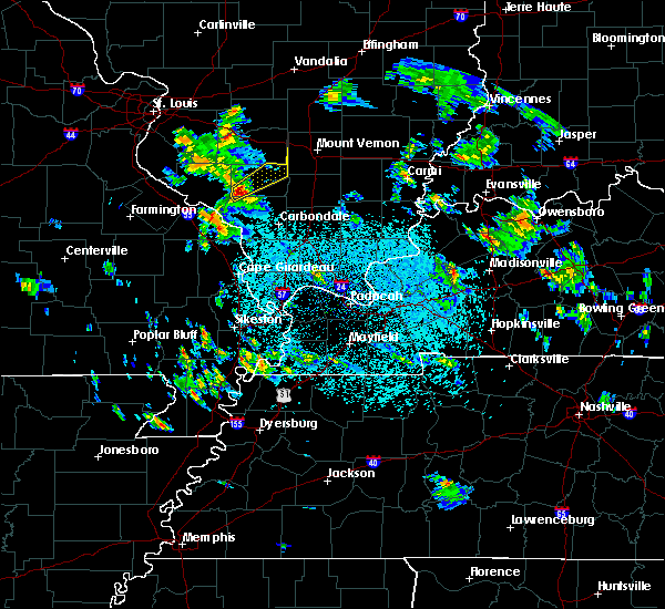 At 250 am cst, a severe thunderstorm was located over willisville, or 11 miles southwest of pinckneyville, moving northeast at 55 mph (radar indicated). Hazards include golf ball size hail and 60 mph wind gusts. People and animals outdoors will be injured. expect hail damage to roofs, siding, windows, and vehicles. Expect wind damage to roofs, siding, and trees. At 250 am cst, a severe thunderstorm was located over willisville, or 11 miles southwest of pinckneyville, moving northeast at 55 mph (radar indicated). Hazards include golf ball size hail and 60 mph wind gusts. People and animals outdoors will be injured. expect hail damage to roofs, siding, windows, and vehicles. Expect wind damage to roofs, siding, and trees.
|
| 7/13/2016 4:57 PM CDT |
 The severe thunderstorm warning for jackson and perry counties will expire at 500 pm cdt, the main part of the storms, which prompted the warning, have moved east and out of the area. lingering storm activity was still producing 45 to 55 mph winds in and near carbondale and carterville as the bulk of the storms continue to depart to the east. as a result, the warning will be allowed to expire. however gusty winds are still possible with these lingering thunderstorms. a severe thunderstorm watch remains in effect until 900 pm cdt for south central and southern illinois, and southeastern missouri. The severe thunderstorm warning for jackson and perry counties will expire at 500 pm cdt, the main part of the storms, which prompted the warning, have moved east and out of the area. lingering storm activity was still producing 45 to 55 mph winds in and near carbondale and carterville as the bulk of the storms continue to depart to the east. as a result, the warning will be allowed to expire. however gusty winds are still possible with these lingering thunderstorms. a severe thunderstorm watch remains in effect until 900 pm cdt for south central and southern illinois, and southeastern missouri.
|
| 7/13/2016 4:14 PM CDT |
 At 413 pm cdt, a severe thunderstorm was located near percy, or 8 miles west of pinckneyville, moving east at 60 mph. this storm just produced widespread damage all across randolph county with up to 70 mph winds, so take cover now! (radar indicated). Hazards include 70 mph wind gusts and penny size hail. Expect considerable tree damage. damage is likely to mobile homes, roofs, and outbuildings. locations impacted include, carbondale, murphysboro, du quoin, pinckneyville, de soto, elkville, hurst, ava, tamaroa, willisville, grand tower, cedar lake area, makanda, cutler, dowell, campbell hill, vergennes, gorham and st. Johns. At 413 pm cdt, a severe thunderstorm was located near percy, or 8 miles west of pinckneyville, moving east at 60 mph. this storm just produced widespread damage all across randolph county with up to 70 mph winds, so take cover now! (radar indicated). Hazards include 70 mph wind gusts and penny size hail. Expect considerable tree damage. damage is likely to mobile homes, roofs, and outbuildings. locations impacted include, carbondale, murphysboro, du quoin, pinckneyville, de soto, elkville, hurst, ava, tamaroa, willisville, grand tower, cedar lake area, makanda, cutler, dowell, campbell hill, vergennes, gorham and st. Johns.
|
| 7/13/2016 4:09 PM CDT |
 At 353 pm cdt, a severe thunderstorm was located near evansville, or 8 miles northeast of ste. genevieve, moving east at 60 mph (radar indicated). Hazards include 70 mph wind gusts and penny size hail. Expect considerable tree damage. Damage is likely to mobile homes, roofs, and outbuildings. At 353 pm cdt, a severe thunderstorm was located near evansville, or 8 miles northeast of ste. genevieve, moving east at 60 mph (radar indicated). Hazards include 70 mph wind gusts and penny size hail. Expect considerable tree damage. Damage is likely to mobile homes, roofs, and outbuildings.
|
| 7/13/2016 3:54 PM CDT |
 At 353 pm cdt, a severe thunderstorm was located near evansville, or 8 miles northeast of ste. genevieve, moving east at 60 mph (radar indicated). Hazards include 70 mph wind gusts and penny size hail. Expect considerable tree damage. Damage is likely to mobile homes, roofs, and outbuildings. At 353 pm cdt, a severe thunderstorm was located near evansville, or 8 miles northeast of ste. genevieve, moving east at 60 mph (radar indicated). Hazards include 70 mph wind gusts and penny size hail. Expect considerable tree damage. Damage is likely to mobile homes, roofs, and outbuildings.
|
| 5/11/2016 10:29 PM CDT |
 At 1028 pm cdt, a severe thunderstorm was located near percy, or 8 miles west of pinckneyville, moving southeast at 60 mph (radar indicated). Hazards include 60 mph wind gusts and quarter size hail. Hail damage to vehicles is expected. Expect wind damage to roofs, siding, and trees. At 1028 pm cdt, a severe thunderstorm was located near percy, or 8 miles west of pinckneyville, moving southeast at 60 mph (radar indicated). Hazards include 60 mph wind gusts and quarter size hail. Hail damage to vehicles is expected. Expect wind damage to roofs, siding, and trees.
|
| 5/11/2016 6:08 PM CDT |
 At 608 pm cdt, a severe thunderstorm was located near du quoin, moving east at 35 mph (radar indicated). Hazards include 60 mph wind gusts and quarter size hail. Hail damage to vehicles is expected. Expect wind damage to roofs, siding, and trees. At 608 pm cdt, a severe thunderstorm was located near du quoin, moving east at 35 mph (radar indicated). Hazards include 60 mph wind gusts and quarter size hail. Hail damage to vehicles is expected. Expect wind damage to roofs, siding, and trees.
|
| 5/11/2016 5:43 PM CDT |
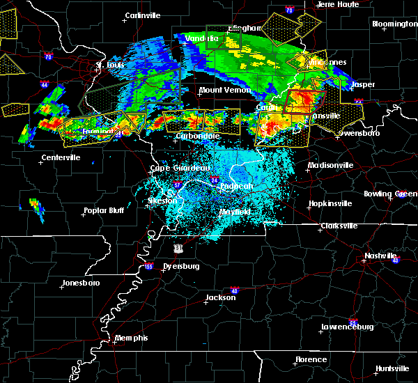 At 543 pm cdt, a severe thunderstorm was located 7 miles northeast of ava, or 7 miles south of pinckneyville, moving east at 30 mph (radar indicated). Hazards include ping pong ball size hail and 60 mph wind gusts. People and animals outdoors will be injured. expect hail damage to roofs, siding, windows, and vehicles. Expect wind damage to roofs, siding, and trees. At 543 pm cdt, a severe thunderstorm was located 7 miles northeast of ava, or 7 miles south of pinckneyville, moving east at 30 mph (radar indicated). Hazards include ping pong ball size hail and 60 mph wind gusts. People and animals outdoors will be injured. expect hail damage to roofs, siding, windows, and vehicles. Expect wind damage to roofs, siding, and trees.
|
| 12/23/2015 11:08 AM CST | The national weather service in paducah has issued a * tornado warning for. northern jackson county in southern illinois. perry county in south central illinois. until 1145 am cst * at 1108 am cst. A severe thunderstorm capable of producing a. |
| 12/23/2015 11:06 AM CST | At 1106 am cst, severe thunderstorms were located along a line extending from 7 miles southeast of chester to near jackson to near morehouse, moving east at 55 mph. this line of storms has a mistory of producing wind damage across southeast missouri (trained weather spotters). Hazards include 60 mph wind gusts. Expect damage to roofs. Siding and trees. |
| 12/23/2015 11:06 AM CST | At 1106 am cst, severe thunderstorms were located along a line extending from 7 miles southeast of chester to near jackson to near morehouse, moving east at 55 mph. this line of storms has a mistory of producing wind damage across southeast missouri (trained weather spotters). Hazards include 60 mph wind gusts. Expect damage to roofs. Siding and trees. |
| 8/9/2015 8:34 PM CDT |
 At 834 pm cdt, severe thunderstorms were located along a line extending from near tilden to near chester to near alliance, moving east southeast at 45 mph (radar indicated). Hazards include 60 mph wind gusts. Expect damage to roofs. Siding and trees. At 834 pm cdt, severe thunderstorms were located along a line extending from near tilden to near chester to near alliance, moving east southeast at 45 mph (radar indicated). Hazards include 60 mph wind gusts. Expect damage to roofs. Siding and trees.
|
| 7/1/2012 4:23 PM CDT | Downed power poles in city limits with power outages and 1 inch hail in perry county IL, 0.4 miles NNE of Cutler, IL |
Hail Maps for Cutler, IL

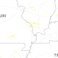


Connect with Interactive Hail Maps