

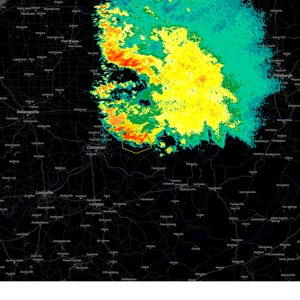
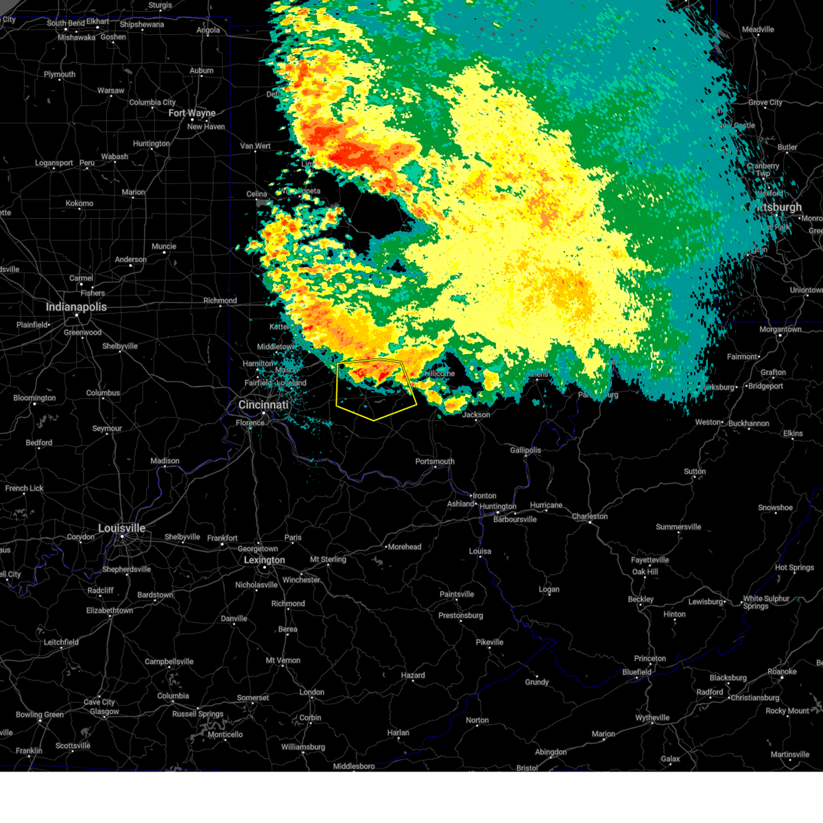
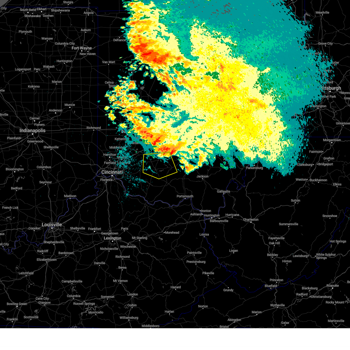
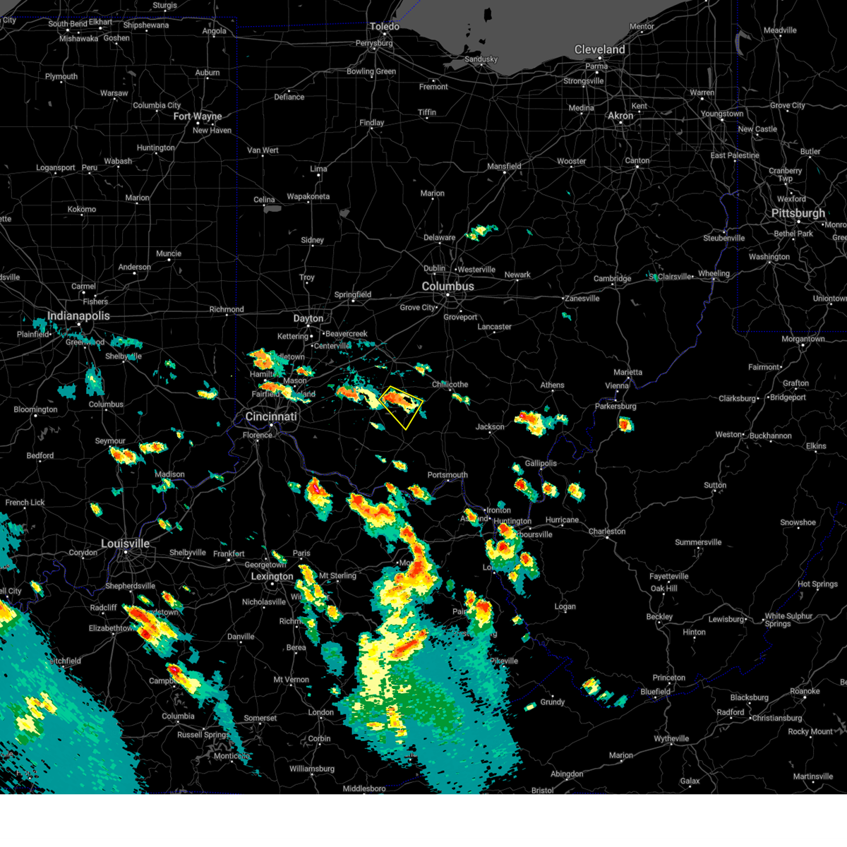
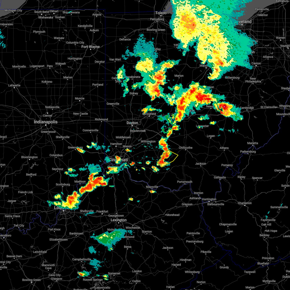
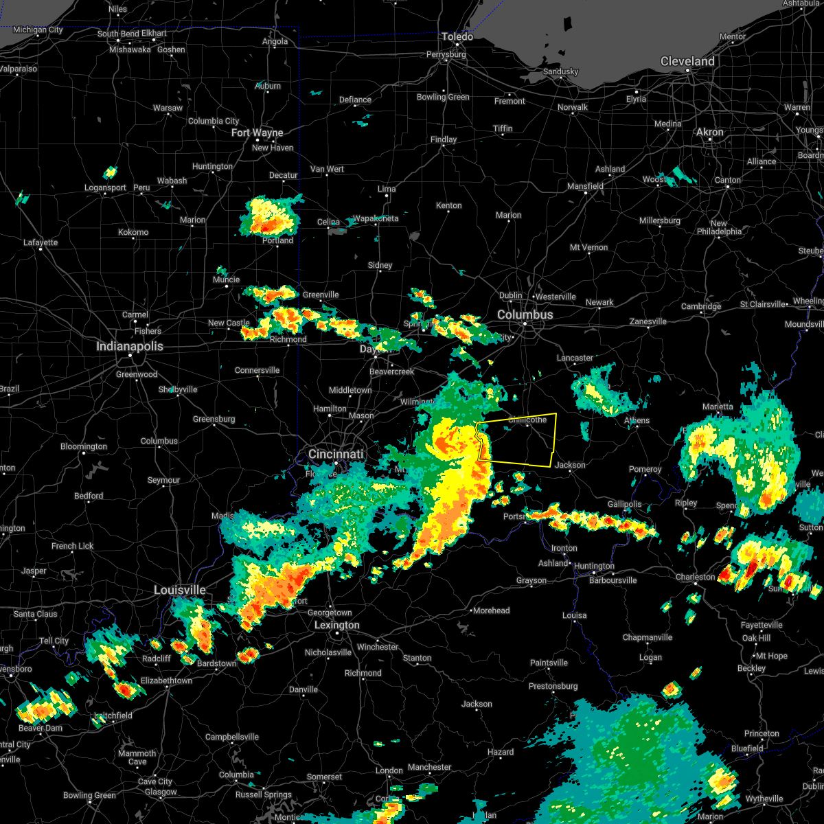
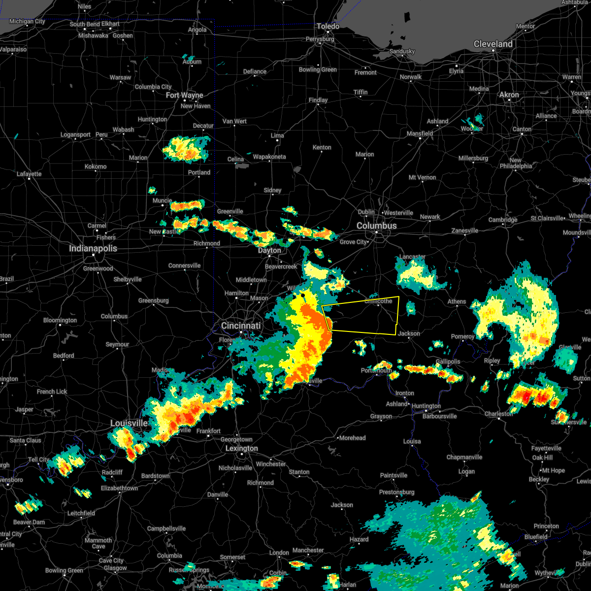
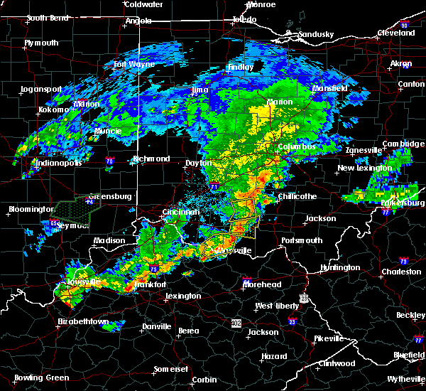
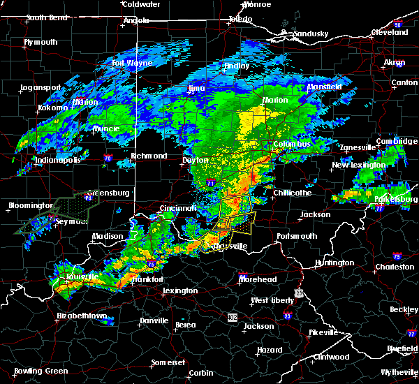
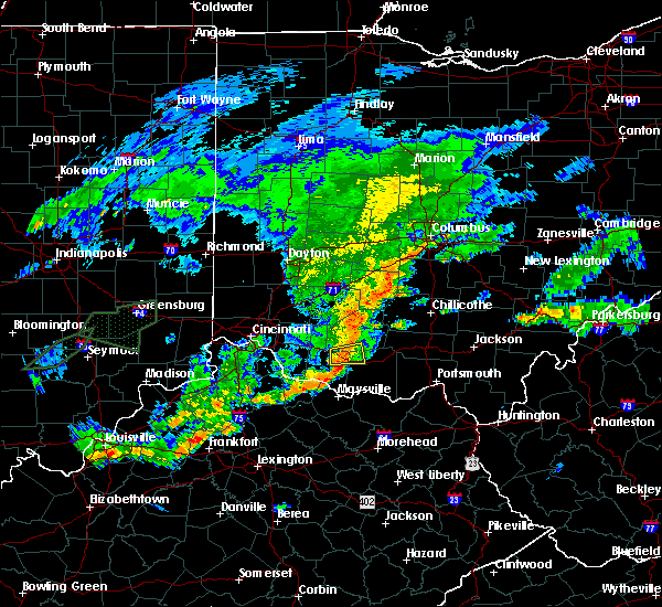
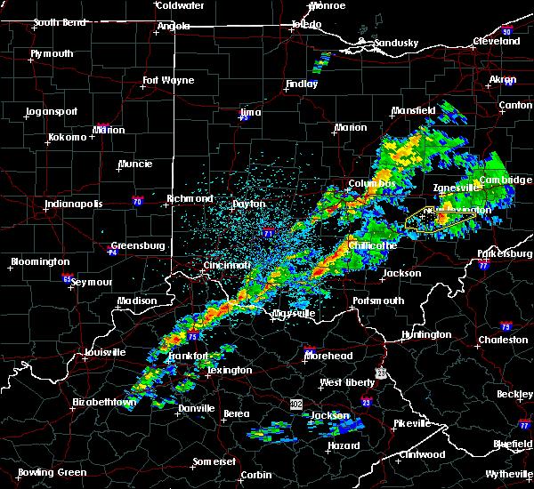
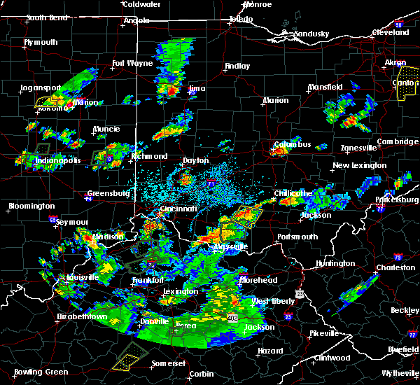
Hail Map for Cynthiana, OH
The Cynthiana, OH area has had 0 reports of on-the-ground hail by trained spotters, and has been under severe weather warnings 4 times during the past 12 months. Doppler radar has detected hail at or near Cynthiana, OH on 34 occasions, including 2 occasions during the past year.
| Name: | Cynthiana, OH |
| Where Located: | 57.4 miles SSW of Columbus, OH |
| Map: | Google Map for Cynthiana, OH |
| Population: | 68 |
| Housing Units: | 35 |
| More Info: | Search Google for Cynthiana, OH |
3
The Top Recent Hail Date for Cynthiana, OH is Thursday, March 14, 2024 (2nd out of 34)

Hail and Wind Damage Spotted near Cynthiana, OH
| Date / Time | Report Details |
|---|---|
| 8/24/2023 5:36 AM EDT |
 The severe thunderstorm warning for southern fayette, central clinton, northwestern pike, highland and southwestern ross counties will expire at 545 am edt, the storm which prompted the warning has weakened below severe limits, and no longer poses an immediate threat to life or property. therefore, the warning will be allowed to expire. gusty winds and heavy rain are still possible with this thunderstorm. please report previous wind damage or hail to the national weather service by going to our website at weather.gov/iln and submitting your report via social media. The severe thunderstorm warning for southern fayette, central clinton, northwestern pike, highland and southwestern ross counties will expire at 545 am edt, the storm which prompted the warning has weakened below severe limits, and no longer poses an immediate threat to life or property. therefore, the warning will be allowed to expire. gusty winds and heavy rain are still possible with this thunderstorm. please report previous wind damage or hail to the national weather service by going to our website at weather.gov/iln and submitting your report via social media.
|
| 8/24/2023 5:18 AM EDT |
 At 518 am edt, a severe thunderstorm was located over leesburg, moving south at 20 mph (radar indicated). Hazards include 60 mph wind gusts. Expect damage to trees and power lines. locations impacted include, wilmington, hillsboro, greenfield, lynchburg, leesburg, new vienna, marshall, bainbridge, belfast, rocky fork point, highland holiday, cynthiana, russell, new market, good hope, martinsville, south salem, east monroe, and danville in highland county. hail threat, radar indicated max hail size, <. 75 in wind threat, radar indicated max wind gust, 60 mph. At 518 am edt, a severe thunderstorm was located over leesburg, moving south at 20 mph (radar indicated). Hazards include 60 mph wind gusts. Expect damage to trees and power lines. locations impacted include, wilmington, hillsboro, greenfield, lynchburg, leesburg, new vienna, marshall, bainbridge, belfast, rocky fork point, highland holiday, cynthiana, russell, new market, good hope, martinsville, south salem, east monroe, and danville in highland county. hail threat, radar indicated max hail size, <. 75 in wind threat, radar indicated max wind gust, 60 mph.
|
| 8/24/2023 5:03 AM EDT |
 At 502 am edt, a severe thunderstorm was located near leesburg, moving south at 25 mph (radar indicated). Hazards include 60 mph wind gusts. expect damage to trees and power lines At 502 am edt, a severe thunderstorm was located near leesburg, moving south at 25 mph (radar indicated). Hazards include 60 mph wind gusts. expect damage to trees and power lines
|
| 7/18/2023 4:58 PM EDT |
 At 457 pm edt, a severe thunderstorm was located near leesburg, moving southeast at 20 mph (radar indicated). Hazards include 60 mph wind gusts and quarter size hail. Minor hail damage to vehicles is possible. Expect wind damage to trees and power lines. At 457 pm edt, a severe thunderstorm was located near leesburg, moving southeast at 20 mph (radar indicated). Hazards include 60 mph wind gusts and quarter size hail. Minor hail damage to vehicles is possible. Expect wind damage to trees and power lines.
|
| 8/20/2022 5:57 PM EDT |
 At 557 pm edt, a severe thunderstorm was located over marshall, moving northeast at 30 mph (radar indicated). Hazards include 60 mph wind gusts and quarter size hail. Minor hail damage to vehicles is possible. Expect wind damage to trees and power lines. At 557 pm edt, a severe thunderstorm was located over marshall, moving northeast at 30 mph (radar indicated). Hazards include 60 mph wind gusts and quarter size hail. Minor hail damage to vehicles is possible. Expect wind damage to trees and power lines.
|
| 7/6/2022 4:17 PM EDT |
 At 417 pm edt, a severe thunderstorm was located over bainbridge, moving east at 45 mph (radar indicated). Hazards include 60 mph wind gusts. Expect damage to trees and power lines. locations impacted include, chillicothe, greenfield, waverly, bainbridge, pike lake, cynthiana, north folk village, londonderry, south salem, bourneville, pike county airport, mooresville, lattaville, omega, buchanan, summithill, knockemstiff, richmond dale, massieville and linn. hail threat, radar indicated max hail size, <. 75 in wind threat, radar indicated max wind gust, 60 mph. At 417 pm edt, a severe thunderstorm was located over bainbridge, moving east at 45 mph (radar indicated). Hazards include 60 mph wind gusts. Expect damage to trees and power lines. locations impacted include, chillicothe, greenfield, waverly, bainbridge, pike lake, cynthiana, north folk village, londonderry, south salem, bourneville, pike county airport, mooresville, lattaville, omega, buchanan, summithill, knockemstiff, richmond dale, massieville and linn. hail threat, radar indicated max hail size, <. 75 in wind threat, radar indicated max wind gust, 60 mph.
|
| 7/6/2022 3:59 PM EDT |
 At 358 pm edt, a severe thunderstorm was located over highland holiday, moving east at 45 mph (radar indicated). Hazards include 70 mph wind gusts. Expect considerable tree damage. Damage is likely to mobile homes, roofs, and outbuildings. At 358 pm edt, a severe thunderstorm was located over highland holiday, moving east at 45 mph (radar indicated). Hazards include 70 mph wind gusts. Expect considerable tree damage. Damage is likely to mobile homes, roofs, and outbuildings.
|
| 6/13/2022 6:47 PM EDT |
 At 647 pm edt, severe thunderstorms were located along a line extending from 6 miles north of bloomingburg to near leesburg, moving east at 40 mph (radar indicated). Hazards include 60 mph wind gusts. expect damage to trees and power lines At 647 pm edt, severe thunderstorms were located along a line extending from 6 miles north of bloomingburg to near leesburg, moving east at 40 mph (radar indicated). Hazards include 60 mph wind gusts. expect damage to trees and power lines
|
| 5/21/2022 4:36 PM EDT |
 The severe thunderstorm warning for northern adams, northwestern pike, eastern highland and southwestern ross counties will expire at 445 pm edt, the storm which prompted the warning has weakened below severe limits, and no longer poses an immediate threat to life or property. therefore, the warning will be allowed to expire. however heavy rain is still possible with this thunderstorm. a severe thunderstorm watch remains in effect until 1000 pm edt for southwestern ohio. please report previous wind damage or hail to the national weather service by going to our website at weather.gov/iln and submitting your report via social media. The severe thunderstorm warning for northern adams, northwestern pike, eastern highland and southwestern ross counties will expire at 445 pm edt, the storm which prompted the warning has weakened below severe limits, and no longer poses an immediate threat to life or property. therefore, the warning will be allowed to expire. however heavy rain is still possible with this thunderstorm. a severe thunderstorm watch remains in effect until 1000 pm edt for southwestern ohio. please report previous wind damage or hail to the national weather service by going to our website at weather.gov/iln and submitting your report via social media.
|
| 5/21/2022 4:27 PM EDT |
 At 427 pm edt, a severe thunderstorm was located near belfast, moving east at 25 mph (radar indicated). Hazards include 60 mph wind gusts and quarter size hail. Minor hail damage to vehicles is possible. expect wind damage to trees and power lines. locations impacted include, hillsboro, greenfield, winchester, marshall, seaman, bainbridge, kincaid springs, belfast, rocky fork point, cynthiana, highland holiday, emerald, south salem, sinking spring, rocky fork lake, poplar grove, samantha, rainsboro, may hill and serpent mound. hail threat, radar indicated max hail size, 1. 00 in wind threat, radar indicated max wind gust, 60 mph. At 427 pm edt, a severe thunderstorm was located near belfast, moving east at 25 mph (radar indicated). Hazards include 60 mph wind gusts and quarter size hail. Minor hail damage to vehicles is possible. expect wind damage to trees and power lines. locations impacted include, hillsboro, greenfield, winchester, marshall, seaman, bainbridge, kincaid springs, belfast, rocky fork point, cynthiana, highland holiday, emerald, south salem, sinking spring, rocky fork lake, poplar grove, samantha, rainsboro, may hill and serpent mound. hail threat, radar indicated max hail size, 1. 00 in wind threat, radar indicated max wind gust, 60 mph.
|
| 5/21/2022 4:11 PM EDT |
 At 411 pm edt, a severe thunderstorm was located near sardinia, moving east at 25 mph (radar indicated). Hazards include 60 mph wind gusts and quarter size hail. Minor hail damage to vehicles is possible. expect wind damage to trees and power lines. locations impacted include, hillsboro, greenfield, georgetown, mount orab, winchester, marshall, sardinia, seaman, bainbridge, kincaid springs, belfast, rocky fork point, highland holiday, cynthiana, russell, new market, emerald, mowrystown, south salem and sinking spring. hail threat, radar indicated max hail size, 1. 00 in wind threat, radar indicated max wind gust, 60 mph. At 411 pm edt, a severe thunderstorm was located near sardinia, moving east at 25 mph (radar indicated). Hazards include 60 mph wind gusts and quarter size hail. Minor hail damage to vehicles is possible. expect wind damage to trees and power lines. locations impacted include, hillsboro, greenfield, georgetown, mount orab, winchester, marshall, sardinia, seaman, bainbridge, kincaid springs, belfast, rocky fork point, highland holiday, cynthiana, russell, new market, emerald, mowrystown, south salem and sinking spring. hail threat, radar indicated max hail size, 1. 00 in wind threat, radar indicated max wind gust, 60 mph.
|
| 5/21/2022 3:58 PM EDT |
 At 357 pm edt, a severe thunderstorm was located over mount orab, moving east at 25 mph (radar indicated). Hazards include 60 mph wind gusts and quarter size hail. Minor hail damage to vehicles is possible. Expect wind damage to trees and power lines. At 357 pm edt, a severe thunderstorm was located over mount orab, moving east at 25 mph (radar indicated). Hazards include 60 mph wind gusts and quarter size hail. Minor hail damage to vehicles is possible. Expect wind damage to trees and power lines.
|
| 5/3/2022 5:13 PM EDT |
 The severe thunderstorm warning for northwestern pike and central ross counties will expire at 515 pm edt, an additional severe thunderstorm warning remains in effect for portions of ross county until 545 pm. a tornado watch remains in effect until 900 pm edt for southwestern ohio. please report previous wind damage or hail to the national weather service by going to our website at weather.gov/iln and submitting your report via social media. The severe thunderstorm warning for northwestern pike and central ross counties will expire at 515 pm edt, an additional severe thunderstorm warning remains in effect for portions of ross county until 545 pm. a tornado watch remains in effect until 900 pm edt for southwestern ohio. please report previous wind damage or hail to the national weather service by going to our website at weather.gov/iln and submitting your report via social media.
|
| 5/3/2022 4:55 PM EDT |
 At 455 pm edt, a severe thunderstorm was located over north folk village, moving northeast at 45 mph (radar indicated). Hazards include 60 mph wind gusts and penny size hail. Expect damage to trees and power lines. locations impacted include, chillicothe, bainbridge, cynthiana, north folk village, summithill, bourneville, knockemstiff, andersonville, massieville, scioto trail state park and buchanan. hail threat, radar indicated max hail size, 0. 75 in wind threat, radar indicated max wind gust, 60 mph. At 455 pm edt, a severe thunderstorm was located over north folk village, moving northeast at 45 mph (radar indicated). Hazards include 60 mph wind gusts and penny size hail. Expect damage to trees and power lines. locations impacted include, chillicothe, bainbridge, cynthiana, north folk village, summithill, bourneville, knockemstiff, andersonville, massieville, scioto trail state park and buchanan. hail threat, radar indicated max hail size, 0. 75 in wind threat, radar indicated max wind gust, 60 mph.
|
| 5/3/2022 4:46 PM EDT |
 At 446 pm edt, a severe thunderstorm was located 7 miles north of bainbridge, moving northeast at 45 mph (radar indicated). Hazards include 60 mph wind gusts and penny size hail. Expect damage to trees and power lines. locations impacted include, chillicothe, bainbridge, cynthiana, north folk village, frankfort, south salem, bourneville, andersonville, lattaville, buchanan, summithill, knockemstiff, massieville and scioto trail state park. hail threat, radar indicated max hail size, 0. 75 in wind threat, radar indicated max wind gust, 60 mph. At 446 pm edt, a severe thunderstorm was located 7 miles north of bainbridge, moving northeast at 45 mph (radar indicated). Hazards include 60 mph wind gusts and penny size hail. Expect damage to trees and power lines. locations impacted include, chillicothe, bainbridge, cynthiana, north folk village, frankfort, south salem, bourneville, andersonville, lattaville, buchanan, summithill, knockemstiff, massieville and scioto trail state park. hail threat, radar indicated max hail size, 0. 75 in wind threat, radar indicated max wind gust, 60 mph.
|
| 5/3/2022 4:31 PM EDT |
 At 431 pm edt, a severe thunderstorm was located near greenfield, moving east at 40 mph (radar indicated). Hazards include 60 mph wind gusts and penny size hail. expect damage to trees and power lines At 431 pm edt, a severe thunderstorm was located near greenfield, moving east at 40 mph (radar indicated). Hazards include 60 mph wind gusts and penny size hail. expect damage to trees and power lines
|
| 8/13/2021 4:51 PM EDT |
 The severe thunderstorm warning for north central adams, northwestern pike and southeastern highland counties will expire at 500 pm edt, the storm which prompted the warning has weakened below severe limits, and no longer poses an immediate threat to life or property. therefore, the warning will be allowed to expire. please report previous wind damage or hail to the national weather service by going to our website at weather.gov/iln and submitting your report via social media. The severe thunderstorm warning for north central adams, northwestern pike and southeastern highland counties will expire at 500 pm edt, the storm which prompted the warning has weakened below severe limits, and no longer poses an immediate threat to life or property. therefore, the warning will be allowed to expire. please report previous wind damage or hail to the national weather service by going to our website at weather.gov/iln and submitting your report via social media.
|
| 8/13/2021 4:18 PM EDT |
 At 418 pm edt, a severe thunderstorm was located near belfast, moving east at 15 mph (radar indicated). Hazards include 60 mph wind gusts and quarter size hail. Minor hail damage to vehicles is possible. Expect wind damage to trees and power lines. At 418 pm edt, a severe thunderstorm was located near belfast, moving east at 15 mph (radar indicated). Hazards include 60 mph wind gusts and quarter size hail. Minor hail damage to vehicles is possible. Expect wind damage to trees and power lines.
|
| 8/13/2021 3:54 PM EDT |
 At 354 pm edt, severe thunderstorms were located along a line extending from near new holland to near hillsboro, moving east at 25 mph (radar indicated). Hazards include 60 mph wind gusts. expect damage to trees and power lines At 354 pm edt, severe thunderstorms were located along a line extending from near new holland to near hillsboro, moving east at 25 mph (radar indicated). Hazards include 60 mph wind gusts. expect damage to trees and power lines
|
| 6/21/2020 5:52 PM EDT |
 The severe thunderstorm warning for pike and southwestern ross counties will expire at 600 pm edt, the storm which prompted the warning has weakened below severe limits, and no longer poses an immediate threat to life or property. therefore, the warning will be allowed to expire. please report previous wind damage or hail to the national weather service by going to our website at weather.gov/iln and submitting your report via social media. The severe thunderstorm warning for pike and southwestern ross counties will expire at 600 pm edt, the storm which prompted the warning has weakened below severe limits, and no longer poses an immediate threat to life or property. therefore, the warning will be allowed to expire. please report previous wind damage or hail to the national weather service by going to our website at weather.gov/iln and submitting your report via social media.
|
| 6/21/2020 5:45 PM EDT |
 At 544 pm edt, a severe thunderstorm was located near pike lake, moving northeast at 15 mph (law enforcement reported a few trees blown down across western pike county). Hazards include 60 mph wind gusts. Expect damage to trees and power lines. Locations impacted include, waverly, piketon, bainbridge, pike lake, kincaid springs, cynthiana, beaver, wakefield, bourneville, pike county airport, elm grove, lattaville, omega, buchanan, givens, summithill, knockemstiff, ladd, lake white and idaho. At 544 pm edt, a severe thunderstorm was located near pike lake, moving northeast at 15 mph (law enforcement reported a few trees blown down across western pike county). Hazards include 60 mph wind gusts. Expect damage to trees and power lines. Locations impacted include, waverly, piketon, bainbridge, pike lake, kincaid springs, cynthiana, beaver, wakefield, bourneville, pike county airport, elm grove, lattaville, omega, buchanan, givens, summithill, knockemstiff, ladd, lake white and idaho.
|
| 6/21/2020 5:22 PM EDT |
 The severe thunderstorm warning for adams, southwestern pike, southeastern highland and northwestern scioto counties will expire at 530 pm edt, the storm which prompted the warning has moved out of the area. therefore, the warning will be allowed to expire. please report previous wind damage or hail to the national weather service by going to our website at weather.gov/iln and submitting your report via social media. remember, a severe thunderstorm warning remains in effect until 6 pm for northeast adams county, pike county, and northwest scioto county. The severe thunderstorm warning for adams, southwestern pike, southeastern highland and northwestern scioto counties will expire at 530 pm edt, the storm which prompted the warning has moved out of the area. therefore, the warning will be allowed to expire. please report previous wind damage or hail to the national weather service by going to our website at weather.gov/iln and submitting your report via social media. remember, a severe thunderstorm warning remains in effect until 6 pm for northeast adams county, pike county, and northwest scioto county.
|
| 6/21/2020 5:17 PM EDT |
 At 517 pm edt, a severe thunderstorm was located near kincaid springs, moving northeast at 30 mph (radar indicated). Hazards include 60 mph wind gusts. expect damage to trees and power lines At 517 pm edt, a severe thunderstorm was located near kincaid springs, moving northeast at 30 mph (radar indicated). Hazards include 60 mph wind gusts. expect damage to trees and power lines
|
| 6/21/2020 4:51 PM EDT |
 At 451 pm edt, a severe thunderstorm was located near peebles, moving north at 55 mph (radar indicated). Hazards include 60 mph wind gusts. expect damage to trees and power lines At 451 pm edt, a severe thunderstorm was located near peebles, moving north at 55 mph (radar indicated). Hazards include 60 mph wind gusts. expect damage to trees and power lines
|
| 6/10/2020 6:27 PM EDT |
 At 627 pm edt, severe thunderstorms were located along a line extending from near mount sterling to near williamsport, moving northeast at 70 mph (radar indicated). Hazards include 70 mph wind gusts. Expect considerable tree damage. damage is likely to mobile homes, roofs, and outbuildings. Locations impacted include, chillicothe, circleville, greenfield, waverly, piketon, south bloomfield, kingston, marshall, williamsport, bainbridge, new holland, logan elm village, pike lake, kincaid springs, cynthiana, north folk village, good hope, frankfort, fox and clarksburg. At 627 pm edt, severe thunderstorms were located along a line extending from near mount sterling to near williamsport, moving northeast at 70 mph (radar indicated). Hazards include 70 mph wind gusts. Expect considerable tree damage. damage is likely to mobile homes, roofs, and outbuildings. Locations impacted include, chillicothe, circleville, greenfield, waverly, piketon, south bloomfield, kingston, marshall, williamsport, bainbridge, new holland, logan elm village, pike lake, kincaid springs, cynthiana, north folk village, good hope, frankfort, fox and clarksburg.
|
| 6/10/2020 6:14 PM EDT |
 At 614 pm edt, severe thunderstorms were located along a line extending from near bloomingburg to 6 miles north of bainbridge, moving northeast at 60 mph (radar indicated). Hazards include 70 mph wind gusts. Expect considerable tree damage. damage is likely to mobile homes, roofs, and outbuildings. Locations impacted include, chillicothe, washington court house, circleville, greenfield, waverly, piketon, south bloomfield, leesburg, kingston, marshall, williamsport, bloomingburg, bainbridge, new holland, highland holiday, logan elm village, pike lake, kincaid springs, rocky fork point and cynthiana. At 614 pm edt, severe thunderstorms were located along a line extending from near bloomingburg to 6 miles north of bainbridge, moving northeast at 60 mph (radar indicated). Hazards include 70 mph wind gusts. Expect considerable tree damage. damage is likely to mobile homes, roofs, and outbuildings. Locations impacted include, chillicothe, washington court house, circleville, greenfield, waverly, piketon, south bloomfield, leesburg, kingston, marshall, williamsport, bloomingburg, bainbridge, new holland, highland holiday, logan elm village, pike lake, kincaid springs, rocky fork point and cynthiana.
|
| 6/10/2020 5:58 PM EDT |
 At 557 pm edt, severe thunderstorms were located along a line extending from near leesburg to near marshall, moving northeast at 60 mph (radar indicated). Hazards include 70 mph wind gusts. Expect considerable tree damage. Damage is likely to mobile homes, roofs, and outbuildings. At 557 pm edt, severe thunderstorms were located along a line extending from near leesburg to near marshall, moving northeast at 60 mph (radar indicated). Hazards include 70 mph wind gusts. Expect considerable tree damage. Damage is likely to mobile homes, roofs, and outbuildings.
|
| 4/9/2020 12:07 AM EDT |
 The severe thunderstorm warning for northern pike and ross counties will expire at 1215 am edt, the storm which prompted the warning has moved out of the area. therefore, the warning will be allowed to expire. however gusty winds are still possible with this thunderstorm. a tornado watch remains in effect until 200 am edt for central and southwestern ohio. please report previous wind damage or hail to the national weather service by going to our website at weather.gov/iln and submitting your report via social media. The severe thunderstorm warning for northern pike and ross counties will expire at 1215 am edt, the storm which prompted the warning has moved out of the area. therefore, the warning will be allowed to expire. however gusty winds are still possible with this thunderstorm. a tornado watch remains in effect until 200 am edt for central and southwestern ohio. please report previous wind damage or hail to the national weather service by going to our website at weather.gov/iln and submitting your report via social media.
|
| 4/8/2020 11:39 PM EDT |
 At 1139 pm edt, a severe thunderstorm was located over pike lake, moving northeast at 30 mph (radar indicated). Hazards include 60 mph wind gusts and quarter size hail. Minor hail damage to vehicles is possible. expect wind damage to trees and power lines. locations impacted include, chillicothe, greenfield, waverly, piketon, kingston, bainbridge, pike lake, kincaid springs, cynthiana, north folk village, frankfort, londonderry, laurelville, clarksburg, adelphi, south salem, pike county airport, mooresville, austin and omega. A tornado watch remains in effect until 200 am edt for central and southwestern ohio. At 1139 pm edt, a severe thunderstorm was located over pike lake, moving northeast at 30 mph (radar indicated). Hazards include 60 mph wind gusts and quarter size hail. Minor hail damage to vehicles is possible. expect wind damage to trees and power lines. locations impacted include, chillicothe, greenfield, waverly, piketon, kingston, bainbridge, pike lake, kincaid springs, cynthiana, north folk village, frankfort, londonderry, laurelville, clarksburg, adelphi, south salem, pike county airport, mooresville, austin and omega. A tornado watch remains in effect until 200 am edt for central and southwestern ohio.
|
| 4/8/2020 11:13 PM EDT |
 At 1113 pm edt, a severe thunderstorm was located near cynthiana, moving east at 25 mph (radar indicated). Hazards include 60 mph wind gusts and quarter size hail. Minor hail damage to vehicles is possible. Expect wind damage to trees and power lines. At 1113 pm edt, a severe thunderstorm was located near cynthiana, moving east at 25 mph (radar indicated). Hazards include 60 mph wind gusts and quarter size hail. Minor hail damage to vehicles is possible. Expect wind damage to trees and power lines.
|
| 4/8/2020 11:11 PM EDT |
 The severe thunderstorm warning for northeastern adams, northwestern pike and eastern highland counties will expire at 1115 pm edt, the storm which prompted the warning has weakened below severe limits, and no longer poses an immediate threat to life or property. therefore, the warning will be allowed to expire. however small hail is still possible with this thunderstorm. a tornado watch remains in effect until 200 am edt for southwestern ohio. please report previous wind damage or hail to the national weather service by going to our website at weather.gov/iln and submitting your report via social media. remember, a severe thunderstorm warning still remains in effect for highland county. The severe thunderstorm warning for northeastern adams, northwestern pike and eastern highland counties will expire at 1115 pm edt, the storm which prompted the warning has weakened below severe limits, and no longer poses an immediate threat to life or property. therefore, the warning will be allowed to expire. however small hail is still possible with this thunderstorm. a tornado watch remains in effect until 200 am edt for southwestern ohio. please report previous wind damage or hail to the national weather service by going to our website at weather.gov/iln and submitting your report via social media. remember, a severe thunderstorm warning still remains in effect for highland county.
|
| 4/8/2020 11:05 PM EDT |
 At 1105 pm edt, a severe thunderstorm was located over cynthiana, moving northeast at 30 mph (radar indicated). Hazards include half dollar size hail. Minor damage to vehicles is possible. locations impacted include, hillsboro, marshall, kincaid springs, rocky fork point, cynthiana, highland holiday, sinking spring, rocky fork lake, poplar grove, elm grove, rainsboro, idaho, highland county airport and paint creek state park. A tornado watch remains in effect until 200 am edt for southwestern ohio. At 1105 pm edt, a severe thunderstorm was located over cynthiana, moving northeast at 30 mph (radar indicated). Hazards include half dollar size hail. Minor damage to vehicles is possible. locations impacted include, hillsboro, marshall, kincaid springs, rocky fork point, cynthiana, highland holiday, sinking spring, rocky fork lake, poplar grove, elm grove, rainsboro, idaho, highland county airport and paint creek state park. A tornado watch remains in effect until 200 am edt for southwestern ohio.
|
| 4/8/2020 10:49 PM EDT |
 At 1049 pm edt, a severe thunderstorm was located near belfast, moving east at 30 mph (radar indicated). Hazards include half dollar size hail. Minor damage to vehicles is possible. locations impacted include, hillsboro, marshall, kincaid springs, belfast, rocky fork point, cynthiana, highland holiday, new market, sinking spring, rocky fork lake, poplar grove, elm grove, rainsboro, may hill, serpent mound, berrysville, state route 136 at us route 62, smoky corners, idaho and highland county airport. A tornado watch remains in effect until 200 am edt for southwestern ohio. At 1049 pm edt, a severe thunderstorm was located near belfast, moving east at 30 mph (radar indicated). Hazards include half dollar size hail. Minor damage to vehicles is possible. locations impacted include, hillsboro, marshall, kincaid springs, belfast, rocky fork point, cynthiana, highland holiday, new market, sinking spring, rocky fork lake, poplar grove, elm grove, rainsboro, may hill, serpent mound, berrysville, state route 136 at us route 62, smoky corners, idaho and highland county airport. A tornado watch remains in effect until 200 am edt for southwestern ohio.
|
| 4/8/2020 10:34 PM EDT |
 At 1034 pm edt, a severe thunderstorm was located near sardinia, moving east at 25 mph (radar indicated). Hazards include half dollar size hail. minor damage to vehicles is possible At 1034 pm edt, a severe thunderstorm was located near sardinia, moving east at 25 mph (radar indicated). Hazards include half dollar size hail. minor damage to vehicles is possible
|
| 6/17/2019 9:38 PM EDT |
 At 938 pm edt, severe thunderstorms were located along a line extending from near greenfield to near cynthiana, moving northeast at 40 mph (radar indicated). Hazards include 60 mph wind gusts. Expect damage to trees and power lines. Locations impacted include, greenfield, bainbridge, cynthiana, south salem and paint creek state park. At 938 pm edt, severe thunderstorms were located along a line extending from near greenfield to near cynthiana, moving northeast at 40 mph (radar indicated). Hazards include 60 mph wind gusts. Expect damage to trees and power lines. Locations impacted include, greenfield, bainbridge, cynthiana, south salem and paint creek state park.
|
| 6/17/2019 9:23 PM EDT |
 At 923 pm edt, severe thunderstorms were located along a line extending from near leesburg to marshall, moving northeast at 40 mph (radar indicated). Hazards include 60 mph wind gusts. Expect damage to trees and power lines. Locations impacted include, greenfield, leesburg, marshall, bainbridge, rocky fork point, cynthiana, highland holiday, south salem, rocky fork lake, rainsboro, paint creek state park, berrysville and highland county airport. At 923 pm edt, severe thunderstorms were located along a line extending from near leesburg to marshall, moving northeast at 40 mph (radar indicated). Hazards include 60 mph wind gusts. Expect damage to trees and power lines. Locations impacted include, greenfield, leesburg, marshall, bainbridge, rocky fork point, cynthiana, highland holiday, south salem, rocky fork lake, rainsboro, paint creek state park, berrysville and highland county airport.
|
| 6/17/2019 9:10 PM EDT |
 At 909 pm edt, severe thunderstorms were located along a line extending from near leesburg to near belfast, moving northeast at 40 mph (radar indicated). Hazards include 60 mph wind gusts. expect damage to trees and power lines At 909 pm edt, severe thunderstorms were located along a line extending from near leesburg to near belfast, moving northeast at 40 mph (radar indicated). Hazards include 60 mph wind gusts. expect damage to trees and power lines
|
| 3/14/2019 10:36 PM EDT |
 At 1036 pm edt, severe thunderstorms were located along a line extending from north folk village to near ripley, moving east at 65 mph (radar indicated). Hazards include 60 mph wind gusts. Expect damage to trees and power lines. Locations impacted include, chillicothe, west union, peebles, ripley, winchester, marshall, seaman, bainbridge, kincaid springs, belfast, cynthiana, north folk village, decatur, russellville, dover, cherry fork, sinking spring, may hill, locust grove and knockemstiff. At 1036 pm edt, severe thunderstorms were located along a line extending from north folk village to near ripley, moving east at 65 mph (radar indicated). Hazards include 60 mph wind gusts. Expect damage to trees and power lines. Locations impacted include, chillicothe, west union, peebles, ripley, winchester, marshall, seaman, bainbridge, kincaid springs, belfast, cynthiana, north folk village, decatur, russellville, dover, cherry fork, sinking spring, may hill, locust grove and knockemstiff.
|
| 3/14/2019 10:24 PM EDT |
 At 1024 pm edt, severe thunderstorms were located along a line extending from near bainbridge to near brooksville, moving east at 65 mph (radar indicated). Hazards include 60 mph wind gusts. Expect damage to trees and power lines. Locations impacted include, chillicothe, maysville, georgetown, west union, peebles, ripley, aberdeen, augusta, winchester, marshall, seaman, bainbridge, brooksville, belfast, highland holiday, kincaid springs, rocky fork point, cynthiana, north folk village and emerald. At 1024 pm edt, severe thunderstorms were located along a line extending from near bainbridge to near brooksville, moving east at 65 mph (radar indicated). Hazards include 60 mph wind gusts. Expect damage to trees and power lines. Locations impacted include, chillicothe, maysville, georgetown, west union, peebles, ripley, aberdeen, augusta, winchester, marshall, seaman, bainbridge, brooksville, belfast, highland holiday, kincaid springs, rocky fork point, cynthiana, north folk village and emerald.
|
| 3/14/2019 10:15 PM EDT |
 At 1015 pm edt, severe thunderstorms were located along a line extending from near highland holiday to 6 miles southeast of falmouth, moving east at 65 mph (radar indicated). Hazards include 60 mph wind gusts. expect damage to trees and power lines At 1015 pm edt, severe thunderstorms were located along a line extending from near highland holiday to 6 miles southeast of falmouth, moving east at 65 mph (radar indicated). Hazards include 60 mph wind gusts. expect damage to trees and power lines
|
| 3/14/2019 9:40 PM EDT |
 At 940 pm edt, a severe thunderstorm was located over kincaid springs, moving northeast at 65 mph (radar indicated). Hazards include 60 mph wind gusts and penny size hail. expect damage to trees and power lines At 940 pm edt, a severe thunderstorm was located over kincaid springs, moving northeast at 65 mph (radar indicated). Hazards include 60 mph wind gusts and penny size hail. expect damage to trees and power lines
|
| 3/14/2019 8:24 PM EDT |
 At 824 pm edt, severe thunderstorms were located along a line extending from near logan elm village to cynthiana, moving east at 45 mph (radar indicated). Hazards include 60 mph wind gusts and penny size hail. Expect damage to trees and power lines. Locations impacted include, chillicothe, kingston, bainbridge, cynthiana, north folk village, frankfort, clarksburg, tarlton, bourneville, andersonville, lattaville, whisler, summithill, knockemstiff and pickaway county airport. At 824 pm edt, severe thunderstorms were located along a line extending from near logan elm village to cynthiana, moving east at 45 mph (radar indicated). Hazards include 60 mph wind gusts and penny size hail. Expect damage to trees and power lines. Locations impacted include, chillicothe, kingston, bainbridge, cynthiana, north folk village, frankfort, clarksburg, tarlton, bourneville, andersonville, lattaville, whisler, summithill, knockemstiff and pickaway county airport.
|
| 3/14/2019 8:15 PM EDT |
 At 815 pm edt, severe thunderstorms were located along a line extending from near logan elm village to near marshall, moving east at 60 mph (radar indicated). Hazards include 60 mph wind gusts and penny size hail. Expect damage to trees and power lines. Locations impacted include, chillicothe, kingston, marshall, bainbridge, pike lake, cynthiana, north folk village, highland holiday, frankfort, clarksburg, tarlton, south salem, bourneville, andersonville, rainsboro, lattaville, austin, whisler, buchanan and paint creek state park. At 815 pm edt, severe thunderstorms were located along a line extending from near logan elm village to near marshall, moving east at 60 mph (radar indicated). Hazards include 60 mph wind gusts and penny size hail. Expect damage to trees and power lines. Locations impacted include, chillicothe, kingston, marshall, bainbridge, pike lake, cynthiana, north folk village, highland holiday, frankfort, clarksburg, tarlton, south salem, bourneville, andersonville, rainsboro, lattaville, austin, whisler, buchanan and paint creek state park.
|
| 3/14/2019 7:56 PM EDT |
 At 756 pm edt, severe thunderstorms were located along a line extending from near new holland to near sardinia, moving east at 45 mph (radar indicated). Hazards include 60 mph wind gusts and penny size hail. expect damage to trees and power lines At 756 pm edt, severe thunderstorms were located along a line extending from near new holland to near sardinia, moving east at 45 mph (radar indicated). Hazards include 60 mph wind gusts and penny size hail. expect damage to trees and power lines
|
| 5/31/2018 5:16 PM EDT |
 At 515 pm edt, severe thunderstorms were located along a line extending from near greenfield to near cynthiana to near kincaid springs, moving east at 40 mph (radar indicated). Hazards include 60 mph wind gusts. Expect damage to trees and power lines. Locations impacted include, hillsboro, greenfield, peebles, leesburg, marshall, bainbridge, pike lake, kincaid springs, rocky fork point, highland holiday, cynthiana, highland, south salem, sinking spring, east monroe, samantha, locust grove, mount joy, highland county airport and rocky fork lake. At 515 pm edt, severe thunderstorms were located along a line extending from near greenfield to near cynthiana to near kincaid springs, moving east at 40 mph (radar indicated). Hazards include 60 mph wind gusts. Expect damage to trees and power lines. Locations impacted include, hillsboro, greenfield, peebles, leesburg, marshall, bainbridge, pike lake, kincaid springs, rocky fork point, highland holiday, cynthiana, highland, south salem, sinking spring, east monroe, samantha, locust grove, mount joy, highland county airport and rocky fork lake.
|
| 5/31/2018 4:46 PM EDT |
 At 446 pm edt, severe thunderstorms were located along a line extending from near lynchburg to near belfast to seaman, moving east at 40 mph (radar indicated). Hazards include 60 mph wind gusts. expect damage to trees and power lines At 446 pm edt, severe thunderstorms were located along a line extending from near lynchburg to near belfast to seaman, moving east at 40 mph (radar indicated). Hazards include 60 mph wind gusts. expect damage to trees and power lines
|
| 5/4/2018 6:42 PM EDT |
 At 642 pm edt, severe thunderstorms were located along a line extending from near hillsboro to near mount orab, moving southeast at 25 mph (radar indicated). Hazards include 60 mph wind gusts. expect damage to trees and power lines At 642 pm edt, severe thunderstorms were located along a line extending from near hillsboro to near mount orab, moving southeast at 25 mph (radar indicated). Hazards include 60 mph wind gusts. expect damage to trees and power lines
|
| 4/3/2018 6:15 PM EDT |
 At 615 pm edt, a severe thunderstorm was located near mount orab, moving east at 60 mph (radar indicated). Hazards include 60 mph wind gusts and quarter size hail. Minor hail damage to vehicles is possible. Expect wind damage to trees and power lines. At 615 pm edt, a severe thunderstorm was located near mount orab, moving east at 60 mph (radar indicated). Hazards include 60 mph wind gusts and quarter size hail. Minor hail damage to vehicles is possible. Expect wind damage to trees and power lines.
|
| 7/7/2017 7:03 PM EDT |
 At 703 pm edt, a severe thunderstorm was located near cynthiana, moving east at 30 mph (radar indicated). Hazards include 70 mph wind gusts and quarter size hail. Minor hail damage to vehicles is possible. expect considerable tree damage. wind damage is also likely to mobile homes, roofs, and outbuildings. Locations impacted include, chillicothe, hillsboro, peebles, winchester, marshall, sardinia, seaman, bainbridge, pike lake, kincaid springs, belfast, rocky fork point, highland holiday, cynthiana, north folk village, new market, emerald, mowrystown, south salem and sinking spring. At 703 pm edt, a severe thunderstorm was located near cynthiana, moving east at 30 mph (radar indicated). Hazards include 70 mph wind gusts and quarter size hail. Minor hail damage to vehicles is possible. expect considerable tree damage. wind damage is also likely to mobile homes, roofs, and outbuildings. Locations impacted include, chillicothe, hillsboro, peebles, winchester, marshall, sardinia, seaman, bainbridge, pike lake, kincaid springs, belfast, rocky fork point, highland holiday, cynthiana, north folk village, new market, emerald, mowrystown, south salem and sinking spring.
|
| 7/7/2017 6:35 PM EDT |
 At 635 pm edt, a severe thunderstorm was located near hillsboro, moving east at 30 mph (radar indicated). Hazards include 70 mph wind gusts and quarter size hail. Minor hail damage to vehicles is possible. expect considerable tree damage. Wind damage is also likely to mobile homes, roofs, and outbuildings. At 635 pm edt, a severe thunderstorm was located near hillsboro, moving east at 30 mph (radar indicated). Hazards include 70 mph wind gusts and quarter size hail. Minor hail damage to vehicles is possible. expect considerable tree damage. Wind damage is also likely to mobile homes, roofs, and outbuildings.
|
| 5/19/2017 6:12 PM EDT |
 The severe thunderstorm warning for southwestern fairfield, northeastern adams, southeastern pickaway, western pike, southeastern highland and ross counties will expire at 615 pm edt, the storms which prompted the warning have moved out of the area. therefore, the warning will be allowed to expire. a severe thunderstorm watch remains in effect until 1100 pm edt for central and southwestern ohio. please report previous wind damage or hail to the national weather service by going to our website at weather.gov/iln and submitting your report via social media. The severe thunderstorm warning for southwestern fairfield, northeastern adams, southeastern pickaway, western pike, southeastern highland and ross counties will expire at 615 pm edt, the storms which prompted the warning have moved out of the area. therefore, the warning will be allowed to expire. a severe thunderstorm watch remains in effect until 1100 pm edt for central and southwestern ohio. please report previous wind damage or hail to the national weather service by going to our website at weather.gov/iln and submitting your report via social media.
|
| 5/19/2017 6:05 PM EDT |
 At 605 pm edt, severe thunderstorms were located along a line extending from near williamsport to 6 miles south of marshall, moving east at 35 mph (radar indicated). Hazards include 60 mph wind gusts. Expect damage to roofs, siding, and trees. Locations impacted include, chillicothe, circleville, waverly, piketon, kingston, bainbridge, pike lake, kincaid springs, logan elm village, cynthiana, north folk village, frankfort, fox, amanda, stoutsville, tarlton, sinking spring, east ringgold, may hill and knockemstiff. At 605 pm edt, severe thunderstorms were located along a line extending from near williamsport to 6 miles south of marshall, moving east at 35 mph (radar indicated). Hazards include 60 mph wind gusts. Expect damage to roofs, siding, and trees. Locations impacted include, chillicothe, circleville, waverly, piketon, kingston, bainbridge, pike lake, kincaid springs, logan elm village, cynthiana, north folk village, frankfort, fox, amanda, stoutsville, tarlton, sinking spring, east ringgold, may hill and knockemstiff.
|
| 5/19/2017 5:59 PM EDT |
 At 559 pm edt, severe thunderstorms were located along a line extending from williamsport to near belfast, moving east at 35 mph (radar indicated). Hazards include 60 mph wind gusts. Expect damage to roofs, siding, and trees. Locations impacted include, chillicothe, circleville, waverly, piketon, kingston, marshall, williamsport, bainbridge, pike lake, kincaid springs, logan elm village, cynthiana, north folk village, frankfort, fox, amanda, stoutsville, clarksburg, tarlton and south salem. At 559 pm edt, severe thunderstorms were located along a line extending from williamsport to near belfast, moving east at 35 mph (radar indicated). Hazards include 60 mph wind gusts. Expect damage to roofs, siding, and trees. Locations impacted include, chillicothe, circleville, waverly, piketon, kingston, marshall, williamsport, bainbridge, pike lake, kincaid springs, logan elm village, cynthiana, north folk village, frankfort, fox, amanda, stoutsville, clarksburg, tarlton and south salem.
|
| 5/19/2017 5:50 PM EDT |
 At 549 pm edt, severe thunderstorms were located along a line extending from near new holland to belfast, moving east at 35 mph (radar indicated). Hazards include 60 mph wind gusts. expect damage to roofs, siding, and trees At 549 pm edt, severe thunderstorms were located along a line extending from near new holland to belfast, moving east at 35 mph (radar indicated). Hazards include 60 mph wind gusts. expect damage to roofs, siding, and trees
|
| 4/5/2017 8:42 PM EDT |
 The severe thunderstorm warning for northeastern adams. pike. southeastern highland. northwestern scioto and southeastern ross counties will expire at 845 pm edt. the storm which prompted the warning has weakened below severe limits, and no longer poses an immediate threat to life or property. therefore, the warning will be allowed to expire. However gusty. The severe thunderstorm warning for northeastern adams. pike. southeastern highland. northwestern scioto and southeastern ross counties will expire at 845 pm edt. the storm which prompted the warning has weakened below severe limits, and no longer poses an immediate threat to life or property. therefore, the warning will be allowed to expire. However gusty.
|
| 4/5/2017 8:17 PM EDT |
 At 816 pm edt, a severe thunderstorm was located near kincaid springs, moving northeast at 45 mph (radar indicated). Hazards include 60 mph wind gusts and quarter size hail. Hail damage to vehicles is expected. expect wind damage to roofs, siding, and trees. Locations impacted include, waverly, piketon, peebles, pike lake, kincaid springs, cynthiana, beaver, rarden, sinking spring, wakefield, pike county airport, dunkinsville, mooresville, omega, locust grove, givens, mount joy, bear creek, massieville and lake white. At 816 pm edt, a severe thunderstorm was located near kincaid springs, moving northeast at 45 mph (radar indicated). Hazards include 60 mph wind gusts and quarter size hail. Hail damage to vehicles is expected. expect wind damage to roofs, siding, and trees. Locations impacted include, waverly, piketon, peebles, pike lake, kincaid springs, cynthiana, beaver, rarden, sinking spring, wakefield, pike county airport, dunkinsville, mooresville, omega, locust grove, givens, mount joy, bear creek, massieville and lake white.
|
| 4/5/2017 7:55 PM EDT |
 At 755 pm edt, a severe thunderstorm was located over seaman, moving northeast at 45 mph (radar indicated). Hazards include 60 mph wind gusts and quarter size hail. Hail damage to vehicles is expected. Expect wind damage to roofs, siding, and trees. At 755 pm edt, a severe thunderstorm was located over seaman, moving northeast at 45 mph (radar indicated). Hazards include 60 mph wind gusts and quarter size hail. Hail damage to vehicles is expected. Expect wind damage to roofs, siding, and trees.
|
| 3/1/2017 7:56 AM EST |
 At 756 am est, severe thunderstorms were located along a line extending from 9 miles west of north folk village to 7 miles southeast of marshall, moving east at 75 mph (radar indicated). Hazards include 70 mph wind gusts. Expect considerable tree damage. damage is likely to mobile homes, roofs, and outbuildings. locations impacted include, chillicothe, waverly, piketon, marshall, bainbridge, pike lake, kincaid springs, cynthiana, north folk village, frankfort, londonderry, beaver, south salem, sinking spring, pike county airport, mooresville, omega, givens, knockemstiff and massieville. A tornado watch remains in effect until 1100 am est for central and southwestern ohio. At 756 am est, severe thunderstorms were located along a line extending from 9 miles west of north folk village to 7 miles southeast of marshall, moving east at 75 mph (radar indicated). Hazards include 70 mph wind gusts. Expect considerable tree damage. damage is likely to mobile homes, roofs, and outbuildings. locations impacted include, chillicothe, waverly, piketon, marshall, bainbridge, pike lake, kincaid springs, cynthiana, north folk village, frankfort, londonderry, beaver, south salem, sinking spring, pike county airport, mooresville, omega, givens, knockemstiff and massieville. A tornado watch remains in effect until 1100 am est for central and southwestern ohio.
|
| 3/1/2017 7:43 AM EST |
 At 743 am est, severe thunderstorms were located along a line extending from near lynchburg to near mount orab, moving east at 70 mph (radar indicated). Hazards include 60 mph wind gusts. expect damage to roofs, siding, and trees At 743 am est, severe thunderstorms were located along a line extending from near lynchburg to near mount orab, moving east at 70 mph (radar indicated). Hazards include 60 mph wind gusts. expect damage to roofs, siding, and trees
|
| 8/28/2016 6:38 PM EDT |
 At 638 pm edt, a severe thunderstorm was located near cynthiana, and is nearly stationary (radar indicated). Hazards include 60 mph wind gusts. Expect damage to roofs. siding. and trees. Locations impacted include, marshall, bainbridge, kincaid springs, cynthiana, pike lake, sinking spring, rainsboro, locust grove, poplar grove, serpent mound and smoky corners. At 638 pm edt, a severe thunderstorm was located near cynthiana, and is nearly stationary (radar indicated). Hazards include 60 mph wind gusts. Expect damage to roofs. siding. and trees. Locations impacted include, marshall, bainbridge, kincaid springs, cynthiana, pike lake, sinking spring, rainsboro, locust grove, poplar grove, serpent mound and smoky corners.
|
| 8/28/2016 6:23 PM EDT |
 At 623 pm edt, a severe thunderstorm was located near cynthiana, moving southeast at 5 mph (radar indicated). Hazards include 60 mph wind gusts. Expect damage to roofs. siding. And trees. At 623 pm edt, a severe thunderstorm was located near cynthiana, moving southeast at 5 mph (radar indicated). Hazards include 60 mph wind gusts. Expect damage to roofs. siding. And trees.
|
| 6/23/2016 5:49 PM EDT |
 At 549 pm edt, a severe thunderstorm was located over marshall, moving southeast at 35 mph (radar indicated). Hazards include 60 mph wind gusts and penny size hail. Expect damage to roofs. siding. and trees. locations impacted include, hillsboro, marshall, kincaid springs, cynthiana, sinking spring, berrysville, rocky fork lake, highland county airport, poplar grove, serpent mound and smoky corners. A tornado watch remains in effect until 1000 pm edt for southwestern ohio. At 549 pm edt, a severe thunderstorm was located over marshall, moving southeast at 35 mph (radar indicated). Hazards include 60 mph wind gusts and penny size hail. Expect damage to roofs. siding. and trees. locations impacted include, hillsboro, marshall, kincaid springs, cynthiana, sinking spring, berrysville, rocky fork lake, highland county airport, poplar grove, serpent mound and smoky corners. A tornado watch remains in effect until 1000 pm edt for southwestern ohio.
|
| 6/23/2016 5:27 PM EDT |
 At 527 pm edt, a severe thunderstorm was located near hillsboro, moving southeast at 25 mph (radar indicated). Hazards include 60 mph wind gusts. Expect damage to roofs. siding. And trees. At 527 pm edt, a severe thunderstorm was located near hillsboro, moving southeast at 25 mph (radar indicated). Hazards include 60 mph wind gusts. Expect damage to roofs. siding. And trees.
|
| 6/23/2016 3:49 AM EDT |
 At 349 am edt, severe thunderstorms were located along a line extending from near kingston to near bainbridge to belfast, moving east at 85 mph (radar indicated). Hazards include 70 mph wind gusts. Expect considerable tree damage. damage is likely to mobile homes, roofs, and outbuildings. locations impacted include, chillicothe, hillsboro, waverly, waverly city, piketon, marshall, bainbridge, north fork village, belfast, kincaid springs, north folk village, cynthiana, pike lake, new market, frankfort, londonderry, sinking spring, danville in highland county, andersonville and knockemstiff. A tornado watch remains in effect until 500 am edt for southwestern ohio. At 349 am edt, severe thunderstorms were located along a line extending from near kingston to near bainbridge to belfast, moving east at 85 mph (radar indicated). Hazards include 70 mph wind gusts. Expect considerable tree damage. damage is likely to mobile homes, roofs, and outbuildings. locations impacted include, chillicothe, hillsboro, waverly, waverly city, piketon, marshall, bainbridge, north fork village, belfast, kincaid springs, north folk village, cynthiana, pike lake, new market, frankfort, londonderry, sinking spring, danville in highland county, andersonville and knockemstiff. A tornado watch remains in effect until 500 am edt for southwestern ohio.
|
| 6/23/2016 3:39 AM EDT |
 At 339 am edt, severe thunderstorms were located along a line extending from 9 miles northwest of north folk village to 6 miles north of marshall to near lynchburg, moving southeast at 75 mph (radar indicated). Hazards include 70 mph wind gusts. Expect considerable tree damage. damage is likely to mobile homes, roofs, and outbuildings. locations impacted include, chillicothe, hillsboro, greenfield, waverly, waverly city, piketon, lynchburg, leesburg, marshall, bainbridge, north fork village, pike lake, belfast, kincaid springs, north folk village, cynthiana, russell, new market, frankfort and londonderry. A tornado watch remains in effect until 500 am edt for central and southwestern ohio. At 339 am edt, severe thunderstorms were located along a line extending from 9 miles northwest of north folk village to 6 miles north of marshall to near lynchburg, moving southeast at 75 mph (radar indicated). Hazards include 70 mph wind gusts. Expect considerable tree damage. damage is likely to mobile homes, roofs, and outbuildings. locations impacted include, chillicothe, hillsboro, greenfield, waverly, waverly city, piketon, lynchburg, leesburg, marshall, bainbridge, north fork village, pike lake, belfast, kincaid springs, north folk village, cynthiana, russell, new market, frankfort and londonderry. A tornado watch remains in effect until 500 am edt for central and southwestern ohio.
|
| 6/23/2016 3:25 AM EDT |
 At 324 am edt, severe thunderstorms were located along a line extending from near washington court house to near new vienna to near morrow, moving southeast at 75 mph (radar indicated). Hazards include 70 mph wind gusts. Expect considerable tree damage. Damage is likely to mobile homes, roofs, and outbuildings. At 324 am edt, severe thunderstorms were located along a line extending from near washington court house to near new vienna to near morrow, moving southeast at 75 mph (radar indicated). Hazards include 70 mph wind gusts. Expect considerable tree damage. Damage is likely to mobile homes, roofs, and outbuildings.
|
| 7/14/2015 3:47 PM EDT |
 At 346 pm edt, radar indicated severe thunderstorms located along a line extending from near chillicothe to near greenfield, moving southeast at 60 mph. storm hazards include, winds to 60 mph, quarter size hail,. At 346 pm edt, radar indicated severe thunderstorms located along a line extending from near chillicothe to near greenfield, moving southeast at 60 mph. storm hazards include, winds to 60 mph, quarter size hail,.
|
| 7/13/2015 1:50 PM EDT |
 At 150 pm edt, radar indicated severe thunderstorms located along a line extending from near sardinia to near hillsboro to near bainbridge, moving southeast at 45 mph. storm hazards include, winds to 60 mph, penny size hail,. At 150 pm edt, radar indicated severe thunderstorms located along a line extending from near sardinia to near hillsboro to near bainbridge, moving southeast at 45 mph. storm hazards include, winds to 60 mph, penny size hail,.
|
| 6/26/2015 4:10 PM EDT | At 407 pm edt, radar indicated a severe thunderstorm capable of producing a tornado located near pike lake, moving southeast at 35 mph. in addition to the tornado, this storm is capable of producing quarter sized hail, destructive straight line winds and very heavy rain. locations impacted include, waverly. in addition, pike lake, kincaid springs, poplar grove, buchanan, idaho, elm grove, ladd and lake white are near the path of this storm. |
| 6/26/2015 4:03 PM EDT | At 400 pm edt, radar continued to indicate a severe thunderstorm located near pike lake, moving southeast at 35 mph. storm hazards include, damaging winds to 70 mph, quarter size hail, frequent cloud to ground lightning, very heavy rain which may cause minor flooding, this storm will affect mainly rural areas of northeastern adams, southeastern highland, southwestern ross and western pike counties, including kincaid springs, poplar grove, pike lake, knockemstiff, summithill, buchanan, idaho, massieville and elm grove. |
| 6/26/2015 3:55 PM EDT | At 352 pm edt, radar indicated a severe thunderstorm capable of producing a tornado located near cynthiana, moving southeast at 35 mph. |
| 6/26/2015 3:38 PM EDT | At 335 pm edt, radar indicated a severe thunderstorm located near samantha, moving southeast at 35 mph. storm hazards include, damaging winds to 70 mph, quarter size hail, frequent cloud to ground lightning, very heavy rain which may cause minor flooding,. |
| 5/11/2015 5:12 PM EDT | The severe thunderstorm warning for southeastern highland, western pike, adams and northwestern lewis counties will expire at 515 pm edt, although this warning will no longer be in effect, there is still a severe thunderstorm warning for portions of pike and adams counties. please report previous wind damage or hail to the national weather service by going to our website at weather.gov/iln and submitting your report via social media. |
| 5/11/2015 5:12 PM EDT | The severe thunderstorm warning for southeastern highland, western pike, adams and northwestern lewis counties will expire at 515 pm edt, although this warning will no longer be in effect, there is still a severe thunderstorm warning for portions of pike and adams counties. please report previous wind damage or hail to the national weather service by going to our website at weather.gov/iln and submitting your report via social media. |
| 5/11/2015 4:52 PM EDT | At 451 pm edt, radar continued to indicate a severe thunderstorm located near dunkinsville, moving northeast at 45 mph. storm hazards include, winds to 60 mph, quarter size hail, locations impacted include, peebles. in addition, may hill, serpent mound, locust grove, smoky corners, sinking spring, poplar grove, kincaid springs and cynthiana are near the path of this storm. , 1.00in. |
| 5/11/2015 4:52 PM EDT | At 451 pm edt, radar continued to indicate a severe thunderstorm located near dunkinsville, moving northeast at 45 mph. storm hazards include, winds to 60 mph, quarter size hail, locations impacted include, peebles. in addition, may hill, serpent mound, locust grove, smoky corners, sinking spring, poplar grove, kincaid springs and cynthiana are near the path of this storm. , 1.00in. |
| 5/11/2015 4:38 PM EDT | At 437 pm edt, radar continued to indicate a severe thunderstorm located near decatur, moving northeast at 45 mph. storm hazards include, winds to 60 mph, quarter size hail, locations impacted include, west union, seaman and peebles. in addition, concord, cherry fork, winchester, emerald, dunkinsville and cedar mills are near the path of this storm. , 1.00in. |
| 5/11/2015 4:38 PM EDT | At 437 pm edt, radar continued to indicate a severe thunderstorm located near decatur, moving northeast at 45 mph. storm hazards include, winds to 60 mph, quarter size hail, locations impacted include, west union, seaman and peebles. in addition, concord, cherry fork, winchester, emerald, dunkinsville and cedar mills are near the path of this storm. , 1.00in. |
| 5/11/2015 4:25 PM EDT | At 422 pm edt, radar indicated a severe thunderstorm located near decatur, moving northeast at 45 mph. storm hazards include, winds to 60 mph,. |
| 5/11/2015 4:25 PM EDT | At 422 pm edt, radar indicated a severe thunderstorm located near decatur, moving northeast at 45 mph. storm hazards include, winds to 60 mph,. |
| 4/8/2015 12:10 PM EDT | The severe thunderstorm warning for southern highland. southeastern clermont. ross. northwestern pike. southern pickaway. central brown and northern adams counties will expire at 1215 pm edt. the storms have moved out of the warned area. Therefore the severe thunderstorm warning will be allowed to expire. |
| 4/8/2015 11:51 AM EDT | A severe thunderstorm warning remains in effect until 1215 pm edt for southern highland. southeastern clermont. ross. northwestern pike. southern pickaway. central brown and northern adams counties. at 1150 am edt. Radar continued to indicate severe thunderstorms located along a line extending from clarksburg to cynthiana to lake. |
| 4/8/2015 11:34 AM EDT | A severe thunderstorm warning remains in effect until 1215 pm edt for southern pickaway and southern fayette counties in central ohio. and highland. southeastern clermont. ross. northwestern pike. central brown and northern adams counties in southwest ohio. at 1133 am edt. Radar continued to indicate severe thunderstorms located along a line extending from washington court house to. |
| 4/8/2015 11:26 AM EDT | The national weather service in wilmington has issued a * severe thunderstorm warning for. highland county in southwest ohio. southeastern clermont county in southwest ohio. ross county in southwest ohio. Northwestern pike county in southwest ohio. |
| 7/26/2012 5:08 PM EDT | A tree was downed across lapperell road. time estimated from rada in pike county OH, 4 miles WNW of Cynthiana, OH |
| 5/1/2012 6:47 PM EDT | Tree down across the roa in pike county OH, 0.5 miles WNW of Cynthiana, OH |
Hail Maps for Cynthiana, OH


Connect with Interactive Hail Maps