

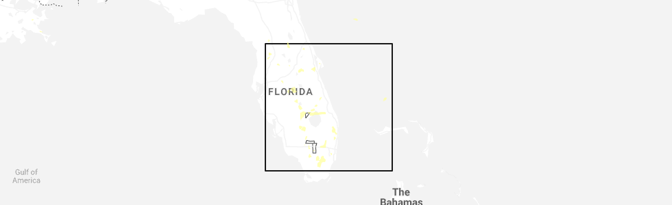
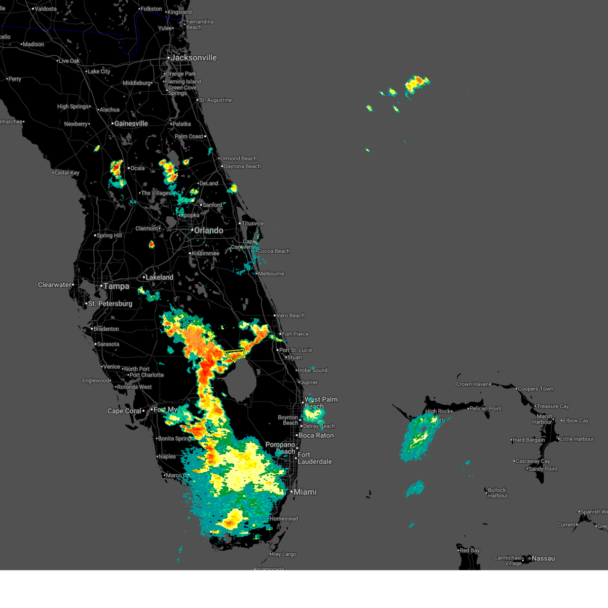
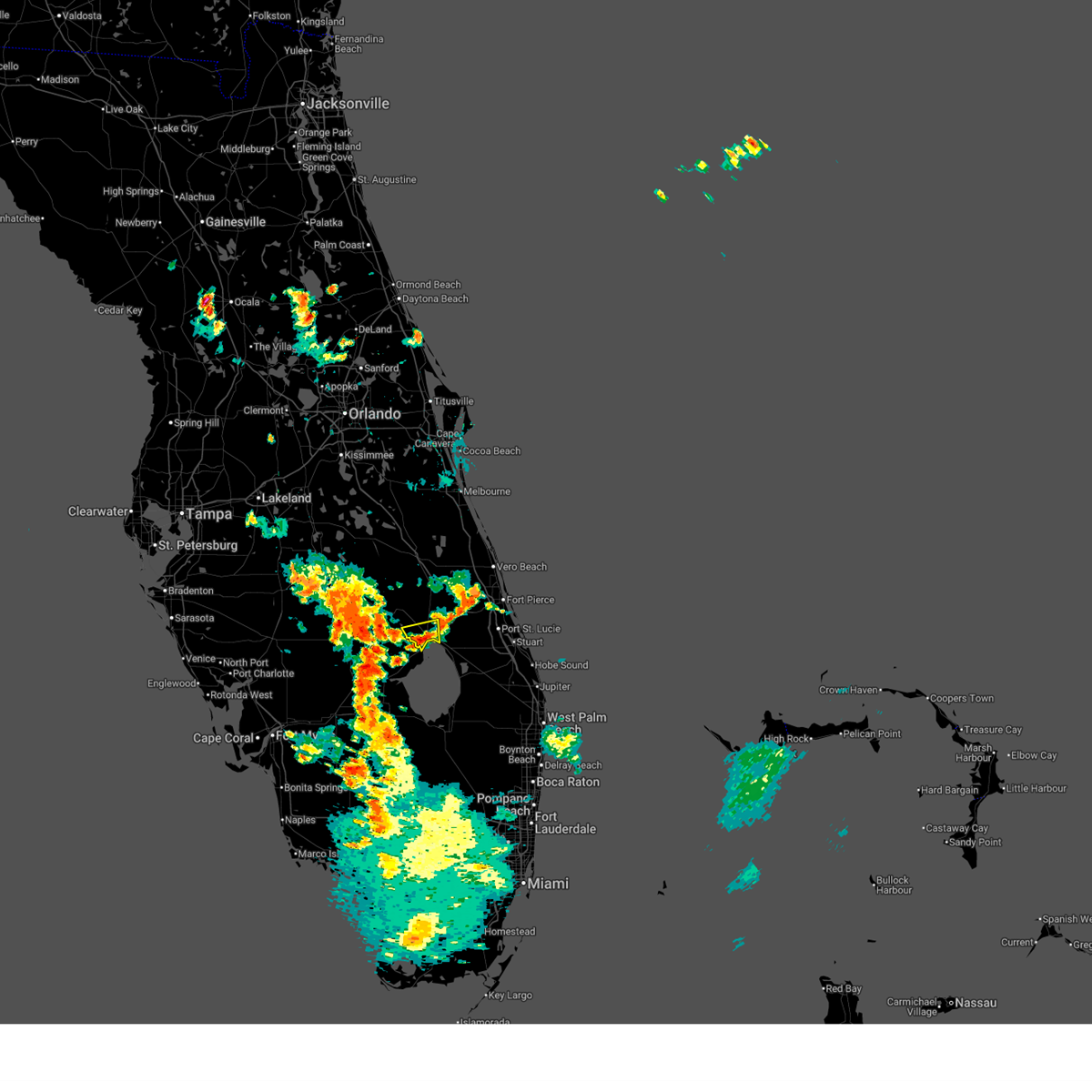
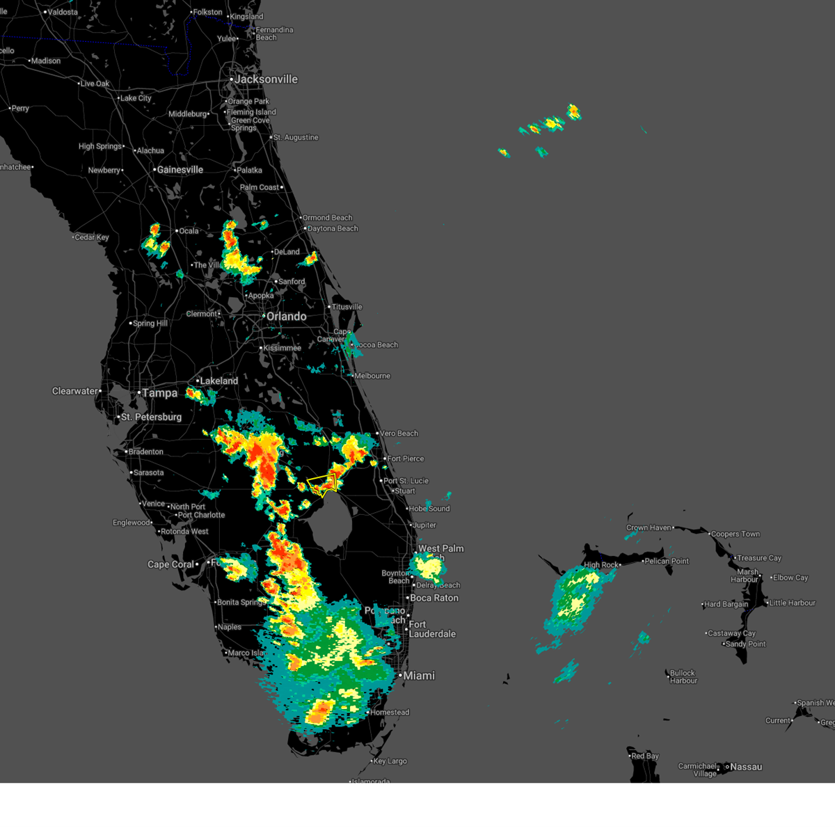
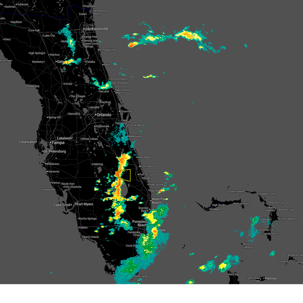
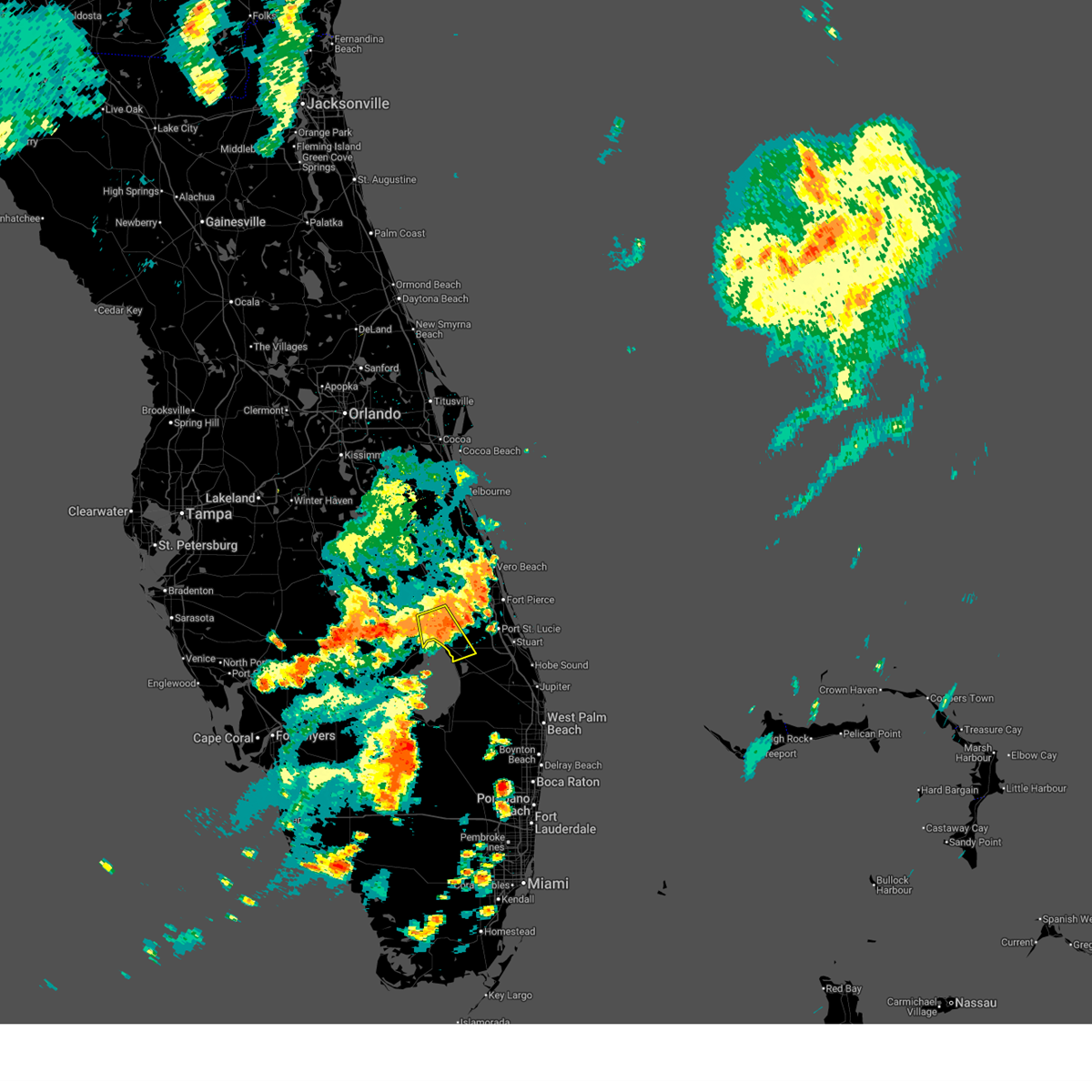
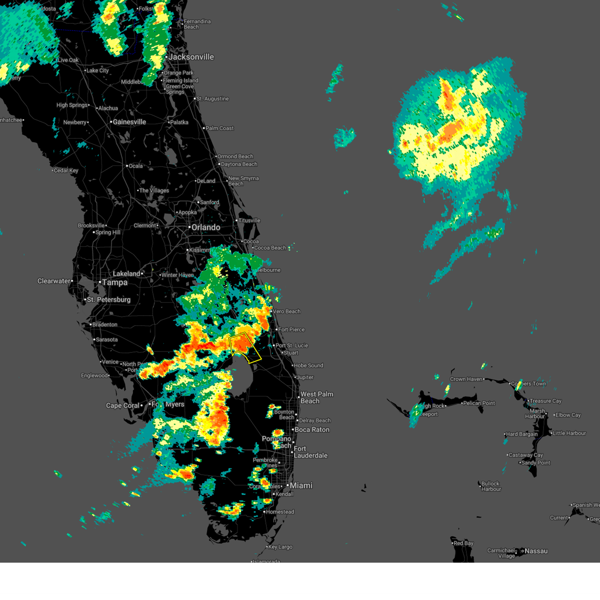
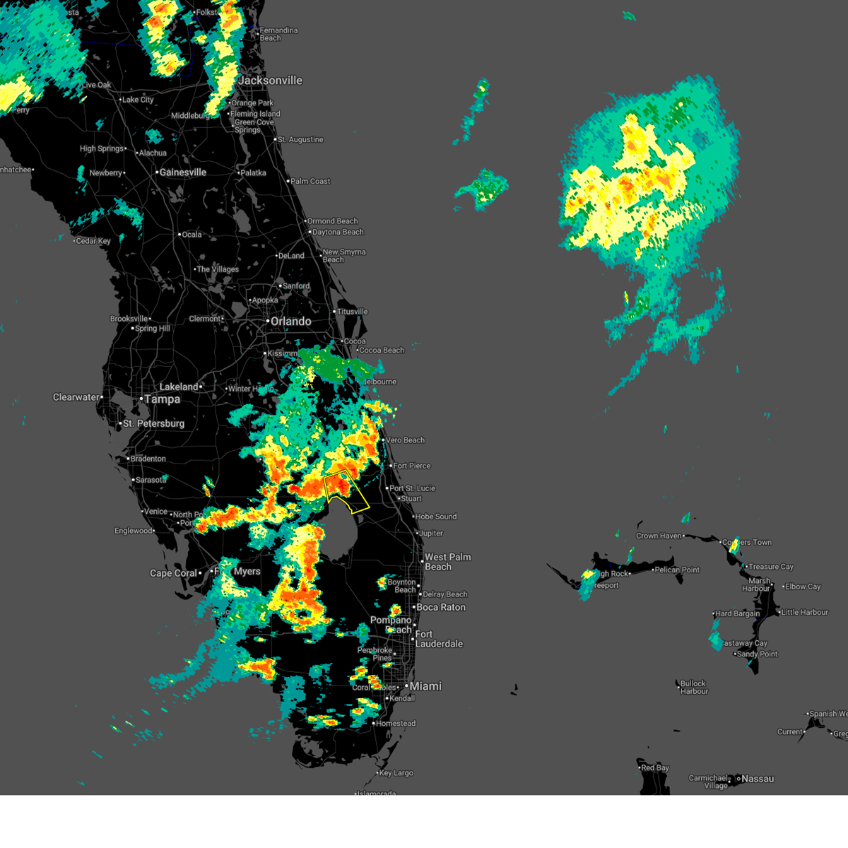
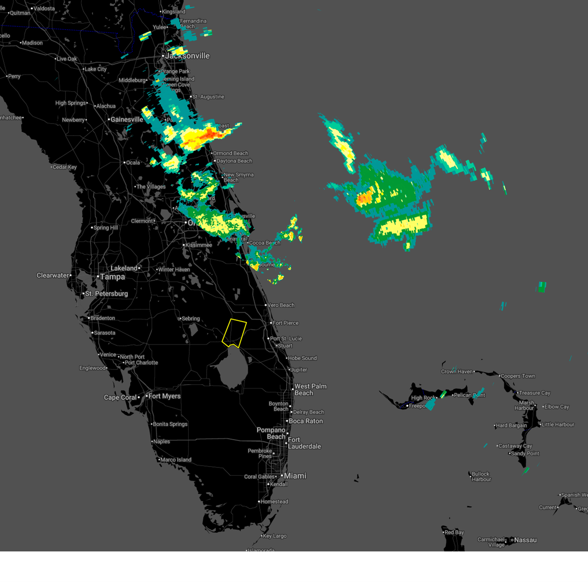
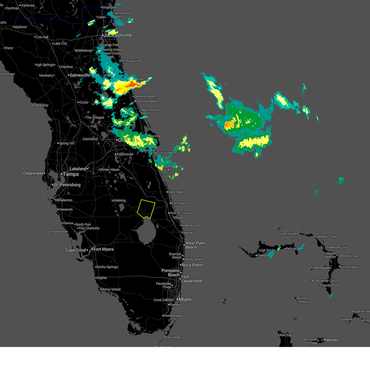
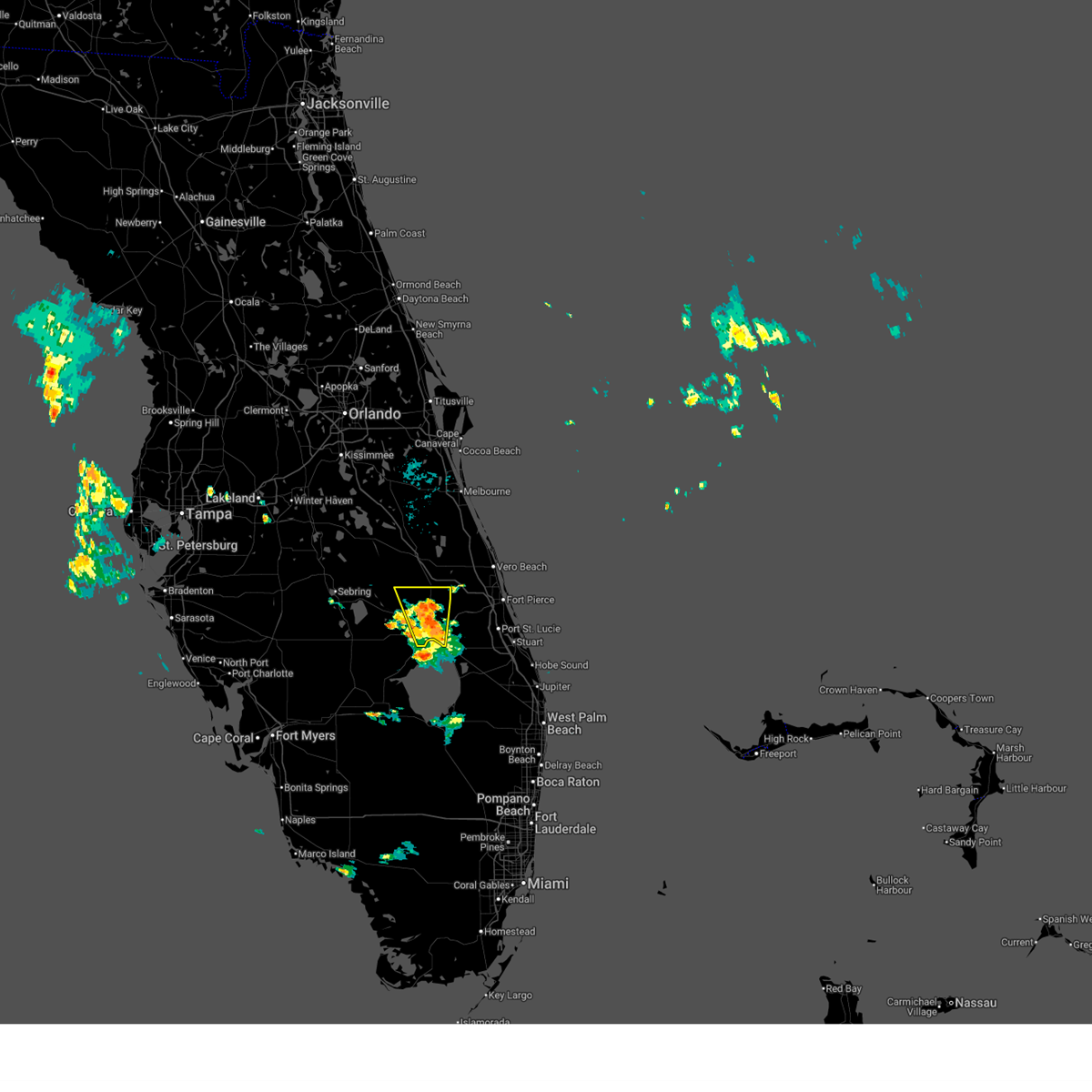
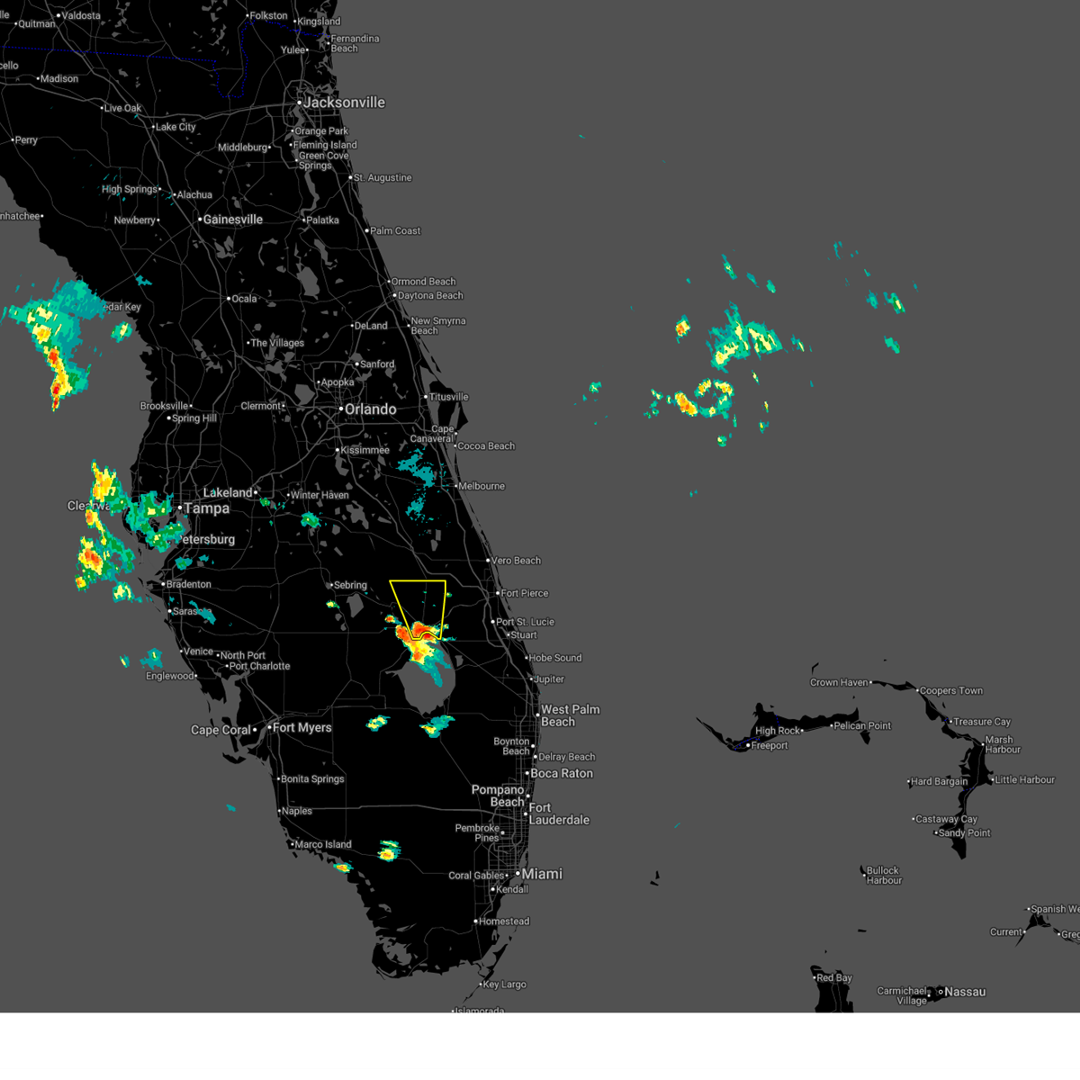
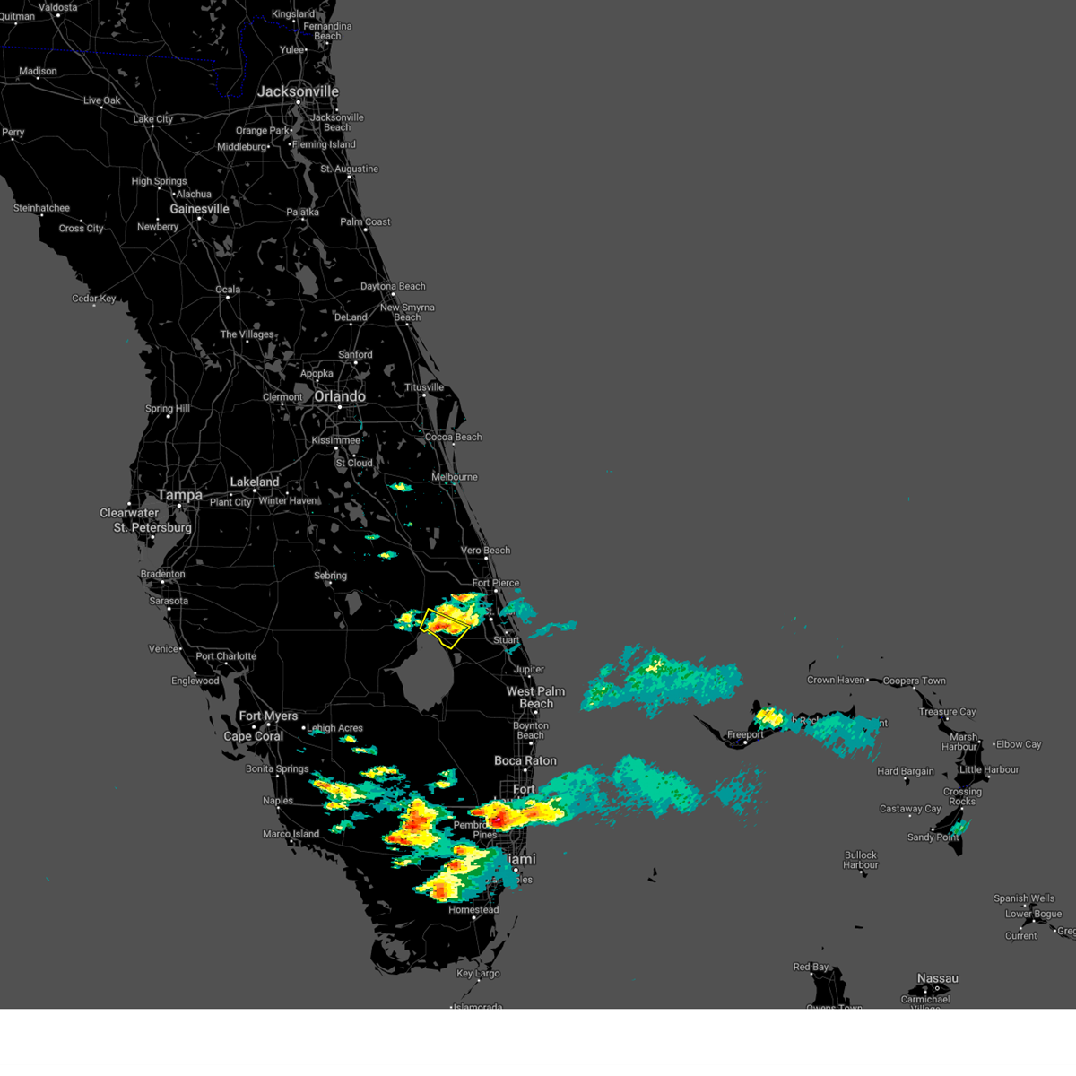
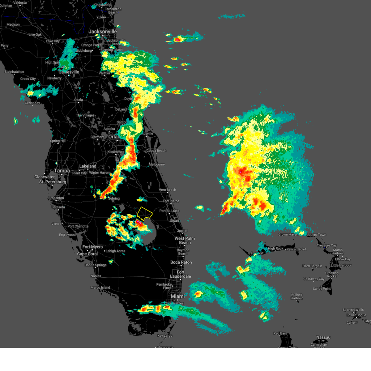
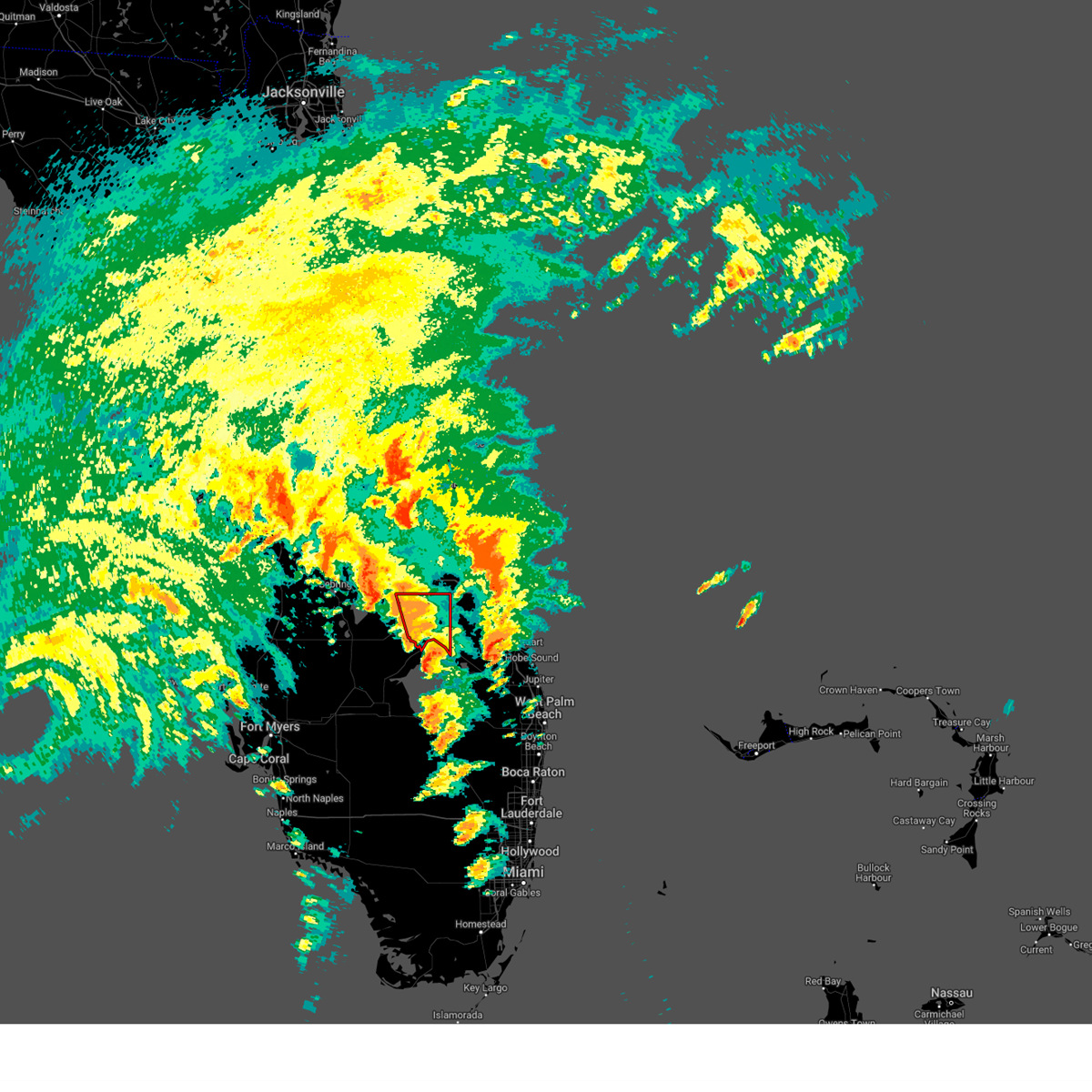
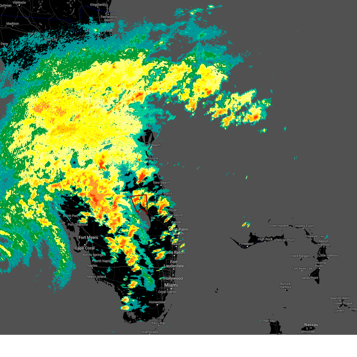
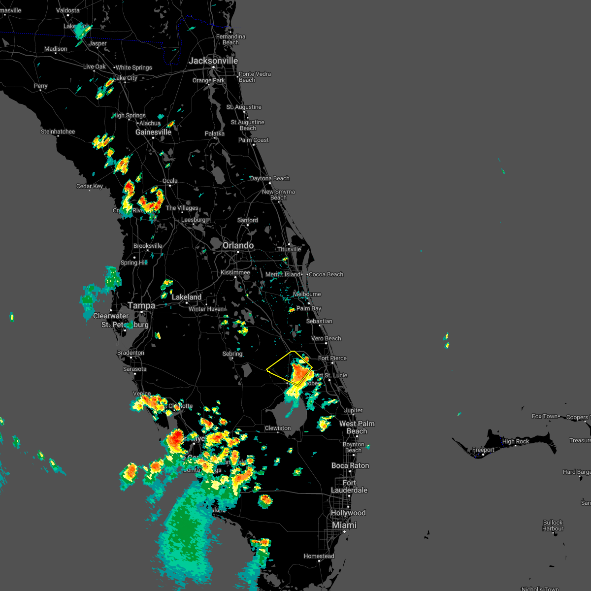
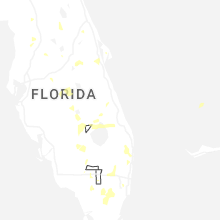
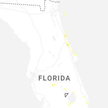
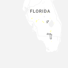
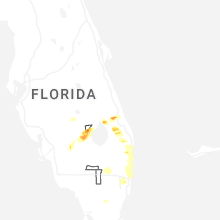
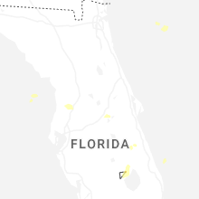
Hail Map for Cypress Quarters, FL
The Cypress Quarters, FL area has had 0 reports of on-the-ground hail by trained spotters, and has been under severe weather warnings 9 times during the past 12 months. Doppler radar has detected hail at or near Cypress Quarters, FL on 45 occasions, including 3 occasions during the past year.
| Name: | Cypress Quarters, FL |
| Where Located: | 27.6 miles W of Port Saint Lucie, FL |
| Map: | Google Map for Cypress Quarters, FL |
| Population: | 1215 |
| Housing Units: | 498 |
| More Info: | Search Google for Cypress Quarters, FL |
0
The Top Recent Hail Date for Cypress Quarters, FL is Wednesday, June 24, 2026 (16th out of 45)
Hail and Wind Damage Spotted near Cypress Quarters, FL
| Date / Time | Report Details |
|---|---|
| 6/24/2026 5:47 PM EDT |
 At 547 pm edt, a severe thunderstorm was located near buckhead ridge, moving southwest at 10 mph (radar indicated). Hazards include 60 mph wind gusts and penny size hail. Expect damage to roofs, siding, and trees. Locations impacted include, treasure island, okeechobee, four seasons estates, taylor creek, and okee tantie recreation area. At 547 pm edt, a severe thunderstorm was located near buckhead ridge, moving southwest at 10 mph (radar indicated). Hazards include 60 mph wind gusts and penny size hail. Expect damage to roofs, siding, and trees. Locations impacted include, treasure island, okeechobee, four seasons estates, taylor creek, and okee tantie recreation area.
|
| 6/24/2026 5:39 PM EDT |
 At 538 pm edt, a severe thunderstorm was located over okeechobee, and is nearly stationary (radar indicated). Hazards include 60 mph wind gusts and penny size hail. Expect damage to roofs, siding, and trees. Locations impacted include, treasure island, okeechobee, four seasons estates, taylor creek, and okee tantie recreation area. At 538 pm edt, a severe thunderstorm was located over okeechobee, and is nearly stationary (radar indicated). Hazards include 60 mph wind gusts and penny size hail. Expect damage to roofs, siding, and trees. Locations impacted include, treasure island, okeechobee, four seasons estates, taylor creek, and okee tantie recreation area.
|
| 6/24/2026 5:36 PM EDT |
 Svrmlb the national weather service in melbourne has issued a * severe thunderstorm warning for, southeastern okeechobee county in east central florida, * until 600 pm edt. * at 536 pm edt, a severe thunderstorm was located over okeechobee, and is nearly stationary (radar indicated). Hazards include 60 mph wind gusts and penny size hail. expect damage to roofs, siding, and trees Svrmlb the national weather service in melbourne has issued a * severe thunderstorm warning for, southeastern okeechobee county in east central florida, * until 600 pm edt. * at 536 pm edt, a severe thunderstorm was located over okeechobee, and is nearly stationary (radar indicated). Hazards include 60 mph wind gusts and penny size hail. expect damage to roofs, siding, and trees
|
| 8/29/2025 8:23 PM EDT |
 Svrmlb the national weather service in melbourne has issued a * severe thunderstorm warning for, southwestern st. lucie county in east central florida, southeastern okeechobee county in east central florida, northwestern martin county in east central florida, * until 900 pm edt. * at 823 pm edt, a severe thunderstorm was located over four seasons estates, or over treasure island, moving east at 15 mph (radar indicated). Hazards include 60 mph wind gusts and penny size hail. expect damage to roofs, siding, and trees Svrmlb the national weather service in melbourne has issued a * severe thunderstorm warning for, southwestern st. lucie county in east central florida, southeastern okeechobee county in east central florida, northwestern martin county in east central florida, * until 900 pm edt. * at 823 pm edt, a severe thunderstorm was located over four seasons estates, or over treasure island, moving east at 15 mph (radar indicated). Hazards include 60 mph wind gusts and penny size hail. expect damage to roofs, siding, and trees
|
| 7/22/2025 3:57 PM EDT |
 The storm which prompted the warning has weakened below severe limits, and no longer poses an immediate threat to life or property. therefore, the warning will be allowed to expire. however gusty winds and heavy rain are still possible with this thunderstorm. The storm which prompted the warning has weakened below severe limits, and no longer poses an immediate threat to life or property. therefore, the warning will be allowed to expire. however gusty winds and heavy rain are still possible with this thunderstorm.
|
| 7/22/2025 3:50 PM EDT |
 At 350 pm edt, a severe thunderstorm was located near four seasons estates, or near treasure island, moving southeast at 15 mph (radar indicated). Hazards include 60 mph wind gusts and penny size hail. Expect damage to roofs, siding, and trees. Locations impacted include, treasure island, okeechobee, j and s fish camp, four seasons estates, and taylor creek. At 350 pm edt, a severe thunderstorm was located near four seasons estates, or near treasure island, moving southeast at 15 mph (radar indicated). Hazards include 60 mph wind gusts and penny size hail. Expect damage to roofs, siding, and trees. Locations impacted include, treasure island, okeechobee, j and s fish camp, four seasons estates, and taylor creek.
|
| 7/22/2025 3:35 PM EDT |
 Svrmlb the national weather service in melbourne has issued a * severe thunderstorm warning for, southwestern st. lucie county in east central florida, southeastern okeechobee county in east central florida, west central martin county in east central florida, * until 400 pm edt. * at 334 pm edt, a severe thunderstorm was located over four seasons estates, or near treasure island, moving south at 25 mph (radar indicated). Hazards include 60 mph wind gusts and penny size hail. expect damage to roofs, siding, and trees Svrmlb the national weather service in melbourne has issued a * severe thunderstorm warning for, southwestern st. lucie county in east central florida, southeastern okeechobee county in east central florida, west central martin county in east central florida, * until 400 pm edt. * at 334 pm edt, a severe thunderstorm was located over four seasons estates, or near treasure island, moving south at 25 mph (radar indicated). Hazards include 60 mph wind gusts and penny size hail. expect damage to roofs, siding, and trees
|
| 7/13/2025 5:42 PM EDT |
 At 542 pm edt, a severe thunderstorm was located near four seasons estates, or near okeechobee, moving southeast at 15 mph (radar indicated). Hazards include 60 mph wind gusts and penny size hail. Expect damage to roofs, siding, and trees. Locations impacted include, treasure island, okeechobee, four seasons estates, taylor creek, and country hills estates. At 542 pm edt, a severe thunderstorm was located near four seasons estates, or near okeechobee, moving southeast at 15 mph (radar indicated). Hazards include 60 mph wind gusts and penny size hail. Expect damage to roofs, siding, and trees. Locations impacted include, treasure island, okeechobee, four seasons estates, taylor creek, and country hills estates.
|
| 7/13/2025 5:22 PM EDT |
 Svrmlb the national weather service in melbourne has issued a * severe thunderstorm warning for, west central st. lucie county in east central florida, southeastern okeechobee county in east central florida, * until 600 pm edt. * at 522 pm edt, a severe thunderstorm was located near okeechobee, moving southeast at 15 mph (radar indicated). Hazards include 60 mph wind gusts and penny size hail. expect damage to roofs, siding, and trees Svrmlb the national weather service in melbourne has issued a * severe thunderstorm warning for, west central st. lucie county in east central florida, southeastern okeechobee county in east central florida, * until 600 pm edt. * at 522 pm edt, a severe thunderstorm was located near okeechobee, moving southeast at 15 mph (radar indicated). Hazards include 60 mph wind gusts and penny size hail. expect damage to roofs, siding, and trees
|
| 6/26/2025 9:57 PM EDT |
 The storm which prompted the warning has weakened below severe limits, and no longer poses an immediate threat to life or property. therefore, the warning will be allowed to expire. however gusty winds are still possible with this thunderstorm. The storm which prompted the warning has weakened below severe limits, and no longer poses an immediate threat to life or property. therefore, the warning will be allowed to expire. however gusty winds are still possible with this thunderstorm.
|
| 6/26/2025 9:40 PM EDT |
 Svrmlb the national weather service in melbourne has issued a * severe thunderstorm warning for, southeastern okeechobee county in east central florida, * until 1000 pm edt. * at 940 pm edt, a severe thunderstorm was located near okeechobee, moving north at 25 mph (radar indicated). Hazards include 60 mph wind gusts and nickel size hail. expect damage to roofs, siding, and trees Svrmlb the national weather service in melbourne has issued a * severe thunderstorm warning for, southeastern okeechobee county in east central florida, * until 1000 pm edt. * at 940 pm edt, a severe thunderstorm was located near okeechobee, moving north at 25 mph (radar indicated). Hazards include 60 mph wind gusts and nickel size hail. expect damage to roofs, siding, and trees
|
| 5/23/2025 5:11 PM EDT |
 Svrmlb the national weather service in melbourne has issued a * severe thunderstorm warning for, southwestern st. lucie county in east central florida, southeastern okeechobee county in east central florida, northwestern martin county in east central florida, * until 545 pm edt. * at 511 pm edt, a severe thunderstorm was located near four seasons estates, or near treasure island, moving southeast at 10 mph (radar indicated). Hazards include 60 mph wind gusts and half dollar size hail. Hail damage to vehicles is expected. Expect wind damage to roofs, siding, and trees. Svrmlb the national weather service in melbourne has issued a * severe thunderstorm warning for, southwestern st. lucie county in east central florida, southeastern okeechobee county in east central florida, northwestern martin county in east central florida, * until 545 pm edt. * at 511 pm edt, a severe thunderstorm was located near four seasons estates, or near treasure island, moving southeast at 10 mph (radar indicated). Hazards include 60 mph wind gusts and half dollar size hail. Hail damage to vehicles is expected. Expect wind damage to roofs, siding, and trees.
|
| 3/30/2025 6:49 PM EDT |
 Svrmlb the national weather service in melbourne has issued a * severe thunderstorm warning for, southeastern okeechobee county in east central florida, * until 715 pm edt. * at 649 pm edt, a severe thunderstorm was located over buckhead ridge, moving northeast at 30 mph (radar indicated). Hazards include ping pong ball size hail and 60 mph wind gusts. People and animals outdoors will be injured. expect hail damage to roofs, siding, windows, and vehicles. Expect wind damage to roofs, siding, and trees. Svrmlb the national weather service in melbourne has issued a * severe thunderstorm warning for, southeastern okeechobee county in east central florida, * until 715 pm edt. * at 649 pm edt, a severe thunderstorm was located over buckhead ridge, moving northeast at 30 mph (radar indicated). Hazards include ping pong ball size hail and 60 mph wind gusts. People and animals outdoors will be injured. expect hail damage to roofs, siding, windows, and vehicles. Expect wind damage to roofs, siding, and trees.
|
| 10/9/2024 3:35 PM EDT |
 Tormlb the national weather service in melbourne has issued a * tornado warning for, southeastern okeechobee county in east central florida, * until 415 pm edt. * at 335 pm edt, a severe thunderstorm capable of producing a tornado was located near buckhead ridge, moving north at 40 mph (radar indicated rotation). Hazards include tornado. Flying debris will be dangerous to those caught without shelter. mobile homes will be damaged or destroyed. damage to roofs, windows, and vehicles will occur. tree damage is likely. this dangerous storm will be near, treasure island, okeechobee, and four seasons estates around 340 pm edt. Other locations impacted by this tornadic thunderstorm include whispering pines. Tormlb the national weather service in melbourne has issued a * tornado warning for, southeastern okeechobee county in east central florida, * until 415 pm edt. * at 335 pm edt, a severe thunderstorm capable of producing a tornado was located near buckhead ridge, moving north at 40 mph (radar indicated rotation). Hazards include tornado. Flying debris will be dangerous to those caught without shelter. mobile homes will be damaged or destroyed. damage to roofs, windows, and vehicles will occur. tree damage is likely. this dangerous storm will be near, treasure island, okeechobee, and four seasons estates around 340 pm edt. Other locations impacted by this tornadic thunderstorm include whispering pines.
|
| 10/9/2024 2:12 PM EDT |
 At 212 pm edt, a confirmed large and extremely dangerous tornado was located 9 miles north of okeechobee, moving north at 35 mph. this is a particularly dangerous situation. take cover now! (radar confirmed tornado). Hazards include damaging tornado. You are in a life-threatening situation. flying debris may be deadly to those caught without shelter. mobile homes will be destroyed. considerable damage to homes, businesses, and vehicles is likely and complete destruction is possible. This tornadic thunderstorm will remain over mainly rural areas of southeastern okeechobee county, including the following locations, whispering pines. At 212 pm edt, a confirmed large and extremely dangerous tornado was located 9 miles north of okeechobee, moving north at 35 mph. this is a particularly dangerous situation. take cover now! (radar confirmed tornado). Hazards include damaging tornado. You are in a life-threatening situation. flying debris may be deadly to those caught without shelter. mobile homes will be destroyed. considerable damage to homes, businesses, and vehicles is likely and complete destruction is possible. This tornadic thunderstorm will remain over mainly rural areas of southeastern okeechobee county, including the following locations, whispering pines.
|
| 10/9/2024 1:44 PM EDT |
 Tormlb the national weather service in melbourne has issued a * tornado warning for, southeastern okeechobee county in east central florida, * until 230 pm edt. * at 144 pm edt, a severe thunderstorm capable of producing a tornado was located near taylor creek, or near treasure island, moving north at 35 mph (radar indicated rotation). Hazards include tornado. Flying debris will be dangerous to those caught without shelter. mobile homes will be damaged or destroyed. damage to roofs, windows, and vehicles will occur. tree damage is likely. this dangerous storm will be near, treasure island, okeechobee, and four seasons estates around 150 pm edt. Other locations impacted by this tornadic thunderstorm include whispering pines. Tormlb the national weather service in melbourne has issued a * tornado warning for, southeastern okeechobee county in east central florida, * until 230 pm edt. * at 144 pm edt, a severe thunderstorm capable of producing a tornado was located near taylor creek, or near treasure island, moving north at 35 mph (radar indicated rotation). Hazards include tornado. Flying debris will be dangerous to those caught without shelter. mobile homes will be damaged or destroyed. damage to roofs, windows, and vehicles will occur. tree damage is likely. this dangerous storm will be near, treasure island, okeechobee, and four seasons estates around 150 pm edt. Other locations impacted by this tornadic thunderstorm include whispering pines.
|
| 6/7/2024 5:40 PM EDT |
 The storm which prompted the warning has weakened below severe limits. therefore, the warning will be allowed to expire. however gusty winds are still possible with this thunderstorm. to report severe weather, contact your nearest law enforcement agency. they will relay your report to the national weather service melbourne. The storm which prompted the warning has weakened below severe limits. therefore, the warning will be allowed to expire. however gusty winds are still possible with this thunderstorm. to report severe weather, contact your nearest law enforcement agency. they will relay your report to the national weather service melbourne.
|
| 6/7/2024 5:30 PM EDT |
 At 530 pm edt, a severe thunderstorm was located near okeechobee, moving northeast at 20 mph (radar indicated). Hazards include 60 mph wind gusts and penny size hail. Expect damage to roofs, siding, and trees. Locations impacted include, treasure island, okeechobee, four seasons estates, taylor creek, and okee tantie recreation area. At 530 pm edt, a severe thunderstorm was located near okeechobee, moving northeast at 20 mph (radar indicated). Hazards include 60 mph wind gusts and penny size hail. Expect damage to roofs, siding, and trees. Locations impacted include, treasure island, okeechobee, four seasons estates, taylor creek, and okee tantie recreation area.
|
| 6/7/2024 5:16 PM EDT |
 At 516 pm edt, a severe thunderstorm was located 8 miles west of okeechobee, moving northeast at 25 mph (radar indicated). Hazards include 60 mph wind gusts and quarter size hail. Hail damage to vehicles is expected. expect wind damage to roofs, siding, and trees. Locations impacted include, treasure island, okeechobee, basinger, four seasons estates, and taylor creek. At 516 pm edt, a severe thunderstorm was located 8 miles west of okeechobee, moving northeast at 25 mph (radar indicated). Hazards include 60 mph wind gusts and quarter size hail. Hail damage to vehicles is expected. expect wind damage to roofs, siding, and trees. Locations impacted include, treasure island, okeechobee, basinger, four seasons estates, and taylor creek.
|
| 6/7/2024 5:07 PM EDT |
 Svrmlb the national weather service in melbourne has issued a * severe thunderstorm warning for, central okeechobee county in east central florida, * until 545 pm edt. * at 507 pm edt, a severe thunderstorm was located 9 miles northwest of buckhead ridge, moving northeast at 25 mph (radar indicated). Hazards include 60 mph wind gusts and quarter size hail. Hail damage to vehicles is expected. Expect wind damage to roofs, siding, and trees. Svrmlb the national weather service in melbourne has issued a * severe thunderstorm warning for, central okeechobee county in east central florida, * until 545 pm edt. * at 507 pm edt, a severe thunderstorm was located 9 miles northwest of buckhead ridge, moving northeast at 25 mph (radar indicated). Hazards include 60 mph wind gusts and quarter size hail. Hail damage to vehicles is expected. Expect wind damage to roofs, siding, and trees.
|
| 5/15/2024 1:27 PM EDT |
 Svrmlb the national weather service in melbourne has issued a * severe thunderstorm warning for, southwestern st. lucie county in east central florida, southeastern okeechobee county in east central florida, * until 200 pm edt. * at 127 pm edt, a severe thunderstorm was located near okeechobee, moving northeast at 25 mph (radar indicated). Hazards include 60 mph wind gusts and quarter size hail. Hail damage to vehicles is expected. Expect wind damage to roofs, siding, and trees. Svrmlb the national weather service in melbourne has issued a * severe thunderstorm warning for, southwestern st. lucie county in east central florida, southeastern okeechobee county in east central florida, * until 200 pm edt. * at 127 pm edt, a severe thunderstorm was located near okeechobee, moving northeast at 25 mph (radar indicated). Hazards include 60 mph wind gusts and quarter size hail. Hail damage to vehicles is expected. Expect wind damage to roofs, siding, and trees.
|
| 5/13/2024 8:28 PM EDT |
 the severe thunderstorm warning has been cancelled and is no longer in effect the severe thunderstorm warning has been cancelled and is no longer in effect
|
| 5/13/2024 8:15 PM EDT |
 At 815 pm edt, a severe thunderstorm was located near buckhead ridge, moving southeast at 10 mph (radar indicated). Hazards include 60 mph wind gusts and quarter size hail. Hail damage to vehicles is expected. expect wind damage to roofs, siding, and trees. Locations impacted include, treasure island, okeechobee, taylor creek, and okee tantie recreation area. At 815 pm edt, a severe thunderstorm was located near buckhead ridge, moving southeast at 10 mph (radar indicated). Hazards include 60 mph wind gusts and quarter size hail. Hail damage to vehicles is expected. expect wind damage to roofs, siding, and trees. Locations impacted include, treasure island, okeechobee, taylor creek, and okee tantie recreation area.
|
| 5/13/2024 7:59 PM EDT |
 Svrmlb the national weather service in melbourne has issued a * severe thunderstorm warning for, southeastern okeechobee county in east central florida, * until 845 pm edt. * at 759 pm edt, a severe thunderstorm was located near okeechobee, moving southeast at 30 mph (radar indicated). Hazards include 60 mph wind gusts and quarter size hail. Hail damage to vehicles is expected. Expect wind damage to roofs, siding, and trees. Svrmlb the national weather service in melbourne has issued a * severe thunderstorm warning for, southeastern okeechobee county in east central florida, * until 845 pm edt. * at 759 pm edt, a severe thunderstorm was located near okeechobee, moving southeast at 30 mph (radar indicated). Hazards include 60 mph wind gusts and quarter size hail. Hail damage to vehicles is expected. Expect wind damage to roofs, siding, and trees.
|
| 9/25/2023 4:12 PM EDT |
 At 412 pm edt, a severe thunderstorm was located 7 miles southeast of four seasons estates, or 7 miles east of treasure island, moving north at 20 mph (radar indicated). Hazards include 60 mph wind gusts and penny size hail. expect damage to roofs, siding, and trees At 412 pm edt, a severe thunderstorm was located 7 miles southeast of four seasons estates, or 7 miles east of treasure island, moving north at 20 mph (radar indicated). Hazards include 60 mph wind gusts and penny size hail. expect damage to roofs, siding, and trees
|
| 6/22/2023 3:01 PM EDT |
 At 300 pm edt, a severe thunderstorm was located over buckhead ridge, moving northeast at 30 mph (radar indicated). Hazards include 60 mph wind gusts. expect damage to roofs, siding, and trees At 300 pm edt, a severe thunderstorm was located over buckhead ridge, moving northeast at 30 mph (radar indicated). Hazards include 60 mph wind gusts. expect damage to roofs, siding, and trees
|
| 6/19/2023 10:33 PM EDT |
 At 1033 pm edt, severe thunderstorms were located along a line extending from 7 miles northwest of blue cypress lake to 8 miles east of fort drum to near basinger, moving southeast at 20 mph (radar indicated). Hazards include 60 mph wind gusts and quarter size hail. Hail damage to vehicles is expected. expect wind damage to roofs, siding, and trees. Locations impacted include, treasure island, okeechobee, basinger, blue cypress lake and fort drum. At 1033 pm edt, severe thunderstorms were located along a line extending from 7 miles northwest of blue cypress lake to 8 miles east of fort drum to near basinger, moving southeast at 20 mph (radar indicated). Hazards include 60 mph wind gusts and quarter size hail. Hail damage to vehicles is expected. expect wind damage to roofs, siding, and trees. Locations impacted include, treasure island, okeechobee, basinger, blue cypress lake and fort drum.
|
| 6/19/2023 10:00 PM EDT |
 At 1000 pm edt, severe thunderstorms were located along a line extending from near kenansville to 6 miles north of fort drum to 7 miles southeast of basinger, moving east at 20 mph (radar indicated). Hazards include 60 mph wind gusts and quarter size hail. Hail damage to vehicles is expected. Expect wind damage to roofs, siding, and trees. At 1000 pm edt, severe thunderstorms were located along a line extending from near kenansville to 6 miles north of fort drum to 7 miles southeast of basinger, moving east at 20 mph (radar indicated). Hazards include 60 mph wind gusts and quarter size hail. Hail damage to vehicles is expected. Expect wind damage to roofs, siding, and trees.
|
| 6/16/2023 6:19 PM EDT |
 At 618 pm edt, a severe thunderstorm was located near buckhead ridge, moving east at 35 mph (radar indicated). Hazards include 60 mph wind gusts. expect damage to roofs, siding, and trees At 618 pm edt, a severe thunderstorm was located near buckhead ridge, moving east at 35 mph (radar indicated). Hazards include 60 mph wind gusts. expect damage to roofs, siding, and trees
|
| 6/15/2023 6:43 PM EDT |
 The severe thunderstorm warning for southeastern okeechobee county will expire at 645 pm edt, the storm which prompted the warning has weakened below severe limits, and no longer poses an immediate threat to life or property. therefore, the warning will be allowed to expire. however gusty winds and heavy rain are still possible with this thunderstorm. The severe thunderstorm warning for southeastern okeechobee county will expire at 645 pm edt, the storm which prompted the warning has weakened below severe limits, and no longer poses an immediate threat to life or property. therefore, the warning will be allowed to expire. however gusty winds and heavy rain are still possible with this thunderstorm.
|
| 6/15/2023 6:20 PM EDT |
 At 619 pm edt, a severe thunderstorm was located over okeechobee, moving northeast at 25 mph (radar indicated). Hazards include 60 mph wind gusts and quarter size hail. Hail damage to vehicles is expected. Expect wind damage to roofs, siding, and trees. At 619 pm edt, a severe thunderstorm was located over okeechobee, moving northeast at 25 mph (radar indicated). Hazards include 60 mph wind gusts and quarter size hail. Hail damage to vehicles is expected. Expect wind damage to roofs, siding, and trees.
|
| 4/30/2023 7:54 AM EDT |
 At 753 am edt, a severe thunderstorm was located 12 miles northwest of tradition, or 13 miles west of white city, moving northeast at 60 mph (radar indicated). Hazards include 60 mph wind gusts and penny size hail. Expect damage to roofs, siding, and trees. Locations impacted include, port saint lucie, walton, fort pierce, sebastian and stuart. At 753 am edt, a severe thunderstorm was located 12 miles northwest of tradition, or 13 miles west of white city, moving northeast at 60 mph (radar indicated). Hazards include 60 mph wind gusts and penny size hail. Expect damage to roofs, siding, and trees. Locations impacted include, port saint lucie, walton, fort pierce, sebastian and stuart.
|
| 4/30/2023 7:24 AM EDT |
 At 724 am edt, a severe thunderstorm was located near buckhead ridge, moving northeast at 65 mph (radar indicated). Hazards include 60 mph wind gusts and penny size hail. expect damage to roofs, siding, and trees At 724 am edt, a severe thunderstorm was located near buckhead ridge, moving northeast at 65 mph (radar indicated). Hazards include 60 mph wind gusts and penny size hail. expect damage to roofs, siding, and trees
|
| 4/29/2023 3:40 PM EDT |
 The severe thunderstorm warning for southeastern okeechobee county will expire at 345 pm edt, the storm which prompted the warning has weakened below severe limits, and no longer poses an immediate threat to life or property. therefore, the warning will be allowed to expire. however small hail, gusty winds and heavy rain are still possible with this thunderstorm. a tornado watch remains in effect until 1000 pm edt for east central florida. to report severe weather, contact your nearest law enforcement agency. they will relay your report to the national weather service melbourne. The severe thunderstorm warning for southeastern okeechobee county will expire at 345 pm edt, the storm which prompted the warning has weakened below severe limits, and no longer poses an immediate threat to life or property. therefore, the warning will be allowed to expire. however small hail, gusty winds and heavy rain are still possible with this thunderstorm. a tornado watch remains in effect until 1000 pm edt for east central florida. to report severe weather, contact your nearest law enforcement agency. they will relay your report to the national weather service melbourne.
|
| 4/29/2023 3:19 PM EDT |
 At 318 pm edt, a severe thunderstorm was located near okeechobee, moving north at 30 mph (radar indicated). Hazards include 60 mph wind gusts and quarter size hail. Hail damage to vehicles is expected. expect wind damage to roofs, siding, and trees. Locations impacted include, treasure island, okeechobee, basinger, four seasons estates and taylor creek. At 318 pm edt, a severe thunderstorm was located near okeechobee, moving north at 30 mph (radar indicated). Hazards include 60 mph wind gusts and quarter size hail. Hail damage to vehicles is expected. expect wind damage to roofs, siding, and trees. Locations impacted include, treasure island, okeechobee, basinger, four seasons estates and taylor creek.
|
| 4/29/2023 3:03 PM EDT |
 At 303 pm edt, a severe thunderstorm was located 10 miles south of basinger, moving northeast at 20 mph (radar indicated). Hazards include 60 mph wind gusts and quarter size hail. Hail damage to vehicles is expected. Expect wind damage to roofs, siding, and trees. At 303 pm edt, a severe thunderstorm was located 10 miles south of basinger, moving northeast at 20 mph (radar indicated). Hazards include 60 mph wind gusts and quarter size hail. Hail damage to vehicles is expected. Expect wind damage to roofs, siding, and trees.
|
| 4/27/2023 7:39 PM EDT |
 The severe thunderstorm warning for southeastern okeechobee county will expire at 745 pm edt, the storm which prompted the warning has weakened below severe limits, and has exited the warned area. therefore, the warning will be allowed to expire. however small hail and gusty winds are still possible with this thunderstorm. a severe thunderstorm watch remains in effect until 1000 pm edt for east central florida. to report severe weather, contact your nearest law enforcement agency. they will relay your report to the national weather service melbourne. The severe thunderstorm warning for southeastern okeechobee county will expire at 745 pm edt, the storm which prompted the warning has weakened below severe limits, and has exited the warned area. therefore, the warning will be allowed to expire. however small hail and gusty winds are still possible with this thunderstorm. a severe thunderstorm watch remains in effect until 1000 pm edt for east central florida. to report severe weather, contact your nearest law enforcement agency. they will relay your report to the national weather service melbourne.
|
| 4/27/2023 7:35 PM EDT |
 At 734 pm edt, a severe thunderstorm was located 8 miles southeast of fort drum, moving north at 30 mph (radar indicated). Hazards include 60 mph wind gusts and quarter size hail. Hail damage to vehicles is expected. expect wind damage to roofs, siding, and trees. locations impacted include, okeechobee, four seasons estates, whispering pines, country hills estates and basswood estates. hail threat, radar indicated max hail size, 1. 00 in wind threat, radar indicated max wind gust, 60 mph. At 734 pm edt, a severe thunderstorm was located 8 miles southeast of fort drum, moving north at 30 mph (radar indicated). Hazards include 60 mph wind gusts and quarter size hail. Hail damage to vehicles is expected. expect wind damage to roofs, siding, and trees. locations impacted include, okeechobee, four seasons estates, whispering pines, country hills estates and basswood estates. hail threat, radar indicated max hail size, 1. 00 in wind threat, radar indicated max wind gust, 60 mph.
|
| 4/27/2023 7:13 PM EDT |
 At 713 pm edt, a severe thunderstorm was located over four seasons estates, or near okeechobee, moving northeast at 30 mph (radar indicated). Hazards include 60 mph wind gusts and quarter size hail. Hail damage to vehicles is expected. expect wind damage to roofs, siding, and trees. locations impacted include, treasure island, okeechobee, four seasons estates, taylor creek and country hills estates. hail threat, radar indicated max hail size, 1. 00 in wind threat, radar indicated max wind gust, 60 mph. At 713 pm edt, a severe thunderstorm was located over four seasons estates, or near okeechobee, moving northeast at 30 mph (radar indicated). Hazards include 60 mph wind gusts and quarter size hail. Hail damage to vehicles is expected. expect wind damage to roofs, siding, and trees. locations impacted include, treasure island, okeechobee, four seasons estates, taylor creek and country hills estates. hail threat, radar indicated max hail size, 1. 00 in wind threat, radar indicated max wind gust, 60 mph.
|
| 4/27/2023 6:55 PM EDT |
 At 655 pm edt, a severe thunderstorm was located over buckhead ridge, moving northeast at 30 mph (radar indicated). Hazards include 60 mph wind gusts and quarter size hail. Hail damage to vehicles is expected. Expect wind damage to roofs, siding, and trees. At 655 pm edt, a severe thunderstorm was located over buckhead ridge, moving northeast at 30 mph (radar indicated). Hazards include 60 mph wind gusts and quarter size hail. Hail damage to vehicles is expected. Expect wind damage to roofs, siding, and trees.
|
| 4/24/2023 3:14 PM EDT |
 At 313 pm edt, a severe thunderstorm was located 8 miles north of four seasons estates, or 9 miles north of okeechobee, moving southeast at 5 mph (radar indicated). Hazards include 60 mph wind gusts and quarter size hail. Hail damage to vehicles is expected. expect wind damage to roofs, siding, and trees. Locations impacted include, country hills estates. At 313 pm edt, a severe thunderstorm was located 8 miles north of four seasons estates, or 9 miles north of okeechobee, moving southeast at 5 mph (radar indicated). Hazards include 60 mph wind gusts and quarter size hail. Hail damage to vehicles is expected. expect wind damage to roofs, siding, and trees. Locations impacted include, country hills estates.
|
| 4/24/2023 2:58 PM EDT |
 At 257 pm edt, a severe thunderstorm was located 9 miles south of fort drum, moving south at 5 mph (radar indicated). Hazards include 60 mph wind gusts and quarter size hail. Hail damage to vehicles is expected. Expect wind damage to roofs, siding, and trees. At 257 pm edt, a severe thunderstorm was located 9 miles south of fort drum, moving south at 5 mph (radar indicated). Hazards include 60 mph wind gusts and quarter size hail. Hail damage to vehicles is expected. Expect wind damage to roofs, siding, and trees.
|
| 7/14/2022 3:32 PM EDT |
 At 331 pm edt, a severe thunderstorm was located near fort drum, moving northwest at 15 mph (radar indicated). Hazards include 60 mph wind gusts and penny size hail. expect damage to roofs, siding, and trees At 331 pm edt, a severe thunderstorm was located near fort drum, moving northwest at 15 mph (radar indicated). Hazards include 60 mph wind gusts and penny size hail. expect damage to roofs, siding, and trees
|
| 5/29/2022 5:03 PM EDT |
 At 502 pm edt, a severe thunderstorm was located 8 miles north of four seasons estates, or 9 miles north of okeechobee, and is nearly stationary with a southward drift (radar indicated). Hazards include 60 mph wind gusts and penny size hail. expect damage to roofs, siding, and trees At 502 pm edt, a severe thunderstorm was located 8 miles north of four seasons estates, or 9 miles north of okeechobee, and is nearly stationary with a southward drift (radar indicated). Hazards include 60 mph wind gusts and penny size hail. expect damage to roofs, siding, and trees
|
| 4/11/2021 3:10 PM EDT |
 The severe thunderstorm warning for st. lucie, southeastern okeechobee and martin counties will expire at 315 pm edt, the storm which prompted the warning has moved out of the area. therefore, the warning will be allowed to expire. however gusty winds over 40 mph are still occurring with this thunderstorm. a severe thunderstorm watch remains in effect until 400 pm edt for east central florida. to report severe weather, contact your nearest law enforcement agency. they will relay your report to the national weather service melbourne. The severe thunderstorm warning for st. lucie, southeastern okeechobee and martin counties will expire at 315 pm edt, the storm which prompted the warning has moved out of the area. therefore, the warning will be allowed to expire. however gusty winds over 40 mph are still occurring with this thunderstorm. a severe thunderstorm watch remains in effect until 400 pm edt for east central florida. to report severe weather, contact your nearest law enforcement agency. they will relay your report to the national weather service melbourne.
|
| 4/11/2021 2:56 PM EDT |
 At 256 pm edt, a severe thunderstorm was located near palm city, moving southeast at 45 mph (radar indicated). Hazards include 70 mph wind gusts and quarter size hail. Hail damage to vehicles is expected. expect considerable tree damage. wind damage is also likely to mobile homes, roofs, and outbuildings. Locations impacted include, port saint lucie, jupiter, walton, fort pierce and stuart. At 256 pm edt, a severe thunderstorm was located near palm city, moving southeast at 45 mph (radar indicated). Hazards include 70 mph wind gusts and quarter size hail. Hail damage to vehicles is expected. expect considerable tree damage. wind damage is also likely to mobile homes, roofs, and outbuildings. Locations impacted include, port saint lucie, jupiter, walton, fort pierce and stuart.
|
| 4/11/2021 2:17 PM EDT |
 At 217 pm edt, a severe thunderstorm was located 10 miles west of treasure coast airport, or 11 miles southwest of indrio, moving southeast at 45 mph (radar indicated). Hazards include 70 mph wind gusts. Expect considerable tree damage. Damage is likely to mobile homes, roofs, and outbuildings. At 217 pm edt, a severe thunderstorm was located 10 miles west of treasure coast airport, or 11 miles southwest of indrio, moving southeast at 45 mph (radar indicated). Hazards include 70 mph wind gusts. Expect considerable tree damage. Damage is likely to mobile homes, roofs, and outbuildings.
|
| 7/31/2019 2:15 PM EDT |
 At 214 pm edt, a severe thunderstorm was located near okeechobee, and is drifting northwest at 5 mph (radar indicated). Hazards include 60 mph wind gusts and quarter size hail. Hail damage to vehicles is expected. Expect wind damage to roofs, siding, and trees. At 214 pm edt, a severe thunderstorm was located near okeechobee, and is drifting northwest at 5 mph (radar indicated). Hazards include 60 mph wind gusts and quarter size hail. Hail damage to vehicles is expected. Expect wind damage to roofs, siding, and trees.
|
| 6/8/2019 1:46 PM EDT |
 At 146 pm edt, a severe thunderstorm was located near okeechobee, moving northeast at 15 mph (radar indicated). Hazards include 60 mph wind gusts. expect damage to roofs, siding, and trees At 146 pm edt, a severe thunderstorm was located near okeechobee, moving northeast at 15 mph (radar indicated). Hazards include 60 mph wind gusts. expect damage to roofs, siding, and trees
|
| 5/14/2018 1:51 PM EDT |
 The severe thunderstorm warning for southeastern okeechobee county will expire at 200 pm edt, the storm which prompted the warning has weakened below severe limits, and has exited the warned area. therefore, the warning will be allowed to expire. The severe thunderstorm warning for southeastern okeechobee county will expire at 200 pm edt, the storm which prompted the warning has weakened below severe limits, and has exited the warned area. therefore, the warning will be allowed to expire.
|
| 5/14/2018 1:17 PM EDT |
 At 117 pm edt, a severe thunderstorm was located over four seasons estates, or over treasure island, moving northwest at 40 mph (radar indicated). Hazards include 60 mph wind gusts. expect damage to roofs, siding, and trees At 117 pm edt, a severe thunderstorm was located over four seasons estates, or over treasure island, moving northwest at 40 mph (radar indicated). Hazards include 60 mph wind gusts. expect damage to roofs, siding, and trees
|
| 3/23/2017 1:40 PM EDT |
 At 140 pm edt, a severe thunderstorm capable of producing a tornado was located 10 miles southwest of pointe west, or 12 miles southwest of vero beach south, moving southwest at 35 mph (radar indicated rotation). Hazards include tornado and quarter size hail. Flying debris will be dangerous to those caught without shelter. mobile homes will be damaged or destroyed. damage to roofs, windows, and vehicles will occur. tree damage is likely. this tornadic thunderstorm will remain over mainly rural areas of western st. Lucie and southeastern okeechobee counties, including the following locations: basswood estates. At 140 pm edt, a severe thunderstorm capable of producing a tornado was located 10 miles southwest of pointe west, or 12 miles southwest of vero beach south, moving southwest at 35 mph (radar indicated rotation). Hazards include tornado and quarter size hail. Flying debris will be dangerous to those caught without shelter. mobile homes will be damaged or destroyed. damage to roofs, windows, and vehicles will occur. tree damage is likely. this tornadic thunderstorm will remain over mainly rural areas of western st. Lucie and southeastern okeechobee counties, including the following locations: basswood estates.
|
| 5/17/2016 3:38 PM EDT |
 At 337 pm edt, severe thunderstorms were located over okeechobee and rural northwestern martin countymoving northeast at 25 mph (radar indicated). Hazards include 60 mph wind gusts and quarter size hail. Hail damage to vehicles is expected. Expect wind damage to roofs, siding, and trees. At 337 pm edt, severe thunderstorms were located over okeechobee and rural northwestern martin countymoving northeast at 25 mph (radar indicated). Hazards include 60 mph wind gusts and quarter size hail. Hail damage to vehicles is expected. Expect wind damage to roofs, siding, and trees.
|
| 3/24/2016 4:16 PM EDT |
 At 416 pm edt, a severe thunderstorm was located over okeechobee, moving northeast at 20 mph (radar indicated). Hazards include 60 mph wind gusts and quarter size hail. Hail damage to vehicles is expected. expect wind damage to roofs, siding, and trees. Locations impacted include, okeechobee, four seasons estates, okeechobee airport, whispering pines and country hills estates. At 416 pm edt, a severe thunderstorm was located over okeechobee, moving northeast at 20 mph (radar indicated). Hazards include 60 mph wind gusts and quarter size hail. Hail damage to vehicles is expected. expect wind damage to roofs, siding, and trees. Locations impacted include, okeechobee, four seasons estates, okeechobee airport, whispering pines and country hills estates.
|
| 3/24/2016 4:06 PM EDT |
 At 406 pm edt, a severe thunderstorm was located over okeechobee, moving northeast at 20 mph (radar indicated). Hazards include 60 mph wind gusts. Expect damage to roofs. siding. And trees. At 406 pm edt, a severe thunderstorm was located over okeechobee, moving northeast at 20 mph (radar indicated). Hazards include 60 mph wind gusts. Expect damage to roofs. siding. And trees.
|
| 1/17/2016 5:05 AM EST |
 At 503 am est, severe thunderstorms were located along a line extending from 7 miles west of avon park to near southeast arcadia, moving northeast at 60 mph (radar indicated). Hazards include 60 mph wind gusts. Expect damage to roofs. Siding and trees. At 503 am est, severe thunderstorms were located along a line extending from 7 miles west of avon park to near southeast arcadia, moving northeast at 60 mph (radar indicated). Hazards include 60 mph wind gusts. Expect damage to roofs. Siding and trees.
|
| 6/30/2015 10:05 PM EDT |
 At 1003 pm edt, doppler radar indicated a line of strong to severe thunderstorms capable of producing damaging winds up to 60 mph. these storms were located along a line extending from 8 miles west of tradition to taylor creek, moving southeast at 20 mph. locations impacted include, greater okeechobee, indiantown and port mayaca. At 1003 pm edt, doppler radar indicated a line of strong to severe thunderstorms capable of producing damaging winds up to 60 mph. these storms were located along a line extending from 8 miles west of tradition to taylor creek, moving southeast at 20 mph. locations impacted include, greater okeechobee, indiantown and port mayaca.
|
| 6/30/2015 9:47 PM EDT |
 At 945 pm edt, doppler radar indicated a severe thunderstorm capable of producing damaging winds in excess of 60 mph. this storm was located near j and s fish camp, and moving southeast at 25 mph. At 945 pm edt, doppler radar indicated a severe thunderstorm capable of producing damaging winds in excess of 60 mph. this storm was located near j and s fish camp, and moving southeast at 25 mph.
|
| 6/30/2015 9:21 PM EDT |
 At 920 pm edt, doppler radar indicated a line of severe thunderstorms capable of producing damaging winds in excess of 60 mph. these storms were located along a line extending from 7 miles west of saint lucie airport to okeechobee, moving southeast at 20 mph. locations impacted include, port saint lucie, fort pierce, okeechobee, saint lucie nuclear power plant and white city. At 920 pm edt, doppler radar indicated a line of severe thunderstorms capable of producing damaging winds in excess of 60 mph. these storms were located along a line extending from 7 miles west of saint lucie airport to okeechobee, moving southeast at 20 mph. locations impacted include, port saint lucie, fort pierce, okeechobee, saint lucie nuclear power plant and white city.
|
| 6/30/2015 9:08 PM EDT |
 At 908 pm edt, doppler radar indicated a severe thunderstorm capable of producing destructive winds in excess of 70 mph. this storm was located near saint lucie airport, or near indrio, and moving southeast at 20 mph. At 908 pm edt, doppler radar indicated a severe thunderstorm capable of producing destructive winds in excess of 70 mph. this storm was located near saint lucie airport, or near indrio, and moving southeast at 20 mph.
|
| 4/27/2015 5:27 PM EDT | At 526 pm edt, doppler radar indicated a severe thunderstorm capable of producing damaging winds in excess of 58 mph. this storm was located over okeechobee, and moving east at 50 mph. penny size hail may also accompany the damaging winds. |
| 4/20/2015 1:06 PM EDT | At 105 pm edt, doppler radar indicated a severe thunderstorm capable of producing quarter size hail and damaging winds in excess of 60 mph. this storm was located over four seasons estates, or near treasure island, and moving northeast at 35 mph. |
Hail Maps for Cypress Quarters, FL


Connect with Interactive Hail Maps