

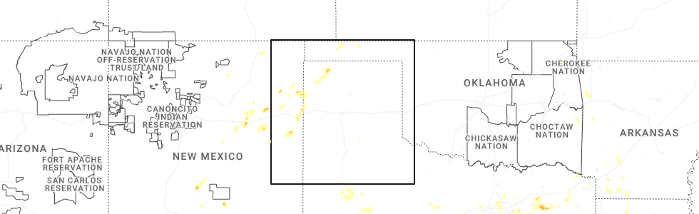
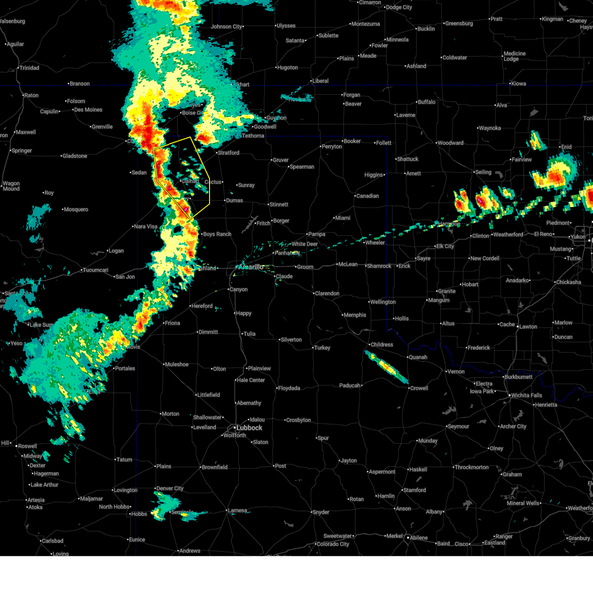
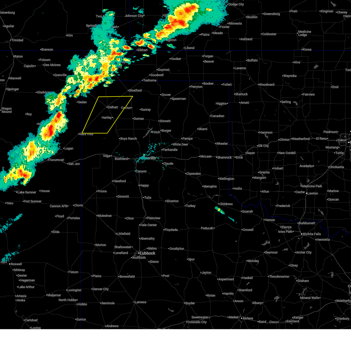
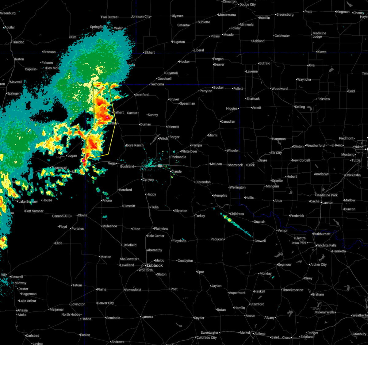
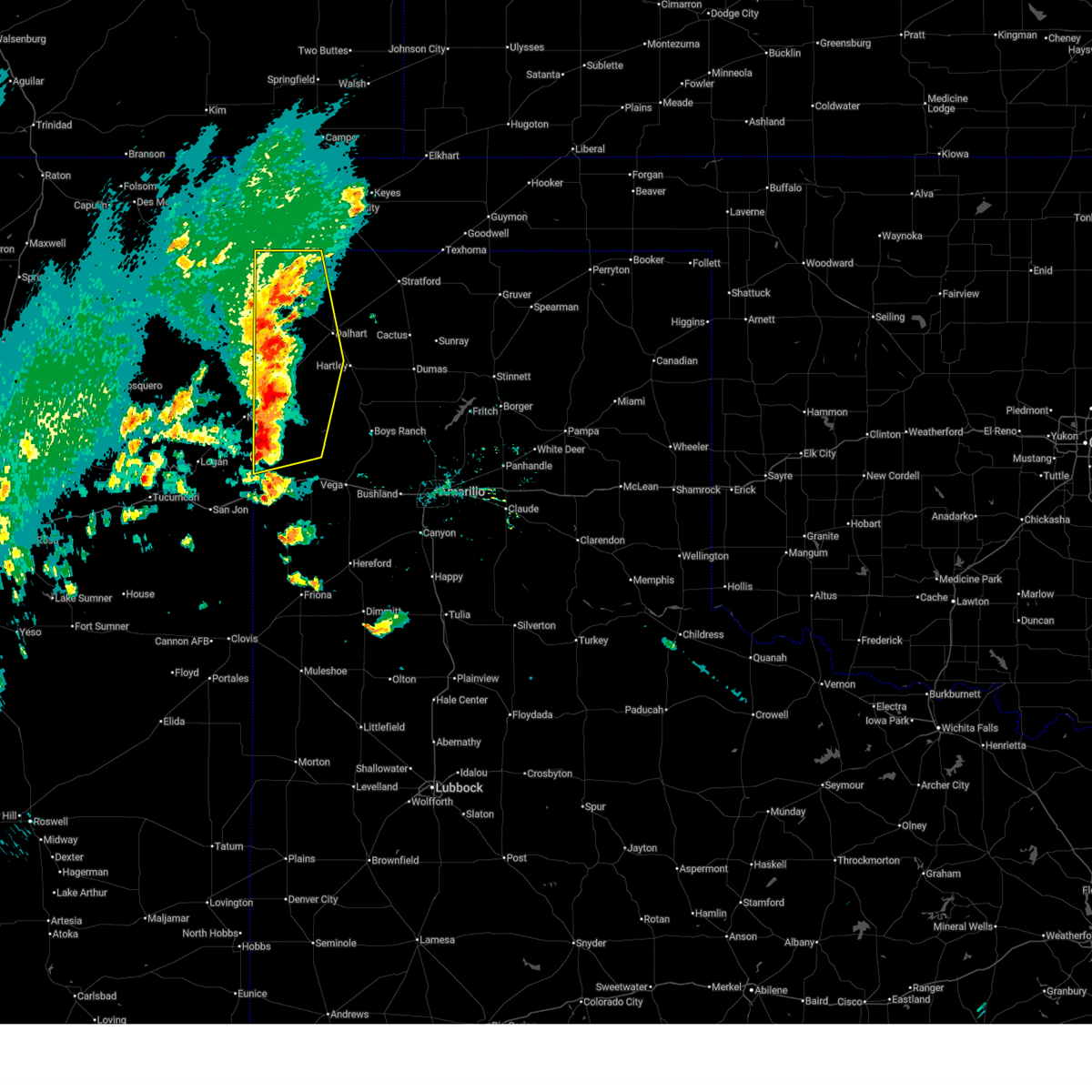
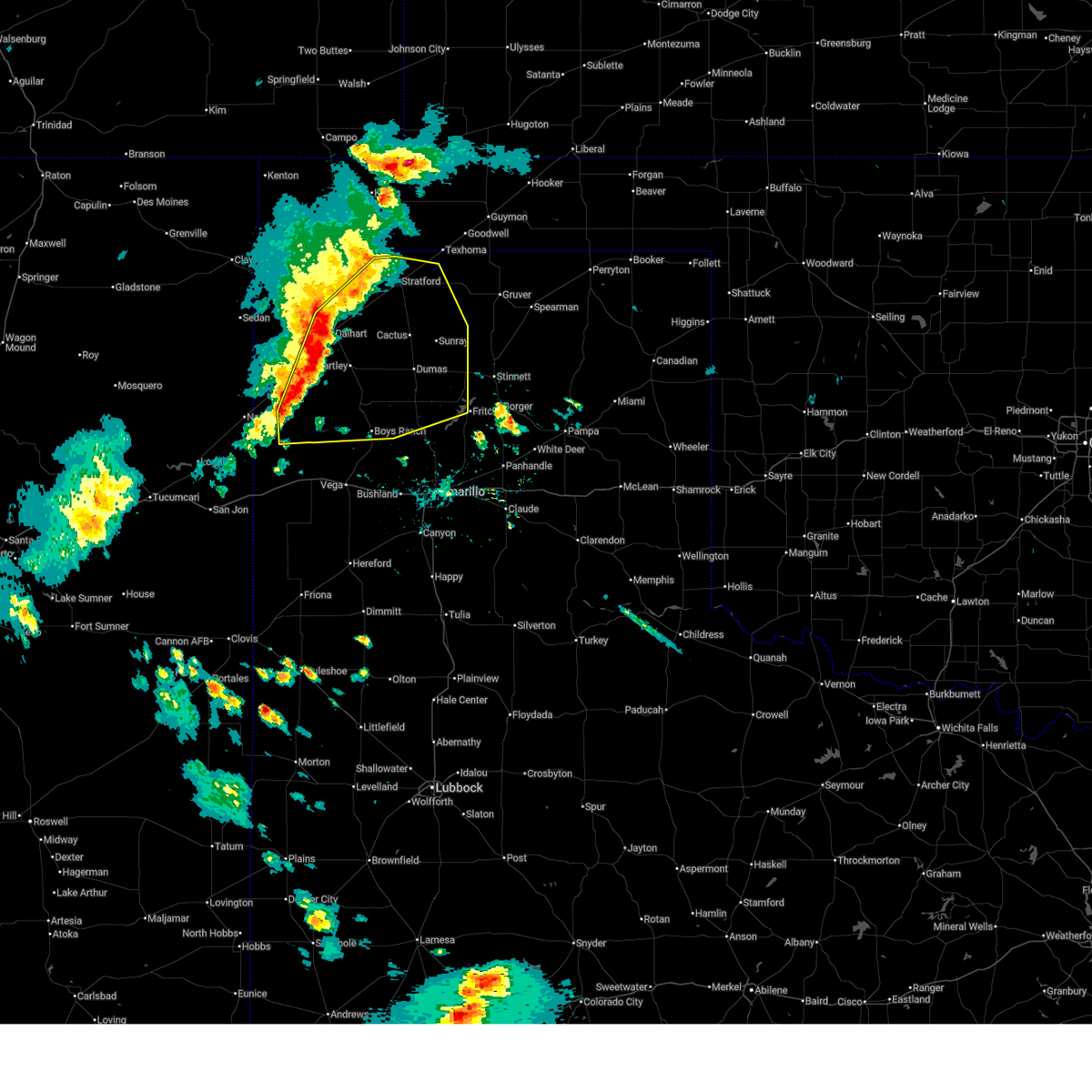
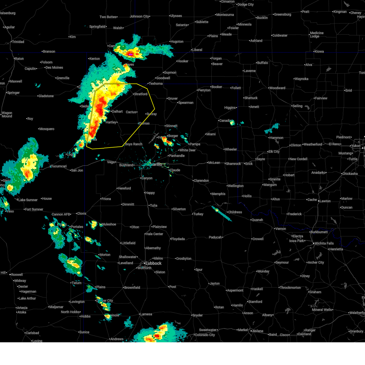
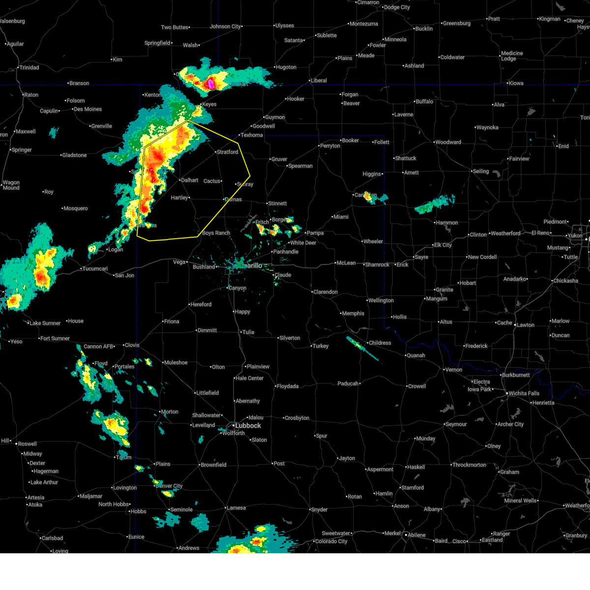
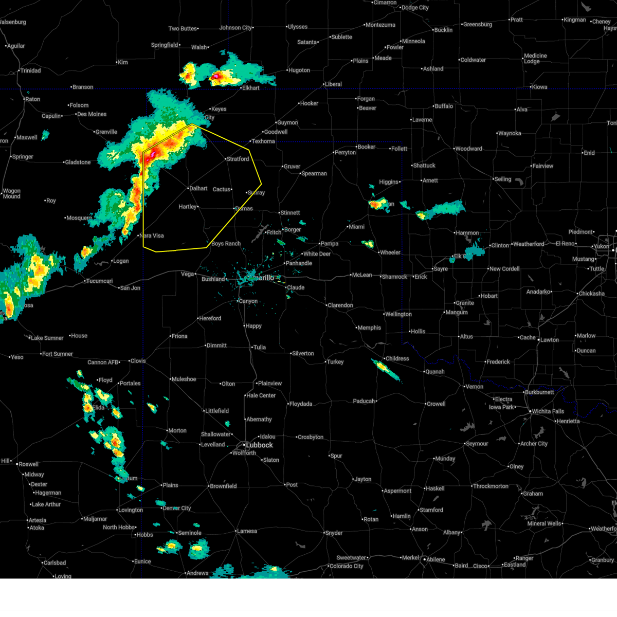
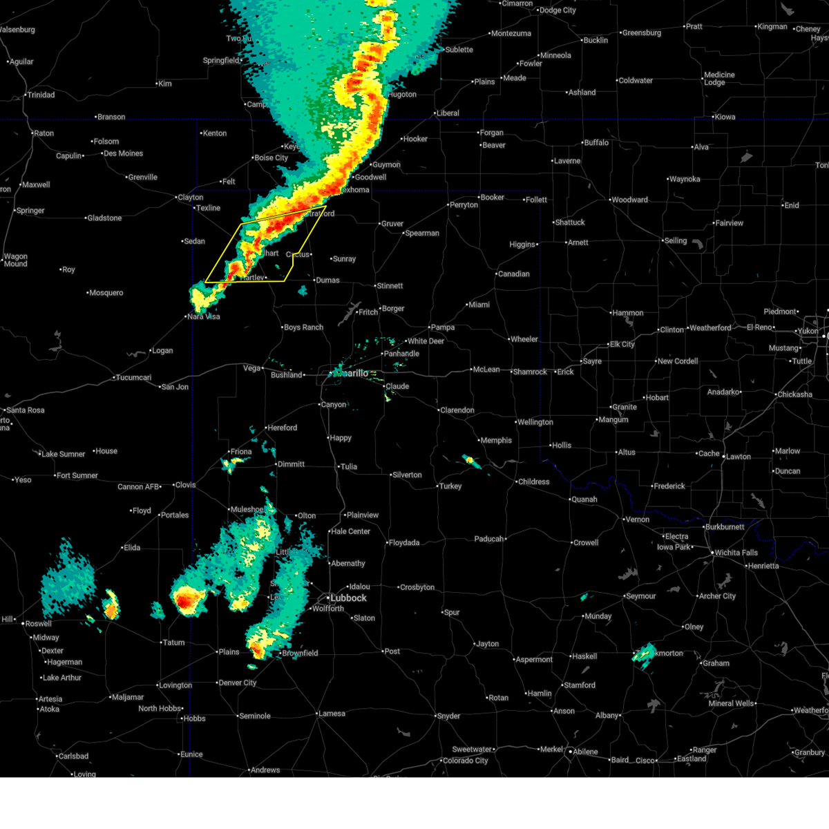
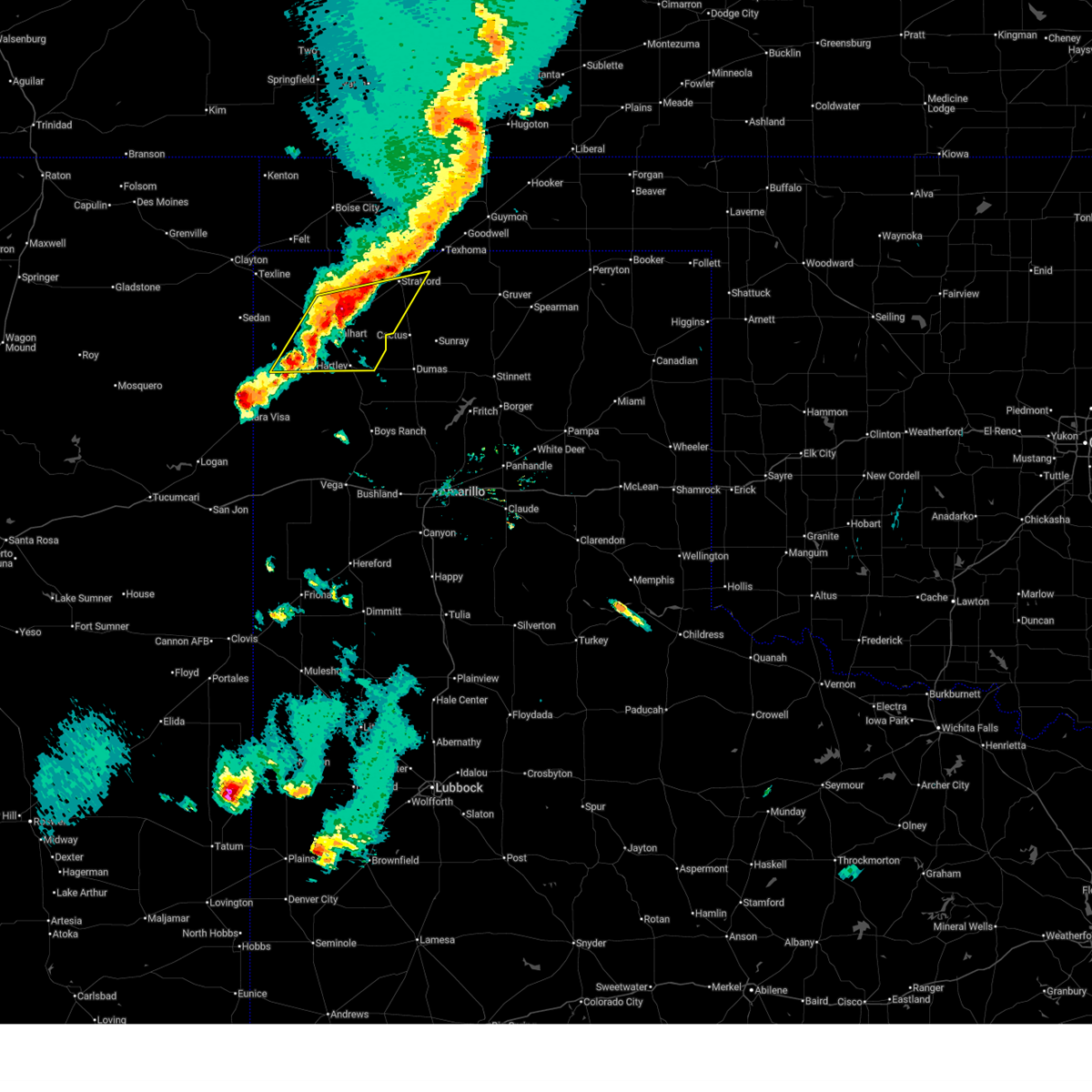
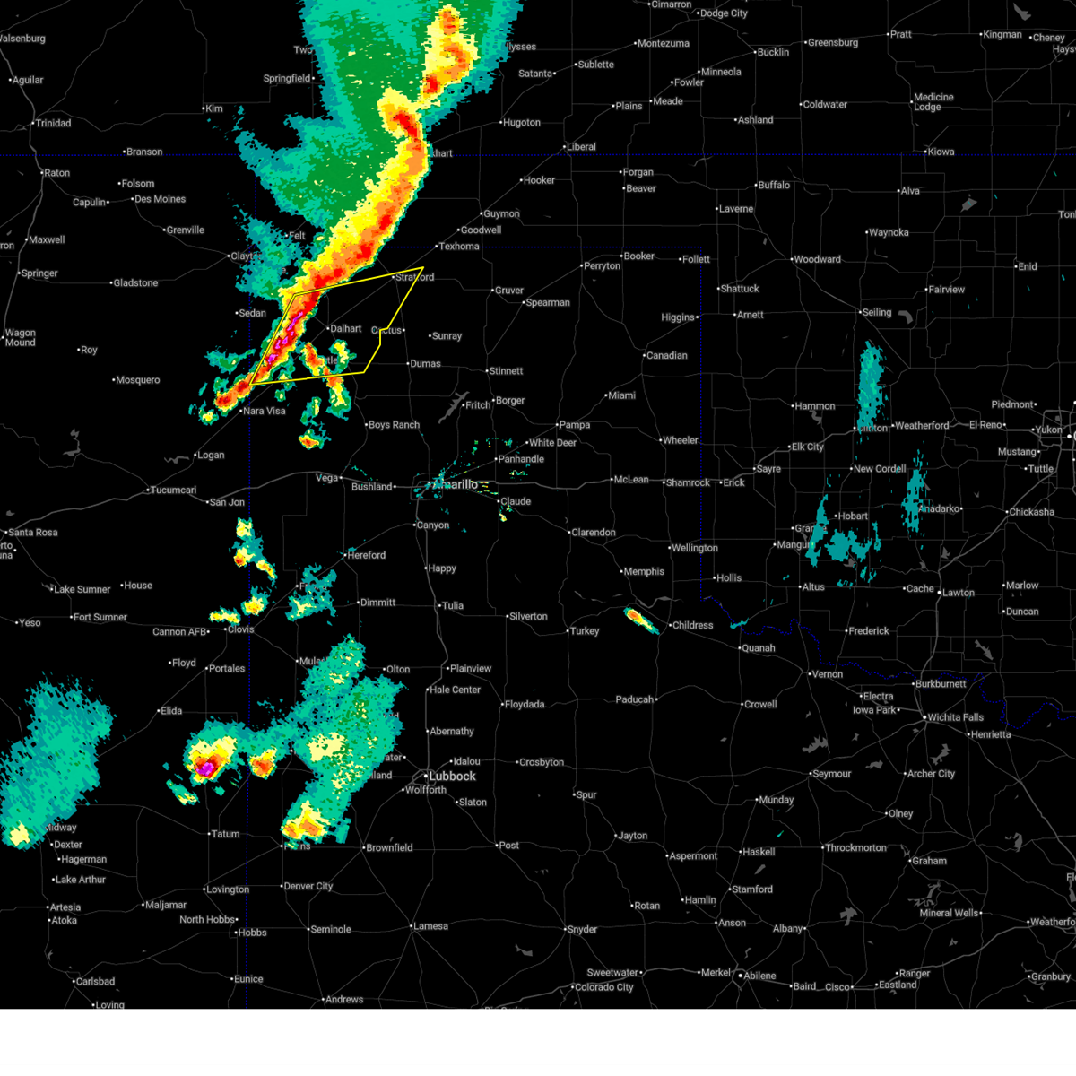
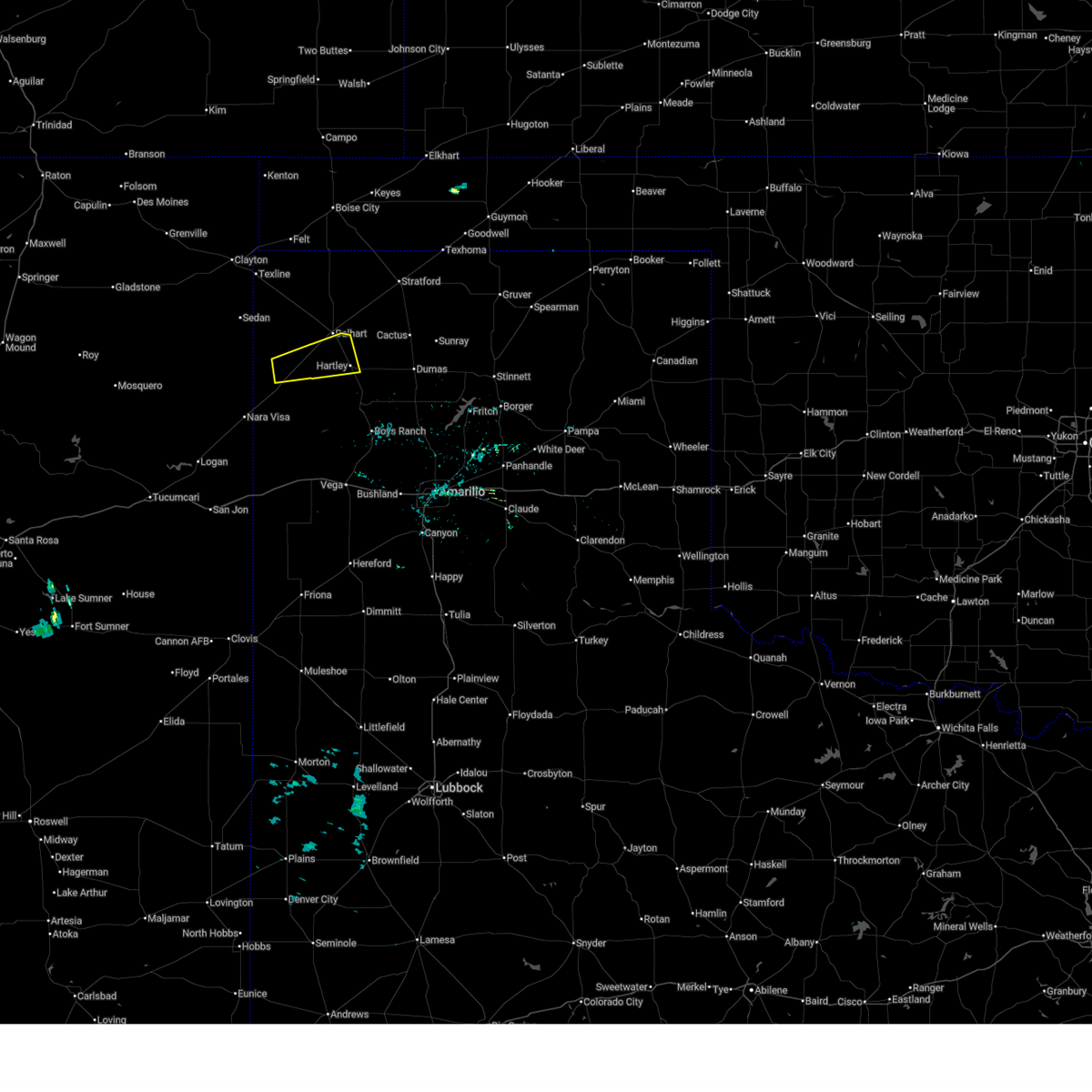
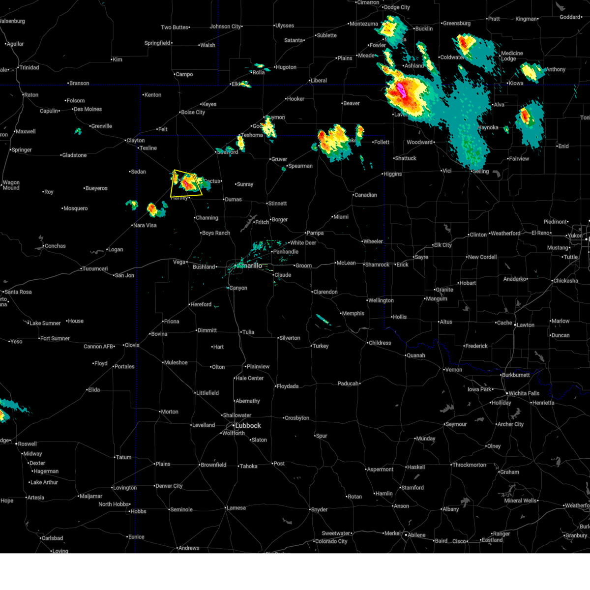
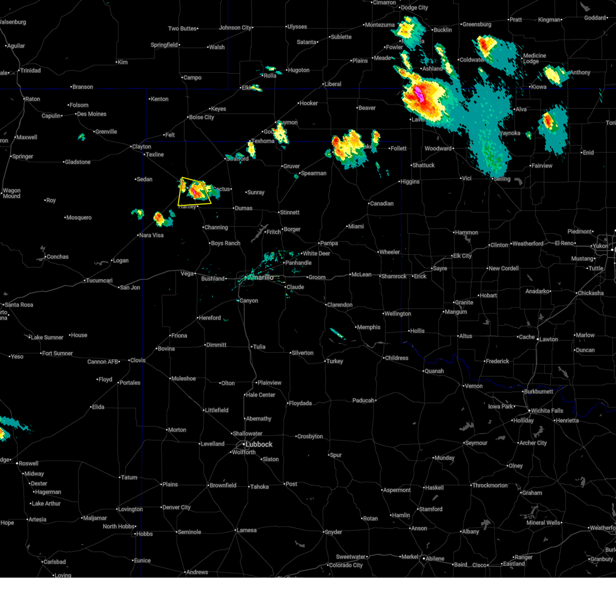
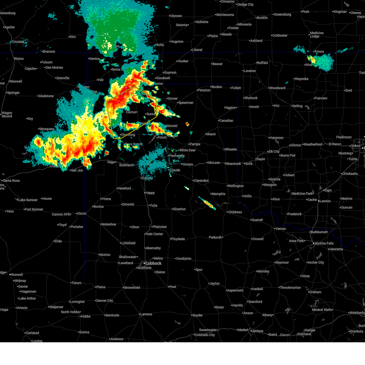
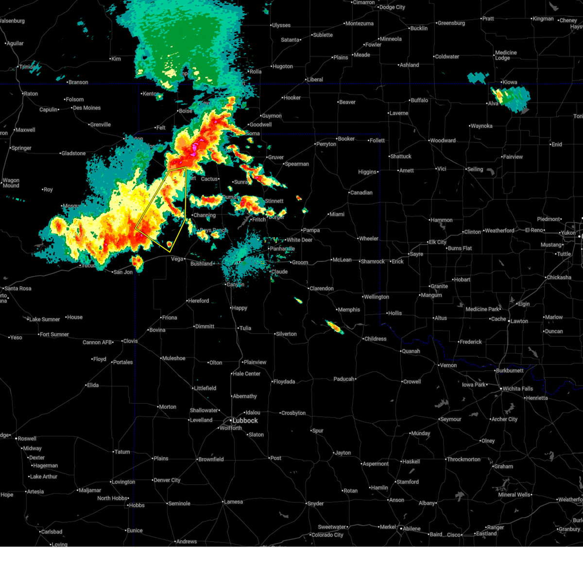
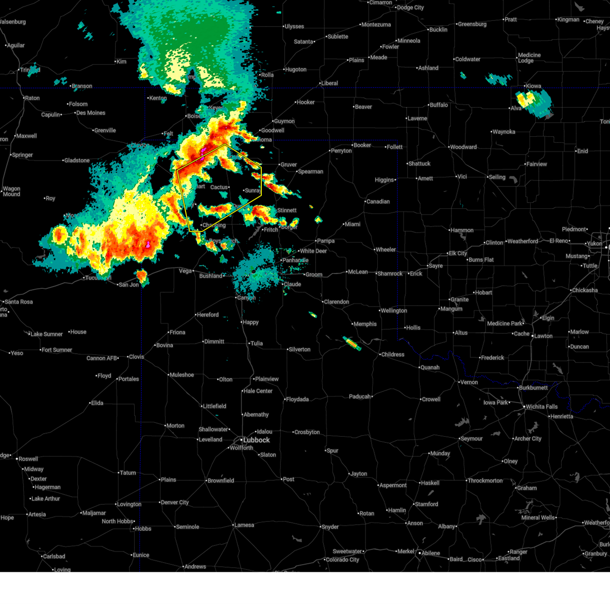
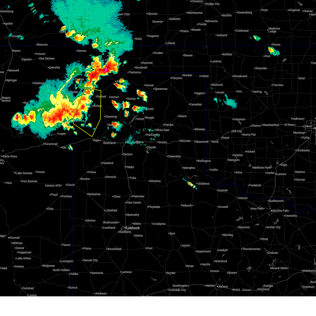
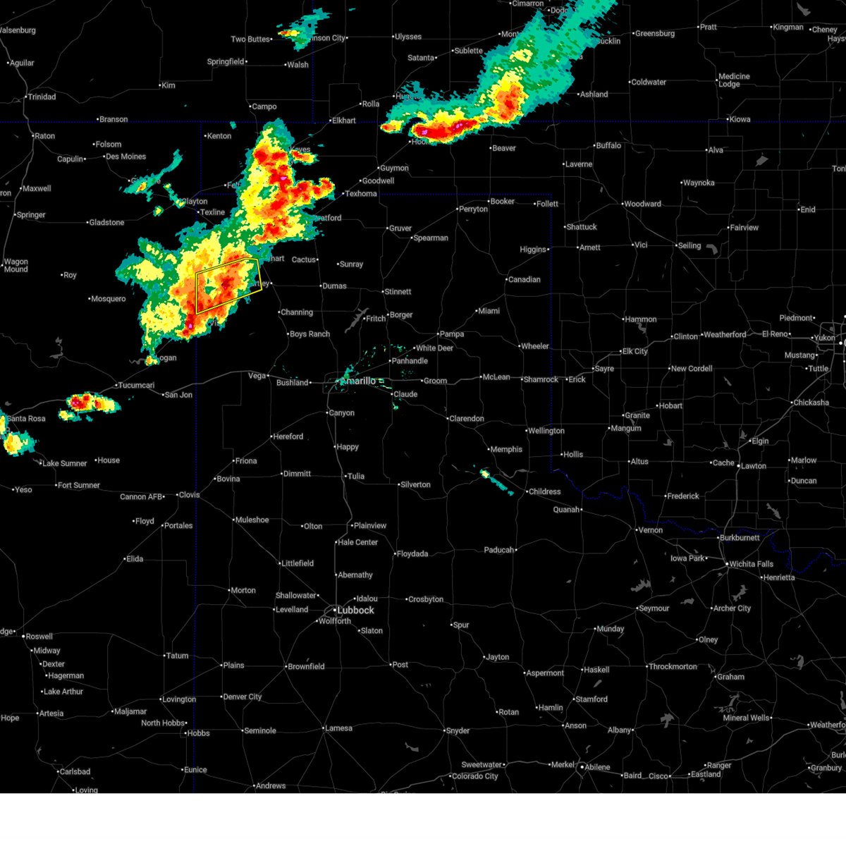
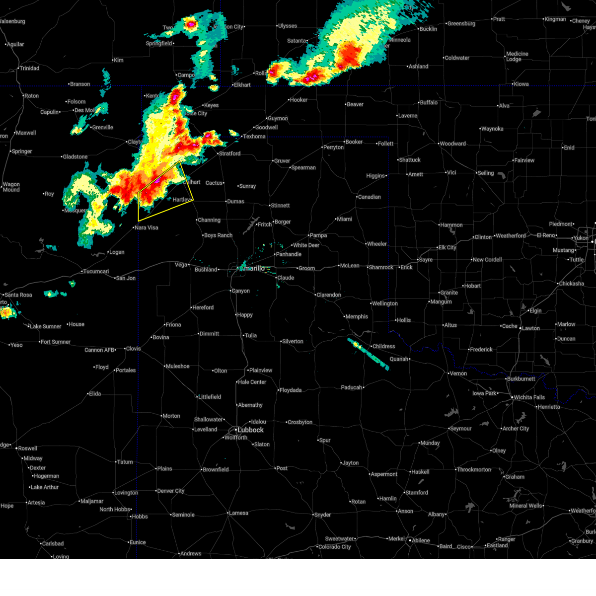
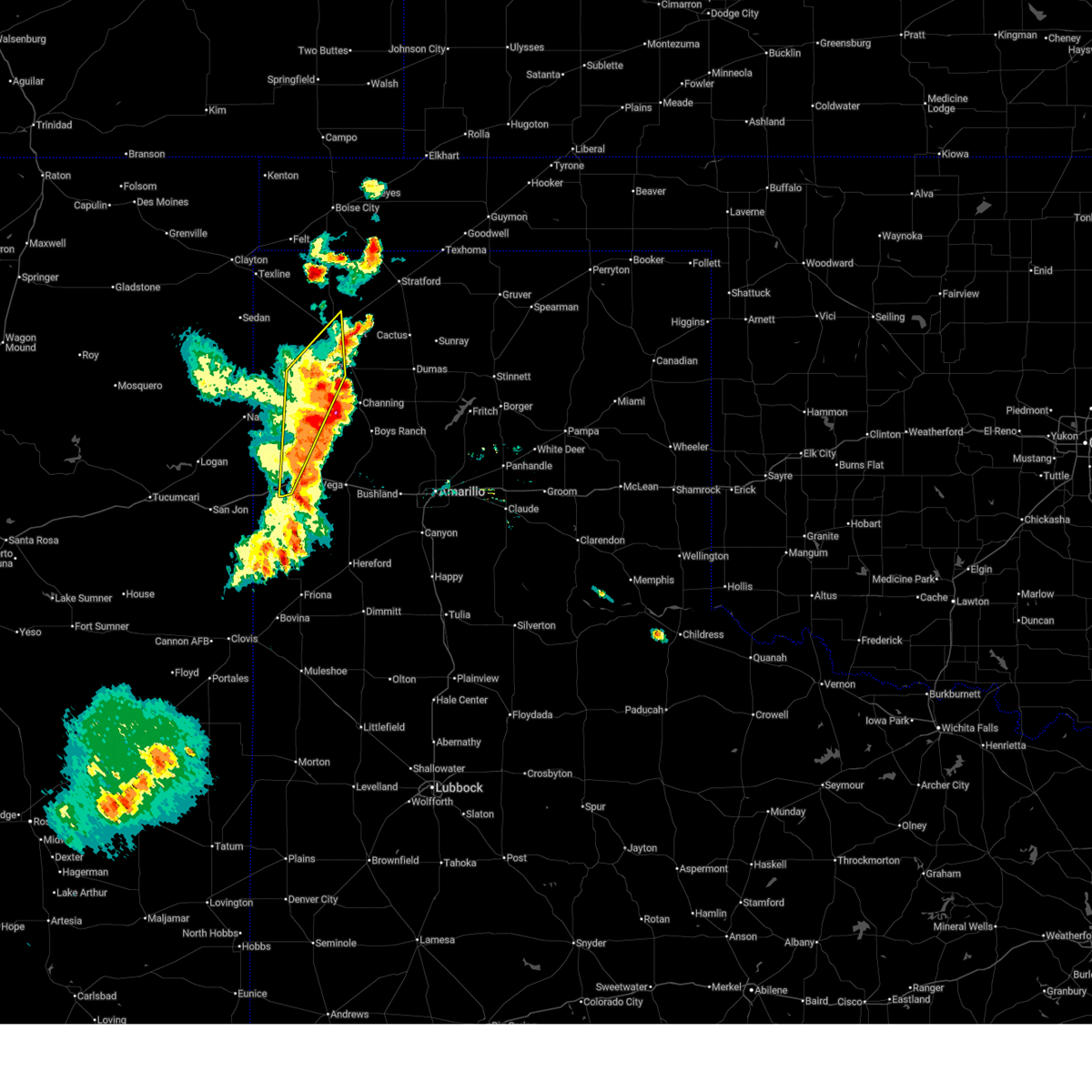
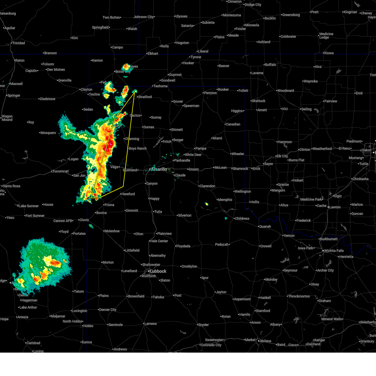
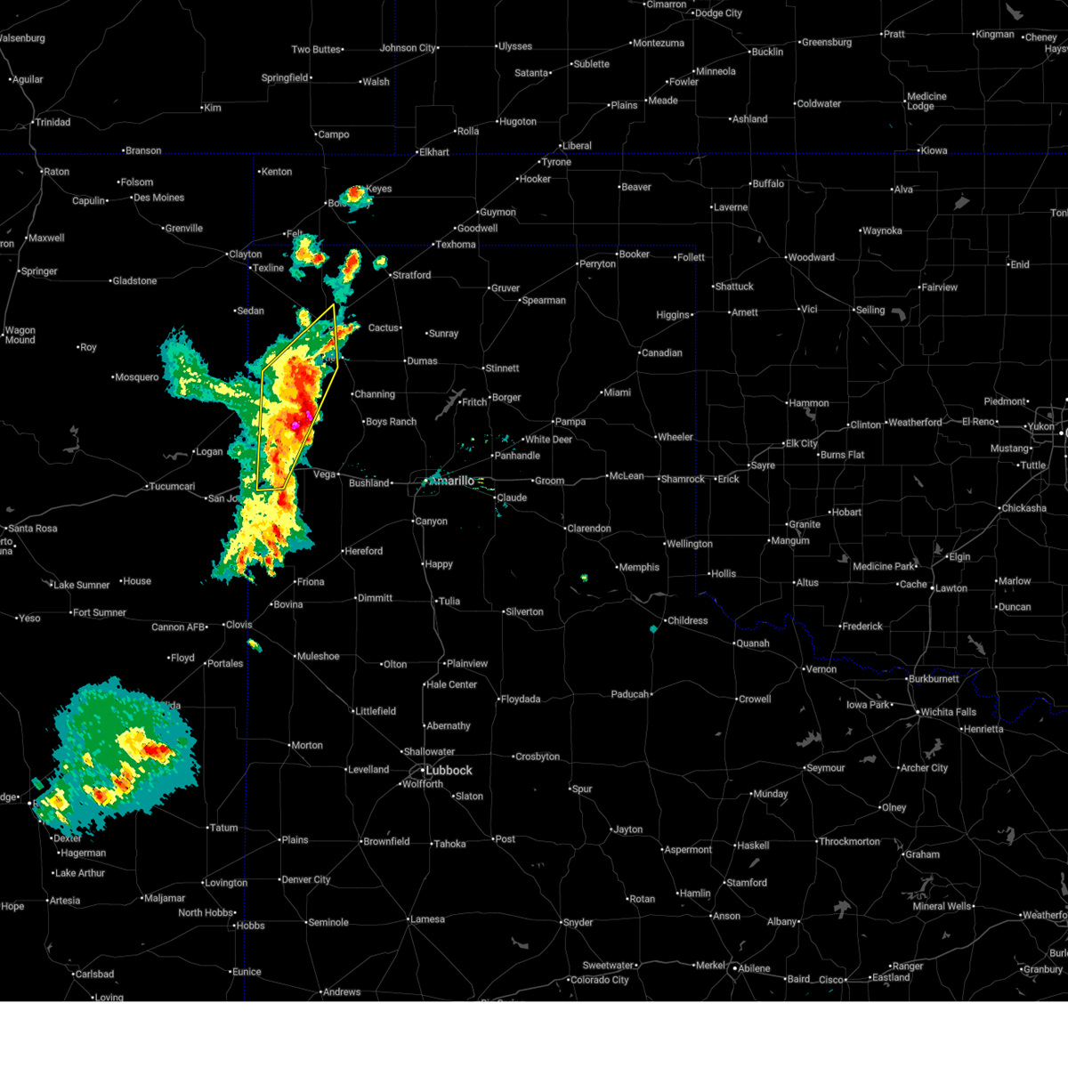
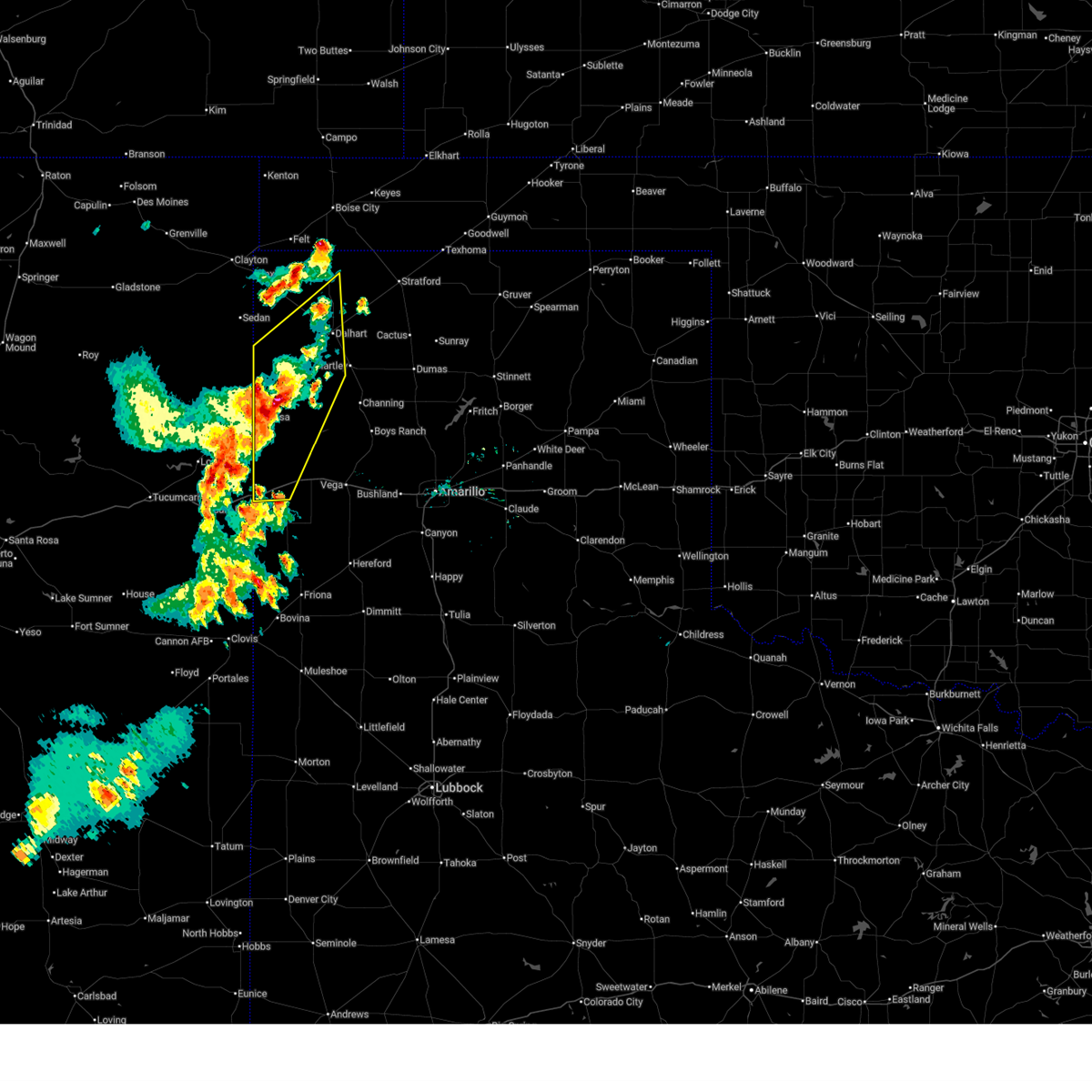
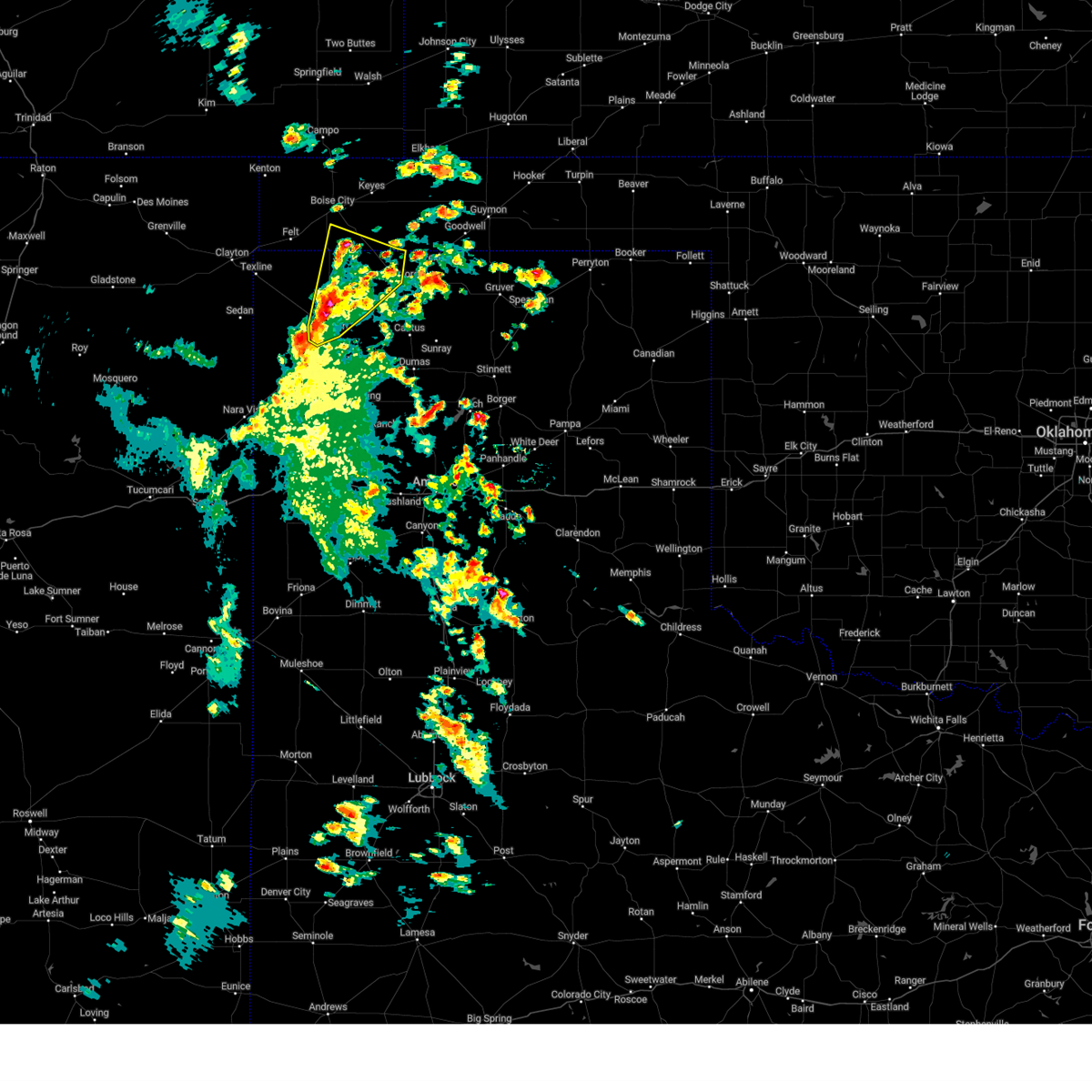
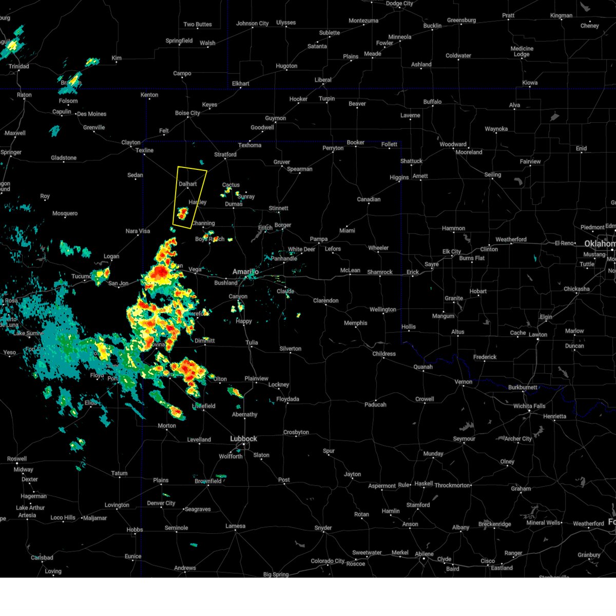
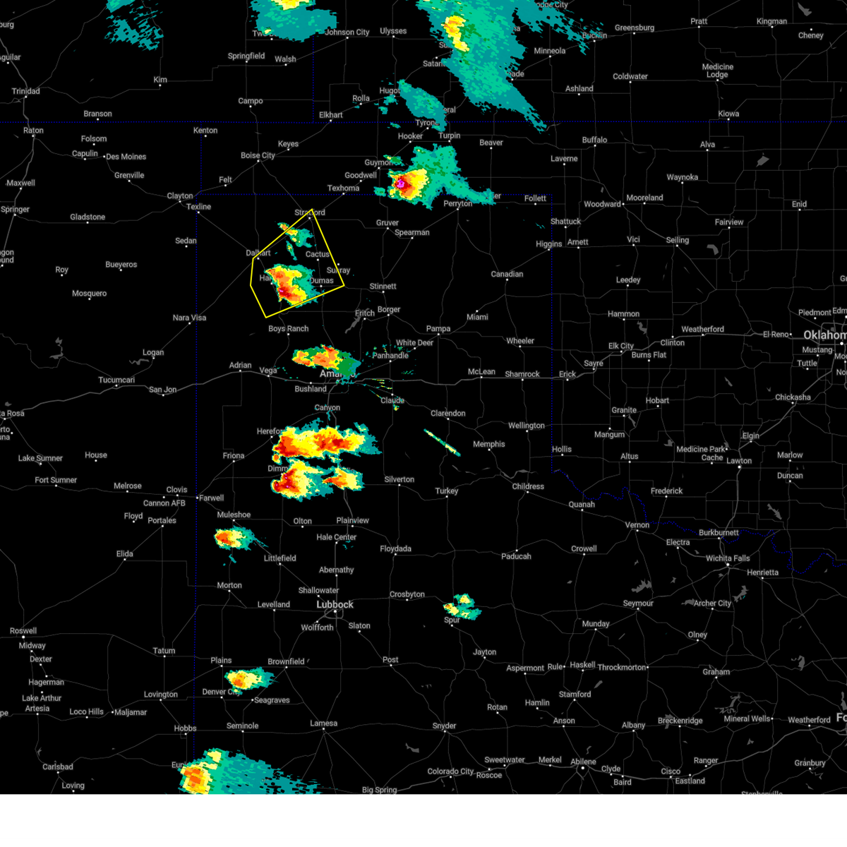
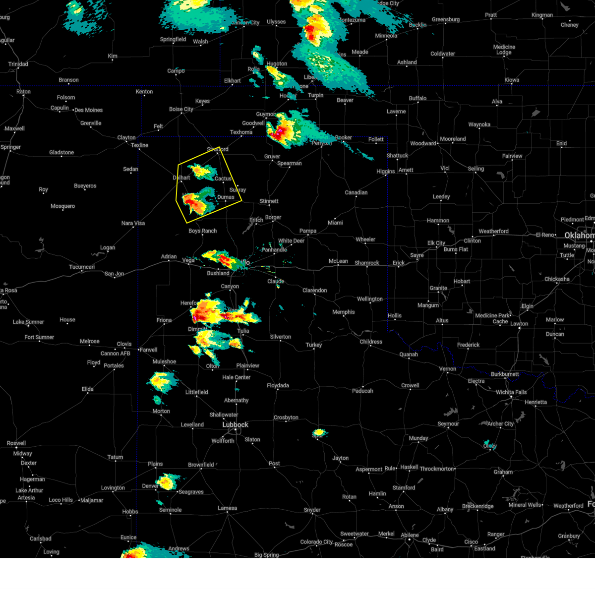
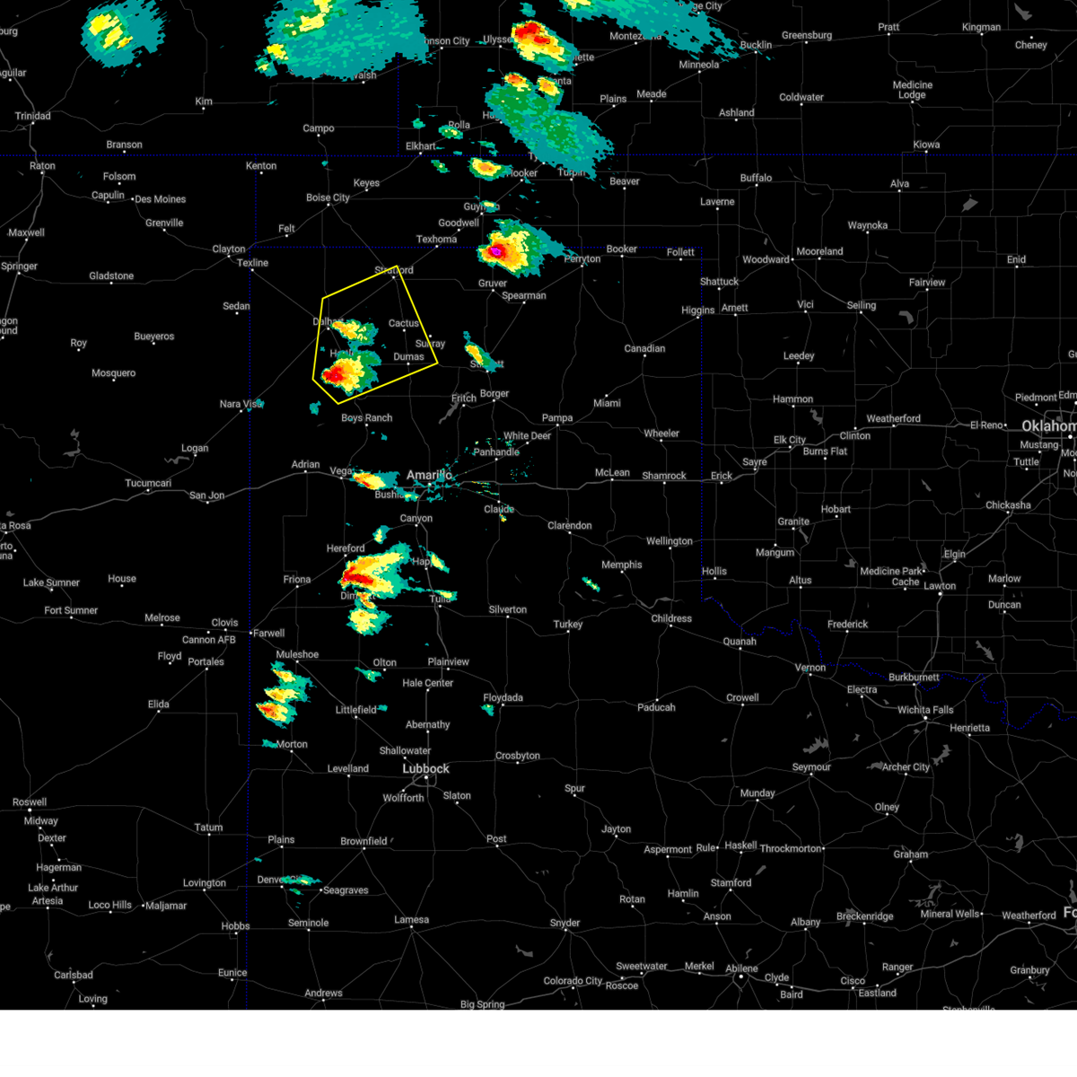
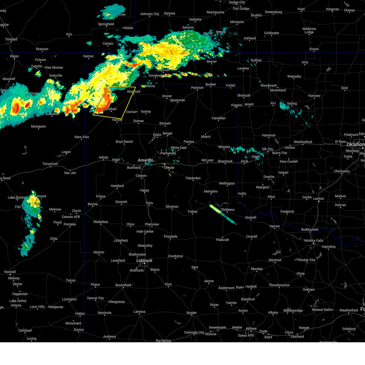
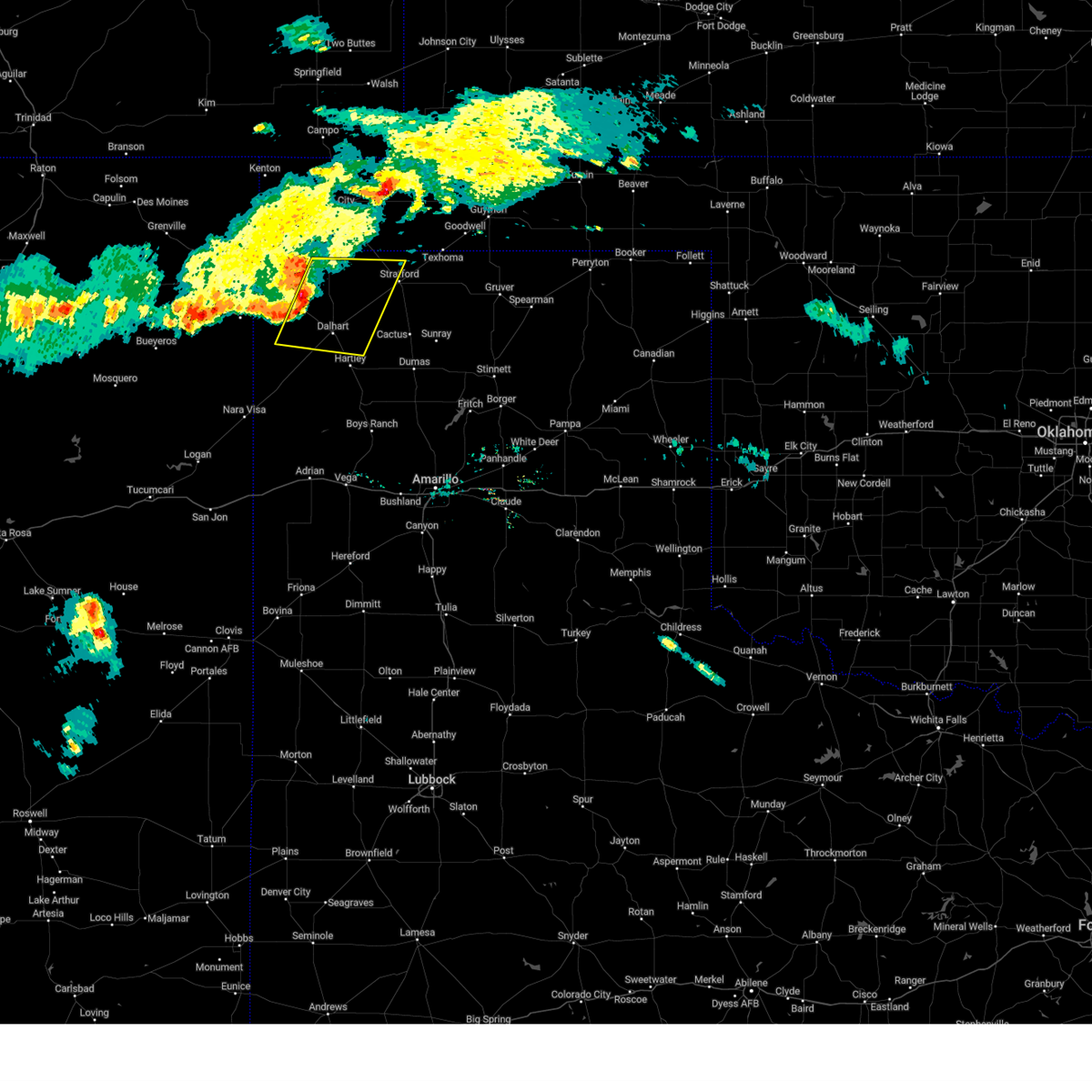
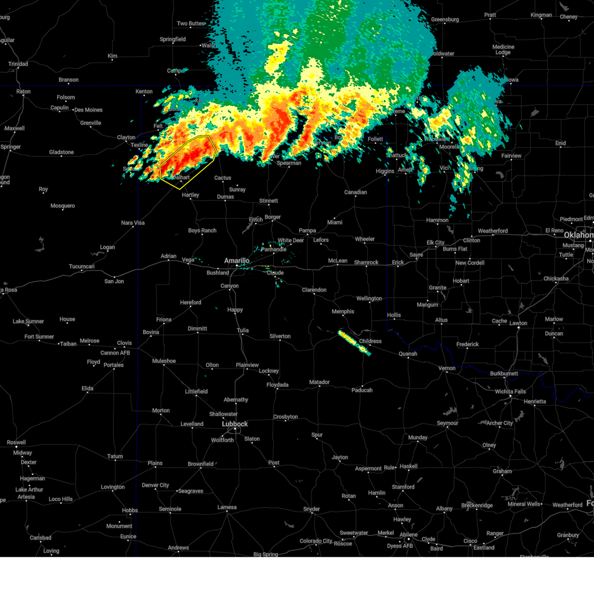
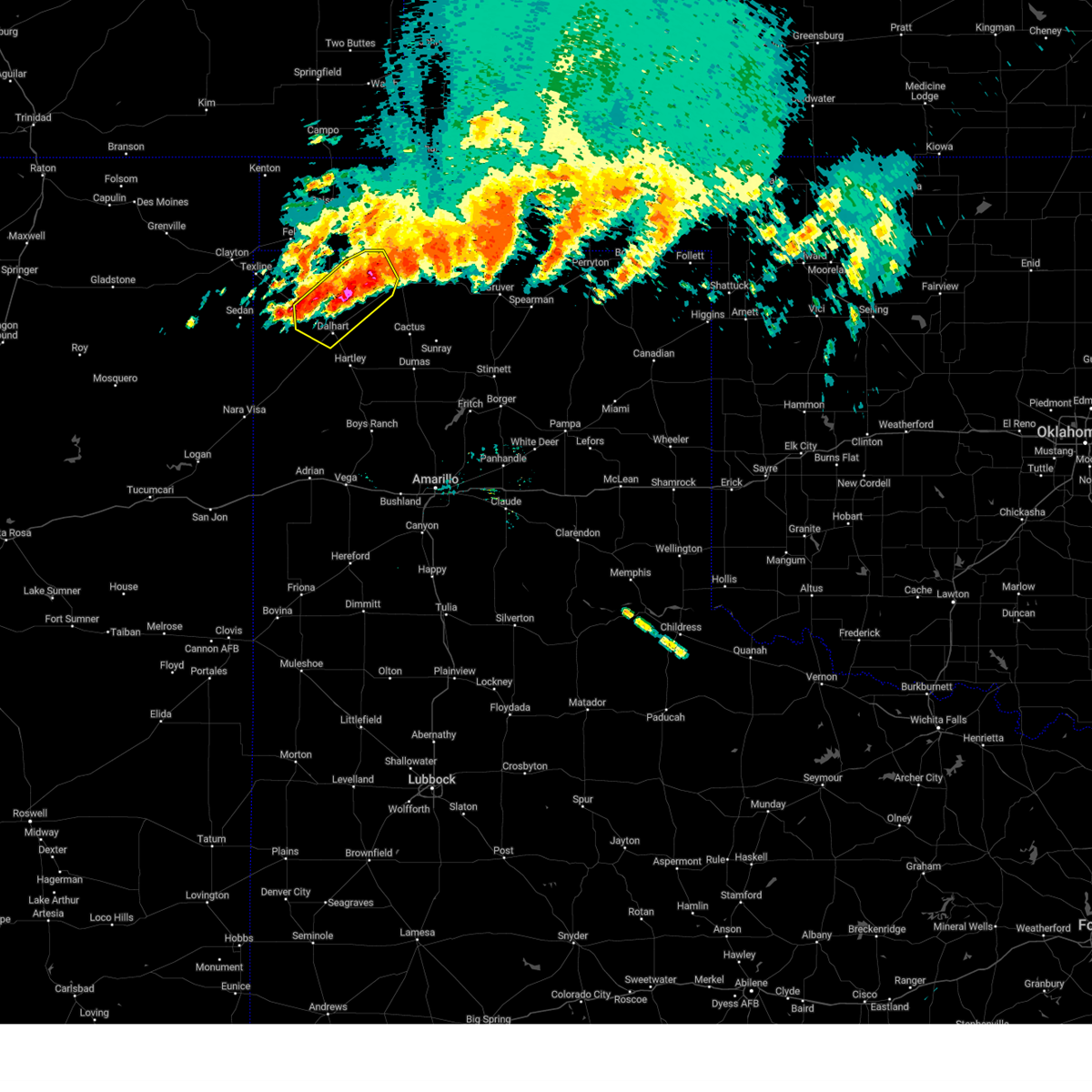
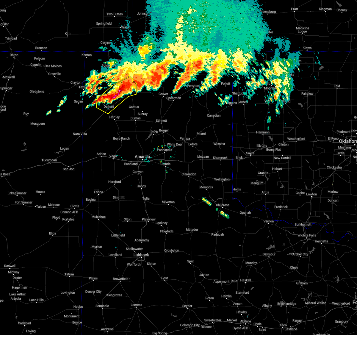
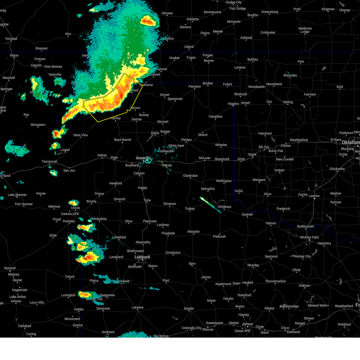
Hail Map for Dalhart, TX
The Dalhart, TX area has had 101 reports of on-the-ground hail by trained spotters, and has been under severe weather warnings 46 times during the past 12 months. Doppler radar has detected hail at or near Dalhart, TX on 97 occasions, including 9 occasions during the past year.
| Name: | Dalhart, TX |
| Where Located: | 69.7 miles NNW of Amarillo, TX |
| Map: | Google Map for Dalhart, TX |
| Population: | 7930 |
| Housing Units: | 3302 |
| More Info: | Search Google for Dalhart, TX |
1
The Top Recent Hail Date for Dalhart, TX is Tuesday, June 2, 2026 (20th out of 97)
Hail and Wind Damage Spotted near Dalhart, TX
| Date / Time | Report Details |
|---|---|
| 7/9/2026 7:36 PM CDT |
 The storms which prompted the warning have weakened below severe limits, and no longer pose an immediate threat to life or property. therefore, the warning will be allowed to expire. The storms which prompted the warning have weakened below severe limits, and no longer pose an immediate threat to life or property. therefore, the warning will be allowed to expire.
|
| 7/9/2026 7:12 PM CDT |
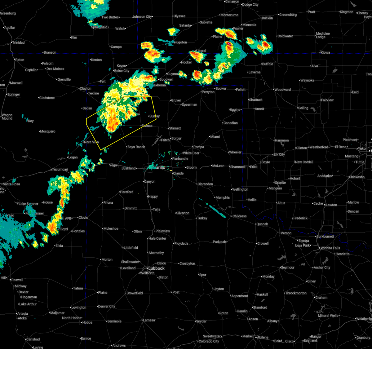
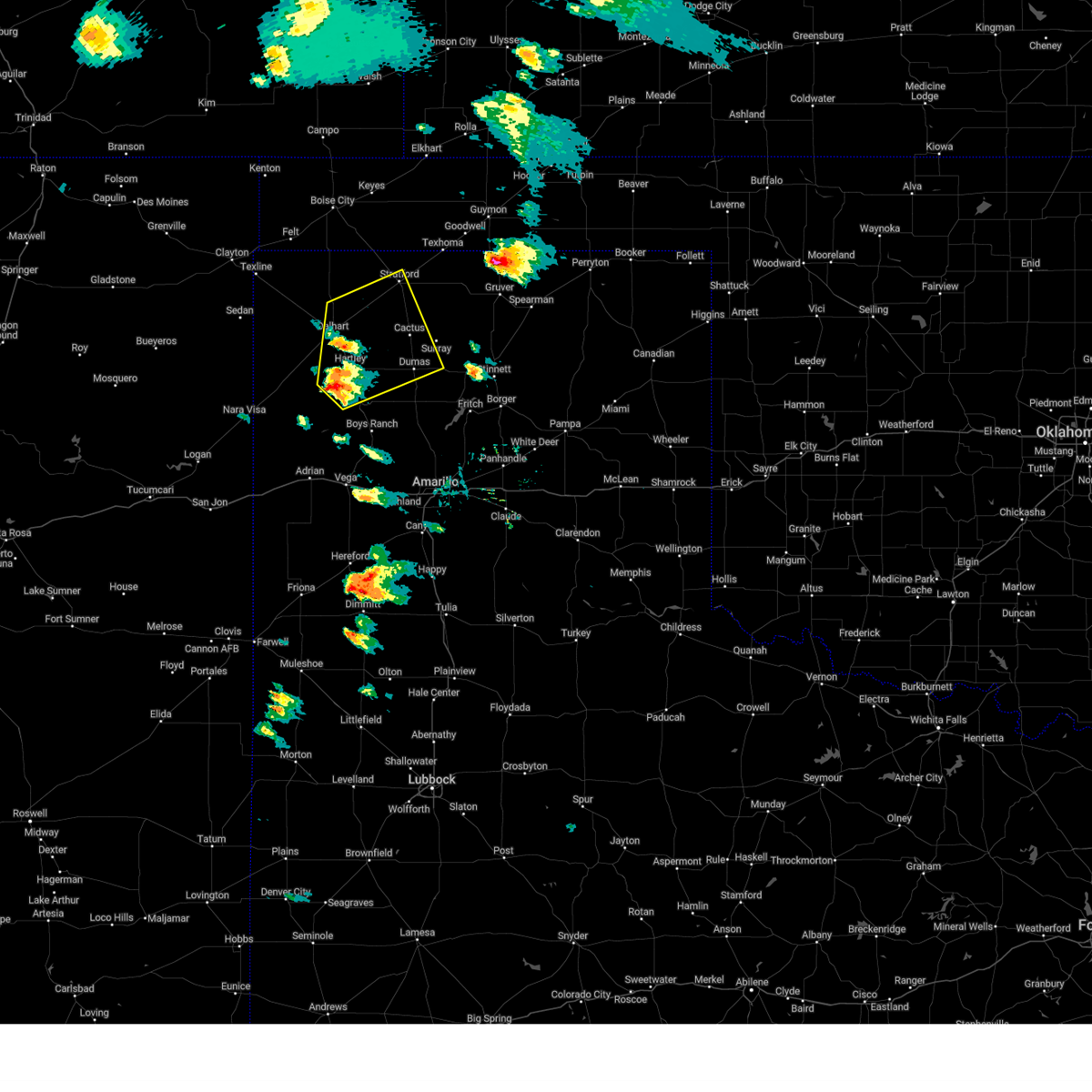
 At 712 pm cdt, severe thunderstorms were located along a line extending from conlen to 10 miles northeast of romero, moving southeast at 20 mph (radar indicated). Hazards include 60 mph wind gusts. Minor damage to roofs, siding, and trees is possible. Locations impacted include, dumas, dalhart, hartley, cactus, sunray, channing, and conlen. At 712 pm cdt, severe thunderstorms were located along a line extending from conlen to 10 miles northeast of romero, moving southeast at 20 mph (radar indicated). Hazards include 60 mph wind gusts. Minor damage to roofs, siding, and trees is possible. Locations impacted include, dumas, dalhart, hartley, cactus, sunray, channing, and conlen.
|
| 7/9/2026 6:51 PM CDT |
 Svrama the national weather service in amarillo has issued a * severe thunderstorm warning for, north central oldham county in the panhandle of texas, southern sherman county in the panhandle of texas, southeastern dallam county in the panhandle of texas, northern moore county in the panhandle of texas, hartley county in the panhandle of texas, * until 745 pm cdt. * at 651 pm cdt, severe thunderstorms were located along a line extending from near conlen to 7 miles north of romero, moving southeast at 35 mph (radar indicated). Hazards include 60 mph wind gusts. minor damage to roofs, siding, and trees is possible Svrama the national weather service in amarillo has issued a * severe thunderstorm warning for, north central oldham county in the panhandle of texas, southern sherman county in the panhandle of texas, southeastern dallam county in the panhandle of texas, northern moore county in the panhandle of texas, hartley county in the panhandle of texas, * until 745 pm cdt. * at 651 pm cdt, severe thunderstorms were located along a line extending from near conlen to 7 miles north of romero, moving southeast at 35 mph (radar indicated). Hazards include 60 mph wind gusts. minor damage to roofs, siding, and trees is possible
|
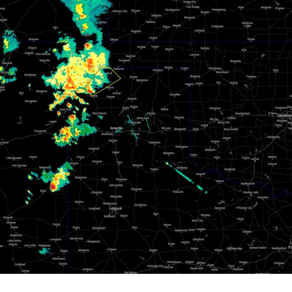
| 6/26/2026 9:38 PM CDT | Storm damage reported in hartley county TX, 3.2 miles NE of Dalhart, TX |
| 6/26/2026 9:30 PM CDT |
 Svrama the national weather service in amarillo has issued a * severe thunderstorm warning for, central dallam county in the panhandle of texas, eastern hartley county in the panhandle of texas, * until 1000 pm cdt. * at 930 pm cdt, severe thunderstorms were located along a line extending from 9 miles north of ware to 5 miles north of channing, moving east at 60 mph. these are destructive storms for dalhart and hartley (radar indicated). Hazards include 80 mph wind gusts. Flying debris will be dangerous to those caught without shelter. mobile homes will be heavily damaged. expect considerable damage to roofs, windows, and vehicles. Tree damage and power outages are likely. Svrama the national weather service in amarillo has issued a * severe thunderstorm warning for, central dallam county in the panhandle of texas, eastern hartley county in the panhandle of texas, * until 1000 pm cdt. * at 930 pm cdt, severe thunderstorms were located along a line extending from 9 miles north of ware to 5 miles north of channing, moving east at 60 mph. these are destructive storms for dalhart and hartley (radar indicated). Hazards include 80 mph wind gusts. Flying debris will be dangerous to those caught without shelter. mobile homes will be heavily damaged. expect considerable damage to roofs, windows, and vehicles. Tree damage and power outages are likely.
|
| 6/26/2026 9:22 PM CDT | Severe wind gusts occurred from 9:17 pm to 9:18 pm then from 9:20 pm to 9:23 p in hartley county TX, 11.8 miles NE of Dalhart, TX |
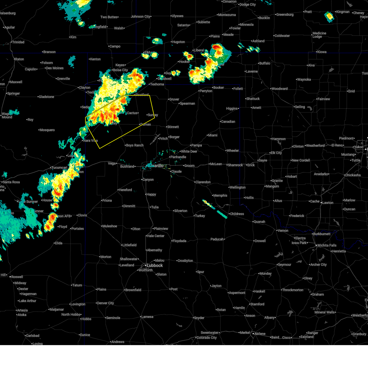
| 6/26/2026 9:17 PM CDT |
 At 917 pm cdt, severe thunderstorms were located along a line extending from 12 miles northeast of black mesa park to 6 miles west of felt to 14 miles east of romero, moving east at 30 mph (radar indicated). Hazards include 70 mph wind gusts and quarter size hail. Expect some tree damage. damage is likely to mobile homes, roofs, and outbuildings. hail damage to vehicles is expected. Locations impacted include, dalhart, boise city, hartley, texline, channing, kenton, wheeless, black mesa park, ware, and felt. At 917 pm cdt, severe thunderstorms were located along a line extending from 12 miles northeast of black mesa park to 6 miles west of felt to 14 miles east of romero, moving east at 30 mph (radar indicated). Hazards include 70 mph wind gusts and quarter size hail. Expect some tree damage. damage is likely to mobile homes, roofs, and outbuildings. hail damage to vehicles is expected. Locations impacted include, dalhart, boise city, hartley, texline, channing, kenton, wheeless, black mesa park, ware, and felt.
|
| 6/26/2026 8:59 PM CDT |
 Svrama the national weather service in amarillo has issued a * severe thunderstorm warning for, western cimarron county in the panhandle of oklahoma, dallam county in the panhandle of texas, hartley county in the panhandle of texas, * until 1000 pm cdt. * at 858 pm cdt, severe thunderstorms were located along a line extending from 6 miles north of kenton to 6 miles southeast of seneca to 7 miles southeast of romero, moving east at 30 mph (radar indicated). Hazards include 70 mph wind gusts and nickel size hail. Expect some tree damage. Damage is likely to mobile homes, roofs, and outbuildings. Svrama the national weather service in amarillo has issued a * severe thunderstorm warning for, western cimarron county in the panhandle of oklahoma, dallam county in the panhandle of texas, hartley county in the panhandle of texas, * until 1000 pm cdt. * at 858 pm cdt, severe thunderstorms were located along a line extending from 6 miles north of kenton to 6 miles southeast of seneca to 7 miles southeast of romero, moving east at 30 mph (radar indicated). Hazards include 70 mph wind gusts and nickel size hail. Expect some tree damage. Damage is likely to mobile homes, roofs, and outbuildings.
|
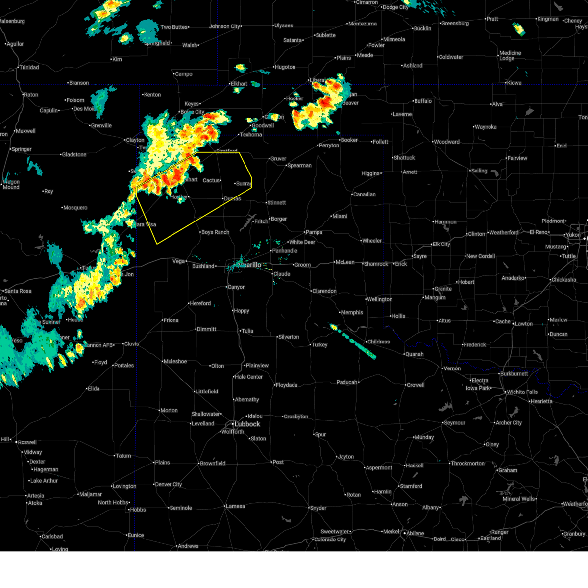
| 6/12/2026 10:44 PM CDT |
 Svrama the national weather service in amarillo has issued a * severe thunderstorm warning for, oldham county in the panhandle of texas, northwestern potter county in the panhandle of texas, western moore county in the panhandle of texas, hartley county in the panhandle of texas, * until 1145 pm cdt. * at 1043 pm cdt, severe thunderstorms were located along a line extending from 8 miles northwest of hartley to 16 miles east of romero to 8 miles southeast of nara visa, moving southeast at 40 mph (radar indicated). Hazards include 70 mph wind gusts. Expect some tree damage. Damage is likely to mobile homes, roofs, and outbuildings. Svrama the national weather service in amarillo has issued a * severe thunderstorm warning for, oldham county in the panhandle of texas, northwestern potter county in the panhandle of texas, western moore county in the panhandle of texas, hartley county in the panhandle of texas, * until 1145 pm cdt. * at 1043 pm cdt, severe thunderstorms were located along a line extending from 8 miles northwest of hartley to 16 miles east of romero to 8 miles southeast of nara visa, moving southeast at 40 mph (radar indicated). Hazards include 70 mph wind gusts. Expect some tree damage. Damage is likely to mobile homes, roofs, and outbuildings.
|
| 6/12/2026 10:29 PM CDT | Thunderstorm wind gust of 61 mph measured at the wt mesonet station 12 miles sw of dalhar in hartley county TX, 12.3 miles NE of Dalhart, TX |
| 6/9/2026 6:53 PM CDT |
 The storm which prompted the warning has weakened below severe limits, and no longer poses an immediate threat to life or property. therefore, the warning will be allowed to expire. however gusty winds are still possible with this thunderstorm. a severe thunderstorm watch remains in effect until 1000 pm cdt for the panhandle of texas. The storm which prompted the warning has weakened below severe limits, and no longer poses an immediate threat to life or property. therefore, the warning will be allowed to expire. however gusty winds are still possible with this thunderstorm. a severe thunderstorm watch remains in effect until 1000 pm cdt for the panhandle of texas.
|
| 6/9/2026 6:39 PM CDT |
 At 638 pm cdt, a severe thunderstorm was located over dalhart, moving northeast at 25 mph (radar indicated). Hazards include 60 mph wind gusts and penny size hail. Minor damage to roofs, siding, and trees is possible. Locations impacted include, dalhart, hartley, ware, romero, and conlen. At 638 pm cdt, a severe thunderstorm was located over dalhart, moving northeast at 25 mph (radar indicated). Hazards include 60 mph wind gusts and penny size hail. Minor damage to roofs, siding, and trees is possible. Locations impacted include, dalhart, hartley, ware, romero, and conlen.
|
| 6/9/2026 6:29 PM CDT |
 At 629 pm cdt, a severe thunderstorm was located 5 miles south of dalhart, moving northeast at 25 mph (radar indicated). Hazards include 60 mph wind gusts and penny size hail. Minor damage to roofs, siding, and trees is possible. Locations impacted include, dalhart, hartley, ware, romero, and conlen. At 629 pm cdt, a severe thunderstorm was located 5 miles south of dalhart, moving northeast at 25 mph (radar indicated). Hazards include 60 mph wind gusts and penny size hail. Minor damage to roofs, siding, and trees is possible. Locations impacted include, dalhart, hartley, ware, romero, and conlen.
|
| 6/9/2026 6:05 PM CDT |
 Svrama the national weather service in amarillo has issued a * severe thunderstorm warning for, southwestern sherman county in the panhandle of texas, southern dallam county in the panhandle of texas, hartley county in the panhandle of texas, * until 700 pm cdt. * at 604 pm cdt, a severe thunderstorm was located 12 miles southwest of dalhart, moving northeast at 25 mph (radar indicated). Hazards include 60 mph wind gusts and penny size hail. minor damage to roofs, siding, and trees is possible Svrama the national weather service in amarillo has issued a * severe thunderstorm warning for, southwestern sherman county in the panhandle of texas, southern dallam county in the panhandle of texas, hartley county in the panhandle of texas, * until 700 pm cdt. * at 604 pm cdt, a severe thunderstorm was located 12 miles southwest of dalhart, moving northeast at 25 mph (radar indicated). Hazards include 60 mph wind gusts and penny size hail. minor damage to roofs, siding, and trees is possible
|
| 6/2/2026 4:47 PM CDT |
 At 447 pm cdt, severe thunderstorms were located along a line extending from 9 miles southeast of felt to 10 miles west of hartley to 15 miles north of adrian, moving northeast at 35 mph (radar indicated). Hazards include 60 mph wind gusts and penny size hail. Minor damage to roofs, siding, and trees is possible. Locations impacted include, dalhart, ware, and romero. At 447 pm cdt, severe thunderstorms were located along a line extending from 9 miles southeast of felt to 10 miles west of hartley to 15 miles north of adrian, moving northeast at 35 mph (radar indicated). Hazards include 60 mph wind gusts and penny size hail. Minor damage to roofs, siding, and trees is possible. Locations impacted include, dalhart, ware, and romero.
|
| 6/2/2026 4:13 PM CDT |
 Svrama the national weather service in amarillo has issued a * severe thunderstorm warning for, northwestern oldham county in the panhandle of texas, western dallam county in the panhandle of texas, hartley county in the panhandle of texas, * until 515 pm cdt. * at 412 pm cdt, severe thunderstorms were located along a line extending from 7 miles southeast of texline to 5 miles northeast of romero to 12 miles north of glenrio, moving northeast at 20 mph (radar indicated). Hazards include 60 mph wind gusts and penny size hail. minor damage to roofs, siding, and trees is possible Svrama the national weather service in amarillo has issued a * severe thunderstorm warning for, northwestern oldham county in the panhandle of texas, western dallam county in the panhandle of texas, hartley county in the panhandle of texas, * until 515 pm cdt. * at 412 pm cdt, severe thunderstorms were located along a line extending from 7 miles southeast of texline to 5 miles northeast of romero to 12 miles north of glenrio, moving northeast at 20 mph (radar indicated). Hazards include 60 mph wind gusts and penny size hail. minor damage to roofs, siding, and trees is possible
|
| 5/23/2026 6:27 PM CDT |
 Svrama the national weather service in amarillo has issued a * severe thunderstorm warning for, northern oldham county in the panhandle of texas, sherman county in the panhandle of texas, northwestern potter county in the panhandle of texas, southeastern dallam county in the panhandle of texas, moore county in the panhandle of texas, hartley county in the panhandle of texas, * until 730 pm cdt. * at 627 pm cdt, severe thunderstorms were located along a line extending from 3 miles southwest of stratford to 4 miles northwest of hartley to 13 miles north of adrian, moving southeast at 45 mph (radar indicated). Hazards include 60 mph wind gusts and penny size hail. minor damage to roofs, siding, and trees is possible Svrama the national weather service in amarillo has issued a * severe thunderstorm warning for, northern oldham county in the panhandle of texas, sherman county in the panhandle of texas, northwestern potter county in the panhandle of texas, southeastern dallam county in the panhandle of texas, moore county in the panhandle of texas, hartley county in the panhandle of texas, * until 730 pm cdt. * at 627 pm cdt, severe thunderstorms were located along a line extending from 3 miles southwest of stratford to 4 miles northwest of hartley to 13 miles north of adrian, moving southeast at 45 mph (radar indicated). Hazards include 60 mph wind gusts and penny size hail. minor damage to roofs, siding, and trees is possible
|
| 5/23/2026 6:12 PM CDT |
 At 612 pm cdt, severe thunderstorms were located along a line extending from 11 miles northwest of stratford to 5 miles west of dalhart to 9 miles southeast of romero, moving southeast at 35 mph (radar indicated). Hazards include 60 mph wind gusts and penny size hail. Minor damage to roofs, siding, and trees is possible. Locations impacted include, dumas, dalhart, stratford, hartley, cactus, sunray, channing, ware, conlen, and romero. At 612 pm cdt, severe thunderstorms were located along a line extending from 11 miles northwest of stratford to 5 miles west of dalhart to 9 miles southeast of romero, moving southeast at 35 mph (radar indicated). Hazards include 60 mph wind gusts and penny size hail. Minor damage to roofs, siding, and trees is possible. Locations impacted include, dumas, dalhart, stratford, hartley, cactus, sunray, channing, ware, conlen, and romero.
|
| 5/23/2026 5:59 PM CDT |
 At 558 pm cdt, severe thunderstorms were located along a line extending from 14 miles southwest of griggs to 10 miles west of dalhart to 6 miles southeast of romero, moving southeast at 35 mph (radar indicated). Hazards include 60 mph wind gusts and penny size hail. Minor damage to roofs, siding, and trees is possible. Locations impacted include, dumas, dalhart, stratford, hartley, cactus, sunray, channing, ware, conlen, and romero. At 558 pm cdt, severe thunderstorms were located along a line extending from 14 miles southwest of griggs to 10 miles west of dalhart to 6 miles southeast of romero, moving southeast at 35 mph (radar indicated). Hazards include 60 mph wind gusts and penny size hail. Minor damage to roofs, siding, and trees is possible. Locations impacted include, dumas, dalhart, stratford, hartley, cactus, sunray, channing, ware, conlen, and romero.
|
| 5/23/2026 5:35 PM CDT |
 Svrama the national weather service in amarillo has issued a * severe thunderstorm warning for, southeastern cimarron county in the panhandle of oklahoma, northern oldham county in the panhandle of texas, sherman county in the panhandle of texas, dallam county in the panhandle of texas, northwestern moore county in the panhandle of texas, hartley county in the panhandle of texas, * until 630 pm cdt. * at 535 pm cdt, severe thunderstorms were located along a line extending from 15 miles southeast of boise city to 7 miles northwest of ware to 6 miles northwest of romero to 4 miles southwest of nara visa, moving southeast at 35 mph (radar indicated). Hazards include 60 mph wind gusts and quarter size hail. Minor damage to roofs, siding, and trees is possible. Hail damage to vehicles is expected. Svrama the national weather service in amarillo has issued a * severe thunderstorm warning for, southeastern cimarron county in the panhandle of oklahoma, northern oldham county in the panhandle of texas, sherman county in the panhandle of texas, dallam county in the panhandle of texas, northwestern moore county in the panhandle of texas, hartley county in the panhandle of texas, * until 630 pm cdt. * at 535 pm cdt, severe thunderstorms were located along a line extending from 15 miles southeast of boise city to 7 miles northwest of ware to 6 miles northwest of romero to 4 miles southwest of nara visa, moving southeast at 35 mph (radar indicated). Hazards include 60 mph wind gusts and quarter size hail. Minor damage to roofs, siding, and trees is possible. Hail damage to vehicles is expected.
|
| 5/21/2026 8:10 PM CDT |
 The storms which prompted the warning have weakened below severe limits, and no longer pose an immediate threat to life or property. therefore, the warning will be allowed to expire. however, gusty winds are still possible with these thunderstorms. a severe thunderstorm watch remains in effect until 1000 pm cdt for the panhandle of texas. The storms which prompted the warning have weakened below severe limits, and no longer pose an immediate threat to life or property. therefore, the warning will be allowed to expire. however, gusty winds are still possible with these thunderstorms. a severe thunderstorm watch remains in effect until 1000 pm cdt for the panhandle of texas.
|
| 5/21/2026 7:50 PM CDT |
 At 750 pm cdt, severe thunderstorms were located along a line extending from 7 miles west of conlen to 11 miles southwest of dalhart, moving east at 30 mph (radar indicated). Hazards include 60 mph wind gusts and penny size hail. Minor damage to roofs, siding, and trees is possible. Locations impacted include, dalhart, stratford, hartley, and conlen. At 750 pm cdt, severe thunderstorms were located along a line extending from 7 miles west of conlen to 11 miles southwest of dalhart, moving east at 30 mph (radar indicated). Hazards include 60 mph wind gusts and penny size hail. Minor damage to roofs, siding, and trees is possible. Locations impacted include, dalhart, stratford, hartley, and conlen.
|
| 5/21/2026 7:14 PM CDT |
 Svrama the national weather service in amarillo has issued a * severe thunderstorm warning for, southwestern sherman county in the panhandle of texas, southeastern dallam county in the panhandle of texas, northern hartley county in the panhandle of texas, * until 815 pm cdt. * at 714 pm cdt, severe thunderstorms were located along a line extending from 3 miles southeast of ware to 7 miles north of romero, moving east at 30 mph (radar indicated). Hazards include 60 mph wind gusts and quarter size hail. Minor damage to roofs, siding, and trees is possible. Hail damage to vehicles is expected. Svrama the national weather service in amarillo has issued a * severe thunderstorm warning for, southwestern sherman county in the panhandle of texas, southeastern dallam county in the panhandle of texas, northern hartley county in the panhandle of texas, * until 815 pm cdt. * at 714 pm cdt, severe thunderstorms were located along a line extending from 3 miles southeast of ware to 7 miles north of romero, moving east at 30 mph (radar indicated). Hazards include 60 mph wind gusts and quarter size hail. Minor damage to roofs, siding, and trees is possible. Hail damage to vehicles is expected.
|
| 5/14/2026 5:24 PM CDT |
 At 524 pm cdt, a severe thunderstorm was located 6 miles north of hartley, or 10 miles southeast of dalhart, moving east at 35 mph (radar indicated). Hazards include 60 mph wind gusts. Minor damage to roofs, siding, and trees is possible. Locations impacted include, dalhart and hartley. At 524 pm cdt, a severe thunderstorm was located 6 miles north of hartley, or 10 miles southeast of dalhart, moving east at 35 mph (radar indicated). Hazards include 60 mph wind gusts. Minor damage to roofs, siding, and trees is possible. Locations impacted include, dalhart and hartley.
|
| 5/14/2026 5:22 PM CDT |
 Svrama the national weather service in amarillo has issued a * severe thunderstorm warning for, sherman county in the panhandle of texas, southeastern dallam county in the panhandle of texas, northern moore county in the panhandle of texas, northeastern hartley county in the panhandle of texas, * until 630 pm cdt. * at 522 pm cdt, severe thunderstorms were located along a line extending from 8 miles west of conlen to 4 miles east of hartley, moving east at 30 mph (radar indicated). Hazards include 60 mph wind gusts. Blowing dust and reduced visibilities are likely. Minor damage to roofs, siding, and trees is possible. Svrama the national weather service in amarillo has issued a * severe thunderstorm warning for, sherman county in the panhandle of texas, southeastern dallam county in the panhandle of texas, northern moore county in the panhandle of texas, northeastern hartley county in the panhandle of texas, * until 630 pm cdt. * at 522 pm cdt, severe thunderstorms were located along a line extending from 8 miles west of conlen to 4 miles east of hartley, moving east at 30 mph (radar indicated). Hazards include 60 mph wind gusts. Blowing dust and reduced visibilities are likely. Minor damage to roofs, siding, and trees is possible.
|
| 5/14/2026 4:57 PM CDT |
 At 457 pm cdt, a severe thunderstorm was located 13 miles southwest of dalhart, moving east at 30 mph (radar indicated). Hazards include 60 mph wind gusts. Minor damage to roofs, siding, and trees is possible. Locations impacted include, dalhart and hartley. At 457 pm cdt, a severe thunderstorm was located 13 miles southwest of dalhart, moving east at 30 mph (radar indicated). Hazards include 60 mph wind gusts. Minor damage to roofs, siding, and trees is possible. Locations impacted include, dalhart and hartley.
|
| 5/14/2026 4:38 PM CDT |
 Svrama the national weather service in amarillo has issued a * severe thunderstorm warning for, northern hartley county in the panhandle of texas, * until 545 pm cdt. * at 438 pm cdt, a severe thunderstorm was located 11 miles northeast of romero, or 18 miles east of amistad, moving east at 30 mph (radar indicated). Hazards include 60 mph wind gusts. minor damage to roofs, siding, and trees is possible Svrama the national weather service in amarillo has issued a * severe thunderstorm warning for, northern hartley county in the panhandle of texas, * until 545 pm cdt. * at 438 pm cdt, a severe thunderstorm was located 11 miles northeast of romero, or 18 miles east of amistad, moving east at 30 mph (radar indicated). Hazards include 60 mph wind gusts. minor damage to roofs, siding, and trees is possible
|
| 4/10/2026 4:10 PM CDT |
 Svrama the national weather service in amarillo has issued a * severe thunderstorm warning for, southwestern sherman county in the panhandle of texas, southeastern dallam county in the panhandle of texas, northeastern hartley county in the panhandle of texas, * until 515 pm cdt. * at 410 pm cdt, a severe thunderstorm was located 5 miles east of dalhart, moving northeast at 20 mph (radar indicated). Hazards include 60 mph wind gusts and quarter size hail. Minor damage to roofs, siding, and trees is possible. Hail damage to vehicles is expected. Svrama the national weather service in amarillo has issued a * severe thunderstorm warning for, southwestern sherman county in the panhandle of texas, southeastern dallam county in the panhandle of texas, northeastern hartley county in the panhandle of texas, * until 515 pm cdt. * at 410 pm cdt, a severe thunderstorm was located 5 miles east of dalhart, moving northeast at 20 mph (radar indicated). Hazards include 60 mph wind gusts and quarter size hail. Minor damage to roofs, siding, and trees is possible. Hail damage to vehicles is expected.
|
| 4/10/2026 3:48 PM CDT | Quarter sized hail reported 3.1 miles SW of Dalhart, TX, quarter sized hail falling on highway 54 ne of dalhart. public confirmation. |
| 4/10/2026 3:40 PM CDT |
 At 339 pm cdt, a severe thunderstorm was located near dalhart, moving northeast at 20 mph (radar indicated). Hazards include 60 mph wind gusts and half dollar size hail. Minor damage to roofs, siding, and trees is possible. hail damage to vehicles is expected. Locations impacted include, dalhart and conlen. At 339 pm cdt, a severe thunderstorm was located near dalhart, moving northeast at 20 mph (radar indicated). Hazards include 60 mph wind gusts and half dollar size hail. Minor damage to roofs, siding, and trees is possible. hail damage to vehicles is expected. Locations impacted include, dalhart and conlen.
|
| 4/10/2026 3:27 PM CDT |
 Svrama the national weather service in amarillo has issued a * severe thunderstorm warning for, southeastern dallam county in the panhandle of texas, northeastern hartley county in the panhandle of texas, * until 430 pm cdt. * at 327 pm cdt, a severe thunderstorm was located over dalhart, moving northeast at 15 mph (radar indicated). Hazards include 60 mph wind gusts and quarter size hail. Minor damage to roofs, siding, and trees is possible. Hail damage to vehicles is expected. Svrama the national weather service in amarillo has issued a * severe thunderstorm warning for, southeastern dallam county in the panhandle of texas, northeastern hartley county in the panhandle of texas, * until 430 pm cdt. * at 327 pm cdt, a severe thunderstorm was located over dalhart, moving northeast at 15 mph (radar indicated). Hazards include 60 mph wind gusts and quarter size hail. Minor damage to roofs, siding, and trees is possible. Hail damage to vehicles is expected.
|
| 9/17/2025 9:44 PM CDT | the severe thunderstorm warning has been cancelled and is no longer in effect |
| 9/17/2025 9:26 PM CDT | At 926 pm cdt, severe thunderstorms were located along a line extending from 4 miles southeast of conlen to 11 miles north of hartley to 5 miles south of dalhart, moving east at 25 mph (radar indicated). Hazards include 60 mph wind gusts and quarter size hail. Minor damage to roofs, siding, and trees is possible. hail damage to vehicles is expected. Locations impacted include, dalhart, hartley, and conlen. |
| 9/17/2025 9:04 PM CDT | Svrama the national weather service in amarillo has issued a * severe thunderstorm warning for, southwestern sherman county in the panhandle of texas, southeastern dallam county in the panhandle of texas, northwestern moore county in the panhandle of texas, northern hartley county in the panhandle of texas, * until 1000 pm cdt. * at 903 pm cdt, severe thunderstorms were located along a line extending from 8 miles southwest of conlen to near dalhart to 14 miles northwest of hartley, moving east at 25 mph (radar indicated). Hazards include 60 mph wind gusts and quarter size hail. Minor damage to roofs, siding, and trees is possible. Hail damage to vehicles is expected. |
| 9/17/2025 8:59 PM CDT | At 859 pm cdt, a severe thunderstorm was located 9 miles north of dalhart, moving southeast at 25 mph (radar indicated). Hazards include 60 mph wind gusts and quarter size hail. Minor damage to roofs, siding, and trees is possible. hail damage to vehicles is expected. Locations impacted include, dalhart. |
| 9/17/2025 8:40 PM CDT | At 840 pm cdt, a severe thunderstorm was located 6 miles northeast of ware, or 14 miles northwest of dalhart, moving southeast at 25 mph (radar indicated). Hazards include 70 mph wind gusts and ping pong ball size hail. Expect some tree damage. damage is likely to mobile homes, roofs, and outbuildings. people and animals outdoors will be injured. expect hail damage to roofs, siding, windows, and vehicles. Locations impacted include, dalhart and ware. |
| 9/17/2025 8:22 PM CDT | Svrama the national weather service in amarillo has issued a * severe thunderstorm warning for, dallam county in the panhandle of texas, north central hartley county in the panhandle of texas, * until 915 pm cdt. * at 822 pm cdt, a severe thunderstorm was located 8 miles north of ware, or 21 miles northwest of dalhart, moving southeast at 25 mph (radar indicated). Hazards include tennis ball size hail and 70 mph wind gusts. Expect some tree damage. damage is likely to mobile homes, roofs, and outbuildings. people and animals outdoors will be injured. Expect hail damage to roofs, siding, windows, and vehicles. |
| 9/9/2025 5:50 PM CDT | At 549 pm cdt, a severe thunderstorm was located 9 miles east of dalhart, moving southeast at 15 mph (radar indicated). Hazards include 60 mph wind gusts and quarter size hail. Minor damage to roofs, siding, and trees is possible. hail damage to vehicles is expected. This severe thunderstorm will remain over mainly rural areas of southwestern sherman, southeastern dallam and northeastern hartley counties. |
| 9/9/2025 5:34 PM CDT | At 534 pm cdt, a severe thunderstorm was located 5 miles east of dalhart, moving southeast at 15 mph (radar indicated). Hazards include ping pong ball size hail and 60 mph wind gusts. Minor damage to roofs, siding, and trees is possible. people and animals outdoors will be injured. expect hail damage to roofs, siding, windows, and vehicles. Locations impacted include, dalhart and hartley. |
| 9/9/2025 5:18 PM CDT | Svrama the national weather service in amarillo has issued a * severe thunderstorm warning for, southwestern sherman county in the panhandle of texas, southeastern dallam county in the panhandle of texas, northeastern hartley county in the panhandle of texas, * until 600 pm cdt. * at 518 pm cdt, a severe thunderstorm was located over dalhart, moving southeast at 15 mph (radar indicated). Hazards include 60 mph wind gusts and half dollar size hail. Minor damage to roofs, siding, and trees is possible. Hail damage to vehicles is expected. |
| 9/8/2025 6:05 PM CDT |
 the severe thunderstorm warning has been cancelled and is no longer in effect the severe thunderstorm warning has been cancelled and is no longer in effect
|
| 9/8/2025 5:55 PM CDT |
 At 555 pm cdt, a severe thunderstorm was located near dalhart, moving south at 10 mph (radar indicated). Hazards include 60 mph wind gusts and quarter size hail. Minor damage to roofs, siding, and trees is possible. hail damage to vehicles is expected. Locations impacted include, dalhart. At 555 pm cdt, a severe thunderstorm was located near dalhart, moving south at 10 mph (radar indicated). Hazards include 60 mph wind gusts and quarter size hail. Minor damage to roofs, siding, and trees is possible. hail damage to vehicles is expected. Locations impacted include, dalhart.
|
| 9/8/2025 5:45 PM CDT | Golf Ball sized hail reported 2.4 miles W of Dalhart, TX, mostly nickel hail with some golf ball size mixed in. |
| 9/8/2025 5:44 PM CDT | Quarter sized hail reported 0.8 miles SW of Dalhart, TX |
| 9/8/2025 5:39 PM CDT | Svrama the national weather service in amarillo has issued a * severe thunderstorm warning for, south central dallam county in the panhandle of texas, northeastern hartley county in the panhandle of texas, * until 645 pm cdt. * at 539 pm cdt, a severe thunderstorm was located over dalhart, moving south at 10 mph (radar indicated). Hazards include 70 mph wind gusts and ping pong ball size hail. Expect some tree damage. damage is likely to mobile homes, roofs, and outbuildings. people and animals outdoors will be injured. Expect hail damage to roofs, siding, windows, and vehicles. |
| 9/8/2025 5:33 PM CDT | At 532 pm cdt, a severe thunderstorm was located near dalhart, moving southeast at 15 mph (radar indicated). Hazards include 60 mph wind gusts and half dollar size hail. Minor damage to roofs, siding, and trees is possible. hail damage to vehicles is expected. Locations impacted include, dalhart. |
| 9/8/2025 5:15 PM CDT | At 515 pm cdt, a severe thunderstorm was located near dalhart, moving southeast at 20 mph (radar indicated). Hazards include 60 mph wind gusts and quarter size hail. Minor damage to roofs, siding, and trees is possible. hail damage to vehicles is expected. Locations impacted include, dalhart. |
| 9/8/2025 5:01 PM CDT | Svrama the national weather service in amarillo has issued a * severe thunderstorm warning for, southeastern dallam county in the panhandle of texas, northeastern hartley county in the panhandle of texas, * until 545 pm cdt. * at 500 pm cdt, a severe thunderstorm was located 8 miles northeast of dalhart, moving southeast at 15 mph (radar indicated). Hazards include 60 mph wind gusts and quarter size hail. Minor damage to roofs, siding, and trees is possible. Hail damage to vehicles is expected. |
| 8/29/2025 8:12 PM CDT | The first severe wind gust occurred at 8:07 p in hartley county TX, 11.8 miles NE of Dalhart, TX |
| 8/2/2025 11:10 PM CDT | Half Dollar sized hail reported 32.4 miles NE of Dalhart, TX |
| 7/11/2025 10:26 PM CDT |
 At 1025 pm cdt, severe thunderstorms were located along a line extending from stratford to 3 miles south of conlen to 4 miles northeast of dalhart, moving southeast at 30 mph (radar indicated). Hazards include 70 mph wind gusts and quarter size hail. Expect some tree damage. damage is likely to mobile homes, roofs, and outbuildings. hail damage to vehicles is expected. Locations impacted include, dumas, dalhart, stratford, hartley, cactus, sunray, channing, and conlen. At 1025 pm cdt, severe thunderstorms were located along a line extending from stratford to 3 miles south of conlen to 4 miles northeast of dalhart, moving southeast at 30 mph (radar indicated). Hazards include 70 mph wind gusts and quarter size hail. Expect some tree damage. damage is likely to mobile homes, roofs, and outbuildings. hail damage to vehicles is expected. Locations impacted include, dumas, dalhart, stratford, hartley, cactus, sunray, channing, and conlen.
|
| 7/11/2025 10:22 PM CDT |
 At 1021 pm cdt, severe thunderstorms were located along a line extending from 9 miles south of dalhart to 15 miles northwest of adrian, moving south at 20 mph (radar indicated). Hazards include 60 mph wind gusts. Minor damage to roofs, siding, and trees is possible. Locations impacted include, dalhart. At 1021 pm cdt, severe thunderstorms were located along a line extending from 9 miles south of dalhart to 15 miles northwest of adrian, moving south at 20 mph (radar indicated). Hazards include 60 mph wind gusts. Minor damage to roofs, siding, and trees is possible. Locations impacted include, dalhart.
|
| 7/11/2025 10:18 PM CDT |
 Svrama the national weather service in amarillo has issued a * severe thunderstorm warning for, sherman county in the panhandle of texas, southeastern dallam county in the panhandle of texas, northern moore county in the panhandle of texas, eastern hartley county in the panhandle of texas, * until 1115 pm cdt. * at 1017 pm cdt, severe thunderstorms were located along a line extending from near stratford to 9 miles north of dalhart, moving southeast at 30 mph (radar indicated). Hazards include 70 mph wind gusts and ping pong ball size hail. Expect some tree damage. damage is likely to mobile homes, roofs, and outbuildings. people and animals outdoors will be injured. Expect hail damage to roofs, siding, windows, and vehicles. Svrama the national weather service in amarillo has issued a * severe thunderstorm warning for, sherman county in the panhandle of texas, southeastern dallam county in the panhandle of texas, northern moore county in the panhandle of texas, eastern hartley county in the panhandle of texas, * until 1115 pm cdt. * at 1017 pm cdt, severe thunderstorms were located along a line extending from near stratford to 9 miles north of dalhart, moving southeast at 30 mph (radar indicated). Hazards include 70 mph wind gusts and ping pong ball size hail. Expect some tree damage. damage is likely to mobile homes, roofs, and outbuildings. people and animals outdoors will be injured. Expect hail damage to roofs, siding, windows, and vehicles.
|
| 7/11/2025 9:45 PM CDT |
 Svrama the national weather service in amarillo has issued a * severe thunderstorm warning for, northwestern oldham county in the panhandle of texas, south central dallam county in the panhandle of texas, hartley county in the panhandle of texas, * until 1045 pm cdt. * at 945 pm cdt, severe thunderstorms were located along a line extending from 7 miles southeast of ware to 7 miles southeast of romero, moving southeast at 25 mph (radar indicated). Hazards include 60 mph wind gusts. minor damage to roofs, siding, and trees is possible Svrama the national weather service in amarillo has issued a * severe thunderstorm warning for, northwestern oldham county in the panhandle of texas, south central dallam county in the panhandle of texas, hartley county in the panhandle of texas, * until 1045 pm cdt. * at 945 pm cdt, severe thunderstorms were located along a line extending from 7 miles southeast of ware to 7 miles southeast of romero, moving southeast at 25 mph (radar indicated). Hazards include 60 mph wind gusts. minor damage to roofs, siding, and trees is possible
|
| 7/10/2025 6:44 PM CDT | Storm damage reported in hartley county TX, 11.4 miles NE of Dalhart, TX |
| 7/5/2025 8:28 PM CDT |
 the severe thunderstorm warning has been cancelled and is no longer in effect the severe thunderstorm warning has been cancelled and is no longer in effect
|
| 7/5/2025 8:28 PM CDT |
 At 827 pm cdt, severe thunderstorms were located along a line extending from 4 miles west of dalhart to 7 miles northwest of romero, moving south at 15 mph (radar indicated). Hazards include 70 mph wind gusts and quarter size hail. Expect some tree damage. damage is likely to mobile homes, roofs, and outbuildings. hail damage to vehicles is expected. Locations impacted include, dalhart and romero. At 827 pm cdt, severe thunderstorms were located along a line extending from 4 miles west of dalhart to 7 miles northwest of romero, moving south at 15 mph (radar indicated). Hazards include 70 mph wind gusts and quarter size hail. Expect some tree damage. damage is likely to mobile homes, roofs, and outbuildings. hail damage to vehicles is expected. Locations impacted include, dalhart and romero.
|
| 7/5/2025 8:01 PM CDT |
 Svrama the national weather service in amarillo has issued a * severe thunderstorm warning for, south central dallam county in the panhandle of texas, northwestern hartley county in the panhandle of texas, * until 900 pm cdt. * at 801 pm cdt, severe thunderstorms were located along a line extending from 5 miles east of ware to 5 miles southeast of amistad, moving south at 15 mph. these are destructive storms for dalhart, romero, and hartley (radar indicated). Hazards include 90 mph wind gusts and ping pong ball size hail. You are in a life-threatening situation. flying debris may be deadly to those caught without shelter. mobile homes will be heavily damaged or destroyed. homes and businesses will have substantial roof and window damage. Expect extensive tree damage and power outages. Svrama the national weather service in amarillo has issued a * severe thunderstorm warning for, south central dallam county in the panhandle of texas, northwestern hartley county in the panhandle of texas, * until 900 pm cdt. * at 801 pm cdt, severe thunderstorms were located along a line extending from 5 miles east of ware to 5 miles southeast of amistad, moving south at 15 mph. these are destructive storms for dalhart, romero, and hartley (radar indicated). Hazards include 90 mph wind gusts and ping pong ball size hail. You are in a life-threatening situation. flying debris may be deadly to those caught without shelter. mobile homes will be heavily damaged or destroyed. homes and businesses will have substantial roof and window damage. Expect extensive tree damage and power outages.
|
| 7/5/2025 7:50 PM CDT | Severe wind gusts occurred at the dalhart 12sw mesonet site from a likely anvil gust from a nearby thunderstorm. the mesonet site initially gusted to 61mph at 0749pm. in hartley county TX, 11.8 miles NE of Dalhart, TX |
| 6/22/2025 7:51 PM CDT |
 At 750 pm cdt, severe thunderstorms were located along a line extending from 4 miles south of dalhart to 10 miles southwest of channing to 7 miles northwest of adrian, moving east at 35 mph (radar indicated). Hazards include 60 mph wind gusts. Minor damage to roofs, siding, and trees is possible. Locations impacted include, dalhart. At 750 pm cdt, severe thunderstorms were located along a line extending from 4 miles south of dalhart to 10 miles southwest of channing to 7 miles northwest of adrian, moving east at 35 mph (radar indicated). Hazards include 60 mph wind gusts. Minor damage to roofs, siding, and trees is possible. Locations impacted include, dalhart.
|
| 6/22/2025 7:51 PM CDT |
 the severe thunderstorm warning has been cancelled and is no longer in effect the severe thunderstorm warning has been cancelled and is no longer in effect
|
| 6/22/2025 7:46 PM CDT |
 At 746 pm cdt, severe thunderstorms were located along a line extending from 6 miles northwest of hartley to 6 miles northeast of bootleg, moving northeast at 45 mph (radar indicated). Hazards include 70 mph wind gusts and quarter size hail. Expect some tree damage. damage is likely to mobile homes, roofs, and outbuildings. hail damage to vehicles is expected. Locations impacted include, vega, hartley, channing, adrian, conlen, bootleg, and simms. At 746 pm cdt, severe thunderstorms were located along a line extending from 6 miles northwest of hartley to 6 miles northeast of bootleg, moving northeast at 45 mph (radar indicated). Hazards include 70 mph wind gusts and quarter size hail. Expect some tree damage. damage is likely to mobile homes, roofs, and outbuildings. hail damage to vehicles is expected. Locations impacted include, vega, hartley, channing, adrian, conlen, bootleg, and simms.
|
| 6/22/2025 7:37 PM CDT |
 At 737 pm cdt, severe thunderstorms were located along a line extending from 10 miles southwest of dalhart to 16 miles southwest of channing to 9 miles west of adrian, moving northeast at 45 mph (radar indicated). Hazards include 60 mph wind gusts and quarter size hail. Minor damage to roofs, siding, and trees is possible. hail damage to vehicles is expected. Locations impacted include, dalhart and romero. At 737 pm cdt, severe thunderstorms were located along a line extending from 10 miles southwest of dalhart to 16 miles southwest of channing to 9 miles west of adrian, moving northeast at 45 mph (radar indicated). Hazards include 60 mph wind gusts and quarter size hail. Minor damage to roofs, siding, and trees is possible. hail damage to vehicles is expected. Locations impacted include, dalhart and romero.
|
| 6/22/2025 7:31 PM CDT |
 Svrama the national weather service in amarillo has issued a * severe thunderstorm warning for, central oldham county in the panhandle of texas, central deaf smith county in the panhandle of texas, west central sherman county in the panhandle of texas, southeastern dallam county in the panhandle of texas, eastern hartley county in the panhandle of texas, * until 830 pm cdt. * at 731 pm cdt, severe thunderstorms were located along a line extending from 10 miles west of hartley to near bootleg, moving northeast at 30 mph (radar indicated). Hazards include 60 mph wind gusts and quarter size hail. Minor damage to roofs, siding, and trees is possible. Hail damage to vehicles is expected. Svrama the national weather service in amarillo has issued a * severe thunderstorm warning for, central oldham county in the panhandle of texas, central deaf smith county in the panhandle of texas, west central sherman county in the panhandle of texas, southeastern dallam county in the panhandle of texas, eastern hartley county in the panhandle of texas, * until 830 pm cdt. * at 731 pm cdt, severe thunderstorms were located along a line extending from 10 miles west of hartley to near bootleg, moving northeast at 30 mph (radar indicated). Hazards include 60 mph wind gusts and quarter size hail. Minor damage to roofs, siding, and trees is possible. Hail damage to vehicles is expected.
|
| 6/22/2025 7:21 PM CDT | Peak downburst wind gust of 60 mph with 2 gusts of 58 mph shortly afte in hartley county TX, 11 miles NE of Dalhart, TX |
| 6/22/2025 7:02 PM CDT |
 Svrama the national weather service in amarillo has issued a * severe thunderstorm warning for, western oldham county in the panhandle of texas, northwestern deaf smith county in the panhandle of texas, south central dallam county in the panhandle of texas, hartley county in the panhandle of texas, * until 800 pm cdt. * at 701 pm cdt, severe thunderstorms were located along a line extending from 10 miles east of amistad to 11 miles southeast of nara visa to 9 miles northwest of glenrio, moving northeast at 35 mph (radar indicated). Hazards include 60 mph wind gusts and quarter size hail. Minor damage to roofs, siding, and trees is possible. Hail damage to vehicles is expected. Svrama the national weather service in amarillo has issued a * severe thunderstorm warning for, western oldham county in the panhandle of texas, northwestern deaf smith county in the panhandle of texas, south central dallam county in the panhandle of texas, hartley county in the panhandle of texas, * until 800 pm cdt. * at 701 pm cdt, severe thunderstorms were located along a line extending from 10 miles east of amistad to 11 miles southeast of nara visa to 9 miles northwest of glenrio, moving northeast at 35 mph (radar indicated). Hazards include 60 mph wind gusts and quarter size hail. Minor damage to roofs, siding, and trees is possible. Hail damage to vehicles is expected.
|
| 6/8/2025 5:07 PM CDT | Hen Egg sized hail reported 9.9 miles ENE of Dalhart, TX, report from mping: hen egg+ (2.25 in.). |
| 6/7/2025 9:21 PM CDT | Hen Egg sized hail reported 35.4 miles NE of Dalhart, TX, report from mping: hen egg+ (2.25 in.). |
| 6/7/2025 9:19 PM CDT | Tennis Ball sized hail reported 37.6 miles NE of Dalhart, TX, report from mping: tennis ball (2.50 in.). |
| 6/2/2025 4:09 PM CDT |
 At 409 pm cdt, a severe thunderstorm was located 14 miles northwest of conlen, or 18 miles west of stratford, moving north at 35 mph (radar indicated). Hazards include 60 mph wind gusts and nickel size hail. Minor damage to roofs, siding, and trees is possible. Locations impacted include, stratford, dalhart, and conlen. At 409 pm cdt, a severe thunderstorm was located 14 miles northwest of conlen, or 18 miles west of stratford, moving north at 35 mph (radar indicated). Hazards include 60 mph wind gusts and nickel size hail. Minor damage to roofs, siding, and trees is possible. Locations impacted include, stratford, dalhart, and conlen.
|
| 6/2/2025 3:55 PM CDT |
 At 355 pm cdt, automated weather equipment reported a severe thunderstorm was located 10 miles northwest of conlen, or 17 miles north of dalhart, moving north at 35 mph (automated weather equipment). Hazards include 70 mph wind gusts and nickel size hail. Expect some tree damage. damage is likely to mobile homes, roofs, and outbuildings. Locations impacted include, stratford, dalhart, and conlen. At 355 pm cdt, automated weather equipment reported a severe thunderstorm was located 10 miles northwest of conlen, or 17 miles north of dalhart, moving north at 35 mph (automated weather equipment). Hazards include 70 mph wind gusts and nickel size hail. Expect some tree damage. damage is likely to mobile homes, roofs, and outbuildings. Locations impacted include, stratford, dalhart, and conlen.
|
| 6/2/2025 3:34 PM CDT | Multiple severe gusts of 59 to 63 mph starting around 3:25 pm and continuing through 3:35 p in hartley county TX, 11.8 miles NE of Dalhart, TX |
| 6/2/2025 3:30 PM CDT |
 Svrama the national weather service in amarillo has issued a * severe thunderstorm warning for, southeastern cimarron county in the panhandle of oklahoma, northwestern sherman county in the panhandle of texas, eastern dallam county in the panhandle of texas, northeastern hartley county in the panhandle of texas, * until 430 pm cdt. * at 330 pm cdt, a severe thunderstorm was located over dalhart, moving north at 35 mph (radar indicated). Hazards include 60 mph wind gusts and penny size hail. minor damage to roofs, siding, and trees is possible Svrama the national weather service in amarillo has issued a * severe thunderstorm warning for, southeastern cimarron county in the panhandle of oklahoma, northwestern sherman county in the panhandle of texas, eastern dallam county in the panhandle of texas, northeastern hartley county in the panhandle of texas, * until 430 pm cdt. * at 330 pm cdt, a severe thunderstorm was located over dalhart, moving north at 35 mph (radar indicated). Hazards include 60 mph wind gusts and penny size hail. minor damage to roofs, siding, and trees is possible
|
| 6/2/2025 3:23 PM CDT | Storm damage reported in hartley county TX, 3.2 miles NE of Dalhart, TX |
| 6/2/2025 3:03 PM CDT |
 At 303 pm cdt, automated weather equipment reported a severe thunderstorm was located 4 miles north of dalhart, moving north at 25 mph (automated weather equipment). Hazards include 60 mph wind gusts and half dollar size hail. Minor damage to roofs, siding, and trees is possible. hail damage to vehicles is expected. Locations impacted include, dalhart. At 303 pm cdt, automated weather equipment reported a severe thunderstorm was located 4 miles north of dalhart, moving north at 25 mph (automated weather equipment). Hazards include 60 mph wind gusts and half dollar size hail. Minor damage to roofs, siding, and trees is possible. hail damage to vehicles is expected. Locations impacted include, dalhart.
|
| 6/2/2025 2:28 PM CDT |
 Svrama the national weather service in amarillo has issued a * severe thunderstorm warning for, southeastern dallam county in the panhandle of texas, central hartley county in the panhandle of texas, * until 330 pm cdt. * at 228 pm cdt, a severe thunderstorm was located 9 miles west of hartley, or 11 miles south of dalhart, moving north at 25 mph (radar indicated). Hazards include 60 mph wind gusts and penny size hail. minor damage to roofs, siding, and trees is possible Svrama the national weather service in amarillo has issued a * severe thunderstorm warning for, southeastern dallam county in the panhandle of texas, central hartley county in the panhandle of texas, * until 330 pm cdt. * at 228 pm cdt, a severe thunderstorm was located 9 miles west of hartley, or 11 miles south of dalhart, moving north at 25 mph (radar indicated). Hazards include 60 mph wind gusts and penny size hail. minor damage to roofs, siding, and trees is possible
|
| 4/23/2025 7:11 PM CDT |
 At 711 pm cdt, a severe thunderstorm was located 6 miles southeast of hartley, or 19 miles west of dumas, moving northeast at 20 mph (radar indicated). Hazards include golf ball size hail and 60 mph wind gusts. Minor damage to roofs, siding, and trees is possible. people and animals outdoors will be injured. expect hail damage to roofs, siding, windows, and vehicles. Locations impacted include, stratford, dalhart, dumas, hartley, conlen, and cactus. At 711 pm cdt, a severe thunderstorm was located 6 miles southeast of hartley, or 19 miles west of dumas, moving northeast at 20 mph (radar indicated). Hazards include golf ball size hail and 60 mph wind gusts. Minor damage to roofs, siding, and trees is possible. people and animals outdoors will be injured. expect hail damage to roofs, siding, windows, and vehicles. Locations impacted include, stratford, dalhart, dumas, hartley, conlen, and cactus.
|
| 4/23/2025 6:57 PM CDT |
 At 657 pm cdt, a severe thunderstorm was located over hartley, or 15 miles southeast of dalhart, moving northeast at 20 mph (radar indicated). Hazards include ping pong ball size hail and 60 mph wind gusts. Minor damage to roofs, siding, and trees is possible. people and animals outdoors will be injured. expect hail damage to roofs, siding, windows, and vehicles. Locations impacted include, stratford, dalhart, dumas, hartley, conlen, and cactus. At 657 pm cdt, a severe thunderstorm was located over hartley, or 15 miles southeast of dalhart, moving northeast at 20 mph (radar indicated). Hazards include ping pong ball size hail and 60 mph wind gusts. Minor damage to roofs, siding, and trees is possible. people and animals outdoors will be injured. expect hail damage to roofs, siding, windows, and vehicles. Locations impacted include, stratford, dalhart, dumas, hartley, conlen, and cactus.
|
| 4/23/2025 6:28 PM CDT |
 At 628 pm cdt, a severe thunderstorm was located 7 miles southwest of hartley, or 18 miles south of dalhart, moving northeast at 15 mph (radar indicated). Hazards include 60 mph wind gusts and half dollar size hail. Minor damage to roofs, siding, and trees is possible. hail damage to vehicles is expected. Locations impacted include, stratford, dalhart, dumas, hartley, conlen, and cactus. At 628 pm cdt, a severe thunderstorm was located 7 miles southwest of hartley, or 18 miles south of dalhart, moving northeast at 15 mph (radar indicated). Hazards include 60 mph wind gusts and half dollar size hail. Minor damage to roofs, siding, and trees is possible. hail damage to vehicles is expected. Locations impacted include, stratford, dalhart, dumas, hartley, conlen, and cactus.
|
| 4/23/2025 6:18 PM CDT |
 Svrama the national weather service in amarillo has issued a * severe thunderstorm warning for, southwestern sherman county in the panhandle of texas, southeastern dallam county in the panhandle of texas, northwestern moore county in the panhandle of texas, eastern hartley county in the panhandle of texas, * until 745 pm cdt. * at 618 pm cdt, a severe thunderstorm was located 8 miles southwest of hartley, or 19 miles south of dalhart, moving northeast at 20 mph (radar indicated). Hazards include 60 mph wind gusts and half dollar size hail. Minor damage to roofs, siding, and trees is possible. Hail damage to vehicles is expected. Svrama the national weather service in amarillo has issued a * severe thunderstorm warning for, southwestern sherman county in the panhandle of texas, southeastern dallam county in the panhandle of texas, northwestern moore county in the panhandle of texas, eastern hartley county in the panhandle of texas, * until 745 pm cdt. * at 618 pm cdt, a severe thunderstorm was located 8 miles southwest of hartley, or 19 miles south of dalhart, moving northeast at 20 mph (radar indicated). Hazards include 60 mph wind gusts and half dollar size hail. Minor damage to roofs, siding, and trees is possible. Hail damage to vehicles is expected.
|
| 9/17/2024 6:30 PM CDT |
 Svrama the national weather service in amarillo has issued a * severe thunderstorm warning for, sherman county in the panhandle of texas, eastern dallam county in the panhandle of texas, northeastern hartley county in the panhandle of texas, * until 730 pm cdt. * at 630 pm cdt, a severe thunderstorm was located over dalhart, moving northeast at 40 mph (radar indicated). Hazards include 70 mph wind gusts. Expect some tree damage. Damage is likely to mobile homes, roofs, and outbuildings. Svrama the national weather service in amarillo has issued a * severe thunderstorm warning for, sherman county in the panhandle of texas, eastern dallam county in the panhandle of texas, northeastern hartley county in the panhandle of texas, * until 730 pm cdt. * at 630 pm cdt, a severe thunderstorm was located over dalhart, moving northeast at 40 mph (radar indicated). Hazards include 70 mph wind gusts. Expect some tree damage. Damage is likely to mobile homes, roofs, and outbuildings.
|
| 9/17/2024 6:24 PM CDT | Storm damage reported in hartley county TX, 3.2 miles NE of Dalhart, TX |
| 9/14/2024 5:56 PM CDT | Weak echo return with a possible dry microburst. not a strong thunderstorm... but a unique environmental interaction from a few090 cloud dec in hartley county TX, 3.2 miles NE of Dalhart, TX |
| 8/9/2024 9:23 PM CDT |
 The storms which prompted the warning have weakened below severe limits, and no longer pose an immediate threat to life or property. therefore, the warning will be allowed to expire. however, heavy rain is still possible with these thunderstorms. The storms which prompted the warning have weakened below severe limits, and no longer pose an immediate threat to life or property. therefore, the warning will be allowed to expire. however, heavy rain is still possible with these thunderstorms.
|
| 8/9/2024 9:17 PM CDT |
 At 916 pm cdt, severe thunderstorms were located along a line extending from 9 miles north of conlen to 4 miles east of dalhart, moving east at 25 mph (radar indicated). Hazards include 60 mph wind gusts. Minor damage to roofs, siding, and trees is possible. Locations impacted include, dalhart and conlen. At 916 pm cdt, severe thunderstorms were located along a line extending from 9 miles north of conlen to 4 miles east of dalhart, moving east at 25 mph (radar indicated). Hazards include 60 mph wind gusts. Minor damage to roofs, siding, and trees is possible. Locations impacted include, dalhart and conlen.
|
| 8/9/2024 8:44 PM CDT |
 At 844 pm cdt, severe thunderstorms were located along a line extending from 16 miles northwest of conlen to 7 miles west of dalhart, moving east at 25 mph (radar indicated). Hazards include 60 mph wind gusts and penny size hail. Minor damage to roofs, siding, and trees is possible. Locations impacted include, dalhart, ware, and conlen. At 844 pm cdt, severe thunderstorms were located along a line extending from 16 miles northwest of conlen to 7 miles west of dalhart, moving east at 25 mph (radar indicated). Hazards include 60 mph wind gusts and penny size hail. Minor damage to roofs, siding, and trees is possible. Locations impacted include, dalhart, ware, and conlen.
|
| 8/9/2024 8:25 PM CDT |
 Svrama the national weather service in amarillo has issued a * severe thunderstorm warning for, northwestern sherman county in the panhandle of texas, central dallam county in the panhandle of texas, northeastern hartley county in the panhandle of texas, * until 930 pm cdt. * at 824 pm cdt, severe thunderstorms were located along a line extending from 16 miles southeast of felt to 8 miles southwest of ware, moving east at 25 mph (radar indicated). Hazards include 60 mph wind gusts and penny size hail. minor damage to roofs, siding, and trees is possible Svrama the national weather service in amarillo has issued a * severe thunderstorm warning for, northwestern sherman county in the panhandle of texas, central dallam county in the panhandle of texas, northeastern hartley county in the panhandle of texas, * until 930 pm cdt. * at 824 pm cdt, severe thunderstorms were located along a line extending from 16 miles southeast of felt to 8 miles southwest of ware, moving east at 25 mph (radar indicated). Hazards include 60 mph wind gusts and penny size hail. minor damage to roofs, siding, and trees is possible
|
| 8/3/2024 6:50 PM CDT | Storm damage reported in hartley county TX, 3.2 miles NE of Dalhart, TX |
| 6/19/2024 2:39 AM CDT |
 The storms which prompted the warning have weakened below severe limits, and no longer pose an immediate threat to life or property. therefore, the warning will be allowed to expire. however, small hail and heavy rain are still possible with these thunderstorms. The storms which prompted the warning have weakened below severe limits, and no longer pose an immediate threat to life or property. therefore, the warning will be allowed to expire. however, small hail and heavy rain are still possible with these thunderstorms.
|
| 6/19/2024 2:29 AM CDT |
 the severe thunderstorm warning has been cancelled and is no longer in effect the severe thunderstorm warning has been cancelled and is no longer in effect
|
| 6/19/2024 2:29 AM CDT |
 At 228 am cdt, severe thunderstorms were located along a line extending from 6 miles northwest of stratford to 5 miles west of conlen to near ware, and are nearly stationary (radar indicated). Hazards include 60 mph wind gusts and half dollar size hail. Minor damage to roofs, siding, and trees is possible. hail damage to vehicles is expected. Locations impacted include, dalhart, ware, and conlen. At 228 am cdt, severe thunderstorms were located along a line extending from 6 miles northwest of stratford to 5 miles west of conlen to near ware, and are nearly stationary (radar indicated). Hazards include 60 mph wind gusts and half dollar size hail. Minor damage to roofs, siding, and trees is possible. hail damage to vehicles is expected. Locations impacted include, dalhart, ware, and conlen.
|
| 6/19/2024 2:10 AM CDT |
 At 210 am cdt, severe thunderstorms were located along a line extending from 6 miles north of stratford to 6 miles west of conlen to near ware, moving northeast at 10 mph (radar indicated). Hazards include golf ball size hail and 60 mph wind gusts. Minor damage to roofs, siding, and trees is possible. people and animals outdoors will be injured. expect hail damage to roofs, siding, windows, and vehicles. Locations impacted include, dalhart, stratford, ware, and conlen. At 210 am cdt, severe thunderstorms were located along a line extending from 6 miles north of stratford to 6 miles west of conlen to near ware, moving northeast at 10 mph (radar indicated). Hazards include golf ball size hail and 60 mph wind gusts. Minor damage to roofs, siding, and trees is possible. people and animals outdoors will be injured. expect hail damage to roofs, siding, windows, and vehicles. Locations impacted include, dalhart, stratford, ware, and conlen.
|
| 6/19/2024 2:10 AM CDT |
 the severe thunderstorm warning has been cancelled and is no longer in effect the severe thunderstorm warning has been cancelled and is no longer in effect
|
| 6/19/2024 1:56 AM CDT |
 At 156 am cdt, severe thunderstorms were located along a line extending from 6 miles south of goodwell to near stratford to 6 miles north of dalhart, and are nearly stationary (radar indicated). Hazards include golf ball size hail and 60 mph wind gusts. Minor damage to roofs, siding, and trees is possible. people and animals outdoors will be injured. expect hail damage to roofs, siding, windows, and vehicles. Locations impacted include, dalhart, stratford, goodwell, ware, conlen, and texhoma. At 156 am cdt, severe thunderstorms were located along a line extending from 6 miles south of goodwell to near stratford to 6 miles north of dalhart, and are nearly stationary (radar indicated). Hazards include golf ball size hail and 60 mph wind gusts. Minor damage to roofs, siding, and trees is possible. people and animals outdoors will be injured. expect hail damage to roofs, siding, windows, and vehicles. Locations impacted include, dalhart, stratford, goodwell, ware, conlen, and texhoma.
|
| 6/19/2024 1:42 AM CDT |
 Svrama the national weather service in amarillo has issued a * severe thunderstorm warning for, southwestern texas county in the panhandle of oklahoma, southeastern cimarron county in the panhandle of oklahoma, northwestern hansford county in the panhandle of texas, northern sherman county in the panhandle of texas, eastern dallam county in the panhandle of texas, north central hartley county in the panhandle of texas, * until 245 am cdt. * at 141 am cdt, severe thunderstorms were located along a line extending from 6 miles south of goodwell to 3 miles north of stratford to 8 miles north of dalhart, moving southeast at 5 mph (radar indicated). Hazards include 60 mph wind gusts and half dollar size hail. Minor damage to roofs, siding, and trees is possible. Hail damage to vehicles is expected. Svrama the national weather service in amarillo has issued a * severe thunderstorm warning for, southwestern texas county in the panhandle of oklahoma, southeastern cimarron county in the panhandle of oklahoma, northwestern hansford county in the panhandle of texas, northern sherman county in the panhandle of texas, eastern dallam county in the panhandle of texas, north central hartley county in the panhandle of texas, * until 245 am cdt. * at 141 am cdt, severe thunderstorms were located along a line extending from 6 miles south of goodwell to 3 miles north of stratford to 8 miles north of dalhart, moving southeast at 5 mph (radar indicated). Hazards include 60 mph wind gusts and half dollar size hail. Minor damage to roofs, siding, and trees is possible. Hail damage to vehicles is expected.
|
| 6/7/2024 6:43 PM CDT |
 At 643 pm cdt, severe thunderstorms were located along a line extending from 9 miles southwest of eva to 5 miles northwest of stratford to dalhart, moving east at 45 mph (radar indicated). Hazards include 60 mph wind gusts and penny size hail. Minor damage to roofs, siding, and trees is possible. Locations impacted include, guymon, dalhart, stratford, cactus, sunray, goodwell, optima, eva, conlen, griggs, and texhoma. At 643 pm cdt, severe thunderstorms were located along a line extending from 9 miles southwest of eva to 5 miles northwest of stratford to dalhart, moving east at 45 mph (radar indicated). Hazards include 60 mph wind gusts and penny size hail. Minor damage to roofs, siding, and trees is possible. Locations impacted include, guymon, dalhart, stratford, cactus, sunray, goodwell, optima, eva, conlen, griggs, and texhoma.
|
| 6/7/2024 6:00 PM CDT |
 Svrama the national weather service in amarillo has issued a * severe thunderstorm warning for, southwestern texas county in the panhandle of oklahoma, southeastern cimarron county in the panhandle of oklahoma, northwestern hansford county in the panhandle of texas, sherman county in the panhandle of texas, eastern dallam county in the panhandle of texas, northwestern moore county in the panhandle of texas, northern hartley county in the panhandle of texas, * until 715 pm cdt. * at 600 pm cdt, severe thunderstorms were located along a line extending from 4 miles east of boise city to 8 miles east of sedan, moving east at 25 mph (radar indicated). Hazards include 70 mph wind gusts and penny size hail. Expect some tree damage. Damage is likely to mobile homes, roofs, and outbuildings. Svrama the national weather service in amarillo has issued a * severe thunderstorm warning for, southwestern texas county in the panhandle of oklahoma, southeastern cimarron county in the panhandle of oklahoma, northwestern hansford county in the panhandle of texas, sherman county in the panhandle of texas, eastern dallam county in the panhandle of texas, northwestern moore county in the panhandle of texas, northern hartley county in the panhandle of texas, * until 715 pm cdt. * at 600 pm cdt, severe thunderstorms were located along a line extending from 4 miles east of boise city to 8 miles east of sedan, moving east at 25 mph (radar indicated). Hazards include 70 mph wind gusts and penny size hail. Expect some tree damage. Damage is likely to mobile homes, roofs, and outbuildings.
|
| 5/30/2024 5:21 PM CDT |
 Svrama the national weather service in amarillo has issued a * severe thunderstorm warning for, northeastern oldham county in the panhandle of texas, northwestern carson county in the panhandle of texas, hutchinson county in the panhandle of texas, southwestern hansford county in the panhandle of texas, northern potter county in the panhandle of texas, southern sherman county in the panhandle of texas, southeastern dallam county in the panhandle of texas, moore county in the panhandle of texas, eastern hartley county in the panhandle of texas, * until 615 pm cdt. * at 520 pm cdt, severe thunderstorms were located along a line extending from 13 miles north of sunray to near cactus to hartley, moving southeast at 30 mph (automated weather equipment). Hazards include 70 mph wind gusts and penny size hail. Expect some tree damage. Damage is likely to mobile homes, roofs, and outbuildings. Svrama the national weather service in amarillo has issued a * severe thunderstorm warning for, northeastern oldham county in the panhandle of texas, northwestern carson county in the panhandle of texas, hutchinson county in the panhandle of texas, southwestern hansford county in the panhandle of texas, northern potter county in the panhandle of texas, southern sherman county in the panhandle of texas, southeastern dallam county in the panhandle of texas, moore county in the panhandle of texas, eastern hartley county in the panhandle of texas, * until 615 pm cdt. * at 520 pm cdt, severe thunderstorms were located along a line extending from 13 miles north of sunray to near cactus to hartley, moving southeast at 30 mph (automated weather equipment). Hazards include 70 mph wind gusts and penny size hail. Expect some tree damage. Damage is likely to mobile homes, roofs, and outbuildings.
|
| 5/30/2024 5:05 PM CDT |
 The storms which prompted the warning have weakened below severe limits, and have exited the warned area. therefore, the warning will be allowed to expire. however, gusty winds and heavy rain are still possible with these thunderstorms. a severe thunderstorm watch remains in effect until 1000 pm cdt for the panhandle of oklahoma, and the panhandle of texas. The storms which prompted the warning have weakened below severe limits, and have exited the warned area. therefore, the warning will be allowed to expire. however, gusty winds and heavy rain are still possible with these thunderstorms. a severe thunderstorm watch remains in effect until 1000 pm cdt for the panhandle of oklahoma, and the panhandle of texas.
|
| 5/30/2024 4:39 PM CDT |
 At 439 pm cdt, severe thunderstorms were located along a line extending from 9 miles northwest of stratford to 8 miles southwest of conlen to 11 miles southwest of ware, moving southeast at 25 mph (radar indicated). Hazards include 60 mph wind gusts and penny size hail. Minor damage to roofs, siding, and trees is possible. Locations impacted include, dalhart, stratford, ware, and conlen. At 439 pm cdt, severe thunderstorms were located along a line extending from 9 miles northwest of stratford to 8 miles southwest of conlen to 11 miles southwest of ware, moving southeast at 25 mph (radar indicated). Hazards include 60 mph wind gusts and penny size hail. Minor damage to roofs, siding, and trees is possible. Locations impacted include, dalhart, stratford, ware, and conlen.
|
| 5/30/2024 4:16 PM CDT |
 Svrama the national weather service in amarillo has issued a * severe thunderstorm warning for, southeastern cimarron county in the panhandle of oklahoma, western sherman county in the panhandle of texas, dallam county in the panhandle of texas, northern hartley county in the panhandle of texas, * until 515 pm cdt. * at 416 pm cdt, severe thunderstorms were located along a line extending from 11 miles west of griggs to 13 miles west of conlen to 8 miles east of sedan, moving southeast at 25 mph (radar indicated). Hazards include 60 mph wind gusts and nickel size hail. minor damage to roofs, siding, and trees is possible Svrama the national weather service in amarillo has issued a * severe thunderstorm warning for, southeastern cimarron county in the panhandle of oklahoma, western sherman county in the panhandle of texas, dallam county in the panhandle of texas, northern hartley county in the panhandle of texas, * until 515 pm cdt. * at 416 pm cdt, severe thunderstorms were located along a line extending from 11 miles west of griggs to 13 miles west of conlen to 8 miles east of sedan, moving southeast at 25 mph (radar indicated). Hazards include 60 mph wind gusts and nickel size hail. minor damage to roofs, siding, and trees is possible
|
| 5/28/2024 5:38 PM CDT | Golf Ball sized hail reported 0.7 miles SE of Dalhart, TX |
| 5/28/2024 5:37 PM CDT | Hen Egg sized hail reported 2.1 miles SSE of Dalhart, TX |
| 5/28/2024 5:30 PM CDT | Ping Pong Ball sized hail reported 1.5 miles SE of Dalhart, TX |
| 5/28/2024 5:22 PM CDT |
 At 522 pm cdt, a severe thunderstorm was located 13 miles southwest of dalhart, moving north at 40 mph (radar indicated). Hazards include tennis ball size hail and 70 mph wind gusts. Expect some tree damage. damage is likely to mobile homes, roofs, and outbuildings. people and animals outdoors will be injured. expect hail damage to roofs, siding, windows, and vehicles. Locations impacted include, dalhart and ware. At 522 pm cdt, a severe thunderstorm was located 13 miles southwest of dalhart, moving north at 40 mph (radar indicated). Hazards include tennis ball size hail and 70 mph wind gusts. Expect some tree damage. damage is likely to mobile homes, roofs, and outbuildings. people and animals outdoors will be injured. expect hail damage to roofs, siding, windows, and vehicles. Locations impacted include, dalhart and ware.
|
| 5/28/2024 5:01 PM CDT |
 Svrama the national weather service in amarillo has issued a * severe thunderstorm warning for, southern dallam county in the panhandle of texas, central hartley county in the panhandle of texas, * until 600 pm cdt. * at 501 pm cdt, a severe thunderstorm was located 15 miles west of channing, or 27 miles south of dalhart, moving north at 35 mph (radar indicated). Hazards include two inch hail and 70 mph wind gusts. Expect some tree damage. damage is likely to mobile homes, roofs, and outbuildings. people and animals outdoors will be injured. Expect hail damage to roofs, siding, windows, and vehicles. Svrama the national weather service in amarillo has issued a * severe thunderstorm warning for, southern dallam county in the panhandle of texas, central hartley county in the panhandle of texas, * until 600 pm cdt. * at 501 pm cdt, a severe thunderstorm was located 15 miles west of channing, or 27 miles south of dalhart, moving north at 35 mph (radar indicated). Hazards include two inch hail and 70 mph wind gusts. Expect some tree damage. damage is likely to mobile homes, roofs, and outbuildings. people and animals outdoors will be injured. Expect hail damage to roofs, siding, windows, and vehicles.
|
| 5/28/2024 4:52 PM CDT |
 At 451 pm cdt, a severe thunderstorm was located 5 miles north of channing, or 22 miles west of dumas, moving north at 35 mph (radar indicated). Hazards include tennis ball size hail and 60 mph wind gusts. Minor damage to roofs, siding, and trees is possible. people and animals outdoors will be injured. expect hail damage to roofs, siding, windows, and vehicles. Locations impacted include, dalhart, hartley, channing, and conlen. At 451 pm cdt, a severe thunderstorm was located 5 miles north of channing, or 22 miles west of dumas, moving north at 35 mph (radar indicated). Hazards include tennis ball size hail and 60 mph wind gusts. Minor damage to roofs, siding, and trees is possible. people and animals outdoors will be injured. expect hail damage to roofs, siding, windows, and vehicles. Locations impacted include, dalhart, hartley, channing, and conlen.
|
| 5/28/2024 4:41 PM CDT |
 Svrama the national weather service in amarillo has issued a * severe thunderstorm warning for, southeastern dallam county in the panhandle of texas, eastern hartley county in the panhandle of texas, * until 545 pm cdt. * at 441 pm cdt, a severe thunderstorm was located over channing, or 24 miles southwest of dumas, moving north at 40 mph (radar indicated). Hazards include golf ball size hail and 60 mph wind gusts. Minor damage to roofs, siding, and trees is possible. people and animals outdoors will be injured. Expect hail damage to roofs, siding, windows, and vehicles. Svrama the national weather service in amarillo has issued a * severe thunderstorm warning for, southeastern dallam county in the panhandle of texas, eastern hartley county in the panhandle of texas, * until 545 pm cdt. * at 441 pm cdt, a severe thunderstorm was located over channing, or 24 miles southwest of dumas, moving north at 40 mph (radar indicated). Hazards include golf ball size hail and 60 mph wind gusts. Minor damage to roofs, siding, and trees is possible. people and animals outdoors will be injured. Expect hail damage to roofs, siding, windows, and vehicles.
|
| 5/15/2024 5:45 PM CDT |
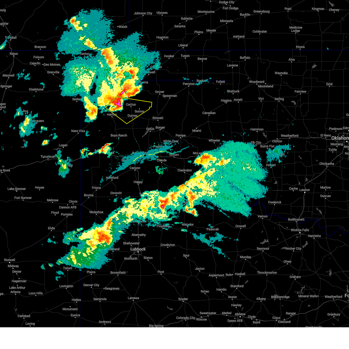 At 543 pm cdt, a severe thunderstorm was located 7 miles west of cactus, or 15 miles northwest of dumas, moving east at 35 mph. this is a destructive storm for cactus and sunray as well as areas along 287 to near dumas (radar indicated). Hazards include 80 mph wind gusts and half dollar size hail. Flying debris will be dangerous to those caught without shelter. mobile homes will be heavily damaged. expect considerable damage to roofs, windows, and vehicles. tree damage and power outages are likely. hail damage to vehicles is expected. Locations impacted include, dumas, dalhart, cactus, and sunray. At 543 pm cdt, a severe thunderstorm was located 7 miles west of cactus, or 15 miles northwest of dumas, moving east at 35 mph. this is a destructive storm for cactus and sunray as well as areas along 287 to near dumas (radar indicated). Hazards include 80 mph wind gusts and half dollar size hail. Flying debris will be dangerous to those caught without shelter. mobile homes will be heavily damaged. expect considerable damage to roofs, windows, and vehicles. tree damage and power outages are likely. hail damage to vehicles is expected. Locations impacted include, dumas, dalhart, cactus, and sunray.
|
| 5/15/2024 5:18 PM CDT |
 Svrama the national weather service in amarillo has issued a * severe thunderstorm warning for, western hansford county in the panhandle of texas, sherman county in the panhandle of texas, southeastern dallam county in the panhandle of texas, northern moore county in the panhandle of texas, northeastern hartley county in the panhandle of texas, * until 615 pm cdt. * at 517 pm cdt, severe thunderstorms were located along a line extending from 5 miles northwest of stratford to 14 miles southwest of conlen to dalhart, moving east at 35 mph (automated weather equipment and spotter reported). Hazards include 70 mph wind gusts and half dollar size hail. Expect some tree damage. damage is likely to mobile homes, roofs, and outbuildings. Hail damage to vehicles is expected. Svrama the national weather service in amarillo has issued a * severe thunderstorm warning for, western hansford county in the panhandle of texas, sherman county in the panhandle of texas, southeastern dallam county in the panhandle of texas, northern moore county in the panhandle of texas, northeastern hartley county in the panhandle of texas, * until 615 pm cdt. * at 517 pm cdt, severe thunderstorms were located along a line extending from 5 miles northwest of stratford to 14 miles southwest of conlen to dalhart, moving east at 35 mph (automated weather equipment and spotter reported). Hazards include 70 mph wind gusts and half dollar size hail. Expect some tree damage. damage is likely to mobile homes, roofs, and outbuildings. Hail damage to vehicles is expected.
|
| 5/15/2024 5:11 PM CDT | Half Dollar sized hail reported 6 miles S of Dalhart, TX |
| 5/15/2024 5:10 PM CDT | Storm damage reported in hartley county TX, 2.7 miles NE of Dalhart, TX |
| 5/15/2024 5:03 PM CDT |
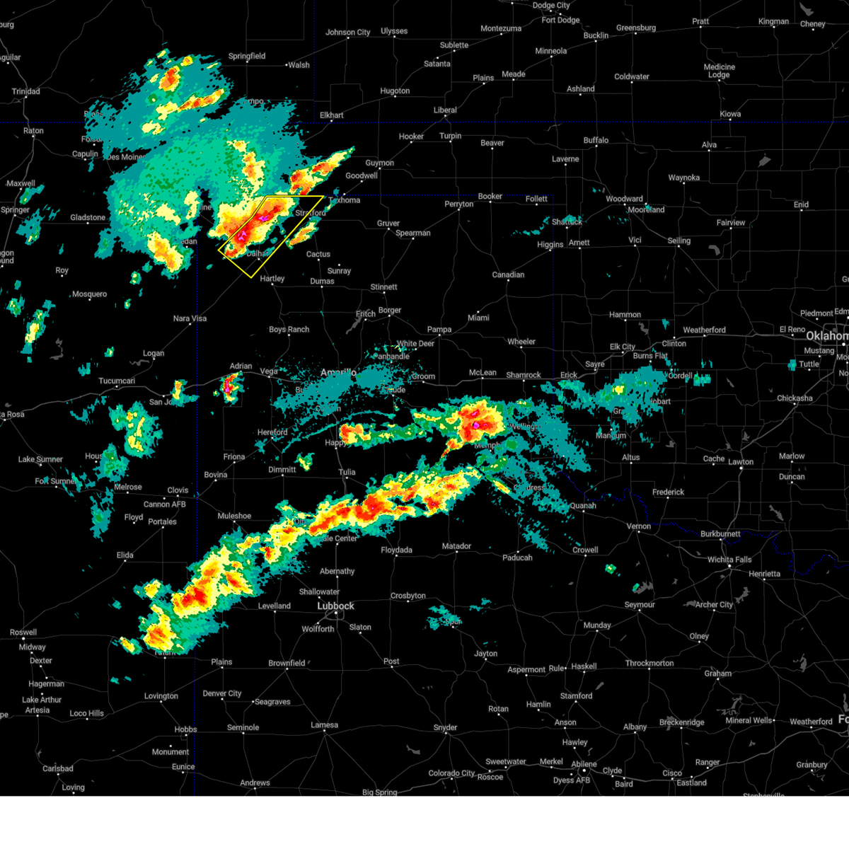 At 503 pm cdt, a severe thunderstorm was located 5 miles northwest of dalhart, moving southeast at 35 mph (radar indicated). Hazards include 70 mph wind gusts and half dollar size hail. Expect some tree damage. damage is likely to mobile homes, roofs, and outbuildings. hail damage to vehicles is expected. Locations impacted include, dalhart and ware. At 503 pm cdt, a severe thunderstorm was located 5 miles northwest of dalhart, moving southeast at 35 mph (radar indicated). Hazards include 70 mph wind gusts and half dollar size hail. Expect some tree damage. damage is likely to mobile homes, roofs, and outbuildings. hail damage to vehicles is expected. Locations impacted include, dalhart and ware.
|
| 5/15/2024 4:52 PM CDT |
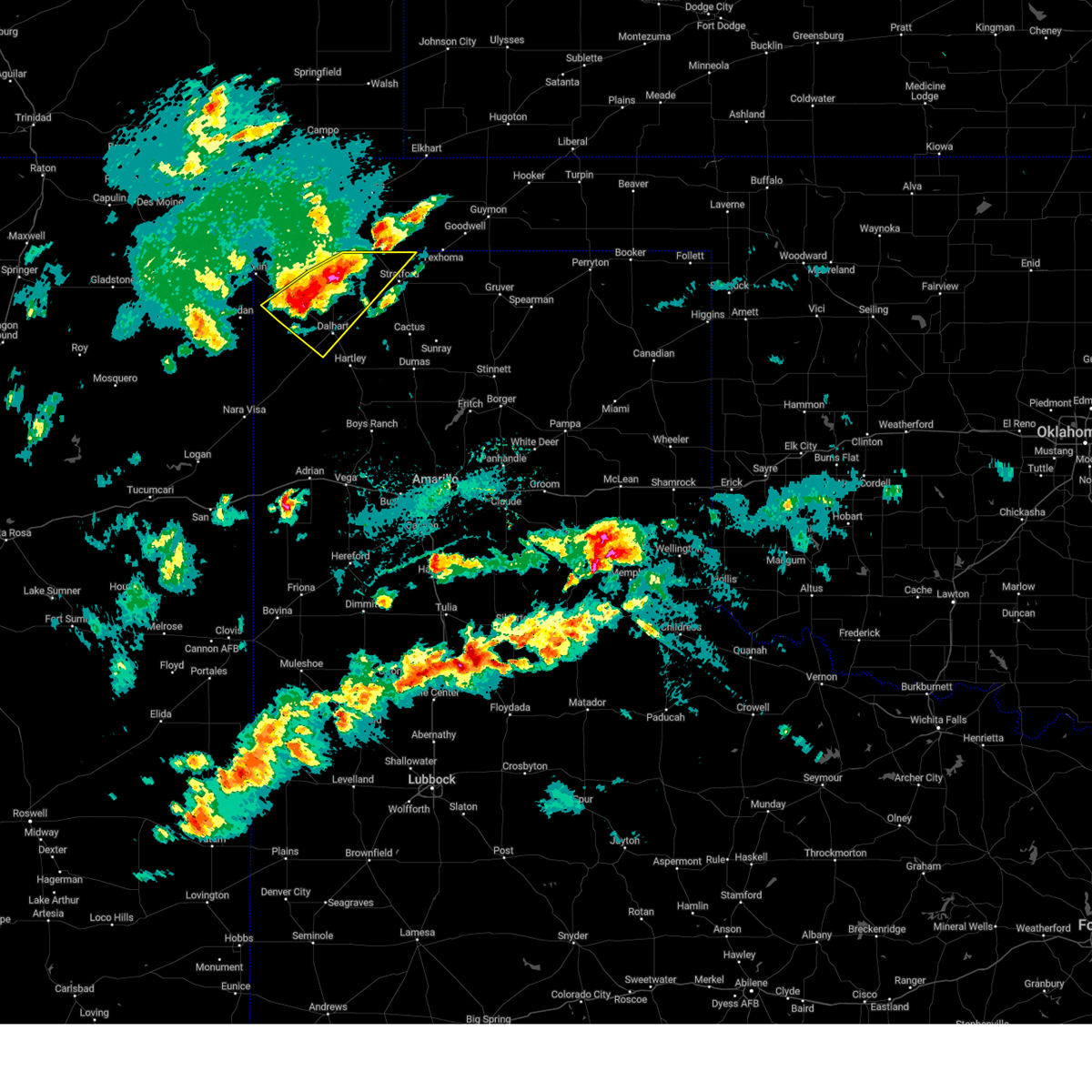 At 452 pm cdt, a severe thunderstorm was located 5 miles northeast of ware, or 12 miles northwest of dalhart, moving southeast at 25 mph (radar indicated). Hazards include 60 mph wind gusts and half dollar size hail. Minor damage to roofs, siding, and trees is possible. hail damage to vehicles is expected. Locations impacted include, dalhart and ware. At 452 pm cdt, a severe thunderstorm was located 5 miles northeast of ware, or 12 miles northwest of dalhart, moving southeast at 25 mph (radar indicated). Hazards include 60 mph wind gusts and half dollar size hail. Minor damage to roofs, siding, and trees is possible. hail damage to vehicles is expected. Locations impacted include, dalhart and ware.
|
| 5/15/2024 4:27 PM CDT |
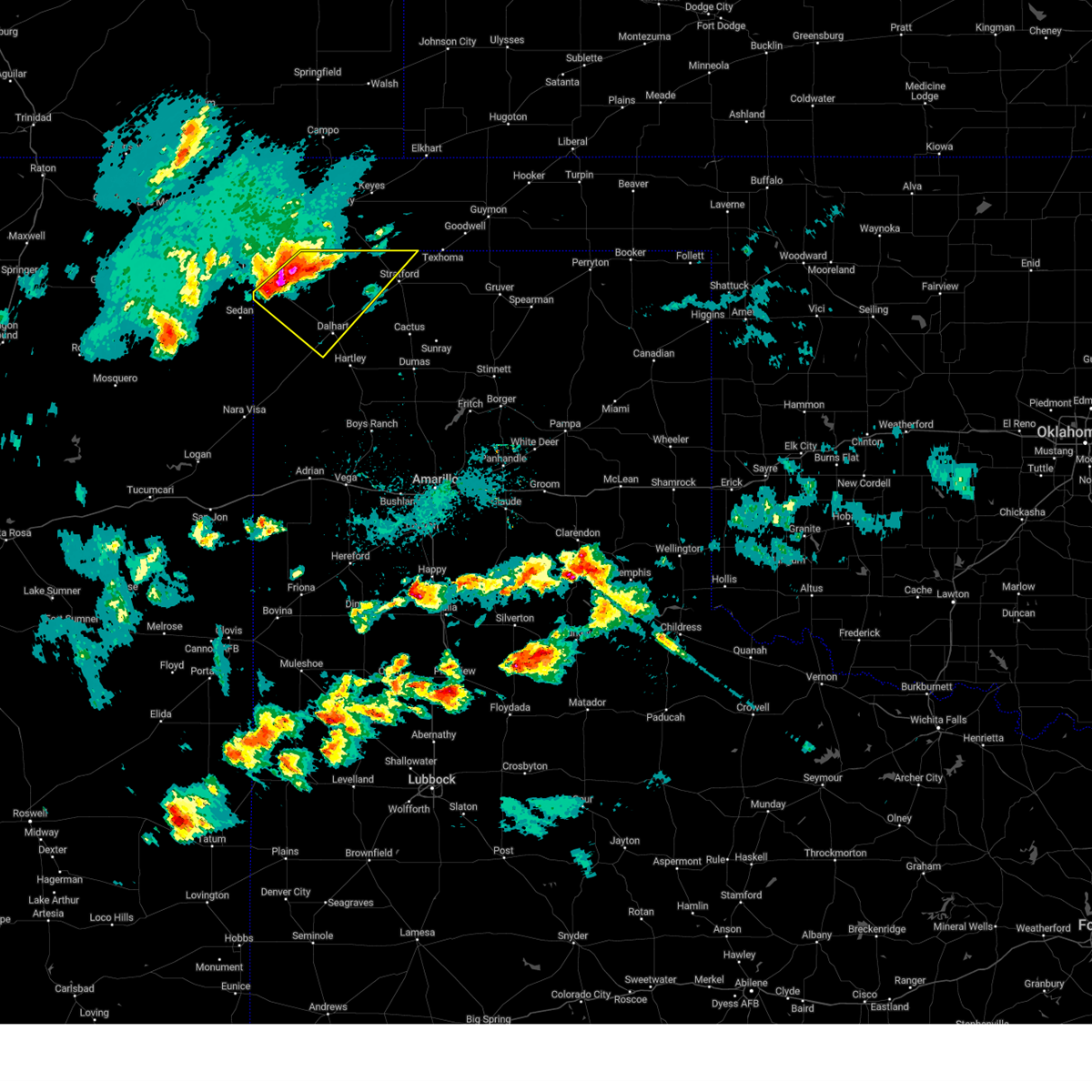 Svrama the national weather service in amarillo has issued a * severe thunderstorm warning for, northwestern sherman county in the panhandle of texas, dallam county in the panhandle of texas, north central hartley county in the panhandle of texas, * until 530 pm cdt. * at 427 pm cdt, a severe thunderstorm was located 10 miles northwest of ware, or 22 miles southeast of clayton, moving east at 25 mph (radar indicated). Hazards include 60 mph wind gusts and half dollar size hail. Minor damage to roofs, siding, and trees is possible. Hail damage to vehicles is expected. Svrama the national weather service in amarillo has issued a * severe thunderstorm warning for, northwestern sherman county in the panhandle of texas, dallam county in the panhandle of texas, north central hartley county in the panhandle of texas, * until 530 pm cdt. * at 427 pm cdt, a severe thunderstorm was located 10 miles northwest of ware, or 22 miles southeast of clayton, moving east at 25 mph (radar indicated). Hazards include 60 mph wind gusts and half dollar size hail. Minor damage to roofs, siding, and trees is possible. Hail damage to vehicles is expected.
|
| 5/15/2024 4:15 PM CDT | Quarter sized hail reported 31.9 miles SE of Dalhart, TX |
| 2/27/2024 10:53 AM CST | First 58 mph or greater gust at 1053 am. peak gust at 1111 am. last gust at 1210 p in hartley county TX, 3.2 miles NE of Dalhart, TX |
| 10/2/2023 11:10 PM CDT |
 At 1110 pm cdt, severe thunderstorms were located along a line extending from 7 miles east of griggs to 7 miles north of hartley, moving northeast at 50 mph (radar indicated). Hazards include 60 mph wind gusts. Minor damage to roofs, siding, and trees is possible. locations impacted include, dumas, dalhart, stratford, hartley, cactus, and conlen. hail threat, radar indicated max hail size, <. 75 in wind threat, radar indicated max wind gust, 60 mph. At 1110 pm cdt, severe thunderstorms were located along a line extending from 7 miles east of griggs to 7 miles north of hartley, moving northeast at 50 mph (radar indicated). Hazards include 60 mph wind gusts. Minor damage to roofs, siding, and trees is possible. locations impacted include, dumas, dalhart, stratford, hartley, cactus, and conlen. hail threat, radar indicated max hail size, <. 75 in wind threat, radar indicated max wind gust, 60 mph.
|
| 10/2/2023 10:51 PM CDT |
 At 1050 pm cdt, severe thunderstorms were located along a line extending from 11 miles southwest of griggs to 12 miles west of hartley, moving northeast at 55 mph (radar indicated). Hazards include 60 mph wind gusts. Minor damage to roofs, siding, and trees is possible. locations impacted include, dumas, dalhart, stratford, hartley, cactus, ware, conlen, and romero. hail threat, radar indicated max hail size, <. 75 in wind threat, radar indicated max wind gust, 60 mph. At 1050 pm cdt, severe thunderstorms were located along a line extending from 11 miles southwest of griggs to 12 miles west of hartley, moving northeast at 55 mph (radar indicated). Hazards include 60 mph wind gusts. Minor damage to roofs, siding, and trees is possible. locations impacted include, dumas, dalhart, stratford, hartley, cactus, ware, conlen, and romero. hail threat, radar indicated max hail size, <. 75 in wind threat, radar indicated max wind gust, 60 mph.
|
| 10/2/2023 10:46 PM CDT |
 At 1045 pm cdt, severe thunderstorms were located along a line extending from 17 miles south of boise city to 15 miles northeast of romero, moving northeast at 50 mph (radar indicated). Hazards include 60 mph wind gusts. Minor damage to roofs, siding, and trees is possible. locations impacted include, dumas, dalhart, stratford, hartley, cactus, channing, ware, four way, conlen, and romero. hail threat, radar indicated max hail size, <. 75 in wind threat, radar indicated max wind gust, 60 mph. At 1045 pm cdt, severe thunderstorms were located along a line extending from 17 miles south of boise city to 15 miles northeast of romero, moving northeast at 50 mph (radar indicated). Hazards include 60 mph wind gusts. Minor damage to roofs, siding, and trees is possible. locations impacted include, dumas, dalhart, stratford, hartley, cactus, channing, ware, four way, conlen, and romero. hail threat, radar indicated max hail size, <. 75 in wind threat, radar indicated max wind gust, 60 mph.
|
| 10/2/2023 10:23 PM CDT |
 At 1023 pm cdt, severe thunderstorms were located along a line extending from 14 miles north of ware to near romero, moving northeast at 50 mph (radar indicated). Hazards include 60 mph wind gusts. minor damage to roofs, siding, and trees is possible At 1023 pm cdt, severe thunderstorms were located along a line extending from 14 miles north of ware to near romero, moving northeast at 50 mph (radar indicated). Hazards include 60 mph wind gusts. minor damage to roofs, siding, and trees is possible
|
| 10/2/2023 7:55 PM CDT |
 At 755 pm cdt, severe thunderstorms were located along a line extending from texline to 12 miles south of conlen, moving north at 50 mph (radar indicated). Hazards include 60 mph wind gusts and penny size hail. Minor damage to roofs, siding, and trees is possible. locations impacted include, dalhart, stratford, boise city, texline, keyes, kenton, wheeless, black mesa park, felt, griggs, eva, ware, conlen, and sturgis. hail threat, radar indicated max hail size, 0. 75in wind threat, radar indicated max wind gust, 60 mph. At 755 pm cdt, severe thunderstorms were located along a line extending from texline to 12 miles south of conlen, moving north at 50 mph (radar indicated). Hazards include 60 mph wind gusts and penny size hail. Minor damage to roofs, siding, and trees is possible. locations impacted include, dalhart, stratford, boise city, texline, keyes, kenton, wheeless, black mesa park, felt, griggs, eva, ware, conlen, and sturgis. hail threat, radar indicated max hail size, 0. 75in wind threat, radar indicated max wind gust, 60 mph.
|
| 10/2/2023 7:41 PM CDT |
 At 741 pm cdt, severe thunderstorms were located along a line extending from 6 miles south of texline to 8 miles northeast of hartley, moving north at 50 mph (radar indicated). Hazards include 60 mph wind gusts and penny size hail. minor damage to roofs, siding, and trees is possible At 741 pm cdt, severe thunderstorms were located along a line extending from 6 miles south of texline to 8 miles northeast of hartley, moving north at 50 mph (radar indicated). Hazards include 60 mph wind gusts and penny size hail. minor damage to roofs, siding, and trees is possible
|
| 8/12/2023 4:28 PM CDT |
 The severe thunderstorm warning for southeastern dallam and northeastern hartley counties will expire at 430 pm cdt, the storm which prompted the warning has weakened below severe limits, and no longer poses an immediate threat to life or property. therefore, the warning will be allowed to expire. however gusty winds are still possible with this thunderstorm. a severe thunderstorm watch remains in effect until 1000 pm cdt for the panhandle of texas. remember, a severe thunderstorm warning still remains in effect for central and western dallam county until 515 pm cdt. The severe thunderstorm warning for southeastern dallam and northeastern hartley counties will expire at 430 pm cdt, the storm which prompted the warning has weakened below severe limits, and no longer poses an immediate threat to life or property. therefore, the warning will be allowed to expire. however gusty winds are still possible with this thunderstorm. a severe thunderstorm watch remains in effect until 1000 pm cdt for the panhandle of texas. remember, a severe thunderstorm warning still remains in effect for central and western dallam county until 515 pm cdt.
|
| 8/12/2023 4:13 PM CDT |
 At 412 pm cdt, automated weather equipment reported a 58 mph wind gust at dalhart. the severe thunderstorm was located over dalhart, moving north at 25 mph (automated weather equipment). Hazards include 60 mph wind gusts and quarter size hail. Minor damage to roofs, siding, and trees is possible. hail damage to vehicles is expected. locations impacted include, dalhart, hartley, and ware. hail threat, radar indicated max hail size, 1. 00in wind threat, observed max wind gust, 60 mph. At 412 pm cdt, automated weather equipment reported a 58 mph wind gust at dalhart. the severe thunderstorm was located over dalhart, moving north at 25 mph (automated weather equipment). Hazards include 60 mph wind gusts and quarter size hail. Minor damage to roofs, siding, and trees is possible. hail damage to vehicles is expected. locations impacted include, dalhart, hartley, and ware. hail threat, radar indicated max hail size, 1. 00in wind threat, observed max wind gust, 60 mph.
|
| 8/12/2023 4:11 PM CDT | Peak wind gust of 58 mph measured by the dalhart aso in hartley county TX, 3.2 miles NE of Dalhart, TX |
| 8/12/2023 4:03 PM CDT |
 At 403 pm cdt, a severe thunderstorm was located 6 miles southwest of dalhart, moving northeast at 35 mph (radar indicated). Hazards include ping pong ball size hail and 60 mph wind gusts. Minor damage to roofs, siding, and trees is possible. people and animals outdoors will be injured. expect hail damage to roofs, siding, windows, and vehicles. locations impacted include, dalhart, hartley, and ware. hail threat, radar indicated max hail size, 1. 50 in wind threat, radar indicated max wind gust, 60 mph. At 403 pm cdt, a severe thunderstorm was located 6 miles southwest of dalhart, moving northeast at 35 mph (radar indicated). Hazards include ping pong ball size hail and 60 mph wind gusts. Minor damage to roofs, siding, and trees is possible. people and animals outdoors will be injured. expect hail damage to roofs, siding, windows, and vehicles. locations impacted include, dalhart, hartley, and ware. hail threat, radar indicated max hail size, 1. 50 in wind threat, radar indicated max wind gust, 60 mph.
|
| 8/12/2023 3:50 PM CDT |
 At 350 pm cdt, a severe thunderstorm was located 13 miles southwest of dalhart, moving north at 25 mph (radar indicated). Hazards include 60 mph wind gusts and half dollar size hail. Minor damage to roofs, siding, and trees is possible. Hail damage to vehicles is expected. At 350 pm cdt, a severe thunderstorm was located 13 miles southwest of dalhart, moving north at 25 mph (radar indicated). Hazards include 60 mph wind gusts and half dollar size hail. Minor damage to roofs, siding, and trees is possible. Hail damage to vehicles is expected.
|
| 7/15/2023 10:06 PM CDT |
 At 1006 pm cdt, a severe thunderstorm capable of producing a tornado was located 5 miles northwest of hartley, or 9 miles south of dalhart, moving southeast at 40 mph (radar indicated rotation). Hazards include tornado and golf ball size hail. Flying debris will be dangerous to those caught without shelter. mobile homes will be damaged or destroyed. damage to roofs, windows, and vehicles will occur. Tree damage is likely. At 1006 pm cdt, a severe thunderstorm capable of producing a tornado was located 5 miles northwest of hartley, or 9 miles south of dalhart, moving southeast at 40 mph (radar indicated rotation). Hazards include tornado and golf ball size hail. Flying debris will be dangerous to those caught without shelter. mobile homes will be damaged or destroyed. damage to roofs, windows, and vehicles will occur. Tree damage is likely.
|
| 7/15/2023 10:01 PM CDT |
 At 1000 pm cdt, automated weather equipment reported a severe thunderstorm was located 4 miles south of dalhart, moving southeast at 30 mph (automated weather equipment). Hazards include 70 mph wind gusts and ping pong ball size hail. Expect some tree damage. damage is likely to mobile homes, roofs, and outbuildings. people and animals outdoors will be injured. expect hail damage to roofs, siding, windows, and vehicles. locations impacted include, dumas, dalhart, hartley, cactus, ware and conlen. thunderstorm damage threat, considerable hail threat, radar indicated max hail size, 1. 50 in wind threat, radar indicated max wind gust, 70 mph. At 1000 pm cdt, automated weather equipment reported a severe thunderstorm was located 4 miles south of dalhart, moving southeast at 30 mph (automated weather equipment). Hazards include 70 mph wind gusts and ping pong ball size hail. Expect some tree damage. damage is likely to mobile homes, roofs, and outbuildings. people and animals outdoors will be injured. expect hail damage to roofs, siding, windows, and vehicles. locations impacted include, dumas, dalhart, hartley, cactus, ware and conlen. thunderstorm damage threat, considerable hail threat, radar indicated max hail size, 1. 50 in wind threat, radar indicated max wind gust, 70 mph.
|
| 7/15/2023 10:00 PM CDT | Storm damage reported in hartley county TX, 3.2 miles NE of Dalhart, TX |
| 7/15/2023 9:54 PM CDT |
 At 954 pm cdt, a severe thunderstorm was located over dalhart, moving southeast at 35 mph (radar indicated). Hazards include ping pong ball size hail and 60 mph wind gusts. Minor damage to roofs, siding, and trees is possible. people and animals outdoors will be injured. expect hail damage to roofs, siding, windows, and vehicles. locations impacted include, dumas, dalhart, hartley, cactus, ware and conlen. hail threat, radar indicated max hail size, 1. 50 in wind threat, radar indicated max wind gust, 60 mph. At 954 pm cdt, a severe thunderstorm was located over dalhart, moving southeast at 35 mph (radar indicated). Hazards include ping pong ball size hail and 60 mph wind gusts. Minor damage to roofs, siding, and trees is possible. people and animals outdoors will be injured. expect hail damage to roofs, siding, windows, and vehicles. locations impacted include, dumas, dalhart, hartley, cactus, ware and conlen. hail threat, radar indicated max hail size, 1. 50 in wind threat, radar indicated max wind gust, 60 mph.
|
| 7/15/2023 9:38 PM CDT |
 At 938 pm cdt, a severe thunderstorm was located 4 miles east of ware, or 11 miles northwest of dalhart, moving southeast at 25 mph (radar indicated). Hazards include ping pong ball size hail and 60 mph wind gusts. Minor damage to roofs, siding, and trees is possible. people and animals outdoors will be injured. Expect hail damage to roofs, siding, windows, and vehicles. At 938 pm cdt, a severe thunderstorm was located 4 miles east of ware, or 11 miles northwest of dalhart, moving southeast at 25 mph (radar indicated). Hazards include ping pong ball size hail and 60 mph wind gusts. Minor damage to roofs, siding, and trees is possible. people and animals outdoors will be injured. Expect hail damage to roofs, siding, windows, and vehicles.
|
| 1/1/0001 12:00 AM | Observed by dalhart aso in hartley county TX, 3.2 miles NE of Dalhart, TX |
| 7/7/2023 4:51 PM CDT |
 At 450 pm cdt, a severe thunderstorm was located near hartley, or 10 miles south of dalhart, moving southeast at 25 mph (radar indicated). Hazards include 70 mph wind gusts and nickel size hail. Expect some tree damage. damage is likely to mobile homes, roofs, and outbuildings. locations impacted include, dalhart and hartley. thunderstorm damage threat, considerable hail threat, radar indicated max hail size, 0. 88in wind threat, radar indicated max wind gust, 70 mph. At 450 pm cdt, a severe thunderstorm was located near hartley, or 10 miles south of dalhart, moving southeast at 25 mph (radar indicated). Hazards include 70 mph wind gusts and nickel size hail. Expect some tree damage. damage is likely to mobile homes, roofs, and outbuildings. locations impacted include, dalhart and hartley. thunderstorm damage threat, considerable hail threat, radar indicated max hail size, 0. 88in wind threat, radar indicated max wind gust, 70 mph.
|
| 7/7/2023 4:35 PM CDT | Corrects previous tstm wnd gst report from 3 sw dalhart. from 1635cdt through 1650cdt the asos in dalhart gusted 58 to 64 mph from a line of thunderstorms moving throug in hartley county TX, 3.2 miles NE of Dalhart, TX |
| 7/7/2023 4:28 PM CDT |
 At 427 pm cdt, a severe thunderstorm was located 10 miles south of ware, or 13 miles west of dalhart, moving east at 30 mph (radar indicated). Hazards include 70 mph wind gusts and nickel size hail. Expect some tree damage. Damage is likely to mobile homes, roofs, and outbuildings. At 427 pm cdt, a severe thunderstorm was located 10 miles south of ware, or 13 miles west of dalhart, moving east at 30 mph (radar indicated). Hazards include 70 mph wind gusts and nickel size hail. Expect some tree damage. Damage is likely to mobile homes, roofs, and outbuildings.
|
| 7/7/2023 3:35 PM CDT | From 1535cdt through 1550cdt the asos in dalhart gusted 58 to 64 mph from a line of thunderstorms moving throug in hartley county TX, 3.2 miles NE of Dalhart, TX |
| 7/5/2023 9:09 PM CDT |
 The severe thunderstorm warning for southeastern dallam and northeastern hartley counties will expire at 915 pm cdt, the storm which prompted the warning has weakened below severe limits, and no longer poses an immediate threat to life or property. therefore, the warning will be allowed to expire. a severe thunderstorm watch remains in effect until 500 am cdt for the panhandle of texas. The severe thunderstorm warning for southeastern dallam and northeastern hartley counties will expire at 915 pm cdt, the storm which prompted the warning has weakened below severe limits, and no longer poses an immediate threat to life or property. therefore, the warning will be allowed to expire. a severe thunderstorm watch remains in effect until 500 am cdt for the panhandle of texas.
|
| 7/5/2023 9:01 PM CDT |
 At 901 pm cdt, a severe thunderstorm was located 7 miles southwest of conlen, or 11 miles northeast of dalhart, moving east at 35 mph (radar indicated). Hazards include 60 mph wind gusts and quarter size hail. Minor damage to roofs, siding, and trees is possible. hail damage to vehicles is expected. locations impacted include, dalhart and conlen. hail threat, radar indicated max hail size, 1. 00in wind threat, radar indicated max wind gust, 60 mph. At 901 pm cdt, a severe thunderstorm was located 7 miles southwest of conlen, or 11 miles northeast of dalhart, moving east at 35 mph (radar indicated). Hazards include 60 mph wind gusts and quarter size hail. Minor damage to roofs, siding, and trees is possible. hail damage to vehicles is expected. locations impacted include, dalhart and conlen. hail threat, radar indicated max hail size, 1. 00in wind threat, radar indicated max wind gust, 60 mph.
|
| 7/5/2023 8:46 PM CDT |
 At 846 pm cdt, a severe thunderstorm was located near dalhart, moving east at 20 mph (radar indicated). Hazards include 60 mph wind gusts and half dollar size hail. Minor damage to roofs, siding, and trees is possible. hail damage to vehicles is expected. locations impacted include, dalhart, hartley and conlen. hail threat, radar indicated max hail size, 1. 25 in wind threat, radar indicated max wind gust, 60 mph. At 846 pm cdt, a severe thunderstorm was located near dalhart, moving east at 20 mph (radar indicated). Hazards include 60 mph wind gusts and half dollar size hail. Minor damage to roofs, siding, and trees is possible. hail damage to vehicles is expected. locations impacted include, dalhart, hartley and conlen. hail threat, radar indicated max hail size, 1. 25 in wind threat, radar indicated max wind gust, 60 mph.
|
| 7/5/2023 8:33 PM CDT |
 At 832 pm cdt, a severe thunderstorm was located near dalhart, moving east at 35 mph (radar indicated). Hazards include 60 mph wind gusts and quarter size hail. Minor damage to roofs, siding, and trees is possible. Hail damage to vehicles is expected. At 832 pm cdt, a severe thunderstorm was located near dalhart, moving east at 35 mph (radar indicated). Hazards include 60 mph wind gusts and quarter size hail. Minor damage to roofs, siding, and trees is possible. Hail damage to vehicles is expected.
|
| 7/2/2023 6:06 PM CDT |
 The severe thunderstorm warning for northwestern oldham, southwestern sherman, southern dallam, northwestern moore and hartley counties will expire at 615 pm cdt, the storms which prompted the warning have weakened below severe limits, and no longer pose an immediate threat to life or property. therefore, the warning will be allowed to expire. however gusty winds are still possible with these thunderstorms. a severe thunderstorm watch remains in effect until 800 pm cdt for the panhandle of texas. The severe thunderstorm warning for northwestern oldham, southwestern sherman, southern dallam, northwestern moore and hartley counties will expire at 615 pm cdt, the storms which prompted the warning have weakened below severe limits, and no longer pose an immediate threat to life or property. therefore, the warning will be allowed to expire. however gusty winds are still possible with these thunderstorms. a severe thunderstorm watch remains in effect until 800 pm cdt for the panhandle of texas.
|
| 7/2/2023 5:39 PM CDT |
 At 538 pm cdt, severe thunderstorms were located along a line extending from 5 miles south of conlen to 5 miles south of dalhart to 8 miles southeast of amistad, moving southeast at 35 mph (radar indicated). Hazards include 60 mph wind gusts. Minor damage to roofs, siding, and trees is possible. locations impacted include, dalhart, hartley, romero and conlen. hail threat, radar indicated max hail size, <. 75 in wind threat, radar indicated max wind gust, 60 mph. At 538 pm cdt, severe thunderstorms were located along a line extending from 5 miles south of conlen to 5 miles south of dalhart to 8 miles southeast of amistad, moving southeast at 35 mph (radar indicated). Hazards include 60 mph wind gusts. Minor damage to roofs, siding, and trees is possible. locations impacted include, dalhart, hartley, romero and conlen. hail threat, radar indicated max hail size, <. 75 in wind threat, radar indicated max wind gust, 60 mph.
|
| 7/2/2023 5:09 PM CDT |
 At 508 pm cdt, severe thunderstorms were located along a line extending from 14 miles northwest of conlen to ware to 7 miles southwest of sedan, moving southeast at 35 mph (radar indicated). Hazards include 60 mph wind gusts and nickel size hail. minor damage to roofs, siding, and trees is possible At 508 pm cdt, severe thunderstorms were located along a line extending from 14 miles northwest of conlen to ware to 7 miles southwest of sedan, moving southeast at 35 mph (radar indicated). Hazards include 60 mph wind gusts and nickel size hail. minor damage to roofs, siding, and trees is possible
|
| 6/28/2023 8:45 PM CDT |
 At 845 pm cdt, severe thunderstorms were located along a line extending from near felt to 7 miles west of cactus, moving northeast at 35 mph (radar indicated). Hazards include 70 mph wind gusts. Expect some tree damage. damage is likely to mobile homes, roofs, and outbuildings. locations impacted include, dalhart, stratford, boise city, cactus, texline, ware, felt and conlen. thunderstorm damage threat, considerable hail threat, radar indicated max hail size, <. 75 in wind threat, radar indicated max wind gust, 70 mph. At 845 pm cdt, severe thunderstorms were located along a line extending from near felt to 7 miles west of cactus, moving northeast at 35 mph (radar indicated). Hazards include 70 mph wind gusts. Expect some tree damage. damage is likely to mobile homes, roofs, and outbuildings. locations impacted include, dalhart, stratford, boise city, cactus, texline, ware, felt and conlen. thunderstorm damage threat, considerable hail threat, radar indicated max hail size, <. 75 in wind threat, radar indicated max wind gust, 70 mph.
|
| 6/28/2023 8:19 PM CDT |
 At 819 pm cdt, severe thunderstorms were located along a line extending from 4 miles east of texline to 5 miles east of hartley, moving northeast at 35 mph (radar indicated). Hazards include 70 mph wind gusts. Expect some tree damage. Damage is likely to mobile homes, roofs, and outbuildings. At 819 pm cdt, severe thunderstorms were located along a line extending from 4 miles east of texline to 5 miles east of hartley, moving northeast at 35 mph (radar indicated). Hazards include 70 mph wind gusts. Expect some tree damage. Damage is likely to mobile homes, roofs, and outbuildings.
|
| 6/27/2023 5:30 PM CDT |
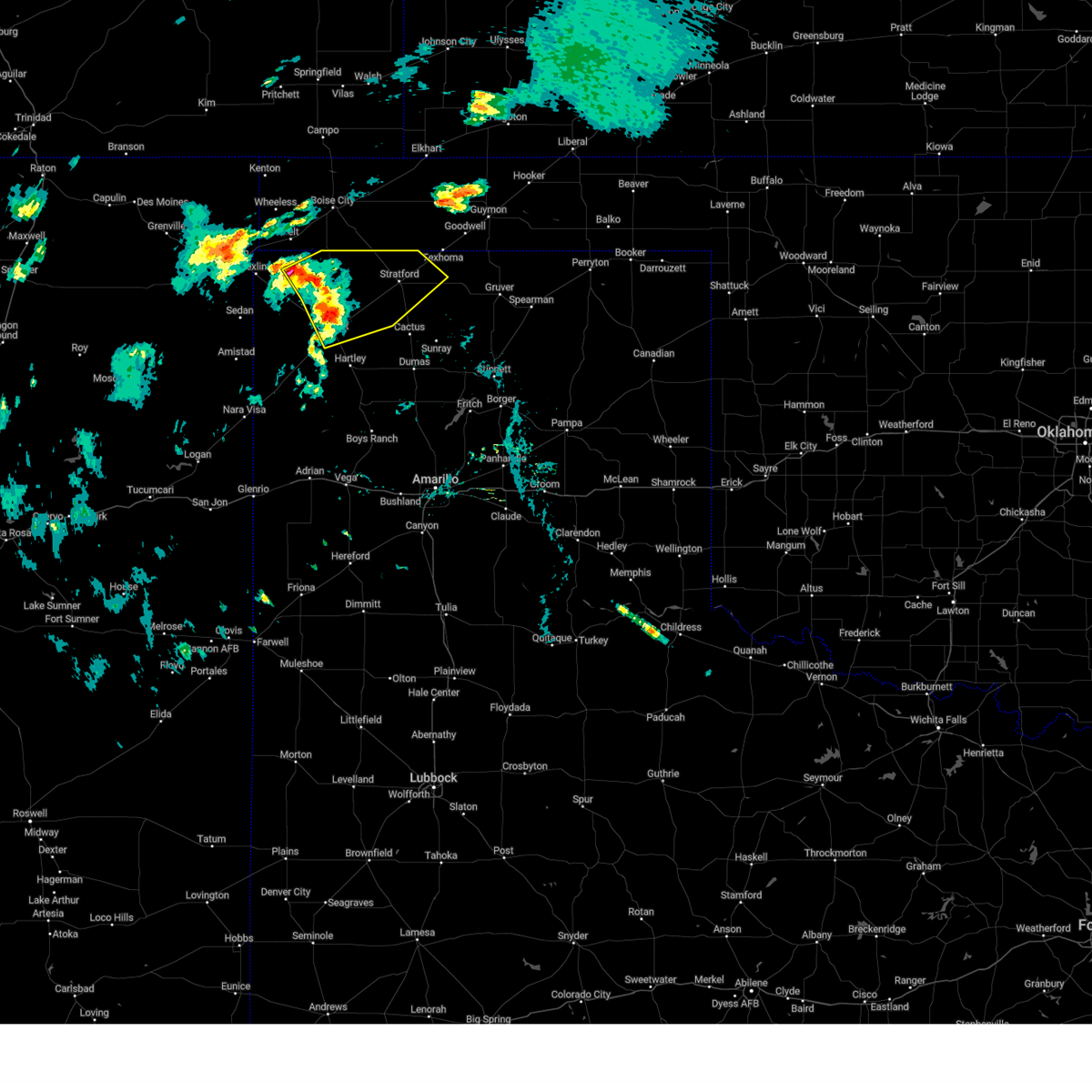 At 530 pm cdt, severe thunderstorms were located along a line extending from 9 miles south of felt to 12 miles northeast of ware to dalhart, moving northeast at 30 mph (radar indicated). Hazards include 60 mph wind gusts and quarter size hail. Minor damage to roofs, siding, and trees is possible. hail damage to vehicles is expected. locations impacted include, dalhart, stratford and conlen. hail threat, radar indicated max hail size, 1. 00in wind threat, radar indicated max wind gust, 60 mph. At 530 pm cdt, severe thunderstorms were located along a line extending from 9 miles south of felt to 12 miles northeast of ware to dalhart, moving northeast at 30 mph (radar indicated). Hazards include 60 mph wind gusts and quarter size hail. Minor damage to roofs, siding, and trees is possible. hail damage to vehicles is expected. locations impacted include, dalhart, stratford and conlen. hail threat, radar indicated max hail size, 1. 00in wind threat, radar indicated max wind gust, 60 mph.
|
| 6/27/2023 5:13 PM CDT | Large tree was blown over on a house. trained spotter collected a report from the resident of this home. resident says no damage on the inside of the house. time estima in dallam county TX, 13.1 miles ESE of Dalhart, TX |
| 6/27/2023 5:13 PM CDT |
 At 513 pm cdt, severe thunderstorms were located along a line extending from 7 miles east of texline to 6 miles northwest of dalhart to 12 miles west of hartley, moving northeast at 50 mph (radar indicated). Hazards include 60 mph wind gusts and half dollar size hail. Minor damage to roofs, siding, and trees is possible. hail damage to vehicles is expected. locations impacted include, dalhart, stratford, hartley, cactus, sunray, ware and conlen. hail threat, radar indicated max hail size, 1. 25 in wind threat, radar indicated max wind gust, 60 mph. At 513 pm cdt, severe thunderstorms were located along a line extending from 7 miles east of texline to 6 miles northwest of dalhart to 12 miles west of hartley, moving northeast at 50 mph (radar indicated). Hazards include 60 mph wind gusts and half dollar size hail. Minor damage to roofs, siding, and trees is possible. hail damage to vehicles is expected. locations impacted include, dalhart, stratford, hartley, cactus, sunray, ware and conlen. hail threat, radar indicated max hail size, 1. 25 in wind threat, radar indicated max wind gust, 60 mph.
|
| 6/27/2023 5:02 PM CDT |
 At 502 pm cdt, severe thunderstorms were located along a line extending from 8 miles south of texline to 9 miles south of ware to 12 miles northeast of romero, moving northeast at 45 mph (radar indicated). Hazards include 60 mph wind gusts and nickel size hail. minor damage to roofs, siding, and trees is possible At 502 pm cdt, severe thunderstorms were located along a line extending from 8 miles south of texline to 9 miles south of ware to 12 miles northeast of romero, moving northeast at 45 mph (radar indicated). Hazards include 60 mph wind gusts and nickel size hail. minor damage to roofs, siding, and trees is possible
|
| 6/23/2023 6:22 AM CDT |
 At 622 am cdt, a severe thunderstorm was located over hartley, or 16 miles southeast of dalhart, moving northeast at 30 mph (radar indicated). Hazards include ping pong ball size hail and 60 mph wind gusts. Minor damage to roofs, siding, and trees is possible. people and animals outdoors will be injured. expect hail damage to roofs, siding, windows, and vehicles. locations impacted include, dalhart and hartley. hail threat, radar indicated max hail size, 1. 50 in wind threat, radar indicated max wind gust, 60 mph. At 622 am cdt, a severe thunderstorm was located over hartley, or 16 miles southeast of dalhart, moving northeast at 30 mph (radar indicated). Hazards include ping pong ball size hail and 60 mph wind gusts. Minor damage to roofs, siding, and trees is possible. people and animals outdoors will be injured. expect hail damage to roofs, siding, windows, and vehicles. locations impacted include, dalhart and hartley. hail threat, radar indicated max hail size, 1. 50 in wind threat, radar indicated max wind gust, 60 mph.
|
| 6/23/2023 6:12 AM CDT |
 At 612 am cdt, a severe thunderstorm was located 9 miles southwest of dalhart, moving northeast at 30 mph (radar indicated). Hazards include 60 mph wind gusts and quarter size hail. Minor damage to roofs, siding, and trees is possible. hail damage to vehicles is expected. locations impacted include, dalhart, hartley and conlen. hail threat, radar indicated max hail size, 1. 00in wind threat, radar indicated max wind gust, 60 mph. At 612 am cdt, a severe thunderstorm was located 9 miles southwest of dalhart, moving northeast at 30 mph (radar indicated). Hazards include 60 mph wind gusts and quarter size hail. Minor damage to roofs, siding, and trees is possible. hail damage to vehicles is expected. locations impacted include, dalhart, hartley and conlen. hail threat, radar indicated max hail size, 1. 00in wind threat, radar indicated max wind gust, 60 mph.
|
| 6/23/2023 5:57 AM CDT |
 At 557 am cdt, a severe thunderstorm was located 16 miles southwest of dalhart, moving northeast at 35 mph (radar indicated). Hazards include 60 mph wind gusts and quarter size hail. Minor damage to roofs, siding, and trees is possible. Hail damage to vehicles is expected. At 557 am cdt, a severe thunderstorm was located 16 miles southwest of dalhart, moving northeast at 35 mph (radar indicated). Hazards include 60 mph wind gusts and quarter size hail. Minor damage to roofs, siding, and trees is possible. Hail damage to vehicles is expected.
|
| 6/23/2023 5:21 AM CDT |
 At 521 am cdt, severe thunderstorms were located along a line extending from 11 miles east of amistad to 15 miles east of romero to 4 miles west of channing, moving northeast at 25 mph (radar indicated). Hazards include quarter size hail. Damage to vehicles is expected. locations impacted include, dalhart, hartley, channing and ware. hail threat, radar indicated max hail size, 1. 00in wind threat, radar indicated max wind gust, <50 mph. At 521 am cdt, severe thunderstorms were located along a line extending from 11 miles east of amistad to 15 miles east of romero to 4 miles west of channing, moving northeast at 25 mph (radar indicated). Hazards include quarter size hail. Damage to vehicles is expected. locations impacted include, dalhart, hartley, channing and ware. hail threat, radar indicated max hail size, 1. 00in wind threat, radar indicated max wind gust, <50 mph.
|
| 6/23/2023 5:05 AM CDT |
 At 505 am cdt, severe thunderstorms were located along a line extending from 7 miles north of amistad to 11 miles north of romero to 11 miles west of channing, moving northeast at 25 mph (radar indicated). Hazards include half dollar size hail. Damage to vehicles is expected. locations impacted include, dalhart, hartley, channing, boys ranch and ware. hail threat, radar indicated max hail size, 1. 25 in wind threat, radar indicated max wind gust, <50 mph. At 505 am cdt, severe thunderstorms were located along a line extending from 7 miles north of amistad to 11 miles north of romero to 11 miles west of channing, moving northeast at 25 mph (radar indicated). Hazards include half dollar size hail. Damage to vehicles is expected. locations impacted include, dalhart, hartley, channing, boys ranch and ware. hail threat, radar indicated max hail size, 1. 25 in wind threat, radar indicated max wind gust, <50 mph.
|
| 6/23/2023 4:56 AM CDT |
 At 455 am cdt, severe thunderstorms were located along a line extending from 4 miles north of amistad to 8 miles north of romero to 14 miles southwest of channing, moving northeast at 25 mph (radar indicated). Hazards include half dollar size hail. damage to vehicles is expected At 455 am cdt, severe thunderstorms were located along a line extending from 4 miles north of amistad to 8 miles north of romero to 14 miles southwest of channing, moving northeast at 25 mph (radar indicated). Hazards include half dollar size hail. damage to vehicles is expected
|
| 6/23/2023 12:46 AM CDT | Storm damage reported in hartley county TX, 3.2 miles NE of Dalhart, TX |
| 6/13/2023 5:13 PM CDT | Golf Ball sized hail reported 24.4 miles SW of Dalhart, TX |
| 6/13/2023 4:36 PM CDT | Grapefruit sized hail reported 28.8 miles S of Dalhart, TX |
| 6/12/2023 7:05 AM CDT |
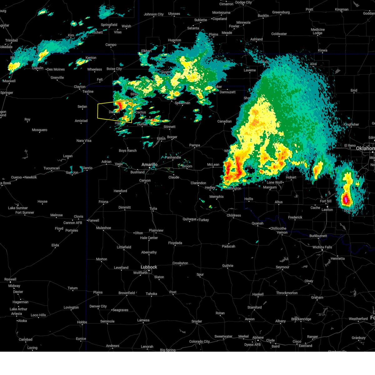 The severe thunderstorm warning for southeastern dallam and northeastern hartley counties will expire at 715 am cdt, the storm which prompted the warning has weakened below severe limits, and no longer poses an immediate threat to life or property. therefore, the warning will be allowed to expire. a severe thunderstorm watch remains in effect until 1100 am cdt for the panhandle of texas. to report severe weather, contact your nearest law enforcement agency. they will relay your report to the national weather service amarillo. The severe thunderstorm warning for southeastern dallam and northeastern hartley counties will expire at 715 am cdt, the storm which prompted the warning has weakened below severe limits, and no longer poses an immediate threat to life or property. therefore, the warning will be allowed to expire. a severe thunderstorm watch remains in effect until 1100 am cdt for the panhandle of texas. to report severe weather, contact your nearest law enforcement agency. they will relay your report to the national weather service amarillo.
|
| 6/12/2023 6:29 AM CDT |
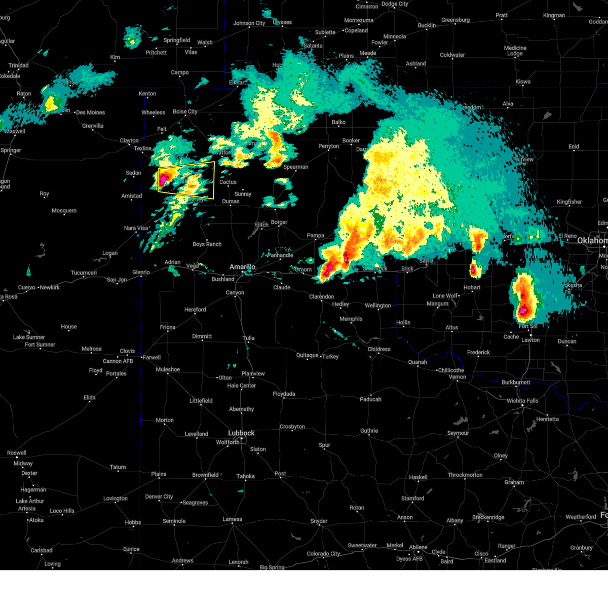 At 629 am cdt, a severe thunderstorm was located 6 miles south of ware, or 11 miles west of dalhart, moving east at 30 mph (radar indicated). Hazards include 60 mph wind gusts and half dollar size hail. Minor damage to roofs, siding, and trees is possible. hail damage to vehicles is expected. locations impacted include, dalhart, ware and conlen. hail threat, radar indicated max hail size, 1. 25 in wind threat, radar indicated max wind gust, 60 mph. At 629 am cdt, a severe thunderstorm was located 6 miles south of ware, or 11 miles west of dalhart, moving east at 30 mph (radar indicated). Hazards include 60 mph wind gusts and half dollar size hail. Minor damage to roofs, siding, and trees is possible. hail damage to vehicles is expected. locations impacted include, dalhart, ware and conlen. hail threat, radar indicated max hail size, 1. 25 in wind threat, radar indicated max wind gust, 60 mph.
|
| 6/12/2023 6:07 AM CDT |
 At 607 am cdt, a severe thunderstorm was located 11 miles southeast of sedan, or 15 miles northeast of amistad, moving east at 25 mph (radar indicated). Hazards include 60 mph wind gusts and quarter size hail. Minor damage to roofs, siding, and trees is possible. hail damage to vehicles is expected. locations impacted include, dalhart, ware and conlen. hail threat, radar indicated max hail size, 1. 00in wind threat, radar indicated max wind gust, 60 mph. At 607 am cdt, a severe thunderstorm was located 11 miles southeast of sedan, or 15 miles northeast of amistad, moving east at 25 mph (radar indicated). Hazards include 60 mph wind gusts and quarter size hail. Minor damage to roofs, siding, and trees is possible. hail damage to vehicles is expected. locations impacted include, dalhart, ware and conlen. hail threat, radar indicated max hail size, 1. 00in wind threat, radar indicated max wind gust, 60 mph.
|
| 6/12/2023 5:50 AM CDT |
 At 550 am cdt, a severe thunderstorm was located 5 miles southeast of sedan, or 11 miles northeast of amistad, moving east at 25 mph (radar indicated). Hazards include ping pong ball size hail and 60 mph wind gusts. Minor damage to roofs, siding, and trees is possible. people and animals outdoors will be injured. Expect hail damage to roofs, siding, windows, and vehicles. At 550 am cdt, a severe thunderstorm was located 5 miles southeast of sedan, or 11 miles northeast of amistad, moving east at 25 mph (radar indicated). Hazards include ping pong ball size hail and 60 mph wind gusts. Minor damage to roofs, siding, and trees is possible. people and animals outdoors will be injured. Expect hail damage to roofs, siding, windows, and vehicles.
|
| 6/12/2023 3:18 AM CDT |
 At 317 am cdt, automated weather equipment reported a severe thunderstorm was located 4 miles north of hartley, or 10 miles southeast of dalhart, moving east at 30 mph (automated weather equipment and trained spotters. at 310 am cdt, automated weather equipment recorded a 72 mph wind gust at the dalhart airport. additionally, trained spotters reported half dollar size hail occurred between 312 and 317 am cdt in dalhart). Hazards include 70 mph wind gusts and half dollar size hail. Expect some tree damage. damage is likely to mobile homes, roofs, and outbuildings. hail damage to vehicles is expected. locations impacted include, dumas, dalhart, hartley, cactus, sunray, four way and masterson. thunderstorm damage threat, considerable hail threat, observed max hail size, 1. 25 in wind threat, observed max wind gust, 70 mph. At 317 am cdt, automated weather equipment reported a severe thunderstorm was located 4 miles north of hartley, or 10 miles southeast of dalhart, moving east at 30 mph (automated weather equipment and trained spotters. at 310 am cdt, automated weather equipment recorded a 72 mph wind gust at the dalhart airport. additionally, trained spotters reported half dollar size hail occurred between 312 and 317 am cdt in dalhart). Hazards include 70 mph wind gusts and half dollar size hail. Expect some tree damage. damage is likely to mobile homes, roofs, and outbuildings. hail damage to vehicles is expected. locations impacted include, dumas, dalhart, hartley, cactus, sunray, four way and masterson. thunderstorm damage threat, considerable hail threat, observed max hail size, 1. 25 in wind threat, observed max wind gust, 70 mph.
|
| 6/12/2023 3:15 AM CDT | Golf Ball sized hail reported 2.5 miles WNW of Dalhart, TX, photo of the hailstones were submitted on social media. |
| 6/12/2023 3:14 AM CDT | Ping Pong Ball sized hail reported 5.8 miles WSW of Dalhart, TX, broken windows and house damage within the town of dalhart. |
| 6/12/2023 3:13 AM CDT |
 At 313 am cdt, automated weather equipment reported a severe thunderstorm was located 5 miles north of hartley, or 8 miles southeast of dalhart, moving east at 30 mph (automated weather equipment. at 310 am cdt, automated weather equipment recorded a 72 mph wind gust at the dalhart airport). Hazards include 70 mph wind gusts and half dollar size hail. Expect some tree damage. damage is likely to mobile homes, roofs, and outbuildings. hail damage to vehicles is expected. locations impacted include, dumas, dalhart, hartley, cactus, sunray, four way and masterson. thunderstorm damage threat, considerable hail threat, radar indicated max hail size, 1. 25 in wind threat, observed max wind gust, 70 mph. At 313 am cdt, automated weather equipment reported a severe thunderstorm was located 5 miles north of hartley, or 8 miles southeast of dalhart, moving east at 30 mph (automated weather equipment. at 310 am cdt, automated weather equipment recorded a 72 mph wind gust at the dalhart airport). Hazards include 70 mph wind gusts and half dollar size hail. Expect some tree damage. damage is likely to mobile homes, roofs, and outbuildings. hail damage to vehicles is expected. locations impacted include, dumas, dalhart, hartley, cactus, sunray, four way and masterson. thunderstorm damage threat, considerable hail threat, radar indicated max hail size, 1. 25 in wind threat, observed max wind gust, 70 mph.
|
| 6/12/2023 3:12 AM CDT | Half Dollar sized hail reported 0.7 miles WNW of Dalhart, TX, corrects previous hail report from 1 se dalhart. hail started at 3:12 am and lasted through 3:17 am. |
| 6/12/2023 3:10 AM CDT | Storm damage reported in hartley county TX, 3.2 miles NE of Dalhart, TX |
| 6/12/2023 3:09 AM CDT |
 At 309 am cdt, a severe thunderstorm was located 6 miles south of dalhart, moving east at 30 mph (radar indicated). Hazards include 70 mph wind gusts and half dollar size hail. Expect some tree damage. damage is likely to mobile homes, roofs, and outbuildings. Hail damage to vehicles is expected. At 309 am cdt, a severe thunderstorm was located 6 miles south of dalhart, moving east at 30 mph (radar indicated). Hazards include 70 mph wind gusts and half dollar size hail. Expect some tree damage. damage is likely to mobile homes, roofs, and outbuildings. Hail damage to vehicles is expected.
|
| 6/12/2023 3:00 AM CDT |
 At 300 am cdt, a severe thunderstorm was located near dalhart, moving east at 40 mph (radar indicated). Hazards include 70 mph wind gusts and half dollar size hail. Expect some tree damage. damage is likely to mobile homes, roofs, and outbuildings. hail damage to vehicles is expected. locations impacted include, dalhart, hartley and ware. thunderstorm damage threat, considerable hail threat, radar indicated max hail size, 1. 25 in wind threat, radar indicated max wind gust, 70 mph. At 300 am cdt, a severe thunderstorm was located near dalhart, moving east at 40 mph (radar indicated). Hazards include 70 mph wind gusts and half dollar size hail. Expect some tree damage. damage is likely to mobile homes, roofs, and outbuildings. hail damage to vehicles is expected. locations impacted include, dalhart, hartley and ware. thunderstorm damage threat, considerable hail threat, radar indicated max hail size, 1. 25 in wind threat, radar indicated max wind gust, 70 mph.
|
| 6/12/2023 2:42 AM CDT |
 At 242 am cdt, a severe thunderstorm was located 8 miles south of ware, or 11 miles west of dalhart, moving east at 35 mph (radar indicated). Hazards include two inch hail and 70 mph wind gusts. Expect some tree damage. damage is likely to mobile homes, roofs, and outbuildings. people and animals outdoors will be injured. expect hail damage to roofs, siding, windows, and vehicles. locations impacted include, dalhart, hartley, ware and conlen. thunderstorm damage threat, considerable hail threat, radar indicated max hail size, 2. 00 in wind threat, radar indicated max wind gust, 70 mph. At 242 am cdt, a severe thunderstorm was located 8 miles south of ware, or 11 miles west of dalhart, moving east at 35 mph (radar indicated). Hazards include two inch hail and 70 mph wind gusts. Expect some tree damage. damage is likely to mobile homes, roofs, and outbuildings. people and animals outdoors will be injured. expect hail damage to roofs, siding, windows, and vehicles. locations impacted include, dalhart, hartley, ware and conlen. thunderstorm damage threat, considerable hail threat, radar indicated max hail size, 2. 00 in wind threat, radar indicated max wind gust, 70 mph.
|
| 6/12/2023 2:26 AM CDT |
 At 226 am cdt, a severe thunderstorm was located 10 miles southwest of ware, or 19 miles west of dalhart, moving east at 40 mph (radar indicated). Hazards include golf ball size hail and 70 mph wind gusts. Expect some tree damage. damage is likely to mobile homes, roofs, and outbuildings. people and animals outdoors will be injured. expect hail damage to roofs, siding, windows, and vehicles. locations impacted include, dalhart, hartley, ware and conlen. thunderstorm damage threat, considerable hail threat, radar indicated max hail size, 1. 75 in wind threat, radar indicated max wind gust, 70 mph. At 226 am cdt, a severe thunderstorm was located 10 miles southwest of ware, or 19 miles west of dalhart, moving east at 40 mph (radar indicated). Hazards include golf ball size hail and 70 mph wind gusts. Expect some tree damage. damage is likely to mobile homes, roofs, and outbuildings. people and animals outdoors will be injured. expect hail damage to roofs, siding, windows, and vehicles. locations impacted include, dalhart, hartley, ware and conlen. thunderstorm damage threat, considerable hail threat, radar indicated max hail size, 1. 75 in wind threat, radar indicated max wind gust, 70 mph.
|
| 6/12/2023 2:19 AM CDT |
 At 219 am cdt, a severe thunderstorm was located 10 miles east of sedan, or 18 miles northeast of amistad, moving east at 25 mph (radar indicated). Hazards include golf ball size hail and 70 mph wind gusts. Expect some tree damage. damage is likely to mobile homes, roofs, and outbuildings. people and animals outdoors will be injured. expect hail damage to roofs, siding, windows, and vehicles. locations impacted include, dalhart, hartley, texline, ware and conlen. thunderstorm damage threat, considerable hail threat, radar indicated max hail size, 1. 75 in wind threat, radar indicated max wind gust, 70 mph. At 219 am cdt, a severe thunderstorm was located 10 miles east of sedan, or 18 miles northeast of amistad, moving east at 25 mph (radar indicated). Hazards include golf ball size hail and 70 mph wind gusts. Expect some tree damage. damage is likely to mobile homes, roofs, and outbuildings. people and animals outdoors will be injured. expect hail damage to roofs, siding, windows, and vehicles. locations impacted include, dalhart, hartley, texline, ware and conlen. thunderstorm damage threat, considerable hail threat, radar indicated max hail size, 1. 75 in wind threat, radar indicated max wind gust, 70 mph.
|
| 6/12/2023 2:02 AM CDT |
 At 202 am cdt, a severe thunderstorm was located 5 miles east of sedan, or 17 miles north of amistad, moving east at 40 mph (radar indicated). Hazards include tennis ball size hail and 70 mph wind gusts. Expect some tree damage. damage is likely to mobile homes, roofs, and outbuildings. people and animals outdoors will be injured. expect hail damage to roofs, siding, windows, and vehicles. locations impacted include, dalhart, hartley, texline, ware and conlen. thunderstorm damage threat, considerable hail threat, radar indicated max hail size, 2. 50 in wind threat, radar indicated max wind gust, 70 mph. At 202 am cdt, a severe thunderstorm was located 5 miles east of sedan, or 17 miles north of amistad, moving east at 40 mph (radar indicated). Hazards include tennis ball size hail and 70 mph wind gusts. Expect some tree damage. damage is likely to mobile homes, roofs, and outbuildings. people and animals outdoors will be injured. expect hail damage to roofs, siding, windows, and vehicles. locations impacted include, dalhart, hartley, texline, ware and conlen. thunderstorm damage threat, considerable hail threat, radar indicated max hail size, 2. 50 in wind threat, radar indicated max wind gust, 70 mph.
|
| 6/12/2023 1:44 AM CDT |
 At 144 am cdt, a severe thunderstorm was located 7 miles northwest of sedan, or 16 miles south of clayton, moving east at 40 mph (radar indicated). Hazards include tennis ball size hail and 70 mph wind gusts. Expect some tree damage. damage is likely to mobile homes, roofs, and outbuildings. people and animals outdoors will be injured. Expect hail damage to roofs, siding, windows, and vehicles. At 144 am cdt, a severe thunderstorm was located 7 miles northwest of sedan, or 16 miles south of clayton, moving east at 40 mph (radar indicated). Hazards include tennis ball size hail and 70 mph wind gusts. Expect some tree damage. damage is likely to mobile homes, roofs, and outbuildings. people and animals outdoors will be injured. Expect hail damage to roofs, siding, windows, and vehicles.
|
| 6/11/2023 10:49 PM CDT | Quarter sized hail reported 30.9 miles S of Dalhart, TX |
| 6/10/2023 8:15 PM CDT | Ping Pong Ball sized hail reported 16.3 miles E of Dalhart, TX, time estimated based on radar. |
| 6/4/2023 6:16 PM CDT |
 At 616 pm cdt, a severe thunderstorm was located 6 miles south of hartley, or 19 miles south of dalhart, moving southeast at 20 mph (radar indicated). Hazards include 60 mph wind gusts. Minor damage to roofs, siding, and trees is possible. locations impacted include, hartley, channing, boys ranch and romero. hail threat, radar indicated max hail size, <. 75 in wind threat, radar indicated max wind gust, 60 mph. At 616 pm cdt, a severe thunderstorm was located 6 miles south of hartley, or 19 miles south of dalhart, moving southeast at 20 mph (radar indicated). Hazards include 60 mph wind gusts. Minor damage to roofs, siding, and trees is possible. locations impacted include, hartley, channing, boys ranch and romero. hail threat, radar indicated max hail size, <. 75 in wind threat, radar indicated max wind gust, 60 mph.
|
| 6/4/2023 6:09 PM CDT |
 At 608 pm cdt, a severe thunderstorm was located 5 miles south of hartley, or 18 miles south of dalhart, moving southeast at 20 mph (radar indicated). Hazards include 60 mph wind gusts. Minor damage to roofs, siding, and trees is possible. locations impacted include, dalhart, hartley, channing, boys ranch and romero. hail threat, radar indicated max hail size, <. 75 in wind threat, radar indicated max wind gust, 60 mph. At 608 pm cdt, a severe thunderstorm was located 5 miles south of hartley, or 18 miles south of dalhart, moving southeast at 20 mph (radar indicated). Hazards include 60 mph wind gusts. Minor damage to roofs, siding, and trees is possible. locations impacted include, dalhart, hartley, channing, boys ranch and romero. hail threat, radar indicated max hail size, <. 75 in wind threat, radar indicated max wind gust, 60 mph.
|
| 6/4/2023 6:03 PM CDT |
 At 603 pm cdt, a severe thunderstorm was located 5 miles southwest of hartley, or 16 miles south of dalhart, moving southeast at 20 mph (radar indicated). Hazards include 60 mph wind gusts. Minor damage to roofs, siding, and trees is possible. locations impacted include, dalhart, hartley, channing, boys ranch and romero. hail threat, radar indicated max hail size, <. 75 in wind threat, radar indicated max wind gust, 60 mph. At 603 pm cdt, a severe thunderstorm was located 5 miles southwest of hartley, or 16 miles south of dalhart, moving southeast at 20 mph (radar indicated). Hazards include 60 mph wind gusts. Minor damage to roofs, siding, and trees is possible. locations impacted include, dalhart, hartley, channing, boys ranch and romero. hail threat, radar indicated max hail size, <. 75 in wind threat, radar indicated max wind gust, 60 mph.
|
| 6/4/2023 5:48 PM CDT |
 At 548 pm cdt, a severe thunderstorm was located 7 miles west of hartley, or 14 miles south of dalhart, moving southeast at 20 mph (radar indicated). Hazards include 60 mph wind gusts and penny size hail. Minor damage to roofs, siding, and trees is possible. locations impacted include, dalhart, hartley, channing, boys ranch and romero. hail threat, radar indicated max hail size, 0. 75in wind threat, radar indicated max wind gust, 60 mph. At 548 pm cdt, a severe thunderstorm was located 7 miles west of hartley, or 14 miles south of dalhart, moving southeast at 20 mph (radar indicated). Hazards include 60 mph wind gusts and penny size hail. Minor damage to roofs, siding, and trees is possible. locations impacted include, dalhart, hartley, channing, boys ranch and romero. hail threat, radar indicated max hail size, 0. 75in wind threat, radar indicated max wind gust, 60 mph.
|
| 6/4/2023 5:32 PM CDT |
 At 532 pm cdt, a severe thunderstorm was located 9 miles southwest of dalhart, moving southeast at 20 mph (radar indicated). Hazards include 60 mph wind gusts and quarter size hail. Minor damage to roofs, siding, and trees is possible. Hail damage to vehicles is expected. At 532 pm cdt, a severe thunderstorm was located 9 miles southwest of dalhart, moving southeast at 20 mph (radar indicated). Hazards include 60 mph wind gusts and quarter size hail. Minor damage to roofs, siding, and trees is possible. Hail damage to vehicles is expected.
|
| 6/2/2023 2:53 PM CDT |
 At 252 pm cdt, a severe thunderstorm was located 9 miles south of boise city, moving north at 50 mph (radar indicated). Hazards include 60 mph wind gusts. Minor damage to roofs, siding, and trees is possible. locations impacted include, dalhart, boise city, keyes, kenton, wheeless, ware, black mesa park, felt, conlen, griggs and sturgis. hail threat, radar indicated max hail size, <. 75 in wind threat, radar indicated max wind gust, 60 mph. At 252 pm cdt, a severe thunderstorm was located 9 miles south of boise city, moving north at 50 mph (radar indicated). Hazards include 60 mph wind gusts. Minor damage to roofs, siding, and trees is possible. locations impacted include, dalhart, boise city, keyes, kenton, wheeless, ware, black mesa park, felt, conlen, griggs and sturgis. hail threat, radar indicated max hail size, <. 75 in wind threat, radar indicated max wind gust, 60 mph.
|
| 6/2/2023 2:32 PM CDT |
 At 232 pm cdt, a severe thunderstorm was located 14 miles northwest of conlen, or 18 miles north of dalhart, moving north at 40 mph (radar indicated). Hazards include 60 mph wind gusts. Minor damage to roofs, siding, and trees is possible. locations impacted include, dalhart, boise city, keyes, kenton, wheeless, ware, black mesa park, felt, conlen, griggs and sturgis. hail threat, radar indicated max hail size, <. 75 in wind threat, radar indicated max wind gust, 60 mph. At 232 pm cdt, a severe thunderstorm was located 14 miles northwest of conlen, or 18 miles north of dalhart, moving north at 40 mph (radar indicated). Hazards include 60 mph wind gusts. Minor damage to roofs, siding, and trees is possible. locations impacted include, dalhart, boise city, keyes, kenton, wheeless, ware, black mesa park, felt, conlen, griggs and sturgis. hail threat, radar indicated max hail size, <. 75 in wind threat, radar indicated max wind gust, 60 mph.
|
| 6/2/2023 2:18 PM CDT |
 At 218 pm cdt, a severe thunderstorm was located 10 miles north of dalhart, moving north at 35 mph (radar indicated). Hazards include 60 mph wind gusts. Minor damage to roofs, siding, and trees is possible. locations impacted include, dalhart, boise city, keyes, kenton, wheeless, ware, black mesa park, felt, conlen, griggs and sturgis. hail threat, radar indicated max hail size, <. 75 in wind threat, radar indicated max wind gust, 60 mph. At 218 pm cdt, a severe thunderstorm was located 10 miles north of dalhart, moving north at 35 mph (radar indicated). Hazards include 60 mph wind gusts. Minor damage to roofs, siding, and trees is possible. locations impacted include, dalhart, boise city, keyes, kenton, wheeless, ware, black mesa park, felt, conlen, griggs and sturgis. hail threat, radar indicated max hail size, <. 75 in wind threat, radar indicated max wind gust, 60 mph.
|
| 6/2/2023 2:01 PM CDT |
 At 201 pm cdt, a severe thunderstorm was located over dalhart, moving north at 50 mph (radar indicated). Hazards include 70 mph wind gusts. Expect some tree damage. Damage is likely to mobile homes, roofs, and outbuildings. At 201 pm cdt, a severe thunderstorm was located over dalhart, moving north at 50 mph (radar indicated). Hazards include 70 mph wind gusts. Expect some tree damage. Damage is likely to mobile homes, roofs, and outbuildings.
|
| 6/2/2023 1:57 PM CDT | Storm damage reported in hartley county TX, 3.2 miles NE of Dalhart, TX |
| 5/31/2023 3:16 PM CDT | Storm damage reported in hartley county TX, 3.2 miles NE of Dalhart, TX |
| 5/28/2023 9:35 PM CDT |
 At 935 pm cdt, severe thunderstorms were located along a line extending from 8 miles southeast of sunray to 12 miles west of channing, moving south at 40 mph (radar indicated). Hazards include 70 mph wind gusts. Expect some tree damage. damage is likely to mobile homes, roofs, and outbuildings. locations impacted include, dumas, dalhart, hartley, cactus, fritch, sunray, channing, four way, boys ranch, masterson and lake meredith. thunderstorm damage threat, considerable hail threat, radar indicated max hail size, <. 75 in wind threat, radar indicated max wind gust, 70 mph. At 935 pm cdt, severe thunderstorms were located along a line extending from 8 miles southeast of sunray to 12 miles west of channing, moving south at 40 mph (radar indicated). Hazards include 70 mph wind gusts. Expect some tree damage. damage is likely to mobile homes, roofs, and outbuildings. locations impacted include, dumas, dalhart, hartley, cactus, fritch, sunray, channing, four way, boys ranch, masterson and lake meredith. thunderstorm damage threat, considerable hail threat, radar indicated max hail size, <. 75 in wind threat, radar indicated max wind gust, 70 mph.
|
| 5/28/2023 9:09 PM CDT |
 At 909 pm cdt, severe thunderstorms were located along a line extending from 8 miles northeast of sunray to 14 miles southwest of hartley, moving south at 30 mph (radar indicated). Hazards include 70 mph wind gusts and penny size hail. Expect some tree damage. damage is likely to mobile homes, roofs, and outbuildings. locations impacted include, dumas, dalhart, hartley, cactus, fritch, sunray, channing, four way, conlen, boys ranch, masterson and lake meredith. thunderstorm damage threat, considerable hail threat, radar indicated max hail size, 0. 75in wind threat, radar indicated max wind gust, 70 mph. At 909 pm cdt, severe thunderstorms were located along a line extending from 8 miles northeast of sunray to 14 miles southwest of hartley, moving south at 30 mph (radar indicated). Hazards include 70 mph wind gusts and penny size hail. Expect some tree damage. damage is likely to mobile homes, roofs, and outbuildings. locations impacted include, dumas, dalhart, hartley, cactus, fritch, sunray, channing, four way, conlen, boys ranch, masterson and lake meredith. thunderstorm damage threat, considerable hail threat, radar indicated max hail size, 0. 75in wind threat, radar indicated max wind gust, 70 mph.
|
| 5/28/2023 8:42 PM CDT |
 At 841 pm cdt, a severe thunderstorm was located near conlen, or 10 miles southwest of stratford, moving south at 25 mph (radar indicated). Hazards include 70 mph wind gusts and penny size hail. Expect some tree damage. Damage is likely to mobile homes, roofs, and outbuildings. At 841 pm cdt, a severe thunderstorm was located near conlen, or 10 miles southwest of stratford, moving south at 25 mph (radar indicated). Hazards include 70 mph wind gusts and penny size hail. Expect some tree damage. Damage is likely to mobile homes, roofs, and outbuildings.
|
| 5/28/2023 8:04 PM CDT |
 At 804 pm cdt, severe thunderstorms were located along a line extending from 6 miles west of texhoma to 15 miles south of boise city to 15 miles east of amistad, moving southeast at 25 mph (radar indicated). Hazards include 70 mph wind gusts and half dollar size hail. Expect some tree damage. damage is likely to mobile homes, roofs, and outbuildings. hail damage to vehicles is expected. locations impacted include, dalhart, stratford, boise city, hartley, keyes, eva, ware, conlen and griggs. thunderstorm damage threat, considerable hail threat, radar indicated max hail size, 1. 25 in wind threat, radar indicated max wind gust, 70 mph. At 804 pm cdt, severe thunderstorms were located along a line extending from 6 miles west of texhoma to 15 miles south of boise city to 15 miles east of amistad, moving southeast at 25 mph (radar indicated). Hazards include 70 mph wind gusts and half dollar size hail. Expect some tree damage. damage is likely to mobile homes, roofs, and outbuildings. hail damage to vehicles is expected. locations impacted include, dalhart, stratford, boise city, hartley, keyes, eva, ware, conlen and griggs. thunderstorm damage threat, considerable hail threat, radar indicated max hail size, 1. 25 in wind threat, radar indicated max wind gust, 70 mph.
|
| 5/28/2023 7:38 PM CDT |
 At 738 pm cdt, severe thunderstorms were located along a line extending from 9 miles south of eva to 11 miles east of felt to 13 miles south of ware, moving southeast at 20 mph (radar indicated). Hazards include 70 mph wind gusts and ping pong ball size hail. Expect some tree damage. damage is likely to mobile homes, roofs, and outbuildings. people and animals outdoors will be injured. expect hail damage to roofs, siding, windows, and vehicles. locations impacted include, dalhart, stratford, boise city, hartley, keyes, eva, ware, conlen, griggs and sturgis. thunderstorm damage threat, considerable hail threat, radar indicated max hail size, 1. 50 in wind threat, radar indicated max wind gust, 70 mph. At 738 pm cdt, severe thunderstorms were located along a line extending from 9 miles south of eva to 11 miles east of felt to 13 miles south of ware, moving southeast at 20 mph (radar indicated). Hazards include 70 mph wind gusts and ping pong ball size hail. Expect some tree damage. damage is likely to mobile homes, roofs, and outbuildings. people and animals outdoors will be injured. expect hail damage to roofs, siding, windows, and vehicles. locations impacted include, dalhart, stratford, boise city, hartley, keyes, eva, ware, conlen, griggs and sturgis. thunderstorm damage threat, considerable hail threat, radar indicated max hail size, 1. 50 in wind threat, radar indicated max wind gust, 70 mph.
|
| 5/28/2023 7:22 PM CDT |
 At 721 pm cdt, severe thunderstorms were located along a line extending from boise city to 12 miles southeast of sedan, moving southeast at 25 mph (radar indicated). Hazards include 60 mph wind gusts and half dollar size hail. Minor damage to roofs, siding, and trees is possible. Hail damage to vehicles is expected. At 721 pm cdt, severe thunderstorms were located along a line extending from boise city to 12 miles southeast of sedan, moving southeast at 25 mph (radar indicated). Hazards include 60 mph wind gusts and half dollar size hail. Minor damage to roofs, siding, and trees is possible. Hail damage to vehicles is expected.
|
| 5/25/2023 10:52 PM CDT |
 The severe thunderstorm warning for sherman, eastern dallam, northwestern moore and northern hartley counties will expire at 1100 pm cdt, the storms which prompted the warning have weakened below severe limits, and no longer pose an immediate threat to life or property. therefore, the warning will be allowed to expire. a severe thunderstorm watch remains in effect until 300 am cdt for the panhandle of texas. The severe thunderstorm warning for sherman, eastern dallam, northwestern moore and northern hartley counties will expire at 1100 pm cdt, the storms which prompted the warning have weakened below severe limits, and no longer pose an immediate threat to life or property. therefore, the warning will be allowed to expire. a severe thunderstorm watch remains in effect until 300 am cdt for the panhandle of texas.
|
| 5/25/2023 10:31 PM CDT |
 At 1031 pm cdt, severe thunderstorms were located along a line extending from 5 miles northeast of stratford to 4 miles south of conlen to 11 miles north of hartley to 5 miles south of dalhart to 15 miles south of ware, moving southeast at 30 mph (radar indicated). Hazards include 60 mph wind gusts and quarter size hail. Minor damage to roofs, siding, and trees is possible. hail damage to vehicles is expected. locations impacted include, dalhart, stratford, hartley, cactus and conlen. hail threat, radar indicated max hail size, 1. 00in wind threat, radar indicated max wind gust, 60 mph. At 1031 pm cdt, severe thunderstorms were located along a line extending from 5 miles northeast of stratford to 4 miles south of conlen to 11 miles north of hartley to 5 miles south of dalhart to 15 miles south of ware, moving southeast at 30 mph (radar indicated). Hazards include 60 mph wind gusts and quarter size hail. Minor damage to roofs, siding, and trees is possible. hail damage to vehicles is expected. locations impacted include, dalhart, stratford, hartley, cactus and conlen. hail threat, radar indicated max hail size, 1. 00in wind threat, radar indicated max wind gust, 60 mph.
|
| 5/25/2023 10:16 PM CDT |
 At 1016 pm cdt, severe thunderstorms were located along a line extending from 6 miles north of stratford to 3 miles west of conlen to 4 miles northeast of dalhart to 11 miles southeast of ware to 15 miles southeast of sedan, moving southeast at 30 mph (radar indicated). Hazards include 60 mph wind gusts and quarter size hail. Minor damage to roofs, siding, and trees is possible. hail damage to vehicles is expected. locations impacted include, dalhart, stratford, hartley, cactus, ware and conlen. hail threat, radar indicated max hail size, 1. 00in wind threat, radar indicated max wind gust, 60 mph. At 1016 pm cdt, severe thunderstorms were located along a line extending from 6 miles north of stratford to 3 miles west of conlen to 4 miles northeast of dalhart to 11 miles southeast of ware to 15 miles southeast of sedan, moving southeast at 30 mph (radar indicated). Hazards include 60 mph wind gusts and quarter size hail. Minor damage to roofs, siding, and trees is possible. hail damage to vehicles is expected. locations impacted include, dalhart, stratford, hartley, cactus, ware and conlen. hail threat, radar indicated max hail size, 1. 00in wind threat, radar indicated max wind gust, 60 mph.
|
| 5/25/2023 9:56 PM CDT |
 At 955 pm cdt, severe thunderstorms were located along a line extending from 8 miles southwest of griggs to 11 miles west of conlen to 8 miles northwest of dalhart to 5 miles south of ware to 6 miles southeast of sedan, moving southeast at 30 mph (radar indicated). Hazards include 60 mph wind gusts and half dollar size hail. Minor damage to roofs, siding, and trees is possible. Hail damage to vehicles is expected. At 955 pm cdt, severe thunderstorms were located along a line extending from 8 miles southwest of griggs to 11 miles west of conlen to 8 miles northwest of dalhart to 5 miles south of ware to 6 miles southeast of sedan, moving southeast at 30 mph (radar indicated). Hazards include 60 mph wind gusts and half dollar size hail. Minor damage to roofs, siding, and trees is possible. Hail damage to vehicles is expected.
|
| 5/25/2023 9:39 PM CDT | Ping Pong Ball sized hail reported 29.1 miles ESE of Dalhart, TX |
| 5/10/2023 9:22 PM CDT | Storm damage reported in hartley county TX, 3.2 miles NE of Dalhart, TX |
| 5/3/2023 9:11 PM CDT |
 At 910 pm cdt, a severe thunderstorm was located 11 miles west of hartley, or 14 miles south of dalhart, moving southeast at 15 mph (radar indicated). Hazards include quarter size hail. damage to vehicles is expected At 910 pm cdt, a severe thunderstorm was located 11 miles west of hartley, or 14 miles south of dalhart, moving southeast at 15 mph (radar indicated). Hazards include quarter size hail. damage to vehicles is expected
|
| 5/3/2023 8:01 PM CDT |
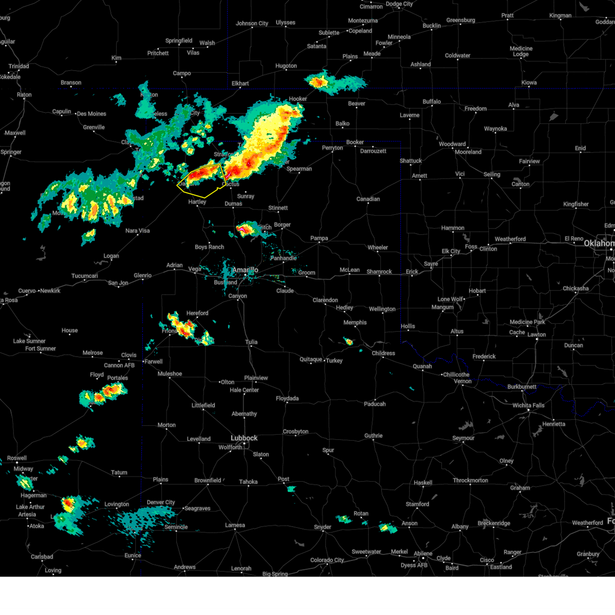 At 801 pm cdt, a severe thunderstorm was located 9 miles northeast of dalhart, moving southeast at 10 mph (radar indicated). Hazards include 60 mph wind gusts and quarter size hail. Minor damage to roofs, siding, and trees is possible. Hail damage to vehicles is expected. At 801 pm cdt, a severe thunderstorm was located 9 miles northeast of dalhart, moving southeast at 10 mph (radar indicated). Hazards include 60 mph wind gusts and quarter size hail. Minor damage to roofs, siding, and trees is possible. Hail damage to vehicles is expected.
|
| 8/29/2022 5:06 PM CDT |
 At 506 pm cdt, severe thunderstorms were located along a line extending from 3 miles west of gruver to 4 miles northeast of cactus to 9 miles southwest of conlen, moving south at 40 mph (radar indicated). Hazards include 60 mph wind gusts and quarter size hail. Minor damage to roofs, siding, and trees is possible. Hail damage to vehicles is expected. At 506 pm cdt, severe thunderstorms were located along a line extending from 3 miles west of gruver to 4 miles northeast of cactus to 9 miles southwest of conlen, moving south at 40 mph (radar indicated). Hazards include 60 mph wind gusts and quarter size hail. Minor damage to roofs, siding, and trees is possible. Hail damage to vehicles is expected.
|
| 7/30/2022 9:17 PM CDT |
 At 917 pm cdt, a severe thunderstorm was located 15 miles east of amistad, moving east at 20 mph (radar indicated). Hazards include 60 mph wind gusts. Minor damage to roofs, siding, and trees is possible. locations impacted include, dalhart, hartley and conlen. hail threat, radar indicated max hail size, <. 75 in wind threat, radar indicated max wind gust, 60 mph. At 917 pm cdt, a severe thunderstorm was located 15 miles east of amistad, moving east at 20 mph (radar indicated). Hazards include 60 mph wind gusts. Minor damage to roofs, siding, and trees is possible. locations impacted include, dalhart, hartley and conlen. hail threat, radar indicated max hail size, <. 75 in wind threat, radar indicated max wind gust, 60 mph.
|
| 7/30/2022 9:06 PM CDT |
 At 906 pm cdt, a severe thunderstorm was located over dalhart, moving east at 10 mph (radar indicated). Hazards include 60 mph wind gusts. Minor damage to roofs, siding, and trees is possible. locations impacted include, dalhart, hartley and conlen. hail threat, radar indicated max hail size, <. 75 in wind threat, radar indicated max wind gust, 60 mph. At 906 pm cdt, a severe thunderstorm was located over dalhart, moving east at 10 mph (radar indicated). Hazards include 60 mph wind gusts. Minor damage to roofs, siding, and trees is possible. locations impacted include, dalhart, hartley and conlen. hail threat, radar indicated max hail size, <. 75 in wind threat, radar indicated max wind gust, 60 mph.
|
| 7/30/2022 8:57 PM CDT |
 At 857 pm cdt, a severe thunderstorm was located over dalhart, moving east at 10 mph (radar indicated). Hazards include 60 mph wind gusts and penny size hail. Minor damage to roofs, siding, and trees is possible. locations impacted include, dalhart, hartley and conlen. hail threat, radar indicated max hail size, 0. 75in wind threat, radar indicated max wind gust, 60 mph. At 857 pm cdt, a severe thunderstorm was located over dalhart, moving east at 10 mph (radar indicated). Hazards include 60 mph wind gusts and penny size hail. Minor damage to roofs, siding, and trees is possible. locations impacted include, dalhart, hartley and conlen. hail threat, radar indicated max hail size, 0. 75in wind threat, radar indicated max wind gust, 60 mph.
|
| 7/30/2022 8:45 PM CDT |
 At 845 pm cdt, a severe thunderstorm was located near dalhart, moving northeast at 10 mph (radar indicated). Hazards include 60 mph wind gusts and quarter size hail. Minor damage to roofs, siding, and trees is possible. hail damage to vehicles is expected. locations impacted include, dalhart, hartley and conlen. hail threat, radar indicated max hail size, 1. 00in wind threat, radar indicated max wind gust, 60 mph. At 845 pm cdt, a severe thunderstorm was located near dalhart, moving northeast at 10 mph (radar indicated). Hazards include 60 mph wind gusts and quarter size hail. Minor damage to roofs, siding, and trees is possible. hail damage to vehicles is expected. locations impacted include, dalhart, hartley and conlen. hail threat, radar indicated max hail size, 1. 00in wind threat, radar indicated max wind gust, 60 mph.
|
| 7/30/2022 8:28 PM CDT |
 At 828 pm cdt, a severe thunderstorm was located 5 miles southwest of dalhart, moving east at 10 mph (radar indicated). Hazards include 60 mph wind gusts and quarter size hail. Minor damage to roofs, siding, and trees is possible. Hail damage to vehicles is expected. At 828 pm cdt, a severe thunderstorm was located 5 miles southwest of dalhart, moving east at 10 mph (radar indicated). Hazards include 60 mph wind gusts and quarter size hail. Minor damage to roofs, siding, and trees is possible. Hail damage to vehicles is expected.
|
| 7/2/2022 6:08 PM CDT | Storm damage reported in hartley county TX, 3.2 miles NE of Dalhart, TX |
| 6/20/2022 6:47 PM CDT | Asos station kdht dalhart (asos in hartley county TX, 3.2 miles NE of Dalhart, TX |
| 6/7/2022 8:14 PM CDT | Storm damage reported in hartley county TX, 2.7 miles NE of Dalhart, TX |
| 6/6/2022 8:50 PM CDT |
 At 850 pm cdt, a severe thunderstorm was located 8 miles east of dalhart, moving southeast at 30 mph. this is a destructive storm for portions of dallam and hartley counties (radar indicated). Hazards include 80 mph wind gusts and tennis ball size hail. Flying debris will be dangerous to those caught without shelter. mobile homes will be heavily damaged. expect considerable damage to roofs, windows, and vehicles. tree damage and power outages are likely. people and animals outdoors will be injured. expect hail damage to roofs, siding, windows, and vehicles. locations impacted include, dalhart and conlen. thunderstorm damage threat, destructive hail threat, radar indicated max hail size, 2. 50 in wind threat, radar indicated max wind gust, 80 mph. At 850 pm cdt, a severe thunderstorm was located 8 miles east of dalhart, moving southeast at 30 mph. this is a destructive storm for portions of dallam and hartley counties (radar indicated). Hazards include 80 mph wind gusts and tennis ball size hail. Flying debris will be dangerous to those caught without shelter. mobile homes will be heavily damaged. expect considerable damage to roofs, windows, and vehicles. tree damage and power outages are likely. people and animals outdoors will be injured. expect hail damage to roofs, siding, windows, and vehicles. locations impacted include, dalhart and conlen. thunderstorm damage threat, destructive hail threat, radar indicated max hail size, 2. 50 in wind threat, radar indicated max wind gust, 80 mph.
|
| 6/6/2022 8:38 PM CDT |
 At 837 pm cdt, a severe thunderstorm was located 8 miles northeast of dalhart, moving southeast at 30 mph. this is a destructive storm for portions of dallam and hartley counties (radar indicated). Hazards include 80 mph wind gusts and tennis ball size hail. Flying debris will be dangerous to those caught without shelter. mobile homes will be heavily damaged. expect considerable damage to roofs, windows, and vehicles. tree damage and power outages are likely. people and animals outdoors will be injured. expect hail damage to roofs, siding, windows, and vehicles. locations impacted include, dalhart and conlen. thunderstorm damage threat, destructive hail threat, radar indicated max hail size, 2. 50 in wind threat, radar indicated max wind gust, 80 mph. At 837 pm cdt, a severe thunderstorm was located 8 miles northeast of dalhart, moving southeast at 30 mph. this is a destructive storm for portions of dallam and hartley counties (radar indicated). Hazards include 80 mph wind gusts and tennis ball size hail. Flying debris will be dangerous to those caught without shelter. mobile homes will be heavily damaged. expect considerable damage to roofs, windows, and vehicles. tree damage and power outages are likely. people and animals outdoors will be injured. expect hail damage to roofs, siding, windows, and vehicles. locations impacted include, dalhart and conlen. thunderstorm damage threat, destructive hail threat, radar indicated max hail size, 2. 50 in wind threat, radar indicated max wind gust, 80 mph.
|
| 6/6/2022 8:30 PM CDT | Large irrigation tank blew across the road barely missing the person that sent in this report. time estimated from rada in dallam county TX, 9.4 miles S of Dalhart, TX |
| 6/6/2022 8:27 PM CDT |
 At 826 pm cdt, a severe thunderstorm was located 10 miles east of ware, or 12 miles north of dalhart, moving southeast at 25 mph. this is a destructive storm for portions of dallam county which includes highway 385 north of dalhart (radar indicated). Hazards include 80 mph wind gusts and two inch hail. Flying debris will be dangerous to those caught without shelter. mobile homes will be heavily damaged. expect considerable damage to roofs, windows, and vehicles. tree damage and power outages are likely. people and animals outdoors will be injured. expect hail damage to roofs, siding, windows, and vehicles. locations impacted include, dalhart and conlen. thunderstorm damage threat, destructive hail threat, radar indicated max hail size, 2. 00 in wind threat, radar indicated max wind gust, 80 mph. At 826 pm cdt, a severe thunderstorm was located 10 miles east of ware, or 12 miles north of dalhart, moving southeast at 25 mph. this is a destructive storm for portions of dallam county which includes highway 385 north of dalhart (radar indicated). Hazards include 80 mph wind gusts and two inch hail. Flying debris will be dangerous to those caught without shelter. mobile homes will be heavily damaged. expect considerable damage to roofs, windows, and vehicles. tree damage and power outages are likely. people and animals outdoors will be injured. expect hail damage to roofs, siding, windows, and vehicles. locations impacted include, dalhart and conlen. thunderstorm damage threat, destructive hail threat, radar indicated max hail size, 2. 00 in wind threat, radar indicated max wind gust, 80 mph.
|
| 6/6/2022 8:12 PM CDT |
 At 811 pm cdt, a severe thunderstorm was located 10 miles northeast of ware, or 18 miles north of dalhart, moving southeast at 25 mph (radar indicated). Hazards include two inch hail and 70 mph wind gusts. Expect some tree damage. damage is likely to mobile homes, roofs, and outbuildings. people and animals outdoors will be injured. Expect hail damage to roofs, siding, windows, and vehicles. At 811 pm cdt, a severe thunderstorm was located 10 miles northeast of ware, or 18 miles north of dalhart, moving southeast at 25 mph (radar indicated). Hazards include two inch hail and 70 mph wind gusts. Expect some tree damage. damage is likely to mobile homes, roofs, and outbuildings. people and animals outdoors will be injured. Expect hail damage to roofs, siding, windows, and vehicles.
|
| 6/3/2022 8:09 PM CDT | Asos station kdht dalhart (asos in hartley county TX, 3.2 miles NE of Dalhart, TX |
| 6/3/2022 7:21 PM CDT |
 At 720 pm cdt, severe thunderstorms were located along a line extending from 6 miles south of ware to 11 miles east of romero, moving east at 30 mph (radar indicated). Hazards include 60 mph wind gusts and quarter size hail. Minor damage to roofs, siding, and trees is possible. hail damage to vehicles is expected. locations impacted include, dalhart, hartley and romero. hail threat, radar indicated max hail size, 1. 00in wind threat, radar indicated max wind gust, 60 mph. At 720 pm cdt, severe thunderstorms were located along a line extending from 6 miles south of ware to 11 miles east of romero, moving east at 30 mph (radar indicated). Hazards include 60 mph wind gusts and quarter size hail. Minor damage to roofs, siding, and trees is possible. hail damage to vehicles is expected. locations impacted include, dalhart, hartley and romero. hail threat, radar indicated max hail size, 1. 00in wind threat, radar indicated max wind gust, 60 mph.
|
| 6/3/2022 7:14 PM CDT |
 At 714 pm cdt, severe thunderstorms were located along a line extending from 8 miles southwest of ware to near romero to 15 miles southeast of nara visa, moving east at 30 mph (radar indicated). Hazards include 60 mph wind gusts and quarter size hail. Minor damage to roofs, siding, and trees is possible. hail damage to vehicles is expected. locations impacted include, dalhart, hartley, adrian and romero. hail threat, radar indicated max hail size, 1. 00in wind threat, radar indicated max wind gust, 60 mph. At 714 pm cdt, severe thunderstorms were located along a line extending from 8 miles southwest of ware to near romero to 15 miles southeast of nara visa, moving east at 30 mph (radar indicated). Hazards include 60 mph wind gusts and quarter size hail. Minor damage to roofs, siding, and trees is possible. hail damage to vehicles is expected. locations impacted include, dalhart, hartley, adrian and romero. hail threat, radar indicated max hail size, 1. 00in wind threat, radar indicated max wind gust, 60 mph.
|
| 6/3/2022 7:00 PM CDT |
 At 700 pm cdt, severe thunderstorms were located along a line extending from 3 miles west of romero to 12 miles north of glenrio, moving northeast at 25 mph (radar indicated). Hazards include golf ball size hail and 60 mph wind gusts. Minor damage to roofs, siding, and trees is possible. people and animals outdoors will be injured. expect hail damage to roofs, siding, windows, and vehicles. locations impacted include, dalhart, hartley, adrian and romero. thunderstorm damage threat, considerable hail threat, radar indicated max hail size, 1. 75 in wind threat, radar indicated max wind gust, 60 mph. At 700 pm cdt, severe thunderstorms were located along a line extending from 3 miles west of romero to 12 miles north of glenrio, moving northeast at 25 mph (radar indicated). Hazards include golf ball size hail and 60 mph wind gusts. Minor damage to roofs, siding, and trees is possible. people and animals outdoors will be injured. expect hail damage to roofs, siding, windows, and vehicles. locations impacted include, dalhart, hartley, adrian and romero. thunderstorm damage threat, considerable hail threat, radar indicated max hail size, 1. 75 in wind threat, radar indicated max wind gust, 60 mph.
|
| 6/3/2022 6:53 PM CDT |
 At 652 pm cdt, severe thunderstorms were located along a line extending from 4 miles west of romero to 10 miles north of glenrio, moving northeast at 25 mph (radar indicated). Hazards include 60 mph wind gusts and half dollar size hail. Minor damage to roofs, siding, and trees is possible. Hail damage to vehicles is expected. At 652 pm cdt, severe thunderstorms were located along a line extending from 4 miles west of romero to 10 miles north of glenrio, moving northeast at 25 mph (radar indicated). Hazards include 60 mph wind gusts and half dollar size hail. Minor damage to roofs, siding, and trees is possible. Hail damage to vehicles is expected.
|
| 5/23/2022 5:00 PM CDT | Ping Pong Ball sized hail reported 8.5 miles WNW of Dalhart, TX |
| 5/23/2022 4:57 PM CDT |
 At 457 pm cdt, a severe thunderstorm was located 4 miles north of hartley, or 11 miles southeast of dalhart, moving northeast at 45 mph (radar indicated). Hazards include quarter size hail. Damage to vehicles is expected. locations impacted include, hartley and conlen. hail threat, radar indicated max hail size, 1. 00in wind threat, radar indicated max wind gust, <50 mph. At 457 pm cdt, a severe thunderstorm was located 4 miles north of hartley, or 11 miles southeast of dalhart, moving northeast at 45 mph (radar indicated). Hazards include quarter size hail. Damage to vehicles is expected. locations impacted include, hartley and conlen. hail threat, radar indicated max hail size, 1. 00in wind threat, radar indicated max wind gust, <50 mph.
|
| 5/23/2022 4:42 PM CDT |
 At 441 pm cdt, a severe thunderstorm was located 5 miles southwest of hartley, or 15 miles south of dalhart, moving northeast at 45 mph (radar indicated). Hazards include quarter size hail. damage to vehicles is expected At 441 pm cdt, a severe thunderstorm was located 5 miles southwest of hartley, or 15 miles south of dalhart, moving northeast at 45 mph (radar indicated). Hazards include quarter size hail. damage to vehicles is expected
|
| 5/16/2022 9:02 PM CDT | Storm damage reported in hartley county TX, 2.7 miles NE of Dalhart, TX |
| 5/16/2022 8:53 PM CDT |
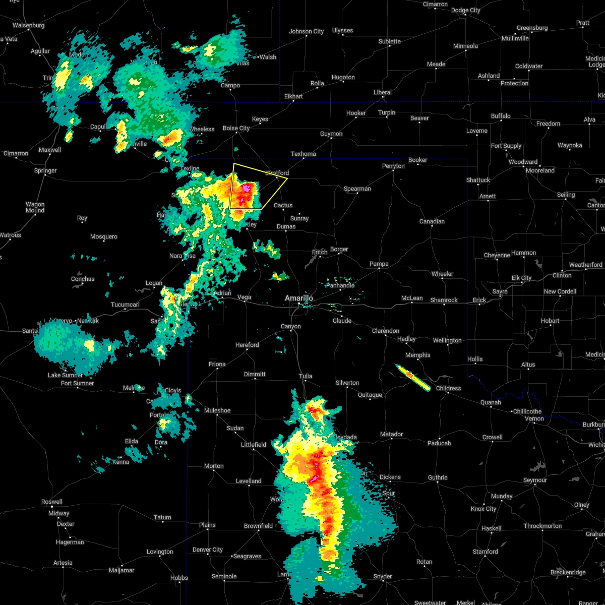 At 852 pm cdt, automated weather equipment reported a severe thunderstorm was located 4 miles northwest of conlen, or 13 miles west of stratford, moving northeast at 50 mph (automated weather equipment). Hazards include 70 mph wind gusts and quarter size hail. Expect some tree damage. damage is likely to mobile homes, roofs, and outbuildings. hail damage to vehicles is expected. locations impacted include, dalhart, stratford and conlen. thunderstorm damage threat, considerable hail threat, radar indicated max hail size, 1. 00in wind threat, observed max wind gust, 70 mph. At 852 pm cdt, automated weather equipment reported a severe thunderstorm was located 4 miles northwest of conlen, or 13 miles west of stratford, moving northeast at 50 mph (automated weather equipment). Hazards include 70 mph wind gusts and quarter size hail. Expect some tree damage. damage is likely to mobile homes, roofs, and outbuildings. hail damage to vehicles is expected. locations impacted include, dalhart, stratford and conlen. thunderstorm damage threat, considerable hail threat, radar indicated max hail size, 1. 00in wind threat, observed max wind gust, 70 mph.
|
| 5/16/2022 8:35 PM CDT |
 At 834 pm cdt, automated weather equipment reported a 72 mph wind gust in dalhart at 7:28 pm. the severe thunderstorm was located over dalhart, moving northeast at 35 mph (automated weather equipment). Hazards include 70 mph wind gusts and quarter size hail. Expect some tree damage. damage is likely to mobile homes, roofs, and outbuildings. hail damage to vehicles is expected. locations impacted include, dalhart, stratford, ware and conlen. thunderstorm damage threat, considerable hail threat, radar indicated max hail size, 1. 00in wind threat, observed max wind gust, 70 mph. At 834 pm cdt, automated weather equipment reported a 72 mph wind gust in dalhart at 7:28 pm. the severe thunderstorm was located over dalhart, moving northeast at 35 mph (automated weather equipment). Hazards include 70 mph wind gusts and quarter size hail. Expect some tree damage. damage is likely to mobile homes, roofs, and outbuildings. hail damage to vehicles is expected. locations impacted include, dalhart, stratford, ware and conlen. thunderstorm damage threat, considerable hail threat, radar indicated max hail size, 1. 00in wind threat, observed max wind gust, 70 mph.
|
| 5/16/2022 8:29 PM CDT | Asos station kdht dalhart (asos in hartley county TX, 3.2 miles NE of Dalhart, TX |
| 5/16/2022 8:28 PM CDT |
 At 827 pm cdt, a severe thunderstorm was located 4 miles southwest of dalhart, moving northeast at 35 mph (radar indicated). Hazards include 60 mph wind gusts and quarter size hail. Minor damage to roofs, siding, and trees is possible. Hail damage to vehicles is expected. At 827 pm cdt, a severe thunderstorm was located 4 miles southwest of dalhart, moving northeast at 35 mph (radar indicated). Hazards include 60 mph wind gusts and quarter size hail. Minor damage to roofs, siding, and trees is possible. Hail damage to vehicles is expected.
|
| 5/16/2022 8:09 PM CDT |
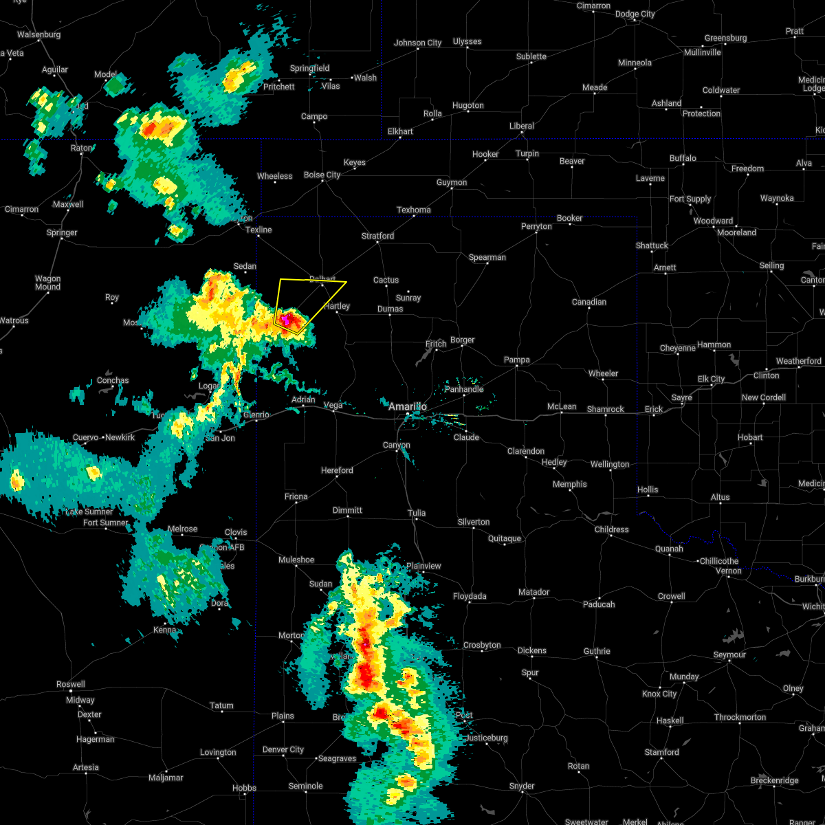 At 808 pm cdt, a severe thunderstorm was located 14 miles southwest of dalhart, moving northeast at 30 mph (radar indicated). Hazards include golf ball size hail and 60 mph wind gusts. Minor damage to roofs, siding, and trees is possible. people and animals outdoors will be injured. expect hail damage to roofs, siding, windows, and vehicles. locations impacted include, dalhart. thunderstorm damage threat, considerable hail threat, radar indicated max hail size, 1. 75 in wind threat, radar indicated max wind gust, 60 mph. At 808 pm cdt, a severe thunderstorm was located 14 miles southwest of dalhart, moving northeast at 30 mph (radar indicated). Hazards include golf ball size hail and 60 mph wind gusts. Minor damage to roofs, siding, and trees is possible. people and animals outdoors will be injured. expect hail damage to roofs, siding, windows, and vehicles. locations impacted include, dalhart. thunderstorm damage threat, considerable hail threat, radar indicated max hail size, 1. 75 in wind threat, radar indicated max wind gust, 60 mph.
|
| 5/16/2022 7:51 PM CDT |
 At 751 pm cdt, a severe thunderstorm was located 9 miles northeast of romero, or 19 miles east of amistad, moving northeast at 30 mph (radar indicated). Hazards include ping pong ball size hail and 60 mph wind gusts. Minor damage to roofs, siding, and trees is possible. people and animals outdoors will be injured. expect hail damage to roofs, siding, windows, and vehicles. locations impacted include, dalhart and romero. hail threat, radar indicated max hail size, 1. 50 in wind threat, radar indicated max wind gust, 60 mph. At 751 pm cdt, a severe thunderstorm was located 9 miles northeast of romero, or 19 miles east of amistad, moving northeast at 30 mph (radar indicated). Hazards include ping pong ball size hail and 60 mph wind gusts. Minor damage to roofs, siding, and trees is possible. people and animals outdoors will be injured. expect hail damage to roofs, siding, windows, and vehicles. locations impacted include, dalhart and romero. hail threat, radar indicated max hail size, 1. 50 in wind threat, radar indicated max wind gust, 60 mph.
|
| 5/16/2022 7:40 PM CDT |
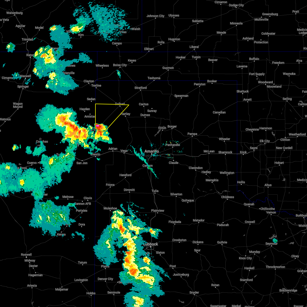 At 739 pm cdt, a severe thunderstorm was located near romero, or 15 miles northeast of nara visa, moving northeast at 30 mph (radar indicated). Hazards include 60 mph wind gusts and quarter size hail. Minor damage to roofs, siding, and trees is possible. Hail damage to vehicles is expected. At 739 pm cdt, a severe thunderstorm was located near romero, or 15 miles northeast of nara visa, moving northeast at 30 mph (radar indicated). Hazards include 60 mph wind gusts and quarter size hail. Minor damage to roofs, siding, and trees is possible. Hail damage to vehicles is expected.
|
| 5/11/2022 5:36 PM CDT | Ping Pong Ball sized hail reported 0.5 miles S of Dalhart, TX |
| 5/11/2022 5:36 PM CDT |
 At 536 pm cdt, a severe thunderstorm was located near dalhart, moving north at 45 mph. this is a destructive storm for dalhart, texas (trained weather spotters). Hazards include 80 mph wind gusts and ping pong ball size hail. Flying debris will be dangerous to those caught without shelter. mobile homes will be heavily damaged. expect considerable damage to roofs, windows, and vehicles. tree damage and power outages are likely. people and animals outdoors will be injured. expect hail damage to roofs, siding, windows, and vehicles. locations impacted include, dalhart, hartley, ware and conlen. thunderstorm damage threat, destructive hail threat, radar indicated max hail size, 1. 50 in wind threat, radar indicated max wind gust, 80 mph. At 536 pm cdt, a severe thunderstorm was located near dalhart, moving north at 45 mph. this is a destructive storm for dalhart, texas (trained weather spotters). Hazards include 80 mph wind gusts and ping pong ball size hail. Flying debris will be dangerous to those caught without shelter. mobile homes will be heavily damaged. expect considerable damage to roofs, windows, and vehicles. tree damage and power outages are likely. people and animals outdoors will be injured. expect hail damage to roofs, siding, windows, and vehicles. locations impacted include, dalhart, hartley, ware and conlen. thunderstorm damage threat, destructive hail threat, radar indicated max hail size, 1. 50 in wind threat, radar indicated max wind gust, 80 mph.
|
| 5/11/2022 5:32 PM CDT | Quarter sized hail reported 0.5 miles S of Dalhart, TX |
| 5/11/2022 5:31 PM CDT |
 At 531 pm cdt, automated weather equipment reported a severe thunderstorm was located over dalhart, moving north at 45 mph. this is a destructive storm for dalham and hartley county (automated weather equipment). Hazards include 80 mph wind gusts and ping pong ball size hail. Flying debris will be dangerous to those caught without shelter. mobile homes will be heavily damaged. expect considerable damage to roofs, windows, and vehicles. tree damage and power outages are likely. people and animals outdoors will be injured. expect hail damage to roofs, siding, windows, and vehicles. locations impacted include, dalhart, hartley, ware and conlen. thunderstorm damage threat, destructive hail threat, radar indicated max hail size, 1. 50 in wind threat, radar indicated max wind gust, 80 mph. At 531 pm cdt, automated weather equipment reported a severe thunderstorm was located over dalhart, moving north at 45 mph. this is a destructive storm for dalham and hartley county (automated weather equipment). Hazards include 80 mph wind gusts and ping pong ball size hail. Flying debris will be dangerous to those caught without shelter. mobile homes will be heavily damaged. expect considerable damage to roofs, windows, and vehicles. tree damage and power outages are likely. people and animals outdoors will be injured. expect hail damage to roofs, siding, windows, and vehicles. locations impacted include, dalhart, hartley, ware and conlen. thunderstorm damage threat, destructive hail threat, radar indicated max hail size, 1. 50 in wind threat, radar indicated max wind gust, 80 mph.
|
| 5/11/2022 5:30 PM CDT | Half Dollar sized hail reported 1.1 miles NW of Dalhart, TX |
| 5/11/2022 5:27 PM CDT | Storm damage reported in hartley county TX, 2.7 miles NE of Dalhart, TX |
| 5/11/2022 5:16 PM CDT |
 At 515 pm cdt, a severe thunderstorm was located 11 miles west of hartley, or 12 miles south of dalhart, moving north at 45 mph (radar indicated). Hazards include 60 mph wind gusts and quarter size hail. Minor damage to roofs, siding, and trees is possible. Hail damage to vehicles is expected. At 515 pm cdt, a severe thunderstorm was located 11 miles west of hartley, or 12 miles south of dalhart, moving north at 45 mph (radar indicated). Hazards include 60 mph wind gusts and quarter size hail. Minor damage to roofs, siding, and trees is possible. Hail damage to vehicles is expected.
|
| 5/1/2022 5:55 PM CDT |
 At 555 pm cdt, a severe thunderstorm was located 8 miles southeast of conlen, or 12 miles south of stratford, moving northeast at 30 mph (trained weather spotters). Hazards include two inch hail and 60 mph wind gusts. Minor damage to roofs, siding, and trees is possible. people and animals outdoors will be injured. expect hail damage to roofs, siding, windows, and vehicles. locations impacted include, dumas, hartley, cactus, sunray and conlen. thunderstorm damage threat, considerable hail threat, observed max hail size, 2. 00 in wind threat, radar indicated max wind gust, 60 mph. At 555 pm cdt, a severe thunderstorm was located 8 miles southeast of conlen, or 12 miles south of stratford, moving northeast at 30 mph (trained weather spotters). Hazards include two inch hail and 60 mph wind gusts. Minor damage to roofs, siding, and trees is possible. people and animals outdoors will be injured. expect hail damage to roofs, siding, windows, and vehicles. locations impacted include, dumas, hartley, cactus, sunray and conlen. thunderstorm damage threat, considerable hail threat, observed max hail size, 2. 00 in wind threat, radar indicated max wind gust, 60 mph.
|
| 5/1/2022 5:40 PM CDT |
 At 540 pm cdt, a severe thunderstorm was located 8 miles south of conlen, or 16 miles east of dalhart, moving northeast at 30 mph (trained weather spotters). Hazards include golf ball size hail and 60 mph wind gusts. Minor damage to roofs, siding, and trees is possible. people and animals outdoors will be injured. expect hail damage to roofs, siding, windows, and vehicles. locations impacted include, dumas, dalhart, hartley, cactus, sunray and conlen. thunderstorm damage threat, considerable hail threat, observed max hail size, 1. 75 in wind threat, radar indicated max wind gust, 60 mph. At 540 pm cdt, a severe thunderstorm was located 8 miles south of conlen, or 16 miles east of dalhart, moving northeast at 30 mph (trained weather spotters). Hazards include golf ball size hail and 60 mph wind gusts. Minor damage to roofs, siding, and trees is possible. people and animals outdoors will be injured. expect hail damage to roofs, siding, windows, and vehicles. locations impacted include, dumas, dalhart, hartley, cactus, sunray and conlen. thunderstorm damage threat, considerable hail threat, observed max hail size, 1. 75 in wind threat, radar indicated max wind gust, 60 mph.
|
| 5/1/2022 5:37 PM CDT | Quarter sized hail reported 0.7 miles WNW of Dalhart, TX |
| 5/1/2022 5:36 PM CDT | Half Dollar sized hail reported 2.4 miles NW of Dalhart, TX |
| 5/1/2022 5:28 PM CDT | Quarter sized hail reported 0.2 miles NNW of Dalhart, TX, report from mping: quarter (1.00 in.). |
| 5/1/2022 5:21 PM CDT |
 At 521 pm cdt, a severe thunderstorm was located 7 miles east of dalhart, moving northeast at 30 mph (trained weather spotters). Hazards include golf ball size hail and 60 mph wind gusts. Minor damage to roofs, siding, and trees is possible. people and animals outdoors will be injured. expect hail damage to roofs, siding, windows, and vehicles. locations impacted include, dumas, dalhart, hartley, cactus, sunray and conlen. thunderstorm damage threat, considerable hail threat, observed max hail size, 1. 75 in wind threat, radar indicated max wind gust, 60 mph. At 521 pm cdt, a severe thunderstorm was located 7 miles east of dalhart, moving northeast at 30 mph (trained weather spotters). Hazards include golf ball size hail and 60 mph wind gusts. Minor damage to roofs, siding, and trees is possible. people and animals outdoors will be injured. expect hail damage to roofs, siding, windows, and vehicles. locations impacted include, dumas, dalhart, hartley, cactus, sunray and conlen. thunderstorm damage threat, considerable hail threat, observed max hail size, 1. 75 in wind threat, radar indicated max wind gust, 60 mph.
|
| 5/1/2022 5:19 PM CDT | Golf Ball sized hail reported 7.9 miles NNE of Dalhart, TX |
| 5/1/2022 5:15 PM CDT | Half Dollar sized hail reported 2.7 miles NE of Dalhart, TX |
| 5/1/2022 5:11 PM CDT |
 At 510 pm cdt, a severe thunderstorm was located 4 miles southeast of dalhart, moving northeast at 30 mph (radar indicated). Hazards include ping pong ball size hail and 60 mph wind gusts. Minor damage to roofs, siding, and trees is possible. people and animals outdoors will be injured. Expect hail damage to roofs, siding, windows, and vehicles. At 510 pm cdt, a severe thunderstorm was located 4 miles southeast of dalhart, moving northeast at 30 mph (radar indicated). Hazards include ping pong ball size hail and 60 mph wind gusts. Minor damage to roofs, siding, and trees is possible. people and animals outdoors will be injured. Expect hail damage to roofs, siding, windows, and vehicles.
|
| 5/1/2022 5:06 PM CDT | Golf Ball sized hail reported 4 miles NE of Dalhart, TX |
| 5/1/2022 4:58 PM CDT | Quarter sized hail reported 2.1 miles WSW of Dalhart, TX |
| 5/1/2022 4:57 PM CDT |
 At 457 pm cdt, severe thunderstorms were located along a line extending from 14 miles southwest of dalhart to 11 miles northeast of channing, moving northeast at 15 mph (radar indicated). Hazards include two inch hail and 60 mph wind gusts. Minor damage to roofs, siding, and trees is possible. people and animals outdoors will be injured. expect hail damage to roofs, siding, windows, and vehicles. locations impacted include, dalhart, hartley, cactus and ware. thunderstorm damage threat, considerable hail threat, radar indicated max hail size, 2. 00 in wind threat, radar indicated max wind gust, 60 mph. At 457 pm cdt, severe thunderstorms were located along a line extending from 14 miles southwest of dalhart to 11 miles northeast of channing, moving northeast at 15 mph (radar indicated). Hazards include two inch hail and 60 mph wind gusts. Minor damage to roofs, siding, and trees is possible. people and animals outdoors will be injured. expect hail damage to roofs, siding, windows, and vehicles. locations impacted include, dalhart, hartley, cactus and ware. thunderstorm damage threat, considerable hail threat, radar indicated max hail size, 2. 00 in wind threat, radar indicated max wind gust, 60 mph.
|
| 5/1/2022 4:55 PM CDT |
 At 455 pm cdt, severe thunderstorms were located along a line extending from 15 miles southwest of dalhart to 9 miles northeast of channing, moving northeast at 15 mph (radar indicated). Hazards include golf ball size hail and 60 mph wind gusts. Minor damage to roofs, siding, and trees is possible. people and animals outdoors will be injured. expect hail damage to roofs, siding, windows, and vehicles. locations impacted include, dalhart, hartley, cactus and ware. thunderstorm damage threat, considerable hail threat, radar indicated max hail size, 1. 75 in wind threat, radar indicated max wind gust, 60 mph. At 455 pm cdt, severe thunderstorms were located along a line extending from 15 miles southwest of dalhart to 9 miles northeast of channing, moving northeast at 15 mph (radar indicated). Hazards include golf ball size hail and 60 mph wind gusts. Minor damage to roofs, siding, and trees is possible. people and animals outdoors will be injured. expect hail damage to roofs, siding, windows, and vehicles. locations impacted include, dalhart, hartley, cactus and ware. thunderstorm damage threat, considerable hail threat, radar indicated max hail size, 1. 75 in wind threat, radar indicated max wind gust, 60 mph.
|
| 5/1/2022 4:45 PM CDT |
 At 444 pm cdt, severe thunderstorms were located along a line extending from 14 miles northeast of romero to 7 miles northeast of channing, moving northeast at 15 mph (radar indicated). Hazards include ping pong ball size hail and 60 mph wind gusts. Minor damage to roofs, siding, and trees is possible. people and animals outdoors will be injured. expect hail damage to roofs, siding, windows, and vehicles. locations impacted include, dalhart, hartley, cactus and ware. hail threat, radar indicated max hail size, 1. 50 in wind threat, radar indicated max wind gust, 60 mph. At 444 pm cdt, severe thunderstorms were located along a line extending from 14 miles northeast of romero to 7 miles northeast of channing, moving northeast at 15 mph (radar indicated). Hazards include ping pong ball size hail and 60 mph wind gusts. Minor damage to roofs, siding, and trees is possible. people and animals outdoors will be injured. expect hail damage to roofs, siding, windows, and vehicles. locations impacted include, dalhart, hartley, cactus and ware. hail threat, radar indicated max hail size, 1. 50 in wind threat, radar indicated max wind gust, 60 mph.
|
| 5/1/2022 4:32 PM CDT |
 At 432 pm cdt, severe thunderstorms were located along a line extending from 11 miles northeast of romero to 4 miles north of channing, moving northeast at 15 mph (radar indicated). Hazards include two inch hail and 60 mph wind gusts. Minor damage to roofs, siding, and trees is possible. people and animals outdoors will be injured. expect hail damage to roofs, siding, windows, and vehicles. locations impacted include, dalhart, hartley, cactus and ware. thunderstorm damage threat, considerable hail threat, radar indicated max hail size, 2. 00 in wind threat, radar indicated max wind gust, 60 mph. At 432 pm cdt, severe thunderstorms were located along a line extending from 11 miles northeast of romero to 4 miles north of channing, moving northeast at 15 mph (radar indicated). Hazards include two inch hail and 60 mph wind gusts. Minor damage to roofs, siding, and trees is possible. people and animals outdoors will be injured. expect hail damage to roofs, siding, windows, and vehicles. locations impacted include, dalhart, hartley, cactus and ware. thunderstorm damage threat, considerable hail threat, radar indicated max hail size, 2. 00 in wind threat, radar indicated max wind gust, 60 mph.
|
| 5/1/2022 4:25 PM CDT |
 At 425 pm cdt, severe thunderstorms were located along a line extending from 10 miles northeast of romero to 4 miles north of channing, moving northeast at 15 mph (radar indicated). Hazards include ping pong ball size hail and 60 mph wind gusts. Minor damage to roofs, siding, and trees is possible. people and animals outdoors will be injured. expect hail damage to roofs, siding, windows, and vehicles. locations impacted include, dalhart, hartley, cactus and ware. hail threat, radar indicated max hail size, 1. 50 in wind threat, radar indicated max wind gust, 60 mph. At 425 pm cdt, severe thunderstorms were located along a line extending from 10 miles northeast of romero to 4 miles north of channing, moving northeast at 15 mph (radar indicated). Hazards include ping pong ball size hail and 60 mph wind gusts. Minor damage to roofs, siding, and trees is possible. people and animals outdoors will be injured. expect hail damage to roofs, siding, windows, and vehicles. locations impacted include, dalhart, hartley, cactus and ware. hail threat, radar indicated max hail size, 1. 50 in wind threat, radar indicated max wind gust, 60 mph.
|
| 5/1/2022 4:18 PM CDT |
 At 417 pm cdt, severe thunderstorms were located along a line extending from 7 miles northeast of romero to 3 miles northwest of channing, moving northeast at 25 mph (radar indicated). Hazards include 60 mph wind gusts and quarter size hail. Minor damage to roofs, siding, and trees is possible. Hail damage to vehicles is expected. At 417 pm cdt, severe thunderstorms were located along a line extending from 7 miles northeast of romero to 3 miles northwest of channing, moving northeast at 25 mph (radar indicated). Hazards include 60 mph wind gusts and quarter size hail. Minor damage to roofs, siding, and trees is possible. Hail damage to vehicles is expected.
|
| 4/27/2022 10:05 PM CDT |
 At 1004 pm cdt, severe thunderstorms were located along a line extending from 4 miles northwest of cactus to 4 miles west of hartley, moving east at 45 mph (radar indicated). Hazards include 60 mph wind gusts. minor damage to roofs, siding, and trees is possible At 1004 pm cdt, severe thunderstorms were located along a line extending from 4 miles northwest of cactus to 4 miles west of hartley, moving east at 45 mph (radar indicated). Hazards include 60 mph wind gusts. minor damage to roofs, siding, and trees is possible
|
| 4/23/2022 12:53 AM CDT | Storm damage reported in hartley county TX, 2.7 miles NE of Dalhart, TX |
| 4/22/2022 4:41 PM CDT | Quarter sized hail reported 1.2 miles SSE of Dalhart, TX |
| 4/22/2022 4:41 PM CDT | Quarter sized hail reported 9.1 miles SW of Dalhart, TX |
| 4/22/2022 4:38 PM CDT |
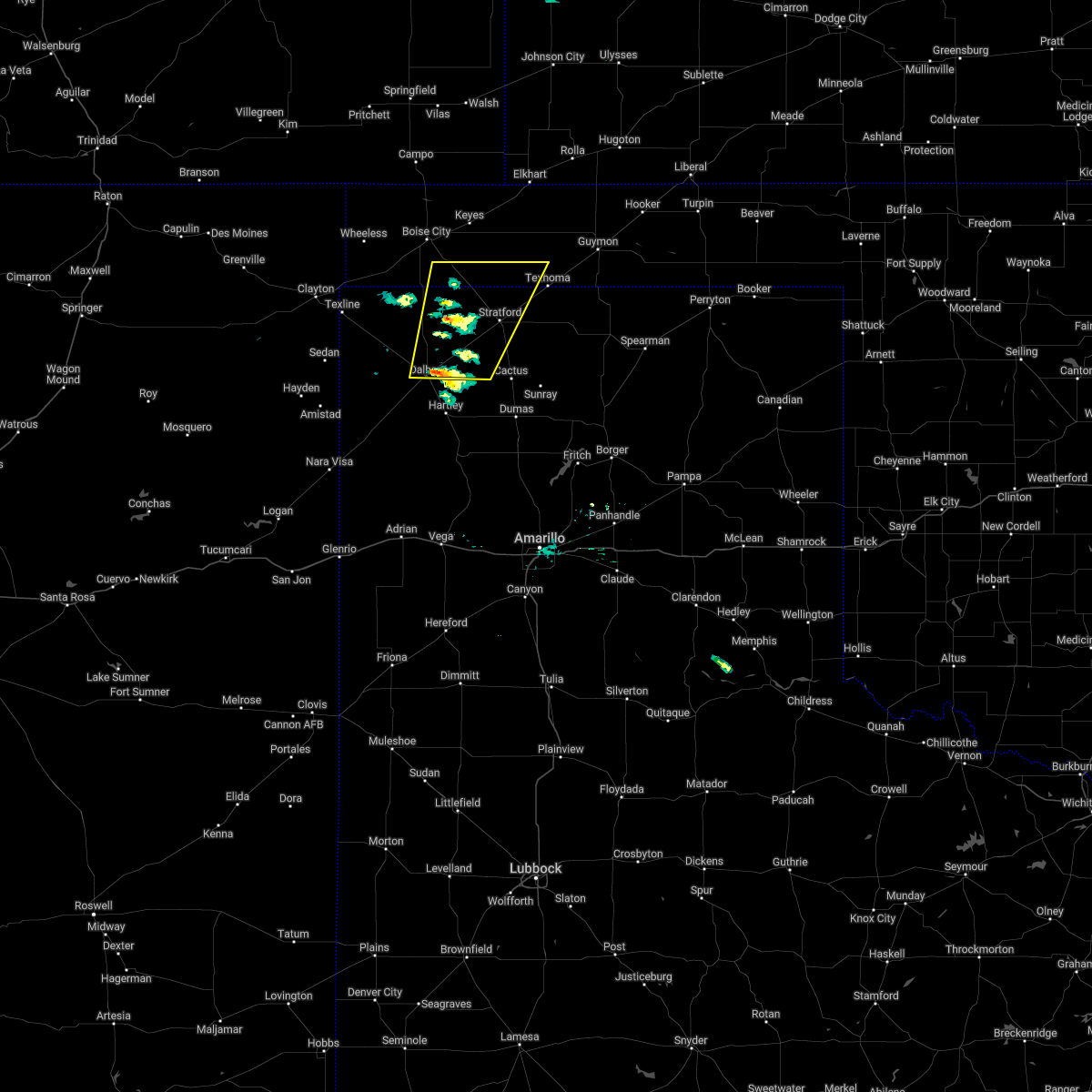 At 438 pm cdt, a severe thunderstorm was located 9 miles northeast of dalhart, moving northeast at 55 mph (radar indicated). Hazards include 60 mph wind gusts and half dollar size hail. Minor damage to roofs, siding, and trees is possible. Hail damage to vehicles is expected. At 438 pm cdt, a severe thunderstorm was located 9 miles northeast of dalhart, moving northeast at 55 mph (radar indicated). Hazards include 60 mph wind gusts and half dollar size hail. Minor damage to roofs, siding, and trees is possible. Hail damage to vehicles is expected.
|
| 7/4/2021 9:40 PM CDT |
 At 939 pm cdt, severe thunderstorms were located along a line extending from 4 miles north of dalhart to 6 miles northwest of ware to 3 miles northwest of seneca, moving south at 35 mph (radar indicated). Hazards include 60 mph wind gusts and quarter size hail. Minor damage to roofs, siding, and trees is possible. hail damage to vehicles is expected. Locations impacted include, dalhart, texline, ware and conlen. At 939 pm cdt, severe thunderstorms were located along a line extending from 4 miles north of dalhart to 6 miles northwest of ware to 3 miles northwest of seneca, moving south at 35 mph (radar indicated). Hazards include 60 mph wind gusts and quarter size hail. Minor damage to roofs, siding, and trees is possible. hail damage to vehicles is expected. Locations impacted include, dalhart, texline, ware and conlen.
|
| 7/4/2021 9:00 PM CDT |
 At 859 pm cdt, severe thunderstorms were located along a line extending from 18 miles northwest of conlen to 3 miles southeast of felt to 8 miles northwest of kenton, moving south at 35 mph (radar indicated). Hazards include 60 mph wind gusts and quarter size hail. Minor damage to roofs, siding, and trees is possible. Hail damage to vehicles is expected. At 859 pm cdt, severe thunderstorms were located along a line extending from 18 miles northwest of conlen to 3 miles southeast of felt to 8 miles northwest of kenton, moving south at 35 mph (radar indicated). Hazards include 60 mph wind gusts and quarter size hail. Minor damage to roofs, siding, and trees is possible. Hail damage to vehicles is expected.
|
| 7/4/2021 8:08 PM CDT |
 At 808 pm cdt, a severe thunderstorm was located over dalhart, moving southeast at 30 mph (radar indicated). Hazards include 60 mph wind gusts and quarter size hail. Minor damage to roofs, siding, and trees is possible. hail damage to vehicles is expected. Locations impacted include, dalhart and conlen. At 808 pm cdt, a severe thunderstorm was located over dalhart, moving southeast at 30 mph (radar indicated). Hazards include 60 mph wind gusts and quarter size hail. Minor damage to roofs, siding, and trees is possible. hail damage to vehicles is expected. Locations impacted include, dalhart and conlen.
|
| 7/4/2021 7:58 PM CDT |
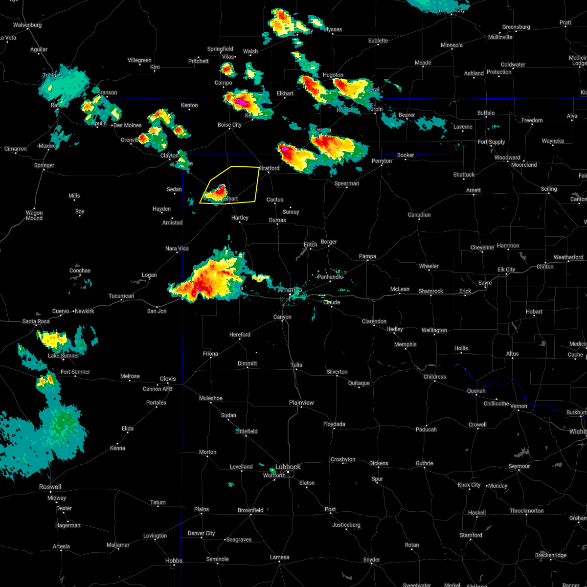 At 757 pm cdt, a severe thunderstorm was located 6 miles northwest of dalhart, moving southeast at 35 mph (radar indicated). Hazards include 60 mph wind gusts and quarter size hail. Minor damage to roofs, siding, and trees is possible. hail damage to vehicles is expected. Locations impacted include, dalhart, ware and conlen. At 757 pm cdt, a severe thunderstorm was located 6 miles northwest of dalhart, moving southeast at 35 mph (radar indicated). Hazards include 60 mph wind gusts and quarter size hail. Minor damage to roofs, siding, and trees is possible. hail damage to vehicles is expected. Locations impacted include, dalhart, ware and conlen.
|
| 7/4/2021 7:33 PM CDT |
 At 732 pm cdt, a severe thunderstorm was located 7 miles north of ware, or 20 miles northwest of dalhart, moving southeast at 30 mph (radar indicated). Hazards include 60 mph wind gusts and half dollar size hail. Minor damage to roofs, siding, and trees is possible. hail damage to vehicles is expected. Locations impacted include, dalhart, texline, ware and conlen. At 732 pm cdt, a severe thunderstorm was located 7 miles north of ware, or 20 miles northwest of dalhart, moving southeast at 30 mph (radar indicated). Hazards include 60 mph wind gusts and half dollar size hail. Minor damage to roofs, siding, and trees is possible. hail damage to vehicles is expected. Locations impacted include, dalhart, texline, ware and conlen.
|
| 7/4/2021 7:14 PM CDT |
 At 713 pm cdt, a severe thunderstorm was located 8 miles east of texline, or 18 miles east of clayton, moving southeast at 25 mph (radar indicated). Hazards include 60 mph wind gusts and half dollar size hail. Minor damage to roofs, siding, and trees is possible. hail damage to vehicles is expected. Locations impacted include, dalhart, texline, ware and conlen. At 713 pm cdt, a severe thunderstorm was located 8 miles east of texline, or 18 miles east of clayton, moving southeast at 25 mph (radar indicated). Hazards include 60 mph wind gusts and half dollar size hail. Minor damage to roofs, siding, and trees is possible. hail damage to vehicles is expected. Locations impacted include, dalhart, texline, ware and conlen.
|
| 7/4/2021 6:59 PM CDT |
 The national weather service in amarillo has issued a * severe thunderstorm warning for. dallam county in the panhandle of texas. until 830 pm cdt. At 658 pm cdt, a severe thunderstorm was located 5 miles northeast of texline, or 12 miles east of clayton, moving southeast at 20. The national weather service in amarillo has issued a * severe thunderstorm warning for. dallam county in the panhandle of texas. until 830 pm cdt. At 658 pm cdt, a severe thunderstorm was located 5 miles northeast of texline, or 12 miles east of clayton, moving southeast at 20.
|
| 7/4/2021 6:40 PM CDT |
 At 639 pm cdt, a severe thunderstorm was located 14 miles northeast of romero, or 18 miles southwest of dalhart, moving southwest at 15 mph (radar indicated). Hazards include two inch hail and 60 mph wind gusts. Minor damage to roofs, siding, and trees is possible. people and animals outdoors will be injured. expect hail damage to roofs, siding, windows, and vehicles. Locations impacted include, dalhart, hartley, channing, ware and romero. At 639 pm cdt, a severe thunderstorm was located 14 miles northeast of romero, or 18 miles southwest of dalhart, moving southwest at 15 mph (radar indicated). Hazards include two inch hail and 60 mph wind gusts. Minor damage to roofs, siding, and trees is possible. people and animals outdoors will be injured. expect hail damage to roofs, siding, windows, and vehicles. Locations impacted include, dalhart, hartley, channing, ware and romero.
|
| 7/4/2021 6:29 PM CDT |
 At 628 pm cdt, a severe thunderstorm was located 15 miles southwest of dalhart, moving southwest at 15 mph (radar indicated). Hazards include two inch hail and 60 mph wind gusts. Minor damage to roofs, siding, and trees is possible. people and animals outdoors will be injured. expect hail damage to roofs, siding, windows, and vehicles. Locations impacted include, dalhart, hartley, channing, ware and romero. At 628 pm cdt, a severe thunderstorm was located 15 miles southwest of dalhart, moving southwest at 15 mph (radar indicated). Hazards include two inch hail and 60 mph wind gusts. Minor damage to roofs, siding, and trees is possible. people and animals outdoors will be injured. expect hail damage to roofs, siding, windows, and vehicles. Locations impacted include, dalhart, hartley, channing, ware and romero.
|
| 7/4/2021 6:23 PM CDT | Hen Egg sized hail reported 11.8 miles NE of Dalhart, TX, around 2 inch hail broke windshield of vehicle. |
| 7/4/2021 6:13 PM CDT |
 At 613 pm cdt, a severe thunderstorm was located 11 miles southwest of dalhart, moving southwest at 15 mph (radar indicated). Hazards include two inch hail and 60 mph wind gusts. Minor damage to roofs, siding, and trees is possible. people and animals outdoors will be injured. expect hail damage to roofs, siding, windows, and vehicles. Locations impacted include, dalhart, hartley, channing, ware, romero and conlen. At 613 pm cdt, a severe thunderstorm was located 11 miles southwest of dalhart, moving southwest at 15 mph (radar indicated). Hazards include two inch hail and 60 mph wind gusts. Minor damage to roofs, siding, and trees is possible. people and animals outdoors will be injured. expect hail damage to roofs, siding, windows, and vehicles. Locations impacted include, dalhart, hartley, channing, ware, romero and conlen.
|
| 7/4/2021 6:01 PM CDT |
 At 601 pm cdt, a severe thunderstorm was located 8 miles southwest of dalhart, moving southwest at 15 mph (radar indicated). Hazards include golf ball size hail and 60 mph wind gusts. Minor damage to roofs, siding, and trees is possible. people and animals outdoors will be injured. expect hail damage to roofs, siding, windows, and vehicles. Locations impacted include, dalhart, hartley, channing, ware, romero and conlen. At 601 pm cdt, a severe thunderstorm was located 8 miles southwest of dalhart, moving southwest at 15 mph (radar indicated). Hazards include golf ball size hail and 60 mph wind gusts. Minor damage to roofs, siding, and trees is possible. people and animals outdoors will be injured. expect hail damage to roofs, siding, windows, and vehicles. Locations impacted include, dalhart, hartley, channing, ware, romero and conlen.
|
| 7/4/2021 5:52 PM CDT |
 At 551 pm cdt, a severe thunderstorm was located 5 miles southwest of dalhart, moving southwest at 15 mph (trained weather spotters). Hazards include golf ball size hail and 60 mph wind gusts. Minor damage to roofs, siding, and trees is possible. people and animals outdoors will be injured. expect hail damage to roofs, siding, windows, and vehicles. Locations impacted include, dalhart, hartley, channing, ware, romero and conlen. At 551 pm cdt, a severe thunderstorm was located 5 miles southwest of dalhart, moving southwest at 15 mph (trained weather spotters). Hazards include golf ball size hail and 60 mph wind gusts. Minor damage to roofs, siding, and trees is possible. people and animals outdoors will be injured. expect hail damage to roofs, siding, windows, and vehicles. Locations impacted include, dalhart, hartley, channing, ware, romero and conlen.
|
| 7/4/2021 5:50 PM CDT | Golf Ball sized hail reported 6.6 miles NE of Dalhart, TX, golfball size hail. |
| 7/4/2021 5:44 PM CDT |
 At 543 pm cdt, a severe thunderstorm was located 5 miles southwest of dalhart, moving southwest at 15 mph. another severe thunderstorm was located 10 miles northeast of dalhart, moving southwest at 15 mph (radar indicated). Hazards include two inch hail and 60 mph wind gusts. Minor damage to roofs, siding, and trees is possible. people and animals outdoors will be injured. Expect hail damage to roofs, siding, windows, and vehicles. At 543 pm cdt, a severe thunderstorm was located 5 miles southwest of dalhart, moving southwest at 15 mph. another severe thunderstorm was located 10 miles northeast of dalhart, moving southwest at 15 mph (radar indicated). Hazards include two inch hail and 60 mph wind gusts. Minor damage to roofs, siding, and trees is possible. people and animals outdoors will be injured. Expect hail damage to roofs, siding, windows, and vehicles.
|
| 7/4/2021 5:43 PM CDT | Ping Pong Ball sized hail reported 4 miles W of Dalhart, TX, 1 to 1.5 inch hail fell for 2 minutes. |
| 7/4/2021 5:39 PM CDT |
 At 539 pm cdt, a severe thunderstorm was located 5 miles southwest of dalhart, moving southwest at 15 mph (radar indicated). Hazards include two inch hail and 60 mph wind gusts. Minor damage to roofs, siding, and trees is possible. people and animals outdoors will be injured. expect hail damage to roofs, siding, windows, and vehicles. Locations impacted include, dalhart, hartley, ware and conlen. At 539 pm cdt, a severe thunderstorm was located 5 miles southwest of dalhart, moving southwest at 15 mph (radar indicated). Hazards include two inch hail and 60 mph wind gusts. Minor damage to roofs, siding, and trees is possible. people and animals outdoors will be injured. expect hail damage to roofs, siding, windows, and vehicles. Locations impacted include, dalhart, hartley, ware and conlen.
|
| 7/4/2021 5:22 PM CDT |
 At 522 pm cdt, a severe thunderstorm was located over dalhart, moving southwest at 15 mph (radar indicated). Hazards include ping pong ball size hail and 60 mph wind gusts. Minor damage to roofs, siding, and trees is possible. people and animals outdoors will be injured. expect hail damage to roofs, siding, windows, and vehicles. Locations impacted include, dalhart, hartley, ware and conlen. At 522 pm cdt, a severe thunderstorm was located over dalhart, moving southwest at 15 mph (radar indicated). Hazards include ping pong ball size hail and 60 mph wind gusts. Minor damage to roofs, siding, and trees is possible. people and animals outdoors will be injured. expect hail damage to roofs, siding, windows, and vehicles. Locations impacted include, dalhart, hartley, ware and conlen.
|
| 7/4/2021 5:15 PM CDT |
 At 515 pm cdt, a severe thunderstorm was located over dalhart, moving south at 15 mph (radar indicated). Hazards include golf ball size hail and 60 mph wind gusts. Minor damage to roofs, siding, and trees is possible. people and animals outdoors will be injured. expect hail damage to roofs, siding, windows, and vehicles. Locations impacted include, dalhart, stratford, hartley, ware and conlen. At 515 pm cdt, a severe thunderstorm was located over dalhart, moving south at 15 mph (radar indicated). Hazards include golf ball size hail and 60 mph wind gusts. Minor damage to roofs, siding, and trees is possible. people and animals outdoors will be injured. expect hail damage to roofs, siding, windows, and vehicles. Locations impacted include, dalhart, stratford, hartley, ware and conlen.
|
| 7/4/2021 5:08 PM CDT |
 At 507 pm cdt, a severe thunderstorm was located over dalhart, moving south at 20 mph (radar indicated). Hazards include two inch hail and 60 mph wind gusts. Minor damage to roofs, siding, and trees is possible. people and animals outdoors will be injured. expect hail damage to roofs, siding, windows, and vehicles. Locations impacted include, dalhart, stratford, hartley, ware and conlen. At 507 pm cdt, a severe thunderstorm was located over dalhart, moving south at 20 mph (radar indicated). Hazards include two inch hail and 60 mph wind gusts. Minor damage to roofs, siding, and trees is possible. people and animals outdoors will be injured. expect hail damage to roofs, siding, windows, and vehicles. Locations impacted include, dalhart, stratford, hartley, ware and conlen.
|
| 7/4/2021 5:00 PM CDT |
 At 500 pm cdt, a severe thunderstorm was located near dalhart, moving southwest at 15 mph (trained weather spotters). Hazards include two inch hail. People and animals outdoors will be injured. expect damage to roofs, siding, windows, and vehicles. Locations impacted include, dalhart, stratford, hartley, ware and conlen. At 500 pm cdt, a severe thunderstorm was located near dalhart, moving southwest at 15 mph (trained weather spotters). Hazards include two inch hail. People and animals outdoors will be injured. expect damage to roofs, siding, windows, and vehicles. Locations impacted include, dalhart, stratford, hartley, ware and conlen.
|
| 7/4/2021 4:57 PM CDT |
 At 452 pm cdt, a severe thunderstorm was located 5 miles north of dalhart, moving southwest at 15 mph (radar indicated). Hazards include golf ball size hail and 60 mph wind gusts. Minor damage to roofs, siding, and trees is possible. people and animals outdoors will be injured. expect hail damage to roofs, siding, windows, and vehicles. Locations impacted include, dalhart, stratford, hartley, ware, conlen and texhoma. At 452 pm cdt, a severe thunderstorm was located 5 miles north of dalhart, moving southwest at 15 mph (radar indicated). Hazards include golf ball size hail and 60 mph wind gusts. Minor damage to roofs, siding, and trees is possible. people and animals outdoors will be injured. expect hail damage to roofs, siding, windows, and vehicles. Locations impacted include, dalhart, stratford, hartley, ware, conlen and texhoma.
|
| 7/4/2021 4:55 PM CDT | Hen Egg sized hail reported 1.8 miles S of Dalhart, TX, social media report of two inch hail. |
| 7/4/2021 4:52 PM CDT |
 At 452 pm cdt, a severe thunderstorm was located 5 miles north of dalhart, moving southwest at 15 mph (radar indicated). Hazards include golf ball size hail and 60 mph wind gusts. Minor damage to roofs, siding, and trees is possible. people and animals outdoors will be injured. expect hail damage to roofs, siding, windows, and vehicles. Locations impacted include, dalhart, stratford, hartley, ware, conlen and texhoma. At 452 pm cdt, a severe thunderstorm was located 5 miles north of dalhart, moving southwest at 15 mph (radar indicated). Hazards include golf ball size hail and 60 mph wind gusts. Minor damage to roofs, siding, and trees is possible. people and animals outdoors will be injured. expect hail damage to roofs, siding, windows, and vehicles. Locations impacted include, dalhart, stratford, hartley, ware, conlen and texhoma.
|
| 7/4/2021 4:45 PM CDT |
 At 444 pm cdt, a severe thunderstorm was located 6 miles north of dalhart, moving southwest at 15 mph (radar indicated). Hazards include ping pong ball size hail and 60 mph wind gusts. Minor damage to roofs, siding, and trees is possible. people and animals outdoors will be injured. expect hail damage to roofs, siding, windows, and vehicles. Locations impacted include, dalhart, stratford, hartley, ware, conlen and texhoma. At 444 pm cdt, a severe thunderstorm was located 6 miles north of dalhart, moving southwest at 15 mph (radar indicated). Hazards include ping pong ball size hail and 60 mph wind gusts. Minor damage to roofs, siding, and trees is possible. people and animals outdoors will be injured. expect hail damage to roofs, siding, windows, and vehicles. Locations impacted include, dalhart, stratford, hartley, ware, conlen and texhoma.
|
| 7/4/2021 4:36 PM CDT |
 At 435 pm cdt, a severe thunderstorm was located 9 miles north of dalhart, moving southwest at 15 mph (radar indicated). Hazards include ping pong ball size hail and 60 mph wind gusts. Minor damage to roofs, siding, and trees is possible. people and animals outdoors will be injured. expect hail damage to roofs, siding, windows, and vehicles. Locations impacted include, dalhart, stratford, hartley, ware, conlen and texhoma. At 435 pm cdt, a severe thunderstorm was located 9 miles north of dalhart, moving southwest at 15 mph (radar indicated). Hazards include ping pong ball size hail and 60 mph wind gusts. Minor damage to roofs, siding, and trees is possible. people and animals outdoors will be injured. expect hail damage to roofs, siding, windows, and vehicles. Locations impacted include, dalhart, stratford, hartley, ware, conlen and texhoma.
|
| 7/4/2021 4:25 PM CDT |
 At 425 pm cdt, a severe thunderstorm was located 10 miles west of conlen, or 12 miles north of dalhart, moving southwest at 15 mph (radar indicated). Hazards include ping pong ball size hail and 60 mph wind gusts. Minor damage to roofs, siding, and trees is possible. people and animals outdoors will be injured. expect hail damage to roofs, siding, windows, and vehicles. Locations impacted include, dalhart, stratford, hartley, ware, conlen and texhoma. At 425 pm cdt, a severe thunderstorm was located 10 miles west of conlen, or 12 miles north of dalhart, moving southwest at 15 mph (radar indicated). Hazards include ping pong ball size hail and 60 mph wind gusts. Minor damage to roofs, siding, and trees is possible. people and animals outdoors will be injured. expect hail damage to roofs, siding, windows, and vehicles. Locations impacted include, dalhart, stratford, hartley, ware, conlen and texhoma.
|
| 7/4/2021 4:14 PM CDT |
 At 413 pm cdt, a severe thunderstorm was located 9 miles west of conlen, or 14 miles northeast of dalhart, moving southwest at 15 mph. another severe thunderstorm was located 5 miles south of griggs, moving southwest at 15 mph (radar indicated). Hazards include 60 mph wind gusts and half dollar size hail. Minor damage to roofs, siding, and trees is possible. Hail damage to vehicles is expected. At 413 pm cdt, a severe thunderstorm was located 9 miles west of conlen, or 14 miles northeast of dalhart, moving southwest at 15 mph. another severe thunderstorm was located 5 miles south of griggs, moving southwest at 15 mph (radar indicated). Hazards include 60 mph wind gusts and half dollar size hail. Minor damage to roofs, siding, and trees is possible. Hail damage to vehicles is expected.
|
| 7/4/2021 4:06 PM CDT |
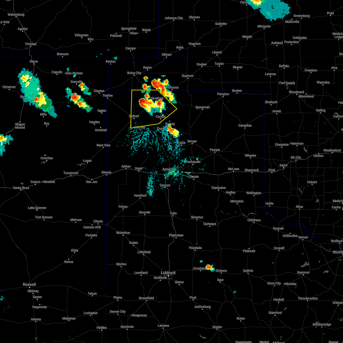 At 406 pm cdt, a severe thunderstorm was located 6 miles northwest of conlen, or 15 miles west of stratford, moving south at 10 mph (radar indicated). Hazards include 60 mph wind gusts and half dollar size hail. Minor damage to roofs, siding, and trees is possible. hail damage to vehicles is expected. Locations impacted include, dalhart, stratford, cactus and conlen. At 406 pm cdt, a severe thunderstorm was located 6 miles northwest of conlen, or 15 miles west of stratford, moving south at 10 mph (radar indicated). Hazards include 60 mph wind gusts and half dollar size hail. Minor damage to roofs, siding, and trees is possible. hail damage to vehicles is expected. Locations impacted include, dalhart, stratford, cactus and conlen.
|
| 7/4/2021 3:57 PM CDT |
 At 357 pm cdt, a severe thunderstorm was located 6 miles northwest of conlen, or 13 miles west of stratford, moving south at 15 mph (radar indicated). Hazards include 70 mph wind gusts and ping pong ball size hail. Expect some tree damage. damage is likely to mobile homes, roofs, and outbuildings. people and animals outdoors will be injured. expect hail damage to roofs, siding, windows, and vehicles. Locations impacted include, dalhart, stratford, cactus and conlen. At 357 pm cdt, a severe thunderstorm was located 6 miles northwest of conlen, or 13 miles west of stratford, moving south at 15 mph (radar indicated). Hazards include 70 mph wind gusts and ping pong ball size hail. Expect some tree damage. damage is likely to mobile homes, roofs, and outbuildings. people and animals outdoors will be injured. expect hail damage to roofs, siding, windows, and vehicles. Locations impacted include, dalhart, stratford, cactus and conlen.
|
| 7/4/2021 3:49 PM CDT |
 At 348 pm cdt, a severe thunderstorm was located 8 miles northwest of conlen, or 14 miles west of stratford, moving south at 15 mph (radar indicated). Hazards include ping pong ball size hail and 60 mph wind gusts. Minor damage to roofs, siding, and trees is possible. people and animals outdoors will be injured. expect hail damage to roofs, siding, windows, and vehicles. Locations impacted include, dalhart, stratford, cactus and conlen. At 348 pm cdt, a severe thunderstorm was located 8 miles northwest of conlen, or 14 miles west of stratford, moving south at 15 mph (radar indicated). Hazards include ping pong ball size hail and 60 mph wind gusts. Minor damage to roofs, siding, and trees is possible. people and animals outdoors will be injured. expect hail damage to roofs, siding, windows, and vehicles. Locations impacted include, dalhart, stratford, cactus and conlen.
|
| 7/4/2021 3:42 PM CDT |
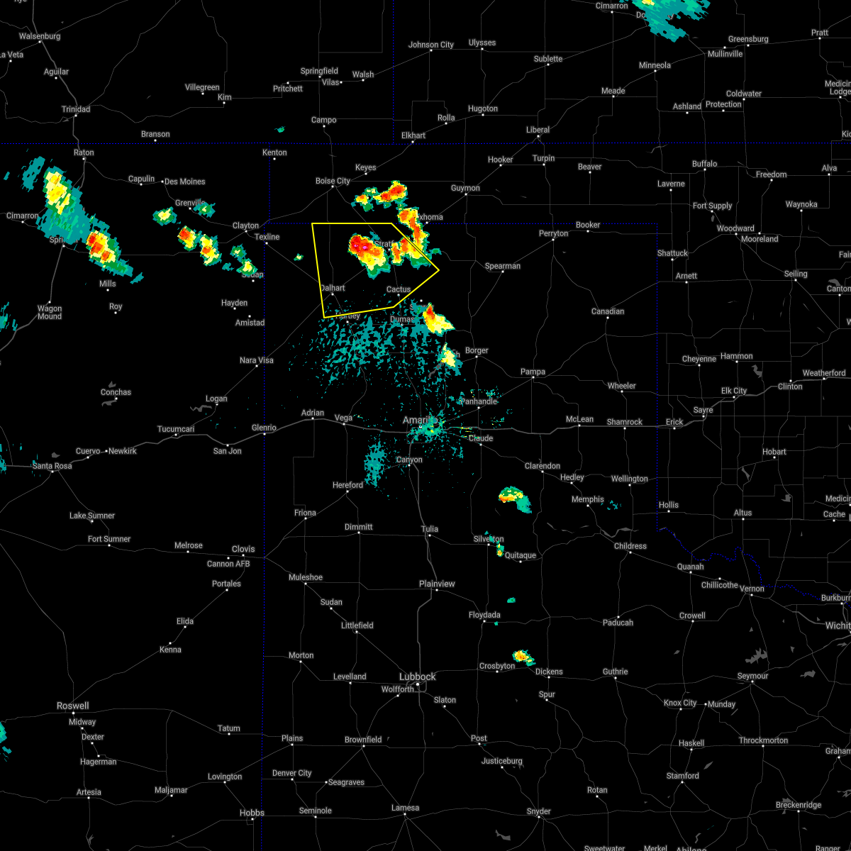 At 341 pm cdt, a severe thunderstorm was located 7 miles north of conlen, or 11 miles west of stratford, moving south at 10 mph (radar indicated). Hazards include 60 mph wind gusts and half dollar size hail. Minor damage to roofs, siding, and trees is possible. hail damage to vehicles is expected. Locations impacted include, dalhart, stratford, cactus and conlen. At 341 pm cdt, a severe thunderstorm was located 7 miles north of conlen, or 11 miles west of stratford, moving south at 10 mph (radar indicated). Hazards include 60 mph wind gusts and half dollar size hail. Minor damage to roofs, siding, and trees is possible. hail damage to vehicles is expected. Locations impacted include, dalhart, stratford, cactus and conlen.
|
| 7/4/2021 3:32 PM CDT |
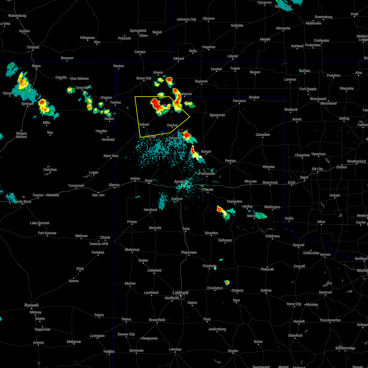 At 332 pm cdt, a severe thunderstorm was located 9 miles north of conlen, or 12 miles west of stratford, moving south at 5 mph (radar indicated). Hazards include 60 mph wind gusts and half dollar size hail. Minor damage to roofs, siding, and trees is possible. hail damage to vehicles is expected. Locations impacted include, dalhart, stratford, cactus and conlen. At 332 pm cdt, a severe thunderstorm was located 9 miles north of conlen, or 12 miles west of stratford, moving south at 5 mph (radar indicated). Hazards include 60 mph wind gusts and half dollar size hail. Minor damage to roofs, siding, and trees is possible. hail damage to vehicles is expected. Locations impacted include, dalhart, stratford, cactus and conlen.
|
| 7/4/2021 3:21 PM CDT |
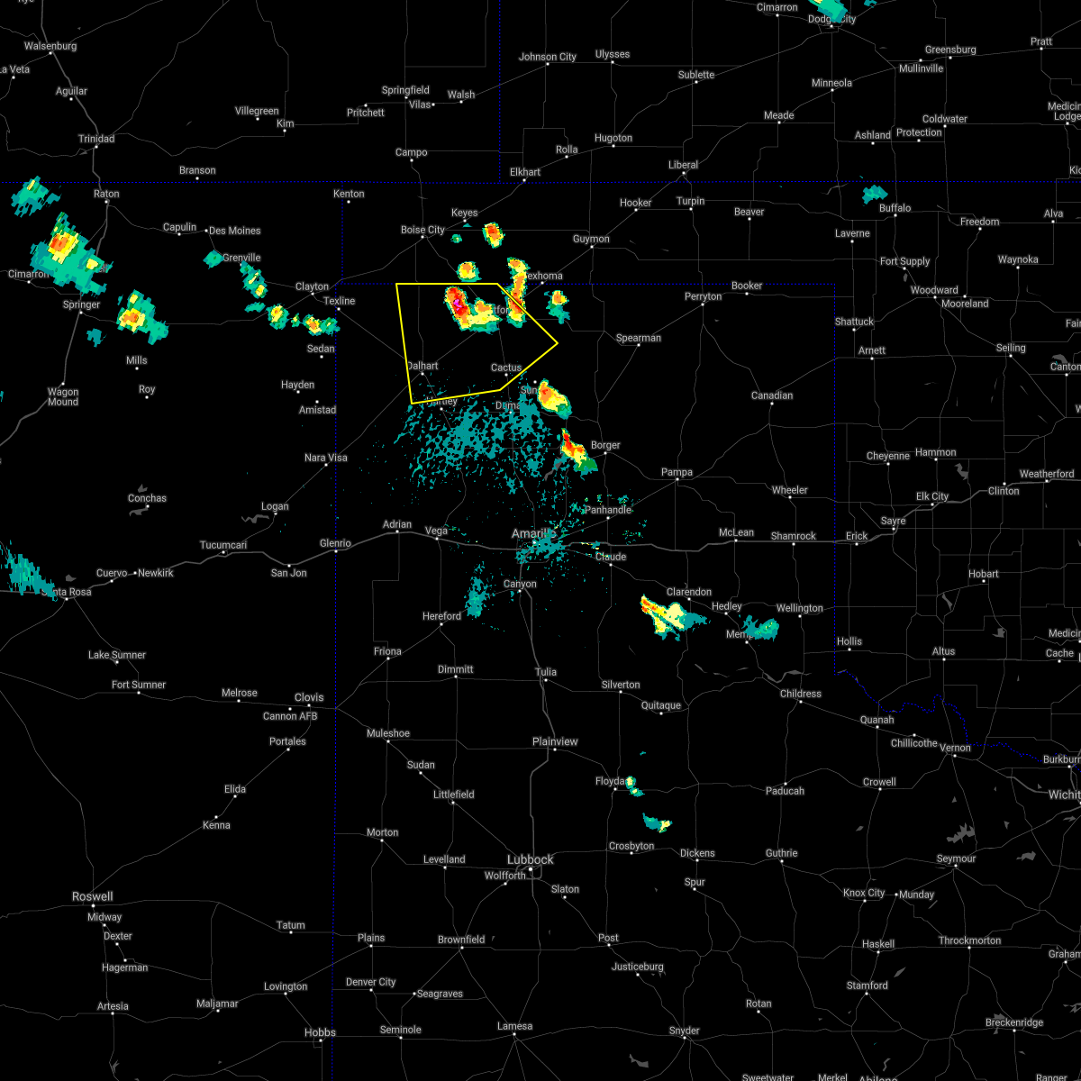 At 320 pm cdt, a severe thunderstorm was located 9 miles north of conlen, or 11 miles west of stratford, moving southeast at 10 mph (radar indicated). Hazards include 60 mph wind gusts and half dollar size hail. Minor damage to roofs, siding, and trees is possible. Hail damage to vehicles is expected. At 320 pm cdt, a severe thunderstorm was located 9 miles north of conlen, or 11 miles west of stratford, moving southeast at 10 mph (radar indicated). Hazards include 60 mph wind gusts and half dollar size hail. Minor damage to roofs, siding, and trees is possible. Hail damage to vehicles is expected.
|
| 6/13/2021 12:09 AM CDT |
 At 1145 pm cdt, severe thunderstorms were located along a line extending from 8 miles southwest of texhoma to 13 miles west of channing, moving southeast at 50 mph (radar indicated). Hazards include 70 mph wind gusts and quarter size hail. Expect some tree damage. damage is likely to mobile homes, roofs, and outbuildings. Hail damage to vehicles is expected. At 1145 pm cdt, severe thunderstorms were located along a line extending from 8 miles southwest of texhoma to 13 miles west of channing, moving southeast at 50 mph (radar indicated). Hazards include 70 mph wind gusts and quarter size hail. Expect some tree damage. damage is likely to mobile homes, roofs, and outbuildings. Hail damage to vehicles is expected.
|
| 6/13/2021 12:01 AM CDT |
 At 1200 am cdt, automated weather equipment reported a severe thunderstorm was located 7 miles west of cactus, or 15 miles northwest of dumas, moving southeast at 30 mph (automated weather equipment has measured 65 mph wind gusts with these storms). Hazards include 70 mph wind gusts and quarter size hail. Expect some tree damage. damage is likely to mobile homes, roofs, and outbuildings. hail damage to vehicles is expected. Locations impacted include, dalhart, stratford, hartley, cactus and conlen. At 1200 am cdt, automated weather equipment reported a severe thunderstorm was located 7 miles west of cactus, or 15 miles northwest of dumas, moving southeast at 30 mph (automated weather equipment has measured 65 mph wind gusts with these storms). Hazards include 70 mph wind gusts and quarter size hail. Expect some tree damage. damage is likely to mobile homes, roofs, and outbuildings. hail damage to vehicles is expected. Locations impacted include, dalhart, stratford, hartley, cactus and conlen.
|
| 6/12/2021 11:57 PM CDT | Asos station kdht dalhart (asos in hartley county TX, 3.2 miles NE of Dalhart, TX |
| 6/12/2021 11:48 PM CDT | Asos station kdht dalhart (asos in hartley county TX, 3.2 miles NE of Dalhart, TX |
| 6/12/2021 11:48 PM CDT |
 At 1147 pm cdt, a severe thunderstorm was located 7 miles south of conlen, or 16 miles southwest of stratford, moving southeast at 30 mph (radar indicated). Hazards include 70 mph wind gusts and quarter size hail. Expect some tree damage. damage is likely to mobile homes, roofs, and outbuildings. hail damage to vehicles is expected. Locations impacted include, dalhart, stratford, hartley, cactus, ware, conlen and texhoma. At 1147 pm cdt, a severe thunderstorm was located 7 miles south of conlen, or 16 miles southwest of stratford, moving southeast at 30 mph (radar indicated). Hazards include 70 mph wind gusts and quarter size hail. Expect some tree damage. damage is likely to mobile homes, roofs, and outbuildings. hail damage to vehicles is expected. Locations impacted include, dalhart, stratford, hartley, cactus, ware, conlen and texhoma.
|
| 6/12/2021 11:46 PM CDT |
 At 1145 pm cdt, severe thunderstorms were located along a line extending from 8 miles southwest of texhoma to 13 miles west of channing, moving southeast at 50 mph (radar indicated). Hazards include 70 mph wind gusts and quarter size hail. Expect some tree damage. damage is likely to mobile homes, roofs, and outbuildings. Hail damage to vehicles is expected. At 1145 pm cdt, severe thunderstorms were located along a line extending from 8 miles southwest of texhoma to 13 miles west of channing, moving southeast at 50 mph (radar indicated). Hazards include 70 mph wind gusts and quarter size hail. Expect some tree damage. damage is likely to mobile homes, roofs, and outbuildings. Hail damage to vehicles is expected.
|
| 6/12/2021 11:43 PM CDT | Asos station kdht dalhart (asos in hartley county TX, 3.2 miles NE of Dalhart, TX |
| 6/12/2021 11:39 PM CDT |
 At 1139 pm cdt, a severe thunderstorm was located near conlen, or 14 miles southwest of stratford, moving southeast at 30 mph (radar indicated). Hazards include 70 mph wind gusts and quarter size hail. Expect some tree damage. damage is likely to mobile homes, roofs, and outbuildings. hail damage to vehicles is expected. Locations impacted include, dalhart, stratford, hartley, cactus, texline, ware, felt, conlen, griggs and texhoma. At 1139 pm cdt, a severe thunderstorm was located near conlen, or 14 miles southwest of stratford, moving southeast at 30 mph (radar indicated). Hazards include 70 mph wind gusts and quarter size hail. Expect some tree damage. damage is likely to mobile homes, roofs, and outbuildings. hail damage to vehicles is expected. Locations impacted include, dalhart, stratford, hartley, cactus, texline, ware, felt, conlen, griggs and texhoma.
|
| 6/12/2021 11:35 PM CDT | Asos station kdht dalhart (asos in hartley county TX, 3.2 miles NE of Dalhart, TX |
| 6/12/2021 11:27 PM CDT |
 At 1127 pm cdt, a severe thunderstorm was located near conlen, or 13 miles west of stratford, moving southeast at 30 mph. this is a very dangerous storm (radar indicated). Hazards include 80 mph wind gusts and quarter size hail. Flying debris will be dangerous to those caught without shelter. mobile homes will be heavily damaged. expect considerable damage to roofs, windows, and vehicles. tree damage and power outages are likely. hail damage to vehicles is expected. Locations impacted include, dalhart, stratford, hartley, cactus, texline, ware, felt, conlen, griggs and texhoma. At 1127 pm cdt, a severe thunderstorm was located near conlen, or 13 miles west of stratford, moving southeast at 30 mph. this is a very dangerous storm (radar indicated). Hazards include 80 mph wind gusts and quarter size hail. Flying debris will be dangerous to those caught without shelter. mobile homes will be heavily damaged. expect considerable damage to roofs, windows, and vehicles. tree damage and power outages are likely. hail damage to vehicles is expected. Locations impacted include, dalhart, stratford, hartley, cactus, texline, ware, felt, conlen, griggs and texhoma.
|
| 6/12/2021 11:01 PM CDT |
 At 1101 pm cdt, a severe thunderstorm was located 17 miles northwest of conlen, or 20 miles west of stratford, moving southeast at 30 mph (radar indicated). Hazards include 70 mph wind gusts and penny size hail. Expect some tree damage. Damage is likely to mobile homes, roofs, and outbuildings. At 1101 pm cdt, a severe thunderstorm was located 17 miles northwest of conlen, or 20 miles west of stratford, moving southeast at 30 mph (radar indicated). Hazards include 70 mph wind gusts and penny size hail. Expect some tree damage. Damage is likely to mobile homes, roofs, and outbuildings.
|
| 5/30/2021 7:22 PM CDT |
 At 722 pm cdt, severe thunderstorms were located along a line extending from 9 miles southwest of dalhart to 8 miles southwest of hartley to 13 miles southwest of channing, moving northeast at 35 mph (radar indicated). Hazards include 60 mph wind gusts and quarter size hail. Minor damage to roofs, siding, and trees is possible. Hail damage to vehicles is expected. At 722 pm cdt, severe thunderstorms were located along a line extending from 9 miles southwest of dalhart to 8 miles southwest of hartley to 13 miles southwest of channing, moving northeast at 35 mph (radar indicated). Hazards include 60 mph wind gusts and quarter size hail. Minor damage to roofs, siding, and trees is possible. Hail damage to vehicles is expected.
|
| 5/23/2021 10:54 PM CDT |
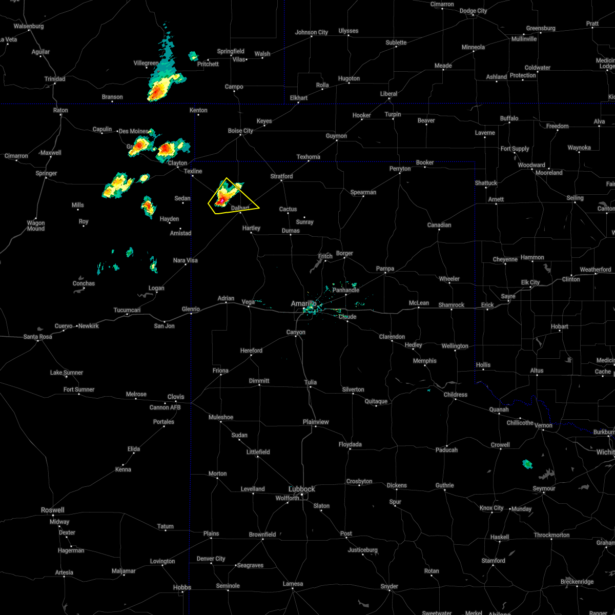 At 1054 pm cdt, a severe thunderstorm was located over ware, or 13 miles northwest of dalhart, moving northeast at 20 mph (radar indicated). Hazards include 60 mph wind gusts and quarter size hail. Minor damage to roofs, siding, and trees is possible. hail damage to vehicles is expected. Locations impacted include, ware. At 1054 pm cdt, a severe thunderstorm was located over ware, or 13 miles northwest of dalhart, moving northeast at 20 mph (radar indicated). Hazards include 60 mph wind gusts and quarter size hail. Minor damage to roofs, siding, and trees is possible. hail damage to vehicles is expected. Locations impacted include, ware.
|
| 5/23/2021 10:40 PM CDT |
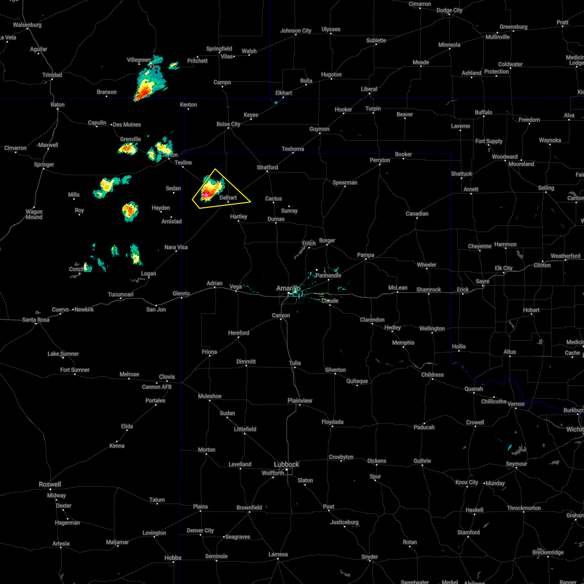 At 1039 pm cdt, a severe thunderstorm was located 5 miles southwest of ware, or 14 miles west of dalhart, moving northeast at 20 mph (radar indicated). Hazards include ping pong ball size hail and 60 mph wind gusts. Minor damage to roofs, siding, and trees is possible. people and animals outdoors will be injured. Expect hail damage to roofs, siding, windows, and vehicles. At 1039 pm cdt, a severe thunderstorm was located 5 miles southwest of ware, or 14 miles west of dalhart, moving northeast at 20 mph (radar indicated). Hazards include ping pong ball size hail and 60 mph wind gusts. Minor damage to roofs, siding, and trees is possible. people and animals outdoors will be injured. Expect hail damage to roofs, siding, windows, and vehicles.
|
| 5/23/2021 10:30 PM CDT |
 At 1030 pm cdt, a severe thunderstorm was located 6 miles southwest of ware, or 14 miles west of dalhart, moving northeast at 20 mph (radar indicated). Hazards include ping pong ball size hail and 60 mph wind gusts. Minor damage to roofs, siding, and trees is possible. people and animals outdoors will be injured. expect hail damage to roofs, siding, windows, and vehicles. Locations impacted include, dalhart and ware. At 1030 pm cdt, a severe thunderstorm was located 6 miles southwest of ware, or 14 miles west of dalhart, moving northeast at 20 mph (radar indicated). Hazards include ping pong ball size hail and 60 mph wind gusts. Minor damage to roofs, siding, and trees is possible. people and animals outdoors will be injured. expect hail damage to roofs, siding, windows, and vehicles. Locations impacted include, dalhart and ware.
|
| 5/23/2021 10:18 PM CDT |
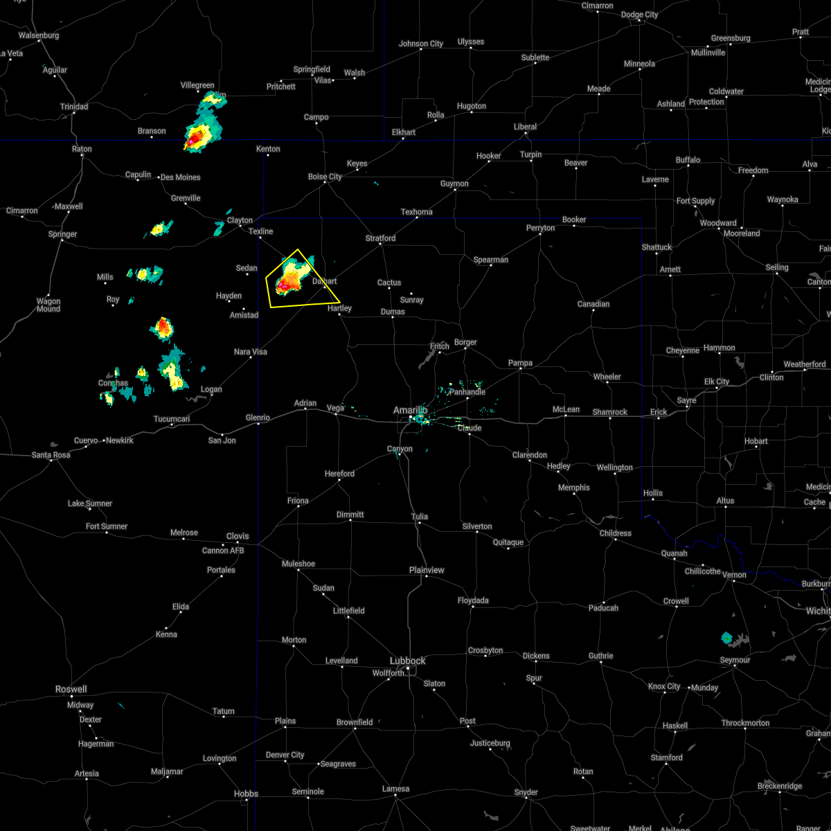 At 1017 pm cdt, a severe thunderstorm was located 11 miles southwest of ware, or 17 miles west of dalhart, moving northeast at 15 mph (radar indicated). Hazards include 60 mph wind gusts and half dollar size hail. Minor damage to roofs, siding, and trees is possible. hail damage to vehicles is expected. Locations impacted include, dalhart and ware. At 1017 pm cdt, a severe thunderstorm was located 11 miles southwest of ware, or 17 miles west of dalhart, moving northeast at 15 mph (radar indicated). Hazards include 60 mph wind gusts and half dollar size hail. Minor damage to roofs, siding, and trees is possible. hail damage to vehicles is expected. Locations impacted include, dalhart and ware.
|
| 5/23/2021 10:06 PM CDT |
 At 1006 pm cdt, a severe thunderstorm was located 14 miles southwest of ware, or 17 miles east of amistad, moving northeast at 15 mph (radar indicated). Hazards include golf ball size hail and 60 mph wind gusts. Minor damage to roofs, siding, and trees is possible. people and animals outdoors will be injured. expect hail damage to roofs, siding, windows, and vehicles. Locations impacted include, dalhart and ware. At 1006 pm cdt, a severe thunderstorm was located 14 miles southwest of ware, or 17 miles east of amistad, moving northeast at 15 mph (radar indicated). Hazards include golf ball size hail and 60 mph wind gusts. Minor damage to roofs, siding, and trees is possible. people and animals outdoors will be injured. expect hail damage to roofs, siding, windows, and vehicles. Locations impacted include, dalhart and ware.
|
| 5/23/2021 9:53 PM CDT |
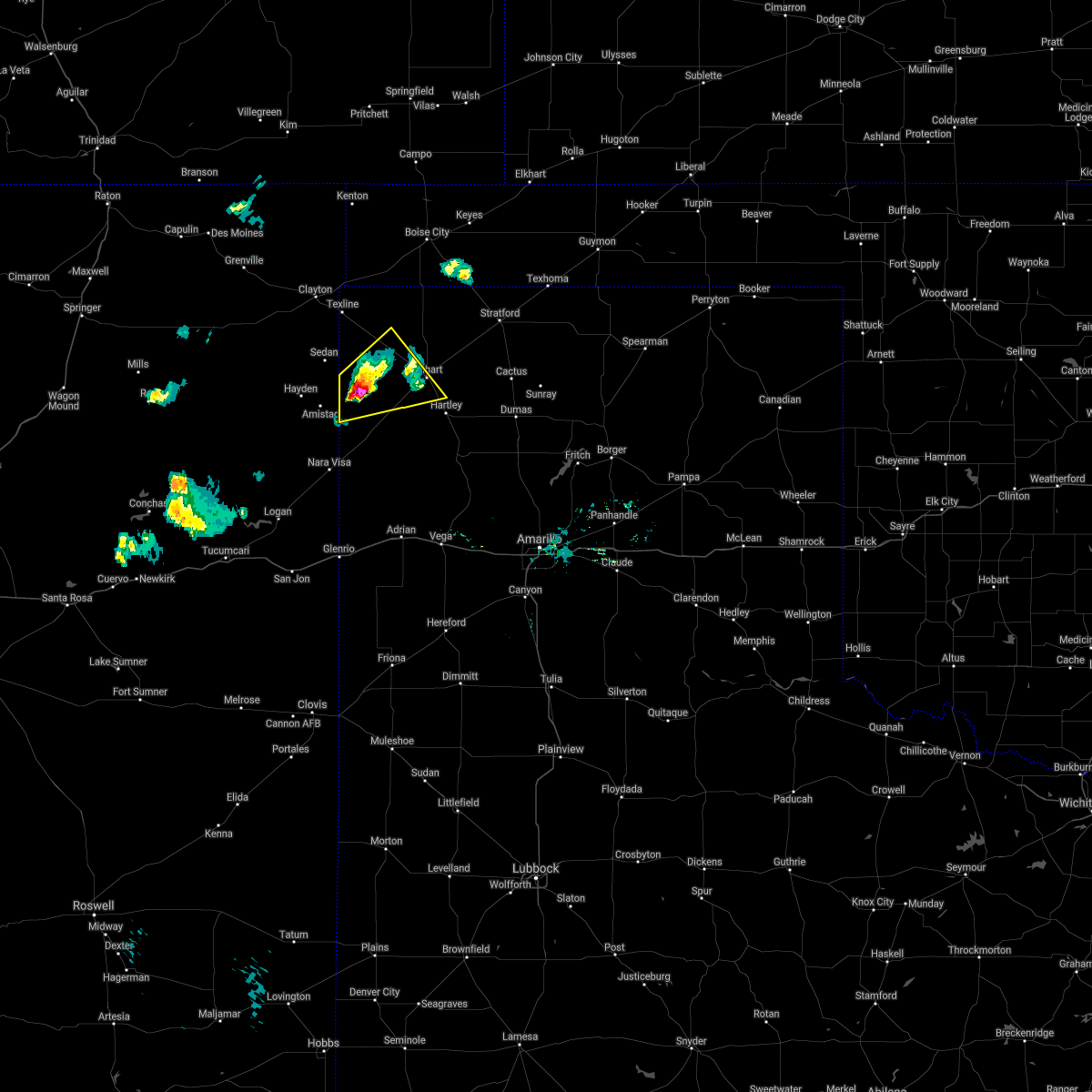 At 953 pm cdt, a severe thunderstorm was located 14 miles east of amistad, moving northeast at 15 mph (radar indicated). Hazards include golf ball size hail and 60 mph wind gusts. Minor damage to roofs, siding, and trees is possible. people and animals outdoors will be injured. expect hail damage to roofs, siding, windows, and vehicles. Locations impacted include, dalhart and ware. At 953 pm cdt, a severe thunderstorm was located 14 miles east of amistad, moving northeast at 15 mph (radar indicated). Hazards include golf ball size hail and 60 mph wind gusts. Minor damage to roofs, siding, and trees is possible. people and animals outdoors will be injured. expect hail damage to roofs, siding, windows, and vehicles. Locations impacted include, dalhart and ware.
|
| 5/23/2021 9:46 PM CDT |
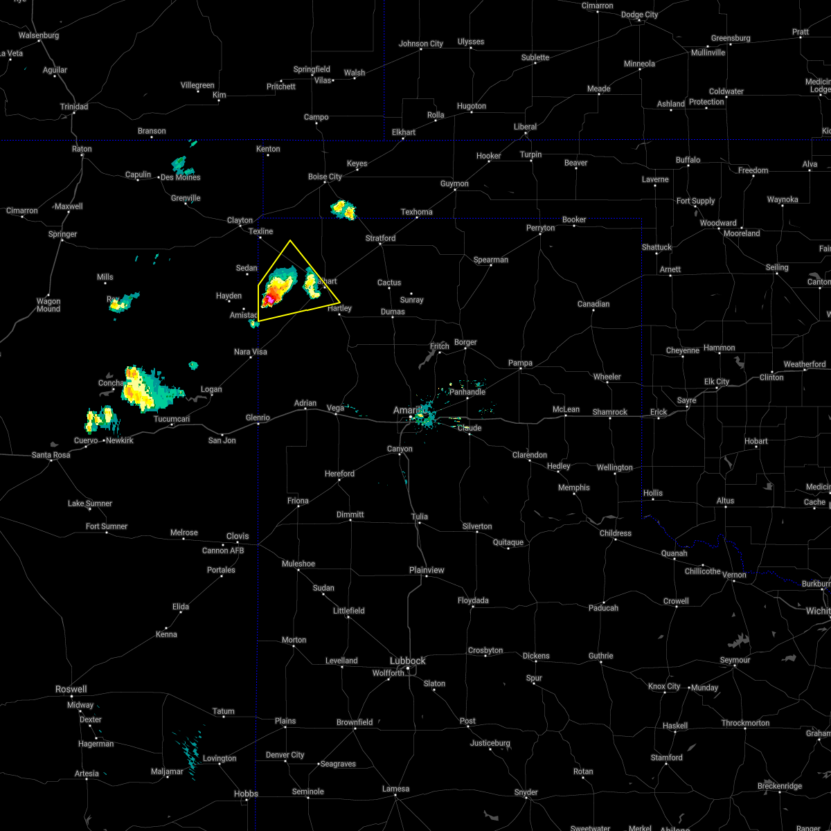 At 946 pm cdt, a severe thunderstorm was located 13 miles east of amistad, moving northeast at 15 mph (radar indicated). Hazards include ping pong ball size hail and 60 mph wind gusts. Minor damage to roofs, siding, and trees is possible. people and animals outdoors will be injured. expect hail damage to roofs, siding, windows, and vehicles. Locations impacted include, dalhart and ware. At 946 pm cdt, a severe thunderstorm was located 13 miles east of amistad, moving northeast at 15 mph (radar indicated). Hazards include ping pong ball size hail and 60 mph wind gusts. Minor damage to roofs, siding, and trees is possible. people and animals outdoors will be injured. expect hail damage to roofs, siding, windows, and vehicles. Locations impacted include, dalhart and ware.
|
| 5/23/2021 9:39 PM CDT |
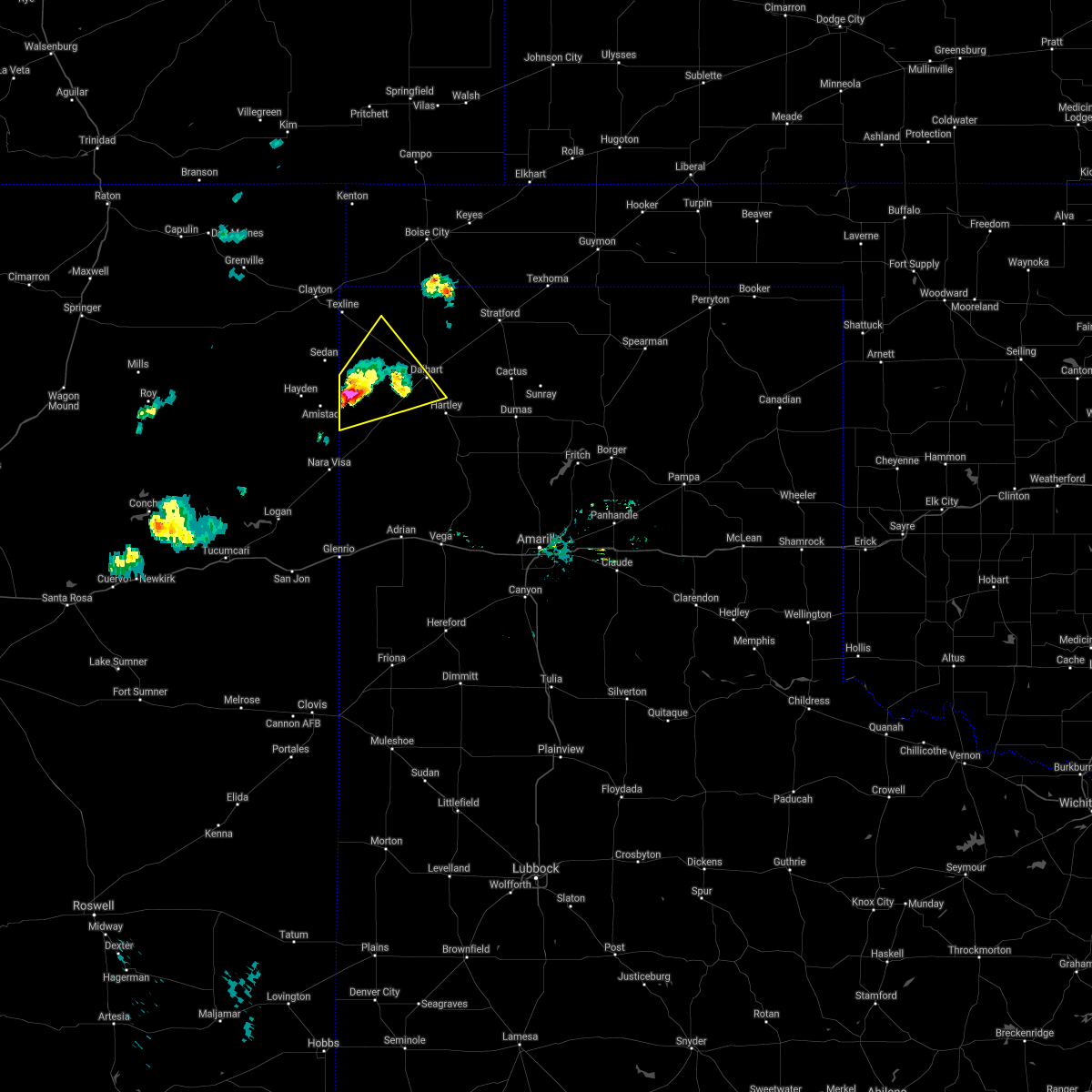 At 939 pm cdt, a severe thunderstorm was located 13 miles northeast of amistad, moving northeast at 20 mph (radar indicated). Hazards include ping pong ball size hail and 60 mph wind gusts. Minor damage to roofs, siding, and trees is possible. people and animals outdoors will be injured. Expect hail damage to roofs, siding, windows, and vehicles. At 939 pm cdt, a severe thunderstorm was located 13 miles northeast of amistad, moving northeast at 20 mph (radar indicated). Hazards include ping pong ball size hail and 60 mph wind gusts. Minor damage to roofs, siding, and trees is possible. people and animals outdoors will be injured. Expect hail damage to roofs, siding, windows, and vehicles.
|
| 5/17/2021 7:51 PM CDT |
 At 751 pm cdt, a severe thunderstorm was located over channing, or 26 miles southwest of dumas, moving north at 20 mph (radar indicated). Hazards include golf ball size hail and 70 mph wind gusts. Expect some tree damage. damage is likely to mobile homes, roofs, and outbuildings. people and animals outdoors will be injured. expect hail damage to roofs, siding, windows, and vehicles. locations impacted include, dalhart, hartley, channing and boys ranch. A tornado watch remains in effect until 1100 pm cdt for the panhandle of texas. At 751 pm cdt, a severe thunderstorm was located over channing, or 26 miles southwest of dumas, moving north at 20 mph (radar indicated). Hazards include golf ball size hail and 70 mph wind gusts. Expect some tree damage. damage is likely to mobile homes, roofs, and outbuildings. people and animals outdoors will be injured. expect hail damage to roofs, siding, windows, and vehicles. locations impacted include, dalhart, hartley, channing and boys ranch. A tornado watch remains in effect until 1100 pm cdt for the panhandle of texas.
|
| 5/17/2021 7:50 PM CDT |
 At 750 pm cdt, severe thunderstorms were located along a line extending from 5 miles northwest of hartley to 4 miles west of boys ranch, moving east at 35 mph (radar indicated). Hazards include 70 mph wind gusts and ping pong ball size hail. Expect some tree damage. damage is likely to mobile homes, roofs, and outbuildings. people and animals outdoors will be injured. expect hail damage to roofs, siding, windows, and vehicles. locations impacted include, dalhart, hartley, channing and boys ranch. A tornado watch remains in effect until 1100 pm cdt for the panhandle of texas. At 750 pm cdt, severe thunderstorms were located along a line extending from 5 miles northwest of hartley to 4 miles west of boys ranch, moving east at 35 mph (radar indicated). Hazards include 70 mph wind gusts and ping pong ball size hail. Expect some tree damage. damage is likely to mobile homes, roofs, and outbuildings. people and animals outdoors will be injured. expect hail damage to roofs, siding, windows, and vehicles. locations impacted include, dalhart, hartley, channing and boys ranch. A tornado watch remains in effect until 1100 pm cdt for the panhandle of texas.
|
| 5/17/2021 7:25 PM CDT |
 At 725 pm cdt, severe thunderstorms were located along a line extending from 10 miles southeast of seneca to near dalhart, moving northeast at 45 mph (radar indicated). Hazards include 60 mph wind gusts and quarter size hail. Minor damage to roofs, siding, and trees is possible. hail damage to vehicles is expected. Locations impacted include, dalhart, stratford, cactus, texline, ware, felt, conlen and griggs. At 725 pm cdt, severe thunderstorms were located along a line extending from 10 miles southeast of seneca to near dalhart, moving northeast at 45 mph (radar indicated). Hazards include 60 mph wind gusts and quarter size hail. Minor damage to roofs, siding, and trees is possible. hail damage to vehicles is expected. Locations impacted include, dalhart, stratford, cactus, texline, ware, felt, conlen and griggs.
|
| 5/17/2021 7:19 PM CDT |
 At 719 pm cdt, a severe thunderstorm was located near boys ranch, or 20 miles north of vega, moving north at 30 mph (radar indicated). Hazards include tennis ball size hail and 70 mph wind gusts. Expect some tree damage. damage is likely to mobile homes, roofs, and outbuildings. people and animals outdoors will be injured. expect hail damage to roofs, siding, windows, and vehicles. locations impacted include, dalhart, hartley, channing, boys ranch and romero. A tornado watch remains in effect until 1100 pm cdt for the panhandle of texas. At 719 pm cdt, a severe thunderstorm was located near boys ranch, or 20 miles north of vega, moving north at 30 mph (radar indicated). Hazards include tennis ball size hail and 70 mph wind gusts. Expect some tree damage. damage is likely to mobile homes, roofs, and outbuildings. people and animals outdoors will be injured. expect hail damage to roofs, siding, windows, and vehicles. locations impacted include, dalhart, hartley, channing, boys ranch and romero. A tornado watch remains in effect until 1100 pm cdt for the panhandle of texas.
|
| 5/17/2021 7:15 PM CDT |
 At 715 pm cdt, severe thunderstorms were located along a line extending from 8 miles north of texline to 6 miles southwest of dalhart, moving northeast at 45 mph (radar indicated). Hazards include golf ball size hail and 60 mph wind gusts. Minor damage to roofs, siding, and trees is possible. people and animals outdoors will be injured. Expect hail damage to roofs, siding, windows, and vehicles. At 715 pm cdt, severe thunderstorms were located along a line extending from 8 miles north of texline to 6 miles southwest of dalhart, moving northeast at 45 mph (radar indicated). Hazards include golf ball size hail and 60 mph wind gusts. Minor damage to roofs, siding, and trees is possible. people and animals outdoors will be injured. Expect hail damage to roofs, siding, windows, and vehicles.
|
| 5/17/2021 6:42 PM CDT |
 At 641 pm cdt, a severe thunderstorm was located 17 miles east of romero, or 25 miles east of nara visa, moving north at 20 mph (radar indicated). Hazards include golf ball size hail and 70 mph wind gusts. Expect some tree damage. damage is likely to mobile homes, roofs, and outbuildings. people and animals outdoors will be injured. Expect hail damage to roofs, siding, windows, and vehicles. At 641 pm cdt, a severe thunderstorm was located 17 miles east of romero, or 25 miles east of nara visa, moving north at 20 mph (radar indicated). Hazards include golf ball size hail and 70 mph wind gusts. Expect some tree damage. damage is likely to mobile homes, roofs, and outbuildings. people and animals outdoors will be injured. Expect hail damage to roofs, siding, windows, and vehicles.
|
| 5/16/2021 8:58 PM CDT |
 The severe thunderstorm warning for west central sherman, dallam and eastern hartley counties will expire at 900 pm cdt, the storm which prompted the warning has weakened below severe limits, and no longer poses an immediate threat to life or property. therefore, the warning will be allowed to expire. however small hail and gusty winds are still possible with this thunderstorm. a severe thunderstorm watch remains in effect until 1100 pm cdt for the panhandle of texas. The severe thunderstorm warning for west central sherman, dallam and eastern hartley counties will expire at 900 pm cdt, the storm which prompted the warning has weakened below severe limits, and no longer poses an immediate threat to life or property. therefore, the warning will be allowed to expire. however small hail and gusty winds are still possible with this thunderstorm. a severe thunderstorm watch remains in effect until 1100 pm cdt for the panhandle of texas.
|
| 5/16/2021 7:59 PM CDT | Ping Pong Ball sized hail reported 22.8 miles SE of Dalhart, TX, accumulating hail between pea and dime size... with larger stones up to ping pong ball noted. area roadway is covered with hail. |
| 5/16/2021 7:58 PM CDT |
 At 758 pm cdt, a severe thunderstorm was located 7 miles northwest of ware, or 21 miles northwest of dalhart, moving southeast at 35 mph (trained weather spotters). Hazards include ping pong ball size hail and 60 mph wind gusts. Minor damage to roofs, siding, and trees is possible. people and animals outdoors will be injured. expect hail damage to roofs, siding, windows, and vehicles. Hail may accumulate on roadways causing hazardous travel. At 758 pm cdt, a severe thunderstorm was located 7 miles northwest of ware, or 21 miles northwest of dalhart, moving southeast at 35 mph (trained weather spotters). Hazards include ping pong ball size hail and 60 mph wind gusts. Minor damage to roofs, siding, and trees is possible. people and animals outdoors will be injured. expect hail damage to roofs, siding, windows, and vehicles. Hail may accumulate on roadways causing hazardous travel.
|
| 5/14/2021 6:14 PM CDT |
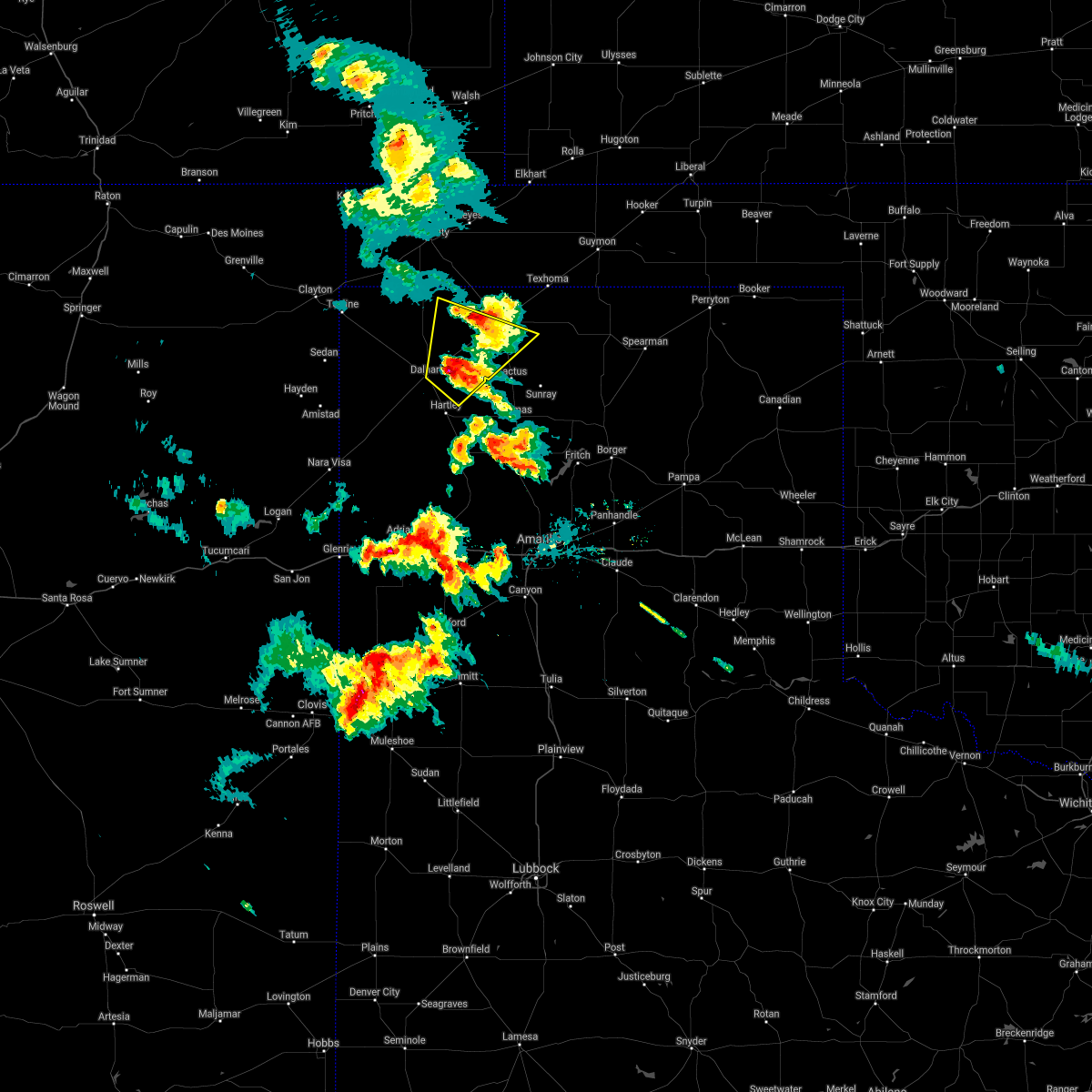 At 613 pm cdt, a severe thunderstorm was located 6 miles southwest of conlen, or 13 miles northeast of dalhart, moving northeast at 25 mph (trained weather spotters reported quarter size hail 4 miles east of dalhart at 604 pm cdt). Hazards include 70 mph wind gusts and quarter size hail. Expect some tree damage. damage is likely to mobile homes, roofs, and outbuildings. hail damage to vehicles is expected. Locations impacted include, dalhart, stratford and conlen. At 613 pm cdt, a severe thunderstorm was located 6 miles southwest of conlen, or 13 miles northeast of dalhart, moving northeast at 25 mph (trained weather spotters reported quarter size hail 4 miles east of dalhart at 604 pm cdt). Hazards include 70 mph wind gusts and quarter size hail. Expect some tree damage. damage is likely to mobile homes, roofs, and outbuildings. hail damage to vehicles is expected. Locations impacted include, dalhart, stratford and conlen.
|
| 5/14/2021 6:04 PM CDT | Quarter sized hail reported 4 miles W of Dalhart, TX |
| 5/14/2021 5:59 PM CDT |
 The national weather service in amarillo has issued a * severe thunderstorm warning for. southwestern sherman county in the panhandle of texas. eastern dallam county in the panhandle of texas. northeastern hartley county in the panhandle of texas. Until 700 pm cdt. The national weather service in amarillo has issued a * severe thunderstorm warning for. southwestern sherman county in the panhandle of texas. eastern dallam county in the panhandle of texas. northeastern hartley county in the panhandle of texas. Until 700 pm cdt.
|
| 5/7/2021 5:13 PM CDT | Storm damage reported in hartley county TX, 3.2 miles NE of Dalhart, TX |
| 8/29/2020 7:08 PM CDT |
 At 655 pm cdt, severe thunderstorms were located along a line extending from 13 miles southeast of felt to 8 miles southwest of ware to 8 miles southeast of amistad, moving east at 35 mph (radar indicated). Hazards include 60 mph wind gusts and quarter size hail. Minor damage to roofs, siding, and trees is possible. Hail damage to vehicles is expected. At 655 pm cdt, severe thunderstorms were located along a line extending from 13 miles southeast of felt to 8 miles southwest of ware to 8 miles southeast of amistad, moving east at 35 mph (radar indicated). Hazards include 60 mph wind gusts and quarter size hail. Minor damage to roofs, siding, and trees is possible. Hail damage to vehicles is expected.
|
| 8/29/2020 6:55 PM CDT |
 At 655 pm cdt, severe thunderstorms were located along a line extending from 13 miles southeast of felt to 8 miles southwest of ware to 8 miles southeast of amistad, moving east at 35 mph (radar indicated). Hazards include 60 mph wind gusts and quarter size hail. Minor damage to roofs, siding, and trees is possible. Hail damage to vehicles is expected. At 655 pm cdt, severe thunderstorms were located along a line extending from 13 miles southeast of felt to 8 miles southwest of ware to 8 miles southeast of amistad, moving east at 35 mph (radar indicated). Hazards include 60 mph wind gusts and quarter size hail. Minor damage to roofs, siding, and trees is possible. Hail damage to vehicles is expected.
|
| 8/9/2020 8:48 PM CDT |
 At 848 pm cdt, a severe thunderstorm was located near hartley, or 12 miles southeast of dalhart, moving northeast at 20 mph (radar indicated). Hazards include 60 mph wind gusts and nickel size hail. Minor damage to roofs, siding, and trees is possible. Locations impacted include, hartley and cactus. At 848 pm cdt, a severe thunderstorm was located near hartley, or 12 miles southeast of dalhart, moving northeast at 20 mph (radar indicated). Hazards include 60 mph wind gusts and nickel size hail. Minor damage to roofs, siding, and trees is possible. Locations impacted include, hartley and cactus.
|
| 8/9/2020 8:27 PM CDT |
 At 827 pm cdt, a severe thunderstorm was located 10 miles east of dalhart, moving northeast at 30 mph (radar indicated). Hazards include 60 mph wind gusts and quarter size hail. Minor damage to roofs, siding, and trees is possible. Hail damage to vehicles is expected. At 827 pm cdt, a severe thunderstorm was located 10 miles east of dalhart, moving northeast at 30 mph (radar indicated). Hazards include 60 mph wind gusts and quarter size hail. Minor damage to roofs, siding, and trees is possible. Hail damage to vehicles is expected.
|
| 7/19/2020 8:16 PM CDT |
 At 815 pm cdt, a severe thunderstorm was located over stratford, moving north at 30 mph. other storms near dalhart were moving east at 20 mph (radar indicated). Hazards include 70 mph wind gusts and half dollar size hail. Expect some tree damage. damage is likely to mobile homes, roofs, and outbuildings. hail damage to vehicles is expected. Locations impacted include, dalhart, stratford, griggs, ware and conlen. At 815 pm cdt, a severe thunderstorm was located over stratford, moving north at 30 mph. other storms near dalhart were moving east at 20 mph (radar indicated). Hazards include 70 mph wind gusts and half dollar size hail. Expect some tree damage. damage is likely to mobile homes, roofs, and outbuildings. hail damage to vehicles is expected. Locations impacted include, dalhart, stratford, griggs, ware and conlen.
|
| 7/19/2020 7:49 PM CDT |
 At 749 pm cdt, severe thunderstorms were located along a line extending from 8 miles northwest of conlen to 6 miles northwest of dalhart, moving east at 20 mph (radar indicated). Hazards include 70 mph wind gusts and quarter size hail. Expect some tree damage. damage is likely to mobile homes, roofs, and outbuildings. hail damage to vehicles is expected. Locations impacted include, dalhart, stratford, griggs, ware and conlen. At 749 pm cdt, severe thunderstorms were located along a line extending from 8 miles northwest of conlen to 6 miles northwest of dalhart, moving east at 20 mph (radar indicated). Hazards include 70 mph wind gusts and quarter size hail. Expect some tree damage. damage is likely to mobile homes, roofs, and outbuildings. hail damage to vehicles is expected. Locations impacted include, dalhart, stratford, griggs, ware and conlen.
|
| 7/19/2020 7:49 PM CDT |
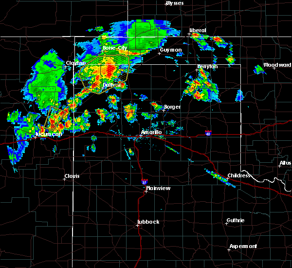 At 749 pm cdt, severe thunderstorms were located along a line extending from 8 miles northwest of conlen to 6 miles northwest of dalhart, moving east at 20 mph (radar indicated). Hazards include 70 mph wind gusts and quarter size hail. Expect some tree damage. damage is likely to mobile homes, roofs, and outbuildings. hail damage to vehicles is expected. Locations impacted include, dalhart, stratford, griggs, ware and conlen. At 749 pm cdt, severe thunderstorms were located along a line extending from 8 miles northwest of conlen to 6 miles northwest of dalhart, moving east at 20 mph (radar indicated). Hazards include 70 mph wind gusts and quarter size hail. Expect some tree damage. damage is likely to mobile homes, roofs, and outbuildings. hail damage to vehicles is expected. Locations impacted include, dalhart, stratford, griggs, ware and conlen.
|
| 7/19/2020 7:18 PM CDT |
 At 717 pm cdt, severe thunderstorms were located along a line extending from 11 miles south of boise city to 10 miles north of ware, moving northeast at 25 mph (radar indicated). Hazards include 70 mph wind gusts and penny size hail. Expect some tree damage. Damage is likely to mobile homes, roofs, and outbuildings. At 717 pm cdt, severe thunderstorms were located along a line extending from 11 miles south of boise city to 10 miles north of ware, moving northeast at 25 mph (radar indicated). Hazards include 70 mph wind gusts and penny size hail. Expect some tree damage. Damage is likely to mobile homes, roofs, and outbuildings.
|
| 7/19/2020 7:18 PM CDT |
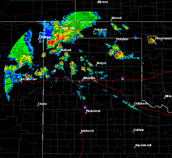 At 717 pm cdt, severe thunderstorms were located along a line extending from 11 miles south of boise city to 10 miles north of ware, moving northeast at 25 mph (radar indicated). Hazards include 70 mph wind gusts and penny size hail. Expect some tree damage. Damage is likely to mobile homes, roofs, and outbuildings. At 717 pm cdt, severe thunderstorms were located along a line extending from 11 miles south of boise city to 10 miles north of ware, moving northeast at 25 mph (radar indicated). Hazards include 70 mph wind gusts and penny size hail. Expect some tree damage. Damage is likely to mobile homes, roofs, and outbuildings.
|
| 7/13/2020 6:51 PM CDT |
 At 650 pm cdt, severe thunderstorms were located along a line extending from 10 miles northwest of keyes to 16 miles south of boise city to 9 miles north of dalhart, moving east at 30 mph (radar indicated). Hazards include 60 mph wind gusts. Minor damage to roofs, siding, and trees is possible. Locations impacted include, boise city, keyes and ware. At 650 pm cdt, severe thunderstorms were located along a line extending from 10 miles northwest of keyes to 16 miles south of boise city to 9 miles north of dalhart, moving east at 30 mph (radar indicated). Hazards include 60 mph wind gusts. Minor damage to roofs, siding, and trees is possible. Locations impacted include, boise city, keyes and ware.
|
| 7/13/2020 6:51 PM CDT |
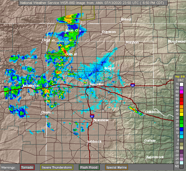 At 650 pm cdt, severe thunderstorms were located along a line extending from 10 miles northwest of keyes to 16 miles south of boise city to 9 miles north of dalhart, moving east at 30 mph (radar indicated). Hazards include 60 mph wind gusts. Minor damage to roofs, siding, and trees is possible. Locations impacted include, boise city, keyes and ware. At 650 pm cdt, severe thunderstorms were located along a line extending from 10 miles northwest of keyes to 16 miles south of boise city to 9 miles north of dalhart, moving east at 30 mph (radar indicated). Hazards include 60 mph wind gusts. Minor damage to roofs, siding, and trees is possible. Locations impacted include, boise city, keyes and ware.
|
| 6/26/2020 8:14 PM CDT |
 At 813 pm cdt, a severe thunderstorm was located 13 miles south of ware, or 16 miles west of dalhart, moving northeast at 15 mph (radar indicated). Hazards include 60 mph wind gusts and half dollar size hail. Minor damage to roofs, siding, and trees is possible. Hail damage to vehicles is expected. At 813 pm cdt, a severe thunderstorm was located 13 miles south of ware, or 16 miles west of dalhart, moving northeast at 15 mph (radar indicated). Hazards include 60 mph wind gusts and half dollar size hail. Minor damage to roofs, siding, and trees is possible. Hail damage to vehicles is expected.
|
| 6/22/2020 7:49 PM CDT |
 The severe thunderstorm warning for northwestern oldham, eastern dallam and central hartley counties has expired, the storms which prompted the warning have moved out of the area. therefore, the warning has been allowed to expire. a severe thunderstorm warning still remains in effect for eastern parts of these counties. The severe thunderstorm warning for northwestern oldham, eastern dallam and central hartley counties has expired, the storms which prompted the warning have moved out of the area. therefore, the warning has been allowed to expire. a severe thunderstorm warning still remains in effect for eastern parts of these counties.
|
| 6/22/2020 7:15 PM CDT |
 At 715 pm cdt, severe thunderstorms were located along a line extending from 9 miles west of conlen to 14 miles southeast of romero, moving southeast at 35 mph (radar indicated). Hazards include 60 mph wind gusts and quarter size hail. Minor damage to roofs, siding, and trees is possible. hail damage to vehicles is expected. Locations impacted include, dalhart, hartley, romero and conlen. At 715 pm cdt, severe thunderstorms were located along a line extending from 9 miles west of conlen to 14 miles southeast of romero, moving southeast at 35 mph (radar indicated). Hazards include 60 mph wind gusts and quarter size hail. Minor damage to roofs, siding, and trees is possible. hail damage to vehicles is expected. Locations impacted include, dalhart, hartley, romero and conlen.
|
| 6/22/2020 6:33 PM CDT |
 At 632 pm cdt, severe thunderstorms were located along a line extending from 13 miles south of felt to 6 miles east of amistad, moving east at 35 mph (radar indicated). Hazards include 60 mph wind gusts and quarter size hail. Minor damage to roofs, siding, and trees is possible. Hail damage to vehicles is expected. At 632 pm cdt, severe thunderstorms were located along a line extending from 13 miles south of felt to 6 miles east of amistad, moving east at 35 mph (radar indicated). Hazards include 60 mph wind gusts and quarter size hail. Minor damage to roofs, siding, and trees is possible. Hail damage to vehicles is expected.
|
| 6/19/2020 11:56 PM CDT |
 At 1156 pm cdt, a severe thunderstorm was located 5 miles north of dalhart, moving east at 20 mph (radar indicated). Hazards include ping pong ball size hail and 60 mph wind gusts. Minor damage to roofs, siding, and trees is possible. people and animals outdoors will be injured. expect hail damage to roofs, siding, windows, and vehicles. Locations impacted include, dalhart. At 1156 pm cdt, a severe thunderstorm was located 5 miles north of dalhart, moving east at 20 mph (radar indicated). Hazards include ping pong ball size hail and 60 mph wind gusts. Minor damage to roofs, siding, and trees is possible. people and animals outdoors will be injured. expect hail damage to roofs, siding, windows, and vehicles. Locations impacted include, dalhart.
|
| 6/19/2020 11:35 PM CDT |
 At 1134 pm cdt, a severe thunderstorm was located 5 miles southeast of ware, or 8 miles northwest of dalhart, moving southeast at 30 mph (radar indicated). Hazards include two inch hail and 60 mph wind gusts. Minor damage to roofs, siding, and trees is possible. people and animals outdoors will be injured. Expect hail damage to roofs, siding, windows, and vehicles. At 1134 pm cdt, a severe thunderstorm was located 5 miles southeast of ware, or 8 miles northwest of dalhart, moving southeast at 30 mph (radar indicated). Hazards include two inch hail and 60 mph wind gusts. Minor damage to roofs, siding, and trees is possible. people and animals outdoors will be injured. Expect hail damage to roofs, siding, windows, and vehicles.
|
| 6/19/2020 11:16 PM CDT |
 At 1116 pm cdt, a severe thunderstorm was located 5 miles northwest of ware, or 19 miles northwest of dalhart, moving southeast at 20 mph (radar indicated). Hazards include two inch hail and 60 mph wind gusts. Minor damage to roofs, siding, and trees is possible. people and animals outdoors will be injured. expect hail damage to roofs, siding, windows, and vehicles. Locations impacted include, ware. At 1116 pm cdt, a severe thunderstorm was located 5 miles northwest of ware, or 19 miles northwest of dalhart, moving southeast at 20 mph (radar indicated). Hazards include two inch hail and 60 mph wind gusts. Minor damage to roofs, siding, and trees is possible. people and animals outdoors will be injured. expect hail damage to roofs, siding, windows, and vehicles. Locations impacted include, ware.
|
| 6/19/2020 11:05 PM CDT |
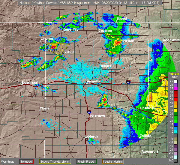 At 1104 pm cdt, a severe thunderstorm was located 9 miles northwest of ware, or 21 miles southeast of clayton, moving east at 30 mph (radar indicated). Hazards include two inch hail and 60 mph wind gusts. Minor damage to roofs, siding, and trees is possible. people and animals outdoors will be injured. expect hail damage to roofs, siding, windows, and vehicles. Locations impacted include, ware. At 1104 pm cdt, a severe thunderstorm was located 9 miles northwest of ware, or 21 miles southeast of clayton, moving east at 30 mph (radar indicated). Hazards include two inch hail and 60 mph wind gusts. Minor damage to roofs, siding, and trees is possible. people and animals outdoors will be injured. expect hail damage to roofs, siding, windows, and vehicles. Locations impacted include, ware.
|
| 6/19/2020 10:56 PM CDT |
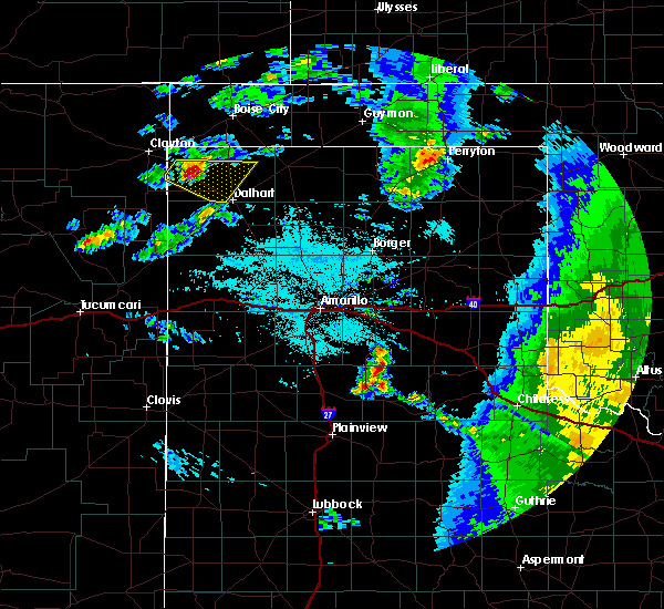 At 1056 pm cdt, a severe thunderstorm was located 7 miles southeast of texline, or 16 miles southeast of clayton, moving southeast at 20 mph (radar indicated). Hazards include ping pong ball size hail and 60 mph wind gusts. Minor damage to roofs, siding, and trees is possible. people and animals outdoors will be injured. Expect hail damage to roofs, siding, windows, and vehicles. At 1056 pm cdt, a severe thunderstorm was located 7 miles southeast of texline, or 16 miles southeast of clayton, moving southeast at 20 mph (radar indicated). Hazards include ping pong ball size hail and 60 mph wind gusts. Minor damage to roofs, siding, and trees is possible. people and animals outdoors will be injured. Expect hail damage to roofs, siding, windows, and vehicles.
|
| 6/19/2020 8:33 PM CDT | Ping Pong Ball sized hail reported 9.6 miles W of Dalhart, TX |
| 6/19/2020 8:19 PM CDT |
 At 818 pm cdt, a severe thunderstorm was located 6 miles north of hartley, or 8 miles southeast of dalhart, moving north at 20 mph (radar indicated). Hazards include 60 mph wind gusts and half dollar size hail. Minor damage to roofs, siding, and trees is possible. Hail damage to vehicles is expected. At 818 pm cdt, a severe thunderstorm was located 6 miles north of hartley, or 8 miles southeast of dalhart, moving north at 20 mph (radar indicated). Hazards include 60 mph wind gusts and half dollar size hail. Minor damage to roofs, siding, and trees is possible. Hail damage to vehicles is expected.
|
| 5/15/2020 9:24 PM CDT |
 At 924 pm cdt, a severe thunderstorm was located 6 miles northwest of hartley, or 7 miles southeast of dalhart, moving southeast at 20 mph (radar indicated). Hazards include quarter size hail. Damage to vehicles is expected. Locations impacted include, dalhart and hartley. At 924 pm cdt, a severe thunderstorm was located 6 miles northwest of hartley, or 7 miles southeast of dalhart, moving southeast at 20 mph (radar indicated). Hazards include quarter size hail. Damage to vehicles is expected. Locations impacted include, dalhart and hartley.
|
| 5/15/2020 9:07 PM CDT |
 At 907 pm cdt, a severe thunderstorm was located near dalhart, moving east at 15 mph (radar indicated). Hazards include ping pong ball size hail. People and animals outdoors will be injured. expect damage to roofs, siding, windows, and vehicles. Locations impacted include, dalhart and hartley. At 907 pm cdt, a severe thunderstorm was located near dalhart, moving east at 15 mph (radar indicated). Hazards include ping pong ball size hail. People and animals outdoors will be injured. expect damage to roofs, siding, windows, and vehicles. Locations impacted include, dalhart and hartley.
|
| 5/15/2020 9:02 PM CDT | Half Dollar sized hail reported 10.1 miles S of Dalhart, TX |
| 5/15/2020 8:58 PM CDT | Quarter sized hail reported 4 miles NE of Dalhart, TX |
| 5/15/2020 8:56 PM CDT |
 At 856 pm cdt, a severe thunderstorm was located 4 miles southwest of dalhart, moving east at 25 mph (radar indicated). Hazards include ping pong ball size hail. People and animals outdoors will be injured. Expect damage to roofs, siding, windows, and vehicles. At 856 pm cdt, a severe thunderstorm was located 4 miles southwest of dalhart, moving east at 25 mph (radar indicated). Hazards include ping pong ball size hail. People and animals outdoors will be injured. Expect damage to roofs, siding, windows, and vehicles.
|
| 6/18/2019 6:25 PM CDT | Quarter sized hail reported 17.9 miles WSW of Dalhart, TX, hail falling at time of call. |
| 6/18/2019 6:19 PM CDT | Golf Ball sized hail reported 16.6 miles WSW of Dalhart, TX |
| 6/17/2019 8:25 PM CDT | Storm damage reported in hartley county TX, 2.7 miles NE of Dalhart, TX |
| 6/15/2019 9:14 PM CDT |
 At 913 pm cdt, severe thunderstorms were located along a line extending from 9 miles southeast of conlen to 7 miles southwest of dumas to 4 miles west of boys ranch, moving east at 35 mph (radar indicated). Hazards include 60 mph wind gusts and half dollar size hail. Minor damage to roofs, siding, and trees is possible. hail damage to vehicles is expected. Locations impacted include, dumas, hartley, cactus, sunray, channing, four way, valley de oro, boys ranch and masterson. At 913 pm cdt, severe thunderstorms were located along a line extending from 9 miles southeast of conlen to 7 miles southwest of dumas to 4 miles west of boys ranch, moving east at 35 mph (radar indicated). Hazards include 60 mph wind gusts and half dollar size hail. Minor damage to roofs, siding, and trees is possible. hail damage to vehicles is expected. Locations impacted include, dumas, hartley, cactus, sunray, channing, four way, valley de oro, boys ranch and masterson.
|
| 6/15/2019 8:54 PM CDT |
 At 853 pm cdt, severe thunderstorms were located along a line extending from 9 miles east of dalhart to 7 miles northeast of channing to 5 miles west of adrian, moving northeast at 50 mph (radar indicated). Hazards include 60 mph wind gusts and quarter size hail. Minor damage to roofs, siding, and trees is possible. Hail damage to vehicles is expected. At 853 pm cdt, severe thunderstorms were located along a line extending from 9 miles east of dalhart to 7 miles northeast of channing to 5 miles west of adrian, moving northeast at 50 mph (radar indicated). Hazards include 60 mph wind gusts and quarter size hail. Minor damage to roofs, siding, and trees is possible. Hail damage to vehicles is expected.
|
| 6/15/2019 8:47 PM CDT |
 At 847 pm cdt, a severe thunderstorm was located 8 miles southwest of cactus, or 13 miles northwest of dumas, moving east at 40 mph (radar indicated). Hazards include 60 mph wind gusts and quarter size hail. Minor damage to roofs, siding, and trees is possible. hail damage to vehicles is expected. Locations impacted include, dalhart, hartley and channing. At 847 pm cdt, a severe thunderstorm was located 8 miles southwest of cactus, or 13 miles northwest of dumas, moving east at 40 mph (radar indicated). Hazards include 60 mph wind gusts and quarter size hail. Minor damage to roofs, siding, and trees is possible. hail damage to vehicles is expected. Locations impacted include, dalhart, hartley and channing.
|
| 6/15/2019 8:16 PM CDT |
 At 816 pm cdt, a severe thunderstorm was located 7 miles northwest of hartley, or 9 miles south of dalhart, moving east at 40 mph (radar indicated). Hazards include 60 mph wind gusts and quarter size hail. Minor damage to roofs, siding, and trees is possible. Hail damage to vehicles is expected. At 816 pm cdt, a severe thunderstorm was located 7 miles northwest of hartley, or 9 miles south of dalhart, moving east at 40 mph (radar indicated). Hazards include 60 mph wind gusts and quarter size hail. Minor damage to roofs, siding, and trees is possible. Hail damage to vehicles is expected.
|
| 6/13/2019 9:35 PM CDT |
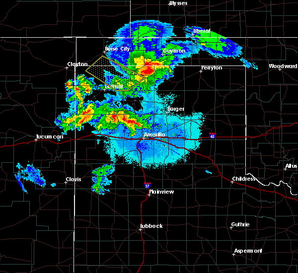 At 935 pm cdt, a severe thunderstorm was located 10 miles southeast of texline, or 20 miles southeast of clayton, moving southeast at 30 mph (trained weather spotters). Hazards include 60 mph wind gusts and nickel size hail. Minor damage to roofs, siding, and trees is possible. Locations impacted include, dalhart and ware. At 935 pm cdt, a severe thunderstorm was located 10 miles southeast of texline, or 20 miles southeast of clayton, moving southeast at 30 mph (trained weather spotters). Hazards include 60 mph wind gusts and nickel size hail. Minor damage to roofs, siding, and trees is possible. Locations impacted include, dalhart and ware.
|
| 6/13/2019 9:15 PM CDT |
 At 915 pm cdt, a severe thunderstorm was located over texline, or 8 miles southeast of clayton, moving southeast at 30 mph (trained weather spotters. at 857 pm cdt, trained spotters reported quarter size hail 1 mile west northwest of clayton new mexico). Hazards include 60 mph wind gusts and quarter size hail. Minor damage to roofs, siding, and trees is possible. Hail damage to vehicles is expected. At 915 pm cdt, a severe thunderstorm was located over texline, or 8 miles southeast of clayton, moving southeast at 30 mph (trained weather spotters. at 857 pm cdt, trained spotters reported quarter size hail 1 mile west northwest of clayton new mexico). Hazards include 60 mph wind gusts and quarter size hail. Minor damage to roofs, siding, and trees is possible. Hail damage to vehicles is expected.
|
| 6/5/2019 3:25 PM CDT | Quarter sized hail reported 37.6 miles NE of Dalhart, TX, dime to quarter size hail with heavy rainfall. |
| 6/3/2019 8:23 PM CDT |
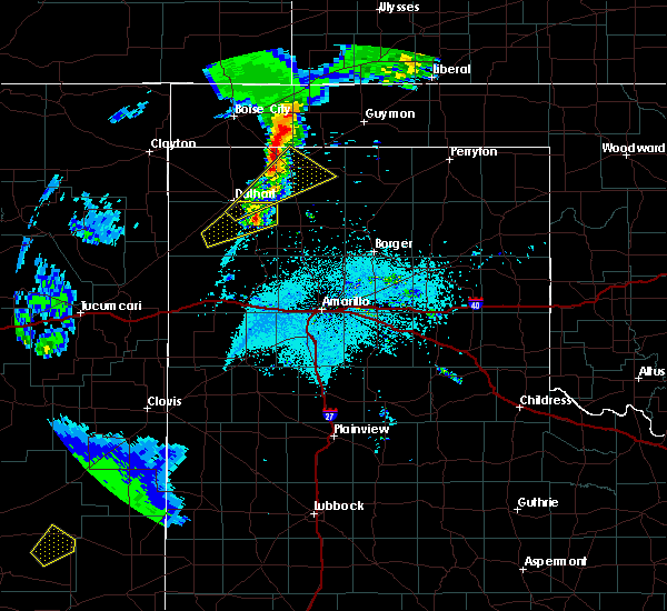 At 759 pm cdt, a severe thunderstorm was located near dalhart, moving northeast at 40 mph (radar indicated). Hazards include ping pong ball size hail and 60 mph wind gusts. Minor damage to roofs, siding, and trees is possible. people and animals outdoors will be injured. Expect hail damage to roofs, siding, windows, and vehicles. At 759 pm cdt, a severe thunderstorm was located near dalhart, moving northeast at 40 mph (radar indicated). Hazards include ping pong ball size hail and 60 mph wind gusts. Minor damage to roofs, siding, and trees is possible. people and animals outdoors will be injured. Expect hail damage to roofs, siding, windows, and vehicles.
|
| 6/3/2019 7:59 PM CDT |
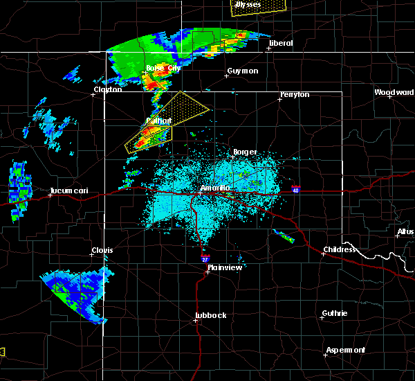 At 759 pm cdt, a severe thunderstorm was located near dalhart, moving northeast at 40 mph (radar indicated). Hazards include ping pong ball size hail and 60 mph wind gusts. Minor damage to roofs, siding, and trees is possible. people and animals outdoors will be injured. Expect hail damage to roofs, siding, windows, and vehicles. At 759 pm cdt, a severe thunderstorm was located near dalhart, moving northeast at 40 mph (radar indicated). Hazards include ping pong ball size hail and 60 mph wind gusts. Minor damage to roofs, siding, and trees is possible. people and animals outdoors will be injured. Expect hail damage to roofs, siding, windows, and vehicles.
|
| 6/3/2019 7:54 PM CDT |
 At 744 pm cdt, a severe thunderstorm was located 15 miles east of romero, or 20 miles southwest of dalhart, moving northeast at 15 mph (radar indicated). Hazards include 60 mph wind gusts and quarter size hail. Minor damage to roofs, siding, and trees is possible. Hail damage to vehicles is expected. At 744 pm cdt, a severe thunderstorm was located 15 miles east of romero, or 20 miles southwest of dalhart, moving northeast at 15 mph (radar indicated). Hazards include 60 mph wind gusts and quarter size hail. Minor damage to roofs, siding, and trees is possible. Hail damage to vehicles is expected.
|
| 6/3/2019 7:44 PM CDT |
 At 744 pm cdt, a severe thunderstorm was located 15 miles east of romero, or 20 miles southwest of dalhart, moving northeast at 15 mph (radar indicated). Hazards include 60 mph wind gusts and quarter size hail. Minor damage to roofs, siding, and trees is possible. Hail damage to vehicles is expected. At 744 pm cdt, a severe thunderstorm was located 15 miles east of romero, or 20 miles southwest of dalhart, moving northeast at 15 mph (radar indicated). Hazards include 60 mph wind gusts and quarter size hail. Minor damage to roofs, siding, and trees is possible. Hail damage to vehicles is expected.
|
| 6/1/2019 5:04 PM CDT |
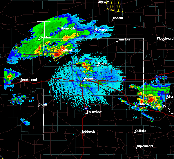 At 503 pm cdt, a severe thunderstorm was located 8 miles southwest of dalhart, moving southeast at 25 mph (radar indicated). Hazards include tennis ball size hail and 60 mph wind gusts. Minor damage to roofs, siding, and trees is possible. people and animals outdoors will be injured. expect hail damage to roofs, siding, windows, and vehicles. Locations impacted include, dalhart. At 503 pm cdt, a severe thunderstorm was located 8 miles southwest of dalhart, moving southeast at 25 mph (radar indicated). Hazards include tennis ball size hail and 60 mph wind gusts. Minor damage to roofs, siding, and trees is possible. people and animals outdoors will be injured. expect hail damage to roofs, siding, windows, and vehicles. Locations impacted include, dalhart.
|
| 6/1/2019 4:49 PM CDT |
 At 449 pm cdt, two severe thunderstorms, one 9 miles north of dalhart and the other 9 miles south of ware, were moving southeast at 15 mph (radar indicated). Hazards include tennis ball size hail and 60 mph wind gusts. Minor damage to roofs, siding, and trees is possible. people and animals outdoors will be injured. expect hail damage to roofs, siding, windows, and vehicles. Locations impacted include, dalhart and conlen. At 449 pm cdt, two severe thunderstorms, one 9 miles north of dalhart and the other 9 miles south of ware, were moving southeast at 15 mph (radar indicated). Hazards include tennis ball size hail and 60 mph wind gusts. Minor damage to roofs, siding, and trees is possible. people and animals outdoors will be injured. expect hail damage to roofs, siding, windows, and vehicles. Locations impacted include, dalhart and conlen.
|
| 6/1/2019 4:29 PM CDT |
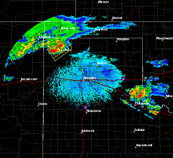 At 428 pm cdt, two severe thunderstorms, one located 13 miles north of dalhart and the other located 6 miles south of ware, were moving southeast at 15 mph (radar indicated). Hazards include ping pong ball size hail and 60 mph wind gusts. Minor damage to roofs, siding, and trees is possible. people and animals outdoors will be injured. Expect hail damage to roofs, siding, windows, and vehicles. At 428 pm cdt, two severe thunderstorms, one located 13 miles north of dalhart and the other located 6 miles south of ware, were moving southeast at 15 mph (radar indicated). Hazards include ping pong ball size hail and 60 mph wind gusts. Minor damage to roofs, siding, and trees is possible. people and animals outdoors will be injured. Expect hail damage to roofs, siding, windows, and vehicles.
|
| 6/1/2019 4:27 PM CDT |
 At 426 pm cdt, two severe thunderstorms, one located 13 miles north of dalhart and the other 6 miles south of ware, moving southeast at 15 mph (radar indicated). Hazards include ping pong ball size hail and 60 mph wind gusts. Minor damage to roofs, siding, and trees is possible. people and animals outdoors will be injured. Expect hail damage to roofs, siding, windows, and vehicles. At 426 pm cdt, two severe thunderstorms, one located 13 miles north of dalhart and the other 6 miles south of ware, moving southeast at 15 mph (radar indicated). Hazards include ping pong ball size hail and 60 mph wind gusts. Minor damage to roofs, siding, and trees is possible. people and animals outdoors will be injured. Expect hail damage to roofs, siding, windows, and vehicles.
|
| 6/1/2019 4:04 PM CDT |
 At 403 pm cdt, a severe thunderstorm was located 4 miles southwest of ware, or 13 miles west of dalhart, moving southeast at 15 mph. this is a very dangerous storm (radar indicated). Hazards include baseball size hail and 60 mph wind gusts. People and animals outdoors will be severely injured. expect shattered windows, extensive damage to roofs, siding, and vehicles. Locations impacted include, dalhart and ware. At 403 pm cdt, a severe thunderstorm was located 4 miles southwest of ware, or 13 miles west of dalhart, moving southeast at 15 mph. this is a very dangerous storm (radar indicated). Hazards include baseball size hail and 60 mph wind gusts. People and animals outdoors will be severely injured. expect shattered windows, extensive damage to roofs, siding, and vehicles. Locations impacted include, dalhart and ware.
|
| 6/1/2019 3:29 PM CDT |
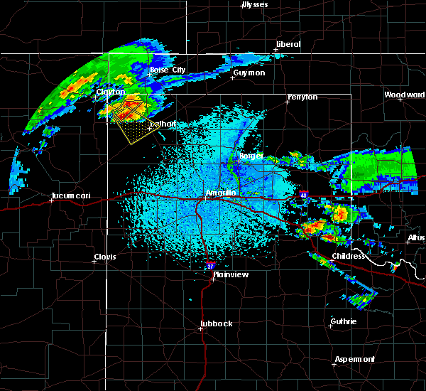 At 328 pm cdt, a severe thunderstorm was located over ware, or 15 miles northwest of dalhart, moving southeast at 20 mph. this is a very dangerous storm (trained weather spotters. at 305 pm, trained spotters reported baseball size hail near perico). Hazards include baseball size hail. People and animals outdoors will be severely injured. expect shattered windows, extensive damage to roofs, siding, and vehicles. Locations impacted include, dalhart and ware. At 328 pm cdt, a severe thunderstorm was located over ware, or 15 miles northwest of dalhart, moving southeast at 20 mph. this is a very dangerous storm (trained weather spotters. at 305 pm, trained spotters reported baseball size hail near perico). Hazards include baseball size hail. People and animals outdoors will be severely injured. expect shattered windows, extensive damage to roofs, siding, and vehicles. Locations impacted include, dalhart and ware.
|
| 6/1/2019 3:20 PM CDT |
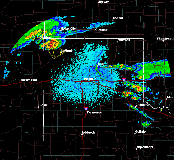 At 320 pm cdt, a severe thunderstorm was located 4 miles northwest of ware, or 18 miles northwest of dalhart, moving southeast at 20 mph. this is a very dangerous storm (trained weather spotters). Hazards include baseball size hail. People and animals outdoors will be severely injured. Expect shattered windows, extensive damage to roofs, siding, and vehicles. At 320 pm cdt, a severe thunderstorm was located 4 miles northwest of ware, or 18 miles northwest of dalhart, moving southeast at 20 mph. this is a very dangerous storm (trained weather spotters). Hazards include baseball size hail. People and animals outdoors will be severely injured. Expect shattered windows, extensive damage to roofs, siding, and vehicles.
|
| 5/26/2019 7:52 PM CDT |
 At 752 pm cdt, severe thunderstorms were located along a line extending from 9 miles north of felt to near ware to 9 miles east of romero, moving east at 55 mph (radar indicated). Hazards include 70 mph wind gusts and ping pong ball size hail. Expect some tree damage. damage is likely to mobile homes, roofs, and outbuildings. people and animals outdoors will be injured. Expect hail damage to roofs, siding, windows, and vehicles. At 752 pm cdt, severe thunderstorms were located along a line extending from 9 miles north of felt to near ware to 9 miles east of romero, moving east at 55 mph (radar indicated). Hazards include 70 mph wind gusts and ping pong ball size hail. Expect some tree damage. damage is likely to mobile homes, roofs, and outbuildings. people and animals outdoors will be injured. Expect hail damage to roofs, siding, windows, and vehicles.
|
| 5/26/2019 7:18 PM CDT |
 At 718 pm cdt, severe thunderstorms were located along a line extending from 5 miles northeast of sedan to 7 miles east of amistad to 4 miles southwest of nara visa, moving northeast at 50 mph. these are very dangerous storms (radar indicated). Hazards include 80 mph wind gusts and two inch hail. Flying debris will be dangerous to those caught without shelter. mobile homes will be heavily damaged. expect considerable damage to roofs, windows, and vehicles. tree damage and power outages are likely. people and animals outdoors will be injured. expect hail damage to roofs, siding, windows, and vehicles. locations impacted include, dalhart, hartley, ware and romero. A tornado watch remains in effect until 1000 pm cdt for the panhandle of texas. At 718 pm cdt, severe thunderstorms were located along a line extending from 5 miles northeast of sedan to 7 miles east of amistad to 4 miles southwest of nara visa, moving northeast at 50 mph. these are very dangerous storms (radar indicated). Hazards include 80 mph wind gusts and two inch hail. Flying debris will be dangerous to those caught without shelter. mobile homes will be heavily damaged. expect considerable damage to roofs, windows, and vehicles. tree damage and power outages are likely. people and animals outdoors will be injured. expect hail damage to roofs, siding, windows, and vehicles. locations impacted include, dalhart, hartley, ware and romero. A tornado watch remains in effect until 1000 pm cdt for the panhandle of texas.
|
| 5/26/2019 7:02 PM CDT |
 At 701 pm cdt, severe thunderstorms were located along a line extending from 6 miles west of sedan to 7 miles southwest of amistad to 9 miles north of logan, moving northeast at 50 mph (radar indicated). Hazards include 70 mph wind gusts and quarter size hail. Expect some tree damage. damage is likely to mobile homes, roofs, and outbuildings. Hail damage to vehicles is expected. At 701 pm cdt, severe thunderstorms were located along a line extending from 6 miles west of sedan to 7 miles southwest of amistad to 9 miles north of logan, moving northeast at 50 mph (radar indicated). Hazards include 70 mph wind gusts and quarter size hail. Expect some tree damage. damage is likely to mobile homes, roofs, and outbuildings. Hail damage to vehicles is expected.
|
| 5/23/2019 8:11 AM CDT | Quarter sized hail reported 8.5 miles SE of Dalhart, TX, quarter size hail and half an inch of rain in 20 minutes. |
| 3/22/2019 5:04 PM CDT |
 At 501 pm cdt, a severe thunderstorm was located 10 miles northeast of hartley, or 16 miles east of dalhart, moving northeast at 35 mph. other less intense storms were located along a line from just south of romero to near dalhart (radar indicated). Hazards include golf ball size hail and 60 mph wind gusts. Minor damage to roofs, siding, and trees is possible. people and animals outdoors will be injured. expect hail damage to roofs, siding, windows, and vehicles. Locations impacted include, dalhart, hartley and romero. At 501 pm cdt, a severe thunderstorm was located 10 miles northeast of hartley, or 16 miles east of dalhart, moving northeast at 35 mph. other less intense storms were located along a line from just south of romero to near dalhart (radar indicated). Hazards include golf ball size hail and 60 mph wind gusts. Minor damage to roofs, siding, and trees is possible. people and animals outdoors will be injured. expect hail damage to roofs, siding, windows, and vehicles. Locations impacted include, dalhart, hartley and romero.
|
| 3/22/2019 4:31 PM CDT |
 At 429 pm cdt, a severe thunderstorm was located 8 miles south of ware, or 13 miles west of dalhart, moving north at 30 mph (radar indicated). Hazards include 60 mph wind gusts and half dollar size hail. trained spotters reported quarter size hail 15 miles northeast of romero at 0406 pm. Minor damage to roofs, siding, and trees is possible. hail damage to vehicles is expected. Locations impacted include, dalhart, hartley, ware and romero. At 429 pm cdt, a severe thunderstorm was located 8 miles south of ware, or 13 miles west of dalhart, moving north at 30 mph (radar indicated). Hazards include 60 mph wind gusts and half dollar size hail. trained spotters reported quarter size hail 15 miles northeast of romero at 0406 pm. Minor damage to roofs, siding, and trees is possible. hail damage to vehicles is expected. Locations impacted include, dalhart, hartley, ware and romero.
|
| 3/22/2019 4:29 PM CDT |
 At 429 pm cdt, a severe thunderstorm capable of producing a tornado was located 6 miles northwest of channing, or 22 miles south of dalhart, moving northeast at 45 mph (weather spotters reported funnel cloud). Hazards include tornado and quarter size hail. Flying debris will be dangerous to those caught without shelter. mobile homes will be damaged or destroyed. damage to roofs, windows, and vehicles will occur. Tree damage is likely. At 429 pm cdt, a severe thunderstorm capable of producing a tornado was located 6 miles northwest of channing, or 22 miles south of dalhart, moving northeast at 45 mph (weather spotters reported funnel cloud). Hazards include tornado and quarter size hail. Flying debris will be dangerous to those caught without shelter. mobile homes will be damaged or destroyed. damage to roofs, windows, and vehicles will occur. Tree damage is likely.
|
| 3/22/2019 4:18 PM CDT |
 At 415 pm cdt, a severe thunderstorm was located 14 miles southwest of dalhart, moving north at 50 mph. another storm was located about 10 miles west of channing moving north-northeast at 35 mph (radar indicated). Hazards include 60 mph wind gusts and half dollar size hail. Minor damage to roofs, siding, and trees is possible. hail damage to vehicles is expected. Locations impacted include, dalhart, hartley, ware and romero. At 415 pm cdt, a severe thunderstorm was located 14 miles southwest of dalhart, moving north at 50 mph. another storm was located about 10 miles west of channing moving north-northeast at 35 mph (radar indicated). Hazards include 60 mph wind gusts and half dollar size hail. Minor damage to roofs, siding, and trees is possible. hail damage to vehicles is expected. Locations impacted include, dalhart, hartley, ware and romero.
|
| 3/22/2019 4:06 PM CDT | Quarter sized hail reported 17.9 miles NE of Dalhart, TX, trained spotter reported quarter size hail with thunderstorm. |
| 3/22/2019 3:48 PM CDT |
 At 347 pm cdt, a severe thunderstorm was located 7 miles southeast of romero, or 16 miles east of nara visa, moving northeast at 30 mph (radar indicated). Hazards include ping pong ball size hail and 60 mph wind gusts. Minor damage to roofs, siding, and trees is possible. people and animals outdoors will be injured. Expect hail damage to roofs, siding, windows, and vehicles. At 347 pm cdt, a severe thunderstorm was located 7 miles southeast of romero, or 16 miles east of nara visa, moving northeast at 30 mph (radar indicated). Hazards include ping pong ball size hail and 60 mph wind gusts. Minor damage to roofs, siding, and trees is possible. people and animals outdoors will be injured. Expect hail damage to roofs, siding, windows, and vehicles.
|
| 8/21/2018 9:55 PM CDT | Storm damage reported in hartley county TX, 2.7 miles NE of Dalhart, TX |
| 8/17/2018 6:05 PM CDT |
 At 605 pm cdt, a severe thunderstorm was located near dalhart, and is nearly stationary (radar indicated). Hazards include 60 mph wind gusts and quarter size hail. Minor damage to roofs, siding, and trees is possible. hail damage to vehicles is expected. Locations impacted include, dalhart and ware. At 605 pm cdt, a severe thunderstorm was located near dalhart, and is nearly stationary (radar indicated). Hazards include 60 mph wind gusts and quarter size hail. Minor damage to roofs, siding, and trees is possible. hail damage to vehicles is expected. Locations impacted include, dalhart and ware.
|
| 8/17/2018 5:53 PM CDT |
 At 553 pm cdt, a severe thunderstorm was located 4 miles northwest of dalhart, and is nearly stationary (radar indicated). Hazards include ping pong ball size hail and 60 mph wind gusts. Minor damage to roofs, siding, and trees is possible. people and animals outdoors will be injured. expect hail damage to roofs, siding, windows, and vehicles. Locations impacted include, dalhart and ware. At 553 pm cdt, a severe thunderstorm was located 4 miles northwest of dalhart, and is nearly stationary (radar indicated). Hazards include ping pong ball size hail and 60 mph wind gusts. Minor damage to roofs, siding, and trees is possible. people and animals outdoors will be injured. expect hail damage to roofs, siding, windows, and vehicles. Locations impacted include, dalhart and ware.
|
| 8/17/2018 5:41 PM CDT |
 At 541 pm cdt, a severe thunderstorm was located 4 miles northwest of dalhart, and is nearly stationary (radar indicated). Hazards include 60 mph wind gusts and half dollar size hail. Minor damage to roofs, siding, and trees is possible. Hail damage to vehicles is expected. At 541 pm cdt, a severe thunderstorm was located 4 miles northwest of dalhart, and is nearly stationary (radar indicated). Hazards include 60 mph wind gusts and half dollar size hail. Minor damage to roofs, siding, and trees is possible. Hail damage to vehicles is expected.
|
| 6/24/2018 11:39 PM CDT |
 At 1135 pm cdt, severe thunderstorms were located along a line extending from 10 miles northwest of morse to 5 miles northeast of dumas to 12 miles northwest of four way, moving southeast at 40 mph (radar indicated). Hazards include 60 mph wind gusts and penny size hail. Minor damage to roofs, siding, and trees is possible. Locations impacted include, dalhart, hartley and cactus. At 1135 pm cdt, severe thunderstorms were located along a line extending from 10 miles northwest of morse to 5 miles northeast of dumas to 12 miles northwest of four way, moving southeast at 40 mph (radar indicated). Hazards include 60 mph wind gusts and penny size hail. Minor damage to roofs, siding, and trees is possible. Locations impacted include, dalhart, hartley and cactus.
|
| 6/24/2018 11:33 PM CDT |
 At 1133 pm cdt, a severe thunderstorm was located 13 miles southwest of hartley, or 20 miles south of dalhart, moving southeast at 45 mph (radar indicated). Hazards include ping pong ball size hail and 60 mph wind gusts. Minor damage to roofs, siding, and trees is possible. people and animals outdoors will be injured. expect hail damage to roofs, siding, windows, and vehicles. Locations impacted include, dalhart, hartley and romero. At 1133 pm cdt, a severe thunderstorm was located 13 miles southwest of hartley, or 20 miles south of dalhart, moving southeast at 45 mph (radar indicated). Hazards include ping pong ball size hail and 60 mph wind gusts. Minor damage to roofs, siding, and trees is possible. people and animals outdoors will be injured. expect hail damage to roofs, siding, windows, and vehicles. Locations impacted include, dalhart, hartley and romero.
|
| 6/24/2018 11:13 PM CDT |
 At 1112 pm cdt, severe thunderstorms were located along a line extending from 4 miles west of stratford to 8 miles south of conlen to 5 miles southeast of dalhart, moving southeast at 45 mph (radar indicated). Hazards include 60 mph wind gusts and nickel size hail. Minor damage to roofs, siding, and trees is possible. Locations impacted include, dalhart, stratford, hartley, cactus, conlen, griggs and texhoma. At 1112 pm cdt, severe thunderstorms were located along a line extending from 4 miles west of stratford to 8 miles south of conlen to 5 miles southeast of dalhart, moving southeast at 45 mph (radar indicated). Hazards include 60 mph wind gusts and nickel size hail. Minor damage to roofs, siding, and trees is possible. Locations impacted include, dalhart, stratford, hartley, cactus, conlen, griggs and texhoma.
|
| 6/24/2018 10:48 PM CDT |
 At 1048 pm cdt, a severe thunderstorm was located 7 miles northeast of amistad, moving southeast at 45 mph (radar indicated). Hazards include golf ball size hail and 60 mph wind gusts. Minor damage to roofs, siding, and trees is possible. people and animals outdoors will be injured. Expect hail damage to roofs, siding, windows, and vehicles. At 1048 pm cdt, a severe thunderstorm was located 7 miles northeast of amistad, moving southeast at 45 mph (radar indicated). Hazards include golf ball size hail and 60 mph wind gusts. Minor damage to roofs, siding, and trees is possible. people and animals outdoors will be injured. Expect hail damage to roofs, siding, windows, and vehicles.
|
| 6/24/2018 10:46 PM CDT |
 At 1046 pm cdt, severe thunderstorms were located along a line extending from 13 miles southeast of boise city to 13 miles northwest of conlen to 4 miles north of ware, moving southeast at 45 mph (radar indicated). Hazards include 60 mph wind gusts and half dollar size hail. Minor damage to roofs, siding, and trees is possible. Hail damage to vehicles is expected. At 1046 pm cdt, severe thunderstorms were located along a line extending from 13 miles southeast of boise city to 13 miles northwest of conlen to 4 miles north of ware, moving southeast at 45 mph (radar indicated). Hazards include 60 mph wind gusts and half dollar size hail. Minor damage to roofs, siding, and trees is possible. Hail damage to vehicles is expected.
|
| 6/22/2018 5:39 PM CDT | Tractor trailers blown off the road 5 miles n of hartley on us-8 in hartley county TX, 9 miles NW of Dalhart, TX |
| 6/22/2018 2:34 AM CDT |
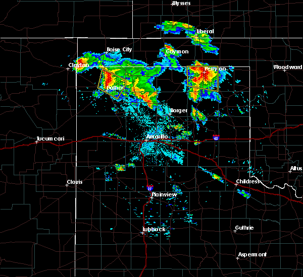 At 234 am cdt, a severe thunderstorm was located 8 miles northeast of dalhart, moving southeast at 30 mph (radar indicated). Hazards include 60 mph wind gusts and half dollar size hail. Minor damage to roofs, siding, and trees is possible. hail damage to vehicles is expected. Locations impacted include, dalhart and conlen. At 234 am cdt, a severe thunderstorm was located 8 miles northeast of dalhart, moving southeast at 30 mph (radar indicated). Hazards include 60 mph wind gusts and half dollar size hail. Minor damage to roofs, siding, and trees is possible. hail damage to vehicles is expected. Locations impacted include, dalhart and conlen.
|
| 6/22/2018 2:20 AM CDT |
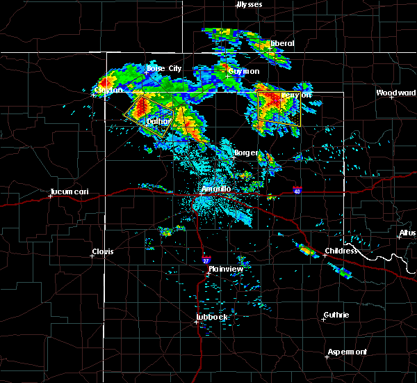 At 219 am cdt, a severe thunderstorm was located 9 miles northeast of ware, or 12 miles north of dalhart, moving southeast at 30 mph (radar indicated). Hazards include tennis ball size hail and 60 mph wind gusts. Minor damage to roofs, siding, and trees is possible. people and animals outdoors will be injured. expect hail damage to roofs, siding, windows, and vehicles. Locations impacted include, dalhart, ware and conlen. At 219 am cdt, a severe thunderstorm was located 9 miles northeast of ware, or 12 miles north of dalhart, moving southeast at 30 mph (radar indicated). Hazards include tennis ball size hail and 60 mph wind gusts. Minor damage to roofs, siding, and trees is possible. people and animals outdoors will be injured. expect hail damage to roofs, siding, windows, and vehicles. Locations impacted include, dalhart, ware and conlen.
|
| 6/22/2018 2:09 AM CDT |
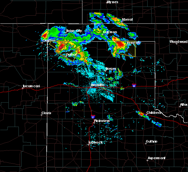 At 209 am cdt, a severe thunderstorm was located 8 miles northeast of ware, or 16 miles north of dalhart, moving southeast at 30 mph (radar indicated). Hazards include tennis ball size hail and 60 mph wind gusts. Minor damage to roofs, siding, and trees is possible. people and animals outdoors will be injured. Expect hail damage to roofs, siding, windows, and vehicles. At 209 am cdt, a severe thunderstorm was located 8 miles northeast of ware, or 16 miles north of dalhart, moving southeast at 30 mph (radar indicated). Hazards include tennis ball size hail and 60 mph wind gusts. Minor damage to roofs, siding, and trees is possible. people and animals outdoors will be injured. Expect hail damage to roofs, siding, windows, and vehicles.
|
| 6/13/2018 1:06 AM CDT |
 At 105 am cdt, a severe thunderstorm was located near hartley, or 11 miles south of dalhart, moving east at 30 mph (radar indicated). Hazards include 60 mph wind gusts and quarter size hail. Minor damage to roofs, siding, and trees is possible. Hail damage to vehicles is expected. At 105 am cdt, a severe thunderstorm was located near hartley, or 11 miles south of dalhart, moving east at 30 mph (radar indicated). Hazards include 60 mph wind gusts and quarter size hail. Minor damage to roofs, siding, and trees is possible. Hail damage to vehicles is expected.
|
| 6/12/2018 10:17 PM CDT |
 At 1016 pm cdt, severe thunderstorms were located along a line extending from 8 miles north of goodwell to 3 miles north of cactus to 12 miles southwest of channing, moving east at 25 mph (radar indicated). Hazards include tennis ball size hail and 60 mph wind gusts. Minor damage to roofs, siding, and trees is possible. people and animals outdoors will be injured. expect hail damage to roofs, siding, windows, and vehicles. Locations impacted include, dumas, guymon, stratford, hartley, cactus, sunray, goodwell, channing, optima, valley de oro, boys ranch, eva, four way, conlen, masterson and texhoma. At 1016 pm cdt, severe thunderstorms were located along a line extending from 8 miles north of goodwell to 3 miles north of cactus to 12 miles southwest of channing, moving east at 25 mph (radar indicated). Hazards include tennis ball size hail and 60 mph wind gusts. Minor damage to roofs, siding, and trees is possible. people and animals outdoors will be injured. expect hail damage to roofs, siding, windows, and vehicles. Locations impacted include, dumas, guymon, stratford, hartley, cactus, sunray, goodwell, channing, optima, valley de oro, boys ranch, eva, four way, conlen, masterson and texhoma.
|
| 6/12/2018 9:57 PM CDT |
 At 956 pm cdt, severe thunderstorms were located along a line extending from 7 miles southeast of griggs to 12 miles south of conlen to 15 miles west of channing, moving east at 35 mph (radar indicated). Hazards include tennis ball size hail and 60 mph wind gusts. Minor damage to roofs, siding, and trees is possible. people and animals outdoors will be injured. expect hail damage to roofs, siding, windows, and vehicles. Locations impacted include, dumas, guymon, dalhart, stratford, hartley, cactus, sunray, goodwell, channing, optima, valley de oro, boys ranch, griggs, eva, four way, conlen, masterson and texhoma. At 956 pm cdt, severe thunderstorms were located along a line extending from 7 miles southeast of griggs to 12 miles south of conlen to 15 miles west of channing, moving east at 35 mph (radar indicated). Hazards include tennis ball size hail and 60 mph wind gusts. Minor damage to roofs, siding, and trees is possible. people and animals outdoors will be injured. expect hail damage to roofs, siding, windows, and vehicles. Locations impacted include, dumas, guymon, dalhart, stratford, hartley, cactus, sunray, goodwell, channing, optima, valley de oro, boys ranch, griggs, eva, four way, conlen, masterson and texhoma.
|
| 6/12/2018 9:49 PM CDT |
 At 948 pm cdt, severe thunderstorms were located along a line extending from 4 miles south of griggs to 11 miles east of dalhart to 17 miles southeast of romero, moving east at 35 mph (radar indicated). Hazards include tennis ball size hail and 60 mph wind gusts. Minor damage to roofs, siding, and trees is possible. people and animals outdoors will be injured. Expect hail damage to roofs, siding, windows, and vehicles. At 948 pm cdt, severe thunderstorms were located along a line extending from 4 miles south of griggs to 11 miles east of dalhart to 17 miles southeast of romero, moving east at 35 mph (radar indicated). Hazards include tennis ball size hail and 60 mph wind gusts. Minor damage to roofs, siding, and trees is possible. people and animals outdoors will be injured. Expect hail damage to roofs, siding, windows, and vehicles.
|
| 6/12/2018 9:20 PM CDT |
 At 920 pm cdt, severe thunderstorms were located along a line extending from 15 miles southwest of griggs to 4 miles west of dalhart to 15 miles east of romero, moving east at 20 mph (radar indicated). Hazards include tennis ball size hail and 60 mph wind gusts. Minor damage to roofs, siding, and trees is possible. people and animals outdoors will be injured. expect hail damage to roofs, siding, windows, and vehicles. Locations impacted include, dalhart, stratford, hartley, eva, ware, conlen and griggs. At 920 pm cdt, severe thunderstorms were located along a line extending from 15 miles southwest of griggs to 4 miles west of dalhart to 15 miles east of romero, moving east at 20 mph (radar indicated). Hazards include tennis ball size hail and 60 mph wind gusts. Minor damage to roofs, siding, and trees is possible. people and animals outdoors will be injured. expect hail damage to roofs, siding, windows, and vehicles. Locations impacted include, dalhart, stratford, hartley, eva, ware, conlen and griggs.
|
| 6/12/2018 9:18 PM CDT | Storm damage reported in hartley county TX, 2.7 miles NE of Dalhart, TX |
| 6/12/2018 8:48 PM CDT |
 At 847 pm cdt, severe thunderstorms were located along a line extending from 5 miles southwest of felt to 9 miles south of ware to 6 miles north of romero, moving northeast at 30 mph (radar indicated). Hazards include 60 mph wind gusts and quarter size hail. Minor damage to roofs, siding, and trees is possible. Hail damage to vehicles is expected. At 847 pm cdt, severe thunderstorms were located along a line extending from 5 miles southwest of felt to 9 miles south of ware to 6 miles north of romero, moving northeast at 30 mph (radar indicated). Hazards include 60 mph wind gusts and quarter size hail. Minor damage to roofs, siding, and trees is possible. Hail damage to vehicles is expected.
|
| 6/8/2018 10:28 PM CDT |
 The severe thunderstorm warning for eastern dallam and eastern hartley counties will expire at 1030 pm cdt, the storms which prompted the warning have weakened below severe limits. therefore the warning will be allowed to expire. however small hail, gusty winds and heavy rain are still possible with these thunderstorms. The severe thunderstorm warning for eastern dallam and eastern hartley counties will expire at 1030 pm cdt, the storms which prompted the warning have weakened below severe limits. therefore the warning will be allowed to expire. however small hail, gusty winds and heavy rain are still possible with these thunderstorms.
|
| 6/8/2018 10:06 PM CDT |
 At 1005 pm cdt, severe thunderstorms were located along a line extending from near conlen to dalhart to 9 miles west of hartley, moving southeast at 30 mph (radar indicated). Hazards include 60 mph wind gusts and penny size hail. Minor damage to roofs, siding, and trees is possible. Locations impacted include, dalhart, hartley and conlen. At 1005 pm cdt, severe thunderstorms were located along a line extending from near conlen to dalhart to 9 miles west of hartley, moving southeast at 30 mph (radar indicated). Hazards include 60 mph wind gusts and penny size hail. Minor damage to roofs, siding, and trees is possible. Locations impacted include, dalhart, hartley and conlen.
|
| 6/8/2018 9:43 PM CDT |
 At 943 pm cdt, severe thunderstorms were located along a line extending from 12 miles northwest of conlen to 5 miles north of dalhart to 11 miles south of ware, moving southeast at 20 mph (radar indicated). Hazards include 60 mph wind gusts and penny size hail. minor damage to roofs, siding, and trees is possible At 943 pm cdt, severe thunderstorms were located along a line extending from 12 miles northwest of conlen to 5 miles north of dalhart to 11 miles south of ware, moving southeast at 20 mph (radar indicated). Hazards include 60 mph wind gusts and penny size hail. minor damage to roofs, siding, and trees is possible
|
| 6/7/2018 9:41 PM CDT |
 At 940 pm cdt, severe thunderstorms were located along a line extending from 7 miles northeast of dalhart to 6 miles south of hartley to 15 miles north of adrian, moving east at 35 mph (radar indicated). Hazards include 60 mph wind gusts and quarter size hail. Minor damage to roofs, siding, and trees is possible. Hail damage to vehicles is expected. At 940 pm cdt, severe thunderstorms were located along a line extending from 7 miles northeast of dalhart to 6 miles south of hartley to 15 miles north of adrian, moving east at 35 mph (radar indicated). Hazards include 60 mph wind gusts and quarter size hail. Minor damage to roofs, siding, and trees is possible. Hail damage to vehicles is expected.
|
| 5/28/2018 7:05 PM CDT |
 At 705 pm cdt, a severe thunderstorm was located 8 miles southeast of griggs, or 14 miles north of stratford, moving northeast at 60 mph (radar indicated). Hazards include 60 mph wind gusts and half dollar size hail. Minor damage to roofs, siding, and trees is possible. hail damage to vehicles is expected. Locations impacted include, dalhart and conlen. At 705 pm cdt, a severe thunderstorm was located 8 miles southeast of griggs, or 14 miles north of stratford, moving northeast at 60 mph (radar indicated). Hazards include 60 mph wind gusts and half dollar size hail. Minor damage to roofs, siding, and trees is possible. hail damage to vehicles is expected. Locations impacted include, dalhart and conlen.
|
| 5/28/2018 6:46 PM CDT |
 At 646 pm cdt, a severe thunderstorm was located 5 miles northeast of conlen, or 5 miles southwest of stratford, moving northeast at 60 mph (radar indicated). Hazards include 60 mph wind gusts and quarter size hail. Minor damage to roofs, siding, and trees is possible. hail damage to vehicles is expected. Locations impacted include, dalhart, hartley and conlen. At 646 pm cdt, a severe thunderstorm was located 5 miles northeast of conlen, or 5 miles southwest of stratford, moving northeast at 60 mph (radar indicated). Hazards include 60 mph wind gusts and quarter size hail. Minor damage to roofs, siding, and trees is possible. hail damage to vehicles is expected. Locations impacted include, dalhart, hartley and conlen.
|
| 5/28/2018 6:26 PM CDT |
 At 626 pm cdt, a severe thunderstorm was located 9 miles east of dalhart, moving northeast at 60 mph (radar indicated). Hazards include 60 mph wind gusts and half dollar size hail. Minor damage to roofs, siding, and trees is possible. Hail damage to vehicles is expected. At 626 pm cdt, a severe thunderstorm was located 9 miles east of dalhart, moving northeast at 60 mph (radar indicated). Hazards include 60 mph wind gusts and half dollar size hail. Minor damage to roofs, siding, and trees is possible. Hail damage to vehicles is expected.
|
| 5/23/2018 6:02 PM CDT |
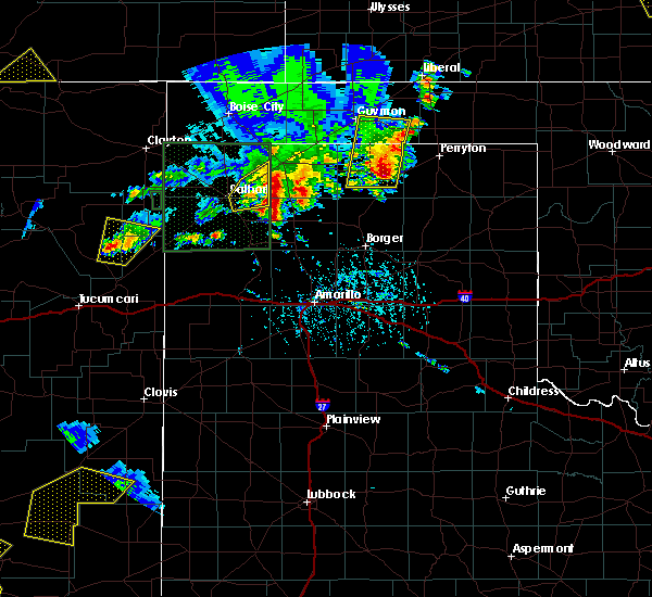 At 601 pm cdt, a severe thunderstorm was located over conlen, or 11 miles southwest of stratford, moving northeast at 40 mph (radar indicated). Hazards include 60 mph wind gusts and penny size hail. Minor damage to roofs, siding, and trees is possible. Locations impacted include, conlen. At 601 pm cdt, a severe thunderstorm was located over conlen, or 11 miles southwest of stratford, moving northeast at 40 mph (radar indicated). Hazards include 60 mph wind gusts and penny size hail. Minor damage to roofs, siding, and trees is possible. Locations impacted include, conlen.
|
| 5/23/2018 5:49 PM CDT |
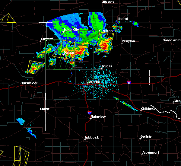 At 549 pm cdt, a severe thunderstorm was located 9 miles southwest of conlen, or 10 miles northeast of dalhart, moving northeast at 30 mph (radar indicated). Hazards include 60 mph wind gusts and quarter size hail. Minor damage to roofs, siding, and trees is possible. hail damage to vehicles is expected. Locations impacted include, dalhart and conlen. At 549 pm cdt, a severe thunderstorm was located 9 miles southwest of conlen, or 10 miles northeast of dalhart, moving northeast at 30 mph (radar indicated). Hazards include 60 mph wind gusts and quarter size hail. Minor damage to roofs, siding, and trees is possible. hail damage to vehicles is expected. Locations impacted include, dalhart and conlen.
|
| 5/23/2018 5:26 PM CDT |
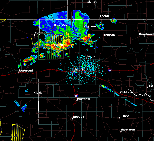 At 525 pm cdt, a severe thunderstorm was located over dalhart, moving northeast at 35 mph (radar indicated). Hazards include 60 mph wind gusts and quarter size hail. Minor damage to roofs, siding, and trees is possible. Hail damage to vehicles is expected. At 525 pm cdt, a severe thunderstorm was located over dalhart, moving northeast at 35 mph (radar indicated). Hazards include 60 mph wind gusts and quarter size hail. Minor damage to roofs, siding, and trees is possible. Hail damage to vehicles is expected.
|
| 9/22/2017 6:24 PM CDT |
 At 624 pm cdt, a severe thunderstorm was located 4 miles north of dalhart, moving northeast at 35 mph (radar indicated). Hazards include 60 mph wind gusts and quarter size hail. Minor damage to roofs, siding, and trees is possible. hail damage to vehicles is expected. Locations impacted include, dalhart, ware and conlen. At 624 pm cdt, a severe thunderstorm was located 4 miles north of dalhart, moving northeast at 35 mph (radar indicated). Hazards include 60 mph wind gusts and quarter size hail. Minor damage to roofs, siding, and trees is possible. hail damage to vehicles is expected. Locations impacted include, dalhart, ware and conlen.
|
| 9/22/2017 6:09 PM CDT |
 At 609 pm cdt, a severe thunderstorm was located over dalhart, moving northeast at 45 mph (radar indicated). Hazards include 60 mph wind gusts and quarter size hail. Minor damage to roofs, siding, and trees is possible. Hail damage to vehicles is expected. At 609 pm cdt, a severe thunderstorm was located over dalhart, moving northeast at 45 mph (radar indicated). Hazards include 60 mph wind gusts and quarter size hail. Minor damage to roofs, siding, and trees is possible. Hail damage to vehicles is expected.
|
| 8/27/2017 9:27 PM CDT | Storm damage reported in hartley county TX, 2.7 miles NE of Dalhart, TX |
| 8/27/2017 9:15 PM CDT | A few tree limbs 9 to 16 inches in diameter were blown dow in dallam county TX, 4 miles W of Dalhart, TX |
| 8/27/2017 9:08 PM CDT |
 At 908 pm cdt, a severe thunderstorm was located 8 miles south of conlen, or 14 miles east of dalhart, moving south at 25 mph (radar indicated). Hazards include 60 mph wind gusts and nickel size hail. Minor damage to roofs, siding, and trees is possible. Locations impacted include, dalhart, ware and conlen. At 908 pm cdt, a severe thunderstorm was located 8 miles south of conlen, or 14 miles east of dalhart, moving south at 25 mph (radar indicated). Hazards include 60 mph wind gusts and nickel size hail. Minor damage to roofs, siding, and trees is possible. Locations impacted include, dalhart, ware and conlen.
|
| 8/27/2017 8:16 PM CDT |
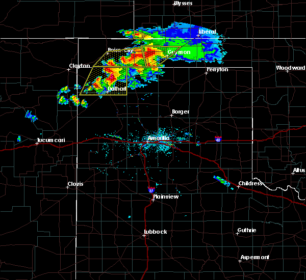 At 815 pm cdt, a severe thunderstorm was located 11 miles northwest of conlen, or 17 miles north of dalhart, moving southeast at 15 mph (radar indicated). Hazards include two inch hail and 60 mph wind gusts. Minor damage to roofs, siding, and trees is possible. people and animals outdoors will be injured. Expect hail damage to roofs, siding, windows, and vehicles. At 815 pm cdt, a severe thunderstorm was located 11 miles northwest of conlen, or 17 miles north of dalhart, moving southeast at 15 mph (radar indicated). Hazards include two inch hail and 60 mph wind gusts. Minor damage to roofs, siding, and trees is possible. people and animals outdoors will be injured. Expect hail damage to roofs, siding, windows, and vehicles.
|
| 8/17/2017 6:50 PM CDT |
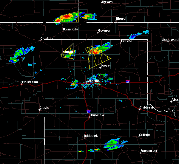 The severe thunderstorm warning for southeastern dallam and northeastern hartley counties will expire at 700 pm cdt, the storm which prompted the warning has weakened below severe limits, and no longer poses an immediate threat to life or property. therefore the warning will be allowed to expire. The severe thunderstorm warning for southeastern dallam and northeastern hartley counties will expire at 700 pm cdt, the storm which prompted the warning has weakened below severe limits, and no longer poses an immediate threat to life or property. therefore the warning will be allowed to expire.
|
| 8/17/2017 6:36 PM CDT |
 At 635 pm cdt, a severe thunderstorm was located 4 miles east of dalhart, moving northeast at 20 mph (radar indicated). Hazards include 60 mph wind gusts and penny size hail. Minor damage to roofs, siding, and trees is possible. Locations impacted include, dalhart and conlen. At 635 pm cdt, a severe thunderstorm was located 4 miles east of dalhart, moving northeast at 20 mph (radar indicated). Hazards include 60 mph wind gusts and penny size hail. Minor damage to roofs, siding, and trees is possible. Locations impacted include, dalhart and conlen.
|
| 8/17/2017 6:20 PM CDT |
 At 619 pm cdt, a severe thunderstorm was located over dalhart, moving northeast at 35 mph (radar indicated). Hazards include 60 mph wind gusts and quarter size hail. Minor damage to roofs, siding, and trees is possible. hail damage to vehicles is expected. Locations impacted include, dalhart and conlen. At 619 pm cdt, a severe thunderstorm was located over dalhart, moving northeast at 35 mph (radar indicated). Hazards include 60 mph wind gusts and quarter size hail. Minor damage to roofs, siding, and trees is possible. hail damage to vehicles is expected. Locations impacted include, dalhart and conlen.
|
| 8/17/2017 6:05 PM CDT |
 At 605 pm cdt, a severe thunderstorm was located 9 miles south of dalhart, moving northeast at 20 mph (radar indicated). Hazards include 60 mph wind gusts and penny size hail. Minor damage to roofs, siding, and trees is possible. Locations impacted include, dalhart, hartley and conlen. At 605 pm cdt, a severe thunderstorm was located 9 miles south of dalhart, moving northeast at 20 mph (radar indicated). Hazards include 60 mph wind gusts and penny size hail. Minor damage to roofs, siding, and trees is possible. Locations impacted include, dalhart, hartley and conlen.
|
| 8/17/2017 5:54 PM CDT |
 At 554 pm cdt, a severe thunderstorm was located 12 miles west of hartley, or 12 miles southwest of dalhart, moving northeast at 20 mph (radar indicated). Hazards include 70 mph wind gusts and half dollar size hail. Expect some tree damage. damage is likely to mobile homes, roofs, and outbuildings. Hail damage to vehicles is expected. At 554 pm cdt, a severe thunderstorm was located 12 miles west of hartley, or 12 miles southwest of dalhart, moving northeast at 20 mph (radar indicated). Hazards include 70 mph wind gusts and half dollar size hail. Expect some tree damage. damage is likely to mobile homes, roofs, and outbuildings. Hail damage to vehicles is expected.
|
| 8/15/2017 8:27 PM CDT |
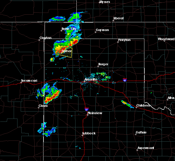 At 827 pm cdt, a severe thunderstorm was located near dalhart, moving east at 20 mph (radar indicated). Hazards include 60 mph wind gusts. Minor damage to roofs, siding, and trees is possible. Locations impacted include, dalhart. At 827 pm cdt, a severe thunderstorm was located near dalhart, moving east at 20 mph (radar indicated). Hazards include 60 mph wind gusts. Minor damage to roofs, siding, and trees is possible. Locations impacted include, dalhart.
|
| 8/15/2017 8:15 PM CDT |
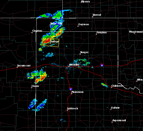 At 815 pm cdt, a severe thunderstorm was located 4 miles northwest of dalhart, moving east at 20 mph (radar indicated). Hazards include 60 mph wind gusts and penny size hail. minor damage to roofs, siding, and trees is possible At 815 pm cdt, a severe thunderstorm was located 4 miles northwest of dalhart, moving east at 20 mph (radar indicated). Hazards include 60 mph wind gusts and penny size hail. minor damage to roofs, siding, and trees is possible
|
| 8/14/2017 8:50 PM CDT |
 At 848 pm cdt, severe thunderstorms were located along a line extending from 7 miles north of hartley to 8 miles south of romero, moving southeast at 35 mph (asos reported 60 mph winds at dalhart). Hazards include 60 mph wind gusts and nickel size hail. Minor damage to roofs, siding, and trees is possible. Locations impacted include, dumas, dalhart, vega, hartley, cactus, sunray, channing, adrian, valley de oro, boys ranch, romero, four way, masterson and simms. At 848 pm cdt, severe thunderstorms were located along a line extending from 7 miles north of hartley to 8 miles south of romero, moving southeast at 35 mph (asos reported 60 mph winds at dalhart). Hazards include 60 mph wind gusts and nickel size hail. Minor damage to roofs, siding, and trees is possible. Locations impacted include, dumas, dalhart, vega, hartley, cactus, sunray, channing, adrian, valley de oro, boys ranch, romero, four way, masterson and simms.
|
| 8/14/2017 8:28 PM CDT | Storm damage reported in hartley county TX, 2.7 miles NE of Dalhart, TX |
| 8/14/2017 8:27 PM CDT |
 At 826 pm cdt, a severe thunderstorm was located 8 miles south of ware, or 12 miles west of dalhart, moving southeast at 20 mph (radar indicated). Hazards include 60 mph wind gusts and penny size hail. Minor damage to roofs, siding, and trees is possible. Locations impacted include, dalhart and ware. At 826 pm cdt, a severe thunderstorm was located 8 miles south of ware, or 12 miles west of dalhart, moving southeast at 20 mph (radar indicated). Hazards include 60 mph wind gusts and penny size hail. Minor damage to roofs, siding, and trees is possible. Locations impacted include, dalhart and ware.
|
| 8/14/2017 8:23 PM CDT |
 At 823 pm cdt, severe thunderstorms were located along a line extending from 5 miles north of dalhart to 4 miles southwest of romero, moving southeast at 40 mph (radar indicated). Hazards include 60 mph wind gusts and nickel size hail. minor damage to roofs, siding, and trees is possible At 823 pm cdt, severe thunderstorms were located along a line extending from 5 miles north of dalhart to 4 miles southwest of romero, moving southeast at 40 mph (radar indicated). Hazards include 60 mph wind gusts and nickel size hail. minor damage to roofs, siding, and trees is possible
|
| 8/14/2017 8:01 PM CDT |
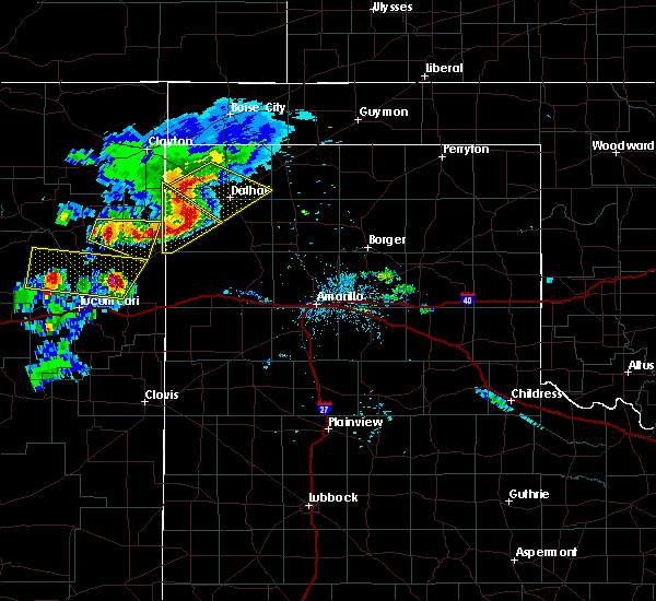 At 801 pm cdt, a severe thunderstorm was located 9 miles west of ware, or 20 miles west of dalhart, moving southeast at 20 mph (radar indicated). Hazards include 60 mph wind gusts and penny size hail. minor damage to roofs, siding, and trees is possible At 801 pm cdt, a severe thunderstorm was located 9 miles west of ware, or 20 miles west of dalhart, moving southeast at 20 mph (radar indicated). Hazards include 60 mph wind gusts and penny size hail. minor damage to roofs, siding, and trees is possible
|
| 8/13/2017 7:06 PM CDT |
 At 706 pm cdt, severe thunderstorms were located along a line extending from 11 miles northeast of hartley to 11 miles northeast of adrian, moving southeast at 40 mph (radar indicated). Hazards include 70 mph wind gusts. Expect some tree damage. damage is likely to mobile homes, roofs, and outbuildings. Locations impacted include, hartley, channing and boys ranch. At 706 pm cdt, severe thunderstorms were located along a line extending from 11 miles northeast of hartley to 11 miles northeast of adrian, moving southeast at 40 mph (radar indicated). Hazards include 70 mph wind gusts. Expect some tree damage. damage is likely to mobile homes, roofs, and outbuildings. Locations impacted include, hartley, channing and boys ranch.
|
| 8/13/2017 6:36 PM CDT |
 At 635 pm cdt, severe thunderstorms were located along a line extending from dalhart to 11 miles north of romero, moving southeast at 25 mph (trained weather spotters). Hazards include 70 mph wind gusts. Expect some tree damage. damage is likely to mobile homes, roofs, and outbuildings. Locations impacted include, dalhart, hartley, channing, boys ranch and romero. At 635 pm cdt, severe thunderstorms were located along a line extending from dalhart to 11 miles north of romero, moving southeast at 25 mph (trained weather spotters). Hazards include 70 mph wind gusts. Expect some tree damage. damage is likely to mobile homes, roofs, and outbuildings. Locations impacted include, dalhart, hartley, channing, boys ranch and romero.
|
| 8/13/2017 6:25 PM CDT | Storm damage reported in hartley county TX, 2.7 miles NE of Dalhart, TX |
| 8/13/2017 6:24 PM CDT | Tree limbs down in dalhar in hartley county TX, 0.7 miles SE of Dalhart, TX |
| 8/13/2017 6:24 PM CDT | Storm damage reported in hartley county TX, 2.7 miles NE of Dalhart, TX |
| 8/13/2017 6:22 PM CDT | Storm damage reported in hartley county TX, 2.7 miles NE of Dalhart, TX |
| 8/13/2017 6:22 PM CDT |
 At 622 pm cdt, a severe thunderstorm was located 7 miles south of ware, or 9 miles west of dalhart, moving southeast at 25 mph (trained weather spotters). Hazards include 70 mph wind gusts. Expect some tree damage. damage is likely to mobile homes, roofs, and outbuildings. Locations impacted include, dalhart and ware. At 622 pm cdt, a severe thunderstorm was located 7 miles south of ware, or 9 miles west of dalhart, moving southeast at 25 mph (trained weather spotters). Hazards include 70 mph wind gusts. Expect some tree damage. damage is likely to mobile homes, roofs, and outbuildings. Locations impacted include, dalhart and ware.
|
| 8/13/2017 6:18 PM CDT | 5 power poles down in a ro in dallam county TX, 8.3 miles E of Dalhart, TX |
| 8/13/2017 6:16 PM CDT |
 At 616 pm cdt, severe thunderstorms were located along a line extending from near ware to 10 miles east of amistad, moving southeast at 40 mph (radar indicated). Hazards include 70 mph wind gusts and quarter size hail. Expect some tree damage. damage is likely to mobile homes, roofs, and outbuildings. Hail damage to vehicles is expected. At 616 pm cdt, severe thunderstorms were located along a line extending from near ware to 10 miles east of amistad, moving southeast at 40 mph (radar indicated). Hazards include 70 mph wind gusts and quarter size hail. Expect some tree damage. damage is likely to mobile homes, roofs, and outbuildings. Hail damage to vehicles is expected.
|
| 8/13/2017 6:07 PM CDT | Storm damage reported in dallam county TX, 8.5 miles SE of Dalhart, TX |
| 8/13/2017 6:07 PM CDT |
 At 607 pm cdt, a severe thunderstorm was located over ware, or 14 miles northwest of dalhart, moving southeast at 25 mph (radar indicated). Hazards include 70 mph wind gusts and quarter size hail. Expect some tree damage. damage is likely to mobile homes, roofs, and outbuildings. hail damage to vehicles is expected. Locations impacted include, dalhart and ware. At 607 pm cdt, a severe thunderstorm was located over ware, or 14 miles northwest of dalhart, moving southeast at 25 mph (radar indicated). Hazards include 70 mph wind gusts and quarter size hail. Expect some tree damage. damage is likely to mobile homes, roofs, and outbuildings. hail damage to vehicles is expected. Locations impacted include, dalhart and ware.
|
| 8/13/2017 5:44 PM CDT |
 At 543 pm cdt, a severe thunderstorm was located 10 miles northwest of ware, or 21 miles southeast of clayton, moving southeast at 25 mph (trained weather spotters). Hazards include 60 mph wind gusts and penny size hail. minor damage to roofs, siding, and trees is possible At 543 pm cdt, a severe thunderstorm was located 10 miles northwest of ware, or 21 miles southeast of clayton, moving southeast at 25 mph (trained weather spotters). Hazards include 60 mph wind gusts and penny size hail. minor damage to roofs, siding, and trees is possible
|
| 8/10/2017 8:42 PM CDT |
 The severe thunderstorm warning for northeastern oldham, southeastern dallam and eastern hartley counties will expire at 845 pm cdt, the storms which prompted the warning have weakened below severe limits, and no longer pose an immediate threat to life or property. therefore the warning will be allowed to expire. however small hail and heavy rain are still possible with these thunderstorms. a severe thunderstorm watch remains in effect until 1100 pm cdt for the panhandle of texas. The severe thunderstorm warning for northeastern oldham, southeastern dallam and eastern hartley counties will expire at 845 pm cdt, the storms which prompted the warning have weakened below severe limits, and no longer pose an immediate threat to life or property. therefore the warning will be allowed to expire. however small hail and heavy rain are still possible with these thunderstorms. a severe thunderstorm watch remains in effect until 1100 pm cdt for the panhandle of texas.
|
| 8/10/2017 8:06 PM CDT |
 At 806 pm cdt, severe thunderstorms were located along a line extending from 4 miles east of dalhart to 6 miles west of boys ranch, moving northeast at 10 mph (radar indicated). Hazards include 70 mph wind gusts and half dollar size hail. Expect some tree damage. damage is likely to mobile homes, roofs, and outbuildings. hail damage to vehicles is expected. Locations impacted include, dalhart, hartley, channing and boys ranch. At 806 pm cdt, severe thunderstorms were located along a line extending from 4 miles east of dalhart to 6 miles west of boys ranch, moving northeast at 10 mph (radar indicated). Hazards include 70 mph wind gusts and half dollar size hail. Expect some tree damage. damage is likely to mobile homes, roofs, and outbuildings. hail damage to vehicles is expected. Locations impacted include, dalhart, hartley, channing and boys ranch.
|
| 8/10/2017 7:38 PM CDT |
 At 738 pm cdt, severe thunderstorms were located along a line extending from 5 miles east of dalhart to 4 miles southwest of channing, moving east at 25 mph (radar indicated). Hazards include 70 mph wind gusts and half dollar size hail. Expect some tree damage. damage is likely to mobile homes, roofs, and outbuildings. Hail damage to vehicles is expected. At 738 pm cdt, severe thunderstorms were located along a line extending from 5 miles east of dalhart to 4 miles southwest of channing, moving east at 25 mph (radar indicated). Hazards include 70 mph wind gusts and half dollar size hail. Expect some tree damage. damage is likely to mobile homes, roofs, and outbuildings. Hail damage to vehicles is expected.
|
| 7/2/2017 7:18 PM CDT |
 At 717 pm cdt, a severe thunderstorm was located 9 miles south of ware, or 8 miles west of dalhart, moving east southeast at 25 mph (radar indicated). Hazards include 60 mph wind gusts and quarter size hail. Minor damage to roofs, siding, and trees is possible. hail damage to vehicles is expected. Locations impacted include, dalhart, hartley, ware and conlen. At 717 pm cdt, a severe thunderstorm was located 9 miles south of ware, or 8 miles west of dalhart, moving east southeast at 25 mph (radar indicated). Hazards include 60 mph wind gusts and quarter size hail. Minor damage to roofs, siding, and trees is possible. hail damage to vehicles is expected. Locations impacted include, dalhart, hartley, ware and conlen.
|
| 7/2/2017 6:48 PM CDT |
 At 648 pm cdt, a severe thunderstorm was located 7 miles southwest of ware, or 15 miles west of dalhart, moving east at 25 mph (radar indicated). Hazards include 60 mph wind gusts and quarter size hail. Minor damage to roofs, siding, and trees is possible. Hail damage to vehicles is expected. At 648 pm cdt, a severe thunderstorm was located 7 miles southwest of ware, or 15 miles west of dalhart, moving east at 25 mph (radar indicated). Hazards include 60 mph wind gusts and quarter size hail. Minor damage to roofs, siding, and trees is possible. Hail damage to vehicles is expected.
|
| 7/2/2017 6:21 PM CDT |
 At 601 pm cdt, a severe thunderstorm was located 10 miles southeast of texline, or 19 miles southeast of clayton, moving east northeast at 20 mph (radar indicated). Hazards include 60 mph wind gusts and quarter size hail. Minor damage to roofs, siding, and trees is possible. Hail damage to vehicles is expected. At 601 pm cdt, a severe thunderstorm was located 10 miles southeast of texline, or 19 miles southeast of clayton, moving east northeast at 20 mph (radar indicated). Hazards include 60 mph wind gusts and quarter size hail. Minor damage to roofs, siding, and trees is possible. Hail damage to vehicles is expected.
|
| 7/2/2017 6:02 PM CDT |
 At 601 pm cdt, a severe thunderstorm was located 10 miles southeast of texline, or 19 miles southeast of clayton, moving east northeast at 20 mph (radar indicated). Hazards include 60 mph wind gusts and quarter size hail. Minor damage to roofs, siding, and trees is possible. Hail damage to vehicles is expected. At 601 pm cdt, a severe thunderstorm was located 10 miles southeast of texline, or 19 miles southeast of clayton, moving east northeast at 20 mph (radar indicated). Hazards include 60 mph wind gusts and quarter size hail. Minor damage to roofs, siding, and trees is possible. Hail damage to vehicles is expected.
|
| 6/30/2017 8:24 PM CDT | Half Dollar sized hail reported 12.3 miles NE of Dalhart, TX, storm spotter found hail on us hwy. 54 ... 20 miles sw of dalhart. |
| 6/25/2017 8:51 PM CDT |
 At 851 pm cdt, severe thunderstorms were located along a line extending from 11 miles northeast of channing to 13 miles southwest of dalhart, moving southwest at 25 mph. these are very dangerous storms (trained weather spotters). Hazards include baseball size hail and 70 mph wind gusts. People and animals outdoors will be severely injured. expect shattered windows, extensive damage to roofs, siding, and vehicles. Locations impacted include, hartley. At 851 pm cdt, severe thunderstorms were located along a line extending from 11 miles northeast of channing to 13 miles southwest of dalhart, moving southwest at 25 mph. these are very dangerous storms (trained weather spotters). Hazards include baseball size hail and 70 mph wind gusts. People and animals outdoors will be severely injured. expect shattered windows, extensive damage to roofs, siding, and vehicles. Locations impacted include, hartley.
|
| 6/25/2017 8:50 PM CDT | From the kvii schoolnet site at olson ranc in hartley county TX, 14.1 miles NE of Dalhart, TX |
| 6/25/2017 8:38 PM CDT | Storm damage reported in hartley county TX, 2.7 miles NE of Dalhart, TX |
| 6/25/2017 8:33 PM CDT | Baseball sized hail reported 5.7 miles NE of Dalhart, TX, hail rainging from golfball to baseball size reported by the public southwest of dalhart. property damage from the hail and wind was reported as well. |
| 6/25/2017 8:31 PM CDT |
 At 831 pm cdt, a severe thunderstorm was located over dalhart, moving south at 30 mph. this is a very dangerous storm (trained weather spotters). Hazards include baseball size hail and 60 mph wind gusts. People and animals outdoors will be severely injured. expect shattered windows, extensive damage to roofs, siding, and vehicles. Locations impacted include, dalhart and hartley. At 831 pm cdt, a severe thunderstorm was located over dalhart, moving south at 30 mph. this is a very dangerous storm (trained weather spotters). Hazards include baseball size hail and 60 mph wind gusts. People and animals outdoors will be severely injured. expect shattered windows, extensive damage to roofs, siding, and vehicles. Locations impacted include, dalhart and hartley.
|
| 6/25/2017 8:30 PM CDT | Baseball sized hail reported 3.6 miles NE of Dalhart, TX, live feed from storm chasers showed baseball sized hail . |
| 6/25/2017 8:29 PM CDT | Golf Ball sized hail reported 3.4 miles ENE of Dalhart, TX, social media picture confirmed golfball sized hail. |
| 6/25/2017 8:05 PM CDT | Center pivot irrigation system flipped at the intersection of hwy 87 and 10 in dallam county TX, 8.9 miles SE of Dalhart, TX |
| 6/25/2017 8:04 PM CDT |
 At 804 pm cdt, a severe thunderstorm was located 13 miles east of ware, or 13 miles north of dalhart, moving south at 20 mph (radar indicated). Hazards include tennis ball size hail and 60 mph wind gusts. Minor damage to roofs, siding, and trees is possible. people and animals outdoors will be injured. Expect hail damage to roofs, siding, windows, and vehicles. At 804 pm cdt, a severe thunderstorm was located 13 miles east of ware, or 13 miles north of dalhart, moving south at 20 mph (radar indicated). Hazards include tennis ball size hail and 60 mph wind gusts. Minor damage to roofs, siding, and trees is possible. people and animals outdoors will be injured. Expect hail damage to roofs, siding, windows, and vehicles.
|
| 5/27/2017 9:10 PM CDT | Quarter sized hail reported 19.9 miles SW of Dalhart, TX |
| 5/27/2017 7:41 PM CDT | Golf Ball sized hail reported 24.6 miles S of Dalhart, TX |
| 5/15/2017 5:48 PM CDT |
 At 547 pm cdt, a severe thunderstorm was located 5 miles northeast of channing, or 19 miles west of dumas, moving north at 50 mph (radar indicated). Hazards include 60 mph wind gusts and half dollar size hail. Minor damage to roofs, siding, and trees is possible. hail damage to vehicles is expected. Locations impacted include, dumas, dalhart, hartley, cactus and channing. At 547 pm cdt, a severe thunderstorm was located 5 miles northeast of channing, or 19 miles west of dumas, moving north at 50 mph (radar indicated). Hazards include 60 mph wind gusts and half dollar size hail. Minor damage to roofs, siding, and trees is possible. hail damage to vehicles is expected. Locations impacted include, dumas, dalhart, hartley, cactus and channing.
|
| 5/15/2017 5:31 PM CDT |
 At 531 pm cdt, a severe thunderstorm was located 4 miles south of channing, or 25 miles southwest of dumas, moving north at 50 mph (radar indicated). Hazards include 60 mph wind gusts and half dollar size hail. Minor damage to roofs, siding, and trees is possible. Hail damage to vehicles is expected. At 531 pm cdt, a severe thunderstorm was located 4 miles south of channing, or 25 miles southwest of dumas, moving north at 50 mph (radar indicated). Hazards include 60 mph wind gusts and half dollar size hail. Minor damage to roofs, siding, and trees is possible. Hail damage to vehicles is expected.
|
| 5/2/2017 10:15 PM CDT | Quarter sized hail reported 0.7 miles SE of Dalhart, TX |
| 4/21/2017 3:53 AM CDT |
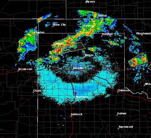 At 353 am cdt, a severe thunderstorm was located 8 miles north of cactus, or 12 miles south of stratford, moving northeast at 45 mph (radar indicated). Hazards include quarter size hail. Damage to vehicles is expected. Locations impacted include, dalhart and cactus. At 353 am cdt, a severe thunderstorm was located 8 miles north of cactus, or 12 miles south of stratford, moving northeast at 45 mph (radar indicated). Hazards include quarter size hail. Damage to vehicles is expected. Locations impacted include, dalhart and cactus.
|
| 4/21/2017 3:23 AM CDT |
 At 322 am cdt, a severe thunderstorm was located 4 miles southeast of dalhart, moving east at 30 mph (radar indicated). Hazards include quarter size hail. Damage to vehicles is expected. Locations impacted include, dalhart, stratford, cactus and conlen. At 322 am cdt, a severe thunderstorm was located 4 miles southeast of dalhart, moving east at 30 mph (radar indicated). Hazards include quarter size hail. Damage to vehicles is expected. Locations impacted include, dalhart, stratford, cactus and conlen.
|
| 4/21/2017 3:12 AM CDT |
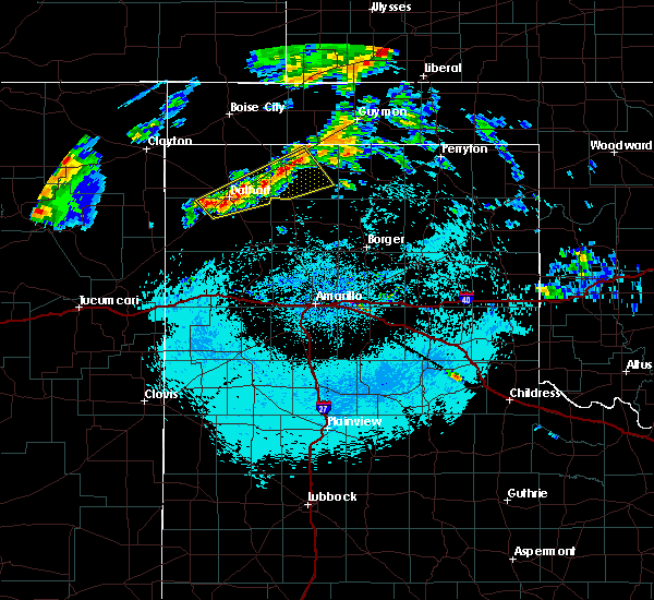 At 312 am cdt, a severe thunderstorm was located over dalhart, moving northeast at 50 mph (radar indicated). Hazards include quarter size hail. Damage to vehicles is expected. Locations impacted include, dalhart, stratford, cactus and conlen. At 312 am cdt, a severe thunderstorm was located over dalhart, moving northeast at 50 mph (radar indicated). Hazards include quarter size hail. Damage to vehicles is expected. Locations impacted include, dalhart, stratford, cactus and conlen.
|
| 4/21/2017 3:00 AM CDT | Quarter sized hail reported 0.7 miles SE of Dalhart, TX, sheriffs office in dalhart reported hail up to the size of quarters with the first wave of the storm. |
| 4/21/2017 3:00 AM CDT |
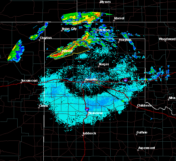 At 259 am cdt, a severe thunderstorm was located 9 miles southwest of dalhart, moving east at 50 mph (radar indicated). Hazards include quarter size hail. damage to vehicles is expected At 259 am cdt, a severe thunderstorm was located 9 miles southwest of dalhart, moving east at 50 mph (radar indicated). Hazards include quarter size hail. damage to vehicles is expected
|
| 3/23/2017 6:43 PM CDT |
 At 642 pm cdt, severe thunderstorms were located along a line extending from 8 miles northwest of stratford to 7 miles west of channing, moving northeast at 45 mph (radar indicated). Hazards include 70 mph wind gusts and quarter size hail. Expect some tree damage. damage is likely to mobile homes, roofs, and outbuildings. hail damage to vehicles is expected. Locations impacted include, dalhart, stratford, hartley, channing and conlen. At 642 pm cdt, severe thunderstorms were located along a line extending from 8 miles northwest of stratford to 7 miles west of channing, moving northeast at 45 mph (radar indicated). Hazards include 70 mph wind gusts and quarter size hail. Expect some tree damage. damage is likely to mobile homes, roofs, and outbuildings. hail damage to vehicles is expected. Locations impacted include, dalhart, stratford, hartley, channing and conlen.
|
| 3/23/2017 6:15 PM CDT |
 At 615 pm cdt, severe thunderstorms were located along a line extending from 8 miles west of conlen to 13 miles west of channing, moving northeast at 70 mph (radar indicated). Hazards include 70 mph wind gusts and quarter size hail. Expect some tree damage. damage is likely to mobile homes, roofs, and outbuildings. Hail damage to vehicles is expected. At 615 pm cdt, severe thunderstorms were located along a line extending from 8 miles west of conlen to 13 miles west of channing, moving northeast at 70 mph (radar indicated). Hazards include 70 mph wind gusts and quarter size hail. Expect some tree damage. damage is likely to mobile homes, roofs, and outbuildings. Hail damage to vehicles is expected.
|
| 3/23/2017 6:04 PM CDT | Quarter sized hail reported 1.7 miles NNE of Dalhart, TX, viewers reporting quarter size hail 2 miles south of dalhart |
| 9/17/2016 8:57 PM CDT |
 At 856 pm cdt, a severe thunderstorm was located 10 miles west of dumas, moving southeast at 30 mph (radar indicated). Hazards include 60 mph wind gusts and half dollar size hail. Minor damage to roofs. siding. and trees is possible. hail damage to vehicles is expected. hail may accumulate on roadways causing hazardous travel. Locations impacted include, dumas, dalhart, hartley, cactus, fritch, sunray, channing, masterson, lake meredith, conlen and four way. At 856 pm cdt, a severe thunderstorm was located 10 miles west of dumas, moving southeast at 30 mph (radar indicated). Hazards include 60 mph wind gusts and half dollar size hail. Minor damage to roofs. siding. and trees is possible. hail damage to vehicles is expected. hail may accumulate on roadways causing hazardous travel. Locations impacted include, dumas, dalhart, hartley, cactus, fritch, sunray, channing, masterson, lake meredith, conlen and four way.
|
| 9/17/2016 8:42 PM CDT |
 At 842 pm cdt, a severe thunderstorm was located 8 miles northeast of hartley, or 16 miles southeast of dalhart, moving southeast at 25 mph (radar indicated). Hazards include 70 mph wind gusts and half dollar size hail. Expect some tree damage. damage is likely to mobile homes. roofs, and outbuildings. hail damage to vehicles is expected. hail may accumulate on roadways causing hazardous travel. Locations impacted include, dumas, dalhart, hartley, cactus, fritch, sunray, channing, masterson, lake meredith, conlen and four way. At 842 pm cdt, a severe thunderstorm was located 8 miles northeast of hartley, or 16 miles southeast of dalhart, moving southeast at 25 mph (radar indicated). Hazards include 70 mph wind gusts and half dollar size hail. Expect some tree damage. damage is likely to mobile homes. roofs, and outbuildings. hail damage to vehicles is expected. hail may accumulate on roadways causing hazardous travel. Locations impacted include, dumas, dalhart, hartley, cactus, fritch, sunray, channing, masterson, lake meredith, conlen and four way.
|
| 9/17/2016 8:27 PM CDT |
 At 827 pm cdt, a severe thunderstorm was located 8 miles north of hartley, or 8 miles southeast of dalhart, moving southeast at 25 mph (radar indicated). Hazards include 70 mph wind gusts and ping pong ball size hail. Expect some tree damage. damage is likely to mobile homes, roofs, and outbuildings. people and animals outdoors will be injured. expect hail damage to roofs, siding, windows, and vehicles. Hail may accumulate on roadways causing hazardous travel. At 827 pm cdt, a severe thunderstorm was located 8 miles north of hartley, or 8 miles southeast of dalhart, moving southeast at 25 mph (radar indicated). Hazards include 70 mph wind gusts and ping pong ball size hail. Expect some tree damage. damage is likely to mobile homes, roofs, and outbuildings. people and animals outdoors will be injured. expect hail damage to roofs, siding, windows, and vehicles. Hail may accumulate on roadways causing hazardous travel.
|
| 9/17/2016 8:19 PM CDT |
 At 819 pm cdt, a severe thunderstorm was located 5 miles southeast of dalhart, moving southeast at 25 mph (radar indicated). Hazards include 60 mph wind gusts and half dollar size hail. Minor damage to roofs. siding. and trees is possible. hail damage to vehicles is expected. hail may accumulate on roadways causing hazardous travel. Locations impacted include, dalhart and conlen. At 819 pm cdt, a severe thunderstorm was located 5 miles southeast of dalhart, moving southeast at 25 mph (radar indicated). Hazards include 60 mph wind gusts and half dollar size hail. Minor damage to roofs. siding. and trees is possible. hail damage to vehicles is expected. hail may accumulate on roadways causing hazardous travel. Locations impacted include, dalhart and conlen.
|
| 9/17/2016 8:15 PM CDT | Storm damage reported in hartley county TX, 2.7 miles NE of Dalhart, TX |
| 9/17/2016 8:13 PM CDT | Golf Ball sized hail reported 2.9 miles W of Dalhart, TX |
| 9/17/2016 8:13 PM CDT | Ping Pong Ball sized hail reported 4 miles W of Dalhart, TX, hail is ongoing. |
| 9/17/2016 8:13 PM CDT | Storm damage reported in hartley county TX, 2.7 miles NE of Dalhart, TX |
| 9/17/2016 8:11 PM CDT |
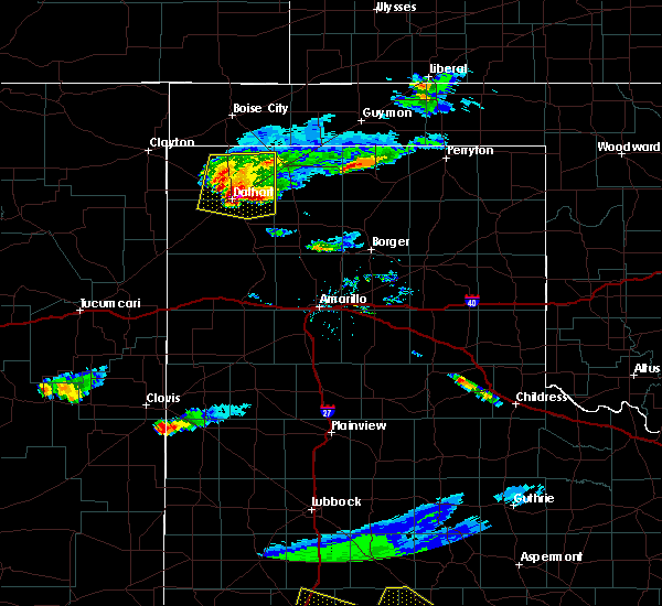 At 811 pm cdt, a severe thunderstorm was located 4 miles east of dalhart, moving east at 25 mph (radar indicated). Hazards include 60 mph wind gusts and half dollar size hail. Minor damage to roofs. siding. and trees is possible. hail damage to vehicles is expected. hail may accumulate on roadways causing hazardous travel. Locations impacted include, dalhart, ware and conlen. At 811 pm cdt, a severe thunderstorm was located 4 miles east of dalhart, moving east at 25 mph (radar indicated). Hazards include 60 mph wind gusts and half dollar size hail. Minor damage to roofs. siding. and trees is possible. hail damage to vehicles is expected. hail may accumulate on roadways causing hazardous travel. Locations impacted include, dalhart, ware and conlen.
|
| 9/17/2016 8:05 PM CDT |
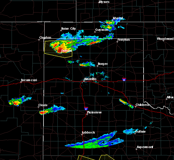 At 805 pm cdt, a severe thunderstorm was located over dalhart, moving southeast at 25 mph (radar indicated). Hazards include 60 mph wind gusts and half dollar size hail. Minor damage to roofs. siding. and trees is possible. hail damage to vehicles is expected. hail may accumulate on roadways causing hazardous travel. Locations impacted include, dalhart, ware and conlen. At 805 pm cdt, a severe thunderstorm was located over dalhart, moving southeast at 25 mph (radar indicated). Hazards include 60 mph wind gusts and half dollar size hail. Minor damage to roofs. siding. and trees is possible. hail damage to vehicles is expected. hail may accumulate on roadways causing hazardous travel. Locations impacted include, dalhart, ware and conlen.
|
| 9/17/2016 7:54 PM CDT | Half Dollar sized hail reported 3.3 miles SE of Dalhart, TX, hail up to the size of half dollars 3 miles northwest of dalhart on us 87. |
| 9/17/2016 7:53 PM CDT |
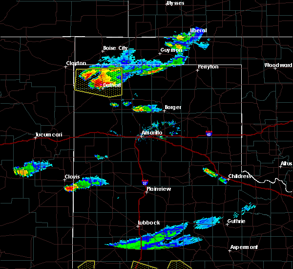 At 752 pm cdt, a severe thunderstorm was located 4 miles northwest of dalhart, moving east at 20 mph (radar indicated). Hazards include 70 mph wind gusts and ping pong ball size hail. Expect some tree damage. damage is likely to mobile homes, roofs, and outbuildings. people and animals outdoors will be injured. expect hail damage to roofs, siding, windows, and vehicles. hail may accumulate on roadways causing hazardous travel. Locations impacted include, dalhart, ware and conlen. At 752 pm cdt, a severe thunderstorm was located 4 miles northwest of dalhart, moving east at 20 mph (radar indicated). Hazards include 70 mph wind gusts and ping pong ball size hail. Expect some tree damage. damage is likely to mobile homes, roofs, and outbuildings. people and animals outdoors will be injured. expect hail damage to roofs, siding, windows, and vehicles. hail may accumulate on roadways causing hazardous travel. Locations impacted include, dalhart, ware and conlen.
|
| 9/17/2016 7:44 PM CDT |
 At 743 pm cdt, a severe thunderstorm was located 6 miles east of ware, or 7 miles northwest of dalhart, moving east at 20 mph. another severe thunderstorm was located 5 miles southeast of texline, moving east at 20 mph (radar indicated). Hazards include 60 mph wind gusts and half dollar size hail. Minor damage to roofs. siding. and trees is possible. hail damage to vehicles is expected. hail may accumulate on roadways causing hazardous travel. Locations impacted include, dalhart, texline, conlen and ware. At 743 pm cdt, a severe thunderstorm was located 6 miles east of ware, or 7 miles northwest of dalhart, moving east at 20 mph. another severe thunderstorm was located 5 miles southeast of texline, moving east at 20 mph (radar indicated). Hazards include 60 mph wind gusts and half dollar size hail. Minor damage to roofs. siding. and trees is possible. hail damage to vehicles is expected. hail may accumulate on roadways causing hazardous travel. Locations impacted include, dalhart, texline, conlen and ware.
|
| 9/17/2016 7:33 PM CDT |
 At 732 pm cdt, a severe thunderstorm was located 4 miles east of ware, or 10 miles northwest of dalhart, moving east at 25 mph. another severe thunderstorm was located near texline, moving east at 25 mph (radar indicated). Hazards include 60 mph wind gusts and half dollar size hail. Minor damage to roofs. siding. and trees is possible. hail damage to vehicles is expected. hail may accumulate on roadways causing hazardous travel. Locations impacted include, dalhart, texline, conlen and ware. At 732 pm cdt, a severe thunderstorm was located 4 miles east of ware, or 10 miles northwest of dalhart, moving east at 25 mph. another severe thunderstorm was located near texline, moving east at 25 mph (radar indicated). Hazards include 60 mph wind gusts and half dollar size hail. Minor damage to roofs. siding. and trees is possible. hail damage to vehicles is expected. hail may accumulate on roadways causing hazardous travel. Locations impacted include, dalhart, texline, conlen and ware.
|
| 9/17/2016 7:24 PM CDT |
 At 723 pm cdt, a severe thunderstorm was located over ware, or 14 miles northwest of dalhart, moving east at 25 mph. another severe thunderstorms was located 5 miles west of texline, moving east at 25 mph (radar indicated). Hazards include 60 mph wind gusts and half dollar size hail. Minor damage to roofs. siding. and trees is possible. hail damage to vehicles is expected. hail may accumulate on roadways causing hazardous travel. Locations impacted include, dalhart, texline, conlen and ware. At 723 pm cdt, a severe thunderstorm was located over ware, or 14 miles northwest of dalhart, moving east at 25 mph. another severe thunderstorms was located 5 miles west of texline, moving east at 25 mph (radar indicated). Hazards include 60 mph wind gusts and half dollar size hail. Minor damage to roofs. siding. and trees is possible. hail damage to vehicles is expected. hail may accumulate on roadways causing hazardous travel. Locations impacted include, dalhart, texline, conlen and ware.
|
| 9/17/2016 7:09 PM CDT |
 At 709 pm cdt, a severe thunderstorm was located 5 miles northwest of ware, or 19 miles northwest of dalhart, moving east at 25 mph (radar indicated). Hazards include ping pong ball size hail and 60 mph wind gusts. Minor damage to roofs. siding. and trees is possible. people and animals outdoors will be injured. expect hail damage to roofs, siding, windows, and vehicles. Locations impacted include, dalhart, hartley, texline, conlen and ware. At 709 pm cdt, a severe thunderstorm was located 5 miles northwest of ware, or 19 miles northwest of dalhart, moving east at 25 mph (radar indicated). Hazards include ping pong ball size hail and 60 mph wind gusts. Minor damage to roofs. siding. and trees is possible. people and animals outdoors will be injured. expect hail damage to roofs, siding, windows, and vehicles. Locations impacted include, dalhart, hartley, texline, conlen and ware.
|
| 9/17/2016 6:53 PM CDT |
 At 653 pm cdt, a severe thunderstorm was located 10 miles southeast of texline, or 20 miles southeast of clayton, moving east at 25 mph (radar indicated). Hazards include ping pong ball size hail and 60 mph wind gusts. Minor damage to roofs. siding. and trees is possible. people and animals outdoors will be injured. Expect hail damage to roofs, siding, windows, and vehicles. At 653 pm cdt, a severe thunderstorm was located 10 miles southeast of texline, or 20 miles southeast of clayton, moving east at 25 mph (radar indicated). Hazards include ping pong ball size hail and 60 mph wind gusts. Minor damage to roofs. siding. and trees is possible. people and animals outdoors will be injured. Expect hail damage to roofs, siding, windows, and vehicles.
|
| 9/6/2016 6:49 PM CDT | Storm damage reported in hartley county TX, 2.7 miles NE of Dalhart, TX |
| 9/6/2016 6:42 PM CDT | Storm damage reported in hartley county TX, 2.7 miles NE of Dalhart, TX |
| 9/6/2016 6:18 PM CDT |
 At 617 pm cdt, a line of severe thunderstorms were located near dalhart, moving northeast at 30 mph (radar indicated). Hazards include 70 mph wind gusts. Expect some tree damage. damage is likely to mobile homes. roofs, and outbuildings. Locations impacted include, dalhart, ware and conlen. At 617 pm cdt, a line of severe thunderstorms were located near dalhart, moving northeast at 30 mph (radar indicated). Hazards include 70 mph wind gusts. Expect some tree damage. damage is likely to mobile homes. roofs, and outbuildings. Locations impacted include, dalhart, ware and conlen.
|
| 9/6/2016 6:16 PM CDT | Storm damage reported in hartley county TX, 2.7 miles NE of Dalhart, TX |
| 9/6/2016 6:15 PM CDT |
 At 614 pm cdt, a line of severe thunderstorms were located near dalhart, moving northeast at 30 mph (radar indicated). Hazards include 60 mph wind gusts. Minor damage to roofs. siding. And trees is possible. At 614 pm cdt, a line of severe thunderstorms were located near dalhart, moving northeast at 30 mph (radar indicated). Hazards include 60 mph wind gusts. Minor damage to roofs. siding. And trees is possible.
|
| 9/6/2016 6:09 PM CDT | Storm damage reported in hartley county TX, 2.7 miles NE of Dalhart, TX |
| 9/6/2016 6:01 PM CDT | Storm damage reported in hartley county TX, 2.7 miles NE of Dalhart, TX |
| 9/6/2016 5:59 PM CDT | Storm damage reported in hartley county TX, 2.7 miles NE of Dalhart, TX |
| 9/4/2016 6:52 PM CDT |
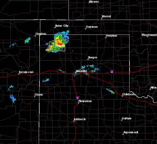 At 650 pm cdt, doppler radar indicated a severe thunderstorm 10 miles northeast of dalhart, moving east northeast at 30 mph (radar indicated). Hazards include 60 mph wind gusts and quarter size hail. Minor damage to roofs. siding. and trees is possible. hail damage to vehicles is expected. Locations impacted include, dalhart and conlen. At 650 pm cdt, doppler radar indicated a severe thunderstorm 10 miles northeast of dalhart, moving east northeast at 30 mph (radar indicated). Hazards include 60 mph wind gusts and quarter size hail. Minor damage to roofs. siding. and trees is possible. hail damage to vehicles is expected. Locations impacted include, dalhart and conlen.
|
| 9/4/2016 6:32 PM CDT |
 At 632 pm cdt, a severe thunderstorm was located 4 miles northwest of dalhart, moving east at 30 mph (radar indicated). Hazards include 60 mph wind gusts and quarter size hail. Minor damage to roofs. siding. and trees is possible. Hail damage to vehicles is expected. At 632 pm cdt, a severe thunderstorm was located 4 miles northwest of dalhart, moving east at 30 mph (radar indicated). Hazards include 60 mph wind gusts and quarter size hail. Minor damage to roofs. siding. and trees is possible. Hail damage to vehicles is expected.
|
| 8/2/2016 6:31 PM CDT | Storm damage reported in hartley county TX, 2.7 miles NE of Dalhart, TX |
| 7/29/2016 8:07 PM CDT |
 At 806 pm cdt, severe thunderstorms were located along a line extending from 4 miles northeast of dalhart to 4 miles north of hartley to 4 miles northwest of romero, moving southeast at 30 mph (radar indicated). Hazards include 60 mph wind gusts. Minor damage to roofs. siding. and trees is possible. Locations impacted include, dalhart, hartley, channing and romero. At 806 pm cdt, severe thunderstorms were located along a line extending from 4 miles northeast of dalhart to 4 miles north of hartley to 4 miles northwest of romero, moving southeast at 30 mph (radar indicated). Hazards include 60 mph wind gusts. Minor damage to roofs. siding. and trees is possible. Locations impacted include, dalhart, hartley, channing and romero.
|
| 7/29/2016 8:05 PM CDT | Storm damage reported in dallam county TX, 0.7 miles SE of Dalhart, TX |
| 7/29/2016 7:49 PM CDT |
 At 748 pm cdt, severe thunderstorms were located along a line extending from 10 miles east of ware to 5 miles southeast of dalhart to 4 miles northwest of romero, moving southeast at 35 mph (radar indicated). Hazards include 60 mph wind gusts. Minor damage to roofs. siding. and trees is possible. Locations impacted include, dalhart, hartley, channing, romero and ware. At 748 pm cdt, severe thunderstorms were located along a line extending from 10 miles east of ware to 5 miles southeast of dalhart to 4 miles northwest of romero, moving southeast at 35 mph (radar indicated). Hazards include 60 mph wind gusts. Minor damage to roofs. siding. and trees is possible. Locations impacted include, dalhart, hartley, channing, romero and ware.
|
| 7/29/2016 7:32 PM CDT |
 At 731 pm cdt, severe thunderstorms were located along a line extending from 4 miles southeast of ware to 6 miles southeast of amistad, moving southeast at 25 mph (radar indicated). Hazards include 60 mph wind gusts. Minor damage to roofs. siding. and trees is possible. Locations impacted include, dalhart, hartley, channing, romero and ware. At 731 pm cdt, severe thunderstorms were located along a line extending from 4 miles southeast of ware to 6 miles southeast of amistad, moving southeast at 25 mph (radar indicated). Hazards include 60 mph wind gusts. Minor damage to roofs. siding. and trees is possible. Locations impacted include, dalhart, hartley, channing, romero and ware.
|
| 7/29/2016 7:08 PM CDT |
 At 707 pm cdt, a severe thunderstorm was located 7 miles southeast of sedan, or 12 miles northeast of amistad, moving southeast at 35 mph (radar indicated). Hazards include 70 mph wind gusts. Expect some tree damage. Damage is likely to mobile homes, roofs, and outbuildings. At 707 pm cdt, a severe thunderstorm was located 7 miles southeast of sedan, or 12 miles northeast of amistad, moving southeast at 35 mph (radar indicated). Hazards include 70 mph wind gusts. Expect some tree damage. Damage is likely to mobile homes, roofs, and outbuildings.
|
| 7/29/2016 7:00 PM CDT | 4-6 inch diameter tree branches downed by strong wind gusts in dallam county TX, 29.1 miles ESE of Dalhart, TX |
| 7/25/2016 9:09 PM CDT |
 At 908 pm cdt, a severe thunderstorm was located 6 miles southwest of ware, or 16 miles west of dalhart, moving northeast at 25 mph (radar indicated). Hazards include 60 mph wind gusts and quarter size hail. Minor damage to roofs. siding. and trees is possible. Hail damage to vehicles is expected. At 908 pm cdt, a severe thunderstorm was located 6 miles southwest of ware, or 16 miles west of dalhart, moving northeast at 25 mph (radar indicated). Hazards include 60 mph wind gusts and quarter size hail. Minor damage to roofs. siding. and trees is possible. Hail damage to vehicles is expected.
|
| 7/17/2016 11:43 PM CDT | Storm damage reported in hartley county TX, 2.7 miles NE of Dalhart, TX |
| 6/22/2016 10:24 PM CDT | Storm damage reported in hartley county TX, 2.7 miles NE of Dalhart, TX |
| 6/13/2016 6:31 PM CDT |
 At 631 pm cdt, a severe thunderstorm was located 5 miles northeast of ware, or 13 miles northwest of dalhart, moving northeast at 20 mph (radar indicated). Hazards include ping pong ball size hail and 60 mph wind gusts. Minor damage to roofs. siding. and trees is possible. people and animals outdoors will be injured. Expect hail damage to roofs, siding, windows, and vehicles. At 631 pm cdt, a severe thunderstorm was located 5 miles northeast of ware, or 13 miles northwest of dalhart, moving northeast at 20 mph (radar indicated). Hazards include ping pong ball size hail and 60 mph wind gusts. Minor damage to roofs. siding. and trees is possible. people and animals outdoors will be injured. Expect hail damage to roofs, siding, windows, and vehicles.
|
| 6/13/2016 6:09 PM CDT |
 At 609 pm cdt, severe thunderstorms were located along a line extending from 14 miles southwest of ware to 10 miles northeast of hartley, moving north at 25 mph (radar indicated). Hazards include 60 mph wind gusts and half dollar size hail. Minor damage to roofs. siding. and trees is possible. hail damage to vehicles is expected. locations impacted include, dalhart and hartley. A tornado watch remains in effect until 1000 pm cdt for the panhandle of texas. At 609 pm cdt, severe thunderstorms were located along a line extending from 14 miles southwest of ware to 10 miles northeast of hartley, moving north at 25 mph (radar indicated). Hazards include 60 mph wind gusts and half dollar size hail. Minor damage to roofs. siding. and trees is possible. hail damage to vehicles is expected. locations impacted include, dalhart and hartley. A tornado watch remains in effect until 1000 pm cdt for the panhandle of texas.
|
| 6/13/2016 5:52 PM CDT |
 At 551 pm cdt, severe thunderstorms were located along a line extending from 16 miles southwest of dalhart to 5 miles northeast of hartley, moving northeast at 30 mph (radar indicated). Hazards include ping pong ball size hail and 60 mph wind gusts. Minor damage to roofs. siding. and trees is possible. people and animals outdoors will be injured. expect hail damage to roofs, siding, windows, and vehicles. locations impacted include, dalhart and hartley. A tornado watch remains in effect until 1000 pm cdt for the panhandle of texas. At 551 pm cdt, severe thunderstorms were located along a line extending from 16 miles southwest of dalhart to 5 miles northeast of hartley, moving northeast at 30 mph (radar indicated). Hazards include ping pong ball size hail and 60 mph wind gusts. Minor damage to roofs. siding. and trees is possible. people and animals outdoors will be injured. expect hail damage to roofs, siding, windows, and vehicles. locations impacted include, dalhart and hartley. A tornado watch remains in effect until 1000 pm cdt for the panhandle of texas.
|
| 6/13/2016 5:31 PM CDT |
 At 530 pm cdt, severe thunderstorms were located along a line extending from 7 miles east of romero to 5 miles south of hartley, moving northeast at 30 mph (radar indicated). Hazards include 60 mph wind gusts and half dollar size hail. Minor damage to roofs. siding. and trees is possible. Hail damage to vehicles is expected. At 530 pm cdt, severe thunderstorms were located along a line extending from 7 miles east of romero to 5 miles south of hartley, moving northeast at 30 mph (radar indicated). Hazards include 60 mph wind gusts and half dollar size hail. Minor damage to roofs. siding. and trees is possible. Hail damage to vehicles is expected.
|
| 5/30/2016 9:04 PM CDT |
 At 904 pm cdt, a severe thunderstorm was located 9 miles north of hartley, or 9 miles east of dalhart, moving east at 15 mph (radar indicated). Hazards include quarter size hail. Damage to vehicles is expected. Locations impacted include, dalhart and hartley. At 904 pm cdt, a severe thunderstorm was located 9 miles north of hartley, or 9 miles east of dalhart, moving east at 15 mph (radar indicated). Hazards include quarter size hail. Damage to vehicles is expected. Locations impacted include, dalhart and hartley.
|
| 5/30/2016 8:51 PM CDT |
 At 850 pm cdt, a severe thunderstorm was located 7 miles east of dalhart, moving east at 15 mph (radar indicated). Hazards include half dollar size hail. damage to vehicles is expected At 850 pm cdt, a severe thunderstorm was located 7 miles east of dalhart, moving east at 15 mph (radar indicated). Hazards include half dollar size hail. damage to vehicles is expected
|
| 5/22/2016 3:29 PM CDT | Quarter sized hail reported 4.4 miles WSW of Dalhart, TX, nickel and quarter size hail was falling. |
| 5/21/2016 9:21 PM CDT |
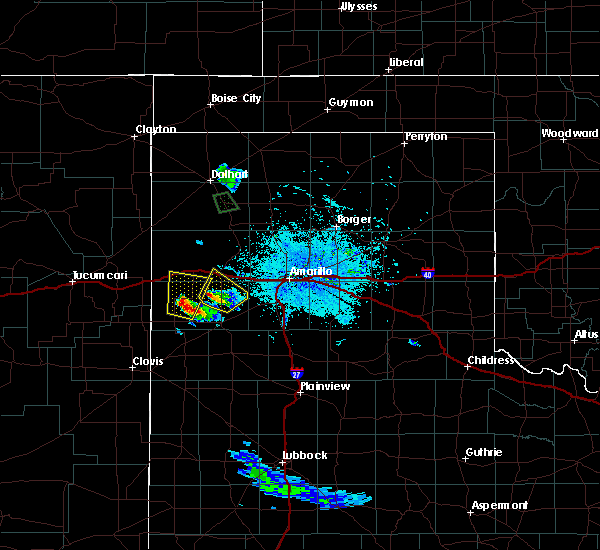 A severe thunderstorm warning remains in effect until 1000 pm cdt for north central hartley and south central dallam counties. at 920 pm cdt. a severe thunderstorm was located over dalhart. moving northeast at 20 mph. hazard. golf ball size hail. source. Trained weather spotters reported hail up to the size of. A severe thunderstorm warning remains in effect until 1000 pm cdt for north central hartley and south central dallam counties. at 920 pm cdt. a severe thunderstorm was located over dalhart. moving northeast at 20 mph. hazard. golf ball size hail. source. Trained weather spotters reported hail up to the size of.
|
| 5/21/2016 9:14 PM CDT | Golf Ball sized hail reported 0.7 miles SE of Dalhart, TX, golf ball size hail on the southeast side of dalhart. |
| 5/21/2016 9:12 PM CDT | Ping Pong Ball sized hail reported 0.7 miles SE of Dalhart, TX, ping pong ball size hail on the south side of dalhart. |
| 5/21/2016 9:11 PM CDT | Golf Ball sized hail reported 0.7 miles SE of Dalhart, TX, quarter to golf ball size hail. |
| 5/21/2016 9:10 PM CDT | Golf Ball sized hail reported 0.7 miles SE of Dalhart, TX, hail the size from quarters to golf balls reported at 6th and keeler in dalhart. |
| 5/21/2016 9:09 PM CDT | Quarter sized hail reported 0.7 miles SE of Dalhart, TX |
| 5/21/2016 8:27 PM CDT | A severe thunderstorm warning remains in effect until 900 pm cdt for north central hartley and south central dallam counties. at 827 pm cdt. a severe thunderstorm was located 5 miles southwest of dalhart. moving north at 20 mph. hazard. ping pong ball size hail. source. Radar indicated. |
| 5/21/2016 6:17 PM CDT | Quarter sized hail reported 11.6 miles NNE of Dalhart, TX, quarter size hail reported 9.2 miles west of hartley on fm 998...20 to 30 mph wind...and fair amount of hail but not enough to cover the road. |
| 5/21/2016 5:12 PM CDT | Ping Pong Ball sized hail reported 14.4 miles NNE of Dalhart, TX, mostly dime to penny size hail was falling with a few ping pong ball size hailstones. |
| 5/16/2016 7:17 PM CDT |
 At 717 pm cdt, one severe thunderstorm was located 8 miles north of hartley and another severe thunderstorm was located 15 miles northeast of romero, moving east at 30 mph (radar indicated). Hazards include ping pong ball size hail and 60 mph wind gusts. Minor damage to roofs. siding. and trees is possible. people and animals outdoors will be injured. expect hail damage to roofs, siding, windows, and vehicles. locations impacted include, hartley. A tornado watch remains in effect until 1000 pm cdt. At 717 pm cdt, one severe thunderstorm was located 8 miles north of hartley and another severe thunderstorm was located 15 miles northeast of romero, moving east at 30 mph (radar indicated). Hazards include ping pong ball size hail and 60 mph wind gusts. Minor damage to roofs. siding. and trees is possible. people and animals outdoors will be injured. expect hail damage to roofs, siding, windows, and vehicles. locations impacted include, hartley. A tornado watch remains in effect until 1000 pm cdt.
|
| 5/16/2016 7:03 PM CDT |
 At 702 pm cdt, one severe thunderstorms were located near dalhart and another was located 11 miles north of romero, moving east at 30 mph (radar indicated). Hazards include ping pong ball size hail and 60 mph wind gusts. Minor damage to roofs. siding. and trees is possible. people and animals outdoors will be injured. Expect hail damage to roofs, siding, windows, and vehicles. At 702 pm cdt, one severe thunderstorms were located near dalhart and another was located 11 miles north of romero, moving east at 30 mph (radar indicated). Hazards include ping pong ball size hail and 60 mph wind gusts. Minor damage to roofs. siding. and trees is possible. people and animals outdoors will be injured. Expect hail damage to roofs, siding, windows, and vehicles.
|
| 5/16/2016 6:57 PM CDT |
 At 657 pm cdt, a severe thunderstorm was located over dalhart, moving east at 35 mph (trained weather spotters). Hazards include 70 mph wind gusts and half dollar size hail. Expect some tree damage. damage is likely to mobile homes. roofs, and outbuildings. hail damage to vehicles is expected. locations impacted include, dalhart, hartley and conlen. A tornado watch remains in effect until 1000 pm cdt. At 657 pm cdt, a severe thunderstorm was located over dalhart, moving east at 35 mph (trained weather spotters). Hazards include 70 mph wind gusts and half dollar size hail. Expect some tree damage. damage is likely to mobile homes. roofs, and outbuildings. hail damage to vehicles is expected. locations impacted include, dalhart, hartley and conlen. A tornado watch remains in effect until 1000 pm cdt.
|
| 5/16/2016 6:56 PM CDT | Half Dollar sized hail reported 2.7 miles E of Dalhart, TX, measured with a ruler |
| 5/16/2016 6:51 PM CDT |
 At 650 pm cdt, 1 severe thunderstorm was located 3 miles south of conlen. another severe thunderstorm was located 5 miles west of dalhart. both storms are moving east at 40 mph (radar indicated). Hazards include 70 mph wind gusts and ping pong ball size hail. Expect some tree damage. damage is likely to mobile homes. roofs, and outbuildings. people and animals outdoors will be injured. expect hail damage to roofs, siding, windows, and vehicles. locations impacted include, dalhart, hartley and conlen. A tornado watch remains in effect until 1000 pm cdt. At 650 pm cdt, 1 severe thunderstorm was located 3 miles south of conlen. another severe thunderstorm was located 5 miles west of dalhart. both storms are moving east at 40 mph (radar indicated). Hazards include 70 mph wind gusts and ping pong ball size hail. Expect some tree damage. damage is likely to mobile homes. roofs, and outbuildings. people and animals outdoors will be injured. expect hail damage to roofs, siding, windows, and vehicles. locations impacted include, dalhart, hartley and conlen. A tornado watch remains in effect until 1000 pm cdt.
|
| 5/16/2016 6:49 PM CDT | Quarter sized hail reported 5.7 miles NE of Dalhart, TX |
| 5/16/2016 6:33 PM CDT |
 At 632 pm cdt, a severe thunderstorm was located 9 miles northeast of dalhart, moving east at 40 mph (radar indicated). Hazards include 70 mph wind gusts and ping pong ball size hail. Expect some tree damage. damage is likely to mobile homes. roofs, and outbuildings. people and animals outdoors will be injured. expect hail damage to roofs, siding, windows, and vehicles. locations impacted include, dalhart, hartley and conlen. A tornado watch remains in effect until 1000 pm cdt. At 632 pm cdt, a severe thunderstorm was located 9 miles northeast of dalhart, moving east at 40 mph (radar indicated). Hazards include 70 mph wind gusts and ping pong ball size hail. Expect some tree damage. damage is likely to mobile homes. roofs, and outbuildings. people and animals outdoors will be injured. expect hail damage to roofs, siding, windows, and vehicles. locations impacted include, dalhart, hartley and conlen. A tornado watch remains in effect until 1000 pm cdt.
|
| 5/16/2016 6:08 PM CDT |
 At 608 pm cdt, a severe thunderstorm was located 5 miles southeast of ware, or 8 miles northwest of dalhart, moving southeast at 40 mph (radar indicated). Hazards include golf ball size hail and 70 mph wind gusts. Expect some tree damage. damage is likely to mobile homes, roofs, and outbuildings. people and animals outdoors will be injured. Expect hail damage to roofs, siding, windows, and vehicles. At 608 pm cdt, a severe thunderstorm was located 5 miles southeast of ware, or 8 miles northwest of dalhart, moving southeast at 40 mph (radar indicated). Hazards include golf ball size hail and 70 mph wind gusts. Expect some tree damage. damage is likely to mobile homes, roofs, and outbuildings. people and animals outdoors will be injured. Expect hail damage to roofs, siding, windows, and vehicles.
|
| 5/16/2016 5:40 PM CDT | Grain bend damaged and pivots flipped near sh102 and mcadam in dallam county TX, 22.7 miles ESE of Dalhart, TX |
| 5/16/2016 5:30 PM CDT | Hen Egg sized hail reported 30.8 miles S of Dalhart, TX, storm chaser reports hen egg sized hail on highway 385 near the oklahoma state line |
| 5/16/2016 4:50 PM CDT | Storm damage reported in dallam county TX, 25.3 miles E of Dalhart, TX |
| 4/28/2016 5:07 PM CDT |
 At 505 pm cdt, a severe thunderstorm was located 6 miles northwest of channing, or 23 miles south of dalhart, moving northeast at 30 mph (radar indicated). Hazards include golf ball size hail and 60 mph wind gusts. Minor damage to roofs. siding. and trees is possible. people and animals outdoors will be injured. expect hail damage to roofs, siding, windows, and vehicles. hail may accumulate on roadways causing hazardous travel. another thunderstorm was located 10 miles southwest of dalhart moving northeast. this thunderstorm is capable of producing wind gusts to 60 mph. large hail is unlikely with the northernmost storm expected to impact dalhart. Locations impacted by these storms include, dalhart, hartley and channing. At 505 pm cdt, a severe thunderstorm was located 6 miles northwest of channing, or 23 miles south of dalhart, moving northeast at 30 mph (radar indicated). Hazards include golf ball size hail and 60 mph wind gusts. Minor damage to roofs. siding. and trees is possible. people and animals outdoors will be injured. expect hail damage to roofs, siding, windows, and vehicles. hail may accumulate on roadways causing hazardous travel. another thunderstorm was located 10 miles southwest of dalhart moving northeast. this thunderstorm is capable of producing wind gusts to 60 mph. large hail is unlikely with the northernmost storm expected to impact dalhart. Locations impacted by these storms include, dalhart, hartley and channing.
|
| 4/28/2016 4:54 PM CDT |
 At 453 pm cdt, severe thunderstorms were located along a line extending from 14 miles west of hartley to 11 miles west of channing, moving northeast at 30 mph (radar indicated). Hazards include 60 mph wind gusts and half dollar size hail. Minor damage to roofs. siding. and trees is possible. hail damage to vehicles is expected. hail may accumulate on roadways causing hazardous travel. Locations impacted include, dalhart, hartley and channing. At 453 pm cdt, severe thunderstorms were located along a line extending from 14 miles west of hartley to 11 miles west of channing, moving northeast at 30 mph (radar indicated). Hazards include 60 mph wind gusts and half dollar size hail. Minor damage to roofs. siding. and trees is possible. hail damage to vehicles is expected. hail may accumulate on roadways causing hazardous travel. Locations impacted include, dalhart, hartley and channing.
|
| 4/28/2016 4:48 PM CDT |
 At 447 pm cdt, severe thunderstorms were located along a line extending from 13 miles northeast of romero to 15 miles west of channing, moving northeast at 30 mph (radar indicated). Hazards include 60 mph wind gusts and half dollar size hail. Minor damage to roofs. siding. and trees is possible. hail damage to vehicles is expected. Hail may accumulate on roadways causing hazardous travel. At 447 pm cdt, severe thunderstorms were located along a line extending from 13 miles northeast of romero to 15 miles west of channing, moving northeast at 30 mph (radar indicated). Hazards include 60 mph wind gusts and half dollar size hail. Minor damage to roofs. siding. and trees is possible. hail damage to vehicles is expected. Hail may accumulate on roadways causing hazardous travel.
|
| 4/16/2016 1:15 AM CDT |
 At 114 am cdt, a severe thunderstorm was located 7 miles northwest of dalhart, moving northeast at 35 mph (radar indicated). Hazards include 60 mph wind gusts and quarter size hail. Minor damage to roofs. siding. and trees is possible. hail damage to vehicles is expected. Locations impacted include, dalhart, stratford and conlen. At 114 am cdt, a severe thunderstorm was located 7 miles northwest of dalhart, moving northeast at 35 mph (radar indicated). Hazards include 60 mph wind gusts and quarter size hail. Minor damage to roofs. siding. and trees is possible. hail damage to vehicles is expected. Locations impacted include, dalhart, stratford and conlen.
|
| 4/16/2016 1:00 AM CDT |
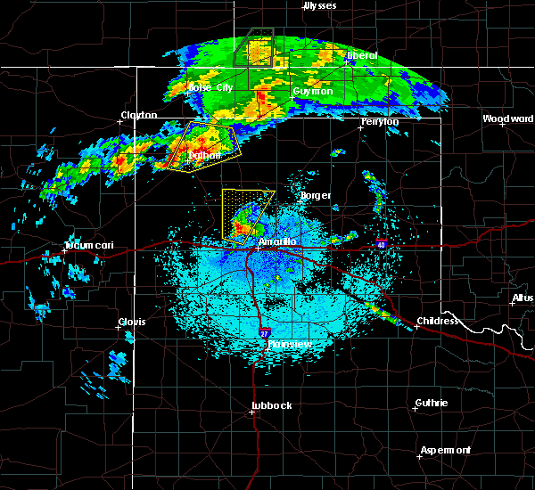 At 1259 am cdt, a severe thunderstorm was located 9 miles southwest of conlen, or 10 miles northeast of dalhart, moving northeast at 30 mph. anther severe thunderstorm was located 5 miles northwest of dalhart, moving northeast at 30 mph (radar indicated). Hazards include ping pong ball size hail and 60 mph wind gusts. Minor damage to roofs. siding. and trees is possible. people and animals outdoors will be injured. expect hail damage to roofs, siding, windows, and vehicles. Locations impacted include, dalhart, stratford and conlen. At 1259 am cdt, a severe thunderstorm was located 9 miles southwest of conlen, or 10 miles northeast of dalhart, moving northeast at 30 mph. anther severe thunderstorm was located 5 miles northwest of dalhart, moving northeast at 30 mph (radar indicated). Hazards include ping pong ball size hail and 60 mph wind gusts. Minor damage to roofs. siding. and trees is possible. people and animals outdoors will be injured. expect hail damage to roofs, siding, windows, and vehicles. Locations impacted include, dalhart, stratford and conlen.
|
| 4/16/2016 12:50 AM CDT | Half Dollar sized hail reported 4 miles W of Dalhart, TX, hail of up to half dollar size was continuing to fall east of dalhart. |
| 4/16/2016 12:38 AM CDT | Golf Ball sized hail reported 0.7 miles SE of Dalhart, TX, hail to the size of golf balls was continuing to fall in dalhart. |
| 4/16/2016 12:38 AM CDT |
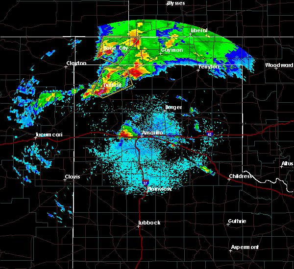 At 1237 am cdt, a severe thunderstorm was located near dalhart, moving northeast at 35 mph (public). Hazards include golf ball size hail. People and animals outdoors will be injured. expect damage to roofs, siding, windows, and vehicles. Locations impacted include, dalhart, stratford and conlen. At 1237 am cdt, a severe thunderstorm was located near dalhart, moving northeast at 35 mph (public). Hazards include golf ball size hail. People and animals outdoors will be injured. expect damage to roofs, siding, windows, and vehicles. Locations impacted include, dalhart, stratford and conlen.
|
| 4/16/2016 12:34 AM CDT |
 At 1234 am cdt, a severe thunderstorm was located 6 miles south of dalhart, moving northeast at 30 mph (radar indicated). Hazards include 60 mph wind gusts and half dollar size hail. Minor damage to roofs. siding. and trees is possible. Hail damage to vehicles is expected. At 1234 am cdt, a severe thunderstorm was located 6 miles south of dalhart, moving northeast at 30 mph (radar indicated). Hazards include 60 mph wind gusts and half dollar size hail. Minor damage to roofs. siding. and trees is possible. Hail damage to vehicles is expected.
|
| 4/16/2016 12:30 AM CDT | Golf Ball sized hail reported 1.9 miles SSE of Dalhart, TX |
| 4/15/2016 11:44 PM CDT | Half Dollar sized hail reported 15.8 miles W of Dalhart, TX, hail up to the size of half dollars fell west of cactus. |
| 4/15/2016 10:33 PM CDT |
 At 1032 pm cdt, one severe thunderstorms were located near hartley and another was located 14 miles west of channing. both were moving northeast at 35 mph (radar indicated). Hazards include half dollar size hail. Damage to vehicles is expected. Locations impacted include, hartley. At 1032 pm cdt, one severe thunderstorms were located near hartley and another was located 14 miles west of channing. both were moving northeast at 35 mph (radar indicated). Hazards include half dollar size hail. Damage to vehicles is expected. Locations impacted include, hartley.
|
| 4/15/2016 10:12 PM CDT |
 At 1012 pm cdt, a severe thunderstorm was located 10 miles west of channing, or 23 miles south of dalhart, moving northeast at 40 mph (radar indicated). Hazards include 60 mph wind gusts and half dollar size hail. Minor damage to roofs. siding. and trees is possible. hail damage to vehicles is expected. Locations impacted include, dalhart and hartley. At 1012 pm cdt, a severe thunderstorm was located 10 miles west of channing, or 23 miles south of dalhart, moving northeast at 40 mph (radar indicated). Hazards include 60 mph wind gusts and half dollar size hail. Minor damage to roofs. siding. and trees is possible. hail damage to vehicles is expected. Locations impacted include, dalhart and hartley.
|
| 4/15/2016 10:00 PM CDT |
 At 1000 pm cdt, a severe thunderstorm was located 15 miles west of channing, or 27 miles east of nara visa, moving northeast at 40 mph (radar indicated). Hazards include 60 mph wind gusts and half dollar size hail. Minor damage to roofs. siding. and trees is possible. Hail damage to vehicles is expected. At 1000 pm cdt, a severe thunderstorm was located 15 miles west of channing, or 27 miles east of nara visa, moving northeast at 40 mph (radar indicated). Hazards include 60 mph wind gusts and half dollar size hail. Minor damage to roofs. siding. and trees is possible. Hail damage to vehicles is expected.
|
| 4/15/2016 6:39 PM CDT | Ping Pong Ball sized hail reported 19.9 miles SW of Dalhart, TX |
| 4/15/2016 6:08 PM CDT |
 At 607 pm cdt, a severe thunderstorm capable of producing a tornado was located 4 miles northeast of dalhart, moving northeast at 25 mph (radar indicated rotation). Hazards include tornado and golf ball size hail. Flying debris will be dangerous to those caught without shelter. mobile homes will be damaged or destroyed. damage to roofs, windows, and vehicles will occur. tree damage is likely. Locations impacted include, dalhart. At 607 pm cdt, a severe thunderstorm capable of producing a tornado was located 4 miles northeast of dalhart, moving northeast at 25 mph (radar indicated rotation). Hazards include tornado and golf ball size hail. Flying debris will be dangerous to those caught without shelter. mobile homes will be damaged or destroyed. damage to roofs, windows, and vehicles will occur. tree damage is likely. Locations impacted include, dalhart.
|
| 4/15/2016 5:56 PM CDT | Tennis Ball sized hail reported 1.1 miles ESE of Dalhart, TX |
| 4/15/2016 5:55 PM CDT |
 At 554 pm cdt, a severe thunderstorm capable of producing a tornado was located over dalhart, moving northeast at 25 mph (radar indicated rotation). Hazards include tornado and golf ball size hail. Flying debris will be dangerous to those caught without shelter. mobile homes will be damaged or destroyed. damage to roofs, windows, and vehicles will occur. Tree damage is likely. At 554 pm cdt, a severe thunderstorm capable of producing a tornado was located over dalhart, moving northeast at 25 mph (radar indicated rotation). Hazards include tornado and golf ball size hail. Flying debris will be dangerous to those caught without shelter. mobile homes will be damaged or destroyed. damage to roofs, windows, and vehicles will occur. Tree damage is likely.
|
| 4/15/2016 5:54 PM CDT | Golf Ball sized hail reported 1.9 miles SSE of Dalhart, TX |
| 4/15/2016 5:52 PM CDT | Golf Ball sized hail reported 0.5 miles ENE of Dalhart, TX |
| 4/15/2016 5:52 PM CDT | Hen Egg sized hail reported 0.7 miles SE of Dalhart, TX, hail up to 2 inches in diameter was reported in dalhart. |
| 4/15/2016 5:51 PM CDT | Golf Ball sized hail reported 1.5 miles NW of Dalhart, TX, hail had just stopped falling. |
| 4/15/2016 5:51 PM CDT | Ping Pong Ball sized hail reported 0.7 miles SE of Dalhart, TX |
| 4/15/2016 5:51 PM CDT |
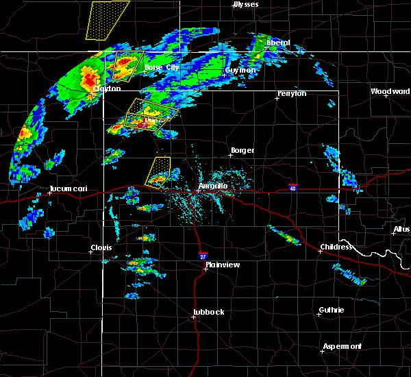 At 551 pm cdt, a severe thunderstorm was located 4 miles northeast of dalhart, moving northeast at 25 mph (trained weather spotters). Hazards include golf ball size hail and 60 mph wind gusts. Minor damage to roofs. siding. and trees is possible. people and animals outdoors will be injured. expect hail damage to roofs, siding, windows, and vehicles. locations impacted include, dalhart and ware. A tornado watch remains in effect until 1000 pm cdt. At 551 pm cdt, a severe thunderstorm was located 4 miles northeast of dalhart, moving northeast at 25 mph (trained weather spotters). Hazards include golf ball size hail and 60 mph wind gusts. Minor damage to roofs. siding. and trees is possible. people and animals outdoors will be injured. expect hail damage to roofs, siding, windows, and vehicles. locations impacted include, dalhart and ware. A tornado watch remains in effect until 1000 pm cdt.
|
| 4/15/2016 5:50 PM CDT | Half Dollar sized hail reported 0.5 miles ENE of Dalhart, TX |
| 4/15/2016 5:50 PM CDT | Half Dollar sized hail reported 1.3 miles SSW of Dalhart, TX, hail to the size of half dollars was reported northeast of dalhart. |
| 4/15/2016 5:48 PM CDT | Half Dollar sized hail reported 0.7 miles SE of Dalhart, TX, hail estimated at the size of half dollars was reported in dalhart. |
| 4/15/2016 5:41 PM CDT | Quarter sized hail reported 8.1 miles NNE of Dalhart, TX, hail of nickel up to quarter size was reported. |
| 4/15/2016 5:15 PM CDT |
 At 514 pm cdt, a severe thunderstorm was located 11 miles southwest of dalhart, moving northeast at 25 mph (radar indicated). Hazards include golf ball size hail and 60 mph wind gusts. Minor damage to roofs. siding. and trees is possible. people and animals outdoors will be injured. Expect hail damage to roofs, siding, windows, and vehicles. At 514 pm cdt, a severe thunderstorm was located 11 miles southwest of dalhart, moving northeast at 25 mph (radar indicated). Hazards include golf ball size hail and 60 mph wind gusts. Minor damage to roofs. siding. and trees is possible. people and animals outdoors will be injured. Expect hail damage to roofs, siding, windows, and vehicles.
|
| 4/15/2016 5:00 PM CDT | Golf Ball sized hail reported 29.5 miles NE of Dalhart, TX, golfball size hail was reported on the ground on fm 767 east of romero. |
| 4/15/2016 4:52 PM CDT | Quarter sized hail reported 20.1 miles NE of Dalhart, TX, hail was falling at the time |
| 4/15/2016 4:19 PM CDT | Golf Ball sized hail reported 17.2 miles SE of Dalhart, TX |
| 4/15/2016 4:09 PM CDT |
 At 409 pm cdt, a severe thunderstorm was located near ware, or 16 miles northwest of dalhart, moving northeast at 30 mph (radar indicated). Hazards include ping pong ball size hail and 60 mph wind gusts. Minor damage to roofs. siding. and trees is possible. people and animals outdoors will be injured. expect hail damage to roofs, siding, windows, and vehicles. locations impacted include, ware. A tornado watch remains in effect until 1000 pm cdt for central texas. At 409 pm cdt, a severe thunderstorm was located near ware, or 16 miles northwest of dalhart, moving northeast at 30 mph (radar indicated). Hazards include ping pong ball size hail and 60 mph wind gusts. Minor damage to roofs. siding. and trees is possible. people and animals outdoors will be injured. expect hail damage to roofs, siding, windows, and vehicles. locations impacted include, ware. A tornado watch remains in effect until 1000 pm cdt for central texas.
|
| 4/15/2016 3:57 PM CDT |
 At 356 pm cdt, a severe thunderstorm was located 8 miles southwest of ware, or 19 miles west of dalhart, moving northeast at 45 mph (radar indicated). Hazards include ping pong ball size hail and 60 mph wind gusts. Minor damage to roofs. siding. and trees is possible. people and animals outdoors will be injured. expect hail damage to roofs, siding, windows, and vehicles. locations impacted include, ware. A tornado watch remains in effect until 1000. At 356 pm cdt, a severe thunderstorm was located 8 miles southwest of ware, or 19 miles west of dalhart, moving northeast at 45 mph (radar indicated). Hazards include ping pong ball size hail and 60 mph wind gusts. Minor damage to roofs. siding. and trees is possible. people and animals outdoors will be injured. expect hail damage to roofs, siding, windows, and vehicles. locations impacted include, ware. A tornado watch remains in effect until 1000.
|
| 4/15/2016 3:36 PM CDT |
 At 335 pm cdt, a severe thunderstorm was located 10 miles east of amistad, moving northeast at 40 mph (radar indicated). Hazards include ping pong ball size hail and 60 mph wind gusts. Minor damage to roofs. siding. and trees is possible. people and animals outdoors will be injured. Expect hail damage to roofs, siding, windows, and vehicles. At 335 pm cdt, a severe thunderstorm was located 10 miles east of amistad, moving northeast at 40 mph (radar indicated). Hazards include ping pong ball size hail and 60 mph wind gusts. Minor damage to roofs. siding. and trees is possible. people and animals outdoors will be injured. Expect hail damage to roofs, siding, windows, and vehicles.
|
| 11/16/2015 6:04 PM CST | South winds of 42 mph with measured gusts up to 68 mp in hartley county TX, 2.7 miles NE of Dalhart, TX |
| 8/8/2015 8:27 PM CDT | A grain elevator was blown over and blocking hwy 87 near pollard road. further south some sprinklers were blown ove in dallam county TX, 14.7 miles SE of Dalhart, TX |
| 8/3/2015 8:41 PM CDT |
 At 840 pm cdt, severe thunderstorms were located along a line extending from 7 miles south of stratford to 11 miles northeast of hartley, and moving southeast at 30 mph (trained weather spotters). Hazards include 60 mph wind gusts. Minor damage to roofs. Siding and trees is possible. At 840 pm cdt, severe thunderstorms were located along a line extending from 7 miles south of stratford to 11 miles northeast of hartley, and moving southeast at 30 mph (trained weather spotters). Hazards include 60 mph wind gusts. Minor damage to roofs. Siding and trees is possible.
|
| 8/3/2015 8:07 PM CDT |
 At 806 pm cdt, severe thunderstorms were located along a line extending from 8 miles north of conlen to 5 miles north of dalhart, and moving southeast at 30 mph (trained weather spotters). Hazards include ping pong ball size hail and 65 mph wind gusts. People and animals outdoors will be injured. expect hail damage to roofs, siding, windows and vehicles. Minor wind damage to roofs, siding and trees is possible. At 806 pm cdt, severe thunderstorms were located along a line extending from 8 miles north of conlen to 5 miles north of dalhart, and moving southeast at 30 mph (trained weather spotters). Hazards include ping pong ball size hail and 65 mph wind gusts. People and animals outdoors will be injured. expect hail damage to roofs, siding, windows and vehicles. Minor wind damage to roofs, siding and trees is possible.
|
| 8/3/2015 7:36 PM CDT | Storm damage reported in dallam county TX, 17.8 miles S of Dalhart, TX |
| 7/25/2015 8:08 PM CDT |
 At 805 pm cdt, a severe thunderstorm was located near dalhart, and moving east at 5 mph (public). Hazards include 65 mph wind gusts and half dollar size hail. Hail damage to vehicles is expected. Minor wind damage to roofs, siding and trees is possible. At 805 pm cdt, a severe thunderstorm was located near dalhart, and moving east at 5 mph (public). Hazards include 65 mph wind gusts and half dollar size hail. Hail damage to vehicles is expected. Minor wind damage to roofs, siding and trees is possible.
|
| 7/25/2015 8:00 PM CDT | Half Dollar sized hail reported 3.9 miles WSW of Dalhart, TX |
| 7/25/2015 8:00 PM CDT | Estimated between 60 and 70 mph wind gust 4 miles east northeast of dalhart in dallam county TX, 3.9 miles WSW of Dalhart, TX |
| 7/25/2015 7:57 PM CDT |
 At 757 pm cdt, a severe thunderstorm was located near dalhart, and moving east at 5 mph (public). Hazards include half dollar size hail. hail up to the size of half dollars was reported 4 miles east of dalhart. damage to vehicles is expected At 757 pm cdt, a severe thunderstorm was located near dalhart, and moving east at 5 mph (public). Hazards include half dollar size hail. hail up to the size of half dollars was reported 4 miles east of dalhart. damage to vehicles is expected
|
| 7/25/2015 7:53 PM CDT | Half Dollar sized hail reported 3.9 miles WSW of Dalhart, TX, hail up to the size of half dollars reported 4 miles east-northeast of dalhart. |
| 7/25/2015 7:53 PM CDT | Half Dollar sized hail reported 4 miles W of Dalhart, TX, hail up to the size of half dollars reported 4 miles east of dalhart. |
| 7/9/2015 12:35 AM CDT |
 At 1232 am cdt, a severe thunderstorm was located 8 miles west of dumas, and moving southeast at 25 mph (radar indicated). Hazards include 60 mph wind gusts and penny size hail. Minor damage to roofs. Siding and trees is possible. At 1232 am cdt, a severe thunderstorm was located 8 miles west of dumas, and moving southeast at 25 mph (radar indicated). Hazards include 60 mph wind gusts and penny size hail. Minor damage to roofs. Siding and trees is possible.
|
| 7/8/2015 11:38 PM CDT | Storm damage reported in hartley county TX, 2.7 miles NE of Dalhart, TX |
| 7/8/2015 7:04 PM CDT |
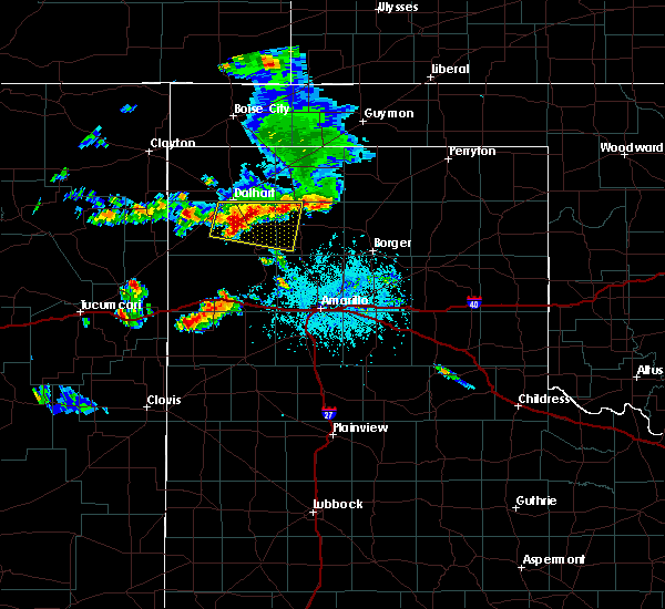 At 702 pm cdt, a severe thunderstorm was located near hartley, and moving east at 25 mph (radar indicated). Hazards include golf ball size hail and 60 mph wind gusts. People and animals outdoors will be injured. expect hail damage to roofs, siding, windows and vehicles. Minor wind damage to roofs, siding and trees is possible. At 702 pm cdt, a severe thunderstorm was located near hartley, and moving east at 25 mph (radar indicated). Hazards include golf ball size hail and 60 mph wind gusts. People and animals outdoors will be injured. expect hail damage to roofs, siding, windows and vehicles. Minor wind damage to roofs, siding and trees is possible.
|
| 7/8/2015 6:49 PM CDT |
 At 646 pm cdt, a severe thunderstorm was located 5 miles northwest of hartley, and moving east at 25 mph (radar indicated). Hazards include 60 mph wind gusts and half dollar size hail. Hail damage to vehicles is expected. Minor wind damage to roofs, siding and trees is possible. At 646 pm cdt, a severe thunderstorm was located 5 miles northwest of hartley, and moving east at 25 mph (radar indicated). Hazards include 60 mph wind gusts and half dollar size hail. Hail damage to vehicles is expected. Minor wind damage to roofs, siding and trees is possible.
|
| 7/8/2015 6:19 PM CDT |
 At 616 pm cdt, severe thunderstorms were located along a line extending from 9 miles southeast of stratford to cactus to 7 miles northwest of hartley to 9 miles east of amistad, and moving southeast at 35 mph (radar indicated). Hazards include 60 mph wind gusts and quarter size hail. Hail damage to vehicles is expected. Minor wind damage to roofs, siding and trees is possible. At 616 pm cdt, severe thunderstorms were located along a line extending from 9 miles southeast of stratford to cactus to 7 miles northwest of hartley to 9 miles east of amistad, and moving southeast at 35 mph (radar indicated). Hazards include 60 mph wind gusts and quarter size hail. Hail damage to vehicles is expected. Minor wind damage to roofs, siding and trees is possible.
|
| 7/8/2015 6:05 PM CDT |
 At 603 pm cdt, severe thunderstorms were located along a line extending from stratford to 10 miles west of cactus to 8 miles south of dalhart to 7 miles east of amistad, and moving southeast at 35 mph (radar indicated). Hazards include 60 mph wind gusts and half dollar size hail. Hail damage to vehicles is expected. Minor wind damage to roofs, siding and trees is possible. At 603 pm cdt, severe thunderstorms were located along a line extending from stratford to 10 miles west of cactus to 8 miles south of dalhart to 7 miles east of amistad, and moving southeast at 35 mph (radar indicated). Hazards include 60 mph wind gusts and half dollar size hail. Hail damage to vehicles is expected. Minor wind damage to roofs, siding and trees is possible.
|
| 7/8/2015 5:43 PM CDT |
 At 539 pm cdt, severe thunderstorms were located along a line extending from 6 miles northwest of conlen to 8 miles northeast of dalhart to 10 miles south of ware to 8 miles northeast of amistad, and moving east at 30 mph (radar indicated). Hazards include 60 mph wind gusts and half dollar size hail. Hail damage to vehicles is expected. Minor wind damage to roofs, siding and trees is possible. At 539 pm cdt, severe thunderstorms were located along a line extending from 6 miles northwest of conlen to 8 miles northeast of dalhart to 10 miles south of ware to 8 miles northeast of amistad, and moving east at 30 mph (radar indicated). Hazards include 60 mph wind gusts and half dollar size hail. Hail damage to vehicles is expected. Minor wind damage to roofs, siding and trees is possible.
|
| 6/7/2015 6:13 PM CDT | At 612 pm cdt, a severe thunderstorm was located near cactus, and moving east at 40 mph (radar indicated). Hazards include 60 mph wind gusts and penny size hail. Minor damage to roofs. Siding and trees is possible. |
| 6/7/2015 5:56 PM CDT | At 554 pm cdt, a severe thunderstorm was located 11 miles south of conlen, and moving east at 50 mph (radar indicated). Hazards include 60 mph wind gusts and penny size hail. Minor damage to roofs. Siding and trees is possible. |
| 6/7/2015 5:38 PM CDT | At 536 pm cdt, a severe thunderstorm was located 10 miles east of ware, and moving east at 45 mph (radar indicated). Hazards include 60 mph wind gusts and penny size hail. Minor damage to roofs. Siding and trees is possible. |
| 6/4/2015 7:04 PM CDT | At 702 pm cdt, a severe thunderstorm was located near hartley, and moving northeast at 15 mph (radar indicated). Hazards include tennis ball size hail and 70 mph wind gusts. People and animals outdoors will be injured. expect hail damage to roofs, siding, windows and vehicles. expect some tree damage. Wind damage is also likely to mobile homes, roofs and outbuildings. |
| 6/4/2015 6:55 PM CDT | At 651 pm cdt, a severe thunderstorm was located near hartley, and moving northeast at 25 mph (radar indicated). Hazards include tennis ball size hail and 70 mph wind gusts. People and animals outdoors will be injured. expect hail damage to roofs, siding, windows and vehicles. expect some tree damage. Wind damage is also likely to mobile homes, roofs and outbuildings. |
| 6/4/2015 6:46 PM CDT | At 644 pm cdt, a severe thunderstorm was located near hartley, and moving northeast at 30 mph (radar indicated). Hazards include hen egg size hail and 60 mph wind gusts. People and animals outdoors will be injured. expect hail damage to roofs, siding, windows and vehicles. Minor wind damage to roofs, siding and trees is possible. |
| 6/4/2015 6:35 PM CDT | At 634 pm cdt, a severe thunderstorm was located near hartley, and moving northeast at 30 mph (radar indicated). Hazards include golf ball size hail and 60 mph wind gusts. People and animals outdoors will be injured. expect hail damage to roofs, siding, windows and vehicles. Minor wind damage to roofs, siding and trees is possible. |
| 6/1/2015 8:05 PM CDT | At 804 pm cdt, severe thunderstorms were located along a line extending from 8 miles east of dalhart to 14 miles west of channing, and moving east at 20 mph (radar indicated). Hazards include 60 mph wind gusts and half dollar size hail. Hail damage to vehicles is expected. Minor wind damage to roofs, siding and trees is possible. |
| 6/1/2015 7:50 PM CDT | Golf Ball sized hail reported 2.5 miles WNW of Dalhart, TX |
| 6/1/2015 7:50 PM CDT | At 749 pm cdt, severe thunderstorms were located along a line extending from dalhart to 14 miles east of romero, and moving east at 15 mph (trained weather spotters). Hazards include golf ball size hail and 60 mph wind gusts. People and animals outdoors will be injured. expect hail damage to roofs, siding, windows and vehicles. Minor wind damage to roofs, siding and trees is possible. |
| 6/1/2015 7:48 PM CDT | Golf Ball sized hail reported 3.7 miles NW of Dalhart, TX |
| 6/1/2015 7:45 PM CDT | At 744 pm cdt, severe thunderstorms were located along a line extending from dalhart to 12 miles southeast of romero, and moving east at 15 mph (radar indicated). Hazards include 60 mph wind gusts and half dollar size hail. Hail damage to vehicles is expected. Minor wind damage to roofs, siding and trees is possible. |
| 5/28/2015 7:27 PM CDT | The severe thunderstorm warning for dallam county will expire at 730 pm cdt, the storm which prompted the warning has weakened below severe limits, and no longer poses an immediate threat to life or property. however, small hail and gusty winds are still possible with this thunderstorm. |
| 5/28/2015 7:14 PM CDT | At 712 pm cdt, a severe thunderstorm was located 7 miles west of ware, and moving east at 20 mph (radar indicated). Hazards include 60 mph wind gusts and half dollar size hail. Hail damage to vehicles is expected. Minor wind damage to roofs, siding and trees is possible. |
| 5/28/2015 6:50 PM CDT | At 648 pm cdt, a severe thunderstorm was located 9 miles east of sedan, and moving east at 20 mph (radar indicated). Hazards include hen egg size hail and 60 mph wind gusts. People and animals outdoors will be injured. expect hail damage to roofs, siding, windows and vehicles. Minor wind damage to roofs, siding and trees is possible. |
| 5/28/2015 6:32 PM CDT | At 631 pm cdt, a severe thunderstorm was located 7 miles east of sedan, and moving east at 20 mph (radar indicated). Hazards include golf ball size hail and 60 mph wind gusts. People and animals outdoors will be injured. expect hail damage to roofs, siding, windows and vehicles. Minor wind damage to roofs, siding and trees is possible. |
| 5/28/2015 6:28 PM CDT | The severe thunderstorm warning for northwestern hartley, dallam and cimarron counties will expire at 630 pm cdt, the line of storms which prompted the warning has weakened below severe limits, and no longer poses an immediate threat to life or property. additional strong thunderstorms are still possible, and a severe thunderstorm watch remains in effect until 9 pm cdt. |
| 5/28/2015 6:28 PM CDT | The severe thunderstorm warning for northwestern hartley, dallam and cimarron counties will expire at 630 pm cdt, the line of storms which prompted the warning has weakened below severe limits, and no longer poses an immediate threat to life or property. additional strong thunderstorms are still possible, and a severe thunderstorm watch remains in effect until 9 pm cdt. |
| 5/28/2015 6:10 PM CDT | At 607 pm cdt, severe thunderstorms were located along a line extending from 12 miles southwest of elkhart to 11 miles west of conlen to 9 miles east of sedan, and moving east at 20 mph. the strongest storm within this line was located 11 miles west of ware (radar indicated). Hazards include ping pong ball size hail and 60 mph wind gusts. People and animals outdoors will be injured. expect hail damage to roofs, siding, windows and vehicles. Minor wind damage to roofs, siding and trees is possible. |
| 5/28/2015 6:10 PM CDT | At 607 pm cdt, severe thunderstorms were located along a line extending from 12 miles southwest of elkhart to 11 miles west of conlen to 9 miles east of sedan, and moving east at 20 mph. the strongest storm within this line was located 11 miles west of ware (radar indicated). Hazards include ping pong ball size hail and 60 mph wind gusts. People and animals outdoors will be injured. expect hail damage to roofs, siding, windows and vehicles. Minor wind damage to roofs, siding and trees is possible. |
| 5/28/2015 5:50 PM CDT | At 549 pm cdt, severe thunderstorms were located along a line extending from 9 miles west of elkhart to 13 miles southeast of boise city to 8 miles northeast of ware to 10 miles southeast of sedan, and moving east at 20 mph (radar indicated). Hazards include ping pong ball size hail and 60 mph wind gusts. People and animals outdoors will be injured. expect hail damage to roofs, siding, windows and vehicles. Minor wind damage to roofs, siding and trees is possible. |
| 5/28/2015 5:50 PM CDT | At 549 pm cdt, severe thunderstorms were located along a line extending from 9 miles west of elkhart to 13 miles southeast of boise city to 8 miles northeast of ware to 10 miles southeast of sedan, and moving east at 20 mph (radar indicated). Hazards include ping pong ball size hail and 60 mph wind gusts. People and animals outdoors will be injured. expect hail damage to roofs, siding, windows and vehicles. Minor wind damage to roofs, siding and trees is possible. |
| 5/28/2015 5:26 PM CDT | At 524 pm cdt, severe thunderstorms were located along a line extending from 17 miles north of boise city to 13 miles southeast of felt to 7 miles southeast of sedan, and moving east at 20 mph (radar indicated). Hazards include 60 mph wind gusts and half dollar size hail. Hail damage to vehicles is expected. Minor wind damage to roofs, siding and trees is possible. |
| 5/28/2015 5:26 PM CDT | At 524 pm cdt, severe thunderstorms were located along a line extending from 17 miles north of boise city to 13 miles southeast of felt to 7 miles southeast of sedan, and moving east at 20 mph (radar indicated). Hazards include 60 mph wind gusts and half dollar size hail. Hail damage to vehicles is expected. Minor wind damage to roofs, siding and trees is possible. |
| 5/16/2015 2:07 PM CDT | At 156 pm cdt, a severe thunderstorm was located 10 miles southwest of hartley, and moving northeast at 30 mph (radar indicated). Hazards include 60 mph wind gusts and half dollar size hail. Hail damage to vehicles is expected. Minor wind damage to roofs, siding and trees is possible. |
| 10/9/2014 10:38 PM CDT | Baseball sized hail reported 7 miles NW of Dalhart, TX, on highway 87 between hartley and dalhart |
| 10/9/2014 10:10 PM CDT | Golf Ball sized hail reported 7.5 miles NE of Dalhart, TX |
| 7/14/2014 5:15 PM CDT | Storm damage reported in hartley county TX, 2.7 miles NE of Dalhart, TX |
| 7/14/2014 5:08 PM CDT | Storm damage reported in hartley county TX, 2.7 miles NE of Dalhart, TX |
| 6/15/2013 7:40 PM CDT | 1 to 3 inch diameter chinese elm branches broken. relayed through facebook and confirmed via image in dallam county TX, 4 miles W of Dalhart, TX |
| 6/15/2013 7:32 PM CDT | Storm damage reported in dallam county TX, 4 miles W of Dalhart, TX |
| 6/15/2013 7:32 PM CDT | 1 to 3 inch diameter chinese elm branches broke in dallam county TX, 4 miles W of Dalhart, TX |
| 6/16/2012 9:23 PM CDT | Storm damage reported in hartley county TX, 2.7 miles NE of Dalhart, TX |
| 6/16/2012 9:21 PM CDT | 4 to 6 inch tree limbs blown down with gust front ahead of thunderstorms on north side of dalhart in hartley county TX, 0.7 miles SE of Dalhart, TX |
| 6/16/2012 9:13 PM CDT | Storm damage reported in hartley county TX, 2.7 miles NE of Dalhart, TX |
| 6/15/2012 10:44 PM CDT | Ping Pong Ball sized hail reported 0.5 miles ENE of Dalhart, TX |
| 6/2/2012 8:03 PM CDT | Storm damage reported in hartley county TX, 2.7 miles NE of Dalhart, TX |
| 6/1/2012 6:02 PM CDT | Mississippi state chase team reports half dollar size hail and estimates wind gusts between 65 and 70 mp in hartley county TX, 11.8 miles NE of Dalhart, TX |
| 6/1/2012 5:39 PM CDT | Half Dollar sized hail reported 4.6 miles SE of Dalhart, TX |
| 6/1/2012 5:32 PM CDT | Quarter sized hail reported 4.6 miles SE of Dalhart, TX |
| 6/1/2012 5:28 PM CDT | Golf Ball sized hail reported 0.7 miles SE of Dalhart, TX |
| 4/10/2012 9:35 PM CDT | Quarter sized hail reported 31.7 miles SSE of Dalhart, TX |
| 1/1/0001 12:00 AM | Storm damage reported in hartley county TX, 2.7 miles NE of Dalhart, TX |
| 10/7/2011 11:30 PM CDT | Quarter sized hail reported 32.4 miles NE of Dalhart, TX |
| 1/1/0001 12:00 AM | Have had reports of power lines down around the city of dalhart in dallam county TX, 1.9 miles SSE of Dalhart, TX |
| 1/1/0001 12:00 AM | Storm damage reported in dallam county TX, 1.9 miles SSE of Dalhart, TX |
| 1/1/0001 12:00 AM | Storm damage reported in hartley county TX, 2.7 miles NE of Dalhart, TX |
| 1/1/0001 12:00 AM | 59 mph wind gust recorded at kdht at 646 pm in hartley county TX, 2.7 miles NE of Dalhart, TX |
| 1/1/0001 12:00 AM | Nws storm spotter measured 67 mph winds with higher gusts. power flashes were observe in dallam county TX, 15.6 miles S of Dalhart, TX |
Hail Maps for Dalhart, TX
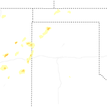
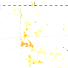
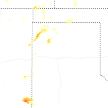
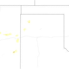
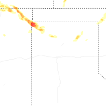
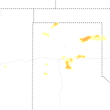
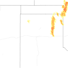
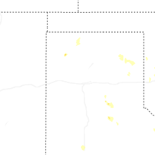

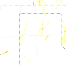
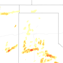
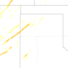


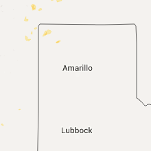


Connect with Interactive Hail Maps