

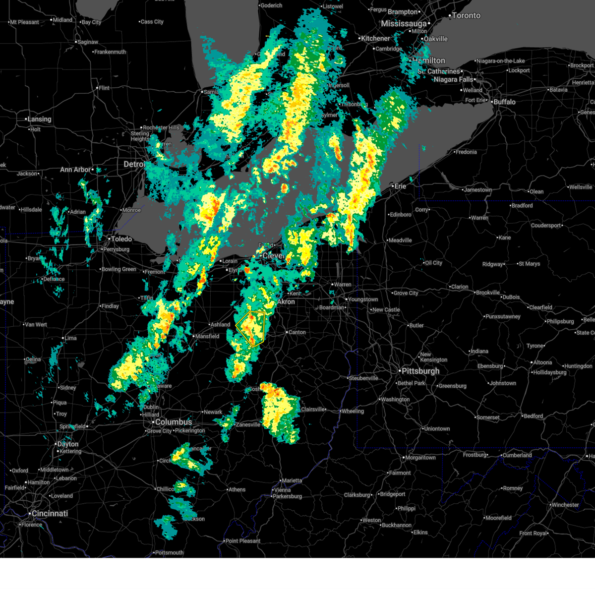
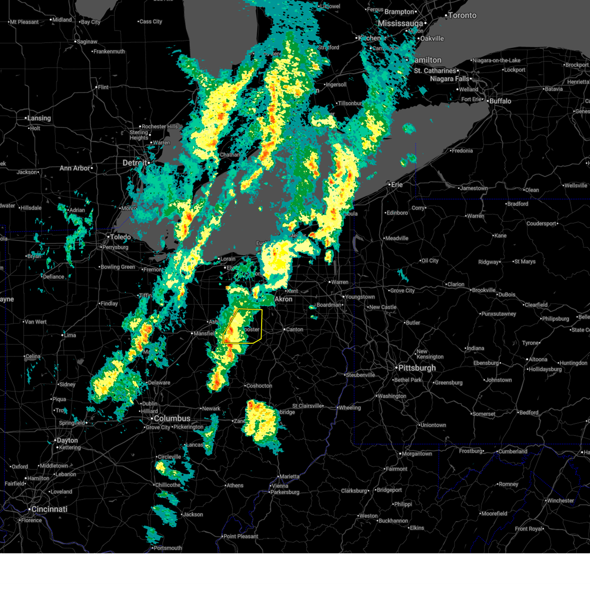
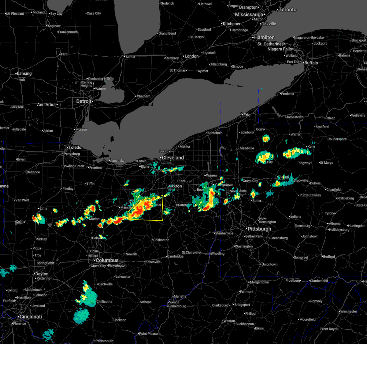
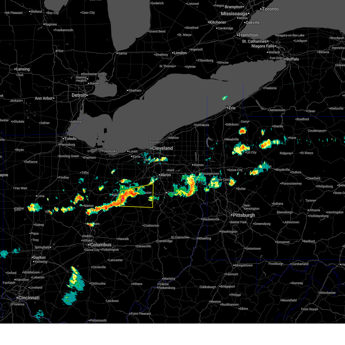
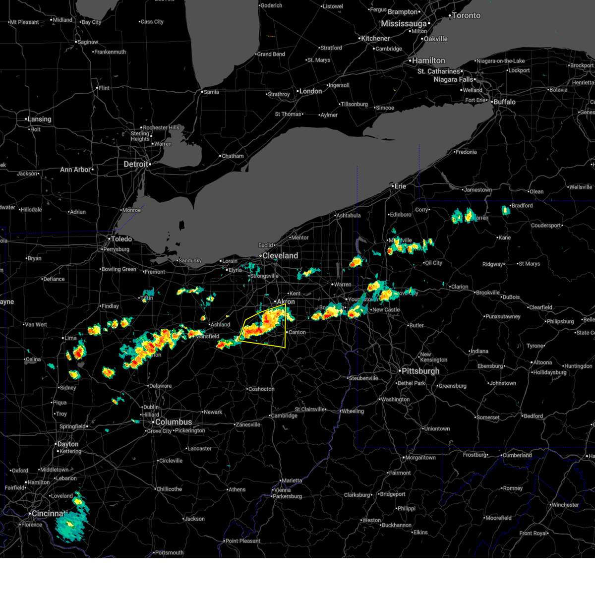
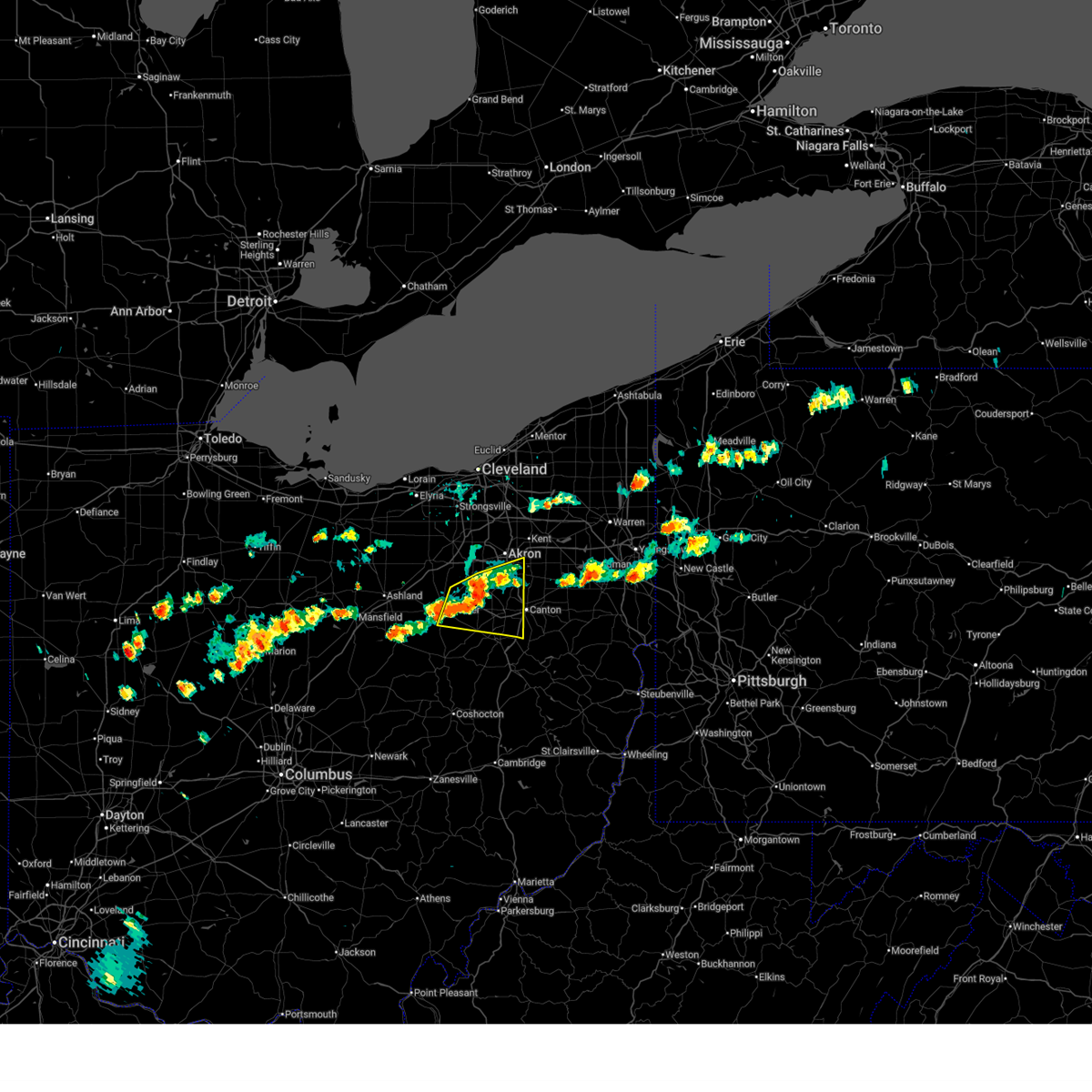
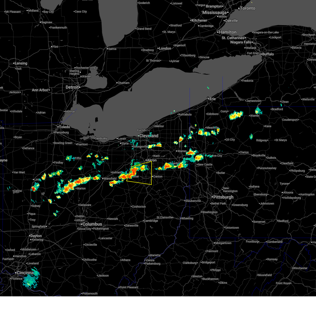
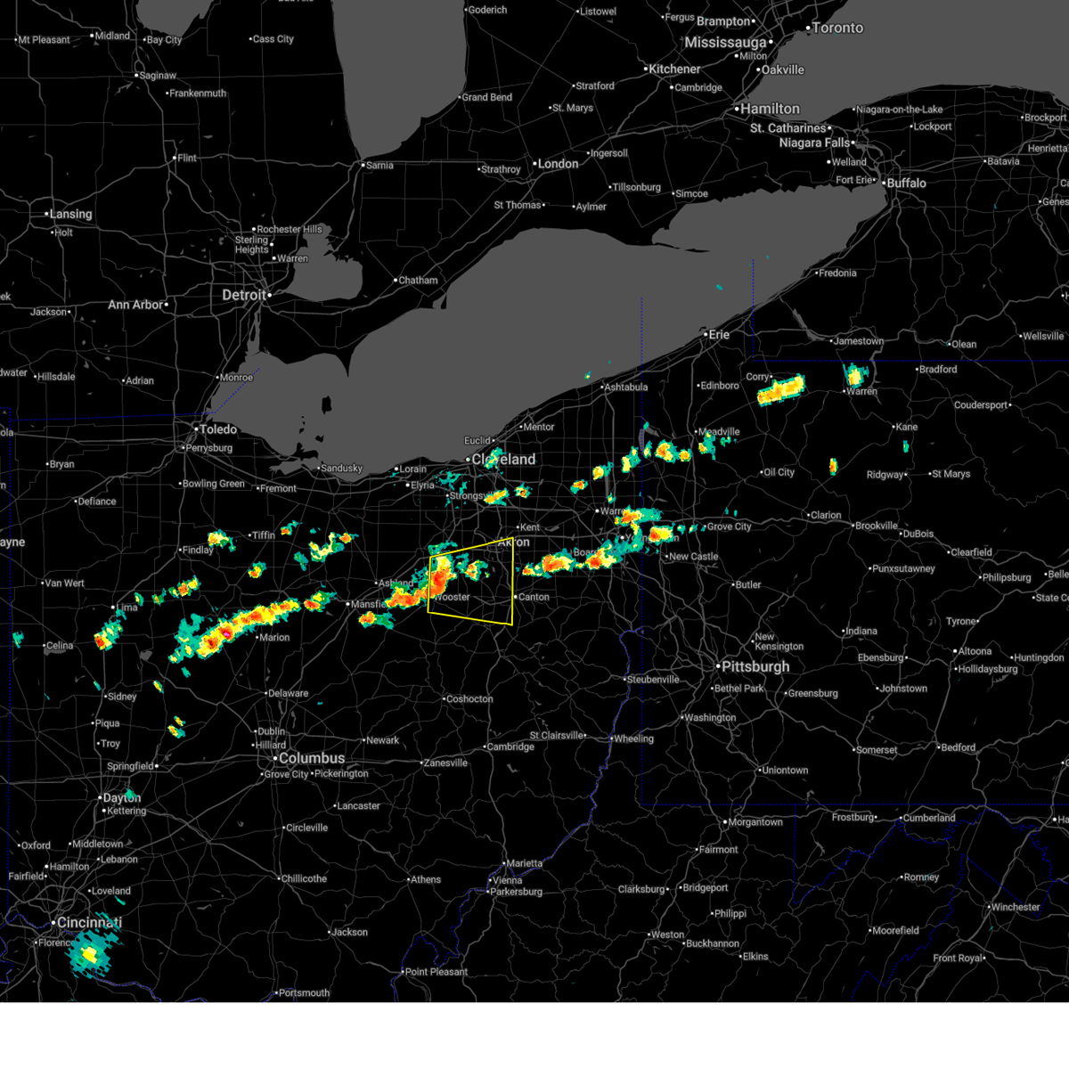
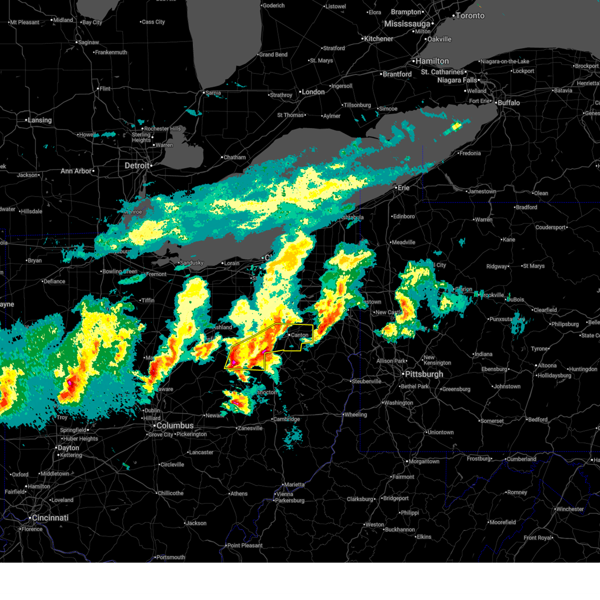
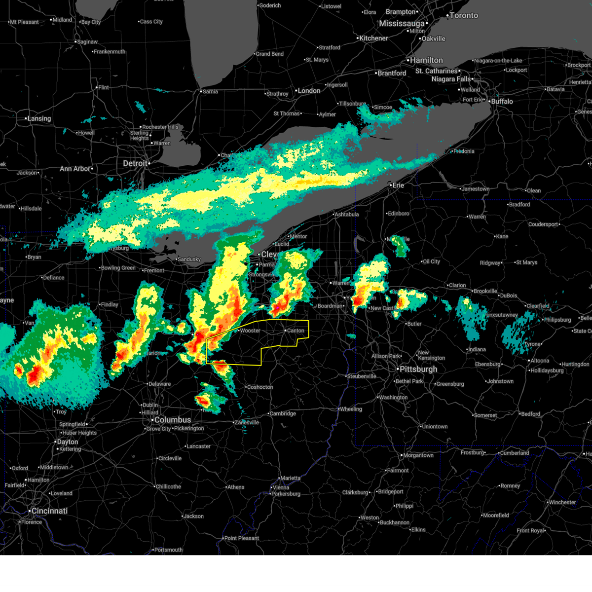
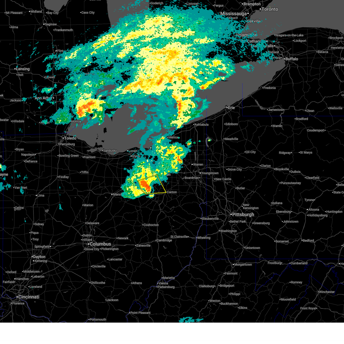
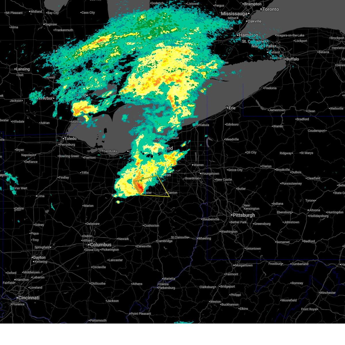
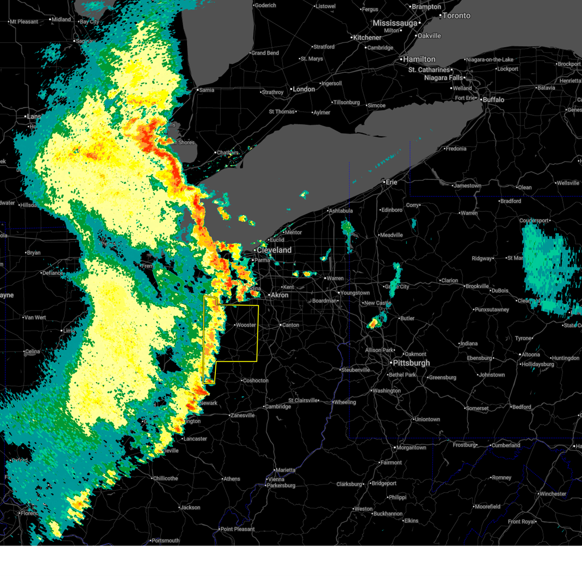
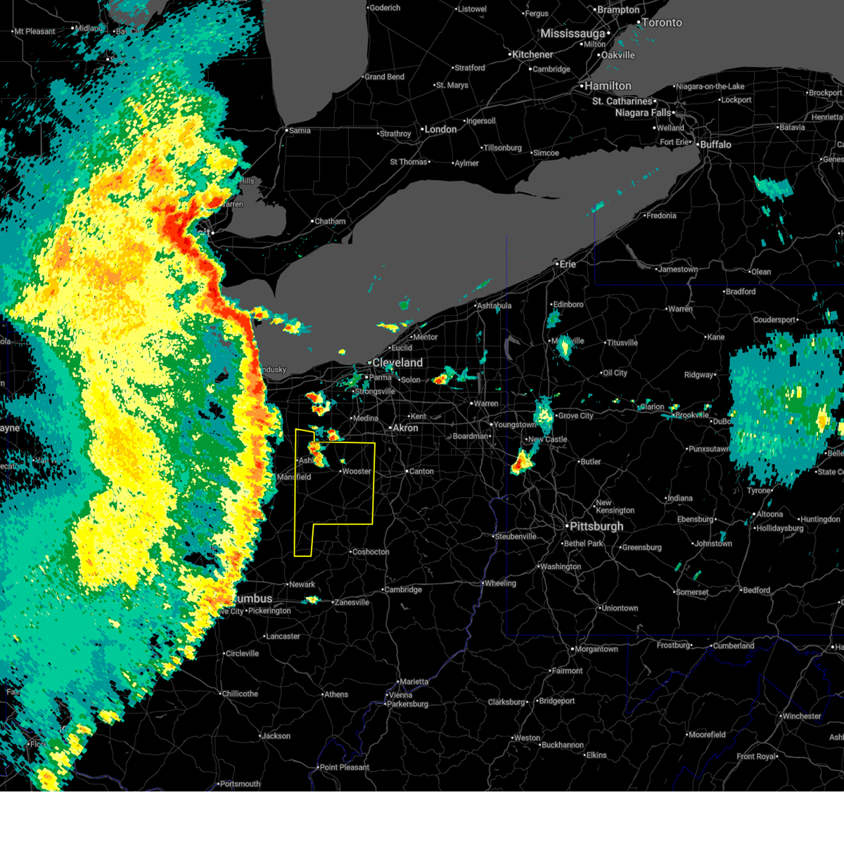
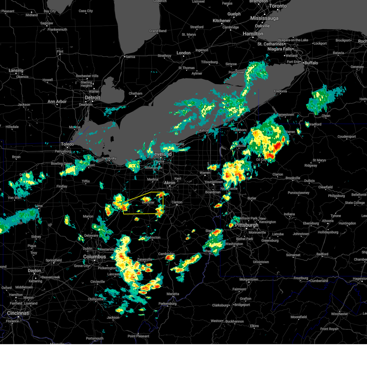
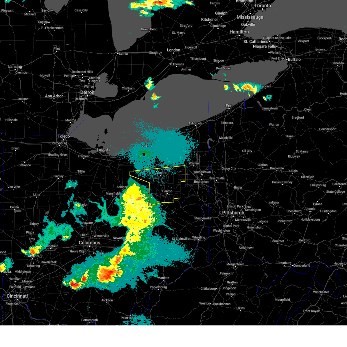
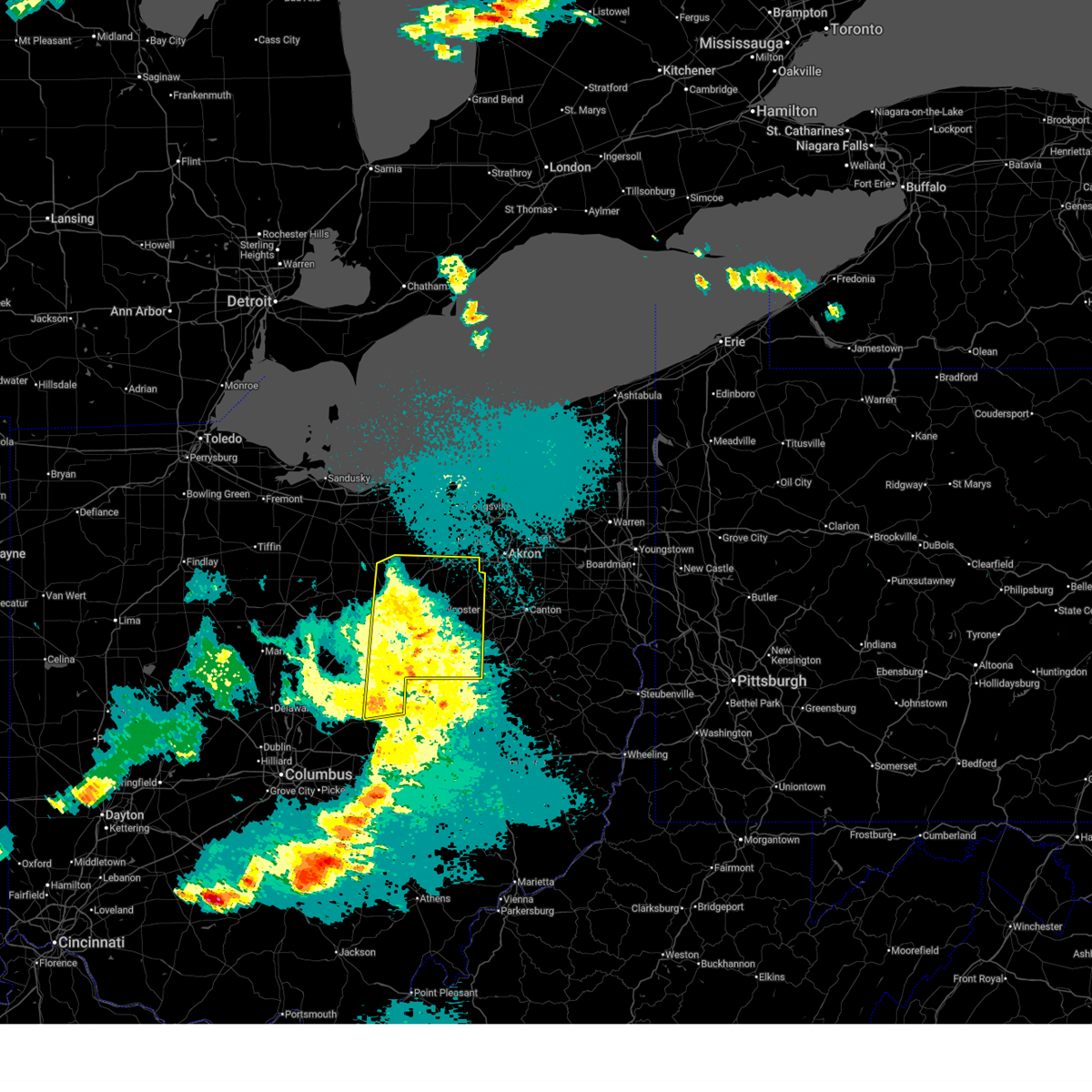
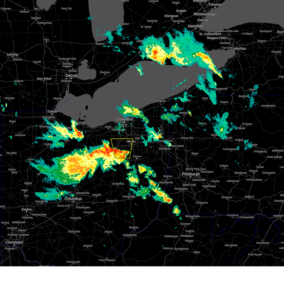
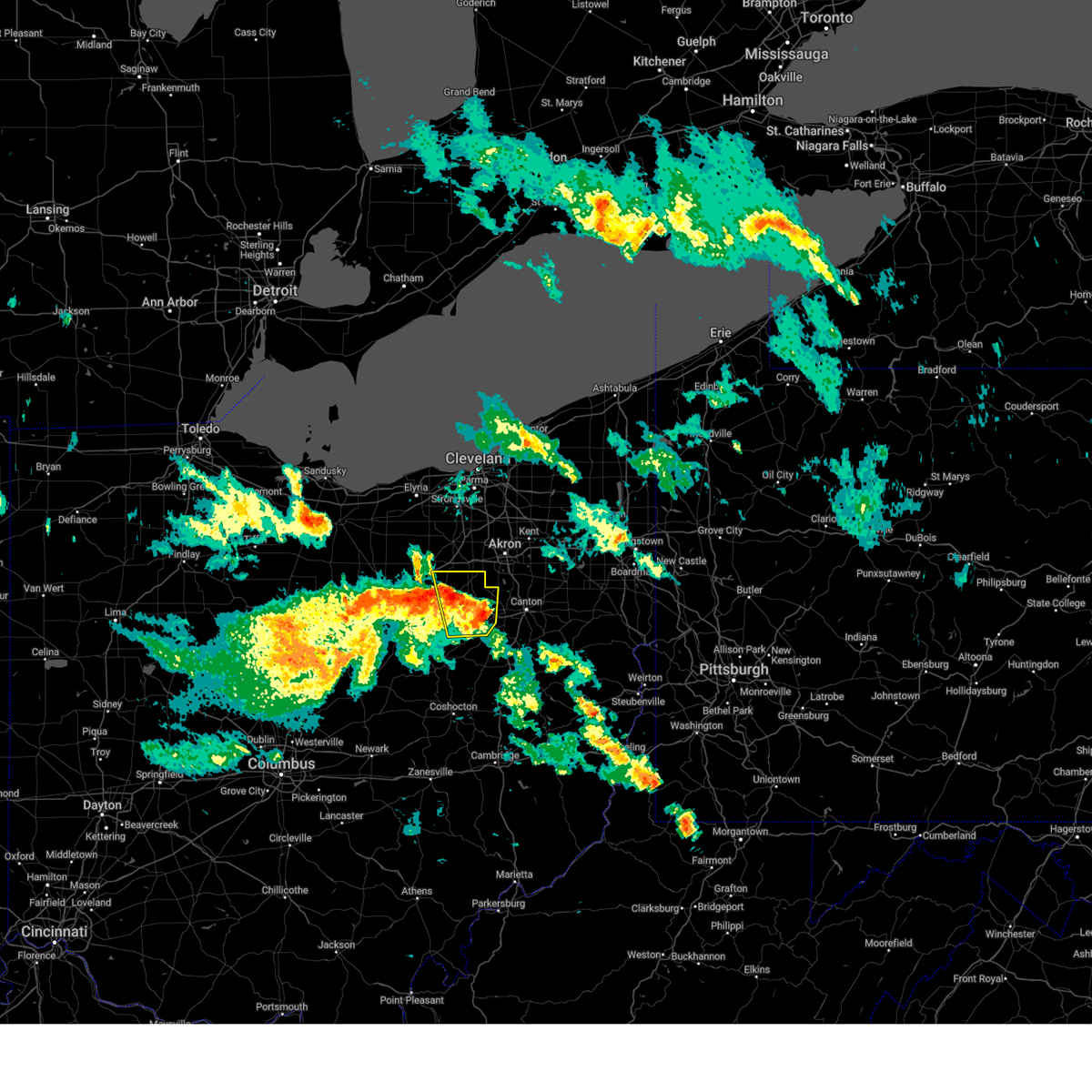
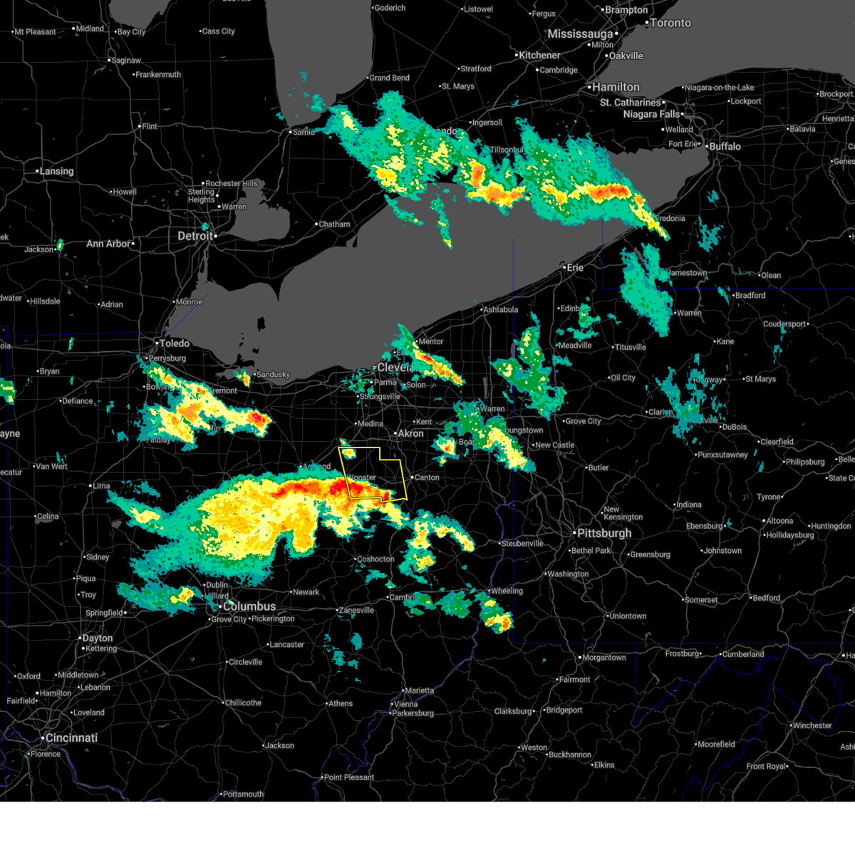
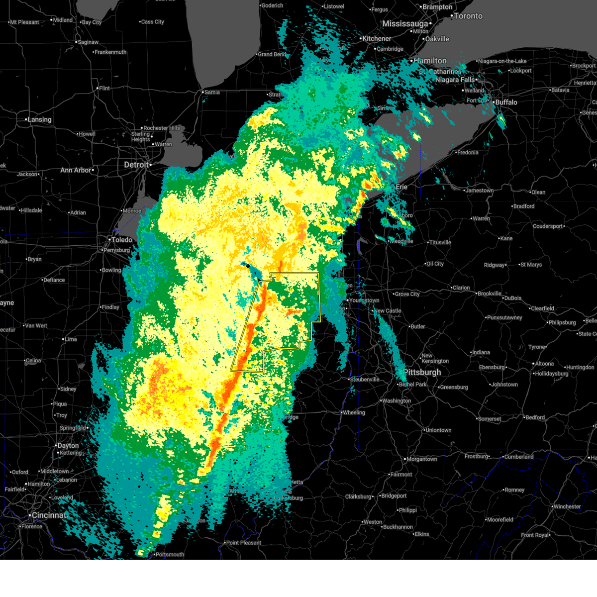
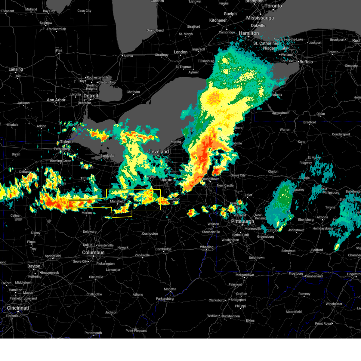
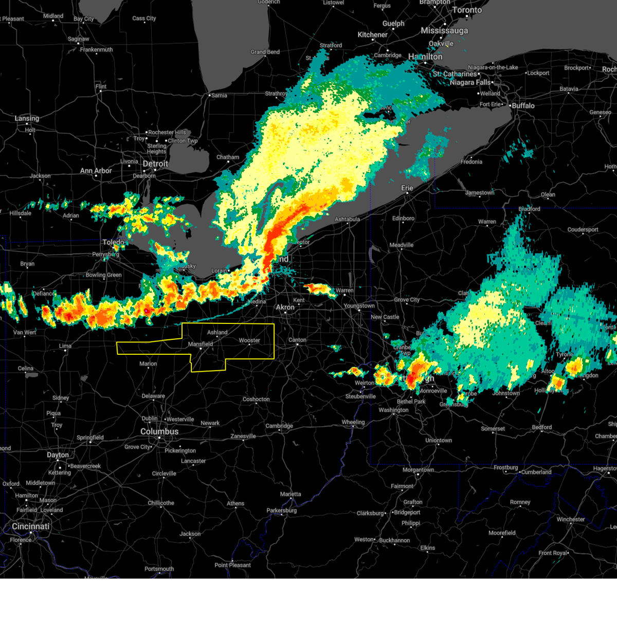
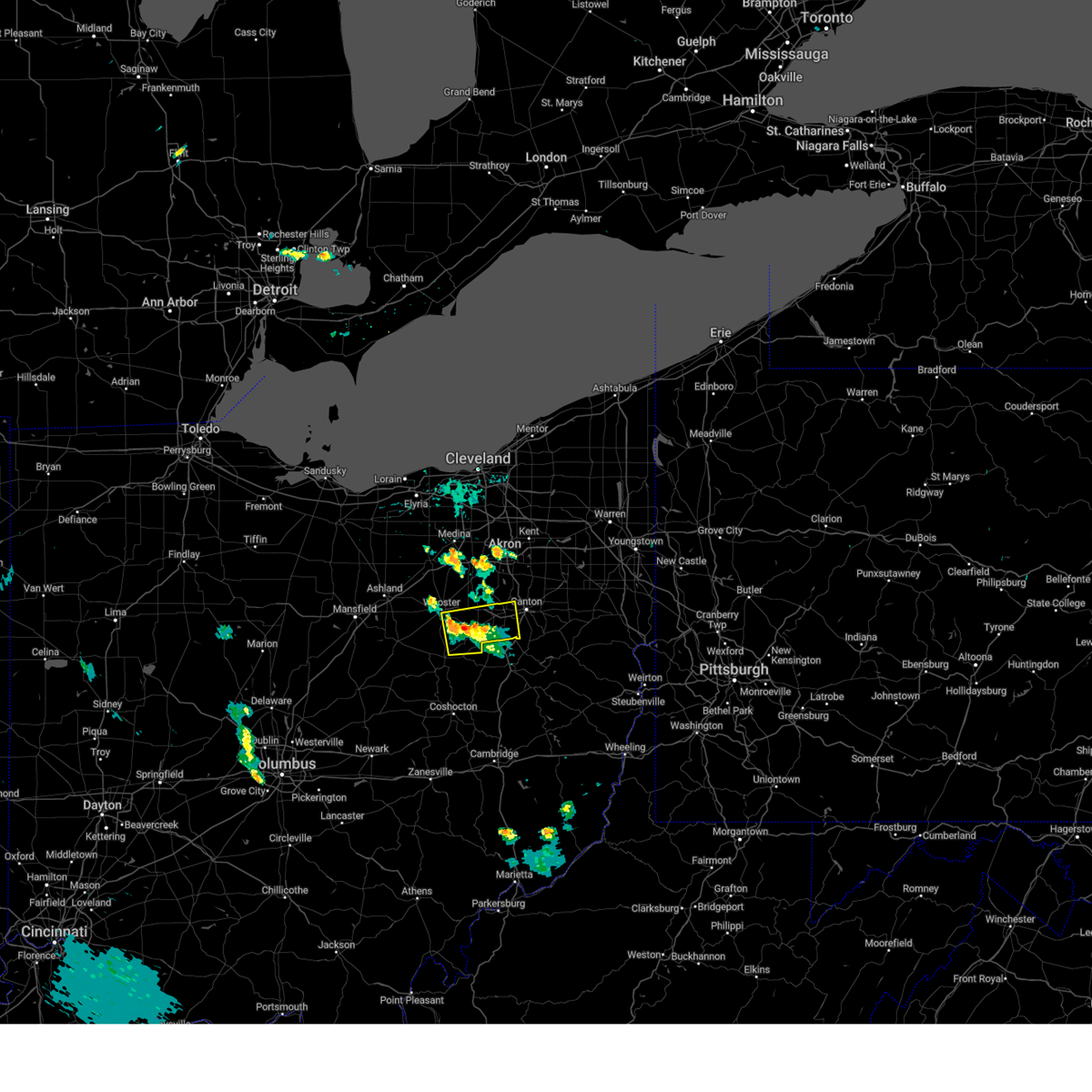
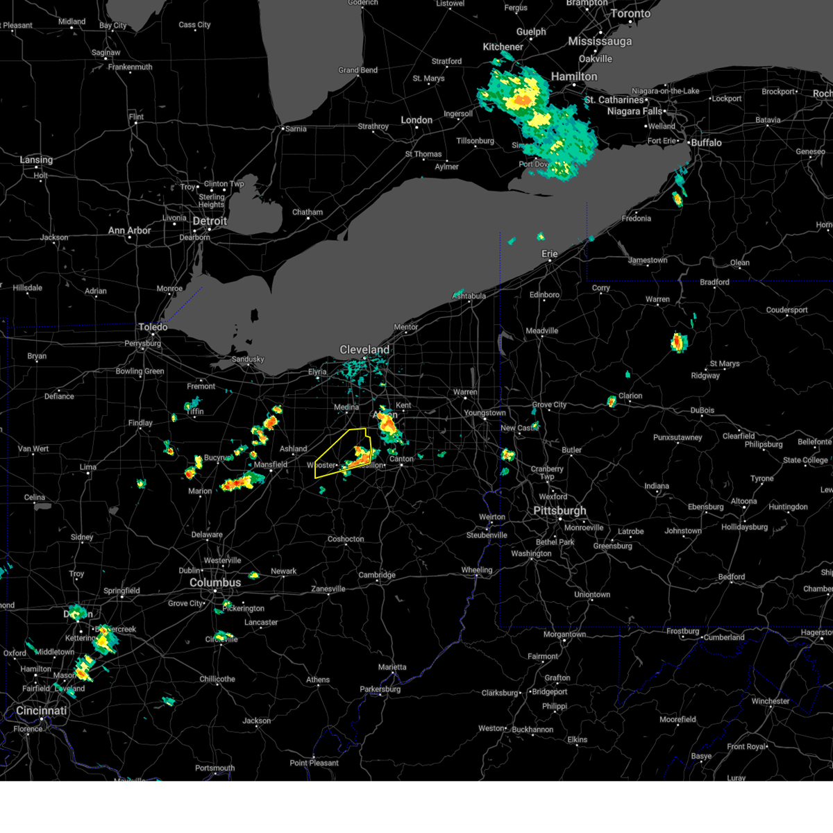
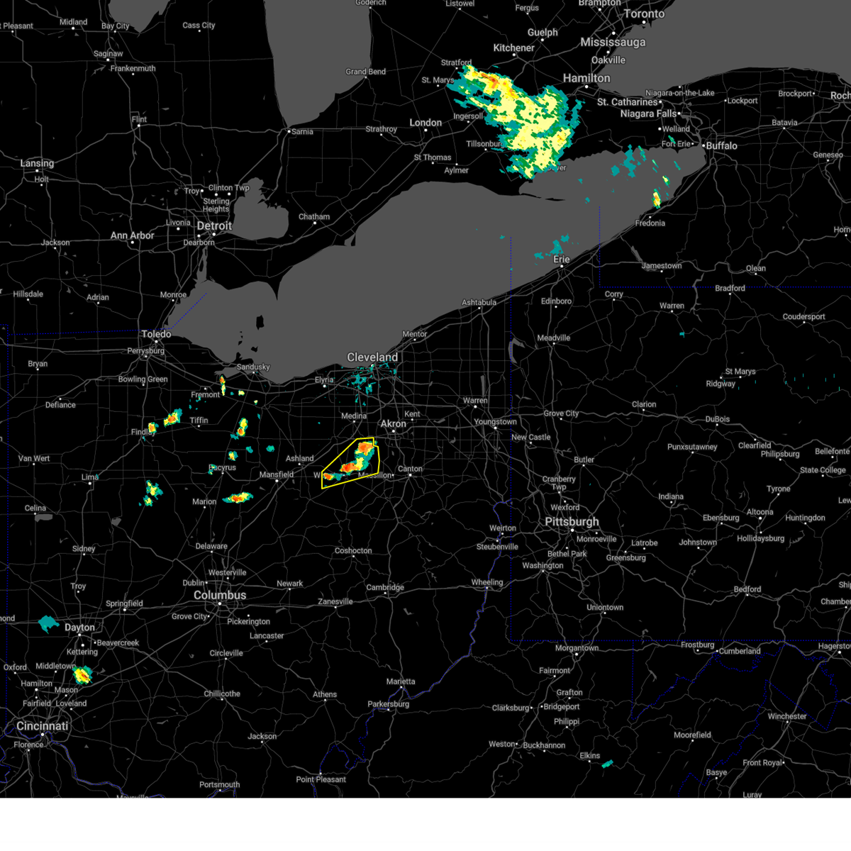
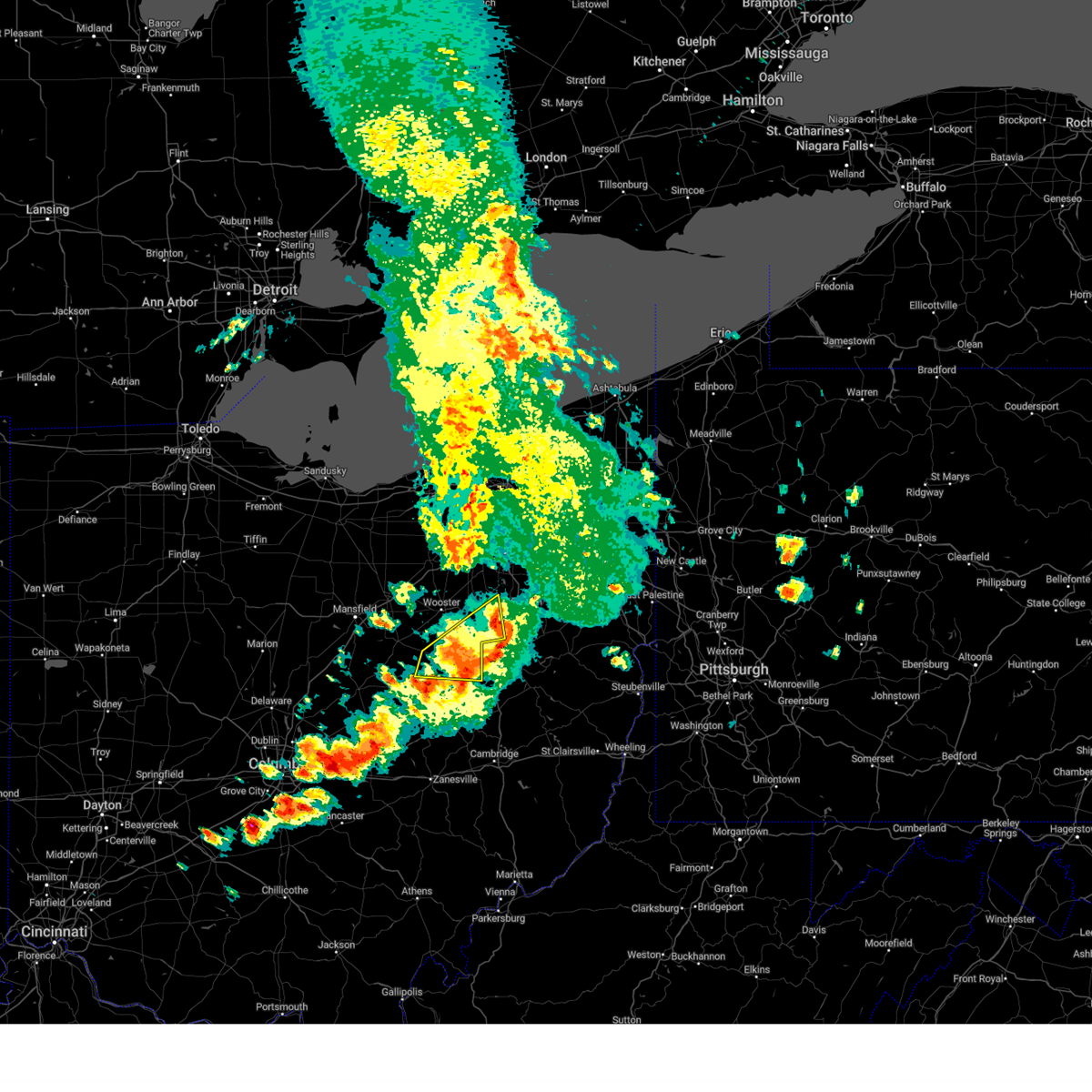
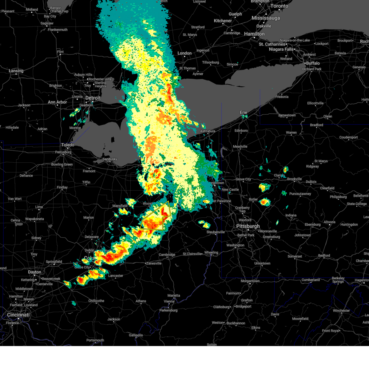
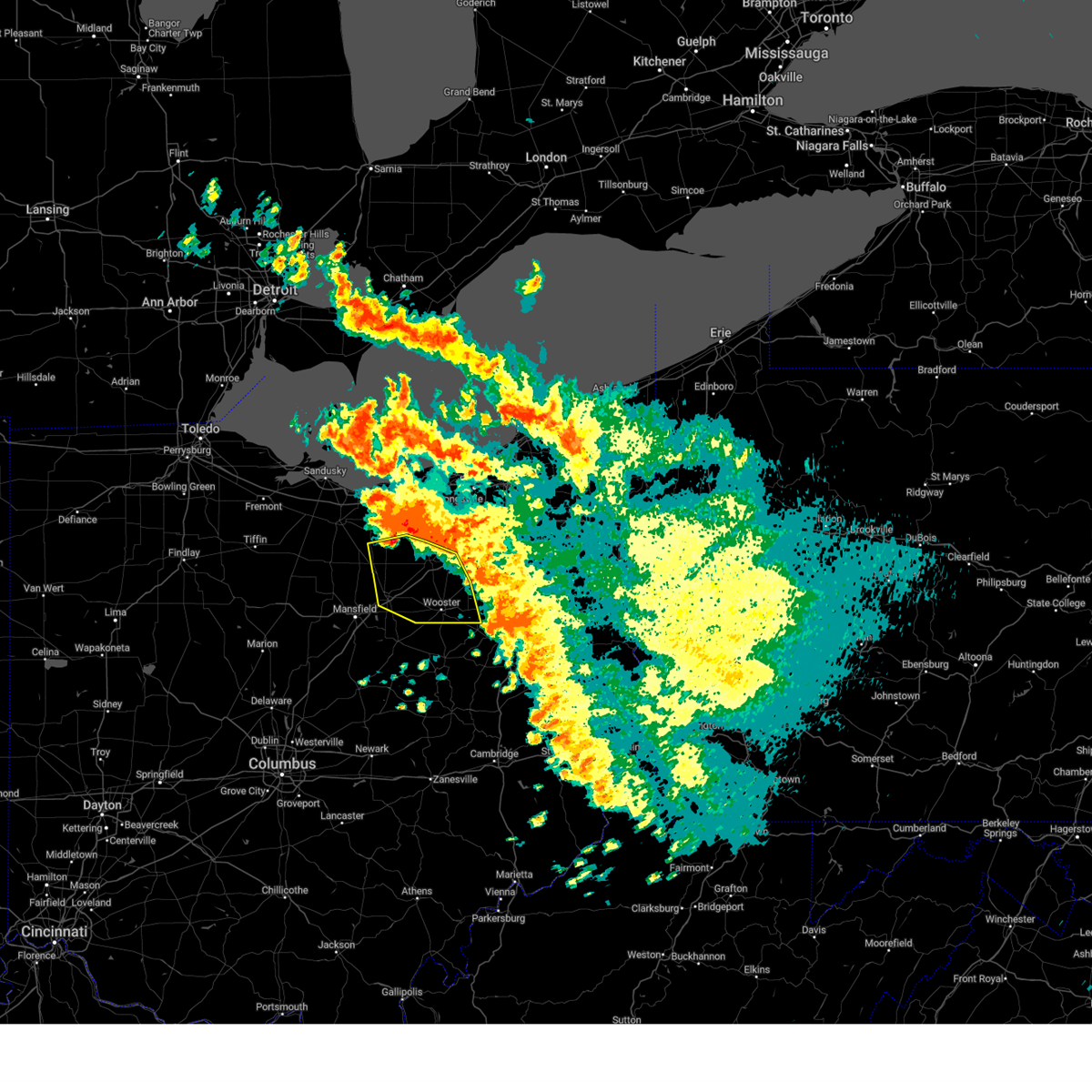
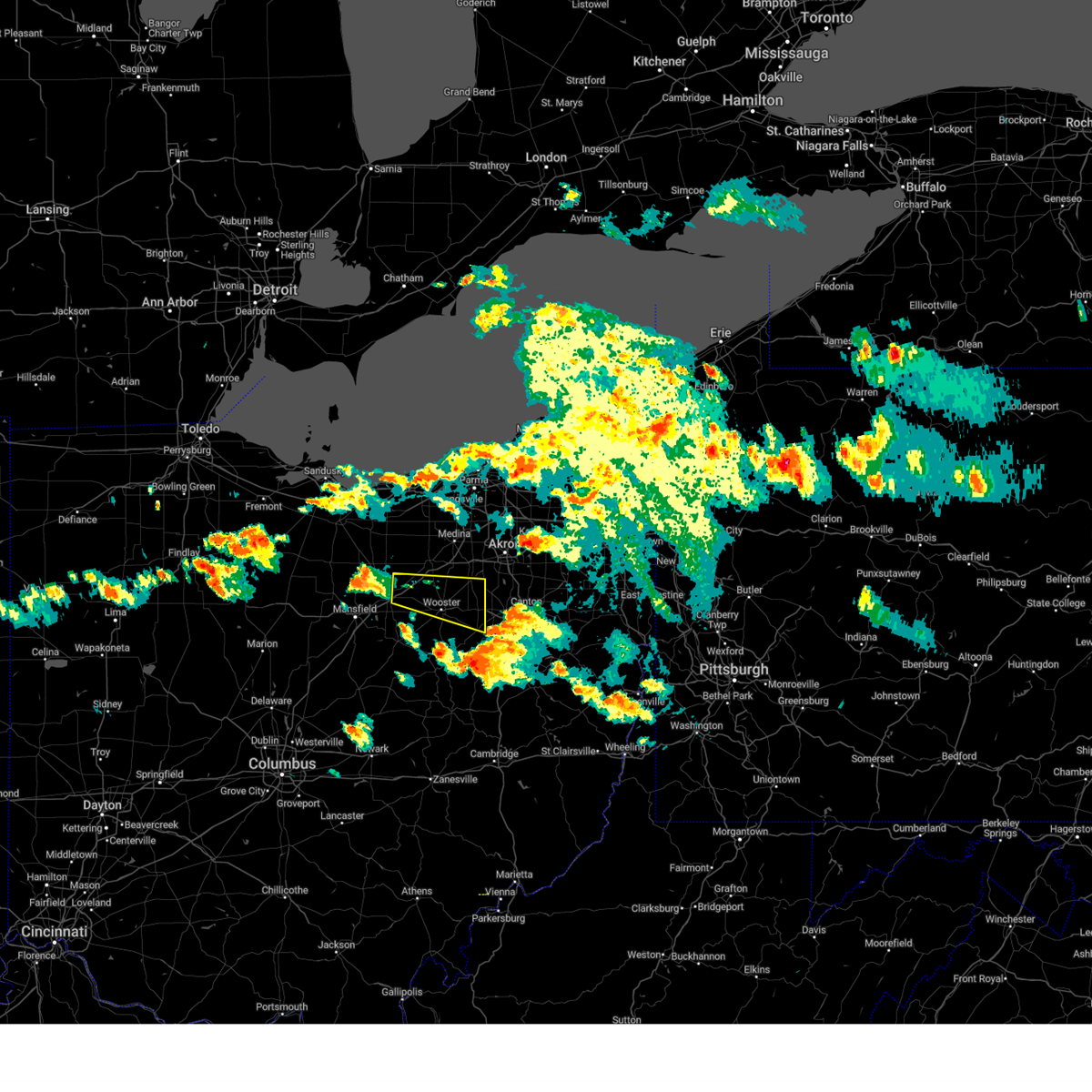
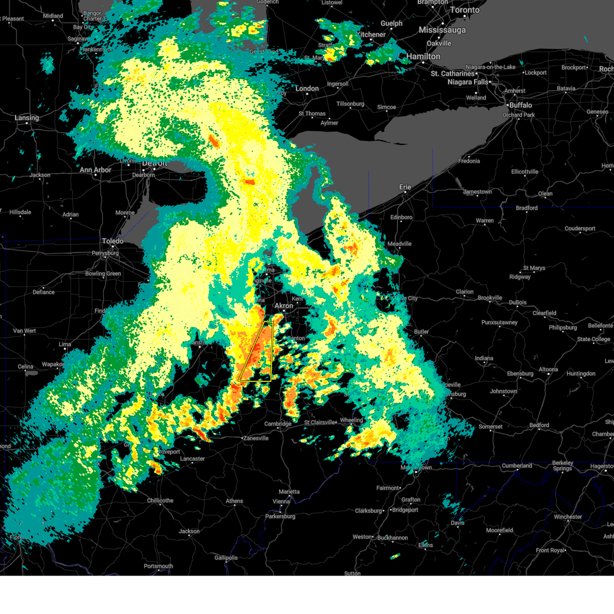
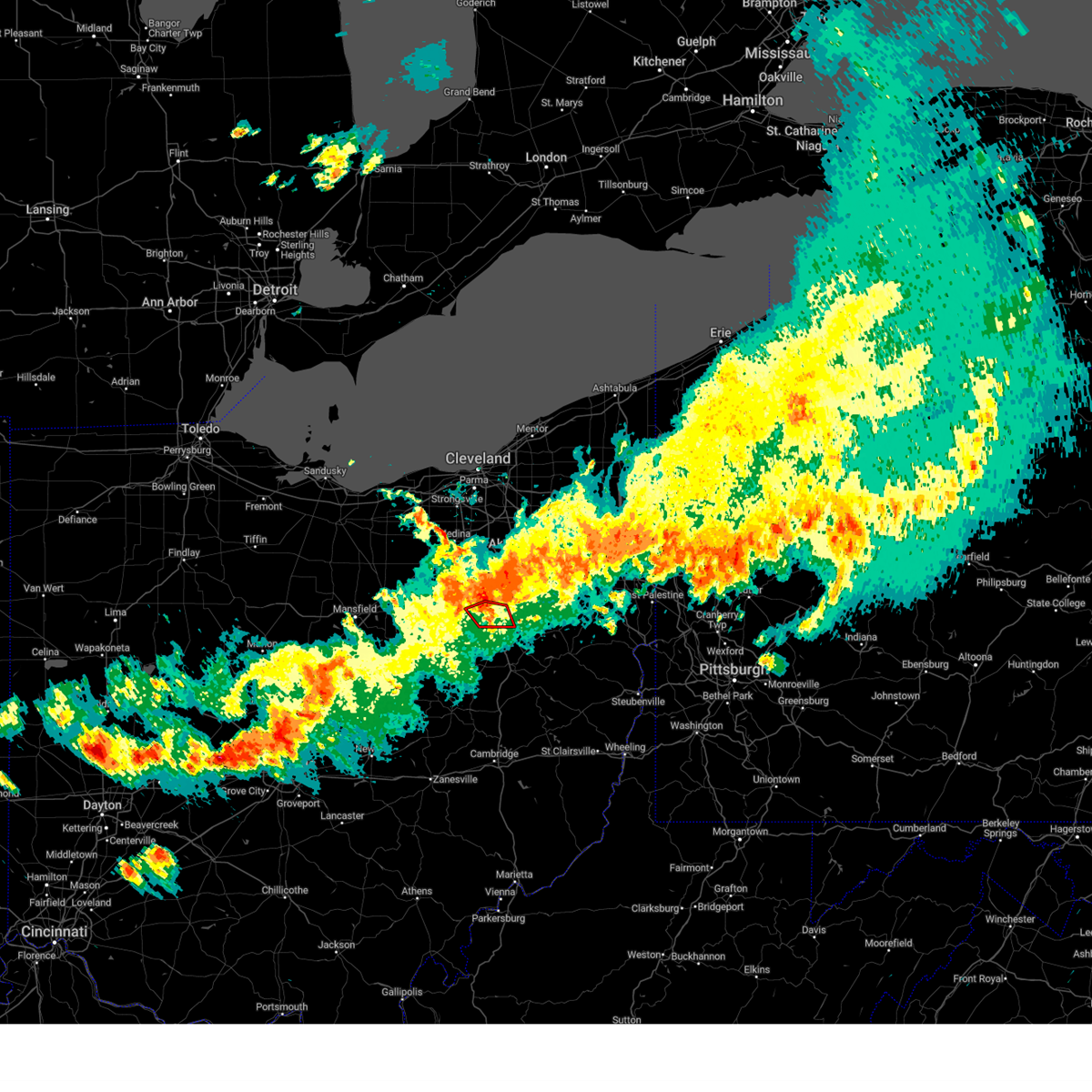
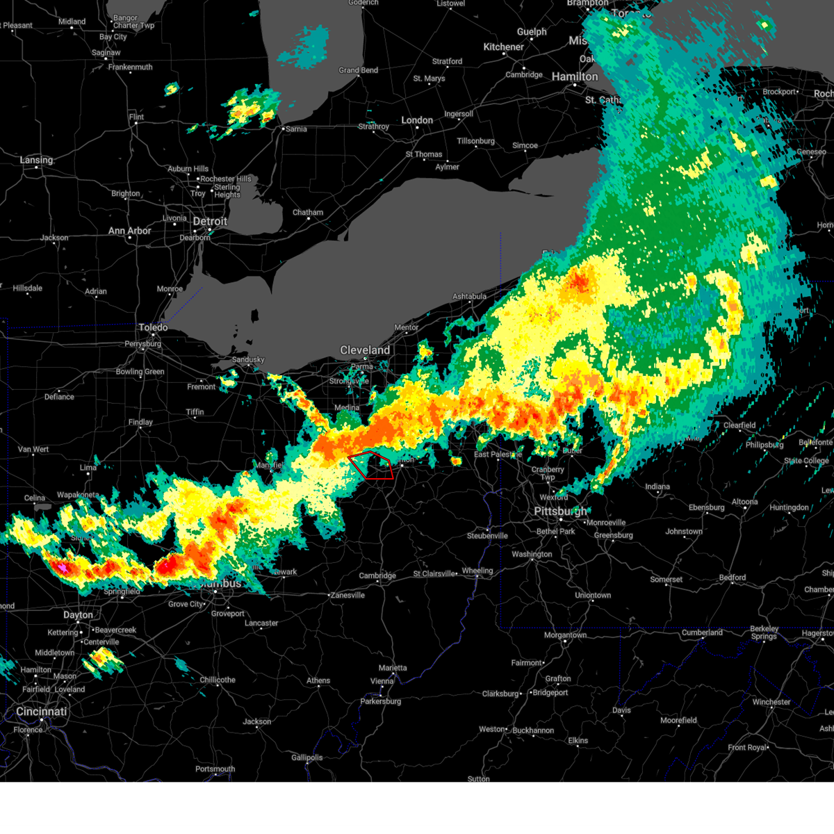
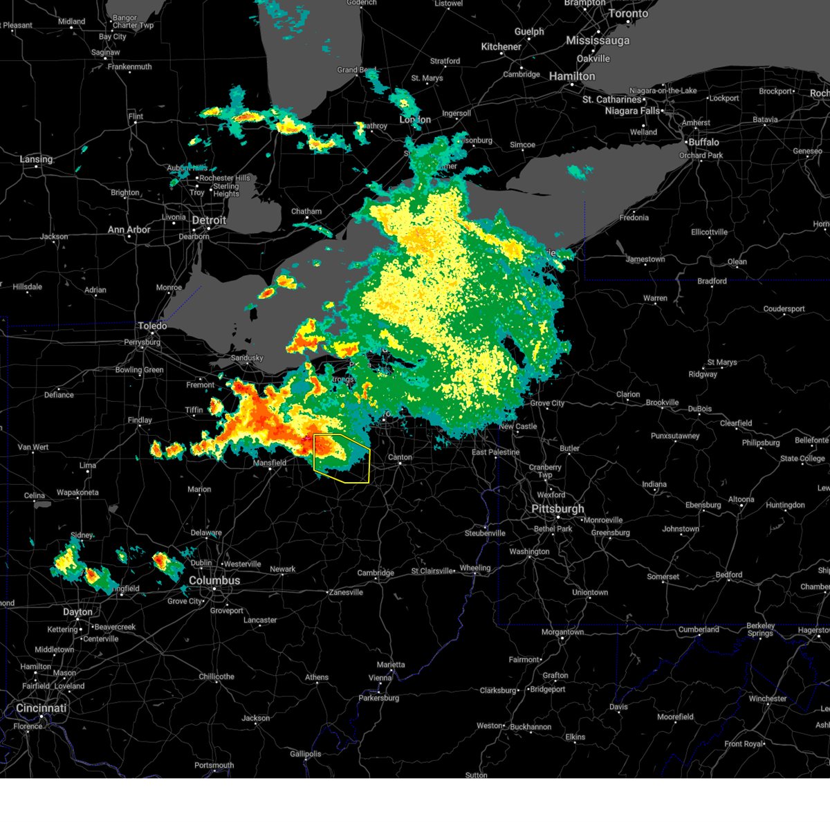
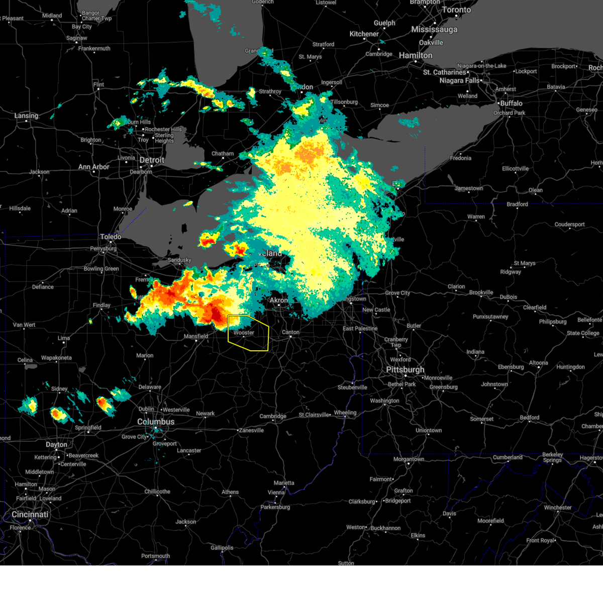
Hail Map for Dalton, OH
The Dalton, OH area has had 1 report of on-the-ground hail by trained spotters, and has been under severe weather warnings 17 times during the past 12 months. Doppler radar has detected hail at or near Dalton, OH on 26 occasions.
| Name: | Dalton, OH |
| Where Located: | 48.6 miles S of Cleveland, OH |
| Map: | Google Map for Dalton, OH |
| Population: | 1830 |
| Housing Units: | 788 |
| More Info: | Search Google for Dalton, OH |
0
The Top Recent Hail Date for Dalton, OH is Thursday, June 26, 2025 (13th out of 26)
Hail and Wind Damage Spotted near Dalton, OH
| Date / Time | Report Details |
|---|---|
| 7/3/2026 9:28 PM EDT |
 Svrcle the national weather service in cleveland has issued a * severe thunderstorm warning for, southeastern ashland county in north central ohio, stark county in northeastern ohio, wayne county in northeastern ohio, holmes county in northeastern ohio, * until 1045 pm edt. * at 928 pm edt, severe thunderstorms were located along a line extending from near wooster to 6 miles west of loudonville, moving east at 45 mph (radar indicated). Hazards include 60 mph wind gusts. expect damage to trees and power lines Svrcle the national weather service in cleveland has issued a * severe thunderstorm warning for, southeastern ashland county in north central ohio, stark county in northeastern ohio, wayne county in northeastern ohio, holmes county in northeastern ohio, * until 1045 pm edt. * at 928 pm edt, severe thunderstorms were located along a line extending from near wooster to 6 miles west of loudonville, moving east at 45 mph (radar indicated). Hazards include 60 mph wind gusts. expect damage to trees and power lines
|
| 6/14/2026 3:55 PM EDT |
 Svrcle the national weather service in cleveland has issued a * severe thunderstorm warning for, southeastern medina county in northeastern ohio, east central ashland county in north central ohio, stark county in northeastern ohio, southern summit county in northeastern ohio, wayne county in northeastern ohio, * until 445 pm edt. * at 355 pm edt, a severe thunderstorm was located over wooster, moving east at 55 mph (radar indicated). Hazards include 60 mph wind gusts and quarter size hail. Minor damage to vehicles is possible. Expect damage to trees and power lines. Svrcle the national weather service in cleveland has issued a * severe thunderstorm warning for, southeastern medina county in northeastern ohio, east central ashland county in north central ohio, stark county in northeastern ohio, southern summit county in northeastern ohio, wayne county in northeastern ohio, * until 445 pm edt. * at 355 pm edt, a severe thunderstorm was located over wooster, moving east at 55 mph (radar indicated). Hazards include 60 mph wind gusts and quarter size hail. Minor damage to vehicles is possible. Expect damage to trees and power lines.
|
| 4/4/2026 8:05 PM EDT |
 The storm which prompted the warning has weakened below severe limits, and has exited the warned area. therefore, the warning will be allowed to expire. a severe thunderstorm watch remains in effect until 900 pm edt for northeastern ohio. to report severe weather, contact your nearest law enforcement agency. they will relay your report to the national weather service cleveland. The storm which prompted the warning has weakened below severe limits, and has exited the warned area. therefore, the warning will be allowed to expire. a severe thunderstorm watch remains in effect until 900 pm edt for northeastern ohio. to report severe weather, contact your nearest law enforcement agency. they will relay your report to the national weather service cleveland.
|
| 4/4/2026 7:46 PM EDT |
 At 746 pm edt, a severe thunderstorm was located over orrville, or near wooster, moving northeast at 55 mph (radar indicated). Hazards include 60 mph wind gusts. Expect damage to trees and power lines. Locations impacted include, wooster, orrville, rittman, doylestown, dalton, mount eaton, smithville, apple creek, and marshallville. At 746 pm edt, a severe thunderstorm was located over orrville, or near wooster, moving northeast at 55 mph (radar indicated). Hazards include 60 mph wind gusts. Expect damage to trees and power lines. Locations impacted include, wooster, orrville, rittman, doylestown, dalton, mount eaton, smithville, apple creek, and marshallville.
|
| 4/4/2026 7:30 PM EDT |
 Svrcle the national weather service in cleveland has issued a * severe thunderstorm warning for, wayne county in northeastern ohio, * until 815 pm edt. * at 729 pm edt, a severe thunderstorm was located over shreve, or 10 miles southwest of wooster, moving northeast at 55 mph (radar indicated). Hazards include 60 mph wind gusts. expect damage to trees and power lines Svrcle the national weather service in cleveland has issued a * severe thunderstorm warning for, wayne county in northeastern ohio, * until 815 pm edt. * at 729 pm edt, a severe thunderstorm was located over shreve, or 10 miles southwest of wooster, moving northeast at 55 mph (radar indicated). Hazards include 60 mph wind gusts. expect damage to trees and power lines
|
| 4/3/2026 6:27 PM EDT |
 At 627 pm edt, a severe thunderstorm was located over shreve, or 10 miles southwest of wooster, moving east at 40 mph (radar indicated). Hazards include 60 mph wind gusts and penny size hail. Expect damage to trees and power lines. Locations impacted include, wooster, orrville, loudonville, dalton, shreve, holmesville, mount eaton, nashville, winesburg, smithville, apple creek, marshallville, perrysville, jeromesville, fredericksburg, mohicanville, mount hope, and reedsburg. At 627 pm edt, a severe thunderstorm was located over shreve, or 10 miles southwest of wooster, moving east at 40 mph (radar indicated). Hazards include 60 mph wind gusts and penny size hail. Expect damage to trees and power lines. Locations impacted include, wooster, orrville, loudonville, dalton, shreve, holmesville, mount eaton, nashville, winesburg, smithville, apple creek, marshallville, perrysville, jeromesville, fredericksburg, mohicanville, mount hope, and reedsburg.
|
| 4/3/2026 6:14 PM EDT |
 Svrcle the national weather service in cleveland has issued a * severe thunderstorm warning for, southeastern ashland county in north central ohio, wayne county in northeastern ohio, northern holmes county in northeastern ohio, * until 700 pm edt. * at 613 pm edt, a severe thunderstorm was located near loudonville, or 12 miles south of ashland, moving east at 40 mph (radar indicated). Hazards include 60 mph wind gusts and penny size hail. expect damage to trees and power lines Svrcle the national weather service in cleveland has issued a * severe thunderstorm warning for, southeastern ashland county in north central ohio, wayne county in northeastern ohio, northern holmes county in northeastern ohio, * until 700 pm edt. * at 613 pm edt, a severe thunderstorm was located near loudonville, or 12 miles south of ashland, moving east at 40 mph (radar indicated). Hazards include 60 mph wind gusts and penny size hail. expect damage to trees and power lines
|
| 4/3/2026 5:07 PM EDT |
 the severe thunderstorm warning has been cancelled and is no longer in effect the severe thunderstorm warning has been cancelled and is no longer in effect
|
| 4/3/2026 5:01 PM EDT |
 At 501 pm edt, a severe thunderstorm was located near massillon, or 12 miles west of canton, moving east at 30 mph (radar indicated). Hazards include 60 mph wind gusts and penny size hail. Expect damage to trees and power lines. Locations impacted include, akron, canton, wooster, massillon, barberton, green, north canton, orrville, rittman, mogadore, doylestown, brewster, navarre, dalton, mount eaton, new franklin, norton, canal fulton, lakemore, and smithville. At 501 pm edt, a severe thunderstorm was located near massillon, or 12 miles west of canton, moving east at 30 mph (radar indicated). Hazards include 60 mph wind gusts and penny size hail. Expect damage to trees and power lines. Locations impacted include, akron, canton, wooster, massillon, barberton, green, north canton, orrville, rittman, mogadore, doylestown, brewster, navarre, dalton, mount eaton, new franklin, norton, canal fulton, lakemore, and smithville.
|
| 4/3/2026 4:48 PM EDT |
 At 447 pm edt, a severe thunderstorm was located over orrville, or 10 miles east of wooster, moving east at 30 mph (radar indicated). Hazards include 60 mph wind gusts and penny size hail. Expect damage to trees and power lines. Locations impacted include, akron, canton, wooster, massillon, barberton, green, north canton, orrville, rittman, mogadore, doylestown, brewster, navarre, dalton, mount eaton, new franklin, norton, canal fulton, lakemore, and smithville. At 447 pm edt, a severe thunderstorm was located over orrville, or 10 miles east of wooster, moving east at 30 mph (radar indicated). Hazards include 60 mph wind gusts and penny size hail. Expect damage to trees and power lines. Locations impacted include, akron, canton, wooster, massillon, barberton, green, north canton, orrville, rittman, mogadore, doylestown, brewster, navarre, dalton, mount eaton, new franklin, norton, canal fulton, lakemore, and smithville.
|
| 4/3/2026 4:48 PM EDT |
 the severe thunderstorm warning has been cancelled and is no longer in effect the severe thunderstorm warning has been cancelled and is no longer in effect
|
| 4/3/2026 4:38 PM EDT |
 Svrcle the national weather service in cleveland has issued a * severe thunderstorm warning for, southeastern medina county in northeastern ohio, western stark county in northeastern ohio, southern summit county in northeastern ohio, eastern wayne county in northeastern ohio, * until 530 pm edt. * at 438 pm edt, a severe thunderstorm was located near orrville, or near wooster, moving east at 30 mph (radar indicated). Hazards include 60 mph wind gusts and penny size hail. expect damage to trees and power lines Svrcle the national weather service in cleveland has issued a * severe thunderstorm warning for, southeastern medina county in northeastern ohio, western stark county in northeastern ohio, southern summit county in northeastern ohio, eastern wayne county in northeastern ohio, * until 530 pm edt. * at 438 pm edt, a severe thunderstorm was located near orrville, or near wooster, moving east at 30 mph (radar indicated). Hazards include 60 mph wind gusts and penny size hail. expect damage to trees and power lines
|
| 3/22/2026 9:19 PM EDT |
 the severe thunderstorm warning has been cancelled and is no longer in effect the severe thunderstorm warning has been cancelled and is no longer in effect
|
| 3/22/2026 9:19 PM EDT |
 At 919 pm edt, severe thunderstorms were located along a line extending from near north canton to wilmot to near glenmont, moving east at 70 mph (radar indicated). Hazards include 60 mph wind gusts and quarter size hail. Minor damage to vehicles is possible. expect damage to trees and power lines. Locations impacted include, canton, millersburg, massillon, alliance, north canton, louisville, berlin, walnut creek, minerva, brewster, navarre, dalton, shreve, waynesburg, east sparta, killbuck, holmesville, wilmot, glenmont, and mount eaton. At 919 pm edt, severe thunderstorms were located along a line extending from near north canton to wilmot to near glenmont, moving east at 70 mph (radar indicated). Hazards include 60 mph wind gusts and quarter size hail. Minor damage to vehicles is possible. expect damage to trees and power lines. Locations impacted include, canton, millersburg, massillon, alliance, north canton, louisville, berlin, walnut creek, minerva, brewster, navarre, dalton, shreve, waynesburg, east sparta, killbuck, holmesville, wilmot, glenmont, and mount eaton.
|
| 3/22/2026 9:03 PM EDT |
 Svrcle the national weather service in cleveland has issued a * severe thunderstorm warning for, southeastern ashland county in north central ohio, stark county in northeastern ohio, southern wayne county in northeastern ohio, holmes county in northeastern ohio, northeastern knox county in north central ohio, * until 945 pm edt. * at 903 pm edt, severe thunderstorms were located along a line extending from wooster to 6 miles southwest of loudonville, moving east at 65 mph (radar indicated). Hazards include 60 mph wind gusts and quarter size hail. Minor damage to vehicles is possible. Expect damage to trees and power lines. Svrcle the national weather service in cleveland has issued a * severe thunderstorm warning for, southeastern ashland county in north central ohio, stark county in northeastern ohio, southern wayne county in northeastern ohio, holmes county in northeastern ohio, northeastern knox county in north central ohio, * until 945 pm edt. * at 903 pm edt, severe thunderstorms were located along a line extending from wooster to 6 miles southwest of loudonville, moving east at 65 mph (radar indicated). Hazards include 60 mph wind gusts and quarter size hail. Minor damage to vehicles is possible. Expect damage to trees and power lines.
|
| 7/31/2025 12:47 AM EDT |
 At 1247 am edt, severe thunderstorms were located along a line extending from near creston to near dalton, moving east at 30 mph (radar indicated). Hazards include 60 mph wind gusts. Expect damage to trees and power lines. Locations impacted include, akron, canton, massillon, barberton, green, wadsworth, orrville, rittman, doylestown, creston, dalton, new franklin, norton, canal fulton, smithville, clinton, marshallville, meyers lake, hills and dales, and portage lakes. At 1247 am edt, severe thunderstorms were located along a line extending from near creston to near dalton, moving east at 30 mph (radar indicated). Hazards include 60 mph wind gusts. Expect damage to trees and power lines. Locations impacted include, akron, canton, massillon, barberton, green, wadsworth, orrville, rittman, doylestown, creston, dalton, new franklin, norton, canal fulton, smithville, clinton, marshallville, meyers lake, hills and dales, and portage lakes.
|
| 7/31/2025 12:29 AM EDT |
 Svrcle the national weather service in cleveland has issued a * severe thunderstorm warning for, southeastern medina county in northeastern ohio, west central stark county in northeastern ohio, southwestern summit county in northeastern ohio, northern wayne county in northeastern ohio, * until 115 am edt. * at 1229 am edt, severe thunderstorms were located along a line extending from near lodi to near wooster, moving east at 30 mph (radar indicated). Hazards include 60 mph wind gusts. expect damage to trees and power lines Svrcle the national weather service in cleveland has issued a * severe thunderstorm warning for, southeastern medina county in northeastern ohio, west central stark county in northeastern ohio, southwestern summit county in northeastern ohio, northern wayne county in northeastern ohio, * until 115 am edt. * at 1229 am edt, severe thunderstorms were located along a line extending from near lodi to near wooster, moving east at 30 mph (radar indicated). Hazards include 60 mph wind gusts. expect damage to trees and power lines
|
| 6/18/2025 8:56 PM EDT |
 At 856 pm edt, severe thunderstorms were located along a line extending from lodi to near shreve to 6 miles south of glenmont, moving east at 60 mph (radar indicated). Hazards include 70 mph wind gusts. Expect considerable tree damage. damage is likely to mobile homes, roofs, and outbuildings. Locations impacted include, wooster, ashland, millersburg, orrville, berlin, rittman, walnut creek, doylestown, loudonville, creston, dalton, shreve, west salem, danville, killbuck, hayesville, holmesville, polk, glenmont, and mount eaton. At 856 pm edt, severe thunderstorms were located along a line extending from lodi to near shreve to 6 miles south of glenmont, moving east at 60 mph (radar indicated). Hazards include 70 mph wind gusts. Expect considerable tree damage. damage is likely to mobile homes, roofs, and outbuildings. Locations impacted include, wooster, ashland, millersburg, orrville, berlin, rittman, walnut creek, doylestown, loudonville, creston, dalton, shreve, west salem, danville, killbuck, hayesville, holmesville, polk, glenmont, and mount eaton.
|
| 6/18/2025 8:25 PM EDT |
 Svrcle the national weather service in cleveland has issued a * severe thunderstorm warning for, ashland county in north central ohio, wayne county in northeastern ohio, holmes county in northeastern ohio, eastern knox county in north central ohio, * until 930 pm edt. * at 823 pm edt, severe thunderstorms were located along a line extending from near shelby to bellville to near centerburg, moving east at 60 mph (radar indicated). Hazards include 60 mph wind gusts. expect damage to trees and power lines Svrcle the national weather service in cleveland has issued a * severe thunderstorm warning for, ashland county in north central ohio, wayne county in northeastern ohio, holmes county in northeastern ohio, eastern knox county in north central ohio, * until 930 pm edt. * at 823 pm edt, severe thunderstorms were located along a line extending from near shelby to bellville to near centerburg, moving east at 60 mph (radar indicated). Hazards include 60 mph wind gusts. expect damage to trees and power lines
|
| 6/5/2025 4:00 PM EDT |
 At 359 pm edt, a severe thunderstorm was located near hayesville, or 8 miles south of ashland, moving east at 20 mph (radar indicated). Hazards include 60 mph wind gusts and quarter size hail. Minor damage to vehicles is possible. expect damage to trees and power lines. Locations impacted include, wooster, ashland, orrville, rittman, doylestown, creston, dalton, shreve, hayesville, mount eaton, smithville, apple creek, marshallville, perrysville, lucas, jeromesville, fredericksburg, congress, mifflin, and rowsburg. At 359 pm edt, a severe thunderstorm was located near hayesville, or 8 miles south of ashland, moving east at 20 mph (radar indicated). Hazards include 60 mph wind gusts and quarter size hail. Minor damage to vehicles is possible. expect damage to trees and power lines. Locations impacted include, wooster, ashland, orrville, rittman, doylestown, creston, dalton, shreve, hayesville, mount eaton, smithville, apple creek, marshallville, perrysville, lucas, jeromesville, fredericksburg, congress, mifflin, and rowsburg.
|
| 6/5/2025 3:56 PM EDT |
 Svrcle the national weather service in cleveland has issued a * severe thunderstorm warning for, east central richland county in north central ohio, central ashland county in north central ohio, wayne county in northeastern ohio, * until 500 pm edt. * at 355 pm edt, a severe thunderstorm was located near hayesville, or 8 miles east of mansfield, moving east at 20 mph (radar indicated). Hazards include 60 mph wind gusts and penny size hail. expect damage to trees and power lines Svrcle the national weather service in cleveland has issued a * severe thunderstorm warning for, east central richland county in north central ohio, central ashland county in north central ohio, wayne county in northeastern ohio, * until 500 pm edt. * at 355 pm edt, a severe thunderstorm was located near hayesville, or 8 miles east of mansfield, moving east at 20 mph (radar indicated). Hazards include 60 mph wind gusts and penny size hail. expect damage to trees and power lines
|
| 5/16/2025 11:29 PM EDT |
 The storms which prompted the warning have moved out of the area. therefore, the warning will be allowed to expire. a severe thunderstorm watch remains in effect until 400 am edt for north central and northeastern ohio. The storms which prompted the warning have moved out of the area. therefore, the warning will be allowed to expire. a severe thunderstorm watch remains in effect until 400 am edt for north central and northeastern ohio.
|
| 5/16/2025 11:08 PM EDT |
 At 1108 pm edt, severe thunderstorms were located along a line extending from near creston to near farmerstown, moving east at 55 mph (radar indicated). Hazards include 60 mph wind gusts. Expect damage to trees and power lines. Locations impacted include, wooster, millersburg, wadsworth, orrville, berlin, rittman, walnut creek, doylestown, lodi, creston, dalton, shreve, west salem, killbuck, holmesville, glenmont, mount eaton, nashville, winesburg, and farmerstown. At 1108 pm edt, severe thunderstorms were located along a line extending from near creston to near farmerstown, moving east at 55 mph (radar indicated). Hazards include 60 mph wind gusts. Expect damage to trees and power lines. Locations impacted include, wooster, millersburg, wadsworth, orrville, berlin, rittman, walnut creek, doylestown, lodi, creston, dalton, shreve, west salem, killbuck, holmesville, glenmont, mount eaton, nashville, winesburg, and farmerstown.
|
| 5/16/2025 11:08 PM EDT |
 the severe thunderstorm warning has been cancelled and is no longer in effect the severe thunderstorm warning has been cancelled and is no longer in effect
|
| 5/16/2025 11:07 PM EDT |
 Svrcle the national weather service in cleveland has issued a * severe thunderstorm warning for, portage county in northeastern ohio, southern medina county in northeastern ohio, stark county in northeastern ohio, summit county in northeastern ohio, eastern wayne county in northeastern ohio, northeastern holmes county in northeastern ohio, * until midnight edt. * at 1107 pm edt, severe thunderstorms were located along a line extending from lodi to near west lafayette, moving east at 55 mph (radar indicated). Hazards include 60 mph wind gusts. expect damage to trees and power lines Svrcle the national weather service in cleveland has issued a * severe thunderstorm warning for, portage county in northeastern ohio, southern medina county in northeastern ohio, stark county in northeastern ohio, summit county in northeastern ohio, eastern wayne county in northeastern ohio, northeastern holmes county in northeastern ohio, * until midnight edt. * at 1107 pm edt, severe thunderstorms were located along a line extending from lodi to near west lafayette, moving east at 55 mph (radar indicated). Hazards include 60 mph wind gusts. expect damage to trees and power lines
|
| 5/16/2025 10:52 PM EDT |
 At 1051 pm edt, severe thunderstorms were located along a line extending from polk to near killbuck, moving east at 60 mph (radar indicated). Hazards include 60 mph wind gusts. Expect damage to trees and power lines. Locations impacted include, wooster, ashland, mount vernon, millersburg, wadsworth, orrville, berlin, rittman, walnut creek, doylestown, lodi, loudonville, gambier, creston, utica, dalton, shreve, west salem, danville, and killbuck. At 1051 pm edt, severe thunderstorms were located along a line extending from polk to near killbuck, moving east at 60 mph (radar indicated). Hazards include 60 mph wind gusts. Expect damage to trees and power lines. Locations impacted include, wooster, ashland, mount vernon, millersburg, wadsworth, orrville, berlin, rittman, walnut creek, doylestown, lodi, loudonville, gambier, creston, utica, dalton, shreve, west salem, danville, and killbuck.
|
| 5/16/2025 10:52 PM EDT |
 the severe thunderstorm warning has been cancelled and is no longer in effect the severe thunderstorm warning has been cancelled and is no longer in effect
|
| 5/16/2025 10:27 PM EDT |
 Svrcle the national weather service in cleveland has issued a * severe thunderstorm warning for, richland county in north central ohio, southern medina county in northeastern ohio, ashland county in north central ohio, eastern morrow county in north central ohio, southeastern crawford county in north central ohio, wayne county in northeastern ohio, holmes county in northeastern ohio, knox county in north central ohio, * until 1130 pm edt. * at 1025 pm edt, severe thunderstorms were located along a line extending from near shelby to near mount vernon, moving east at 65 mph. mansfield asos reported 60 mph wind gusts at 10:25 pm (radar indicated). Hazards include 60 mph wind gusts. expect damage to trees and power lines Svrcle the national weather service in cleveland has issued a * severe thunderstorm warning for, richland county in north central ohio, southern medina county in northeastern ohio, ashland county in north central ohio, eastern morrow county in north central ohio, southeastern crawford county in north central ohio, wayne county in northeastern ohio, holmes county in northeastern ohio, knox county in north central ohio, * until 1130 pm edt. * at 1025 pm edt, severe thunderstorms were located along a line extending from near shelby to near mount vernon, moving east at 65 mph. mansfield asos reported 60 mph wind gusts at 10:25 pm (radar indicated). Hazards include 60 mph wind gusts. expect damage to trees and power lines
|
| 5/5/2025 7:22 PM EDT |
 Svrcle the national weather service in cleveland has issued a * severe thunderstorm warning for, southeastern medina county in northeastern ohio, west central stark county in northeastern ohio, southwestern summit county in northeastern ohio, northeastern wayne county in northeastern ohio, * until 800 pm edt. * at 721 pm edt, a severe thunderstorm was located near creston, or 9 miles northeast of wooster, moving north at 45 mph (radar indicated). Hazards include 60 mph wind gusts and quarter size hail. Minor damage to vehicles is possible. Expect damage to trees and power lines. Svrcle the national weather service in cleveland has issued a * severe thunderstorm warning for, southeastern medina county in northeastern ohio, west central stark county in northeastern ohio, southwestern summit county in northeastern ohio, northeastern wayne county in northeastern ohio, * until 800 pm edt. * at 721 pm edt, a severe thunderstorm was located near creston, or 9 miles northeast of wooster, moving north at 45 mph (radar indicated). Hazards include 60 mph wind gusts and quarter size hail. Minor damage to vehicles is possible. Expect damage to trees and power lines.
|
| 5/5/2025 7:12 PM EDT |
 At 712 pm edt, a severe thunderstorm was located near wooster, moving northwest at 35 mph (radar indicated). Hazards include 60 mph wind gusts and quarter size hail. Minor damage to vehicles is possible. expect damage to trees and power lines. Locations impacted include, wooster, massillon, orrville, rittman, doylestown, creston, brewster, dalton, mount eaton, canal fulton, smithville, apple creek, marshallville, fredericksburg, burbank, and north lawrence. At 712 pm edt, a severe thunderstorm was located near wooster, moving northwest at 35 mph (radar indicated). Hazards include 60 mph wind gusts and quarter size hail. Minor damage to vehicles is possible. expect damage to trees and power lines. Locations impacted include, wooster, massillon, orrville, rittman, doylestown, creston, brewster, dalton, mount eaton, canal fulton, smithville, apple creek, marshallville, fredericksburg, burbank, and north lawrence.
|
| 5/5/2025 6:57 PM EDT |
 the severe thunderstorm warning has been cancelled and is no longer in effect the severe thunderstorm warning has been cancelled and is no longer in effect
|
| 5/5/2025 6:57 PM EDT |
 At 657 pm edt, a severe thunderstorm was located 7 miles southeast of wooster, moving north at 30 mph (radar indicated). Hazards include 60 mph wind gusts and quarter size hail. Minor damage to vehicles is possible. expect damage to trees and power lines. Locations impacted include, wooster, massillon, orrville, rittman, doylestown, creston, brewster, navarre, dalton, wilmot, mount eaton, canal fulton, smithville, apple creek, beach city, marshallville, fredericksburg, burbank, perry heights, and north lawrence. At 657 pm edt, a severe thunderstorm was located 7 miles southeast of wooster, moving north at 30 mph (radar indicated). Hazards include 60 mph wind gusts and quarter size hail. Minor damage to vehicles is possible. expect damage to trees and power lines. Locations impacted include, wooster, massillon, orrville, rittman, doylestown, creston, brewster, navarre, dalton, wilmot, mount eaton, canal fulton, smithville, apple creek, beach city, marshallville, fredericksburg, burbank, perry heights, and north lawrence.
|
| 5/5/2025 6:40 PM EDT |
 Svrcle the national weather service in cleveland has issued a * severe thunderstorm warning for, southwestern stark county in northeastern ohio, wayne county in northeastern ohio, northeastern holmes county in northeastern ohio, * until 730 pm edt. * at 640 pm edt, a severe thunderstorm was located near berlin, or 7 miles northeast of millersburg, moving north at 25 mph (radar indicated). Hazards include 60 mph wind gusts and quarter size hail. Minor damage to vehicles is possible. Expect damage to trees and power lines. Svrcle the national weather service in cleveland has issued a * severe thunderstorm warning for, southwestern stark county in northeastern ohio, wayne county in northeastern ohio, northeastern holmes county in northeastern ohio, * until 730 pm edt. * at 640 pm edt, a severe thunderstorm was located near berlin, or 7 miles northeast of millersburg, moving north at 25 mph (radar indicated). Hazards include 60 mph wind gusts and quarter size hail. Minor damage to vehicles is possible. Expect damage to trees and power lines.
|
| 4/3/2025 2:42 AM EDT |
 Svrcle the national weather service in cleveland has issued a * severe thunderstorm warning for, western mahoning county in northeastern ohio, portage county in northeastern ohio, eastern medina county in northeastern ohio, stark county in northeastern ohio, summit county in northeastern ohio, eastern wayne county in northeastern ohio, holmes county in northeastern ohio, * until 330 am edt. * at 242 am edt, severe thunderstorms were located along a line extending from 7 miles northeast of wadsworth to near millersburg, moving east at 70 mph (radar indicated). Hazards include 60 mph wind gusts. expect damage to trees and power lines Svrcle the national weather service in cleveland has issued a * severe thunderstorm warning for, western mahoning county in northeastern ohio, portage county in northeastern ohio, eastern medina county in northeastern ohio, stark county in northeastern ohio, summit county in northeastern ohio, eastern wayne county in northeastern ohio, holmes county in northeastern ohio, * until 330 am edt. * at 242 am edt, severe thunderstorms were located along a line extending from 7 miles northeast of wadsworth to near millersburg, moving east at 70 mph (radar indicated). Hazards include 60 mph wind gusts. expect damage to trees and power lines
|
| 4/2/2025 1:13 PM EDT |
 A new severe thunderstorm warning has been issued for much of stark county until 200 pm edt. to report severe weather, contact your nearest law enforcement agency. they will relay your report to the national weather service cleveland. A new severe thunderstorm warning has been issued for much of stark county until 200 pm edt. to report severe weather, contact your nearest law enforcement agency. they will relay your report to the national weather service cleveland.
|
| 4/2/2025 1:03 PM EDT |
 the severe thunderstorm warning has been cancelled and is no longer in effect the severe thunderstorm warning has been cancelled and is no longer in effect
|
| 4/2/2025 1:03 PM EDT |
 At 103 pm edt, a severe thunderstorm was located over dalton, or 12 miles east of wooster, moving east at 75 mph (radar indicated). Hazards include quarter size hail. Minor damage to vehicles is possible. Locations impacted include, canton, wooster, massillon, barberton, green, north canton, orrville, brewster, navarre, dalton, mount eaton, new franklin, canal fulton, smithville, clinton, apple creek, marshallville, meyers lake, fredericksburg, and hills and dales. At 103 pm edt, a severe thunderstorm was located over dalton, or 12 miles east of wooster, moving east at 75 mph (radar indicated). Hazards include quarter size hail. Minor damage to vehicles is possible. Locations impacted include, canton, wooster, massillon, barberton, green, north canton, orrville, brewster, navarre, dalton, mount eaton, new franklin, canal fulton, smithville, clinton, apple creek, marshallville, meyers lake, fredericksburg, and hills and dales.
|
| 4/2/2025 12:50 PM EDT |
 Svrcle the national weather service in cleveland has issued a * severe thunderstorm warning for, western stark county in northeastern ohio, southern summit county in northeastern ohio, southeastern wayne county in northeastern ohio, north central holmes county in northeastern ohio, * until 115 pm edt. * at 1250 pm edt, a severe thunderstorm was located over shreve, or 8 miles southwest of wooster, moving northeast at 75 mph (radar indicated). Hazards include quarter size hail. minor damage to vehicles is possible Svrcle the national weather service in cleveland has issued a * severe thunderstorm warning for, western stark county in northeastern ohio, southern summit county in northeastern ohio, southeastern wayne county in northeastern ohio, north central holmes county in northeastern ohio, * until 115 pm edt. * at 1250 pm edt, a severe thunderstorm was located over shreve, or 8 miles southwest of wooster, moving northeast at 75 mph (radar indicated). Hazards include quarter size hail. minor damage to vehicles is possible
|
| 3/16/2025 11:55 AM EDT |
 Svrcle the national weather service in cleveland has issued a * severe thunderstorm warning for, stark county in northeastern ohio, southeastern wayne county in northeastern ohio, eastern holmes county in northeastern ohio, * until 100 pm edt. * at 1154 am edt, severe thunderstorms were located along a line extending from near holmesville to 6 miles west of farmerstown, moving northeast at 55 mph (radar indicated). Hazards include 60 mph wind gusts. expect damage to trees and power lines Svrcle the national weather service in cleveland has issued a * severe thunderstorm warning for, stark county in northeastern ohio, southeastern wayne county in northeastern ohio, eastern holmes county in northeastern ohio, * until 100 pm edt. * at 1154 am edt, severe thunderstorms were located along a line extending from near holmesville to 6 miles west of farmerstown, moving northeast at 55 mph (radar indicated). Hazards include 60 mph wind gusts. expect damage to trees and power lines
|
| 8/6/2024 5:21 PM EDT |
 The storms which prompted the warning have weakened below severe limits, and no longer pose an immediate threat to life or property. therefore, the warning will be allowed to expire. however, small hail and gusty winds are still possible with these thunderstorms. a severe thunderstorm watch remains in effect until 700 pm edt for north central, northeastern and northwestern ohio. The storms which prompted the warning have weakened below severe limits, and no longer pose an immediate threat to life or property. therefore, the warning will be allowed to expire. however, small hail and gusty winds are still possible with these thunderstorms. a severe thunderstorm watch remains in effect until 700 pm edt for north central, northeastern and northwestern ohio.
|
| 8/6/2024 4:09 PM EDT |
 Svrcle the national weather service in cleveland has issued a * severe thunderstorm warning for, richland county in north central ohio, ashland county in north central ohio, southern wyandot county in northwestern ohio, southern crawford county in north central ohio, wayne county in northeastern ohio, * until 530 pm edt. * at 409 pm edt, severe thunderstorms were located along a line extending from 6 miles northwest of chippewa lake to plymouth to near upper sandusky, moving southeast at 40 mph (radar indicated). Hazards include 60 mph wind gusts. expect damage to trees and power lines Svrcle the national weather service in cleveland has issued a * severe thunderstorm warning for, richland county in north central ohio, ashland county in north central ohio, southern wyandot county in northwestern ohio, southern crawford county in north central ohio, wayne county in northeastern ohio, * until 530 pm edt. * at 409 pm edt, severe thunderstorms were located along a line extending from 6 miles northwest of chippewa lake to plymouth to near upper sandusky, moving southeast at 40 mph (radar indicated). Hazards include 60 mph wind gusts. expect damage to trees and power lines
|
| 7/31/2024 6:18 PM EDT |
 Svrcle the national weather service in cleveland has issued a * severe thunderstorm warning for, southwestern stark county in northeastern ohio, southeastern wayne county in northeastern ohio, northeastern holmes county in northeastern ohio, * until 700 pm edt. * at 617 pm edt, a severe thunderstorm was located over mount eaton, or 15 miles northwest of dover, moving east at 10 mph (radar indicated). Hazards include 60 mph wind gusts and nickel size hail. expect damage to trees and power lines Svrcle the national weather service in cleveland has issued a * severe thunderstorm warning for, southwestern stark county in northeastern ohio, southeastern wayne county in northeastern ohio, northeastern holmes county in northeastern ohio, * until 700 pm edt. * at 617 pm edt, a severe thunderstorm was located over mount eaton, or 15 miles northwest of dover, moving east at 10 mph (radar indicated). Hazards include 60 mph wind gusts and nickel size hail. expect damage to trees and power lines
|
| 6/17/2024 5:21 PM EDT |
 The storm which prompted the warning has weakened below severe limits, and no longer poses an immediate threat to life or property. therefore, the warning will be allowed to expire. however, small hail and gusty winds are still possible with this thunderstorm. to report severe weather, contact your nearest law enforcement agency. they will relay your report to the national weather service cleveland. The storm which prompted the warning has weakened below severe limits, and no longer poses an immediate threat to life or property. therefore, the warning will be allowed to expire. however, small hail and gusty winds are still possible with this thunderstorm. to report severe weather, contact your nearest law enforcement agency. they will relay your report to the national weather service cleveland.
|
| 6/17/2024 4:58 PM EDT |
 At 458 pm edt, a severe thunderstorm was located over dalton, or 13 miles east of wooster, moving east at 5 mph (radar indicated). Hazards include 60 mph wind gusts and quarter size hail. Minor damage to vehicles is possible. expect damage to trees and power lines. Locations impacted include, canton, massillon, orrville, brewster, navarre, dalton, mount eaton, canal fulton, meyers lake, hills and dales, perry heights, and north lawrence. At 458 pm edt, a severe thunderstorm was located over dalton, or 13 miles east of wooster, moving east at 5 mph (radar indicated). Hazards include 60 mph wind gusts and quarter size hail. Minor damage to vehicles is possible. expect damage to trees and power lines. Locations impacted include, canton, massillon, orrville, brewster, navarre, dalton, mount eaton, canal fulton, meyers lake, hills and dales, perry heights, and north lawrence.
|
| 6/17/2024 4:38 PM EDT |
 Svrcle the national weather service in cleveland has issued a * severe thunderstorm warning for, southwestern stark county in northeastern ohio, southeastern wayne county in northeastern ohio, * until 530 pm edt. * at 438 pm edt, a severe thunderstorm was located over dalton, or 12 miles east of wooster, moving northeast at 5 mph (radar indicated). Hazards include ping pong ball size hail and 60 mph wind gusts. People and animals outdoors will be injured. expect hail damage to roofs, siding, windows, and vehicles. Expect damage to trees and power lines. Svrcle the national weather service in cleveland has issued a * severe thunderstorm warning for, southwestern stark county in northeastern ohio, southeastern wayne county in northeastern ohio, * until 530 pm edt. * at 438 pm edt, a severe thunderstorm was located over dalton, or 12 miles east of wooster, moving northeast at 5 mph (radar indicated). Hazards include ping pong ball size hail and 60 mph wind gusts. People and animals outdoors will be injured. expect hail damage to roofs, siding, windows, and vehicles. Expect damage to trees and power lines.
|
| 6/17/2024 2:34 PM EDT |
 At 234 pm edt, a severe thunderstorm was located near east sparta, or near canton, moving east at 25 mph (radar indicated). Hazards include 60 mph wind gusts and half dollar size hail. People and animals outdoors will be injured. expect hail damage to roofs, siding, windows, and vehicles. expect damage to trees and power lines. Locations impacted include, canton, massillon, alliance, north canton, louisville, minerva, brewster, navarre, dalton, waynesburg, east sparta, wilmot, mount eaton, east canton, beach city, bolivar, meyers lake, hills and dales, robertsville, and maximo. At 234 pm edt, a severe thunderstorm was located near east sparta, or near canton, moving east at 25 mph (radar indicated). Hazards include 60 mph wind gusts and half dollar size hail. People and animals outdoors will be injured. expect hail damage to roofs, siding, windows, and vehicles. expect damage to trees and power lines. Locations impacted include, canton, massillon, alliance, north canton, louisville, minerva, brewster, navarre, dalton, waynesburg, east sparta, wilmot, mount eaton, east canton, beach city, bolivar, meyers lake, hills and dales, robertsville, and maximo.
|
| 6/17/2024 2:04 PM EDT |
 Svrcle the national weather service in cleveland has issued a * severe thunderstorm warning for, stark county in northeastern ohio, southeastern wayne county in northeastern ohio, * until 300 pm edt. * at 203 pm edt, a severe thunderstorm was located over massillon, or 9 miles west of canton, moving east at 25 mph (radar indicated). Hazards include 60 mph wind gusts and quarter size hail. Minor damage to vehicles is possible. Expect damage to trees and power lines. Svrcle the national weather service in cleveland has issued a * severe thunderstorm warning for, stark county in northeastern ohio, southeastern wayne county in northeastern ohio, * until 300 pm edt. * at 203 pm edt, a severe thunderstorm was located over massillon, or 9 miles west of canton, moving east at 25 mph (radar indicated). Hazards include 60 mph wind gusts and quarter size hail. Minor damage to vehicles is possible. Expect damage to trees and power lines.
|
| 6/17/2024 1:40 PM EDT |
 The severe thunderstorm which prompted the warning has weakened. therefore, the warning will be allowed to expire. however, gusty winds are still possible with this thunderstorm. The severe thunderstorm which prompted the warning has weakened. therefore, the warning will be allowed to expire. however, gusty winds are still possible with this thunderstorm.
|
| 6/17/2024 1:01 PM EDT |
 Svrcle the national weather service in cleveland has issued a * severe thunderstorm warning for, southeastern medina county in northeastern ohio, central wayne county in northeastern ohio, * until 145 pm edt. * at 100 pm edt, a severe thunderstorm was located over wooster, moving east at 10 mph (radar indicated). Hazards include 60 mph wind gusts and quarter size hail. Minor damage to vehicles is possible. Expect damage to trees and power lines. Svrcle the national weather service in cleveland has issued a * severe thunderstorm warning for, southeastern medina county in northeastern ohio, central wayne county in northeastern ohio, * until 145 pm edt. * at 100 pm edt, a severe thunderstorm was located over wooster, moving east at 10 mph (radar indicated). Hazards include 60 mph wind gusts and quarter size hail. Minor damage to vehicles is possible. Expect damage to trees and power lines.
|
| 5/26/2024 5:47 PM EDT |
 Svrcle the national weather service in cleveland has issued a * severe thunderstorm warning for, stark county in northeastern ohio, southern summit county in northeastern ohio, eastern wayne county in northeastern ohio, eastern holmes county in northeastern ohio, * until 630 pm edt. * at 547 pm edt, severe thunderstorms were located along a line extending from winesburg to near freeport to 7 miles west of woodsfield, moving northeast at 45 mph (radar indicated). Hazards include 60 mph wind gusts. expect damage to trees and power lines Svrcle the national weather service in cleveland has issued a * severe thunderstorm warning for, stark county in northeastern ohio, southern summit county in northeastern ohio, eastern wayne county in northeastern ohio, eastern holmes county in northeastern ohio, * until 630 pm edt. * at 547 pm edt, severe thunderstorms were located along a line extending from winesburg to near freeport to 7 miles west of woodsfield, moving northeast at 45 mph (radar indicated). Hazards include 60 mph wind gusts. expect damage to trees and power lines
|
| 4/17/2024 6:05 PM EDT |
 The storms which prompted the warning have weakened below severe limits, and have exited the warned area. therefore, the warning will be allowed to expire. however, heavy rain is still possible with these thunderstorms. a tornado watch remains in effect until 700 pm edt for northeastern ohio. a tornado watch also remains in effect until midnight edt for northeastern ohio. The storms which prompted the warning have weakened below severe limits, and have exited the warned area. therefore, the warning will be allowed to expire. however, heavy rain is still possible with these thunderstorms. a tornado watch remains in effect until 700 pm edt for northeastern ohio. a tornado watch also remains in effect until midnight edt for northeastern ohio.
|
| 4/17/2024 5:49 PM EDT |
 At 549 pm edt, severe thunderstorms were located along a line extending from massillon to near wilmot to near farmerstown, moving east at 60 mph (radar indicated). Hazards include 70 mph wind gusts and quarter size hail. Minor damage to vehicles is possible. expect considerable tree damage. wind damage is also likely to mobile homes, roofs, and outbuildings. Locations impacted include, millersburg, massillon, berlin, walnut creek, brewster, dalton, killbuck, holmesville, wilmot, glenmont, mount eaton, winesburg, farmerstown, beach city, baltic, fredericksburg, mount hope, and charm. At 549 pm edt, severe thunderstorms were located along a line extending from massillon to near wilmot to near farmerstown, moving east at 60 mph (radar indicated). Hazards include 70 mph wind gusts and quarter size hail. Minor damage to vehicles is possible. expect considerable tree damage. wind damage is also likely to mobile homes, roofs, and outbuildings. Locations impacted include, millersburg, massillon, berlin, walnut creek, brewster, dalton, killbuck, holmesville, wilmot, glenmont, mount eaton, winesburg, farmerstown, beach city, baltic, fredericksburg, mount hope, and charm.
|
| 4/17/2024 5:40 PM EDT |
 Svrcle the national weather service in cleveland has issued a * severe thunderstorm warning for, southwestern stark county in northeastern ohio, southeastern wayne county in northeastern ohio, holmes county in northeastern ohio, * until 615 pm edt. * at 539 pm edt, severe thunderstorms were located along a line extending from near dalton to near berlin to near killbuck, moving east at 55 mph (radar indicated). Hazards include 70 mph wind gusts and quarter size hail. Minor damage to vehicles is possible. expect considerable tree damage. Wind damage is also likely to mobile homes, roofs, and outbuildings. Svrcle the national weather service in cleveland has issued a * severe thunderstorm warning for, southwestern stark county in northeastern ohio, southeastern wayne county in northeastern ohio, holmes county in northeastern ohio, * until 615 pm edt. * at 539 pm edt, severe thunderstorms were located along a line extending from near dalton to near berlin to near killbuck, moving east at 55 mph (radar indicated). Hazards include 70 mph wind gusts and quarter size hail. Minor damage to vehicles is possible. expect considerable tree damage. Wind damage is also likely to mobile homes, roofs, and outbuildings.
|
| 4/17/2024 5:24 PM EDT |
 the severe thunderstorm warning has been cancelled and is no longer in effect the severe thunderstorm warning has been cancelled and is no longer in effect
|
| 4/17/2024 5:24 PM EDT |
 At 524 pm edt, severe thunderstorms were located along a line extending from near dalton to near glenmont, moving east at 60 mph (radar indicated). Hazards include 70 mph wind gusts and quarter size hail. Minor damage to vehicles is possible. expect considerable tree damage. wind damage is also likely to mobile homes, roofs, and outbuildings. Locations impacted include, canton, wooster, millersburg, massillon, green, north canton, orrville, berlin, walnut creek, brewster, navarre, dalton, shreve, east sparta, killbuck, holmesville, wilmot, glenmont, mount eaton, and nashville. At 524 pm edt, severe thunderstorms were located along a line extending from near dalton to near glenmont, moving east at 60 mph (radar indicated). Hazards include 70 mph wind gusts and quarter size hail. Minor damage to vehicles is possible. expect considerable tree damage. wind damage is also likely to mobile homes, roofs, and outbuildings. Locations impacted include, canton, wooster, millersburg, massillon, green, north canton, orrville, berlin, walnut creek, brewster, navarre, dalton, shreve, east sparta, killbuck, holmesville, wilmot, glenmont, mount eaton, and nashville.
|
| 4/17/2024 5:06 PM EDT |
 Svrcle the national weather service in cleveland has issued a * severe thunderstorm warning for, east central ashland county in north central ohio, stark county in northeastern ohio, southeastern summit county in northeastern ohio, wayne county in northeastern ohio, holmes county in northeastern ohio, * until 545 pm edt. * at 506 pm edt, severe thunderstorms were located along a line extending from near wooster to near fredericktown, moving east at 60 mph (radar indicated). Hazards include 60 mph wind gusts and quarter size hail. Minor damage to vehicles is possible. Expect damage to trees and power lines. Svrcle the national weather service in cleveland has issued a * severe thunderstorm warning for, east central ashland county in north central ohio, stark county in northeastern ohio, southeastern summit county in northeastern ohio, wayne county in northeastern ohio, holmes county in northeastern ohio, * until 545 pm edt. * at 506 pm edt, severe thunderstorms were located along a line extending from near wooster to near fredericktown, moving east at 60 mph (radar indicated). Hazards include 60 mph wind gusts and quarter size hail. Minor damage to vehicles is possible. Expect damage to trees and power lines.
|
| 8/25/2023 1:09 AM EDT |
 The severe thunderstorm warning for southwestern mahoning, stark, southern wayne and northeastern holmes counties will expire at 115 am edt, the storms which prompted the warning have moved out of the area. therefore, the warning will be allowed to expire. a severe thunderstorm watch remains in effect until 300 am edt for north central and northeastern ohio. The severe thunderstorm warning for southwestern mahoning, stark, southern wayne and northeastern holmes counties will expire at 115 am edt, the storms which prompted the warning have moved out of the area. therefore, the warning will be allowed to expire. a severe thunderstorm watch remains in effect until 300 am edt for north central and northeastern ohio.
|
| 8/25/2023 12:56 AM EDT |
 At 1256 am edt, severe thunderstorms were located along a line extending from near new waterford to nashville, moving southeast at 55 mph (radar indicated). Hazards include 70 mph wind gusts. Expect considerable tree damage. damage is likely to mobile homes, roofs, and outbuildings. locations impacted include, canton, salem, columbiana, massillon, alliance, north canton, louisville, sebring, minerva, brewster, navarre, dalton, shreve, waynesburg, east sparta, holmesville, wilmot, mount eaton, winesburg and east canton. thunderstorm damage threat, considerable hail threat, radar indicated max hail size, <. 75 in wind threat, radar indicated max wind gust, 70 mph. At 1256 am edt, severe thunderstorms were located along a line extending from near new waterford to nashville, moving southeast at 55 mph (radar indicated). Hazards include 70 mph wind gusts. Expect considerable tree damage. damage is likely to mobile homes, roofs, and outbuildings. locations impacted include, canton, salem, columbiana, massillon, alliance, north canton, louisville, sebring, minerva, brewster, navarre, dalton, shreve, waynesburg, east sparta, holmesville, wilmot, mount eaton, winesburg and east canton. thunderstorm damage threat, considerable hail threat, radar indicated max hail size, <. 75 in wind threat, radar indicated max wind gust, 70 mph.
|
| 8/25/2023 12:43 AM EDT |
 The tornado warning for east central ashland and central wayne counties will expire at 1245 am edt, the storm which prompted the warning has weakened below severe limits, and no longer appears capable of producing a tornado. therefore, the warning will be allowed to expire. a severe thunderstorm watch remains in effect until 300 am edt for north central and northeastern ohio. The tornado warning for east central ashland and central wayne counties will expire at 1245 am edt, the storm which prompted the warning has weakened below severe limits, and no longer appears capable of producing a tornado. therefore, the warning will be allowed to expire. a severe thunderstorm watch remains in effect until 300 am edt for north central and northeastern ohio.
|
| 8/25/2023 12:32 AM EDT |
 At 1232 am edt, a severe thunderstorm capable of producing a tornado was located 8 miles west of wooster, moving southeast at 45 mph (radar indicated rotation). Hazards include tornado. Flying debris will be dangerous to those caught without shelter. mobile homes will be damaged or destroyed. damage to roofs, windows, and vehicles will occur. tree damage is likely. this dangerous storm will be near, wooster around 1240 am edt. shreve around 1245 am edt. Other locations impacted by this tornadic thunderstorm include rowsburg, reedsburg, smithville, apple creek and jeromesville. At 1232 am edt, a severe thunderstorm capable of producing a tornado was located 8 miles west of wooster, moving southeast at 45 mph (radar indicated rotation). Hazards include tornado. Flying debris will be dangerous to those caught without shelter. mobile homes will be damaged or destroyed. damage to roofs, windows, and vehicles will occur. tree damage is likely. this dangerous storm will be near, wooster around 1240 am edt. shreve around 1245 am edt. Other locations impacted by this tornadic thunderstorm include rowsburg, reedsburg, smithville, apple creek and jeromesville.
|
| 8/25/2023 12:22 AM EDT |
 At 1222 am edt, a severe thunderstorm capable of producing a tornado was located over lodi, or 12 miles southwest of medina, moving southeast at 55 mph (radar indicated rotation). Hazards include tornado. Flying debris will be dangerous to those caught without shelter. mobile homes will be damaged or destroyed. damage to roofs, windows, and vehicles will occur. tree damage is likely. this dangerous storm will be near, wooster around 1235 am edt. orrville around 1240 am edt. dalton around 1245 am edt. Other locations impacted by this tornadic thunderstorm include congress, nankin, rowsburg, reedsburg, smithville, burbank, jeromesville, apple creek and westfield center. At 1222 am edt, a severe thunderstorm capable of producing a tornado was located over lodi, or 12 miles southwest of medina, moving southeast at 55 mph (radar indicated rotation). Hazards include tornado. Flying debris will be dangerous to those caught without shelter. mobile homes will be damaged or destroyed. damage to roofs, windows, and vehicles will occur. tree damage is likely. this dangerous storm will be near, wooster around 1235 am edt. orrville around 1240 am edt. dalton around 1245 am edt. Other locations impacted by this tornadic thunderstorm include congress, nankin, rowsburg, reedsburg, smithville, burbank, jeromesville, apple creek and westfield center.
|
| 8/25/2023 12:20 AM EDT |
 At 1219 am edt, severe thunderstorms were located along a line extending from near mantua to lodi, moving southeast at 75 mph (radar indicated). Hazards include 70 mph wind gusts. Expect considerable tree damage. Damage is likely to mobile homes, roofs, and outbuildings. At 1219 am edt, severe thunderstorms were located along a line extending from near mantua to lodi, moving southeast at 75 mph (radar indicated). Hazards include 70 mph wind gusts. Expect considerable tree damage. Damage is likely to mobile homes, roofs, and outbuildings.
|
| 8/25/2023 12:12 AM EDT |
 At 1211 am edt, a severe thunderstorm capable of producing a tornado was located near polk, or 11 miles north of ashland, moving southeast at 65 mph (radar indicated rotation). Hazards include tornado. Flying debris will be dangerous to those caught without shelter. mobile homes will be damaged or destroyed. damage to roofs, windows, and vehicles will occur. tree damage is likely. this dangerous storm will be near, west salem and polk around 1220 am edt. wooster around 1230 am edt. shreve around 1235 am edt. Other locations impacted by this tornadic thunderstorm include congress, nankin, sullivan, rowsburg, reedsburg, smithville, nova, spencer, burbank, apple creek, jeromesville and westfield center. At 1211 am edt, a severe thunderstorm capable of producing a tornado was located near polk, or 11 miles north of ashland, moving southeast at 65 mph (radar indicated rotation). Hazards include tornado. Flying debris will be dangerous to those caught without shelter. mobile homes will be damaged or destroyed. damage to roofs, windows, and vehicles will occur. tree damage is likely. this dangerous storm will be near, west salem and polk around 1220 am edt. wooster around 1230 am edt. shreve around 1235 am edt. Other locations impacted by this tornadic thunderstorm include congress, nankin, sullivan, rowsburg, reedsburg, smithville, nova, spencer, burbank, apple creek, jeromesville and westfield center.
|
| 8/23/2023 11:24 PM EDT |
 The severe thunderstorm warning for east central richland, ashland, wayne and northern holmes counties will expire at 1130 pm edt, the storm which prompted the warning has moved out of the area. therefore, the warning will be allowed to expire. however heavy rain is still possible with this thunderstorm. The severe thunderstorm warning for east central richland, ashland, wayne and northern holmes counties will expire at 1130 pm edt, the storm which prompted the warning has moved out of the area. therefore, the warning will be allowed to expire. however heavy rain is still possible with this thunderstorm.
|
| 8/23/2023 10:38 PM EDT |
 At 1038 pm edt, a severe thunderstorm was located 7 miles west of wooster, moving southeast at 25 mph (radar indicated). Hazards include 60 mph wind gusts and quarter size hail. Minor damage to vehicles is possible. Expect damage to trees and power lines. At 1038 pm edt, a severe thunderstorm was located 7 miles west of wooster, moving southeast at 25 mph (radar indicated). Hazards include 60 mph wind gusts and quarter size hail. Minor damage to vehicles is possible. Expect damage to trees and power lines.
|
| 8/23/2023 9:49 PM EDT |
 At 948 pm edt, a severe thunderstorm was located near wellington, or 15 miles west of medina, moving south at 25 mph (trained weather spotters. there have been numerous reports of downed trees, power-lines, and hail to at least golf ball sized in eastern huron county and lorain county with this storm). Hazards include two inch hail and 60 mph wind gusts. People and animals outdoors will be injured. expect hail damage to roofs, siding, windows, and vehicles. expect damage to trees and power lines. this severe thunderstorm will be near, lodi around 1005 pm edt. west salem and polk around 1010 pm edt. wooster around 1035 pm edt. Other locations impacted by this severe thunderstorm include congress, rochester, rowsburg, smithville, chippewa-on-the-lake, nova, bailey lakes, spencer, westfield center, burbank, seville, apple creek, nankin, sullivan, reedsburg, jeromesville, briarwood beach, gloria glens park and marshallville. At 948 pm edt, a severe thunderstorm was located near wellington, or 15 miles west of medina, moving south at 25 mph (trained weather spotters. there have been numerous reports of downed trees, power-lines, and hail to at least golf ball sized in eastern huron county and lorain county with this storm). Hazards include two inch hail and 60 mph wind gusts. People and animals outdoors will be injured. expect hail damage to roofs, siding, windows, and vehicles. expect damage to trees and power lines. this severe thunderstorm will be near, lodi around 1005 pm edt. west salem and polk around 1010 pm edt. wooster around 1035 pm edt. Other locations impacted by this severe thunderstorm include congress, rochester, rowsburg, smithville, chippewa-on-the-lake, nova, bailey lakes, spencer, westfield center, burbank, seville, apple creek, nankin, sullivan, reedsburg, jeromesville, briarwood beach, gloria glens park and marshallville.
|
| 8/23/2023 3:04 PM EDT |
 At 304 pm edt, severe thunderstorms were located along a line extending from near canton to mount eaton to 8 miles southwest of dalton to near shreve, moving southeast at 35 mph (radar indicated). Hazards include 70 mph wind gusts, heavy rainfall, and quarter size hail. Minor damage to vehicles is possible. expect considerable tree damage. wind damage is also likely to mobile homes, roofs, and outbuildings. locations impacted include, wooster, millersburg, massillon, orrville, berlin, walnut creek, loudonville, brewster, navarre, dalton, shreve, east sparta, killbuck, holmesville, wilmot, glenmont, mount eaton, nashville, winesburg and farmerstown. thunderstorm damage threat, considerable hail threat, radar indicated max hail size, 1. 00 in wind threat, radar indicated max wind gust, 70 mph. At 304 pm edt, severe thunderstorms were located along a line extending from near canton to mount eaton to 8 miles southwest of dalton to near shreve, moving southeast at 35 mph (radar indicated). Hazards include 70 mph wind gusts, heavy rainfall, and quarter size hail. Minor damage to vehicles is possible. expect considerable tree damage. wind damage is also likely to mobile homes, roofs, and outbuildings. locations impacted include, wooster, millersburg, massillon, orrville, berlin, walnut creek, loudonville, brewster, navarre, dalton, shreve, east sparta, killbuck, holmesville, wilmot, glenmont, mount eaton, nashville, winesburg and farmerstown. thunderstorm damage threat, considerable hail threat, radar indicated max hail size, 1. 00 in wind threat, radar indicated max wind gust, 70 mph.
|
| 8/23/2023 2:43 PM EDT |
 At 242 pm edt, severe thunderstorms were located along a line extending from near doylestown to near wooster to 8 miles southeast of west salem to near polk, moving southeast at 60 mph (radar indicated). Hazards include 70 mph wind gusts and quarter size hail. Minor damage to vehicles is possible. expect considerable tree damage. Wind damage is also likely to mobile homes, roofs, and outbuildings. At 242 pm edt, severe thunderstorms were located along a line extending from near doylestown to near wooster to 8 miles southeast of west salem to near polk, moving southeast at 60 mph (radar indicated). Hazards include 70 mph wind gusts and quarter size hail. Minor damage to vehicles is possible. expect considerable tree damage. Wind damage is also likely to mobile homes, roofs, and outbuildings.
|
| 8/12/2023 5:55 PM EDT |
 At 554 pm edt, severe thunderstorms were located along a line extending from rittman to wooster to near loudonville, moving southeast at 40 mph (radar indicated). Hazards include 60 mph wind gusts and penny size hail. Expect damage to trees and power lines. locations impacted include, wooster, millersburg, orrville, berlin, rittman, walnut creek, doylestown, loudonville, creston, dalton, shreve, killbuck, holmesville, glenmont, mount eaton, nashville, winesburg, farmerstown, smithville and apple creek. hail threat, radar indicated max hail size, 0. 75 in wind threat, radar indicated max wind gust, 60 mph. At 554 pm edt, severe thunderstorms were located along a line extending from rittman to wooster to near loudonville, moving southeast at 40 mph (radar indicated). Hazards include 60 mph wind gusts and penny size hail. Expect damage to trees and power lines. locations impacted include, wooster, millersburg, orrville, berlin, rittman, walnut creek, doylestown, loudonville, creston, dalton, shreve, killbuck, holmesville, glenmont, mount eaton, nashville, winesburg, farmerstown, smithville and apple creek. hail threat, radar indicated max hail size, 0. 75 in wind threat, radar indicated max wind gust, 60 mph.
|
| 8/12/2023 5:44 PM EDT |
 At 544 pm edt, severe thunderstorms were located along a line extending from creston to near wooster to 7 miles northwest of loudonville, moving east at 45 mph (radar indicated). Hazards include 60 mph wind gusts and penny size hail. Expect damage to trees and power lines. locations impacted include, mansfield, wooster, millersburg, orrville, berlin, rittman, lexington, walnut creek, doylestown, loudonville, creston, dalton, shreve, killbuck, hayesville, holmesville, glenmont, mount eaton, nashville and winesburg. hail threat, radar indicated max hail size, 0. 75 in wind threat, radar indicated max wind gust, 60 mph. At 544 pm edt, severe thunderstorms were located along a line extending from creston to near wooster to 7 miles northwest of loudonville, moving east at 45 mph (radar indicated). Hazards include 60 mph wind gusts and penny size hail. Expect damage to trees and power lines. locations impacted include, mansfield, wooster, millersburg, orrville, berlin, rittman, lexington, walnut creek, doylestown, loudonville, creston, dalton, shreve, killbuck, hayesville, holmesville, glenmont, mount eaton, nashville and winesburg. hail threat, radar indicated max hail size, 0. 75 in wind threat, radar indicated max wind gust, 60 mph.
|
| 8/12/2023 5:20 PM EDT |
 At 520 pm edt, severe thunderstorms were located along a line extending from polk to ashland to near lexington, moving southeast at 60 mph (radar indicated). Hazards include 60 mph wind gusts and penny size hail. expect damage to trees and power lines At 520 pm edt, severe thunderstorms were located along a line extending from polk to ashland to near lexington, moving southeast at 60 mph (radar indicated). Hazards include 60 mph wind gusts and penny size hail. expect damage to trees and power lines
|
| 8/12/2023 4:20 PM EDT |
 At 420 pm edt, a severe thunderstorm was located near polk, or near ashland, moving east at 35 mph (radar indicated). Hazards include 60 mph wind gusts and quarter size hail. Minor damage to vehicles is possible. Expect damage to trees and power lines. At 420 pm edt, a severe thunderstorm was located near polk, or near ashland, moving east at 35 mph (radar indicated). Hazards include 60 mph wind gusts and quarter size hail. Minor damage to vehicles is possible. Expect damage to trees and power lines.
|
| 7/29/2023 6:06 AM EDT |
 At 606 am edt, severe thunderstorms were located along a line extending from near dalton to near mount eaton, moving east at 50 mph (radar indicated). Hazards include 60 mph wind gusts. expect damage to trees and power lines At 606 am edt, severe thunderstorms were located along a line extending from near dalton to near mount eaton, moving east at 50 mph (radar indicated). Hazards include 60 mph wind gusts. expect damage to trees and power lines
|
| 7/29/2023 6:01 AM EDT |
 At 601 am edt, severe thunderstorms were located along a line extending from near dalton to near millersburg, moving east at 55 mph (radar indicated). Hazards include 60 mph wind gusts. Expect damage to trees and power lines. locations impacted include, millersburg, orrville, berlin, rittman, walnut creek, doylestown, dalton, killbuck, holmesville, mount eaton, winesburg, farmerstown, apple creek, baltic, marshallville, fredericksburg, mount hope and charm. hail threat, radar indicated max hail size, <. 75 in wind threat, radar indicated max wind gust, 60 mph. At 601 am edt, severe thunderstorms were located along a line extending from near dalton to near millersburg, moving east at 55 mph (radar indicated). Hazards include 60 mph wind gusts. Expect damage to trees and power lines. locations impacted include, millersburg, orrville, berlin, rittman, walnut creek, doylestown, dalton, killbuck, holmesville, mount eaton, winesburg, farmerstown, apple creek, baltic, marshallville, fredericksburg, mount hope and charm. hail threat, radar indicated max hail size, <. 75 in wind threat, radar indicated max wind gust, 60 mph.
|
| 7/29/2023 5:49 AM EDT |
 At 548 am edt, severe thunderstorms were located along a line extending from near creston to near glenmont, moving east at 55 mph (radar indicated). Hazards include 60 mph wind gusts. Expect damage to trees and power lines. locations impacted include, wooster, millersburg, wadsworth, orrville, berlin, rittman, walnut creek, doylestown, lodi, loudonville, creston, dalton, shreve, killbuck, chippewa lake, holmesville, glenmont, mount eaton, nashville and winesburg. hail threat, radar indicated max hail size, <. 75 in wind threat, radar indicated max wind gust, 60 mph. At 548 am edt, severe thunderstorms were located along a line extending from near creston to near glenmont, moving east at 55 mph (radar indicated). Hazards include 60 mph wind gusts. Expect damage to trees and power lines. locations impacted include, wooster, millersburg, wadsworth, orrville, berlin, rittman, walnut creek, doylestown, lodi, loudonville, creston, dalton, shreve, killbuck, chippewa lake, holmesville, glenmont, mount eaton, nashville and winesburg. hail threat, radar indicated max hail size, <. 75 in wind threat, radar indicated max wind gust, 60 mph.
|
| 7/29/2023 5:28 AM EDT |
 At 527 am edt, severe thunderstorms were located along a line extending from near new london to 7 miles northwest of loudonville, moving east at 55 mph (radar indicated). Hazards include 60 mph wind gusts. expect damage to trees and power lines At 527 am edt, severe thunderstorms were located along a line extending from near new london to 7 miles northwest of loudonville, moving east at 55 mph (radar indicated). Hazards include 60 mph wind gusts. expect damage to trees and power lines
|
| 7/20/2023 8:57 PM EDT |
 The severe thunderstorm warning for southern medina, northeastern ashland and wayne counties will expire at 900 pm edt, the storms which prompted the warning have moved out of the area. therefore, the warning will be allowed to expire. however heavy rain is still possible with these thunderstorms. a severe thunderstorm watch remains in effect until 1100 pm edt for north central and northeastern ohio. The severe thunderstorm warning for southern medina, northeastern ashland and wayne counties will expire at 900 pm edt, the storms which prompted the warning have moved out of the area. therefore, the warning will be allowed to expire. however heavy rain is still possible with these thunderstorms. a severe thunderstorm watch remains in effect until 1100 pm edt for north central and northeastern ohio.
|
| 7/20/2023 8:50 PM EDT |
 At 850 pm edt, a severe thunderstorm capable of producing a tornado was located near dalton, or 13 miles west of canton, moving southeast at 30 mph (radar indicated rotation). Hazards include tornado. Flying debris will be dangerous to those caught without shelter. mobile homes will be damaged or destroyed. damage to roofs, windows, and vehicles will occur. tree damage is likely. Locations impacted include, massillon, brewster, navarre and dalton. At 850 pm edt, a severe thunderstorm capable of producing a tornado was located near dalton, or 13 miles west of canton, moving southeast at 30 mph (radar indicated rotation). Hazards include tornado. Flying debris will be dangerous to those caught without shelter. mobile homes will be damaged or destroyed. damage to roofs, windows, and vehicles will occur. tree damage is likely. Locations impacted include, massillon, brewster, navarre and dalton.
|
| 7/20/2023 8:37 PM EDT |
 At 837 pm edt, a severe thunderstorm capable of producing a tornado was located near orrville, or 13 miles east of wooster, moving southeast at 25 mph (radar indicated rotation). Hazards include tornado. Flying debris will be dangerous to those caught without shelter. mobile homes will be damaged or destroyed. damage to roofs, windows, and vehicles will occur. Tree damage is likely. At 837 pm edt, a severe thunderstorm capable of producing a tornado was located near orrville, or 13 miles east of wooster, moving southeast at 25 mph (radar indicated rotation). Hazards include tornado. Flying debris will be dangerous to those caught without shelter. mobile homes will be damaged or destroyed. damage to roofs, windows, and vehicles will occur. Tree damage is likely.
|
| 7/20/2023 8:29 PM EDT |
 At 828 pm edt, severe thunderstorms were located along a line extending from near barberton to 7 miles northeast of hayesville, moving east at 50 mph (radar indicated). Hazards include 60 mph wind gusts and penny size hail. Expect damage to trees and power lines. locations impacted include, wooster, wadsworth, orrville, rittman, doylestown, lodi, creston, dalton, shreve, west salem, polk, mount eaton, seville, smithville, apple creek, westfield center, marshallville, jeromesville, fredericksburg and burbank. hail threat, radar indicated max hail size, 0. 75 in wind threat, radar indicated max wind gust, 60 mph. At 828 pm edt, severe thunderstorms were located along a line extending from near barberton to 7 miles northeast of hayesville, moving east at 50 mph (radar indicated). Hazards include 60 mph wind gusts and penny size hail. Expect damage to trees and power lines. locations impacted include, wooster, wadsworth, orrville, rittman, doylestown, lodi, creston, dalton, shreve, west salem, polk, mount eaton, seville, smithville, apple creek, westfield center, marshallville, jeromesville, fredericksburg and burbank. hail threat, radar indicated max hail size, 0. 75 in wind threat, radar indicated max wind gust, 60 mph.
|
| 7/20/2023 8:04 PM EDT |
 At 803 pm edt, severe thunderstorms were located along a line extending from 6 miles northeast of wadsworth to 6 miles west of savannah, moving east at 55 mph (emergency management reported. trees were reported down in new london with these thunderstorms). Hazards include 60 mph wind gusts and penny size hail. expect damage to trees and power lines At 803 pm edt, severe thunderstorms were located along a line extending from 6 miles northeast of wadsworth to 6 miles west of savannah, moving east at 55 mph (emergency management reported. trees were reported down in new london with these thunderstorms). Hazards include 60 mph wind gusts and penny size hail. expect damage to trees and power lines
|
| 6/15/2023 9:53 PM EDT |
 At 952 pm edt, severe thunderstorms were located along a line extending from near orrville to 6 miles northwest of mount eaton to near shreve, moving east at 25 mph (radar indicated). Hazards include 60 mph wind gusts and quarter size hail. Minor damage to vehicles is possible. Expect damage to trees and power lines. At 952 pm edt, severe thunderstorms were located along a line extending from near orrville to 6 miles northwest of mount eaton to near shreve, moving east at 25 mph (radar indicated). Hazards include 60 mph wind gusts and quarter size hail. Minor damage to vehicles is possible. Expect damage to trees and power lines.
|
| 6/15/2023 9:05 PM EDT |
 At 905 pm edt, a severe thunderstorm was located near west salem, or 10 miles northwest of wooster, moving east at 30 mph (radar indicated). Hazards include 60 mph wind gusts and half dollar size hail. People and animals outdoors will be injured. expect hail damage to roofs, siding, windows, and vehicles. expect damage to trees and power lines. Locations impacted include, wooster, orrville, creston, dalton, west salem, mount eaton, smithville, apple creek, marshallville, fredericksburg, burbank, congress and reedsburg. At 905 pm edt, a severe thunderstorm was located near west salem, or 10 miles northwest of wooster, moving east at 30 mph (radar indicated). Hazards include 60 mph wind gusts and half dollar size hail. People and animals outdoors will be injured. expect hail damage to roofs, siding, windows, and vehicles. expect damage to trees and power lines. Locations impacted include, wooster, orrville, creston, dalton, west salem, mount eaton, smithville, apple creek, marshallville, fredericksburg, burbank, congress and reedsburg.
|
| 6/15/2023 8:41 PM EDT |
 At 840 pm edt, a severe thunderstorm was located near polk, or 8 miles north of ashland, moving southeast at 25 mph (trained spotter and radar indicated). Hazards include golf ball size hail and 60 mph wind gusts. there have been trained spotter reports of golf ball-sized hail in northern ashland county near savannah. People and animals outdoors will be injured. expect hail damage to roofs, siding, windows, and vehicles. Expect damage to trees and power lines. At 840 pm edt, a severe thunderstorm was located near polk, or 8 miles north of ashland, moving southeast at 25 mph (trained spotter and radar indicated). Hazards include golf ball size hail and 60 mph wind gusts. there have been trained spotter reports of golf ball-sized hail in northern ashland county near savannah. People and animals outdoors will be injured. expect hail damage to roofs, siding, windows, and vehicles. Expect damage to trees and power lines.
|
| 4/1/2023 12:40 PM EDT |
 The severe thunderstorm warning for wayne and holmes counties will expire at 1245 pm edt, the storms which prompted the warning have moved out of the area. therefore, the warning will be allowed to expire. wind gusts in excess of 50 mph will continue for the next several hours and a wind advisory remains in effect until 800 pm edt. a severe thunderstorm watch remains in effect until 600 pm edt for northeastern ohio. The severe thunderstorm warning for wayne and holmes counties will expire at 1245 pm edt, the storms which prompted the warning have moved out of the area. therefore, the warning will be allowed to expire. wind gusts in excess of 50 mph will continue for the next several hours and a wind advisory remains in effect until 800 pm edt. a severe thunderstorm watch remains in effect until 600 pm edt for northeastern ohio.
|
| 4/1/2023 11:51 AM EDT |
 At 1150 am edt, severe thunderstorms were located along a line extending from near polk to near centerburg, moving northeast at 55 mph (radar indicated). Hazards include 60 mph wind gusts and penny size hail. expect damage to trees and power lines At 1150 am edt, severe thunderstorms were located along a line extending from near polk to near centerburg, moving northeast at 55 mph (radar indicated). Hazards include 60 mph wind gusts and penny size hail. expect damage to trees and power lines
|
| 1/19/2023 6:05 PM EST |
 At 605 pm est, severe thunderstorms were located along a line extending from 9 miles northwest of western vermilion to near wellington to near bellville, moving east at 60 mph (radar indicated). Hazards include 60 mph wind gusts. expect damage to trees and power lines At 605 pm est, severe thunderstorms were located along a line extending from 9 miles northwest of western vermilion to near wellington to near bellville, moving east at 60 mph (radar indicated). Hazards include 60 mph wind gusts. expect damage to trees and power lines
|
| 7/20/2022 8:35 PM EDT |
 At 835 pm edt, severe thunderstorms were located along a line extending from near wooster to near holmesville to near loudonville, moving southeast at 30 mph (radar indicated). Hazards include 60 mph wind gusts. Expect damage to trees and power lines. Locations impacted include, wooster, millersburg, berlin, walnut creek, loudonville, dalton, shreve, killbuck, holmesville, glenmont, mount eaton, nashville, winesburg, farmerstown, apple creek, baltic, fredericksburg, mount hope, reedsburg and charm. At 835 pm edt, severe thunderstorms were located along a line extending from near wooster to near holmesville to near loudonville, moving southeast at 30 mph (radar indicated). Hazards include 60 mph wind gusts. Expect damage to trees and power lines. Locations impacted include, wooster, millersburg, berlin, walnut creek, loudonville, dalton, shreve, killbuck, holmesville, glenmont, mount eaton, nashville, winesburg, farmerstown, apple creek, baltic, fredericksburg, mount hope, reedsburg and charm.
|
| 7/20/2022 8:18 PM EDT |
 At 818 pm edt, severe thunderstorms were located along a line extending from near west salem to near shreve to 6 miles west of loudonville, moving southeast at 35 mph (radar indicated). Hazards include 60 mph wind gusts. expect damage to trees and power lines At 818 pm edt, severe thunderstorms were located along a line extending from near west salem to near shreve to 6 miles west of loudonville, moving southeast at 35 mph (radar indicated). Hazards include 60 mph wind gusts. expect damage to trees and power lines
|
| 6/16/2022 3:24 PM EDT |
 At 323 pm edt, a severe thunderstorm was located near wooster, moving northeast at 45 mph (radar indicated). Hazards include 60 mph wind gusts and quarter size hail. Minor damage to vehicles is possible. expect damage to trees and power lines. locations impacted include, wooster, orrville, rittman, doylestown, dalton, shreve, mount eaton, smithville, apple creek, marshallville, fredericksburg and reedsburg. hail threat, radar indicated max hail size, 1. 00 in wind threat, radar indicated max wind gust, 60 mph. At 323 pm edt, a severe thunderstorm was located near wooster, moving northeast at 45 mph (radar indicated). Hazards include 60 mph wind gusts and quarter size hail. Minor damage to vehicles is possible. expect damage to trees and power lines. locations impacted include, wooster, orrville, rittman, doylestown, dalton, shreve, mount eaton, smithville, apple creek, marshallville, fredericksburg and reedsburg. hail threat, radar indicated max hail size, 1. 00 in wind threat, radar indicated max wind gust, 60 mph.
|
| 6/16/2022 2:55 PM EDT |
 At 255 pm edt, a severe thunderstorm was located near wooster, moving east at 40 mph (radar indicated). Hazards include golf ball size hail and 70 mph wind gusts. People and animals outdoors will be injured. expect hail damage to roofs, siding, windows, and vehicles. expect considerable tree damage. wind damage is also likely to mobile homes, roofs, and outbuildings. locations impacted include, wooster, orrville, rittman, doylestown, dalton, shreve, mount eaton, smithville, apple creek, marshallville, fredericksburg, congress and reedsburg. thunderstorm damage threat, considerable hail threat, radar indicated max hail size, 1. 75 in wind threat, radar indicated max wind gust, 70 mph. At 255 pm edt, a severe thunderstorm was located near wooster, moving east at 40 mph (radar indicated). Hazards include golf ball size hail and 70 mph wind gusts. People and animals outdoors will be injured. expect hail damage to roofs, siding, windows, and vehicles. expect considerable tree damage. wind damage is also likely to mobile homes, roofs, and outbuildings. locations impacted include, wooster, orrville, rittman, doylestown, dalton, shreve, mount eaton, smithville, apple creek, marshallville, fredericksburg, congress and reedsburg. thunderstorm damage threat, considerable hail threat, radar indicated max hail size, 1. 75 in wind threat, radar indicated max wind gust, 70 mph.
|
| 6/16/2022 2:40 PM EDT |
 At 240 pm edt, a severe thunderstorm was located 7 miles east of hayesville, or 9 miles west of wooster, moving east at 40 mph (radar indicated). Hazards include two inch hail and 70 mph wind gusts. People and animals outdoors will be injured. expect hail damage to roofs, siding, windows, and vehicles. expect considerable tree damage. wind damage is also likely to mobile homes, roofs, and outbuildings. locations impacted include, wooster, ashland, orrville, rittman, doylestown, dalton, shreve, hayesville, mount eaton, smithville, apple creek, marshallville, jeromesville, fredericksburg, congress, rowsburg, mohicanville and reedsburg. thunderstorm damage threat, considerable hail threat, radar indicated max hail size, 2. 00 in wind threat, radar indicated max wind gust, 70 mph. At 240 pm edt, a severe thunderstorm was located 7 miles east of hayesville, or 9 miles west of wooster, moving east at 40 mph (radar indicated). Hazards include two inch hail and 70 mph wind gusts. People and animals outdoors will be injured. expect hail damage to roofs, siding, windows, and vehicles. expect considerable tree damage. wind damage is also likely to mobile homes, roofs, and outbuildings. locations impacted include, wooster, ashland, orrville, rittman, doylestown, dalton, shreve, hayesville, mount eaton, smithville, apple creek, marshallville, jeromesville, fredericksburg, congress, rowsburg, mohicanville and reedsburg. thunderstorm damage threat, considerable hail threat, radar indicated max hail size, 2. 00 in wind threat, radar indicated max wind gust, 70 mph.
|
| 6/16/2022 2:29 PM EDT |
 At 229 pm edt, a severe thunderstorm was located over hayesville, or near ashland, moving east at 40 mph (radar indicated). Hazards include 60 mph wind gusts and half dollar size hail. People and animals outdoors will be injured. expect hail damage to roofs, siding, windows, and vehicles. Expect damage to trees and power lines. At 229 pm edt, a severe thunderstorm was located over hayesville, or near ashland, moving east at 40 mph (radar indicated). Hazards include 60 mph wind gusts and half dollar size hail. People and animals outdoors will be injured. expect hail damage to roofs, siding, windows, and vehicles. Expect damage to trees and power lines.
|
| 6/14/2022 12:39 AM EDT |
 The severe thunderstorm warning for southwestern stark, wayne and holmes counties will expire at 1245 am edt, the storms which prompted the warning have moved out of the area. therefore, the warning will be allowed to expire. however heavy rain is still possible with these thunderstorms. a severe thunderstorm watch remains in effect until 300 am edt for north central and northeastern ohio. The severe thunderstorm warning for southwestern stark, wayne and holmes counties will expire at 1245 am edt, the storms which prompted the warning have moved out of the area. therefore, the warning will be allowed to expire. however heavy rain is still possible with these thunderstorms. a severe thunderstorm watch remains in effect until 300 am edt for north central and northeastern ohio.
|
| 6/14/2022 12:39 AM EDT |
 The severe thunderstorm warning for southwestern stark, southern wayne and northeastern holmes counties will expire at 1245 am edt, the storm which prompted the warning has moved out of the area. therefore, the warning will be allowed to expire. however heavy rain is still possible with this thunderstorm. a severe thunderstorm watch remains in effect until 300 am edt for northeastern ohio. The severe thunderstorm warning for southwestern stark, southern wayne and northeastern holmes counties will expire at 1245 am edt, the storm which prompted the warning has moved out of the area. therefore, the warning will be allowed to expire. however heavy rain is still possible with this thunderstorm. a severe thunderstorm watch remains in effect until 300 am edt for northeastern ohio.
|
| 6/14/2022 12:16 AM EDT |
 At 1215 am edt, severe thunderstorms were located along a line extending from near dalton to near mount eaton to near nashville, moving southeast at 45 mph (radar indicated). Hazards include 70 mph wind gusts and penny size hail. Expect considerable tree damage. damage is likely to mobile homes, roofs, and outbuildings. locations impacted include, canton, wooster, millersburg, massillon, north canton, orrville, berlin, walnut creek, doylestown, brewster, navarre, dalton, shreve, waynesburg, east sparta, killbuck, holmesville, wilmot, mount eaton and winesburg. thunderstorm damage threat, considerable hail threat, radar indicated max hail size, 0. 75 in wind threat, radar indicated max wind gust, 70 mph. At 1215 am edt, severe thunderstorms were located along a line extending from near dalton to near mount eaton to near nashville, moving southeast at 45 mph (radar indicated). Hazards include 70 mph wind gusts and penny size hail. Expect considerable tree damage. damage is likely to mobile homes, roofs, and outbuildings. locations impacted include, canton, wooster, millersburg, massillon, north canton, orrville, berlin, walnut creek, doylestown, brewster, navarre, dalton, shreve, waynesburg, east sparta, killbuck, holmesville, wilmot, mount eaton and winesburg. thunderstorm damage threat, considerable hail threat, radar indicated max hail size, 0. 75 in wind threat, radar indicated max wind gust, 70 mph.
|
| 6/14/2022 12:11 AM EDT |
 At 1210 am edt, a severe thunderstorm was located near mount eaton, or 10 miles northeast of millersburg, moving east at 45 mph. this is a destructive storm for southern wayne, northern holmes, and western stark counties (radar indicated). Hazards include 80 mph wind gusts and quarter size hail. Flying debris will be dangerous to those caught without shelter. mobile homes will be heavily damaged. expect considerable damage to roofs, windows, and vehicles. Extensive tree damage and power outages are likely. At 1210 am edt, a severe thunderstorm was located near mount eaton, or 10 miles northeast of millersburg, moving east at 45 mph. this is a destructive storm for southern wayne, northern holmes, and western stark counties (radar indicated). Hazards include 80 mph wind gusts and quarter size hail. Flying debris will be dangerous to those caught without shelter. mobile homes will be heavily damaged. expect considerable damage to roofs, windows, and vehicles. Extensive tree damage and power outages are likely.
|
| 6/14/2022 12:03 AM EDT |
 At 1202 am edt, severe thunderstorms were located along a line extending from near rittman to near wooster to near nashville, moving southeast at 45 mph (radar indicated). Hazards include 70 mph wind gusts and penny size hail. Expect considerable tree damage. damage is likely to mobile homes, roofs, and outbuildings. locations impacted include, canton, wooster, millersburg, massillon, green, north canton, orrville, berlin, rittman, walnut creek, doylestown, loudonville, creston, brewster, navarre, dalton, shreve, waynesburg, east sparta and killbuck. thunderstorm damage threat, considerable hail threat, radar indicated max hail size, 0. 75 in wind threat, radar indicated max wind gust, 70 mph. At 1202 am edt, severe thunderstorms were located along a line extending from near rittman to near wooster to near nashville, moving southeast at 45 mph (radar indicated). Hazards include 70 mph wind gusts and penny size hail. Expect considerable tree damage. damage is likely to mobile homes, roofs, and outbuildings. locations impacted include, canton, wooster, millersburg, massillon, green, north canton, orrville, berlin, rittman, walnut creek, doylestown, loudonville, creston, brewster, navarre, dalton, shreve, waynesburg, east sparta and killbuck. thunderstorm damage threat, considerable hail threat, radar indicated max hail size, 0. 75 in wind threat, radar indicated max wind gust, 70 mph.
|
| 6/13/2022 11:34 PM EDT |
 At 1134 pm edt, severe thunderstorms were located along a line extending from 6 miles southeast of wellington to near polk to near mansfield, moving southeast at 45 mph (radar indicated). Hazards include 70 mph wind gusts and penny size hail. Expect considerable tree damage. Damage is likely to mobile homes, roofs, and outbuildings. At 1134 pm edt, severe thunderstorms were located along a line extending from 6 miles southeast of wellington to near polk to near mansfield, moving southeast at 45 mph (radar indicated). Hazards include 70 mph wind gusts and penny size hail. Expect considerable tree damage. Damage is likely to mobile homes, roofs, and outbuildings.
|
| 6/1/2022 6:11 PM EDT |
 At 611 pm edt, severe thunderstorms were located along a line extending from wadsworth to near orrville to near holmesville, moving east at 25 mph (radar indicated). Hazards include 60 mph wind gusts and penny size hail. Expect damage to trees and power lines. locations impacted include, canton, massillon, barberton, green, north canton, orrville, doylestown, hartville, brewster, navarre, dalton, new franklin, canal fulton, clinton, apple creek, marshallville, meyers lake, hills and dales, greentown and perry heights. hail threat, radar indicated max hail size, 0. 75 in wind threat, radar indicated max wind gust, 60 mph. At 611 pm edt, severe thunderstorms were located along a line extending from wadsworth to near orrville to near holmesville, moving east at 25 mph (radar indicated). Hazards include 60 mph wind gusts and penny size hail. Expect damage to trees and power lines. locations impacted include, canton, massillon, barberton, green, north canton, orrville, doylestown, hartville, brewster, navarre, dalton, new franklin, canal fulton, clinton, apple creek, marshallville, meyers lake, hills and dales, greentown and perry heights. hail threat, radar indicated max hail size, 0. 75 in wind threat, radar indicated max wind gust, 60 mph.
|
| 6/1/2022 5:50 PM EDT |
 At 550 pm edt, severe thunderstorms were located along a line extending from near chippewa lake to near orrville to near shreve, moving east at 25 mph (radar indicated). Hazards include 60 mph wind gusts and penny size hail. expect damage to trees and power lines At 550 pm edt, severe thunderstorms were located along a line extending from near chippewa lake to near orrville to near shreve, moving east at 25 mph (radar indicated). Hazards include 60 mph wind gusts and penny size hail. expect damage to trees and power lines
|
| 10/21/2021 4:47 PM EDT |
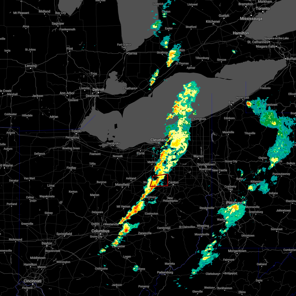 At 445 pm edt, a severe thunderstorm capable of producing a tornado was located near rittman, or 12 miles northeast of wooster, moving east at 35 mph. a second storm capable of producing a tornado was located southwest of orrville, moving east at 35 mph (radar indicated rotation). Hazards include tornado. Flying debris will be dangerous to those caught without shelter. mobile homes will be damaged or destroyed. damage to roofs, windows, and vehicles will occur. tree damage is likely. this dangerous storm will be near, doylestown around 450 pm edt. green around 510 pm edt. Other locations impacted by this tornadic thunderstorm include new franklin, canal fulton, north lawrence, marshallville, clinton, smithville and portage lakes. At 445 pm edt, a severe thunderstorm capable of producing a tornado was located near rittman, or 12 miles northeast of wooster, moving east at 35 mph. a second storm capable of producing a tornado was located southwest of orrville, moving east at 35 mph (radar indicated rotation). Hazards include tornado. Flying debris will be dangerous to those caught without shelter. mobile homes will be damaged or destroyed. damage to roofs, windows, and vehicles will occur. tree damage is likely. this dangerous storm will be near, doylestown around 450 pm edt. green around 510 pm edt. Other locations impacted by this tornadic thunderstorm include new franklin, canal fulton, north lawrence, marshallville, clinton, smithville and portage lakes.
|
| 10/21/2021 4:31 PM EDT |
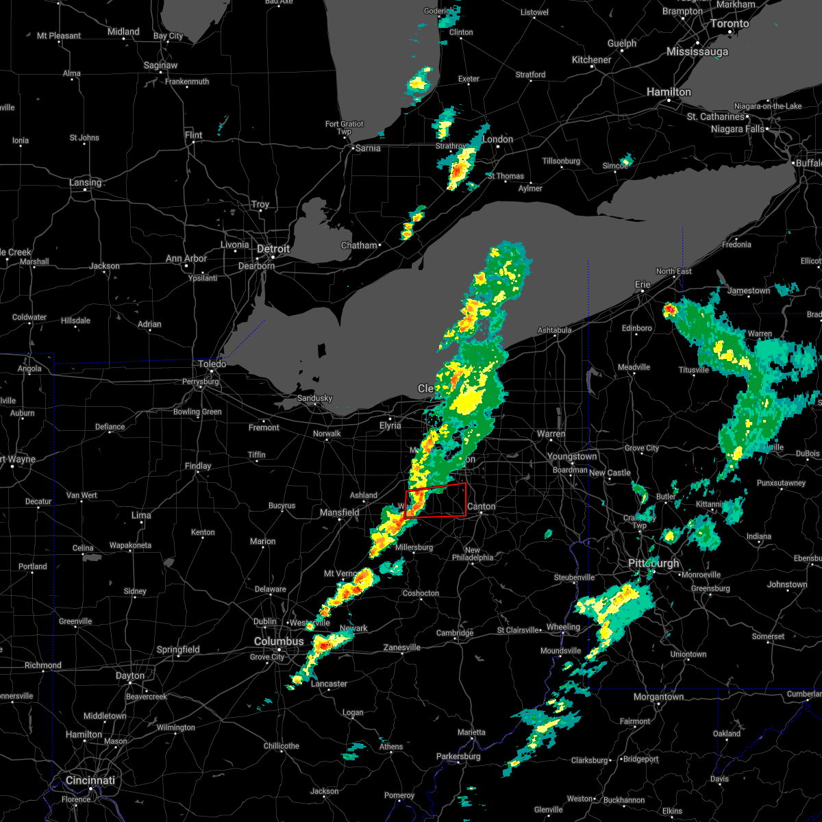 At 430 pm edt, a severe thunderstorm capable of producing a tornado was located near creston, or near wooster, moving east at 35 mph (radar indicated rotation). Hazards include tornado. Flying debris will be dangerous to those caught without shelter. mobile homes will be damaged or destroyed. damage to roofs, windows, and vehicles will occur. tree damage is likely. this dangerous storm will be near, orrville around 445 pm edt. doylestown around 450 pm edt. green around 510 pm edt. Other locations impacted by this tornadic thunderstorm include new franklin, canal fulton, north lawrence, smithville, marshallville, clinton and portage lakes. At 430 pm edt, a severe thunderstorm capable of producing a tornado was located near creston, or near wooster, moving east at 35 mph (radar indicated rotation). Hazards include tornado. Flying debris will be dangerous to those caught without shelter. mobile homes will be damaged or destroyed. damage to roofs, windows, and vehicles will occur. tree damage is likely. this dangerous storm will be near, orrville around 445 pm edt. doylestown around 450 pm edt. green around 510 pm edt. Other locations impacted by this tornadic thunderstorm include new franklin, canal fulton, north lawrence, smithville, marshallville, clinton and portage lakes.
|
| 8/13/2021 8:05 PM EDT |
 At 804 pm edt, a severe thunderstorm was located near dalton, or 14 miles east of wooster, moving east at 20 mph (radar indicated). Hazards include 60 mph wind gusts. expect damage to trees and power lines At 804 pm edt, a severe thunderstorm was located near dalton, or 14 miles east of wooster, moving east at 20 mph (radar indicated). Hazards include 60 mph wind gusts. expect damage to trees and power lines
|
| 8/11/2021 6:01 PM EDT |
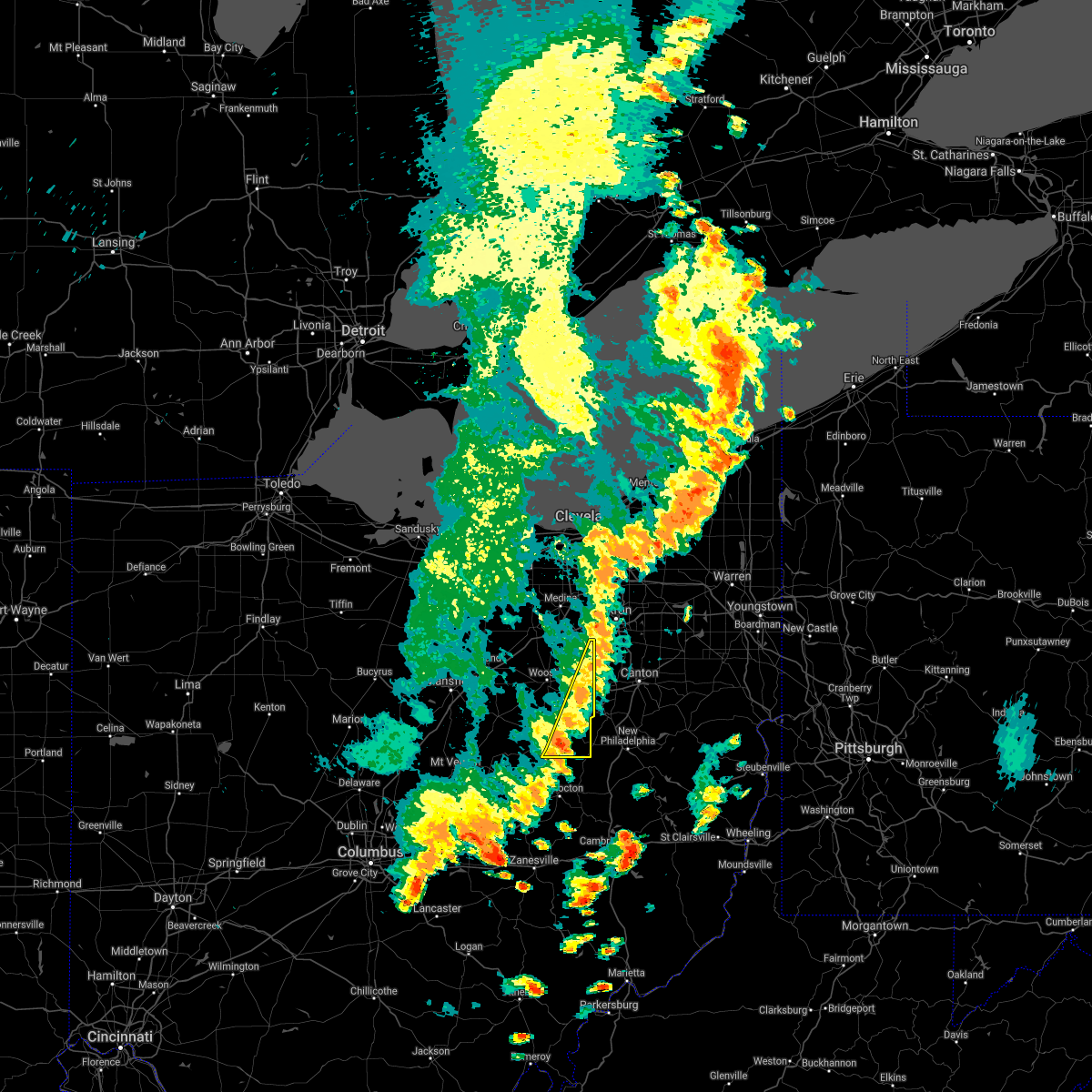 At 600 pm edt, severe thunderstorms were located along a line extending from near barberton to near farmerstown to near frazeysburg, moving east at 50 mph (radar indicated). Hazards include 60 mph wind gusts. Expect damage to trees and power lines. locations impacted include, millersburg, orrville, berlin, walnut creek, doylestown, dalton, mount eaton, winesburg, farmerstown, baltic, marshallville, mount hope and charm. hail threat, radar indicated max hail size, <. 75 in wind threat, radar indicated max wind gust, 60 mph. At 600 pm edt, severe thunderstorms were located along a line extending from near barberton to near farmerstown to near frazeysburg, moving east at 50 mph (radar indicated). Hazards include 60 mph wind gusts. Expect damage to trees and power lines. locations impacted include, millersburg, orrville, berlin, walnut creek, doylestown, dalton, mount eaton, winesburg, farmerstown, baltic, marshallville, mount hope and charm. hail threat, radar indicated max hail size, <. 75 in wind threat, radar indicated max wind gust, 60 mph.
|
| 8/11/2021 6:01 PM EDT |
 At 601 pm edt, a line of severe thunderstorms was located from hudson to massillon, moving east at 45 mph (radar indicated). Hazards include 70 mph wind gusts and penny size hail. Expect considerable tree damage. damage is likely to mobile homes, roofs, and outbuildings. locations impacted include, akron, canton, ravenna, cuyahoga falls, massillon, kent, barberton, green, alliance, hudson, wadsworth, tallmadge, north canton, streetsboro, macedonia, louisville, orrville, rittman, sebring and mogadore. thunderstorm damage threat, considerable hail threat, radar indicated max hail size, 0. 75 in wind threat, radar indicated max wind gust, 70 mph. At 601 pm edt, a line of severe thunderstorms was located from hudson to massillon, moving east at 45 mph (radar indicated). Hazards include 70 mph wind gusts and penny size hail. Expect considerable tree damage. damage is likely to mobile homes, roofs, and outbuildings. locations impacted include, akron, canton, ravenna, cuyahoga falls, massillon, kent, barberton, green, alliance, hudson, wadsworth, tallmadge, north canton, streetsboro, macedonia, louisville, orrville, rittman, sebring and mogadore. thunderstorm damage threat, considerable hail threat, radar indicated max hail size, 0. 75 in wind threat, radar indicated max wind gust, 70 mph.
|
| 8/11/2021 5:36 PM EDT |
 At 535 pm edt, a line of severe thunderstorm was located near brunswick to wooster, moving east at 45 mph (radar indicated). Hazards include 70 mph wind gusts and penny size hail. Expect considerable tree damage. Damage is likely to mobile homes, roofs, and outbuildings. At 535 pm edt, a line of severe thunderstorm was located near brunswick to wooster, moving east at 45 mph (radar indicated). Hazards include 70 mph wind gusts and penny size hail. Expect considerable tree damage. Damage is likely to mobile homes, roofs, and outbuildings.
|
| 8/11/2021 5:15 PM EDT |
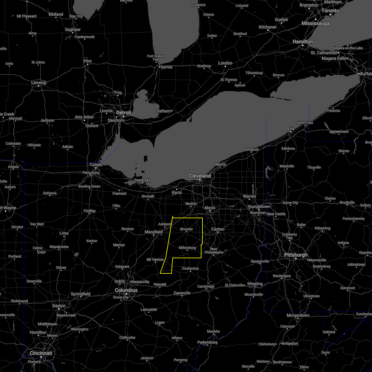 At 514 pm edt, severe thunderstorms were located along a line extending from near polk to 7 miles west of danville to near sunbury, moving east at 50 mph (radar indicated). Hazards include 60 mph wind gusts. expect damage to trees and power lines At 514 pm edt, severe thunderstorms were located along a line extending from near polk to 7 miles west of danville to near sunbury, moving east at 50 mph (radar indicated). Hazards include 60 mph wind gusts. expect damage to trees and power lines
|
| 7/16/2021 5:16 PM EDT |
 At 516 pm edt, a severe thunderstorm was located over berlin, or near millersburg, moving northeast at 35 mph (radar indicated). Hazards include 60 mph wind gusts. Expect damage to trees and power lines. Locations impacted include, millersburg, massillon, berlin, walnut creek, brewster, navarre, dalton, holmesville, wilmot, mount eaton, winesburg, farmerstown, beach city, baltic, fredericksburg, mount hope, north lawrence and charm. At 516 pm edt, a severe thunderstorm was located over berlin, or near millersburg, moving northeast at 35 mph (radar indicated). Hazards include 60 mph wind gusts. Expect damage to trees and power lines. Locations impacted include, millersburg, massillon, berlin, walnut creek, brewster, navarre, dalton, holmesville, wilmot, mount eaton, winesburg, farmerstown, beach city, baltic, fredericksburg, mount hope, north lawrence and charm.
|
| 7/16/2021 4:52 PM EDT |
 At 451 pm edt, a severe thunderstorm was located over glenmont, or 7 miles west of millersburg, moving northeast at 50 mph (radar indicated). Hazards include 60 mph wind gusts. expect damage to trees and power lines At 451 pm edt, a severe thunderstorm was located over glenmont, or 7 miles west of millersburg, moving northeast at 50 mph (radar indicated). Hazards include 60 mph wind gusts. expect damage to trees and power lines
|
| 7/7/2021 2:03 PM EDT |
 At 203 pm edt, a severe thunderstorm was located over mount eaton, or 12 miles northeast of millersburg, moving east at 25 mph (radar indicated). Hazards include 60 mph wind gusts and quarter size hail. Minor damage to vehicles is possible. expect damage to trees and power lines. Locations impacted include, canton, massillon, north canton, berlin, brewster, navarre, dalton, east sparta, wilmot, mount eaton, winesburg, apple creek, beach city, meyers lake, fredericksburg, hills and dales, mount hope and perry heights. At 203 pm edt, a severe thunderstorm was located over mount eaton, or 12 miles northeast of millersburg, moving east at 25 mph (radar indicated). Hazards include 60 mph wind gusts and quarter size hail. Minor damage to vehicles is possible. expect damage to trees and power lines. Locations impacted include, canton, massillon, north canton, berlin, brewster, navarre, dalton, east sparta, wilmot, mount eaton, winesburg, apple creek, beach city, meyers lake, fredericksburg, hills and dales, mount hope and perry heights.
|
| 7/7/2021 1:45 PM EDT |
 At 145 pm edt, severe thunderstorms were located along a line extending from near orrville to near mount eaton to berlin, moving east at 25 mph (radar indicated). Hazards include 60 mph wind gusts and quarter size hail. Minor damage to vehicles is possible. Expect damage to trees and power lines. At 145 pm edt, severe thunderstorms were located along a line extending from near orrville to near mount eaton to berlin, moving east at 25 mph (radar indicated). Hazards include 60 mph wind gusts and quarter size hail. Minor damage to vehicles is possible. Expect damage to trees and power lines.
|
| 11/15/2020 12:58 PM EST |
 At 1258 pm est, severe thunderstorms were located along a line extending from near westlake to 10 miles east of utica, moving east at 55 mph (radar indicated). Hazards include 70 mph wind gusts. Expect considerable tree damage. damage is likely to mobile homes, roofs, and outbuildings. Locations impacted include, cleveland, akron, canton, painesville, willowick, ravenna, chardon, fairport harbor, millersburg, cuyahoga falls, euclid, mentor, cleveland heights, massillon, kent, barberton, green, solon, alliance and willoughby. At 1258 pm est, severe thunderstorms were located along a line extending from near westlake to 10 miles east of utica, moving east at 55 mph (radar indicated). Hazards include 70 mph wind gusts. Expect considerable tree damage. damage is likely to mobile homes, roofs, and outbuildings. Locations impacted include, cleveland, akron, canton, painesville, willowick, ravenna, chardon, fairport harbor, millersburg, cuyahoga falls, euclid, mentor, cleveland heights, massillon, kent, barberton, green, solon, alliance and willoughby.
|
| 11/15/2020 12:51 PM EST |
 At 1251 pm est, severe thunderstorms were located along a line extending from near westlake to 10 miles east of utica, moving east at 55 mph (radar indicated). Hazards include 60 mph wind gusts. expect damage to trees and power lines At 1251 pm est, severe thunderstorms were located along a line extending from near westlake to 10 miles east of utica, moving east at 55 mph (radar indicated). Hazards include 60 mph wind gusts. expect damage to trees and power lines
|
| 10/23/2020 8:45 PM EDT |
 At 845 pm edt, a severe thunderstorm was located near mount eaton, or 9 miles northeast of millersburg, moving east at 45 mph (radar indicated). Hazards include 60 mph wind gusts and quarter size hail. Minor damage to vehicles is possible. Expect damage to trees and power lines. At 845 pm edt, a severe thunderstorm was located near mount eaton, or 9 miles northeast of millersburg, moving east at 45 mph (radar indicated). Hazards include 60 mph wind gusts and quarter size hail. Minor damage to vehicles is possible. Expect damage to trees and power lines.
|
| 8/28/2020 2:25 PM EDT |
 At 225 pm edt, a severe thunderstorm was located over shreve, or 10 miles southwest of wooster, moving east at 50 mph (radar indicated). Hazards include 60 mph wind gusts. Expect damage to trees and power lines. Locations impacted include, mansfield, wooster, ashland, millersburg, orrville, loudonville, dalton, shreve, west salem, hayesville, holmesville, polk, glenmont, mount eaton, nashville, smithville, apple creek, perrysville, lucas and jeromesville. At 225 pm edt, a severe thunderstorm was located over shreve, or 10 miles southwest of wooster, moving east at 50 mph (radar indicated). Hazards include 60 mph wind gusts. Expect damage to trees and power lines. Locations impacted include, mansfield, wooster, ashland, millersburg, orrville, loudonville, dalton, shreve, west salem, hayesville, holmesville, polk, glenmont, mount eaton, nashville, smithville, apple creek, perrysville, lucas and jeromesville.
|
| 8/28/2020 1:51 PM EDT |
 At 150 pm edt, a severe thunderstorm was located near fredericktown, or 7 miles north of mount vernon, moving northeast at 50 mph (radar indicated). Hazards include 60 mph wind gusts. expect damage to trees and power lines At 150 pm edt, a severe thunderstorm was located near fredericktown, or 7 miles north of mount vernon, moving northeast at 50 mph (radar indicated). Hazards include 60 mph wind gusts. expect damage to trees and power lines
|
| 8/27/2020 6:50 PM EDT |
 At 650 pm edt, a severe thunderstorm was located near orrville, or 9 miles northeast of wooster, moving southeast at 20 mph (radar indicated). Hazards include 60 mph wind gusts and quarter size hail. Minor damage to vehicles is possible. expect damage to trees and power lines. Locations impacted include, canton, massillon, north canton, louisville, orrville, rittman, minerva, doylestown, creston, brewster, navarre, dalton, waynesburg, east sparta, wilmot, mount eaton, canal fulton, east canton, smithville and clinton. At 650 pm edt, a severe thunderstorm was located near orrville, or 9 miles northeast of wooster, moving southeast at 20 mph (radar indicated). Hazards include 60 mph wind gusts and quarter size hail. Minor damage to vehicles is possible. expect damage to trees and power lines. Locations impacted include, canton, massillon, north canton, louisville, orrville, rittman, minerva, doylestown, creston, brewster, navarre, dalton, waynesburg, east sparta, wilmot, mount eaton, canal fulton, east canton, smithville and clinton.
|
| 8/27/2020 6:26 PM EDT |
 At 626 pm edt, a severe thunderstorm was located over creston, or 9 miles north of wooster, moving southeast at 20 mph (radar indicated). Hazards include 60 mph wind gusts. expect damage to trees and power lines At 626 pm edt, a severe thunderstorm was located over creston, or 9 miles north of wooster, moving southeast at 20 mph (radar indicated). Hazards include 60 mph wind gusts. expect damage to trees and power lines
|
| 6/10/2020 8:32 PM EDT |
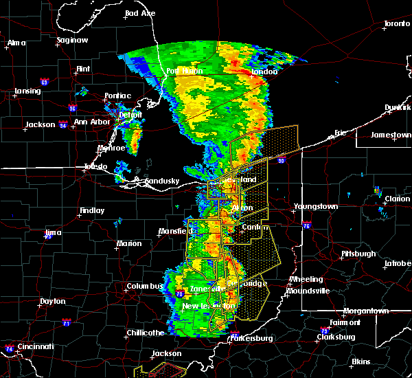 At 832 pm edt, a severe thunderstorm was located near dalton, or 14 miles west of canton, moving northeast at 55 mph (radar indicated). Hazards include 60 mph wind gusts. Expect damage to trees and power lines. Locations impacted include, millersburg, orrville, berlin, rittman, walnut creek, doylestown, dalton, mount eaton, winesburg, farmerstown, smithville, apple creek, baltic, marshallville, fredericksburg, mount hope and charm. At 832 pm edt, a severe thunderstorm was located near dalton, or 14 miles west of canton, moving northeast at 55 mph (radar indicated). Hazards include 60 mph wind gusts. Expect damage to trees and power lines. Locations impacted include, millersburg, orrville, berlin, rittman, walnut creek, doylestown, dalton, mount eaton, winesburg, farmerstown, smithville, apple creek, baltic, marshallville, fredericksburg, mount hope and charm.
|
| 6/10/2020 8:11 PM EDT |
 At 810 pm edt, a severe thunderstorm was located near creston, or 9 miles north of wooster, moving northeast at 55 mph. strongest winds are located west of millersburg (radar indicated). Hazards include 70 mph wind gusts and nickel size hail. Expect considerable tree damage. Damage is likely to mobile homes, roofs, and outbuildings. At 810 pm edt, a severe thunderstorm was located near creston, or 9 miles north of wooster, moving northeast at 55 mph. strongest winds are located west of millersburg (radar indicated). Hazards include 70 mph wind gusts and nickel size hail. Expect considerable tree damage. Damage is likely to mobile homes, roofs, and outbuildings.
|
| 6/10/2020 7:49 PM EDT |
 At 749 pm edt, a severe thunderstorm was located over creston, or 10 miles north of wooster, moving northeast at 60 mph (radar indicated). Hazards include 60 mph wind gusts and nickel size hail. Expect damage to trees and power lines. Locations impacted include, medina, wooster, brunswick, north royalton, wadsworth, orrville, rittman, doylestown, loudonville, creston, dalton, shreve, west salem, chippewa lake, holmesville, mount eaton, nashville, broadview heights, hinckley and seville. At 749 pm edt, a severe thunderstorm was located over creston, or 10 miles north of wooster, moving northeast at 60 mph (radar indicated). Hazards include 60 mph wind gusts and nickel size hail. Expect damage to trees and power lines. Locations impacted include, medina, wooster, brunswick, north royalton, wadsworth, orrville, rittman, doylestown, loudonville, creston, dalton, shreve, west salem, chippewa lake, holmesville, mount eaton, nashville, broadview heights, hinckley and seville.
|
| 6/10/2020 7:14 PM EDT |
 At 714 pm edt, a severe thunderstorm was located near lodi, or 11 miles west of medina, moving northeast at 60 mph (radar indicated). Hazards include 70 mph wind gusts and nickel size hail. Expect considerable tree damage. Damage is likely to mobile homes, roofs, and outbuildings. At 714 pm edt, a severe thunderstorm was located near lodi, or 11 miles west of medina, moving northeast at 60 mph (radar indicated). Hazards include 70 mph wind gusts and nickel size hail. Expect considerable tree damage. Damage is likely to mobile homes, roofs, and outbuildings.
|
| 6/5/2020 6:18 PM EDT |
 At 618 pm edt, a severe thunderstorm was located near dalton, or 14 miles east of wooster, moving southeast at 5 mph (radar indicated). Hazards include 60 mph wind gusts and quarter size hail. Minor damage to vehicles is possible. Expect damage to trees and power lines. At 618 pm edt, a severe thunderstorm was located near dalton, or 14 miles east of wooster, moving southeast at 5 mph (radar indicated). Hazards include 60 mph wind gusts and quarter size hail. Minor damage to vehicles is possible. Expect damage to trees and power lines.
|
| 6/4/2020 2:41 PM EDT |
 The severe thunderstorm warning for southeastern wayne and eastern holmes counties will expire at 245 pm edt, the storm which prompted the warning has moved out of the area. therefore, the warning will be allowed to expire. a severe thunderstorm watch remains in effect until 800 pm edt for northeastern ohio. The severe thunderstorm warning for southeastern wayne and eastern holmes counties will expire at 245 pm edt, the storm which prompted the warning has moved out of the area. therefore, the warning will be allowed to expire. a severe thunderstorm watch remains in effect until 800 pm edt for northeastern ohio.
|
| 6/4/2020 2:24 PM EDT |
 At 224 pm edt, a severe thunderstorm was located near doylestown, or 14 miles southwest of akron, moving east at 20 mph (radar indicated). Hazards include ping pong ball size hail and 60 mph wind gusts. People and animals outdoors will be injured. expect hail damage to roofs, siding, windows, and vehicles. Expect damage to trees and power lines. At 224 pm edt, a severe thunderstorm was located near doylestown, or 14 miles southwest of akron, moving east at 20 mph (radar indicated). Hazards include ping pong ball size hail and 60 mph wind gusts. People and animals outdoors will be injured. expect hail damage to roofs, siding, windows, and vehicles. Expect damage to trees and power lines.
|
| 6/4/2020 2:20 PM EDT |
 At 220 pm edt, a severe thunderstorm was located near holmesville, or near millersburg, moving northeast at 25 mph (radar indicated). Hazards include 60 mph wind gusts and quarter size hail. Minor damage to vehicles is possible. expect damage to trees and power lines. Locations impacted include, millersburg, berlin, walnut creek, sugarcreek, dalton, holmesville, mount eaton, winesburg, farmerstown, apple creek, baltic, fredericksburg, mount hope and charm. At 220 pm edt, a severe thunderstorm was located near holmesville, or near millersburg, moving northeast at 25 mph (radar indicated). Hazards include 60 mph wind gusts and quarter size hail. Minor damage to vehicles is possible. expect damage to trees and power lines. Locations impacted include, millersburg, berlin, walnut creek, sugarcreek, dalton, holmesville, mount eaton, winesburg, farmerstown, apple creek, baltic, fredericksburg, mount hope and charm.
|
| 6/4/2020 1:52 PM EDT |
 At 152 pm edt, a severe thunderstorm was located over glenmont, or 7 miles west of millersburg, moving northeast at 25 mph (radar indicated). Hazards include two inch hail and 60 mph wind gusts. People and animals outdoors will be injured. expect hail damage to roofs, siding, windows, and vehicles. Expect damage to trees and power lines. At 152 pm edt, a severe thunderstorm was located over glenmont, or 7 miles west of millersburg, moving northeast at 25 mph (radar indicated). Hazards include two inch hail and 60 mph wind gusts. People and animals outdoors will be injured. expect hail damage to roofs, siding, windows, and vehicles. Expect damage to trees and power lines.
|
| 4/8/2020 12:43 AM EDT |
 The severe thunderstorm warning for southwestern mahoning, northeastern ashland, stark, wayne and holmes counties will expire at 1245 am edt, the storms which prompted the warning have weakened below severe limits, and no longer pose an immediate threat to life or property. therefore, the warning will be allowed to expire. however small hail and heavy rain are still possible with these thunderstorms. The severe thunderstorm warning for southwestern mahoning, northeastern ashland, stark, wayne and holmes counties will expire at 1245 am edt, the storms which prompted the warning have weakened below severe limits, and no longer pose an immediate threat to life or property. therefore, the warning will be allowed to expire. however small hail and heavy rain are still possible with these thunderstorms.
|
| 4/8/2020 12:34 AM EDT |
 At 1233 am edt, severe thunderstorms were located along a line extending from near new waterford to near strasburg to near hayesville, moving southeast at 60 mph (radar indicated). Hazards include 70 mph wind gusts and quarter size hail. Minor damage to vehicles is possible. expect considerable tree damage. wind damage is also likely to mobile homes, roofs, and outbuildings. Locations impacted include, canton, wooster, salem, millersburg, massillon, alliance, north canton, louisville, orrville, berlin, sebring, walnut creek, minerva, brewster, navarre, dalton, shreve, waynesburg, east sparta and holmesville. At 1233 am edt, severe thunderstorms were located along a line extending from near new waterford to near strasburg to near hayesville, moving southeast at 60 mph (radar indicated). Hazards include 70 mph wind gusts and quarter size hail. Minor damage to vehicles is possible. expect considerable tree damage. wind damage is also likely to mobile homes, roofs, and outbuildings. Locations impacted include, canton, wooster, salem, millersburg, massillon, alliance, north canton, louisville, orrville, berlin, sebring, walnut creek, minerva, brewster, navarre, dalton, shreve, waynesburg, east sparta and holmesville.
|
| 4/8/2020 12:15 AM EDT |
 At 1215 am edt, severe thunderstorms were located along a line extending from 7 miles north of sebring to near brewster to near savannah, moving southeast at 70 mph (radar indicated). Hazards include 70 mph wind gusts and quarter size hail. Minor damage to vehicles is possible. expect considerable tree damage. wind damage is also likely to mobile homes, roofs, and outbuildings. Locations impacted include, akron, canton, wooster, salem, millersburg, massillon, barberton, green, alliance, wadsworth, tallmadge, north canton, louisville, orrville, berlin, rittman, sebring, mogadore, walnut creek and minerva. At 1215 am edt, severe thunderstorms were located along a line extending from 7 miles north of sebring to near brewster to near savannah, moving southeast at 70 mph (radar indicated). Hazards include 70 mph wind gusts and quarter size hail. Minor damage to vehicles is possible. expect considerable tree damage. wind damage is also likely to mobile homes, roofs, and outbuildings. Locations impacted include, akron, canton, wooster, salem, millersburg, massillon, barberton, green, alliance, wadsworth, tallmadge, north canton, louisville, orrville, berlin, rittman, sebring, mogadore, walnut creek and minerva.
|
| 4/7/2020 11:45 PM EDT |
 At 1145 pm edt, a severe thunderstorm capable of producing a tornado was located near wadsworth, or 7 miles southeast of medina, moving southeast at 50 mph (radar indicated rotation). Hazards include tornado and quarter size hail. Flying debris will be dangerous to those caught without shelter. mobile homes will be damaged or destroyed. damage to roofs, windows, and vehicles will occur. Tree damage is likely. At 1145 pm edt, a severe thunderstorm capable of producing a tornado was located near wadsworth, or 7 miles southeast of medina, moving southeast at 50 mph (radar indicated rotation). Hazards include tornado and quarter size hail. Flying debris will be dangerous to those caught without shelter. mobile homes will be damaged or destroyed. damage to roofs, windows, and vehicles will occur. Tree damage is likely.
|
| 4/7/2020 11:38 PM EDT |
 At 1137 pm edt, severe thunderstorms were located along a line extending from solon to 6 miles northwest of lodi to near norwalk, moving southeast at 45 mph (radar indicated). Hazards include 70 mph wind gusts and quarter size hail. Minor damage to vehicles is possible. expect considerable tree damage. Wind damage is also likely to mobile homes, roofs, and outbuildings. At 1137 pm edt, severe thunderstorms were located along a line extending from solon to 6 miles northwest of lodi to near norwalk, moving southeast at 45 mph (radar indicated). Hazards include 70 mph wind gusts and quarter size hail. Minor damage to vehicles is possible. expect considerable tree damage. Wind damage is also likely to mobile homes, roofs, and outbuildings.
|
| 3/20/2020 12:51 PM EDT |
 At 1251 pm edt, severe thunderstorms were located along a line extending from near canfield to near shreve, moving east at 60 mph (radar indicated). Hazards include 60 mph wind gusts. Expect damage to trees and power lines. Locations impacted include, canton, wooster, massillon, green, alliance, north canton, louisville, orrville, sebring, minerva, hartville, brewster, navarre, dalton, shreve, waynesburg, east sparta, wilmot, mount eaton and new franklin. At 1251 pm edt, severe thunderstorms were located along a line extending from near canfield to near shreve, moving east at 60 mph (radar indicated). Hazards include 60 mph wind gusts. Expect damage to trees and power lines. Locations impacted include, canton, wooster, massillon, green, alliance, north canton, louisville, orrville, sebring, minerva, hartville, brewster, navarre, dalton, shreve, waynesburg, east sparta, wilmot, mount eaton and new franklin.
|
| 3/20/2020 12:37 PM EDT |
 At 1236 pm edt, severe thunderstorms were located along a line extending from 6 miles north of sebring to near hayesville, moving east at 45 mph (radar indicated). Hazards include 60 mph wind gusts. Expect damage to trees and power lines. Locations impacted include, akron, canton, wooster, massillon, barberton, green, alliance, north canton, louisville, orrville, rittman, sebring, minerva, doylestown, hartville, creston, brewster, navarre, dalton and shreve. At 1236 pm edt, severe thunderstorms were located along a line extending from 6 miles north of sebring to near hayesville, moving east at 45 mph (radar indicated). Hazards include 60 mph wind gusts. Expect damage to trees and power lines. Locations impacted include, akron, canton, wooster, massillon, barberton, green, alliance, north canton, louisville, orrville, rittman, sebring, minerva, doylestown, hartville, creston, brewster, navarre, dalton and shreve.
|
| 3/20/2020 12:18 PM EDT |
 At 1218 pm edt, severe thunderstorms were located along a line extending from near green to near lexington, moving east-southeast at 45 mph (radar indicated). Hazards include 60 mph wind gusts. expect damage to trees and power lines At 1218 pm edt, severe thunderstorms were located along a line extending from near green to near lexington, moving east-southeast at 45 mph (radar indicated). Hazards include 60 mph wind gusts. expect damage to trees and power lines
|
| 8/18/2019 5:48 PM EDT | Tree down onto parking garage. parking garage structure collapsed onto several car in wayne county OH, 0.4 miles W of Dalton, OH |
| 8/18/2019 5:33 PM EDT |
 At 533 pm edt, a severe thunderstorm was located over dalton, or 10 miles east of wooster, moving east at 25 mph (radar indicated). Hazards include 60 mph wind gusts and quarter size hail. Minor damage to vehicles is possible. Expect damage to trees and power lines. At 533 pm edt, a severe thunderstorm was located over dalton, or 10 miles east of wooster, moving east at 25 mph (radar indicated). Hazards include 60 mph wind gusts and quarter size hail. Minor damage to vehicles is possible. Expect damage to trees and power lines.
|
| 8/6/2019 3:54 PM EDT |
 At 354 pm edt, severe thunderstorms were located along a line extending from near doylestown to near holmesville, moving northeast at 25 mph (radar indicated). Hazards include 60 mph wind gusts. Expect damage to trees and power lines. Locations impacted include, wooster, orrville, doylestown, dalton, shreve, mount eaton, smithville, apple creek, marshallville and fredericksburg. At 354 pm edt, severe thunderstorms were located along a line extending from near doylestown to near holmesville, moving northeast at 25 mph (radar indicated). Hazards include 60 mph wind gusts. Expect damage to trees and power lines. Locations impacted include, wooster, orrville, doylestown, dalton, shreve, mount eaton, smithville, apple creek, marshallville and fredericksburg.
|
| 8/6/2019 3:36 PM EDT |
 At 335 pm edt, severe thunderstorms were located along a line extending from near medina to near rittman to near shreve, moving east at 20 mph (radar indicated). Hazards include 60 mph wind gusts. Expect damage to trees and power lines. Locations impacted include, medina, wooster, wadsworth, orrville, rittman, doylestown, creston, dalton, shreve, chippewa lake, mount eaton, hinckley, seville, smithville, apple creek, westfield center, marshallville, gloria glens park and fredericksburg. At 335 pm edt, severe thunderstorms were located along a line extending from near medina to near rittman to near shreve, moving east at 20 mph (radar indicated). Hazards include 60 mph wind gusts. Expect damage to trees and power lines. Locations impacted include, medina, wooster, wadsworth, orrville, rittman, doylestown, creston, dalton, shreve, chippewa lake, mount eaton, hinckley, seville, smithville, apple creek, westfield center, marshallville, gloria glens park and fredericksburg.
|
| 8/6/2019 3:19 PM EDT |
 At 318 pm edt, severe thunderstorms were located along a line extending from near grafton to near lodi to near wooster to near shreve, moving east at 30 mph (radar indicated). Hazards include 60 mph wind gusts. Expect damage to trees and power lines. Locations impacted include, medina, wooster, brunswick, wadsworth, orrville, grafton, rittman, doylestown, lodi, creston, dalton, shreve, west salem, chippewa lake, mount eaton, eaton, hinckley, seville and lagrange. At 318 pm edt, severe thunderstorms were located along a line extending from near grafton to near lodi to near wooster to near shreve, moving east at 30 mph (radar indicated). Hazards include 60 mph wind gusts. Expect damage to trees and power lines. Locations impacted include, medina, wooster, brunswick, wadsworth, orrville, grafton, rittman, doylestown, lodi, creston, dalton, shreve, west salem, chippewa lake, mount eaton, eaton, hinckley, seville and lagrange.
|
| 8/6/2019 2:57 PM EDT |
 At 257 pm edt, severe thunderstorms were located along a line extending from wellington to near loudonville, moving northeast at 30 mph (radar indicated). Hazards include 60 mph wind gusts. expect damage to trees and power lines At 257 pm edt, severe thunderstorms were located along a line extending from wellington to near loudonville, moving northeast at 30 mph (radar indicated). Hazards include 60 mph wind gusts. expect damage to trees and power lines
|
| 7/2/2019 6:08 PM EDT |
 At 608 pm edt, severe thunderstorms were located along a line extending from near canton to near loudonville, moving east at 35 mph (radar indicated). Hazards include 60 mph wind gusts and quarter size hail. Minor damage to vehicles is possible. Expect damage to trees and power lines. At 608 pm edt, severe thunderstorms were located along a line extending from near canton to near loudonville, moving east at 35 mph (radar indicated). Hazards include 60 mph wind gusts and quarter size hail. Minor damage to vehicles is possible. Expect damage to trees and power lines.
|
| 7/2/2019 5:47 PM EDT |
 At 547 pm edt, severe thunderstorms were located along a line extending from near canton to 6 miles west of loudonville, moving southeast at 30 mph (radar indicated). Hazards include 60 mph wind gusts and quarter size hail. Minor damage to vehicles is possible. expect damage to trees and power lines. Locations impacted include, akron, canton, mansfield, wooster, millersburg, massillon, barberton, green, alliance, tallmadge, north canton, louisville, orrville, berlin, rittman, lexington, mogadore, walnut creek, minerva and doylestown. At 547 pm edt, severe thunderstorms were located along a line extending from near canton to 6 miles west of loudonville, moving southeast at 30 mph (radar indicated). Hazards include 60 mph wind gusts and quarter size hail. Minor damage to vehicles is possible. expect damage to trees and power lines. Locations impacted include, akron, canton, mansfield, wooster, millersburg, massillon, barberton, green, alliance, tallmadge, north canton, louisville, orrville, berlin, rittman, lexington, mogadore, walnut creek, minerva and doylestown.
|
| 7/2/2019 5:31 PM EDT |
 At 530 pm edt, severe thunderstorms were located along a line extending from near green to near danville, moving southeast at 40 mph (radar indicated). Hazards include 60 mph wind gusts and quarter size hail. Minor damage to vehicles is possible. expect damage to trees and power lines. Locations impacted include, akron, canton, mansfield, wooster, millersburg, massillon, barberton, green, alliance, wadsworth, tallmadge, north canton, louisville, orrville, berlin, rittman, ontario, lexington, mogadore and walnut creek. At 530 pm edt, severe thunderstorms were located along a line extending from near green to near danville, moving southeast at 40 mph (radar indicated). Hazards include 60 mph wind gusts and quarter size hail. Minor damage to vehicles is possible. expect damage to trees and power lines. Locations impacted include, akron, canton, mansfield, wooster, millersburg, massillon, barberton, green, alliance, wadsworth, tallmadge, north canton, louisville, orrville, berlin, rittman, ontario, lexington, mogadore and walnut creek.
|
| 7/2/2019 5:14 PM EDT |
 At 513 pm edt, severe thunderstorms were located along a line extending from near wadsworth to 6 miles east of bellville, moving southeast at 40 mph (radar indicated). Hazards include 60 mph wind gusts and quarter size hail. Minor damage to vehicles is possible. Expect damage to trees and power lines. At 513 pm edt, severe thunderstorms were located along a line extending from near wadsworth to 6 miles east of bellville, moving southeast at 40 mph (radar indicated). Hazards include 60 mph wind gusts and quarter size hail. Minor damage to vehicles is possible. Expect damage to trees and power lines.
|
| 6/28/2019 7:46 PM EDT |
 At 746 pm edt, a severe thunderstorm was located over wadsworth, or 10 miles southeast of medina, moving southeast at 30 mph (radar indicated). Hazards include 60 mph wind gusts and quarter size hail. Minor damage to vehicles is possible. Expect damage to trees and power lines. At 746 pm edt, a severe thunderstorm was located over wadsworth, or 10 miles southeast of medina, moving southeast at 30 mph (radar indicated). Hazards include 60 mph wind gusts and quarter size hail. Minor damage to vehicles is possible. Expect damage to trees and power lines.
|
| 6/5/2019 4:08 PM EDT |
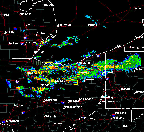 At 408 pm edt, a severe thunderstorm was located near wooster, moving east at 25 mph (radar indicated). Hazards include 60 mph wind gusts. Expect damage to trees and power lines. Locations impacted include, wooster, orrville, dalton, mount eaton, smithville, apple creek and reedsburg. At 408 pm edt, a severe thunderstorm was located near wooster, moving east at 25 mph (radar indicated). Hazards include 60 mph wind gusts. Expect damage to trees and power lines. Locations impacted include, wooster, orrville, dalton, mount eaton, smithville, apple creek and reedsburg.
|
| 6/5/2019 3:57 PM EDT |
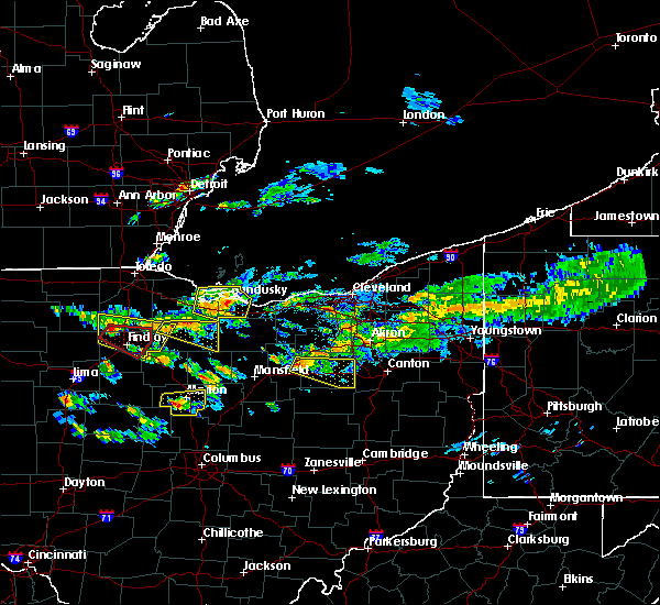 At 357 pm edt, a severe thunderstorm was located near west salem, or 10 miles west of wooster, moving east at 25 mph (radar indicated). Hazards include 60 mph wind gusts and penny size hail. expect damage to trees and power lines At 357 pm edt, a severe thunderstorm was located near west salem, or 10 miles west of wooster, moving east at 25 mph (radar indicated). Hazards include 60 mph wind gusts and penny size hail. expect damage to trees and power lines
|
| 5/25/2019 4:51 PM EDT |
 At 450 pm edt, a severe thunderstorm was located over massillon, or near canton, moving east at 45 mph (radar indicated). Hazards include 70 mph wind gusts and half dollar size hail. People and animals outdoors will be injured. expect hail damage to roofs, siding, windows, and vehicles. expect considerable tree damage. wind damage is also likely to mobile homes, roofs, and outbuildings. Locations impacted include, akron, canton, massillon, green, alliance, tallmadge, north canton, louisville, mogadore, hartville, brewster, navarre, dalton, waynesburg, east sparta, new franklin, brimfield, canal fulton, randolph and lakemore. At 450 pm edt, a severe thunderstorm was located over massillon, or near canton, moving east at 45 mph (radar indicated). Hazards include 70 mph wind gusts and half dollar size hail. People and animals outdoors will be injured. expect hail damage to roofs, siding, windows, and vehicles. expect considerable tree damage. wind damage is also likely to mobile homes, roofs, and outbuildings. Locations impacted include, akron, canton, massillon, green, alliance, tallmadge, north canton, louisville, mogadore, hartville, brewster, navarre, dalton, waynesburg, east sparta, new franklin, brimfield, canal fulton, randolph and lakemore.
|
| 5/25/2019 4:35 PM EDT |
 At 434 pm edt, a severe thunderstorm was located over dalton, or 11 miles east of wooster, moving east at 35 mph (radar indicated). Hazards include 70 mph wind gusts and half dollar size hail. People and animals outdoors will be injured. expect hail damage to roofs, siding, windows, and vehicles. expect considerable tree damage. wind damage is also likely to mobile homes, roofs, and outbuildings. Locations impacted include, akron, canton, wooster, massillon, barberton, green, alliance, tallmadge, north canton, louisville, orrville, rittman, mogadore, doylestown, hartville, brewster, navarre, dalton, waynesburg and east sparta. At 434 pm edt, a severe thunderstorm was located over dalton, or 11 miles east of wooster, moving east at 35 mph (radar indicated). Hazards include 70 mph wind gusts and half dollar size hail. People and animals outdoors will be injured. expect hail damage to roofs, siding, windows, and vehicles. expect considerable tree damage. wind damage is also likely to mobile homes, roofs, and outbuildings. Locations impacted include, akron, canton, wooster, massillon, barberton, green, alliance, tallmadge, north canton, louisville, orrville, rittman, mogadore, doylestown, hartville, brewster, navarre, dalton, waynesburg and east sparta.
|
| 5/25/2019 4:15 PM EDT |
 At 414 pm edt, a severe thunderstorm was located near wooster, moving east at 45 mph (radar indicated). Hazards include 60 mph wind gusts and quarter size hail. Minor damage to vehicles is possible. Expect damage to trees and power lines. At 414 pm edt, a severe thunderstorm was located near wooster, moving east at 45 mph (radar indicated). Hazards include 60 mph wind gusts and quarter size hail. Minor damage to vehicles is possible. Expect damage to trees and power lines.
|
| 5/23/2019 8:47 AM EDT |
 At 847 am edt, severe thunderstorms were located along a line extending from near solon to near dalton, moving east at 50 mph (radar indicated). Hazards include 60 mph wind gusts. Expect damage to trees and power lines. Locations impacted include, akron, millersburg, massillon, barberton, green, orrville, berlin, walnut creek, doylestown, brewster, navarre, dalton, shreve, killbuck, holmesville, wilmot, glenmont, mount eaton, winesburg and farmerstown. At 847 am edt, severe thunderstorms were located along a line extending from near solon to near dalton, moving east at 50 mph (radar indicated). Hazards include 60 mph wind gusts. Expect damage to trees and power lines. Locations impacted include, akron, millersburg, massillon, barberton, green, orrville, berlin, walnut creek, doylestown, brewster, navarre, dalton, shreve, killbuck, holmesville, wilmot, glenmont, mount eaton, winesburg and farmerstown.
|
| 5/23/2019 8:40 AM EDT |
 At 839 am edt, severe thunderstorms were located along a line extending from near twinsburg to 6 miles northwest of mount eaton, moving east at 60 mph (radar indicated). Hazards include 60 mph wind gusts. Expect damage to trees and power lines. Locations impacted include, cleveland, akron, canton, wooster, painesville, willowick, millersburg, cuyahoga falls, euclid, mentor, cleveland heights, massillon, kent, barberton, green, solon, willoughby, hudson, wadsworth and twinsburg. At 839 am edt, severe thunderstorms were located along a line extending from near twinsburg to 6 miles northwest of mount eaton, moving east at 60 mph (radar indicated). Hazards include 60 mph wind gusts. Expect damage to trees and power lines. Locations impacted include, cleveland, akron, canton, wooster, painesville, willowick, millersburg, cuyahoga falls, euclid, mentor, cleveland heights, massillon, kent, barberton, green, solon, willoughby, hudson, wadsworth and twinsburg.
|
| 5/23/2019 8:32 AM EDT |
 At 832 am edt, severe thunderstorms were located along a line extending from near macedonia to near wooster, moving east at 45 mph (radar indicated). Hazards include 60 mph wind gusts. Expect damage to trees and power lines. Locations impacted include, cleveland, akron, canton, medina, wooster, painesville, mount vernon, willowick, millersburg, parma, cuyahoga falls, euclid, mentor, cleveland heights, strongsville, brunswick, massillon, north royalton, kent and barberton. At 832 am edt, severe thunderstorms were located along a line extending from near macedonia to near wooster, moving east at 45 mph (radar indicated). Hazards include 60 mph wind gusts. Expect damage to trees and power lines. Locations impacted include, cleveland, akron, canton, medina, wooster, painesville, mount vernon, willowick, millersburg, parma, cuyahoga falls, euclid, mentor, cleveland heights, strongsville, brunswick, massillon, north royalton, kent and barberton.
|
| 5/23/2019 8:19 AM EDT |
 At 819 am edt, severe thunderstorms were located along a line extending from near north royalton to near shreve, moving east at 45 mph (radar indicated). Hazards include 60 mph wind gusts. Expect damage to trees and power lines. Locations impacted include, cleveland, akron, canton, medina, wooster, painesville, mount vernon, willowick, millersburg, parma, lakewood, cuyahoga falls, euclid, mentor, cleveland heights, strongsville, brunswick, westlake, massillon and north royalton. At 819 am edt, severe thunderstorms were located along a line extending from near north royalton to near shreve, moving east at 45 mph (radar indicated). Hazards include 60 mph wind gusts. Expect damage to trees and power lines. Locations impacted include, cleveland, akron, canton, medina, wooster, painesville, mount vernon, willowick, millersburg, parma, lakewood, cuyahoga falls, euclid, mentor, cleveland heights, strongsville, brunswick, westlake, massillon and north royalton.
|
| 5/23/2019 8:17 AM EDT |
 At 817 am edt, severe thunderstorms were located along a line extending from near north royalton to near shreve, moving east at 45 mph (radar indicated). Hazards include 60 mph wind gusts. expect damage to trees and power lines At 817 am edt, severe thunderstorms were located along a line extending from near north royalton to near shreve, moving east at 45 mph (radar indicated). Hazards include 60 mph wind gusts. expect damage to trees and power lines
|
| 4/14/2019 5:01 PM EDT |
 At 500 pm edt, severe thunderstorms capable of producing both tornadoes and extensive straight line wind damage were located near dalton, or 9 miles east of wooster, moving northeast at 50 mph (radar indicated rotation). Hazards include tornado and quarter size hail. Flying debris will be dangerous to those caught without shelter. mobile homes will be damaged or destroyed. damage to roofs, windows, and vehicles will occur. Tree damage is likely. At 500 pm edt, severe thunderstorms capable of producing both tornadoes and extensive straight line wind damage were located near dalton, or 9 miles east of wooster, moving northeast at 50 mph (radar indicated rotation). Hazards include tornado and quarter size hail. Flying debris will be dangerous to those caught without shelter. mobile homes will be damaged or destroyed. damage to roofs, windows, and vehicles will occur. Tree damage is likely.
|
| 4/14/2019 4:48 PM EDT |
 At 447 pm edt, a severe thunderstorm was located over millersburg, moving northeast at 50 mph (radar indicated). Hazards include 60 mph wind gusts and penny size hail. expect damage to trees and power lines At 447 pm edt, a severe thunderstorm was located over millersburg, moving northeast at 50 mph (radar indicated). Hazards include 60 mph wind gusts and penny size hail. expect damage to trees and power lines
|
| 3/14/2019 8:04 PM EDT |
 At 804 pm edt, a severe thunderstorm capable of producing a tornado was located near walnut creek, or 10 miles west of dover, moving northeast at 65 mph (radar indicated rotation). Hazards include tornado and quarter size hail. Flying debris will be dangerous to those caught without shelter. mobile homes will be damaged or destroyed. damage to roofs, windows, and vehicles will occur. tree damage is likely. this dangerous storm will be near, brewster around 815 pm edt. navarre around 820 pm edt. Other locations impacted by this tornadic thunderstorm include greentown, mount hope, perry heights, north lawrence, charm, meyers lake, beach city, hills and dales, baltic and uniontown. At 804 pm edt, a severe thunderstorm capable of producing a tornado was located near walnut creek, or 10 miles west of dover, moving northeast at 65 mph (radar indicated rotation). Hazards include tornado and quarter size hail. Flying debris will be dangerous to those caught without shelter. mobile homes will be damaged or destroyed. damage to roofs, windows, and vehicles will occur. tree damage is likely. this dangerous storm will be near, brewster around 815 pm edt. navarre around 820 pm edt. Other locations impacted by this tornadic thunderstorm include greentown, mount hope, perry heights, north lawrence, charm, meyers lake, beach city, hills and dales, baltic and uniontown.
|
| 3/14/2019 8:03 PM EDT |
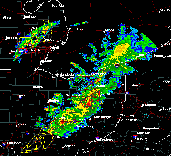 At 803 pm edt, severe thunderstorms were located along a line extending from near mount eaton to near farmerstown, moving northeast at 65 mph (radar indicated). Hazards include 70 mph wind gusts and quarter size hail. Minor damage to vehicles is possible. expect considerable tree damage. wind damage is also likely to mobile homes, roofs, and outbuildings. Locations impacted include, berlin, walnut creek, dalton, mount eaton, winesburg, farmerstown, apple creek, baltic, mount hope and charm. At 803 pm edt, severe thunderstorms were located along a line extending from near mount eaton to near farmerstown, moving northeast at 65 mph (radar indicated). Hazards include 70 mph wind gusts and quarter size hail. Minor damage to vehicles is possible. expect considerable tree damage. wind damage is also likely to mobile homes, roofs, and outbuildings. Locations impacted include, berlin, walnut creek, dalton, mount eaton, winesburg, farmerstown, apple creek, baltic, mount hope and charm.
|
| 3/14/2019 7:55 PM EDT |
 At 755 pm edt, a severe thunderstorm capable of producing a tornado was located near farmerstown, or 7 miles southeast of millersburg, moving northeast at 65 mph (radar indicated rotation). Hazards include tornado and quarter size hail. Flying debris will be dangerous to those caught without shelter. mobile homes will be damaged or destroyed. damage to roofs, windows, and vehicles will occur. tree damage is likely. this dangerous storm will be near, walnut creek and farmerstown around 800 pm edt. winesburg around 805 pm edt. wilmot around 810 pm edt. navarre around 820 pm edt. Other locations impacted by this tornadic thunderstorm include greentown, beach city, hills and dales, mount hope, perry heights, north lawrence, charm, meyers lake, fredericksburg and baltic. At 755 pm edt, a severe thunderstorm capable of producing a tornado was located near farmerstown, or 7 miles southeast of millersburg, moving northeast at 65 mph (radar indicated rotation). Hazards include tornado and quarter size hail. Flying debris will be dangerous to those caught without shelter. mobile homes will be damaged or destroyed. damage to roofs, windows, and vehicles will occur. tree damage is likely. this dangerous storm will be near, walnut creek and farmerstown around 800 pm edt. winesburg around 805 pm edt. wilmot around 810 pm edt. navarre around 820 pm edt. Other locations impacted by this tornadic thunderstorm include greentown, beach city, hills and dales, mount hope, perry heights, north lawrence, charm, meyers lake, fredericksburg and baltic.
|
| 3/14/2019 7:47 PM EDT |
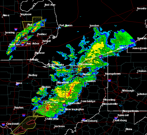 At 746 pm edt, severe thunderstorms were located along a line extending from near millersburg to 10 miles west of coshocton, moving northeast at 60 mph (radar indicated). Hazards include 70 mph wind gusts and quarter size hail. Minor damage to vehicles is possible. expect considerable tree damage. Wind damage is also likely to mobile homes, roofs, and outbuildings. At 746 pm edt, severe thunderstorms were located along a line extending from near millersburg to 10 miles west of coshocton, moving northeast at 60 mph (radar indicated). Hazards include 70 mph wind gusts and quarter size hail. Minor damage to vehicles is possible. expect considerable tree damage. Wind damage is also likely to mobile homes, roofs, and outbuildings.
|
| 9/21/2018 5:42 PM EDT |
 A severe thunderstorm warning remains in effect until 600 pm edt for stark. southern summit. eastern wayne and northeastern holmes counties. at 541 pm edt, a severe thunderstorm was located over navarre, or 9 miles southwest of canton, moving east at 45 mph. hazard. 60 mph wind gusts. A severe thunderstorm warning remains in effect until 600 pm edt for stark. southern summit. eastern wayne and northeastern holmes counties. at 541 pm edt, a severe thunderstorm was located over navarre, or 9 miles southwest of canton, moving east at 45 mph. hazard. 60 mph wind gusts.
|
| 9/21/2018 5:18 PM EDT |
 At 518 pm edt, a severe thunderstorm was located near wooster, moving east at 45 mph (radar indicated). Hazards include 60 mph wind gusts. expect damage to trees and power lines At 518 pm edt, a severe thunderstorm was located near wooster, moving east at 45 mph (radar indicated). Hazards include 60 mph wind gusts. expect damage to trees and power lines
|
| 5/4/2018 2:57 PM EDT |
 At 256 pm edt, severe thunderstorms were located along a line extending from 7 miles northeast of wadsworth to near lexington, moving east at 60 mph (radar indicated. at 2:42pm a wind gust to 58 mph was reported in mansfield). Hazards include 60 mph wind gusts and nickel size hail. expect damage to trees and power lines At 256 pm edt, severe thunderstorms were located along a line extending from 7 miles northeast of wadsworth to near lexington, moving east at 60 mph (radar indicated. at 2:42pm a wind gust to 58 mph was reported in mansfield). Hazards include 60 mph wind gusts and nickel size hail. expect damage to trees and power lines
|
| 11/5/2017 7:02 PM EDT |
 At 602 pm est, severe thunderstorms were located along a line extending from barberton to near berlin, moving east at 50 mph (radar indicated). Hazards include 70 mph wind gusts and penny size hail. Expect considerable tree damage. damage is likely to mobile homes, roofs, and outbuildings. locations impacted include, millersburg, orrville, berlin, rittman, walnut creek, doylestown, dalton, mount eaton, winesburg, farmerstown, apple creek, baltic, marshallville, fredericksburg, mount hope and charm. A tornado watch remains in effect until 700 pm est for northeastern ohio. At 602 pm est, severe thunderstorms were located along a line extending from barberton to near berlin, moving east at 50 mph (radar indicated). Hazards include 70 mph wind gusts and penny size hail. Expect considerable tree damage. damage is likely to mobile homes, roofs, and outbuildings. locations impacted include, millersburg, orrville, berlin, rittman, walnut creek, doylestown, dalton, mount eaton, winesburg, farmerstown, apple creek, baltic, marshallville, fredericksburg, mount hope and charm. A tornado watch remains in effect until 700 pm est for northeastern ohio.
|
| 11/5/2017 6:29 PM EDT |
 At 529 pm est, severe thunderstorms were located along a line extending from near west salem to near loudonville, moving east at 60 mph (radar indicated). Hazards include 70 mph wind gusts and penny size hail. Expect considerable tree damage. Damage is likely to mobile homes, roofs, and outbuildings. At 529 pm est, severe thunderstorms were located along a line extending from near west salem to near loudonville, moving east at 60 mph (radar indicated). Hazards include 70 mph wind gusts and penny size hail. Expect considerable tree damage. Damage is likely to mobile homes, roofs, and outbuildings.
|
| 7/11/2017 4:11 PM EDT |
 The severe thunderstorm warning for southwestern stark and southeastern wayne counties will expire at 415 pm edt, the storm which prompted the warning has weakened below severe limits, and no longer poses an immediate threat to life or property. therefore the warning will be allowed to expire. The severe thunderstorm warning for southwestern stark and southeastern wayne counties will expire at 415 pm edt, the storm which prompted the warning has weakened below severe limits, and no longer poses an immediate threat to life or property. therefore the warning will be allowed to expire.
|
| 7/11/2017 3:53 PM EDT |
 At 353 pm edt, a severe thunderstorm was located over wilmot, or 13 miles northwest of dover, moving northeast at 25 mph (radar indicated). Hazards include 60 mph wind gusts and quarter size hail. Minor damage to vehicles is possible. expect damage to trees and power lines. Locations impacted include, massillon, brewster, navarre, dalton, east sparta, wilmot, mount eaton, canal fulton, apple creek, beach city, fredericksburg, north lawrence and perry heights. At 353 pm edt, a severe thunderstorm was located over wilmot, or 13 miles northwest of dover, moving northeast at 25 mph (radar indicated). Hazards include 60 mph wind gusts and quarter size hail. Minor damage to vehicles is possible. expect damage to trees and power lines. Locations impacted include, massillon, brewster, navarre, dalton, east sparta, wilmot, mount eaton, canal fulton, apple creek, beach city, fredericksburg, north lawrence and perry heights.
|
| 7/11/2017 3:51 PM EDT | Wayne county state highway patrol reports trees downed along state route 94 south of the village of dalto in wayne county OH, 2.1 miles N of Dalton, OH |
| 7/11/2017 3:49 PM EDT |
 At 349 pm edt, a severe thunderstorm was located over wooster, moving northeast at 25 mph (radar indicated). Hazards include 60 mph wind gusts and quarter size hail. Minor damage to vehicles is possible. Expect damage to trees and power lines. At 349 pm edt, a severe thunderstorm was located over wooster, moving northeast at 25 mph (radar indicated). Hazards include 60 mph wind gusts and quarter size hail. Minor damage to vehicles is possible. Expect damage to trees and power lines.
|
| 7/11/2017 3:26 PM EDT |
 At 326 pm edt, a severe thunderstorm was located over berlin, or near millersburg, moving northeast at 25 mph (radar indicated). Hazards include 60 mph wind gusts and quarter size hail. Minor damage to vehicles is possible. Expect damage to trees and power lines. At 326 pm edt, a severe thunderstorm was located over berlin, or near millersburg, moving northeast at 25 mph (radar indicated). Hazards include 60 mph wind gusts and quarter size hail. Minor damage to vehicles is possible. Expect damage to trees and power lines.
|
| 7/7/2017 8:40 AM EDT |
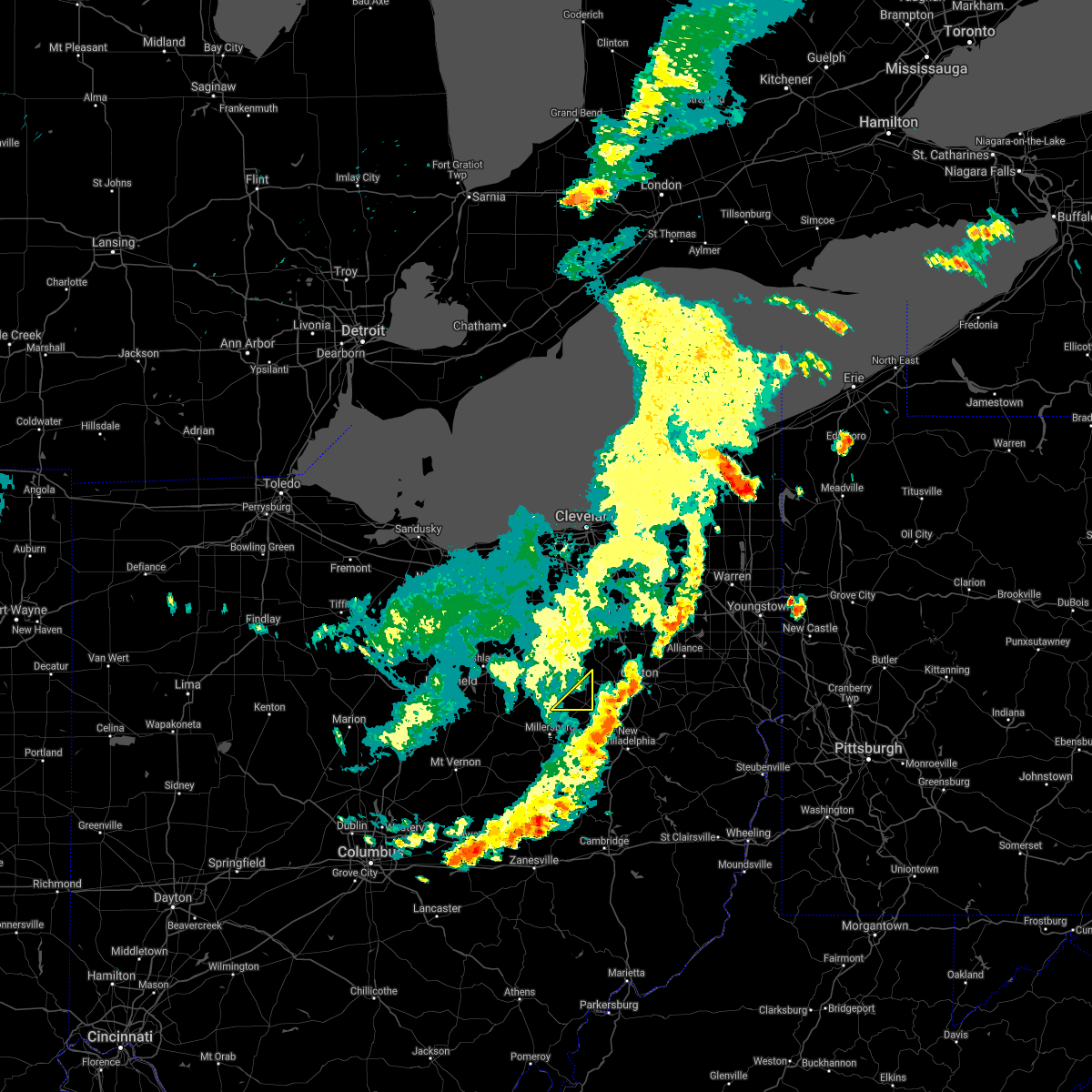 The severe thunderstorm warning for southeastern wayne county will expire at 845 am edt, the storms which prompted the warning have moved out of the area. therefore the warning will be allowed to expire. The severe thunderstorm warning for southeastern wayne county will expire at 845 am edt, the storms which prompted the warning have moved out of the area. therefore the warning will be allowed to expire.
|
| 7/7/2017 8:25 AM EDT |
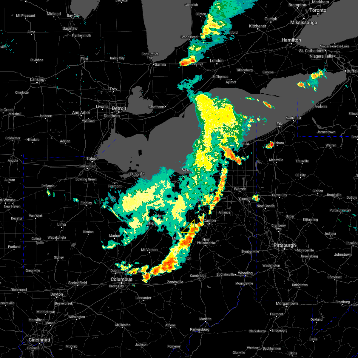 At 824 am edt, severe thunderstorms were located along a line extending from 7 miles northeast of dalton to mount eaton to near berlin, moving east at 15 mph (radar indicated). Hazards include 60 mph wind gusts. Expect damage to trees and power lines. Locations impacted include, dalton, mount eaton and fredericksburg. At 824 am edt, severe thunderstorms were located along a line extending from 7 miles northeast of dalton to mount eaton to near berlin, moving east at 15 mph (radar indicated). Hazards include 60 mph wind gusts. Expect damage to trees and power lines. Locations impacted include, dalton, mount eaton and fredericksburg.
|
| 7/7/2017 8:03 AM EDT |
 At 802 am edt, severe thunderstorms were located along a line extending from near creston to 6 miles northwest of shreve to near loudonville, moving east at 50 mph (radar indicated). Hazards include 60 mph wind gusts. Expect damage to trees and power lines. Locations impacted include, wooster, orrville, rittman, doylestown, loudonville, creston, dalton, shreve, mount eaton, smithville, apple creek, marshallville, fredericksburg, burbank, congress, mohicanville and reedsburg. At 802 am edt, severe thunderstorms were located along a line extending from near creston to 6 miles northwest of shreve to near loudonville, moving east at 50 mph (radar indicated). Hazards include 60 mph wind gusts. Expect damage to trees and power lines. Locations impacted include, wooster, orrville, rittman, doylestown, loudonville, creston, dalton, shreve, mount eaton, smithville, apple creek, marshallville, fredericksburg, burbank, congress, mohicanville and reedsburg.
|
| 7/7/2017 7:46 AM EDT |
 At 745 am edt, severe thunderstorms were located along a line extending from near polk to 6 miles west of hayesville to near bellville, moving east at 35 mph (radar indicated). Hazards include 60 mph wind gusts. Expect damage to trees and power lines. Locations impacted include, mansfield, wooster, ashland, orrville, rittman, lexington, doylestown, loudonville, creston, bellville, dalton, shreve, west salem, hayesville, savannah, polk, mount eaton, smithville, apple creek and butler. At 745 am edt, severe thunderstorms were located along a line extending from near polk to 6 miles west of hayesville to near bellville, moving east at 35 mph (radar indicated). Hazards include 60 mph wind gusts. Expect damage to trees and power lines. Locations impacted include, mansfield, wooster, ashland, orrville, rittman, lexington, doylestown, loudonville, creston, bellville, dalton, shreve, west salem, hayesville, savannah, polk, mount eaton, smithville, apple creek and butler.
|
| 7/7/2017 7:28 AM EDT |
 At 727 am edt, a severe thunderstorm was located over shelby, or 8 miles northwest of mansfield, moving east at 35 mph (radar indicated). Hazards include 60 mph wind gusts. expect damage to trees and power lines At 727 am edt, a severe thunderstorm was located over shelby, or 8 miles northwest of mansfield, moving east at 35 mph (radar indicated). Hazards include 60 mph wind gusts. expect damage to trees and power lines
|
| 6/4/2017 4:11 PM EDT |
 At 410 pm edt, a severe thunderstorm was located near orrville, or 8 miles northeast of wooster, moving east at 35 mph (radar indicated). Hazards include 60 mph wind gusts and quarter size hail. Minor damage to vehicles is possible. expect damage to trees and power lines. Locations impacted include, wooster, orrville, rittman, doylestown, dalton, mount eaton, smithville, apple creek and marshallville. At 410 pm edt, a severe thunderstorm was located near orrville, or 8 miles northeast of wooster, moving east at 35 mph (radar indicated). Hazards include 60 mph wind gusts and quarter size hail. Minor damage to vehicles is possible. expect damage to trees and power lines. Locations impacted include, wooster, orrville, rittman, doylestown, dalton, mount eaton, smithville, apple creek and marshallville.
|
| 6/4/2017 3:57 PM EDT |
 At 355 pm edt, a severe thunderstorm was located near creston, or 7 miles north of wooster, moving east at 40 mph (radar indicated). Hazards include 60 mph wind gusts and quarter size hail. Minor damage to vehicles is possible. expect damage to trees and power lines. Locations impacted include, wooster, wadsworth, orrville, rittman, doylestown, lodi, creston, dalton, west salem, chippewa lake, mount eaton, seville, smithville, apple creek, westfield center, marshallville, gloria glens park, burbank, congress and chippewa-on-the-lake. At 355 pm edt, a severe thunderstorm was located near creston, or 7 miles north of wooster, moving east at 40 mph (radar indicated). Hazards include 60 mph wind gusts and quarter size hail. Minor damage to vehicles is possible. expect damage to trees and power lines. Locations impacted include, wooster, wadsworth, orrville, rittman, doylestown, lodi, creston, dalton, west salem, chippewa lake, mount eaton, seville, smithville, apple creek, westfield center, marshallville, gloria glens park, burbank, congress and chippewa-on-the-lake.
|
| 6/4/2017 3:32 PM EDT |
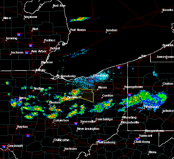 At 332 pm edt, a severe thunderstorm was located near polk, or 11 miles northeast of ashland, moving east at 40 mph (radar indicated). Hazards include 60 mph wind gusts and quarter size hail. Minor damage to vehicles is possible. Expect damage to trees and power lines. At 332 pm edt, a severe thunderstorm was located near polk, or 11 miles northeast of ashland, moving east at 40 mph (radar indicated). Hazards include 60 mph wind gusts and quarter size hail. Minor damage to vehicles is possible. Expect damage to trees and power lines.
|
| 5/18/2017 9:41 PM EDT |
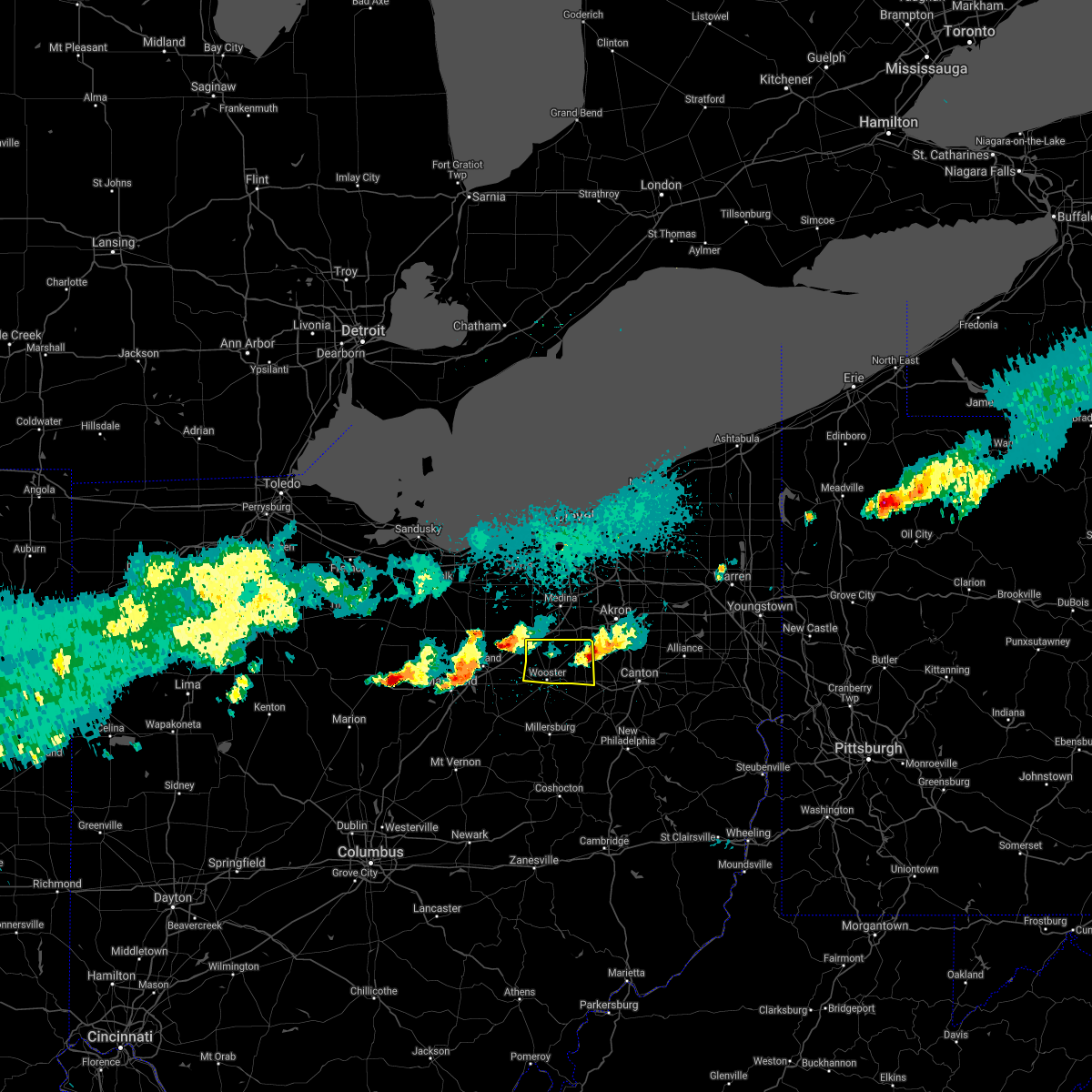 The severe thunderstorm warning for northern wayne county will expire at 945 pm edt, the storms which prompted the warning have weakened below severe limits, and have exited the warned area. therefore the warning will be allowed to expire. The severe thunderstorm warning for northern wayne county will expire at 945 pm edt, the storms which prompted the warning have weakened below severe limits, and have exited the warned area. therefore the warning will be allowed to expire.
|
| 5/18/2017 9:16 PM EDT |
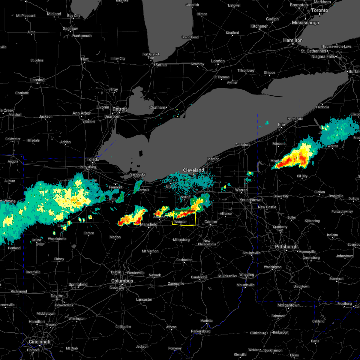 At 915 pm edt, severe thunderstorms were located along a line extending from near wadsworth to near orrville, moving east at 30 mph (radar indicated). Hazards include 60 mph wind gusts and quarter size hail. Hail damage to vehicles is expected. expect wind damage to roofs, siding, and trees. Locations impacted include, wooster, orrville, rittman, doylestown, creston, dalton, smithville, marshallville, burbank and congress. At 915 pm edt, severe thunderstorms were located along a line extending from near wadsworth to near orrville, moving east at 30 mph (radar indicated). Hazards include 60 mph wind gusts and quarter size hail. Hail damage to vehicles is expected. expect wind damage to roofs, siding, and trees. Locations impacted include, wooster, orrville, rittman, doylestown, creston, dalton, smithville, marshallville, burbank and congress.
|
| 5/18/2017 8:52 PM EDT |
 At 852 pm edt, severe thunderstorms were located along a line extending from near chippewa lake to near west salem, moving east at 30 mph (radar indicated). Hazards include 60 mph wind gusts and quarter size hail. Hail damage to vehicles is expected. Expect wind damage to roofs, siding, and trees. At 852 pm edt, severe thunderstorms were located along a line extending from near chippewa lake to near west salem, moving east at 30 mph (radar indicated). Hazards include 60 mph wind gusts and quarter size hail. Hail damage to vehicles is expected. Expect wind damage to roofs, siding, and trees.
|
| 3/30/2017 7:26 PM EDT | Hen Egg sized hail reported 0.4 miles W of Dalton, OH, many pictures received via facebook/twitter of large... irregular shaped hail. |
| 8/28/2016 5:50 PM EDT |
 At 548 pm edt, a severe thunderstorm was located over wadsworth, or 9 miles southeast of medina, moving northeast at 10 mph. another severe thunderstorms was located over northern holmes county, .6 miles east of holmesville. this storm was drifting to the southeast around 5 mph (radar indicated). Hazards include 60 mph wind gusts and quarter size hail. Hail damage to vehicles is expected. expect damage to roofs, siding and trees. Locations impacted include, wooster, millersburg, barberton, wadsworth, orrville, berlin, rittman, walnut creek, doylestown, loudonville, creston, dalton, shreve, killbuck, holmesville, glenmont, mount eaton, nashville, winesburg and farmerstown. At 548 pm edt, a severe thunderstorm was located over wadsworth, or 9 miles southeast of medina, moving northeast at 10 mph. another severe thunderstorms was located over northern holmes county, .6 miles east of holmesville. this storm was drifting to the southeast around 5 mph (radar indicated). Hazards include 60 mph wind gusts and quarter size hail. Hail damage to vehicles is expected. expect damage to roofs, siding and trees. Locations impacted include, wooster, millersburg, barberton, wadsworth, orrville, berlin, rittman, walnut creek, doylestown, loudonville, creston, dalton, shreve, killbuck, holmesville, glenmont, mount eaton, nashville, winesburg and farmerstown.
|
| 8/28/2016 5:25 PM EDT |
 At 524 pm edt, a severe thunderstorm was located over rittman, or 9 miles south of medina, moving northeast at 10 mph. additional severe thunderstorms were located from loudonville to northern holmes county. these were drifts south at under 10 mph (radar indicated). Hazards include 60 mph wind gusts and quarter size hail. Hail damage to wehicles is expected. Expect damage to roofs, siding and trees. At 524 pm edt, a severe thunderstorm was located over rittman, or 9 miles south of medina, moving northeast at 10 mph. additional severe thunderstorms were located from loudonville to northern holmes county. these were drifts south at under 10 mph (radar indicated). Hazards include 60 mph wind gusts and quarter size hail. Hail damage to wehicles is expected. Expect damage to roofs, siding and trees.
|
| 9/3/2015 4:49 PM EDT |
 At 447 pm edt, a cluster of strong to severe thunderstorms was located near wooster. other strong storms were in southern wayne county. the storms were moving east at 25 mph (radar indicated). Hazards include 60 mph wind gusts and quarter size hail. Hail damage to vehicles is expected. expect wind damage to roofs, siding and trees. Locations impacted include, wooster, orrville, rittman, doylestown, creston, dalton, shreve, mount eaton, smithville, apple creek, marshallville, fredericksburg, congress and reedsburg. At 447 pm edt, a cluster of strong to severe thunderstorms was located near wooster. other strong storms were in southern wayne county. the storms were moving east at 25 mph (radar indicated). Hazards include 60 mph wind gusts and quarter size hail. Hail damage to vehicles is expected. expect wind damage to roofs, siding and trees. Locations impacted include, wooster, orrville, rittman, doylestown, creston, dalton, shreve, mount eaton, smithville, apple creek, marshallville, fredericksburg, congress and reedsburg.
|
| 9/3/2015 4:08 PM EDT |
 At 408 pm edt, a severe thunderstorm was located near polk, or 9 miles east of ashland, moving south at 20 mph (radar indicated). Hazards include 60 mph wind gusts and quarter size hail. Hail damage to vehicles is expected. Expect wind damage to roofs, siding and trees. At 408 pm edt, a severe thunderstorm was located near polk, or 9 miles east of ashland, moving south at 20 mph (radar indicated). Hazards include 60 mph wind gusts and quarter size hail. Hail damage to vehicles is expected. Expect wind damage to roofs, siding and trees.
|
| 6/18/2015 6:43 PM EDT | At 642 pm edt, a severe thunderstorm was located near creston, or 9 miles south of medina, moving southeast at 45 mph (radar indicated). Hazards include 60 mph wind gusts. Expect damage to roofs. Siding and trees. |
| 5/5/2015 6:26 PM EDT | The severe thunderstorm warning for southeastern wayne and southern stark counties will expire at 630 pm edt, the storm which prompted the warning has weakened and moved out of the warned area. |
| 5/5/2015 5:35 PM EDT | At 532 pm edt, a severe thunderstorm was located near brewster, and moving east at 15 mph (radar indicated). Hazards include 60 mph wind gusts and quarter size hail. Hail damage to vehicles is expected. Expect wind damage to roofs, siding and trees. |
Hail Maps for Dalton, OH
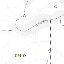


Connect with Interactive Hail Maps