

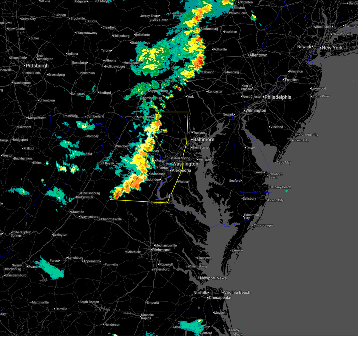
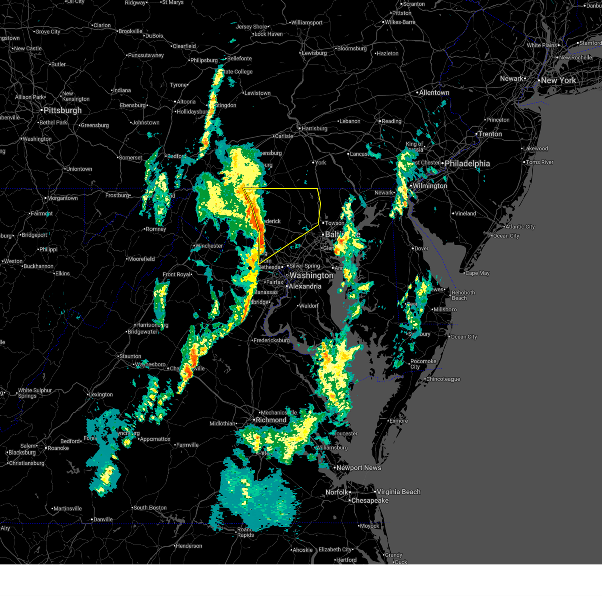
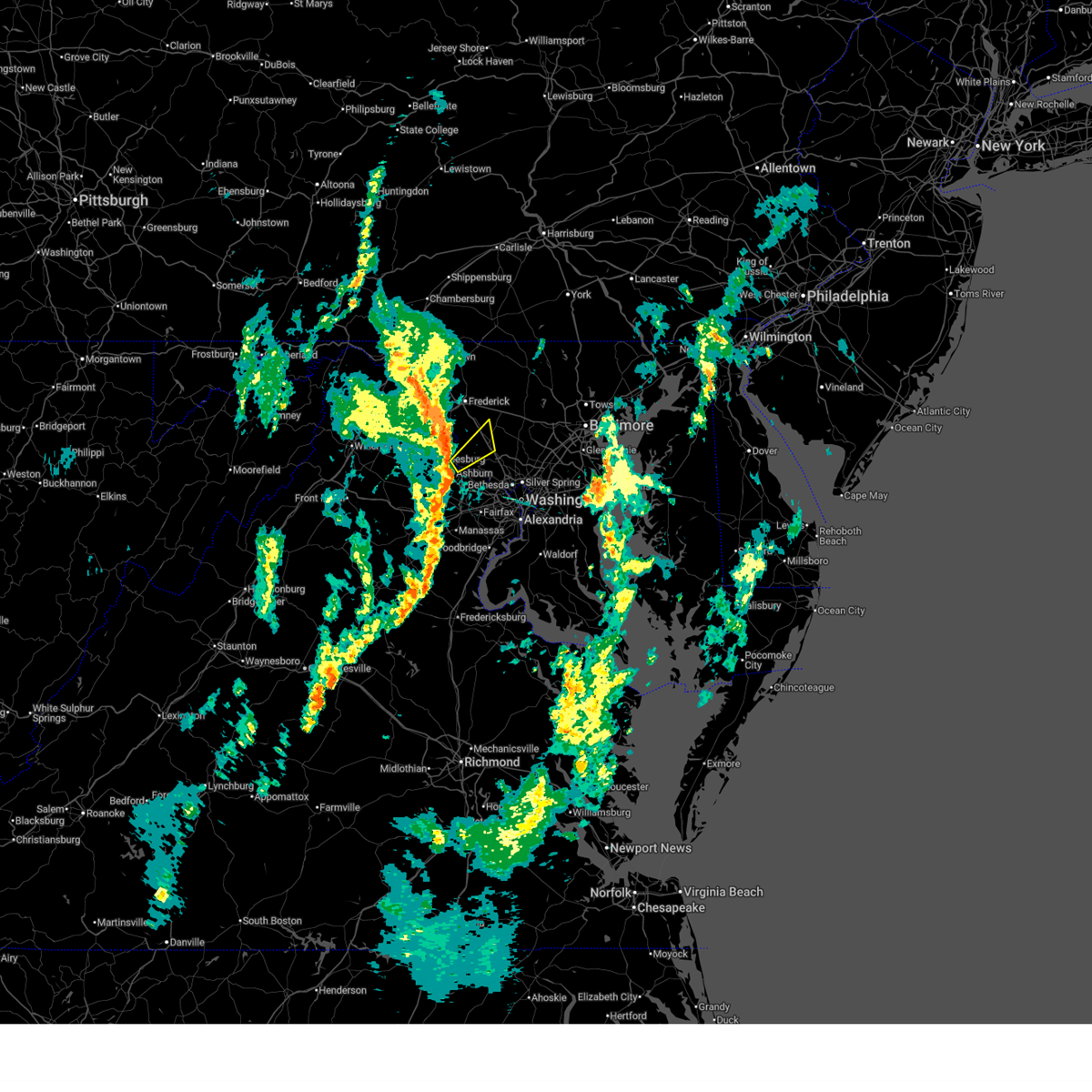
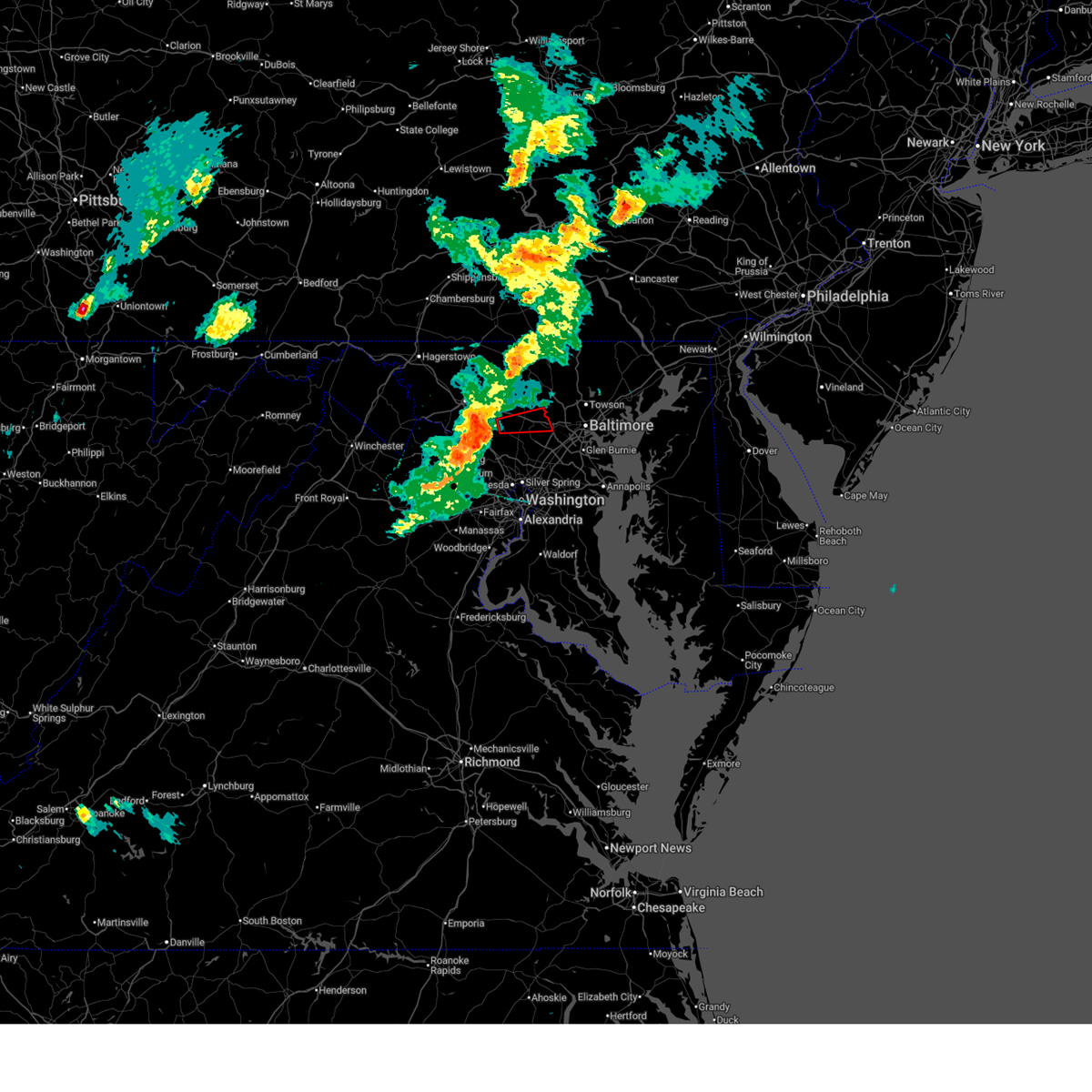
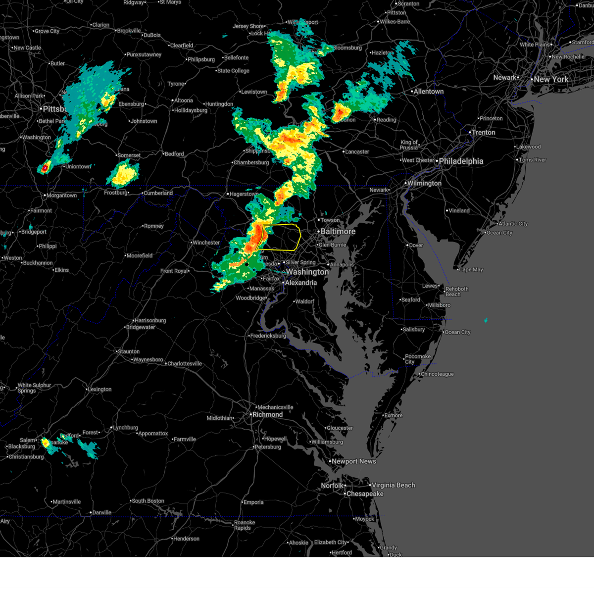
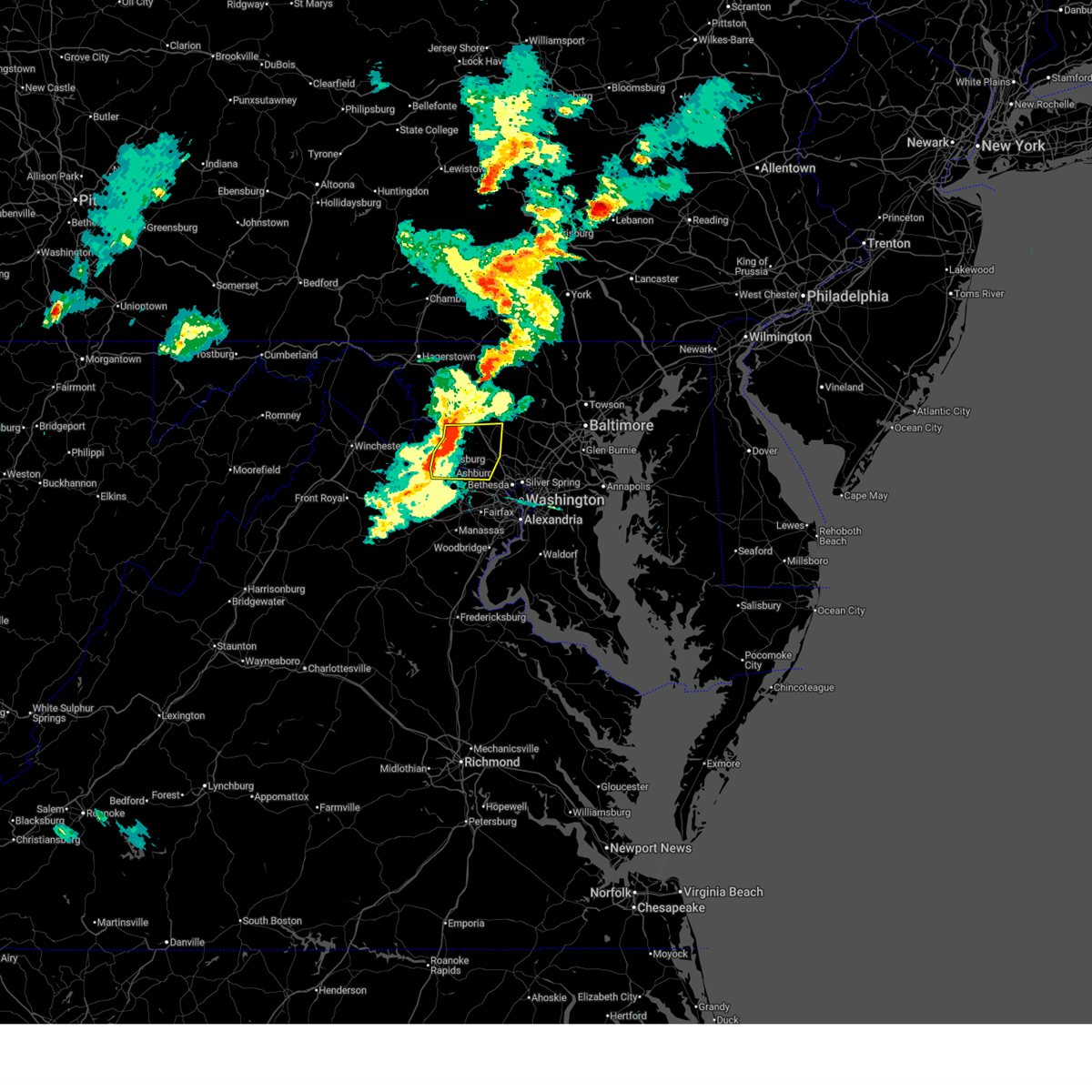
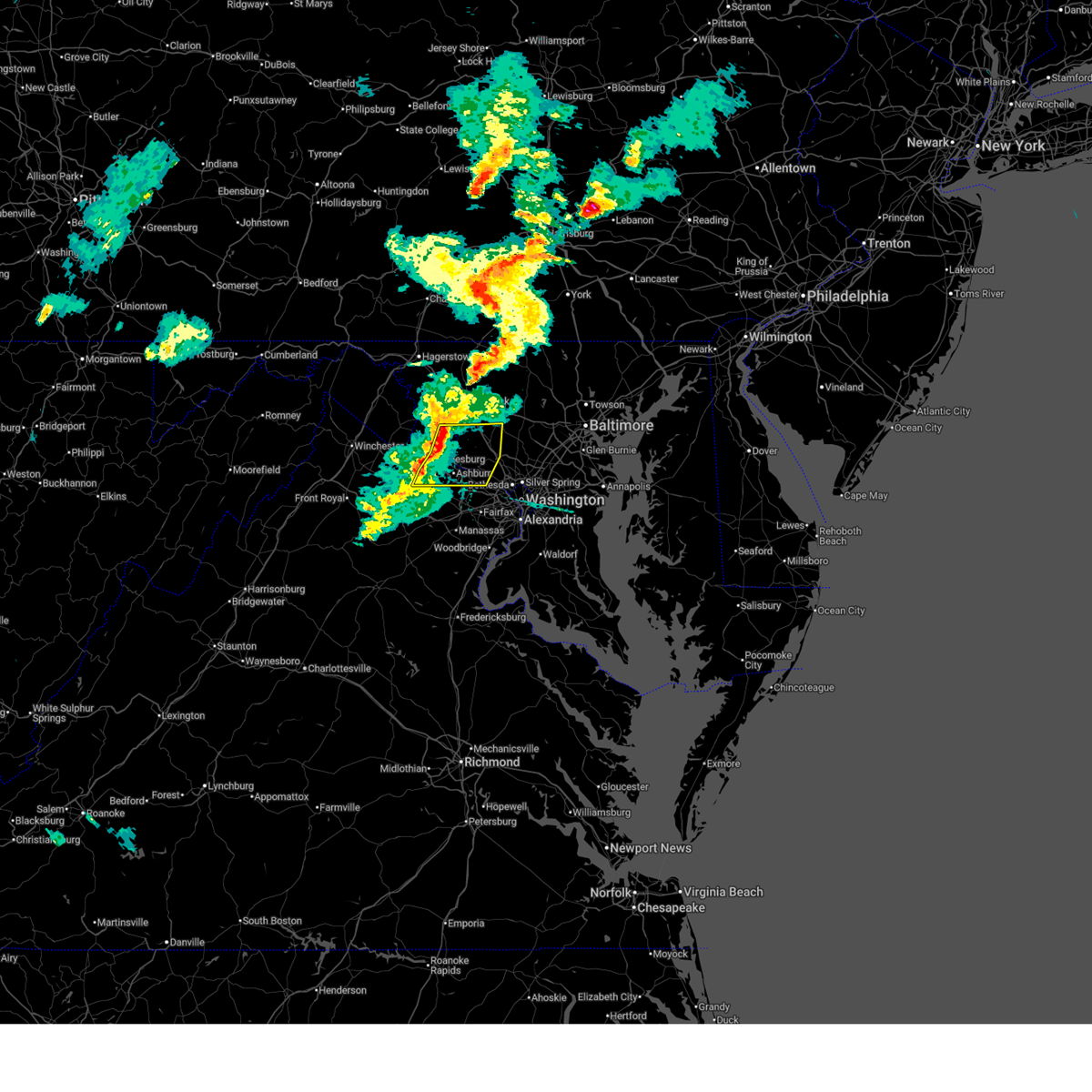
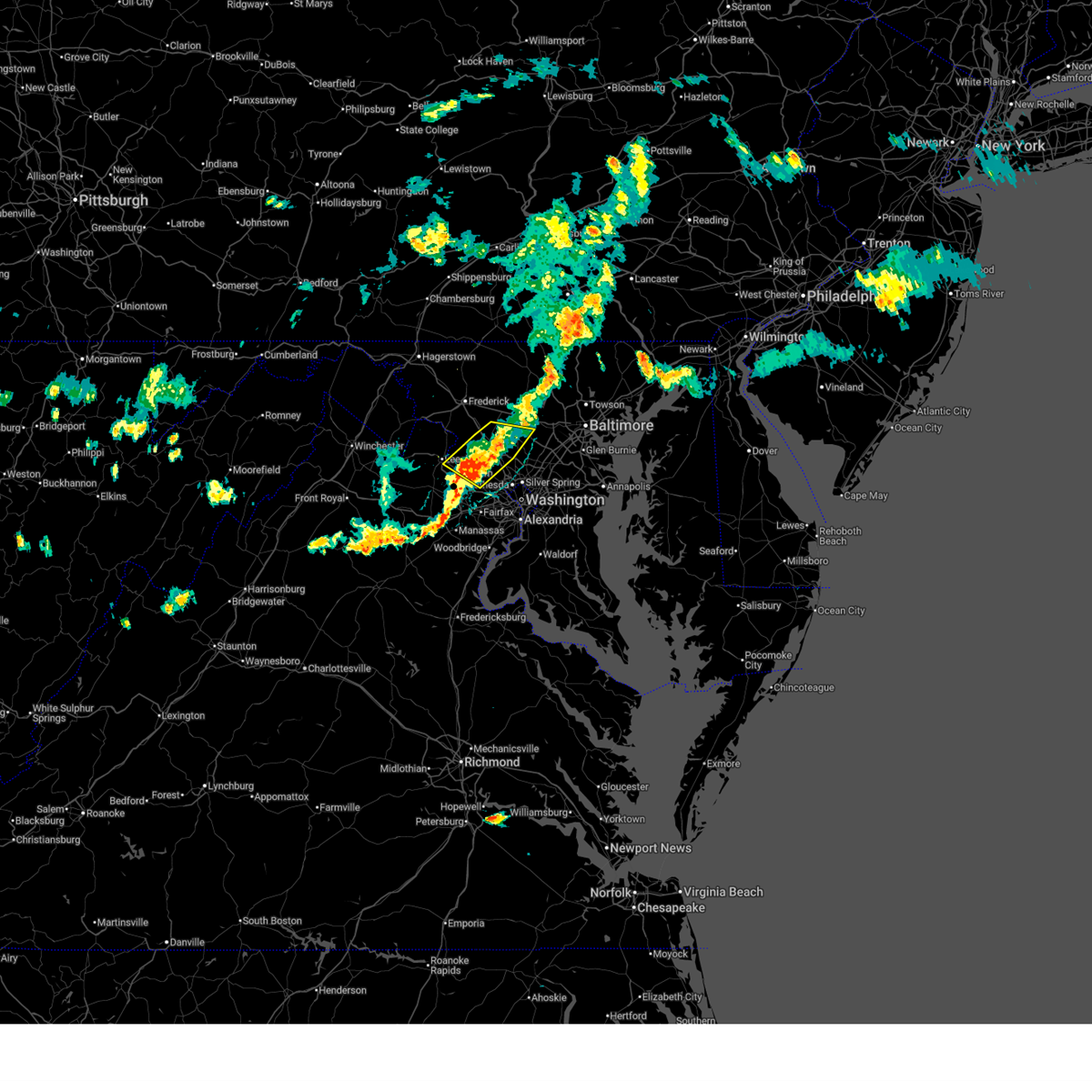
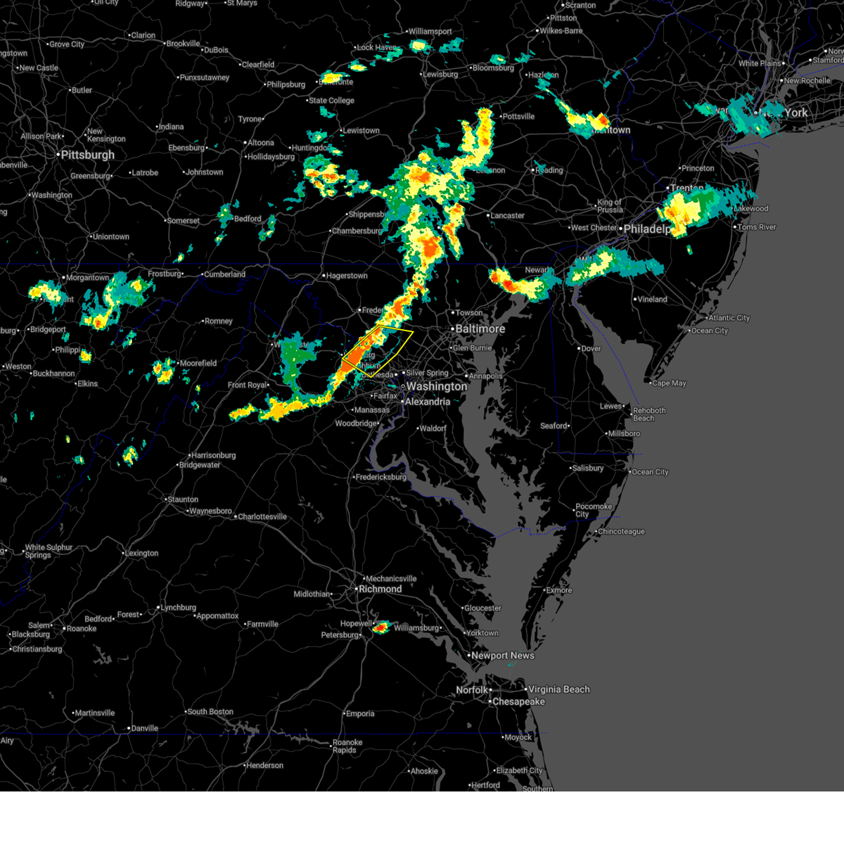
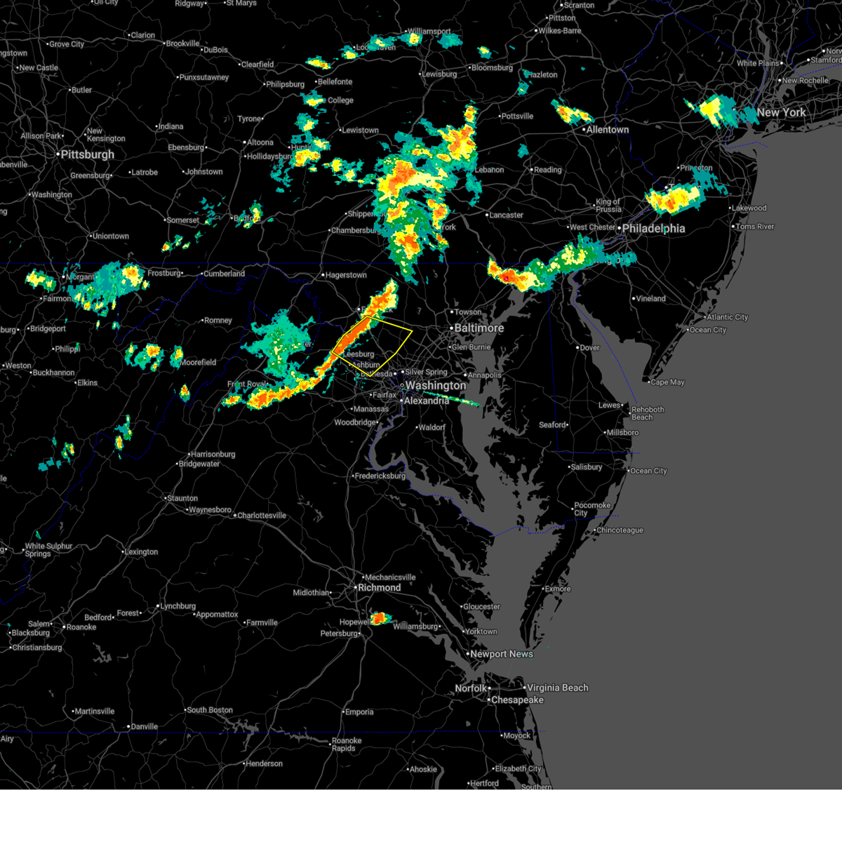
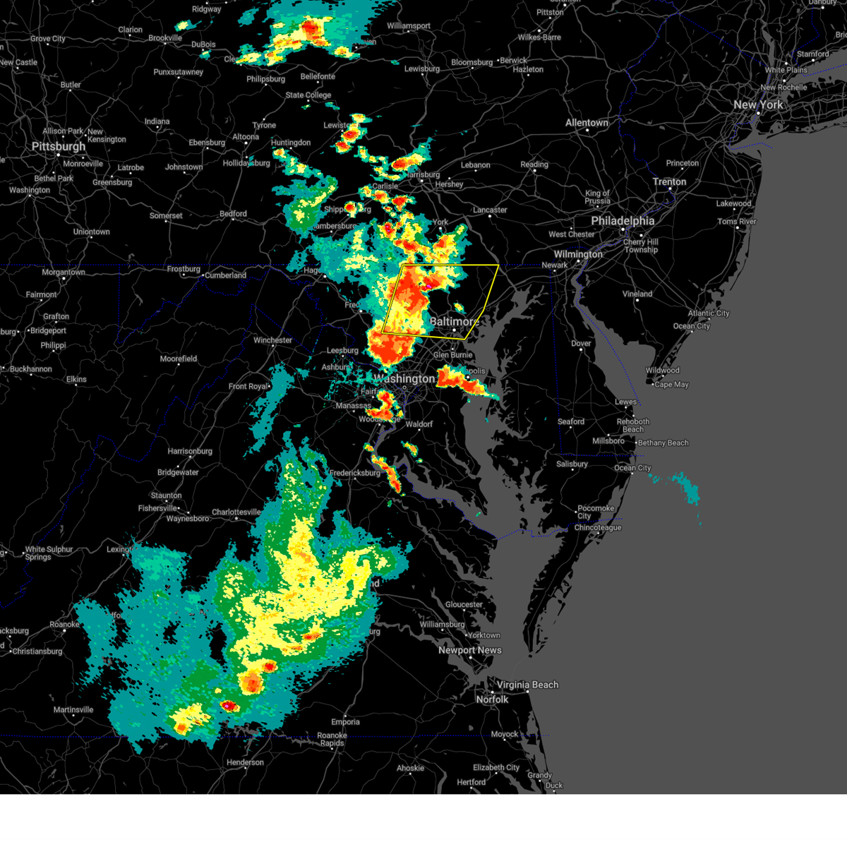
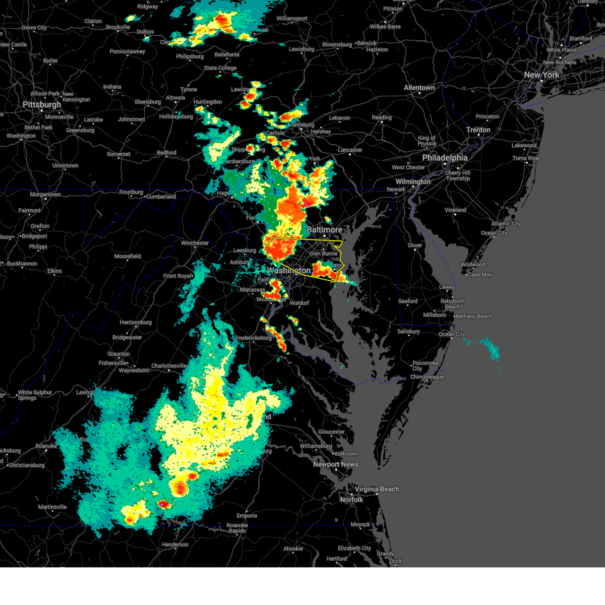
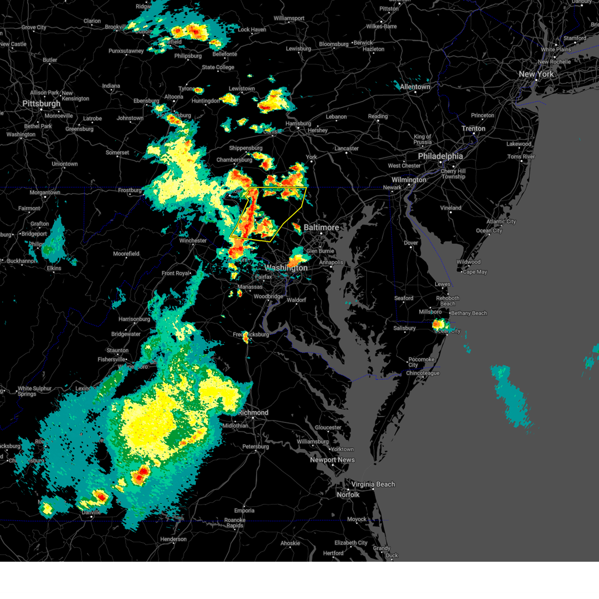
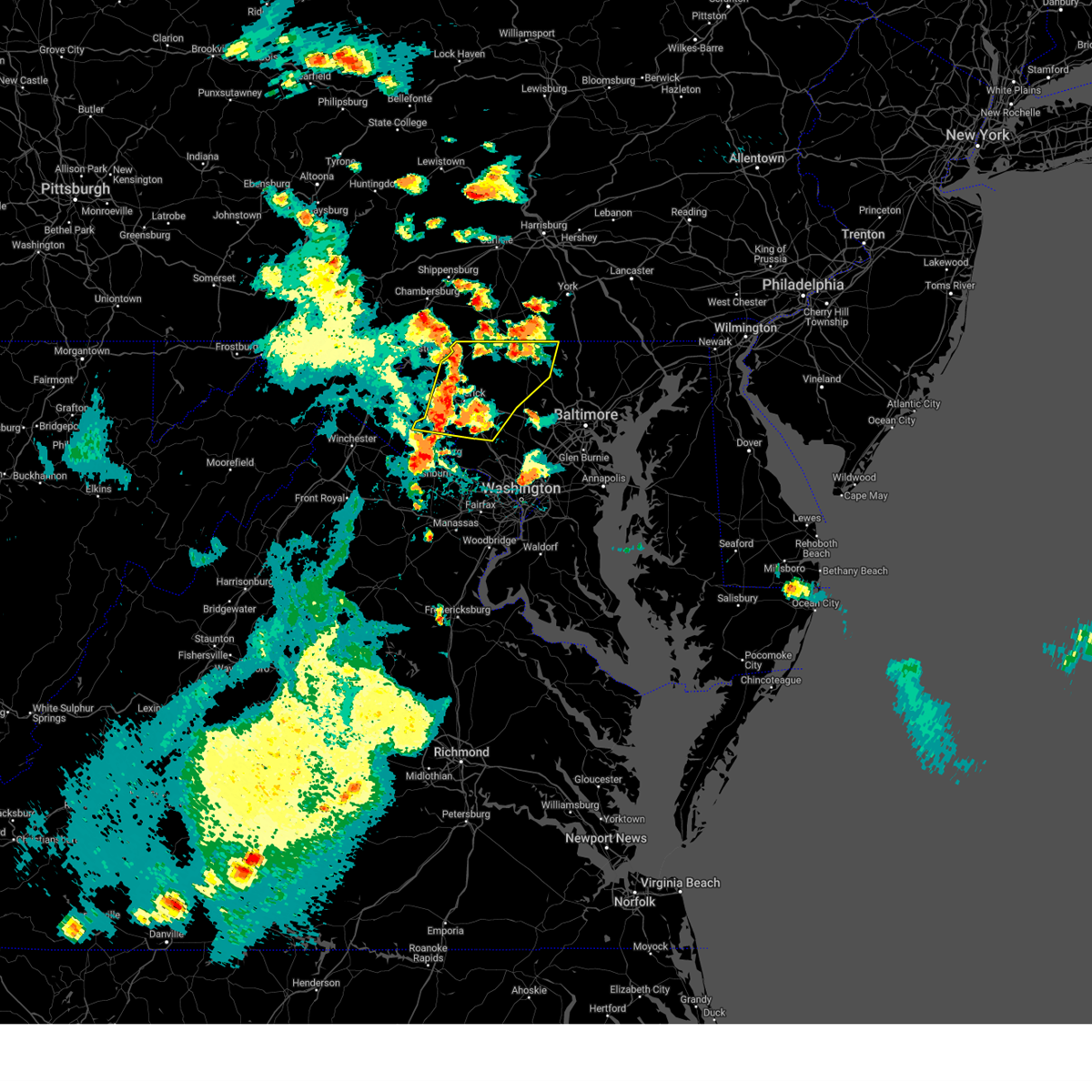
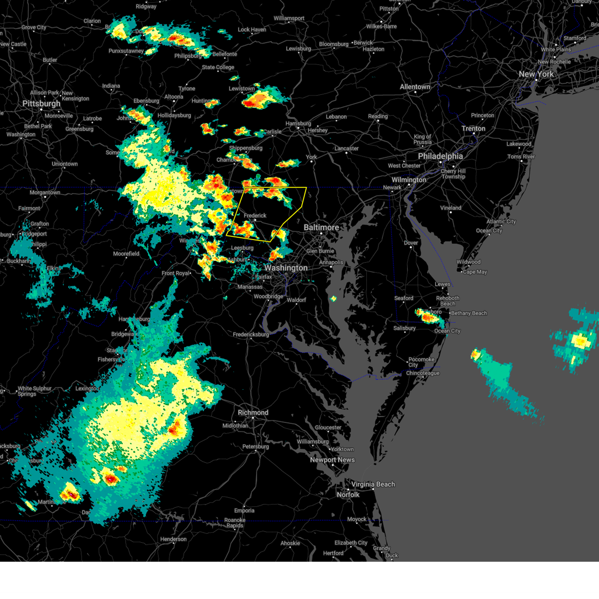
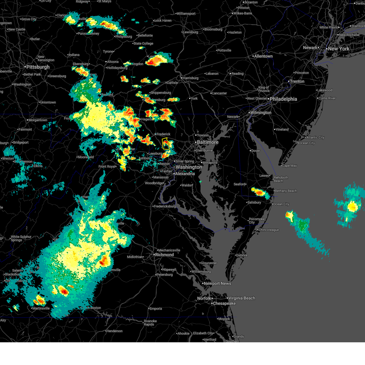
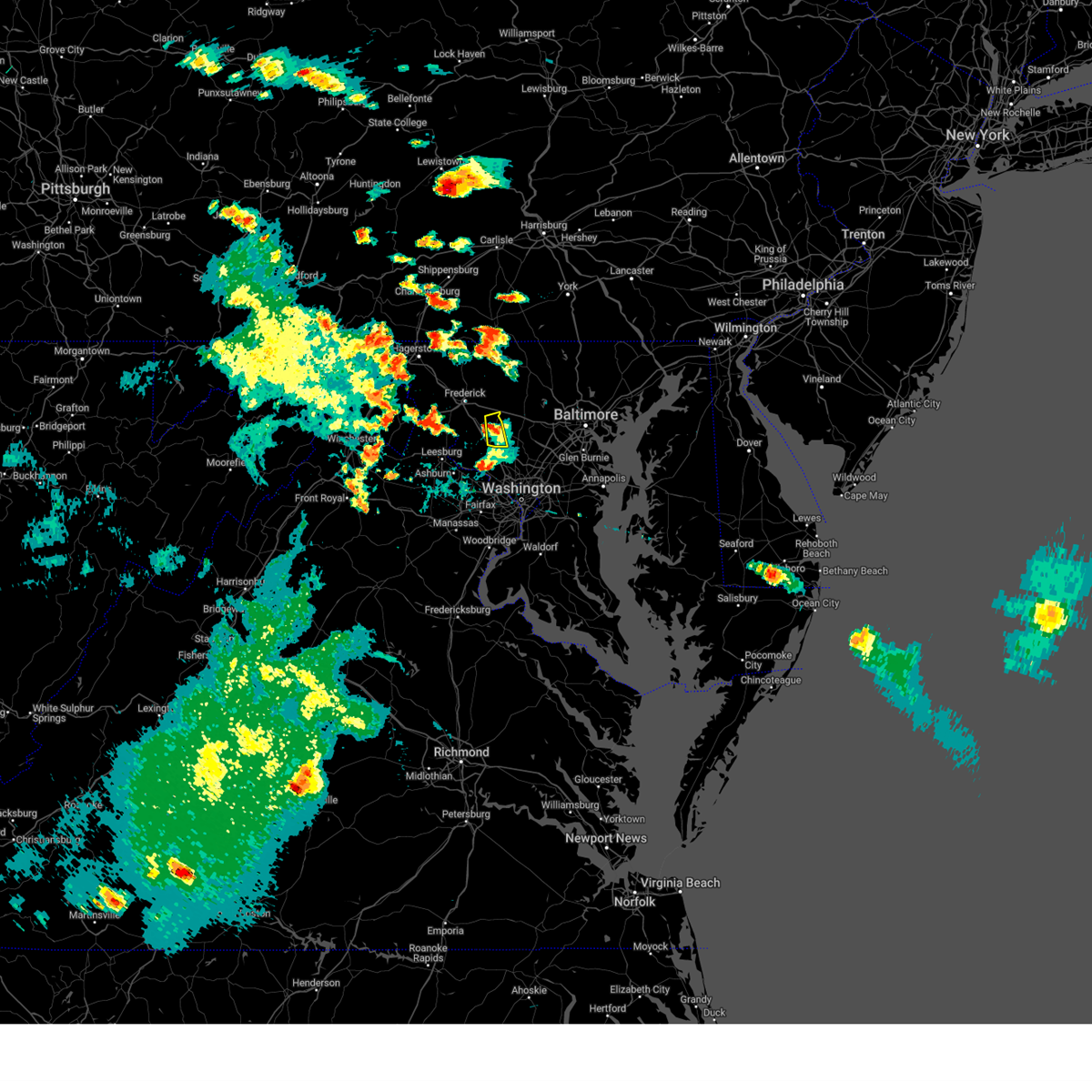
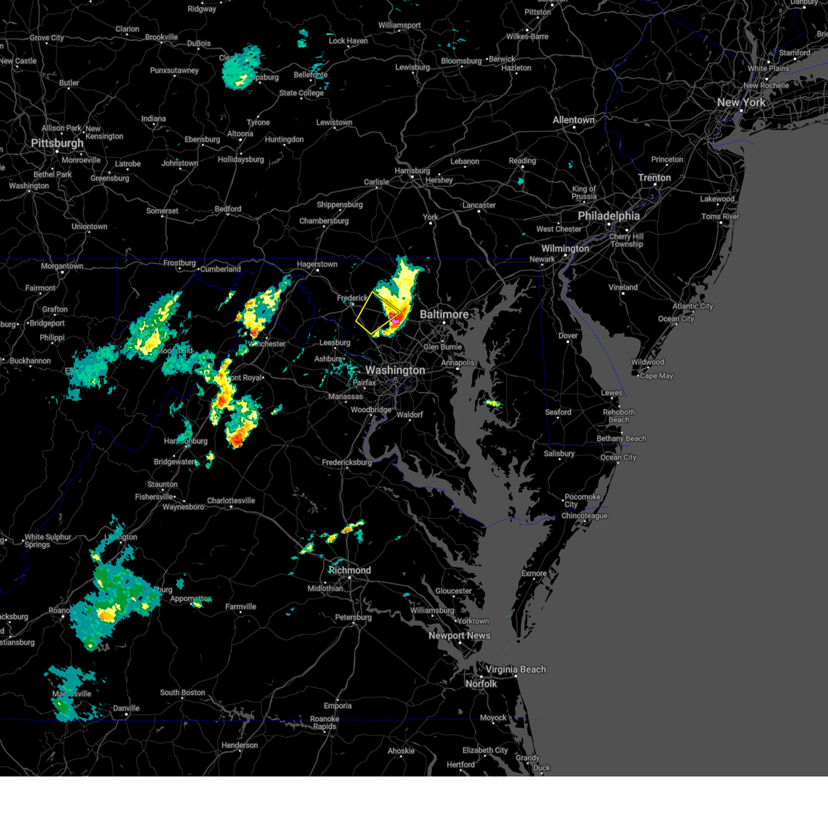
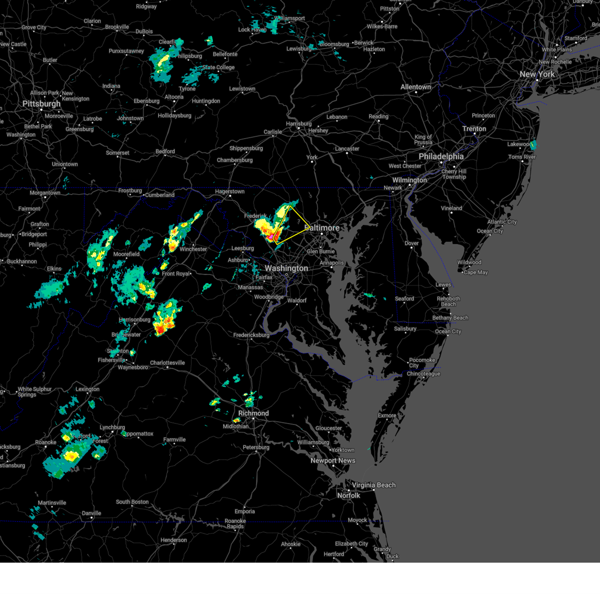
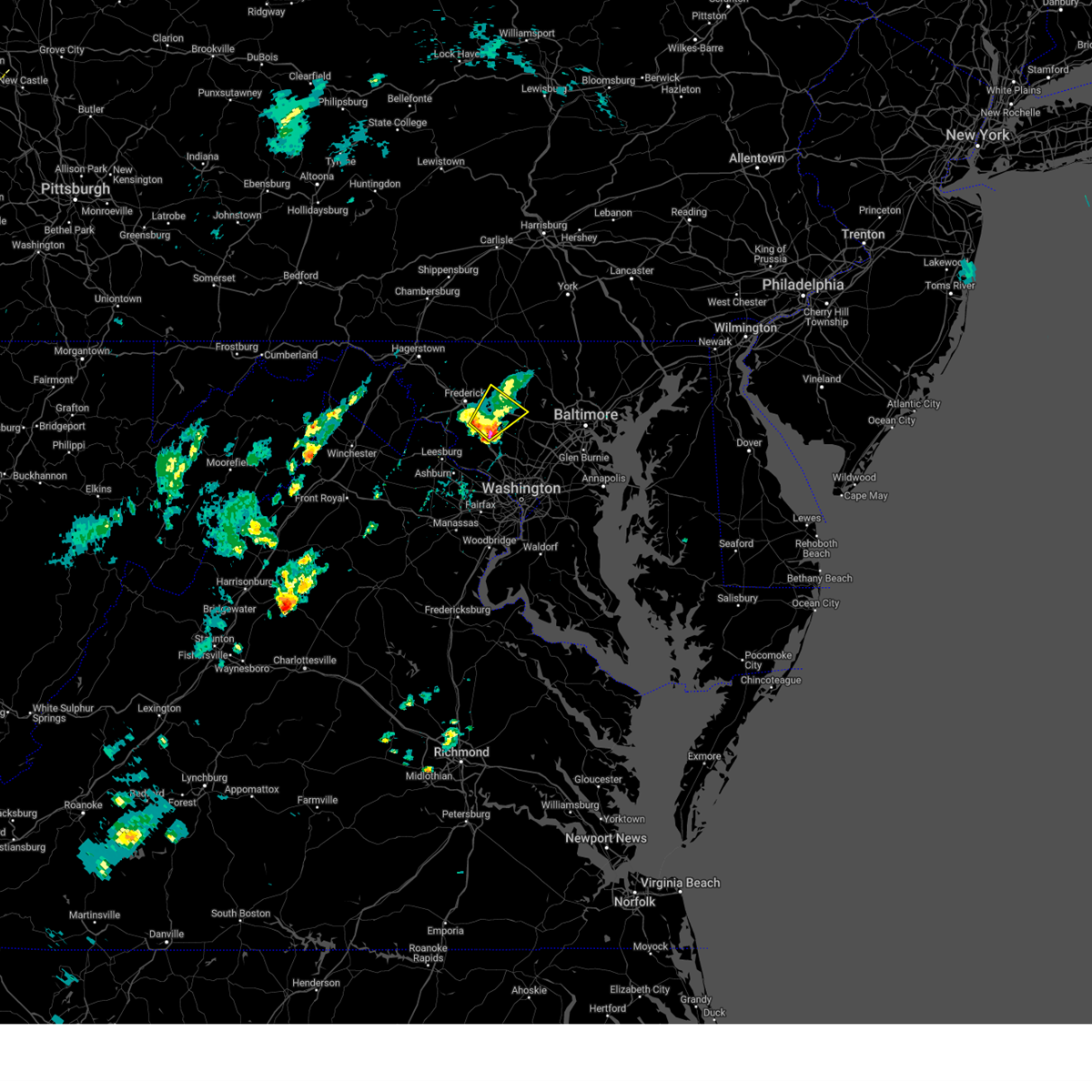
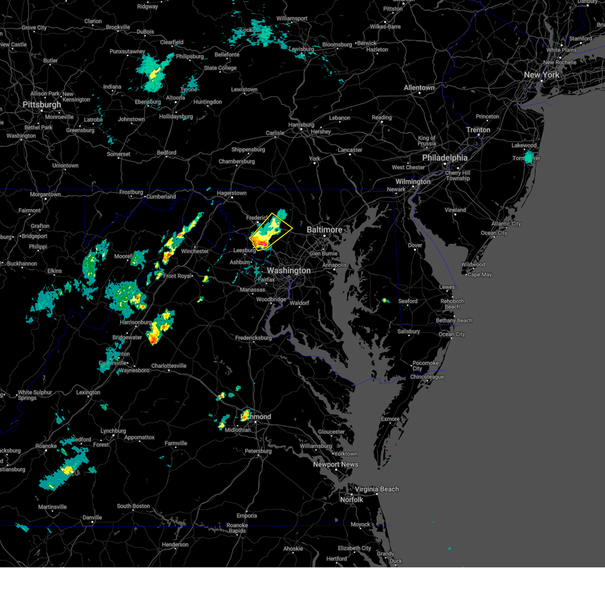
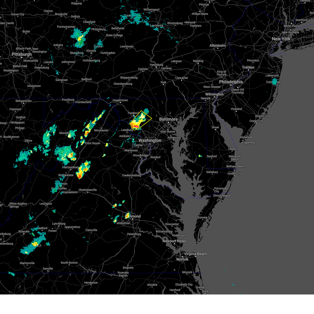
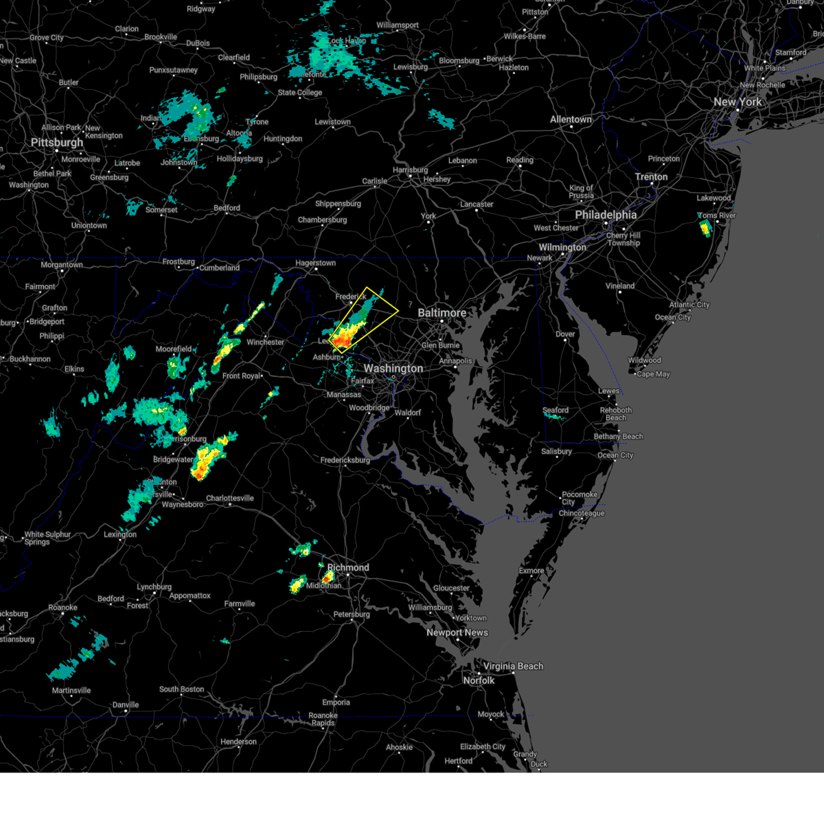
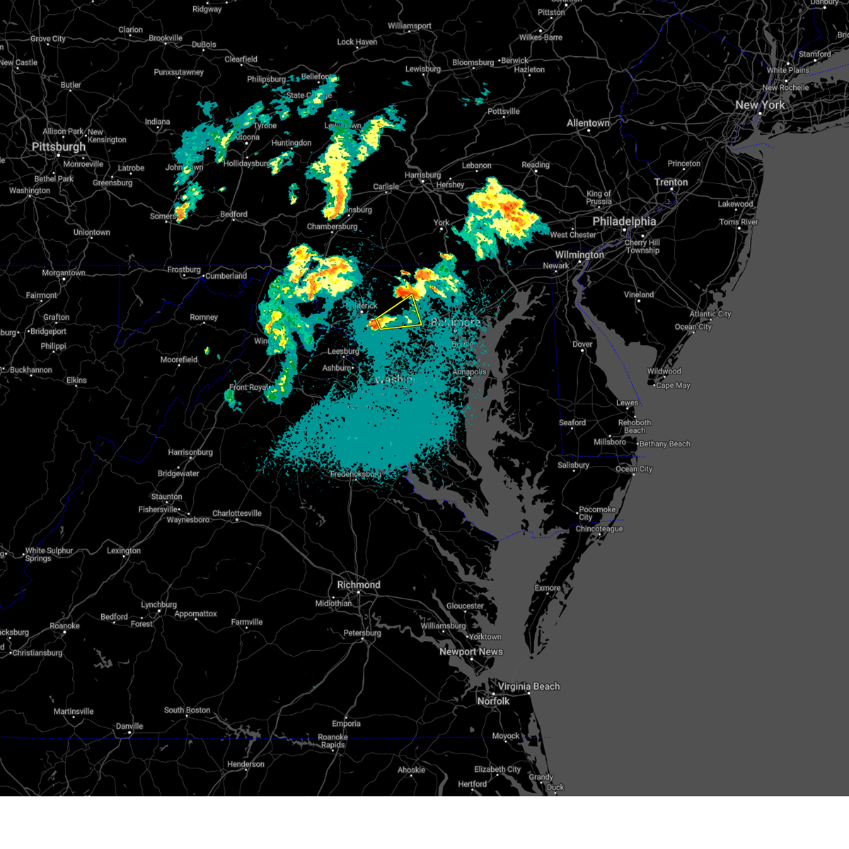
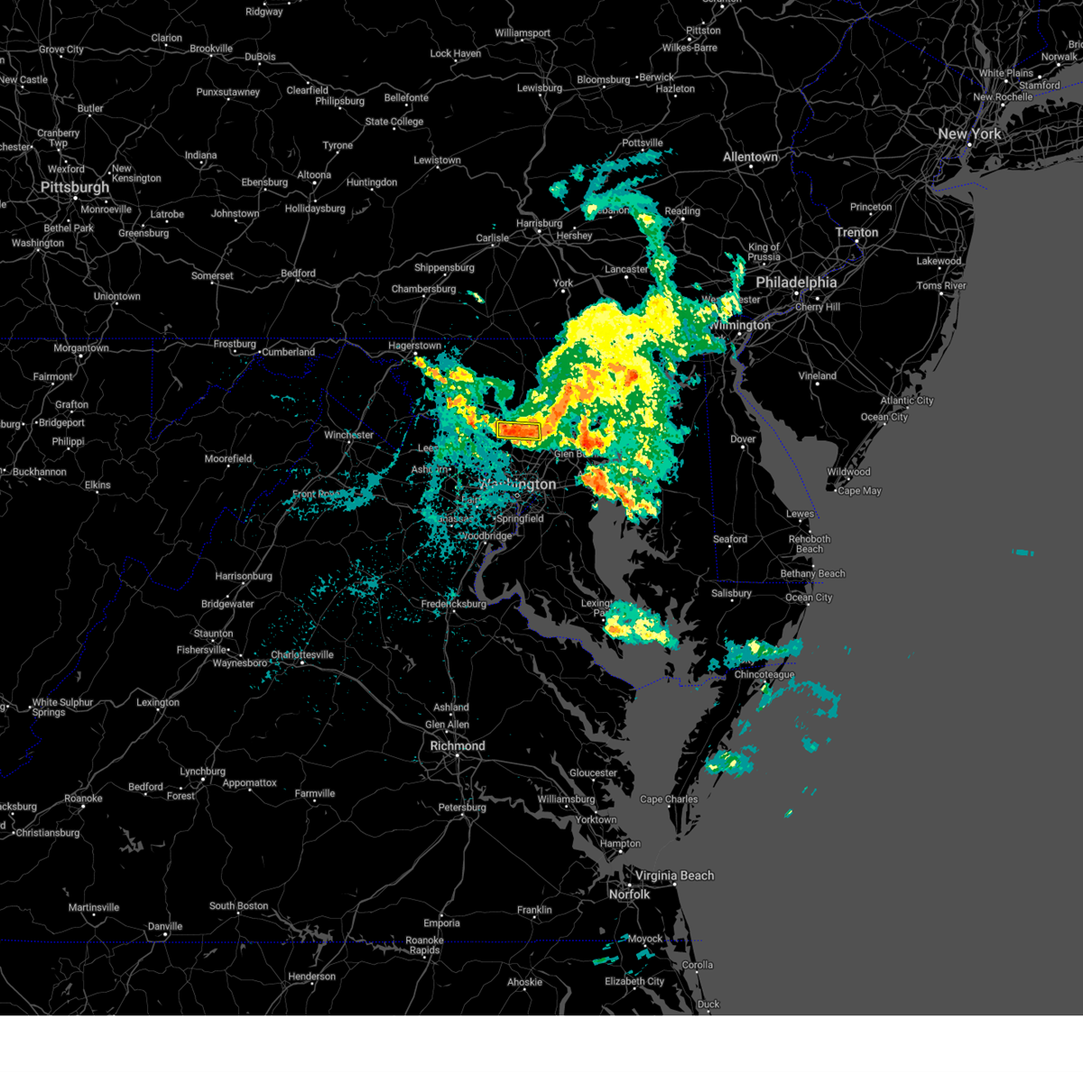
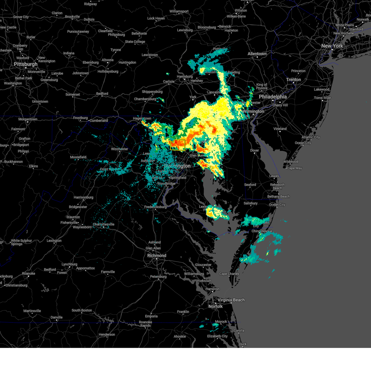
Hail Map for Damascus, MD
The Damascus, MD area has had 5 reports of on-the-ground hail by trained spotters, and has been under severe weather warnings 29 times during the past 12 months. Doppler radar has detected hail at or near Damascus, MD on 64 occasions.
| Name: | Damascus, MD |
| Where Located: | 31.4 miles W of Baltimore, MD |
| Map: | Google Map for Damascus, MD |
| Population: | 15257 |
| Housing Units: | 5172 |
| More Info: | Search Google for Damascus, MD |
3
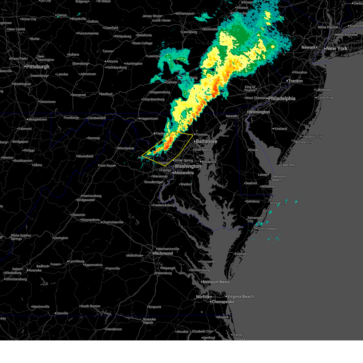
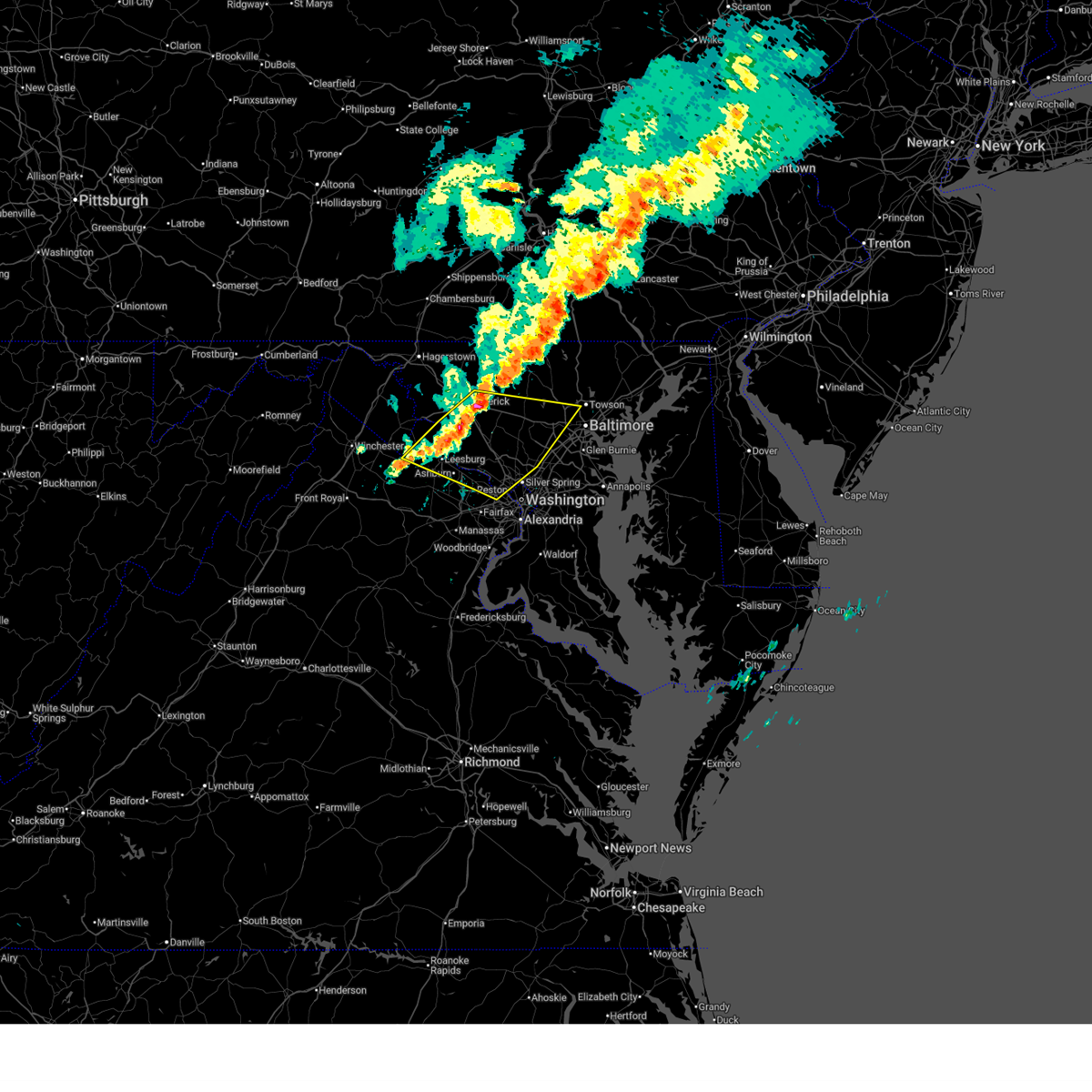
The Top Recent Hail Date for Damascus, MD is Saturday, May 3, 2025 (2nd out of 64)

Hail and Wind Damage Spotted near Damascus, MD
| Date / Time | Report Details |
|---|---|
| 6/11/2026 7:54 PM EDT |
 Svrlwx the national weather service in sterling virginia has issued a * severe thunderstorm warning for, the district of columbia, western baltimore county in northern maryland, carroll county in north central maryland, northwestern anne arundel county in central maryland, northwestern charles county in southern maryland, howard county in central maryland, montgomery county in central maryland, eastern frederick county in north central maryland, central prince georges county in central maryland, northeastern orange county in central virginia, the northern city of fredericksburg in central virginia, southeastern fauquier county in northern virginia, the city of manassas park in northern virginia, the city of manassas in northern virginia, east central madison county in northwestern virginia, the city of fairfax in northern virginia, arlington county in northern virginia, north central spotsylvania county in central virginia, stafford county in northern virginia, southeastern loudoun county in northern virginia, the city of falls church in northern virginia, fairfax county in northern virginia, southern culpeper county in northern virginia, prince william county in northern virginia, northwestern king george county in central virginia, the city of alexandria in northern virginia, * until 830 pm edt. * at 753 pm edt, severe thunderstorms were located along a line extending from 8 miles west of stafford to near burke to near great falls to near montgomery village to near mount airy to 8 miles northwest of sykesville to near littlestown, moving east at 45 mph (emergency management has reported many instances of trees down with this line of storms). Hazards include 60 mph wind gusts. Damaging winds will cause some trees and large branches to fall. this could injure those outdoors, as well as damage homes and vehicles. roadways may become blocked by downed trees. localized power outages are possible. Unsecured light objects may become projectiles. Svrlwx the national weather service in sterling virginia has issued a * severe thunderstorm warning for, the district of columbia, western baltimore county in northern maryland, carroll county in north central maryland, northwestern anne arundel county in central maryland, northwestern charles county in southern maryland, howard county in central maryland, montgomery county in central maryland, eastern frederick county in north central maryland, central prince georges county in central maryland, northeastern orange county in central virginia, the northern city of fredericksburg in central virginia, southeastern fauquier county in northern virginia, the city of manassas park in northern virginia, the city of manassas in northern virginia, east central madison county in northwestern virginia, the city of fairfax in northern virginia, arlington county in northern virginia, north central spotsylvania county in central virginia, stafford county in northern virginia, southeastern loudoun county in northern virginia, the city of falls church in northern virginia, fairfax county in northern virginia, southern culpeper county in northern virginia, prince william county in northern virginia, northwestern king george county in central virginia, the city of alexandria in northern virginia, * until 830 pm edt. * at 753 pm edt, severe thunderstorms were located along a line extending from 8 miles west of stafford to near burke to near great falls to near montgomery village to near mount airy to 8 miles northwest of sykesville to near littlestown, moving east at 45 mph (emergency management has reported many instances of trees down with this line of storms). Hazards include 60 mph wind gusts. Damaging winds will cause some trees and large branches to fall. this could injure those outdoors, as well as damage homes and vehicles. roadways may become blocked by downed trees. localized power outages are possible. Unsecured light objects may become projectiles.
|
| 6/11/2026 7:48 PM EDT |
 the severe thunderstorm warning has been cancelled and is no longer in effect the severe thunderstorm warning has been cancelled and is no longer in effect
|
| 6/11/2026 7:48 PM EDT |
 At 748 pm edt, severe thunderstorms were located along a line extending from 7 miles south of bealeton to south riding to near new market to near carroll valley, moving east at 40 mph (emergency management). Hazards include 60 mph wind gusts. Damaging winds will cause some trees and large branches to fall. this could injure those outdoors, as well as damage homes and vehicles. roadways may become blocked by downed trees. localized power outages are possible. unsecured light objects may become projectiles. Locations impacted include, germantown, centreville, frederick, rockville, gaithersburg, reston, leesburg, south riding, herndon, fairfax, culpeper, vienna, damascus, broadlands, lansdowne, lowes island, brambleton, warrenton, thurmont, and poolesville. At 748 pm edt, severe thunderstorms were located along a line extending from 7 miles south of bealeton to south riding to near new market to near carroll valley, moving east at 40 mph (emergency management). Hazards include 60 mph wind gusts. Damaging winds will cause some trees and large branches to fall. this could injure those outdoors, as well as damage homes and vehicles. roadways may become blocked by downed trees. localized power outages are possible. unsecured light objects may become projectiles. Locations impacted include, germantown, centreville, frederick, rockville, gaithersburg, reston, leesburg, south riding, herndon, fairfax, culpeper, vienna, damascus, broadlands, lansdowne, lowes island, brambleton, warrenton, thurmont, and poolesville.
|
| 6/11/2026 7:18 PM EDT |
 Svrlwx the national weather service in sterling virginia has issued a * severe thunderstorm warning for, eastern washington county in north central maryland, northwestern howard county in central maryland, western montgomery county in central maryland, frederick county in north central maryland, western carroll county in north central maryland, northwestern stafford county in northern virginia, loudoun county in northern virginia, northeastern orange county in central virginia, northwestern fairfax county in northern virginia, southeastern rappahannock county in northwestern virginia, fauquier county in northern virginia, culpeper county in northern virginia, the city of manassas park in northern virginia, prince william county in northern virginia, the city of manassas in northern virginia, east central madison county in northwestern virginia, the western city of fairfax in northern virginia, eastern clarke county in northwestern virginia, southeastern jefferson county in the panhandle of west virginia, * until 800 pm edt. * at 716 pm edt, severe thunderstorms were located along a line extending from 8 miles west of culpeper to near delaplane to near boonsboro to greencastle, moving east at 40 mph (emergency management has reported many instances of trees down with this line of storms). Hazards include 60 mph wind gusts. Damaging winds will cause some trees and large branches to fall. this could injure those outdoors, as well as damage homes and vehicles. roadways may become blocked by downed trees. localized power outages are possible. Unsecured light objects may become projectiles. Svrlwx the national weather service in sterling virginia has issued a * severe thunderstorm warning for, eastern washington county in north central maryland, northwestern howard county in central maryland, western montgomery county in central maryland, frederick county in north central maryland, western carroll county in north central maryland, northwestern stafford county in northern virginia, loudoun county in northern virginia, northeastern orange county in central virginia, northwestern fairfax county in northern virginia, southeastern rappahannock county in northwestern virginia, fauquier county in northern virginia, culpeper county in northern virginia, the city of manassas park in northern virginia, prince william county in northern virginia, the city of manassas in northern virginia, east central madison county in northwestern virginia, the western city of fairfax in northern virginia, eastern clarke county in northwestern virginia, southeastern jefferson county in the panhandle of west virginia, * until 800 pm edt. * at 716 pm edt, severe thunderstorms were located along a line extending from 8 miles west of culpeper to near delaplane to near boonsboro to greencastle, moving east at 40 mph (emergency management has reported many instances of trees down with this line of storms). Hazards include 60 mph wind gusts. Damaging winds will cause some trees and large branches to fall. this could injure those outdoors, as well as damage homes and vehicles. roadways may become blocked by downed trees. localized power outages are possible. Unsecured light objects may become projectiles.
|
| 6/6/2026 6:34 PM EDT |
 At 634 pm edt, severe thunderstorms were located along a line extending from owings mills to near columbia to near potomac, moving east at 40 mph (radar indicated). Hazards include 60 mph wind gusts. Damaging winds will cause some trees and large branches to fall. this could injure those outdoors, as well as damage homes and vehicles. roadways may become blocked by downed trees. localized power outages are possible. unsecured light objects may become projectiles. Locations impacted include, baltimore, columbia, germantown, rockville, bethesda, gaithersburg, olney, pikesville, damascus, lowes island, historic ellicott city, ellicott city, towson, aspen hill, potomac, north bethesda, catonsville, woodlawn, randallstown, and montgomery village. At 634 pm edt, severe thunderstorms were located along a line extending from owings mills to near columbia to near potomac, moving east at 40 mph (radar indicated). Hazards include 60 mph wind gusts. Damaging winds will cause some trees and large branches to fall. this could injure those outdoors, as well as damage homes and vehicles. roadways may become blocked by downed trees. localized power outages are possible. unsecured light objects may become projectiles. Locations impacted include, baltimore, columbia, germantown, rockville, bethesda, gaithersburg, olney, pikesville, damascus, lowes island, historic ellicott city, ellicott city, towson, aspen hill, potomac, north bethesda, catonsville, woodlawn, randallstown, and montgomery village.
|
| 6/6/2026 6:24 PM EDT |
 At 623 pm edt, severe thunderstorms were located along a line extending from eldersburg to near olney to lowes island, moving east at 40 mph (radar indicated). Hazards include 60 mph wind gusts. Damaging winds will cause some trees and large branches to fall. this could injure those outdoors, as well as damage homes and vehicles. roadways may become blocked by downed trees. localized power outages are possible. unsecured light objects may become projectiles. Locations impacted include, baltimore, columbia, germantown, rockville, bethesda, gaithersburg, reston, leesburg, olney, pikesville, herndon, damascus, broadlands, lansdowne, lowes island, pimmit hills, poolesville, mclean, american legion bridge, and historic ellicott city. At 623 pm edt, severe thunderstorms were located along a line extending from eldersburg to near olney to lowes island, moving east at 40 mph (radar indicated). Hazards include 60 mph wind gusts. Damaging winds will cause some trees and large branches to fall. this could injure those outdoors, as well as damage homes and vehicles. roadways may become blocked by downed trees. localized power outages are possible. unsecured light objects may become projectiles. Locations impacted include, baltimore, columbia, germantown, rockville, bethesda, gaithersburg, reston, leesburg, olney, pikesville, herndon, damascus, broadlands, lansdowne, lowes island, pimmit hills, poolesville, mclean, american legion bridge, and historic ellicott city.
|
| 6/6/2026 5:57 PM EDT |
 Svrlwx the national weather service in sterling virginia has issued a * severe thunderstorm warning for, southeastern carroll county in north central maryland, northwestern baltimore city in northern maryland, howard county in central maryland, montgomery county in central maryland, southern frederick county in north central maryland, southwestern baltimore county in northern maryland, central loudoun county in northern virginia, northeastern fairfax county in northern virginia, * until 645 pm edt. * at 557 pm edt, severe thunderstorms were located along a line extending from near new market to 6 miles northwest of boyds to near purcellville, moving east at 40 mph (radar indicated). Hazards include 60 mph wind gusts. Damaging winds will cause some trees and large branches to fall. this could injure those outdoors, as well as damage homes and vehicles. roadways may become blocked by downed trees. localized power outages are possible. Unsecured light objects may become projectiles. Svrlwx the national weather service in sterling virginia has issued a * severe thunderstorm warning for, southeastern carroll county in north central maryland, northwestern baltimore city in northern maryland, howard county in central maryland, montgomery county in central maryland, southern frederick county in north central maryland, southwestern baltimore county in northern maryland, central loudoun county in northern virginia, northeastern fairfax county in northern virginia, * until 645 pm edt. * at 557 pm edt, severe thunderstorms were located along a line extending from near new market to 6 miles northwest of boyds to near purcellville, moving east at 40 mph (radar indicated). Hazards include 60 mph wind gusts. Damaging winds will cause some trees and large branches to fall. this could injure those outdoors, as well as damage homes and vehicles. roadways may become blocked by downed trees. localized power outages are possible. Unsecured light objects may become projectiles.
|
| 3/16/2026 8:33 PM EDT |
 Svrlwx the national weather service in sterling virginia has issued a * severe thunderstorm warning for, the district of columbia, howard county in central maryland, montgomery county in central maryland, southeastern frederick county in north central maryland, southwestern baltimore county in northern maryland, central prince georges county in central maryland, south central carroll county in north central maryland, northwestern anne arundel county in central maryland, north central charles county in southern maryland, southeastern loudoun county in northern virginia, northern stafford county in northern virginia, the city of falls church in northern virginia, fairfax county in northern virginia, east central fauquier county in northern virginia, the city of manassas park in northern virginia, prince william county in northern virginia, the city of manassas in northern virginia, the city of fairfax in northern virginia, arlington county in northern virginia, the city of alexandria in northern virginia, * until 915 pm edt. * at 832 pm edt, severe thunderstorms were located along a line extending from near green valley to near bealeton, moving east at 65 mph (nws observation). Hazards include 60 mph wind gusts. Damaging winds will cause some trees and large branches to fall. this could injure those outdoors, as well as damage homes and vehicles. roadways may become blocked by downed trees. localized power outages are possible. Unsecured light objects may become projectiles. Svrlwx the national weather service in sterling virginia has issued a * severe thunderstorm warning for, the district of columbia, howard county in central maryland, montgomery county in central maryland, southeastern frederick county in north central maryland, southwestern baltimore county in northern maryland, central prince georges county in central maryland, south central carroll county in north central maryland, northwestern anne arundel county in central maryland, north central charles county in southern maryland, southeastern loudoun county in northern virginia, northern stafford county in northern virginia, the city of falls church in northern virginia, fairfax county in northern virginia, east central fauquier county in northern virginia, the city of manassas park in northern virginia, prince william county in northern virginia, the city of manassas in northern virginia, the city of fairfax in northern virginia, arlington county in northern virginia, the city of alexandria in northern virginia, * until 915 pm edt. * at 832 pm edt, severe thunderstorms were located along a line extending from near green valley to near bealeton, moving east at 65 mph (nws observation). Hazards include 60 mph wind gusts. Damaging winds will cause some trees and large branches to fall. this could injure those outdoors, as well as damage homes and vehicles. roadways may become blocked by downed trees. localized power outages are possible. Unsecured light objects may become projectiles.
|
| 3/16/2026 11:53 AM EDT |
 The storm which prompted the warning no longer appears capable of producing a tornado. therefore, the warning will be allowed to expire. a tornado watch remains in effect until 700 pm edt for central maryland. The storm which prompted the warning no longer appears capable of producing a tornado. therefore, the warning will be allowed to expire. a tornado watch remains in effect until 700 pm edt for central maryland.
|
| 3/16/2026 11:50 AM EDT | Wires down at the intersection of ridge rd. and kakae d in montgomery county MD, 1.9 miles E of Damascus, MD |
| 3/16/2026 11:48 AM EDT |
 At 1148 am edt, a severe thunderstorm capable of producing a tornado was located over damascus, moving northeast at 50 mph (radar indicated rotation). Hazards include tornado. For those in the direct path of a tornado touchdown, flying debris will be dangerous to those caught without shelter. damage to roofs, siding, and windows may occur. mobile homes may be damaged or destroyed. tree damage is likely. This tornadic thunderstorm will remain over mainly rural areas of north central montgomery county, including the following locations, clarksburg. At 1148 am edt, a severe thunderstorm capable of producing a tornado was located over damascus, moving northeast at 50 mph (radar indicated rotation). Hazards include tornado. For those in the direct path of a tornado touchdown, flying debris will be dangerous to those caught without shelter. damage to roofs, siding, and windows may occur. mobile homes may be damaged or destroyed. tree damage is likely. This tornadic thunderstorm will remain over mainly rural areas of north central montgomery county, including the following locations, clarksburg.
|
| 3/16/2026 11:40 AM EDT |
 Torlwx the national weather service in sterling virginia has issued a * tornado warning for, north central montgomery county in central maryland, * until noon edt. * at 1140 am edt, a severe thunderstorm capable of producing a tornado was located over boyds, or over germantown, moving northeast at 50 mph (radar indicated rotation). Hazards include tornado. For those in the direct path of a tornado touchdown, flying debris will be dangerous to those caught without shelter. damage to roofs, siding, and windows may occur. mobile homes may be damaged or destroyed. tree damage is likely. this dangerous storm will be near, germantown and damascus around 1145 am edt. Other locations impacted by this tornadic thunderstorm include clarksburg. Torlwx the national weather service in sterling virginia has issued a * tornado warning for, north central montgomery county in central maryland, * until noon edt. * at 1140 am edt, a severe thunderstorm capable of producing a tornado was located over boyds, or over germantown, moving northeast at 50 mph (radar indicated rotation). Hazards include tornado. For those in the direct path of a tornado touchdown, flying debris will be dangerous to those caught without shelter. damage to roofs, siding, and windows may occur. mobile homes may be damaged or destroyed. tree damage is likely. this dangerous storm will be near, germantown and damascus around 1145 am edt. Other locations impacted by this tornadic thunderstorm include clarksburg.
|
| 3/16/2026 11:40 AM EDT |
 Svrlwx the national weather service in sterling virginia has issued a * severe thunderstorm warning for, northeastern washington county in north central maryland, carroll county in north central maryland, northwestern baltimore city in northern maryland, northern howard county in central maryland, central montgomery county in central maryland, central frederick county in north central maryland, northwestern baltimore county in northern maryland, eastern loudoun county in northern virginia, northern fairfax county in northern virginia, * until 1230 pm edt. * at 1140 am edt, severe thunderstorms were located along a line extending from rouzerville to near new market to near germantown to near boyds, moving northeast at 50 mph (radar indicated). Hazards include 60 mph wind gusts. Damaging winds will cause some trees and large branches to fall. this could injure those outdoors, as well as damage homes and vehicles. roadways may become blocked by downed trees. localized power outages are possible. Unsecured light objects may become projectiles. Svrlwx the national weather service in sterling virginia has issued a * severe thunderstorm warning for, northeastern washington county in north central maryland, carroll county in north central maryland, northwestern baltimore city in northern maryland, northern howard county in central maryland, central montgomery county in central maryland, central frederick county in north central maryland, northwestern baltimore county in northern maryland, eastern loudoun county in northern virginia, northern fairfax county in northern virginia, * until 1230 pm edt. * at 1140 am edt, severe thunderstorms were located along a line extending from rouzerville to near new market to near germantown to near boyds, moving northeast at 50 mph (radar indicated). Hazards include 60 mph wind gusts. Damaging winds will cause some trees and large branches to fall. this could injure those outdoors, as well as damage homes and vehicles. roadways may become blocked by downed trees. localized power outages are possible. Unsecured light objects may become projectiles.
|
| 3/16/2026 11:28 AM EDT |
 Svrlwx the national weather service in sterling virginia has issued a * severe thunderstorm warning for, northwestern montgomery county in central maryland, southeastern frederick county in north central maryland, east central loudoun county in northern virginia, * until 1145 am edt. * at 1128 am edt, a severe thunderstorm was located over lansdowne, moving northeast at 45 mph (radar indicated). Hazards include 70 mph wind gusts. Damaging winds will cause some trees and large branches to fall. this could injure those outdoors, as well as damage homes and vehicles. roadways may become blocked by downed trees. localized power outages are possible. Unsecured light objects may become projectiles. Svrlwx the national weather service in sterling virginia has issued a * severe thunderstorm warning for, northwestern montgomery county in central maryland, southeastern frederick county in north central maryland, east central loudoun county in northern virginia, * until 1145 am edt. * at 1128 am edt, a severe thunderstorm was located over lansdowne, moving northeast at 45 mph (radar indicated). Hazards include 70 mph wind gusts. Damaging winds will cause some trees and large branches to fall. this could injure those outdoors, as well as damage homes and vehicles. roadways may become blocked by downed trees. localized power outages are possible. Unsecured light objects may become projectiles.
|
| 3/11/2026 8:07 PM EDT | Multiple trees and wires down on md-94 woodbine road near florence road... and across western howard county to md-144 frederick roa in howard county MD, 5.5 miles SW of Damascus, MD |
| 3/11/2026 7:02 PM EDT |
 the severe thunderstorm warning has been cancelled and is no longer in effect the severe thunderstorm warning has been cancelled and is no longer in effect
|
| 3/11/2026 7:02 PM EDT |
 At 702 pm edt, severe thunderstorms were located along a line extending from near mount airy to near olney to gaithersburg, moving east at 60 mph (emergency management reported wind damage in montgomery county). Hazards include 70 mph wind gusts. Damaging winds will cause some trees and large branches to fall. this could injure those outdoors, as well as damage homes and vehicles. roadways may become blocked by downed trees. localized power outages are possible. unsecured light objects may become projectiles. Locations impacted include, columbia, germantown, rockville, gaithersburg, olney, damascus, ellicott city, aspen hill, montgomery village, eldersburg, redland, boyds, green valley, scaggsville, cloverly, clarksburg, burtonsville, darnestown, derwood, and fulton. At 702 pm edt, severe thunderstorms were located along a line extending from near mount airy to near olney to gaithersburg, moving east at 60 mph (emergency management reported wind damage in montgomery county). Hazards include 70 mph wind gusts. Damaging winds will cause some trees and large branches to fall. this could injure those outdoors, as well as damage homes and vehicles. roadways may become blocked by downed trees. localized power outages are possible. unsecured light objects may become projectiles. Locations impacted include, columbia, germantown, rockville, gaithersburg, olney, damascus, ellicott city, aspen hill, montgomery village, eldersburg, redland, boyds, green valley, scaggsville, cloverly, clarksburg, burtonsville, darnestown, derwood, and fulton.
|
| 3/11/2026 7:02 PM EDT |
 At 702 pm edt, severe thunderstorms were located along a line extending from near damascus to montgomery village to lowes island, moving east at 40 mph (radar indicated). Hazards include 70 mph wind gusts. Damaging winds will cause some trees and large branches to fall. this could injure those outdoors, as well as damage homes and vehicles. roadways may become blocked by downed trees. localized power outages are possible. unsecured light objects may become projectiles. Locations impacted include, germantown, gaithersburg, damascus, montgomery village, north potomac, boyds, clarksburg, darnestown, washington grove, and dawsonville. At 702 pm edt, severe thunderstorms were located along a line extending from near damascus to montgomery village to lowes island, moving east at 40 mph (radar indicated). Hazards include 70 mph wind gusts. Damaging winds will cause some trees and large branches to fall. this could injure those outdoors, as well as damage homes and vehicles. roadways may become blocked by downed trees. localized power outages are possible. unsecured light objects may become projectiles. Locations impacted include, germantown, gaithersburg, damascus, montgomery village, north potomac, boyds, clarksburg, darnestown, washington grove, and dawsonville.
|
| 3/11/2026 7:00 PM EDT |
 Torlwx the national weather service in sterling virginia has issued a * tornado warning for, south central carroll county in north central maryland, northwestern howard county in central maryland, north central montgomery county in central maryland, * until 715 pm edt. * at 700 pm edt, a severe thunderstorm capable of producing a tornado was located near damascus, moving east at 50 mph (radar indicated rotation). Hazards include tornado. For those in the direct path of a tornado touchdown, flying debris will be dangerous to those caught without shelter. damage to roofs, siding, and windows may occur. mobile homes may be damaged or destroyed. tree damage is likely. this dangerous storm will be near, ellicott city, eldersburg, and sykesville around 705 pm edt. Other locations impacted by this tornadic thunderstorm include roxbury mills, henryton, west friendship, lisbon, glenwood, glenelg, marriottsville, and woodstock. Torlwx the national weather service in sterling virginia has issued a * tornado warning for, south central carroll county in north central maryland, northwestern howard county in central maryland, north central montgomery county in central maryland, * until 715 pm edt. * at 700 pm edt, a severe thunderstorm capable of producing a tornado was located near damascus, moving east at 50 mph (radar indicated rotation). Hazards include tornado. For those in the direct path of a tornado touchdown, flying debris will be dangerous to those caught without shelter. damage to roofs, siding, and windows may occur. mobile homes may be damaged or destroyed. tree damage is likely. this dangerous storm will be near, ellicott city, eldersburg, and sykesville around 705 pm edt. Other locations impacted by this tornadic thunderstorm include roxbury mills, henryton, west friendship, lisbon, glenwood, glenelg, marriottsville, and woodstock.
|
| 3/11/2026 6:59 PM EDT | Multiple trees and wires down on md-94 woodbine road near florence road... and across western howard county to md-144 frederick roa in howard county MD, 5.5 miles SW of Damascus, MD |
| 3/11/2026 6:57 PM EDT | Trees down blocking md-94 woodbine road near annapolis rock roa in howard county MD, 3.6 miles WSW of Damascus, MD |
| 3/11/2026 6:56 PM EDT |
 Svrlwx the national weather service in sterling virginia has issued a * severe thunderstorm warning for, howard county in central maryland, central montgomery county in central maryland, southeastern frederick county in north central maryland, * until 730 pm edt. * at 656 pm edt, severe thunderstorms were located along a line extending from near green valley to near montgomery village to near boyds, moving east at 60 mph (radar indicated). Hazards include 60 mph wind gusts. Damaging winds will cause some trees and large branches to fall. this could injure those outdoors, as well as damage homes and vehicles. roadways may become blocked by downed trees. localized power outages are possible. Unsecured light objects may become projectiles. Svrlwx the national weather service in sterling virginia has issued a * severe thunderstorm warning for, howard county in central maryland, central montgomery county in central maryland, southeastern frederick county in north central maryland, * until 730 pm edt. * at 656 pm edt, severe thunderstorms were located along a line extending from near green valley to near montgomery village to near boyds, moving east at 60 mph (radar indicated). Hazards include 60 mph wind gusts. Damaging winds will cause some trees and large branches to fall. this could injure those outdoors, as well as damage homes and vehicles. roadways may become blocked by downed trees. localized power outages are possible. Unsecured light objects may become projectiles.
|
| 3/11/2026 6:52 PM EDT | Numerous large tree limbs several inches in diameter snapped and blew in from neighbor's yar in montgomery county MD, 1.9 miles E of Damascus, MD |
| 3/11/2026 6:52 PM EDT | Several shingles and shutters blown off house just east of downtown damascu in montgomery county MD, 1.2 miles SSE of Damascus, MD |
| 3/11/2026 6:52 PM EDT |
 At 652 pm edt, severe thunderstorms were located along a line extending from near damascus to boyds to countryside, moving east at 45 mph (radar indicated). Hazards include 70 mph wind gusts. Damaging winds will cause some trees and large branches to fall. this could injure those outdoors, as well as damage homes and vehicles. roadways may become blocked by downed trees. localized power outages are possible. unsecured light objects may become projectiles. Locations impacted include, germantown, gaithersburg, damascus, lansdowne, lowes island, poolesville, ashburn, montgomery village, north potomac, great falls, countryside, boyds, clarksburg, darnestown, belmont, washington grove, barnesville, dickerson, beallsville, and dawsonville. At 652 pm edt, severe thunderstorms were located along a line extending from near damascus to boyds to countryside, moving east at 45 mph (radar indicated). Hazards include 70 mph wind gusts. Damaging winds will cause some trees and large branches to fall. this could injure those outdoors, as well as damage homes and vehicles. roadways may become blocked by downed trees. localized power outages are possible. unsecured light objects may become projectiles. Locations impacted include, germantown, gaithersburg, damascus, lansdowne, lowes island, poolesville, ashburn, montgomery village, north potomac, great falls, countryside, boyds, clarksburg, darnestown, belmont, washington grove, barnesville, dickerson, beallsville, and dawsonville.
|
| 3/11/2026 6:45 PM EDT |
 At 645 pm edt, severe thunderstorms were located along a line extending from 6 miles east of point of rocks to near poolesville to near leesburg, moving east at 45 mph (radar indicated). Hazards include 70 mph wind gusts. Damaging winds will cause some trees and large branches to fall. this could injure those outdoors, as well as damage homes and vehicles. roadways may become blocked by downed trees. localized power outages are possible. unsecured light objects may become projectiles. Locations impacted include, germantown, gaithersburg, leesburg, damascus, broadlands, lansdowne, lowes island, poolesville, ashburn, montgomery village, sterling, north potomac, great falls, countryside, oatlands, boyds, point of rocks, clarksburg, darnestown, and belmont. At 645 pm edt, severe thunderstorms were located along a line extending from 6 miles east of point of rocks to near poolesville to near leesburg, moving east at 45 mph (radar indicated). Hazards include 70 mph wind gusts. Damaging winds will cause some trees and large branches to fall. this could injure those outdoors, as well as damage homes and vehicles. roadways may become blocked by downed trees. localized power outages are possible. unsecured light objects may become projectiles. Locations impacted include, germantown, gaithersburg, leesburg, damascus, broadlands, lansdowne, lowes island, poolesville, ashburn, montgomery village, sterling, north potomac, great falls, countryside, oatlands, boyds, point of rocks, clarksburg, darnestown, and belmont.
|
| 3/11/2026 6:40 PM EDT |
 Svrlwx the national weather service in sterling virginia has issued a * severe thunderstorm warning for, western montgomery county in central maryland, south central frederick county in north central maryland, central loudoun county in northern virginia, north central fairfax county in northern virginia, * until 715 pm edt. * at 640 pm edt, severe thunderstorms were located along a line extending from point of rocks to near leesburg to near oatlands, moving east at 40 mph (radar indicated). Hazards include 70 mph wind gusts. Damaging winds will cause some trees and large branches to fall. this could injure those outdoors, as well as damage homes and vehicles. roadways may become blocked by downed trees. localized power outages are possible. Unsecured light objects may become projectiles. Svrlwx the national weather service in sterling virginia has issued a * severe thunderstorm warning for, western montgomery county in central maryland, south central frederick county in north central maryland, central loudoun county in northern virginia, north central fairfax county in northern virginia, * until 715 pm edt. * at 640 pm edt, severe thunderstorms were located along a line extending from point of rocks to near leesburg to near oatlands, moving east at 40 mph (radar indicated). Hazards include 70 mph wind gusts. Damaging winds will cause some trees and large branches to fall. this could injure those outdoors, as well as damage homes and vehicles. roadways may become blocked by downed trees. localized power outages are possible. Unsecured light objects may become projectiles.
|
| 8/17/2025 6:54 PM EDT |
 The storms which prompted the warning have weakened below severe limits, and no longer pose an immediate threat to life or property. therefore, the warning will be allowed to expire. however, gusty winds are still possible with these thunderstorms. The storms which prompted the warning have weakened below severe limits, and no longer pose an immediate threat to life or property. therefore, the warning will be allowed to expire. however, gusty winds are still possible with these thunderstorms.
|
| 8/17/2025 6:33 PM EDT |
 At 633 pm edt, severe thunderstorms were located along a line extending from near damascus to near boyds to near lansdowne, moving east at 25 mph (radar indicated). Hazards include 60 mph wind gusts. Damaging winds will cause some trees and large branches to fall. this could injure those outdoors, as well as damage homes and vehicles. roadways may become blocked by downed trees. localized power outages are possible. unsecured light objects may become projectiles. Locations impacted include, germantown, rockville, gaithersburg, reston, leesburg, olney, damascus, lansdowne, lowes island, poolesville, aspen hill, potomac, ashburn, montgomery village, sterling, north potomac, redland, wolf trap, great falls, and countryside. At 633 pm edt, severe thunderstorms were located along a line extending from near damascus to near boyds to near lansdowne, moving east at 25 mph (radar indicated). Hazards include 60 mph wind gusts. Damaging winds will cause some trees and large branches to fall. this could injure those outdoors, as well as damage homes and vehicles. roadways may become blocked by downed trees. localized power outages are possible. unsecured light objects may become projectiles. Locations impacted include, germantown, rockville, gaithersburg, reston, leesburg, olney, damascus, lansdowne, lowes island, poolesville, aspen hill, potomac, ashburn, montgomery village, sterling, north potomac, redland, wolf trap, great falls, and countryside.
|
| 8/17/2025 6:33 PM EDT |
 the severe thunderstorm warning has been cancelled and is no longer in effect the severe thunderstorm warning has been cancelled and is no longer in effect
|
| 8/17/2025 6:13 PM EDT |
 Svrlwx the national weather service in sterling virginia has issued a * severe thunderstorm warning for, west central howard county in central maryland, montgomery county in central maryland, southeastern frederick county in north central maryland, northeastern loudoun county in northern virginia, north central fairfax county in northern virginia, * until 700 pm edt. * at 612 pm edt, severe thunderstorms were located along a line extending from near ballenger creek to near point of rocks to near leesburg, moving east at 25 mph (radar indicated). Hazards include 60 mph wind gusts. Damaging winds will cause some trees and large branches to fall. this could injure those outdoors, as well as damage homes and vehicles. roadways may become blocked by downed trees. localized power outages are possible. Unsecured light objects may become projectiles. Svrlwx the national weather service in sterling virginia has issued a * severe thunderstorm warning for, west central howard county in central maryland, montgomery county in central maryland, southeastern frederick county in north central maryland, northeastern loudoun county in northern virginia, north central fairfax county in northern virginia, * until 700 pm edt. * at 612 pm edt, severe thunderstorms were located along a line extending from near ballenger creek to near point of rocks to near leesburg, moving east at 25 mph (radar indicated). Hazards include 60 mph wind gusts. Damaging winds will cause some trees and large branches to fall. this could injure those outdoors, as well as damage homes and vehicles. roadways may become blocked by downed trees. localized power outages are possible. Unsecured light objects may become projectiles.
|
| 7/31/2025 5:24 PM EDT | The storm which prompted the warning has weakened below severe limits, and no longer poses an immediate threat to life or property. therefore, the warning will be allowed to expire. however, heavy rain is still possible with this thunderstorm. a severe thunderstorm watch remains in effect until 800 pm edt for central and north central maryland. |
| 7/31/2025 5:16 PM EDT | At 516 pm edt, a severe thunderstorm was located over damascus, moving southeast at 25 mph (radar indicated). Hazards include 60 mph wind gusts. Damaging winds will cause some trees and large branches to fall. this could injure those outdoors, as well as damage homes and vehicles. roadways may become blocked by downed trees. localized power outages are possible. unsecured light objects may become projectiles. Locations impacted include, germantown, gaithersburg, damascus, montgomery village, redland, green valley, clarksburg, washington grove, monrovia, laytonsville, roxbury mills, and glenwood. |
| 7/31/2025 5:02 PM EDT |
 Svrlwx the national weather service in sterling virginia has issued a * severe thunderstorm warning for, northwestern howard county in central maryland, north central montgomery county in central maryland, southeastern frederick county in north central maryland, * until 530 pm edt. * at 501 pm edt, a severe thunderstorm was located near green valley, or near damascus, moving southeast at 25 mph (radar indicated). Hazards include 60 mph wind gusts. Damaging winds will cause some trees and large branches to fall. this could injure those outdoors, as well as damage homes and vehicles. roadways may become blocked by downed trees. localized power outages are possible. Unsecured light objects may become projectiles. Svrlwx the national weather service in sterling virginia has issued a * severe thunderstorm warning for, northwestern howard county in central maryland, north central montgomery county in central maryland, southeastern frederick county in north central maryland, * until 530 pm edt. * at 501 pm edt, a severe thunderstorm was located near green valley, or near damascus, moving southeast at 25 mph (radar indicated). Hazards include 60 mph wind gusts. Damaging winds will cause some trees and large branches to fall. this could injure those outdoors, as well as damage homes and vehicles. roadways may become blocked by downed trees. localized power outages are possible. Unsecured light objects may become projectiles.
|
| 7/8/2025 3:56 PM EDT |
 Svrlwx the national weather service in sterling virginia has issued a * severe thunderstorm warning for, southeastern carroll county in north central maryland, northwestern howard county in central maryland, northern montgomery county in central maryland, southeastern frederick county in north central maryland, west central baltimore county in northern maryland, * until 430 pm edt. * at 356 pm edt, a severe thunderstorm was located over mount airy, or near damascus, moving east at 25 mph (radar indicated). Hazards include 60 mph wind gusts. Damaging winds will cause some trees and large branches to fall. this could injure those outdoors, as well as damage homes and vehicles. roadways may become blocked by downed trees. localized power outages are possible. Unsecured light objects may become projectiles. Svrlwx the national weather service in sterling virginia has issued a * severe thunderstorm warning for, southeastern carroll county in north central maryland, northwestern howard county in central maryland, northern montgomery county in central maryland, southeastern frederick county in north central maryland, west central baltimore county in northern maryland, * until 430 pm edt. * at 356 pm edt, a severe thunderstorm was located over mount airy, or near damascus, moving east at 25 mph (radar indicated). Hazards include 60 mph wind gusts. Damaging winds will cause some trees and large branches to fall. this could injure those outdoors, as well as damage homes and vehicles. roadways may become blocked by downed trees. localized power outages are possible. Unsecured light objects may become projectiles.
|
| 6/19/2025 3:27 PM EDT |
 Svrlwx the national weather service in sterling virginia has issued a * severe thunderstorm warning for, south central carroll county in north central maryland, northwestern howard county in central maryland, montgomery county in central maryland, southeastern frederick county in north central maryland, loudoun county in northern virginia, north central fairfax county in northern virginia, north central fauquier county in northern virginia, northwestern prince william county in northern virginia, * until 400 pm edt. * at 327 pm edt, a severe thunderstorm was located near purcellville, or near leesburg, moving east at 50 mph (radar indicated). Hazards include emergency management reports a history of downed trees with this line of storms. Damaging winds will cause some trees and large branches to fall. this could injure those outdoors, as well as damage homes and vehicles. roadways may become blocked by downed trees. localized power outages are possible. Unsecured light objects may become projectiles. Svrlwx the national weather service in sterling virginia has issued a * severe thunderstorm warning for, south central carroll county in north central maryland, northwestern howard county in central maryland, montgomery county in central maryland, southeastern frederick county in north central maryland, loudoun county in northern virginia, north central fairfax county in northern virginia, north central fauquier county in northern virginia, northwestern prince william county in northern virginia, * until 400 pm edt. * at 327 pm edt, a severe thunderstorm was located near purcellville, or near leesburg, moving east at 50 mph (radar indicated). Hazards include emergency management reports a history of downed trees with this line of storms. Damaging winds will cause some trees and large branches to fall. this could injure those outdoors, as well as damage homes and vehicles. roadways may become blocked by downed trees. localized power outages are possible. Unsecured light objects may become projectiles.
|
| 5/16/2025 5:31 PM EDT |
 At 530 pm edt, severe thunderstorms were located along a line extending from near manchester to near reisterstown to near ellicott city, moving east at 35 mph (law enforcement reported numerous downed trees. trained spotter reported golf ball sized hail in westminster). Hazards include golf ball size hail and 70 mph wind gusts. Expect wind damage to trees and power lines. hail is large enough to dent and damage vehicles. some hail damage to roofs, siding, and windows is possible. Locations impacted include, nottingham, carrollton, henryton, owings mills, parkville, hampstead, riderwood, gaither, dundalk, eastpoint, halethorpe, mcdonogh, sykesville, street, upper falls, rossville, monkton, ellicott city, benson, and lisbon. At 530 pm edt, severe thunderstorms were located along a line extending from near manchester to near reisterstown to near ellicott city, moving east at 35 mph (law enforcement reported numerous downed trees. trained spotter reported golf ball sized hail in westminster). Hazards include golf ball size hail and 70 mph wind gusts. Expect wind damage to trees and power lines. hail is large enough to dent and damage vehicles. some hail damage to roofs, siding, and windows is possible. Locations impacted include, nottingham, carrollton, henryton, owings mills, parkville, hampstead, riderwood, gaither, dundalk, eastpoint, halethorpe, mcdonogh, sykesville, street, upper falls, rossville, monkton, ellicott city, benson, and lisbon.
|
| 5/16/2025 5:31 PM EDT |
 the severe thunderstorm warning has been cancelled and is no longer in effect the severe thunderstorm warning has been cancelled and is no longer in effect
|
| 5/16/2025 5:31 PM EDT |
 At 531 pm edt, severe thunderstorms were located along a line extending from 6 miles north of olney to rockville, moving east at 45 mph (radar indicated). Hazards include 70 mph wind gusts and quarter size hail. Damaging winds will cause some trees and large branches to fall. this could injure those outdoors, as well as damage homes and vehicles. roadways may become blocked by downed trees. localized power outages are possible. unsecured light objects may become projectiles. Locations impacted include, baltimore-washington airport, cloverly, clarksville, gaithersburg, ilchester, savage, olney, severna park, glen burnie, south kensington, aspen hill, north potomac, edgemere, redland, wheaton-glenmont, fort meade, halethorpe, parole, chevy chase view, and norbeck. At 531 pm edt, severe thunderstorms were located along a line extending from 6 miles north of olney to rockville, moving east at 45 mph (radar indicated). Hazards include 70 mph wind gusts and quarter size hail. Damaging winds will cause some trees and large branches to fall. this could injure those outdoors, as well as damage homes and vehicles. roadways may become blocked by downed trees. localized power outages are possible. unsecured light objects may become projectiles. Locations impacted include, baltimore-washington airport, cloverly, clarksville, gaithersburg, ilchester, savage, olney, severna park, glen burnie, south kensington, aspen hill, north potomac, edgemere, redland, wheaton-glenmont, fort meade, halethorpe, parole, chevy chase view, and norbeck.
|
| 5/16/2025 5:14 PM EDT |
 Svrlwx the national weather service in sterling virginia has issued a * severe thunderstorm warning for, the north central district of columbia, southeastern baltimore city in northern maryland, anne arundel county in central maryland, southern howard county in central maryland, montgomery county in central maryland, south central frederick county in north central maryland, south central baltimore county in northern maryland, northern prince georges county in central maryland, east central loudoun county in northern virginia, north central fairfax county in northern virginia, * until 630 pm edt. * at 514 pm edt, severe thunderstorms were located along a line extending from near boyds to countryside, moving east at 45 mph (radar indicated). Hazards include 70 mph wind gusts and quarter size hail. Damaging winds will cause some trees and large branches to fall. this could injure those outdoors, as well as damage homes and vehicles. roadways may become blocked by downed trees. localized power outages are possible. Unsecured light objects may become projectiles. Svrlwx the national weather service in sterling virginia has issued a * severe thunderstorm warning for, the north central district of columbia, southeastern baltimore city in northern maryland, anne arundel county in central maryland, southern howard county in central maryland, montgomery county in central maryland, south central frederick county in north central maryland, south central baltimore county in northern maryland, northern prince georges county in central maryland, east central loudoun county in northern virginia, north central fairfax county in northern virginia, * until 630 pm edt. * at 514 pm edt, severe thunderstorms were located along a line extending from near boyds to countryside, moving east at 45 mph (radar indicated). Hazards include 70 mph wind gusts and quarter size hail. Damaging winds will cause some trees and large branches to fall. this could injure those outdoors, as well as damage homes and vehicles. roadways may become blocked by downed trees. localized power outages are possible. Unsecured light objects may become projectiles.
|
| 5/16/2025 5:12 PM EDT |
 Svrlwx the national weather service in sterling virginia has issued a * severe thunderstorm warning for, carroll county in north central maryland, baltimore city in northern maryland, northern anne arundel county in central maryland, northern howard county in central maryland, north central montgomery county in central maryland, northwestern harford county in northern maryland, eastern frederick county in north central maryland, baltimore county in northern maryland, northwestern cecil county in northeastern maryland, * until 615 pm edt. * at 512 pm edt, severe thunderstorms were located along a line extending from manchester to near gamber to mount airy, moving east at 35 mph (law enforcement has reported significant tree damage in frederick county maryland. a trained spotter reported golf ball sized hail in westminster). Hazards include golf ball size hail and 70 mph wind gusts. Expect wind damage to trees and power lines. hail is large enough to dent and damage vehicles. Some hail damage to roofs, siding, and windows is possible. Svrlwx the national weather service in sterling virginia has issued a * severe thunderstorm warning for, carroll county in north central maryland, baltimore city in northern maryland, northern anne arundel county in central maryland, northern howard county in central maryland, north central montgomery county in central maryland, northwestern harford county in northern maryland, eastern frederick county in north central maryland, baltimore county in northern maryland, northwestern cecil county in northeastern maryland, * until 615 pm edt. * at 512 pm edt, severe thunderstorms were located along a line extending from manchester to near gamber to mount airy, moving east at 35 mph (law enforcement has reported significant tree damage in frederick county maryland. a trained spotter reported golf ball sized hail in westminster). Hazards include golf ball size hail and 70 mph wind gusts. Expect wind damage to trees and power lines. hail is large enough to dent and damage vehicles. Some hail damage to roofs, siding, and windows is possible.
|
| 5/16/2025 5:04 PM EDT |
 At 503 pm edt, severe thunderstorms were located along a line extending from near emmitsburg to discovery-spring garden to 7 miles northwest of boyds, moving east at 35 mph (law enforcement has reported tree damage with these storms in frederick county maryland. a wind gust of 62 mph was observed at the martinsburg airport). Hazards include 70 mph wind gusts. Damaging winds will cause some trees and large branches to fall. this could injure those outdoors, as well as damage homes and vehicles. roadways may become blocked by downed trees. localized power outages are possible. unsecured light objects may become projectiles. Locations impacted include, westminster, carrollton, doubs, hampstead, ballenger creek, new windsor, libertytown, utica, union bridge, emmitsburg, keysville, buckeystown, ijamsville, frederick, clarksburg, mount pleasant, adamstown, ladiesburg, watersville, and rocky ridge. At 503 pm edt, severe thunderstorms were located along a line extending from near emmitsburg to discovery-spring garden to 7 miles northwest of boyds, moving east at 35 mph (law enforcement has reported tree damage with these storms in frederick county maryland. a wind gust of 62 mph was observed at the martinsburg airport). Hazards include 70 mph wind gusts. Damaging winds will cause some trees and large branches to fall. this could injure those outdoors, as well as damage homes and vehicles. roadways may become blocked by downed trees. localized power outages are possible. unsecured light objects may become projectiles. Locations impacted include, westminster, carrollton, doubs, hampstead, ballenger creek, new windsor, libertytown, utica, union bridge, emmitsburg, keysville, buckeystown, ijamsville, frederick, clarksburg, mount pleasant, adamstown, ladiesburg, watersville, and rocky ridge.
|
| 5/16/2025 5:04 PM EDT |
 the severe thunderstorm warning has been cancelled and is no longer in effect the severe thunderstorm warning has been cancelled and is no longer in effect
|
| 5/16/2025 4:56 PM EDT |
 At 455 pm edt, severe thunderstorms were located along a line extending from near thurmont to clover hill to point of rocks, moving east at 35 mph (law enforcement reported tree damage with this storm, and a gust to 62 mph was observed at the martinsburg airport). Hazards include 70 mph wind gusts. Damaging winds will cause some trees and large branches to fall. this could injure those outdoors, as well as damage homes and vehicles. roadways may become blocked by downed trees. localized power outages are possible. unsecured light objects may become projectiles. Locations impacted include, westminster, carrollton, doubs, hampstead, ballenger creek, new windsor, libertytown, utica, thurmont, petersville, union bridge, emmitsburg, keysville, buckeystown, brunswick, ijamsville, frederick, clarksburg, rosemont, and mount pleasant. At 455 pm edt, severe thunderstorms were located along a line extending from near thurmont to clover hill to point of rocks, moving east at 35 mph (law enforcement reported tree damage with this storm, and a gust to 62 mph was observed at the martinsburg airport). Hazards include 70 mph wind gusts. Damaging winds will cause some trees and large branches to fall. this could injure those outdoors, as well as damage homes and vehicles. roadways may become blocked by downed trees. localized power outages are possible. unsecured light objects may become projectiles. Locations impacted include, westminster, carrollton, doubs, hampstead, ballenger creek, new windsor, libertytown, utica, thurmont, petersville, union bridge, emmitsburg, keysville, buckeystown, brunswick, ijamsville, frederick, clarksburg, rosemont, and mount pleasant.
|
| 5/16/2025 4:51 PM EDT |
 At 451 pm edt, severe thunderstorms were located along a line extending from near thurmont to near point of rocks, moving east at 40 mph (law enforcement reported tree damage with this storm, and a gust to 62 mph was observed at the martinsburg airport). Hazards include 70 mph wind gusts. Damaging winds will cause some trees and large branches to fall. this could injure those outdoors, as well as damage homes and vehicles. roadways may become blocked by downed trees. localized power outages are possible. unsecured light objects may become projectiles. Locations impacted include, westminster, carrollton, brownsville, doubs, hampstead, ballenger creek, new windsor, libertytown, utica, thurmont, petersville, union bridge, emmitsburg, keysville, buckeystown, brunswick, ijamsville, frederick, clarksburg, and rosemont. At 451 pm edt, severe thunderstorms were located along a line extending from near thurmont to near point of rocks, moving east at 40 mph (law enforcement reported tree damage with this storm, and a gust to 62 mph was observed at the martinsburg airport). Hazards include 70 mph wind gusts. Damaging winds will cause some trees and large branches to fall. this could injure those outdoors, as well as damage homes and vehicles. roadways may become blocked by downed trees. localized power outages are possible. unsecured light objects may become projectiles. Locations impacted include, westminster, carrollton, brownsville, doubs, hampstead, ballenger creek, new windsor, libertytown, utica, thurmont, petersville, union bridge, emmitsburg, keysville, buckeystown, brunswick, ijamsville, frederick, clarksburg, and rosemont.
|
| 5/16/2025 4:34 PM EDT |
 Svrlwx the national weather service in sterling virginia has issued a * severe thunderstorm warning for, eastern washington county in north central maryland, carroll county in north central maryland, northwestern howard county in central maryland, northwestern montgomery county in central maryland, frederick county in north central maryland, north central loudoun county in northern virginia, * until 515 pm edt. * at 434 pm edt, severe thunderstorms were located along a line extending from near rouzerville to brunswick, moving east at 35 mph (law enforcement has reported downted trees with these storms. the martinsburg airport gusted to 62 mph). Hazards include 60 mph wind gusts and quarter size hail. Damaging winds will cause some trees and large branches to fall. this could injure those outdoors, as well as damage homes and vehicles. roadways may become blocked by downed trees. localized power outages are possible. Unsecured light objects may become projectiles. Svrlwx the national weather service in sterling virginia has issued a * severe thunderstorm warning for, eastern washington county in north central maryland, carroll county in north central maryland, northwestern howard county in central maryland, northwestern montgomery county in central maryland, frederick county in north central maryland, north central loudoun county in northern virginia, * until 515 pm edt. * at 434 pm edt, severe thunderstorms were located along a line extending from near rouzerville to brunswick, moving east at 35 mph (law enforcement has reported downted trees with these storms. the martinsburg airport gusted to 62 mph). Hazards include 60 mph wind gusts and quarter size hail. Damaging winds will cause some trees and large branches to fall. this could injure those outdoors, as well as damage homes and vehicles. roadways may become blocked by downed trees. localized power outages are possible. Unsecured light objects may become projectiles.
|
| 5/16/2025 4:32 PM EDT |
 the severe thunderstorm warning has been cancelled and is no longer in effect the severe thunderstorm warning has been cancelled and is no longer in effect
|
| 5/16/2025 4:27 PM EDT |
 At 427 pm edt, a severe thunderstorm was located over damascus, moving east at 30 mph (radar indicated). Hazards include 60 mph wind gusts and quarter size hail. Damaging winds will cause some trees and large branches to fall. this could injure those outdoors, as well as damage homes and vehicles. roadways may become blocked by downed trees. localized power outages are possible. unsecured light objects may become projectiles. Locations impacted include, clarksburg, green valley, laytonsville, damascus, montgomery village, and germantown. At 427 pm edt, a severe thunderstorm was located over damascus, moving east at 30 mph (radar indicated). Hazards include 60 mph wind gusts and quarter size hail. Damaging winds will cause some trees and large branches to fall. this could injure those outdoors, as well as damage homes and vehicles. roadways may become blocked by downed trees. localized power outages are possible. unsecured light objects may become projectiles. Locations impacted include, clarksburg, green valley, laytonsville, damascus, montgomery village, and germantown.
|
| 5/16/2025 4:15 PM EDT |
 the severe thunderstorm warning has been cancelled and is no longer in effect the severe thunderstorm warning has been cancelled and is no longer in effect
|
| 5/16/2025 4:15 PM EDT |
 At 415 pm edt, a severe thunderstorm was located near boyds, or near germantown, moving east at 30 mph (radar indicated). Hazards include 60 mph wind gusts and half dollar size hail. Damaging winds will cause some trees and large branches to fall. this could injure those outdoors, as well as damage homes and vehicles. roadways may become blocked by downed trees. localized power outages are possible. unsecured light objects may become projectiles. Locations impacted include, clarksburg, green valley, laytonsville, damascus, monrovia, barnesville, montgomery village, and germantown. At 415 pm edt, a severe thunderstorm was located near boyds, or near germantown, moving east at 30 mph (radar indicated). Hazards include 60 mph wind gusts and half dollar size hail. Damaging winds will cause some trees and large branches to fall. this could injure those outdoors, as well as damage homes and vehicles. roadways may become blocked by downed trees. localized power outages are possible. unsecured light objects may become projectiles. Locations impacted include, clarksburg, green valley, laytonsville, damascus, monrovia, barnesville, montgomery village, and germantown.
|
| 5/16/2025 4:08 PM EDT |
 At 408 pm edt, a severe thunderstorm was located near point of rocks, or 7 miles north of poolesville, moving east at 30 mph (radar indicated). Hazards include 60 mph wind gusts and half dollar size hail. Damaging winds will cause some trees and large branches to fall. this could injure those outdoors, as well as damage homes and vehicles. roadways may become blocked by downed trees. localized power outages are possible. unsecured light objects may become projectiles. Locations impacted include, clarksburg, damascus, doubs, park mills, adamstown, barnesville, green valley, laytonsville, dickerson, monrovia, tuscarora, montgomery village, buckeystown, and germantown. At 408 pm edt, a severe thunderstorm was located near point of rocks, or 7 miles north of poolesville, moving east at 30 mph (radar indicated). Hazards include 60 mph wind gusts and half dollar size hail. Damaging winds will cause some trees and large branches to fall. this could injure those outdoors, as well as damage homes and vehicles. roadways may become blocked by downed trees. localized power outages are possible. unsecured light objects may become projectiles. Locations impacted include, clarksburg, damascus, doubs, park mills, adamstown, barnesville, green valley, laytonsville, dickerson, monrovia, tuscarora, montgomery village, buckeystown, and germantown.
|
| 5/16/2025 4:00 PM EDT |
 Svrlwx the national weather service in sterling virginia has issued a * severe thunderstorm warning for, northwestern montgomery county in central maryland, southeastern frederick county in north central maryland, northeastern loudoun county in northern virginia, * until 445 pm edt. * at 400 pm edt, a severe thunderstorm was located near point of rocks, or 7 miles northwest of poolesville, moving east at 30 mph (radar indicated). Hazards include ping pong ball size hail and 60 mph wind gusts. Damaging winds will cause some trees and large branches to fall. this could injure those outdoors, as well as damage homes and vehicles. roadways may become blocked by downed trees. localized power outages are possible. Unsecured light objects may become projectiles. Svrlwx the national weather service in sterling virginia has issued a * severe thunderstorm warning for, northwestern montgomery county in central maryland, southeastern frederick county in north central maryland, northeastern loudoun county in northern virginia, * until 445 pm edt. * at 400 pm edt, a severe thunderstorm was located near point of rocks, or 7 miles northwest of poolesville, moving east at 30 mph (radar indicated). Hazards include ping pong ball size hail and 60 mph wind gusts. Damaging winds will cause some trees and large branches to fall. this could injure those outdoors, as well as damage homes and vehicles. roadways may become blocked by downed trees. localized power outages are possible. Unsecured light objects may become projectiles.
|
| 5/3/2025 4:14 PM EDT |
 The storm which prompted the warning has moved out of the area. therefore, the warning will be allowed to expire. to report severe weather, contact your nearest law enforcement agency. they will relay your report to the national weather service sterling virginia. The storm which prompted the warning has moved out of the area. therefore, the warning will be allowed to expire. to report severe weather, contact your nearest law enforcement agency. they will relay your report to the national weather service sterling virginia.
|
| 5/3/2025 3:58 PM EDT |
 Svrlwx the national weather service in sterling virginia has issued a * severe thunderstorm warning for, southeastern carroll county in north central maryland, northwestern howard county in central maryland, north central montgomery county in central maryland, west central baltimore county in northern maryland, * until 445 pm edt. * at 358 pm edt, a severe thunderstorm was located near damascus, moving northeast at 35 mph (radar indicated). Hazards include 60 mph wind gusts and quarter size hail. Damaging winds will cause some trees and large branches to fall. this could injure those outdoors, as well as damage homes and vehicles. roadways may become blocked by downed trees. localized power outages are possible. Unsecured light objects may become projectiles. Svrlwx the national weather service in sterling virginia has issued a * severe thunderstorm warning for, southeastern carroll county in north central maryland, northwestern howard county in central maryland, north central montgomery county in central maryland, west central baltimore county in northern maryland, * until 445 pm edt. * at 358 pm edt, a severe thunderstorm was located near damascus, moving northeast at 35 mph (radar indicated). Hazards include 60 mph wind gusts and quarter size hail. Damaging winds will cause some trees and large branches to fall. this could injure those outdoors, as well as damage homes and vehicles. roadways may become blocked by downed trees. localized power outages are possible. Unsecured light objects may become projectiles.
|
| 5/3/2025 3:53 PM EDT |
 At 353 pm edt, a severe thunderstorm was located over green valley, or near damascus, moving northeast at 30 mph (radar indicated). Hazards include 60 mph wind gusts and quarter size hail. Damaging winds will cause some trees and large branches to fall. this could injure those outdoors, as well as damage homes and vehicles. roadways may become blocked by downed trees. localized power outages are possible. unsecured light objects may become projectiles. Locations impacted include, ijamsville, clarksburg, lisbon, damascus, libertytown, gaither, watersville, poplar springs, green valley, mount airy, monrovia, woodbine, new market, linganore-bartonsville, and eldersburg. At 353 pm edt, a severe thunderstorm was located over green valley, or near damascus, moving northeast at 30 mph (radar indicated). Hazards include 60 mph wind gusts and quarter size hail. Damaging winds will cause some trees and large branches to fall. this could injure those outdoors, as well as damage homes and vehicles. roadways may become blocked by downed trees. localized power outages are possible. unsecured light objects may become projectiles. Locations impacted include, ijamsville, clarksburg, lisbon, damascus, libertytown, gaither, watersville, poplar springs, green valley, mount airy, monrovia, woodbine, new market, linganore-bartonsville, and eldersburg.
|
| 5/3/2025 3:40 PM EDT |
 At 340 pm edt, a severe thunderstorm was located near boyds, or 7 miles north of poolesville, moving northeast at 30 mph (radar indicated). Hazards include 60 mph wind gusts. Damaging winds will cause some trees and large branches to fall. this could injure those outdoors, as well as damage homes and vehicles. roadways may become blocked by downed trees. localized power outages are possible. unsecured light objects may become projectiles. Locations impacted include, damascus, park mills, libertytown, gaither, poplar springs, ijamsville, clarksburg, lisbon, boyds, barnesville, watersville, green valley, dickerson, beallsville, mount airy, monrovia, woodbine, new market, tuscarora, and linganore-bartonsville. At 340 pm edt, a severe thunderstorm was located near boyds, or 7 miles north of poolesville, moving northeast at 30 mph (radar indicated). Hazards include 60 mph wind gusts. Damaging winds will cause some trees and large branches to fall. this could injure those outdoors, as well as damage homes and vehicles. roadways may become blocked by downed trees. localized power outages are possible. unsecured light objects may become projectiles. Locations impacted include, damascus, park mills, libertytown, gaither, poplar springs, ijamsville, clarksburg, lisbon, boyds, barnesville, watersville, green valley, dickerson, beallsville, mount airy, monrovia, woodbine, new market, tuscarora, and linganore-bartonsville.
|
| 5/3/2025 3:40 PM EDT |
 the severe thunderstorm warning has been cancelled and is no longer in effect the severe thunderstorm warning has been cancelled and is no longer in effect
|
| 5/3/2025 3:27 PM EDT |
 Svrlwx the national weather service in sterling virginia has issued a * severe thunderstorm warning for, south central carroll county in north central maryland, northwestern howard county in central maryland, northwestern montgomery county in central maryland, southeastern frederick county in north central maryland, northeastern loudoun county in northern virginia, * until 415 pm edt. * at 326 pm edt, a severe thunderstorm was located near poolesville, moving northeast at 30 mph (radar indicated). Hazards include 60 mph wind gusts. Damaging winds will cause some trees and large branches to fall. this could injure those outdoors, as well as damage homes and vehicles. roadways may become blocked by downed trees. localized power outages are possible. Unsecured light objects may become projectiles. Svrlwx the national weather service in sterling virginia has issued a * severe thunderstorm warning for, south central carroll county in north central maryland, northwestern howard county in central maryland, northwestern montgomery county in central maryland, southeastern frederick county in north central maryland, northeastern loudoun county in northern virginia, * until 415 pm edt. * at 326 pm edt, a severe thunderstorm was located near poolesville, moving northeast at 30 mph (radar indicated). Hazards include 60 mph wind gusts. Damaging winds will cause some trees and large branches to fall. this could injure those outdoors, as well as damage homes and vehicles. roadways may become blocked by downed trees. localized power outages are possible. Unsecured light objects may become projectiles.
|
| 4/5/2025 10:04 PM EDT |
 Svrlwx the national weather service in sterling virginia has issued a * severe thunderstorm warning for, south central carroll county in north central maryland, northwestern howard county in central maryland, north central montgomery county in central maryland, southeastern frederick county in north central maryland, * until 1030 pm edt. * at 1003 pm edt, a severe thunderstorm was located over green valley, or near damascus, moving northeast at 25 mph (radar indicated). Hazards include 60 mph wind gusts and quarter size hail. Damaging winds will cause some trees and large branches to fall. this could injure those outdoors, as well as damage homes and vehicles. roadways may become blocked by downed trees. localized power outages are possible. Unsecured light objects may become projectiles. Svrlwx the national weather service in sterling virginia has issued a * severe thunderstorm warning for, south central carroll county in north central maryland, northwestern howard county in central maryland, north central montgomery county in central maryland, southeastern frederick county in north central maryland, * until 1030 pm edt. * at 1003 pm edt, a severe thunderstorm was located over green valley, or near damascus, moving northeast at 25 mph (radar indicated). Hazards include 60 mph wind gusts and quarter size hail. Damaging winds will cause some trees and large branches to fall. this could injure those outdoors, as well as damage homes and vehicles. roadways may become blocked by downed trees. localized power outages are possible. Unsecured light objects may become projectiles.
|
| 9/22/2024 2:36 AM EDT |
 At 236 am edt, a severe thunderstorm was located near olney, moving south at 30 mph (radar indicated). Hazards include 60 mph wind gusts and penny size hail. Damaging winds will cause some trees and large branches to fall. this could injure those outdoors, as well as damage homes and vehicles. roadways may become blocked by downed trees. localized power outages are possible. unsecured light objects may become projectiles. Locations impacted include, columbia, laytonsville, clarksville, glenelg, roxbury mills, and dayton. At 236 am edt, a severe thunderstorm was located near olney, moving south at 30 mph (radar indicated). Hazards include 60 mph wind gusts and penny size hail. Damaging winds will cause some trees and large branches to fall. this could injure those outdoors, as well as damage homes and vehicles. roadways may become blocked by downed trees. localized power outages are possible. unsecured light objects may become projectiles. Locations impacted include, columbia, laytonsville, clarksville, glenelg, roxbury mills, and dayton.
|
| 9/22/2024 2:36 AM EDT |
 the severe thunderstorm warning has been cancelled and is no longer in effect the severe thunderstorm warning has been cancelled and is no longer in effect
|
| 9/22/2024 2:29 AM EDT |
 At 229 am edt, a severe thunderstorm was located 7 miles north of olney, moving south at 30 mph (radar indicated). Hazards include 60 mph wind gusts and penny size hail. Damaging winds will cause some trees and large branches to fall. this could injure those outdoors, as well as damage homes and vehicles. roadways may become blocked by downed trees. localized power outages are possible. unsecured light objects may become projectiles. Locations impacted include, columbia, damascus, ellicott city, eldersburg, sykesville, laytonsville, clarksville, henryton, west friendship, lisbon, glenwood, dayton, gaither, poplar springs, roxbury mills, woodbine, glenelg, and marriottsville. At 229 am edt, a severe thunderstorm was located 7 miles north of olney, moving south at 30 mph (radar indicated). Hazards include 60 mph wind gusts and penny size hail. Damaging winds will cause some trees and large branches to fall. this could injure those outdoors, as well as damage homes and vehicles. roadways may become blocked by downed trees. localized power outages are possible. unsecured light objects may become projectiles. Locations impacted include, columbia, damascus, ellicott city, eldersburg, sykesville, laytonsville, clarksville, henryton, west friendship, lisbon, glenwood, dayton, gaither, poplar springs, roxbury mills, woodbine, glenelg, and marriottsville.
|
| 9/22/2024 2:18 AM EDT |
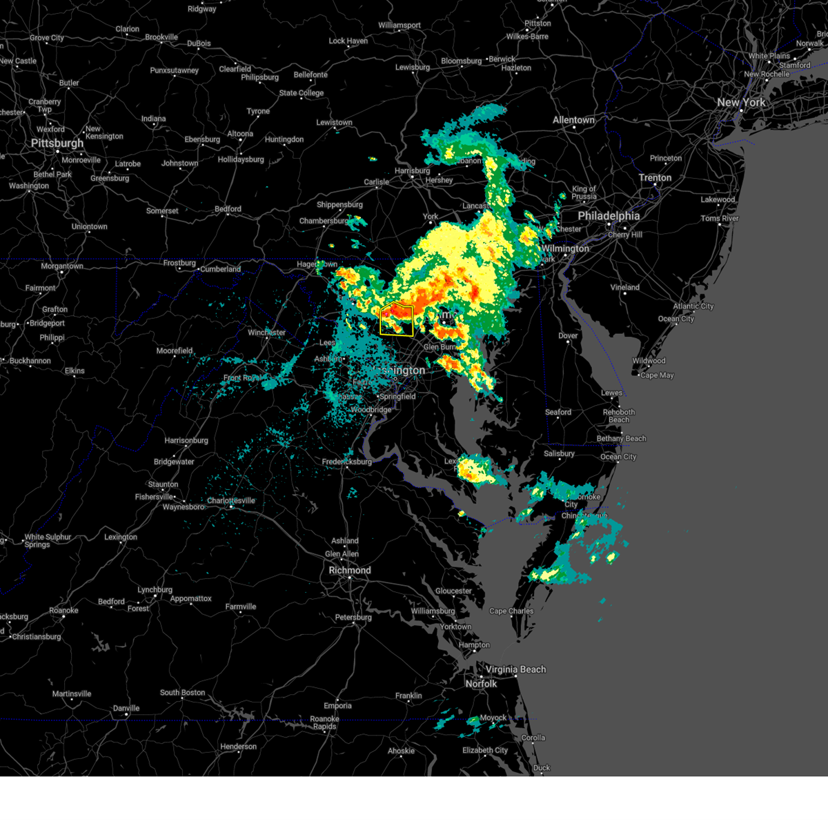 At 218 am edt, a severe thunderstorm was located near sykesville, or 9 miles northeast of damascus, moving south at 35 mph (radar indicated). Hazards include 60 mph wind gusts and quarter size hail. Damaging winds will cause some trees and large branches to fall. this could injure those outdoors, as well as damage homes and vehicles. roadways may become blocked by downed trees. localized power outages are possible. unsecured light objects may become projectiles. Locations impacted include, columbia, damascus, ellicott city, eldersburg, mount airy, sykesville, laytonsville, clarksville, henryton, west friendship, lisbon, glenwood, dayton, gaither, watersville, poplar springs, roxbury mills, woodbine, glenelg, and marriottsville. At 218 am edt, a severe thunderstorm was located near sykesville, or 9 miles northeast of damascus, moving south at 35 mph (radar indicated). Hazards include 60 mph wind gusts and quarter size hail. Damaging winds will cause some trees and large branches to fall. this could injure those outdoors, as well as damage homes and vehicles. roadways may become blocked by downed trees. localized power outages are possible. unsecured light objects may become projectiles. Locations impacted include, columbia, damascus, ellicott city, eldersburg, mount airy, sykesville, laytonsville, clarksville, henryton, west friendship, lisbon, glenwood, dayton, gaither, watersville, poplar springs, roxbury mills, woodbine, glenelg, and marriottsville.
|
| 9/22/2024 2:08 AM EDT |
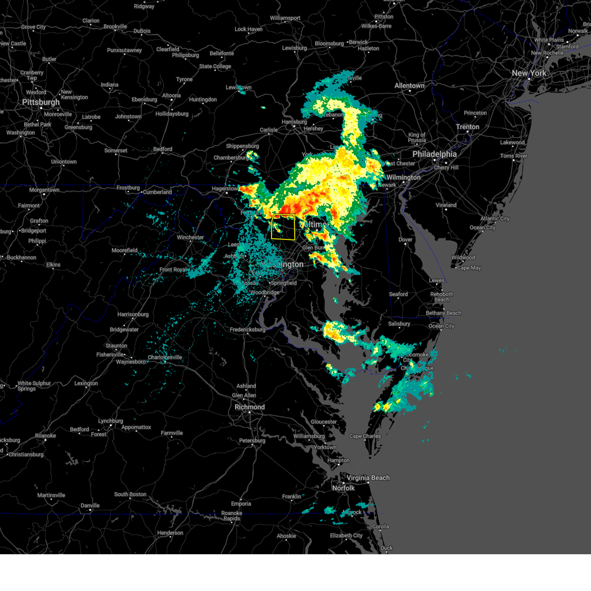 Svrlwx the national weather service in sterling virginia has issued a * severe thunderstorm warning for, southeastern carroll county in north central maryland, northwestern howard county in central maryland, northeastern montgomery county in central maryland, * until 245 am edt. * at 208 am edt, a severe thunderstorm was located near eldersburg, or 11 miles south of westminster, moving south at 30 mph (radar indicated). Hazards include 60 mph wind gusts and quarter size hail. Damaging winds will cause some trees and large branches to fall. this could injure those outdoors, as well as damage homes and vehicles. roadways may become blocked by downed trees. localized power outages are possible. Unsecured light objects may become projectiles. Svrlwx the national weather service in sterling virginia has issued a * severe thunderstorm warning for, southeastern carroll county in north central maryland, northwestern howard county in central maryland, northeastern montgomery county in central maryland, * until 245 am edt. * at 208 am edt, a severe thunderstorm was located near eldersburg, or 11 miles south of westminster, moving south at 30 mph (radar indicated). Hazards include 60 mph wind gusts and quarter size hail. Damaging winds will cause some trees and large branches to fall. this could injure those outdoors, as well as damage homes and vehicles. roadways may become blocked by downed trees. localized power outages are possible. Unsecured light objects may become projectiles.
|
| 8/29/2024 6:40 PM EDT |
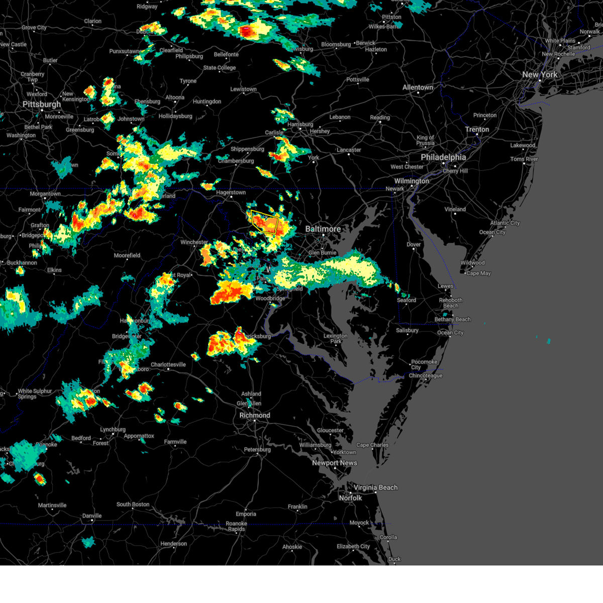 The storms which prompted the warning have weakened below severe limits, and no longer pose an immediate threat to life or property. therefore, the warning will be allowed to expire. however, small hail, gusty winds and heavy rain are still possible with these thunderstorms. a severe thunderstorm watch remains in effect until 1100 pm edt for central and north central maryland. to report severe weather, contact your nearest law enforcement agency. they will relay your report to the national weather service sterling virginia. The storms which prompted the warning have weakened below severe limits, and no longer pose an immediate threat to life or property. therefore, the warning will be allowed to expire. however, small hail, gusty winds and heavy rain are still possible with these thunderstorms. a severe thunderstorm watch remains in effect until 1100 pm edt for central and north central maryland. to report severe weather, contact your nearest law enforcement agency. they will relay your report to the national weather service sterling virginia.
|
| 8/29/2024 6:30 PM EDT |
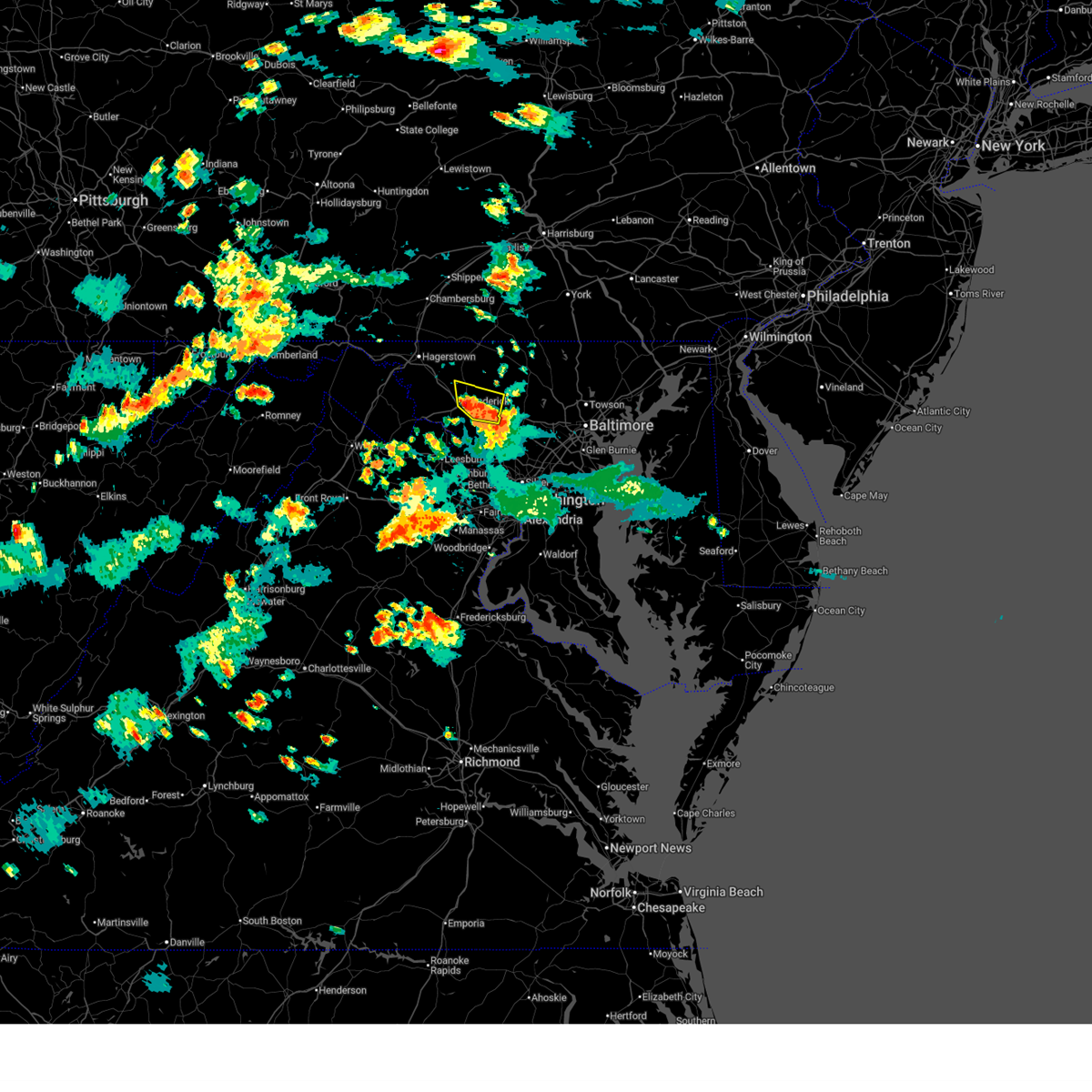 At 630 pm edt, severe thunderstorms were located along a line extending from harry grove stadium to green valley, moving north at 5 mph (emergency management and trained spotters have reported hail and wind damage with this storm). Hazards include two inch hail and 70 mph wind gusts. Expect wind damage to trees and power lines. hail is large enough to dent and damage vehicles. some hail damage to roofs, siding, and windows is possible. Locations impacted include, frederick, damascus, harry grove stadium, ballenger creek, mount airy, walkersville, new market, discovery-spring garden, green valley, clover hill, linganore-bartonsville, monrovia, ijamsville, bloomfield, and mount pleasant. At 630 pm edt, severe thunderstorms were located along a line extending from harry grove stadium to green valley, moving north at 5 mph (emergency management and trained spotters have reported hail and wind damage with this storm). Hazards include two inch hail and 70 mph wind gusts. Expect wind damage to trees and power lines. hail is large enough to dent and damage vehicles. some hail damage to roofs, siding, and windows is possible. Locations impacted include, frederick, damascus, harry grove stadium, ballenger creek, mount airy, walkersville, new market, discovery-spring garden, green valley, clover hill, linganore-bartonsville, monrovia, ijamsville, bloomfield, and mount pleasant.
|
| 8/29/2024 6:09 PM EDT |
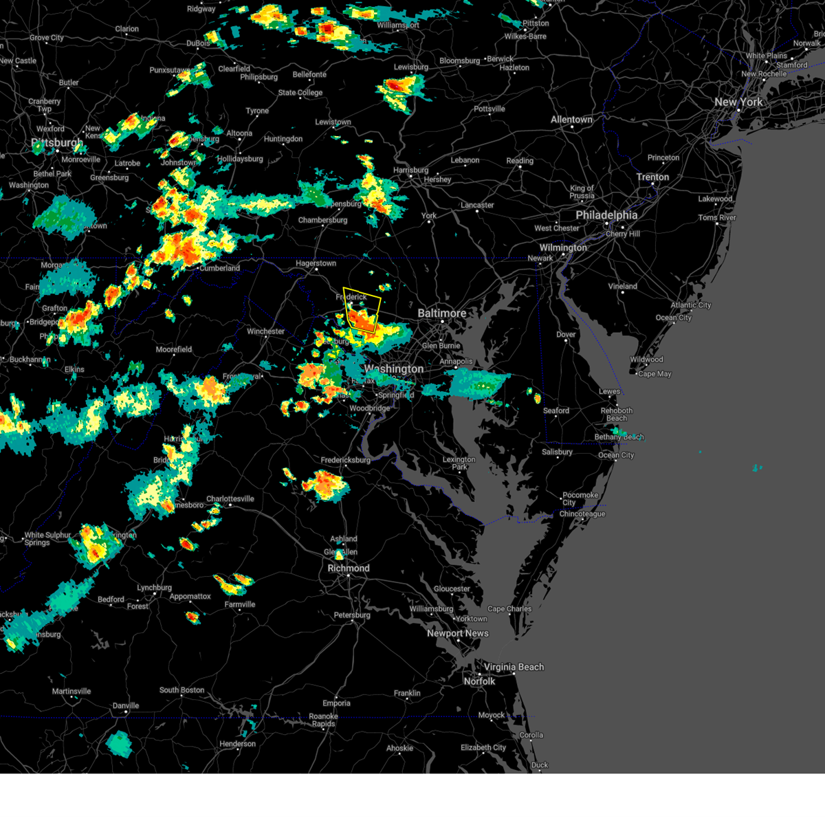 At 608 pm edt, severe thunderstorms were located along a line extending from near ballenger creek to near damascus, moving north at 10 mph (emergency management has reported wind damage in montgomery county. trained spotters have reported hail up to golf ball size). Hazards include two inch hail and 70 mph wind gusts. Expect wind damage to trees and power lines. hail is large enough to dent and damage vehicles. some hail damage to roofs, siding, and windows is possible. Locations impacted include, frederick, damascus, harry grove stadium, ballenger creek, mount airy, walkersville, new market, discovery-spring garden, green valley, clover hill, linganore-bartonsville, clarksburg, buckeystown, monrovia, ijamsville, bloomfield, mount pleasant, and park mills. At 608 pm edt, severe thunderstorms were located along a line extending from near ballenger creek to near damascus, moving north at 10 mph (emergency management has reported wind damage in montgomery county. trained spotters have reported hail up to golf ball size). Hazards include two inch hail and 70 mph wind gusts. Expect wind damage to trees and power lines. hail is large enough to dent and damage vehicles. some hail damage to roofs, siding, and windows is possible. Locations impacted include, frederick, damascus, harry grove stadium, ballenger creek, mount airy, walkersville, new market, discovery-spring garden, green valley, clover hill, linganore-bartonsville, clarksburg, buckeystown, monrovia, ijamsville, bloomfield, mount pleasant, and park mills.
|
| 8/29/2024 5:56 PM EDT |
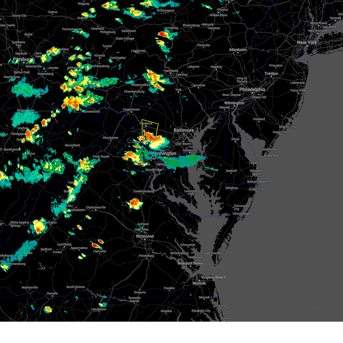 Svrlwx the national weather service in sterling virginia has issued a * severe thunderstorm warning for, northwestern montgomery county in central maryland, southeastern frederick county in north central maryland, * until 645 pm edt. * at 555 pm edt, severe thunderstorms were located along a line extending from 6 miles south of ballenger creek to germantown, moving north at 10 mph (emergency management has reported wind damage, and trained spotters have reported hail up to golf ball size). Hazards include golf ball size hail and 70 mph wind gusts. Expect wind damage to trees and power lines. hail is large enough to dent and damage vehicles. Some hail damage to roofs, siding, and windows is possible. Svrlwx the national weather service in sterling virginia has issued a * severe thunderstorm warning for, northwestern montgomery county in central maryland, southeastern frederick county in north central maryland, * until 645 pm edt. * at 555 pm edt, severe thunderstorms were located along a line extending from 6 miles south of ballenger creek to germantown, moving north at 10 mph (emergency management has reported wind damage, and trained spotters have reported hail up to golf ball size). Hazards include golf ball size hail and 70 mph wind gusts. Expect wind damage to trees and power lines. hail is large enough to dent and damage vehicles. Some hail damage to roofs, siding, and windows is possible.
|
| 8/29/2024 5:49 PM EDT |
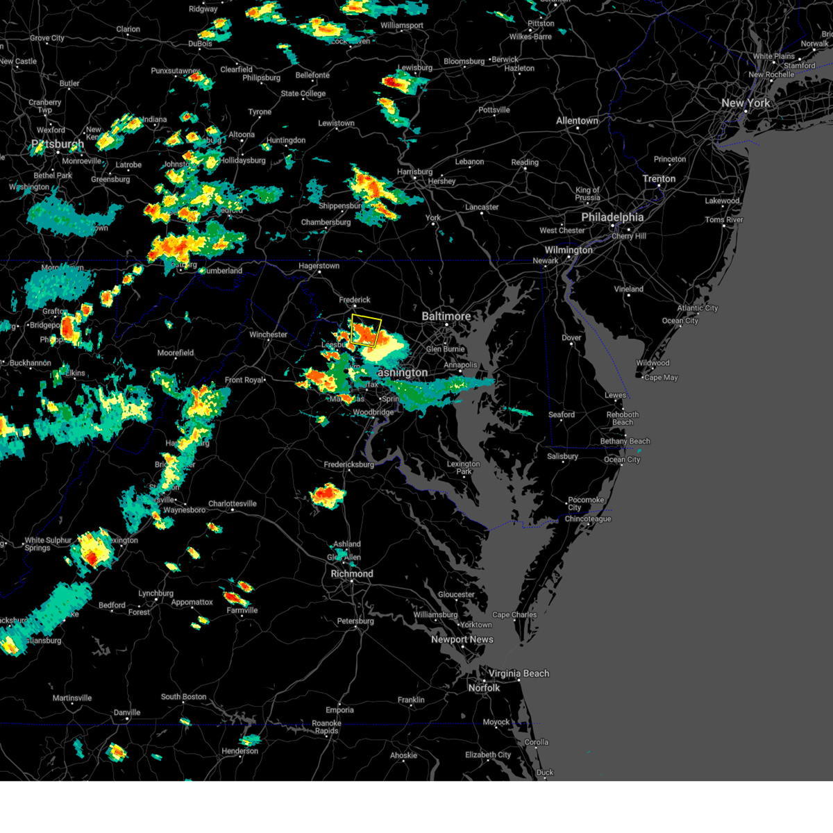 At 548 pm edt, a severe thunderstorm was located near boyds, or near germantown, moving north at 15 mph (trained weather spotters have reported hail up to golf ball sized. emergency management has reported wind damage in western montgomery county). Hazards include golf ball size hail and 70 mph wind gusts. Expect wind damage to trees and power lines. hail is large enough to dent and damage vehicles. some hail damage to roofs, siding, and windows is possible. Locations impacted include, germantown, damascus, ballenger creek, boyds, clarksburg, buckeystown, barnesville, dickerson, beallsville, and park mills. At 548 pm edt, a severe thunderstorm was located near boyds, or near germantown, moving north at 15 mph (trained weather spotters have reported hail up to golf ball sized. emergency management has reported wind damage in western montgomery county). Hazards include golf ball size hail and 70 mph wind gusts. Expect wind damage to trees and power lines. hail is large enough to dent and damage vehicles. some hail damage to roofs, siding, and windows is possible. Locations impacted include, germantown, damascus, ballenger creek, boyds, clarksburg, buckeystown, barnesville, dickerson, beallsville, and park mills.
|
| 8/29/2024 5:25 PM EDT |
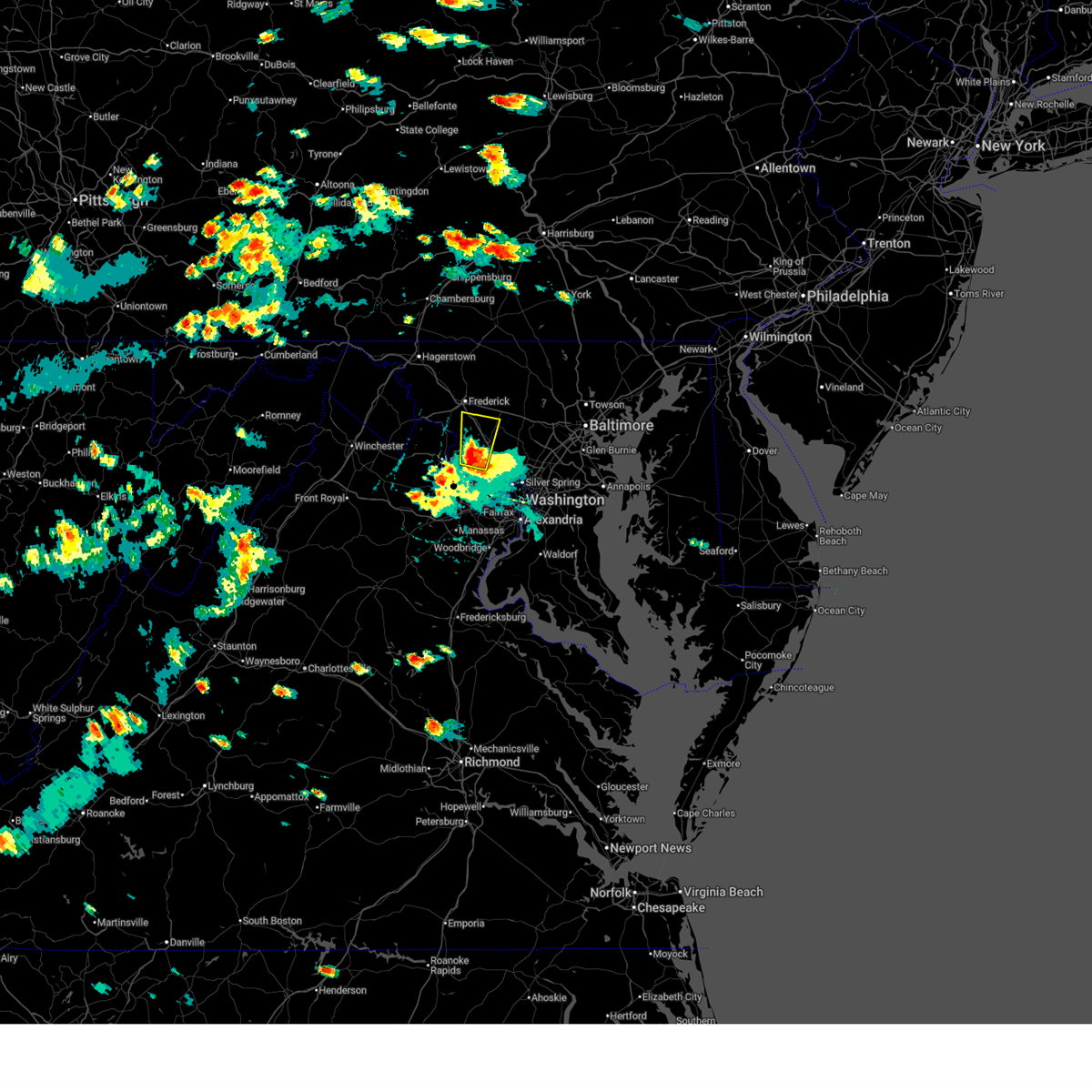 At 524 pm edt, a severe thunderstorm was located over boyds, or near poolesville, moving north at 15 mph (trained weather spotters). Hazards include golf ball size hail and 70 mph wind gusts. Expect wind damage to trees and power lines. hail is large enough to dent and damage vehicles. some hail damage to roofs, siding, and windows is possible. Locations impacted include, germantown, damascus, poolesville, north potomac, ballenger creek, boyds, clarksburg, darnestown, buckeystown, barnesville, park mills, dickerson, beallsville, and dawsonville. At 524 pm edt, a severe thunderstorm was located over boyds, or near poolesville, moving north at 15 mph (trained weather spotters). Hazards include golf ball size hail and 70 mph wind gusts. Expect wind damage to trees and power lines. hail is large enough to dent and damage vehicles. some hail damage to roofs, siding, and windows is possible. Locations impacted include, germantown, damascus, poolesville, north potomac, ballenger creek, boyds, clarksburg, darnestown, buckeystown, barnesville, park mills, dickerson, beallsville, and dawsonville.
|
| 8/29/2024 5:19 PM EDT |
 At 519 pm edt, a severe thunderstorm was located over poolesville, moving north at 15 mph (radar indicated). Hazards include golf ball size hail and 70 mph wind gusts. Expect wind damage to trees and power lines. hail is large enough to dent and damage vehicles. some hail damage to roofs, siding, and windows is possible. Locations impacted include, germantown, damascus, lowes island, poolesville, north potomac, ballenger creek, countryside, boyds, clarksburg, darnestown, adamstown, buckeystown, barnesville, park mills, dickerson, beallsville, dawsonville, and tuscarora. At 519 pm edt, a severe thunderstorm was located over poolesville, moving north at 15 mph (radar indicated). Hazards include golf ball size hail and 70 mph wind gusts. Expect wind damage to trees and power lines. hail is large enough to dent and damage vehicles. some hail damage to roofs, siding, and windows is possible. Locations impacted include, germantown, damascus, lowes island, poolesville, north potomac, ballenger creek, countryside, boyds, clarksburg, darnestown, adamstown, buckeystown, barnesville, park mills, dickerson, beallsville, dawsonville, and tuscarora.
|
| 8/29/2024 5:13 PM EDT |
 Svrlwx the national weather service in sterling virginia has issued a * severe thunderstorm warning for, northwestern montgomery county in central maryland, southeastern frederick county in north central maryland, * until 600 pm edt. * at 513 pm edt, a severe thunderstorm was located over poolesville, moving north at 20 mph (radar indicated). Hazards include 60 mph wind gusts and quarter size hail. Damaging winds will cause some trees and large branches to fall. this could injure those outdoors, as well as damage homes and vehicles. roadways may become blocked by downed trees. localized power outages are possible. Unsecured light objects may become projectiles. Svrlwx the national weather service in sterling virginia has issued a * severe thunderstorm warning for, northwestern montgomery county in central maryland, southeastern frederick county in north central maryland, * until 600 pm edt. * at 513 pm edt, a severe thunderstorm was located over poolesville, moving north at 20 mph (radar indicated). Hazards include 60 mph wind gusts and quarter size hail. Damaging winds will cause some trees and large branches to fall. this could injure those outdoors, as well as damage homes and vehicles. roadways may become blocked by downed trees. localized power outages are possible. Unsecured light objects may become projectiles.
|
| 8/18/2024 7:15 PM EDT |
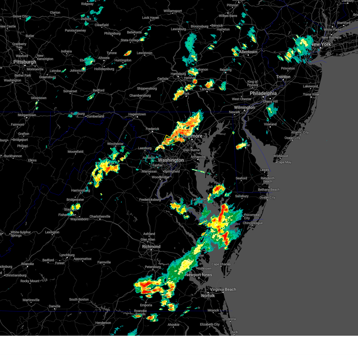 The storm which prompted the warning has weakened below severe limits, and no longer poses an immediate threat to life or property. therefore, the warning has been allowed to expire. a severe thunderstorm watch remains in effect until 1000 pm edt for central maryland. to report severe weather, contact your nearest law enforcement agency. they will relay your report to the national weather service sterling virginia. The storm which prompted the warning has weakened below severe limits, and no longer poses an immediate threat to life or property. therefore, the warning has been allowed to expire. a severe thunderstorm watch remains in effect until 1000 pm edt for central maryland. to report severe weather, contact your nearest law enforcement agency. they will relay your report to the national weather service sterling virginia.
|
| 8/18/2024 7:04 PM EDT |
 At 704 pm edt, a severe thunderstorm was located near damascus, moving northeast at 20 mph (radar indicated). Hazards include 60 mph wind gusts. Damaging winds will cause some trees and large branches to fall. this could injure those outdoors, as well as damage homes and vehicles. roadways may become blocked by downed trees. localized power outages are possible. unsecured light objects may become projectiles. Locations impacted include, damascus, glenwood, glenelg, poplar springs, roxbury mills, and dayton. At 704 pm edt, a severe thunderstorm was located near damascus, moving northeast at 20 mph (radar indicated). Hazards include 60 mph wind gusts. Damaging winds will cause some trees and large branches to fall. this could injure those outdoors, as well as damage homes and vehicles. roadways may become blocked by downed trees. localized power outages are possible. unsecured light objects may become projectiles. Locations impacted include, damascus, glenwood, glenelg, poplar springs, roxbury mills, and dayton.
|
| 8/18/2024 6:44 PM EDT |
 Svrlwx the national weather service in sterling virginia has issued a * severe thunderstorm warning for, northwestern howard county in central maryland, northeastern montgomery county in central maryland, * until 715 pm edt. * at 643 pm edt, a severe thunderstorm was located over montgomery village, or near damascus, moving northeast at 20 mph (radar indicated). Hazards include 60 mph wind gusts. Damaging winds will cause some trees and large branches to fall. this could injure those outdoors, as well as damage homes and vehicles. roadways may become blocked by downed trees. localized power outages are possible. Unsecured light objects may become projectiles. Svrlwx the national weather service in sterling virginia has issued a * severe thunderstorm warning for, northwestern howard county in central maryland, northeastern montgomery county in central maryland, * until 715 pm edt. * at 643 pm edt, a severe thunderstorm was located over montgomery village, or near damascus, moving northeast at 20 mph (radar indicated). Hazards include 60 mph wind gusts. Damaging winds will cause some trees and large branches to fall. this could injure those outdoors, as well as damage homes and vehicles. roadways may become blocked by downed trees. localized power outages are possible. Unsecured light objects may become projectiles.
|
| 8/3/2024 5:39 PM EDT |
 Svrlwx the national weather service in sterling virginia has issued a * severe thunderstorm warning for, the northern district of columbia, central howard county in central maryland, montgomery county in central maryland, northwestern prince georges county in central maryland, southeastern loudoun county in northern virginia, northwestern arlington county in northern virginia, northern fairfax county in northern virginia, * until 630 pm edt. * at 539 pm edt, a severe thunderstorm was located over lowes island, moving east at 40 mph (radar indicated). Hazards include 60 mph wind gusts. Damaging winds will cause some trees and large branches to fall. this could injure those outdoors, as well as damage homes and vehicles. roadways may become blocked by downed trees. localized power outages are possible. Unsecured light objects may become projectiles. Svrlwx the national weather service in sterling virginia has issued a * severe thunderstorm warning for, the northern district of columbia, central howard county in central maryland, montgomery county in central maryland, northwestern prince georges county in central maryland, southeastern loudoun county in northern virginia, northwestern arlington county in northern virginia, northern fairfax county in northern virginia, * until 630 pm edt. * at 539 pm edt, a severe thunderstorm was located over lowes island, moving east at 40 mph (radar indicated). Hazards include 60 mph wind gusts. Damaging winds will cause some trees and large branches to fall. this could injure those outdoors, as well as damage homes and vehicles. roadways may become blocked by downed trees. localized power outages are possible. Unsecured light objects may become projectiles.
|
| 6/30/2024 4:24 PM EDT |
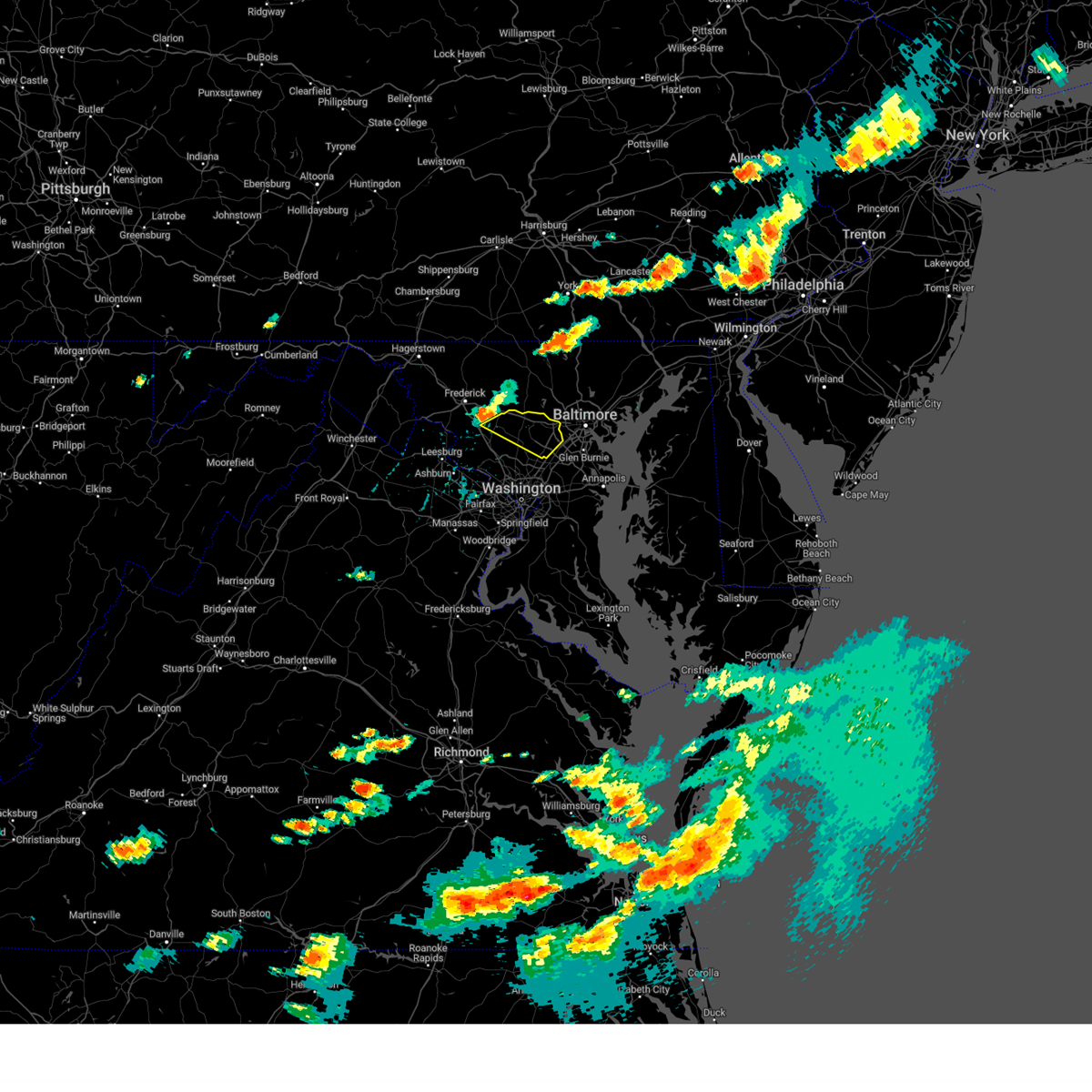 Svrlwx the national weather service in sterling virginia has issued a * severe thunderstorm warning for, howard county in central maryland, northeastern montgomery county in central maryland, * until 515 pm edt. * at 423 pm edt, a severe thunderstorm was located over damascus, moving east at 35 mph (radar indicated). Hazards include 60 mph wind gusts. Damaging winds will cause some trees and large branches to fall. this could injure those outdoors, as well as damage homes and vehicles. roadways may become blocked by downed trees. localized power outages are possible. Unsecured light objects may become projectiles. Svrlwx the national weather service in sterling virginia has issued a * severe thunderstorm warning for, howard county in central maryland, northeastern montgomery county in central maryland, * until 515 pm edt. * at 423 pm edt, a severe thunderstorm was located over damascus, moving east at 35 mph (radar indicated). Hazards include 60 mph wind gusts. Damaging winds will cause some trees and large branches to fall. this could injure those outdoors, as well as damage homes and vehicles. roadways may become blocked by downed trees. localized power outages are possible. Unsecured light objects may become projectiles.
|
| 6/29/2024 10:41 PM EDT |
 The storms which prompted the warning have weakened below severe limits, and no longer pose an immediate threat to life or property. therefore, the warning will be allowed to expire. The storms which prompted the warning have weakened below severe limits, and no longer pose an immediate threat to life or property. therefore, the warning will be allowed to expire.
|
| 6/29/2024 10:15 PM EDT |
 Svrlwx the national weather service in sterling virginia has issued a * severe thunderstorm warning for, southeastern carroll county in north central maryland, northwestern howard county in central maryland, northeastern montgomery county in central maryland, southeastern frederick county in north central maryland, west central baltimore county in northern maryland, * until 1045 pm edt. * at 1015 pm edt, severe thunderstorms were located along a line extending from gamber to near green valley, moving east at 25 mph (radar indicated). Hazards include 60 mph wind gusts. Damaging winds will cause some trees and large branches to fall. this could injure those outdoors, as well as damage homes and vehicles. roadways may become blocked by downed trees. localized power outages are possible. Unsecured light objects may become projectiles. Svrlwx the national weather service in sterling virginia has issued a * severe thunderstorm warning for, southeastern carroll county in north central maryland, northwestern howard county in central maryland, northeastern montgomery county in central maryland, southeastern frederick county in north central maryland, west central baltimore county in northern maryland, * until 1045 pm edt. * at 1015 pm edt, severe thunderstorms were located along a line extending from gamber to near green valley, moving east at 25 mph (radar indicated). Hazards include 60 mph wind gusts. Damaging winds will cause some trees and large branches to fall. this could injure those outdoors, as well as damage homes and vehicles. roadways may become blocked by downed trees. localized power outages are possible. Unsecured light objects may become projectiles.
|
| 6/29/2024 9:49 PM EDT |
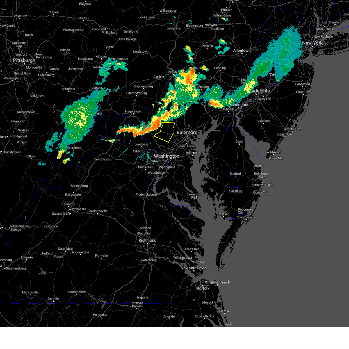 Svrlwx the national weather service in sterling virginia has issued a * severe thunderstorm warning for, southern carroll county in north central maryland, northwestern howard county in central maryland, northeastern montgomery county in central maryland, * until 1015 pm edt. * at 949 pm edt, severe thunderstorms were located along a line extending from 9 miles southwest of westminster to mount airy to green valley, moving east at 30 mph (radar indicated). Hazards include 60 mph wind gusts. Damaging winds will cause some trees and large branches to fall. this could injure those outdoors, as well as damage homes and vehicles. roadways may become blocked by downed trees. localized power outages are possible. Unsecured light objects may become projectiles. Svrlwx the national weather service in sterling virginia has issued a * severe thunderstorm warning for, southern carroll county in north central maryland, northwestern howard county in central maryland, northeastern montgomery county in central maryland, * until 1015 pm edt. * at 949 pm edt, severe thunderstorms were located along a line extending from 9 miles southwest of westminster to mount airy to green valley, moving east at 30 mph (radar indicated). Hazards include 60 mph wind gusts. Damaging winds will cause some trees and large branches to fall. this could injure those outdoors, as well as damage homes and vehicles. roadways may become blocked by downed trees. localized power outages are possible. Unsecured light objects may become projectiles.
|
| 6/23/2024 4:23 PM EDT |
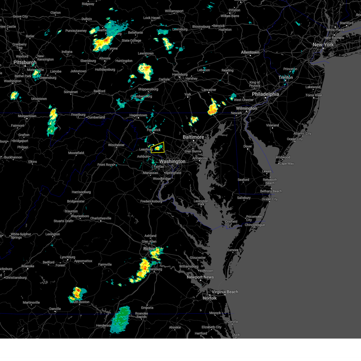 the severe thunderstorm warning has been cancelled and is no longer in effect the severe thunderstorm warning has been cancelled and is no longer in effect
|
| 6/23/2024 4:15 PM EDT |
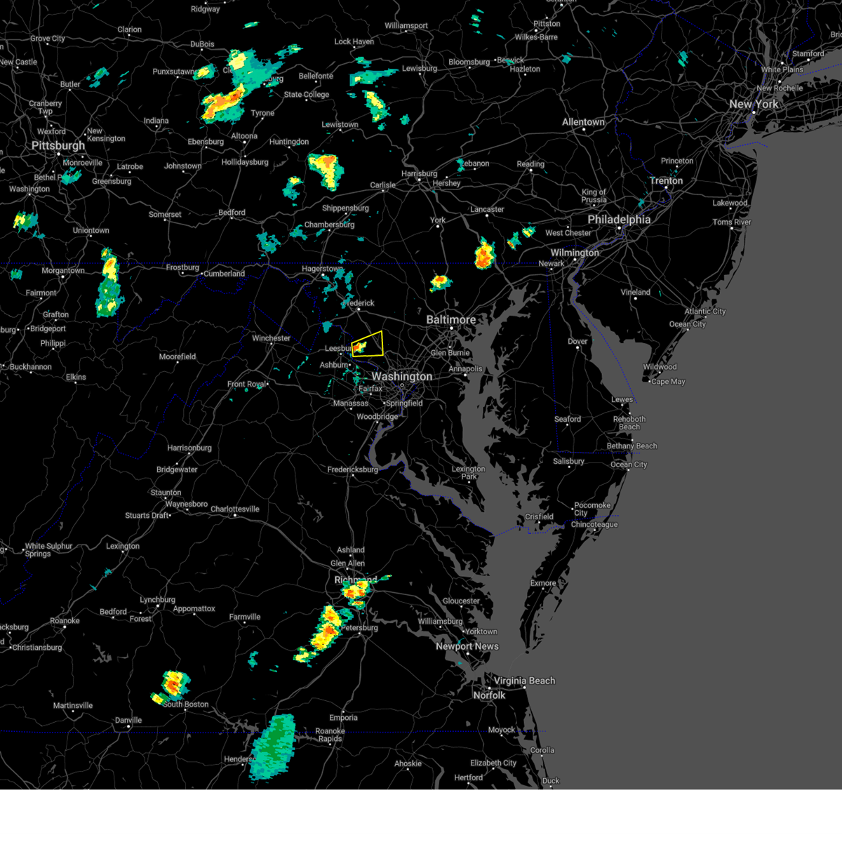 Svrlwx the national weather service in sterling virginia has issued a * severe thunderstorm warning for, northwestern montgomery county in central maryland, * until 445 pm edt. * at 415 pm edt, a severe thunderstorm was located over poolesville, moving east at 20 mph (radar indicated). Hazards include 60 mph wind gusts. Damaging winds will cause some trees and large branches to fall. this could injure those outdoors, as well as damage homes and vehicles. roadways may become blocked by downed trees. localized power outages are possible. Unsecured light objects may become projectiles. Svrlwx the national weather service in sterling virginia has issued a * severe thunderstorm warning for, northwestern montgomery county in central maryland, * until 445 pm edt. * at 415 pm edt, a severe thunderstorm was located over poolesville, moving east at 20 mph (radar indicated). Hazards include 60 mph wind gusts. Damaging winds will cause some trees and large branches to fall. this could injure those outdoors, as well as damage homes and vehicles. roadways may become blocked by downed trees. localized power outages are possible. Unsecured light objects may become projectiles.
|
| 6/6/2024 1:58 PM EDT |
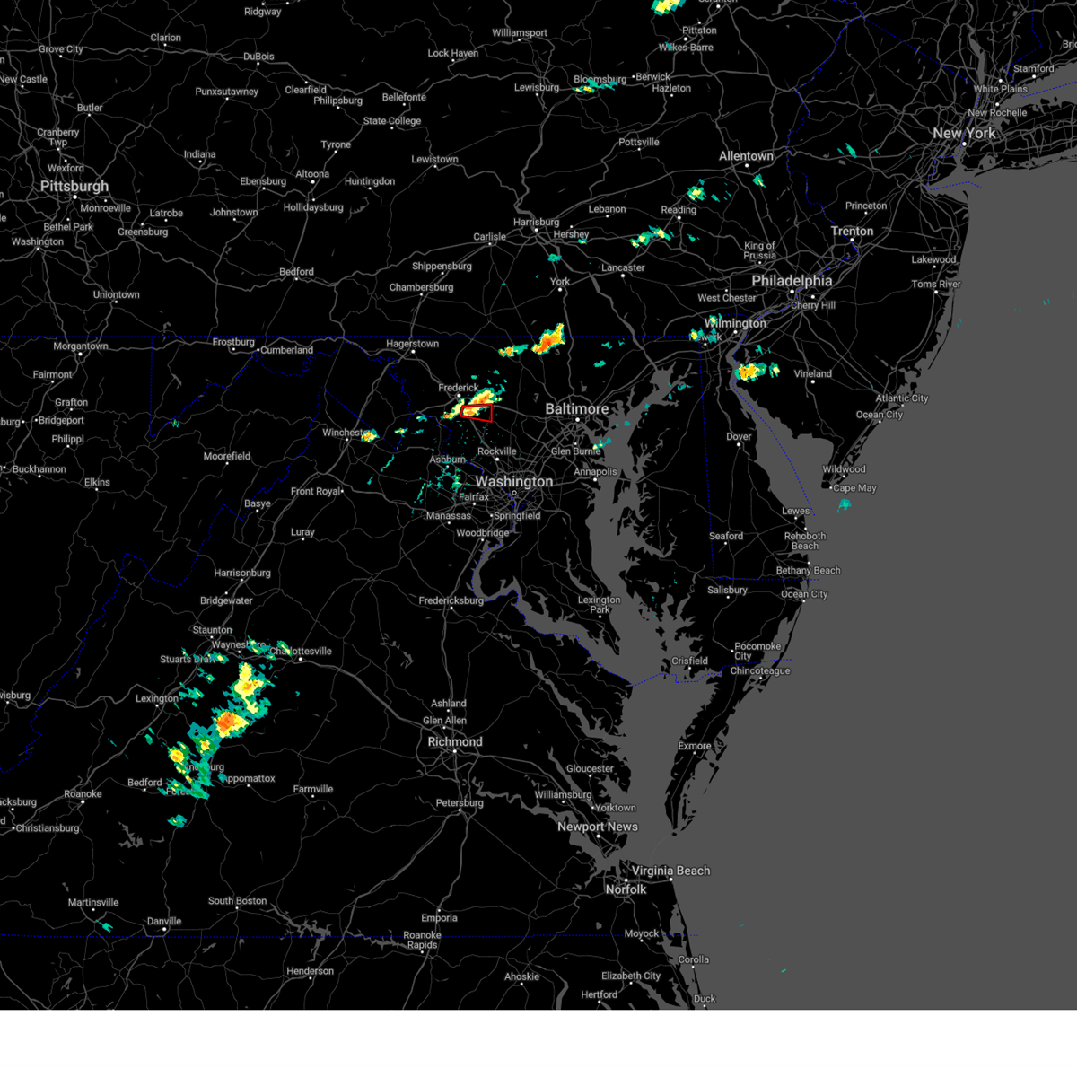 the tornado warning has been cancelled and is no longer in effect the tornado warning has been cancelled and is no longer in effect
|
| 6/6/2024 1:47 PM EDT |
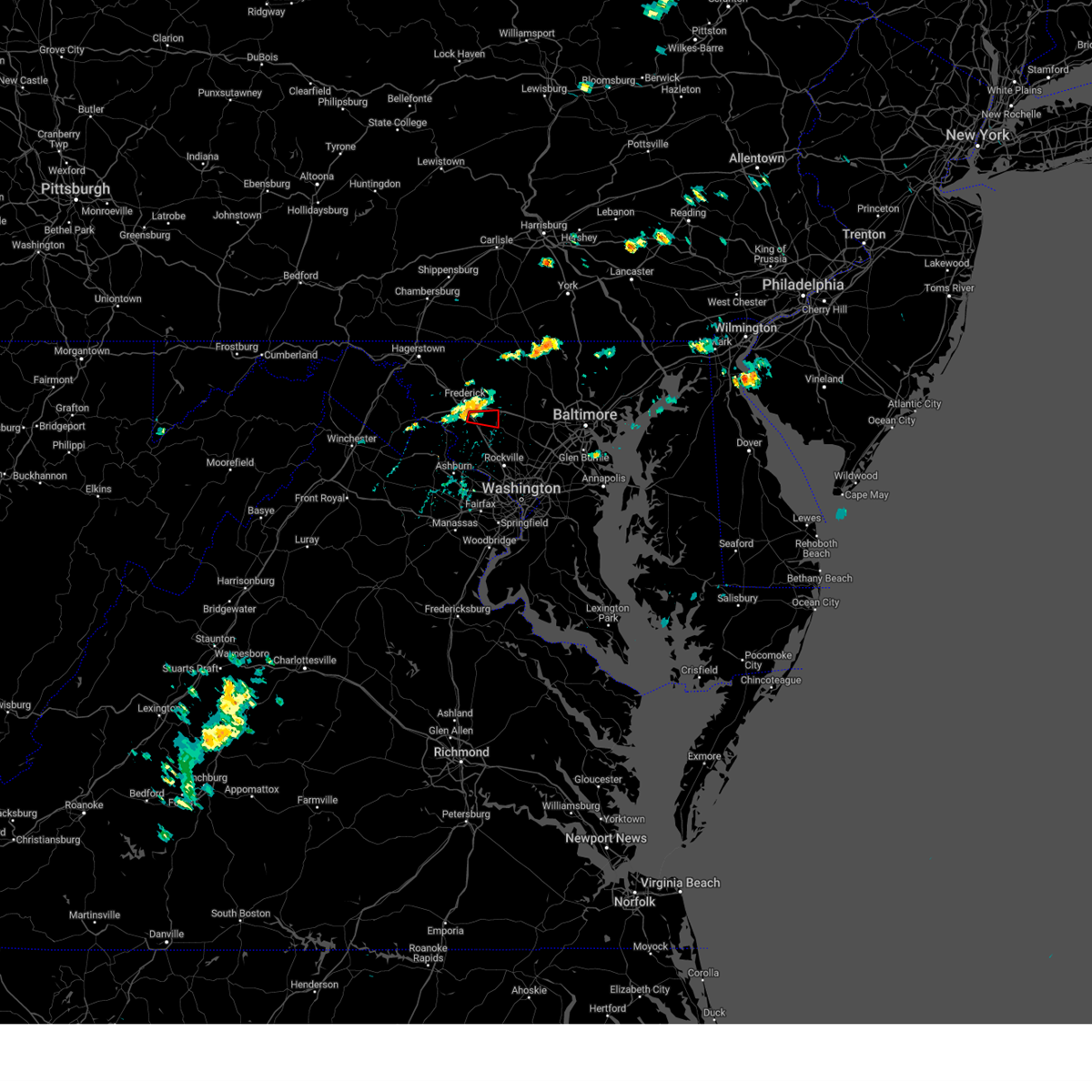 Torlwx the national weather service in sterling virginia has issued a * tornado warning for, north central montgomery county in central maryland, southeastern frederick county in north central maryland, * until 215 pm edt. * at 147 pm edt, a severe thunderstorm capable of producing a tornado was located near ballenger creek, or near harry grove stadium, moving east at 25 mph (radar indicated rotation). Hazards include tornado. For those in the direct path of a tornado touchdown, flying debris will be dangerous to those caught without shelter. damage to roofs, siding, and windows may occur. mobile homes may be damaged or destroyed. tree damage is likely. this dangerous storm will be near, damascus and green valley around 155 pm edt. Other locations impacted by this tornadic thunderstorm include monrovia and ijamsville. Torlwx the national weather service in sterling virginia has issued a * tornado warning for, north central montgomery county in central maryland, southeastern frederick county in north central maryland, * until 215 pm edt. * at 147 pm edt, a severe thunderstorm capable of producing a tornado was located near ballenger creek, or near harry grove stadium, moving east at 25 mph (radar indicated rotation). Hazards include tornado. For those in the direct path of a tornado touchdown, flying debris will be dangerous to those caught without shelter. damage to roofs, siding, and windows may occur. mobile homes may be damaged or destroyed. tree damage is likely. this dangerous storm will be near, damascus and green valley around 155 pm edt. Other locations impacted by this tornadic thunderstorm include monrovia and ijamsville.
|
| 6/5/2024 7:09 PM EDT |
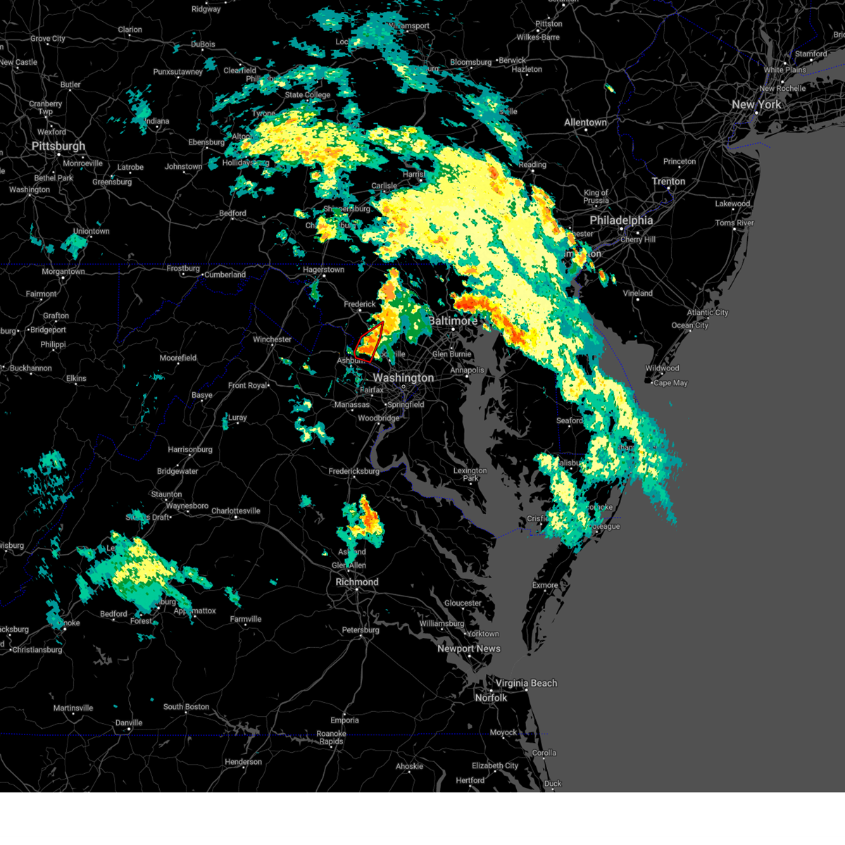 At 709 pm edt, tornado producing storms were located along a line extending from 6 miles north of boyds to near poolesville, moving east at 20 mph (radar confirmed tornado). Hazards include damaging tornado. For those in the direct path of a tornado touchdown, flying debris will be dangerous to those caught without shelter. damage to roofs, siding, and windows may occur. mobile homes may be damaged or destroyed. tree damage is likely. these tornadic storms will be near, germantown, damascus, poolesville, and boyds around 715 pm edt. Other locations impacted by these tornadic storms include dawsonville, clarksburg, barnesville, beallsville, and darnestown. At 709 pm edt, tornado producing storms were located along a line extending from 6 miles north of boyds to near poolesville, moving east at 20 mph (radar confirmed tornado). Hazards include damaging tornado. For those in the direct path of a tornado touchdown, flying debris will be dangerous to those caught without shelter. damage to roofs, siding, and windows may occur. mobile homes may be damaged or destroyed. tree damage is likely. these tornadic storms will be near, germantown, damascus, poolesville, and boyds around 715 pm edt. Other locations impacted by these tornadic storms include dawsonville, clarksburg, barnesville, beallsville, and darnestown.
|
| 6/5/2024 7:09 PM EDT |
 the tornado warning has been cancelled and is no longer in effect the tornado warning has been cancelled and is no longer in effect
|
| 6/5/2024 7:02 PM EDT |
 At 701 pm edt, severe thunderstorms capable of producing tornadoes were located along a line extending from 6 miles northwest of boyds to near poolesville to near lansdowne, moving east at 20 mph (radar indicated rotation). Hazards include tornado. For those in the direct path of a tornado touchdown, flying debris will be dangerous to those caught without shelter. damage to roofs, siding, and windows may occur. mobile homes may be damaged or destroyed. tree damage is likely. these dangerous storms will be near, poolesville and boyds around 705 pm edt. germantown and damascus around 710 pm edt. Other locations impacted by these tornadic storms include dawsonville, clarksburg, dickerson, barnesville, beallsville, and darnestown. At 701 pm edt, severe thunderstorms capable of producing tornadoes were located along a line extending from 6 miles northwest of boyds to near poolesville to near lansdowne, moving east at 20 mph (radar indicated rotation). Hazards include tornado. For those in the direct path of a tornado touchdown, flying debris will be dangerous to those caught without shelter. damage to roofs, siding, and windows may occur. mobile homes may be damaged or destroyed. tree damage is likely. these dangerous storms will be near, poolesville and boyds around 705 pm edt. germantown and damascus around 710 pm edt. Other locations impacted by these tornadic storms include dawsonville, clarksburg, dickerson, barnesville, beallsville, and darnestown.
|
| 6/5/2024 6:53 PM EDT |
 Torlwx the national weather service in sterling virginia has issued a * tornado warning for, northwestern montgomery county in central maryland, southeastern frederick county in north central maryland, northeastern loudoun county in northern virginia, * until 730 pm edt. * at 652 pm edt, severe thunderstorms capable of producing brief tornadoes were located along a line extending from 6 miles east of point of rocks to near poolesville to leesburg, moving east at 20 mph (radar indicated rotation). Hazards include tornado. For those in the direct path of a tornado touchdown, flying debris will be dangerous to those caught without shelter. damage to roofs, siding, and windows may occur. mobile homes may be damaged or destroyed. tree damage is likely. these dangerous storms will be near, leesburg, lansdowne, and poolesville around 700 pm edt. boyds around 705 pm edt. germantown and damascus around 710 pm edt. Other locations impacted by these tornadic storms include clarksburg, dickerson, beallsville, dawsonville, tuscarora, barnesville, and darnestown. Torlwx the national weather service in sterling virginia has issued a * tornado warning for, northwestern montgomery county in central maryland, southeastern frederick county in north central maryland, northeastern loudoun county in northern virginia, * until 730 pm edt. * at 652 pm edt, severe thunderstorms capable of producing brief tornadoes were located along a line extending from 6 miles east of point of rocks to near poolesville to leesburg, moving east at 20 mph (radar indicated rotation). Hazards include tornado. For those in the direct path of a tornado touchdown, flying debris will be dangerous to those caught without shelter. damage to roofs, siding, and windows may occur. mobile homes may be damaged or destroyed. tree damage is likely. these dangerous storms will be near, leesburg, lansdowne, and poolesville around 700 pm edt. boyds around 705 pm edt. germantown and damascus around 710 pm edt. Other locations impacted by these tornadic storms include clarksburg, dickerson, beallsville, dawsonville, tuscarora, barnesville, and darnestown.
|
| 5/27/2024 6:58 PM EDT |
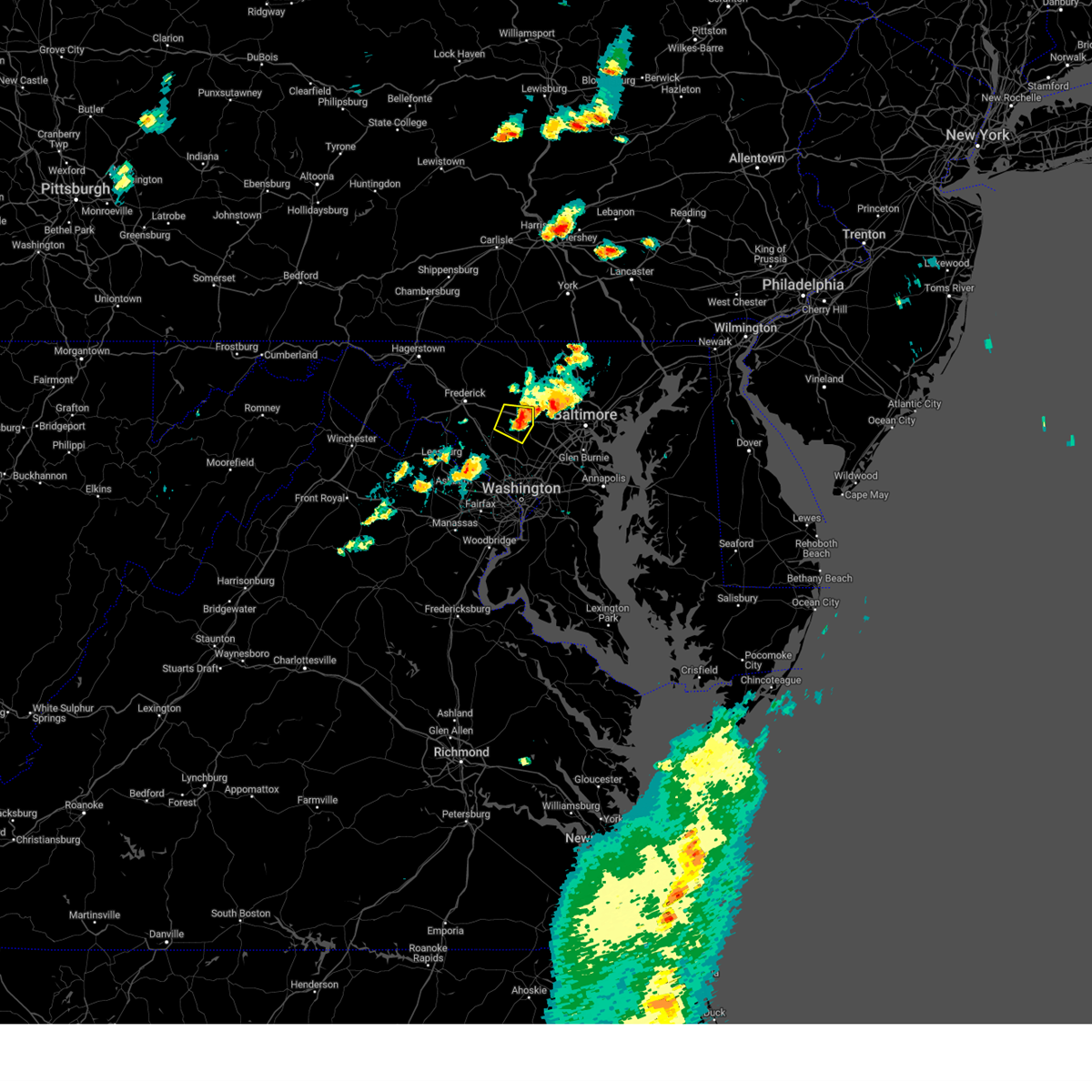 The storm which prompted the warning has moved out of the area. therefore, the warning will be allowed to expire. a tornado watch remains in effect until 1100 pm edt for central and north central maryland. The storm which prompted the warning has moved out of the area. therefore, the warning will be allowed to expire. a tornado watch remains in effect until 1100 pm edt for central and north central maryland.
|
| 5/27/2024 6:39 PM EDT |
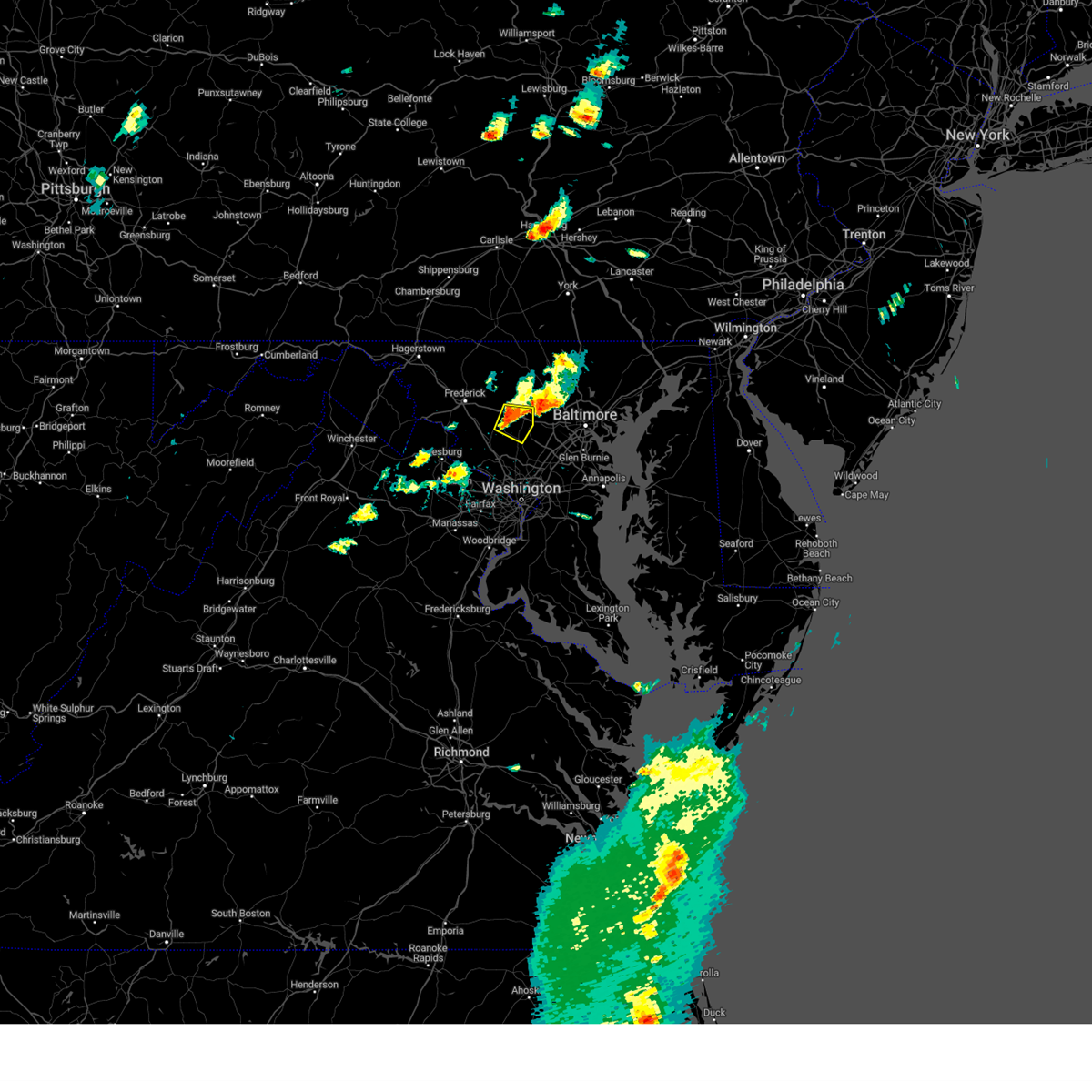 At 639 pm edt, a severe thunderstorm was located near mount airy, or near damascus, moving east at 20 mph (radar indicated). Hazards include 60 mph wind gusts and quarter size hail. Damaging winds will cause some trees and large branches to fall. this could injure those outdoors, as well as damage homes and vehicles. roadways may become blocked by downed trees. localized power outages are possible. unsecured light objects may become projectiles. Locations impacted include, damascus, eldersburg, mount airy, sykesville, poplar springs, roxbury mills, lisbon, glenwood, woodbine, glenelg, gaither, and watersville. At 639 pm edt, a severe thunderstorm was located near mount airy, or near damascus, moving east at 20 mph (radar indicated). Hazards include 60 mph wind gusts and quarter size hail. Damaging winds will cause some trees and large branches to fall. this could injure those outdoors, as well as damage homes and vehicles. roadways may become blocked by downed trees. localized power outages are possible. unsecured light objects may become projectiles. Locations impacted include, damascus, eldersburg, mount airy, sykesville, poplar springs, roxbury mills, lisbon, glenwood, woodbine, glenelg, gaither, and watersville.
|
| 5/27/2024 6:26 PM EDT |
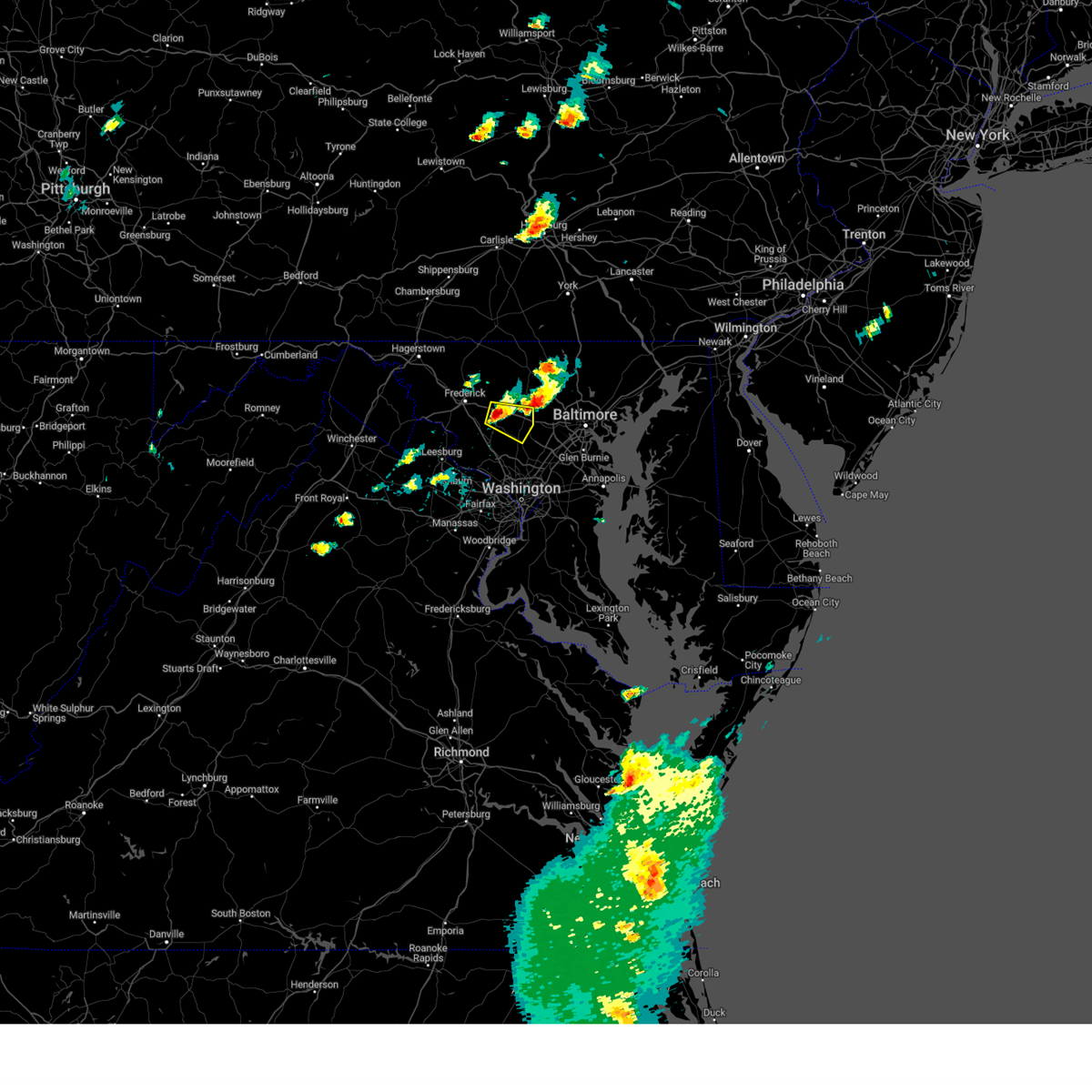 At 626 pm edt, a severe thunderstorm was located over mount airy, or near damascus, moving east at 20 mph (radar indicated). Hazards include ping pong ball size hail and 60 mph wind gusts. Damaging winds will cause some trees and large branches to fall. this could injure those outdoors, as well as damage homes and vehicles. roadways may become blocked by downed trees. localized power outages are possible. unsecured light objects may become projectiles. Locations impacted include, damascus, eldersburg, mount airy, sykesville, green valley, monrovia, lisbon, glenwood, gaither, watersville, poplar springs, roxbury mills, woodbine, and glenelg. At 626 pm edt, a severe thunderstorm was located over mount airy, or near damascus, moving east at 20 mph (radar indicated). Hazards include ping pong ball size hail and 60 mph wind gusts. Damaging winds will cause some trees and large branches to fall. this could injure those outdoors, as well as damage homes and vehicles. roadways may become blocked by downed trees. localized power outages are possible. unsecured light objects may become projectiles. Locations impacted include, damascus, eldersburg, mount airy, sykesville, green valley, monrovia, lisbon, glenwood, gaither, watersville, poplar springs, roxbury mills, woodbine, and glenelg.
|
| 5/27/2024 6:16 PM EDT |
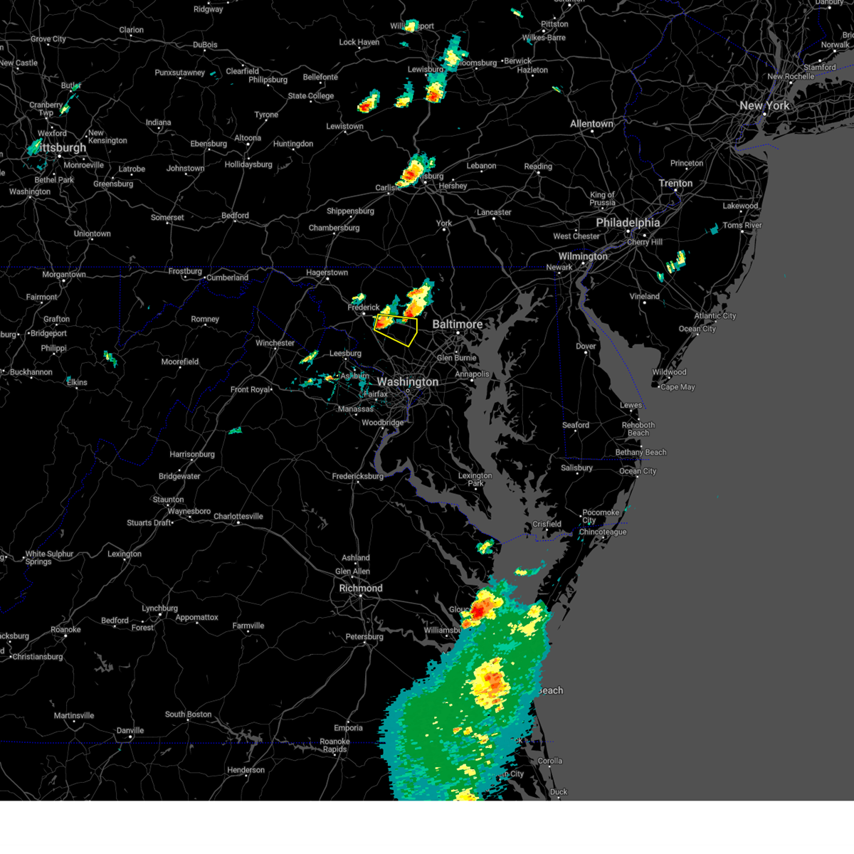 Svrlwx the national weather service in sterling virginia has issued a * severe thunderstorm warning for, south central carroll county in north central maryland, northwestern howard county in central maryland, northeastern montgomery county in central maryland, southeastern frederick county in north central maryland, * until 700 pm edt. * at 616 pm edt, a severe thunderstorm was located over green valley, or near damascus, moving east at 20 mph (radar indicated). Hazards include 60 mph wind gusts and quarter size hail. Damaging winds will cause some trees and large branches to fall. this could injure those outdoors, as well as damage homes and vehicles. roadways may become blocked by downed trees. localized power outages are possible. Unsecured light objects may become projectiles. Svrlwx the national weather service in sterling virginia has issued a * severe thunderstorm warning for, south central carroll county in north central maryland, northwestern howard county in central maryland, northeastern montgomery county in central maryland, southeastern frederick county in north central maryland, * until 700 pm edt. * at 616 pm edt, a severe thunderstorm was located over green valley, or near damascus, moving east at 20 mph (radar indicated). Hazards include 60 mph wind gusts and quarter size hail. Damaging winds will cause some trees and large branches to fall. this could injure those outdoors, as well as damage homes and vehicles. roadways may become blocked by downed trees. localized power outages are possible. Unsecured light objects may become projectiles.
|
| 9/9/2023 4:16 PM EDT |
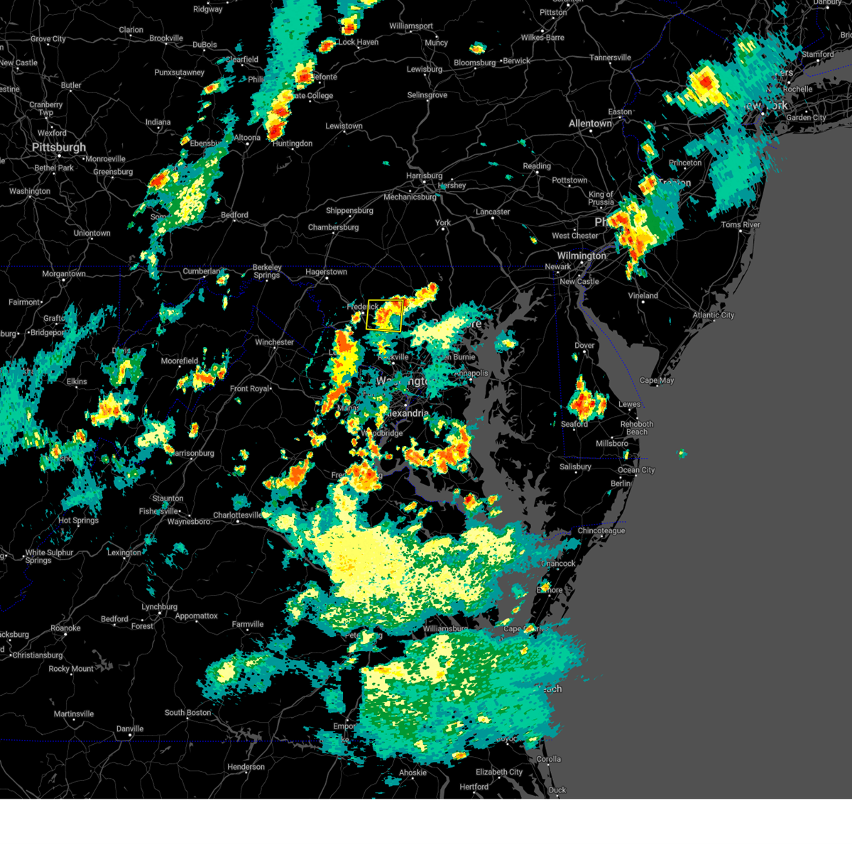 At 415 pm edt, a severe thunderstorm was located over new market, or 7 miles north of damascus, moving north at 15 mph (observed wind damage). Hazards include 60 mph wind gusts and quarter size hail. Damaging winds will cause some trees and large branches to fall. this could injure those outdoors, as well as damage homes and vehicles. roadways may become blocked by downed trees. localized power outages are possible. unsecured light objects may become projectiles. locations impacted include, frederick, damascus, mount airy, walkersville, new market, discovery-spring garden, green valley, linganore-bartonsville, libertytown, monrovia, ijamsville, mount pleasant, watersville, poplar springs, and unionville. hail threat, radar indicated max hail size, 1. 00 in wind threat, observed max wind gust, 60 mph. At 415 pm edt, a severe thunderstorm was located over new market, or 7 miles north of damascus, moving north at 15 mph (observed wind damage). Hazards include 60 mph wind gusts and quarter size hail. Damaging winds will cause some trees and large branches to fall. this could injure those outdoors, as well as damage homes and vehicles. roadways may become blocked by downed trees. localized power outages are possible. unsecured light objects may become projectiles. locations impacted include, frederick, damascus, mount airy, walkersville, new market, discovery-spring garden, green valley, linganore-bartonsville, libertytown, monrovia, ijamsville, mount pleasant, watersville, poplar springs, and unionville. hail threat, radar indicated max hail size, 1. 00 in wind threat, observed max wind gust, 60 mph.
|
| 9/9/2023 3:56 PM EDT | Trees and wires blew down in damascus... including near the intersection of md-27 ridge road and oak driv in montgomery county MD, 1.4 miles E of Damascus, MD |
| 9/9/2023 3:56 PM EDT |
 At 355 pm edt, a severe thunderstorm was located near green valley, or near damascus, moving north at 15 mph (radar indicated). Hazards include 60 mph wind gusts and quarter size hail. Damaging winds will cause some trees and large branches to fall. this could injure those outdoors, as well as damage homes and vehicles. roadways may become blocked by downed trees. localized power outages are possible. Unsecured light objects may become projectiles. At 355 pm edt, a severe thunderstorm was located near green valley, or near damascus, moving north at 15 mph (radar indicated). Hazards include 60 mph wind gusts and quarter size hail. Damaging winds will cause some trees and large branches to fall. this could injure those outdoors, as well as damage homes and vehicles. roadways may become blocked by downed trees. localized power outages are possible. Unsecured light objects may become projectiles.
|
| 9/9/2023 3:09 AM EDT |
 At 309 am edt, a severe thunderstorm was located over redland, or near olney, moving north at 25 mph (radar indicated). Hazards include 60 mph wind gusts and quarter size hail. Damaging winds will cause some trees and large branches to fall. this could injure those outdoors, as well as damage homes and vehicles. roadways may become blocked by downed trees. localized power outages are possible. unsecured light objects may become projectiles. locations impacted include, columbia, germantown, gaithersburg, olney, damascus, aspen hill, montgomery village, redland, colesville, rossmoor, wheaton-glenmont, cloverly, clarksburg, glenmont, spencerville, highland, washington grove, laytonsville, brookeville, and clarksville. hail threat, radar indicated max hail size, 1. 00 in wind threat, radar indicated max wind gust, 60 mph. At 309 am edt, a severe thunderstorm was located over redland, or near olney, moving north at 25 mph (radar indicated). Hazards include 60 mph wind gusts and quarter size hail. Damaging winds will cause some trees and large branches to fall. this could injure those outdoors, as well as damage homes and vehicles. roadways may become blocked by downed trees. localized power outages are possible. unsecured light objects may become projectiles. locations impacted include, columbia, germantown, gaithersburg, olney, damascus, aspen hill, montgomery village, redland, colesville, rossmoor, wheaton-glenmont, cloverly, clarksburg, glenmont, spencerville, highland, washington grove, laytonsville, brookeville, and clarksville. hail threat, radar indicated max hail size, 1. 00 in wind threat, radar indicated max wind gust, 60 mph.
|
| 9/9/2023 2:57 AM EDT |
 At 257 am edt, a severe thunderstorm was located over rockville, moving northeast at 15 mph (radar indicated). Hazards include 60 mph wind gusts and quarter size hail. Damaging winds will cause some trees and large branches to fall. this could injure those outdoors, as well as damage homes and vehicles. roadways may become blocked by downed trees. localized power outages are possible. Unsecured light objects may become projectiles. At 257 am edt, a severe thunderstorm was located over rockville, moving northeast at 15 mph (radar indicated). Hazards include 60 mph wind gusts and quarter size hail. Damaging winds will cause some trees and large branches to fall. this could injure those outdoors, as well as damage homes and vehicles. roadways may become blocked by downed trees. localized power outages are possible. Unsecured light objects may become projectiles.
|
| 9/7/2023 2:55 PM EDT |
 At 255 pm edt, a severe thunderstorm was located over clover hill, or over frederick, moving north at 30 mph (radar indicated). Hazards include 70 mph wind gusts and quarter size hail. Damaging winds will cause some trees and large branches to fall. this could injure those outdoors, as well as damage homes and vehicles. roadways may become blocked by downed trees. localized power outages are possible. unsecured light objects may become projectiles. locations impacted include, frederick, westminster, damascus, thurmont, harry grove stadium, eldersburg, ballenger creek, mount airy, walkersville, braddock heights, new market, clover hill, discovery-spring garden, green valley, wolfsville, linganore-bartonsville, clarksburg, jefferson, new windsor, and woodsboro. thunderstorm damage threat, considerable hail threat, radar indicated max hail size, 1. 00 in wind threat, radar indicated max wind gust, 70 mph. At 255 pm edt, a severe thunderstorm was located over clover hill, or over frederick, moving north at 30 mph (radar indicated). Hazards include 70 mph wind gusts and quarter size hail. Damaging winds will cause some trees and large branches to fall. this could injure those outdoors, as well as damage homes and vehicles. roadways may become blocked by downed trees. localized power outages are possible. unsecured light objects may become projectiles. locations impacted include, frederick, westminster, damascus, thurmont, harry grove stadium, eldersburg, ballenger creek, mount airy, walkersville, braddock heights, new market, clover hill, discovery-spring garden, green valley, wolfsville, linganore-bartonsville, clarksburg, jefferson, new windsor, and woodsboro. thunderstorm damage threat, considerable hail threat, radar indicated max hail size, 1. 00 in wind threat, radar indicated max wind gust, 70 mph.
|
| 9/7/2023 2:39 PM EDT |
 At 239 pm edt, a severe thunderstorm was located near ballenger creek, or near harry grove stadium, moving north at 30 mph (radar indicated). Hazards include ping pong ball size hail and 60 mph wind gusts. Damaging winds will cause some trees and large branches to fall. this could injure those outdoors, as well as damage homes and vehicles. roadways may become blocked by downed trees. localized power outages are possible. unsecured light objects may become projectiles. locations impacted include, frederick, westminster, damascus, thurmont, harry grove stadium, eldersburg, ballenger creek, mount airy, walkersville, braddock heights, new market, green valley, clover hill, discovery-spring garden, wolfsville, linganore-bartonsville, clarksburg, adamstown, jefferson, and myersville. hail threat, radar indicated max hail size, 1. 50 in wind threat, radar indicated max wind gust, 60 mph. At 239 pm edt, a severe thunderstorm was located near ballenger creek, or near harry grove stadium, moving north at 30 mph (radar indicated). Hazards include ping pong ball size hail and 60 mph wind gusts. Damaging winds will cause some trees and large branches to fall. this could injure those outdoors, as well as damage homes and vehicles. roadways may become blocked by downed trees. localized power outages are possible. unsecured light objects may become projectiles. locations impacted include, frederick, westminster, damascus, thurmont, harry grove stadium, eldersburg, ballenger creek, mount airy, walkersville, braddock heights, new market, green valley, clover hill, discovery-spring garden, wolfsville, linganore-bartonsville, clarksburg, adamstown, jefferson, and myersville. hail threat, radar indicated max hail size, 1. 50 in wind threat, radar indicated max wind gust, 60 mph.
|
| 9/7/2023 2:31 PM EDT |
 At 230 pm edt, a severe thunderstorm was located near point of rocks, or 7 miles southwest of harry grove stadium, moving north at 30 mph (radar indicated). Hazards include 60 mph wind gusts and quarter size hail. Damaging winds will cause some trees and large branches to fall. this could injure those outdoors, as well as damage homes and vehicles. roadways may become blocked by downed trees. localized power outages are possible. Unsecured light objects may become projectiles. At 230 pm edt, a severe thunderstorm was located near point of rocks, or 7 miles southwest of harry grove stadium, moving north at 30 mph (radar indicated). Hazards include 60 mph wind gusts and quarter size hail. Damaging winds will cause some trees and large branches to fall. this could injure those outdoors, as well as damage homes and vehicles. roadways may become blocked by downed trees. localized power outages are possible. Unsecured light objects may become projectiles.
|
| 8/7/2023 5:43 PM EDT |
 The severe thunderstorm warning for south central carroll, western howard, montgomery, northern prince georges, southeastern loudoun, northwestern fairfax and northwestern prince william counties will expire at 545 pm edt, the storms which prompted the warning have moved out of the area. therefore, the warning will be allowed to expire. a tornado watch remains in effect until 900 pm edt for central and north central maryland, and northern virginia. to report severe weather, contact your nearest law enforcement agency. they will relay your report to the national weather service sterling virginia. The severe thunderstorm warning for south central carroll, western howard, montgomery, northern prince georges, southeastern loudoun, northwestern fairfax and northwestern prince william counties will expire at 545 pm edt, the storms which prompted the warning have moved out of the area. therefore, the warning will be allowed to expire. a tornado watch remains in effect until 900 pm edt for central and north central maryland, and northern virginia. to report severe weather, contact your nearest law enforcement agency. they will relay your report to the national weather service sterling virginia.
|
| 8/7/2023 5:11 PM EDT |
 At 511 pm edt, severe thunderstorms were located along a line extending from near poolesville to herndon to near haymarket, moving northeast at 55 mph (radar indicated). Hazards include 60 mph wind gusts. Damaging winds will cause some trees and large branches to fall. this could injure those outdoors, as well as damage homes and vehicles. roadways may become blocked by downed trees. localized power outages are possible. Unsecured light objects may become projectiles. At 511 pm edt, severe thunderstorms were located along a line extending from near poolesville to herndon to near haymarket, moving northeast at 55 mph (radar indicated). Hazards include 60 mph wind gusts. Damaging winds will cause some trees and large branches to fall. this could injure those outdoors, as well as damage homes and vehicles. roadways may become blocked by downed trees. localized power outages are possible. Unsecured light objects may become projectiles.
|
| 8/7/2023 4:56 PM EDT |
 At 455 pm edt, severe thunderstorms were located along a line extending from near gamber to near haymarket, moving east at 55 mph (emergency management continues to report widespread wind damage with this storm). Hazards include 70 mph wind gusts. Damaging winds will cause some trees and large branches to fall. this could injure those outdoors, as well as damage homes and vehicles. roadways may become blocked by downed trees. localized power outages are possible. unsecured light objects may become projectiles. locations impacted include, germantown, frederick, rockville, bethesda, gaithersburg, reston, leesburg, olney, herndon, westminster, damascus, broadlands, lansdowne, lowes island, poolesville, mclean, american legion bridge, harry grove stadium, ellicott city and aspen hill. thunderstorm damage threat, considerable hail threat, radar indicated max hail size, <. 75 in wind threat, radar indicated max wind gust, 70 mph. At 455 pm edt, severe thunderstorms were located along a line extending from near gamber to near haymarket, moving east at 55 mph (emergency management continues to report widespread wind damage with this storm). Hazards include 70 mph wind gusts. Damaging winds will cause some trees and large branches to fall. this could injure those outdoors, as well as damage homes and vehicles. roadways may become blocked by downed trees. localized power outages are possible. unsecured light objects may become projectiles. locations impacted include, germantown, frederick, rockville, bethesda, gaithersburg, reston, leesburg, olney, herndon, westminster, damascus, broadlands, lansdowne, lowes island, poolesville, mclean, american legion bridge, harry grove stadium, ellicott city and aspen hill. thunderstorm damage threat, considerable hail threat, radar indicated max hail size, <. 75 in wind threat, radar indicated max wind gust, 70 mph.
|
| 8/7/2023 4:38 PM EDT |
 At 437 pm edt, severe thunderstorms were located along a line extending from near walkersville to near linganore-bartonsville to near point of rocks, moving east at 55 mph. these are destructive storms for southern frederick county, northern montgomery county, western howard county, and southern carroll county in central md (radar indicated). Hazards include 80 mph wind gusts. Expect considerable damage to trees and power lines. your life is at significant risk if outdoors. In addition to some trees falling into homes, wind damage is possible to roofs, sheds, open garages, and mobile homes. At 437 pm edt, severe thunderstorms were located along a line extending from near walkersville to near linganore-bartonsville to near point of rocks, moving east at 55 mph. these are destructive storms for southern frederick county, northern montgomery county, western howard county, and southern carroll county in central md (radar indicated). Hazards include 80 mph wind gusts. Expect considerable damage to trees and power lines. your life is at significant risk if outdoors. In addition to some trees falling into homes, wind damage is possible to roofs, sheds, open garages, and mobile homes.
|
| 8/7/2023 4:25 PM EDT |
 At 424 pm edt, severe thunderstorms were located along a line extending from near thurmont to 7 miles north of linden, moving east at 55 mph (emergency management reports widespread wind damage with this line of storms across md and northern va). Hazards include 70 mph wind gusts and quarter size hail. Damaging winds will cause some trees and large branches to fall. this could injure those outdoors, as well as damage homes and vehicles. roadways may become blocked by downed trees. localized power outages are possible. Unsecured light objects may become projectiles. At 424 pm edt, severe thunderstorms were located along a line extending from near thurmont to 7 miles north of linden, moving east at 55 mph (emergency management reports widespread wind damage with this line of storms across md and northern va). Hazards include 70 mph wind gusts and quarter size hail. Damaging winds will cause some trees and large branches to fall. this could injure those outdoors, as well as damage homes and vehicles. roadways may become blocked by downed trees. localized power outages are possible. Unsecured light objects may become projectiles.
|
| 7/29/2023 4:17 PM EDT |
 At 416 pm edt, severe thunderstorms were located along a line extending from near damascus to near fairland to near potomac, moving east at 40 mph. a mesonet in germantown measured a peak wind gust to 69 mph (radar indicated). Hazards include 70 mph wind gusts and quarter size hail. Damaging winds will cause some trees and large branches to fall. this could injure those outdoors, as well as damage homes and vehicles. roadways may become blocked by downed trees. localized power outages are possible. unsecured light objects may become projectiles. locations impacted include, columbia, germantown, rockville, bethesda, gaithersburg, olney, damascus, lowes island, aspen hill, potomac, north bethesda, montgomery village, sterling, north potomac, fairland, white oak, redland, great falls, colesville and kemp mill. thunderstorm damage threat, considerable hail threat, radar indicated max hail size, 1. 00 in wind threat, observed max wind gust, 70 mph. At 416 pm edt, severe thunderstorms were located along a line extending from near damascus to near fairland to near potomac, moving east at 40 mph. a mesonet in germantown measured a peak wind gust to 69 mph (radar indicated). Hazards include 70 mph wind gusts and quarter size hail. Damaging winds will cause some trees and large branches to fall. this could injure those outdoors, as well as damage homes and vehicles. roadways may become blocked by downed trees. localized power outages are possible. unsecured light objects may become projectiles. locations impacted include, columbia, germantown, rockville, bethesda, gaithersburg, olney, damascus, lowes island, aspen hill, potomac, north bethesda, montgomery village, sterling, north potomac, fairland, white oak, redland, great falls, colesville and kemp mill. thunderstorm damage threat, considerable hail threat, radar indicated max hail size, 1. 00 in wind threat, observed max wind gust, 70 mph.
|
| 7/29/2023 4:06 PM EDT |
 At 406 pm edt, severe thunderstorms were located along a line extending from near boyds to olney to lowes island, moving east at 50 mph (radar indicated). Hazards include 70 mph wind gusts and quarter size hail. Damaging winds will cause some trees and large branches to fall. this could injure those outdoors, as well as damage homes and vehicles. roadways may become blocked by downed trees. localized power outages are possible. unsecured light objects may become projectiles. locations impacted include, columbia, germantown, rockville, bethesda, gaithersburg, olney, damascus, broadlands, lansdowne, lowes island, poolesville, aspen hill, potomac, north bethesda, ashburn, montgomery village, sterling, north potomac, fairland and white oak. thunderstorm damage threat, considerable hail threat, radar indicated max hail size, 1. 00 in wind threat, radar indicated max wind gust, 70 mph. At 406 pm edt, severe thunderstorms were located along a line extending from near boyds to olney to lowes island, moving east at 50 mph (radar indicated). Hazards include 70 mph wind gusts and quarter size hail. Damaging winds will cause some trees and large branches to fall. this could injure those outdoors, as well as damage homes and vehicles. roadways may become blocked by downed trees. localized power outages are possible. unsecured light objects may become projectiles. locations impacted include, columbia, germantown, rockville, bethesda, gaithersburg, olney, damascus, broadlands, lansdowne, lowes island, poolesville, aspen hill, potomac, north bethesda, ashburn, montgomery village, sterling, north potomac, fairland and white oak. thunderstorm damage threat, considerable hail threat, radar indicated max hail size, 1. 00 in wind threat, radar indicated max wind gust, 70 mph.
|
| 7/29/2023 3:52 PM EDT |
 At 352 pm edt, severe thunderstorms were located along a line extending from near point of rocks to poolesville to lansdowne, moving east at 40 mph (radar indicated). Hazards include 70 mph wind gusts and quarter size hail. Damaging winds will cause some trees and large branches to fall. this could injure those outdoors, as well as damage homes and vehicles. roadways may become blocked by downed trees. localized power outages are possible. unsecured light objects may become projectiles. locations impacted include, columbia, germantown, rockville, bethesda, gaithersburg, leesburg, olney, damascus, broadlands, lansdowne, lowes island, poolesville, aspen hill, potomac, north bethesda, ashburn, montgomery village, sterling, north potomac and fairland. thunderstorm damage threat, considerable hail threat, radar indicated max hail size, 1. 00 in wind threat, radar indicated max wind gust, 70 mph. At 352 pm edt, severe thunderstorms were located along a line extending from near point of rocks to poolesville to lansdowne, moving east at 40 mph (radar indicated). Hazards include 70 mph wind gusts and quarter size hail. Damaging winds will cause some trees and large branches to fall. this could injure those outdoors, as well as damage homes and vehicles. roadways may become blocked by downed trees. localized power outages are possible. unsecured light objects may become projectiles. locations impacted include, columbia, germantown, rockville, bethesda, gaithersburg, leesburg, olney, damascus, broadlands, lansdowne, lowes island, poolesville, aspen hill, potomac, north bethesda, ashburn, montgomery village, sterling, north potomac and fairland. thunderstorm damage threat, considerable hail threat, radar indicated max hail size, 1. 00 in wind threat, radar indicated max wind gust, 70 mph.
|
| 7/29/2023 3:40 PM EDT |
 At 340 pm edt, severe thunderstorms were located along a line extending from near point of rocks to near leesburg to near oatlands, moving east at 40 mph (radar indicated). Hazards include 60 mph wind gusts and quarter size hail. Damaging winds will cause some trees and large branches to fall. this could injure those outdoors, as well as damage homes and vehicles. roadways may become blocked by downed trees. localized power outages are possible. Unsecured light objects may become projectiles. At 340 pm edt, severe thunderstorms were located along a line extending from near point of rocks to near leesburg to near oatlands, moving east at 40 mph (radar indicated). Hazards include 60 mph wind gusts and quarter size hail. Damaging winds will cause some trees and large branches to fall. this could injure those outdoors, as well as damage homes and vehicles. roadways may become blocked by downed trees. localized power outages are possible. Unsecured light objects may become projectiles.
|
| 7/28/2023 7:01 PM EDT |
 At 701 pm edt, a severe thunderstorm was located over sykesville, or 12 miles northwest of historic ellicott city, moving northeast at 30 mph (emergency management has reported numerous instance of wind damage in montgomery county). Hazards include 70 mph wind gusts and quarter size hail. Damaging winds will cause some trees and large branches to fall. this could injure those outdoors, as well as damage homes and vehicles. roadways may become blocked by downed trees. localized power outages are possible. unsecured light objects may become projectiles. locations impacted include, columbia, germantown, rockville, gaithersburg, olney, damascus, historic ellicott city, ellicott city, aspen hill, potomac, north bethesda, woodlawn, randallstown, montgomery village, eldersburg, milford mill, north potomac, redland, mount airy and sykesville. thunderstorm damage threat, considerable hail threat, radar indicated max hail size, 1. 00 in wind threat, observed max wind gust, 70 mph. At 701 pm edt, a severe thunderstorm was located over sykesville, or 12 miles northwest of historic ellicott city, moving northeast at 30 mph (emergency management has reported numerous instance of wind damage in montgomery county). Hazards include 70 mph wind gusts and quarter size hail. Damaging winds will cause some trees and large branches to fall. this could injure those outdoors, as well as damage homes and vehicles. roadways may become blocked by downed trees. localized power outages are possible. unsecured light objects may become projectiles. locations impacted include, columbia, germantown, rockville, gaithersburg, olney, damascus, historic ellicott city, ellicott city, aspen hill, potomac, north bethesda, woodlawn, randallstown, montgomery village, eldersburg, milford mill, north potomac, redland, mount airy and sykesville. thunderstorm damage threat, considerable hail threat, radar indicated max hail size, 1. 00 in wind threat, observed max wind gust, 70 mph.
|
| 7/28/2023 6:49 PM EDT |
 At 648 pm edt, a severe thunderstorm was located near mount airy, or near damascus, moving northeast at 30 mph (emergency management has reported numerous downed trees and other wind damage across montgomery county). Hazards include 70 mph wind gusts and quarter size hail. Damaging winds will cause some trees and large branches to fall. this could injure those outdoors, as well as damage homes and vehicles. roadways may become blocked by downed trees. localized power outages are possible. unsecured light objects may become projectiles. locations impacted include, columbia, germantown, rockville, gaithersburg, olney, damascus, historic ellicott city, ellicott city, aspen hill, potomac, north bethesda, woodlawn, randallstown, montgomery village, eldersburg, milford mill, north potomac, redland, mount airy and sykesville. thunderstorm damage threat, considerable hail threat, radar indicated max hail size, 1. 00 in wind threat, observed max wind gust, 70 mph. At 648 pm edt, a severe thunderstorm was located near mount airy, or near damascus, moving northeast at 30 mph (emergency management has reported numerous downed trees and other wind damage across montgomery county). Hazards include 70 mph wind gusts and quarter size hail. Damaging winds will cause some trees and large branches to fall. this could injure those outdoors, as well as damage homes and vehicles. roadways may become blocked by downed trees. localized power outages are possible. unsecured light objects may become projectiles. locations impacted include, columbia, germantown, rockville, gaithersburg, olney, damascus, historic ellicott city, ellicott city, aspen hill, potomac, north bethesda, woodlawn, randallstown, montgomery village, eldersburg, milford mill, north potomac, redland, mount airy and sykesville. thunderstorm damage threat, considerable hail threat, radar indicated max hail size, 1. 00 in wind threat, observed max wind gust, 70 mph.
|
| 7/28/2023 6:38 PM EDT |
 At 638 pm edt, a severe thunderstorm was located over damascus, moving northeast at 30 mph (radar indicated). Hazards include 70 mph wind gusts and quarter size hail. Damaging winds will cause some trees and large branches to fall. this could injure those outdoors, as well as damage homes and vehicles. roadways may become blocked by downed trees. localized power outages are possible. unsecured light objects may become projectiles. locations impacted include, columbia, germantown, rockville, gaithersburg, olney, damascus, historic ellicott city, ellicott city, aspen hill, potomac, north bethesda, woodlawn, randallstown, montgomery village, eldersburg, milford mill, north potomac, redland, mount airy and sykesville. thunderstorm damage threat, considerable hail threat, radar indicated max hail size, 1. 00 in wind threat, radar indicated max wind gust, 70 mph. At 638 pm edt, a severe thunderstorm was located over damascus, moving northeast at 30 mph (radar indicated). Hazards include 70 mph wind gusts and quarter size hail. Damaging winds will cause some trees and large branches to fall. this could injure those outdoors, as well as damage homes and vehicles. roadways may become blocked by downed trees. localized power outages are possible. unsecured light objects may become projectiles. locations impacted include, columbia, germantown, rockville, gaithersburg, olney, damascus, historic ellicott city, ellicott city, aspen hill, potomac, north bethesda, woodlawn, randallstown, montgomery village, eldersburg, milford mill, north potomac, redland, mount airy and sykesville. thunderstorm damage threat, considerable hail threat, radar indicated max hail size, 1. 00 in wind threat, radar indicated max wind gust, 70 mph.
|
| 7/28/2023 6:31 PM EDT |
 At 631 pm edt, a severe thunderstorm was located near damascus, moving northeast at 25 mph (radar indicated). Hazards include 70 mph wind gusts and quarter size hail. Damaging winds will cause some trees and large branches to fall. this could injure those outdoors, as well as damage homes and vehicles. roadways may become blocked by downed trees. localized power outages are possible. unsecured light objects may become projectiles. locations impacted include, columbia, germantown, rockville, gaithersburg, olney, damascus, lowes island, poolesville, historic ellicott city, ellicott city, aspen hill, potomac, north bethesda, woodlawn, randallstown, montgomery village, eldersburg, milford mill, north potomac and redland. thunderstorm damage threat, considerable hail threat, radar indicated max hail size, 1. 00 in wind threat, radar indicated max wind gust, 70 mph. At 631 pm edt, a severe thunderstorm was located near damascus, moving northeast at 25 mph (radar indicated). Hazards include 70 mph wind gusts and quarter size hail. Damaging winds will cause some trees and large branches to fall. this could injure those outdoors, as well as damage homes and vehicles. roadways may become blocked by downed trees. localized power outages are possible. unsecured light objects may become projectiles. locations impacted include, columbia, germantown, rockville, gaithersburg, olney, damascus, lowes island, poolesville, historic ellicott city, ellicott city, aspen hill, potomac, north bethesda, woodlawn, randallstown, montgomery village, eldersburg, milford mill, north potomac and redland. thunderstorm damage threat, considerable hail threat, radar indicated max hail size, 1. 00 in wind threat, radar indicated max wind gust, 70 mph.
|
| 7/28/2023 6:22 PM EDT |
 At 622 pm edt, a severe thunderstorm was located near germantown, moving northeast at 30 mph (radar indicated). Hazards include 70 mph wind gusts and quarter size hail. Damaging winds will cause some trees and large branches to fall. this could injure those outdoors, as well as damage homes and vehicles. roadways may become blocked by downed trees. localized power outages are possible. Unsecured light objects may become projectiles. At 622 pm edt, a severe thunderstorm was located near germantown, moving northeast at 30 mph (radar indicated). Hazards include 70 mph wind gusts and quarter size hail. Damaging winds will cause some trees and large branches to fall. this could injure those outdoors, as well as damage homes and vehicles. roadways may become blocked by downed trees. localized power outages are possible. Unsecured light objects may become projectiles.
|
| 4/22/2023 2:18 PM EDT |
 At 218 pm edt, a severe thunderstorm was located near green valley, or near damascus, moving northeast at 45 mph (radar indicated). Hazards include 60 mph wind gusts. Damaging winds will cause some trees and large branches to fall. this could injure those outdoors, as well as damage homes and vehicles. roadways may become blocked by downed trees. localized power outages are possible. unsecured light objects may become projectiles. locations impacted include, columbia, rockville, olney, pikesville, westminster, damascus, historic ellicott city, ellicott city, aspen hill, north bethesda, woodlawn, randallstown, montgomery village, owings mills, eldersburg, milford mill, reisterstown, lochearn, white oak and redland. hail threat, radar indicated max hail size, <. 75 in wind threat, radar indicated max wind gust, 60 mph. At 218 pm edt, a severe thunderstorm was located near green valley, or near damascus, moving northeast at 45 mph (radar indicated). Hazards include 60 mph wind gusts. Damaging winds will cause some trees and large branches to fall. this could injure those outdoors, as well as damage homes and vehicles. roadways may become blocked by downed trees. localized power outages are possible. unsecured light objects may become projectiles. locations impacted include, columbia, rockville, olney, pikesville, westminster, damascus, historic ellicott city, ellicott city, aspen hill, north bethesda, woodlawn, randallstown, montgomery village, owings mills, eldersburg, milford mill, reisterstown, lochearn, white oak and redland. hail threat, radar indicated max hail size, <. 75 in wind threat, radar indicated max wind gust, 60 mph.
|
| 4/22/2023 2:02 PM EDT |
 At 202 pm edt, a severe thunderstorm was located over boyds, or near germantown, moving northeast at 45 mph (radar indicated). Hazards include 60 mph wind gusts. Damaging winds will cause some trees and large branches to fall. this could injure those outdoors, as well as damage homes and vehicles. roadways may become blocked by downed trees. localized power outages are possible. Unsecured light objects may become projectiles. At 202 pm edt, a severe thunderstorm was located over boyds, or near germantown, moving northeast at 45 mph (radar indicated). Hazards include 60 mph wind gusts. Damaging winds will cause some trees and large branches to fall. this could injure those outdoors, as well as damage homes and vehicles. roadways may become blocked by downed trees. localized power outages are possible. Unsecured light objects may become projectiles.
|
| 3/23/2023 11:43 PM EDT |
 At 1143 pm edt, a severe thunderstorm was located near boyds, or near germantown, moving southeast at 50 mph (radar indicated). Hazards include 60 mph wind gusts and penny size hail. Damaging winds will cause some trees and large branches to fall. this could injure those outdoors, as well as damage homes and vehicles. roadways may become blocked by downed trees. localized power outages are possible. unsecured light objects may become projectiles. locations impacted include, germantown, damascus, poolesville, ballenger creek, boyds, clarksburg, darnestown, adamstown, buckeystown, barnesville, park mills, dickerson, beallsville, dawsonville and tuscarora. hail threat, radar indicated max hail size, 0. 75 in wind threat, radar indicated max wind gust, 60 mph. At 1143 pm edt, a severe thunderstorm was located near boyds, or near germantown, moving southeast at 50 mph (radar indicated). Hazards include 60 mph wind gusts and penny size hail. Damaging winds will cause some trees and large branches to fall. this could injure those outdoors, as well as damage homes and vehicles. roadways may become blocked by downed trees. localized power outages are possible. unsecured light objects may become projectiles. locations impacted include, germantown, damascus, poolesville, ballenger creek, boyds, clarksburg, darnestown, adamstown, buckeystown, barnesville, park mills, dickerson, beallsville, dawsonville and tuscarora. hail threat, radar indicated max hail size, 0. 75 in wind threat, radar indicated max wind gust, 60 mph.
|
| 3/23/2023 11:34 PM EDT |
 At 1133 pm edt, a severe thunderstorm was located near point of rocks, or 7 miles southwest of harry grove stadium, moving southeast at 50 mph (radar indicated). Hazards include 60 mph wind gusts and nickel size hail. Damaging winds will cause some trees and large branches to fall. this could injure those outdoors, as well as damage homes and vehicles. roadways may become blocked by downed trees. localized power outages are possible. unsecured light objects may become projectiles. locations impacted include, germantown, frederick, damascus, poolesville, ballenger creek, brunswick, braddock heights, boyds, point of rocks, clarksburg, darnestown, adamstown, jefferson, buckeystown, rosemont, barnesville, doubs, park mills, clifton and lucketts. hail threat, radar indicated max hail size, 0. 88 in wind threat, radar indicated max wind gust, 60 mph. At 1133 pm edt, a severe thunderstorm was located near point of rocks, or 7 miles southwest of harry grove stadium, moving southeast at 50 mph (radar indicated). Hazards include 60 mph wind gusts and nickel size hail. Damaging winds will cause some trees and large branches to fall. this could injure those outdoors, as well as damage homes and vehicles. roadways may become blocked by downed trees. localized power outages are possible. unsecured light objects may become projectiles. locations impacted include, germantown, frederick, damascus, poolesville, ballenger creek, brunswick, braddock heights, boyds, point of rocks, clarksburg, darnestown, adamstown, jefferson, buckeystown, rosemont, barnesville, doubs, park mills, clifton and lucketts. hail threat, radar indicated max hail size, 0. 88 in wind threat, radar indicated max wind gust, 60 mph.
|
| 3/23/2023 11:24 PM EDT |
 At 1124 pm edt, a severe thunderstorm was located near brunswick, or 9 miles southeast of shepherdstown, moving southeast at 50 mph (radar indicated). Hazards include 60 mph wind gusts and quarter size hail. Damaging winds will cause some trees and large branches to fall. this could injure those outdoors, as well as damage homes and vehicles. roadways may become blocked by downed trees. localized power outages are possible. Unsecured light objects may become projectiles. At 1124 pm edt, a severe thunderstorm was located near brunswick, or 9 miles southeast of shepherdstown, moving southeast at 50 mph (radar indicated). Hazards include 60 mph wind gusts and quarter size hail. Damaging winds will cause some trees and large branches to fall. this could injure those outdoors, as well as damage homes and vehicles. roadways may become blocked by downed trees. localized power outages are possible. Unsecured light objects may become projectiles.
|
| 8/4/2022 5:52 PM EDT |
 At 552 pm edt, a severe thunderstorm was located near ellicott city, or near columbia, moving northeast at 25 mph (radar indicated). Hazards include 60 mph wind gusts and quarter size hail. Damaging winds will cause some trees and large branches to fall. this could injure those outdoors, as well as damage homes and vehicles. roadways may become blocked by downed trees. localized power outages are possible. unsecured light objects may become projectiles. locations impacted include, columbia, elkridge, damascus, historic ellicott city, ellicott city, catonsville, woodlawn, randallstown, eldersburg, milford mill, arbutus, sykesville, oakland, savage-guilford, scaggsville, ilchester, linthicum, jessup, savage and fulton. hail threat, radar indicated max hail size, 1. 00 in wind threat, radar indicated max wind gust, 60 mph. At 552 pm edt, a severe thunderstorm was located near ellicott city, or near columbia, moving northeast at 25 mph (radar indicated). Hazards include 60 mph wind gusts and quarter size hail. Damaging winds will cause some trees and large branches to fall. this could injure those outdoors, as well as damage homes and vehicles. roadways may become blocked by downed trees. localized power outages are possible. unsecured light objects may become projectiles. locations impacted include, columbia, elkridge, damascus, historic ellicott city, ellicott city, catonsville, woodlawn, randallstown, eldersburg, milford mill, arbutus, sykesville, oakland, savage-guilford, scaggsville, ilchester, linthicum, jessup, savage and fulton. hail threat, radar indicated max hail size, 1. 00 in wind threat, radar indicated max wind gust, 60 mph.
|
| 8/4/2022 5:24 PM EDT |
 At 524 pm edt, a severe thunderstorm was located near olney, moving east at 30 mph (radar indicated). Hazards include 60 mph wind gusts and quarter size hail. Damaging winds will cause some trees and large branches to fall. this could injure those outdoors, as well as damage homes and vehicles. roadways may become blocked by downed trees. localized power outages are possible. Unsecured light objects may become projectiles. At 524 pm edt, a severe thunderstorm was located near olney, moving east at 30 mph (radar indicated). Hazards include 60 mph wind gusts and quarter size hail. Damaging winds will cause some trees and large branches to fall. this could injure those outdoors, as well as damage homes and vehicles. roadways may become blocked by downed trees. localized power outages are possible. Unsecured light objects may become projectiles.
|
| 7/18/2022 3:50 PM EDT |
 At 350 pm edt, severe thunderstorms were located along a line extending from near westminster to 7 miles west of gamber to near mount airy to damascus, moving east at 40 mph (radar indicated). Hazards include 70 mph wind gusts. Damaging winds will cause some trees and large branches to fall. this could injure those outdoors, as well as damage homes and vehicles. roadways may become blocked by downed trees. localized power outages are possible. unsecured light objects may become projectiles. locations impacted include, pikesville, westminster, damascus, ellicott city, woodlawn, randallstown, owings mills, eldersburg, milford mill, reisterstown, lochearn, mount airy, hampstead, manchester, sykesville, oakland, gamber, garrison, new windsor and union bridge. thunderstorm damage threat, considerable hail threat, radar indicated max hail size, <. 75 in wind threat, radar indicated max wind gust, 70 mph. At 350 pm edt, severe thunderstorms were located along a line extending from near westminster to 7 miles west of gamber to near mount airy to damascus, moving east at 40 mph (radar indicated). Hazards include 70 mph wind gusts. Damaging winds will cause some trees and large branches to fall. this could injure those outdoors, as well as damage homes and vehicles. roadways may become blocked by downed trees. localized power outages are possible. unsecured light objects may become projectiles. locations impacted include, pikesville, westminster, damascus, ellicott city, woodlawn, randallstown, owings mills, eldersburg, milford mill, reisterstown, lochearn, mount airy, hampstead, manchester, sykesville, oakland, gamber, garrison, new windsor and union bridge. thunderstorm damage threat, considerable hail threat, radar indicated max hail size, <. 75 in wind threat, radar indicated max wind gust, 70 mph.
|
| 7/18/2022 3:38 PM EDT |
 At 338 pm edt, severe thunderstorms were located along a line extending from 7 miles south of taneytown to 6 miles north of mount airy to near green valley to near boyds, moving east at 40 mph (radar indicated). Hazards include 60 mph wind gusts. Damaging winds will cause some trees and large branches to fall. this could injure those outdoors, as well as damage homes and vehicles. roadways may become blocked by downed trees. localized power outages are possible. Unsecured light objects may become projectiles. At 338 pm edt, severe thunderstorms were located along a line extending from 7 miles south of taneytown to 6 miles north of mount airy to near green valley to near boyds, moving east at 40 mph (radar indicated). Hazards include 60 mph wind gusts. Damaging winds will cause some trees and large branches to fall. this could injure those outdoors, as well as damage homes and vehicles. roadways may become blocked by downed trees. localized power outages are possible. Unsecured light objects may become projectiles.
|
| 7/1/2022 2:38 PM EDT |
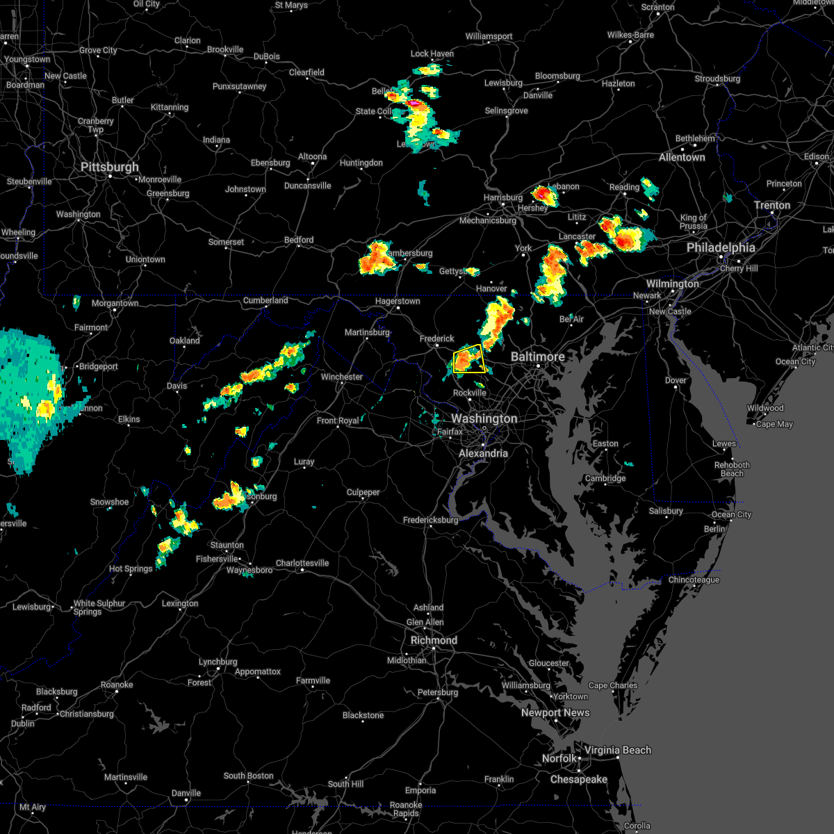 At 238 pm edt, a severe thunderstorm was located near green valley, or near damascus, moving east at 30 mph (radar indicated). Hazards include 60 mph wind gusts and quarter size hail. Damaging winds will cause some trees and large branches to fall. this could injure those outdoors, as well as damage homes and vehicles. roadways may become blocked by downed trees. localized power outages are possible. unsecured light objects may become projectiles. locations impacted include, damascus, mount airy, green valley, clarksburg, monrovia, poplar springs, roxbury mills, lisbon, woodbine and watersville. hail threat, radar indicated max hail size, 1. 00 in wind threat, radar indicated max wind gust, 60 mph. At 238 pm edt, a severe thunderstorm was located near green valley, or near damascus, moving east at 30 mph (radar indicated). Hazards include 60 mph wind gusts and quarter size hail. Damaging winds will cause some trees and large branches to fall. this could injure those outdoors, as well as damage homes and vehicles. roadways may become blocked by downed trees. localized power outages are possible. unsecured light objects may become projectiles. locations impacted include, damascus, mount airy, green valley, clarksburg, monrovia, poplar springs, roxbury mills, lisbon, woodbine and watersville. hail threat, radar indicated max hail size, 1. 00 in wind threat, radar indicated max wind gust, 60 mph.
|
| 7/1/2022 2:26 PM EDT |
 At 226 pm edt, a severe thunderstorm was located over green valley, or near damascus, moving east at 40 mph (radar indicated). Hazards include 60 mph wind gusts and quarter size hail. Damaging winds will cause some trees and large branches to fall. this could injure those outdoors, as well as damage homes and vehicles. roadways may become blocked by downed trees. localized power outages are possible. Unsecured light objects may become projectiles. At 226 pm edt, a severe thunderstorm was located over green valley, or near damascus, moving east at 40 mph (radar indicated). Hazards include 60 mph wind gusts and quarter size hail. Damaging winds will cause some trees and large branches to fall. this could injure those outdoors, as well as damage homes and vehicles. roadways may become blocked by downed trees. localized power outages are possible. Unsecured light objects may become projectiles.
|
| 6/22/2022 3:12 PM EDT |
 At 311 pm edt, severe thunderstorms were located along a line extending from near randallstown to san mar, moving southeast at 85 mph (radar indicated). Hazards include 60 mph wind gusts. Damaging winds will cause some trees and large branches to fall. this could injure those outdoors, as well as damage homes and vehicles. roadways may become blocked by downed trees. localized power outages are possible. unsecured light objects may become projectiles. locations impacted include, columbia, germantown, frederick, hagerstown, olney, westminster, damascus, thurmont, charles town, shepherdstown, municipal stadium, harry grove stadium, montgomery village, eldersburg, ballenger creek, mount airy, robinwood, brunswick, walkersville and fountainhead-orchard hills. hail threat, radar indicated max hail size, <. 75 in wind threat, radar indicated max wind gust, 60 mph. At 311 pm edt, severe thunderstorms were located along a line extending from near randallstown to san mar, moving southeast at 85 mph (radar indicated). Hazards include 60 mph wind gusts. Damaging winds will cause some trees and large branches to fall. this could injure those outdoors, as well as damage homes and vehicles. roadways may become blocked by downed trees. localized power outages are possible. unsecured light objects may become projectiles. locations impacted include, columbia, germantown, frederick, hagerstown, olney, westminster, damascus, thurmont, charles town, shepherdstown, municipal stadium, harry grove stadium, montgomery village, eldersburg, ballenger creek, mount airy, robinwood, brunswick, walkersville and fountainhead-orchard hills. hail threat, radar indicated max hail size, <. 75 in wind threat, radar indicated max wind gust, 60 mph.
|
| 6/22/2022 2:56 PM EDT |
 At 255 pm edt, severe thunderstorms were located along a line extending from near manchester to paramount-long meadow, moving south at 50 mph (radar indicated). Hazards include 60 mph wind gusts. Damaging winds will cause some trees and large branches to fall. this could injure those outdoors, as well as damage homes and vehicles. roadways may become blocked by downed trees. localized power outages are possible. Unsecured light objects may become projectiles. At 255 pm edt, severe thunderstorms were located along a line extending from near manchester to paramount-long meadow, moving south at 50 mph (radar indicated). Hazards include 60 mph wind gusts. Damaging winds will cause some trees and large branches to fall. this could injure those outdoors, as well as damage homes and vehicles. roadways may become blocked by downed trees. localized power outages are possible. Unsecured light objects may become projectiles.
|
| 5/27/2022 11:59 AM EDT |
 At 1159 am edt, severe thunderstorms were located along a line extending from near walkersville to near ballenger creek to near poolesville, moving east at 30 mph (radar indicated). Hazards include 60 mph wind gusts. Damaging winds will cause some trees and large branches to fall. this could injure those outdoors, as well as damage homes and vehicles. roadways may become blocked by downed trees. localized power outages are possible. Unsecured light objects may become projectiles. At 1159 am edt, severe thunderstorms were located along a line extending from near walkersville to near ballenger creek to near poolesville, moving east at 30 mph (radar indicated). Hazards include 60 mph wind gusts. Damaging winds will cause some trees and large branches to fall. this could injure those outdoors, as well as damage homes and vehicles. roadways may become blocked by downed trees. localized power outages are possible. Unsecured light objects may become projectiles.
|
| 5/22/2022 7:43 PM EDT |
 At 742 pm edt, severe thunderstorms were located along a line extending from randallstown to near fredericksburg, moving east at 30 mph (radar indicated). Hazards include 60 mph wind gusts. Damaging winds will cause some trees and large branches to fall. this could injure those outdoors, as well as damage homes and vehicles. roadways may become blocked by downed trees. localized power outages are possible. unsecured light objects may become projectiles. locations impacted include, arlington, alexandria, stafford, columbia, germantown, dale city, rockville, bethesda, gaithersburg, reston, annandale, olney, springfield, college park, fredericksburg, fort washington, greenbelt, fairfax, langley park and beltsville. hail threat, radar indicated max hail size, <. 75 in wind threat, observed max wind gust, 60 mph. At 742 pm edt, severe thunderstorms were located along a line extending from randallstown to near fredericksburg, moving east at 30 mph (radar indicated). Hazards include 60 mph wind gusts. Damaging winds will cause some trees and large branches to fall. this could injure those outdoors, as well as damage homes and vehicles. roadways may become blocked by downed trees. localized power outages are possible. unsecured light objects may become projectiles. locations impacted include, arlington, alexandria, stafford, columbia, germantown, dale city, rockville, bethesda, gaithersburg, reston, annandale, olney, springfield, college park, fredericksburg, fort washington, greenbelt, fairfax, langley park and beltsville. hail threat, radar indicated max hail size, <. 75 in wind threat, observed max wind gust, 60 mph.
|
| 5/22/2022 7:20 PM EDT |
 At 720 pm edt, severe thunderstorms were located along a line extending from near sykesville to near spotsylvania, moving east at 35 mph (radar indicated). Hazards include 60 mph wind gusts. Damaging winds will cause some trees and large branches to fall. this could injure those outdoors, as well as damage homes and vehicles. roadways may become blocked by downed trees. localized power outages are possible. unsecured light objects may become projectiles. locations impacted include, arlington, alexandria, stafford, columbia, germantown, centreville, dale city, rockville, bethesda, gaithersburg, reston, annandale, olney, springfield, college park, fredericksburg, south riding, fort washington, herndon and greenbelt. hail threat, radar indicated max hail size, <. 75 in wind threat, observed max wind gust, 60 mph. At 720 pm edt, severe thunderstorms were located along a line extending from near sykesville to near spotsylvania, moving east at 35 mph (radar indicated). Hazards include 60 mph wind gusts. Damaging winds will cause some trees and large branches to fall. this could injure those outdoors, as well as damage homes and vehicles. roadways may become blocked by downed trees. localized power outages are possible. unsecured light objects may become projectiles. locations impacted include, arlington, alexandria, stafford, columbia, germantown, centreville, dale city, rockville, bethesda, gaithersburg, reston, annandale, olney, springfield, college park, fredericksburg, south riding, fort washington, herndon and greenbelt. hail threat, radar indicated max hail size, <. 75 in wind threat, observed max wind gust, 60 mph.
|
| 5/22/2022 7:04 PM EDT |
 At 703 pm edt, severe thunderstorms were located along a line extending from near damascus to 13 miles north of mineral, moving east at 30 mph (measured gust to 58 mph at dulles airport). Hazards include 60 mph wind gusts. Damaging winds will cause some trees and large branches to fall. this could injure those outdoors, as well as damage homes and vehicles. roadways may become blocked by downed trees. localized power outages are possible. Unsecured light objects may become projectiles. At 703 pm edt, severe thunderstorms were located along a line extending from near damascus to 13 miles north of mineral, moving east at 30 mph (measured gust to 58 mph at dulles airport). Hazards include 60 mph wind gusts. Damaging winds will cause some trees and large branches to fall. this could injure those outdoors, as well as damage homes and vehicles. roadways may become blocked by downed trees. localized power outages are possible. Unsecured light objects may become projectiles.
|
| 5/22/2022 4:26 PM EDT |
 At 426 pm edt, a severe thunderstorm was located over germantown, moving east at 15 mph (radar indicated). Hazards include 60 mph wind gusts and quarter size hail. Damaging winds will cause some trees and large branches to fall. this could injure those outdoors, as well as damage homes and vehicles. roadways may become blocked by downed trees. localized power outages are possible. unsecured light objects may become projectiles. locations impacted include, germantown, gaithersburg, olney, damascus, montgomery village, redland, boyds, cloverly, clarksburg, burtonsville, spencerville, highland, washington grove, laytonsville, brookeville, ednor, ashton, dayton, poplar springs and roxbury mills. hail threat, radar indicated max hail size, 1. 00 in wind threat, radar indicated max wind gust, 60 mph. At 426 pm edt, a severe thunderstorm was located over germantown, moving east at 15 mph (radar indicated). Hazards include 60 mph wind gusts and quarter size hail. Damaging winds will cause some trees and large branches to fall. this could injure those outdoors, as well as damage homes and vehicles. roadways may become blocked by downed trees. localized power outages are possible. unsecured light objects may become projectiles. locations impacted include, germantown, gaithersburg, olney, damascus, montgomery village, redland, boyds, cloverly, clarksburg, burtonsville, spencerville, highland, washington grove, laytonsville, brookeville, ednor, ashton, dayton, poplar springs and roxbury mills. hail threat, radar indicated max hail size, 1. 00 in wind threat, radar indicated max wind gust, 60 mph.
|
| 5/22/2022 4:11 PM EDT |
 At 411 pm edt, a severe thunderstorm was located near green valley, or near damascus, moving east at 25 mph (radar indicated). Hazards include 60 mph wind gusts and quarter size hail. Damaging winds will cause some trees and large branches to fall. this could injure those outdoors, as well as damage homes and vehicles. roadways may become blocked by downed trees. localized power outages are possible. Unsecured light objects may become projectiles. At 411 pm edt, a severe thunderstorm was located near green valley, or near damascus, moving east at 25 mph (radar indicated). Hazards include 60 mph wind gusts and quarter size hail. Damaging winds will cause some trees and large branches to fall. this could injure those outdoors, as well as damage homes and vehicles. roadways may become blocked by downed trees. localized power outages are possible. Unsecured light objects may become projectiles.
|
| 10/25/2021 6:20 PM EDT |
 The severe thunderstorm warning for central montgomery county will expire at 630 pm edt, the storms which prompted the warning have weakened below severe limits, and no longer pose an immediate threat to life or property. therefore, the warning will be allowed to expire. The severe thunderstorm warning for central montgomery county will expire at 630 pm edt, the storms which prompted the warning have weakened below severe limits, and no longer pose an immediate threat to life or property. therefore, the warning will be allowed to expire.
|
| 10/25/2021 6:07 PM EDT |
 At 607 pm edt, severe thunderstorms were located along a line extending from near boyds to montgomery village to olney, moving north at 35 mph (radar indicated). Hazards include 60 mph wind gusts. Damaging winds will cause some trees and large branches to fall. this could injure those outdoors, as well as damage homes and vehicles. roadways may become blocked by downed trees. localized power outages are possible. unsecured light objects may become projectiles. locations impacted include, germantown, rockville, gaithersburg, olney, damascus, montgomery village, north potomac, redland, boyds, clarksburg, darnestown, derwood, washington grove, laytonsville, barnesville and dawsonville. hail threat, radar indicated max hail size, <. 75 in wind threat, radar indicated max wind gust, 60 mph. At 607 pm edt, severe thunderstorms were located along a line extending from near boyds to montgomery village to olney, moving north at 35 mph (radar indicated). Hazards include 60 mph wind gusts. Damaging winds will cause some trees and large branches to fall. this could injure those outdoors, as well as damage homes and vehicles. roadways may become blocked by downed trees. localized power outages are possible. unsecured light objects may become projectiles. locations impacted include, germantown, rockville, gaithersburg, olney, damascus, montgomery village, north potomac, redland, boyds, clarksburg, darnestown, derwood, washington grove, laytonsville, barnesville and dawsonville. hail threat, radar indicated max hail size, <. 75 in wind threat, radar indicated max wind gust, 60 mph.
|
| 10/25/2021 6:02 PM EDT |
 At 602 pm edt, severe thunderstorms were located along a line extending from near lowes island to gaithersburg to aspen hill, moving north at 40 mph (radar indicated). Hazards include 60 mph wind gusts. Damaging winds will cause some trees and large branches to fall. this could injure those outdoors, as well as damage homes and vehicles. roadways may become blocked by downed trees. localized power outages are possible. unsecured light objects may become projectiles. locations impacted include, germantown, rockville, gaithersburg, olney, damascus, lowes island, montgomery village, north potomac, redland, boyds, clarksburg, darnestown, derwood, washington grove, laytonsville, barnesville and dawsonville. hail threat, radar indicated max hail size, <. 75 in wind threat, radar indicated max wind gust, 60 mph. At 602 pm edt, severe thunderstorms were located along a line extending from near lowes island to gaithersburg to aspen hill, moving north at 40 mph (radar indicated). Hazards include 60 mph wind gusts. Damaging winds will cause some trees and large branches to fall. this could injure those outdoors, as well as damage homes and vehicles. roadways may become blocked by downed trees. localized power outages are possible. unsecured light objects may become projectiles. locations impacted include, germantown, rockville, gaithersburg, olney, damascus, lowes island, montgomery village, north potomac, redland, boyds, clarksburg, darnestown, derwood, washington grove, laytonsville, barnesville and dawsonville. hail threat, radar indicated max hail size, <. 75 in wind threat, radar indicated max wind gust, 60 mph.
|
| 10/25/2021 5:44 PM EDT |
 At 544 pm edt, severe thunderstorms were located along a line extending from south riding to herndon to wolf trap, moving northeast at 50 mph (radar indicated). Hazards include 60 mph wind gusts. Damaging winds will cause some trees and large branches to fall. this could injure those outdoors, as well as damage homes and vehicles. roadways may become blocked by downed trees. localized power outages are possible. Unsecured light objects may become projectiles. At 544 pm edt, severe thunderstorms were located along a line extending from south riding to herndon to wolf trap, moving northeast at 50 mph (radar indicated). Hazards include 60 mph wind gusts. Damaging winds will cause some trees and large branches to fall. this could injure those outdoors, as well as damage homes and vehicles. roadways may become blocked by downed trees. localized power outages are possible. Unsecured light objects may become projectiles.
|
| 8/27/2021 3:07 PM EDT |
 The severe thunderstorm warning for central montgomery county will expire at 315 pm edt, the storm which prompted the warning has moved out of the area. therefore, the warning will be allowed to expire. however gusty winds are still possible with this thunderstorm. remember, a severe thunderstorm warning still remains in effect for portions of central montgomery county. The severe thunderstorm warning for central montgomery county will expire at 315 pm edt, the storm which prompted the warning has moved out of the area. therefore, the warning will be allowed to expire. however gusty winds are still possible with this thunderstorm. remember, a severe thunderstorm warning still remains in effect for portions of central montgomery county.
|
| 8/27/2021 2:56 PM EDT |
 At 255 pm edt, a severe thunderstorm was located over north potomac, or near gaithersburg, moving east at 5 mph (radar indicated). Hazards include 60 mph wind gusts and quarter size hail. Damaging winds will cause some trees and large branches to fall. this could injure those outdoors, as well as damage homes and vehicles. roadways may become blocked by downed trees. localized power outages are possible. unsecured light objects may become projectiles. locations impacted include, germantown, rockville, gaithersburg, olney, damascus, lowes island, aspen hill, potomac, north bethesda, montgomery village, north potomac, redland, great falls, boyds, rossmoor, wheaton-glenmont, wheaton, cloverly, clarksburg and glenmont. hail threat, radar indicated max hail size, 1. 00 in wind threat, radar indicated max wind gust, 60 mph. At 255 pm edt, a severe thunderstorm was located over north potomac, or near gaithersburg, moving east at 5 mph (radar indicated). Hazards include 60 mph wind gusts and quarter size hail. Damaging winds will cause some trees and large branches to fall. this could injure those outdoors, as well as damage homes and vehicles. roadways may become blocked by downed trees. localized power outages are possible. unsecured light objects may become projectiles. locations impacted include, germantown, rockville, gaithersburg, olney, damascus, lowes island, aspen hill, potomac, north bethesda, montgomery village, north potomac, redland, great falls, boyds, rossmoor, wheaton-glenmont, wheaton, cloverly, clarksburg and glenmont. hail threat, radar indicated max hail size, 1. 00 in wind threat, radar indicated max wind gust, 60 mph.
|
| 8/27/2021 2:35 PM EDT |
 At 234 pm edt, a severe thunderstorm was located near lowes island, moving east at 15 mph (radar indicated). Hazards include 60 mph wind gusts and quarter size hail. Damaging winds will cause some trees and large branches to fall. this could injure those outdoors, as well as damage homes and vehicles. roadways may become blocked by downed trees. localized power outages are possible. Unsecured light objects may become projectiles. At 234 pm edt, a severe thunderstorm was located near lowes island, moving east at 15 mph (radar indicated). Hazards include 60 mph wind gusts and quarter size hail. Damaging winds will cause some trees and large branches to fall. this could injure those outdoors, as well as damage homes and vehicles. roadways may become blocked by downed trees. localized power outages are possible. Unsecured light objects may become projectiles.
|
| 8/13/2021 4:48 PM EDT | Tree down near the intersection of md-124 and sweepstakes road in montgomery county MD, 0.4 miles NE of Damascus, MD |
| 8/13/2021 4:41 PM EDT | Power line down on the 9500 block of pleasant plains road in montgomery county MD, 1.9 miles S of Damascus, MD |
| 8/13/2021 4:37 PM EDT | Trees down on md-94 woodbine road near annapolis rock roa in howard county MD, 3.6 miles WSW of Damascus, MD |
| 8/13/2021 4:31 PM EDT | Power lines down on the 30 block of clearwater court in montgomery county MD, 1 miles ESE of Damascus, MD |
| 8/13/2021 4:30 PM EDT |
 At 430 pm edt, a severe thunderstorm was located over damascus, moving southeast at 5 mph (radar indicated). Hazards include 70 mph wind gusts and quarter size hail. Damaging winds will cause some trees and large branches to fall. this could injure those outdoors, as well as damage homes and vehicles. roadways may become blocked by downed trees. localized power outages are possible. Unsecured light objects may become projectiles. At 430 pm edt, a severe thunderstorm was located over damascus, moving southeast at 5 mph (radar indicated). Hazards include 70 mph wind gusts and quarter size hail. Damaging winds will cause some trees and large branches to fall. this could injure those outdoors, as well as damage homes and vehicles. roadways may become blocked by downed trees. localized power outages are possible. Unsecured light objects may become projectiles.
|
| 8/13/2021 4:20 PM EDT | Wires down in the 24800 block of md-124 woodfield roa in montgomery county MD, 0.4 miles NE of Damascus, MD |
| 8/11/2021 4:22 PM EDT |
 At 422 pm edt, severe thunderstorms were located along a line extending from near westminster to near mount airy to boyds, moving east at 20 mph (radar indicated). Hazards include 60 mph wind gusts. Damaging winds will cause some trees and large branches to fall. this could injure those outdoors, as well as damage homes and vehicles. roadways may become blocked by downed trees. localized power outages are possible. unsecured light objects may become projectiles. locations impacted include, germantown, rockville, gaithersburg, olney, westminster, damascus, poolesville, ellicott city, aspen hill, randallstown, montgomery village, owings mills, eldersburg, reisterstown, redland, mount airy, hampstead, manchester, sykesville and oakland. hail threat, radar indicated max hail size, <. 75 in wind threat, radar indicated max wind gust, 60 mph. At 422 pm edt, severe thunderstorms were located along a line extending from near westminster to near mount airy to boyds, moving east at 20 mph (radar indicated). Hazards include 60 mph wind gusts. Damaging winds will cause some trees and large branches to fall. this could injure those outdoors, as well as damage homes and vehicles. roadways may become blocked by downed trees. localized power outages are possible. unsecured light objects may become projectiles. locations impacted include, germantown, rockville, gaithersburg, olney, westminster, damascus, poolesville, ellicott city, aspen hill, randallstown, montgomery village, owings mills, eldersburg, reisterstown, redland, mount airy, hampstead, manchester, sykesville and oakland. hail threat, radar indicated max hail size, <. 75 in wind threat, radar indicated max wind gust, 60 mph.
|
| 8/11/2021 4:06 PM EDT |
 At 405 pm edt, severe thunderstorms were located along a line extending from 6 miles south of taneytown to green valley to near poolesville, moving east at 20 mph (radar indicated). Hazards include 60 mph wind gusts. Damaging winds will cause some trees and large branches to fall. this could injure those outdoors, as well as damage homes and vehicles. roadways may become blocked by downed trees. localized power outages are possible. Unsecured light objects may become projectiles. At 405 pm edt, severe thunderstorms were located along a line extending from 6 miles south of taneytown to green valley to near poolesville, moving east at 20 mph (radar indicated). Hazards include 60 mph wind gusts. Damaging winds will cause some trees and large branches to fall. this could injure those outdoors, as well as damage homes and vehicles. roadways may become blocked by downed trees. localized power outages are possible. Unsecured light objects may become projectiles.
|
| 8/10/2021 5:51 PM EDT |
 At 551 pm edt, severe thunderstorms were located along a line extending from near ballenger creek to near green valley to near damascus, moving east at 15 mph (radar indicated). Hazards include 60 mph wind gusts. Damaging winds will cause some trees and large branches to fall. this could injure those outdoors, as well as damage homes and vehicles. roadways may become blocked by downed trees. localized power outages are possible. unsecured light objects may become projectiles. locations impacted include, germantown, damascus, new market, green valley, clarksburg and monrovia. hail threat, radar indicated max hail size, <. 75 in wind threat, radar indicated max wind gust, 60 mph. At 551 pm edt, severe thunderstorms were located along a line extending from near ballenger creek to near green valley to near damascus, moving east at 15 mph (radar indicated). Hazards include 60 mph wind gusts. Damaging winds will cause some trees and large branches to fall. this could injure those outdoors, as well as damage homes and vehicles. roadways may become blocked by downed trees. localized power outages are possible. unsecured light objects may become projectiles. locations impacted include, germantown, damascus, new market, green valley, clarksburg and monrovia. hail threat, radar indicated max hail size, <. 75 in wind threat, radar indicated max wind gust, 60 mph.
|
| 8/10/2021 5:34 PM EDT |
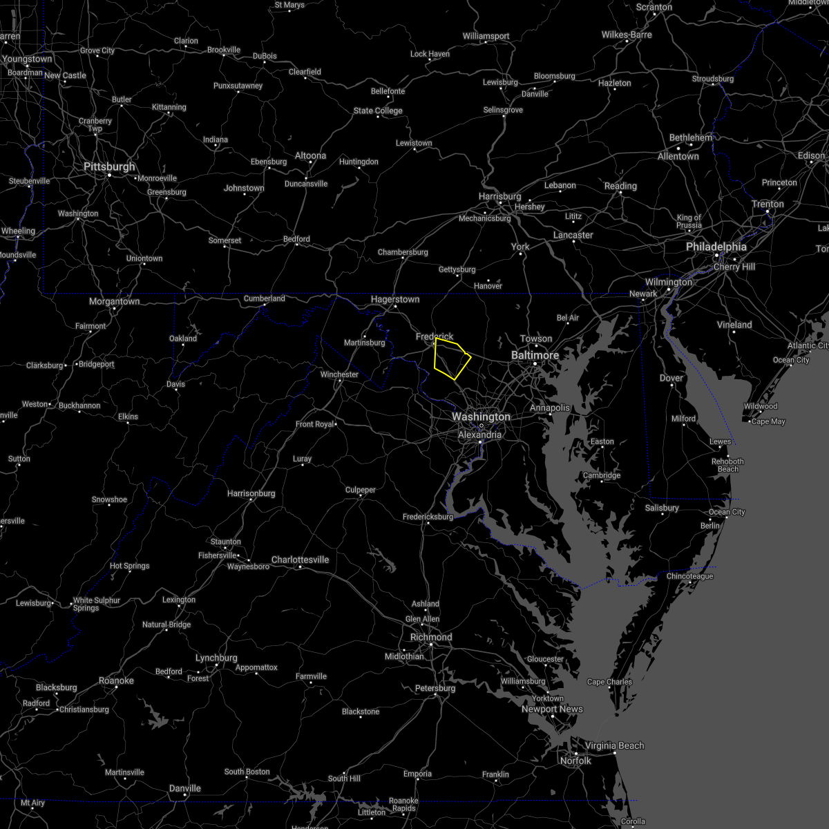 At 533 pm edt, severe thunderstorms were located along a line extending from 7 miles east of point of rocks to near boyds to near germantown, moving northeast at 15 mph (radar indicated). Hazards include 60 mph wind gusts. Damaging winds will cause some trees and large branches to fall. this could injure those outdoors, as well as damage homes and vehicles. roadways may become blocked by downed trees. localized power outages are possible. Unsecured light objects may become projectiles. At 533 pm edt, severe thunderstorms were located along a line extending from 7 miles east of point of rocks to near boyds to near germantown, moving northeast at 15 mph (radar indicated). Hazards include 60 mph wind gusts. Damaging winds will cause some trees and large branches to fall. this could injure those outdoors, as well as damage homes and vehicles. roadways may become blocked by downed trees. localized power outages are possible. Unsecured light objects may become projectiles.
|
| 8/10/2021 4:49 PM EDT |
 At 449 pm edt, a severe thunderstorm was located over boyds, or near germantown, moving east at 20 mph (radar indicated). Hazards include 60 mph wind gusts. Damaging winds will cause some trees and large branches to fall. this could injure those outdoors, as well as damage homes and vehicles. roadways may become blocked by downed trees. localized power outages are possible. Unsecured light objects may become projectiles. At 449 pm edt, a severe thunderstorm was located over boyds, or near germantown, moving east at 20 mph (radar indicated). Hazards include 60 mph wind gusts. Damaging winds will cause some trees and large branches to fall. this could injure those outdoors, as well as damage homes and vehicles. roadways may become blocked by downed trees. localized power outages are possible. Unsecured light objects may become projectiles.
|
| 7/17/2021 4:23 PM EDT |
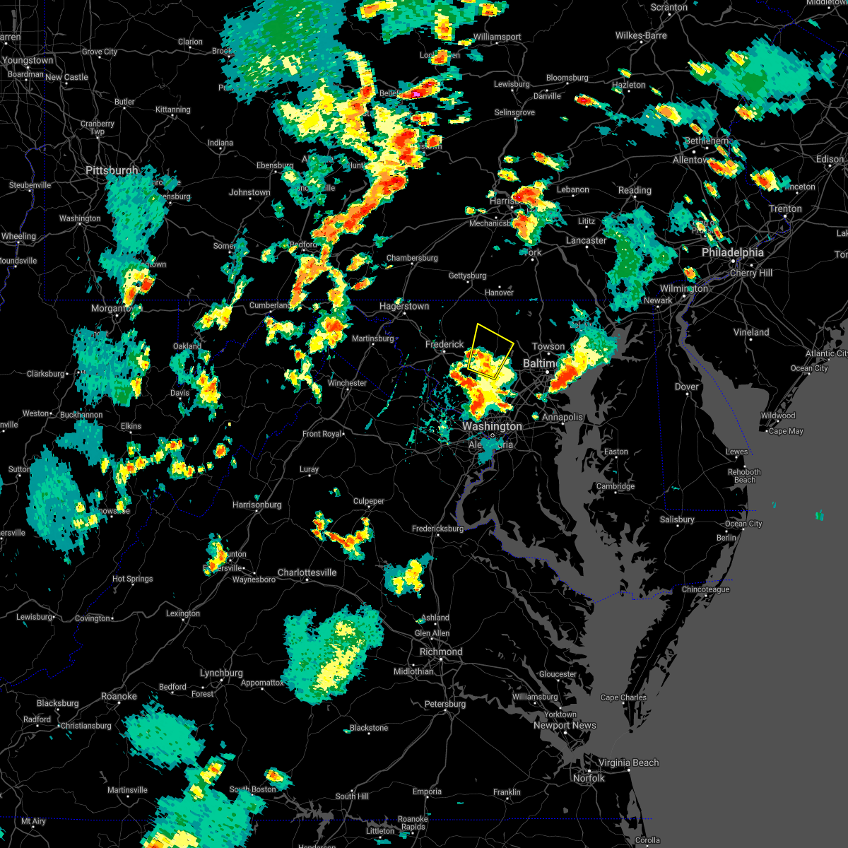 The severe thunderstorm warning for southeastern carroll county in north central maryland, northwestern howard and north central montgomery counties in central maryland, east central frederick county in north central maryland and western baltimore counties in northern maryland will expire at 430 pm edt, the storm which prompted the warning has weakened below severe limits, and no longer poses an immediate threat to life or property. therefore, the warning will be allowed to expire. a severe thunderstorm watch remains in effect until 1100 pm edt for northern, central and north central maryland. The severe thunderstorm warning for southeastern carroll county in north central maryland, northwestern howard and north central montgomery counties in central maryland, east central frederick county in north central maryland and western baltimore counties in northern maryland will expire at 430 pm edt, the storm which prompted the warning has weakened below severe limits, and no longer poses an immediate threat to life or property. therefore, the warning will be allowed to expire. a severe thunderstorm watch remains in effect until 1100 pm edt for northern, central and north central maryland.
|
| 7/17/2021 4:14 PM EDT |
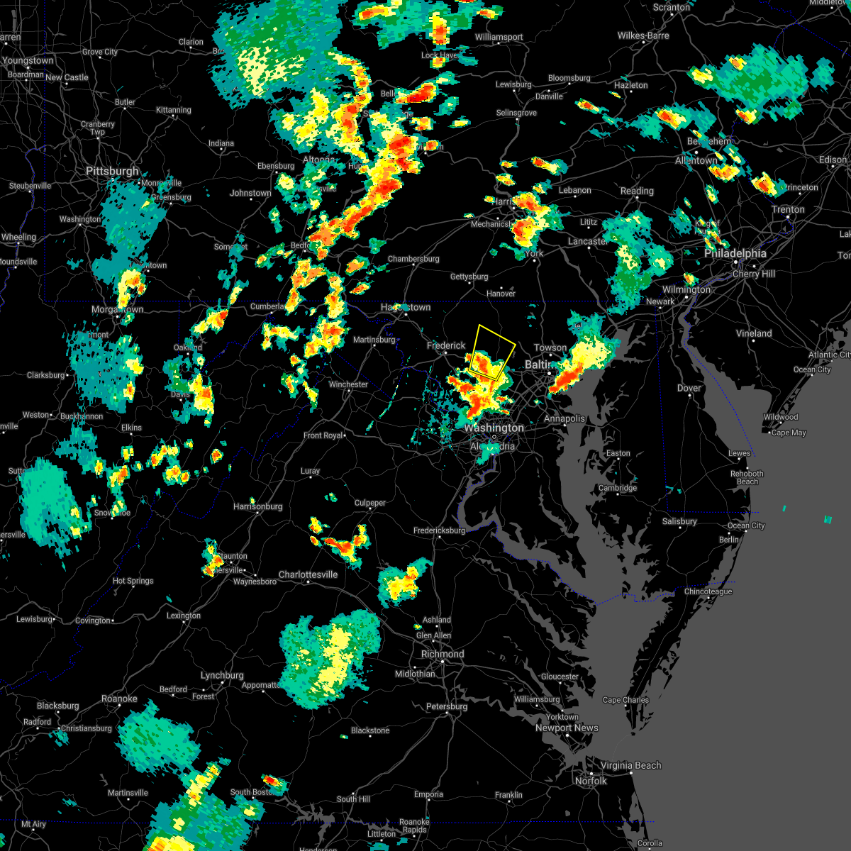 At 413 pm edt, a severe thunderstorm was located over mount airy, or 7 miles northeast of damascus, moving north at 30 mph (radar indicated). Hazards include 60 mph wind gusts and quarter size hail. Damaging winds will cause some trees and large branches to fall. this could injure those outdoors, as well as damage homes and vehicles. roadways may become blocked by downed trees. localized power outages are possible. unsecured light objects may become projectiles. Locations impacted include, damascus, eldersburg, mount airy, sykesville, gamber, new windsor, winfield, lisbon, glenwood, louisville, gaither, watersville, linwood, poplar springs, woodbine, carrolltowne and marston. At 413 pm edt, a severe thunderstorm was located over mount airy, or 7 miles northeast of damascus, moving north at 30 mph (radar indicated). Hazards include 60 mph wind gusts and quarter size hail. Damaging winds will cause some trees and large branches to fall. this could injure those outdoors, as well as damage homes and vehicles. roadways may become blocked by downed trees. localized power outages are possible. unsecured light objects may become projectiles. Locations impacted include, damascus, eldersburg, mount airy, sykesville, gamber, new windsor, winfield, lisbon, glenwood, louisville, gaither, watersville, linwood, poplar springs, woodbine, carrolltowne and marston.
|
| 7/17/2021 3:50 PM EDT |
 At 349 pm edt, a severe thunderstorm was located over montgomery village, or near germantown, moving northeast at 30 mph (radar indicated). Hazards include 60 mph wind gusts and quarter size hail. Damaging winds will cause some trees and large branches to fall. this could injure those outdoors, as well as damage homes and vehicles. roadways may become blocked by downed trees. localized power outages are possible. Unsecured light objects may become projectiles. At 349 pm edt, a severe thunderstorm was located over montgomery village, or near germantown, moving northeast at 30 mph (radar indicated). Hazards include 60 mph wind gusts and quarter size hail. Damaging winds will cause some trees and large branches to fall. this could injure those outdoors, as well as damage homes and vehicles. roadways may become blocked by downed trees. localized power outages are possible. Unsecured light objects may become projectiles.
|
| 7/1/2021 3:01 PM EDT |
 At 301 pm edt, a severe thunderstorm was located over montgomery village, or over germantown, moving east at 20 mph (radar indicated). Hazards include 60 mph wind gusts. Damaging winds will cause some trees and large branches to fall. this could injure those outdoors, as well as damage homes and vehicles. roadways may become blocked by downed trees. localized power outages are possible. unsecured light objects may become projectiles. Locations impacted include, germantown, gaithersburg, damascus, montgomery village, redland, clarksburg, washington grove and laytonsville. At 301 pm edt, a severe thunderstorm was located over montgomery village, or over germantown, moving east at 20 mph (radar indicated). Hazards include 60 mph wind gusts. Damaging winds will cause some trees and large branches to fall. this could injure those outdoors, as well as damage homes and vehicles. roadways may become blocked by downed trees. localized power outages are possible. unsecured light objects may become projectiles. Locations impacted include, germantown, gaithersburg, damascus, montgomery village, redland, clarksburg, washington grove and laytonsville.
|
| 7/1/2021 2:40 PM EDT |
 At 240 pm edt, a severe thunderstorm was located over poolesville, moving east at 20 mph (radar indicated). Hazards include 60 mph wind gusts and quarter size hail. Damaging winds will cause some trees and large branches to fall. this could injure those outdoors, as well as damage homes and vehicles. roadways may become blocked by downed trees. localized power outages are possible. Unsecured light objects may become projectiles. At 240 pm edt, a severe thunderstorm was located over poolesville, moving east at 20 mph (radar indicated). Hazards include 60 mph wind gusts and quarter size hail. Damaging winds will cause some trees and large branches to fall. this could injure those outdoors, as well as damage homes and vehicles. roadways may become blocked by downed trees. localized power outages are possible. Unsecured light objects may become projectiles.
|
| 7/1/2021 2:15 PM EDT | Quarter sized hail reported 1.4 miles E of Damascus, MD |
| 7/1/2021 2:10 PM EDT |
 At 210 pm edt, a severe thunderstorm was located near boyds, or near germantown, moving east at 35 mph (radar indicated). Hazards include 60 mph wind gusts and quarter size hail. Damaging winds will cause some trees and large branches to fall. this could injure those outdoors, as well as damage homes and vehicles. roadways may become blocked by downed trees. localized power outages are possible. Unsecured light objects may become projectiles. At 210 pm edt, a severe thunderstorm was located near boyds, or near germantown, moving east at 35 mph (radar indicated). Hazards include 60 mph wind gusts and quarter size hail. Damaging winds will cause some trees and large branches to fall. this could injure those outdoors, as well as damage homes and vehicles. roadways may become blocked by downed trees. localized power outages are possible. Unsecured light objects may become projectiles.
|
| 6/21/2021 5:28 PM EDT |
 At 528 pm edt, severe thunderstorms were located along a line extending from near mount airy to near north potomac to near south riding, moving east at 35 mph (radar indicated). Hazards include 60 mph wind gusts. Damaging winds will cause some trees and large branches to fall. this could injure those outdoors, as well as damage homes and vehicles. roadways may become blocked by downed trees. localized power outages are possible. unsecured light objects may become projectiles. Locations impacted include, arlington, columbia, germantown, centreville, rockville, bethesda, gaithersburg, reston, annandale, olney, springfield, south riding, herndon, fairfax, vienna, damascus, falls church, broadlands, lansdowne and lowes island. At 528 pm edt, severe thunderstorms were located along a line extending from near mount airy to near north potomac to near south riding, moving east at 35 mph (radar indicated). Hazards include 60 mph wind gusts. Damaging winds will cause some trees and large branches to fall. this could injure those outdoors, as well as damage homes and vehicles. roadways may become blocked by downed trees. localized power outages are possible. unsecured light objects may become projectiles. Locations impacted include, arlington, columbia, germantown, centreville, rockville, bethesda, gaithersburg, reston, annandale, olney, springfield, south riding, herndon, fairfax, vienna, damascus, falls church, broadlands, lansdowne and lowes island.
|
| 6/21/2021 5:02 PM EDT |
 At 501 pm edt, severe thunderstorms were located along a line extending from ballenger creek to leesburg to near the plains, moving east at 35 mph (radar indicated). Hazards include 60 mph wind gusts. Damaging winds will cause some trees and large branches to fall. this could injure those outdoors, as well as damage homes and vehicles. roadways may become blocked by downed trees. localized power outages are possible. Unsecured light objects may become projectiles. At 501 pm edt, severe thunderstorms were located along a line extending from ballenger creek to leesburg to near the plains, moving east at 35 mph (radar indicated). Hazards include 60 mph wind gusts. Damaging winds will cause some trees and large branches to fall. this could injure those outdoors, as well as damage homes and vehicles. roadways may become blocked by downed trees. localized power outages are possible. Unsecured light objects may become projectiles.
|
| 6/14/2021 9:50 PM EDT |
 At 950 pm edt, a severe thunderstorm was located near olney, moving east at 30 mph (radar indicated). Hazards include 60 mph wind gusts and quarter size hail. Damaging winds will cause some trees and large branches to fall. this could injure those outdoors, as well as damage homes and vehicles. roadways may become blocked by downed trees. localized power outages are possible. unsecured light objects may become projectiles. Locations impacted include, gaithersburg, olney, damascus, montgomery village, redland, cloverly, spencerville, highland, washington grove, laytonsville, brookeville, west friendship, glenwood, ednor, ashton, dayton, roxbury mills, sandy spring, glenelg and brinklow. At 950 pm edt, a severe thunderstorm was located near olney, moving east at 30 mph (radar indicated). Hazards include 60 mph wind gusts and quarter size hail. Damaging winds will cause some trees and large branches to fall. this could injure those outdoors, as well as damage homes and vehicles. roadways may become blocked by downed trees. localized power outages are possible. unsecured light objects may become projectiles. Locations impacted include, gaithersburg, olney, damascus, montgomery village, redland, cloverly, spencerville, highland, washington grove, laytonsville, brookeville, west friendship, glenwood, ednor, ashton, dayton, roxbury mills, sandy spring, glenelg and brinklow.
|
| 6/14/2021 9:37 PM EDT |
 At 937 pm edt, a severe thunderstorm was located over montgomery village, or near damascus, moving east at 30 mph (radar indicated). Hazards include 60 mph wind gusts and quarter size hail. Damaging winds will cause some trees and large branches to fall. this could injure those outdoors, as well as damage homes and vehicles. roadways may become blocked by downed trees. localized power outages are possible. unsecured light objects may become projectiles. Locations impacted include, germantown, rockville, gaithersburg, olney, damascus, aspen hill, montgomery village, north potomac, redland, colesville, rossmoor, wheaton-glenmont, cloverly, clarksburg, glenmont, burtonsville, darnestown, derwood, spencerville and highland. At 937 pm edt, a severe thunderstorm was located over montgomery village, or near damascus, moving east at 30 mph (radar indicated). Hazards include 60 mph wind gusts and quarter size hail. Damaging winds will cause some trees and large branches to fall. this could injure those outdoors, as well as damage homes and vehicles. roadways may become blocked by downed trees. localized power outages are possible. unsecured light objects may become projectiles. Locations impacted include, germantown, rockville, gaithersburg, olney, damascus, aspen hill, montgomery village, north potomac, redland, colesville, rossmoor, wheaton-glenmont, cloverly, clarksburg, glenmont, burtonsville, darnestown, derwood, spencerville and highland.
|
| 6/14/2021 9:22 PM EDT |
 At 922 pm edt, a severe thunderstorm was located over boyds, or near germantown, moving east at 30 mph (radar indicated). Hazards include 60 mph wind gusts and quarter size hail. Damaging winds will cause some trees and large branches to fall. this could injure those outdoors, as well as damage homes and vehicles. roadways may become blocked by downed trees. localized power outages are possible. Unsecured light objects may become projectiles. At 922 pm edt, a severe thunderstorm was located over boyds, or near germantown, moving east at 30 mph (radar indicated). Hazards include 60 mph wind gusts and quarter size hail. Damaging winds will cause some trees and large branches to fall. this could injure those outdoors, as well as damage homes and vehicles. roadways may become blocked by downed trees. localized power outages are possible. Unsecured light objects may become projectiles.
|
| 6/3/2021 5:52 PM EDT |
 At 551 pm edt, a severe thunderstorm was located near olney, moving east at 40 mph (spotter confirmed quarter size hail). Hazards include 60 mph wind gusts and quarter size hail. Damaging winds will cause some trees and large branches to fall. this could injure those outdoors, as well as damage homes and vehicles. roadways may become blocked by downed trees. localized power outages are possible. unsecured light objects may become projectiles. Locations impacted include, columbia, germantown, rockville, gaithersburg, olney, damascus, ellicott city, aspen hill, montgomery village, north potomac, fairland, redland, rossmoor, scaggsville, cloverly, burtonsville, darnestown, derwood, fulton and spencerville. At 551 pm edt, a severe thunderstorm was located near olney, moving east at 40 mph (spotter confirmed quarter size hail). Hazards include 60 mph wind gusts and quarter size hail. Damaging winds will cause some trees and large branches to fall. this could injure those outdoors, as well as damage homes and vehicles. roadways may become blocked by downed trees. localized power outages are possible. unsecured light objects may become projectiles. Locations impacted include, columbia, germantown, rockville, gaithersburg, olney, damascus, ellicott city, aspen hill, montgomery village, north potomac, fairland, redland, rossmoor, scaggsville, cloverly, burtonsville, darnestown, derwood, fulton and spencerville.
|
| 6/3/2021 5:27 PM EDT |
 At 526 pm edt, a severe thunderstorm was located over germantown, moving east at 35 mph (radar indicated). Hazards include 60 mph wind gusts and quarter size hail. Damaging winds will cause some trees and large branches to fall. this could injure those outdoors, as well as damage homes and vehicles. roadways may become blocked by downed trees. localized power outages are possible. Unsecured light objects may become projectiles. At 526 pm edt, a severe thunderstorm was located over germantown, moving east at 35 mph (radar indicated). Hazards include 60 mph wind gusts and quarter size hail. Damaging winds will cause some trees and large branches to fall. this could injure those outdoors, as well as damage homes and vehicles. roadways may become blocked by downed trees. localized power outages are possible. Unsecured light objects may become projectiles.
|
| 6/3/2021 3:58 PM EDT |
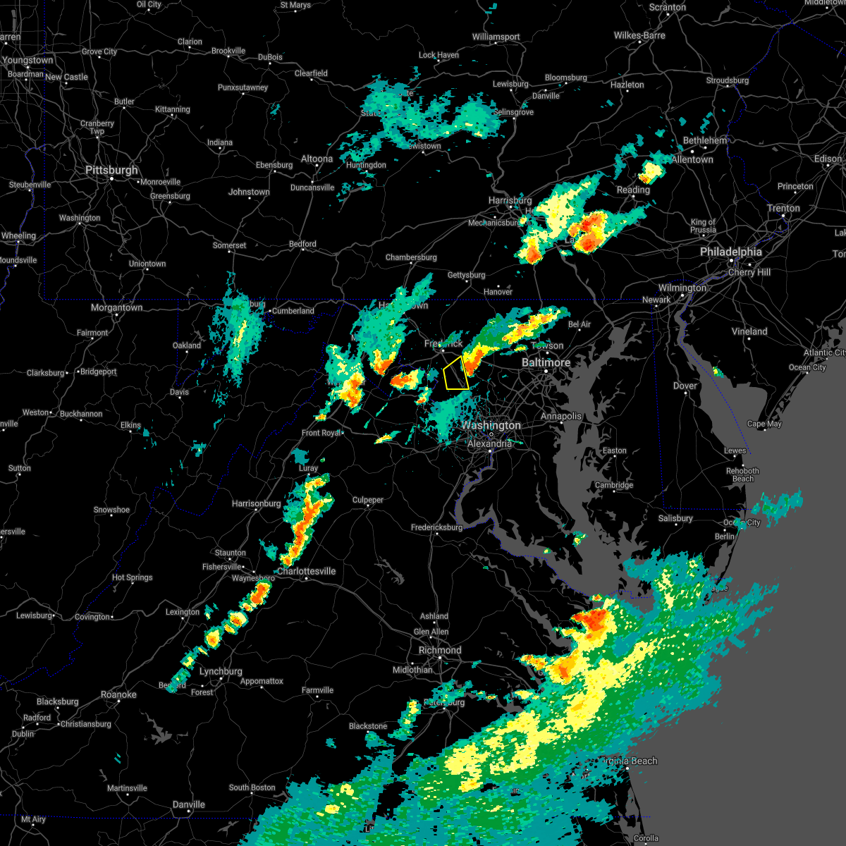 The severe thunderstorm warning for northwestern montgomery county in central maryland and south central frederick counties in north central maryland will expire at 400 pm edt, the storm which prompted the warning has weakened below severe limits, and has exited the warned area. therefore, the warning will be allowed to expire. a severe thunderstorm watch remains in effect until 900 pm edt for central and north central maryland. The severe thunderstorm warning for northwestern montgomery county in central maryland and south central frederick counties in north central maryland will expire at 400 pm edt, the storm which prompted the warning has weakened below severe limits, and has exited the warned area. therefore, the warning will be allowed to expire. a severe thunderstorm watch remains in effect until 900 pm edt for central and north central maryland.
|
| 6/3/2021 3:47 PM EDT |
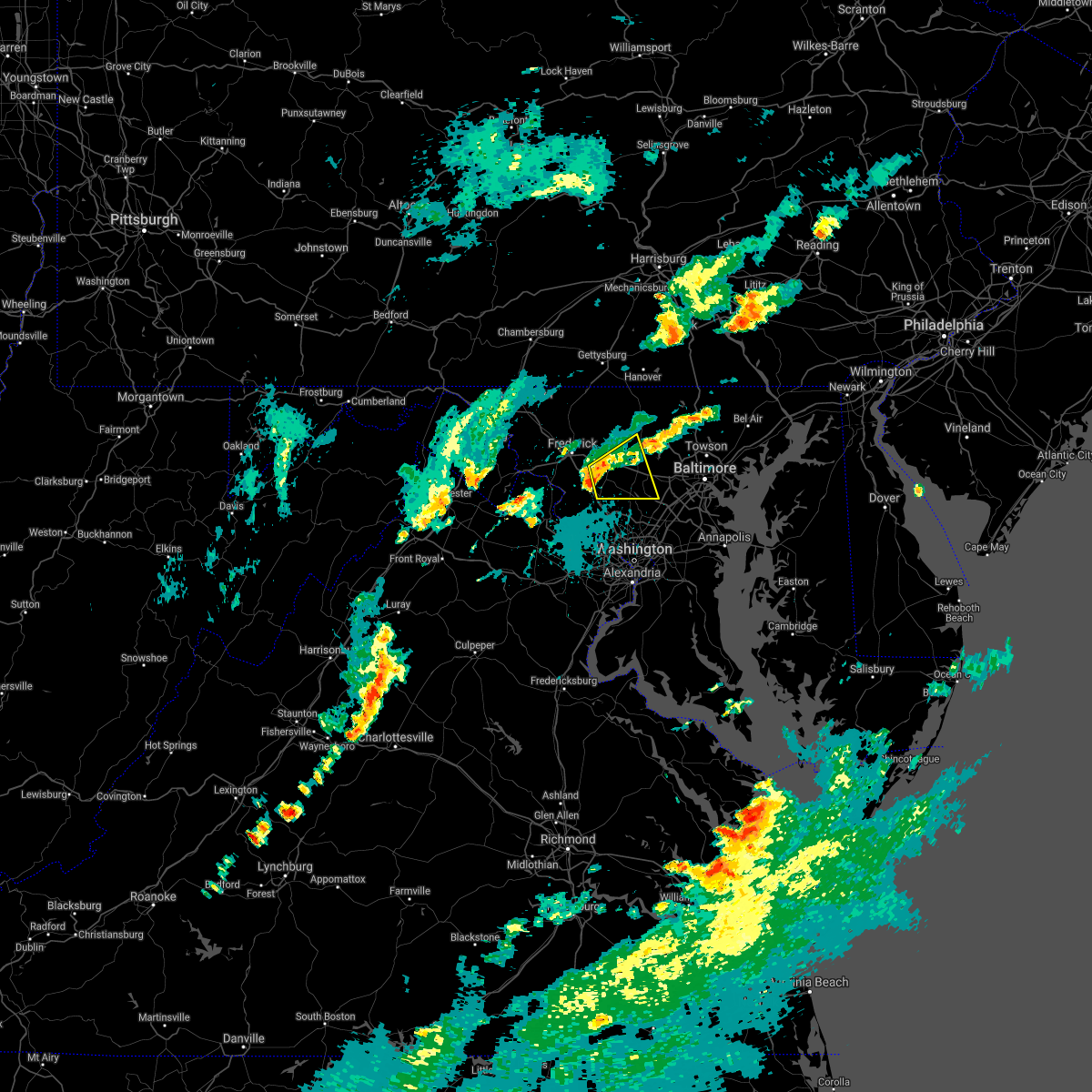 At 347 pm edt, a severe thunderstorm was located near damascus, moving east at 25 mph (radar indicated). Hazards include 60 mph wind gusts and quarter size hail. Damaging winds will cause some trees and large branches to fall. this could injure those outdoors, as well as damage homes and vehicles. roadways may become blocked by downed trees. localized power outages are possible. Unsecured light objects may become projectiles. At 347 pm edt, a severe thunderstorm was located near damascus, moving east at 25 mph (radar indicated). Hazards include 60 mph wind gusts and quarter size hail. Damaging winds will cause some trees and large branches to fall. this could injure those outdoors, as well as damage homes and vehicles. roadways may become blocked by downed trees. localized power outages are possible. Unsecured light objects may become projectiles.
|
| 6/3/2021 3:40 PM EDT |
 At 340 pm edt, a severe thunderstorm was located near boyds, or near germantown, moving east at 25 mph (radar indicated). Hazards include 60 mph wind gusts and quarter size hail. Damaging winds will cause some trees and large branches to fall. this could injure those outdoors, as well as damage homes and vehicles. roadways may become blocked by downed trees. localized power outages are possible. unsecured light objects may become projectiles. Locations impacted include, germantown, boyds, clarksburg, monrovia, barnesville and park mills. At 340 pm edt, a severe thunderstorm was located near boyds, or near germantown, moving east at 25 mph (radar indicated). Hazards include 60 mph wind gusts and quarter size hail. Damaging winds will cause some trees and large branches to fall. this could injure those outdoors, as well as damage homes and vehicles. roadways may become blocked by downed trees. localized power outages are possible. unsecured light objects may become projectiles. Locations impacted include, germantown, boyds, clarksburg, monrovia, barnesville and park mills.
|
| 6/3/2021 3:26 PM EDT |
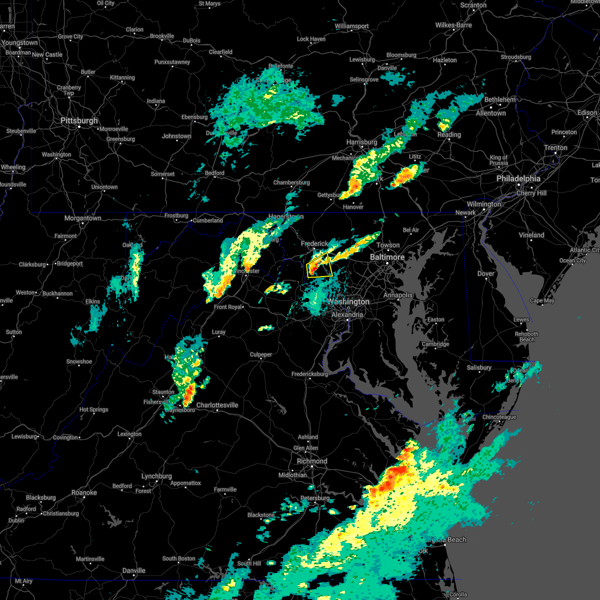 At 326 pm edt, a severe thunderstorm was located near poolesville, moving east at 25 mph (radar indicated). Hazards include 60 mph wind gusts and quarter size hail. Damaging winds will cause some trees and large branches to fall. this could injure those outdoors, as well as damage homes and vehicles. roadways may become blocked by downed trees. localized power outages are possible. unsecured light objects may become projectiles. Locations impacted include, germantown, boyds, clarksburg, adamstown, monrovia, barnesville, dickerson, beallsville, tuscarora and park mills. At 326 pm edt, a severe thunderstorm was located near poolesville, moving east at 25 mph (radar indicated). Hazards include 60 mph wind gusts and quarter size hail. Damaging winds will cause some trees and large branches to fall. this could injure those outdoors, as well as damage homes and vehicles. roadways may become blocked by downed trees. localized power outages are possible. unsecured light objects may become projectiles. Locations impacted include, germantown, boyds, clarksburg, adamstown, monrovia, barnesville, dickerson, beallsville, tuscarora and park mills.
|
| 6/3/2021 3:14 PM EDT |
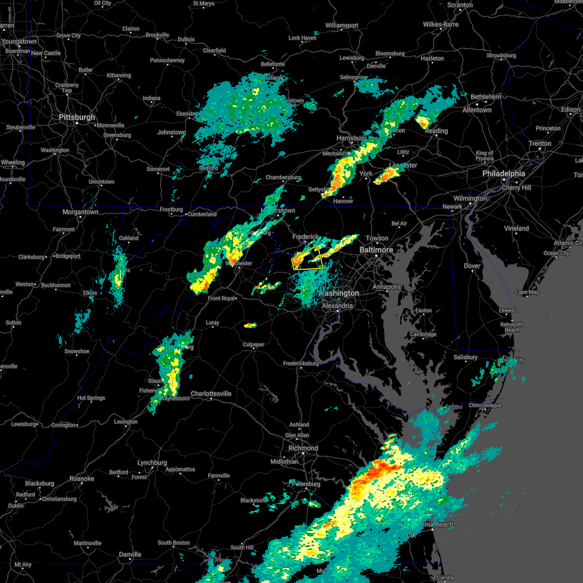 At 314 pm edt, a severe thunderstorm was located near point of rocks, or near poolesville, moving east at 25 mph (radar indicated). Hazards include 60 mph wind gusts and quarter size hail. Damaging winds will cause some trees and large branches to fall. this could injure those outdoors, as well as damage homes and vehicles. roadways may become blocked by downed trees. localized power outages are possible. Unsecured light objects may become projectiles. At 314 pm edt, a severe thunderstorm was located near point of rocks, or near poolesville, moving east at 25 mph (radar indicated). Hazards include 60 mph wind gusts and quarter size hail. Damaging winds will cause some trees and large branches to fall. this could injure those outdoors, as well as damage homes and vehicles. roadways may become blocked by downed trees. localized power outages are possible. Unsecured light objects may become projectiles.
|
| 5/26/2021 7:52 PM EDT |
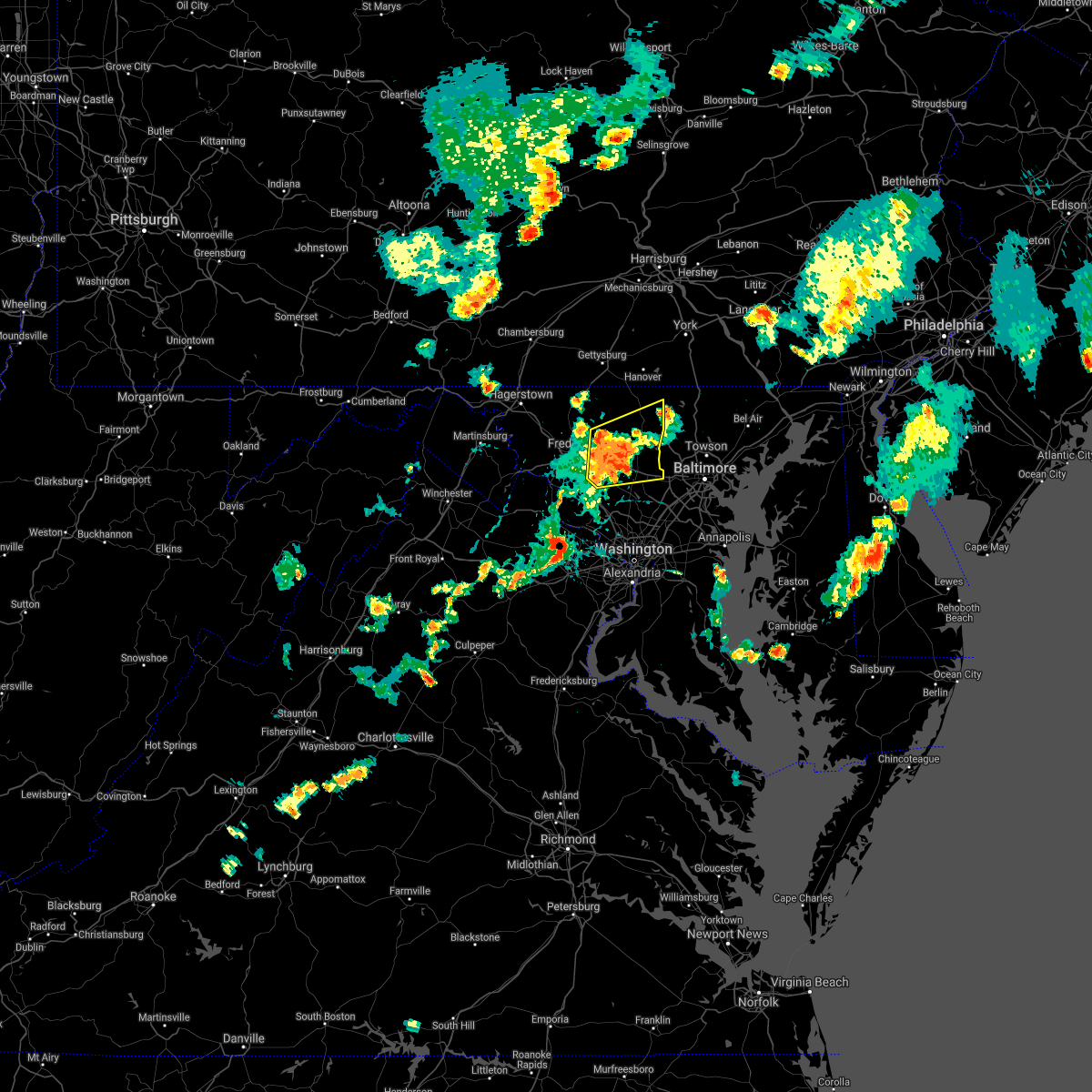 At 752 pm edt, severe thunderstorms were located along a line extending from 7 miles north of mount airy to 6 miles east of damascus, moving east at 50 mph (radar indicated). Hazards include 60 mph wind gusts. Damaging winds will cause some trees and large branches to fall. this could injure those outdoors, as well as damage homes and vehicles. roadways may become blocked by downed trees. localized power outages are possible. unsecured light objects may become projectiles. Locations impacted include, westminster, damascus, ellicott city, eldersburg, mount airy, hampstead, manchester, sykesville, oakland, new market, gamber, green valley, linganore-bartonsville, new windsor, libertytown, monrovia, finksburg, carrollton, henryton and west friendship. At 752 pm edt, severe thunderstorms were located along a line extending from 7 miles north of mount airy to 6 miles east of damascus, moving east at 50 mph (radar indicated). Hazards include 60 mph wind gusts. Damaging winds will cause some trees and large branches to fall. this could injure those outdoors, as well as damage homes and vehicles. roadways may become blocked by downed trees. localized power outages are possible. unsecured light objects may become projectiles. Locations impacted include, westminster, damascus, ellicott city, eldersburg, mount airy, hampstead, manchester, sykesville, oakland, new market, gamber, green valley, linganore-bartonsville, new windsor, libertytown, monrovia, finksburg, carrollton, henryton and west friendship.
|
| 5/26/2021 7:36 PM EDT |
 At 736 pm edt, severe thunderstorms were located along a line extending from near linganore-bartonsville to near damascus, moving east at 50 mph (radar indicated). Hazards include 60 mph wind gusts. Damaging winds will cause some trees and large branches to fall. this could injure those outdoors, as well as damage homes and vehicles. roadways may become blocked by downed trees. localized power outages are possible. unsecured light objects may become projectiles. Locations impacted include, frederick, westminster, damascus, harry grove stadium, ellicott city, eldersburg, ballenger creek, mount airy, hampstead, walkersville, manchester, sykesville, oakland, new market, green valley, gamber, discovery-spring garden, linganore-bartonsville, clover hill and clarksburg. At 736 pm edt, severe thunderstorms were located along a line extending from near linganore-bartonsville to near damascus, moving east at 50 mph (radar indicated). Hazards include 60 mph wind gusts. Damaging winds will cause some trees and large branches to fall. this could injure those outdoors, as well as damage homes and vehicles. roadways may become blocked by downed trees. localized power outages are possible. unsecured light objects may become projectiles. Locations impacted include, frederick, westminster, damascus, harry grove stadium, ellicott city, eldersburg, ballenger creek, mount airy, hampstead, walkersville, manchester, sykesville, oakland, new market, green valley, gamber, discovery-spring garden, linganore-bartonsville, clover hill and clarksburg.
|
| 5/26/2021 7:21 PM EDT |
 At 721 pm edt, severe thunderstorms were located along a line extending from braddock heights to near point of rocks, moving east at 50 mph (radar indicated). Hazards include 60 mph wind gusts. Damaging winds will cause some trees and large branches to fall. this could injure those outdoors, as well as damage homes and vehicles. roadways may become blocked by downed trees. localized power outages are possible. Unsecured light objects may become projectiles. At 721 pm edt, severe thunderstorms were located along a line extending from braddock heights to near point of rocks, moving east at 50 mph (radar indicated). Hazards include 60 mph wind gusts. Damaging winds will cause some trees and large branches to fall. this could injure those outdoors, as well as damage homes and vehicles. roadways may become blocked by downed trees. localized power outages are possible. Unsecured light objects may become projectiles.
|
| 4/30/2021 4:54 PM EDT |
 The severe thunderstorm warning for carroll county in north central maryland, western howard and montgomery counties in central maryland, eastern frederick county in north central maryland, west central baltimore county in northern maryland and east central loudoun counties in northern virginia will expire at 500 pm edt, the showers which prompted the warning have moved out of the area. therefore, the warning will be allowed to expire. however, high winds remain possible through this evening. a high wind warning remains in effect through late tonight. The severe thunderstorm warning for carroll county in north central maryland, western howard and montgomery counties in central maryland, eastern frederick county in north central maryland, west central baltimore county in northern maryland and east central loudoun counties in northern virginia will expire at 500 pm edt, the showers which prompted the warning have moved out of the area. therefore, the warning will be allowed to expire. however, high winds remain possible through this evening. a high wind warning remains in effect through late tonight.
|
| 4/30/2021 4:47 PM EDT |
 At 446 pm edt, severe thunderstorms were located along a line extending from near thurmont to new market to near poolesville, moving east at 60 mph (radar indicated). Hazards include 60 mph wind gusts. Damaging winds will cause some trees and large branches to fall. this could injure those outdoors, as well as damage homes and vehicles. roadways may become blocked by downed trees. localized power outages are possible. unsecured light objects may become projectiles. Locations impacted include, columbia, germantown, rockville, bethesda, gaithersburg, olney, westminster, damascus, lansdowne, lowes island, thurmont, poolesville, emmitsburg, ellicott city, aspen hill, potomac, north bethesda, ashburn, randallstown and montgomery village. At 446 pm edt, severe thunderstorms were located along a line extending from near thurmont to new market to near poolesville, moving east at 60 mph (radar indicated). Hazards include 60 mph wind gusts. Damaging winds will cause some trees and large branches to fall. this could injure those outdoors, as well as damage homes and vehicles. roadways may become blocked by downed trees. localized power outages are possible. unsecured light objects may become projectiles. Locations impacted include, columbia, germantown, rockville, bethesda, gaithersburg, olney, westminster, damascus, lansdowne, lowes island, thurmont, poolesville, emmitsburg, ellicott city, aspen hill, potomac, north bethesda, ashburn, randallstown and montgomery village.
|
| 4/30/2021 4:31 PM EDT |
 At 430 pm edt, severe thunderstorms were located along a line extending from near smithsburg to braddock heights to near purcellville, moving east at 60 mph (radar indicated). Hazards include 60 mph wind gusts. Damaging winds will cause some trees and large branches to fall. this could injure those outdoors, as well as damage homes and vehicles. roadways may become blocked by downed trees. localized power outages are possible. Unsecured light objects may become projectiles. At 430 pm edt, severe thunderstorms were located along a line extending from near smithsburg to braddock heights to near purcellville, moving east at 60 mph (radar indicated). Hazards include 60 mph wind gusts. Damaging winds will cause some trees and large branches to fall. this could injure those outdoors, as well as damage homes and vehicles. roadways may become blocked by downed trees. localized power outages are possible. Unsecured light objects may become projectiles.
|
| 3/28/2021 5:23 PM EDT |
 At 522 pm edt, severe thunderstorms with a history of producing wind damage and measured wind gusts to near 60 mph were located along a line extending from near manchester to near sykesville to germantown, moving east at 45 mph (radar indicated and observed wind). Hazards include 60 mph wind gusts. Damaging winds will cause some trees and large branches to fall. this could injure those outdoors, as well as damage homes and vehicles. roadways may become blocked by downed trees. localized power outages are possible. unsecured light objects may become projectiles. Locations impacted include, columbia, germantown, rockville, gaithersburg, olney, pikesville, cockeysville, westminster, damascus, historic ellicott city, ellicott city, aspen hill, potomac, north bethesda, catonsville, woodlawn, randallstown, montgomery village, owings mills and eldersburg. At 522 pm edt, severe thunderstorms with a history of producing wind damage and measured wind gusts to near 60 mph were located along a line extending from near manchester to near sykesville to germantown, moving east at 45 mph (radar indicated and observed wind). Hazards include 60 mph wind gusts. Damaging winds will cause some trees and large branches to fall. this could injure those outdoors, as well as damage homes and vehicles. roadways may become blocked by downed trees. localized power outages are possible. unsecured light objects may become projectiles. Locations impacted include, columbia, germantown, rockville, gaithersburg, olney, pikesville, cockeysville, westminster, damascus, historic ellicott city, ellicott city, aspen hill, potomac, north bethesda, catonsville, woodlawn, randallstown, montgomery village, owings mills and eldersburg.
|
| 3/28/2021 5:06 PM EDT |
 At 506 pm edt, severe thunderstorms were located along a line extending from mount airy to near poolesville, moving east at 55 mph (radar indicated). Hazards include 60 mph wind gusts. Damaging winds will cause some trees and large branches to fall. this could injure those outdoors, as well as damage homes and vehicles. roadways may become blocked by downed trees. localized power outages are possible. unsecured light objects may become projectiles. Locations impacted include, leesburg, damascus, lansdowne, poolesville, ashburn, ballenger creek, mount airy, new market, green valley, linganore-bartonsville, clarksburg, belmont, adamstown, buckeystown, monrovia, barnesville, ijamsville, paeonian springs, lucketts and park mills. At 506 pm edt, severe thunderstorms were located along a line extending from mount airy to near poolesville, moving east at 55 mph (radar indicated). Hazards include 60 mph wind gusts. Damaging winds will cause some trees and large branches to fall. this could injure those outdoors, as well as damage homes and vehicles. roadways may become blocked by downed trees. localized power outages are possible. unsecured light objects may become projectiles. Locations impacted include, leesburg, damascus, lansdowne, poolesville, ashburn, ballenger creek, mount airy, new market, green valley, linganore-bartonsville, clarksburg, belmont, adamstown, buckeystown, monrovia, barnesville, ijamsville, paeonian springs, lucketts and park mills.
|
| 3/28/2021 5:05 PM EDT |
 At 504 pm edt, severe thunderstorms with a history of producing wind damage and measured wind gusts to near 60 mph were located along a line extending from near littlestown to near boyds, moving east at 45 mph (radar indicated). Hazards include 60 mph wind gusts. Damaging winds will cause some trees and large branches to fall. this could injure those outdoors, as well as damage homes and vehicles. roadways may become blocked by downed trees. localized power outages are possible. Unsecured light objects may become projectiles. At 504 pm edt, severe thunderstorms with a history of producing wind damage and measured wind gusts to near 60 mph were located along a line extending from near littlestown to near boyds, moving east at 45 mph (radar indicated). Hazards include 60 mph wind gusts. Damaging winds will cause some trees and large branches to fall. this could injure those outdoors, as well as damage homes and vehicles. roadways may become blocked by downed trees. localized power outages are possible. Unsecured light objects may become projectiles.
|
| 3/28/2021 4:44 PM EDT |
 At 444 pm edt, severe thunderstorms were located along a line extending from braddock heights to near purcellville, moving east at 55 mph (radar indicated). Hazards include 60 mph wind gusts. Damaging winds will cause some trees and large branches to fall. this could injure those outdoors, as well as damage homes and vehicles. roadways may become blocked by downed trees. localized power outages are possible. unsecured light objects may become projectiles. Locations impacted include, leesburg, damascus, lansdowne, poolesville, ashburn, ballenger creek, mount airy, purcellville, brunswick, braddock heights, new market, round hill, green valley, point of rocks, bluemont, linganore-bartonsville, clarksburg, belmont, adamstown and jefferson. At 444 pm edt, severe thunderstorms were located along a line extending from braddock heights to near purcellville, moving east at 55 mph (radar indicated). Hazards include 60 mph wind gusts. Damaging winds will cause some trees and large branches to fall. this could injure those outdoors, as well as damage homes and vehicles. roadways may become blocked by downed trees. localized power outages are possible. unsecured light objects may become projectiles. Locations impacted include, leesburg, damascus, lansdowne, poolesville, ashburn, ballenger creek, mount airy, purcellville, brunswick, braddock heights, new market, round hill, green valley, point of rocks, bluemont, linganore-bartonsville, clarksburg, belmont, adamstown and jefferson.
|
| 3/28/2021 4:30 PM EDT |
 At 430 pm edt, severe thunderstorms were located along a line extending from near harpers ferry to near berryville, moving east at 55 mph (radar indicated). Hazards include 60 mph wind gusts. Damaging winds will cause some trees and large branches to fall. this could injure those outdoors, as well as damage homes and vehicles. roadways may become blocked by downed trees. localized power outages are possible. Unsecured light objects may become projectiles. At 430 pm edt, severe thunderstorms were located along a line extending from near harpers ferry to near berryville, moving east at 55 mph (radar indicated). Hazards include 60 mph wind gusts. Damaging winds will cause some trees and large branches to fall. this could injure those outdoors, as well as damage homes and vehicles. roadways may become blocked by downed trees. localized power outages are possible. Unsecured light objects may become projectiles.
|
| 11/15/2020 6:57 PM EST |
 At 622 pm est, severe thunderstorms were located along a line extending from near ballenger creek to near point of rocks to near leesburg, moving southeast at 30 mph (radar indicated). Hazards include 60 mph wind gusts. Damaging winds will cause some trees and large branches to fall. this could injure those outdoors, as well as damage homes and vehicles. roadways may become blocked by downed trees. localized power outages are possible. Unsecured light objects may become projectiles. At 622 pm est, severe thunderstorms were located along a line extending from near ballenger creek to near point of rocks to near leesburg, moving southeast at 30 mph (radar indicated). Hazards include 60 mph wind gusts. Damaging winds will cause some trees and large branches to fall. this could injure those outdoors, as well as damage homes and vehicles. roadways may become blocked by downed trees. localized power outages are possible. Unsecured light objects may become projectiles.
|
| 11/15/2020 6:22 PM EST |
 At 622 pm est, severe thunderstorms were located along a line extending from near ballenger creek to near point of rocks to near leesburg, moving southeast at 30 mph (radar indicated). Hazards include 60 mph wind gusts. Damaging winds will cause some trees and large branches to fall. this could injure those outdoors, as well as damage homes and vehicles. roadways may become blocked by downed trees. localized power outages are possible. Unsecured light objects may become projectiles. At 622 pm est, severe thunderstorms were located along a line extending from near ballenger creek to near point of rocks to near leesburg, moving southeast at 30 mph (radar indicated). Hazards include 60 mph wind gusts. Damaging winds will cause some trees and large branches to fall. this could injure those outdoors, as well as damage homes and vehicles. roadways may become blocked by downed trees. localized power outages are possible. Unsecured light objects may become projectiles.
|
| 9/3/2020 4:31 PM EDT |
 At 431 pm edt, a severe thunderstorm was located over boyds, or near poolesville, moving east at 30 mph (radar indicated). Hazards include 60 mph wind gusts. Damaging winds will cause some trees and large branches to fall. this could injure those outdoors, as well as damage homes and vehicles. roadways may become blocked by downed trees. localized power outages are possible. unsecured light objects may become projectiles. Locations impacted include, germantown, gaithersburg, leesburg, damascus, broadlands, lansdowne, lowes island, poolesville, potomac, ashburn, montgomery village, sterling, north potomac, great falls, countryside, boyds, clarksburg, darnestown, belmont and barnesville. At 431 pm edt, a severe thunderstorm was located over boyds, or near poolesville, moving east at 30 mph (radar indicated). Hazards include 60 mph wind gusts. Damaging winds will cause some trees and large branches to fall. this could injure those outdoors, as well as damage homes and vehicles. roadways may become blocked by downed trees. localized power outages are possible. unsecured light objects may become projectiles. Locations impacted include, germantown, gaithersburg, leesburg, damascus, broadlands, lansdowne, lowes island, poolesville, potomac, ashburn, montgomery village, sterling, north potomac, great falls, countryside, boyds, clarksburg, darnestown, belmont and barnesville.
|
| 9/3/2020 4:22 PM EDT |
 At 422 pm edt, a severe thunderstorm was located over poolesville, moving east at 30 mph (radar indicated). Hazards include 60 mph wind gusts. Damaging winds will cause some trees and large branches to fall. this could injure those outdoors, as well as damage homes and vehicles. roadways may become blocked by downed trees. localized power outages are possible. unsecured light objects may become projectiles. Locations impacted include, germantown, gaithersburg, leesburg, damascus, broadlands, lansdowne, lowes island, poolesville, potomac, ashburn, montgomery village, sterling, north potomac, great falls, countryside, boyds, clarksburg, darnestown, belmont and barnesville. At 422 pm edt, a severe thunderstorm was located over poolesville, moving east at 30 mph (radar indicated). Hazards include 60 mph wind gusts. Damaging winds will cause some trees and large branches to fall. this could injure those outdoors, as well as damage homes and vehicles. roadways may become blocked by downed trees. localized power outages are possible. unsecured light objects may become projectiles. Locations impacted include, germantown, gaithersburg, leesburg, damascus, broadlands, lansdowne, lowes island, poolesville, potomac, ashburn, montgomery village, sterling, north potomac, great falls, countryside, boyds, clarksburg, darnestown, belmont and barnesville.
|
| 9/3/2020 4:07 PM EDT |
 At 406 pm edt, a severe thunderstorm was located near leesburg, moving east at 30 mph (radar indicated). Hazards include 60 mph wind gusts. Damaging winds will cause some trees and large branches to fall. this could injure those outdoors, as well as damage homes and vehicles. roadways may become blocked by downed trees. localized power outages are possible. Unsecured light objects may become projectiles. At 406 pm edt, a severe thunderstorm was located near leesburg, moving east at 30 mph (radar indicated). Hazards include 60 mph wind gusts. Damaging winds will cause some trees and large branches to fall. this could injure those outdoors, as well as damage homes and vehicles. roadways may become blocked by downed trees. localized power outages are possible. Unsecured light objects may become projectiles.
|
| 9/2/2020 7:48 PM EDT |
 At 748 pm edt, severe thunderstorms were located along a line extending from 6 miles east of damascus to near olney to north potomac, moving east at 35 mph (radar indicated). Hazards include 60 mph wind gusts. Damaging winds will cause some trees and large branches to fall. this could injure those outdoors, as well as damage homes and vehicles. roadways may become blocked by downed trees. localized power outages are possible. unsecured light objects may become projectiles. Locations impacted include, columbia, germantown, rockville, bethesda, gaithersburg, olney, langley park, beltsville, damascus, lowes island, historic ellicott city, ellicott city, aspen hill, potomac, north bethesda, montgomery village, north potomac, fairland, white oak and redland. At 748 pm edt, severe thunderstorms were located along a line extending from 6 miles east of damascus to near olney to north potomac, moving east at 35 mph (radar indicated). Hazards include 60 mph wind gusts. Damaging winds will cause some trees and large branches to fall. this could injure those outdoors, as well as damage homes and vehicles. roadways may become blocked by downed trees. localized power outages are possible. unsecured light objects may become projectiles. Locations impacted include, columbia, germantown, rockville, bethesda, gaithersburg, olney, langley park, beltsville, damascus, lowes island, historic ellicott city, ellicott city, aspen hill, potomac, north bethesda, montgomery village, north potomac, fairland, white oak and redland.
|
| 9/2/2020 7:38 PM EDT |
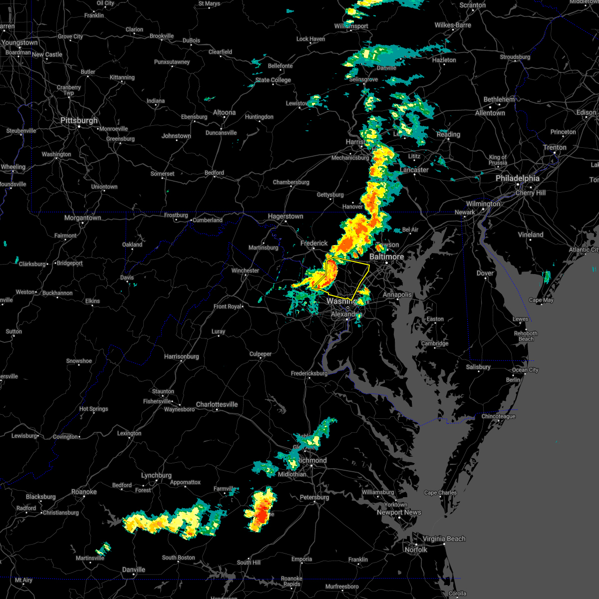 At 738 pm edt, severe thunderstorms were located along a line extending from damascus to montgomery village to near lowes island, moving east at 35 mph (radar indicated). Hazards include 60 mph wind gusts. Damaging winds will cause some trees and large branches to fall. this could injure those outdoors, as well as damage homes and vehicles. roadways may become blocked by downed trees. localized power outages are possible. Unsecured light objects may become projectiles. At 738 pm edt, severe thunderstorms were located along a line extending from damascus to montgomery village to near lowes island, moving east at 35 mph (radar indicated). Hazards include 60 mph wind gusts. Damaging winds will cause some trees and large branches to fall. this could injure those outdoors, as well as damage homes and vehicles. roadways may become blocked by downed trees. localized power outages are possible. Unsecured light objects may become projectiles.
|
| 9/2/2020 7:29 PM EDT |
 At 729 pm edt, severe thunderstorms were located along a line extending from near mount airy to near green valley to near boyds to near lansdowne, moving east at 35 mph (radar indicated). Hazards include 60 mph wind gusts. Damaging winds will cause some trees and large branches to fall. this could injure those outdoors, as well as damage homes and vehicles. roadways may become blocked by downed trees. localized power outages are possible. unsecured light objects may become projectiles. Locations impacted include, germantown, rockville, gaithersburg, leesburg, olney, damascus, lansdowne, lowes island, poolesville, aspen hill, potomac, ashburn, montgomery village, sterling, north potomac, redland, great falls, countryside, mount airy and new market. At 729 pm edt, severe thunderstorms were located along a line extending from near mount airy to near green valley to near boyds to near lansdowne, moving east at 35 mph (radar indicated). Hazards include 60 mph wind gusts. Damaging winds will cause some trees and large branches to fall. this could injure those outdoors, as well as damage homes and vehicles. roadways may become blocked by downed trees. localized power outages are possible. unsecured light objects may become projectiles. Locations impacted include, germantown, rockville, gaithersburg, leesburg, olney, damascus, lansdowne, lowes island, poolesville, aspen hill, potomac, ashburn, montgomery village, sterling, north potomac, redland, great falls, countryside, mount airy and new market.
|
| 9/2/2020 7:21 PM EDT |
 At 721 pm edt, severe thunderstorms were located along a line extending from new market to 6 miles south of ballenger creek to near poolesville to leesburg, moving east at 35 mph (radar indicated). Hazards include 60 mph wind gusts. Damaging winds will cause some trees and large branches to fall. this could injure those outdoors, as well as damage homes and vehicles. roadways may become blocked by downed trees. localized power outages are possible. unsecured light objects may become projectiles. Locations impacted include, germantown, frederick, rockville, gaithersburg, reston, leesburg, olney, damascus, broadlands, lansdowne, lowes island, poolesville, harry grove stadium, aspen hill, potomac, ashburn, montgomery village, sterling, north potomac and ballenger creek. At 721 pm edt, severe thunderstorms were located along a line extending from new market to 6 miles south of ballenger creek to near poolesville to leesburg, moving east at 35 mph (radar indicated). Hazards include 60 mph wind gusts. Damaging winds will cause some trees and large branches to fall. this could injure those outdoors, as well as damage homes and vehicles. roadways may become blocked by downed trees. localized power outages are possible. unsecured light objects may become projectiles. Locations impacted include, germantown, frederick, rockville, gaithersburg, reston, leesburg, olney, damascus, broadlands, lansdowne, lowes island, poolesville, harry grove stadium, aspen hill, potomac, ashburn, montgomery village, sterling, north potomac and ballenger creek.
|
| 9/2/2020 7:21 PM EDT |
 At 705 pm edt, severe thunderstorms were located along a line extending from ballenger creek to point of rocks to 6 miles north of leesburg to near round hill, moving east at 35 mph (radar indicated). Hazards include 60 mph wind gusts. Damaging winds will cause some trees and large branches to fall. this could injure those outdoors, as well as damage homes and vehicles. roadways may become blocked by downed trees. localized power outages are possible. Unsecured light objects may become projectiles. At 705 pm edt, severe thunderstorms were located along a line extending from ballenger creek to point of rocks to 6 miles north of leesburg to near round hill, moving east at 35 mph (radar indicated). Hazards include 60 mph wind gusts. Damaging winds will cause some trees and large branches to fall. this could injure those outdoors, as well as damage homes and vehicles. roadways may become blocked by downed trees. localized power outages are possible. Unsecured light objects may become projectiles.
|
| 9/2/2020 7:06 PM EDT |
 At 705 pm edt, severe thunderstorms were located along a line extending from ballenger creek to point of rocks to 6 miles north of leesburg to near round hill, moving east at 35 mph (radar indicated). Hazards include 60 mph wind gusts. Damaging winds will cause some trees and large branches to fall. this could injure those outdoors, as well as damage homes and vehicles. roadways may become blocked by downed trees. localized power outages are possible. Unsecured light objects may become projectiles. At 705 pm edt, severe thunderstorms were located along a line extending from ballenger creek to point of rocks to 6 miles north of leesburg to near round hill, moving east at 35 mph (radar indicated). Hazards include 60 mph wind gusts. Damaging winds will cause some trees and large branches to fall. this could injure those outdoors, as well as damage homes and vehicles. roadways may become blocked by downed trees. localized power outages are possible. Unsecured light objects may become projectiles.
|
| 8/28/2020 4:46 PM EDT |
 At 446 pm edt, a severe thunderstorm was located near montgomery village, or near damascus, moving east at 35 mph (radar indicated). Hazards include 60 mph wind gusts and quarter size hail. Damaging winds will cause some trees and large branches to fall. this could injure those outdoors, as well as damage homes and vehicles. roadways may become blocked by downed trees. localized power outages are possible. unsecured light objects may become projectiles. Locations impacted include, columbia, germantown, gaithersburg, olney, beltsville, damascus, historic ellicott city, ellicott city, aspen hill, catonsville, montgomery village, laurel, fairland, white oak, redland, colesville, rossmoor, savage-guilford, wheaton-glenmont and scaggsville. At 446 pm edt, a severe thunderstorm was located near montgomery village, or near damascus, moving east at 35 mph (radar indicated). Hazards include 60 mph wind gusts and quarter size hail. Damaging winds will cause some trees and large branches to fall. this could injure those outdoors, as well as damage homes and vehicles. roadways may become blocked by downed trees. localized power outages are possible. unsecured light objects may become projectiles. Locations impacted include, columbia, germantown, gaithersburg, olney, beltsville, damascus, historic ellicott city, ellicott city, aspen hill, catonsville, montgomery village, laurel, fairland, white oak, redland, colesville, rossmoor, savage-guilford, wheaton-glenmont and scaggsville.
|
| 8/28/2020 4:33 PM EDT |
 At 433 pm edt, a severe thunderstorm was located over boyds, or near germantown, moving east at 35 mph (radar indicated). Hazards include 60 mph wind gusts and quarter size hail. Damaging winds will cause some trees and large branches to fall. this could injure those outdoors, as well as damage homes and vehicles. roadways may become blocked by downed trees. localized power outages are possible. Unsecured light objects may become projectiles. At 433 pm edt, a severe thunderstorm was located over boyds, or near germantown, moving east at 35 mph (radar indicated). Hazards include 60 mph wind gusts and quarter size hail. Damaging winds will cause some trees and large branches to fall. this could injure those outdoors, as well as damage homes and vehicles. roadways may become blocked by downed trees. localized power outages are possible. Unsecured light objects may become projectiles.
|
| 8/28/2020 3:07 PM EDT |
 At 307 pm edt, a severe thunderstorm was located over mount airy, or 7 miles north of damascus, moving east at 35 mph (radar indicated). Hazards include 60 mph wind gusts and quarter size hail. Damaging winds will cause some trees and large branches to fall. this could injure those outdoors, as well as damage homes and vehicles. roadways may become blocked by downed trees. localized power outages are possible. Unsecured light objects may become projectiles. At 307 pm edt, a severe thunderstorm was located over mount airy, or 7 miles north of damascus, moving east at 35 mph (radar indicated). Hazards include 60 mph wind gusts and quarter size hail. Damaging winds will cause some trees and large branches to fall. this could injure those outdoors, as well as damage homes and vehicles. roadways may become blocked by downed trees. localized power outages are possible. Unsecured light objects may become projectiles.
|
| 8/23/2020 6:05 PM EDT |
 The severe thunderstorm warning for south central carroll county in north central maryland, northwestern howard, north central montgomery counties in central maryland and southeastern frederick counties in north central maryland will expire at 615 pm edt, the storm which prompted the warning has weakened below severe limits, and no longer poses an immediate threat to life or property. therefore, the warning will be allowed to expire. however heavy rain is still possible with this thunderstorm. The severe thunderstorm warning for south central carroll county in north central maryland, northwestern howard, north central montgomery counties in central maryland and southeastern frederick counties in north central maryland will expire at 615 pm edt, the storm which prompted the warning has weakened below severe limits, and no longer poses an immediate threat to life or property. therefore, the warning will be allowed to expire. however heavy rain is still possible with this thunderstorm.
|
| 8/23/2020 5:54 PM EDT |
 At 554 pm edt, a severe thunderstorm was located over mount airy, or near damascus, moving east at 20 mph (radar indicated). Hazards include 60 mph wind gusts and quarter size hail. Damaging winds will cause some trees and large branches to fall. this could injure those outdoors, as well as damage homes and vehicles. roadways may become blocked by downed trees. localized power outages are possible. unsecured light objects may become projectiles. Locations impacted include, germantown, gaithersburg, olney, damascus, montgomery village, eldersburg, redland, mount airy, sykesville, new market, green valley, linganore-bartonsville, clarksburg, derwood, washington grove, monrovia, laytonsville, gaither, poplar springs and roxbury mills. At 554 pm edt, a severe thunderstorm was located over mount airy, or near damascus, moving east at 20 mph (radar indicated). Hazards include 60 mph wind gusts and quarter size hail. Damaging winds will cause some trees and large branches to fall. this could injure those outdoors, as well as damage homes and vehicles. roadways may become blocked by downed trees. localized power outages are possible. unsecured light objects may become projectiles. Locations impacted include, germantown, gaithersburg, olney, damascus, montgomery village, eldersburg, redland, mount airy, sykesville, new market, green valley, linganore-bartonsville, clarksburg, derwood, washington grove, monrovia, laytonsville, gaither, poplar springs and roxbury mills.
|
| 8/23/2020 5:29 PM EDT |
 At 529 pm edt, a severe thunderstorm was located over linganore-bartonsville, or near harry grove stadium, moving southeast at 20 mph (radar indicated. reports of downed trees). Hazards include 60 mph wind gusts and quarter size hail. Damaging winds will cause some trees and large branches to fall. this could injure those outdoors, as well as damage homes and vehicles. roadways may become blocked by downed trees. localized power outages are possible. Unsecured light objects may become projectiles. At 529 pm edt, a severe thunderstorm was located over linganore-bartonsville, or near harry grove stadium, moving southeast at 20 mph (radar indicated. reports of downed trees). Hazards include 60 mph wind gusts and quarter size hail. Damaging winds will cause some trees and large branches to fall. this could injure those outdoors, as well as damage homes and vehicles. roadways may become blocked by downed trees. localized power outages are possible. Unsecured light objects may become projectiles.
|
| 7/22/2020 3:27 PM EDT |
 At 326 pm edt, severe thunderstorms were located along a line extending from boyds to near ashburn to near south riding to near haymarket, moving east at 10 mph. these are very dangerous storms (radar indicated). Hazards include widespread damaging wind gusts up to 75 mph, especially near reston, wolf trap, vienna and fairfax. isolated hail up to quarter size is also possible. Expect considerable damage to trees and power lines. your life is at significant risk if outdoors. in addition to some trees falling into homes, wind damage is possible to roofs, sheds, open garages, and mobile homes. Locations impacted include, arlington, germantown, centreville, rockville, bethesda, gaithersburg, reston, annandale, olney, herndon, fairfax, vienna, damascus, falls church, lowes island, mantua, pimmit hills, mclean, american legion bridge and aspen hill. At 326 pm edt, severe thunderstorms were located along a line extending from boyds to near ashburn to near south riding to near haymarket, moving east at 10 mph. these are very dangerous storms (radar indicated). Hazards include widespread damaging wind gusts up to 75 mph, especially near reston, wolf trap, vienna and fairfax. isolated hail up to quarter size is also possible. Expect considerable damage to trees and power lines. your life is at significant risk if outdoors. in addition to some trees falling into homes, wind damage is possible to roofs, sheds, open garages, and mobile homes. Locations impacted include, arlington, germantown, centreville, rockville, bethesda, gaithersburg, reston, annandale, olney, herndon, fairfax, vienna, damascus, falls church, lowes island, mantua, pimmit hills, mclean, american legion bridge and aspen hill.
|
| 7/22/2020 3:21 PM EDT |
 At 320 pm edt, severe thunderstorms were located along a line extending from near boyds to near ashburn to near south riding to near haymarket, moving east at 10 mph (radar indicated). Hazards include scattered damaging wind gusts up to 70 mph and isolated hail up to quarter size. Damaging winds will cause some trees and large branches to fall. this could injure those outdoors, as well as damage homes and vehicles. roadways may become blocked by downed trees. localized power outages are possible. unsecured light objects may become projectiles. Locations impacted include, arlington, germantown, centreville, rockville, bethesda, gaithersburg, reston, annandale, olney, herndon, fairfax, vienna, damascus, falls church, lowes island, mantua, pimmit hills, mclean, american legion bridge and aspen hill. At 320 pm edt, severe thunderstorms were located along a line extending from near boyds to near ashburn to near south riding to near haymarket, moving east at 10 mph (radar indicated). Hazards include scattered damaging wind gusts up to 70 mph and isolated hail up to quarter size. Damaging winds will cause some trees and large branches to fall. this could injure those outdoors, as well as damage homes and vehicles. roadways may become blocked by downed trees. localized power outages are possible. unsecured light objects may become projectiles. Locations impacted include, arlington, germantown, centreville, rockville, bethesda, gaithersburg, reston, annandale, olney, herndon, fairfax, vienna, damascus, falls church, lowes island, mantua, pimmit hills, mclean, american legion bridge and aspen hill.
|
| 7/22/2020 3:04 PM EDT |
 At 303 pm edt, severe thunderstorms were located along a line extending from 7 miles southwest of green valley to near poolesville, moving east at 20 mph (radar indicated). Hazards include scattered damaging wind gusts up to 70 mph and hail up to quarter size. Damaging winds will cause some trees and large branches to fall. this could injure those outdoors, as well as damage homes and vehicles. roadways may become blocked by downed trees. localized power outages are possible. unsecured light objects may become projectiles. Locations impacted include, germantown, damascus, lansdowne, lowes island, poolesville, boyds, clarksburg, darnestown, barnesville, dickerson, beallsville and dawsonville. At 303 pm edt, severe thunderstorms were located along a line extending from 7 miles southwest of green valley to near poolesville, moving east at 20 mph (radar indicated). Hazards include scattered damaging wind gusts up to 70 mph and hail up to quarter size. Damaging winds will cause some trees and large branches to fall. this could injure those outdoors, as well as damage homes and vehicles. roadways may become blocked by downed trees. localized power outages are possible. unsecured light objects may become projectiles. Locations impacted include, germantown, damascus, lansdowne, lowes island, poolesville, boyds, clarksburg, darnestown, barnesville, dickerson, beallsville and dawsonville.
|
| 7/22/2020 2:56 PM EDT |
 At 256 pm edt, severe thunderstorms were located along a line extending from near poolesville to brambleton to near haymarket to near warrenton, moving east at 10 mph (radar indicated). Hazards include scattered damaging wind gusts up to 60 mph and isolated hail up to quarter size. Damaging winds will cause some trees and large branches to fall. this could injure those outdoors, as well as damage homes and vehicles. roadways may become blocked by downed trees. localized power outages are possible. Unsecured light objects may become projectiles. At 256 pm edt, severe thunderstorms were located along a line extending from near poolesville to brambleton to near haymarket to near warrenton, moving east at 10 mph (radar indicated). Hazards include scattered damaging wind gusts up to 60 mph and isolated hail up to quarter size. Damaging winds will cause some trees and large branches to fall. this could injure those outdoors, as well as damage homes and vehicles. roadways may become blocked by downed trees. localized power outages are possible. Unsecured light objects may become projectiles.
|
| 7/22/2020 2:51 PM EDT |
 At 251 pm edt, severe thunderstorms were located along a line extending from 6 miles east of point of rocks to near leesburg, moving east at 20 mph (radar indicated). Hazards include scattered damaging wind gusts up to 60 mph and isolated hail up to quarter size. Damaging winds will cause some trees and large branches to fall. this could injure those outdoors, as well as damage homes and vehicles. roadways may become blocked by downed trees. localized power outages are possible. Unsecured light objects may become projectiles. At 251 pm edt, severe thunderstorms were located along a line extending from 6 miles east of point of rocks to near leesburg, moving east at 20 mph (radar indicated). Hazards include scattered damaging wind gusts up to 60 mph and isolated hail up to quarter size. Damaging winds will cause some trees and large branches to fall. this could injure those outdoors, as well as damage homes and vehicles. roadways may become blocked by downed trees. localized power outages are possible. Unsecured light objects may become projectiles.
|
| 6/25/2020 6:26 PM EDT |
 At 625 pm edt, a severe thunderstorm was located near olney, moving east at 20 mph (radar indicated). Hazards include 60 mph wind gusts and quarter size hail. Damaging winds will cause some trees and large branches to fall. this could injure those outdoors, as well as damage homes and vehicles. roadways may become blocked by downed trees. localized power outages are possible. unsecured light objects may become projectiles. Locations impacted include, columbia, germantown, olney, damascus, historic ellicott city, ellicott city, woodlawn, montgomery village, laurel, savage-guilford, scaggsville, ilchester, cloverly, burtonsville, savage, fulton, spencerville, highland, laytonsville and brookeville. At 625 pm edt, a severe thunderstorm was located near olney, moving east at 20 mph (radar indicated). Hazards include 60 mph wind gusts and quarter size hail. Damaging winds will cause some trees and large branches to fall. this could injure those outdoors, as well as damage homes and vehicles. roadways may become blocked by downed trees. localized power outages are possible. unsecured light objects may become projectiles. Locations impacted include, columbia, germantown, olney, damascus, historic ellicott city, ellicott city, woodlawn, montgomery village, laurel, savage-guilford, scaggsville, ilchester, cloverly, burtonsville, savage, fulton, spencerville, highland, laytonsville and brookeville.
|
| 6/25/2020 6:08 PM EDT |
 At 608 pm edt, a severe thunderstorm was located over damascus, moving east at 20 mph (radar indicated). Hazards include 60 mph wind gusts and quarter size hail. Damaging winds will cause some trees and large branches to fall. this could injure those outdoors, as well as damage homes and vehicles. roadways may become blocked by downed trees. localized power outages are possible. Unsecured light objects may become projectiles. At 608 pm edt, a severe thunderstorm was located over damascus, moving east at 20 mph (radar indicated). Hazards include 60 mph wind gusts and quarter size hail. Damaging winds will cause some trees and large branches to fall. this could injure those outdoors, as well as damage homes and vehicles. roadways may become blocked by downed trees. localized power outages are possible. Unsecured light objects may become projectiles.
|
| 6/22/2020 4:37 PM EDT |
 At 436 pm edt, severe thunderstorms were located along a line extending from near green valley to near redland, moving northeast at 30 mph (radar indicated). Hazards include 60 mph wind gusts and quarter size hail. Damaging winds will cause some trees and large branches to fall. this could injure those outdoors, as well as damage homes and vehicles. roadways may become blocked by downed trees. localized power outages are possible. unsecured light objects may become projectiles. Locations impacted include, germantown, rockville, gaithersburg, olney, damascus, ellicott city, montgomery village, eldersburg, redland, mount airy, sykesville, new market, green valley, linganore-bartonsville, clarksburg, derwood, libertytown, washington grove, monrovia and laytonsville. At 436 pm edt, severe thunderstorms were located along a line extending from near green valley to near redland, moving northeast at 30 mph (radar indicated). Hazards include 60 mph wind gusts and quarter size hail. Damaging winds will cause some trees and large branches to fall. this could injure those outdoors, as well as damage homes and vehicles. roadways may become blocked by downed trees. localized power outages are possible. unsecured light objects may become projectiles. Locations impacted include, germantown, rockville, gaithersburg, olney, damascus, ellicott city, montgomery village, eldersburg, redland, mount airy, sykesville, new market, green valley, linganore-bartonsville, clarksburg, derwood, libertytown, washington grove, monrovia and laytonsville.
|
| 6/22/2020 4:12 PM EDT |
 At 412 pm edt, severe thunderstorms were located along a line extending from near poolesville to near potomac, moving northeast at 30 mph (radar indicated). Hazards include 60 mph wind gusts and quarter size hail. Damaging winds will cause some trees and large branches to fall. this could injure those outdoors, as well as damage homes and vehicles. roadways may become blocked by downed trees. localized power outages are possible. Unsecured light objects may become projectiles. At 412 pm edt, severe thunderstorms were located along a line extending from near poolesville to near potomac, moving northeast at 30 mph (radar indicated). Hazards include 60 mph wind gusts and quarter size hail. Damaging winds will cause some trees and large branches to fall. this could injure those outdoors, as well as damage homes and vehicles. roadways may become blocked by downed trees. localized power outages are possible. Unsecured light objects may become projectiles.
|
| 6/10/2020 10:13 PM EDT |
 At 1013 pm edt, a severe thunderstorm was located over gallaudet university, moving northeast at 35 mph (radar indicated). Hazards include 60 mph wind gusts. Damaging winds will cause some trees and large branches to fall. this could injure those outdoors, as well as damage homes and vehicles. roadways may become blocked by downed trees. localized power outages are possible. unsecured light objects may become projectiles. Locations impacted include, germantown, damascus, eldersburg, mount airy, sykesville, new market, green valley, linganore-bartonsville, clarksburg, libertytown, monrovia, ijamsville, winfield, lisbon, watersville, poplar springs, woodbine and unionville. At 1013 pm edt, a severe thunderstorm was located over gallaudet university, moving northeast at 35 mph (radar indicated). Hazards include 60 mph wind gusts. Damaging winds will cause some trees and large branches to fall. this could injure those outdoors, as well as damage homes and vehicles. roadways may become blocked by downed trees. localized power outages are possible. unsecured light objects may become projectiles. Locations impacted include, germantown, damascus, eldersburg, mount airy, sykesville, new market, green valley, linganore-bartonsville, clarksburg, libertytown, monrovia, ijamsville, winfield, lisbon, watersville, poplar springs, woodbine and unionville.
|
| 6/10/2020 10:06 PM EDT |
 At 1006 pm edt, a severe thunderstorm was located near green valley, or near damascus, moving northeast at 35 mph (radar indicated). Hazards include 60 mph wind gusts. Damaging winds will cause some trees and large branches to fall. this could injure those outdoors, as well as damage homes and vehicles. roadways may become blocked by downed trees. localized power outages are possible. Unsecured light objects may become projectiles. At 1006 pm edt, a severe thunderstorm was located near green valley, or near damascus, moving northeast at 35 mph (radar indicated). Hazards include 60 mph wind gusts. Damaging winds will cause some trees and large branches to fall. this could injure those outdoors, as well as damage homes and vehicles. roadways may become blocked by downed trees. localized power outages are possible. Unsecured light objects may become projectiles.
|
| 6/4/2020 8:22 PM EDT |
 The severe thunderstorm warning for the northwestern district of columbia, southern carroll, northwestern anne arundel, howard, eastern montgomery, northwestern prince georges, extreme north central arlington and northeastern fairfax counties will expire at 830 pm edt, the storms which prompted the warning have weakened below severe limits, and no longer pose an immediate threat to life or property. therefore, the warning will be allowed to expire. however gusty winds are still possible with these thunderstorms. a severe thunderstorm watch remains in effect until 1000 pm edt for district of columbia, central and north central maryland, and northern virginia. The severe thunderstorm warning for the northwestern district of columbia, southern carroll, northwestern anne arundel, howard, eastern montgomery, northwestern prince georges, extreme north central arlington and northeastern fairfax counties will expire at 830 pm edt, the storms which prompted the warning have weakened below severe limits, and no longer pose an immediate threat to life or property. therefore, the warning will be allowed to expire. however gusty winds are still possible with these thunderstorms. a severe thunderstorm watch remains in effect until 1000 pm edt for district of columbia, central and north central maryland, and northern virginia.
|
| 6/4/2020 7:52 PM EDT |
 At 751 pm edt, severe thunderstorms were located along a line extending from near damascus to redland to near mclean, moving east at 40 mph (radar indicated). Hazards include 60 mph wind gusts. Damaging winds will cause some trees and large branches to fall. this could injure those outdoors, as well as damage homes and vehicles. roadways may become blocked by downed trees. localized power outages are possible. Unsecured light objects may become projectiles. At 751 pm edt, severe thunderstorms were located along a line extending from near damascus to redland to near mclean, moving east at 40 mph (radar indicated). Hazards include 60 mph wind gusts. Damaging winds will cause some trees and large branches to fall. this could injure those outdoors, as well as damage homes and vehicles. roadways may become blocked by downed trees. localized power outages are possible. Unsecured light objects may become projectiles.
|
| 4/13/2020 2:10 PM EDT |
 At 210 pm edt, severe thunderstorms were located along a line extending from sykesville to gaithersburg, moving east at 40 mph (radar indicated). Hazards include 60 mph wind gusts. Damaging winds will cause some trees and large branches to fall. this could injure those outdoors, as well as damage homes and vehicles. roadways may become blocked by downed trees. localized power outages are possible. unsecured light objects may become projectiles. Locations impacted include, columbia, germantown, gaithersburg, olney, pikesville, damascus, historic ellicott city, ellicott city, aspen hill, catonsville, woodlawn, randallstown, montgomery village, eldersburg, milford mill, lochearn, redland, sykesville, scaggsville and cloverly. At 210 pm edt, severe thunderstorms were located along a line extending from sykesville to gaithersburg, moving east at 40 mph (radar indicated). Hazards include 60 mph wind gusts. Damaging winds will cause some trees and large branches to fall. this could injure those outdoors, as well as damage homes and vehicles. roadways may become blocked by downed trees. localized power outages are possible. unsecured light objects may become projectiles. Locations impacted include, columbia, germantown, gaithersburg, olney, pikesville, damascus, historic ellicott city, ellicott city, aspen hill, catonsville, woodlawn, randallstown, montgomery village, eldersburg, milford mill, lochearn, redland, sykesville, scaggsville and cloverly.
|
| 4/13/2020 2:01 PM EDT |
 At 200 pm edt, severe thunderstorms were located along a line extending from near mount airy to near boyds, moving east at 40 mph (radar indicated). Hazards include 60 mph wind gusts. Damaging winds will cause some trees and large branches to fall. this could injure those outdoors, as well as damage homes and vehicles. roadways may become blocked by downed trees. localized power outages are possible. Unsecured light objects may become projectiles. At 200 pm edt, severe thunderstorms were located along a line extending from near mount airy to near boyds, moving east at 40 mph (radar indicated). Hazards include 60 mph wind gusts. Damaging winds will cause some trees and large branches to fall. this could injure those outdoors, as well as damage homes and vehicles. roadways may become blocked by downed trees. localized power outages are possible. Unsecured light objects may become projectiles.
|
| 4/13/2020 1:48 PM EDT |
 At 148 pm edt, severe thunderstorms were located along a line extending from 9 miles south of taneytown to near new market to 6 miles southwest of green valley, moving east at 45 mph (radar indicated). Hazards include 60 mph wind gusts. Damaging winds will cause some trees and large branches to fall. this could injure those outdoors, as well as damage homes and vehicles. roadways may become blocked by downed trees. localized power outages are possible. unsecured light objects may become projectiles. Locations impacted include, germantown, gaithersburg, olney, westminster, damascus, poolesville, aspen hill, montgomery village, eldersburg, redland, mount airy, hampstead, manchester, sykesville, new market, green valley, gamber, boyds, rossmoor and linganore-bartonsville. At 148 pm edt, severe thunderstorms were located along a line extending from 9 miles south of taneytown to near new market to 6 miles southwest of green valley, moving east at 45 mph (radar indicated). Hazards include 60 mph wind gusts. Damaging winds will cause some trees and large branches to fall. this could injure those outdoors, as well as damage homes and vehicles. roadways may become blocked by downed trees. localized power outages are possible. unsecured light objects may become projectiles. Locations impacted include, germantown, gaithersburg, olney, westminster, damascus, poolesville, aspen hill, montgomery village, eldersburg, redland, mount airy, hampstead, manchester, sykesville, new market, green valley, gamber, boyds, rossmoor and linganore-bartonsville.
|
| 4/13/2020 1:20 PM EDT |
 At 119 pm edt, severe thunderstorms were located along a line extending from near boonsboro to near brunswick to 6 miles south of harpers ferry, moving east at 45 mph (radar indicated). Hazards include 60 mph wind gusts. Damaging winds will cause some trees and large branches to fall. this could injure those outdoors, as well as damage homes and vehicles. roadways may become blocked by downed trees. localized power outages are possible. Unsecured light objects may become projectiles. At 119 pm edt, severe thunderstorms were located along a line extending from near boonsboro to near brunswick to 6 miles south of harpers ferry, moving east at 45 mph (radar indicated). Hazards include 60 mph wind gusts. Damaging winds will cause some trees and large branches to fall. this could injure those outdoors, as well as damage homes and vehicles. roadways may become blocked by downed trees. localized power outages are possible. Unsecured light objects may become projectiles.
|
| 4/9/2020 12:16 PM EDT |
 At 1216 pm edt, severe thunderstorms were located along a line extending from manchester to new market, moving east at 50 mph (radar indicated). Hazards include 60 mph wind gusts. Damaging winds will cause some trees and large branches to fall. this could injure those outdoors, as well as damage homes and vehicles. roadways may become blocked by downed trees. localized power outages are possible. unsecured light objects may become projectiles. Locations impacted include, frederick, westminster, damascus, harry grove stadium, ellicott city, randallstown, owings mills, eldersburg, reisterstown, ballenger creek, mount airy, taneytown, hampstead, walkersville, manchester, sykesville, braddock heights, oakland, new market and green valley. At 1216 pm edt, severe thunderstorms were located along a line extending from manchester to new market, moving east at 50 mph (radar indicated). Hazards include 60 mph wind gusts. Damaging winds will cause some trees and large branches to fall. this could injure those outdoors, as well as damage homes and vehicles. roadways may become blocked by downed trees. localized power outages are possible. unsecured light objects may become projectiles. Locations impacted include, frederick, westminster, damascus, harry grove stadium, ellicott city, randallstown, owings mills, eldersburg, reisterstown, ballenger creek, mount airy, taneytown, hampstead, walkersville, manchester, sykesville, braddock heights, oakland, new market and green valley.
|
| 4/9/2020 12:15 PM EDT |
 At 1215 pm edt, severe thunderstorms were located along a line extending from leesburg to oatlands, moving east at 55 mph (radar indicated). Hazards include 60 mph wind gusts. Damaging winds will cause some trees and large branches to fall. this could injure those outdoors, as well as damage homes and vehicles. roadways may become blocked by downed trees. localized power outages are possible. unsecured light objects may become projectiles. Locations impacted include, germantown, leesburg, damascus, broadlands, lansdowne, lowes island, brambleton, poolesville, dulles international airport, ashburn, sterling, countryside, purcellville, brunswick, round hill, arcola, oatlands, boyds, point of rocks and bluemont. At 1215 pm edt, severe thunderstorms were located along a line extending from leesburg to oatlands, moving east at 55 mph (radar indicated). Hazards include 60 mph wind gusts. Damaging winds will cause some trees and large branches to fall. this could injure those outdoors, as well as damage homes and vehicles. roadways may become blocked by downed trees. localized power outages are possible. unsecured light objects may become projectiles. Locations impacted include, germantown, leesburg, damascus, broadlands, lansdowne, lowes island, brambleton, poolesville, dulles international airport, ashburn, sterling, countryside, purcellville, brunswick, round hill, arcola, oatlands, boyds, point of rocks and bluemont.
|
| 4/9/2020 12:02 PM EDT |
 At 1201 pm edt, severe thunderstorms were located along a line extending from near charles town to near bluemont, moving east at 40 mph (radar indicated). Hazards include 60 mph wind gusts. Damaging winds will cause some trees and large branches to fall. this could injure those outdoors, as well as damage homes and vehicles. roadways may become blocked by downed trees. localized power outages are possible. unsecured light objects may become projectiles. Locations impacted include, germantown, leesburg, damascus, broadlands, lansdowne, lowes island, brambleton, charles town, poolesville, dulles international airport, ashburn, sterling, countryside, purcellville, brunswick, ranson, berryville, round hill, harpers ferry and arcola. At 1201 pm edt, severe thunderstorms were located along a line extending from near charles town to near bluemont, moving east at 40 mph (radar indicated). Hazards include 60 mph wind gusts. Damaging winds will cause some trees and large branches to fall. this could injure those outdoors, as well as damage homes and vehicles. roadways may become blocked by downed trees. localized power outages are possible. unsecured light objects may become projectiles. Locations impacted include, germantown, leesburg, damascus, broadlands, lansdowne, lowes island, brambleton, charles town, poolesville, dulles international airport, ashburn, sterling, countryside, purcellville, brunswick, ranson, berryville, round hill, harpers ferry and arcola.
|
| 4/9/2020 11:51 AM EDT |
 At 1151 am edt, severe thunderstorms were located along a line extending from near emmitsburg to near brunswick, moving east at 50 mph (radar indicated). Hazards include 60 mph wind gusts. Damaging winds will cause some trees and large branches to fall. this could injure those outdoors, as well as damage homes and vehicles. roadways may become blocked by downed trees. localized power outages are possible. Unsecured light objects may become projectiles. At 1151 am edt, severe thunderstorms were located along a line extending from near emmitsburg to near brunswick, moving east at 50 mph (radar indicated). Hazards include 60 mph wind gusts. Damaging winds will cause some trees and large branches to fall. this could injure those outdoors, as well as damage homes and vehicles. roadways may become blocked by downed trees. localized power outages are possible. Unsecured light objects may become projectiles.
|
| 4/9/2020 11:44 AM EDT |
 At 1144 am edt, severe thunderstorms were located along a line extending from 6 miles south of inwood to near millwood pike, moving east at 40 mph (radar indicated). Hazards include 60 mph wind gusts. Damaging winds will cause some trees and large branches to fall. this could injure those outdoors, as well as damage homes and vehicles. roadways may become blocked by downed trees. localized power outages are possible. Unsecured light objects may become projectiles. At 1144 am edt, severe thunderstorms were located along a line extending from 6 miles south of inwood to near millwood pike, moving east at 40 mph (radar indicated). Hazards include 60 mph wind gusts. Damaging winds will cause some trees and large branches to fall. this could injure those outdoors, as well as damage homes and vehicles. roadways may become blocked by downed trees. localized power outages are possible. Unsecured light objects may become projectiles.
|
| 4/8/2020 4:20 AM EDT |
 The severe thunderstorm warning for southwestern carroll county in north central maryland, western montgomery county in central maryland, southeastern frederick county in north central maryland, loudoun county in northern virginia, southeastern clarke county in northwestern virginia and south central jefferson counties in the panhandle of west virginia will expire at 430 am edt, the storms which prompted the warning have moved out of the area. therefore, the warning will be allowed to expire. a severe thunderstorm watch remains in effect until 600 am edt for the panhandle of west virginia. The severe thunderstorm warning for southwestern carroll county in north central maryland, western montgomery county in central maryland, southeastern frederick county in north central maryland, loudoun county in northern virginia, southeastern clarke county in northwestern virginia and south central jefferson counties in the panhandle of west virginia will expire at 430 am edt, the storms which prompted the warning have moved out of the area. therefore, the warning will be allowed to expire. a severe thunderstorm watch remains in effect until 600 am edt for the panhandle of west virginia.
|
| 4/8/2020 4:05 AM EDT |
 At 405 am edt, severe thunderstorms were located along a line extending from damascus to near countryside to delaplane, moving southeast at 60 mph (radar indicated). Hazards include 60 mph wind gusts and quarter size hail. Damaging winds will cause some trees and large branches to fall. this could injure those outdoors, as well as damage homes and vehicles. roadways may become blocked by downed trees. localized power outages are possible. unsecured light objects may become projectiles. Locations impacted include, germantown, gaithersburg, leesburg, south riding, damascus, broadlands, lansdowne, lowes island, brambleton, poolesville, ashburn, montgomery village, sterling, north potomac, countryside, mount airy, purcellville, middleburg, round hill and arcola. At 405 am edt, severe thunderstorms were located along a line extending from damascus to near countryside to delaplane, moving southeast at 60 mph (radar indicated). Hazards include 60 mph wind gusts and quarter size hail. Damaging winds will cause some trees and large branches to fall. this could injure those outdoors, as well as damage homes and vehicles. roadways may become blocked by downed trees. localized power outages are possible. unsecured light objects may become projectiles. Locations impacted include, germantown, gaithersburg, leesburg, south riding, damascus, broadlands, lansdowne, lowes island, brambleton, poolesville, ashburn, montgomery village, sterling, north potomac, countryside, mount airy, purcellville, middleburg, round hill and arcola.
|
| 4/8/2020 3:43 AM EDT |
 At 343 am edt, severe thunderstorms were located along a line extending from clover hill to 6 miles southwest of brunswick to near berryville, moving southeast at 60 mph (radar indicated). Hazards include 60 mph wind gusts and quarter size hail. Damaging winds will cause some trees and large branches to fall. this could injure those outdoors, as well as damage homes and vehicles. roadways may become blocked by downed trees. localized power outages are possible. Unsecured light objects may become projectiles. At 343 am edt, severe thunderstorms were located along a line extending from clover hill to 6 miles southwest of brunswick to near berryville, moving southeast at 60 mph (radar indicated). Hazards include 60 mph wind gusts and quarter size hail. Damaging winds will cause some trees and large branches to fall. this could injure those outdoors, as well as damage homes and vehicles. roadways may become blocked by downed trees. localized power outages are possible. Unsecured light objects may become projectiles.
|
| 3/3/2020 11:28 PM EST |
 The severe thunderstorm warning for carroll county in north central maryland, northwestern montgomery county in central maryland, frederick county in north central maryland and northeastern loudoun counties in northern virginia will expire at 1130 pm est, the storms which prompted the warning have weakened below severe limits, and no longer pose an immediate threat to life or property. therefore, the warning will be allowed to expire. The severe thunderstorm warning for carroll county in north central maryland, northwestern montgomery county in central maryland, frederick county in north central maryland and northeastern loudoun counties in northern virginia will expire at 1130 pm est, the storms which prompted the warning have weakened below severe limits, and no longer pose an immediate threat to life or property. therefore, the warning will be allowed to expire.
|
| 3/3/2020 11:17 PM EST |
 At 1117 pm est, severe thunderstorms were located along a line extending from pennville to point of rocks, moving east at 70 mph (trained weather spotters). Hazards include 60 mph wind gusts. Damaging winds will cause some trees and large branches to fall. this could injure those outdoors, as well as damage homes and vehicles. roadways may become blocked by downed trees. localized power outages are possible. unsecured light objects may become projectiles. Locations impacted include, frederick, westminster, damascus, thurmont, poolesville, emmitsburg, harry grove stadium, ballenger creek, mount airy, taneytown, brunswick, walkersville, manchester, braddock heights, new market, green valley, clover hill, discovery-spring garden, point of rocks and linganore-bartonsville. At 1117 pm est, severe thunderstorms were located along a line extending from pennville to point of rocks, moving east at 70 mph (trained weather spotters). Hazards include 60 mph wind gusts. Damaging winds will cause some trees and large branches to fall. this could injure those outdoors, as well as damage homes and vehicles. roadways may become blocked by downed trees. localized power outages are possible. unsecured light objects may become projectiles. Locations impacted include, frederick, westminster, damascus, thurmont, poolesville, emmitsburg, harry grove stadium, ballenger creek, mount airy, taneytown, brunswick, walkersville, manchester, braddock heights, new market, green valley, clover hill, discovery-spring garden, point of rocks and linganore-bartonsville.
|
| 3/3/2020 11:06 PM EST |
 At 1106 pm est, severe thunderstorms were located along a line extending from near lake heritage to near harpers ferry, moving east at 70 mph (trained weather spotters). Hazards include 70 mph wind gusts. Damaging winds will cause some trees and large branches to fall. this could injure those outdoors, as well as damage homes and vehicles. roadways may become blocked by downed trees. localized power outages are possible. unsecured light objects may become projectiles. Locations impacted include, frederick, westminster, damascus, thurmont, poolesville, emmitsburg, harry grove stadium, ballenger creek, mount airy, purcellville, taneytown, brunswick, walkersville, manchester, braddock heights, new market, green valley, clover hill, discovery-spring garden and point of rocks. At 1106 pm est, severe thunderstorms were located along a line extending from near lake heritage to near harpers ferry, moving east at 70 mph (trained weather spotters). Hazards include 70 mph wind gusts. Damaging winds will cause some trees and large branches to fall. this could injure those outdoors, as well as damage homes and vehicles. roadways may become blocked by downed trees. localized power outages are possible. unsecured light objects may become projectiles. Locations impacted include, frederick, westminster, damascus, thurmont, poolesville, emmitsburg, harry grove stadium, ballenger creek, mount airy, purcellville, taneytown, brunswick, walkersville, manchester, braddock heights, new market, green valley, clover hill, discovery-spring garden and point of rocks.
|
| 3/3/2020 10:54 PM EST |
 At 1054 pm est, severe thunderstorms were located along a line extending from near carroll valley to 6 miles west of charles town, moving east at 70 mph (trained weather spotters). Hazards include 70 mph wind gusts. Damaging winds will cause some trees and large branches to fall. this could injure those outdoors, as well as damage homes and vehicles. roadways may become blocked by downed trees. localized power outages are possible. Unsecured light objects may become projectiles. At 1054 pm est, severe thunderstorms were located along a line extending from near carroll valley to 6 miles west of charles town, moving east at 70 mph (trained weather spotters). Hazards include 70 mph wind gusts. Damaging winds will cause some trees and large branches to fall. this could injure those outdoors, as well as damage homes and vehicles. roadways may become blocked by downed trees. localized power outages are possible. Unsecured light objects may become projectiles.
|
| 2/7/2020 7:58 AM EST |
 The severe thunderstorm warning for north central montgomery county in central maryland and southeastern frederick counties in north central maryland will expire at 800 am est, the storm which prompted the warning has weakened its rotation. therefore, this tornado warning will be allowed to expire. however gusty winds are still possible with this thunderstorm. The severe thunderstorm warning for north central montgomery county in central maryland and southeastern frederick counties in north central maryland will expire at 800 am est, the storm which prompted the warning has weakened its rotation. therefore, this tornado warning will be allowed to expire. however gusty winds are still possible with this thunderstorm.
|
| 2/7/2020 7:47 AM EST |
 At 747 am est, a severe thunderstorm capable of producing a tornado was located near montgomery village, or near germantown, moving northeast at 55 mph (radar indicated rotation). Hazards include tornado. For those in the direct path of a tornado touchdown, flying debris will be dangerous to those caught without shelter. damage to roofs, siding, and windows may occur. mobile homes may be damaged or destroyed. tree damage is likely. this dangerous storm will be near, damascus around 755 am est. Other locations impacted by this tornadic thunderstorm include glenwood, clarksburg, lisbon, poplar springs and laytonsville. At 747 am est, a severe thunderstorm capable of producing a tornado was located near montgomery village, or near germantown, moving northeast at 55 mph (radar indicated rotation). Hazards include tornado. For those in the direct path of a tornado touchdown, flying debris will be dangerous to those caught without shelter. damage to roofs, siding, and windows may occur. mobile homes may be damaged or destroyed. tree damage is likely. this dangerous storm will be near, damascus around 755 am est. Other locations impacted by this tornadic thunderstorm include glenwood, clarksburg, lisbon, poplar springs and laytonsville.
|
| 2/7/2020 7:42 AM EST |
 At 742 am est, a severe thunderstorm was located over damascus, moving northeast at 55 mph (radar indicated). Hazards include 60 mph wind gusts. Damaging winds will cause some trees and large branches to fall. this could injure those outdoors, as well as damage homes and vehicles. roadways may become blocked by downed trees. localized power outages are possible. unsecured light objects may become projectiles. Locations impacted include, germantown, damascus, green valley, boyds, clarksburg and monrovia. At 742 am est, a severe thunderstorm was located over damascus, moving northeast at 55 mph (radar indicated). Hazards include 60 mph wind gusts. Damaging winds will cause some trees and large branches to fall. this could injure those outdoors, as well as damage homes and vehicles. roadways may become blocked by downed trees. localized power outages are possible. unsecured light objects may become projectiles. Locations impacted include, germantown, damascus, green valley, boyds, clarksburg and monrovia.
|
| 2/7/2020 7:37 AM EST |
 At 737 am est, a severe thunderstorm capable of producing a tornado was located near poolesville, moving northeast at 55 mph (radar indicated rotation). Hazards include tornado. For those in the direct path of a tornado touchdown, flying debris will be dangerous to those caught without shelter. damage to roofs, siding, and windows may occur. mobile homes may be damaged or destroyed. tree damage is likely. this dangerous storm will be near, boyds around 740 am est. germantown and gaithersburg around 745 am est. montgomery village around 750 am est. damascus around 755 am est. Other locations impacted by this tornadic thunderstorm include clarksburg, lisbon, glenwood, dawsonville, poplar springs, laytonsville and darnestown. At 737 am est, a severe thunderstorm capable of producing a tornado was located near poolesville, moving northeast at 55 mph (radar indicated rotation). Hazards include tornado. For those in the direct path of a tornado touchdown, flying debris will be dangerous to those caught without shelter. damage to roofs, siding, and windows may occur. mobile homes may be damaged or destroyed. tree damage is likely. this dangerous storm will be near, boyds around 740 am est. germantown and gaithersburg around 745 am est. montgomery village around 750 am est. damascus around 755 am est. Other locations impacted by this tornadic thunderstorm include clarksburg, lisbon, glenwood, dawsonville, poplar springs, laytonsville and darnestown.
|
| 2/7/2020 7:34 AM EST |
 At 733 am est, a severe thunderstorm was located near boyds, or near poolesville, moving northeast at 55 mph (radar indicated). Hazards include 60 mph wind gusts. Damaging winds will cause some trees and large branches to fall. this could injure those outdoors, as well as damage homes and vehicles. roadways may become blocked by downed trees. localized power outages are possible. unsecured light objects may become projectiles. Locations impacted include, germantown, damascus, poolesville, green valley, boyds, clarksburg, monrovia, barnesville, dickerson and beallsville. At 733 am est, a severe thunderstorm was located near boyds, or near poolesville, moving northeast at 55 mph (radar indicated). Hazards include 60 mph wind gusts. Damaging winds will cause some trees and large branches to fall. this could injure those outdoors, as well as damage homes and vehicles. roadways may become blocked by downed trees. localized power outages are possible. unsecured light objects may become projectiles. Locations impacted include, germantown, damascus, poolesville, green valley, boyds, clarksburg, monrovia, barnesville, dickerson and beallsville.
|
| 2/7/2020 7:26 AM EST |
 At 725 am est, a severe thunderstorm was located over leesburg, moving rapidly northeast at 55 mph (radar indicated). Hazards include 60 mph wind gusts. Damaging winds will cause some trees and large branches to fall. this could injure those outdoors, as well as damage homes and vehicles. roadways may become blocked by downed trees. localized power outages are possible. Unsecured light objects may become projectiles. At 725 am est, a severe thunderstorm was located over leesburg, moving rapidly northeast at 55 mph (radar indicated). Hazards include 60 mph wind gusts. Damaging winds will cause some trees and large branches to fall. this could injure those outdoors, as well as damage homes and vehicles. roadways may become blocked by downed trees. localized power outages are possible. Unsecured light objects may become projectiles.
|
| 10/31/2019 9:20 PM EDT |
 At 920 pm edt, a severe thunderstorm was located over montgomery village, or near gaithersburg, moving east at 30 mph (radar indicated). Hazards include 60 mph wind gusts. Damaging winds will cause some trees and large branches to fall. this could injure those outdoors, as well as damage homes and vehicles. roadways may become blocked by downed trees. localized power outages are possible. Unsecured light objects may become projectiles. At 920 pm edt, a severe thunderstorm was located over montgomery village, or near gaithersburg, moving east at 30 mph (radar indicated). Hazards include 60 mph wind gusts. Damaging winds will cause some trees and large branches to fall. this could injure those outdoors, as well as damage homes and vehicles. roadways may become blocked by downed trees. localized power outages are possible. Unsecured light objects may become projectiles.
|
| 10/31/2019 8:32 PM EDT |
 At 832 pm edt, severe thunderstorms were located along a line extending from near damascus to near lowes island, moving northeast at 50 mph (radar indicated). Hazards include 60 mph wind gusts. Damaging winds will cause some trees and large branches to fall. this could injure those outdoors, as well as damage homes and vehicles. roadways may become blocked by downed trees. localized power outages are possible. Unsecured light objects may become projectiles. At 832 pm edt, severe thunderstorms were located along a line extending from near damascus to near lowes island, moving northeast at 50 mph (radar indicated). Hazards include 60 mph wind gusts. Damaging winds will cause some trees and large branches to fall. this could injure those outdoors, as well as damage homes and vehicles. roadways may become blocked by downed trees. localized power outages are possible. Unsecured light objects may become projectiles.
|
| 10/31/2019 7:48 PM EDT |
 At 724 pm edt, severe thunderstorms were located along a line extending from near carroll valley to middleburg, moving east at 45 mph (radar indicated). Hazards include 60 mph wind gusts. Damaging winds will cause some trees and large branches to fall. this could injure those outdoors, as well as damage homes and vehicles. roadways may become blocked by downed trees. localized power outages are possible. Unsecured light objects may become projectiles. At 724 pm edt, severe thunderstorms were located along a line extending from near carroll valley to middleburg, moving east at 45 mph (radar indicated). Hazards include 60 mph wind gusts. Damaging winds will cause some trees and large branches to fall. this could injure those outdoors, as well as damage homes and vehicles. roadways may become blocked by downed trees. localized power outages are possible. Unsecured light objects may become projectiles.
|
| 10/31/2019 7:48 PM EDT |
 At 747 pm edt, severe thunderstorms were located along a line extending from emmitsburg to near ballenger creek to near middleburg, moving east at 40 mph (radar indicated). Hazards include 60 mph wind gusts. Damaging winds will cause some trees and large branches to fall. this could injure those outdoors, as well as damage homes and vehicles. roadways may become blocked by downed trees. localized power outages are possible. unsecured light objects may become projectiles. Locations impacted include, germantown, frederick, gaithersburg, leesburg, westminster, damascus, broadlands, lansdowne, lowes island, brambleton, thurmont, poolesville, emmitsburg, harry grove stadium, ashburn, montgomery village, sterling, north potomac, ballenger creek and countryside. At 747 pm edt, severe thunderstorms were located along a line extending from emmitsburg to near ballenger creek to near middleburg, moving east at 40 mph (radar indicated). Hazards include 60 mph wind gusts. Damaging winds will cause some trees and large branches to fall. this could injure those outdoors, as well as damage homes and vehicles. roadways may become blocked by downed trees. localized power outages are possible. unsecured light objects may become projectiles. Locations impacted include, germantown, frederick, gaithersburg, leesburg, westminster, damascus, broadlands, lansdowne, lowes island, brambleton, thurmont, poolesville, emmitsburg, harry grove stadium, ashburn, montgomery village, sterling, north potomac, ballenger creek and countryside.
|
| 10/31/2019 7:24 PM EDT |
 At 724 pm edt, severe thunderstorms were located along a line extending from near carroll valley to middleburg, moving east at 45 mph (radar indicated). Hazards include 60 mph wind gusts. Damaging winds will cause some trees and large branches to fall. this could injure those outdoors, as well as damage homes and vehicles. roadways may become blocked by downed trees. localized power outages are possible. Unsecured light objects may become projectiles. At 724 pm edt, severe thunderstorms were located along a line extending from near carroll valley to middleburg, moving east at 45 mph (radar indicated). Hazards include 60 mph wind gusts. Damaging winds will cause some trees and large branches to fall. this could injure those outdoors, as well as damage homes and vehicles. roadways may become blocked by downed trees. localized power outages are possible. Unsecured light objects may become projectiles.
|
| 8/22/2019 8:23 PM EDT |
 At 823 pm edt, a severe thunderstorm was located over redland, or over gaithersburg, moving east at 35 mph (radar indicated). Hazards include 60 mph wind gusts. Damaging winds will cause some trees and large branches to fall. this could injure those outdoors, as well as damage homes and vehicles. roadways may become blocked by downed trees. localized power outages are possible. Unsecured light objects may become projectiles. At 823 pm edt, a severe thunderstorm was located over redland, or over gaithersburg, moving east at 35 mph (radar indicated). Hazards include 60 mph wind gusts. Damaging winds will cause some trees and large branches to fall. this could injure those outdoors, as well as damage homes and vehicles. roadways may become blocked by downed trees. localized power outages are possible. Unsecured light objects may become projectiles.
|
| 8/22/2019 6:49 PM EDT |
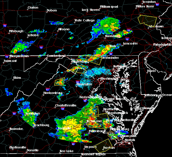 At 649 pm edt, a severe thunderstorm was located over walkersville, or 7 miles northeast of frederick, moving southeast at 25 mph (radar indicated). Hazards include ping pong ball size hail and 60 mph wind gusts. Damaging winds will cause some trees and large branches to fall. this could injure those outdoors, as well as damage homes and vehicles. roadways may become blocked by downed trees. localized power outages are possible. Unsecured light objects may become projectiles. At 649 pm edt, a severe thunderstorm was located over walkersville, or 7 miles northeast of frederick, moving southeast at 25 mph (radar indicated). Hazards include ping pong ball size hail and 60 mph wind gusts. Damaging winds will cause some trees and large branches to fall. this could injure those outdoors, as well as damage homes and vehicles. roadways may become blocked by downed trees. localized power outages are possible. Unsecured light objects may become projectiles.
|
| 8/18/2019 9:28 PM EDT |
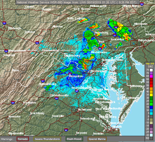 At 928 pm edt, a severe thunderstorm was located over damascus, moving southeast at 20 mph (radar indicated). Hazards include 60 mph wind gusts and quarter size hail. Damaging winds will cause some trees and large branches to fall. this could injure those outdoors, as well as damage homes and vehicles. roadways may become blocked by downed trees. localized power outages are possible. unsecured light objects may become projectiles. Locations impacted include, damascus, glenwood, glenelg and roxbury mills. At 928 pm edt, a severe thunderstorm was located over damascus, moving southeast at 20 mph (radar indicated). Hazards include 60 mph wind gusts and quarter size hail. Damaging winds will cause some trees and large branches to fall. this could injure those outdoors, as well as damage homes and vehicles. roadways may become blocked by downed trees. localized power outages are possible. unsecured light objects may become projectiles. Locations impacted include, damascus, glenwood, glenelg and roxbury mills.
|
| 8/18/2019 9:12 PM EDT |
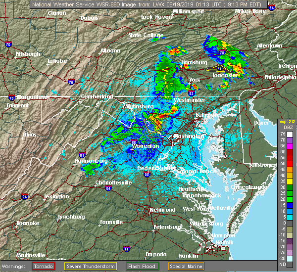 The national weather service in sterling virginia has issued a * severe thunderstorm warning for. northwestern howard county in central maryland. northeastern montgomery county in central maryland. southeastern frederick county in north central maryland. Until 1000 pm edt. The national weather service in sterling virginia has issued a * severe thunderstorm warning for. northwestern howard county in central maryland. northeastern montgomery county in central maryland. southeastern frederick county in north central maryland. Until 1000 pm edt.
|
| 8/7/2019 2:43 PM EDT |
 The severe thunderstorm warning for western howard, central montgomery, eastern loudoun and north central fairfax counties will expire at 245 pm edt, the storm which prompted the warning has weakened below severe limits, and no longer poses an immediate threat to life or property. therefore, the warning will be allowed to expire. however small hail and gusty winds are still possible with this thunderstorm. a severe thunderstorm watch remains in effect until 800 pm edt for central maryland, and northern virginia. The severe thunderstorm warning for western howard, central montgomery, eastern loudoun and north central fairfax counties will expire at 245 pm edt, the storm which prompted the warning has weakened below severe limits, and no longer poses an immediate threat to life or property. therefore, the warning will be allowed to expire. however small hail and gusty winds are still possible with this thunderstorm. a severe thunderstorm watch remains in effect until 800 pm edt for central maryland, and northern virginia.
|
| 8/7/2019 2:42 PM EDT |
 The severe thunderstorm warning for west central howard and north central montgomery counties in central maryland, southeastern frederick county in north central maryland and eastern loudoun counties in northern virginia will expire at 245 pm edt, the storm which prompted the warning has weakened below severe limits, and no longer poses an immediate threat to life or property. therefore, the warning will be allowed to expire. however small hail and gusty winds are still possible with this thunderstorm. a severe thunderstorm watch remains in effect until 800 pm edt for central and north central maryland, and northern virginia. The severe thunderstorm warning for west central howard and north central montgomery counties in central maryland, southeastern frederick county in north central maryland and eastern loudoun counties in northern virginia will expire at 245 pm edt, the storm which prompted the warning has weakened below severe limits, and no longer poses an immediate threat to life or property. therefore, the warning will be allowed to expire. however small hail and gusty winds are still possible with this thunderstorm. a severe thunderstorm watch remains in effect until 800 pm edt for central and north central maryland, and northern virginia.
|
| 8/7/2019 2:34 PM EDT |
 At 234 pm edt, a severe thunderstorm was located over germantown, moving northeast at 20 mph (radar indicated). Hazards include 60 mph wind gusts and half dollar size hail. Damaging winds will cause some trees and large branches to fall. this could injure those outdoors, as well as damage homes and vehicles. roadways may become blocked by downed trees. localized power outages are possible. unsecured light objects may become projectiles. Locations impacted include, germantown, damascus, lowes island, montgomery village, boyds, clarksburg, darnestown and dawsonville. At 234 pm edt, a severe thunderstorm was located over germantown, moving northeast at 20 mph (radar indicated). Hazards include 60 mph wind gusts and half dollar size hail. Damaging winds will cause some trees and large branches to fall. this could injure those outdoors, as well as damage homes and vehicles. roadways may become blocked by downed trees. localized power outages are possible. unsecured light objects may become projectiles. Locations impacted include, germantown, damascus, lowes island, montgomery village, boyds, clarksburg, darnestown and dawsonville.
|
| 8/7/2019 2:32 PM EDT |
 At 232 pm edt, a severe thunderstorm was located over montgomery village, or over gaithersburg, moving northeast at 35 mph (radar indicated). Hazards include 60 mph wind gusts and quarter size hail. Damaging winds will cause some trees and large branches to fall. this could injure those outdoors, as well as damage homes and vehicles. roadways may become blocked by downed trees. localized power outages are possible. unsecured light objects may become projectiles. Locations impacted include, germantown, rockville, gaithersburg, olney, damascus, lowes island, aspen hill, potomac, montgomery village, north potomac, redland, great falls, rossmoor, cloverly, darnestown, derwood, spencerville, washington grove, laytonsville and brookeville. At 232 pm edt, a severe thunderstorm was located over montgomery village, or over gaithersburg, moving northeast at 35 mph (radar indicated). Hazards include 60 mph wind gusts and quarter size hail. Damaging winds will cause some trees and large branches to fall. this could injure those outdoors, as well as damage homes and vehicles. roadways may become blocked by downed trees. localized power outages are possible. unsecured light objects may become projectiles. Locations impacted include, germantown, rockville, gaithersburg, olney, damascus, lowes island, aspen hill, potomac, montgomery village, north potomac, redland, great falls, rossmoor, cloverly, darnestown, derwood, spencerville, washington grove, laytonsville and brookeville.
|
| 8/7/2019 2:32 PM EDT |
 At 157 pm edt, a severe thunderstorm was located over great falls, or over lowes island, moving northeast at 25 mph (radar indicated). Hazards include 60 mph wind gusts and quarter size hail. Damaging winds will cause some trees and large branches to fall. this could injure those outdoors, as well as damage homes and vehicles. roadways may become blocked by downed trees. localized power outages are possible. Unsecured light objects may become projectiles. At 157 pm edt, a severe thunderstorm was located over great falls, or over lowes island, moving northeast at 25 mph (radar indicated). Hazards include 60 mph wind gusts and quarter size hail. Damaging winds will cause some trees and large branches to fall. this could injure those outdoors, as well as damage homes and vehicles. roadways may become blocked by downed trees. localized power outages are possible. Unsecured light objects may become projectiles.
|
| 8/7/2019 2:01 PM EDT |
 At 201 pm edt, a severe thunderstorm was located near boyds, or near poolesville, moving northeast at 25 mph (radar indicated). Hazards include 60 mph wind gusts and half dollar size hail. Damaging winds will cause some trees and large branches to fall. this could injure those outdoors, as well as damage homes and vehicles. roadways may become blocked by downed trees. localized power outages are possible. Unsecured light objects may become projectiles. At 201 pm edt, a severe thunderstorm was located near boyds, or near poolesville, moving northeast at 25 mph (radar indicated). Hazards include 60 mph wind gusts and half dollar size hail. Damaging winds will cause some trees and large branches to fall. this could injure those outdoors, as well as damage homes and vehicles. roadways may become blocked by downed trees. localized power outages are possible. Unsecured light objects may become projectiles.
|
| 8/7/2019 1:57 PM EDT |
 At 157 pm edt, a severe thunderstorm was located over great falls, or over lowes island, moving northeast at 25 mph (radar indicated). Hazards include 60 mph wind gusts and quarter size hail. Damaging winds will cause some trees and large branches to fall. this could injure those outdoors, as well as damage homes and vehicles. roadways may become blocked by downed trees. localized power outages are possible. Unsecured light objects may become projectiles. At 157 pm edt, a severe thunderstorm was located over great falls, or over lowes island, moving northeast at 25 mph (radar indicated). Hazards include 60 mph wind gusts and quarter size hail. Damaging winds will cause some trees and large branches to fall. this could injure those outdoors, as well as damage homes and vehicles. roadways may become blocked by downed trees. localized power outages are possible. Unsecured light objects may become projectiles.
|
| 8/7/2019 1:57 PM EDT |
 The national weather service in sterling virginia has issued a * severe thunderstorm warning for. western howard county in central maryland. central montgomery county in central maryland. eastern loudoun county in northern virginia. North central fairfax county in northern virginia. The national weather service in sterling virginia has issued a * severe thunderstorm warning for. western howard county in central maryland. central montgomery county in central maryland. eastern loudoun county in northern virginia. North central fairfax county in northern virginia.
|
| 8/7/2019 1:42 PM EDT |
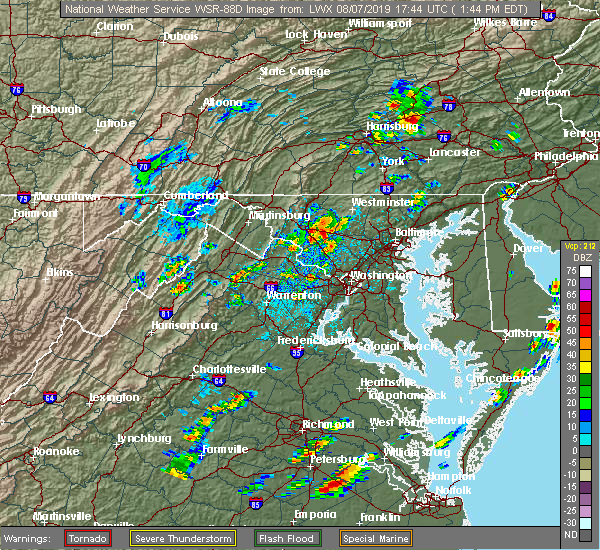 At 142 pm edt, a severe thunderstorm was located over green valley, or near damascus, moving east at 20 mph (radar indicated). Hazards include 60 mph wind gusts and half dollar size hail. Damaging winds will cause some trees and large branches to fall. this could injure those outdoors, as well as damage homes and vehicles. roadways may become blocked by downed trees. localized power outages are possible. Unsecured light objects may become projectiles. At 142 pm edt, a severe thunderstorm was located over green valley, or near damascus, moving east at 20 mph (radar indicated). Hazards include 60 mph wind gusts and half dollar size hail. Damaging winds will cause some trees and large branches to fall. this could injure those outdoors, as well as damage homes and vehicles. roadways may become blocked by downed trees. localized power outages are possible. Unsecured light objects may become projectiles.
|
| 7/22/2019 3:14 PM EDT |
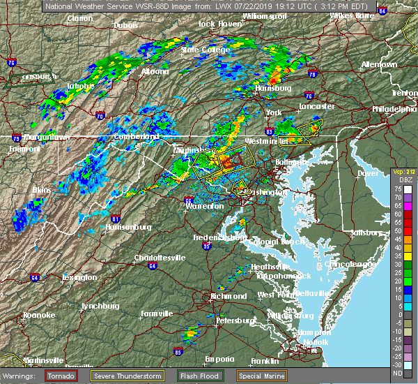 At 313 pm edt, a severe thunderstorm was located over green valley, or near damascus, moving northeast at 35 mph (radar indicated and observed. a wind gust to 58 mph was measured in frederick). Hazards include 70 mph wind gusts. Damaging winds will cause some trees and large branches to fall. this could injure those outdoors, as well as damage homes and vehicles. roadways may become blocked by downed trees. localized power outages are possible. unsecured light objects may become projectiles. Locations impacted include, frederick, westminster, damascus, eldersburg, mount airy, walkersville, sykesville, oakland, new market, gamber, discovery-spring garden, green valley, linganore-bartonsville, clarksburg, new windsor, libertytown, monrovia, henryton, winfield and louisville. At 313 pm edt, a severe thunderstorm was located over green valley, or near damascus, moving northeast at 35 mph (radar indicated and observed. a wind gust to 58 mph was measured in frederick). Hazards include 70 mph wind gusts. Damaging winds will cause some trees and large branches to fall. this could injure those outdoors, as well as damage homes and vehicles. roadways may become blocked by downed trees. localized power outages are possible. unsecured light objects may become projectiles. Locations impacted include, frederick, westminster, damascus, eldersburg, mount airy, walkersville, sykesville, oakland, new market, gamber, discovery-spring garden, green valley, linganore-bartonsville, clarksburg, new windsor, libertytown, monrovia, henryton, winfield and louisville.
|
| 7/22/2019 3:09 PM EDT | Tree down on bethesda church road near purdum roa in montgomery county MD, 3.5 miles SE of Damascus, MD |
| 7/22/2019 2:57 PM EDT |
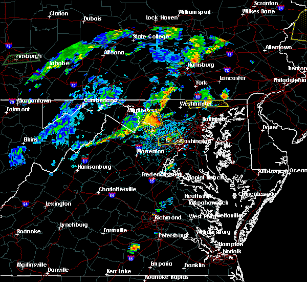 The national weather service in sterling virginia has issued a * severe thunderstorm warning for. southeastern carroll county in north central maryland. northwestern howard county in central maryland. northwestern montgomery county in central maryland. Southeastern frederick county in north central maryland. The national weather service in sterling virginia has issued a * severe thunderstorm warning for. southeastern carroll county in north central maryland. northwestern howard county in central maryland. northwestern montgomery county in central maryland. Southeastern frederick county in north central maryland.
|
| 7/17/2019 5:27 PM EDT |
 The severe thunderstorm warning for montgomery county in central maryland, southeastern frederick county in north central maryland, southeastern loudoun and north central fairfax counties in northern virginia will expire at 530 pm edt, the storm which prompted the warning has moved out of the area. therefore, the warning will be allowed to expire. however gusty winds and heavy rain are still possible with this thunderstorm. a severe thunderstorm watch remains in effect until midnight edt for central maryland, and northern virginia. remember, a severe thunderstorm warning still remains in effect for portions of montgomery, loudoun, fairfax and frederick counties. The severe thunderstorm warning for montgomery county in central maryland, southeastern frederick county in north central maryland, southeastern loudoun and north central fairfax counties in northern virginia will expire at 530 pm edt, the storm which prompted the warning has moved out of the area. therefore, the warning will be allowed to expire. however gusty winds and heavy rain are still possible with this thunderstorm. a severe thunderstorm watch remains in effect until midnight edt for central maryland, and northern virginia. remember, a severe thunderstorm warning still remains in effect for portions of montgomery, loudoun, fairfax and frederick counties.
|
| 7/17/2019 5:12 PM EDT |
 At 512 pm edt, a severe thunderstorm was located over damascus, moving northeast at 40 mph (radar indicated). Hazards include 60 mph wind gusts. Damaging winds will cause some trees and large branches to fall. this could injure those outdoors, as well as damage homes and vehicles. roadways may become blocked by downed trees. localized power outages are possible. Unsecured light objects may become projectiles. At 512 pm edt, a severe thunderstorm was located over damascus, moving northeast at 40 mph (radar indicated). Hazards include 60 mph wind gusts. Damaging winds will cause some trees and large branches to fall. this could injure those outdoors, as well as damage homes and vehicles. roadways may become blocked by downed trees. localized power outages are possible. Unsecured light objects may become projectiles.
|
| 7/17/2019 5:09 PM EDT |
 At 507 pm edt, a severe thunderstorm was located over germantown, moving east at 30 mph. additionally, severe thunderstorm winds from a second storm are moving into the sterling park area of eastern loudoun county and will continue moving northeast at 30 mph and impact northwest fairfax and southwest montgomery counties (radar indicated). Hazards include 60 mph wind gusts. Damaging winds will cause some trees and large branches to fall. this could injure those outdoors, as well as damage homes and vehicles. roadways may become blocked by downed trees. localized power outages are possible. unsecured light objects may become projectiles. Locations impacted include, germantown, rockville, gaithersburg, reston, herndon, damascus, broadlands, lansdowne, lowes island, brambleton, poolesville, aspen hill, potomac, north bethesda, ashburn, montgomery village, sterling, north potomac, redland and great falls. At 507 pm edt, a severe thunderstorm was located over germantown, moving east at 30 mph. additionally, severe thunderstorm winds from a second storm are moving into the sterling park area of eastern loudoun county and will continue moving northeast at 30 mph and impact northwest fairfax and southwest montgomery counties (radar indicated). Hazards include 60 mph wind gusts. Damaging winds will cause some trees and large branches to fall. this could injure those outdoors, as well as damage homes and vehicles. roadways may become blocked by downed trees. localized power outages are possible. unsecured light objects may become projectiles. Locations impacted include, germantown, rockville, gaithersburg, reston, herndon, damascus, broadlands, lansdowne, lowes island, brambleton, poolesville, aspen hill, potomac, north bethesda, ashburn, montgomery village, sterling, north potomac, redland and great falls.
|
| 7/17/2019 4:43 PM EDT |
 At 442 pm edt, a severe thunderstorm was located over lansdowne, moving east at 35 mph (radar indicated). Hazards include 60 mph wind gusts. Damaging winds will cause some trees and large branches to fall. this could injure those outdoors, as well as damage homes and vehicles. roadways may become blocked by downed trees. localized power outages are possible. Unsecured light objects may become projectiles. At 442 pm edt, a severe thunderstorm was located over lansdowne, moving east at 35 mph (radar indicated). Hazards include 60 mph wind gusts. Damaging winds will cause some trees and large branches to fall. this could injure those outdoors, as well as damage homes and vehicles. roadways may become blocked by downed trees. localized power outages are possible. Unsecured light objects may become projectiles.
|
| 7/6/2019 7:57 PM EDT |
 The severe thunderstorm warning for western howard, northeastern montgomery counties in central maryland and southeastern frederick counties in north central maryland will expire at 800 pm edt, the storm which prompted the warning has weakened below severe limits, and no longer poses an immediate threat to life or property. therefore, the warning will be allowed to expire. The severe thunderstorm warning for western howard, northeastern montgomery counties in central maryland and southeastern frederick counties in north central maryland will expire at 800 pm edt, the storm which prompted the warning has weakened below severe limits, and no longer poses an immediate threat to life or property. therefore, the warning will be allowed to expire.
|
| 7/6/2019 7:30 PM EDT |
 At 730 pm edt, a severe thunderstorm was located over damascus, moving east at 20 mph (radar indicated). Hazards include 60 mph wind gusts. Damaging winds will cause some trees and large branches to fall. this could injure those outdoors, as well as damage homes and vehicles. roadways may become blocked by downed trees. localized power outages are possible. unsecured light objects may become projectiles. Locations impacted include, germantown, gaithersburg, olney, damascus, montgomery village, boyds, clarksburg, highland, laytonsville, brookeville, lisbon, glenwood, dayton, watersville, poplar springs, roxbury mills, woodbine, brinklow and glenelg. At 730 pm edt, a severe thunderstorm was located over damascus, moving east at 20 mph (radar indicated). Hazards include 60 mph wind gusts. Damaging winds will cause some trees and large branches to fall. this could injure those outdoors, as well as damage homes and vehicles. roadways may become blocked by downed trees. localized power outages are possible. unsecured light objects may become projectiles. Locations impacted include, germantown, gaithersburg, olney, damascus, montgomery village, boyds, clarksburg, highland, laytonsville, brookeville, lisbon, glenwood, dayton, watersville, poplar springs, roxbury mills, woodbine, brinklow and glenelg.
|
| 7/6/2019 7:15 PM EDT |
 At 715 pm edt, a severe thunderstorm was located near boyds, or 7 miles northwest of germantown, moving east at 20 mph (radar indicated). Hazards include 60 mph wind gusts. Damaging winds will cause some trees and large branches to fall. this could injure those outdoors, as well as damage homes and vehicles. roadways may become blocked by downed trees. localized power outages are possible. Unsecured light objects may become projectiles. At 715 pm edt, a severe thunderstorm was located near boyds, or 7 miles northwest of germantown, moving east at 20 mph (radar indicated). Hazards include 60 mph wind gusts. Damaging winds will cause some trees and large branches to fall. this could injure those outdoors, as well as damage homes and vehicles. roadways may become blocked by downed trees. localized power outages are possible. Unsecured light objects may become projectiles.
|
| 7/2/2019 7:30 PM EDT |
 At 729 pm edt, severe thunderstorms were located along a line extending from near sykesville to germantown, moving southeast at 25 mph (radar indicated). Hazards include 70 mph wind gusts. Damaging winds will cause some trees and large branches to fall. this could injure those outdoors, as well as damage homes and vehicles. roadways may become blocked by downed trees. localized power outages are possible. unsecured light objects may become projectiles. Locations impacted include, columbia, germantown, gaithersburg, olney, damascus, aspen hill, montgomery village, redland, colesville, rossmoor, wheaton-glenmont, wheaton, cloverly, clarksburg, glenmont, burtonsville, fulton, spencerville, highland and washington grove. At 729 pm edt, severe thunderstorms were located along a line extending from near sykesville to germantown, moving southeast at 25 mph (radar indicated). Hazards include 70 mph wind gusts. Damaging winds will cause some trees and large branches to fall. this could injure those outdoors, as well as damage homes and vehicles. roadways may become blocked by downed trees. localized power outages are possible. unsecured light objects may become projectiles. Locations impacted include, columbia, germantown, gaithersburg, olney, damascus, aspen hill, montgomery village, redland, colesville, rossmoor, wheaton-glenmont, wheaton, cloverly, clarksburg, glenmont, burtonsville, fulton, spencerville, highland and washington grove.
|
| 7/2/2019 7:15 PM EDT |
 At 715 pm edt, a severe thunderstorm was located over damascus, moving southeast at 25 mph (radar indicated). Hazards include 60 mph wind gusts. Damaging winds will cause some trees and large branches to fall. this could injure those outdoors, as well as damage homes and vehicles. roadways may become blocked by downed trees. localized power outages are possible. Unsecured light objects may become projectiles. At 715 pm edt, a severe thunderstorm was located over damascus, moving southeast at 25 mph (radar indicated). Hazards include 60 mph wind gusts. Damaging winds will cause some trees and large branches to fall. this could injure those outdoors, as well as damage homes and vehicles. roadways may become blocked by downed trees. localized power outages are possible. Unsecured light objects may become projectiles.
|
| 6/29/2019 10:25 PM EDT |
 At 1025 pm edt, severe thunderstorms were located along a line extending from 6 miles north of boyds to round hill, moving southeast at 30 mph (radar indicated). Hazards include 60 mph wind gusts. Damaging winds will cause some trees and large branches to fall. this could injure those outdoors, as well as damage homes and vehicles. roadways may become blocked by downed trees. localized power outages are possible. Unsecured light objects may become projectiles. At 1025 pm edt, severe thunderstorms were located along a line extending from 6 miles north of boyds to round hill, moving southeast at 30 mph (radar indicated). Hazards include 60 mph wind gusts. Damaging winds will cause some trees and large branches to fall. this could injure those outdoors, as well as damage homes and vehicles. roadways may become blocked by downed trees. localized power outages are possible. Unsecured light objects may become projectiles.
|
| 6/29/2019 10:25 PM EDT |
 The national weather service in sterling virginia has issued a * severe thunderstorm warning for. northwestern montgomery county in central maryland. south central frederick county in north central maryland. loudoun county in northern virginia. Until 1115 pm edt. The national weather service in sterling virginia has issued a * severe thunderstorm warning for. northwestern montgomery county in central maryland. south central frederick county in north central maryland. loudoun county in northern virginia. Until 1115 pm edt.
|
| 6/29/2019 4:18 PM EDT | Tree down on annapolis rock road between hipsley mill road and the montgomery county lin in howard county MD, 4.7 miles WSW of Damascus, MD |
| 6/29/2019 4:10 PM EDT | Several pictures of trees down around damascus... m in montgomery county MD, 1.9 miles S of Damascus, MD |
| 6/29/2019 4:08 PM EDT |
 At 408 pm edt, a severe thunderstorm was located over damascus, moving southeast at 20 mph (radar indicated). Hazards include 60 mph wind gusts and quarter size hail. Damaging winds will cause some trees and large branches to fall. this could injure those outdoors, as well as damage homes and vehicles. roadways may become blocked by downed trees. localized power outages are possible. Unsecured light objects may become projectiles. At 408 pm edt, a severe thunderstorm was located over damascus, moving southeast at 20 mph (radar indicated). Hazards include 60 mph wind gusts and quarter size hail. Damaging winds will cause some trees and large branches to fall. this could injure those outdoors, as well as damage homes and vehicles. roadways may become blocked by downed trees. localized power outages are possible. Unsecured light objects may become projectiles.
|
| 6/13/2019 5:36 PM EDT |
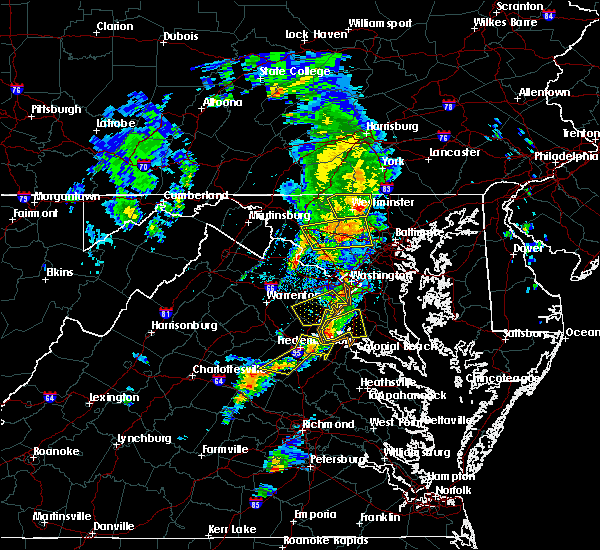 At 535 pm edt, a severe thunderstorm was located over mount airy, or 7 miles northeast of damascus, moving east at 40 mph (radar indicated). Hazards include 60 mph wind gusts. Damaging winds will cause some trees and large branches to fall. this could injure those outdoors, as well as damage homes and vehicles. roadways may become blocked by downed trees. localized power outages are possible. unsecured light objects may become projectiles. Locations impacted include, damascus, ellicott city, randallstown, eldersburg, mount airy, sykesville, oakland, new market, gamber, green valley, linganore-bartonsville, monrovia, finksburg, henryton, west friendship, winfield, louisville, woodstock, gaither and granite. At 535 pm edt, a severe thunderstorm was located over mount airy, or 7 miles northeast of damascus, moving east at 40 mph (radar indicated). Hazards include 60 mph wind gusts. Damaging winds will cause some trees and large branches to fall. this could injure those outdoors, as well as damage homes and vehicles. roadways may become blocked by downed trees. localized power outages are possible. unsecured light objects may become projectiles. Locations impacted include, damascus, ellicott city, randallstown, eldersburg, mount airy, sykesville, oakland, new market, gamber, green valley, linganore-bartonsville, monrovia, finksburg, henryton, west friendship, winfield, louisville, woodstock, gaither and granite.
|
| 6/13/2019 5:13 PM EDT |
 At 513 pm edt, severe thunderstorms were located over southeastern frederick and northwestern montgomery counties, moving east at 40 mph (radar indicated). Hazards include 60 mph wind gusts and quarter size hail. Damaging winds will cause some trees and large branches to fall. this could injure those outdoors, as well as damage homes and vehicles. roadways may become blocked by downed trees. localized power outages are possible. Unsecured light objects may become projectiles. At 513 pm edt, severe thunderstorms were located over southeastern frederick and northwestern montgomery counties, moving east at 40 mph (radar indicated). Hazards include 60 mph wind gusts and quarter size hail. Damaging winds will cause some trees and large branches to fall. this could injure those outdoors, as well as damage homes and vehicles. roadways may become blocked by downed trees. localized power outages are possible. Unsecured light objects may become projectiles.
|
| 6/2/2019 6:27 PM EDT | Tree branch onto power lines along howard chapel rd in montgomery county MD, 1.8 miles S of Damascus, MD |
| 6/2/2019 6:25 PM EDT |
 At 625 pm edt, a severe thunderstorm was located over germantown, moving east at 30 mph (radar indicated). Hazards include 60 mph wind gusts and quarter size hail. Damaging winds will cause some trees and large branches to fall. this could injure those outdoors, as well as damage homes and vehicles. roadways may become blocked by downed trees. localized power outages are possible. Unsecured light objects may become projectiles. At 625 pm edt, a severe thunderstorm was located over germantown, moving east at 30 mph (radar indicated). Hazards include 60 mph wind gusts and quarter size hail. Damaging winds will cause some trees and large branches to fall. this could injure those outdoors, as well as damage homes and vehicles. roadways may become blocked by downed trees. localized power outages are possible. Unsecured light objects may become projectiles.
|
| 6/2/2019 5:48 PM EDT |
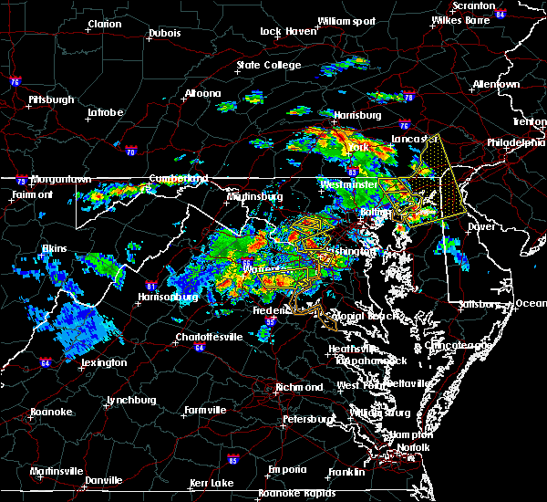 At 548 pm edt, a severe thunderstorm was located near mount airy, or near damascus, moving east at 30 mph (radar indicated). Hazards include ping pong ball size hail and 60 mph wind gusts. Damaging winds will cause some trees and large branches to fall. this could injure those outdoors, as well as damage homes and vehicles. roadways may become blocked by downed trees. localized power outages are possible. unsecured light objects may become projectiles. Locations impacted include, damascus, clarksburg, glenwood and roxbury mills. At 548 pm edt, a severe thunderstorm was located near mount airy, or near damascus, moving east at 30 mph (radar indicated). Hazards include ping pong ball size hail and 60 mph wind gusts. Damaging winds will cause some trees and large branches to fall. this could injure those outdoors, as well as damage homes and vehicles. roadways may become blocked by downed trees. localized power outages are possible. unsecured light objects may become projectiles. Locations impacted include, damascus, clarksburg, glenwood and roxbury mills.
|
| 6/2/2019 5:47 PM EDT | Ping Pong Ball sized hail reported 1.9 miles E of Damascus, MD |
| 6/2/2019 5:46 PM EDT |
 At 546 pm edt, a severe thunderstorm was located over damascus, moving southeast at 30 mph (radar indicated). Hazards include ping pong ball size hail and 60 mph wind gusts. Damaging winds will cause some trees and large branches to fall. this could injure those outdoors, as well as damage homes and vehicles. roadways may become blocked by downed trees. localized power outages are possible. Unsecured light objects may become projectiles. At 546 pm edt, a severe thunderstorm was located over damascus, moving southeast at 30 mph (radar indicated). Hazards include ping pong ball size hail and 60 mph wind gusts. Damaging winds will cause some trees and large branches to fall. this could injure those outdoors, as well as damage homes and vehicles. roadways may become blocked by downed trees. localized power outages are possible. Unsecured light objects may become projectiles.
|
| 6/2/2019 5:45 PM EDT | Hen Egg sized hail reported 1.9 miles E of Damascus, MD, hen egg size hail |
| 6/2/2019 5:45 PM EDT | Tree on car in the 25100 block of ridge road in montgomery county MD, 1.5 miles ESE of Damascus, MD |
| 6/2/2019 5:42 PM EDT |
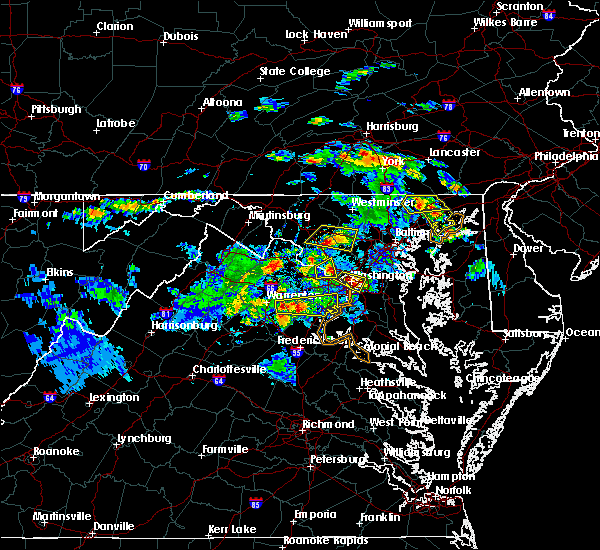 At 542 pm edt, a severe thunderstorm was located over mount airy, or near damascus, moving east at 30 mph (radar indicated). Hazards include 60 mph wind gusts and quarter size hail. Damaging winds will cause some trees and large branches to fall. this could injure those outdoors, as well as damage homes and vehicles. roadways may become blocked by downed trees. localized power outages are possible. unsecured light objects may become projectiles. Locations impacted include, damascus, clarksburg, glenwood, poplar springs, roxbury mills and lisbon. At 542 pm edt, a severe thunderstorm was located over mount airy, or near damascus, moving east at 30 mph (radar indicated). Hazards include 60 mph wind gusts and quarter size hail. Damaging winds will cause some trees and large branches to fall. this could injure those outdoors, as well as damage homes and vehicles. roadways may become blocked by downed trees. localized power outages are possible. unsecured light objects may become projectiles. Locations impacted include, damascus, clarksburg, glenwood, poplar springs, roxbury mills and lisbon.
|
| 6/2/2019 5:29 PM EDT |
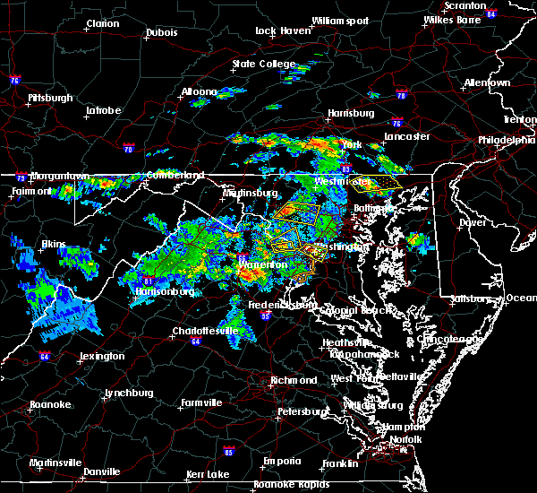 At 529 pm edt, a severe thunderstorm was located over new market, or 7 miles east of harry grove stadium, moving east at 30 mph (radar indicated). Hazards include 60 mph wind gusts and quarter size hail. Damaging winds will cause some trees and large branches to fall. this could injure those outdoors, as well as damage homes and vehicles. roadways may become blocked by downed trees. localized power outages are possible. unsecured light objects may become projectiles. Locations impacted include, damascus, eldersburg, mount airy, sykesville, new market, green valley, linganore-bartonsville, clarksburg, monrovia, ijamsville, lisbon, glenwood, park mills, gaither, watersville, poplar springs, roxbury mills and woodbine. At 529 pm edt, a severe thunderstorm was located over new market, or 7 miles east of harry grove stadium, moving east at 30 mph (radar indicated). Hazards include 60 mph wind gusts and quarter size hail. Damaging winds will cause some trees and large branches to fall. this could injure those outdoors, as well as damage homes and vehicles. roadways may become blocked by downed trees. localized power outages are possible. unsecured light objects may become projectiles. Locations impacted include, damascus, eldersburg, mount airy, sykesville, new market, green valley, linganore-bartonsville, clarksburg, monrovia, ijamsville, lisbon, glenwood, park mills, gaither, watersville, poplar springs, roxbury mills and woodbine.
|
| 6/2/2019 5:19 PM EDT |
 At 518 pm edt, a severe thunderstorm was located over ballenger creek, or over harry grove stadium, moving east at 30 mph (radar indicated). Hazards include 60 mph wind gusts and quarter size hail. Damaging winds will cause some trees and large branches to fall. this could injure those outdoors, as well as damage homes and vehicles. roadways may become blocked by downed trees. localized power outages are possible. Unsecured light objects may become projectiles. At 518 pm edt, a severe thunderstorm was located over ballenger creek, or over harry grove stadium, moving east at 30 mph (radar indicated). Hazards include 60 mph wind gusts and quarter size hail. Damaging winds will cause some trees and large branches to fall. this could injure those outdoors, as well as damage homes and vehicles. roadways may become blocked by downed trees. localized power outages are possible. Unsecured light objects may become projectiles.
|
| 5/30/2019 3:43 PM EDT |
 The severe thunderstorm warning for southeastern carroll, howard, northeastern montgomery and southwestern baltimore counties will expire at 345 pm edt, the storm which prompted the warning has moved out of the area. therefore, the warning will be allowed to expire. a severe thunderstorm watch remains in effect until 900 pm edt for northern, central and north central maryland. remember, a severe thunderstorm warning still remains in effect for portions of howard and baltimore counties. The severe thunderstorm warning for southeastern carroll, howard, northeastern montgomery and southwestern baltimore counties will expire at 345 pm edt, the storm which prompted the warning has moved out of the area. therefore, the warning will be allowed to expire. a severe thunderstorm watch remains in effect until 900 pm edt for northern, central and north central maryland. remember, a severe thunderstorm warning still remains in effect for portions of howard and baltimore counties.
|
| 5/30/2019 3:23 PM EDT |
 At 323 pm edt, a severe thunderstorm capable of producing a tornado was located near sykesville, or 9 miles northwest of columbia, moving east at 45 mph (radar indicated). Hazards include ping pong ball size hail and 60 mph wind gusts and a tornado. Damaging winds will cause some trees and large branches to fall. this could injure those outdoors, as well as damage homes and vehicles. roadways may become blocked by downed trees. localized power outages are possible. unsecured light objects may become projectiles. a tornado warning is also in effect for this storm. Locations impacted include, columbia, pikesville, damascus, ellicott city, catonsville, woodlawn, randallstown, owings mills, eldersburg, milford mill, lochearn, sykesville, oakland, savage-guilford, scaggsville, ilchester, garrison, savage, highland and clarksville. At 323 pm edt, a severe thunderstorm capable of producing a tornado was located near sykesville, or 9 miles northwest of columbia, moving east at 45 mph (radar indicated). Hazards include ping pong ball size hail and 60 mph wind gusts and a tornado. Damaging winds will cause some trees and large branches to fall. this could injure those outdoors, as well as damage homes and vehicles. roadways may become blocked by downed trees. localized power outages are possible. unsecured light objects may become projectiles. a tornado warning is also in effect for this storm. Locations impacted include, columbia, pikesville, damascus, ellicott city, catonsville, woodlawn, randallstown, owings mills, eldersburg, milford mill, lochearn, sykesville, oakland, savage-guilford, scaggsville, ilchester, garrison, savage, highland and clarksville.
|
| 5/30/2019 3:14 PM EDT |
 At 314 pm edt, a severe thunderstorm was located near sykesville, or 9 miles northeast of damascus, moving east at 45 mph (radar indicated). Hazards include ping pong ball size hail and 60 mph wind gusts. Damaging winds will cause some trees and large branches to fall. this could injure those outdoors, as well as damage homes and vehicles. roadways may become blocked by downed trees. localized power outages are possible. unsecured light objects may become projectiles. Locations impacted include, columbia, pikesville, damascus, ellicott city, catonsville, woodlawn, randallstown, owings mills, eldersburg, milford mill, reisterstown, lochearn, mount airy, sykesville, oakland, savage-guilford, green valley, scaggsville, ilchester and clarksburg. At 314 pm edt, a severe thunderstorm was located near sykesville, or 9 miles northeast of damascus, moving east at 45 mph (radar indicated). Hazards include ping pong ball size hail and 60 mph wind gusts. Damaging winds will cause some trees and large branches to fall. this could injure those outdoors, as well as damage homes and vehicles. roadways may become blocked by downed trees. localized power outages are possible. unsecured light objects may become projectiles. Locations impacted include, columbia, pikesville, damascus, ellicott city, catonsville, woodlawn, randallstown, owings mills, eldersburg, milford mill, reisterstown, lochearn, mount airy, sykesville, oakland, savage-guilford, green valley, scaggsville, ilchester and clarksburg.
|
| 5/30/2019 3:06 PM EDT | Several reports of trees and wires dow in montgomery county MD, 1.2 miles SSE of Damascus, MD |
| 5/30/2019 3:06 PM EDT | Tree down on the 28600 block of kemptown roa in montgomery county MD, 4 miles SSE of Damascus, MD |
| 5/30/2019 2:53 PM EDT |
 At 253 pm edt, a severe thunderstorm was located over linganore-bartonsville, or near harry grove stadium, moving east at 45 mph (radar indicated). Hazards include ping pong ball size hail and 60 mph wind gusts. Damaging winds will cause some trees and large branches to fall. this could injure those outdoors, as well as damage homes and vehicles. roadways may become blocked by downed trees. localized power outages are possible. Unsecured light objects may become projectiles. At 253 pm edt, a severe thunderstorm was located over linganore-bartonsville, or near harry grove stadium, moving east at 45 mph (radar indicated). Hazards include ping pong ball size hail and 60 mph wind gusts. Damaging winds will cause some trees and large branches to fall. this could injure those outdoors, as well as damage homes and vehicles. roadways may become blocked by downed trees. localized power outages are possible. Unsecured light objects may become projectiles.
|
| 5/25/2019 11:16 PM EDT |
 At 1116 pm edt, a severe thunderstorm was located over mount airy, or 8 miles north of damascus, moving east at 35 mph (radar indicated). Hazards include 60 mph wind gusts and quarter size hail. Damaging winds will cause some trees and large branches to fall. this could injure those outdoors, as well as damage homes and vehicles. roadways may become blocked by downed trees. localized power outages are possible. unsecured light objects may become projectiles. Locations impacted include, columbia, pikesville, damascus, ellicott city, catonsville, woodlawn, randallstown, owings mills, eldersburg, milford mill, reisterstown, lochearn, mount airy, sykesville, oakland, new market, savage-guilford, green valley, gamber and linganore-bartonsville. At 1116 pm edt, a severe thunderstorm was located over mount airy, or 8 miles north of damascus, moving east at 35 mph (radar indicated). Hazards include 60 mph wind gusts and quarter size hail. Damaging winds will cause some trees and large branches to fall. this could injure those outdoors, as well as damage homes and vehicles. roadways may become blocked by downed trees. localized power outages are possible. unsecured light objects may become projectiles. Locations impacted include, columbia, pikesville, damascus, ellicott city, catonsville, woodlawn, randallstown, owings mills, eldersburg, milford mill, reisterstown, lochearn, mount airy, sykesville, oakland, new market, savage-guilford, green valley, gamber and linganore-bartonsville.
|
| 5/25/2019 11:03 PM EDT |
 At 1103 pm edt, a severe thunderstorm was located over linganore-bartonsville, or near frederick, moving east at 40 mph (radar indicated). Hazards include 60 mph wind gusts and quarter size hail. Damaging winds will cause some trees and large branches to fall. this could injure those outdoors, as well as damage homes and vehicles. roadways may become blocked by downed trees. localized power outages are possible. Unsecured light objects may become projectiles. At 1103 pm edt, a severe thunderstorm was located over linganore-bartonsville, or near frederick, moving east at 40 mph (radar indicated). Hazards include 60 mph wind gusts and quarter size hail. Damaging winds will cause some trees and large branches to fall. this could injure those outdoors, as well as damage homes and vehicles. roadways may become blocked by downed trees. localized power outages are possible. Unsecured light objects may become projectiles.
|
| 5/23/2019 3:21 PM EDT |
 At 321 pm edt, severe thunderstorms were located along a line extending from near mount airy to rossmoor to potomac, moving east at 50 mph (radar indicated). Hazards include 70 mph wind gusts. Damaging winds will cause some trees and large branches to fall. this could injure those outdoors, as well as damage homes and vehicles. roadways may become blocked by downed trees. localized power outages are possible. Unsecured light objects may become projectiles. At 321 pm edt, severe thunderstorms were located along a line extending from near mount airy to rossmoor to potomac, moving east at 50 mph (radar indicated). Hazards include 70 mph wind gusts. Damaging winds will cause some trees and large branches to fall. this could injure those outdoors, as well as damage homes and vehicles. roadways may become blocked by downed trees. localized power outages are possible. Unsecured light objects may become projectiles.
|
| 5/23/2019 3:15 PM EDT |
 At 315 pm edt, severe thunderstorms were located along a line extending from 6 miles east of damascus to north potomac, moving east at 50 mph (radar indicated). Hazards include 60 mph wind gusts. Damaging winds will cause some trees and large branches to fall. this could injure those outdoors, as well as damage homes and vehicles. roadways may become blocked by downed trees. localized power outages are possible. unsecured light objects may become projectiles. Locations impacted include, germantown, rockville, bethesda, gaithersburg, olney, damascus, poolesville, aspen hill, potomac, north bethesda, montgomery village, north potomac, redland, chevy chase, north kensington, south kensington, north chevy chase, wheaton-glenmont, boyds and green valley. At 315 pm edt, severe thunderstorms were located along a line extending from 6 miles east of damascus to north potomac, moving east at 50 mph (radar indicated). Hazards include 60 mph wind gusts. Damaging winds will cause some trees and large branches to fall. this could injure those outdoors, as well as damage homes and vehicles. roadways may become blocked by downed trees. localized power outages are possible. unsecured light objects may become projectiles. Locations impacted include, germantown, rockville, bethesda, gaithersburg, olney, damascus, poolesville, aspen hill, potomac, north bethesda, montgomery village, north potomac, redland, chevy chase, north kensington, south kensington, north chevy chase, wheaton-glenmont, boyds and green valley.
|
| 5/23/2019 2:56 PM EDT |
 At 256 pm edt, severe thunderstorms were located along a line extending from near ballenger creek to near lansdowne, moving east at 50 mph (radar indicated). Hazards include 60 mph wind gusts. Damaging winds will cause some trees and large branches to fall. this could injure those outdoors, as well as damage homes and vehicles. roadways may become blocked by downed trees. localized power outages are possible. Unsecured light objects may become projectiles. At 256 pm edt, severe thunderstorms were located along a line extending from near ballenger creek to near lansdowne, moving east at 50 mph (radar indicated). Hazards include 60 mph wind gusts. Damaging winds will cause some trees and large branches to fall. this could injure those outdoors, as well as damage homes and vehicles. roadways may become blocked by downed trees. localized power outages are possible. Unsecured light objects may become projectiles.
|
| 5/18/2019 8:06 PM EDT |
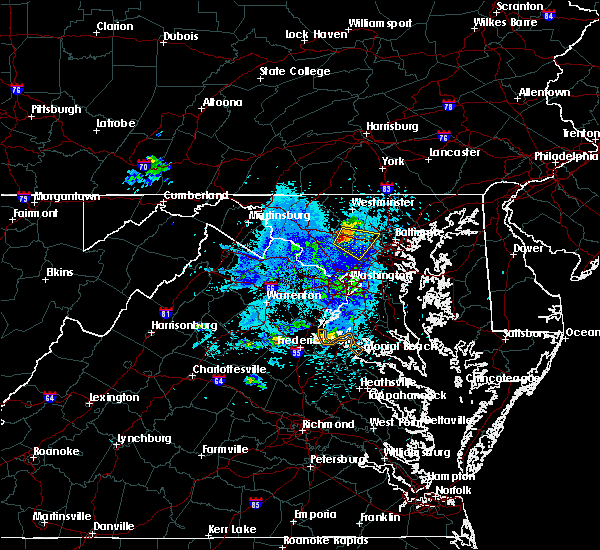 At 806 pm edt, a severe thunderstorm was located near mount airy, or near damascus, moving southeast at 20 mph (radar indicated). Hazards include 60 mph wind gusts and quarter size hail. Damaging winds will cause some trees and large branches to fall. this could injure those outdoors, as well as damage homes and vehicles. roadways may become blocked by downed trees. localized power outages are possible. Unsecured light objects may become projectiles. At 806 pm edt, a severe thunderstorm was located near mount airy, or near damascus, moving southeast at 20 mph (radar indicated). Hazards include 60 mph wind gusts and quarter size hail. Damaging winds will cause some trees and large branches to fall. this could injure those outdoors, as well as damage homes and vehicles. roadways may become blocked by downed trees. localized power outages are possible. Unsecured light objects may become projectiles.
|
| 4/26/2019 2:53 PM EDT |
 At 253 pm edt, severe thunderstorms were located along a line extending from montgomery village to potomac, moving northeast at 50 mph (radar indicated). Hazards include 60 mph wind gusts. Damaging winds will cause some trees and large branches to fall. this could injure those outdoors, as well as damage homes and vehicles. roadways may become blocked by downed trees. localized power outages are possible. unsecured light objects may become projectiles. Locations impacted include, germantown, rockville, bethesda, gaithersburg, olney, damascus, lowes island, aspen hill, potomac, north bethesda, montgomery village, north potomac, redland, takoma park, great falls, colesville, kemp mill, chevy chase, north kensington and south kensington. At 253 pm edt, severe thunderstorms were located along a line extending from montgomery village to potomac, moving northeast at 50 mph (radar indicated). Hazards include 60 mph wind gusts. Damaging winds will cause some trees and large branches to fall. this could injure those outdoors, as well as damage homes and vehicles. roadways may become blocked by downed trees. localized power outages are possible. unsecured light objects may become projectiles. Locations impacted include, germantown, rockville, bethesda, gaithersburg, olney, damascus, lowes island, aspen hill, potomac, north bethesda, montgomery village, north potomac, redland, takoma park, great falls, colesville, kemp mill, chevy chase, north kensington and south kensington.
|
| 4/26/2019 2:39 PM EDT |
 At 238 pm edt, severe thunderstorms were located along a line extending from near lowes island to reston, moving northeast at 40 mph (radar indicated). Hazards include 60 mph wind gusts. Damaging winds will cause some trees and large branches to fall. this could injure those outdoors, as well as damage homes and vehicles. roadways may become blocked by downed trees. localized power outages are possible. unsecured light objects may become projectiles. Locations impacted include, germantown, centreville, rockville, bethesda, gaithersburg, reston, leesburg, olney, south riding, herndon, vienna, damascus, broadlands, lansdowne, lowes island, brambleton, poolesville, american legion bridge, dulles international airport and aspen hill. At 238 pm edt, severe thunderstorms were located along a line extending from near lowes island to reston, moving northeast at 40 mph (radar indicated). Hazards include 60 mph wind gusts. Damaging winds will cause some trees and large branches to fall. this could injure those outdoors, as well as damage homes and vehicles. roadways may become blocked by downed trees. localized power outages are possible. unsecured light objects may become projectiles. Locations impacted include, germantown, centreville, rockville, bethesda, gaithersburg, reston, leesburg, olney, south riding, herndon, vienna, damascus, broadlands, lansdowne, lowes island, brambleton, poolesville, american legion bridge, dulles international airport and aspen hill.
|
| 4/26/2019 2:39 PM EDT |
 At 239 pm edt, a severe thunderstorm capable of producing a tornado was located over great falls, or over lowes island, moving northeast at 40 mph (radar indicated rotation). Hazards include tornado. For those in the direct path of a tornado touchdown, flying debris will be dangerous to those caught without shelter. damage to roofs, siding, and windows may occur. mobile homes may be damaged or destroyed. tree damage is likely. this dangerous storm will be near, potomac and north potomac around 250 pm edt. rockville, gaithersburg and north bethesda around 255 pm edt. montgomery village, redland, north kensington and rossmoor around 300 pm edt. olney, aspen hill, colesville and wheaton-glenmont around 305 pm edt. Other locations impacted by this tornadic thunderstorm include derwood, spencerville, cloverly, washington grove, bradley farms, laytonsville, brookeville, norbeck, sandy spring and glenmont. At 239 pm edt, a severe thunderstorm capable of producing a tornado was located over great falls, or over lowes island, moving northeast at 40 mph (radar indicated rotation). Hazards include tornado. For those in the direct path of a tornado touchdown, flying debris will be dangerous to those caught without shelter. damage to roofs, siding, and windows may occur. mobile homes may be damaged or destroyed. tree damage is likely. this dangerous storm will be near, potomac and north potomac around 250 pm edt. rockville, gaithersburg and north bethesda around 255 pm edt. montgomery village, redland, north kensington and rossmoor around 300 pm edt. olney, aspen hill, colesville and wheaton-glenmont around 305 pm edt. Other locations impacted by this tornadic thunderstorm include derwood, spencerville, cloverly, washington grove, bradley farms, laytonsville, brookeville, norbeck, sandy spring and glenmont.
|
| 4/26/2019 2:32 PM EDT |
 At 232 pm edt, severe thunderstorms were located along a line extending from ashburn to dulles international airport, moving east at 50 mph (radar indicated. dulles airport gusted to 53 mph). Hazards include 60 mph wind gusts. Damaging winds will cause some trees and large branches to fall. this could injure those outdoors, as well as damage homes and vehicles. roadways may become blocked by downed trees. localized power outages are possible. unsecured light objects may become projectiles. Locations impacted include, germantown, centreville, rockville, bethesda, gaithersburg, reston, leesburg, olney, south riding, herndon, fairfax, vienna, damascus, broadlands, lansdowne, lowes island, brambleton, pimmit hills, poolesville and mclean. At 232 pm edt, severe thunderstorms were located along a line extending from ashburn to dulles international airport, moving east at 50 mph (radar indicated. dulles airport gusted to 53 mph). Hazards include 60 mph wind gusts. Damaging winds will cause some trees and large branches to fall. this could injure those outdoors, as well as damage homes and vehicles. roadways may become blocked by downed trees. localized power outages are possible. unsecured light objects may become projectiles. Locations impacted include, germantown, centreville, rockville, bethesda, gaithersburg, reston, leesburg, olney, south riding, herndon, fairfax, vienna, damascus, broadlands, lansdowne, lowes island, brambleton, pimmit hills, poolesville and mclean.
|
| 4/26/2019 2:20 PM EDT |
 At 220 pm edt, severe thunderstorms were located along a line extending from near brambleton to near south riding, moving northeast at 50 mph (radar indicated). Hazards include 60 mph wind gusts. Damaging winds will cause some trees and large branches to fall. this could injure those outdoors, as well as damage homes and vehicles. roadways may become blocked by downed trees. localized power outages are possible. Unsecured light objects may become projectiles. At 220 pm edt, severe thunderstorms were located along a line extending from near brambleton to near south riding, moving northeast at 50 mph (radar indicated). Hazards include 60 mph wind gusts. Damaging winds will cause some trees and large branches to fall. this could injure those outdoors, as well as damage homes and vehicles. roadways may become blocked by downed trees. localized power outages are possible. Unsecured light objects may become projectiles.
|
| 4/15/2019 2:15 AM EDT |
 At 215 am edt, severe thunderstorms were located along a line extending from near green valley to rockville, moving northeast at 60 mph (radar indicated). Hazards include 60 mph wind gusts. Damaging winds will cause some trees and large branches to fall. this could injure those outdoors, as well as damage homes and vehicles. roadways may become blocked by downed trees. localized power outages are possible. Unsecured light objects may become projectiles. At 215 am edt, severe thunderstorms were located along a line extending from near green valley to rockville, moving northeast at 60 mph (radar indicated). Hazards include 60 mph wind gusts. Damaging winds will cause some trees and large branches to fall. this could injure those outdoors, as well as damage homes and vehicles. roadways may become blocked by downed trees. localized power outages are possible. Unsecured light objects may become projectiles.
|
| 4/15/2019 2:05 AM EDT |
 At 205 am edt, a severe thunderstorm was located over poolesville, moving east at 50 mph (radar indicated). Hazards include 60 mph wind gusts. Damaging winds will cause some trees and large branches to fall. this could injure those outdoors, as well as damage homes and vehicles. roadways may become blocked by downed trees. localized power outages are possible. Unsecured light objects may become projectiles. At 205 am edt, a severe thunderstorm was located over poolesville, moving east at 50 mph (radar indicated). Hazards include 60 mph wind gusts. Damaging winds will cause some trees and large branches to fall. this could injure those outdoors, as well as damage homes and vehicles. roadways may become blocked by downed trees. localized power outages are possible. Unsecured light objects may become projectiles.
|
| 12/21/2018 5:05 PM EST |
 The severe thunderstorm warning for montgomery county will expire at 515 pm est, the storms which prompted the warning have moved out of the area. therefore the warning will be allowed to expire. The severe thunderstorm warning for montgomery county will expire at 515 pm est, the storms which prompted the warning have moved out of the area. therefore the warning will be allowed to expire.
|
| 12/21/2018 4:29 PM EST |
 At 429 pm est, more severe thunderstorms were located along a line extending from lansdowne to reston, moving northeast at 45 mph (radar indicated). Hazards include 60 mph wind gusts. Damaging winds will cause some trees and large branches to fall. this could injure those outdoors, as well as damage homes and vehicles. roadways may become blocked by downed trees. localized power outages are possible. Unsecured light objects may become projectiles. At 429 pm est, more severe thunderstorms were located along a line extending from lansdowne to reston, moving northeast at 45 mph (radar indicated). Hazards include 60 mph wind gusts. Damaging winds will cause some trees and large branches to fall. this could injure those outdoors, as well as damage homes and vehicles. roadways may become blocked by downed trees. localized power outages are possible. Unsecured light objects may become projectiles.
|
| 12/21/2018 4:10 PM EST |
 The severe thunderstorm warning for northwestern howard and central montgomery counties will expire at 415 pm est, the storm which prompted the warning has weakened below severe limits, and have exited the warned area. therefore the warning will be allowed to expire. The severe thunderstorm warning for northwestern howard and central montgomery counties will expire at 415 pm est, the storm which prompted the warning has weakened below severe limits, and have exited the warned area. therefore the warning will be allowed to expire.
|
| 12/21/2018 3:56 PM EST |
 At 355 pm est, a severe thunderstorm was located over montgomery village, or near olney, moving northeast at 45 mph (radar indicated). Hazards include 60 mph wind gusts and quarter size hail. penny to nickel size hail and wind gusts to near 50 mph were recently reported in gaithersburg. Damaging winds will cause some trees and large branches to fall. this could injure those outdoors, as well as damage homes and vehicles. roadways may become blocked by downed trees. localized power outages are possible. unsecured light objects may become projectiles. Locations impacted include, germantown, rockville, gaithersburg, olney, damascus, aspen hill, montgomery village, redland, rossmoor, clarksburg, darnestown, derwood, washington grove, laytonsville, brookeville, west friendship, dayton, poplar springs, roxbury mills and norbeck. At 355 pm est, a severe thunderstorm was located over montgomery village, or near olney, moving northeast at 45 mph (radar indicated). Hazards include 60 mph wind gusts and quarter size hail. penny to nickel size hail and wind gusts to near 50 mph were recently reported in gaithersburg. Damaging winds will cause some trees and large branches to fall. this could injure those outdoors, as well as damage homes and vehicles. roadways may become blocked by downed trees. localized power outages are possible. unsecured light objects may become projectiles. Locations impacted include, germantown, rockville, gaithersburg, olney, damascus, aspen hill, montgomery village, redland, rossmoor, clarksburg, darnestown, derwood, washington grove, laytonsville, brookeville, west friendship, dayton, poplar springs, roxbury mills and norbeck.
|
| 12/21/2018 3:51 PM EST |
 At 351 pm est, a severe thunderstorm was located over montgomery village, or near gaithersburg, moving northeast at 45 mph (radar indicated). Hazards include 60 mph wind gusts. Damaging winds will cause some trees and large branches to fall. this could injure those outdoors, as well as damage homes and vehicles. roadways may become blocked by downed trees. localized power outages are possible. Unsecured light objects may become projectiles. At 351 pm est, a severe thunderstorm was located over montgomery village, or near gaithersburg, moving northeast at 45 mph (radar indicated). Hazards include 60 mph wind gusts. Damaging winds will cause some trees and large branches to fall. this could injure those outdoors, as well as damage homes and vehicles. roadways may become blocked by downed trees. localized power outages are possible. Unsecured light objects may become projectiles.
|
| 9/26/2018 6:35 PM EDT |
 The severe thunderstorm warning for central montgomery county will expire at 645 pm edt, the storms which prompted the warning have weakened below severe limits, and have exited the warned area. therefore the warning will be allowed to expire. however heavy rain is still possible with these thunderstorms. a severe thunderstorm watch remains in effect until 1100 pm edt for central and north central maryland. to report severe weather, contact your nearest law enforcement agency. they will relay your report to the national weather service sterling virginia. The severe thunderstorm warning for central montgomery county will expire at 645 pm edt, the storms which prompted the warning have weakened below severe limits, and have exited the warned area. therefore the warning will be allowed to expire. however heavy rain is still possible with these thunderstorms. a severe thunderstorm watch remains in effect until 1100 pm edt for central and north central maryland. to report severe weather, contact your nearest law enforcement agency. they will relay your report to the national weather service sterling virginia.
|
| 9/26/2018 6:22 PM EDT |
 At 621 pm edt, severe thunderstorms were located along a line extending from near damascus to near north potomac, moving east at 35 mph (radar indicated). Hazards include 60 mph wind gusts. Damaging winds will cause some trees and large branches to fall. this could injure those outdoors, as well as damage homes and vehicles. roadways may become blocked by downed trees. localized power outages are possible. unsecured light objects may become projectiles. Locations impacted include, germantown, rockville, gaithersburg, olney, damascus, aspen hill, north bethesda, montgomery village, north potomac, redland, colesville, kemp mill, north kensington, wheaton-glenmont, boyds, rossmoor, wheaton, cloverly, clarksburg and glenmont. At 621 pm edt, severe thunderstorms were located along a line extending from near damascus to near north potomac, moving east at 35 mph (radar indicated). Hazards include 60 mph wind gusts. Damaging winds will cause some trees and large branches to fall. this could injure those outdoors, as well as damage homes and vehicles. roadways may become blocked by downed trees. localized power outages are possible. unsecured light objects may become projectiles. Locations impacted include, germantown, rockville, gaithersburg, olney, damascus, aspen hill, north bethesda, montgomery village, north potomac, redland, colesville, kemp mill, north kensington, wheaton-glenmont, boyds, rossmoor, wheaton, cloverly, clarksburg and glenmont.
|
| 9/26/2018 6:04 PM EDT |
 The national weather service in sterling virginia has issued a * severe thunderstorm warning for. montgomery county in central maryland. until 645 pm edt. At 604 pm edt, severe thunderstorms were located along a line extending from 6 miles east of point of rocks to near lansdowne,. The national weather service in sterling virginia has issued a * severe thunderstorm warning for. montgomery county in central maryland. until 645 pm edt. At 604 pm edt, severe thunderstorms were located along a line extending from 6 miles east of point of rocks to near lansdowne,.
|
| 8/3/2018 9:09 PM EDT |
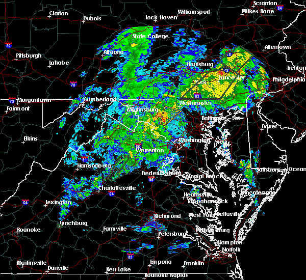 At 906 pm edt, a severe thunderstorm was located near green valley, or near damascus, moving northeast at 30 mph (radar indicated). Hazards include 60 mph wind gusts. Damaging winds will cause some trees and large branches to fall. this could injure those outdoors, as well as damage homes and vehicles. roadways may become blocked by downed trees. localized power outages are possible. Unsecured light objects may become projectiles. At 906 pm edt, a severe thunderstorm was located near green valley, or near damascus, moving northeast at 30 mph (radar indicated). Hazards include 60 mph wind gusts. Damaging winds will cause some trees and large branches to fall. this could injure those outdoors, as well as damage homes and vehicles. roadways may become blocked by downed trees. localized power outages are possible. Unsecured light objects may become projectiles.
|
| 7/27/2018 5:30 PM EDT |
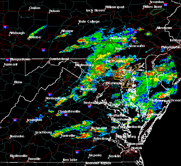 At 528 pm edt, a severe thunderstorm was located near mount airy, or near damascus, moving east at 35 mph (radar indicated). Hazards include 60 mph wind gusts and half dollar size hail. this storm has caused downed trees. Damaging winds will cause some trees and large branches to fall. this could injure those outdoors, as well as damage homes and vehicles. roadways may become blocked by downed trees. localized power outages are possible. unsecured light objects may become projectiles. Locations impacted include, damascus, mount airy, walkersville, new market, green valley, linganore-bartonsville, clarksburg, new windsor, woodsboro, libertytown, monrovia, ijamsville, winfield, lisbon, mount pleasant, watersville, poplar springs, woodbine, marston and unionville. At 528 pm edt, a severe thunderstorm was located near mount airy, or near damascus, moving east at 35 mph (radar indicated). Hazards include 60 mph wind gusts and half dollar size hail. this storm has caused downed trees. Damaging winds will cause some trees and large branches to fall. this could injure those outdoors, as well as damage homes and vehicles. roadways may become blocked by downed trees. localized power outages are possible. unsecured light objects may become projectiles. Locations impacted include, damascus, mount airy, walkersville, new market, green valley, linganore-bartonsville, clarksburg, new windsor, woodsboro, libertytown, monrovia, ijamsville, winfield, lisbon, mount pleasant, watersville, poplar springs, woodbine, marston and unionville.
|
| 7/27/2018 5:01 PM EDT |
 At 459 pm edt, a severe thunderstorm was located near ballenger creek, or near harry grove stadium, moving east at 25 mph (radar indicated). Hazards include 60 mph wind gusts and quarter size hail. Damaging winds will cause some trees and large branches to fall. this could injure those outdoors, as well as damage homes and vehicles. roadways may become blocked by downed trees. localized power outages are possible. Unsecured light objects may become projectiles. At 459 pm edt, a severe thunderstorm was located near ballenger creek, or near harry grove stadium, moving east at 25 mph (radar indicated). Hazards include 60 mph wind gusts and quarter size hail. Damaging winds will cause some trees and large branches to fall. this could injure those outdoors, as well as damage homes and vehicles. roadways may become blocked by downed trees. localized power outages are possible. Unsecured light objects may become projectiles.
|
| 7/17/2018 9:07 PM EDT |
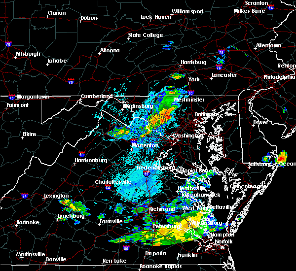 The severe thunderstorm warning for northwestern montgomery county in central maryland and southeastern frederick counties in north central maryland will expire at 915 pm edt, the storm which prompted the warning has weakened below severe limits, and no longer pose an immediate threat to life or property. therefore the warning will be allowed to expire. however gusty winds of 30 ro 40 mph are still possible with this thunderstorm along with cloud to ground lightning and brief heavy rain. The severe thunderstorm warning for northwestern montgomery county in central maryland and southeastern frederick counties in north central maryland will expire at 915 pm edt, the storm which prompted the warning has weakened below severe limits, and no longer pose an immediate threat to life or property. therefore the warning will be allowed to expire. however gusty winds of 30 ro 40 mph are still possible with this thunderstorm along with cloud to ground lightning and brief heavy rain.
|
| 7/17/2018 8:59 PM EDT |
 At 859 pm edt, a severe thunderstorm was located near boyds, or 7 miles west of damascus, moving southeast at 50 mph (radar indicated). Hazards include 60 mph wind gusts. Damaging winds will cause some trees and large branches to fall. this could injure those outdoors, as well as damage homes and vehicles. roadways may become blocked by downed trees. localized power outages are possible. unsecured light objects may become projectiles. Locations impacted include, germantown, damascus, boyds, bartonsville, clarksburg, darnestown, monrovia, barnesville, ijamsville, dickerson, dawsonville and park mills. At 859 pm edt, a severe thunderstorm was located near boyds, or 7 miles west of damascus, moving southeast at 50 mph (radar indicated). Hazards include 60 mph wind gusts. Damaging winds will cause some trees and large branches to fall. this could injure those outdoors, as well as damage homes and vehicles. roadways may become blocked by downed trees. localized power outages are possible. unsecured light objects may become projectiles. Locations impacted include, germantown, damascus, boyds, bartonsville, clarksburg, darnestown, monrovia, barnesville, ijamsville, dickerson, dawsonville and park mills.
|
| 7/17/2018 8:42 PM EDT |
 At 841 pm edt, a severe thunderstorm was located over ballenger creek, moving southeast at 25 mph (radar indicated). Hazards include 60 mph wind gusts. Damaging winds will cause some trees and large branches to fall. this could injure those outdoors, as well as damage homes and vehicles. roadways may become blocked by downed trees. localized power outages are possible. Unsecured light objects may become projectiles. At 841 pm edt, a severe thunderstorm was located over ballenger creek, moving southeast at 25 mph (radar indicated). Hazards include 60 mph wind gusts. Damaging winds will cause some trees and large branches to fall. this could injure those outdoors, as well as damage homes and vehicles. roadways may become blocked by downed trees. localized power outages are possible. Unsecured light objects may become projectiles.
|
| 5/15/2018 8:37 PM EDT |
 The severe thunderstorm warning for southeastern washington county in north central maryland, northwestern montgomery county in central maryland, southern frederick county in north central maryland and northern loudoun counties in northern virginia will expire at 845 pm edt, the storms which prompted the warning have weakened below severe limits, and no longer pose an immediate threat to life or property. therefore the warning will be allowed to expire. however heavy rain is still possible with these thunderstorms. a severe thunderstorm watch remains in effect until 1100 pm edt for central and north central maryland, and northern virginia. The severe thunderstorm warning for southeastern washington county in north central maryland, northwestern montgomery county in central maryland, southern frederick county in north central maryland and northern loudoun counties in northern virginia will expire at 845 pm edt, the storms which prompted the warning have weakened below severe limits, and no longer pose an immediate threat to life or property. therefore the warning will be allowed to expire. however heavy rain is still possible with these thunderstorms. a severe thunderstorm watch remains in effect until 1100 pm edt for central and north central maryland, and northern virginia.
|
| 5/15/2018 8:20 PM EDT |
 At 820 pm edt, severe thunderstorms were located along a line extending from near harpers ferry to green valley, moving south at 5 mph (radar indicated). Hazards include 60 mph wind gusts and quarter size hail. Damaging winds will cause some trees and large branches to fall. this could injure those outdoors, as well as damage homes and vehicles. roadways may become blocked by downed trees. localized power outages are possible. unsecured light objects may become projectiles. Locations impacted include, germantown, frederick, olney, damascus, poolesville, harry grove stadium, montgomery village, ballenger creek, mount airy, purcellville, brunswick, braddock heights, new market, round hill, green valley, clover hill, discovery-spring garden, boyds, point of rocks and linganore-bartonsville. At 820 pm edt, severe thunderstorms were located along a line extending from near harpers ferry to green valley, moving south at 5 mph (radar indicated). Hazards include 60 mph wind gusts and quarter size hail. Damaging winds will cause some trees and large branches to fall. this could injure those outdoors, as well as damage homes and vehicles. roadways may become blocked by downed trees. localized power outages are possible. unsecured light objects may become projectiles. Locations impacted include, germantown, frederick, olney, damascus, poolesville, harry grove stadium, montgomery village, ballenger creek, mount airy, purcellville, brunswick, braddock heights, new market, round hill, green valley, clover hill, discovery-spring garden, boyds, point of rocks and linganore-bartonsville.
|
| 5/15/2018 7:54 PM EDT |
 At 753 pm edt, severe thunderstorms with a history of producing large hail were located along a line extending from near harpers ferry to green valley, moving south at 5 mph (radar indicated. golf ball size hail was reported in frederick). Hazards include quarter to golf ball size hail and 60 mph wind gusts. Expect wind damage to trees and power lines. hail is large enough to dent and damage vehicles. Some hail damage to roofs, siding, and windows is possible. At 753 pm edt, severe thunderstorms with a history of producing large hail were located along a line extending from near harpers ferry to green valley, moving south at 5 mph (radar indicated. golf ball size hail was reported in frederick). Hazards include quarter to golf ball size hail and 60 mph wind gusts. Expect wind damage to trees and power lines. hail is large enough to dent and damage vehicles. Some hail damage to roofs, siding, and windows is possible.
|
| 5/15/2018 7:25 PM EDT |
 At 724 pm edt, severe thunderstorms were located along a line extending from near aberdeen proving ground to near point of rocks, moving south at 20 mph (radar indicated). Hazards include 60 mph wind gusts and quarter size hail. Damaging winds will cause some trees and large branches to fall. this could injure those outdoors, as well as damage homes and vehicles. roadways may become blocked by downed trees. localized power outages are possible. unsecured light objects may become projectiles. Locations impacted include, baltimore, columbia, germantown, frederick, pikesville, middle river, cockeysville, damascus, aberdeen, havre de grace, aberdeen proving ground, harry grove stadium, back river, ellicott city, dundalk, towson, bel air south, catonsville, essex and woodlawn. At 724 pm edt, severe thunderstorms were located along a line extending from near aberdeen proving ground to near point of rocks, moving south at 20 mph (radar indicated). Hazards include 60 mph wind gusts and quarter size hail. Damaging winds will cause some trees and large branches to fall. this could injure those outdoors, as well as damage homes and vehicles. roadways may become blocked by downed trees. localized power outages are possible. unsecured light objects may become projectiles. Locations impacted include, baltimore, columbia, germantown, frederick, pikesville, middle river, cockeysville, damascus, aberdeen, havre de grace, aberdeen proving ground, harry grove stadium, back river, ellicott city, dundalk, towson, bel air south, catonsville, essex and woodlawn.
|
| 5/15/2018 6:55 PM EDT |
 At 655 pm edt, severe thunderstorms were located along a line extending from havre de grace to near brunswick, moving south at 20 mph (radar indicated). Hazards include 60 mph wind gusts and quarter size hail. Damaging winds will cause some trees and large branches to fall. this could injure those outdoors, as well as damage homes and vehicles. roadways may become blocked by downed trees. localized power outages are possible. Unsecured light objects may become projectiles. At 655 pm edt, severe thunderstorms were located along a line extending from havre de grace to near brunswick, moving south at 20 mph (radar indicated). Hazards include 60 mph wind gusts and quarter size hail. Damaging winds will cause some trees and large branches to fall. this could injure those outdoors, as well as damage homes and vehicles. roadways may become blocked by downed trees. localized power outages are possible. Unsecured light objects may become projectiles.
|
| 5/10/2018 4:35 PM EDT |
 At 434 pm edt, a severe thunderstorm was located near point of rocks, or 7 miles north of leesburg, moving east at 35 mph (radar indicated). Hazards include 60 mph wind gusts and quarter size hail. quarter size hail was reported with this storm in loudoun county virginia. Damaging winds will cause some trees and large branches to fall. this could injure those outdoors, as well as damage homes and vehicles. roadways may become blocked by downed trees. localized power outages are possible. unsecured light objects may become projectiles. Locations impacted include, germantown, damascus, ballenger creek, new market, green valley, point of rocks, linganore-bartonsville, clarksburg, adamstown, buckeystown, monrovia, barnesville, ijamsville, doubs, park mills, dickerson, beallsville and tuscarora. At 434 pm edt, a severe thunderstorm was located near point of rocks, or 7 miles north of leesburg, moving east at 35 mph (radar indicated). Hazards include 60 mph wind gusts and quarter size hail. quarter size hail was reported with this storm in loudoun county virginia. Damaging winds will cause some trees and large branches to fall. this could injure those outdoors, as well as damage homes and vehicles. roadways may become blocked by downed trees. localized power outages are possible. unsecured light objects may become projectiles. Locations impacted include, germantown, damascus, ballenger creek, new market, green valley, point of rocks, linganore-bartonsville, clarksburg, adamstown, buckeystown, monrovia, barnesville, ijamsville, doubs, park mills, dickerson, beallsville and tuscarora.
|
| 5/10/2018 4:29 PM EDT |
 At 429 pm edt, a severe thunderstorm was located near point of rocks, or 7 miles north of leesburg, moving east at 35 mph (radar indicated). Hazards include 60 mph wind gusts and quarter size hail. Damaging winds will cause some trees and large branches to fall. this could injure those outdoors, as well as damage homes and vehicles. roadways may become blocked by downed trees. localized power outages are possible. unsecured light objects may become projectiles. Locations impacted include, germantown, damascus, ballenger creek, brunswick, new market, green valley, point of rocks, linganore-bartonsville, clarksburg, adamstown, buckeystown, monrovia, barnesville, ijamsville, doubs, park mills, dickerson, beallsville and tuscarora. At 429 pm edt, a severe thunderstorm was located near point of rocks, or 7 miles north of leesburg, moving east at 35 mph (radar indicated). Hazards include 60 mph wind gusts and quarter size hail. Damaging winds will cause some trees and large branches to fall. this could injure those outdoors, as well as damage homes and vehicles. roadways may become blocked by downed trees. localized power outages are possible. unsecured light objects may become projectiles. Locations impacted include, germantown, damascus, ballenger creek, brunswick, new market, green valley, point of rocks, linganore-bartonsville, clarksburg, adamstown, buckeystown, monrovia, barnesville, ijamsville, doubs, park mills, dickerson, beallsville and tuscarora.
|
| 5/10/2018 4:18 PM EDT |
 At 418 pm edt, a severe thunderstorm was located over purcellville, or 9 miles northwest of leesburg, moving east at 35 mph (radar indicated). Hazards include golf ball size hail and 60 mph wind gusts. Expect wind damage to trees and power lines. hail is large enough to dent and damage vehicles. Some hail damage to roofs, siding, and windows is possible. At 418 pm edt, a severe thunderstorm was located over purcellville, or 9 miles northwest of leesburg, moving east at 35 mph (radar indicated). Hazards include golf ball size hail and 60 mph wind gusts. Expect wind damage to trees and power lines. hail is large enough to dent and damage vehicles. Some hail damage to roofs, siding, and windows is possible.
|
| 8/12/2017 6:30 PM EDT |
 At 629 pm edt, a severe thunderstorm was located near sykesville, or 8 miles northeast of damascus, moving east at 25 mph (radar indicated). Hazards include 60 mph wind gusts and quarter size hail. Damaging winds will cause some trees and large branches to fall. this could injure those outdoors, as well as damage homes and vehicles. roadways may become blocked by downed trees. localized power outages are possible. unsecured light objects may become projectiles. Locations impacted include, columbia, eldersburg, mount airy, sykesville, highland, clarksville, henryton, west friendship, lisbon, glenwood, dayton, gaither, watersville, poplar springs, roxbury mills, woodbine, glenelg and marriottsville. At 629 pm edt, a severe thunderstorm was located near sykesville, or 8 miles northeast of damascus, moving east at 25 mph (radar indicated). Hazards include 60 mph wind gusts and quarter size hail. Damaging winds will cause some trees and large branches to fall. this could injure those outdoors, as well as damage homes and vehicles. roadways may become blocked by downed trees. localized power outages are possible. unsecured light objects may become projectiles. Locations impacted include, columbia, eldersburg, mount airy, sykesville, highland, clarksville, henryton, west friendship, lisbon, glenwood, dayton, gaither, watersville, poplar springs, roxbury mills, woodbine, glenelg and marriottsville.
|
| 8/12/2017 6:12 PM EDT |
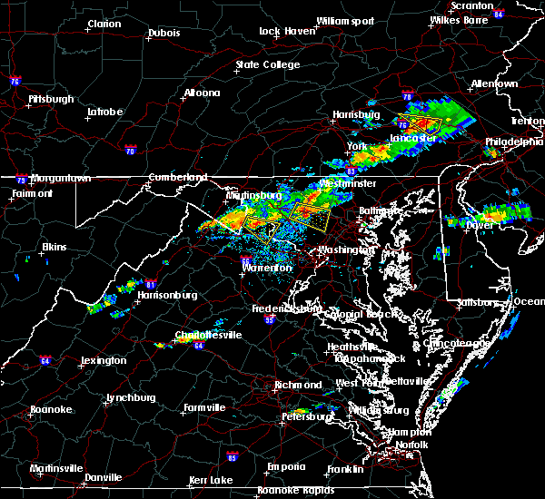 At 611 pm edt, a severe thunderstorm was located over mount airy, or near damascus, moving east at 20 mph (radar indicated). Hazards include 60 mph wind gusts and half dollar size hail. Damaging winds will cause some trees and large branches to fall. this could injure those outdoors, as well as damage homes and vehicles. roadways may become blocked by downed trees. localized power outages are possible. unsecured light objects may become projectiles. Locations impacted include, columbia, damascus, eldersburg, mount airy, sykesville, new market, green valley, highland, monrovia, clarksville, henryton, west friendship, lisbon, glenwood, dayton, gaither, watersville, poplar springs, roxbury mills and woodbine. At 611 pm edt, a severe thunderstorm was located over mount airy, or near damascus, moving east at 20 mph (radar indicated). Hazards include 60 mph wind gusts and half dollar size hail. Damaging winds will cause some trees and large branches to fall. this could injure those outdoors, as well as damage homes and vehicles. roadways may become blocked by downed trees. localized power outages are possible. unsecured light objects may become projectiles. Locations impacted include, columbia, damascus, eldersburg, mount airy, sykesville, new market, green valley, highland, monrovia, clarksville, henryton, west friendship, lisbon, glenwood, dayton, gaither, watersville, poplar springs, roxbury mills and woodbine.
|
| 8/12/2017 6:11 PM EDT | Tree down near the intersection of long corner road and gue roa in montgomery county MD, 2.8 miles SSW of Damascus, MD |
| 8/12/2017 5:56 PM EDT |
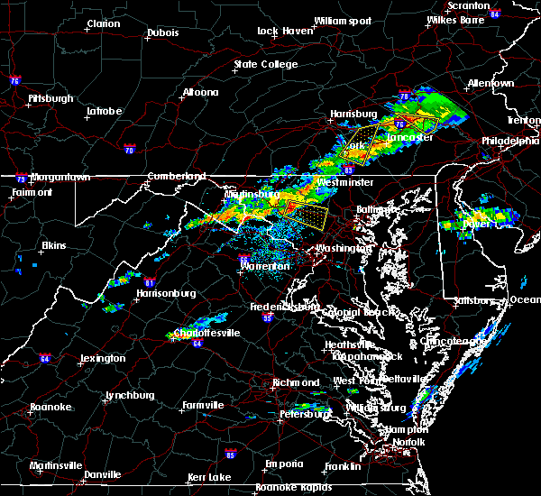 At 555 pm edt, a severe thunderstorm was located over green valley, or 7 miles north of damascus, moving east at 25 mph (radar indicated). Hazards include 60 mph wind gusts and quarter size hail. Damaging winds will cause some trees and large branches to fall. this could injure those outdoors, as well as damage homes and vehicles. roadways may become blocked by downed trees. localized power outages are possible. Unsecured light objects may become projectiles. At 555 pm edt, a severe thunderstorm was located over green valley, or 7 miles north of damascus, moving east at 25 mph (radar indicated). Hazards include 60 mph wind gusts and quarter size hail. Damaging winds will cause some trees and large branches to fall. this could injure those outdoors, as well as damage homes and vehicles. roadways may become blocked by downed trees. localized power outages are possible. Unsecured light objects may become projectiles.
|
| 7/22/2017 2:03 PM EDT |
 The national weather service in sterling virginia has issued a * severe thunderstorm warning for. south central howard county in central maryland. central montgomery county in central maryland. Until 230 pm edt * at 203 pm edt, a severe thunderstorm was located over north. The national weather service in sterling virginia has issued a * severe thunderstorm warning for. south central howard county in central maryland. central montgomery county in central maryland. Until 230 pm edt * at 203 pm edt, a severe thunderstorm was located over north.
|
| 7/17/2017 4:22 PM EDT |
 The severe thunderstorm warning for west central howard and northeastern montgomery counties will expire at 430 pm edt, the storm which prompted the warning has weakened below severe limits, and no longer pose an immediate threat to life or property. therefore the warning will be allowed to expire. however small hail and heavy rain are still possible with this thunderstorm. The severe thunderstorm warning for west central howard and northeastern montgomery counties will expire at 430 pm edt, the storm which prompted the warning has weakened below severe limits, and no longer pose an immediate threat to life or property. therefore the warning will be allowed to expire. however small hail and heavy rain are still possible with this thunderstorm.
|
| 7/17/2017 4:02 PM EDT |
 At 402 pm edt, a severe thunderstorm was located near montgomery village, or near damascus, and is nearly stationary (trained weather spotters). Hazards include 60 mph wind gusts and quarter size hail. Damaging winds will cause some trees and large branches to fall. this could injure those outdoors, as well as damage homes and vehicles. roadways may become blocked by downed trees. localized power outages are possible. unsecured light objects may become projectiles. Locations impacted include, germantown, gaithersburg, olney, damascus, montgomery village, redland, clarksburg, washington grove, laytonsville, brookeville and roxbury mills. At 402 pm edt, a severe thunderstorm was located near montgomery village, or near damascus, and is nearly stationary (trained weather spotters). Hazards include 60 mph wind gusts and quarter size hail. Damaging winds will cause some trees and large branches to fall. this could injure those outdoors, as well as damage homes and vehicles. roadways may become blocked by downed trees. localized power outages are possible. unsecured light objects may become projectiles. Locations impacted include, germantown, gaithersburg, olney, damascus, montgomery village, redland, clarksburg, washington grove, laytonsville, brookeville and roxbury mills.
|
| 7/17/2017 3:40 PM EDT |
 At 340 pm edt, a severe thunderstorm was located near montgomery village, or near damascus, and is nearly stationary (trained weather spotters). Hazards include ping pong ball size hail and 60 mph wind gusts. Damaging winds will cause some trees and large branches to fall. this could injure those outdoors, as well as damage homes and vehicles. roadways may become blocked by downed trees. localized power outages are possible. Unsecured light objects may become projectiles. At 340 pm edt, a severe thunderstorm was located near montgomery village, or near damascus, and is nearly stationary (trained weather spotters). Hazards include ping pong ball size hail and 60 mph wind gusts. Damaging winds will cause some trees and large branches to fall. this could injure those outdoors, as well as damage homes and vehicles. roadways may become blocked by downed trees. localized power outages are possible. Unsecured light objects may become projectiles.
|
| 7/17/2017 3:28 PM EDT |
 At 327 pm edt, a severe thunderstorm was located over montgomery village, or near damascus, and is nearly stationary (radar indicated). Hazards include ping pong ball size hail and 60 mph wind gusts. Damaging winds will cause some trees and large branches to fall. this could injure those outdoors, as well as damage homes and vehicles. roadways may become blocked by downed trees. localized power outages are possible. unsecured light objects may become projectiles. Locations impacted include, germantown, olney, damascus, montgomery village, redland, clarksburg, highland, laytonsville, brookeville, roxbury mills and brinklow. At 327 pm edt, a severe thunderstorm was located over montgomery village, or near damascus, and is nearly stationary (radar indicated). Hazards include ping pong ball size hail and 60 mph wind gusts. Damaging winds will cause some trees and large branches to fall. this could injure those outdoors, as well as damage homes and vehicles. roadways may become blocked by downed trees. localized power outages are possible. unsecured light objects may become projectiles. Locations impacted include, germantown, olney, damascus, montgomery village, redland, clarksburg, highland, laytonsville, brookeville, roxbury mills and brinklow.
|
| 7/17/2017 3:06 PM EDT |
 At 306 pm edt, a severe thunderstorm was located near montgomery village, or near olney, and is nearly stationary (radar indicated). Hazards include 60 mph wind gusts and quarter size hail. Damaging winds will cause some trees and large branches to fall. this could injure those outdoors, as well as damage homes and vehicles. roadways may become blocked by downed trees. localized power outages are possible. Unsecured light objects may become projectiles. At 306 pm edt, a severe thunderstorm was located near montgomery village, or near olney, and is nearly stationary (radar indicated). Hazards include 60 mph wind gusts and quarter size hail. Damaging winds will cause some trees and large branches to fall. this could injure those outdoors, as well as damage homes and vehicles. roadways may become blocked by downed trees. localized power outages are possible. Unsecured light objects may become projectiles.
|
| 7/4/2017 6:30 PM EDT |
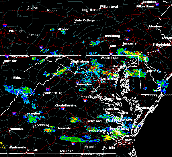 At 629 pm edt, a severe thunderstorm was located over damascus, moving southeast at 20 mph (radar indicated). Hazards include 60 mph wind gusts and quarter size hail. Damaging winds will cause some trees and large branches to fall. this could injure those outdoors, as well as damage homes and vehicles. Locations impacted include, germantown, damascus, new market, green valley, clarksburg and monrovia. At 629 pm edt, a severe thunderstorm was located over damascus, moving southeast at 20 mph (radar indicated). Hazards include 60 mph wind gusts and quarter size hail. Damaging winds will cause some trees and large branches to fall. this could injure those outdoors, as well as damage homes and vehicles. Locations impacted include, germantown, damascus, new market, green valley, clarksburg and monrovia.
|
| 7/4/2017 6:07 PM EDT |
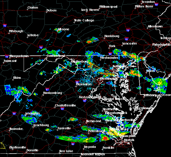 At 606 pm edt, a severe thunderstorm was located over new market, moving southeast at 20 mph (radar indicated). Hazards include 60 mph wind gusts and quarter size hail. Damaging winds will cause some trees and large branches to fall. this could injure those outdoors, as well as damage homes and vehicles. Roadways may become blocked by downed trees. At 606 pm edt, a severe thunderstorm was located over new market, moving southeast at 20 mph (radar indicated). Hazards include 60 mph wind gusts and quarter size hail. Damaging winds will cause some trees and large branches to fall. this could injure those outdoors, as well as damage homes and vehicles. Roadways may become blocked by downed trees.
|
| 6/19/2017 3:21 PM EDT |
 At 321 pm edt, severe thunderstorms were located along a line extending from near sykesville to montgomery village to countryside, moving east at 40 mph (radar indicated). Hazards include 60 mph wind gusts. Damaging winds will cause some trees and large branches to fall. this could injure those outdoors, as well as damage homes and vehicles. roadways may become blocked by downed trees. localized power outages are possible. unsecured light objects may become projectiles. Locations impacted include, columbia, germantown, rockville, gaithersburg, olney, damascus, lowes island, poolesville, ashburn, montgomery village, sterling, north potomac, redland, great falls, countryside, mount airy, boyds, green valley, clarksburg and darnestown. At 321 pm edt, severe thunderstorms were located along a line extending from near sykesville to montgomery village to countryside, moving east at 40 mph (radar indicated). Hazards include 60 mph wind gusts. Damaging winds will cause some trees and large branches to fall. this could injure those outdoors, as well as damage homes and vehicles. roadways may become blocked by downed trees. localized power outages are possible. unsecured light objects may become projectiles. Locations impacted include, columbia, germantown, rockville, gaithersburg, olney, damascus, lowes island, poolesville, ashburn, montgomery village, sterling, north potomac, redland, great falls, countryside, mount airy, boyds, green valley, clarksburg and darnestown.
|
| 6/19/2017 3:00 PM EDT |
 The national weather service in sterling virginia has issued a * severe thunderstorm warning for. south central carroll county in north central maryland. northwestern howard county in central maryland. montgomery county in central maryland. Southeastern frederick county in north central maryland. The national weather service in sterling virginia has issued a * severe thunderstorm warning for. south central carroll county in north central maryland. northwestern howard county in central maryland. montgomery county in central maryland. Southeastern frederick county in north central maryland.
|
| 6/19/2017 3:00 PM EDT |
 At 259 pm edt, a severe thunderstorm was located over leesburg, moving northeast at 40 mph (radar indicated). Hazards include 60 mph wind gusts and quarter size hail. Damaging winds will cause some trees and large branches to fall. this could injure those outdoors, as well as damage homes and vehicles. roadways may become blocked by downed trees. localized power outages are possible. Unsecured light objects may become projectiles. At 259 pm edt, a severe thunderstorm was located over leesburg, moving northeast at 40 mph (radar indicated). Hazards include 60 mph wind gusts and quarter size hail. Damaging winds will cause some trees and large branches to fall. this could injure those outdoors, as well as damage homes and vehicles. roadways may become blocked by downed trees. localized power outages are possible. Unsecured light objects may become projectiles.
|
| 5/19/2017 6:17 PM EDT |
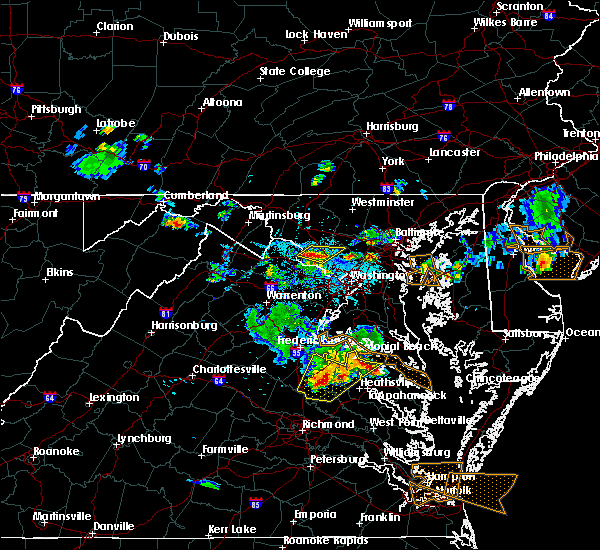 At 617 pm edt, severe thunderstorms were located along a line extending from near poolesville to near germantown, moving northeast at 20 mph (radar indicated). Hazards include 60 mph wind gusts and quarter size hail. Damaging winds will cause some trees and large branches to fall. this could injure those outdoors, as well as damage homes and vehicles. roadways may become blocked by downed trees. localized power outages are possible. Unsecured light objects may become projectiles. At 617 pm edt, severe thunderstorms were located along a line extending from near poolesville to near germantown, moving northeast at 20 mph (radar indicated). Hazards include 60 mph wind gusts and quarter size hail. Damaging winds will cause some trees and large branches to fall. this could injure those outdoors, as well as damage homes and vehicles. roadways may become blocked by downed trees. localized power outages are possible. Unsecured light objects may become projectiles.
|
| 4/6/2017 1:57 PM EDT |
 At 157 pm edt, severe thunderstorms were located along a line extending from gaithersburg to rossmoor to colesville, moving northeast at 45 mph (radar indicated). Hazards include 60 mph wind gusts. Damaging winds will cause some trees and large branches to fall. this could injure those outdoors, as well as damage homes and vehicles. roadways may become blocked by downed trees. localized power outages are possible. Unsecured light objects may become projectiles. At 157 pm edt, severe thunderstorms were located along a line extending from gaithersburg to rossmoor to colesville, moving northeast at 45 mph (radar indicated). Hazards include 60 mph wind gusts. Damaging winds will cause some trees and large branches to fall. this could injure those outdoors, as well as damage homes and vehicles. roadways may become blocked by downed trees. localized power outages are possible. Unsecured light objects may become projectiles.
|
| 4/6/2017 1:44 PM EDT |
 At 143 pm edt, severe thunderstorms were located along a line extending from near poolesville to near potomac to crystal city, moving northeast at 55 mph (radar indicated). Hazards include 60 mph wind gusts and quarter size hail. Damaging winds will cause some trees and large branches to fall. this could injure those outdoors, as well as damage homes and vehicles. roadways may become blocked by downed trees. localized power outages are possible. unsecured light objects may become projectiles. Locations impacted include, arlington, alexandria, germantown, rockville, bethesda, gaithersburg, leesburg, olney, college park, greenbelt, langley park, beltsville, damascus, lansdowne, lowes island, coral hills, bladensburg, poolesville, national harbor and mclean. At 143 pm edt, severe thunderstorms were located along a line extending from near poolesville to near potomac to crystal city, moving northeast at 55 mph (radar indicated). Hazards include 60 mph wind gusts and quarter size hail. Damaging winds will cause some trees and large branches to fall. this could injure those outdoors, as well as damage homes and vehicles. roadways may become blocked by downed trees. localized power outages are possible. unsecured light objects may become projectiles. Locations impacted include, arlington, alexandria, germantown, rockville, bethesda, gaithersburg, leesburg, olney, college park, greenbelt, langley park, beltsville, damascus, lansdowne, lowes island, coral hills, bladensburg, poolesville, national harbor and mclean.
|
| 4/6/2017 1:26 PM EDT |
 At 126 pm edt, a severe thunderstorm capable of producing a tornado was located near warrenton, moving northeast at 45 mph (radar indicated rotation). Hazards include tornado. For those in the direct path of a tornado touchdown, flying debris will be dangerous to those caught without shelter. damage to roofs, siding, and windows may occur. mobile homes may be damaged or destroyed. tree damage is likely. this dangerous storm will be near, linton hall around 135 pm edt. south riding around 145 pm edt. centreville, brambleton, dulles international airport, chantilly and arcola around 150 pm edt. broadlands around 155 pm edt. reston, herndon, lansdowne, lowes island, ashburn, sterling, great falls and countryside around 200 pm edt. Other locations impacted by this tornadic thunderstorm include catharpin, garrett park, derwood, clarksburg, woolsey, washington grove, belmont, belleview, bradley farms and kensington. At 126 pm edt, a severe thunderstorm capable of producing a tornado was located near warrenton, moving northeast at 45 mph (radar indicated rotation). Hazards include tornado. For those in the direct path of a tornado touchdown, flying debris will be dangerous to those caught without shelter. damage to roofs, siding, and windows may occur. mobile homes may be damaged or destroyed. tree damage is likely. this dangerous storm will be near, linton hall around 135 pm edt. south riding around 145 pm edt. centreville, brambleton, dulles international airport, chantilly and arcola around 150 pm edt. broadlands around 155 pm edt. reston, herndon, lansdowne, lowes island, ashburn, sterling, great falls and countryside around 200 pm edt. Other locations impacted by this tornadic thunderstorm include catharpin, garrett park, derwood, clarksburg, woolsey, washington grove, belmont, belleview, bradley farms and kensington.
|
| 4/6/2017 1:12 PM EDT |
 At 111 pm edt, severe thunderstorms were located along a line extending from near warrenton to 6 miles west of dale city to triangle, moving northeast at 50 mph (radar indicated). Hazards include 60 mph wind gusts and quarter size hail. Damaging winds will cause some trees and large branches to fall. this could injure those outdoors, as well as damage homes and vehicles. roadways may become blocked by downed trees. localized power outages are possible. Unsecured light objects may become projectiles. At 111 pm edt, severe thunderstorms were located along a line extending from near warrenton to 6 miles west of dale city to triangle, moving northeast at 50 mph (radar indicated). Hazards include 60 mph wind gusts and quarter size hail. Damaging winds will cause some trees and large branches to fall. this could injure those outdoors, as well as damage homes and vehicles. roadways may become blocked by downed trees. localized power outages are possible. Unsecured light objects may become projectiles.
|
| 3/1/2017 1:41 PM EST |
 At 140 pm est, severe thunderstorms were located along a line extending from littlestown to 6 miles northeast of mount airy to redland, moving east at 50 mph (radar indicated). Hazards include 60 mph wind gusts. Damaging winds will cause some trees and large branches to fall. this could injure those outdoors, as well as damage homes and vehicles. roadways may become blocked by downed trees. localized power outages are possible. unsecured light objects may become projectiles. Locations impacted include, columbia, germantown, rockville, gaithersburg, olney, pikesville, cockeysville, westminster, beltsville, elkridge, damascus, ellicott city, aspen hill, catonsville, woodlawn, randallstown, montgomery village, owings mills, eldersburg and milford mill. At 140 pm est, severe thunderstorms were located along a line extending from littlestown to 6 miles northeast of mount airy to redland, moving east at 50 mph (radar indicated). Hazards include 60 mph wind gusts. Damaging winds will cause some trees and large branches to fall. this could injure those outdoors, as well as damage homes and vehicles. roadways may become blocked by downed trees. localized power outages are possible. unsecured light objects may become projectiles. Locations impacted include, columbia, germantown, rockville, gaithersburg, olney, pikesville, cockeysville, westminster, beltsville, elkridge, damascus, ellicott city, aspen hill, catonsville, woodlawn, randallstown, montgomery village, owings mills, eldersburg and milford mill.
|
| 3/1/2017 1:32 PM EST | Annapolis rock road blocked due to downed tre in howard county MD, 3.6 miles WSW of Damascus, MD |
| 3/1/2017 1:32 PM EST |
 At 132 pm est, severe thunderstorms were located along a line extending from near taneytown to near new market to near north potomac, moving east at 60 mph (radar indicated). Hazards include 60 mph wind gusts. Damaging winds will cause some trees and large branches to fall. this could injure those outdoors, as well as damage homes and vehicles. roadways may become blocked by downed trees. localized power outages are possible. unsecured light objects may become projectiles. Locations impacted include, columbia, germantown, rockville, gaithersburg, olney, pikesville, cockeysville, westminster, elkridge, damascus, ellicott city, aspen hill, catonsville, woodlawn, randallstown, montgomery village, owings mills, eldersburg, milford mill and reisterstown. At 132 pm est, severe thunderstorms were located along a line extending from near taneytown to near new market to near north potomac, moving east at 60 mph (radar indicated). Hazards include 60 mph wind gusts. Damaging winds will cause some trees and large branches to fall. this could injure those outdoors, as well as damage homes and vehicles. roadways may become blocked by downed trees. localized power outages are possible. unsecured light objects may become projectiles. Locations impacted include, columbia, germantown, rockville, gaithersburg, olney, pikesville, cockeysville, westminster, elkridge, damascus, ellicott city, aspen hill, catonsville, woodlawn, randallstown, montgomery village, owings mills, eldersburg, milford mill and reisterstown.
|
| 3/1/2017 1:26 PM EST | Wires down in damascus in montgomery county MD, 1.2 miles SSE of Damascus, MD |
| 3/1/2017 1:14 PM EST |
 At 113 pm est, severe thunderstorms were located along a line extending from emmitsburg to frederick to lansdowne, moving east at 50 mph (radar indicated). Hazards include 60 mph wind gusts. Damaging winds will cause some trees and large branches to fall. this could injure those outdoors, as well as damage homes and vehicles. roadways may become blocked by downed trees. localized power outages are possible. Unsecured light objects may become projectiles. At 113 pm est, severe thunderstorms were located along a line extending from emmitsburg to frederick to lansdowne, moving east at 50 mph (radar indicated). Hazards include 60 mph wind gusts. Damaging winds will cause some trees and large branches to fall. this could injure those outdoors, as well as damage homes and vehicles. roadways may become blocked by downed trees. localized power outages are possible. Unsecured light objects may become projectiles.
|
| 2/12/2017 10:47 PM EST |
 At 1046 pm est, severe thunderstorms were located along a line extending from near hampstead to near damascus, moving east at 55 mph (radar indicated). Hazards include 60 mph wind gusts. Damaging winds will cause some trees and large branches to fall. this could injure those outdoors, as well as damage homes and vehicles. roadways may become blocked by downed trees. localized power outages are possible. unsecured light objects may become projectiles. Locations impacted include, baltimore, columbia, germantown, severn, olney, pikesville, middle river, cockeysville, elkridge, damascus, aberdeen, havre de grace, riviera beach, aberdeen proving ground, baltimore-washington airport, fort smallwood state park, gibson island, sillery bay, millers island and north point state park. At 1046 pm est, severe thunderstorms were located along a line extending from near hampstead to near damascus, moving east at 55 mph (radar indicated). Hazards include 60 mph wind gusts. Damaging winds will cause some trees and large branches to fall. this could injure those outdoors, as well as damage homes and vehicles. roadways may become blocked by downed trees. localized power outages are possible. unsecured light objects may become projectiles. Locations impacted include, baltimore, columbia, germantown, severn, olney, pikesville, middle river, cockeysville, elkridge, damascus, aberdeen, havre de grace, riviera beach, aberdeen proving ground, baltimore-washington airport, fort smallwood state park, gibson island, sillery bay, millers island and north point state park.
|
| 2/12/2017 10:29 PM EST |
 At 1029 pm est, severe thunderstorms were located along a line extending from near littlestown to near point of rocks, moving east at 55 mph (radar indicated). Hazards include 60 mph wind gusts. Damaging winds will cause some trees and large branches to fall. this could injure those outdoors, as well as damage homes and vehicles. roadways may become blocked by downed trees. localized power outages are possible. Unsecured light objects may become projectiles. At 1029 pm est, severe thunderstorms were located along a line extending from near littlestown to near point of rocks, moving east at 55 mph (radar indicated). Hazards include 60 mph wind gusts. Damaging winds will cause some trees and large branches to fall. this could injure those outdoors, as well as damage homes and vehicles. roadways may become blocked by downed trees. localized power outages are possible. Unsecured light objects may become projectiles.
|
| 8/31/2016 11:18 PM EDT |
 At 1117 pm edt, a severe thunderstorm was located near sykesville, or 8 miles northwest of columbia, moving east at 25 mph (radar indicated). Hazards include 60 mph wind gusts. Damaging winds will cause some trees and large branches to fall. this could injure those outdoors, as well as damage homes and vehicles. roadways may become blocked by downed trees. localized power outages are possible. unsecured light objects may become projectiles. Locations impacted include, columbia, olney, damascus, ellicott city, cloverly, clarksburg, spencerville, highland, laytonsville, brookeville, glenelg, brinklow, roxbury mills, clarksville, sandy spring, dayton, ednor, west friendship, glenwood and ashton. At 1117 pm edt, a severe thunderstorm was located near sykesville, or 8 miles northwest of columbia, moving east at 25 mph (radar indicated). Hazards include 60 mph wind gusts. Damaging winds will cause some trees and large branches to fall. this could injure those outdoors, as well as damage homes and vehicles. roadways may become blocked by downed trees. localized power outages are possible. unsecured light objects may become projectiles. Locations impacted include, columbia, olney, damascus, ellicott city, cloverly, clarksburg, spencerville, highland, laytonsville, brookeville, glenelg, brinklow, roxbury mills, clarksville, sandy spring, dayton, ednor, west friendship, glenwood and ashton.
|
| 8/31/2016 11:04 PM EDT |
 At 1048 pm edt, a severe thunderstorm was located near green valley, or near damascus, moving east at 20 mph (radar indicated). Hazards include 60 mph wind gusts. Damaging winds will cause some trees and large branches to fall. this could injure those outdoors, as well as damage homes and vehicles. roadways may become blocked by downed trees. localized power outages are possible. Unsecured light objects may become projectiles. At 1048 pm edt, a severe thunderstorm was located near green valley, or near damascus, moving east at 20 mph (radar indicated). Hazards include 60 mph wind gusts. Damaging winds will cause some trees and large branches to fall. this could injure those outdoors, as well as damage homes and vehicles. roadways may become blocked by downed trees. localized power outages are possible. Unsecured light objects may become projectiles.
|
| 8/31/2016 10:48 PM EDT |
 At 1048 pm edt, a severe thunderstorm was located near green valley, or near damascus, moving east at 20 mph (radar indicated). Hazards include 60 mph wind gusts. Damaging winds will cause some trees and large branches to fall. this could injure those outdoors, as well as damage homes and vehicles. roadways may become blocked by downed trees. localized power outages are possible. Unsecured light objects may become projectiles. At 1048 pm edt, a severe thunderstorm was located near green valley, or near damascus, moving east at 20 mph (radar indicated). Hazards include 60 mph wind gusts. Damaging winds will cause some trees and large branches to fall. this could injure those outdoors, as well as damage homes and vehicles. roadways may become blocked by downed trees. localized power outages are possible. Unsecured light objects may become projectiles.
|
| 8/14/2016 8:08 PM EDT |
 The severe thunderstorm warning for central howard and montgomery counties will expire at 815 pm edt, the storm which prompted the warning has moved out of the area. therefore the warning will be allowed to expire. however gusty winds and heavy rain are still possible with this thunderstorm. The severe thunderstorm warning for central howard and montgomery counties will expire at 815 pm edt, the storm which prompted the warning has moved out of the area. therefore the warning will be allowed to expire. however gusty winds and heavy rain are still possible with this thunderstorm.
|
| 8/14/2016 7:40 PM EDT |
 The severe thunderstorm warning for northwestern montgomery county in central maryland, southeastern frederick county in north central maryland and northeastern loudoun counties in northern virginia will expire at 745 pm edt, the storm which prompted the warning has moved out of the area. therefore the warning will be allowed to expire. remember, a severe thunderstorm warning still remains in effect for montgomery county. The severe thunderstorm warning for northwestern montgomery county in central maryland, southeastern frederick county in north central maryland and northeastern loudoun counties in northern virginia will expire at 745 pm edt, the storm which prompted the warning has moved out of the area. therefore the warning will be allowed to expire. remember, a severe thunderstorm warning still remains in effect for montgomery county.
|
| 8/14/2016 7:38 PM EDT |
 At 738 pm edt, severe thunderstorms were located along a line extending from damascus to germantown to countryside, moving southeast at 35 mph (radar indicated). Hazards include 60 mph wind gusts. Damaging winds will cause some trees and large branches to fall. this could injure those outdoors, as well as damage homes and vehicles. roadways may become blocked by downed trees. localized power outages are possible. Unsecured light objects may become projectiles. At 738 pm edt, severe thunderstorms were located along a line extending from damascus to germantown to countryside, moving southeast at 35 mph (radar indicated). Hazards include 60 mph wind gusts. Damaging winds will cause some trees and large branches to fall. this could injure those outdoors, as well as damage homes and vehicles. roadways may become blocked by downed trees. localized power outages are possible. Unsecured light objects may become projectiles.
|
| 8/14/2016 7:32 PM EDT |
 At 732 pm edt, a severe thunderstorm was located near boyds, or near germantown, moving northeast at 20 mph (radar indicated). Hazards include 60 mph wind gusts. Damaging winds will cause some trees and large branches to fall. this could injure those outdoors, as well as damage homes and vehicles. roadways may become blocked by downed trees. localized power outages are possible. unsecured light objects may become projectiles. Locations impacted include, germantown, gaithersburg, leesburg, damascus, lansdowne, poolesville, montgomery village, boyds, clarksburg, darnestown, washington grove, barnesville, dickerson, tuscarora, beallsville, dawsonville and lucketts. At 732 pm edt, a severe thunderstorm was located near boyds, or near germantown, moving northeast at 20 mph (radar indicated). Hazards include 60 mph wind gusts. Damaging winds will cause some trees and large branches to fall. this could injure those outdoors, as well as damage homes and vehicles. roadways may become blocked by downed trees. localized power outages are possible. unsecured light objects may become projectiles. Locations impacted include, germantown, gaithersburg, leesburg, damascus, lansdowne, poolesville, montgomery village, boyds, clarksburg, darnestown, washington grove, barnesville, dickerson, tuscarora, beallsville, dawsonville and lucketts.
|
| 8/14/2016 7:18 PM EDT |
 At 718 pm edt, a severe thunderstorm was located over round hill, or 10 miles west of leesburg, moving east at 35 mph (radar indicated). Hazards include 60 mph wind gusts. Damaging winds will cause some trees and large branches to fall. this could injure those outdoors, as well as damage homes and vehicles. roadways may become blocked by downed trees. localized power outages are possible. Unsecured light objects may become projectiles. At 718 pm edt, a severe thunderstorm was located over round hill, or 10 miles west of leesburg, moving east at 35 mph (radar indicated). Hazards include 60 mph wind gusts. Damaging winds will cause some trees and large branches to fall. this could injure those outdoors, as well as damage homes and vehicles. roadways may become blocked by downed trees. localized power outages are possible. Unsecured light objects may become projectiles.
|
| 6/28/2016 4:41 PM EDT |
 At 441 pm edt, a severe thunderstorm was located near new market, or 8 miles east of frederick, moving southeast at 20 mph (radar indicated). Hazards include 60 mph wind gusts. Damaging winds will cause some trees and large branches to fall. this could injure those outdoors, as well as damage homes and vehicles. roadways may become blocked by downed trees. localized power outages are possible. Unsecured light objects may become projectiles. At 441 pm edt, a severe thunderstorm was located near new market, or 8 miles east of frederick, moving southeast at 20 mph (radar indicated). Hazards include 60 mph wind gusts. Damaging winds will cause some trees and large branches to fall. this could injure those outdoors, as well as damage homes and vehicles. roadways may become blocked by downed trees. localized power outages are possible. Unsecured light objects may become projectiles.
|
| 6/21/2016 8:06 PM EDT |
 The severe thunderstorm warning for south central carroll county in north central maryland, northwestern howard, northwestern montgomery counties in central maryland and southeastern frederick counties in north central maryland will expire at 815 pm edt, the storm which prompted the warning has weakened and exited the warned area. therefore the warning will be allowed to expire. however small hail and gusty winds are still possible with this thunderstorm. a severe thunderstorm watch remains in effect until 900 pm edt for north central maryland. The severe thunderstorm warning for south central carroll county in north central maryland, northwestern howard, northwestern montgomery counties in central maryland and southeastern frederick counties in north central maryland will expire at 815 pm edt, the storm which prompted the warning has weakened and exited the warned area. therefore the warning will be allowed to expire. however small hail and gusty winds are still possible with this thunderstorm. a severe thunderstorm watch remains in effect until 900 pm edt for north central maryland.
|
| 6/21/2016 7:54 PM EDT |
 At 754 pm edt, a severe thunderstorm was located near green valley, or near damascus, moving southeast at 35 mph (radar indicated). Hazards include 60 mph wind gusts and quarter size hail. Damaging winds will cause some trees and large branches to fall. this could injure those outdoors, as well as damage homes and vehicles. roadways may become blocked by downed trees. localized power outages are possible. unsecured light objects may become projectiles. Locations impacted include, germantown, gaithersburg, damascus, montgomery village, north potomac, ballenger creek, redland, mount airy, new market, boyds, green valley, linganore-bartonsville, clarksburg, darnestown, adamstown, buckeystown, washington grove, monrovia, laytonsville and barnesville. At 754 pm edt, a severe thunderstorm was located near green valley, or near damascus, moving southeast at 35 mph (radar indicated). Hazards include 60 mph wind gusts and quarter size hail. Damaging winds will cause some trees and large branches to fall. this could injure those outdoors, as well as damage homes and vehicles. roadways may become blocked by downed trees. localized power outages are possible. unsecured light objects may become projectiles. Locations impacted include, germantown, gaithersburg, damascus, montgomery village, north potomac, ballenger creek, redland, mount airy, new market, boyds, green valley, linganore-bartonsville, clarksburg, darnestown, adamstown, buckeystown, washington grove, monrovia, laytonsville and barnesville.
|
| 6/21/2016 7:46 PM EDT |
 At 746 pm edt, a severe thunderstorm was located over ballenger creek, or near harry grove stadium, moving southeast at 35 mph (radar indicated. at 743 pm...trained spotters reported golf ball size hail near ballenger creek). Hazards include golf ball size hail and 70 mph wind gusts. Expect wind damage to trees and power lines. hail is large enough to dent and damage vehicles. some hail damage to roofs, siding, and windows is possible. Locations impacted include, germantown, frederick, gaithersburg, damascus, montgomery village, eldersburg, north potomac, ballenger creek, redland, mount airy, new market, boyds, green valley, point of rocks, linganore-bartonsville, clarksburg, darnestown, adamstown, buckeystown and washington grove. At 746 pm edt, a severe thunderstorm was located over ballenger creek, or near harry grove stadium, moving southeast at 35 mph (radar indicated. at 743 pm...trained spotters reported golf ball size hail near ballenger creek). Hazards include golf ball size hail and 70 mph wind gusts. Expect wind damage to trees and power lines. hail is large enough to dent and damage vehicles. some hail damage to roofs, siding, and windows is possible. Locations impacted include, germantown, frederick, gaithersburg, damascus, montgomery village, eldersburg, north potomac, ballenger creek, redland, mount airy, new market, boyds, green valley, point of rocks, linganore-bartonsville, clarksburg, darnestown, adamstown, buckeystown and washington grove.
|
| 6/21/2016 7:31 PM EDT |
 At 731 pm edt, a severe thunderstorm was located over braddock heights, or near harry grove stadium, moving southeast at 35 mph (radar indicated). Hazards include golf ball size hail and 60 mph wind gusts. Expect wind damage to trees and power lines. hail is large enough to dent and damage vehicles. Some hail damage to roofs, siding, and windows is possible. At 731 pm edt, a severe thunderstorm was located over braddock heights, or near harry grove stadium, moving southeast at 35 mph (radar indicated). Hazards include golf ball size hail and 60 mph wind gusts. Expect wind damage to trees and power lines. hail is large enough to dent and damage vehicles. Some hail damage to roofs, siding, and windows is possible.
|
| 6/21/2016 5:53 PM EDT |
 The severe thunderstorm warning for southwestern baltimore county in northern maryland, southeastern carroll county in north central maryland, northern howard, north central montgomery counties in central maryland and southeastern frederick counties in north central maryland will expire at 600 pm edt, the storm which prompted the warning has weakened and exited the warned area. therefore the warning will be allowed to expire. however gusty winds and heavy rainfall are still possible with this thunderstorm. a severe thunderstorm watch remains in effect until 900 pm edt for northern maryland. The severe thunderstorm warning for southwestern baltimore county in northern maryland, southeastern carroll county in north central maryland, northern howard, north central montgomery counties in central maryland and southeastern frederick counties in north central maryland will expire at 600 pm edt, the storm which prompted the warning has weakened and exited the warned area. therefore the warning will be allowed to expire. however gusty winds and heavy rainfall are still possible with this thunderstorm. a severe thunderstorm watch remains in effect until 900 pm edt for northern maryland.
|
| 6/21/2016 5:38 PM EDT |
 At 538 pm edt, a severe thunderstorm was located over mount airy, or near damascus, moving east at 35 mph (radar indicated). Hazards include 60 mph wind gusts. Damaging winds will cause some trees and large branches to fall. this could injure those outdoors, as well as damage homes and vehicles. roadways may become blocked by downed trees. localized power outages are possible. unsecured light objects may become projectiles. Locations impacted include, damascus, ellicott city, catonsville, woodlawn, randallstown, owings mills, eldersburg, milford mill, mount airy, sykesville, oakland, gamber, clarksburg, glenelg, louisville, watersville, finksburg, gaither, carrolltowne and west friendship. At 538 pm edt, a severe thunderstorm was located over mount airy, or near damascus, moving east at 35 mph (radar indicated). Hazards include 60 mph wind gusts. Damaging winds will cause some trees and large branches to fall. this could injure those outdoors, as well as damage homes and vehicles. roadways may become blocked by downed trees. localized power outages are possible. unsecured light objects may become projectiles. Locations impacted include, damascus, ellicott city, catonsville, woodlawn, randallstown, owings mills, eldersburg, milford mill, mount airy, sykesville, oakland, gamber, clarksburg, glenelg, louisville, watersville, finksburg, gaither, carrolltowne and west friendship.
|
| 6/21/2016 5:17 PM EDT |
 At 517 pm edt, a severe thunderstorm was located near ballenger creek, or 7 miles south of harry grove stadium, moving east at 35 mph (radar indicated). Hazards include 60 mph wind gusts and half dollar size hail. Damaging winds will cause some trees and large branches to fall. this could injure those outdoors, as well as damage homes and vehicles. roadways may become blocked by downed trees. localized power outages are possible. Unsecured light objects may become projectiles. At 517 pm edt, a severe thunderstorm was located near ballenger creek, or 7 miles south of harry grove stadium, moving east at 35 mph (radar indicated). Hazards include 60 mph wind gusts and half dollar size hail. Damaging winds will cause some trees and large branches to fall. this could injure those outdoors, as well as damage homes and vehicles. roadways may become blocked by downed trees. localized power outages are possible. Unsecured light objects may become projectiles.
|
| 6/21/2016 1:40 PM EDT |
 At 139 pm edt, severe thunderstorms were located along a line extending from gamber to near damascus, moving southeast at 30 mph. these are very dangerous storms (radar indicated). Hazards include 80 mph wind gusts and half dollar size hail. Expect considerable damage to trees and power lines. your life is at significant risk if outdoors. in addition to some trees falling into homes, wind damage is possible to roofs, sheds, open garages, and mobile homes. Locations impacted include, baltimore, columbia, germantown, rockville, gaithersburg, bowie, severn, olney, pikesville, college park, crofton, middle river, greenbelt, langley park, beltsville, elkridge, damascus, riviera beach, bladensburg and back river. At 139 pm edt, severe thunderstorms were located along a line extending from gamber to near damascus, moving southeast at 30 mph. these are very dangerous storms (radar indicated). Hazards include 80 mph wind gusts and half dollar size hail. Expect considerable damage to trees and power lines. your life is at significant risk if outdoors. in addition to some trees falling into homes, wind damage is possible to roofs, sheds, open garages, and mobile homes. Locations impacted include, baltimore, columbia, germantown, rockville, gaithersburg, bowie, severn, olney, pikesville, college park, crofton, middle river, greenbelt, langley park, beltsville, elkridge, damascus, riviera beach, bladensburg and back river.
|
| 6/21/2016 1:30 PM EDT |
 At 130 pm edt, severe thunderstorms were located along a line extending from near gamber to 6 miles southwest of green valley, moving southeast at 30 mph (radar indicated). Hazards include 70 mph wind gusts and quarter size hail. Damaging winds will cause some trees and large branches to fall. this could injure those outdoors, as well as damage homes and vehicles. roadways may become blocked by downed trees. localized power outages are possible. unsecured light objects may become projectiles. Locations impacted include, baltimore, columbia, germantown, rockville, gaithersburg, bowie, severn, olney, pikesville, college park, crofton, middle river, greenbelt, langley park, beltsville, elkridge, damascus, riviera beach, bladensburg and back river. At 130 pm edt, severe thunderstorms were located along a line extending from near gamber to 6 miles southwest of green valley, moving southeast at 30 mph (radar indicated). Hazards include 70 mph wind gusts and quarter size hail. Damaging winds will cause some trees and large branches to fall. this could injure those outdoors, as well as damage homes and vehicles. roadways may become blocked by downed trees. localized power outages are possible. unsecured light objects may become projectiles. Locations impacted include, baltimore, columbia, germantown, rockville, gaithersburg, bowie, severn, olney, pikesville, college park, crofton, middle river, greenbelt, langley park, beltsville, elkridge, damascus, riviera beach, bladensburg and back river.
|
| 6/21/2016 1:19 PM EDT |
 At 118 pm edt, severe thunderstorms were located along a line extending from near gamber to near ballenger creek, moving southeast at 30 mph (radar indicated). Hazards include 60 mph wind gusts. frequent lightning is also occurring with this storm. Damaging winds will cause some trees and large branches to fall. this could injure those outdoors, as well as damage homes and vehicles. roadways may become blocked by downed trees. localized power outages are possible. Unsecured light objects may become projectiles. At 118 pm edt, severe thunderstorms were located along a line extending from near gamber to near ballenger creek, moving southeast at 30 mph (radar indicated). Hazards include 60 mph wind gusts. frequent lightning is also occurring with this storm. Damaging winds will cause some trees and large branches to fall. this could injure those outdoors, as well as damage homes and vehicles. roadways may become blocked by downed trees. localized power outages are possible. Unsecured light objects may become projectiles.
|
| 6/21/2016 1:00 PM EDT | Trees and wires down blocking barnesville road in montgomery county MD, 3.9 miles SE of Damascus, MD |
| 6/5/2016 4:24 PM EDT |
 The severe thunderstorm warning for baltimore county in northern maryland, carroll county in north central maryland, howard county in central maryland, northwestern harford county in northern maryland, northern montgomery county in central maryland and southeastern frederick counties in north central maryland and baltimore city will expire at 430 pm edt, the storms which prompted the warning have moved out of the area. therefore the warning will be allowed to expire. however gusty winds and heavy rain are still possible with these thunderstorms. a severe thunderstorm watch remains in effect until 1000 pm edt for northern maryland, and northern virginia. The severe thunderstorm warning for baltimore county in northern maryland, carroll county in north central maryland, howard county in central maryland, northwestern harford county in northern maryland, northern montgomery county in central maryland and southeastern frederick counties in north central maryland and baltimore city will expire at 430 pm edt, the storms which prompted the warning have moved out of the area. therefore the warning will be allowed to expire. however gusty winds and heavy rain are still possible with these thunderstorms. a severe thunderstorm watch remains in effect until 1000 pm edt for northern maryland, and northern virginia.
|
| 6/5/2016 4:22 PM EDT |
 At 422 pm edt, severe thunderstorms were located along a line extending from near stewartstown to near cockeysville to near montgomery village, moving east at 50 mph (radar indicated). Hazards include 60 mph wind gusts. Damaging winds will cause some trees and large branches to fall. this could injure those outdoors, as well as damage homes and vehicles. roadways may become blocked by downed trees. localized power outages are possible. Unsecured light objects may become projectiles. At 422 pm edt, severe thunderstorms were located along a line extending from near stewartstown to near cockeysville to near montgomery village, moving east at 50 mph (radar indicated). Hazards include 60 mph wind gusts. Damaging winds will cause some trees and large branches to fall. this could injure those outdoors, as well as damage homes and vehicles. roadways may become blocked by downed trees. localized power outages are possible. Unsecured light objects may become projectiles.
|
| 6/5/2016 3:52 PM EDT |
 At 351 pm edt, severe thunderstorms were located along a line extending from near littlestown to near mount airy to near point of rocks, moving east at 40 mph (radar indicated). Hazards include 60 mph wind gusts. Damaging winds will cause some trees and large branches to fall. this could injure those outdoors, as well as damage homes and vehicles. roadways may become blocked by downed trees. localized power outages are possible. Unsecured light objects may become projectiles. At 351 pm edt, severe thunderstorms were located along a line extending from near littlestown to near mount airy to near point of rocks, moving east at 40 mph (radar indicated). Hazards include 60 mph wind gusts. Damaging winds will cause some trees and large branches to fall. this could injure those outdoors, as well as damage homes and vehicles. roadways may become blocked by downed trees. localized power outages are possible. Unsecured light objects may become projectiles.
|
| 4/1/2016 4:49 PM EDT |
 At 449 pm edt, doppler radar indicated a severe thunderstorm capable of producing quarter size hail and damaging winds in excess of 60 mph. this storm was located near point of rocks, or 7 miles southwest of harry grove stadium, and moving northeast at 55 mph. At 449 pm edt, doppler radar indicated a severe thunderstorm capable of producing quarter size hail and damaging winds in excess of 60 mph. this storm was located near point of rocks, or 7 miles southwest of harry grove stadium, and moving northeast at 55 mph.
|
| 2/24/2016 5:54 PM EST |
 At 554 pm est, doppler radar indicated a line of severe thunderstorms capable of producing damaging winds in excess of 60 mph. these storms were located along a line extending from near littlestown to montgomery village, moving east at 50 mph. locations impacted include, baltimore, rockville, gaithersburg, westminster, aberdeen, bel air, union square, guilford, howard park, olney, baltimore inner harbor, damascus, locust point, camden yards, germantown, gwynns falls, clifton park, roland park, fallstaff and cockeysville. a tornado watch remains in effect until 1100 pm est for northern maryland. At 554 pm est, doppler radar indicated a line of severe thunderstorms capable of producing damaging winds in excess of 60 mph. these storms were located along a line extending from near littlestown to montgomery village, moving east at 50 mph. locations impacted include, baltimore, rockville, gaithersburg, westminster, aberdeen, bel air, union square, guilford, howard park, olney, baltimore inner harbor, damascus, locust point, camden yards, germantown, gwynns falls, clifton park, roland park, fallstaff and cockeysville. a tornado watch remains in effect until 1100 pm est for northern maryland.
|
| 2/24/2016 5:50 PM EST | Many trees toppled in the preakness drive/sweepstakes in montgomery county MD, 1.2 miles SSE of Damascus, MD |
| 2/24/2016 5:46 PM EST |
 At 545 pm est, doppler radar indicated a line of severe thunderstorms capable of producing damaging winds in excess of 60 mph. these storms were located along a line extending from near littlestown to near damascus, and moving northeast at 50 mph. At 545 pm est, doppler radar indicated a line of severe thunderstorms capable of producing damaging winds in excess of 60 mph. these storms were located along a line extending from near littlestown to near damascus, and moving northeast at 50 mph.
|
| 2/24/2016 5:28 PM EST | The severe thunderstorm warning for western carroll county in north central maryland, western howard and northwestern montgomery counties in central maryland, frederick county in north central maryland and northeastern loudoun counties in northern virginia will expire at 530 pm est, the storms which prompted the warning have weakened below severe limits and exited the warned area. therefore the warning will be allowed to expire. additional severe thunderstorm development remains possible, and a tornado watch remains in effect until 11 pm est. |
| 2/24/2016 5:28 PM EST | The severe thunderstorm warning for western carroll county in north central maryland, western howard and northwestern montgomery counties in central maryland, frederick county in north central maryland and northeastern loudoun counties in northern virginia will expire at 530 pm est, the storms which prompted the warning have weakened below severe limits and exited the warned area. therefore the warning will be allowed to expire. additional severe thunderstorm development remains possible, and a tornado watch remains in effect until 11 pm est. |
| 2/24/2016 5:15 PM EST |
 At 515 pm est, doppler radar indicated a line of severe thunderstorms capable of producing quarter size hail and damaging winds in excess of 60 mph. these storms were located along a line extending from near wolfsville to lansdowne, moving northeast at 40 mph. locations impacted include, frederick, rockville, gaithersburg, thurmont, poolesville, germantown, harry grove stadium, damascus, lowes island, lansdowne, mount airy, walkersville, new market, montgomery village, boyds, clover hill, linganore-bartonsville, north potomac, ballenger creek and discovery-spring garden. a tornado watch remains in effect until 1100 pm est for north central maryland and northern virginia. At 515 pm est, doppler radar indicated a line of severe thunderstorms capable of producing quarter size hail and damaging winds in excess of 60 mph. these storms were located along a line extending from near wolfsville to lansdowne, moving northeast at 40 mph. locations impacted include, frederick, rockville, gaithersburg, thurmont, poolesville, germantown, harry grove stadium, damascus, lowes island, lansdowne, mount airy, walkersville, new market, montgomery village, boyds, clover hill, linganore-bartonsville, north potomac, ballenger creek and discovery-spring garden. a tornado watch remains in effect until 1100 pm est for north central maryland and northern virginia.
|
| 2/24/2016 5:01 PM EST |
 At 500 pm est, doppler radar indicated a line of severe thunderstorms capable of producing quarter size hail and damaging winds in excess of 60 mph. these storms were located along a line extending from near boonsboro to near oatlands, moving northeast at 40 mph. locations impacted include, frederick, rockville, gaithersburg, leesburg, thurmont, poolesville, germantown, harry grove stadium, damascus, lowes island, lansdowne, mount airy, purcellville, brunswick, walkersville, boonsboro, new market, montgomery village, boyds and mount lena. a tornado watch remains in effect until 1100 pm est for north central maryland and northern virginia. At 500 pm est, doppler radar indicated a line of severe thunderstorms capable of producing quarter size hail and damaging winds in excess of 60 mph. these storms were located along a line extending from near boonsboro to near oatlands, moving northeast at 40 mph. locations impacted include, frederick, rockville, gaithersburg, leesburg, thurmont, poolesville, germantown, harry grove stadium, damascus, lowes island, lansdowne, mount airy, purcellville, brunswick, walkersville, boonsboro, new market, montgomery village, boyds and mount lena. a tornado watch remains in effect until 1100 pm est for north central maryland and northern virginia.
|
| 2/24/2016 4:51 PM EST |
 At 451 pm est, doppler radar indicated a line of severe thunderstorms capable of producing quarter size hail and damaging winds in excess of 60 mph. these storms were located along a line extending from near shepherdstown to middleburg, and moving northeast at 40 mph. At 451 pm est, doppler radar indicated a line of severe thunderstorms capable of producing quarter size hail and damaging winds in excess of 60 mph. these storms were located along a line extending from near shepherdstown to middleburg, and moving northeast at 40 mph.
|
| 8/4/2015 5:07 AM EDT |
 The severe thunderstorm warning for southeastern frederick, central montgomery, south central carroll and western howard counties will expire at 515 am edt, the storm which prompted the warning has moved out of the area. therefore the warning will be allowed to expire. The severe thunderstorm warning for southeastern frederick, central montgomery, south central carroll and western howard counties will expire at 515 am edt, the storm which prompted the warning has moved out of the area. therefore the warning will be allowed to expire.
|
| 8/4/2015 4:51 AM EDT |
 At 451 am edt, doppler radar indicated a severe thunderstorm capable of producing quarter size hail and damaging winds in excess of 60 mph. this storm was located over montgomery village, or near damascus, moving east at 40 mph. locations impacted include, rockville, gaithersburg, germantown, damascus, olney, mount airy, sykesville, new market, rossmoor, eldersburg, montgomery village, boyds, green valley, wheaton-glenmont, redland, aspen hill, colesville, linganore-bartonsville, kemp mill and north potomac. At 451 am edt, doppler radar indicated a severe thunderstorm capable of producing quarter size hail and damaging winds in excess of 60 mph. this storm was located over montgomery village, or near damascus, moving east at 40 mph. locations impacted include, rockville, gaithersburg, germantown, damascus, olney, mount airy, sykesville, new market, rossmoor, eldersburg, montgomery village, boyds, green valley, wheaton-glenmont, redland, aspen hill, colesville, linganore-bartonsville, kemp mill and north potomac.
|
| 8/4/2015 4:44 AM EDT | Wires down 3800 blk purdum dr in frederick county MD, 5.3 miles S of Damascus, MD |
| 8/4/2015 4:37 AM EDT | Tree down near kings valley road and hailey driv in montgomery county MD, 1.9 miles E of Damascus, MD |
| 8/4/2015 4:22 AM EDT |
 At 421 am edt, doppler radar indicated a severe thunderstorm capable of producing quarter size hail and damaging winds in excess of 60 mph. this storm was located over point of rocks, or 9 miles north of leesburg, and moving east at 40 mph. At 421 am edt, doppler radar indicated a severe thunderstorm capable of producing quarter size hail and damaging winds in excess of 60 mph. this storm was located over point of rocks, or 9 miles north of leesburg, and moving east at 40 mph.
|
| 6/23/2015 6:18 PM EDT |
 At 618 pm edt, doppler radar indicated a line of severe thunderstorms capable of producing quarter size hail and destructive winds in excess of 70 mph. these storms were located along a line extending from near westminster to near purcellville, moving east at 25 mph. locations impacted include, rockville, gaithersburg, leesburg, college park, greenbelt, poolesville, crofton, severn, elkridge, broadlands, olney, damascus, lowes island, lansdowne, langley park, germantown, columbia, byrd stadium, beltsville and baltimore-washington airport. At 618 pm edt, doppler radar indicated a line of severe thunderstorms capable of producing quarter size hail and destructive winds in excess of 70 mph. these storms were located along a line extending from near westminster to near purcellville, moving east at 25 mph. locations impacted include, rockville, gaithersburg, leesburg, college park, greenbelt, poolesville, crofton, severn, elkridge, broadlands, olney, damascus, lowes island, lansdowne, langley park, germantown, columbia, byrd stadium, beltsville and baltimore-washington airport.
|
| 6/23/2015 6:04 PM EDT | Storm damage reported in montgomery county MD, 1.5 miles ESE of Damascus, MD |
| 6/23/2015 6:01 PM EDT |
 At 600 pm edt, doppler radar indicated a line of severe thunderstorms capable of producing quarter size hail and destructive winds in excess of 70 mph. these storms were located along a line extending from near westminster to round hill, and moving east at 25 mph. At 600 pm edt, doppler radar indicated a line of severe thunderstorms capable of producing quarter size hail and destructive winds in excess of 70 mph. these storms were located along a line extending from near westminster to round hill, and moving east at 25 mph.
|
| 6/23/2015 5:52 PM EDT | Tree down on valley park road in montgomery county MD, 1.2 miles SSE of Damascus, MD |
| 6/23/2015 5:46 PM EDT |
 At 546 pm edt, doppler radar indicated a severe thunderstorm capable of producing quarter size hail and damaging winds in excess of 60 mph. this storm was located over green valley, or near damascus, moving east at 20 mph. locations impacted include, frederick, damascus, harry grove stadium, new market, ballenger creek, linganore-bartonsville, green valley, clover hill, discovery-spring garden, mount pleasant, ijamsville, adamstown, doubs, friendship, monrovia, buckeystown and park mills. At 546 pm edt, doppler radar indicated a severe thunderstorm capable of producing quarter size hail and damaging winds in excess of 60 mph. this storm was located over green valley, or near damascus, moving east at 20 mph. locations impacted include, frederick, damascus, harry grove stadium, new market, ballenger creek, linganore-bartonsville, green valley, clover hill, discovery-spring garden, mount pleasant, ijamsville, adamstown, doubs, friendship, monrovia, buckeystown and park mills.
|
| 6/23/2015 5:27 PM EDT |
 At 526 pm edt, doppler radar indicated a severe thunderstorm capable of producing quarter size hail and damaging winds in excess of 60 mph. this storm was located near ballenger creek, or near harry grove stadium, and moving east at 20 mph. At 526 pm edt, doppler radar indicated a severe thunderstorm capable of producing quarter size hail and damaging winds in excess of 60 mph. this storm was located near ballenger creek, or near harry grove stadium, and moving east at 20 mph.
|
| 6/20/2015 8:10 PM EDT |
 At 810 pm edt, trained weather spotters reported a line of severe thunderstorms producing damaging winds in excess of 60 mph. these storms were located along a line extending from damascus to rosslyn to near nanjemoy creek, and moving east at 45 mph. At 810 pm edt, trained weather spotters reported a line of severe thunderstorms producing damaging winds in excess of 60 mph. these storms were located along a line extending from damascus to rosslyn to near nanjemoy creek, and moving east at 45 mph.
|
| 6/18/2015 4:26 PM EDT | At 425 pm edt, doppler radar indicated a line of severe thunderstorms capable of producing damaging winds in excess of 60 mph. these storms were located along a line extending from near boyds to montgomery village to 7 miles north of olney, moving southeast at 30 mph. locations impacted include, gaithersburg, damascus, germantown, olney, montgomery village, boyds, redland, washington grove, laytonsville, brookeville, roxbury mills, dayton and clarksburg. |
| 6/18/2015 4:14 PM EDT | At 413 pm edt, doppler radar indicated a line of severe thunderstorms capable of producing quarter size hail and destructive winds in excess of 70 mph. these storms were located along a line extending from near poolesville to near montgomery village to near damascus, moving southeast at 25 mph. locations impacted include, gaithersburg, poolesville, damascus, germantown, olney, montgomery village, boyds, green valley, redland, washington grove, laytonsville, barnesville, brookeville, dickerson, ijamsville, adamstown, roxbury mills, dayton, beallsville and clarksburg. |
| 6/18/2015 4:05 PM EDT | At 405 pm edt, doppler radar indicated a line of severe thunderstorms capable of producing quarter size hail and destructive winds in excess of 70 mph. these storms were located along a line extending from near ballenger creek to near damascus to near ellicott city, moving southeast at 25 mph. locations impacted include, gaithersburg, poolesville, germantown, damascus, olney, columbia, ballenger creek, montgomery village, boyds, green valley, redland, washington grove, laytonsville, barnesville, brookeville, glenelg, dickerson, adamstown, clarksville and sandy spring. |
| 6/18/2015 3:53 PM EDT | At 353 pm edt, doppler radar indicated a line of severe thunderstorms capable of producing quarter size hail and damaging winds in excess of 60 mph. these storms were located along a line extending from near ballenger creek to near sykesville, and moving southeast at 25 mph. |
| 5/16/2015 5:39 PM EDT | At 539 pm edt, doppler radar indicated a severe thunderstorm capable of producing damaging winds in excess of 60 mph. this storm was located over montgomery village, or over gaithersburg, and moving northeast at 25 mph. |
| 7/13/2014 9:09 PM EDT | Wires were down on damascus road at annapolis rock roa in montgomery county MD, 2.4 miles W of Damascus, MD |
| 7/8/2014 7:31 PM EDT | 6 inch branches snapped in montgomery county MD, 1.9 miles E of Damascus, MD |
| 7/8/2014 6:39 PM EDT | 6 inch branches snapped. intersection kings valley dr and kings valley r in montgomery county MD, 1.9 miles E of Damascus, MD |
| 5/22/2014 3:40 PM EDT | Quarter sized hail reported 5.7 miles WSW of Damascus, MD, quarter size hail reported near roxbury mills. |
| 5/22/2014 3:33 PM EDT | Quarter sized hail reported 3.2 miles S of Damascus, MD, quarter size hail reported in friendship. |
| 6/29/2012 10:30 PM EDT | Storm damage reported in montgomery county MD, 1.9 miles E of Damascus, MD |
| 6/1/2012 3:07 PM EDT | Damage response to 23000 block of woodfield r in montgomery county MD, 1.6 miles N of Damascus, MD |
| 6/1/2012 2:28 PM EDT | Large tree down across kingstead rd off burnt hill r in montgomery county MD, 3 miles E of Damascus, MD |
Hail Maps for Damascus, MD


Connect with Interactive Hail Maps