

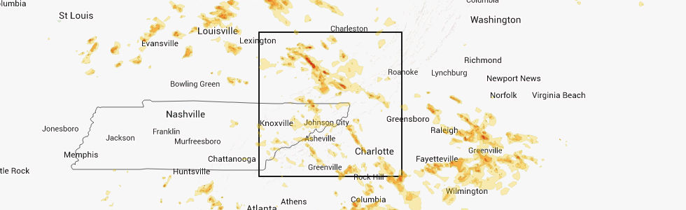
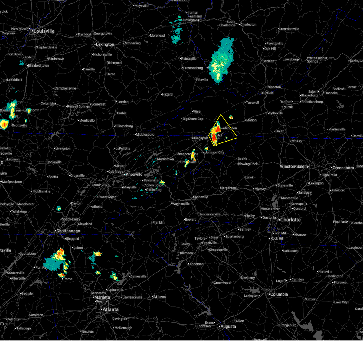
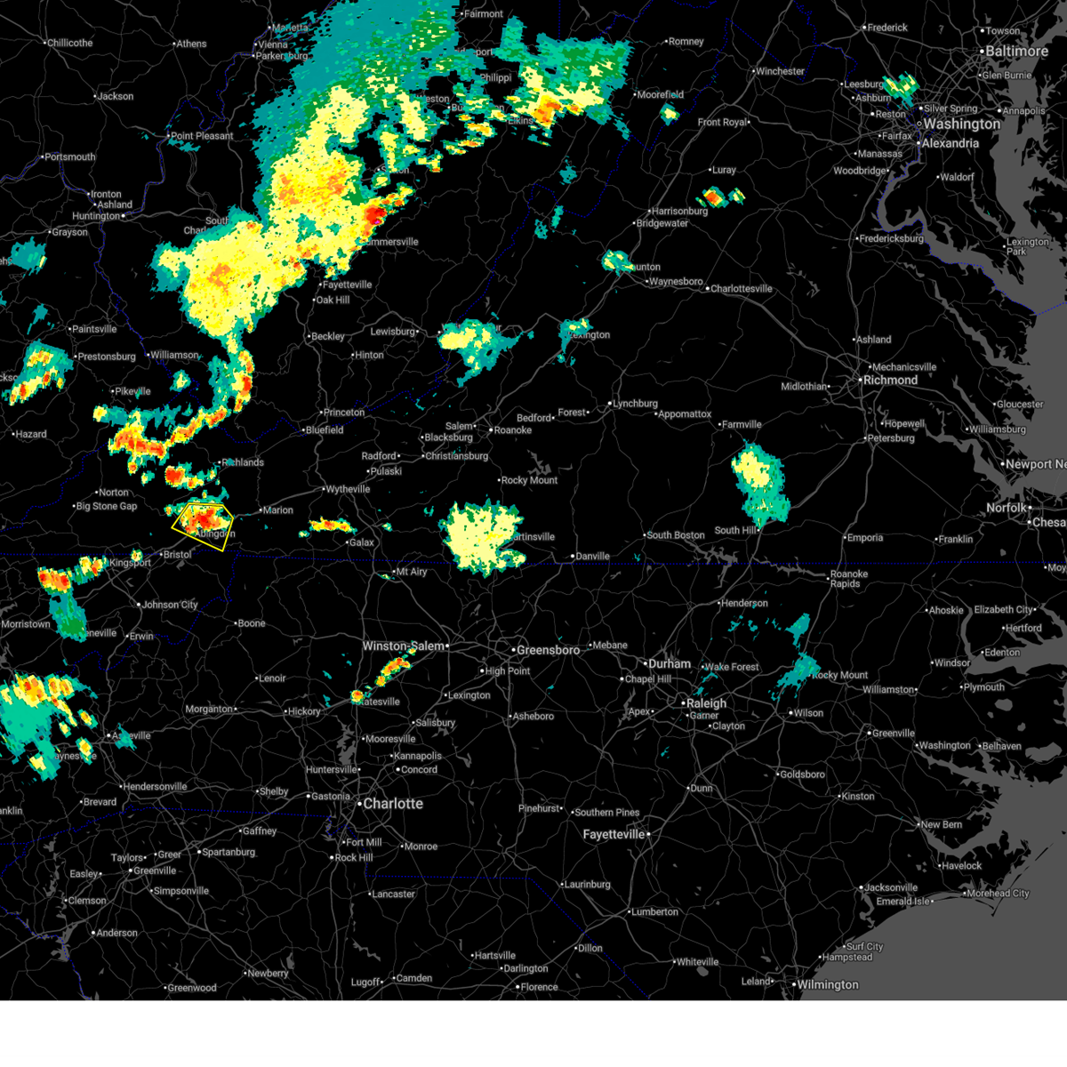
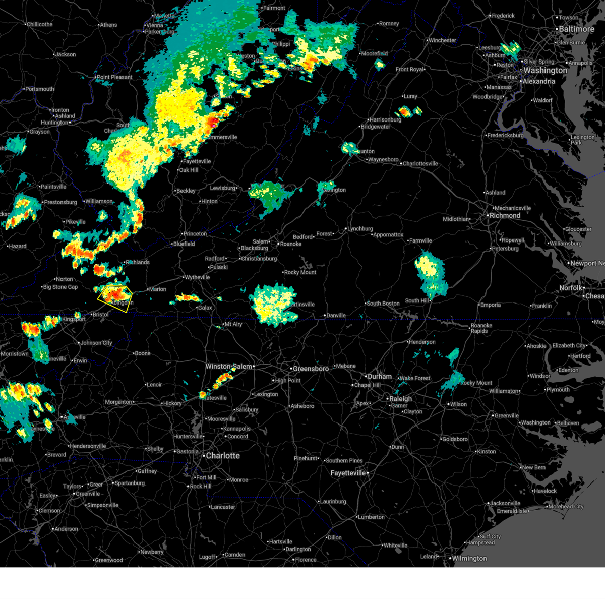
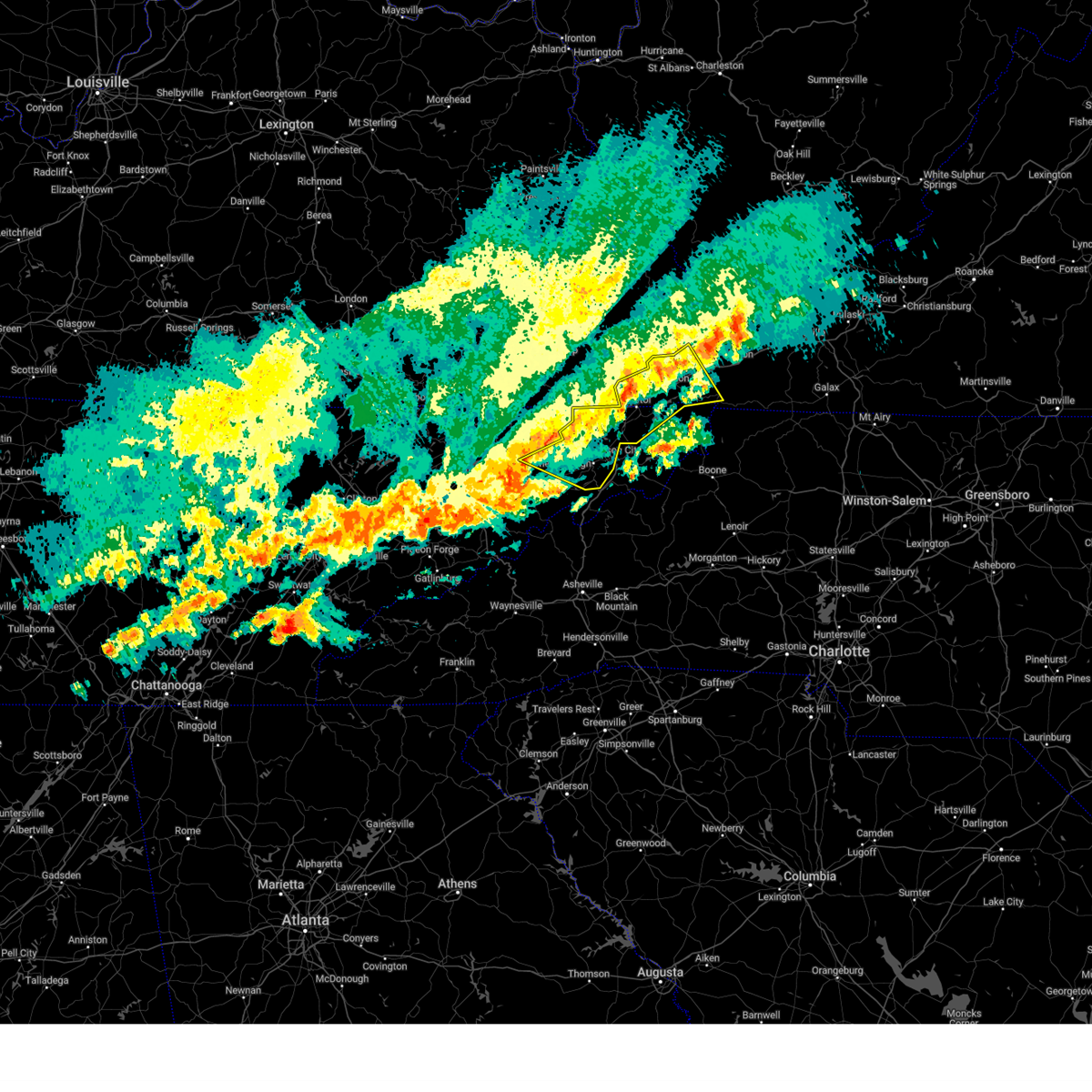
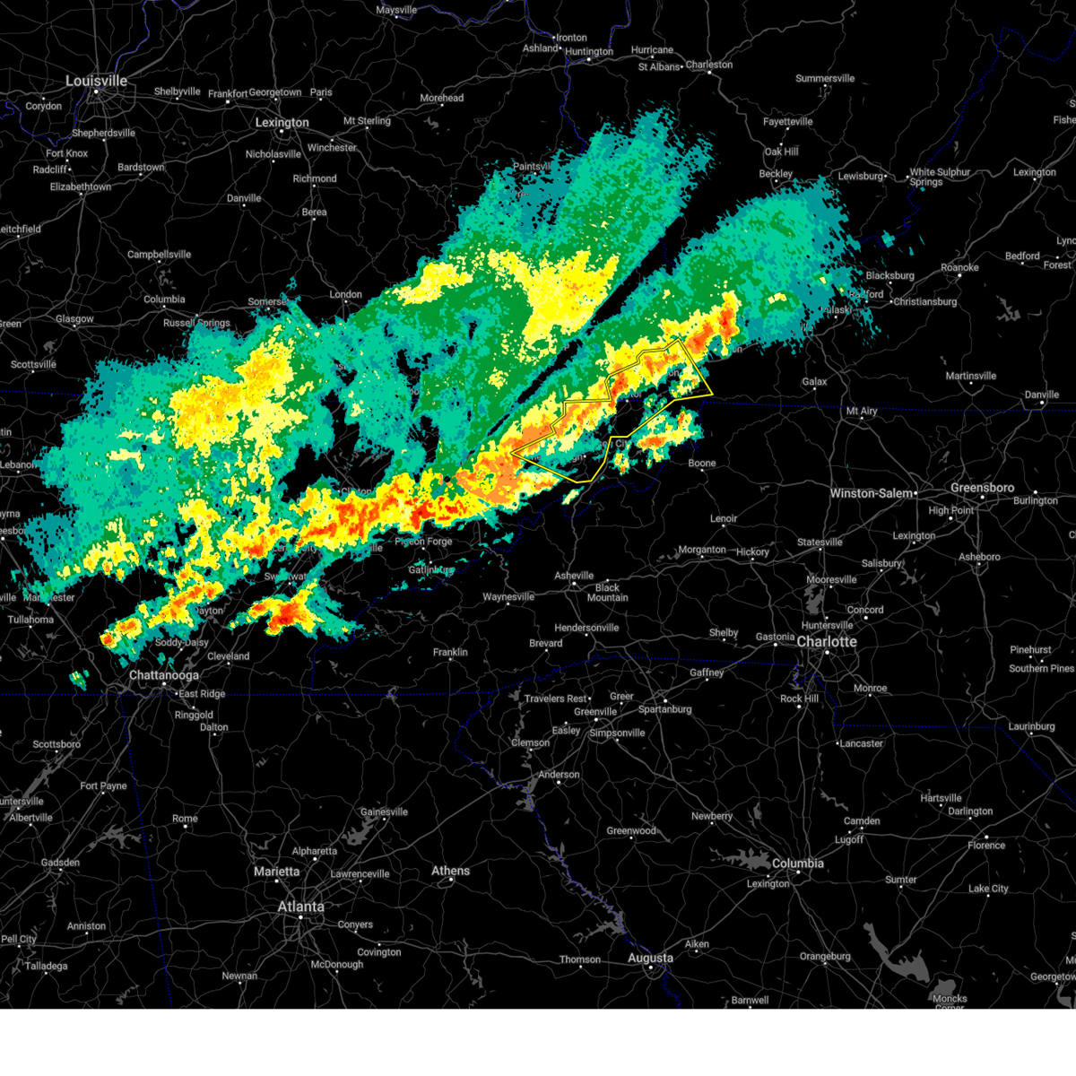
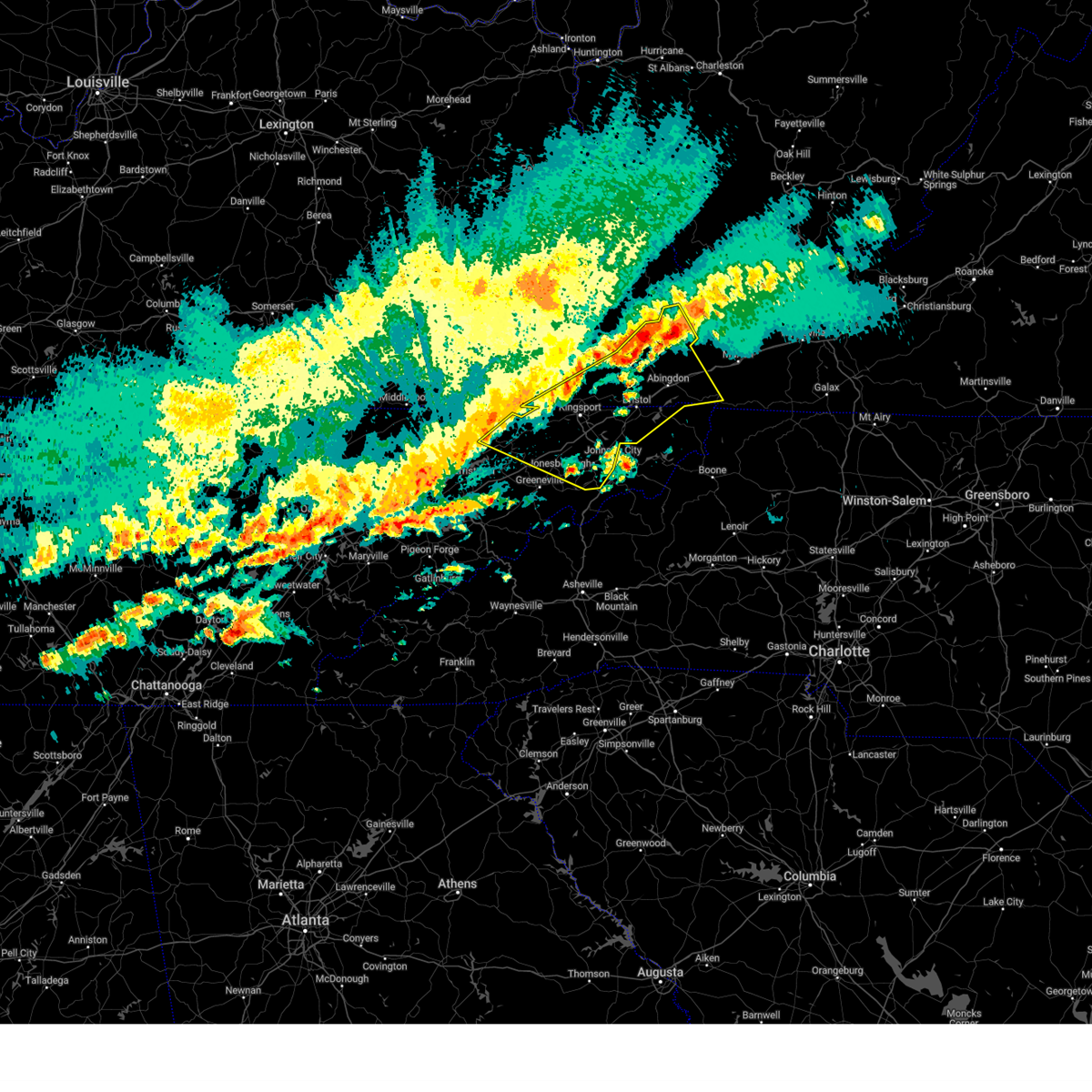
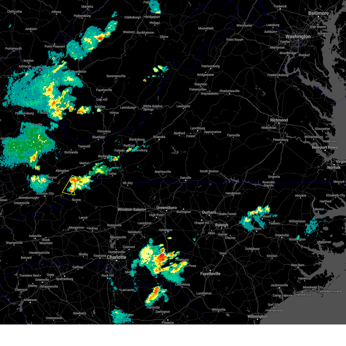
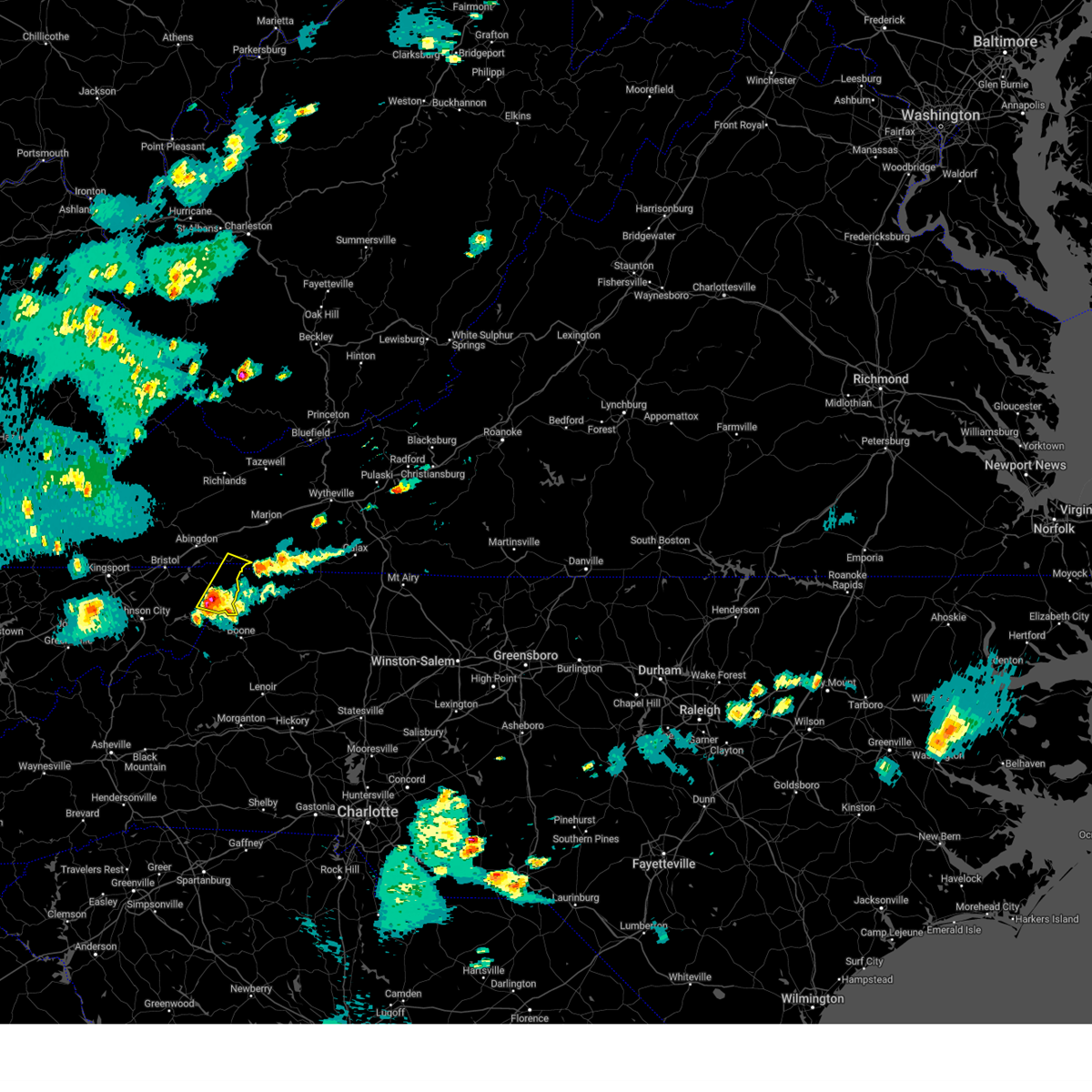
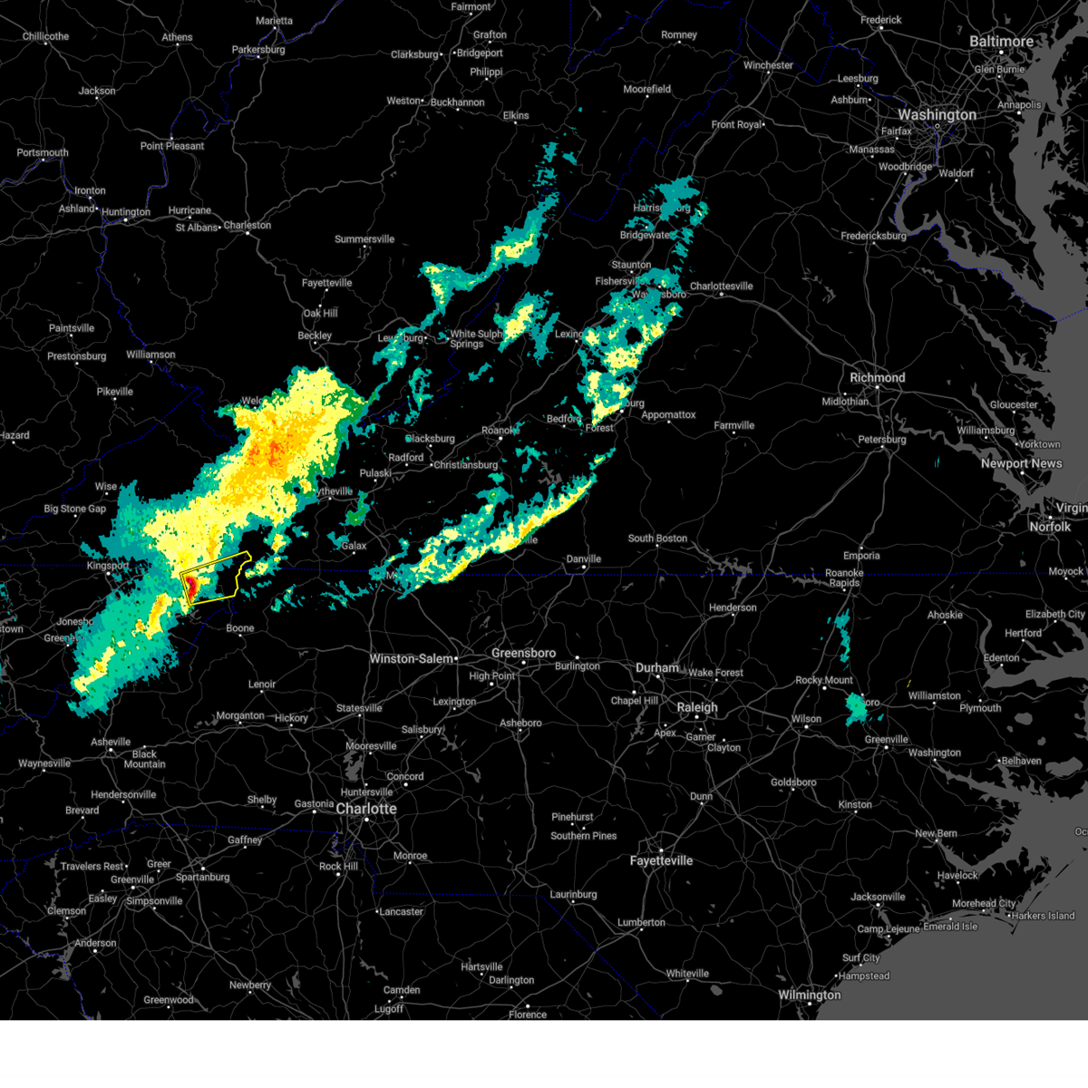
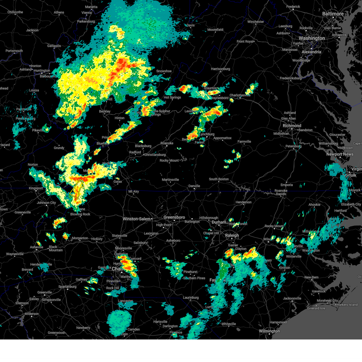
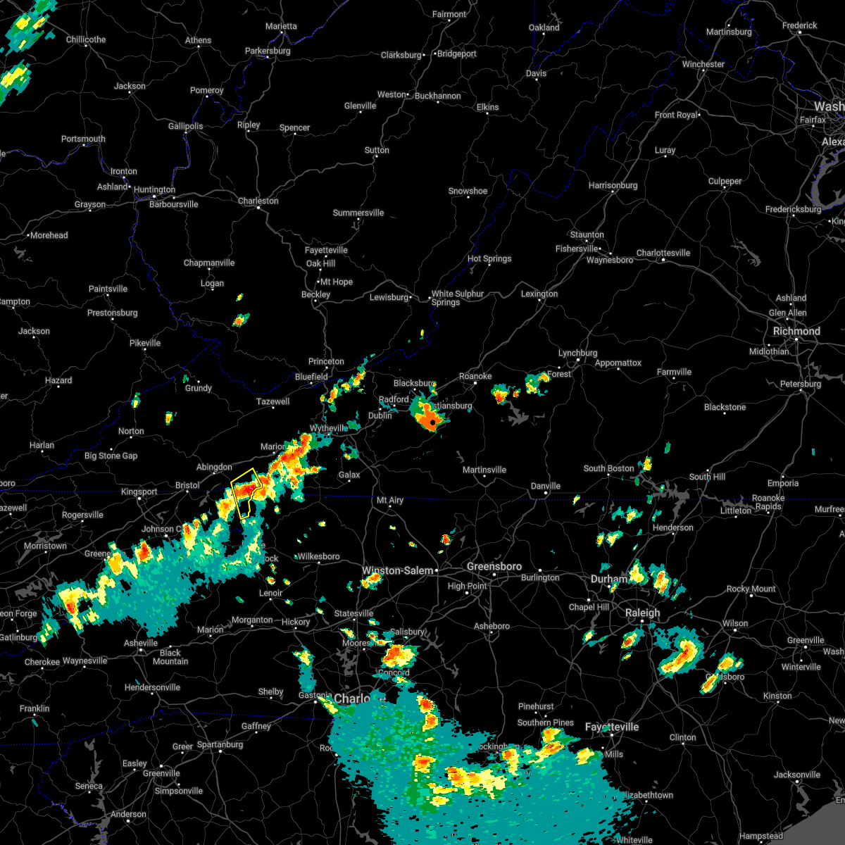
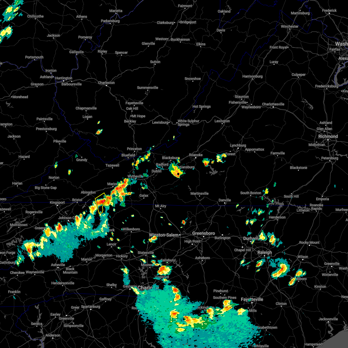
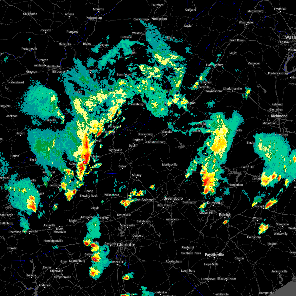
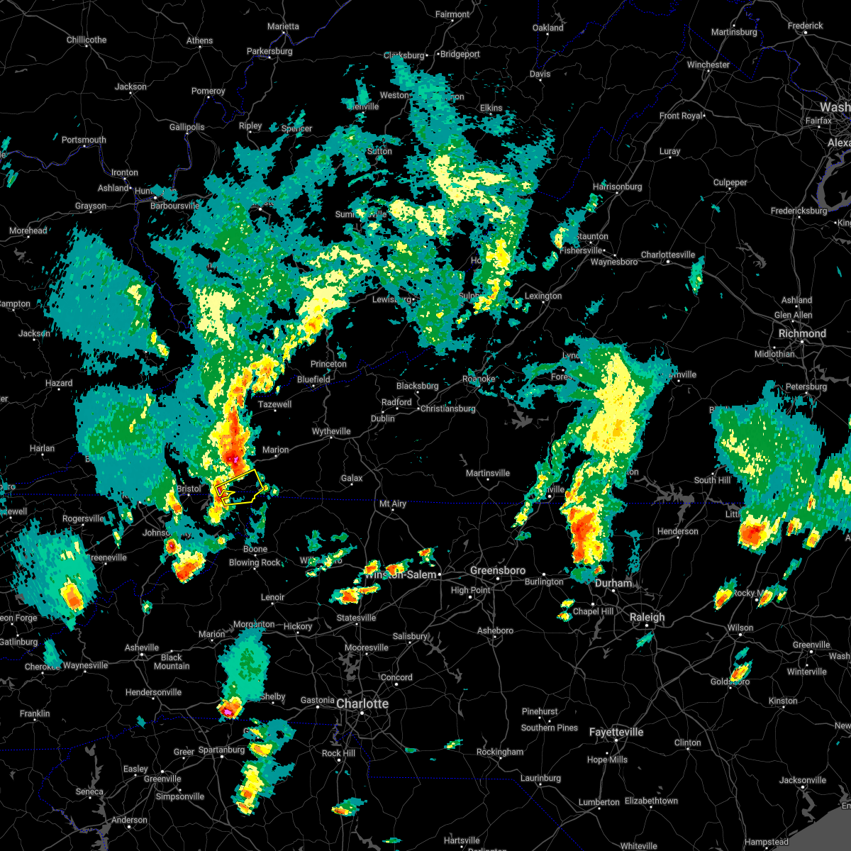
Hail Map for Damascus, VA
The Damascus, VA area has had 0 reports of on-the-ground hail by trained spotters, and has been under severe weather warnings 9 times during the past 12 months. Doppler radar has detected hail at or near Damascus, VA on 23 occasions.
| Name: | Damascus, VA |
| Where Located: | 24 miles E of Bristol, TN |
| Map: | Google Map for Damascus, VA |
| Population: | 814 |
| Housing Units: | 523 |
| More Info: | Search Google for Damascus, VA |
5
The Top Recent Hail Date for Damascus, VA is Sunday, July 1, 2012 (1st out of 23)
Hail and Wind Damage Spotted near Damascus, VA
| Date / Time | Report Details |
|---|---|
| 7/4/2026 11:28 PM EDT |
 At 1127 pm edt, a severe thunderstorm was located near quarry, or near chilhowie, moving northeast at 15 mph (radar indicated). Hazards include 60 mph wind gusts and penny size hail. Expect damage to roofs, siding, and trees. locations impacted include, abingdon, glade spring, damascus, lindell, konnarock, and emory-meadowview. This includes interstate 81 in virginia between mile markers 18 and 34. At 1127 pm edt, a severe thunderstorm was located near quarry, or near chilhowie, moving northeast at 15 mph (radar indicated). Hazards include 60 mph wind gusts and penny size hail. Expect damage to roofs, siding, and trees. locations impacted include, abingdon, glade spring, damascus, lindell, konnarock, and emory-meadowview. This includes interstate 81 in virginia between mile markers 18 and 34.
|
| 7/4/2026 11:07 PM EDT |
 Svrmrx the national weather service in morristown has issued a * severe thunderstorm warning for, northeastern johnson county in east tennessee, east central russell county in southwestern virginia, eastern washington county in southwestern virginia, * until midnight edt. * at 1107 pm edt, a severe thunderstorm was located near abingdon, moving northeast at 15 mph (radar indicated). Hazards include 60 mph wind gusts and penny size hail. expect damage to roofs, siding, and trees Svrmrx the national weather service in morristown has issued a * severe thunderstorm warning for, northeastern johnson county in east tennessee, east central russell county in southwestern virginia, eastern washington county in southwestern virginia, * until midnight edt. * at 1107 pm edt, a severe thunderstorm was located near abingdon, moving northeast at 15 mph (radar indicated). Hazards include 60 mph wind gusts and penny size hail. expect damage to roofs, siding, and trees
|
| 7/4/2026 11:04 PM EDT |
 At 1103 pm edt, a severe thunderstorm was located near bristol va, moving northeast at 10 mph (radar indicated). Hazards include 60 mph wind gusts and penny size hail. Expect damage to roofs, siding, and trees. locations impacted include, bristol tn, bristol va, abingdon, walnut hill, damascus, laurel bloomery, shady valley, lindell, south holston dam, and holston. This includes interstate 81 in virginia between mile markers 1 and 25. At 1103 pm edt, a severe thunderstorm was located near bristol va, moving northeast at 10 mph (radar indicated). Hazards include 60 mph wind gusts and penny size hail. Expect damage to roofs, siding, and trees. locations impacted include, bristol tn, bristol va, abingdon, walnut hill, damascus, laurel bloomery, shady valley, lindell, south holston dam, and holston. This includes interstate 81 in virginia between mile markers 1 and 25.
|
| 7/4/2026 10:35 PM EDT |
 Svrmrx the national weather service in morristown has issued a * severe thunderstorm warning for, eastern sullivan county in east tennessee, northern johnson county in east tennessee, northeastern carter county in east tennessee, central russell county in southwestern virginia, the city of bristol in southwestern virginia, washington county in southwestern virginia, * until 1130 pm edt. * at 1034 pm edt, a severe thunderstorm was located near bristol tn, moving northeast at 10 mph (radar indicated). Hazards include 60 mph wind gusts and penny size hail. expect damage to roofs, siding, and trees Svrmrx the national weather service in morristown has issued a * severe thunderstorm warning for, eastern sullivan county in east tennessee, northern johnson county in east tennessee, northeastern carter county in east tennessee, central russell county in southwestern virginia, the city of bristol in southwestern virginia, washington county in southwestern virginia, * until 1130 pm edt. * at 1034 pm edt, a severe thunderstorm was located near bristol tn, moving northeast at 10 mph (radar indicated). Hazards include 60 mph wind gusts and penny size hail. expect damage to roofs, siding, and trees
|
| 12/19/2025 1:09 AM EST |
 the severe thunderstorm warning has been cancelled and is no longer in effect the severe thunderstorm warning has been cancelled and is no longer in effect
|
| 12/19/2025 1:09 AM EST |
 At 109 am est, a severe thunderstorm was located over abingdon, moving east at 50 mph (radar indicated). Hazards include 60 mph wind gusts. Expect damage to roofs, siding, and trees. locations impacted include, bristol tn, bristol va, abingdon, glade spring, damascus, lindell, holston, emory-meadowview, hilander park, and harr. This includes interstate 81 in virginia between mile markers 3 and 34. At 109 am est, a severe thunderstorm was located over abingdon, moving east at 50 mph (radar indicated). Hazards include 60 mph wind gusts. Expect damage to roofs, siding, and trees. locations impacted include, bristol tn, bristol va, abingdon, glade spring, damascus, lindell, holston, emory-meadowview, hilander park, and harr. This includes interstate 81 in virginia between mile markers 3 and 34.
|
| 12/19/2025 12:49 AM EST |
 Svrmrx the national weather service in morristown has issued a * severe thunderstorm warning for, northeastern sullivan county in east tennessee, northeastern johnson county in east tennessee, southwestern russell county in southwestern virginia, the city of bristol in southwestern virginia, southeastern scott county in southwestern virginia, washington county in southwestern virginia, * until 130 am est. * at 1248 am est, a severe thunderstorm was located 7 miles northwest of walnut hill, or 9 miles northwest of bristol va, moving east at 50 mph (radar indicated). Hazards include 60 mph wind gusts. expect damage to roofs, siding, and trees Svrmrx the national weather service in morristown has issued a * severe thunderstorm warning for, northeastern sullivan county in east tennessee, northeastern johnson county in east tennessee, southwestern russell county in southwestern virginia, the city of bristol in southwestern virginia, southeastern scott county in southwestern virginia, washington county in southwestern virginia, * until 130 am est. * at 1248 am est, a severe thunderstorm was located 7 miles northwest of walnut hill, or 9 miles northwest of bristol va, moving east at 50 mph (radar indicated). Hazards include 60 mph wind gusts. expect damage to roofs, siding, and trees
|
| 7/28/2025 4:20 PM EDT |
 the severe thunderstorm warning has been cancelled and is no longer in effect the severe thunderstorm warning has been cancelled and is no longer in effect
|
| 7/28/2025 3:57 PM EDT |
 Svrmrx the national weather service in morristown has issued a * severe thunderstorm warning for, northeastern sullivan county in east tennessee, northern johnson county in east tennessee, southeastern washington county in southwestern virginia, * until 445 pm edt. * at 357 pm edt, a severe thunderstorm was located near abingdon, moving southeast at 20 mph (radar indicated). Hazards include 60 mph wind gusts. expect damage to roofs, siding, and trees Svrmrx the national weather service in morristown has issued a * severe thunderstorm warning for, northeastern sullivan county in east tennessee, northern johnson county in east tennessee, southeastern washington county in southwestern virginia, * until 445 pm edt. * at 357 pm edt, a severe thunderstorm was located near abingdon, moving southeast at 20 mph (radar indicated). Hazards include 60 mph wind gusts. expect damage to roofs, siding, and trees
|
| 7/17/2025 8:09 PM EDT |
 At 809 pm edt, a severe thunderstorm was located near abingdon, moving southeast at 15 mph (radar indicated). Hazards include 60 mph wind gusts. Expect damage to roofs, siding, and trees. locations impacted include, abingdon, glade spring, damascus, lindell, holston, and emory-meadowview. This includes interstate 81 in virginia between mile markers 16 and 33. At 809 pm edt, a severe thunderstorm was located near abingdon, moving southeast at 15 mph (radar indicated). Hazards include 60 mph wind gusts. Expect damage to roofs, siding, and trees. locations impacted include, abingdon, glade spring, damascus, lindell, holston, and emory-meadowview. This includes interstate 81 in virginia between mile markers 16 and 33.
|
| 7/17/2025 8:09 PM EDT |
 the severe thunderstorm warning has been cancelled and is no longer in effect the severe thunderstorm warning has been cancelled and is no longer in effect
|
| 7/17/2025 7:50 PM EDT |
 Svrmrx the national weather service in morristown has issued a * severe thunderstorm warning for, south central russell county in southwestern virginia, central washington county in southwestern virginia, * until 845 pm edt. * at 750 pm edt, a severe thunderstorm was located near abingdon, moving east southeast at 20 mph (radar indicated). Hazards include 60 mph wind gusts. expect damage to roofs, siding, and trees Svrmrx the national weather service in morristown has issued a * severe thunderstorm warning for, south central russell county in southwestern virginia, central washington county in southwestern virginia, * until 845 pm edt. * at 750 pm edt, a severe thunderstorm was located near abingdon, moving east southeast at 20 mph (radar indicated). Hazards include 60 mph wind gusts. expect damage to roofs, siding, and trees
|
| 5/17/2025 2:59 AM EDT |
 At 258 am edt, severe thunderstorms were located along a line extending from near cedar bluff to 6 miles east of lebanon to 9 miles northwest of walnut hill to near rogersville, moving southeast at 45 mph (emergency dispatch reports trees down across the warned area). Hazards include 60 mph wind gusts and penny size hail. Expect damage to roofs, siding, and trees. locations impacted include, leesburg, chucky, damascus, limestone, spurgeon, south holston dam, sullivan gardens, bristol tn, jonesborough, and johnson city. this includes the following highways, interstate 26 in tennessee between mile markers 1 and 23. interstate 81 in tennessee between mile markers 32 and 75. Interstate 81 in virginia between mile markers 1 and 32. At 258 am edt, severe thunderstorms were located along a line extending from near cedar bluff to 6 miles east of lebanon to 9 miles northwest of walnut hill to near rogersville, moving southeast at 45 mph (emergency dispatch reports trees down across the warned area). Hazards include 60 mph wind gusts and penny size hail. Expect damage to roofs, siding, and trees. locations impacted include, leesburg, chucky, damascus, limestone, spurgeon, south holston dam, sullivan gardens, bristol tn, jonesborough, and johnson city. this includes the following highways, interstate 26 in tennessee between mile markers 1 and 23. interstate 81 in tennessee between mile markers 32 and 75. Interstate 81 in virginia between mile markers 1 and 32.
|
| 5/17/2025 2:59 AM EDT |
 the severe thunderstorm warning has been cancelled and is no longer in effect the severe thunderstorm warning has been cancelled and is no longer in effect
|
| 5/17/2025 2:29 AM EDT |
 Svrmrx the national weather service in morristown has issued a * severe thunderstorm warning for, sullivan county in east tennessee, hawkins county in east tennessee, washington county in east tennessee, northeastern greene county in east tennessee, north central johnson county in east tennessee, northwestern carter county in east tennessee, russell county in southwestern virginia, the city of bristol in southwestern virginia, scott county in southwestern virginia, washington county in southwestern virginia, * until 330 am edt. * at 229 am edt, severe thunderstorms were located along a line extending from 7 miles southeast of grundy to near trammel to 8 miles southeast of big stone gap to sneedville, moving southeast at 40 mph (radar indicated). Hazards include 60 mph wind gusts and penny size hail. expect damage to roofs, siding, and trees Svrmrx the national weather service in morristown has issued a * severe thunderstorm warning for, sullivan county in east tennessee, hawkins county in east tennessee, washington county in east tennessee, northeastern greene county in east tennessee, north central johnson county in east tennessee, northwestern carter county in east tennessee, russell county in southwestern virginia, the city of bristol in southwestern virginia, scott county in southwestern virginia, washington county in southwestern virginia, * until 330 am edt. * at 229 am edt, severe thunderstorms were located along a line extending from 7 miles southeast of grundy to near trammel to 8 miles southeast of big stone gap to sneedville, moving southeast at 40 mph (radar indicated). Hazards include 60 mph wind gusts and penny size hail. expect damage to roofs, siding, and trees
|
| 5/2/2025 8:15 PM EDT |
 The severe thunderstorm which prompted the warning has weakened. therefore, the warning will be allowed to expire. however, gusty winds and heavy rain are still possible with this thunderstorm. The severe thunderstorm which prompted the warning has weakened. therefore, the warning will be allowed to expire. however, gusty winds and heavy rain are still possible with this thunderstorm.
|
| 5/2/2025 7:35 PM EDT |
 Svrmrx the national weather service in morristown has issued a * severe thunderstorm warning for, johnson county in east tennessee, southeastern washington county in southwestern virginia, * until 815 pm edt. * at 735 pm edt, a severe thunderstorm was located near mountain city, moving northeast at 25 mph (radar indicated). Hazards include 60 mph wind gusts and quarter size hail. Hail damage to vehicles is expected. Expect wind damage to roofs, siding, and trees. Svrmrx the national weather service in morristown has issued a * severe thunderstorm warning for, johnson county in east tennessee, southeastern washington county in southwestern virginia, * until 815 pm edt. * at 735 pm edt, a severe thunderstorm was located near mountain city, moving northeast at 25 mph (radar indicated). Hazards include 60 mph wind gusts and quarter size hail. Hail damage to vehicles is expected. Expect wind damage to roofs, siding, and trees.
|
| 3/31/2025 6:34 AM EDT |
 Svrmrx the national weather service in morristown has issued a * severe thunderstorm warning for, northeastern sullivan county in east tennessee, johnson county in east tennessee, northeastern carter county in east tennessee, southeastern washington county in southwestern virginia, * until 700 am edt. * at 634 am edt, a severe thunderstorm was located 8 miles west of mountain city, moving east at 45 mph (radar indicated). Hazards include 60 mph wind gusts and penny size hail. expect damage to roofs, siding, and trees Svrmrx the national weather service in morristown has issued a * severe thunderstorm warning for, northeastern sullivan county in east tennessee, johnson county in east tennessee, northeastern carter county in east tennessee, southeastern washington county in southwestern virginia, * until 700 am edt. * at 634 am edt, a severe thunderstorm was located 8 miles west of mountain city, moving east at 45 mph (radar indicated). Hazards include 60 mph wind gusts and penny size hail. expect damage to roofs, siding, and trees
|
| 8/2/2024 1:58 PM EDT |
 The storm which prompted the warning has moved out of the area. therefore, the warning will be allowed to expire. however, heavy rain is still possible with this thunderstorm. The storm which prompted the warning has moved out of the area. therefore, the warning will be allowed to expire. however, heavy rain is still possible with this thunderstorm.
|
| 8/2/2024 1:39 PM EDT |
 At 139 pm edt, a severe thunderstorm was located 7 miles east of abingdon, moving east at 30 mph (radar indicated). Hazards include 60 mph wind gusts. Expect damage to roofs, siding, and trees. locations impacted include, abingdon, glade spring, damascus, emory-meadow view, and konnarock. This includes interstate 81 in virginia between mile markers 20 and 34. At 139 pm edt, a severe thunderstorm was located 7 miles east of abingdon, moving east at 30 mph (radar indicated). Hazards include 60 mph wind gusts. Expect damage to roofs, siding, and trees. locations impacted include, abingdon, glade spring, damascus, emory-meadow view, and konnarock. This includes interstate 81 in virginia between mile markers 20 and 34.
|
| 8/2/2024 1:26 PM EDT |
 Svrmrx the national weather service in morristown has issued a * severe thunderstorm warning for, southeastern washington county in southwestern virginia, * until 200 pm edt. * at 126 pm edt, a severe thunderstorm was located over abingdon, moving east at 30 mph (radar indicated). Hazards include 60 mph wind gusts. expect damage to roofs, siding, and trees Svrmrx the national weather service in morristown has issued a * severe thunderstorm warning for, southeastern washington county in southwestern virginia, * until 200 pm edt. * at 126 pm edt, a severe thunderstorm was located over abingdon, moving east at 30 mph (radar indicated). Hazards include 60 mph wind gusts. expect damage to roofs, siding, and trees
|
| 5/26/2024 4:18 PM EDT |
 At 417 pm edt, a severe thunderstorm was located near abingdon, moving east at 50 mph (radar indicated). Hazards include 60 mph wind gusts. Expect damage to roofs, siding, and trees. locations impacted include, bristol va, abingdon, lebanon, glade spring, honaker, damascus, emory-meadow view, rosedale, dye, and lindell. This includes interstate 81 in virginia between mile markers 1 and 34. At 417 pm edt, a severe thunderstorm was located near abingdon, moving east at 50 mph (radar indicated). Hazards include 60 mph wind gusts. Expect damage to roofs, siding, and trees. locations impacted include, bristol va, abingdon, lebanon, glade spring, honaker, damascus, emory-meadow view, rosedale, dye, and lindell. This includes interstate 81 in virginia between mile markers 1 and 34.
|
| 5/26/2024 4:18 PM EDT |
 the severe thunderstorm warning has been cancelled and is no longer in effect the severe thunderstorm warning has been cancelled and is no longer in effect
|
| 5/26/2024 3:47 PM EDT |
 Svrmrx the national weather service in morristown has issued a * severe thunderstorm warning for, russell county in southwestern virginia, the city of bristol in southwestern virginia, southeastern scott county in southwestern virginia, washington county in southwestern virginia, * until 445 pm edt. * at 347 pm edt, a severe thunderstorm was located 15 miles northeast of weber city, or 15 miles northeast of gate city, moving east at 50 mph (radar indicated). Hazards include 60 mph wind gusts. expect damage to roofs, siding, and trees Svrmrx the national weather service in morristown has issued a * severe thunderstorm warning for, russell county in southwestern virginia, the city of bristol in southwestern virginia, southeastern scott county in southwestern virginia, washington county in southwestern virginia, * until 445 pm edt. * at 347 pm edt, a severe thunderstorm was located 15 miles northeast of weber city, or 15 miles northeast of gate city, moving east at 50 mph (radar indicated). Hazards include 60 mph wind gusts. expect damage to roofs, siding, and trees
|
| 9/7/2023 4:49 PM EDT |
 At 448 pm edt, a severe thunderstorm was located 9 miles south of abingdon, moving northeast at 15 mph (radar indicated). Hazards include 60 mph wind gusts and quarter size hail. Hail damage to vehicles is expected. Expect wind damage to roofs, siding, and trees. At 448 pm edt, a severe thunderstorm was located 9 miles south of abingdon, moving northeast at 15 mph (radar indicated). Hazards include 60 mph wind gusts and quarter size hail. Hail damage to vehicles is expected. Expect wind damage to roofs, siding, and trees.
|
| 7/29/2023 5:36 PM EDT |
 At 534 pm edt, a severe thunderstorm was located 8 miles north of mountain city, moving southeast at 35 mph (radar indicated). Hazards include 60 mph wind gusts and quarter size hail. Hail damage to vehicles is expected. expect wind damage to roofs, siding, and trees. locations impacted include, bristol tn, abingdon, mountain city, bluff city, glade spring, damascus, morril`s cave, laurel bloomery, shady valley and south holston dam. this includes interstate 81 in virginia between mile markers 18 and 21, and between mile markers 23 and 33. hail threat, radar indicated max hail size, 1. 00 in wind threat, radar indicated max wind gust, 60 mph. At 534 pm edt, a severe thunderstorm was located 8 miles north of mountain city, moving southeast at 35 mph (radar indicated). Hazards include 60 mph wind gusts and quarter size hail. Hail damage to vehicles is expected. expect wind damage to roofs, siding, and trees. locations impacted include, bristol tn, abingdon, mountain city, bluff city, glade spring, damascus, morril`s cave, laurel bloomery, shady valley and south holston dam. this includes interstate 81 in virginia between mile markers 18 and 21, and between mile markers 23 and 33. hail threat, radar indicated max hail size, 1. 00 in wind threat, radar indicated max wind gust, 60 mph.
|
| 7/29/2023 5:17 PM EDT |
 At 515 pm edt, a severe thunderstorm was located near lebanon, moving east at 20 mph (radar indicated). Hazards include 60 mph wind gusts and quarter size hail. Hail damage to vehicles is expected. expect wind damage to roofs, siding, and trees. locations impacted include, johnson city, kingsport, bristol tn, bristol va, abingdon, lebanon, mountain city, gate city, weber city and spurgeon. this includes the following highways, interstate 26 in tennessee between mile markers 1 and 17. interstate 81 in tennessee between mile markers 40 and 75. interstate 81 in virginia between mile markers 1 and 34. hail threat, radar indicated max hail size, 1. 00 in wind threat, radar indicated max wind gust, 60 mph. At 515 pm edt, a severe thunderstorm was located near lebanon, moving east at 20 mph (radar indicated). Hazards include 60 mph wind gusts and quarter size hail. Hail damage to vehicles is expected. expect wind damage to roofs, siding, and trees. locations impacted include, johnson city, kingsport, bristol tn, bristol va, abingdon, lebanon, mountain city, gate city, weber city and spurgeon. this includes the following highways, interstate 26 in tennessee between mile markers 1 and 17. interstate 81 in tennessee between mile markers 40 and 75. interstate 81 in virginia between mile markers 1 and 34. hail threat, radar indicated max hail size, 1. 00 in wind threat, radar indicated max wind gust, 60 mph.
|
| 7/29/2023 4:53 PM EDT |
 At 452 pm edt, a severe thunderstorm was located near lebanon, moving east at 20 mph (radar indicated). Hazards include 60 mph wind gusts and quarter size hail. Hail damage to vehicles is expected. Expect wind damage to roofs, siding, and trees. At 452 pm edt, a severe thunderstorm was located near lebanon, moving east at 20 mph (radar indicated). Hazards include 60 mph wind gusts and quarter size hail. Hail damage to vehicles is expected. Expect wind damage to roofs, siding, and trees.
|
| 7/28/2023 4:42 PM EDT |
 At 442 pm edt, severe thunderstorms were located along a line extending from near allison gap to 7 miles southwest of lebanon, moving southeast at 15 mph (radar indicated). Hazards include 60 mph wind gusts and penny size hail. expect damage to roofs, siding, and trees At 442 pm edt, severe thunderstorms were located along a line extending from near allison gap to 7 miles southwest of lebanon, moving southeast at 15 mph (radar indicated). Hazards include 60 mph wind gusts and penny size hail. expect damage to roofs, siding, and trees
|
| 7/15/2023 4:36 PM EDT |
 The severe thunderstorm warning for northeastern johnson and southeastern washington counties will expire at 445 pm edt, the storm which prompted the warning has weakened below severe limits, and no longer poses an immediate threat to life or property. therefore, the warning will be allowed to expire. however gusty winds and heavy rain which could cause localized flooding are still possible with this thunderstorm. The severe thunderstorm warning for northeastern johnson and southeastern washington counties will expire at 445 pm edt, the storm which prompted the warning has weakened below severe limits, and no longer poses an immediate threat to life or property. therefore, the warning will be allowed to expire. however gusty winds and heavy rain which could cause localized flooding are still possible with this thunderstorm.
|
| 7/15/2023 4:09 PM EDT |
 At 408 pm edt, a severe thunderstorm was located near mountain city, moving northeast at 15 mph (radar indicated). Hazards include 60 mph wind gusts. Expect damage to roofs, siding, and trees. locations impacted include, mountain city, laurel bloomery and konnarock. hail threat, radar indicated max hail size, <. 75 in wind threat, radar indicated max wind gust, 60 mph. At 408 pm edt, a severe thunderstorm was located near mountain city, moving northeast at 15 mph (radar indicated). Hazards include 60 mph wind gusts. Expect damage to roofs, siding, and trees. locations impacted include, mountain city, laurel bloomery and konnarock. hail threat, radar indicated max hail size, <. 75 in wind threat, radar indicated max wind gust, 60 mph.
|
| 7/15/2023 3:56 PM EDT |
 At 356 pm edt, a severe thunderstorm was located near mountain city, moving northeast at 10 mph (radar indicated). Hazards include 60 mph wind gusts. expect damage to roofs, siding, and trees At 356 pm edt, a severe thunderstorm was located near mountain city, moving northeast at 10 mph (radar indicated). Hazards include 60 mph wind gusts. expect damage to roofs, siding, and trees
|
| 5/16/2023 6:56 PM EDT |
 The severe thunderstorm warning for northeastern sullivan, northern johnson and eastern washington counties and the eastern city of bristol will expire at 700 pm edt, the storm which prompted the warning has moved out of the area. therefore, the warning will be allowed to expire. a severe thunderstorm watch remains in effect until 800 pm edt for east tennessee, and southwestern virginia. a severe thunderstorm watch also remains in effect until 1000 pm edt for east tennessee. to report severe weather, contact your nearest law enforcement agency. they will relay your report to the national weather service morristown. The severe thunderstorm warning for northeastern sullivan, northern johnson and eastern washington counties and the eastern city of bristol will expire at 700 pm edt, the storm which prompted the warning has moved out of the area. therefore, the warning will be allowed to expire. a severe thunderstorm watch remains in effect until 800 pm edt for east tennessee, and southwestern virginia. a severe thunderstorm watch also remains in effect until 1000 pm edt for east tennessee. to report severe weather, contact your nearest law enforcement agency. they will relay your report to the national weather service morristown.
|
| 5/16/2023 6:34 PM EDT |
 At 634 pm edt, a severe thunderstorm was located 9 miles southeast of abingdon, moving east at 50 mph (radar indicated). Hazards include 60 mph wind gusts. Expect damage to roofs, siding, and trees. locations impacted include, bristol tn, bristol va, abingdon, mountain city, glade spring, damascus, laurel bloomery, emory-meadow view, shady valley and south holston dam. This includes interstate 81 in virginia between mile markers 9 and 34. At 634 pm edt, a severe thunderstorm was located 9 miles southeast of abingdon, moving east at 50 mph (radar indicated). Hazards include 60 mph wind gusts. Expect damage to roofs, siding, and trees. locations impacted include, bristol tn, bristol va, abingdon, mountain city, glade spring, damascus, laurel bloomery, emory-meadow view, shady valley and south holston dam. This includes interstate 81 in virginia between mile markers 9 and 34.
|
| 5/16/2023 6:03 PM EDT |
 At 603 pm edt, a severe thunderstorm was located 8 miles northwest of bristol va, moving east at 55 mph (radar indicated). Hazards include 60 mph wind gusts. expect damage to roofs, siding, and trees At 603 pm edt, a severe thunderstorm was located 8 miles northwest of bristol va, moving east at 55 mph (radar indicated). Hazards include 60 mph wind gusts. expect damage to roofs, siding, and trees
|
| 3/25/2023 5:42 AM EDT |
 At 541 am edt, severe thunderstorms were located along a line extending from near chilhowie to elk park, moving east at 65 mph (radar indicated). Hazards include 60 mph wind gusts. Expect damage to roofs, siding, and trees. locations impacted include, mountain city, glade spring, damascus, trade, neva, laurel bloomery, emory-meadow view, elk mills, shady valley and konnarock. this includes interstate 81 in virginia between mile markers 22 and 33. hail threat, radar indicated max hail size, <. 75 in wind threat, radar indicated max wind gust, 60 mph. At 541 am edt, severe thunderstorms were located along a line extending from near chilhowie to elk park, moving east at 65 mph (radar indicated). Hazards include 60 mph wind gusts. Expect damage to roofs, siding, and trees. locations impacted include, mountain city, glade spring, damascus, trade, neva, laurel bloomery, emory-meadow view, elk mills, shady valley and konnarock. this includes interstate 81 in virginia between mile markers 22 and 33. hail threat, radar indicated max hail size, <. 75 in wind threat, radar indicated max wind gust, 60 mph.
|
| 3/25/2023 5:15 AM EDT |
 At 515 am edt, severe thunderstorms were located along a line extending from bristol va to 7 miles south of banner hill, moving east at 65 mph (radar indicated). Hazards include 60 mph wind gusts. expect damage to roofs, siding, and trees At 515 am edt, severe thunderstorms were located along a line extending from bristol va to 7 miles south of banner hill, moving east at 65 mph (radar indicated). Hazards include 60 mph wind gusts. expect damage to roofs, siding, and trees
|
| 1/12/2023 2:57 PM EST |
 The severe thunderstorm warning for northeastern sullivan, johnson, eastern carter and southeastern washington counties will expire at 300 pm est, the storms which prompted the warning have moved out of the area. therefore, the warning will be allowed to expire. however gusty winds are still possible with these thunderstorms. The severe thunderstorm warning for northeastern sullivan, johnson, eastern carter and southeastern washington counties will expire at 300 pm est, the storms which prompted the warning have moved out of the area. therefore, the warning will be allowed to expire. however gusty winds are still possible with these thunderstorms.
|
| 1/12/2023 2:42 PM EST |
 At 242 pm est, severe thunderstorms were located along a line extending from 6 miles east of bristol va to 6 miles west of peoria to near elk park, moving east at 55 mph (radar indicated). Hazards include 60 mph wind gusts. Expect damage to roofs, siding, and trees. locations impacted include, abingdon, mountain city, glade spring, damascus, doeville, neva, laurel bloomery, emory-meadow view, harr and elk mills. This includes interstate 81 in virginia between mile markers 12 and 33. At 242 pm est, severe thunderstorms were located along a line extending from 6 miles east of bristol va to 6 miles west of peoria to near elk park, moving east at 55 mph (radar indicated). Hazards include 60 mph wind gusts. Expect damage to roofs, siding, and trees. locations impacted include, abingdon, mountain city, glade spring, damascus, doeville, neva, laurel bloomery, emory-meadow view, harr and elk mills. This includes interstate 81 in virginia between mile markers 12 and 33.
|
| 1/12/2023 2:24 PM EST |
 At 224 pm est, severe thunderstorms were located along a line extending from walnut hill to near hampton to 8 miles northwest of bakersville, moving east at 55 mph (radar indicated). Hazards include 70 mph wind gusts. Expect considerable tree damage. damage is likely to mobile homes, roofs, and outbuildings. locations impacted include, johnson city, bristol tn, bristol va, elizabethton, abingdon, mountain city, central, pine crest, walnut hill and hampton. this includes the following highways, interstate 26 in tennessee between mile markers 25 and 28. interstate 81 in tennessee between mile markers 68 and 75. Interstate 81 in virginia between mile markers 1 and 33. At 224 pm est, severe thunderstorms were located along a line extending from walnut hill to near hampton to 8 miles northwest of bakersville, moving east at 55 mph (radar indicated). Hazards include 70 mph wind gusts. Expect considerable tree damage. damage is likely to mobile homes, roofs, and outbuildings. locations impacted include, johnson city, bristol tn, bristol va, elizabethton, abingdon, mountain city, central, pine crest, walnut hill and hampton. this includes the following highways, interstate 26 in tennessee between mile markers 25 and 28. interstate 81 in tennessee between mile markers 68 and 75. Interstate 81 in virginia between mile markers 1 and 33.
|
| 1/12/2023 2:07 PM EST |
 At 207 pm est, severe thunderstorms were located along a line extending from colonial heights to near erwin to 6 miles southwest of banner hill, moving east at 55 mph (radar indicated). Hazards include 70 mph wind gusts. Expect considerable tree damage. Damage is likely to mobile homes, roofs, and outbuildings. At 207 pm est, severe thunderstorms were located along a line extending from colonial heights to near erwin to 6 miles southwest of banner hill, moving east at 55 mph (radar indicated). Hazards include 70 mph wind gusts. Expect considerable tree damage. Damage is likely to mobile homes, roofs, and outbuildings.
|
| 7/18/2022 6:45 PM EDT | Several trees dow in washington county VA, 5 miles WSW of Damascus, VA |
| 7/18/2022 6:25 PM EDT |
 At 624 pm edt, a severe thunderstorm was located 7 miles west of whitetop, moving east at 25 mph (radar indicated). Hazards include 60 mph wind gusts. expect damage to roofs, siding, and trees At 624 pm edt, a severe thunderstorm was located 7 miles west of whitetop, moving east at 25 mph (radar indicated). Hazards include 60 mph wind gusts. expect damage to roofs, siding, and trees
|
| 7/18/2022 6:15 PM EDT |
 At 612 pm edt, a severe thunderstorm was located 7 miles southeast of abingdon, moving east at 25 mph (radar indicated. at 605 pm, local law enforcement reported several trees down across sullivan county, tn and washington county, va). Hazards include 60 mph wind gusts. Expect damage to roofs, siding, and trees. locations impacted include, abingdon, glade spring, damascus, lindell, holston, emory-meadow view and konnarock. this includes interstate 81 in virginia between mile markers 12 and 34. hail threat, radar indicated max hail size, <. 75 in wind threat, radar indicated max wind gust, 60 mph. At 612 pm edt, a severe thunderstorm was located 7 miles southeast of abingdon, moving east at 25 mph (radar indicated. at 605 pm, local law enforcement reported several trees down across sullivan county, tn and washington county, va). Hazards include 60 mph wind gusts. Expect damage to roofs, siding, and trees. locations impacted include, abingdon, glade spring, damascus, lindell, holston, emory-meadow view and konnarock. this includes interstate 81 in virginia between mile markers 12 and 34. hail threat, radar indicated max hail size, <. 75 in wind threat, radar indicated max wind gust, 60 mph.
|
| 7/18/2022 5:31 PM EDT |
 At 530 pm edt, a severe thunderstorm was located near bristol va, moving northeast at 25 mph (radar indicated). Hazards include 60 mph wind gusts. expect damage to roofs, siding, and trees At 530 pm edt, a severe thunderstorm was located near bristol va, moving northeast at 25 mph (radar indicated). Hazards include 60 mph wind gusts. expect damage to roofs, siding, and trees
|
| 5/21/2022 3:58 PM EDT |
 At 358 pm edt, a severe thunderstorm was located over mount rogers summit, or near whitetop, moving northeast at 35 mph (radar indicated). Hazards include 60 mph wind gusts and quarter size hail. Hail damage to vehicles is expected. Expect wind damage to roofs, siding, and trees. At 358 pm edt, a severe thunderstorm was located over mount rogers summit, or near whitetop, moving northeast at 35 mph (radar indicated). Hazards include 60 mph wind gusts and quarter size hail. Hail damage to vehicles is expected. Expect wind damage to roofs, siding, and trees.
|
| 5/6/2022 6:58 PM EDT |
 At 658 pm edt, severe thunderstorms were located along a line extending from abingdon to near mountain city to lovill, moving northeast at 50 mph (radar indicated). Hazards include 60 mph wind gusts. Expect damage to roofs, siding, and trees. locations impacted include, bristol tn, mountain city, damascus, trade, neva, laurel bloomery, harr, shady valley and konnarock. hail threat, radar indicated max hail size, <. 75 in wind threat, observed max wind gust, 60 mph. At 658 pm edt, severe thunderstorms were located along a line extending from abingdon to near mountain city to lovill, moving northeast at 50 mph (radar indicated). Hazards include 60 mph wind gusts. Expect damage to roofs, siding, and trees. locations impacted include, bristol tn, mountain city, damascus, trade, neva, laurel bloomery, harr, shady valley and konnarock. hail threat, radar indicated max hail size, <. 75 in wind threat, observed max wind gust, 60 mph.
|
| 5/6/2022 6:29 PM EDT |
 At 628 pm edt, severe thunderstorms were located along a line extending from near walnut hill to near elizabethton to near bakersville, moving northeast at 50 mph. this storm has a history of producing damaging winds (radar indicated). Hazards include 60 mph wind gusts and penny size hail. expect damage to roofs, siding, and trees At 628 pm edt, severe thunderstorms were located along a line extending from near walnut hill to near elizabethton to near bakersville, moving northeast at 50 mph. this storm has a history of producing damaging winds (radar indicated). Hazards include 60 mph wind gusts and penny size hail. expect damage to roofs, siding, and trees
|
| 5/6/2022 5:33 PM EDT |
 At 533 pm edt, a severe thunderstorm was located 10 miles southeast of abingdon, moving east at 35 mph (radar indicated). Hazards include 60 mph wind gusts and quarter size hail. Hail damage to vehicles is expected. expect wind damage to roofs, siding, and trees. locations impacted include, damascus and konnarock. hail threat, radar indicated max hail size, 1. 00 in wind threat, radar indicated max wind gust, 60 mph. At 533 pm edt, a severe thunderstorm was located 10 miles southeast of abingdon, moving east at 35 mph (radar indicated). Hazards include 60 mph wind gusts and quarter size hail. Hail damage to vehicles is expected. expect wind damage to roofs, siding, and trees. locations impacted include, damascus and konnarock. hail threat, radar indicated max hail size, 1. 00 in wind threat, radar indicated max wind gust, 60 mph.
|
| 5/6/2022 5:23 PM EDT |
 At 523 pm edt, a severe thunderstorm was located 7 miles south of abingdon, moving east at 35 mph (radar indicated). Hazards include 60 mph wind gusts and quarter size hail. Hail damage to vehicles is expected. Expect wind damage to roofs, siding, and trees. At 523 pm edt, a severe thunderstorm was located 7 miles south of abingdon, moving east at 35 mph (radar indicated). Hazards include 60 mph wind gusts and quarter size hail. Hail damage to vehicles is expected. Expect wind damage to roofs, siding, and trees.
|
| 6/7/2021 3:59 PM EDT |
 The national weather service in morristown has issued a * severe thunderstorm warning for. eastern sullivan county in east tennessee. northwestern johnson county in east tennessee. northeastern carter county in east tennessee. Russell county in southwestern virginia. The national weather service in morristown has issued a * severe thunderstorm warning for. eastern sullivan county in east tennessee. northwestern johnson county in east tennessee. northeastern carter county in east tennessee. Russell county in southwestern virginia.
|
| 6/7/2021 3:59 PM EDT |
 At 358 pm edt, severe thunderstorms were located along a line extending from 11 miles northeast of gate city to 11 miles southeast of bristol tn, moving northeast at 30 mph (radar indicated). Hazards include 60 mph wind gusts. expect damage to roofs, siding, and trees At 358 pm edt, severe thunderstorms were located along a line extending from 11 miles northeast of gate city to 11 miles southeast of bristol tn, moving northeast at 30 mph (radar indicated). Hazards include 60 mph wind gusts. expect damage to roofs, siding, and trees
|
| 3/28/2021 2:46 AM EDT |
 At 245 am edt, a severe thunderstorm was located 7 miles southwest of chilhowie, moving east at 55 mph (radar indicated). Hazards include 60 mph wind gusts and quarter size hail. Hail damage to vehicles is expected. Expect wind damage to roofs, siding, and trees. At 245 am edt, a severe thunderstorm was located 7 miles southwest of chilhowie, moving east at 55 mph (radar indicated). Hazards include 60 mph wind gusts and quarter size hail. Hail damage to vehicles is expected. Expect wind damage to roofs, siding, and trees.
|
| 3/27/2021 1:43 PM EDT |
 The severe thunderstorm warning for eastern sullivan, johnson, carter, eastern russell and washington counties and the eastern city of bristol will expire at 145 pm edt, the storms which prompted the warning have moved out of the area. therefore, the warning will be allowed to expire. The severe thunderstorm warning for eastern sullivan, johnson, carter, eastern russell and washington counties and the eastern city of bristol will expire at 145 pm edt, the storms which prompted the warning have moved out of the area. therefore, the warning will be allowed to expire.
|
| 3/27/2021 1:25 PM EDT |
 At 125 pm edt, severe thunderstorms were located along a line extending from near davenport to near elk park, moving east at 35 mph (radar indicated). Hazards include 60 mph wind gusts and penny size hail. Expect damage to roofs, siding, and trees. locations impacted include, bristol tn, bristol va, elizabethton, abingdon, lebanon, mountain city, hampton, glade spring, honaker and damascus. This includes interstate 81 in virginia between mile markers 6 and 34. At 125 pm edt, severe thunderstorms were located along a line extending from near davenport to near elk park, moving east at 35 mph (radar indicated). Hazards include 60 mph wind gusts and penny size hail. Expect damage to roofs, siding, and trees. locations impacted include, bristol tn, bristol va, elizabethton, abingdon, lebanon, mountain city, hampton, glade spring, honaker and damascus. This includes interstate 81 in virginia between mile markers 6 and 34.
|
| 3/27/2021 1:01 PM EDT |
 At 101 pm edt, severe thunderstorms were located along a line extending from near trammel to 6 miles east of erwin, moving east at 35 mph (radar indicated). Hazards include 60 mph wind gusts and penny size hail. expect damage to roofs, siding, and trees At 101 pm edt, severe thunderstorms were located along a line extending from near trammel to 6 miles east of erwin, moving east at 35 mph (radar indicated). Hazards include 60 mph wind gusts and penny size hail. expect damage to roofs, siding, and trees
|
| 3/27/2021 1:01 PM EDT |
 The national weather service in morristown has issued a * severe thunderstorm warning for. sullivan county in east tennessee. northeastern washington county in east tennessee. northeastern unicoi county in east tennessee. Johnson county in east tennessee. The national weather service in morristown has issued a * severe thunderstorm warning for. sullivan county in east tennessee. northeastern washington county in east tennessee. northeastern unicoi county in east tennessee. Johnson county in east tennessee.
|
| 3/27/2021 11:43 AM EDT |
 At 1143 am edt, a severe thunderstorm was located near abingdon, moving northeast at 45 mph (radar indicated). Hazards include quarter size hail. damage to vehicles is expected At 1143 am edt, a severe thunderstorm was located near abingdon, moving northeast at 45 mph (radar indicated). Hazards include quarter size hail. damage to vehicles is expected
|
| 3/18/2021 7:51 PM EDT |
 At 750 pm edt, a severe thunderstorm was located 10 miles southeast of abingdon, moving northeast at 35 mph (radar indicated). Hazards include 60 mph wind gusts and quarter size hail. Hail damage to vehicles is expected. expect wind damage to roofs, siding, and trees. Locations impacted include, damascus, laurel bloomery and konnarock. At 750 pm edt, a severe thunderstorm was located 10 miles southeast of abingdon, moving northeast at 35 mph (radar indicated). Hazards include 60 mph wind gusts and quarter size hail. Hail damage to vehicles is expected. expect wind damage to roofs, siding, and trees. Locations impacted include, damascus, laurel bloomery and konnarock.
|
| 3/18/2021 7:42 PM EDT |
 At 742 pm edt, a severe thunderstorm was located 9 miles south of abingdon, moving northeast at 35 mph (radar indicated). Hazards include 60 mph wind gusts and quarter size hail. Hail damage to vehicles is expected. Expect wind damage to roofs, siding, and trees. At 742 pm edt, a severe thunderstorm was located 9 miles south of abingdon, moving northeast at 35 mph (radar indicated). Hazards include 60 mph wind gusts and quarter size hail. Hail damage to vehicles is expected. Expect wind damage to roofs, siding, and trees.
|
| 4/8/2020 6:36 PM EDT |
 At 635 pm edt, a severe thunderstorm was located 9 miles northwest of whitetop, moving southeast at 25 mph (radar indicated). Hazards include 60 mph wind gusts and nickel size hail. Expect damage to roofs, siding, and trees. locations impacted include, abingdon, glade spring, damascus, lindell, emory-meadow view and konnarock. This includes interstate 81 in virginia between mile markers 13 and 34. At 635 pm edt, a severe thunderstorm was located 9 miles northwest of whitetop, moving southeast at 25 mph (radar indicated). Hazards include 60 mph wind gusts and nickel size hail. Expect damage to roofs, siding, and trees. locations impacted include, abingdon, glade spring, damascus, lindell, emory-meadow view and konnarock. This includes interstate 81 in virginia between mile markers 13 and 34.
|
| 4/8/2020 6:21 PM EDT |
 At 621 pm edt, a severe thunderstorm was located 7 miles southwest of chilhowie, moving southeast at 35 mph (radar indicated). Hazards include 60 mph wind gusts and quarter size hail. Hail damage to vehicles is expected. Expect wind damage to roofs, siding, and trees. At 621 pm edt, a severe thunderstorm was located 7 miles southwest of chilhowie, moving southeast at 35 mph (radar indicated). Hazards include 60 mph wind gusts and quarter size hail. Hail damage to vehicles is expected. Expect wind damage to roofs, siding, and trees.
|
| 3/29/2020 7:35 AM EDT |
 The severe thunderstorm warning for eastern sullivan, johnson, carter and washington counties and the city of bristol will expire at 745 am edt, the storms which prompted the warning have weakened below severe limits, and no longer pose an immediate threat to life or property. therefore, the warning will be allowed to expire. however gusty winds are still possible with these thunderstorms. The severe thunderstorm warning for eastern sullivan, johnson, carter and washington counties and the city of bristol will expire at 745 am edt, the storms which prompted the warning have weakened below severe limits, and no longer pose an immediate threat to life or property. therefore, the warning will be allowed to expire. however gusty winds are still possible with these thunderstorms.
|
| 3/29/2020 7:26 AM EDT |
 At 726 am edt, severe thunderstorms were located along a line extending from 6 miles west of abingdon to 10 miles east of bristol tn to near hampton, moving east at 70 mph (radar indicated). Hazards include 60 mph wind gusts. Expect damage to roofs, siding, and trees. locations impacted include, bristol tn, bristol va, elizabethton, abingdon, mountain city, walnut hill, hampton, bluff city, glade spring and damascus. this includes the following highways, interstate 81 in tennessee between mile markers 73 and 75. Interstate 81 in virginia between mile markers 1 and 34. At 726 am edt, severe thunderstorms were located along a line extending from 6 miles west of abingdon to 10 miles east of bristol tn to near hampton, moving east at 70 mph (radar indicated). Hazards include 60 mph wind gusts. Expect damage to roofs, siding, and trees. locations impacted include, bristol tn, bristol va, elizabethton, abingdon, mountain city, walnut hill, hampton, bluff city, glade spring and damascus. this includes the following highways, interstate 81 in tennessee between mile markers 73 and 75. Interstate 81 in virginia between mile markers 1 and 34.
|
| 3/29/2020 7:06 AM EDT |
 At 705 am edt, severe thunderstorms were located along a line extending from near weber city to oak grove to near erwin, moving east at 75 mph (radar indicated). Hazards include 60 mph wind gusts. expect damage to roofs, siding, and trees At 705 am edt, severe thunderstorms were located along a line extending from near weber city to oak grove to near erwin, moving east at 75 mph (radar indicated). Hazards include 60 mph wind gusts. expect damage to roofs, siding, and trees
|
| 1/11/2020 7:51 PM EST |
 The severe thunderstorm warning for northeastern sullivan, johnson, eastern carter, eastern russell and washington counties and the east central city of bristol will expire at 800 pm est, the storms which prompted the warning have moved out of the warned area. therefore, the warning will be allowed to expire. The severe thunderstorm warning for northeastern sullivan, johnson, eastern carter, eastern russell and washington counties and the east central city of bristol will expire at 800 pm est, the storms which prompted the warning have moved out of the warned area. therefore, the warning will be allowed to expire.
|
| 1/11/2020 7:16 PM EST |
 At 715 pm est, severe thunderstorms were located along a line extending from near cleveland va to near elk park, moving east at 65 mph (radar indicated). Hazards include 70 mph wind gusts. Expect considerable tree damage. Damage is likely to mobile homes, roofs, and outbuildings. At 715 pm est, severe thunderstorms were located along a line extending from near cleveland va to near elk park, moving east at 65 mph (radar indicated). Hazards include 70 mph wind gusts. Expect considerable tree damage. Damage is likely to mobile homes, roofs, and outbuildings.
|
| 8/13/2019 1:43 PM EDT |
 At 143 pm edt, a severe thunderstorm was located near bristol va, moving southeast at 25 mph (radar indicated). Hazards include 60 mph wind gusts and quarter size hail. Hail damage to vehicles is expected. Expect wind damage to roofs, siding, and trees. At 143 pm edt, a severe thunderstorm was located near bristol va, moving southeast at 25 mph (radar indicated). Hazards include 60 mph wind gusts and quarter size hail. Hail damage to vehicles is expected. Expect wind damage to roofs, siding, and trees.
|
| 8/1/2019 9:50 PM EDT | Several trees down around the laurel bloomery are in johnson county TN, 4.9 miles NNW of Damascus, VA |
| 7/31/2019 7:10 PM EDT |
 The severe thunderstorm warning for southeastern washington county will expire at 715 pm edt. the storm which prompted the warning has weakened below severe limits, and has exited the warned area. Therefore, the warning will be allowed to expire. The severe thunderstorm warning for southeastern washington county will expire at 715 pm edt. the storm which prompted the warning has weakened below severe limits, and has exited the warned area. Therefore, the warning will be allowed to expire.
|
| 7/31/2019 6:51 PM EDT |
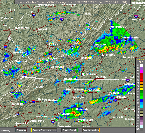 At 650 pm edt, a severe thunderstorm was located 8 miles east of abingdon, and is nearly stationary (radar indicated). Hazards include 60 mph wind gusts and quarter size hail. Hail damage to vehicles is expected. expect wind damage to roofs, siding, and trees. Locations impacted include, damascus and konnarock. At 650 pm edt, a severe thunderstorm was located 8 miles east of abingdon, and is nearly stationary (radar indicated). Hazards include 60 mph wind gusts and quarter size hail. Hail damage to vehicles is expected. expect wind damage to roofs, siding, and trees. Locations impacted include, damascus and konnarock.
|
| 7/31/2019 6:33 PM EDT |
 The national weather service in morristown has issued a * severe thunderstorm warning for. southeastern washington county in southwestern virginia. until 715 pm edt. At 632 pm edt, a severe thunderstorm was located 8 miles southwest of chilhowie, moving southeast at 5 mph. The national weather service in morristown has issued a * severe thunderstorm warning for. southeastern washington county in southwestern virginia. until 715 pm edt. At 632 pm edt, a severe thunderstorm was located 8 miles southwest of chilhowie, moving southeast at 5 mph.
|
| 6/22/2019 1:53 AM EDT |
 At 152 am edt, severe thunderstorms were located along a line extending from near lebanon to near ashland, moving east at 45 mph (radar indicated). Hazards include 60 mph wind gusts. Expect damage to roofs, siding, and trees. Locations impacted include, abingdon, lebanon, mountain city, cleveland va, glade spring, honaker, damascus, laurel bloomery, emory-meadow view, rosedale, shady valley, lindell, holston, harr and konnarock. At 152 am edt, severe thunderstorms were located along a line extending from near lebanon to near ashland, moving east at 45 mph (radar indicated). Hazards include 60 mph wind gusts. Expect damage to roofs, siding, and trees. Locations impacted include, abingdon, lebanon, mountain city, cleveland va, glade spring, honaker, damascus, laurel bloomery, emory-meadow view, rosedale, shady valley, lindell, holston, harr and konnarock.
|
| 6/22/2019 1:38 AM EDT |
 At 137 am edt, severe thunderstorms were located along a line extending from 6 miles southwest of cleveland va to near reese, moving northeast at 45 mph (radar indicated). Hazards include 60 mph wind gusts. Expect damage to roofs, siding, and trees. Locations impacted include, bristol tn, bristol va, abingdon, lebanon, mountain city, cleveland va, walnut hill, glade spring, honaker, damascus, laurel bloomery, emory-meadow view, rosedale, shady valley, south holston dam, collingwood, doeville, hansonville, konnarock and neva. At 137 am edt, severe thunderstorms were located along a line extending from 6 miles southwest of cleveland va to near reese, moving northeast at 45 mph (radar indicated). Hazards include 60 mph wind gusts. Expect damage to roofs, siding, and trees. Locations impacted include, bristol tn, bristol va, abingdon, lebanon, mountain city, cleveland va, walnut hill, glade spring, honaker, damascus, laurel bloomery, emory-meadow view, rosedale, shady valley, south holston dam, collingwood, doeville, hansonville, konnarock and neva.
|
| 6/22/2019 1:08 AM EDT |
 At 108 am edt, severe thunderstorms were located along a line extending from 11 miles northeast of gate city to near erwin, moving east at 50 mph (radar indicated). Hazards include 60 mph wind gusts. expect damage to roofs, siding, and trees At 108 am edt, severe thunderstorms were located along a line extending from 11 miles northeast of gate city to near erwin, moving east at 50 mph (radar indicated). Hazards include 60 mph wind gusts. expect damage to roofs, siding, and trees
|
| 9/9/2018 7:51 PM EDT |
 At 751 pm edt, severe thunderstorms were located along a line extending from 10 miles southeast of wise to near abingdon, moving northeast at 40 mph (radar indicated). Hazards include 60 mph wind gusts and penny size hail. Expect damage to roofs, siding, and trees. locations impacted include, bristol va, abingdon, lebanon, cleveland va, glade spring, honaker, st. Paul, damascus, nickelsville, dungannon, emory-meadow view, rosedale, dye, lindell, collingwood, castlewood, holston, hansonville, hilander park and benhams. At 751 pm edt, severe thunderstorms were located along a line extending from 10 miles southeast of wise to near abingdon, moving northeast at 40 mph (radar indicated). Hazards include 60 mph wind gusts and penny size hail. Expect damage to roofs, siding, and trees. locations impacted include, bristol va, abingdon, lebanon, cleveland va, glade spring, honaker, st. Paul, damascus, nickelsville, dungannon, emory-meadow view, rosedale, dye, lindell, collingwood, castlewood, holston, hansonville, hilander park and benhams.
|
| 9/9/2018 7:33 PM EDT |
 At 732 pm edt, severe thunderstorms were located along a line extending from 8 miles south of norton to bristol tn, moving northeast at 40 mph (radar indicated). Hazards include 60 mph wind gusts and penny size hail. Expect damage to roofs, siding, and trees. locations impacted include, kingsport, bristol tn, bristol va, abingdon, lebanon, gate city, cleveland va, walnut hill, bluff city, glade spring, honaker, st. Paul, damascus, nickelsville, dungannon, laurel bloomery, emory-meadow view, rosedale, shady valley and south holston dam. At 732 pm edt, severe thunderstorms were located along a line extending from 8 miles south of norton to bristol tn, moving northeast at 40 mph (radar indicated). Hazards include 60 mph wind gusts and penny size hail. Expect damage to roofs, siding, and trees. locations impacted include, kingsport, bristol tn, bristol va, abingdon, lebanon, gate city, cleveland va, walnut hill, bluff city, glade spring, honaker, st. Paul, damascus, nickelsville, dungannon, laurel bloomery, emory-meadow view, rosedale, shady valley and south holston dam.
|
| 9/9/2018 7:12 PM EDT |
 At 712 pm edt, severe thunderstorms were located along a line extending from 12 miles north of surgoinsville to near oak grove, moving northeast at 40 mph (radar indicated). Hazards include 60 mph wind gusts and penny size hail. expect damage to roofs, siding, and trees At 712 pm edt, severe thunderstorms were located along a line extending from 12 miles north of surgoinsville to near oak grove, moving northeast at 40 mph (radar indicated). Hazards include 60 mph wind gusts and penny size hail. expect damage to roofs, siding, and trees
|
| 7/20/2018 11:30 PM EDT |
 At 1129 pm edt, severe thunderstorms were located along a line extending from near mountain city to reese to banner elk to near bakersville, moving southeast at 40 mph (radar indicated). Hazards include 60 mph wind gusts and penny size hail. Expect damage to roofs, siding, and trees. Locations impacted include, mountain city, damascus, roane mountain state park, doeville, laurel bloomery, neva, hampton creek cove state park, elk mills, konnarock, roan mountain and emory-meadow view. At 1129 pm edt, severe thunderstorms were located along a line extending from near mountain city to reese to banner elk to near bakersville, moving southeast at 40 mph (radar indicated). Hazards include 60 mph wind gusts and penny size hail. Expect damage to roofs, siding, and trees. Locations impacted include, mountain city, damascus, roane mountain state park, doeville, laurel bloomery, neva, hampton creek cove state park, elk mills, konnarock, roan mountain and emory-meadow view.
|
| 7/20/2018 10:48 PM EDT |
 At 1047 pm edt, severe thunderstorms were located along a line extending from 7 miles northwest of bristol va to near walnut hill to central to 6 miles west of erwin, moving southeast at 40 mph (radar indicated). Hazards include 60 mph wind gusts and penny size hail. expect damage to roofs, siding, and trees At 1047 pm edt, severe thunderstorms were located along a line extending from 7 miles northwest of bristol va to near walnut hill to central to 6 miles west of erwin, moving southeast at 40 mph (radar indicated). Hazards include 60 mph wind gusts and penny size hail. expect damage to roofs, siding, and trees
|
| 7/20/2018 10:48 PM EDT |
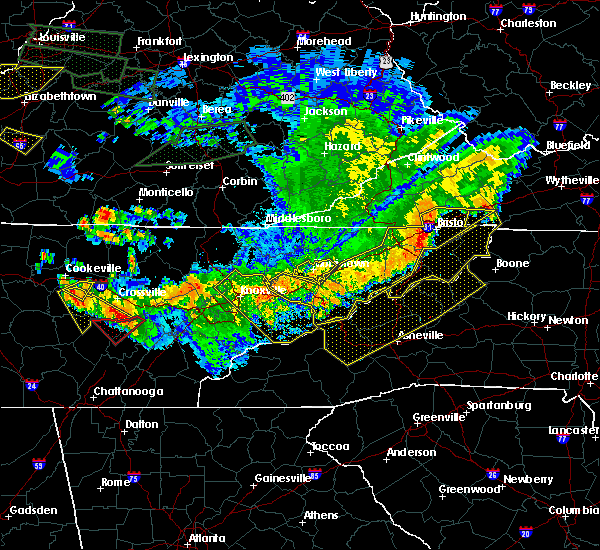 At 1047 pm edt, severe thunderstorms were located along a line extending from 7 miles northwest of bristol va to near walnut hill to central to 6 miles west of erwin, moving southeast at 40 mph (radar indicated). Hazards include 60 mph wind gusts and penny size hail. expect damage to roofs, siding, and trees At 1047 pm edt, severe thunderstorms were located along a line extending from 7 miles northwest of bristol va to near walnut hill to central to 6 miles west of erwin, moving southeast at 40 mph (radar indicated). Hazards include 60 mph wind gusts and penny size hail. expect damage to roofs, siding, and trees
|
| 6/25/2018 4:13 PM EDT |
 At 413 pm edt, severe thunderstorms were located along a line extending from near marion to 9 miles west of mountain city, moving southeast at 35 mph (radar indicated). Hazards include 60 mph wind gusts and penny size hail. Expect damage to roofs, siding, and trees. Locations impacted include, abingdon, mountain city, glade spring, damascus, south holston dam, laurel bloomery, emory-meadow view, harr, shady valley and konnarock. At 413 pm edt, severe thunderstorms were located along a line extending from near marion to 9 miles west of mountain city, moving southeast at 35 mph (radar indicated). Hazards include 60 mph wind gusts and penny size hail. Expect damage to roofs, siding, and trees. Locations impacted include, abingdon, mountain city, glade spring, damascus, south holston dam, laurel bloomery, emory-meadow view, harr, shady valley and konnarock.
|
| 6/25/2018 3:53 PM EDT |
 At 353 pm edt, severe thunderstorms were located along a line extending from near richlands to near bristol tn, moving east at 30 mph (radar indicated). Hazards include 60 mph wind gusts and penny size hail. expect damage to roofs, siding, and trees At 353 pm edt, severe thunderstorms were located along a line extending from near richlands to near bristol tn, moving east at 30 mph (radar indicated). Hazards include 60 mph wind gusts and penny size hail. expect damage to roofs, siding, and trees
|
| 5/10/2018 6:48 PM EDT |
 At 648 pm edt, a severe thunderstorm was located near abingdon, moving southeast at 30 mph (radar indicated). Hazards include 60 mph wind gusts and quarter size hail. Hail damage to vehicles is expected. Expect wind damage to roofs, siding, and trees. At 648 pm edt, a severe thunderstorm was located near abingdon, moving southeast at 30 mph (radar indicated). Hazards include 60 mph wind gusts and quarter size hail. Hail damage to vehicles is expected. Expect wind damage to roofs, siding, and trees.
|
| 5/10/2018 6:48 PM EDT |
 The national weather service in morristown has issued a * severe thunderstorm warning for. northeastern sullivan county in east tennessee. northern johnson county in east tennessee. the northeastern city of bristol in southwestern virginia. Southeastern washington county in southwestern virginia. The national weather service in morristown has issued a * severe thunderstorm warning for. northeastern sullivan county in east tennessee. northern johnson county in east tennessee. the northeastern city of bristol in southwestern virginia. Southeastern washington county in southwestern virginia.
|
| 11/18/2017 10:16 PM EST |
 At 1016 pm est, severe thunderstorms were located along a line extending from near bristol va to near bristol tn to midway, moving east at 60 mph (radar indicated). Hazards include 60 mph wind gusts. expect damage to roofs, siding, and trees At 1016 pm est, severe thunderstorms were located along a line extending from near bristol va to near bristol tn to midway, moving east at 60 mph (radar indicated). Hazards include 60 mph wind gusts. expect damage to roofs, siding, and trees
|
| 5/24/2017 2:21 PM EDT |
 At 221 pm edt, severe thunderstorms were located along a line extending from 6 miles north of lebanon to 7 miles west of saltville to 7 miles southwest of quarry to 9 miles southeast of abingdon, moving northeast at 45 mph (radar indicated). Hazards include 60 mph wind gusts. Expect damage to roofs, siding, and trees. Locations impacted include, abingdon, lebanon, glade spring, honaker, damascus, lindell, dye, emory-meadow view, rosedale and konnarock. At 221 pm edt, severe thunderstorms were located along a line extending from 6 miles north of lebanon to 7 miles west of saltville to 7 miles southwest of quarry to 9 miles southeast of abingdon, moving northeast at 45 mph (radar indicated). Hazards include 60 mph wind gusts. Expect damage to roofs, siding, and trees. Locations impacted include, abingdon, lebanon, glade spring, honaker, damascus, lindell, dye, emory-meadow view, rosedale and konnarock.
|
| 5/24/2017 2:13 PM EDT |
 At 213 pm edt, severe thunderstorms were located along a line extending from near lebanon to near abingdon to 8 miles northwest of mountain city, moving northeast at 55 mph (radar indicated). Hazards include 60 mph wind gusts. Expect damage to roofs, siding, and trees. Locations impacted include, abingdon, lebanon, cleveland va, glade spring, honaker, damascus, emory-meadow view, rosedale, lindell, dye, holston, hansonville, hilander park, harr and konnarock. At 213 pm edt, severe thunderstorms were located along a line extending from near lebanon to near abingdon to 8 miles northwest of mountain city, moving northeast at 55 mph (radar indicated). Hazards include 60 mph wind gusts. Expect damage to roofs, siding, and trees. Locations impacted include, abingdon, lebanon, cleveland va, glade spring, honaker, damascus, emory-meadow view, rosedale, lindell, dye, holston, hansonville, hilander park, harr and konnarock.
|
| 5/24/2017 1:39 PM EDT |
 At 139 pm edt, severe thunderstorms were located along a line extending from 6 miles north of surgoinsville to 10 miles west of gray to 8 miles west of jonesborough to 11 miles southeast of tusculum, moving northeast at 45 mph (radar indicated). Hazards include 60 mph wind gusts. expect damage to roofs, siding, and trees At 139 pm edt, severe thunderstorms were located along a line extending from 6 miles north of surgoinsville to 10 miles west of gray to 8 miles west of jonesborough to 11 miles southeast of tusculum, moving northeast at 45 mph (radar indicated). Hazards include 60 mph wind gusts. expect damage to roofs, siding, and trees
|
| 5/20/2017 2:53 PM EDT |
 At 253 pm edt, a severe thunderstorm was located 8 miles north of mountain city, and is nearly stationary (radar indicated). Hazards include 60 mph wind gusts and quarter size hail. Hail damage to vehicles is expected. Expect wind damage to roofs, siding, and trees. At 253 pm edt, a severe thunderstorm was located 8 miles north of mountain city, and is nearly stationary (radar indicated). Hazards include 60 mph wind gusts and quarter size hail. Hail damage to vehicles is expected. Expect wind damage to roofs, siding, and trees.
|
| 5/20/2017 2:53 PM EDT |
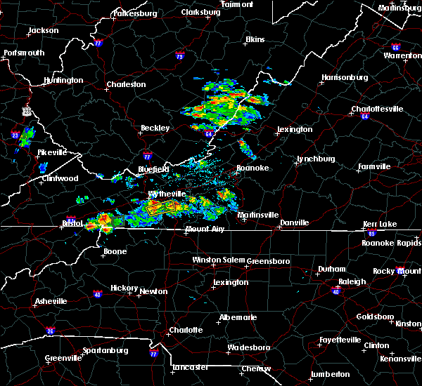 At 253 pm edt, a severe thunderstorm was located 8 miles north of mountain city, and is nearly stationary (radar indicated). Hazards include 60 mph wind gusts and quarter size hail. Hail damage to vehicles is expected. Expect wind damage to roofs, siding, and trees. At 253 pm edt, a severe thunderstorm was located 8 miles north of mountain city, and is nearly stationary (radar indicated). Hazards include 60 mph wind gusts and quarter size hail. Hail damage to vehicles is expected. Expect wind damage to roofs, siding, and trees.
|
| 4/29/2017 4:50 PM EDT |
 At 450 pm edt, a severe thunderstorm was located near chilhowie, moving northeast at 20 mph (radar indicated). Hazards include 60 mph wind gusts and quarter size hail. Hail damage to vehicles is expected. expect wind damage to roofs, siding, and trees. Locations impacted include, glade spring, damascus and emory-meadow view. At 450 pm edt, a severe thunderstorm was located near chilhowie, moving northeast at 20 mph (radar indicated). Hazards include 60 mph wind gusts and quarter size hail. Hail damage to vehicles is expected. expect wind damage to roofs, siding, and trees. Locations impacted include, glade spring, damascus and emory-meadow view.
|
| 4/29/2017 4:38 PM EDT |
 At 438 pm edt, a severe thunderstorm was located 8 miles southwest of chilhowie, moving northeast at 20 mph (radar indicated). Hazards include 60 mph wind gusts and quarter size hail. Hail damage to vehicles is expected. Expect wind damage to roofs, siding, and trees. At 438 pm edt, a severe thunderstorm was located 8 miles southwest of chilhowie, moving northeast at 20 mph (radar indicated). Hazards include 60 mph wind gusts and quarter size hail. Hail damage to vehicles is expected. Expect wind damage to roofs, siding, and trees.
|
| 3/1/2017 12:21 PM EST |
 At 1220 pm est, severe thunderstorms were located along a line extending from chilhowie to near bristol tn, moving east at 55 mph (radar indicated). Hazards include 60 mph wind gusts and penny size hail. expect damage to roofs, siding, and trees At 1220 pm est, severe thunderstorms were located along a line extending from chilhowie to near bristol tn, moving east at 55 mph (radar indicated). Hazards include 60 mph wind gusts and penny size hail. expect damage to roofs, siding, and trees
|
| 3/1/2017 12:03 PM EST |
 At 1202 pm est, severe thunderstorms were located along a line extending from near lebanon to 6 miles northeast of surgoinsville, moving southeast at 25 mph (radar indicated). Hazards include 60 mph wind gusts and penny size hail. Expect damage to roofs, siding, and trees. locations impacted include, kingsport, bristol tn, bristol va, abingdon, rogersville, lebanon, gate city, surgoinsville, weber city, cleveland va, walnut hill, church hill, mount carmel, coeburn, glade spring, honaker, st. Paul, damascus, nickelsville and dungannon. At 1202 pm est, severe thunderstorms were located along a line extending from near lebanon to 6 miles northeast of surgoinsville, moving southeast at 25 mph (radar indicated). Hazards include 60 mph wind gusts and penny size hail. Expect damage to roofs, siding, and trees. locations impacted include, kingsport, bristol tn, bristol va, abingdon, rogersville, lebanon, gate city, surgoinsville, weber city, cleveland va, walnut hill, church hill, mount carmel, coeburn, glade spring, honaker, st. Paul, damascus, nickelsville and dungannon.
|
| 3/1/2017 11:10 AM EST |
 At 1109 am est, severe thunderstorms were located along a line extending from 8 miles east of wise to near jonesville, moving southeast at 50 mph (radar indicated). Hazards include 60 mph wind gusts and penny size hail. expect damage to roofs, siding, and trees At 1109 am est, severe thunderstorms were located along a line extending from 8 miles east of wise to near jonesville, moving southeast at 50 mph (radar indicated). Hazards include 60 mph wind gusts and penny size hail. expect damage to roofs, siding, and trees
|
| 11/30/2016 7:28 AM EST |
 At 728 am est, severe thunderstorms were located along a line extending from 6 miles west of allison gap to 6 miles south of abingdon to 11 miles west of mountain city, moving east at 60 mph (radar indicated). Hazards include 60 mph wind gusts. Expect damage to roofs. siding. and trees. Locations impacted include, abingdon, mountain city, glade spring, damascus, harr, sadie, laurel bloomery, doeville, rosedale, lindell, emory-meadow view, neva and shady valley. At 728 am est, severe thunderstorms were located along a line extending from 6 miles west of allison gap to 6 miles south of abingdon to 11 miles west of mountain city, moving east at 60 mph (radar indicated). Hazards include 60 mph wind gusts. Expect damage to roofs. siding. and trees. Locations impacted include, abingdon, mountain city, glade spring, damascus, harr, sadie, laurel bloomery, doeville, rosedale, lindell, emory-meadow view, neva and shady valley.
|
| 11/30/2016 7:02 AM EST |
 At 701 am est, severe thunderstorms were located along a line extending from 9 miles southwest of cleveland va to 6 miles west of walnut hill to near midway, moving east at 55 mph (radar indicated). Hazards include 60 mph wind gusts. Expect damage to roofs. siding. and trees. Locations impacted include, johnson city, kingsport, bristol tn, bristol va, elizabethton, abingdon, lebanon, mountain city, jonesborough, cleveland va, central, walnut hill, oak grove, spurgeon, hampton, gray, pine crest, midway, colonial heights and bluff city. At 701 am est, severe thunderstorms were located along a line extending from 9 miles southwest of cleveland va to 6 miles west of walnut hill to near midway, moving east at 55 mph (radar indicated). Hazards include 60 mph wind gusts. Expect damage to roofs. siding. and trees. Locations impacted include, johnson city, kingsport, bristol tn, bristol va, elizabethton, abingdon, lebanon, mountain city, jonesborough, cleveland va, central, walnut hill, oak grove, spurgeon, hampton, gray, pine crest, midway, colonial heights and bluff city.
|
| 11/30/2016 6:47 AM EST |
 At 646 am est, severe thunderstorms were located along a line extending from 11 miles southeast of norton to near kingsport to near tusculum, moving east at 50 mph (radar indicated). Hazards include 60 mph wind gusts. Expect damage to roofs. siding. And trees. At 646 am est, severe thunderstorms were located along a line extending from 11 miles southeast of norton to near kingsport to near tusculum, moving east at 50 mph (radar indicated). Hazards include 60 mph wind gusts. Expect damage to roofs. siding. And trees.
|
| 11/30/2016 5:17 AM EST |
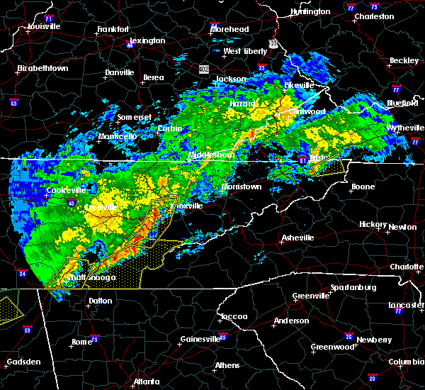 At 517 am est, a severe thunderstorm was located 9 miles southeast of bristol tn, moving east at 45 mph (radar indicated). Hazards include 60 mph wind gusts and penny size hail. Expect damage to roofs. siding. and trees. Locations impacted include, mountain city, sadie, harr, south holston dam and shady valley. At 517 am est, a severe thunderstorm was located 9 miles southeast of bristol tn, moving east at 45 mph (radar indicated). Hazards include 60 mph wind gusts and penny size hail. Expect damage to roofs. siding. and trees. Locations impacted include, mountain city, sadie, harr, south holston dam and shady valley.
|
| 11/30/2016 5:09 AM EST |
 At 509 am est, a severe thunderstorm was located near bristol tn, moving east at 50 mph (radar indicated). Hazards include 60 mph wind gusts and penny size hail. Expect damage to roofs. siding. and trees. Locations impacted include, bristol tn, bristol va, elizabethton, abingdon, mountain city, walnut hill, bluff city, damascus, watauga, hunter, hilander park, sadie, harr, south holston dam, laurel bloomery, doeville, emory-meadow view, morril`s cave, neva and shady valley. At 509 am est, a severe thunderstorm was located near bristol tn, moving east at 50 mph (radar indicated). Hazards include 60 mph wind gusts and penny size hail. Expect damage to roofs. siding. and trees. Locations impacted include, bristol tn, bristol va, elizabethton, abingdon, mountain city, walnut hill, bluff city, damascus, watauga, hunter, hilander park, sadie, harr, south holston dam, laurel bloomery, doeville, emory-meadow view, morril`s cave, neva and shady valley.
|
| 11/30/2016 4:51 AM EST |
 At 451 am est, a severe thunderstorm was located over oak grove, or near johnson city, moving east at 50 mph (radar indicated). Hazards include 60 mph wind gusts and quarter size hail. Hail damage to vehicles is expected. Expect wind damage to roofs, siding, and trees. At 451 am est, a severe thunderstorm was located over oak grove, or near johnson city, moving east at 50 mph (radar indicated). Hazards include 60 mph wind gusts and quarter size hail. Hail damage to vehicles is expected. Expect wind damage to roofs, siding, and trees.
|
| 8/15/2016 3:49 PM EDT |
 At 349 pm edt, severe thunderstorms were located along a line extending from near big black mountain to near bristol tn, moving northeast at 25 mph (radar indicated). Hazards include 60 mph wind gusts and nickel size hail. Expect damage to roofs. siding. and trees. locations impacted include, bristol tn, bristol va, abingdon, norton, lebanon, wise, big stone gap, cleveland va, walnut hill, coeburn, appalachia, bluff city, glade spring, pound, st. Paul, damascus, nickelsville, dungannon, south holston dam and pardee. At 349 pm edt, severe thunderstorms were located along a line extending from near big black mountain to near bristol tn, moving northeast at 25 mph (radar indicated). Hazards include 60 mph wind gusts and nickel size hail. Expect damage to roofs. siding. and trees. locations impacted include, bristol tn, bristol va, abingdon, norton, lebanon, wise, big stone gap, cleveland va, walnut hill, coeburn, appalachia, bluff city, glade spring, pound, st. Paul, damascus, nickelsville, dungannon, south holston dam and pardee.
|
| 8/15/2016 3:23 PM EDT |
 At 323 pm edt, severe thunderstorms were located along a line extending from holmes mill to 6 miles south of walnut hill, moving northeast at 25 mph (radar indicated). Hazards include 60 mph wind gusts and nickel size hail. Expect damage to roofs. siding. And trees. At 323 pm edt, severe thunderstorms were located along a line extending from holmes mill to 6 miles south of walnut hill, moving northeast at 25 mph (radar indicated). Hazards include 60 mph wind gusts and nickel size hail. Expect damage to roofs. siding. And trees.
|
| 8/14/2016 5:26 PM EDT |
 The severe thunderstorm warning for northeastern johnson and southeastern washington counties will expire at 530 pm edt, the storm which prompted the warning has weakened below severe limits, and has exited the warned area. therefore, the warning will be allowed to expire. The severe thunderstorm warning for northeastern johnson and southeastern washington counties will expire at 530 pm edt, the storm which prompted the warning has weakened below severe limits, and has exited the warned area. therefore, the warning will be allowed to expire.
|
| 8/14/2016 5:09 PM EDT |
 At 509 pm edt, a severe thunderstorm was located near mountain city, moving northeast at 20 mph (radar indicated). Hazards include 60 mph wind gusts. Expect damage to roofs. siding. and trees. Locations impacted include, mountain city, damascus, konnarock and laurel bloomery. At 509 pm edt, a severe thunderstorm was located near mountain city, moving northeast at 20 mph (radar indicated). Hazards include 60 mph wind gusts. Expect damage to roofs. siding. and trees. Locations impacted include, mountain city, damascus, konnarock and laurel bloomery.
|
| 8/14/2016 5:09 PM EDT |
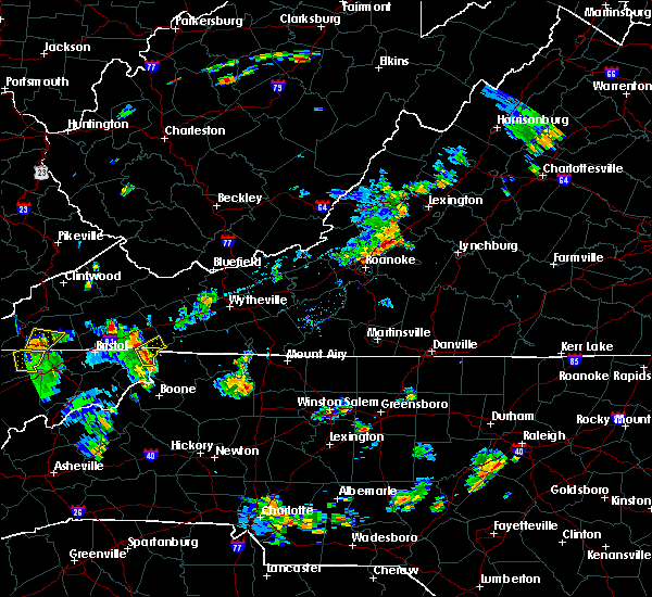 At 509 pm edt, a severe thunderstorm was located near mountain city, moving northeast at 20 mph (radar indicated). Hazards include 60 mph wind gusts. Expect damage to roofs. siding. and trees. Locations impacted include, mountain city, damascus, konnarock and laurel bloomery. At 509 pm edt, a severe thunderstorm was located near mountain city, moving northeast at 20 mph (radar indicated). Hazards include 60 mph wind gusts. Expect damage to roofs. siding. and trees. Locations impacted include, mountain city, damascus, konnarock and laurel bloomery.
|
| 8/14/2016 4:48 PM EDT |
 At 448 pm edt, a severe thunderstorm was located near mountain city, moving northeast at 20 mph (radar indicated). Hazards include 60 mph wind gusts and quarter size hail. Hail damage to vehicles is expected. Expect wind damage to roofs, siding, and trees. At 448 pm edt, a severe thunderstorm was located near mountain city, moving northeast at 20 mph (radar indicated). Hazards include 60 mph wind gusts and quarter size hail. Hail damage to vehicles is expected. Expect wind damage to roofs, siding, and trees.
|
| 7/4/2016 9:38 PM EDT |
 The severe thunderstorm warning for northeastern johnson and eastern washington counties will expire at 945 pm edt, the storms which prompted the warning have moved out of the area. therefore the warning will be allowed to expire. The severe thunderstorm warning for northeastern johnson and eastern washington counties will expire at 945 pm edt, the storms which prompted the warning have moved out of the area. therefore the warning will be allowed to expire.
|
| 7/4/2016 9:24 PM EDT |
 At 924 pm edt, severe thunderstorms were located along a line extending from saltville to 7 miles north of mountain city, moving east at 45 mph (radar indicated). Hazards include 60 mph wind gusts and penny size hail. Expect damage to roofs. siding. and trees. Locations impacted include, mountain city, glade spring, damascus, konnarock, emory-meadow view and laurel bloomery. At 924 pm edt, severe thunderstorms were located along a line extending from saltville to 7 miles north of mountain city, moving east at 45 mph (radar indicated). Hazards include 60 mph wind gusts and penny size hail. Expect damage to roofs. siding. and trees. Locations impacted include, mountain city, glade spring, damascus, konnarock, emory-meadow view and laurel bloomery.
|
| 7/4/2016 9:07 PM EDT |
 At 907 pm edt, severe thunderstorms were located along a line extending from 7 miles north of abingdon to 10 miles southeast of bristol va, moving east at 45 mph (radar indicated). Hazards include 60 mph wind gusts and penny size hail. Expect damage to roofs. siding. And trees. At 907 pm edt, severe thunderstorms were located along a line extending from 7 miles north of abingdon to 10 miles southeast of bristol va, moving east at 45 mph (radar indicated). Hazards include 60 mph wind gusts and penny size hail. Expect damage to roofs. siding. And trees.
|
| 6/23/2016 10:00 PM EDT |
 At 1000 pm edt, a severe thunderstorm was located near mountain city, moving southeast at 25 mph (radar indicated). Hazards include 60 mph wind gusts and quarter size hail. Hail damage to vehicles is expected. expect wind damage to roofs, siding, and trees. Locations impacted include, bristol tn, bristol va, abingdon, mountain city, walnut hill, glade spring, damascus, trade, sadie, south holston dam, elk mills, shady valley, hunter, benhams, harr, hilander park, laurel bloomery, doeville, holston and konnarock. At 1000 pm edt, a severe thunderstorm was located near mountain city, moving southeast at 25 mph (radar indicated). Hazards include 60 mph wind gusts and quarter size hail. Hail damage to vehicles is expected. expect wind damage to roofs, siding, and trees. Locations impacted include, bristol tn, bristol va, abingdon, mountain city, walnut hill, glade spring, damascus, trade, sadie, south holston dam, elk mills, shady valley, hunter, benhams, harr, hilander park, laurel bloomery, doeville, holston and konnarock.
|
| 6/23/2016 9:22 PM EDT |
 At 921 pm edt, a severe thunderstorm was located near bristol va, moving southeast at 30 mph (radar indicated). Hazards include 60 mph wind gusts and quarter size hail. Hail damage to vehicles is expected. Expect wind damage to roofs, siding, and trees. At 921 pm edt, a severe thunderstorm was located near bristol va, moving southeast at 30 mph (radar indicated). Hazards include 60 mph wind gusts and quarter size hail. Hail damage to vehicles is expected. Expect wind damage to roofs, siding, and trees.
|
| 6/23/2016 8:46 PM EDT |
 At 845 pm edt, a severe thunderstorm was located 8 miles east of abingdon, moving southeast at 35 mph (radar indicated). Hazards include 60 mph wind gusts and quarter size hail. Hail damage to vehicles is expected. expect wind damage to roofs, siding, and trees. locations impacted include, bristol tn, bristol va, abingdon, lebanon, cleveland va, glade spring, honaker, st. Paul, damascus, hilander park, harr, holston, konnarock, rosedale, castlewood, dye, lindell, emory-meadow view and hansonville. At 845 pm edt, a severe thunderstorm was located 8 miles east of abingdon, moving southeast at 35 mph (radar indicated). Hazards include 60 mph wind gusts and quarter size hail. Hail damage to vehicles is expected. expect wind damage to roofs, siding, and trees. locations impacted include, bristol tn, bristol va, abingdon, lebanon, cleveland va, glade spring, honaker, st. Paul, damascus, hilander park, harr, holston, konnarock, rosedale, castlewood, dye, lindell, emory-meadow view and hansonville.
|
| 6/23/2016 8:11 PM EDT |
 At 811 pm edt, a severe thunderstorm was located near cleveland va, or 7 miles south of davenport, moving southeast at 35 mph (radar indicated). Hazards include 60 mph wind gusts and quarter size hail. Hail damage to vehicles is expected. Expect wind damage to roofs, siding, and trees. At 811 pm edt, a severe thunderstorm was located near cleveland va, or 7 miles south of davenport, moving southeast at 35 mph (radar indicated). Hazards include 60 mph wind gusts and quarter size hail. Hail damage to vehicles is expected. Expect wind damage to roofs, siding, and trees.
|
| 6/22/2016 3:34 PM EDT |
 At 334 pm edt, a severe thunderstorm was located 9 miles northwest of flatwood, or 9 miles west of whitetop, moving southeast at 25 mph (radar indicated). Hazards include 60 mph wind gusts and penny size hail. Expect damage to roofs. siding. and trees. Locations impacted include, mountain city, damascus, harr, laurel bloomery, shady valley and trade. At 334 pm edt, a severe thunderstorm was located 9 miles northwest of flatwood, or 9 miles west of whitetop, moving southeast at 25 mph (radar indicated). Hazards include 60 mph wind gusts and penny size hail. Expect damage to roofs. siding. and trees. Locations impacted include, mountain city, damascus, harr, laurel bloomery, shady valley and trade.
|
| 6/22/2016 3:23 PM EDT |
 At 322 pm edt, a severe thunderstorm was located near abingdon, moving southeast at 25 mph (radar indicated). Hazards include 60 mph wind gusts and quarter size hail. Hail damage to vehicles is expected. Expect wind damage to roofs, siding, and trees. At 322 pm edt, a severe thunderstorm was located near abingdon, moving southeast at 25 mph (radar indicated). Hazards include 60 mph wind gusts and quarter size hail. Hail damage to vehicles is expected. Expect wind damage to roofs, siding, and trees.
|
| 6/17/2016 12:26 AM EDT |
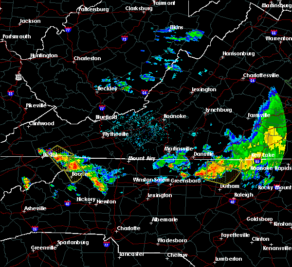 At 1225 am edt, a severe thunderstorm was located 7 miles northwest of mountain city, moving southeast at 30 mph (radar indicated). Hazards include 60 mph wind gusts and penny size hail. Expect damage to roofs. siding. and trees. Locations impacted include, abingdon, mountain city, damascus, trade, hilander park, harr, laurel bloomery, neva, shady valley and emory-meadow view. At 1225 am edt, a severe thunderstorm was located 7 miles northwest of mountain city, moving southeast at 30 mph (radar indicated). Hazards include 60 mph wind gusts and penny size hail. Expect damage to roofs. siding. and trees. Locations impacted include, abingdon, mountain city, damascus, trade, hilander park, harr, laurel bloomery, neva, shady valley and emory-meadow view.
|
| 6/17/2016 12:14 AM EDT |
 At 1214 am edt, a severe thunderstorm was located near mountain city, moving southeast at 30 mph (radar indicated). Hazards include 60 mph wind gusts and quarter size hail. Hail damage to vehicles is expected. expect wind damage to roofs, siding, and trees. Locations impacted include, abingdon, mountain city, damascus, trade, hilander park, harr, laurel bloomery, neva, shady valley and emory-meadow view. At 1214 am edt, a severe thunderstorm was located near mountain city, moving southeast at 30 mph (radar indicated). Hazards include 60 mph wind gusts and quarter size hail. Hail damage to vehicles is expected. expect wind damage to roofs, siding, and trees. Locations impacted include, abingdon, mountain city, damascus, trade, hilander park, harr, laurel bloomery, neva, shady valley and emory-meadow view.
|
| 6/16/2016 11:59 PM EDT |
 At 1158 pm edt, a severe thunderstorm was located 8 miles southeast of abingdon, moving southeast at 30 mph (radar indicated). Hazards include 60 mph wind gusts and quarter size hail. Hail damage to vehicles is expected. Expect wind damage to roofs, siding, and trees. At 1158 pm edt, a severe thunderstorm was located 8 miles southeast of abingdon, moving southeast at 30 mph (radar indicated). Hazards include 60 mph wind gusts and quarter size hail. Hail damage to vehicles is expected. Expect wind damage to roofs, siding, and trees.
|
| 3/14/2016 3:54 PM EDT |
 At 353 pm edt, a severe thunderstorm was located over abingdon, moving northeast at 35 mph (radar indicated). Hazards include 60 mph wind gusts and quarter size hail. Hail damage to vehicles is expected. expect wind damage to roofs, siding, and trees. Locations impacted include, abingdon, bristol va, bristol, glade spring, damascus, lindell, benhams, shady valley, holston, south holston dam, hilander park, konnarock, harr and emory-meadow view. At 353 pm edt, a severe thunderstorm was located over abingdon, moving northeast at 35 mph (radar indicated). Hazards include 60 mph wind gusts and quarter size hail. Hail damage to vehicles is expected. expect wind damage to roofs, siding, and trees. Locations impacted include, abingdon, bristol va, bristol, glade spring, damascus, lindell, benhams, shady valley, holston, south holston dam, hilander park, konnarock, harr and emory-meadow view.
|
| 3/14/2016 3:37 PM EDT |
 At 337 pm edt, a severe thunderstorm was located over bristol tn, moving northeast at 25 mph (radar indicated). Hazards include 60 mph wind gusts and quarter size hail. Hail damage to vehicles is expected. Expect wind damage to roofs, siding, and trees. At 337 pm edt, a severe thunderstorm was located over bristol tn, moving northeast at 25 mph (radar indicated). Hazards include 60 mph wind gusts and quarter size hail. Hail damage to vehicles is expected. Expect wind damage to roofs, siding, and trees.
|
| 7/13/2015 6:35 PM EDT |
 A severe thunderstorm warning remains in effect until 700 pm edt for washington. southeastern scott counties and the city of bristol. at 634 pm edt. severe thunderstorms were located along a line extending from 32 miles northeast of abingdon to near kingsport. Moving east at 60 mph. A severe thunderstorm warning remains in effect until 700 pm edt for washington. southeastern scott counties and the city of bristol. at 634 pm edt. severe thunderstorms were located along a line extending from 32 miles northeast of abingdon to near kingsport. Moving east at 60 mph.
|
| 7/13/2015 6:20 PM EDT |
 A severe thunderstorm warning remains in effect until 700 pm edt for washington. central russell. southeastern scott counties and the city of bristol. at 620 pm edt. severe thunderstorms were located along a line extending from 23 miles east of lebanon to 7 miles southwest of gate city. Moving east at 60 mph. A severe thunderstorm warning remains in effect until 700 pm edt for washington. central russell. southeastern scott counties and the city of bristol. at 620 pm edt. severe thunderstorms were located along a line extending from 23 miles east of lebanon to 7 miles southwest of gate city. Moving east at 60 mph.
|
| 7/13/2015 6:03 PM EDT |
 At 601 pm edt, severe thunderstorms were located along a line extending from 12 miles northeast of lebanon to 8 miles southeast of jonesville, moving east at 50 mph (radar indicated). Hazards include 60 mph wind gusts and quarter size hail. Hail damage to vehicles is possible. Expect wind damage to roofs, siding and trees. At 601 pm edt, severe thunderstorms were located along a line extending from 12 miles northeast of lebanon to 8 miles southeast of jonesville, moving east at 50 mph (radar indicated). Hazards include 60 mph wind gusts and quarter size hail. Hail damage to vehicles is possible. Expect wind damage to roofs, siding and trees.
|
| 6/23/2015 8:52 PM EDT |
 At 852 pm edt, a severe thunderstorm was located near allison gap, or near saltville, moving southeast at 20 mph (radar indicated). Hazards include 60 mph wind gusts and quarter size hail. Hail damage to vehicles is expected. Expect wind damage to roofs, siding and trees. At 852 pm edt, a severe thunderstorm was located near allison gap, or near saltville, moving southeast at 20 mph (radar indicated). Hazards include 60 mph wind gusts and quarter size hail. Hail damage to vehicles is expected. Expect wind damage to roofs, siding and trees.
|
| 6/8/2015 7:01 PM EDT | At 700 pm edt, severe thunderstorms were located along a line extending from adwolf to near mountain city, moving east at 30 mph (radar indicated). Hazards include 60 mph wind gusts and nickel size hail. Expect damage to roofs. siding and trees. Locations impacted include, mountain city, damascus, konnarock and laurel bloomery. |
| 6/8/2015 7:01 PM EDT | At 700 pm edt, severe thunderstorms were located along a line extending from adwolf to near mountain city, moving east at 30 mph (radar indicated). Hazards include 60 mph wind gusts and nickel size hail. Expect damage to roofs. siding and trees. Locations impacted include, mountain city, damascus, konnarock and laurel bloomery. |
| 6/8/2015 6:50 PM EDT | Several trees down in the eastern portion of the count in washington county VA, 0.4 miles NNW of Damascus, VA |
| 6/8/2015 6:44 PM EDT | At 643 pm edt, severe thunderstorms were located along a line extending from chilhowie to 6 miles west of mountain city, moving east at 30 mph (radar indicated). Hazards include 60 mph wind gusts and nickel size hail. Expect damage to roofs. Siding and trees. |
| 6/8/2015 6:44 PM EDT | At 643 pm edt, severe thunderstorms were located along a line extending from chilhowie to 6 miles west of mountain city, moving east at 30 mph (radar indicated). Hazards include 60 mph wind gusts and nickel size hail. Expect damage to roofs. Siding and trees. |
| 6/8/2015 6:31 PM EDT | At 631 pm edt, a severe thunderstorm was located 9 miles southeast of bristol va, moving east at 35 mph (radar indicated). Hazards include 60 mph wind gusts and nickel size hail. Expect damage to roofs. siding and trees. Locations impacted include, bristol tn, bristol va, mountain city, damascus, harr, sadie, south holston dam, laurel bloomery, neva, shady valley and hunter. |
| 6/8/2015 6:31 PM EDT | At 631 pm edt, a severe thunderstorm was located 9 miles southeast of bristol va, moving east at 35 mph (radar indicated). Hazards include 60 mph wind gusts and nickel size hail. Expect damage to roofs. siding and trees. Locations impacted include, bristol tn, bristol va, mountain city, damascus, harr, sadie, south holston dam, laurel bloomery, neva, shady valley and hunter. |
| 6/8/2015 6:17 PM EDT | At 616 pm edt, severe thunderstorms were located along a line extending from near raven to near bristol va, moving east at 35 mph (radar indicated). Hazards include 60 mph wind gusts and nickel size hail. Expect damage to roofs. siding and trees. Locations impacted include, bristol va, abingdon, lebanon, glade spring, honaker, damascus, benhams, hilander park, holston, konnarock, rosedale, dye, lindell, emory-meadow view and hansonville. |
| 6/8/2015 6:02 PM EDT | At 601 pm edt, a severe thunderstorm was located near walnut hill, or 9 miles west of bristol tn, moving east at 35 mph (radar indicated). Hazards include 60 mph wind gusts and nickel size hail. Expect damage to roofs. Siding and trees. |
| 6/8/2015 6:02 PM EDT | At 601 pm edt, a severe thunderstorm was located near walnut hill, or 9 miles west of bristol tn, moving east at 35 mph (radar indicated). Hazards include 60 mph wind gusts and nickel size hail. Expect damage to roofs. Siding and trees. |
| 6/8/2015 5:45 PM EDT | At 544 pm edt, severe thunderstorms were located along a line extending from near trammel to 6 miles east of weber city, moving east at 30 mph (radar indicated). Hazards include 60 mph wind gusts and nickel size hail. Expect damage to roofs. Siding and trees. |
| 4/25/2015 9:33 PM EDT | At 932 pm edt, a severe thunderstorm was located near lebanon, moving southeast at 25 mph (radar indicated). Hazards include half dollar size hail and 60 mph wind gusts. Hail damage to vehicles is expected. Expect wind damage to roofs, siding and trees. |
| 4/19/2015 11:33 PM EDT | At 1132 pm edt, severe thunderstorms were located along a line extending from 11 miles northeast of cleveland to 9 miles north of abingdon to 8 miles north of mountain city, moving northeast at 55 mph (radar indicated). Hazards include 60 mph wind gusts. Expect damage to roofs. siding and trees. locations impacted include, abingdon, lebanon, mountain city, bristol tn, bristol va, bristol, cleveland, walnut hill, bluff city, glade spring, honaker, st. paul, damascus, lindell, hansonville, laurel bloomery, holston, castlewood, collingwood and rosedale. 75in. |
| 4/19/2015 11:33 PM EDT | At 1132 pm edt, severe thunderstorms were located along a line extending from 11 miles northeast of cleveland to 9 miles north of abingdon to 8 miles north of mountain city, moving northeast at 55 mph (radar indicated). Hazards include 60 mph wind gusts. Expect damage to roofs. siding and trees. locations impacted include, abingdon, lebanon, mountain city, bristol tn, bristol va, bristol, cleveland, walnut hill, bluff city, glade spring, honaker, st. paul, damascus, lindell, hansonville, laurel bloomery, holston, castlewood, collingwood and rosedale. 75in. |
| 4/19/2015 11:11 PM EDT | At 1110 pm edt, severe thunderstorms were located along a line extending from 8 miles west of cleveland to 9 miles northwest of bristol va to near bristol, moving northeast at 55 mph (radar indicated). Hazards include 60 mph wind gusts. Expect damage to roofs. Siding and trees. |
| 4/19/2015 11:11 PM EDT | At 1110 pm edt, severe thunderstorms were located along a line extending from 8 miles west of cleveland to 9 miles northwest of bristol va to near bristol, moving northeast at 55 mph (radar indicated). Hazards include 60 mph wind gusts. Expect damage to roofs. Siding and trees. |
| 6/19/2014 6:45 PM EDT | One tree down and a set of powerlines on denton valley roa in washington county VA, 0.4 miles NNW of Damascus, VA |
| 6/19/2014 6:20 PM EDT | Scattered trees down across the county...with most of the trees down around the damascus are in washington county VA, 0.4 miles NNW of Damascus, VA |
| 1/1/0001 12:00 AM | Few trees down in johnson county TN, 5.5 miles NNW of Damascus, VA |
| 1/1/0001 12:00 AM | Two trees down reported dow in washington county VA, 0.4 miles NNW of Damascus, VA |
| 1/1/0001 12:00 AM | Tree down in damascu in washington county VA, 0.4 miles NNW of Damascus, VA |
Hail Maps for Damascus, VA


Connect with Interactive Hail Maps