

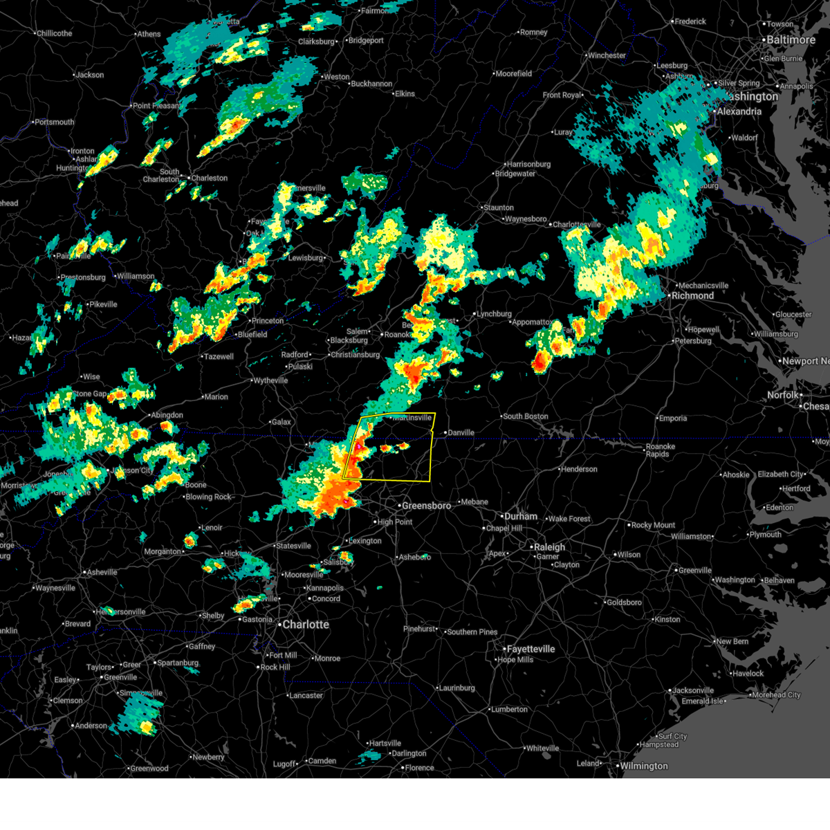
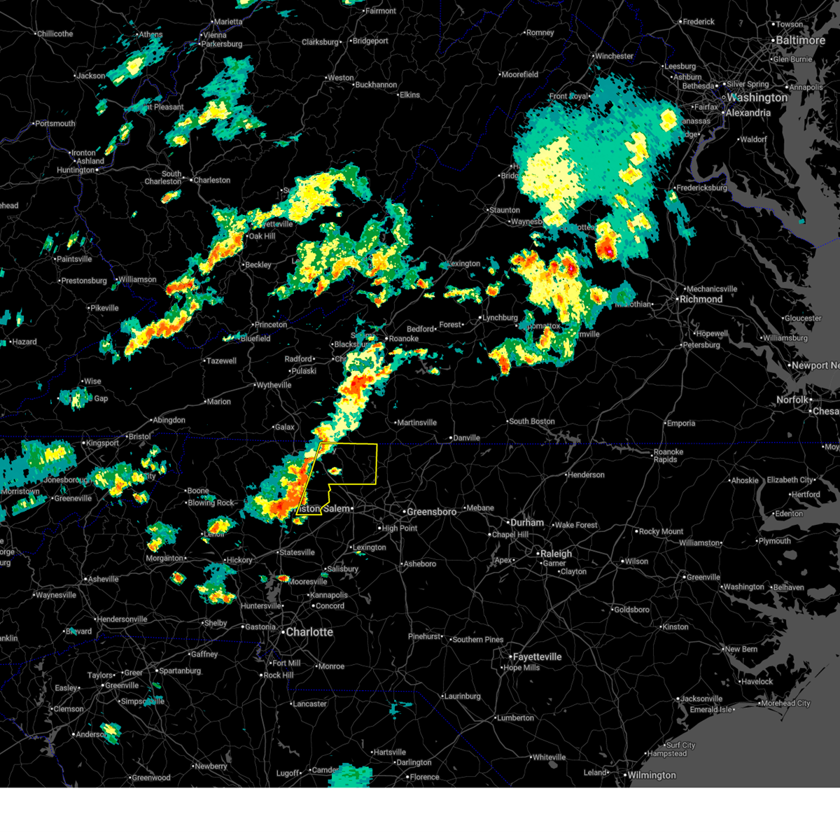
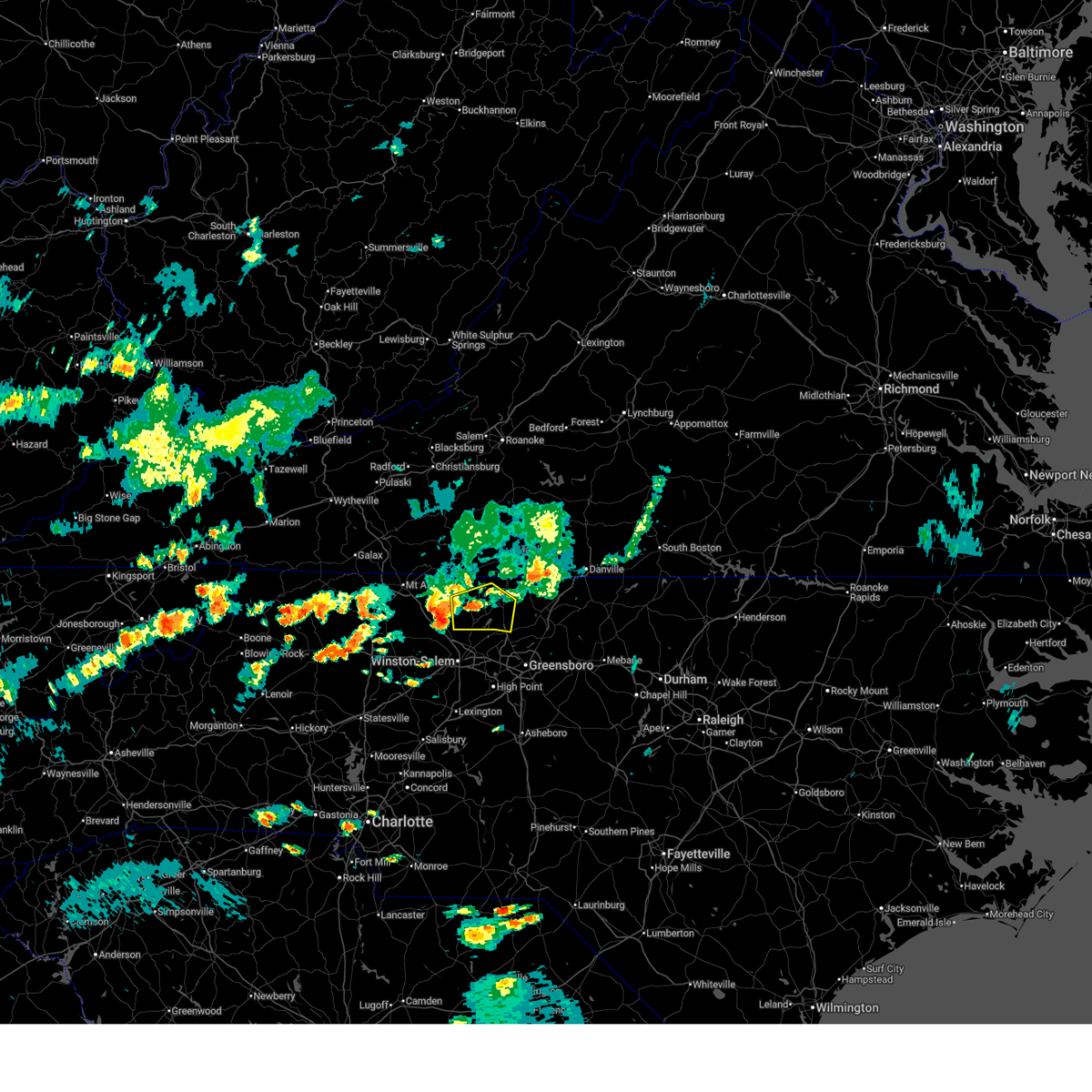
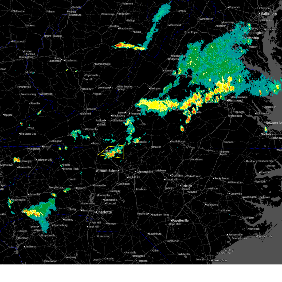
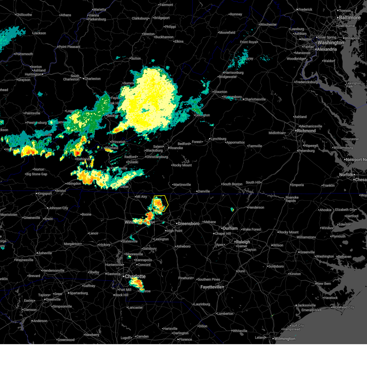
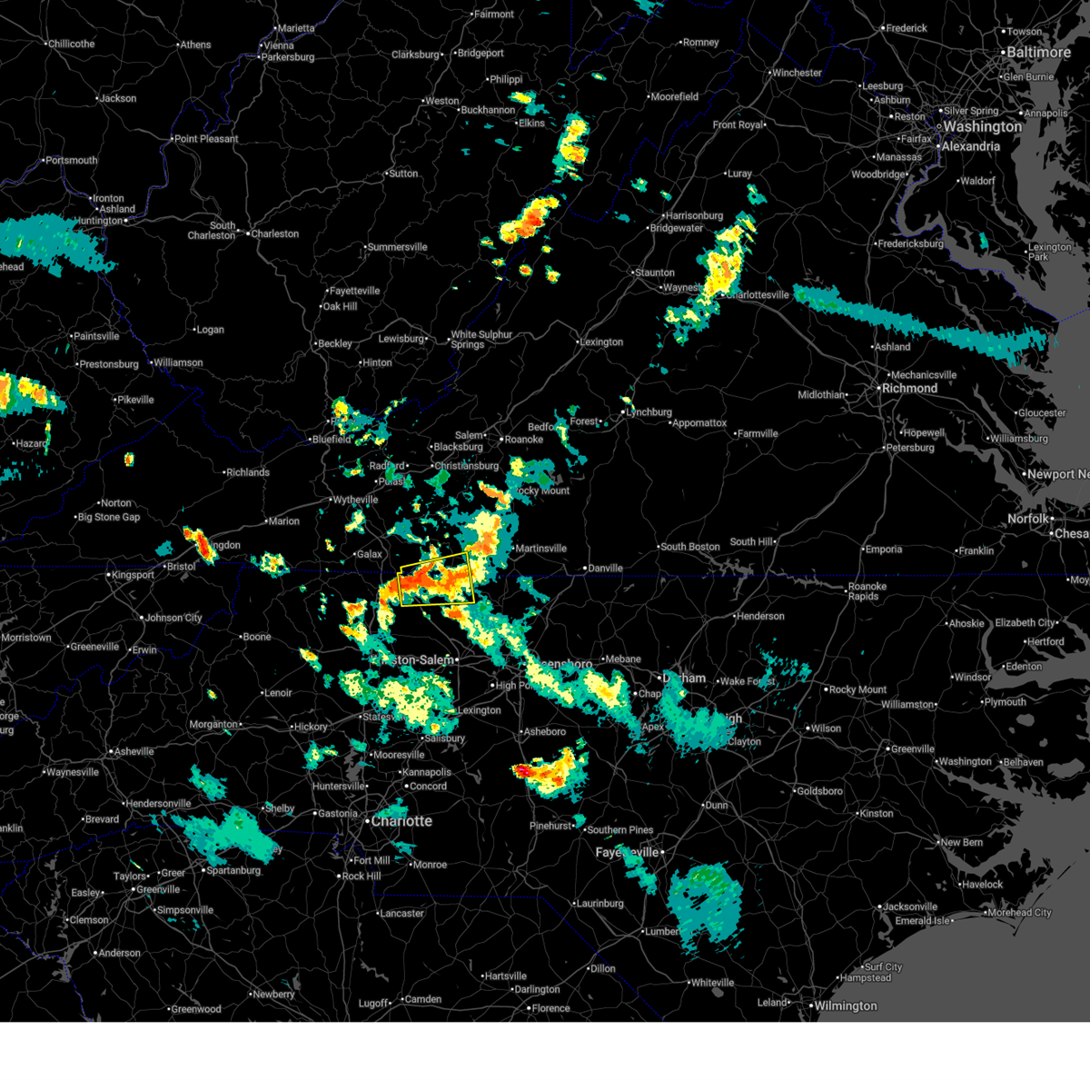
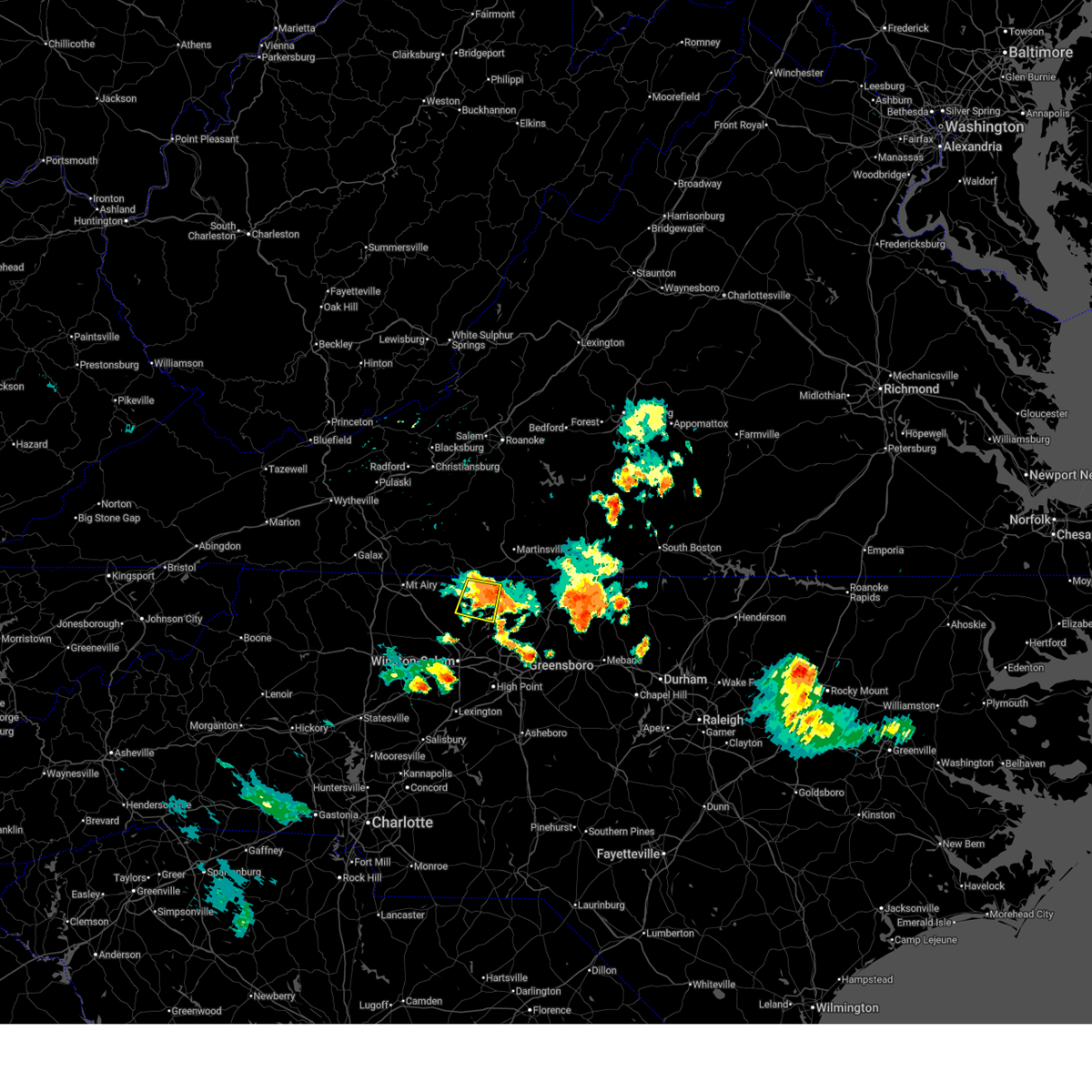
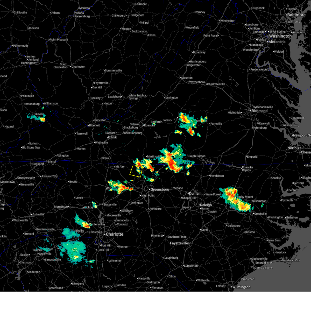
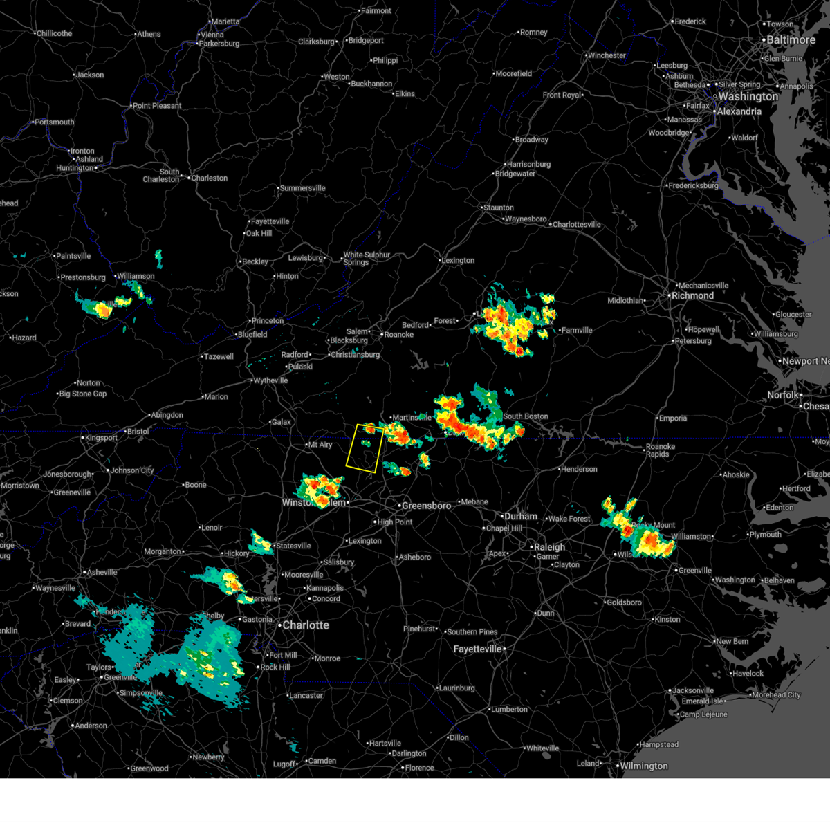
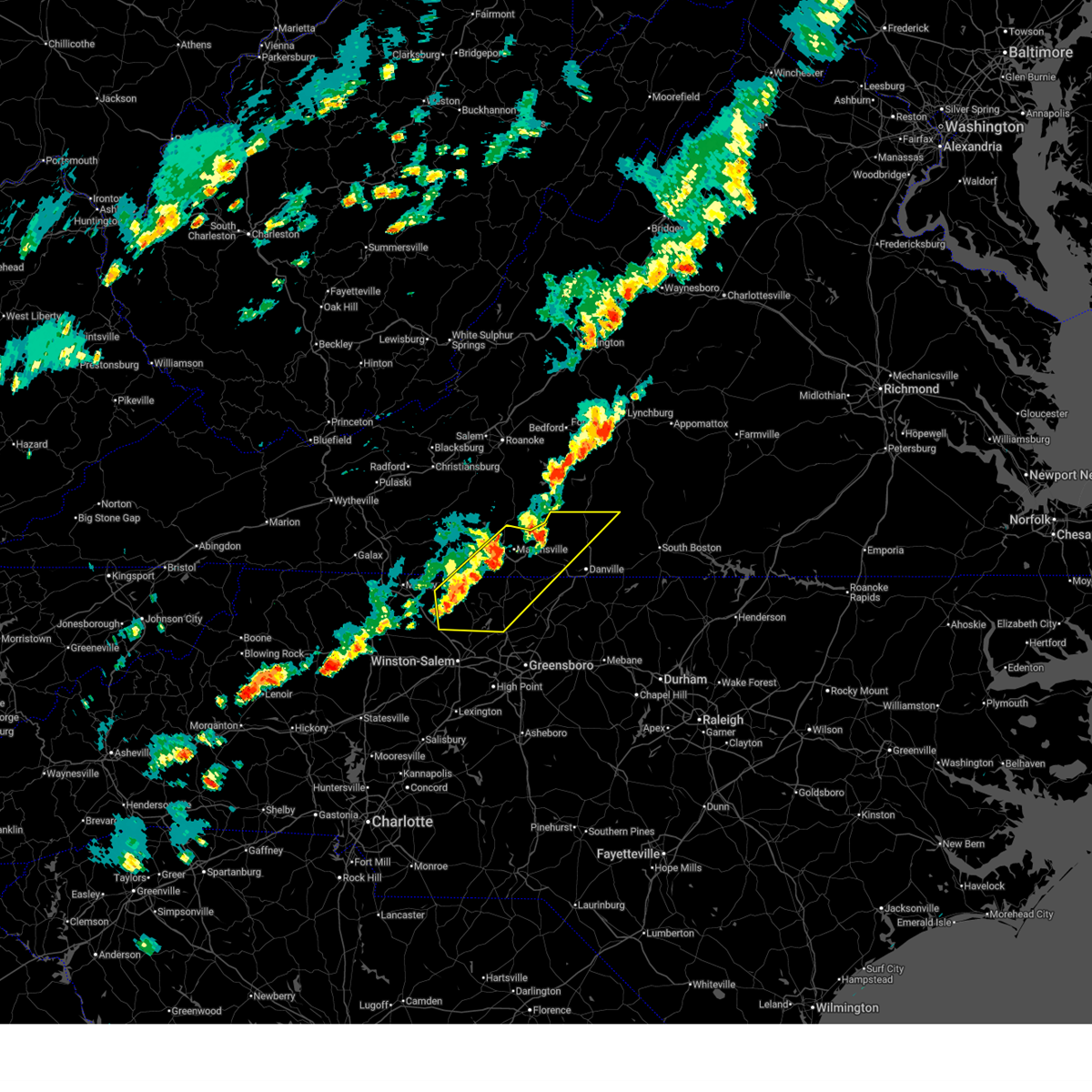
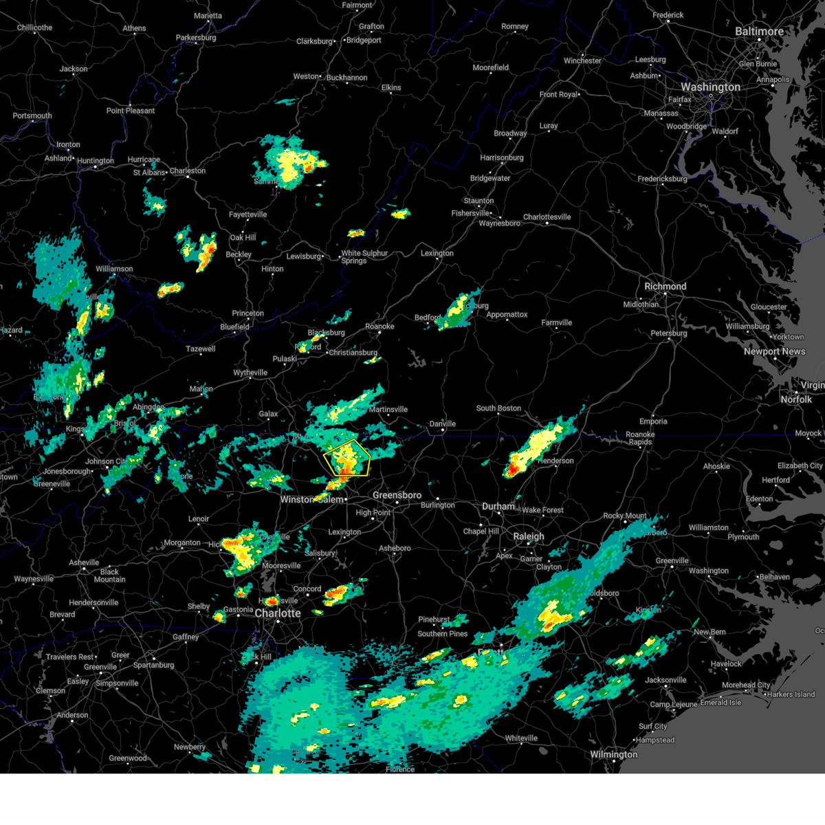
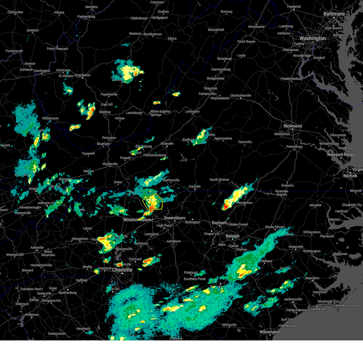
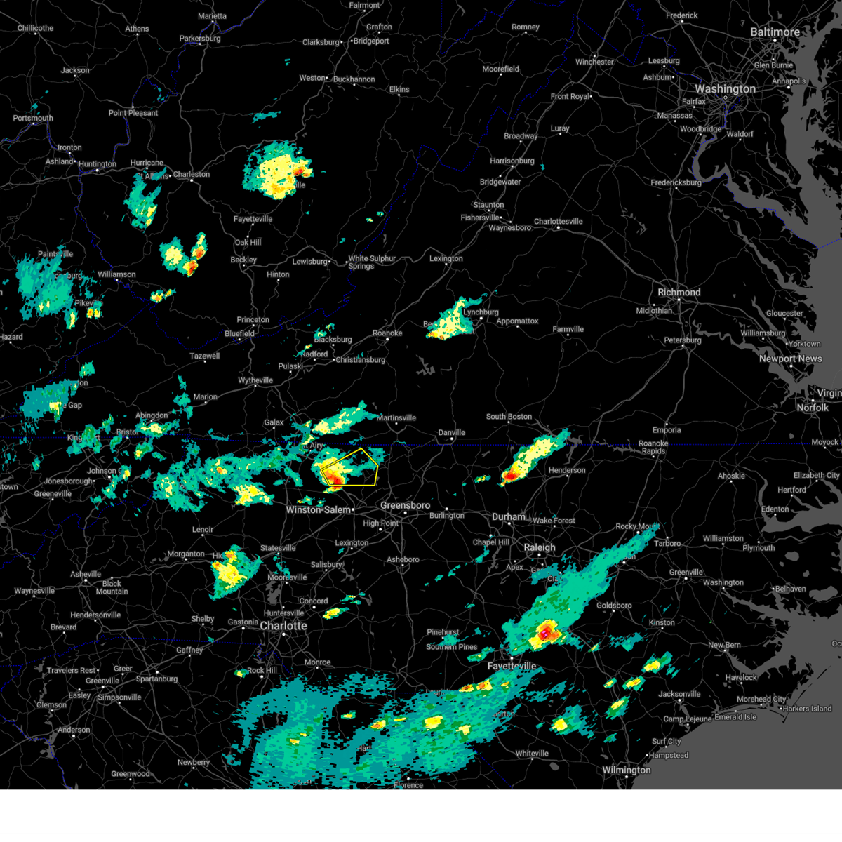
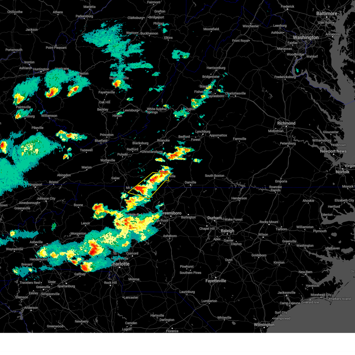
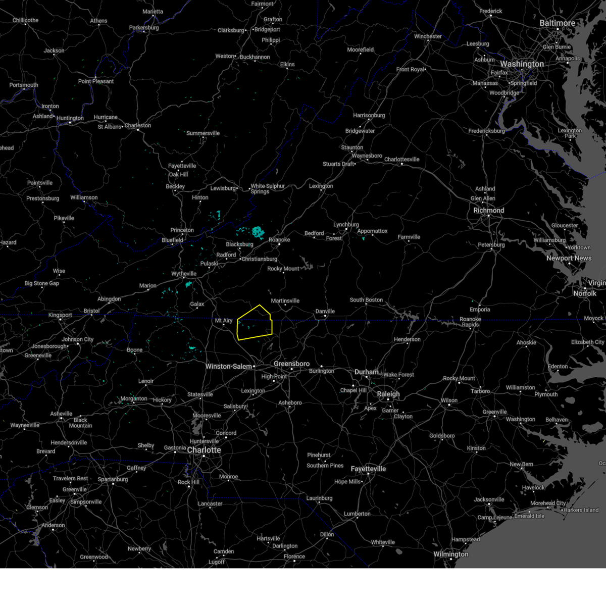
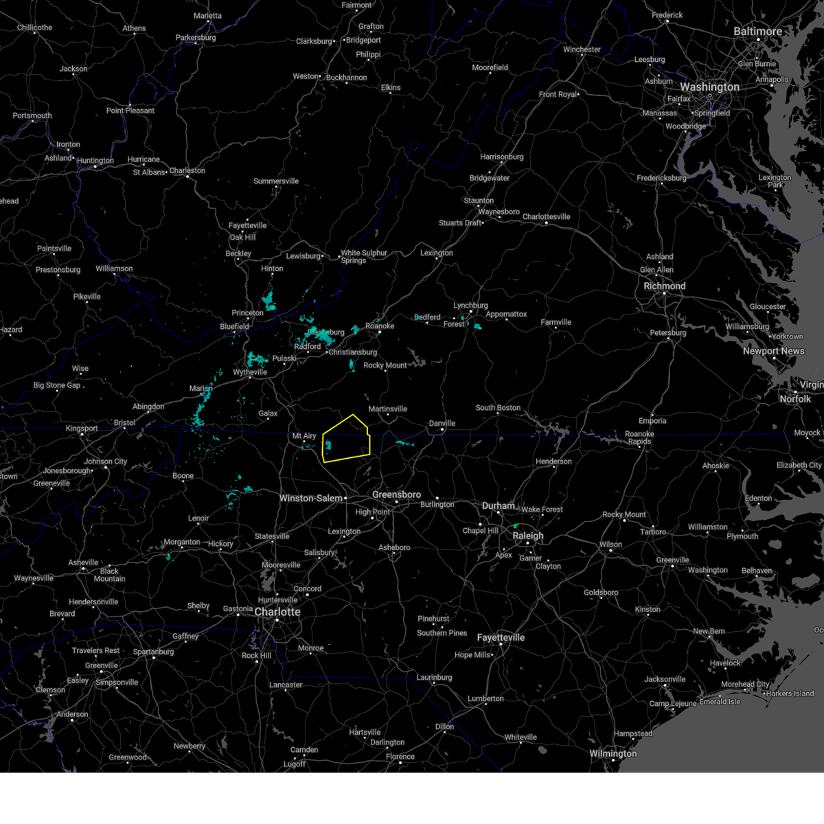
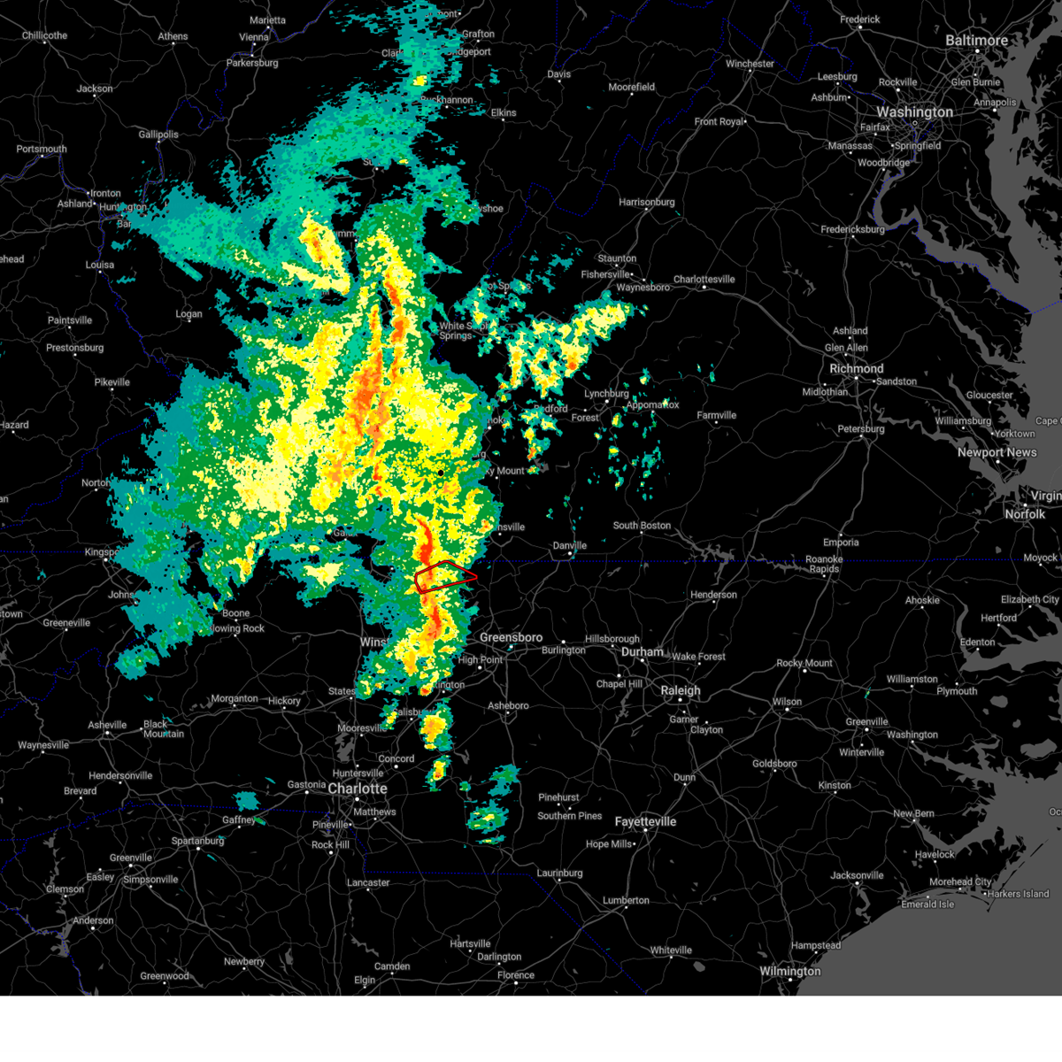
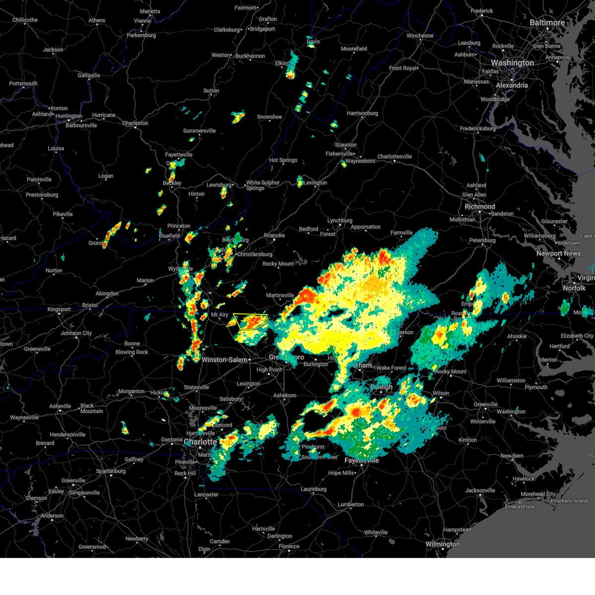
Hail Map for Danbury, NC
The Danbury, NC area has had 5 reports of on-the-ground hail by trained spotters, and has been under severe weather warnings 21 times during the past 12 months. Doppler radar has detected hail at or near Danbury, NC on 41 occasions, including 2 occasions during the past year.
| Name: | Danbury, NC |
| Where Located: | 61.2 miles SSW of Roanoke, VA |
| Map: | Google Map for Danbury, NC |
| Population: | 189 |
| Housing Units: | 55 |
| More Info: | Search Google for Danbury, NC |
0
The Top Recent Hail Date for Danbury, NC is Thursday, June 18, 2026 (41st out of 41)

Hail and Wind Damage Spotted near Danbury, NC
| Date / Time | Report Details |
|---|---|
| 6/22/2026 6:24 PM EDT |
 Svrrnk the national weather service in blacksburg has issued a * severe thunderstorm warning for, eastern stokes county in north central north carolina, rockingham county in north central north carolina, southwestern pittsylvania county in south central virginia, the city of martinsville in south central virginia, southern henry county in south central virginia, southeastern patrick county in southwestern virginia, * until 730 pm edt. * at 624 pm edt, a severe thunderstorm was located near meadows, or near danbury, moving east at 30 mph (radar indicated). Hazards include 60 mph wind gusts. expect damage to roofs, siding, and trees Svrrnk the national weather service in blacksburg has issued a * severe thunderstorm warning for, eastern stokes county in north central north carolina, rockingham county in north central north carolina, southwestern pittsylvania county in south central virginia, the city of martinsville in south central virginia, southern henry county in south central virginia, southeastern patrick county in southwestern virginia, * until 730 pm edt. * at 624 pm edt, a severe thunderstorm was located near meadows, or near danbury, moving east at 30 mph (radar indicated). Hazards include 60 mph wind gusts. expect damage to roofs, siding, and trees
|
| 6/22/2026 5:49 PM EDT |
 Svrrnk the national weather service in blacksburg has issued a * severe thunderstorm warning for, eastern surry county in northwestern north carolina, stokes county in north central north carolina, eastern yadkin county in northwestern north carolina, * until 630 pm edt. * at 548 pm edt, severe thunderstorms were located along a line extending from near collinstown to near ararat to shacktown to near lone hickory, moving east at 45 mph (radar indicated). Hazards include 60 mph wind gusts. expect damage to roofs, siding, and trees Svrrnk the national weather service in blacksburg has issued a * severe thunderstorm warning for, eastern surry county in northwestern north carolina, stokes county in north central north carolina, eastern yadkin county in northwestern north carolina, * until 630 pm edt. * at 548 pm edt, severe thunderstorms were located along a line extending from near collinstown to near ararat to shacktown to near lone hickory, moving east at 45 mph (radar indicated). Hazards include 60 mph wind gusts. expect damage to roofs, siding, and trees
|
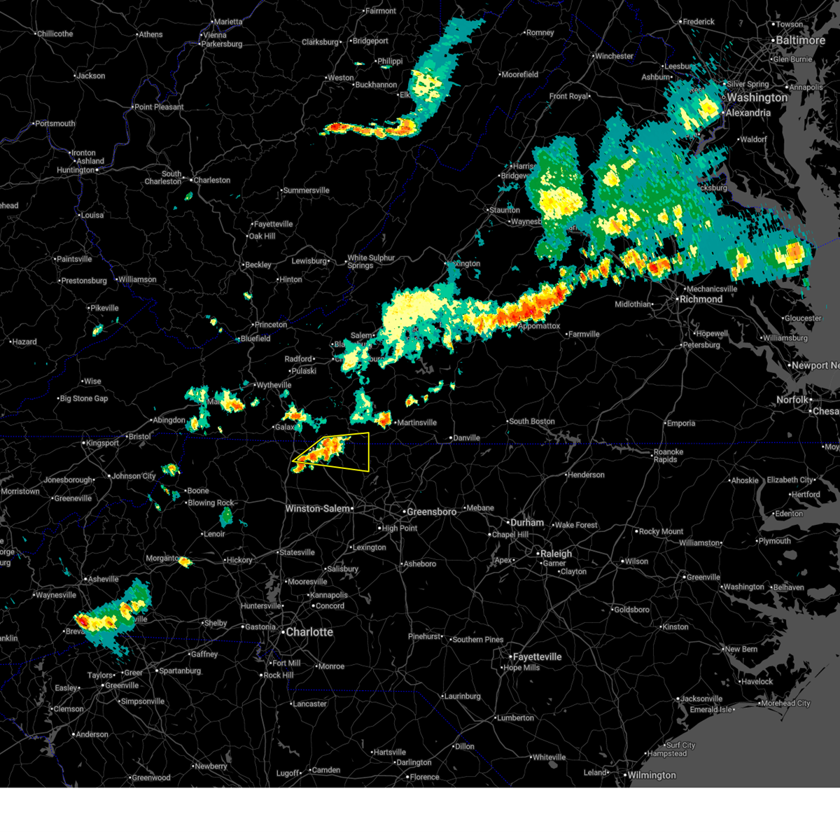
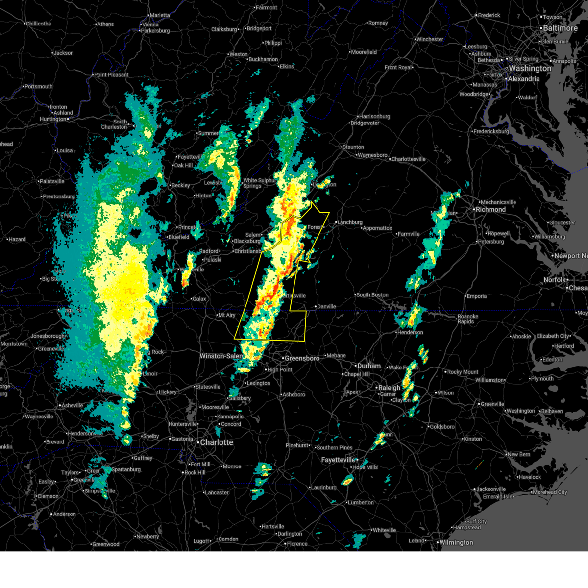
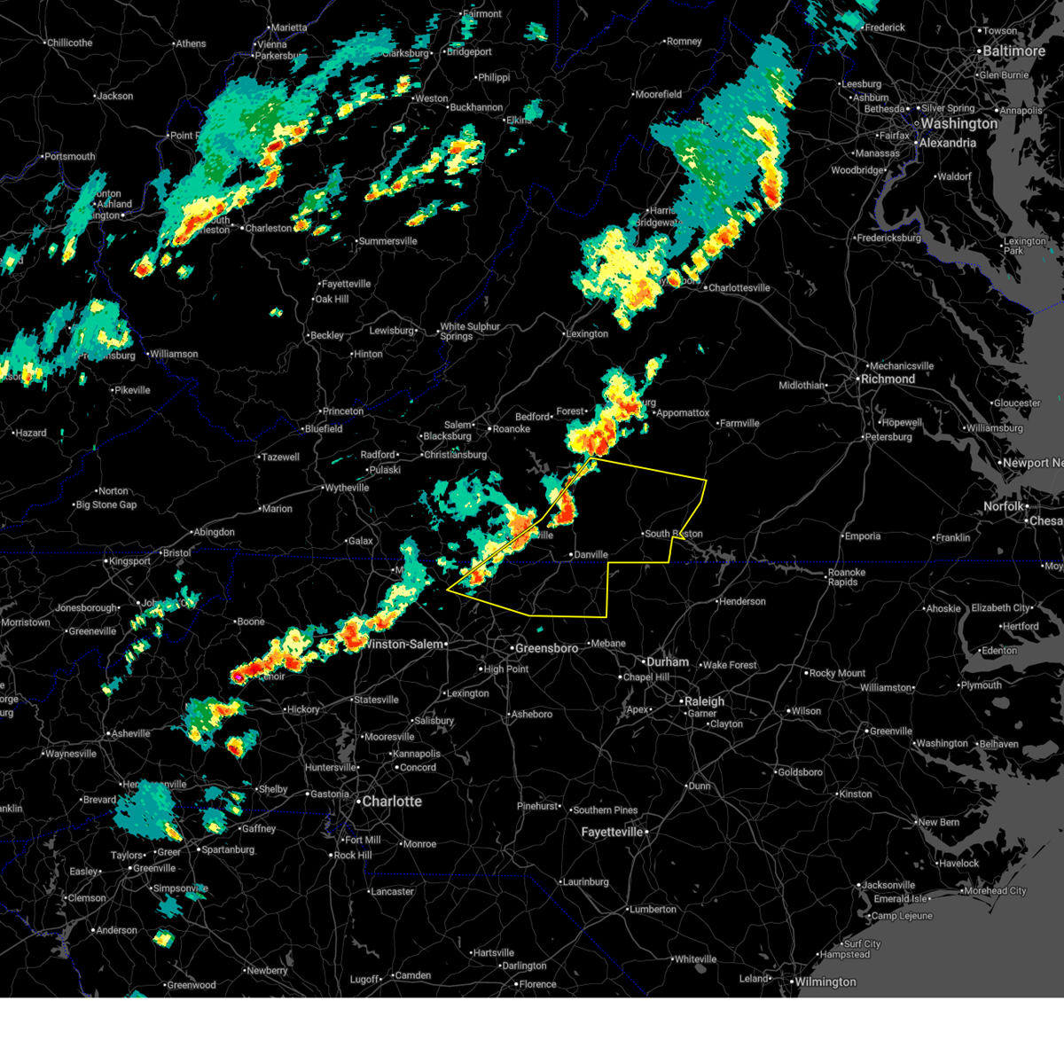
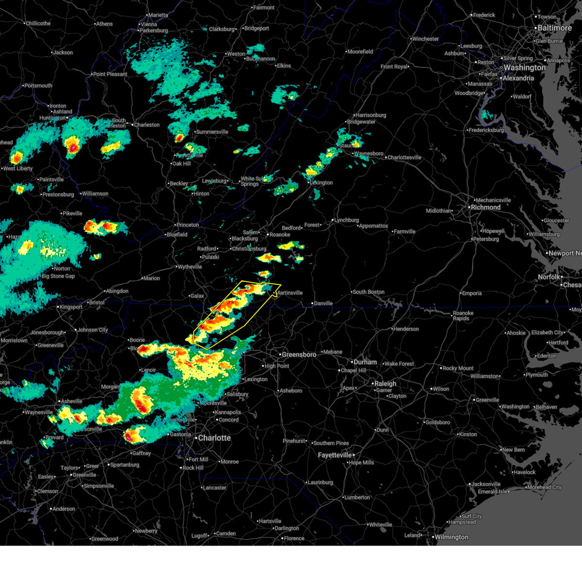
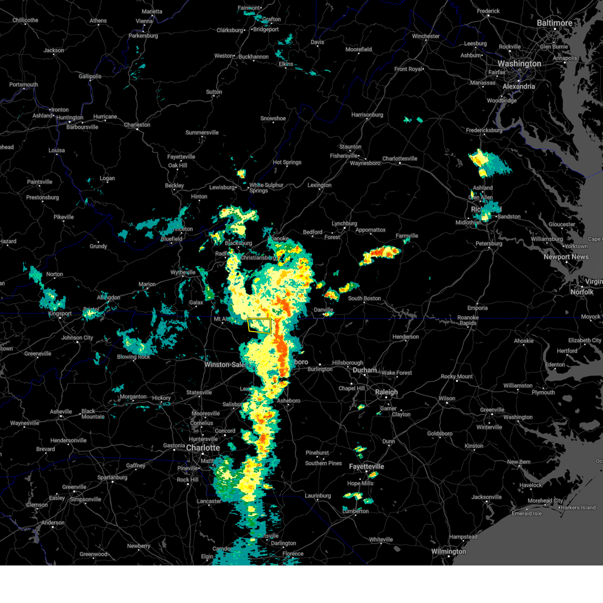
| 6/18/2026 6:30 PM EDT |
 Svrrnk the national weather service in blacksburg has issued a * severe thunderstorm warning for, southeastern stokes county in north central north carolina, southwestern rockingham county in north central north carolina, * until 730 pm edt. * at 630 pm edt, a severe thunderstorm was located near capella, or near danbury, moving east at 30 mph (radar indicated). Hazards include 60 mph wind gusts and quarter size hail. Hail damage to vehicles is expected. Expect wind damage to roofs, siding, and trees. Svrrnk the national weather service in blacksburg has issued a * severe thunderstorm warning for, southeastern stokes county in north central north carolina, southwestern rockingham county in north central north carolina, * until 730 pm edt. * at 630 pm edt, a severe thunderstorm was located near capella, or near danbury, moving east at 30 mph (radar indicated). Hazards include 60 mph wind gusts and quarter size hail. Hail damage to vehicles is expected. Expect wind damage to roofs, siding, and trees.
|
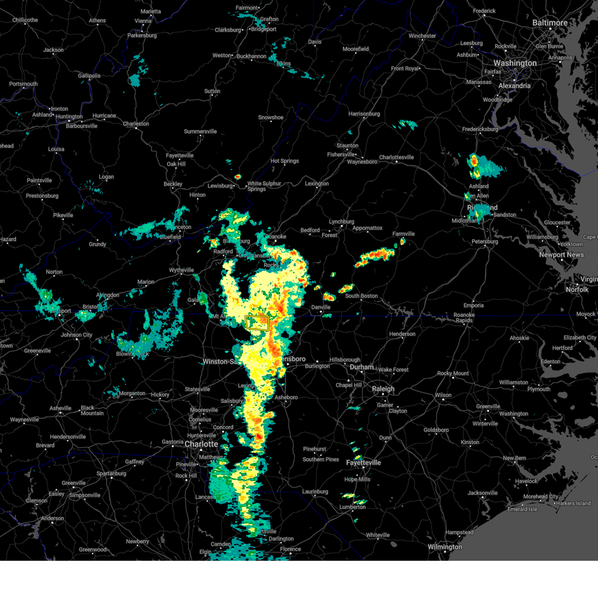
| 6/12/2026 8:06 PM EDT |
 The storm which prompted the warning has weakened below severe limits, and no longer poses an immediate threat to life or property. therefore, the warning will be allowed to expire. however, gusty winds and heavy rain are still possible with this thunderstorm. The storm which prompted the warning has weakened below severe limits, and no longer poses an immediate threat to life or property. therefore, the warning will be allowed to expire. however, gusty winds and heavy rain are still possible with this thunderstorm.
|
| 6/12/2026 7:35 PM EDT |
 At 735 pm edt, a severe thunderstorm was located over westfield, or near francisco, moving east at 20 mph (radar indicated). Hazards include 60 mph wind gusts and quarter size hail. Hail damage to vehicles is expected. expect wind damage to roofs, siding, and trees. Locations impacted include, mount airy, flat rock, pilot mountain, danbury, francisco, sandy ridge, and woodville. At 735 pm edt, a severe thunderstorm was located over westfield, or near francisco, moving east at 20 mph (radar indicated). Hazards include 60 mph wind gusts and quarter size hail. Hail damage to vehicles is expected. expect wind damage to roofs, siding, and trees. Locations impacted include, mount airy, flat rock, pilot mountain, danbury, francisco, sandy ridge, and woodville.
|
| 6/12/2026 7:12 PM EDT |
 Svrrnk the national weather service in blacksburg has issued a * severe thunderstorm warning for, northeastern surry county in northwestern north carolina, northern stokes county in north central north carolina, southern patrick county in southwestern virginia, * until 815 pm edt. * at 712 pm edt, a severe thunderstorm was located over flat rock, moving east at 20 mph (radar indicated). Hazards include 60 mph wind gusts and quarter size hail. Hail damage to vehicles is expected. Expect wind damage to roofs, siding, and trees. Svrrnk the national weather service in blacksburg has issued a * severe thunderstorm warning for, northeastern surry county in northwestern north carolina, northern stokes county in north central north carolina, southern patrick county in southwestern virginia, * until 815 pm edt. * at 712 pm edt, a severe thunderstorm was located over flat rock, moving east at 20 mph (radar indicated). Hazards include 60 mph wind gusts and quarter size hail. Hail damage to vehicles is expected. Expect wind damage to roofs, siding, and trees.
|
| 3/16/2026 10:04 AM EDT |
 Svrrnk the national weather service in blacksburg has issued a * severe thunderstorm warning for, stokes county in north central north carolina, western rockingham county in north central north carolina, the city of martinsville in south central virginia, henry county in south central virginia, eastern patrick county in southwestern virginia, franklin county in west central virginia, * until 1045 am edt. * at 1004 am edt, severe thunderstorms were located along a line extending from near rocky knob summit to king, moving east at 45 mph (radar indicated). Hazards include 60 mph wind gusts. expect damage to roofs, siding, and trees Svrrnk the national weather service in blacksburg has issued a * severe thunderstorm warning for, stokes county in north central north carolina, western rockingham county in north central north carolina, the city of martinsville in south central virginia, henry county in south central virginia, eastern patrick county in southwestern virginia, franklin county in west central virginia, * until 1045 am edt. * at 1004 am edt, severe thunderstorms were located along a line extending from near rocky knob summit to king, moving east at 45 mph (radar indicated). Hazards include 60 mph wind gusts. expect damage to roofs, siding, and trees
|
| 3/16/2026 9:00 AM EDT |
 The storms which prompted the warning have moved out of the area. therefore, the warning has been allowed to expire. however, gusty winds are still possible with these thunderstorms. a tornado watch remains in effect until 200 pm edt for north central north carolina, and central, south central, southwestern and west central virginia. a severe thunderstorm watch remains in effect until 1100 am edt for northwestern north carolina, and southwestern virginia. The storms which prompted the warning have moved out of the area. therefore, the warning has been allowed to expire. however, gusty winds are still possible with these thunderstorms. a tornado watch remains in effect until 200 pm edt for north central north carolina, and central, south central, southwestern and west central virginia. a severe thunderstorm watch remains in effect until 1100 am edt for northwestern north carolina, and southwestern virginia.
|
| 3/16/2026 8:24 AM EDT |
 the severe thunderstorm warning has been cancelled and is no longer in effect the severe thunderstorm warning has been cancelled and is no longer in effect
|
| 3/16/2026 8:24 AM EDT |
 At 822 am edt, severe thunderstorms were located along a line extending from near buchanan to near penhook to prestonville, moving northeast at 55 mph (radar indicated). Hazards include 60 mph wind gusts. Expect damage to roofs, siding, and trees. Locations impacted include, eden, reidsville, martinsville, bedford, rocky mount, wentworth, and mayodan. At 822 am edt, severe thunderstorms were located along a line extending from near buchanan to near penhook to prestonville, moving northeast at 55 mph (radar indicated). Hazards include 60 mph wind gusts. Expect damage to roofs, siding, and trees. Locations impacted include, eden, reidsville, martinsville, bedford, rocky mount, wentworth, and mayodan.
|
| 9/4/2025 3:32 PM EDT |
 Svrrnk the national weather service in blacksburg has issued a * severe thunderstorm warning for, southeastern surry county in northwestern north carolina, stokes county in north central north carolina, rockingham county in north central north carolina, northwestern caswell county in north central north carolina, the city of danville in south central virginia, pittsylvania county in south central virginia, the city of martinsville in south central virginia, henry county in south central virginia, southeastern patrick county in southwestern virginia, southeastern franklin county in west central virginia, * until 430 pm edt. * at 331 pm edt, severe thunderstorms were located along a line extending from near sydnorsville to near price to near enon, moving east at 35 mph (radar indicated). Hazards include 60 mph wind gusts. expect damage to roofs, siding, and trees Svrrnk the national weather service in blacksburg has issued a * severe thunderstorm warning for, southeastern surry county in northwestern north carolina, stokes county in north central north carolina, rockingham county in north central north carolina, northwestern caswell county in north central north carolina, the city of danville in south central virginia, pittsylvania county in south central virginia, the city of martinsville in south central virginia, henry county in south central virginia, southeastern patrick county in southwestern virginia, southeastern franklin county in west central virginia, * until 430 pm edt. * at 331 pm edt, severe thunderstorms were located along a line extending from near sydnorsville to near price to near enon, moving east at 35 mph (radar indicated). Hazards include 60 mph wind gusts. expect damage to roofs, siding, and trees
|
| 9/4/2025 3:06 PM EDT |
 At 306 pm edt, severe thunderstorms were located along a line extending from near check to francisco to burch, moving east at 55 mph (radar indicated). Hazards include 60 mph wind gusts. Expect damage to roofs, siding, and trees. Locations impacted include, martinsville, mount airy, elkin, fairview, flat rock, mayodan, and madison. At 306 pm edt, severe thunderstorms were located along a line extending from near check to francisco to burch, moving east at 55 mph (radar indicated). Hazards include 60 mph wind gusts. Expect damage to roofs, siding, and trees. Locations impacted include, martinsville, mount airy, elkin, fairview, flat rock, mayodan, and madison.
|
| 9/4/2025 2:33 PM EDT |
 Svrrnk the national weather service in blacksburg has issued a * severe thunderstorm warning for, surry county in northwestern north carolina, stokes county in north central north carolina, western rockingham county in north central north carolina, southern floyd county in southwestern virginia, the city of martinsville in south central virginia, carroll county in southwestern virginia, western henry county in south central virginia, patrick county in southwestern virginia, southwestern franklin county in west central virginia, * until 330 pm edt. * at 232 pm edt, severe thunderstorms were located along a line extending from near sylvatus to near mountain park, moving east at 50 mph. this storm has a history of wind damage including damage to trees and powerlines (law enforcement). Hazards include 60 mph wind gusts. expect damage to roofs, siding, and trees Svrrnk the national weather service in blacksburg has issued a * severe thunderstorm warning for, surry county in northwestern north carolina, stokes county in north central north carolina, western rockingham county in north central north carolina, southern floyd county in southwestern virginia, the city of martinsville in south central virginia, carroll county in southwestern virginia, western henry county in south central virginia, patrick county in southwestern virginia, southwestern franklin county in west central virginia, * until 330 pm edt. * at 232 pm edt, severe thunderstorms were located along a line extending from near sylvatus to near mountain park, moving east at 50 mph. this storm has a history of wind damage including damage to trees and powerlines (law enforcement). Hazards include 60 mph wind gusts. expect damage to roofs, siding, and trees
|
| 7/20/2025 9:20 PM EDT |
 The storm which prompted the warning has weakened below severe limits, and has exited the warned area. therefore, the warning will be allowed to expire. The storm which prompted the warning has weakened below severe limits, and has exited the warned area. therefore, the warning will be allowed to expire.
|
| 7/20/2025 8:59 PM EDT |
 At 858 pm edt, a severe thunderstorm was located over dillard, or near madison, moving east at 20 mph (radar indicated). Hazards include 60 mph wind gusts. Expect damage to roofs, siding, and trees. Locations impacted include, mayodan, madison, walnut cove, danbury, sandy ridge, pine hall, and dillard. At 858 pm edt, a severe thunderstorm was located over dillard, or near madison, moving east at 20 mph (radar indicated). Hazards include 60 mph wind gusts. Expect damage to roofs, siding, and trees. Locations impacted include, mayodan, madison, walnut cove, danbury, sandy ridge, pine hall, and dillard.
|
| 7/20/2025 8:27 PM EDT |
 Svrrnk the national weather service in blacksburg has issued a * severe thunderstorm warning for, stokes county in north central north carolina, west central rockingham county in north central north carolina, * until 930 pm edt. * at 826 pm edt, a severe thunderstorm was located over hanging rock state park, or near danbury, moving east at 20 mph (radar indicated). Hazards include 60 mph wind gusts. expect damage to roofs, siding, and trees Svrrnk the national weather service in blacksburg has issued a * severe thunderstorm warning for, stokes county in north central north carolina, west central rockingham county in north central north carolina, * until 930 pm edt. * at 826 pm edt, a severe thunderstorm was located over hanging rock state park, or near danbury, moving east at 20 mph (radar indicated). Hazards include 60 mph wind gusts. expect damage to roofs, siding, and trees
|
| 7/18/2025 2:33 PM EDT |
 the severe thunderstorm warning has been cancelled and is no longer in effect the severe thunderstorm warning has been cancelled and is no longer in effect
|
| 7/18/2025 2:09 PM EDT |
 Svrrnk the national weather service in blacksburg has issued a * severe thunderstorm warning for, northeastern surry county in northwestern north carolina, northern stokes county in north central north carolina, southern patrick county in southwestern virginia, * until 300 pm edt. * at 208 pm edt, a severe thunderstorm was located over woodville, or near francisco, moving east at 25 mph (radar indicated). Hazards include 60 mph wind gusts and quarter size hail. Hail damage to vehicles is expected. Expect wind damage to roofs, siding, and trees. Svrrnk the national weather service in blacksburg has issued a * severe thunderstorm warning for, northeastern surry county in northwestern north carolina, northern stokes county in north central north carolina, southern patrick county in southwestern virginia, * until 300 pm edt. * at 208 pm edt, a severe thunderstorm was located over woodville, or near francisco, moving east at 25 mph (radar indicated). Hazards include 60 mph wind gusts and quarter size hail. Hail damage to vehicles is expected. Expect wind damage to roofs, siding, and trees.
|
| 7/15/2025 8:49 PM EDT |
 Svrrnk the national weather service in blacksburg has issued a * severe thunderstorm warning for, northeastern surry county in northwestern north carolina, northwestern stokes county in north central north carolina, southern patrick county in southwestern virginia, * until 945 pm edt. * at 849 pm edt, a severe thunderstorm was located over flat rock, moving east at 15 mph (radar indicated). Hazards include 60 mph wind gusts. expect damage to roofs, siding, and trees Svrrnk the national weather service in blacksburg has issued a * severe thunderstorm warning for, northeastern surry county in northwestern north carolina, northwestern stokes county in north central north carolina, southern patrick county in southwestern virginia, * until 945 pm edt. * at 849 pm edt, a severe thunderstorm was located over flat rock, moving east at 15 mph (radar indicated). Hazards include 60 mph wind gusts. expect damage to roofs, siding, and trees
|
| 7/1/2025 6:49 PM EDT |
 the severe thunderstorm warning has been cancelled and is no longer in effect the severe thunderstorm warning has been cancelled and is no longer in effect
|
| 7/1/2025 6:07 PM EDT |
 Svrrnk the national weather service in blacksburg has issued a * severe thunderstorm warning for, surry county in northwestern north carolina, stokes county in north central north carolina, southwestern floyd county in southwestern virginia, eastern carroll county in southwestern virginia, southwestern patrick county in southwestern virginia, * until 715 pm edt. * at 607 pm edt, a severe thunderstorm was located over bottom, moving northeast at 30 mph (radar indicated). Hazards include 60 mph wind gusts. expect damage to roofs, siding, and trees Svrrnk the national weather service in blacksburg has issued a * severe thunderstorm warning for, surry county in northwestern north carolina, stokes county in north central north carolina, southwestern floyd county in southwestern virginia, eastern carroll county in southwestern virginia, southwestern patrick county in southwestern virginia, * until 715 pm edt. * at 607 pm edt, a severe thunderstorm was located over bottom, moving northeast at 30 mph (radar indicated). Hazards include 60 mph wind gusts. expect damage to roofs, siding, and trees
|
| 6/26/2025 5:03 PM EDT |
 Svrrnk the national weather service in blacksburg has issued a * severe thunderstorm warning for, stokes county in north central north carolina, western rockingham county in north central north carolina, * until 600 pm edt. * at 503 pm edt, severe thunderstorms were located along a line extending from danbury to near intelligence, and are nearly stationary (radar indicated). Hazards include 60 mph wind gusts. expect damage to roofs, siding, and trees Svrrnk the national weather service in blacksburg has issued a * severe thunderstorm warning for, stokes county in north central north carolina, western rockingham county in north central north carolina, * until 600 pm edt. * at 503 pm edt, severe thunderstorms were located along a line extending from danbury to near intelligence, and are nearly stationary (radar indicated). Hazards include 60 mph wind gusts. expect damage to roofs, siding, and trees
|
| 6/26/2025 12:42 AM EDT |
 The storm which prompted the warning has weakened below severe limits, and no longer poses an immediate threat to life or property. therefore, the warning will be allowed to expire. however, gusty winds, frequent cloud to ground lightning and heavy rain are still possible with this thunderstorm. The storm which prompted the warning has weakened below severe limits, and no longer poses an immediate threat to life or property. therefore, the warning will be allowed to expire. however, gusty winds, frequent cloud to ground lightning and heavy rain are still possible with this thunderstorm.
|
| 6/26/2025 12:13 AM EDT |
 the severe thunderstorm warning has been cancelled and is no longer in effect the severe thunderstorm warning has been cancelled and is no longer in effect
|
| 6/26/2025 12:13 AM EDT |
 At 1212 am edt, a severe thunderstorm was located over ayersville, or near sandy ridge, moving south at 10 mph (radar indicated). Hazards include 60 mph wind gusts. Expect damage to roofs, siding, and trees. Locations impacted include, mayodan, madison, danbury, sandy ridge, pine hall, dillard, and prestonville. At 1212 am edt, a severe thunderstorm was located over ayersville, or near sandy ridge, moving south at 10 mph (radar indicated). Hazards include 60 mph wind gusts. Expect damage to roofs, siding, and trees. Locations impacted include, mayodan, madison, danbury, sandy ridge, pine hall, dillard, and prestonville.
|
| 6/25/2025 11:49 PM EDT |
 Svrrnk the national weather service in blacksburg has issued a * severe thunderstorm warning for, eastern stokes county in north central north carolina, northwestern rockingham county in north central north carolina, southwestern henry county in south central virginia, southeastern patrick county in southwestern virginia, * until 1245 am edt. * at 1149 pm edt, a severe thunderstorm was located near ayersville, or near sandy ridge, moving south at 10 mph (radar indicated). Hazards include 60 mph wind gusts. expect damage to roofs, siding, and trees Svrrnk the national weather service in blacksburg has issued a * severe thunderstorm warning for, eastern stokes county in north central north carolina, northwestern rockingham county in north central north carolina, southwestern henry county in south central virginia, southeastern patrick county in southwestern virginia, * until 1245 am edt. * at 1149 pm edt, a severe thunderstorm was located near ayersville, or near sandy ridge, moving south at 10 mph (radar indicated). Hazards include 60 mph wind gusts. expect damage to roofs, siding, and trees
|
| 6/19/2025 3:13 PM EDT |
 Svrrnk the national weather service in blacksburg has issued a * severe thunderstorm warning for, east central stokes county in north central north carolina, rockingham county in north central north carolina, caswell county in north central north carolina, the city of danville in south central virginia, central charlotte county in south central virginia, south central campbell county in central virginia, pittsylvania county in south central virginia, halifax county in south central virginia, southeastern henry county in south central virginia, * until 415 pm edt. * at 313 pm edt, severe thunderstorms were located along a line extending from near hurt to dry fork to dillard, moving east at 50 mph (radar indicated). Hazards include 60 mph wind gusts. expect damage to roofs, siding, and trees Svrrnk the national weather service in blacksburg has issued a * severe thunderstorm warning for, east central stokes county in north central north carolina, rockingham county in north central north carolina, caswell county in north central north carolina, the city of danville in south central virginia, central charlotte county in south central virginia, south central campbell county in central virginia, pittsylvania county in south central virginia, halifax county in south central virginia, southeastern henry county in south central virginia, * until 415 pm edt. * at 313 pm edt, severe thunderstorms were located along a line extending from near hurt to dry fork to dillard, moving east at 50 mph (radar indicated). Hazards include 60 mph wind gusts. expect damage to roofs, siding, and trees
|
| 6/19/2025 2:50 PM EDT |
 At 249 pm edt, severe thunderstorms were located along a line extending from mountain valley to near francisco, moving northeast at 40 mph (radar indicated). Hazards include 60 mph wind gusts and quarter size hail. Hail damage to vehicles is expected. expect wind damage to roofs, siding, and trees. Locations impacted include, eden, martinsville, wentworth, mayodan, madison, walnut cove, and chatham. At 249 pm edt, severe thunderstorms were located along a line extending from mountain valley to near francisco, moving northeast at 40 mph (radar indicated). Hazards include 60 mph wind gusts and quarter size hail. Hail damage to vehicles is expected. expect wind damage to roofs, siding, and trees. Locations impacted include, eden, martinsville, wentworth, mayodan, madison, walnut cove, and chatham.
|
| 6/19/2025 2:50 PM EDT |
 the severe thunderstorm warning has been cancelled and is no longer in effect the severe thunderstorm warning has been cancelled and is no longer in effect
|
| 6/19/2025 2:22 PM EDT |
 Svrrnk the national weather service in blacksburg has issued a * severe thunderstorm warning for, southeastern surry county in northwestern north carolina, stokes county in north central north carolina, western rockingham county in north central north carolina, southern pittsylvania county in south central virginia, the city of martinsville in south central virginia, henry county in south central virginia, southeastern patrick county in southwestern virginia, * until 315 pm edt. * at 222 pm edt, severe thunderstorms were located along a line extending from near fieldale to ararat, moving northeast at 40 mph (radar indicated). Hazards include 60 mph wind gusts and quarter size hail. Hail damage to vehicles is expected. Expect wind damage to roofs, siding, and trees. Svrrnk the national weather service in blacksburg has issued a * severe thunderstorm warning for, southeastern surry county in northwestern north carolina, stokes county in north central north carolina, western rockingham county in north central north carolina, southern pittsylvania county in south central virginia, the city of martinsville in south central virginia, henry county in south central virginia, southeastern patrick county in southwestern virginia, * until 315 pm edt. * at 222 pm edt, severe thunderstorms were located along a line extending from near fieldale to ararat, moving northeast at 40 mph (radar indicated). Hazards include 60 mph wind gusts and quarter size hail. Hail damage to vehicles is expected. Expect wind damage to roofs, siding, and trees.
|
| 5/29/2025 5:37 PM EDT |
 At 537 pm edt, a severe thunderstorm was located over pine hall, or near walnut cove, moving east at 30 mph (radar indicated). Hazards include 60 mph wind gusts. Expect damage to roofs, siding, and trees. Locations impacted include, walnut cove, danbury, pine hall, dillard, hanging rock state park, germanton, and meadows. At 537 pm edt, a severe thunderstorm was located over pine hall, or near walnut cove, moving east at 30 mph (radar indicated). Hazards include 60 mph wind gusts. Expect damage to roofs, siding, and trees. Locations impacted include, walnut cove, danbury, pine hall, dillard, hanging rock state park, germanton, and meadows.
|
| 5/29/2025 5:27 PM EDT |
 the severe thunderstorm warning has been cancelled and is no longer in effect the severe thunderstorm warning has been cancelled and is no longer in effect
|
| 5/29/2025 5:27 PM EDT |
 At 526 pm edt, a severe thunderstorm was located over meadows, or near walnut cove, moving east at 25 mph (radar indicated). Hazards include 60 mph wind gusts. Expect damage to roofs, siding, and trees. Locations impacted include, walnut cove, danbury, king, pine hall, hanging rock state park, capella, and germanton. At 526 pm edt, a severe thunderstorm was located over meadows, or near walnut cove, moving east at 25 mph (radar indicated). Hazards include 60 mph wind gusts. Expect damage to roofs, siding, and trees. Locations impacted include, walnut cove, danbury, king, pine hall, hanging rock state park, capella, and germanton.
|
| 5/29/2025 5:10 PM EDT |
 Svrrnk the national weather service in blacksburg has issued a * severe thunderstorm warning for, east central surry county in northwestern north carolina, stokes county in north central north carolina, * until 615 pm edt. * at 509 pm edt, a severe thunderstorm was located over king, or 9 miles southwest of danbury, moving east at 30 mph (radar indicated). Hazards include 60 mph wind gusts. expect damage to roofs, siding, and trees Svrrnk the national weather service in blacksburg has issued a * severe thunderstorm warning for, east central surry county in northwestern north carolina, stokes county in north central north carolina, * until 615 pm edt. * at 509 pm edt, a severe thunderstorm was located over king, or 9 miles southwest of danbury, moving east at 30 mph (radar indicated). Hazards include 60 mph wind gusts. expect damage to roofs, siding, and trees
|
| 5/8/2025 7:13 PM EDT |
 The storms which prompted the warning have weakened below severe limits, and no longer pose an immediate threat to life or property. therefore, the warning will be allowed to expire. however, small hail, gusty winds and heavy rain are still possible with these thunderstorms. a severe thunderstorm watch remains in effect until midnight edt for north central and northwestern north carolina, and south central, southwestern and west central virginia. The storms which prompted the warning have weakened below severe limits, and no longer pose an immediate threat to life or property. therefore, the warning will be allowed to expire. however, small hail, gusty winds and heavy rain are still possible with these thunderstorms. a severe thunderstorm watch remains in effect until midnight edt for north central and northwestern north carolina, and south central, southwestern and west central virginia.
|
| 5/8/2025 6:51 PM EDT |
 At 651 pm edt, severe thunderstorms were located along a line extending from fieldale to near danbury, moving east at 25 mph (radar indicated). Hazards include 60 mph wind gusts and quarter size hail. Hail damage to vehicles is expected. expect wind damage to roofs, siding, and trees. Locations impacted include, martinsville, stuart, danbury, spencer, bassett, francisco, and sandy ridge. At 651 pm edt, severe thunderstorms were located along a line extending from fieldale to near danbury, moving east at 25 mph (radar indicated). Hazards include 60 mph wind gusts and quarter size hail. Hail damage to vehicles is expected. expect wind damage to roofs, siding, and trees. Locations impacted include, martinsville, stuart, danbury, spencer, bassett, francisco, and sandy ridge.
|
| 5/8/2025 6:51 PM EDT |
 the severe thunderstorm warning has been cancelled and is no longer in effect the severe thunderstorm warning has been cancelled and is no longer in effect
|
| 5/8/2025 6:36 PM EDT |
 the severe thunderstorm warning has been cancelled and is no longer in effect the severe thunderstorm warning has been cancelled and is no longer in effect
|
| 5/8/2025 6:36 PM EDT |
 At 636 pm edt, severe thunderstorms were located along a line extending from near stanleytown to near francisco to near capella, moving east at 25 mph (radar indicated). Hazards include 60 mph wind gusts and quarter size hail. Hail damage to vehicles is expected. expect wind damage to roofs, siding, and trees. Locations impacted include, martinsville, mount airy, flat rock, stuart, danbury, francisco, and spencer. At 636 pm edt, severe thunderstorms were located along a line extending from near stanleytown to near francisco to near capella, moving east at 25 mph (radar indicated). Hazards include 60 mph wind gusts and quarter size hail. Hail damage to vehicles is expected. expect wind damage to roofs, siding, and trees. Locations impacted include, martinsville, mount airy, flat rock, stuart, danbury, francisco, and spencer.
|
| 5/8/2025 6:13 PM EDT |
 Svrrnk the national weather service in blacksburg has issued a * severe thunderstorm warning for, surry county in northwestern north carolina, northwestern stokes county in north central north carolina, northern yadkin county in northwestern north carolina, the city of martinsville in south central virginia, western henry county in south central virginia, patrick county in southwestern virginia, * until 715 pm edt. * at 612 pm edt, severe thunderstorms were located along a broken line extending from near sanville to near pilot mountain to near arlington, moving east at 15 mph (radar indicated). Hazards include quarter size hail. damage to vehicles is expected Svrrnk the national weather service in blacksburg has issued a * severe thunderstorm warning for, surry county in northwestern north carolina, northwestern stokes county in north central north carolina, northern yadkin county in northwestern north carolina, the city of martinsville in south central virginia, western henry county in south central virginia, patrick county in southwestern virginia, * until 715 pm edt. * at 612 pm edt, severe thunderstorms were located along a broken line extending from near sanville to near pilot mountain to near arlington, moving east at 15 mph (radar indicated). Hazards include quarter size hail. damage to vehicles is expected
|
| 3/5/2025 9:02 AM EST |
 The storms which prompted the warning have moved out of the area. therefore, the warning has been allowed to expire. however, gusty winds and heavy rain are still possible with these thunderstorms. a tornado watch remains in effect until 100 pm est for north central north carolina. remember, a severe thunderstorm warning still remains in effect for portions of franklin and henry county until 945 am. The storms which prompted the warning have moved out of the area. therefore, the warning has been allowed to expire. however, gusty winds and heavy rain are still possible with these thunderstorms. a tornado watch remains in effect until 100 pm est for north central north carolina. remember, a severe thunderstorm warning still remains in effect for portions of franklin and henry county until 945 am.
|
| 3/5/2025 8:40 AM EST |
 At 839 am est, severe thunderstorms were located along a line extending from woolwine to near patrick springs to hanging rock state park, moving northeast at 50 mph (radar indicated). Hazards include 60 mph wind gusts. Expect damage to roofs, siding, and trees. Locations impacted include, stuart, danbury, bassett, ferrum, woolwine, endicott, and critz. At 839 am est, severe thunderstorms were located along a line extending from woolwine to near patrick springs to hanging rock state park, moving northeast at 50 mph (radar indicated). Hazards include 60 mph wind gusts. Expect damage to roofs, siding, and trees. Locations impacted include, stuart, danbury, bassett, ferrum, woolwine, endicott, and critz.
|
| 3/5/2025 8:39 AM EST |
 Svrrnk the national weather service in blacksburg has issued a * severe thunderstorm warning for, eastern stokes county in north central north carolina, rockingham county in north central north carolina, northwestern caswell county in north central north carolina, the west central city of danville in south central virginia, southwestern pittsylvania county in south central virginia, the city of martinsville in south central virginia, henry county in south central virginia, southeastern patrick county in southwestern virginia, * until 945 am est. * at 839 am est, a severe thunderstorm was located near walnut cove, moving northeast at 50 mph (radar indicated). Hazards include 60 mph wind gusts. expect damage to roofs, siding, and trees Svrrnk the national weather service in blacksburg has issued a * severe thunderstorm warning for, eastern stokes county in north central north carolina, rockingham county in north central north carolina, northwestern caswell county in north central north carolina, the west central city of danville in south central virginia, southwestern pittsylvania county in south central virginia, the city of martinsville in south central virginia, henry county in south central virginia, southeastern patrick county in southwestern virginia, * until 945 am est. * at 839 am est, a severe thunderstorm was located near walnut cove, moving northeast at 50 mph (radar indicated). Hazards include 60 mph wind gusts. expect damage to roofs, siding, and trees
|
| 3/5/2025 8:25 AM EST |
 Svrrnk the national weather service in blacksburg has issued a * severe thunderstorm warning for, western stokes county in north central north carolina, northwestern henry county in south central virginia, patrick county in southwestern virginia, southwestern franklin county in west central virginia, * until 900 am est. * at 825 am est, severe thunderstorms were located along a line extending from near laurel fork to near westfield to near pinnacle, moving northeast at 50 mph (radar indicated). Hazards include 60 mph wind gusts. expect damage to roofs, siding, and trees Svrrnk the national weather service in blacksburg has issued a * severe thunderstorm warning for, western stokes county in north central north carolina, northwestern henry county in south central virginia, patrick county in southwestern virginia, southwestern franklin county in west central virginia, * until 900 am est. * at 825 am est, severe thunderstorms were located along a line extending from near laurel fork to near westfield to near pinnacle, moving northeast at 50 mph (radar indicated). Hazards include 60 mph wind gusts. expect damage to roofs, siding, and trees
|
| 9/27/2024 10:20 AM EDT | Report from mping: 3-inch tree limbs broken; power poles broke in stokes county NC, 6 miles SSE of Danbury, NC |
| 7/5/2024 5:09 PM EDT |
 the severe thunderstorm warning has been cancelled and is no longer in effect the severe thunderstorm warning has been cancelled and is no longer in effect
|
| 7/5/2024 4:44 PM EDT |
 Svrrnk the national weather service in blacksburg has issued a * severe thunderstorm warning for, northern stokes county in north central north carolina, southeastern patrick county in southwestern virginia, * until 530 pm edt. * at 444 pm edt, a severe thunderstorm was located over francisco, moving northeast at 20 mph (radar indicated). Hazards include 60 mph wind gusts and quarter size hail. Hail damage to vehicles is expected. Expect wind damage to roofs, siding, and trees. Svrrnk the national weather service in blacksburg has issued a * severe thunderstorm warning for, northern stokes county in north central north carolina, southeastern patrick county in southwestern virginia, * until 530 pm edt. * at 444 pm edt, a severe thunderstorm was located over francisco, moving northeast at 20 mph (radar indicated). Hazards include 60 mph wind gusts and quarter size hail. Hail damage to vehicles is expected. Expect wind damage to roofs, siding, and trees.
|
| 7/4/2024 6:42 PM EDT |
 The storms which prompted the warning are weakening. however, gusty winds and heavy rain are still possible. wind gusts up to 40 mph and very heavy rain may continue through 7:00 pm. The storms which prompted the warning are weakening. however, gusty winds and heavy rain are still possible. wind gusts up to 40 mph and very heavy rain may continue through 7:00 pm.
|
| 7/4/2024 6:20 PM EDT |
 the severe thunderstorm warning has been cancelled and is no longer in effect the severe thunderstorm warning has been cancelled and is no longer in effect
|
| 7/4/2024 6:20 PM EDT |
 At 615 pm edt, severe thunderstorms were located between meadows of dan and martinsville, moving east at 25 mph. other storms were located between mt. airy and roaring gap (radar indicated). Hazards include 60 mph wind gusts. Expect damage to roofs, siding, and trees. locations impacted include, eden, martinsville, mount airy, fairview, flat rock, wentworth, and mayodan. This includes the following locations the martinsville speedway and martinsville airport. At 615 pm edt, severe thunderstorms were located between meadows of dan and martinsville, moving east at 25 mph. other storms were located between mt. airy and roaring gap (radar indicated). Hazards include 60 mph wind gusts. Expect damage to roofs, siding, and trees. locations impacted include, eden, martinsville, mount airy, fairview, flat rock, wentworth, and mayodan. This includes the following locations the martinsville speedway and martinsville airport.
|
| 7/4/2024 5:49 PM EDT |
 At 548 pm edt, a severe thunderstorm was located near laurel fork, or near ararat, moving east at 25 mph (radar indicated). Hazards include 60 mph wind gusts. Expect damage to roofs, siding, and trees. locations impacted include, eden, martinsville, mount airy, fairview, flat rock, wentworth, and mayodan. This includes the following locations the martinsville speedway and martinsville airport. At 548 pm edt, a severe thunderstorm was located near laurel fork, or near ararat, moving east at 25 mph (radar indicated). Hazards include 60 mph wind gusts. Expect damage to roofs, siding, and trees. locations impacted include, eden, martinsville, mount airy, fairview, flat rock, wentworth, and mayodan. This includes the following locations the martinsville speedway and martinsville airport.
|
| 7/4/2024 5:28 PM EDT |
 Svrrnk the national weather service in blacksburg has issued a * severe thunderstorm warning for, surry county in northwestern north carolina, stokes county in north central north carolina, western rockingham county in north central north carolina, the city of martinsville in south central virginia, southeastern carroll county in southwestern virginia, henry county in south central virginia, patrick county in southwestern virginia, * until 645 pm edt. * at 527 pm edt, a severe thunderstorm was located over fancy gap, moving east at 25 mph (radar indicated). Hazards include 60 mph wind gusts. expect damage to roofs, siding, and trees Svrrnk the national weather service in blacksburg has issued a * severe thunderstorm warning for, surry county in northwestern north carolina, stokes county in north central north carolina, western rockingham county in north central north carolina, the city of martinsville in south central virginia, southeastern carroll county in southwestern virginia, henry county in south central virginia, patrick county in southwestern virginia, * until 645 pm edt. * at 527 pm edt, a severe thunderstorm was located over fancy gap, moving east at 25 mph (radar indicated). Hazards include 60 mph wind gusts. expect damage to roofs, siding, and trees
|
| 5/7/2024 7:48 PM EDT |
 The storm which prompted the warning has moved out of the area. therefore, the warning has been allowed to expire. however a new severe thunderstorm warning is in effect until 830 pm for rockingham and southwest caswell county. The storm which prompted the warning has moved out of the area. therefore, the warning has been allowed to expire. however a new severe thunderstorm warning is in effect until 830 pm for rockingham and southwest caswell county.
|
| 5/7/2024 7:27 PM EDT |
 At 727 pm edt, a severe thunderstorm was located over pine hall, or over walnut cove, moving east at 35 mph (radar indicated). Hazards include 60 mph wind gusts and half dollar size hail. Hail damage to vehicles is expected. expect wind damage to roofs, siding, and trees. Locations impacted include, mayodan, madison, walnut cove, danbury, pine hall, intelligence, and dillard. At 727 pm edt, a severe thunderstorm was located over pine hall, or over walnut cove, moving east at 35 mph (radar indicated). Hazards include 60 mph wind gusts and half dollar size hail. Hail damage to vehicles is expected. expect wind damage to roofs, siding, and trees. Locations impacted include, mayodan, madison, walnut cove, danbury, pine hall, intelligence, and dillard.
|
| 5/7/2024 7:10 PM EDT |
 Svrrnk the national weather service in blacksburg has issued a * severe thunderstorm warning for, southern stokes county in north central north carolina, southwestern rockingham county in north central north carolina, * until 745 pm edt. * at 710 pm edt, a severe thunderstorm was located near capella, or 7 miles southwest of danbury, moving east at 35 mph (radar indicated). Hazards include 60 mph wind gusts and quarter size hail. Hail damage to vehicles is expected. Expect wind damage to roofs, siding, and trees. Svrrnk the national weather service in blacksburg has issued a * severe thunderstorm warning for, southern stokes county in north central north carolina, southwestern rockingham county in north central north carolina, * until 745 pm edt. * at 710 pm edt, a severe thunderstorm was located near capella, or 7 miles southwest of danbury, moving east at 35 mph (radar indicated). Hazards include 60 mph wind gusts and quarter size hail. Hail damage to vehicles is expected. Expect wind damage to roofs, siding, and trees.
|
| 4/11/2024 9:15 PM EDT |
 the severe thunderstorm warning has been cancelled and is no longer in effect the severe thunderstorm warning has been cancelled and is no longer in effect
|
| 4/11/2024 8:44 PM EDT |
 At 844 pm edt, severe thunderstorms were located along a line extending from penns store to near mayodan to near pine hall, moving east at 45 mph (radar indicated). Hazards include 60 mph wind gusts. Expect damage to roofs, siding, and trees. Locations impacted include, mayodan, madison, walnut cove, stoneville, spencer, sandy ridge, and ridgeway. At 844 pm edt, severe thunderstorms were located along a line extending from penns store to near mayodan to near pine hall, moving east at 45 mph (radar indicated). Hazards include 60 mph wind gusts. Expect damage to roofs, siding, and trees. Locations impacted include, mayodan, madison, walnut cove, stoneville, spencer, sandy ridge, and ridgeway.
|
| 4/11/2024 8:36 PM EDT | Thunderstorm winds blew down a tree on sheppard mill roa in stokes county NC, 0.4 miles W of Danbury, NC |
| 4/11/2024 8:32 PM EDT | Thunderstorm winds blew down a tree at the 3200 block of nc 89 highway in stokes county NC, 4.1 miles ESE of Danbury, NC |
| 4/11/2024 8:24 PM EDT |
 Svrrnk the national weather service in blacksburg has issued a * severe thunderstorm warning for, stokes county in north central north carolina, western rockingham county in north central north carolina, southwestern henry county in south central virginia, southeastern patrick county in southwestern virginia, * until 930 pm edt. * at 823 pm edt, severe thunderstorms were located along a line extending from collinstown to hanging rock state park to near germanton, moving east at 45 mph (radar indicated). Hazards include 60 mph wind gusts. expect damage to roofs, siding, and trees Svrrnk the national weather service in blacksburg has issued a * severe thunderstorm warning for, stokes county in north central north carolina, western rockingham county in north central north carolina, southwestern henry county in south central virginia, southeastern patrick county in southwestern virginia, * until 930 pm edt. * at 823 pm edt, severe thunderstorms were located along a line extending from collinstown to hanging rock state park to near germanton, moving east at 45 mph (radar indicated). Hazards include 60 mph wind gusts. expect damage to roofs, siding, and trees
|
| 4/11/2024 8:24 PM EDT |
 the tornado warning has been cancelled and is no longer in effect the tornado warning has been cancelled and is no longer in effect
|
| 4/11/2024 8:15 PM EDT |
 Torrnk the national weather service in blacksburg has issued a * tornado warning for, northern stokes county in north central north carolina, * until 845 pm edt. * at 815 pm edt, a severe thunderstorm capable of producing a tornado was located near francisco, moving northeast at 45 mph (radar indicated rotation). Hazards include tornado. Flying debris will be dangerous to those caught without shelter. mobile homes will be damaged or destroyed. damage to roofs, windows, and vehicles will occur. Tree damage is likely. Torrnk the national weather service in blacksburg has issued a * tornado warning for, northern stokes county in north central north carolina, * until 845 pm edt. * at 815 pm edt, a severe thunderstorm capable of producing a tornado was located near francisco, moving northeast at 45 mph (radar indicated rotation). Hazards include tornado. Flying debris will be dangerous to those caught without shelter. mobile homes will be damaged or destroyed. damage to roofs, windows, and vehicles will occur. Tree damage is likely.
|
| 1/9/2024 2:10 PM EST |
 The severe thunderstorm warning for east central surry, stokes, northwestern rockingham, southwestern henry and southeastern patrick counties will expire at 215 pm est, the storm which prompted the warning has moved out of the area. therefore, the warning will be allowed to expire. however, gusty winds are still possible with this thunderstorm. a tornado watch remains in effect until 900 pm est for north central north carolina, and south central virginia. remember, a severe thunderstorm warning still remains in effect for western rockingham county and southern henry county. The severe thunderstorm warning for east central surry, stokes, northwestern rockingham, southwestern henry and southeastern patrick counties will expire at 215 pm est, the storm which prompted the warning has moved out of the area. therefore, the warning will be allowed to expire. however, gusty winds are still possible with this thunderstorm. a tornado watch remains in effect until 900 pm est for north central north carolina, and south central virginia. remember, a severe thunderstorm warning still remains in effect for western rockingham county and southern henry county.
|
| 1/9/2024 1:57 PM EST |
 At 157 pm est, a severe thunderstorm capable of producing a tornado was located over sandy ridge, moving northeast at 55 mph (radar indicated rotation). Hazards include tornado. Flying debris will be dangerous to those caught without shelter. mobile homes will be damaged or destroyed. damage to roofs, windows, and vehicles will occur. Tree damage is likely. At 157 pm est, a severe thunderstorm capable of producing a tornado was located over sandy ridge, moving northeast at 55 mph (radar indicated rotation). Hazards include tornado. Flying debris will be dangerous to those caught without shelter. mobile homes will be damaged or destroyed. damage to roofs, windows, and vehicles will occur. Tree damage is likely.
|
| 1/9/2024 1:32 PM EST |
 At 132 pm est, a severe thunderstorm was located over king, or 9 miles southeast of pilot mountain, moving northeast at 55 mph (radar indicated). Hazards include 60 mph wind gusts. Expect damage to roofs, siding, and trees. locations impacted include, eden, wentworth, mayodan, madison, pilot mountain, walnut cove, and stoneville. hail threat, radar indicated max hail size, <. 75 in wind threat, radar indicated max wind gust, 60 mph. At 132 pm est, a severe thunderstorm was located over king, or 9 miles southeast of pilot mountain, moving northeast at 55 mph (radar indicated). Hazards include 60 mph wind gusts. Expect damage to roofs, siding, and trees. locations impacted include, eden, wentworth, mayodan, madison, pilot mountain, walnut cove, and stoneville. hail threat, radar indicated max hail size, <. 75 in wind threat, radar indicated max wind gust, 60 mph.
|
| 1/9/2024 1:24 PM EST |
 At 123 pm est, a severe thunderstorm was located over enon, or near east bend, moving northeast at 55 mph (radar indicated). Hazards include 60 mph wind gusts. expect damage to roofs, siding, and trees At 123 pm est, a severe thunderstorm was located over enon, or near east bend, moving northeast at 55 mph (radar indicated). Hazards include 60 mph wind gusts. expect damage to roofs, siding, and trees
|
| 9/9/2023 12:39 PM EDT |
 At 1238 pm edt, severe thunderstorms were located along a line extending from pilot mountain to near penns store, moving north at 20 mph (radar indicated). Hazards include 60 mph wind gusts. Expect damage to roofs, siding, and trees. locations impacted include, danbury, francisco, sandy ridge, collinstown, prestonville, ayersville, and hanging rock state park. hail threat, radar indicated max hail size, <. 75 in wind threat, radar indicated max wind gust, 60 mph. At 1238 pm edt, severe thunderstorms were located along a line extending from pilot mountain to near penns store, moving north at 20 mph (radar indicated). Hazards include 60 mph wind gusts. Expect damage to roofs, siding, and trees. locations impacted include, danbury, francisco, sandy ridge, collinstown, prestonville, ayersville, and hanging rock state park. hail threat, radar indicated max hail size, <. 75 in wind threat, radar indicated max wind gust, 60 mph.
|
| 9/9/2023 12:24 PM EDT | One tree down from thunderstorm wind in stokes county NC, 5.4 miles SSE of Danbury, NC |
| 9/9/2023 12:08 PM EDT |
 At 1207 pm edt, severe thunderstorms were located along a line extending from near king to near mayodan, moving north at 20 mph (radar indicated). Hazards include 60 mph wind gusts. Expect damage to roofs, siding, and trees. locations impacted include, walnut cove, danbury, francisco, sandy ridge, king, pine hall, and collinstown. hail threat, radar indicated max hail size, <. 75 in wind threat, radar indicated max wind gust, 60 mph. At 1207 pm edt, severe thunderstorms were located along a line extending from near king to near mayodan, moving north at 20 mph (radar indicated). Hazards include 60 mph wind gusts. Expect damage to roofs, siding, and trees. locations impacted include, walnut cove, danbury, francisco, sandy ridge, king, pine hall, and collinstown. hail threat, radar indicated max hail size, <. 75 in wind threat, radar indicated max wind gust, 60 mph.
|
| 9/9/2023 11:40 AM EDT |
 At 1139 am edt, severe thunderstorms were located along a line extending from near clemmons to near ellisboro, moving north at 20 mph (radar indicated). Hazards include 60 mph wind gusts. expect damage to roofs, siding, and trees At 1139 am edt, severe thunderstorms were located along a line extending from near clemmons to near ellisboro, moving north at 20 mph (radar indicated). Hazards include 60 mph wind gusts. expect damage to roofs, siding, and trees
|
| 8/26/2023 7:46 PM EDT |
 At 746 pm edt, severe thunderstorms were located along a line extending from near collinstown to near francisco to near east bend, moving southeast at 25 mph (radar indicated). Hazards include 60 mph wind gusts. Expect damage to roofs, siding, and trees. locations impacted include, pilot mountain, walnut cove, east bend, danbury, francisco, sandy ridge, and king. hail threat, radar indicated max hail size, <. 75 in wind threat, radar indicated max wind gust, 60 mph. At 746 pm edt, severe thunderstorms were located along a line extending from near collinstown to near francisco to near east bend, moving southeast at 25 mph (radar indicated). Hazards include 60 mph wind gusts. Expect damage to roofs, siding, and trees. locations impacted include, pilot mountain, walnut cove, east bend, danbury, francisco, sandy ridge, and king. hail threat, radar indicated max hail size, <. 75 in wind threat, radar indicated max wind gust, 60 mph.
|
| 8/26/2023 7:23 PM EDT |
 At 723 pm edt, severe thunderstorms were located along a line extending from ararat to woodville to dobson, moving southeast at 25 mph (radar indicated). Hazards include 60 mph wind gusts and quarter size hail. Hail damage to vehicles is expected. Expect wind damage to roofs, siding, and trees. At 723 pm edt, severe thunderstorms were located along a line extending from ararat to woodville to dobson, moving southeast at 25 mph (radar indicated). Hazards include 60 mph wind gusts and quarter size hail. Hail damage to vehicles is expected. Expect wind damage to roofs, siding, and trees.
|
| 7/31/2023 5:31 PM EDT |
 At 530 pm edt, severe thunderstorms were located along a line extending from near sandy ridge to near danbury to francisco, moving south at 10 mph (radar indicated). Hazards include 60 mph wind gusts. Expect damage to roofs, siding, and trees. locations impacted include, danbury, hanging rock state park, meadows, and vade mecum. hail threat, radar indicated max hail size, <. 75 in wind threat, radar indicated max wind gust, 60 mph. At 530 pm edt, severe thunderstorms were located along a line extending from near sandy ridge to near danbury to francisco, moving south at 10 mph (radar indicated). Hazards include 60 mph wind gusts. Expect damage to roofs, siding, and trees. locations impacted include, danbury, hanging rock state park, meadows, and vade mecum. hail threat, radar indicated max hail size, <. 75 in wind threat, radar indicated max wind gust, 60 mph.
|
| 7/31/2023 5:24 PM EDT |
 At 523 pm edt, severe thunderstorms were located along a line extending from near lawsonville to near danbury to francisco, moving east at 10 mph (radar indicated). Hazards include 60 mph wind gusts. Expect damage to roofs, siding, and trees. locations impacted include, danbury, sandy ridge, dillard, prestonville, ayersville, hanging rock state park, and meadows. hail threat, radar indicated max hail size, <. 75 in wind threat, radar indicated max wind gust, 60 mph. At 523 pm edt, severe thunderstorms were located along a line extending from near lawsonville to near danbury to francisco, moving east at 10 mph (radar indicated). Hazards include 60 mph wind gusts. Expect damage to roofs, siding, and trees. locations impacted include, danbury, sandy ridge, dillard, prestonville, ayersville, hanging rock state park, and meadows. hail threat, radar indicated max hail size, <. 75 in wind threat, radar indicated max wind gust, 60 mph.
|
| 7/31/2023 5:18 PM EDT | A tree was blown down onto north stokes road near lawsonvill in stokes county NC, 5.8 miles SE of Danbury, NC |
| 7/31/2023 5:10 PM EDT |
 At 510 pm edt, severe thunderstorms were located along a line extending from near patrick springs to near collinstown to francisco, moving south at 10 mph (radar indicated). Hazards include 60 mph wind gusts. expect damage to roofs, siding, and trees At 510 pm edt, severe thunderstorms were located along a line extending from near patrick springs to near collinstown to francisco, moving south at 10 mph (radar indicated). Hazards include 60 mph wind gusts. expect damage to roofs, siding, and trees
|
| 7/29/2023 7:43 PM EDT |
 The severe thunderstorm warning for southeastern stokes, rockingham and south central henry counties will expire at 745 pm edt, the storms which prompted the warning have moved out of the area. therefore, the warning will be allowed to expire. however, heavy rain is still possible with these thunderstorms. a severe thunderstorm watch remains in effect until 1000 pm edt for north central and northwestern north carolina, and south central, southwestern and west central virginia. The severe thunderstorm warning for southeastern stokes, rockingham and south central henry counties will expire at 745 pm edt, the storms which prompted the warning have moved out of the area. therefore, the warning will be allowed to expire. however, heavy rain is still possible with these thunderstorms. a severe thunderstorm watch remains in effect until 1000 pm edt for north central and northwestern north carolina, and south central, southwestern and west central virginia.
|
| 7/29/2023 7:14 PM EDT |
 At 713 pm edt, severe thunderstorms were located along a line extending from near eden to near germanton, moving east at 45 mph (radar indicated). Hazards include 60 mph wind gusts. Expect damage to roofs, siding, and trees. locations impacted include, eden, reidsville, wentworth, mayodan, madison, walnut cove, and stoneville. hail threat, radar indicated max hail size, <. 75 in wind threat, radar indicated max wind gust, 60 mph. At 713 pm edt, severe thunderstorms were located along a line extending from near eden to near germanton, moving east at 45 mph (radar indicated). Hazards include 60 mph wind gusts. Expect damage to roofs, siding, and trees. locations impacted include, eden, reidsville, wentworth, mayodan, madison, walnut cove, and stoneville. hail threat, radar indicated max hail size, <. 75 in wind threat, radar indicated max wind gust, 60 mph.
|
| 7/29/2023 6:47 PM EDT |
 At 647 pm edt, severe thunderstorms were located along a line extending from near spencer to near level cross, moving southeast at 40 mph (radar indicated). Hazards include 60 mph wind gusts. expect damage to roofs, siding, and trees At 647 pm edt, severe thunderstorms were located along a line extending from near spencer to near level cross, moving southeast at 40 mph (radar indicated). Hazards include 60 mph wind gusts. expect damage to roofs, siding, and trees
|
| 7/29/2023 6:17 PM EDT |
 At 617 pm edt, severe thunderstorms were located along a line extending from near hanging rock state park to near fairview, moving southeast at 25 mph (radar indicated). Hazards include 60 mph wind gusts. Expect damage to roofs, siding, and trees. locations impacted include, mount airy, fairview, flat rock, dobson, pilot mountain, walnut cove, and danbury. hail threat, radar indicated max hail size, <. 75 in wind threat, radar indicated max wind gust, 60 mph. At 617 pm edt, severe thunderstorms were located along a line extending from near hanging rock state park to near fairview, moving southeast at 25 mph (radar indicated). Hazards include 60 mph wind gusts. Expect damage to roofs, siding, and trees. locations impacted include, mount airy, fairview, flat rock, dobson, pilot mountain, walnut cove, and danbury. hail threat, radar indicated max hail size, <. 75 in wind threat, radar indicated max wind gust, 60 mph.
|
| 7/29/2023 5:48 PM EDT |
 At 548 pm edt, a severe thunderstorm was located over flat rock, moving east at 30 mph (radar indicated). Hazards include 60 mph wind gusts. expect damage to roofs, siding, and trees At 548 pm edt, a severe thunderstorm was located over flat rock, moving east at 30 mph (radar indicated). Hazards include 60 mph wind gusts. expect damage to roofs, siding, and trees
|
| 7/28/2023 6:22 PM EDT |
 At 622 pm edt, severe thunderstorms were located along a line extending from rocky mount to near buffalo ridge to near gladesboro, moving southeast at 40 mph (radar indicated). Hazards include 60 mph wind gusts. expect damage to roofs, siding, and trees At 622 pm edt, severe thunderstorms were located along a line extending from rocky mount to near buffalo ridge to near gladesboro, moving southeast at 40 mph (radar indicated). Hazards include 60 mph wind gusts. expect damage to roofs, siding, and trees
|
| 7/2/2023 1:45 PM EDT |
 At 144 pm edt, severe thunderstorms were located along a line extending from near climax to near sandy river to near ridgeway to near ayersville to capella, moving east at 20 mph (radar indicated). Hazards include 60 mph wind gusts and quarter size hail. Hail damage to vehicles is expected. Expect wind damage to roofs, siding, and trees. At 144 pm edt, severe thunderstorms were located along a line extending from near climax to near sandy river to near ridgeway to near ayersville to capella, moving east at 20 mph (radar indicated). Hazards include 60 mph wind gusts and quarter size hail. Hail damage to vehicles is expected. Expect wind damage to roofs, siding, and trees.
|
| 7/2/2023 1:27 PM EDT |
 At 124 pm edt, severe thunderstorms were located along a line extending from near hanging rock state park to near price, moving east at 35 mph (radar indicated). Hazards include 60 mph wind gusts and quarter size hail. Hail damage to vehicles is expected. expect wind damage to roofs, siding, and trees. locations impacted include, walnut cove, danbury, francisco, sandy ridge, pine hall, collinstown, and ayersville. hail threat, radar indicated max hail size, 1. 00 in wind threat, radar indicated max wind gust, 60 mph. At 124 pm edt, severe thunderstorms were located along a line extending from near hanging rock state park to near price, moving east at 35 mph (radar indicated). Hazards include 60 mph wind gusts and quarter size hail. Hail damage to vehicles is expected. expect wind damage to roofs, siding, and trees. locations impacted include, walnut cove, danbury, francisco, sandy ridge, pine hall, collinstown, and ayersville. hail threat, radar indicated max hail size, 1. 00 in wind threat, radar indicated max wind gust, 60 mph.
|
| 7/2/2023 1:06 PM EDT |
 At 105 pm edt, severe thunderstorms were located along a line extending from westfield to near critz, moving east at 35 mph (radar indicated). Hazards include 60 mph wind gusts and quarter size hail. Hail damage to vehicles is expected. Expect wind damage to roofs, siding, and trees. At 105 pm edt, severe thunderstorms were located along a line extending from westfield to near critz, moving east at 35 mph (radar indicated). Hazards include 60 mph wind gusts and quarter size hail. Hail damage to vehicles is expected. Expect wind damage to roofs, siding, and trees.
|
| 6/19/2023 1:27 PM EDT |
 The severe thunderstorm warning for northeastern stokes county will expire at 130 pm edt, the storm which prompted the warning has weakened below severe limits, and has exited the warned area. therefore, the warning will be allowed to expire. The severe thunderstorm warning for northeastern stokes county will expire at 130 pm edt, the storm which prompted the warning has weakened below severe limits, and has exited the warned area. therefore, the warning will be allowed to expire.
|
| 6/19/2023 1:17 PM EDT |
 At 116 pm edt, a severe thunderstorm was located over prestonville, or over sandy ridge, moving north at 35 mph (radar indicated). Hazards include 60 mph wind gusts. Expect damage to roofs, siding, and trees. locations impacted include, sandy ridge, prestonville, ayersville, and dillard. hail threat, radar indicated max hail size, <. 75 in wind threat, radar indicated max wind gust, 60 mph. At 116 pm edt, a severe thunderstorm was located over prestonville, or over sandy ridge, moving north at 35 mph (radar indicated). Hazards include 60 mph wind gusts. Expect damage to roofs, siding, and trees. locations impacted include, sandy ridge, prestonville, ayersville, and dillard. hail threat, radar indicated max hail size, <. 75 in wind threat, radar indicated max wind gust, 60 mph.
|
| 6/19/2023 1:08 PM EDT |
 At 108 pm edt, a severe thunderstorm was located over meadows, or near danbury, moving northeast at 35 mph (radar indicated). Hazards include 60 mph wind gusts. Expect damage to roofs, siding, and trees. locations impacted include, walnut cove, danbury, sandy ridge, pine hall, dillard, prestonville, and ayersville. hail threat, radar indicated max hail size, <. 75 in wind threat, radar indicated max wind gust, 60 mph. At 108 pm edt, a severe thunderstorm was located over meadows, or near danbury, moving northeast at 35 mph (radar indicated). Hazards include 60 mph wind gusts. Expect damage to roofs, siding, and trees. locations impacted include, walnut cove, danbury, sandy ridge, pine hall, dillard, prestonville, and ayersville. hail threat, radar indicated max hail size, <. 75 in wind threat, radar indicated max wind gust, 60 mph.
|
| 6/19/2023 12:53 PM EDT |
 At 1253 pm edt, a severe thunderstorm was located over germanton, or 7 miles west of walnut cove, moving northeast at 35 mph (radar indicated). Hazards include 60 mph wind gusts. expect damage to roofs, siding, and trees At 1253 pm edt, a severe thunderstorm was located over germanton, or 7 miles west of walnut cove, moving northeast at 35 mph (radar indicated). Hazards include 60 mph wind gusts. expect damage to roofs, siding, and trees
|
| 6/19/2023 12:10 PM EDT | Thunderstorm winds blew down two trees along hart road with one near the intersection of piney grove church road and the other in between john m lawson road and rhodes in stokes county NC, 6 miles SSE of Danbury, NC |
| 6/19/2023 12:04 PM EDT | Thunderstorm winds blew down one tree near the intersection of piney grove church road and the bull roa in stokes county NC, 4.9 miles SE of Danbury, NC |
| 6/19/2023 12:02 PM EDT | Thunderstorm winds blew down one tree along the 3400 block of route 89 in between the intersections of lynchburg road and clyde amos roa in stokes county NC, 4.9 miles SE of Danbury, NC |
| 6/19/2023 12:02 PM EDT | Thunderstorm winds blew down one tree onto the road near the intersection of lawson farm road and north stokes school roa in stokes county NC, 5.8 miles SE of Danbury, NC |
| 6/19/2023 12:00 PM EDT | Thunderstorm winds blew down three trees along dan george roa in stokes county NC, 4.8 miles ESE of Danbury, NC |
| 6/19/2023 12:00 PM EDT |
 At 1200 pm edt, a severe thunderstorm was located near danbury, moving northeast at 15 mph (radar indicated). Hazards include 60 mph wind gusts and quarter size hail. Hail damage to vehicles is expected. Expect wind damage to roofs, siding, and trees. At 1200 pm edt, a severe thunderstorm was located near danbury, moving northeast at 15 mph (radar indicated). Hazards include 60 mph wind gusts and quarter size hail. Hail damage to vehicles is expected. Expect wind damage to roofs, siding, and trees.
|
| 6/19/2023 12:00 PM EDT |
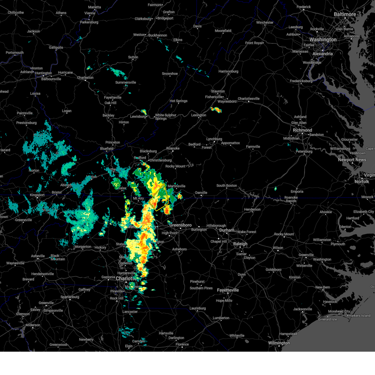 At 1200 pm edt, a severe thunderstorm was located near danbury, moving northeast at 15 mph (radar indicated). Hazards include 60 mph wind gusts and quarter size hail. Hail damage to vehicles is expected. Expect wind damage to roofs, siding, and trees. At 1200 pm edt, a severe thunderstorm was located near danbury, moving northeast at 15 mph (radar indicated). Hazards include 60 mph wind gusts and quarter size hail. Hail damage to vehicles is expected. Expect wind damage to roofs, siding, and trees.
|
| 5/16/2023 8:55 PM EDT |
 The severe thunderstorm warning for eastern surry, stokes, southeastern wilkes, northwestern rockingham and yadkin counties will expire at 900 pm edt, the storms which prompted the warning have weakened below severe limits, and have exited the warned area. therefore, the warning will be allowed to expire. a severe thunderstorm watch remains in effect until 1000 pm edt for north central and northwestern north carolina, and south central, southwestern and west central virginia. The severe thunderstorm warning for eastern surry, stokes, southeastern wilkes, northwestern rockingham and yadkin counties will expire at 900 pm edt, the storms which prompted the warning have weakened below severe limits, and have exited the warned area. therefore, the warning will be allowed to expire. a severe thunderstorm watch remains in effect until 1000 pm edt for north central and northwestern north carolina, and south central, southwestern and west central virginia.
|
| 5/16/2023 8:20 PM EDT |
 At 819 pm edt, severe thunderstorms were located along a line extending from danbury to harmony, moving east at 50 mph (radar indicated). Hazards include 60 mph wind gusts. Expect damage to roofs, siding, and trees. locations impacted include, eden, north wilkesboro, elkin, wilkesboro, fairview, yadkinville, and mayodan. hail threat, radar indicated max hail size, <. 75 in wind threat, radar indicated max wind gust, 60 mph. At 819 pm edt, severe thunderstorms were located along a line extending from danbury to harmony, moving east at 50 mph (radar indicated). Hazards include 60 mph wind gusts. Expect damage to roofs, siding, and trees. locations impacted include, eden, north wilkesboro, elkin, wilkesboro, fairview, yadkinville, and mayodan. hail threat, radar indicated max hail size, <. 75 in wind threat, radar indicated max wind gust, 60 mph.
|
| 5/16/2023 7:56 PM EDT |
 At 755 pm edt, severe thunderstorms were located along a line extending from near flat rock to near windy gap, moving east at 50 mph (radar indicated). Hazards include 60 mph wind gusts. expect damage to roofs, siding, and trees At 755 pm edt, severe thunderstorms were located along a line extending from near flat rock to near windy gap, moving east at 50 mph (radar indicated). Hazards include 60 mph wind gusts. expect damage to roofs, siding, and trees
|
| 4/22/2023 8:24 AM EDT |
 At 824 am edt, a severe thunderstorm was located near stuart, moving northeast at 60 mph (radar indicated). Hazards include 60 mph wind gusts. expect damage to roofs, siding, and trees At 824 am edt, a severe thunderstorm was located near stuart, moving northeast at 60 mph (radar indicated). Hazards include 60 mph wind gusts. expect damage to roofs, siding, and trees
|
| 4/6/2023 5:21 PM EDT |
 At 521 pm edt, a severe thunderstorm was located over pilot mountain state park, or near pilot mountain, moving east at 25 mph (radar indicated). Hazards include 60 mph wind gusts and quarter size hail. Hail damage to vehicles is expected. expect wind damage to roofs, siding, and trees. locations impacted include, pilot mountain, danbury, francisco, level cross, woodville, pinnacle, and ararat. hail threat, radar indicated max hail size, 1. 00 in wind threat, radar indicated max wind gust, 60 mph. At 521 pm edt, a severe thunderstorm was located over pilot mountain state park, or near pilot mountain, moving east at 25 mph (radar indicated). Hazards include 60 mph wind gusts and quarter size hail. Hail damage to vehicles is expected. expect wind damage to roofs, siding, and trees. locations impacted include, pilot mountain, danbury, francisco, level cross, woodville, pinnacle, and ararat. hail threat, radar indicated max hail size, 1. 00 in wind threat, radar indicated max wind gust, 60 mph.
|
| 4/6/2023 5:21 PM EDT |
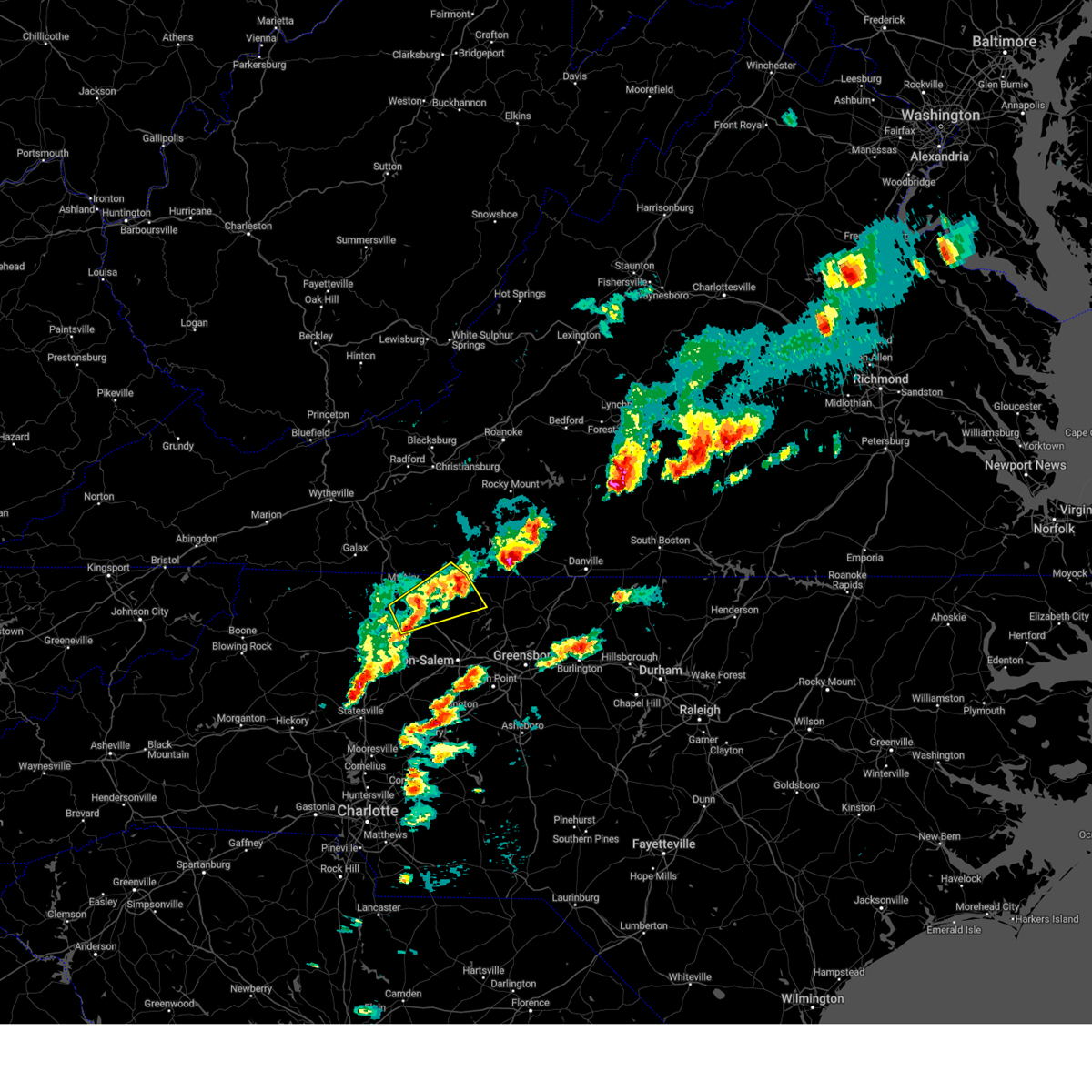 At 521 pm edt, a severe thunderstorm was located over pilot mountain state park, or near pilot mountain, moving east at 25 mph (radar indicated). Hazards include 60 mph wind gusts and quarter size hail. Hail damage to vehicles is expected. expect wind damage to roofs, siding, and trees. locations impacted include, pilot mountain, danbury, francisco, level cross, woodville, pinnacle, and ararat. hail threat, radar indicated max hail size, 1. 00 in wind threat, radar indicated max wind gust, 60 mph. At 521 pm edt, a severe thunderstorm was located over pilot mountain state park, or near pilot mountain, moving east at 25 mph (radar indicated). Hazards include 60 mph wind gusts and quarter size hail. Hail damage to vehicles is expected. expect wind damage to roofs, siding, and trees. locations impacted include, pilot mountain, danbury, francisco, level cross, woodville, pinnacle, and ararat. hail threat, radar indicated max hail size, 1. 00 in wind threat, radar indicated max wind gust, 60 mph.
|
| 4/6/2023 5:06 PM EDT |
 At 505 pm edt, a severe thunderstorm was located over level cross, or near fairview, moving northeast at 25 mph (radar indicated). Hazards include 60 mph wind gusts and quarter size hail. Hail damage to vehicles is expected. Expect wind damage to roofs, siding, and trees. At 505 pm edt, a severe thunderstorm was located over level cross, or near fairview, moving northeast at 25 mph (radar indicated). Hazards include 60 mph wind gusts and quarter size hail. Hail damage to vehicles is expected. Expect wind damage to roofs, siding, and trees.
|
| 9/25/2022 4:48 PM EDT |
 At 448 pm edt, a severe thunderstorm was located over hanging rock state park, or near danbury, moving east at 40 mph (radar indicated). Hazards include 60 mph wind gusts and quarter size hail. Hail damage to vehicles is expected. expect wind damage to roofs, siding, and trees. locations impacted include, mayodan, madison, walnut cove, danbury, sandy ridge, king, and pine hall. hail threat, radar indicated max hail size, 1. 00 in wind threat, radar indicated max wind gust, 60 mph. At 448 pm edt, a severe thunderstorm was located over hanging rock state park, or near danbury, moving east at 40 mph (radar indicated). Hazards include 60 mph wind gusts and quarter size hail. Hail damage to vehicles is expected. expect wind damage to roofs, siding, and trees. locations impacted include, mayodan, madison, walnut cove, danbury, sandy ridge, king, and pine hall. hail threat, radar indicated max hail size, 1. 00 in wind threat, radar indicated max wind gust, 60 mph.
|
| 9/25/2022 4:28 PM EDT |
 At 427 pm edt, a severe thunderstorm was located near ararat, or near pilot mountain, moving east at 40 mph (radar indicated). Hazards include 60 mph wind gusts and quarter size hail. Hail damage to vehicles is expected. Expect wind damage to roofs, siding, and trees. At 427 pm edt, a severe thunderstorm was located near ararat, or near pilot mountain, moving east at 40 mph (radar indicated). Hazards include 60 mph wind gusts and quarter size hail. Hail damage to vehicles is expected. Expect wind damage to roofs, siding, and trees.
|
| 7/2/2022 7:47 PM EDT |
 At 747 pm edt, severe thunderstorms were located along a line extending from near ararat to near ronda, moving southeast at 15 mph (radar indicated). Hazards include 60 mph wind gusts and quarter size hail. Hail damage to vehicles is expected. expect wind damage to roofs, siding, and trees. locations impacted include, mount airy, elkin, fairview, yadkinville, jonesville, dobson, and pilot mountain. hail threat, radar indicated max hail size, 1. 00 in wind threat, radar indicated max wind gust, 60 mph. At 747 pm edt, severe thunderstorms were located along a line extending from near ararat to near ronda, moving southeast at 15 mph (radar indicated). Hazards include 60 mph wind gusts and quarter size hail. Hail damage to vehicles is expected. expect wind damage to roofs, siding, and trees. locations impacted include, mount airy, elkin, fairview, yadkinville, jonesville, dobson, and pilot mountain. hail threat, radar indicated max hail size, 1. 00 in wind threat, radar indicated max wind gust, 60 mph.
|
| 7/2/2022 7:28 PM EDT |
 At 727 pm edt, severe thunderstorms were located along a line extending from near white plains to near dockery, moving southeast at 15 mph (radar indicated). Hazards include 60 mph wind gusts and quarter size hail. Hail damage to vehicles is expected. Expect wind damage to roofs, siding, and trees. At 727 pm edt, severe thunderstorms were located along a line extending from near white plains to near dockery, moving southeast at 15 mph (radar indicated). Hazards include 60 mph wind gusts and quarter size hail. Hail damage to vehicles is expected. Expect wind damage to roofs, siding, and trees.
|
| 6/17/2022 5:54 PM EDT |
 The severe thunderstorm warning for stokes, rockingham, western caswell, yadkin, pittsylvania and henry counties, the city of danville and the city of martinsville will expire at 600 pm edt, the storms which prompted the warning have moved southeast and out of the warned area. therefore, the warning will be allowed to expire. at 545 pm edt, regional radars indicated severe thunderstorms were moving southeast through southside virginia and into the northern piedmont of north carolina between south boston, virginia, and burlington, north carolina, moving southeast at 50 mph. The severe thunderstorm warning for stokes, rockingham, western caswell, yadkin, pittsylvania and henry counties, the city of danville and the city of martinsville will expire at 600 pm edt, the storms which prompted the warning have moved southeast and out of the warned area. therefore, the warning will be allowed to expire. at 545 pm edt, regional radars indicated severe thunderstorms were moving southeast through southside virginia and into the northern piedmont of north carolina between south boston, virginia, and burlington, north carolina, moving southeast at 50 mph.
|
| 6/17/2022 5:16 PM EDT |
 At 510 pm edt, strong winds were being produced by thunderstorms that were aligned just east of the blue ridge, and were moving into southside virginia and then piedmont of north carolina. wind gusts of 40 to 60 mph were being reported with these storms (radar indicated). Hazards include 60 mph wind gusts and penny size hail. Expect damage to roofs, siding, and trees. locations impacted include, danville, eden, reidsville, martinsville, yadkinville, wentworth, and mayodan. this includes the following locations the martinsville speedway, martinsville airport, and danville airport. hail threat, radar indicated max hail size, 0. 75 in wind threat, radar indicated max wind gust, 60 mph. At 510 pm edt, strong winds were being produced by thunderstorms that were aligned just east of the blue ridge, and were moving into southside virginia and then piedmont of north carolina. wind gusts of 40 to 60 mph were being reported with these storms (radar indicated). Hazards include 60 mph wind gusts and penny size hail. Expect damage to roofs, siding, and trees. locations impacted include, danville, eden, reidsville, martinsville, yadkinville, wentworth, and mayodan. this includes the following locations the martinsville speedway, martinsville airport, and danville airport. hail threat, radar indicated max hail size, 0. 75 in wind threat, radar indicated max wind gust, 60 mph.
|
| 6/17/2022 4:40 PM EDT |
 At 436 pm edt, severe thunderstorms were located along a line extending from near rocky mount virginia to wilkesboro north carolina, moving southeast at 50 mph. additional thunderstorms were developing ahead of this line, near wentworth and yadkinville, north carolina (radar indicated). Hazards include 60 mph wind gusts and quarter size hail. Hail damage to vehicles is expected. Expect wind damage to roofs, siding, and trees. At 436 pm edt, severe thunderstorms were located along a line extending from near rocky mount virginia to wilkesboro north carolina, moving southeast at 50 mph. additional thunderstorms were developing ahead of this line, near wentworth and yadkinville, north carolina (radar indicated). Hazards include 60 mph wind gusts and quarter size hail. Hail damage to vehicles is expected. Expect wind damage to roofs, siding, and trees.
|
| 6/16/2022 2:37 PM EDT |
 At 237 pm edt, a severe thunderstorm was located over pinnacle, or near pilot mountain, moving southeast at 25 mph (radar indicated). Hazards include 60 mph wind gusts and quarter size hail. Hail damage to vehicles is expected. expect wind damage to roofs, siding, and trees. locations impacted include, mount airy, fairview, flat rock, yadkinville, dobson, pilot mountain, and walnut cove. hail threat, radar indicated max hail size, 1. 00 in wind threat, radar indicated max wind gust, 60 mph. At 237 pm edt, a severe thunderstorm was located over pinnacle, or near pilot mountain, moving southeast at 25 mph (radar indicated). Hazards include 60 mph wind gusts and quarter size hail. Hail damage to vehicles is expected. expect wind damage to roofs, siding, and trees. locations impacted include, mount airy, fairview, flat rock, yadkinville, dobson, pilot mountain, and walnut cove. hail threat, radar indicated max hail size, 1. 00 in wind threat, radar indicated max wind gust, 60 mph.
|
| 6/16/2022 2:16 PM EDT |
 At 215 pm edt, a severe thunderstorm was located over westfield, or near pilot mountain, moving southeast at 25 mph (radar indicated). Hazards include 60 mph wind gusts and quarter size hail. Hail damage to vehicles is expected. Expect wind damage to roofs, siding, and trees. At 215 pm edt, a severe thunderstorm was located over westfield, or near pilot mountain, moving southeast at 25 mph (radar indicated). Hazards include 60 mph wind gusts and quarter size hail. Hail damage to vehicles is expected. Expect wind damage to roofs, siding, and trees.
|
| 6/14/2022 2:07 AM EDT |
 At 207 am edt, a severe thunderstorm was located over pine hall, or near walnut cove, moving southeast at 30 mph (radar indicated). Hazards include 60 mph wind gusts. expect damage to roofs, siding, and trees At 207 am edt, a severe thunderstorm was located over pine hall, or near walnut cove, moving southeast at 30 mph (radar indicated). Hazards include 60 mph wind gusts. expect damage to roofs, siding, and trees
|
| 6/2/2022 6:36 PM EDT |
 At 636 pm edt, a severe thunderstorm was located over hanging rock state park, or near danbury, moving east at 35 mph (radar indicated). Hazards include 60 mph wind gusts and quarter size hail. Hail damage to vehicles is expected. Expect wind damage to roofs, siding, and trees. At 636 pm edt, a severe thunderstorm was located over hanging rock state park, or near danbury, moving east at 35 mph (radar indicated). Hazards include 60 mph wind gusts and quarter size hail. Hail damage to vehicles is expected. Expect wind damage to roofs, siding, and trees.
|
| 6/2/2022 4:15 PM EDT |
 At 414 pm edt, a severe thunderstorm was located over dillard, or near danbury, moving east at 15 mph (radar indicated). Hazards include 60 mph wind gusts and quarter size hail. Hail damage to vehicles is expected. expect wind damage to roofs, siding, and trees. locations impacted include, mayodan, madison, walnut cove, danbury, pine hall, dillard, and ellisboro. hail threat, radar indicated max hail size, 1. 00 in wind threat, radar indicated max wind gust, 60 mph. At 414 pm edt, a severe thunderstorm was located over dillard, or near danbury, moving east at 15 mph (radar indicated). Hazards include 60 mph wind gusts and quarter size hail. Hail damage to vehicles is expected. expect wind damage to roofs, siding, and trees. locations impacted include, mayodan, madison, walnut cove, danbury, pine hall, dillard, and ellisboro. hail threat, radar indicated max hail size, 1. 00 in wind threat, radar indicated max wind gust, 60 mph.
|
| 6/2/2022 3:36 PM EDT | Multiple trees down in the danbury area of stokes count in stokes county NC, 1 miles W of Danbury, NC |
| 6/2/2022 3:29 PM EDT |
 At 329 pm edt, a severe thunderstorm was located near capella, or near francisco, moving east at 15 mph (radar indicated). Hazards include 60 mph wind gusts and quarter size hail. Hail damage to vehicles is expected. Expect wind damage to roofs, siding, and trees. At 329 pm edt, a severe thunderstorm was located near capella, or near francisco, moving east at 15 mph (radar indicated). Hazards include 60 mph wind gusts and quarter size hail. Hail damage to vehicles is expected. Expect wind damage to roofs, siding, and trees.
|
| 6/2/2022 3:09 PM EDT |
 At 308 pm edt, severe thunderstorms were located along a line extending from near penns store to pilot mountain state park, moving southeast at 20 mph (radar indicated). Hazards include 60 mph wind gusts and quarter size hail. Hail damage to vehicles is expected. expect wind damage to roofs, siding, and trees. locations impacted include, pilot mountain, danbury, francisco, sandy ridge, king, pinnacle, and ayersville. hail threat, radar indicated max hail size, 1. 00 in wind threat, radar indicated max wind gust, 60 mph. At 308 pm edt, severe thunderstorms were located along a line extending from near penns store to pilot mountain state park, moving southeast at 20 mph (radar indicated). Hazards include 60 mph wind gusts and quarter size hail. Hail damage to vehicles is expected. expect wind damage to roofs, siding, and trees. locations impacted include, pilot mountain, danbury, francisco, sandy ridge, king, pinnacle, and ayersville. hail threat, radar indicated max hail size, 1. 00 in wind threat, radar indicated max wind gust, 60 mph.
|
| 6/2/2022 3:09 PM EDT |
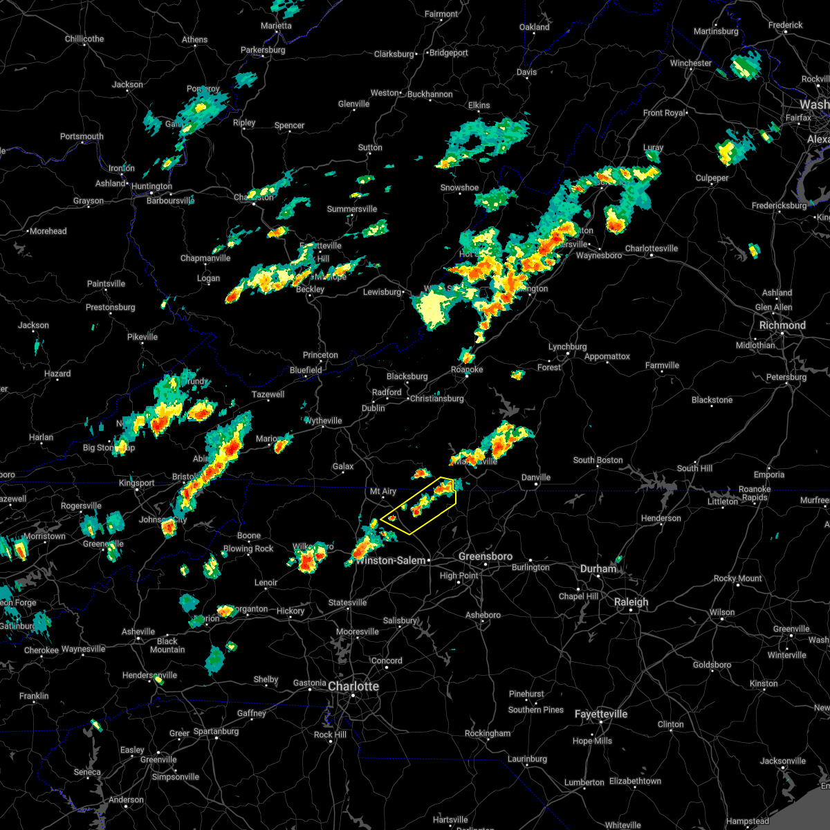 At 308 pm edt, severe thunderstorms were located along a line extending from near penns store to pilot mountain state park, moving southeast at 20 mph (radar indicated). Hazards include 60 mph wind gusts and quarter size hail. Hail damage to vehicles is expected. expect wind damage to roofs, siding, and trees. locations impacted include, pilot mountain, danbury, francisco, sandy ridge, king, pinnacle, and ayersville. hail threat, radar indicated max hail size, 1. 00 in wind threat, radar indicated max wind gust, 60 mph. At 308 pm edt, severe thunderstorms were located along a line extending from near penns store to pilot mountain state park, moving southeast at 20 mph (radar indicated). Hazards include 60 mph wind gusts and quarter size hail. Hail damage to vehicles is expected. expect wind damage to roofs, siding, and trees. locations impacted include, pilot mountain, danbury, francisco, sandy ridge, king, pinnacle, and ayersville. hail threat, radar indicated max hail size, 1. 00 in wind threat, radar indicated max wind gust, 60 mph.
|
| 6/2/2022 2:47 PM EDT |
 At 246 pm edt, severe thunderstorms were located along a line extending from near sandy ridge to near ararat, moving east at 10 mph (radar indicated). Hazards include 60 mph wind gusts and quarter size hail. Hail damage to vehicles is expected. Expect wind damage to roofs, siding, and trees. At 246 pm edt, severe thunderstorms were located along a line extending from near sandy ridge to near ararat, moving east at 10 mph (radar indicated). Hazards include 60 mph wind gusts and quarter size hail. Hail damage to vehicles is expected. Expect wind damage to roofs, siding, and trees.
|
| 6/2/2022 2:47 PM EDT |
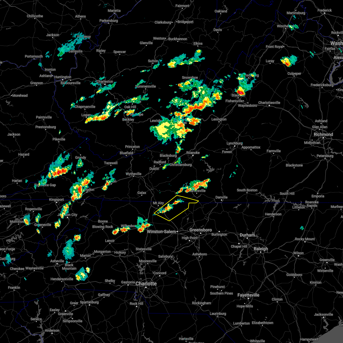 At 246 pm edt, severe thunderstorms were located along a line extending from near sandy ridge to near ararat, moving east at 10 mph (radar indicated). Hazards include 60 mph wind gusts and quarter size hail. Hail damage to vehicles is expected. Expect wind damage to roofs, siding, and trees. At 246 pm edt, severe thunderstorms were located along a line extending from near sandy ridge to near ararat, moving east at 10 mph (radar indicated). Hazards include 60 mph wind gusts and quarter size hail. Hail damage to vehicles is expected. Expect wind damage to roofs, siding, and trees.
|
| 5/27/2022 3:52 AM EDT |
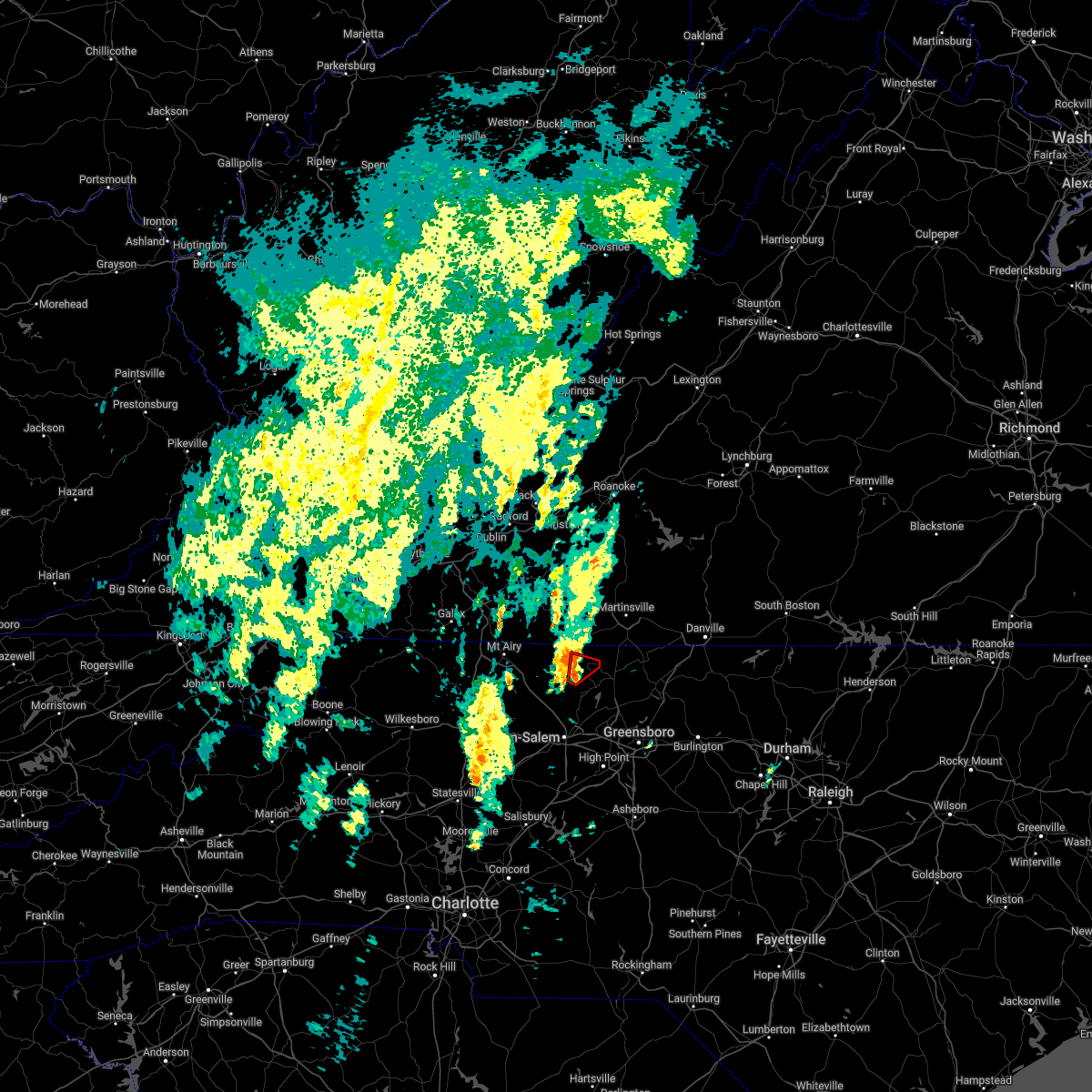 At 351 am edt, a severe thunderstorm capable of producing a tornado was located near danbury, moving northeast at 40 mph (radar indicated rotation). Hazards include tornado. Flying debris will be dangerous to those caught without shelter. mobile homes will be damaged or destroyed. damage to roofs, windows, and vehicles will occur. tree damage is likely. Locations impacted include, danbury, prestonville, dillard, and meadows. At 351 am edt, a severe thunderstorm capable of producing a tornado was located near danbury, moving northeast at 40 mph (radar indicated rotation). Hazards include tornado. Flying debris will be dangerous to those caught without shelter. mobile homes will be damaged or destroyed. damage to roofs, windows, and vehicles will occur. tree damage is likely. Locations impacted include, danbury, prestonville, dillard, and meadows.
|
| 5/27/2022 3:43 AM EDT |
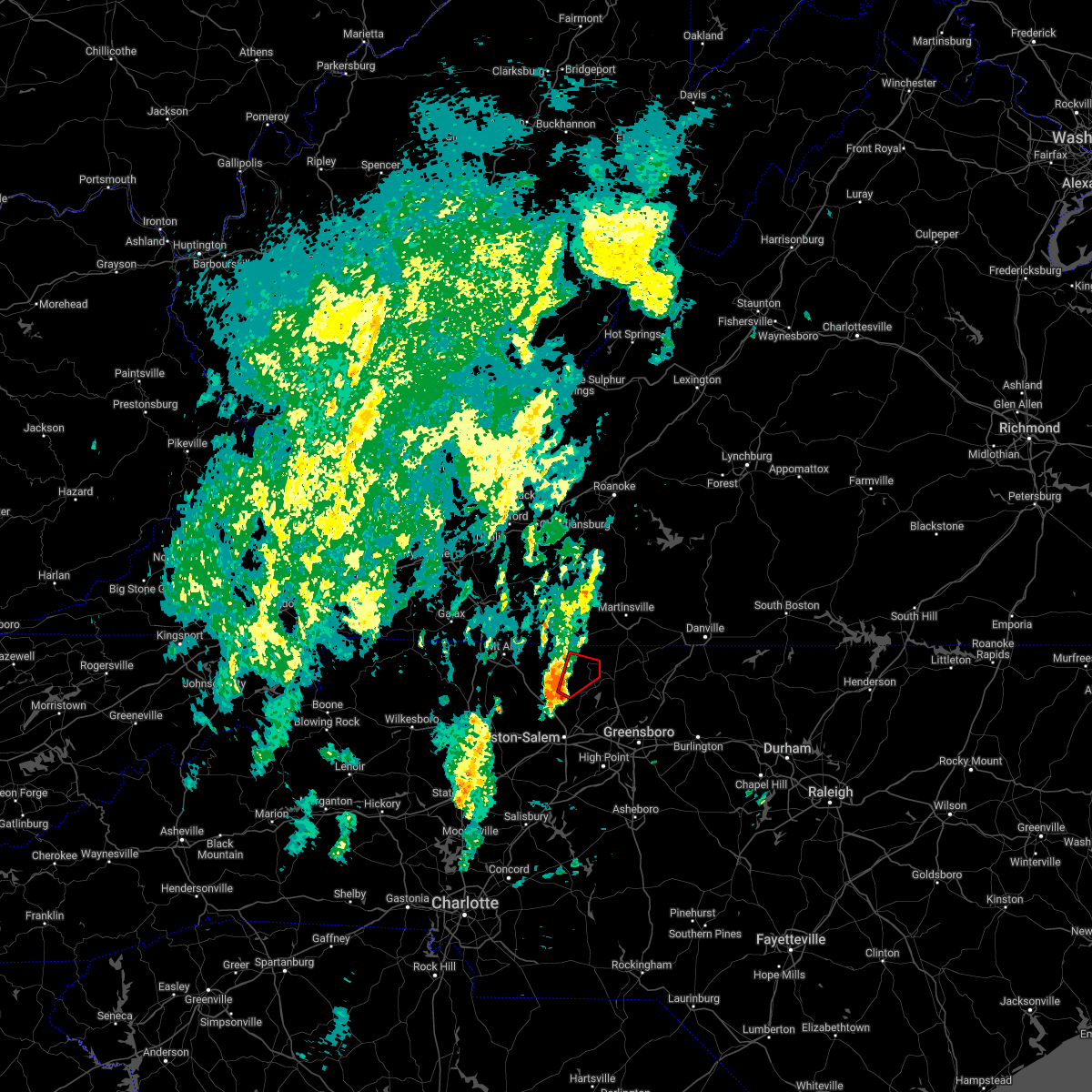 At 343 am edt, a severe thunderstorm capable of producing a tornado was located over meadows, or near danbury, moving northeast at 35 mph (radar indicated rotation). Hazards include tornado. Flying debris will be dangerous to those caught without shelter. mobile homes will be damaged or destroyed. damage to roofs, windows, and vehicles will occur. tree damage is likely. Locations impacted include, danbury, prestonville, dillard, and meadows. At 343 am edt, a severe thunderstorm capable of producing a tornado was located over meadows, or near danbury, moving northeast at 35 mph (radar indicated rotation). Hazards include tornado. Flying debris will be dangerous to those caught without shelter. mobile homes will be damaged or destroyed. damage to roofs, windows, and vehicles will occur. tree damage is likely. Locations impacted include, danbury, prestonville, dillard, and meadows.
|
| 5/27/2022 3:28 AM EDT |
 At 328 am edt, a severe thunderstorm capable of producing a tornado was located near king, or 9 miles west of walnut cove, moving northeast at 40 mph (radar indicated rotation). Hazards include tornado. Flying debris will be dangerous to those caught without shelter. mobile homes will be damaged or destroyed. damage to roofs, windows, and vehicles will occur. Tree damage is likely. At 328 am edt, a severe thunderstorm capable of producing a tornado was located near king, or 9 miles west of walnut cove, moving northeast at 40 mph (radar indicated rotation). Hazards include tornado. Flying debris will be dangerous to those caught without shelter. mobile homes will be damaged or destroyed. damage to roofs, windows, and vehicles will occur. Tree damage is likely.
|
| 5/26/2022 10:02 PM EDT |
 At 1001 pm edt, severe thunderstorms were located along a line extending from near endicott to near mayodan, moving northeast at 40 mph (radar indicated). Hazards include 60 mph wind gusts. Expect damage to roofs, siding, and trees. Locations impacted include, mayodan, madison, walnut cove, stuart, stoneville, floyd, and danbury. At 1001 pm edt, severe thunderstorms were located along a line extending from near endicott to near mayodan, moving northeast at 40 mph (radar indicated). Hazards include 60 mph wind gusts. Expect damage to roofs, siding, and trees. Locations impacted include, mayodan, madison, walnut cove, stuart, stoneville, floyd, and danbury.
|
| 5/26/2022 9:38 PM EDT | Tree down. time estimated from rada in stokes county NC, 4.1 miles E of Danbury, NC |
| 5/26/2022 9:35 PM EDT |
 At 934 pm edt, severe thunderstorms were located along a line extending from near willis to near germanton, moving northeast at 35 mph (radar indicated). Hazards include 60 mph wind gusts. Expect damage to roofs, siding, and trees. Locations impacted include, mayodan, madison, pilot mountain, walnut cove, stuart, stoneville, and floyd. At 934 pm edt, severe thunderstorms were located along a line extending from near willis to near germanton, moving northeast at 35 mph (radar indicated). Hazards include 60 mph wind gusts. Expect damage to roofs, siding, and trees. Locations impacted include, mayodan, madison, pilot mountain, walnut cove, stuart, stoneville, and floyd.
|
| 5/26/2022 9:11 PM EDT |
 At 910 pm edt, severe thunderstorms were located along a line extending from near laurel fork to huntsville, moving northeast at 40 mph (radar indicated). Hazards include 60 mph wind gusts. expect damage to roofs, siding, and trees At 910 pm edt, severe thunderstorms were located along a line extending from near laurel fork to huntsville, moving northeast at 40 mph (radar indicated). Hazards include 60 mph wind gusts. expect damage to roofs, siding, and trees
|
| 5/21/2022 6:25 PM EDT |
 At 625 pm edt, a severe thunderstorm was located over dillard, or near danbury, moving northeast at 20 mph (radar indicated). Hazards include 60 mph wind gusts and quarter size hail. Hail damage to vehicles is expected. expect wind damage to roofs, siding, and trees. locations impacted include, eden, reidsville, martinsville, wentworth, mayodan, madison, and pilot mountain. this includes the following locations the martinsville speedway and martinsville airport. hail threat, radar indicated max hail size, 1. 00 in wind threat, radar indicated max wind gust, 60 mph. At 625 pm edt, a severe thunderstorm was located over dillard, or near danbury, moving northeast at 20 mph (radar indicated). Hazards include 60 mph wind gusts and quarter size hail. Hail damage to vehicles is expected. expect wind damage to roofs, siding, and trees. locations impacted include, eden, reidsville, martinsville, wentworth, mayodan, madison, and pilot mountain. this includes the following locations the martinsville speedway and martinsville airport. hail threat, radar indicated max hail size, 1. 00 in wind threat, radar indicated max wind gust, 60 mph.
|
| 5/21/2022 6:09 PM EDT | Thunderstorm winds blew down one tree at the intersection of lynchburg road and lucius beasley roa in stokes county NC, 6.6 miles ESE of Danbury, NC |
| 5/21/2022 6:08 PM EDT | Thunderstorm winds blew down one tree at the intersection of sheppard mill road and pitzer roa in stokes county NC, 2.2 miles WSW of Danbury, NC |
| 5/21/2022 6:06 PM EDT | Thunderstorm winds blew down one tree at the intersection of hall road and c c camp roa in stokes county NC, 2.9 miles E of Danbury, NC |
| 5/21/2022 5:51 PM EDT |
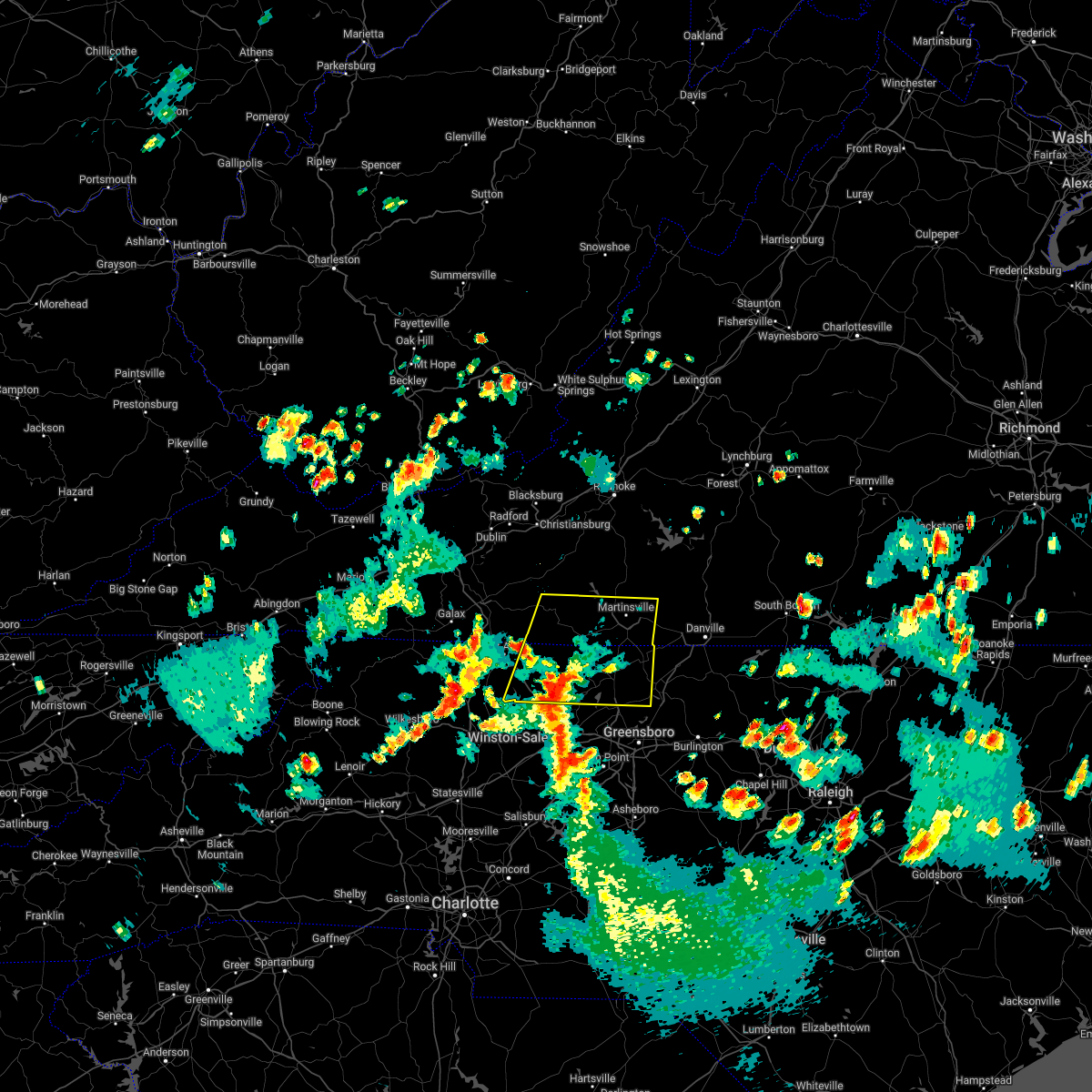 At 550 pm edt, a severe thunderstorm was located over capella, or 7 miles southeast of pilot mountain, moving northeast at 30 mph (radar indicated). Hazards include 60 mph wind gusts and quarter size hail. Hail damage to vehicles is expected. expect wind damage to roofs, siding, and trees. locations impacted include, eden, reidsville, martinsville, wentworth, mayodan, madison, and pilot mountain. this includes the following locations the martinsville speedway and martinsville airport. hail threat, radar indicated max hail size, 1. 00 in wind threat, radar indicated max wind gust, 60 mph. At 550 pm edt, a severe thunderstorm was located over capella, or 7 miles southeast of pilot mountain, moving northeast at 30 mph (radar indicated). Hazards include 60 mph wind gusts and quarter size hail. Hail damage to vehicles is expected. expect wind damage to roofs, siding, and trees. locations impacted include, eden, reidsville, martinsville, wentworth, mayodan, madison, and pilot mountain. this includes the following locations the martinsville speedway and martinsville airport. hail threat, radar indicated max hail size, 1. 00 in wind threat, radar indicated max wind gust, 60 mph.
|
| 5/21/2022 5:39 PM EDT |
 At 539 pm edt, a severe thunderstorm was located over king, or 7 miles east of east bend, moving northeast at 30 mph (radar indicated). Hazards include 60 mph wind gusts and quarter size hail. Hail damage to vehicles is expected. Expect wind damage to roofs, siding, and trees. At 539 pm edt, a severe thunderstorm was located over king, or 7 miles east of east bend, moving northeast at 30 mph (radar indicated). Hazards include 60 mph wind gusts and quarter size hail. Hail damage to vehicles is expected. Expect wind damage to roofs, siding, and trees.
|
| 5/19/2022 8:59 PM EDT |
 At 859 pm edt, a severe thunderstorm was located over danbury, moving east at 30 mph (radar indicated). Hazards include 60 mph wind gusts and quarter size hail. Hail damage to vehicles is expected. expect wind damage to roofs, siding, and trees. locations impacted include, eden, wentworth, mayodan, madison, stoneville, danbury, and francisco. hail threat, radar indicated max hail size, 1. 00 in wind threat, radar indicated max wind gust, 60 mph. At 859 pm edt, a severe thunderstorm was located over danbury, moving east at 30 mph (radar indicated). Hazards include 60 mph wind gusts and quarter size hail. Hail damage to vehicles is expected. expect wind damage to roofs, siding, and trees. locations impacted include, eden, wentworth, mayodan, madison, stoneville, danbury, and francisco. hail threat, radar indicated max hail size, 1. 00 in wind threat, radar indicated max wind gust, 60 mph.
|
| 5/19/2022 8:37 PM EDT |
 At 837 pm edt, a severe thunderstorm was located near francisco, moving east at 30 mph (radar indicated). Hazards include 60 mph wind gusts and quarter size hail. Hail damage to vehicles is expected. Expect wind damage to roofs, siding, and trees. At 837 pm edt, a severe thunderstorm was located near francisco, moving east at 30 mph (radar indicated). Hazards include 60 mph wind gusts and quarter size hail. Hail damage to vehicles is expected. Expect wind damage to roofs, siding, and trees.
|
| 5/6/2022 7:57 PM EDT |
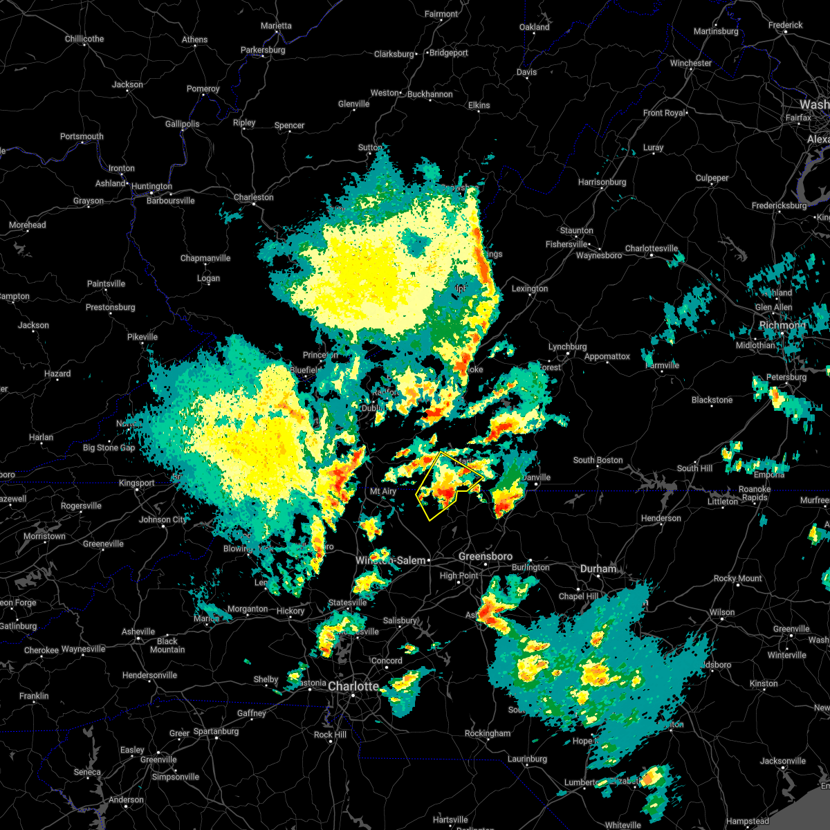 At 756 pm edt, a severe thunderstorm was located near sandy ridge, moving northeast at 35 mph (radar indicated). Hazards include 60 mph wind gusts and quarter size hail. Hail damage to vehicles is expected. expect wind damage to roofs, siding, and trees. locations impacted include, danbury, sandy ridge, spencer, sanville, penns store, critz, and prestonville. This includes the following locations the martinsville speedway and martinsville airport. At 756 pm edt, a severe thunderstorm was located near sandy ridge, moving northeast at 35 mph (radar indicated). Hazards include 60 mph wind gusts and quarter size hail. Hail damage to vehicles is expected. expect wind damage to roofs, siding, and trees. locations impacted include, danbury, sandy ridge, spencer, sanville, penns store, critz, and prestonville. This includes the following locations the martinsville speedway and martinsville airport.
|
| 5/6/2022 7:40 PM EDT |
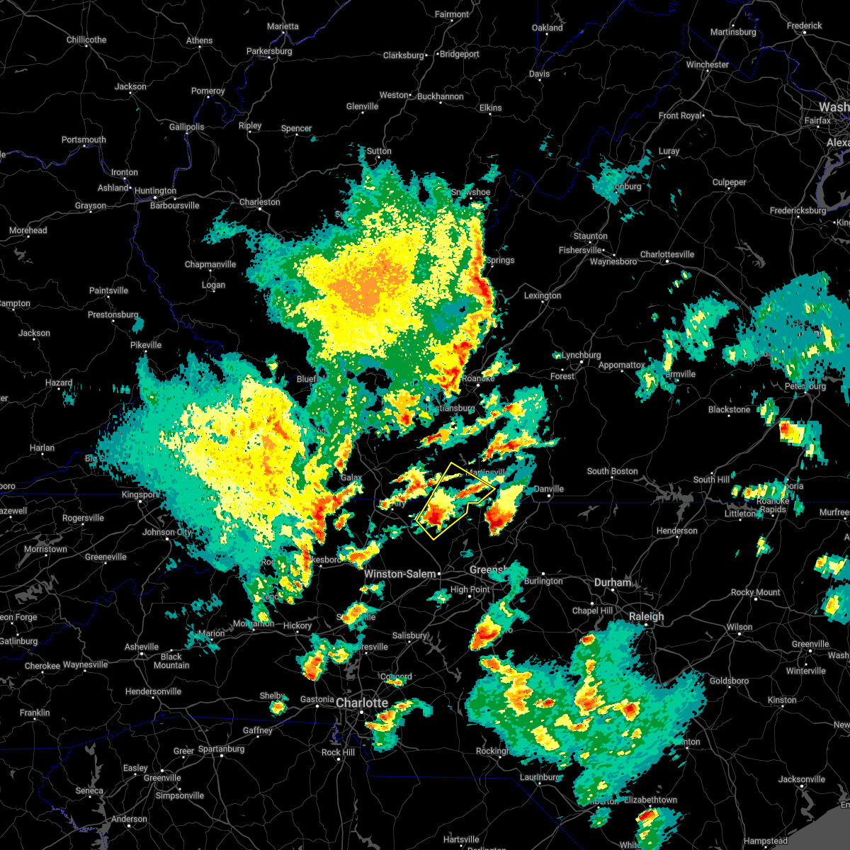 At 740 pm edt, a severe thunderstorm was located over hanging rock state park, or near danbury, moving northeast at 35 mph (radar indicated). Hazards include 60 mph wind gusts and quarter size hail. Hail damage to vehicles is expected. Expect wind damage to roofs, siding, and trees. At 740 pm edt, a severe thunderstorm was located over hanging rock state park, or near danbury, moving northeast at 35 mph (radar indicated). Hazards include 60 mph wind gusts and quarter size hail. Hail damage to vehicles is expected. Expect wind damage to roofs, siding, and trees.
|
| 5/6/2022 7:40 PM EDT |
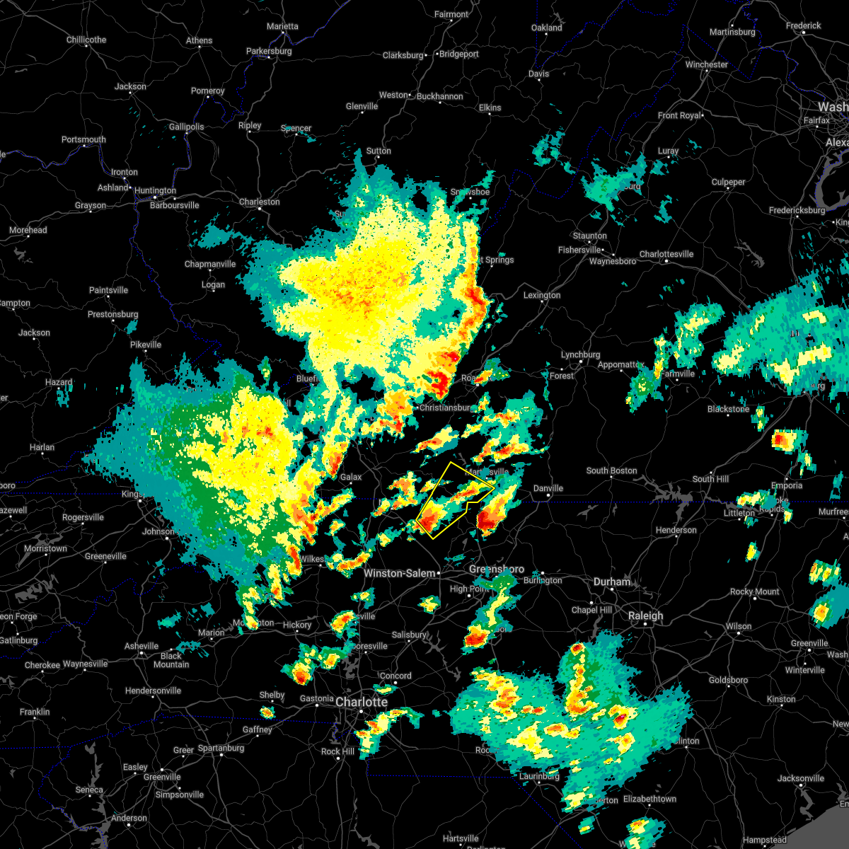 At 740 pm edt, a severe thunderstorm was located over hanging rock state park, or near danbury, moving northeast at 35 mph (radar indicated). Hazards include 60 mph wind gusts and quarter size hail. Hail damage to vehicles is expected. Expect wind damage to roofs, siding, and trees. At 740 pm edt, a severe thunderstorm was located over hanging rock state park, or near danbury, moving northeast at 35 mph (radar indicated). Hazards include 60 mph wind gusts and quarter size hail. Hail damage to vehicles is expected. Expect wind damage to roofs, siding, and trees.
|
| 5/6/2022 7:34 PM EDT |
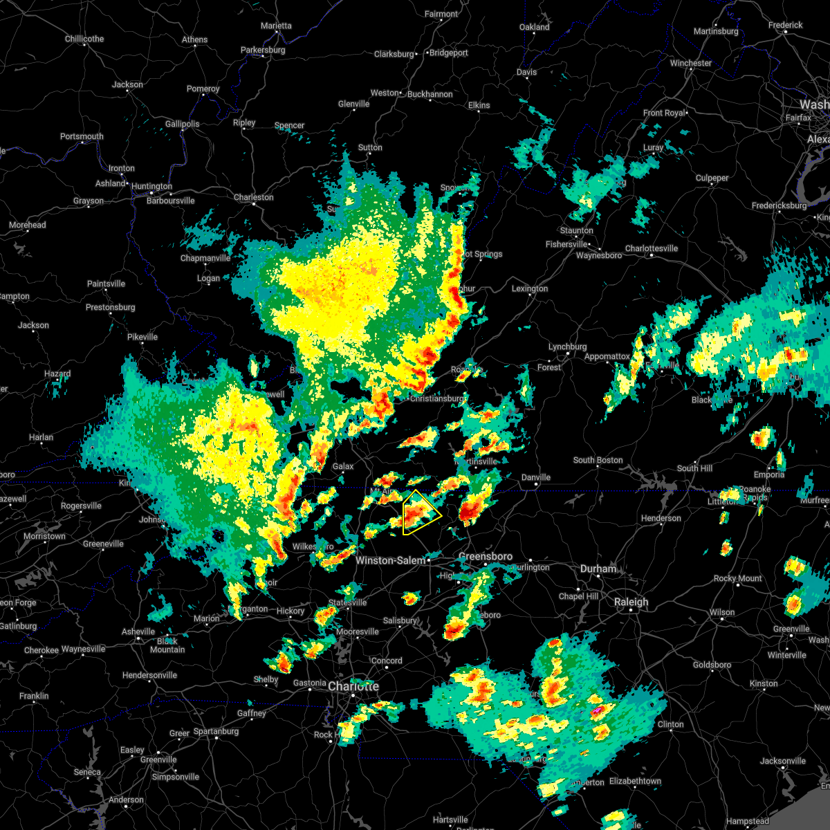 At 734 pm edt, a severe thunderstorm was located near capella, or near francisco, moving northeast at 35 mph (radar indicated). Hazards include 60 mph wind gusts and quarter size hail. Hail damage to vehicles is expected. expect wind damage to roofs, siding, and trees. Locations impacted include, danbury, francisco, king, pinnacle, collinstown, hanging rock state park, and capella. At 734 pm edt, a severe thunderstorm was located near capella, or near francisco, moving northeast at 35 mph (radar indicated). Hazards include 60 mph wind gusts and quarter size hail. Hail damage to vehicles is expected. expect wind damage to roofs, siding, and trees. Locations impacted include, danbury, francisco, king, pinnacle, collinstown, hanging rock state park, and capella.
|
| 5/6/2022 7:22 PM EDT |
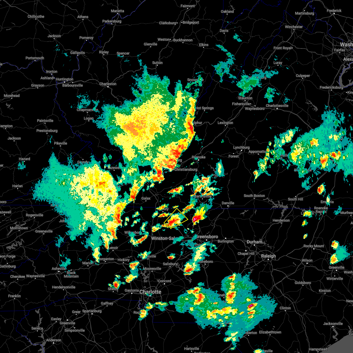 At 721 pm edt, a severe thunderstorm was located over pilot mountain state park, or near pilot mountain, moving northeast at 25 mph (radar indicated). Hazards include 60 mph wind gusts and quarter size hail. Hail damage to vehicles is expected. Expect wind damage to roofs, siding, and trees. At 721 pm edt, a severe thunderstorm was located over pilot mountain state park, or near pilot mountain, moving northeast at 25 mph (radar indicated). Hazards include 60 mph wind gusts and quarter size hail. Hail damage to vehicles is expected. Expect wind damage to roofs, siding, and trees.
|
| 5/1/2022 5:21 PM EDT |
 The severe thunderstorm warning for stokes county will expire at 530 pm edt, the storm which prompted the warning has weakened below severe limits, and no longer poses an immediate threat to life or property. therefore, the warning will be allowed to expire. however, heavy rain is still possible with this thunderstorm. a severe thunderstorm watch remains in effect until 900 pm edt for north central and northwestern north carolina, and south central, southwestern and west central virginia. The severe thunderstorm warning for stokes county will expire at 530 pm edt, the storm which prompted the warning has weakened below severe limits, and no longer poses an immediate threat to life or property. therefore, the warning will be allowed to expire. however, heavy rain is still possible with this thunderstorm. a severe thunderstorm watch remains in effect until 900 pm edt for north central and northwestern north carolina, and south central, southwestern and west central virginia.
|
| 5/1/2022 5:06 PM EDT |
 At 506 pm edt, a severe thunderstorm was located near capella, or near danbury, moving east at 40 mph (radar indicated). Hazards include 60 mph wind gusts and quarter size hail. Hail damage to vehicles is expected. expect wind damage to roofs, siding, and trees. locations impacted include, walnut cove, danbury, sandy ridge, king, pine hall, ayersville, and hanging rock state park. hail threat, radar indicated max hail size, 1. 00 in wind threat, radar indicated max wind gust, 60 mph. At 506 pm edt, a severe thunderstorm was located near capella, or near danbury, moving east at 40 mph (radar indicated). Hazards include 60 mph wind gusts and quarter size hail. Hail damage to vehicles is expected. expect wind damage to roofs, siding, and trees. locations impacted include, walnut cove, danbury, sandy ridge, king, pine hall, ayersville, and hanging rock state park. hail threat, radar indicated max hail size, 1. 00 in wind threat, radar indicated max wind gust, 60 mph.
|
| 5/1/2022 4:46 PM EDT |
 At 446 pm edt, a severe thunderstorm was located over pilot mountain state park, or near pilot mountain, moving east at 40 mph (radar indicated). Hazards include 60 mph wind gusts and quarter size hail. Hail damage to vehicles is expected. Expect wind damage to roofs, siding, and trees. At 446 pm edt, a severe thunderstorm was located over pilot mountain state park, or near pilot mountain, moving east at 40 mph (radar indicated). Hazards include 60 mph wind gusts and quarter size hail. Hail damage to vehicles is expected. Expect wind damage to roofs, siding, and trees.
|
| 8/12/2021 4:40 PM EDT |
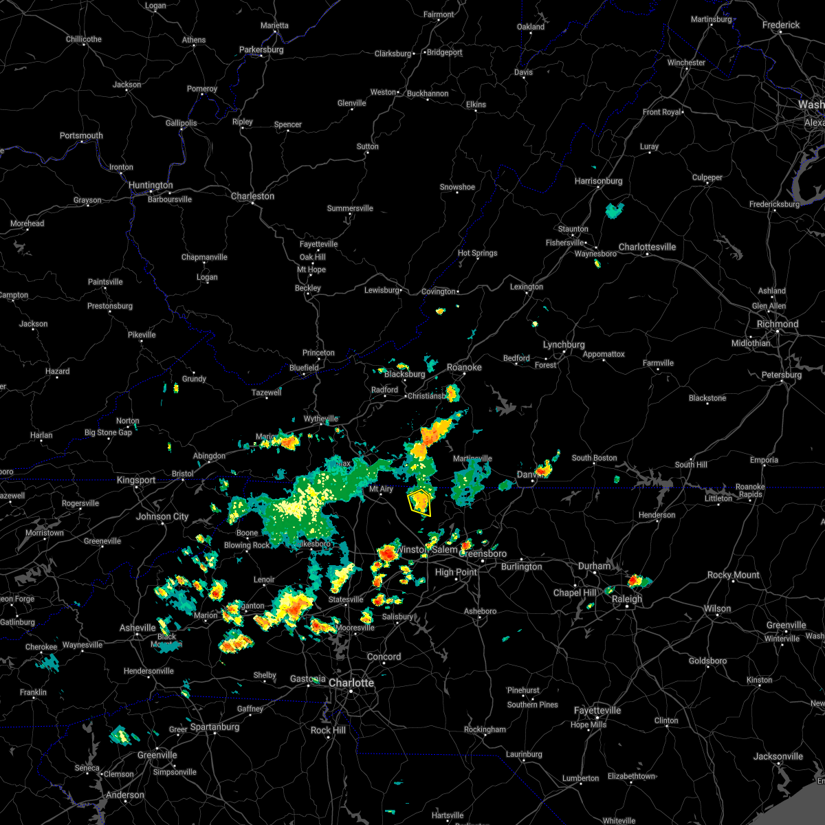 At 439 pm edt, a severe thunderstorm was located over hanging rock state park, or near danbury, moving southeast at 10 mph (radar indicated). Hazards include 60 mph wind gusts and quarter size hail. Hail damage to vehicles is expected. expect wind damage to roofs, siding, and trees. locations impacted include, danbury, francisco, hanging rock state park, and vade mecum. hail threat, radar indicated max hail size, 1. 00 in wind threat, radar indicated max wind gust, 60 mph. At 439 pm edt, a severe thunderstorm was located over hanging rock state park, or near danbury, moving southeast at 10 mph (radar indicated). Hazards include 60 mph wind gusts and quarter size hail. Hail damage to vehicles is expected. expect wind damage to roofs, siding, and trees. locations impacted include, danbury, francisco, hanging rock state park, and vade mecum. hail threat, radar indicated max hail size, 1. 00 in wind threat, radar indicated max wind gust, 60 mph.
|
| 8/12/2021 4:22 PM EDT | Numerous trees down outside the moores spring are in stokes county NC, 6.3 miles E of Danbury, NC |
| 8/12/2021 3:58 PM EDT |
 At 358 pm edt, a severe thunderstorm was located near collinstown, or near stuart, and is nearly stationary (radar indicated). Hazards include 60 mph wind gusts and quarter size hail. Hail damage to vehicles is expected. Expect wind damage to roofs, siding, and trees. At 358 pm edt, a severe thunderstorm was located near collinstown, or near stuart, and is nearly stationary (radar indicated). Hazards include 60 mph wind gusts and quarter size hail. Hail damage to vehicles is expected. Expect wind damage to roofs, siding, and trees.
|
| 8/12/2021 3:58 PM EDT |
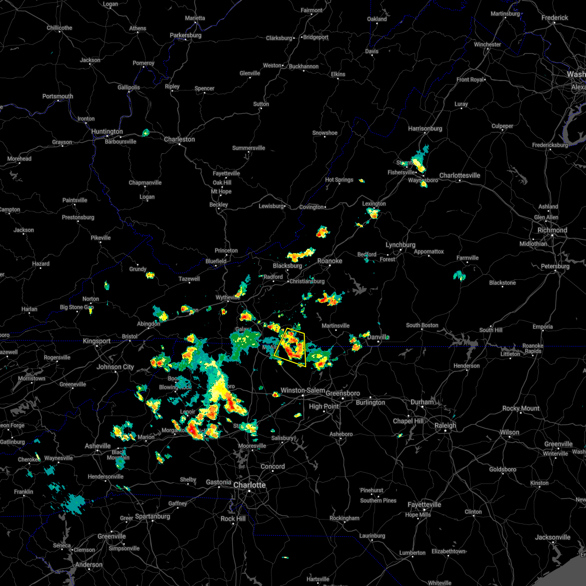 At 358 pm edt, a severe thunderstorm was located near collinstown, or near stuart, and is nearly stationary (radar indicated). Hazards include 60 mph wind gusts and quarter size hail. Hail damage to vehicles is expected. Expect wind damage to roofs, siding, and trees. At 358 pm edt, a severe thunderstorm was located near collinstown, or near stuart, and is nearly stationary (radar indicated). Hazards include 60 mph wind gusts and quarter size hail. Hail damage to vehicles is expected. Expect wind damage to roofs, siding, and trees.
|
| 8/12/2021 3:01 PM EDT | Multiple trees down in the danbury are in stokes county NC, 0.2 miles E of Danbury, NC |
| 8/12/2021 3:01 PM EDT | Multiple trees down in the danbury are in stokes county NC, 0.2 miles E of Danbury, NC |
| 8/12/2021 2:57 PM EDT |
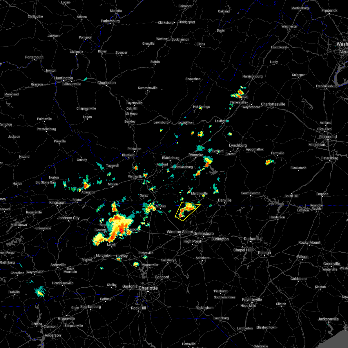 At 257 pm edt, a severe thunderstorm was located over danbury, moving northeast at 5 mph (radar indicated). Hazards include 60 mph wind gusts and quarter size hail. Hail damage to vehicles is expected. Expect wind damage to roofs, siding, and trees. At 257 pm edt, a severe thunderstorm was located over danbury, moving northeast at 5 mph (radar indicated). Hazards include 60 mph wind gusts and quarter size hail. Hail damage to vehicles is expected. Expect wind damage to roofs, siding, and trees.
|
| 8/12/2021 2:17 PM EDT | Multiple trees in lawsonville are in stokes county NC, 5.7 miles SSE of Danbury, NC |
| 8/11/2021 2:44 PM EDT |
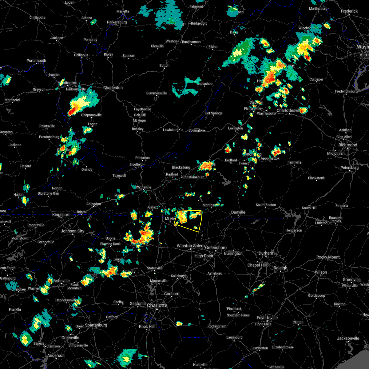 At 244 pm edt, a severe thunderstorm was located near collinstown, or near francisco, moving northeast at 20 mph (radar indicated). Hazards include 60 mph wind gusts and quarter size hail. Hail damage to vehicles is expected. expect wind damage to roofs, siding, and trees. locations impacted include, stuart, danbury, francisco, sandy ridge, critz, woodville, and collinstown. hail threat, radar indicated max hail size, 1. 00 in wind threat, radar indicated max wind gust, 60 mph. At 244 pm edt, a severe thunderstorm was located near collinstown, or near francisco, moving northeast at 20 mph (radar indicated). Hazards include 60 mph wind gusts and quarter size hail. Hail damage to vehicles is expected. expect wind damage to roofs, siding, and trees. locations impacted include, stuart, danbury, francisco, sandy ridge, critz, woodville, and collinstown. hail threat, radar indicated max hail size, 1. 00 in wind threat, radar indicated max wind gust, 60 mph.
|
| 8/11/2021 2:44 PM EDT |
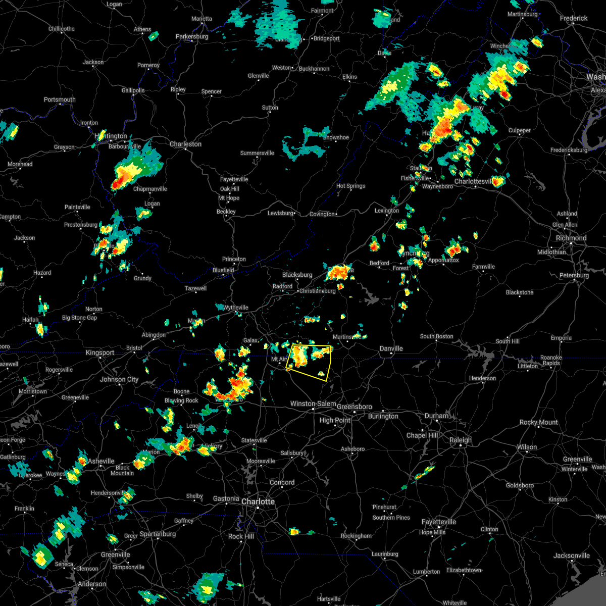 At 244 pm edt, a severe thunderstorm was located near collinstown, or near francisco, moving northeast at 20 mph (radar indicated). Hazards include 60 mph wind gusts and quarter size hail. Hail damage to vehicles is expected. expect wind damage to roofs, siding, and trees. locations impacted include, stuart, danbury, francisco, sandy ridge, critz, woodville, and collinstown. hail threat, radar indicated max hail size, 1. 00 in wind threat, radar indicated max wind gust, 60 mph. At 244 pm edt, a severe thunderstorm was located near collinstown, or near francisco, moving northeast at 20 mph (radar indicated). Hazards include 60 mph wind gusts and quarter size hail. Hail damage to vehicles is expected. expect wind damage to roofs, siding, and trees. locations impacted include, stuart, danbury, francisco, sandy ridge, critz, woodville, and collinstown. hail threat, radar indicated max hail size, 1. 00 in wind threat, radar indicated max wind gust, 60 mph.
|
| 8/11/2021 2:33 PM EDT |
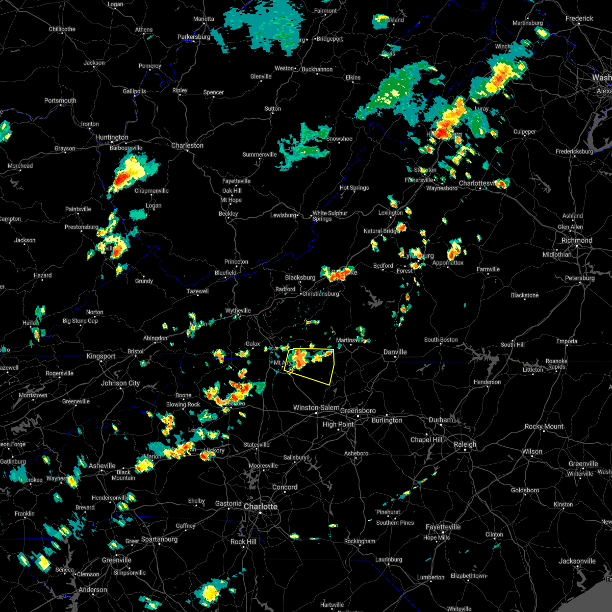 At 233 pm edt, a severe thunderstorm was located near collinstown, or near francisco, moving east at 10 mph (radar indicated). Hazards include 60 mph wind gusts and quarter size hail. Hail damage to vehicles is expected. expect wind damage to roofs, siding, and trees. locations impacted include, flat rock, stuart, danbury, ararat, francisco, sandy ridge, and critz. hail threat, radar indicated max hail size, 1. 00 in wind threat, radar indicated max wind gust, 60 mph. At 233 pm edt, a severe thunderstorm was located near collinstown, or near francisco, moving east at 10 mph (radar indicated). Hazards include 60 mph wind gusts and quarter size hail. Hail damage to vehicles is expected. expect wind damage to roofs, siding, and trees. locations impacted include, flat rock, stuart, danbury, ararat, francisco, sandy ridge, and critz. hail threat, radar indicated max hail size, 1. 00 in wind threat, radar indicated max wind gust, 60 mph.
|
| 8/11/2021 2:17 PM EDT |
 At 217 pm edt, a severe thunderstorm was located over woodville, or near ararat, moving northeast at 20 mph (radar indicated). Hazards include 60 mph wind gusts and quarter size hail. Hail damage to vehicles is expected. Expect wind damage to roofs, siding, and trees. At 217 pm edt, a severe thunderstorm was located over woodville, or near ararat, moving northeast at 20 mph (radar indicated). Hazards include 60 mph wind gusts and quarter size hail. Hail damage to vehicles is expected. Expect wind damage to roofs, siding, and trees.
|
| 8/11/2021 2:17 PM EDT |
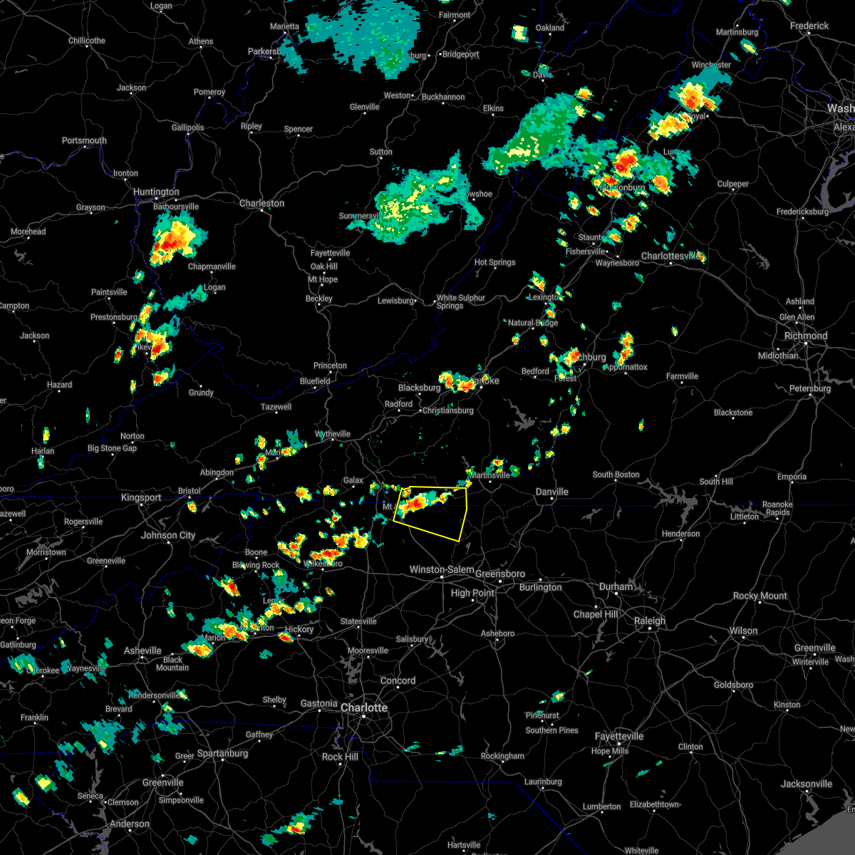 At 217 pm edt, a severe thunderstorm was located over woodville, or near ararat, moving northeast at 20 mph (radar indicated). Hazards include 60 mph wind gusts and quarter size hail. Hail damage to vehicles is expected. Expect wind damage to roofs, siding, and trees. At 217 pm edt, a severe thunderstorm was located over woodville, or near ararat, moving northeast at 20 mph (radar indicated). Hazards include 60 mph wind gusts and quarter size hail. Hail damage to vehicles is expected. Expect wind damage to roofs, siding, and trees.
|
| 8/10/2021 4:02 PM EDT |
 At 401 pm edt, severe thunderstorms were located along a line extending from near meadows to near windy gap, moving southeast at 20 mph (radar indicated). Hazards include 60 mph wind gusts and quarter size hail. Hail damage to vehicles is expected. expect wind damage to roofs, siding, and trees. locations impacted include, elkin, fairview, yadkinville, jonesville, pilot mountain, walnut cove, and boonville. hail threat, radar indicated max hail size, 1. 00 in wind threat, radar indicated max wind gust, 60 mph. At 401 pm edt, severe thunderstorms were located along a line extending from near meadows to near windy gap, moving southeast at 20 mph (radar indicated). Hazards include 60 mph wind gusts and quarter size hail. Hail damage to vehicles is expected. expect wind damage to roofs, siding, and trees. locations impacted include, elkin, fairview, yadkinville, jonesville, pilot mountain, walnut cove, and boonville. hail threat, radar indicated max hail size, 1. 00 in wind threat, radar indicated max wind gust, 60 mph.
|
| 8/10/2021 3:37 PM EDT |
 At 337 pm edt, severe thunderstorms were located along a line extending from danbury to near windy gap, moving southeast at 20 mph (radar indicated). Hazards include 60 mph wind gusts and quarter size hail. Hail damage to vehicles is expected. Expect wind damage to roofs, siding, and trees. At 337 pm edt, severe thunderstorms were located along a line extending from danbury to near windy gap, moving southeast at 20 mph (radar indicated). Hazards include 60 mph wind gusts and quarter size hail. Hail damage to vehicles is expected. Expect wind damage to roofs, siding, and trees.
|
| 7/26/2021 2:19 PM EDT |
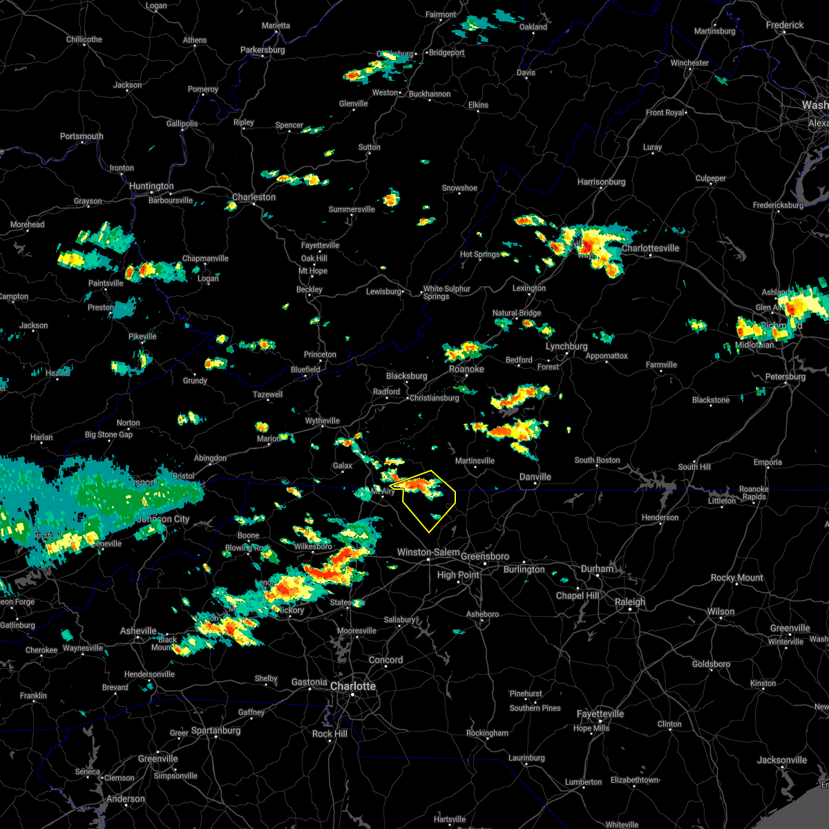 At 219 pm edt, a severe thunderstorm was located near collinstown, or near stuart, moving southeast at 25 mph (radar indicated). Hazards include 60 mph wind gusts. expect damage to roofs, siding, and trees At 219 pm edt, a severe thunderstorm was located near collinstown, or near stuart, moving southeast at 25 mph (radar indicated). Hazards include 60 mph wind gusts. expect damage to roofs, siding, and trees
|
| 7/26/2021 2:19 PM EDT |
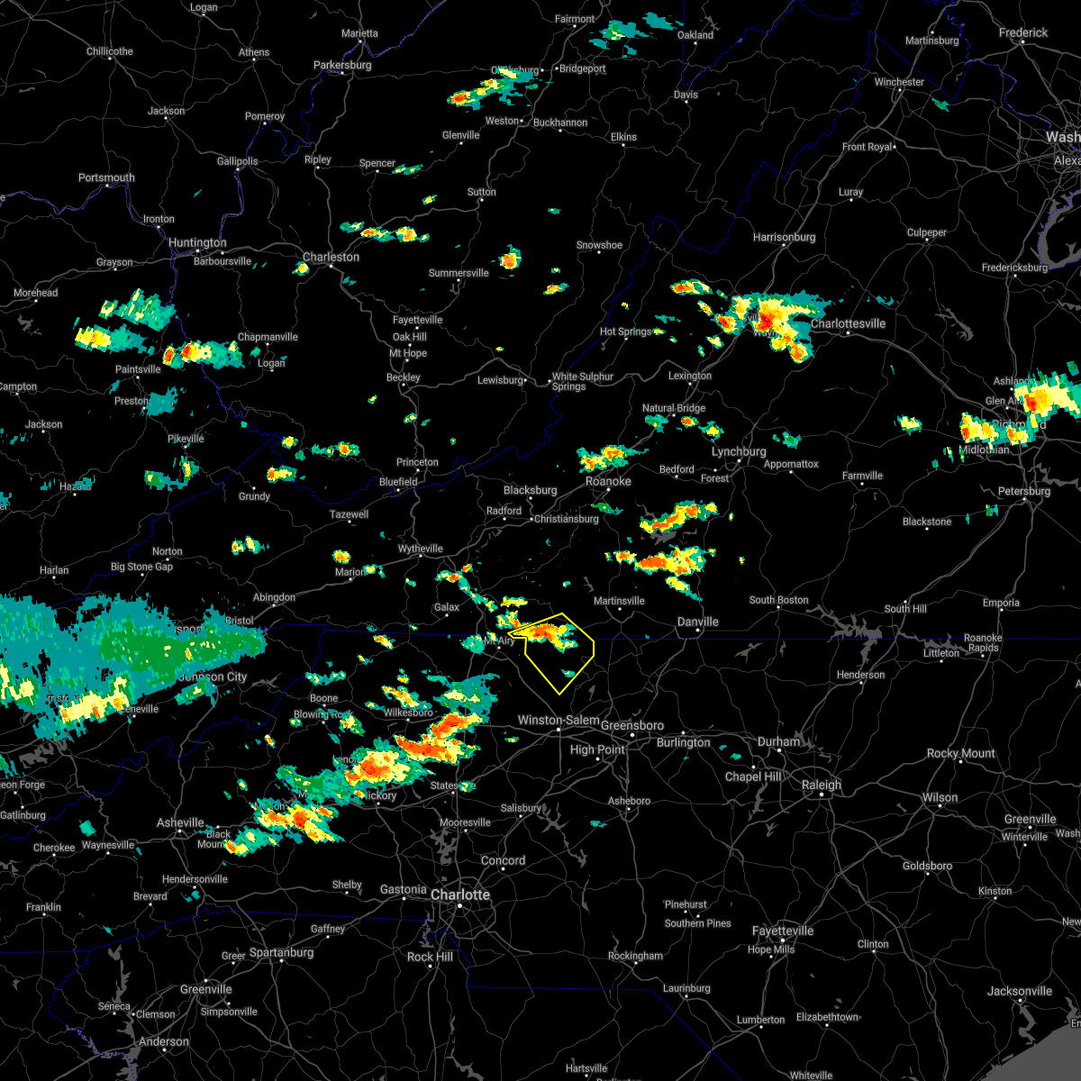 At 219 pm edt, a severe thunderstorm was located near collinstown, or near stuart, moving southeast at 25 mph (radar indicated). Hazards include 60 mph wind gusts. expect damage to roofs, siding, and trees At 219 pm edt, a severe thunderstorm was located near collinstown, or near stuart, moving southeast at 25 mph (radar indicated). Hazards include 60 mph wind gusts. expect damage to roofs, siding, and trees
|
| 7/17/2021 8:42 PM EDT |
 At 841 pm edt, a severe thunderstorm was located near meadows, or near walnut cove, moving northeast at 25 mph (radar indicated). Hazards include 60 mph wind gusts. expect damage to roofs, siding, and trees At 841 pm edt, a severe thunderstorm was located near meadows, or near walnut cove, moving northeast at 25 mph (radar indicated). Hazards include 60 mph wind gusts. expect damage to roofs, siding, and trees
|
| 7/17/2021 8:16 PM EDT |
 At 815 pm edt, severe thunderstorms were located along a line extending from near endicott to near siloam, moving east at 30 mph (radar indicated). Hazards include 60 mph wind gusts. Expect damage to roofs, siding, and trees. Locations impacted include, walnut cove, danbury, spencer, bassett, sandy ridge, king, and pine hall. At 815 pm edt, severe thunderstorms were located along a line extending from near endicott to near siloam, moving east at 30 mph (radar indicated). Hazards include 60 mph wind gusts. Expect damage to roofs, siding, and trees. Locations impacted include, walnut cove, danbury, spencer, bassett, sandy ridge, king, and pine hall.
|
| 7/17/2021 8:02 PM EDT |
 At 802 pm edt, severe thunderstorms were located along a line extending from near rocky knob summit to boonville, moving east at 30 mph (radar indicated). Hazards include 60 mph wind gusts. Expect damage to roofs, siding, and trees. Locations impacted include, mount airy, fairview, flat rock, yadkinville, pilot mountain, walnut cove, and stuart. At 802 pm edt, severe thunderstorms were located along a line extending from near rocky knob summit to boonville, moving east at 30 mph (radar indicated). Hazards include 60 mph wind gusts. Expect damage to roofs, siding, and trees. Locations impacted include, mount airy, fairview, flat rock, yadkinville, pilot mountain, walnut cove, and stuart.
|
| 7/17/2021 7:44 PM EDT |
 At 744 pm edt, severe thunderstorms were located along a line extending from near mabry mill to near swancreek, moving east at 25 mph (radar indicated). Hazards include 60 mph wind gusts. expect damage to roofs, siding, and trees At 744 pm edt, severe thunderstorms were located along a line extending from near mabry mill to near swancreek, moving east at 25 mph (radar indicated). Hazards include 60 mph wind gusts. expect damage to roofs, siding, and trees
|
| 7/9/2021 5:57 PM EDT |
 A severe thunderstorm warning remains in effect until 630 pm edt for stokes county. at 555 pm edt, severe thunderstorms were located along a line extending from dillard to near shacktown, moving east at 20 mph. hazard. 60 mph wind gusts and quarter size hail. source. Radar indicated. A severe thunderstorm warning remains in effect until 630 pm edt for stokes county. at 555 pm edt, severe thunderstorms were located along a line extending from dillard to near shacktown, moving east at 20 mph. hazard. 60 mph wind gusts and quarter size hail. source. Radar indicated.
|
| 7/9/2021 5:40 PM EDT |
 At 540 pm edt, severe thunderstorms were located along a line extending from danbury to near yadkinville, moving east at 20 mph (radar indicated). Hazards include 60 mph wind gusts and quarter size hail. Hail damage to vehicles is expected. Expect wind damage to roofs, siding, and trees. At 540 pm edt, severe thunderstorms were located along a line extending from danbury to near yadkinville, moving east at 20 mph (radar indicated). Hazards include 60 mph wind gusts and quarter size hail. Hail damage to vehicles is expected. Expect wind damage to roofs, siding, and trees.
|
| 6/14/2021 3:03 PM EDT | Thunderstorm winds blew down multiple healthy trees at the intersection of sheppard mill road and delta church road and billy moorefield roa in stokes county NC, 4.3 miles WSW of Danbury, NC |
| 6/13/2021 10:25 PM EDT |
 At 1025 pm edt, severe thunderstorms were located along a line extending from price to capella to near bottom, moving south at 20 mph (radar indicated). Hazards include 60 mph wind gusts. Expect damage to roofs, siding, and trees. locations impacted include, eden, reidsville, martinsville, mount airy, elkin, fairview, and flat rock. This includes the following locations the martinsville speedway and martinsville airport. At 1025 pm edt, severe thunderstorms were located along a line extending from price to capella to near bottom, moving south at 20 mph (radar indicated). Hazards include 60 mph wind gusts. Expect damage to roofs, siding, and trees. locations impacted include, eden, reidsville, martinsville, mount airy, elkin, fairview, and flat rock. This includes the following locations the martinsville speedway and martinsville airport.
|
| 6/13/2021 9:58 PM EDT |
 At 956 pm edt, severe thunderstorms were located along a line extending from martinsville to near galax along highway 58, moving south at 35 to 40 mph (radar indicated). Hazards include 60 mph wind gusts. expect damage to roofs, siding, and trees At 956 pm edt, severe thunderstorms were located along a line extending from martinsville to near galax along highway 58, moving south at 35 to 40 mph (radar indicated). Hazards include 60 mph wind gusts. expect damage to roofs, siding, and trees
|
| 6/11/2021 1:49 PM EDT |
 At 149 pm edt, a severe thunderstorm was located near king, or near east bend, moving northeast at 15 mph (radar indicated). Hazards include 60 mph wind gusts. Expect damage to roofs, siding, and trees. Locations impacted include, walnut cove, east bend, danbury, king, nebo, enon, and pinnacle. At 149 pm edt, a severe thunderstorm was located near king, or near east bend, moving northeast at 15 mph (radar indicated). Hazards include 60 mph wind gusts. Expect damage to roofs, siding, and trees. Locations impacted include, walnut cove, east bend, danbury, king, nebo, enon, and pinnacle.
|
| 6/11/2021 1:35 PM EDT |
 At 135 pm edt, a severe thunderstorm was located over east bend, moving northeast at 15 mph (radar indicated). Hazards include 60 mph wind gusts. expect damage to roofs, siding, and trees At 135 pm edt, a severe thunderstorm was located over east bend, moving northeast at 15 mph (radar indicated). Hazards include 60 mph wind gusts. expect damage to roofs, siding, and trees
|
| 4/9/2021 4:59 PM EDT |
 At 434 pm edt, a severe thunderstorm was located over westfield, or near francisco, moving east at 30 mph (radar indicated). Hazards include golf ball size hail and 60 mph wind gusts. People and animals outdoors will be injured. expect hail damage to roofs, siding, windows, and vehicles. Expect wind damage to roofs, siding, and trees. At 434 pm edt, a severe thunderstorm was located over westfield, or near francisco, moving east at 30 mph (radar indicated). Hazards include golf ball size hail and 60 mph wind gusts. People and animals outdoors will be injured. expect hail damage to roofs, siding, windows, and vehicles. Expect wind damage to roofs, siding, and trees.
|
| 4/9/2021 4:35 PM EDT |
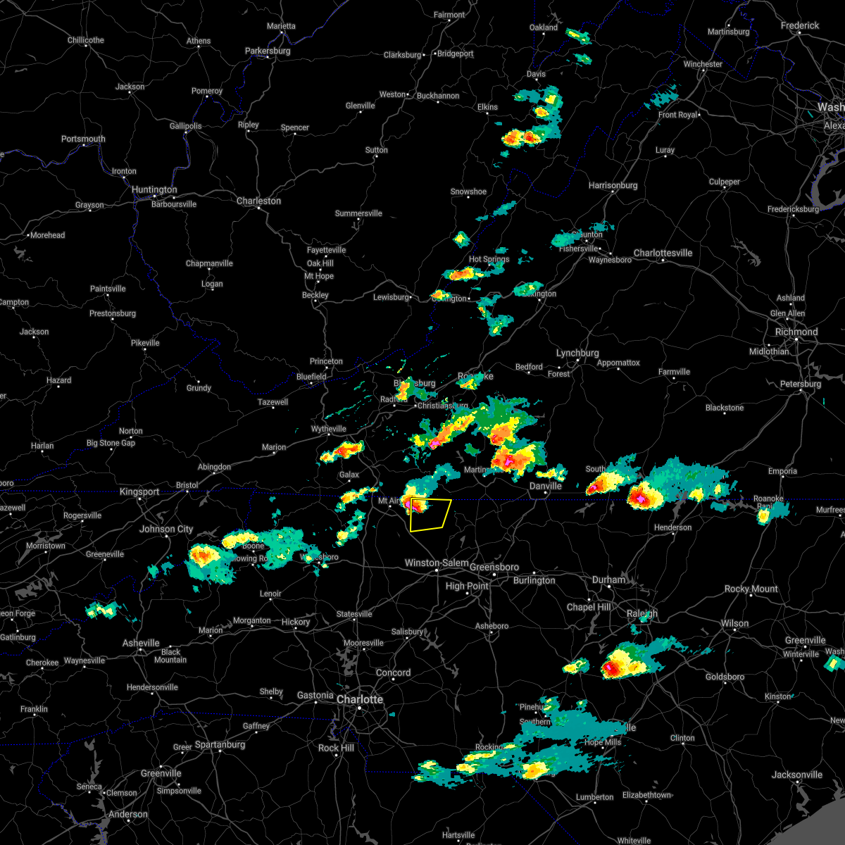 At 434 pm edt, a severe thunderstorm was located over westfield, or near francisco, moving east at 30 mph (radar indicated). Hazards include golf ball size hail and 60 mph wind gusts. People and animals outdoors will be injured. expect hail damage to roofs, siding, windows, and vehicles. Expect wind damage to roofs, siding, and trees. At 434 pm edt, a severe thunderstorm was located over westfield, or near francisco, moving east at 30 mph (radar indicated). Hazards include golf ball size hail and 60 mph wind gusts. People and animals outdoors will be injured. expect hail damage to roofs, siding, windows, and vehicles. Expect wind damage to roofs, siding, and trees.
|
| 3/27/2021 3:24 PM EDT |
 At 323 pm edt, severe thunderstorms were located along a line extending from roanoke mountain to stanleytown to germanton, moving east at 55 mph (radar indicated). Hazards include 60 mph wind gusts. Expect damage to roofs, siding, and trees. locations impacted include, eden, martinsville, rocky mount, mayodan, madison, walnut cove, and stoneville. This includes the following locations the martinsville speedway and martinsville airport. At 323 pm edt, severe thunderstorms were located along a line extending from roanoke mountain to stanleytown to germanton, moving east at 55 mph (radar indicated). Hazards include 60 mph wind gusts. Expect damage to roofs, siding, and trees. locations impacted include, eden, martinsville, rocky mount, mayodan, madison, walnut cove, and stoneville. This includes the following locations the martinsville speedway and martinsville airport.
|
| 3/27/2021 3:06 PM EDT |
 At 305 pm edt, severe thunderstorms were located along a line extending from terrys fork to near stuart to near courtney, moving east at 50 mph (radar indicated). Hazards include 60 mph wind gusts. Expect damage to roofs, siding, and trees. locations impacted include, christiansburg, eden, martinsville, mount airy, rocky mount, elkin, and fairview. This includes the following locations the martinsville speedway and martinsville airport. At 305 pm edt, severe thunderstorms were located along a line extending from terrys fork to near stuart to near courtney, moving east at 50 mph (radar indicated). Hazards include 60 mph wind gusts. Expect damage to roofs, siding, and trees. locations impacted include, christiansburg, eden, martinsville, mount airy, rocky mount, elkin, and fairview. This includes the following locations the martinsville speedway and martinsville airport.
|
| 3/27/2021 2:56 PM EDT |
 At 256 pm edt, severe thunderstorms were located along a line extending from near pilot to ararat to near buck shoals, moving east at 50 mph (radar indicated). Hazards include 60 mph wind gusts. expect damage to roofs, siding, and trees At 256 pm edt, severe thunderstorms were located along a line extending from near pilot to ararat to near buck shoals, moving east at 50 mph (radar indicated). Hazards include 60 mph wind gusts. expect damage to roofs, siding, and trees
|
| 10/29/2020 10:36 AM EDT |
 At 1033 am edt, a severe thunderstorm was located over horse pasture, or over spencer, moving northeast at 35 mph. this is a very dangerous storm (radar indicated). Hazards include 80 mph wind gusts. Flying debris will be dangerous to those caught without shelter. mobile homes will be heavily damaged. expect considerable damage to roofs, windows, and vehicles. extensive tree damage and power outages are likely. locations impacted include, eden, martinsville, rocky mount, mayodan, madison, walnut cove, and stuart. This includes the following locations the martinsville speedway and martinsville airport. At 1033 am edt, a severe thunderstorm was located over horse pasture, or over spencer, moving northeast at 35 mph. this is a very dangerous storm (radar indicated). Hazards include 80 mph wind gusts. Flying debris will be dangerous to those caught without shelter. mobile homes will be heavily damaged. expect considerable damage to roofs, windows, and vehicles. extensive tree damage and power outages are likely. locations impacted include, eden, martinsville, rocky mount, mayodan, madison, walnut cove, and stuart. This includes the following locations the martinsville speedway and martinsville airport.
|
| 10/29/2020 9:50 AM EDT |
 At 947 am edt, a severe thunderstorm was located near pilot mountain, moving northeast at 55 mph. this is a very dangerous storm (radar indicated). Hazards include 80 mph wind gusts. Flying debris will be dangerous to those caught without shelter. mobile homes will be heavily damaged. expect considerable damage to roofs, windows, and vehicles. Extensive tree damage and power outages are likely. At 947 am edt, a severe thunderstorm was located near pilot mountain, moving northeast at 55 mph. this is a very dangerous storm (radar indicated). Hazards include 80 mph wind gusts. Flying debris will be dangerous to those caught without shelter. mobile homes will be heavily damaged. expect considerable damage to roofs, windows, and vehicles. Extensive tree damage and power outages are likely.
|
| 8/5/2020 9:22 PM EDT |
 At 921 pm edt, a severe thunderstorm was located over meadows, or near danbury, moving north at 15 mph (radar indicated). Hazards include 60 mph wind gusts. Expect damage to roofs, siding, and trees. Locations impacted include, walnut cove, danbury, hanging rock state park, germanton, dillard, and meadows. At 921 pm edt, a severe thunderstorm was located over meadows, or near danbury, moving north at 15 mph (radar indicated). Hazards include 60 mph wind gusts. Expect damage to roofs, siding, and trees. Locations impacted include, walnut cove, danbury, hanging rock state park, germanton, dillard, and meadows.
|
| 8/5/2020 8:58 PM EDT |
 At 857 pm edt, a severe thunderstorm was located over germanton, or near walnut cove, moving north at 15 mph (radar indicated). Hazards include 60 mph wind gusts and quarter size hail. Hail damage to vehicles is expected. Expect wind damage to roofs, siding, and trees. At 857 pm edt, a severe thunderstorm was located over germanton, or near walnut cove, moving north at 15 mph (radar indicated). Hazards include 60 mph wind gusts and quarter size hail. Hail damage to vehicles is expected. Expect wind damage to roofs, siding, and trees.
|
| 8/3/2020 1:37 PM EDT |
 At 137 pm edt, severe thunderstorms were located along a line extending from near swansonville to near penns store, moving north at 30 mph (radar indicated). Hazards include 60 mph wind gusts. Expect damage to roofs, siding, and trees. locations impacted include, martinsville, rocky mount, stuart, floyd, boones mill, danbury, and ferrum. This includes the following locations the martinsville speedway and martinsville airport. At 137 pm edt, severe thunderstorms were located along a line extending from near swansonville to near penns store, moving north at 30 mph (radar indicated). Hazards include 60 mph wind gusts. Expect damage to roofs, siding, and trees. locations impacted include, martinsville, rocky mount, stuart, floyd, boones mill, danbury, and ferrum. This includes the following locations the martinsville speedway and martinsville airport.
|
| 8/3/2020 1:18 PM EDT |
 At 117 pm edt, severe thunderstorms were located along a line extending from near mayfield to near prestonville, moving north at 30 mph (radar indicated). Hazards include 60 mph wind gusts. expect damage to roofs, siding, and trees At 117 pm edt, severe thunderstorms were located along a line extending from near mayfield to near prestonville, moving north at 30 mph (radar indicated). Hazards include 60 mph wind gusts. expect damage to roofs, siding, and trees
|
| 7/19/2020 5:50 PM EDT |
 At 549 pm edt, severe thunderstorms were located along a line extending from near stuart to pine ridge, moving east at 40 mph (radar indicated). Hazards include 60 mph wind gusts. Expect damage to roofs, siding, and trees. locations impacted include, martinsville, mount airy, flat rock, dobson, pilot mountain, stuart, and danbury. This includes the following locations the martinsville speedway and martinsville airport. At 549 pm edt, severe thunderstorms were located along a line extending from near stuart to pine ridge, moving east at 40 mph (radar indicated). Hazards include 60 mph wind gusts. Expect damage to roofs, siding, and trees. locations impacted include, martinsville, mount airy, flat rock, dobson, pilot mountain, stuart, and danbury. This includes the following locations the martinsville speedway and martinsville airport.
|
| 7/19/2020 5:32 PM EDT |
 At 531 pm edt, severe thunderstorms were located along a line extending from near ararat to near barrett, moving east at 40 mph (radar indicated). Hazards include 60 mph wind gusts. expect damage to roofs, siding, and trees At 531 pm edt, severe thunderstorms were located along a line extending from near ararat to near barrett, moving east at 40 mph (radar indicated). Hazards include 60 mph wind gusts. expect damage to roofs, siding, and trees
|
| 4/13/2020 4:46 AM EDT |
 At 445 am edt, severe thunderstorms were located along a line extending from near penhook to near winston-salem, moving northeast at 35 mph (radar indicated). Hazards include 60 mph wind gusts. Expect damage to roofs, siding, and trees. locations impacted include, eden, martinsville, altavista, wentworth, mayodan, madison, and walnut cove. This includes the following locations the martinsville speedway and martinsville airport. At 445 am edt, severe thunderstorms were located along a line extending from near penhook to near winston-salem, moving northeast at 35 mph (radar indicated). Hazards include 60 mph wind gusts. Expect damage to roofs, siding, and trees. locations impacted include, eden, martinsville, altavista, wentworth, mayodan, madison, and walnut cove. This includes the following locations the martinsville speedway and martinsville airport.
|
| 4/13/2020 4:35 AM EDT |
 At 435 am edt, severe thunderstorms were located along a line extending from near sontag to near clemmons, moving northeast at 35 mph (radar indicated). Hazards include 60 mph wind gusts. expect damage to roofs, siding, and trees At 435 am edt, severe thunderstorms were located along a line extending from near sontag to near clemmons, moving northeast at 35 mph (radar indicated). Hazards include 60 mph wind gusts. expect damage to roofs, siding, and trees
|
| 2/6/2020 11:39 AM EST |
 At 1139 am est, severe thunderstorms were located along a line extending from near ferrum to near sanville, moving northeast at 80 mph (radar indicated). Hazards include 60 mph wind gusts. Expect damage to roofs, siding, and trees. locations impacted include, eden, wentworth, mayodan, madison, and walnut cove. A tornado watch remains in effect until 500 pm est for north central and northwestern north carolina, and south central virginia. At 1139 am est, severe thunderstorms were located along a line extending from near ferrum to near sanville, moving northeast at 80 mph (radar indicated). Hazards include 60 mph wind gusts. Expect damage to roofs, siding, and trees. locations impacted include, eden, wentworth, mayodan, madison, and walnut cove. A tornado watch remains in effect until 500 pm est for north central and northwestern north carolina, and south central virginia.
|
| 2/6/2020 10:57 AM EST |
 At 1057 am est, severe thunderstorms were located along a line extending from pilot mountain state park to courtney, moving northeast at 80 mph (radar indicated). Hazards include 60 mph wind gusts. expect damage to roofs, siding, and trees At 1057 am est, severe thunderstorms were located along a line extending from pilot mountain state park to courtney, moving northeast at 80 mph (radar indicated). Hazards include 60 mph wind gusts. expect damage to roofs, siding, and trees
|
| 1/11/2020 11:08 PM EST |
 The severe thunderstorm warning for eastern stokes, rockingham, western pittsylvania, southwestern bedford, henry, franklin and southeastern patrick counties and the city of martinsville will expire at 1115 pm est, the storms which prompted the warning have moved out of the area. therefore, the warning will be allowed to expire. however gusty winds are still possible with these thunderstorms. a severe thunderstorm watch remains in effect until 100 am est for north central and northwestern north carolina, and south central, central, southwestern and west central virginia. when it is safe to do so, please send your reports of hail of any size, as well as reports of any wind damage, including downed trees or large limbs, to the national weather service by calling toll free at 1, 8 6 6, 2 1 5, 4 3 2 4. reports and pictures can also be shared on the national weather service blacksburg facebook page and on twitter. The severe thunderstorm warning for eastern stokes, rockingham, western pittsylvania, southwestern bedford, henry, franklin and southeastern patrick counties and the city of martinsville will expire at 1115 pm est, the storms which prompted the warning have moved out of the area. therefore, the warning will be allowed to expire. however gusty winds are still possible with these thunderstorms. a severe thunderstorm watch remains in effect until 100 am est for north central and northwestern north carolina, and south central, central, southwestern and west central virginia. when it is safe to do so, please send your reports of hail of any size, as well as reports of any wind damage, including downed trees or large limbs, to the national weather service by calling toll free at 1, 8 6 6, 2 1 5, 4 3 2 4. reports and pictures can also be shared on the national weather service blacksburg facebook page and on twitter.
|
| 1/11/2020 10:40 PM EST |
 At 1039 pm est, severe thunderstorms were located along a line extending from near arcadia to near bethany, moving east at 45 mph (radar indicated). Hazards include 60 mph wind gusts. expect damage to roofs, siding, and trees At 1039 pm est, severe thunderstorms were located along a line extending from near arcadia to near bethany, moving east at 45 mph (radar indicated). Hazards include 60 mph wind gusts. expect damage to roofs, siding, and trees
|
| 1/11/2020 9:43 PM EST |
 At 942 pm est, severe thunderstorms were located along a line extending from near huffman to near courtney, moving northeast at 50 mph (radar indicated). Hazards include 70 mph wind gusts. Expect considerable tree damage. Damage is likely to mobile homes, roofs, and outbuildings. At 942 pm est, severe thunderstorms were located along a line extending from near huffman to near courtney, moving northeast at 50 mph (radar indicated). Hazards include 70 mph wind gusts. Expect considerable tree damage. Damage is likely to mobile homes, roofs, and outbuildings.
|
| 8/21/2019 4:52 PM EDT |
 At 452 pm edt, a severe thunderstorm was located near ayersville, moving southeast at 35 mph (radar indicated). Hazards include 60 mph wind gusts. expect damage to roofs, siding, and trees At 452 pm edt, a severe thunderstorm was located near ayersville, moving southeast at 35 mph (radar indicated). Hazards include 60 mph wind gusts. expect damage to roofs, siding, and trees
|
| 8/19/2019 1:50 PM EDT |
 At 149 pm edt, a severe thunderstorm was located near francisco, moving south at 10 mph (radar indicated). Hazards include 60 mph wind gusts and quarter size hail. Hail damage to vehicles is expected. expect wind damage to roofs, siding, and trees. Locations impacted include, walnut cove, danbury, francisco, king, and pinnacle. At 149 pm edt, a severe thunderstorm was located near francisco, moving south at 10 mph (radar indicated). Hazards include 60 mph wind gusts and quarter size hail. Hail damage to vehicles is expected. expect wind damage to roofs, siding, and trees. Locations impacted include, walnut cove, danbury, francisco, king, and pinnacle.
|
| 8/19/2019 1:23 PM EDT |
 At 123 pm edt, a severe thunderstorm was located over collinstown, moving south at 10 mph (radar indicated). Hazards include 60 mph wind gusts and quarter size hail. Hail damage to vehicles is expected. Expect wind damage to roofs, siding, and trees. At 123 pm edt, a severe thunderstorm was located over collinstown, moving south at 10 mph (radar indicated). Hazards include 60 mph wind gusts and quarter size hail. Hail damage to vehicles is expected. Expect wind damage to roofs, siding, and trees.
|
| 8/13/2019 3:39 PM EDT |
 At 339 pm edt, severe thunderstorms were located along a line extending from semora to near eden to capella, moving east at 25 mph (radar indicated). Hazards include 60 mph wind gusts and quarter size hail. Hail damage to vehicles is expected. Expect wind damage to roofs, siding, and trees. At 339 pm edt, severe thunderstorms were located along a line extending from semora to near eden to capella, moving east at 25 mph (radar indicated). Hazards include 60 mph wind gusts and quarter size hail. Hail damage to vehicles is expected. Expect wind damage to roofs, siding, and trees.
|
| 8/13/2019 3:30 PM EDT | Extensive tree damage along a one mile long path in the francis cove/westfield area going toward danbury. one home on frye road sustained severe damage from a large dow in stokes county NC, 7.2 miles ESE of Danbury, NC |
| 8/13/2019 3:26 PM EDT | Power lines reported down on flinchum rd. timing estimated by rada in stokes county NC, 2.8 miles ESE of Danbury, NC |
| 8/13/2019 3:24 PM EDT | Numerous trees down along hw 89 between danbury and francisco. timing estimated by rada in stokes county NC, 4.9 miles SE of Danbury, NC |
| 8/13/2019 3:22 PM EDT |
 A severe thunderstorm warning remains in effect until 345 pm edt for east central surry. stokes. northern rockingham. southern pittsylvania. southwestern halifax. henry and southeastern patrick counties. the city of danville and the city of martinsville. At 322 pm edt, severe thunderstorms were located along a line extending from near keeling to near pilot mountain, moving east at 25. A severe thunderstorm warning remains in effect until 345 pm edt for east central surry. stokes. northern rockingham. southern pittsylvania. southwestern halifax. henry and southeastern patrick counties. the city of danville and the city of martinsville. At 322 pm edt, severe thunderstorms were located along a line extending from near keeling to near pilot mountain, moving east at 25.
|
| 8/13/2019 3:22 PM EDT |
 At 322 pm edt, severe thunderstorms were located along a line extending from near keeling to near pilot mountain, moving east at 25 mph (radar indicated). Hazards include 60 mph wind gusts and quarter size hail. Hail damage to vehicles is expected. expect wind damage to roofs, siding, and trees. locations impacted include, danville, eden, martinsville, south boston, and mayodan. This includes the following locations the martinsville speedway, martinsville airport, and danville airport. At 322 pm edt, severe thunderstorms were located along a line extending from near keeling to near pilot mountain, moving east at 25 mph (radar indicated). Hazards include 60 mph wind gusts and quarter size hail. Hail damage to vehicles is expected. expect wind damage to roofs, siding, and trees. locations impacted include, danville, eden, martinsville, south boston, and mayodan. This includes the following locations the martinsville speedway, martinsville airport, and danville airport.
|
| 8/13/2019 3:19 PM EDT | Tree down along lynchburg rd. timing estimated by rada in stokes county NC, 6.1 miles ESE of Danbury, NC |
| 8/13/2019 2:54 PM EDT |
 At 253 pm edt, severe thunderstorms were located along a line extending from dry fork to white plains, moving east at 25 mph (radar indicated). Hazards include 60 mph wind gusts and quarter size hail. Hail damage to vehicles is expected. Expect wind damage to roofs, siding, and trees. At 253 pm edt, severe thunderstorms were located along a line extending from dry fork to white plains, moving east at 25 mph (radar indicated). Hazards include 60 mph wind gusts and quarter size hail. Hail damage to vehicles is expected. Expect wind damage to roofs, siding, and trees.
|
| 8/13/2019 2:54 PM EDT |
 The national weather service in blacksburg has issued a * severe thunderstorm warning for. northeastern surry county in northwestern north carolina. stokes county in north central north carolina. northern rockingham county in north central north carolina. The city of danville in south central virginia. The national weather service in blacksburg has issued a * severe thunderstorm warning for. northeastern surry county in northwestern north carolina. stokes county in north central north carolina. northern rockingham county in north central north carolina. The city of danville in south central virginia.
|
| 7/22/2019 5:46 PM EDT |
 At 546 pm edt, a severe thunderstorm was located over meadows, moving northeast at 20 mph (radar indicated). Hazards include 60 mph wind gusts and quarter size hail. Hail damage to vehicles is expected. Expect wind damage to roofs, siding, and trees. At 546 pm edt, a severe thunderstorm was located over meadows, moving northeast at 20 mph (radar indicated). Hazards include 60 mph wind gusts and quarter size hail. Hail damage to vehicles is expected. Expect wind damage to roofs, siding, and trees.
|
| 7/20/2019 1:20 AM EDT |
 At 120 am edt, a severe thunderstorm was located over pinnacle, moving west at 20 mph (radar indicated). Hazards include 60 mph wind gusts. expect damage to roofs, siding, and trees At 120 am edt, a severe thunderstorm was located over pinnacle, moving west at 20 mph (radar indicated). Hazards include 60 mph wind gusts. expect damage to roofs, siding, and trees
|
| 7/18/2019 5:17 PM EDT |
 At 516 pm edt, a severe thunderstorm was located over pinnacle, moving southeast at 20 mph (radar indicated). Hazards include 60 mph wind gusts. Expect damage to roofs, siding, and trees. Locations impacted include, pilot mountain, walnut cove, danbury, king, and pine hall. At 516 pm edt, a severe thunderstorm was located over pinnacle, moving southeast at 20 mph (radar indicated). Hazards include 60 mph wind gusts. Expect damage to roofs, siding, and trees. Locations impacted include, pilot mountain, walnut cove, danbury, king, and pine hall.
|
| 7/18/2019 4:54 PM EDT |
 At 454 pm edt, a severe thunderstorm was located over ararat, moving east at 30 mph (radar indicated). Hazards include 60 mph wind gusts. expect damage to roofs, siding, and trees At 454 pm edt, a severe thunderstorm was located over ararat, moving east at 30 mph (radar indicated). Hazards include 60 mph wind gusts. expect damage to roofs, siding, and trees
|
| 6/20/2019 1:56 PM EDT |
 The severe thunderstorm warning for southern stokes and eastern yadkin counties will expire at 200 pm edt, the storm which prompted the warning has moved out of the area. therefore, the warning will be allowed to expire. a severe thunderstorm watch remains in effect until 1000 pm edt for north central north carolina, and south central virginia. when it is safe to do so, please send your reports of hail of any size, as well as reports of any wind damage, including downed trees or large limbs, to the national weather service by calling toll free at 1, 8 6 6, 2 1 5, 4 3 2 4. reports and pictures can also be shared on the national weather service blacksburg facebook page and on twitter. The severe thunderstorm warning for southern stokes and eastern yadkin counties will expire at 200 pm edt, the storm which prompted the warning has moved out of the area. therefore, the warning will be allowed to expire. a severe thunderstorm watch remains in effect until 1000 pm edt for north central north carolina, and south central virginia. when it is safe to do so, please send your reports of hail of any size, as well as reports of any wind damage, including downed trees or large limbs, to the national weather service by calling toll free at 1, 8 6 6, 2 1 5, 4 3 2 4. reports and pictures can also be shared on the national weather service blacksburg facebook page and on twitter.
|
| 6/20/2019 1:42 PM EDT |
 At 141 pm edt, a severe thunderstorm was located over east bend, moving east at 40 mph (radar indicated). Hazards include 60 mph wind gusts. Expect damage to roofs, siding, and trees. Locations impacted include, walnut cove, east bend, danbury, king, and enon. At 141 pm edt, a severe thunderstorm was located over east bend, moving east at 40 mph (radar indicated). Hazards include 60 mph wind gusts. Expect damage to roofs, siding, and trees. Locations impacted include, walnut cove, east bend, danbury, king, and enon.
|
| 6/20/2019 1:34 PM EDT | Several trees down in and around danbury. time estimated by rada in stokes county NC, 0.2 miles E of Danbury, NC |
| 6/20/2019 1:22 PM EDT |
 At 121 pm edt, a severe thunderstorm was located near boonville, moving east at 40 mph (radar indicated). Hazards include 60 mph wind gusts. Expect damage to roofs, siding, and trees. Locations impacted include, fairview, yadkinville, jonesville, dobson, and pilot mountain. At 121 pm edt, a severe thunderstorm was located near boonville, moving east at 40 mph (radar indicated). Hazards include 60 mph wind gusts. Expect damage to roofs, siding, and trees. Locations impacted include, fairview, yadkinville, jonesville, dobson, and pilot mountain.
|
| 6/20/2019 1:05 PM EDT |
 At 104 pm edt, a severe thunderstorm was located over clingman, moving east at 40 mph (radar indicated). Hazards include 60 mph wind gusts. expect damage to roofs, siding, and trees At 104 pm edt, a severe thunderstorm was located over clingman, moving east at 40 mph (radar indicated). Hazards include 60 mph wind gusts. expect damage to roofs, siding, and trees
|
| 6/1/2019 9:54 PM EDT |
 At 954 pm edt, a severe thunderstorm was located near ararat, moving southeast at 15 mph (radar indicated). Hazards include 60 mph wind gusts and quarter size hail. Hail damage to vehicles is expected. Expect wind damage to roofs, siding, and trees. At 954 pm edt, a severe thunderstorm was located near ararat, moving southeast at 15 mph (radar indicated). Hazards include 60 mph wind gusts and quarter size hail. Hail damage to vehicles is expected. Expect wind damage to roofs, siding, and trees.
|
| 5/31/2019 5:24 PM EDT |
 The severe thunderstorm warning for southeastern surry, stokes and northern yadkin counties will expire at 530 pm edt, the storm which prompted the warning has weakened below severe limits, and no longer poses an immediate threat to life or property. therefore, the warning will be allowed to expire. however small hail, gusty winds and heavy rain are still possible with this thunderstorm. a severe thunderstorm watch remains in effect until 1100 pm edt for north central and northwestern north carolina, and south central, southwestern and west central virginia. when it is safe to do so, please send your reports of hail of any size, as well as reports of any wind damage, including downed trees or large limbs, to the national weather service by calling toll free at 1, 8 6 6, 2 1 5, 4 3 2 4. reports and pictures can also be shared on the national weather service blacksburg facebook page and on twitter. The severe thunderstorm warning for southeastern surry, stokes and northern yadkin counties will expire at 530 pm edt, the storm which prompted the warning has weakened below severe limits, and no longer poses an immediate threat to life or property. therefore, the warning will be allowed to expire. however small hail, gusty winds and heavy rain are still possible with this thunderstorm. a severe thunderstorm watch remains in effect until 1100 pm edt for north central and northwestern north carolina, and south central, southwestern and west central virginia. when it is safe to do so, please send your reports of hail of any size, as well as reports of any wind damage, including downed trees or large limbs, to the national weather service by calling toll free at 1, 8 6 6, 2 1 5, 4 3 2 4. reports and pictures can also be shared on the national weather service blacksburg facebook page and on twitter.
|
| 5/31/2019 5:07 PM EDT |
 At 507 pm edt, a severe thunderstorm was located near pilot mountain state park, moving east at 45 mph (radar indicated). Hazards include 60 mph wind gusts and quarter size hail. Hail damage to vehicles is expected. expect wind damage to roofs, siding, and trees. Locations impacted include, fairview, pilot mountain, walnut cove, boonville, and east bend. At 507 pm edt, a severe thunderstorm was located near pilot mountain state park, moving east at 45 mph (radar indicated). Hazards include 60 mph wind gusts and quarter size hail. Hail damage to vehicles is expected. expect wind damage to roofs, siding, and trees. Locations impacted include, fairview, pilot mountain, walnut cove, boonville, and east bend.
|
| 5/31/2019 4:45 PM EDT |
 At 444 pm edt, a severe thunderstorm was located over crutchfield, moving east at 50 mph (radar indicated). Hazards include 60 mph wind gusts and half dollar size hail. Hail damage to vehicles is expected. Expect wind damage to roofs, siding, and trees. At 444 pm edt, a severe thunderstorm was located over crutchfield, moving east at 50 mph (radar indicated). Hazards include 60 mph wind gusts and half dollar size hail. Hail damage to vehicles is expected. Expect wind damage to roofs, siding, and trees.
|
| 5/31/2019 2:45 PM EDT |
 At 243 pm edt, a severe thunderstorm was located over prestonville, moving east at 35 mph. a tree was blown down by this storm at 2:30 pm near danbury (radar indicated). Hazards include 60 mph wind gusts and half dollar size hail. Hail damage to vehicles is expected. Expect wind damage to roofs, siding, and trees. At 243 pm edt, a severe thunderstorm was located over prestonville, moving east at 35 mph. a tree was blown down by this storm at 2:30 pm near danbury (radar indicated). Hazards include 60 mph wind gusts and half dollar size hail. Hail damage to vehicles is expected. Expect wind damage to roofs, siding, and trees.
|
| 5/31/2019 2:35 PM EDT | Quarter sized hail reported 2.2 miles WSW of Danbury, NC, spotter called in and reported quarter size hail at the corner of stanley and pitzer rd... near danbury. time estimated by radar. |
| 5/31/2019 2:33 PM EDT |
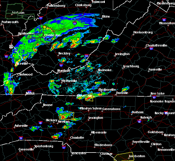 At 233 pm edt, a severe thunderstorm was located near collinstown, moving east at 20 mph (radar indicated). Hazards include 60 mph wind gusts and quarter size hail. Hail damage to vehicles is expected. expect wind damage to roofs, siding, and trees. Locations impacted include, danbury, sandy ridge, prestonville, critz, and patrick springs. At 233 pm edt, a severe thunderstorm was located near collinstown, moving east at 20 mph (radar indicated). Hazards include 60 mph wind gusts and quarter size hail. Hail damage to vehicles is expected. expect wind damage to roofs, siding, and trees. Locations impacted include, danbury, sandy ridge, prestonville, critz, and patrick springs.
|
| 5/31/2019 2:30 PM EDT | Tree reported down on route 66... near moores spring and danbury by county 911 call center. time estimated by rada in stokes county NC, 4.7 miles E of Danbury, NC |
| 5/31/2019 2:26 PM EDT |
 At 226 pm edt, a severe thunderstorm was located over collinstown, moving east at 20 mph (radar indicated). Hazards include 60 mph wind gusts and quarter size hail. Hail damage to vehicles is expected. expect wind damage to roofs, siding, and trees. Locations impacted include, danbury, francisco, sandy ridge, critz, and collinstown. At 226 pm edt, a severe thunderstorm was located over collinstown, moving east at 20 mph (radar indicated). Hazards include 60 mph wind gusts and quarter size hail. Hail damage to vehicles is expected. expect wind damage to roofs, siding, and trees. Locations impacted include, danbury, francisco, sandy ridge, critz, and collinstown.
|
| 5/31/2019 2:26 PM EDT |
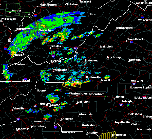 At 226 pm edt, a severe thunderstorm was located over collinstown, moving east at 20 mph (radar indicated). Hazards include 60 mph wind gusts and quarter size hail. Hail damage to vehicles is expected. expect wind damage to roofs, siding, and trees. Locations impacted include, danbury, francisco, sandy ridge, critz, and collinstown. At 226 pm edt, a severe thunderstorm was located over collinstown, moving east at 20 mph (radar indicated). Hazards include 60 mph wind gusts and quarter size hail. Hail damage to vehicles is expected. expect wind damage to roofs, siding, and trees. Locations impacted include, danbury, francisco, sandy ridge, critz, and collinstown.
|
| 5/31/2019 2:11 PM EDT |
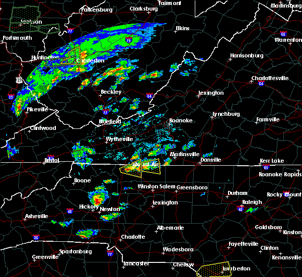 At 210 pm edt, a severe thunderstorm was located over westfield, moving east at 20 mph (radar indicated). Hazards include 60 mph wind gusts. expect damage to roofs, siding, and trees At 210 pm edt, a severe thunderstorm was located over westfield, moving east at 20 mph (radar indicated). Hazards include 60 mph wind gusts. expect damage to roofs, siding, and trees
|
| 5/29/2019 6:55 PM EDT |
 At 654 pm edt, severe thunderstorms were located along a line extending from near darlington heights to near nathalie to near chatham to near danbury, moving east at 40 mph (radar indicated). Hazards include 60 mph wind gusts and quarter size hail. Hail damage to vehicles is expected. Expect wind damage to roofs, siding, and trees. At 654 pm edt, severe thunderstorms were located along a line extending from near darlington heights to near nathalie to near chatham to near danbury, moving east at 40 mph (radar indicated). Hazards include 60 mph wind gusts and quarter size hail. Hail damage to vehicles is expected. Expect wind damage to roofs, siding, and trees.
|
| 5/12/2019 7:00 PM EDT |
 At 659 pm edt, a severe thunderstorm capable of producing a tornado was located over danbury, moving east at 20 mph (radar indicated rotation). Hazards include tornado and quarter size hail. Flying debris will be dangerous to those caught without shelter. mobile homes will be damaged or destroyed. damage to roofs, windows, and vehicles will occur. tree damage is likely. Locations impacted include, walnut cove, danbury, sandy ridge, pine hall, and dillard. At 659 pm edt, a severe thunderstorm capable of producing a tornado was located over danbury, moving east at 20 mph (radar indicated rotation). Hazards include tornado and quarter size hail. Flying debris will be dangerous to those caught without shelter. mobile homes will be damaged or destroyed. damage to roofs, windows, and vehicles will occur. tree damage is likely. Locations impacted include, walnut cove, danbury, sandy ridge, pine hall, and dillard.
|
| 5/12/2019 6:49 PM EDT |
 At 649 pm edt, a severe thunderstorm capable of producing a tornado was located over hanging rock state park, moving east at 20 mph (radar indicated rotation). Hazards include tornado and quarter size hail. Flying debris will be dangerous to those caught without shelter. mobile homes will be damaged or destroyed. damage to roofs, windows, and vehicles will occur. tree damage is likely. this dangerous storm will be near, danbury and meadows around 700 pm edt. walnut cove around 710 pm edt. sandy ridge and dillard around 715 pm edt. Other locations impacted by this tornadic thunderstorm include vade mecum and belews lake. At 649 pm edt, a severe thunderstorm capable of producing a tornado was located over hanging rock state park, moving east at 20 mph (radar indicated rotation). Hazards include tornado and quarter size hail. Flying debris will be dangerous to those caught without shelter. mobile homes will be damaged or destroyed. damage to roofs, windows, and vehicles will occur. tree damage is likely. this dangerous storm will be near, danbury and meadows around 700 pm edt. walnut cove around 710 pm edt. sandy ridge and dillard around 715 pm edt. Other locations impacted by this tornadic thunderstorm include vade mecum and belews lake.
|
| 5/12/2019 6:23 PM EDT |
 At 600 pm edt, a severe thunderstorm capable of producing a tornado was located over pilot mountain, moving east at 20 mph (radar indicated rotation). Hazards include tornado. Flying debris will be dangerous to those caught without shelter. mobile homes will be damaged or destroyed. damage to roofs, windows, and vehicles will occur. Tree damage is likely. At 600 pm edt, a severe thunderstorm capable of producing a tornado was located over pilot mountain, moving east at 20 mph (radar indicated rotation). Hazards include tornado. Flying debris will be dangerous to those caught without shelter. mobile homes will be damaged or destroyed. damage to roofs, windows, and vehicles will occur. Tree damage is likely.
|
| 5/12/2019 6:00 PM EDT |
 At 600 pm edt, a severe thunderstorm capable of producing a tornado was located over pilot mountain, moving east at 20 mph (radar indicated rotation). Hazards include tornado. Flying debris will be dangerous to those caught without shelter. mobile homes will be damaged or destroyed. damage to roofs, windows, and vehicles will occur. Tree damage is likely. At 600 pm edt, a severe thunderstorm capable of producing a tornado was located over pilot mountain, moving east at 20 mph (radar indicated rotation). Hazards include tornado. Flying debris will be dangerous to those caught without shelter. mobile homes will be damaged or destroyed. damage to roofs, windows, and vehicles will occur. Tree damage is likely.
|
| 4/19/2019 3:26 PM EDT |
 The severe thunderstorm warning for western rockingham and henry counties and the city of martinsville will expire at 330 pm edt, the storm which prompted the warning has moved out of the area. therefore, the warning will be allowed to expire. a tornado watch remains in effect until 500 pm edt for north central north carolina, and south central, southwestern and west central virginia. when it is safe to do so, please send your reports of hail of any size, as well as reports of any wind damage, including downed trees or large limbs, to the national weather service by calling toll free at 1, 8 6 6, 2 1 5, 4 3 2 4. reports and pictures can also be shared on the national weather service blacksburg facebook page and on twitter. The severe thunderstorm warning for western rockingham and henry counties and the city of martinsville will expire at 330 pm edt, the storm which prompted the warning has moved out of the area. therefore, the warning will be allowed to expire. a tornado watch remains in effect until 500 pm edt for north central north carolina, and south central, southwestern and west central virginia. when it is safe to do so, please send your reports of hail of any size, as well as reports of any wind damage, including downed trees or large limbs, to the national weather service by calling toll free at 1, 8 6 6, 2 1 5, 4 3 2 4. reports and pictures can also be shared on the national weather service blacksburg facebook page and on twitter.
|
| 4/19/2019 2:37 PM EDT |
 At 237 pm edt, a severe thunderstorm was located near winston-salem, moving north at 50 mph (radar indicated). Hazards include 60 mph wind gusts and quarter size hail. Hail damage to vehicles is expected. Expect wind damage to roofs, siding, and trees. At 237 pm edt, a severe thunderstorm was located near winston-salem, moving north at 50 mph (radar indicated). Hazards include 60 mph wind gusts and quarter size hail. Hail damage to vehicles is expected. Expect wind damage to roofs, siding, and trees.
|
| 4/19/2019 9:41 AM EDT |
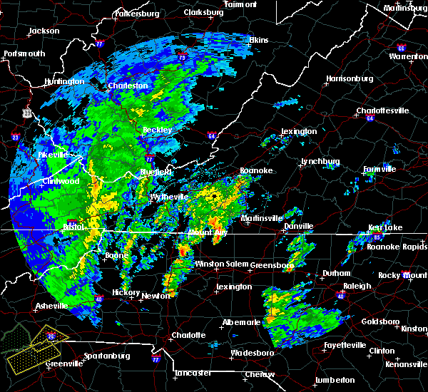 At 941 am edt, a severe thunderstorm capable of producing a tornado was located near danbury, moving northeast at 45 mph (radar indicated rotation). Hazards include tornado and quarter size hail. Flying debris will be dangerous to those caught without shelter. mobile homes will be damaged or destroyed. damage to roofs, windows, and vehicles will occur. Tree damage is likely. At 941 am edt, a severe thunderstorm capable of producing a tornado was located near danbury, moving northeast at 45 mph (radar indicated rotation). Hazards include tornado and quarter size hail. Flying debris will be dangerous to those caught without shelter. mobile homes will be damaged or destroyed. damage to roofs, windows, and vehicles will occur. Tree damage is likely.
|
| 4/15/2019 12:38 AM EDT |
 The severe thunderstorm warning for stokes, western henry, southwestern franklin and eastern patrick counties will expire at 1245 am edt, the storms which prompted the warning have weakened below severe limits, and no longer pose an immediate threat to life or property. therefore, the warning will be allowed to expire. however gusty winds are still possible with these thunderstorms. a tornado watch remains in effect until 500 am edt for north central and northwestern north carolina, and south central, southwestern and west central virginia. when it is safe to do so, please send your reports of hail of any size, as well as reports of any wind damage, including downed trees or large limbs, to the national weather service by calling toll free at 1, 8 6 6, 2 1 5, 4 3 2 4. reports and pictures can also be shared on the national weather service blacksburg facebook page and on twitter. The severe thunderstorm warning for stokes, western henry, southwestern franklin and eastern patrick counties will expire at 1245 am edt, the storms which prompted the warning have weakened below severe limits, and no longer pose an immediate threat to life or property. therefore, the warning will be allowed to expire. however gusty winds are still possible with these thunderstorms. a tornado watch remains in effect until 500 am edt for north central and northwestern north carolina, and south central, southwestern and west central virginia. when it is safe to do so, please send your reports of hail of any size, as well as reports of any wind damage, including downed trees or large limbs, to the national weather service by calling toll free at 1, 8 6 6, 2 1 5, 4 3 2 4. reports and pictures can also be shared on the national weather service blacksburg facebook page and on twitter.
|
| 4/15/2019 12:25 AM EDT |
 At 1225 am edt, severe thunderstorms were located along a line extending from near ferrum to near clemmons, moving east at 25 mph (radar indicated). Hazards include 60 mph wind gusts. Expect damage to roofs, siding, and trees. locations impacted include, walnut cove, stuart, danbury, ferrum, and spencer. A tornado watch remains in effect until 500 am edt for north central and northwestern north carolina, and south central, southwestern and west central virginia. At 1225 am edt, severe thunderstorms were located along a line extending from near ferrum to near clemmons, moving east at 25 mph (radar indicated). Hazards include 60 mph wind gusts. Expect damage to roofs, siding, and trees. locations impacted include, walnut cove, stuart, danbury, ferrum, and spencer. A tornado watch remains in effect until 500 am edt for north central and northwestern north carolina, and south central, southwestern and west central virginia.
|
| 4/15/2019 12:09 AM EDT |
 At 1208 am edt, severe thunderstorms were located along a line extending from near endicott to near huntsville, moving east at 35 mph (radar indicated). Hazards include 60 mph wind gusts. Expect damage to roofs, siding, and trees. locations impacted include, pilot mountain, walnut cove, stuart, east bend, and danbury. A tornado watch remains in effect until 500 am edt for north central and northwestern north carolina, and south central, southwestern and west central virginia. At 1208 am edt, severe thunderstorms were located along a line extending from near endicott to near huntsville, moving east at 35 mph (radar indicated). Hazards include 60 mph wind gusts. Expect damage to roofs, siding, and trees. locations impacted include, pilot mountain, walnut cove, stuart, east bend, and danbury. A tornado watch remains in effect until 500 am edt for north central and northwestern north carolina, and south central, southwestern and west central virginia.
|
| 4/14/2019 11:39 PM EDT |
 At 1139 pm edt, severe thunderstorms were located along a line extending from near alum ridge to near buck shoals, moving east at 25 mph (radar indicated). Hazards include 60 mph wind gusts. expect damage to roofs, siding, and trees At 1139 pm edt, severe thunderstorms were located along a line extending from near alum ridge to near buck shoals, moving east at 25 mph (radar indicated). Hazards include 60 mph wind gusts. expect damage to roofs, siding, and trees
|
| 9/16/2018 9:40 PM EDT | Stokes county 911 center reported about 10 trees down in the last couple of hours across the county and as many as 20 total for the da in stokes county NC, 0.2 miles E of Danbury, NC |
| 9/1/2018 5:32 PM EDT |
 At 532 pm edt, severe thunderstorms were located along a line extending from ayersville to germanton, moving southeast at 10 mph (radar indicated). Hazards include 60 mph wind gusts and quarter size hail. Hail damage to vehicles is expected. Expect wind damage to roofs, siding, and trees. At 532 pm edt, severe thunderstorms were located along a line extending from ayersville to germanton, moving southeast at 10 mph (radar indicated). Hazards include 60 mph wind gusts and quarter size hail. Hail damage to vehicles is expected. Expect wind damage to roofs, siding, and trees.
|
| 8/8/2018 5:45 PM EDT |
 At 544 pm edt, severe thunderstorms were located along a line extending from near meadows to shacktown, moving southeast at 25 mph (radar indicated). Hazards include 60 mph wind gusts. Expect damage to roofs, siding, and trees. Locations impacted include, yadkinville, pilot mountain, walnut cove, boonville, and east bend. At 544 pm edt, severe thunderstorms were located along a line extending from near meadows to shacktown, moving southeast at 25 mph (radar indicated). Hazards include 60 mph wind gusts. Expect damage to roofs, siding, and trees. Locations impacted include, yadkinville, pilot mountain, walnut cove, boonville, and east bend.
|
| 8/8/2018 5:25 PM EDT | One tree blown down along the 3200 block of moir farm road in stokes county NC, 4.7 miles SW of Danbury, NC |
| 8/8/2018 5:21 PM EDT | One tree blown down at the intersection of seven island road and damascus road in stokes county NC, 2.1 miles S of Danbury, NC |
| 8/8/2018 5:19 PM EDT |
 At 518 pm edt, severe thunderstorms were located along a line extending from near francisco to near brooks crossroads, moving east at 20 mph (radar indicated). Hazards include 60 mph wind gusts. expect damage to roofs, siding, and trees At 518 pm edt, severe thunderstorms were located along a line extending from near francisco to near brooks crossroads, moving east at 20 mph (radar indicated). Hazards include 60 mph wind gusts. expect damage to roofs, siding, and trees
|
| 8/8/2018 5:14 PM EDT | One power line blown down along the 2900 block of route 8 in stokes county NC, 3.3 miles SSE of Danbury, NC |
| 8/8/2018 2:40 PM EDT |
 At 237 pm edt, a severe thunderstorm was located near hanging rock state park, moving east at 15 mph (law enforcement). Hazards include 60 mph wind gusts and quarter size hail. Hail damage to vehicles is expected. expect wind damage to roofs, siding, and trees. law enforcement in stokes county has already reported thunderstorm wind damage from this storm in the county. Locations impacted include, walnut cove, danbury, king, dillard, and pinnacle. At 237 pm edt, a severe thunderstorm was located near hanging rock state park, moving east at 15 mph (law enforcement). Hazards include 60 mph wind gusts and quarter size hail. Hail damage to vehicles is expected. expect wind damage to roofs, siding, and trees. law enforcement in stokes county has already reported thunderstorm wind damage from this storm in the county. Locations impacted include, walnut cove, danbury, king, dillard, and pinnacle.
|
| 8/8/2018 2:25 PM EDT |
 At 224 pm edt, a severe thunderstorm was located over capella, moving east at 15 mph (radar indicated). Hazards include 60 mph wind gusts and quarter size hail. Hail damage to vehicles is expected. expect wind damage to roofs, siding, and trees. Locations impacted include, walnut cove, danbury, king, dillard, and pinnacle. At 224 pm edt, a severe thunderstorm was located over capella, moving east at 15 mph (radar indicated). Hazards include 60 mph wind gusts and quarter size hail. Hail damage to vehicles is expected. expect wind damage to roofs, siding, and trees. Locations impacted include, walnut cove, danbury, king, dillard, and pinnacle.
|
| 8/8/2018 2:06 PM EDT |
 At 205 pm edt, a severe thunderstorm was located near pinnacle, moving east at 15 mph (radar indicated). Hazards include 60 mph wind gusts and quarter size hail. Hail damage to vehicles is expected. Expect wind damage to roofs, siding, and trees. At 205 pm edt, a severe thunderstorm was located near pinnacle, moving east at 15 mph (radar indicated). Hazards include 60 mph wind gusts and quarter size hail. Hail damage to vehicles is expected. Expect wind damage to roofs, siding, and trees.
|
| 8/8/2018 1:48 PM EDT | Tree down on tom shelton road near sandy ridge. time estimated from rada in stokes county NC, 5.1 miles SW of Danbury, NC |
| 8/8/2018 1:46 PM EDT | Tree down on steele road near sandy ridge. time estimated from rada in stokes county NC, 6.1 miles SW of Danbury, NC |
| 8/2/2018 4:18 PM EDT |
 At 418 pm edt, severe thunderstorms were located along a line extending from near germanton to near kernersville, moving northeast at 15 mph (radar indicated). Hazards include 60 mph wind gusts. expect damage to roofs, siding, and trees At 418 pm edt, severe thunderstorms were located along a line extending from near germanton to near kernersville, moving northeast at 15 mph (radar indicated). Hazards include 60 mph wind gusts. expect damage to roofs, siding, and trees
|
| 8/1/2018 5:48 PM EDT |
 At 548 pm edt, severe thunderstorms were located along a line extending from near fairy stone state park to near dillard, moving northeast at 40 mph (radar indicated). Hazards include 60 mph wind gusts. Expect damage to roofs, siding, and trees. Locations impacted include, mayodan, madison, stuart, stoneville, and danbury. At 548 pm edt, severe thunderstorms were located along a line extending from near fairy stone state park to near dillard, moving northeast at 40 mph (radar indicated). Hazards include 60 mph wind gusts. Expect damage to roofs, siding, and trees. Locations impacted include, mayodan, madison, stuart, stoneville, and danbury.
|
| 8/1/2018 5:34 PM EDT |
 At 533 pm edt, severe thunderstorms were located along a line extending from near buffalo ridge to near walnut cove, moving northeast at 40 mph (radar indicated). Hazards include 60 mph wind gusts. Expect damage to roofs, siding, and trees. Locations impacted include, mayodan, madison, walnut cove, stuart, and stoneville. At 533 pm edt, severe thunderstorms were located along a line extending from near buffalo ridge to near walnut cove, moving northeast at 40 mph (radar indicated). Hazards include 60 mph wind gusts. Expect damage to roofs, siding, and trees. Locations impacted include, mayodan, madison, walnut cove, stuart, and stoneville.
|
| 8/1/2018 5:10 PM EDT |
 The national weather service in blacksburg has issued a * severe thunderstorm warning for. eastern surry county in northwestern north carolina. stokes county in north central north carolina. northwestern rockingham county in north central north carolina. Western henry county in south central virginia. The national weather service in blacksburg has issued a * severe thunderstorm warning for. eastern surry county in northwestern north carolina. stokes county in north central north carolina. northwestern rockingham county in north central north carolina. Western henry county in south central virginia.
|
| 8/1/2018 5:10 PM EDT |
 At 510 pm edt, severe thunderstorms were located along a line extending from near ararat to near king, moving northeast at 40 mph (radar indicated). Hazards include 60 mph wind gusts. expect damage to roofs, siding, and trees At 510 pm edt, severe thunderstorms were located along a line extending from near ararat to near king, moving northeast at 40 mph (radar indicated). Hazards include 60 mph wind gusts. expect damage to roofs, siding, and trees
|
| 7/31/2018 5:33 PM EDT |
 At 533 pm edt, a severe thunderstorm was located near walnut cove, moving northeast at 15 mph (radar indicated). Hazards include 60 mph wind gusts. expect damage to roofs, siding, and trees At 533 pm edt, a severe thunderstorm was located near walnut cove, moving northeast at 15 mph (radar indicated). Hazards include 60 mph wind gusts. expect damage to roofs, siding, and trees
|
| 6/25/2018 6:51 PM EDT |
 The severe thunderstorm warning for stokes county will expire at 700 pm edt, the storm which prompted the warning has weakened below severe limits, and has exited the warned area. therefore, the warning will be allowed to expire. when it is safe to do so, please send your reports of hail of any size, as well as reports of any wind damage, including downed trees or large limbs, to the national weather service by calling toll free at 1, 8 6 6, 2 1 5, 4 3 2 4. reports and pictures can also be shared on the national weather service blacksburg facebook page and on twitter. The severe thunderstorm warning for stokes county will expire at 700 pm edt, the storm which prompted the warning has weakened below severe limits, and has exited the warned area. therefore, the warning will be allowed to expire. when it is safe to do so, please send your reports of hail of any size, as well as reports of any wind damage, including downed trees or large limbs, to the national weather service by calling toll free at 1, 8 6 6, 2 1 5, 4 3 2 4. reports and pictures can also be shared on the national weather service blacksburg facebook page and on twitter.
|
| 6/25/2018 6:24 PM EDT | Tree down on keaton road. time radar estimate in stokes county NC, 6.4 miles ESE of Danbury, NC |
| 6/25/2018 6:18 PM EDT |
 At 617 pm edt, a severe thunderstorm was located over francisco, moving southeast at 25 mph (radar indicated). Hazards include 60 mph wind gusts. expect damage to roofs, siding, and trees At 617 pm edt, a severe thunderstorm was located over francisco, moving southeast at 25 mph (radar indicated). Hazards include 60 mph wind gusts. expect damage to roofs, siding, and trees
|
| 6/18/2018 5:05 PM EDT |
 At 504 pm edt, a severe thunderstorm was located over danbury, moving southeast at 10 mph (radar indicated). Hazards include 60 mph wind gusts. Expect damage to roofs, siding, and trees. Locations impacted include, walnut cove, danbury, king, hanging rock state park, and capella. At 504 pm edt, a severe thunderstorm was located over danbury, moving southeast at 10 mph (radar indicated). Hazards include 60 mph wind gusts. Expect damage to roofs, siding, and trees. Locations impacted include, walnut cove, danbury, king, hanging rock state park, and capella.
|
| 6/18/2018 4:28 PM EDT |
 At 428 pm edt, a severe thunderstorm was located over francisco, moving southeast at 10 mph (radar indicated). Hazards include 60 mph wind gusts. expect damage to roofs, siding, and trees At 428 pm edt, a severe thunderstorm was located over francisco, moving southeast at 10 mph (radar indicated). Hazards include 60 mph wind gusts. expect damage to roofs, siding, and trees
|
| 5/20/2018 5:33 PM EDT | 5 trees down on sheppard mill road in stokes county NC, 2.2 miles WSW of Danbury, NC |
| 5/11/2018 6:24 PM EDT |
 At 604 pm edt, a severe thunderstorm was located over ararat, moving east at 15 mph (radar indicated). Hazards include 60 mph wind gusts and quarter size hail. Hail damage to vehicles is expected. expect wind damage to roofs, siding, and trees. Locations impacted include, mount airy, flat rock, stuart, danbury, and ararat. At 604 pm edt, a severe thunderstorm was located over ararat, moving east at 15 mph (radar indicated). Hazards include 60 mph wind gusts and quarter size hail. Hail damage to vehicles is expected. expect wind damage to roofs, siding, and trees. Locations impacted include, mount airy, flat rock, stuart, danbury, and ararat.
|
| 5/11/2018 6:24 PM EDT |
 The severe thunderstorm warning for northeastern surry, northwestern stokes, southeastern carroll and western patrick counties will expire at 630 pm edt, the storm which prompted the warning has weakened below severe limits, and no longer poses an immediate threat to life or property. therefore the warning will be allowed to expire. however heavy rain is still possible with this thunderstorm. when it is safe to do so, please send your reports of hail of any size, as well as reports of any wind damage, including downed trees or large limbs, to the national weather service by calling toll free at 1, 8 6 6, 2 1 5, 4 3 2 4. reports and pictures can also be shared on the national weather service blacksburg facebook page and on twitter. The severe thunderstorm warning for northeastern surry, northwestern stokes, southeastern carroll and western patrick counties will expire at 630 pm edt, the storm which prompted the warning has weakened below severe limits, and no longer poses an immediate threat to life or property. therefore the warning will be allowed to expire. however heavy rain is still possible with this thunderstorm. when it is safe to do so, please send your reports of hail of any size, as well as reports of any wind damage, including downed trees or large limbs, to the national weather service by calling toll free at 1, 8 6 6, 2 1 5, 4 3 2 4. reports and pictures can also be shared on the national weather service blacksburg facebook page and on twitter.
|
| 5/11/2018 6:04 PM EDT |
 At 545 pm edt, a severe thunderstorm was located near ararat, moving east at 15 mph (radar indicated). Hazards include 60 mph wind gusts and quarter size hail. Hail damage to vehicles is expected. Expect wind damage to roofs, siding, and trees. At 545 pm edt, a severe thunderstorm was located near ararat, moving east at 15 mph (radar indicated). Hazards include 60 mph wind gusts and quarter size hail. Hail damage to vehicles is expected. Expect wind damage to roofs, siding, and trees.
|
| 5/11/2018 6:04 PM EDT |
 At 604 pm edt, a severe thunderstorm was located over ararat, moving east at 15 mph (radar indicated). Hazards include 60 mph wind gusts and quarter size hail. Hail damage to vehicles is expected. expect wind damage to roofs, siding, and trees. Locations impacted include, mount airy, flat rock, stuart, danbury, and ararat. At 604 pm edt, a severe thunderstorm was located over ararat, moving east at 15 mph (radar indicated). Hazards include 60 mph wind gusts and quarter size hail. Hail damage to vehicles is expected. expect wind damage to roofs, siding, and trees. Locations impacted include, mount airy, flat rock, stuart, danbury, and ararat.
|
| 5/11/2018 5:45 PM EDT |
 At 545 pm edt, a severe thunderstorm was located near ararat, moving east at 15 mph (radar indicated). Hazards include 60 mph wind gusts and quarter size hail. Hail damage to vehicles is expected. Expect wind damage to roofs, siding, and trees. At 545 pm edt, a severe thunderstorm was located near ararat, moving east at 15 mph (radar indicated). Hazards include 60 mph wind gusts and quarter size hail. Hail damage to vehicles is expected. Expect wind damage to roofs, siding, and trees.
|
| 5/10/2018 3:29 PM EDT |
 At 329 pm edt, severe thunderstorms were located along a line extending from near collinsville to hanging rock state park, moving east at 30 mph (radar indicated). Hazards include 60 mph wind gusts and quarter size hail. Hail damage to vehicles is expected. Expect wind damage to roofs, siding, and trees. At 329 pm edt, severe thunderstorms were located along a line extending from near collinsville to hanging rock state park, moving east at 30 mph (radar indicated). Hazards include 60 mph wind gusts and quarter size hail. Hail damage to vehicles is expected. Expect wind damage to roofs, siding, and trees.
|
| 5/10/2018 3:22 PM EDT |
 The severe thunderstorm warning for central stokes county will expire at 330 pm edt, the storm which prompted the warning has weakened below severe limits, and no longer poses an immediate threat to life or property. therefore the warning will be allowed to expire. a severe thunderstorm watch remains in effect until 700 pm edt for north central north carolina, and south central and west central virginia. when it is safe to do so, please send your reports of hail of any size, as well as reports of any wind damage, including downed trees or large limbs, to the national weather service by calling toll free at 1, 8 6 6, 2 1 5, 4 3 2 4. reports and pictures can also be shared on the national weather service blacksburg facebook page and on twitter. The severe thunderstorm warning for central stokes county will expire at 330 pm edt, the storm which prompted the warning has weakened below severe limits, and no longer poses an immediate threat to life or property. therefore the warning will be allowed to expire. a severe thunderstorm watch remains in effect until 700 pm edt for north central north carolina, and south central and west central virginia. when it is safe to do so, please send your reports of hail of any size, as well as reports of any wind damage, including downed trees or large limbs, to the national weather service by calling toll free at 1, 8 6 6, 2 1 5, 4 3 2 4. reports and pictures can also be shared on the national weather service blacksburg facebook page and on twitter.
|
| 5/10/2018 3:19 PM EDT |
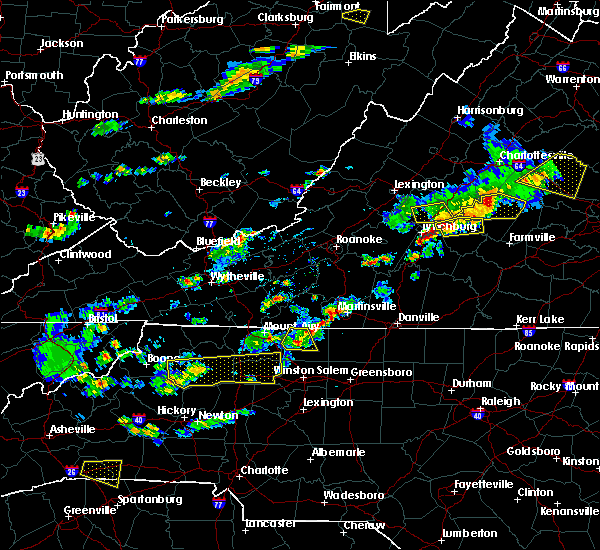 At 318 pm edt, a severe thunderstorm was located near danbury, moving east at 40 mph (radar indicated). Hazards include 60 mph wind gusts and quarter size hail. Hail damage to vehicles is expected. expect wind damage to roofs, siding, and trees. Locations impacted include, danbury, francisco, collinstown, hanging rock state park, and capella. At 318 pm edt, a severe thunderstorm was located near danbury, moving east at 40 mph (radar indicated). Hazards include 60 mph wind gusts and quarter size hail. Hail damage to vehicles is expected. expect wind damage to roofs, siding, and trees. Locations impacted include, danbury, francisco, collinstown, hanging rock state park, and capella.
|
| 5/10/2018 3:05 PM EDT |
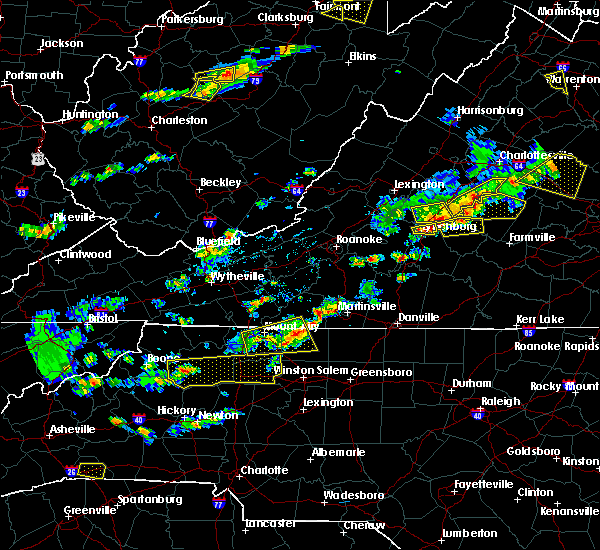 At 305 pm edt, a severe thunderstorm was located near francisco, moving east at 40 mph (radar indicated). Hazards include 60 mph wind gusts and quarter size hail. Hail damage to vehicles is expected. expect wind damage to roofs, siding, and trees. Locations impacted include, stuart, danbury, francisco, pinnacle, and collinstown. At 305 pm edt, a severe thunderstorm was located near francisco, moving east at 40 mph (radar indicated). Hazards include 60 mph wind gusts and quarter size hail. Hail damage to vehicles is expected. expect wind damage to roofs, siding, and trees. Locations impacted include, stuart, danbury, francisco, pinnacle, and collinstown.
|
| 5/10/2018 3:05 PM EDT |
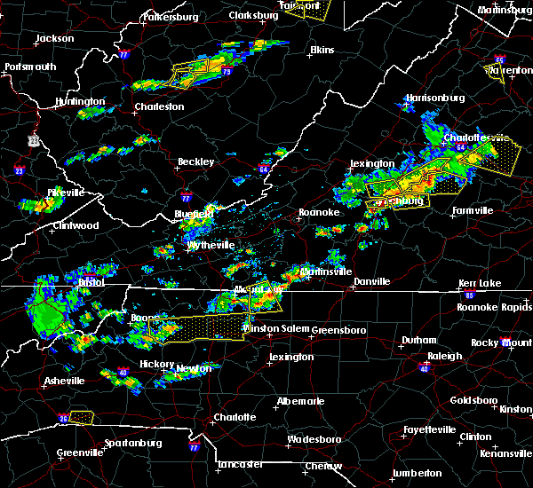 At 305 pm edt, a severe thunderstorm was located near francisco, moving east at 40 mph (radar indicated). Hazards include 60 mph wind gusts and quarter size hail. Hail damage to vehicles is expected. expect wind damage to roofs, siding, and trees. Locations impacted include, stuart, danbury, francisco, pinnacle, and collinstown. At 305 pm edt, a severe thunderstorm was located near francisco, moving east at 40 mph (radar indicated). Hazards include 60 mph wind gusts and quarter size hail. Hail damage to vehicles is expected. expect wind damage to roofs, siding, and trees. Locations impacted include, stuart, danbury, francisco, pinnacle, and collinstown.
|
| 5/10/2018 2:50 PM EDT |
 At 250 pm edt, a severe thunderstorm was located over ararat, moving east at 40 mph (radar indicated). Hazards include 60 mph wind gusts and quarter size hail. Hail damage to vehicles is expected. expect wind damage to roofs, siding, and trees. Locations impacted include, mount airy, fairview, flat rock, dobson, and pilot mountain. At 250 pm edt, a severe thunderstorm was located over ararat, moving east at 40 mph (radar indicated). Hazards include 60 mph wind gusts and quarter size hail. Hail damage to vehicles is expected. expect wind damage to roofs, siding, and trees. Locations impacted include, mount airy, fairview, flat rock, dobson, and pilot mountain.
|
| 5/10/2018 2:35 PM EDT |
 At 234 pm edt, a severe thunderstorm was located over dobson, moving east at 40 mph (radar indicated). Hazards include 60 mph wind gusts and quarter size hail. Hail damage to vehicles is expected. Expect wind damage to roofs, siding, and trees. At 234 pm edt, a severe thunderstorm was located over dobson, moving east at 40 mph (radar indicated). Hazards include 60 mph wind gusts and quarter size hail. Hail damage to vehicles is expected. Expect wind damage to roofs, siding, and trees.
|
| 4/15/2018 4:57 PM EDT |
 At 456 pm edt, severe thunderstorms were located along a line extending from near stuart to dillard, moving northeast at 55 mph (radar indicated). Hazards include 60 mph wind gusts and quarter size hail. Hail damage to vehicles is expected. expect wind damage to roofs, siding, and trees. locations impacted include, martinsville, mayodan, madison, stuart, and danbury. this includes the following location martinsville airport. a tornado watch remains in effect until 700 pm edt for northwestern north carolina, and southwestern virginia. A tornado watch also remains in effect until 1100 pm edt for north central north carolina, and south central, southwestern and west central virginia. At 456 pm edt, severe thunderstorms were located along a line extending from near stuart to dillard, moving northeast at 55 mph (radar indicated). Hazards include 60 mph wind gusts and quarter size hail. Hail damage to vehicles is expected. expect wind damage to roofs, siding, and trees. locations impacted include, martinsville, mayodan, madison, stuart, and danbury. this includes the following location martinsville airport. a tornado watch remains in effect until 700 pm edt for northwestern north carolina, and southwestern virginia. A tornado watch also remains in effect until 1100 pm edt for north central north carolina, and south central, southwestern and west central virginia.
|
| 4/15/2018 4:39 PM EDT |
 At 438 pm edt, severe thunderstorms were located along a line extending from near westfield to germanton, moving northeast at 55 mph (radar indicated). Hazards include 60 mph wind gusts and quarter size hail. Hail damage to vehicles is expected. expect wind damage to roofs, siding, and trees. locations impacted include, martinsville, mayodan, madison, pilot mountain, and walnut cove. this includes the following location martinsville airport. a tornado watch remains in effect until 700 pm edt for northwestern north carolina, and southwestern virginia. A tornado watch also remains in effect until 1100 pm edt for north central north carolina, and south central, southwestern and west central virginia. At 438 pm edt, severe thunderstorms were located along a line extending from near westfield to germanton, moving northeast at 55 mph (radar indicated). Hazards include 60 mph wind gusts and quarter size hail. Hail damage to vehicles is expected. expect wind damage to roofs, siding, and trees. locations impacted include, martinsville, mayodan, madison, pilot mountain, and walnut cove. this includes the following location martinsville airport. a tornado watch remains in effect until 700 pm edt for northwestern north carolina, and southwestern virginia. A tornado watch also remains in effect until 1100 pm edt for north central north carolina, and south central, southwestern and west central virginia.
|
| 4/15/2018 4:39 PM EDT |
 A severe thunderstorm warning remains in effect until 515 pm edt for eastern surry. stokes. northwestern rockingham. western henry and patrick counties and the city of martinsville. At 438 pm edt, severe thunderstorms were located along a line extending from near westfield to germanton, moving northeast at 55. A severe thunderstorm warning remains in effect until 515 pm edt for eastern surry. stokes. northwestern rockingham. western henry and patrick counties and the city of martinsville. At 438 pm edt, severe thunderstorms were located along a line extending from near westfield to germanton, moving northeast at 55.
|
| 4/15/2018 4:08 PM EDT |
 At 407 pm edt, a severe thunderstorm was located near mocksville, moving northeast at 65 mph (radar indicated). Hazards include 60 mph wind gusts and quarter size hail. Hail damage to vehicles is expected. Expect wind damage to roofs, siding, and trees. At 407 pm edt, a severe thunderstorm was located near mocksville, moving northeast at 65 mph (radar indicated). Hazards include 60 mph wind gusts and quarter size hail. Hail damage to vehicles is expected. Expect wind damage to roofs, siding, and trees.
|
| 10/23/2017 6:43 PM EDT |
 The severe thunderstorm warning for northeastern surry, stokes, east central carroll and patrick counties will expire at 645 pm edt, the storms which prompted the warning have weakened below severe limits, and have exited the warned area. therefore the warning will be allowed to expire. a tornado watch remains in effect until 900 pm edt for north central and northwestern north carolina. a tornado watch also remains in effect until 200 am edt for south central, southwestern and west central virginia. when it is safe to do so, please send your reports of hail of any size, as well as reports of any wind damage, including downed trees or large limbs, to the national weather service by calling toll free at 1, 8 6 6, 2 1 5, 4 3 2 4. reports and pictures can also be shared on the national weather service blacksburg facebook page and on twitter. The severe thunderstorm warning for northeastern surry, stokes, east central carroll and patrick counties will expire at 645 pm edt, the storms which prompted the warning have weakened below severe limits, and have exited the warned area. therefore the warning will be allowed to expire. a tornado watch remains in effect until 900 pm edt for north central and northwestern north carolina. a tornado watch also remains in effect until 200 am edt for south central, southwestern and west central virginia. when it is safe to do so, please send your reports of hail of any size, as well as reports of any wind damage, including downed trees or large limbs, to the national weather service by calling toll free at 1, 8 6 6, 2 1 5, 4 3 2 4. reports and pictures can also be shared on the national weather service blacksburg facebook page and on twitter.
|
| 10/23/2017 6:31 PM EDT |
 At 629 pm edt, severe thunderstorms were located along a line extending from laurel fork to walnut cove, moving northeast at 25 mph (radar indicated). Hazards include 60 mph wind gusts and quarter size hail. Hail damage to vehicles is expected. expect wind damage to roofs, siding, and trees. locations impacted include, pilot mountain, walnut cove, stuart, danbury, and francisco. a tornado watch remains in effect until 900 pm edt for north central and northwestern north carolina. A tornado watch also remains in effect until 200 am edt for south central, southwestern and west central virginia. At 629 pm edt, severe thunderstorms were located along a line extending from laurel fork to walnut cove, moving northeast at 25 mph (radar indicated). Hazards include 60 mph wind gusts and quarter size hail. Hail damage to vehicles is expected. expect wind damage to roofs, siding, and trees. locations impacted include, pilot mountain, walnut cove, stuart, danbury, and francisco. a tornado watch remains in effect until 900 pm edt for north central and northwestern north carolina. A tornado watch also remains in effect until 200 am edt for south central, southwestern and west central virginia.
|
| 10/23/2017 5:47 PM EDT |
 At 547 pm edt, severe thunderstorms were located along a line extending from near lambsburg to near enon, moving northeast at 25 mph (radar indicated). Hazards include 60 mph wind gusts and quarter size hail. Hail damage to vehicles is expected. Expect wind damage to roofs, siding, and trees. At 547 pm edt, severe thunderstorms were located along a line extending from near lambsburg to near enon, moving northeast at 25 mph (radar indicated). Hazards include 60 mph wind gusts and quarter size hail. Hail damage to vehicles is expected. Expect wind damage to roofs, siding, and trees.
|
| 7/28/2017 6:45 PM EDT | Thunderstorm winds downed a tree in a homeowners backyard within the comunity of danbur in stokes county NC, 0.2 miles E of Danbury, NC |
| 7/28/2017 6:44 PM EDT |
 At 643 pm edt, severe thunderstorms were located along a line extending from near hanging rock state park to walnut cove, moving northeast at 25 mph (radar indicated). Hazards include 60 mph wind gusts. expect damage to roofs, siding, and trees At 643 pm edt, severe thunderstorms were located along a line extending from near hanging rock state park to walnut cove, moving northeast at 25 mph (radar indicated). Hazards include 60 mph wind gusts. expect damage to roofs, siding, and trees
|
| 7/22/2017 4:57 PM EDT |
 The severe thunderstorm warning for east central surry and southern stokes counties will expire at 500 pm edt, the storms which prompted the warning are moving out of the area. therefore the warning will be allowed to expire. however gusty winds are still possible with these thunderstorms. when it is safe to do so, please send your reports of hail of any size, as well as reports of any wind damage, including downed trees or large limbs, to the national weather service by calling toll free at 1, 8 6 6, 2 1 5, 4 3 2 4. reports and pictures can also be shared on the national weather service blacksburg facebook page and on twitter. The severe thunderstorm warning for east central surry and southern stokes counties will expire at 500 pm edt, the storms which prompted the warning are moving out of the area. therefore the warning will be allowed to expire. however gusty winds are still possible with these thunderstorms. when it is safe to do so, please send your reports of hail of any size, as well as reports of any wind damage, including downed trees or large limbs, to the national weather service by calling toll free at 1, 8 6 6, 2 1 5, 4 3 2 4. reports and pictures can also be shared on the national weather service blacksburg facebook page and on twitter.
|
| 7/22/2017 4:48 PM EDT |
 At 446 pm edt, severe thunderstorms were located along a line extending from meadows to near pinnacle, moving southeast at 15 mph. this storm has a history of producing strong winds and tree damage (radar indicated). Hazards include 60 mph wind gusts. Expect damage to roofs, siding, and trees. Locations impacted include, walnut cove, danbury, king, pilot mountain state park, and pinnacle. At 446 pm edt, severe thunderstorms were located along a line extending from meadows to near pinnacle, moving southeast at 15 mph. this storm has a history of producing strong winds and tree damage (radar indicated). Hazards include 60 mph wind gusts. Expect damage to roofs, siding, and trees. Locations impacted include, walnut cove, danbury, king, pilot mountain state park, and pinnacle.
|
| 7/22/2017 4:31 PM EDT |
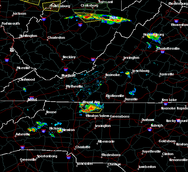 At 430 pm edt, severe thunderstorms extended from hanging rock state park through pilot mountain state park, moving southeast at 15 mph (radar indicated). Hazards include 60 mph wind gusts and quarter size hail. Hail damage to vehicles is expected. expect wind damage to roofs, siding, and trees. Locations impacted include, pilot mountain, walnut cove, danbury, king, and woodville. At 430 pm edt, severe thunderstorms extended from hanging rock state park through pilot mountain state park, moving southeast at 15 mph (radar indicated). Hazards include 60 mph wind gusts and quarter size hail. Hail damage to vehicles is expected. expect wind damage to roofs, siding, and trees. Locations impacted include, pilot mountain, walnut cove, danbury, king, and woodville.
|
| 7/22/2017 4:06 PM EDT |
 At 406 pm edt, a severe thunderstorm was located near pilot mountain, moving southeast at 15 mph (radar indicated). Hazards include 60 mph wind gusts and quarter size hail. Hail damage to vehicles is expected. Expect wind damage to roofs, siding, and trees. At 406 pm edt, a severe thunderstorm was located near pilot mountain, moving southeast at 15 mph (radar indicated). Hazards include 60 mph wind gusts and quarter size hail. Hail damage to vehicles is expected. Expect wind damage to roofs, siding, and trees.
|
| 6/13/2017 3:24 PM EDT |
 At 323 pm edt, severe thunderstorms were located along a line extending from danbury to shacktown to near swancreek, moving southeast at 5 mph (radar indicated). Hazards include 60 mph wind gusts and quarter size hail. Hail damage to vehicles is expected. Expect wind damage to roofs, siding, and trees. At 323 pm edt, severe thunderstorms were located along a line extending from danbury to shacktown to near swancreek, moving southeast at 5 mph (radar indicated). Hazards include 60 mph wind gusts and quarter size hail. Hail damage to vehicles is expected. Expect wind damage to roofs, siding, and trees.
|
| 6/13/2017 2:57 PM EDT |
 At 257 pm edt, a severe thunderstorm was located over hanging rock state park, moving southeast at 10 mph (radar indicated). Hazards include 60 mph wind gusts and quarter size hail. Hail damage to vehicles is expected. Expect wind damage to roofs, siding, and trees. At 257 pm edt, a severe thunderstorm was located over hanging rock state park, moving southeast at 10 mph (radar indicated). Hazards include 60 mph wind gusts and quarter size hail. Hail damage to vehicles is expected. Expect wind damage to roofs, siding, and trees.
|
| 5/31/2017 6:46 PM EDT |
 At 646 pm edt, severe thunderstorms were located along a line extending from near ayersville to near dillard to capella, moving east at 25 mph (radar indicated). Hazards include ping pong ball size hail and 60 mph wind gusts. People and animals outdoors will be injured. expect hail damage to roofs, siding, windows, and vehicles. expect wind damage to roofs, siding, and trees. Locations impacted include, eden, wentworth, mayodan, madison, and stoneville. At 646 pm edt, severe thunderstorms were located along a line extending from near ayersville to near dillard to capella, moving east at 25 mph (radar indicated). Hazards include ping pong ball size hail and 60 mph wind gusts. People and animals outdoors will be injured. expect hail damage to roofs, siding, windows, and vehicles. expect wind damage to roofs, siding, and trees. Locations impacted include, eden, wentworth, mayodan, madison, and stoneville.
|
| 5/31/2017 6:34 PM EDT |
 At 634 pm edt, severe thunderstorms were located along a line extending from near sandy ridge to near prestonville to near capella, moving east at 25 mph (radar indicated). Hazards include 60 mph wind gusts and quarter size hail. Hail damage to vehicles is expected. expect wind damage to roofs, siding, and trees. Locations impacted include, eden, wentworth, mayodan, madison, and walnut cove. At 634 pm edt, severe thunderstorms were located along a line extending from near sandy ridge to near prestonville to near capella, moving east at 25 mph (radar indicated). Hazards include 60 mph wind gusts and quarter size hail. Hail damage to vehicles is expected. expect wind damage to roofs, siding, and trees. Locations impacted include, eden, wentworth, mayodan, madison, and walnut cove.
|
| 5/31/2017 6:10 PM EDT |
 At 609 pm edt, severe thunderstorms were located along a line extending from near collinstown to near francisco to ararat, moving east at 25 mph (radar indicated). Hazards include 60 mph wind gusts and quarter size hail. Hail damage to vehicles is expected. Expect wind damage to roofs, siding, and trees. At 609 pm edt, severe thunderstorms were located along a line extending from near collinstown to near francisco to ararat, moving east at 25 mph (radar indicated). Hazards include 60 mph wind gusts and quarter size hail. Hail damage to vehicles is expected. Expect wind damage to roofs, siding, and trees.
|
| 5/24/2017 5:09 PM EDT |
 At 508 pm edt, a tornado producing storm was located over pinnacle, moving northeast at 30 mph (several reports of a confirmed tornado with widespread damage to buildings, homes and vehicles). Hazards include damaging tornado and quarter size hail. Flying debris will be dangerous to those caught without shelter. mobile homes will be damaged or destroyed. damage to roofs, windows, and vehicles will occur. Tree damage is likely. At 508 pm edt, a tornado producing storm was located over pinnacle, moving northeast at 30 mph (several reports of a confirmed tornado with widespread damage to buildings, homes and vehicles). Hazards include damaging tornado and quarter size hail. Flying debris will be dangerous to those caught without shelter. mobile homes will be damaged or destroyed. damage to roofs, windows, and vehicles will occur. Tree damage is likely.
|
| 5/11/2017 8:06 PM EDT |
 The severe thunderstorm warning for stokes and southeastern patrick counties will expire at 815 pm edt, the storm which prompted the warning has moved out of the area. therefore the warning will be allowed to expire. when it is safe to do so, please send your reports of hail of any size, as well as reports of any wind damage, including downed trees or large limbs, to the national weather service by calling toll free at 1, 8 6 6, 2 1 5, 4 3 2 4. reports and pictures can also be shared on the national weather service blacksburg facebook page and on twitter. The severe thunderstorm warning for stokes and southeastern patrick counties will expire at 815 pm edt, the storm which prompted the warning has moved out of the area. therefore the warning will be allowed to expire. when it is safe to do so, please send your reports of hail of any size, as well as reports of any wind damage, including downed trees or large limbs, to the national weather service by calling toll free at 1, 8 6 6, 2 1 5, 4 3 2 4. reports and pictures can also be shared on the national weather service blacksburg facebook page and on twitter.
|
| 5/11/2017 7:24 PM EDT |
 At 723 pm edt, a severe thunderstorm was located over stuart, moving south at 15 mph (radar indicated). Hazards include 60 mph wind gusts and quarter size hail. Minor damage to vehicles is possible. expect wind damage to trees and power lines. Locations impacted include, walnut cove, stuart, danbury, francisco, and king. At 723 pm edt, a severe thunderstorm was located over stuart, moving south at 15 mph (radar indicated). Hazards include 60 mph wind gusts and quarter size hail. Minor damage to vehicles is possible. expect wind damage to trees and power lines. Locations impacted include, walnut cove, stuart, danbury, francisco, and king.
|
| 5/11/2017 7:18 PM EDT |
 At 718 pm edt, a severe thunderstorm was located over stuart, moving south at 15 mph (radar indicated). Hazards include 60 mph wind gusts and quarter size hail. Minor damage to vehicles is possible. Expect wind damage to trees and power lines. At 718 pm edt, a severe thunderstorm was located over stuart, moving south at 15 mph (radar indicated). Hazards include 60 mph wind gusts and quarter size hail. Minor damage to vehicles is possible. Expect wind damage to trees and power lines.
|
| 5/1/2017 5:32 PM EDT | Thunderstorm wind dropped a tree along tom shelton road near sandy ridge... n in stokes county NC, 6 miles SW of Danbury, NC |
| 5/1/2017 5:32 PM EDT |
 At 530 pm edt, severe thunderstorms were located along a line extending from near woolwine to near hanging rock state park to 7 miles east of mocksville, moving northeast at 45 mph (law enforcement. at 504 pm, yadkin nc county warning point reported multiple trees down in east bend). Hazards include 60 mph wind gusts and quarter size hail. Minor damage to vehicles is possible. Expect wind damage to trees and power lines. At 530 pm edt, severe thunderstorms were located along a line extending from near woolwine to near hanging rock state park to 7 miles east of mocksville, moving northeast at 45 mph (law enforcement. at 504 pm, yadkin nc county warning point reported multiple trees down in east bend). Hazards include 60 mph wind gusts and quarter size hail. Minor damage to vehicles is possible. Expect wind damage to trees and power lines.
|
| 5/1/2017 5:17 PM EDT | Thunderstorm wind resulted in a tree down along hwy 704 near lawsonville... n in stokes county NC, 5.4 miles SSE of Danbury, NC |
| 9/30/2016 7:28 AM EDT |
 At 728 am edt, a severe thunderstorm was located over patrick springs, moving north at 25 mph (radar indicated). Hazards include golf ball size hail and 60 mph wind gusts. People and animals outdoors will be injured. expect hail damage to roofs, siding, windows, and vehicles. expect wind damage to roofs, siding, and trees. Locations impacted include, stuart, danbury, sandy ridge, woolwine, and spencer. At 728 am edt, a severe thunderstorm was located over patrick springs, moving north at 25 mph (radar indicated). Hazards include golf ball size hail and 60 mph wind gusts. People and animals outdoors will be injured. expect hail damage to roofs, siding, windows, and vehicles. expect wind damage to roofs, siding, and trees. Locations impacted include, stuart, danbury, sandy ridge, woolwine, and spencer.
|
| 9/30/2016 7:10 AM EDT |
 At 657 am edt, a severe thunderstorm was located near danbury, moving north at 25 mph (radar indicated). Hazards include 60 mph wind gusts and quarter size hail. Hail damage to vehicles is expected. Expect wind damage to roofs, siding, and trees. At 657 am edt, a severe thunderstorm was located near danbury, moving north at 25 mph (radar indicated). Hazards include 60 mph wind gusts and quarter size hail. Hail damage to vehicles is expected. Expect wind damage to roofs, siding, and trees.
|
| 9/30/2016 7:04 AM EDT | Golf Ball sized hail reported 0.2 miles E of Danbury, NC |
| 9/30/2016 6:58 AM EDT |
 At 657 am edt, a severe thunderstorm was located near danbury, moving north at 25 mph (radar indicated). Hazards include 60 mph wind gusts and quarter size hail. Hail damage to vehicles is expected. Expect wind damage to roofs, siding, and trees. At 657 am edt, a severe thunderstorm was located near danbury, moving north at 25 mph (radar indicated). Hazards include 60 mph wind gusts and quarter size hail. Hail damage to vehicles is expected. Expect wind damage to roofs, siding, and trees.
|
| 9/29/2016 4:13 PM EDT |
 At 412 pm edt, a severe thunderstorm was located over walnut cove, moving north at 10 mph (radar indicated). Hazards include 60 mph wind gusts and quarter size hail. Hail damage to vehicles is expected. Expect wind damage to roofs, siding, and trees. At 412 pm edt, a severe thunderstorm was located over walnut cove, moving north at 10 mph (radar indicated). Hazards include 60 mph wind gusts and quarter size hail. Hail damage to vehicles is expected. Expect wind damage to roofs, siding, and trees.
|
| 9/28/2016 6:37 PM EDT |
 At 637 pm edt, a severe thunderstorm was located over danbury, moving east at 25 mph (radar indicated). Hazards include 60 mph wind gusts and quarter size hail. Hail damage to vehicles is expected. expect wind damage to roofs, siding, and trees. Locations impacted include, walnut cove, danbury, francisco, king, and germanton. At 637 pm edt, a severe thunderstorm was located over danbury, moving east at 25 mph (radar indicated). Hazards include 60 mph wind gusts and quarter size hail. Hail damage to vehicles is expected. expect wind damage to roofs, siding, and trees. Locations impacted include, walnut cove, danbury, francisco, king, and germanton.
|
| 9/28/2016 6:10 PM EDT |
 At 609 pm edt, a severe thunderstorm was located over pinnacle, moving northeast at 30 mph (radar indicated). Hazards include 60 mph wind gusts and quarter size hail. Hail damage to vehicles is expected. expect wind damage to roofs, siding, and trees. Locations impacted include, pilot mountain, walnut cove, danbury, francisco, and king. At 609 pm edt, a severe thunderstorm was located over pinnacle, moving northeast at 30 mph (radar indicated). Hazards include 60 mph wind gusts and quarter size hail. Hail damage to vehicles is expected. expect wind damage to roofs, siding, and trees. Locations impacted include, pilot mountain, walnut cove, danbury, francisco, and king.
|
| 9/28/2016 5:40 PM EDT |
 At 539 pm edt, a severe thunderstorm was located over rockford, moving east at 25 mph (public). Hazards include 60 mph wind gusts and quarter size hail. Hail damage to vehicles is expected. Expect wind damage to roofs, siding, and trees. At 539 pm edt, a severe thunderstorm was located over rockford, moving east at 25 mph (public). Hazards include 60 mph wind gusts and quarter size hail. Hail damage to vehicles is expected. Expect wind damage to roofs, siding, and trees.
|
| 7/31/2016 9:29 PM EDT |
 At 929 pm edt, a severe thunderstorm was located over pine hall, moving east at 30 mph (radar indicated). Hazards include 60 mph wind gusts. Expect damage to roofs. siding. And trees. At 929 pm edt, a severe thunderstorm was located over pine hall, moving east at 30 mph (radar indicated). Hazards include 60 mph wind gusts. Expect damage to roofs. siding. And trees.
|
| 7/27/2016 6:33 PM EDT |
 At 633 pm edt, a severe thunderstorm was located near pine hall, moving east at 10 mph (radar indicated). Hazards include 60 mph wind gusts and quarter size hail. Hail damage to vehicles is expected. Expect wind damage to roofs, siding, and trees. At 633 pm edt, a severe thunderstorm was located near pine hall, moving east at 10 mph (radar indicated). Hazards include 60 mph wind gusts and quarter size hail. Hail damage to vehicles is expected. Expect wind damage to roofs, siding, and trees.
|
| 7/19/2016 6:26 PM EDT |
 At 625 pm edt, severe thunderstorms were located along a line extending from meadows to near madison to near ayersville, moving southeast at 30 mph (radar indicated). Hazards include 60 mph wind gusts. Expect damage to roofs. siding. And trees. At 625 pm edt, severe thunderstorms were located along a line extending from meadows to near madison to near ayersville, moving southeast at 30 mph (radar indicated). Hazards include 60 mph wind gusts. Expect damage to roofs. siding. And trees.
|
| 7/15/2016 4:45 PM EDT |
 At 445 pm edt, a severe thunderstorm was located over prestonville, moving east at 30 mph (radar indicated). Hazards include 60 mph wind gusts. Expect damage to roofs. siding. And trees. At 445 pm edt, a severe thunderstorm was located over prestonville, moving east at 30 mph (radar indicated). Hazards include 60 mph wind gusts. Expect damage to roofs. siding. And trees.
|
| 7/15/2016 4:04 PM EDT | Emergency manager reports that a tin outbuilding on horseshoe road rolled over and parts of the tin found 100 yards downstream in a power line. several large oak... pin in stokes county NC, 10.1 miles SE of Danbury, NC |
| 7/8/2016 8:10 PM EDT |
 At 808 pm edt, severe thunderstorms were located along a line extending from near pinnacle to 6 miles south of king to near winston-salem, moving east at 50 mph (public). Hazards include 60 mph wind gusts. Expect damage to roofs. siding. and trees. Locations impacted include, reidsville, madison, walnut cove, danbury, and king. At 808 pm edt, severe thunderstorms were located along a line extending from near pinnacle to 6 miles south of king to near winston-salem, moving east at 50 mph (public). Hazards include 60 mph wind gusts. Expect damage to roofs. siding. and trees. Locations impacted include, reidsville, madison, walnut cove, danbury, and king.
|
| 7/8/2016 7:54 PM EDT |
 At 753 pm edt, severe thunderstorms were located along a line extending from near white plains to near siloam to near huntsville, moving east at 50 mph (radar indicated). Hazards include 60 mph wind gusts. Expect damage to roofs. siding. And trees. At 753 pm edt, severe thunderstorms were located along a line extending from near white plains to near siloam to near huntsville, moving east at 50 mph (radar indicated). Hazards include 60 mph wind gusts. Expect damage to roofs. siding. And trees.
|
| 7/8/2016 6:09 PM EDT |
 At 609 pm edt, severe thunderstorms were located along a line extending from near horse pasture to near penns store to near woodville, moving southeast at 30 mph (radar indicated). Hazards include 60 mph wind gusts and quarter size hail. Hail damage to vehicles is expected. expect wind damage to roofs, siding, and trees. locations impacted include, eden, reidsville, martinsville, wentworth, and mayodan. This includes the martinsville speedway and martinsville airport. At 609 pm edt, severe thunderstorms were located along a line extending from near horse pasture to near penns store to near woodville, moving southeast at 30 mph (radar indicated). Hazards include 60 mph wind gusts and quarter size hail. Hail damage to vehicles is expected. expect wind damage to roofs, siding, and trees. locations impacted include, eden, reidsville, martinsville, wentworth, and mayodan. This includes the martinsville speedway and martinsville airport.
|
| 7/8/2016 6:01 PM EDT |
 At 601 pm edt, severe thunderstorms were located along a line extending from near horse pasture to near critz to near ararat, moving southeast at 30 mph (radar indicated). Hazards include 60 mph wind gusts and quarter size hail. Hail damage to vehicles is expected. expect wind damage to roofs, siding, and trees. locations impacted include, eden, reidsville, martinsville, wentworth, and mayodan. This includes the martinsville speedway and martinsville airport. At 601 pm edt, severe thunderstorms were located along a line extending from near horse pasture to near critz to near ararat, moving southeast at 30 mph (radar indicated). Hazards include 60 mph wind gusts and quarter size hail. Hail damage to vehicles is expected. expect wind damage to roofs, siding, and trees. locations impacted include, eden, reidsville, martinsville, wentworth, and mayodan. This includes the martinsville speedway and martinsville airport.
|
| 7/8/2016 5:48 PM EDT |
 At 548 pm edt, severe thunderstorms were located along a line extending from fieldale to stuart to ararat, moving southeast at 30 mph (radar indicated). Hazards include 60 mph wind gusts and quarter size hail. Hail damage to vehicles is expected. Expect wind damage to roofs, siding, and trees. At 548 pm edt, severe thunderstorms were located along a line extending from fieldale to stuart to ararat, moving southeast at 30 mph (radar indicated). Hazards include 60 mph wind gusts and quarter size hail. Hail damage to vehicles is expected. Expect wind damage to roofs, siding, and trees.
|
| 7/4/2016 10:55 PM EDT |
 The severe thunderstorm warning for southeastern stokes county will expire at 1100 pm edt, the storm which prompted the warning has weakened below severe limits, and no longer poses an immediate threat to life or property. therefore the warning will be allowed to expire. however heavy rain is still possible with this thunderstorm. when it is safe to do so, please send your reports of hail of any size, as well as any reports of wind damage, including downed trees or large limbs, to the national weather service by calling toll free at 1, 8 6 6, 2 1 5, 4 3 2 4. reports and pictures can also be shared on the national weather service blacksburg facebook page and on twitter. The severe thunderstorm warning for southeastern stokes county will expire at 1100 pm edt, the storm which prompted the warning has weakened below severe limits, and no longer poses an immediate threat to life or property. therefore the warning will be allowed to expire. however heavy rain is still possible with this thunderstorm. when it is safe to do so, please send your reports of hail of any size, as well as any reports of wind damage, including downed trees or large limbs, to the national weather service by calling toll free at 1, 8 6 6, 2 1 5, 4 3 2 4. reports and pictures can also be shared on the national weather service blacksburg facebook page and on twitter.
|
| 7/4/2016 10:50 PM EDT |
 At 1050 pm edt, a severe thunderstorm was located over dillard, moving east at 20 mph (radar indicated). Hazards include 60 mph wind gusts. Expect damage to roofs. siding. and trees. Locations impacted include, walnut cove, danbury, dillard, prestonville, and meadows. At 1050 pm edt, a severe thunderstorm was located over dillard, moving east at 20 mph (radar indicated). Hazards include 60 mph wind gusts. Expect damage to roofs. siding. and trees. Locations impacted include, walnut cove, danbury, dillard, prestonville, and meadows.
|
| 7/4/2016 10:23 PM EDT |
 At 1022 pm edt, a severe thunderstorm was located over capella, moving east at 20 mph (radar indicated). Hazards include 60 mph wind gusts and quarter size hail. Hail damage to vehicles is expected. expect wind damage to roofs, siding, and trees. Locations impacted include, walnut cove, danbury, king, dillard, and ayersville. At 1022 pm edt, a severe thunderstorm was located over capella, moving east at 20 mph (radar indicated). Hazards include 60 mph wind gusts and quarter size hail. Hail damage to vehicles is expected. expect wind damage to roofs, siding, and trees. Locations impacted include, walnut cove, danbury, king, dillard, and ayersville.
|
| 7/4/2016 9:58 PM EDT |
 At 958 pm edt, a severe thunderstorm was located over pinnacle, moving east at 20 mph (radar indicated). Hazards include 60 mph wind gusts and quarter size hail. Hail damage to vehicles is expected. Expect wind damage to roofs, siding, and trees. At 958 pm edt, a severe thunderstorm was located over pinnacle, moving east at 20 mph (radar indicated). Hazards include 60 mph wind gusts and quarter size hail. Hail damage to vehicles is expected. Expect wind damage to roofs, siding, and trees.
|
| 7/1/2016 1:09 AM EDT |
 At 109 am edt, a severe thunderstorm was located over pine hall, moving east at 35 mph (radar indicated). Hazards include 60 mph wind gusts. Expect damage to roofs. siding. And trees. At 109 am edt, a severe thunderstorm was located over pine hall, moving east at 35 mph (radar indicated). Hazards include 60 mph wind gusts. Expect damage to roofs. siding. And trees.
|
| 6/29/2016 5:45 PM EDT |
 At 544 pm edt, a severe thunderstorm was located over walnut cove, moving southeast at 20 mph (radar indicated). Hazards include 60 mph wind gusts and quarter size hail. Hail damage to vehicles is expected. expect wind damage to roofs, siding, and trees. Locations impacted include, reidsville, mayodan, madison, walnut cove, and danbury. At 544 pm edt, a severe thunderstorm was located over walnut cove, moving southeast at 20 mph (radar indicated). Hazards include 60 mph wind gusts and quarter size hail. Hail damage to vehicles is expected. expect wind damage to roofs, siding, and trees. Locations impacted include, reidsville, mayodan, madison, walnut cove, and danbury.
|
| 6/29/2016 5:31 PM EDT |
 At 530 pm edt, a severe thunderstorm was located over dillard, moving east at 30 mph (radar indicated). Hazards include 60 mph wind gusts and quarter size hail. Hail damage to vehicles is expected. Expect wind damage to roofs, siding, and trees. At 530 pm edt, a severe thunderstorm was located over dillard, moving east at 30 mph (radar indicated). Hazards include 60 mph wind gusts and quarter size hail. Hail damage to vehicles is expected. Expect wind damage to roofs, siding, and trees.
|
| 6/23/2016 10:26 PM EDT |
 The severe thunderstorm warning for yadkin, surry, stokes, wilkes, watauga, alleghany, ashe, southwestern patrick, southeastern grayson and carroll counties and the city of galax will expire at 1030 pm edt, the storms which prompted the warning have weakened below severe limits, and no longer pose an immediate threat to life or property. therefore the warning will be allowed to expire. however gusty winds and heavy rain are still possible with these thunderstorms. a severe thunderstorm watch remains in effect until 1100 pm edt for north carolina and virginia. The severe thunderstorm warning for yadkin, surry, stokes, wilkes, watauga, alleghany, ashe, southwestern patrick, southeastern grayson and carroll counties and the city of galax will expire at 1030 pm edt, the storms which prompted the warning have weakened below severe limits, and no longer pose an immediate threat to life or property. therefore the warning will be allowed to expire. however gusty winds and heavy rain are still possible with these thunderstorms. a severe thunderstorm watch remains in effect until 1100 pm edt for north carolina and virginia.
|
| 6/23/2016 9:50 PM EDT |
 At 949 pm edt, severe thunderstorms were located along a line extending from near dugspur to stone mountain state park to 7 miles west of mountain city, moving southeast at 50 mph (radar indicated). Hazards include 60 mph wind gusts. Expect damage to roofs. siding. and trees. locations impacted include, boone, mount airy, galax, north wilkesboro, and elkin. This includes appalachian state university. At 949 pm edt, severe thunderstorms were located along a line extending from near dugspur to stone mountain state park to 7 miles west of mountain city, moving southeast at 50 mph (radar indicated). Hazards include 60 mph wind gusts. Expect damage to roofs. siding. and trees. locations impacted include, boone, mount airy, galax, north wilkesboro, and elkin. This includes appalachian state university.
|
| 6/23/2016 9:29 PM EDT |
 At 929 pm edt, severe thunderstorms were located along a line extending from gunton park to mouth of wilson to bristol va, moving southeast at 55 mph (radar indicated). Hazards include 60 mph wind gusts. Expect damage to roofs. siding. And trees. At 929 pm edt, severe thunderstorms were located along a line extending from gunton park to mouth of wilson to bristol va, moving southeast at 55 mph (radar indicated). Hazards include 60 mph wind gusts. Expect damage to roofs. siding. And trees.
|
| 5/12/2016 6:23 PM EDT |
 At 622 pm edt, a severe thunderstorm was located near pine hall, moving northeast at 30 mph (radar indicated). Hazards include 60 mph wind gusts and quarter size hail. Hail damage to vehicles is expected. Expect wind damage to roofs, siding, and trees. At 622 pm edt, a severe thunderstorm was located near pine hall, moving northeast at 30 mph (radar indicated). Hazards include 60 mph wind gusts and quarter size hail. Hail damage to vehicles is expected. Expect wind damage to roofs, siding, and trees.
|
| 5/2/2016 5:28 PM EDT | Quarter sized hail reported 0.2 miles E of Danbury, NC, danbury em reports hail up to the size of a quarter in the city of danbury in stokes county north carolina. |
| 5/2/2016 5:18 PM EDT |
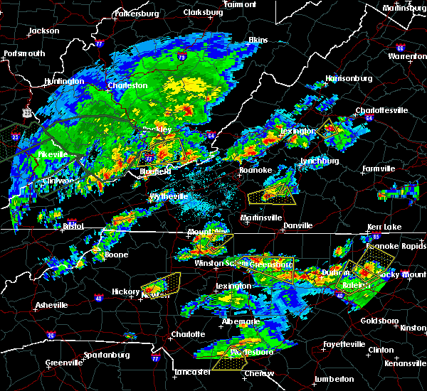 At 518 pm edt, a severe thunderstorm was located over hanging rock state park, moving northeast at 30 mph (radar indicated). Hazards include 60 mph wind gusts and quarter size hail. Hail damage to vehicles is expected. Expect wind damage to roofs, siding, and trees. At 518 pm edt, a severe thunderstorm was located over hanging rock state park, moving northeast at 30 mph (radar indicated). Hazards include 60 mph wind gusts and quarter size hail. Hail damage to vehicles is expected. Expect wind damage to roofs, siding, and trees.
|
| 4/28/2016 3:58 PM EDT |
 At 358 pm edt, a severe thunderstorm was located near danbury, moving southeast at 30 mph (radar indicated). Hazards include 60 mph wind gusts and quarter size hail. Hail damage to vehicles is expected. Expect wind damage to roofs, siding, and trees. At 358 pm edt, a severe thunderstorm was located near danbury, moving southeast at 30 mph (radar indicated). Hazards include 60 mph wind gusts and quarter size hail. Hail damage to vehicles is expected. Expect wind damage to roofs, siding, and trees.
|
| 4/28/2016 3:36 PM EDT | Golf Ball sized hail reported 6 miles SSE of Danbury, NC, hail lasted from 326 pm until 336 pm. |
| 2/24/2016 1:52 PM EST |
 The severe thunderstorm warning for eastern stokes and northwestern rockingham counties will expire at 200 pm est, the storm which prompted the warning has weakened below severe limits, and no longer poses an immediate threat to life or property. therefore the warning will be allowed to expire. a tornado watch remains in effect until 700 pm est for north central north carolina. a tornado watch also remains in effect until 900 pm est for south central virginia. when it is safe to do so, please send your reports of hail of any size, as well as any reports of wind damage, including downed trees or large limbs, to the national weather service by calling toll free at 1, 8 6 6, 2 1 5, 4 3 2 4. reports and pictures can also be shared on the national weather service blacksburg facebook page and on twitter. The severe thunderstorm warning for eastern stokes and northwestern rockingham counties will expire at 200 pm est, the storm which prompted the warning has weakened below severe limits, and no longer poses an immediate threat to life or property. therefore the warning will be allowed to expire. a tornado watch remains in effect until 700 pm est for north central north carolina. a tornado watch also remains in effect until 900 pm est for south central virginia. when it is safe to do so, please send your reports of hail of any size, as well as any reports of wind damage, including downed trees or large limbs, to the national weather service by calling toll free at 1, 8 6 6, 2 1 5, 4 3 2 4. reports and pictures can also be shared on the national weather service blacksburg facebook page and on twitter.
|
| 2/24/2016 1:43 PM EST |
 At 143 pm est, a severe thunderstorm was located over sandy ridge, moving northeast at 30 mph (radar indicated). Hazards include 60 mph wind gusts and quarter size hail. Hail damage to vehicles is expected. expect wind damage to roofs, siding, and trees. locations impacted include, mayodan, walnut cove, stoneville, danbury, and sandy ridge. a tornado watch remains in effect until 700 pm est for north central north carolina. A tornado watch also remains in effect until 900 pm est for south central virginia. At 143 pm est, a severe thunderstorm was located over sandy ridge, moving northeast at 30 mph (radar indicated). Hazards include 60 mph wind gusts and quarter size hail. Hail damage to vehicles is expected. expect wind damage to roofs, siding, and trees. locations impacted include, mayodan, walnut cove, stoneville, danbury, and sandy ridge. a tornado watch remains in effect until 700 pm est for north central north carolina. A tornado watch also remains in effect until 900 pm est for south central virginia.
|
| 2/24/2016 1:34 PM EST |
 At 133 pm est, a severe thunderstorm was located over sandy ridge, moving northeast at 55 mph (radar indicated). Hazards include 60 mph wind gusts and quarter size hail. Hail damage to vehicles is expected. expect wind damage to roofs, siding, and trees. locations impacted include, mayodan, walnut cove, stoneville, danbury, and sandy ridge. A tornado watch remains in effect until 700 pm est for north central north carolina. At 133 pm est, a severe thunderstorm was located over sandy ridge, moving northeast at 55 mph (radar indicated). Hazards include 60 mph wind gusts and quarter size hail. Hail damage to vehicles is expected. expect wind damage to roofs, siding, and trees. locations impacted include, mayodan, walnut cove, stoneville, danbury, and sandy ridge. A tornado watch remains in effect until 700 pm est for north central north carolina.
|
| 2/24/2016 1:21 PM EST |
 At 120 pm est, a severe thunderstorm was located near capella, moving northeast at 40 mph (radar indicated). Hazards include 60 mph wind gusts and quarter size hail. Hail damage to vehicles is expected. Expect wind damage to roofs, siding, and trees. At 120 pm est, a severe thunderstorm was located near capella, moving northeast at 40 mph (radar indicated). Hazards include 60 mph wind gusts and quarter size hail. Hail damage to vehicles is expected. Expect wind damage to roofs, siding, and trees.
|
| 9/4/2015 5:35 PM EDT |
 The severe thunderstorm warning for northeastern yadkin, southern stokes and southwestern rockingham counties will expire at 545 pm edt, the storm which prompted the warning has weakened below severe limits, and has exited the warned area. therefore the warning will be allowed to expire. when it is safe to do so, please send your reports of hail of any size, as well as any reports of wind damage, including downed trees or large limbs, to the national weather service by calling toll free at 1, 8 6 6, 2 1 5, 4 3 2 4. reports and pictures can also be shared on the national weather service blacksburg facebook page and on twitter. The severe thunderstorm warning for northeastern yadkin, southern stokes and southwestern rockingham counties will expire at 545 pm edt, the storm which prompted the warning has weakened below severe limits, and has exited the warned area. therefore the warning will be allowed to expire. when it is safe to do so, please send your reports of hail of any size, as well as any reports of wind damage, including downed trees or large limbs, to the national weather service by calling toll free at 1, 8 6 6, 2 1 5, 4 3 2 4. reports and pictures can also be shared on the national weather service blacksburg facebook page and on twitter.
|
| 9/4/2015 5:23 PM EDT |
 At 523 pm edt, a severe thunderstorm was located over germanton, moving southwest at 30 mph (radar indicated). Hazards include 60 mph wind gusts and quarter size hail. Hail damage to vehicles is expected. expect wind damage to roofs, siding and trees. Locations impacted include, king, mayodan, madison, walnut cove, and stoneville. At 523 pm edt, a severe thunderstorm was located over germanton, moving southwest at 30 mph (radar indicated). Hazards include 60 mph wind gusts and quarter size hail. Hail damage to vehicles is expected. expect wind damage to roofs, siding and trees. Locations impacted include, king, mayodan, madison, walnut cove, and stoneville.
|
| 9/4/2015 4:54 PM EDT |
 At 454 pm edt, a severe thunderstorm was located over pine hall, moving southwest at 30 mph (radar indicated). Hazards include 60 mph wind gusts and quarter size hail. Hail damage to vehicles is expected. expect wind damage to roofs, siding and trees. Locations impacted include, king, wentworth, mayodan, madison, and walnut cove. At 454 pm edt, a severe thunderstorm was located over pine hall, moving southwest at 30 mph (radar indicated). Hazards include 60 mph wind gusts and quarter size hail. Hail damage to vehicles is expected. expect wind damage to roofs, siding and trees. Locations impacted include, king, wentworth, mayodan, madison, and walnut cove.
|
| 9/4/2015 4:44 PM EDT |
 At 443 pm edt, a severe thunderstorm was located over madison, moving southwest at 30 mph (radar indicated). Hazards include 60 mph wind gusts and quarter size hail. Hail damage to vehicles is expected. Expect wind damage to roofs, siding and trees. At 443 pm edt, a severe thunderstorm was located over madison, moving southwest at 30 mph (radar indicated). Hazards include 60 mph wind gusts and quarter size hail. Hail damage to vehicles is expected. Expect wind damage to roofs, siding and trees.
|
| 8/5/2015 9:12 PM EDT |
 At 911 pm edt, a severe thunderstorm was located over sandy ridge, moving northeast at 25 mph (radar indicated). Hazards include 60 mph wind gusts and quarter size hail. Hail damage to vehicles is expected. expect wind damage to roofs, siding and trees. Locations impacted include, mayodan, madison, walnut cove, stoneville, and danbury. At 911 pm edt, a severe thunderstorm was located over sandy ridge, moving northeast at 25 mph (radar indicated). Hazards include 60 mph wind gusts and quarter size hail. Hail damage to vehicles is expected. expect wind damage to roofs, siding and trees. Locations impacted include, mayodan, madison, walnut cove, stoneville, and danbury.
|
| 8/5/2015 8:55 PM EDT | Multiple trees down throughout the town in stokes county NC, 5.4 miles SSE of Danbury, NC |
| 8/5/2015 8:54 PM EDT |
 At 854 pm edt, a severe thunderstorm was located over hanging rock state park, moving east at 25 mph (radar indicated). Hazards include 60 mph wind gusts and quarter size hail. Hail damage to vehicles is expected. Expect wind damage to roofs, siding and trees. At 854 pm edt, a severe thunderstorm was located over hanging rock state park, moving east at 25 mph (radar indicated). Hazards include 60 mph wind gusts and quarter size hail. Hail damage to vehicles is expected. Expect wind damage to roofs, siding and trees.
|
| 7/13/2015 8:52 PM EDT |
 The severe thunderstorm warning for eastern surry and stokes counties will expire at 900 pm edt, the storm which prompted the warning has moved east out of the warned area. therefore the warning will be allowed to expire. a severe thunderstorm watch remains in effect until 100 am edt for north central north carolina and southwestern virginia. when it is safe to do so, please send your reports of hail of any size, as well as any reports of wind damage, including downed trees or large limbs, to the national weather service by calling toll free at 1, 8 6 6, 2 1 5, 4 3 2 4. reports and pictures can also be shared on the national weather service blacksburg facebook page and on twitter. The severe thunderstorm warning for eastern surry and stokes counties will expire at 900 pm edt, the storm which prompted the warning has moved east out of the warned area. therefore the warning will be allowed to expire. a severe thunderstorm watch remains in effect until 100 am edt for north central north carolina and southwestern virginia. when it is safe to do so, please send your reports of hail of any size, as well as any reports of wind damage, including downed trees or large limbs, to the national weather service by calling toll free at 1, 8 6 6, 2 1 5, 4 3 2 4. reports and pictures can also be shared on the national weather service blacksburg facebook page and on twitter.
|
| 7/13/2015 8:25 PM EDT | Trees blown down by thunderstorm wind in stokes county NC, 0.2 miles E of Danbury, NC |
| 7/13/2015 8:07 PM EDT |
 At 805 pm edt, a severe thunderstorm was located over westfield, moving east at 35 mph. another cluster of severe thunderstorms were located between walnut cove and capella, moving east at 30 mph (radar indicated). Hazards include 60 mph wind gusts and quarter size hail. Hail damage to vehicles is expected. Expect wind damage to roofs, siding and trees. At 805 pm edt, a severe thunderstorm was located over westfield, moving east at 35 mph. another cluster of severe thunderstorms were located between walnut cove and capella, moving east at 30 mph (radar indicated). Hazards include 60 mph wind gusts and quarter size hail. Hail damage to vehicles is expected. Expect wind damage to roofs, siding and trees.
|
| 5/11/2015 8:35 PM EDT | At 835 pm edt, severe thunderstorms were located along a line extending from near sandy ridge to near walnut cove, moving east at 20 mph (radar indicated). Hazards include 60 mph wind gusts and quarter size hail. Hail damage to vehicles is expected. Expect wind damage to roofs, siding and trees. |
| 9/12/2013 6:33 PM EDT | One tree down on highway 26 in stokes county NC, 7.5 miles E of Danbury, NC |
| 7/25/2013 1:35 AM EDT | Tree down on hanging rock park road in stokes county NC, 2 miles ESE of Danbury, NC |
| 6/26/2013 4:03 PM EDT | Several trees reported down south of danbur in stokes county NC, 4.5 miles NNE of Danbury, NC |
| 7/16/2012 8:30 PM EDT | Debris/trees down in stokes county NC, 3.3 miles NNE of Danbury, NC |
| 7/16/2012 8:26 PM EDT | Debris/trees down in stokes county NC, 3.5 miles S of Danbury, NC |
| 7/16/2012 8:22 PM EDT | Debris/trees down in stokes county NC, 4.1 miles E of Danbury, NC |
| 7/16/2012 8:22 PM EDT | Debris/trees down in stokes county NC, 4.8 miles ESE of Danbury, NC |
| 7/16/2012 8:20 PM EDT | Debris/trees down in stokes county NC, 4.9 miles SE of Danbury, NC |
| 7/16/2012 8:20 PM EDT | Debris/trees down in stokes county NC, 5.9 miles ESE of Danbury, NC |
| 7/16/2012 8:18 PM EDT | Debris/trees down in stokes county NC, 8.3 miles SSE of Danbury, NC |
| 7/16/2012 8:18 PM EDT | Debris/trees down in stokes county NC, 8.5 miles SE of Danbury, NC |
| 7/1/2012 12:45 PM EDT | Trees dow in stokes county NC, 4.9 miles S of Danbury, NC |
| 6/12/2012 10:12 PM EDT | Tree down along hwy 8 and gentry roa in stokes county NC, 3 miles SSE of Danbury, NC |
| 1/1/0001 12:00 AM | Trees down at 2893 hart rd in stokes county NC, 8.3 miles SSE of Danbury, NC |
| 1/1/0001 12:00 AM | Tree down on tom shelton roa in stokes county NC, 5.5 miles SW of Danbury, NC |
| 1/1/0001 12:00 AM | A portion of a roof peeled off a building near snow hill church roa in stokes county NC, 4.9 miles S of Danbury, NC |
| 1/1/0001 12:00 AM | Trees down near snow hill church roa in stokes county NC, 6.4 miles SSW of Danbury, NC |
| 1/1/0001 12:00 AM | Emergency manager conducted ground survey of area. four trees and numerous tree limbs down from near intersection of snowhill church road and percey moorefield road...t in stokes county NC, 4.9 miles S of Danbury, NC |
| 1/1/0001 12:00 AM | Tree down in stokes county NC, 5.6 miles ESE of Danbury, NC |
| 1/1/0001 12:00 AM | Tree down in stokes county NC, 6.1 miles ESE of Danbury, NC |
| 1/1/0001 12:00 AM | Several trees down across city of danbury in stokes county NC, 0.2 miles E of Danbury, NC |
| 1/1/0001 12:00 AM | Trees down at the intersectin of moorefield and kristie view road in stokes county NC, 4.4 miles SSW of Danbury, NC |
| 1/1/0001 12:00 AM | Tree down at the intersection on fletcher hall and steele road in stokes county NC, 6.1 miles SW of Danbury, NC |
| 1/1/0001 12:00 AM | Tree down on highway in stokes county NC, 5.7 miles SSE of Danbury, NC |
| 1/1/0001 12:00 AM | Tree down on highway 8 in stokes county NC, 5.4 miles ESE of Danbury, NC |
| 1/1/0001 12:00 AM | Trees down at flat shoals road and size more roa in stokes county NC, 4.5 miles NE of Danbury, NC |
| 1/1/0001 12:00 AM | Tree down on moorefield roa in stokes county NC, 4.9 miles S of Danbury, NC |
| 1/1/0001 12:00 AM | Trees down on highway in stokes county NC, 5.7 miles SSE of Danbury, NC |
| 1/1/0001 12:00 AM | Trees down at the intersection of tom mix road and highway 8 in stokes county NC, 8.8 miles SE of Danbury, NC |
| 1/1/0001 12:00 AM | Trees down on jewel roa in stokes county NC, 3.5 miles SSE of Danbury, NC |
| 1/1/0001 12:00 AM | Trees down at the intersection of moores springs and hall road in stokes county NC, 3 miles ESE of Danbury, NC |
| 1/1/0001 12:00 AM | Quarter sized hail reported 3.3 miles ESE of Danbury, NC, largest hail was quarter size but most was nickel size |
| 1/1/0001 12:00 AM | Tree down on highway 89 and pyrtle road in stokes county NC, 6.6 miles SE of Danbury, NC |
| 1/1/0001 12:00 AM | Tree down near seven island road and damascas road in stokes county NC, 2.1 miles S of Danbury, NC |
| 1/1/0001 12:00 AM | Tree down in stokes county NC, 5.9 miles ESE of Danbury, NC |
Hail Maps for Danbury, NC


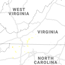


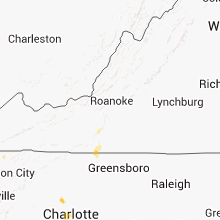


Connect with Interactive Hail Maps