

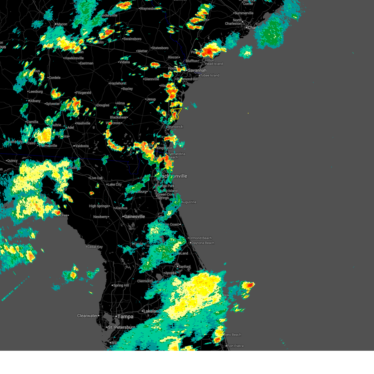
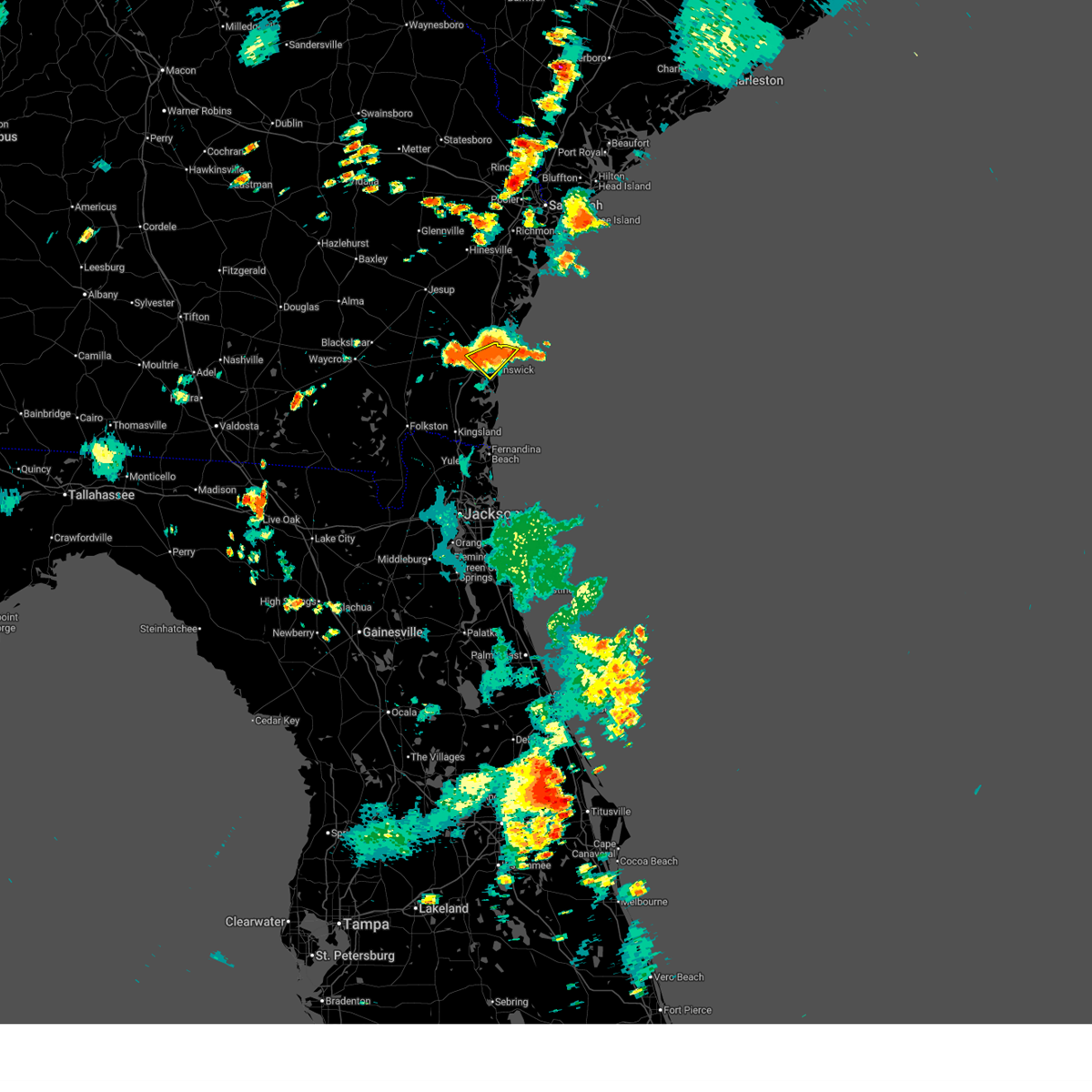
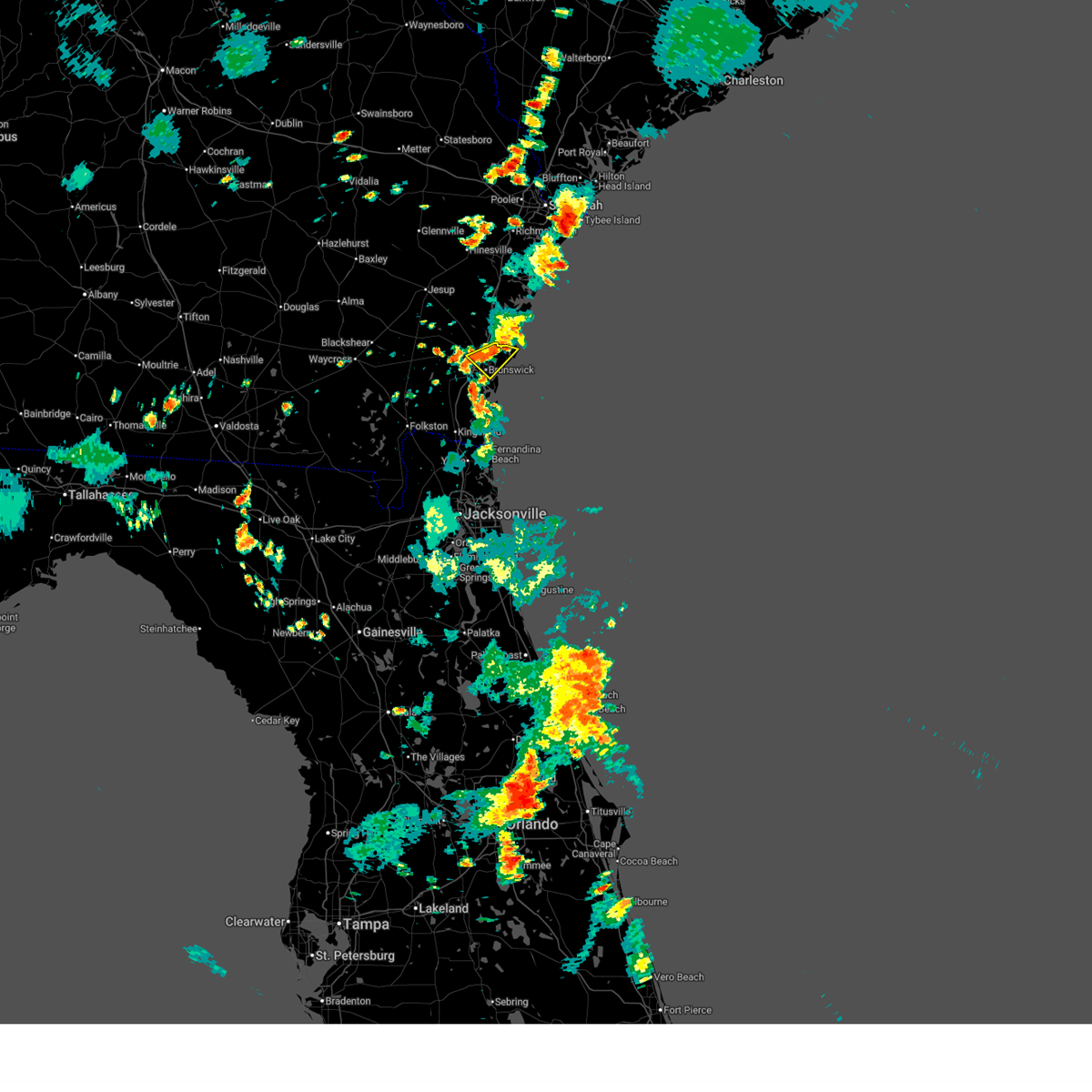
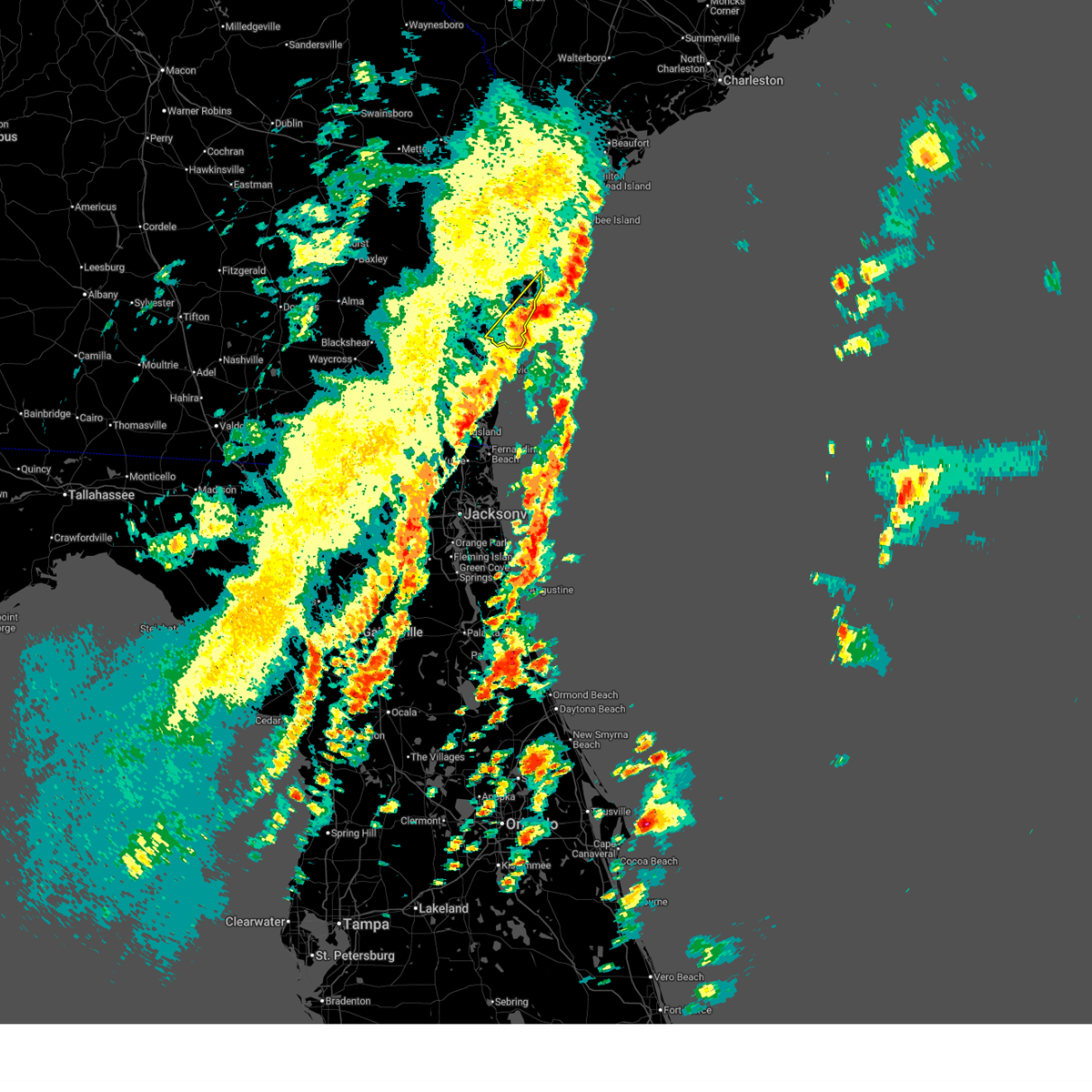
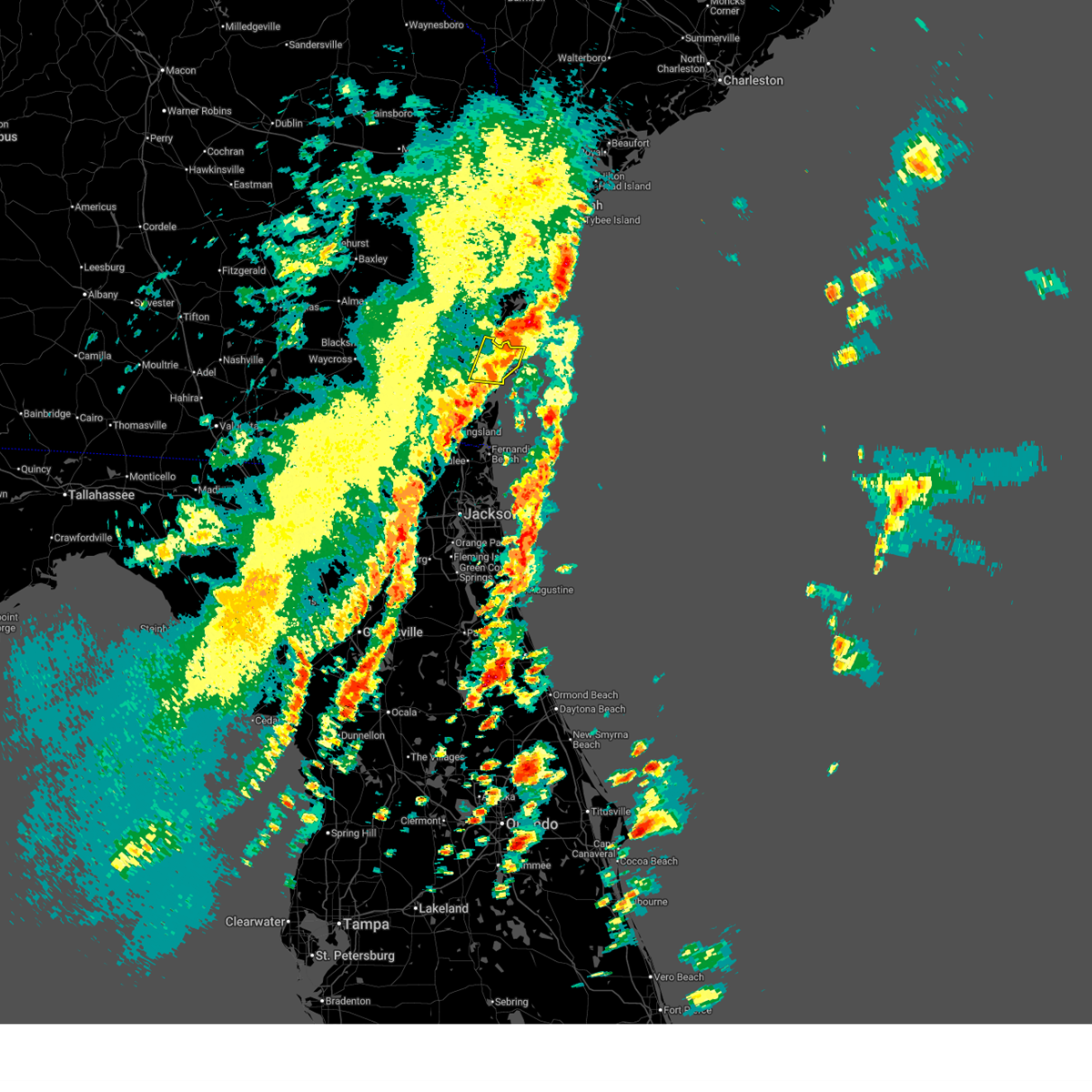
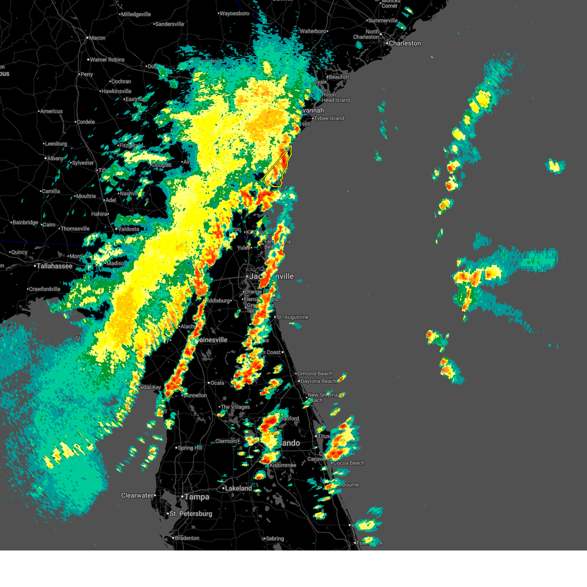
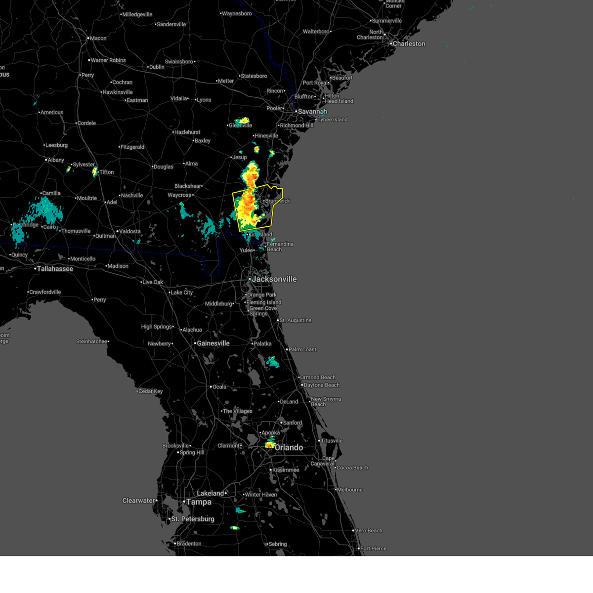
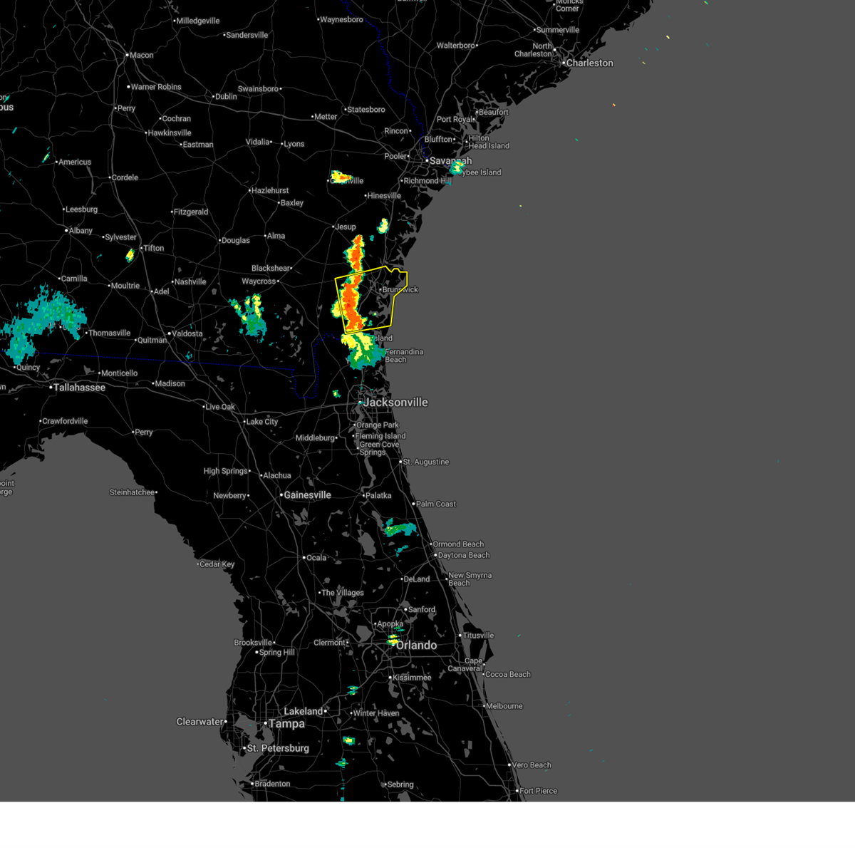
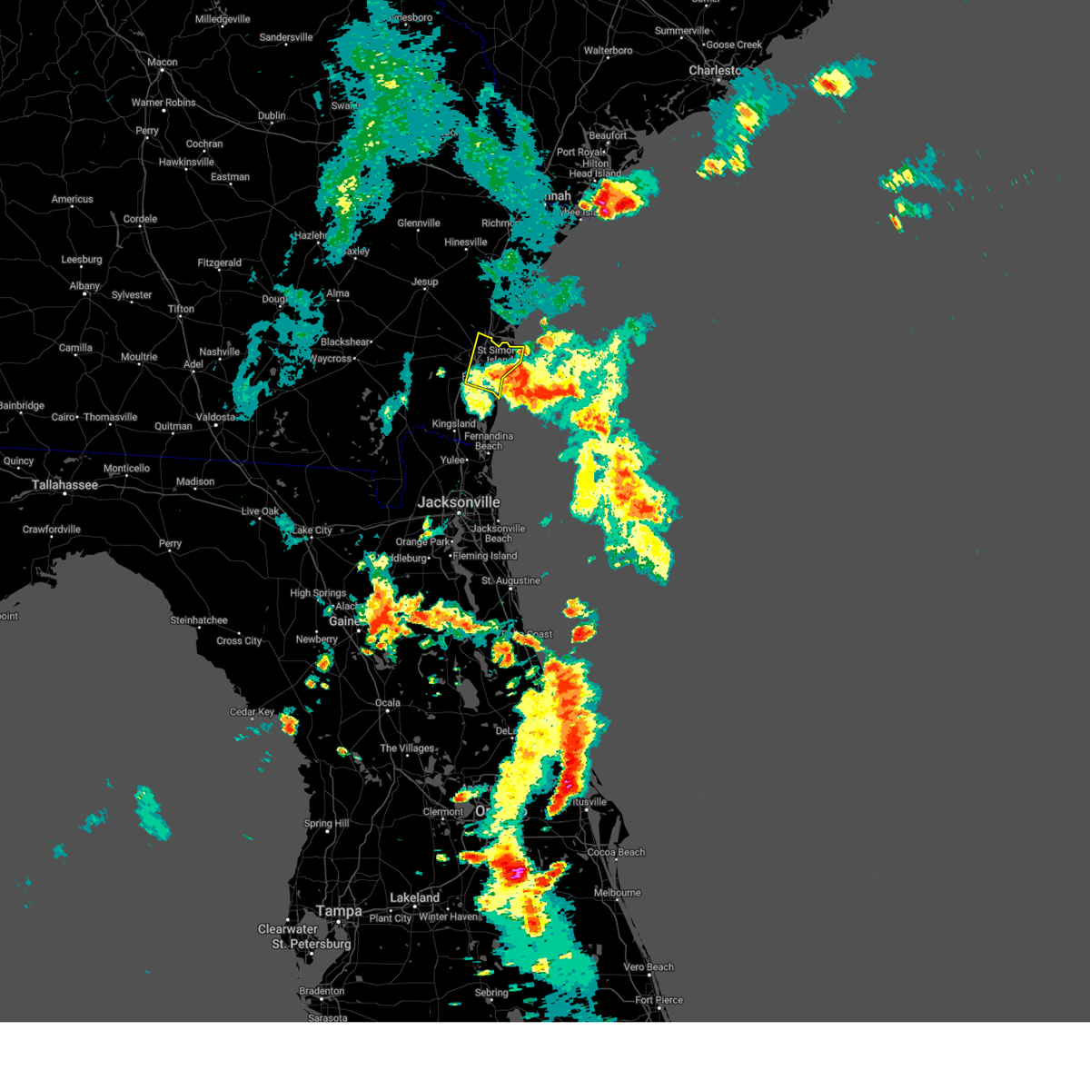
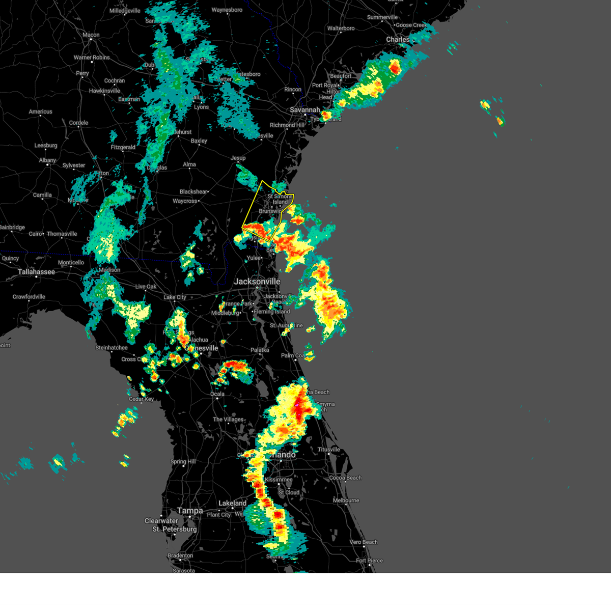
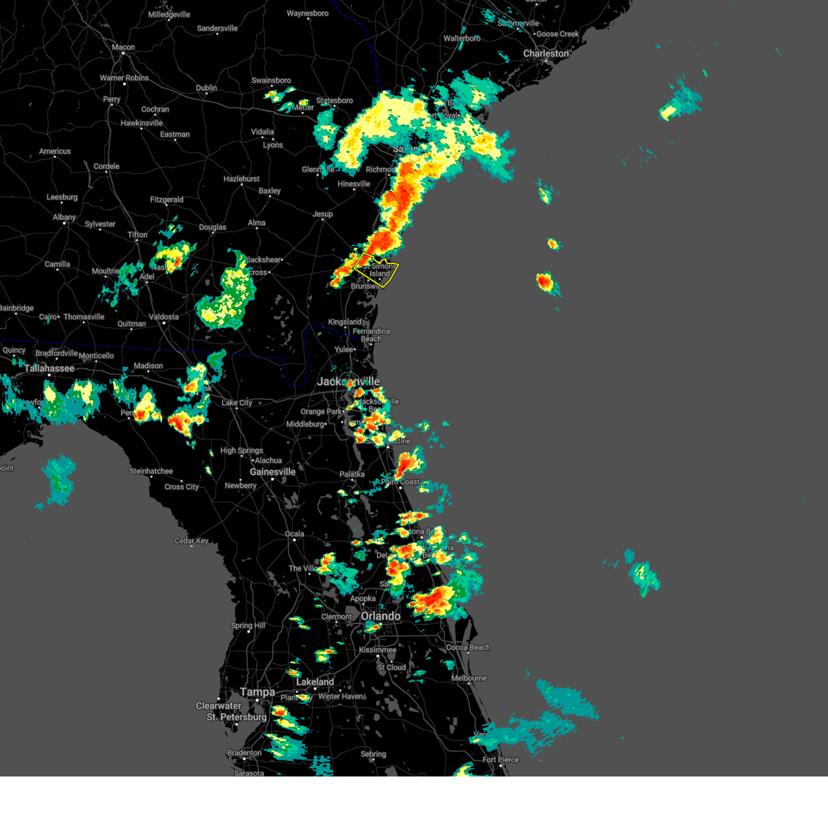
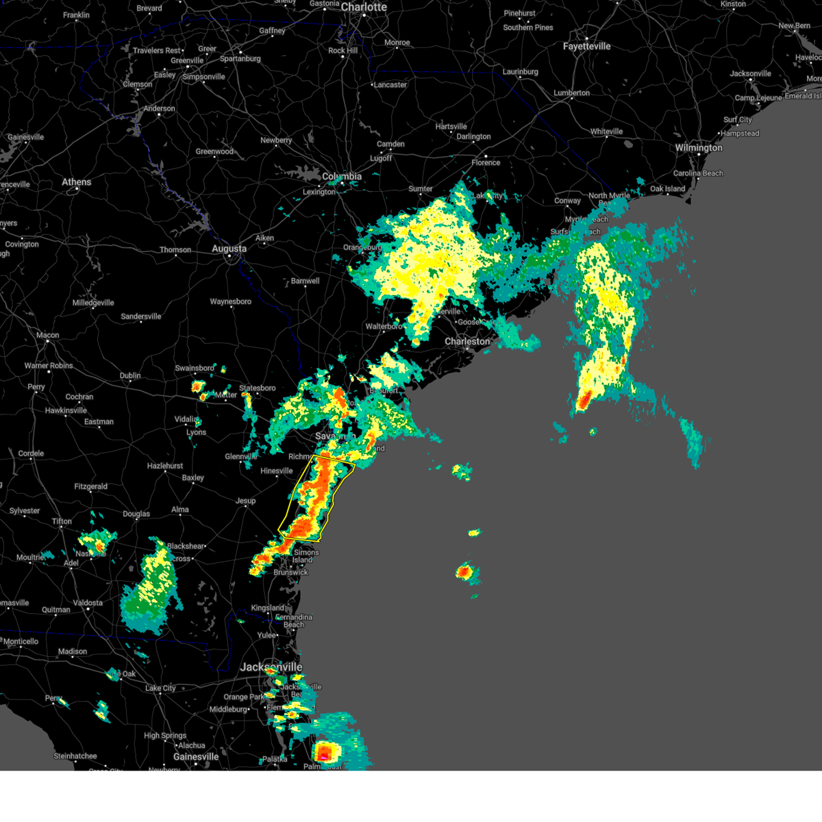
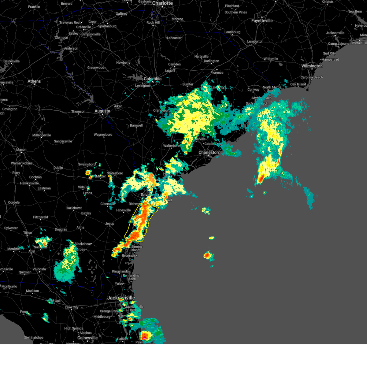
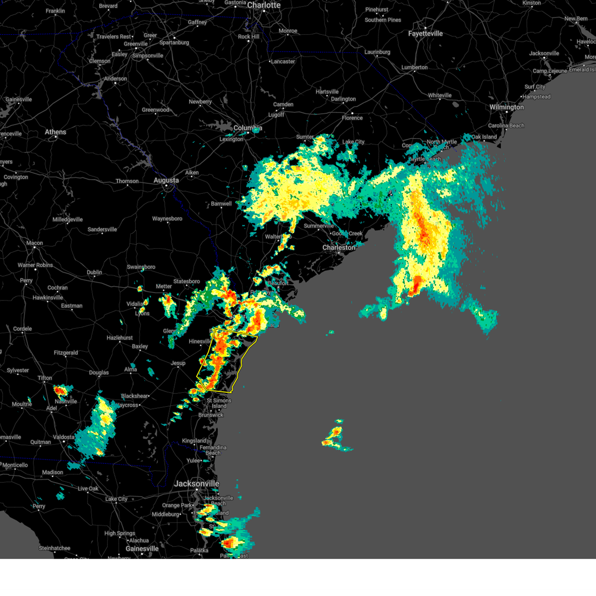
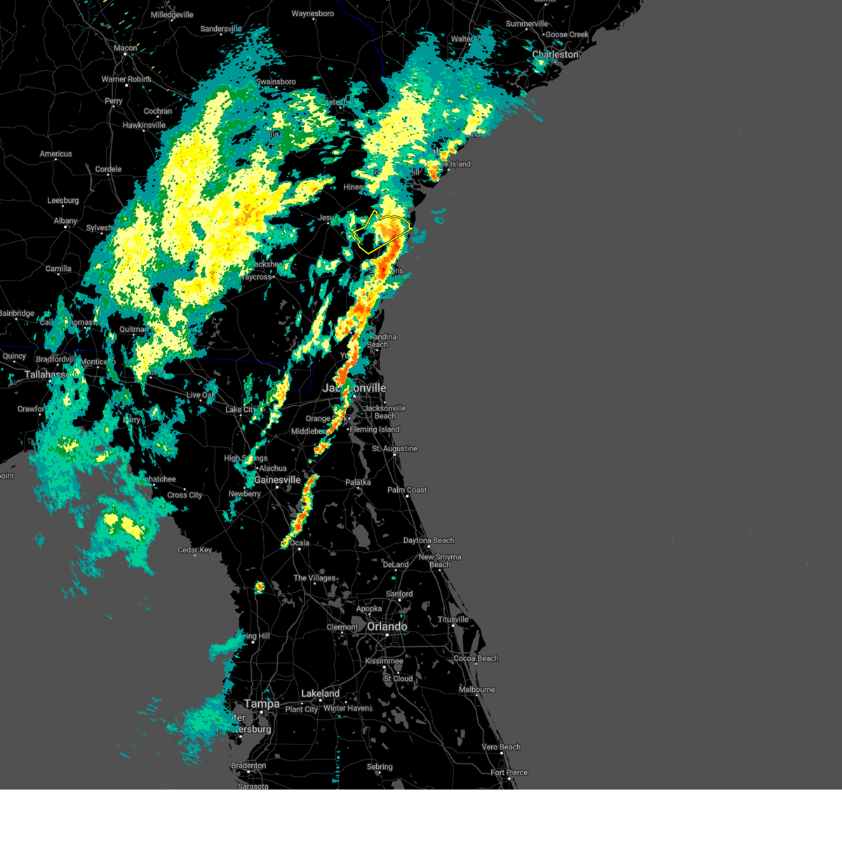
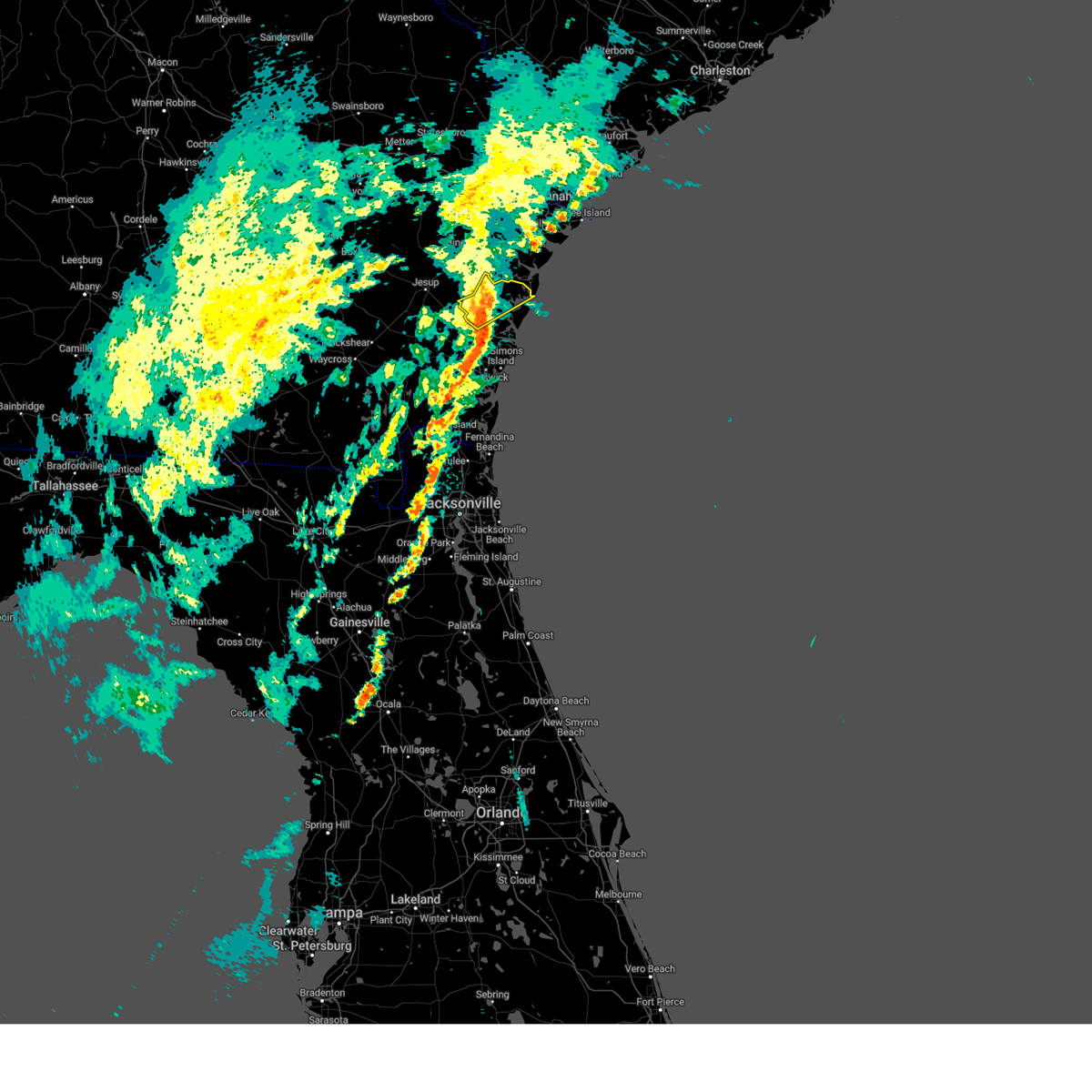
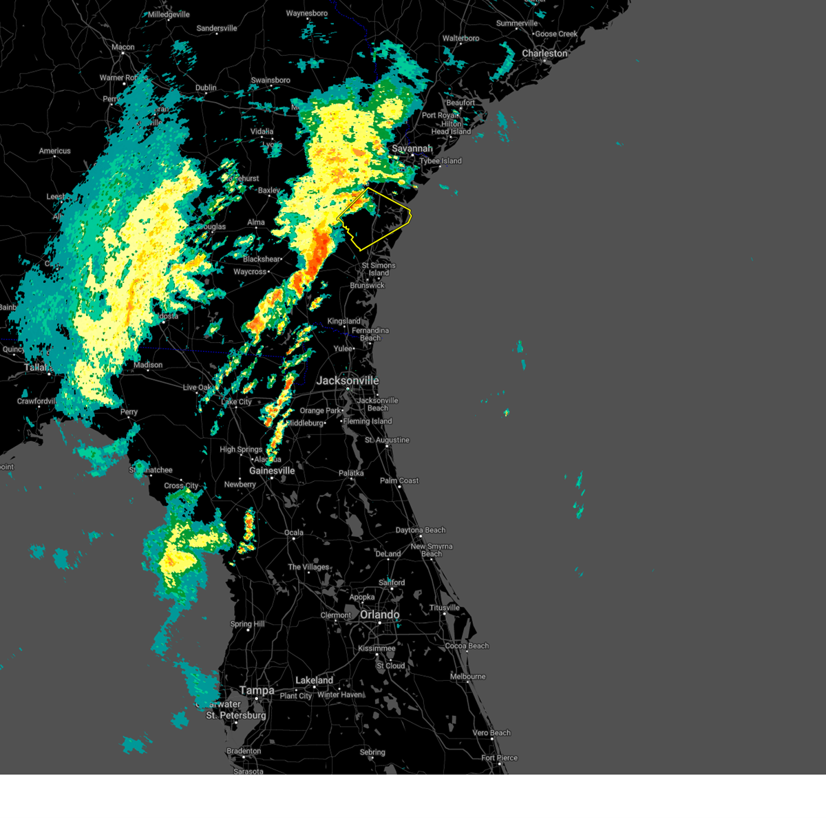
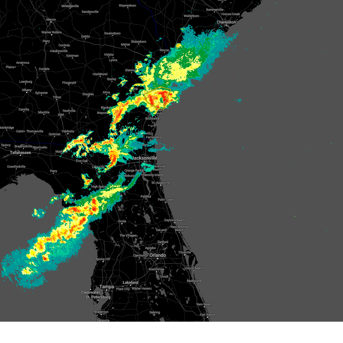
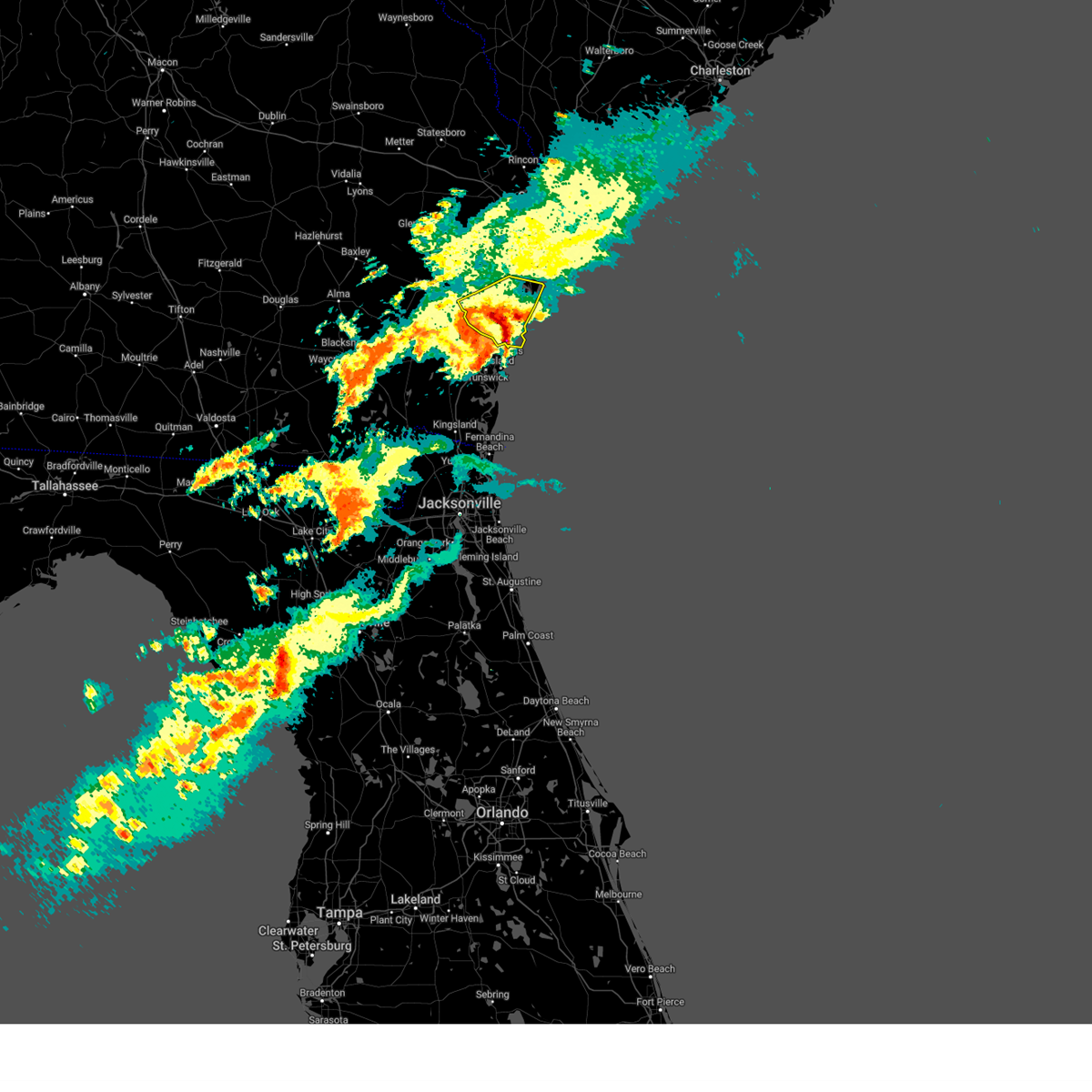
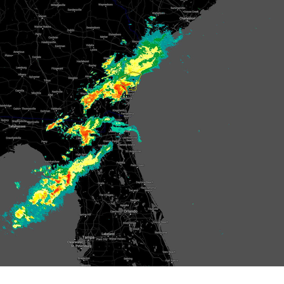
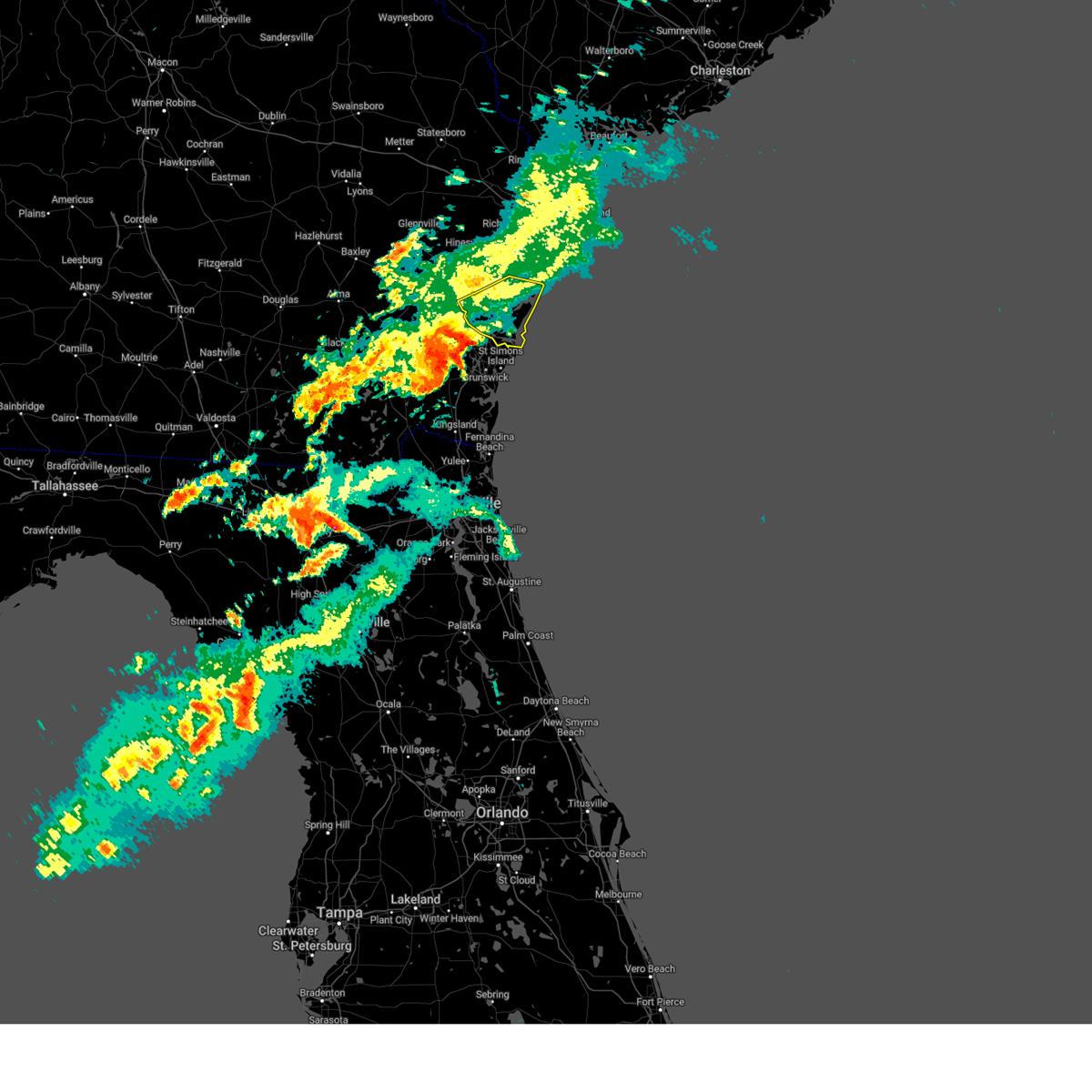
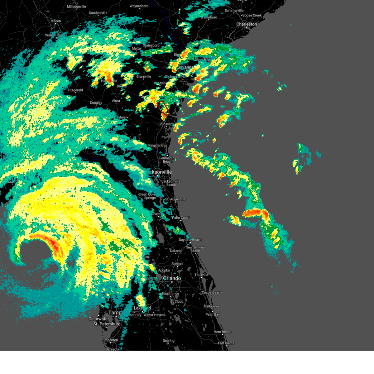
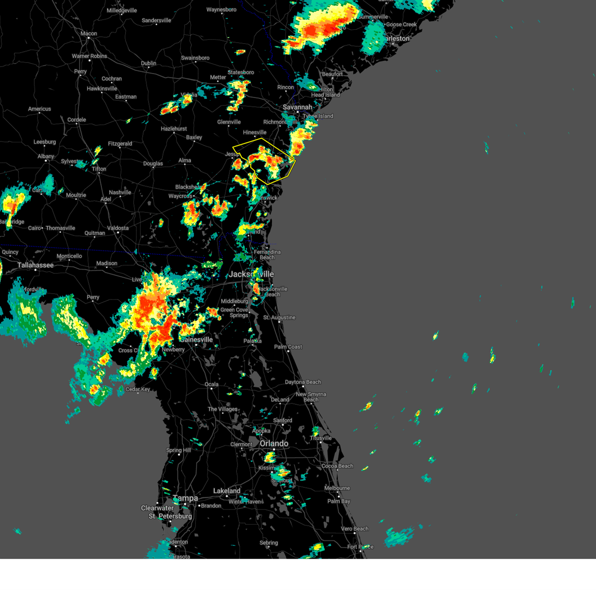
Hail Map for Darien, GA
The Darien, GA area has had 9 reports of on-the-ground hail by trained spotters, and has been under severe weather warnings 7 times during the past 12 months. Doppler radar has detected hail at or near Darien, GA on 72 occasions, including 1 occasion during the past year.
| Name: | Darien, GA |
| Where Located: | 54.1 miles SSW of Savannah, GA |
| Map: | Google Map for Darien, GA |
| Population: | 1975 |
| Housing Units: | 1090 |
| More Info: | Search Google for Darien, GA |
1
The Top Recent Hail Date for Darien, GA is Sunday, July 5, 2026 (29th out of 72)

Hail and Wind Damage Spotted near Darien, GA
| Date / Time | Report Details |
|---|---|
| 7/12/2026 5:15 PM EDT |
 Svrchs the national weather service in charleston has issued a * severe thunderstorm warning for portions of, mcintosh county in southeastern georgia, * until 545 pm edt. * at 515 pm edt, a severe thunderstorm was located over wolf island, moving northeast at 15 mph (radar indicated). Hazards include 60 mph wind gusts. expect damage to roofs, siding, and trees Svrchs the national weather service in charleston has issued a * severe thunderstorm warning for portions of, mcintosh county in southeastern georgia, * until 545 pm edt. * at 515 pm edt, a severe thunderstorm was located over wolf island, moving northeast at 15 mph (radar indicated). Hazards include 60 mph wind gusts. expect damage to roofs, siding, and trees
|
| 7/7/2026 7:20 PM EDT | The mcintosh county 911 call center reported a tree down on a power line along valona roa in mcintosh county GA, 10 miles SSW of Darien, GA |
| 7/5/2026 4:54 PM EDT |
 The storm which prompted the warning has weakened below severe limits, and no longer poses an immediate threat to life or property. therefore, the warning will be allowed to expire. however, gusty winds are still possible with this thunderstorm. The storm which prompted the warning has weakened below severe limits, and no longer poses an immediate threat to life or property. therefore, the warning will be allowed to expire. however, gusty winds are still possible with this thunderstorm.
|
| 7/5/2026 4:27 PM EDT |
 Svrjax the national weather service in jacksonville has issued a * severe thunderstorm warning for, central glynn county in southeastern georgia, * until 500 pm edt. * at 427 pm edt, a severe thunderstorm was located over country club estates, or over dock junction, moving southeast at 5 mph (radar indicated). Hazards include 60 mph wind gusts. expect damage to roofs, siding, and trees Svrjax the national weather service in jacksonville has issued a * severe thunderstorm warning for, central glynn county in southeastern georgia, * until 500 pm edt. * at 427 pm edt, a severe thunderstorm was located over country club estates, or over dock junction, moving southeast at 5 mph (radar indicated). Hazards include 60 mph wind gusts. expect damage to roofs, siding, and trees
|
| 3/16/2026 2:40 PM EDT |
 the severe thunderstorm warning has been cancelled and is no longer in effect the severe thunderstorm warning has been cancelled and is no longer in effect
|
| 3/16/2026 2:29 PM EDT |
 The storm which prompted the warning has moved out of the area. therefore, the warning will be allowed to expire. however, gusty winds are still possible with ongoing thunderstorms. a tornado watch remains in effect until 800 pm edt for southeastern georgia. The storm which prompted the warning has moved out of the area. therefore, the warning will be allowed to expire. however, gusty winds are still possible with ongoing thunderstorms. a tornado watch remains in effect until 800 pm edt for southeastern georgia.
|
| 3/16/2026 2:13 PM EDT |
 Svrchs the national weather service in charleston has issued a * severe thunderstorm warning for portions of, liberty county in southeastern georgia, mcintosh county in southeastern georgia, * until 315 pm edt. * at 213 pm edt, a severe thunderstorm was located 8 miles southwest of little saint simons island, moving northeast at 40 mph (radar indicated). Hazards include 60 mph wind gusts. expect damage to roofs, siding, and trees Svrchs the national weather service in charleston has issued a * severe thunderstorm warning for portions of, liberty county in southeastern georgia, mcintosh county in southeastern georgia, * until 315 pm edt. * at 213 pm edt, a severe thunderstorm was located 8 miles southwest of little saint simons island, moving northeast at 40 mph (radar indicated). Hazards include 60 mph wind gusts. expect damage to roofs, siding, and trees
|
| 3/16/2026 2:11 PM EDT |
 Svrjax the national weather service in jacksonville has issued a * severe thunderstorm warning for, north central camden county in southeastern georgia, southeastern glynn county in southeastern georgia, * until 230 pm edt. * at 211 pm edt, a severe thunderstorm was located near sea island, or near st. simons island, moving northeast at 50 mph (radar indicated). Hazards include 60 mph wind gusts and penny size hail. expect damage to roofs, siding, and trees Svrjax the national weather service in jacksonville has issued a * severe thunderstorm warning for, north central camden county in southeastern georgia, southeastern glynn county in southeastern georgia, * until 230 pm edt. * at 211 pm edt, a severe thunderstorm was located near sea island, or near st. simons island, moving northeast at 50 mph (radar indicated). Hazards include 60 mph wind gusts and penny size hail. expect damage to roofs, siding, and trees
|
| 6/16/2025 7:51 PM EDT |
 The storm which prompted the warning has weakened below severe limits, and no longer poses an immediate threat to life or property. therefore, the warning will be allowed to expire. however, gusty winds and heavy rain are still possible with this thunderstorm. The storm which prompted the warning has weakened below severe limits, and no longer poses an immediate threat to life or property. therefore, the warning will be allowed to expire. however, gusty winds and heavy rain are still possible with this thunderstorm.
|
| 6/16/2025 7:35 PM EDT |
 Svrjax the national weather service in jacksonville has issued a * severe thunderstorm warning for, central camden county in southeastern georgia, glynn county in southeastern georgia, east central brantley county in southeastern georgia, * until 800 pm edt. * at 734 pm edt, a severe thunderstorm was located near woodbine, moving northeast at 15 mph (radar indicated). Hazards include 60 mph wind gusts and penny size hail. expect damage to roofs, siding, and trees Svrjax the national weather service in jacksonville has issued a * severe thunderstorm warning for, central camden county in southeastern georgia, glynn county in southeastern georgia, east central brantley county in southeastern georgia, * until 800 pm edt. * at 734 pm edt, a severe thunderstorm was located near woodbine, moving northeast at 15 mph (radar indicated). Hazards include 60 mph wind gusts and penny size hail. expect damage to roofs, siding, and trees
|
| 5/29/2025 7:06 PM EDT |
 The storm which prompted the warning has moved out of the area. therefore, the warning will be allowed to expire. however, gusty winds are still possible with this thunderstorm. The storm which prompted the warning has moved out of the area. therefore, the warning will be allowed to expire. however, gusty winds are still possible with this thunderstorm.
|
| 5/29/2025 6:56 PM EDT |
 At 656 pm edt, a severe thunderstorm was located over brunswick, moving northeast at 35 mph (radar indicated). Hazards include 60 mph wind gusts. Expect damage to roofs, siding, and trees. locations impacted include, brunswick, st. Simons island, dock junction, st simons island village, country club estates, sea island, jekyll island, and boys estate. At 656 pm edt, a severe thunderstorm was located over brunswick, moving northeast at 35 mph (radar indicated). Hazards include 60 mph wind gusts. Expect damage to roofs, siding, and trees. locations impacted include, brunswick, st. Simons island, dock junction, st simons island village, country club estates, sea island, jekyll island, and boys estate.
|
| 5/29/2025 6:46 PM EDT |
 At 646 pm edt, a severe thunderstorm was located near jekyll island, or near brunswick, moving northeast at 30 mph (radar indicated). Hazards include 60 mph wind gusts. Expect damage to roofs, siding, and trees. locations impacted include, brunswick, st. Simons island, dock junction, st simons island village, country club estates, sea island, jekyll island, boys estate, and dover bluff. At 646 pm edt, a severe thunderstorm was located near jekyll island, or near brunswick, moving northeast at 30 mph (radar indicated). Hazards include 60 mph wind gusts. Expect damage to roofs, siding, and trees. locations impacted include, brunswick, st. Simons island, dock junction, st simons island village, country club estates, sea island, jekyll island, boys estate, and dover bluff.
|
| 5/29/2025 6:36 PM EDT |
 At 636 pm edt, a severe thunderstorm was located 9 miles southwest of jekyll island, or 10 miles southwest of brunswick, moving northeast at 35 mph (radar indicated). Hazards include 60 mph wind gusts. Expect damage to roofs, siding, and trees. locations impacted include, brunswick, st. Simons island, woodbine, dock junction, st simons island village, country club estates, waverly, sea island, jekyll island, and boys estate. At 636 pm edt, a severe thunderstorm was located 9 miles southwest of jekyll island, or 10 miles southwest of brunswick, moving northeast at 35 mph (radar indicated). Hazards include 60 mph wind gusts. Expect damage to roofs, siding, and trees. locations impacted include, brunswick, st. Simons island, woodbine, dock junction, st simons island village, country club estates, waverly, sea island, jekyll island, and boys estate.
|
| 5/29/2025 6:28 PM EDT |
 Svrjax the national weather service in jacksonville has issued a * severe thunderstorm warning for, central camden county in southeastern georgia, glynn county in southeastern georgia, * until 715 pm edt. * at 628 pm edt, a severe thunderstorm was located near woodbine, moving northeast at 35 mph (radar indicated). Hazards include 60 mph wind gusts. expect damage to roofs, siding, and trees Svrjax the national weather service in jacksonville has issued a * severe thunderstorm warning for, central camden county in southeastern georgia, glynn county in southeastern georgia, * until 715 pm edt. * at 628 pm edt, a severe thunderstorm was located near woodbine, moving northeast at 35 mph (radar indicated). Hazards include 60 mph wind gusts. expect damage to roofs, siding, and trees
|
| 5/25/2025 3:59 PM EDT |
 The storms which prompted the warning have moved out of the area. therefore, the warning will be allowed to expire. The storms which prompted the warning have moved out of the area. therefore, the warning will be allowed to expire.
|
| 5/25/2025 3:56 PM EDT |
 Svrjax the national weather service in jacksonville has issued a * severe thunderstorm warning for, northeastern camden county in southeastern georgia, southeastern glynn county in southeastern georgia, * until 430 pm edt. * at 356 pm edt, severe thunderstorms were located along a line extending from near little saint simons island to 6 miles southwest of brunswick, moving southeast at 25 mph (radar indicated). Hazards include 60 mph wind gusts and quarter size hail. Hail damage to vehicles is expected. Expect wind damage to roofs, siding, and trees. Svrjax the national weather service in jacksonville has issued a * severe thunderstorm warning for, northeastern camden county in southeastern georgia, southeastern glynn county in southeastern georgia, * until 430 pm edt. * at 356 pm edt, severe thunderstorms were located along a line extending from near little saint simons island to 6 miles southwest of brunswick, moving southeast at 25 mph (radar indicated). Hazards include 60 mph wind gusts and quarter size hail. Hail damage to vehicles is expected. Expect wind damage to roofs, siding, and trees.
|
| 5/25/2025 3:51 PM EDT |
 At 351 pm edt, severe thunderstorms were located along a line from over sandfly to near sapelo island, moving east at 15 mph (radar indicated). Hazards include 60 mph wind gusts. Expect damage to roofs, siding, and trees. locations impacted include, darien, coffee bluff, windsor forest, montgomery, vernonburg, harris neck, halfmoon landing, st. catherines island, shellman bluff and sunbury. This includes i-95 in georgia between mile markers 48 and 56. At 351 pm edt, severe thunderstorms were located along a line from over sandfly to near sapelo island, moving east at 15 mph (radar indicated). Hazards include 60 mph wind gusts. Expect damage to roofs, siding, and trees. locations impacted include, darien, coffee bluff, windsor forest, montgomery, vernonburg, harris neck, halfmoon landing, st. catherines island, shellman bluff and sunbury. This includes i-95 in georgia between mile markers 48 and 56.
|
| 5/25/2025 3:33 PM EDT |
 Svrjax the national weather service in jacksonville has issued a * severe thunderstorm warning for, central glynn county in southeastern georgia, * until 400 pm edt. * at 333 pm edt, a severe thunderstorm was located near darien, moving southeast at 15 mph (radar indicated). Hazards include 60 mph wind gusts and quarter size hail. Hail damage to vehicles is expected. Expect wind damage to roofs, siding, and trees. Svrjax the national weather service in jacksonville has issued a * severe thunderstorm warning for, central glynn county in southeastern georgia, * until 400 pm edt. * at 333 pm edt, a severe thunderstorm was located near darien, moving southeast at 15 mph (radar indicated). Hazards include 60 mph wind gusts and quarter size hail. Hail damage to vehicles is expected. Expect wind damage to roofs, siding, and trees.
|
| 5/25/2025 3:30 PM EDT |
 At 330 pm edt, severe thunderstorms were located along a line from over hunter army airfield to over ridgeville, moving east at 15 mph (radar indicated). Hazards include 60 mph wind gusts. Expect damage to roofs, siding, and trees. locations impacted include, richmond hill, darien, coffee bluff, windsor forest, jones, montgomery, midway, riceboro, vernonburg and harris neck. This includes i-95 in georgia between mile markers 48 and 88. At 330 pm edt, severe thunderstorms were located along a line from over hunter army airfield to over ridgeville, moving east at 15 mph (radar indicated). Hazards include 60 mph wind gusts. Expect damage to roofs, siding, and trees. locations impacted include, richmond hill, darien, coffee bluff, windsor forest, jones, montgomery, midway, riceboro, vernonburg and harris neck. This includes i-95 in georgia between mile markers 48 and 88.
|
| 5/25/2025 3:30 PM EDT |
 the severe thunderstorm warning has been cancelled and is no longer in effect the severe thunderstorm warning has been cancelled and is no longer in effect
|
| 5/25/2025 3:05 PM EDT |
 Svrchs the national weather service in charleston has issued a * severe thunderstorm warning for portions of, bryan county in southeastern georgia, chatham county in southeastern georgia, liberty county in southeastern georgia, long county in southeastern georgia, mcintosh county in southeastern georgia, * until 400 pm edt. * at 305 pm edt, severe thunderstorms were located along a line from over burroughs to over darien, moving east at 15 mph (radar indicated). Hazards include 60 mph wind gusts. expect damage to roofs, siding, and trees Svrchs the national weather service in charleston has issued a * severe thunderstorm warning for portions of, bryan county in southeastern georgia, chatham county in southeastern georgia, liberty county in southeastern georgia, long county in southeastern georgia, mcintosh county in southeastern georgia, * until 400 pm edt. * at 305 pm edt, severe thunderstorms were located along a line from over burroughs to over darien, moving east at 15 mph (radar indicated). Hazards include 60 mph wind gusts. expect damage to roofs, siding, and trees
|
| 4/7/2025 8:27 PM EDT |
 The storm which prompted the warning has weakened below severe limits, and no longer poses an immediate threat to life or property. therefore, the warning will be allowed to expire. The storm which prompted the warning has weakened below severe limits, and no longer poses an immediate threat to life or property. therefore, the warning will be allowed to expire.
|
| 4/7/2025 8:21 PM EDT |
 the severe thunderstorm warning has been cancelled and is no longer in effect the severe thunderstorm warning has been cancelled and is no longer in effect
|
| 4/7/2025 8:21 PM EDT |
 At 821 pm edt, a severe thunderstorm was located near retreat, moving northeast at 55 mph (radar indicated). Hazards include 60 mph wind gusts. Expect damage to roofs, siding, and trees. locations impacted include, jones, eulonia, pine harbor, crescent, townsend, south newport, valona, shellman bluff, cox and harris neck. This includes i-95 in georgia between mile markers 52 and 67. At 821 pm edt, a severe thunderstorm was located near retreat, moving northeast at 55 mph (radar indicated). Hazards include 60 mph wind gusts. Expect damage to roofs, siding, and trees. locations impacted include, jones, eulonia, pine harbor, crescent, townsend, south newport, valona, shellman bluff, cox and harris neck. This includes i-95 in georgia between mile markers 52 and 67.
|
| 4/7/2025 7:47 PM EDT |
 Svrchs the national weather service in charleston has issued a * severe thunderstorm warning for portions of, liberty county in southeastern georgia, long county in southeastern georgia, mcintosh county in southeastern georgia, * until 830 pm edt. * at 747 pm edt, a severe thunderstorm was located 12 miles west of cox, moving northeast at 55 mph (radar indicated). Hazards include 60 mph wind gusts. expect damage to roofs, siding, and trees Svrchs the national weather service in charleston has issued a * severe thunderstorm warning for portions of, liberty county in southeastern georgia, long county in southeastern georgia, mcintosh county in southeastern georgia, * until 830 pm edt. * at 747 pm edt, a severe thunderstorm was located 12 miles west of cox, moving northeast at 55 mph (radar indicated). Hazards include 60 mph wind gusts. expect damage to roofs, siding, and trees
|
| 3/16/2025 11:57 AM EDT |
 The storms which prompted the warning have weakened below severe limits, and no longer pose an immediate threat to life or property. therefore, the warning will be allowed to expire. however, gusty winds of 50 to 55 mph are still possible with these thunderstorms. a tornado watch remains in effect until 200 pm edt for a portion of southeast georgia. The storms which prompted the warning have weakened below severe limits, and no longer pose an immediate threat to life or property. therefore, the warning will be allowed to expire. however, gusty winds of 50 to 55 mph are still possible with these thunderstorms. a tornado watch remains in effect until 200 pm edt for a portion of southeast georgia.
|
| 3/16/2025 11:46 AM EDT |
 At 1146 am edt, severe thunderstorms were located along a line from over townsend to over little saint simons island, moving northeast at 60 mph (radar indicated). Hazards include 60 mph wind gusts and small hail. Expect damage to roofs, siding, and trees. locations impacted include, darien, ridgeville, carnigan, meridian, eulonia, valona, crescent, pine harbor, sapelo island and shellman bluff. This includes i-95 in georgia near mile marker 50, and between mile markers 47 and 49, and between mile markers 51 and 68. At 1146 am edt, severe thunderstorms were located along a line from over townsend to over little saint simons island, moving northeast at 60 mph (radar indicated). Hazards include 60 mph wind gusts and small hail. Expect damage to roofs, siding, and trees. locations impacted include, darien, ridgeville, carnigan, meridian, eulonia, valona, crescent, pine harbor, sapelo island and shellman bluff. This includes i-95 in georgia near mile marker 50, and between mile markers 47 and 49, and between mile markers 51 and 68.
|
| 3/16/2025 11:30 AM EDT |
 Svrjax the national weather service in jacksonville has issued a * severe thunderstorm warning for, central glynn county in southeastern georgia, southeastern wayne county in southeastern georgia, * until noon edt. * at 1130 am edt, a severe thunderstorm was located near everett, or 8 miles west of darien, moving northeast at 45 mph (radar indicated). Hazards include 60 mph wind gusts and penny size hail. expect damage to roofs, siding, and trees Svrjax the national weather service in jacksonville has issued a * severe thunderstorm warning for, central glynn county in southeastern georgia, southeastern wayne county in southeastern georgia, * until noon edt. * at 1130 am edt, a severe thunderstorm was located near everett, or 8 miles west of darien, moving northeast at 45 mph (radar indicated). Hazards include 60 mph wind gusts and penny size hail. expect damage to roofs, siding, and trees
|
| 3/16/2025 11:30 AM EDT |
 At 1130 am edt, severe thunderstorms were located along a line from near cox to 13 miles southwest of little saint simons island, moving east at 50 mph (radar indicated). Hazards include 60 mph wind gusts and small hail. Expect damage to roofs, siding, and trees. locations impacted include, darien, ridgeville, carnigan, meridian, eulonia, valona, crescent, sapelo island, pine harbor and shellman bluff. This includes i-95 in georgia near mile marker 50, and between mile markers 47 and 49, and between mile markers 51 and 68. At 1130 am edt, severe thunderstorms were located along a line from near cox to 13 miles southwest of little saint simons island, moving east at 50 mph (radar indicated). Hazards include 60 mph wind gusts and small hail. Expect damage to roofs, siding, and trees. locations impacted include, darien, ridgeville, carnigan, meridian, eulonia, valona, crescent, sapelo island, pine harbor and shellman bluff. This includes i-95 in georgia near mile marker 50, and between mile markers 47 and 49, and between mile markers 51 and 68.
|
| 3/16/2025 11:22 AM EDT |
 Svrchs the national weather service in charleston has issued a * severe thunderstorm warning for portions of, liberty county in southeastern georgia, mcintosh county in southeastern georgia, * until noon edt. * at 1122 am edt, severe thunderstorms were located along a line from 10 miles west of cox to 19 miles southwest of darien, moving east at 50 mph (radar indicated). Hazards include 60 mph wind gusts. expect damage to roofs, siding, and trees Svrchs the national weather service in charleston has issued a * severe thunderstorm warning for portions of, liberty county in southeastern georgia, mcintosh county in southeastern georgia, * until noon edt. * at 1122 am edt, severe thunderstorms were located along a line from 10 miles west of cox to 19 miles southwest of darien, moving east at 50 mph (radar indicated). Hazards include 60 mph wind gusts. expect damage to roofs, siding, and trees
|
| 9/26/2024 9:22 PM EDT |
 The storm which prompted the warning has moved out of the area. therefore, the warning will be allowed to expire. a tornado watch remains in effect until 600 am edt for southeastern georgia. The storm which prompted the warning has moved out of the area. therefore, the warning will be allowed to expire. a tornado watch remains in effect until 600 am edt for southeastern georgia.
|
| 9/26/2024 9:14 PM EDT |
 The tornado warning that was previously in effect has been reissued for glynn county and is in effect until 930pm. please refer to that bulletin for the latest severe weather information. a tornado watch remains in effect until 600 am edt for southeastern georgia. The tornado warning that was previously in effect has been reissued for glynn county and is in effect until 930pm. please refer to that bulletin for the latest severe weather information. a tornado watch remains in effect until 600 am edt for southeastern georgia.
|
| 9/26/2024 9:13 PM EDT |
 Torjax the national weather service in jacksonville has issued a * tornado warning for, central glynn county in southeastern georgia, * until 930 pm edt. * at 912 pm edt, a severe thunderstorm capable of producing a tornado was located near country club estates, or near dock junction, moving northwest at 55 mph (radar indicated rotation). Hazards include tornado. Flying debris will be dangerous to those caught without shelter. mobile homes will be damaged or destroyed. damage to roofs, windows, and vehicles will occur. tree damage is likely. This tornadic thunderstorm will remain over mainly rural areas of central glynn county, including the following locations, boys estate. Torjax the national weather service in jacksonville has issued a * tornado warning for, central glynn county in southeastern georgia, * until 930 pm edt. * at 912 pm edt, a severe thunderstorm capable of producing a tornado was located near country club estates, or near dock junction, moving northwest at 55 mph (radar indicated rotation). Hazards include tornado. Flying debris will be dangerous to those caught without shelter. mobile homes will be damaged or destroyed. damage to roofs, windows, and vehicles will occur. tree damage is likely. This tornadic thunderstorm will remain over mainly rural areas of central glynn county, including the following locations, boys estate.
|
| 9/26/2024 8:49 PM EDT |
 Torjax the national weather service in jacksonville has issued a * tornado warning for, central glynn county in southeastern georgia, * until 915 pm edt. * at 848 pm edt, a severe thunderstorm capable of producing a tornado was located over st. simons island, moving northwest at 60 mph (radar indicated rotation). Hazards include tornado. Flying debris will be dangerous to those caught without shelter. mobile homes will be damaged or destroyed. damage to roofs, windows, and vehicles will occur. tree damage is likely. this dangerous storm will be near, country club estates around 855 pm edt. Other locations impacted by this tornadic thunderstorm include boys estate. Torjax the national weather service in jacksonville has issued a * tornado warning for, central glynn county in southeastern georgia, * until 915 pm edt. * at 848 pm edt, a severe thunderstorm capable of producing a tornado was located over st. simons island, moving northwest at 60 mph (radar indicated rotation). Hazards include tornado. Flying debris will be dangerous to those caught without shelter. mobile homes will be damaged or destroyed. damage to roofs, windows, and vehicles will occur. tree damage is likely. this dangerous storm will be near, country club estates around 855 pm edt. Other locations impacted by this tornadic thunderstorm include boys estate.
|
| 9/26/2024 8:44 PM EDT |
 The storm which prompted the warning has moved out of the area. therefore, the warning will be allowed to expire. a tornado watch remains in effect until 600 am edt for southeastern georgia. to report severe weather, contact your nearest law enforcement agency. they will relay your report to the national weather service jacksonville. The storm which prompted the warning has moved out of the area. therefore, the warning will be allowed to expire. a tornado watch remains in effect until 600 am edt for southeastern georgia. to report severe weather, contact your nearest law enforcement agency. they will relay your report to the national weather service jacksonville.
|
| 9/26/2024 8:42 PM EDT |
 Torchs the national weather service in charleston has issued a * tornado warning for portions of, mcintosh county in southeastern georgia, * until 915 pm edt. * at 842 pm edt, a severe thunderstorm capable of producing a tornado was located 5 miles south of cox, moving north at 55 mph (radar indicated rotation). Hazards include tornado. Flying debris will be dangerous to those caught without shelter. mobile homes will be damaged or destroyed. damage to roofs, windows and vehicles will occur. Tree damage is likely. Torchs the national weather service in charleston has issued a * tornado warning for portions of, mcintosh county in southeastern georgia, * until 915 pm edt. * at 842 pm edt, a severe thunderstorm capable of producing a tornado was located 5 miles south of cox, moving north at 55 mph (radar indicated rotation). Hazards include tornado. Flying debris will be dangerous to those caught without shelter. mobile homes will be damaged or destroyed. damage to roofs, windows and vehicles will occur. Tree damage is likely.
|
| 9/26/2024 8:36 PM EDT |
 At 836 pm edt, a severe thunderstorm capable of producing a tornado was located near dock junction, moving northwest at 50 mph (radar indicated rotation). Hazards include tornado. Flying debris will be dangerous to those caught without shelter. mobile homes will be damaged or destroyed. damage to roofs, windows, and vehicles will occur. tree damage is likely. This tornadic thunderstorm will remain over mainly rural areas of northwestern glynn county, including the following locations, boys estate. At 836 pm edt, a severe thunderstorm capable of producing a tornado was located near dock junction, moving northwest at 50 mph (radar indicated rotation). Hazards include tornado. Flying debris will be dangerous to those caught without shelter. mobile homes will be damaged or destroyed. damage to roofs, windows, and vehicles will occur. tree damage is likely. This tornadic thunderstorm will remain over mainly rural areas of northwestern glynn county, including the following locations, boys estate.
|
| 9/26/2024 8:36 PM EDT |
 the tornado warning has been cancelled and is no longer in effect the tornado warning has been cancelled and is no longer in effect
|
| 9/26/2024 8:16 PM EDT |
 Torjax the national weather service in jacksonville has issued a * tornado warning for, east central camden county in southeastern georgia, glynn county in southeastern georgia, * until 845 pm edt. * at 815 pm edt, a severe thunderstorm capable of producing a tornado was located over jekyll island, or 8 miles south of st. simons island, moving northwest at 50 mph (radar indicated rotation). Hazards include tornado. Flying debris will be dangerous to those caught without shelter. mobile homes will be damaged or destroyed. damage to roofs, windows, and vehicles will occur. tree damage is likely. this dangerous storm will be near, brunswick, st. simons island, and st simons island village around 820 pm edt. dock junction and country club estates around 825 pm edt. Other locations impacted by this tornadic thunderstorm include boys estate. Torjax the national weather service in jacksonville has issued a * tornado warning for, east central camden county in southeastern georgia, glynn county in southeastern georgia, * until 845 pm edt. * at 815 pm edt, a severe thunderstorm capable of producing a tornado was located over jekyll island, or 8 miles south of st. simons island, moving northwest at 50 mph (radar indicated rotation). Hazards include tornado. Flying debris will be dangerous to those caught without shelter. mobile homes will be damaged or destroyed. damage to roofs, windows, and vehicles will occur. tree damage is likely. this dangerous storm will be near, brunswick, st. simons island, and st simons island village around 820 pm edt. dock junction and country club estates around 825 pm edt. Other locations impacted by this tornadic thunderstorm include boys estate.
|
| 9/26/2024 11:31 AM EDT |
 the tornado warning has been cancelled and is no longer in effect the tornado warning has been cancelled and is no longer in effect
|
| 9/26/2024 11:23 AM EDT |
 At 1123 am edt, a severe thunderstorm capable of producing a tornado was located over st. simons island, moving north at 30 mph (radar indicated rotation). Hazards include tornado. Flying debris will be dangerous to those caught without shelter. mobile homes will be damaged or destroyed. damage to roofs, windows, and vehicles will occur. tree damage is likely. this dangerous storm will be near, dock junction and country club estates around 1130 am edt. Other locations impacted by this tornadic thunderstorm include boys estate. At 1123 am edt, a severe thunderstorm capable of producing a tornado was located over st. simons island, moving north at 30 mph (radar indicated rotation). Hazards include tornado. Flying debris will be dangerous to those caught without shelter. mobile homes will be damaged or destroyed. damage to roofs, windows, and vehicles will occur. tree damage is likely. this dangerous storm will be near, dock junction and country club estates around 1130 am edt. Other locations impacted by this tornadic thunderstorm include boys estate.
|
| 9/26/2024 11:14 AM EDT |
 Torjax the national weather service in jacksonville has issued a * tornado warning for, southeastern glynn county in southeastern georgia, * until 1145 am edt. * at 1114 am edt, a severe thunderstorm capable of producing a tornado was located over st simons island village, or near st. simons island, moving north near 25 mph (radar indicated rotation). Hazards include tornado. Flying debris will be dangerous to those caught without shelter. mobile homes will be damaged or destroyed. damage to roofs, windows, and vehicles will occur. tree damage is likely. this dangerous storm will be near, brunswick, st. simons island, st simons island village, and country club estates around 1120 am edt. dock junction around 1125 am edt. Other locations impacted by this tornadic thunderstorm include boys estate. Torjax the national weather service in jacksonville has issued a * tornado warning for, southeastern glynn county in southeastern georgia, * until 1145 am edt. * at 1114 am edt, a severe thunderstorm capable of producing a tornado was located over st simons island village, or near st. simons island, moving north near 25 mph (radar indicated rotation). Hazards include tornado. Flying debris will be dangerous to those caught without shelter. mobile homes will be damaged or destroyed. damage to roofs, windows, and vehicles will occur. tree damage is likely. this dangerous storm will be near, brunswick, st. simons island, st simons island village, and country club estates around 1120 am edt. dock junction around 1125 am edt. Other locations impacted by this tornadic thunderstorm include boys estate.
|
| 8/2/2024 3:25 PM EDT |
 Svrchs the national weather service in charleston has issued a * severe thunderstorm warning for portions of, liberty county in southeastern georgia, mcintosh county in southeastern georgia, long county in southeastern georgia, * until 430 pm edt. * at 325 pm edt, severe thunderstorms were located along a line extending from near tibet to shellman bluff, moving southeast at 15 mph (radar indicated). Hazards include 60 mph wind gusts and quarter size hail. Minor hail damage to vehicles is possible. expect wind damage to trees and powerlines. locations impacted include: darien, ludowici, tibet, jones, walthourville, riceboro, allenhurst, harris neck, eulonia, valona, south newport, cox, meridian, townsend, and crescent. This warning includes i-95 in georgia between mile markers 50 and 73. Svrchs the national weather service in charleston has issued a * severe thunderstorm warning for portions of, liberty county in southeastern georgia, mcintosh county in southeastern georgia, long county in southeastern georgia, * until 430 pm edt. * at 325 pm edt, severe thunderstorms were located along a line extending from near tibet to shellman bluff, moving southeast at 15 mph (radar indicated). Hazards include 60 mph wind gusts and quarter size hail. Minor hail damage to vehicles is possible. expect wind damage to trees and powerlines. locations impacted include: darien, ludowici, tibet, jones, walthourville, riceboro, allenhurst, harris neck, eulonia, valona, south newport, cox, meridian, townsend, and crescent. This warning includes i-95 in georgia between mile markers 50 and 73.
|
| 7/18/2024 5:31 PM EDT |
 The storms which prompted the warning have weakened below severe limits, and no longer pose an immediate threat to life or property. therefore, the warning has been allowed to expire. however, gusty winds are still expected with these thunderstorms. The storms which prompted the warning have weakened below severe limits, and no longer pose an immediate threat to life or property. therefore, the warning has been allowed to expire. however, gusty winds are still expected with these thunderstorms.
|
| 7/18/2024 5:08 PM EDT |
 At 508 pm edt, severe thunderstorms were located along a line extending from near dock junction to near st simons island village, moving northeast at 25 mph (radar indicated). Hazards include 60 mph wind gusts and penny size hail. Expect damage to roofs, siding, and trees. locations impacted include, brunswick, st. Simons island, dock junction, st simons island village, country club estates, sea island, and boys estate. At 508 pm edt, severe thunderstorms were located along a line extending from near dock junction to near st simons island village, moving northeast at 25 mph (radar indicated). Hazards include 60 mph wind gusts and penny size hail. Expect damage to roofs, siding, and trees. locations impacted include, brunswick, st. Simons island, dock junction, st simons island village, country club estates, sea island, and boys estate.
|
| 7/18/2024 4:42 PM EDT |
 Svrjax the national weather service in jacksonville has issued a * severe thunderstorm warning for, central glynn county in southeastern georgia, * until 530 pm edt. * at 441 pm edt, a severe thunderstorm was located over dock junction, moving northeast at 15 mph (radar indicated). Hazards include 60 mph wind gusts and penny size hail. expect damage to roofs, siding, and trees Svrjax the national weather service in jacksonville has issued a * severe thunderstorm warning for, central glynn county in southeastern georgia, * until 530 pm edt. * at 441 pm edt, a severe thunderstorm was located over dock junction, moving northeast at 15 mph (radar indicated). Hazards include 60 mph wind gusts and penny size hail. expect damage to roofs, siding, and trees
|
| 6/28/2024 3:56 PM EDT |
 Svrjax the national weather service in jacksonville has issued a * severe thunderstorm warning for, northern camden county in southeastern georgia, glynn county in southeastern georgia, eastern brantley county in southeastern georgia, southeastern wayne county in southeastern georgia, * until 500 pm edt. * at 356 pm edt, a severe thunderstorm was located over waverly, or 9 miles north of woodbine, moving north at 25 mph (radar indicated). Hazards include 60 mph wind gusts and penny size hail. expect damage to roofs, siding, and trees Svrjax the national weather service in jacksonville has issued a * severe thunderstorm warning for, northern camden county in southeastern georgia, glynn county in southeastern georgia, eastern brantley county in southeastern georgia, southeastern wayne county in southeastern georgia, * until 500 pm edt. * at 356 pm edt, a severe thunderstorm was located over waverly, or 9 miles north of woodbine, moving north at 25 mph (radar indicated). Hazards include 60 mph wind gusts and penny size hail. expect damage to roofs, siding, and trees
|
| 5/25/2024 6:00 PM EDT | The nerrs site on the south end of sapelo island measured a 51 knot wind gus in mcintosh county GA, 9 miles WSW of Darien, GA |
| 5/25/2024 6:00 PM EDT | The nerrs site on the south end of sapelo island measured a 51 knot wind gus in mcintosh county GA, 9 miles WSW of Darien, GA |
| 5/24/2024 8:36 PM EDT |
 The storm which prompted the warning has moved out of the area. therefore, the warning will be allowed to expire. The storm which prompted the warning has moved out of the area. therefore, the warning will be allowed to expire.
|
| 5/24/2024 7:38 PM EDT |
 Svrchs the national weather service in charleston has issued a * severe thunderstorm warning for portions of, liberty county in southeastern georgia, mcintosh county in southeastern georgia, * until 845 pm edt. * at 738 pm edt, a severe thunderstorm was located over jones, moving southeast at 15 mph (radar indicated). Hazards include ping pong ball size hail and 60 mph wind gusts. People and animals outdoors will be injured. expect hail damage to roofs, siding, windows, and vehicles. expect wind damage to trees and powerlines. locations impacted include: darien, jones, midway, riceboro, wolf island, harris neck, st. catherines island, eulonia, valona, little saint simons island, south newport, cox, meridian, townsend, and crescent. This warning includes i-95 in georgia between mile markers 50 and 78. Svrchs the national weather service in charleston has issued a * severe thunderstorm warning for portions of, liberty county in southeastern georgia, mcintosh county in southeastern georgia, * until 845 pm edt. * at 738 pm edt, a severe thunderstorm was located over jones, moving southeast at 15 mph (radar indicated). Hazards include ping pong ball size hail and 60 mph wind gusts. People and animals outdoors will be injured. expect hail damage to roofs, siding, windows, and vehicles. expect wind damage to trees and powerlines. locations impacted include: darien, jones, midway, riceboro, wolf island, harris neck, st. catherines island, eulonia, valona, little saint simons island, south newport, cox, meridian, townsend, and crescent. This warning includes i-95 in georgia between mile markers 50 and 78.
|
| 5/10/2024 9:44 AM EDT |
 The storms which prompted the warning have weakened below severe limits, and have exited the warned area. therefore, the warning will be allowed to expire. a severe thunderstorm watch remains in effect until noon edt for southeastern georgia. to report severe weather, contact your nearest law enforcement agency. they will relay your report to the national weather service jacksonville. The storms which prompted the warning have weakened below severe limits, and have exited the warned area. therefore, the warning will be allowed to expire. a severe thunderstorm watch remains in effect until noon edt for southeastern georgia. to report severe weather, contact your nearest law enforcement agency. they will relay your report to the national weather service jacksonville.
|
| 5/10/2024 9:25 AM EDT |
 Svrjax the national weather service in jacksonville has issued a * severe thunderstorm warning for, northeastern camden county in southeastern georgia, central glynn county in southeastern georgia, * until 945 am edt. * at 925 am edt, severe thunderstorms were located along a line extending from near thalmann to 6 miles northeast of woodbine, moving northeast at 65 mph (radar indicated). Hazards include 60 mph wind gusts and penny size hail. expect damage to roofs, siding, and trees Svrjax the national weather service in jacksonville has issued a * severe thunderstorm warning for, northeastern camden county in southeastern georgia, central glynn county in southeastern georgia, * until 945 am edt. * at 925 am edt, severe thunderstorms were located along a line extending from near thalmann to 6 miles northeast of woodbine, moving northeast at 65 mph (radar indicated). Hazards include 60 mph wind gusts and penny size hail. expect damage to roofs, siding, and trees
|
| 5/10/2024 9:17 AM EDT |
 At 916 am edt, severe thunderstorms were located along a line extending from near thalmann to 6 miles west of jekyll island, moving east at 55 mph (radar indicated). Hazards include 60 mph wind gusts and penny size hail. Expect damage to roofs, siding, and trees. locations impacted include, brunswick, st. Simons island, woodbine, dock junction, country club estates, waverly, jekyll island, st simons island village, tarboro, and dover bluff. At 916 am edt, severe thunderstorms were located along a line extending from near thalmann to 6 miles west of jekyll island, moving east at 55 mph (radar indicated). Hazards include 60 mph wind gusts and penny size hail. Expect damage to roofs, siding, and trees. locations impacted include, brunswick, st. Simons island, woodbine, dock junction, country club estates, waverly, jekyll island, st simons island village, tarboro, and dover bluff.
|
| 5/10/2024 9:17 AM EDT |
 the severe thunderstorm warning has been cancelled and is no longer in effect the severe thunderstorm warning has been cancelled and is no longer in effect
|
| 5/10/2024 8:54 AM EDT |
 Svrjax the national weather service in jacksonville has issued a * severe thunderstorm warning for, northern camden county in southeastern georgia, glynn county in southeastern georgia, southeastern brantley county in southeastern georgia, northeastern charlton county in southeastern georgia, * until 930 am edt. * at 854 am edt, severe thunderstorms were located along a line extending from near nahunta to near woodbine, moving east at 50 mph (radar indicated). Hazards include 60 mph wind gusts and penny size hail. expect damage to roofs, siding, and trees Svrjax the national weather service in jacksonville has issued a * severe thunderstorm warning for, northern camden county in southeastern georgia, glynn county in southeastern georgia, southeastern brantley county in southeastern georgia, northeastern charlton county in southeastern georgia, * until 930 am edt. * at 854 am edt, severe thunderstorms were located along a line extending from near nahunta to near woodbine, moving east at 50 mph (radar indicated). Hazards include 60 mph wind gusts and penny size hail. expect damage to roofs, siding, and trees
|
| 5/9/2024 4:46 PM EDT |
 the severe thunderstorm warning has been cancelled and is no longer in effect the severe thunderstorm warning has been cancelled and is no longer in effect
|
| 5/9/2024 4:39 PM EDT |
 At 439 pm edt, severe thunderstorms were located along a line extending from little saint simons island to near st simons island village to near brunswick, moving east at 40 mph (radar indicated). Hazards include 70 mph wind gusts and quarter size hail. Hail damage to vehicles is expected. expect considerable tree damage. wind damage is also likely to mobile homes, roofs, and outbuildings. locations impacted include, brunswick, st. Simons island, st simons island village, country club estates, sea island, and jekyll island. At 439 pm edt, severe thunderstorms were located along a line extending from little saint simons island to near st simons island village to near brunswick, moving east at 40 mph (radar indicated). Hazards include 70 mph wind gusts and quarter size hail. Hail damage to vehicles is expected. expect considerable tree damage. wind damage is also likely to mobile homes, roofs, and outbuildings. locations impacted include, brunswick, st. Simons island, st simons island village, country club estates, sea island, and jekyll island.
|
| 5/9/2024 4:33 PM EDT |
 the tornado warning has been cancelled and is no longer in effect the tornado warning has been cancelled and is no longer in effect
|
| 5/9/2024 4:28 PM EDT |
 At 428 pm edt, severe thunderstorms were located along a line extending from near darien to near brunswick to near waverly, moving southeast at 55 mph (radar indicated). Hazards include 70 mph wind gusts and quarter size hail. Hail damage to vehicles is expected. expect considerable tree damage. wind damage is also likely to mobile homes, roofs, and outbuildings. locations impacted include, brunswick, st. Simons island, dock junction, st simons island village, country club estates, sea island, jekyll island, and boys estate. At 428 pm edt, severe thunderstorms were located along a line extending from near darien to near brunswick to near waverly, moving southeast at 55 mph (radar indicated). Hazards include 70 mph wind gusts and quarter size hail. Hail damage to vehicles is expected. expect considerable tree damage. wind damage is also likely to mobile homes, roofs, and outbuildings. locations impacted include, brunswick, st. Simons island, dock junction, st simons island village, country club estates, sea island, jekyll island, and boys estate.
|
| 5/9/2024 4:26 PM EDT |
 At 426 pm edt, a severe thunderstorm capable of producing a tornado was located over little saint simons island, moving east at 50 mph (radar indicated rotation). Hazards include tornado. Flying debris will be dangerous to those caught without shelter. mobile homes will be damaged or destroyed. damage to roofs, windows, and vehicles will occur. tree damage is likely. Locations impacted include: darien, little saint simons island, wolf island, and ridgeville. At 426 pm edt, a severe thunderstorm capable of producing a tornado was located over little saint simons island, moving east at 50 mph (radar indicated rotation). Hazards include tornado. Flying debris will be dangerous to those caught without shelter. mobile homes will be damaged or destroyed. damage to roofs, windows, and vehicles will occur. tree damage is likely. Locations impacted include: darien, little saint simons island, wolf island, and ridgeville.
|
| 5/9/2024 4:25 PM EDT | Tree down on pine s in mcintosh county GA, 1.4 miles SSW of Darien, GA |
| 5/9/2024 4:17 PM EDT |
 At 417 pm edt, a severe thunderstorm capable of producing a tornado was located just west of darien, moving east at 45 mph (radar indicated rotation). Hazards include tornado. Flying debris will be dangerous to those caught without shelter. mobile homes will be damaged or destroyed. damage to roofs, windows, and vehicles will occur. tree damage is likely. locations impacted include: darien, wolf island, carnigan, sapelo island, little saint simons island, cox, meridian, and ridgeville. This warning includes i-95 in georgia between mile markers 50 and 55. At 417 pm edt, a severe thunderstorm capable of producing a tornado was located just west of darien, moving east at 45 mph (radar indicated rotation). Hazards include tornado. Flying debris will be dangerous to those caught without shelter. mobile homes will be damaged or destroyed. damage to roofs, windows, and vehicles will occur. tree damage is likely. locations impacted include: darien, wolf island, carnigan, sapelo island, little saint simons island, cox, meridian, and ridgeville. This warning includes i-95 in georgia between mile markers 50 and 55.
|
| 5/9/2024 4:14 PM EDT |
 At 414 pm edt, severe thunderstorms were located along a line extending from near gardi to near everett to near raybon, moving east at 40 mph (radar indicated). Hazards include 70 mph wind gusts and quarter size hail. Hail damage to vehicles is expected. expect considerable tree damage. wind damage is also likely to mobile homes, roofs, and outbuildings. locations impacted include, brunswick, st. Simons island, dock junction, st simons island village, country club estates, thalmann, sea island, everett, jekyll island, and boys estate. At 414 pm edt, severe thunderstorms were located along a line extending from near gardi to near everett to near raybon, moving east at 40 mph (radar indicated). Hazards include 70 mph wind gusts and quarter size hail. Hail damage to vehicles is expected. expect considerable tree damage. wind damage is also likely to mobile homes, roofs, and outbuildings. locations impacted include, brunswick, st. Simons island, dock junction, st simons island village, country club estates, thalmann, sea island, everett, jekyll island, and boys estate.
|
| 5/9/2024 4:14 PM EDT |
 the severe thunderstorm warning has been cancelled and is no longer in effect the severe thunderstorm warning has been cancelled and is no longer in effect
|
| 5/9/2024 3:58 PM EDT |
 At 358 pm edt, severe thunderstorms were located along a line extending from near gardi to 9 miles northeast of raybon to near patterson, moving east at 40 mph (radar indicated). Hazards include 70 mph wind gusts and quarter size hail. Hail damage to vehicles is expected. expect considerable tree damage. wind damage is also likely to mobile homes, roofs, and outbuildings. locations impacted include, brunswick, st. Simons island, gardi, dock junction, country club estates, thalmann, sea island, everett, raybon, and waynesville. At 358 pm edt, severe thunderstorms were located along a line extending from near gardi to 9 miles northeast of raybon to near patterson, moving east at 40 mph (radar indicated). Hazards include 70 mph wind gusts and quarter size hail. Hail damage to vehicles is expected. expect considerable tree damage. wind damage is also likely to mobile homes, roofs, and outbuildings. locations impacted include, brunswick, st. Simons island, gardi, dock junction, country club estates, thalmann, sea island, everett, raybon, and waynesville.
|
| 5/9/2024 3:58 PM EDT |
 the severe thunderstorm warning has been cancelled and is no longer in effect the severe thunderstorm warning has been cancelled and is no longer in effect
|
| 5/9/2024 3:58 PM EDT |
 Torchs the national weather service in charleston has issued a * tornado warning for portions of, mcintosh county in southeastern georgia, * until 445 pm edt. * at 358 pm edt, a severe thunderstorm capable of producing a tornado was located near everett, moving east at 40 mph (radar indicated rotation). Hazards include tornado. Flying debris will be dangerous to those caught without shelter. mobile homes will be damaged or destroyed. damage to roofs, windows, and vehicles will occur. tree damage is likely. locations impacted include: darien, wolf island, carnigan, sapelo island, little saint simons island, cox, meridian, and ridgeville. This warning includes i-95 in georgia between mile markers 50 and 55. Torchs the national weather service in charleston has issued a * tornado warning for portions of, mcintosh county in southeastern georgia, * until 445 pm edt. * at 358 pm edt, a severe thunderstorm capable of producing a tornado was located near everett, moving east at 40 mph (radar indicated rotation). Hazards include tornado. Flying debris will be dangerous to those caught without shelter. mobile homes will be damaged or destroyed. damage to roofs, windows, and vehicles will occur. tree damage is likely. locations impacted include: darien, wolf island, carnigan, sapelo island, little saint simons island, cox, meridian, and ridgeville. This warning includes i-95 in georgia between mile markers 50 and 55.
|
| 5/9/2024 3:54 PM EDT |
 At 354 pm edt, severe thunderstorms were located along a line extending from near jesup to 8 miles north of raybon to near patterson, moving east at 40 mph (radar indicated). Hazards include 70 mph wind gusts and quarter size hail. Hail damage to vehicles is expected. expect considerable tree damage. wind damage is also likely to mobile homes, roofs, and outbuildings. locations impacted include, brunswick, st. Simons island, gardi, dock junction, country club estates, thalmann, sea island, everett, raybon, and waynesville. At 354 pm edt, severe thunderstorms were located along a line extending from near jesup to 8 miles north of raybon to near patterson, moving east at 40 mph (radar indicated). Hazards include 70 mph wind gusts and quarter size hail. Hail damage to vehicles is expected. expect considerable tree damage. wind damage is also likely to mobile homes, roofs, and outbuildings. locations impacted include, brunswick, st. Simons island, gardi, dock junction, country club estates, thalmann, sea island, everett, raybon, and waynesville.
|
| 5/9/2024 3:54 PM EDT |
 the severe thunderstorm warning has been cancelled and is no longer in effect the severe thunderstorm warning has been cancelled and is no longer in effect
|
| 5/9/2024 3:40 PM EDT |
 Svrjax the national weather service in jacksonville has issued a * severe thunderstorm warning for, north central camden county in southeastern georgia, glynn county in southeastern georgia, pierce county in southeastern georgia, northeastern brantley county in southeastern georgia, southern wayne county in southeastern georgia, southeastern appling county in southeastern georgia, * until 500 pm edt. * at 340 pm edt, severe thunderstorms were located along a line extending from near screven to near offerman to near blackshear, moving east at 40 mph (radar indicated). Hazards include 70 mph wind gusts and quarter size hail. Hail damage to vehicles is expected. expect considerable tree damage. Wind damage is also likely to mobile homes, roofs, and outbuildings. Svrjax the national weather service in jacksonville has issued a * severe thunderstorm warning for, north central camden county in southeastern georgia, glynn county in southeastern georgia, pierce county in southeastern georgia, northeastern brantley county in southeastern georgia, southern wayne county in southeastern georgia, southeastern appling county in southeastern georgia, * until 500 pm edt. * at 340 pm edt, severe thunderstorms were located along a line extending from near screven to near offerman to near blackshear, moving east at 40 mph (radar indicated). Hazards include 70 mph wind gusts and quarter size hail. Hail damage to vehicles is expected. expect considerable tree damage. Wind damage is also likely to mobile homes, roofs, and outbuildings.
|
| 5/9/2024 3:33 PM EDT |
 At 332 pm edt, severe thunderstorms were located along a line extending from midway to near tibet, moving east at 55 mph (law enforcement). Hazards include 60 mph wind gusts and penny size hail. at 331 pm, law enforcement reported trees blown down across long county. Expect damage to trees and powerlines. locations impacted include: hinesville, darien, ludowici, tibet, fort stewart, jones, mcintosh, walthourville, midway, riceboro, flemington, allenhurst, gumbranch, harris neck, and eulonia. This warning includes i-95 in georgia between mile markers 47 and 80. At 332 pm edt, severe thunderstorms were located along a line extending from midway to near tibet, moving east at 55 mph (law enforcement). Hazards include 60 mph wind gusts and penny size hail. at 331 pm, law enforcement reported trees blown down across long county. Expect damage to trees and powerlines. locations impacted include: hinesville, darien, ludowici, tibet, fort stewart, jones, mcintosh, walthourville, midway, riceboro, flemington, allenhurst, gumbranch, harris neck, and eulonia. This warning includes i-95 in georgia between mile markers 47 and 80.
|
| 5/9/2024 3:24 PM EDT |
 At 324 pm edt, severe thunderstorms were located along a line extending from mcintosh to near doctortown, moving east at 50 mph (radar indicated). Hazards include 60 mph wind gusts and nickel size hail. Expect damage to trees and powerlines. locations impacted include: hinesville, darien, ludowici, tibet, fort stewart, jones, mcintosh, walthourville, midway, riceboro, flemington, allenhurst, gumbranch, gum branch, and harris neck. This warning includes i-95 in georgia between mile markers 50 and 80. At 324 pm edt, severe thunderstorms were located along a line extending from mcintosh to near doctortown, moving east at 50 mph (radar indicated). Hazards include 60 mph wind gusts and nickel size hail. Expect damage to trees and powerlines. locations impacted include: hinesville, darien, ludowici, tibet, fort stewart, jones, mcintosh, walthourville, midway, riceboro, flemington, allenhurst, gumbranch, gum branch, and harris neck. This warning includes i-95 in georgia between mile markers 50 and 80.
|
| 5/9/2024 3:04 PM EDT |
 Svrchs the national weather service in charleston has issued a * severe thunderstorm warning for portions of, bryan county in southeastern georgia, liberty county in southeastern georgia, mcintosh county in southeastern georgia, long county in southeastern georgia, * until 400 pm edt. * at 303 pm edt, severe thunderstorms were located along a line extending from near donald to near surrency, moving east at 45 mph (radar indicated). Hazards include 60 mph wind gusts and nickel size hail. Expect damage to trees and powerlines. locations impacted include: hinesville, darien, ludowici, tibet, fort stewart, jones, mcintosh, walthourville, midway, riceboro, flemington, allenhurst, gumbranch, gum branch, and harris neck. This warning includes i-95 in georgia between mile markers 50 and 80. Svrchs the national weather service in charleston has issued a * severe thunderstorm warning for portions of, bryan county in southeastern georgia, liberty county in southeastern georgia, mcintosh county in southeastern georgia, long county in southeastern georgia, * until 400 pm edt. * at 303 pm edt, severe thunderstorms were located along a line extending from near donald to near surrency, moving east at 45 mph (radar indicated). Hazards include 60 mph wind gusts and nickel size hail. Expect damage to trees and powerlines. locations impacted include: hinesville, darien, ludowici, tibet, fort stewart, jones, mcintosh, walthourville, midway, riceboro, flemington, allenhurst, gumbranch, gum branch, and harris neck. This warning includes i-95 in georgia between mile markers 50 and 80.
|
| 5/9/2024 3:03 PM EDT |
 Svrchs the national weather service in charleston has issued a * severe thunderstorm warning for portions of, bryan county in southeastern georgia, liberty county in southeastern georgia, mcintosh county in southeastern georgia, chatham county in southeastern georgia, long county in southeastern georgia, * until 400 pm edt. * at 303 pm edt, severe thunderstorms were located along a line extending from near donald to near surrency, moving east at 45 mph (radar indicated). Hazards include 60 mph wind gusts and nickel size hail. Expect damage to trees and powerlines. locations impacted include: hinesville, darien, ludowici, tibet, fort stewart, jones, mcintosh, walthourville, midway, riceboro, flemington, allenhurst, gumbranch, gum branch, and harris neck. This warning includes i-95 in georgia between mile markers 50 and 80. Svrchs the national weather service in charleston has issued a * severe thunderstorm warning for portions of, bryan county in southeastern georgia, liberty county in southeastern georgia, mcintosh county in southeastern georgia, chatham county in southeastern georgia, long county in southeastern georgia, * until 400 pm edt. * at 303 pm edt, severe thunderstorms were located along a line extending from near donald to near surrency, moving east at 45 mph (radar indicated). Hazards include 60 mph wind gusts and nickel size hail. Expect damage to trees and powerlines. locations impacted include: hinesville, darien, ludowici, tibet, fort stewart, jones, mcintosh, walthourville, midway, riceboro, flemington, allenhurst, gumbranch, gum branch, and harris neck. This warning includes i-95 in georgia between mile markers 50 and 80.
|
| 3/9/2024 2:42 PM EST |
 The storm which prompted the warning has weakened below severe limits, and has exited the warned area. therefore, the warning will be allowed to expire. a tornado watch remains in effect until 400 pm est for southeastern georgia. The storm which prompted the warning has weakened below severe limits, and has exited the warned area. therefore, the warning will be allowed to expire. a tornado watch remains in effect until 400 pm est for southeastern georgia.
|
| 3/9/2024 2:29 PM EST |
 the severe thunderstorm warning has been cancelled and is no longer in effect the severe thunderstorm warning has been cancelled and is no longer in effect
|
| 3/9/2024 2:29 PM EST |
 At 228 pm est, a severe thunderstorm was located near little saint simons island, or near darien, moving east at 35 mph (radar indicated). Hazards include 60 mph wind gusts and penny size hail. Expect damage to roofs, siding, and trees. Locations impacted include, dock junction, country club estates, and boys estate. At 228 pm est, a severe thunderstorm was located near little saint simons island, or near darien, moving east at 35 mph (radar indicated). Hazards include 60 mph wind gusts and penny size hail. Expect damage to roofs, siding, and trees. Locations impacted include, dock junction, country club estates, and boys estate.
|
| 3/9/2024 1:59 PM EST |
 Svrjax the national weather service in jacksonville has issued a * severe thunderstorm warning for, glynn county in southeastern georgia, northeastern brantley county in southeastern georgia, * until 245 pm est. * at 159 pm est, a severe thunderstorm was located over thalmann, or 10 miles west of dock junction, moving east at 35 mph (radar indicated). Hazards include 60 mph wind gusts and penny size hail. expect damage to roofs, siding, and trees Svrjax the national weather service in jacksonville has issued a * severe thunderstorm warning for, glynn county in southeastern georgia, northeastern brantley county in southeastern georgia, * until 245 pm est. * at 159 pm est, a severe thunderstorm was located over thalmann, or 10 miles west of dock junction, moving east at 35 mph (radar indicated). Hazards include 60 mph wind gusts and penny size hail. expect damage to roofs, siding, and trees
|
| 2/4/2024 6:11 PM EST |
 The tornado warning for east central glynn county will expire at 615 pm est, the storm which prompted the warning has moved out of the area. therefore, the warning will be allowed to expire. however, small hail is still possible with this thunderstorm. The tornado warning for east central glynn county will expire at 615 pm est, the storm which prompted the warning has moved out of the area. therefore, the warning will be allowed to expire. however, small hail is still possible with this thunderstorm.
|
| 2/4/2024 6:06 PM EST |
 At 606 pm est, a severe thunderstorm capable of producing a tornado was located near country club estates, or near darien, moving north at 20 mph (radar indicated rotation). Hazards include tornado and quarter size hail. Flying debris will be dangerous to those caught without shelter. mobile homes will be damaged or destroyed. damage to roofs, windows, and vehicles will occur. tree damage is likely. This tornadic thunderstorm will remain over mainly rural areas of east central glynn county. At 606 pm est, a severe thunderstorm capable of producing a tornado was located near country club estates, or near darien, moving north at 20 mph (radar indicated rotation). Hazards include tornado and quarter size hail. Flying debris will be dangerous to those caught without shelter. mobile homes will be damaged or destroyed. damage to roofs, windows, and vehicles will occur. tree damage is likely. This tornadic thunderstorm will remain over mainly rural areas of east central glynn county.
|
| 2/4/2024 5:51 PM EST |
 At 551 pm est, a severe thunderstorm capable of producing a tornado was located over st. simons island, moving north at 30 mph (radar indicated rotation). Hazards include tornado and quarter size hail. Flying debris will be dangerous to those caught without shelter. mobile homes will be damaged or destroyed. damage to roofs, windows, and vehicles will occur. tree damage is likely. this dangerous storm will be near, brunswick, st. simons island, and country club estates around 555 pm est. Other locations impacted by this tornadic thunderstorm include boys estate. At 551 pm est, a severe thunderstorm capable of producing a tornado was located over st. simons island, moving north at 30 mph (radar indicated rotation). Hazards include tornado and quarter size hail. Flying debris will be dangerous to those caught without shelter. mobile homes will be damaged or destroyed. damage to roofs, windows, and vehicles will occur. tree damage is likely. this dangerous storm will be near, brunswick, st. simons island, and country club estates around 555 pm est. Other locations impacted by this tornadic thunderstorm include boys estate.
|
| 2/4/2024 5:49 PM EST |
 At 549 pm est, a severe thunderstorm was located over st. simons island, moving north at 30 mph (radar indicated). Hazards include 60 mph wind gusts and quarter size hail. Hail damage to vehicles is expected. expect wind damage to roofs, siding, and trees. locations impacted include, st. Simons island, country club estates, sea island, and boys estate. At 549 pm est, a severe thunderstorm was located over st. simons island, moving north at 30 mph (radar indicated). Hazards include 60 mph wind gusts and quarter size hail. Hail damage to vehicles is expected. expect wind damage to roofs, siding, and trees. locations impacted include, st. Simons island, country club estates, sea island, and boys estate.
|
| 2/4/2024 5:43 PM EST |
 At 543 pm est, a severe thunderstorm was located over country club estates, or near st. simons island, moving north at 25 mph (radar indicated). Hazards include 60 mph wind gusts and quarter size hail. Hail damage to vehicles is expected. Expect wind damage to roofs, siding, and trees. At 543 pm est, a severe thunderstorm was located over country club estates, or near st. simons island, moving north at 25 mph (radar indicated). Hazards include 60 mph wind gusts and quarter size hail. Hail damage to vehicles is expected. Expect wind damage to roofs, siding, and trees.
|
| 1/9/2024 3:54 PM EST |
 The severe thunderstorm warning for eastern camden and southeastern glynn counties will expire at 400 pm est, the storms which prompted the warning have moved out of the area. therefore, the warning will be allowed to expire. however, gusty winds are still possible with these thunderstorms. a tornado watch remains in effect until 600 pm est for northeastern florida, and southeastern georgia. The severe thunderstorm warning for eastern camden and southeastern glynn counties will expire at 400 pm est, the storms which prompted the warning have moved out of the area. therefore, the warning will be allowed to expire. however, gusty winds are still possible with these thunderstorms. a tornado watch remains in effect until 600 pm est for northeastern florida, and southeastern georgia.
|
| 1/9/2024 3:30 PM EST |
 At 330 pm est, severe thunderstorms were located along a line extending from near coosawhatchie to halfmoon landing, moving northeast at 55 mph (radar indicated). Hazards include 60 mph wind gusts. Expect damage to trees and powerlines. locations impacted include: hilton head island, pooler, bluffton, richmond hill, ridgeland, tybee island, darien, bellinger hill area, wilmington island, fort pulaski national monument, midtown savannah, downtown savannah, coffee bluff, hunter army airfield, and savannah international airport. this warning includes the following interstates: i-16 between mile markers 159 and 168. i-516 between mile markers 3 and 9. i-95 in south carolina between mile markers 2 and 21. i-95 in georgia between mile markers 48 and 84. hail threat, radar indicated max hail size, <. 75 in wind threat, radar indicated max wind gust, 60 mph. At 330 pm est, severe thunderstorms were located along a line extending from near coosawhatchie to halfmoon landing, moving northeast at 55 mph (radar indicated). Hazards include 60 mph wind gusts. Expect damage to trees and powerlines. locations impacted include: hilton head island, pooler, bluffton, richmond hill, ridgeland, tybee island, darien, bellinger hill area, wilmington island, fort pulaski national monument, midtown savannah, downtown savannah, coffee bluff, hunter army airfield, and savannah international airport. this warning includes the following interstates: i-16 between mile markers 159 and 168. i-516 between mile markers 3 and 9. i-95 in south carolina between mile markers 2 and 21. i-95 in georgia between mile markers 48 and 84. hail threat, radar indicated max hail size, <. 75 in wind threat, radar indicated max wind gust, 60 mph.
|
| 1/9/2024 3:24 PM EST |
 The national weather service in jacksonville has issued a * severe thunderstorm warning for. eastern camden county in southeastern georgia. southeastern glynn county in southeastern georgia. until 400 pm est. At 323 pm est, severe thunderstorms were located along a line. The national weather service in jacksonville has issued a * severe thunderstorm warning for. eastern camden county in southeastern georgia. southeastern glynn county in southeastern georgia. until 400 pm est. At 323 pm est, severe thunderstorms were located along a line.
|
| 1/9/2024 3:24 PM EST |
 The severe thunderstorm warning for eastern camden and central glynn counties will expire at 330 pm est. the storms which prompted the warning have moved out of the area. therefore, the warning will be allowed to expire. a tornado watch remains in effect until 600 pm est for northeastern florida. And southeastern georgia. The severe thunderstorm warning for eastern camden and central glynn counties will expire at 330 pm est. the storms which prompted the warning have moved out of the area. therefore, the warning will be allowed to expire. a tornado watch remains in effect until 600 pm est for northeastern florida. And southeastern georgia.
|
| 1/9/2024 3:15 PM EST | Measured 68 mph wind gus in mcintosh county GA, 9 miles WSW of Darien, GA |
| 1/9/2024 3:09 PM EST |
 At 309 pm est, severe thunderstorms were located along a line extending from near ebenezer to near townsend, moving northeast at 50 mph (radar indicated). Hazards include 60 mph wind gusts. Expect damage to trees and powerlines. locations impacted include: hilton head island, pooler, bluffton, richmond hill, ridgeland, tybee island, springfield, darien, bellinger hill area, savannah international airport, wilmington island, fort pulaski national monument, midtown savannah, downtown savannah, and coffee bluff. this warning includes the following interstates: i-16 between mile markers 147 and 168. i-516 between mile markers 3 and 9. i-95 in south carolina between mile markers 2 and 22. i-95 in georgia between mile markers 50 and 112. hail threat, radar indicated max hail size, <. 75 in wind threat, radar indicated max wind gust, 60 mph. At 309 pm est, severe thunderstorms were located along a line extending from near ebenezer to near townsend, moving northeast at 50 mph (radar indicated). Hazards include 60 mph wind gusts. Expect damage to trees and powerlines. locations impacted include: hilton head island, pooler, bluffton, richmond hill, ridgeland, tybee island, springfield, darien, bellinger hill area, savannah international airport, wilmington island, fort pulaski national monument, midtown savannah, downtown savannah, and coffee bluff. this warning includes the following interstates: i-16 between mile markers 147 and 168. i-516 between mile markers 3 and 9. i-95 in south carolina between mile markers 2 and 22. i-95 in georgia between mile markers 50 and 112. hail threat, radar indicated max hail size, <. 75 in wind threat, radar indicated max wind gust, 60 mph.
|
| 1/9/2024 2:42 PM EST |
 At 242 pm est, severe thunderstorms were located along a line extending from near shawnee to allenhurst, moving northeast at 55 mph (radar indicated). Hazards include 60 mph wind gusts. Expect damage to trees and powerlines. locations impacted include: hilton head island, hinesville, pooler, bluffton, richmond hill, ridgeland, tybee island, springfield, darien, tibet, bellinger hill area, savannah international airport, fort stewart, wilmington island, and fort pulaski national monument. this warning includes the following interstates: i-16 between mile markers 139 and 168. i-516 between mile markers 3 and 9. i-95 in south carolina between mile markers 2 and 22. i-95 in georgia between mile markers 50 and 112. hail threat, radar indicated max hail size, <. 75 in wind threat, radar indicated max wind gust, 60 mph. At 242 pm est, severe thunderstorms were located along a line extending from near shawnee to allenhurst, moving northeast at 55 mph (radar indicated). Hazards include 60 mph wind gusts. Expect damage to trees and powerlines. locations impacted include: hilton head island, hinesville, pooler, bluffton, richmond hill, ridgeland, tybee island, springfield, darien, tibet, bellinger hill area, savannah international airport, fort stewart, wilmington island, and fort pulaski national monument. this warning includes the following interstates: i-16 between mile markers 139 and 168. i-516 between mile markers 3 and 9. i-95 in south carolina between mile markers 2 and 22. i-95 in georgia between mile markers 50 and 112. hail threat, radar indicated max hail size, <. 75 in wind threat, radar indicated max wind gust, 60 mph.
|
| 1/9/2024 2:30 PM EST |
 At 229 pm est, severe thunderstorms were located along a line extending from waverly to near woodbine to near hilliard, moving northeast at 45 mph (radar indicated). Hazards include 60 mph wind gusts. expect damage to roofs, siding, and trees At 229 pm est, severe thunderstorms were located along a line extending from waverly to near woodbine to near hilliard, moving northeast at 45 mph (radar indicated). Hazards include 60 mph wind gusts. expect damage to roofs, siding, and trees
|
| 8/11/2023 8:53 PM EDT |
 At 853 pm edt, a severe thunderstorm was located over country club estates, or over dock junction, moving southeast at 10 mph (radar indicated). Hazards include 60 mph wind gusts. Expect damage to roofs, siding, and trees. locations impacted include, brunswick, st. simons island, dock junction, st simons island village, country club estates, sea island, and boys estate. hail threat, radar indicated max hail size, <. 75 in wind threat, radar indicated max wind gust, 60 mph. At 853 pm edt, a severe thunderstorm was located over country club estates, or over dock junction, moving southeast at 10 mph (radar indicated). Hazards include 60 mph wind gusts. Expect damage to roofs, siding, and trees. locations impacted include, brunswick, st. simons island, dock junction, st simons island village, country club estates, sea island, and boys estate. hail threat, radar indicated max hail size, <. 75 in wind threat, radar indicated max wind gust, 60 mph.
|
| 8/11/2023 8:39 PM EDT |
 At 839 pm edt, a severe thunderstorm was located near dock junction, moving southeast at 10 mph (radar indicated). Hazards include 60 mph wind gusts. Expect damage to roofs, siding, and trees. locations impacted include, brunswick, st. simons island, dock junction, st simons island village, country club estates, sea island, and boys estate. hail threat, radar indicated max hail size, <. 75 in wind threat, radar indicated max wind gust, 60 mph. At 839 pm edt, a severe thunderstorm was located near dock junction, moving southeast at 10 mph (radar indicated). Hazards include 60 mph wind gusts. Expect damage to roofs, siding, and trees. locations impacted include, brunswick, st. simons island, dock junction, st simons island village, country club estates, sea island, and boys estate. hail threat, radar indicated max hail size, <. 75 in wind threat, radar indicated max wind gust, 60 mph.
|
| 8/11/2023 8:27 PM EDT |
 At 827 pm edt, a severe thunderstorm was located near everett, or 8 miles north of dock junction, moving east at 10 mph (radar indicated). Hazards include 60 mph wind gusts. expect damage to roofs, siding, and trees At 827 pm edt, a severe thunderstorm was located near everett, or 8 miles north of dock junction, moving east at 10 mph (radar indicated). Hazards include 60 mph wind gusts. expect damage to roofs, siding, and trees
|
| 8/8/2023 9:01 PM EDT |
 At 901 pm edt, a severe thunderstorm was located over wolf island, moving east at 20 mph (radar indicated). Hazards include 60 mph wind gusts. Expect damage to trees and powerlines. locations impacted include: darien, wolf island, carnigan, valona, sapelo island, little saint simons island, meridian, and ridgeville. hail threat, radar indicated max hail size, <. 75 in wind threat, radar indicated max wind gust, 60 mph. At 901 pm edt, a severe thunderstorm was located over wolf island, moving east at 20 mph (radar indicated). Hazards include 60 mph wind gusts. Expect damage to trees and powerlines. locations impacted include: darien, wolf island, carnigan, valona, sapelo island, little saint simons island, meridian, and ridgeville. hail threat, radar indicated max hail size, <. 75 in wind threat, radar indicated max wind gust, 60 mph.
|
| 8/8/2023 8:50 PM EDT |
 The severe thunderstorm warning for northeastern nassau, camden and glynn counties will expire at 900 pm edt, the storm which prompted the warning has weakened below severe limits, and has exited the warned area. therefore, the warning will be allowed to expire. a severe thunderstorm watch remains in effect until 1100 pm edt for northeastern florida, and southeastern georgia. The severe thunderstorm warning for northeastern nassau, camden and glynn counties will expire at 900 pm edt, the storm which prompted the warning has weakened below severe limits, and has exited the warned area. therefore, the warning will be allowed to expire. a severe thunderstorm watch remains in effect until 1100 pm edt for northeastern florida, and southeastern georgia.
|
| 8/8/2023 8:29 PM EDT |
 At 829 pm edt, a severe thunderstorm was located near jekyll island, or 7 miles south of brunswick, moving east at 40 mph (radar indicated). Hazards include 60 mph wind gusts. expect damage to roofs, siding, and trees At 829 pm edt, a severe thunderstorm was located near jekyll island, or 7 miles south of brunswick, moving east at 40 mph (radar indicated). Hazards include 60 mph wind gusts. expect damage to roofs, siding, and trees
|
| 8/8/2023 8:26 PM EDT |
 At 826 pm edt, severe thunderstorms were located along a line extending from near bluffton to near darien, moving east at 45 mph (radar indicated). Hazards include 60 mph wind gusts. Expect damage to trees and powerlines. locations impacted include: hilton head island, bluffton, tybee island, darien, wilmington island, fort pulaski national monument, bellinger hill area, midtown savannah, downtown savannah, coffee bluff, hunter army airfield, hutchinson island, jones, montgomery, and thunderbolt. this warning includes i-95 in georgia between mile markers 50 and 76. hail threat, radar indicated max hail size, <. 75 in wind threat, radar indicated max wind gust, 60 mph. At 826 pm edt, severe thunderstorms were located along a line extending from near bluffton to near darien, moving east at 45 mph (radar indicated). Hazards include 60 mph wind gusts. Expect damage to trees and powerlines. locations impacted include: hilton head island, bluffton, tybee island, darien, wilmington island, fort pulaski national monument, bellinger hill area, midtown savannah, downtown savannah, coffee bluff, hunter army airfield, hutchinson island, jones, montgomery, and thunderbolt. this warning includes i-95 in georgia between mile markers 50 and 76. hail threat, radar indicated max hail size, <. 75 in wind threat, radar indicated max wind gust, 60 mph.
|
| 8/8/2023 8:09 PM EDT | One tree reported down on belle bluff road. time estimated from rada in mcintosh county GA, 15 miles SSW of Darien, GA |
| 8/8/2023 8:08 PM EDT |
 At 807 pm edt, a severe thunderstorm was located near halfmoon landing, moving east at 30 mph (radar indicated). Hazards include 60 mph wind gusts. Expect damage to trees and powerlines. locations impacted include: darien, tibet, jones, mcintosh, midway, riceboro, flemington, harris neck, eulonia, valona, south newport, sunbury, belfast, halfmoon landing, and retreat. this warning includes i-95 in georgia between mile markers 50 and 84. hail threat, radar indicated max hail size, <. 75 in wind threat, radar indicated max wind gust, 60 mph. At 807 pm edt, a severe thunderstorm was located near halfmoon landing, moving east at 30 mph (radar indicated). Hazards include 60 mph wind gusts. Expect damage to trees and powerlines. locations impacted include: darien, tibet, jones, mcintosh, midway, riceboro, flemington, harris neck, eulonia, valona, south newport, sunbury, belfast, halfmoon landing, and retreat. this warning includes i-95 in georgia between mile markers 50 and 84. hail threat, radar indicated max hail size, <. 75 in wind threat, radar indicated max wind gust, 60 mph.
|
| 8/8/2023 7:23 PM EDT |
 At 723 pm edt, a severe thunderstorm was located near ludowici, moving east at 20 mph (radar indicated). Hazards include 60 mph wind gusts. Expect damage to trees and powerlines. locations impacted include: hinesville, darien, ludowici, tibet, fort stewart, jones, mcintosh, walthourville, midway, riceboro, flemington, allenhurst, gumbranch, gum branch, and harris neck. this warning includes i-95 in georgia between mile markers 50 and 84. hail threat, radar indicated max hail size, <. 75 in wind threat, radar indicated max wind gust, 60 mph. At 723 pm edt, a severe thunderstorm was located near ludowici, moving east at 20 mph (radar indicated). Hazards include 60 mph wind gusts. Expect damage to trees and powerlines. locations impacted include: hinesville, darien, ludowici, tibet, fort stewart, jones, mcintosh, walthourville, midway, riceboro, flemington, allenhurst, gumbranch, gum branch, and harris neck. this warning includes i-95 in georgia between mile markers 50 and 84. hail threat, radar indicated max hail size, <. 75 in wind threat, radar indicated max wind gust, 60 mph.
|
| 7/22/2023 2:56 PM EDT |
 The severe thunderstorm warning for central glynn county will expire at 300 pm edt, the storm which prompted the warning has weakened below severe limits, and has exited the warned area. therefore, the warning will be allowed to expire. however small hail, gusty winds and heavy rain are still possible with this thunderstorm. a severe thunderstorm watch remains in effect until 800 pm edt for southeastern georgia. The severe thunderstorm warning for central glynn county will expire at 300 pm edt, the storm which prompted the warning has weakened below severe limits, and has exited the warned area. therefore, the warning will be allowed to expire. however small hail, gusty winds and heavy rain are still possible with this thunderstorm. a severe thunderstorm watch remains in effect until 800 pm edt for southeastern georgia.
|
| 7/22/2023 2:35 PM EDT |
 At 235 pm edt, a severe thunderstorm was located over dock junction, moving east at 20 mph (radar indicated). Hazards include 60 mph wind gusts and quarter size hail. Hail damage to vehicles is expected. Expect wind damage to roofs, siding, and trees. At 235 pm edt, a severe thunderstorm was located over dock junction, moving east at 20 mph (radar indicated). Hazards include 60 mph wind gusts and quarter size hail. Hail damage to vehicles is expected. Expect wind damage to roofs, siding, and trees.
|
| 4/27/2023 5:46 PM EDT |
 At 546 pm edt, a severe thunderstorm was located 7 miles southwest of darien, moving northeast at 15 mph (radar indicated). Hazards include 60 mph wind gusts and quarter size hail. Hail damage to vehicles is expected. expect wind damage to roofs, siding, and trees. locations impacted include, dock junction and boys estate. hail threat, radar indicated max hail size, 1. 00 in wind threat, radar indicated max wind gust, 60 mph. At 546 pm edt, a severe thunderstorm was located 7 miles southwest of darien, moving northeast at 15 mph (radar indicated). Hazards include 60 mph wind gusts and quarter size hail. Hail damage to vehicles is expected. expect wind damage to roofs, siding, and trees. locations impacted include, dock junction and boys estate. hail threat, radar indicated max hail size, 1. 00 in wind threat, radar indicated max wind gust, 60 mph.
|
| 4/27/2023 5:11 PM EDT |
 At 511 pm edt, a severe thunderstorm was located near thalmann, or 7 miles west of dock junction, moving northeast at 15 mph (radar indicated). Hazards include 60 mph wind gusts and quarter size hail. Hail damage to vehicles is expected. Expect wind damage to roofs, siding, and trees. At 511 pm edt, a severe thunderstorm was located near thalmann, or 7 miles west of dock junction, moving northeast at 15 mph (radar indicated). Hazards include 60 mph wind gusts and quarter size hail. Hail damage to vehicles is expected. Expect wind damage to roofs, siding, and trees.
|
| 4/26/2023 3:15 PM EDT | Ping Pong Ball sized hail reported 15.6 miles ESE of Darien, GA, photos provided through social media. mt. pleasant rd near post rd. in wayne county... ga time est. by radar. |
| 4/25/2023 6:41 PM EDT |
 At 641 pm edt, a severe thunderstorm was located over townsend, moving southeast at 20 mph (radar indicated). Hazards include 60 mph wind gusts and quarter size hail. Minor hail damage to vehicles is possible. expect wind damage to trees and powerlines. locations impacted include: darien, wolf island, eulonia, valona, meridian, townsend, crescent, carnigan, shellman bluff, pine harbor, blackbeard island, sapelo island, and ridgeville. this warning includes i-95 in georgia between mile markers 50 and 64. hail threat, radar indicated max hail size, 1. 00 in wind threat, radar indicated max wind gust, 60 mph. At 641 pm edt, a severe thunderstorm was located over townsend, moving southeast at 20 mph (radar indicated). Hazards include 60 mph wind gusts and quarter size hail. Minor hail damage to vehicles is possible. expect wind damage to trees and powerlines. locations impacted include: darien, wolf island, eulonia, valona, meridian, townsend, crescent, carnigan, shellman bluff, pine harbor, blackbeard island, sapelo island, and ridgeville. this warning includes i-95 in georgia between mile markers 50 and 64. hail threat, radar indicated max hail size, 1. 00 in wind threat, radar indicated max wind gust, 60 mph.
|
| 4/25/2023 6:28 PM EDT |
 At 628 pm edt, a severe thunderstorm was located over townsend, moving southeast at 20 mph (radar indicated). Hazards include 60 mph wind gusts and half dollar size hail. Minor hail damage to vehicles is possible. expect wind damage to trees and powerlines. locations impacted include: darien, tibet, wolf island, eulonia, valona, meridian, townsend, crescent, carnigan, shellman bluff, pine harbor, blackbeard island, sapelo island, ridgeville, and cox. this warning includes i-95 in georgia between mile markers 50 and 64. hail threat, radar indicated max hail size, 1. 25 in wind threat, radar indicated max wind gust, 60 mph. At 628 pm edt, a severe thunderstorm was located over townsend, moving southeast at 20 mph (radar indicated). Hazards include 60 mph wind gusts and half dollar size hail. Minor hail damage to vehicles is possible. expect wind damage to trees and powerlines. locations impacted include: darien, tibet, wolf island, eulonia, valona, meridian, townsend, crescent, carnigan, shellman bluff, pine harbor, blackbeard island, sapelo island, ridgeville, and cox. this warning includes i-95 in georgia between mile markers 50 and 64. hail threat, radar indicated max hail size, 1. 25 in wind threat, radar indicated max wind gust, 60 mph.
|
| 1/4/2023 2:04 PM EST |
 At 204 pm est, severe thunderstorms were located along a line extending from near midway to near darien, moving northeast at 50 mph (radar indicated). Hazards include 60 mph wind gusts. Expect damage to trees and powerlines. locations impacted include: hinesville, darien, jones, mcintosh, walthourville, midway, riceboro, flemington, allenhurst, harris neck, eulonia, valona, south newport, sunbury and belfast. this warning includes i-95 in georgia between mile markers 50 and 84. hail threat, radar indicated max hail size, <. 75 in wind threat, radar indicated max wind gust, 60 mph. At 204 pm est, severe thunderstorms were located along a line extending from near midway to near darien, moving northeast at 50 mph (radar indicated). Hazards include 60 mph wind gusts. Expect damage to trees and powerlines. locations impacted include: hinesville, darien, jones, mcintosh, walthourville, midway, riceboro, flemington, allenhurst, harris neck, eulonia, valona, south newport, sunbury and belfast. this warning includes i-95 in georgia between mile markers 50 and 84. hail threat, radar indicated max hail size, <. 75 in wind threat, radar indicated max wind gust, 60 mph.
|
| 1/4/2023 1:57 PM EST |
 At 156 pm est, severe thunderstorms were located along a line extending from near allenhurst to 7 miles north of dock junction, moving northeast at 50 mph (radar indicated). Hazards include 60 mph wind gusts. Expect damage to trees and powerlines. locations impacted include: hinesville, darien, ludowici, tibet, jones, mcintosh, walthourville, midway, riceboro, flemington, allenhurst, harris neck, eulonia, valona and south newport. this warning includes i-95 in georgia between mile markers 50 and 84. hail threat, radar indicated max hail size, <. 75 in wind threat, radar indicated max wind gust, 60 mph. At 156 pm est, severe thunderstorms were located along a line extending from near allenhurst to 7 miles north of dock junction, moving northeast at 50 mph (radar indicated). Hazards include 60 mph wind gusts. Expect damage to trees and powerlines. locations impacted include: hinesville, darien, ludowici, tibet, jones, mcintosh, walthourville, midway, riceboro, flemington, allenhurst, harris neck, eulonia, valona and south newport. this warning includes i-95 in georgia between mile markers 50 and 84. hail threat, radar indicated max hail size, <. 75 in wind threat, radar indicated max wind gust, 60 mph.
|
| 1/4/2023 1:43 PM EST |
 At 143 pm est, severe thunderstorms were located along a line extending from near ludowici to near thalmann, moving northeast at 50 mph (radar indicated). Hazards include 60 mph wind gusts. Expect damage to trees and powerlines. locations impacted include: hinesville, darien, ludowici, tibet, jones, mcintosh, walthourville, midway, riceboro, flemington, allenhurst, harris neck, eulonia, valona and south newport. this warning includes i-95 in georgia between mile markers 50 and 84. hail threat, radar indicated max hail size, <. 75 in wind threat, radar indicated max wind gust, 60 mph. At 143 pm est, severe thunderstorms were located along a line extending from near ludowici to near thalmann, moving northeast at 50 mph (radar indicated). Hazards include 60 mph wind gusts. Expect damage to trees and powerlines. locations impacted include: hinesville, darien, ludowici, tibet, jones, mcintosh, walthourville, midway, riceboro, flemington, allenhurst, harris neck, eulonia, valona and south newport. this warning includes i-95 in georgia between mile markers 50 and 84. hail threat, radar indicated max hail size, <. 75 in wind threat, radar indicated max wind gust, 60 mph.
|
| 1/4/2023 1:18 PM EST |
 At 117 pm est, severe thunderstorms were located along a line extending from near screven to hickox, moving northeast at 50 mph (radar indicated). Hazards include 60 mph wind gusts. Expect damage to trees and powerlines. locations impacted include: hinesville, darien, ludowici, tibet, jones, mcintosh, walthourville, midway, riceboro, flemington, allenhurst, harris neck, eulonia, valona and south newport. this warning includes i-95 in georgia between mile markers 50 and 84. hail threat, radar indicated max hail size, <. 75 in wind threat, radar indicated max wind gust, 60 mph. At 117 pm est, severe thunderstorms were located along a line extending from near screven to hickox, moving northeast at 50 mph (radar indicated). Hazards include 60 mph wind gusts. Expect damage to trees and powerlines. locations impacted include: hinesville, darien, ludowici, tibet, jones, mcintosh, walthourville, midway, riceboro, flemington, allenhurst, harris neck, eulonia, valona and south newport. this warning includes i-95 in georgia between mile markers 50 and 84. hail threat, radar indicated max hail size, <. 75 in wind threat, radar indicated max wind gust, 60 mph.
|
| 9/8/2022 2:13 PM EDT |
 At 212 pm edt, a severe thunderstorm was located near little saint simons island, or near darien, moving north at 10 mph (radar indicated). Hazards include 60 mph wind gusts and penny size hail. expect damage to roofs, siding, and trees At 212 pm edt, a severe thunderstorm was located near little saint simons island, or near darien, moving north at 10 mph (radar indicated). Hazards include 60 mph wind gusts and penny size hail. expect damage to roofs, siding, and trees
|
| 7/12/2022 4:38 PM EDT |
 The severe thunderstorm warning for northwestern glynn county will expire at 445 pm edt, the storm which prompted the warning has weakened below severe limits, and has exited the warned area. therefore, the warning will be allowed to expire. however gusty winds and heavy rain are still possible with this thunderstorm. The severe thunderstorm warning for northwestern glynn county will expire at 445 pm edt, the storm which prompted the warning has weakened below severe limits, and has exited the warned area. therefore, the warning will be allowed to expire. however gusty winds and heavy rain are still possible with this thunderstorm.
|
| 7/12/2022 4:30 PM EDT |
 At 430 pm edt, a severe thunderstorm was located near cox, or 8 miles west of darien, moving northeast at 25 mph (radar indicated). Hazards include 60 mph wind gusts. Expect damage to roofs, siding, and trees. locations impacted include, everett and boys estate. hail threat, radar indicated max hail size, <. 75 in wind threat, radar indicated max wind gust, 60 mph. At 430 pm edt, a severe thunderstorm was located near cox, or 8 miles west of darien, moving northeast at 25 mph (radar indicated). Hazards include 60 mph wind gusts. Expect damage to roofs, siding, and trees. locations impacted include, everett and boys estate. hail threat, radar indicated max hail size, <. 75 in wind threat, radar indicated max wind gust, 60 mph.
|
| 7/12/2022 4:22 PM EDT |
 At 421 pm edt, a severe thunderstorm was located over everett, or 10 miles west of darien, moving northeast at 25 mph (radar indicated). Hazards include 60 mph wind gusts. expect damage to roofs, siding, and trees At 421 pm edt, a severe thunderstorm was located over everett, or 10 miles west of darien, moving northeast at 25 mph (radar indicated). Hazards include 60 mph wind gusts. expect damage to roofs, siding, and trees
|
| 6/17/2022 11:18 PM EDT |
 At 1118 pm edt, severe thunderstorms were located along a line extending from jamestown to near nahunta to near raybon to near thalmann, moving southeast at 35 mph. these storms have a history of producing damage (radar indicated). Hazards include 60 mph wind gusts. Expect damage to roofs, siding, and trees. locations impacted include, blackshear, nahunta, patterson, offerman, thalmann, everett, raybon, waynesville, atkinson and mount pleasant. hail threat, radar indicated max hail size, <. 75 in wind threat, radar indicated max wind gust, 60 mph. At 1118 pm edt, severe thunderstorms were located along a line extending from jamestown to near nahunta to near raybon to near thalmann, moving southeast at 35 mph. these storms have a history of producing damage (radar indicated). Hazards include 60 mph wind gusts. Expect damage to roofs, siding, and trees. locations impacted include, blackshear, nahunta, patterson, offerman, thalmann, everett, raybon, waynesville, atkinson and mount pleasant. hail threat, radar indicated max hail size, <. 75 in wind threat, radar indicated max wind gust, 60 mph.
|
| 6/17/2022 11:08 PM EDT |
 At 1107 pm edt, severe thunderstorms were located along a line extending from near dixie union to 6 miles southeast of patterson to near raybon to near everett, moving southeast at 40 mph. these storms have a history of producing damage (radar indicated). Hazards include 60 mph wind gusts. Expect damage to roofs, siding, and trees. locations impacted include, waycross, blackshear, nahunta, patterson, gardi, screven, offerman, pebble hill, thalmann and everett. hail threat, radar indicated max hail size, <. 75 in wind threat, radar indicated max wind gust, 60 mph. At 1107 pm edt, severe thunderstorms were located along a line extending from near dixie union to 6 miles southeast of patterson to near raybon to near everett, moving southeast at 40 mph. these storms have a history of producing damage (radar indicated). Hazards include 60 mph wind gusts. Expect damage to roofs, siding, and trees. locations impacted include, waycross, blackshear, nahunta, patterson, gardi, screven, offerman, pebble hill, thalmann and everett. hail threat, radar indicated max hail size, <. 75 in wind threat, radar indicated max wind gust, 60 mph.
|
| 6/17/2022 10:59 PM EDT |
 At 1057 pm edt, severe thunderstorms were located along a line extending from near alma to patterson to near screven to near gardi, moving southeast at 40 mph. radar indicates potential for gusts up to at least 60 mph in a swath across pierce and western wayne counties heading for brantley county (radar indicated). Hazards include 60 mph wind gusts. Expect damage to roofs, siding, and trees. locations impacted include, waycross, blackshear, nahunta, patterson, gardi, screven, offerman, pebble hill, thalmann and everett. hail threat, radar indicated max hail size, <. 75 in wind threat, radar indicated max wind gust, 60 mph. At 1057 pm edt, severe thunderstorms were located along a line extending from near alma to patterson to near screven to near gardi, moving southeast at 40 mph. radar indicates potential for gusts up to at least 60 mph in a swath across pierce and western wayne counties heading for brantley county (radar indicated). Hazards include 60 mph wind gusts. Expect damage to roofs, siding, and trees. locations impacted include, waycross, blackshear, nahunta, patterson, gardi, screven, offerman, pebble hill, thalmann and everett. hail threat, radar indicated max hail size, <. 75 in wind threat, radar indicated max wind gust, 60 mph.
|
| 6/17/2022 10:44 PM EDT |
 At 1044 pm edt, severe thunderstorms were located along a line extending from near skidaway island to near gardi, moving south at 25 mph (radar indicated). Hazards include 60 mph wind gusts and penny size hail. Expect damage to trees and powerlines. locations impacted include: hinesville, richmond hill, darien, ludowici, tibet, coffee bluff, fort stewart, windsor forest, jones, mcintosh, montgomery, walthourville, midway, riceboro and flemington. this warning includes i-95 in georgia between mile markers 50 and 93. hail threat, radar indicated max hail size, 0. 75 in wind threat, radar indicated max wind gust, 60 mph. At 1044 pm edt, severe thunderstorms were located along a line extending from near skidaway island to near gardi, moving south at 25 mph (radar indicated). Hazards include 60 mph wind gusts and penny size hail. Expect damage to trees and powerlines. locations impacted include: hinesville, richmond hill, darien, ludowici, tibet, coffee bluff, fort stewart, windsor forest, jones, mcintosh, montgomery, walthourville, midway, riceboro and flemington. this warning includes i-95 in georgia between mile markers 50 and 93. hail threat, radar indicated max hail size, 0. 75 in wind threat, radar indicated max wind gust, 60 mph.
|
| 6/17/2022 10:41 PM EDT |
 At 1040 pm edt, severe thunderstorms were located along a line extending from near nicholls to 7 miles north of bristol to near gardi, moving southeast at 35 mph (radar indicated). Hazards include 60 mph wind gusts. expect damage to roofs, siding, and trees At 1040 pm edt, severe thunderstorms were located along a line extending from near nicholls to 7 miles north of bristol to near gardi, moving southeast at 35 mph (radar indicated). Hazards include 60 mph wind gusts. expect damage to roofs, siding, and trees
|
| 6/17/2022 10:32 PM EDT |
 At 1031 pm edt, severe thunderstorms were located along a line extending from near montgomery to near gardi, moving southeast at 30 mph (radar indicated). Hazards include 60 mph wind gusts and nickel size hail. Expect damage to trees and powerlines. locations impacted include: hinesville, pooler, richmond hill, darien, ludowici, tibet, coffee bluff, fort stewart, windsor forest, jones, mcintosh, montgomery, walthourville, bloomingdale and midway. this warning includes the following interstates: i-16 between mile markers 149 and 154. i-95 in georgia between mile markers 50 and 98. hail threat, radar indicated max hail size, 0. 88 in wind threat, radar indicated max wind gust, 60 mph. At 1031 pm edt, severe thunderstorms were located along a line extending from near montgomery to near gardi, moving southeast at 30 mph (radar indicated). Hazards include 60 mph wind gusts and nickel size hail. Expect damage to trees and powerlines. locations impacted include: hinesville, pooler, richmond hill, darien, ludowici, tibet, coffee bluff, fort stewart, windsor forest, jones, mcintosh, montgomery, walthourville, bloomingdale and midway. this warning includes the following interstates: i-16 between mile markers 149 and 154. i-95 in georgia between mile markers 50 and 98. hail threat, radar indicated max hail size, 0. 88 in wind threat, radar indicated max wind gust, 60 mph.
|
| 6/17/2022 10:04 PM EDT |
 At 1004 pm edt, severe thunderstorms were located along a line extending from windsor forest to jesup, moving southeast at 40 mph (radar indicated). Hazards include 60 mph wind gusts and nickel size hail. Expect damage to trees and powerlines. locations impacted include: hinesville, pooler, richmond hill, darien, ludowici, tibet, coffee bluff, fort stewart, windsor forest, jones, mcintosh, montgomery, walthourville, bloomingdale and midway. this warning includes the following interstates: i-16 between mile markers 149 and 154. i-95 in georgia between mile markers 50 and 98. hail threat, radar indicated max hail size, 0. 88 in wind threat, radar indicated max wind gust, 60 mph. At 1004 pm edt, severe thunderstorms were located along a line extending from windsor forest to jesup, moving southeast at 40 mph (radar indicated). Hazards include 60 mph wind gusts and nickel size hail. Expect damage to trees and powerlines. locations impacted include: hinesville, pooler, richmond hill, darien, ludowici, tibet, coffee bluff, fort stewart, windsor forest, jones, mcintosh, montgomery, walthourville, bloomingdale and midway. this warning includes the following interstates: i-16 between mile markers 149 and 154. i-95 in georgia between mile markers 50 and 98. hail threat, radar indicated max hail size, 0. 88 in wind threat, radar indicated max wind gust, 60 mph.
|
| 6/14/2022 3:26 PM EDT |
 The severe thunderstorm warning for portions of bryan, liberty, mcintosh and chatham counties will expire at 330 pm edt, the storm which prompted the warning has moved out of the area. therefore, the warning will be allowed to expire. however, gusty winds are still possible with this thunderstorm. The severe thunderstorm warning for portions of bryan, liberty, mcintosh and chatham counties will expire at 330 pm edt, the storm which prompted the warning has moved out of the area. therefore, the warning will be allowed to expire. however, gusty winds are still possible with this thunderstorm.
|
| 6/14/2022 3:14 PM EDT |
 At 314 pm edt, a severe thunderstorm was located near meridian, moving southeast at 10 mph (radar indicated). Hazards include 60 mph wind gusts. Expect damage to trees and powerlines. locations impacted include: tybee island, darien, wilmington island, fort pulaski national monument, midtown savannah, coffee bluff, hunter army airfield, downtown savannah, jones, montgomery, thunderbolt, riceboro, vernonburg, harris neck and eulonia. this warning includes i-95 in georgia between mile markers 50 and 75. hail threat, radar indicated max hail size, <. 75 in wind threat, radar indicated max wind gust, 60 mph. At 314 pm edt, a severe thunderstorm was located near meridian, moving southeast at 10 mph (radar indicated). Hazards include 60 mph wind gusts. Expect damage to trees and powerlines. locations impacted include: tybee island, darien, wilmington island, fort pulaski national monument, midtown savannah, coffee bluff, hunter army airfield, downtown savannah, jones, montgomery, thunderbolt, riceboro, vernonburg, harris neck and eulonia. this warning includes i-95 in georgia between mile markers 50 and 75. hail threat, radar indicated max hail size, <. 75 in wind threat, radar indicated max wind gust, 60 mph.
|
| 6/14/2022 3:11 PM EDT |
 At 311 pm edt, a severe thunderstorm was located near country club estates, or near dock junction, moving south at 10 mph (radar indicated). Hazards include 60 mph wind gusts and penny size hail. expect damage to roofs, siding, and trees At 311 pm edt, a severe thunderstorm was located near country club estates, or near dock junction, moving south at 10 mph (radar indicated). Hazards include 60 mph wind gusts and penny size hail. expect damage to roofs, siding, and trees
|
| 6/14/2022 2:31 PM EDT |
 At 231 pm edt, severe thunderstorms were located along a line extending from thunderbolt to near doctortown, moving southeast at 10 mph (radar indicated). Hazards include 60 mph wind gusts. Expect damage to trees and powerlines. locations impacted include: hinesville, richmond hill, tybee island, darien, ludowici, tibet, wilmington island, fort pulaski national monument, midtown savannah, coffee bluff, hunter army airfield, downtown savannah, jones, mcintosh and montgomery. this warning includes i-95 in georgia between mile markers 50 and 89. hail threat, radar indicated max hail size, <. 75 in wind threat, radar indicated max wind gust, 60 mph. At 231 pm edt, severe thunderstorms were located along a line extending from thunderbolt to near doctortown, moving southeast at 10 mph (radar indicated). Hazards include 60 mph wind gusts. Expect damage to trees and powerlines. locations impacted include: hinesville, richmond hill, tybee island, darien, ludowici, tibet, wilmington island, fort pulaski national monument, midtown savannah, coffee bluff, hunter army airfield, downtown savannah, jones, mcintosh and montgomery. this warning includes i-95 in georgia between mile markers 50 and 89. hail threat, radar indicated max hail size, <. 75 in wind threat, radar indicated max wind gust, 60 mph.
|
| 5/23/2022 6:57 PM EDT |
 The severe thunderstorm warning for portions of bryan, liberty, mcintosh, chatham and jasper counties will expire at 700 pm edt, the storms which prompted the warning have weakened below severe limits, and no longer pose an immediate threat to life or property. therefore, the warning will be allowed to expire. these thunderstorms will still remain capable of producing gusty winds and frequent lightning. The severe thunderstorm warning for portions of bryan, liberty, mcintosh, chatham and jasper counties will expire at 700 pm edt, the storms which prompted the warning have weakened below severe limits, and no longer pose an immediate threat to life or property. therefore, the warning will be allowed to expire. these thunderstorms will still remain capable of producing gusty winds and frequent lightning.
|
| 5/23/2022 6:42 PM EDT |
 At 642 pm edt, severe thunderstorms were located along a line extending from rincon to near burroughs to near riceboro, moving northeast at 40 mph (radar indicated). Hazards include 60 mph wind gusts. Expect damage to trees and powerlines. locations impacted include: pooler, bluffton, richmond hill, tybee island, darien, bellinger hill area, savannah international airport, wilmington island, fort pulaski national monument, midtown savannah, downtown savannah, coffee bluff, i-16/i-95 interchange, hunter army airfield and godley station. this warning includes the following interstates: i-16 between mile markers 152 and 168. i-516 between mile markers 3 and 9. i-95 in south carolina between mile markers 2 and 8. i-95 in georgia between mile markers 50 and 112. hail threat, radar indicated max hail size, <. 75 in wind threat, radar indicated max wind gust, 60 mph. At 642 pm edt, severe thunderstorms were located along a line extending from rincon to near burroughs to near riceboro, moving northeast at 40 mph (radar indicated). Hazards include 60 mph wind gusts. Expect damage to trees and powerlines. locations impacted include: pooler, bluffton, richmond hill, tybee island, darien, bellinger hill area, savannah international airport, wilmington island, fort pulaski national monument, midtown savannah, downtown savannah, coffee bluff, i-16/i-95 interchange, hunter army airfield and godley station. this warning includes the following interstates: i-16 between mile markers 152 and 168. i-516 between mile markers 3 and 9. i-95 in south carolina between mile markers 2 and 8. i-95 in georgia between mile markers 50 and 112. hail threat, radar indicated max hail size, <. 75 in wind threat, radar indicated max wind gust, 60 mph.
|
| 5/23/2022 6:06 PM EDT |
 At 605 pm edt, severe thunderstorms were located along a line extending from near ellabell to mcintosh to near tibet, moving northeast at 40 mph (radar indicated). Hazards include 60 mph wind gusts and penny size hail. Expect damage to trees and powerlines. locations impacted include: hinesville, pooler, bluffton, richmond hill, tybee island, darien, tibet, bellinger hill area, savannah international airport, fort stewart, wilmington island, fort pulaski national monument, midtown savannah, downtown savannah and coffee bluff. this warning includes the following interstates: i-16 between mile markers 147 and 168. i-516 between mile markers 3 and 9. i-95 in south carolina between mile markers 2 and 10. i-95 in georgia between mile markers 50 and 112. hail threat, radar indicated max hail size, 0. 75 in wind threat, radar indicated max wind gust, 60 mph. At 605 pm edt, severe thunderstorms were located along a line extending from near ellabell to mcintosh to near tibet, moving northeast at 40 mph (radar indicated). Hazards include 60 mph wind gusts and penny size hail. Expect damage to trees and powerlines. locations impacted include: hinesville, pooler, bluffton, richmond hill, tybee island, darien, tibet, bellinger hill area, savannah international airport, fort stewart, wilmington island, fort pulaski national monument, midtown savannah, downtown savannah and coffee bluff. this warning includes the following interstates: i-16 between mile markers 147 and 168. i-516 between mile markers 3 and 9. i-95 in south carolina between mile markers 2 and 10. i-95 in georgia between mile markers 50 and 112. hail threat, radar indicated max hail size, 0. 75 in wind threat, radar indicated max wind gust, 60 mph.
|
| 4/7/2022 3:14 AM EDT |
 At 314 am edt, a severe thunderstorm was located over dock junction, moving east at 30 mph (radar indicated). Hazards include 60 mph wind gusts and quarter size hail. Hail damage to vehicles is expected. Expect wind damage to roofs, siding, and trees. At 314 am edt, a severe thunderstorm was located over dock junction, moving east at 30 mph (radar indicated). Hazards include 60 mph wind gusts and quarter size hail. Hail damage to vehicles is expected. Expect wind damage to roofs, siding, and trees.
|
| 4/5/2022 7:37 PM EDT | Warning point reported tree down on blounts crossing between cypress street and palmetto stree in mcintosh county GA, 2.9 miles SSW of Darien, GA |
| 4/5/2022 5:37 PM EDT |
 At 537 pm edt, severe thunderstorms were located along a line extending from near allenhurst to eulonia, moving east at 70 mph (radar indicated). Hazards include 60 mph wind gusts and penny size hail. Expect damage to trees and powerlines. locations impacted include: hinesville, richmond hill, tybee island, darien, ludowici, tibet, fort stewart, wilmington island, fort pulaski national monument, midtown savannah, downtown savannah, coffee bluff, hunter army airfield, jones and mcintosh. this warning includes the following interstates: i-516 between mile markers 3 and 4. I-95 in georgia between mile markers 48 and 97. At 537 pm edt, severe thunderstorms were located along a line extending from near allenhurst to eulonia, moving east at 70 mph (radar indicated). Hazards include 60 mph wind gusts and penny size hail. Expect damage to trees and powerlines. locations impacted include: hinesville, richmond hill, tybee island, darien, ludowici, tibet, fort stewart, wilmington island, fort pulaski national monument, midtown savannah, downtown savannah, coffee bluff, hunter army airfield, jones and mcintosh. this warning includes the following interstates: i-516 between mile markers 3 and 4. I-95 in georgia between mile markers 48 and 97.
|
| 4/5/2022 5:21 PM EDT |
 At 521 pm edt, severe thunderstorms were located along a line extending from doctortown to near everett, moving east at 80 mph (radar indicated). Hazards include 60 mph wind gusts and penny size hail. Expect damage to trees and powerlines. locations impacted include: hinesville, pooler, richmond hill, tybee island, darien, ludowici, tibet, fort stewart, wilmington island, fort pulaski national monument, midtown savannah, downtown savannah, coffee bluff, hunter army airfield and jones. this warning includes the following interstates: i-16 between mile markers 159 and 168. i-516 between mile markers 3 and 6. i-95 in georgia between mile markers 50 and 100. hail threat, radar indicated max hail size, 0. 75 in wind threat, radar indicated max wind gust, 60 mph. At 521 pm edt, severe thunderstorms were located along a line extending from doctortown to near everett, moving east at 80 mph (radar indicated). Hazards include 60 mph wind gusts and penny size hail. Expect damage to trees and powerlines. locations impacted include: hinesville, pooler, richmond hill, tybee island, darien, ludowici, tibet, fort stewart, wilmington island, fort pulaski national monument, midtown savannah, downtown savannah, coffee bluff, hunter army airfield and jones. this warning includes the following interstates: i-16 between mile markers 159 and 168. i-516 between mile markers 3 and 6. i-95 in georgia between mile markers 50 and 100. hail threat, radar indicated max hail size, 0. 75 in wind threat, radar indicated max wind gust, 60 mph.
|
| 3/19/2022 7:21 PM EDT |
 At 721 pm edt, a severe thunderstorm was located near waverly, or 8 miles northeast of woodbine, moving east at 40 mph (radar indicated). Hazards include 60 mph wind gusts and quarter size hail. Hail damage to vehicles is expected. Expect wind damage to roofs, siding, and trees. At 721 pm edt, a severe thunderstorm was located near waverly, or 8 miles northeast of woodbine, moving east at 40 mph (radar indicated). Hazards include 60 mph wind gusts and quarter size hail. Hail damage to vehicles is expected. Expect wind damage to roofs, siding, and trees.
|
| 10/8/2021 11:01 AM EDT |
 At 1101 am edt, severe thunderstorms were located along a line extending from near cox to 6 miles southeast of everett to waverly, moving east at 25 mph (radar indicated). Hazards include 60 mph wind gusts and quarter size hail. Hail damage to vehicles is expected. expect wind damage to roofs, siding, and trees. locations impacted include, brunswick, st. simons island, dock junction, country club estates, thalmann, sea island, everett, jekyll island and boys estate. hail threat, radar indicated max hail size, 1. 00 in wind threat, radar indicated max wind gust, 60 mph. At 1101 am edt, severe thunderstorms were located along a line extending from near cox to 6 miles southeast of everett to waverly, moving east at 25 mph (radar indicated). Hazards include 60 mph wind gusts and quarter size hail. Hail damage to vehicles is expected. expect wind damage to roofs, siding, and trees. locations impacted include, brunswick, st. simons island, dock junction, country club estates, thalmann, sea island, everett, jekyll island and boys estate. hail threat, radar indicated max hail size, 1. 00 in wind threat, radar indicated max wind gust, 60 mph.
|
| 10/8/2021 10:44 AM EDT |
 At 1044 am edt, severe thunderstorms were located along a line extending from near gardi to near everett to 6 miles northwest of waverly, moving east at 25 mph (radar indicated). Hazards include 60 mph wind gusts and quarter size hail. Hail damage to vehicles is expected. Expect wind damage to roofs, siding, and trees. At 1044 am edt, severe thunderstorms were located along a line extending from near gardi to near everett to 6 miles northwest of waverly, moving east at 25 mph (radar indicated). Hazards include 60 mph wind gusts and quarter size hail. Hail damage to vehicles is expected. Expect wind damage to roofs, siding, and trees.
|
| 5/12/2021 3:07 PM EDT |
 At 305 pm edt, a severe thunderstorm was located near thalmann, or near dock junction, moving east at 35 mph (radar indicated. at 245 pm, nickel size hail was reported in northern brantley county). Hazards include 60 mph wind gusts and nickel size hail. Expect damage to roofs, siding, and trees. locations impacted include, brunswick, st. Simons island, dock junction, country club estates, thalmann, sea island, everett and boys estate. At 305 pm edt, a severe thunderstorm was located near thalmann, or near dock junction, moving east at 35 mph (radar indicated. at 245 pm, nickel size hail was reported in northern brantley county). Hazards include 60 mph wind gusts and nickel size hail. Expect damage to roofs, siding, and trees. locations impacted include, brunswick, st. Simons island, dock junction, country club estates, thalmann, sea island, everett and boys estate.
|
| 5/12/2021 2:44 PM EDT |
 At 244 pm edt, a severe thunderstorm was located near waynesville, or 9 miles northeast of nahunta, moving east at 30 mph (radar indicated). Hazards include 60 mph wind gusts and penny size hail. expect damage to roofs, siding, and trees At 244 pm edt, a severe thunderstorm was located near waynesville, or 9 miles northeast of nahunta, moving east at 30 mph (radar indicated). Hazards include 60 mph wind gusts and penny size hail. expect damage to roofs, siding, and trees
|
| 4/25/2021 12:51 AM EDT |
 The severe thunderstorm warning for northeastern camden and central glynn counties will expire at 100 am edt, the storm which prompted the warning has moved out of the area. therefore, the warning will be allowed to expire. however heavy rain is still possible with this thunderstorm. The severe thunderstorm warning for northeastern camden and central glynn counties will expire at 100 am edt, the storm which prompted the warning has moved out of the area. therefore, the warning will be allowed to expire. however heavy rain is still possible with this thunderstorm.
|
| 4/25/2021 12:33 AM EDT |
 At 1233 am edt, a severe thunderstorm was located over brunswick, moving east at 45 mph (radar indicated). Hazards include 60 mph wind gusts and quarter size hail. Hail damage to vehicles is expected. Expect wind damage to roofs, siding, and trees. At 1233 am edt, a severe thunderstorm was located over brunswick, moving east at 45 mph (radar indicated). Hazards include 60 mph wind gusts and quarter size hail. Hail damage to vehicles is expected. Expect wind damage to roofs, siding, and trees.
|
| 4/24/2021 9:52 PM EDT |
 At 952 pm edt, a severe thunderstorm was located over tibet, moving east at 60 mph (radar indicated). Hazards include 60 mph wind gusts and quarter size hail. Minor hail damage to vehicles is possible. Expect wind damage to trees and powerlines. At 952 pm edt, a severe thunderstorm was located over tibet, moving east at 60 mph (radar indicated). Hazards include 60 mph wind gusts and quarter size hail. Minor hail damage to vehicles is possible. Expect wind damage to trees and powerlines.
|
| 4/24/2021 2:21 PM EDT |
 The severe thunderstorm warning for bryan, liberty, mcintosh and chatham counties will expire at 230 pm edt, the storms which prompted the warning have moved out of the area. therefore the warning will be allowed to expire. The severe thunderstorm warning for bryan, liberty, mcintosh and chatham counties will expire at 230 pm edt, the storms which prompted the warning have moved out of the area. therefore the warning will be allowed to expire.
|
| 4/24/2021 1:29 PM EDT |
 At 128 pm edt, severe thunderstorms were located along a line extending from hunter army airfield to near retreat to near everett, moving east at 35 mph (radar indicated). Hazards include 60 mph wind gusts and penny size hail. expect damage to trees and powerlines At 128 pm edt, severe thunderstorms were located along a line extending from hunter army airfield to near retreat to near everett, moving east at 35 mph (radar indicated). Hazards include 60 mph wind gusts and penny size hail. expect damage to trees and powerlines
|
| 12/24/2020 7:07 PM EST |
 The severe thunderstorm warning for bryan, liberty, mcintosh, chatham, beaufort and jasper counties will expire at 715 pm est, the storms which prompted the warning have mostly moved out of the area. therefore the warning will be allowed to expire at 715 pm. report damage directly to the charleston national weather service at 888-383-2024 when it is safe to do so. The severe thunderstorm warning for bryan, liberty, mcintosh, chatham, beaufort and jasper counties will expire at 715 pm est, the storms which prompted the warning have mostly moved out of the area. therefore the warning will be allowed to expire at 715 pm. report damage directly to the charleston national weather service at 888-383-2024 when it is safe to do so.
|
| 12/24/2020 6:44 PM EST |
 At 643 pm est, severe thunderstorms were located along a line extending from near pritchardville to wolf island, moving east at 40 mph (emergency management reporated a tree down on a power line near savannah around 630). Hazards include 60 mph wind gusts. Expect damage to trees and powerlines. locations impacted include, hilton head island, bluffton, wilmington island, bellinger hill area, midtown savannah, downtown savannah, coffee bluff, hunter army airfield, montgomery, garden city, thunderbolt, vernonburg, harris neck, valona and isle of hope. this warning includes, i-16 between mile markers 163 and 168. I-516 between mile markers 3 and 9. At 643 pm est, severe thunderstorms were located along a line extending from near pritchardville to wolf island, moving east at 40 mph (emergency management reporated a tree down on a power line near savannah around 630). Hazards include 60 mph wind gusts. Expect damage to trees and powerlines. locations impacted include, hilton head island, bluffton, wilmington island, bellinger hill area, midtown savannah, downtown savannah, coffee bluff, hunter army airfield, montgomery, garden city, thunderbolt, vernonburg, harris neck, valona and isle of hope. this warning includes, i-16 between mile markers 163 and 168. I-516 between mile markers 3 and 9.
|
| 12/24/2020 6:23 PM EST |
 At 622 pm est, severe thunderstorms were located along a line extending from eden to near cox, moving east at 30 mph (public). Hazards include 60 mph wind gusts. expect damage to trees and powerlines At 622 pm est, severe thunderstorms were located along a line extending from eden to near cox, moving east at 30 mph (public). Hazards include 60 mph wind gusts. expect damage to trees and powerlines
|
| 12/24/2020 6:15 PM EST |
 At 615 pm est, severe thunderstorms were located along a line extending from cox to 6 miles northeast of waverly to near folkston, moving east at 55 mph (radar indicated). Hazards include 60 mph wind gusts. Expect damage to roofs, siding, and trees. locations impacted include, kingsland, brunswick, st. Simons island, folkston, woodbine, nahunta, dock junction, kings bay base, homeland and country club estates. At 615 pm est, severe thunderstorms were located along a line extending from cox to 6 miles northeast of waverly to near folkston, moving east at 55 mph (radar indicated). Hazards include 60 mph wind gusts. Expect damage to roofs, siding, and trees. locations impacted include, kingsland, brunswick, st. Simons island, folkston, woodbine, nahunta, dock junction, kings bay base, homeland and country club estates.
|
| 12/24/2020 6:00 PM EST |
 At 600 pm est, severe thunderstorms were located along a line extending from near ludowici to near waynesville to 9 miles southeast of stephen foster state park, moving southeast at 50 mph (radar indicated). Hazards include 60 mph wind gusts. Expect damage to roofs, siding, and trees. locations impacted include, kingsland, brunswick, st. Simons island, jesup, folkston, woodbine, nahunta, dock junction, kings bay base and stephen foster state park. At 600 pm est, severe thunderstorms were located along a line extending from near ludowici to near waynesville to 9 miles southeast of stephen foster state park, moving southeast at 50 mph (radar indicated). Hazards include 60 mph wind gusts. Expect damage to roofs, siding, and trees. locations impacted include, kingsland, brunswick, st. Simons island, jesup, folkston, woodbine, nahunta, dock junction, kings bay base and stephen foster state park.
|
| 12/24/2020 5:33 PM EST |
 At 533 pm est, severe thunderstorms were located along a line extending from 8 miles west of donald to near patterson to near stephen foster state park, moving east at 55 mph (radar indicated). Hazards include 60 mph wind gusts. expect damage to roofs, siding, and trees At 533 pm est, severe thunderstorms were located along a line extending from 8 miles west of donald to near patterson to near stephen foster state park, moving east at 55 mph (radar indicated). Hazards include 60 mph wind gusts. expect damage to roofs, siding, and trees
|
| 8/9/2020 6:51 PM EDT |
 At 651 pm edt, a severe thunderstorm was located over darien, moving east at 25 mph (radar indicated). Hazards include 60 mph wind gusts and penny size hail. Expect damage to roofs, siding, and trees. Locations impacted include, country club estates and boys estate. At 651 pm edt, a severe thunderstorm was located over darien, moving east at 25 mph (radar indicated). Hazards include 60 mph wind gusts and penny size hail. Expect damage to roofs, siding, and trees. Locations impacted include, country club estates and boys estate.
|
| 8/9/2020 6:40 PM EDT |
 At 640 pm edt, a severe thunderstorm was located near cox, or near darien, moving east at 25 mph (radar indicated). Hazards include 60 mph wind gusts and quarter size hail. Hail damage to vehicles is expected. expect wind damage to roofs, siding, and trees. Locations impacted include, country club estates and boys estate. At 640 pm edt, a severe thunderstorm was located near cox, or near darien, moving east at 25 mph (radar indicated). Hazards include 60 mph wind gusts and quarter size hail. Hail damage to vehicles is expected. expect wind damage to roofs, siding, and trees. Locations impacted include, country club estates and boys estate.
|
| 8/9/2020 6:35 PM EDT |
 At 635 pm edt, a severe thunderstorm was located over cox, or 9 miles west of darien, moving east at 25 mph (radar indicated). Hazards include 60 mph wind gusts and quarter size hail. Hail damage to vehicles is expected. expect wind damage to roofs, siding, and trees. Locations impacted include, everett, country club estates and boys estate. At 635 pm edt, a severe thunderstorm was located over cox, or 9 miles west of darien, moving east at 25 mph (radar indicated). Hazards include 60 mph wind gusts and quarter size hail. Hail damage to vehicles is expected. expect wind damage to roofs, siding, and trees. Locations impacted include, everett, country club estates and boys estate.
|
| 8/9/2020 6:27 PM EDT |
 At 626 pm edt, a severe thunderstorm capable of producing a tornado was located near everett, or 7 miles west of darien, moving southeast at 5 mph (radar indicated rotation). Hazards include tornado. Flying debris will be dangerous to those caught without shelter. mobile homes will be damaged or destroyed. damage to roofs, windows, and vehicles will occur. tree damage is likely. This tornadic thunderstorm will remain over mainly rural areas of northeastern glynn county, including the following locations, boys estate. At 626 pm edt, a severe thunderstorm capable of producing a tornado was located near everett, or 7 miles west of darien, moving southeast at 5 mph (radar indicated rotation). Hazards include tornado. Flying debris will be dangerous to those caught without shelter. mobile homes will be damaged or destroyed. damage to roofs, windows, and vehicles will occur. tree damage is likely. This tornadic thunderstorm will remain over mainly rural areas of northeastern glynn county, including the following locations, boys estate.
|
| 8/9/2020 6:15 PM EDT |
 At 615 pm edt, a severe thunderstorm was located near everett, or 8 miles southeast of gardi, moving east at 25 mph (radar indicated). Hazards include 60 mph wind gusts and quarter size hail. Hail damage to vehicles is expected. Expect wind damage to roofs, siding, and trees. At 615 pm edt, a severe thunderstorm was located near everett, or 8 miles southeast of gardi, moving east at 25 mph (radar indicated). Hazards include 60 mph wind gusts and quarter size hail. Hail damage to vehicles is expected. Expect wind damage to roofs, siding, and trees.
|
| 5/21/2020 5:11 PM EDT | Warning point reported tree down on powerline on fairhope roa in mcintosh county GA, 13.2 miles S of Darien, GA |
| 5/21/2020 4:51 PM EDT |
 At 451 pm edt, severe thunderstorms were located along a line extending from cox to near valona, moving northeast at 20 mph (radar indicated). Hazards include 60 mph wind gusts and quarter size hail. Minor hail damage to vehicles is possible. expect wind damage to trees and powerlines. locations impacted include, darien, jones, wolf island, harris neck, eulonia, valona, little saint simons island, south newport, cox, meridian, townsend, crescent, carnigan, shellman bluff and pine harbor. This warning includes i-95 in georgia between mile markers 50 and 67. At 451 pm edt, severe thunderstorms were located along a line extending from cox to near valona, moving northeast at 20 mph (radar indicated). Hazards include 60 mph wind gusts and quarter size hail. Minor hail damage to vehicles is possible. expect wind damage to trees and powerlines. locations impacted include, darien, jones, wolf island, harris neck, eulonia, valona, little saint simons island, south newport, cox, meridian, townsend, crescent, carnigan, shellman bluff and pine harbor. This warning includes i-95 in georgia between mile markers 50 and 67.
|
| 5/21/2020 4:34 PM EDT |
 At 434 pm edt, a severe thunderstorm was located over everett, moving northeast at 35 mph (radar indicated). Hazards include 60 mph wind gusts and quarter size hail. Minor hail damage to vehicles is possible. Expect wind damage to trees and powerlines. At 434 pm edt, a severe thunderstorm was located over everett, moving northeast at 35 mph (radar indicated). Hazards include 60 mph wind gusts and quarter size hail. Minor hail damage to vehicles is possible. Expect wind damage to trees and powerlines.
|
| 4/23/2020 3:50 PM EDT |
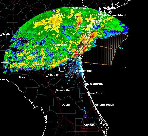 At 350 pm edt, severe thunderstorms were located along a line extending from eulonia to near little saint simons island to jekyll island, moving northeast at 55 mph (radar indicated). Hazards include 60 mph wind gusts and quarter size hail. Minor hail damage to vehicles is possible. expect wind damage to trees and powerlines. locations impacted include, darien, wolf island, st. catherines island, eulonia, valona, little saint simons island, meridian, townsend, crescent, carnigan, shellman bluff, pine harbor, blackbeard island, sapelo island and ridgeville. This warning includes i-95 in georgia between mile markers 50 and 63. At 350 pm edt, severe thunderstorms were located along a line extending from eulonia to near little saint simons island to jekyll island, moving northeast at 55 mph (radar indicated). Hazards include 60 mph wind gusts and quarter size hail. Minor hail damage to vehicles is possible. expect wind damage to trees and powerlines. locations impacted include, darien, wolf island, st. catherines island, eulonia, valona, little saint simons island, meridian, townsend, crescent, carnigan, shellman bluff, pine harbor, blackbeard island, sapelo island and ridgeville. This warning includes i-95 in georgia between mile markers 50 and 63.
|
| 4/23/2020 3:43 PM EDT |
 The tornado warning for mcintosh county will expire at 345 pm edt, the tornado threat has diminished and the tornado warning has been allowed to expire. however, large hail and damaging winds remain likely and a severe thunderstorm warning remains in effect for the area. remember, a severe thunderstorm warning still remains in effect for for mcintosh county until 430 pm. The tornado warning for mcintosh county will expire at 345 pm edt, the tornado threat has diminished and the tornado warning has been allowed to expire. however, large hail and damaging winds remain likely and a severe thunderstorm warning remains in effect for the area. remember, a severe thunderstorm warning still remains in effect for for mcintosh county until 430 pm.
|
| 4/23/2020 3:38 PM EDT |
 At 337 pm edt, a confirmed large and extremely dangerous tornado was located along a line extending from near thalmann to near woodbine, moving east at 50 mph. this is a particularly dangerous situation. take cover now! (radar confirmed tornado. at 335 pm a tornado was confirmed on the ground in camden county along i-95 near mile marker 22.). Hazards include damaging tornado. You are in a life-threatening situation. flying debris may be deadly to those caught without shelter. mobile homes will be destroyed. considerable damage to homes, businesses, and vehicles is likely and complete destruction is possible. these tornadic storms will be near, brunswick and dock junction around 345 pm edt. st. simons island and country club estates around 350 pm edt. jekyll island around 355 pm edt. Other locations impacted by these tornadic storms include dover bluff and boys estate. At 337 pm edt, a confirmed large and extremely dangerous tornado was located along a line extending from near thalmann to near woodbine, moving east at 50 mph. this is a particularly dangerous situation. take cover now! (radar confirmed tornado. at 335 pm a tornado was confirmed on the ground in camden county along i-95 near mile marker 22.). Hazards include damaging tornado. You are in a life-threatening situation. flying debris may be deadly to those caught without shelter. mobile homes will be destroyed. considerable damage to homes, businesses, and vehicles is likely and complete destruction is possible. these tornadic storms will be near, brunswick and dock junction around 345 pm edt. st. simons island and country club estates around 350 pm edt. jekyll island around 355 pm edt. Other locations impacted by these tornadic storms include dover bluff and boys estate.
|
| 4/23/2020 3:37 PM EDT |
 At 337 pm edt, severe thunderstorms were located along a line extending from everett to near country club estates to near woodbine, moving northeast at 55 mph (radar indicated). Hazards include 70 mph wind gusts and half dollar size hail. Minor hail damage to vehicles is possible. expect considerable tree damage. Wind damage is also likely to mobile homes, roofs, and outbuildings. At 337 pm edt, severe thunderstorms were located along a line extending from everett to near country club estates to near woodbine, moving northeast at 55 mph (radar indicated). Hazards include 70 mph wind gusts and half dollar size hail. Minor hail damage to vehicles is possible. expect considerable tree damage. Wind damage is also likely to mobile homes, roofs, and outbuildings.
|
| 4/23/2020 3:35 PM EDT |
 At 334 pm edt, severe thunderstorms capable of producing tornadoes were located along a line extending from near thalmann to near woodbine, moving east at 55 mph (radar indicated rotation). Hazards include tornado and golf ball size hail. Flying debris will be dangerous to those caught without shelter. mobile homes will be damaged or destroyed. damage to roofs, windows, and vehicles will occur. tree damage is likely. these dangerous storms will be near, dock junction and country club estates around 345 pm edt. st. simons island around 350 pm edt. brunswick and jekyll island around 355 pm edt. sea island around 400 pm edt. Other locations impacted by these tornadic storms include dover bluff and boys estate. At 334 pm edt, severe thunderstorms capable of producing tornadoes were located along a line extending from near thalmann to near woodbine, moving east at 55 mph (radar indicated rotation). Hazards include tornado and golf ball size hail. Flying debris will be dangerous to those caught without shelter. mobile homes will be damaged or destroyed. damage to roofs, windows, and vehicles will occur. tree damage is likely. these dangerous storms will be near, dock junction and country club estates around 345 pm edt. st. simons island around 350 pm edt. brunswick and jekyll island around 355 pm edt. sea island around 400 pm edt. Other locations impacted by these tornadic storms include dover bluff and boys estate.
|
| 4/23/2020 3:28 PM EDT |
 At 328 pm edt, a large and extremely dangerous tornado was located over wolf island, moving east at 40 mph. this is a particularly dangerous situation. take cover now! (radar indicated rotation). Hazards include damaging tornado. You are in a life-threatening situation. flying debris may be deadly to those caught without shelter. mobile homes will be destroyed. considerable damage to homes, businesses, and vehicles is likely and complete destruction is possible. Locations impacted include, sapelo island, little saint simons island, wolf island, meridian and carnigan. At 328 pm edt, a large and extremely dangerous tornado was located over wolf island, moving east at 40 mph. this is a particularly dangerous situation. take cover now! (radar indicated rotation). Hazards include damaging tornado. You are in a life-threatening situation. flying debris may be deadly to those caught without shelter. mobile homes will be destroyed. considerable damage to homes, businesses, and vehicles is likely and complete destruction is possible. Locations impacted include, sapelo island, little saint simons island, wolf island, meridian and carnigan.
|
| 4/23/2020 3:23 PM EDT | Quarter sized hail reported 7.5 miles S of Darien, GA, broadcast media relayed a report of at least quarter size hail near the intersection of highway 17 and smith road. |
| 4/23/2020 3:21 PM EDT |
 At 321 pm edt, a severe thunderstorm capable of producing a tornado was located near woodbine, moving east at 50 mph (radar indicated rotation). Hazards include tornado and golf ball size hail. Flying debris will be dangerous to those caught without shelter. mobile homes will be damaged or destroyed. damage to roofs, windows, and vehicles will occur. tree damage is likely. this dangerous storm will be near, woodbine around 325 pm edt. waverly around 330 pm edt. jekyll island around 350 pm edt. Other locations impacted by this tornadic thunderstorm include tarboro, boys estate, dover bluff and atkinson. At 321 pm edt, a severe thunderstorm capable of producing a tornado was located near woodbine, moving east at 50 mph (radar indicated rotation). Hazards include tornado and golf ball size hail. Flying debris will be dangerous to those caught without shelter. mobile homes will be damaged or destroyed. damage to roofs, windows, and vehicles will occur. tree damage is likely. this dangerous storm will be near, woodbine around 325 pm edt. waverly around 330 pm edt. jekyll island around 350 pm edt. Other locations impacted by this tornadic thunderstorm include tarboro, boys estate, dover bluff and atkinson.
|
| 4/23/2020 3:20 PM EDT | Quarter sized hail reported 1.4 miles S of Darien, GA, a 911 call center reported quarter-sized hail. |
| 4/23/2020 3:16 PM EDT |
 At 314 pm edt, a large and extremely dangerous tornado was located just southwest of darien, moving east at 45 mph. this is a particularly dangerous situation. take cover now! (radar indicated rotation. at glynn county emergency management reported a tornado east of waynesville). Hazards include damaging tornado. You are in a life-threatening situation. flying debris may be deadly to those caught without shelter. mobile homes will be destroyed. considerable damage to homes, businesses, and vehicles is likely and complete destruction is possible. locations impacted include, darien, wolf island, carnigan, sapelo island, little saint simons island, ridgeville and meridian. This warning includes i-95 in georgia between mile markers 50 and 52. At 314 pm edt, a large and extremely dangerous tornado was located just southwest of darien, moving east at 45 mph. this is a particularly dangerous situation. take cover now! (radar indicated rotation. at glynn county emergency management reported a tornado east of waynesville). Hazards include damaging tornado. You are in a life-threatening situation. flying debris may be deadly to those caught without shelter. mobile homes will be destroyed. considerable damage to homes, businesses, and vehicles is likely and complete destruction is possible. locations impacted include, darien, wolf island, carnigan, sapelo island, little saint simons island, ridgeville and meridian. This warning includes i-95 in georgia between mile markers 50 and 52.
|
| 4/23/2020 2:59 PM EDT |
 At 259 pm edt, a confirmed large and extremely dangerous tornado was located over thalmann, moving east at 50 mph. this is a particularly dangerous situation. take cover now! (radar confirmed tornado). Hazards include damaging tornado. You are in a life-threatening situation. flying debris may be deadly to those caught without shelter. mobile homes will be destroyed. Considerable damage to homes, businesses, and vehicles is likely and complete destruction is possible. At 259 pm edt, a confirmed large and extremely dangerous tornado was located over thalmann, moving east at 50 mph. this is a particularly dangerous situation. take cover now! (radar confirmed tornado). Hazards include damaging tornado. You are in a life-threatening situation. flying debris may be deadly to those caught without shelter. mobile homes will be destroyed. Considerable damage to homes, businesses, and vehicles is likely and complete destruction is possible.
|
| 4/23/2020 2:45 PM EDT |
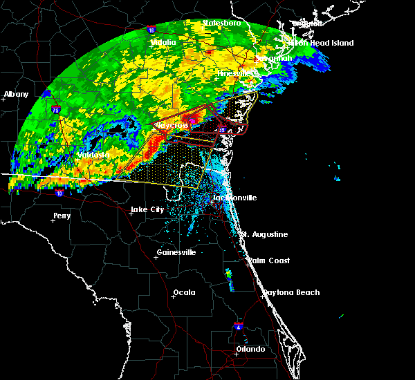 At 245 pm edt, a confirmed large and extremely dangerous tornado was located near waynesville, or 10 miles northeast of nahunta, moving east at 50 mph. this is a particularly dangerous situation. take cover now! (radar confirmed tornado). Hazards include damaging tornado. You are in a life-threatening situation. flying debris may be deadly to those caught without shelter. mobile homes will be destroyed. considerable damage to homes, businesses, and vehicles is likely and complete destruction is possible. the tornado will be near, thalmann around 255 pm edt. everett around 300 pm edt. Other locations impacted by this tornadic thunderstorm include atkinson, mount pleasant and boys estate. At 245 pm edt, a confirmed large and extremely dangerous tornado was located near waynesville, or 10 miles northeast of nahunta, moving east at 50 mph. this is a particularly dangerous situation. take cover now! (radar confirmed tornado). Hazards include damaging tornado. You are in a life-threatening situation. flying debris may be deadly to those caught without shelter. mobile homes will be destroyed. considerable damage to homes, businesses, and vehicles is likely and complete destruction is possible. the tornado will be near, thalmann around 255 pm edt. everett around 300 pm edt. Other locations impacted by this tornadic thunderstorm include atkinson, mount pleasant and boys estate.
|
| 4/23/2020 2:40 PM EDT |
 At 239 pm edt, a severe thunderstorm was located over raybon, moving east at 50 mph (radar indicated. this storm has a history of producing very lage hail and tornadoes). Hazards include golf ball size hail and 70 mph wind gusts. People and animals outdoors will be injured. expect hail damage to roofs, siding, windows, and vehicles. expect considerable tree damage. Wind damage is also likely to mobile homes, roofs, and outbuildings. At 239 pm edt, a severe thunderstorm was located over raybon, moving east at 50 mph (radar indicated. this storm has a history of producing very lage hail and tornadoes). Hazards include golf ball size hail and 70 mph wind gusts. People and animals outdoors will be injured. expect hail damage to roofs, siding, windows, and vehicles. expect considerable tree damage. Wind damage is also likely to mobile homes, roofs, and outbuildings.
|
| 4/20/2020 6:05 AM EDT |
 The severe thunderstorm warning for mcintosh county will expire at 615 am edt, the storms which prompted the warning have moved out of the area. therefore the warning will be allowed to expire. The severe thunderstorm warning for mcintosh county will expire at 615 am edt, the storms which prompted the warning have moved out of the area. therefore the warning will be allowed to expire.
|
| 4/20/2020 5:41 AM EDT |
 At 540 am edt, severe thunderstorms were located along a line extending from near tybee island to 8 miles east of blackbeard island, moving east at 60 mph (radar indicated). Hazards include 60 mph wind gusts and quarter size hail. Minor hail damage to vehicles is possible. expect wind damage to trees and powerlines. locations impacted include, darien, wolf island, crescent, carnigan, blackbeard island, valona, sapelo island, little saint simons island, meridian and ridgeville. This warning includes i-95 in georgia between mile markers 47 and 54. At 540 am edt, severe thunderstorms were located along a line extending from near tybee island to 8 miles east of blackbeard island, moving east at 60 mph (radar indicated). Hazards include 60 mph wind gusts and quarter size hail. Minor hail damage to vehicles is possible. expect wind damage to trees and powerlines. locations impacted include, darien, wolf island, crescent, carnigan, blackbeard island, valona, sapelo island, little saint simons island, meridian and ridgeville. This warning includes i-95 in georgia between mile markers 47 and 54.
|
| 4/20/2020 5:34 AM EDT |
 At 533 am edt, severe thunderstorms were located along a line extending from near ridgeville to near waverly to 7 miles north of homeland, moving east at 55 mph (radar indicated). Hazards include 60 mph wind gusts and penny size hail. expect damage to roofs, siding, and trees At 533 am edt, severe thunderstorms were located along a line extending from near ridgeville to near waverly to 7 miles north of homeland, moving east at 55 mph (radar indicated). Hazards include 60 mph wind gusts and penny size hail. expect damage to roofs, siding, and trees
|
| 4/20/2020 5:15 AM EDT |
 At 515 am edt, severe thunderstorms were located along a line extending from near keller to near darien, moving east at 60 mph (radar indicated). Hazards include 60 mph wind gusts and quarter size hail. Minor hail damage to vehicles is possible. Expect wind damage to trees and powerlines. At 515 am edt, severe thunderstorms were located along a line extending from near keller to near darien, moving east at 60 mph (radar indicated). Hazards include 60 mph wind gusts and quarter size hail. Minor hail damage to vehicles is possible. Expect wind damage to trees and powerlines.
|
| 4/20/2020 4:12 AM EDT |
 The severe thunderstorm warning for northwestern camden, glynn, pierce, brantley, northeastern ware, southeastern bacon, wayne, southeastern appling and northeastern charlton counties will expire at 415 am edt, the storm which prompted the warning has moved out of the area. therefore, the warning will be allowed to expire. a tornado watch remains in effect until 1100 am edt for southeastern georgia. The severe thunderstorm warning for northwestern camden, glynn, pierce, brantley, northeastern ware, southeastern bacon, wayne, southeastern appling and northeastern charlton counties will expire at 415 am edt, the storm which prompted the warning has moved out of the area. therefore, the warning will be allowed to expire. a tornado watch remains in effect until 1100 am edt for southeastern georgia.
|
| 4/20/2020 3:35 AM EDT |
 At 334 am edt, a severe thunderstorm was located near thalmann, or 14 miles south of gardi, moving northeast at 90 mph (radar indicated). Hazards include 60 mph wind gusts and quarter size hail. Hail damage to vehicles is expected. Expect wind damage to roofs, siding, and trees. At 334 am edt, a severe thunderstorm was located near thalmann, or 14 miles south of gardi, moving northeast at 90 mph (radar indicated). Hazards include 60 mph wind gusts and quarter size hail. Hail damage to vehicles is expected. Expect wind damage to roofs, siding, and trees.
|
| 4/13/2020 9:29 AM EDT |
 At 929 am edt, severe thunderstorms were located along a line extending from near jekyll island to 9 miles east of fargo, moving east at 60 mph (radar indicated). Hazards include 70 mph wind gusts and quarter size hail. Hail damage to vehicles is expected. expect considerable tree damage. wind damage is also likely to mobile homes, roofs, and outbuildings. locations impacted include, st. marys, kingsland, brunswick, st. Simons island, hilliard, folkston, woodbine, fargo, statenville and dock junction. At 929 am edt, severe thunderstorms were located along a line extending from near jekyll island to 9 miles east of fargo, moving east at 60 mph (radar indicated). Hazards include 70 mph wind gusts and quarter size hail. Hail damage to vehicles is expected. expect considerable tree damage. wind damage is also likely to mobile homes, roofs, and outbuildings. locations impacted include, st. marys, kingsland, brunswick, st. Simons island, hilliard, folkston, woodbine, fargo, statenville and dock junction.
|
| 4/13/2020 9:12 AM EDT |
 The severe thunderstorm warning for liberty and mcintosh counties will expire at 915 am edt, the storms which prompted the warning have moved out of the area. therefore the warning will be allowed to expire. however gusty winds are still possible with these thunderstorms. The severe thunderstorm warning for liberty and mcintosh counties will expire at 915 am edt, the storms which prompted the warning have moved out of the area. therefore the warning will be allowed to expire. however gusty winds are still possible with these thunderstorms.
|
| 4/13/2020 9:08 AM EDT |
 At 908 am edt, severe thunderstorms were located along a line extending from 6 miles west of woodbine to near needmore, moving east at 60 mph (radar indicated). Hazards include 70 mph wind gusts and quarter size hail. Hail damage to vehicles is expected. expect considerable tree damage. Wind damage is also likely to mobile homes, roofs, and outbuildings. At 908 am edt, severe thunderstorms were located along a line extending from 6 miles west of woodbine to near needmore, moving east at 60 mph (radar indicated). Hazards include 70 mph wind gusts and quarter size hail. Hail damage to vehicles is expected. expect considerable tree damage. Wind damage is also likely to mobile homes, roofs, and outbuildings.
|
| 4/13/2020 8:58 AM EDT |
 At 857 am edt, severe thunderstorms were located along a line extending from 21 miles southeast of edisto beach to 23 miles southeast of wassaw island, moving east at 50 mph (trained weather spotters). Hazards include 70 mph wind gusts and penny size hail. Expect considerable tree damage. damage is likely to mobile homes, roofs, and outbuildings. locations impacted include, darien, wolf island, harris neck, st. catherines island, eulonia, valona, little saint simons island, south newport, cox, meridian, townsend, crescent, carnigan, shellman bluff and pine harbor. This warning includes i-95 in georgia between mile markers 50 and 68. At 857 am edt, severe thunderstorms were located along a line extending from 21 miles southeast of edisto beach to 23 miles southeast of wassaw island, moving east at 50 mph (trained weather spotters). Hazards include 70 mph wind gusts and penny size hail. Expect considerable tree damage. damage is likely to mobile homes, roofs, and outbuildings. locations impacted include, darien, wolf island, harris neck, st. catherines island, eulonia, valona, little saint simons island, south newport, cox, meridian, townsend, crescent, carnigan, shellman bluff and pine harbor. This warning includes i-95 in georgia between mile markers 50 and 68.
|
| 4/13/2020 8:47 AM EDT |
 At 846 am edt, severe thunderstorms were located along a line extending from 15 miles southeast of edisto beach to 17 miles east of st. catherines island, moving east at 50 mph (trained weather spotters). Hazards include 70 mph wind gusts and penny size hail. Expect considerable tree damage. damage is likely to mobile homes, roofs, and outbuildings. locations impacted include, hilton head island, tybee island, darien, wilmington island, fort pulaski national monument, coffee bluff, midtown savannah, jones, montgomery, harris neck, eulonia, valona, south newport, isle of hope and sunbury. This warning includes i-95 in georgia between mile markers 50 and 73. At 846 am edt, severe thunderstorms were located along a line extending from 15 miles southeast of edisto beach to 17 miles east of st. catherines island, moving east at 50 mph (trained weather spotters). Hazards include 70 mph wind gusts and penny size hail. Expect considerable tree damage. damage is likely to mobile homes, roofs, and outbuildings. locations impacted include, hilton head island, tybee island, darien, wilmington island, fort pulaski national monument, coffee bluff, midtown savannah, jones, montgomery, harris neck, eulonia, valona, south newport, isle of hope and sunbury. This warning includes i-95 in georgia between mile markers 50 and 73.
|
| 4/13/2020 8:44 AM EDT |
 At 843 am edt, severe thunderstorms were located along a line extending from 8 miles southeast of hickox to 7 miles northeast of fargo, moving east at 50 mph (radar indicated). Hazards include 60 mph wind gusts. expect damage to roofs, siding, and trees At 843 am edt, severe thunderstorms were located along a line extending from 8 miles southeast of hickox to 7 miles northeast of fargo, moving east at 50 mph (radar indicated). Hazards include 60 mph wind gusts. expect damage to roofs, siding, and trees
|
| 4/13/2020 8:15 AM EDT |
 At 815 am edt, severe thunderstorms were located along a line extending from near cox to near everett to 6 miles northwest of waynesville, moving east at 55 mph (radar indicated). Hazards include 60 mph wind gusts. expect damage to roofs, siding, and trees At 815 am edt, severe thunderstorms were located along a line extending from near cox to near everett to 6 miles northwest of waynesville, moving east at 55 mph (radar indicated). Hazards include 60 mph wind gusts. expect damage to roofs, siding, and trees
|
| 4/13/2020 8:13 AM EDT |
 At 812 am edt, severe thunderstorms were located along a line extending from near hilton head airport to shellman bluff, moving east at 50 mph (trained weather spotters). Hazards include 70 mph wind gusts and penny size hail. Expect considerable tree damage. Damage is likely to mobile homes, roofs, and outbuildings. At 812 am edt, severe thunderstorms were located along a line extending from near hilton head airport to shellman bluff, moving east at 50 mph (trained weather spotters). Hazards include 70 mph wind gusts and penny size hail. Expect considerable tree damage. Damage is likely to mobile homes, roofs, and outbuildings.
|
| 4/13/2020 8:02 AM EDT | Multiple trees were reported down along i-95. time is estimated by rada in mcintosh county GA, 9.7 miles S of Darien, GA |
| 4/13/2020 7:15 AM EDT |
 At 714 am edt, severe thunderstorms were located along a line extending from blitchton to near odum, moving east at 40 mph (radar indicated). Hazards include 70 mph wind gusts and penny size hail. Expect considerable tree damage. Damage is likely to mobile homes, roofs, and outbuildings. At 714 am edt, severe thunderstorms were located along a line extending from blitchton to near odum, moving east at 40 mph (radar indicated). Hazards include 70 mph wind gusts and penny size hail. Expect considerable tree damage. Damage is likely to mobile homes, roofs, and outbuildings.
|
| 3/5/2020 4:10 PM EST |
 At 410 pm est, a severe thunderstorm was located near waverly, or 11 miles northwest of woodbine, moving east at 55 mph (radar indicated). Hazards include 60 mph wind gusts. expect damage to roofs, siding, and trees At 410 pm est, a severe thunderstorm was located near waverly, or 11 miles northwest of woodbine, moving east at 55 mph (radar indicated). Hazards include 60 mph wind gusts. expect damage to roofs, siding, and trees
|
| 3/4/2020 12:06 PM EST |
 At 1206 pm est, a severe thunderstorm capable of producing a tornado was located over crescent, moving east at 50 mph (radar indicated rotation). Hazards include tornado. Flying debris will be dangerous to those caught without shelter. mobile homes will be damaged or destroyed. damage to roofs, windows, and vehicles will occur. tree damage is likely. locations impacted include, crescent, harris neck, carnigan, shellman bluff, eulonia, pine harbor, blackbeard island, valona, sapelo island, south newport, meridian and ridgeville. This warning includes i-95 in georgia between mile markers 52 and 67. At 1206 pm est, a severe thunderstorm capable of producing a tornado was located over crescent, moving east at 50 mph (radar indicated rotation). Hazards include tornado. Flying debris will be dangerous to those caught without shelter. mobile homes will be damaged or destroyed. damage to roofs, windows, and vehicles will occur. tree damage is likely. locations impacted include, crescent, harris neck, carnigan, shellman bluff, eulonia, pine harbor, blackbeard island, valona, sapelo island, south newport, meridian and ridgeville. This warning includes i-95 in georgia between mile markers 52 and 67.
|
| 3/4/2020 11:51 AM EST |
 At 1151 am est, a severe thunderstorm capable of producing a tornado was located over cox, moving east at 30 mph (radar indicated rotation). Hazards include tornado. Flying debris will be dangerous to those caught without shelter. mobile homes will be damaged or destroyed. damage to roofs, windows, and vehicles will occur. Tree damage is likely. At 1151 am est, a severe thunderstorm capable of producing a tornado was located over cox, moving east at 30 mph (radar indicated rotation). Hazards include tornado. Flying debris will be dangerous to those caught without shelter. mobile homes will be damaged or destroyed. damage to roofs, windows, and vehicles will occur. Tree damage is likely.
|
| 2/6/2020 10:40 PM EST |
 The severe thunderstorm warning for northeastern nassau, southeastern camden and southeastern glynn counties will expire at 1045 pm est, the storms which prompted the warning have moved out of the area. therefore, the warning will be allowed to expire. a tornado watch remains in effect until midnight est for northeastern florida, and southeastern georgia. The severe thunderstorm warning for northeastern nassau, southeastern camden and southeastern glynn counties will expire at 1045 pm est, the storms which prompted the warning have moved out of the area. therefore, the warning will be allowed to expire. a tornado watch remains in effect until midnight est for northeastern florida, and southeastern georgia.
|
| 2/6/2020 10:31 PM EST |
 At 1031 pm est, severe thunderstorms were located along a line extending from st. simons island to kings bay base, moving northeast at 50 mph (radar indicated). Hazards include 70 mph wind gusts. Expect considerable tree damage. damage is likely to mobile homes, roofs, and outbuildings. locations impacted include, st. marys, brunswick, st. Simons island, fernandina beach, kings bay base, yulee, sea island, jekyll island, country club estates and cumberland island. At 1031 pm est, severe thunderstorms were located along a line extending from st. simons island to kings bay base, moving northeast at 50 mph (radar indicated). Hazards include 70 mph wind gusts. Expect considerable tree damage. damage is likely to mobile homes, roofs, and outbuildings. locations impacted include, st. marys, brunswick, st. Simons island, fernandina beach, kings bay base, yulee, sea island, jekyll island, country club estates and cumberland island.
|
| 2/6/2020 9:54 PM EST |
 At 954 pm est, severe thunderstorms were located along a line extending from 7 miles southwest of waverly to 6 miles southwest of hilliard, moving northeast at 50 mph (radar indicated). Hazards include 70 mph wind gusts. Expect considerable tree damage. Damage is likely to mobile homes, roofs, and outbuildings. At 954 pm est, severe thunderstorms were located along a line extending from 7 miles southwest of waverly to 6 miles southwest of hilliard, moving northeast at 50 mph (radar indicated). Hazards include 70 mph wind gusts. Expect considerable tree damage. Damage is likely to mobile homes, roofs, and outbuildings.
|
| 2/6/2020 9:48 PM EST |
 At 947 pm est, a severe thunderstorm was located near everett, or 8 miles west of darien, moving northeast at 60 mph (radar indicated). Hazards include 60 mph wind gusts. Expect damage to roofs, siding, and trees. Locations impacted include, everett, waynesville, thalmann, atkinson and boys estate. At 947 pm est, a severe thunderstorm was located near everett, or 8 miles west of darien, moving northeast at 60 mph (radar indicated). Hazards include 60 mph wind gusts. Expect damage to roofs, siding, and trees. Locations impacted include, everett, waynesville, thalmann, atkinson and boys estate.
|
| 2/6/2020 9:18 PM EST |
 At 918 pm est, a severe thunderstorm was located near hickox, or 7 miles southwest of nahunta, moving northeast at 60 mph (radar indicated). Hazards include 60 mph wind gusts. expect damage to roofs, siding, and trees At 918 pm est, a severe thunderstorm was located near hickox, or 7 miles southwest of nahunta, moving northeast at 60 mph (radar indicated). Hazards include 60 mph wind gusts. expect damage to roofs, siding, and trees
|
| 12/17/2019 4:21 PM EST |
 The severe thunderstorm warning for northwestern camden and glynn counties will expire at 430 pm est, the storms which prompted the warning have moved out of the area. therefore, the warning will be allowed to expire. a tornado watch remains in effect until 700 pm est for southeastern georgia. The severe thunderstorm warning for northwestern camden and glynn counties will expire at 430 pm est, the storms which prompted the warning have moved out of the area. therefore, the warning will be allowed to expire. a tornado watch remains in effect until 700 pm est for southeastern georgia.
|
| 12/17/2019 4:00 PM EST |
 At 400 pm est, severe thunderstorms were located along a line extending from near thalmann to 10 miles south of hickox to 12 miles south of stephen foster state park, moving northeast at 45 mph (radar indicated). Hazards include 60 mph wind gusts. Expect damage to roofs, siding, and trees. Locations impacted include, dock junction, everett, waverly, thalmann, tarboro and boys estate. At 400 pm est, severe thunderstorms were located along a line extending from near thalmann to 10 miles south of hickox to 12 miles south of stephen foster state park, moving northeast at 45 mph (radar indicated). Hazards include 60 mph wind gusts. Expect damage to roofs, siding, and trees. Locations impacted include, dock junction, everett, waverly, thalmann, tarboro and boys estate.
|
| 12/17/2019 3:39 PM EST |
 At 339 pm est, severe thunderstorms were located along a line extending from near waynesville to near race pond to 11 miles southeast of fargo, moving northeast at 45 mph (radar indicated). Hazards include 60 mph wind gusts. expect damage to roofs, siding, and trees At 339 pm est, severe thunderstorms were located along a line extending from near waynesville to near race pond to 11 miles southeast of fargo, moving northeast at 45 mph (radar indicated). Hazards include 60 mph wind gusts. expect damage to roofs, siding, and trees
|
| 8/4/2019 5:54 PM EDT |
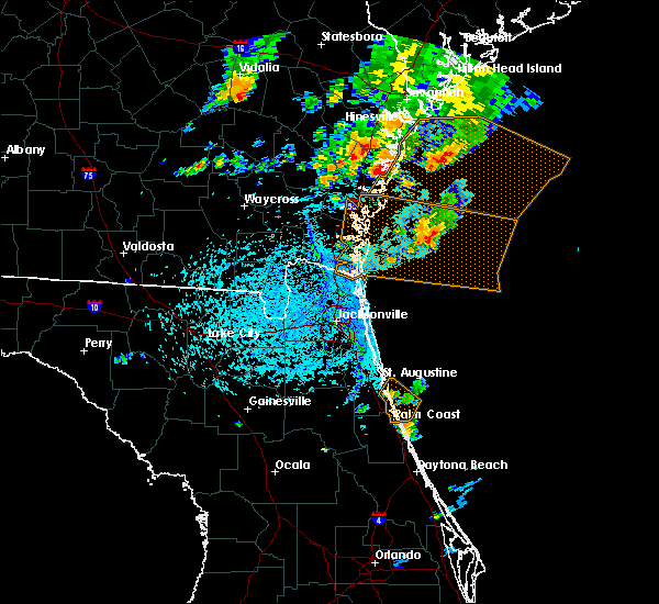 At 553 pm edt, a severe thunderstorm was located 10 miles northeast of darien, moving east at 20 mph (radar indicated). Hazards include 60 mph wind gusts. expect damage to trees and powerlines At 553 pm edt, a severe thunderstorm was located 10 miles northeast of darien, moving east at 20 mph (radar indicated). Hazards include 60 mph wind gusts. expect damage to trees and powerlines
|
| 7/18/2019 7:04 PM EDT | A tree was reported down on hwy 251 and hwy 57. time is estimated by radar dat in mcintosh county GA, 14.1 miles SSE of Darien, GA |
| 7/18/2019 5:50 PM EDT | *** 6 inj *** the military police relayed a report that a tent was blown over during a training exercise resulting in six minor injuries. it occurred near evans army ai in mcintosh county GA, 14.1 miles SSE of Darien, GA |
| 6/22/2019 4:39 PM EDT |
 At 403 pm edt, severe thunderstorms were located along a line extending from 15 miles east of tibet to near darien, moving east at 30 mph (radar indicated). Hazards include 60 mph wind gusts. Expect damage to trees and powerlines. locations impacted include, darien, wolf island, harris neck, eulonia, valona, little saint simons island, cox and meridian. This warning includes i-95 in georgia between mile markers 50 and 66. At 403 pm edt, severe thunderstorms were located along a line extending from 15 miles east of tibet to near darien, moving east at 30 mph (radar indicated). Hazards include 60 mph wind gusts. Expect damage to trees and powerlines. locations impacted include, darien, wolf island, harris neck, eulonia, valona, little saint simons island, cox and meridian. This warning includes i-95 in georgia between mile markers 50 and 66.
|
| 6/22/2019 4:03 PM EDT |
 At 403 pm edt, severe thunderstorms were located along a line extending from 15 miles east of tibet to near darien, moving east at 30 mph (radar indicated). Hazards include 60 mph wind gusts. Expect damage to trees and powerlines. locations impacted include, darien, wolf island, harris neck, eulonia, valona, little saint simons island, cox and meridian. This warning includes i-95 in georgia between mile markers 50 and 66. At 403 pm edt, severe thunderstorms were located along a line extending from 15 miles east of tibet to near darien, moving east at 30 mph (radar indicated). Hazards include 60 mph wind gusts. Expect damage to trees and powerlines. locations impacted include, darien, wolf island, harris neck, eulonia, valona, little saint simons island, cox and meridian. This warning includes i-95 in georgia between mile markers 50 and 66.
|
| 6/22/2019 3:54 PM EDT | The county warning point reports a tree down on powerlines on east 4th street. time estimated based on rada in mcintosh county GA, 0.8 miles SW of Darien, GA |
| 6/22/2019 3:41 PM EDT |
 At 340 pm edt, severe thunderstorms were located along a line extending from 9 miles south of tibet to near darien, moving east at 40 mph (radar indicated). Hazards include 60 mph wind gusts. expect damage to trees and powerlines At 340 pm edt, severe thunderstorms were located along a line extending from 9 miles south of tibet to near darien, moving east at 40 mph (radar indicated). Hazards include 60 mph wind gusts. expect damage to trees and powerlines
|
| 5/12/2019 3:57 PM EDT |
 At 357 pm edt, a severe thunderstorm was located over everett, or 11 miles west of darien, moving northeast at 20 to 25 mph (radar indicated). Hazards include 60 mph wind gusts and penny size hail. Expect damage to roofs, siding, and trees. Locations impacted include, everett, thalmann, boys estate and mount pleasant. At 357 pm edt, a severe thunderstorm was located over everett, or 11 miles west of darien, moving northeast at 20 to 25 mph (radar indicated). Hazards include 60 mph wind gusts and penny size hail. Expect damage to roofs, siding, and trees. Locations impacted include, everett, thalmann, boys estate and mount pleasant.
|
| 5/12/2019 3:39 PM EDT |
 At 338 pm edt, a severe thunderstorm was located near thalmann, or 14 miles northwest of dock junction, moving east at 30 mph (radar indicated). Hazards include 60 mph wind gusts. expect damage to roofs, siding, and trees At 338 pm edt, a severe thunderstorm was located near thalmann, or 14 miles northwest of dock junction, moving east at 30 mph (radar indicated). Hazards include 60 mph wind gusts. expect damage to roofs, siding, and trees
|
| 4/19/2019 1:01 PM EDT |
 At 100 pm edt, severe thunderstorms were located along a line extending from 6 miles east of springfield to 7 miles south of savannah to 10 miles east of darien, moving northeast at 45 mph (radar indicated. these thunderstorms are producing wind damage). Hazards include 70 mph wind gusts. Expect considerable tree damage. damage is likely to mobile homes, roofs, and outbuildings. locations impacted include, savannah, pooler, richmond hill, springfield, darien, wilmington island, fort pulaski national monument and i-16/i-95 interchange. this warning includes, i-16 between mile markers 152 and 168. i-516 between mile markers 3 and 9. I-95 in georgia between mile markers 59 and 112. At 100 pm edt, severe thunderstorms were located along a line extending from 6 miles east of springfield to 7 miles south of savannah to 10 miles east of darien, moving northeast at 45 mph (radar indicated. these thunderstorms are producing wind damage). Hazards include 70 mph wind gusts. Expect considerable tree damage. damage is likely to mobile homes, roofs, and outbuildings. locations impacted include, savannah, pooler, richmond hill, springfield, darien, wilmington island, fort pulaski national monument and i-16/i-95 interchange. this warning includes, i-16 between mile markers 152 and 168. i-516 between mile markers 3 and 9. I-95 in georgia between mile markers 59 and 112.
|
| 4/19/2019 1:00 PM EDT | Sapelo island nerrs station gusted to 62 mp in mcintosh county GA, 9.5 miles WSW of Darien, GA |
| 4/19/2019 12:54 PM EDT | The nerrs site on sapelo island measured a 62 mph wind gus in mcintosh county GA, 9.5 miles WSW of Darien, GA |
| 4/19/2019 12:43 PM EDT |
 At 1243 pm edt, severe thunderstorms were located along a line extending from 8 miles southwest of springfield to near richmond hill to near darien, moving northeast at 45 mph (radar indicated). Hazards include 60 mph wind gusts. Expect damage to trees and powerlines. locations impacted include, savannah, hinesville, pooler, richmond hill, sylvania, springfield, pembroke and darien. this warning includes, i-16 between mile markers 138 and 168. i-516 between mile markers 3 and 9. I-95 in georgia between mile markers 50 and 112. At 1243 pm edt, severe thunderstorms were located along a line extending from 8 miles southwest of springfield to near richmond hill to near darien, moving northeast at 45 mph (radar indicated). Hazards include 60 mph wind gusts. Expect damage to trees and powerlines. locations impacted include, savannah, hinesville, pooler, richmond hill, sylvania, springfield, pembroke and darien. this warning includes, i-16 between mile markers 138 and 168. i-516 between mile markers 3 and 9. I-95 in georgia between mile markers 50 and 112.
|
| 4/19/2019 12:42 PM EDT | The county warning point reports a tree down on rossville roa in mcintosh county GA, 7.7 miles SSW of Darien, GA |
| 4/19/2019 12:41 PM EDT |
 At 1241 pm edt, severe thunderstorms were located along a line extending from near country club estates to 12 miles east of kings bay base to near hollister, moving northeast at 50 mph (radar indicated). Hazards include 70 mph wind gusts. Expect considerable tree damage. damage is likely to mobile homes, roofs, and outbuildings. locations impacted include, jacksonville, st. marys, brunswick, st. Simons island, fernandina beach, orange park, green cove springs, dock junction, arlington and ponte vedra beach. At 1241 pm edt, severe thunderstorms were located along a line extending from near country club estates to 12 miles east of kings bay base to near hollister, moving northeast at 50 mph (radar indicated). Hazards include 70 mph wind gusts. Expect considerable tree damage. damage is likely to mobile homes, roofs, and outbuildings. locations impacted include, jacksonville, st. marys, brunswick, st. Simons island, fernandina beach, orange park, green cove springs, dock junction, arlington and ponte vedra beach.
|
| 4/19/2019 12:33 PM EDT | The county warning point reports a tree down on heron bridge roa in mcintosh county GA, 8.2 miles SE of Darien, GA |
| 4/19/2019 12:27 PM EDT |
 At 1225 pm edt, severe thunderstorms were located along a line extending from near bay to 10 miles east of hinesville to near dock junction, moving northeast at 45 mph (radar indicated). Hazards include 60 mph wind gusts. Expect damage to trees and powerlines. locations impacted include, savannah, hinesville, statesboro, pooler, richmond hill, sylvania, springfield and pembroke. this warning includes, i-16 between mile markers 119 and 168. i-516 between mile markers 3 and 9. I-95 in georgia between mile markers 50 and 112. At 1225 pm edt, severe thunderstorms were located along a line extending from near bay to 10 miles east of hinesville to near dock junction, moving northeast at 45 mph (radar indicated). Hazards include 60 mph wind gusts. Expect damage to trees and powerlines. locations impacted include, savannah, hinesville, statesboro, pooler, richmond hill, sylvania, springfield and pembroke. this warning includes, i-16 between mile markers 119 and 168. i-516 between mile markers 3 and 9. I-95 in georgia between mile markers 50 and 112.
|
| 4/19/2019 12:26 PM EDT |
 At 1226 pm edt, severe thunderstorms were located along a line extending from near everett to 6 miles west of waverly to near keystone heights, moving northeast at 50 mph (radar indicated). Hazards include 70 mph wind gusts. Expect considerable tree damage. Damage is likely to mobile homes, roofs, and outbuildings. At 1226 pm edt, severe thunderstorms were located along a line extending from near everett to 6 miles west of waverly to near keystone heights, moving northeast at 50 mph (radar indicated). Hazards include 70 mph wind gusts. Expect considerable tree damage. Damage is likely to mobile homes, roofs, and outbuildings.
|
| 4/19/2019 12:09 PM EDT |
 At 1208 pm edt, severe thunderstorms were located along a line extending from 6 miles west of pembroke to near tibet to 12 miles east of nahunta, moving northeast at 45 mph (radar indicated). Hazards include 60 mph wind gusts. expect damage to trees and powerlines At 1208 pm edt, severe thunderstorms were located along a line extending from 6 miles west of pembroke to near tibet to 12 miles east of nahunta, moving northeast at 45 mph (radar indicated). Hazards include 60 mph wind gusts. expect damage to trees and powerlines
|
| 4/19/2019 11:33 AM EDT |
 At 1133 am edt, severe thunderstorms were located along a line extending from near fort mudge to near raiford, moving northeast at 55 mph (radar indicated). Hazards include 70 mph wind gusts. Expect considerable tree damage. Damage is likely to mobile homes, roofs, and outbuildings. At 1133 am edt, severe thunderstorms were located along a line extending from near fort mudge to near raiford, moving northeast at 55 mph (radar indicated). Hazards include 70 mph wind gusts. Expect considerable tree damage. Damage is likely to mobile homes, roofs, and outbuildings.
|
| 4/8/2019 6:13 PM EDT |
 At 613 pm edt, severe thunderstorms were located along a line extending from 7 miles southeast of gardi to near everett to near thalmann, moving northeast at 35 mph (radar indicated). Hazards include 60 mph wind gusts. Expect damage to roofs, siding, and trees. Locations impacted include, everett, mount pleasant and boys estate. At 613 pm edt, severe thunderstorms were located along a line extending from 7 miles southeast of gardi to near everett to near thalmann, moving northeast at 35 mph (radar indicated). Hazards include 60 mph wind gusts. Expect damage to roofs, siding, and trees. Locations impacted include, everett, mount pleasant and boys estate.
|
| 4/8/2019 6:05 PM EDT | 911 call center passed on several reports of trees down in eastern wayne count in wayne county GA, 16.1 miles ESE of Darien, GA |
| 4/8/2019 6:00 PM EDT |
 At 600 pm edt, severe thunderstorms were located along a line extending from 6 miles west of everett to near thalmann to 7 miles west of dock junction, moving northeast at 35 mph (radar indicated). Hazards include 60 mph wind gusts. expect damage to roofs, siding, and trees At 600 pm edt, severe thunderstorms were located along a line extending from 6 miles west of everett to near thalmann to 7 miles west of dock junction, moving northeast at 35 mph (radar indicated). Hazards include 60 mph wind gusts. expect damage to roofs, siding, and trees
|
| 4/6/2019 3:49 PM EDT |
 At 349 pm edt, a severe thunderstorm was located over darien, moving southeast at 20 mph (radar indicated). Hazards include 60 mph wind gusts and penny size hail. Expect damage to trees and powerlines. locations impacted include, darien, townsend, wolf island, crescent, carnigan, eulonia, valona and sapelo island. This warning includes i-95 in georgia between mile markers 50 and 61. At 349 pm edt, a severe thunderstorm was located over darien, moving southeast at 20 mph (radar indicated). Hazards include 60 mph wind gusts and penny size hail. Expect damage to trees and powerlines. locations impacted include, darien, townsend, wolf island, crescent, carnigan, eulonia, valona and sapelo island. This warning includes i-95 in georgia between mile markers 50 and 61.
|
| 4/6/2019 3:19 PM EDT |
 At 318 pm edt, a severe thunderstorm was located 8 miles south of tibet, moving southeast at 20 mph (radar indicated). Hazards include 60 mph wind gusts and quarter size hail. Minor hail damage to vehicles is possible. Expect wind damage to trees and powerlines. At 318 pm edt, a severe thunderstorm was located 8 miles south of tibet, moving southeast at 20 mph (radar indicated). Hazards include 60 mph wind gusts and quarter size hail. Minor hail damage to vehicles is possible. Expect wind damage to trees and powerlines.
|
| 12/20/2018 11:42 AM EST |
 At 1140 am est, strong showers and a thunderstorm were located over kings bay base, moving north at 50 mph. this activity is associated with a developing area of low pressure near the coast (radar indicated). Hazards include 60 mph wind gusts. expect damage to roofs, siding, and trees At 1140 am est, strong showers and a thunderstorm were located over kings bay base, moving north at 50 mph. this activity is associated with a developing area of low pressure near the coast (radar indicated). Hazards include 60 mph wind gusts. expect damage to roofs, siding, and trees
|
| 12/1/2018 11:31 PM EST |
 At 1131 pm est, severe thunderstorms were located along a line extending from near little saint simons island to near jekyll island to near homeland, moving east at 45 mph (radar indicated). Hazards include 60 mph wind gusts. expect damage to roofs, siding, and trees At 1131 pm est, severe thunderstorms were located along a line extending from near little saint simons island to near jekyll island to near homeland, moving east at 45 mph (radar indicated). Hazards include 60 mph wind gusts. expect damage to roofs, siding, and trees
|
| 12/1/2018 11:24 PM EST |
 At 1124 pm est, severe thunderstorms were located along a line extending from 7 miles east of blackbeard island to 7 miles east of little saint simons island to near brunswick, moving east at 60 mph (radar indicated). Hazards include 60 mph wind gusts. Expect damage to roofs, siding, and trees. locations impacted include, brunswick, st. Simons island, woodbine, dock junction, country club estates, sea island, jekyll island, boys estate and dover bluff. At 1124 pm est, severe thunderstorms were located along a line extending from 7 miles east of blackbeard island to 7 miles east of little saint simons island to near brunswick, moving east at 60 mph (radar indicated). Hazards include 60 mph wind gusts. Expect damage to roofs, siding, and trees. locations impacted include, brunswick, st. Simons island, woodbine, dock junction, country club estates, sea island, jekyll island, boys estate and dover bluff.
|
| 12/1/2018 10:56 PM EST |
 At 1056 pm est, severe thunderstorms were located along a line extending from near darien to 6 miles northeast of waverly to 10 miles northeast of homeland, moving east at 60 mph (radar indicated). Hazards include 60 mph wind gusts. expect damage to roofs, siding, and trees At 1056 pm est, severe thunderstorms were located along a line extending from near darien to 6 miles northeast of waverly to 10 miles northeast of homeland, moving east at 60 mph (radar indicated). Hazards include 60 mph wind gusts. expect damage to roofs, siding, and trees
|
| 8/13/2018 5:04 PM EDT |
 At 504 pm edt, severe thunderstorms were located along a line extending from 21 miles northeast of darien to 9 miles south of tibet, moving southwest at 15 mph (radar indicated). Hazards include 60 mph wind gusts and penny size hail. Expect damage to trees and powerlines. locations impacted include, harris neck, st. catherines island, eulonia, valona, south newport, cox, meridian and townsend. This warning includes i-95 in georgia between mile markers 50 and 68. At 504 pm edt, severe thunderstorms were located along a line extending from 21 miles northeast of darien to 9 miles south of tibet, moving southwest at 15 mph (radar indicated). Hazards include 60 mph wind gusts and penny size hail. Expect damage to trees and powerlines. locations impacted include, harris neck, st. catherines island, eulonia, valona, south newport, cox, meridian and townsend. This warning includes i-95 in georgia between mile markers 50 and 68.
|
| 8/13/2018 4:43 PM EDT |
 At 443 pm edt, severe thunderstorms were located along a line extending from 21 miles southeast of richmond hill to 8 miles southeast of tibet, moving east at 15 mph (radar indicated). Hazards include 60 mph wind gusts and penny size hail. Expect damage to trees and powerlines. locations impacted include, darien, jones, wolf island, harris neck, st. catherines island, eulonia, valona and little saint simons island. This warning includes i-95 in georgia between mile markers 50 and 70. At 443 pm edt, severe thunderstorms were located along a line extending from 21 miles southeast of richmond hill to 8 miles southeast of tibet, moving east at 15 mph (radar indicated). Hazards include 60 mph wind gusts and penny size hail. Expect damage to trees and powerlines. locations impacted include, darien, jones, wolf island, harris neck, st. catherines island, eulonia, valona and little saint simons island. This warning includes i-95 in georgia between mile markers 50 and 70.
|
| 8/13/2018 4:38 PM EDT |
 At 438 pm edt, severe thunderstorms were located along a line extending from 18 miles southeast of richmond hill to 7 miles southeast of tibet, moving east at 10 mph (radar indicated). Hazards include 60 mph wind gusts and penny size hail. Expect damage to trees and powerlines. locations impacted include, darien, jones, wolf island, harris neck, st. catherines island, eulonia, valona and little saint simons island. This warning includes i-95 in georgia between mile markers 50 and 71. At 438 pm edt, severe thunderstorms were located along a line extending from 18 miles southeast of richmond hill to 7 miles southeast of tibet, moving east at 10 mph (radar indicated). Hazards include 60 mph wind gusts and penny size hail. Expect damage to trees and powerlines. locations impacted include, darien, jones, wolf island, harris neck, st. catherines island, eulonia, valona and little saint simons island. This warning includes i-95 in georgia between mile markers 50 and 71.
|
| 8/13/2018 4:27 PM EDT |
 At 426 pm edt, severe thunderstorms were located along a line extending from 17 miles southeast of richmond hill to near tibet, moving east at 15 mph (radar indicated). Hazards include 60 mph wind gusts and penny size hail. Expect damage to trees and powerlines. locations impacted include, darien, jones, wolf island, harris neck, st. catherines island, eulonia, valona and little saint simons island. This warning includes i-95 in georgia between mile markers 50 and 71. At 426 pm edt, severe thunderstorms were located along a line extending from 17 miles southeast of richmond hill to near tibet, moving east at 15 mph (radar indicated). Hazards include 60 mph wind gusts and penny size hail. Expect damage to trees and powerlines. locations impacted include, darien, jones, wolf island, harris neck, st. catherines island, eulonia, valona and little saint simons island. This warning includes i-95 in georgia between mile markers 50 and 71.
|
| 8/13/2018 4:08 PM EDT |
 At 408 pm edt, severe thunderstorms were located along a line extending from 15 miles southeast of richmond hill to near tibet, moving east at 15 mph (radar indicated). Hazards include 60 mph wind gusts and penny size hail. expect damage to trees and powerlines At 408 pm edt, severe thunderstorms were located along a line extending from 15 miles southeast of richmond hill to near tibet, moving east at 15 mph (radar indicated). Hazards include 60 mph wind gusts and penny size hail. expect damage to trees and powerlines
|
| 7/27/2018 5:57 PM EDT |
 At 557 pm edt, a severe thunderstorm was located near dock junction, moving southeast at 15 mph (radar indicated). Hazards include 60 mph wind gusts and penny size hail. Expect damage to roofs, siding, and trees. locations impacted include, brunswick, st. Simons island, dock junction, country club estates, sea island, jekyll island and boys estate. At 557 pm edt, a severe thunderstorm was located near dock junction, moving southeast at 15 mph (radar indicated). Hazards include 60 mph wind gusts and penny size hail. Expect damage to roofs, siding, and trees. locations impacted include, brunswick, st. Simons island, dock junction, country club estates, sea island, jekyll island and boys estate.
|
| 7/27/2018 5:54 PM EDT |
 The severe thunderstorm warning for mcintosh county will expire at 600 pm edt, the storms which prompted the warning have weakened below severe limits, and no longer pose an immediate threat to life or property. therefore the warning will be allowed to expire. however heavy rain is still possible with these thunderstorms. to report severe weather, contact your nearest law enforcement agency. they will relay your report to the national weather service charleston. The severe thunderstorm warning for mcintosh county will expire at 600 pm edt, the storms which prompted the warning have weakened below severe limits, and no longer pose an immediate threat to life or property. therefore the warning will be allowed to expire. however heavy rain is still possible with these thunderstorms. to report severe weather, contact your nearest law enforcement agency. they will relay your report to the national weather service charleston.
|
| 7/27/2018 5:48 PM EDT |
 At 548 pm edt, severe thunderstorms were located along a line extending from 18 miles north of st. simons island to near darien, moving south at 15 mph (radar indicated). Hazards include 60 mph wind gusts. Expect damage to trees and powerlines. locations impacted include, darien, wolf island, carnigan, blackbeard island, valona, sapelo island, little saint simons island and meridian. This warning includes i-95 in georgia between mile markers 50 and 50. At 548 pm edt, severe thunderstorms were located along a line extending from 18 miles north of st. simons island to near darien, moving south at 15 mph (radar indicated). Hazards include 60 mph wind gusts. Expect damage to trees and powerlines. locations impacted include, darien, wolf island, carnigan, blackbeard island, valona, sapelo island, little saint simons island and meridian. This warning includes i-95 in georgia between mile markers 50 and 50.
|
| 7/27/2018 5:40 PM EDT |
 At 540 pm edt, a severe thunderstorm was located over dock junction, moving southeast at 10 mph (radar indicated). Hazards include 60 mph wind gusts and penny size hail. expect damage to roofs, siding, and trees At 540 pm edt, a severe thunderstorm was located over dock junction, moving southeast at 10 mph (radar indicated). Hazards include 60 mph wind gusts and penny size hail. expect damage to roofs, siding, and trees
|
| 7/27/2018 5:39 PM EDT |
 At 539 pm edt, severe thunderstorms were located along a line extending from 25 miles northeast of st. simons island to near darien, moving south at 15 mph (radar indicated). Hazards include 60 mph wind gusts. Expect damage to trees and powerlines. locations impacted include, darien, wolf island, carnigan, blackbeard island, valona, sapelo island, little saint simons island and meridian. This warning includes i-95 in georgia between mile markers 50 and 51. At 539 pm edt, severe thunderstorms were located along a line extending from 25 miles northeast of st. simons island to near darien, moving south at 15 mph (radar indicated). Hazards include 60 mph wind gusts. Expect damage to trees and powerlines. locations impacted include, darien, wolf island, carnigan, blackbeard island, valona, sapelo island, little saint simons island and meridian. This warning includes i-95 in georgia between mile markers 50 and 51.
|
| 7/27/2018 5:27 PM EDT |
 At 527 pm edt, severe thunderstorms were located along a line extending from 24 miles east of tibet to darien, moving southeast at 15 mph (radar indicated). Hazards include 60 mph wind gusts and penny size hail. Expect damage to trees and powerlines. locations impacted include, darien, wolf island, harris neck, valona, little saint simons island, meridian, crescent and carnigan. This warning includes i-95 in georgia between mile markers 50 and 57. At 527 pm edt, severe thunderstorms were located along a line extending from 24 miles east of tibet to darien, moving southeast at 15 mph (radar indicated). Hazards include 60 mph wind gusts and penny size hail. Expect damage to trees and powerlines. locations impacted include, darien, wolf island, harris neck, valona, little saint simons island, meridian, crescent and carnigan. This warning includes i-95 in georgia between mile markers 50 and 57.
|
| 7/27/2018 5:05 PM EDT |
 At 505 pm edt, severe thunderstorms were located along a line extending from 20 miles east of tibet to near darien, moving south at 15 mph (radar indicated). Hazards include 60 mph wind gusts and penny size hail. expect damage to trees and powerlines At 505 pm edt, severe thunderstorms were located along a line extending from 20 miles east of tibet to near darien, moving south at 15 mph (radar indicated). Hazards include 60 mph wind gusts and penny size hail. expect damage to trees and powerlines
|
| 7/16/2018 7:53 PM EDT |
 The severe thunderstorm warning for mcintosh county will expire at 800 pm edt, the storm which prompted the warning has weakened below severe limits, and no longer pose an immediate threat to life or property. therefore the warning will be allowed to expire. however gusty winds and heavy rain are still possible with this thunderstorm. The severe thunderstorm warning for mcintosh county will expire at 800 pm edt, the storm which prompted the warning has weakened below severe limits, and no longer pose an immediate threat to life or property. therefore the warning will be allowed to expire. however gusty winds and heavy rain are still possible with this thunderstorm.
|
| 7/16/2018 7:41 PM EDT |
 At 740 pm edt, a severe thunderstorm was located 10 miles east of tibet, moving northeast at 20 mph (radar indicated). Hazards include 60 mph wind gusts and quarter size hail. Minor hail damage to vehicles is possible. expect wind damage to trees and powerlines. locations impacted include, jones, townsend, crescent, carnigan, shellman bluff, eulonia, pine harbor and valona. This warning includes i-95 in georgia between mile markers 51 and 67. At 740 pm edt, a severe thunderstorm was located 10 miles east of tibet, moving northeast at 20 mph (radar indicated). Hazards include 60 mph wind gusts and quarter size hail. Minor hail damage to vehicles is possible. expect wind damage to trees and powerlines. locations impacted include, jones, townsend, crescent, carnigan, shellman bluff, eulonia, pine harbor and valona. This warning includes i-95 in georgia between mile markers 51 and 67.
|
| 7/16/2018 7:22 PM EDT |
 The severe thunderstorm warning for northwestern glynn county will expire at 730 pm edt, the storm which prompted the warning has moved out of the area. therefore, the warning will be allowed to expire. however gusty winds and heavy rain are still possible with this thunderstorm. The severe thunderstorm warning for northwestern glynn county will expire at 730 pm edt, the storm which prompted the warning has moved out of the area. therefore, the warning will be allowed to expire. however gusty winds and heavy rain are still possible with this thunderstorm.
|
| 7/16/2018 6:59 PM EDT |
 The national weather service in charleston has issued a * severe thunderstorm warning for portions of. mcintosh county in southeastern georgia. long county in southeastern georgia. until 800 pm edt. At 659 pm edt, a severe thunderstorm was located 8 miles west of. The national weather service in charleston has issued a * severe thunderstorm warning for portions of. mcintosh county in southeastern georgia. long county in southeastern georgia. until 800 pm edt. At 659 pm edt, a severe thunderstorm was located 8 miles west of.
|
| 7/16/2018 6:56 PM EDT |
 At 656 pm edt, a severe thunderstorm was located near everett, or 9 miles west of darien, moving northeast at 15 mph (radar indicated). Hazards include 60 mph wind gusts and nickel size hail. expect damage to roofs, siding, and trees At 656 pm edt, a severe thunderstorm was located near everett, or 9 miles west of darien, moving northeast at 15 mph (radar indicated). Hazards include 60 mph wind gusts and nickel size hail. expect damage to roofs, siding, and trees
|
| 6/28/2018 5:58 PM EDT |
 At 557 pm edt, severe thunderstorms were located along a line extending from near cox to 7 miles northeast of raybon, moving southeast at 20 mph (radar indicated). Hazards include 60 mph wind gusts. expect damage to roofs, siding, and trees At 557 pm edt, severe thunderstorms were located along a line extending from near cox to 7 miles northeast of raybon, moving southeast at 20 mph (radar indicated). Hazards include 60 mph wind gusts. expect damage to roofs, siding, and trees
|
| 6/27/2018 8:26 PM EDT |
 The severe thunderstorm warning for east central camden and southeastern glynn counties will expire at 830 pm edt, the storms which prompted the warning are moving southward out of the warning area. therefore, the warning will be allowed to expire. The severe thunderstorm warning for east central camden and southeastern glynn counties will expire at 830 pm edt, the storms which prompted the warning are moving southward out of the warning area. therefore, the warning will be allowed to expire.
|
| 6/27/2018 8:11 PM EDT |
 At 810 pm edt, severe thunderstorms were located along a line extending from sea island to near brunswick, moving south at 20 mph (radar indicated). Hazards include 60 mph wind gusts and penny size hail. Expect damage to roofs, siding, and trees. locations impacted include, brunswick, st. Simons island, dock junction, country club estates, jekyll island and sea island. At 810 pm edt, severe thunderstorms were located along a line extending from sea island to near brunswick, moving south at 20 mph (radar indicated). Hazards include 60 mph wind gusts and penny size hail. Expect damage to roofs, siding, and trees. locations impacted include, brunswick, st. Simons island, dock junction, country club estates, jekyll island and sea island.
|
| 6/27/2018 7:53 PM EDT |
 At 752 pm edt, severe thunderstorms were located along a line extending from near little saint simons island to dock junction, moving southeast at 20 mph. radar was detecting very strong winds with this line of storms (radar indicated). Hazards include 60 mph wind gusts and penny size hail. expect damage to roofs, siding, and trees At 752 pm edt, severe thunderstorms were located along a line extending from near little saint simons island to dock junction, moving southeast at 20 mph. radar was detecting very strong winds with this line of storms (radar indicated). Hazards include 60 mph wind gusts and penny size hail. expect damage to roofs, siding, and trees
|
| 4/15/2018 3:23 PM EDT |
 At 322 pm edt, a severe thunderstorm was located near waverly, or 7 miles southwest of dock junction, moving northeast at 55 mph (radar indicated). Hazards include 60 mph wind gusts and penny size hail. expect damage to roofs, siding, and trees At 322 pm edt, a severe thunderstorm was located near waverly, or 7 miles southwest of dock junction, moving northeast at 55 mph (radar indicated). Hazards include 60 mph wind gusts and penny size hail. expect damage to roofs, siding, and trees
|
| 4/15/2018 3:12 PM EDT |
 At 312 pm edt, a severe thunderstorm capable of producing a tornado was located near jekyll island, or near brunswick, moving northeast at 50 mph (radar indicated rotation). Hazards include tornado. Flying debris will be dangerous to those caught without shelter. mobile homes will be damaged or destroyed. damage to roofs, windows, and vehicles will occur. tree damage is likely. this dangerous storm will be near, jekyll island around 315 pm edt. brunswick, dock junction, sea island and country club estates around 325 pm edt. st. simons island around 330 pm edt. Other locations impacted by this tornadic thunderstorm include dover bluff and boys estate. At 312 pm edt, a severe thunderstorm capable of producing a tornado was located near jekyll island, or near brunswick, moving northeast at 50 mph (radar indicated rotation). Hazards include tornado. Flying debris will be dangerous to those caught without shelter. mobile homes will be damaged or destroyed. damage to roofs, windows, and vehicles will occur. tree damage is likely. this dangerous storm will be near, jekyll island around 315 pm edt. brunswick, dock junction, sea island and country club estates around 325 pm edt. st. simons island around 330 pm edt. Other locations impacted by this tornadic thunderstorm include dover bluff and boys estate.
|
| 4/15/2018 3:02 PM EDT |
 At 301 pm edt, a severe thunderstorm capable of producing a tornado was located 10 miles east of woodbine, moving northeast at 50 mph (radar indicated rotation). Hazards include tornado. Flying debris will be dangerous to those caught without shelter. mobile homes will be damaged or destroyed. damage to roofs, windows, and vehicles will occur. tree damage is likely. this dangerous storm will be near, jekyll island around 310 pm edt. brunswick, dock junction, sea island and country club estates around 320 pm edt. st. simons island around 325 pm edt. Other locations impacted by this tornadic thunderstorm include dover bluff, colesburg and boys estate. At 301 pm edt, a severe thunderstorm capable of producing a tornado was located 10 miles east of woodbine, moving northeast at 50 mph (radar indicated rotation). Hazards include tornado. Flying debris will be dangerous to those caught without shelter. mobile homes will be damaged or destroyed. damage to roofs, windows, and vehicles will occur. tree damage is likely. this dangerous storm will be near, jekyll island around 310 pm edt. brunswick, dock junction, sea island and country club estates around 320 pm edt. st. simons island around 325 pm edt. Other locations impacted by this tornadic thunderstorm include dover bluff, colesburg and boys estate.
|
| 4/15/2018 2:54 PM EDT |
 At 253 pm edt, a severe thunderstorm capable of producing a tornado was located near kingsland, moving northeast at 50 mph (radar indicated rotation). Hazards include tornado. Flying debris will be dangerous to those caught without shelter. mobile homes will be damaged or destroyed. damage to roofs, windows, and vehicles will occur. tree damage is likely. this dangerous storm will be near, jekyll island around 310 pm edt. brunswick, dock junction, sea island and country club estates around 320 pm edt. st. simons island around 325 pm edt. Other locations impacted by this tornadic thunderstorm include dover bluff, boys estate and harrietts bluff. At 253 pm edt, a severe thunderstorm capable of producing a tornado was located near kingsland, moving northeast at 50 mph (radar indicated rotation). Hazards include tornado. Flying debris will be dangerous to those caught without shelter. mobile homes will be damaged or destroyed. damage to roofs, windows, and vehicles will occur. tree damage is likely. this dangerous storm will be near, jekyll island around 310 pm edt. brunswick, dock junction, sea island and country club estates around 320 pm edt. st. simons island around 325 pm edt. Other locations impacted by this tornadic thunderstorm include dover bluff, boys estate and harrietts bluff.
|
| 4/15/2018 2:34 PM EDT |
 At 234 pm edt, a severe thunderstorm was located near woodbine, moving northeast at 35 mph (radar indicated). Hazards include 60 mph wind gusts. expect damage to roofs, siding, and trees At 234 pm edt, a severe thunderstorm was located near woodbine, moving northeast at 35 mph (radar indicated). Hazards include 60 mph wind gusts. expect damage to roofs, siding, and trees
|
| 3/20/2018 3:57 PM EDT |
 The severe thunderstorm warning for liberty and mcintosh counties will expire at 400 pm edt. the storm which prompted the warning has weakened below severe limits, and have exited the warned area. therefore the warning will be allowed to expire. To report severe weather, contact your nearest law enforcement. The severe thunderstorm warning for liberty and mcintosh counties will expire at 400 pm edt. the storm which prompted the warning has weakened below severe limits, and have exited the warned area. therefore the warning will be allowed to expire. To report severe weather, contact your nearest law enforcement.
|
| 3/20/2018 3:49 PM EDT |
 At 349 pm edt, a severe thunderstorm was located 14 miles northeast of darien, moving east at 65 mph (radar indicated). Hazards include 60 mph wind gusts and quarter size hail. Minor hail damage to vehicles is possible. expect wind damage to trees and powerlines. locations impacted include, darien, wolf island, crescent, carnigan, shellman bluff, pine harbor, blackbeard island and valona. This warning includes i-95 in georgia between mile markers 50 and 57. At 349 pm edt, a severe thunderstorm was located 14 miles northeast of darien, moving east at 65 mph (radar indicated). Hazards include 60 mph wind gusts and quarter size hail. Minor hail damage to vehicles is possible. expect wind damage to trees and powerlines. locations impacted include, darien, wolf island, crescent, carnigan, shellman bluff, pine harbor, blackbeard island and valona. This warning includes i-95 in georgia between mile markers 50 and 57.
|
| 3/20/2018 3:36 PM EDT |
 At 336 pm edt, a severe thunderstorm was located 17 miles northeast of darien, moving east at 60 mph (radar indicated). Hazards include ping pong ball size hail and 60 mph wind gusts. People and animals outdoors will be injured. expect hail damage to roofs, siding, windows, and vehicles. expect wind damage to trees and powerlines. locations impacted include, darien, tibet, jones, wolf island, harris neck, st. catherines island, eulonia and valona. This warning includes i-95 in georgia between mile markers 50 and 70. At 336 pm edt, a severe thunderstorm was located 17 miles northeast of darien, moving east at 60 mph (radar indicated). Hazards include ping pong ball size hail and 60 mph wind gusts. People and animals outdoors will be injured. expect hail damage to roofs, siding, windows, and vehicles. expect wind damage to trees and powerlines. locations impacted include, darien, tibet, jones, wolf island, harris neck, st. catherines island, eulonia and valona. This warning includes i-95 in georgia between mile markers 50 and 70.
|
| 3/20/2018 3:19 PM EDT |
 At 319 pm edt, a severe thunderstorm capable of producing a tornado was located 9 miles north of darien, moving east at 55 mph (radar indicated rotation). Hazards include tornado and ping pong ball size hail. Flying debris will be dangerous to those caught without shelter. mobile homes will be damaged or destroyed. damage to roofs, windows, and vehicles will occur. tree damage is likely. locations impacted include, harris neck, st. catherines island, eulonia, valona, meridian, townsend, crescent and carnigan. This warning includes i-95 in georgia between mile markers 51 and 64. At 319 pm edt, a severe thunderstorm capable of producing a tornado was located 9 miles north of darien, moving east at 55 mph (radar indicated rotation). Hazards include tornado and ping pong ball size hail. Flying debris will be dangerous to those caught without shelter. mobile homes will be damaged or destroyed. damage to roofs, windows, and vehicles will occur. tree damage is likely. locations impacted include, harris neck, st. catherines island, eulonia, valona, meridian, townsend, crescent and carnigan. This warning includes i-95 in georgia between mile markers 51 and 64.
|
| 3/20/2018 3:07 PM EDT |
 At 306 pm edt, a severe thunderstorm capable of producing a tornado was located 8 miles southeast of gardi, moving east at 55 mph (radar indicated rotation). Hazards include tornado and ping pong ball size hail. Flying debris will be dangerous to those caught without shelter. mobile homes will be damaged or destroyed. damage to roofs, windows, and vehicles will occur. Tree damage is likely. At 306 pm edt, a severe thunderstorm capable of producing a tornado was located 8 miles southeast of gardi, moving east at 55 mph (radar indicated rotation). Hazards include tornado and ping pong ball size hail. Flying debris will be dangerous to those caught without shelter. mobile homes will be damaged or destroyed. damage to roofs, windows, and vehicles will occur. Tree damage is likely.
|
| 3/20/2018 3:02 PM EDT |
 At 302 pm edt, a severe thunderstorm was located near gardi, moving east at 45 mph (radar indicated). Hazards include ping pong ball size hail and 60 mph wind gusts. People and animals outdoors will be injured. expect hail damage to roofs, siding, windows, and vehicles. Expect wind damage to trees and powerlines. At 302 pm edt, a severe thunderstorm was located near gardi, moving east at 45 mph (radar indicated). Hazards include ping pong ball size hail and 60 mph wind gusts. People and animals outdoors will be injured. expect hail damage to roofs, siding, windows, and vehicles. Expect wind damage to trees and powerlines.
|
| 8/31/2017 7:31 PM EDT |
 At 731 pm edt, a severe thunderstorm was located over darien, moving east at 20 mph (radar indicated). Hazards include 60 mph wind gusts and penny size hail. Expect damage to trees and powerlines. locations impacted include, darien, little saint simons island, wolf island, carnigan and ridgeville. This warning includes i-95 in georgia between mile markers 46 and 53. At 731 pm edt, a severe thunderstorm was located over darien, moving east at 20 mph (radar indicated). Hazards include 60 mph wind gusts and penny size hail. Expect damage to trees and powerlines. locations impacted include, darien, little saint simons island, wolf island, carnigan and ridgeville. This warning includes i-95 in georgia between mile markers 46 and 53.
|
| 8/31/2017 7:19 PM EDT |
 At 719 pm edt, a severe thunderstorm was located near darien, moving east at 20 mph (radar indicated). Hazards include 60 mph wind gusts and quarter size hail. Minor hail damage to vehicles is possible. Expect wind damage to trees and powerlines. At 719 pm edt, a severe thunderstorm was located near darien, moving east at 20 mph (radar indicated). Hazards include 60 mph wind gusts and quarter size hail. Minor hail damage to vehicles is possible. Expect wind damage to trees and powerlines.
|
| 7/29/2017 3:54 PM EDT |
 At 354 pm edt, severe thunderstorms were located along a line extending from 6 miles north of dock junction to near kingsland, moving east at 30 mph (radar indicated). Hazards include 60 mph wind gusts. Expect damage to roofs, siding, and trees. locations impacted include, st. marys, kingsland, brunswick, st. Simons island, woodbine, dock junction, kings bay base, country club estates, sea island and jekyll island. At 354 pm edt, severe thunderstorms were located along a line extending from 6 miles north of dock junction to near kingsland, moving east at 30 mph (radar indicated). Hazards include 60 mph wind gusts. Expect damage to roofs, siding, and trees. locations impacted include, st. marys, kingsland, brunswick, st. Simons island, woodbine, dock junction, kings bay base, country club estates, sea island and jekyll island.
|
| 7/29/2017 3:34 PM EDT |
 At 334 pm edt, severe thunderstorms were located along a line extending from near cox to near kings ferry, moving east at 20 mph (radar indicated). Hazards include 60 mph wind gusts. expect damage to roofs, siding, and trees At 334 pm edt, severe thunderstorms were located along a line extending from near cox to near kings ferry, moving east at 20 mph (radar indicated). Hazards include 60 mph wind gusts. expect damage to roofs, siding, and trees
|
| 6/17/2017 5:59 PM EDT |
 At 535 pm edt, a severe thunderstorm was located near waynesville, or 8 miles east of nahunta, moving northeast at 25 mph (radar indicated). Hazards include 60 mph wind gusts and penny size hail. expect damage to roofs, siding, and trees At 535 pm edt, a severe thunderstorm was located near waynesville, or 8 miles east of nahunta, moving northeast at 25 mph (radar indicated). Hazards include 60 mph wind gusts and penny size hail. expect damage to roofs, siding, and trees
|
| 6/17/2017 5:35 PM EDT |
 At 535 pm edt, a severe thunderstorm was located near waynesville, or 8 miles east of nahunta, moving northeast at 25 mph (radar indicated). Hazards include 60 mph wind gusts and penny size hail. expect damage to roofs, siding, and trees At 535 pm edt, a severe thunderstorm was located near waynesville, or 8 miles east of nahunta, moving northeast at 25 mph (radar indicated). Hazards include 60 mph wind gusts and penny size hail. expect damage to roofs, siding, and trees
|
| 5/30/2017 5:41 PM EDT | Golf Ball sized hail reported 14.1 miles SSE of Darien, GA, media relayed a public report of estimated golfball size hail falling in townsend georgia. time estimated based on radar. |
| 5/30/2017 5:31 PM EDT |
 At 531 pm edt, a severe thunderstorm was located 7 miles northwest of darien, moving northeast at 20 mph (radar indicated). Hazards include ping pong ball size hail and 60 mph wind gusts. People and animals outdoors will be injured. expect hail damage to roofs, siding, windows, and vehicles. expect wind damage to trees and powerlines. locations impacted include, darien, jones, harris neck, eulonia, valona, south newport, cox townsend and meridian. This warning includes i-95 in georgia between mile markers 49 and 67. At 531 pm edt, a severe thunderstorm was located 7 miles northwest of darien, moving northeast at 20 mph (radar indicated). Hazards include ping pong ball size hail and 60 mph wind gusts. People and animals outdoors will be injured. expect hail damage to roofs, siding, windows, and vehicles. expect wind damage to trees and powerlines. locations impacted include, darien, jones, harris neck, eulonia, valona, south newport, cox townsend and meridian. This warning includes i-95 in georgia between mile markers 49 and 67.
|
| 5/30/2017 5:20 PM EDT |
 At 520 pm edt, a severe thunderstorm was located near darien, moving northeast at 20 mph (radar indicated). Hazards include 60 mph wind gusts and quarter size hail. Minor hail damage to vehicles is possible. Expect wind damage to trees and powerlines. At 520 pm edt, a severe thunderstorm was located near darien, moving northeast at 20 mph (radar indicated). Hazards include 60 mph wind gusts and quarter size hail. Minor hail damage to vehicles is possible. Expect wind damage to trees and powerlines.
|
| 5/23/2017 5:45 PM EDT |
 At 544 pm edt, a severe thunderstorm was located over dock junction, moving northeast at 45 mph (radar indicated). Hazards include 60 mph wind gusts. possible tornado. Expect damage to roofs, siding, and trees. locations impacted include, boys estate. A tornado watch remains in effect until 1100 pm edt for southeastern georgia. At 544 pm edt, a severe thunderstorm was located over dock junction, moving northeast at 45 mph (radar indicated). Hazards include 60 mph wind gusts. possible tornado. Expect damage to roofs, siding, and trees. locations impacted include, boys estate. A tornado watch remains in effect until 1100 pm edt for southeastern georgia.
|
| 5/23/2017 5:30 PM EDT |
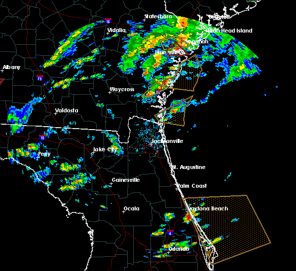 At 529 pm edt, a severe thunderstorm was located near waverly, or 12 miles west of dock junction, moving northeast at 40 mph (radar indicated). Hazards include 60 mph wind gusts. possible tornado. Expect damage to roofs, siding, and trees. locations impacted include, dock junction and boys estate. A tornado watch remains in effect until 1100 pm edt for southeastern georgia. At 529 pm edt, a severe thunderstorm was located near waverly, or 12 miles west of dock junction, moving northeast at 40 mph (radar indicated). Hazards include 60 mph wind gusts. possible tornado. Expect damage to roofs, siding, and trees. locations impacted include, dock junction and boys estate. A tornado watch remains in effect until 1100 pm edt for southeastern georgia.
|
| 5/23/2017 5:17 PM EDT |
 At 517 pm edt, a severe thunderstorm was located near waverly, or 11 miles southeast of nahunta, moving northeast at 45 mph (radar indicated). Hazards include 60 mph wind gusts. possible tornado. expect damage to roofs, siding, and trees At 517 pm edt, a severe thunderstorm was located near waverly, or 11 miles southeast of nahunta, moving northeast at 45 mph (radar indicated). Hazards include 60 mph wind gusts. possible tornado. expect damage to roofs, siding, and trees
|
| 5/22/2017 3:17 PM EDT |
 At 317 pm edt, severe thunderstorms were located along a line extending from near cox to near jekyll island to near kingsland, moving northeast at 30 mph (radar indicated). Hazards include 60 mph wind gusts and penny size hail. expect damage to roofs, siding, and trees At 317 pm edt, severe thunderstorms were located along a line extending from near cox to near jekyll island to near kingsland, moving northeast at 30 mph (radar indicated). Hazards include 60 mph wind gusts and penny size hail. expect damage to roofs, siding, and trees
|
| 4/5/2017 11:21 PM EDT |
 At 1121 pm edt, severe thunderstorms were located along a line extending from near townsend to near everett, moving northeast at 55 mph (radar indicated). Hazards include 60 mph wind gusts and quarter size hail. Hail damage to vehicles is expected. expect wind damage to roofs, siding, and trees. Locations impacted include, everett, thalmann and boys estate. At 1121 pm edt, severe thunderstorms were located along a line extending from near townsend to near everett, moving northeast at 55 mph (radar indicated). Hazards include 60 mph wind gusts and quarter size hail. Hail damage to vehicles is expected. expect wind damage to roofs, siding, and trees. Locations impacted include, everett, thalmann and boys estate.
|
| 4/5/2017 11:16 PM EDT |
 At 1115 pm edt, severe thunderstorms were located along a line extending from 7 miles east of gardi to near thalmann, moving northeast at 55 mph (radar indicated). Hazards include 60 mph wind gusts and quarter size hail. Hail damage to vehicles is expected. Expect wind damage to roofs, siding, and trees. At 1115 pm edt, severe thunderstorms were located along a line extending from 7 miles east of gardi to near thalmann, moving northeast at 55 mph (radar indicated). Hazards include 60 mph wind gusts and quarter size hail. Hail damage to vehicles is expected. Expect wind damage to roofs, siding, and trees.
|
| 4/3/2017 6:20 PM EDT |
 At 619 pm edt, severe thunderstorms were located along a line extending from near darien to near brunswick, moving east at 15 mph (radar indicated). Hazards include 60 mph wind gusts and penny size hail. Expect damage to roofs, siding, and trees. locations impacted include, brunswick, st. Simons island, dock junction, country club estates, sea island and boys estate. At 619 pm edt, severe thunderstorms were located along a line extending from near darien to near brunswick, moving east at 15 mph (radar indicated). Hazards include 60 mph wind gusts and penny size hail. Expect damage to roofs, siding, and trees. locations impacted include, brunswick, st. Simons island, dock junction, country club estates, sea island and boys estate.
|
| 4/3/2017 5:57 PM EDT |
 At 556 pm edt, severe thunderstorms were located along a line extending from cox to waverly, moving east at 30 mph (radar indicated). Hazards include 60 mph wind gusts and penny size hail. expect damage to roofs, siding, and trees At 556 pm edt, severe thunderstorms were located along a line extending from cox to waverly, moving east at 30 mph (radar indicated). Hazards include 60 mph wind gusts and penny size hail. expect damage to roofs, siding, and trees
|
| 4/3/2017 4:54 PM EDT |
 At 454 pm edt, a severe thunderstorm was located near darien, moving northeast at 35 mph (radar indicated). Hazards include 60 mph wind gusts. Expect damage to roofs, siding, and trees. Locations impacted include, dock junction, country club estates and boys estate. At 454 pm edt, a severe thunderstorm was located near darien, moving northeast at 35 mph (radar indicated). Hazards include 60 mph wind gusts. Expect damage to roofs, siding, and trees. Locations impacted include, dock junction, country club estates and boys estate.
|
| 4/3/2017 4:45 PM EDT |
 At 444 pm edt, a severe thunderstorm was located near dock junction, moving northeast at 35 mph (radar indicated). Hazards include 60 mph wind gusts and nickel size hail. expect damage to roofs, siding, and trees At 444 pm edt, a severe thunderstorm was located near dock junction, moving northeast at 35 mph (radar indicated). Hazards include 60 mph wind gusts and nickel size hail. expect damage to roofs, siding, and trees
|
| 4/3/2017 4:27 PM EDT |
 At 427 pm edt, severe thunderstorms were located along a line extending from near everett to near waynesville, moving northeast at 50 mph (radar indicated). Hazards include 60 mph wind gusts and quarter size hail. Hail damage to vehicles is expected. Expect wind damage to roofs, siding, and trees. At 427 pm edt, severe thunderstorms were located along a line extending from near everett to near waynesville, moving northeast at 50 mph (radar indicated). Hazards include 60 mph wind gusts and quarter size hail. Hail damage to vehicles is expected. Expect wind damage to roofs, siding, and trees.
|
| 1/22/2017 6:51 PM EST |
 At 650 pm est, severe thunderstorms were located along a line extending from near darien to 7 miles southeast of woodbine, moving northeast at 70 mph (radar indicated). Hazards include 70 mph wind gusts. Expect considerable tree damage. damage is likely to mobile homes, roofs, and outbuildings. locations impacted include, brunswick, st. simons island, woodbine, dock junction, jekyll island, waverly, sea island, country club estates, little saint simons island and dover bluff. A tornado watch remains in effect until 800 pm est for southeastern georgia. At 650 pm est, severe thunderstorms were located along a line extending from near darien to 7 miles southeast of woodbine, moving northeast at 70 mph (radar indicated). Hazards include 70 mph wind gusts. Expect considerable tree damage. damage is likely to mobile homes, roofs, and outbuildings. locations impacted include, brunswick, st. simons island, woodbine, dock junction, jekyll island, waverly, sea island, country club estates, little saint simons island and dover bluff. A tornado watch remains in effect until 800 pm est for southeastern georgia.
|
| 1/22/2017 6:30 PM EST |
 At 630 pm est, severe thunderstorms were located along a line extending from 8 miles west of waverly to near kings ferry, moving northeast at 70 mph (radar indicated). Hazards include 70 mph wind gusts. Expect considerable tree damage. Damage is likely to mobile homes, roofs, and outbuildings. At 630 pm est, severe thunderstorms were located along a line extending from 8 miles west of waverly to near kings ferry, moving northeast at 70 mph (radar indicated). Hazards include 70 mph wind gusts. Expect considerable tree damage. Damage is likely to mobile homes, roofs, and outbuildings.
|
| 1/22/2017 6:14 PM EST |
 At 614 pm est, severe thunderstorms were located along a line extending from near waynesville to 6 miles north of st. george, moving northeast at 85 mph (radar indicated). Hazards include 60 mph wind gusts and quarter size hail. Hail damage to vehicles is expected. expect wind damage to roofs, siding, and trees. locations impacted include, st. marys, kingsland, brunswick, st. simons island, hilliard, folkston, woodbine, callahan, dock junction and kings bay base. A tornado watch remains in effect until 800 pm est for northern and northeastern florida, and southeastern georgia. At 614 pm est, severe thunderstorms were located along a line extending from near waynesville to 6 miles north of st. george, moving northeast at 85 mph (radar indicated). Hazards include 60 mph wind gusts and quarter size hail. Hail damage to vehicles is expected. expect wind damage to roofs, siding, and trees. locations impacted include, st. marys, kingsland, brunswick, st. simons island, hilliard, folkston, woodbine, callahan, dock junction and kings bay base. A tornado watch remains in effect until 800 pm est for northern and northeastern florida, and southeastern georgia.
|
| 1/22/2017 6:10 PM EST |
 At 609 pm est, severe thunderstorms were located along a line extending from near nahunta to near st. george, moving northeast at 85 mph (radar indicated). Hazards include 60 mph wind gusts and quarter size hail. Hail damage to vehicles is expected. expect wind damage to roofs, siding, and trees. locations impacted include, st. marys, kingsland, brunswick, st. simons island, hilliard, folkston, woodbine, callahan, dock junction and kings bay base. A tornado watch remains in effect until 800 pm est for northern and northeastern florida, and southeastern georgia. At 609 pm est, severe thunderstorms were located along a line extending from near nahunta to near st. george, moving northeast at 85 mph (radar indicated). Hazards include 60 mph wind gusts and quarter size hail. Hail damage to vehicles is expected. expect wind damage to roofs, siding, and trees. locations impacted include, st. marys, kingsland, brunswick, st. simons island, hilliard, folkston, woodbine, callahan, dock junction and kings bay base. A tornado watch remains in effect until 800 pm est for northern and northeastern florida, and southeastern georgia.
|
| 1/22/2017 5:50 PM EST |
 At 550 pm est, severe thunderstorms were located along a line extending from 8 miles west of race pond to 6 miles northwest of olustee, moving northeast at 85 mph (radar indicated). Hazards include 60 mph wind gusts and quarter size hail. Hail damage to vehicles is expected. Expect wind damage to roofs, siding, and trees. At 550 pm est, severe thunderstorms were located along a line extending from 8 miles west of race pond to 6 miles northwest of olustee, moving northeast at 85 mph (radar indicated). Hazards include 60 mph wind gusts and quarter size hail. Hail damage to vehicles is expected. Expect wind damage to roofs, siding, and trees.
|
| 1/22/2017 1:44 PM EST |
 At 144 pm est, a severe thunderstorm capable of producing a tornado was located near darien, moving northeast at 45 mph (radar indicated rotation). Hazards include tornado and quarter size hail. Flying debris will be dangerous to those caught without shelter. mobile homes will be damaged or destroyed. damage to roofs, windows, and vehicles will occur. tree damage is likely. locations impacted include, brunswick, st. Simons island, dock junction, sea island, country club estates, thalmann and boys estate. At 144 pm est, a severe thunderstorm capable of producing a tornado was located near darien, moving northeast at 45 mph (radar indicated rotation). Hazards include tornado and quarter size hail. Flying debris will be dangerous to those caught without shelter. mobile homes will be damaged or destroyed. damage to roofs, windows, and vehicles will occur. tree damage is likely. locations impacted include, brunswick, st. Simons island, dock junction, sea island, country club estates, thalmann and boys estate.
|
| 1/22/2017 1:42 PM EST |
 The severe thunderstorm warning for northwestern glynn, east central ware, southeastern wayne, southeastern pierce and brantley counties will expire at 145 pm est, the storms which prompted the warning have moved out of the area. therefore the warning will be allowed to expire. however gusty winds are still possible with these thunderstorms. a tornado watch remains in effect until 800 pm est for southeastern georgia. The severe thunderstorm warning for northwestern glynn, east central ware, southeastern wayne, southeastern pierce and brantley counties will expire at 145 pm est, the storms which prompted the warning have moved out of the area. therefore the warning will be allowed to expire. however gusty winds are still possible with these thunderstorms. a tornado watch remains in effect until 800 pm est for southeastern georgia.
|
| 1/22/2017 1:35 PM EST |
 At 134 pm est, a severe thunderstorm capable of producing a tornado was located near thalmann, or 7 miles northwest of dock junction, moving northeast at 45 mph (radar indicated rotation). Hazards include tornado and quarter size hail. Flying debris will be dangerous to those caught without shelter. mobile homes will be damaged or destroyed. damage to roofs, windows, and vehicles will occur. tree damage is likely. locations impacted include, brunswick, st. Simons island, dock junction, thalmann, sea island, country club estates and boys estate. At 134 pm est, a severe thunderstorm capable of producing a tornado was located near thalmann, or 7 miles northwest of dock junction, moving northeast at 45 mph (radar indicated rotation). Hazards include tornado and quarter size hail. Flying debris will be dangerous to those caught without shelter. mobile homes will be damaged or destroyed. damage to roofs, windows, and vehicles will occur. tree damage is likely. locations impacted include, brunswick, st. Simons island, dock junction, thalmann, sea island, country club estates and boys estate.
|
| 1/22/2017 1:06 PM EST |
 At 106 pm est, severe thunderstorms were located along a line extending from near blackshear to 10 miles south of braganza, moving northeast at 75 mph (radar indicated). Hazards include 60 mph wind gusts and quarter size hail. Hail damage to vehicles is expected. Expect wind damage to roofs, siding, and trees. At 106 pm est, severe thunderstorms were located along a line extending from near blackshear to 10 miles south of braganza, moving northeast at 75 mph (radar indicated). Hazards include 60 mph wind gusts and quarter size hail. Hail damage to vehicles is expected. Expect wind damage to roofs, siding, and trees.
|
| 1/22/2017 9:45 AM EST |
 At 944 am est, severe thunderstorms were located along a line extending from near blackbeard island to near little saint simons island to 8 miles southwest of brunswick, moving northeast at 60 mph (radar indicated). Hazards include 60 mph wind gusts. expect damage to roofs, siding, and trees At 944 am est, severe thunderstorms were located along a line extending from near blackbeard island to near little saint simons island to 8 miles southwest of brunswick, moving northeast at 60 mph (radar indicated). Hazards include 60 mph wind gusts. expect damage to roofs, siding, and trees
|
| 1/22/2017 9:31 AM EST |
 At 931 am est, severe thunderstorms were located along a line extending from 6 miles southeast of everett to near dock junction to near waverly, moving northeast at 50 mph (radar indicated). Hazards include 60 mph wind gusts. expect damage to roofs, siding, and trees At 931 am est, severe thunderstorms were located along a line extending from 6 miles southeast of everett to near dock junction to near waverly, moving northeast at 50 mph (radar indicated). Hazards include 60 mph wind gusts. expect damage to roofs, siding, and trees
|
| 6/17/2016 7:57 PM EDT |
 The severe thunderstorm warning for liberty, mcintosh and long counties will expire at 800 pm edt, the storms which prompted the warning have weakened below severe limits, and no longer pose an immediate threat to life or property. therefore the warning will be allowed to expire. however gusty winds are still possible with these thunderstorms. a severe thunderstorm watch remains in effect until 1000 pm edt for southeastern georgia. to report severe weather, contact your nearest law enforcement agency. they will relay your report to the national weather service charleston. The severe thunderstorm warning for liberty, mcintosh and long counties will expire at 800 pm edt, the storms which prompted the warning have weakened below severe limits, and no longer pose an immediate threat to life or property. therefore the warning will be allowed to expire. however gusty winds are still possible with these thunderstorms. a severe thunderstorm watch remains in effect until 1000 pm edt for southeastern georgia. to report severe weather, contact your nearest law enforcement agency. they will relay your report to the national weather service charleston.
|
| 6/17/2016 7:46 PM EDT | Mcintosh/long county warning point reports a tree down on new river rd in darien in mcintosh county GA, 2.8 miles SSE of Darien, GA |
| 6/17/2016 7:41 PM EDT | Mcintosh/long county warning point reports a tree down on hwy 57 in townsend. time estimated from radar in mcintosh county GA, 14.1 miles SSE of Darien, GA |
| 6/17/2016 7:25 PM EDT |
 At 724 pm edt, severe thunderstorms were located along a line extending from 20 miles southeast of richmond hill to near ludowici, moving southeast at 35 mph (radar indicated). Hazards include 60 mph wind gusts. Expect damage to roofs. siding. and trees. Locations impacted include, darien, tibet, jones, townsend, crescent, sapelo island, ridgeville and shellman bluff. At 724 pm edt, severe thunderstorms were located along a line extending from 20 miles southeast of richmond hill to near ludowici, moving southeast at 35 mph (radar indicated). Hazards include 60 mph wind gusts. Expect damage to roofs. siding. and trees. Locations impacted include, darien, tibet, jones, townsend, crescent, sapelo island, ridgeville and shellman bluff.
|
| 6/17/2016 7:04 PM EDT |
 At 704 pm edt, severe thunderstorms were located along a line extending from 9 miles southeast of richmond hill to 11 miles northwest of ludowici, moving southeast at 35 mph (radar indicated). Hazards include 60 mph wind gusts and quarter size hail. Hail damage to vehicles is expected. Expect wind damage to roofs, siding, and trees. At 704 pm edt, severe thunderstorms were located along a line extending from 9 miles southeast of richmond hill to 11 miles northwest of ludowici, moving southeast at 35 mph (radar indicated). Hazards include 60 mph wind gusts and quarter size hail. Hail damage to vehicles is expected. Expect wind damage to roofs, siding, and trees.
|
| 6/14/2016 3:30 PM EDT |
 At 330 pm edt, severe thunderstorms were located along a line extending from 21 miles east of tibet to near darien, moving east at 10 mph (radar indicated). Hazards include 60 mph wind gusts. Expect damage to roofs. siding. and trees. locations impacted include, darien, crescent, sapelo island, ridgeville, shellman bluff, blackbeard island, harris neck and st. Catherines island. At 330 pm edt, severe thunderstorms were located along a line extending from 21 miles east of tibet to near darien, moving east at 10 mph (radar indicated). Hazards include 60 mph wind gusts. Expect damage to roofs. siding. and trees. locations impacted include, darien, crescent, sapelo island, ridgeville, shellman bluff, blackbeard island, harris neck and st. Catherines island.
|
| 6/14/2016 3:08 PM EDT |
 At 308 pm edt, severe thunderstorms were located along a line extending from 16 miles east of tibet to darien, moving northeast at 15 mph (radar indicated). Hazards include 60 mph wind gusts. Expect damage to roofs. siding. and trees. Locations impacted include, darien, townsend, crescent, sapelo island, ridgeville, shellman bluff, blackbeard island and harris neck. At 308 pm edt, severe thunderstorms were located along a line extending from 16 miles east of tibet to darien, moving northeast at 15 mph (radar indicated). Hazards include 60 mph wind gusts. Expect damage to roofs. siding. and trees. Locations impacted include, darien, townsend, crescent, sapelo island, ridgeville, shellman bluff, blackbeard island and harris neck.
|
| 6/14/2016 2:59 PM EDT |
 At 259 pm edt, severe thunderstorms were located along a line extending from near everett to near jekyll island, moving east at 10 mph (radar indicated). Hazards include 60 mph wind gusts and nickel size hail. Expect damage to roofs. siding. And trees. At 259 pm edt, severe thunderstorms were located along a line extending from near everett to near jekyll island, moving east at 10 mph (radar indicated). Hazards include 60 mph wind gusts and nickel size hail. Expect damage to roofs. siding. And trees.
|
| 6/14/2016 2:49 PM EDT |
 At 249 pm edt, a severe thunderstorm was located 10 miles north of darien, moving northeast at 10 mph (radar indicated). Hazards include 60 mph wind gusts and penny size hail. Expect damage to roofs. siding. And trees. At 249 pm edt, a severe thunderstorm was located 10 miles north of darien, moving northeast at 10 mph (radar indicated). Hazards include 60 mph wind gusts and penny size hail. Expect damage to roofs. siding. And trees.
|
| 6/14/2016 2:34 PM EDT |
 At 234 pm edt, severe thunderstorms were located along a line extending from near dock junction to thalmann, moving northeast at 15 mph (radar indicated). Hazards include 60 mph wind gusts and nickel size hail. Expect damage to roofs. siding. And trees. At 234 pm edt, severe thunderstorms were located along a line extending from near dock junction to thalmann, moving northeast at 15 mph (radar indicated). Hazards include 60 mph wind gusts and nickel size hail. Expect damage to roofs. siding. And trees.
|
| 6/6/2016 6:03 PM EDT |
 At 602 pm edt, a severe thunderstorm was located 14 miles northeast of darien, moving north at 40 mph (radar indicated). Hazards include 60 mph wind gusts. Expect damage to roofs. siding. and trees. Locations impacted include, jones, riceboro, retreat, townsend, crescent, sapelo island, ridgeville and shellman bluff. At 602 pm edt, a severe thunderstorm was located 14 miles northeast of darien, moving north at 40 mph (radar indicated). Hazards include 60 mph wind gusts. Expect damage to roofs. siding. and trees. Locations impacted include, jones, riceboro, retreat, townsend, crescent, sapelo island, ridgeville and shellman bluff.
|
| 6/6/2016 5:32 PM EDT |
 At 532 pm edt, a severe thunderstorm was located near darien, moving north at 35 mph (radar indicated). Hazards include 60 mph wind gusts. Expect damage to roofs. siding. And trees. At 532 pm edt, a severe thunderstorm was located near darien, moving north at 35 mph (radar indicated). Hazards include 60 mph wind gusts. Expect damage to roofs. siding. And trees.
|
| 6/1/2016 3:35 PM EDT |
 The severe thunderstorm warning for mcintosh county will expire at 345 pm edt, the storm which prompted the warning has weakened below severe limits, and no longer pose an immediate threat to life or property. therefore the warning will be allowed to expire. however heavy rain is still possible with this thunderstorm. to report severe weather, contact your nearest law enforcement agency. they will relay your report to the national weather service charleston. The severe thunderstorm warning for mcintosh county will expire at 345 pm edt, the storm which prompted the warning has weakened below severe limits, and no longer pose an immediate threat to life or property. therefore the warning will be allowed to expire. however heavy rain is still possible with this thunderstorm. to report severe weather, contact your nearest law enforcement agency. they will relay your report to the national weather service charleston.
|
| 6/1/2016 3:22 PM EDT |
 At 322 pm edt, a severe thunderstorm was located 8 miles southeast of tibet, moving east at 20 mph (radar indicated). Hazards include 60 mph wind gusts and penny size hail. Expect damage to roofs. siding. and trees. Locations impacted include, darien, cox, townsend and crescent. At 322 pm edt, a severe thunderstorm was located 8 miles southeast of tibet, moving east at 20 mph (radar indicated). Hazards include 60 mph wind gusts and penny size hail. Expect damage to roofs. siding. and trees. Locations impacted include, darien, cox, townsend and crescent.
|
| 6/1/2016 3:10 PM EDT | Long mcintosh 911 center reported numerous trees down on blues reach rd near cox rd. power is out in the are in mcintosh county GA, 16 miles SE of Darien, GA |
| 6/1/2016 3:06 PM EDT |
 At 306 pm edt, a severe thunderstorm was located near tibet, moving north at 10 mph (radar indicated). Hazards include 60 mph wind gusts and penny size hail. Expect damage to roofs. siding. and trees. Locations impacted include, darien, meridian, valona, townsend, crescent, ridgeville, cox and carnigan. At 306 pm edt, a severe thunderstorm was located near tibet, moving north at 10 mph (radar indicated). Hazards include 60 mph wind gusts and penny size hail. Expect damage to roofs. siding. and trees. Locations impacted include, darien, meridian, valona, townsend, crescent, ridgeville, cox and carnigan.
|
| 6/1/2016 2:50 PM EDT |
 At 250 pm edt, a severe thunderstorm was located 9 miles northwest of darien, moving east at 10 mph (radar indicated). Hazards include 60 mph wind gusts and penny size hail. Expect damage to roofs. siding. And trees. At 250 pm edt, a severe thunderstorm was located 9 miles northwest of darien, moving east at 10 mph (radar indicated). Hazards include 60 mph wind gusts and penny size hail. Expect damage to roofs. siding. And trees.
|
| 5/17/2016 2:28 PM EDT |
 At 228 pm edt, a severe thunderstorm was located 8 miles east of waverly, or 8 miles southwest of brunswick, moving northeast at 25 mph (radar indicated). Hazards include 60 mph wind gusts and quarter size hail. Hail damage to vehicles is expected. Expect wind damage to roofs, siding, and trees. At 228 pm edt, a severe thunderstorm was located 8 miles east of waverly, or 8 miles southwest of brunswick, moving northeast at 25 mph (radar indicated). Hazards include 60 mph wind gusts and quarter size hail. Hail damage to vehicles is expected. Expect wind damage to roofs, siding, and trees.
|
| 4/1/2016 6:39 PM EDT |
 The severe thunderstorm warning for mcintosh county will expire at 645 pm edt, the storm which prompted the warning has moved out of the area. therefore the warning will be allowed to expire. a tornado watch remains in effect until 900 pm edt for southeastern georgia. The severe thunderstorm warning for mcintosh county will expire at 645 pm edt, the storm which prompted the warning has moved out of the area. therefore the warning will be allowed to expire. a tornado watch remains in effect until 900 pm edt for southeastern georgia.
|
| 4/1/2016 6:20 PM EDT |
 At 620 pm edt, a severe thunderstorm was located 11 miles northeast of darien, moving northeast at 45 mph (radar indicated). Hazards include 60 mph wind gusts and penny size hail. Expect damage to roofs. siding. and trees. Locations impacted include, meridian, valona, crescent, sapelo island, ridgeville, wolf island, carnigan and blackbeard island. At 620 pm edt, a severe thunderstorm was located 11 miles northeast of darien, moving northeast at 45 mph (radar indicated). Hazards include 60 mph wind gusts and penny size hail. Expect damage to roofs. siding. and trees. Locations impacted include, meridian, valona, crescent, sapelo island, ridgeville, wolf island, carnigan and blackbeard island.
|
| 4/1/2016 6:07 PM EDT |
 At 607 pm edt, a severe thunderstorm was located near darien, moving northeast at 30 mph (radar indicated). Hazards include 60 mph wind gusts and nickel size hail. Expect damage to roofs. siding. and trees. locations impacted include, darien, meridian, valona, crescent, sapelo island, ridgeville, little saint simons island and wolf island. A tornado watch remains in effect until 900 pm edt for southeastern georgia. At 607 pm edt, a severe thunderstorm was located near darien, moving northeast at 30 mph (radar indicated). Hazards include 60 mph wind gusts and nickel size hail. Expect damage to roofs. siding. and trees. locations impacted include, darien, meridian, valona, crescent, sapelo island, ridgeville, little saint simons island and wolf island. A tornado watch remains in effect until 900 pm edt for southeastern georgia.
|
| 4/1/2016 5:59 PM EDT |
 At 558 pm edt, a severe thunderstorm was located over darien, moving northeast at 45 mph (radar indicated). Hazards include 70 mph wind gusts and nickel size hail. Expect considerable tree damage. damage is likely to mobile homes, roofs, and outbuildings. locations impacted include, darien, crescent, sapelo island, ridgeville, shellman bluff, blackbeard island, meridian and valona. A tornado watch remains in effect until 900 pm edt for southeastern georgia. At 558 pm edt, a severe thunderstorm was located over darien, moving northeast at 45 mph (radar indicated). Hazards include 70 mph wind gusts and nickel size hail. Expect considerable tree damage. damage is likely to mobile homes, roofs, and outbuildings. locations impacted include, darien, crescent, sapelo island, ridgeville, shellman bluff, blackbeard island, meridian and valona. A tornado watch remains in effect until 900 pm edt for southeastern georgia.
|
| 4/1/2016 5:58 PM EDT | The severe thunderstorm warning for northern glynn county will expire at 600 pm edt, the storm which prompted the warning has moved out of the area. therefore the warning will be allowed to expire. however heavy rain is still possible with this thunderstorm. a tornado watch remains in effect until 900 pm edt for southeastern georgia. |
| 4/1/2016 5:50 PM EDT |
 At 549 pm edt, a severe thunderstorm was located near darien, moving east at 50 mph (radar indicated). Hazards include 60 mph wind gusts and quarter size hail. Hail damage to vehicles is expected. expect wind damage to roofs, siding, and trees. locations impacted include, thalmann, everett, little saint simons island and boys estate. A tornado watch remains in effect until 900 pm edt for southeastern georgia. At 549 pm edt, a severe thunderstorm was located near darien, moving east at 50 mph (radar indicated). Hazards include 60 mph wind gusts and quarter size hail. Hail damage to vehicles is expected. expect wind damage to roofs, siding, and trees. locations impacted include, thalmann, everett, little saint simons island and boys estate. A tornado watch remains in effect until 900 pm edt for southeastern georgia.
|
| 4/1/2016 5:43 PM EDT |
 At 543 pm edt, a severe thunderstorm was located 12 miles northwest of dock junction, moving northeast at 40 mph (radar indicated). Hazards include 70 mph wind gusts and nickel size hail. Expect considerable tree damage. Damage is likely to mobile homes, roofs, and outbuildings. At 543 pm edt, a severe thunderstorm was located 12 miles northwest of dock junction, moving northeast at 40 mph (radar indicated). Hazards include 70 mph wind gusts and nickel size hail. Expect considerable tree damage. Damage is likely to mobile homes, roofs, and outbuildings.
|
| 4/1/2016 5:37 PM EDT |
 At 537 pm edt, a severe thunderstorm was located over thalmann, or 11 miles northwest of dock junction, moving northeast at 40 mph (radar indicated). Hazards include 60 mph wind gusts and nickel size hail. Expect damage to roofs. siding. And trees. At 537 pm edt, a severe thunderstorm was located over thalmann, or 11 miles northwest of dock junction, moving northeast at 40 mph (radar indicated). Hazards include 60 mph wind gusts and nickel size hail. Expect damage to roofs. siding. And trees.
|
| 8/22/2015 8:13 PM EDT |
 At 812 pm edt, doppler radar indicated severe thunderstorms capable of producing quarter size hail and damaging winds in excess of 60 mph. this storm was located near thalmann, or 12 miles south of gardi, and moving south at 25 mph. At 812 pm edt, doppler radar indicated severe thunderstorms capable of producing quarter size hail and damaging winds in excess of 60 mph. this storm was located near thalmann, or 12 miles south of gardi, and moving south at 25 mph.
|
| 8/22/2015 7:53 PM EDT |
 At 752 pm edt, severe thunderstorms were located along a line extending from 18 miles east of tibet to 8 miles northwest of darien, moving southeast at 15 mph (radar indicated). Hazards include 60 mph wind gusts. Expect damage to roofs. siding and trees. Locations impacted include, darien, jones, townsend, crescent, sapelo island, ridgeville, shellman bluff and blackbeard island. At 752 pm edt, severe thunderstorms were located along a line extending from 18 miles east of tibet to 8 miles northwest of darien, moving southeast at 15 mph (radar indicated). Hazards include 60 mph wind gusts. Expect damage to roofs. siding and trees. Locations impacted include, darien, jones, townsend, crescent, sapelo island, ridgeville, shellman bluff and blackbeard island.
|
| 8/22/2015 7:44 PM EDT |
 At 743 pm edt, doppler radar indicated a severe thunderstorm capable of producing quarter size hail and damaging winds in excess of 60 mph. this storm was located near cox, or 11 miles south of tibet, and moving southwest at 15 mph. At 743 pm edt, doppler radar indicated a severe thunderstorm capable of producing quarter size hail and damaging winds in excess of 60 mph. this storm was located near cox, or 11 miles south of tibet, and moving southwest at 15 mph.
|
| 8/22/2015 7:30 PM EDT |
 At 730 pm edt, severe thunderstorms were located along a line extending from 16 miles south of richmond hill to 7 miles south of tibet, moving southeast at 15 mph (radar indicated). Hazards include 60 mph wind gusts. Expect damage to roofs. Siding and trees. At 730 pm edt, severe thunderstorms were located along a line extending from 16 miles south of richmond hill to 7 miles south of tibet, moving southeast at 15 mph (radar indicated). Hazards include 60 mph wind gusts. Expect damage to roofs. Siding and trees.
|
| 8/22/2015 6:35 PM EDT |
 At 635 pm edt, severe thunderstorms were located along a line extending from 7 miles south of savannah to near hinesville, moving east at 35 mph (radar indicated). Hazards include 60 mph wind gusts. Expect damage to roofs. Siding and trees. At 635 pm edt, severe thunderstorms were located along a line extending from 7 miles south of savannah to near hinesville, moving east at 35 mph (radar indicated). Hazards include 60 mph wind gusts. Expect damage to roofs. Siding and trees.
|
| 8/21/2015 7:51 PM EDT |
 At 751 pm edt, severe thunderstorms were located along a line extending from near darien to 17 miles northeast of st. simons island, moving south at 20 mph (radar indicated). Hazards include 60 mph wind gusts. Expect damage to roofs. siding and trees. Locations impacted include, darien and wolf island. At 751 pm edt, severe thunderstorms were located along a line extending from near darien to 17 miles northeast of st. simons island, moving south at 20 mph (radar indicated). Hazards include 60 mph wind gusts. Expect damage to roofs. siding and trees. Locations impacted include, darien and wolf island.
|
| 8/21/2015 7:26 PM EDT |
 At 726 pm edt, severe thunderstorms were located along a line extending from near ardick to 23 miles northeast of st. simons island, moving south at 20 mph (radar indicated). Hazards include 70 mph wind gusts and penny size hail. Expect considerable tree damage. damage is likely to mobile homes, roofs and outbuildings. Locations impacted include, darien, wolf island, sapelo island, carnigan and ridgeville. At 726 pm edt, severe thunderstorms were located along a line extending from near ardick to 23 miles northeast of st. simons island, moving south at 20 mph (radar indicated). Hazards include 70 mph wind gusts and penny size hail. Expect considerable tree damage. damage is likely to mobile homes, roofs and outbuildings. Locations impacted include, darien, wolf island, sapelo island, carnigan and ridgeville.
|
| 8/21/2015 7:09 PM EDT |
 At 708 pm edt, severe thunderstorms were located along a line extending from 8 miles north of darien to 27 miles northeast of st. simons island, moving south at 20 mph (radar indicated). Hazards include 70 mph wind gusts and penny size hail. Expect considerable tree damage. Damage is likely to mobile homes, roofs and outbuildings. At 708 pm edt, severe thunderstorms were located along a line extending from 8 miles north of darien to 27 miles northeast of st. simons island, moving south at 20 mph (radar indicated). Hazards include 70 mph wind gusts and penny size hail. Expect considerable tree damage. Damage is likely to mobile homes, roofs and outbuildings.
|
| 8/21/2015 6:28 PM EDT |
 At 627 pm edt, severe thunderstorms were located along a line extending from 20 miles south of richmond hill to 20 miles east of tibet, moving southeast at 5 mph (radar indicated). Hazards include 60 mph wind gusts. Expect damage to roofs. Siding and trees. At 627 pm edt, severe thunderstorms were located along a line extending from 20 miles south of richmond hill to 20 miles east of tibet, moving southeast at 5 mph (radar indicated). Hazards include 60 mph wind gusts. Expect damage to roofs. Siding and trees.
|
| 7/23/2015 7:43 PM EDT | The severe thunderstorm warning for bryan, chatham, liberty, mcintosh, jasper and beaufort counties will expire at 745 pm edt, the storms which prompted the warning have weakened below severe limits, and exited the warned area. therefore the warning will be allowed to expire. to report severe weather, contact your nearest law enforcement agency. they will relay your report to the national weather service charleston. |
| 7/23/2015 7:43 PM EDT | The severe thunderstorm warning for bryan, chatham, liberty, mcintosh, jasper and beaufort counties will expire at 745 pm edt, the storms which prompted the warning have weakened below severe limits, and exited the warned area. therefore the warning will be allowed to expire. to report severe weather, contact your nearest law enforcement agency. they will relay your report to the national weather service charleston. |
| 7/23/2015 7:23 PM EDT |
 At 721 pm edt, severe thunderstorms were located along a line extending from 6 miles south of fort pulaski national monument to 8 miles northeast of darien, moving east at 25 mph (law enforcement). Hazards include 60 mph wind gusts. Expect damage to roofs. siding and trees. Locations impacted include, savannah, hilton head island, bluffton, darien, wilmington island, bellinger hill area, fort pulaski national monument and jones. At 721 pm edt, severe thunderstorms were located along a line extending from 6 miles south of fort pulaski national monument to 8 miles northeast of darien, moving east at 25 mph (law enforcement). Hazards include 60 mph wind gusts. Expect damage to roofs. siding and trees. Locations impacted include, savannah, hilton head island, bluffton, darien, wilmington island, bellinger hill area, fort pulaski national monument and jones.
|
| 7/23/2015 7:07 PM EDT | Mcintosh county reports a tree down near the intersection of hw-57 and hw-9 in mcintosh county GA, 12.4 miles S of Darien, GA |
| 7/23/2015 6:51 PM EDT |
 At 650 pm edt, severe thunderstorms were located along a line extending from near savannah to tibet, moving southeast at 20 mph (law enforcement has reported multiple trees down in and around savannah georgia). Hazards include 60 mph wind gusts. Expect damage to roofs. Siding and trees. At 650 pm edt, severe thunderstorms were located along a line extending from near savannah to tibet, moving southeast at 20 mph (law enforcement has reported multiple trees down in and around savannah georgia). Hazards include 60 mph wind gusts. Expect damage to roofs. Siding and trees.
|
| 7/21/2015 6:30 PM EDT |
 At 629 pm edt, severe thunderstorms were located along a line extending from 19 miles south of richmond hill to near darien, moving east at 30 mph (radar indicated). Hazards include 60 mph wind gusts and penny size hail. Expect damage to roofs. siding and trees. Locations impacted include, darien, crescent, sapelo island, ridgeville, shellman bluff, blackbeard island, harris neck and meridian. At 629 pm edt, severe thunderstorms were located along a line extending from 19 miles south of richmond hill to near darien, moving east at 30 mph (radar indicated). Hazards include 60 mph wind gusts and penny size hail. Expect damage to roofs. siding and trees. Locations impacted include, darien, crescent, sapelo island, ridgeville, shellman bluff, blackbeard island, harris neck and meridian.
|
| 7/21/2015 6:14 PM EDT |
 At 613 pm edt, severe thunderstorms were located along a line extending from 13 miles south of richmond hill to near darien, moving east at 30 mph (radar indicated). Hazards include 60 mph wind gusts and quarter size hail. Hail damage to vehicles is expected. expect wind damage to roofs, siding and trees. Locations impacted include, darien, riceboro, retreat, crescent, sapelo island, ridgeville, shellman bluff and blackbeard island. At 613 pm edt, severe thunderstorms were located along a line extending from 13 miles south of richmond hill to near darien, moving east at 30 mph (radar indicated). Hazards include 60 mph wind gusts and quarter size hail. Hail damage to vehicles is expected. expect wind damage to roofs, siding and trees. Locations impacted include, darien, riceboro, retreat, crescent, sapelo island, ridgeville, shellman bluff and blackbeard island.
|
| 7/21/2015 5:51 PM EDT |
 At 551 pm edt, severe thunderstorms were located along a line extending from 12 miles southeast of hinesville to 9 miles northwest of darien, moving east at 30 mph (radar indicated). Hazards include 60 mph wind gusts and quarter size hail. Hail damage to vehicles is expected. Expect wind damage to roofs, siding and trees. At 551 pm edt, severe thunderstorms were located along a line extending from 12 miles southeast of hinesville to 9 miles northwest of darien, moving east at 30 mph (radar indicated). Hazards include 60 mph wind gusts and quarter size hail. Hail damage to vehicles is expected. Expect wind damage to roofs, siding and trees.
|
| 7/5/2015 5:25 PM EDT |
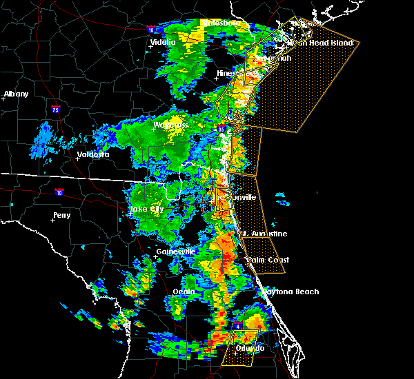 The severe thunderstorm warning for bryan, mcintosh, chatham and liberty counties will expire at 530 pm edt, the storms which prompted the warning have weakened below severe limits, and no longer pose an immediate threat to life or property. therefore the warning will be allowed to expire. however gusty winds and heavy rain are still possible with these thunderstorms. a severe thunderstorm warning remain in effect for portions of bryan and chatham counties until 6 pm edt. The severe thunderstorm warning for bryan, mcintosh, chatham and liberty counties will expire at 530 pm edt, the storms which prompted the warning have weakened below severe limits, and no longer pose an immediate threat to life or property. therefore the warning will be allowed to expire. however gusty winds and heavy rain are still possible with these thunderstorms. a severe thunderstorm warning remain in effect for portions of bryan and chatham counties until 6 pm edt.
|
| 7/5/2015 5:02 PM EDT |
 At 502 pm edt, severe thunderstorms were located along a line extending from skidaway island to near shellman bluff, moving northeast at 30 mph (radar indicated. these thunderstorms blew down a tree in mcintosh county). Hazards include 60 mph wind gusts and penny size hail. Expect damage to roofs. siding and trees. Locations impacted include, savannah, darien and wilmington island. At 502 pm edt, severe thunderstorms were located along a line extending from skidaway island to near shellman bluff, moving northeast at 30 mph (radar indicated. these thunderstorms blew down a tree in mcintosh county). Hazards include 60 mph wind gusts and penny size hail. Expect damage to roofs. siding and trees. Locations impacted include, savannah, darien and wilmington island.
|
| 7/5/2015 4:45 PM EDT | Tree down on hwy 17 near euloni in mcintosh county GA, 12.4 miles S of Darien, GA |
| 7/5/2015 4:40 PM EDT |
 At 438 pm edt, severe thunderstorms were located along a line extending from near fort mcallister to near eulonia, moving northeast at 30 mph (radar indicated). Hazards include 60 mph wind gusts and nickel size hail. Expect damage to roofs. siding and trees. Locations impacted include, shellman bluff, darien, keller and wilmington island. At 438 pm edt, severe thunderstorms were located along a line extending from near fort mcallister to near eulonia, moving northeast at 30 mph (radar indicated). Hazards include 60 mph wind gusts and nickel size hail. Expect damage to roofs. siding and trees. Locations impacted include, shellman bluff, darien, keller and wilmington island.
|
| 7/5/2015 4:25 PM EDT |
 At 425 pm edt, severe thunderstorms were located along a line extending from near belfast to cox, moving northeast at 30 mph (radar indicated). Hazards include 60 mph wind gusts and quarter size hail. Hail damage to vehicles is expected. Expect wind damage to roofs, siding and trees. At 425 pm edt, severe thunderstorms were located along a line extending from near belfast to cox, moving northeast at 30 mph (radar indicated). Hazards include 60 mph wind gusts and quarter size hail. Hail damage to vehicles is expected. Expect wind damage to roofs, siding and trees.
|
| 7/4/2015 4:42 PM EDT |
 At 441 pm edt, severe thunderstorms were located along a line extending from near darien to near valona, and are nearly stationary (radar indicated). Hazards include 60 mph wind gusts. Expect damage to roofs. siding and trees. Locations impacted include, darien, valona, shellman bluff,. At 441 pm edt, severe thunderstorms were located along a line extending from near darien to near valona, and are nearly stationary (radar indicated). Hazards include 60 mph wind gusts. Expect damage to roofs. siding and trees. Locations impacted include, darien, valona, shellman bluff,.
|
| 7/4/2015 4:26 PM EDT | Tree down on a power line and two vehicles in the 900-block area of martin luther king jr driv in mcintosh county GA, 1.4 miles S of Darien, GA |
| 7/4/2015 4:26 PM EDT | Tree down on pine street at black roa in mcintosh county GA, 1.4 miles S of Darien, GA |
| 7/4/2015 4:25 PM EDT |
 At 424 pm edt, a severe thunderstorm was located over darien, and is nearly stationary. additional thunderstorms were developing north to shellman bluff, which could also become severe (radar indicated). Hazards include 60 mph wind gusts. Expect damage to roofs. siding and trees. Locations impacted include, darien, valona, shellman bluff,. At 424 pm edt, a severe thunderstorm was located over darien, and is nearly stationary. additional thunderstorms were developing north to shellman bluff, which could also become severe (radar indicated). Hazards include 60 mph wind gusts. Expect damage to roofs. siding and trees. Locations impacted include, darien, valona, shellman bluff,.
|
| 7/4/2015 4:15 PM EDT |
 At 414 pm edt, a severe thunderstorm was located over darien, and is nearly stationary (radar indicated). Hazards include 60 mph wind gusts. Expect damage to roofs. Siding and trees. At 414 pm edt, a severe thunderstorm was located over darien, and is nearly stationary (radar indicated). Hazards include 60 mph wind gusts. Expect damage to roofs. Siding and trees.
|
| 7/2/2015 7:05 PM EDT |
 At 705 pm edt, severe thunderstorms were located along a line extending from near rincon to ridgeville, moving east at 35 mph (radar indicated). Hazards include 60 mph wind gusts. Expect damage to roofs. siding and trees. Locations impacted include, savannah, pooler, bluffton, richmond hill, darien, wilmington island, i-16/i-95 interchange and fort pulaski national monument. At 705 pm edt, severe thunderstorms were located along a line extending from near rincon to ridgeville, moving east at 35 mph (radar indicated). Hazards include 60 mph wind gusts. Expect damage to roofs. siding and trees. Locations impacted include, savannah, pooler, bluffton, richmond hill, darien, wilmington island, i-16/i-95 interchange and fort pulaski national monument.
|
| 7/2/2015 6:52 PM EDT |
 At 651 pm edt, severe thunderstorms were located along a line extending from pineora to near darien, moving east at 35 mph (radar indicated). Hazards include 60 mph wind gusts. Expect damage to roofs. Siding and trees. At 651 pm edt, severe thunderstorms were located along a line extending from pineora to near darien, moving east at 35 mph (radar indicated). Hazards include 60 mph wind gusts. Expect damage to roofs. Siding and trees.
|
| 7/2/2015 6:13 PM EDT |
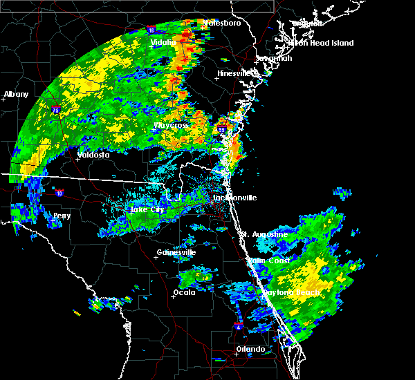 At 613 pm edt, doppler radar indicated a line of severe thunderstorms capable of producing damaging winds in excess of 60 mph. these storms were located along a line extending from near jesup to near nahunta to race pond, and moving northeast at 35 mph. At 613 pm edt, doppler radar indicated a line of severe thunderstorms capable of producing damaging winds in excess of 60 mph. these storms were located along a line extending from near jesup to near nahunta to race pond, and moving northeast at 35 mph.
|
| 6/22/2015 7:58 PM EDT | The severe thunderstorm warning for mcintosh, liberty and long counties will expire at 800 pm edt, the storm which prompted the warning has weakened below severe limits, and no longer pose an immediate threat to life or property. therefore the warning will be allowed to expire. however gusty winds are still possible with this thunderstorm. |
| 6/22/2015 7:07 PM EDT |
 At 706 pm edt, a severe thunderstorm was located over riceboro, or 13 miles southeast of hinesville, moving southeast at 15 mph (radar indicated). Hazards include 60 mph wind gusts and quarter size hail. Hail damage to vehicles is expected. Expect wind damage to roofs, siding and trees. At 706 pm edt, a severe thunderstorm was located over riceboro, or 13 miles southeast of hinesville, moving southeast at 15 mph (radar indicated). Hazards include 60 mph wind gusts and quarter size hail. Hail damage to vehicles is expected. Expect wind damage to roofs, siding and trees.
|
| 6/12/2015 5:55 PM EDT |
 At 555 pm edt, doppler radar indicated a severe thunderstorm capable of producing destructive winds in excess of 70 mph. this storm was located 7 miles north of raybon, or 11 miles north of nahunta, and moving east at 40 mph. penny size hail may also accompany the damaging winds. At 555 pm edt, doppler radar indicated a severe thunderstorm capable of producing destructive winds in excess of 70 mph. this storm was located 7 miles north of raybon, or 11 miles north of nahunta, and moving east at 40 mph. penny size hail may also accompany the damaging winds.
|
| 6/3/2015 6:16 PM EDT | At 615 pm edt, doppler radar indicated a line of severe thunderstorms capable of producing destructive winds in excess of 70 mph. these storms were located along a line extending from near patterson to 6 miles east of gardi, and moving southeast at 10 mph. nickel size hail may also accompany the damaging winds. |
| 5/12/2015 5:22 PM EDT | At 521 pm edt, severe thunderstorms were located along a line extending from near blackbeard island to darien, moving east at 15 mph (radar indicated). Hazards include 60 mph wind gusts and nickel size hail. Expect damage to roofs. siding and trees. locations impacted include, darien. 0. 88in. |
| 5/12/2015 5:10 PM EDT | At 509 pm edt, severe thunderstorms were located along a line extending from near blackbeard island to near darien, moving east at 15 mph (radar indicated. at 500 pm...nickel sized hail was reported just outside of darien). Hazards include 60 mph wind gusts and quarter size hail. Hail damage to vehicles is expected. expect wind damage to roofs, siding and trees. locations impacted include, darien. 1. 00in. |
| 5/12/2015 4:54 PM EDT | At 454 pm edt, severe thunderstorms were located along a line extending from near shellman bluff to darien, moving east at 15 mph (radar indicated). Hazards include 60 mph wind gusts and quarter size hail. Hail damage to vehicles is expected. Expect wind damage to roofs, siding and trees. |
| 4/25/2015 10:12 PM EDT | Tree down at intersection of swamp rd and ga hwy 99 in mcintosh county GA, 8.3 miles SSW of Darien, GA |
| 4/25/2015 10:06 PM EDT | Tree down across johnson rd near ga hwy 99 in mcintosh county GA, 12 miles SSW of Darien, GA |
| 4/25/2015 9:49 PM EDT | At 949 pm edt, severe thunderstorms were located along a line extending from near halfmoon landing to near tibet, moving east at 35 mph (radar indicated). Hazards include 60 mph wind gusts and penny size hail. Expect damage to roofs. siding and trees. locations impacted include, darien and tibet. 0. 75in. |
| 4/25/2015 9:19 PM EDT | At 919 pm edt, severe thunderstorms were located along a line extending from 6 miles southwest of richmond hill to near jesup, moving east at 40 mph (radar indicated). Hazards include quarter size hail and 60 mph wind gusts. Hail damage to vehicles is expected. Expect wind damage to roofs, siding and trees. |
| 4/25/2015 12:51 PM EDT | The severe thunderstorm warning for bryan, mcintosh, chatham, liberty and long counties will expire at 100 pm edt, the line of storms which prompted the warning have weakened below severe limits, and exited the warned area. therefore the warning will be allowed to expire. |
| 4/25/2015 12:26 PM EDT | At 1225 pm edt, severe thunderstorms were located along a line extending from near skidaway island to near halfmoon landing to near retreat to near tibet, moving southeast at 45 mph (radar indicated). Hazards include 60 mph wind gusts. Expect damage to roofs. siding and trees. locations impacted include, richmond hill, darien and tibet. 75in. |
| 4/25/2015 12:00 PM EDT | At 1159 am edt, severe thunderstorms were located along a line extending from near richmond hill to hinesville to near gum branch to 7 miles northeast of odum, moving southeast at 45 mph (radar indicated). Hazards include 60 mph wind gusts. Expect damage to roofs. Siding and trees. |
| 4/19/2015 4:55 PM EDT | At 455 pm edt, doppler radar indicated a line of severe thunderstorms capable of producing damaging winds in excess of 60 mph. these storms were located along a line extending from near race pond to near folkston to bryceville, and moving east at 55 mph. |
| 4/19/2015 4:55 PM EDT | At 455 pm edt, doppler radar indicated a line of severe thunderstorms capable of producing damaging winds in excess of 60 mph. these storms were located along a line extending from near race pond to near folkston to bryceville, and moving east at 55 mph. |
| 4/19/2015 4:09 PM EDT | At 408 pm edt, severe thunderstorms were located along a line extending from near lanier to townsend to near wolf island, moving northeast at 35 mph (radar indicated). Hazards include 60 mph wind gusts. Expect damage to roofs. siding and trees. locations impacted include, darien. a tornado watch remains in effect until 800 pm edt for southeastern georgia. 75in. |
| 4/19/2015 3:48 PM EDT | At 345 pm edt, severe thunderstorms were located along a line extending from 7 miles south of groveland to 6 miles northwest of everett to near country club estates, moving northeast at 35 mph (radar indicated. reported, at 333 pm, several trees were reported down on route 84 near walthourville). Hazards include 70 mph wind gusts. Expect considerable tree damage. damage is likely to mobile homes, roofs and outbuildings. locations impacted include, hinesville, pembroke, darien, ludowici, fort stewart and tibet. a tornado watch remains in effect until 800 pm edt for southeastern georgia. 75in. |
| 4/19/2015 3:31 PM EDT | At 328 pm edt, severe thunderstorms were located along a line extending from donald to 8 miles south of gardi to near dock junction, moving northeast at 35 mph (radar indicated. reported, at 323 pm, law enforcement reported a tree down near wefanie). Hazards include 60 mph wind gusts. Expect damage to roofs. siding and trees. locations impacted include, hinesville, pembroke, darien, ludowici, fort stewart and tibet. a tornado watch remains in effect until 800 pm edt for southeastern georgia. 75in. |
| 4/19/2015 3:21 PM EDT | At 320 pm edt, severe thunderstorms were located along a line extending from near donald to 10 miles southeast of screven to 7 miles west of dock junction, moving northeast at 35 mph (radar indicated). Hazards include 60 mph wind gusts. Expect damage to roofs. Siding and trees. |
| 8/15/2014 3:33 PM EDT | The mcintosh warning point relayed a report of a power line dow in mcintosh county GA, 5.9 miles SSW of Darien, GA |
| 6/24/2014 7:15 PM EDT | Warning point reported 2 trees down on highway 99. one near carnigan and the other at milemarker 1 in mcintosh county GA, 5.9 miles SSW of Darien, GA |
| 6/24/2014 7:10 PM EDT | Warning point reported tree down on belle hammock roa in mcintosh county GA, 15 miles SSW of Darien, GA |
| 4/7/2014 5:22 PM EDT | Warning point reported tree down on highway 99 near blue n hall roa in mcintosh county GA, 4.4 miles SSW of Darien, GA |
| 8/14/2013 7:50 PM EDT | Power line down second west street near highway 1 in mcintosh county GA, 1.5 miles SSE of Darien, GA |
| 8/14/2013 7:46 PM EDT | Spotter reported a few trees down on highway 99 in meridia in mcintosh county GA, 7.4 miles SSW of Darien, GA |
| 6/26/2013 6:10 PM EDT | Quarter sized hail reported 6.8 miles SSW of Darien, GA, driver on the road near meridian reports at least quarter size hail. |
| 6/26/2013 6:10 PM EDT | Golf Ball sized hail reported 7.4 miles SSW of Darien, GA, public report and image relayed from savannah media via nws chat. |
| 6/4/2013 3:40 PM EDT | Long mcintosh 911 reported trees down on murray townsend rd at hwy 9 in mcintosh county GA, 1.4 miles SSW of Darien, GA |
| 6/4/2013 3:19 PM EDT | Mcintosh county reported several trees down near cypress street in darie in mcintosh county GA, 2.9 miles SSW of Darien, GA |
| 4/29/2013 3:29 PM EDT | Numerous trees down across the south end of sapelo island including a 100-year old 60 ft oak. reported by georgia department of natural resource in mcintosh county GA, 14.2 miles SW of Darien, GA |
| 4/14/2013 10:30 PM EDT | Measured by the national estuarine research system observation site at sapelo islan in mcintosh county GA, 9.5 miles WSW of Darien, GA |
| 4/14/2013 10:22 PM EDT | The island manager reported several trees down across the southwestern portion of the island. one tree down on a parked car. damage to numerous aluminium signs. no inju in mcintosh county GA, 14.2 miles SW of Darien, GA |
| 4/14/2013 10:03 PM EDT | Police officers reported several large limbs down across the darien area. size of limbs estimated at roughly 4 inches in diameter. time estimated by rada in mcintosh county GA, 1.4 miles S of Darien, GA |
| 6/11/2012 6:49 PM EDT | 1 large tree down and blocking mission drive near the tolomato causewa in mcintosh county GA, 6.2 miles SSW of Darien, GA |
| 6/11/2012 6:44 PM EDT | Numerous trees down in southern glynn county on meyers sill roa in wayne county GA, 17.4 miles E of Darien, GA |
| 6/11/2012 5:27 PM EDT | Multiple large limbs blown down and blocking the roadway near highway 57 and highway 25 in mcintosh county GA, 14.1 miles SSE of Darien, GA |
| 6/5/2012 3:17 PM EDT | Quarter sized hail reported 9 miles WSW of Darien, GA, penny to quarter size hail at the sapelo island ferry dock. |
| 6/4/2012 3:25 PM EDT | Tree reported down on tupelo circle near highway 1 in glynn county GA, 5.6 miles N of Darien, GA |
| 6/4/2012 3:01 PM EDT | Trees and powerlines were reported blown down along highway 17 just north of darien. time estimated based on rada in mcintosh county GA, 2.7 miles S of Darien, GA |
| 6/4/2012 3:00 PM EDT | A emergency manager reported a tree down in carnigan georgi in mcintosh county GA, 5.9 miles SSW of Darien, GA |
| 6/4/2012 2:59 PM EDT | A emergency manager reported 2 trees down along highway 9 in mcintosh county GA, 1.4 miles S of Darien, GA |
| 6/4/2012 2:57 PM EDT | Trees and powerlines were reported blown down near highway 251 and townsend cox road. time estimated based on rada in mcintosh county GA, 12.4 miles SSE of Darien, GA |
| 5/17/2012 3:12 PM EDT | Hofwyl-broadfield plantation off of highway 17 reported 2 trees down and pea size hail. time of event based on rada in glynn county GA, 3.4 miles NE of Darien, GA |
| 5/17/2012 3:10 PM EDT | Several trees down near intersection of cox rd and hwy 25 in mcintosh county GA, 5.7 miles SSE of Darien, GA |
| 5/15/2012 3:42 PM EDT | Quarter sized hail reported 11 miles SSE of Darien, GA, law enforcement relayed quarter size hail along highway 57. |
| 3/3/2012 2:00 PM EST | Quarter sized hail reported 7.8 miles SE of Darien, GA, trained spotter reported quater size hail. |
| 3/3/2012 1:57 PM EST | A tree and a power line were blown down onto blues reach road. time was estimated from rada in mcintosh county GA, 16 miles SE of Darien, GA |
| 1/1/0001 12:00 AM | Public reported several trees down. one tree uprooted and on a barn and water pump house. another tree down on a ca in mcintosh county GA, 14.1 miles SSE of Darien, GA |
| 1/1/0001 12:00 AM | Law enforcement reported 1 tree down near the intersection of steel bridge road and highway 5 in mcintosh county GA, 14.4 miles SSE of Darien, GA |
| 1/1/0001 12:00 AM | One tree down along highway 99. time estimated based on rada in mcintosh county GA, 10.7 miles SSW of Darien, GA |
| 1/1/0001 12:00 AM | Dispatch center reported trees down on hwy 251 near the ben in mcintosh county GA, 5.2 miles SSE of Darien, GA |
| 1/1/0001 12:00 AM | The law enforcement reported a large tree down northwest of sterling. the time given was based on rada in glynn county GA, 9.4 miles ENE of Darien, GA |
Hail Maps for Darien, GA
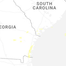
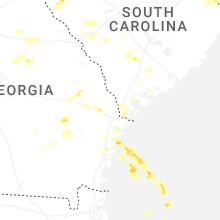


Connect with Interactive Hail Maps