

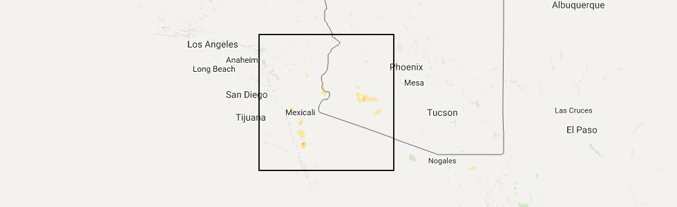
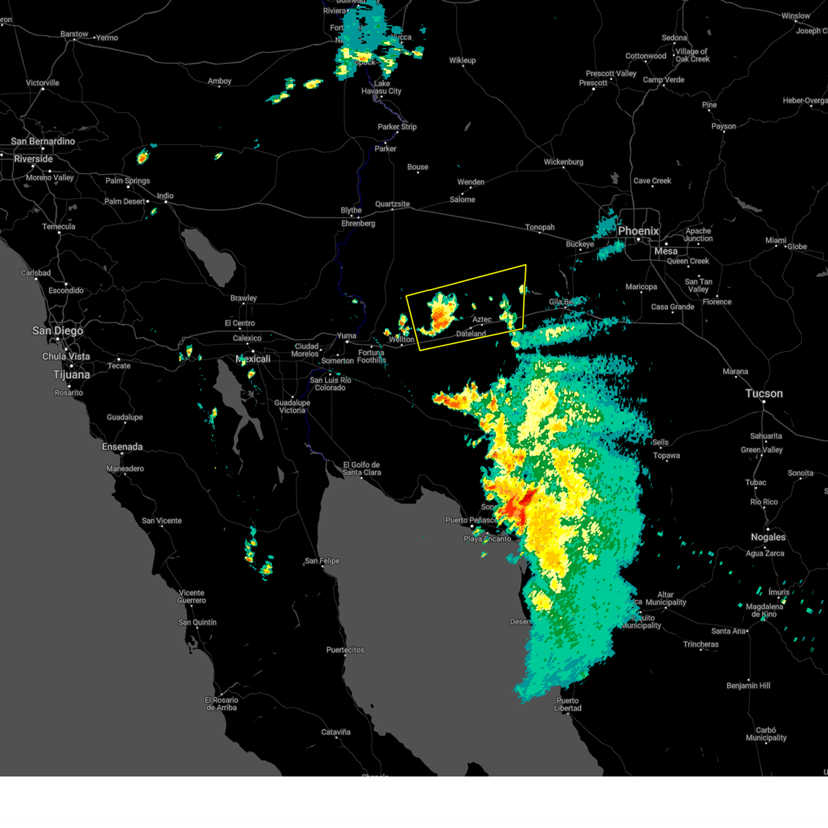
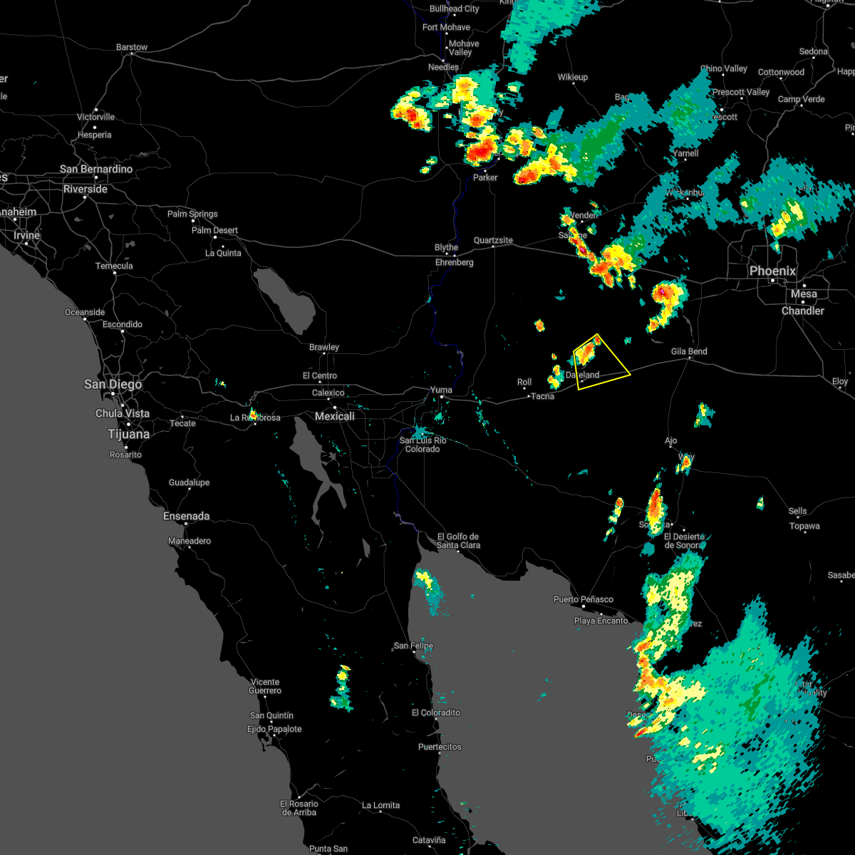
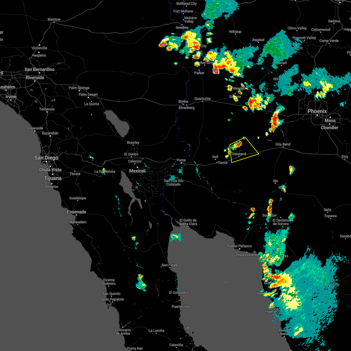
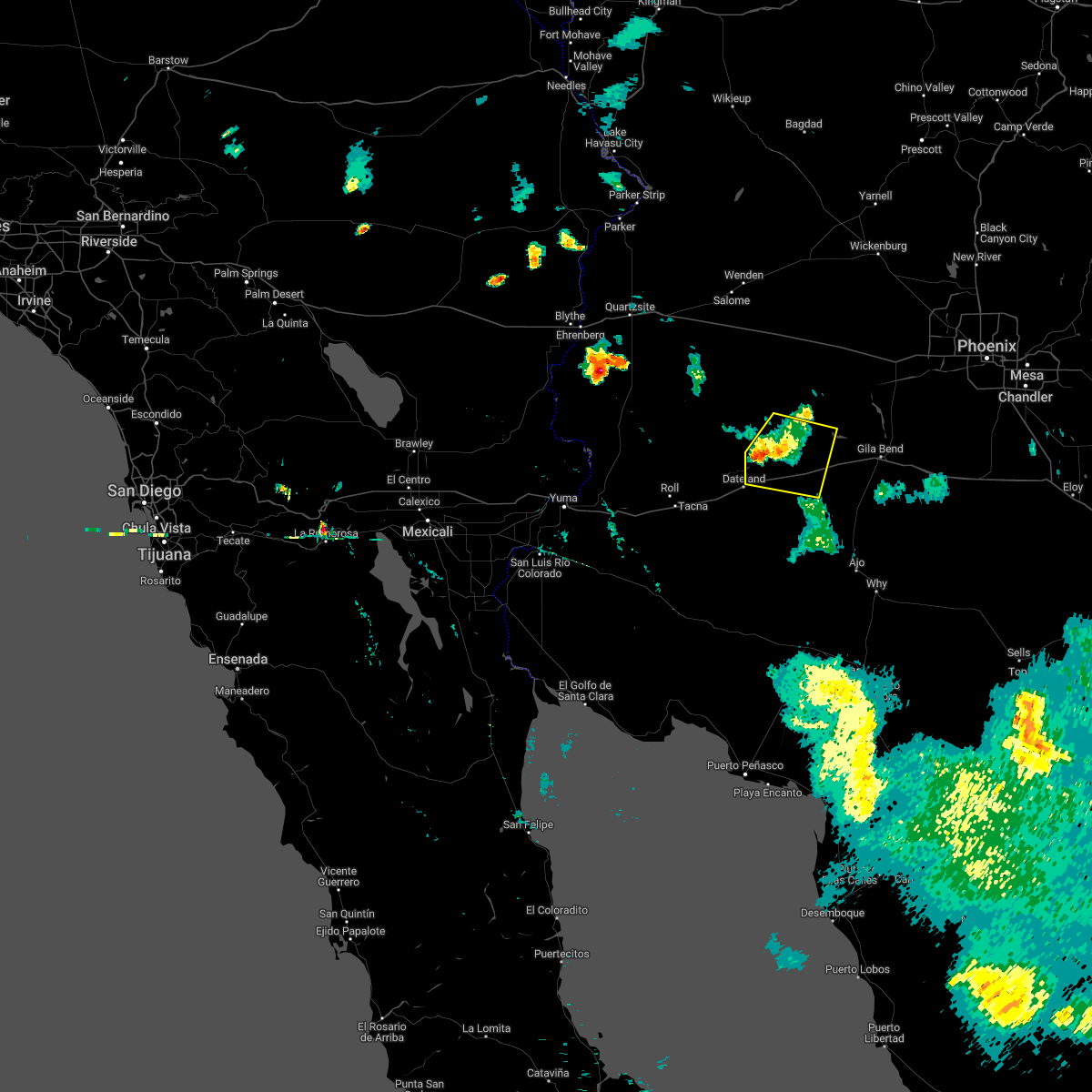
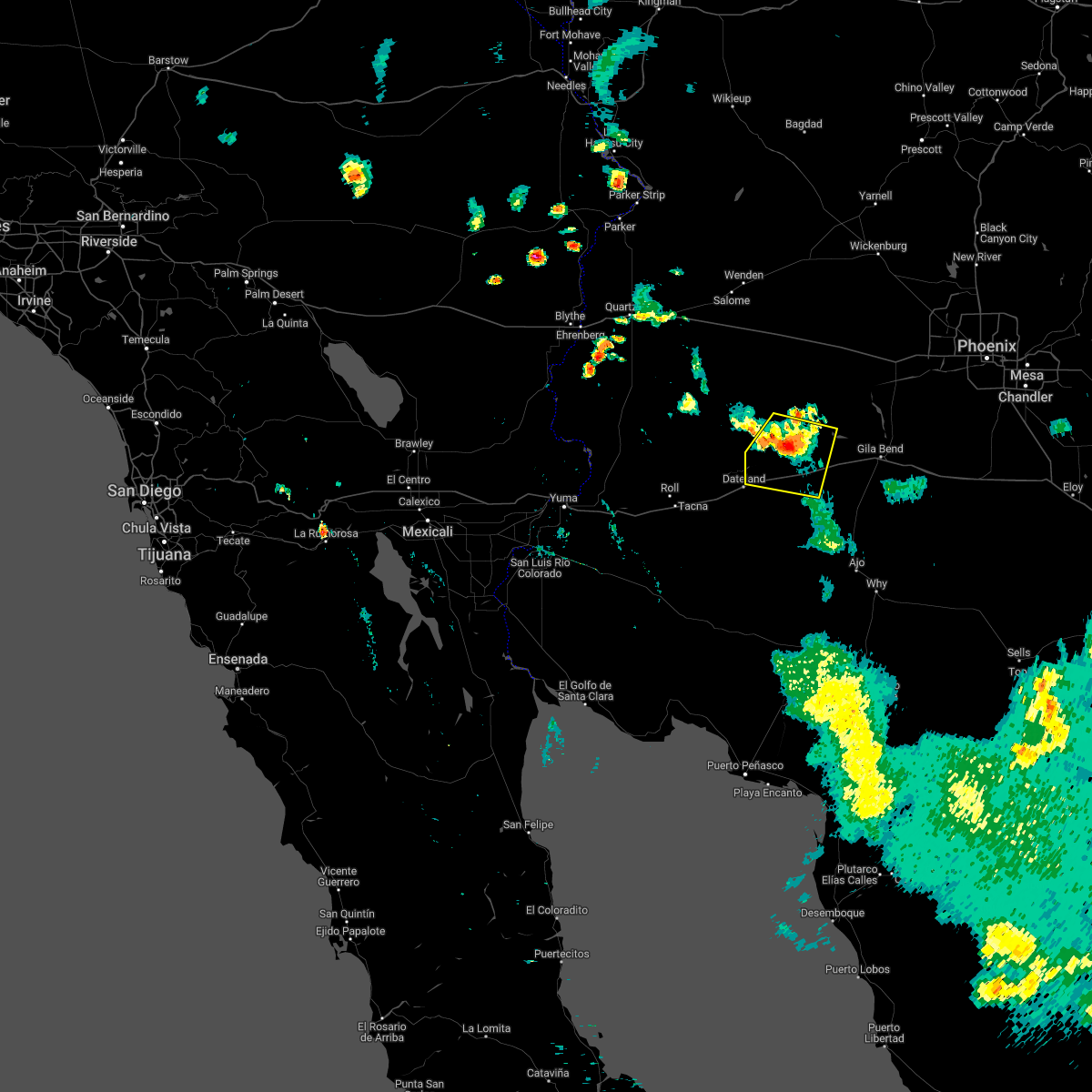
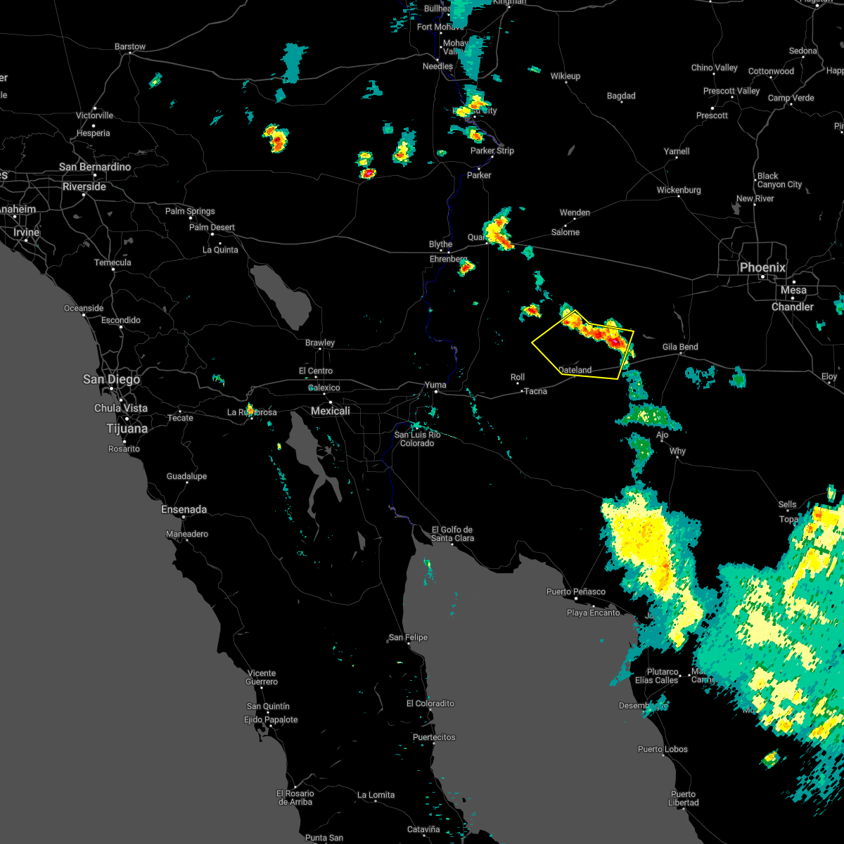
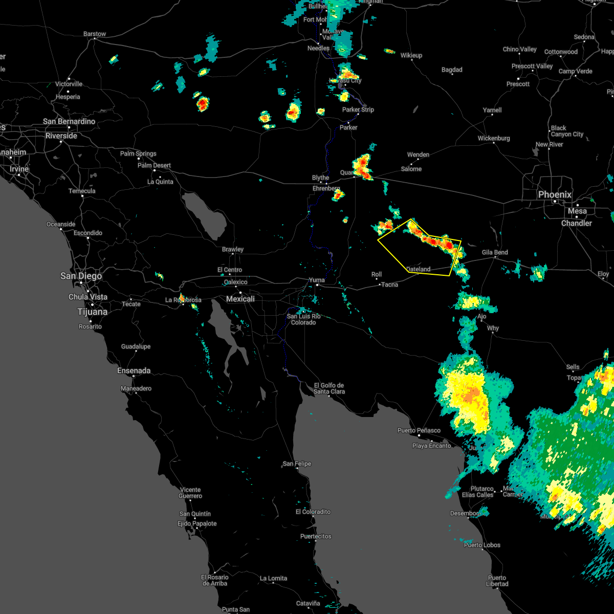
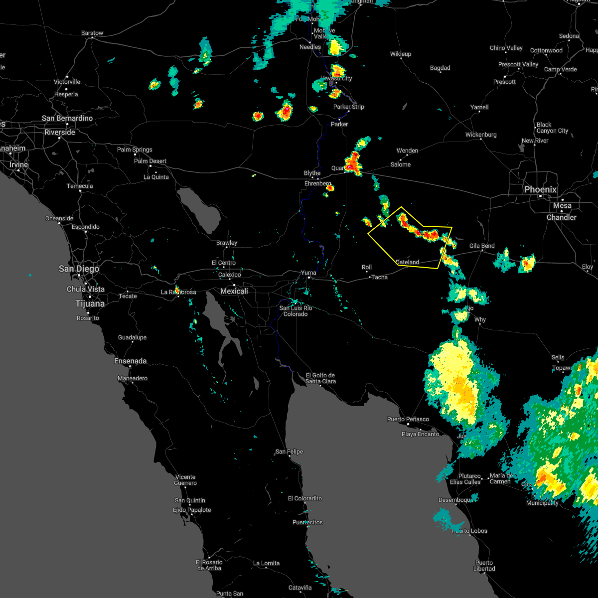
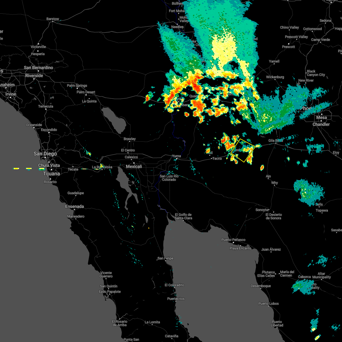
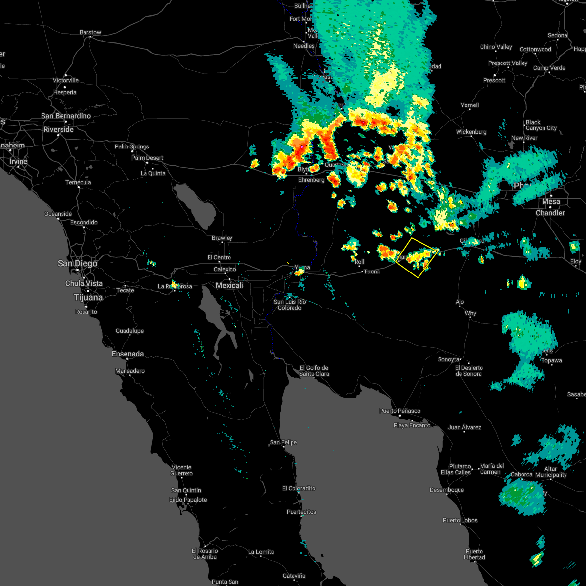
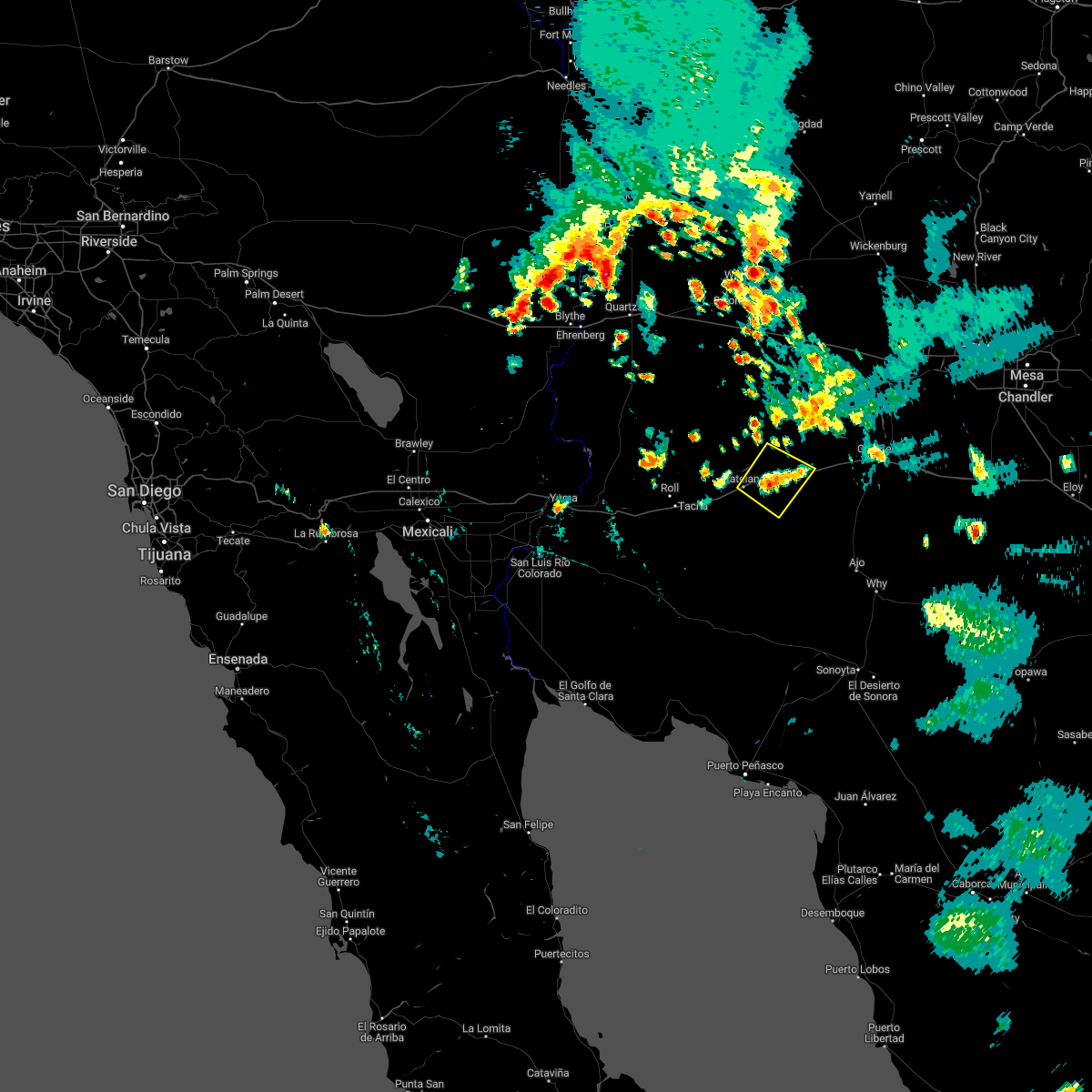
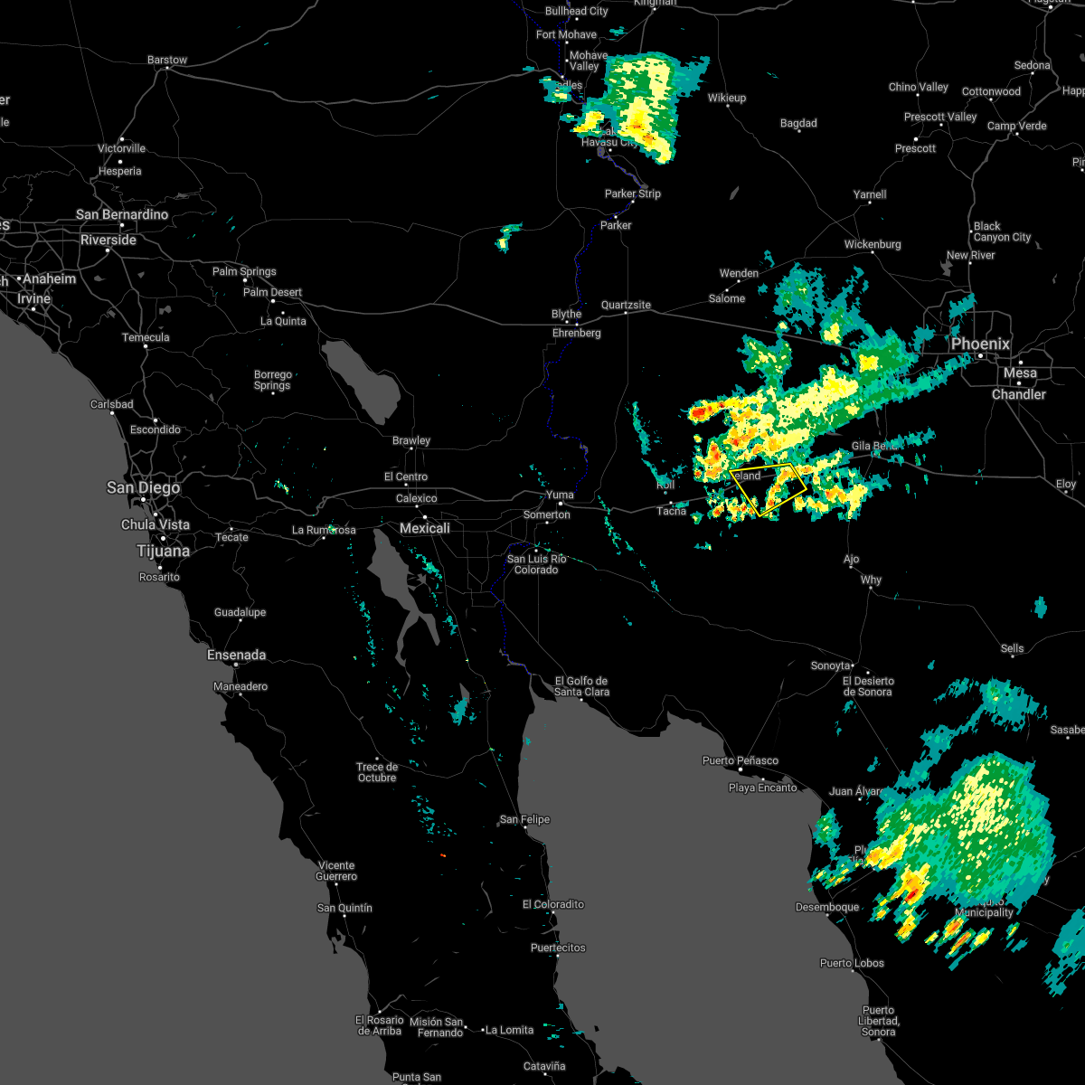
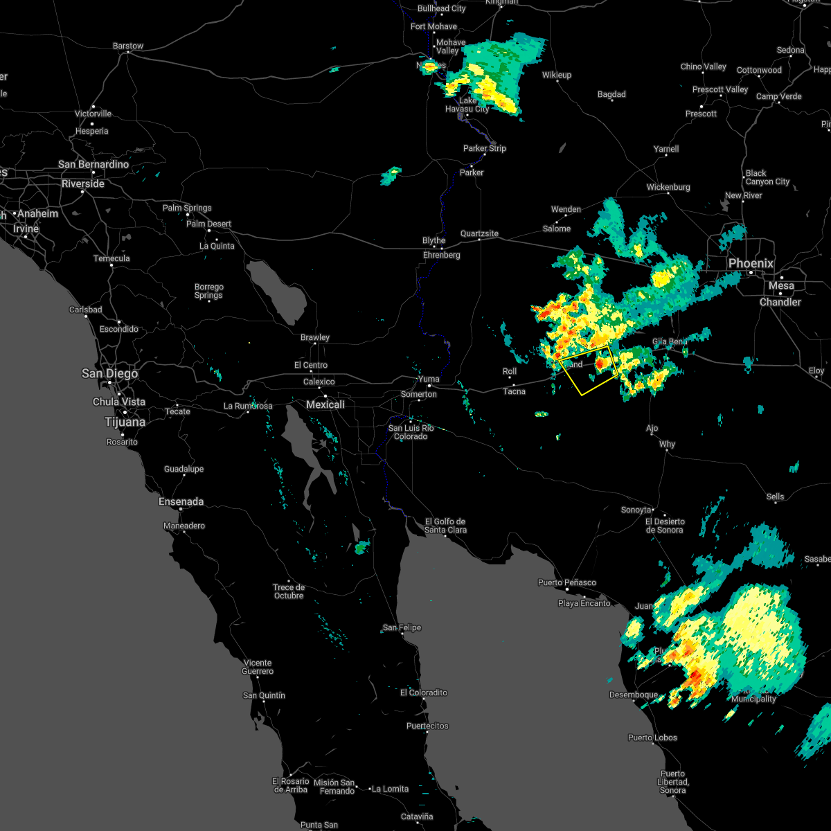
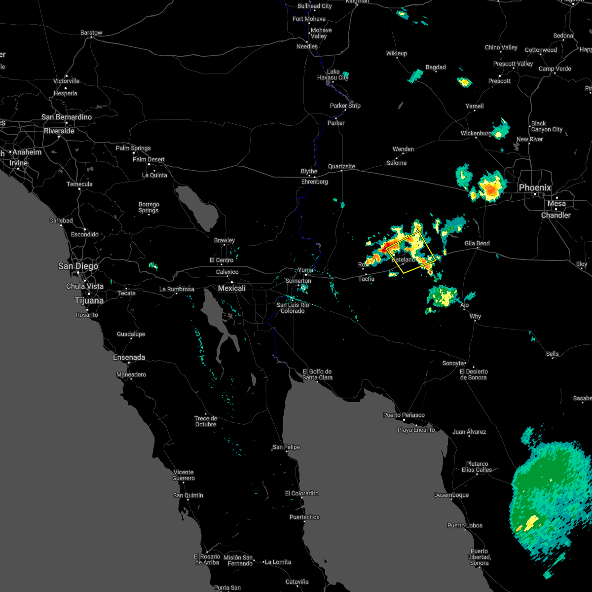
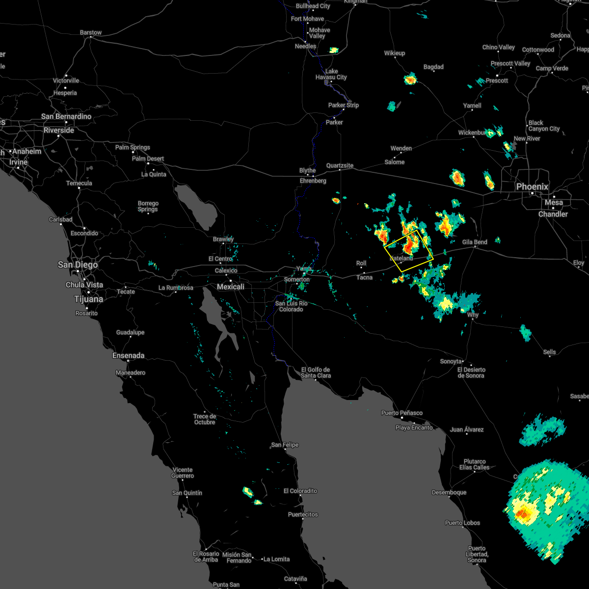
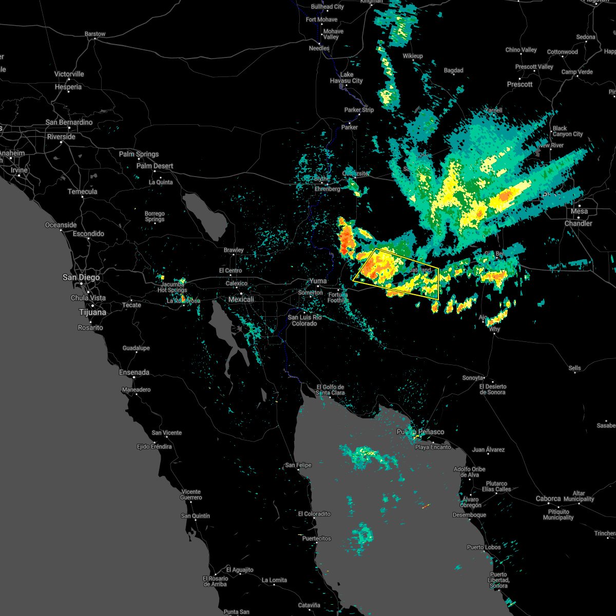
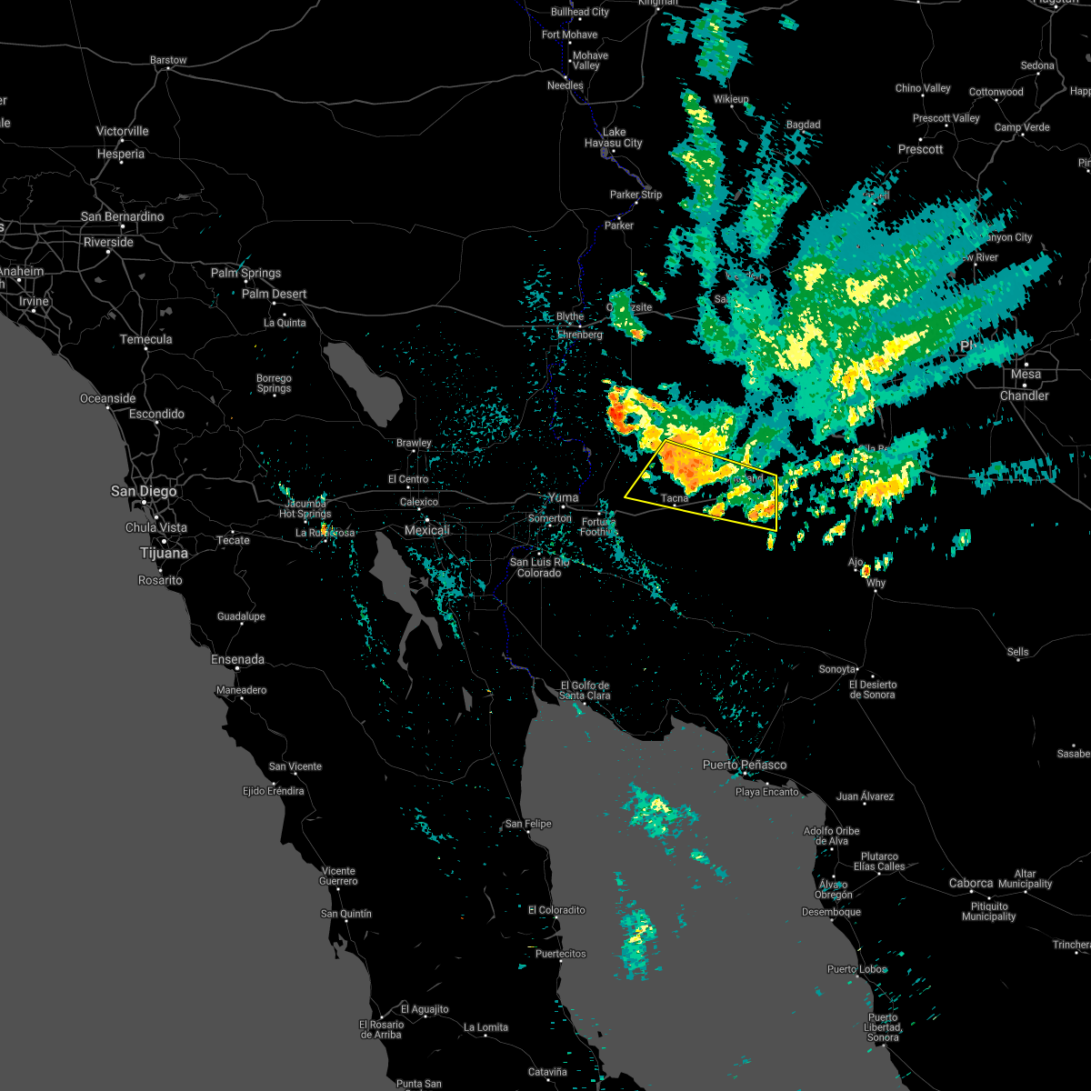
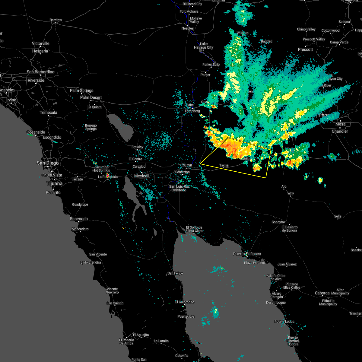
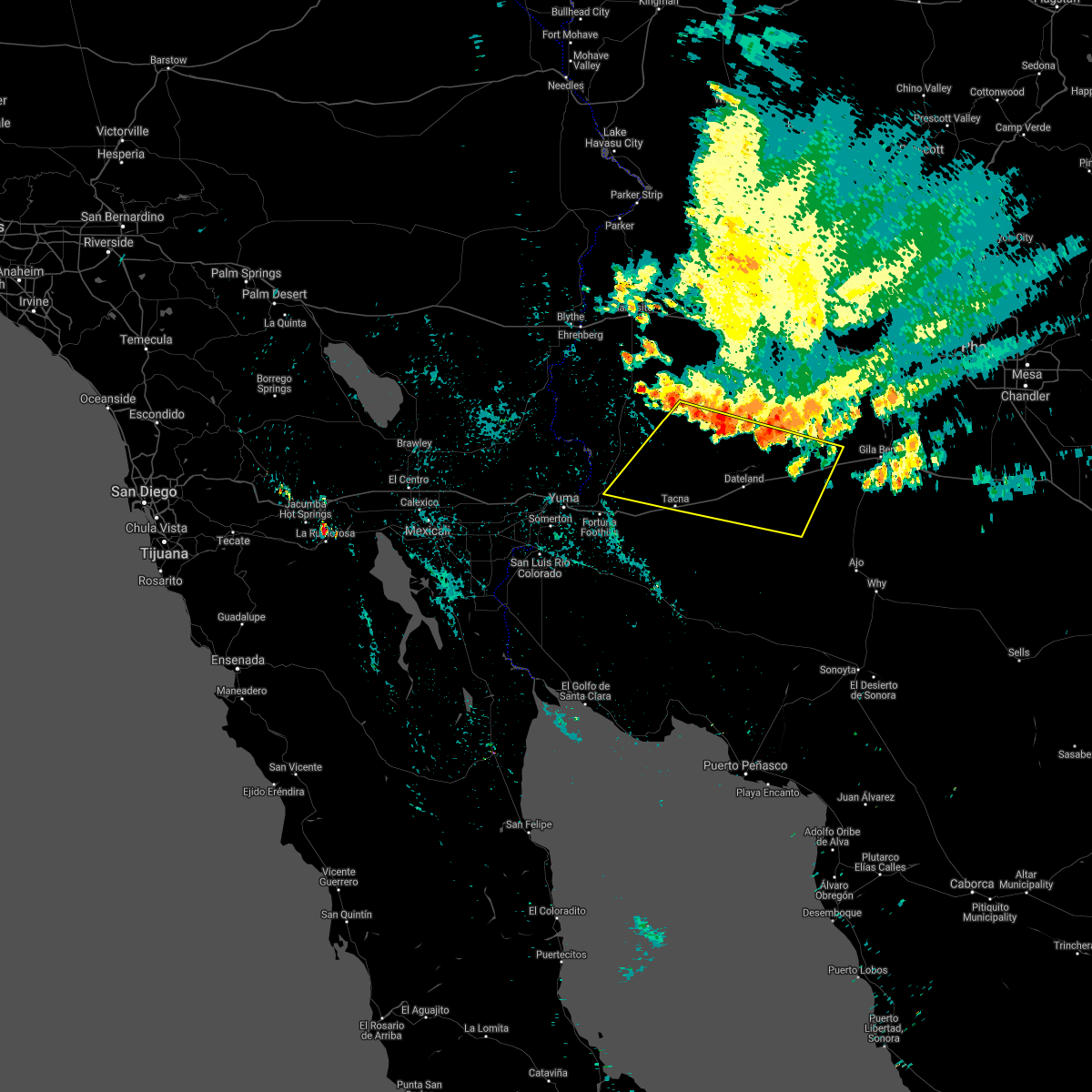
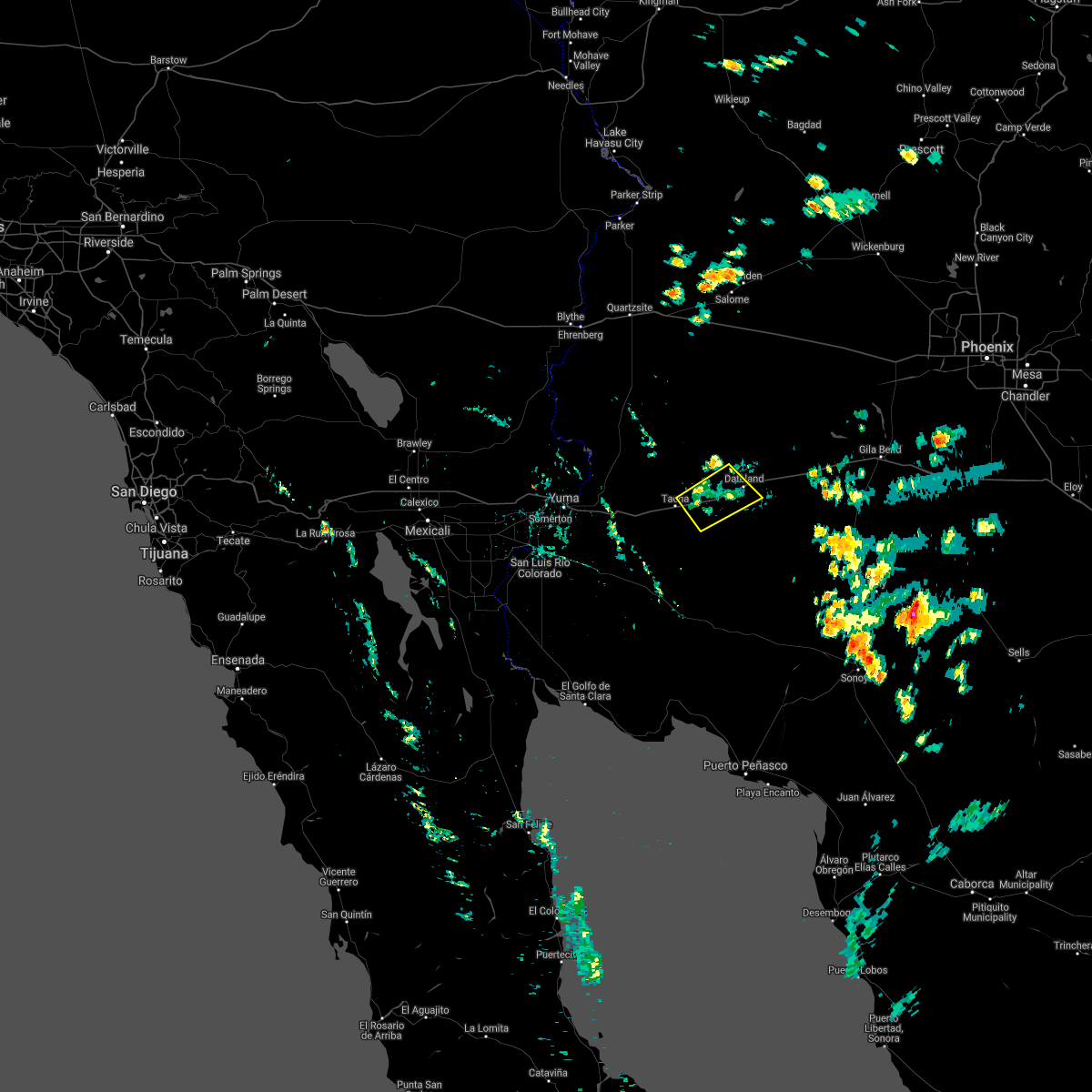
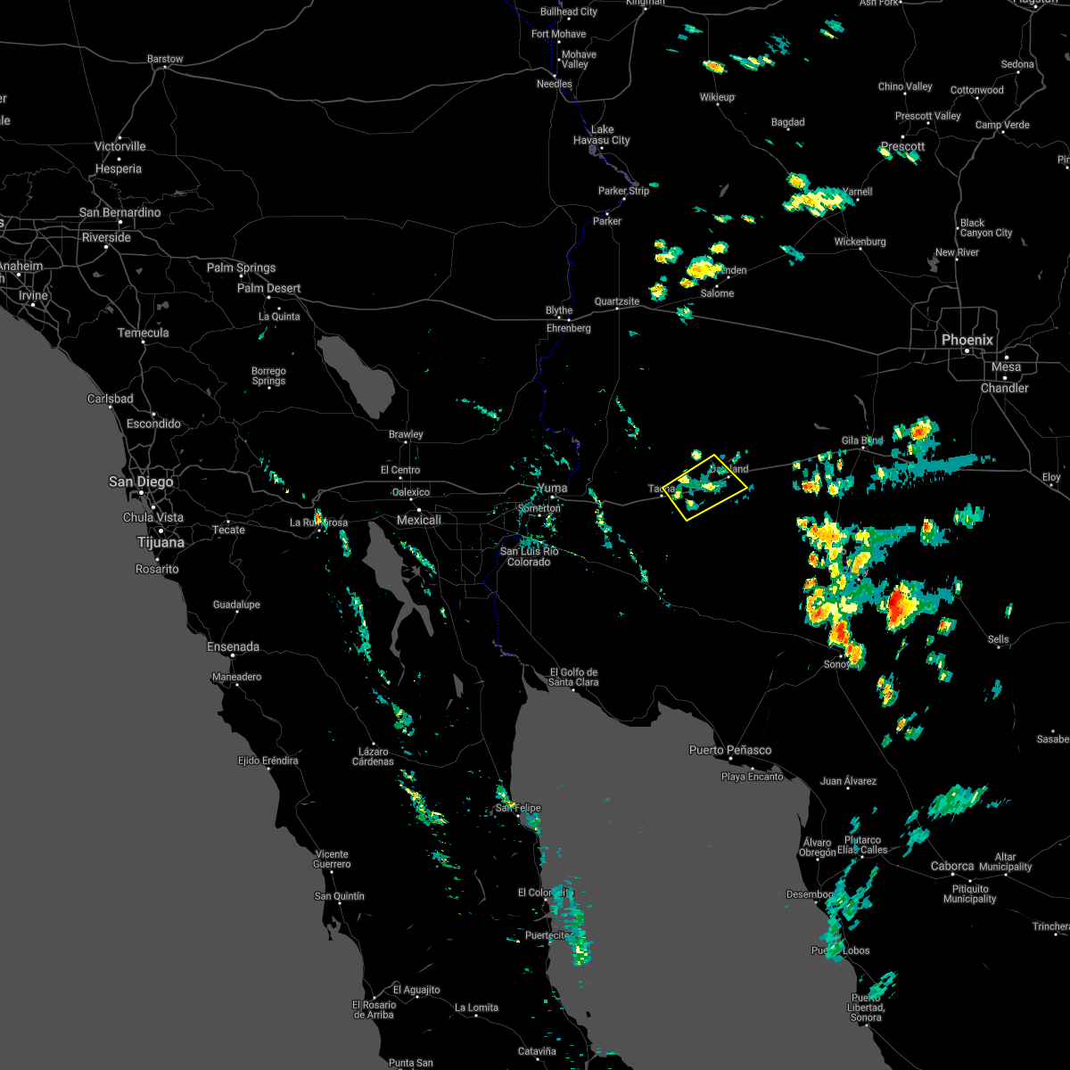
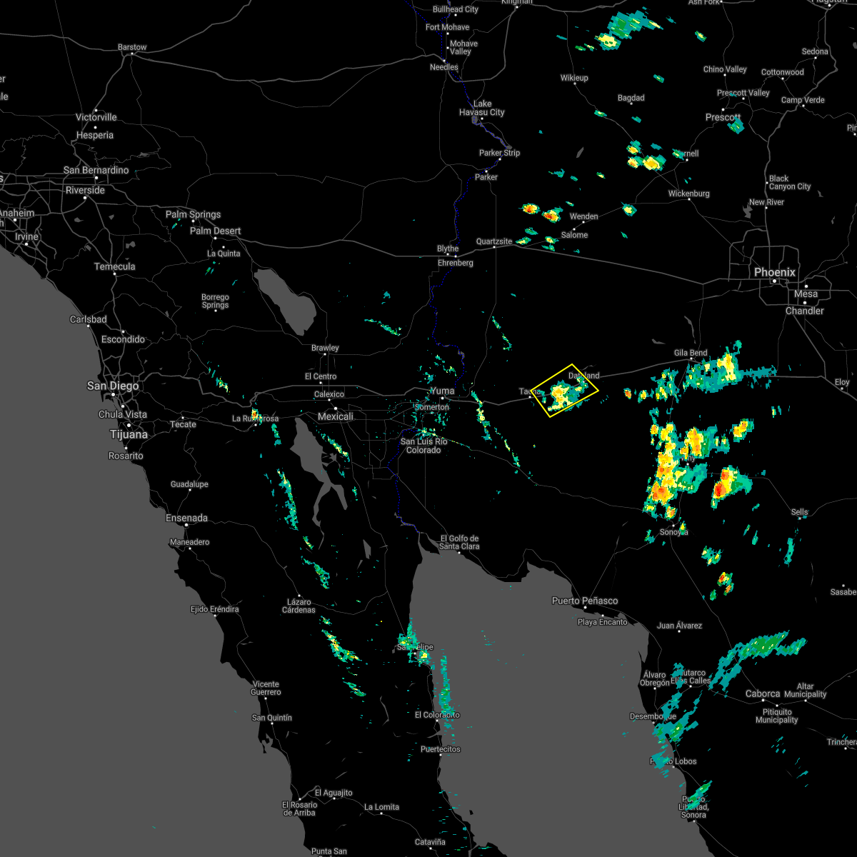
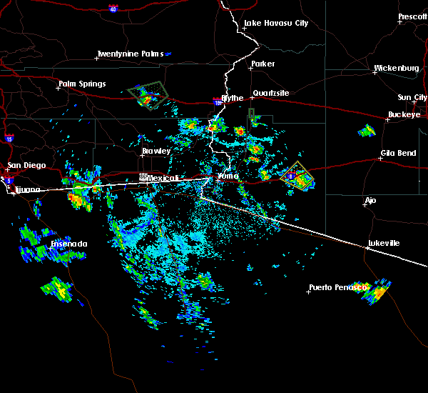
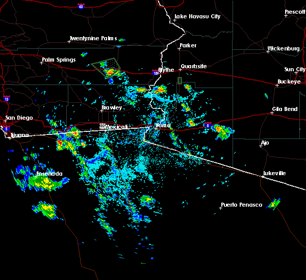
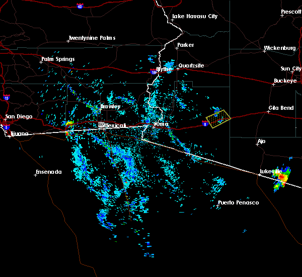
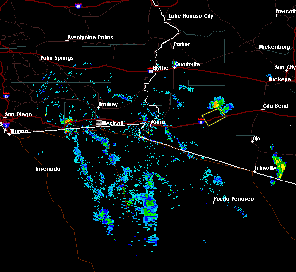
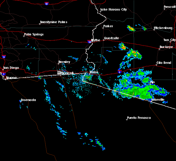
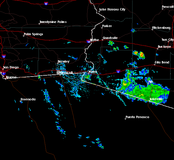
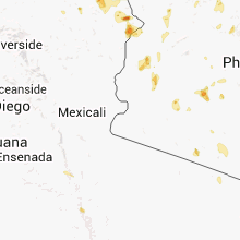
Hail Map for Dateland, AZ
The Dateland, AZ area has had 0 reports of on-the-ground hail by trained spotters, and has been under severe weather warnings 1 time during the past 12 months. Doppler radar has detected hail at or near Dateland, AZ on 7 occasions.
| Name: | Dateland, AZ |
| Where Located: | 63.3 miles E of Yuma, AZ |
| Map: | Google Map for Dateland, AZ |
| Population: | 416 |
| Housing Units: | 221 |
| More Info: | Search Google for Dateland, AZ |
5
The Top Recent Hail Date for Dateland, AZ is Friday, August 19, 2016 (1st out of 7)
Hail and Wind Damage Spotted near Dateland, AZ
| Date / Time | Report Details |
|---|---|
| 12/22/2023 5:10 PM MST | Power pole snapped and multiple power lines down along n avenue 64 e. winds were around 75-85 mp in yuma county AZ, 4.6 miles S of Dateland, AZ |
| 9/1/2023 11:33 AM MST |
 At 1133 am mst, severe thunderstorms were located from sentinel to tacna, moving north at 20 mph (radar indicated). Hazards include 60 mph wind gusts and penny size hail. expect damage to roofs, siding, and trees At 1133 am mst, severe thunderstorms were located from sentinel to tacna, moving north at 20 mph (radar indicated). Hazards include 60 mph wind gusts and penny size hail. expect damage to roofs, siding, and trees
|
| 8/18/2022 6:50 PM MST |
 At 650 pm mst, a severe thunderstorm was located over paloma, or 47 miles west of gila bend, moving southeast at 10 mph (radar indicated). Hazards include 60 mph wind gusts. Expect damage to roofs, siding, and trees. locations impacted include, dateland, sentinel, paloma and hyder. this includes az interstate 8 between mile markers 66 and 88. hail threat, radar indicated max hail size, <. 75 in wind threat, radar indicated max wind gust, 60 mph. At 650 pm mst, a severe thunderstorm was located over paloma, or 47 miles west of gila bend, moving southeast at 10 mph (radar indicated). Hazards include 60 mph wind gusts. Expect damage to roofs, siding, and trees. locations impacted include, dateland, sentinel, paloma and hyder. this includes az interstate 8 between mile markers 66 and 88. hail threat, radar indicated max hail size, <. 75 in wind threat, radar indicated max wind gust, 60 mph.
|
| 8/18/2022 6:32 PM MST |
 At 632 pm mst, a severe thunderstorm was located near paloma, or 48 miles west of gila bend, moving southeast at 10 mph (radar indicated). Hazards include 60 mph wind gusts. expect damage to roofs, siding, and trees At 632 pm mst, a severe thunderstorm was located near paloma, or 48 miles west of gila bend, moving southeast at 10 mph (radar indicated). Hazards include 60 mph wind gusts. expect damage to roofs, siding, and trees
|
| 8/17/2022 7:21 PM MST |
 The severe thunderstorm warning for northeastern yuma and maricopa counties will expire at 730 pm mst, the storm which prompted the warning has weakened below severe limits, and no longer poses an immediate threat to life or property. therefore, the warning will be allowed to expire. however gusty winds and heavy rain are still possible with this thunderstorm. The severe thunderstorm warning for northeastern yuma and maricopa counties will expire at 730 pm mst, the storm which prompted the warning has weakened below severe limits, and no longer poses an immediate threat to life or property. therefore, the warning will be allowed to expire. however gusty winds and heavy rain are still possible with this thunderstorm.
|
| 8/17/2022 6:58 PM MST |
 At 658 pm mst, a severe thunderstorm was located near sentinel, or 32 miles west of gila bend, moving south at 10 mph (radar indicated). Hazards include 60 mph wind gusts. expect damage to roofs, siding, and trees At 658 pm mst, a severe thunderstorm was located near sentinel, or 32 miles west of gila bend, moving south at 10 mph (radar indicated). Hazards include 60 mph wind gusts. expect damage to roofs, siding, and trees
|
| 8/17/2022 6:37 PM MST |
 At 637 pm mst, severe thunderstorms were located along a line extending from near sentinel to 6 miles north of paloma to 23 miles north of dateland, moving southwest at 15 mph (radar indicated). Hazards include 60 mph wind gusts and quarter size hail. Hail damage to vehicles is expected. expect wind damage to roofs, siding, and trees. locations impacted include, dateland, sentinel, paloma and hyder. this includes az interstate 8 between mile markers 68 and 89. hail threat, radar indicated max hail size, 1. 00 in wind threat, radar indicated max wind gust, 60 mph. At 637 pm mst, severe thunderstorms were located along a line extending from near sentinel to 6 miles north of paloma to 23 miles north of dateland, moving southwest at 15 mph (radar indicated). Hazards include 60 mph wind gusts and quarter size hail. Hail damage to vehicles is expected. expect wind damage to roofs, siding, and trees. locations impacted include, dateland, sentinel, paloma and hyder. this includes az interstate 8 between mile markers 68 and 89. hail threat, radar indicated max hail size, 1. 00 in wind threat, radar indicated max wind gust, 60 mph.
|
| 8/17/2022 6:26 PM MST |
 At 626 pm mst, severe thunderstorms were located along a line extending from 9 miles north of sentinel to 8 miles north of paloma to 25 miles southeast of kofa wildlife refuge, moving southwest at 15 mph (radar indicated). Hazards include 60 mph wind gusts. Expect damage to roofs, siding, and trees. locations impacted include, dateland, sentinel, paloma and hyder. this includes az interstate 8 between mile markers 68 and 89. hail threat, radar indicated max hail size, <. 75 in wind threat, radar indicated max wind gust, 60 mph. At 626 pm mst, severe thunderstorms were located along a line extending from 9 miles north of sentinel to 8 miles north of paloma to 25 miles southeast of kofa wildlife refuge, moving southwest at 15 mph (radar indicated). Hazards include 60 mph wind gusts. Expect damage to roofs, siding, and trees. locations impacted include, dateland, sentinel, paloma and hyder. this includes az interstate 8 between mile markers 68 and 89. hail threat, radar indicated max hail size, <. 75 in wind threat, radar indicated max wind gust, 60 mph.
|
| 8/17/2022 6:15 PM MST |
 At 615 pm mst, severe thunderstorms were located along a line extending from 10 miles south of sundad to 9 miles north of paloma to 25 miles southeast of kofa wildlife refuge, moving southwest at 15 mph (radar indicated). Hazards include 60 mph wind gusts. expect damage to roofs, siding, and trees At 615 pm mst, severe thunderstorms were located along a line extending from 10 miles south of sundad to 9 miles north of paloma to 25 miles southeast of kofa wildlife refuge, moving southwest at 15 mph (radar indicated). Hazards include 60 mph wind gusts. expect damage to roofs, siding, and trees
|
| 8/14/2022 7:05 PM MST |
 The severe thunderstorm warning for east central yuma and maricopa counties will expire at 715 pm mst, the storm which prompted the warning has weakened below severe limits, and no longer poses an immediate threat to life or property. therefore, the warning will be allowed to expire. however heavy rain is still possible with this thunderstorm. The severe thunderstorm warning for east central yuma and maricopa counties will expire at 715 pm mst, the storm which prompted the warning has weakened below severe limits, and no longer poses an immediate threat to life or property. therefore, the warning will be allowed to expire. however heavy rain is still possible with this thunderstorm.
|
| 8/14/2022 6:48 PM MST |
 At 647 pm mst, a severe thunderstorm was located 7 miles southeast of paloma, or 40 miles west of gila bend, moving northeast at 15 mph (radar indicated). Hazards include 60 mph wind gusts and penny size hail. Expect damage to roofs, siding, and trees. locations impacted include, sentinel, paloma and dateland. this includes az interstate 8 between mile markers 66 and 92. hail threat, radar indicated max hail size, 0. 75 in wind threat, radar indicated max wind gust, 60 mph. At 647 pm mst, a severe thunderstorm was located 7 miles southeast of paloma, or 40 miles west of gila bend, moving northeast at 15 mph (radar indicated). Hazards include 60 mph wind gusts and penny size hail. Expect damage to roofs, siding, and trees. locations impacted include, sentinel, paloma and dateland. this includes az interstate 8 between mile markers 66 and 92. hail threat, radar indicated max hail size, 0. 75 in wind threat, radar indicated max wind gust, 60 mph.
|
| 8/14/2022 6:30 PM MST |
 At 630 pm mst, a severe thunderstorm was located 7 miles east of dateland, or 42 miles northwest of ajo, moving northeast at 10 mph (radar indicated). Hazards include 60 mph wind gusts and quarter size hail. Hail damage to vehicles is expected. Expect wind damage to roofs, siding, and trees. At 630 pm mst, a severe thunderstorm was located 7 miles east of dateland, or 42 miles northwest of ajo, moving northeast at 10 mph (radar indicated). Hazards include 60 mph wind gusts and quarter size hail. Hail damage to vehicles is expected. Expect wind damage to roofs, siding, and trees.
|
| 6/26/2022 8:35 PM MST |
 At 835 pm mst, a severe thunderstorm was located 8 miles southwest of sentinel, or 37 miles northwest of ajo, moving southwest at 5 mph (radar indicated). Hazards include 60 mph wind gusts. Expect damage to roofs, siding, and trees. locations impacted include, sentinel and dateland. this includes az interstate 8 between mile markers 67 and 87. hail threat, radar indicated max hail size, <. 75 in wind threat, radar indicated max wind gust, 60 mph. At 835 pm mst, a severe thunderstorm was located 8 miles southwest of sentinel, or 37 miles northwest of ajo, moving southwest at 5 mph (radar indicated). Hazards include 60 mph wind gusts. Expect damage to roofs, siding, and trees. locations impacted include, sentinel and dateland. this includes az interstate 8 between mile markers 67 and 87. hail threat, radar indicated max hail size, <. 75 in wind threat, radar indicated max wind gust, 60 mph.
|
| 6/26/2022 8:19 PM MST |
 At 819 pm mst, a severe thunderstorm was located near sentinel, or 36 miles west of gila bend, moving southwest at 10 mph (radar indicated). Hazards include 60 mph wind gusts. expect damage to roofs, siding, and trees At 819 pm mst, a severe thunderstorm was located near sentinel, or 36 miles west of gila bend, moving southwest at 10 mph (radar indicated). Hazards include 60 mph wind gusts. expect damage to roofs, siding, and trees
|
| 6/25/2022 6:35 PM MST |
 The severe thunderstorm warning for east central yuma and maricopa counties will expire at 645 pm mst, the storm which prompted the warning has weakened below severe limits, and has exited the warned area. therefore, the warning will be allowed to expire. however gusty winds are still possible with this thunderstorm. The severe thunderstorm warning for east central yuma and maricopa counties will expire at 645 pm mst, the storm which prompted the warning has weakened below severe limits, and has exited the warned area. therefore, the warning will be allowed to expire. however gusty winds are still possible with this thunderstorm.
|
| 6/25/2022 6:01 PM MST |
 At 600 pm mst, a severe thunderstorm was located over paloma, or 45 miles west of gila bend, and is nearly stationary (radar indicated). Hazards include 60 mph wind gusts. expect damage to roofs, siding, and trees At 600 pm mst, a severe thunderstorm was located over paloma, or 45 miles west of gila bend, and is nearly stationary (radar indicated). Hazards include 60 mph wind gusts. expect damage to roofs, siding, and trees
|
| 8/14/2021 1:58 AM MST |
 The severe thunderstorm warning for east central yuma county will expire at 200 am mst, the storms which prompted the warning have weakened below severe limits, and no longer pose an immediate threat to life or property. therefore, the warning will be allowed to expire. however gusty winds, dense blowing dust, and heavy rain are still possible with these thunderstorms. a severe thunderstorm watch remains in effect until 300 am mst for southwestern arizona. The severe thunderstorm warning for east central yuma county will expire at 200 am mst, the storms which prompted the warning have weakened below severe limits, and no longer pose an immediate threat to life or property. therefore, the warning will be allowed to expire. however gusty winds, dense blowing dust, and heavy rain are still possible with these thunderstorms. a severe thunderstorm watch remains in effect until 300 am mst for southwestern arizona.
|
| 8/14/2021 1:40 AM MST |
 At 140 am mst, severe thunderstorms were located along a line extending from 17 miles south of dateland to 7 miles northwest of tyson, moving southwest at 40 mph (radar indicated). Hazards include 60 mph wind gusts. Expect damage to roofs, siding, and trees. locations impacted include, dateland, tacna, tyson, mohawk and roll. this includes az interstate 8 between mile markers 41 and 79. hail threat, radar indicated max hail size, <. 75 in wind threat, radar indicated max wind gust, 60 mph. At 140 am mst, severe thunderstorms were located along a line extending from 17 miles south of dateland to 7 miles northwest of tyson, moving southwest at 40 mph (radar indicated). Hazards include 60 mph wind gusts. Expect damage to roofs, siding, and trees. locations impacted include, dateland, tacna, tyson, mohawk and roll. this includes az interstate 8 between mile markers 41 and 79. hail threat, radar indicated max hail size, <. 75 in wind threat, radar indicated max wind gust, 60 mph.
|
| 8/14/2021 1:27 AM MST |
 At 127 am mst, severe thunderstorms were located along a line extending from 15 miles southeast of dateland to 10 miles north of tyson, moving southwest at 30 mph (radar indicated). Hazards include 60 mph wind gusts. Expect damage to roofs, siding, and trees. locations impacted include, tacna, sentinel, paloma, tyson, dateland, mohawk, roll and hyder. this includes az interstate 8 between mile markers 40 and 92. hail threat, radar indicated max hail size, <. 75 in wind threat, radar indicated max wind gust, 60 mph. At 127 am mst, severe thunderstorms were located along a line extending from 15 miles southeast of dateland to 10 miles north of tyson, moving southwest at 30 mph (radar indicated). Hazards include 60 mph wind gusts. Expect damage to roofs, siding, and trees. locations impacted include, tacna, sentinel, paloma, tyson, dateland, mohawk, roll and hyder. this includes az interstate 8 between mile markers 40 and 92. hail threat, radar indicated max hail size, <. 75 in wind threat, radar indicated max wind gust, 60 mph.
|
| 8/14/2021 1:03 AM MST |
 At 103 am mst, severe thunderstorms were located along a line extending from sentinel to 21 miles north of tyson, moving southwest at 40 mph (radar indicated). Hazards include 60 mph wind gusts. expect damage to roofs, siding, and trees At 103 am mst, severe thunderstorms were located along a line extending from sentinel to 21 miles north of tyson, moving southwest at 40 mph (radar indicated). Hazards include 60 mph wind gusts. expect damage to roofs, siding, and trees
|
| 8/30/2020 3:13 PM MST |
 The severe thunderstorm warning for east central yuma county will expire at 315 pm mst, the storm which prompted the warning has weakened below severe limits, and no longer poses an immediate threat to life or property. therefore, the warning will be allowed to expire. however gusty winds and heavy rain are still possible with this thunderstorm. The severe thunderstorm warning for east central yuma county will expire at 315 pm mst, the storm which prompted the warning has weakened below severe limits, and no longer poses an immediate threat to life or property. therefore, the warning will be allowed to expire. however gusty winds and heavy rain are still possible with this thunderstorm.
|
| 8/30/2020 3:09 PM MST |
 At 309 pm mst, a severe thunderstorm was located near mohawk, or 44 miles east of fortuna foothills, moving northeast at 15 mph (radar indicated). Hazards include 60 mph wind gusts. Expect damage to roofs, siding, and trees. locations impacted include, dateland and mohawk. This includes az interstate 8 between mile markers 45 and 69. At 309 pm mst, a severe thunderstorm was located near mohawk, or 44 miles east of fortuna foothills, moving northeast at 15 mph (radar indicated). Hazards include 60 mph wind gusts. Expect damage to roofs, siding, and trees. locations impacted include, dateland and mohawk. This includes az interstate 8 between mile markers 45 and 69.
|
| 8/30/2020 2:49 PM MST |
 At 249 pm mst, a severe thunderstorm was located over mohawk, or 40 miles east of fortuna foothills, moving northeast at 15 mph (radar indicated). Hazards include 60 mph wind gusts. expect damage to roofs, siding, and trees At 249 pm mst, a severe thunderstorm was located over mohawk, or 40 miles east of fortuna foothills, moving northeast at 15 mph (radar indicated). Hazards include 60 mph wind gusts. expect damage to roofs, siding, and trees
|
| 9/4/2019 6:11 PM MST | Semi-truck overturned at the mohawk i-8 eastbound rest area as reported by yuma county dispatc in yuma county AZ, 11.8 miles ENE of Dateland, AZ |
| 9/4/2019 6:06 PM MST |
 At 606 pm mst, a severe thunderstorm was located near mohawk, or 43 miles east of fortuna foothills, moving northwest at 10 mph (radar indicated). Hazards include 60 mph wind gusts and half dollar size hail. Hail damage to vehicles is expected. expect wind damage to roofs, siding, and trees. locations impacted include, mohawk. This includes az interstate 8 between mile markers 48 and 66. At 606 pm mst, a severe thunderstorm was located near mohawk, or 43 miles east of fortuna foothills, moving northwest at 10 mph (radar indicated). Hazards include 60 mph wind gusts and half dollar size hail. Hail damage to vehicles is expected. expect wind damage to roofs, siding, and trees. locations impacted include, mohawk. This includes az interstate 8 between mile markers 48 and 66.
|
| 9/4/2019 5:45 PM MST |
 At 545 pm mst, a severe thunderstorm was located 7 miles east of mohawk, or 46 miles east of fortuna foothills, moving northwest at 10 mph (radar indicated). Hazards include 60 mph wind gusts and half dollar size hail. Hail damage to vehicles is expected. Expect wind damage to roofs, siding, and trees. At 545 pm mst, a severe thunderstorm was located 7 miles east of mohawk, or 46 miles east of fortuna foothills, moving northwest at 10 mph (radar indicated). Hazards include 60 mph wind gusts and half dollar size hail. Hail damage to vehicles is expected. Expect wind damage to roofs, siding, and trees.
|
| 7/14/2017 8:56 PM MST |
 The severe thunderstorm warning for east central yuma and maricopa counties will expire at 900 pm mst, the severe thunderstorm warning issued earlier for portions of interstate 8 near dateland will expire at 9 pm. thunderstorms in the area have weakened considerably, and severe weather is no longer a threat. however gusty winds will continue in the area through late evening with periods of blowing dust along interstate 8. The severe thunderstorm warning for east central yuma and maricopa counties will expire at 900 pm mst, the severe thunderstorm warning issued earlier for portions of interstate 8 near dateland will expire at 9 pm. thunderstorms in the area have weakened considerably, and severe weather is no longer a threat. however gusty winds will continue in the area through late evening with periods of blowing dust along interstate 8.
|
| 7/14/2017 8:29 PM MST |
 At 828 pm mst, a severe thunderstorm was located near paloma, or 43 miles west of gila bend moving southwest at 30 mph. this severe thunderstorm was moving toward portions of interstate 8 near dateland (radar indicated). Hazards include 60 mph wind gusts, and dense blowing dust. expect damage to roofs, siding, and trees At 828 pm mst, a severe thunderstorm was located near paloma, or 43 miles west of gila bend moving southwest at 30 mph. this severe thunderstorm was moving toward portions of interstate 8 near dateland (radar indicated). Hazards include 60 mph wind gusts, and dense blowing dust. expect damage to roofs, siding, and trees
|
| 6/28/2015 6:45 PM MST |
 A severe thunderstorm warning remains in effect until 700 pm mst for east central yuma county, the severe thunderstorm warning issued earlier for portions of eastern yuma county along interstate 8, including the towns of dateland and mohawk will continue until 7 pm mst. strong thunderstorms continue in the area at 645 pm. these storms have a history of producing severe wind gusts. dense blowing dust with visibilities under 1 mile are also possible. locations impacted include, mohawk, dateland. A severe thunderstorm warning remains in effect until 700 pm mst for east central yuma county, the severe thunderstorm warning issued earlier for portions of eastern yuma county along interstate 8, including the towns of dateland and mohawk will continue until 7 pm mst. strong thunderstorms continue in the area at 645 pm. these storms have a history of producing severe wind gusts. dense blowing dust with visibilities under 1 mile are also possible. locations impacted include, mohawk, dateland.
|
| 6/28/2015 6:16 PM MST |
 At 614 pm mst, doppler radar indicated severe thunderstorms capable of producing damaging winds in excess of 60 mph. this storm was located near dateland, and moving northwest at 20 mph. dense blowing dust with visibilities under 1 mile area possible. At 614 pm mst, doppler radar indicated severe thunderstorms capable of producing damaging winds in excess of 60 mph. this storm was located near dateland, and moving northwest at 20 mph. dense blowing dust with visibilities under 1 mile area possible.
|
Hail Maps for Dateland, AZ


Connect with Interactive Hail Maps