

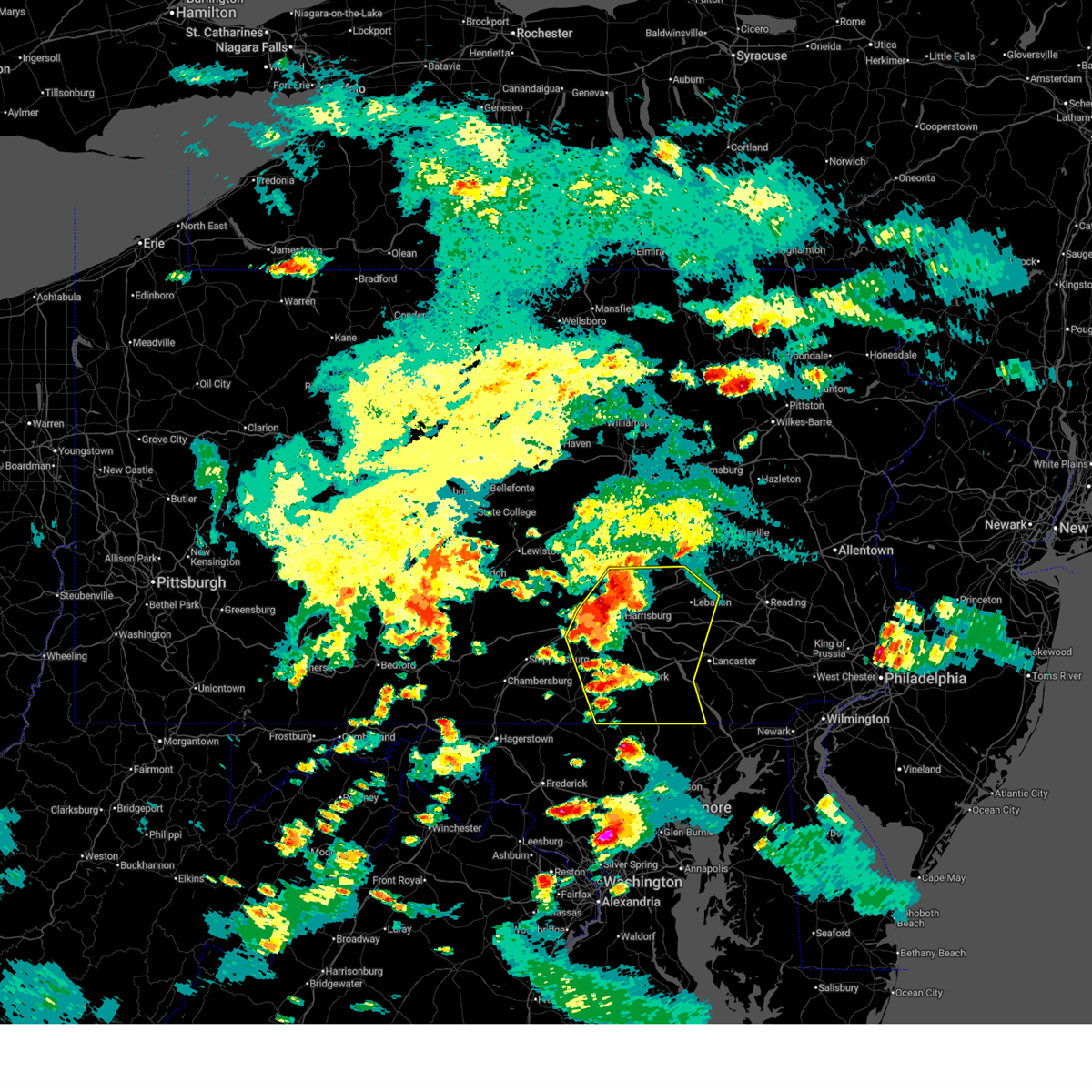
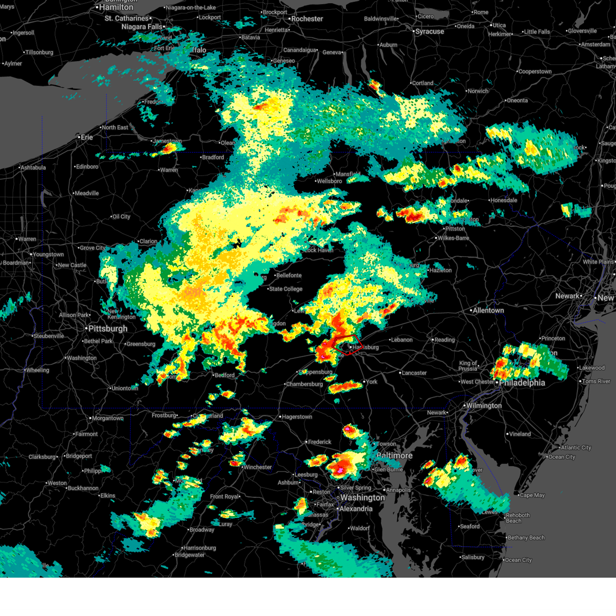
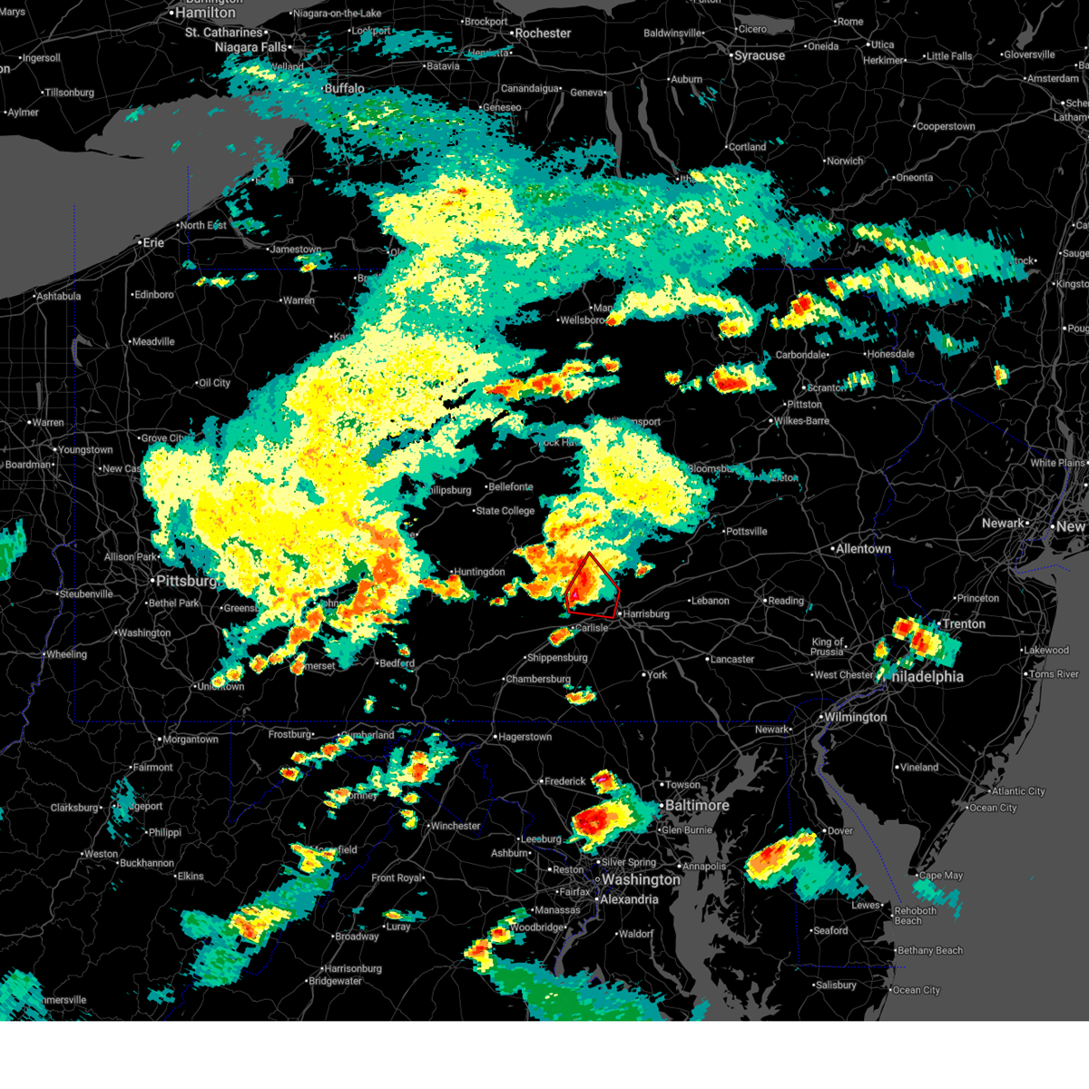
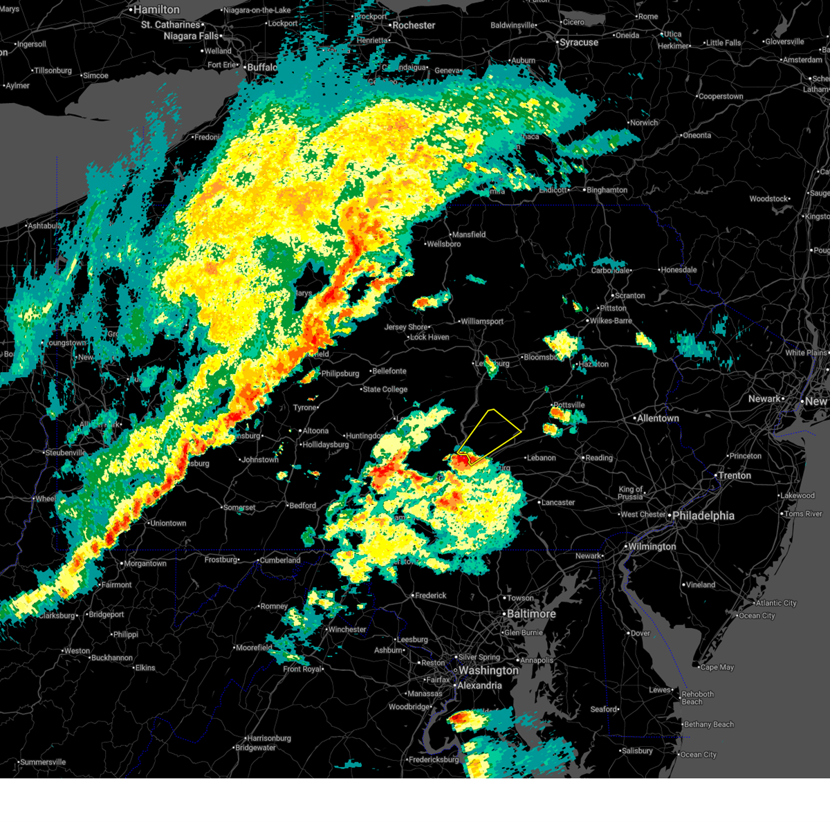
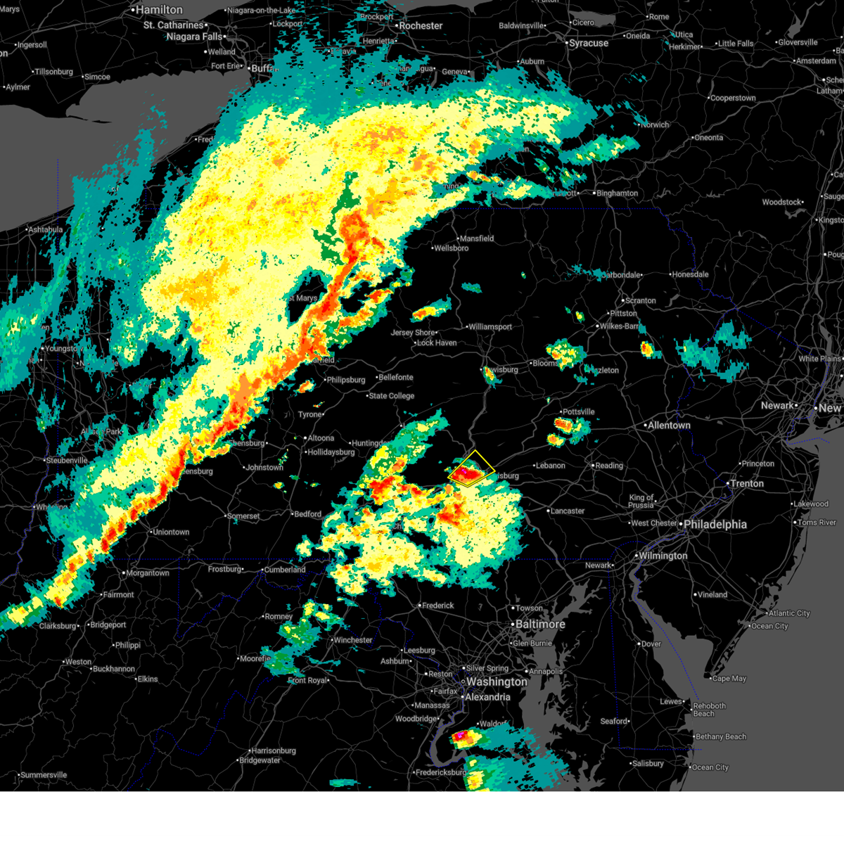
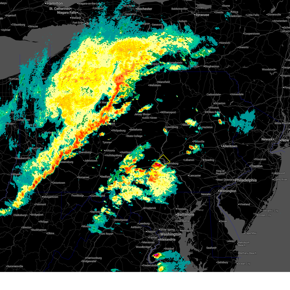
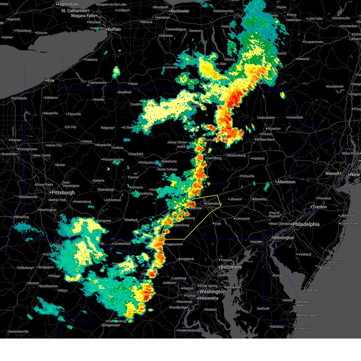
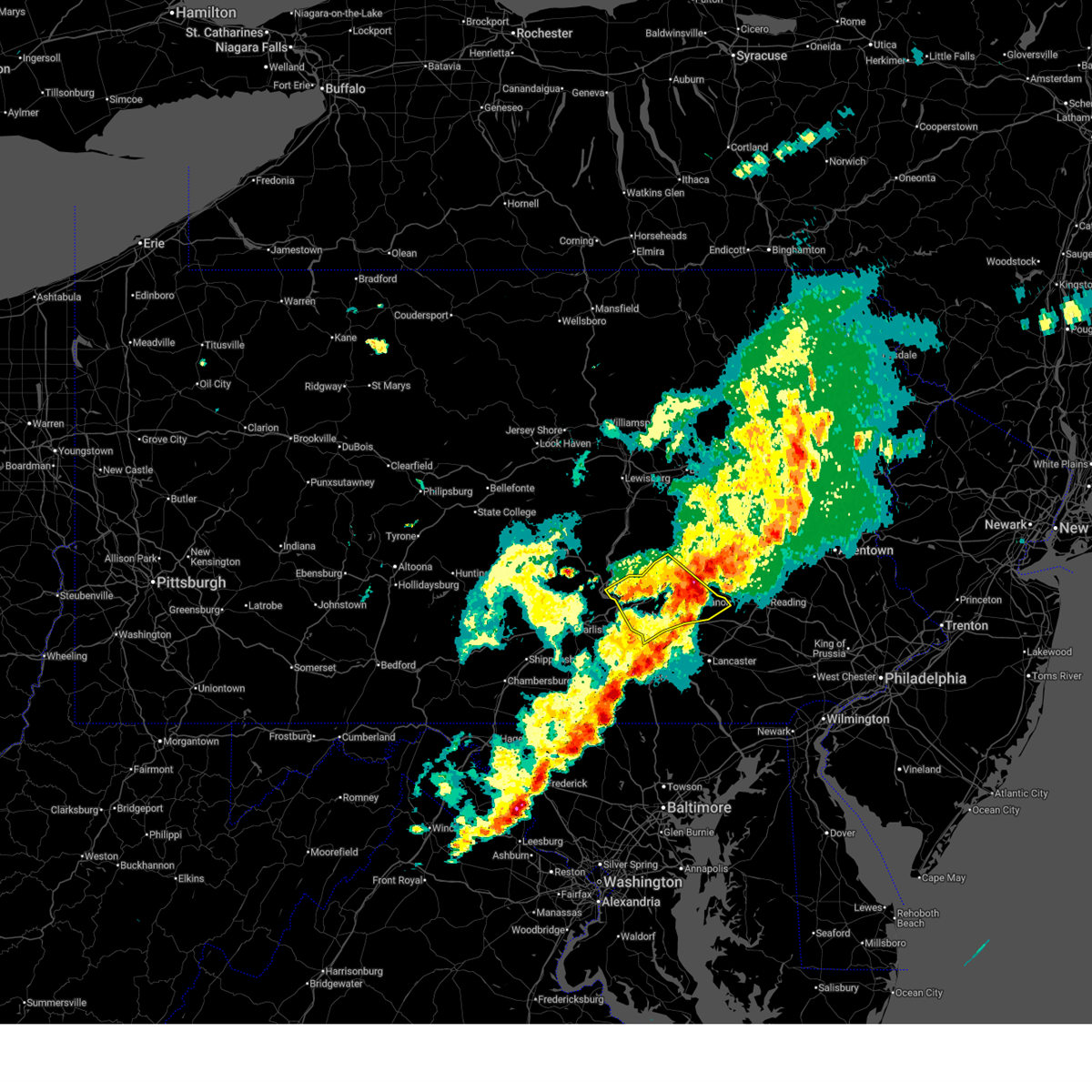
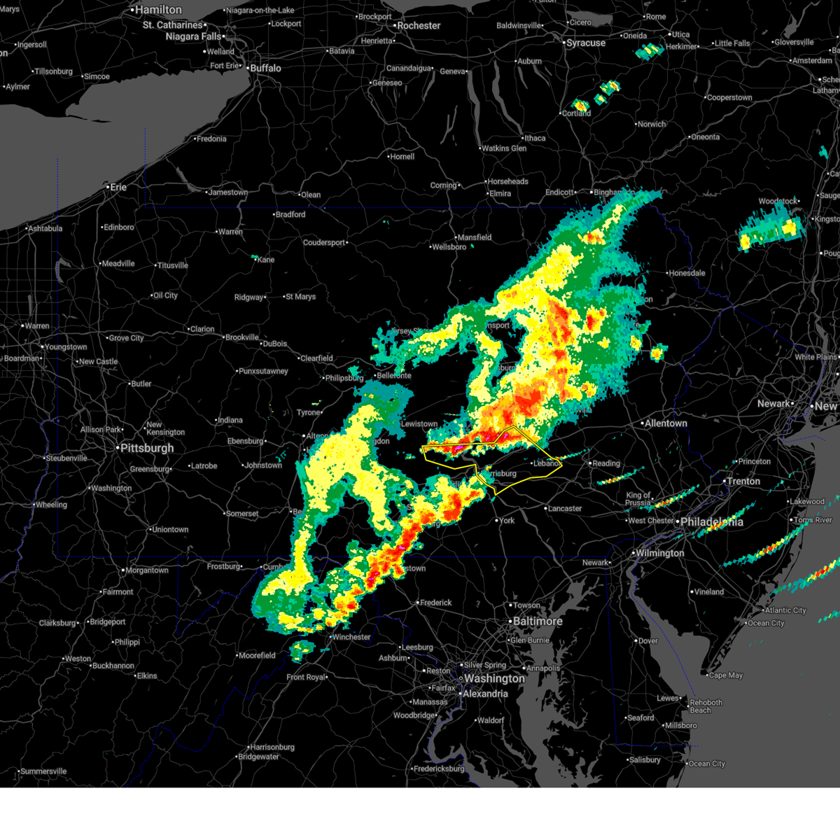
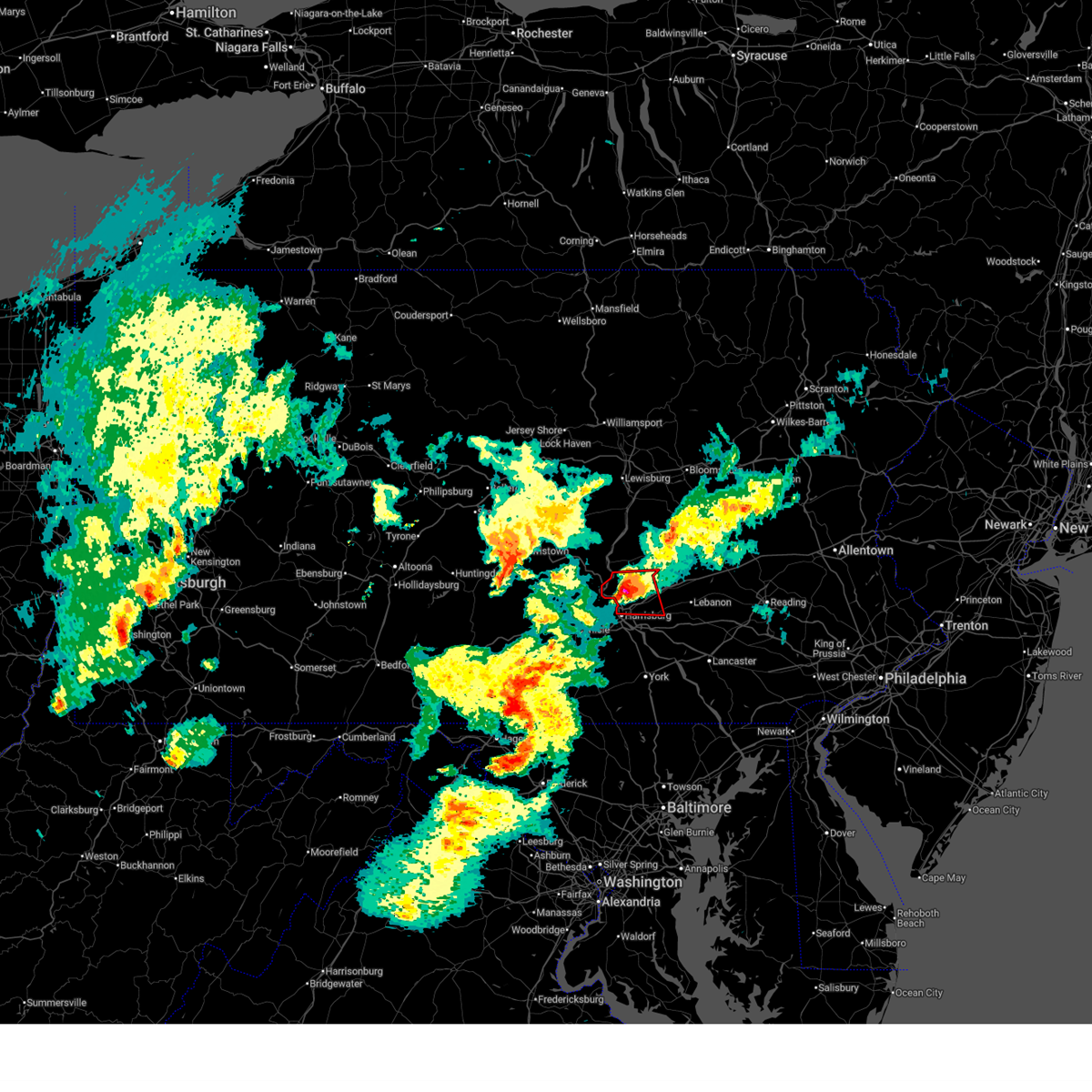
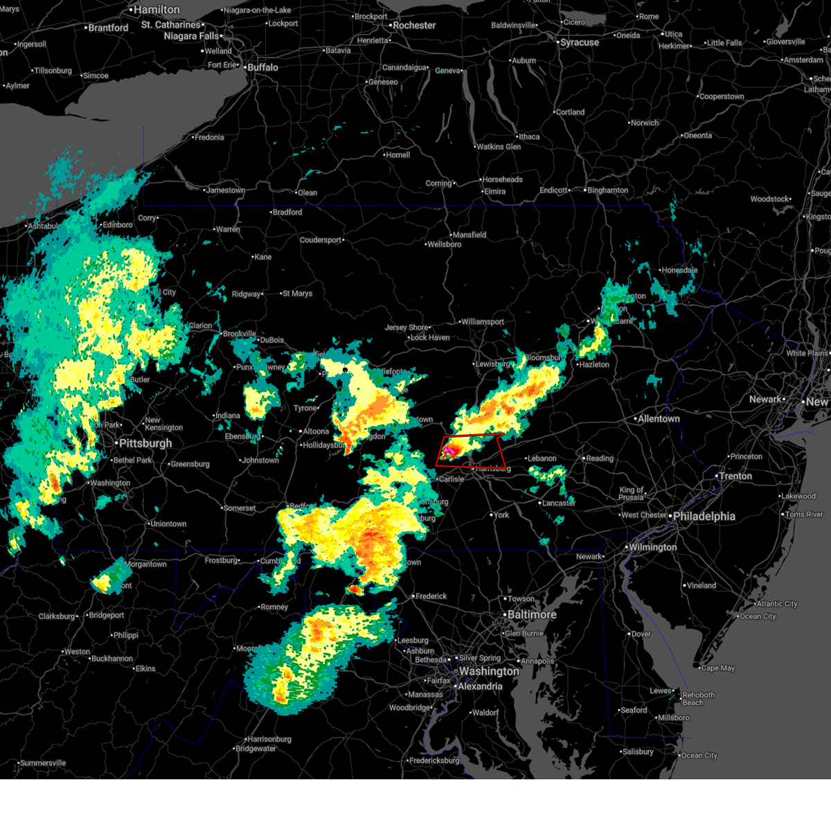
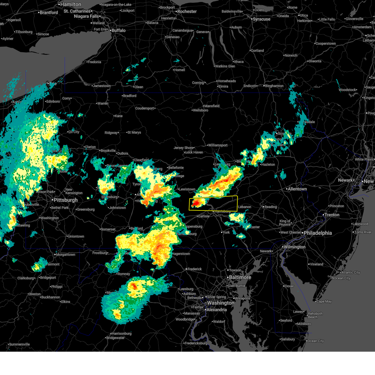
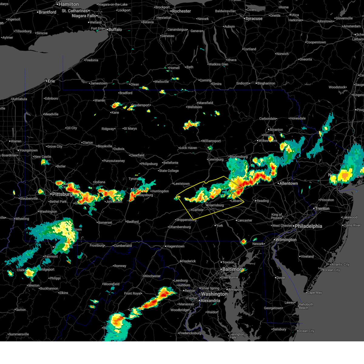
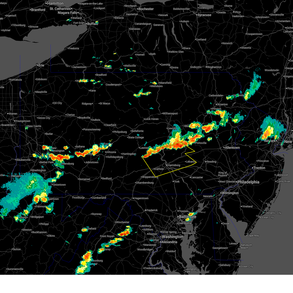
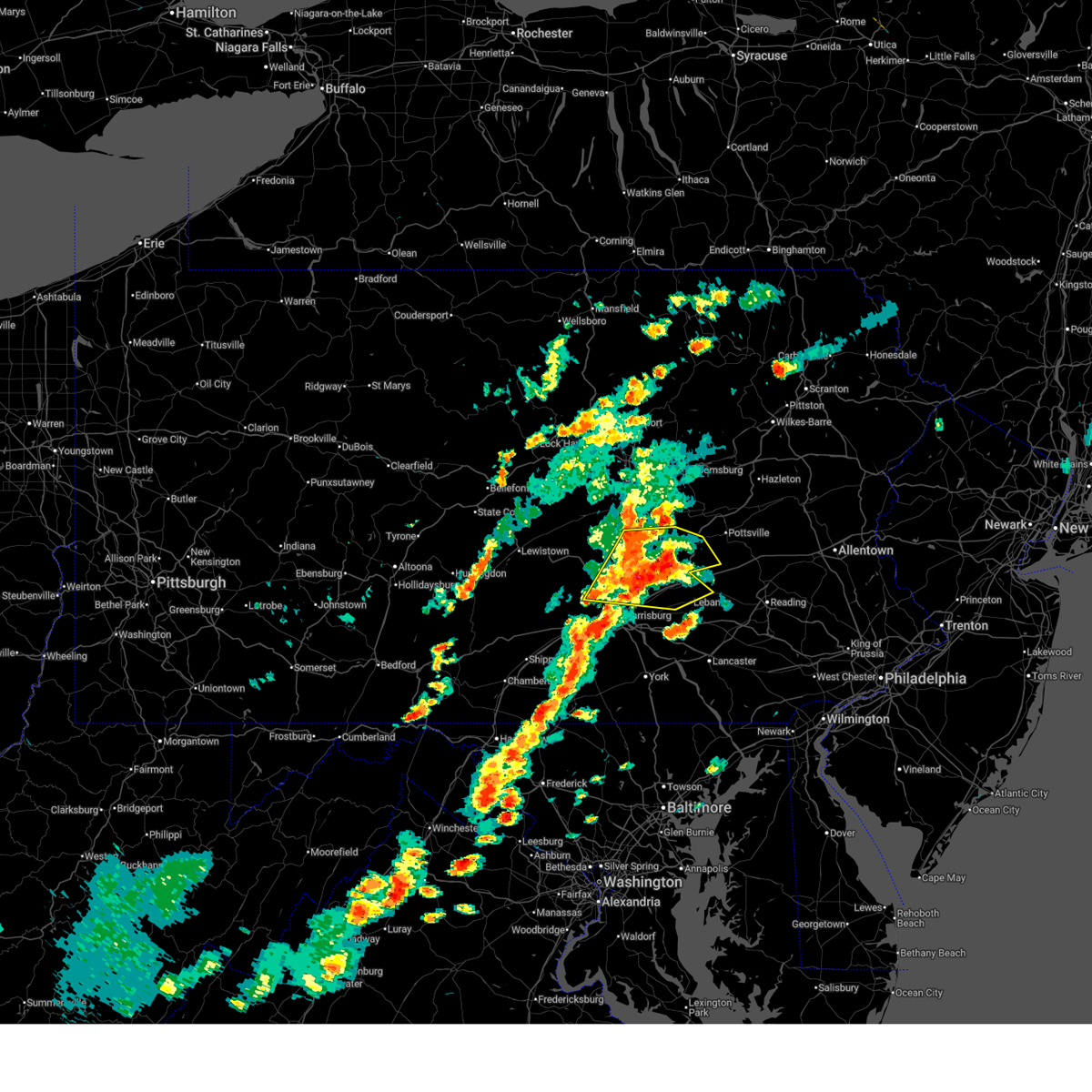
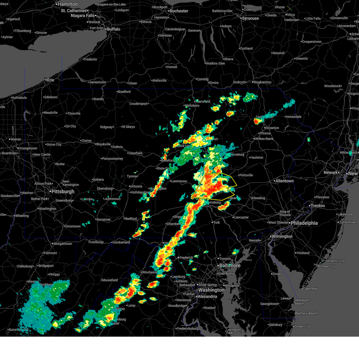
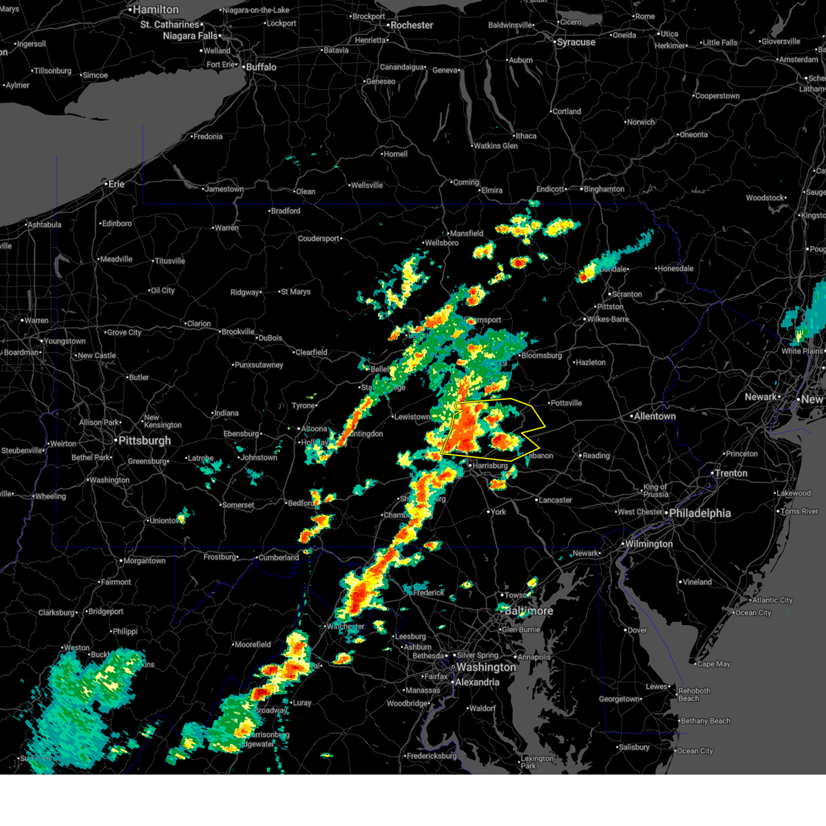
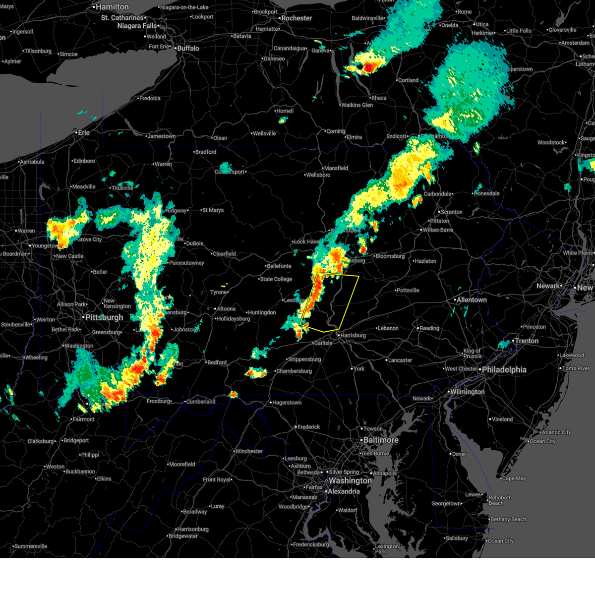
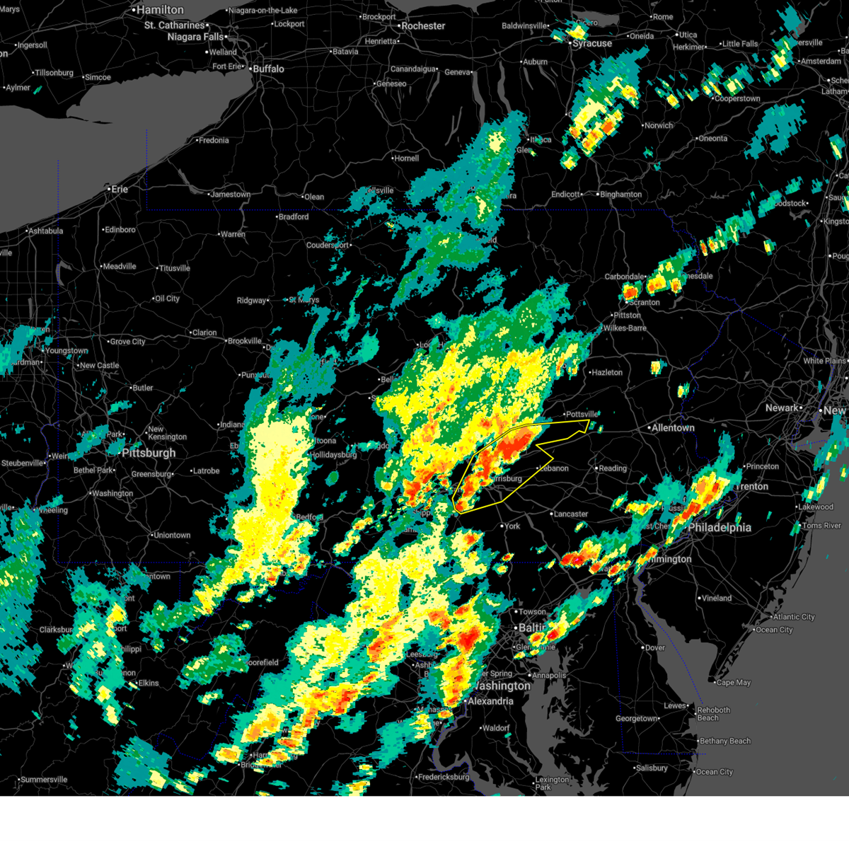
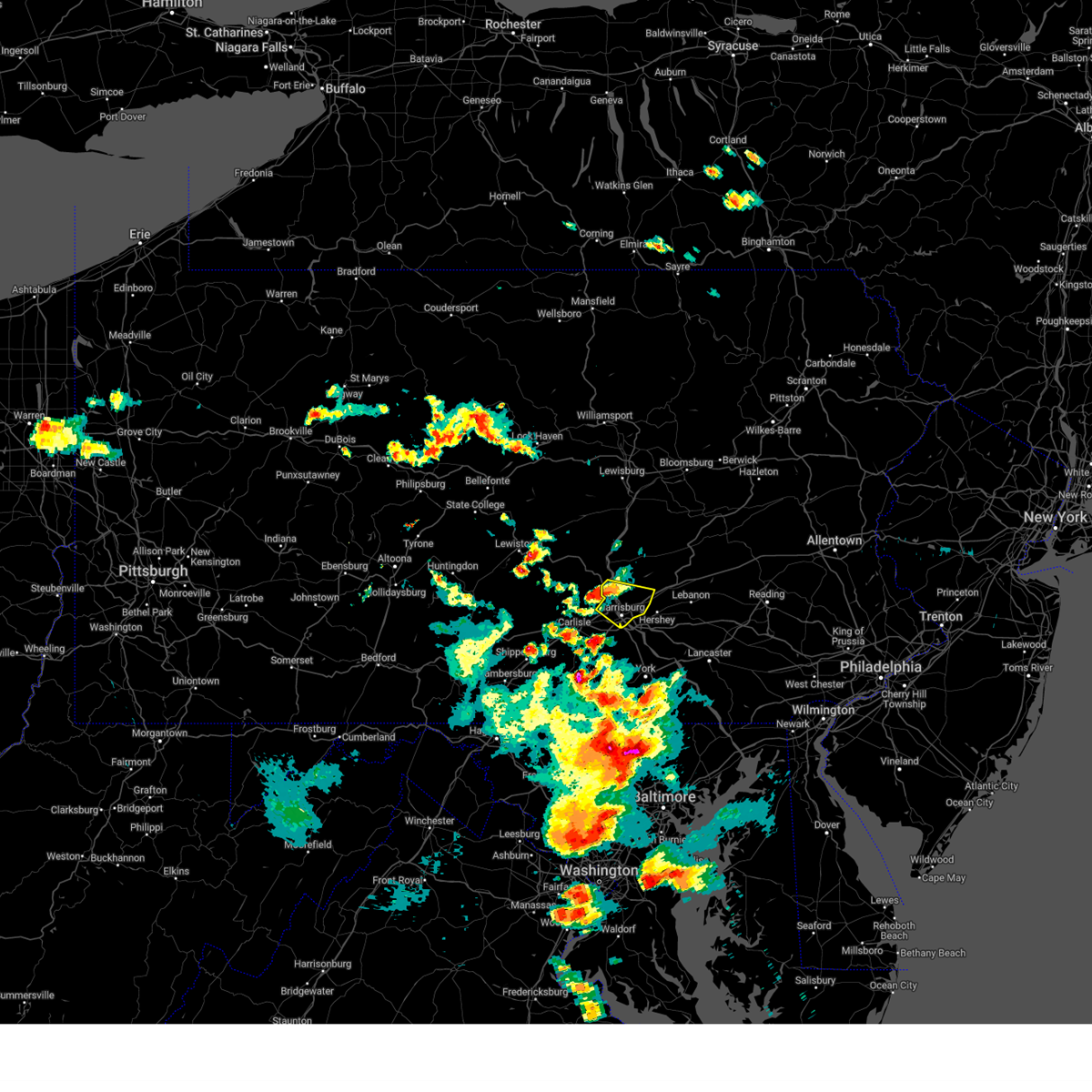
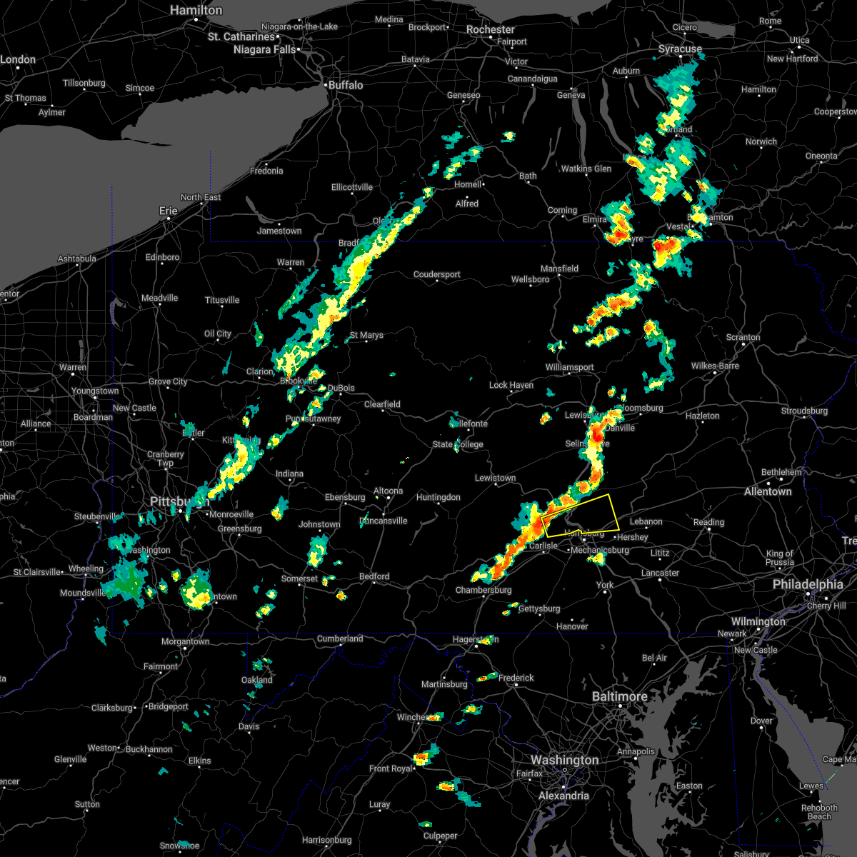
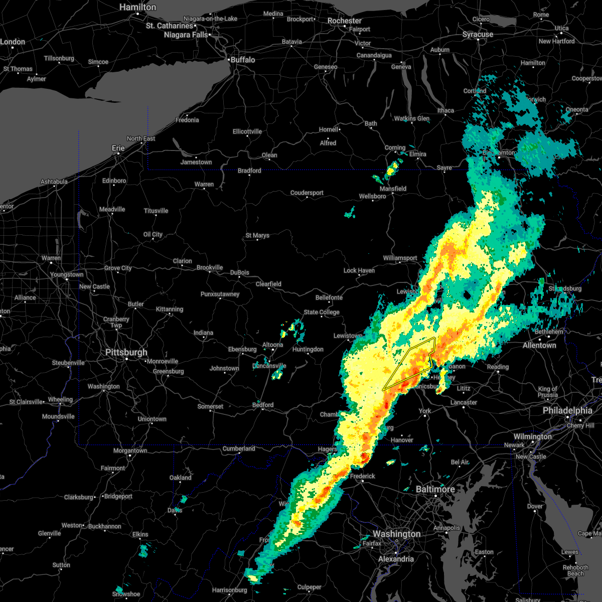
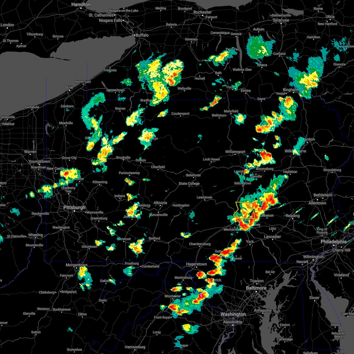
Hail Map for Dauphin, PA
The Dauphin, PA area has had 2 reports of on-the-ground hail by trained spotters, and has been under severe weather warnings 29 times during the past 12 months. Doppler radar has detected hail at or near Dauphin, PA on 46 occasions, including 5 occasions during the past year.
| Name: | Dauphin, PA |
| Where Located: | 57.1 miles ESE of State College, PA |
| Map: | Google Map for Dauphin, PA |
| Population: | 791 |
| Housing Units: | 364 |
| More Info: | Search Google for Dauphin, PA |
5
The Top Recent Hail Date for Dauphin, PA is Sunday, June 14, 2026 (1st out of 46)

Hail and Wind Damage Spotted near Dauphin, PA
| Date / Time | Report Details |
|---|---|
| 7/5/2026 7:27 PM EDT |
 Svrctp the national weather service in state college pa has issued a * severe thunderstorm warning for, eastern adams county in south central pennsylvania, eastern cumberland county in south central pennsylvania, dauphin county in south central pennsylvania, northwestern lancaster county in south central pennsylvania, lebanon county in south central pennsylvania, east central perry county in south central pennsylvania, york county in south central pennsylvania, * until 830 pm edt. * at 727 pm edt, severe thunderstorms were located along a line extending from dehart dam to lake meade to manchester, moving east at 45 mph (radar indicated). Hazards include 70 mph wind gusts. Expect considerable tree damage. Damage is likely to mobile homes, roofs, and outbuildings. Svrctp the national weather service in state college pa has issued a * severe thunderstorm warning for, eastern adams county in south central pennsylvania, eastern cumberland county in south central pennsylvania, dauphin county in south central pennsylvania, northwestern lancaster county in south central pennsylvania, lebanon county in south central pennsylvania, east central perry county in south central pennsylvania, york county in south central pennsylvania, * until 830 pm edt. * at 727 pm edt, severe thunderstorms were located along a line extending from dehart dam to lake meade to manchester, moving east at 45 mph (radar indicated). Hazards include 70 mph wind gusts. Expect considerable tree damage. Damage is likely to mobile homes, roofs, and outbuildings.
|
| 7/5/2026 7:23 PM EDT |
 At 722 pm edt, a severe thunderstorm was located over new buffalo, moving east at 20 mph (radar indicated). Hazards include 70 mph wind gusts. Expect considerable tree damage. damage is likely to mobile homes, roofs, and outbuildings. locations impacted include, harrisburg, colonial park, progress, linglestown, enola, paxtonia, rutherford, lawnton, wormleysburg, penbrook, marysville, and paxtang. this includes the following interstates, interstate 81 from mile markers 59 to 73. Interstate 83 from mile markers 45 to 50. At 722 pm edt, a severe thunderstorm was located over new buffalo, moving east at 20 mph (radar indicated). Hazards include 70 mph wind gusts. Expect considerable tree damage. damage is likely to mobile homes, roofs, and outbuildings. locations impacted include, harrisburg, colonial park, progress, linglestown, enola, paxtonia, rutherford, lawnton, wormleysburg, penbrook, marysville, and paxtang. this includes the following interstates, interstate 81 from mile markers 59 to 73. Interstate 83 from mile markers 45 to 50.
|
| 7/5/2026 7:13 PM EDT |
 Torctp the national weather service in state college pa has issued a * tornado warning for, northeastern cumberland county in south central pennsylvania, southwestern dauphin county in south central pennsylvania, east central perry county in south central pennsylvania, * until 745 pm edt. * at 713 pm edt, a severe thunderstorm capable of producing a tornado was located over wertzville, moving east at 20 mph (radar indicated rotation). Hazards include tornado. Flying debris will be dangerous to those caught without shelter. mobile homes will be damaged or destroyed. damage to roofs, windows, and vehicles will occur. tree damage is likely. this dangerous storm will be near, camp hill, enola, and harrisburg around 720 pm edt. lower allen, new cumberland, and steelton around 730 pm edt. linglestown, rutherford, and bressler-enhaut-oberlin around 740 pm edt. other locations impacted by this tornadic thunderstorm include harrisburg area community college, city island, and dauphin. this includes the following interstates, interstate 81 from mile markers 56 to 72. interstate 83 from mile markers 40 to 50. Interstate 283 near mile marker 2. Torctp the national weather service in state college pa has issued a * tornado warning for, northeastern cumberland county in south central pennsylvania, southwestern dauphin county in south central pennsylvania, east central perry county in south central pennsylvania, * until 745 pm edt. * at 713 pm edt, a severe thunderstorm capable of producing a tornado was located over wertzville, moving east at 20 mph (radar indicated rotation). Hazards include tornado. Flying debris will be dangerous to those caught without shelter. mobile homes will be damaged or destroyed. damage to roofs, windows, and vehicles will occur. tree damage is likely. this dangerous storm will be near, camp hill, enola, and harrisburg around 720 pm edt. lower allen, new cumberland, and steelton around 730 pm edt. linglestown, rutherford, and bressler-enhaut-oberlin around 740 pm edt. other locations impacted by this tornadic thunderstorm include harrisburg area community college, city island, and dauphin. this includes the following interstates, interstate 81 from mile markers 56 to 72. interstate 83 from mile markers 40 to 50. Interstate 283 near mile marker 2.
|
| 7/5/2026 6:59 PM EDT | Svrctp the national weather service in state college pa has issued a * severe thunderstorm warning for, northeastern cumberland county in south central pennsylvania, northwestern dauphin county in south central pennsylvania, east central perry county in south central pennsylvania, * until 745 pm edt. * at 658 pm edt, a severe thunderstorm was located over duncannon, moving east at 20 mph (radar indicated). Hazards include 60 mph wind gusts. expect damage to roofs, siding, and trees |
| 7/5/2026 6:55 PM EDT | At 655 pm edt, a severe thunderstorm capable of producing a tornado was located over shermansdale, moving east at 20 mph (radar indicated rotation). Hazards include tornado. Flying debris will be dangerous to those caught without shelter. mobile homes will be damaged or destroyed. damage to roofs, windows, and vehicles will occur. tree damage is likely. this dangerous storm will be near, duncannon and wertzville around 700 pm edt. enola, marysville, and rockville around 710 pm edt. other locations impacted by this tornadic thunderstorm include dauphin. This includes interstate 81 from mile markers 57 to 65. |
| 7/5/2026 6:44 PM EDT |
 Torctp the national weather service in state college pa has issued a * tornado warning for, northeastern cumberland county in south central pennsylvania, west central dauphin county in south central pennsylvania, northeastern perry county in south central pennsylvania, * until 715 pm edt. * at 643 pm edt, a severe thunderstorm capable of producing a tornado was located over shermansdale, moving east at 20 mph (radar indicated rotation). Hazards include tornado. Flying debris will be dangerous to those caught without shelter. mobile homes will be damaged or destroyed. damage to roofs, windows, and vehicles will occur. tree damage is likely. this dangerous storm will be near, shermansdale around 650 pm edt. duncannon and wertzville around 700 pm edt. other locations impacted by this tornadic thunderstorm include dauphin. This includes interstate 81 from mile markers 57 to 65. Torctp the national weather service in state college pa has issued a * tornado warning for, northeastern cumberland county in south central pennsylvania, west central dauphin county in south central pennsylvania, northeastern perry county in south central pennsylvania, * until 715 pm edt. * at 643 pm edt, a severe thunderstorm capable of producing a tornado was located over shermansdale, moving east at 20 mph (radar indicated rotation). Hazards include tornado. Flying debris will be dangerous to those caught without shelter. mobile homes will be damaged or destroyed. damage to roofs, windows, and vehicles will occur. tree damage is likely. this dangerous storm will be near, shermansdale around 650 pm edt. duncannon and wertzville around 700 pm edt. other locations impacted by this tornadic thunderstorm include dauphin. This includes interstate 81 from mile markers 57 to 65.
|
| 6/14/2026 7:29 PM EDT | Tree down onto a house in middle paxton township... no injuries reporte in dauphin county PA, 1 miles SSW of Dauphin, PA |
| 6/14/2026 7:24 PM EDT |
 Svrctp the national weather service in state college pa has issued a * severe thunderstorm warning for, northern dauphin county in south central pennsylvania, northwestern lebanon county in south central pennsylvania, * until 815 pm edt. * at 724 pm edt, a severe thunderstorm was located over marysville, moving northeast at 40 mph (radar indicated). Hazards include 70 mph wind gusts and quarter size hail. Hail damage to vehicles is expected. expect considerable tree damage. wind damage is also likely to mobile homes, roofs, and outbuildings. this severe thunderstorm will be near, dehart dam around 730 pm edt. lykens and elizabethville around 740 pm edt. williamstown around 750 pm edt. other locations impacted by this severe thunderstorm include enders, wiconisco, gratz, dauphin, and halifax. This includes interstate 81 between mile markers 66 and 67, and from mile markers 93 to 96. Svrctp the national weather service in state college pa has issued a * severe thunderstorm warning for, northern dauphin county in south central pennsylvania, northwestern lebanon county in south central pennsylvania, * until 815 pm edt. * at 724 pm edt, a severe thunderstorm was located over marysville, moving northeast at 40 mph (radar indicated). Hazards include 70 mph wind gusts and quarter size hail. Hail damage to vehicles is expected. expect considerable tree damage. wind damage is also likely to mobile homes, roofs, and outbuildings. this severe thunderstorm will be near, dehart dam around 730 pm edt. lykens and elizabethville around 740 pm edt. williamstown around 750 pm edt. other locations impacted by this severe thunderstorm include enders, wiconisco, gratz, dauphin, and halifax. This includes interstate 81 between mile markers 66 and 67, and from mile markers 93 to 96.
|
| 6/14/2026 7:21 PM EDT | Seven trees down... pea sized hai in dauphin county PA, 2.2 miles SE of Dauphin, PA |
| 6/14/2026 7:17 PM EDT |
 At 717 pm edt, a severe thunderstorm was located over enola, moving northeast at 45 mph (radar indicated). Hazards include 60 mph wind gusts and quarter size hail. Hail damage to vehicles is expected. expect wind damage to roofs, siding, and trees. this severe storm will be near, camp hill, enola, and harrisburg around 720 pm edt. linglestown and paxtonia around 730 pm edt. other locations impacted by this severe thunderstorm include dauphin, city island, and harrisburg area community college. this includes the following interstates, interstate 81 from mile markers 53 to 72. Interstate 83 from mile markers 48 to 50. At 717 pm edt, a severe thunderstorm was located over enola, moving northeast at 45 mph (radar indicated). Hazards include 60 mph wind gusts and quarter size hail. Hail damage to vehicles is expected. expect wind damage to roofs, siding, and trees. this severe storm will be near, camp hill, enola, and harrisburg around 720 pm edt. linglestown and paxtonia around 730 pm edt. other locations impacted by this severe thunderstorm include dauphin, city island, and harrisburg area community college. this includes the following interstates, interstate 81 from mile markers 53 to 72. Interstate 83 from mile markers 48 to 50.
|
| 6/14/2026 7:08 PM EDT |
 Svrctp the national weather service in state college pa has issued a * severe thunderstorm warning for, northeastern cumberland county in south central pennsylvania, southwestern dauphin county in south central pennsylvania, east central perry county in south central pennsylvania, * until 730 pm edt. * at 708 pm edt, a severe thunderstorm was located over new kingstown, moving northeast at 45 mph (radar indicated). Hazards include 60 mph wind gusts and quarter size hail. Hail damage to vehicles is expected. expect wind damage to roofs, siding, and trees. this severe thunderstorm will be near, camp hill, enola, and mechanicsburg around 710 pm edt. harrisburg, progress, and linglestown around 720 pm edt. paxtonia around 730 pm edt. other locations impacted by this severe thunderstorm include dauphin, city island, penn state dickinson school of law, and harrisburg area community college. this includes the following interstates, the pennsylvania turnpike from mile markers 223 to 234. interstate 81 from mile markers 48 to 72. Interstate 83 from mile markers 48 to 50. Svrctp the national weather service in state college pa has issued a * severe thunderstorm warning for, northeastern cumberland county in south central pennsylvania, southwestern dauphin county in south central pennsylvania, east central perry county in south central pennsylvania, * until 730 pm edt. * at 708 pm edt, a severe thunderstorm was located over new kingstown, moving northeast at 45 mph (radar indicated). Hazards include 60 mph wind gusts and quarter size hail. Hail damage to vehicles is expected. expect wind damage to roofs, siding, and trees. this severe thunderstorm will be near, camp hill, enola, and mechanicsburg around 710 pm edt. harrisburg, progress, and linglestown around 720 pm edt. paxtonia around 730 pm edt. other locations impacted by this severe thunderstorm include dauphin, city island, penn state dickinson school of law, and harrisburg area community college. this includes the following interstates, the pennsylvania turnpike from mile markers 223 to 234. interstate 81 from mile markers 48 to 72. Interstate 83 from mile markers 48 to 50.
|
| 6/11/2026 7:30 PM EDT | Tree down on clarks valley r in dauphin county PA, 4.8 miles SW of Dauphin, PA |
| 6/11/2026 7:12 PM EDT |
 Svrctp the national weather service in state college pa has issued a * severe thunderstorm warning for, adams county in south central pennsylvania, cumberland county in south central pennsylvania, southern dauphin county in south central pennsylvania, southeastern franklin county in south central pennsylvania, east central perry county in south central pennsylvania, northwestern york county in south central pennsylvania, * until 800 pm edt. * at 712 pm edt, severe thunderstorms were located along a line extending from wertzville to mount holly springs to shippensburg to greencastle, moving east at 50 mph (radar indicated). Hazards include 60 mph wind gusts. expect damage to roofs, siding, and trees Svrctp the national weather service in state college pa has issued a * severe thunderstorm warning for, adams county in south central pennsylvania, cumberland county in south central pennsylvania, southern dauphin county in south central pennsylvania, southeastern franklin county in south central pennsylvania, east central perry county in south central pennsylvania, northwestern york county in south central pennsylvania, * until 800 pm edt. * at 712 pm edt, severe thunderstorms were located along a line extending from wertzville to mount holly springs to shippensburg to greencastle, moving east at 50 mph (radar indicated). Hazards include 60 mph wind gusts. expect damage to roofs, siding, and trees
|
| 6/11/2026 7:06 PM EDT |
 Svrctp the national weather service in state college pa has issued a * severe thunderstorm warning for, northwestern dauphin county in south central pennsylvania, northeastern juniata county in central pennsylvania, southeastern lycoming county in north central pennsylvania, montour county in central pennsylvania, northumberland county in central pennsylvania, northeastern perry county in south central pennsylvania, eastern snyder county in central pennsylvania, union county in central pennsylvania, * until 745 pm edt. * at 706 pm edt, severe thunderstorms were located along a line extending from elimsport to port trevorton to duncannon, moving northeast at 35 mph (radar indicated). Hazards include 60 mph wind gusts. expect damage to roofs, siding, and trees Svrctp the national weather service in state college pa has issued a * severe thunderstorm warning for, northwestern dauphin county in south central pennsylvania, northeastern juniata county in central pennsylvania, southeastern lycoming county in north central pennsylvania, montour county in central pennsylvania, northumberland county in central pennsylvania, northeastern perry county in south central pennsylvania, eastern snyder county in central pennsylvania, union county in central pennsylvania, * until 745 pm edt. * at 706 pm edt, severe thunderstorms were located along a line extending from elimsport to port trevorton to duncannon, moving northeast at 35 mph (radar indicated). Hazards include 60 mph wind gusts. expect damage to roofs, siding, and trees
|
| 6/6/2026 5:45 PM EDT |
 At 544 pm edt, a severe thunderstorm was located over myerstown, moving east at 45 mph (radar indicated). Hazards include 60 mph wind gusts and penny size hail. Expect damage to roofs, siding, and trees. locations impacted include, harrisburg, lebanon, hershey, colonial park, progress, middletown, palmyra, linglestown, steelton, annville, hummelstown, and cornwall. this includes the following interstates, the pennsylvania turnpike from mile markers 246 to 264. interstate 78 from mile markers 0 to 8. interstate 81 from mile markers 66 to 96. interstate 83 from mile markers 44 to 50. Interstate 283 from mile markers 0 to 2. At 544 pm edt, a severe thunderstorm was located over myerstown, moving east at 45 mph (radar indicated). Hazards include 60 mph wind gusts and penny size hail. Expect damage to roofs, siding, and trees. locations impacted include, harrisburg, lebanon, hershey, colonial park, progress, middletown, palmyra, linglestown, steelton, annville, hummelstown, and cornwall. this includes the following interstates, the pennsylvania turnpike from mile markers 246 to 264. interstate 78 from mile markers 0 to 8. interstate 81 from mile markers 66 to 96. interstate 83 from mile markers 44 to 50. Interstate 283 from mile markers 0 to 2.
|
| 6/6/2026 5:40 PM EDT | Route 22/322 west is closed just east of dauphin borough after a tree fell onto a vehicl in dauphin county PA, 0.5 miles N of Dauphin, PA |
| 6/6/2026 5:14 PM EDT |
 Svrctp the national weather service in state college pa has issued a * severe thunderstorm warning for, dauphin county in south central pennsylvania, lebanon county in south central pennsylvania, east central perry county in south central pennsylvania, * until 615 pm edt. * at 513 pm edt, severe thunderstorms were located along a line extending from donaldson to dehart dam to shermansdale, moving east at 50 mph (radar indicated). Hazards include 60 mph wind gusts and penny size hail. expect damage to roofs, siding, and trees Svrctp the national weather service in state college pa has issued a * severe thunderstorm warning for, dauphin county in south central pennsylvania, lebanon county in south central pennsylvania, east central perry county in south central pennsylvania, * until 615 pm edt. * at 513 pm edt, severe thunderstorms were located along a line extending from donaldson to dehart dam to shermansdale, moving east at 50 mph (radar indicated). Hazards include 60 mph wind gusts and penny size hail. expect damage to roofs, siding, and trees
|
| 3/16/2026 12:48 PM EDT |
 At 1247 pm edt, severe thunderstorms were located along a line extending from new buffalo to mount wolf, moving north at 55 mph (radar indicated). Hazards include 60 mph wind gusts. Expect damage to roofs, siding, and trees. locations impacted include, harrisburg, hershey, colonial park, elizabethtown, columbia, progress, middletown, mount joy, palmyra, new cumberland, linglestown, and steelton. this includes the following interstates, the pennsylvania turnpike between mile markers 246 and 258, and from mile markers 265 to 269. interstate 81 from mile markers 66 to 81. interstate 83 from mile markers 43 to 50. Interstate 283 from mile markers 0 to 2. At 1247 pm edt, severe thunderstorms were located along a line extending from new buffalo to mount wolf, moving north at 55 mph (radar indicated). Hazards include 60 mph wind gusts. Expect damage to roofs, siding, and trees. locations impacted include, harrisburg, hershey, colonial park, elizabethtown, columbia, progress, middletown, mount joy, palmyra, new cumberland, linglestown, and steelton. this includes the following interstates, the pennsylvania turnpike between mile markers 246 and 258, and from mile markers 265 to 269. interstate 81 from mile markers 66 to 81. interstate 83 from mile markers 43 to 50. Interstate 283 from mile markers 0 to 2.
|
| 3/16/2026 12:48 PM EDT |
 the severe thunderstorm warning has been cancelled and is no longer in effect the severe thunderstorm warning has been cancelled and is no longer in effect
|
| 3/16/2026 12:26 PM EDT |
 Svrctp the national weather service in state college pa has issued a * severe thunderstorm warning for, eastern adams county in south central pennsylvania, northeastern cumberland county in south central pennsylvania, dauphin county in south central pennsylvania, northwestern lancaster county in south central pennsylvania, east central perry county in south central pennsylvania, york county in south central pennsylvania, * until 100 pm edt. * at 1225 pm edt, severe thunderstorms were located along a line extending from new kingstown to glen rock, moving north at 65 mph (radar indicated). Hazards include 60 mph wind gusts. expect damage to roofs, siding, and trees Svrctp the national weather service in state college pa has issued a * severe thunderstorm warning for, eastern adams county in south central pennsylvania, northeastern cumberland county in south central pennsylvania, dauphin county in south central pennsylvania, northwestern lancaster county in south central pennsylvania, east central perry county in south central pennsylvania, york county in south central pennsylvania, * until 100 pm edt. * at 1225 pm edt, severe thunderstorms were located along a line extending from new kingstown to glen rock, moving north at 65 mph (radar indicated). Hazards include 60 mph wind gusts. expect damage to roofs, siding, and trees
|
| 3/11/2026 6:25 PM EDT |
 The storm which prompted the warning has showed signs of weakening and losing the tornado weakened below severe limits, and no longer appears capable of producing a tornado. therefore, the warning will be allowed to expire. however, damaging hail and winds are still possible with this thunderstorm, and rotation may reintensify. to report severe weather, contact your nearest law enforcement agency. they will relay your report to the national weather service state college pa. a severe thunderstorm warning still remains in effect for parts of dauphin and lebanon counties. a tornado watch remains in effect until 800 pm edt for south central pennsylvania. The storm which prompted the warning has showed signs of weakening and losing the tornado weakened below severe limits, and no longer appears capable of producing a tornado. therefore, the warning will be allowed to expire. however, damaging hail and winds are still possible with this thunderstorm, and rotation may reintensify. to report severe weather, contact your nearest law enforcement agency. they will relay your report to the national weather service state college pa. a severe thunderstorm warning still remains in effect for parts of dauphin and lebanon counties. a tornado watch remains in effect until 800 pm edt for south central pennsylvania.
|
| 3/11/2026 6:14 PM EDT |
 the tornado warning has been cancelled and is no longer in effect the tornado warning has been cancelled and is no longer in effect
|
| 3/11/2026 6:14 PM EDT |
 At 612 pm edt, a severe thunderstorm capable of producing a tornado was located over linglestown, moving east at 45 mph (radar indicated rotation). Hazards include tornado and ping pong ball size hail. Flying debris will be dangerous to those caught without shelter. mobile homes will be damaged or destroyed. damage to roofs, windows, and vehicles will occur. tree damage is likely. this dangerous storm will be near, linglestown, skyline view, and penn national race course around 620 pm edt. other locations impacted by this tornadic thunderstorm include enders, dauphin, halifax, hershey park, and harrisburg area community college. this includes the following interstates, interstate 81 from mile markers 66 to 81. interstate 83 from mile markers 48 to 50. this includes the following highways, routes 11 and 15 near duncannon. routes 22 and 322 from near duncannon to harrisburg. route 22 from harrisburg to east of skyline view. route 322 near east of hershey. Route 422 from hershey to palmdale. At 612 pm edt, a severe thunderstorm capable of producing a tornado was located over linglestown, moving east at 45 mph (radar indicated rotation). Hazards include tornado and ping pong ball size hail. Flying debris will be dangerous to those caught without shelter. mobile homes will be damaged or destroyed. damage to roofs, windows, and vehicles will occur. tree damage is likely. this dangerous storm will be near, linglestown, skyline view, and penn national race course around 620 pm edt. other locations impacted by this tornadic thunderstorm include enders, dauphin, halifax, hershey park, and harrisburg area community college. this includes the following interstates, interstate 81 from mile markers 66 to 81. interstate 83 from mile markers 48 to 50. this includes the following highways, routes 11 and 15 near duncannon. routes 22 and 322 from near duncannon to harrisburg. route 22 from harrisburg to east of skyline view. route 322 near east of hershey. Route 422 from hershey to palmdale.
|
| 3/11/2026 6:10 PM EDT |
 At 608 pm edt, a severe thunderstorm was located over linglestown, moving east at 45 mph (radar indicated). Hazards include ping pong ball size hail and 60 mph wind gusts. People and animals outdoors will be injured. expect hail damage to roofs, siding, windows, and vehicles. expect wind damage to roofs, siding, and trees. locations impacted include, harrisburg, lebanon, hershey, colonial park, progress, palmyra, linglestown, annville, cornwall, paxtonia, skyline view, and campbelltown. this includes the following interstates, interstate 78 from mile markers 0 to 6. interstate 81 from mile markers 66 to 94. Interstate 83 from mile markers 48 to 50. At 608 pm edt, a severe thunderstorm was located over linglestown, moving east at 45 mph (radar indicated). Hazards include ping pong ball size hail and 60 mph wind gusts. People and animals outdoors will be injured. expect hail damage to roofs, siding, windows, and vehicles. expect wind damage to roofs, siding, and trees. locations impacted include, harrisburg, lebanon, hershey, colonial park, progress, palmyra, linglestown, annville, cornwall, paxtonia, skyline view, and campbelltown. this includes the following interstates, interstate 78 from mile markers 0 to 6. interstate 81 from mile markers 66 to 94. Interstate 83 from mile markers 48 to 50.
|
| 3/11/2026 6:10 PM EDT |
 the severe thunderstorm warning has been cancelled and is no longer in effect the severe thunderstorm warning has been cancelled and is no longer in effect
|
| 3/11/2026 5:56 PM EDT |
 Torctp the national weather service in state college pa has issued a * tornado warning for, northeastern cumberland county in south central pennsylvania, central dauphin county in south central pennsylvania, east central perry county in south central pennsylvania, * until 630 pm edt. * at 556 pm edt, a severe thunderstorm capable of producing a tornado was located over duncannon, moving east at 45 mph (radar indicated rotation). Hazards include tornado and ping pong ball size hail. Flying debris will be dangerous to those caught without shelter. mobile homes will be damaged or destroyed. damage to roofs, windows, and vehicles will occur. tree damage is likely. this dangerous storm will be near, rockville, duncannon, and marysville around 600 pm edt. linglestown and skyline view around 610 pm edt. penn national race course around 620 pm edt. other locations impacted by this tornadic thunderstorm include enders, dauphin, halifax, hershey park, and harrisburg area community college. this includes the following interstates, interstate 81 from mile markers 61 to 81. Interstate 83 from mile markers 48 to 50. Torctp the national weather service in state college pa has issued a * tornado warning for, northeastern cumberland county in south central pennsylvania, central dauphin county in south central pennsylvania, east central perry county in south central pennsylvania, * until 630 pm edt. * at 556 pm edt, a severe thunderstorm capable of producing a tornado was located over duncannon, moving east at 45 mph (radar indicated rotation). Hazards include tornado and ping pong ball size hail. Flying debris will be dangerous to those caught without shelter. mobile homes will be damaged or destroyed. damage to roofs, windows, and vehicles will occur. tree damage is likely. this dangerous storm will be near, rockville, duncannon, and marysville around 600 pm edt. linglestown and skyline view around 610 pm edt. penn national race course around 620 pm edt. other locations impacted by this tornadic thunderstorm include enders, dauphin, halifax, hershey park, and harrisburg area community college. this includes the following interstates, interstate 81 from mile markers 61 to 81. Interstate 83 from mile markers 48 to 50.
|
| 3/11/2026 5:43 PM EDT |
 Svrctp the national weather service in state college pa has issued a * severe thunderstorm warning for, northeastern cumberland county in south central pennsylvania, central dauphin county in south central pennsylvania, western lebanon county in south central pennsylvania, east central perry county in south central pennsylvania, * until 630 pm edt. * at 542 pm edt, a severe thunderstorm was located over new bloomfield, moving east at 45 mph (radar indicated). Hazards include 60 mph wind gusts and quarter size hail. Hail damage to vehicles is expected. Expect wind damage to roofs, siding, and trees. Svrctp the national weather service in state college pa has issued a * severe thunderstorm warning for, northeastern cumberland county in south central pennsylvania, central dauphin county in south central pennsylvania, western lebanon county in south central pennsylvania, east central perry county in south central pennsylvania, * until 630 pm edt. * at 542 pm edt, a severe thunderstorm was located over new bloomfield, moving east at 45 mph (radar indicated). Hazards include 60 mph wind gusts and quarter size hail. Hail damage to vehicles is expected. Expect wind damage to roofs, siding, and trees.
|
| 7/25/2025 3:53 PM EDT |
 The storms which prompted the warning have weakened below severe limits, and no longer pose an immediate threat to life or property. therefore, the warning will be allowed to expire. a severe thunderstorm watch remains in effect until 900 pm edt for south central and central pennsylvania. to report severe weather, contact your nearest law enforcement agency. they will relay your report to the national weather service state college pa. The storms which prompted the warning have weakened below severe limits, and no longer pose an immediate threat to life or property. therefore, the warning will be allowed to expire. a severe thunderstorm watch remains in effect until 900 pm edt for south central and central pennsylvania. to report severe weather, contact your nearest law enforcement agency. they will relay your report to the national weather service state college pa.
|
| 7/25/2025 3:22 PM EDT |
 Svrctp the national weather service in state college pa has issued a * severe thunderstorm warning for, northeastern cumberland county in south central pennsylvania, dauphin county in south central pennsylvania, lebanon county in south central pennsylvania, perry county in south central pennsylvania, southwestern schuylkill county in central pennsylvania, northwestern york county in south central pennsylvania, * until 400 pm edt. * at 321 pm edt, severe thunderstorms were located along a line extending from tower city to ickesburg, moving southeast at 35 mph (law enforcement). Hazards include 60 mph wind gusts and penny size hail. expect damage to roofs, siding, and trees Svrctp the national weather service in state college pa has issued a * severe thunderstorm warning for, northeastern cumberland county in south central pennsylvania, dauphin county in south central pennsylvania, lebanon county in south central pennsylvania, perry county in south central pennsylvania, southwestern schuylkill county in central pennsylvania, northwestern york county in south central pennsylvania, * until 400 pm edt. * at 321 pm edt, severe thunderstorms were located along a line extending from tower city to ickesburg, moving southeast at 35 mph (law enforcement). Hazards include 60 mph wind gusts and penny size hail. expect damage to roofs, siding, and trees
|
| 7/8/2025 3:08 PM EDT |
 the severe thunderstorm warning has been cancelled and is no longer in effect the severe thunderstorm warning has been cancelled and is no longer in effect
|
| 7/8/2025 3:08 PM EDT |
 At 307 pm edt, severe thunderstorms were located along a line extending from tower city to linglestown, moving east at 40 mph (radar indicated). Hazards include 60 mph wind gusts and nickel size hail. Expect damage to roofs, siding, and trees. locations impacted include, lebanon, palmyra, linglestown, annville, myerstown, paxtonia, skyline view, valley view, pleasant hill, millersburg, marysville, and sand hill. this includes the following interstates, interstate 78 from mile markers 0 to 8. Interstate 81 from mile markers 72 to 112. At 307 pm edt, severe thunderstorms were located along a line extending from tower city to linglestown, moving east at 40 mph (radar indicated). Hazards include 60 mph wind gusts and nickel size hail. Expect damage to roofs, siding, and trees. locations impacted include, lebanon, palmyra, linglestown, annville, myerstown, paxtonia, skyline view, valley view, pleasant hill, millersburg, marysville, and sand hill. this includes the following interstates, interstate 78 from mile markers 0 to 8. Interstate 81 from mile markers 72 to 112.
|
| 7/8/2025 2:47 PM EDT | Tree down blocking the roadway on clarks valley roa in dauphin county PA, 2.2 miles S of Dauphin, PA |
| 7/8/2025 2:47 PM EDT |
 Svrctp the national weather service in state college pa has issued a * severe thunderstorm warning for, dauphin county in south central pennsylvania, northwestern lebanon county in south central pennsylvania, southwestern northumberland county in central pennsylvania, northeastern perry county in south central pennsylvania, southwestern schuylkill county in central pennsylvania, southeastern snyder county in central pennsylvania, * until 330 pm edt. * at 246 pm edt, severe thunderstorms were located along a line extending from port trevorton to elizabethville to duncannon, moving east at 35 mph (radar indicated). Hazards include 60 mph wind gusts and penny size hail. expect damage to roofs, siding, and trees Svrctp the national weather service in state college pa has issued a * severe thunderstorm warning for, dauphin county in south central pennsylvania, northwestern lebanon county in south central pennsylvania, southwestern northumberland county in central pennsylvania, northeastern perry county in south central pennsylvania, southwestern schuylkill county in central pennsylvania, southeastern snyder county in central pennsylvania, * until 330 pm edt. * at 246 pm edt, severe thunderstorms were located along a line extending from port trevorton to elizabethville to duncannon, moving east at 35 mph (radar indicated). Hazards include 60 mph wind gusts and penny size hail. expect damage to roofs, siding, and trees
|
| 7/7/2025 8:20 PM EDT |
 Svrctp the national weather service in state college pa has issued a * severe thunderstorm warning for, northwestern dauphin county in south central pennsylvania, northeastern juniata county in central pennsylvania, southwestern northumberland county in central pennsylvania, northeastern perry county in south central pennsylvania, snyder county in central pennsylvania, * until 915 pm edt. * at 819 pm edt, severe thunderstorms were located along a line extending from paxtonville to new bloomfield, moving east at 20 mph (radar indicated). Hazards include 60 mph wind gusts. expect damage to roofs, siding, and trees Svrctp the national weather service in state college pa has issued a * severe thunderstorm warning for, northwestern dauphin county in south central pennsylvania, northeastern juniata county in central pennsylvania, southwestern northumberland county in central pennsylvania, northeastern perry county in south central pennsylvania, snyder county in central pennsylvania, * until 915 pm edt. * at 819 pm edt, severe thunderstorms were located along a line extending from paxtonville to new bloomfield, moving east at 20 mph (radar indicated). Hazards include 60 mph wind gusts. expect damage to roofs, siding, and trees
|
| 7/1/2025 3:17 PM EDT |
 Svrctp the national weather service in state college pa has issued a * severe thunderstorm warning for, northeastern cumberland county in south central pennsylvania, dauphin county in south central pennsylvania, lebanon county in south central pennsylvania, east central perry county in south central pennsylvania, southwestern schuylkill county in central pennsylvania, northwestern york county in south central pennsylvania, * until 415 pm edt. * at 317 pm edt, severe thunderstorms were located along a line extending from pine grove to shiremanstown, moving east at 25 mph (radar indicated). Hazards include 60 mph wind gusts. expect damage to roofs, siding, and trees Svrctp the national weather service in state college pa has issued a * severe thunderstorm warning for, northeastern cumberland county in south central pennsylvania, dauphin county in south central pennsylvania, lebanon county in south central pennsylvania, east central perry county in south central pennsylvania, southwestern schuylkill county in central pennsylvania, northwestern york county in south central pennsylvania, * until 415 pm edt. * at 317 pm edt, severe thunderstorms were located along a line extending from pine grove to shiremanstown, moving east at 25 mph (radar indicated). Hazards include 60 mph wind gusts. expect damage to roofs, siding, and trees
|
| 5/16/2025 5:24 PM EDT |
 Svrctp the national weather service in state college pa has issued a * severe thunderstorm warning for, northeastern cumberland county in south central pennsylvania, central dauphin county in south central pennsylvania, east central perry county in south central pennsylvania, * until 630 pm edt. * at 523 pm edt, a severe thunderstorm was located over duncannon, moving southeast at 20 mph (radar indicated). Hazards include 60 mph wind gusts and quarter size hail. Hail damage to vehicles is expected. Expect wind damage to roofs, siding, and trees. Svrctp the national weather service in state college pa has issued a * severe thunderstorm warning for, northeastern cumberland county in south central pennsylvania, central dauphin county in south central pennsylvania, east central perry county in south central pennsylvania, * until 630 pm edt. * at 523 pm edt, a severe thunderstorm was located over duncannon, moving southeast at 20 mph (radar indicated). Hazards include 60 mph wind gusts and quarter size hail. Hail damage to vehicles is expected. Expect wind damage to roofs, siding, and trees.
|
| 8/6/2024 5:32 PM EDT |
 Svrctp the national weather service in state college pa has issued a * severe thunderstorm warning for, cumberland county in south central pennsylvania, southern dauphin county in south central pennsylvania, central franklin county in south central pennsylvania, northeastern fulton county in south central pennsylvania, southeastern huntingdon county in central pennsylvania, southwestern juniata county in central pennsylvania, perry county in south central pennsylvania, * until 615 pm edt. * at 531 pm edt, severe thunderstorms were located along a line extending from duncannon to sideling hill rest area, moving east at 35 mph (radar indicated). Hazards include 60 mph wind gusts and quarter size hail. Hail damage to vehicles is expected. Expect wind damage to roofs, siding, and trees. Svrctp the national weather service in state college pa has issued a * severe thunderstorm warning for, cumberland county in south central pennsylvania, southern dauphin county in south central pennsylvania, central franklin county in south central pennsylvania, northeastern fulton county in south central pennsylvania, southeastern huntingdon county in central pennsylvania, southwestern juniata county in central pennsylvania, perry county in south central pennsylvania, * until 615 pm edt. * at 531 pm edt, severe thunderstorms were located along a line extending from duncannon to sideling hill rest area, moving east at 35 mph (radar indicated). Hazards include 60 mph wind gusts and quarter size hail. Hail damage to vehicles is expected. Expect wind damage to roofs, siding, and trees.
|
| 6/29/2024 6:19 PM EDT |
 At 618 pm edt, severe thunderstorms were located along a line extending from shenandoah to tremont to penn national race course, moving east at 45 mph (trained weather spotters). Hazards include 70 mph wind gusts. Expect considerable tree damage. damage is likely to mobile homes, roofs, and outbuildings. locations impacted include, lebanon, pottsville, shamokin, palmyra, tamaqua, linglestown, mount carmel, schuylkill haven, shenandoah, annville, minersville, and mahanoy city. this includes the following interstates, interstate 78 from mile markers 0 to 8. Interstate 81 from mile markers 75 to 132. At 618 pm edt, severe thunderstorms were located along a line extending from shenandoah to tremont to penn national race course, moving east at 45 mph (trained weather spotters). Hazards include 70 mph wind gusts. Expect considerable tree damage. damage is likely to mobile homes, roofs, and outbuildings. locations impacted include, lebanon, pottsville, shamokin, palmyra, tamaqua, linglestown, mount carmel, schuylkill haven, shenandoah, annville, minersville, and mahanoy city. this includes the following interstates, interstate 78 from mile markers 0 to 8. Interstate 81 from mile markers 75 to 132.
|
| 6/29/2024 6:19 PM EDT |
 the severe thunderstorm warning has been cancelled and is no longer in effect the severe thunderstorm warning has been cancelled and is no longer in effect
|
| 6/29/2024 5:57 PM EDT |
 Svrctp the national weather service in state college pa has issued a * severe thunderstorm warning for, south central columbia county in central pennsylvania, northern dauphin county in south central pennsylvania, lebanon county in south central pennsylvania, southeastern northumberland county in central pennsylvania, east central perry county in south central pennsylvania, schuylkill county in central pennsylvania, * until 645 pm edt. * at 557 pm edt, severe thunderstorms were located along a line extending from knoebels grove to williamstown to new buffalo, moving east at 40 mph (trained weather spotters. at 555 pm a measured wind gust of 65 mph was reported in elizabethville). Hazards include 70 mph wind gusts. Expect considerable tree damage. Damage is likely to mobile homes, roofs, and outbuildings. Svrctp the national weather service in state college pa has issued a * severe thunderstorm warning for, south central columbia county in central pennsylvania, northern dauphin county in south central pennsylvania, lebanon county in south central pennsylvania, southeastern northumberland county in central pennsylvania, east central perry county in south central pennsylvania, schuylkill county in central pennsylvania, * until 645 pm edt. * at 557 pm edt, severe thunderstorms were located along a line extending from knoebels grove to williamstown to new buffalo, moving east at 40 mph (trained weather spotters. at 555 pm a measured wind gust of 65 mph was reported in elizabethville). Hazards include 70 mph wind gusts. Expect considerable tree damage. Damage is likely to mobile homes, roofs, and outbuildings.
|
| 6/26/2024 11:10 PM EDT |
 The storms which prompted the warning have weakened below severe limits, and have exited the warned area. therefore, the warning will be allowed to expire. The storms which prompted the warning have weakened below severe limits, and have exited the warned area. therefore, the warning will be allowed to expire.
|
| 6/26/2024 10:44 PM EDT |
 the severe thunderstorm warning has been cancelled and is no longer in effect the severe thunderstorm warning has been cancelled and is no longer in effect
|
| 6/26/2024 10:44 PM EDT |
 At 1044 pm edt, severe thunderstorms were located along a line extending from near millersburg to shermansdale to shippensburg, moving east at 45 mph (radar indicated). Hazards include 60 mph wind gusts. Expect damage to roofs, siding, and trees. locations impacted include, harrisburg, carlisle, mechanicsburg, enola, shippensburg, plainfield, schlusser, boiling springs, wormleysburg, millersburg, marysville, and mount holly springs. this includes the following interstates, the pennsylvania turnpike from mile markers 188 to 232. Interstate 81 from mile markers 22 to 66. At 1044 pm edt, severe thunderstorms were located along a line extending from near millersburg to shermansdale to shippensburg, moving east at 45 mph (radar indicated). Hazards include 60 mph wind gusts. Expect damage to roofs, siding, and trees. locations impacted include, harrisburg, carlisle, mechanicsburg, enola, shippensburg, plainfield, schlusser, boiling springs, wormleysburg, millersburg, marysville, and mount holly springs. this includes the following interstates, the pennsylvania turnpike from mile markers 188 to 232. Interstate 81 from mile markers 22 to 66.
|
| 6/26/2024 10:30 PM EDT |
 Svrctp the national weather service in state college pa has issued a * severe thunderstorm warning for, cumberland county in south central pennsylvania, northwestern dauphin county in south central pennsylvania, northeastern franklin county in south central pennsylvania, central juniata county in central pennsylvania, perry county in south central pennsylvania, * until 1115 pm edt. * at 1030 pm edt, severe thunderstorms were located along a line extending from mcalisterville to colonel denning state park to upper strasburg, moving east at 50 mph (radar indicated). Hazards include 60 mph wind gusts. expect damage to roofs, siding, and trees Svrctp the national weather service in state college pa has issued a * severe thunderstorm warning for, cumberland county in south central pennsylvania, northwestern dauphin county in south central pennsylvania, northeastern franklin county in south central pennsylvania, central juniata county in central pennsylvania, perry county in south central pennsylvania, * until 1115 pm edt. * at 1030 pm edt, severe thunderstorms were located along a line extending from mcalisterville to colonel denning state park to upper strasburg, moving east at 50 mph (radar indicated). Hazards include 60 mph wind gusts. expect damage to roofs, siding, and trees
|
| 6/26/2024 5:20 PM EDT | Wires down across red hill rd outside of daulphin... p in dauphin county PA, 1.6 miles E of Dauphin, PA |
| 7/21/2023 1:13 AM EDT | Trees dow in dauphin county PA, 1.5 miles S of Dauphin, PA |
| 7/21/2023 1:05 AM EDT |
 At 104 am edt, severe thunderstorms were located along a line extending from lykens to rockville to wertzville to mount holly springs to carroll valley, moving east at 30 mph (radar indicated). Hazards include 60 mph wind gusts and penny size hail. expect damage to roofs, siding, and trees At 104 am edt, severe thunderstorms were located along a line extending from lykens to rockville to wertzville to mount holly springs to carroll valley, moving east at 30 mph (radar indicated). Hazards include 60 mph wind gusts and penny size hail. expect damage to roofs, siding, and trees
|
| 6/27/2023 2:03 PM EDT |
 At 202 pm edt, severe thunderstorms were located along a line extending from millersburg to near new buffalo to paxtang, moving east northeast at 20 mph (radar indicated). Hazards include 60 mph wind gusts and quarter size hail. Hail damage to vehicles is expected. Expect wind damage to roofs, siding, and trees. At 202 pm edt, severe thunderstorms were located along a line extending from millersburg to near new buffalo to paxtang, moving east northeast at 20 mph (radar indicated). Hazards include 60 mph wind gusts and quarter size hail. Hail damage to vehicles is expected. Expect wind damage to roofs, siding, and trees.
|
| 5/22/2022 3:19 PM EDT |
 At 317 pm edt, a severe thunderstorm was located near halifax, moving east at 35 mph (radar indicated). Hazards include 60 mph wind gusts and penny size hail. Expect damage to roofs, siding, and trees. locations impacted include, marysville, penn national race course, dehart dam, fort indiantown gap, halifax, dauphin and enders. this includes interstate 81 from mile markers 80 to 81. hail threat, radar indicated max hail size, 0. 75 in wind threat, radar indicated max wind gust, 60 mph. At 317 pm edt, a severe thunderstorm was located near halifax, moving east at 35 mph (radar indicated). Hazards include 60 mph wind gusts and penny size hail. Expect damage to roofs, siding, and trees. locations impacted include, marysville, penn national race course, dehart dam, fort indiantown gap, halifax, dauphin and enders. this includes interstate 81 from mile markers 80 to 81. hail threat, radar indicated max hail size, 0. 75 in wind threat, radar indicated max wind gust, 60 mph.
|
| 5/22/2022 3:00 PM EDT |
 At 259 pm edt, a severe thunderstorm was located over shermansdale, moving east at 35 mph (radar indicated). Hazards include 60 mph wind gusts and penny size hail. expect damage to roofs, siding, and trees At 259 pm edt, a severe thunderstorm was located over shermansdale, moving east at 35 mph (radar indicated). Hazards include 60 mph wind gusts and penny size hail. expect damage to roofs, siding, and trees
|
| 3/31/2022 6:46 PM EDT |
 At 645 pm edt, a severe thunderstorm was located over marysville, moving northeast at 40 mph (radar indicated). Hazards include 60 mph wind gusts and nickel size hail. Expect damage to roofs, siding, and trees. locations impacted include, harrisburg, linglestown, colonial park, progress, enola, paxtonia, skyline view, marysville, lykens, elizabethville, williamstown and new kingstown. this includes the following interstates, the pennsylvania turnpike from mile markers 227 to 230. interstate 81 from mile markers 48 to 81. Interstate 83 near mile marker 50. At 645 pm edt, a severe thunderstorm was located over marysville, moving northeast at 40 mph (radar indicated). Hazards include 60 mph wind gusts and nickel size hail. Expect damage to roofs, siding, and trees. locations impacted include, harrisburg, linglestown, colonial park, progress, enola, paxtonia, skyline view, marysville, lykens, elizabethville, williamstown and new kingstown. this includes the following interstates, the pennsylvania turnpike from mile markers 227 to 230. interstate 81 from mile markers 48 to 81. Interstate 83 near mile marker 50.
|
| 3/31/2022 6:13 PM EDT |
 At 613 pm edt, a severe thunderstorm was located over plainfield, moving northeast at 40 mph (radar indicated). Hazards include 60 mph wind gusts and nickel size hail. expect damage to roofs, siding, and trees At 613 pm edt, a severe thunderstorm was located over plainfield, moving northeast at 40 mph (radar indicated). Hazards include 60 mph wind gusts and nickel size hail. expect damage to roofs, siding, and trees
|
| 3/7/2022 7:00 PM EST |
 At 700 pm est, severe thunderstorms were located along a line extending from meiserville to plainfield, moving east at 55 mph (radar indicated). Hazards include 60 mph wind gusts. expect damage to roofs, siding, and trees At 700 pm est, severe thunderstorms were located along a line extending from meiserville to plainfield, moving east at 55 mph (radar indicated). Hazards include 60 mph wind gusts. expect damage to roofs, siding, and trees
|
| 8/18/2021 6:13 PM EDT |
 At 612 pm edt, severe thunderstorms were located along a line extending from near shermansdale to hogestown to near dillsburg to near lake meade to hampton to near mcsherrystown to near lake heritage to emmitsburg, moving east at 35 mph (radar indicated). Hazards include 60 mph wind gusts. Expect damage to roofs, siding, and trees. severe thunderstorms will be near, hanover, mechanicsburg, camp hill, east berlin, shiremanstown, siddonsburg, wertzville, hogestown, dillsburg and new kingstown around 620 pm edt. new cumberland, lemoyne, steelton, enola, lower allen, harrisburg, progress, marysville, rockville and penbrook around 630 pm edt. middletown, linglestown, parkville, york, hummelstown, colonial park, weigelstown, west york, shiloh and royalton around 640 pm edt. hershey, dallastown, spry, elizabethtown, codorus, stonybrook-wilshire, yorklyn, skyline view, yoe and jacobus around 650 pm edt. other locations impacted by these severe thunderstorms include york haven, three mile island, dauphin, glenville, loganville, new salem, lewisberry, goldsboro, newberrytown and seven valleys. this includes the following interstates, the pennsylvania turnpike from mile markers 227 to 258. interstate 81 from mile markers 51 to 81. interstate 83 from mile markers 0 to 50. Interstate 283 from mile markers 0 to 2. At 612 pm edt, severe thunderstorms were located along a line extending from near shermansdale to hogestown to near dillsburg to near lake meade to hampton to near mcsherrystown to near lake heritage to emmitsburg, moving east at 35 mph (radar indicated). Hazards include 60 mph wind gusts. Expect damage to roofs, siding, and trees. severe thunderstorms will be near, hanover, mechanicsburg, camp hill, east berlin, shiremanstown, siddonsburg, wertzville, hogestown, dillsburg and new kingstown around 620 pm edt. new cumberland, lemoyne, steelton, enola, lower allen, harrisburg, progress, marysville, rockville and penbrook around 630 pm edt. middletown, linglestown, parkville, york, hummelstown, colonial park, weigelstown, west york, shiloh and royalton around 640 pm edt. hershey, dallastown, spry, elizabethtown, codorus, stonybrook-wilshire, yorklyn, skyline view, yoe and jacobus around 650 pm edt. other locations impacted by these severe thunderstorms include york haven, three mile island, dauphin, glenville, loganville, new salem, lewisberry, goldsboro, newberrytown and seven valleys. this includes the following interstates, the pennsylvania turnpike from mile markers 227 to 258. interstate 81 from mile markers 51 to 81. interstate 83 from mile markers 0 to 50. Interstate 283 from mile markers 0 to 2.
|
| 8/18/2021 5:31 PM EDT |
 At 530 pm edt, a severe thunderstorm was located over marysville, moving northeast at 30 mph (radar indicated). Hazards include 60 mph wind gusts. expect damage to roofs, siding, and trees At 530 pm edt, a severe thunderstorm was located over marysville, moving northeast at 30 mph (radar indicated). Hazards include 60 mph wind gusts. expect damage to roofs, siding, and trees
|
| 8/13/2021 4:10 PM EDT |
 At 410 pm edt, a severe thunderstorm was located over linglestown, moving east at 20 mph (radar indicated). Hazards include 60 mph wind gusts and quarter size hail. Hail damage to vehicles is expected. expect wind damage to roofs, siding, and trees. locations impacted include, harrisburg, hershey, colonial park, progress, linglestown, steelton, hummelstown, paxtonia, rutherford, skyline view, lawnton, bressler-enhaut-oberlin, penbrook, marysville, paxtang, rockville, dehart dam, dauphin, city island and harrisburg area community college. this includes the following interstates, interstate 81 from mile markers 66 to 77. interstate 83 from mile markers 43 to 50. interstate 283 near mile marker 2. hail threat, radar indicated max hail size, 1. 00 in wind threat, radar indicated max wind gust, 60 mph. At 410 pm edt, a severe thunderstorm was located over linglestown, moving east at 20 mph (radar indicated). Hazards include 60 mph wind gusts and quarter size hail. Hail damage to vehicles is expected. expect wind damage to roofs, siding, and trees. locations impacted include, harrisburg, hershey, colonial park, progress, linglestown, steelton, hummelstown, paxtonia, rutherford, skyline view, lawnton, bressler-enhaut-oberlin, penbrook, marysville, paxtang, rockville, dehart dam, dauphin, city island and harrisburg area community college. this includes the following interstates, interstate 81 from mile markers 66 to 77. interstate 83 from mile markers 43 to 50. interstate 283 near mile marker 2. hail threat, radar indicated max hail size, 1. 00 in wind threat, radar indicated max wind gust, 60 mph.
|
| 8/13/2021 3:43 PM EDT |
 At 343 pm edt, a severe thunderstorm was located over wertzville, moving east at 20 mph (radar indicated). Hazards include 60 mph wind gusts and quarter size hail. Hail damage to vehicles is expected. Expect wind damage to roofs, siding, and trees. At 343 pm edt, a severe thunderstorm was located over wertzville, moving east at 20 mph (radar indicated). Hazards include 60 mph wind gusts and quarter size hail. Hail damage to vehicles is expected. Expect wind damage to roofs, siding, and trees.
|
| 8/11/2021 4:47 PM EDT |
 At 446 pm edt, severe thunderstorms were located along a line extending from fremont to duncannon, moving east at 25 mph (radar indicated). Hazards include 60 mph wind gusts. expect damage to roofs, siding, and trees At 446 pm edt, severe thunderstorms were located along a line extending from fremont to duncannon, moving east at 25 mph (radar indicated). Hazards include 60 mph wind gusts. expect damage to roofs, siding, and trees
|
| 8/10/2021 2:35 PM EDT | Trees down on clarks valley r in dauphin county PA, 3.6 miles SW of Dauphin, PA |
| 8/10/2021 2:34 PM EDT | Trees on roa in dauphin county PA, 2.4 miles SSE of Dauphin, PA |
| 8/10/2021 2:32 PM EDT |
 At 231 pm edt, severe thunderstorms were located along a line extending from near lykens to enola, moving east at 25 mph (radar indicated). Hazards include 60 mph wind gusts. expect damage to roofs, siding, and trees At 231 pm edt, severe thunderstorms were located along a line extending from near lykens to enola, moving east at 25 mph (radar indicated). Hazards include 60 mph wind gusts. expect damage to roofs, siding, and trees
|
| 8/10/2021 2:30 PM EDT | Multiple trees snapped and uproote in dauphin county PA, 2.2 miles S of Dauphin, PA |
| 8/1/2021 6:49 PM EDT |
 At 648 pm edt, severe thunderstorms were located along a line extending from near donaldson to near skyline view to near hogestown, moving southeast at 30 mph (radar indicated). Hazards include 60 mph wind gusts and penny size hail. Expect damage to roofs, siding, and trees. these severe storms will be near, donaldson, penn national race course, tremont, fort indiantown gap and tower city around 650 pm edt. hershey, progress, pine grove, harper tavern and branchdale around 700 pm edt. palmyra, annville, hummelstown, highspire, bressler-enhaut-oberlin, paxtang, campbelltown, cleona, friedensburg and lawnton around 710 pm edt. Other locations impacted by these severe thunderstorms include ravine, dauphin, landingville, newtown, ono, palo alto, mount carbon, jonestown, cressona and muir. At 648 pm edt, severe thunderstorms were located along a line extending from near donaldson to near skyline view to near hogestown, moving southeast at 30 mph (radar indicated). Hazards include 60 mph wind gusts and penny size hail. Expect damage to roofs, siding, and trees. these severe storms will be near, donaldson, penn national race course, tremont, fort indiantown gap and tower city around 650 pm edt. hershey, progress, pine grove, harper tavern and branchdale around 700 pm edt. palmyra, annville, hummelstown, highspire, bressler-enhaut-oberlin, paxtang, campbelltown, cleona, friedensburg and lawnton around 710 pm edt. Other locations impacted by these severe thunderstorms include ravine, dauphin, landingville, newtown, ono, palo alto, mount carbon, jonestown, cressona and muir.
|
| 8/1/2021 6:27 PM EDT |
 At 627 pm edt, severe thunderstorms were located along a line extending from near leck kill to near new buffalo to shermansdale, moving southeast at 35 mph (radar indicated). Hazards include 60 mph wind gusts and penny size hail. expect damage to roofs, siding, and trees At 627 pm edt, severe thunderstorms were located along a line extending from near leck kill to near new buffalo to shermansdale, moving southeast at 35 mph (radar indicated). Hazards include 60 mph wind gusts and penny size hail. expect damage to roofs, siding, and trees
|
| 7/17/2021 6:39 PM EDT |
 The severe thunderstorm warning for northumberland, northwestern dauphin, northeastern juniata, montour, southeastern lycoming, western columbia, north central cumberland, southeastern sullivan and eastern perry counties will expire at 645 pm edt, the storms which prompted the warning have weakened below severe limits, and have exited the warned area. therefore, the warning will be allowed to expire. however heavy rain is still possible with these thunderstorms. a severe thunderstorm warning remains in effect for eastern lycoming, northern columbia, and eastern sullivan counties until 715 pm. a severe thunderstorm watch remains in effect until 1100 pm edt for central, south central and north central pennsylvania. to report severe weather, contact your nearest law enforcement agency. they will relay your report to the national weather service state college pa. The severe thunderstorm warning for northumberland, northwestern dauphin, northeastern juniata, montour, southeastern lycoming, western columbia, north central cumberland, southeastern sullivan and eastern perry counties will expire at 645 pm edt, the storms which prompted the warning have weakened below severe limits, and have exited the warned area. therefore, the warning will be allowed to expire. however heavy rain is still possible with these thunderstorms. a severe thunderstorm warning remains in effect for eastern lycoming, northern columbia, and eastern sullivan counties until 715 pm. a severe thunderstorm watch remains in effect until 1100 pm edt for central, south central and north central pennsylvania. to report severe weather, contact your nearest law enforcement agency. they will relay your report to the national weather service state college pa.
|
| 7/17/2021 6:03 PM EDT |
 At 602 pm edt, severe thunderstorms were located along a line extending from exchange to near millersburg to near carlisle, moving northeast at 30 mph (radar indicated). Hazards include 60 mph wind gusts and quarter size hail. Hail damage to vehicles is expected. expect wind damage to roofs, siding, and trees. locations impacted include, bloomsburg, sunbury, shamokin, milton, lewisburg, danville, northumberland, plainfield, schlusser, millersburg, marysville, muncy, watsontown, elysburg, fairview-ferndale, hughesville, riverside, trevorton, lykens and shamokin dam. for those driving on interstate 80, this includes areas between the lewisburg-williamsport and bloomsburg-light street exits, specifically from mile markers 211 to 234. this includes the following interstates, the pennsylvania turnpike from mile markers 214 to 219. Interstate 180 from mile markers 1 to 13. At 602 pm edt, severe thunderstorms were located along a line extending from exchange to near millersburg to near carlisle, moving northeast at 30 mph (radar indicated). Hazards include 60 mph wind gusts and quarter size hail. Hail damage to vehicles is expected. expect wind damage to roofs, siding, and trees. locations impacted include, bloomsburg, sunbury, shamokin, milton, lewisburg, danville, northumberland, plainfield, schlusser, millersburg, marysville, muncy, watsontown, elysburg, fairview-ferndale, hughesville, riverside, trevorton, lykens and shamokin dam. for those driving on interstate 80, this includes areas between the lewisburg-williamsport and bloomsburg-light street exits, specifically from mile markers 211 to 234. this includes the following interstates, the pennsylvania turnpike from mile markers 214 to 219. Interstate 180 from mile markers 1 to 13.
|
| 7/17/2021 5:44 PM EDT |
 At 543 pm edt, severe thunderstorms were located along a line extending from near milton to near new buffalo to near newville, moving northeast at 30 mph (radar indicated). Hazards include 60 mph wind gusts and quarter size hail. Hail damage to vehicles is expected. Expect wind damage to roofs, siding, and trees. At 543 pm edt, severe thunderstorms were located along a line extending from near milton to near new buffalo to near newville, moving northeast at 30 mph (radar indicated). Hazards include 60 mph wind gusts and quarter size hail. Hail damage to vehicles is expected. Expect wind damage to roofs, siding, and trees.
|
| 7/12/2021 4:18 PM EDT | Large tree on wires across clarks valley r in dauphin county PA, 3.6 miles SW of Dauphin, PA |
| 7/12/2021 4:17 PM EDT | Tree down on wire in dauphin county PA, 3.6 miles SW of Dauphin, PA |
| 7/12/2021 3:55 PM EDT |
 At 355 pm edt, a severe thunderstorm was located near duncannon, moving east at 25 mph (radar indicated). Hazards include 60 mph wind gusts. Expect damage to roofs, siding, and trees. this severe thunderstorm will be near, new buffalo and millersburg around 400 pm edt. marysville and rockville around 410 pm edt. linglestown and paxtonia around 420 pm edt. dehart dam, penn national race course and skyline view around 430 pm edt. other locations impacted by this severe thunderstorm include enders, dauphin and halifax. This includes interstate 81 from mile markers 71 to 81. At 355 pm edt, a severe thunderstorm was located near duncannon, moving east at 25 mph (radar indicated). Hazards include 60 mph wind gusts. Expect damage to roofs, siding, and trees. this severe thunderstorm will be near, new buffalo and millersburg around 400 pm edt. marysville and rockville around 410 pm edt. linglestown and paxtonia around 420 pm edt. dehart dam, penn national race course and skyline view around 430 pm edt. other locations impacted by this severe thunderstorm include enders, dauphin and halifax. This includes interstate 81 from mile markers 71 to 81.
|
| 7/11/2021 9:32 PM EDT |
 At 931 pm edt, severe thunderstorms were located along a line extending from near new buffalo to enola to shiremanstown to dillsburg to mount holly springs, moving east at 30 mph (radar indicated). Hazards include 60 mph wind gusts and penny size hail. expect damage to roofs, siding, and trees At 931 pm edt, severe thunderstorms were located along a line extending from near new buffalo to enola to shiremanstown to dillsburg to mount holly springs, moving east at 30 mph (radar indicated). Hazards include 60 mph wind gusts and penny size hail. expect damage to roofs, siding, and trees
|
| 7/11/2021 8:44 PM EDT |
 At 844 pm edt, severe thunderstorms were located along a line extending from near millersburg to near new buffalo to near shippensburg, moving east at 20 mph (radar indicated). Hazards include 60 mph wind gusts. expect damage to roofs, siding, and trees At 844 pm edt, severe thunderstorms were located along a line extending from near millersburg to near new buffalo to near shippensburg, moving east at 20 mph (radar indicated). Hazards include 60 mph wind gusts. expect damage to roofs, siding, and trees
|
| 7/9/2021 4:52 PM EDT | Sporadic reports of trees across roads in the valleys of powells creek... clark creek and stony creek from fire and rescue and amateur radi in dauphin county PA, 3.1 miles SSW of Dauphin, PA |
| 7/9/2021 4:51 PM EDT | Tree on wires on mount pleasant roa in dauphin county PA, 1.6 miles E of Dauphin, PA |
| 7/9/2021 4:51 PM EDT | Tree across miller roa in dauphin county PA, 2.3 miles ESE of Dauphin, PA |
| 7/9/2021 4:49 PM EDT |
 At 449 pm edt, a severe thunderstorm was located near linglestown, moving east at 30 mph (radar indicated). Hazards include 70 mph wind gusts and nickel size hail. Expect considerable tree damage. Damage is likely to mobile homes, roofs, and outbuildings. At 449 pm edt, a severe thunderstorm was located near linglestown, moving east at 30 mph (radar indicated). Hazards include 70 mph wind gusts and nickel size hail. Expect considerable tree damage. Damage is likely to mobile homes, roofs, and outbuildings.
|
| 7/8/2021 4:24 PM EDT |
 At 421 pm edt, severe thunderstorms were located about 15 miles either side of a line extending from near walnut bottom to near dehart dam to near fort indiantown gap, moving north at 15 mph (radar indicated). Hazards include 60 mph wind gusts and penny size hail. Expect damage to roofs, siding, and trees. locations impacted include, harrisburg, carlisle, lower allen, hanover, hershey, colonial park, weigelstown, waynesboro, progress, mechanicsburg, middletown, camp hill, gettysburg, new cumberland, linglestown, enola, steelton, lemoyne, hummelstown and hampton. this includes the following interstates, the pennsylvania turnpike from mile markers 213 to 253. interstate 81 from mile markers 30 to 80. interstate 83 from mile markers 25 to 50. Interstate 283 from mile markers 0 to 2. At 421 pm edt, severe thunderstorms were located about 15 miles either side of a line extending from near walnut bottom to near dehart dam to near fort indiantown gap, moving north at 15 mph (radar indicated). Hazards include 60 mph wind gusts and penny size hail. Expect damage to roofs, siding, and trees. locations impacted include, harrisburg, carlisle, lower allen, hanover, hershey, colonial park, weigelstown, waynesboro, progress, mechanicsburg, middletown, camp hill, gettysburg, new cumberland, linglestown, enola, steelton, lemoyne, hummelstown and hampton. this includes the following interstates, the pennsylvania turnpike from mile markers 213 to 253. interstate 81 from mile markers 30 to 80. interstate 83 from mile markers 25 to 50. Interstate 283 from mile markers 0 to 2.
|
| 7/8/2021 3:17 PM EDT |
 At 316 pm edt, the leading edge of an area of severe thunderstorms were located along a line extending from near mont alto to highspire to middletown, moving north at 15 mph (radar indicated). Hazards include 60 mph wind gusts and nickel size hail. expect damage to roofs, siding, and trees At 316 pm edt, the leading edge of an area of severe thunderstorms were located along a line extending from near mont alto to highspire to middletown, moving north at 15 mph (radar indicated). Hazards include 60 mph wind gusts and nickel size hail. expect damage to roofs, siding, and trees
|
| 5/26/2021 3:52 PM EDT |
 The severe thunderstorm warning for central dauphin county will expire at 400 pm edt, the storms which prompted the warning have moved out of the area. therefore, the warning will be allowed to expire. a severe thunderstorm watch remains in effect until 800 pm edt for south central pennsylvania. to report severe weather, contact your nearest law enforcement agency. they will relay your report to the national weather service state college pa. The severe thunderstorm warning for central dauphin county will expire at 400 pm edt, the storms which prompted the warning have moved out of the area. therefore, the warning will be allowed to expire. a severe thunderstorm watch remains in effect until 800 pm edt for south central pennsylvania. to report severe weather, contact your nearest law enforcement agency. they will relay your report to the national weather service state college pa.
|
| 5/26/2021 3:33 PM EDT |
 At 333 pm edt, severe thunderstorms were located along a line extending from williamstown to near lykens to near penn national race course to near skyline view, moving east at 45 mph (radar indicated). Hazards include 60 mph wind gusts and penny size hail. Expect damage to trees, roofs, and siding. locations impacted include, linglestown, skyline view, millersburg, duncannon, elizabethville, rockville, penn national race course, dehart dam, halifax, dauphin and enders. This includes interstate 81 from mile markers 75 to 81. At 333 pm edt, severe thunderstorms were located along a line extending from williamstown to near lykens to near penn national race course to near skyline view, moving east at 45 mph (radar indicated). Hazards include 60 mph wind gusts and penny size hail. Expect damage to trees, roofs, and siding. locations impacted include, linglestown, skyline view, millersburg, duncannon, elizabethville, rockville, penn national race course, dehart dam, halifax, dauphin and enders. This includes interstate 81 from mile markers 75 to 81.
|
| 5/26/2021 3:09 PM EDT |
 At 308 pm edt, severe thunderstorms were located along a line extending from millersburg to near new buffalo to near duncannon to near wertzville, moving east at 45 mph (radar indicated). Hazards include 60 mph wind gusts and penny size hail. expect damage to trees, roofs, and siding At 308 pm edt, severe thunderstorms were located along a line extending from millersburg to near new buffalo to near duncannon to near wertzville, moving east at 45 mph (radar indicated). Hazards include 60 mph wind gusts and penny size hail. expect damage to trees, roofs, and siding
|
| 6/4/2020 7:41 PM EDT |
 At 740 pm edt, severe thunderstorms were located along a line extending from near mcalisterville to near wertzville, moving northeast at 35 mph (radar indicated). Hazards include 60 mph wind gusts. expect damage to trees, roofs, and siding At 740 pm edt, severe thunderstorms were located along a line extending from near mcalisterville to near wertzville, moving northeast at 35 mph (radar indicated). Hazards include 60 mph wind gusts. expect damage to trees, roofs, and siding
|
| 6/4/2020 7:20 PM EDT |
 At 719 pm edt, a severe thunderstorm was located over marysville, moving northeast at 55 mph (radar indicated). Hazards include 60 mph wind gusts. expect damage to trees, roofs, and siding At 719 pm edt, a severe thunderstorm was located over marysville, moving northeast at 55 mph (radar indicated). Hazards include 60 mph wind gusts. expect damage to trees, roofs, and siding
|
| 6/4/2020 5:17 PM EDT | Multiple trees down on wires. time estimated from rada in dauphin county PA, 3.1 miles SSW of Dauphin, PA |
| 6/4/2020 5:13 PM EDT | Trees down on wire in dauphin county PA, 7.7 miles SW of Dauphin, PA |
| 6/4/2020 4:59 PM EDT |
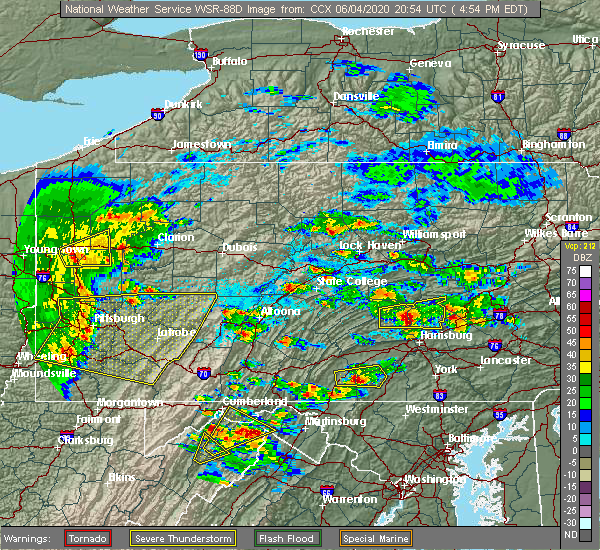 At 458 pm edt, a severe thunderstorm capable of producing a tornado was located over new buffalo, moving east at 30 mph (radar indicated rotation). Hazards include tornado. Tree damage will occur. damage to roofs, windows, and vehicles is likely. flying debris will be dangerous to those caught without shelter. mobile homes will be damaged or destroyed. this dangerous storm will be near, linglestown, dehart dam and skyline view around 510 pm edt. harper tavern, lickdale, fort indiantown gap and penn national race course around 520 pm edt. fredericksburg and cleona around 530 pm edt. other locations impacted by this tornadic thunderstorm include enders, ono, halifax, dauphin and jonestown. this includes the following interstates, interstate 78 from mile markers 0 to 5. Interstate 81 from mile markers 77 to 97. At 458 pm edt, a severe thunderstorm capable of producing a tornado was located over new buffalo, moving east at 30 mph (radar indicated rotation). Hazards include tornado. Tree damage will occur. damage to roofs, windows, and vehicles is likely. flying debris will be dangerous to those caught without shelter. mobile homes will be damaged or destroyed. this dangerous storm will be near, linglestown, dehart dam and skyline view around 510 pm edt. harper tavern, lickdale, fort indiantown gap and penn national race course around 520 pm edt. fredericksburg and cleona around 530 pm edt. other locations impacted by this tornadic thunderstorm include enders, ono, halifax, dauphin and jonestown. this includes the following interstates, interstate 78 from mile markers 0 to 5. Interstate 81 from mile markers 77 to 97.
|
| 6/3/2020 11:11 AM EDT |
 At 1109 am edt, severe thunderstorms were located along a line extending from near myerstown to penbrook to near plainfield, moving southeast at 75 mph (radar indicated). Hazards include 70 mph wind gusts and nickel size hail. Expect considerable tree damage. damage is likely to mobile homes, roofs, and outbuildings. these severe storms will be near, steelton, myerstown, lebanon, lawnton, rutherford, bressler-enhaut-oberlin, richland, highspire, newmanstown and avon around 1110 am edt. middletown, hershey, hummelstown, lawn, royalton, campbelltown and boiling springs around 1120 am edt. this includes the following interstates, the pennsylvania turnpike between mile markers 212 and 238, and from mile markers 247 to 264. interstate 78 from mile markers 0 to 7. interstate 81 from mile markers 40 to 95. interstate 83 from mile markers 41 to 50. Interstate 283 from mile markers 0 to 2. At 1109 am edt, severe thunderstorms were located along a line extending from near myerstown to penbrook to near plainfield, moving southeast at 75 mph (radar indicated). Hazards include 70 mph wind gusts and nickel size hail. Expect considerable tree damage. damage is likely to mobile homes, roofs, and outbuildings. these severe storms will be near, steelton, myerstown, lebanon, lawnton, rutherford, bressler-enhaut-oberlin, richland, highspire, newmanstown and avon around 1110 am edt. middletown, hershey, hummelstown, lawn, royalton, campbelltown and boiling springs around 1120 am edt. this includes the following interstates, the pennsylvania turnpike between mile markers 212 and 238, and from mile markers 247 to 264. interstate 78 from mile markers 0 to 7. interstate 81 from mile markers 40 to 95. interstate 83 from mile markers 41 to 50. Interstate 283 from mile markers 0 to 2.
|
| 6/3/2020 10:36 AM EDT |
 At 1034 am edt, severe thunderstorms were located along a line extending from mcclure to near juniata terrace to huntingdon, moving east southeast at 70 mph (radar indicated). Hazards include 70 mph wind gusts and nickel size hail. Expect considerable tree damage. damage is likely to mobile homes, roofs, and outbuildings. severe thunderstorms will be near, walnut, richfield, spruce hill, mcalisterville and mcclure around 1040 am edt. perulack, east waterford, ickesburg, blacklog, millersburg, mexico, honey grove and new bloomfield around 1050 am edt. colonel denning state park, duncannon, lykens, dehart dam, elizabethville, bloserville, fort indiantown gap, new buffalo, loysville and newport around 1100 am edt. carlisle, progress, harrisburg, colonial park, linglestown, enola, lemoyne, steelton, new cumberland and camp hill around 1110 am edt. This includes the following covid-19 test sites, central pennsylvania clinic, colonial park harrisburg urgent care, eastside campus, family practice enola, geisinger holy spirit , geisinger holy spirit jennifer court, geisinger lewistown hospital, good samaritan hospital, hershey medical center, lebanon va medical center, medexpress urgent care, mount nittany health, quicklab huntingdon, rite aid, upmc carlisle outpatient surgery center, upmc pinnacle, and wellspan health. At 1034 am edt, severe thunderstorms were located along a line extending from mcclure to near juniata terrace to huntingdon, moving east southeast at 70 mph (radar indicated). Hazards include 70 mph wind gusts and nickel size hail. Expect considerable tree damage. damage is likely to mobile homes, roofs, and outbuildings. severe thunderstorms will be near, walnut, richfield, spruce hill, mcalisterville and mcclure around 1040 am edt. perulack, east waterford, ickesburg, blacklog, millersburg, mexico, honey grove and new bloomfield around 1050 am edt. colonel denning state park, duncannon, lykens, dehart dam, elizabethville, bloserville, fort indiantown gap, new buffalo, loysville and newport around 1100 am edt. carlisle, progress, harrisburg, colonial park, linglestown, enola, lemoyne, steelton, new cumberland and camp hill around 1110 am edt. This includes the following covid-19 test sites, central pennsylvania clinic, colonial park harrisburg urgent care, eastside campus, family practice enola, geisinger holy spirit , geisinger holy spirit jennifer court, geisinger lewistown hospital, good samaritan hospital, hershey medical center, lebanon va medical center, medexpress urgent care, mount nittany health, quicklab huntingdon, rite aid, upmc carlisle outpatient surgery center, upmc pinnacle, and wellspan health.
|
| 5/29/2020 2:39 PM EDT |
 The severe thunderstorm warning for central dauphin, east central perry and northeastern cumberland counties will expire at 245 pm edt, the storm which prompted the warning has weakened and is moving out of the warned area. therefore, the warning will be allowed to expire. a severe thunderstorm watch remains in effect until 900 pm edt for south central pennsylvania. The severe thunderstorm warning for central dauphin, east central perry and northeastern cumberland counties will expire at 245 pm edt, the storm which prompted the warning has weakened and is moving out of the warned area. therefore, the warning will be allowed to expire. a severe thunderstorm watch remains in effect until 900 pm edt for south central pennsylvania.
|
| 5/29/2020 1:55 PM EDT |
 At 154 pm edt, a severe thunderstorm was located over new kingstown, moving northeast at 25 mph (radar indicated). Hazards include 60 mph wind gusts and quarter size hail. Hail damage to vehicles is expected. Expect wind damage to trees, roofs, and siding. At 154 pm edt, a severe thunderstorm was located over new kingstown, moving northeast at 25 mph (radar indicated). Hazards include 60 mph wind gusts and quarter size hail. Hail damage to vehicles is expected. Expect wind damage to trees, roofs, and siding.
|
| 10/31/2019 7:56 PM EDT |
 At 755 pm edt, severe thunderstorms were located along a line extending from near pine grove to near penn national race course to near valley green to near hampton to near littlestown, moving east at 30 mph (radar indicated). Hazards include 60 mph wind gusts. Expect damage to trees, roofs, and siding. Locations impacted include, harrisburg, york, lower allen, hanover, hershey, colonial park, weigelstown, progress, mechanicsburg, middletown, camp hill, gettysburg, palmyra, new cumberland, parkville, linglestown, enola, steelton, annville and lemoyne. At 755 pm edt, severe thunderstorms were located along a line extending from near pine grove to near penn national race course to near valley green to near hampton to near littlestown, moving east at 30 mph (radar indicated). Hazards include 60 mph wind gusts. Expect damage to trees, roofs, and siding. Locations impacted include, harrisburg, york, lower allen, hanover, hershey, colonial park, weigelstown, progress, mechanicsburg, middletown, camp hill, gettysburg, palmyra, new cumberland, parkville, linglestown, enola, steelton, annville and lemoyne.
|
| 10/31/2019 7:25 PM EDT | Multiple trees down in middle paxton tw in dauphin county PA, 3.5 miles WSW of Dauphin, PA |
| 10/31/2019 7:08 PM EDT |
 At 706 pm edt, severe thunderstorms were located along a line extending from 7 miles northwest of millersburg to newport to near duncannon to pine grove furnace to near mont alto, moving northeast at 65 mph (radar indicated). Hazards include 70 mph wind gusts. Expect considerable tree damage. Damage is likely to mobile homes, roofs, and outbuildings. At 706 pm edt, severe thunderstorms were located along a line extending from 7 miles northwest of millersburg to newport to near duncannon to pine grove furnace to near mont alto, moving northeast at 65 mph (radar indicated). Hazards include 70 mph wind gusts. Expect considerable tree damage. Damage is likely to mobile homes, roofs, and outbuildings.
|
| 7/6/2019 6:25 PM EDT | Multiple trees down in middle paxton township in dauphin county PA, 0.1 miles S of Dauphin, PA |
| 7/6/2019 5:34 PM EDT |
 At 533 pm edt, severe thunderstorms were located along a line extending from near urban to near duncannon to mount holly springs to near emmitsburg, moving east at 30 mph (radar indicated). Hazards include 60 mph wind gusts and quarter size hail. Hail damage to vehicles is expected. Expect wind damage to trees, roofs, and siding. At 533 pm edt, severe thunderstorms were located along a line extending from near urban to near duncannon to mount holly springs to near emmitsburg, moving east at 30 mph (radar indicated). Hazards include 60 mph wind gusts and quarter size hail. Hail damage to vehicles is expected. Expect wind damage to trees, roofs, and siding.
|
| 5/29/2019 5:39 PM EDT |
 The national weather service in state college pa has issued a * severe thunderstorm warning for. lancaster county in south central pennsylvania. southeastern adams county in south central pennsylvania. york county in south central pennsylvania. Southern dauphin county in south central pennsylvania. The national weather service in state college pa has issued a * severe thunderstorm warning for. lancaster county in south central pennsylvania. southeastern adams county in south central pennsylvania. york county in south central pennsylvania. Southern dauphin county in south central pennsylvania.
|
| 5/29/2019 4:36 PM EDT |
 At 436 pm edt, severe thunderstorms were located along a line extending from near dehart dam to rockville to near shermansdale, moving east at 50 mph (radar indicated). Hazards include 60 mph wind gusts and quarter size hail. Hail damage to vehicles is expected. Expect wind damage to trees, roofs, and siding. At 436 pm edt, severe thunderstorms were located along a line extending from near dehart dam to rockville to near shermansdale, moving east at 50 mph (radar indicated). Hazards include 60 mph wind gusts and quarter size hail. Hail damage to vehicles is expected. Expect wind damage to trees, roofs, and siding.
|
| 5/29/2019 4:18 PM EDT |
 At 417 pm edt, a severe thunderstorm capable of producing a tornado was located over duncannon, moving east at 45 mph (radar indicated rotation). Hazards include tornado and quarter size hail. Tree damage will occur. damage to roofs, windows, and vehicles is likely. flying debris will be dangerous to those caught without shelter. mobile homes will be damaged or destroyed. this dangerous storm will be near, marysville and new buffalo around 420 pm edt. linglestown, colonial park, progress, harrisburg, enola, paxtonia, rockville, penbrook, lawnton and rutherford around 430 pm edt. hershey, palmyra, hummelstown, skyline view, penn national race course and fort indiantown gap around 440 pm edt. other locations impacted by this tornadic thunderstorm include dauphin, halifax, city island, hershey park, harrisburg area community college and penn state college of medicine. this includes the following interstates, the pennsylvania turnpike from mile markers 256 to 258. interstate 81 from mile markers 57 to 81. interstate 83 from mile markers 43 to 50. Interstate 283 near mile marker 2. At 417 pm edt, a severe thunderstorm capable of producing a tornado was located over duncannon, moving east at 45 mph (radar indicated rotation). Hazards include tornado and quarter size hail. Tree damage will occur. damage to roofs, windows, and vehicles is likely. flying debris will be dangerous to those caught without shelter. mobile homes will be damaged or destroyed. this dangerous storm will be near, marysville and new buffalo around 420 pm edt. linglestown, colonial park, progress, harrisburg, enola, paxtonia, rockville, penbrook, lawnton and rutherford around 430 pm edt. hershey, palmyra, hummelstown, skyline view, penn national race course and fort indiantown gap around 440 pm edt. other locations impacted by this tornadic thunderstorm include dauphin, halifax, city island, hershey park, harrisburg area community college and penn state college of medicine. this includes the following interstates, the pennsylvania turnpike from mile markers 256 to 258. interstate 81 from mile markers 57 to 81. interstate 83 from mile markers 43 to 50. Interstate 283 near mile marker 2.
|
| 4/26/2019 3:45 PM EDT |
 At 345 pm edt, severe thunderstorms were located along a line extending from near richfield to new buffalo to hogestown, moving northeast at 30 mph (radar indicated). Hazards include 60 mph wind gusts. expect damage to trees, roofs, and siding At 345 pm edt, severe thunderstorms were located along a line extending from near richfield to new buffalo to hogestown, moving northeast at 30 mph (radar indicated). Hazards include 60 mph wind gusts. expect damage to trees, roofs, and siding
|
| 5/15/2018 4:19 PM EDT |
 At 418 pm edt, severe thunderstorms were located along a line extending from near neffs to near harper tavern to near walnut bottom, moving east at 45 mph (radar indicated). Hazards include 70 mph wind gusts and ping pong ball size hail. People and animals outdoors will be injured. expect hail damage to roofs, siding, windows, and vehicles. expect considerable tree damage. wind damage is also likely to mobile homes, roofs, and outbuildings. Locations impacted include, cornwall, myerstown, palmyra, colonial park, annville, harrisburg, progress, lebanon, hummelstown and carlisle. At 418 pm edt, severe thunderstorms were located along a line extending from near neffs to near harper tavern to near walnut bottom, moving east at 45 mph (radar indicated). Hazards include 70 mph wind gusts and ping pong ball size hail. People and animals outdoors will be injured. expect hail damage to roofs, siding, windows, and vehicles. expect considerable tree damage. wind damage is also likely to mobile homes, roofs, and outbuildings. Locations impacted include, cornwall, myerstown, palmyra, colonial park, annville, harrisburg, progress, lebanon, hummelstown and carlisle.
|
| 5/15/2018 4:14 PM EDT |
 At 414 pm edt, severe thunderstorms capable of producing both tornadoes and extensive straight line wind damage were located west of enola, moving east at 40 mph (radar indicated rotation). Hazards include tornado and quarter size hail. Flying debris will be dangerous to those caught without shelter. mobile homes will be damaged or destroyed. damage to roofs, windows, and vehicles will occur. tree damage is likely. these dangerous storms will be near, new cumberland, harrisburg, steelton, progress and penbrook around 420 pm edt. hummelstown, middletown, colonial park, linglestown, rutherford, lawnton, bressler-enhaut-oberlin, highspire, paxtang and paxtonia around 430 pm edt. hershey and palmyra around 440 pm edt. other locations impacted by this tornadic thunderstorm include three mile island, goldsboro, capital city airport, newberrytown, city island, penn state harrisburg, harrisburg international airport, hershey park, harrisburg area community college and penn state college of medicine. this includes the following interstates, the pennsylvania turnpike from mile markers 229 to 258. interstate 81 from mile markers 54 to 78. interstate 83 from mile markers 32 to 50. Interstate 283 from mile markers 0 to 2. At 414 pm edt, severe thunderstorms capable of producing both tornadoes and extensive straight line wind damage were located west of enola, moving east at 40 mph (radar indicated rotation). Hazards include tornado and quarter size hail. Flying debris will be dangerous to those caught without shelter. mobile homes will be damaged or destroyed. damage to roofs, windows, and vehicles will occur. tree damage is likely. these dangerous storms will be near, new cumberland, harrisburg, steelton, progress and penbrook around 420 pm edt. hummelstown, middletown, colonial park, linglestown, rutherford, lawnton, bressler-enhaut-oberlin, highspire, paxtang and paxtonia around 430 pm edt. hershey and palmyra around 440 pm edt. other locations impacted by this tornadic thunderstorm include three mile island, goldsboro, capital city airport, newberrytown, city island, penn state harrisburg, harrisburg international airport, hershey park, harrisburg area community college and penn state college of medicine. this includes the following interstates, the pennsylvania turnpike from mile markers 229 to 258. interstate 81 from mile markers 54 to 78. interstate 83 from mile markers 32 to 50. Interstate 283 from mile markers 0 to 2.
|
| 5/15/2018 3:59 PM EDT |
 At 359 pm edt, severe thunderstorms were located along a line extending from near snyders to near rockville to roxbury, moving east at 40 mph (radar indicated). Hazards include ping pong ball size hail and 60 mph wind gusts. People and animals outdoors will be injured. expect hail damage to roofs, siding, windows, and vehicles. expect wind damage to trees and power lines. Locations impacted include, cornwall, myerstown, palmyra, colonial park, annville, harrisburg, progress, lebanon, hummelstown and carlisle. At 359 pm edt, severe thunderstorms were located along a line extending from near snyders to near rockville to roxbury, moving east at 40 mph (radar indicated). Hazards include ping pong ball size hail and 60 mph wind gusts. People and animals outdoors will be injured. expect hail damage to roofs, siding, windows, and vehicles. expect wind damage to trees and power lines. Locations impacted include, cornwall, myerstown, palmyra, colonial park, annville, harrisburg, progress, lebanon, hummelstown and carlisle.
|
| 5/15/2018 3:45 PM EDT |
 At 345 pm edt, severe thunderstorms were located along a line extending from new mahoning to near dehart dam to 6 miles west of newville, moving east at 45 mph (radar indicated). Hazards include ping pong ball size hail and 60 mph wind gusts. People and animals outdoors will be injured. expect hail damage to roofs, siding, windows, and vehicles. Expect wind damage to trees and power lines. At 345 pm edt, severe thunderstorms were located along a line extending from new mahoning to near dehart dam to 6 miles west of newville, moving east at 45 mph (radar indicated). Hazards include ping pong ball size hail and 60 mph wind gusts. People and animals outdoors will be injured. expect hail damage to roofs, siding, windows, and vehicles. Expect wind damage to trees and power lines.
|
| 5/15/2018 3:14 PM EDT |
 At 314 pm edt, severe thunderstorms were located along a line extending from near rock glen to kulpmont to near richfield to near honey grove, moving east at 50 mph (radar indicated). Hazards include two inch hail and 70 mph wind gusts. People and animals outdoors will be injured. expect hail damage to roofs, siding, windows, and vehicles. expect considerable tree damage. Wind damage is also likely to mobile homes, roofs, and outbuildings. At 314 pm edt, severe thunderstorms were located along a line extending from near rock glen to kulpmont to near richfield to near honey grove, moving east at 50 mph (radar indicated). Hazards include two inch hail and 70 mph wind gusts. People and animals outdoors will be injured. expect hail damage to roofs, siding, windows, and vehicles. expect considerable tree damage. Wind damage is also likely to mobile homes, roofs, and outbuildings.
|
| 5/10/2018 5:34 PM EDT |
 At 534 pm edt, severe thunderstorms were located along a line extending from near lickdale to penn national race course to linglestown to marysville, moving east at 25 mph (radar indicated). Hazards include 60 mph wind gusts and penny size hail. Expect damage to trees and power lines. Locations impacted include, palmyra, linglestown, colonial park, hershey, harrisburg, harper tavern, skyline view, williamstown, rockville and lickdale. At 534 pm edt, severe thunderstorms were located along a line extending from near lickdale to penn national race course to linglestown to marysville, moving east at 25 mph (radar indicated). Hazards include 60 mph wind gusts and penny size hail. Expect damage to trees and power lines. Locations impacted include, palmyra, linglestown, colonial park, hershey, harrisburg, harper tavern, skyline view, williamstown, rockville and lickdale.
|
| 5/10/2018 4:56 PM EDT |
 At 454 pm edt, severe thunderstorms were located along a line extending from near meiserville to near new buffalo to newport to near ickesburg, moving east at 40 mph (radar indicated). Hazards include 70 mph wind gusts and nickel size hail. Expect considerable tree damage. Damage is likely to mobile homes, roofs, and outbuildings. At 454 pm edt, severe thunderstorms were located along a line extending from near meiserville to near new buffalo to newport to near ickesburg, moving east at 40 mph (radar indicated). Hazards include 70 mph wind gusts and nickel size hail. Expect considerable tree damage. Damage is likely to mobile homes, roofs, and outbuildings.
|
| 9/5/2017 4:35 PM EDT |
 At 435 pm edt, severe thunderstorms were located along a line extending from camp hill to shiloh to near codorus, moving east at 50 mph (radar indicated). Hazards include 70 mph wind gusts and penny size hail. Expect considerable tree damage. Damage is likely to mobile homes, roofs, and outbuildings. At 435 pm edt, severe thunderstorms were located along a line extending from camp hill to shiloh to near codorus, moving east at 50 mph (radar indicated). Hazards include 70 mph wind gusts and penny size hail. Expect considerable tree damage. Damage is likely to mobile homes, roofs, and outbuildings.
|
| 8/19/2017 7:14 PM EDT |
 At 713 pm edt, severe thunderstorms were located along a line extending from forest hill to near newport to shermansdale to newville, moving east at 40 mph (radar indicated). Hazards include 60 mph wind gusts and penny size hail. Expect damage to trees and power lines. severe thunderstorms will be near, millersburg around 720 pm edt. lewisburg, harrisburg, milton, montandon, rockville, marysville and new columbia around 730 pm edt. steelton, linglestown, northumberland, progress, sunbury, colonial park, paxtang, bressler-enhaut-oberlin, penbrook and lawnton around 740 pm edt. middletown, hummelstown, hershey, royalton, penn national race course, highspire, skyline view, riverside, stonington and valley green around 750 pm edt. other locations impacted by these severe thunderstorms include three mile island, dauphin, marion heights, seven points, goldsboro, mcewensville, herndon, edgewood, gratz and turbotville. for those driving on interstate 80, this includes areas between the lewisburg-williamsport and danville exits, specifically from mile markers 211 to 216. this includes the following interstates, the pennsylvania turnpike from mile markers 246 to 258. interstate 81 from mile markers 66 to 81. interstate 83 from mile markers 43 to 50. interstate 180 from mile markers 1 to 8. Interstate 283 from mile markers 0 to 2. At 713 pm edt, severe thunderstorms were located along a line extending from forest hill to near newport to shermansdale to newville, moving east at 40 mph (radar indicated). Hazards include 60 mph wind gusts and penny size hail. Expect damage to trees and power lines. severe thunderstorms will be near, millersburg around 720 pm edt. lewisburg, harrisburg, milton, montandon, rockville, marysville and new columbia around 730 pm edt. steelton, linglestown, northumberland, progress, sunbury, colonial park, paxtang, bressler-enhaut-oberlin, penbrook and lawnton around 740 pm edt. middletown, hummelstown, hershey, royalton, penn national race course, highspire, skyline view, riverside, stonington and valley green around 750 pm edt. other locations impacted by these severe thunderstorms include three mile island, dauphin, marion heights, seven points, goldsboro, mcewensville, herndon, edgewood, gratz and turbotville. for those driving on interstate 80, this includes areas between the lewisburg-williamsport and danville exits, specifically from mile markers 211 to 216. this includes the following interstates, the pennsylvania turnpike from mile markers 246 to 258. interstate 81 from mile markers 66 to 81. interstate 83 from mile markers 43 to 50. interstate 180 from mile markers 1 to 8. Interstate 283 from mile markers 0 to 2.
|
| 8/18/2017 3:07 PM EDT |
 At 306 pm edt, severe thunderstorms were located along a line extending from near new buffalo to lower allen to near siddonsburg, moving east at 40 mph (radar indicated). Hazards include 60 mph wind gusts. Expect damage to trees and power lines. Locations impacted include, hummelstown, camp hill, colonial park, middletown, harrisburg, new cumberland, linglestown, lower allen, progress and steelton. At 306 pm edt, severe thunderstorms were located along a line extending from near new buffalo to lower allen to near siddonsburg, moving east at 40 mph (radar indicated). Hazards include 60 mph wind gusts. Expect damage to trees and power lines. Locations impacted include, hummelstown, camp hill, colonial park, middletown, harrisburg, new cumberland, linglestown, lower allen, progress and steelton.
|
| 8/18/2017 2:57 PM EDT |
 At 256 pm edt, severe thunderstorms were located along a line extending from near duncannon to shiremanstown to near new kingstown, moving east at 40 mph (radar indicated). Hazards include 60 mph wind gusts. Expect damage to trees and power lines. Locations impacted include, hummelstown, carlisle, lower allen, steelton, hershey, enola, mechanicsburg, camp hill, colonial park and middletown. At 256 pm edt, severe thunderstorms were located along a line extending from near duncannon to shiremanstown to near new kingstown, moving east at 40 mph (radar indicated). Hazards include 60 mph wind gusts. Expect damage to trees and power lines. Locations impacted include, hummelstown, carlisle, lower allen, steelton, hershey, enola, mechanicsburg, camp hill, colonial park and middletown.
|
| 8/18/2017 2:36 PM EDT |
 At 236 pm edt, severe thunderstorms were located along a line extending from near ickesburg to near carlisle springs to near bloserville, moving east at 40 mph (radar indicated). Hazards include 60 mph wind gusts. expect damage to trees and power lines At 236 pm edt, severe thunderstorms were located along a line extending from near ickesburg to near carlisle springs to near bloserville, moving east at 40 mph (radar indicated). Hazards include 60 mph wind gusts. expect damage to trees and power lines
|
| 8/4/2017 10:13 PM EDT |
 At 1012 pm edt, a severe thunderstorm was located near valley green, moving northeast at 35 mph (radar indicated). Hazards include 60 mph wind gusts and quarter size hail. Hail damage to vehicles is possible. Expect wind damage to trees and power lines. At 1012 pm edt, a severe thunderstorm was located near valley green, moving northeast at 35 mph (radar indicated). Hazards include 60 mph wind gusts and quarter size hail. Hail damage to vehicles is possible. Expect wind damage to trees and power lines.
|
| 8/4/2017 9:16 PM EDT |
 At 915 pm edt, severe thunderstorms were located along a line extending from mainville to locustdale to near pine grove to highspire, moving east at 25 mph (radar indicated). Hazards include 60 mph wind gusts and quarter size hail. Hail damage to vehicles is possible. expect wind damage to trees and power lines. locations impacted include, cornwall, tamaqua, st. Clair, myerstown, minersville, palmyra, mahanoy city, colonial park, annville and harrisburg. At 915 pm edt, severe thunderstorms were located along a line extending from mainville to locustdale to near pine grove to highspire, moving east at 25 mph (radar indicated). Hazards include 60 mph wind gusts and quarter size hail. Hail damage to vehicles is possible. expect wind damage to trees and power lines. locations impacted include, cornwall, tamaqua, st. Clair, myerstown, minersville, palmyra, mahanoy city, colonial park, annville and harrisburg.
|
| 8/4/2017 8:12 PM EDT |
 At 811 pm edt, severe thunderstorms were located along a line extending from paxtonville to near elizabethville to near new buffalo to near mount holly springs, moving northeast at 30 mph (radar indicated). Hazards include 60 mph wind gusts and quarter size hail. Hail damage to vehicles is possible. Expect wind damage to trees and power lines. At 811 pm edt, severe thunderstorms were located along a line extending from paxtonville to near elizabethville to near new buffalo to near mount holly springs, moving northeast at 30 mph (radar indicated). Hazards include 60 mph wind gusts and quarter size hail. Hail damage to vehicles is possible. Expect wind damage to trees and power lines.
|
| 7/22/2017 6:07 PM EDT |
 At 607 pm edt, severe thunderstorms were located along a line extending from port trevorton to near new buffalo, moving east at 20 mph (radar indicated). Hazards include 60 mph wind gusts. expect damage to trees and power lines At 607 pm edt, severe thunderstorms were located along a line extending from port trevorton to near new buffalo, moving east at 20 mph (radar indicated). Hazards include 60 mph wind gusts. expect damage to trees and power lines
|
| 6/23/2017 3:56 PM EDT |
 At 356 pm edt, severe thunderstorms were located along a line extending from wertzville to near newville, moving east at 35 mph (radar indicated). Hazards include 60 mph wind gusts. expect damage to trees and power lines At 356 pm edt, severe thunderstorms were located along a line extending from wertzville to near newville, moving east at 35 mph (radar indicated). Hazards include 60 mph wind gusts. expect damage to trees and power lines
|
| 6/19/2017 11:12 AM EDT |
 At 1111 am edt, a severe thunderstorm was located near linglestown, moving northeast at 40 mph (radar indicated). Hazards include 60 mph wind gusts and quarter size hail. Hail damage to vehicles is possible. Expect wind damage to trees and power lines. At 1111 am edt, a severe thunderstorm was located near linglestown, moving northeast at 40 mph (radar indicated). Hazards include 60 mph wind gusts and quarter size hail. Hail damage to vehicles is possible. Expect wind damage to trees and power lines.
|
| 10/30/2016 4:07 PM EDT |
 At 405 pm edt, severe thunderstorms were located along a line extending from near dehart dam to near shippensburg to near mercersburg to near hancock, moving east at 50 mph (radar indicated). Hazards include 60 mph wind gusts. Expect damage to roofs. siding. and trees. these severe storms will be near, linglestown, colonial park, skyline view, pine grove furnace, paxtonia and cashtown around 410 pm edt. waynesboro, palmyra, hershey, aspers and campbelltown around 420 pm edt. hampton, wayne heights, rouzerville, carroll valley, lake meade, new oxford and mont alto around 430 pm edt. hanover, parkville, weigelstown, york airport, spring grove, east berlin and dover around 440 pm edt. Other locations impacted by these severe thunderstorms include hunterstown, york haven, york springs, idaville, three mile island, newberrytown, upton, lewisberry, arendtsville and capital city airport. At 405 pm edt, severe thunderstorms were located along a line extending from near dehart dam to near shippensburg to near mercersburg to near hancock, moving east at 50 mph (radar indicated). Hazards include 60 mph wind gusts. Expect damage to roofs. siding. and trees. these severe storms will be near, linglestown, colonial park, skyline view, pine grove furnace, paxtonia and cashtown around 410 pm edt. waynesboro, palmyra, hershey, aspers and campbelltown around 420 pm edt. hampton, wayne heights, rouzerville, carroll valley, lake meade, new oxford and mont alto around 430 pm edt. hanover, parkville, weigelstown, york airport, spring grove, east berlin and dover around 440 pm edt. Other locations impacted by these severe thunderstorms include hunterstown, york haven, york springs, idaville, three mile island, newberrytown, upton, lewisberry, arendtsville and capital city airport.
|
| 10/30/2016 3:29 PM EDT |
 At 328 pm edt, severe thunderstorms were located along a line extending from near mexico to near fort littleton to near clearville to near lake gordon, moving east at 50 mph (radar indicated). Hazards include 60 mph wind gusts. Expect damage to roofs. siding. and trees. severe thunderstorms will be near, fort littleton, ickesburg and spruce hill around 330 pm edt. fannettsburg, locust grove, willow hill, new bloomfield and crystal springs around 340 pm edt. chambersburg, needmore, upper strasburg, big cove tannery, duncannon, barnes gap, inglesmith and roxbury around 350 pm edt. shippensburg, harrisburg, mercersburg, scotland, claylick, fayetteville, guilford, marysville, warfordsburg and rockville around 400 pm edt. other locations impacted by these severe thunderstorms include york springs, idaville, blain, rainsburg, shirleysburg, wellsville, new germantown, franklintown, bendersville and dauphin. this includes the following interstates, interstate 70 from mile markers 147 to 170. the pennsylvania turnpike from mile markers 151 to 258. interstate 81 from mile markers 1 to 79. interstate 83 from mile markers 22 to 50. Interstate 283 from mile markers 0 to 2. At 328 pm edt, severe thunderstorms were located along a line extending from near mexico to near fort littleton to near clearville to near lake gordon, moving east at 50 mph (radar indicated). Hazards include 60 mph wind gusts. Expect damage to roofs. siding. and trees. severe thunderstorms will be near, fort littleton, ickesburg and spruce hill around 330 pm edt. fannettsburg, locust grove, willow hill, new bloomfield and crystal springs around 340 pm edt. chambersburg, needmore, upper strasburg, big cove tannery, duncannon, barnes gap, inglesmith and roxbury around 350 pm edt. shippensburg, harrisburg, mercersburg, scotland, claylick, fayetteville, guilford, marysville, warfordsburg and rockville around 400 pm edt. other locations impacted by these severe thunderstorms include york springs, idaville, blain, rainsburg, shirleysburg, wellsville, new germantown, franklintown, bendersville and dauphin. this includes the following interstates, interstate 70 from mile markers 147 to 170. the pennsylvania turnpike from mile markers 151 to 258. interstate 81 from mile markers 1 to 79. interstate 83 from mile markers 22 to 50. Interstate 283 from mile markers 0 to 2.
|
| 8/16/2016 3:30 PM EDT |
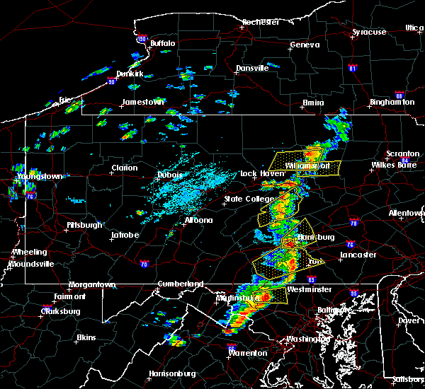 At 330 pm edt, a severe thunderstorm was located over hogestown, moving northeast at 30 mph (radar indicated). Hazards include 60 mph wind gusts and penny size hail. Expect damage to roofs. siding. And trees. At 330 pm edt, a severe thunderstorm was located over hogestown, moving northeast at 30 mph (radar indicated). Hazards include 60 mph wind gusts and penny size hail. Expect damage to roofs. siding. And trees.
|
| 7/25/2016 6:39 PM EDT |
 At 638 pm edt, a severe thunderstorm was located near hershey, moving east at 60 mph (radar indicated). Hazards include 60 mph wind gusts and penny size hail. Expect damage to roofs. siding. and trees. Locations impacted include, palmyra, middletown, carlisle, new cumberland, harrisburg, hummelstown, mechanicsburg, enola, myerstown, hershey, lower allen, lebanon, camp hill, steelton, colonial park, cornwall, annville, progress, linglestown and lemoyne. At 638 pm edt, a severe thunderstorm was located near hershey, moving east at 60 mph (radar indicated). Hazards include 60 mph wind gusts and penny size hail. Expect damage to roofs. siding. and trees. Locations impacted include, palmyra, middletown, carlisle, new cumberland, harrisburg, hummelstown, mechanicsburg, enola, myerstown, hershey, lower allen, lebanon, camp hill, steelton, colonial park, cornwall, annville, progress, linglestown and lemoyne.
|
| 7/25/2016 6:09 PM EDT |
 At 609 pm edt, a severe thunderstorm was located over duncannon, moving east at 40 mph (radar indicated). Hazards include 60 mph wind gusts and penny size hail. Expect damage to roofs. siding. And trees. At 609 pm edt, a severe thunderstorm was located over duncannon, moving east at 40 mph (radar indicated). Hazards include 60 mph wind gusts and penny size hail. Expect damage to roofs. siding. And trees.
|
| 6/28/2016 3:38 PM EDT |
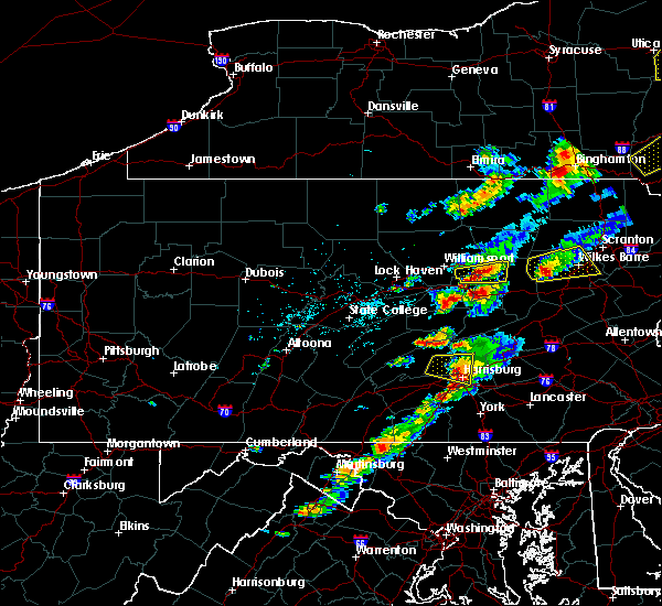 At 336 pm edt, a severe thunderstorm was located near linglestown, moving east at 20 mph (radar indicated). Hazards include 60 mph wind gusts and quarter size hail. Hail damage to vehicles is possible. expect wind damage to roofs, siding, and trees. Locations impacted include, harrisburg, steelton, progress, colonial park, lemoyne, enola, linglestown, new cumberland, camp hill, wormleysburg, bressler-enhaut-oberlin, rockville, penbrook, paxtang, west fairview, wertzville, lawnton, paxtonia, halifax and dauphin. At 336 pm edt, a severe thunderstorm was located near linglestown, moving east at 20 mph (radar indicated). Hazards include 60 mph wind gusts and quarter size hail. Hail damage to vehicles is possible. expect wind damage to roofs, siding, and trees. Locations impacted include, harrisburg, steelton, progress, colonial park, lemoyne, enola, linglestown, new cumberland, camp hill, wormleysburg, bressler-enhaut-oberlin, rockville, penbrook, paxtang, west fairview, wertzville, lawnton, paxtonia, halifax and dauphin.
|
| 6/28/2016 2:58 PM EDT |
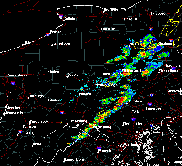 At 258 pm edt, a severe thunderstorm was located near duncannon, moving east at 20 mph (radar indicated). Hazards include 60 mph wind gusts and quarter size hail. Hail damage to vehicles is expected. Expect wind damage to roofs, siding, and trees. At 258 pm edt, a severe thunderstorm was located near duncannon, moving east at 20 mph (radar indicated). Hazards include 60 mph wind gusts and quarter size hail. Hail damage to vehicles is expected. Expect wind damage to roofs, siding, and trees.
|
| 2/24/2016 6:10 PM EST |
 At 607 pm est, doppler radar indicated a line of severe thunderstorms capable of producing damaging winds around 60 mph. these storms were located along a line extending from mechanicsburg to near westminster to fairland, and moving northeast at 50 mph. At 607 pm est, doppler radar indicated a line of severe thunderstorms capable of producing damaging winds around 60 mph. these storms were located along a line extending from mechanicsburg to near westminster to fairland, and moving northeast at 50 mph.
|
| 10/9/2015 2:50 PM EDT |
 At 249 pm edt, doppler radar indicated a line of severe thunderstorms capable of producing damaging winds around 60 mph. these storms were located along a line extending from near trevorton to near duncannon, and moving east at 50 mph. At 249 pm edt, doppler radar indicated a line of severe thunderstorms capable of producing damaging winds around 60 mph. these storms were located along a line extending from near trevorton to near duncannon, and moving east at 50 mph.
|
| 8/20/2015 2:07 PM EDT |
 At 204 pm edt, doppler radar indicated a line of severe thunderstorms capable of producing damaging winds in excess of 60 mph. these storms were located along a line extending from near colonial park to dallastown, moving northeast at 25 mph. locations impacted include, camp hill, elizabethtown, enola, hanover, harrisburg, hershey, hummelstown, linglestown, mechanicsburg, middletown, palmyra, and red lion. At 204 pm edt, doppler radar indicated a line of severe thunderstorms capable of producing damaging winds in excess of 60 mph. these storms were located along a line extending from near colonial park to dallastown, moving northeast at 25 mph. locations impacted include, camp hill, elizabethtown, enola, hanover, harrisburg, hershey, hummelstown, linglestown, mechanicsburg, middletown, palmyra, and red lion.
|
| 8/20/2015 1:33 PM EDT |
 At 132 pm edt, doppler radar indicated a line of severe thunderstorms capable of producing damaging winds around 60 mph. these storms were located along a line extending from near siddonsburg to near glen rock, and moving northeast at 25 mph. At 132 pm edt, doppler radar indicated a line of severe thunderstorms capable of producing damaging winds around 60 mph. these storms were located along a line extending from near siddonsburg to near glen rock, and moving northeast at 25 mph.
|
| 7/9/2015 6:01 PM EDT |
 At 601 pm edt, doppler radar indicated a line of severe thunderstorms capable of producing damaging winds around 60 mph. these storms were located along a line extending from near locustdale to near tower city to near elizabethville, and moving east at 35 mph. At 601 pm edt, doppler radar indicated a line of severe thunderstorms capable of producing damaging winds around 60 mph. these storms were located along a line extending from near locustdale to near tower city to near elizabethville, and moving east at 35 mph.
|
| 7/9/2015 5:07 PM EDT |
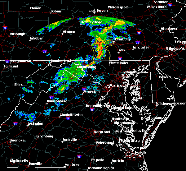 At 507 pm edt, doppler radar indicated a line of severe thunderstorms capable of producing damaging winds around 60 mph. these storms were located along a line extending from near loysville to near carroll valley, and moving east at 40 mph. At 507 pm edt, doppler radar indicated a line of severe thunderstorms capable of producing damaging winds around 60 mph. these storms were located along a line extending from near loysville to near carroll valley, and moving east at 40 mph.
|
| 6/12/2015 9:46 PM EDT |
 At 946 pm edt, doppler radar indicated a line of severe thunderstorms capable of producing damaging winds in excess of 60 mph. these storms were located along a line extending from near lykens to near linglestown to hogestown, moving east at 35 mph. locations impacted include, annville, camp hill, carlisle, colonial park, cornwall, elizabethtown, enola, harrisburg, hershey, hummelstown, lebanon, lemoyne, linglestown, lower allen, mechanicsburg, middletown, myerstown, new cumberland, palmyra and pottsville. At 946 pm edt, doppler radar indicated a line of severe thunderstorms capable of producing damaging winds in excess of 60 mph. these storms were located along a line extending from near lykens to near linglestown to hogestown, moving east at 35 mph. locations impacted include, annville, camp hill, carlisle, colonial park, cornwall, elizabethtown, enola, harrisburg, hershey, hummelstown, lebanon, lemoyne, linglestown, lower allen, mechanicsburg, middletown, myerstown, new cumberland, palmyra and pottsville.
|
| 6/12/2015 9:18 PM EDT |
 At 916 pm edt, doppler radar indicated a line of severe thunderstorms capable of producing damaging winds around 60 mph. these storms were located along a line extending from near meiserville to near new bloomfield to near bloserville, and moving east at 35 mph. At 916 pm edt, doppler radar indicated a line of severe thunderstorms capable of producing damaging winds around 60 mph. these storms were located along a line extending from near meiserville to near new bloomfield to near bloserville, and moving east at 35 mph.
|
| 6/8/2015 5:54 PM EDT | At 553 pm edt, doppler radar indicated a line of severe thunderstorms capable of producing destructive winds in excess of 70 mph. these storms were located along a line extending from womelsdorf to shiremanstown, moving east at 35 mph. locations impacted include, akron, annville, camp hill, carlisle, colonial park, columbia, cornwall, dallastown, east petersburg, elizabethtown, enola, ephrata, harrisburg, hershey, hummelstown, lancaster, lebanon, lemoyne, linglestown and lititz. |
| 6/8/2015 5:08 PM EDT | At 508 pm edt, doppler radar indicated a line of severe thunderstorms capable of producing damaging winds of 60 to 70 mph. these storms were located along a line extending from near donaldson to near boiling springs, and moving southeast at 25 mph. |
| 6/8/2015 4:18 PM EDT |
 At 418 pm edt, doppler radar indicated a line of severe thunderstorms capable of producing damaging winds of 60 to 70 mph. these storms were located along a line extending from near millersburg to near fannettsburg, and moving east at 30 mph. At 418 pm edt, doppler radar indicated a line of severe thunderstorms capable of producing damaging winds of 60 to 70 mph. these storms were located along a line extending from near millersburg to near fannettsburg, and moving east at 30 mph.
|
| 4/20/2015 9:48 PM EDT | At 947 pm edt, doppler radar indicated a line of severe thunderstorms capable of producing quarter size hail and damaging winds in excess of 60 mph. these storms were located along a line extending from near kratzerville to near new buffalo to near schlusser, moving northeast at 30 mph. locations impacted include, harrisburg, enola, selinsgrove, marysville, lykens, elizabethville, williamstown, tower city, port trevorton, klingerstown, rockville, wertzville, urban, rebuck, dehart dam, fort indiantown gap, wiconisco, halifax, dauphin and gratz. |
| 4/20/2015 8:54 PM EDT | At 853 pm edt, doppler radar indicated a severe thunderstorm capable of producing quarter size hail and damaging winds around 60 mph. this storm was located near bloserville, and moving northeast at 30 mph. |
| 4/20/2015 7:59 PM EDT | At 757 pm edt, doppler radar indicated a severe thunderstorm capable of producing damaging winds around 60 mph. this storm was located near marysville, and moving northeast at 30 mph. penny size hail may also accompany the damaging winds. |
| 7/23/2014 4:28 PM EDT | Trees down on roa in dauphin county PA, 2.9 miles S of Dauphin, PA |
| 9/18/2012 2:15 PM EDT | Numerous trees down in dauphin bor in dauphin county PA, 0.1 miles S of Dauphin, PA |
| 7/18/2012 2:20 PM EDT | Golf Ball sized hail reported 0.1 miles S of Dauphin, PA, golfball sized hail reported. |
| 1/1/0001 12:00 AM | Numerous trees and wires down. one tree on a house in dauphin county PA, 3.1 miles WSW of Dauphin, PA |
| 1/1/0001 12:00 AM | Power lines down north and east of dauphi in dauphin county PA, 0.1 miles S of Dauphin, PA |
| 1/1/0001 12:00 AM | Numerous trees down. stony creek rd closed due to trees over roa in dauphin county PA, 1 miles SSW of Dauphin, PA |
| 1/1/0001 12:00 AM | Quarter sized hail reported 0.1 miles S of Dauphin, PA |
Hail Maps for Dauphin, PA
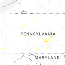


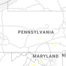


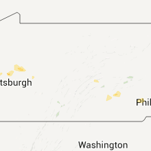


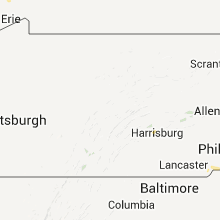


Connect with Interactive Hail Maps