

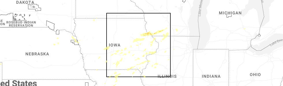
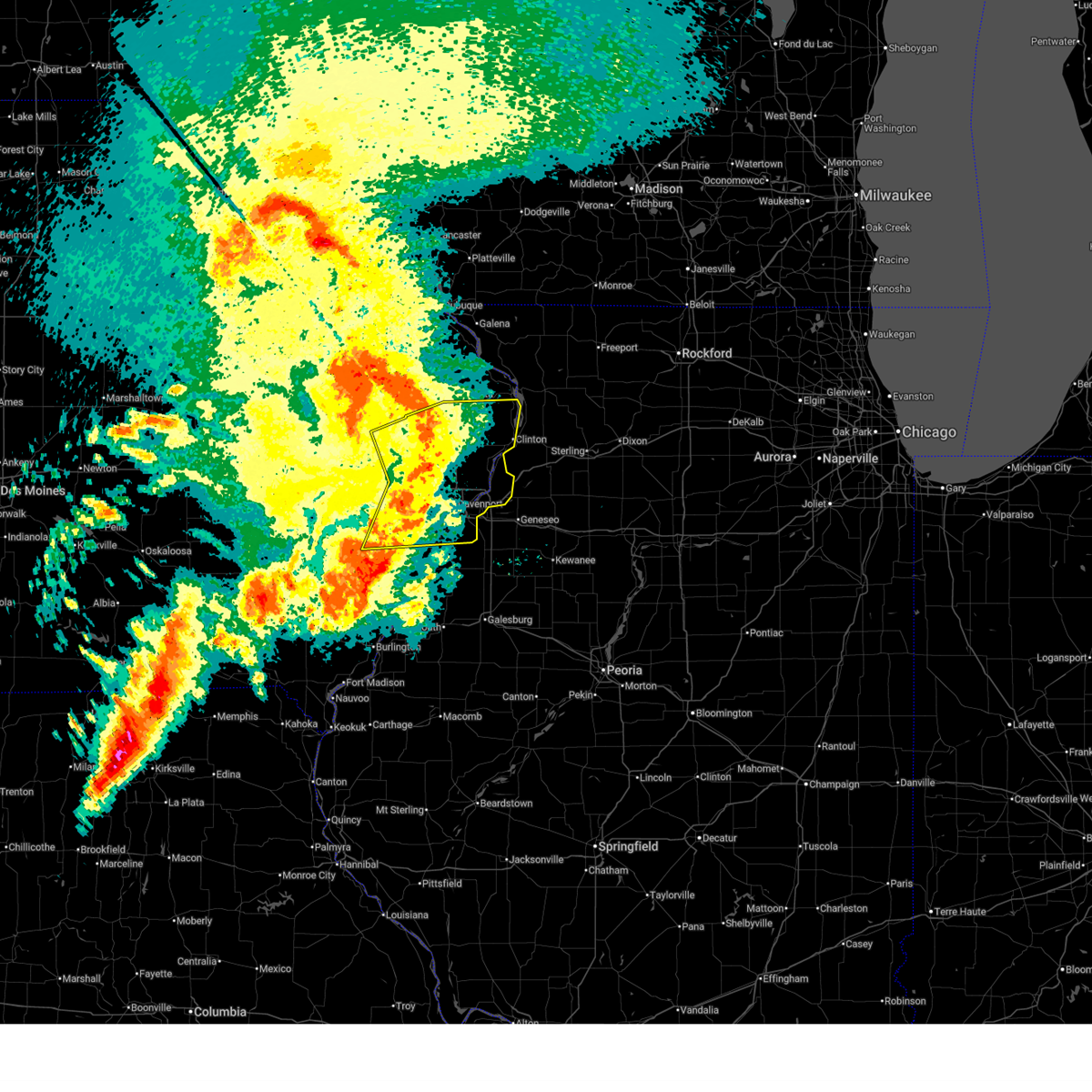
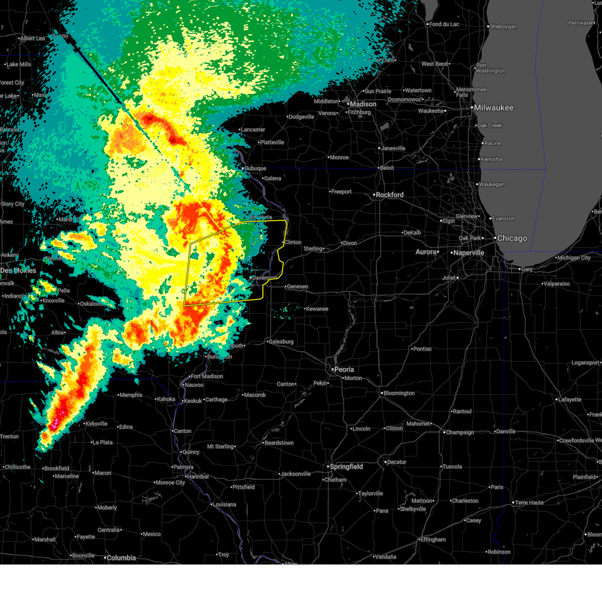
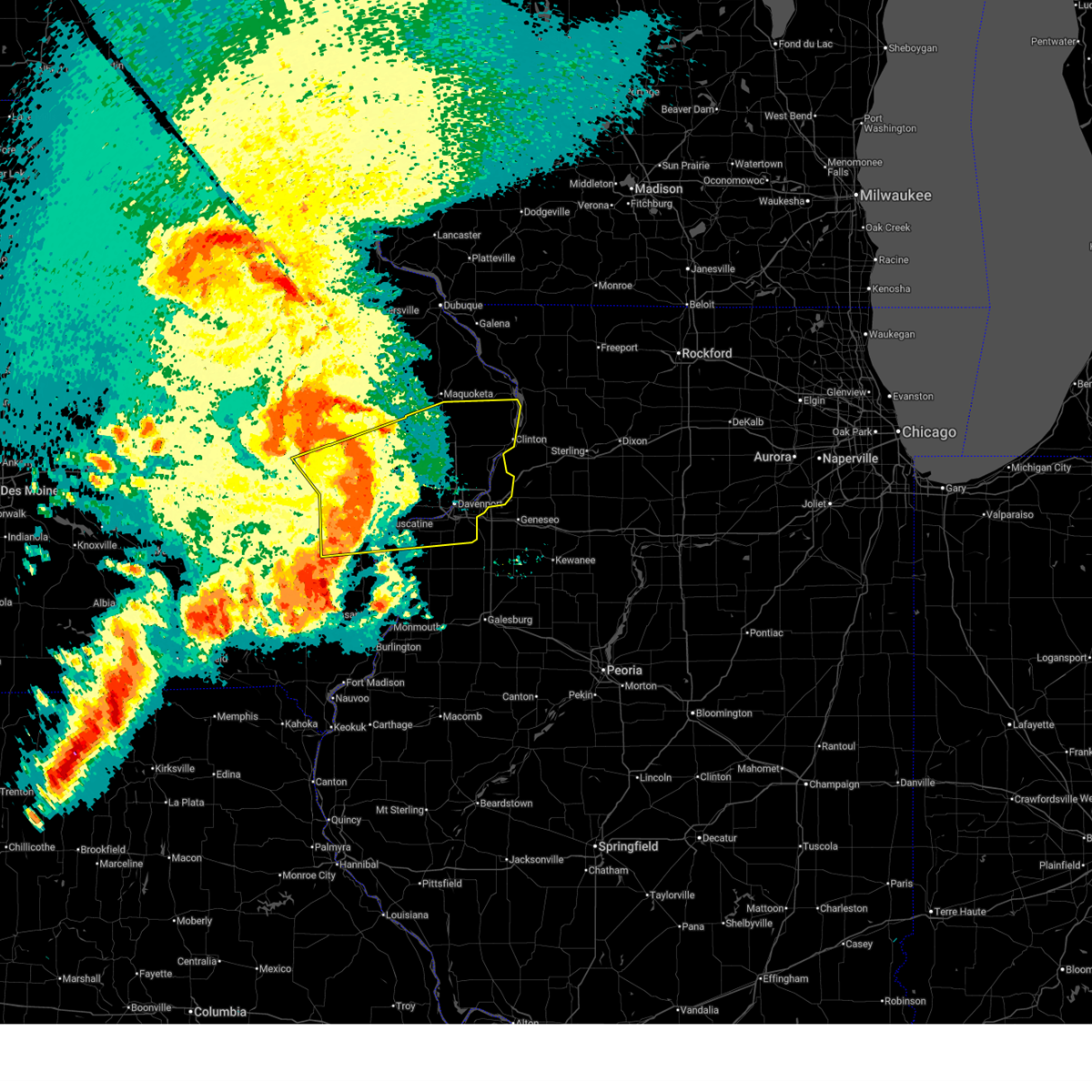
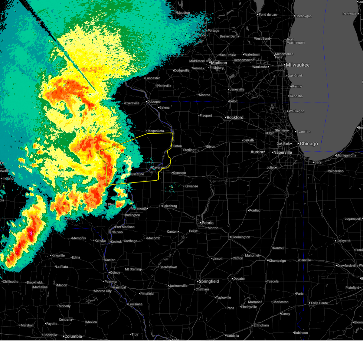
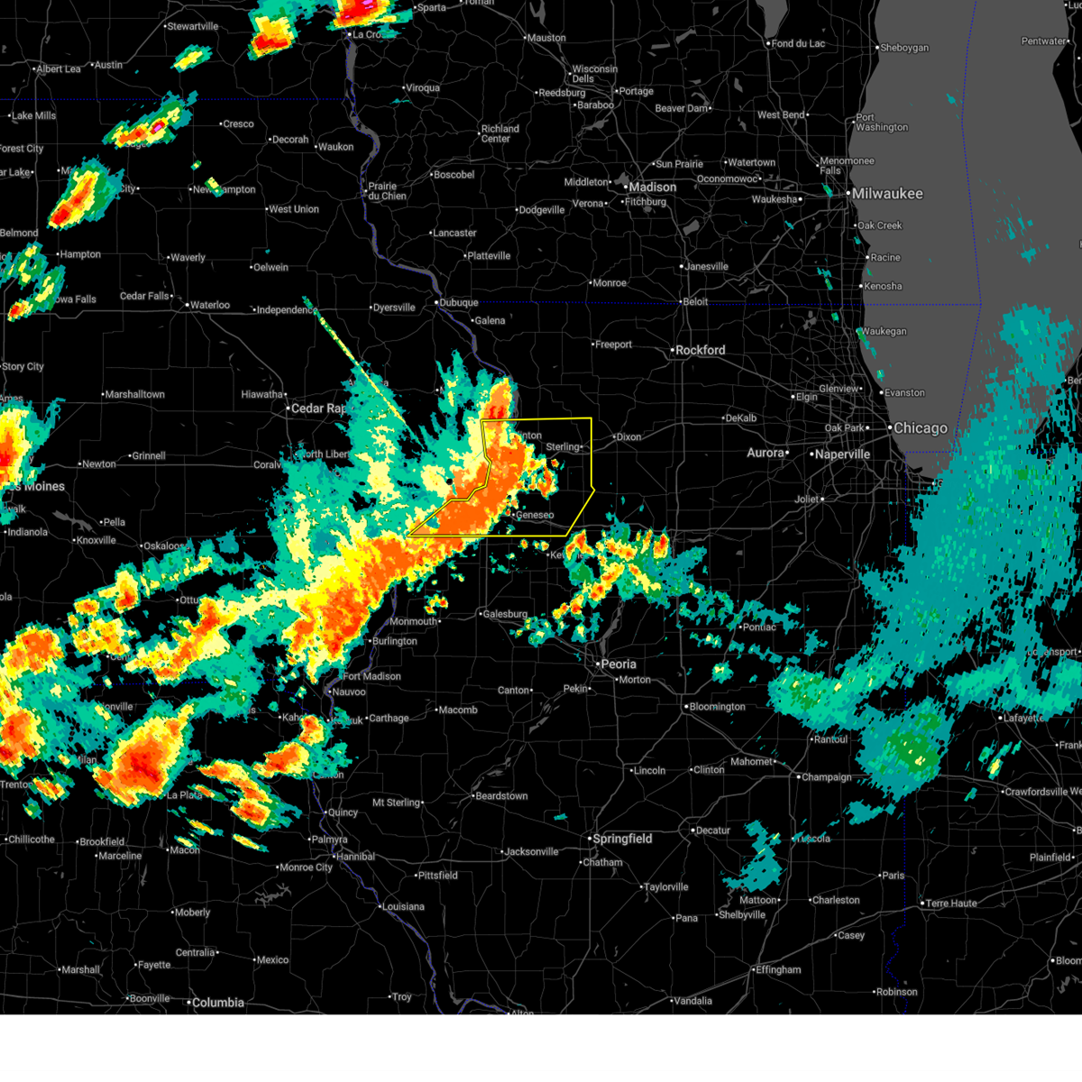
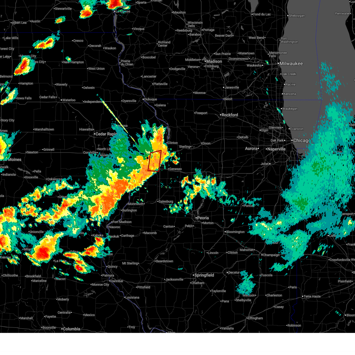
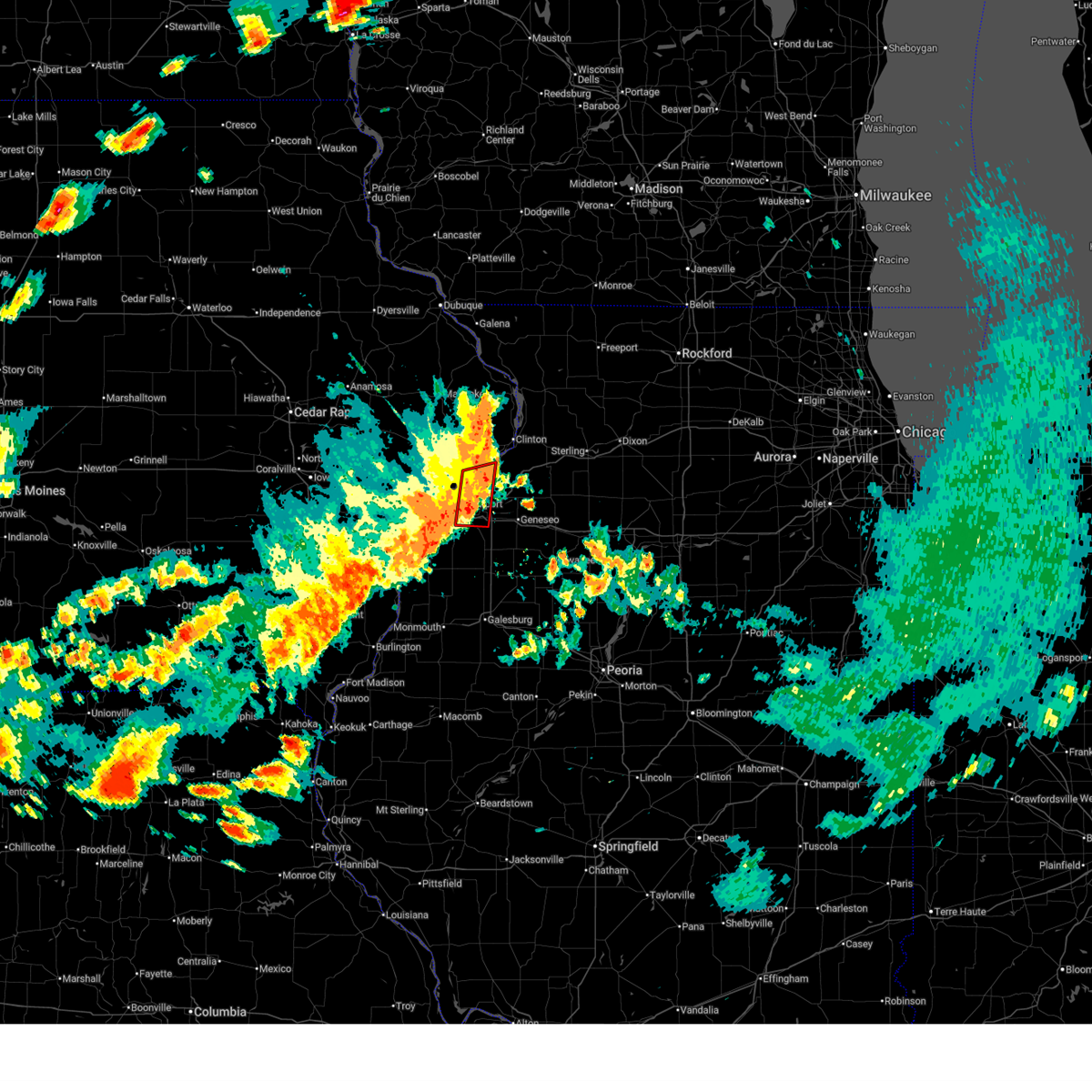
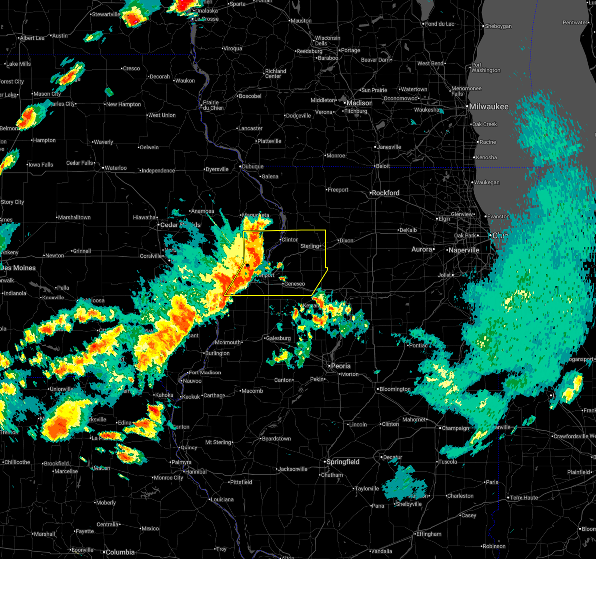
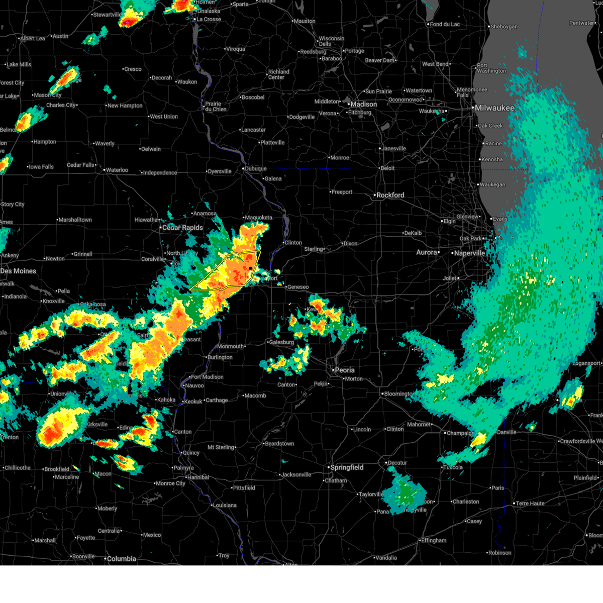
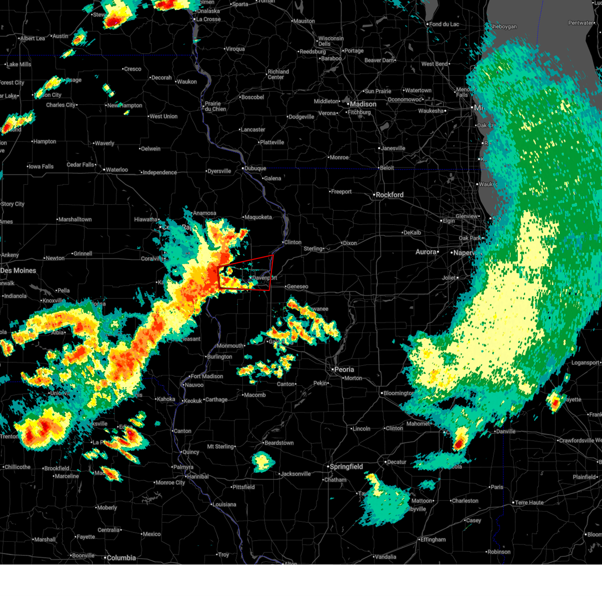
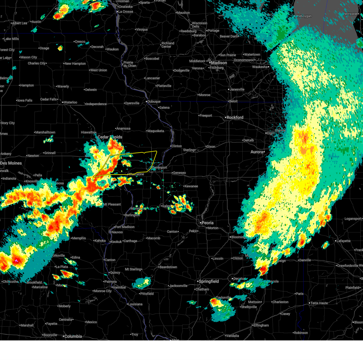
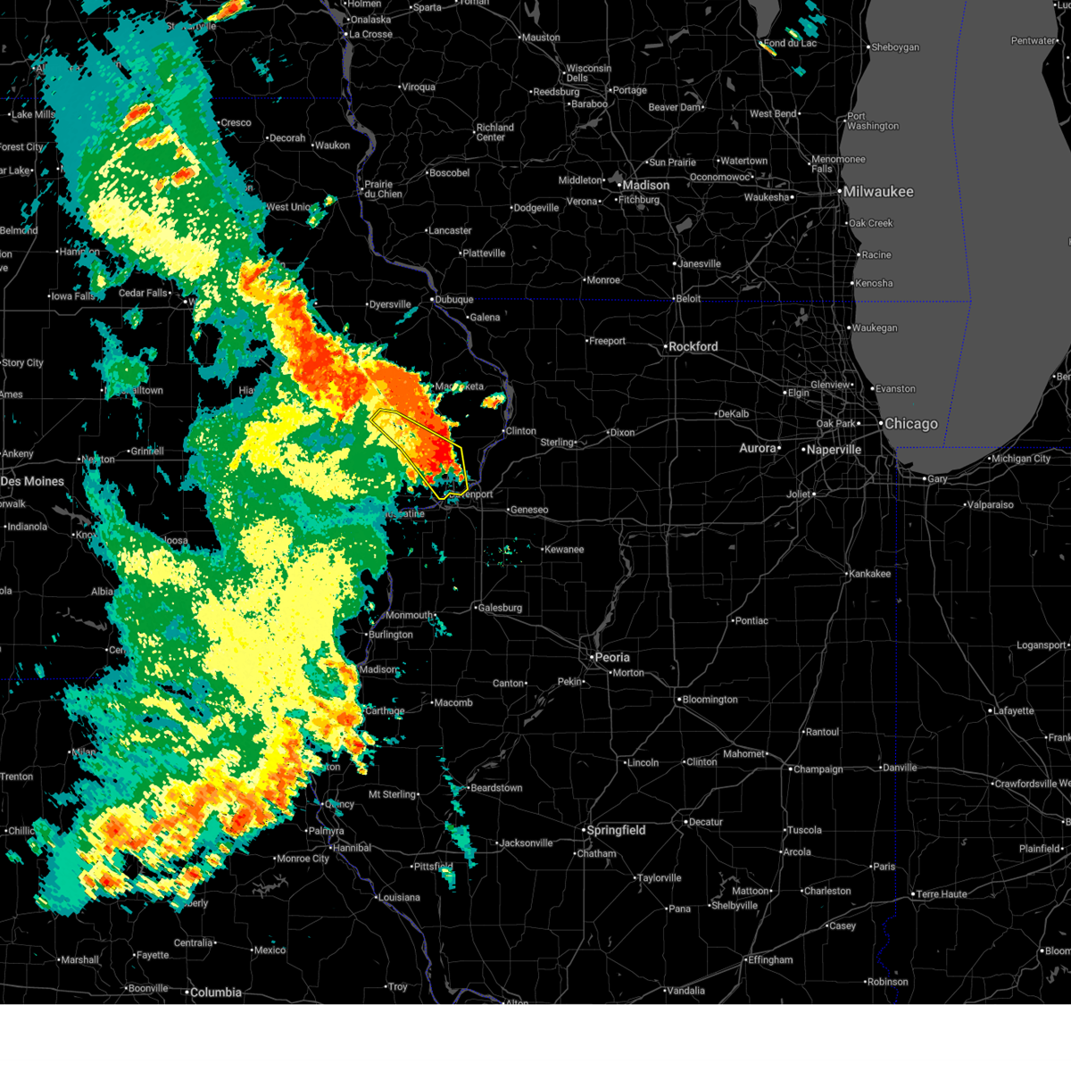
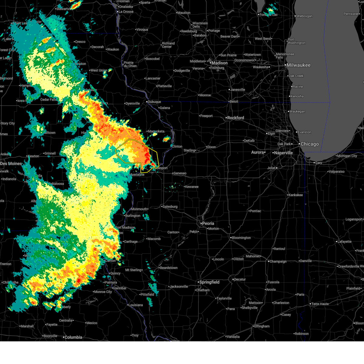
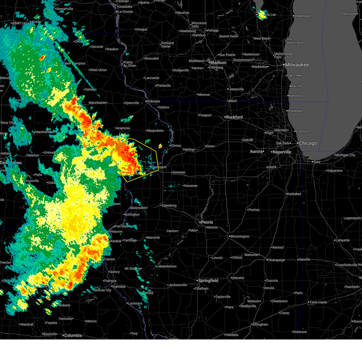
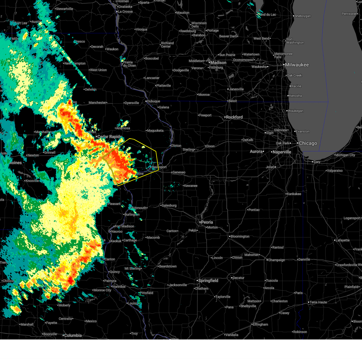
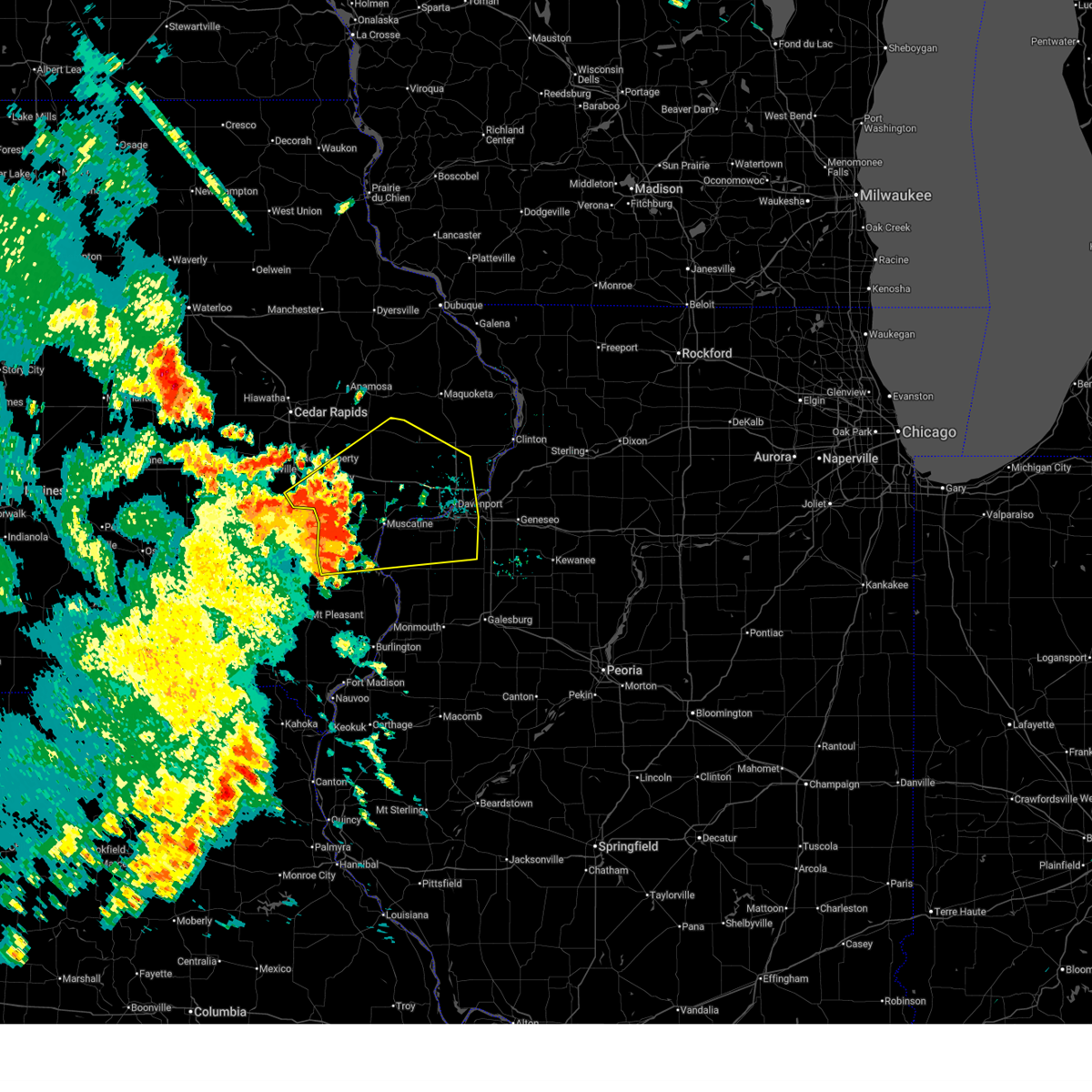
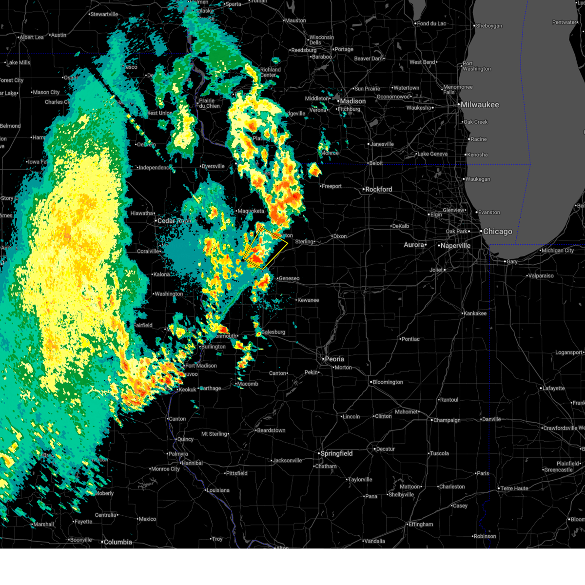
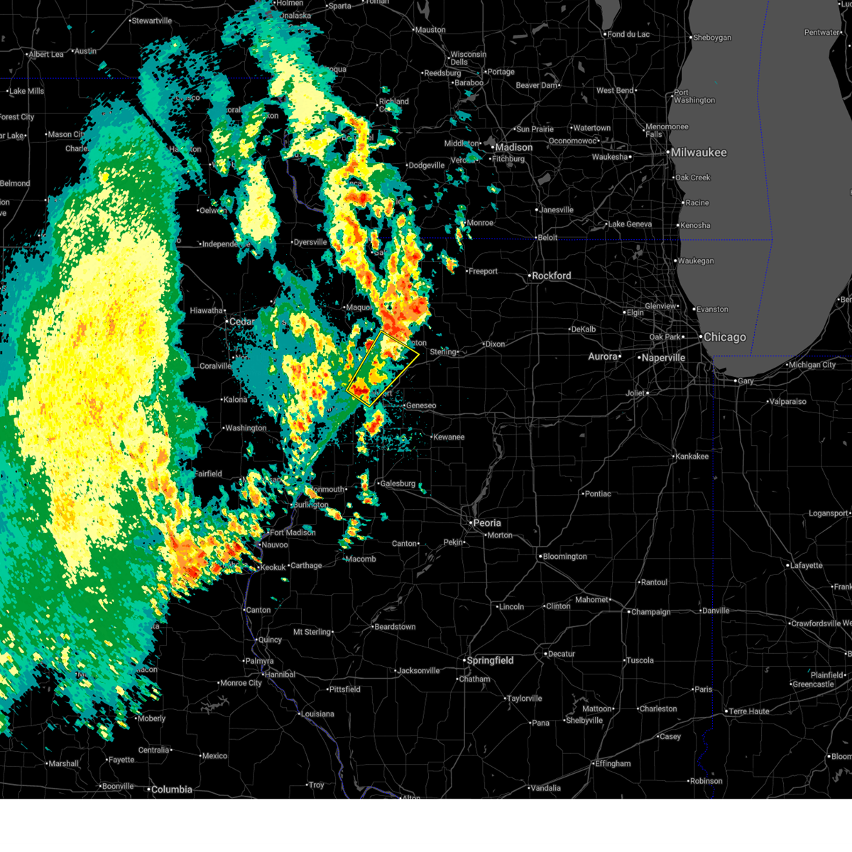
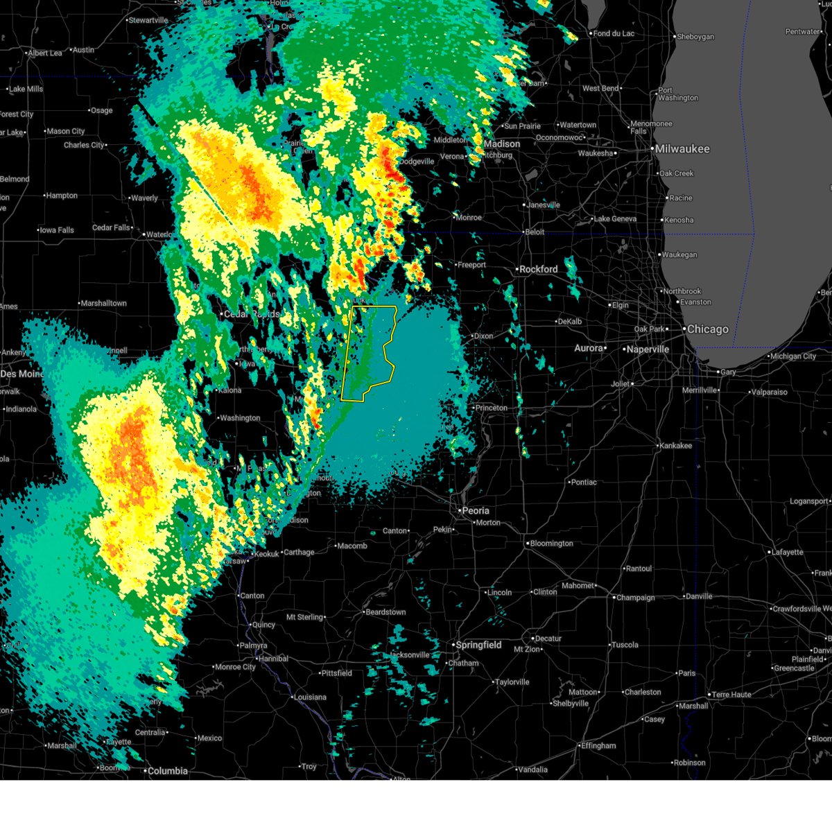
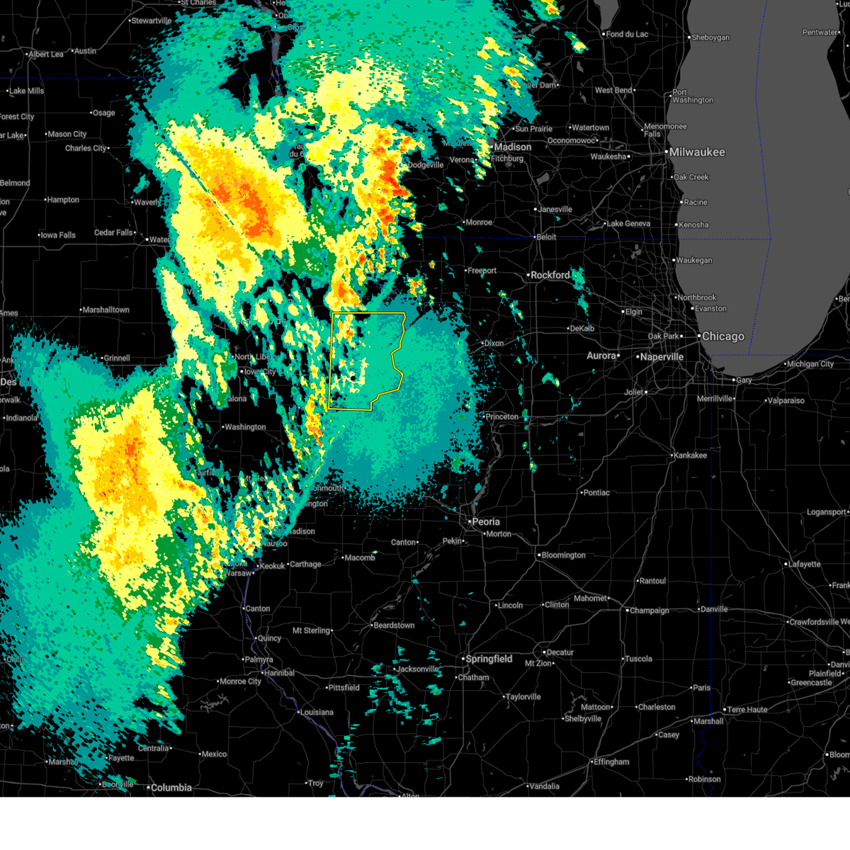
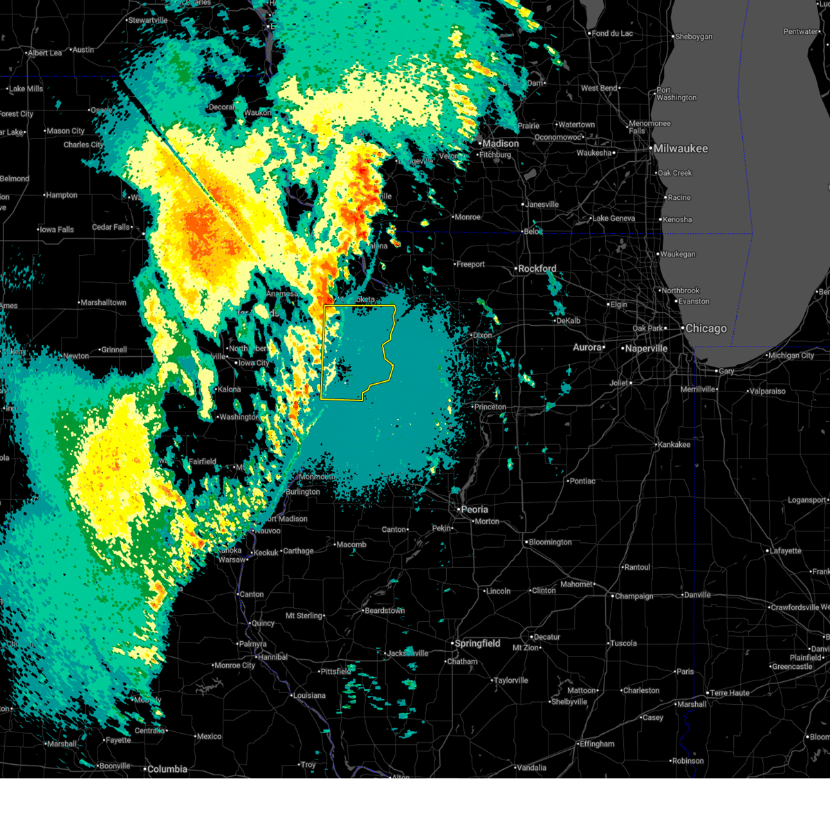
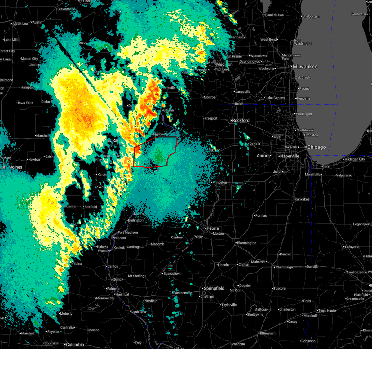
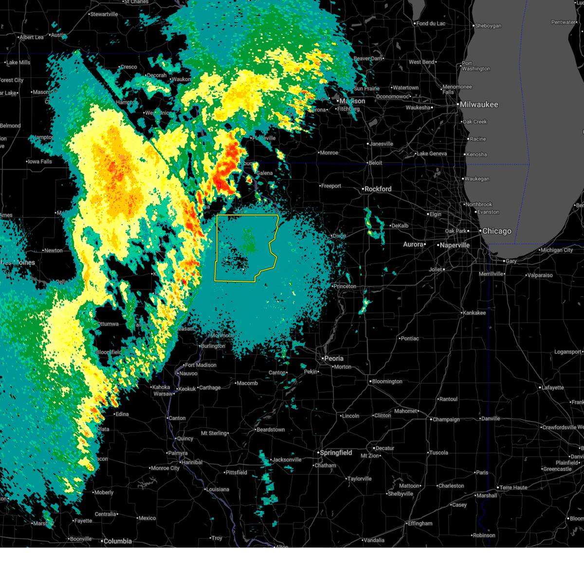
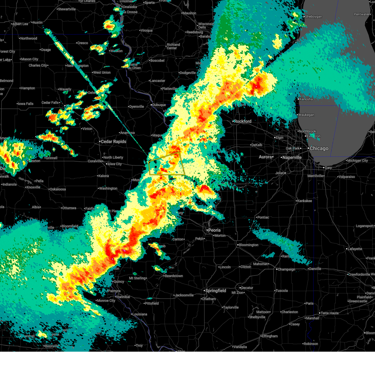
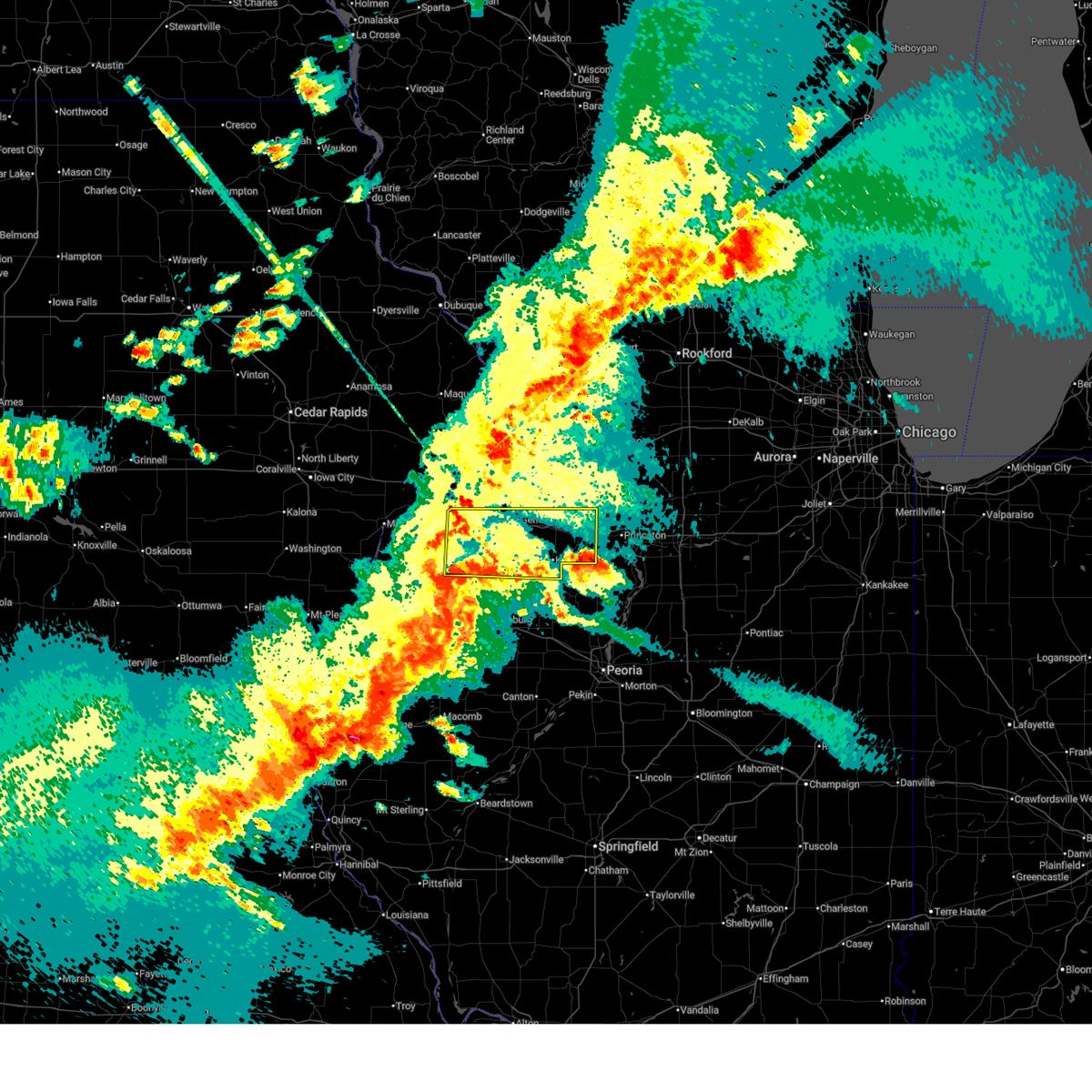
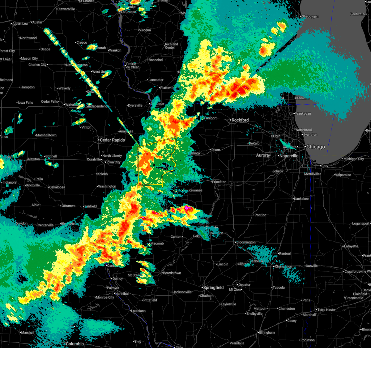
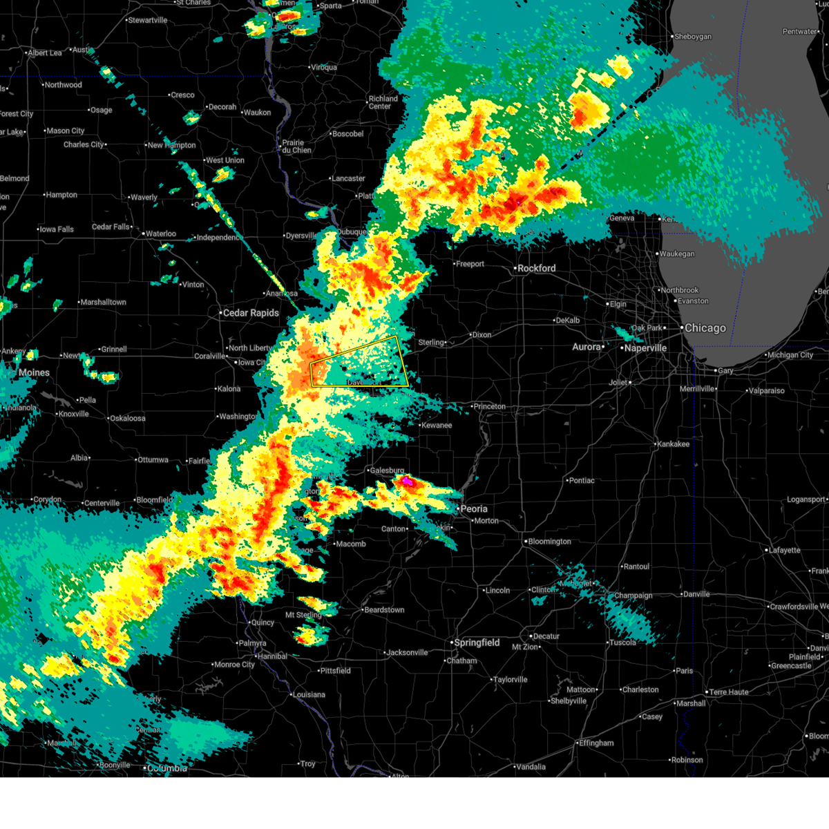
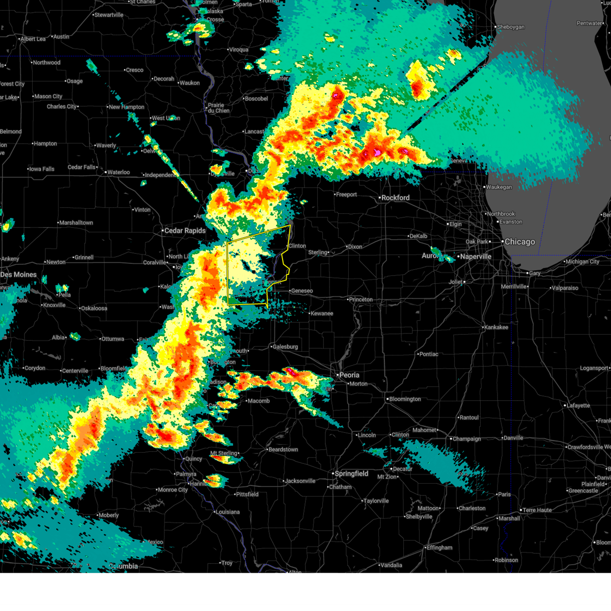
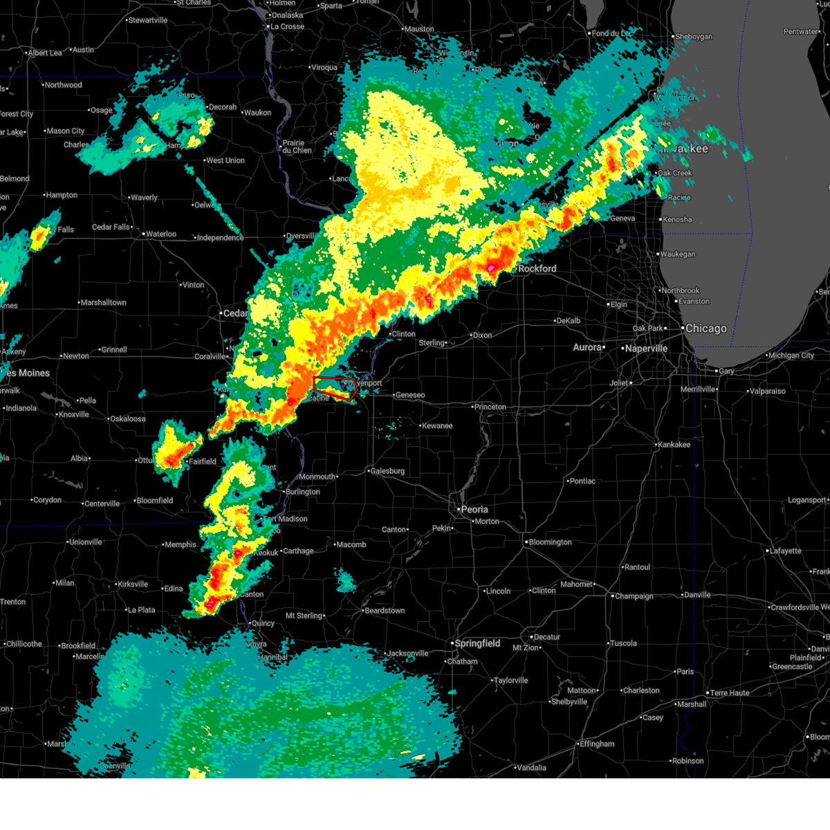
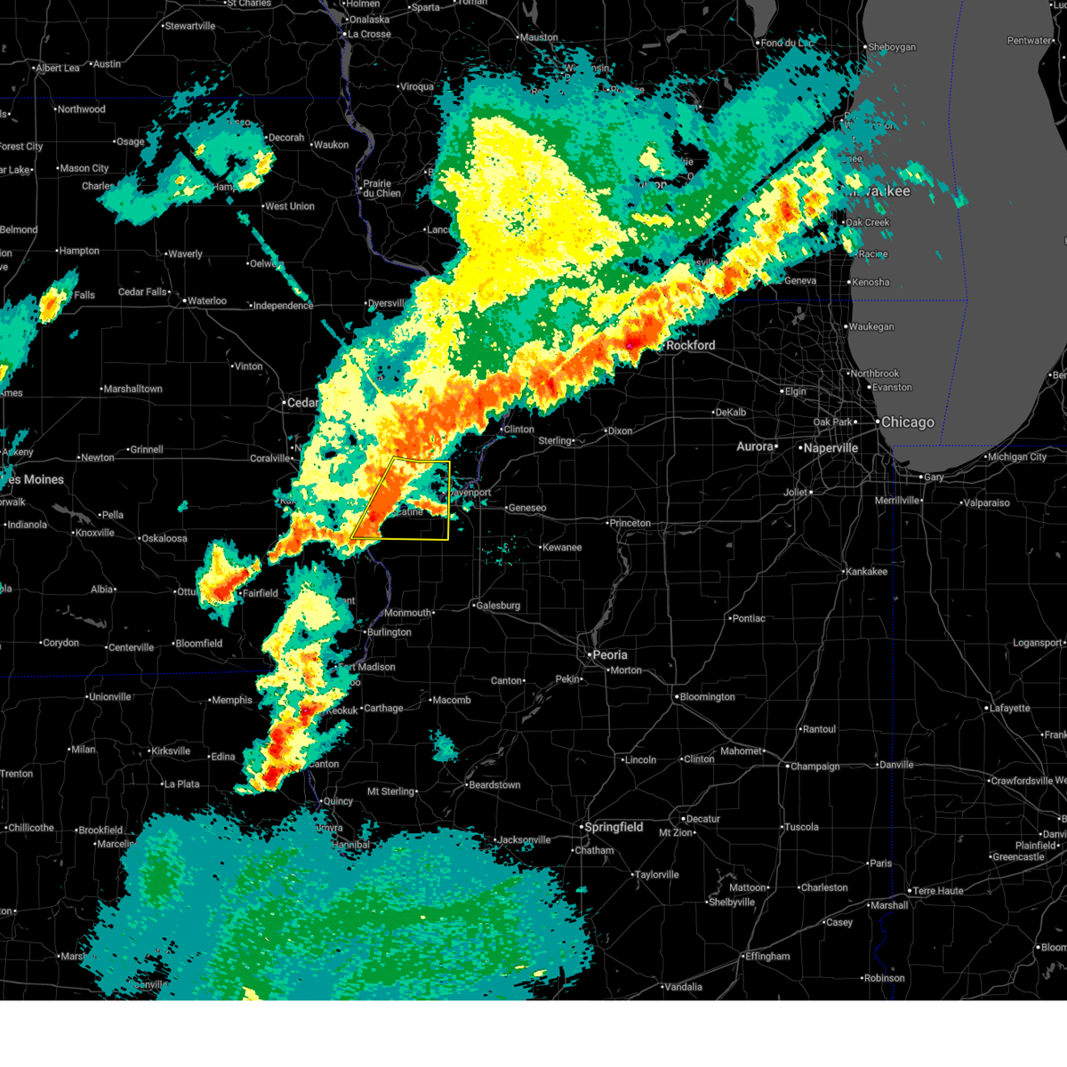
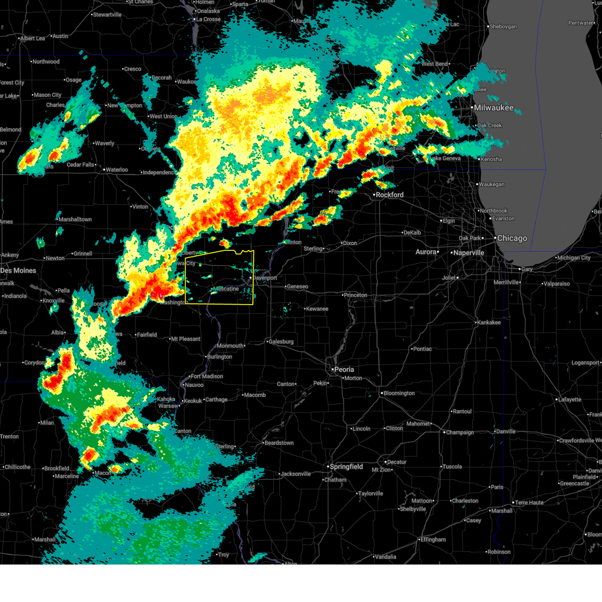
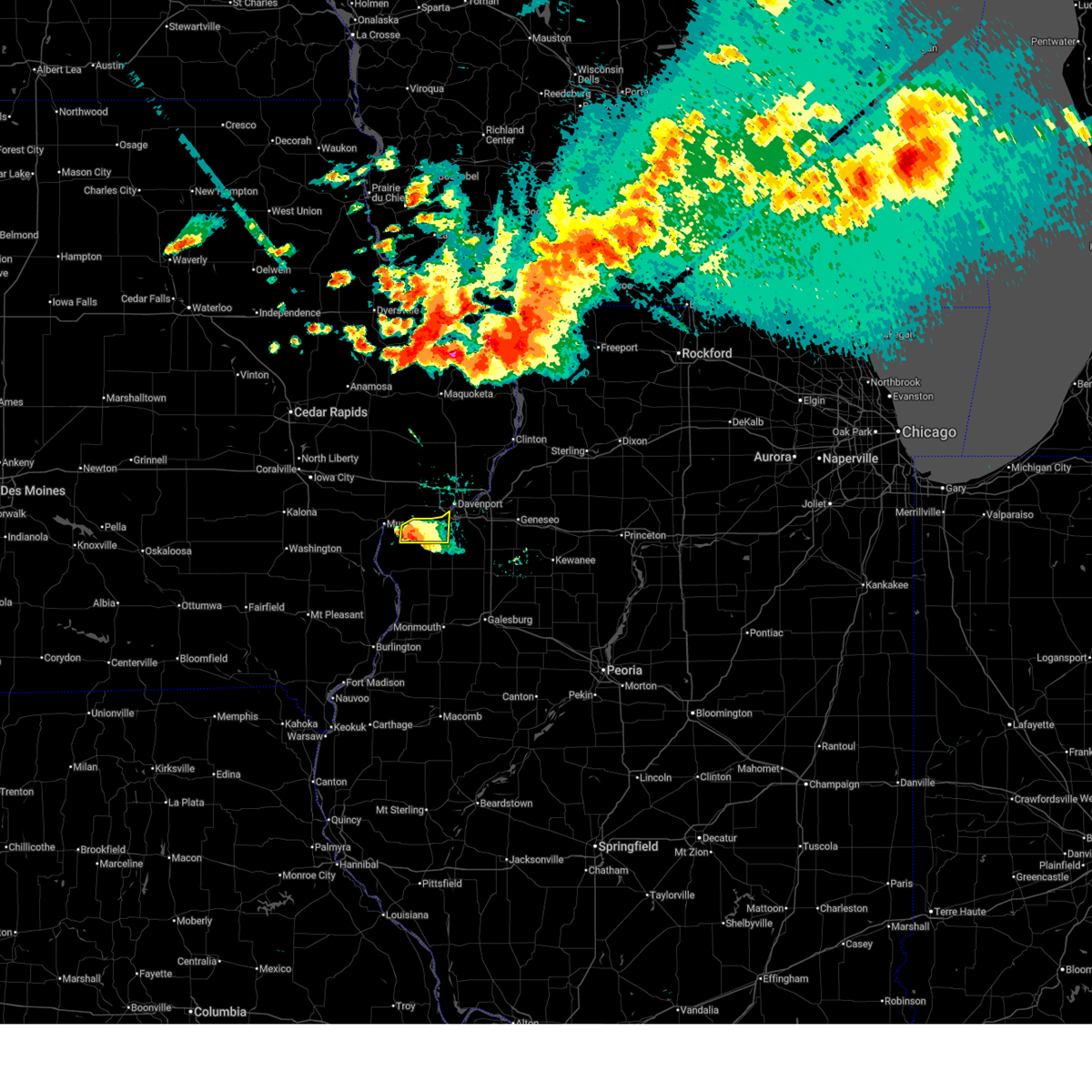
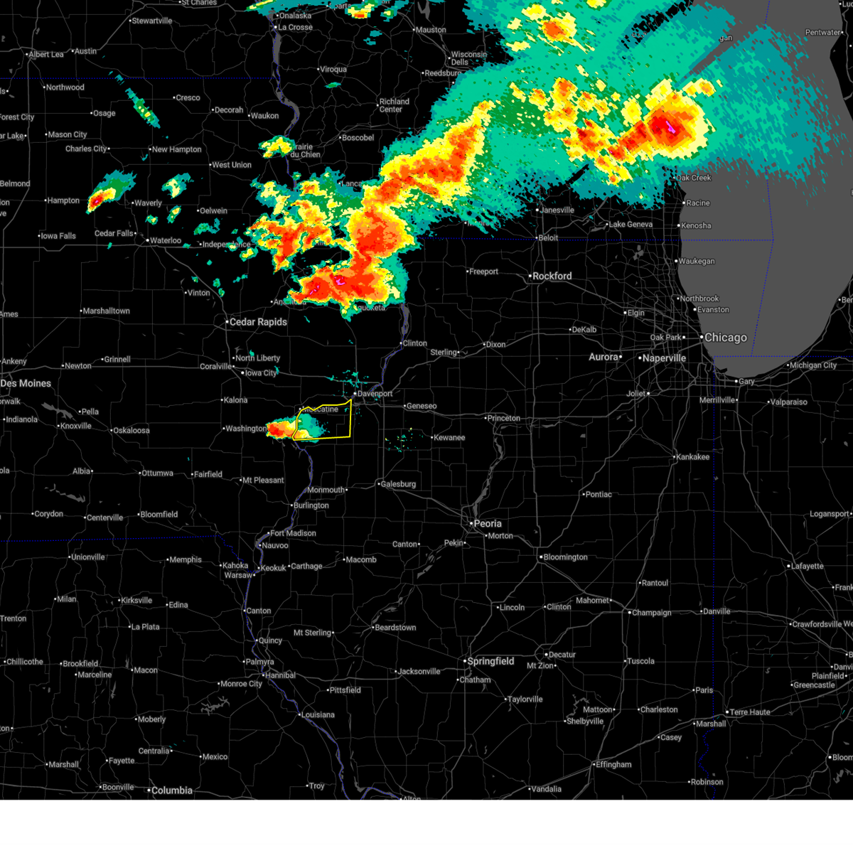
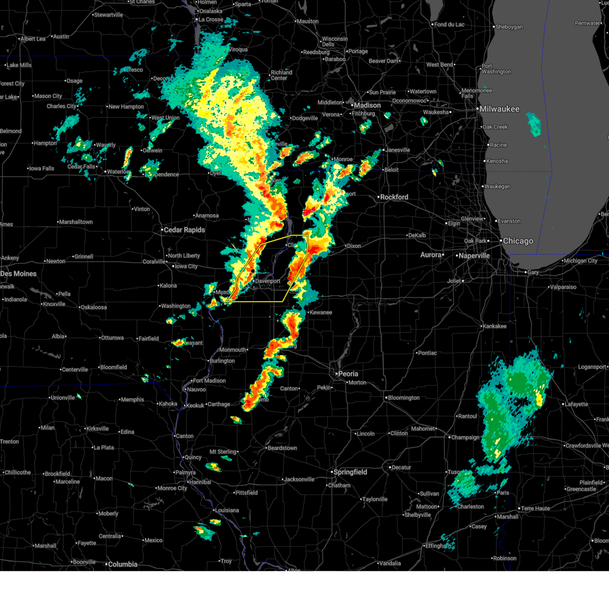
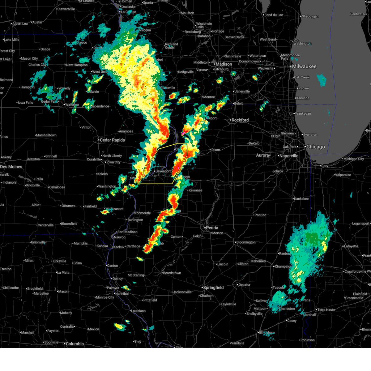
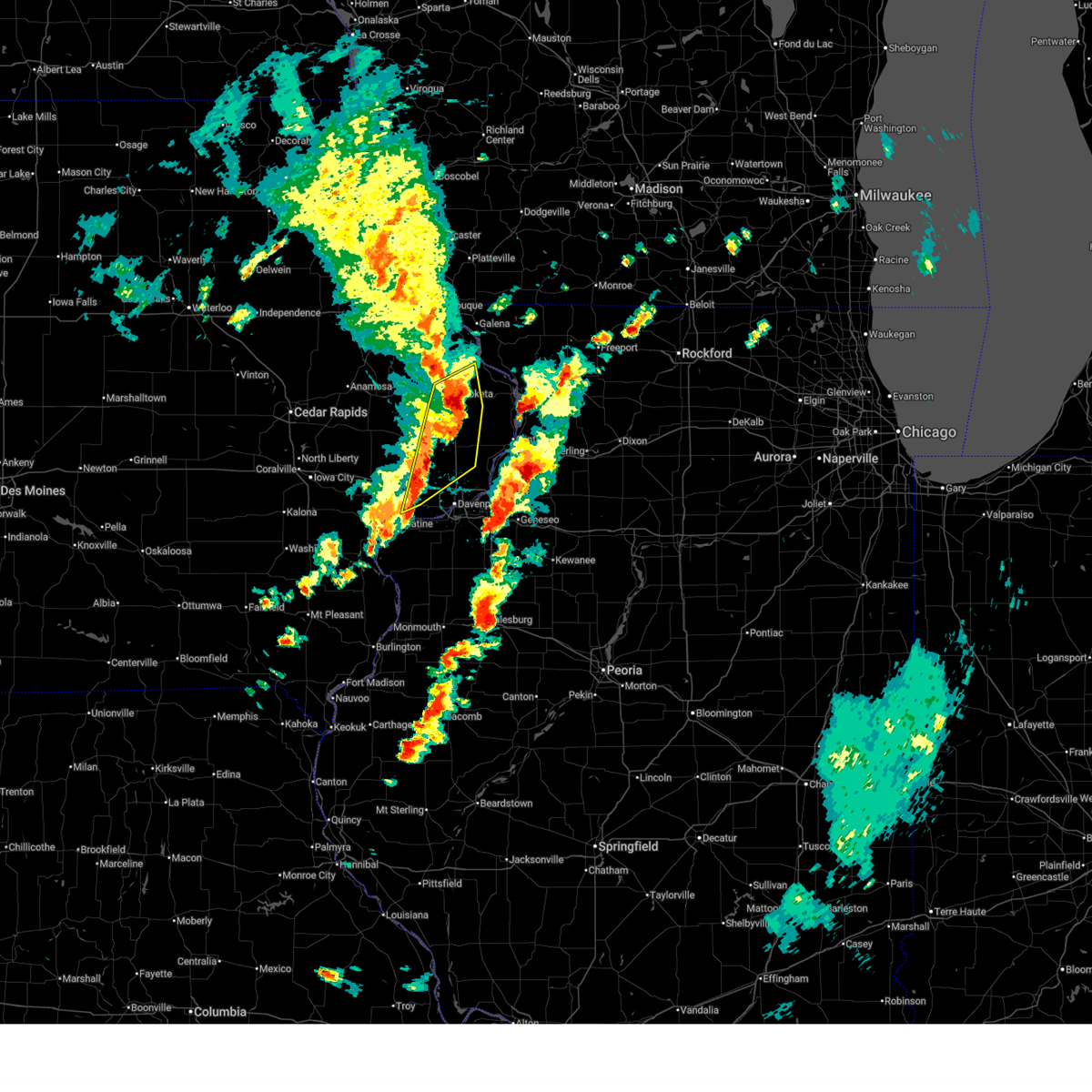
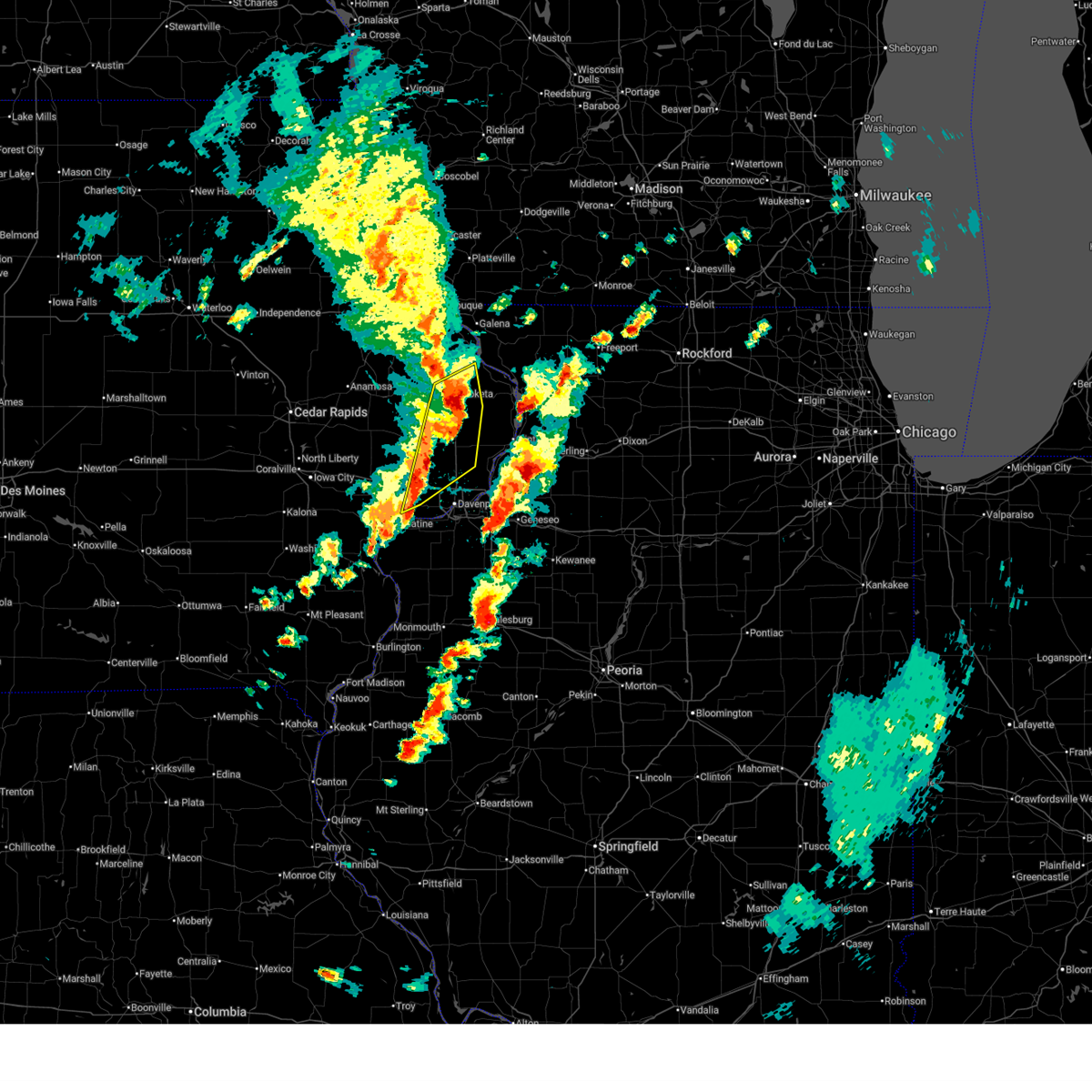
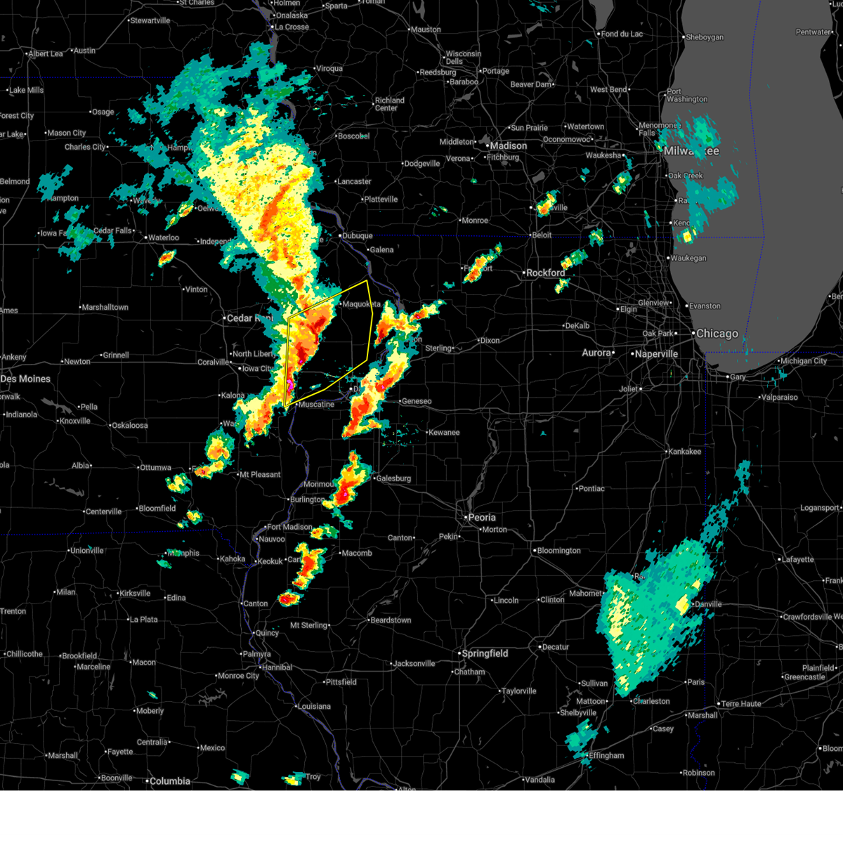
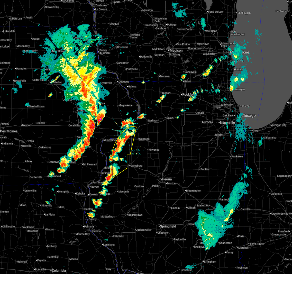
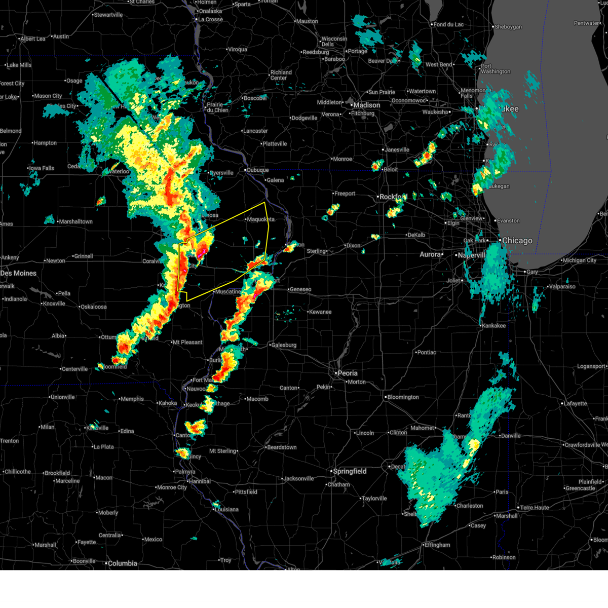
Hail Map for Davenport, IA
The Davenport, IA area has had 52 reports of on-the-ground hail by trained spotters, and has been under severe weather warnings 117 times during the past 12 months. Doppler radar has detected hail at or near Davenport, IA on 95 occasions, including 6 occasions during the past year.
| Name: | Davenport, IA |
| Where Located: | 62.9 miles ESE of Cedar Rapids, IA |
| Map: | Google Map for Davenport, IA |
| Population: | 99685 |
| Housing Units: | 44087 |
| More Info: | Search Google for Davenport, IA |
2
The Top Recent Hail Date for Davenport, IA is Friday, July 11, 2025 (8th out of 95)
Hail and Wind Damage Spotted near Davenport, IA
| Date / Time | Report Details |
|---|---|
| 6/17/2026 8:20 AM CDT |
 At 818 am cdt, severe thunderstorms were located along a line extending from clinton to near osborn to viola, moving east at 60 mph (trained weather spotters. around 815 am, the moline airport reported a 69 mph wind gust). Hazards include 70 mph wind gusts. Expect considerable tree damage. damage is likely to mobile homes, roofs, and outbuildings. locations impacted include, davenport, moline, rock island, bettendorf, clinton, east moline, aledo, silvis, geneseo, colona, milan, camanche, le claire, coal valley, fulton, hampton, orion, port byron, erie, and garden plain. this also includes big bend fish and wildlife area. this includes the following highways, interstate 74 in iowa between mile markers 1 and 5. interstate 80 in iowa between mile markers 298 and 306. interstate 80 in illinois between mile markers 1 and 23. interstate 74 in illinois between mile markers 1 and 28. interstate 88 between mile markers 1 and 24. Interstate 280 between mile markers 10 and 18. At 818 am cdt, severe thunderstorms were located along a line extending from clinton to near osborn to viola, moving east at 60 mph (trained weather spotters. around 815 am, the moline airport reported a 69 mph wind gust). Hazards include 70 mph wind gusts. Expect considerable tree damage. damage is likely to mobile homes, roofs, and outbuildings. locations impacted include, davenport, moline, rock island, bettendorf, clinton, east moline, aledo, silvis, geneseo, colona, milan, camanche, le claire, coal valley, fulton, hampton, orion, port byron, erie, and garden plain. this also includes big bend fish and wildlife area. this includes the following highways, interstate 74 in iowa between mile markers 1 and 5. interstate 80 in iowa between mile markers 298 and 306. interstate 80 in illinois between mile markers 1 and 23. interstate 74 in illinois between mile markers 1 and 28. interstate 88 between mile markers 1 and 24. Interstate 280 between mile markers 10 and 18.
|
| 6/17/2026 8:08 AM CDT |
 At 807 am cdt, severe thunderstorms were located along a line extending from bryant to silvis heights to gingle corners, moving east at 60 mph (radar indicated). Hazards include 60 mph wind gusts. Expect damage to roofs, siding, and trees. locations impacted include, davenport, moline, rock island, bettendorf, clinton, east moline, aledo, silvis, geneseo, eldridge, dewitt, milan, colona, camanche, le claire, coal valley, fulton, hampton, orion, and port byron. this also includes big bend fish and wildlife area. this includes the following highways, interstate 74 in iowa between mile markers 1 and 5. interstate 80 in iowa between mile markers 283 and 306. interstate 80 in illinois between mile markers 1 and 23. interstate 74 in illinois between mile markers 1 and 28. interstate 88 between mile markers 1 and 24. Interstate 280 between mile markers 1 and 18. At 807 am cdt, severe thunderstorms were located along a line extending from bryant to silvis heights to gingle corners, moving east at 60 mph (radar indicated). Hazards include 60 mph wind gusts. Expect damage to roofs, siding, and trees. locations impacted include, davenport, moline, rock island, bettendorf, clinton, east moline, aledo, silvis, geneseo, eldridge, dewitt, milan, colona, camanche, le claire, coal valley, fulton, hampton, orion, and port byron. this also includes big bend fish and wildlife area. this includes the following highways, interstate 74 in iowa between mile markers 1 and 5. interstate 80 in iowa between mile markers 283 and 306. interstate 80 in illinois between mile markers 1 and 23. interstate 74 in illinois between mile markers 1 and 28. interstate 88 between mile markers 1 and 24. Interstate 280 between mile markers 1 and 18.
|
| 6/17/2026 7:35 AM CDT |
 Svrdvn the national weather service in the quad cities has issued a * severe thunderstorm warning for, rock island county in northwestern illinois, mercer county in northwestern illinois, western whiteside county in northwestern illinois, western henry county in northwestern illinois, south central carroll county in northwestern illinois, southern jackson county in east central iowa, scott county in east central iowa, eastern muscatine county in east central iowa, clinton county in east central iowa, * until 830 am cdt. * at 734 am cdt, severe thunderstorms were located along a line extending from near oxford junction to near wilton to near fredonia, moving east at 55 mph (trained weather spotters). Hazards include 70 mph wind gusts. Expect considerable tree damage. Damage is likely to mobile homes, roofs, and outbuildings. Svrdvn the national weather service in the quad cities has issued a * severe thunderstorm warning for, rock island county in northwestern illinois, mercer county in northwestern illinois, western whiteside county in northwestern illinois, western henry county in northwestern illinois, south central carroll county in northwestern illinois, southern jackson county in east central iowa, scott county in east central iowa, eastern muscatine county in east central iowa, clinton county in east central iowa, * until 830 am cdt. * at 734 am cdt, severe thunderstorms were located along a line extending from near oxford junction to near wilton to near fredonia, moving east at 55 mph (trained weather spotters). Hazards include 70 mph wind gusts. Expect considerable tree damage. Damage is likely to mobile homes, roofs, and outbuildings.
|
| 6/11/2026 9:55 AM CDT |
 At 955 am cdt, severe thunderstorms were located along a line extending from near lyons to near long grove to edgington, moving east at 60 mph (radar indicated). Hazards include 60 mph wind gusts and penny size hail. Expect damage to roofs, siding, and trees. locations impacted include, davenport, moline, rock island, bettendorf, clinton, muscatine, east moline, durant, silvis, eldridge, dewitt, milan, camanche, le claire, coal valley, wilton, hampton, port byron, walcott, and blue grass. this includes the following highways, interstate 74 in iowa between mile markers 1 and 5. interstate 80 in iowa between mile markers 273 and 306. interstate 80 in illinois between mile markers 1 and 5. interstate 74 in illinois between mile markers 1 and 7. interstate 88 between mile markers 1 and 11. Interstate 280 between mile markers 1 and 18. At 955 am cdt, severe thunderstorms were located along a line extending from near lyons to near long grove to edgington, moving east at 60 mph (radar indicated). Hazards include 60 mph wind gusts and penny size hail. Expect damage to roofs, siding, and trees. locations impacted include, davenport, moline, rock island, bettendorf, clinton, muscatine, east moline, durant, silvis, eldridge, dewitt, milan, camanche, le claire, coal valley, wilton, hampton, port byron, walcott, and blue grass. this includes the following highways, interstate 74 in iowa between mile markers 1 and 5. interstate 80 in iowa between mile markers 273 and 306. interstate 80 in illinois between mile markers 1 and 5. interstate 74 in illinois between mile markers 1 and 7. interstate 88 between mile markers 1 and 11. Interstate 280 between mile markers 1 and 18.
|
| 6/11/2026 9:49 AM CDT |
 At 949 am cdt, severe thunderstorms were located along a line extending from near hale to big rock to shady creek campground, moving east at 60 mph (radar indicated). Hazards include 60 mph wind gusts and penny size hail. Expect damage to roofs, siding, and trees. locations impacted include, davenport, moline, rock island, bettendorf, clinton, muscatine, east moline, tipton, columbus junction, durant, silvis, eldridge, dewitt, milan, camanche, le claire, coal valley, west liberty, wilton, and hampton. this includes the following highways, interstate 74 in iowa between mile markers 1 and 5. interstate 80 in iowa between mile markers 256 and 306. interstate 80 in illinois between mile markers 1 and 5. interstate 74 in illinois between mile markers 1 and 7. interstate 88 between mile markers 1 and 11. Interstate 280 between mile markers 1 and 18. At 949 am cdt, severe thunderstorms were located along a line extending from near hale to big rock to shady creek campground, moving east at 60 mph (radar indicated). Hazards include 60 mph wind gusts and penny size hail. Expect damage to roofs, siding, and trees. locations impacted include, davenport, moline, rock island, bettendorf, clinton, muscatine, east moline, tipton, columbus junction, durant, silvis, eldridge, dewitt, milan, camanche, le claire, coal valley, west liberty, wilton, and hampton. this includes the following highways, interstate 74 in iowa between mile markers 1 and 5. interstate 80 in iowa between mile markers 256 and 306. interstate 80 in illinois between mile markers 1 and 5. interstate 74 in illinois between mile markers 1 and 7. interstate 88 between mile markers 1 and 11. Interstate 280 between mile markers 1 and 18.
|
| 6/11/2026 9:30 AM CDT |
 At 930 am cdt, severe thunderstorms were located along a line extending from near lisbon to rochester to sand springs, moving east at 60 mph (radar indicated). Hazards include 60 mph wind gusts and penny size hail. Expect damage to roofs, siding, and trees. locations impacted include, davenport, iowa city, moline, rock island, bettendorf, clinton, muscatine, east moline, tipton, west branch, columbus junction, durant, coralville, north liberty, silvis, eldridge, dewitt, milan, camanche, and le claire. this includes the following highways, interstate 74 in iowa between mile markers 1 and 5. interstate 80 in iowa between mile markers 242 and 306. interstate 380 between mile markers 3 and 4. interstate 80 in illinois between mile markers 1 and 5. interstate 74 in illinois between mile markers 1 and 7. interstate 88 between mile markers 1 and 11. Interstate 280 between mile markers 1 and 18. At 930 am cdt, severe thunderstorms were located along a line extending from near lisbon to rochester to sand springs, moving east at 60 mph (radar indicated). Hazards include 60 mph wind gusts and penny size hail. Expect damage to roofs, siding, and trees. locations impacted include, davenport, iowa city, moline, rock island, bettendorf, clinton, muscatine, east moline, tipton, west branch, columbus junction, durant, coralville, north liberty, silvis, eldridge, dewitt, milan, camanche, and le claire. this includes the following highways, interstate 74 in iowa between mile markers 1 and 5. interstate 80 in iowa between mile markers 242 and 306. interstate 380 between mile markers 3 and 4. interstate 80 in illinois between mile markers 1 and 5. interstate 74 in illinois between mile markers 1 and 7. interstate 88 between mile markers 1 and 11. Interstate 280 between mile markers 1 and 18.
|
| 6/11/2026 9:18 AM CDT |
 Svrdvn the national weather service in the quad cities has issued a * severe thunderstorm warning for, rock island county in northwestern illinois, northwestern mercer county in northwestern illinois, northwestern louisa county in southeastern iowa, southeastern jackson county in east central iowa, cedar county in east central iowa, scott county in east central iowa, eastern johnson county in east central iowa, muscatine county in east central iowa, clinton county in east central iowa, * until 1030 am cdt. * at 917 am cdt, severe thunderstorms were located along a line extending from twin view heights to near west branch to columbus junction, moving east at 55 mph (radar indicated). Hazards include 70 mph wind gusts and penny size hail. Expect considerable tree damage. Damage is likely to mobile homes, roofs, and outbuildings. Svrdvn the national weather service in the quad cities has issued a * severe thunderstorm warning for, rock island county in northwestern illinois, northwestern mercer county in northwestern illinois, northwestern louisa county in southeastern iowa, southeastern jackson county in east central iowa, cedar county in east central iowa, scott county in east central iowa, eastern johnson county in east central iowa, muscatine county in east central iowa, clinton county in east central iowa, * until 1030 am cdt. * at 917 am cdt, severe thunderstorms were located along a line extending from twin view heights to near west branch to columbus junction, moving east at 55 mph (radar indicated). Hazards include 70 mph wind gusts and penny size hail. Expect considerable tree damage. Damage is likely to mobile homes, roofs, and outbuildings.
|
| 6/10/2026 6:41 PM CDT |
 At 641 pm cdt, severe thunderstorms were located along a line extending from garden plain to near hillsdale to near morristown, moving east at 50 mph (trained weather spotters). Hazards include 70 mph wind gusts. Expect considerable tree damage. damage is likely to mobile homes, roofs, and outbuildings. locations impacted include, davenport, moline, rock island, clinton, east moline, sterling, rock falls, morrison, silvis, geneseo, colona, milan, camanche, coal valley, fulton, prophetstown, hampton, orion, port byron, and erie. this also includes big bend fish and wildlife area, morrison-rockwood state park, and prophetstown state park. this includes the following highways, interstate 80 in illinois between mile markers 1 and 40. interstate 74 in illinois between mile markers 1 and 20. interstate 88 between mile markers 1 and 44. Interstate 280 between mile markers 10 and 18. At 641 pm cdt, severe thunderstorms were located along a line extending from garden plain to near hillsdale to near morristown, moving east at 50 mph (trained weather spotters). Hazards include 70 mph wind gusts. Expect considerable tree damage. damage is likely to mobile homes, roofs, and outbuildings. locations impacted include, davenport, moline, rock island, clinton, east moline, sterling, rock falls, morrison, silvis, geneseo, colona, milan, camanche, coal valley, fulton, prophetstown, hampton, orion, port byron, and erie. this also includes big bend fish and wildlife area, morrison-rockwood state park, and prophetstown state park. this includes the following highways, interstate 80 in illinois between mile markers 1 and 40. interstate 74 in illinois between mile markers 1 and 20. interstate 88 between mile markers 1 and 44. Interstate 280 between mile markers 10 and 18.
|
| 6/10/2026 6:36 PM CDT |
 the tornado warning has been cancelled and is no longer in effect the tornado warning has been cancelled and is no longer in effect
|
| 6/10/2026 6:32 PM CDT |
 At 632 pm cdt, severe thunderstorms were located along a line extending from credit island to near reynolds to near sunbeam, moving east at 50 mph (radar indicated). Hazards include 70 mph wind gusts. Expect considerable tree damage. damage is likely to mobile homes, roofs, and outbuildings. locations impacted include, rock island, aledo, wapello, milan, andalusia, viola, millersburg, matherville, new boston, grandview, reynolds, eliza, joy, oak grove, letts, oakville, hamlet, amber, shale city, and taylor ridge. This includes interstate 280 between mile markers 11 and 14. At 632 pm cdt, severe thunderstorms were located along a line extending from credit island to near reynolds to near sunbeam, moving east at 50 mph (radar indicated). Hazards include 70 mph wind gusts. Expect considerable tree damage. damage is likely to mobile homes, roofs, and outbuildings. locations impacted include, rock island, aledo, wapello, milan, andalusia, viola, millersburg, matherville, new boston, grandview, reynolds, eliza, joy, oak grove, letts, oakville, hamlet, amber, shale city, and taylor ridge. This includes interstate 280 between mile markers 11 and 14.
|
| 6/10/2026 6:29 PM CDT |
 At 628 pm cdt, a severe thunderstorm capable of producing a tornado was located over barstow, or near east moline, moving east at 60 mph (radar indicated rotation). Hazards include tornado. Flying debris will be dangerous to those caught without shelter. mobile homes will be damaged or destroyed. damage to roofs, windows, and vehicles will occur. tree damage is likely. this tornadic thunderstorm will remain over mainly rural areas of eastern rock island, northwestern henry and eastern scott counties, including the following locations, silvis heights, barstow, pleasant valley, fruitland, campbells island, illiniwek forest preserve, rock island arsenal, princeton wildlife area, indian bluff golf course, and panorama park. this includes the following highways, interstate 74 in iowa between mile markers 1 and 5. interstate 80 in iowa between mile markers 298 and 306. interstate 80 in illinois between mile markers 1 and 7. interstate 74 in illinois between mile markers 1 and 13. Interstate 280 between mile markers 15 and 18. At 628 pm cdt, a severe thunderstorm capable of producing a tornado was located over barstow, or near east moline, moving east at 60 mph (radar indicated rotation). Hazards include tornado. Flying debris will be dangerous to those caught without shelter. mobile homes will be damaged or destroyed. damage to roofs, windows, and vehicles will occur. tree damage is likely. this tornadic thunderstorm will remain over mainly rural areas of eastern rock island, northwestern henry and eastern scott counties, including the following locations, silvis heights, barstow, pleasant valley, fruitland, campbells island, illiniwek forest preserve, rock island arsenal, princeton wildlife area, indian bluff golf course, and panorama park. this includes the following highways, interstate 74 in iowa between mile markers 1 and 5. interstate 80 in iowa between mile markers 298 and 306. interstate 80 in illinois between mile markers 1 and 7. interstate 74 in illinois between mile markers 1 and 13. Interstate 280 between mile markers 15 and 18.
|
| 6/10/2026 6:19 PM CDT |
 At 619 pm cdt, severe thunderstorms were located along a line extending from malone to near le claire to taylor ridge, moving east at 50 mph (trained weather spotters). Hazards include 70 mph wind gusts. Expect considerable tree damage. damage is likely to mobile homes, roofs, and outbuildings. locations impacted include, davenport, moline, rock island, bettendorf, clinton, east moline, sterling, rock falls, morrison, silvis, geneseo, eldridge, dewitt, milan, colona, camanche, le claire, coal valley, fulton, and prophetstown. this also includes big bend fish and wildlife area, morrison-rockwood state park, and prophetstown state park. this includes the following highways, interstate 74 in iowa between mile markers 1 and 5. interstate 80 in iowa between mile markers 292 and 306. interstate 80 in illinois between mile markers 1 and 40. interstate 74 in illinois between mile markers 1 and 20. interstate 88 between mile markers 1 and 44. Interstate 280 between mile markers 3 and 18. At 619 pm cdt, severe thunderstorms were located along a line extending from malone to near le claire to taylor ridge, moving east at 50 mph (trained weather spotters). Hazards include 70 mph wind gusts. Expect considerable tree damage. damage is likely to mobile homes, roofs, and outbuildings. locations impacted include, davenport, moline, rock island, bettendorf, clinton, east moline, sterling, rock falls, morrison, silvis, geneseo, eldridge, dewitt, milan, colona, camanche, le claire, coal valley, fulton, and prophetstown. this also includes big bend fish and wildlife area, morrison-rockwood state park, and prophetstown state park. this includes the following highways, interstate 74 in iowa between mile markers 1 and 5. interstate 80 in iowa between mile markers 292 and 306. interstate 80 in illinois between mile markers 1 and 40. interstate 74 in illinois between mile markers 1 and 20. interstate 88 between mile markers 1 and 44. Interstate 280 between mile markers 3 and 18.
|
| 6/10/2026 6:17 PM CDT | Peak wind gust at the davenport municipal airpor in scott county IA, 4.3 miles S of Davenport, IA |
| 6/10/2026 6:09 PM CDT |
 At 609 pm cdt, severe thunderstorms were located along a line extending from near long grove to davenport to loud thunder forest preserve, moving east at 55 mph (radar indicated). Hazards include 70 mph wind gusts and penny size hail. Expect considerable tree damage. damage is likely to mobile homes, roofs, and outbuildings. locations impacted include, davenport, rock island, muscatine, durant, eldridge, wilton, walcott, blue grass, buffalo, long grove, donahue, montpelier, fairport, dixon, stockton, maysville, clark's ferry recreation area, camp liberty, west lake park, and new era. this includes the following highways, interstate 80 in iowa between mile markers 275 and 297. Interstate 280 between mile markers 1 and 10. At 609 pm cdt, severe thunderstorms were located along a line extending from near long grove to davenport to loud thunder forest preserve, moving east at 55 mph (radar indicated). Hazards include 70 mph wind gusts and penny size hail. Expect considerable tree damage. damage is likely to mobile homes, roofs, and outbuildings. locations impacted include, davenport, rock island, muscatine, durant, eldridge, wilton, walcott, blue grass, buffalo, long grove, donahue, montpelier, fairport, dixon, stockton, maysville, clark's ferry recreation area, camp liberty, west lake park, and new era. this includes the following highways, interstate 80 in iowa between mile markers 275 and 297. Interstate 280 between mile markers 1 and 10.
|
| 6/10/2026 6:03 PM CDT |
 Tordvn the national weather service in the quad cities has issued a * tornado warning for, southeastern rock island county in northwestern illinois, northwestern henry county in northwestern illinois, southeastern cedar county in east central iowa, scott county in east central iowa, northeastern muscatine county in east central iowa, * until 645 pm cdt. * at 603 pm cdt, a severe thunderstorm capable of producing a tornado was located over pleasant prairie, or near durant, moving east at 45 mph (radar indicated rotation). Hazards include tornado. Flying debris will be dangerous to those caught without shelter. mobile homes will be damaged or destroyed. damage to roofs, windows, and vehicles will occur. tree damage is likely. this dangerous storm will be near, davenport, rock island, walcott, blue grass, buffalo, andalusia, maysville, west lake park, rock island arsenal, and credit island around 610 pm cdt. moline, bettendorf, eldridge, milan, blackhawk state park, and davenport municipal airport around 615 pm cdt. east moline, riverdale, panorama park, moline quad-city airport, and fruitland around 620 pm cdt. other locations in the path of this tornadic thunderstorm include silvis, le claire, coal valley, hampton, carbon cliff, campbells island, silvis heights, illiniwek forest preserve, pleasant valley, indian bluff golf course, colona, port byron, rapids city, barstow, princeton and cordova. this includes the following highways, interstate 74 in iowa between mile markers 1 and 5. interstate 80 in iowa between mile markers 279 and 306. interstate 80 in illinois between mile markers 1 and 7. interstate 74 in illinois between mile markers 1 and 13. Interstate 280 between mile markers 1 and 18. Tordvn the national weather service in the quad cities has issued a * tornado warning for, southeastern rock island county in northwestern illinois, northwestern henry county in northwestern illinois, southeastern cedar county in east central iowa, scott county in east central iowa, northeastern muscatine county in east central iowa, * until 645 pm cdt. * at 603 pm cdt, a severe thunderstorm capable of producing a tornado was located over pleasant prairie, or near durant, moving east at 45 mph (radar indicated rotation). Hazards include tornado. Flying debris will be dangerous to those caught without shelter. mobile homes will be damaged or destroyed. damage to roofs, windows, and vehicles will occur. tree damage is likely. this dangerous storm will be near, davenport, rock island, walcott, blue grass, buffalo, andalusia, maysville, west lake park, rock island arsenal, and credit island around 610 pm cdt. moline, bettendorf, eldridge, milan, blackhawk state park, and davenport municipal airport around 615 pm cdt. east moline, riverdale, panorama park, moline quad-city airport, and fruitland around 620 pm cdt. other locations in the path of this tornadic thunderstorm include silvis, le claire, coal valley, hampton, carbon cliff, campbells island, silvis heights, illiniwek forest preserve, pleasant valley, indian bluff golf course, colona, port byron, rapids city, barstow, princeton and cordova. this includes the following highways, interstate 74 in iowa between mile markers 1 and 5. interstate 80 in iowa between mile markers 279 and 306. interstate 80 in illinois between mile markers 1 and 7. interstate 74 in illinois between mile markers 1 and 13. Interstate 280 between mile markers 1 and 18.
|
| 6/10/2026 5:58 PM CDT |
 At 558 pm cdt, severe thunderstorms were located along a line extending from dixon to near stockton to near muscatine, moving east at 45 mph (radar indicated). Hazards include 60 mph wind gusts and penny size hail. Expect damage to roofs, siding, and trees. locations impacted include, davenport, rock island, muscatine, durant, eldridge, west liberty, wilton, walcott, blue grass, lone tree, buffalo, long grove, nichols, donahue, atalissa, montpelier, rochester, fairport, dixon, and stockton. this includes the following highways, interstate 80 in iowa between mile markers 262 and 297. Interstate 280 between mile markers 1 and 10. At 558 pm cdt, severe thunderstorms were located along a line extending from dixon to near stockton to near muscatine, moving east at 45 mph (radar indicated). Hazards include 60 mph wind gusts and penny size hail. Expect damage to roofs, siding, and trees. locations impacted include, davenport, rock island, muscatine, durant, eldridge, west liberty, wilton, walcott, blue grass, lone tree, buffalo, long grove, nichols, donahue, atalissa, montpelier, rochester, fairport, dixon, and stockton. this includes the following highways, interstate 80 in iowa between mile markers 262 and 297. Interstate 280 between mile markers 1 and 10.
|
| 6/10/2026 5:53 PM CDT |
 Svrdvn the national weather service in the quad cities has issued a * severe thunderstorm warning for, southwestern rock island county in northwestern illinois, mercer county in northwestern illinois, southeastern louisa county in southeastern iowa, southern muscatine county in east central iowa, * until 645 pm cdt. * at 553 pm cdt, severe thunderstorms were located along a line extending from near cranston to near letts to marsh, moving east at 50 mph (radar indicated). Hazards include 70 mph wind gusts and penny size hail. Expect considerable tree damage. Damage is likely to mobile homes, roofs, and outbuildings. Svrdvn the national weather service in the quad cities has issued a * severe thunderstorm warning for, southwestern rock island county in northwestern illinois, mercer county in northwestern illinois, southeastern louisa county in southeastern iowa, southern muscatine county in east central iowa, * until 645 pm cdt. * at 553 pm cdt, severe thunderstorms were located along a line extending from near cranston to near letts to marsh, moving east at 50 mph (radar indicated). Hazards include 70 mph wind gusts and penny size hail. Expect considerable tree damage. Damage is likely to mobile homes, roofs, and outbuildings.
|
| 6/10/2026 5:30 PM CDT |
 Svrdvn the national weather service in the quad cities has issued a * severe thunderstorm warning for, southern cedar county in east central iowa, scott county in east central iowa, southeastern johnson county in east central iowa, northeastern washington county in southeastern iowa, muscatine county in east central iowa, * until 630 pm cdt. * at 530 pm cdt, severe thunderstorms were located along a line extending from springdale to muscatine county fairgrounds to near gladwin, moving east at 45 mph (radar indicated). Hazards include 60 mph wind gusts and penny size hail. expect damage to roofs, siding, and trees Svrdvn the national weather service in the quad cities has issued a * severe thunderstorm warning for, southern cedar county in east central iowa, scott county in east central iowa, southeastern johnson county in east central iowa, northeastern washington county in southeastern iowa, muscatine county in east central iowa, * until 630 pm cdt. * at 530 pm cdt, severe thunderstorms were located along a line extending from springdale to muscatine county fairgrounds to near gladwin, moving east at 45 mph (radar indicated). Hazards include 60 mph wind gusts and penny size hail. expect damage to roofs, siding, and trees
|
| 6/10/2026 12:21 PM CDT |
 At 1220 pm cdt, severe thunderstorms were located along a line extending from near oxford junction to grand mound to rock island arsenal, moving northeast at 50 mph (trained weather spotters). Hazards include 60 mph wind gusts. Expect damage to roofs, siding, and trees. locations impacted include, davenport, rock island, bettendorf, eldridge, long grove, lowden, wheatland, grand mound, calamus, riverdale, donahue, toronto, clarence, dixon, maysville, panorama park, camp liberty, mississippi valley fairgrounds, davenport municipal airport, and sherman park. this includes the following highways, interstate 74 in iowa between mile markers 1 and 4. interstate 80 in iowa between mile markers 288 and 302. Interstate 280 between mile markers 1 and 3. At 1220 pm cdt, severe thunderstorms were located along a line extending from near oxford junction to grand mound to rock island arsenal, moving northeast at 50 mph (trained weather spotters). Hazards include 60 mph wind gusts. Expect damage to roofs, siding, and trees. locations impacted include, davenport, rock island, bettendorf, eldridge, long grove, lowden, wheatland, grand mound, calamus, riverdale, donahue, toronto, clarence, dixon, maysville, panorama park, camp liberty, mississippi valley fairgrounds, davenport municipal airport, and sherman park. this includes the following highways, interstate 74 in iowa between mile markers 1 and 4. interstate 80 in iowa between mile markers 288 and 302. Interstate 280 between mile markers 1 and 3.
|
| 6/10/2026 12:09 PM CDT |
 At 1209 pm cdt, severe thunderstorms were located along a line extending from near clarence to sherman park to near andalusia, moving northeast at 50 mph (trained weather spotters). Hazards include 60 mph wind gusts. Expect damage to roofs, siding, and trees. locations impacted include, davenport, rock island, bettendorf, tipton, durant, eldridge, walcott, blue grass, buffalo, long grove, lowden, wheatland, grand mound, calamus, bennett, riverdale, donahue, toronto, rochester, and buchanan. this includes the following highways, interstate 74 in iowa between mile markers 1 and 4. interstate 80 in iowa between mile markers 264 and 302. Interstate 280 between mile markers 1 and 10. At 1209 pm cdt, severe thunderstorms were located along a line extending from near clarence to sherman park to near andalusia, moving northeast at 50 mph (trained weather spotters). Hazards include 60 mph wind gusts. Expect damage to roofs, siding, and trees. locations impacted include, davenport, rock island, bettendorf, tipton, durant, eldridge, walcott, blue grass, buffalo, long grove, lowden, wheatland, grand mound, calamus, bennett, riverdale, donahue, toronto, rochester, and buchanan. this includes the following highways, interstate 74 in iowa between mile markers 1 and 4. interstate 80 in iowa between mile markers 264 and 302. Interstate 280 between mile markers 1 and 10.
|
| 6/10/2026 11:54 AM CDT |
 At 1154 am cdt, severe thunderstorms were located along a line extending from near mechanicsville to sunbury to near illinois city, moving northeast at 55 mph (trained weather spotters). Hazards include 60 mph wind gusts. Expect damage to roofs, siding, and trees. locations impacted include, davenport, moline, rock island, bettendorf, muscatine, east moline, tipton, west branch, durant, silvis, eldridge, milan, west liberty, wilton, walcott, blue grass, buffalo, andalusia, long grove, and lowden. this includes the following highways, interstate 74 in iowa between mile markers 1 and 5. interstate 80 in iowa between mile markers 254 and 302. interstate 74 in illinois between mile markers 1 and 4. Interstate 280 between mile markers 1 and 18. At 1154 am cdt, severe thunderstorms were located along a line extending from near mechanicsville to sunbury to near illinois city, moving northeast at 55 mph (trained weather spotters). Hazards include 60 mph wind gusts. Expect damage to roofs, siding, and trees. locations impacted include, davenport, moline, rock island, bettendorf, muscatine, east moline, tipton, west branch, durant, silvis, eldridge, milan, west liberty, wilton, walcott, blue grass, buffalo, andalusia, long grove, and lowden. this includes the following highways, interstate 74 in iowa between mile markers 1 and 5. interstate 80 in iowa between mile markers 254 and 302. interstate 74 in illinois between mile markers 1 and 4. Interstate 280 between mile markers 1 and 18.
|
| 6/10/2026 11:43 AM CDT |
 At 1143 am cdt, severe thunderstorms were located along a line extending from near cedar bluff to moscow to near eliza, moving northeast at 55 mph (trained weather spotters). Hazards include 60 mph wind gusts. Expect damage to roofs, siding, and trees. locations impacted include, davenport, iowa city, moline, rock island, bettendorf, muscatine, east moline, tipton, west branch, durant, silvis, eldridge, milan, west liberty, wilton, walcott, blue grass, buffalo, andalusia, and long grove. this includes the following highways, interstate 74 in iowa between mile markers 1 and 5. interstate 80 in iowa between mile markers 247 and 302. interstate 74 in illinois between mile markers 1 and 4. Interstate 280 between mile markers 1 and 18. At 1143 am cdt, severe thunderstorms were located along a line extending from near cedar bluff to moscow to near eliza, moving northeast at 55 mph (trained weather spotters). Hazards include 60 mph wind gusts. Expect damage to roofs, siding, and trees. locations impacted include, davenport, iowa city, moline, rock island, bettendorf, muscatine, east moline, tipton, west branch, durant, silvis, eldridge, milan, west liberty, wilton, walcott, blue grass, buffalo, andalusia, and long grove. this includes the following highways, interstate 74 in iowa between mile markers 1 and 5. interstate 80 in iowa between mile markers 247 and 302. interstate 74 in illinois between mile markers 1 and 4. Interstate 280 between mile markers 1 and 18.
|
| 6/10/2026 11:26 AM CDT |
 Svrdvn the national weather service in the quad cities has issued a * severe thunderstorm warning for, rock island county in northwestern illinois, northern mercer county in northwestern illinois, northwestern louisa county in southeastern iowa, cedar county in east central iowa, scott county in east central iowa, southeastern johnson county in east central iowa, muscatine county in east central iowa, southwestern clinton county in east central iowa, * until 1230 pm cdt. * at 1126 am cdt, severe thunderstorms were located along a line extending from near sharon center to near nichols to morning sun, moving northeast at 50 mph (radar indicated). Hazards include 60 mph wind gusts. expect damage to roofs, siding, and trees Svrdvn the national weather service in the quad cities has issued a * severe thunderstorm warning for, rock island county in northwestern illinois, northern mercer county in northwestern illinois, northwestern louisa county in southeastern iowa, cedar county in east central iowa, scott county in east central iowa, southeastern johnson county in east central iowa, muscatine county in east central iowa, southwestern clinton county in east central iowa, * until 1230 pm cdt. * at 1126 am cdt, severe thunderstorms were located along a line extending from near sharon center to near nichols to morning sun, moving northeast at 50 mph (radar indicated). Hazards include 60 mph wind gusts. expect damage to roofs, siding, and trees
|
| 5/18/2026 4:02 AM CDT |
 At 402 am cdt, a severe thunderstorm was located over princeton, or 10 miles northeast of bettendorf, moving northeast at 30 mph (radar indicated). Hazards include 60 mph wind gusts and quarter size hail. Hail damage to vehicles is expected. expect wind damage to roofs, siding, and trees. locations impacted include, bettendorf, clinton, eldridge, camanche, le claire, hampton, port byron, garden plain, rapids city, albany, princeton, cordova, mccausland, low moor, east clinton, folletts, elvira, newton corners, rock creek marina and campground, and pleasant valley. this includes the following highways, interstate 80 in iowa between mile markers 300 and 306. Interstate 80 in illinois between mile markers 1 and 3. At 402 am cdt, a severe thunderstorm was located over princeton, or 10 miles northeast of bettendorf, moving northeast at 30 mph (radar indicated). Hazards include 60 mph wind gusts and quarter size hail. Hail damage to vehicles is expected. expect wind damage to roofs, siding, and trees. locations impacted include, bettendorf, clinton, eldridge, camanche, le claire, hampton, port byron, garden plain, rapids city, albany, princeton, cordova, mccausland, low moor, east clinton, folletts, elvira, newton corners, rock creek marina and campground, and pleasant valley. this includes the following highways, interstate 80 in iowa between mile markers 300 and 306. Interstate 80 in illinois between mile markers 1 and 3.
|
| 5/18/2026 3:51 AM CDT |
 At 351 am cdt, a severe thunderstorm was located over bettendorf, moving northeast at 30 mph (trained weather spotters). Hazards include 60 mph wind gusts and half dollar size hail. Hail damage to vehicles is expected. expect wind damage to roofs, siding, and trees. locations impacted include, davenport, moline, rock island, bettendorf, clinton, east moline, silvis, eldridge, camanche, le claire, coal valley, hampton, port byron, garden plain, rapids city, albany, princeton, cordova, riverdale, and mccausland. this includes the following highways, interstate 74 in iowa between mile markers 1 and 5. interstate 80 in iowa between mile markers 294 and 306. interstate 80 in illinois between mile markers 1 and 4. Interstate 74 in illinois between mile markers 1 and 4, and between mile markers 6 and 7. At 351 am cdt, a severe thunderstorm was located over bettendorf, moving northeast at 30 mph (trained weather spotters). Hazards include 60 mph wind gusts and half dollar size hail. Hail damage to vehicles is expected. expect wind damage to roofs, siding, and trees. locations impacted include, davenport, moline, rock island, bettendorf, clinton, east moline, silvis, eldridge, camanche, le claire, coal valley, hampton, port byron, garden plain, rapids city, albany, princeton, cordova, riverdale, and mccausland. this includes the following highways, interstate 74 in iowa between mile markers 1 and 5. interstate 80 in iowa between mile markers 294 and 306. interstate 80 in illinois between mile markers 1 and 4. Interstate 74 in illinois between mile markers 1 and 4, and between mile markers 6 and 7.
|
| 5/18/2026 3:47 AM CDT |
 Svrdvn the national weather service in the quad cities has issued a * severe thunderstorm warning for, northeastern rock island county in northwestern illinois, west central whiteside county in northwestern illinois, eastern scott county in east central iowa, southeastern clinton county in east central iowa, * until 445 am cdt. * at 347 am cdt, a severe thunderstorm was located over bettendorf, moving northeast at 25 mph (radar indicated). Hazards include 60 mph wind gusts and quarter size hail. Hail damage to vehicles is expected. Expect wind damage to roofs, siding, and trees. Svrdvn the national weather service in the quad cities has issued a * severe thunderstorm warning for, northeastern rock island county in northwestern illinois, west central whiteside county in northwestern illinois, eastern scott county in east central iowa, southeastern clinton county in east central iowa, * until 445 am cdt. * at 347 am cdt, a severe thunderstorm was located over bettendorf, moving northeast at 25 mph (radar indicated). Hazards include 60 mph wind gusts and quarter size hail. Hail damage to vehicles is expected. Expect wind damage to roofs, siding, and trees.
|
| 4/24/2026 12:24 AM CDT |
 At 1224 am cdt, severe thunderstorms were located along a line extending from goose lake to clinton municipal airport to carbon cliff, moving east at 45 mph (radar indicated). Hazards include 70 mph wind gusts. Expect considerable tree damage. damage is likely to mobile homes, roofs, and outbuildings. locations impacted include, davenport, moline, rock island, bettendorf, clinton, east moline, silvis, eldridge, dewitt, milan, camanche, le claire, coal valley, fulton, hampton, port byron, rapids city, albany, princeton, and long grove. this includes the following highways, interstate 74 in iowa between mile markers 1 and 5. interstate 80 in iowa between mile markers 295 and 306. interstate 80 in illinois between mile markers 1 and 5. interstate 74 in illinois between mile markers 1 and 7. interstate 88 between mile markers 1 and 13. Interstate 280 between mile markers 12 and 18. At 1224 am cdt, severe thunderstorms were located along a line extending from goose lake to clinton municipal airport to carbon cliff, moving east at 45 mph (radar indicated). Hazards include 70 mph wind gusts. Expect considerable tree damage. damage is likely to mobile homes, roofs, and outbuildings. locations impacted include, davenport, moline, rock island, bettendorf, clinton, east moline, silvis, eldridge, dewitt, milan, camanche, le claire, coal valley, fulton, hampton, port byron, rapids city, albany, princeton, and long grove. this includes the following highways, interstate 74 in iowa between mile markers 1 and 5. interstate 80 in iowa between mile markers 295 and 306. interstate 80 in illinois between mile markers 1 and 5. interstate 74 in illinois between mile markers 1 and 7. interstate 88 between mile markers 1 and 13. Interstate 280 between mile markers 12 and 18.
|
| 4/24/2026 12:17 AM CDT |
 At 1217 am cdt, severe thunderstorms were located along a line extending from near charlotte to malone to moline, moving east at 45 mph (radar indicated). Hazards include 70 mph wind gusts. Expect considerable tree damage. damage is likely to mobile homes, roofs, and outbuildings. locations impacted include, davenport, moline, rock island, bettendorf, clinton, east moline, silvis, eldridge, dewitt, milan, camanche, le claire, coal valley, fulton, hampton, port byron, walcott, blue grass, buffalo, and andalusia. this includes the following highways, interstate 74 in iowa between mile markers 1 and 5. interstate 80 in iowa between mile markers 285 and 306. interstate 80 in illinois between mile markers 1 and 5. interstate 74 in illinois between mile markers 1 and 7. interstate 88 between mile markers 1 and 13. Interstate 280 between mile markers 1 and 18. At 1217 am cdt, severe thunderstorms were located along a line extending from near charlotte to malone to moline, moving east at 45 mph (radar indicated). Hazards include 70 mph wind gusts. Expect considerable tree damage. damage is likely to mobile homes, roofs, and outbuildings. locations impacted include, davenport, moline, rock island, bettendorf, clinton, east moline, silvis, eldridge, dewitt, milan, camanche, le claire, coal valley, fulton, hampton, port byron, walcott, blue grass, buffalo, and andalusia. this includes the following highways, interstate 74 in iowa between mile markers 1 and 5. interstate 80 in iowa between mile markers 285 and 306. interstate 80 in illinois between mile markers 1 and 5. interstate 74 in illinois between mile markers 1 and 7. interstate 88 between mile markers 1 and 13. Interstate 280 between mile markers 1 and 18.
|
| 4/24/2026 12:08 AM CDT |
 At 1207 am cdt, severe thunderstorms were located along a line extending from delmar to dewitt to credit island, moving east at 45 mph (radar indicated). Hazards include 60 mph wind gusts. Expect damage to roofs, siding, and trees. locations impacted include, davenport, moline, rock island, bettendorf, clinton, east moline, silvis, eldridge, dewitt, milan, camanche, le claire, coal valley, fulton, hampton, port byron, walcott, blue grass, buffalo, and andalusia. this includes the following highways, interstate 74 in iowa between mile markers 1 and 5. interstate 80 in iowa between mile markers 285 and 306. interstate 80 in illinois between mile markers 1 and 5. interstate 74 in illinois between mile markers 1 and 7. interstate 88 between mile markers 1 and 13. Interstate 280 between mile markers 1 and 18. At 1207 am cdt, severe thunderstorms were located along a line extending from delmar to dewitt to credit island, moving east at 45 mph (radar indicated). Hazards include 60 mph wind gusts. Expect damage to roofs, siding, and trees. locations impacted include, davenport, moline, rock island, bettendorf, clinton, east moline, silvis, eldridge, dewitt, milan, camanche, le claire, coal valley, fulton, hampton, port byron, walcott, blue grass, buffalo, and andalusia. this includes the following highways, interstate 74 in iowa between mile markers 1 and 5. interstate 80 in iowa between mile markers 285 and 306. interstate 80 in illinois between mile markers 1 and 5. interstate 74 in illinois between mile markers 1 and 7. interstate 88 between mile markers 1 and 13. Interstate 280 between mile markers 1 and 18.
|
| 4/23/2026 11:47 PM CDT |
 At 1147 pm cdt, severe thunderstorms capable of producing tornadoes were located along a line extending from lowden to durant, moving east at 60 mph (radar indicated rotation). Hazards include tornado. Flying debris will be dangerous to those caught without shelter. mobile homes will be damaged or destroyed. damage to roofs, windows, and vehicles will occur. tree damage is likely. these dangerous storms will be near, davenport, walcott, grand mound, calamus, donahue, dixon, maysville, lyons, sherman park, and plainview around 1155 pm cdt. eldridge, dewitt, long grove, delmar, and welton around 1200 am cdt. charlotte, clinton county fairgrounds, scott county park, park view, and davenport municipal airport around 1205 am cdt. other locations in the path of these tornadic storms include mccausland, goose lake, malone, clinton, camanche, princeton, low moor, bryant, elvira, rock creek park, folletts, clinton municipal airport, rock creek marina and campground, andover, teeds grove and camp miss-elk-ton. this includes the following highways, interstate 80 in iowa between mile markers 274 and 297. Interstate 280 near mile marker 1. At 1147 pm cdt, severe thunderstorms capable of producing tornadoes were located along a line extending from lowden to durant, moving east at 60 mph (radar indicated rotation). Hazards include tornado. Flying debris will be dangerous to those caught without shelter. mobile homes will be damaged or destroyed. damage to roofs, windows, and vehicles will occur. tree damage is likely. these dangerous storms will be near, davenport, walcott, grand mound, calamus, donahue, dixon, maysville, lyons, sherman park, and plainview around 1155 pm cdt. eldridge, dewitt, long grove, delmar, and welton around 1200 am cdt. charlotte, clinton county fairgrounds, scott county park, park view, and davenport municipal airport around 1205 am cdt. other locations in the path of these tornadic storms include mccausland, goose lake, malone, clinton, camanche, princeton, low moor, bryant, elvira, rock creek park, folletts, clinton municipal airport, rock creek marina and campground, andover, teeds grove and camp miss-elk-ton. this includes the following highways, interstate 80 in iowa between mile markers 274 and 297. Interstate 280 near mile marker 1.
|
| 4/23/2026 11:45 PM CDT |
 Svrdvn the national weather service in the quad cities has issued a * severe thunderstorm warning for, southeastern rock island county in northwestern illinois, scott county in east central iowa, northeastern muscatine county in east central iowa, clinton county in east central iowa, * until 1245 am cdt. * at 1144 pm cdt, severe thunderstorms were located along a line extending from near massillon park to near bennett park to near fairport recreation area, moving east at 45 mph (radar indicated). Hazards include 60 mph wind gusts. expect damage to roofs, siding, and trees Svrdvn the national weather service in the quad cities has issued a * severe thunderstorm warning for, southeastern rock island county in northwestern illinois, scott county in east central iowa, northeastern muscatine county in east central iowa, clinton county in east central iowa, * until 1245 am cdt. * at 1144 pm cdt, severe thunderstorms were located along a line extending from near massillon park to near bennett park to near fairport recreation area, moving east at 45 mph (radar indicated). Hazards include 60 mph wind gusts. expect damage to roofs, siding, and trees
|
| 4/17/2026 6:48 PM CDT |
 the severe thunderstorm warning has been cancelled and is no longer in effect the severe thunderstorm warning has been cancelled and is no longer in effect
|
| 4/17/2026 6:43 PM CDT |
 Svrdvn the national weather service in the quad cities has issued a * severe thunderstorm warning for, south central rock island county in northwestern illinois, northeastern mercer county in northwestern illinois, henry county in northwestern illinois, western bureau county in north central illinois, * until 745 pm cdt. * at 643 pm cdt, severe thunderstorms were located along a line extending from orion to galesburg, moving east at 65 mph (radar indicated). Hazards include 70 mph wind gusts and penny size hail. Expect considerable tree damage. damage is likely to mobile homes, roofs, and outbuildings. severe thunderstorms will be near, cambridge, geneseo, bishop hill, nekoma, ulah, and henry county fairgrounds around 650 pm cdt. galva, atkinson, and german corner around 655 pm cdt. kewanee, annawan, and kewanee municipal airport around 700 pm cdt. neponset, mineral, and johnson-sauk trail state park around 705 pm cdt. sheffield around 710 pm cdt. buda and manlius around 715 pm cdt. other locations impacted by these severe thunderstorms include preemption, henry county fairgrounds, silvis heights, ophiem, german corner, coyne center, sunny hill, dayton, manlius, and nekoma. this includes the following highways, interstate 80 in illinois between mile markers 6 and 47. interstate 74 in illinois between mile markers 2 and 33. Interstate 280 between mile markers 11 and 18. Svrdvn the national weather service in the quad cities has issued a * severe thunderstorm warning for, south central rock island county in northwestern illinois, northeastern mercer county in northwestern illinois, henry county in northwestern illinois, western bureau county in north central illinois, * until 745 pm cdt. * at 643 pm cdt, severe thunderstorms were located along a line extending from orion to galesburg, moving east at 65 mph (radar indicated). Hazards include 70 mph wind gusts and penny size hail. Expect considerable tree damage. damage is likely to mobile homes, roofs, and outbuildings. severe thunderstorms will be near, cambridge, geneseo, bishop hill, nekoma, ulah, and henry county fairgrounds around 650 pm cdt. galva, atkinson, and german corner around 655 pm cdt. kewanee, annawan, and kewanee municipal airport around 700 pm cdt. neponset, mineral, and johnson-sauk trail state park around 705 pm cdt. sheffield around 710 pm cdt. buda and manlius around 715 pm cdt. other locations impacted by these severe thunderstorms include preemption, henry county fairgrounds, silvis heights, ophiem, german corner, coyne center, sunny hill, dayton, manlius, and nekoma. this includes the following highways, interstate 80 in illinois between mile markers 6 and 47. interstate 74 in illinois between mile markers 2 and 33. Interstate 280 between mile markers 11 and 18.
|
| 4/17/2026 6:25 PM CDT |
 At 624 pm cdt, a severe thunderstorm was located near davenport municipal airport, or near bettendorf, moving east at 40 mph. this is a destructive storm for le claire iowa (radar indicated). Hazards include 80 mph wind gusts. Flying debris will be dangerous to those caught without shelter. mobile homes will be heavily damaged. expect considerable damage to roofs, windows, and vehicles. extensive tree damage and power outages are likely. locations impacted include, davenport, moline, rock island, bettendorf, clinton, east moline, silvis, eldridge, camanche, le claire, hampton, port byron, erie, garden plain, rapids city, albany, princeton, long grove, cordova, and riverdale. this includes the following highways, interstate 74 in iowa between mile markers 1 and 5. interstate 80 in iowa between mile markers 289 and 306. interstate 80 in illinois between mile markers 1 and 5. interstate 74 in illinois near mile marker 1. interstate 88 between mile markers 1 and 19. Interstate 280 between mile markers 1 and 7. At 624 pm cdt, a severe thunderstorm was located near davenport municipal airport, or near bettendorf, moving east at 40 mph. this is a destructive storm for le claire iowa (radar indicated). Hazards include 80 mph wind gusts. Flying debris will be dangerous to those caught without shelter. mobile homes will be heavily damaged. expect considerable damage to roofs, windows, and vehicles. extensive tree damage and power outages are likely. locations impacted include, davenport, moline, rock island, bettendorf, clinton, east moline, silvis, eldridge, camanche, le claire, hampton, port byron, erie, garden plain, rapids city, albany, princeton, long grove, cordova, and riverdale. this includes the following highways, interstate 74 in iowa between mile markers 1 and 5. interstate 80 in iowa between mile markers 289 and 306. interstate 80 in illinois between mile markers 1 and 5. interstate 74 in illinois near mile marker 1. interstate 88 between mile markers 1 and 19. Interstate 280 between mile markers 1 and 7.
|
| 4/17/2026 6:19 PM CDT | Aso in scott county IA, 4.3 miles S of Davenport, IA |
| 4/17/2026 6:15 PM CDT |
 At 615 pm cdt, severe thunderstorms were located along a line extending from near goose lake to indian bluff golf course, moving east at 70 mph (radar indicated). Hazards include 70 mph wind gusts. Expect considerable tree damage. damage is likely to mobile homes, roofs, and outbuildings. locations impacted include, davenport, moline, rock island, bettendorf, clinton, east moline, silvis, eldridge, dewitt, milan, camanche, le claire, coal valley, hampton, port byron, walcott, blue grass, buffalo, andalusia, and rapids city. this includes the following highways, interstate 74 in iowa between mile markers 1 and 5. interstate 80 in iowa between mile markers 279 and 306. interstate 80 in illinois between mile markers 1 and 5. interstate 74 in illinois between mile markers 1 and 8. interstate 88 between mile markers 1 and 13. Interstate 280 between mile markers 1 and 18. At 615 pm cdt, severe thunderstorms were located along a line extending from near goose lake to indian bluff golf course, moving east at 70 mph (radar indicated). Hazards include 70 mph wind gusts. Expect considerable tree damage. damage is likely to mobile homes, roofs, and outbuildings. locations impacted include, davenport, moline, rock island, bettendorf, clinton, east moline, silvis, eldridge, dewitt, milan, camanche, le claire, coal valley, hampton, port byron, walcott, blue grass, buffalo, andalusia, and rapids city. this includes the following highways, interstate 74 in iowa between mile markers 1 and 5. interstate 80 in iowa between mile markers 279 and 306. interstate 80 in illinois between mile markers 1 and 5. interstate 74 in illinois between mile markers 1 and 8. interstate 88 between mile markers 1 and 13. Interstate 280 between mile markers 1 and 18.
|
| 4/17/2026 6:06 PM CDT |
 Svrdvn the national weather service in the quad cities has issued a * severe thunderstorm warning for, northeastern rock island county in northwestern illinois, southwestern whiteside county in northwestern illinois, northwestern henry county in northwestern illinois, scott county in east central iowa, northeastern muscatine county in east central iowa, southeastern clinton county in east central iowa, * until 700 pm cdt. * at 605 pm cdt, a severe thunderstorm was located over walcott, or 7 miles east of durant, moving east at 40 mph. this is a destructive storm for the quad cities in iowa and illinois (radar indicated). Hazards include 80 mph wind gusts. Flying debris will be dangerous to those caught without shelter. mobile homes will be heavily damaged. expect considerable damage to roofs, windows, and vehicles. Extensive tree damage and power outages are likely. Svrdvn the national weather service in the quad cities has issued a * severe thunderstorm warning for, northeastern rock island county in northwestern illinois, southwestern whiteside county in northwestern illinois, northwestern henry county in northwestern illinois, scott county in east central iowa, northeastern muscatine county in east central iowa, southeastern clinton county in east central iowa, * until 700 pm cdt. * at 605 pm cdt, a severe thunderstorm was located over walcott, or 7 miles east of durant, moving east at 40 mph. this is a destructive storm for the quad cities in iowa and illinois (radar indicated). Hazards include 80 mph wind gusts. Flying debris will be dangerous to those caught without shelter. mobile homes will be heavily damaged. expect considerable damage to roofs, windows, and vehicles. Extensive tree damage and power outages are likely.
|
| 4/17/2026 5:51 PM CDT |
 Svrdvn the national weather service in the quad cities has issued a * severe thunderstorm warning for, rock island county in northwestern illinois, north central mercer county in northwestern illinois, northwestern henry county in northwestern illinois, scott county in east central iowa, northeastern muscatine county in east central iowa, clinton county in east central iowa, * until 645 pm cdt. * at 550 pm cdt, severe thunderstorms were located along a line extending from near lowden to near eliza, moving east at 70 mph (radar indicated). Hazards include 70 mph wind gusts. Expect considerable tree damage. Damage is likely to mobile homes, roofs, and outbuildings. Svrdvn the national weather service in the quad cities has issued a * severe thunderstorm warning for, rock island county in northwestern illinois, north central mercer county in northwestern illinois, northwestern henry county in northwestern illinois, scott county in east central iowa, northeastern muscatine county in east central iowa, clinton county in east central iowa, * until 645 pm cdt. * at 550 pm cdt, severe thunderstorms were located along a line extending from near lowden to near eliza, moving east at 70 mph (radar indicated). Hazards include 70 mph wind gusts. Expect considerable tree damage. Damage is likely to mobile homes, roofs, and outbuildings.
|
| 4/15/2026 8:30 PM CDT |
 Tordvn the national weather service in the quad cities has issued a * tornado warning for, south central rock island county in northwestern illinois, southwestern scott county in east central iowa, east central muscatine county in east central iowa, * until 900 pm cdt. * at 830 pm cdt, a severe thunderstorm capable of producing a tornado was located over blue grass, or 8 miles west of davenport, moving east at 35 mph (radar indicated rotation). Hazards include tornado. Flying debris will be dangerous to those caught without shelter. mobile homes will be damaged or destroyed. damage to roofs, windows, and vehicles will occur. tree damage is likely. this dangerous storm will be near, davenport, moline, rock island, bettendorf, milan, buffalo, west lake park, rock island arsenal, credit island, and blackhawk state park around 835 pm cdt. oak grove, moline quad-city airport, fruitland, and indian bluff golf course around 840 pm cdt. this includes the following highways, interstate 74 in iowa between mile markers 4 and 5. interstate 74 in illinois between mile markers 1 and 4. Interstate 280 between mile markers 4 and 18. Tordvn the national weather service in the quad cities has issued a * tornado warning for, south central rock island county in northwestern illinois, southwestern scott county in east central iowa, east central muscatine county in east central iowa, * until 900 pm cdt. * at 830 pm cdt, a severe thunderstorm capable of producing a tornado was located over blue grass, or 8 miles west of davenport, moving east at 35 mph (radar indicated rotation). Hazards include tornado. Flying debris will be dangerous to those caught without shelter. mobile homes will be damaged or destroyed. damage to roofs, windows, and vehicles will occur. tree damage is likely. this dangerous storm will be near, davenport, moline, rock island, bettendorf, milan, buffalo, west lake park, rock island arsenal, credit island, and blackhawk state park around 835 pm cdt. oak grove, moline quad-city airport, fruitland, and indian bluff golf course around 840 pm cdt. this includes the following highways, interstate 74 in iowa between mile markers 4 and 5. interstate 74 in illinois between mile markers 1 and 4. Interstate 280 between mile markers 4 and 18.
|
| 4/15/2026 8:27 PM CDT |
 At 827 pm cdt, severe thunderstorms were located along a line extending from near big rock to near fairport recreation area, moving east at 30 mph (radar indicated). Hazards include 60 mph wind gusts and quarter size hail. Hail damage to vehicles is expected. expect wind damage to roofs, siding, and trees. locations impacted include, davenport, rock island, muscatine, durant, eldridge, milan, walcott, blue grass, buffalo, andalusia, fruitland, reynolds, eliza, oak grove, hamlet, taylor ridge, montpelier, illinois city, fairport, and preemption. this includes the following highways, interstate 80 in iowa between mile markers 275 and 296. Interstate 280 between mile markers 1 and 15. At 827 pm cdt, severe thunderstorms were located along a line extending from near big rock to near fairport recreation area, moving east at 30 mph (radar indicated). Hazards include 60 mph wind gusts and quarter size hail. Hail damage to vehicles is expected. expect wind damage to roofs, siding, and trees. locations impacted include, davenport, rock island, muscatine, durant, eldridge, milan, walcott, blue grass, buffalo, andalusia, fruitland, reynolds, eliza, oak grove, hamlet, taylor ridge, montpelier, illinois city, fairport, and preemption. this includes the following highways, interstate 80 in iowa between mile markers 275 and 296. Interstate 280 between mile markers 1 and 15.
|
| 4/15/2026 7:51 PM CDT |
 Svrdvn the national weather service in the quad cities has issued a * severe thunderstorm warning for, southwestern rock island county in northwestern illinois, northern mercer county in northwestern illinois, central louisa county in southeastern iowa, southern cedar county in east central iowa, scott county in east central iowa, muscatine county in east central iowa, * until 845 pm cdt. * at 751 pm cdt, severe thunderstorms were located along a line extending from cedar valley park to near cranston, moving east at 30 mph (radar indicated). Hazards include 60 mph wind gusts and quarter size hail. Hail damage to vehicles is expected. Expect wind damage to roofs, siding, and trees. Svrdvn the national weather service in the quad cities has issued a * severe thunderstorm warning for, southwestern rock island county in northwestern illinois, northern mercer county in northwestern illinois, central louisa county in southeastern iowa, southern cedar county in east central iowa, scott county in east central iowa, muscatine county in east central iowa, * until 845 pm cdt. * at 751 pm cdt, severe thunderstorms were located along a line extending from cedar valley park to near cranston, moving east at 30 mph (radar indicated). Hazards include 60 mph wind gusts and quarter size hail. Hail damage to vehicles is expected. Expect wind damage to roofs, siding, and trees.
|
| 4/14/2026 7:31 PM CDT |
 At 731 pm cdt, a severe thunderstorm was located over edgington, or 12 miles north of aledo, moving east at 50 mph (radar indicated). Hazards include 60 mph wind gusts and quarter size hail. Hail damage to vehicles is expected. expect wind damage to roofs, siding, and trees. locations impacted include, rock island, andalusia, reynolds, taylor ridge and edgington. This includes interstate 280 near mile marker 11. At 731 pm cdt, a severe thunderstorm was located over edgington, or 12 miles north of aledo, moving east at 50 mph (radar indicated). Hazards include 60 mph wind gusts and quarter size hail. Hail damage to vehicles is expected. expect wind damage to roofs, siding, and trees. locations impacted include, rock island, andalusia, reynolds, taylor ridge and edgington. This includes interstate 280 near mile marker 11.
|
| 4/14/2026 7:08 PM CDT |
 Svrdvn the national weather service in the quad cities has issued a * severe thunderstorm warning for, southwestern rock island county in northwestern illinois, northwestern mercer county in northwestern illinois, * until 815 pm cdt. * at 707 pm cdt, a severe thunderstorm was located over flaming prairie park, or 8 miles south of muscatine, moving east northeast at 35 mph (radar indicated). Hazards include ping pong ball size hail and 60 mph wind gusts. People and animals outdoors will be injured. expect hail damage to roofs, siding, windows, and vehicles. Expect wind damage to roofs, siding, and trees. Svrdvn the national weather service in the quad cities has issued a * severe thunderstorm warning for, southwestern rock island county in northwestern illinois, northwestern mercer county in northwestern illinois, * until 815 pm cdt. * at 707 pm cdt, a severe thunderstorm was located over flaming prairie park, or 8 miles south of muscatine, moving east northeast at 35 mph (radar indicated). Hazards include ping pong ball size hail and 60 mph wind gusts. People and animals outdoors will be injured. expect hail damage to roofs, siding, windows, and vehicles. Expect wind damage to roofs, siding, and trees.
|
| 4/2/2026 5:56 PM CDT |
 At 555 pm cdt, severe thunderstorms were located along a line extending from malone to near mccausland to near taylor ridge, moving east at 50 mph (trained weather spotters. at 550 pm, near 60 mph wind gusts at nws quad cities office). Hazards include 60 mph wind gusts and quarter size hail. Hail damage to vehicles is expected. expect wind damage to roofs, siding, and trees. locations impacted include, davenport, moline, rock island, bettendorf, clinton, east moline, morrison, silvis, geneseo, eldridge, dewitt, colona, milan, camanche, le claire, coal valley, fulton, hampton, orion, and port byron. this includes the following highways, interstate 74 in iowa between mile markers 1 and 5. interstate 80 in iowa between mile markers 288 and 306. interstate 80 in illinois between mile markers 1 and 18. interstate 74 in illinois between mile markers 1 and 20. interstate 88 between mile markers 1 and 26. Interstate 280 between mile markers 1 and 18. At 555 pm cdt, severe thunderstorms were located along a line extending from malone to near mccausland to near taylor ridge, moving east at 50 mph (trained weather spotters. at 550 pm, near 60 mph wind gusts at nws quad cities office). Hazards include 60 mph wind gusts and quarter size hail. Hail damage to vehicles is expected. expect wind damage to roofs, siding, and trees. locations impacted include, davenport, moline, rock island, bettendorf, clinton, east moline, morrison, silvis, geneseo, eldridge, dewitt, colona, milan, camanche, le claire, coal valley, fulton, hampton, orion, and port byron. this includes the following highways, interstate 74 in iowa between mile markers 1 and 5. interstate 80 in iowa between mile markers 288 and 306. interstate 80 in illinois between mile markers 1 and 18. interstate 74 in illinois between mile markers 1 and 20. interstate 88 between mile markers 1 and 26. Interstate 280 between mile markers 1 and 18.
|
| 4/2/2026 5:46 PM CDT |
 Svrdvn the national weather service in the quad cities has issued a * severe thunderstorm warning for, rock island county in northwestern illinois, western whiteside county in northwestern illinois, northwestern henry county in northwestern illinois, scott county in east central iowa, southeastern clinton county in east central iowa, * until 630 pm cdt. * at 546 pm cdt, severe thunderstorms were located along a line extending from dewitt to long grove to edgington, moving east at 45 mph (radar indicated). Hazards include 60 mph wind gusts and quarter size hail. Hail damage to vehicles is expected. Expect wind damage to roofs, siding, and trees. Svrdvn the national weather service in the quad cities has issued a * severe thunderstorm warning for, rock island county in northwestern illinois, western whiteside county in northwestern illinois, northwestern henry county in northwestern illinois, scott county in east central iowa, southeastern clinton county in east central iowa, * until 630 pm cdt. * at 546 pm cdt, severe thunderstorms were located along a line extending from dewitt to long grove to edgington, moving east at 45 mph (radar indicated). Hazards include 60 mph wind gusts and quarter size hail. Hail damage to vehicles is expected. Expect wind damage to roofs, siding, and trees.
|
| 4/2/2026 5:37 PM CDT |
 At 537 pm cdt, severe thunderstorms were located along a line extending from near andrew to near charlotte to near walcott, moving east at 60 mph (trained weather spotters). Hazards include 60 mph wind gusts and quarter size hail. Hail damage to vehicles is expected. expect wind damage to roofs, siding, and trees. locations impacted include, davenport, maquoketa, eldridge, dewitt, walcott, preston, long grove, grand mound, delmar, calamus, andrew, charlotte, donahue, mccausland, welton, springbrook, spragueville, hurstville, dixon, and stockton. this includes the following highways, interstate 80 in iowa between mile markers 280 and 291. Interstate 280 near mile marker 1. At 537 pm cdt, severe thunderstorms were located along a line extending from near andrew to near charlotte to near walcott, moving east at 60 mph (trained weather spotters). Hazards include 60 mph wind gusts and quarter size hail. Hail damage to vehicles is expected. expect wind damage to roofs, siding, and trees. locations impacted include, davenport, maquoketa, eldridge, dewitt, walcott, preston, long grove, grand mound, delmar, calamus, andrew, charlotte, donahue, mccausland, welton, springbrook, spragueville, hurstville, dixon, and stockton. this includes the following highways, interstate 80 in iowa between mile markers 280 and 291. Interstate 280 near mile marker 1.
|
| 4/2/2026 5:37 PM CDT |
 the severe thunderstorm warning has been cancelled and is no longer in effect the severe thunderstorm warning has been cancelled and is no longer in effect
|
| 4/2/2026 5:19 PM CDT |
 the severe thunderstorm warning has been cancelled and is no longer in effect the severe thunderstorm warning has been cancelled and is no longer in effect
|
| 4/2/2026 5:19 PM CDT |
 At 517 pm cdt, severe thunderstorms were located along a line extending from near oxford mills to near lowden to moscow, moving northeast at 55 mph (trained weather spotters. at 512 pm, 60 mph winds were reported in lowden). Hazards include 60 mph wind gusts and half dollar size hail. Hail damage to vehicles is expected. expect wind damage to roofs, siding, and trees. locations impacted include, davenport, muscatine, maquoketa, tipton, durant, eldridge, dewitt, wilton, walcott, preston, long grove, lowden, wheatland, grand mound, delmar, oxford junction, lost nation, calamus, andrew, and bennett. this includes the following highways, interstate 80 in iowa between mile markers 266 and 291. Interstate 280 near mile marker 1. At 517 pm cdt, severe thunderstorms were located along a line extending from near oxford mills to near lowden to moscow, moving northeast at 55 mph (trained weather spotters. at 512 pm, 60 mph winds were reported in lowden). Hazards include 60 mph wind gusts and half dollar size hail. Hail damage to vehicles is expected. expect wind damage to roofs, siding, and trees. locations impacted include, davenport, muscatine, maquoketa, tipton, durant, eldridge, dewitt, wilton, walcott, preston, long grove, lowden, wheatland, grand mound, delmar, oxford junction, lost nation, calamus, andrew, and bennett. this includes the following highways, interstate 80 in iowa between mile markers 266 and 291. Interstate 280 near mile marker 1.
|
| 4/2/2026 5:10 PM CDT |
 At 509 pm cdt, severe thunderstorms were located along a line extending from moline to smithshire, moving northeast at 50 mph (trained weather spotters. at 503 pm cdt, trained spotters reported hail the size of quarters in coal valley). Hazards include quarter size hail. Damage to vehicles is expected. locations impacted include, moline, bettendorf, east moline, monmouth, silvis, colona, le claire, coal valley, hampton, orion, port byron, cleveland, north henderson, dayton, coldbrook, cameron, green river, ophiem, alpha, osborn, lynn center and morristown. this includes the following highways, interstate 74 in iowa between mile markers 1 and 5. interstate 80 in iowa between mile markers 299 and 306. interstate 80 in illinois between mile markers 1 and 12. interstate 74 in illinois between mile markers 1 and 26. interstate 88 between mile markers 1 and 5. Interstate 280 between mile markers 10 and 18. At 509 pm cdt, severe thunderstorms were located along a line extending from moline to smithshire, moving northeast at 50 mph (trained weather spotters. at 503 pm cdt, trained spotters reported hail the size of quarters in coal valley). Hazards include quarter size hail. Damage to vehicles is expected. locations impacted include, moline, bettendorf, east moline, monmouth, silvis, colona, le claire, coal valley, hampton, orion, port byron, cleveland, north henderson, dayton, coldbrook, cameron, green river, ophiem, alpha, osborn, lynn center and morristown. this includes the following highways, interstate 74 in iowa between mile markers 1 and 5. interstate 80 in iowa between mile markers 299 and 306. interstate 80 in illinois between mile markers 1 and 12. interstate 74 in illinois between mile markers 1 and 26. interstate 88 between mile markers 1 and 5. Interstate 280 between mile markers 10 and 18.
|
| 4/2/2026 5:10 PM CDT |
 the severe thunderstorm warning has been cancelled and is no longer in effect the severe thunderstorm warning has been cancelled and is no longer in effect
|
| 4/2/2026 4:56 PM CDT |
 Svrdvn the national weather service in the quad cities has issued a * severe thunderstorm warning for, southwestern jackson county in east central iowa, cedar county in east central iowa, northwestern scott county in east central iowa, eastern johnson county in east central iowa, southeastern jones county in east central iowa, muscatine county in east central iowa, clinton county in east central iowa, * until 600 pm cdt. * at 456 pm cdt, severe thunderstorms were located along a line extending from near sutliff to springdale to near lone tree, moving northeast at 55 mph (radar indicated). Hazards include 60 mph wind gusts and quarter size hail. Hail damage to vehicles is expected. Expect wind damage to roofs, siding, and trees. Svrdvn the national weather service in the quad cities has issued a * severe thunderstorm warning for, southwestern jackson county in east central iowa, cedar county in east central iowa, northwestern scott county in east central iowa, eastern johnson county in east central iowa, southeastern jones county in east central iowa, muscatine county in east central iowa, clinton county in east central iowa, * until 600 pm cdt. * at 456 pm cdt, severe thunderstorms were located along a line extending from near sutliff to springdale to near lone tree, moving northeast at 55 mph (radar indicated). Hazards include 60 mph wind gusts and quarter size hail. Hail damage to vehicles is expected. Expect wind damage to roofs, siding, and trees.
|
| 4/2/2026 4:51 PM CDT |
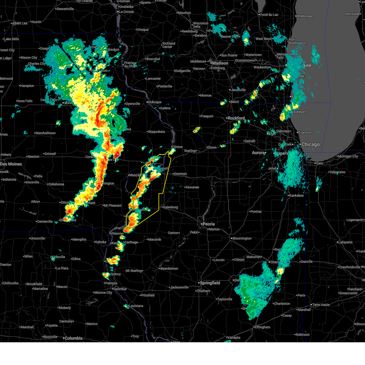 At 451 pm cdt, severe thunderstorms were located along a line extending from andalusia to decorra, moving northeast at 50 mph (radar indicated). Hazards include 60 mph wind gusts and quarter size hail. Hail damage to vehicles is expected. expect wind damage to roofs, siding, and trees. locations impacted include, davenport, rock island, aledo, oquawka, buffalo, andalusia, stronghurst, millersburg, reynolds, biggsville, milan, oak grove, little york, media, rock island arsenal, blackhawk state park, mississippi valley fairgrounds, moline, bettendorf, eldridge, matherville, kirkwood, shale city, preemption, wanlock, coyne center, davenport municipal airport, burgess, viola, riverdale, boden, eleanor, moline quad-city airport, fruitland, gilchrist, indian bluff golf course, east moline, coal valley, sherrard, lake warren, panorama park, silvis, le claire, hampton, princeton, cable, campbells island, silvis heights, illiniwek forest preserve, pleasant valley, fishermans corner, port byron, rapids city, cordova, carbon cliff, alexis, sunny hill estates, princeton wildlife area, griffin, colona, warner, sunny hill, swedona and barstow. this includes the following highways, interstate 74 in iowa between mile markers 1 and 5. interstate 80 in iowa between mile markers 291 and 306. interstate 80 in illinois between mile markers 1 and 13. interstate 74 in illinois between mile markers 1 and 27. interstate 88 between mile markers 1 and 6. Interstate 280 between mile markers 1 and 18. At 451 pm cdt, severe thunderstorms were located along a line extending from andalusia to decorra, moving northeast at 50 mph (radar indicated). Hazards include 60 mph wind gusts and quarter size hail. Hail damage to vehicles is expected. expect wind damage to roofs, siding, and trees. locations impacted include, davenport, rock island, aledo, oquawka, buffalo, andalusia, stronghurst, millersburg, reynolds, biggsville, milan, oak grove, little york, media, rock island arsenal, blackhawk state park, mississippi valley fairgrounds, moline, bettendorf, eldridge, matherville, kirkwood, shale city, preemption, wanlock, coyne center, davenport municipal airport, burgess, viola, riverdale, boden, eleanor, moline quad-city airport, fruitland, gilchrist, indian bluff golf course, east moline, coal valley, sherrard, lake warren, panorama park, silvis, le claire, hampton, princeton, cable, campbells island, silvis heights, illiniwek forest preserve, pleasant valley, fishermans corner, port byron, rapids city, cordova, carbon cliff, alexis, sunny hill estates, princeton wildlife area, griffin, colona, warner, sunny hill, swedona and barstow. this includes the following highways, interstate 74 in iowa between mile markers 1 and 5. interstate 80 in iowa between mile markers 291 and 306. interstate 80 in illinois between mile markers 1 and 13. interstate 74 in illinois between mile markers 1 and 27. interstate 88 between mile markers 1 and 6. Interstate 280 between mile markers 1 and 18.
|
| 4/2/2026 4:51 PM CDT |
 the severe thunderstorm warning has been cancelled and is no longer in effect the severe thunderstorm warning has been cancelled and is no longer in effect
|
| 4/2/2026 4:28 PM CDT |
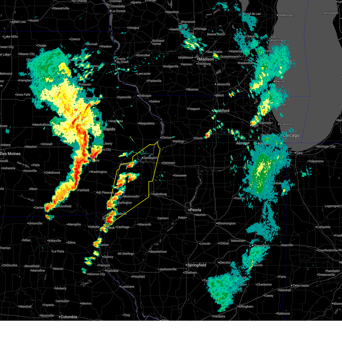 Svrdvn the national weather service in the quad cities has issued a * severe thunderstorm warning for, north central hancock county in west central illinois, henderson county in west central illinois, northern warren county in west central illinois, rock island county in northwestern illinois, mercer county in northwestern illinois, western henry county in northwestern illinois, des moines county in southeastern iowa, southeastern louisa county in southeastern iowa, central scott county in east central iowa, * until 530 pm cdt. * at 427 pm cdt, severe thunderstorms were located along a line extending from mannon to near colusa, moving northeast at 50 mph (radar indicated). Hazards include 60 mph wind gusts and quarter size hail. Hail damage to vehicles is expected. expect wind damage to roofs, siding, and trees. severe thunderstorms will be near, burlington, oquawka, dallas city, millersburg, new boston, keithsburg, joy, carman, gladstone, and gulf port around 435 pm cdt. terre haute, edgington, bald bluff, decorra, and loud thunder scout camp around 440 pm cdt. aledo, buffalo, andalusia, stronghurst, biggsville, rozetta, seaton, hamlet, olena, and gingle corners around 445 pm cdt. other locations in the path of these severe thunderstorms include davenport, rock island, reynolds, taylor ridge, sunbeam, milan, oak grove, little york, media, west lake park, rock island arsenal, credit island, blackhawk state park, mississippi valley fairgrounds, moline, bettendorf, matherville, kirkwood, shale city, preemption, smithshire, eleanor, wanlock, coyne center, east moline, eldridge, burgess, viola, riverdale, boden, panorama park, moline quad-city airport, fruitland, gilchrist, monmouth, silvis, le claire, coal valley, hampton, sherrard, lake warren, campbells island, illiniwek forest preserve and pleasant valley. this includes the following highways, interstate 74 in iowa between mile markers 1 and 5. interstate 80 in iowa between mile markers 291 and 306. interstate 80 in illinois between mile markers 1 and 13. interstate 74 in illinois between mile markers 1 and 27. interstate 88 between mile markers 1 and 6. Interstate 280 between mile markers 1 and 18. Svrdvn the national weather service in the quad cities has issued a * severe thunderstorm warning for, north central hancock county in west central illinois, henderson county in west central illinois, northern warren county in west central illinois, rock island county in northwestern illinois, mercer county in northwestern illinois, western henry county in northwestern illinois, des moines county in southeastern iowa, southeastern louisa county in southeastern iowa, central scott county in east central iowa, * until 530 pm cdt. * at 427 pm cdt, severe thunderstorms were located along a line extending from mannon to near colusa, moving northeast at 50 mph (radar indicated). Hazards include 60 mph wind gusts and quarter size hail. Hail damage to vehicles is expected. expect wind damage to roofs, siding, and trees. severe thunderstorms will be near, burlington, oquawka, dallas city, millersburg, new boston, keithsburg, joy, carman, gladstone, and gulf port around 435 pm cdt. terre haute, edgington, bald bluff, decorra, and loud thunder scout camp around 440 pm cdt. aledo, buffalo, andalusia, stronghurst, biggsville, rozetta, seaton, hamlet, olena, and gingle corners around 445 pm cdt. other locations in the path of these severe thunderstorms include davenport, rock island, reynolds, taylor ridge, sunbeam, milan, oak grove, little york, media, west lake park, rock island arsenal, credit island, blackhawk state park, mississippi valley fairgrounds, moline, bettendorf, matherville, kirkwood, shale city, preemption, smithshire, eleanor, wanlock, coyne center, east moline, eldridge, burgess, viola, riverdale, boden, panorama park, moline quad-city airport, fruitland, gilchrist, monmouth, silvis, le claire, coal valley, hampton, sherrard, lake warren, campbells island, illiniwek forest preserve and pleasant valley. this includes the following highways, interstate 74 in iowa between mile markers 1 and 5. interstate 80 in iowa between mile markers 291 and 306. interstate 80 in illinois between mile markers 1 and 13. interstate 74 in illinois between mile markers 1 and 27. interstate 88 between mile markers 1 and 6. Interstate 280 between mile markers 1 and 18.
|
| 3/10/2026 8:16 PM CDT |
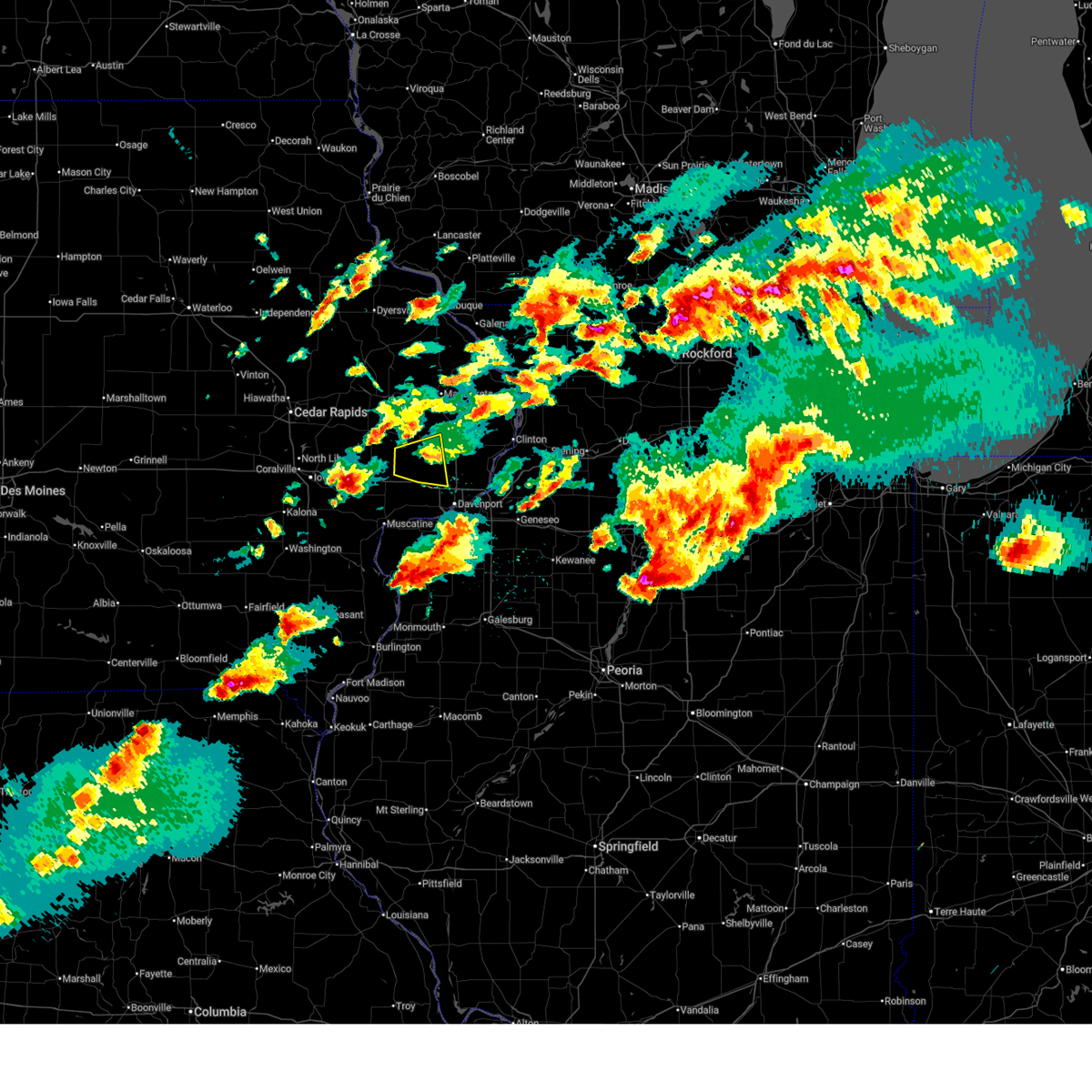 the severe thunderstorm warning has been cancelled and is no longer in effect the severe thunderstorm warning has been cancelled and is no longer in effect
|
| 3/10/2026 8:04 PM CDT |
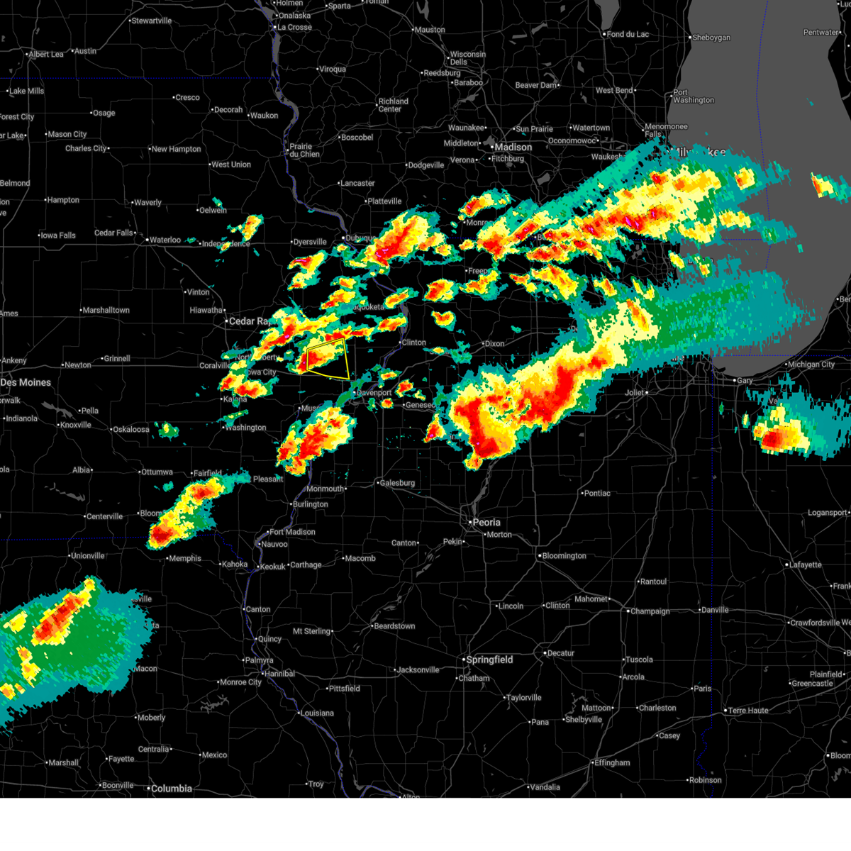 At 804 pm cdt, a severe thunderstorm was located over new liberty, or 7 miles northeast of durant, moving east at 40 mph (radar indicated). Hazards include quarter size hail. Damage to vehicles is expected. Locations impacted include, eldridge, donahue, dixon, maysville, plainview, sherman park and grand mound. At 804 pm cdt, a severe thunderstorm was located over new liberty, or 7 miles northeast of durant, moving east at 40 mph (radar indicated). Hazards include quarter size hail. Damage to vehicles is expected. Locations impacted include, eldridge, donahue, dixon, maysville, plainview, sherman park and grand mound.
|
| 3/10/2026 7:43 PM CDT |
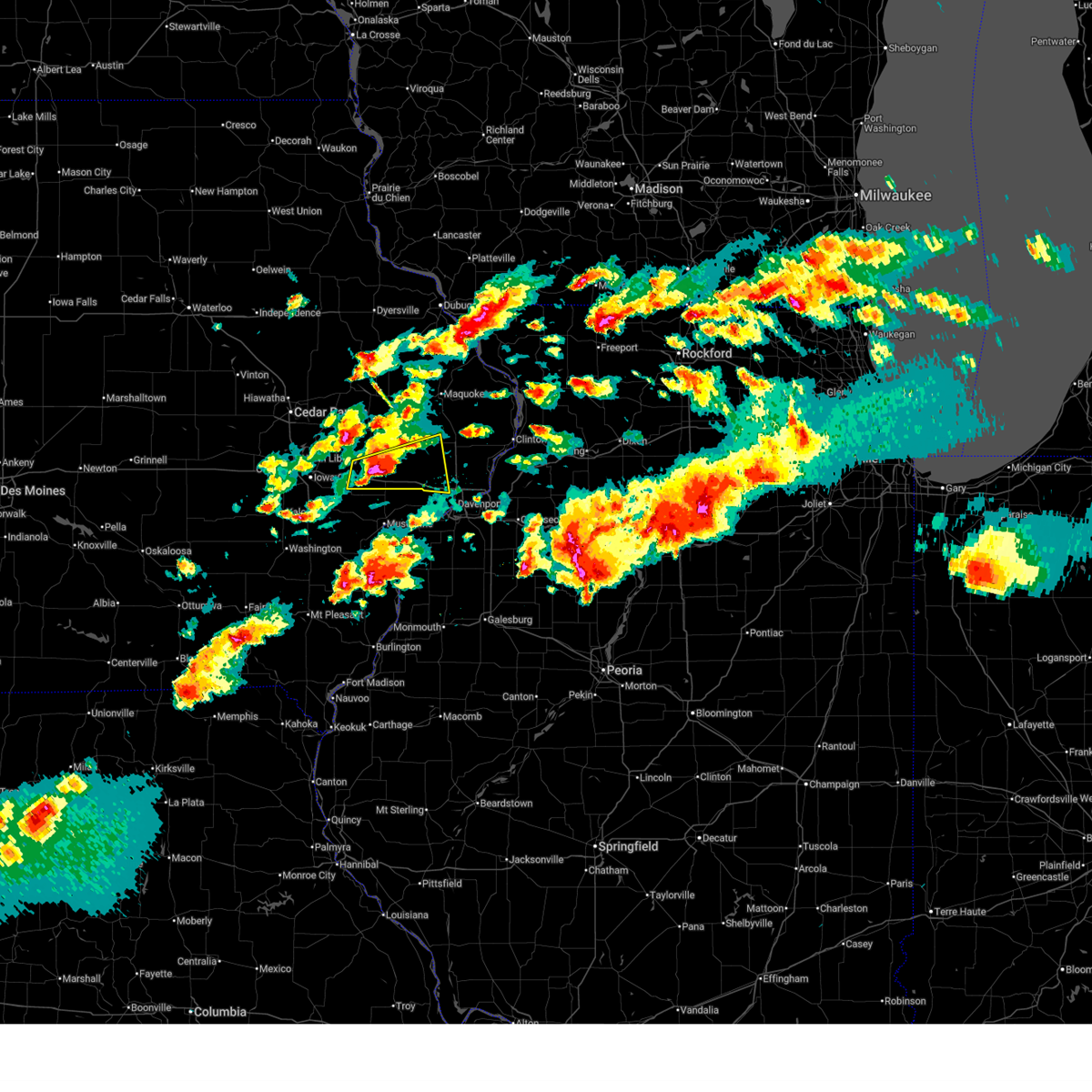 Svrdvn the national weather service in the quad cities has issued a * severe thunderstorm warning for, southern cedar county in east central iowa, northwestern scott county in east central iowa, southwestern clinton county in east central iowa, * until 830 pm cdt. * at 742 pm cdt, a severe thunderstorm was located over rochester, or 7 miles south of tipton, moving east at 40 mph (trained weather spotters. at 740 pm cdt, trained spotters reported ping pong ball size hail in rochester). Hazards include ping pong ball size hail. People and animals outdoors will be injured. expect damage to roofs, siding, windows, and vehicles. this severe thunderstorm will be near, durant, bennett, new liberty, sunbury, and bennett park around 750 pm cdt. walcott, plainview, and camp liberty around 755 pm cdt. dixon, maysville, big rock, and sherman park around 800 pm cdt. other locations in the path of this severe thunderstorm include donahue, davenport, eldridge and grand mound. this includes the following highways, interstate 80 in iowa between mile markers 259 and 293. Interstate 280 near mile marker 1. Svrdvn the national weather service in the quad cities has issued a * severe thunderstorm warning for, southern cedar county in east central iowa, northwestern scott county in east central iowa, southwestern clinton county in east central iowa, * until 830 pm cdt. * at 742 pm cdt, a severe thunderstorm was located over rochester, or 7 miles south of tipton, moving east at 40 mph (trained weather spotters. at 740 pm cdt, trained spotters reported ping pong ball size hail in rochester). Hazards include ping pong ball size hail. People and animals outdoors will be injured. expect damage to roofs, siding, windows, and vehicles. this severe thunderstorm will be near, durant, bennett, new liberty, sunbury, and bennett park around 750 pm cdt. walcott, plainview, and camp liberty around 755 pm cdt. dixon, maysville, big rock, and sherman park around 800 pm cdt. other locations in the path of this severe thunderstorm include donahue, davenport, eldridge and grand mound. this includes the following highways, interstate 80 in iowa between mile markers 259 and 293. Interstate 280 near mile marker 1.
|
| 3/10/2026 6:42 PM CDT |
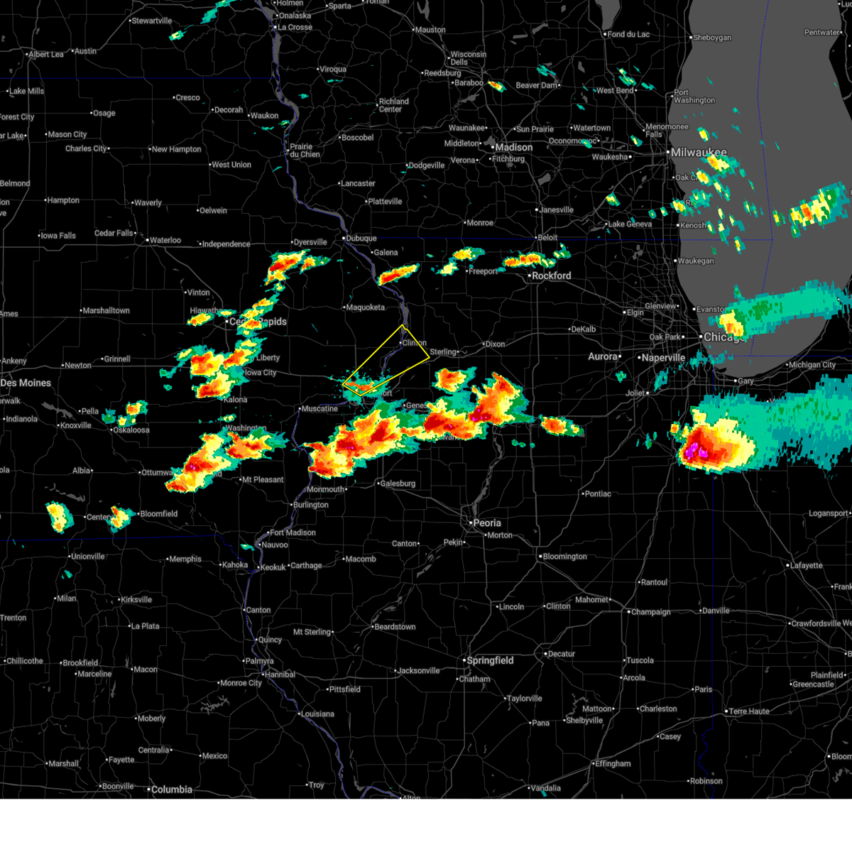 Svrdvn the national weather service in the quad cities has issued a * severe thunderstorm warning for, northeastern rock island county in northwestern illinois, northwestern whiteside county in northwestern illinois, eastern scott county in east central iowa, southeastern clinton county in east central iowa, * until 715 pm cdt. * at 642 pm cdt, a severe thunderstorm was located over bettendorf, moving northeast at 50 mph (trained weather spotters). Hazards include quarter size hail. damage to vehicles is expected Svrdvn the national weather service in the quad cities has issued a * severe thunderstorm warning for, northeastern rock island county in northwestern illinois, northwestern whiteside county in northwestern illinois, eastern scott county in east central iowa, southeastern clinton county in east central iowa, * until 715 pm cdt. * at 642 pm cdt, a severe thunderstorm was located over bettendorf, moving northeast at 50 mph (trained weather spotters). Hazards include quarter size hail. damage to vehicles is expected
|
| 3/10/2026 6:39 PM CDT | Quarter sized hail reported 0.8 miles NW of Davenport, IA, report from mping: quarter (1.00 in.). |
| 3/10/2026 6:35 PM CDT | Quarter sized hail reported 2 miles NW of Davenport, IA |
| 12/28/2025 9:15 PM CST | Storm damage reported in scott county IA, 4.3 miles S of Davenport, IA |
| 8/18/2025 4:55 PM CDT | Photo relayed via social media of a large branch of a tree snapped off. time estimated by rada in scott county IA, 0.8 miles NW of Davenport, IA |
| 8/17/2025 10:41 PM CDT |
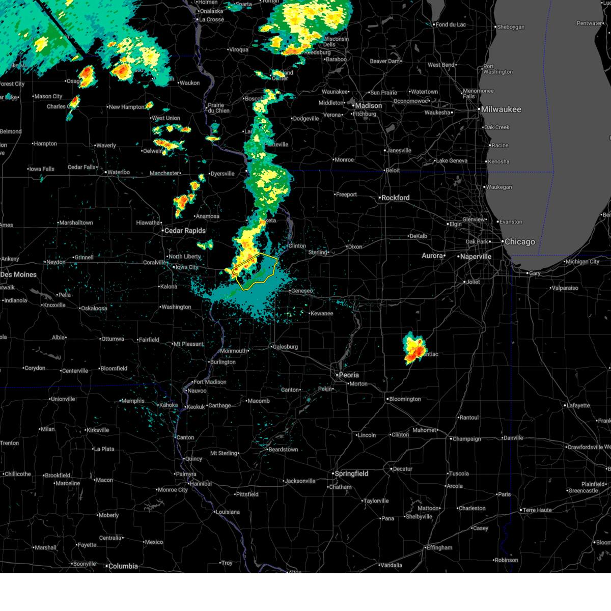 the severe thunderstorm warning has been cancelled and is no longer in effect the severe thunderstorm warning has been cancelled and is no longer in effect
|
| 8/17/2025 10:31 PM CDT |
 At 1030 pm cdt, severe thunderstorms were located along a line extending from scott county park to walcott, moving southeast at 20 mph. the strongest winds are behind the leading edge of these storms (radar indicated). Hazards include 60 mph wind gusts. Expect damage to roofs, siding, and trees. locations impacted include, davenport, rock island, bettendorf, eldridge, le claire, walcott, blue grass, buffalo, princeton, long grove, cordova, riverdale, donahue, mccausland, maysville, panorama park, west lake park, mississippi valley fairgrounds, davenport municipal airport, and credit island. this includes the following highways, interstate 74 in iowa between mile markers 1 and 5. interstate 80 in iowa between mile markers 282 and 306. Interstate 280 between mile markers 1 and 10. At 1030 pm cdt, severe thunderstorms were located along a line extending from scott county park to walcott, moving southeast at 20 mph. the strongest winds are behind the leading edge of these storms (radar indicated). Hazards include 60 mph wind gusts. Expect damage to roofs, siding, and trees. locations impacted include, davenport, rock island, bettendorf, eldridge, le claire, walcott, blue grass, buffalo, princeton, long grove, cordova, riverdale, donahue, mccausland, maysville, panorama park, west lake park, mississippi valley fairgrounds, davenport municipal airport, and credit island. this includes the following highways, interstate 74 in iowa between mile markers 1 and 5. interstate 80 in iowa between mile markers 282 and 306. Interstate 280 between mile markers 1 and 10.
|
| 8/17/2025 10:15 PM CDT |
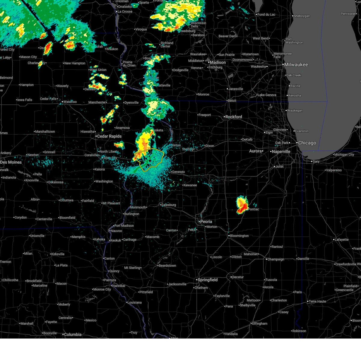 At 1013 pm cdt, severe thunderstorms were located along a line extending from 3 miles south of dewitt to plainview, moving southeast at 25 mph. the strongest winds are behind the leading edge of the storms (radar indicated). Hazards include 60 mph wind gusts. Expect damage to roofs, siding, and trees. locations impacted include, davenport, rock island, bettendorf, eldridge, le claire, walcott, blue grass, buffalo, princeton, long grove, cordova, riverdale, donahue, mccausland, dixon, maysville, new liberty, panorama park, camp liberty, and folletts. this includes the following highways, interstate 74 in iowa between mile markers 1 and 5. interstate 80 in iowa between mile markers 282 and 306. Interstate 280 between mile markers 1 and 10. At 1013 pm cdt, severe thunderstorms were located along a line extending from 3 miles south of dewitt to plainview, moving southeast at 25 mph. the strongest winds are behind the leading edge of the storms (radar indicated). Hazards include 60 mph wind gusts. Expect damage to roofs, siding, and trees. locations impacted include, davenport, rock island, bettendorf, eldridge, le claire, walcott, blue grass, buffalo, princeton, long grove, cordova, riverdale, donahue, mccausland, dixon, maysville, new liberty, panorama park, camp liberty, and folletts. this includes the following highways, interstate 74 in iowa between mile markers 1 and 5. interstate 80 in iowa between mile markers 282 and 306. Interstate 280 between mile markers 1 and 10.
|
| 8/17/2025 9:57 PM CDT |
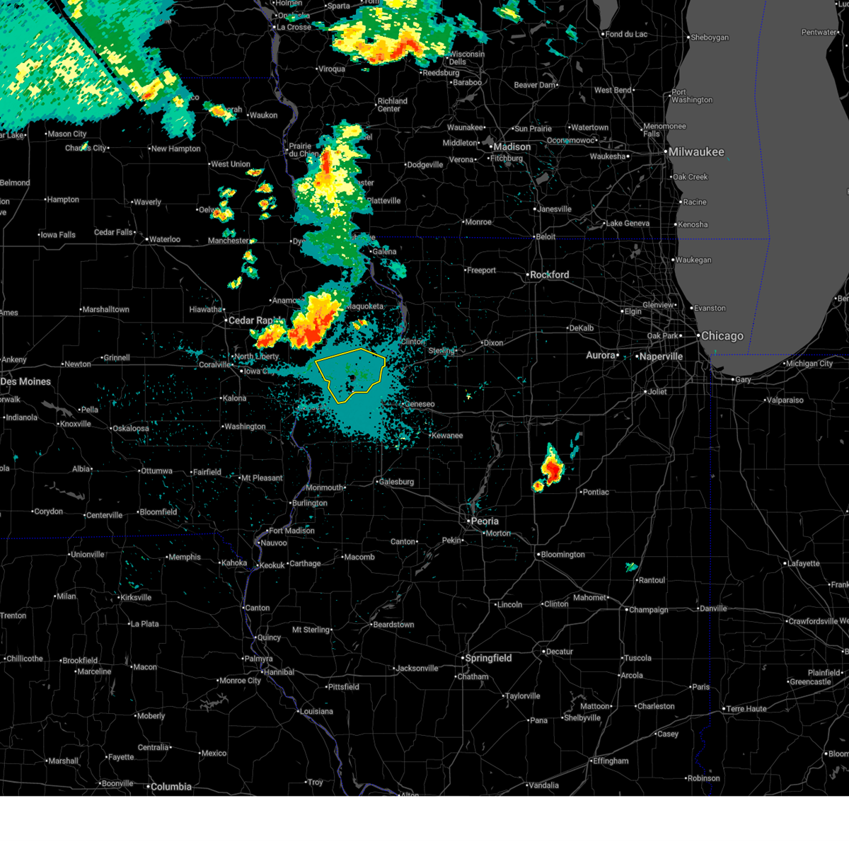 Svrdvn the national weather service in the quad cities has issued a * severe thunderstorm warning for, scott county in east central iowa, south central clinton county in east central iowa, * until 1100 pm cdt. * at 956 pm cdt, severe thunderstorms were located along a line extending from grand mound to new liberty, moving southeast at 25 mph (radar indicated). Hazards include 60 mph wind gusts. expect damage to roofs, siding, and trees Svrdvn the national weather service in the quad cities has issued a * severe thunderstorm warning for, scott county in east central iowa, south central clinton county in east central iowa, * until 1100 pm cdt. * at 956 pm cdt, severe thunderstorms were located along a line extending from grand mound to new liberty, moving southeast at 25 mph (radar indicated). Hazards include 60 mph wind gusts. expect damage to roofs, siding, and trees
|
| 8/15/2025 7:06 PM CDT |
 The storms which prompted the warning have weakened below severe limits, and no longer pose an immediate threat to life or property. therefore, the warning will be allowed to expire. however, gusty winds to 50 mph are still possible with these thunderstorms. a severe thunderstorm watch remains in effect until 800 pm cdt for northwestern illinois, and east central iowa. The storms which prompted the warning have weakened below severe limits, and no longer pose an immediate threat to life or property. therefore, the warning will be allowed to expire. however, gusty winds to 50 mph are still possible with these thunderstorms. a severe thunderstorm watch remains in effect until 800 pm cdt for northwestern illinois, and east central iowa.
|
| 8/15/2025 6:56 PM CDT |
 At 656 pm cdt, severe thunderstorms were located along a line extending from near goose lake to near eliza, moving southeast at 40 mph (radar indicated). Hazards include 60 mph wind gusts. Expect damage to roofs, siding, and trees. locations impacted include, davenport, muscatine, durant, eldridge, dewitt, wilton, walcott, blue grass, buffalo, preston, fruitland, long grove, grand mound, delmar, miles, calamus, charlotte, donahue, mccausland, and welton. this includes the following highways, interstate 80 in iowa between mile markers 274 and 296. Interstate 280 between mile markers 1 and 6. At 656 pm cdt, severe thunderstorms were located along a line extending from near goose lake to near eliza, moving southeast at 40 mph (radar indicated). Hazards include 60 mph wind gusts. Expect damage to roofs, siding, and trees. locations impacted include, davenport, muscatine, durant, eldridge, dewitt, wilton, walcott, blue grass, buffalo, preston, fruitland, long grove, grand mound, delmar, miles, calamus, charlotte, donahue, mccausland, and welton. this includes the following highways, interstate 80 in iowa between mile markers 274 and 296. Interstate 280 between mile markers 1 and 6.
|
| 8/15/2025 6:56 PM CDT |
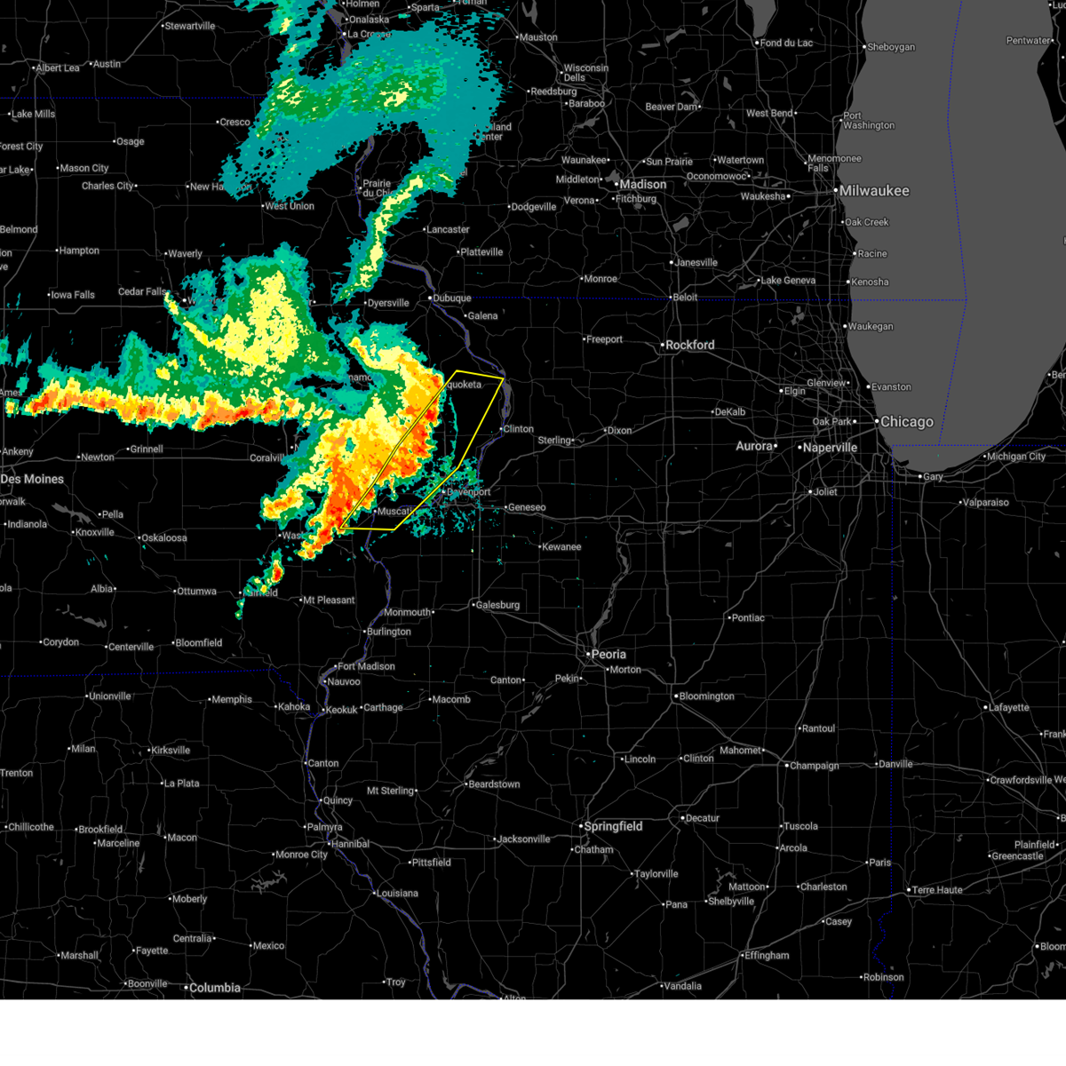 the severe thunderstorm warning has been cancelled and is no longer in effect the severe thunderstorm warning has been cancelled and is no longer in effect
|
| 8/15/2025 6:46 PM CDT |
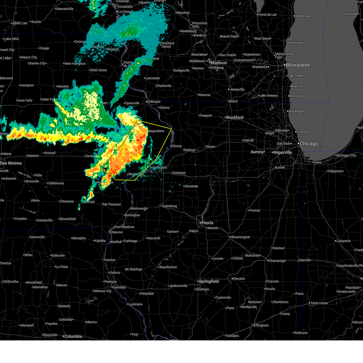 At 645 pm cdt, severe thunderstorms were located along a line extending from jackson county fairgrounds to ardon, moving east at 30 mph (radar indicated). Hazards include 60 mph wind gusts. Expect damage to roofs, siding, and trees. locations impacted include, davenport, muscatine, maquoketa, tipton, west branch, durant, eldridge, dewitt, west liberty, wilton, walcott, blue grass, lone tree, buffalo, preston, fruitland, long grove, lowden, wheatland, and hills. this includes the following highways, interstate 80 in iowa between mile markers 253 and 296. Interstate 280 between mile markers 1 and 6. At 645 pm cdt, severe thunderstorms were located along a line extending from jackson county fairgrounds to ardon, moving east at 30 mph (radar indicated). Hazards include 60 mph wind gusts. Expect damage to roofs, siding, and trees. locations impacted include, davenport, muscatine, maquoketa, tipton, west branch, durant, eldridge, dewitt, west liberty, wilton, walcott, blue grass, lone tree, buffalo, preston, fruitland, long grove, lowden, wheatland, and hills. this includes the following highways, interstate 80 in iowa between mile markers 253 and 296. Interstate 280 between mile markers 1 and 6.
|
| 8/15/2025 6:44 PM CDT |
 the severe thunderstorm warning has been cancelled and is no longer in effect the severe thunderstorm warning has been cancelled and is no longer in effect
|
| 8/15/2025 6:44 PM CDT |
 At 644 pm cdt, severe thunderstorms were located along a line extending from jackson county fairgrounds to ardon, moving southeast at 30 mph (radar indicated). Hazards include 60 mph wind gusts. Expect damage to roofs, siding, and trees. locations impacted include, davenport, muscatine, maquoketa, tipton, west branch, durant, eldridge, dewitt, west liberty, wilton, walcott, blue grass, lone tree, buffalo, preston, fruitland, long grove, lowden, wheatland, and hills. this includes the following highways, interstate 80 in iowa between mile markers 253 and 296. Interstate 280 between mile markers 1 and 6. At 644 pm cdt, severe thunderstorms were located along a line extending from jackson county fairgrounds to ardon, moving southeast at 30 mph (radar indicated). Hazards include 60 mph wind gusts. Expect damage to roofs, siding, and trees. locations impacted include, davenport, muscatine, maquoketa, tipton, west branch, durant, eldridge, dewitt, west liberty, wilton, walcott, blue grass, lone tree, buffalo, preston, fruitland, long grove, lowden, wheatland, and hills. this includes the following highways, interstate 80 in iowa between mile markers 253 and 296. Interstate 280 between mile markers 1 and 6.
|
| 8/15/2025 6:28 PM CDT |
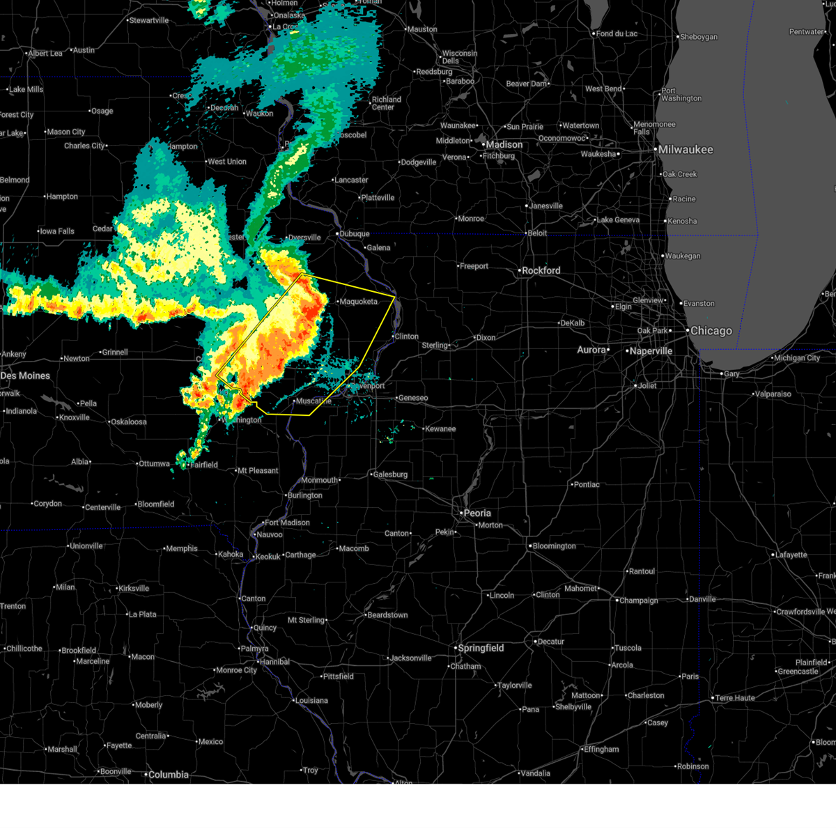 At 628 pm cdt, severe thunderstorms were located along a line extending from near oxford junction to near west liberty, moving southeast at 30 mph (radar indicated). Hazards include 60 mph wind gusts and penny size hail. Expect damage to roofs, siding, and trees. locations impacted include, davenport, iowa city, muscatine, maquoketa, tipton, west branch, durant, mechanicsville, stanwood, coralville, eldridge, dewitt, west liberty, wilton, solon, walcott, blue grass, lone tree, buffalo, and university heights. this includes the following highways, interstate 80 in iowa between mile markers 241 and 296. Interstate 280 between mile markers 1 and 6. At 628 pm cdt, severe thunderstorms were located along a line extending from near oxford junction to near west liberty, moving southeast at 30 mph (radar indicated). Hazards include 60 mph wind gusts and penny size hail. Expect damage to roofs, siding, and trees. locations impacted include, davenport, iowa city, muscatine, maquoketa, tipton, west branch, durant, mechanicsville, stanwood, coralville, eldridge, dewitt, west liberty, wilton, solon, walcott, blue grass, lone tree, buffalo, and university heights. this includes the following highways, interstate 80 in iowa between mile markers 241 and 296. Interstate 280 between mile markers 1 and 6.
|
| 8/15/2025 6:25 PM CDT |
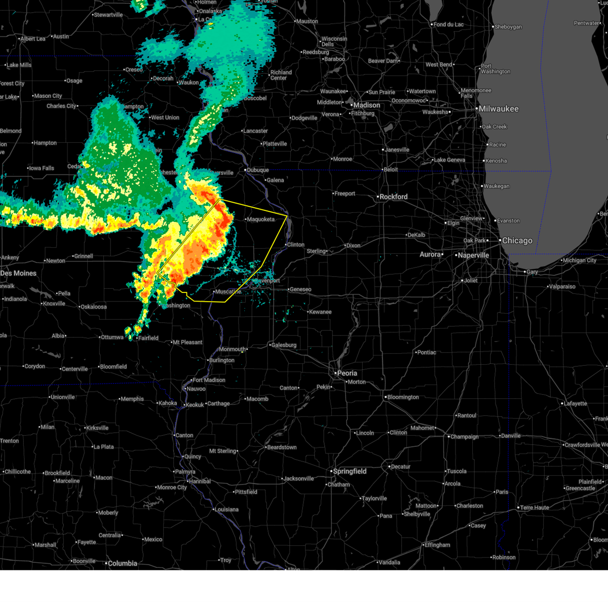 At 624 pm cdt, severe thunderstorms were located along a line extending from oxford junction to west liberty, moving southeast at 30 mph (trained weather spotters. a 62 mph wind gust was measured recently in iowa city). Hazards include 70 mph wind gusts and penny size hail. Expect considerable tree damage. damage is likely to mobile homes, roofs, and outbuildings. locations impacted include, davenport, iowa city, muscatine, maquoketa, tipton, west branch, durant, mechanicsville, stanwood, coralville, eldridge, dewitt, west liberty, wilton, solon, walcott, blue grass, lone tree, buffalo, and university heights. this includes the following highways, interstate 80 in iowa between mile markers 241 and 296. Interstate 280 between mile markers 1 and 6. At 624 pm cdt, severe thunderstorms were located along a line extending from oxford junction to west liberty, moving southeast at 30 mph (trained weather spotters. a 62 mph wind gust was measured recently in iowa city). Hazards include 70 mph wind gusts and penny size hail. Expect considerable tree damage. damage is likely to mobile homes, roofs, and outbuildings. locations impacted include, davenport, iowa city, muscatine, maquoketa, tipton, west branch, durant, mechanicsville, stanwood, coralville, eldridge, dewitt, west liberty, wilton, solon, walcott, blue grass, lone tree, buffalo, and university heights. this includes the following highways, interstate 80 in iowa between mile markers 241 and 296. Interstate 280 between mile markers 1 and 6.
|
| 8/15/2025 6:13 PM CDT |
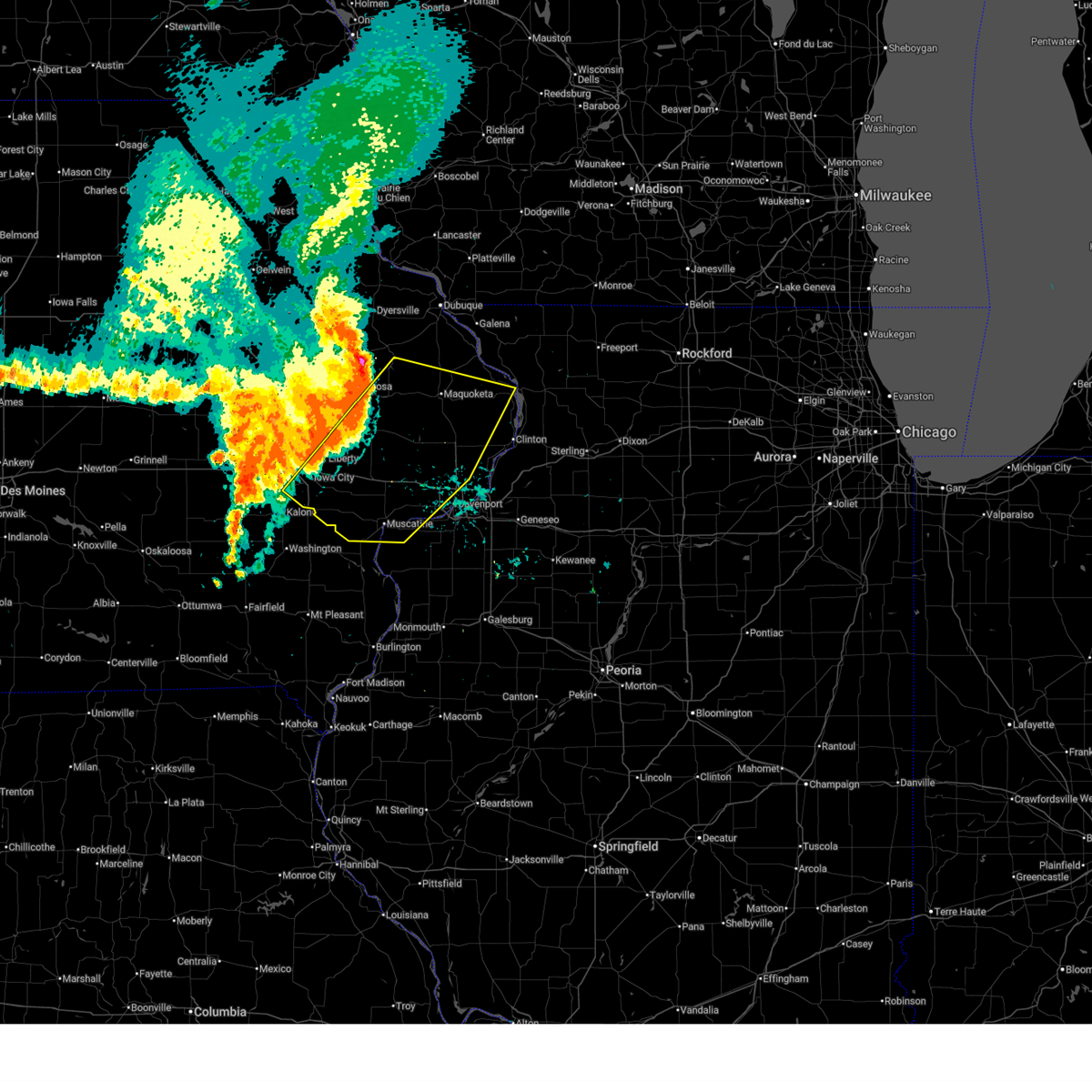 Svrdvn the national weather service in the quad cities has issued a * severe thunderstorm warning for, southwestern rock island county in northwestern illinois, southern jackson county in east central iowa, cedar county in east central iowa, scott county in east central iowa, eastern johnson county in east central iowa, eastern jones county in east central iowa, muscatine county in east central iowa, southeastern linn county in east central iowa, clinton county in east central iowa, * until 715 pm cdt. * at 613 pm cdt, severe thunderstorms were located along a line extending from wyoming to herbert hoover national historic site, moving southeast at 35 mph (radar indicated). Hazards include 70 mph wind gusts and penny size hail. Expect considerable tree damage. Damage is likely to mobile homes, roofs, and outbuildings. Svrdvn the national weather service in the quad cities has issued a * severe thunderstorm warning for, southwestern rock island county in northwestern illinois, southern jackson county in east central iowa, cedar county in east central iowa, scott county in east central iowa, eastern johnson county in east central iowa, eastern jones county in east central iowa, muscatine county in east central iowa, southeastern linn county in east central iowa, clinton county in east central iowa, * until 715 pm cdt. * at 613 pm cdt, severe thunderstorms were located along a line extending from wyoming to herbert hoover national historic site, moving southeast at 35 mph (radar indicated). Hazards include 70 mph wind gusts and penny size hail. Expect considerable tree damage. Damage is likely to mobile homes, roofs, and outbuildings.
|
| 7/30/2025 4:36 AM CDT |
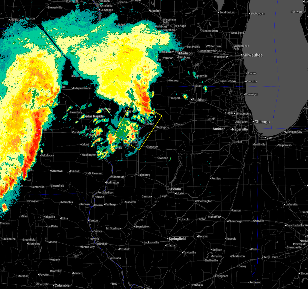 the severe thunderstorm warning has been cancelled and is no longer in effect the severe thunderstorm warning has been cancelled and is no longer in effect
|
| 7/30/2025 4:10 AM CDT |
 At 410 am cdt, severe thunderstorms were located along a line extending from andover to west lake park, moving southeast at 40 mph (radar indicated). Hazards include 60 mph wind gusts. Expect damage to roofs, siding, and trees. locations impacted include, davenport, moline, rock island, bettendorf, clinton, east moline, morrison, silvis, eldridge, dewitt, colona, camanche, le claire, coal valley, fulton, savanna, hampton, port byron, walcott, and erie. this includes the following highways, interstate 74 in iowa between mile markers 1 and 5. interstate 80 in iowa between mile markers 279 and 306. interstate 80 in illinois between mile markers 1 and 13. interstate 74 in illinois between mile markers 1 and 17. interstate 88 between mile markers 1 and 22. Interstate 280 between mile markers 1 and 4. At 410 am cdt, severe thunderstorms were located along a line extending from andover to west lake park, moving southeast at 40 mph (radar indicated). Hazards include 60 mph wind gusts. Expect damage to roofs, siding, and trees. locations impacted include, davenport, moline, rock island, bettendorf, clinton, east moline, morrison, silvis, eldridge, dewitt, colona, camanche, le claire, coal valley, fulton, savanna, hampton, port byron, walcott, and erie. this includes the following highways, interstate 74 in iowa between mile markers 1 and 5. interstate 80 in iowa between mile markers 279 and 306. interstate 80 in illinois between mile markers 1 and 13. interstate 74 in illinois between mile markers 1 and 17. interstate 88 between mile markers 1 and 22. Interstate 280 between mile markers 1 and 4.
|
| 7/30/2025 3:57 AM CDT |
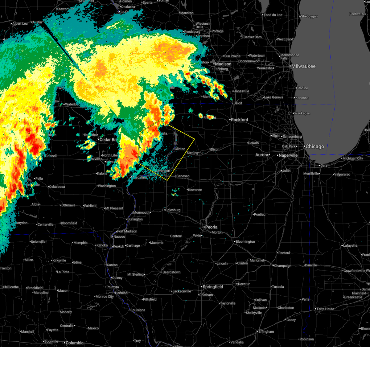 Svrdvn the national weather service in the quad cities has issued a * severe thunderstorm warning for, northeastern rock island county in northwestern illinois, western whiteside county in northwestern illinois, northwestern henry county in northwestern illinois, southwestern carroll county in northwestern illinois, southern jackson county in east central iowa, scott county in east central iowa, clinton county in east central iowa, * until 500 am cdt. * at 357 am cdt, severe thunderstorms were located along a line extending from near van buren to walcott, moving southeast at 35 mph (radar indicated). Hazards include 60 mph wind gusts. expect damage to roofs, siding, and trees Svrdvn the national weather service in the quad cities has issued a * severe thunderstorm warning for, northeastern rock island county in northwestern illinois, western whiteside county in northwestern illinois, northwestern henry county in northwestern illinois, southwestern carroll county in northwestern illinois, southern jackson county in east central iowa, scott county in east central iowa, clinton county in east central iowa, * until 500 am cdt. * at 357 am cdt, severe thunderstorms were located along a line extending from near van buren to walcott, moving southeast at 35 mph (radar indicated). Hazards include 60 mph wind gusts. expect damage to roofs, siding, and trees
|
| 7/30/2025 3:40 AM CDT |
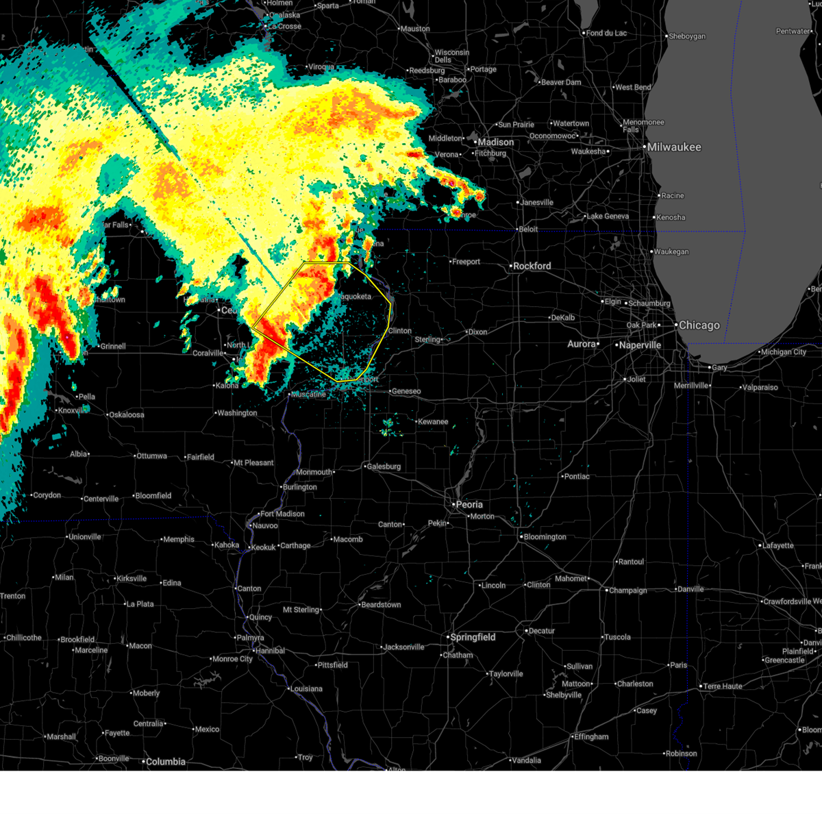 At 340 am cdt, severe thunderstorms were located along a line extending from near andrew to near sunbury, moving southeast at 50 mph (trained weather spotters. winds were estimated at 60 mph in lowden, iowa around 330 am). Hazards include 60 mph wind gusts. Expect damage to roofs, siding, and trees. locations impacted include, davenport, bettendorf, clinton, east moline, maquoketa, tipton, mechanicsville, stanwood, eldridge, dewitt, camanche, le claire, hampton, port byron, walcott, preston, albany, princeton, long grove, and lowden. this includes the following highways, interstate 74 in iowa between mile markers 1 and 5. interstate 80 in iowa between mile markers 279 and 306. Interstate 280 between mile markers 1 and 4. At 340 am cdt, severe thunderstorms were located along a line extending from near andrew to near sunbury, moving southeast at 50 mph (trained weather spotters. winds were estimated at 60 mph in lowden, iowa around 330 am). Hazards include 60 mph wind gusts. Expect damage to roofs, siding, and trees. locations impacted include, davenport, bettendorf, clinton, east moline, maquoketa, tipton, mechanicsville, stanwood, eldridge, dewitt, camanche, le claire, hampton, port byron, walcott, preston, albany, princeton, long grove, and lowden. this includes the following highways, interstate 74 in iowa between mile markers 1 and 5. interstate 80 in iowa between mile markers 279 and 306. Interstate 280 between mile markers 1 and 4.
|
| 7/30/2025 3:35 AM CDT |
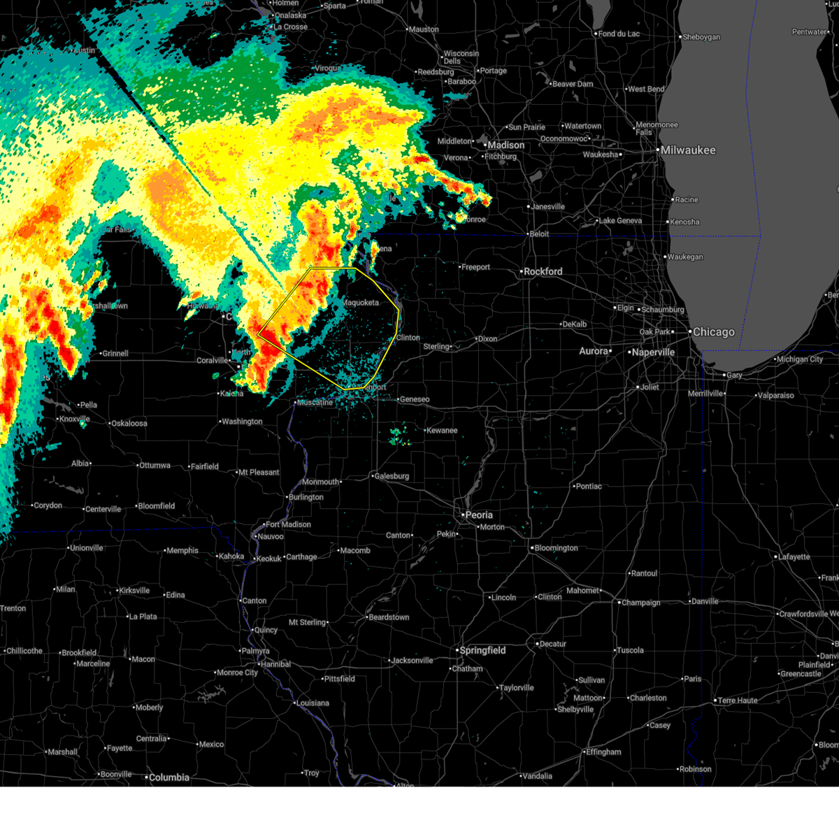 At 335 am cdt, severe thunderstorms were located along a line extending from near cottonville to bennett, moving southeast at 50 mph (trained weather spotters). Hazards include 60 mph wind gusts. Expect damage to roofs, siding, and trees. locations impacted include, davenport, bettendorf, clinton, east moline, maquoketa, tipton, mechanicsville, stanwood, eldridge, dewitt, camanche, le claire, hampton, port byron, walcott, preston, albany, princeton, long grove, and lowden. this includes the following highways, interstate 74 in iowa between mile markers 1 and 5. interstate 80 in iowa between mile markers 279 and 306. Interstate 280 between mile markers 1 and 4. At 335 am cdt, severe thunderstorms were located along a line extending from near cottonville to bennett, moving southeast at 50 mph (trained weather spotters). Hazards include 60 mph wind gusts. Expect damage to roofs, siding, and trees. locations impacted include, davenport, bettendorf, clinton, east moline, maquoketa, tipton, mechanicsville, stanwood, eldridge, dewitt, camanche, le claire, hampton, port byron, walcott, preston, albany, princeton, long grove, and lowden. this includes the following highways, interstate 74 in iowa between mile markers 1 and 5. interstate 80 in iowa between mile markers 279 and 306. Interstate 280 between mile markers 1 and 4.
|
| 7/30/2025 3:35 AM CDT |
 the severe thunderstorm warning has been cancelled and is no longer in effect the severe thunderstorm warning has been cancelled and is no longer in effect
|
| 7/30/2025 3:27 AM CDT |
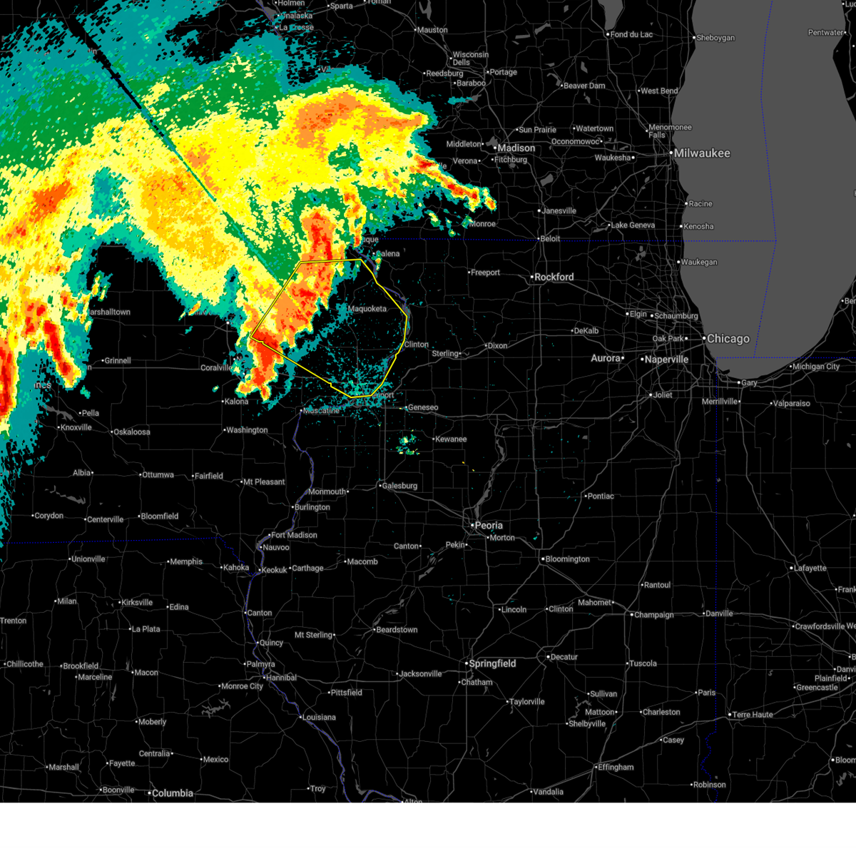 At 327 am cdt, severe thunderstorms were located along a line extending from otter creek to near bennett, moving southeast at 45 mph (radar indicated). Hazards include 60 mph wind gusts. Expect damage to roofs, siding, and trees. locations impacted include, davenport, bettendorf, clinton, east moline, maquoketa, anamosa, tipton, mechanicsville, stanwood, eldridge, dewitt, mount vernon, camanche, monticello, le claire, bellevue, cascade, lisbon, hampton, and port byron. this includes the following highways, interstate 74 in iowa between mile markers 1 and 5. interstate 80 in iowa between mile markers 279 and 306. Interstate 280 between mile markers 1 and 5. At 327 am cdt, severe thunderstorms were located along a line extending from otter creek to near bennett, moving southeast at 45 mph (radar indicated). Hazards include 60 mph wind gusts. Expect damage to roofs, siding, and trees. locations impacted include, davenport, bettendorf, clinton, east moline, maquoketa, anamosa, tipton, mechanicsville, stanwood, eldridge, dewitt, mount vernon, camanche, monticello, le claire, bellevue, cascade, lisbon, hampton, and port byron. this includes the following highways, interstate 74 in iowa between mile markers 1 and 5. interstate 80 in iowa between mile markers 279 and 306. Interstate 280 between mile markers 1 and 5.
|
| 7/30/2025 3:13 AM CDT |
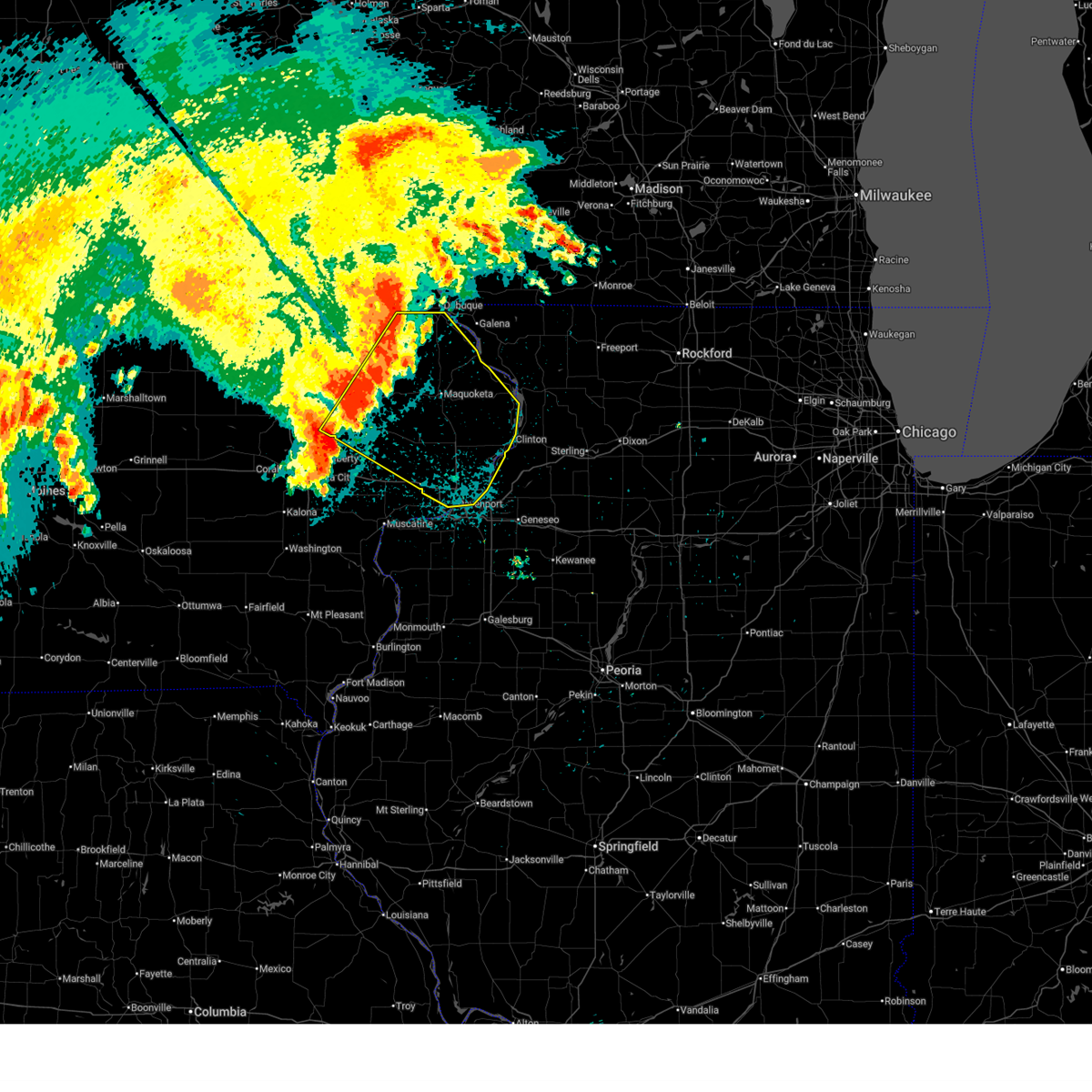 At 313 am cdt, severe thunderstorms were located along a line extending from bernard to cedar county fairgrounds, moving southeast at 50 mph (radar indicated). Hazards include 60 mph wind gusts. Expect damage to roofs, siding, and trees. locations impacted include, davenport, dubuque, bettendorf, clinton, east moline, maquoketa, anamosa, tipton, mechanicsville, stanwood, eldridge, dewitt, mount vernon, camanche, monticello, le claire, bellevue, cascade, lisbon, and hampton. this includes the following highways, interstate 74 in iowa between mile markers 1 and 5. interstate 80 in iowa between mile markers 279 and 306. Interstate 280 between mile markers 1 and 5. At 313 am cdt, severe thunderstorms were located along a line extending from bernard to cedar county fairgrounds, moving southeast at 50 mph (radar indicated). Hazards include 60 mph wind gusts. Expect damage to roofs, siding, and trees. locations impacted include, davenport, dubuque, bettendorf, clinton, east moline, maquoketa, anamosa, tipton, mechanicsville, stanwood, eldridge, dewitt, mount vernon, camanche, monticello, le claire, bellevue, cascade, lisbon, and hampton. this includes the following highways, interstate 74 in iowa between mile markers 1 and 5. interstate 80 in iowa between mile markers 279 and 306. Interstate 280 between mile markers 1 and 5.
|
| 7/30/2025 3:06 AM CDT |
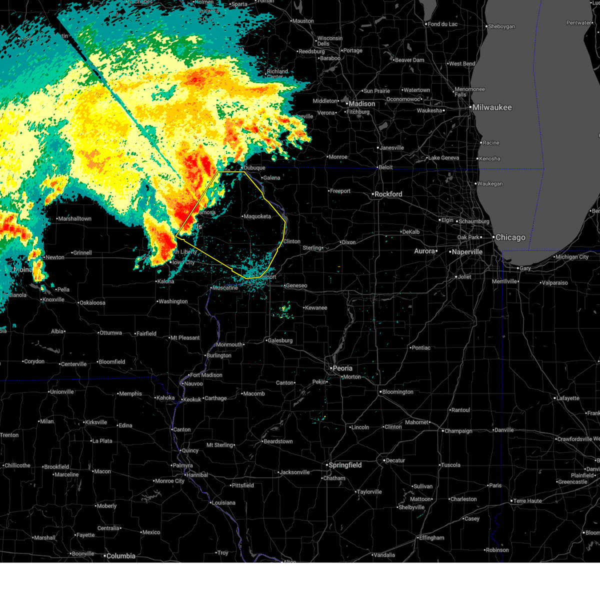 Svrdvn the national weather service in the quad cities has issued a * severe thunderstorm warning for, northeastern rock island county in northwestern illinois, jackson county in east central iowa, northern cedar county in east central iowa, scott county in east central iowa, southern dubuque county in northeastern iowa, jones county in east central iowa, southeastern linn county in east central iowa, clinton county in east central iowa, * until 400 am cdt. * at 305 am cdt, severe thunderstorms were located along a line extending from near fillmore recreation area to near cedar bluff, moving southeast at 50 mph (radar indicated). Hazards include 60 mph wind gusts. expect damage to roofs, siding, and trees Svrdvn the national weather service in the quad cities has issued a * severe thunderstorm warning for, northeastern rock island county in northwestern illinois, jackson county in east central iowa, northern cedar county in east central iowa, scott county in east central iowa, southern dubuque county in northeastern iowa, jones county in east central iowa, southeastern linn county in east central iowa, clinton county in east central iowa, * until 400 am cdt. * at 305 am cdt, severe thunderstorms were located along a line extending from near fillmore recreation area to near cedar bluff, moving southeast at 50 mph (radar indicated). Hazards include 60 mph wind gusts. expect damage to roofs, siding, and trees
|
| 7/29/2025 3:50 AM CDT |
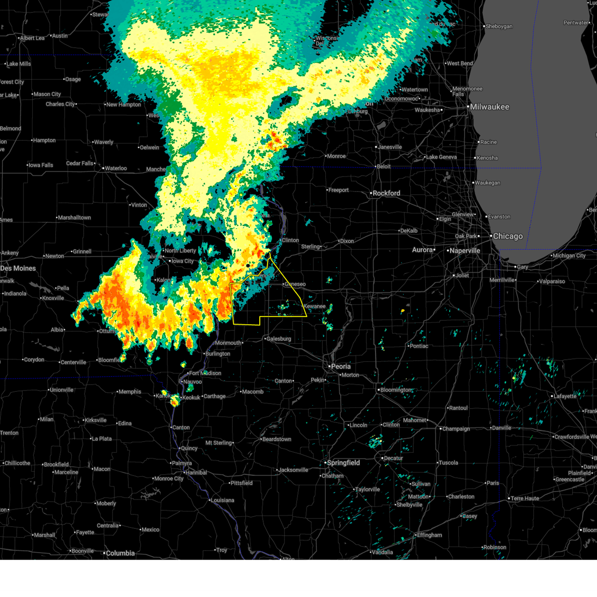 At 350 am cdt, severe thunderstorms were located along a line extending from near joslin to coal valley to gingle corners, moving south at 50 mph (radar indicated). Hazards include 60 mph wind gusts. Expect damage to roofs, siding, and trees. locations impacted include, davenport, moline, rock island, bettendorf, east moline, kewanee, aledo, cambridge, silvis, geneseo, colona, milan, le claire, coal valley, galva, burgess, hampton, orion, port byron, and buffalo. this includes the following highways, interstate 74 in iowa near mile marker 5. interstate 80 in illinois between mile markers 1 and 25. interstate 74 in illinois between mile markers 1 and 33. interstate 88 between mile markers 1 and 7. Interstate 280 between mile markers 10 and 18. At 350 am cdt, severe thunderstorms were located along a line extending from near joslin to coal valley to gingle corners, moving south at 50 mph (radar indicated). Hazards include 60 mph wind gusts. Expect damage to roofs, siding, and trees. locations impacted include, davenport, moline, rock island, bettendorf, east moline, kewanee, aledo, cambridge, silvis, geneseo, colona, milan, le claire, coal valley, galva, burgess, hampton, orion, port byron, and buffalo. this includes the following highways, interstate 74 in iowa near mile marker 5. interstate 80 in illinois between mile markers 1 and 25. interstate 74 in illinois between mile markers 1 and 33. interstate 88 between mile markers 1 and 7. Interstate 280 between mile markers 10 and 18.
|
| 7/29/2025 3:41 AM CDT |
 the severe thunderstorm warning has been cancelled and is no longer in effect the severe thunderstorm warning has been cancelled and is no longer in effect
|
| 7/29/2025 3:41 AM CDT |
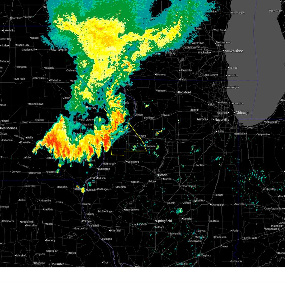 At 340 am cdt, severe thunderstorms were located along a line extending from rock creek park to pleasant valley to taylor ridge, moving southeast at 50 mph (radar indicated). Hazards include 60 mph wind gusts. Expect damage to roofs, siding, and trees. locations impacted include, davenport, moline, rock island, bettendorf, east moline, kewanee, aledo, cambridge, silvis, geneseo, colona, milan, le claire, coal valley, galva, burgess, hampton, orion, port byron, and buffalo. this includes the following highways, interstate 74 in iowa near mile marker 5. interstate 80 in illinois between mile markers 1 and 25. interstate 74 in illinois between mile markers 1 and 33. interstate 88 between mile markers 1 and 7. Interstate 280 between mile markers 10 and 18. At 340 am cdt, severe thunderstorms were located along a line extending from rock creek park to pleasant valley to taylor ridge, moving southeast at 50 mph (radar indicated). Hazards include 60 mph wind gusts. Expect damage to roofs, siding, and trees. locations impacted include, davenport, moline, rock island, bettendorf, east moline, kewanee, aledo, cambridge, silvis, geneseo, colona, milan, le claire, coal valley, galva, burgess, hampton, orion, port byron, and buffalo. this includes the following highways, interstate 74 in iowa near mile marker 5. interstate 80 in illinois between mile markers 1 and 25. interstate 74 in illinois between mile markers 1 and 33. interstate 88 between mile markers 1 and 7. Interstate 280 between mile markers 10 and 18.
|
| 7/29/2025 3:40 AM CDT |
 The storms which prompted the warning have moved out of the area. therefore, the warning will be allowed to expire. however, gusty winds and heavy rain are still possible with these thunderstorms. a severe thunderstorm watch remains in effect until 400 am cdt for northwestern illinois, and east central iowa. The storms which prompted the warning have moved out of the area. therefore, the warning will be allowed to expire. however, gusty winds and heavy rain are still possible with these thunderstorms. a severe thunderstorm watch remains in effect until 400 am cdt for northwestern illinois, and east central iowa.
|
| 7/29/2025 3:39 AM CDT |
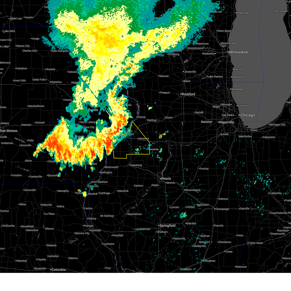 At 339 am cdt, severe thunderstorms were located along a line extending from rock creek marina and campground to hampton to fruitland to near gingle corners, moving southeast at 50 mph (radar indicated). Hazards include 60 mph wind gusts. Expect damage to roofs, siding, and trees. locations impacted include, davenport, moline, rock island, bettendorf, east moline, kewanee, aledo, cambridge, silvis, geneseo, colona, milan, le claire, coal valley, galva, burgess, hampton, orion, port byron, and buffalo. this includes the following highways, interstate 74 in iowa near mile marker 5. interstate 80 in illinois between mile markers 1 and 33. interstate 74 in illinois between mile markers 1 and 33. interstate 88 between mile markers 1 and 13. Interstate 280 between mile markers 10 and 18. At 339 am cdt, severe thunderstorms were located along a line extending from rock creek marina and campground to hampton to fruitland to near gingle corners, moving southeast at 50 mph (radar indicated). Hazards include 60 mph wind gusts. Expect damage to roofs, siding, and trees. locations impacted include, davenport, moline, rock island, bettendorf, east moline, kewanee, aledo, cambridge, silvis, geneseo, colona, milan, le claire, coal valley, galva, burgess, hampton, orion, port byron, and buffalo. this includes the following highways, interstate 74 in iowa near mile marker 5. interstate 80 in illinois between mile markers 1 and 33. interstate 74 in illinois between mile markers 1 and 33. interstate 88 between mile markers 1 and 13. Interstate 280 between mile markers 10 and 18.
|
| 7/29/2025 3:35 AM CDT |
 At 335 am cdt, severe thunderstorms were located along a line extending from near bryant to near park view to near loud thunder scout camp, moving southeast at 45 mph (trained weather spotters). Hazards include 70 mph wind gusts. Expect considerable tree damage. damage is likely to mobile homes, roofs, and outbuildings. locations impacted include, davenport, rock island, bettendorf, durant, eldridge, le claire, hampton, walcott, blue grass, buffalo, princeton, long grove, riverdale, donahue, mccausland, maysville, panorama park, west lake park, mississippi valley fairgrounds, and davenport municipal airport. this includes the following highways, interstate 74 in iowa between mile markers 1 and 4. interstate 80 in iowa between mile markers 279 and 306. Interstate 280 between mile markers 1 and 9. At 335 am cdt, severe thunderstorms were located along a line extending from near bryant to near park view to near loud thunder scout camp, moving southeast at 45 mph (trained weather spotters). Hazards include 70 mph wind gusts. Expect considerable tree damage. damage is likely to mobile homes, roofs, and outbuildings. locations impacted include, davenport, rock island, bettendorf, durant, eldridge, le claire, hampton, walcott, blue grass, buffalo, princeton, long grove, riverdale, donahue, mccausland, maysville, panorama park, west lake park, mississippi valley fairgrounds, and davenport municipal airport. this includes the following highways, interstate 74 in iowa between mile markers 1 and 4. interstate 80 in iowa between mile markers 279 and 306. Interstate 280 between mile markers 1 and 9.
|
| 7/29/2025 3:35 AM CDT |
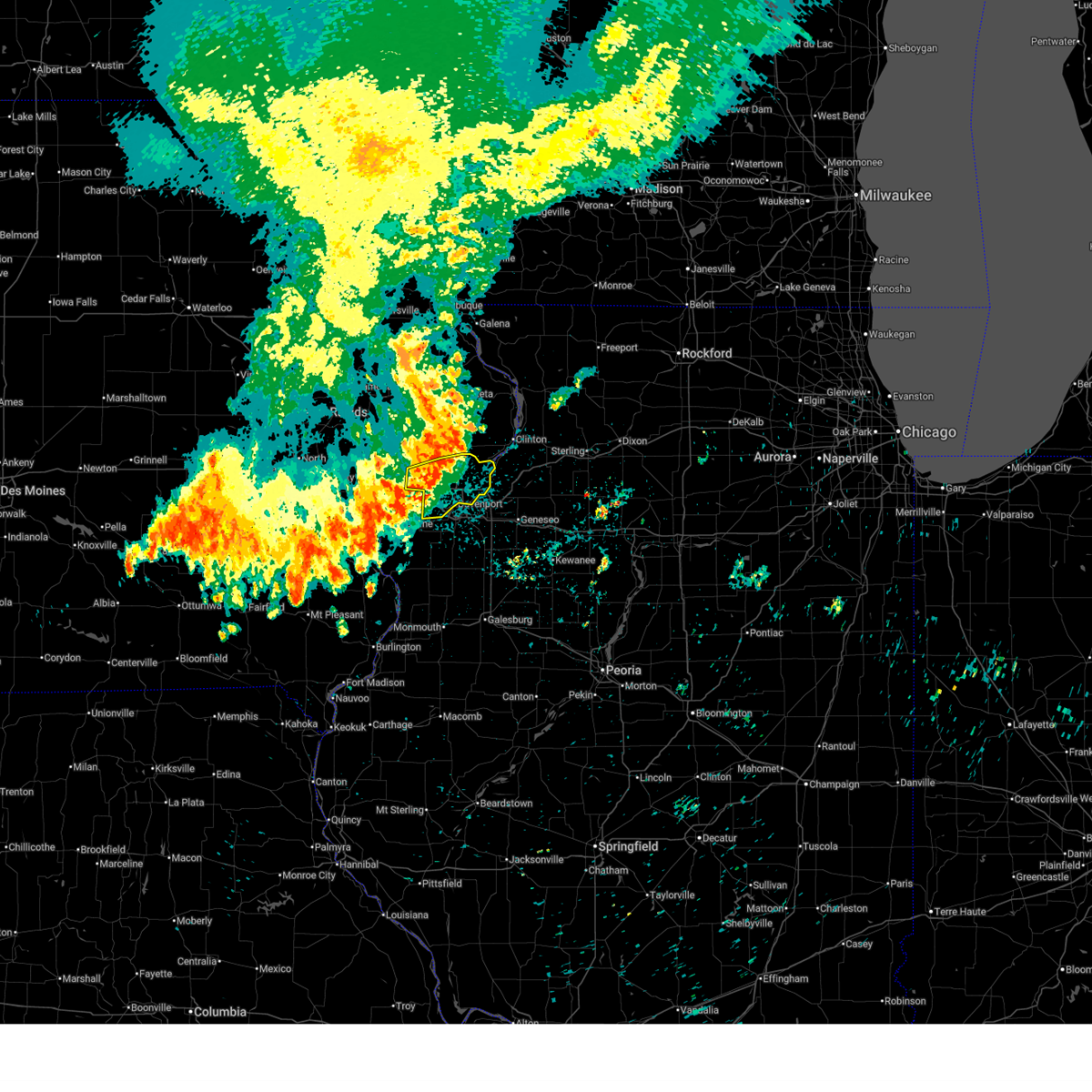 the severe thunderstorm warning has been cancelled and is no longer in effect the severe thunderstorm warning has been cancelled and is no longer in effect
|
| 7/29/2025 3:34 AM CDT | Storm damage reported in scott county IA, 2 miles NNE of Davenport, IA |
| 7/29/2025 3:32 AM CDT |
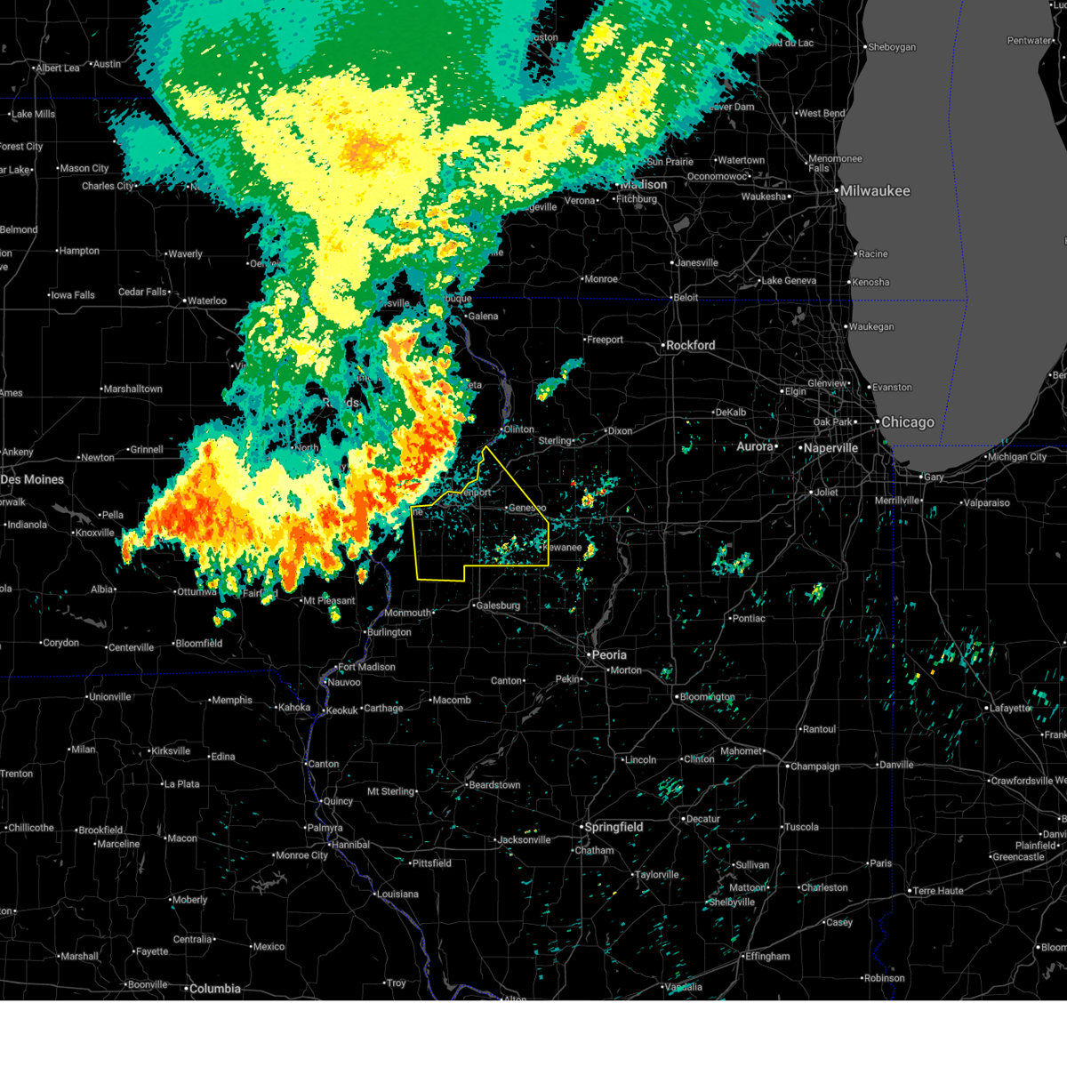 At 332 am cdt, severe thunderstorms were located along a line extending from low moor to near bettendorf to andalusia, moving southeast at 50 mph (radar indicated). Hazards include 70 mph wind gusts. Expect considerable tree damage. damage is likely to mobile homes, roofs, and outbuildings. locations impacted include, davenport, moline, rock island, bettendorf, east moline, kewanee, aledo, cambridge, silvis, geneseo, colona, milan, le claire, coal valley, galva, burgess, hampton, orion, port byron, and buffalo. this includes the following highways, interstate 74 in iowa near mile marker 5. interstate 80 in illinois between mile markers 1 and 33. interstate 74 in illinois between mile markers 1 and 33. interstate 88 between mile markers 1 and 13. Interstate 280 between mile markers 10 and 18. At 332 am cdt, severe thunderstorms were located along a line extending from low moor to near bettendorf to andalusia, moving southeast at 50 mph (radar indicated). Hazards include 70 mph wind gusts. Expect considerable tree damage. damage is likely to mobile homes, roofs, and outbuildings. locations impacted include, davenport, moline, rock island, bettendorf, east moline, kewanee, aledo, cambridge, silvis, geneseo, colona, milan, le claire, coal valley, galva, burgess, hampton, orion, port byron, and buffalo. this includes the following highways, interstate 74 in iowa near mile marker 5. interstate 80 in illinois between mile markers 1 and 33. interstate 74 in illinois between mile markers 1 and 33. interstate 88 between mile markers 1 and 13. Interstate 280 between mile markers 10 and 18.
|
| 7/29/2025 3:31 AM CDT |
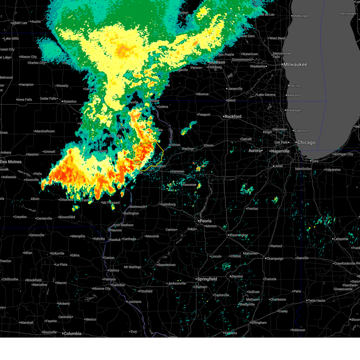 At 331 am cdt, severe thunderstorms were located along a line extending from goose lake to near park view to near loud thunder scout camp, moving southeast at 45 mph (trained weather spotters). Hazards include 70 mph wind gusts. Expect considerable tree damage. damage is likely to mobile homes, roofs, and outbuildings. locations impacted include, davenport, rock island, bettendorf, durant, eldridge, dewitt, le claire, walcott, blue grass, buffalo, princeton, long grove, grand mound, calamus, riverdale, donahue, mccausland, low moor, dixon, and maysville. this includes the following highways, interstate 74 in iowa between mile markers 1 and 4. interstate 80 in iowa between mile markers 279 and 306. Interstate 280 between mile markers 1 and 9. At 331 am cdt, severe thunderstorms were located along a line extending from goose lake to near park view to near loud thunder scout camp, moving southeast at 45 mph (trained weather spotters). Hazards include 70 mph wind gusts. Expect considerable tree damage. damage is likely to mobile homes, roofs, and outbuildings. locations impacted include, davenport, rock island, bettendorf, durant, eldridge, dewitt, le claire, walcott, blue grass, buffalo, princeton, long grove, grand mound, calamus, riverdale, donahue, mccausland, low moor, dixon, and maysville. this includes the following highways, interstate 74 in iowa between mile markers 1 and 4. interstate 80 in iowa between mile markers 279 and 306. Interstate 280 between mile markers 1 and 9.
|
| 7/29/2025 3:29 AM CDT | Davenport municipal airport aso in scott county IA, 4.3 miles S of Davenport, IA |
| 7/29/2025 3:23 AM CDT |
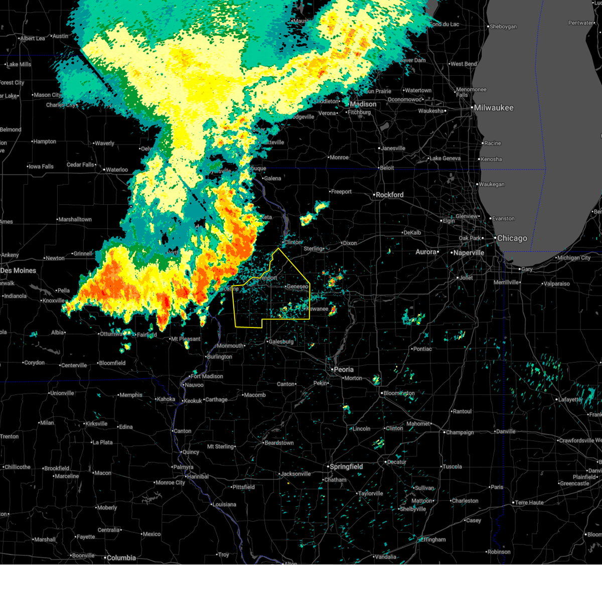 Svrdvn the national weather service in the quad cities has issued a * severe thunderstorm warning for, rock island county in northwestern illinois, eastern mercer county in northwestern illinois, southwestern whiteside county in northwestern illinois, henry county in northwestern illinois, * until 445 am cdt. * at 323 am cdt, severe thunderstorms were located along a line extending from near malone to park view to blue grass, moving southeast at 50 mph (radar indicated). Hazards include 70 mph wind gusts. Expect considerable tree damage. Damage is likely to mobile homes, roofs, and outbuildings. Svrdvn the national weather service in the quad cities has issued a * severe thunderstorm warning for, rock island county in northwestern illinois, eastern mercer county in northwestern illinois, southwestern whiteside county in northwestern illinois, henry county in northwestern illinois, * until 445 am cdt. * at 323 am cdt, severe thunderstorms were located along a line extending from near malone to park view to blue grass, moving southeast at 50 mph (radar indicated). Hazards include 70 mph wind gusts. Expect considerable tree damage. Damage is likely to mobile homes, roofs, and outbuildings.
|
| 7/29/2025 3:16 AM CDT |
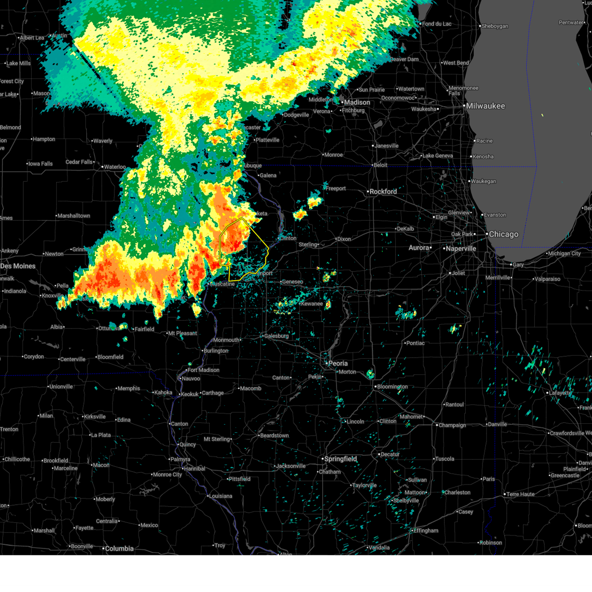 At 316 am cdt, severe thunderstorms were located along a line extending from near spragueville to near donahue to sweetland center, moving southeast at 55 mph (radar indicated). Hazards include 70 mph wind gusts. Expect considerable tree damage. damage is likely to mobile homes, roofs, and outbuildings. locations impacted include, davenport, rock island, bettendorf, durant, eldridge, dewitt, le claire, walcott, blue grass, buffalo, princeton, long grove, wheatland, grand mound, delmar, calamus, riverdale, donahue, mccausland, and low moor. this includes the following highways, interstate 74 in iowa between mile markers 1 and 4. interstate 80 in iowa between mile markers 279 and 306. Interstate 280 between mile markers 1 and 9. At 316 am cdt, severe thunderstorms were located along a line extending from near spragueville to near donahue to sweetland center, moving southeast at 55 mph (radar indicated). Hazards include 70 mph wind gusts. Expect considerable tree damage. damage is likely to mobile homes, roofs, and outbuildings. locations impacted include, davenport, rock island, bettendorf, durant, eldridge, dewitt, le claire, walcott, blue grass, buffalo, princeton, long grove, wheatland, grand mound, delmar, calamus, riverdale, donahue, mccausland, and low moor. this includes the following highways, interstate 74 in iowa between mile markers 1 and 4. interstate 80 in iowa between mile markers 279 and 306. Interstate 280 between mile markers 1 and 9.
|
| 7/29/2025 3:11 AM CDT |
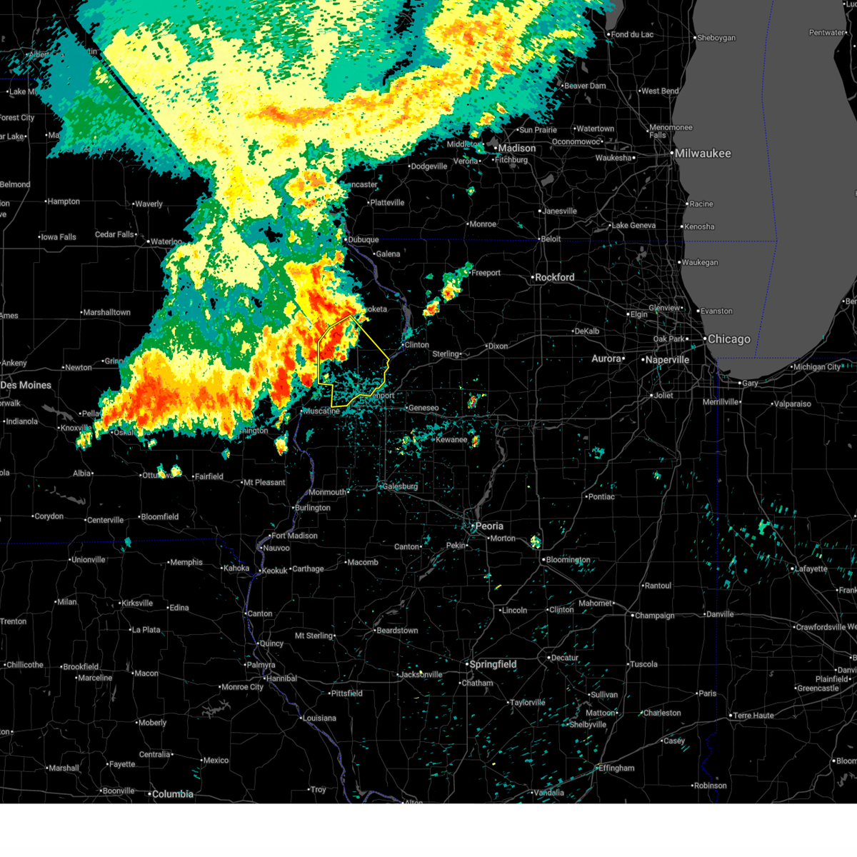 the severe thunderstorm warning has been cancelled and is no longer in effect the severe thunderstorm warning has been cancelled and is no longer in effect
|
| 7/29/2025 3:11 AM CDT |
 At 310 am cdt, severe thunderstorms were located along a line extending from near jackson county fairgrounds to near calamus to near moscow, moving southeast at 50 mph (radar indicated). Hazards include 70 mph wind gusts. Expect considerable tree damage. damage is likely to mobile homes, roofs, and outbuildings. locations impacted include, davenport, rock island, bettendorf, durant, eldridge, dewitt, le claire, walcott, blue grass, buffalo, princeton, long grove, wheatland, grand mound, delmar, calamus, riverdale, donahue, mccausland, and low moor. this includes the following highways, interstate 74 in iowa between mile markers 1 and 4. interstate 80 in iowa between mile markers 279 and 306. Interstate 280 between mile markers 1 and 9. At 310 am cdt, severe thunderstorms were located along a line extending from near jackson county fairgrounds to near calamus to near moscow, moving southeast at 50 mph (radar indicated). Hazards include 70 mph wind gusts. Expect considerable tree damage. damage is likely to mobile homes, roofs, and outbuildings. locations impacted include, davenport, rock island, bettendorf, durant, eldridge, dewitt, le claire, walcott, blue grass, buffalo, princeton, long grove, wheatland, grand mound, delmar, calamus, riverdale, donahue, mccausland, and low moor. this includes the following highways, interstate 74 in iowa between mile markers 1 and 4. interstate 80 in iowa between mile markers 279 and 306. Interstate 280 between mile markers 1 and 9.
|
| 7/29/2025 3:08 AM CDT |
 At 308 am cdt, severe thunderstorms were located along a line extending from jackson county fairgrounds to sherman park to near saulsbury bridge campground, moving southeast at 55 mph (radar indicated). Hazards include 60 mph wind gusts. Expect damage to roofs, siding, and trees. locations impacted include, davenport, rock island, bettendorf, muscatine, durant, eldridge, dewitt, le claire, wilton, hampton, port byron, walcott, blue grass, buffalo, fruitland, princeton, long grove, wheatland, cordova, and grand mound. this includes the following highways, interstate 74 in iowa between mile markers 1 and 4. interstate 80 in iowa between mile markers 279 and 306. Interstate 280 between mile markers 1 and 10. At 308 am cdt, severe thunderstorms were located along a line extending from jackson county fairgrounds to sherman park to near saulsbury bridge campground, moving southeast at 55 mph (radar indicated). Hazards include 60 mph wind gusts. Expect damage to roofs, siding, and trees. locations impacted include, davenport, rock island, bettendorf, muscatine, durant, eldridge, dewitt, le claire, wilton, hampton, port byron, walcott, blue grass, buffalo, fruitland, princeton, long grove, wheatland, cordova, and grand mound. this includes the following highways, interstate 74 in iowa between mile markers 1 and 4. interstate 80 in iowa between mile markers 279 and 306. Interstate 280 between mile markers 1 and 10.
|
| 7/29/2025 3:08 AM CDT |
 the severe thunderstorm warning has been cancelled and is no longer in effect the severe thunderstorm warning has been cancelled and is no longer in effect
|
| 7/29/2025 2:47 AM CDT |
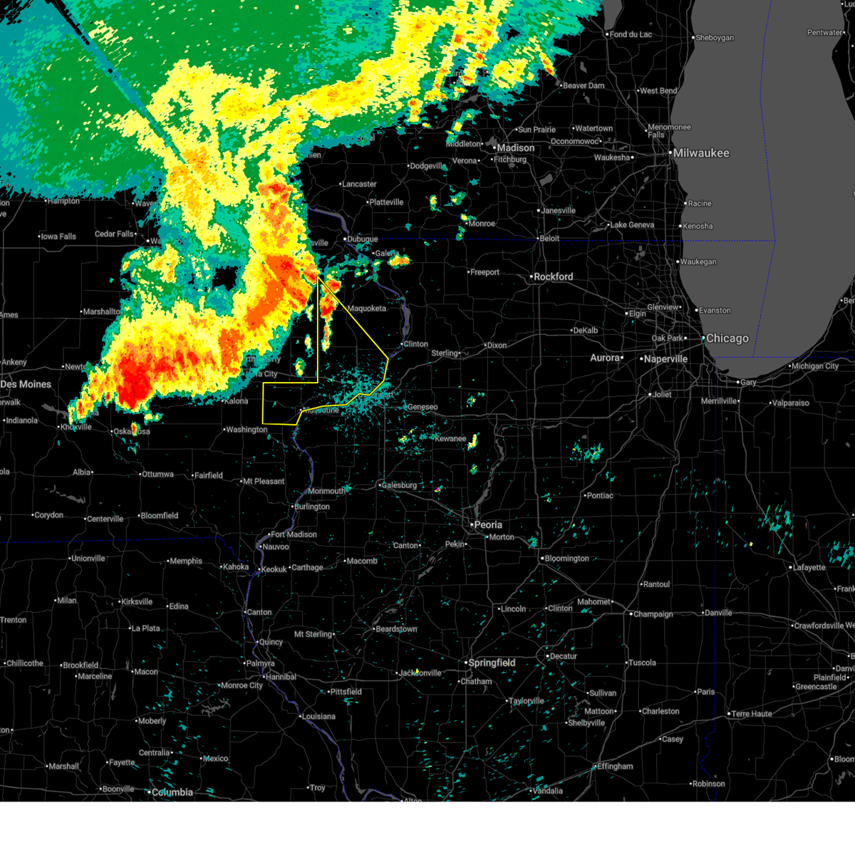 Svrdvn the national weather service in the quad cities has issued a * severe thunderstorm warning for, southwestern jackson county in east central iowa, scott county in east central iowa, muscatine county in east central iowa, western clinton county in east central iowa, * until 345 am cdt. * at 247 am cdt, severe thunderstorms were located along a line extending from near temple hill to near clarence to near west branch, moving southeast at 45 mph (radar indicated). Hazards include 60 mph wind gusts. expect damage to roofs, siding, and trees Svrdvn the national weather service in the quad cities has issued a * severe thunderstorm warning for, southwestern jackson county in east central iowa, scott county in east central iowa, muscatine county in east central iowa, western clinton county in east central iowa, * until 345 am cdt. * at 247 am cdt, severe thunderstorms were located along a line extending from near temple hill to near clarence to near west branch, moving southeast at 45 mph (radar indicated). Hazards include 60 mph wind gusts. expect damage to roofs, siding, and trees
|
| 7/11/2025 6:39 PM CDT | Reported goose creek out of its banks on west 61st street. report of basements flooding in the are in scott county IA, 2.5 miles SSW of Davenport, IA |
| 7/11/2025 6:18 PM CDT |
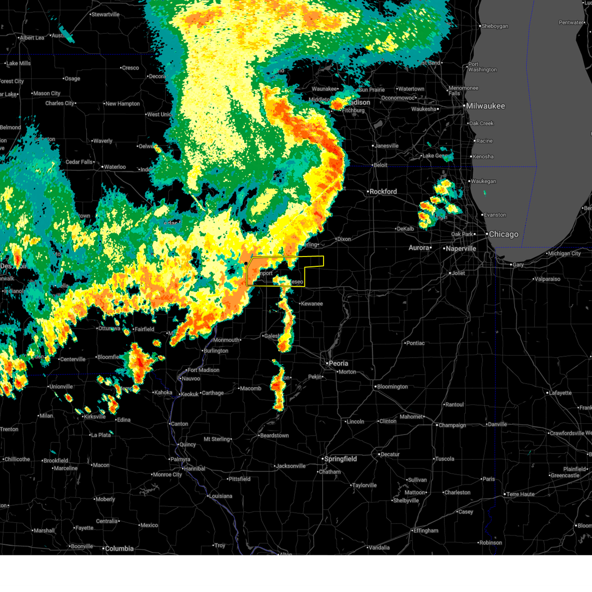 the severe thunderstorm warning has been cancelled and is no longer in effect the severe thunderstorm warning has been cancelled and is no longer in effect
|
| 7/11/2025 6:18 PM CDT |
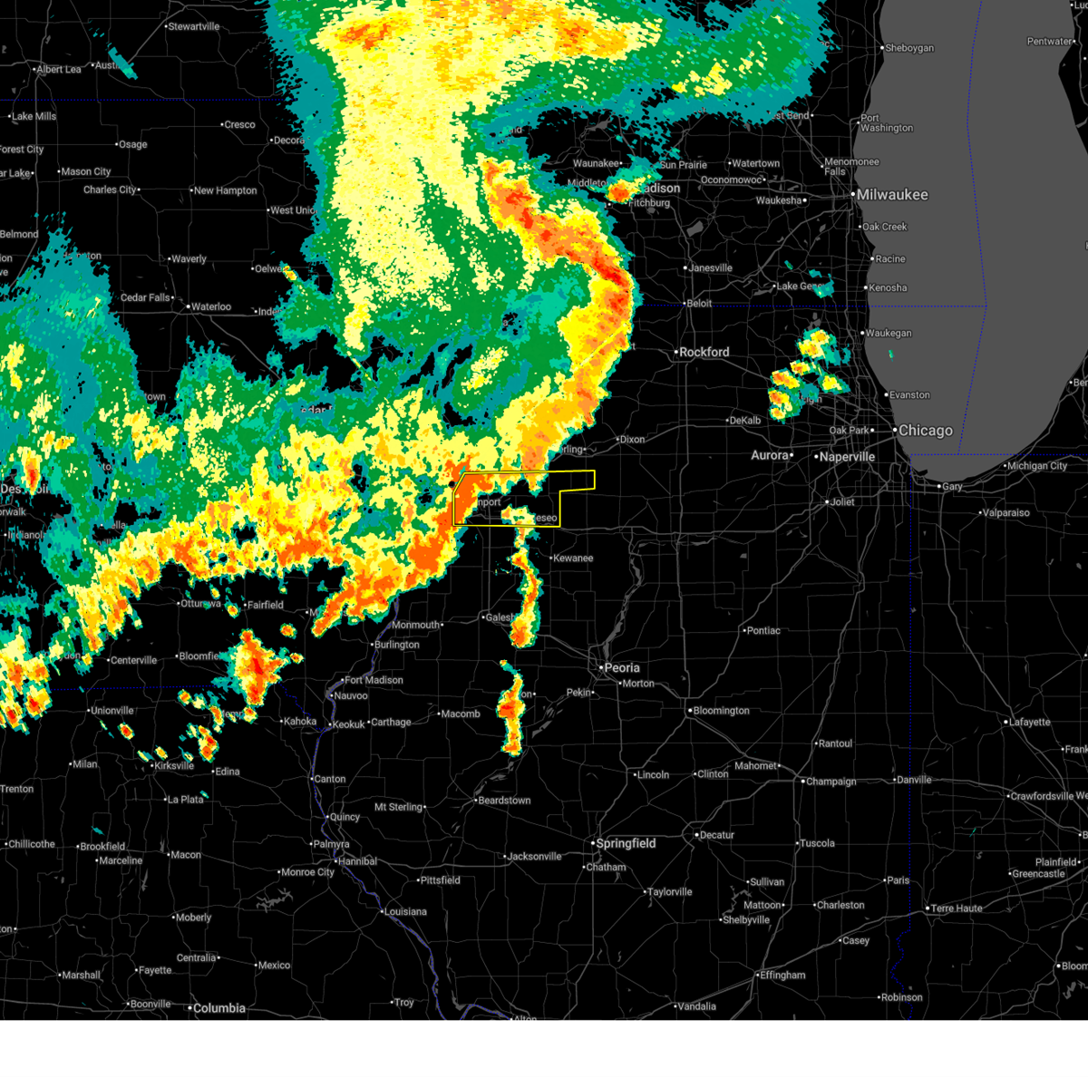 At 618 pm cdt, severe thunderstorms were located along a line extending from near princeton to near indian bluff golf course, moving east at 35 mph (trained weather spotters). Hazards include 60 mph wind gusts. Expect damage to roofs, siding, and trees. locations impacted include, davenport, moline, rock island, bettendorf, east moline, silvis, geneseo, colona, milan, le claire, coal valley, prophetstown, hampton, port byron, erie, atkinson, rapids city, princeton, annawan, and tampico. this includes the following highways, interstate 74 in iowa between mile markers 1 and 5. interstate 80 in iowa between mile markers 297 and 306. interstate 80 in illinois between mile markers 1 and 34. interstate 74 in illinois between mile markers 1 and 16. interstate 88 between mile markers 1 and 15. Interstate 280 between mile markers 15 and 18. At 618 pm cdt, severe thunderstorms were located along a line extending from near princeton to near indian bluff golf course, moving east at 35 mph (trained weather spotters). Hazards include 60 mph wind gusts. Expect damage to roofs, siding, and trees. locations impacted include, davenport, moline, rock island, bettendorf, east moline, silvis, geneseo, colona, milan, le claire, coal valley, prophetstown, hampton, port byron, erie, atkinson, rapids city, princeton, annawan, and tampico. this includes the following highways, interstate 74 in iowa between mile markers 1 and 5. interstate 80 in iowa between mile markers 297 and 306. interstate 80 in illinois between mile markers 1 and 34. interstate 74 in illinois between mile markers 1 and 16. interstate 88 between mile markers 1 and 15. Interstate 280 between mile markers 15 and 18.
|
| 7/11/2025 6:03 PM CDT |
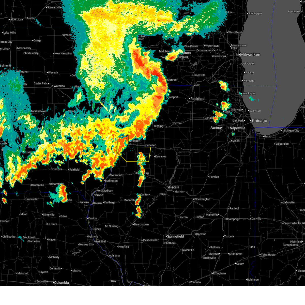 Svrdvn the national weather service in the quad cities has issued a * severe thunderstorm warning for, south central rock island county in northwestern illinois, northeastern mercer county in northwestern illinois, southwestern henry county in northwestern illinois, southwestern scott county in east central iowa, east central muscatine county in east central iowa, * until 700 pm cdt. * at 602 pm cdt, a severe thunderstorm was located over taylor ridge, or 7 miles south of rock island, moving east at 35 mph (radar indicated). Hazards include 60 mph wind gusts and quarter size hail. Hail damage to vehicles is expected. Expect wind damage to roofs, siding, and trees. Svrdvn the national weather service in the quad cities has issued a * severe thunderstorm warning for, south central rock island county in northwestern illinois, northeastern mercer county in northwestern illinois, southwestern henry county in northwestern illinois, southwestern scott county in east central iowa, east central muscatine county in east central iowa, * until 700 pm cdt. * at 602 pm cdt, a severe thunderstorm was located over taylor ridge, or 7 miles south of rock island, moving east at 35 mph (radar indicated). Hazards include 60 mph wind gusts and quarter size hail. Hail damage to vehicles is expected. Expect wind damage to roofs, siding, and trees.
|
| 7/11/2025 5:57 PM CDT |
 At 557 pm cdt, severe thunderstorms were located along a line extending from portland corners to near atkinson, moving east at 50 mph (trained weather spotters). Hazards include 60 mph wind gusts. Expect damage to roofs, siding, and trees. locations impacted include, davenport, moline, rock island, bettendorf, east moline, silvis, geneseo, eldridge, colona, milan, le claire, coal valley, prophetstown, hampton, port byron, erie, walnut, atkinson, rapids city, and princeton. this includes the following highways, interstate 74 in iowa between mile markers 1 and 5. interstate 80 in iowa between mile markers 296 and 306. interstate 80 in illinois between mile markers 1 and 35, and between mile markers 47 and 51. interstate 74 in illinois between mile markers 1 and 16. interstate 88 between mile markers 1 and 19. Interstate 280 between mile markers 15 and 18. At 557 pm cdt, severe thunderstorms were located along a line extending from portland corners to near atkinson, moving east at 50 mph (trained weather spotters). Hazards include 60 mph wind gusts. Expect damage to roofs, siding, and trees. locations impacted include, davenport, moline, rock island, bettendorf, east moline, silvis, geneseo, eldridge, colona, milan, le claire, coal valley, prophetstown, hampton, port byron, erie, walnut, atkinson, rapids city, and princeton. this includes the following highways, interstate 74 in iowa between mile markers 1 and 5. interstate 80 in iowa between mile markers 296 and 306. interstate 80 in illinois between mile markers 1 and 35, and between mile markers 47 and 51. interstate 74 in illinois between mile markers 1 and 16. interstate 88 between mile markers 1 and 19. Interstate 280 between mile markers 15 and 18.
|
| 7/11/2025 5:50 PM CDT | Quarter sized hail reported 0.1 miles S of Davenport, IA, occurring right now. |
| 7/11/2025 5:32 PM CDT | Several large tree limbs down at 3200 n harriso in scott county IA, 1.1 miles W of Davenport, IA |
| 7/11/2025 5:26 PM CDT | From aso in scott county IA, 4.3 miles S of Davenport, IA |
| 7/11/2025 5:26 PM CDT |
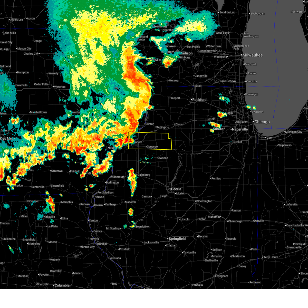 Svrdvn the national weather service in the quad cities has issued a * severe thunderstorm warning for, southeastern rock island county in northwestern illinois, southern whiteside county in northwestern illinois, northern henry county in northwestern illinois, northwestern bureau county in north central illinois, southeastern scott county in east central iowa, * until 630 pm cdt. * at 526 pm cdt, severe thunderstorms were located along a line extending from near park view to near sunny hill estates, moving east at 50 mph (trained weather spotters). Hazards include 70 mph wind gusts. Expect considerable tree damage. Damage is likely to mobile homes, roofs, and outbuildings. Svrdvn the national weather service in the quad cities has issued a * severe thunderstorm warning for, southeastern rock island county in northwestern illinois, southern whiteside county in northwestern illinois, northern henry county in northwestern illinois, northwestern bureau county in north central illinois, southeastern scott county in east central iowa, * until 630 pm cdt. * at 526 pm cdt, severe thunderstorms were located along a line extending from near park view to near sunny hill estates, moving east at 50 mph (trained weather spotters). Hazards include 70 mph wind gusts. Expect considerable tree damage. Damage is likely to mobile homes, roofs, and outbuildings.
|
| 7/11/2025 5:25 PM CDT |
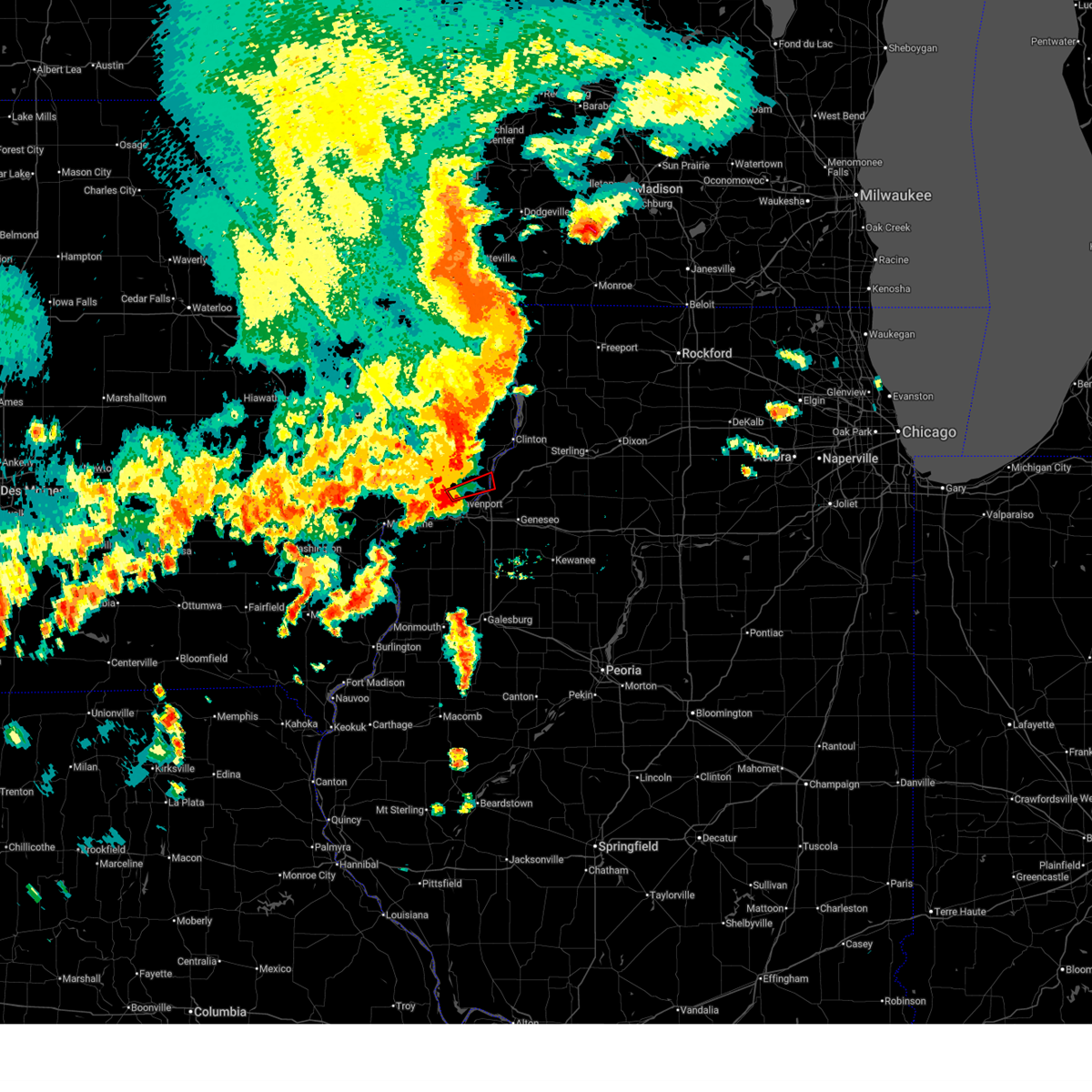 At 524 pm cdt, a severe thunderstorm capable of producing a tornado was located over bettendorf, moving east at 35 mph (radar indicated rotation). Hazards include tornado and quarter size hail. Flying debris will be dangerous to those caught without shelter. mobile homes will be damaged or destroyed. damage to roofs, windows, and vehicles will occur. tree damage is likely. this dangerous storm will be near, bettendorf, le claire, port byron, princeton, and cordova around 530 pm cdt. this includes the following highways, interstate 74 in iowa between mile markers 1 and 2. Interstate 80 in iowa between mile markers 295 and 306. At 524 pm cdt, a severe thunderstorm capable of producing a tornado was located over bettendorf, moving east at 35 mph (radar indicated rotation). Hazards include tornado and quarter size hail. Flying debris will be dangerous to those caught without shelter. mobile homes will be damaged or destroyed. damage to roofs, windows, and vehicles will occur. tree damage is likely. this dangerous storm will be near, bettendorf, le claire, port byron, princeton, and cordova around 530 pm cdt. this includes the following highways, interstate 74 in iowa between mile markers 1 and 2. Interstate 80 in iowa between mile markers 295 and 306.
|
| 7/11/2025 5:17 PM CDT |
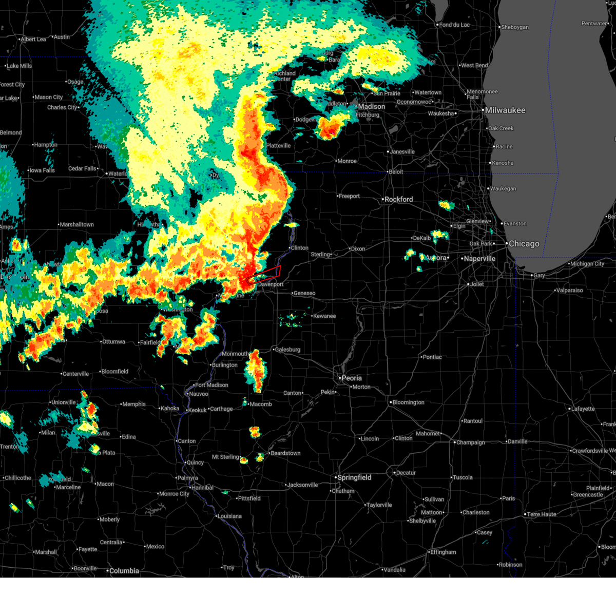 the tornado warning has been cancelled and is no longer in effect the tornado warning has been cancelled and is no longer in effect
|
| 7/11/2025 5:17 PM CDT |
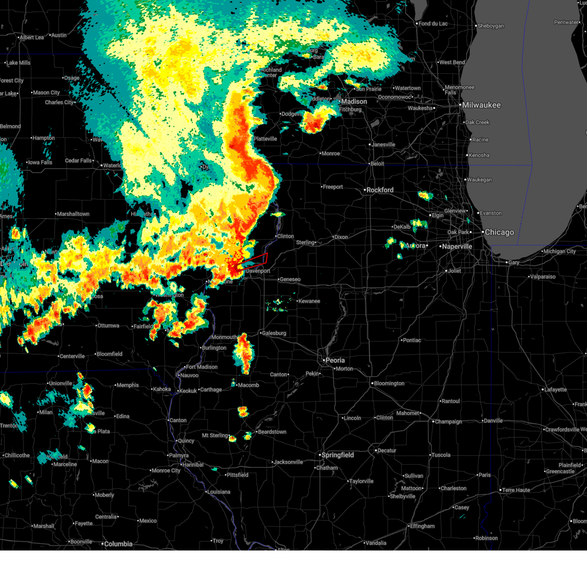 At 517 pm cdt, a confirmed tornado was located over davenport, moving northeast at 30 mph (radar confirmed tornado). Hazards include damaging tornado and quarter size hail. Flying debris will be dangerous to those caught without shelter. mobile homes will be damaged or destroyed. damage to roofs, windows, and vehicles will occur. tree damage is likely. this tornado will be near, davenport, bettendorf, and le claire around 525 pm cdt. other locations in the path of this tornadic thunderstorm include princeton, port byron and cordova. this includes the following highways, interstate 74 in iowa between mile markers 1 and 3. interstate 80 in iowa between mile markers 295 and 306. Interstate 280 between mile markers 3 and 4. At 517 pm cdt, a confirmed tornado was located over davenport, moving northeast at 30 mph (radar confirmed tornado). Hazards include damaging tornado and quarter size hail. Flying debris will be dangerous to those caught without shelter. mobile homes will be damaged or destroyed. damage to roofs, windows, and vehicles will occur. tree damage is likely. this tornado will be near, davenport, bettendorf, and le claire around 525 pm cdt. other locations in the path of this tornadic thunderstorm include princeton, port byron and cordova. this includes the following highways, interstate 74 in iowa between mile markers 1 and 3. interstate 80 in iowa between mile markers 295 and 306. Interstate 280 between mile markers 3 and 4.
|
| 7/11/2025 5:12 PM CDT |
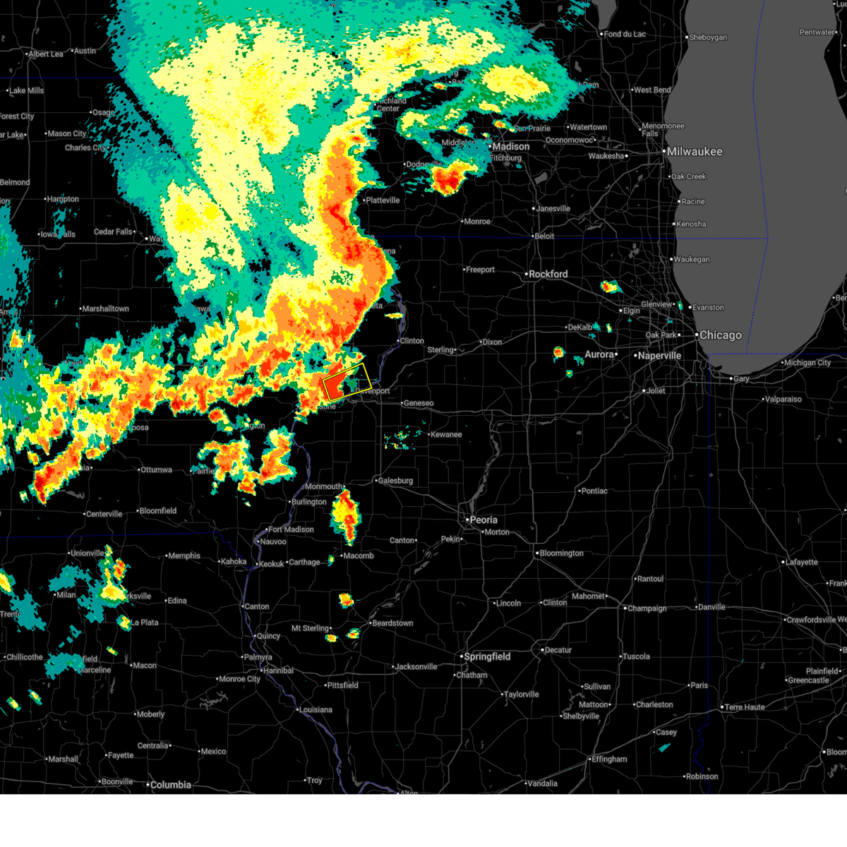 At 512 pm cdt, a severe thunderstorm was located over west lake park, or near davenport, moving east at 25 mph (radar indicated). Hazards include 70 mph wind gusts and quarter size hail. Hail damage to vehicles is expected. expect considerable tree damage. wind damage is also likely to mobile homes, roofs, and outbuildings. locations impacted include, davenport, rock island, bettendorf, east moline, eldridge, hampton, walcott, blue grass, buffalo, riverdale, panorama park, west lake park, campbells island, rock island arsenal, mississippi valley fairgrounds, davenport municipal airport, credit island, and park view. this includes the following highways, interstate 74 in iowa between mile markers 1 and 5. interstate 80 in iowa between mile markers 286 and 302. Interstate 280 between mile markers 1 and 8. At 512 pm cdt, a severe thunderstorm was located over west lake park, or near davenport, moving east at 25 mph (radar indicated). Hazards include 70 mph wind gusts and quarter size hail. Hail damage to vehicles is expected. expect considerable tree damage. wind damage is also likely to mobile homes, roofs, and outbuildings. locations impacted include, davenport, rock island, bettendorf, east moline, eldridge, hampton, walcott, blue grass, buffalo, riverdale, panorama park, west lake park, campbells island, rock island arsenal, mississippi valley fairgrounds, davenport municipal airport, credit island, and park view. this includes the following highways, interstate 74 in iowa between mile markers 1 and 5. interstate 80 in iowa between mile markers 286 and 302. Interstate 280 between mile markers 1 and 8.
|
| 7/11/2025 5:09 PM CDT |
 At 509 pm cdt, a confirmed tornado was located over west lake park, or near davenport, moving northeast at 45 mph (radar confirmed tornado). Hazards include damaging tornado and quarter size hail. Flying debris will be dangerous to those caught without shelter. mobile homes will be damaged or destroyed. damage to roofs, windows, and vehicles will occur. tree damage is likely. this tornado will be near, davenport, moline, rock island, bettendorf, east moline, silvis, hampton, riverdale, panorama park, and campbells island around 515 pm cdt. le claire, port byron, rapids city, princeton, carbon cliff, and fishermans corner around 520 pm cdt. cordova and barstow around 525 pm cdt. other locations in the path of this tornadic thunderstorm include cleveland. this includes the following highways, interstate 74 in iowa between mile markers 1 and 5. interstate 80 in iowa between mile markers 295 and 306. interstate 80 in illinois between mile markers 1 and 5. interstate 74 in illinois between mile markers 1 and 2. interstate 88 between mile markers 1 and 5. Interstate 280 between mile markers 3 and 10. At 509 pm cdt, a confirmed tornado was located over west lake park, or near davenport, moving northeast at 45 mph (radar confirmed tornado). Hazards include damaging tornado and quarter size hail. Flying debris will be dangerous to those caught without shelter. mobile homes will be damaged or destroyed. damage to roofs, windows, and vehicles will occur. tree damage is likely. this tornado will be near, davenport, moline, rock island, bettendorf, east moline, silvis, hampton, riverdale, panorama park, and campbells island around 515 pm cdt. le claire, port byron, rapids city, princeton, carbon cliff, and fishermans corner around 520 pm cdt. cordova and barstow around 525 pm cdt. other locations in the path of this tornadic thunderstorm include cleveland. this includes the following highways, interstate 74 in iowa between mile markers 1 and 5. interstate 80 in iowa between mile markers 295 and 306. interstate 80 in illinois between mile markers 1 and 5. interstate 74 in illinois between mile markers 1 and 2. interstate 88 between mile markers 1 and 5. Interstate 280 between mile markers 3 and 10.
|
| 7/11/2025 5:09 PM CDT |
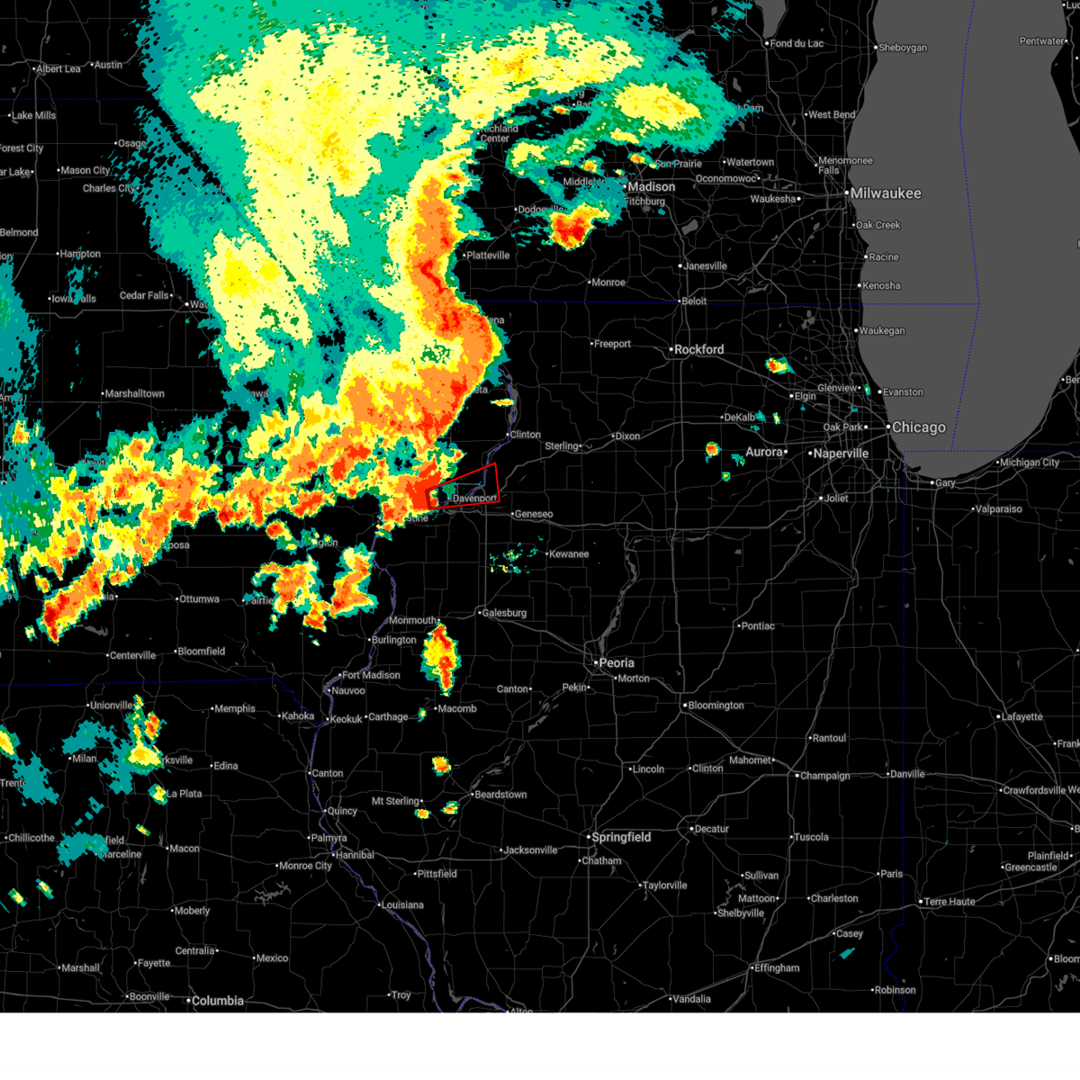 the tornado warning has been cancelled and is no longer in effect the tornado warning has been cancelled and is no longer in effect
|
| 7/11/2025 5:05 PM CDT |
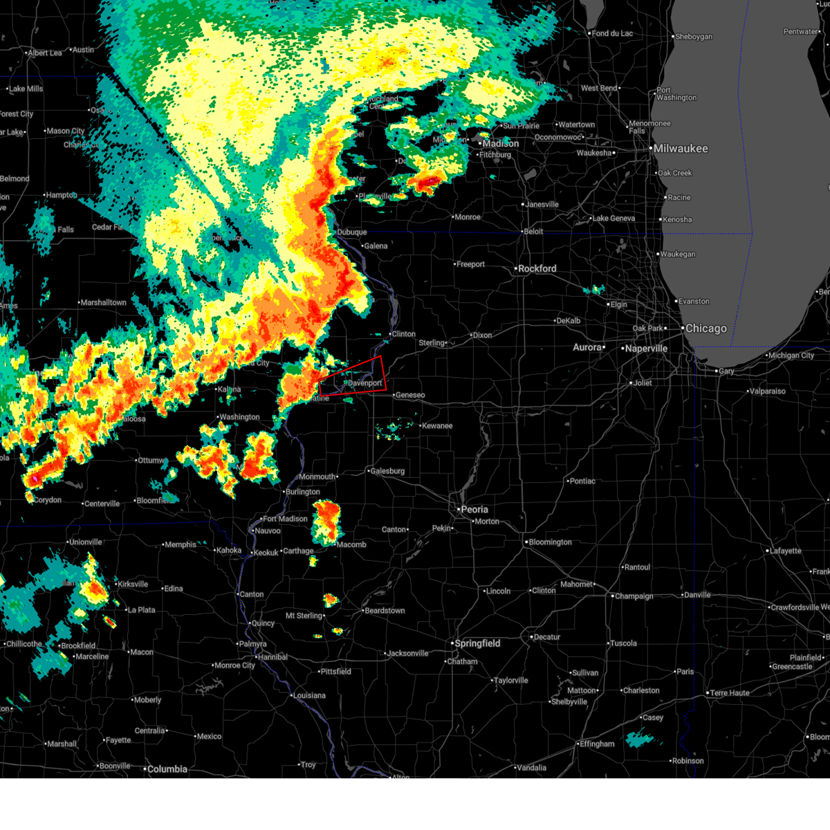 Tordvn the national weather service in the quad cities has issued a * tornado warning for, east central rock island county in northwestern illinois, northwestern henry county in northwestern illinois, southern scott county in east central iowa, east central muscatine county in east central iowa, * until 545 pm cdt. * at 505 pm cdt, a severe thunderstorm capable of producing a tornado was located over west lake park, or near rock island, moving east at 35 mph (radar indicated rotation). Hazards include tornado and quarter size hail. Flying debris will be dangerous to those caught without shelter. mobile homes will be damaged or destroyed. damage to roofs, windows, and vehicles will occur. tree damage is likely. this dangerous storm will be near, davenport, moline, rock island, bettendorf, milan, buffalo, west lake park, rock island arsenal, fruitland, and credit island around 510 pm cdt. east moline, silvis, riverdale, panorama park, campbells island, and rock island county fairgrounds around 515 pm cdt. le claire, hampton, carbon cliff, silvis heights, illiniwek forest preserve, pleasant valley, and fishermans corner around 520 pm cdt. colona, port byron, rapids city, cleveland, and barstow around 525 pm cdt. other locations in the path of this tornadic thunderstorm include princeton, osborn, dayton and cordova. this includes the following highways, interstate 74 in iowa between mile markers 1 and 5. interstate 80 in iowa between mile markers 294 and 306. interstate 80 in illinois between mile markers 1 and 7. interstate 74 in illinois between mile markers 1 and 4. interstate 88 between mile markers 1 and 5. Interstate 280 between mile markers 2 and 12. Tordvn the national weather service in the quad cities has issued a * tornado warning for, east central rock island county in northwestern illinois, northwestern henry county in northwestern illinois, southern scott county in east central iowa, east central muscatine county in east central iowa, * until 545 pm cdt. * at 505 pm cdt, a severe thunderstorm capable of producing a tornado was located over west lake park, or near rock island, moving east at 35 mph (radar indicated rotation). Hazards include tornado and quarter size hail. Flying debris will be dangerous to those caught without shelter. mobile homes will be damaged or destroyed. damage to roofs, windows, and vehicles will occur. tree damage is likely. this dangerous storm will be near, davenport, moline, rock island, bettendorf, milan, buffalo, west lake park, rock island arsenal, fruitland, and credit island around 510 pm cdt. east moline, silvis, riverdale, panorama park, campbells island, and rock island county fairgrounds around 515 pm cdt. le claire, hampton, carbon cliff, silvis heights, illiniwek forest preserve, pleasant valley, and fishermans corner around 520 pm cdt. colona, port byron, rapids city, cleveland, and barstow around 525 pm cdt. other locations in the path of this tornadic thunderstorm include princeton, osborn, dayton and cordova. this includes the following highways, interstate 74 in iowa between mile markers 1 and 5. interstate 80 in iowa between mile markers 294 and 306. interstate 80 in illinois between mile markers 1 and 7. interstate 74 in illinois between mile markers 1 and 4. interstate 88 between mile markers 1 and 5. Interstate 280 between mile markers 2 and 12.
|
| 7/11/2025 5:02 PM CDT |
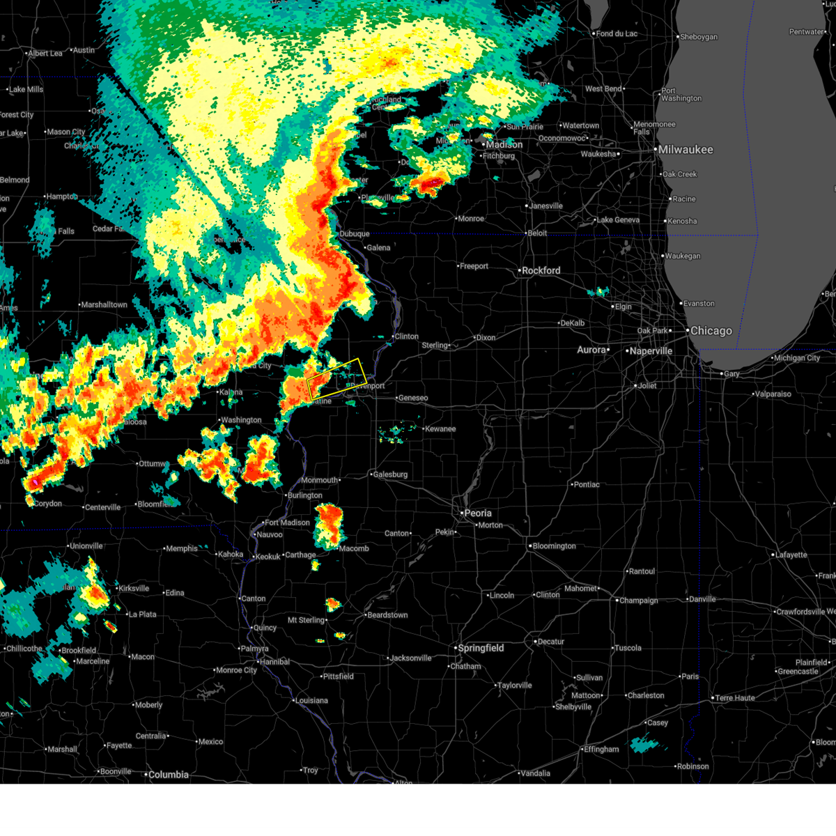 At 502 pm cdt, a severe thunderstorm was located over blue grass, or 8 miles southeast of durant, moving east at 15 mph (radar indicated). Hazards include 60 mph wind gusts and quarter size hail. Hail damage to vehicles is expected. expect wind damage to roofs, siding, and trees. locations impacted include, davenport, rock island, bettendorf, east moline, eldridge, hampton, walcott, blue grass, buffalo, riverdale, montpelier, panorama park, clark's ferry recreation area, west lake park, new era, campbells island, pleasant prairie, mississippi valley fairgrounds, davenport municipal airport, and credit island. this includes the following highways, interstate 74 in iowa between mile markers 1 and 5. interstate 80 in iowa between mile markers 286 and 302. Interstate 280 between mile markers 1 and 8. At 502 pm cdt, a severe thunderstorm was located over blue grass, or 8 miles southeast of durant, moving east at 15 mph (radar indicated). Hazards include 60 mph wind gusts and quarter size hail. Hail damage to vehicles is expected. expect wind damage to roofs, siding, and trees. locations impacted include, davenport, rock island, bettendorf, east moline, eldridge, hampton, walcott, blue grass, buffalo, riverdale, montpelier, panorama park, clark's ferry recreation area, west lake park, new era, campbells island, pleasant prairie, mississippi valley fairgrounds, davenport municipal airport, and credit island. this includes the following highways, interstate 74 in iowa between mile markers 1 and 5. interstate 80 in iowa between mile markers 286 and 302. Interstate 280 between mile markers 1 and 8.
|
| 7/11/2025 4:47 PM CDT |
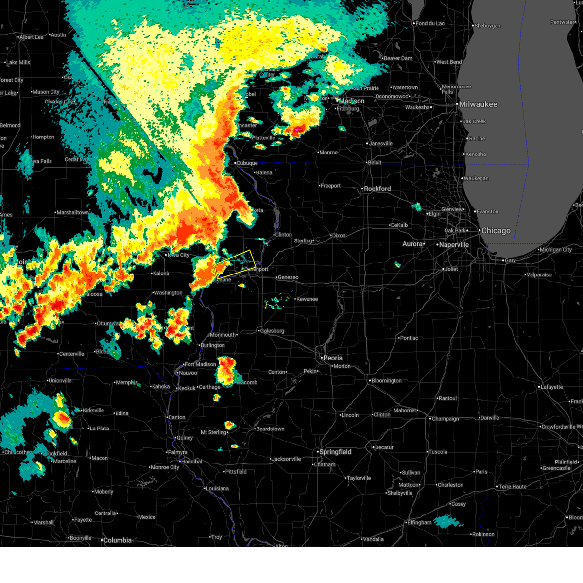 Svrdvn the national weather service in the quad cities has issued a * severe thunderstorm warning for, west central rock island county in northwestern illinois, central scott county in east central iowa, northeastern muscatine county in east central iowa, * until 530 pm cdt. * at 446 pm cdt, a severe thunderstorm was located over pleasant prairie, or near durant, moving northeast at 25 mph (radar indicated). Hazards include 60 mph wind gusts and quarter size hail. Hail damage to vehicles is expected. Expect wind damage to roofs, siding, and trees. Svrdvn the national weather service in the quad cities has issued a * severe thunderstorm warning for, west central rock island county in northwestern illinois, central scott county in east central iowa, northeastern muscatine county in east central iowa, * until 530 pm cdt. * at 446 pm cdt, a severe thunderstorm was located over pleasant prairie, or near durant, moving northeast at 25 mph (radar indicated). Hazards include 60 mph wind gusts and quarter size hail. Hail damage to vehicles is expected. Expect wind damage to roofs, siding, and trees.
|
| 7/10/2025 10:00 PM CDT |
 the tornado warning has been cancelled and is no longer in effect the tornado warning has been cancelled and is no longer in effect
|
| 7/10/2025 9:48 PM CDT |
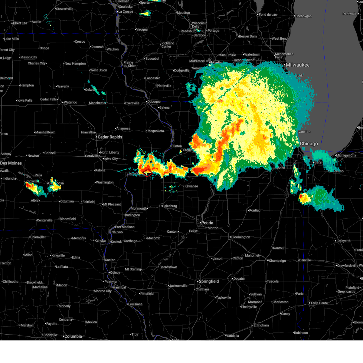 At 948 pm cdt, a severe thunderstorm capable of producing a tornado was located over andalusia, or near rock island, moving southeast at 10 mph (radar indicated rotation). Hazards include tornado. Flying debris will be dangerous to those caught without shelter. mobile homes will be damaged or destroyed. damage to roofs, windows, and vehicles will occur. tree damage is likely. this dangerous storm will be near, rock island and milan around 955 pm cdt. This includes interstate 280 between mile markers 9 and 14. At 948 pm cdt, a severe thunderstorm capable of producing a tornado was located over andalusia, or near rock island, moving southeast at 10 mph (radar indicated rotation). Hazards include tornado. Flying debris will be dangerous to those caught without shelter. mobile homes will be damaged or destroyed. damage to roofs, windows, and vehicles will occur. tree damage is likely. this dangerous storm will be near, rock island and milan around 955 pm cdt. This includes interstate 280 between mile markers 9 and 14.
|
| 7/10/2025 9:42 PM CDT |
 Tordvn the national weather service in the quad cities has issued a * tornado warning for, south central rock island county in northwestern illinois, southern scott county in east central iowa, * until 1030 pm cdt. * at 942 pm cdt, a severe thunderstorm capable of producing a tornado was located over buffalo, or near rock island, moving southeast at 10 mph (radar indicated rotation). Hazards include tornado. Flying debris will be dangerous to those caught without shelter. mobile homes will be damaged or destroyed. damage to roofs, windows, and vehicles will occur. tree damage is likely. this dangerous storm will be near, davenport, rock island, milan, buffalo, and andalusia around 950 pm cdt. This includes interstate 280 between mile markers 8 and 14. Tordvn the national weather service in the quad cities has issued a * tornado warning for, south central rock island county in northwestern illinois, southern scott county in east central iowa, * until 1030 pm cdt. * at 942 pm cdt, a severe thunderstorm capable of producing a tornado was located over buffalo, or near rock island, moving southeast at 10 mph (radar indicated rotation). Hazards include tornado. Flying debris will be dangerous to those caught without shelter. mobile homes will be damaged or destroyed. damage to roofs, windows, and vehicles will occur. tree damage is likely. this dangerous storm will be near, davenport, rock island, milan, buffalo, and andalusia around 950 pm cdt. This includes interstate 280 between mile markers 8 and 14.
|
| 7/5/2025 3:59 PM CDT |
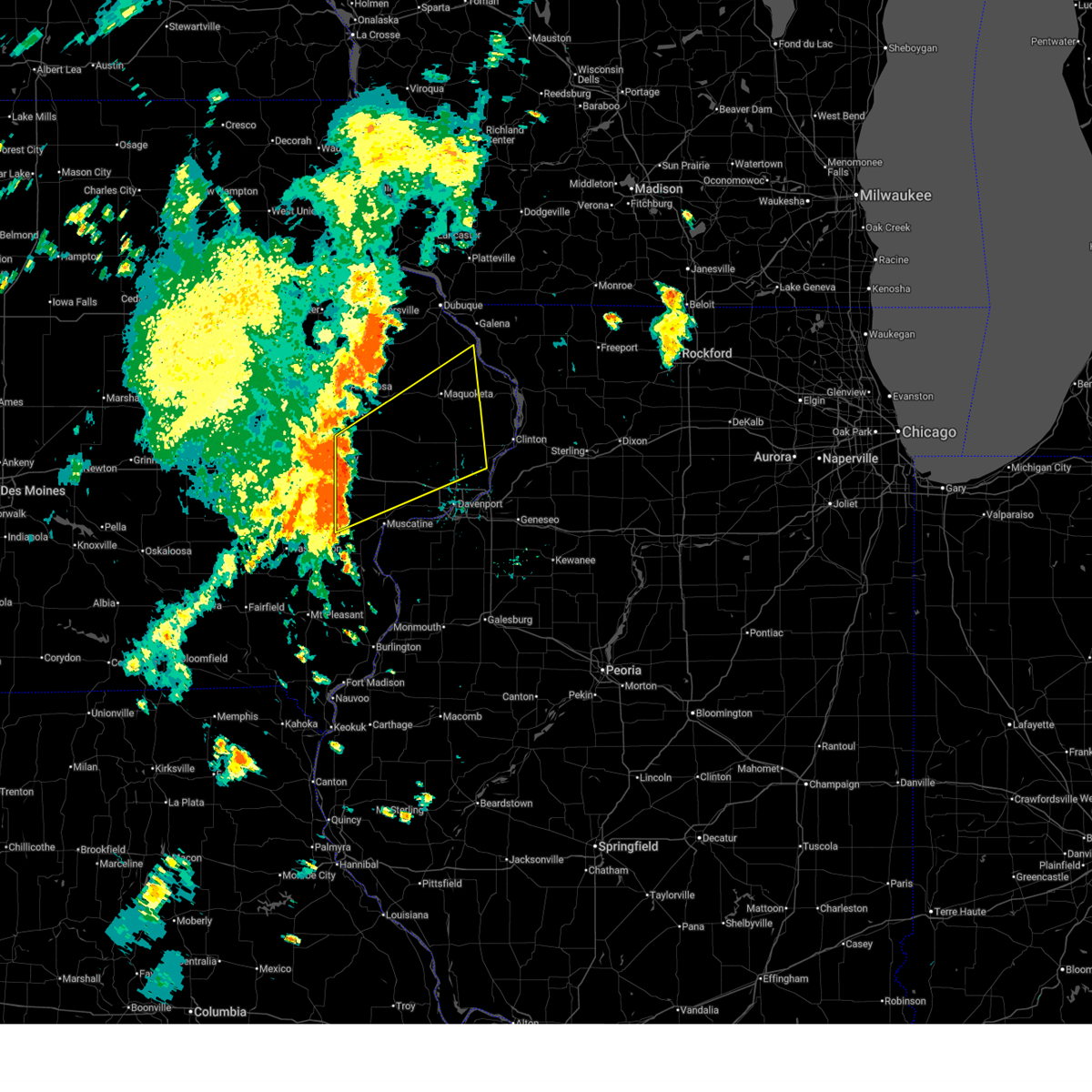 Svrdvn the national weather service in the quad cities has issued a * severe thunderstorm warning for, western jackson county in east central iowa, cedar county in east central iowa, northern scott county in east central iowa, southeastern jones county in east central iowa, northern muscatine county in east central iowa, clinton county in east central iowa, * until 500 pm cdt. * at 358 pm cdt, severe thunderstorms were located along a line extending from cedar bluff to near nichols, moving northeast at 55 mph (radar indicated). Hazards include 60 mph wind gusts. expect damage to roofs, siding, and trees Svrdvn the national weather service in the quad cities has issued a * severe thunderstorm warning for, western jackson county in east central iowa, cedar county in east central iowa, northern scott county in east central iowa, southeastern jones county in east central iowa, northern muscatine county in east central iowa, clinton county in east central iowa, * until 500 pm cdt. * at 358 pm cdt, severe thunderstorms were located along a line extending from cedar bluff to near nichols, moving northeast at 55 mph (radar indicated). Hazards include 60 mph wind gusts. expect damage to roofs, siding, and trees
|
| 6/25/2025 4:42 PM CDT |
 the severe thunderstorm warning has been cancelled and is no longer in effect the severe thunderstorm warning has been cancelled and is no longer in effect
|
| 6/25/2025 4:31 PM CDT |
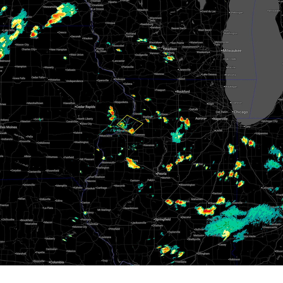 At 431 pm cdt, severe thunderstorms were located along a line extending from near park view to joslin, moving northeast at 30 mph (radar indicated). Hazards include 60 mph wind gusts. Expect damage to roofs, siding, and trees. locations impacted include, davenport, bettendorf, clinton, east moline, eldridge, camanche, le claire, prophetstown, hampton, port byron, erie, rapids city, princeton, cordova, mccausland, low moor, cleveland, osborn, hillsdale, and portland corners. this includes the following highways, interstate 80 in iowa between mile markers 299 and 306. interstate 80 in illinois between mile markers 1 and 4. Interstate 88 between mile markers 1 and 21. At 431 pm cdt, severe thunderstorms were located along a line extending from near park view to joslin, moving northeast at 30 mph (radar indicated). Hazards include 60 mph wind gusts. Expect damage to roofs, siding, and trees. locations impacted include, davenport, bettendorf, clinton, east moline, eldridge, camanche, le claire, prophetstown, hampton, port byron, erie, rapids city, princeton, cordova, mccausland, low moor, cleveland, osborn, hillsdale, and portland corners. this includes the following highways, interstate 80 in iowa between mile markers 299 and 306. interstate 80 in illinois between mile markers 1 and 4. Interstate 88 between mile markers 1 and 21.
|
| 6/25/2025 4:21 PM CDT |
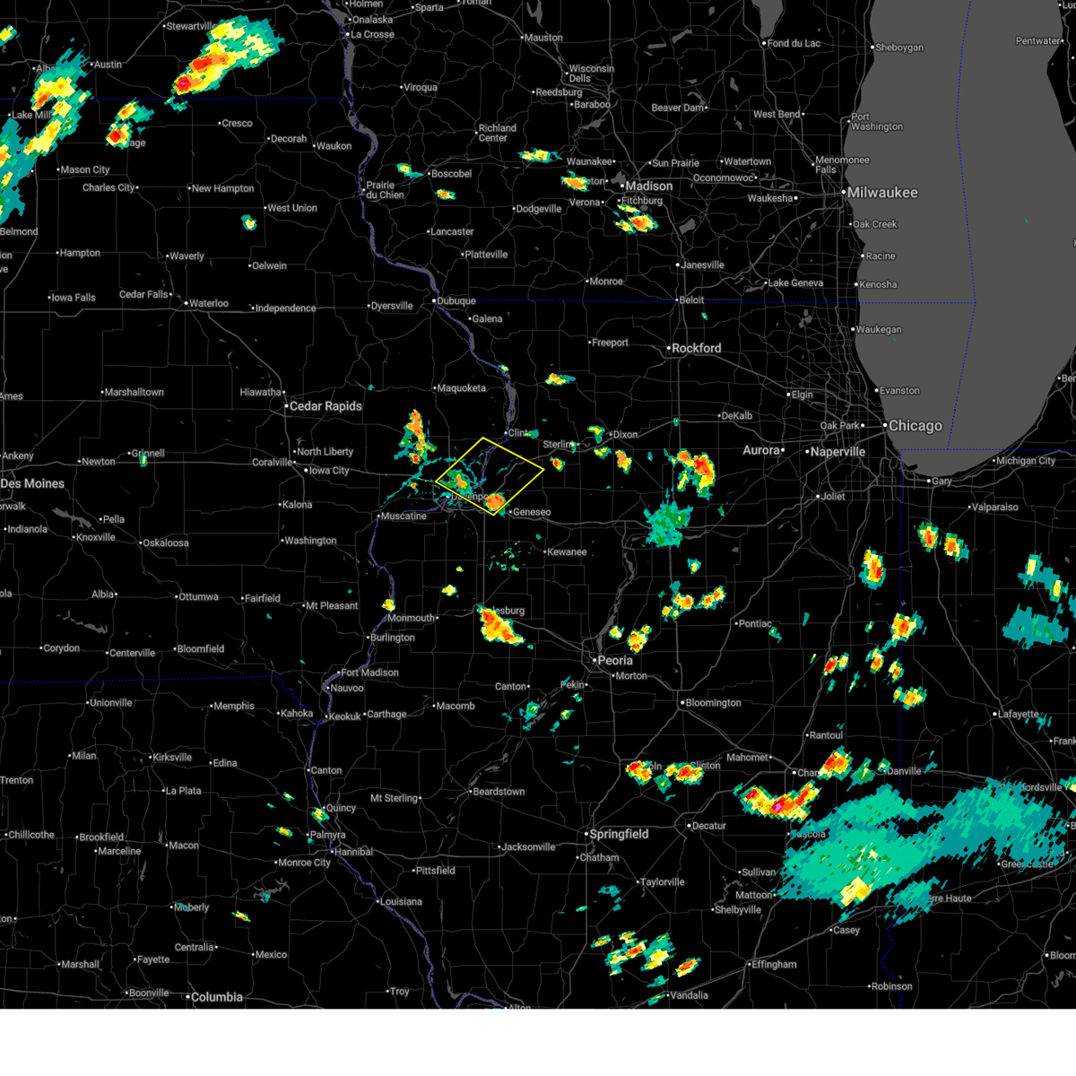 At 421 pm cdt, severe thunderstorms were located along a line extending from near davenport municipal airport to osborn, moving northeast at 25 mph (radar indicated). Hazards include 60 mph wind gusts. Expect damage to roofs, siding, and trees. locations impacted include, davenport, bettendorf, clinton, east moline, silvis, eldridge, colona, camanche, le claire, prophetstown, hampton, port byron, erie, rapids city, princeton, cordova, riverdale, mccausland, low moor, and cleveland. this includes the following highways, interstate 74 in iowa between mile markers 1 and 4. interstate 80 in iowa between mile markers 292 and 306. interstate 80 in illinois between mile markers 1 and 8, and between mile markers 13 and 14. Interstate 88 between mile markers 1 and 21. At 421 pm cdt, severe thunderstorms were located along a line extending from near davenport municipal airport to osborn, moving northeast at 25 mph (radar indicated). Hazards include 60 mph wind gusts. Expect damage to roofs, siding, and trees. locations impacted include, davenport, bettendorf, clinton, east moline, silvis, eldridge, colona, camanche, le claire, prophetstown, hampton, port byron, erie, rapids city, princeton, cordova, riverdale, mccausland, low moor, and cleveland. this includes the following highways, interstate 74 in iowa between mile markers 1 and 4. interstate 80 in iowa between mile markers 292 and 306. interstate 80 in illinois between mile markers 1 and 8, and between mile markers 13 and 14. Interstate 88 between mile markers 1 and 21.
|
| 6/25/2025 4:06 PM CDT |
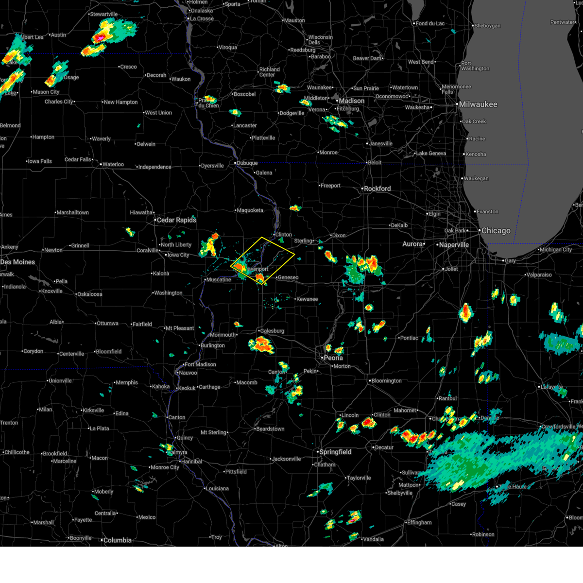 Svrdvn the national weather service in the quad cities has issued a * severe thunderstorm warning for, eastern rock island county in northwestern illinois, southwestern whiteside county in northwestern illinois, northwestern henry county in northwestern illinois, eastern scott county in east central iowa, southeastern clinton county in east central iowa, * until 500 pm cdt. * at 406 pm cdt, severe thunderstorms were located along a line extending from credit island to near colona, moving northeast at 30 mph (radar indicated). Hazards include 60 mph wind gusts. expect damage to roofs, siding, and trees Svrdvn the national weather service in the quad cities has issued a * severe thunderstorm warning for, eastern rock island county in northwestern illinois, southwestern whiteside county in northwestern illinois, northwestern henry county in northwestern illinois, eastern scott county in east central iowa, southeastern clinton county in east central iowa, * until 500 pm cdt. * at 406 pm cdt, severe thunderstorms were located along a line extending from credit island to near colona, moving northeast at 30 mph (radar indicated). Hazards include 60 mph wind gusts. expect damage to roofs, siding, and trees
|
| 6/25/2025 4:05 PM CDT | Large tree limb down on the roa in scott county IA, 0.8 miles S of Davenport, IA |
| 6/3/2025 7:26 PM CDT |
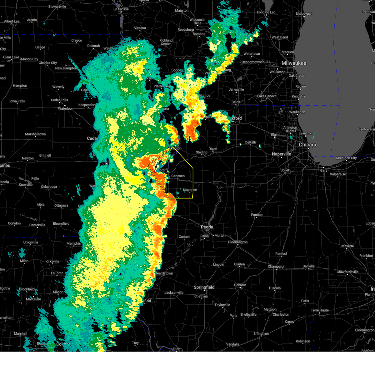 the severe thunderstorm warning has been cancelled and is no longer in effect the severe thunderstorm warning has been cancelled and is no longer in effect
|
| 6/3/2025 7:26 PM CDT |
 At 726 pm cdt, severe thunderstorms were located along a line extending from park view to colona to near altona, moving northeast at 50 mph (radar indicated). Hazards include 60 mph wind gusts. Expect damage to roofs, siding, and trees. locations impacted include, davenport, moline, rock island, bettendorf, clinton, east moline, kewanee, cambridge, silvis, geneseo, eldridge, colona, milan, camanche, le claire, coal valley, galva, hampton, orion, and port byron. this includes the following highways, interstate 74 in iowa between mile markers 1 and 5. interstate 80 in iowa between mile markers 288 and 306. interstate 80 in illinois between mile markers 1 and 35. interstate 74 in illinois between mile markers 1 and 33. interstate 88 between mile markers 1 and 23. Interstate 280 between mile markers 1 and 3, and between mile markers 14 and 18. At 726 pm cdt, severe thunderstorms were located along a line extending from park view to colona to near altona, moving northeast at 50 mph (radar indicated). Hazards include 60 mph wind gusts. Expect damage to roofs, siding, and trees. locations impacted include, davenport, moline, rock island, bettendorf, clinton, east moline, kewanee, cambridge, silvis, geneseo, eldridge, colona, milan, camanche, le claire, coal valley, galva, hampton, orion, and port byron. this includes the following highways, interstate 74 in iowa between mile markers 1 and 5. interstate 80 in iowa between mile markers 288 and 306. interstate 80 in illinois between mile markers 1 and 35. interstate 74 in illinois between mile markers 1 and 33. interstate 88 between mile markers 1 and 23. Interstate 280 between mile markers 1 and 3, and between mile markers 14 and 18.
|
| 6/3/2025 7:25 PM CDT |
 At 725 pm cdt, a severe thunderstorm capable of producing a tornado was located over east moline, moving northeast at 50 mph (radar indicated rotation). Hazards include tornado. Flying debris will be dangerous to those caught without shelter. mobile homes will be damaged or destroyed. damage to roofs, windows, and vehicles will occur. tree damage is likely. this dangerous storm will be near, bettendorf, east moline, colona, le claire, hampton, port byron, rapids city, princeton, cordova, and cleveland around 730 pm cdt. princeton wildlife area around 735 pm cdt. Other locations in the path of this tornadic thunderstorm include erie and spring hill. At 725 pm cdt, a severe thunderstorm capable of producing a tornado was located over east moline, moving northeast at 50 mph (radar indicated rotation). Hazards include tornado. Flying debris will be dangerous to those caught without shelter. mobile homes will be damaged or destroyed. damage to roofs, windows, and vehicles will occur. tree damage is likely. this dangerous storm will be near, bettendorf, east moline, colona, le claire, hampton, port byron, rapids city, princeton, cordova, and cleveland around 730 pm cdt. princeton wildlife area around 735 pm cdt. Other locations in the path of this tornadic thunderstorm include erie and spring hill.
|
| 6/3/2025 7:15 PM CDT |
 the tornado warning has been cancelled and is no longer in effect the tornado warning has been cancelled and is no longer in effect
|
| 6/3/2025 7:15 PM CDT |
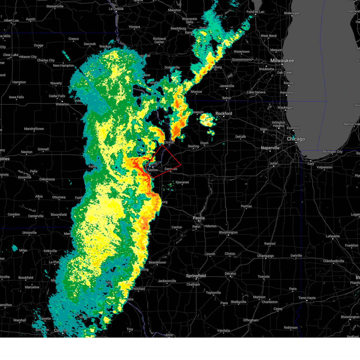 At 715 pm cdt, a possible large and extremely dangerous tornado was located over fruitland, or over rock island, moving east at 50 mph. this is a particularly dangerous situation. take cover now! (radar indicated rotation). Hazards include damaging tornado. You are in a life-threatening situation. flying debris may be deadly to those caught without shelter. mobile homes will be destroyed. considerable damage to homes, businesses, and vehicles is likely and complete destruction is possible. the tornado will be near, moline, bettendorf, east moline, silvis, colona, coal valley, hampton, riverdale, cleveland, and warner around 720 pm cdt. osborn and fishermans corner around 725 pm cdt. Other locations in the path of this tornadic thunderstorm include geneseo, shady beach and joslin. At 715 pm cdt, a possible large and extremely dangerous tornado was located over fruitland, or over rock island, moving east at 50 mph. this is a particularly dangerous situation. take cover now! (radar indicated rotation). Hazards include damaging tornado. You are in a life-threatening situation. flying debris may be deadly to those caught without shelter. mobile homes will be destroyed. considerable damage to homes, businesses, and vehicles is likely and complete destruction is possible. the tornado will be near, moline, bettendorf, east moline, silvis, colona, coal valley, hampton, riverdale, cleveland, and warner around 720 pm cdt. osborn and fishermans corner around 725 pm cdt. Other locations in the path of this tornadic thunderstorm include geneseo, shady beach and joslin.
|
| 6/3/2025 7:08 PM CDT |
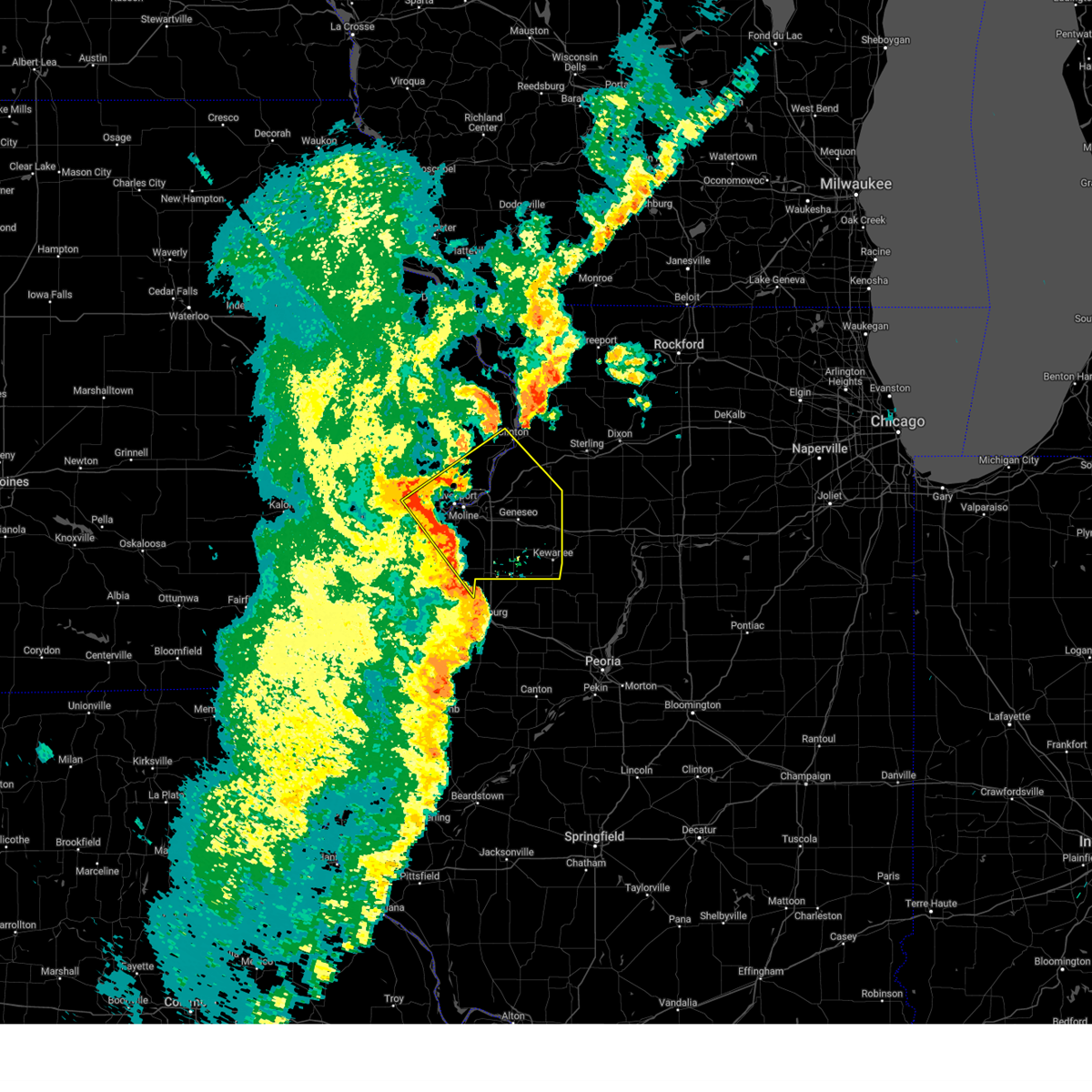 Svrdvn the national weather service in the quad cities has issued a * severe thunderstorm warning for, rock island county in northwestern illinois, eastern mercer county in northwestern illinois, southwestern whiteside county in northwestern illinois, henry county in northwestern illinois, scott county in east central iowa, northeastern muscatine county in east central iowa, southeastern clinton county in east central iowa, * until 800 pm cdt. * at 707 pm cdt, severe thunderstorms were located along a line extending from walcott to near coyne center to henderson, moving northeast at 50 mph (radar indicated). Hazards include 70 mph wind gusts. Expect considerable tree damage. Damage is likely to mobile homes, roofs, and outbuildings. Svrdvn the national weather service in the quad cities has issued a * severe thunderstorm warning for, rock island county in northwestern illinois, eastern mercer county in northwestern illinois, southwestern whiteside county in northwestern illinois, henry county in northwestern illinois, scott county in east central iowa, northeastern muscatine county in east central iowa, southeastern clinton county in east central iowa, * until 800 pm cdt. * at 707 pm cdt, severe thunderstorms were located along a line extending from walcott to near coyne center to henderson, moving northeast at 50 mph (radar indicated). Hazards include 70 mph wind gusts. Expect considerable tree damage. Damage is likely to mobile homes, roofs, and outbuildings.
|
| 6/3/2025 7:07 PM CDT |
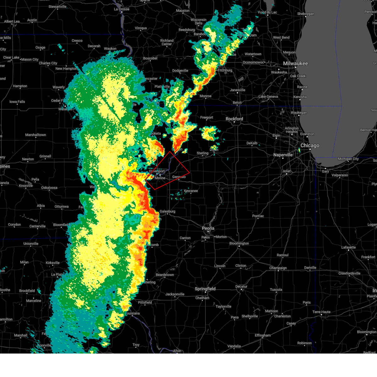 Tordvn the national weather service in the quad cities has issued a * tornado warning for, rock island county in northwestern illinois, northeastern mercer county in northwestern illinois, southwestern whiteside county in northwestern illinois, northwestern henry county in northwestern illinois, eastern scott county in east central iowa, southeastern clinton county in east central iowa, * until 745 pm cdt. * at 706 pm cdt, a possible large and extremely dangerous tornado was located over taylor ridge, or near rock island, moving northeast at 50 mph. this is a particularly dangerous situation. take cover now! (radar indicated rotation). Hazards include damaging tornado. You are in a life-threatening situation. flying debris may be deadly to those caught without shelter. mobile homes will be destroyed. considerable damage to homes, businesses, and vehicles is likely and complete destruction is possible. the tornado will be near, davenport, moline, rock island, bettendorf, east moline, milan, coal valley, buffalo, riverdale, and oak grove around 710 pm cdt. silvis, colona, hampton, carbon cliff, panorama park, campbells island, silvis heights, sunny hill estates, pleasant valley, and rock island county fairgrounds around 715 pm cdt. le claire, port byron, rapids city, cleveland, warner, dayton, illiniwek forest preserve, green river, barstow, and fishermans corner around 720 pm cdt. princeton and osborn around 725 pm cdt. Other locations in the path of this tornadic thunderstorm include cordova, hillsdale, shady beach, princeton wildlife area and joslin. Tordvn the national weather service in the quad cities has issued a * tornado warning for, rock island county in northwestern illinois, northeastern mercer county in northwestern illinois, southwestern whiteside county in northwestern illinois, northwestern henry county in northwestern illinois, eastern scott county in east central iowa, southeastern clinton county in east central iowa, * until 745 pm cdt. * at 706 pm cdt, a possible large and extremely dangerous tornado was located over taylor ridge, or near rock island, moving northeast at 50 mph. this is a particularly dangerous situation. take cover now! (radar indicated rotation). Hazards include damaging tornado. You are in a life-threatening situation. flying debris may be deadly to those caught without shelter. mobile homes will be destroyed. considerable damage to homes, businesses, and vehicles is likely and complete destruction is possible. the tornado will be near, davenport, moline, rock island, bettendorf, east moline, milan, coal valley, buffalo, riverdale, and oak grove around 710 pm cdt. silvis, colona, hampton, carbon cliff, panorama park, campbells island, silvis heights, sunny hill estates, pleasant valley, and rock island county fairgrounds around 715 pm cdt. le claire, port byron, rapids city, cleveland, warner, dayton, illiniwek forest preserve, green river, barstow, and fishermans corner around 720 pm cdt. princeton and osborn around 725 pm cdt. Other locations in the path of this tornadic thunderstorm include cordova, hillsdale, shady beach, princeton wildlife area and joslin.
|
| 6/3/2025 6:54 PM CDT |
 At 654 pm cdt, a severe thunderstorm capable of producing a tornado was located over gingle corners, or near aledo, moving northeast at 55 mph (radar indicated rotation). Hazards include tornado. Flying debris will be dangerous to those caught without shelter. mobile homes will be damaged or destroyed. damage to roofs, windows, and vehicles will occur. tree damage is likely. this dangerous storm will be near, rock island, milan, matherville, sherrard, reynolds, oak grove, taylor ridge, preemption, and coyne center around 700 pm cdt. blackhawk state park and indian bluff golf course around 705 pm cdt. This includes interstate 280 between mile markers 8 and 16. At 654 pm cdt, a severe thunderstorm capable of producing a tornado was located over gingle corners, or near aledo, moving northeast at 55 mph (radar indicated rotation). Hazards include tornado. Flying debris will be dangerous to those caught without shelter. mobile homes will be damaged or destroyed. damage to roofs, windows, and vehicles will occur. tree damage is likely. this dangerous storm will be near, rock island, milan, matherville, sherrard, reynolds, oak grove, taylor ridge, preemption, and coyne center around 700 pm cdt. blackhawk state park and indian bluff golf course around 705 pm cdt. This includes interstate 280 between mile markers 8 and 16.
|
| 6/3/2025 6:52 PM CDT |
 At 651 pm cdt, severe thunderstorms were located along a line extending from near sweetland center to joy to near roseville, moving northeast at 45 mph (trained weather spotters. winds were estimated to 60 mph in monmouth at 648 pm). Hazards include 70 mph wind gusts and penny size hail. Expect considerable tree damage. damage is likely to mobile homes, roofs, and outbuildings. locations impacted include, davenport, rock island, muscatine, monmouth, aledo, oquawka, burgess, walcott, blue grass, buffalo, la harpe, andalusia, roseville, fruitland, viola, stronghurst, millersburg, matherville, kirkwood, and new boston. this includes the following highways, interstate 80 in iowa between mile markers 285 and 290. Interstate 280 between mile markers 1 and 11. At 651 pm cdt, severe thunderstorms were located along a line extending from near sweetland center to joy to near roseville, moving northeast at 45 mph (trained weather spotters. winds were estimated to 60 mph in monmouth at 648 pm). Hazards include 70 mph wind gusts and penny size hail. Expect considerable tree damage. damage is likely to mobile homes, roofs, and outbuildings. locations impacted include, davenport, rock island, muscatine, monmouth, aledo, oquawka, burgess, walcott, blue grass, buffalo, la harpe, andalusia, roseville, fruitland, viola, stronghurst, millersburg, matherville, kirkwood, and new boston. this includes the following highways, interstate 80 in iowa between mile markers 285 and 290. Interstate 280 between mile markers 1 and 11.
|
| 6/3/2025 6:50 PM CDT |
 the severe thunderstorm warning has been cancelled and is no longer in effect the severe thunderstorm warning has been cancelled and is no longer in effect
|
| 6/3/2025 6:50 PM CDT |
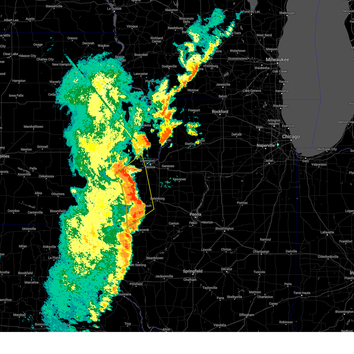 At 649 pm cdt, severe thunderstorms were located along a line extending from near sweetland center to near joy to near roseville, moving northeast at 45 mph (radar indicated). Hazards include 70 mph wind gusts and penny size hail. Expect considerable tree damage. damage is likely to mobile homes, roofs, and outbuildings. locations impacted include, davenport, rock island, muscatine, monmouth, aledo, oquawka, burgess, walcott, blue grass, buffalo, la harpe, andalusia, roseville, fruitland, viola, stronghurst, millersburg, matherville, kirkwood, and new boston. this includes the following highways, interstate 80 in iowa between mile markers 285 and 290. Interstate 280 between mile markers 1 and 11. At 649 pm cdt, severe thunderstorms were located along a line extending from near sweetland center to near joy to near roseville, moving northeast at 45 mph (radar indicated). Hazards include 70 mph wind gusts and penny size hail. Expect considerable tree damage. damage is likely to mobile homes, roofs, and outbuildings. locations impacted include, davenport, rock island, muscatine, monmouth, aledo, oquawka, burgess, walcott, blue grass, buffalo, la harpe, andalusia, roseville, fruitland, viola, stronghurst, millersburg, matherville, kirkwood, and new boston. this includes the following highways, interstate 80 in iowa between mile markers 285 and 290. Interstate 280 between mile markers 1 and 11.
|
| 6/3/2025 6:46 PM CDT |
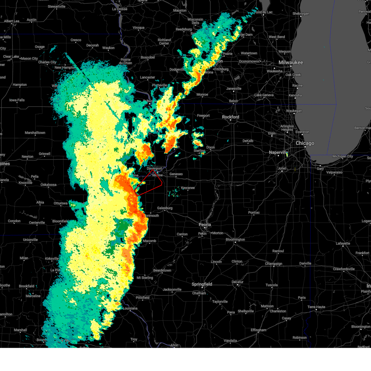 Tordvn the national weather service in the quad cities has issued a * tornado warning for, south central rock island county in northwestern illinois, northern mercer county in northwestern illinois, south central scott county in east central iowa, * until 715 pm cdt. * at 646 pm cdt, a severe thunderstorm capable of producing a tornado was located over millersburg, or near aledo, moving northeast at 55 mph (radar indicated rotation). Hazards include tornado. Flying debris will be dangerous to those caught without shelter. mobile homes will be damaged or destroyed. damage to roofs, windows, and vehicles will occur. tree damage is likely. this dangerous storm will be near, reynolds, hamlet, taylor ridge, edgington, marston, gingle corners, and aledo mercer county airport around 650 pm cdt. rock island, andalusia, matherville, oak grove, preemption, and coyne center around 655 pm cdt. davenport, milan, buffalo, sherrard, blackhawk state park, and indian bluff golf course around 700 pm cdt. credit island around 705 pm cdt. This includes interstate 280 between mile markers 8 and 16. Tordvn the national weather service in the quad cities has issued a * tornado warning for, south central rock island county in northwestern illinois, northern mercer county in northwestern illinois, south central scott county in east central iowa, * until 715 pm cdt. * at 646 pm cdt, a severe thunderstorm capable of producing a tornado was located over millersburg, or near aledo, moving northeast at 55 mph (radar indicated rotation). Hazards include tornado. Flying debris will be dangerous to those caught without shelter. mobile homes will be damaged or destroyed. damage to roofs, windows, and vehicles will occur. tree damage is likely. this dangerous storm will be near, reynolds, hamlet, taylor ridge, edgington, marston, gingle corners, and aledo mercer county airport around 650 pm cdt. rock island, andalusia, matherville, oak grove, preemption, and coyne center around 655 pm cdt. davenport, milan, buffalo, sherrard, blackhawk state park, and indian bluff golf course around 700 pm cdt. credit island around 705 pm cdt. This includes interstate 280 between mile markers 8 and 16.
|
| 6/3/2025 6:31 PM CDT |
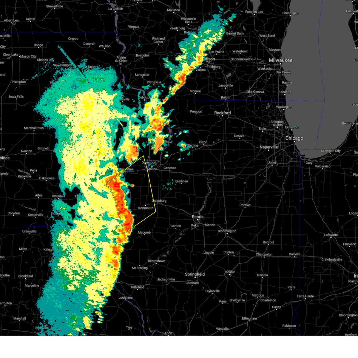 At 631 pm cdt, severe thunderstorms were located along a line extending from sand springs to northfield to blandinsville, moving northeast at 50 mph (radar indicated). Hazards include 70 mph wind gusts and penny size hail. Expect considerable tree damage. damage is likely to mobile homes, roofs, and outbuildings. locations impacted include, davenport, rock island, burlington, muscatine, monmouth, aledo, wapello, columbus junction, oquawka, west burlington, burgess, walcott, mediapolis, blue grass, buffalo, la harpe, andalusia, roseville, fruitland, and viola. this includes the following highways, interstate 80 in iowa between mile markers 285 and 290. Interstate 280 between mile markers 1 and 11. At 631 pm cdt, severe thunderstorms were located along a line extending from sand springs to northfield to blandinsville, moving northeast at 50 mph (radar indicated). Hazards include 70 mph wind gusts and penny size hail. Expect considerable tree damage. damage is likely to mobile homes, roofs, and outbuildings. locations impacted include, davenport, rock island, burlington, muscatine, monmouth, aledo, wapello, columbus junction, oquawka, west burlington, burgess, walcott, mediapolis, blue grass, buffalo, la harpe, andalusia, roseville, fruitland, and viola. this includes the following highways, interstate 80 in iowa between mile markers 285 and 290. Interstate 280 between mile markers 1 and 11.
|
| 6/3/2025 6:23 PM CDT |
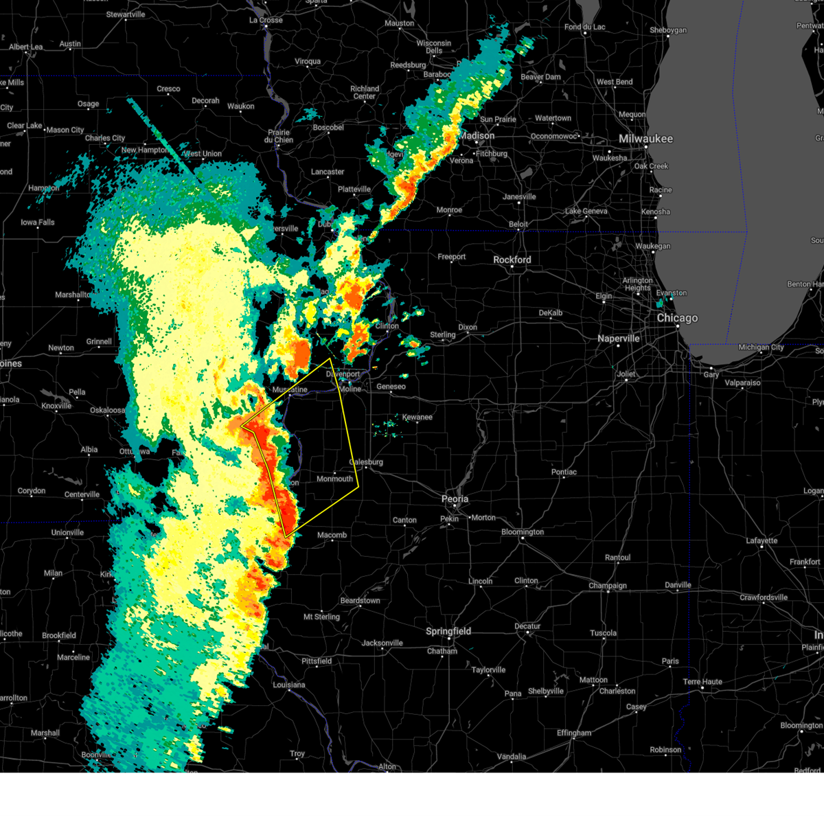 Svrdvn the national weather service in the quad cities has issued a * severe thunderstorm warning for, northeastern hancock county in west central illinois, henderson county in west central illinois, warren county in west central illinois, southwestern rock island county in northwestern illinois, northwestern mcdonough county in west central illinois, mercer county in northwestern illinois, des moines county in southeastern iowa, louisa county in southeastern iowa, southwestern scott county in east central iowa, eastern muscatine county in east central iowa, east central lee county in southeastern iowa, * until 730 pm cdt. * at 623 pm cdt, severe thunderstorms were located along a line extending from near fredonia to sperry to near fountain green, moving northeast at 45 mph (radar indicated). Hazards include 60 mph wind gusts and penny size hail. expect damage to roofs, siding, and trees Svrdvn the national weather service in the quad cities has issued a * severe thunderstorm warning for, northeastern hancock county in west central illinois, henderson county in west central illinois, warren county in west central illinois, southwestern rock island county in northwestern illinois, northwestern mcdonough county in west central illinois, mercer county in northwestern illinois, des moines county in southeastern iowa, louisa county in southeastern iowa, southwestern scott county in east central iowa, eastern muscatine county in east central iowa, east central lee county in southeastern iowa, * until 730 pm cdt. * at 623 pm cdt, severe thunderstorms were located along a line extending from near fredonia to sperry to near fountain green, moving northeast at 45 mph (radar indicated). Hazards include 60 mph wind gusts and penny size hail. expect damage to roofs, siding, and trees
|
| 5/20/2025 2:39 PM CDT |
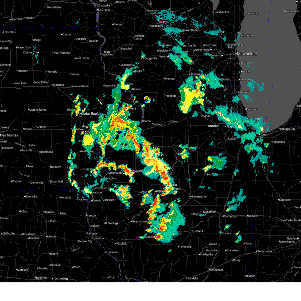 The storm which prompted the warning has weakened below severe limits, and has exited the warned area. therefore, the warning will be allowed to expire. The storm which prompted the warning has weakened below severe limits, and has exited the warned area. therefore, the warning will be allowed to expire.
|
| 5/20/2025 2:32 PM CDT |
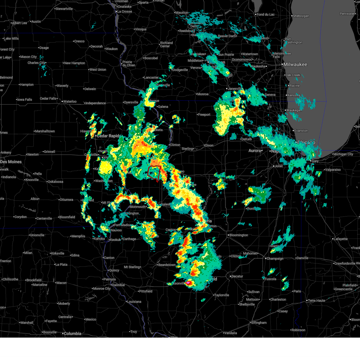 the tornado warning has been cancelled and is no longer in effect the tornado warning has been cancelled and is no longer in effect
|
| 5/20/2025 2:17 PM CDT |
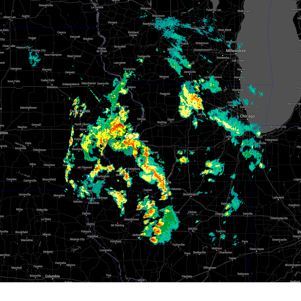 At 216 pm cdt, a severe thunderstorm was located over maysville, or 9 miles northwest of davenport, moving northeast at 30 mph (radar indicated). Hazards include 60 mph wind gusts and penny size hail. Expect damage to roofs, siding, and trees. locations impacted include, davenport, moline, rock island, bettendorf, east moline, durant, eldridge, milan, le claire, hampton, walcott, blue grass, buffalo, rapids city, riverdale, donahue, dixon, stockton, maysville, and new liberty. this includes the following highways, interstate 74 in iowa between mile markers 1 and 5. interstate 80 in iowa between mile markers 276 and 306. interstate 74 in illinois between mile markers 1 and 3. Interstate 280 between mile markers 1 and 16. At 216 pm cdt, a severe thunderstorm was located over maysville, or 9 miles northwest of davenport, moving northeast at 30 mph (radar indicated). Hazards include 60 mph wind gusts and penny size hail. Expect damage to roofs, siding, and trees. locations impacted include, davenport, moline, rock island, bettendorf, east moline, durant, eldridge, milan, le claire, hampton, walcott, blue grass, buffalo, rapids city, riverdale, donahue, dixon, stockton, maysville, and new liberty. this includes the following highways, interstate 74 in iowa between mile markers 1 and 5. interstate 80 in iowa between mile markers 276 and 306. interstate 74 in illinois between mile markers 1 and 3. Interstate 280 between mile markers 1 and 16.
|
| 5/20/2025 2:13 PM CDT |
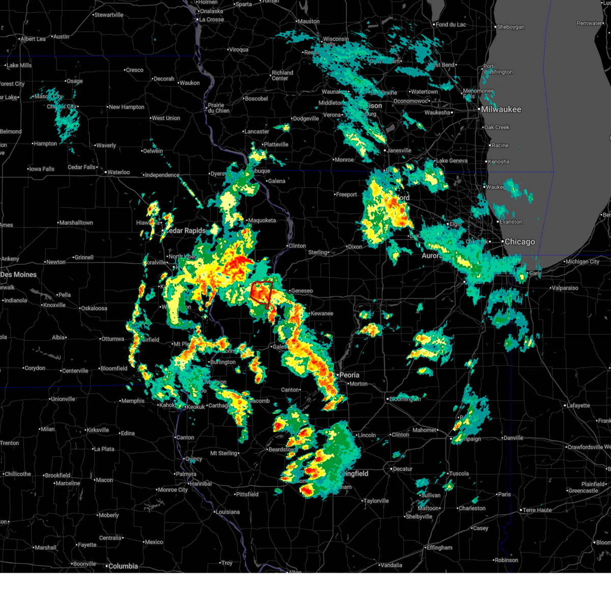 At 212 pm cdt, a severe thunderstorm capable of producing a tornado was located over sherrard, or 8 miles south of rock island, moving north at 20 mph (radar indicated rotation). Hazards include tornado. Flying debris will be dangerous to those caught without shelter. mobile homes will be damaged or destroyed. damage to roofs, windows, and vehicles will occur. tree damage is likely. this dangerous storm will be near, moline, rock island, east moline, silvis, milan, coal valley, oak grove, carbon cliff, sunny hill, and moline quad-city airport around 220 pm cdt. other locations in the path of this tornadic thunderstorm include bettendorf, riverdale and silvis heights. this includes the following highways, interstate 74 in illinois between mile markers 1 and 11. Interstate 280 between mile markers 12 and 18. At 212 pm cdt, a severe thunderstorm capable of producing a tornado was located over sherrard, or 8 miles south of rock island, moving north at 20 mph (radar indicated rotation). Hazards include tornado. Flying debris will be dangerous to those caught without shelter. mobile homes will be damaged or destroyed. damage to roofs, windows, and vehicles will occur. tree damage is likely. this dangerous storm will be near, moline, rock island, east moline, silvis, milan, coal valley, oak grove, carbon cliff, sunny hill, and moline quad-city airport around 220 pm cdt. other locations in the path of this tornadic thunderstorm include bettendorf, riverdale and silvis heights. this includes the following highways, interstate 74 in illinois between mile markers 1 and 11. Interstate 280 between mile markers 12 and 18.
|
| 5/20/2025 2:13 PM CDT |
 the tornado warning has been cancelled and is no longer in effect the tornado warning has been cancelled and is no longer in effect
|
| 5/20/2025 2:06 PM CDT |
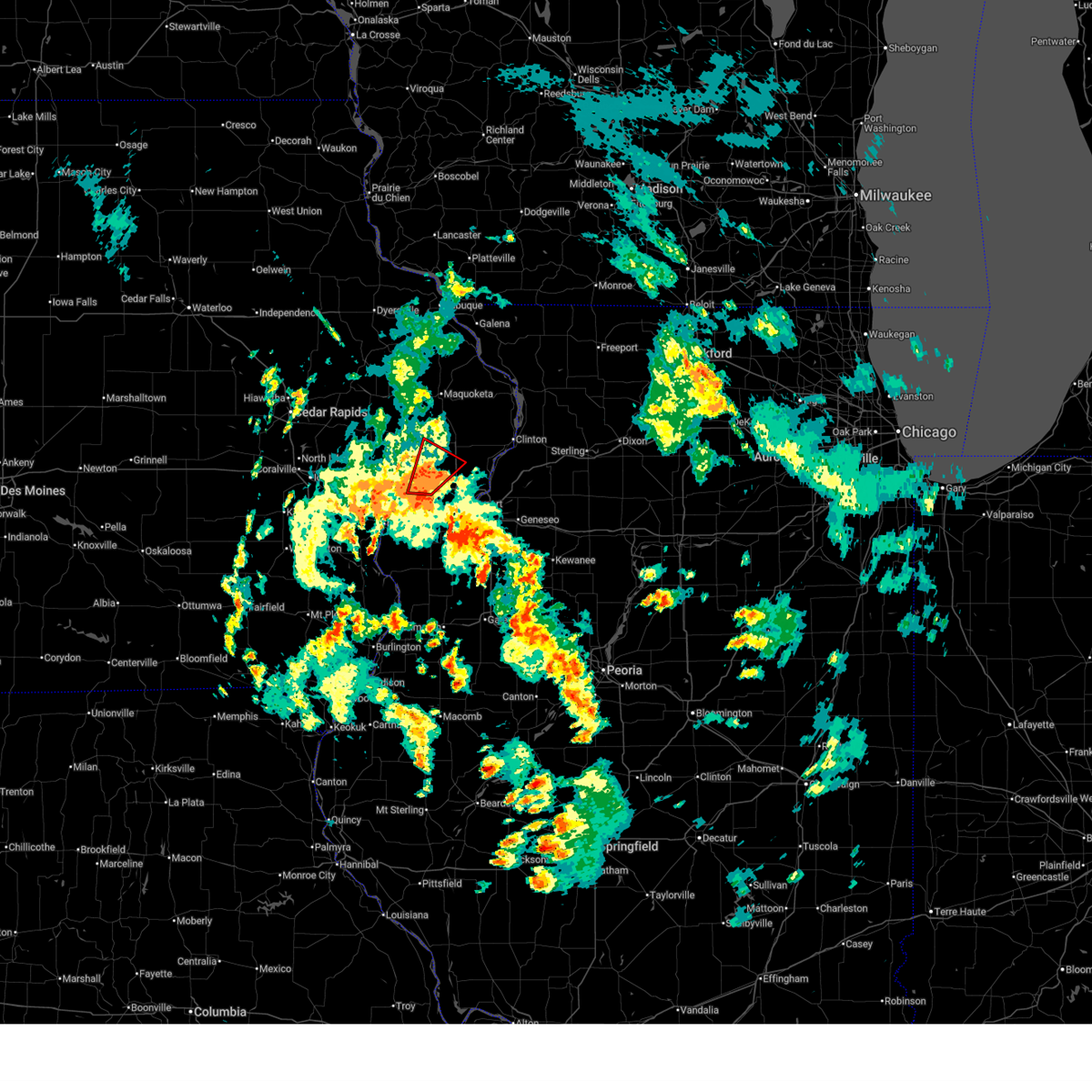 At 206 pm cdt, a severe thunderstorm capable of producing a tornado was located over walcott, or near durant, moving northeast at 30 mph (radar indicated rotation). Hazards include tornado. Flying debris will be dangerous to those caught without shelter. mobile homes will be damaged or destroyed. damage to roofs, windows, and vehicles will occur. tree damage is likely. this dangerous storm will be near, walcott, donahue, maysville, and plainview around 210 pm cdt. long grove, dixon, and camp liberty around 215 pm cdt. other locations in the path of this tornadic thunderstorm include scott county park, park view and sherman park. This includes interstate 80 in iowa between mile markers 280 and 289. At 206 pm cdt, a severe thunderstorm capable of producing a tornado was located over walcott, or near durant, moving northeast at 30 mph (radar indicated rotation). Hazards include tornado. Flying debris will be dangerous to those caught without shelter. mobile homes will be damaged or destroyed. damage to roofs, windows, and vehicles will occur. tree damage is likely. this dangerous storm will be near, walcott, donahue, maysville, and plainview around 210 pm cdt. long grove, dixon, and camp liberty around 215 pm cdt. other locations in the path of this tornadic thunderstorm include scott county park, park view and sherman park. This includes interstate 80 in iowa between mile markers 280 and 289.
|
| 5/20/2025 2:05 PM CDT |
 the severe thunderstorm warning has been cancelled and is no longer in effect the severe thunderstorm warning has been cancelled and is no longer in effect
|
| 5/20/2025 2:05 PM CDT |
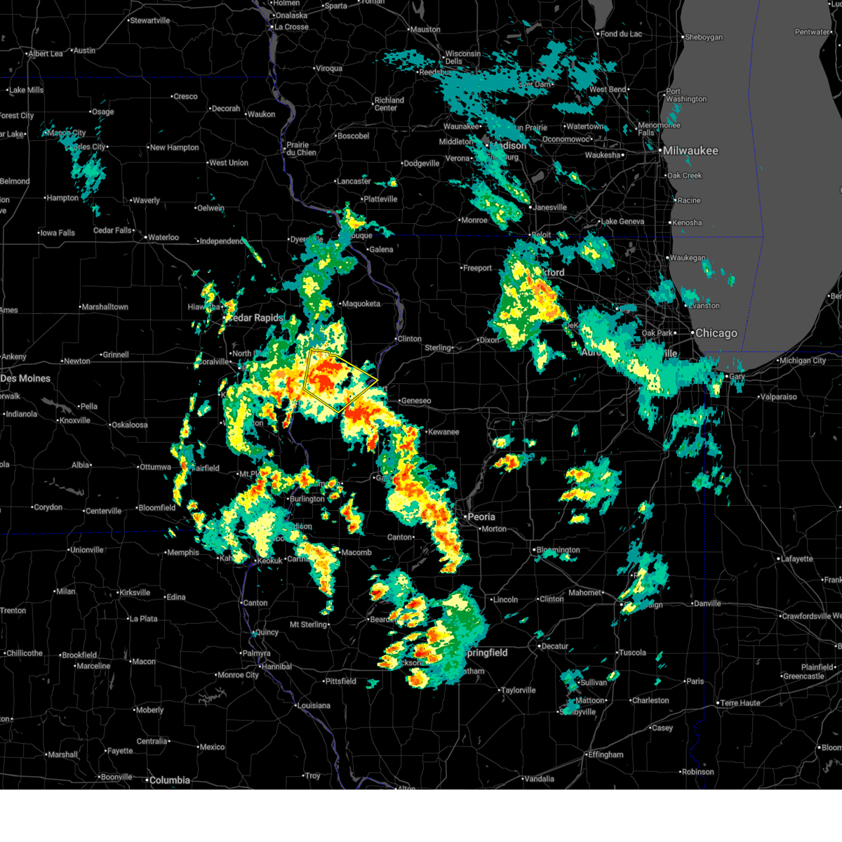 At 205 pm cdt, a severe thunderstorm was located over walcott, or 7 miles east of durant, moving northeast at 30 mph (radar indicated). Hazards include 60 mph wind gusts and penny size hail. Expect damage to roofs, siding, and trees. locations impacted include, davenport, moline, rock island, bettendorf, east moline, durant, eldridge, milan, le claire, hampton, walcott, blue grass, buffalo, andalusia, rapids city, riverdale, donahue, taylor ridge, montpelier, and dixon. this includes the following highways, interstate 74 in iowa between mile markers 1 and 5. interstate 80 in iowa between mile markers 276 and 306. interstate 74 in illinois between mile markers 1 and 2. Interstate 280 between mile markers 1 and 15. At 205 pm cdt, a severe thunderstorm was located over walcott, or 7 miles east of durant, moving northeast at 30 mph (radar indicated). Hazards include 60 mph wind gusts and penny size hail. Expect damage to roofs, siding, and trees. locations impacted include, davenport, moline, rock island, bettendorf, east moline, durant, eldridge, milan, le claire, hampton, walcott, blue grass, buffalo, andalusia, rapids city, riverdale, donahue, taylor ridge, montpelier, and dixon. this includes the following highways, interstate 74 in iowa between mile markers 1 and 5. interstate 80 in iowa between mile markers 276 and 306. interstate 74 in illinois between mile markers 1 and 2. Interstate 280 between mile markers 1 and 15.
|
| 5/20/2025 2:03 PM CDT |
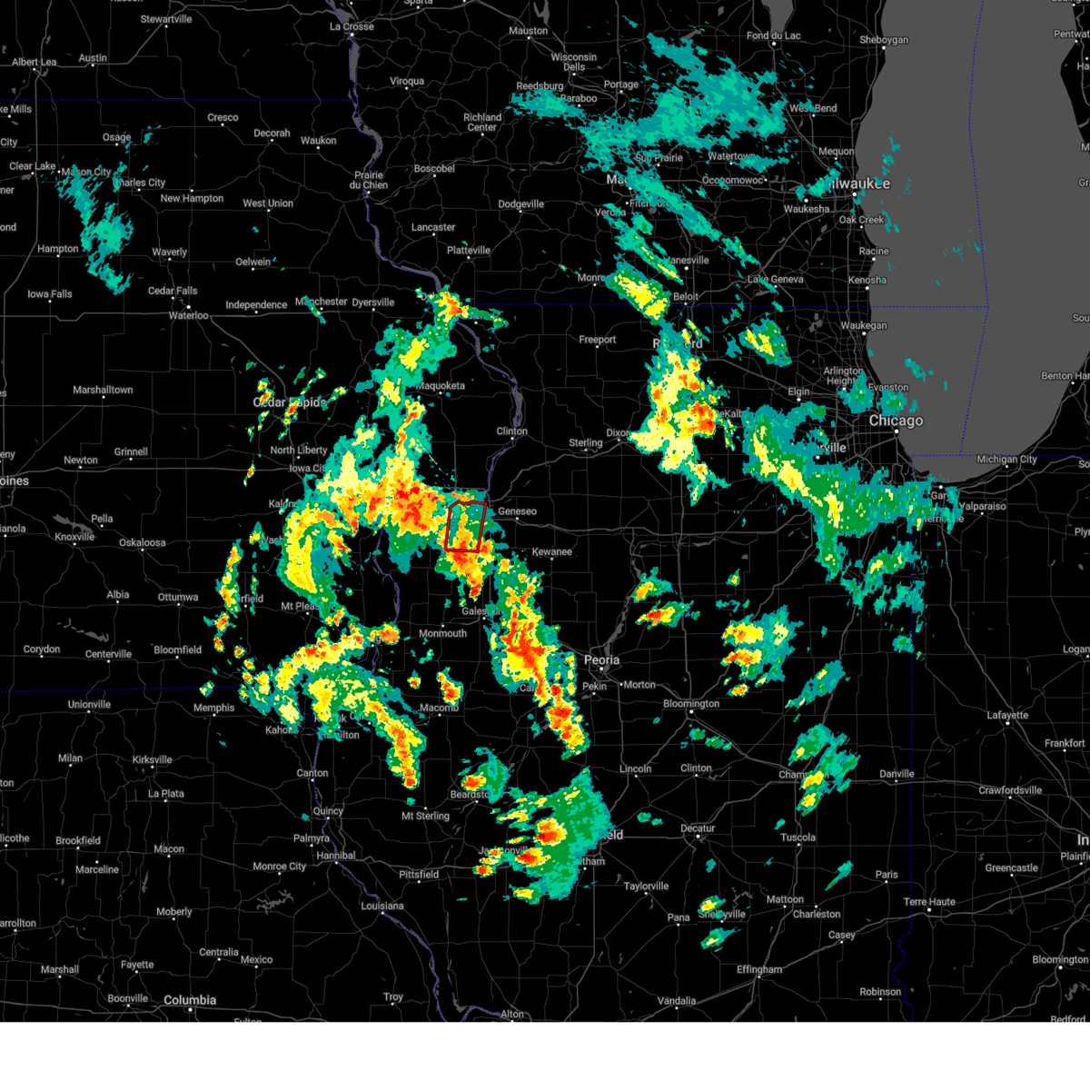 Tordvn the national weather service in the quad cities has issued a * tornado warning for, southeastern rock island county in northwestern illinois, northeastern mercer county in northwestern illinois, west central henry county in northwestern illinois, * until 245 pm cdt. * at 203 pm cdt, a severe thunderstorm capable of producing a tornado was located over sherrard, or 11 miles south of rock island, moving north at 20 mph (radar indicated rotation). Hazards include tornado. Flying debris will be dangerous to those caught without shelter. mobile homes will be damaged or destroyed. damage to roofs, windows, and vehicles will occur. tree damage is likely. this dangerous storm will be near, moline, rock island, milan, coal valley, oak grove, sunny hill, moline quad-city airport, sunny hill estates, fruitland, and coyne center around 210 pm cdt. east moline around 215 pm cdt. silvis, carbon cliff, silvis heights, rock island arsenal, and rock island county fairgrounds around 220 pm cdt. this includes the following highways, interstate 74 in illinois between mile markers 1 and 11. Interstate 280 between mile markers 13 and 18. Tordvn the national weather service in the quad cities has issued a * tornado warning for, southeastern rock island county in northwestern illinois, northeastern mercer county in northwestern illinois, west central henry county in northwestern illinois, * until 245 pm cdt. * at 203 pm cdt, a severe thunderstorm capable of producing a tornado was located over sherrard, or 11 miles south of rock island, moving north at 20 mph (radar indicated rotation). Hazards include tornado. Flying debris will be dangerous to those caught without shelter. mobile homes will be damaged or destroyed. damage to roofs, windows, and vehicles will occur. tree damage is likely. this dangerous storm will be near, moline, rock island, milan, coal valley, oak grove, sunny hill, moline quad-city airport, sunny hill estates, fruitland, and coyne center around 210 pm cdt. east moline around 215 pm cdt. silvis, carbon cliff, silvis heights, rock island arsenal, and rock island county fairgrounds around 220 pm cdt. this includes the following highways, interstate 74 in illinois between mile markers 1 and 11. Interstate 280 between mile markers 13 and 18.
|
| 5/20/2025 2:00 PM CDT |
 Tordvn the national weather service in the quad cities has issued a * tornado warning for, northwestern scott county in east central iowa, northeastern muscatine county in east central iowa, southwestern clinton county in east central iowa, * until 245 pm cdt. * at 159 pm cdt, a severe thunderstorm capable of producing a tornado was located near stockton, or near durant, moving northeast at 30 mph (radar indicated rotation). Hazards include tornado. Flying debris will be dangerous to those caught without shelter. mobile homes will be damaged or destroyed. damage to roofs, windows, and vehicles will occur. tree damage is likely. this dangerous storm will be near, walcott, donahue, maysville, and plainview around 205 pm cdt. dixon around 210 pm cdt. long grove and camp liberty around 215 pm cdt. other locations in the path of this tornadic thunderstorm include park view, scott county park and sherman park. This includes interstate 80 in iowa between mile markers 280 and 289. Tordvn the national weather service in the quad cities has issued a * tornado warning for, northwestern scott county in east central iowa, northeastern muscatine county in east central iowa, southwestern clinton county in east central iowa, * until 245 pm cdt. * at 159 pm cdt, a severe thunderstorm capable of producing a tornado was located near stockton, or near durant, moving northeast at 30 mph (radar indicated rotation). Hazards include tornado. Flying debris will be dangerous to those caught without shelter. mobile homes will be damaged or destroyed. damage to roofs, windows, and vehicles will occur. tree damage is likely. this dangerous storm will be near, walcott, donahue, maysville, and plainview around 205 pm cdt. dixon around 210 pm cdt. long grove and camp liberty around 215 pm cdt. other locations in the path of this tornadic thunderstorm include park view, scott county park and sherman park. This includes interstate 80 in iowa between mile markers 280 and 289.
|
| 5/20/2025 1:49 PM CDT |
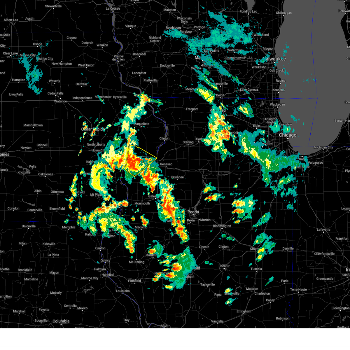 At 149 pm cdt, a severe thunderstorm was located over midway beach, or 8 miles southeast of durant, moving northeast at 30 mph (radar indicated). Hazards include 60 mph wind gusts and penny size hail. Expect damage to roofs, siding, and trees. locations impacted include, davenport, moline, rock island, bettendorf, east moline, durant, eldridge, milan, le claire, hampton, walcott, blue grass, buffalo, andalusia, rapids city, riverdale, donahue, taylor ridge, fairport, and montpelier. this includes the following highways, interstate 74 in iowa between mile markers 1 and 5. interstate 80 in iowa between mile markers 276 and 306. interstate 74 in illinois between mile markers 1 and 2. Interstate 280 between mile markers 1 and 15. At 149 pm cdt, a severe thunderstorm was located over midway beach, or 8 miles southeast of durant, moving northeast at 30 mph (radar indicated). Hazards include 60 mph wind gusts and penny size hail. Expect damage to roofs, siding, and trees. locations impacted include, davenport, moline, rock island, bettendorf, east moline, durant, eldridge, milan, le claire, hampton, walcott, blue grass, buffalo, andalusia, rapids city, riverdale, donahue, taylor ridge, fairport, and montpelier. this includes the following highways, interstate 74 in iowa between mile markers 1 and 5. interstate 80 in iowa between mile markers 276 and 306. interstate 74 in illinois between mile markers 1 and 2. Interstate 280 between mile markers 1 and 15.
|
| 5/20/2025 1:39 PM CDT |
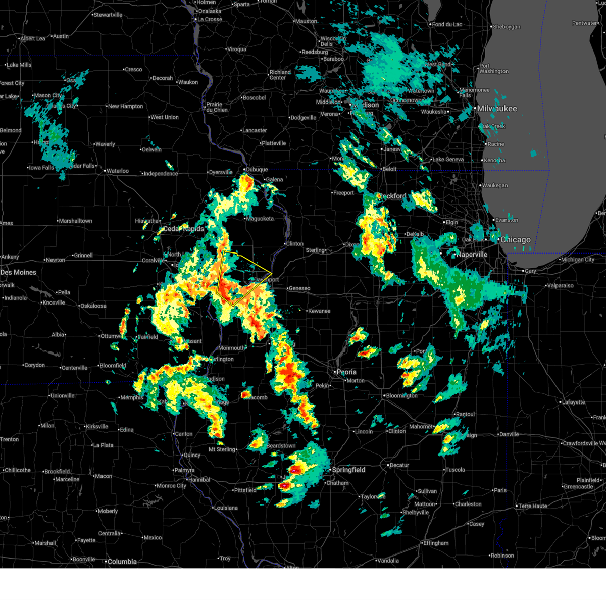 Svrdvn the national weather service in the quad cities has issued a * severe thunderstorm warning for, southern rock island county in northwestern illinois, north central mercer county in northwestern illinois, southeastern cedar county in east central iowa, scott county in east central iowa, northeastern muscatine county in east central iowa, * until 245 pm cdt. * at 139 pm cdt, a severe thunderstorm was located over fairport, or 9 miles east of muscatine, moving northeast at 30 mph (radar indicated). Hazards include 60 mph wind gusts and penny size hail. expect damage to roofs, siding, and trees Svrdvn the national weather service in the quad cities has issued a * severe thunderstorm warning for, southern rock island county in northwestern illinois, north central mercer county in northwestern illinois, southeastern cedar county in east central iowa, scott county in east central iowa, northeastern muscatine county in east central iowa, * until 245 pm cdt. * at 139 pm cdt, a severe thunderstorm was located over fairport, or 9 miles east of muscatine, moving northeast at 30 mph (radar indicated). Hazards include 60 mph wind gusts and penny size hail. expect damage to roofs, siding, and trees
|
| 4/20/2025 9:03 PM CDT |
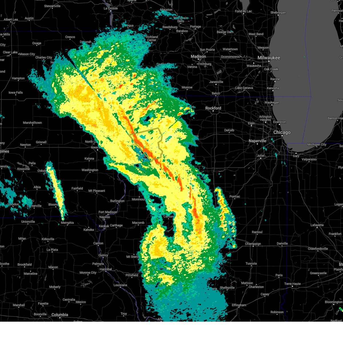 the severe thunderstorm warning has been cancelled and is no longer in effect the severe thunderstorm warning has been cancelled and is no longer in effect
|
| 4/20/2025 9:03 PM CDT |
 At 902 pm cdt, severe thunderstorms were located along a line extending from near springbrook to near hillsdale, moving east at 45 mph (radar indicated). Hazards include 60 mph wind gusts. Expect damage to roofs, siding, and trees. locations impacted include, malone, silvis heights, rapids city, folletts, campbells island, elvira, dewitt, andover, port byron, panorama park, riverdale, mccausland, calamus, bryant, eldridge, east moline, rock creek marina and campground, barstow, welton, and hillsdale. this includes the following highways, interstate 74 in iowa near mile marker 1. interstate 80 in iowa between mile markers 298 and 306. interstate 80 in illinois between mile markers 1 and 5. Interstate 88 between mile markers 1 and 13. At 902 pm cdt, severe thunderstorms were located along a line extending from near springbrook to near hillsdale, moving east at 45 mph (radar indicated). Hazards include 60 mph wind gusts. Expect damage to roofs, siding, and trees. locations impacted include, malone, silvis heights, rapids city, folletts, campbells island, elvira, dewitt, andover, port byron, panorama park, riverdale, mccausland, calamus, bryant, eldridge, east moline, rock creek marina and campground, barstow, welton, and hillsdale. this includes the following highways, interstate 74 in iowa near mile marker 1. interstate 80 in iowa between mile markers 298 and 306. interstate 80 in illinois between mile markers 1 and 5. Interstate 88 between mile markers 1 and 13.
|
| 4/20/2025 8:44 PM CDT |
 the severe thunderstorm warning has been cancelled and is no longer in effect the severe thunderstorm warning has been cancelled and is no longer in effect
|
| 4/20/2025 8:44 PM CDT |
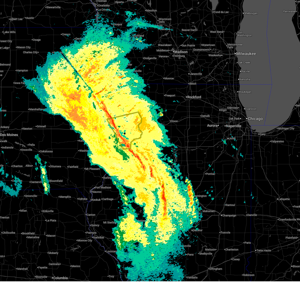 At 843 pm cdt, severe thunderstorms were located along a line extending from elwood to carbon cliff, moving northeast at 45 mph (radar indicated). Hazards include 60 mph wind gusts. Expect damage to roofs, siding, and trees. locations impacted include, silvis heights, moline, charlotte, rapids city, west lake park, campbells island, elvira, new liberty, port byron, panorama park, davenport municipal airport, riverdale, wheatland, buffalo, calamus, bryant, eldridge, blackhawk state park, east moline, and rock creek marina and campground. this includes the following highways, interstate 74 in iowa between mile markers 1 and 5. interstate 80 in iowa between mile markers 282 and 306. interstate 80 in illinois between mile markers 1 and 5. interstate 74 in illinois between mile markers 1 and 7. interstate 88 between mile markers 1 and 13. Interstate 280 between mile markers 1 and 18. At 843 pm cdt, severe thunderstorms were located along a line extending from elwood to carbon cliff, moving northeast at 45 mph (radar indicated). Hazards include 60 mph wind gusts. Expect damage to roofs, siding, and trees. locations impacted include, silvis heights, moline, charlotte, rapids city, west lake park, campbells island, elvira, new liberty, port byron, panorama park, davenport municipal airport, riverdale, wheatland, buffalo, calamus, bryant, eldridge, blackhawk state park, east moline, and rock creek marina and campground. this includes the following highways, interstate 74 in iowa between mile markers 1 and 5. interstate 80 in iowa between mile markers 282 and 306. interstate 80 in illinois between mile markers 1 and 5. interstate 74 in illinois between mile markers 1 and 7. interstate 88 between mile markers 1 and 13. Interstate 280 between mile markers 1 and 18.
|
| 4/20/2025 8:32 PM CDT |
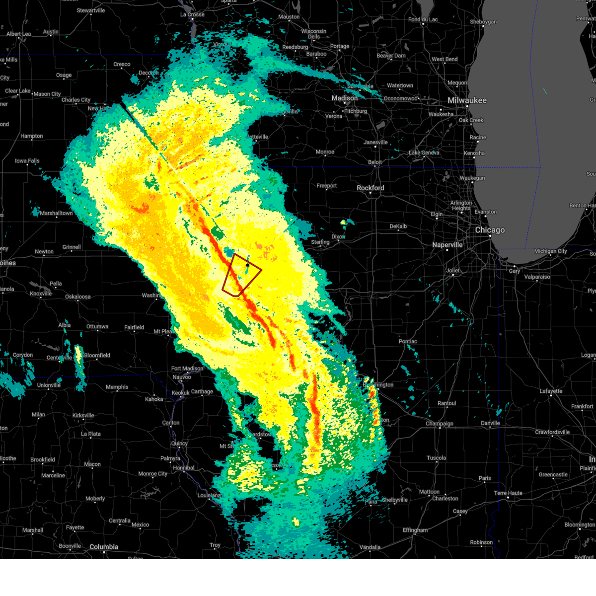 the tornado warning has been cancelled and is no longer in effect the tornado warning has been cancelled and is no longer in effect
|
| 4/20/2025 8:30 PM CDT |
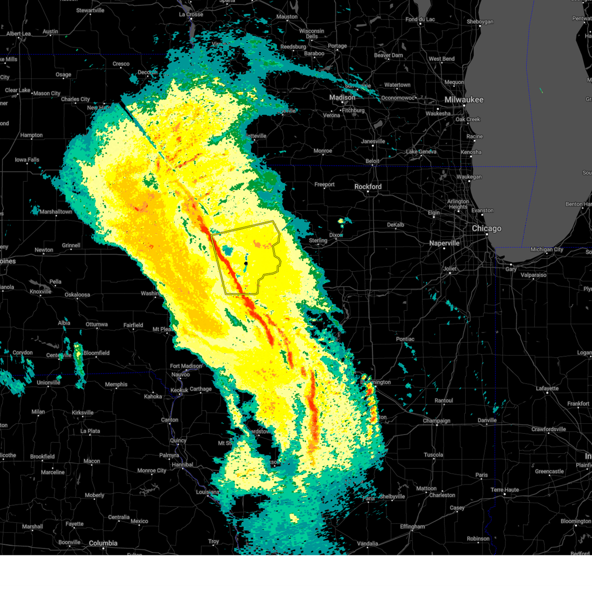 At 830 pm cdt, severe thunderstorms were located along a line extending from near walnut grove park to indian bluff golf course, moving east at 45 mph (radar indicated). Hazards include 60 mph wind gusts. Expect damage to roofs, siding, and trees. locations impacted include, silvis heights, moline, charlotte, clark's ferry recreation area, rapids city, west lake park, campbells island, bennett park, elvira, sunbury, new liberty, taylor ridge, port byron, panorama park, davenport municipal airport, riverdale, loud thunder scout camp, wheatland, buffalo, and calamus. this includes the following highways, interstate 74 in iowa between mile markers 1 and 5. interstate 80 in iowa between mile markers 277 and 306. interstate 80 in illinois between mile markers 1 and 5. interstate 74 in illinois between mile markers 1 and 7. interstate 88 between mile markers 1 and 13. Interstate 280 between mile markers 1 and 18. At 830 pm cdt, severe thunderstorms were located along a line extending from near walnut grove park to indian bluff golf course, moving east at 45 mph (radar indicated). Hazards include 60 mph wind gusts. Expect damage to roofs, siding, and trees. locations impacted include, silvis heights, moline, charlotte, clark's ferry recreation area, rapids city, west lake park, campbells island, bennett park, elvira, sunbury, new liberty, taylor ridge, port byron, panorama park, davenport municipal airport, riverdale, loud thunder scout camp, wheatland, buffalo, and calamus. this includes the following highways, interstate 74 in iowa between mile markers 1 and 5. interstate 80 in iowa between mile markers 277 and 306. interstate 80 in illinois between mile markers 1 and 5. interstate 74 in illinois between mile markers 1 and 7. interstate 88 between mile markers 1 and 13. Interstate 280 between mile markers 1 and 18.
|
| 4/20/2025 8:15 PM CDT |
 the tornado warning has been cancelled and is no longer in effect the tornado warning has been cancelled and is no longer in effect
|
| 4/20/2025 8:15 PM CDT |
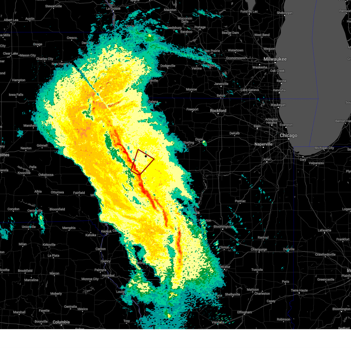 At 814 pm cdt, a severe squall line capable of producing both tornadoes and extensive straight line wind damage was located over andalusia, or 9 miles west of rock island, moving northeast at 40 mph (radar indicated rotation). Hazards include tornado. Flying debris will be dangerous to those caught without shelter. mobile homes will be damaged or destroyed. damage to roofs, windows, and vehicles will occur. tree damage is likely. these dangerous storms will be near, west lake park, milan, rock island arsenal, credit island, andalusia, blackhawk state park, rock island, buffalo shores, mississippi valley fairgrounds, and blue grass around 820 pm cdt. other locations in the path of this tornadic thunderstorm include eldridge, moline, davenport municipal airport, bettendorf, donahue and maysville. this includes the following highways, interstate 74 in iowa between mile markers 1 and 5. interstate 80 in iowa between mile markers 285 and 300. interstate 74 in illinois between mile markers 1 and 2. Interstate 280 between mile markers 1 and 14. At 814 pm cdt, a severe squall line capable of producing both tornadoes and extensive straight line wind damage was located over andalusia, or 9 miles west of rock island, moving northeast at 40 mph (radar indicated rotation). Hazards include tornado. Flying debris will be dangerous to those caught without shelter. mobile homes will be damaged or destroyed. damage to roofs, windows, and vehicles will occur. tree damage is likely. these dangerous storms will be near, west lake park, milan, rock island arsenal, credit island, andalusia, blackhawk state park, rock island, buffalo shores, mississippi valley fairgrounds, and blue grass around 820 pm cdt. other locations in the path of this tornadic thunderstorm include eldridge, moline, davenport municipal airport, bettendorf, donahue and maysville. this includes the following highways, interstate 74 in iowa between mile markers 1 and 5. interstate 80 in iowa between mile markers 285 and 300. interstate 74 in illinois between mile markers 1 and 2. Interstate 280 between mile markers 1 and 14.
|
| 4/20/2025 8:08 PM CDT |
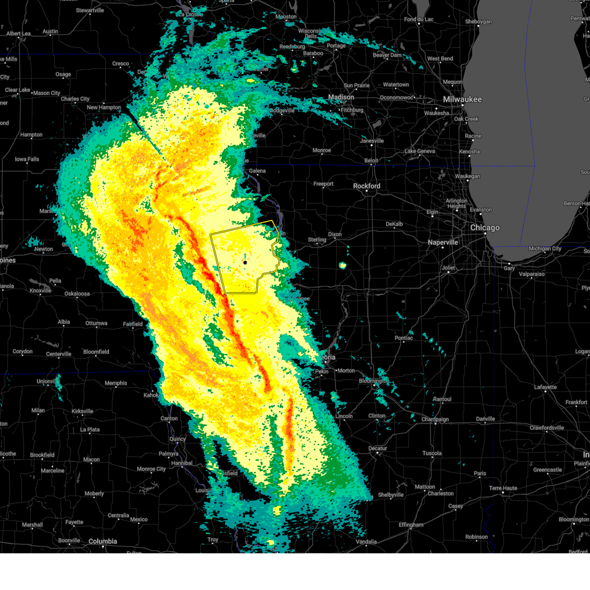 Svrdvn the national weather service in the quad cities has issued a * severe thunderstorm warning for, rock island county in northwestern illinois, eastern cedar county in east central iowa, scott county in east central iowa, northeastern muscatine county in east central iowa, clinton county in east central iowa, * until 915 pm cdt. * at 808 pm cdt, severe thunderstorms were located along a line extending from near tipton to marston, moving northeast at 45 mph (radar indicated). Hazards include 60 mph wind gusts. expect damage to roofs, siding, and trees Svrdvn the national weather service in the quad cities has issued a * severe thunderstorm warning for, rock island county in northwestern illinois, eastern cedar county in east central iowa, scott county in east central iowa, northeastern muscatine county in east central iowa, clinton county in east central iowa, * until 915 pm cdt. * at 808 pm cdt, severe thunderstorms were located along a line extending from near tipton to marston, moving northeast at 45 mph (radar indicated). Hazards include 60 mph wind gusts. expect damage to roofs, siding, and trees
|
| 4/20/2025 8:00 PM CDT |
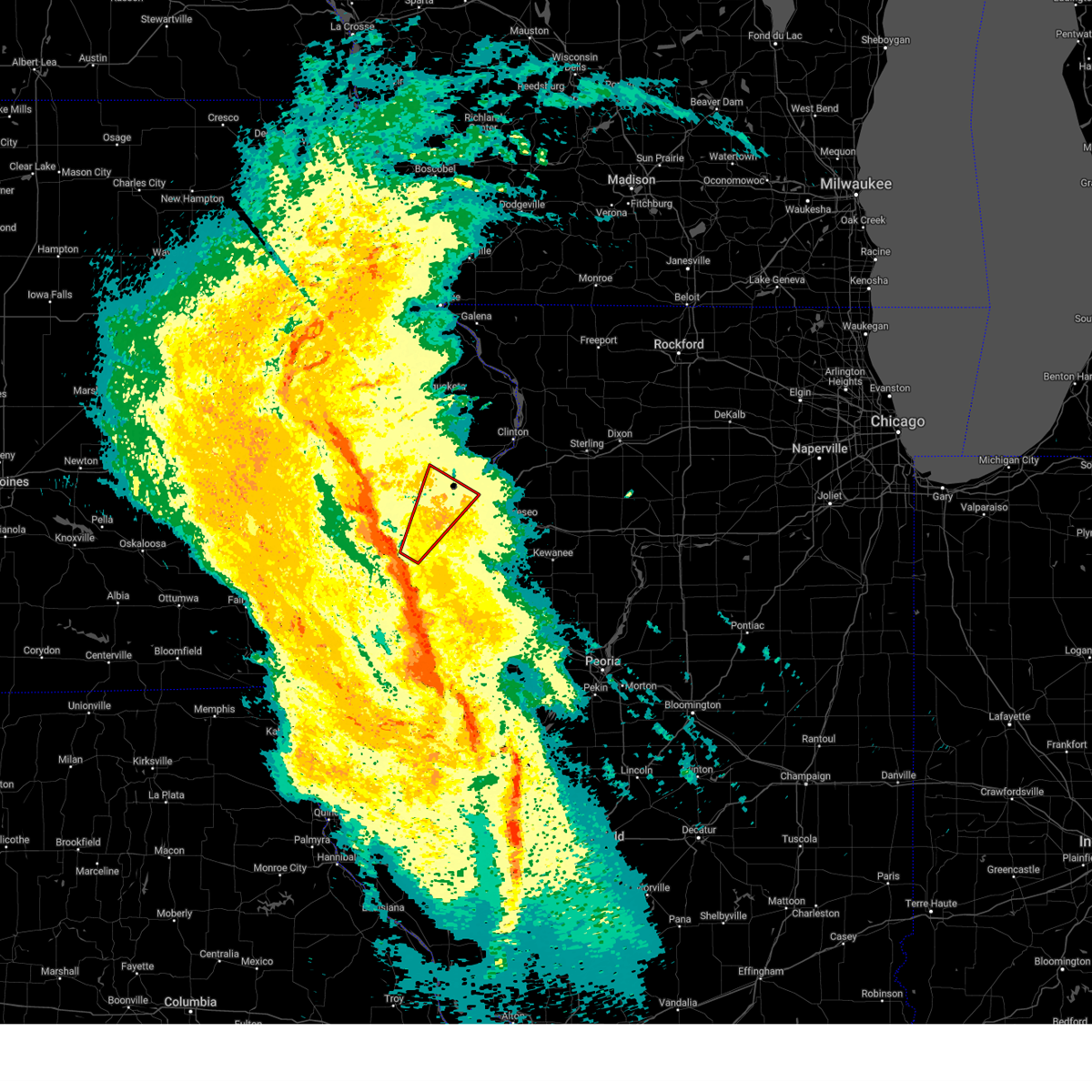 Tordvn the national weather service in the quad cities has issued a * tornado warning for, southwestern rock island county in northwestern illinois, north central mercer county in northwestern illinois, southwestern scott county in east central iowa, east central muscatine county in east central iowa, * until 845 pm cdt. * at 800 pm cdt, a severe thunderstorm capable of producing a tornado was located over marston, or 8 miles northwest of aledo, moving northeast at 40 mph (radar indicated rotation). Hazards include tornado. Flying debris will be dangerous to those caught without shelter. mobile homes will be damaged or destroyed. damage to roofs, windows, and vehicles will occur. tree damage is likely. this dangerous storm will be near, loud thunder forest preserve, marston, taylor ridge, edgington, montpelier, andalusia, hamlet, midway beach, clark's ferry recreation area, and loud thunder scout camp around 805 pm cdt. rock island, blue grass, and davenport around 810 pm cdt. west lake park, milan, and credit island around 815 pm cdt. rock island arsenal, blackhawk state park, mississippi valley fairgrounds, and walcott around 820 pm cdt. other locations in the path of this tornadic thunderstorm include eldridge, moline, davenport municipal airport, bettendorf, maysville and donahue. this includes the following highways, interstate 74 in iowa between mile markers 1 and 5. interstate 80 in iowa between mile markers 285 and 300. interstate 74 in illinois between mile markers 1 and 2. Interstate 280 between mile markers 1 and 14. Tordvn the national weather service in the quad cities has issued a * tornado warning for, southwestern rock island county in northwestern illinois, north central mercer county in northwestern illinois, southwestern scott county in east central iowa, east central muscatine county in east central iowa, * until 845 pm cdt. * at 800 pm cdt, a severe thunderstorm capable of producing a tornado was located over marston, or 8 miles northwest of aledo, moving northeast at 40 mph (radar indicated rotation). Hazards include tornado. Flying debris will be dangerous to those caught without shelter. mobile homes will be damaged or destroyed. damage to roofs, windows, and vehicles will occur. tree damage is likely. this dangerous storm will be near, loud thunder forest preserve, marston, taylor ridge, edgington, montpelier, andalusia, hamlet, midway beach, clark's ferry recreation area, and loud thunder scout camp around 805 pm cdt. rock island, blue grass, and davenport around 810 pm cdt. west lake park, milan, and credit island around 815 pm cdt. rock island arsenal, blackhawk state park, mississippi valley fairgrounds, and walcott around 820 pm cdt. other locations in the path of this tornadic thunderstorm include eldridge, moline, davenport municipal airport, bettendorf, maysville and donahue. this includes the following highways, interstate 74 in iowa between mile markers 1 and 5. interstate 80 in iowa between mile markers 285 and 300. interstate 74 in illinois between mile markers 1 and 2. Interstate 280 between mile markers 1 and 14.
|
| 3/19/2025 1:34 PM CDT |
 the severe thunderstorm warning has been cancelled and is no longer in effect the severe thunderstorm warning has been cancelled and is no longer in effect
|
| 3/19/2025 1:29 PM CDT |
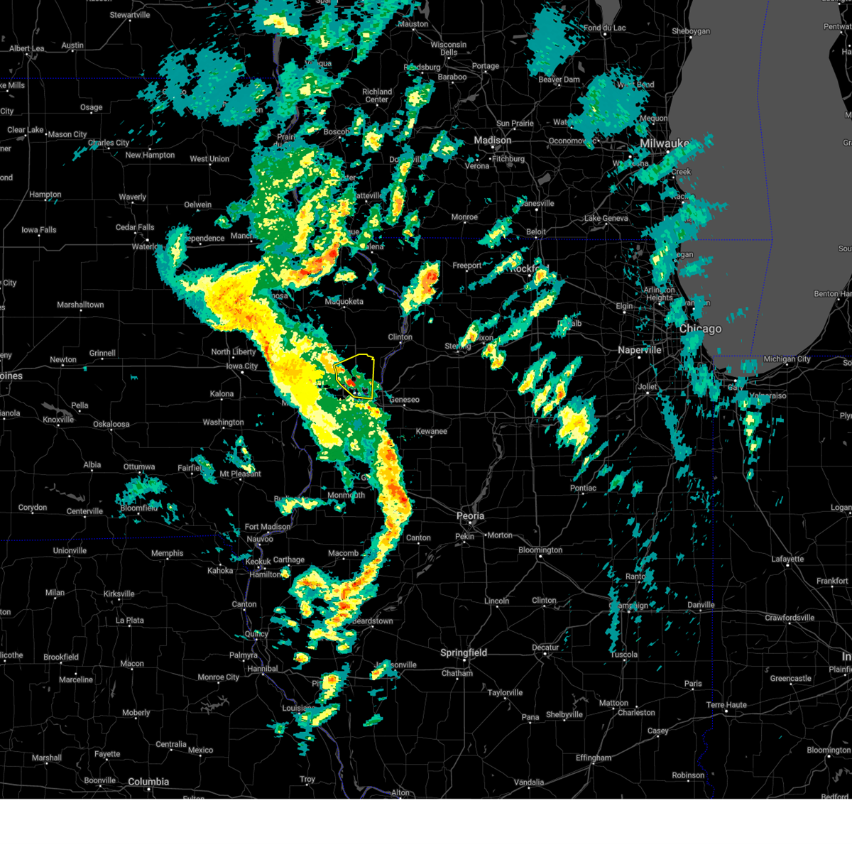 At 129 pm cdt, a severe thunderstorm was located over eldridge, or near davenport, moving east at 35 mph (radar indicated). Hazards include 60 mph wind gusts. Expect damage to roofs, siding, and trees. locations impacted include, eldridge, maysville, park view, campbells island, rock island arsenal, bettendorf, mississippi valley fairgrounds, panorama park, davenport municipal airport, donahue, riverdale, davenport, mccausland, long grove, scott county park, rock island county fairgrounds, east moline, moline, and rock island. this includes the following highways, interstate 74 in iowa between mile markers 1 and 5. interstate 80 in iowa between mile markers 288 and 303. interstate 74 in illinois near mile marker 1. Interstate 280 between mile markers 1 and 2. At 129 pm cdt, a severe thunderstorm was located over eldridge, or near davenport, moving east at 35 mph (radar indicated). Hazards include 60 mph wind gusts. Expect damage to roofs, siding, and trees. locations impacted include, eldridge, maysville, park view, campbells island, rock island arsenal, bettendorf, mississippi valley fairgrounds, panorama park, davenport municipal airport, donahue, riverdale, davenport, mccausland, long grove, scott county park, rock island county fairgrounds, east moline, moline, and rock island. this includes the following highways, interstate 74 in iowa between mile markers 1 and 5. interstate 80 in iowa between mile markers 288 and 303. interstate 74 in illinois near mile marker 1. Interstate 280 between mile markers 1 and 2.
|
| 3/19/2025 1:20 PM CDT |
 At 119 pm cdt, a severe thunderstorm was located over maysville, or near davenport, moving east at 35 mph (radar indicated). Hazards include 60 mph wind gusts. Expect damage to roofs, siding, and trees. locations impacted include, eldridge, moline, maysville, park view, west lake park, campbells island, rock island arsenal, walcott, bettendorf, mississippi valley fairgrounds, panorama park, davenport municipal airport, donahue, credit island, riverdale, davenport, mccausland, long grove, scott county park, and rock island county fairgrounds. this includes the following highways, interstate 74 in iowa between mile markers 1 and 5. interstate 80 in iowa between mile markers 284 and 303. interstate 74 in illinois between mile markers 1 and 2. Interstate 280 between mile markers 1 and 11. At 119 pm cdt, a severe thunderstorm was located over maysville, or near davenport, moving east at 35 mph (radar indicated). Hazards include 60 mph wind gusts. Expect damage to roofs, siding, and trees. locations impacted include, eldridge, moline, maysville, park view, west lake park, campbells island, rock island arsenal, walcott, bettendorf, mississippi valley fairgrounds, panorama park, davenport municipal airport, donahue, credit island, riverdale, davenport, mccausland, long grove, scott county park, and rock island county fairgrounds. this includes the following highways, interstate 74 in iowa between mile markers 1 and 5. interstate 80 in iowa between mile markers 284 and 303. interstate 74 in illinois between mile markers 1 and 2. Interstate 280 between mile markers 1 and 11.
|
| 3/19/2025 1:20 PM CDT |
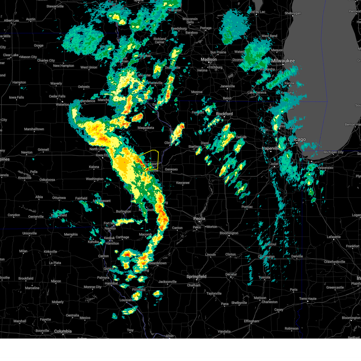 the severe thunderstorm warning has been cancelled and is no longer in effect the severe thunderstorm warning has been cancelled and is no longer in effect
|
| 3/19/2025 1:15 PM CDT |
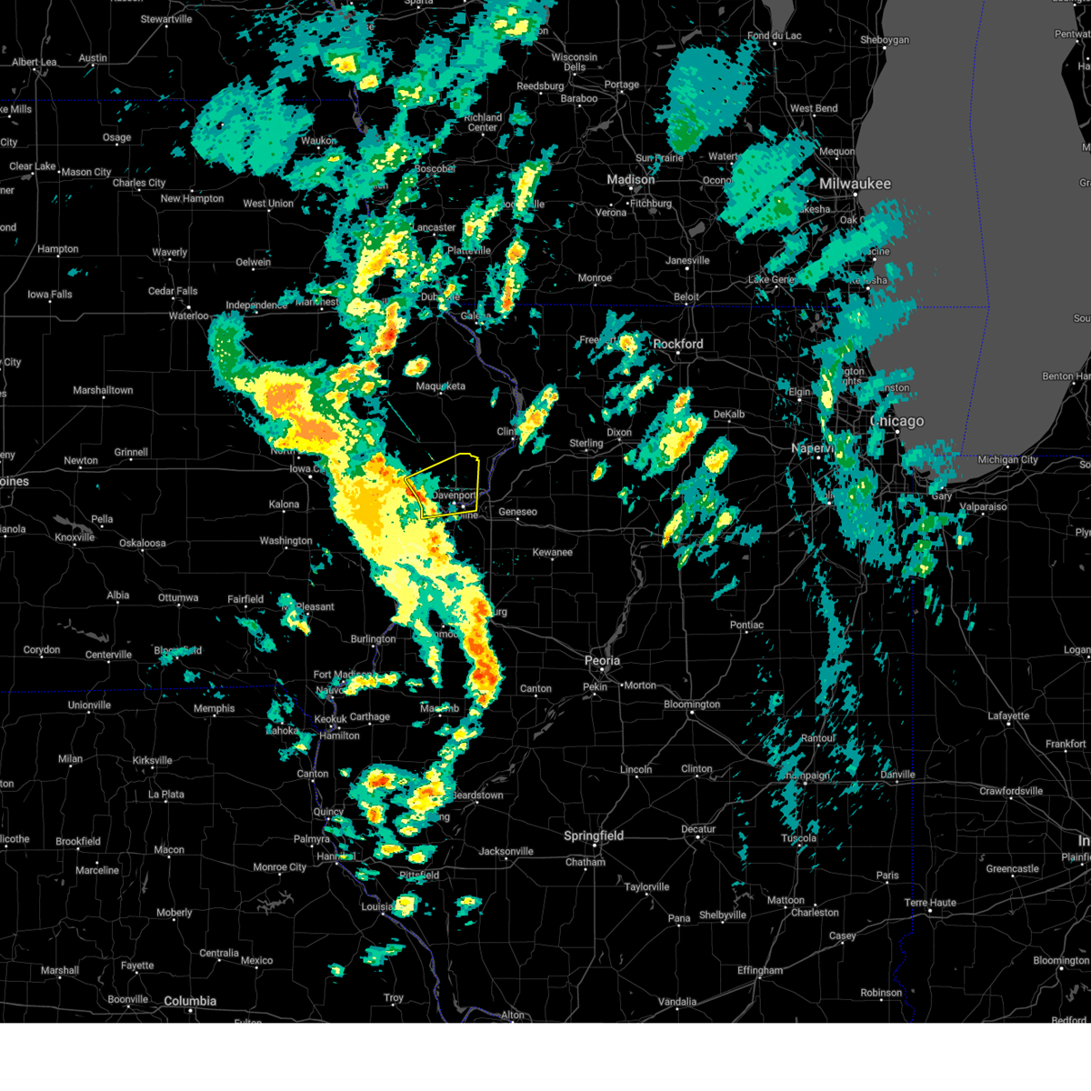 At 115 pm cdt, a severe thunderstorm was located over walcott, or 8 miles west of davenport, moving east at 35 mph (radar indicated). Hazards include 60 mph wind gusts. Expect damage to roofs, siding, and trees. locations impacted include, moline, west lake park, campbells island, walcott, mississippi valley fairgrounds, panorama park, davenport municipal airport, donahue, credit island, riverdale, davenport, mccausland, buffalo, plainview, eldridge, maysville, park view, rock island arsenal, bettendorf, and blue grass. this includes the following highways, interstate 74 in iowa between mile markers 1 and 5. interstate 80 in iowa between mile markers 279 and 303. interstate 74 in illinois between mile markers 1 and 2. Interstate 280 between mile markers 1 and 10. At 115 pm cdt, a severe thunderstorm was located over walcott, or 8 miles west of davenport, moving east at 35 mph (radar indicated). Hazards include 60 mph wind gusts. Expect damage to roofs, siding, and trees. locations impacted include, moline, west lake park, campbells island, walcott, mississippi valley fairgrounds, panorama park, davenport municipal airport, donahue, credit island, riverdale, davenport, mccausland, buffalo, plainview, eldridge, maysville, park view, rock island arsenal, bettendorf, and blue grass. this includes the following highways, interstate 74 in iowa between mile markers 1 and 5. interstate 80 in iowa between mile markers 279 and 303. interstate 74 in illinois between mile markers 1 and 2. Interstate 280 between mile markers 1 and 10.
|
| 3/19/2025 1:15 PM CDT |
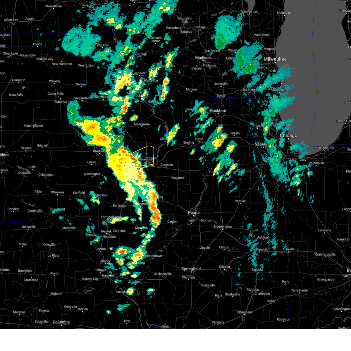 the severe thunderstorm warning has been cancelled and is no longer in effect the severe thunderstorm warning has been cancelled and is no longer in effect
|
| 3/19/2025 1:14 PM CDT |
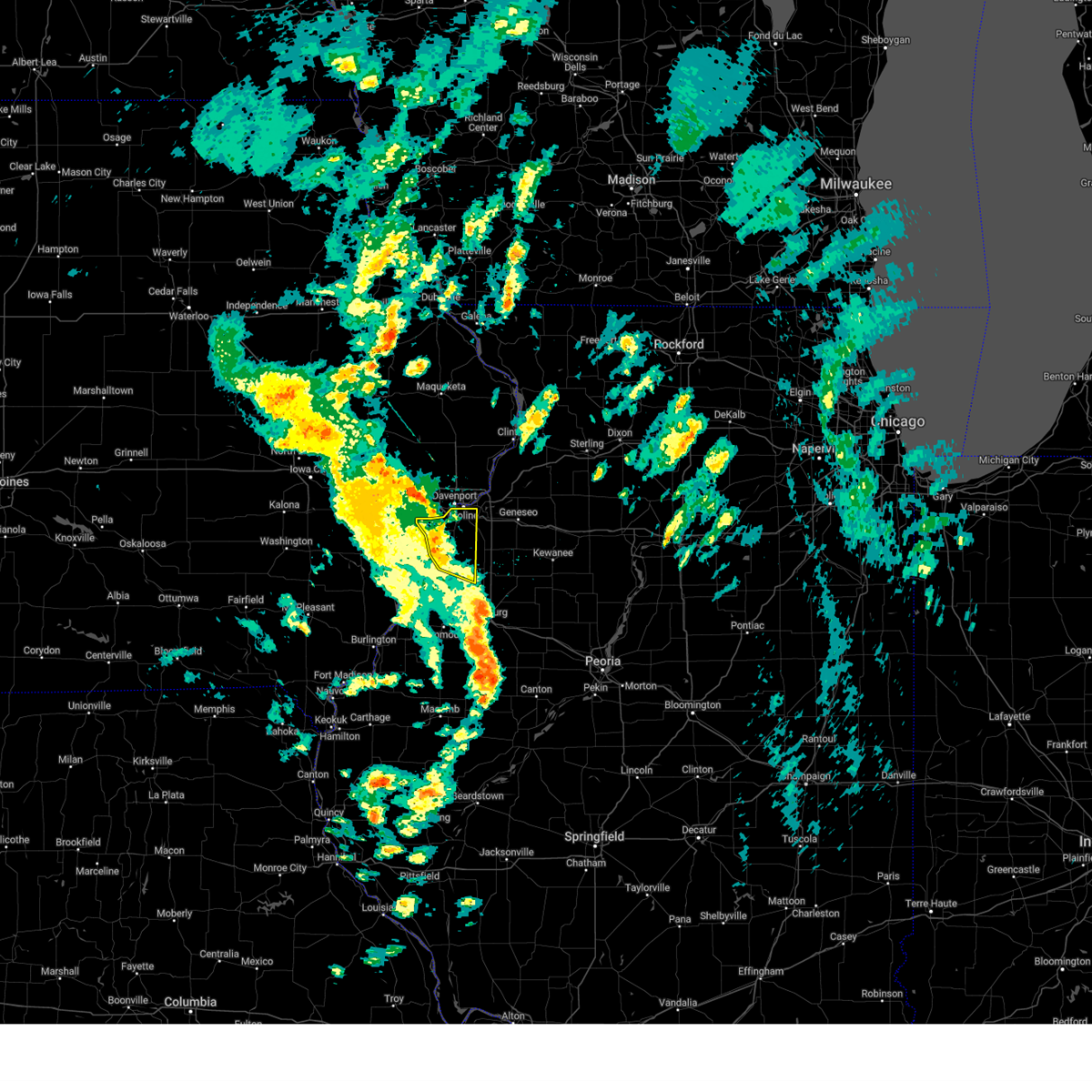 the severe thunderstorm warning has been cancelled and is no longer in effect the severe thunderstorm warning has been cancelled and is no longer in effect
|
| 3/19/2025 1:14 PM CDT |
 At 114 pm cdt, severe thunderstorms were located along a line extending from walcott to blackhawk state park to near griffin to near oneida, moving northeast at 40 mph (radar indicated). Hazards include 60 mph wind gusts. Expect damage to roofs, siding, and trees. locations impacted include, preemption, hamlet, cable, moline, shale city, coyne center, new windsor, edgington, taylor ridge, gingle corners, boden, moline quad-city airport, viola, loud thunder scout camp, sherrard, blackhawk state park, reynolds, andalusia, fruitland, and oak grove. this includes the following highways, interstate 74 in illinois between mile markers 2 and 7. Interstate 280 between mile markers 11 and 18. At 114 pm cdt, severe thunderstorms were located along a line extending from walcott to blackhawk state park to near griffin to near oneida, moving northeast at 40 mph (radar indicated). Hazards include 60 mph wind gusts. Expect damage to roofs, siding, and trees. locations impacted include, preemption, hamlet, cable, moline, shale city, coyne center, new windsor, edgington, taylor ridge, gingle corners, boden, moline quad-city airport, viola, loud thunder scout camp, sherrard, blackhawk state park, reynolds, andalusia, fruitland, and oak grove. this includes the following highways, interstate 74 in illinois between mile markers 2 and 7. Interstate 280 between mile markers 11 and 18.
|
| 3/19/2025 1:01 PM CDT |
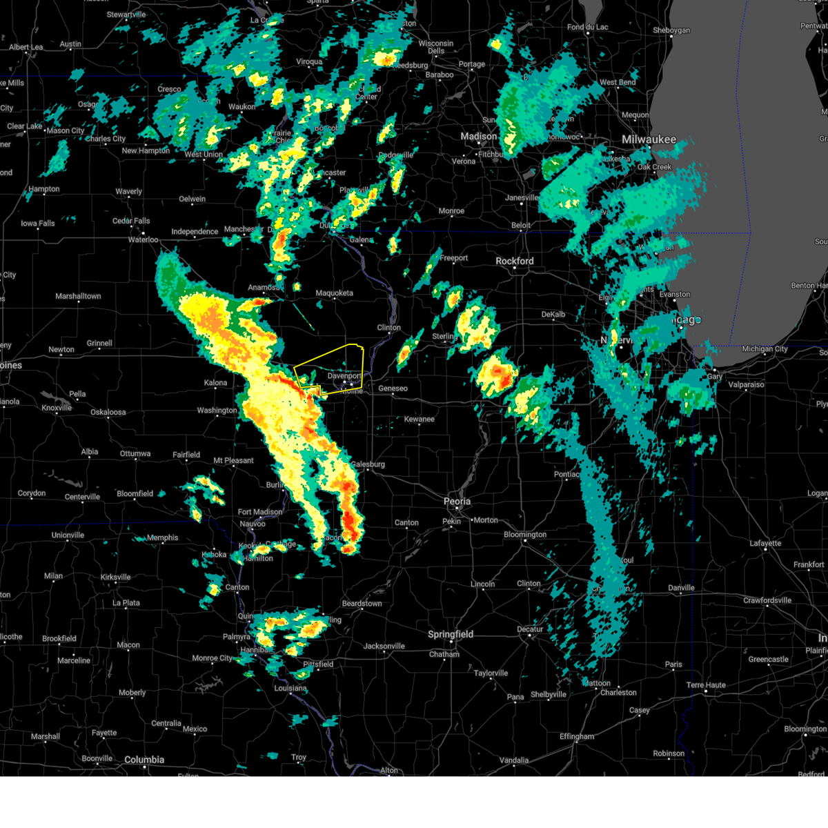 Svrdvn the national weather service in the quad cities has issued a * severe thunderstorm warning for, central rock island county in northwestern illinois, southeastern cedar county in east central iowa, scott county in east central iowa, northeastern muscatine county in east central iowa, * until 145 pm cdt. * at 101 pm cdt, a severe thunderstorm was located over durant, moving east at 35 mph (radar indicated). Hazards include 60 mph wind gusts. expect damage to roofs, siding, and trees Svrdvn the national weather service in the quad cities has issued a * severe thunderstorm warning for, central rock island county in northwestern illinois, southeastern cedar county in east central iowa, scott county in east central iowa, northeastern muscatine county in east central iowa, * until 145 pm cdt. * at 101 pm cdt, a severe thunderstorm was located over durant, moving east at 35 mph (radar indicated). Hazards include 60 mph wind gusts. expect damage to roofs, siding, and trees
|
| 3/19/2025 12:57 PM CDT |
 the severe thunderstorm warning has been cancelled and is no longer in effect the severe thunderstorm warning has been cancelled and is no longer in effect
|
| 3/19/2025 12:57 PM CDT |
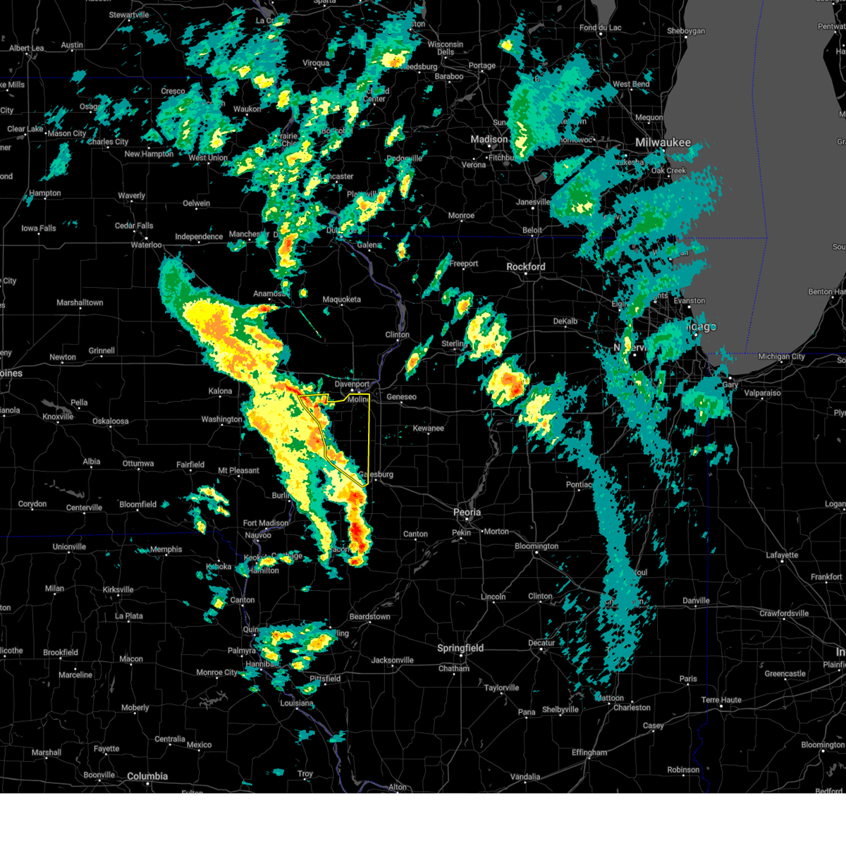 At 1257 pm cdt, severe thunderstorms were located along a line extending from sweetland center to taylor ridge to near burgess to henderson, moving northeast at 40 mph (radar indicated). Hazards include 60 mph wind gusts. Expect damage to roofs, siding, and trees. locations impacted include, preemption, moline, gerlaw, clark's ferry recreation area, new era, shale city, new windsor, taylor ridge, gingle corners, lake warren, seaton, viola, loud thunder scout camp, mercer county fairgrounds, blackhawk state park, fruitland, oak grove, swedona, gilchrist, and milan. this includes the following highways, interstate 74 in illinois between mile markers 2 and 7. Interstate 280 between mile markers 11 and 18. At 1257 pm cdt, severe thunderstorms were located along a line extending from sweetland center to taylor ridge to near burgess to henderson, moving northeast at 40 mph (radar indicated). Hazards include 60 mph wind gusts. Expect damage to roofs, siding, and trees. locations impacted include, preemption, moline, gerlaw, clark's ferry recreation area, new era, shale city, new windsor, taylor ridge, gingle corners, lake warren, seaton, viola, loud thunder scout camp, mercer county fairgrounds, blackhawk state park, fruitland, oak grove, swedona, gilchrist, and milan. this includes the following highways, interstate 74 in illinois between mile markers 2 and 7. Interstate 280 between mile markers 11 and 18.
|
| 3/19/2025 12:48 PM CDT |
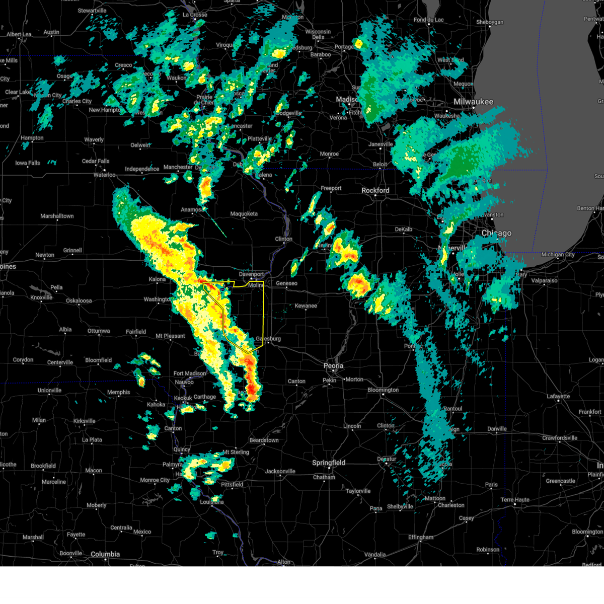 At 1248 pm cdt, severe thunderstorms were located along a line extending from near muscatine to marston to near seaton to near coldbrook, moving northeast at 40 mph (radar indicated). Hazards include 60 mph wind gusts. Expect damage to roofs, siding, and trees. locations impacted include, preemption, moline, gerlaw, clark's ferry recreation area, new era, shale city, monmouth municipal airport, new windsor, taylor ridge, gingle corners, petersville, lake warren, seaton, viola, loud thunder scout camp, mercer county fairgrounds, blackhawk state park, fruitland, oak grove, and swedona. this includes the following highways, interstate 74 in illinois between mile markers 2 and 7. Interstate 280 between mile markers 11 and 18. At 1248 pm cdt, severe thunderstorms were located along a line extending from near muscatine to marston to near seaton to near coldbrook, moving northeast at 40 mph (radar indicated). Hazards include 60 mph wind gusts. Expect damage to roofs, siding, and trees. locations impacted include, preemption, moline, gerlaw, clark's ferry recreation area, new era, shale city, monmouth municipal airport, new windsor, taylor ridge, gingle corners, petersville, lake warren, seaton, viola, loud thunder scout camp, mercer county fairgrounds, blackhawk state park, fruitland, oak grove, and swedona. this includes the following highways, interstate 74 in illinois between mile markers 2 and 7. Interstate 280 between mile markers 11 and 18.
|
| 3/19/2025 12:48 PM CDT |
 the severe thunderstorm warning has been cancelled and is no longer in effect the severe thunderstorm warning has been cancelled and is no longer in effect
|
| 3/19/2025 12:36 PM CDT |
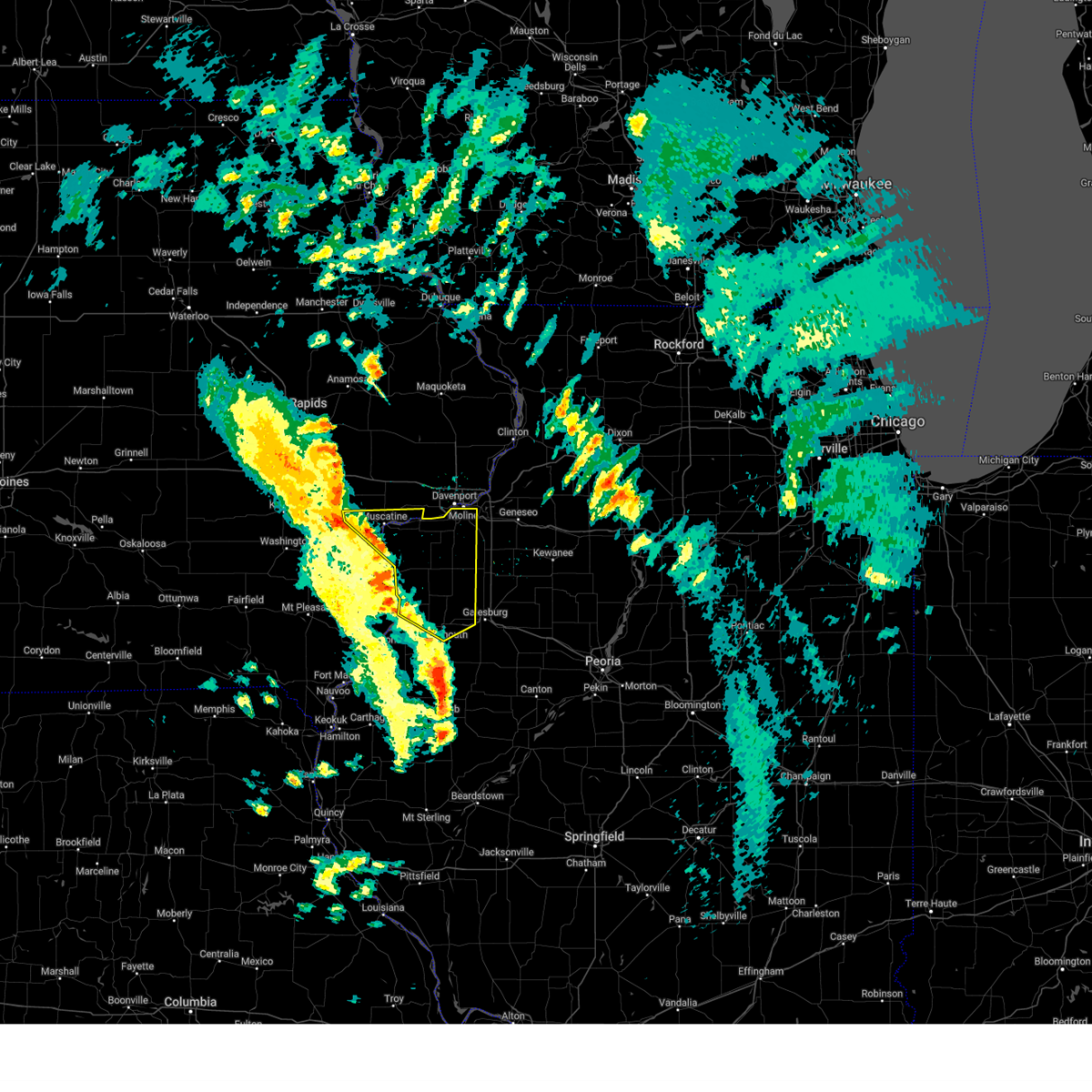 Svrdvn the national weather service in the quad cities has issued a * severe thunderstorm warning for, northeastern henderson county in west central illinois, northern warren county in west central illinois, rock island county in northwestern illinois, mercer county in northwestern illinois, southeastern louisa county in southeastern iowa, central muscatine county in east central iowa, * until 130 pm cdt. * at 1235 pm cdt, severe thunderstorms were located along a line extending from muscatine municipal airport to near petersville to bald bluff to near monmouth, moving northeast at 40 mph (radar indicated). Hazards include 60 mph wind gusts. expect damage to roofs, siding, and trees Svrdvn the national weather service in the quad cities has issued a * severe thunderstorm warning for, northeastern henderson county in west central illinois, northern warren county in west central illinois, rock island county in northwestern illinois, mercer county in northwestern illinois, southeastern louisa county in southeastern iowa, central muscatine county in east central iowa, * until 130 pm cdt. * at 1235 pm cdt, severe thunderstorms were located along a line extending from muscatine municipal airport to near petersville to bald bluff to near monmouth, moving northeast at 40 mph (radar indicated). Hazards include 60 mph wind gusts. expect damage to roofs, siding, and trees
|
| 3/14/2025 9:47 PM CDT |
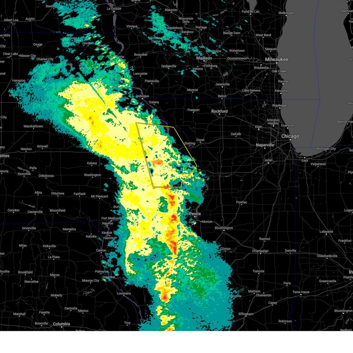 the severe thunderstorm warning has been cancelled and is no longer in effect the severe thunderstorm warning has been cancelled and is no longer in effect
|
| 3/14/2025 9:47 PM CDT |
 At 946 pm cdt, severe thunderstorms were located along a line extending from near zwingle to johnson-sauk trail state park, moving east at 50 mph (radar indicated). Hazards include 70 mph wind gusts. Expect considerable tree damage. damage is likely to mobile homes, roofs, and outbuildings. locations impacted include, moline, wacker, ideal, cambridge, maquoketa caves state park, manlius, kewanee municipal airport, jackson county fairgrounds, east clinton, port byron, panorama park, davenport municipal airport, denrock, union grove, thomson causeway, osborn, elwood, albany, bryant, and barstow. this includes the following highways, interstate 74 in iowa between mile markers 1 and 5. interstate 80 in iowa between mile markers 294 and 306. interstate 80 in illinois between mile markers 1 and 46. interstate 74 in illinois between mile markers 1 and 33. interstate 88 between mile markers 1 and 36. Interstate 280 between mile markers 15 and 18. At 946 pm cdt, severe thunderstorms were located along a line extending from near zwingle to johnson-sauk trail state park, moving east at 50 mph (radar indicated). Hazards include 70 mph wind gusts. Expect considerable tree damage. damage is likely to mobile homes, roofs, and outbuildings. locations impacted include, moline, wacker, ideal, cambridge, maquoketa caves state park, manlius, kewanee municipal airport, jackson county fairgrounds, east clinton, port byron, panorama park, davenport municipal airport, denrock, union grove, thomson causeway, osborn, elwood, albany, bryant, and barstow. this includes the following highways, interstate 74 in iowa between mile markers 1 and 5. interstate 80 in iowa between mile markers 294 and 306. interstate 80 in illinois between mile markers 1 and 46. interstate 74 in illinois between mile markers 1 and 33. interstate 88 between mile markers 1 and 36. Interstate 280 between mile markers 15 and 18.
|
| 3/14/2025 9:31 PM CDT |
 At 930 pm cdt, severe thunderstorms were located along a line extending from near garry owen to near ulah, moving northeast at 50 mph (radar indicated). Hazards include 70 mph wind gusts. Expect considerable tree damage. damage is likely to mobile homes, roofs, and outbuildings. locations impacted include, moline, wacker, ideal, west lake park, cambridge, maquoketa caves state park, manlius, kewanee municipal airport, jackson county fairgrounds, east clinton, port byron, panorama park, davenport municipal airport, denrock, union grove, thomson causeway, osborn, elwood, albany, and bryant. this includes the following highways, interstate 74 in iowa between mile markers 1 and 5. interstate 80 in iowa between mile markers 284 and 306. interstate 80 in illinois between mile markers 1 and 46. interstate 74 in illinois between mile markers 1 and 33. interstate 88 between mile markers 1 and 36. Interstate 280 between mile markers 1 and 18. At 930 pm cdt, severe thunderstorms were located along a line extending from near garry owen to near ulah, moving northeast at 50 mph (radar indicated). Hazards include 70 mph wind gusts. Expect considerable tree damage. damage is likely to mobile homes, roofs, and outbuildings. locations impacted include, moline, wacker, ideal, west lake park, cambridge, maquoketa caves state park, manlius, kewanee municipal airport, jackson county fairgrounds, east clinton, port byron, panorama park, davenport municipal airport, denrock, union grove, thomson causeway, osborn, elwood, albany, and bryant. this includes the following highways, interstate 74 in iowa between mile markers 1 and 5. interstate 80 in iowa between mile markers 284 and 306. interstate 80 in illinois between mile markers 1 and 46. interstate 74 in illinois between mile markers 1 and 33. interstate 88 between mile markers 1 and 36. Interstate 280 between mile markers 1 and 18.
|
| 3/14/2025 9:31 PM CDT |
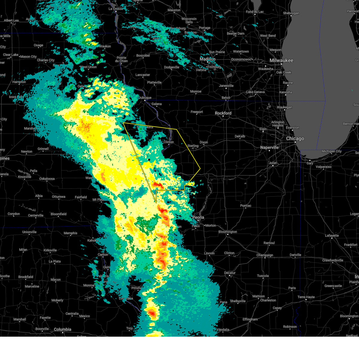 the severe thunderstorm warning has been cancelled and is no longer in effect the severe thunderstorm warning has been cancelled and is no longer in effect
|
| 3/14/2025 9:19 PM CDT |
 At 919 pm cdt, severe thunderstorms were located along a line extending from near temple hill to near nekoma, moving northeast at 50 mph (radar indicated). Hazards include 70 mph wind gusts. Expect considerable tree damage. damage is likely to mobile homes, roofs, and outbuildings. locations impacted include, ideal, west lake park, cambridge, manlius, kewanee municipal airport, jackson county fairgrounds, east clinton, port byron, davenport municipal airport, stone city, union grove, thomson causeway, osborn, elwood, albany, bryant, blackhawk state park, maquoketa, princeton, and fruitland. this includes the following highways, interstate 74 in iowa between mile markers 1 and 5. interstate 80 in iowa between mile markers 272 and 306. interstate 80 in illinois between mile markers 1 and 46. interstate 74 in illinois between mile markers 1 and 33. interstate 88 between mile markers 1 and 36. Interstate 280 between mile markers 1 and 18. At 919 pm cdt, severe thunderstorms were located along a line extending from near temple hill to near nekoma, moving northeast at 50 mph (radar indicated). Hazards include 70 mph wind gusts. Expect considerable tree damage. damage is likely to mobile homes, roofs, and outbuildings. locations impacted include, ideal, west lake park, cambridge, manlius, kewanee municipal airport, jackson county fairgrounds, east clinton, port byron, davenport municipal airport, stone city, union grove, thomson causeway, osborn, elwood, albany, bryant, blackhawk state park, maquoketa, princeton, and fruitland. this includes the following highways, interstate 74 in iowa between mile markers 1 and 5. interstate 80 in iowa between mile markers 272 and 306. interstate 80 in illinois between mile markers 1 and 46. interstate 74 in illinois between mile markers 1 and 33. interstate 88 between mile markers 1 and 36. Interstate 280 between mile markers 1 and 18.
|
| 3/14/2025 9:08 PM CDT |
 Svrdvn the national weather service in the quad cities has issued a * severe thunderstorm warning for, rock island county in northwestern illinois, eastern mercer county in northwestern illinois, whiteside county in northwestern illinois, south central carroll county in northwestern illinois, northeastern warren county in west central illinois, henry county in northwestern illinois, northwestern bureau county in north central illinois, southern jackson county in east central iowa, eastern cedar county in east central iowa, northeastern muscatine county in east central iowa, scott county in east central iowa, southern jones county in east central iowa, clinton county in east central iowa, * until 1000 pm cdt. * at 906 pm cdt, severe thunderstorms were located along a line extending from near central park to near alpha, moving northeast at 50 mph (radar indicated). Hazards include 70 mph wind gusts. Expect considerable tree damage. Damage is likely to mobile homes, roofs, and outbuildings. Svrdvn the national weather service in the quad cities has issued a * severe thunderstorm warning for, rock island county in northwestern illinois, eastern mercer county in northwestern illinois, whiteside county in northwestern illinois, south central carroll county in northwestern illinois, northeastern warren county in west central illinois, henry county in northwestern illinois, northwestern bureau county in north central illinois, southern jackson county in east central iowa, eastern cedar county in east central iowa, northeastern muscatine county in east central iowa, scott county in east central iowa, southern jones county in east central iowa, clinton county in east central iowa, * until 1000 pm cdt. * at 906 pm cdt, severe thunderstorms were located along a line extending from near central park to near alpha, moving northeast at 50 mph (radar indicated). Hazards include 70 mph wind gusts. Expect considerable tree damage. Damage is likely to mobile homes, roofs, and outbuildings.
|
| 3/14/2025 8:59 PM CDT |
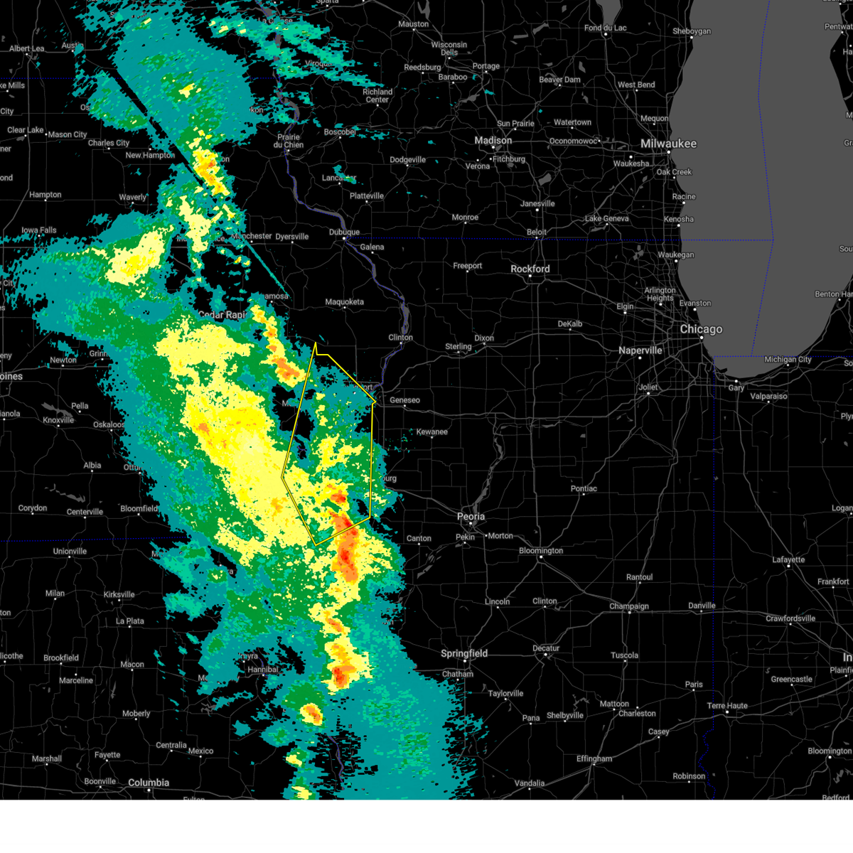 At 858 pm cdt, severe thunderstorms were located along a line extending from near pleasant prairie to near cable, moving north at 50 mph (radar indicated). Hazards include 70 mph wind gusts. Expect considerable tree damage. damage is likely to mobile homes, roofs, and outbuildings. locations impacted include, west lake park, moline quad-city airport, milan, rock island arsenal, eldridge, plainview, moline, coyne center, fruitland, credit island and camp liberty. this includes the following highways, interstate 74 in iowa between mile markers 3 and 5. interstate 80 in iowa between mile markers 274 and 295. interstate 74 in illinois between mile markers 1 and 7. Interstate 280 between mile markers 1 and 18. At 858 pm cdt, severe thunderstorms were located along a line extending from near pleasant prairie to near cable, moving north at 50 mph (radar indicated). Hazards include 70 mph wind gusts. Expect considerable tree damage. damage is likely to mobile homes, roofs, and outbuildings. locations impacted include, west lake park, moline quad-city airport, milan, rock island arsenal, eldridge, plainview, moline, coyne center, fruitland, credit island and camp liberty. this includes the following highways, interstate 74 in iowa between mile markers 3 and 5. interstate 80 in iowa between mile markers 274 and 295. interstate 74 in illinois between mile markers 1 and 7. Interstate 280 between mile markers 1 and 18.
|
| 3/14/2025 8:42 PM CDT |
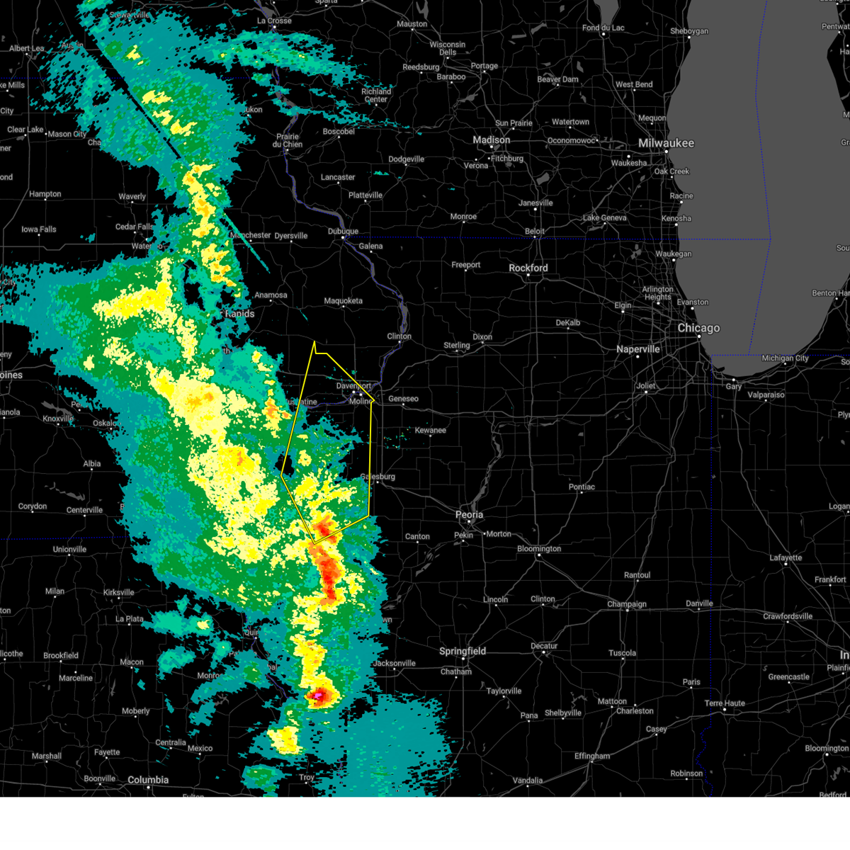 At 842 pm cdt, severe thunderstorms were located along a line extending from near edgington to bald bluff, moving north at 50 mph (radar indicated). Hazards include 70 mph wind gusts. Expect considerable tree damage. damage is likely to mobile homes, roofs, and outbuildings. these severe storms will be near, ogle, loud thunder forest preserve, marston, bald bluff, edgington, wildcat den state park, montpelier, sunbeam, millersburg, and gingle corners around 845 pm cdt. west lake park, pleasant prairie, davenport, and walcott around 850 pm cdt. other locations in the path of these severe thunderstorms include taylor ridge, plainview, maysville, reynolds, dixon, eldridge, rock island, credit island and mississippi valley fairgrounds. this includes the following highways, interstate 74 in iowa between mile markers 3 and 5. interstate 80 in iowa between mile markers 274 and 295. interstate 74 in illinois between mile markers 1 and 7. Interstate 280 between mile markers 1 and 18. At 842 pm cdt, severe thunderstorms were located along a line extending from near edgington to bald bluff, moving north at 50 mph (radar indicated). Hazards include 70 mph wind gusts. Expect considerable tree damage. damage is likely to mobile homes, roofs, and outbuildings. these severe storms will be near, ogle, loud thunder forest preserve, marston, bald bluff, edgington, wildcat den state park, montpelier, sunbeam, millersburg, and gingle corners around 845 pm cdt. west lake park, pleasant prairie, davenport, and walcott around 850 pm cdt. other locations in the path of these severe thunderstorms include taylor ridge, plainview, maysville, reynolds, dixon, eldridge, rock island, credit island and mississippi valley fairgrounds. this includes the following highways, interstate 74 in iowa between mile markers 3 and 5. interstate 80 in iowa between mile markers 274 and 295. interstate 74 in illinois between mile markers 1 and 7. Interstate 280 between mile markers 1 and 18.
|
| 3/14/2025 8:31 PM CDT |
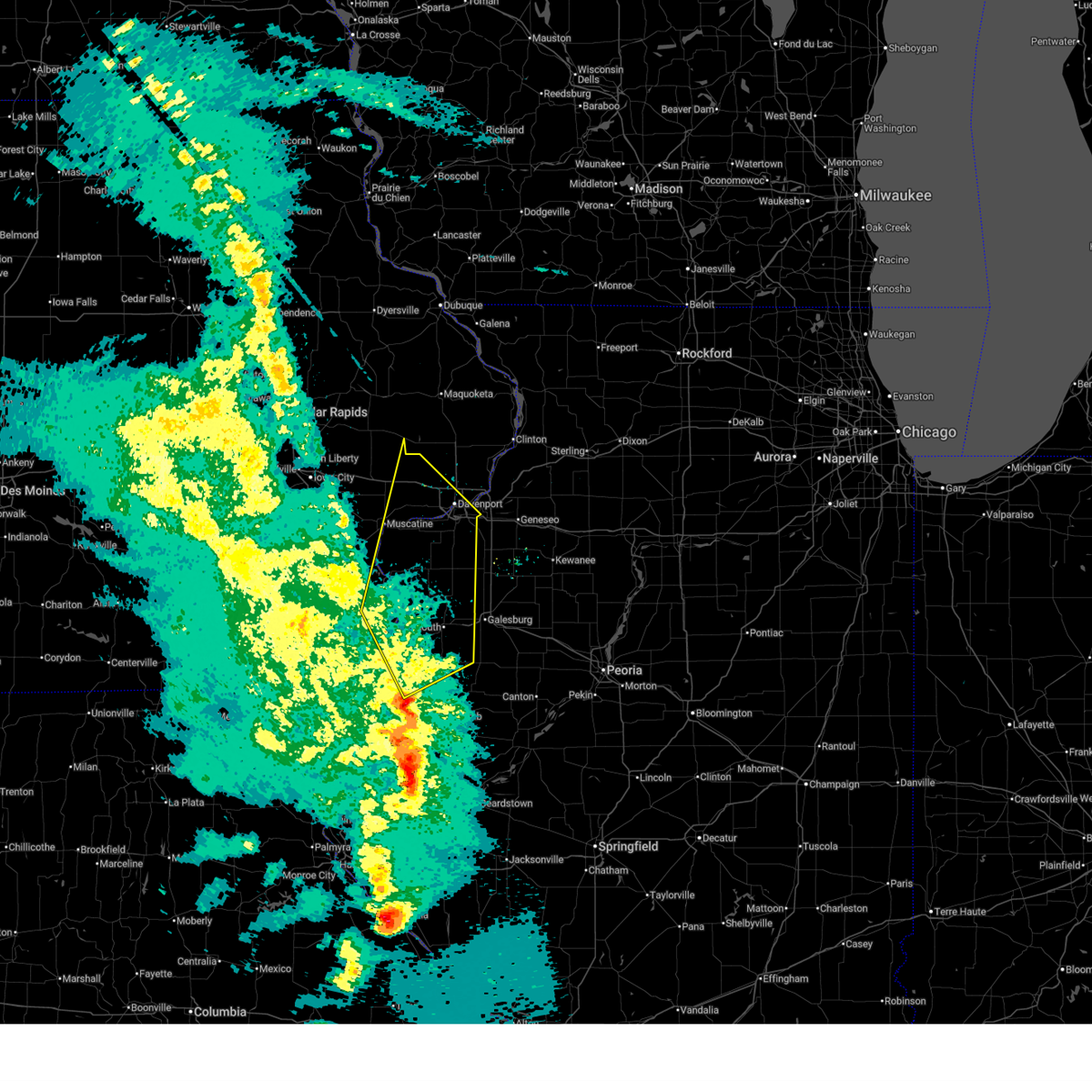 At 829 pm cdt, severe thunderstorms were located along a line extending from near joy to biggsville, moving north at 70 mph. a trained spotter reported a 77 mph gust near kingston iowa (radar indicated). Hazards include 70 mph wind gusts. Expect considerable tree damage. damage is likely to mobile homes, roofs, and outbuildings. these severe storms will be near, petersville, ogle, marston, bald bluff, little york, millersburg, keithsburg, joy, seaton, and big river state forest around 835 pm cdt. other locations in the path of these severe thunderstorms include loud thunder forest preserve, edgington, sunbeam, gingle corners, hamlet, aledo mercer county airport, illinois city, loud thunder scout camp, wildcat den state park, montpelier, andalusia, midway beach, clark's ferry recreation area, shady creek campground, buffalo shores, blue grass, buffalo, west lake park, pleasant prairie, reynolds, davenport, walcott, taylor ridge, plainview, maysville, eldridge, dixon, rock island, credit island and mississippi valley fairgrounds. this includes the following highways, interstate 74 in iowa between mile markers 3 and 5. interstate 80 in iowa between mile markers 274 and 295. interstate 74 in illinois between mile markers 1 and 7. Interstate 280 between mile markers 1 and 18. At 829 pm cdt, severe thunderstorms were located along a line extending from near joy to biggsville, moving north at 70 mph. a trained spotter reported a 77 mph gust near kingston iowa (radar indicated). Hazards include 70 mph wind gusts. Expect considerable tree damage. damage is likely to mobile homes, roofs, and outbuildings. these severe storms will be near, petersville, ogle, marston, bald bluff, little york, millersburg, keithsburg, joy, seaton, and big river state forest around 835 pm cdt. other locations in the path of these severe thunderstorms include loud thunder forest preserve, edgington, sunbeam, gingle corners, hamlet, aledo mercer county airport, illinois city, loud thunder scout camp, wildcat den state park, montpelier, andalusia, midway beach, clark's ferry recreation area, shady creek campground, buffalo shores, blue grass, buffalo, west lake park, pleasant prairie, reynolds, davenport, walcott, taylor ridge, plainview, maysville, eldridge, dixon, rock island, credit island and mississippi valley fairgrounds. this includes the following highways, interstate 74 in iowa between mile markers 3 and 5. interstate 80 in iowa between mile markers 274 and 295. interstate 74 in illinois between mile markers 1 and 7. Interstate 280 between mile markers 1 and 18.
|
| 3/14/2025 8:18 PM CDT |
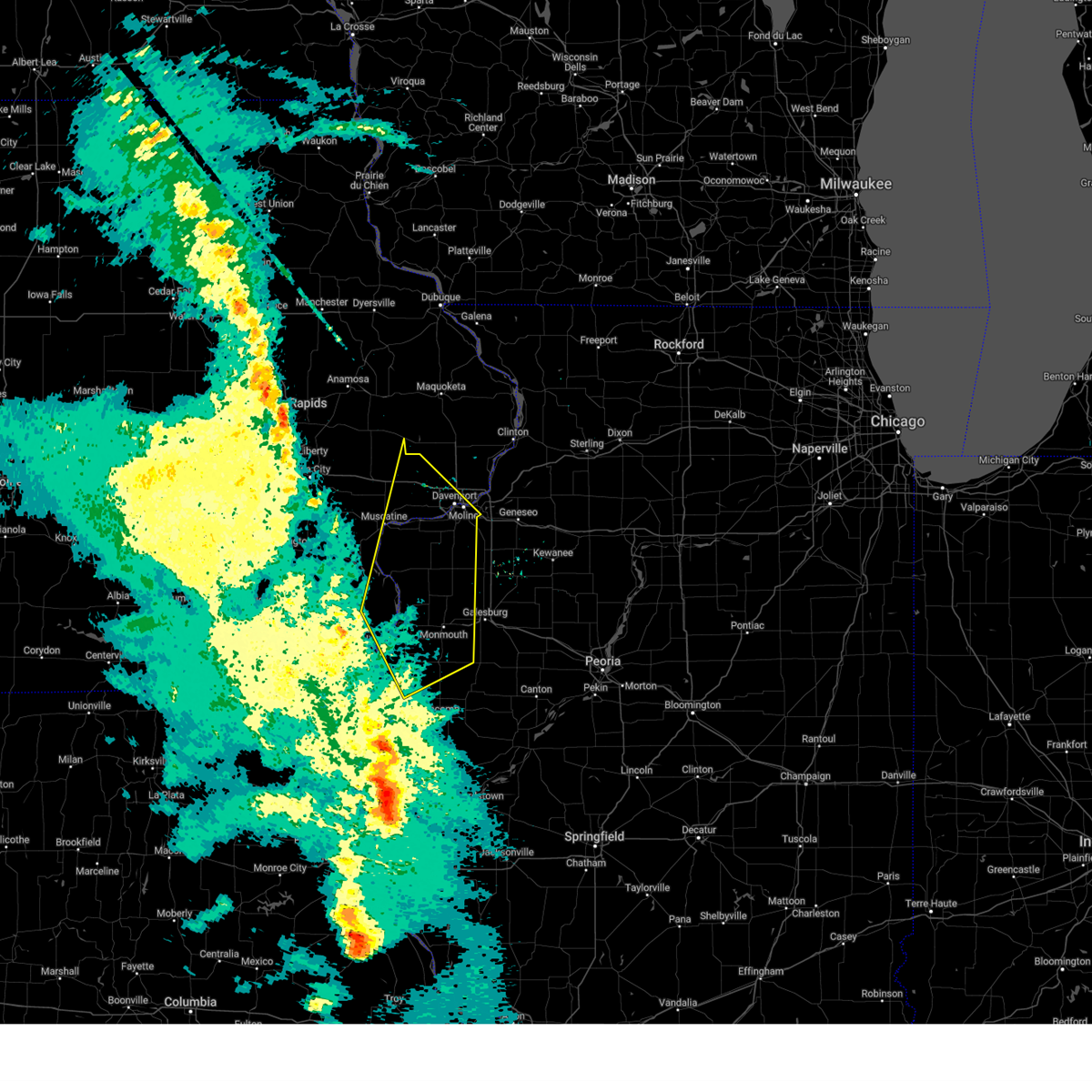 Svrdvn the national weather service in the quad cities has issued a * severe thunderstorm warning for, northeastern hancock county in west central illinois, henderson county in west central illinois, warren county in west central illinois, rock island county in northwestern illinois, northwestern mcdonough county in west central illinois, mercer county in northwestern illinois, northeastern des moines county in southeastern iowa, southeastern louisa county in southeastern iowa, southeastern cedar county in east central iowa, western scott county in east central iowa, eastern muscatine county in east central iowa, * until 915 pm cdt. * at 817 pm cdt, severe thunderstorms were located along a line extending from delabar state park to near terre haute, moving north at 70 mph (radar indicated). Hazards include 70 mph wind gusts. Expect considerable tree damage. damage is likely to mobile homes, roofs, and outbuildings. severe thunderstorms will be near, oquawka, ogle, bald bluff, olena, media, biggsville, keithsburg, joy, seaton, and big river state forest around 825 pm cdt. mannon and millersburg around 830 pm cdt. petersville, marston, little york, aledo, and mercer county fairgrounds around 835 pm cdt. other locations in the path of these severe thunderstorms include loud thunder forest preserve, edgington, sunbeam, gingle corners, hamlet, aledo mercer county airport, illinois city, loud thunder scout camp, wildcat den state park, montpelier, andalusia, midway beach, clark's ferry recreation area, shady creek campground, buffalo shores, blue grass, buffalo, west lake park, taylor ridge, pleasant prairie, reynolds, davenport, walcott, plainview, maysville, rock island, eldridge, credit island, dixon and mississippi valley fairgrounds. this includes the following highways, interstate 74 in iowa between mile markers 3 and 5. interstate 80 in iowa between mile markers 274 and 295. interstate 74 in illinois between mile markers 1 and 7. Interstate 280 between mile markers 1 and 18. Svrdvn the national weather service in the quad cities has issued a * severe thunderstorm warning for, northeastern hancock county in west central illinois, henderson county in west central illinois, warren county in west central illinois, rock island county in northwestern illinois, northwestern mcdonough county in west central illinois, mercer county in northwestern illinois, northeastern des moines county in southeastern iowa, southeastern louisa county in southeastern iowa, southeastern cedar county in east central iowa, western scott county in east central iowa, eastern muscatine county in east central iowa, * until 915 pm cdt. * at 817 pm cdt, severe thunderstorms were located along a line extending from delabar state park to near terre haute, moving north at 70 mph (radar indicated). Hazards include 70 mph wind gusts. Expect considerable tree damage. damage is likely to mobile homes, roofs, and outbuildings. severe thunderstorms will be near, oquawka, ogle, bald bluff, olena, media, biggsville, keithsburg, joy, seaton, and big river state forest around 825 pm cdt. mannon and millersburg around 830 pm cdt. petersville, marston, little york, aledo, and mercer county fairgrounds around 835 pm cdt. other locations in the path of these severe thunderstorms include loud thunder forest preserve, edgington, sunbeam, gingle corners, hamlet, aledo mercer county airport, illinois city, loud thunder scout camp, wildcat den state park, montpelier, andalusia, midway beach, clark's ferry recreation area, shady creek campground, buffalo shores, blue grass, buffalo, west lake park, taylor ridge, pleasant prairie, reynolds, davenport, walcott, plainview, maysville, rock island, eldridge, credit island, dixon and mississippi valley fairgrounds. this includes the following highways, interstate 74 in iowa between mile markers 3 and 5. interstate 80 in iowa between mile markers 274 and 295. interstate 74 in illinois between mile markers 1 and 7. Interstate 280 between mile markers 1 and 18.
|
| 10/24/2024 11:56 PM CDT |
 the severe thunderstorm warning has been cancelled and is no longer in effect the severe thunderstorm warning has been cancelled and is no longer in effect
|
| 10/24/2024 11:49 PM CDT |
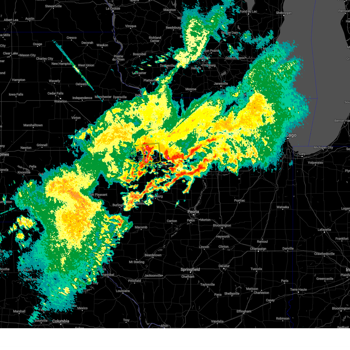 At 1149 pm cdt, a severe thunderstorm was located near lost grove lake, or near bettendorf, moving east at 35 mph (radar indicated). Hazards include quarter size hail. Damage to vehicles is expected. locations impacted include, davenport, moline, rock island, bettendorf, clinton, east moline, silvis, eldridge, camanche, le claire, hampton, port byron, rapids city, princeton, long grove, cordova, riverdale, mccausland, low moor, and cleveland. this includes the following highways, interstate 74 in iowa between mile markers 1 and 5. interstate 80 in iowa between mile markers 293 and 306. interstate 80 in illinois between mile markers 1 and 5. interstate 74 in illinois near mile marker 1. Interstate 88 between mile markers 1 and 3. At 1149 pm cdt, a severe thunderstorm was located near lost grove lake, or near bettendorf, moving east at 35 mph (radar indicated). Hazards include quarter size hail. Damage to vehicles is expected. locations impacted include, davenport, moline, rock island, bettendorf, clinton, east moline, silvis, eldridge, camanche, le claire, hampton, port byron, rapids city, princeton, long grove, cordova, riverdale, mccausland, low moor, and cleveland. this includes the following highways, interstate 74 in iowa between mile markers 1 and 5. interstate 80 in iowa between mile markers 293 and 306. interstate 80 in illinois between mile markers 1 and 5. interstate 74 in illinois near mile marker 1. Interstate 88 between mile markers 1 and 3.
|
| 10/24/2024 11:43 PM CDT |
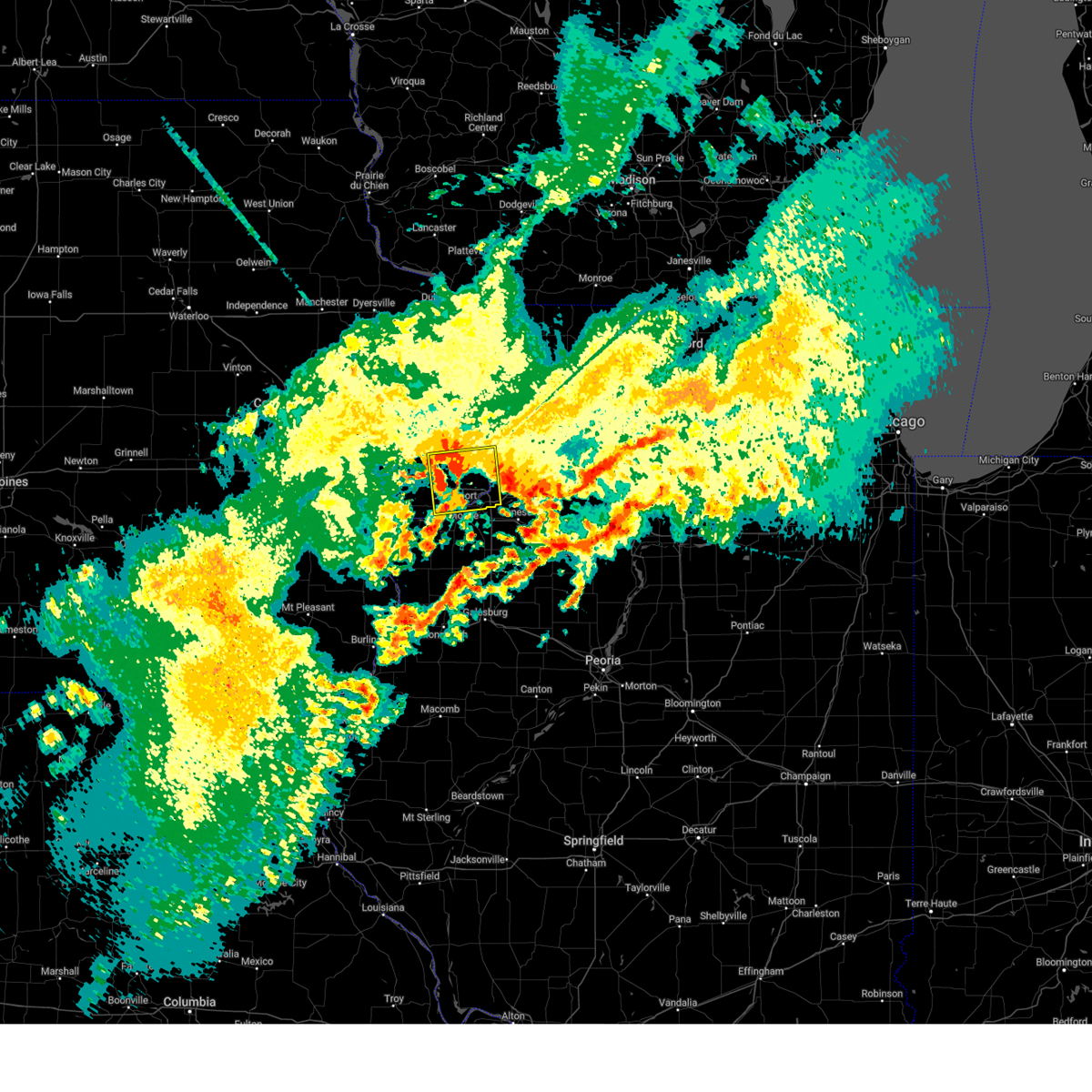 At 1142 pm cdt, a severe thunderstorm was located near park view, or near bettendorf, moving east at 35 mph (radar indicated. at 1130 pm, nickel size hail was falling at the national weather service office in davenport). Hazards include quarter size hail. Damage to vehicles is expected. locations impacted include, davenport, moline, rock island, bettendorf, clinton, east moline, silvis, eldridge, camanche, le claire, hampton, port byron, buffalo, rapids city, princeton, long grove, cordova, riverdale, donahue, and mccausland. this includes the following highways, interstate 74 in iowa between mile markers 1 and 5. interstate 80 in iowa between mile markers 288 and 306. interstate 80 in illinois between mile markers 1 and 5. interstate 74 in illinois between mile markers 1 and 2. interstate 88 between mile markers 1 and 3. Interstate 280 between mile markers 1 and 10. At 1142 pm cdt, a severe thunderstorm was located near park view, or near bettendorf, moving east at 35 mph (radar indicated. at 1130 pm, nickel size hail was falling at the national weather service office in davenport). Hazards include quarter size hail. Damage to vehicles is expected. locations impacted include, davenport, moline, rock island, bettendorf, clinton, east moline, silvis, eldridge, camanche, le claire, hampton, port byron, buffalo, rapids city, princeton, long grove, cordova, riverdale, donahue, and mccausland. this includes the following highways, interstate 74 in iowa between mile markers 1 and 5. interstate 80 in iowa between mile markers 288 and 306. interstate 80 in illinois between mile markers 1 and 5. interstate 74 in illinois between mile markers 1 and 2. interstate 88 between mile markers 1 and 3. Interstate 280 between mile markers 1 and 10.
|
| 10/24/2024 11:38 PM CDT |
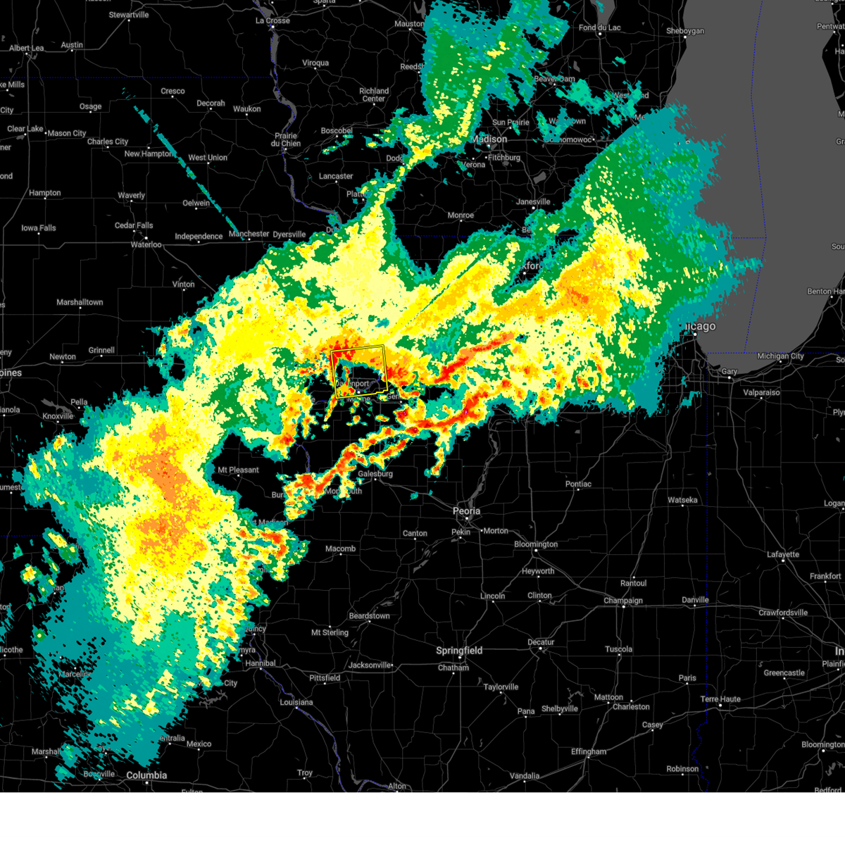 Svrdvn the national weather service in the quad cities has issued a * severe thunderstorm warning for, northeastern rock island county in northwestern illinois, scott county in east central iowa, southeastern clinton county in east central iowa, * until 1230 am cdt. * at 1138 pm cdt, a severe thunderstorm was located over eldridge, or near bettendorf, moving east at 35 mph (radar indicated). Hazards include quarter size hail. damage to vehicles is expected Svrdvn the national weather service in the quad cities has issued a * severe thunderstorm warning for, northeastern rock island county in northwestern illinois, scott county in east central iowa, southeastern clinton county in east central iowa, * until 1230 am cdt. * at 1138 pm cdt, a severe thunderstorm was located over eldridge, or near bettendorf, moving east at 35 mph (radar indicated). Hazards include quarter size hail. damage to vehicles is expected
|
| 10/24/2024 9:29 PM CDT |
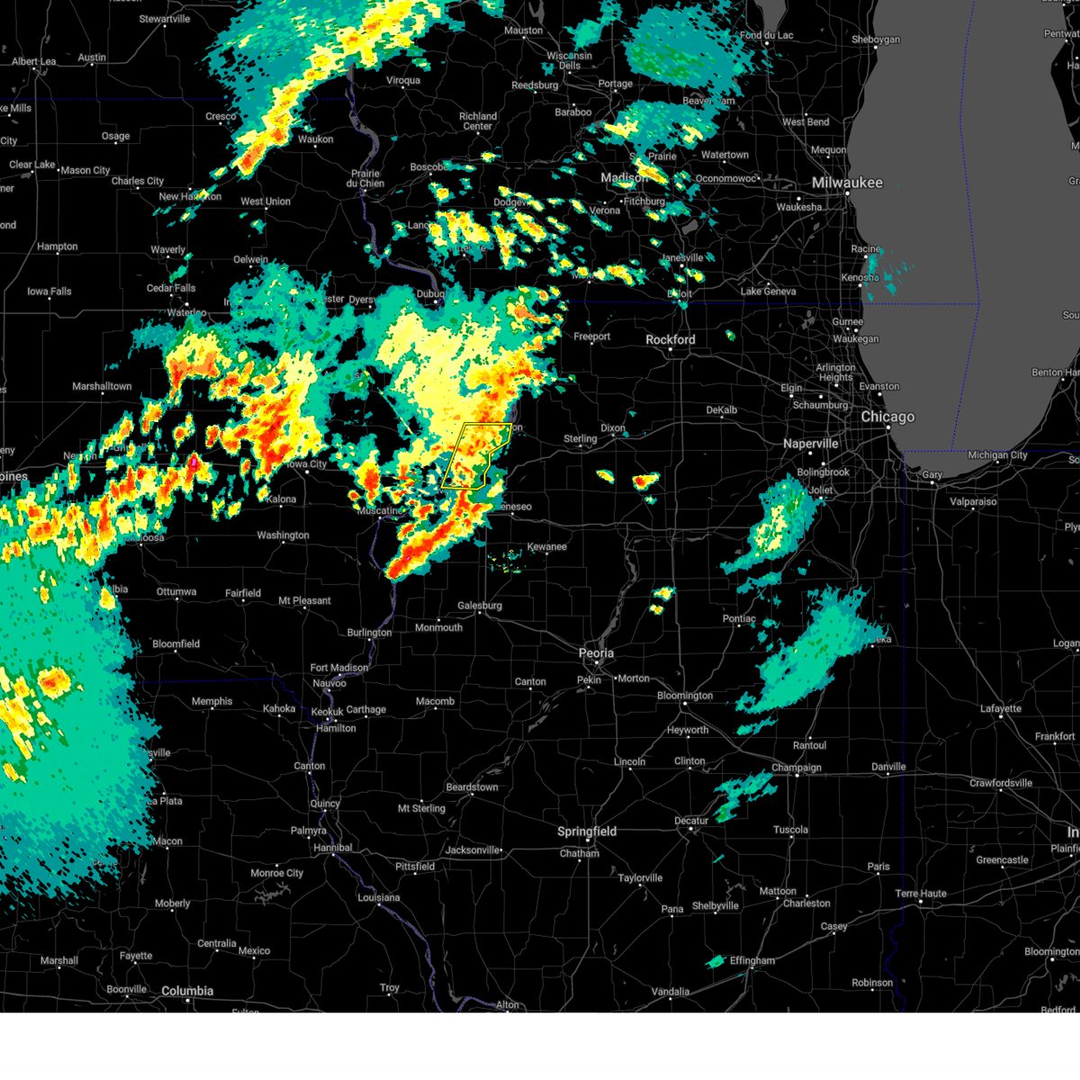 The storms which prompted the warning have weakened below severe limits, and no longer pose an immediate threat to life or property. therefore, the warning will be allowed to expire. however, small hail and gusty winds are still possible with these thunderstorms. The storms which prompted the warning have weakened below severe limits, and no longer pose an immediate threat to life or property. therefore, the warning will be allowed to expire. however, small hail and gusty winds are still possible with these thunderstorms.
|
| 10/24/2024 9:20 PM CDT |
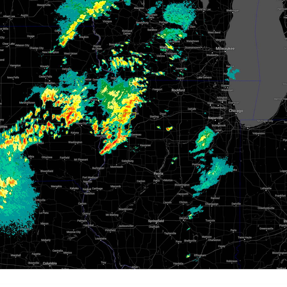 At 919 pm cdt, severe thunderstorms were located along a line extending from elvira to the north side of bettendorf, moving east at 45 mph (radar indicated). Hazards include 60 mph wind gusts. Expect damage to roofs, siding, and trees. locations impacted include, northern part of bettendorf, clinton, eldridge, camanche, le claire, fulton, princeton, long grove, cordova, mccausland, low moor, malone, rock creek marina and campground, folletts, park view, elvira, princeton wildlife area, davenport municipal airport, and rock creek park. This includes the following highways, interstate 80 in iowa between mile markers 293 and 306. At 919 pm cdt, severe thunderstorms were located along a line extending from elvira to the north side of bettendorf, moving east at 45 mph (radar indicated). Hazards include 60 mph wind gusts. Expect damage to roofs, siding, and trees. locations impacted include, northern part of bettendorf, clinton, eldridge, camanche, le claire, fulton, princeton, long grove, cordova, mccausland, low moor, malone, rock creek marina and campground, folletts, park view, elvira, princeton wildlife area, davenport municipal airport, and rock creek park. This includes the following highways, interstate 80 in iowa between mile markers 293 and 306.
|
| 10/24/2024 9:09 PM CDT |
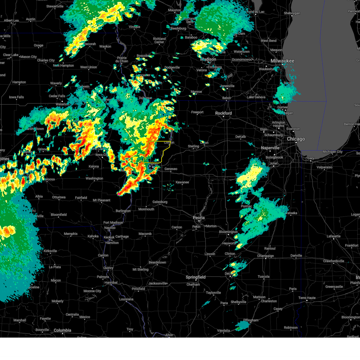 At 908 pm cdt, severe thunderstorms were located along a line extending from near malone to davenport municipal airport, moving east at 45 mph (radar indicated). Hazards include 60 mph wind gusts. Expect damage to roofs, siding, and trees. locations impacted include, northern parts of davenport and bettendorf, clinton, eldridge, dewitt, camanche, le claire, fulton, princeton, long grove, cordova, donahue, mccausland, low moor, malone, folletts, elvira, davenport municipal airport, rock creek marina and campground, and park view. this includes the following highways, interstate 74 in iowa near mile marker 1. Interstate 80 in iowa between mile markers 289 and 306. At 908 pm cdt, severe thunderstorms were located along a line extending from near malone to davenport municipal airport, moving east at 45 mph (radar indicated). Hazards include 60 mph wind gusts. Expect damage to roofs, siding, and trees. locations impacted include, northern parts of davenport and bettendorf, clinton, eldridge, dewitt, camanche, le claire, fulton, princeton, long grove, cordova, donahue, mccausland, low moor, malone, folletts, elvira, davenport municipal airport, rock creek marina and campground, and park view. this includes the following highways, interstate 74 in iowa near mile marker 1. Interstate 80 in iowa between mile markers 289 and 306.
|
| 10/24/2024 8:56 PM CDT |
 the severe thunderstorm warning has been cancelled and is no longer in effect the severe thunderstorm warning has been cancelled and is no longer in effect
|
| 10/24/2024 8:56 PM CDT |
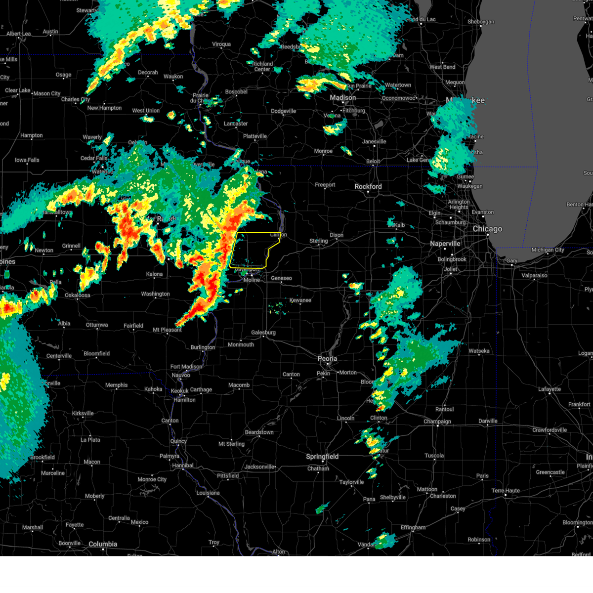 At 855 pm cdt, severe thunderstorms were located along a line extending from near grand mound to walcott, moving east at 50 mph (radar indicated). Hazards include 60 mph wind gusts. Expect damage to roofs, siding, and trees. locations impacted include, northern parts of davenport and bettendorf, clinton, eldridge, dewitt, camanche, le claire, fulton, walcott, princeton, long grove, cordova, grand mound, donahue, mccausland, low moor, maysville, malone, folletts, and elvira. this includes the following highways, interstate 74 in iowa near mile marker 1. Interstate 80 in iowa between mile markers 285 and 306. At 855 pm cdt, severe thunderstorms were located along a line extending from near grand mound to walcott, moving east at 50 mph (radar indicated). Hazards include 60 mph wind gusts. Expect damage to roofs, siding, and trees. locations impacted include, northern parts of davenport and bettendorf, clinton, eldridge, dewitt, camanche, le claire, fulton, walcott, princeton, long grove, cordova, grand mound, donahue, mccausland, low moor, maysville, malone, folletts, and elvira. this includes the following highways, interstate 74 in iowa near mile marker 1. Interstate 80 in iowa between mile markers 285 and 306.
|
| 10/24/2024 8:43 PM CDT |
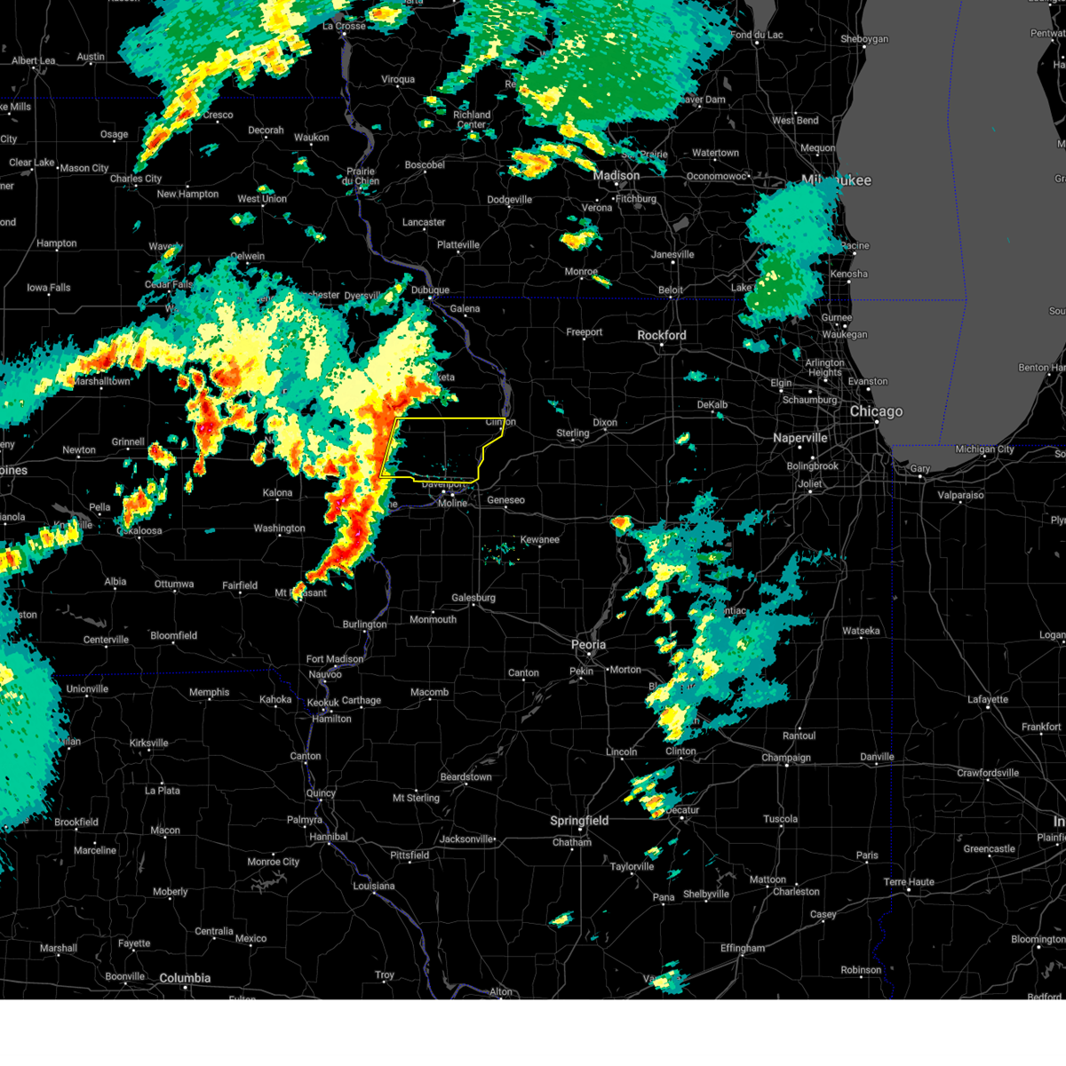 Svrdvn the national weather service in the quad cities has issued a * severe thunderstorm warning for, southeastern cedar county in east central iowa, scott county in east central iowa, southern clinton county in east central iowa, * until 930 pm cdt. * at 842 pm cdt, severe thunderstorms were located along a line extending from toronto to near wilton, moving east at 50 mph (radar indicated). Hazards include 60 mph wind gusts. expect damage to roofs, siding, and trees Svrdvn the national weather service in the quad cities has issued a * severe thunderstorm warning for, southeastern cedar county in east central iowa, scott county in east central iowa, southern clinton county in east central iowa, * until 930 pm cdt. * at 842 pm cdt, severe thunderstorms were located along a line extending from toronto to near wilton, moving east at 50 mph (radar indicated). Hazards include 60 mph wind gusts. expect damage to roofs, siding, and trees
|
| 7/15/2024 7:24 PM CDT | Numerous trees downed on locust street. time estimated using rada in scott county IA, 3.7 miles W of Davenport, IA |
| 7/15/2024 7:23 PM CDT | Numerous tree limbs down vicinity of northpark mall. tires from an auto shop blown into kimberly r in scott county IA, 1.3 miles SW of Davenport, IA |
| 7/15/2024 7:20 PM CDT | Multiple power lines down... with all of brady st blocked across from thesens. time estimated from rada in scott county IA, 1.6 miles W of Davenport, IA |
| 7/15/2024 7:15 PM CDT | 6 inch diameter tree branch down with an estimated 75 mph wind gus in scott county IA, 1.9 miles N of Davenport, IA |
| 7/15/2024 7:12 PM CDT | Time estimated from radar dat in scott county IA, 5 miles SE of Davenport, IA |
| 7/15/2024 7:12 PM CDT |
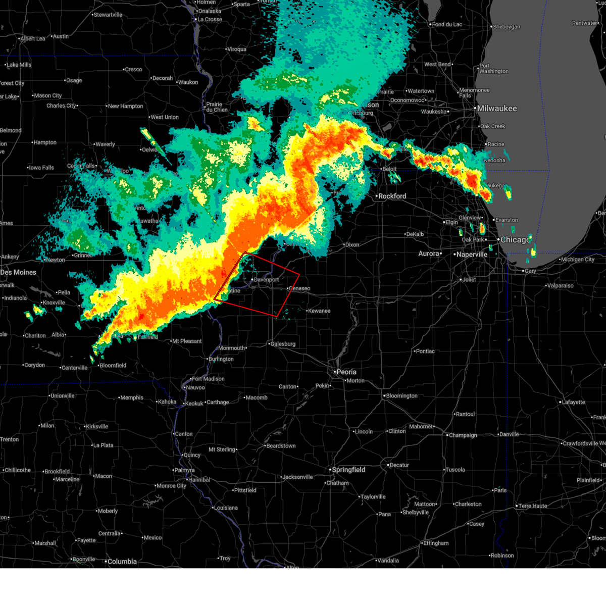 Tordvn the national weather service in the quad cities has issued a * tornado warning for, rock island county in northwestern illinois, northeastern mercer county in northwestern illinois, southern whiteside county in northwestern illinois, western henry county in northwestern illinois, scott county in east central iowa, northeastern muscatine county in east central iowa, * until 800 pm cdt. * at 711 pm cdt, severe thunderstorms capable of producing a tornado were located along a line extending from near donahue to near illinois city, moving east at 45 mph (radar indicated rotation). Hazards include tornado. Flying debris will be dangerous to those caught without shelter. mobile homes will be damaged or destroyed. damage to roofs, windows, and vehicles will occur. tree damage is likely. these dangerous storms will be near, davenport, rock island, eldridge, blue grass, buffalo, andalusia, long grove, montpelier, edgington, and west lake park around 715 pm cdt. moline, bettendorf, milan, reynolds, taylor ridge, hamlet, rock island arsenal, and blackhawk state park around 720 pm cdt. east moline, le claire, coal valley, hampton, princeton, cordova, riverdale, oak grove, preemption, and panorama park around 725 pm cdt. silvis, port byron, rapids city, matherville, sherrard, boden, carbon cliff, silvis heights, barstow, and rock island county fairgrounds around 730 pm cdt. other locations in the path of these tornadic storms include colona, orion, cleveland, osborn, warner, cable, dayton, sunny hill, sunny hill estates, swedona, lynn center, hillsdale, shady beach, morristown, joslin, ophiem, geneseo, andover, osco and cambridge. this includes the following highways, interstate 74 in iowa between mile markers 1 and 5. interstate 80 in iowa between mile markers 284 and 306. interstate 80 in illinois between mile markers 1 and 21. interstate 74 in illinois between mile markers 1 and 30. interstate 88 between mile markers 1 and 11. Interstate 280 between mile markers 1 and 18. Tordvn the national weather service in the quad cities has issued a * tornado warning for, rock island county in northwestern illinois, northeastern mercer county in northwestern illinois, southern whiteside county in northwestern illinois, western henry county in northwestern illinois, scott county in east central iowa, northeastern muscatine county in east central iowa, * until 800 pm cdt. * at 711 pm cdt, severe thunderstorms capable of producing a tornado were located along a line extending from near donahue to near illinois city, moving east at 45 mph (radar indicated rotation). Hazards include tornado. Flying debris will be dangerous to those caught without shelter. mobile homes will be damaged or destroyed. damage to roofs, windows, and vehicles will occur. tree damage is likely. these dangerous storms will be near, davenport, rock island, eldridge, blue grass, buffalo, andalusia, long grove, montpelier, edgington, and west lake park around 715 pm cdt. moline, bettendorf, milan, reynolds, taylor ridge, hamlet, rock island arsenal, and blackhawk state park around 720 pm cdt. east moline, le claire, coal valley, hampton, princeton, cordova, riverdale, oak grove, preemption, and panorama park around 725 pm cdt. silvis, port byron, rapids city, matherville, sherrard, boden, carbon cliff, silvis heights, barstow, and rock island county fairgrounds around 730 pm cdt. other locations in the path of these tornadic storms include colona, orion, cleveland, osborn, warner, cable, dayton, sunny hill, sunny hill estates, swedona, lynn center, hillsdale, shady beach, morristown, joslin, ophiem, geneseo, andover, osco and cambridge. this includes the following highways, interstate 74 in iowa between mile markers 1 and 5. interstate 80 in iowa between mile markers 284 and 306. interstate 80 in illinois between mile markers 1 and 21. interstate 74 in illinois between mile markers 1 and 30. interstate 88 between mile markers 1 and 11. Interstate 280 between mile markers 1 and 18.
|
| 7/15/2024 6:57 PM CDT |
 At 657 pm cdt, severe thunderstorms were located along a line extending from near calamus to near cranston, moving southeast at 40 mph (radar indicated). Hazards include 70 mph wind gusts and penny size hail. Expect considerable tree damage. damage is likely to mobile homes, roofs, and outbuildings. locations impacted include, davenport, moline, rock island, bettendorf, muscatine, west branch, durant, eldridge, milan, west liberty, wilton, walcott, blue grass, buffalo, andalusia, princeton, long grove, reynolds, conesville, and riverdale. this includes the following highways, interstate 74 in iowa between mile markers 1 and 5. interstate 80 in iowa between mile markers 254 and 303. interstate 74 in illinois between mile markers 1 and 2. Interstate 280 between mile markers 1 and 16. At 657 pm cdt, severe thunderstorms were located along a line extending from near calamus to near cranston, moving southeast at 40 mph (radar indicated). Hazards include 70 mph wind gusts and penny size hail. Expect considerable tree damage. damage is likely to mobile homes, roofs, and outbuildings. locations impacted include, davenport, moline, rock island, bettendorf, muscatine, west branch, durant, eldridge, milan, west liberty, wilton, walcott, blue grass, buffalo, andalusia, princeton, long grove, reynolds, conesville, and riverdale. this includes the following highways, interstate 74 in iowa between mile markers 1 and 5. interstate 80 in iowa between mile markers 254 and 303. interstate 74 in illinois between mile markers 1 and 2. Interstate 280 between mile markers 1 and 16.
|
| 7/15/2024 6:37 PM CDT |
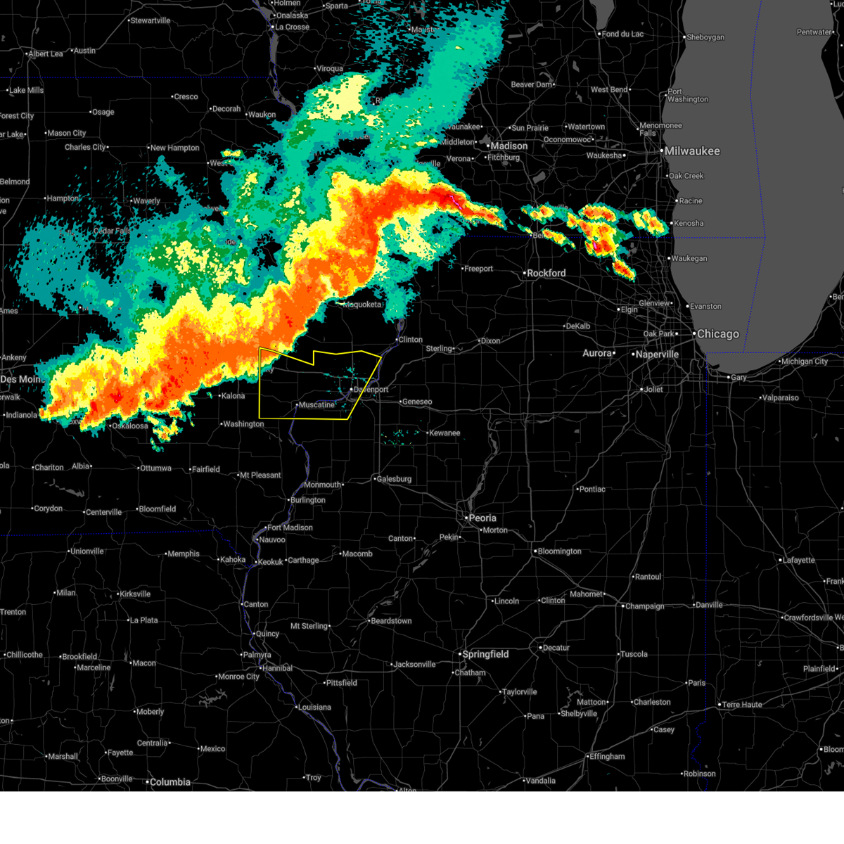 At 637 pm cdt, severe thunderstorms were located along a line extending from near walnut grove park to near west branch, moving southeast at 40 mph (radar indicated). Hazards include 70 mph wind gusts and penny size hail. Expect considerable tree damage. damage is likely to mobile homes, roofs, and outbuildings. locations impacted include, davenport, moline, rock island, bettendorf, muscatine, west branch, durant, eldridge, milan, west liberty, wilton, walcott, blue grass, buffalo, andalusia, princeton, long grove, reynolds, conesville, and riverdale. this includes the following highways, interstate 74 in iowa between mile markers 1 and 5. interstate 80 in iowa between mile markers 254 and 303. interstate 74 in illinois between mile markers 1 and 2. Interstate 280 between mile markers 1 and 16. At 637 pm cdt, severe thunderstorms were located along a line extending from near walnut grove park to near west branch, moving southeast at 40 mph (radar indicated). Hazards include 70 mph wind gusts and penny size hail. Expect considerable tree damage. damage is likely to mobile homes, roofs, and outbuildings. locations impacted include, davenport, moline, rock island, bettendorf, muscatine, west branch, durant, eldridge, milan, west liberty, wilton, walcott, blue grass, buffalo, andalusia, princeton, long grove, reynolds, conesville, and riverdale. this includes the following highways, interstate 74 in iowa between mile markers 1 and 5. interstate 80 in iowa between mile markers 254 and 303. interstate 74 in illinois between mile markers 1 and 2. Interstate 280 between mile markers 1 and 16.
|
| 7/15/2024 6:27 PM CDT |
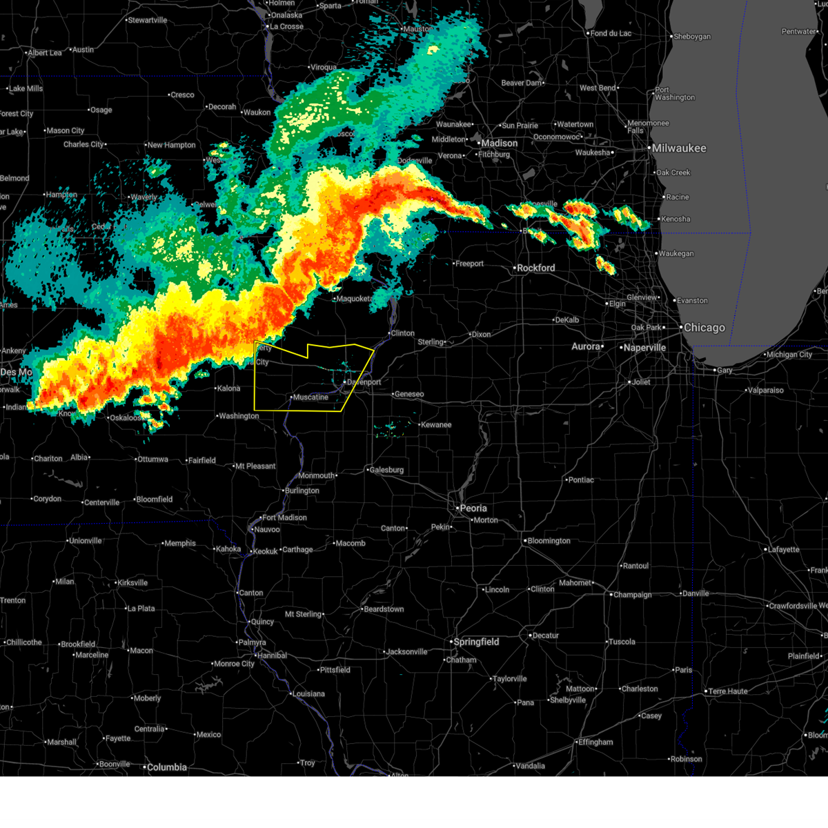 Svrdvn the national weather service in the quad cities has issued a * severe thunderstorm warning for, southwestern rock island county in northwestern illinois, southern cedar county in east central iowa, scott county in east central iowa, muscatine county in east central iowa, south central clinton county in east central iowa, * until 730 pm cdt. * at 626 pm cdt, severe thunderstorms were located along a line extending from oxford mills to herbert hoover national historic site, moving southeast at 35 mph (radar indicated). Hazards include 70 mph wind gusts and penny size hail. Expect considerable tree damage. Damage is likely to mobile homes, roofs, and outbuildings. Svrdvn the national weather service in the quad cities has issued a * severe thunderstorm warning for, southwestern rock island county in northwestern illinois, southern cedar county in east central iowa, scott county in east central iowa, muscatine county in east central iowa, south central clinton county in east central iowa, * until 730 pm cdt. * at 626 pm cdt, severe thunderstorms were located along a line extending from oxford mills to herbert hoover national historic site, moving southeast at 35 mph (radar indicated). Hazards include 70 mph wind gusts and penny size hail. Expect considerable tree damage. Damage is likely to mobile homes, roofs, and outbuildings.
|
| 7/14/2024 10:44 PM CDT |
 The strong winds which prompted the warning have moved out of scott county into rock island county. therefore, the warning will be allowed to expire for scott county. however, gusty winds and heavy rain are still possible with this thunderstorm. a severe thunderstorm warning remains in effect until 1115 pm cdt for parts of rock island, henry, and southwest whiteside counties. a severe thunderstorm watch remains in effect until 100 am cdt for northwestern illinois, and east central iowa. The strong winds which prompted the warning have moved out of scott county into rock island county. therefore, the warning will be allowed to expire for scott county. however, gusty winds and heavy rain are still possible with this thunderstorm. a severe thunderstorm warning remains in effect until 1115 pm cdt for parts of rock island, henry, and southwest whiteside counties. a severe thunderstorm watch remains in effect until 100 am cdt for northwestern illinois, and east central iowa.
|
| 7/14/2024 10:35 PM CDT | Tree blown dow in scott county IA, 2.2 miles NNE of Davenport, IA |
| 7/14/2024 10:35 PM CDT | 1400 block of west 3rd street. tree blown dow in scott county IA, 2 miles NNW of Davenport, IA |
| 7/14/2024 10:35 PM CDT | 1500 block of iowa street. tree down on powerlin in scott county IA, 1.7 miles WNW of Davenport, IA |
| 7/14/2024 10:35 PM CDT | Trees blown down at 7th and iowa s in scott county IA, 2 miles NW of Davenport, IA |
| 7/14/2024 10:31 PM CDT |
 At 1031 pm cdt, a severe thunderstorm was located near le claire, or near bettendorf, moving southeast at 40 mph (radar indicated). Hazards include 70 mph wind gusts and penny size hail. Expect considerable tree damage. damage is likely to mobile homes, roofs, and outbuildings. this severe storm will be near, bettendorf, le claire, princeton, cordova, riverdale, panorama park, princeton wildlife area, and pleasant valley around 1035 pm cdt. this includes the following highways, interstate 74 in iowa between mile markers 1 and 5. Interstate 80 in iowa between mile markers 291 and 306. At 1031 pm cdt, a severe thunderstorm was located near le claire, or near bettendorf, moving southeast at 40 mph (radar indicated). Hazards include 70 mph wind gusts and penny size hail. Expect considerable tree damage. damage is likely to mobile homes, roofs, and outbuildings. this severe storm will be near, bettendorf, le claire, princeton, cordova, riverdale, panorama park, princeton wildlife area, and pleasant valley around 1035 pm cdt. this includes the following highways, interstate 74 in iowa between mile markers 1 and 5. Interstate 80 in iowa between mile markers 291 and 306.
|
| 7/14/2024 10:24 PM CDT |
 At 1024 pm cdt, a severe thunderstorm was located over park view, or 8 miles north of bettendorf, moving southeast at 40 mph (radar indicated). Hazards include 70 mph wind gusts and penny size hail. Expect considerable tree damage. damage is likely to mobile homes, roofs, and outbuildings. this severe storm will be near, davenport, bettendorf, le claire, princeton, cordova, riverdale, panorama park, princeton wildlife area, and pleasant valley around 1030 pm cdt. this includes the following highways, interstate 74 in iowa between mile markers 1 and 5. Interstate 80 in iowa between mile markers 291 and 306. At 1024 pm cdt, a severe thunderstorm was located over park view, or 8 miles north of bettendorf, moving southeast at 40 mph (radar indicated). Hazards include 70 mph wind gusts and penny size hail. Expect considerable tree damage. damage is likely to mobile homes, roofs, and outbuildings. this severe storm will be near, davenport, bettendorf, le claire, princeton, cordova, riverdale, panorama park, princeton wildlife area, and pleasant valley around 1030 pm cdt. this includes the following highways, interstate 74 in iowa between mile markers 1 and 5. Interstate 80 in iowa between mile markers 291 and 306.
|
| 7/14/2024 10:15 PM CDT |
 At 1015 pm cdt, a severe thunderstorm was located over long grove, or 11 miles north of davenport, moving southeast at 40 mph (radar indicated). Hazards include 60 mph wind gusts and penny size hail. Expect damage to roofs, siding, and trees. this severe storm will be near, davenport, bettendorf, eldridge, princeton, long grove, mccausland, scott county park, park view, and davenport municipal airport around 1020 pm cdt. le claire, riverdale, panorama park, and pleasant valley around 1025 pm cdt. other locations in the path of this severe thunderstorm include cordova and princeton wildlife area. this includes the following highways, interstate 74 in iowa between mile markers 1 and 5. Interstate 80 in iowa between mile markers 291 and 306. At 1015 pm cdt, a severe thunderstorm was located over long grove, or 11 miles north of davenport, moving southeast at 40 mph (radar indicated). Hazards include 60 mph wind gusts and penny size hail. Expect damage to roofs, siding, and trees. this severe storm will be near, davenport, bettendorf, eldridge, princeton, long grove, mccausland, scott county park, park view, and davenport municipal airport around 1020 pm cdt. le claire, riverdale, panorama park, and pleasant valley around 1025 pm cdt. other locations in the path of this severe thunderstorm include cordova and princeton wildlife area. this includes the following highways, interstate 74 in iowa between mile markers 1 and 5. Interstate 80 in iowa between mile markers 291 and 306.
|
| 7/14/2024 10:09 PM CDT |
 the severe thunderstorm warning has been cancelled and is no longer in effect the severe thunderstorm warning has been cancelled and is no longer in effect
|
| 7/14/2024 10:09 PM CDT |
 At 1009 pm cdt, a severe thunderstorm was located near donahue, or 13 miles north of davenport, moving southeast at 40 mph (radar indicated). Hazards include 60 mph wind gusts and penny size hail. Expect damage to roofs, siding, and trees. this severe storm will be near, davenport, eldridge, dewitt, long grove, donahue, mccausland, scott county park, park view, and davenport municipal airport around 1015 pm cdt. other locations in the path of this severe thunderstorm include bettendorf, le claire, princeton, riverdale, panorama park, pleasant valley, cordova and princeton wildlife area. this includes the following highways, interstate 74 in iowa between mile markers 1 and 5. Interstate 80 in iowa between mile markers 291 and 306. At 1009 pm cdt, a severe thunderstorm was located near donahue, or 13 miles north of davenport, moving southeast at 40 mph (radar indicated). Hazards include 60 mph wind gusts and penny size hail. Expect damage to roofs, siding, and trees. this severe storm will be near, davenport, eldridge, dewitt, long grove, donahue, mccausland, scott county park, park view, and davenport municipal airport around 1015 pm cdt. other locations in the path of this severe thunderstorm include bettendorf, le claire, princeton, riverdale, panorama park, pleasant valley, cordova and princeton wildlife area. this includes the following highways, interstate 74 in iowa between mile markers 1 and 5. Interstate 80 in iowa between mile markers 291 and 306.
|
| 7/14/2024 9:57 PM CDT |
 At 957 pm cdt, a severe thunderstorm was located over wheatland, or 15 miles north of durant, moving southeast at 40 mph (radar indicated). Hazards include 60 mph wind gusts and penny size hail. Expect damage to roofs, siding, and trees. this severe storm will be near, grand mound, calamus, donahue, dixon, big rock, camp liberty, and sherman park around 1000 pm cdt. dewitt, long grove, and maysville around 1005 pm cdt. eldridge, scott county park, and park view around 1010 pm cdt. other locations in the path of this severe thunderstorm include davenport, mccausland, davenport municipal airport, bettendorf, le claire, princeton, riverdale, panorama park, pleasant valley, cordova and princeton wildlife area. this includes the following highways, interstate 74 in iowa between mile markers 1 and 5. Interstate 80 in iowa between mile markers 291 and 306. At 957 pm cdt, a severe thunderstorm was located over wheatland, or 15 miles north of durant, moving southeast at 40 mph (radar indicated). Hazards include 60 mph wind gusts and penny size hail. Expect damage to roofs, siding, and trees. this severe storm will be near, grand mound, calamus, donahue, dixon, big rock, camp liberty, and sherman park around 1000 pm cdt. dewitt, long grove, and maysville around 1005 pm cdt. eldridge, scott county park, and park view around 1010 pm cdt. other locations in the path of this severe thunderstorm include davenport, mccausland, davenport municipal airport, bettendorf, le claire, princeton, riverdale, panorama park, pleasant valley, cordova and princeton wildlife area. this includes the following highways, interstate 74 in iowa between mile markers 1 and 5. Interstate 80 in iowa between mile markers 291 and 306.
|
| 7/14/2024 9:51 PM CDT |
 Svrdvn the national weather service in the quad cities has issued a * severe thunderstorm warning for, northeastern cedar county in east central iowa, scott county in east central iowa, southwestern clinton county in east central iowa, * until 1045 pm cdt. * at 950 pm cdt, a severe thunderstorm was located over lowden, or 13 miles northeast of tipton, moving southeast at 40 mph (radar indicated). Hazards include 60 mph wind gusts. Expect damage to roofs, siding, and trees. this severe thunderstorm will be near, wheatland, grand mound, calamus, dixon, big rock, camp liberty, and sherman park around 955 pm cdt. donahue around 1000 pm cdt. dewitt, long grove, and maysville around 1005 pm cdt. eldridge, scott county park, and park view around 1010 pm cdt. other locations in the path of this severe thunderstorm include davenport, mccausland, davenport municipal airport, bettendorf, le claire, princeton, riverdale, panorama park, pleasant valley, cordova and princeton wildlife area. this includes the following highways, interstate 74 in iowa between mile markers 1 and 5. Interstate 80 in iowa between mile markers 291 and 306. Svrdvn the national weather service in the quad cities has issued a * severe thunderstorm warning for, northeastern cedar county in east central iowa, scott county in east central iowa, southwestern clinton county in east central iowa, * until 1045 pm cdt. * at 950 pm cdt, a severe thunderstorm was located over lowden, or 13 miles northeast of tipton, moving southeast at 40 mph (radar indicated). Hazards include 60 mph wind gusts. Expect damage to roofs, siding, and trees. this severe thunderstorm will be near, wheatland, grand mound, calamus, dixon, big rock, camp liberty, and sherman park around 955 pm cdt. donahue around 1000 pm cdt. dewitt, long grove, and maysville around 1005 pm cdt. eldridge, scott county park, and park view around 1010 pm cdt. other locations in the path of this severe thunderstorm include davenport, mccausland, davenport municipal airport, bettendorf, le claire, princeton, riverdale, panorama park, pleasant valley, cordova and princeton wildlife area. this includes the following highways, interstate 74 in iowa between mile markers 1 and 5. Interstate 80 in iowa between mile markers 291 and 306.
|
| 7/14/2024 9:42 PM CDT |
 The storm which prompted the warning has weakened below severe limits, and no longer poses an immediate threat to life or property. therefore, the warning will be allowed to expire. however, gusty winds and heavy rain are still possible with this thunderstorm. a severe thunderstorm watch remains in effect until 100 am cdt for northwestern illinois, and east central iowa. The storm which prompted the warning has weakened below severe limits, and no longer poses an immediate threat to life or property. therefore, the warning will be allowed to expire. however, gusty winds and heavy rain are still possible with this thunderstorm. a severe thunderstorm watch remains in effect until 100 am cdt for northwestern illinois, and east central iowa.
|
| 7/14/2024 9:31 PM CDT |
 At 931 pm cdt, a severe thunderstorm was located over marston, or 9 miles north of aledo, moving east at 30 mph (radar indicated). Hazards include 60 mph wind gusts. Expect damage to roofs, siding, and trees. this severe storm will be near, rock island, andalusia, matherville, reynolds, taylor ridge, hamlet, preemption, edgington, gingle corners, and aledo mercer county airport around 935 pm cdt. milan, oak grove, boden, coyne center, and old gilchrist around 940 pm cdt. sherrard, shale city, cable, and wanlock around 945 pm cdt. swedona and indian bluff golf course around 950 pm cdt. coal valley and griffin around 955 pm cdt. moline around 1000 pm cdt. other locations impacted by this severe thunderstorm include preemption, blackhawk state park, aledo mercer county airport, fruitland, wanlock, coyne center, swedona, edgington, gingle corners, and indian bluff golf course. this includes the following highways, interstate 74 in illinois between mile markers 4 and 7. Interstate 280 between mile markers 11 and 18. At 931 pm cdt, a severe thunderstorm was located over marston, or 9 miles north of aledo, moving east at 30 mph (radar indicated). Hazards include 60 mph wind gusts. Expect damage to roofs, siding, and trees. this severe storm will be near, rock island, andalusia, matherville, reynolds, taylor ridge, hamlet, preemption, edgington, gingle corners, and aledo mercer county airport around 935 pm cdt. milan, oak grove, boden, coyne center, and old gilchrist around 940 pm cdt. sherrard, shale city, cable, and wanlock around 945 pm cdt. swedona and indian bluff golf course around 950 pm cdt. coal valley and griffin around 955 pm cdt. moline around 1000 pm cdt. other locations impacted by this severe thunderstorm include preemption, blackhawk state park, aledo mercer county airport, fruitland, wanlock, coyne center, swedona, edgington, gingle corners, and indian bluff golf course. this includes the following highways, interstate 74 in illinois between mile markers 4 and 7. Interstate 280 between mile markers 11 and 18.
|
| 7/14/2024 9:10 PM CDT |
 At 909 pm cdt, a severe thunderstorm was located over hamlet, or 9 miles north of aledo, moving east at 40 mph (radar indicated). Hazards include 60 mph wind gusts. Expect damage to roofs, siding, and trees. this severe storm will be near, rock island, milan, andalusia, matherville, reynolds, oak grove, boden, taylor ridge, preemption, and coyne center around 915 pm cdt. sherrard, shale city, cable, and wanlock around 920 pm cdt. coal valley, viola, swedona, indian bluff golf course, and griffin around 925 pm cdt. new windsor around 935 pm cdt. other locations impacted by this severe thunderstorm include preemption, blackhawk state park, aledo mercer county airport, fruitland, loud thunder forest preserve, wanlock, coyne center, swedona, edgington, and gingle corners. this includes the following highways, interstate 74 in illinois between mile markers 4 and 7. Interstate 280 between mile markers 11 and 18. At 909 pm cdt, a severe thunderstorm was located over hamlet, or 9 miles north of aledo, moving east at 40 mph (radar indicated). Hazards include 60 mph wind gusts. Expect damage to roofs, siding, and trees. this severe storm will be near, rock island, milan, andalusia, matherville, reynolds, oak grove, boden, taylor ridge, preemption, and coyne center around 915 pm cdt. sherrard, shale city, cable, and wanlock around 920 pm cdt. coal valley, viola, swedona, indian bluff golf course, and griffin around 925 pm cdt. new windsor around 935 pm cdt. other locations impacted by this severe thunderstorm include preemption, blackhawk state park, aledo mercer county airport, fruitland, loud thunder forest preserve, wanlock, coyne center, swedona, edgington, and gingle corners. this includes the following highways, interstate 74 in illinois between mile markers 4 and 7. Interstate 280 between mile markers 11 and 18.
|
| 7/14/2024 8:58 PM CDT |
 Svrdvn the national weather service in the quad cities has issued a * severe thunderstorm warning for, rock island county in northwestern illinois, mercer county in northwestern illinois, * until 945 pm cdt. * at 857 pm cdt, a severe thunderstorm was located over petersville, or 11 miles southeast of muscatine, moving east at 40 mph (radar indicated). Hazards include 60 mph wind gusts. Expect damage to roofs, siding, and trees. this severe thunderstorm will be near, aledo, millersburg, reynolds, hamlet, edgington, marston, gingle corners, aledo mercer county airport, mercer county fairgrounds, and loud thunder scout camp around 905 pm cdt. matherville, boden, taylor ridge, shale city, preemption, wanlock, and old gilchrist around 910 pm cdt. viola, sherrard, and gilchrist around 915 pm cdt. cable, coyne center, swedona, and griffin around 920 pm cdt. new windsor and new windsor around 925 pm cdt. other locations impacted by this severe thunderstorm include preemption, blackhawk state park, aledo mercer county airport, alexis, fruitland, loud thunder forest preserve, wanlock, coyne center, swedona, and edgington. this includes the following highways, interstate 74 in illinois between mile markers 4 and 7. Interstate 280 between mile markers 11 and 18. Svrdvn the national weather service in the quad cities has issued a * severe thunderstorm warning for, rock island county in northwestern illinois, mercer county in northwestern illinois, * until 945 pm cdt. * at 857 pm cdt, a severe thunderstorm was located over petersville, or 11 miles southeast of muscatine, moving east at 40 mph (radar indicated). Hazards include 60 mph wind gusts. Expect damage to roofs, siding, and trees. this severe thunderstorm will be near, aledo, millersburg, reynolds, hamlet, edgington, marston, gingle corners, aledo mercer county airport, mercer county fairgrounds, and loud thunder scout camp around 905 pm cdt. matherville, boden, taylor ridge, shale city, preemption, wanlock, and old gilchrist around 910 pm cdt. viola, sherrard, and gilchrist around 915 pm cdt. cable, coyne center, swedona, and griffin around 920 pm cdt. new windsor and new windsor around 925 pm cdt. other locations impacted by this severe thunderstorm include preemption, blackhawk state park, aledo mercer county airport, alexis, fruitland, loud thunder forest preserve, wanlock, coyne center, swedona, and edgington. this includes the following highways, interstate 74 in illinois between mile markers 4 and 7. Interstate 280 between mile markers 11 and 18.
|
| 7/2/2024 7:23 PM CDT |
 At 722 pm cdt, a severe thunderstorm was located over erie, or 10 miles southwest of morrison, moving east at 50 mph (radar indicated). Hazards include 60 mph wind gusts. Expect damage to roofs, siding, and trees. this severe thunderstorm will remain over mainly rural areas of eastern rock island, western whiteside, northern henry, eastern scott and southeastern clinton counties, including the following locations, silvis heights, folletts, spring hill, campbells island, coyne center, dayton, panorama park, newton corners, moline quad-city airport, and green river. this includes the following highways, interstate 74 in iowa between mile markers 1 and 5. interstate 80 in iowa between mile markers 298 and 306. interstate 80 in illinois between mile markers 1 and 29. interstate 74 in illinois between mile markers 1 and 17. interstate 88 between mile markers 1 and 24. Interstate 280 between mile markers 13 and 18. At 722 pm cdt, a severe thunderstorm was located over erie, or 10 miles southwest of morrison, moving east at 50 mph (radar indicated). Hazards include 60 mph wind gusts. Expect damage to roofs, siding, and trees. this severe thunderstorm will remain over mainly rural areas of eastern rock island, western whiteside, northern henry, eastern scott and southeastern clinton counties, including the following locations, silvis heights, folletts, spring hill, campbells island, coyne center, dayton, panorama park, newton corners, moline quad-city airport, and green river. this includes the following highways, interstate 74 in iowa between mile markers 1 and 5. interstate 80 in iowa between mile markers 298 and 306. interstate 80 in illinois between mile markers 1 and 29. interstate 74 in illinois between mile markers 1 and 17. interstate 88 between mile markers 1 and 24. Interstate 280 between mile markers 13 and 18.
|
| 7/2/2024 7:08 PM CDT |
 the severe thunderstorm warning has been cancelled and is no longer in effect the severe thunderstorm warning has been cancelled and is no longer in effect
|
| 7/2/2024 7:08 PM CDT |
 At 707 pm cdt, a severe thunderstorm was located over princeton, or 9 miles northeast of bettendorf, moving east at 50 mph (radar indicated). Hazards include 60 mph wind gusts. Expect damage to roofs, siding, and trees. locations impacted include, erie, hillsdale, shady beach, spring hill, joslin, newton corners and fenton. this includes the following highways, interstate 74 in iowa between mile markers 1 and 5. interstate 80 in iowa between mile markers 288 and 306. interstate 80 in illinois between mile markers 1 and 29. interstate 74 in illinois between mile markers 1 and 18. interstate 88 between mile markers 1 and 24. Interstate 280 between mile markers 1 and 18. At 707 pm cdt, a severe thunderstorm was located over princeton, or 9 miles northeast of bettendorf, moving east at 50 mph (radar indicated). Hazards include 60 mph wind gusts. Expect damage to roofs, siding, and trees. locations impacted include, erie, hillsdale, shady beach, spring hill, joslin, newton corners and fenton. this includes the following highways, interstate 74 in iowa between mile markers 1 and 5. interstate 80 in iowa between mile markers 288 and 306. interstate 80 in illinois between mile markers 1 and 29. interstate 74 in illinois between mile markers 1 and 18. interstate 88 between mile markers 1 and 24. Interstate 280 between mile markers 1 and 18.
|
| 7/2/2024 7:00 PM CDT |
 the tornado warning has been cancelled and is no longer in effect the tornado warning has been cancelled and is no longer in effect
|
| 7/2/2024 7:00 PM CDT |
 At 700 pm cdt, a severe squall line capable of producing both tornadoes and extensive straight line wind damage was located along a line extending from welton to eldridge to credit island, moving east at 50 mph (radar indicated rotation). Hazards include tornado. Flying debris will be dangerous to those caught without shelter. mobile homes will be damaged or destroyed. damage to roofs, windows, and vehicles will occur. tree damage is likely. locations impacted include, davenport, rock island, bettendorf, clinton, durant, eldridge, dewitt, camanche, le claire, port byron, walcott, blue grass, buffalo, princeton, long grove, wheatland, grand mound, calamus, riverdale, and charlotte. this includes the following highways, interstate 74 in iowa between mile markers 1 and 4. interstate 80 in iowa between mile markers 279 and 306. Interstate 280 between mile markers 1 and 9. At 700 pm cdt, a severe squall line capable of producing both tornadoes and extensive straight line wind damage was located along a line extending from welton to eldridge to credit island, moving east at 50 mph (radar indicated rotation). Hazards include tornado. Flying debris will be dangerous to those caught without shelter. mobile homes will be damaged or destroyed. damage to roofs, windows, and vehicles will occur. tree damage is likely. locations impacted include, davenport, rock island, bettendorf, clinton, durant, eldridge, dewitt, camanche, le claire, port byron, walcott, blue grass, buffalo, princeton, long grove, wheatland, grand mound, calamus, riverdale, and charlotte. this includes the following highways, interstate 74 in iowa between mile markers 1 and 4. interstate 80 in iowa between mile markers 279 and 306. Interstate 280 between mile markers 1 and 9.
|
| 7/2/2024 6:48 PM CDT |
 the severe thunderstorm warning has been cancelled and is no longer in effect the severe thunderstorm warning has been cancelled and is no longer in effect
|
| 7/2/2024 6:48 PM CDT |
 At 648 pm cdt, a severe thunderstorm was located over blue grass, or near davenport, moving east at 50 mph (radar indicated). Hazards include 70 mph wind gusts. Expect considerable tree damage. damage is likely to mobile homes, roofs, and outbuildings. locations impacted include, davenport, rock island and credit island. this includes the following highways, interstate 80 in iowa between mile markers 267 and 291. Interstate 280 between mile markers 1 and 12. At 648 pm cdt, a severe thunderstorm was located over blue grass, or near davenport, moving east at 50 mph (radar indicated). Hazards include 70 mph wind gusts. Expect considerable tree damage. damage is likely to mobile homes, roofs, and outbuildings. locations impacted include, davenport, rock island and credit island. this includes the following highways, interstate 80 in iowa between mile markers 267 and 291. Interstate 280 between mile markers 1 and 12.
|
| 7/2/2024 6:44 PM CDT |
 Svrdvn the national weather service in the quad cities has issued a * severe thunderstorm warning for, rock island county in northwestern illinois, western whiteside county in northwestern illinois, northern henry county in northwestern illinois, southeastern cedar county in east central iowa, scott county in east central iowa, northeastern muscatine county in east central iowa, southern clinton county in east central iowa, * until 730 pm cdt. * at 643 pm cdt, a severe thunderstorm was located over walcott, or 8 miles northwest of davenport, moving east at 50 mph (radar indicated). Hazards include 70 mph wind gusts. Expect considerable tree damage. damage is likely to mobile homes, roofs, and outbuildings. this severe thunderstorm will be near, davenport, bettendorf, eldridge, long grove, donahue, rock island arsenal, scott county park, park view, davenport municipal airport, and mississippi valley fairgrounds around 650 pm cdt. le claire, hampton, princeton, riverdale, mccausland, panorama park, illiniwek forest preserve, and pleasant valley around 655 pm cdt. east moline, port byron, rapids city, cordova, campbells island, princeton wildlife area, and fishermans corner around 700 pm cdt. other locations in the path of this severe thunderstorm include rock creek park, folletts, rock creek marina and campground, camanche, hillsdale, joslin, erie, albany, newton corners, fenton and spring hill. this includes the following highways, interstate 74 in iowa between mile markers 1 and 5. interstate 80 in iowa between mile markers 277 and 306. interstate 80 in illinois between mile markers 1 and 29. interstate 74 in illinois between mile markers 1 and 18. interstate 88 between mile markers 1 and 24. Interstate 280 between mile markers 1 and 18. Svrdvn the national weather service in the quad cities has issued a * severe thunderstorm warning for, rock island county in northwestern illinois, western whiteside county in northwestern illinois, northern henry county in northwestern illinois, southeastern cedar county in east central iowa, scott county in east central iowa, northeastern muscatine county in east central iowa, southern clinton county in east central iowa, * until 730 pm cdt. * at 643 pm cdt, a severe thunderstorm was located over walcott, or 8 miles northwest of davenport, moving east at 50 mph (radar indicated). Hazards include 70 mph wind gusts. Expect considerable tree damage. damage is likely to mobile homes, roofs, and outbuildings. this severe thunderstorm will be near, davenport, bettendorf, eldridge, long grove, donahue, rock island arsenal, scott county park, park view, davenport municipal airport, and mississippi valley fairgrounds around 650 pm cdt. le claire, hampton, princeton, riverdale, mccausland, panorama park, illiniwek forest preserve, and pleasant valley around 655 pm cdt. east moline, port byron, rapids city, cordova, campbells island, princeton wildlife area, and fishermans corner around 700 pm cdt. other locations in the path of this severe thunderstorm include rock creek park, folletts, rock creek marina and campground, camanche, hillsdale, joslin, erie, albany, newton corners, fenton and spring hill. this includes the following highways, interstate 74 in iowa between mile markers 1 and 5. interstate 80 in iowa between mile markers 277 and 306. interstate 80 in illinois between mile markers 1 and 29. interstate 74 in illinois between mile markers 1 and 18. interstate 88 between mile markers 1 and 24. Interstate 280 between mile markers 1 and 18.
|
| 7/2/2024 6:37 PM CDT |
 the tornado warning has been cancelled and is no longer in effect the tornado warning has been cancelled and is no longer in effect
|
| 7/2/2024 6:37 PM CDT |
 At 637 pm cdt, a severe squall line capable of producing both tornadoes and extensive straight line wind damage was located along a line extending from bennett park to stockton to new era, moving east at 55 mph (radar indicated rotation). Hazards include tornado. Flying debris will be dangerous to those caught without shelter. mobile homes will be damaged or destroyed. damage to roofs, windows, and vehicles will occur. tree damage is likely. locations impacted include, davenport, eldridge, walcott, blue grass, buffalo, calamus, donahue, montpelier, dixon, maysville, rock island, bettendorf, long grove, grand mound, park view, davenport municipal airport, dewitt, riverdale, panorama park, scott county park, clinton county fairgrounds, le claire, princeton, mccausland, pleasant valley, malone, clinton, camanche, cordova, low moor, rock creek park, folletts, rock creek marina and campground and clinton municipal airport. this includes the following highways, interstate 74 in iowa between mile markers 1 and 4. interstate 80 in iowa between mile markers 261 and 306. Interstate 280 between mile markers 1 and 9. At 637 pm cdt, a severe squall line capable of producing both tornadoes and extensive straight line wind damage was located along a line extending from bennett park to stockton to new era, moving east at 55 mph (radar indicated rotation). Hazards include tornado. Flying debris will be dangerous to those caught without shelter. mobile homes will be damaged or destroyed. damage to roofs, windows, and vehicles will occur. tree damage is likely. locations impacted include, davenport, eldridge, walcott, blue grass, buffalo, calamus, donahue, montpelier, dixon, maysville, rock island, bettendorf, long grove, grand mound, park view, davenport municipal airport, dewitt, riverdale, panorama park, scott county park, clinton county fairgrounds, le claire, princeton, mccausland, pleasant valley, malone, clinton, camanche, cordova, low moor, rock creek park, folletts, rock creek marina and campground and clinton municipal airport. this includes the following highways, interstate 74 in iowa between mile markers 1 and 4. interstate 80 in iowa between mile markers 261 and 306. Interstate 280 between mile markers 1 and 9.
|
| 7/2/2024 6:32 PM CDT |
 At 632 pm cdt, a severe thunderstorm was located over sweetland center, or near durant, moving east at 45 mph (radar indicated). Hazards include 70 mph wind gusts. Expect considerable tree damage. damage is likely to mobile homes, roofs, and outbuildings. locations impacted include, durant, walcott, blue grass, buffalo, montpelier, stockton, new era, wildcat den state park, pleasant prairie, midway beach, davenport, maysville, west lake park, plainview, buffalo shores, rock island and credit island. this includes the following highways, interstate 80 in iowa between mile markers 264 and 291. Interstate 280 between mile markers 1 and 12. At 632 pm cdt, a severe thunderstorm was located over sweetland center, or near durant, moving east at 45 mph (radar indicated). Hazards include 70 mph wind gusts. Expect considerable tree damage. damage is likely to mobile homes, roofs, and outbuildings. locations impacted include, durant, walcott, blue grass, buffalo, montpelier, stockton, new era, wildcat den state park, pleasant prairie, midway beach, davenport, maysville, west lake park, plainview, buffalo shores, rock island and credit island. this includes the following highways, interstate 80 in iowa between mile markers 264 and 291. Interstate 280 between mile markers 1 and 12.
|
| 7/2/2024 6:21 PM CDT |
 Tordvn the national weather service in the quad cities has issued a * tornado warning for, cedar county in east central iowa, scott county in east central iowa, southeastern johnson county in east central iowa, muscatine county in east central iowa, central clinton county in east central iowa, * until 715 pm cdt. * at 621 pm cdt, severe thunderstorms capable of producing both tornadoes and extensive straight line wind damage were located along a line extending from cedar county fairgrounds to near moscow to near saulsbury bridge campground, moving east at 55 mph (radar indicated rotation). Hazards include tornado. Flying debris will be dangerous to those caught without shelter. mobile homes will be damaged or destroyed. damage to roofs, windows, and vehicles will occur. tree damage is likely. these dangerous storms will be near, muscatine, tipton, durant, wilton, bennett, sweetland center, moscow, and tipton matthews airport around 625 pm cdt. stockton, new liberty, new era, wildcat den state park, pleasant prairie, sunbury, bennett park, and shady creek campground around 630 pm cdt. walcott, blue grass, buffalo, wheatland, montpelier, dixon, plainview, midway beach, big rock, and camp liberty around 635 pm cdt. davenport, calamus, donahue, maysville, west lake park, and sherman park around 640 pm cdt. other locations in the path of these tornadic storms include rock island, eldridge, long grove, grand mound, credit island, davenport municipal airport, mississippi valley fairgrounds, bettendorf, dewitt, riverdale, scott county park, park view, le claire, mccausland, panorama park, pleasant valley, malone, clinton county fairgrounds, clinton, princeton, cordova, low moor, rock creek park, folletts and rock creek marina and campground. this includes the following highways, interstate 74 in iowa between mile markers 1 and 4. interstate 80 in iowa between mile markers 254 and 306. Interstate 280 between mile markers 1 and 9. Tordvn the national weather service in the quad cities has issued a * tornado warning for, cedar county in east central iowa, scott county in east central iowa, southeastern johnson county in east central iowa, muscatine county in east central iowa, central clinton county in east central iowa, * until 715 pm cdt. * at 621 pm cdt, severe thunderstorms capable of producing both tornadoes and extensive straight line wind damage were located along a line extending from cedar county fairgrounds to near moscow to near saulsbury bridge campground, moving east at 55 mph (radar indicated rotation). Hazards include tornado. Flying debris will be dangerous to those caught without shelter. mobile homes will be damaged or destroyed. damage to roofs, windows, and vehicles will occur. tree damage is likely. these dangerous storms will be near, muscatine, tipton, durant, wilton, bennett, sweetland center, moscow, and tipton matthews airport around 625 pm cdt. stockton, new liberty, new era, wildcat den state park, pleasant prairie, sunbury, bennett park, and shady creek campground around 630 pm cdt. walcott, blue grass, buffalo, wheatland, montpelier, dixon, plainview, midway beach, big rock, and camp liberty around 635 pm cdt. davenport, calamus, donahue, maysville, west lake park, and sherman park around 640 pm cdt. other locations in the path of these tornadic storms include rock island, eldridge, long grove, grand mound, credit island, davenport municipal airport, mississippi valley fairgrounds, bettendorf, dewitt, riverdale, scott county park, park view, le claire, mccausland, panorama park, pleasant valley, malone, clinton county fairgrounds, clinton, princeton, cordova, low moor, rock creek park, folletts and rock creek marina and campground. this includes the following highways, interstate 74 in iowa between mile markers 1 and 4. interstate 80 in iowa between mile markers 254 and 306. Interstate 280 between mile markers 1 and 9.
|
| 7/2/2024 6:13 PM CDT |
 Svrdvn the national weather service in the quad cities has issued a * severe thunderstorm warning for, southwestern rock island county in northwestern illinois, northwestern louisa county in southeastern iowa, southern cedar county in east central iowa, southwestern scott county in east central iowa, southeastern johnson county in east central iowa, northern washington county in southeastern iowa, muscatine county in east central iowa, * until 700 pm cdt. * at 612 pm cdt, a severe thunderstorm was located over conesville, or 8 miles north of columbus junction, moving east at 50 mph (radar indicated). Hazards include 70 mph wind gusts. Expect considerable tree damage. damage is likely to mobile homes, roofs, and outbuildings. this severe thunderstorm will be near, muscatine, fruitland, letts, ardon, muscatine municipal airport, cranston, and saulsbury bridge campground around 620 pm cdt. fairport, illinois city, sweetland center, and fairport recreation area around 630 pm cdt. other locations in the path of this severe thunderstorm include loud thunder forest preserve, new era, wildcat den state park, midway beach, shady creek campground, blue grass, buffalo, montpelier, edgington, pleasant prairie, clark's ferry recreation area, loud thunder scout camp, buffalo shores, davenport, andalusia, reynolds, taylor ridge and west lake park. this includes the following highways, interstate 80 in iowa between mile markers 264 and 291. Interstate 280 between mile markers 1 and 12. Svrdvn the national weather service in the quad cities has issued a * severe thunderstorm warning for, southwestern rock island county in northwestern illinois, northwestern louisa county in southeastern iowa, southern cedar county in east central iowa, southwestern scott county in east central iowa, southeastern johnson county in east central iowa, northern washington county in southeastern iowa, muscatine county in east central iowa, * until 700 pm cdt. * at 612 pm cdt, a severe thunderstorm was located over conesville, or 8 miles north of columbus junction, moving east at 50 mph (radar indicated). Hazards include 70 mph wind gusts. Expect considerable tree damage. damage is likely to mobile homes, roofs, and outbuildings. this severe thunderstorm will be near, muscatine, fruitland, letts, ardon, muscatine municipal airport, cranston, and saulsbury bridge campground around 620 pm cdt. fairport, illinois city, sweetland center, and fairport recreation area around 630 pm cdt. other locations in the path of this severe thunderstorm include loud thunder forest preserve, new era, wildcat den state park, midway beach, shady creek campground, blue grass, buffalo, montpelier, edgington, pleasant prairie, clark's ferry recreation area, loud thunder scout camp, buffalo shores, davenport, andalusia, reynolds, taylor ridge and west lake park. this includes the following highways, interstate 80 in iowa between mile markers 264 and 291. Interstate 280 between mile markers 1 and 12.
|
| 6/25/2024 8:43 PM CDT |
 The storms which prompted the warning have weakened below severe limits, and have exited the warned area. therefore, the warning will be allowed to expire. a severe thunderstorm watch remains in effect until midnight cdt for northwestern illinois, and east central iowa. The storms which prompted the warning have weakened below severe limits, and have exited the warned area. therefore, the warning will be allowed to expire. a severe thunderstorm watch remains in effect until midnight cdt for northwestern illinois, and east central iowa.
|
| 6/25/2024 8:32 PM CDT |
 At 832 pm cdt, severe thunderstorms were located along a line extending from park view to near davenport, moving east at 35 mph (radar indicated). Hazards include 60 mph wind gusts. Expect damage to roofs, siding, and trees. Locations impacted include, davenport, bettendorf, eldridge, le claire, princeton, park view, and princeton wildlife area. At 832 pm cdt, severe thunderstorms were located along a line extending from park view to near davenport, moving east at 35 mph (radar indicated). Hazards include 60 mph wind gusts. Expect damage to roofs, siding, and trees. Locations impacted include, davenport, bettendorf, eldridge, le claire, princeton, park view, and princeton wildlife area.
|
| 6/25/2024 8:31 PM CDT |
 At 830 pm cdt, severe thunderstorms were located along a line extending from panorama park to near sherrard, moving east at 20 mph (radar indicated). Hazards include 60 mph wind gusts. Expect damage to roofs, siding, and trees. Locations impacted include, davenport, moline, rock island, bettendorf, east moline, silvis, geneseo, colona, milan, coal valley, hampton, orion, rapids city, riverdale, oak grove, cleveland, warner, osborn, dayton, and carbon cliff. At 830 pm cdt, severe thunderstorms were located along a line extending from panorama park to near sherrard, moving east at 20 mph (radar indicated). Hazards include 60 mph wind gusts. Expect damage to roofs, siding, and trees. Locations impacted include, davenport, moline, rock island, bettendorf, east moline, silvis, geneseo, colona, milan, coal valley, hampton, orion, rapids city, riverdale, oak grove, cleveland, warner, osborn, dayton, and carbon cliff.
|
| 6/25/2024 8:27 PM CDT |
 The storms which prompted the warning have moved out of the area. therefore, the warning will be allowed to expire. however, gusty winds are still possible with these thunderstorms. additional severe thunderstorm warnings remain in effect for the remainder of the quad cities. a severe thunderstorm watch remains in effect until midnight cdt for northwestern illinois, and east central iowa. The storms which prompted the warning have moved out of the area. therefore, the warning will be allowed to expire. however, gusty winds are still possible with these thunderstorms. additional severe thunderstorm warnings remain in effect for the remainder of the quad cities. a severe thunderstorm watch remains in effect until midnight cdt for northwestern illinois, and east central iowa.
|
| 6/25/2024 8:21 PM CDT |
 The rotation which prompted the warning has weakened. therefore, the warning will be allowed to expire. however, severe winds are still likely with this thunderstorm. a severe thunderstorm watch remains in effect until midnight cdt for northwestern illinois, and east central iowa. remember, a severe thunderstorm warning still remains in effect!. The rotation which prompted the warning has weakened. therefore, the warning will be allowed to expire. however, severe winds are still likely with this thunderstorm. a severe thunderstorm watch remains in effect until midnight cdt for northwestern illinois, and east central iowa. remember, a severe thunderstorm warning still remains in effect!.
|
| 6/25/2024 8:19 PM CDT |
 Svrdvn the national weather service in the quad cities has issued a * severe thunderstorm warning for, central scott county in east central iowa, * until 845 pm cdt. * at 819 pm cdt, severe thunderstorms were located along a line extending from near donahue to near mississippi valley fairgrounds, moving east at 30 mph (radar indicated). Hazards include 60 mph wind gusts. expect damage to roofs, siding, and trees Svrdvn the national weather service in the quad cities has issued a * severe thunderstorm warning for, central scott county in east central iowa, * until 845 pm cdt. * at 819 pm cdt, severe thunderstorms were located along a line extending from near donahue to near mississippi valley fairgrounds, moving east at 30 mph (radar indicated). Hazards include 60 mph wind gusts. expect damage to roofs, siding, and trees
|
| 6/25/2024 8:18 PM CDT |
 the severe thunderstorm warning has been cancelled and is no longer in effect the severe thunderstorm warning has been cancelled and is no longer in effect
|
| 6/25/2024 8:17 PM CDT |
 the severe thunderstorm warning has been cancelled and is no longer in effect the severe thunderstorm warning has been cancelled and is no longer in effect
|
| 6/25/2024 8:17 PM CDT |
 At 816 pm cdt, severe thunderstorms were located along a line extending from near davenport municipal airport to reynolds, moving east at 35 mph. severe winds look to persist behind this leading edge for a period of time (trained weather spotters). Hazards include 70 mph wind gusts and quarter size hail. Hail damage to vehicles is expected. expect considerable tree damage. wind damage is also likely to mobile homes, roofs, and outbuildings. locations impacted include, davenport, walcott, blue grass, buffalo, andalusia, reynolds, taylor ridge, edgington, buffalo shores, and west lake park. This includes interstate 280 between mile markers 1 and 7. At 816 pm cdt, severe thunderstorms were located along a line extending from near davenport municipal airport to reynolds, moving east at 35 mph. severe winds look to persist behind this leading edge for a period of time (trained weather spotters). Hazards include 70 mph wind gusts and quarter size hail. Hail damage to vehicles is expected. expect considerable tree damage. wind damage is also likely to mobile homes, roofs, and outbuildings. locations impacted include, davenport, walcott, blue grass, buffalo, andalusia, reynolds, taylor ridge, edgington, buffalo shores, and west lake park. This includes interstate 280 between mile markers 1 and 7.
|
| 6/25/2024 8:15 PM CDT | 4 inch tree branch downed by storm wind in scott county IA, 2.2 miles WSW of Davenport, IA |
| 6/25/2024 8:10 PM CDT |
 At 810 pm cdt, severe thunderstorms were located along a line extending from dixon to near walcott, moving east at 35 mph (radar indicated). Hazards include 60 mph wind gusts. Expect damage to roofs, siding, and trees. locations impacted include, davenport, bettendorf, eldridge, le claire, walcott, princeton, long grove, donahue, maysville, park view, princeton wildlife area, davenport municipal airport, and plainview. this includes the following highways, interstate 74 in iowa near mile marker 1. interstate 80 in iowa between mile markers 285 and 306. Interstate 280 near mile marker 1. At 810 pm cdt, severe thunderstorms were located along a line extending from dixon to near walcott, moving east at 35 mph (radar indicated). Hazards include 60 mph wind gusts. Expect damage to roofs, siding, and trees. locations impacted include, davenport, bettendorf, eldridge, le claire, walcott, princeton, long grove, donahue, maysville, park view, princeton wildlife area, davenport municipal airport, and plainview. this includes the following highways, interstate 74 in iowa near mile marker 1. interstate 80 in iowa between mile markers 285 and 306. Interstate 280 near mile marker 1.
|
| 6/25/2024 8:08 PM CDT |
 the tornado warning has been cancelled and is no longer in effect the tornado warning has been cancelled and is no longer in effect
|
| 6/25/2024 8:08 PM CDT |
 At 807 pm cdt, a severe thunderstorm capable of producing a tornado was located over mississippi valley fairgrounds, or over far western davenport, moving east at 35 mph (radar indicated rotation). Hazards include tornado. Flying debris will be dangerous to those caught without shelter. mobile homes will be damaged or destroyed. damage to roofs, windows, and vehicles will occur. tree damage is likely. this dangerous storm will be near, davenport, moline, rock island, milan, rock island arsenal, credit island, blackhawk state park, and mississippi valley fairgrounds around 810 pm cdt. This includes interstate 280 between mile markers 2 and 11, and near mile marker 16. At 807 pm cdt, a severe thunderstorm capable of producing a tornado was located over mississippi valley fairgrounds, or over far western davenport, moving east at 35 mph (radar indicated rotation). Hazards include tornado. Flying debris will be dangerous to those caught without shelter. mobile homes will be damaged or destroyed. damage to roofs, windows, and vehicles will occur. tree damage is likely. this dangerous storm will be near, davenport, moline, rock island, milan, rock island arsenal, credit island, blackhawk state park, and mississippi valley fairgrounds around 810 pm cdt. This includes interstate 280 between mile markers 2 and 11, and near mile marker 16.
|
| 6/25/2024 8:03 PM CDT |
 At 803 pm cdt, severe thunderstorms were located along a line extending from walcott to marston, moving east at 30 mph. trained spotters indicated estimated maximum winds near 70 mph north of muscatine (trained weather spotters). Hazards include 70 mph wind gusts and quarter size hail. Hail damage to vehicles is expected. expect considerable tree damage. wind damage is also likely to mobile homes, roofs, and outbuildings. locations impacted include, davenport, durant, walcott, blue grass, buffalo, andalusia, reynolds, taylor ridge, montpelier, illinois city, fairport, edgington, stockton, clark's ferry recreation area, west lake park, new era, pleasant prairie, buffalo shores, loud thunder scout camp, and midway beach. This includes interstate 280 between mile markers 1 and 7. At 803 pm cdt, severe thunderstorms were located along a line extending from walcott to marston, moving east at 30 mph. trained spotters indicated estimated maximum winds near 70 mph north of muscatine (trained weather spotters). Hazards include 70 mph wind gusts and quarter size hail. Hail damage to vehicles is expected. expect considerable tree damage. wind damage is also likely to mobile homes, roofs, and outbuildings. locations impacted include, davenport, durant, walcott, blue grass, buffalo, andalusia, reynolds, taylor ridge, montpelier, illinois city, fairport, edgington, stockton, clark's ferry recreation area, west lake park, new era, pleasant prairie, buffalo shores, loud thunder scout camp, and midway beach. This includes interstate 280 between mile markers 1 and 7.
|
| 6/25/2024 7:55 PM CDT |
 At 754 pm cdt, a severe thunderstorm capable of producing a tornado was located over blue grass, or 8 miles southeast of durant, moving east at 40 mph (radar indicated rotation). Hazards include tornado. Flying debris will be dangerous to those caught without shelter. mobile homes will be damaged or destroyed. damage to roofs, windows, and vehicles will occur. tree damage is likely. this dangerous storm will be near, davenport, rock island, milan, blue grass, buffalo, west lake park, rock island arsenal, credit island, blackhawk state park, and mississippi valley fairgrounds around 800 pm cdt. other locations in the path of this tornadic thunderstorm include moline. This includes interstate 280 between mile markers 2 and 12, and near mile marker 16. At 754 pm cdt, a severe thunderstorm capable of producing a tornado was located over blue grass, or 8 miles southeast of durant, moving east at 40 mph (radar indicated rotation). Hazards include tornado. Flying debris will be dangerous to those caught without shelter. mobile homes will be damaged or destroyed. damage to roofs, windows, and vehicles will occur. tree damage is likely. this dangerous storm will be near, davenport, rock island, milan, blue grass, buffalo, west lake park, rock island arsenal, credit island, blackhawk state park, and mississippi valley fairgrounds around 800 pm cdt. other locations in the path of this tornadic thunderstorm include moline. This includes interstate 280 between mile markers 2 and 12, and near mile marker 16.
|
| 6/25/2024 7:52 PM CDT |
 Svrdvn the national weather service in the quad cities has issued a * severe thunderstorm warning for, southeastern rock island county in northwestern illinois, northwestern henry county in northwestern illinois, southeastern scott county in east central iowa, * until 900 pm cdt. * at 752 pm cdt, severe thunderstorms were located along a line extending from stockton to loud thunder forest preserve, moving east at 40 mph (radar indicated). Hazards include 70 mph wind gusts. Expect considerable tree damage. Damage is likely to mobile homes, roofs, and outbuildings. Svrdvn the national weather service in the quad cities has issued a * severe thunderstorm warning for, southeastern rock island county in northwestern illinois, northwestern henry county in northwestern illinois, southeastern scott county in east central iowa, * until 900 pm cdt. * at 752 pm cdt, severe thunderstorms were located along a line extending from stockton to loud thunder forest preserve, moving east at 40 mph (radar indicated). Hazards include 70 mph wind gusts. Expect considerable tree damage. Damage is likely to mobile homes, roofs, and outbuildings.
|
| 6/25/2024 7:49 PM CDT |
 Svrdvn the national weather service in the quad cities has issued a * severe thunderstorm warning for, scott county in east central iowa, * until 845 pm cdt. * at 749 pm cdt, severe thunderstorms were located along a line extending from bennett park to durant, moving east at 30 mph (radar indicated). Hazards include 60 mph wind gusts. expect damage to roofs, siding, and trees Svrdvn the national weather service in the quad cities has issued a * severe thunderstorm warning for, scott county in east central iowa, * until 845 pm cdt. * at 749 pm cdt, severe thunderstorms were located along a line extending from bennett park to durant, moving east at 30 mph (radar indicated). Hazards include 60 mph wind gusts. expect damage to roofs, siding, and trees
|
| 6/25/2024 7:44 PM CDT |
 Tordvn the national weather service in the quad cities has issued a * tornado warning for, central rock island county in northwestern illinois, southwestern scott county in east central iowa, northeastern muscatine county in east central iowa, * until 830 pm cdt. * at 744 pm cdt, a severe thunderstorm capable of producing a tornado was located over pleasant prairie, or near durant, moving east at 40 mph (radar indicated rotation). Hazards include tornado. Flying debris will be dangerous to those caught without shelter. mobile homes will be damaged or destroyed. damage to roofs, windows, and vehicles will occur. tree damage is likely. this dangerous storm will be near, davenport, walcott, blue grass, buffalo, stockton, west lake park, and pleasant prairie around 750 pm cdt. rock island, credit island, and mississippi valley fairgrounds around 755 pm cdt. moline, milan, rock island arsenal, and blackhawk state park around 800 pm cdt. This includes interstate 280 between mile markers 2 and 12, and near mile marker 16. Tordvn the national weather service in the quad cities has issued a * tornado warning for, central rock island county in northwestern illinois, southwestern scott county in east central iowa, northeastern muscatine county in east central iowa, * until 830 pm cdt. * at 744 pm cdt, a severe thunderstorm capable of producing a tornado was located over pleasant prairie, or near durant, moving east at 40 mph (radar indicated rotation). Hazards include tornado. Flying debris will be dangerous to those caught without shelter. mobile homes will be damaged or destroyed. damage to roofs, windows, and vehicles will occur. tree damage is likely. this dangerous storm will be near, davenport, walcott, blue grass, buffalo, stockton, west lake park, and pleasant prairie around 750 pm cdt. rock island, credit island, and mississippi valley fairgrounds around 755 pm cdt. moline, milan, rock island arsenal, and blackhawk state park around 800 pm cdt. This includes interstate 280 between mile markers 2 and 12, and near mile marker 16.
|
| 6/25/2024 7:35 PM CDT |
 At 735 pm cdt, severe thunderstorms were located along a line extending from wilton to muscatine, moving east at 40 mph. these are destructive storms for muscatine county! (radar indicated). Hazards include 80 mph wind gusts and quarter size hail. Flying debris will be dangerous to those caught without shelter. mobile homes will be heavily damaged. expect considerable damage to roofs, windows, and vehicles. extensive tree damage and power outages are likely. locations impacted include, davenport, muscatine, durant, wilton, walcott, blue grass, buffalo, andalusia, fruitland, reynolds, taylor ridge, montpelier, illinois city, fairport, edgington, stockton, clark's ferry recreation area, west lake park, new era, and pleasant prairie. This includes interstate 280 between mile markers 1 and 7. At 735 pm cdt, severe thunderstorms were located along a line extending from wilton to muscatine, moving east at 40 mph. these are destructive storms for muscatine county! (radar indicated). Hazards include 80 mph wind gusts and quarter size hail. Flying debris will be dangerous to those caught without shelter. mobile homes will be heavily damaged. expect considerable damage to roofs, windows, and vehicles. extensive tree damage and power outages are likely. locations impacted include, davenport, muscatine, durant, wilton, walcott, blue grass, buffalo, andalusia, fruitland, reynolds, taylor ridge, montpelier, illinois city, fairport, edgington, stockton, clark's ferry recreation area, west lake park, new era, and pleasant prairie. This includes interstate 280 between mile markers 1 and 7.
|
| 6/25/2024 7:22 PM CDT |
 Svrdvn the national weather service in the quad cities has issued a * severe thunderstorm warning for, southwestern rock island county in northwestern illinois, southwestern scott county in east central iowa, central muscatine county in east central iowa, * until 830 pm cdt. * at 722 pm cdt, severe thunderstorms were located along a line extending from near west liberty to near nichols, moving east at 40 mph. these are destructive storms for muscatine county! (radar indicated). Hazards include 80 mph wind gusts and quarter size hail. Flying debris will be dangerous to those caught without shelter. mobile homes will be heavily damaged. expect considerable damage to roofs, windows, and vehicles. Extensive tree damage and power outages are likely. Svrdvn the national weather service in the quad cities has issued a * severe thunderstorm warning for, southwestern rock island county in northwestern illinois, southwestern scott county in east central iowa, central muscatine county in east central iowa, * until 830 pm cdt. * at 722 pm cdt, severe thunderstorms were located along a line extending from near west liberty to near nichols, moving east at 40 mph. these are destructive storms for muscatine county! (radar indicated). Hazards include 80 mph wind gusts and quarter size hail. Flying debris will be dangerous to those caught without shelter. mobile homes will be heavily damaged. expect considerable damage to roofs, windows, and vehicles. Extensive tree damage and power outages are likely.
|
| 6/16/2024 2:02 PM CDT |
 At 201 pm cdt, severe thunderstorms were located along a line extending from near dixon to near rock island arsenal to cable, moving northeast at 50 mph. wind gusts of 62 to 65 mph were observed at the airports in the quad cities (radar indicated). Hazards include 60 mph wind gusts and penny size hail. Expect damage to roofs, siding, and trees. locations impacted include, davenport, moline, rock island, bettendorf, clinton, east moline, morrison, mount carroll, silvis, geneseo, eldridge, dewitt, milan, colona, camanche, le claire, coal valley, fulton, savanna, and prophetstown. this includes the following highways, interstate 74 in iowa between mile markers 1 and 5. interstate 80 in iowa between mile markers 286 and 306. interstate 80 in illinois between mile markers 1 and 17. interstate 74 in illinois between mile markers 1 and 21. interstate 88 between mile markers 1 and 29. Interstate 280 between mile markers 1 and 5, and between mile markers 11 and 18. At 201 pm cdt, severe thunderstorms were located along a line extending from near dixon to near rock island arsenal to cable, moving northeast at 50 mph. wind gusts of 62 to 65 mph were observed at the airports in the quad cities (radar indicated). Hazards include 60 mph wind gusts and penny size hail. Expect damage to roofs, siding, and trees. locations impacted include, davenport, moline, rock island, bettendorf, clinton, east moline, morrison, mount carroll, silvis, geneseo, eldridge, dewitt, milan, colona, camanche, le claire, coal valley, fulton, savanna, and prophetstown. this includes the following highways, interstate 74 in iowa between mile markers 1 and 5. interstate 80 in iowa between mile markers 286 and 306. interstate 80 in illinois between mile markers 1 and 17. interstate 74 in illinois between mile markers 1 and 21. interstate 88 between mile markers 1 and 29. Interstate 280 between mile markers 1 and 5, and between mile markers 11 and 18.
|
| 6/16/2024 1:54 PM CDT |
 Svrdvn the national weather service in the quad cities has issued a * severe thunderstorm warning for, eastern rock island county in northwestern illinois, northeastern mercer county in northwestern illinois, western whiteside county in northwestern illinois, northwestern henry county in northwestern illinois, central carroll county in northwestern illinois, southeastern jackson county in east central iowa, scott county in east central iowa, clinton county in east central iowa, * until 300 pm cdt. * at 153 pm cdt, severe thunderstorms were located along a line extending from plainview to credit island to near boden, moving northeast at 50 mph (radar indicated). Hazards include 60 mph wind gusts and penny size hail. expect damage to roofs, siding, and trees Svrdvn the national weather service in the quad cities has issued a * severe thunderstorm warning for, eastern rock island county in northwestern illinois, northeastern mercer county in northwestern illinois, western whiteside county in northwestern illinois, northwestern henry county in northwestern illinois, central carroll county in northwestern illinois, southeastern jackson county in east central iowa, scott county in east central iowa, clinton county in east central iowa, * until 300 pm cdt. * at 153 pm cdt, severe thunderstorms were located along a line extending from plainview to credit island to near boden, moving northeast at 50 mph (radar indicated). Hazards include 60 mph wind gusts and penny size hail. expect damage to roofs, siding, and trees
|
| 6/16/2024 1:48 PM CDT | Large branches down across road. powerlines were down as well due to tree limb in scott county IA, 3.2 miles W of Davenport, IA |
| 6/16/2024 1:48 PM CDT | 12inch limb blown off of tree in backyard from earlier storm toda in scott county IA, 2.2 miles NNE of Davenport, IA |
| 6/4/2024 4:30 PM CDT |
 the severe thunderstorm warning has been cancelled and is no longer in effect the severe thunderstorm warning has been cancelled and is no longer in effect
|
| 6/4/2024 4:25 PM CDT |
 At 425 pm cdt, a severe thunderstorm was located near long grove, or 12 miles north of davenport, moving north at 30 mph (radar indicated). Hazards include 60 mph wind gusts. Expect damage to roofs, siding, and trees. Locations impacted include, eldridge, long grove, donahue, scott county park, and park view. At 425 pm cdt, a severe thunderstorm was located near long grove, or 12 miles north of davenport, moving north at 30 mph (radar indicated). Hazards include 60 mph wind gusts. Expect damage to roofs, siding, and trees. Locations impacted include, eldridge, long grove, donahue, scott county park, and park view.
|
| 6/4/2024 4:20 PM CDT |
 At 419 pm cdt, a severe thunderstorm was located over long grove, or 10 miles north of davenport, moving north at 30 mph (radar indicated). Hazards include 60 mph wind gusts. Expect damage to roofs, siding, and trees. Locations impacted include, eldridge, long grove, donahue, dixon, maysville, park view, and scott county park. At 419 pm cdt, a severe thunderstorm was located over long grove, or 10 miles north of davenport, moving north at 30 mph (radar indicated). Hazards include 60 mph wind gusts. Expect damage to roofs, siding, and trees. Locations impacted include, eldridge, long grove, donahue, dixon, maysville, park view, and scott county park.
|
| 6/4/2024 4:08 PM CDT | 2 to 3 inch wide branches down at this location. employee estimated 60 mph winds one mile southeast of location at 407 p in scott county IA, 5 miles SSW of Davenport, IA |
| 6/4/2024 4:08 PM CDT |
 Svrdvn the national weather service in the quad cities has issued a * severe thunderstorm warning for, central scott county in east central iowa, * until 445 pm cdt. * at 407 pm cdt, a severe thunderstorm was located over davenport municipal airport, or near davenport, moving north at 30 mph (trained weather spotters). Hazards include 60 mph wind gusts. expect damage to roofs, siding, and trees Svrdvn the national weather service in the quad cities has issued a * severe thunderstorm warning for, central scott county in east central iowa, * until 445 pm cdt. * at 407 pm cdt, a severe thunderstorm was located over davenport municipal airport, or near davenport, moving north at 30 mph (trained weather spotters). Hazards include 60 mph wind gusts. expect damage to roofs, siding, and trees
|
| 6/4/2024 4:06 PM CDT | Storm damage reported in scott county IA, 3.9 miles SSW of Davenport, IA |
| 5/24/2024 3:53 PM CDT |
 Svrdvn the national weather service in the quad cities has issued a * severe thunderstorm warning for, southeastern cedar county in east central iowa, northern scott county in east central iowa, northeastern muscatine county in east central iowa, central clinton county in east central iowa, * until 445 pm cdt. * at 353 pm cdt, a severe thunderstorm was located over sunbury, or near durant, moving northeast at 50 mph (radar indicated). Hazards include 60 mph wind gusts and half dollar size hail. Hail damage to vehicles is expected. Expect wind damage to roofs, siding, and trees. Svrdvn the national weather service in the quad cities has issued a * severe thunderstorm warning for, southeastern cedar county in east central iowa, northern scott county in east central iowa, northeastern muscatine county in east central iowa, central clinton county in east central iowa, * until 445 pm cdt. * at 353 pm cdt, a severe thunderstorm was located over sunbury, or near durant, moving northeast at 50 mph (radar indicated). Hazards include 60 mph wind gusts and half dollar size hail. Hail damage to vehicles is expected. Expect wind damage to roofs, siding, and trees.
|
| 5/24/2024 8:16 AM CDT |
 At 815 am cdt, severe thunderstorms were located along a line extending from near lyons to rapids city to monmouth municipal airport, moving east at 45 mph (radar indicated). Hazards include 60 mph wind gusts and penny size hail. Expect damage to roofs, siding, and trees. locations impacted include, davenport, moline, rock island, bettendorf, clinton, east moline, monmouth, aledo, oquawka, silvis, geneseo, eldridge, dewitt, milan, colona, camanche, le claire, coal valley, burgess, and hampton. this includes the following highways, interstate 74 in iowa between mile markers 1 and 5. interstate 80 in iowa between mile markers 286 and 306. interstate 80 in illinois between mile markers 1 and 19. interstate 74 in illinois between mile markers 1 and 33. interstate 88 between mile markers 1 and 14. Interstate 280 between mile markers 1 and 18. At 815 am cdt, severe thunderstorms were located along a line extending from near lyons to rapids city to monmouth municipal airport, moving east at 45 mph (radar indicated). Hazards include 60 mph wind gusts and penny size hail. Expect damage to roofs, siding, and trees. locations impacted include, davenport, moline, rock island, bettendorf, clinton, east moline, monmouth, aledo, oquawka, silvis, geneseo, eldridge, dewitt, milan, colona, camanche, le claire, coal valley, burgess, and hampton. this includes the following highways, interstate 74 in iowa between mile markers 1 and 5. interstate 80 in iowa between mile markers 286 and 306. interstate 80 in illinois between mile markers 1 and 19. interstate 74 in illinois between mile markers 1 and 33. interstate 88 between mile markers 1 and 14. Interstate 280 between mile markers 1 and 18.
|
| 5/24/2024 8:16 AM CDT |
 the severe thunderstorm warning has been cancelled and is no longer in effect the severe thunderstorm warning has been cancelled and is no longer in effect
|
| 5/24/2024 8:09 AM CDT | Trained spotter reported a semi truck on its side from the severe winds. time estimated by rada in scott county IA, 5 miles SE of Davenport, IA |
| 5/24/2024 8:02 AM CDT |
 At 802 am cdt, severe thunderstorms were located along a line extending from near massillon park to near rock island arsenal to near rozetta, moving east at 45 mph (radar indicated). Hazards include 60 mph wind gusts and penny size hail. Expect damage to roofs, siding, and trees. locations impacted include, davenport, moline, rock island, bettendorf, clinton, east moline, monmouth, aledo, durant, oquawka, silvis, geneseo, eldridge, dewitt, milan, colona, camanche, le claire, coal valley, and burgess. this includes the following highways, interstate 74 in iowa between mile markers 1 and 5. interstate 80 in iowa between mile markers 275 and 306. interstate 80 in illinois between mile markers 1 and 19. interstate 74 in illinois between mile markers 1 and 33. interstate 88 between mile markers 1 and 14. Interstate 280 between mile markers 1 and 18. At 802 am cdt, severe thunderstorms were located along a line extending from near massillon park to near rock island arsenal to near rozetta, moving east at 45 mph (radar indicated). Hazards include 60 mph wind gusts and penny size hail. Expect damage to roofs, siding, and trees. locations impacted include, davenport, moline, rock island, bettendorf, clinton, east moline, monmouth, aledo, durant, oquawka, silvis, geneseo, eldridge, dewitt, milan, colona, camanche, le claire, coal valley, and burgess. this includes the following highways, interstate 74 in iowa between mile markers 1 and 5. interstate 80 in iowa between mile markers 275 and 306. interstate 80 in illinois between mile markers 1 and 19. interstate 74 in illinois between mile markers 1 and 33. interstate 88 between mile markers 1 and 14. Interstate 280 between mile markers 1 and 18.
|
| 5/24/2024 8:00 AM CDT | 4 inch tree branch down in neighbors yar in scott county IA, 2.1 miles W of Davenport, IA |
| 5/24/2024 8:00 AM CDT |
 Tordvn the national weather service in the quad cities has issued a * tornado warning for, northeastern rock island county in northwestern illinois, western whiteside county in northwestern illinois, southwestern carroll county in northwestern illinois, southeastern jackson county in east central iowa, eastern scott county in east central iowa, clinton county in east central iowa, * until 845 am cdt. * at 800 am cdt, severe thunderstorms capable of producing both tornadoes and extensive straight line wind damage were located along a line extending from near lost nation to near grand mound to long grove, moving east at 40 mph (radar indicated rotation). Hazards include tornado. Flying debris will be dangerous to those caught without shelter. mobile homes will be damaged or destroyed. damage to roofs, windows, and vehicles will occur. tree damage is likely. these dangerous storms will be near, dewitt, grand mound, mccausland, welton, scott county park, park view, lyons, malone, elwood, and clinton county fairgrounds around 805 am cdt. maquoketa, princeton, delmar, low moor, and folletts around 810 am cdt. clinton, camanche, cordova, charlotte, elvira, princeton wildlife area, rock creek park, clinton municipal airport, and rock creek marina and campground around 815 am cdt. albany and goose lake around 820 am cdt. other locations in the path of these tornadic storms include fulton, preston, spragueville, east clinton, bryant, garden plain, miles, andover, van buren, bulgers hollow, teeds grove and camp miss-elk-ton. this includes the following highways, interstate 74 in iowa between mile markers 1 and 5. interstate 80 in iowa between mile markers 295 and 306. interstate 80 in illinois between mile markers 1 and 3. interstate 74 in illinois between mile markers 1 and 2. Interstate 88 between mile markers 8 and 20. Tordvn the national weather service in the quad cities has issued a * tornado warning for, northeastern rock island county in northwestern illinois, western whiteside county in northwestern illinois, southwestern carroll county in northwestern illinois, southeastern jackson county in east central iowa, eastern scott county in east central iowa, clinton county in east central iowa, * until 845 am cdt. * at 800 am cdt, severe thunderstorms capable of producing both tornadoes and extensive straight line wind damage were located along a line extending from near lost nation to near grand mound to long grove, moving east at 40 mph (radar indicated rotation). Hazards include tornado. Flying debris will be dangerous to those caught without shelter. mobile homes will be damaged or destroyed. damage to roofs, windows, and vehicles will occur. tree damage is likely. these dangerous storms will be near, dewitt, grand mound, mccausland, welton, scott county park, park view, lyons, malone, elwood, and clinton county fairgrounds around 805 am cdt. maquoketa, princeton, delmar, low moor, and folletts around 810 am cdt. clinton, camanche, cordova, charlotte, elvira, princeton wildlife area, rock creek park, clinton municipal airport, and rock creek marina and campground around 815 am cdt. albany and goose lake around 820 am cdt. other locations in the path of these tornadic storms include fulton, preston, spragueville, east clinton, bryant, garden plain, miles, andover, van buren, bulgers hollow, teeds grove and camp miss-elk-ton. this includes the following highways, interstate 74 in iowa between mile markers 1 and 5. interstate 80 in iowa between mile markers 295 and 306. interstate 80 in illinois between mile markers 1 and 3. interstate 74 in illinois between mile markers 1 and 2. Interstate 88 between mile markers 8 and 20.
|
| 5/24/2024 7:50 AM CDT |
 At 750 am cdt, severe thunderstorms were located along a line extending from stanwood to west lake park to oquawka, moving east at 45 mph (radar indicated). Hazards include 70 mph wind gusts and penny size hail. Expect considerable tree damage. damage is likely to mobile homes, roofs, and outbuildings. locations impacted include, davenport, moline, rock island, bettendorf, clinton, muscatine, east moline, monmouth, aledo, tipton, wapello, durant, oquawka, silvis, geneseo, eldridge, dewitt, milan, colona, and camanche. this includes the following highways, interstate 74 in iowa between mile markers 1 and 5. interstate 80 in iowa between mile markers 268 and 306. interstate 80 in illinois between mile markers 1 and 19. interstate 74 in illinois between mile markers 1 and 33. interstate 88 between mile markers 1 and 14. Interstate 280 between mile markers 1 and 18. At 750 am cdt, severe thunderstorms were located along a line extending from stanwood to west lake park to oquawka, moving east at 45 mph (radar indicated). Hazards include 70 mph wind gusts and penny size hail. Expect considerable tree damage. damage is likely to mobile homes, roofs, and outbuildings. locations impacted include, davenport, moline, rock island, bettendorf, clinton, muscatine, east moline, monmouth, aledo, tipton, wapello, durant, oquawka, silvis, geneseo, eldridge, dewitt, milan, colona, and camanche. this includes the following highways, interstate 74 in iowa between mile markers 1 and 5. interstate 80 in iowa between mile markers 268 and 306. interstate 80 in illinois between mile markers 1 and 19. interstate 74 in illinois between mile markers 1 and 33. interstate 88 between mile markers 1 and 14. Interstate 280 between mile markers 1 and 18.
|
| 5/24/2024 7:33 AM CDT |
 the severe thunderstorm warning has been cancelled and is no longer in effect the severe thunderstorm warning has been cancelled and is no longer in effect
|
| 5/24/2024 7:33 AM CDT |
 At 733 am cdt, severe thunderstorms were located along a line extending from oxford junction to near west lake park to near kossuth, moving east at 60 mph (radar indicated). Hazards include 70 mph wind gusts and penny size hail. Expect considerable tree damage. damage is likely to mobile homes, roofs, and outbuildings. locations impacted include, davenport, muscatine, mount pleasant, tipton, west branch, wapello, columbus junction, durant, west liberty, wilton, solon, new london, walcott, mediapolis, blue grass, buffalo, andalusia, winfield, fruitland, and morning sun. this includes the following highways, interstate 80 in iowa between mile markers 252 and 292. Interstate 280 between mile markers 1 and 8. At 733 am cdt, severe thunderstorms were located along a line extending from oxford junction to near west lake park to near kossuth, moving east at 60 mph (radar indicated). Hazards include 70 mph wind gusts and penny size hail. Expect considerable tree damage. damage is likely to mobile homes, roofs, and outbuildings. locations impacted include, davenport, muscatine, mount pleasant, tipton, west branch, wapello, columbus junction, durant, west liberty, wilton, solon, new london, walcott, mediapolis, blue grass, buffalo, andalusia, winfield, fruitland, and morning sun. this includes the following highways, interstate 80 in iowa between mile markers 252 and 292. Interstate 280 between mile markers 1 and 8.
|
| 5/24/2024 7:32 AM CDT |
 Svrdvn the national weather service in the quad cities has issued a * severe thunderstorm warning for, northeastern henderson county in west central illinois, northern warren county in west central illinois, rock island county in northwestern illinois, mercer county in northwestern illinois, southwestern whiteside county in northwestern illinois, western henry county in northwestern illinois, northern des moines county in southeastern iowa, southeastern louisa county in southeastern iowa, cedar county in east central iowa, scott county in east central iowa, eastern muscatine county in east central iowa, southern clinton county in east central iowa, * until 830 am cdt. * at 732 am cdt, severe thunderstorms were located along a line extending from near lisbon to near sweetland center to big hollow recreation area, moving east at 45 mph (radar indicated). Hazards include 70 mph wind gusts and penny size hail. Expect considerable tree damage. Damage is likely to mobile homes, roofs, and outbuildings. Svrdvn the national weather service in the quad cities has issued a * severe thunderstorm warning for, northeastern henderson county in west central illinois, northern warren county in west central illinois, rock island county in northwestern illinois, mercer county in northwestern illinois, southwestern whiteside county in northwestern illinois, western henry county in northwestern illinois, northern des moines county in southeastern iowa, southeastern louisa county in southeastern iowa, cedar county in east central iowa, scott county in east central iowa, eastern muscatine county in east central iowa, southern clinton county in east central iowa, * until 830 am cdt. * at 732 am cdt, severe thunderstorms were located along a line extending from near lisbon to near sweetland center to big hollow recreation area, moving east at 45 mph (radar indicated). Hazards include 70 mph wind gusts and penny size hail. Expect considerable tree damage. Damage is likely to mobile homes, roofs, and outbuildings.
|
| 5/24/2024 7:20 AM CDT |
 the severe thunderstorm warning has been cancelled and is no longer in effect the severe thunderstorm warning has been cancelled and is no longer in effect
|
| 5/24/2024 7:20 AM CDT |
 At 720 am cdt, severe thunderstorms were located along a line extending from near olin to near sweetland center to near mount union, moving east at 60 mph (radar indicated). Hazards include 70 mph wind gusts and penny size hail. Expect considerable tree damage. damage is likely to mobile homes, roofs, and outbuildings. locations impacted include, davenport, iowa city, muscatine, mount pleasant, tipton, west branch, wapello, columbus junction, durant, coralville, north liberty, west liberty, wilton, solon, tiffin, new london, walcott, mediapolis, blue grass, and lone tree. this includes the following highways, interstate 80 in iowa between mile markers 235 and 292. interstate 380 between mile markers 1 and 11. Interstate 280 between mile markers 1 and 8. At 720 am cdt, severe thunderstorms were located along a line extending from near olin to near sweetland center to near mount union, moving east at 60 mph (radar indicated). Hazards include 70 mph wind gusts and penny size hail. Expect considerable tree damage. damage is likely to mobile homes, roofs, and outbuildings. locations impacted include, davenport, iowa city, muscatine, mount pleasant, tipton, west branch, wapello, columbus junction, durant, coralville, north liberty, west liberty, wilton, solon, tiffin, new london, walcott, mediapolis, blue grass, and lone tree. this includes the following highways, interstate 80 in iowa between mile markers 235 and 292. interstate 380 between mile markers 1 and 11. Interstate 280 between mile markers 1 and 8.
|
| 5/24/2024 7:09 AM CDT |
 At 709 am cdt, severe thunderstorms were located along a line extending from near lisbon to near saulsbury bridge campground to mount pleasant, moving east at 60 mph (radar indicated). Hazards include 70 mph wind gusts and penny size hail. Expect considerable tree damage. damage is likely to mobile homes, roofs, and outbuildings. locations impacted include, davenport, iowa city, muscatine, fairfield, mount pleasant, washington, tipton, west branch, wapello, columbus junction, durant, coralville, north liberty, west liberty, wilton, kalona, solon, tiffin, new london, and walcott. this includes the following highways, interstate 80 in iowa between mile markers 231 and 292. interstate 380 between mile markers 1 and 11. Interstate 280 between mile markers 1 and 8. At 709 am cdt, severe thunderstorms were located along a line extending from near lisbon to near saulsbury bridge campground to mount pleasant, moving east at 60 mph (radar indicated). Hazards include 70 mph wind gusts and penny size hail. Expect considerable tree damage. damage is likely to mobile homes, roofs, and outbuildings. locations impacted include, davenport, iowa city, muscatine, fairfield, mount pleasant, washington, tipton, west branch, wapello, columbus junction, durant, coralville, north liberty, west liberty, wilton, kalona, solon, tiffin, new london, and walcott. this includes the following highways, interstate 80 in iowa between mile markers 231 and 292. interstate 380 between mile markers 1 and 11. Interstate 280 between mile markers 1 and 8.
|
| 5/24/2024 7:09 AM CDT |
 the severe thunderstorm warning has been cancelled and is no longer in effect the severe thunderstorm warning has been cancelled and is no longer in effect
|
| 5/24/2024 6:57 AM CDT |
 At 657 am cdt, severe thunderstorms were located along a line extending from palisades-kepler state park to nichols to near glasgow, moving east at 60 mph (radar indicated). Hazards include 70 mph wind gusts and penny size hail. Expect considerable tree damage. damage is likely to mobile homes, roofs, and outbuildings. locations impacted include, davenport, iowa city, muscatine, fairfield, mount pleasant, washington, tipton, west branch, wapello, columbus junction, durant, coralville, north liberty, west liberty, wilton, kalona, solon, tiffin, new london, and walcott. this includes the following highways, interstate 80 in iowa between mile markers 222 and 292. interstate 380 between mile markers 1 and 11. Interstate 280 between mile markers 1 and 8. At 657 am cdt, severe thunderstorms were located along a line extending from palisades-kepler state park to nichols to near glasgow, moving east at 60 mph (radar indicated). Hazards include 70 mph wind gusts and penny size hail. Expect considerable tree damage. damage is likely to mobile homes, roofs, and outbuildings. locations impacted include, davenport, iowa city, muscatine, fairfield, mount pleasant, washington, tipton, west branch, wapello, columbus junction, durant, coralville, north liberty, west liberty, wilton, kalona, solon, tiffin, new london, and walcott. this includes the following highways, interstate 80 in iowa between mile markers 222 and 292. interstate 380 between mile markers 1 and 11. Interstate 280 between mile markers 1 and 8.
|
| 5/24/2024 6:38 AM CDT |
 Svrdvn the national weather service in the quad cities has issued a * severe thunderstorm warning for, southwestern rock island county in northwestern illinois, northwestern mercer county in northwestern illinois, southeastern keokuk county in southeastern iowa, cedar county in east central iowa, washington county in southeastern iowa, muscatine county in east central iowa, jefferson county in southeastern iowa, henry county in southeastern iowa, northwestern des moines county in southeastern iowa, louisa county in southeastern iowa, western scott county in east central iowa, johnson county in east central iowa, southwestern clinton county in east central iowa, eastern iowa county in east central iowa, * until 745 am cdt. * at 638 am cdt, severe thunderstorms were located along a line extending from near walford to near richmond to near libertyville, moving east at 55 mph (radar indicated). Hazards include 70 mph wind gusts and penny size hail. Expect considerable tree damage. Damage is likely to mobile homes, roofs, and outbuildings. Svrdvn the national weather service in the quad cities has issued a * severe thunderstorm warning for, southwestern rock island county in northwestern illinois, northwestern mercer county in northwestern illinois, southeastern keokuk county in southeastern iowa, cedar county in east central iowa, washington county in southeastern iowa, muscatine county in east central iowa, jefferson county in southeastern iowa, henry county in southeastern iowa, northwestern des moines county in southeastern iowa, louisa county in southeastern iowa, western scott county in east central iowa, johnson county in east central iowa, southwestern clinton county in east central iowa, eastern iowa county in east central iowa, * until 745 am cdt. * at 638 am cdt, severe thunderstorms were located along a line extending from near walford to near richmond to near libertyville, moving east at 55 mph (radar indicated). Hazards include 70 mph wind gusts and penny size hail. Expect considerable tree damage. Damage is likely to mobile homes, roofs, and outbuildings.
|
| 5/21/2024 7:13 PM CDT |
 Svrdvn the national weather service in the quad cities has issued a * severe thunderstorm warning for, cedar county in east central iowa, scott county in east central iowa, northeastern muscatine county in east central iowa, southwestern clinton county in east central iowa, * until 800 pm cdt. * at 713 pm cdt, severe thunderstorms were located along a line extending from near wilton to near stockton to near taylor ridge, moving northeast at 70 mph (radar indicated). Hazards include 60 mph wind gusts and quarter size hail. Hail damage to vehicles is expected. Expect wind damage to roofs, siding, and trees. Svrdvn the national weather service in the quad cities has issued a * severe thunderstorm warning for, cedar county in east central iowa, scott county in east central iowa, northeastern muscatine county in east central iowa, southwestern clinton county in east central iowa, * until 800 pm cdt. * at 713 pm cdt, severe thunderstorms were located along a line extending from near wilton to near stockton to near taylor ridge, moving northeast at 70 mph (radar indicated). Hazards include 60 mph wind gusts and quarter size hail. Hail damage to vehicles is expected. Expect wind damage to roofs, siding, and trees.
|
| 5/7/2024 5:11 AM CDT |
 the severe thunderstorm warning has been cancelled and is no longer in effect the severe thunderstorm warning has been cancelled and is no longer in effect
|
| 5/7/2024 4:55 AM CDT |
 the severe thunderstorm warning has been cancelled and is no longer in effect the severe thunderstorm warning has been cancelled and is no longer in effect
|
| 5/7/2024 4:55 AM CDT |
 At 455 am cdt, severe thunderstorms were located along a line extending from near hale to near plainview to oak grove, moving northeast at 50 mph (radar indicated). Hazards include 60 mph wind gusts. Expect damage to roofs, siding, and trees. locations impacted include, davenport, rock island, bettendorf, aledo, tipton, durant, stanwood, eldridge, milan, wilton, walcott, blue grass, buffalo, andalusia, lowden, millersburg, reynolds, bennett, donahue, and seaton. this includes the following highways, interstate 74 in iowa between mile markers 1 and 3. interstate 80 in iowa between mile markers 270 and 299. Interstate 280 between mile markers 1 and 13. At 455 am cdt, severe thunderstorms were located along a line extending from near hale to near plainview to oak grove, moving northeast at 50 mph (radar indicated). Hazards include 60 mph wind gusts. Expect damage to roofs, siding, and trees. locations impacted include, davenport, rock island, bettendorf, aledo, tipton, durant, stanwood, eldridge, milan, wilton, walcott, blue grass, buffalo, andalusia, lowden, millersburg, reynolds, bennett, donahue, and seaton. this includes the following highways, interstate 74 in iowa between mile markers 1 and 3. interstate 80 in iowa between mile markers 270 and 299. Interstate 280 between mile markers 1 and 13.
|
| 5/7/2024 4:46 AM CDT |
 At 445 am cdt, severe thunderstorms were located along a line extending from stanwood to durant to near aledo, moving northeast at 50 mph (radar indicated). Hazards include 60 mph wind gusts. Expect damage to roofs, siding, and trees. locations impacted include, davenport, rock island, bettendorf, muscatine, aledo, tipton, durant, stanwood, eldridge, milan, wilton, walcott, blue grass, buffalo, andalusia, lowden, millersburg, reynolds, eliza, and joy. this includes the following highways, interstate 74 in iowa between mile markers 1 and 3. interstate 80 in iowa between mile markers 261 and 299. Interstate 280 between mile markers 1 and 13. At 445 am cdt, severe thunderstorms were located along a line extending from stanwood to durant to near aledo, moving northeast at 50 mph (radar indicated). Hazards include 60 mph wind gusts. Expect damage to roofs, siding, and trees. locations impacted include, davenport, rock island, bettendorf, muscatine, aledo, tipton, durant, stanwood, eldridge, milan, wilton, walcott, blue grass, buffalo, andalusia, lowden, millersburg, reynolds, eliza, and joy. this includes the following highways, interstate 74 in iowa between mile markers 1 and 3. interstate 80 in iowa between mile markers 261 and 299. Interstate 280 between mile markers 1 and 13.
|
| 5/7/2024 4:46 AM CDT |
 the severe thunderstorm warning has been cancelled and is no longer in effect the severe thunderstorm warning has been cancelled and is no longer in effect
|
| 5/7/2024 4:34 AM CDT |
 the severe thunderstorm warning has been cancelled and is no longer in effect the severe thunderstorm warning has been cancelled and is no longer in effect
|
| 5/7/2024 4:34 AM CDT |
 At 434 am cdt, severe thunderstorms were located along a line extending from cedar bluff to near sweetland center to bald bluff, moving northeast at 45 mph (radar indicated). Hazards include 60 mph wind gusts and penny size hail. Expect damage to roofs, siding, and trees. locations impacted include, davenport, rock island, bettendorf, muscatine, aledo, tipton, durant, stanwood, eldridge, milan, west liberty, wilton, walcott, blue grass, buffalo, andalusia, fruitland, lowden, millersburg, and new boston. this includes the following highways, interstate 74 in iowa between mile markers 1 and 3. interstate 80 in iowa between mile markers 256 and 299. Interstate 280 between mile markers 1 and 13. At 434 am cdt, severe thunderstorms were located along a line extending from cedar bluff to near sweetland center to bald bluff, moving northeast at 45 mph (radar indicated). Hazards include 60 mph wind gusts and penny size hail. Expect damage to roofs, siding, and trees. locations impacted include, davenport, rock island, bettendorf, muscatine, aledo, tipton, durant, stanwood, eldridge, milan, west liberty, wilton, walcott, blue grass, buffalo, andalusia, fruitland, lowden, millersburg, and new boston. this includes the following highways, interstate 74 in iowa between mile markers 1 and 3. interstate 80 in iowa between mile markers 256 and 299. Interstate 280 between mile markers 1 and 13.
|
| 5/7/2024 4:26 AM CDT |
 Svrdvn the national weather service in the quad cities has issued a * severe thunderstorm warning for, northeastern henderson county in west central illinois, southwestern rock island county in northwestern illinois, western mercer county in northwestern illinois, northeastern des moines county in southeastern iowa, southeastern louisa county in southeastern iowa, cedar county in east central iowa, scott county in east central iowa, east central johnson county in east central iowa, muscatine county in east central iowa, southwestern clinton county in east central iowa, * until 530 am cdt. * at 425 am cdt, severe thunderstorms were located along a line extending from oasis to muscatine to oquawka, moving northeast at 45 mph (radar indicated). Hazards include 60 mph wind gusts and penny size hail. expect damage to roofs, siding, and trees Svrdvn the national weather service in the quad cities has issued a * severe thunderstorm warning for, northeastern henderson county in west central illinois, southwestern rock island county in northwestern illinois, western mercer county in northwestern illinois, northeastern des moines county in southeastern iowa, southeastern louisa county in southeastern iowa, cedar county in east central iowa, scott county in east central iowa, east central johnson county in east central iowa, muscatine county in east central iowa, southwestern clinton county in east central iowa, * until 530 am cdt. * at 425 am cdt, severe thunderstorms were located along a line extending from oasis to muscatine to oquawka, moving northeast at 45 mph (radar indicated). Hazards include 60 mph wind gusts and penny size hail. expect damage to roofs, siding, and trees
|
| 4/16/2024 7:43 PM CDT |
 The storms which prompted the warning have moved out of the area. therefore, the warning will be allowed to expire. a tornado watch remains in effect until 900 pm cdt for northwestern illinois, and east central iowa. remember, a severe thunderstorm warning still remains in effect for far eastern rock island county and henry county. The storms which prompted the warning have moved out of the area. therefore, the warning will be allowed to expire. a tornado watch remains in effect until 900 pm cdt for northwestern illinois, and east central iowa. remember, a severe thunderstorm warning still remains in effect for far eastern rock island county and henry county.
|
| 4/16/2024 7:32 PM CDT |
 the severe thunderstorm warning has been cancelled and is no longer in effect the severe thunderstorm warning has been cancelled and is no longer in effect
|
| 4/16/2024 7:32 PM CDT |
 At 731 pm cdt, severe thunderstorms were located along a line extending from near princeton wildlife area to hampton to near preemption, moving northeast at 40 mph (radar indicated). Hazards include 60 mph wind gusts and quarter size hail. Hail damage to vehicles is expected. expect wind damage to roofs, siding, and trees. locations impacted include, moline, rock island, bettendorf, east moline, silvis, milan, colona, le claire, coal valley, hampton, port byron, rapids city, princeton, cordova, sherrard, reynolds, riverdale, oak grove, carbon cliff, and panorama park. this includes the following highways, interstate 74 in iowa between mile markers 4 and 5. interstate 80 in iowa between mile markers 301 and 306. interstate 80 in illinois between mile markers 1 and 5. interstate 74 in illinois between mile markers 1 and 11. Interstate 280 between mile markers 13 and 18. At 731 pm cdt, severe thunderstorms were located along a line extending from near princeton wildlife area to hampton to near preemption, moving northeast at 40 mph (radar indicated). Hazards include 60 mph wind gusts and quarter size hail. Hail damage to vehicles is expected. expect wind damage to roofs, siding, and trees. locations impacted include, moline, rock island, bettendorf, east moline, silvis, milan, colona, le claire, coal valley, hampton, port byron, rapids city, princeton, cordova, sherrard, reynolds, riverdale, oak grove, carbon cliff, and panorama park. this includes the following highways, interstate 74 in iowa between mile markers 4 and 5. interstate 80 in iowa between mile markers 301 and 306. interstate 80 in illinois between mile markers 1 and 5. interstate 74 in illinois between mile markers 1 and 11. Interstate 280 between mile markers 13 and 18.
|
| 4/16/2024 7:26 PM CDT |
 At 726 pm cdt, severe thunderstorms were located along a line extending from near mccausland to riverdale to near preemption, moving northeast at 40 mph (radar indicated). Hazards include 60 mph wind gusts and quarter size hail. Hail damage to vehicles is expected. expect wind damage to roofs, siding, and trees. locations impacted include, davenport, moline, rock island, bettendorf, east moline, silvis, milan, colona, le claire, coal valley, hampton, port byron, rapids city, princeton, cordova, sherrard, reynolds, riverdale, oak grove, and mccausland. this includes the following highways, interstate 74 in iowa between mile markers 1 and 5. interstate 80 in iowa between mile markers 298 and 306. interstate 80 in illinois between mile markers 1 and 5. interstate 74 in illinois between mile markers 1 and 11. Interstate 280 between mile markers 11 and 18. At 726 pm cdt, severe thunderstorms were located along a line extending from near mccausland to riverdale to near preemption, moving northeast at 40 mph (radar indicated). Hazards include 60 mph wind gusts and quarter size hail. Hail damage to vehicles is expected. expect wind damage to roofs, siding, and trees. locations impacted include, davenport, moline, rock island, bettendorf, east moline, silvis, milan, colona, le claire, coal valley, hampton, port byron, rapids city, princeton, cordova, sherrard, reynolds, riverdale, oak grove, and mccausland. this includes the following highways, interstate 74 in iowa between mile markers 1 and 5. interstate 80 in iowa between mile markers 298 and 306. interstate 80 in illinois between mile markers 1 and 5. interstate 74 in illinois between mile markers 1 and 11. Interstate 280 between mile markers 11 and 18.
|
| 4/16/2024 7:13 PM CDT |
 At 713 pm cdt, severe thunderstorms were located along a line extending from donahue to davenport to taylor ridge, moving northeast at 45 mph (radar indicated). Hazards include 60 mph wind gusts and quarter size hail. Hail damage to vehicles is expected. expect wind damage to roofs, siding, and trees. locations impacted include, davenport, moline, rock island, bettendorf, east moline, silvis, eldridge, dewitt, milan, colona, le claire, coal valley, hampton, port byron, blue grass, buffalo, andalusia, rapids city, princeton, and long grove. this includes the following highways, interstate 74 in iowa between mile markers 1 and 5. interstate 80 in iowa between mile markers 288 and 306. interstate 80 in illinois between mile markers 1 and 5. interstate 74 in illinois between mile markers 1 and 11. Interstate 280 between mile markers 1 and 18. At 713 pm cdt, severe thunderstorms were located along a line extending from donahue to davenport to taylor ridge, moving northeast at 45 mph (radar indicated). Hazards include 60 mph wind gusts and quarter size hail. Hail damage to vehicles is expected. expect wind damage to roofs, siding, and trees. locations impacted include, davenport, moline, rock island, bettendorf, east moline, silvis, eldridge, dewitt, milan, colona, le claire, coal valley, hampton, port byron, blue grass, buffalo, andalusia, rapids city, princeton, and long grove. this includes the following highways, interstate 74 in iowa between mile markers 1 and 5. interstate 80 in iowa between mile markers 288 and 306. interstate 80 in illinois between mile markers 1 and 5. interstate 74 in illinois between mile markers 1 and 11. Interstate 280 between mile markers 1 and 18.
|
| 4/16/2024 7:02 PM CDT |
 Svrdvn the national weather service in the quad cities has issued a * severe thunderstorm warning for, rock island county in northwestern illinois, northeastern mercer county in northwestern illinois, west central henry county in northwestern illinois, scott county in east central iowa, south central clinton county in east central iowa, * until 745 pm cdt. * at 702 pm cdt, severe thunderstorms were located along a line extending from stockton to blue grass to near edgington, moving northeast at 45 mph (radar indicated). Hazards include 60 mph wind gusts and quarter size hail. Hail damage to vehicles is expected. Expect wind damage to roofs, siding, and trees. Svrdvn the national weather service in the quad cities has issued a * severe thunderstorm warning for, rock island county in northwestern illinois, northeastern mercer county in northwestern illinois, west central henry county in northwestern illinois, scott county in east central iowa, south central clinton county in east central iowa, * until 745 pm cdt. * at 702 pm cdt, severe thunderstorms were located along a line extending from stockton to blue grass to near edgington, moving northeast at 45 mph (radar indicated). Hazards include 60 mph wind gusts and quarter size hail. Hail damage to vehicles is expected. Expect wind damage to roofs, siding, and trees.
|
| 4/16/2024 6:37 PM CDT |
 The storm which prompted the warning has moved out of the area. therefore, the warning will be allowed to expire. however, a new severe thunderstorm warning has been issued for northeast scott county and points to the northeast. a tornado watch remains in effect until 800 pm cdt for northwestern illinois, and east central iowa. The storm which prompted the warning has moved out of the area. therefore, the warning will be allowed to expire. however, a new severe thunderstorm warning has been issued for northeast scott county and points to the northeast. a tornado watch remains in effect until 800 pm cdt for northwestern illinois, and east central iowa.
|
| 4/16/2024 6:35 PM CDT |
 At 635 pm cdt, a severe thunderstorm was located over mccausland, or 11 miles southwest of clinton, moving northeast at 45 mph (radar indicated). Hazards include 60 mph wind gusts and nickel size hail. Expect damage to roofs, siding, and trees. locations impacted include, davenport, bettendorf, clinton, eldridge, camanche, le claire, fulton, port byron, garden plain, albany, princeton, long grove, cordova, riverdale, mccausland, low moor, east clinton, malone, folletts, and elvira. this includes the following highways, interstate 74 in iowa between mile markers 1 and 2. Interstate 80 in iowa between mile markers 296 and 304. At 635 pm cdt, a severe thunderstorm was located over mccausland, or 11 miles southwest of clinton, moving northeast at 45 mph (radar indicated). Hazards include 60 mph wind gusts and nickel size hail. Expect damage to roofs, siding, and trees. locations impacted include, davenport, bettendorf, clinton, eldridge, camanche, le claire, fulton, port byron, garden plain, albany, princeton, long grove, cordova, riverdale, mccausland, low moor, east clinton, malone, folletts, and elvira. this includes the following highways, interstate 74 in iowa between mile markers 1 and 2. Interstate 80 in iowa between mile markers 296 and 304.
|
| 4/16/2024 6:30 PM CDT |
 the tornado warning has been cancelled and is no longer in effect the tornado warning has been cancelled and is no longer in effect
|
| 4/16/2024 6:22 PM CDT |
 Svrdvn the national weather service in the quad cities has issued a * severe thunderstorm warning for, northeastern rock island county in northwestern illinois, northwestern whiteside county in northwestern illinois, eastern scott county in east central iowa, eastern clinton county in east central iowa, * until 645 pm cdt. * at 622 pm cdt, a severe thunderstorm was located over park view, or 6 miles north of bettendorf, moving northeast at 45 mph (radar indicated). Hazards include 60 mph wind gusts and nickel size hail. expect damage to roofs, siding, and trees Svrdvn the national weather service in the quad cities has issued a * severe thunderstorm warning for, northeastern rock island county in northwestern illinois, northwestern whiteside county in northwestern illinois, eastern scott county in east central iowa, eastern clinton county in east central iowa, * until 645 pm cdt. * at 622 pm cdt, a severe thunderstorm was located over park view, or 6 miles north of bettendorf, moving northeast at 45 mph (radar indicated). Hazards include 60 mph wind gusts and nickel size hail. expect damage to roofs, siding, and trees
|
| 4/16/2024 6:18 PM CDT | Dvn aso in scott county IA, 4.3 miles S of Davenport, IA |
| 4/16/2024 5:59 PM CDT |
 Tordvn the national weather service in the quad cities has issued a * tornado warning for, scott county in east central iowa, * until 645 pm cdt. * at 559 pm cdt, a severe thunderstorm capable of producing a tornado was located over blue grass, or 8 miles west of davenport, moving northeast at 40 mph (radar indicated rotation). Hazards include tornado. Flying debris will be dangerous to those caught without shelter. mobile homes will be damaged or destroyed. damage to roofs, windows, and vehicles will occur. tree damage is likely. this dangerous storm will be near, davenport, rock island, bettendorf, eldridge, walcott, buffalo, maysville, west lake park, credit island, and davenport municipal airport around 605 pm cdt. long grove, donahue, and park view around 610 pm cdt. riverdale, panorama park, and scott county park around 615 pm cdt. other locations in the path of this tornadic thunderstorm include le claire, princeton, mccausland, pleasant valley and princeton wildlife area. this includes the following highways, interstate 74 in iowa between mile markers 1 and 4. interstate 80 in iowa between mile markers 285 and 306. Interstate 280 between mile markers 1 and 9. Tordvn the national weather service in the quad cities has issued a * tornado warning for, scott county in east central iowa, * until 645 pm cdt. * at 559 pm cdt, a severe thunderstorm capable of producing a tornado was located over blue grass, or 8 miles west of davenport, moving northeast at 40 mph (radar indicated rotation). Hazards include tornado. Flying debris will be dangerous to those caught without shelter. mobile homes will be damaged or destroyed. damage to roofs, windows, and vehicles will occur. tree damage is likely. this dangerous storm will be near, davenport, rock island, bettendorf, eldridge, walcott, buffalo, maysville, west lake park, credit island, and davenport municipal airport around 605 pm cdt. long grove, donahue, and park view around 610 pm cdt. riverdale, panorama park, and scott county park around 615 pm cdt. other locations in the path of this tornadic thunderstorm include le claire, princeton, mccausland, pleasant valley and princeton wildlife area. this includes the following highways, interstate 74 in iowa between mile markers 1 and 4. interstate 80 in iowa between mile markers 285 and 306. Interstate 280 between mile markers 1 and 9.
|
| 4/16/2024 5:54 PM CDT |
 Svrdvn the national weather service in the quad cities has issued a * severe thunderstorm warning for, southern rock island county in northwestern illinois, central scott county in east central iowa, east central muscatine county in east central iowa, * until 645 pm cdt. * at 553 pm cdt, a severe thunderstorm was located over loud thunder scout camp, or 12 miles east of muscatine, moving northeast at 40 mph (radar indicated). Hazards include 60 mph wind gusts and quarter size hail. Hail damage to vehicles is expected. Expect wind damage to roofs, siding, and trees. Svrdvn the national weather service in the quad cities has issued a * severe thunderstorm warning for, southern rock island county in northwestern illinois, central scott county in east central iowa, east central muscatine county in east central iowa, * until 645 pm cdt. * at 553 pm cdt, a severe thunderstorm was located over loud thunder scout camp, or 12 miles east of muscatine, moving northeast at 40 mph (radar indicated). Hazards include 60 mph wind gusts and quarter size hail. Hail damage to vehicles is expected. Expect wind damage to roofs, siding, and trees.
|
| 3/4/2024 4:17 PM CST |
 Svrdvn the national weather service in the quad cities has issued a * severe thunderstorm warning for, eastern rock island county in northwestern illinois, southwestern whiteside county in northwestern illinois, northwestern henry county in northwestern illinois, southeastern scott county in east central iowa, * until 500 pm cst. * at 417 pm cst, a severe thunderstorm was located over rock island arsenal, or over moline, moving northeast at 35 mph (radar indicated). Hazards include ping pong ball size hail and 60 mph wind gusts. People and animals outdoors will be injured. expect hail damage to roofs, siding, windows, and vehicles. Expect wind damage to roofs, siding, and trees. Svrdvn the national weather service in the quad cities has issued a * severe thunderstorm warning for, eastern rock island county in northwestern illinois, southwestern whiteside county in northwestern illinois, northwestern henry county in northwestern illinois, southeastern scott county in east central iowa, * until 500 pm cst. * at 417 pm cst, a severe thunderstorm was located over rock island arsenal, or over moline, moving northeast at 35 mph (radar indicated). Hazards include ping pong ball size hail and 60 mph wind gusts. People and animals outdoors will be injured. expect hail damage to roofs, siding, windows, and vehicles. Expect wind damage to roofs, siding, and trees.
|
| 3/4/2024 4:00 PM CST | Quarter sized hail reported 4.5 miles NE of Davenport, IA, quarter hail at i-280 and highway 61. |
| 3/4/2024 3:58 PM CST |
 At 358 pm cst, a severe thunderstorm was located over buffalo, or near rock island, moving northeast at 30 mph (radar indicated). Hazards include golf ball size hail and 60 mph wind gusts. People and animals outdoors will be injured. expect hail damage to roofs, siding, windows, and vehicles. expect wind damage to roofs, siding, and trees. locations impacted include, davenport, moline, rock island, bettendorf, east moline, milan, coal valley, blue grass, buffalo, andalusia, oak grove, taylor ridge, blackhawk state park, west lake park, fruitland, rock island arsenal, indian bluff golf course, mississippi valley fairgrounds, buffalo shores, and moline quad-city airport. this includes the following highways, interstate 74 in iowa near mile marker 5. interstate 80 in iowa between mile markers 289 and 293. interstate 74 in illinois between mile markers 1 and 6. Interstate 280 between mile markers 1 and 18. At 358 pm cst, a severe thunderstorm was located over buffalo, or near rock island, moving northeast at 30 mph (radar indicated). Hazards include golf ball size hail and 60 mph wind gusts. People and animals outdoors will be injured. expect hail damage to roofs, siding, windows, and vehicles. expect wind damage to roofs, siding, and trees. locations impacted include, davenport, moline, rock island, bettendorf, east moline, milan, coal valley, blue grass, buffalo, andalusia, oak grove, taylor ridge, blackhawk state park, west lake park, fruitland, rock island arsenal, indian bluff golf course, mississippi valley fairgrounds, buffalo shores, and moline quad-city airport. this includes the following highways, interstate 74 in iowa near mile marker 5. interstate 80 in iowa between mile markers 289 and 293. interstate 74 in illinois between mile markers 1 and 6. Interstate 280 between mile markers 1 and 18.
|
| 3/4/2024 3:20 PM CST |
 The storm which prompted the warning has weakened below severe limits, and no longer poses an immediate threat to life or property. therefore, the warning will be allowed to expire. however, small hail is still possible with this thunderstorm. The storm which prompted the warning has weakened below severe limits, and no longer poses an immediate threat to life or property. therefore, the warning will be allowed to expire. however, small hail is still possible with this thunderstorm.
|
| 3/4/2024 3:08 PM CST |
 At 307 pm cst, a severe thunderstorm was located over princeton, or 10 miles northeast of bettendorf, moving northeast at 35 mph (trained weather spotters). Hazards include ping pong ball size hail. People and animals outdoors will be injured. expect damage to roofs, siding, windows, and vehicles. Locations impacted include, bettendorf, clinton, camanche, le claire, port byron, albany, princeton, cordova, mccausland, low moor, malone, rock creek marina and campground, folletts, princeton wildlife area, and rock creek park. At 307 pm cst, a severe thunderstorm was located over princeton, or 10 miles northeast of bettendorf, moving northeast at 35 mph (trained weather spotters). Hazards include ping pong ball size hail. People and animals outdoors will be injured. expect damage to roofs, siding, windows, and vehicles. Locations impacted include, bettendorf, clinton, camanche, le claire, port byron, albany, princeton, cordova, mccausland, low moor, malone, rock creek marina and campground, folletts, princeton wildlife area, and rock creek park.
|
| 3/4/2024 2:59 PM CST |
 At 259 pm cst, a severe thunderstorm was located near le claire, or near bettendorf, moving northeast at 35 mph (trained weather spotters). Hazards include ping pong ball size hail. People and animals outdoors will be injured. expect damage to roofs, siding, windows, and vehicles. locations impacted include, davenport, bettendorf, clinton, east moline, camanche, le claire, hampton, port byron, rapids city, albany, princeton, cordova, riverdale, mccausland, low moor, panorama park, malone, folletts, campbells island, and rock creek marina and campground. this includes the following highways, interstate 74 in iowa between mile markers 1 and 3. interstate 80 in iowa between mile markers 297 and 306. Interstate 80 in illinois between mile markers 1 and 3. At 259 pm cst, a severe thunderstorm was located near le claire, or near bettendorf, moving northeast at 35 mph (trained weather spotters). Hazards include ping pong ball size hail. People and animals outdoors will be injured. expect damage to roofs, siding, windows, and vehicles. locations impacted include, davenport, bettendorf, clinton, east moline, camanche, le claire, hampton, port byron, rapids city, albany, princeton, cordova, riverdale, mccausland, low moor, panorama park, malone, folletts, campbells island, and rock creek marina and campground. this includes the following highways, interstate 74 in iowa between mile markers 1 and 3. interstate 80 in iowa between mile markers 297 and 306. Interstate 80 in illinois between mile markers 1 and 3.
|
| 3/4/2024 2:52 PM CST |
 At 252 pm cst, a severe thunderstorm was located over panorama park, or over bettendorf, moving northeast at 35 mph (trained weather spotters). Hazards include quarter size hail. Damage to vehicles is expected. locations impacted include, davenport, moline, rock island, bettendorf, clinton, east moline, silvis, eldridge, camanche, le claire, hampton, port byron, rapids city, albany, princeton, cordova, riverdale, mccausland, low moor, and carbon cliff. this includes the following highways, interstate 74 in iowa between mile markers 1 and 5. interstate 80 in iowa between mile markers 296 and 306. interstate 80 in illinois between mile markers 1 and 3. Interstate 74 in illinois between mile markers 1 and 2. At 252 pm cst, a severe thunderstorm was located over panorama park, or over bettendorf, moving northeast at 35 mph (trained weather spotters). Hazards include quarter size hail. Damage to vehicles is expected. locations impacted include, davenport, moline, rock island, bettendorf, clinton, east moline, silvis, eldridge, camanche, le claire, hampton, port byron, rapids city, albany, princeton, cordova, riverdale, mccausland, low moor, and carbon cliff. this includes the following highways, interstate 74 in iowa between mile markers 1 and 5. interstate 80 in iowa between mile markers 296 and 306. interstate 80 in illinois between mile markers 1 and 3. Interstate 74 in illinois between mile markers 1 and 2.
|
| 3/4/2024 2:43 PM CST |
 Svrdvn the national weather service in the quad cities has issued a * severe thunderstorm warning for, northeastern rock island county in northwestern illinois, west central whiteside county in northwestern illinois, eastern scott county in east central iowa, southeastern clinton county in east central iowa, * until 330 pm cst. * at 242 pm cst, a severe thunderstorm was located over moline, moving northeast at 35 mph (radar indicated). Hazards include quarter size hail. damage to vehicles is expected Svrdvn the national weather service in the quad cities has issued a * severe thunderstorm warning for, northeastern rock island county in northwestern illinois, west central whiteside county in northwestern illinois, eastern scott county in east central iowa, southeastern clinton county in east central iowa, * until 330 pm cst. * at 242 pm cst, a severe thunderstorm was located over moline, moving northeast at 35 mph (radar indicated). Hazards include quarter size hail. damage to vehicles is expected
|
| 9/26/2023 5:05 PM CDT |
 At 505 pm cdt, a severe thunderstorm was located over moline quad-city airport, or over moline, moving east at 20 mph (radar indicated). Hazards include 60 mph wind gusts and quarter size hail. Hail damage to vehicles is expected. Expect wind damage to roofs, siding, and trees. At 505 pm cdt, a severe thunderstorm was located over moline quad-city airport, or over moline, moving east at 20 mph (radar indicated). Hazards include 60 mph wind gusts and quarter size hail. Hail damage to vehicles is expected. Expect wind damage to roofs, siding, and trees.
|
| 7/28/2023 9:16 PM CDT |
 At 915 pm cdt, severe thunderstorms were located along a line extending from south sabula lake park to near princeton wildlife area to oak grove, moving east at 60 mph (trained weather spotters). Hazards include 70 mph wind gusts. Expect considerable tree damage. damage is likely to mobile homes, roofs, and outbuildings. locations impacted include, davenport, moline, rock island, bettendorf, clinton, east moline, maquoketa, morrison, durant, mount carroll, silvis, geneseo, eldridge, dewitt, milan, colona, camanche, le claire, coal valley and savanna. thunderstorm damage threat, considerable hail threat, radar indicated max hail size, <. 75 in wind threat, observed max wind gust, 70 mph. At 915 pm cdt, severe thunderstorms were located along a line extending from south sabula lake park to near princeton wildlife area to oak grove, moving east at 60 mph (trained weather spotters). Hazards include 70 mph wind gusts. Expect considerable tree damage. damage is likely to mobile homes, roofs, and outbuildings. locations impacted include, davenport, moline, rock island, bettendorf, clinton, east moline, maquoketa, morrison, durant, mount carroll, silvis, geneseo, eldridge, dewitt, milan, colona, camanche, le claire, coal valley and savanna. thunderstorm damage threat, considerable hail threat, radar indicated max hail size, <. 75 in wind threat, observed max wind gust, 70 mph.
|
| 7/28/2023 8:52 PM CDT |
 At 851 pm cdt, severe thunderstorms were located along a line extending from near springbrook to grand mound to near wilton, moving east at 65 mph. these are destructive storms for portions of eastern iowa and northwest illinois (radar indicated). Hazards include 80 mph wind gusts. Flying debris will be dangerous to those caught without shelter. mobile homes will be heavily damaged. expect considerable damage to roofs, windows, and vehicles. extensive tree damage and power outages are likely. locations impacted include, davenport, moline, rock island, bettendorf, clinton, east moline, maquoketa, morrison, durant, mount carroll, silvis, geneseo, eldridge, dewitt, milan, colona, camanche, le claire, coal valley and savanna. thunderstorm damage threat, destructive hail threat, radar indicated max hail size, <. 75 in wind threat, observed max wind gust, 80 mph. At 851 pm cdt, severe thunderstorms were located along a line extending from near springbrook to grand mound to near wilton, moving east at 65 mph. these are destructive storms for portions of eastern iowa and northwest illinois (radar indicated). Hazards include 80 mph wind gusts. Flying debris will be dangerous to those caught without shelter. mobile homes will be heavily damaged. expect considerable damage to roofs, windows, and vehicles. extensive tree damage and power outages are likely. locations impacted include, davenport, moline, rock island, bettendorf, clinton, east moline, maquoketa, morrison, durant, mount carroll, silvis, geneseo, eldridge, dewitt, milan, colona, camanche, le claire, coal valley and savanna. thunderstorm damage threat, destructive hail threat, radar indicated max hail size, <. 75 in wind threat, observed max wind gust, 80 mph.
|
| 7/28/2023 8:31 PM CDT |
 At 830 pm cdt, severe thunderstorms were located along a line extending from otter creek to lost nation to near cedar bluff, moving east at 70 mph. these are destructive storms for portions of eastern iowa and northwest illinois (radar indicated). Hazards include 80 mph wind gusts. Flying debris will be dangerous to those caught without shelter. mobile homes will be heavily damaged. expect considerable damage to roofs, windows, and vehicles. Extensive tree damage and power outages are likely. At 830 pm cdt, severe thunderstorms were located along a line extending from otter creek to lost nation to near cedar bluff, moving east at 70 mph. these are destructive storms for portions of eastern iowa and northwest illinois (radar indicated). Hazards include 80 mph wind gusts. Flying debris will be dangerous to those caught without shelter. mobile homes will be heavily damaged. expect considerable damage to roofs, windows, and vehicles. Extensive tree damage and power outages are likely.
|
| 6/29/2023 12:05 PM CDT |
 At 1204 pm cdt, severe thunderstorms were located along a line extending from davenport to east moline to lynn center, moving east at 35 mph (radar indicated). Hazards include 60 mph wind gusts and quarter size hail. Hail damage to vehicles is expected. expect wind damage to roofs, siding, and trees. locations impacted include, davenport, moline, rock island, bettendorf, east moline, cambridge, silvis, geneseo, eldridge, colona, milan, le claire, coal valley, hampton, orion, port byron, rapids city, princeton, cordova and andover. hail threat, radar indicated max hail size, 1. 00 in wind threat, radar indicated max wind gust, 60 mph. At 1204 pm cdt, severe thunderstorms were located along a line extending from davenport to east moline to lynn center, moving east at 35 mph (radar indicated). Hazards include 60 mph wind gusts and quarter size hail. Hail damage to vehicles is expected. expect wind damage to roofs, siding, and trees. locations impacted include, davenport, moline, rock island, bettendorf, east moline, cambridge, silvis, geneseo, eldridge, colona, milan, le claire, coal valley, hampton, orion, port byron, rapids city, princeton, cordova and andover. hail threat, radar indicated max hail size, 1. 00 in wind threat, radar indicated max wind gust, 60 mph.
|
| 6/29/2023 12:00 PM CDT |
 At 1159 am cdt, severe thunderstorms were located along a line extending from davenport to rock island county fairgrounds to near swedona, moving east at 35 mph (radar indicated). Hazards include 60 mph wind gusts and half dollar size hail. Hail damage to vehicles is expected. expect wind damage to roofs, siding, and trees. locations impacted include, davenport, moline, rock island, bettendorf, east moline, cambridge, silvis, geneseo, eldridge, colona, milan, le claire, coal valley, hampton, orion, port byron, blue grass, buffalo, andalusia and rapids city. hail threat, radar indicated max hail size, 1. 25 in wind threat, radar indicated max wind gust, 60 mph. At 1159 am cdt, severe thunderstorms were located along a line extending from davenport to rock island county fairgrounds to near swedona, moving east at 35 mph (radar indicated). Hazards include 60 mph wind gusts and half dollar size hail. Hail damage to vehicles is expected. expect wind damage to roofs, siding, and trees. locations impacted include, davenport, moline, rock island, bettendorf, east moline, cambridge, silvis, geneseo, eldridge, colona, milan, le claire, coal valley, hampton, orion, port byron, blue grass, buffalo, andalusia and rapids city. hail threat, radar indicated max hail size, 1. 25 in wind threat, radar indicated max wind gust, 60 mph.
|
| 6/29/2023 11:54 AM CDT |
 At 1154 am cdt, severe thunderstorms were located along a line extending from west lake park to fruitland to cable, moving east at 35 mph (radar indicated). Hazards include 60 mph wind gusts and half dollar size hail. Hail damage to vehicles is expected. expect wind damage to roofs, siding, and trees. locations impacted include, davenport, moline, rock island, bettendorf, east moline, cambridge, silvis, geneseo, eldridge, colona, milan, le claire, coal valley, hampton, orion, port byron, blue grass, buffalo, andalusia and rapids city. hail threat, radar indicated max hail size, 1. 25 in wind threat, radar indicated max wind gust, 60 mph. At 1154 am cdt, severe thunderstorms were located along a line extending from west lake park to fruitland to cable, moving east at 35 mph (radar indicated). Hazards include 60 mph wind gusts and half dollar size hail. Hail damage to vehicles is expected. expect wind damage to roofs, siding, and trees. locations impacted include, davenport, moline, rock island, bettendorf, east moline, cambridge, silvis, geneseo, eldridge, colona, milan, le claire, coal valley, hampton, orion, port byron, blue grass, buffalo, andalusia and rapids city. hail threat, radar indicated max hail size, 1. 25 in wind threat, radar indicated max wind gust, 60 mph.
|
| 6/29/2023 11:47 AM CDT |
 At 1147 am cdt, severe thunderstorms were located along a line extending from blue grass to rock island to near boden, moving east at 35 mph (radar indicated). Hazards include 60 mph wind gusts. expect damage to roofs, siding, and trees At 1147 am cdt, severe thunderstorms were located along a line extending from blue grass to rock island to near boden, moving east at 35 mph (radar indicated). Hazards include 60 mph wind gusts. expect damage to roofs, siding, and trees
|
| 6/24/2023 11:10 PM CDT |
 At 1110 pm cdt, a severe thunderstorm capable of producing a tornado was located over rock island arsenal, or over moline, moving east at 25 mph (radar indicated rotation). Hazards include tornado. Flying debris will be dangerous to those caught without shelter. mobile homes will be damaged or destroyed. damage to roofs, windows, and vehicles will occur. tree damage is likely. this dangerous storm will be near, riverdale around 1115 pm cdt. bettendorf, rock island county fairgrounds and campbells island around 1120 pm cdt. Other locations in the path of this tornadic thunderstorm include east moline, silvis, carbon cliff, silvis heights, hampton, barstow, colona, cleveland, dayton, green river and osborn. At 1110 pm cdt, a severe thunderstorm capable of producing a tornado was located over rock island arsenal, or over moline, moving east at 25 mph (radar indicated rotation). Hazards include tornado. Flying debris will be dangerous to those caught without shelter. mobile homes will be damaged or destroyed. damage to roofs, windows, and vehicles will occur. tree damage is likely. this dangerous storm will be near, riverdale around 1115 pm cdt. bettendorf, rock island county fairgrounds and campbells island around 1120 pm cdt. Other locations in the path of this tornadic thunderstorm include east moline, silvis, carbon cliff, silvis heights, hampton, barstow, colona, cleveland, dayton, green river and osborn.
|
| 6/24/2023 11:02 PM CDT |
 At 1101 pm cdt, a severe thunderstorm capable of producing a tornado was located over credit island, or over davenport, moving east at 25 mph (radar indicated rotation). Hazards include tornado. Flying debris will be dangerous to those caught without shelter. mobile homes will be damaged or destroyed. damage to roofs, windows, and vehicles will occur. tree damage is likely. this dangerous storm will be near, riverdale and rock island arsenal around 1115 pm cdt. moline, bettendorf, rock island county fairgrounds and campbells island around 1120 pm cdt. Other locations in the path of this tornadic thunderstorm include east moline, silvis, carbon cliff, silvis heights, hampton, barstow, colona, cleveland, dayton, green river and osborn. At 1101 pm cdt, a severe thunderstorm capable of producing a tornado was located over credit island, or over davenport, moving east at 25 mph (radar indicated rotation). Hazards include tornado. Flying debris will be dangerous to those caught without shelter. mobile homes will be damaged or destroyed. damage to roofs, windows, and vehicles will occur. tree damage is likely. this dangerous storm will be near, riverdale and rock island arsenal around 1115 pm cdt. moline, bettendorf, rock island county fairgrounds and campbells island around 1120 pm cdt. Other locations in the path of this tornadic thunderstorm include east moline, silvis, carbon cliff, silvis heights, hampton, barstow, colona, cleveland, dayton, green river and osborn.
|
| 6/24/2023 10:53 PM CDT |
 At 1051 pm cdt, a severe thunderstorm was located over pleasant valley, or near bettendorf, moving east at 45 mph. at 1040 pm cdt, there was a measured gust of 70 mph at the davenport airport (radar indicated). Hazards include 70 mph wind gusts. Expect considerable tree damage. Damage is likely to mobile homes, roofs, and outbuildings. At 1051 pm cdt, a severe thunderstorm was located over pleasant valley, or near bettendorf, moving east at 45 mph. at 1040 pm cdt, there was a measured gust of 70 mph at the davenport airport (radar indicated). Hazards include 70 mph wind gusts. Expect considerable tree damage. Damage is likely to mobile homes, roofs, and outbuildings.
|
| 6/24/2023 10:49 PM CDT |
 At 1049 pm cdt, severe thunderstorms were located along a line extending from near low moor to near bettendorf to west lake park, moving east at 40 mph (radar indicated). Hazards include 70 mph wind gusts. Expect considerable tree damage. damage is likely to mobile homes, roofs, and outbuildings. Locations impacted include, davenport, rock island, bettendorf, clinton, eldridge, dewitt, camanche, le claire, walcott, blue grass, buffalo, princeton, long grove, cordova, grand mound, riverdale, donahue, mccausland, low moor and maysville. At 1049 pm cdt, severe thunderstorms were located along a line extending from near low moor to near bettendorf to west lake park, moving east at 40 mph (radar indicated). Hazards include 70 mph wind gusts. Expect considerable tree damage. damage is likely to mobile homes, roofs, and outbuildings. Locations impacted include, davenport, rock island, bettendorf, clinton, eldridge, dewitt, camanche, le claire, walcott, blue grass, buffalo, princeton, long grove, cordova, grand mound, riverdale, donahue, mccausland, low moor and maysville.
|
| 6/24/2023 10:48 PM CDT |
 At 1048 pm cdt, a severe thunderstorm capable of producing a tornado was located near bettendorf, moving east at 40 mph (radar indicated rotation). Hazards include tornado. Flying debris will be dangerous to those caught without shelter. mobile homes will be damaged or destroyed. damage to roofs, windows, and vehicles will occur. tree damage is likely. Locations impacted include, le claire and princeton. At 1048 pm cdt, a severe thunderstorm capable of producing a tornado was located near bettendorf, moving east at 40 mph (radar indicated rotation). Hazards include tornado. Flying debris will be dangerous to those caught without shelter. mobile homes will be damaged or destroyed. damage to roofs, windows, and vehicles will occur. tree damage is likely. Locations impacted include, le claire and princeton.
|
| 6/24/2023 10:40 PM CDT | Aso in scott county IA, 4.3 miles S of Davenport, IA |
| 6/24/2023 10:31 PM CDT |
 At 1031 pm cdt, a severe thunderstorm capable of producing a tornado was located near maysville, or near davenport, moving east at 40 mph (radar indicated rotation). Hazards include tornado. Flying debris will be dangerous to those caught without shelter. mobile homes will be damaged or destroyed. damage to roofs, windows, and vehicles will occur. tree damage is likely. this dangerous storm will be near, davenport, eldridge and davenport municipal airport around 1040 pm cdt. bettendorf, riverdale and panorama park around 1050 pm cdt. Other locations in the path of this tornadic thunderstorm include pleasant valley, le claire and princeton. At 1031 pm cdt, a severe thunderstorm capable of producing a tornado was located near maysville, or near davenport, moving east at 40 mph (radar indicated rotation). Hazards include tornado. Flying debris will be dangerous to those caught without shelter. mobile homes will be damaged or destroyed. damage to roofs, windows, and vehicles will occur. tree damage is likely. this dangerous storm will be near, davenport, eldridge and davenport municipal airport around 1040 pm cdt. bettendorf, riverdale and panorama park around 1050 pm cdt. Other locations in the path of this tornadic thunderstorm include pleasant valley, le claire and princeton.
|
| 6/24/2023 10:21 PM CDT |
 At 1020 pm cdt, severe thunderstorms were located along a line extending from near calamus to near stockton to near sweetland center, moving east at 40 mph. the most intense part of these storms are near interstate 80 (radar indicated). Hazards include 70 mph wind gusts. Expect considerable tree damage. damage is likely to mobile homes, roofs, and outbuildings. Locations impacted include, davenport, rock island, bettendorf, clinton, durant, eldridge, dewitt, camanche, le claire, west liberty, wilton, walcott, blue grass, buffalo, princeton, long grove, lowden, wheatland, cordova and grand mound. At 1020 pm cdt, severe thunderstorms were located along a line extending from near calamus to near stockton to near sweetland center, moving east at 40 mph. the most intense part of these storms are near interstate 80 (radar indicated). Hazards include 70 mph wind gusts. Expect considerable tree damage. damage is likely to mobile homes, roofs, and outbuildings. Locations impacted include, davenport, rock island, bettendorf, clinton, durant, eldridge, dewitt, camanche, le claire, west liberty, wilton, walcott, blue grass, buffalo, princeton, long grove, lowden, wheatland, cordova and grand mound.
|
| 6/24/2023 10:05 PM CDT |
 At 1005 pm cdt, severe thunderstorms were located along a line extending from near lowden to near sunbury to near muscatine county fairgrounds, moving east at 40 mph (radar indicated). Hazards include 60 mph wind gusts. Expect damage to roofs, siding, and trees. severe thunderstorms will be near, lowden, bennett, sunbury and bennett park around 1010 pm cdt. durant, wheatland, stockton, new liberty and big rock around 1015 pm cdt. calamus, dixon, plainview, camp liberty and sherman park around 1020 pm cdt. walcott, grand mound, maysville and sweetland center around 1025 pm cdt. Other locations in the path of these severe thunderstorms include donahue, new era, wildcat den state park, fairport recreation area, davenport, eldridge, dewitt, long grove, clinton county fairgrounds, pleasant prairie, davenport municipal airport, midway beach, shady creek campground, blue grass, montpelier, clark`s ferry recreation area, park view, scott county park, bettendorf, riverdale, mccausland, panorama park, malone and west lake park. At 1005 pm cdt, severe thunderstorms were located along a line extending from near lowden to near sunbury to near muscatine county fairgrounds, moving east at 40 mph (radar indicated). Hazards include 60 mph wind gusts. Expect damage to roofs, siding, and trees. severe thunderstorms will be near, lowden, bennett, sunbury and bennett park around 1010 pm cdt. durant, wheatland, stockton, new liberty and big rock around 1015 pm cdt. calamus, dixon, plainview, camp liberty and sherman park around 1020 pm cdt. walcott, grand mound, maysville and sweetland center around 1025 pm cdt. Other locations in the path of these severe thunderstorms include donahue, new era, wildcat den state park, fairport recreation area, davenport, eldridge, dewitt, long grove, clinton county fairgrounds, pleasant prairie, davenport municipal airport, midway beach, shady creek campground, blue grass, montpelier, clark`s ferry recreation area, park view, scott county park, bettendorf, riverdale, mccausland, panorama park, malone and west lake park.
|
| 5/7/2023 7:09 PM CDT |
 At 709 pm cdt, severe thunderstorms were located along a line extending from near sunny hill to old gilchrist to ogle, moving southeast at 45 mph (radar indicated). Hazards include 70 mph wind gusts and quarter size hail. Hail damage to vehicles is expected. expect considerable tree damage. wind damage is also likely to mobile homes, roofs, and outbuildings. severe thunderstorms will be near, coal valley, orion, sherrard, lynn center, warner, morristown, sunny hill and sunny hill estates around 715 pm cdt. cable and osco around 720 pm cdt. andover, griffin and swedona around 725 pm cdt. other locations in the path of these severe thunderstorms include cambridge, new windsor, new windsor, henry county fairgrounds, alpha, north henderson, eleanor, ophiem, lake warren, ulah, monmouth, woodhull, alexis, bishop hill, gerlaw, monmouth municipal airport and coldbrook. thunderstorm damage threat, considerable hail threat, radar indicated max hail size, 1. 00 in wind threat, radar indicated max wind gust, 70 mph. At 709 pm cdt, severe thunderstorms were located along a line extending from near sunny hill to old gilchrist to ogle, moving southeast at 45 mph (radar indicated). Hazards include 70 mph wind gusts and quarter size hail. Hail damage to vehicles is expected. expect considerable tree damage. wind damage is also likely to mobile homes, roofs, and outbuildings. severe thunderstorms will be near, coal valley, orion, sherrard, lynn center, warner, morristown, sunny hill and sunny hill estates around 715 pm cdt. cable and osco around 720 pm cdt. andover, griffin and swedona around 725 pm cdt. other locations in the path of these severe thunderstorms include cambridge, new windsor, new windsor, henry county fairgrounds, alpha, north henderson, eleanor, ophiem, lake warren, ulah, monmouth, woodhull, alexis, bishop hill, gerlaw, monmouth municipal airport and coldbrook. thunderstorm damage threat, considerable hail threat, radar indicated max hail size, 1. 00 in wind threat, radar indicated max wind gust, 70 mph.
|
| 5/7/2023 7:07 PM CDT |
 At 707 pm cdt, a severe thunderstorm was located over new bedford, or 13 miles northwest of princeton, moving east at 40 mph (radar indicated). Hazards include ping pong ball size hail and 60 mph wind gusts. People and animals outdoors will be injured. expect hail damage to roofs, siding, windows, and vehicles. expect wind damage to roofs, siding, and trees. locations impacted include, princeton, ohio, kasbeer, bureau county fairgrounds, malden, dover, van orin, zearing, coal hollow, la moille, seatonville, arlington, hollowayville, spring valley, ladd and cherry. hail threat, radar indicated max hail size, 1. 50 in wind threat, radar indicated max wind gust, 60 mph. At 707 pm cdt, a severe thunderstorm was located over new bedford, or 13 miles northwest of princeton, moving east at 40 mph (radar indicated). Hazards include ping pong ball size hail and 60 mph wind gusts. People and animals outdoors will be injured. expect hail damage to roofs, siding, windows, and vehicles. expect wind damage to roofs, siding, and trees. locations impacted include, princeton, ohio, kasbeer, bureau county fairgrounds, malden, dover, van orin, zearing, coal hollow, la moille, seatonville, arlington, hollowayville, spring valley, ladd and cherry. hail threat, radar indicated max hail size, 1. 50 in wind threat, radar indicated max wind gust, 60 mph.
|
| 5/7/2023 6:56 PM CDT |
 At 656 pm cdt, severe thunderstorms were located along a line extending from near osco to griffin to near seaton, moving southeast at 40 mph (radar indicated). Hazards include 70 mph wind gusts and quarter size hail. Hail damage to vehicles is expected. expect considerable tree damage. wind damage is also likely to mobile homes, roofs, and outbuildings. these severe storms will be near, cambridge, new windsor, andover, new windsor, osco, henry county fairgrounds and morristown around 700 pm cdt. alpha, lynn center, ophiem and ulah around 705 pm cdt. other locations in the path of these severe thunderstorms include woodhull, alexis, gerlaw, north henderson, nekoma and bishop hill. thunderstorm damage threat, considerable hail threat, radar indicated max hail size, 1. 00 in wind threat, radar indicated max wind gust, 70 mph. At 656 pm cdt, severe thunderstorms were located along a line extending from near osco to griffin to near seaton, moving southeast at 40 mph (radar indicated). Hazards include 70 mph wind gusts and quarter size hail. Hail damage to vehicles is expected. expect considerable tree damage. wind damage is also likely to mobile homes, roofs, and outbuildings. these severe storms will be near, cambridge, new windsor, andover, new windsor, osco, henry county fairgrounds and morristown around 700 pm cdt. alpha, lynn center, ophiem and ulah around 705 pm cdt. other locations in the path of these severe thunderstorms include woodhull, alexis, gerlaw, north henderson, nekoma and bishop hill. thunderstorm damage threat, considerable hail threat, radar indicated max hail size, 1. 00 in wind threat, radar indicated max wind gust, 70 mph.
|
| 5/7/2023 6:45 PM CDT |
 At 645 pm cdt, severe thunderstorms were located along a line extending from credit island to matherville to ogle, moving southeast at 50 mph (radar indicated). Hazards include 70 mph wind gusts and quarter size hail. Hail damage to vehicles is expected. expect considerable tree damage. wind damage is also likely to mobile homes, roofs, and outbuildings. these severe storms will be near, viola, matherville, sherrard, boden, cable, shale city, gilchrist and wanlock around 650 pm cdt. burgess, new windsor, little york, new windsor, griffin and swedona around 655 pm cdt. other locations in the path of these severe thunderstorms include coal valley, alpha, north henderson, warner, lake warren, sunny hill estates, eleanor, ophiem, orion, woodhull, alexis, gerlaw, sunny hill, morristown, lynn center, osco, nekoma, cambridge, andover, henry county fairgrounds, ulah and bishop hill. thunderstorm damage threat, considerable hail threat, radar indicated max hail size, 1. 00 in wind threat, radar indicated max wind gust, 70 mph. At 645 pm cdt, severe thunderstorms were located along a line extending from credit island to matherville to ogle, moving southeast at 50 mph (radar indicated). Hazards include 70 mph wind gusts and quarter size hail. Hail damage to vehicles is expected. expect considerable tree damage. wind damage is also likely to mobile homes, roofs, and outbuildings. these severe storms will be near, viola, matherville, sherrard, boden, cable, shale city, gilchrist and wanlock around 650 pm cdt. burgess, new windsor, little york, new windsor, griffin and swedona around 655 pm cdt. other locations in the path of these severe thunderstorms include coal valley, alpha, north henderson, warner, lake warren, sunny hill estates, eleanor, ophiem, orion, woodhull, alexis, gerlaw, sunny hill, morristown, lynn center, osco, nekoma, cambridge, andover, henry county fairgrounds, ulah and bishop hill. thunderstorm damage threat, considerable hail threat, radar indicated max hail size, 1. 00 in wind threat, radar indicated max wind gust, 70 mph.
|
| 5/7/2023 6:41 PM CDT |
 At 641 pm cdt, a severe thunderstorm was located near hooppole, or 18 miles northeast of cambridge, moving east at 40 mph (radar indicated). Hazards include ping pong ball size hail and 60 mph wind gusts. People and animals outdoors will be injured. expect hail damage to roofs, siding, windows, and vehicles. expect wind damage to roofs, siding, and trees. this severe thunderstorm will be near, annawan, hooppole and leon corners around 650 pm cdt. yorktown and thomas around 655 pm cdt. other locations in the path of this severe thunderstorm include deer grove, new bedford, manlius, normandy, walnut, princeton, ohio, kasbeer, bureau county fairgrounds, malden, arlington, dover, zearing, van orin and coal hollow. hail threat, radar indicated max hail size, 1. 50 in wind threat, radar indicated max wind gust, 60 mph. At 641 pm cdt, a severe thunderstorm was located near hooppole, or 18 miles northeast of cambridge, moving east at 40 mph (radar indicated). Hazards include ping pong ball size hail and 60 mph wind gusts. People and animals outdoors will be injured. expect hail damage to roofs, siding, windows, and vehicles. expect wind damage to roofs, siding, and trees. this severe thunderstorm will be near, annawan, hooppole and leon corners around 650 pm cdt. yorktown and thomas around 655 pm cdt. other locations in the path of this severe thunderstorm include deer grove, new bedford, manlius, normandy, walnut, princeton, ohio, kasbeer, bureau county fairgrounds, malden, arlington, dover, zearing, van orin and coal hollow. hail threat, radar indicated max hail size, 1. 50 in wind threat, radar indicated max wind gust, 60 mph.
|
| 5/7/2023 6:36 PM CDT |
 At 635 pm cdt, severe thunderstorms were located along a line extending from near walcott to edgington to near new boston, moving east at 40 mph (radar indicated). Hazards include 70 mph wind gusts and half dollar size hail. Hail damage to vehicles is expected. expect considerable tree damage. wind damage is also likely to mobile homes, roofs, and outbuildings. severe thunderstorms will be near, reynolds, taylor ridge, hamlet, gingle corners and aledo mercer county airport around 640 pm cdt. davenport, aledo, milan, oak grove, credit island, mercer county fairgrounds, coyne center and old gilchrist around 645 pm cdt. rock island, viola, matherville, seaton, boden, shale city, preemption, sunbeam, blackhawk state park and wanlock around 650 pm cdt. moline, sherrard, little york, cable, fruitland, moline quad-city airport, indian bluff golf course and gilchrist around 655 pm cdt. other locations in the path of these severe thunderstorms include burgess, orion, new windsor, new windsor, swedona, griffin, eleanor, coal valley, alpha, lynn center, warner, lake warren, alexis, ophiem, gerlaw, sunny hill, sunny hill estates, woodhull, andover, north henderson, morristown, cambridge, osco, bishop hill, nekoma, ulah and henry county fairgrounds. thunderstorm damage threat, considerable hail threat, radar indicated max hail size, 1. 25 in wind threat, radar indicated max wind gust, 70 mph. At 635 pm cdt, severe thunderstorms were located along a line extending from near walcott to edgington to near new boston, moving east at 40 mph (radar indicated). Hazards include 70 mph wind gusts and half dollar size hail. Hail damage to vehicles is expected. expect considerable tree damage. wind damage is also likely to mobile homes, roofs, and outbuildings. severe thunderstorms will be near, reynolds, taylor ridge, hamlet, gingle corners and aledo mercer county airport around 640 pm cdt. davenport, aledo, milan, oak grove, credit island, mercer county fairgrounds, coyne center and old gilchrist around 645 pm cdt. rock island, viola, matherville, seaton, boden, shale city, preemption, sunbeam, blackhawk state park and wanlock around 650 pm cdt. moline, sherrard, little york, cable, fruitland, moline quad-city airport, indian bluff golf course and gilchrist around 655 pm cdt. other locations in the path of these severe thunderstorms include burgess, orion, new windsor, new windsor, swedona, griffin, eleanor, coal valley, alpha, lynn center, warner, lake warren, alexis, ophiem, gerlaw, sunny hill, sunny hill estates, woodhull, andover, north henderson, morristown, cambridge, osco, bishop hill, nekoma, ulah and henry county fairgrounds. thunderstorm damage threat, considerable hail threat, radar indicated max hail size, 1. 25 in wind threat, radar indicated max wind gust, 70 mph.
|
| 5/7/2023 6:35 PM CDT | 3 inch tree snapped at bas in scott county IA, 3.8 miles SW of Davenport, IA |
| 5/7/2023 6:32 PM CDT | Off duty nws employee estimated winds of 70 mph. he also reported nickel size hail and large tree branches down near 53rd street and us 61 in davenpor in scott county IA, 2.2 miles SW of Davenport, IA |
| 5/7/2023 6:27 PM CDT |
 At 627 pm cdt, severe thunderstorms were located along a line extending from stockton to loud thunder scout camp to near eliza, moving east at 40 mph (trained weather spotters). Hazards include golf ball size hail and 70 mph wind gusts. People and animals outdoors will be injured. expect hail damage to roofs, siding, windows, and vehicles. expect considerable tree damage. wind damage is also likely to mobile homes, roofs, and outbuildings. Locations impacted include, davenport, moline, rock island, bettendorf, muscatine, aledo, durant, eldridge, milan, wilton, burgess, walcott, blue grass, buffalo, andalusia, viola, long grove, millersburg, matherville and sherrard. At 627 pm cdt, severe thunderstorms were located along a line extending from stockton to loud thunder scout camp to near eliza, moving east at 40 mph (trained weather spotters). Hazards include golf ball size hail and 70 mph wind gusts. People and animals outdoors will be injured. expect hail damage to roofs, siding, windows, and vehicles. expect considerable tree damage. wind damage is also likely to mobile homes, roofs, and outbuildings. Locations impacted include, davenport, moline, rock island, bettendorf, muscatine, aledo, durant, eldridge, milan, wilton, burgess, walcott, blue grass, buffalo, andalusia, viola, long grove, millersburg, matherville and sherrard.
|
| 5/7/2023 6:20 PM CDT |
 At 615 pm cdt, severe thunderstorms were located along a line extending from near wilton to near fairport recreation area to near flaming prairie park, moving southeast at 35 mph (law enforcement). Hazards include 70 mph wind gusts and ping pong ball size hail. People and animals outdoors will be injured. expect hail damage to roofs, siding, windows, and vehicles. expect considerable tree damage. wind damage is also likely to mobile homes, roofs, and outbuildings. Locations impacted include, fairport, fairport recreation area, shady creek campground, new era, wildcat den state park, eliza, illinois city, montpelier, loud thunder forest preserve, midway beach, clark`s ferry recreation area, mannon, stockton, petersville, loud thunder scout camp, pleasant prairie, plainview, walcott, edgington, maysville, marston, blue grass, millersburg, joy, hamlet, taylor ridge, andalusia, reynolds, west lake park, aledo mercer county airport, buffalo shores, gingle corners, aledo, buffalo, preemption, credit island, mercer county fairgrounds, mississippi valley fairgrounds, old gilchrist, rock island, viola, matherville, boden, shale city, blackhawk state park, sunbeam and wanlock. At 615 pm cdt, severe thunderstorms were located along a line extending from near wilton to near fairport recreation area to near flaming prairie park, moving southeast at 35 mph (law enforcement). Hazards include 70 mph wind gusts and ping pong ball size hail. People and animals outdoors will be injured. expect hail damage to roofs, siding, windows, and vehicles. expect considerable tree damage. wind damage is also likely to mobile homes, roofs, and outbuildings. Locations impacted include, fairport, fairport recreation area, shady creek campground, new era, wildcat den state park, eliza, illinois city, montpelier, loud thunder forest preserve, midway beach, clark`s ferry recreation area, mannon, stockton, petersville, loud thunder scout camp, pleasant prairie, plainview, walcott, edgington, maysville, marston, blue grass, millersburg, joy, hamlet, taylor ridge, andalusia, reynolds, west lake park, aledo mercer county airport, buffalo shores, gingle corners, aledo, buffalo, preemption, credit island, mercer county fairgrounds, mississippi valley fairgrounds, old gilchrist, rock island, viola, matherville, boden, shale city, blackhawk state park, sunbeam and wanlock.
|
| 5/7/2023 6:16 PM CDT |
 At 607 pm cdt, severe thunderstorms were located along a line extending from near rochester to near muscatine to sand springs, moving southeast at 40 mph (law enforcement). Hazards include two inch hail and 70 mph wind gusts. People and animals outdoors will be injured. expect hail damage to roofs, siding, windows, and vehicles. expect considerable tree damage. wind damage is also likely to mobile homes, roofs, and outbuildings. these severe storms will be near, muscatine and sweetland center around 610 pm cdt. sunbury around 615 pm cdt. Other locations in the path of these severe thunderstorms include durant, fairport, illinois city, new liberty, fairport recreation area, shady creek campground, new era, wildcat den state park, eliza, montpelier, stockton, loud thunder scout camp, loud thunder forest preserve, midway beach, clark`s ferry recreation area, andalusia, mannon, edgington, petersville, buffalo shores, marston, pleasant prairie, plainview, walcott, blue grass, joy, hamlet, maysville, millersburg, reynolds, taylor ridge, west lake park, davenport, aledo, buffalo, mercer county fairgrounds, mississippi valley fairgrounds, aledo mercer county airport, gingle corners and davenport municipal airport. At 607 pm cdt, severe thunderstorms were located along a line extending from near rochester to near muscatine to sand springs, moving southeast at 40 mph (law enforcement). Hazards include two inch hail and 70 mph wind gusts. People and animals outdoors will be injured. expect hail damage to roofs, siding, windows, and vehicles. expect considerable tree damage. wind damage is also likely to mobile homes, roofs, and outbuildings. these severe storms will be near, muscatine and sweetland center around 610 pm cdt. sunbury around 615 pm cdt. Other locations in the path of these severe thunderstorms include durant, fairport, illinois city, new liberty, fairport recreation area, shady creek campground, new era, wildcat den state park, eliza, montpelier, stockton, loud thunder scout camp, loud thunder forest preserve, midway beach, clark`s ferry recreation area, andalusia, mannon, edgington, petersville, buffalo shores, marston, pleasant prairie, plainview, walcott, blue grass, joy, hamlet, maysville, millersburg, reynolds, taylor ridge, west lake park, davenport, aledo, buffalo, mercer county fairgrounds, mississippi valley fairgrounds, aledo mercer county airport, gingle corners and davenport municipal airport.
|
| 5/7/2023 6:07 PM CDT |
 At 606 pm cdt, a cluster of severe thunderstorms was located over pleasant valley, or near bettendorf, moving southeast at 10 mph (radar indicated). Hazards include 60 mph wind gusts and quarter size hail. Hail damage to vehicles is expected. expect wind damage to roofs, siding, and trees. this severe thunderstorm will be near, east moline and illiniwek forest preserve around 610 pm cdt. le claire, hampton, fishermans corner, silvis heights and rock island county fairgrounds around 615 pm cdt. silvis and carbon cliff around 620 pm cdt. port byron and rapids city around 625 pm cdt. other locations in the path of this severe thunderstorm include coal valley, barstow, colona, cleveland, green river, geneseo, osborn, dayton, joslin and shady beach. hail threat, radar indicated max hail size, 1. 00 in wind threat, radar indicated max wind gust, 60 mph. At 606 pm cdt, a cluster of severe thunderstorms was located over pleasant valley, or near bettendorf, moving southeast at 10 mph (radar indicated). Hazards include 60 mph wind gusts and quarter size hail. Hail damage to vehicles is expected. expect wind damage to roofs, siding, and trees. this severe thunderstorm will be near, east moline and illiniwek forest preserve around 610 pm cdt. le claire, hampton, fishermans corner, silvis heights and rock island county fairgrounds around 615 pm cdt. silvis and carbon cliff around 620 pm cdt. port byron and rapids city around 625 pm cdt. other locations in the path of this severe thunderstorm include coal valley, barstow, colona, cleveland, green river, geneseo, osborn, dayton, joslin and shady beach. hail threat, radar indicated max hail size, 1. 00 in wind threat, radar indicated max wind gust, 60 mph.
|
| 5/7/2023 5:55 PM CDT |
 At 555 pm cdt, severe thunderstorms were located along a line extending from near rochester to saulsbury bridge campground to cranston, moving southeast at 40 mph (law enforcement). Hazards include two inch hail and 70 mph wind gusts. People and animals outdoors will be injured. expect hail damage to roofs, siding, windows, and vehicles. expect considerable tree damage. wind damage is also likely to mobile homes, roofs, and outbuildings. these severe storms will be near, muscatine, fruitland, grandview, muscatine municipal airport, sand springs and moscow around 605 pm cdt. Other locations in the path of these severe thunderstorms include wilton, bennett, sweetland center, flaming prairie park, bennett park, fairport, new liberty, fairport recreation area, new era, wildcat den state park, sunbury, durant, eliza, illinois city, loud thunder forest preserve, shady creek campground, midway beach, clark`s ferry recreation area, mannon, montpelier, stockton, petersville, loud thunder scout camp, buffalo shores, pleasant prairie, plainview, walcott, andalusia, edgington, maysville, marston, blue grass, millersburg, joy, taylor ridge, hamlet, buffalo, reynolds, west lake park, aledo mercer county airport and gingle corners. At 555 pm cdt, severe thunderstorms were located along a line extending from near rochester to saulsbury bridge campground to cranston, moving southeast at 40 mph (law enforcement). Hazards include two inch hail and 70 mph wind gusts. People and animals outdoors will be injured. expect hail damage to roofs, siding, windows, and vehicles. expect considerable tree damage. wind damage is also likely to mobile homes, roofs, and outbuildings. these severe storms will be near, muscatine, fruitland, grandview, muscatine municipal airport, sand springs and moscow around 605 pm cdt. Other locations in the path of these severe thunderstorms include wilton, bennett, sweetland center, flaming prairie park, bennett park, fairport, new liberty, fairport recreation area, new era, wildcat den state park, sunbury, durant, eliza, illinois city, loud thunder forest preserve, shady creek campground, midway beach, clark`s ferry recreation area, mannon, montpelier, stockton, petersville, loud thunder scout camp, buffalo shores, pleasant prairie, plainview, walcott, andalusia, edgington, maysville, marston, blue grass, millersburg, joy, taylor ridge, hamlet, buffalo, reynolds, west lake park, aledo mercer county airport and gingle corners.
|
| 5/7/2023 5:49 PM CDT |
 At 549 pm cdt, severe thunderstorms were located along a line extending from cedar valley park to near saulsbury bridge campground to near nichols, moving southeast at 40 mph (radar indicated). Hazards include two inch hail and 70 mph wind gusts. People and animals outdoors will be injured. expect hail damage to roofs, siding, windows, and vehicles. expect considerable tree damage. wind damage is also likely to mobile homes, roofs, and outbuildings. severe thunderstorms will be near, ardon around 555 pm cdt. fruitland, muscatine municipal airport and sand springs around 600 pm cdt. muscatine, bennett, sweetland center and moscow around 605 pm cdt. other locations in the path of these severe thunderstorms include wilton, fairport, fairport recreation area, new era, wildcat den state park, sunbury, durant, eliza, illinois city, new liberty, shady creek campground, loud thunder forest preserve, midway beach, clark`s ferry recreation area, petersville, montpelier, stockton, loud thunder scout camp, buffalo shores, pleasant prairie, plainview, andalusia, millersburg, edgington, maysville, marston, walcott, blue grass, reynolds, taylor ridge, hamlet, gingle corners and aledo mercer county airport. thunderstorm damage threat, considerable hail threat, radar indicated max hail size, 2. 00 in wind threat, radar indicated max wind gust, 70 mph. At 549 pm cdt, severe thunderstorms were located along a line extending from cedar valley park to near saulsbury bridge campground to near nichols, moving southeast at 40 mph (radar indicated). Hazards include two inch hail and 70 mph wind gusts. People and animals outdoors will be injured. expect hail damage to roofs, siding, windows, and vehicles. expect considerable tree damage. wind damage is also likely to mobile homes, roofs, and outbuildings. severe thunderstorms will be near, ardon around 555 pm cdt. fruitland, muscatine municipal airport and sand springs around 600 pm cdt. muscatine, bennett, sweetland center and moscow around 605 pm cdt. other locations in the path of these severe thunderstorms include wilton, fairport, fairport recreation area, new era, wildcat den state park, sunbury, durant, eliza, illinois city, new liberty, shady creek campground, loud thunder forest preserve, midway beach, clark`s ferry recreation area, petersville, montpelier, stockton, loud thunder scout camp, buffalo shores, pleasant prairie, plainview, andalusia, millersburg, edgington, maysville, marston, walcott, blue grass, reynolds, taylor ridge, hamlet, gingle corners and aledo mercer county airport. thunderstorm damage threat, considerable hail threat, radar indicated max hail size, 2. 00 in wind threat, radar indicated max wind gust, 70 mph.
|
| 4/4/2023 10:08 AM CDT |
 The severe thunderstorm warning for northeastern rock island, northwestern henry, scott and southeastern clinton counties will expire at 1015 am cdt, the storm which prompted the warning has moved out of the area. therefore, the warning will be allowed to expire. The severe thunderstorm warning for northeastern rock island, northwestern henry, scott and southeastern clinton counties will expire at 1015 am cdt, the storm which prompted the warning has moved out of the area. therefore, the warning will be allowed to expire.
|
| 4/4/2023 10:02 AM CDT |
 At 1001 am cdt, a severe thunderstorm was located over port byron, or 7 miles northeast of east moline, moving east at 40 mph. this is a destructive storm! (trained weather spotters). Hazards include 90 mph wind gusts and baseball size hail. You are in a life-threatening situation. flying debris may be deadly to those caught without shelter. mobile homes will be heavily damaged or destroyed. homes and businesses will have substantial roof and window damage. expect extensive tree damage and power outages. this severe storm will be near, joslin and shady beach around 1010 am cdt. other locations in the path of this severe thunderstorm include hillsdale, erie, spring hill, newton corners, fenton, prophetstown, prophetstown state recreation area, portland corners, hamilton corners, denrock, leon corners, lyndon and round grove. thunderstorm damage threat, destructive hail threat, radar indicated max hail size, 2. 75 in wind threat, radar indicated max wind gust, 90 mph. At 1001 am cdt, a severe thunderstorm was located over port byron, or 7 miles northeast of east moline, moving east at 40 mph. this is a destructive storm! (trained weather spotters). Hazards include 90 mph wind gusts and baseball size hail. You are in a life-threatening situation. flying debris may be deadly to those caught without shelter. mobile homes will be heavily damaged or destroyed. homes and businesses will have substantial roof and window damage. expect extensive tree damage and power outages. this severe storm will be near, joslin and shady beach around 1010 am cdt. other locations in the path of this severe thunderstorm include hillsdale, erie, spring hill, newton corners, fenton, prophetstown, prophetstown state recreation area, portland corners, hamilton corners, denrock, leon corners, lyndon and round grove. thunderstorm damage threat, destructive hail threat, radar indicated max hail size, 2. 75 in wind threat, radar indicated max wind gust, 90 mph.
|
| 4/4/2023 9:57 AM CDT | Hen Egg sized hail reported 1.8 miles WSW of Davenport, IA, sc348. |
| 4/4/2023 9:57 AM CDT | Tennis Ball sized hail reported 4.6 miles SSW of Davenport, IA |
| 4/4/2023 9:54 AM CDT | Ping Pong Ball sized hail reported 4.3 miles WSW of Davenport, IA, on 53rd street. |
| 4/4/2023 9:54 AM CDT |
 At 954 am cdt, a severe thunderstorm was located over pleasant valley, or over bettendorf, moving east at 40 mph. this is a destructive storm! (radar indicated). Hazards include 80 mph wind gusts and baseball size hail. Flying debris will be dangerous to those caught without shelter. mobile homes will be heavily damaged. expect considerable damage to roofs, windows, and vehicles. extensive tree damage and power outages are likely. this severe thunderstorm will be near, rapids city, princeton, cleveland and dayton around 1000 am cdt. port byron, cordova, osborn and princeton wildlife area around 1005 am cdt. joslin and shady beach around 1010 am cdt. other locations in the path of this severe thunderstorm include hillsdale, erie, spring hill, newton corners, fenton, prophetstown, prophetstown state recreation area, portland corners, hamilton corners, denrock, leon corners and lyndon. thunderstorm damage threat, destructive hail threat, radar indicated max hail size, 2. 75 in wind threat, radar indicated max wind gust, 80 mph. At 954 am cdt, a severe thunderstorm was located over pleasant valley, or over bettendorf, moving east at 40 mph. this is a destructive storm! (radar indicated). Hazards include 80 mph wind gusts and baseball size hail. Flying debris will be dangerous to those caught without shelter. mobile homes will be heavily damaged. expect considerable damage to roofs, windows, and vehicles. extensive tree damage and power outages are likely. this severe thunderstorm will be near, rapids city, princeton, cleveland and dayton around 1000 am cdt. port byron, cordova, osborn and princeton wildlife area around 1005 am cdt. joslin and shady beach around 1010 am cdt. other locations in the path of this severe thunderstorm include hillsdale, erie, spring hill, newton corners, fenton, prophetstown, prophetstown state recreation area, portland corners, hamilton corners, denrock, leon corners and lyndon. thunderstorm damage threat, destructive hail threat, radar indicated max hail size, 2. 75 in wind threat, radar indicated max wind gust, 80 mph.
|
| 4/4/2023 9:53 AM CDT | Quarter sized hail reported 4.9 miles WSW of Davenport, IA, report from mping: quarter (1.00 in.). |
| 4/4/2023 9:52 AM CDT | Hen Egg sized hail reported 1.6 miles SSE of Davenport, IA, 2.00 to 2.25 inch hail north of kimberly on pine. |
| 4/4/2023 9:51 AM CDT | Tea Cup sized hail reported 1.8 miles WSW of Davenport, IA, near northpark mall. |
| 4/4/2023 9:51 AM CDT | Ping Pong Ball sized hail reported 2.2 miles SW of Davenport, IA |
| 4/4/2023 9:51 AM CDT | Tennis Ball sized hail reported 2.6 miles SW of Davenport, IA |
| 4/4/2023 9:50 AM CDT | Golf Ball sized hail reported 0.5 miles ESE of Davenport, IA |
| 4/4/2023 9:50 AM CDT | Hen Egg sized hail reported 2.2 miles SW of Davenport, IA |
| 4/4/2023 9:50 AM CDT | Quarter sized hail reported 2.7 miles SW of Davenport, IA, david sheets retired nws employee. |
| 4/4/2023 9:50 AM CDT | Ping Pong Ball sized hail reported 4.8 miles SSW of Davenport, IA |
| 4/4/2023 9:49 AM CDT | Ping Pong Ball sized hail reported 4.4 miles SSW of Davenport, IA |
| 4/4/2023 9:49 AM CDT | Ping Pong Ball sized hail reported 1.5 miles S of Davenport, IA |
| 4/4/2023 9:49 AM CDT | Ping Pong Ball sized hail reported 1.6 miles SSW of Davenport, IA |
| 4/4/2023 9:49 AM CDT |
 At 949 am cdt, a severe thunderstorm was located over park view, or 7 miles north of bettendorf, moving east at 40 mph (trained weather spotters). Hazards include two inch hail and 70 mph wind gusts. People and animals outdoors will be injured. expect hail damage to roofs, siding, windows, and vehicles. expect considerable tree damage. wind damage is also likely to mobile homes, roofs, and outbuildings. this severe storm will be near, mccausland around 955 am cdt. le claire and princeton around 1000 am cdt. other locations in the path of this severe thunderstorm include camanche, port byron, cordova, low moor, princeton wildlife area, rock creek park, rock creek marina and campground, folletts, clinton municipal airport and clinton. thunderstorm damage threat, considerable hail threat, radar indicated max hail size, 2. 00 in wind threat, radar indicated max wind gust, 70 mph. At 949 am cdt, a severe thunderstorm was located over park view, or 7 miles north of bettendorf, moving east at 40 mph (trained weather spotters). Hazards include two inch hail and 70 mph wind gusts. People and animals outdoors will be injured. expect hail damage to roofs, siding, windows, and vehicles. expect considerable tree damage. wind damage is also likely to mobile homes, roofs, and outbuildings. this severe storm will be near, mccausland around 955 am cdt. le claire and princeton around 1000 am cdt. other locations in the path of this severe thunderstorm include camanche, port byron, cordova, low moor, princeton wildlife area, rock creek park, rock creek marina and campground, folletts, clinton municipal airport and clinton. thunderstorm damage threat, considerable hail threat, radar indicated max hail size, 2. 00 in wind threat, radar indicated max wind gust, 70 mph.
|
| 4/4/2023 9:48 AM CDT | Tennis Ball sized hail reported 1.3 miles SE of Davenport, IA |
| 4/4/2023 9:48 AM CDT | Ping Pong Ball sized hail reported 1.6 miles SSE of Davenport, IA |
| 4/4/2023 9:45 AM CDT | Tennis Ball sized hail reported 0.8 miles S of Davenport, IA, sc169 pool ball. |
| 4/4/2023 9:45 AM CDT | Hen Egg sized hail reported 0.1 miles S of Davenport, IA |
| 4/4/2023 9:44 AM CDT | Grapefruit sized hail reported 0.8 miles S of Davenport, IA, mostly two inch stones with one stone estimated at 4 inches via picture. time of the event estimated using. |
| 4/4/2023 9:42 AM CDT | Hen Egg sized hail reported 4.3 miles ENE of Davenport, IA, occurring at west lake park now. |
| 4/4/2023 9:42 AM CDT |
 At 941 am cdt, a severe thunderstorm was located over eldridge, or near davenport, moving east at 40 mph (trained weather spotters. numerous reports of ping pong to two inch hail have been recieved just west of the quad cities metro in the last 15 minutes). Hazards include two inch hail. People and animals outdoors will be injured. expect damage to roofs, siding, windows, and vehicles. this severe storm will be near, long grove around 945 am cdt. other locations in the path of this severe thunderstorm include bettendorf, park view, scott county park, mccausland, le claire, princeton, camanche, port byron, cordova, low moor, princeton wildlife area, rock creek park, rock creek marina and campground, folletts, clinton municipal airport and clinton. thunderstorm damage threat, considerable hail threat, radar indicated max hail size, 2. 00 in wind threat, radar indicated max wind gust, <50 mph. At 941 am cdt, a severe thunderstorm was located over eldridge, or near davenport, moving east at 40 mph (trained weather spotters. numerous reports of ping pong to two inch hail have been recieved just west of the quad cities metro in the last 15 minutes). Hazards include two inch hail. People and animals outdoors will be injured. expect damage to roofs, siding, windows, and vehicles. this severe storm will be near, long grove around 945 am cdt. other locations in the path of this severe thunderstorm include bettendorf, park view, scott county park, mccausland, le claire, princeton, camanche, port byron, cordova, low moor, princeton wildlife area, rock creek park, rock creek marina and campground, folletts, clinton municipal airport and clinton. thunderstorm damage threat, considerable hail threat, radar indicated max hail size, 2. 00 in wind threat, radar indicated max wind gust, <50 mph.
|
| 4/4/2023 9:41 AM CDT | Golf Ball sized hail reported 4.2 miles ESE of Davenport, IA, terry greenman. |
| 4/4/2023 9:40 AM CDT | Quarter sized hail reported 2.1 miles ENE of Davenport, IA |
| 4/4/2023 9:38 AM CDT | Trees down on road...time estimated from rada in scott county IA, 6 miles NNE of Davenport, IA |
| 4/4/2023 9:38 AM CDT | Trees down causing accident on i-280 bridge...time estimated from rada in scott county IA, 5.1 miles NNE of Davenport, IA |
| 4/4/2023 9:27 AM CDT |
 At 926 am cdt, a severe thunderstorm was located over walcott, or near durant, moving east at 40 mph (trained weather spotters. at 914 am, a trained spotter reported two inch hail south of wilton). Hazards include two inch hail. People and animals outdoors will be injured. expect damage to roofs, siding, windows, and vehicles. this severe storm will be near, plainview around 930 am cdt. maysville and west lake park around 935 am cdt. donahue and mississippi valley fairgrounds around 940 am cdt. other locations in the path of this severe thunderstorm include davenport, eldridge, long grove, davenport municipal airport, park view, scott county park, bettendorf, mccausland, le claire, princeton, port byron, cordova, low moor, princeton wildlife area, rock creek park, rock creek marina and campground and folletts. thunderstorm damage threat, considerable hail threat, radar indicated max hail size, 2. 00 in wind threat, radar indicated max wind gust, <50 mph. At 926 am cdt, a severe thunderstorm was located over walcott, or near durant, moving east at 40 mph (trained weather spotters. at 914 am, a trained spotter reported two inch hail south of wilton). Hazards include two inch hail. People and animals outdoors will be injured. expect damage to roofs, siding, windows, and vehicles. this severe storm will be near, plainview around 930 am cdt. maysville and west lake park around 935 am cdt. donahue and mississippi valley fairgrounds around 940 am cdt. other locations in the path of this severe thunderstorm include davenport, eldridge, long grove, davenport municipal airport, park view, scott county park, bettendorf, mccausland, le claire, princeton, port byron, cordova, low moor, princeton wildlife area, rock creek park, rock creek marina and campground and folletts. thunderstorm damage threat, considerable hail threat, radar indicated max hail size, 2. 00 in wind threat, radar indicated max wind gust, <50 mph.
|
| 4/4/2023 9:24 AM CDT |
 At 924 am cdt, a severe thunderstorm was located over stockton, or near durant, moving east at 40 mph (radar indicated). Hazards include golf ball size hail. People and animals outdoors will be injured. expect damage to roofs, siding, windows, and vehicles. this severe thunderstorm will be near, plainview around 930 am cdt. maysville and west lake park around 935 am cdt. donahue and mississippi valley fairgrounds around 940 am cdt. other locations in the path of this severe thunderstorm include davenport, eldridge, long grove, davenport municipal airport, bettendorf, riverdale, panorama park, park view, scott county park, mccausland, pleasant valley, fishermans corner, le claire, rapids city, princeton, camanche, port byron, cordova, low moor, princeton wildlife area, rock creek park, rock creek marina and campground and folletts. thunderstorm damage threat, considerable hail threat, radar indicated max hail size, 1. 75 in wind threat, radar indicated max wind gust, <50 mph. At 924 am cdt, a severe thunderstorm was located over stockton, or near durant, moving east at 40 mph (radar indicated). Hazards include golf ball size hail. People and animals outdoors will be injured. expect damage to roofs, siding, windows, and vehicles. this severe thunderstorm will be near, plainview around 930 am cdt. maysville and west lake park around 935 am cdt. donahue and mississippi valley fairgrounds around 940 am cdt. other locations in the path of this severe thunderstorm include davenport, eldridge, long grove, davenport municipal airport, bettendorf, riverdale, panorama park, park view, scott county park, mccausland, pleasant valley, fishermans corner, le claire, rapids city, princeton, camanche, port byron, cordova, low moor, princeton wildlife area, rock creek park, rock creek marina and campground and folletts. thunderstorm damage threat, considerable hail threat, radar indicated max hail size, 1. 75 in wind threat, radar indicated max wind gust, <50 mph.
|
| 4/4/2023 9:05 AM CDT |
 At 905 am cdt, a severe thunderstorm was located near wilton, or near durant, moving northeast at 45 mph (radar indicated). Hazards include golf ball size hail. People and animals outdoors will be injured. expect damage to roofs, siding, windows, and vehicles. this severe storm will be near, pleasant prairie and wildcat den state park around 910 am cdt. other locations in the path of this severe thunderstorm include durant, stockton, sunbury, blue grass, new liberty, walcott, plainview, camp liberty, dixon, maysville, davenport, eldridge, donahue, davenport municipal airport, long grove, park view and scott county park. thunderstorm damage threat, considerable hail threat, radar indicated max hail size, 1. 75 in wind threat, radar indicated max wind gust, <50 mph. At 905 am cdt, a severe thunderstorm was located near wilton, or near durant, moving northeast at 45 mph (radar indicated). Hazards include golf ball size hail. People and animals outdoors will be injured. expect damage to roofs, siding, windows, and vehicles. this severe storm will be near, pleasant prairie and wildcat den state park around 910 am cdt. other locations in the path of this severe thunderstorm include durant, stockton, sunbury, blue grass, new liberty, walcott, plainview, camp liberty, dixon, maysville, davenport, eldridge, donahue, davenport municipal airport, long grove, park view and scott county park. thunderstorm damage threat, considerable hail threat, radar indicated max hail size, 1. 75 in wind threat, radar indicated max wind gust, <50 mph.
|
| 4/4/2023 8:52 AM CDT |
 At 851 am cdt, a severe thunderstorm was located over saulsbury bridge campground, or near muscatine, moving northeast at 45 mph (radar indicated). Hazards include golf ball size hail. People and animals outdoors will be injured. expect damage to roofs, siding, windows, and vehicles. this severe thunderstorm will be near, atalissa around 855 am cdt. muscatine and moscow around 900 am cdt. wilton and sweetland center around 905 am cdt. pleasant prairie and new era around 910 am cdt. other locations in the path of this severe thunderstorm include durant, stockton, sunbury, blue grass, new liberty, walcott, plainview, camp liberty, davenport, eldridge, long grove, donahue, dixon, maysville and davenport municipal airport. thunderstorm damage threat, considerable hail threat, radar indicated max hail size, 1. 75 in wind threat, radar indicated max wind gust, <50 mph. At 851 am cdt, a severe thunderstorm was located over saulsbury bridge campground, or near muscatine, moving northeast at 45 mph (radar indicated). Hazards include golf ball size hail. People and animals outdoors will be injured. expect damage to roofs, siding, windows, and vehicles. this severe thunderstorm will be near, atalissa around 855 am cdt. muscatine and moscow around 900 am cdt. wilton and sweetland center around 905 am cdt. pleasant prairie and new era around 910 am cdt. other locations in the path of this severe thunderstorm include durant, stockton, sunbury, blue grass, new liberty, walcott, plainview, camp liberty, davenport, eldridge, long grove, donahue, dixon, maysville and davenport municipal airport. thunderstorm damage threat, considerable hail threat, radar indicated max hail size, 1. 75 in wind threat, radar indicated max wind gust, <50 mph.
|
| 4/4/2023 4:57 AM CDT |
 The severe thunderstorm warning for south central rock island county will expire at 500 am cdt, the storm which prompted the warning has weakened below severe limits, and no longer poses an immediate threat to life or property. therefore, the warning will be allowed to expire. however small hail is still possible with this thunderstorm. to report severe weather, contact your nearest law enforcement agency. they will relay your report to the national weather service the quad cities. The severe thunderstorm warning for south central rock island county will expire at 500 am cdt, the storm which prompted the warning has weakened below severe limits, and no longer poses an immediate threat to life or property. therefore, the warning will be allowed to expire. however small hail is still possible with this thunderstorm. to report severe weather, contact your nearest law enforcement agency. they will relay your report to the national weather service the quad cities.
|
| 4/4/2023 4:45 AM CDT |
 At 445 am cdt, a severe thunderstorm was located over andalusia, or 8 miles west of rock island, moving east at 35 mph (radar indicated). Hazards include half dollar size hail. Damage to vehicles is expected. locations impacted include, milan, oak grove, coyne center and rock island. hail threat, radar indicated max hail size, 1. 25 in wind threat, radar indicated max wind gust, <50 mph. At 445 am cdt, a severe thunderstorm was located over andalusia, or 8 miles west of rock island, moving east at 35 mph (radar indicated). Hazards include half dollar size hail. Damage to vehicles is expected. locations impacted include, milan, oak grove, coyne center and rock island. hail threat, radar indicated max hail size, 1. 25 in wind threat, radar indicated max wind gust, <50 mph.
|
| 4/4/2023 4:39 AM CDT |
 At 439 am cdt, a severe thunderstorm was located over loud thunder scout camp, or 12 miles west of rock island, moving east at 35 mph (radar indicated). Hazards include half dollar size hail. Damage to vehicles is expected. this severe storm will be near, andalusia around 445 am cdt. other locations in the path of this severe thunderstorm include rock island, milan, oak grove and coyne center. hail threat, radar indicated max hail size, 1. 25 in wind threat, radar indicated max wind gust, <50 mph. At 439 am cdt, a severe thunderstorm was located over loud thunder scout camp, or 12 miles west of rock island, moving east at 35 mph (radar indicated). Hazards include half dollar size hail. Damage to vehicles is expected. this severe storm will be near, andalusia around 445 am cdt. other locations in the path of this severe thunderstorm include rock island, milan, oak grove and coyne center. hail threat, radar indicated max hail size, 1. 25 in wind threat, radar indicated max wind gust, <50 mph.
|
| 4/4/2023 4:33 AM CDT |
 At 433 am cdt, a severe thunderstorm was located over illinois city, or 9 miles east of muscatine, moving east at 35 mph (radar indicated). Hazards include quarter size hail. Damage to vehicles is expected. this severe thunderstorm will be near, edgington around 440 am cdt. andalusia around 445 am cdt. other locations in the path of this severe thunderstorm include rock island, milan, oak grove and coyne center. hail threat, radar indicated max hail size, 1. 00 in wind threat, radar indicated max wind gust, <50 mph. At 433 am cdt, a severe thunderstorm was located over illinois city, or 9 miles east of muscatine, moving east at 35 mph (radar indicated). Hazards include quarter size hail. Damage to vehicles is expected. this severe thunderstorm will be near, edgington around 440 am cdt. andalusia around 445 am cdt. other locations in the path of this severe thunderstorm include rock island, milan, oak grove and coyne center. hail threat, radar indicated max hail size, 1. 00 in wind threat, radar indicated max wind gust, <50 mph.
|
| 3/31/2023 6:48 PM CDT | 80mph winds 13th and main in davenport branches down... power pole bent at 30 degree angle... storm window knocked in to bedroo in scott county IA, 1.7 miles WNW of Davenport, IA |
| 11/5/2022 8:17 AM CDT |
 At 817 am cdt, severe thunderstorms were located along a line extending from near clarence to near big rock to taylor ridge, moving northeast at 50 mph (radar indicated). Hazards include 60 mph wind gusts. Expect damage to roofs, siding, and trees. locations impacted include, davenport, moline, rock island, bettendorf, tipton, stanwood, eldridge, milan, coal valley, walcott, blue grass, buffalo, andalusia, lowden, wheatland, reynolds, calamus, bennett, oak grove and donahue. hail threat, radar indicated max hail size, <. 75 in wind threat, radar indicated max wind gust, 60 mph. At 817 am cdt, severe thunderstorms were located along a line extending from near clarence to near big rock to taylor ridge, moving northeast at 50 mph (radar indicated). Hazards include 60 mph wind gusts. Expect damage to roofs, siding, and trees. locations impacted include, davenport, moline, rock island, bettendorf, tipton, stanwood, eldridge, milan, coal valley, walcott, blue grass, buffalo, andalusia, lowden, wheatland, reynolds, calamus, bennett, oak grove and donahue. hail threat, radar indicated max hail size, <. 75 in wind threat, radar indicated max wind gust, 60 mph.
|
| 11/5/2022 8:13 AM CDT |
 At 813 am cdt, severe thunderstorms were located along a line extending from near tipton to new liberty to near reynolds, moving northeast at 50 mph (radar indicated). Hazards include 60 mph wind gusts. Expect damage to roofs, siding, and trees. locations impacted include, davenport, moline, rock island, bettendorf, tipton, durant, stanwood, eldridge, milan, coal valley, wilton, walcott, blue grass, buffalo, andalusia, lowden, wheatland, reynolds, calamus and bennett. hail threat, radar indicated max hail size, <. 75 in wind threat, radar indicated max wind gust, 60 mph. At 813 am cdt, severe thunderstorms were located along a line extending from near tipton to new liberty to near reynolds, moving northeast at 50 mph (radar indicated). Hazards include 60 mph wind gusts. Expect damage to roofs, siding, and trees. locations impacted include, davenport, moline, rock island, bettendorf, tipton, durant, stanwood, eldridge, milan, coal valley, wilton, walcott, blue grass, buffalo, andalusia, lowden, wheatland, reynolds, calamus and bennett. hail threat, radar indicated max hail size, <. 75 in wind threat, radar indicated max wind gust, 60 mph.
|
| 11/5/2022 8:01 AM CDT |
 At 800 am cdt, severe thunderstorms were located along a line extending from rochester to wilton to millersburg, moving northeast at 50 mph (radar indicated. at 755 am a 59 mph gust was measured at the muscatine airport). Hazards include 60 mph wind gusts. Expect damage to roofs, siding, and trees. severe thunderstorms will be near, durant, wilton, rochester, stockton, cedar valley park and cedar valley around 805 am cdt. tipton, sunbury, tipton matthews airport and cedar county fairgrounds around 810 am cdt. bennett, taylor ridge, new liberty, bennett park, camp liberty, plainview and loud thunder scout camp around 815 am cdt. stanwood, milan, andalusia, oak grove, clarence, dixon, big rock, sherman park, coyne center and buffalo shores around 820 am cdt. other locations in the path of these severe thunderstorms include buffalo, lowden, wheatland, calamus, credit island, blackhawk state park, west lake park, fruitland, indian bluff golf course, moline quad-city airport, davenport, moline, rock island, mississippi valley fairgrounds, rock island arsenal and davenport municipal airport. hail threat, radar indicated max hail size, <. 75 in wind threat, observed max wind gust, 60 mph. At 800 am cdt, severe thunderstorms were located along a line extending from rochester to wilton to millersburg, moving northeast at 50 mph (radar indicated. at 755 am a 59 mph gust was measured at the muscatine airport). Hazards include 60 mph wind gusts. Expect damage to roofs, siding, and trees. severe thunderstorms will be near, durant, wilton, rochester, stockton, cedar valley park and cedar valley around 805 am cdt. tipton, sunbury, tipton matthews airport and cedar county fairgrounds around 810 am cdt. bennett, taylor ridge, new liberty, bennett park, camp liberty, plainview and loud thunder scout camp around 815 am cdt. stanwood, milan, andalusia, oak grove, clarence, dixon, big rock, sherman park, coyne center and buffalo shores around 820 am cdt. other locations in the path of these severe thunderstorms include buffalo, lowden, wheatland, calamus, credit island, blackhawk state park, west lake park, fruitland, indian bluff golf course, moline quad-city airport, davenport, moline, rock island, mississippi valley fairgrounds, rock island arsenal and davenport municipal airport. hail threat, radar indicated max hail size, <. 75 in wind threat, observed max wind gust, 60 mph.
|
| 8/29/2022 10:42 AM CDT | The severe thunderstorm warning for southwestern rock island, scott and eastern muscatine counties will expire at 1045 am cdt, the storm which prompted the warning has weakened below severe limits, and no longer poses an immediate threat to life or property. therefore, the warning will be allowed to expire. however heavy rain is still possible with this thunderstorm. a severe thunderstorm watch remains in effect until 400 pm cdt for northwestern illinois, and east central iowa. |
| 8/29/2022 10:42 AM CDT | The severe thunderstorm warning for southwestern rock island, scott and eastern muscatine counties will expire at 1045 am cdt, the storm which prompted the warning has weakened below severe limits, and no longer poses an immediate threat to life or property. therefore, the warning will be allowed to expire. however heavy rain is still possible with this thunderstorm. a severe thunderstorm watch remains in effect until 400 pm cdt for northwestern illinois, and east central iowa. |
| 8/29/2022 10:23 AM CDT | At 1023 am cdt, a severe thunderstorm was located over blue grass, or 9 miles southeast of durant, moving east at 20 mph (radar indicated). Hazards include 60 mph wind gusts and quarter size hail. Hail damage to vehicles is expected. expect wind damage to roofs, siding, and trees. this severe storm will be near, andalusia around 1030 am cdt. other locations in the path of this severe thunderstorm include buffalo, west lake park, mississippi valley fairgrounds, credit island, milan, blackhawk state park, davenport municipal airport, coyne center, davenport, moline, rock island, east moline, riverdale, oak grove, panorama park, rock island arsenal, fruitland and moline quad-city airport. hail threat, radar indicated max hail size, 1. 00 in wind threat, radar indicated max wind gust, 60 mph. |
| 8/29/2022 10:23 AM CDT | At 1023 am cdt, a severe thunderstorm was located over blue grass, or 9 miles southeast of durant, moving east at 20 mph (radar indicated). Hazards include 60 mph wind gusts and quarter size hail. Hail damage to vehicles is expected. expect wind damage to roofs, siding, and trees. this severe storm will be near, andalusia around 1030 am cdt. other locations in the path of this severe thunderstorm include buffalo, west lake park, mississippi valley fairgrounds, credit island, milan, blackhawk state park, davenport municipal airport, coyne center, davenport, moline, rock island, east moline, riverdale, oak grove, panorama park, rock island arsenal, fruitland and moline quad-city airport. hail threat, radar indicated max hail size, 1. 00 in wind threat, radar indicated max wind gust, 60 mph. |
| 8/29/2022 10:18 AM CDT | At 1018 am cdt, a severe thunderstorm was located over pleasant prairie, or 7 miles southeast of durant, moving east at 30 mph (radar indicated). Hazards include 60 mph wind gusts and quarter size hail. Hail damage to vehicles is expected. expect wind damage to roofs, siding, and trees. this severe storm will be near, buffalo shores around 1025 am cdt. other locations in the path of this severe thunderstorm include andalusia, buffalo, west lake park, mississippi valley fairgrounds, credit island, davenport, milan, oak grove, blackhawk state park, davenport municipal airport, rock island, fruitland, indian bluff golf course, riverdale, rock island arsenal, moline quad-city airport, moline, bettendorf, east moline, le claire, coal valley, hampton, panorama park, campbells island and pleasant valley. hail threat, radar indicated max hail size, 1. 00 in wind threat, radar indicated max wind gust, 60 mph. |
| 8/29/2022 10:18 AM CDT | At 1018 am cdt, a severe thunderstorm was located over pleasant prairie, or 7 miles southeast of durant, moving east at 30 mph (radar indicated). Hazards include 60 mph wind gusts and quarter size hail. Hail damage to vehicles is expected. expect wind damage to roofs, siding, and trees. this severe storm will be near, buffalo shores around 1025 am cdt. other locations in the path of this severe thunderstorm include andalusia, buffalo, west lake park, mississippi valley fairgrounds, credit island, davenport, milan, oak grove, blackhawk state park, davenport municipal airport, rock island, fruitland, indian bluff golf course, riverdale, rock island arsenal, moline quad-city airport, moline, bettendorf, east moline, le claire, coal valley, hampton, panorama park, campbells island and pleasant valley. hail threat, radar indicated max hail size, 1. 00 in wind threat, radar indicated max wind gust, 60 mph. |
| 8/29/2022 10:07 AM CDT | At 1007 am cdt, a severe thunderstorm was located over sweetland center, or 7 miles northeast of muscatine, moving east at 20 mph (radar indicated). Hazards include 60 mph wind gusts and quarter size hail. Hail damage to vehicles is expected. expect wind damage to roofs, siding, and trees. this severe thunderstorm will be near, sweetland center around 1010 am cdt. fairport, illinois city, new era, wildcat den state park and fairport recreation area around 1020 am cdt. pleasant prairie and shady creek campground around 1025 am cdt. other locations in the path of this severe thunderstorm include stockton, midway beach, loud thunder forest preserve, loud thunder scout camp, montpelier, clark`s ferry recreation area, blue grass, walcott, buffalo, andalusia, west lake park, buffalo shores, credit island and mississippi valley fairgrounds. hail threat, radar indicated max hail size, 1. 00 in wind threat, radar indicated max wind gust, 60 mph. |
| 8/29/2022 10:07 AM CDT | At 1007 am cdt, a severe thunderstorm was located over sweetland center, or 7 miles northeast of muscatine, moving east at 20 mph (radar indicated). Hazards include 60 mph wind gusts and quarter size hail. Hail damage to vehicles is expected. expect wind damage to roofs, siding, and trees. this severe thunderstorm will be near, sweetland center around 1010 am cdt. fairport, illinois city, new era, wildcat den state park and fairport recreation area around 1020 am cdt. pleasant prairie and shady creek campground around 1025 am cdt. other locations in the path of this severe thunderstorm include stockton, midway beach, loud thunder forest preserve, loud thunder scout camp, montpelier, clark`s ferry recreation area, blue grass, walcott, buffalo, andalusia, west lake park, buffalo shores, credit island and mississippi valley fairgrounds. hail threat, radar indicated max hail size, 1. 00 in wind threat, radar indicated max wind gust, 60 mph. |
| 7/11/2022 7:24 AM CDT |
 The severe thunderstorm warning for south central rock island and central scott counties will expire at 730 am cdt, the storms which prompted the warning have weakened below severe limits, and no longer pose an immediate threat to life or property. therefore, the warning will be allowed to expire. however gusty winds and heavy rain are still possible with these thunderstorms. a severe thunderstorm watch remains in effect until 1100 am cdt for northwestern illinois, and east central iowa. The severe thunderstorm warning for south central rock island and central scott counties will expire at 730 am cdt, the storms which prompted the warning have weakened below severe limits, and no longer pose an immediate threat to life or property. therefore, the warning will be allowed to expire. however gusty winds and heavy rain are still possible with these thunderstorms. a severe thunderstorm watch remains in effect until 1100 am cdt for northwestern illinois, and east central iowa.
|
| 7/11/2022 7:20 AM CDT |
 At 720 am cdt, severe thunderstorms were located along a line extending from near long grove to near preemption, moving east at 50 mph (radar indicated). Hazards include 60 mph wind gusts. Expect damage to roofs, siding, and trees. locations impacted include, davenport, moline, rock island, bettendorf, east moline, silvis, eldridge, milan, coal valley, hampton, walcott, blue grass, buffalo, andalusia, riverdale, oak grove, donahue, taylor ridge, carbon cliff and edgington. hail threat, radar indicated max hail size, <. 75 in wind threat, radar indicated max wind gust, 60 mph. At 720 am cdt, severe thunderstorms were located along a line extending from near long grove to near preemption, moving east at 50 mph (radar indicated). Hazards include 60 mph wind gusts. Expect damage to roofs, siding, and trees. locations impacted include, davenport, moline, rock island, bettendorf, east moline, silvis, eldridge, milan, coal valley, hampton, walcott, blue grass, buffalo, andalusia, riverdale, oak grove, donahue, taylor ridge, carbon cliff and edgington. hail threat, radar indicated max hail size, <. 75 in wind threat, radar indicated max wind gust, 60 mph.
|
| 7/11/2022 7:09 AM CDT |
 At 709 am cdt, severe thunderstorms were located along a line extending from dixon to near edgington, moving east at 55 mph (radar indicated). Hazards include 60 mph wind gusts. Expect damage to roofs, siding, and trees. locations impacted include, davenport, moline, rock island, bettendorf, muscatine, east moline, durant, silvis, eldridge, milan, coal valley, wilton, hampton, walcott, blue grass, buffalo, andalusia, long grove, bennett and riverdale. hail threat, radar indicated max hail size, <. 75 in wind threat, radar indicated max wind gust, 60 mph. At 709 am cdt, severe thunderstorms were located along a line extending from dixon to near edgington, moving east at 55 mph (radar indicated). Hazards include 60 mph wind gusts. Expect damage to roofs, siding, and trees. locations impacted include, davenport, moline, rock island, bettendorf, muscatine, east moline, durant, silvis, eldridge, milan, coal valley, wilton, hampton, walcott, blue grass, buffalo, andalusia, long grove, bennett and riverdale. hail threat, radar indicated max hail size, <. 75 in wind threat, radar indicated max wind gust, 60 mph.
|
| 7/11/2022 7:00 AM CDT | At 700 am cdt, severe thunderstorms were located along a line extending from near lowden to near illinois city, moving east at 45 mph (radar indicated). Hazards include 60 mph wind gusts. Expect damage to roofs, siding, and trees. locations impacted include, davenport, moline, rock island, bettendorf, muscatine, east moline, tipton, durant, silvis, eldridge, dewitt, milan, coal valley, wilton, hampton, walcott, blue grass, buffalo, andalusia and long grove. hail threat, radar indicated max hail size, <. 75 in wind threat, radar indicated max wind gust, 60 mph. |
| 7/11/2022 7:00 AM CDT | At 700 am cdt, severe thunderstorms were located along a line extending from near lowden to near illinois city, moving east at 45 mph (radar indicated). Hazards include 60 mph wind gusts. Expect damage to roofs, siding, and trees. locations impacted include, davenport, moline, rock island, bettendorf, muscatine, east moline, tipton, durant, silvis, eldridge, dewitt, milan, coal valley, wilton, hampton, walcott, blue grass, buffalo, andalusia and long grove. hail threat, radar indicated max hail size, <. 75 in wind threat, radar indicated max wind gust, 60 mph. |
| 7/11/2022 6:40 AM CDT |
 At 640 am cdt, severe thunderstorms were located along a line extending from mount vernon to west liberty, moving east at 50 mph (radar indicated). Hazards include 60 mph wind gusts. expect damage to roofs, siding, and trees At 640 am cdt, severe thunderstorms were located along a line extending from mount vernon to west liberty, moving east at 50 mph (radar indicated). Hazards include 60 mph wind gusts. expect damage to roofs, siding, and trees
|
| 7/5/2022 11:17 PM CDT |
 At 1117 pm cdt, severe thunderstorms were located along a line extending from fairhaven to near hooppole to nekoma, moving east at 50 mph (radar indicated). Hazards include 60 mph wind gusts. Expect damage to roofs, siding, and trees. locations impacted include, davenport, moline, rock island, bettendorf, east moline, kewanee, cambridge, silvis, geneseo, colona, milan, le claire, coal valley, galva, hampton, orion, port byron, atkinson, rapids city and annawan. hail threat, radar indicated max hail size, <. 75 in wind threat, observed max wind gust, 60 mph. At 1117 pm cdt, severe thunderstorms were located along a line extending from fairhaven to near hooppole to nekoma, moving east at 50 mph (radar indicated). Hazards include 60 mph wind gusts. Expect damage to roofs, siding, and trees. locations impacted include, davenport, moline, rock island, bettendorf, east moline, kewanee, cambridge, silvis, geneseo, colona, milan, le claire, coal valley, galva, hampton, orion, port byron, atkinson, rapids city and annawan. hail threat, radar indicated max hail size, <. 75 in wind threat, observed max wind gust, 60 mph.
|
| 7/5/2022 11:12 PM CDT |
 At 1112 pm cdt, severe thunderstorms were located along a line extending from thomson to shady beach to alpha, moving east at 35 mph (trained weather spotters). Hazards include 60 mph wind gusts. Expect damage to roofs, siding, and trees. locations impacted include, davenport, moline, rock island, bettendorf, clinton, east moline, sterling, kewanee, rock falls, morrison, cambridge, silvis, geneseo, milan, colona, camanche, le claire, coal valley, fulton and galva. hail threat, radar indicated max hail size, <. 75 in wind threat, observed max wind gust, 60 mph. At 1112 pm cdt, severe thunderstorms were located along a line extending from thomson to shady beach to alpha, moving east at 35 mph (trained weather spotters). Hazards include 60 mph wind gusts. Expect damage to roofs, siding, and trees. locations impacted include, davenport, moline, rock island, bettendorf, clinton, east moline, sterling, kewanee, rock falls, morrison, cambridge, silvis, geneseo, milan, colona, camanche, le claire, coal valley, fulton and galva. hail threat, radar indicated max hail size, <. 75 in wind threat, observed max wind gust, 60 mph.
|
| 7/5/2022 10:54 PM CDT |
 At 1054 pm cdt, severe thunderstorms were located along a line extending from near miles to fishermans corner to viola, moving east at 35 mph (trained weather spotters). Hazards include 60 mph wind gusts. expect damage to roofs, siding, and trees At 1054 pm cdt, severe thunderstorms were located along a line extending from near miles to fishermans corner to viola, moving east at 35 mph (trained weather spotters). Hazards include 60 mph wind gusts. expect damage to roofs, siding, and trees
|
| 7/5/2022 10:45 PM CDT |
 At 1045 pm cdt, severe thunderstorms were located along a line extending from near preston to near low moor to preemption, moving east at 40 mph (trained weather spotters). Hazards include 60 mph wind gusts. Expect damage to roofs, siding, and trees. locations impacted include, davenport, moline, rock island, bettendorf, clinton, east moline, maquoketa, silvis, eldridge, dewitt, milan, camanche, le claire, coal valley, hampton, port byron, blue grass, buffalo, andalusia and rapids city. hail threat, radar indicated max hail size, <. 75 in wind threat, observed max wind gust, 60 mph. At 1045 pm cdt, severe thunderstorms were located along a line extending from near preston to near low moor to preemption, moving east at 40 mph (trained weather spotters). Hazards include 60 mph wind gusts. Expect damage to roofs, siding, and trees. locations impacted include, davenport, moline, rock island, bettendorf, clinton, east moline, maquoketa, silvis, eldridge, dewitt, milan, camanche, le claire, coal valley, hampton, port byron, blue grass, buffalo, andalusia and rapids city. hail threat, radar indicated max hail size, <. 75 in wind threat, observed max wind gust, 60 mph.
|
| 7/5/2022 10:40 PM CDT | 8-10 inch diameter tree limb down. time estimated from rada in scott county IA, 4.9 miles WSW of Davenport, IA |
| 7/5/2022 10:34 PM CDT |
 At 1033 pm cdt, severe thunderstorms were located along a line extending from delmar to near dewitt to marston, moving southeast at 45 mph (radar indicated). Hazards include 60 mph wind gusts. Expect damage to roofs, siding, and trees. locations impacted include, davenport, moline, rock island, bettendorf, clinton, east moline, maquoketa, silvis, eldridge, dewitt, milan, camanche, le claire, coal valley, hampton, port byron, blue grass, buffalo, andalusia and preston. hail threat, radar indicated max hail size, <. 75 in wind threat, observed max wind gust, 60 mph. At 1033 pm cdt, severe thunderstorms were located along a line extending from delmar to near dewitt to marston, moving southeast at 45 mph (radar indicated). Hazards include 60 mph wind gusts. Expect damage to roofs, siding, and trees. locations impacted include, davenport, moline, rock island, bettendorf, clinton, east moline, maquoketa, silvis, eldridge, dewitt, milan, camanche, le claire, coal valley, hampton, port byron, blue grass, buffalo, andalusia and preston. hail threat, radar indicated max hail size, <. 75 in wind threat, observed max wind gust, 60 mph.
|
| 7/5/2022 10:27 PM CDT |
 At 1027 pm cdt, severe thunderstorms were located along a line extending from near maquoketa to grand mound to near marston, moving southeast at 45 mph (radar indicated). Hazards include 60 mph wind gusts. Expect damage to roofs, siding, and trees. locations impacted include, davenport, moline, rock island, bettendorf, clinton, east moline, maquoketa, durant, silvis, eldridge, dewitt, milan, camanche, le claire, coal valley, hampton, port byron, walcott, blue grass and buffalo. hail threat, radar indicated max hail size, <. 75 in wind threat, observed max wind gust, 60 mph. At 1027 pm cdt, severe thunderstorms were located along a line extending from near maquoketa to grand mound to near marston, moving southeast at 45 mph (radar indicated). Hazards include 60 mph wind gusts. Expect damage to roofs, siding, and trees. locations impacted include, davenport, moline, rock island, bettendorf, clinton, east moline, maquoketa, durant, silvis, eldridge, dewitt, milan, camanche, le claire, coal valley, hampton, port byron, walcott, blue grass and buffalo. hail threat, radar indicated max hail size, <. 75 in wind threat, observed max wind gust, 60 mph.
|
| 7/5/2022 10:20 PM CDT |
 At 1019 pm cdt, severe thunderstorms were located along a line extending from maquoketa municipal airport to calamus to wapello, moving southeast at 45 mph (radar indicated). Hazards include 60 mph wind gusts. Expect damage to roofs, siding, and trees. locations impacted include, davenport, moline, rock island, bettendorf, clinton, muscatine, east moline, maquoketa, durant, silvis, eldridge, dewitt, milan, camanche, le claire, coal valley, wilton, hampton, port byron and walcott. hail threat, radar indicated max hail size, <. 75 in wind threat, observed max wind gust, 60 mph. At 1019 pm cdt, severe thunderstorms were located along a line extending from maquoketa municipal airport to calamus to wapello, moving southeast at 45 mph (radar indicated). Hazards include 60 mph wind gusts. Expect damage to roofs, siding, and trees. locations impacted include, davenport, moline, rock island, bettendorf, clinton, muscatine, east moline, maquoketa, durant, silvis, eldridge, dewitt, milan, camanche, le claire, coal valley, wilton, hampton, port byron and walcott. hail threat, radar indicated max hail size, <. 75 in wind threat, observed max wind gust, 60 mph.
|
| 7/5/2022 10:07 PM CDT |
 At 1007 pm cdt, severe thunderstorms were located along a line extending from near monmouth to lowden to near columbus city, moving southeast at 45 mph (radar indicated). Hazards include 60 mph wind gusts. expect damage to roofs, siding, and trees At 1007 pm cdt, severe thunderstorms were located along a line extending from near monmouth to lowden to near columbus city, moving southeast at 45 mph (radar indicated). Hazards include 60 mph wind gusts. expect damage to roofs, siding, and trees
|
| 6/25/2022 7:17 AM CDT |
 At 716 am cdt, severe thunderstorms were located along a line extending from fulton to near coyne center, moving east at 60 mph (radar indicated). Hazards include 60 mph wind gusts. Expect damage to roofs, siding, and trees. locations impacted include, davenport, moline, rock island, bettendorf, clinton, east moline, silvis, milan, camanche, le claire, coal valley, fulton, hampton, port byron, rapids city, albany, princeton, cordova, riverdale and oak grove. hail threat, radar indicated max hail size, <. 75 in wind threat, radar indicated max wind gust, 60 mph. At 716 am cdt, severe thunderstorms were located along a line extending from fulton to near coyne center, moving east at 60 mph (radar indicated). Hazards include 60 mph wind gusts. Expect damage to roofs, siding, and trees. locations impacted include, davenport, moline, rock island, bettendorf, clinton, east moline, silvis, milan, camanche, le claire, coal valley, fulton, hampton, port byron, rapids city, albany, princeton, cordova, riverdale and oak grove. hail threat, radar indicated max hail size, <. 75 in wind threat, radar indicated max wind gust, 60 mph.
|
| 6/25/2022 7:07 AM CDT |
 At 707 am cdt, severe thunderstorms were located along a line extending from near elvira to loud thunder scout camp, moving east at 60 mph (radar indicated). Hazards include 60 mph wind gusts. Expect damage to roofs, siding, and trees. locations impacted include, davenport, moline, rock island, bettendorf, clinton, east moline, silvis, eldridge, dewitt, milan, camanche, le claire, coal valley, fulton, hampton, port byron, walcott, blue grass, buffalo and andalusia. hail threat, radar indicated max hail size, <. 75 in wind threat, radar indicated max wind gust, 60 mph. At 707 am cdt, severe thunderstorms were located along a line extending from near elvira to loud thunder scout camp, moving east at 60 mph (radar indicated). Hazards include 60 mph wind gusts. Expect damage to roofs, siding, and trees. locations impacted include, davenport, moline, rock island, bettendorf, clinton, east moline, silvis, eldridge, dewitt, milan, camanche, le claire, coal valley, fulton, hampton, port byron, walcott, blue grass, buffalo and andalusia. hail threat, radar indicated max hail size, <. 75 in wind threat, radar indicated max wind gust, 60 mph.
|
| 6/25/2022 6:57 AM CDT |
 At 657 am cdt, severe thunderstorms were located along a line extending from near clinton county fairgrounds to near fairport recreation area, moving east at 50 mph (radar indicated). Hazards include 60 mph wind gusts. Expect damage to roofs, siding, and trees. locations impacted include, davenport, moline, rock island, bettendorf, clinton, east moline, durant, silvis, eldridge, dewitt, milan, camanche, le claire, coal valley, fulton, hampton, port byron, walcott, blue grass and buffalo. hail threat, radar indicated max hail size, <. 75 in wind threat, radar indicated max wind gust, 60 mph. At 657 am cdt, severe thunderstorms were located along a line extending from near clinton county fairgrounds to near fairport recreation area, moving east at 50 mph (radar indicated). Hazards include 60 mph wind gusts. Expect damage to roofs, siding, and trees. locations impacted include, davenport, moline, rock island, bettendorf, clinton, east moline, durant, silvis, eldridge, dewitt, milan, camanche, le claire, coal valley, fulton, hampton, port byron, walcott, blue grass and buffalo. hail threat, radar indicated max hail size, <. 75 in wind threat, radar indicated max wind gust, 60 mph.
|
| 6/25/2022 6:45 AM CDT |
 At 645 am cdt, severe thunderstorms were located along a line extending from welton to muscatine, moving east at 60 mph (radar indicated). Hazards include 60 mph wind gusts. Expect damage to roofs, siding, and trees. severe thunderstorms will be near, dewitt, welton and clinton county fairgrounds around 650 am cdt. malone and pleasant prairie around 655 am cdt. blue grass, low moor, montpelier, edgington, loud thunder scout camp, elvira, buffalo shores, clark`s ferry recreation area and clinton municipal airport around 700 am cdt. buffalo, andalusia, taylor ridge and west lake park around 705 am cdt. other locations in the path of these severe thunderstorms include clinton, milan, oak grove, coyne center, blackhawk state park, credit island, mississippi valley fairgrounds, moline, rock island, indian bluff golf course, moline quad-city airport, fruitland, rock island arsenal, east moline, silvis, coal valley, carbon cliff, rock island county fairgrounds, silvis heights, campbells island and barstow. hail threat, radar indicated max hail size, <. 75 in wind threat, radar indicated max wind gust, 60 mph. At 645 am cdt, severe thunderstorms were located along a line extending from welton to muscatine, moving east at 60 mph (radar indicated). Hazards include 60 mph wind gusts. Expect damage to roofs, siding, and trees. severe thunderstorms will be near, dewitt, welton and clinton county fairgrounds around 650 am cdt. malone and pleasant prairie around 655 am cdt. blue grass, low moor, montpelier, edgington, loud thunder scout camp, elvira, buffalo shores, clark`s ferry recreation area and clinton municipal airport around 700 am cdt. buffalo, andalusia, taylor ridge and west lake park around 705 am cdt. other locations in the path of these severe thunderstorms include clinton, milan, oak grove, coyne center, blackhawk state park, credit island, mississippi valley fairgrounds, moline, rock island, indian bluff golf course, moline quad-city airport, fruitland, rock island arsenal, east moline, silvis, coal valley, carbon cliff, rock island county fairgrounds, silvis heights, campbells island and barstow. hail threat, radar indicated max hail size, <. 75 in wind threat, radar indicated max wind gust, 60 mph.
|
| 6/21/2022 9:22 PM CDT |
 The severe thunderstorm warning for northeastern scott and southeastern clinton counties will expire at 930 pm cdt, the storm which prompted the warning has moved out of the area. therefore, the warning will be allowed to expire. however heavy rain is still possible with this thunderstorm. to report severe weather, contact your nearest law enforcement agency. they will relay your report to the national weather service the quad cities. The severe thunderstorm warning for northeastern scott and southeastern clinton counties will expire at 930 pm cdt, the storm which prompted the warning has moved out of the area. therefore, the warning will be allowed to expire. however heavy rain is still possible with this thunderstorm. to report severe weather, contact your nearest law enforcement agency. they will relay your report to the national weather service the quad cities.
|
| 6/21/2022 9:14 PM CDT |
 At 914 pm cdt, a severe thunderstorm was located over cordova, or 11 miles northeast of bettendorf, moving east at 35 mph (radar indicated). Hazards include 60 mph wind gusts. Expect damage to roofs, siding, and trees. locations impacted include, davenport, bettendorf, camanche, le claire, princeton, cordova, mccausland, rock creek marina and campground, folletts, pleasant valley, rock creek park and princeton wildlife area. hail threat, radar indicated max hail size, <. 75 in wind threat, observed max wind gust, 60 mph. At 914 pm cdt, a severe thunderstorm was located over cordova, or 11 miles northeast of bettendorf, moving east at 35 mph (radar indicated). Hazards include 60 mph wind gusts. Expect damage to roofs, siding, and trees. locations impacted include, davenport, bettendorf, camanche, le claire, princeton, cordova, mccausland, rock creek marina and campground, folletts, pleasant valley, rock creek park and princeton wildlife area. hail threat, radar indicated max hail size, <. 75 in wind threat, observed max wind gust, 60 mph.
|
| 6/21/2022 9:14 PM CDT |
 At 914 pm cdt, a severe thunderstorm was located over rock island county fairgrounds, or over moline, moving southeast at 30 mph (trained weather spotters). Hazards include 60 mph wind gusts. Expect damage to roofs, siding, and trees. locations impacted include, davenport, moline, rock island, bettendorf, east moline, silvis, colona, milan, le claire, coal valley, hampton, port byron, rapids city, riverdale, cleveland, warner, osborn, dayton, carbon cliff and panorama park. hail threat, radar indicated max hail size, <. 75 in wind threat, observed max wind gust, 60 mph. At 914 pm cdt, a severe thunderstorm was located over rock island county fairgrounds, or over moline, moving southeast at 30 mph (trained weather spotters). Hazards include 60 mph wind gusts. Expect damage to roofs, siding, and trees. locations impacted include, davenport, moline, rock island, bettendorf, east moline, silvis, colona, milan, le claire, coal valley, hampton, port byron, rapids city, riverdale, cleveland, warner, osborn, dayton, carbon cliff and panorama park. hail threat, radar indicated max hail size, <. 75 in wind threat, observed max wind gust, 60 mph.
|
| 6/21/2022 9:06 PM CDT |
 At 906 pm cdt, a severe thunderstorm was located over princeton, or 8 miles northeast of bettendorf, moving east at 35 mph (trained weather spotters). Hazards include 60 mph wind gusts. Expect damage to roofs, siding, and trees. locations impacted include, davenport, bettendorf, eldridge, camanche, le claire, princeton, long grove, cordova, donahue, mccausland, maysville, rock creek marina and campground, folletts, pleasant valley, park view, princeton wildlife area, davenport municipal airport, rock creek park and scott county park. hail threat, radar indicated max hail size, <. 75 in wind threat, observed max wind gust, 60 mph. At 906 pm cdt, a severe thunderstorm was located over princeton, or 8 miles northeast of bettendorf, moving east at 35 mph (trained weather spotters). Hazards include 60 mph wind gusts. Expect damage to roofs, siding, and trees. locations impacted include, davenport, bettendorf, eldridge, camanche, le claire, princeton, long grove, cordova, donahue, mccausland, maysville, rock creek marina and campground, folletts, pleasant valley, park view, princeton wildlife area, davenport municipal airport, rock creek park and scott county park. hail threat, radar indicated max hail size, <. 75 in wind threat, observed max wind gust, 60 mph.
|
| 6/21/2022 9:03 PM CDT |
 At 903 pm cdt, a severe thunderstorm was located over princeton, or 7 miles northeast of bettendorf, moving east at 35 mph (trained weather spotters). Hazards include 60 mph wind gusts. Expect damage to roofs, siding, and trees. locations impacted include, davenport, bettendorf, eldridge, camanche, le claire, walcott, princeton, long grove, cordova, donahue, mccausland, dixon, maysville, rock creek marina and campground, folletts, pleasant valley, park view, princeton wildlife area, davenport municipal airport and rock creek park. hail threat, radar indicated max hail size, <. 75 in wind threat, observed max wind gust, 60 mph. At 903 pm cdt, a severe thunderstorm was located over princeton, or 7 miles northeast of bettendorf, moving east at 35 mph (trained weather spotters). Hazards include 60 mph wind gusts. Expect damage to roofs, siding, and trees. locations impacted include, davenport, bettendorf, eldridge, camanche, le claire, walcott, princeton, long grove, cordova, donahue, mccausland, dixon, maysville, rock creek marina and campground, folletts, pleasant valley, park view, princeton wildlife area, davenport municipal airport and rock creek park. hail threat, radar indicated max hail size, <. 75 in wind threat, observed max wind gust, 60 mph.
|
| 6/21/2022 8:57 PM CDT |
 At 857 pm cdt, a severe thunderstorm was located over davenport, moving southeast at 30 mph (trained weather spotters). Hazards include 60 mph wind gusts. expect damage to roofs, siding, and trees At 857 pm cdt, a severe thunderstorm was located over davenport, moving southeast at 30 mph (trained weather spotters). Hazards include 60 mph wind gusts. expect damage to roofs, siding, and trees
|
| 6/21/2022 8:48 PM CDT |
 At 847 pm cdt, a severe thunderstorm was located over donahue, or 10 miles north of davenport, moving east at 30 mph (radar indicated). Hazards include 60 mph wind gusts and penny size hail. Expect damage to roofs, siding, and trees. locations impacted include, davenport, eldridge, walcott, long grove, donahue, dixon, maysville, camp liberty, sherman park and plainview. hail threat, radar indicated max hail size, 0. 75 in wind threat, radar indicated max wind gust, 60 mph. At 847 pm cdt, a severe thunderstorm was located over donahue, or 10 miles north of davenport, moving east at 30 mph (radar indicated). Hazards include 60 mph wind gusts and penny size hail. Expect damage to roofs, siding, and trees. locations impacted include, davenport, eldridge, walcott, long grove, donahue, dixon, maysville, camp liberty, sherman park and plainview. hail threat, radar indicated max hail size, 0. 75 in wind threat, radar indicated max wind gust, 60 mph.
|
| 6/21/2022 8:43 PM CDT |
 At 843 pm cdt, a severe thunderstorm was located over donahue, or 9 miles north of davenport, moving east at 35 mph (radar indicated). Hazards include 60 mph wind gusts. Expect damage to roofs, siding, and trees. this severe thunderstorm will be near, park view and scott county park around 850 pm cdt. bettendorf and mccausland around 900 pm cdt. other locations in the path of this severe thunderstorm include princeton, pleasant valley, folletts, le claire, cordova, princeton wildlife area, rock creek park and rock creek marina and campground. hail threat, radar indicated max hail size, <. 75 in wind threat, radar indicated max wind gust, 60 mph. At 843 pm cdt, a severe thunderstorm was located over donahue, or 9 miles north of davenport, moving east at 35 mph (radar indicated). Hazards include 60 mph wind gusts. Expect damage to roofs, siding, and trees. this severe thunderstorm will be near, park view and scott county park around 850 pm cdt. bettendorf and mccausland around 900 pm cdt. other locations in the path of this severe thunderstorm include princeton, pleasant valley, folletts, le claire, cordova, princeton wildlife area, rock creek park and rock creek marina and campground. hail threat, radar indicated max hail size, <. 75 in wind threat, radar indicated max wind gust, 60 mph.
|
| 6/21/2022 8:29 PM CDT |
 At 829 pm cdt, a severe thunderstorm was located over new liberty, or 8 miles northeast of durant, moving east at 30 mph (radar indicated). Hazards include 60 mph wind gusts and penny size hail. Expect damage to roofs, siding, and trees. locations impacted include, davenport, eldridge, walcott, long grove, donahue, dixon, maysville, new liberty, camp liberty, bennett park, big rock, sunbury, sherman park and plainview. hail threat, radar indicated max hail size, 0. 75 in wind threat, radar indicated max wind gust, 60 mph. At 829 pm cdt, a severe thunderstorm was located over new liberty, or 8 miles northeast of durant, moving east at 30 mph (radar indicated). Hazards include 60 mph wind gusts and penny size hail. Expect damage to roofs, siding, and trees. locations impacted include, davenport, eldridge, walcott, long grove, donahue, dixon, maysville, new liberty, camp liberty, bennett park, big rock, sunbury, sherman park and plainview. hail threat, radar indicated max hail size, 0. 75 in wind threat, radar indicated max wind gust, 60 mph.
|
| 6/21/2022 8:18 PM CDT |
 At 818 pm cdt, a severe thunderstorm was located over bennett, or 7 miles north of durant, moving east at 30 mph (radar indicated). Hazards include 60 mph wind gusts and penny size hail. expect damage to roofs, siding, and trees At 818 pm cdt, a severe thunderstorm was located over bennett, or 7 miles north of durant, moving east at 30 mph (radar indicated). Hazards include 60 mph wind gusts and penny size hail. expect damage to roofs, siding, and trees
|
| 6/15/2022 10:41 PM CDT |
 The severe thunderstorm warning for central scott and northeastern muscatine counties will expire at 1045 pm cdt, the severe thunderstorm which prompted the warning has weakened. moved out of the warned area. therefore, the warning will be allowed to expire. however small hail and heavy rain are still possible with this thunderstorm. a severe thunderstorm watch remains in effect until midnight cdt for northwestern illinois, and east central iowa. to report severe weather, contact your nearest law enforcement agency. they will relay your report to the national weather service the quad cities. The severe thunderstorm warning for central scott and northeastern muscatine counties will expire at 1045 pm cdt, the severe thunderstorm which prompted the warning has weakened. moved out of the warned area. therefore, the warning will be allowed to expire. however small hail and heavy rain are still possible with this thunderstorm. a severe thunderstorm watch remains in effect until midnight cdt for northwestern illinois, and east central iowa. to report severe weather, contact your nearest law enforcement agency. they will relay your report to the national weather service the quad cities.
|
| 6/15/2022 10:38 PM CDT |
 At 1038 pm cdt, a severe thunderstorm was located near walcott, or near davenport, moving east at 45 mph (radar indicated). Hazards include 60 mph wind gusts and quarter size hail. Hail damage to vehicles is expected. expect wind damage to roofs, siding, and trees. this severe storm will be near, davenport municipal airport around 1045 pm cdt. eldridge, long grove, riverdale, park view and rock island arsenal around 1050 pm cdt. other locations in the path of this severe thunderstorm include bettendorf. hail threat, radar indicated max hail size, 1. 00 in wind threat, radar indicated max wind gust, 60 mph. At 1038 pm cdt, a severe thunderstorm was located near walcott, or near davenport, moving east at 45 mph (radar indicated). Hazards include 60 mph wind gusts and quarter size hail. Hail damage to vehicles is expected. expect wind damage to roofs, siding, and trees. this severe storm will be near, davenport municipal airport around 1045 pm cdt. eldridge, long grove, riverdale, park view and rock island arsenal around 1050 pm cdt. other locations in the path of this severe thunderstorm include bettendorf. hail threat, radar indicated max hail size, 1. 00 in wind threat, radar indicated max wind gust, 60 mph.
|
| 6/15/2022 10:31 PM CDT |
 At 1031 pm cdt, a severe thunderstorm was located near blue grass, or near durant, moving east at 45 mph (radar indicated). Hazards include 60 mph wind gusts and quarter size hail. Hail damage to vehicles is expected. expect wind damage to roofs, siding, and trees. this severe storm will be near, plainview around 1035 pm cdt. maysville and west lake park around 1040 pm cdt. donahue, davenport municipal airport and mississippi valley fairgrounds around 1045 pm cdt. other locations in the path of this severe thunderstorm include davenport, eldridge, long grove, riverdale, park view, rock island arsenal and bettendorf. hail threat, radar indicated max hail size, 1. 00 in wind threat, radar indicated max wind gust, 60 mph. At 1031 pm cdt, a severe thunderstorm was located near blue grass, or near durant, moving east at 45 mph (radar indicated). Hazards include 60 mph wind gusts and quarter size hail. Hail damage to vehicles is expected. expect wind damage to roofs, siding, and trees. this severe storm will be near, plainview around 1035 pm cdt. maysville and west lake park around 1040 pm cdt. donahue, davenport municipal airport and mississippi valley fairgrounds around 1045 pm cdt. other locations in the path of this severe thunderstorm include davenport, eldridge, long grove, riverdale, park view, rock island arsenal and bettendorf. hail threat, radar indicated max hail size, 1. 00 in wind threat, radar indicated max wind gust, 60 mph.
|
| 6/15/2022 10:27 PM CDT |
 At 1027 pm cdt, a severe thunderstorm was located over pleasant prairie, or near durant, moving east at 45 mph (radar indicated). Hazards include 60 mph wind gusts and quarter size hail. Hail damage to vehicles is expected. expect wind damage to roofs, siding, and trees. this severe storm will be near, montpelier around 1030 pm cdt. walcott, blue grass and plainview around 1035 pm cdt. maysville and west lake park around 1040 pm cdt. other locations in the path of this severe thunderstorm include donahue, mississippi valley fairgrounds, davenport, eldridge, long grove, riverdale, davenport municipal airport, rock island arsenal, bettendorf and park view. hail threat, radar indicated max hail size, 1. 00 in wind threat, radar indicated max wind gust, 60 mph. At 1027 pm cdt, a severe thunderstorm was located over pleasant prairie, or near durant, moving east at 45 mph (radar indicated). Hazards include 60 mph wind gusts and quarter size hail. Hail damage to vehicles is expected. expect wind damage to roofs, siding, and trees. this severe storm will be near, montpelier around 1030 pm cdt. walcott, blue grass and plainview around 1035 pm cdt. maysville and west lake park around 1040 pm cdt. other locations in the path of this severe thunderstorm include donahue, mississippi valley fairgrounds, davenport, eldridge, long grove, riverdale, davenport municipal airport, rock island arsenal, bettendorf and park view. hail threat, radar indicated max hail size, 1. 00 in wind threat, radar indicated max wind gust, 60 mph.
|
| 6/15/2022 10:20 PM CDT |
 At 1019 pm cdt, a severe thunderstorm was located over sweetland center, or 7 miles northeast of muscatine, moving east at 45 mph (radar indicated). Hazards include ping pong ball size hail and 60 mph wind gusts. People and animals outdoors will be injured. expect hail damage to roofs, siding, windows, and vehicles. expect wind damage to roofs, siding, and trees. this severe storm will be near, durant, wildcat den state park and shady creek campground around 1025 pm cdt. montpelier, stockton, pleasant prairie, midway beach and clark`s ferry recreation area around 1030 pm cdt. other locations in the path of this severe thunderstorm include walcott, blue grass, maysville, west lake park, plainview, donahue, mississippi valley fairgrounds, davenport, eldridge, long grove, davenport municipal airport, rock island arsenal, bettendorf, riverdale and park view. hail threat, radar indicated max hail size, 1. 50 in wind threat, radar indicated max wind gust, 60 mph. At 1019 pm cdt, a severe thunderstorm was located over sweetland center, or 7 miles northeast of muscatine, moving east at 45 mph (radar indicated). Hazards include ping pong ball size hail and 60 mph wind gusts. People and animals outdoors will be injured. expect hail damage to roofs, siding, windows, and vehicles. expect wind damage to roofs, siding, and trees. this severe storm will be near, durant, wildcat den state park and shady creek campground around 1025 pm cdt. montpelier, stockton, pleasant prairie, midway beach and clark`s ferry recreation area around 1030 pm cdt. other locations in the path of this severe thunderstorm include walcott, blue grass, maysville, west lake park, plainview, donahue, mississippi valley fairgrounds, davenport, eldridge, long grove, davenport municipal airport, rock island arsenal, bettendorf, riverdale and park view. hail threat, radar indicated max hail size, 1. 50 in wind threat, radar indicated max wind gust, 60 mph.
|
| 6/15/2022 10:12 PM CDT |
 At 1012 pm cdt, a severe thunderstorm was located near saulsbury bridge campground, or near muscatine, moving east at 45 mph (radar indicated). Hazards include ping pong ball size hail and 60 mph wind gusts. People and animals outdoors will be injured. expect hail damage to roofs, siding, windows, and vehicles. expect wind damage to roofs, siding, and trees. this severe storm will be near, sweetland center around 1020 pm cdt. new era, wildcat den state park and shady creek campground around 1025 pm cdt. other locations in the path of this severe thunderstorm include durant, montpelier, stockton, pleasant prairie, midway beach, clark`s ferry recreation area, blue grass, walcott, maysville, west lake park, plainview, davenport, eldridge, long grove, donahue, davenport municipal airport and mississippi valley fairgrounds. hail threat, radar indicated max hail size, 1. 50 in wind threat, radar indicated max wind gust, 60 mph. At 1012 pm cdt, a severe thunderstorm was located near saulsbury bridge campground, or near muscatine, moving east at 45 mph (radar indicated). Hazards include ping pong ball size hail and 60 mph wind gusts. People and animals outdoors will be injured. expect hail damage to roofs, siding, windows, and vehicles. expect wind damage to roofs, siding, and trees. this severe storm will be near, sweetland center around 1020 pm cdt. new era, wildcat den state park and shady creek campground around 1025 pm cdt. other locations in the path of this severe thunderstorm include durant, montpelier, stockton, pleasant prairie, midway beach, clark`s ferry recreation area, blue grass, walcott, maysville, west lake park, plainview, davenport, eldridge, long grove, donahue, davenport municipal airport and mississippi valley fairgrounds. hail threat, radar indicated max hail size, 1. 50 in wind threat, radar indicated max wind gust, 60 mph.
|
| 6/15/2022 10:07 PM CDT |
 At 1007 pm cdt, a severe thunderstorm was located near saulsbury bridge campground, or near muscatine, moving east at 50 mph (radar indicated). Hazards include ping pong ball size hail and 60 mph wind gusts. People and animals outdoors will be injured. expect hail damage to roofs, siding, windows, and vehicles. expect wind damage to roofs, siding, and trees. this severe thunderstorm will be near, muscatine, wilton and sweetland center around 1020 pm cdt. fairport, new era, wildcat den state park, shady creek campground and fairport recreation area around 1025 pm cdt. other locations in the path of this severe thunderstorm include durant, montpelier, stockton, pleasant prairie, midway beach, clark`s ferry recreation area, blue grass, walcott, buffalo, maysville, west lake park, plainview, davenport, rock island, eldridge, long grove, donahue, davenport municipal airport and mississippi valley fairgrounds. hail threat, radar indicated max hail size, 1. 50 in wind threat, radar indicated max wind gust, 60 mph. At 1007 pm cdt, a severe thunderstorm was located near saulsbury bridge campground, or near muscatine, moving east at 50 mph (radar indicated). Hazards include ping pong ball size hail and 60 mph wind gusts. People and animals outdoors will be injured. expect hail damage to roofs, siding, windows, and vehicles. expect wind damage to roofs, siding, and trees. this severe thunderstorm will be near, muscatine, wilton and sweetland center around 1020 pm cdt. fairport, new era, wildcat den state park, shady creek campground and fairport recreation area around 1025 pm cdt. other locations in the path of this severe thunderstorm include durant, montpelier, stockton, pleasant prairie, midway beach, clark`s ferry recreation area, blue grass, walcott, buffalo, maysville, west lake park, plainview, davenport, rock island, eldridge, long grove, donahue, davenport municipal airport and mississippi valley fairgrounds. hail threat, radar indicated max hail size, 1. 50 in wind threat, radar indicated max wind gust, 60 mph.
|
| 6/15/2022 7:31 PM CDT |
 At 730 pm cdt, severe thunderstorms were located along a line extending from scott county park to credit island, moving northeast at 50 mph (radar indicated). Hazards include 60 mph wind gusts and nickel size hail. Expect damage to roofs, siding, and trees. these severe storms will be near, mccausland, scott county park and park view around 735 pm cdt. princeton and folletts around 740 pm cdt. bettendorf, camanche, low moor, rock creek marina and campground and rock creek park around 745 pm cdt. other locations in the path of these severe thunderstorms include albany, clinton, port byron, cordova and princeton wildlife area. hail threat, radar indicated max hail size, 0. 88 in wind threat, radar indicated max wind gust, 60 mph. At 730 pm cdt, severe thunderstorms were located along a line extending from scott county park to credit island, moving northeast at 50 mph (radar indicated). Hazards include 60 mph wind gusts and nickel size hail. Expect damage to roofs, siding, and trees. these severe storms will be near, mccausland, scott county park and park view around 735 pm cdt. princeton and folletts around 740 pm cdt. bettendorf, camanche, low moor, rock creek marina and campground and rock creek park around 745 pm cdt. other locations in the path of these severe thunderstorms include albany, clinton, port byron, cordova and princeton wildlife area. hail threat, radar indicated max hail size, 0. 88 in wind threat, radar indicated max wind gust, 60 mph.
|
| 6/15/2022 7:26 PM CDT |
 At 726 pm cdt, severe thunderstorms were located along a line extending from long grove to buffalo, moving northeast at 50 mph (trained weather spotters). Hazards include 60 mph wind gusts and quarter size hail. Hail damage to vehicles is expected. expect wind damage to roofs, siding, and trees. these severe storms will be near, eldridge, long grove, scott county park and park view around 730 pm cdt. mccausland around 735 pm cdt. other locations in the path of these severe thunderstorms include princeton, riverdale, folletts, davenport municipal airport, bettendorf, camanche, low moor, panorama park, pleasant valley, illiniwek forest preserve, fishermans corner, rock creek marina and campground, rock creek park, le claire, hampton, rapids city, albany, clinton, port byron, cordova, princeton wildlife area and hillsdale. hail threat, radar indicated max hail size, 1. 00 in wind threat, radar indicated max wind gust, 60 mph. At 726 pm cdt, severe thunderstorms were located along a line extending from long grove to buffalo, moving northeast at 50 mph (trained weather spotters). Hazards include 60 mph wind gusts and quarter size hail. Hail damage to vehicles is expected. expect wind damage to roofs, siding, and trees. these severe storms will be near, eldridge, long grove, scott county park and park view around 730 pm cdt. mccausland around 735 pm cdt. other locations in the path of these severe thunderstorms include princeton, riverdale, folletts, davenport municipal airport, bettendorf, camanche, low moor, panorama park, pleasant valley, illiniwek forest preserve, fishermans corner, rock creek marina and campground, rock creek park, le claire, hampton, rapids city, albany, clinton, port byron, cordova, princeton wildlife area and hillsdale. hail threat, radar indicated max hail size, 1. 00 in wind threat, radar indicated max wind gust, 60 mph.
|
| 6/15/2022 7:19 PM CDT |
 At 719 pm cdt, severe thunderstorms were located along a line extending from near park view to wildcat den state park, moving northeast at 55 mph (trained weather spotters). Hazards include 60 mph wind gusts and quarter size hail. Hail damage to vehicles is expected. expect wind damage to roofs, siding, and trees. these severe storms will be near, long grove, mccausland, scott county park and park view around 725 pm cdt. other locations in the path of these severe thunderstorms include folletts, rock island, camanche, low moor, maysville, rock creek park, rock creek marina and campground, mississippi valley fairgrounds, credit island, blackhawk state park, davenport, moline, eldridge, albany, riverdale, davenport municipal airport, rock island arsenal, bettendorf, clinton, east moline, hampton, panorama park, pleasant valley, illiniwek forest preserve, fishermans corner, campbells island, le claire, port byron, rapids city, princeton, cordova and princeton wildlife area. hail threat, radar indicated max hail size, 1. 00 in wind threat, radar indicated max wind gust, 60 mph. At 719 pm cdt, severe thunderstorms were located along a line extending from near park view to wildcat den state park, moving northeast at 55 mph (trained weather spotters). Hazards include 60 mph wind gusts and quarter size hail. Hail damage to vehicles is expected. expect wind damage to roofs, siding, and trees. these severe storms will be near, long grove, mccausland, scott county park and park view around 725 pm cdt. other locations in the path of these severe thunderstorms include folletts, rock island, camanche, low moor, maysville, rock creek park, rock creek marina and campground, mississippi valley fairgrounds, credit island, blackhawk state park, davenport, moline, eldridge, albany, riverdale, davenport municipal airport, rock island arsenal, bettendorf, clinton, east moline, hampton, panorama park, pleasant valley, illiniwek forest preserve, fishermans corner, campbells island, le claire, port byron, rapids city, princeton, cordova and princeton wildlife area. hail threat, radar indicated max hail size, 1. 00 in wind threat, radar indicated max wind gust, 60 mph.
|
| 6/15/2022 7:07 PM CDT |
 At 707 pm cdt, severe thunderstorms were located along a line extending from walcott to muscatine, moving northeast at 60 mph (radar indicated). Hazards include 60 mph wind gusts and quarter size hail. Hail damage to vehicles is expected. expect wind damage to roofs, siding, and trees. severe thunderstorms will be near, walcott, maysville and plainview around 710 pm cdt. davenport, eldridge, donahue and davenport municipal airport around 715 pm cdt. long grove, montpelier, midway beach, wildcat den state park, clark`s ferry recreation area, park view, pleasant prairie, loud thunder forest preserve, scott county park and loud thunder scout camp around 720 pm cdt. blue grass, andalusia, mccausland, stockton and buffalo shores around 725 pm cdt. other locations in the path of these severe thunderstorms include buffalo, princeton, cordova, folletts, west lake park, rock creek marina and campground, rock creek park, princeton wildlife area, credit island, rock island, camanche, albany, low moor, mississippi valley fairgrounds, rock island arsenal, blackhawk state park, moline, east moline, silvis, riverdale, panorama park, campbells island, bettendorf, clinton, le claire, hampton, port byron, rapids city, fishermans corner, pleasant valley and illiniwek forest preserve. hail threat, radar indicated max hail size, 1. 00 in wind threat, radar indicated max wind gust, 60 mph. At 707 pm cdt, severe thunderstorms were located along a line extending from walcott to muscatine, moving northeast at 60 mph (radar indicated). Hazards include 60 mph wind gusts and quarter size hail. Hail damage to vehicles is expected. expect wind damage to roofs, siding, and trees. severe thunderstorms will be near, walcott, maysville and plainview around 710 pm cdt. davenport, eldridge, donahue and davenport municipal airport around 715 pm cdt. long grove, montpelier, midway beach, wildcat den state park, clark`s ferry recreation area, park view, pleasant prairie, loud thunder forest preserve, scott county park and loud thunder scout camp around 720 pm cdt. blue grass, andalusia, mccausland, stockton and buffalo shores around 725 pm cdt. other locations in the path of these severe thunderstorms include buffalo, princeton, cordova, folletts, west lake park, rock creek marina and campground, rock creek park, princeton wildlife area, credit island, rock island, camanche, albany, low moor, mississippi valley fairgrounds, rock island arsenal, blackhawk state park, moline, east moline, silvis, riverdale, panorama park, campbells island, bettendorf, clinton, le claire, hampton, port byron, rapids city, fishermans corner, pleasant valley and illiniwek forest preserve. hail threat, radar indicated max hail size, 1. 00 in wind threat, radar indicated max wind gust, 60 mph.
|
| 6/12/2022 12:43 AM CDT |
 The severe thunderstorm warning for southeastern rock island and central scott counties will expire at 1245 am cdt, the storm which prompted the warning has weakened below severe limits. therefore, the warning will be allowed to expire. The severe thunderstorm warning for southeastern rock island and central scott counties will expire at 1245 am cdt, the storm which prompted the warning has weakened below severe limits. therefore, the warning will be allowed to expire.
|
| 6/12/2022 12:21 AM CDT |
 At 1221 am cdt, a severe thunderstorm was located near davenport municipal airport, or near davenport, moving southeast at 45 mph (trained weather spotters). Hazards include 60 mph wind gusts and quarter size hail. Hail damage to vehicles is expected. expect wind damage to roofs, siding, and trees. this severe storm will be near, bettendorf, riverdale, panorama park and blackhawk state park around 1225 am cdt. other locations in the path of this severe thunderstorm include moline, east moline, silvis, hampton, rapids city, carbon cliff, rock island county fairgrounds, silvis heights, campbells island, pleasant valley and coal valley. hail threat, radar indicated max hail size, 1. 00 in wind threat, radar indicated max wind gust, 60 mph. At 1221 am cdt, a severe thunderstorm was located near davenport municipal airport, or near davenport, moving southeast at 45 mph (trained weather spotters). Hazards include 60 mph wind gusts and quarter size hail. Hail damage to vehicles is expected. expect wind damage to roofs, siding, and trees. this severe storm will be near, bettendorf, riverdale, panorama park and blackhawk state park around 1225 am cdt. other locations in the path of this severe thunderstorm include moline, east moline, silvis, hampton, rapids city, carbon cliff, rock island county fairgrounds, silvis heights, campbells island, pleasant valley and coal valley. hail threat, radar indicated max hail size, 1. 00 in wind threat, radar indicated max wind gust, 60 mph.
|
| 6/12/2022 12:09 AM CDT |
 At 1209 am cdt, a severe thunderstorm was located over donahue, or 8 miles northwest of davenport, moving southeast at 40 mph (trained weather spotters). Hazards include 60 mph wind gusts and quarter size hail. Hail damage to vehicles is expected. expect wind damage to roofs, siding, and trees. this severe thunderstorm will be near, davenport, eldridge, davenport municipal airport, park view and scott county park around 1215 am cdt. mississippi valley fairgrounds around 1220 am cdt. rock island, bettendorf and credit island around 1225 am cdt. other locations in the path of this severe thunderstorm include moline, east moline, hampton, riverdale, panorama park, campbells island, rock island arsenal, pleasant valley, illiniwek forest preserve, fishermans corner, silvis, rapids city, carbon cliff, silvis heights, rock island county fairgrounds, moline quad-city airport, indian bluff golf course and coal valley. hail threat, radar indicated max hail size, 1. 00 in wind threat, radar indicated max wind gust, 60 mph. At 1209 am cdt, a severe thunderstorm was located over donahue, or 8 miles northwest of davenport, moving southeast at 40 mph (trained weather spotters). Hazards include 60 mph wind gusts and quarter size hail. Hail damage to vehicles is expected. expect wind damage to roofs, siding, and trees. this severe thunderstorm will be near, davenport, eldridge, davenport municipal airport, park view and scott county park around 1215 am cdt. mississippi valley fairgrounds around 1220 am cdt. rock island, bettendorf and credit island around 1225 am cdt. other locations in the path of this severe thunderstorm include moline, east moline, hampton, riverdale, panorama park, campbells island, rock island arsenal, pleasant valley, illiniwek forest preserve, fishermans corner, silvis, rapids city, carbon cliff, silvis heights, rock island county fairgrounds, moline quad-city airport, indian bluff golf course and coal valley. hail threat, radar indicated max hail size, 1. 00 in wind threat, radar indicated max wind gust, 60 mph.
|
| 6/12/2022 12:03 AM CDT |
 At 1202 am cdt, a severe thunderstorm was located over dixon, or 11 miles northeast of durant, moving southeast at 30 mph (trained weather spotters reported quarter sized hail in dixon iowa). Hazards include 60 mph wind gusts and quarter size hail. Hail damage to vehicles is expected. expect wind damage to roofs, siding, and trees. this severe storm will be near, donahue around 1210 am cdt. other locations in the path of this severe thunderstorm include long grove, eldridge, park view, scott county park and davenport. hail threat, radar indicated max hail size, 1. 00 in wind threat, radar indicated max wind gust, 60 mph. At 1202 am cdt, a severe thunderstorm was located over dixon, or 11 miles northeast of durant, moving southeast at 30 mph (trained weather spotters reported quarter sized hail in dixon iowa). Hazards include 60 mph wind gusts and quarter size hail. Hail damage to vehicles is expected. expect wind damage to roofs, siding, and trees. this severe storm will be near, donahue around 1210 am cdt. other locations in the path of this severe thunderstorm include long grove, eldridge, park view, scott county park and davenport. hail threat, radar indicated max hail size, 1. 00 in wind threat, radar indicated max wind gust, 60 mph.
|
| 6/11/2022 11:52 PM CDT |
 At 1151 pm cdt, a severe thunderstorm was located over big rock, or 12 miles north of durant, moving southeast at 30 mph (radar indicated). Hazards include 60 mph wind gusts and quarter size hail. Hail damage to vehicles is expected. expect wind damage to roofs, siding, and trees. this severe thunderstorm will be near, calamus, camp liberty and sherman park around 1155 pm cdt. dixon around 1200 am cdt. plainview around 1205 am cdt. donahue and maysville around 1210 am cdt. other locations in the path of this severe thunderstorm include davenport, eldridge, walcott, long grove, park view and scott county park. hail threat, radar indicated max hail size, 1. 00 in wind threat, radar indicated max wind gust, 60 mph. At 1151 pm cdt, a severe thunderstorm was located over big rock, or 12 miles north of durant, moving southeast at 30 mph (radar indicated). Hazards include 60 mph wind gusts and quarter size hail. Hail damage to vehicles is expected. expect wind damage to roofs, siding, and trees. this severe thunderstorm will be near, calamus, camp liberty and sherman park around 1155 pm cdt. dixon around 1200 am cdt. plainview around 1205 am cdt. donahue and maysville around 1210 am cdt. other locations in the path of this severe thunderstorm include davenport, eldridge, walcott, long grove, park view and scott county park. hail threat, radar indicated max hail size, 1. 00 in wind threat, radar indicated max wind gust, 60 mph.
|
| 3/5/2022 8:54 PM CST |
 At 853 pm cst, severe thunderstorms were located along a line extending from near dewitt to near bettendorf to near sherrard, moving northeast at 65 mph (radar indicated). Hazards include 70 mph wind gusts and quarter size hail. Hail damage to vehicles is expected. expect considerable tree damage. wind damage is also likely to mobile homes, roofs, and outbuildings. locations impacted include, camanche, port byron, rapids city, princeton, cordova, low moor, silvis, clinton, cleveland and osborn. thunderstorm damage threat, considerable hail threat, radar indicated max hail size, 1. 00 in wind threat, radar indicated max wind gust, 70 mph. At 853 pm cst, severe thunderstorms were located along a line extending from near dewitt to near bettendorf to near sherrard, moving northeast at 65 mph (radar indicated). Hazards include 70 mph wind gusts and quarter size hail. Hail damage to vehicles is expected. expect considerable tree damage. wind damage is also likely to mobile homes, roofs, and outbuildings. locations impacted include, camanche, port byron, rapids city, princeton, cordova, low moor, silvis, clinton, cleveland and osborn. thunderstorm damage threat, considerable hail threat, radar indicated max hail size, 1. 00 in wind threat, radar indicated max wind gust, 70 mph.
|
| 3/5/2022 8:52 PM CST |
 At 852 pm cst, severe thunderstorms capable of producing both tornadoes and extensive straight line wind damage were located along a line extending from near mccausland to near colona, moving east at 60 mph (radar indicated rotation). Hazards include tornado. Flying debris will be dangerous to those caught without shelter. mobile homes will be damaged or destroyed. damage to roofs, windows, and vehicles will occur. tree damage is likely. these dangerous storms will be near, port byron and osborn around 855 pm cst. camanche and low moor around 900 pm cst. albany and east clinton around 905 pm cst. clinton, fulton, erie and garden plain around 910 pm cst. Other locations in the path of these tornadic storms include morrison, prophetstown, lyndon, argo fay, fairhaven, tampico, chadwick, coleta and milledgeville. At 852 pm cst, severe thunderstorms capable of producing both tornadoes and extensive straight line wind damage were located along a line extending from near mccausland to near colona, moving east at 60 mph (radar indicated rotation). Hazards include tornado. Flying debris will be dangerous to those caught without shelter. mobile homes will be damaged or destroyed. damage to roofs, windows, and vehicles will occur. tree damage is likely. these dangerous storms will be near, port byron and osborn around 855 pm cst. camanche and low moor around 900 pm cst. albany and east clinton around 905 pm cst. clinton, fulton, erie and garden plain around 910 pm cst. Other locations in the path of these tornadic storms include morrison, prophetstown, lyndon, argo fay, fairhaven, tampico, chadwick, coleta and milledgeville.
|
| 3/5/2022 8:51 PM CST |
 At 851 pm cst, severe thunderstorms capable of producing tornadoes were located along a line extending from near long grove to rock island, moving northeast at 50 mph (radar indicated rotation). Hazards include tornado. Flying debris will be dangerous to those caught without shelter. mobile homes will be damaged or destroyed. damage to roofs, windows, and vehicles will occur. tree damage is likely. Locations impacted include, davenport, moline, rock island, bettendorf, east moline, silvis, eldridge, milan, le claire, hampton, port byron, rapids city, princeton, long grove, riverdale, mccausland, low moor, carbon cliff, panorama park and malone. At 851 pm cst, severe thunderstorms capable of producing tornadoes were located along a line extending from near long grove to rock island, moving northeast at 50 mph (radar indicated rotation). Hazards include tornado. Flying debris will be dangerous to those caught without shelter. mobile homes will be damaged or destroyed. damage to roofs, windows, and vehicles will occur. tree damage is likely. Locations impacted include, davenport, moline, rock island, bettendorf, east moline, silvis, eldridge, milan, le claire, hampton, port byron, rapids city, princeton, long grove, riverdale, mccausland, low moor, carbon cliff, panorama park and malone.
|
| 3/5/2022 8:46 PM CST | Reported on rsois at nws offic in scott county IA, 4.4 miles SSW of Davenport, IA |
| 3/5/2022 8:43 PM CST |
 At 843 pm cst, severe thunderstorms capable of producing tornadoes were located along a line extending from near donahue to near buffalo, moving northeast at 50 mph (radar indicated rotation). Hazards include tornado. Flying debris will be dangerous to those caught without shelter. mobile homes will be damaged or destroyed. damage to roofs, windows, and vehicles will occur. tree damage is likely. these dangerous storms will be near, eldridge and long grove around 850 pm cst. moline and riverdale around 855 pm cst. Other locations in the path of these tornadic storms include bettendorf, east moline, silvis, mccausland, le claire, hampton, rapids city, port byron, princeton and low moor. At 843 pm cst, severe thunderstorms capable of producing tornadoes were located along a line extending from near donahue to near buffalo, moving northeast at 50 mph (radar indicated rotation). Hazards include tornado. Flying debris will be dangerous to those caught without shelter. mobile homes will be damaged or destroyed. damage to roofs, windows, and vehicles will occur. tree damage is likely. these dangerous storms will be near, eldridge and long grove around 850 pm cst. moline and riverdale around 855 pm cst. Other locations in the path of these tornadic storms include bettendorf, east moline, silvis, mccausland, le claire, hampton, rapids city, port byron, princeton and low moor.
|
| 3/5/2022 8:35 PM CST |
 At 835 pm cst, severe thunderstorms capable of producing a tornado were located along a line extending from near walcott to montpelier, moving northeast at 50 mph (radar indicated rotation). Hazards include tornado. Flying debris will be dangerous to those caught without shelter. mobile homes will be damaged or destroyed. damage to roofs, windows, and vehicles will occur. tree damage is likely. these dangerous storms will be near, milan and donahue around 845 pm cst. rock island, eldridge and long grove around 850 pm cst. davenport, moline and riverdale around 855 pm cst. Other locations in the path of these tornadic storms include bettendorf, east moline, silvis, le claire, hampton, port byron, rapids city, mccausland and low moor. At 835 pm cst, severe thunderstorms capable of producing a tornado were located along a line extending from near walcott to montpelier, moving northeast at 50 mph (radar indicated rotation). Hazards include tornado. Flying debris will be dangerous to those caught without shelter. mobile homes will be damaged or destroyed. damage to roofs, windows, and vehicles will occur. tree damage is likely. these dangerous storms will be near, milan and donahue around 845 pm cst. rock island, eldridge and long grove around 850 pm cst. davenport, moline and riverdale around 855 pm cst. Other locations in the path of these tornadic storms include bettendorf, east moline, silvis, le claire, hampton, port byron, rapids city, mccausland and low moor.
|
| 3/5/2022 8:26 PM CST |
 At 826 pm cst, severe thunderstorms were located along a line extending from near wilton to illinois city to new boston, moving northeast at 65 mph (radar indicated). Hazards include 60 mph wind gusts and quarter size hail. Hail damage to vehicles is expected. expect wind damage to roofs, siding, and trees. severe thunderstorms will be near, durant around 830 pm cst. blue grass, andalusia and montpelier around 835 pm cst. aledo, walcott and buffalo around 840 pm cst. davenport, rock island, eldridge, viola, long grove, matherville, reynolds, donahue, hamlet and boden around 845 pm cst. other locations in the path of these severe thunderstorms include moline, bettendorf, east moline, silvis, sherrard, riverdale, cable, taylor ridge, dewitt, milan, le claire, hampton, rapids city, oak grove, mccausland, camanche, coal valley, orion, port byron, princeton, cordova, low moor, warner, lynn center, colona and cleveland. hail threat, radar indicated max hail size, 1. 00 in wind threat, radar indicated max wind gust, 60 mph. At 826 pm cst, severe thunderstorms were located along a line extending from near wilton to illinois city to new boston, moving northeast at 65 mph (radar indicated). Hazards include 60 mph wind gusts and quarter size hail. Hail damage to vehicles is expected. expect wind damage to roofs, siding, and trees. severe thunderstorms will be near, durant around 830 pm cst. blue grass, andalusia and montpelier around 835 pm cst. aledo, walcott and buffalo around 840 pm cst. davenport, rock island, eldridge, viola, long grove, matherville, reynolds, donahue, hamlet and boden around 845 pm cst. other locations in the path of these severe thunderstorms include moline, bettendorf, east moline, silvis, sherrard, riverdale, cable, taylor ridge, dewitt, milan, le claire, hampton, rapids city, oak grove, mccausland, camanche, coal valley, orion, port byron, princeton, cordova, low moor, warner, lynn center, colona and cleveland. hail threat, radar indicated max hail size, 1. 00 in wind threat, radar indicated max wind gust, 60 mph.
|
| 12/15/2021 10:12 PM CST |
 The severe thunderstorm warning for eastern rock island, central jo daviess, central jackson, eastern scott and clinton counties will expire at 1015 pm cst, the storms which prompted the warning have moved out of the area. therefore, the warning will be allowed to expire. very strong winds are expected to continue behind the line of showers and thunderstorms. a tornado watch remains in effect until 1100 pm cst for northwestern illinois, and northeastern and east central iowa. The severe thunderstorm warning for eastern rock island, central jo daviess, central jackson, eastern scott and clinton counties will expire at 1015 pm cst, the storms which prompted the warning have moved out of the area. therefore, the warning will be allowed to expire. very strong winds are expected to continue behind the line of showers and thunderstorms. a tornado watch remains in effect until 1100 pm cst for northwestern illinois, and northeastern and east central iowa.
|
| 12/15/2021 10:01 PM CST |
 At 1000 pm cst, severe thunderstorms were located along a line extending from near schapville to near orion, moving east at 60 mph (radar indicated). Hazards include 70 mph wind gusts. Expect considerable tree damage. damage is likely to mobile homes, roofs, and outbuildings. locations impacted include, davenport, moline, rock island, bettendorf, clinton, east moline, galena, silvis, eldridge, dewitt, milan, camanche, le claire, coal valley, savanna, bellevue, hampton, port byron, preston and rapids city. thunderstorm damage threat, considerable hail threat, radar indicated max hail size, <. 75 in wind threat, radar indicated max wind gust, 70 mph. At 1000 pm cst, severe thunderstorms were located along a line extending from near schapville to near orion, moving east at 60 mph (radar indicated). Hazards include 70 mph wind gusts. Expect considerable tree damage. damage is likely to mobile homes, roofs, and outbuildings. locations impacted include, davenport, moline, rock island, bettendorf, clinton, east moline, galena, silvis, eldridge, dewitt, milan, camanche, le claire, coal valley, savanna, bellevue, hampton, port byron, preston and rapids city. thunderstorm damage threat, considerable hail threat, radar indicated max hail size, <. 75 in wind threat, radar indicated max wind gust, 70 mph.
|
| 12/15/2021 9:37 PM CST |
 At 935 pm cst, severe thunderstorms were located along a line extending from near platteville to near hamlet, moving east at 55 mph (trained weather spotters). Hazards include 70 mph wind gusts. Expect considerable tree damage. damage is likely to mobile homes, roofs, and outbuildings. locations impacted include, davenport, dubuque, moline, rock island, bettendorf, clinton, east moline, maquoketa, galena, durant, silvis, eldridge, dewitt, milan, colona, camanche, asbury, le claire, coal valley and savanna. thunderstorm damage threat, considerable hail threat, radar indicated max hail size, <. 75 in wind threat, observed max wind gust, 70 mph. At 935 pm cst, severe thunderstorms were located along a line extending from near platteville to near hamlet, moving east at 55 mph (trained weather spotters). Hazards include 70 mph wind gusts. Expect considerable tree damage. damage is likely to mobile homes, roofs, and outbuildings. locations impacted include, davenport, dubuque, moline, rock island, bettendorf, clinton, east moline, maquoketa, galena, durant, silvis, eldridge, dewitt, milan, colona, camanche, asbury, le claire, coal valley and savanna. thunderstorm damage threat, considerable hail threat, radar indicated max hail size, <. 75 in wind threat, observed max wind gust, 70 mph.
|
| 12/15/2021 9:12 PM CST |
 At 911 pm cst, severe thunderstorms were located along a line extending from balltown to near fruitland, moving east at 55 mph (radar indicated). Hazards include 70 mph wind gusts. Expect considerable tree damage. damage is likely to mobile homes, roofs, and outbuildings. severe thunderstorms will be near, rickardsville, sherrill and balltown around 915 pm cst. fairport and illinois city around 930 pm cst. other locations in the path of these severe thunderstorms include blue grass, andalusia, taylor ridge, buffalo, rock island, milan, oak grove, moline, bettendorf, riverdale, east moline, silvis, colona, coal valley, hampton, le claire, port byron, rapids city, cleveland and osborn. thunderstorm damage threat, considerable hail threat, radar indicated max hail size, <. 75 in wind threat, radar indicated max wind gust, 70 mph. At 911 pm cst, severe thunderstorms were located along a line extending from balltown to near fruitland, moving east at 55 mph (radar indicated). Hazards include 70 mph wind gusts. Expect considerable tree damage. damage is likely to mobile homes, roofs, and outbuildings. severe thunderstorms will be near, rickardsville, sherrill and balltown around 915 pm cst. fairport and illinois city around 930 pm cst. other locations in the path of these severe thunderstorms include blue grass, andalusia, taylor ridge, buffalo, rock island, milan, oak grove, moline, bettendorf, riverdale, east moline, silvis, colona, coal valley, hampton, le claire, port byron, rapids city, cleveland and osborn. thunderstorm damage threat, considerable hail threat, radar indicated max hail size, <. 75 in wind threat, radar indicated max wind gust, 70 mph.
|
| 8/24/2021 5:53 PM CDT |
 The severe thunderstorm warning for northeastern rock island, whiteside, northwestern henry, southeastern carroll, central scott and southeastern clinton counties will expire at 600 pm cdt, the storms which prompted the warning have weakened below severe limits, and have exited the warned area. therefore, the warning will be allowed to expire. however gusty winds and heavy rain are still possible with these thunderstorms. this warning was issued primarly for the damaging outflow winds ahead of the storms. there will be additional thunderstorms behind this initial surge, that do not produce strong winds. a severe thunderstorm watch remains in effect until 700 pm cdt for northwestern illinois, and east central iowa. The severe thunderstorm warning for northeastern rock island, whiteside, northwestern henry, southeastern carroll, central scott and southeastern clinton counties will expire at 600 pm cdt, the storms which prompted the warning have weakened below severe limits, and have exited the warned area. therefore, the warning will be allowed to expire. however gusty winds and heavy rain are still possible with these thunderstorms. this warning was issued primarly for the damaging outflow winds ahead of the storms. there will be additional thunderstorms behind this initial surge, that do not produce strong winds. a severe thunderstorm watch remains in effect until 700 pm cdt for northwestern illinois, and east central iowa.
|
| 8/24/2021 5:37 PM CDT |
 At 537 pm cdt, severe thunderstorms were located along a line extending from coleta to near lyndon to silvis, moving east at 40 mph (radar indicated). Hazards include 60 mph wind gusts. Expect damage to roofs, siding, and trees. these severe storms will be near, morrison, prophetstown, milledgeville, lyndon and coleta around 540 pm cdt. emerson around 545 pm cdt. other locations in the path of these severe thunderstorms include sterling. hail threat, radar indicated max hail size, <. 75 in wind threat, radar indicated max wind gust, 60 mph. At 537 pm cdt, severe thunderstorms were located along a line extending from coleta to near lyndon to silvis, moving east at 40 mph (radar indicated). Hazards include 60 mph wind gusts. Expect damage to roofs, siding, and trees. these severe storms will be near, morrison, prophetstown, milledgeville, lyndon and coleta around 540 pm cdt. emerson around 545 pm cdt. other locations in the path of these severe thunderstorms include sterling. hail threat, radar indicated max hail size, <. 75 in wind threat, radar indicated max wind gust, 60 mph.
|
| 8/24/2021 5:31 PM CDT |
 At 531 pm cdt, severe thunderstorms were located along a line extending from near fairhaven to near erie to riverdale, moving east at 40 mph (trained weather spotters). Hazards include 60 mph wind gusts. Expect damage to roofs, siding, and trees. these severe storms will be near, morrison, erie, fairhaven and chadwick around 535 pm cdt. prophetstown, milledgeville, rapids city, lyndon and coleta around 540 pm cdt. other locations in the path of these severe thunderstorms include osborn, emerson and sterling. hail threat, radar indicated max hail size, <. 75 in wind threat, radar indicated max wind gust, 60 mph. At 531 pm cdt, severe thunderstorms were located along a line extending from near fairhaven to near erie to riverdale, moving east at 40 mph (trained weather spotters). Hazards include 60 mph wind gusts. Expect damage to roofs, siding, and trees. these severe storms will be near, morrison, erie, fairhaven and chadwick around 535 pm cdt. prophetstown, milledgeville, rapids city, lyndon and coleta around 540 pm cdt. other locations in the path of these severe thunderstorms include osborn, emerson and sterling. hail threat, radar indicated max hail size, <. 75 in wind threat, radar indicated max wind gust, 60 mph.
|
| 8/24/2021 5:23 PM CDT |
 At 522 pm cdt, severe thunderstorms were located along a line extending from near fairhaven to garden plain to davenport, moving southeast at 40 mph (trained weather spotters). Hazards include 60 mph wind gusts. Expect damage to roofs, siding, and trees. severe thunderstorms will be near, erie, fairhaven, chadwick and argo fay around 530 pm cdt. morrison, milledgeville and coleta around 535 pm cdt. prophetstown, rapids city and lyndon around 540 pm cdt. other locations in the path of these severe thunderstorms include cleveland, osborn, emerson, rock falls and sterling. hail threat, radar indicated max hail size, <. 75 in wind threat, radar indicated max wind gust, 60 mph. At 522 pm cdt, severe thunderstorms were located along a line extending from near fairhaven to garden plain to davenport, moving southeast at 40 mph (trained weather spotters). Hazards include 60 mph wind gusts. Expect damage to roofs, siding, and trees. severe thunderstorms will be near, erie, fairhaven, chadwick and argo fay around 530 pm cdt. morrison, milledgeville and coleta around 535 pm cdt. prophetstown, rapids city and lyndon around 540 pm cdt. other locations in the path of these severe thunderstorms include cleveland, osborn, emerson, rock falls and sterling. hail threat, radar indicated max hail size, <. 75 in wind threat, radar indicated max wind gust, 60 mph.
|
| 8/11/2021 8:30 AM CDT | Throughout metro area: approximately 7...200 without power due to multiple trees & limbs down with lines. per responders... the storm caused two structure fires (one in in scott county IA, 3.6 miles W of Davenport, IA |
| 7/14/2021 11:25 PM CDT |
 The severe thunderstorm warning for northern scott and southwestern clinton counties will expire at 1130 pm cdt, the storms which prompted the warning have weakened below severe limits, and no longer pose an immediate threat to life or property. therefore, the warning will be allowed to expire. however gusty winds are still possible with these thunderstorms. a tornado watch remains in effect until midnight cdt for east central iowa. The severe thunderstorm warning for northern scott and southwestern clinton counties will expire at 1130 pm cdt, the storms which prompted the warning have weakened below severe limits, and no longer pose an immediate threat to life or property. therefore, the warning will be allowed to expire. however gusty winds are still possible with these thunderstorms. a tornado watch remains in effect until midnight cdt for east central iowa.
|
| 7/14/2021 11:15 PM CDT |
 At 1115 pm cdt, severe thunderstorms were located along a line extending from near welton to near donahue to walcott, moving east at 45 mph (trained weather spotters). Hazards include 60 mph wind gusts. Expect damage to roofs, siding, and trees. these severe storms will be near, dewitt and long grove around 1120 pm cdt. Other locations in the path of these severe thunderstorms include davenport, eldridge, mccausland, low moor and clinton. At 1115 pm cdt, severe thunderstorms were located along a line extending from near welton to near donahue to walcott, moving east at 45 mph (trained weather spotters). Hazards include 60 mph wind gusts. Expect damage to roofs, siding, and trees. these severe storms will be near, dewitt and long grove around 1120 pm cdt. Other locations in the path of these severe thunderstorms include davenport, eldridge, mccausland, low moor and clinton.
|
| 7/14/2021 11:03 PM CDT |
 At 1102 pm cdt, severe thunderstorms were located along a line extending from near toronto to 7 miles south of calamus to near durant, moving east at 45 mph. trained weather spottered reported a 60 mph wind gust in new liberty at 1056 pm (trained weather spotters). Hazards include 60 mph wind gusts. Expect damage to roofs, siding, and trees. these severe storms will be near, calamus around 1105 pm cdt. grand mound and donahue around 1110 pm cdt. Other locations in the path of these severe thunderstorms include walcott, dewitt, long grove, mccausland, davenport, eldridge, low moor and clinton. At 1102 pm cdt, severe thunderstorms were located along a line extending from near toronto to 7 miles south of calamus to near durant, moving east at 45 mph. trained weather spottered reported a 60 mph wind gust in new liberty at 1056 pm (trained weather spotters). Hazards include 60 mph wind gusts. Expect damage to roofs, siding, and trees. these severe storms will be near, calamus around 1105 pm cdt. grand mound and donahue around 1110 pm cdt. Other locations in the path of these severe thunderstorms include walcott, dewitt, long grove, mccausland, davenport, eldridge, low moor and clinton.
|
| 7/14/2021 10:52 PM CDT |
 At 1052 pm cdt, severe thunderstorms were located along a line extending from near oxford junction to bennett to near wilton, moving east at 45 mph (radar indicated). Hazards include 60 mph wind gusts. Expect damage to roofs, siding, and trees. severe thunderstorms will be near, wheatland, lost nation and toronto around 1100 pm cdt. calamus around 1105 pm cdt. grand mound and donahue around 1110 pm cdt. Other locations in the path of these severe thunderstorms include walcott, delmar, welton, eldridge, dewitt, long grove, charlotte, mccausland, davenport and low moor. At 1052 pm cdt, severe thunderstorms were located along a line extending from near oxford junction to bennett to near wilton, moving east at 45 mph (radar indicated). Hazards include 60 mph wind gusts. Expect damage to roofs, siding, and trees. severe thunderstorms will be near, wheatland, lost nation and toronto around 1100 pm cdt. calamus around 1105 pm cdt. grand mound and donahue around 1110 pm cdt. Other locations in the path of these severe thunderstorms include walcott, delmar, welton, eldridge, dewitt, long grove, charlotte, mccausland, davenport and low moor.
|
| 11/10/2020 2:27 PM CST |
 At 227 pm cst, severe thunderstorms were located along a line extending from near princeton to near warner, moving northeast at 50 mph (radar indicated). Hazards include 60 mph wind gusts. Expect damage to roofs, siding, and trees. locations impacted include, davenport, moline, bettendorf, east moline, silvis, geneseo, colona, le claire, coal valley, hampton, orion, port byron, erie, garden plain, rapids city, albany, princeton, cordova, riverdale and cleveland. this includes the following highways, interstate 80 in iowa between mile markers 299 and 306. interstate 80 in illinois between mile markers 1 and 26. interstate 74 in illinois between mile markers 6 and 21. Interstate 88 between mile markers 1 and 18. At 227 pm cst, severe thunderstorms were located along a line extending from near princeton to near warner, moving northeast at 50 mph (radar indicated). Hazards include 60 mph wind gusts. Expect damage to roofs, siding, and trees. locations impacted include, davenport, moline, bettendorf, east moline, silvis, geneseo, colona, le claire, coal valley, hampton, orion, port byron, erie, garden plain, rapids city, albany, princeton, cordova, riverdale and cleveland. this includes the following highways, interstate 80 in iowa between mile markers 299 and 306. interstate 80 in illinois between mile markers 1 and 26. interstate 74 in illinois between mile markers 6 and 21. Interstate 88 between mile markers 1 and 18.
|
| 11/10/2020 2:07 PM CST |
 At 206 pm cst, severe thunderstorms were located along a line extending from near blue grass to shale city, moving northeast at 60 mph (radar indicated). Hazards include 60 mph wind gusts. expect damage to roofs, siding, and trees At 206 pm cst, severe thunderstorms were located along a line extending from near blue grass to shale city, moving northeast at 60 mph (radar indicated). Hazards include 60 mph wind gusts. expect damage to roofs, siding, and trees
|
| 9/6/2020 4:21 AM CDT |
 At 420 am cdt, severe thunderstorms were located along a line extending from near camanche to near bettendorf, moving southeast at 35 mph. at 419 am cdt, a 59 mph wind gust was measured at the davenport municipal airport (radar indicated). Hazards include 60 mph wind gusts and quarter size hail. Hail damage to vehicles is expected. expect wind damage to roofs, siding, and trees. locations impacted include, davenport, moline, bettendorf, clinton, east moline, silvis, eldridge, dewitt, camanche, le claire, hampton, port byron, erie, rapids city, princeton, long grove, cordova, riverdale, donahue and mccausland. this includes the following highways, interstate 74 in iowa between mile markers 1 and 4. interstate 80 in iowa between mile markers 294 and 306. interstate 80 in illinois between mile markers 1 and 5. Interstate 88 between mile markers 1 and 18. At 420 am cdt, severe thunderstorms were located along a line extending from near camanche to near bettendorf, moving southeast at 35 mph. at 419 am cdt, a 59 mph wind gust was measured at the davenport municipal airport (radar indicated). Hazards include 60 mph wind gusts and quarter size hail. Hail damage to vehicles is expected. expect wind damage to roofs, siding, and trees. locations impacted include, davenport, moline, bettendorf, clinton, east moline, silvis, eldridge, dewitt, camanche, le claire, hampton, port byron, erie, rapids city, princeton, long grove, cordova, riverdale, donahue and mccausland. this includes the following highways, interstate 74 in iowa between mile markers 1 and 4. interstate 80 in iowa between mile markers 294 and 306. interstate 80 in illinois between mile markers 1 and 5. Interstate 88 between mile markers 1 and 18.
|
| 9/6/2020 4:19 AM CDT | From aso in scott county IA, 4.4 miles SSW of Davenport, IA |
| 9/6/2020 4:15 AM CDT |
 At 413 am cdt, severe thunderstorms were located along a line extending from camanche to near davenport, moving southeast at 30 mph. at 412 am cdt, a 55 mph wind gust was measured at the davenport municipal airport (radar indicated). Hazards include 60 mph wind gusts and quarter size hail. Hail damage to vehicles is expected. expect wind damage to roofs, siding, and trees. locations impacted include, davenport, moline, bettendorf, clinton, east moline, silvis, eldridge, dewitt, camanche, le claire, hampton, port byron, erie, rapids city, princeton, long grove, cordova, riverdale, donahue and mccausland. this includes the following highways, interstate 74 in iowa between mile markers 1 and 4. interstate 80 in iowa between mile markers 294 and 306. interstate 80 in illinois between mile markers 1 and 5. Interstate 88 between mile markers 1 and 18. At 413 am cdt, severe thunderstorms were located along a line extending from camanche to near davenport, moving southeast at 30 mph. at 412 am cdt, a 55 mph wind gust was measured at the davenport municipal airport (radar indicated). Hazards include 60 mph wind gusts and quarter size hail. Hail damage to vehicles is expected. expect wind damage to roofs, siding, and trees. locations impacted include, davenport, moline, bettendorf, clinton, east moline, silvis, eldridge, dewitt, camanche, le claire, hampton, port byron, erie, rapids city, princeton, long grove, cordova, riverdale, donahue and mccausland. this includes the following highways, interstate 74 in iowa between mile markers 1 and 4. interstate 80 in iowa between mile markers 294 and 306. interstate 80 in illinois between mile markers 1 and 5. Interstate 88 between mile markers 1 and 18.
|
| 9/6/2020 4:04 AM CDT |
 At 404 am cdt, severe thunderstorms were located along a line extending from low moor to near donahue, moving southeast at 35 mph (radar indicated). Hazards include 60 mph wind gusts and quarter size hail. Hail damage to vehicles is expected. Expect wind damage to roofs, siding, and trees. At 404 am cdt, severe thunderstorms were located along a line extending from low moor to near donahue, moving southeast at 35 mph (radar indicated). Hazards include 60 mph wind gusts and quarter size hail. Hail damage to vehicles is expected. Expect wind damage to roofs, siding, and trees.
|
| 8/10/2020 2:07 PM CDT |
 At 206 pm cdt, severe thunderstorms were located along a line extending from near shannon to near emerson to near sheffield, moving east at 60 mph. these are very dangerous storms (trained weather spotters. this line of storms has a history of producing up to 90 mph wind gusts and significant tree damage). Hazards include 90 mph wind gusts. You are in a life-threatening situation. flying debris may be deadly to those caught without shelter. mobile homes will be heavily damaged or destroyed. homes and businesses will have substantial roof and window damage. expect extensive tree damage and power outages. locations impacted include, davenport, moline, rock island, bettendorf, clinton, east moline, sterling, rock falls, maquoketa, morrison, durant, mount carroll, silvis, geneseo, eldridge, dewitt, milan, colona, camanche and le claire. this includes the following highways, interstate 74 in iowa between mile markers 1 and 5. interstate 80 in iowa between mile markers 279 and 306. interstate 80 in illinois between mile markers 1 and 48. interstate 74 in illinois between mile markers 1 and 21. interstate 88 between mile markers 1 and 44. Interstate 280 between mile markers 1 and 18. At 206 pm cdt, severe thunderstorms were located along a line extending from near shannon to near emerson to near sheffield, moving east at 60 mph. these are very dangerous storms (trained weather spotters. this line of storms has a history of producing up to 90 mph wind gusts and significant tree damage). Hazards include 90 mph wind gusts. You are in a life-threatening situation. flying debris may be deadly to those caught without shelter. mobile homes will be heavily damaged or destroyed. homes and businesses will have substantial roof and window damage. expect extensive tree damage and power outages. locations impacted include, davenport, moline, rock island, bettendorf, clinton, east moline, sterling, rock falls, maquoketa, morrison, durant, mount carroll, silvis, geneseo, eldridge, dewitt, milan, colona, camanche and le claire. this includes the following highways, interstate 74 in iowa between mile markers 1 and 5. interstate 80 in iowa between mile markers 279 and 306. interstate 80 in illinois between mile markers 1 and 48. interstate 74 in illinois between mile markers 1 and 21. interstate 88 between mile markers 1 and 44. Interstate 280 between mile markers 1 and 18.
|
| 8/10/2020 1:47 PM CDT | 4-5 semi trailers blown over on hwy 61 blocking traffic... time estimated from rada in scott county IA, 4.8 miles SSW of Davenport, IA |
| 8/10/2020 1:45 PM CDT | Corrects previous tstm wnd gst report from davenport airport to ad additional information. numerous tree limbs down around the airport including a 3 foot wide sycamore in scott county IA, 4.3 miles S of Davenport, IA |
| 8/10/2020 1:33 PM CDT |
 At 132 pm cdt, severe thunderstorms were located along a line extending from fulton to near low moor to near coal valley, moving east at 70 mph. these are very dangerous storms (trained weather spotters. this line of storms has a history of producing up to 80 to 100 mph wind gusts and significant tree damage). Hazards include 90 mph wind gusts. You are in a life-threatening situation. flying debris may be deadly to those caught without shelter. mobile homes will be heavily damaged or destroyed. homes and businesses will have substantial roof and window damage. expect extensive tree damage and power outages. locations impacted include, davenport, moline, rock island, bettendorf, clinton, east moline, sterling, rock falls, maquoketa, morrison, durant, mount carroll, silvis, geneseo, eldridge, dewitt, milan, colona, camanche and le claire. this includes the following highways, interstate 74 in iowa between mile markers 1 and 5. interstate 80 in iowa between mile markers 276 and 306. interstate 80 in illinois between mile markers 1 and 48. interstate 74 in illinois between mile markers 1 and 21. interstate 88 between mile markers 1 and 44. Interstate 280 between mile markers 1 and 18. At 132 pm cdt, severe thunderstorms were located along a line extending from fulton to near low moor to near coal valley, moving east at 70 mph. these are very dangerous storms (trained weather spotters. this line of storms has a history of producing up to 80 to 100 mph wind gusts and significant tree damage). Hazards include 90 mph wind gusts. You are in a life-threatening situation. flying debris may be deadly to those caught without shelter. mobile homes will be heavily damaged or destroyed. homes and businesses will have substantial roof and window damage. expect extensive tree damage and power outages. locations impacted include, davenport, moline, rock island, bettendorf, clinton, east moline, sterling, rock falls, maquoketa, morrison, durant, mount carroll, silvis, geneseo, eldridge, dewitt, milan, colona, camanche and le claire. this includes the following highways, interstate 74 in iowa between mile markers 1 and 5. interstate 80 in iowa between mile markers 276 and 306. interstate 80 in illinois between mile markers 1 and 48. interstate 74 in illinois between mile markers 1 and 21. interstate 88 between mile markers 1 and 44. Interstate 280 between mile markers 1 and 18.
|
| 8/10/2020 1:26 PM CDT | Nws office... rsoi in scott county IA, 4.4 miles SSW of Davenport, IA |
| 8/10/2020 1:25 PM CDT | 60 knot gust reported at davenport municipal airport aso in scott county IA, 4.4 miles SSW of Davenport, IA |
| 8/10/2020 1:23 PM CDT | Flagpole bent ove in scott county IA, 2.1 miles ENE of Davenport, IA |
| 8/10/2020 1:15 PM CDT |
 At 114 pm cdt, severe thunderstorms were located along a line extending from near center junction to calamus to near montpelier, moving east at 70 mph. these are very dangerous storms! (trained weather spotters. this line of storms has a history of producing winds up to 80 to 100 mph and significant tree damage). Hazards include 90 mph wind gusts. You are in a life-threatening situation. flying debris may be deadly to those caught without shelter. mobile homes will be heavily damaged or destroyed. homes and businesses will have substantial roof and window damage. Expect extensive tree damage and power outages. At 114 pm cdt, severe thunderstorms were located along a line extending from near center junction to calamus to near montpelier, moving east at 70 mph. these are very dangerous storms! (trained weather spotters. this line of storms has a history of producing winds up to 80 to 100 mph and significant tree damage). Hazards include 90 mph wind gusts. You are in a life-threatening situation. flying debris may be deadly to those caught without shelter. mobile homes will be heavily damaged or destroyed. homes and businesses will have substantial roof and window damage. Expect extensive tree damage and power outages.
|
| 8/10/2020 12:50 PM CDT |
 At 1249 pm cdt, severe thunderstorms were located along a line extending from waubeek to mechanicsville to lone tree, moving east at 70 mph. these are very dangerous storms (trained weather spotters. this line of storms has a history of producing up to 80 to 100 mph wind gusts and significant tree damage). Hazards include 90 mph wind gusts. You are in a life-threatening situation. flying debris may be deadly to those caught without shelter. mobile homes will be heavily damaged or destroyed. homes and businesses will have substantial roof and window damage. expect extensive tree damage and power outages. locations impacted include, cedar rapids, davenport, iowa city, moline, rock island, bettendorf, clinton, muscatine, east moline, maquoketa, anamosa, tipton, west branch, durant, mechanicsville, stanwood, marion, coralville, north liberty and silvis. this includes the following highways, interstate 74 in iowa between mile markers 1 and 5. interstate 80 in iowa between mile markers 235 and 306. interstate 380 between mile markers 1 and 30. interstate 80 in illinois between mile markers 1 and 4. interstate 74 in illinois between mile markers 1 and 7. interstate 88 between mile markers 1 and 13. Interstate 280 between mile markers 1 and 18. At 1249 pm cdt, severe thunderstorms were located along a line extending from waubeek to mechanicsville to lone tree, moving east at 70 mph. these are very dangerous storms (trained weather spotters. this line of storms has a history of producing up to 80 to 100 mph wind gusts and significant tree damage). Hazards include 90 mph wind gusts. You are in a life-threatening situation. flying debris may be deadly to those caught without shelter. mobile homes will be heavily damaged or destroyed. homes and businesses will have substantial roof and window damage. expect extensive tree damage and power outages. locations impacted include, cedar rapids, davenport, iowa city, moline, rock island, bettendorf, clinton, muscatine, east moline, maquoketa, anamosa, tipton, west branch, durant, mechanicsville, stanwood, marion, coralville, north liberty and silvis. this includes the following highways, interstate 74 in iowa between mile markers 1 and 5. interstate 80 in iowa between mile markers 235 and 306. interstate 380 between mile markers 1 and 30. interstate 80 in illinois between mile markers 1 and 4. interstate 74 in illinois between mile markers 1 and 7. interstate 88 between mile markers 1 and 13. Interstate 280 between mile markers 1 and 18.
|
| 8/10/2020 12:34 PM CDT |
 At 1233 pm cdt, severe thunderstorms were located along a line extending from near center point to ely to near wellman, moving east at 70 mph. these are very dangerous storms! (trained weather spotters. this line of storms has a history of producing 70 to 90 mph winds and significant tree damage). Hazards include 80 mph wind gusts. Flying debris will be dangerous to those caught without shelter. mobile homes will be heavily damaged. expect considerable damage to roofs, windows, and vehicles. Extensive tree damage and power outages are likely. At 1233 pm cdt, severe thunderstorms were located along a line extending from near center point to ely to near wellman, moving east at 70 mph. these are very dangerous storms! (trained weather spotters. this line of storms has a history of producing 70 to 90 mph winds and significant tree damage). Hazards include 80 mph wind gusts. Flying debris will be dangerous to those caught without shelter. mobile homes will be heavily damaged. expect considerable damage to roofs, windows, and vehicles. Extensive tree damage and power outages are likely.
|
| 7/11/2020 7:25 PM CDT |
 At 725 pm cdt, severe thunderstorms were located along a line extending from near osborn to orion to boden, moving southeast at 60 mph. these are very dangerous storms (trained weather spotters). Hazards include 80 mph wind gusts. Flying debris will be dangerous to those caught without shelter. mobile homes will be heavily damaged. expect considerable damage to roofs, windows, and vehicles. extensive tree damage and power outages are likely. locations impacted include, davenport, moline, rock island, bettendorf, east moline, cambridge, silvis, geneseo, colona, milan, le claire, coal valley, hampton, orion, port byron, erie, buffalo, andalusia, atkinson and rapids city. this includes the following highways, interstate 74 in iowa near mile marker 5. interstate 80 in illinois between mile markers 1 and 33. interstate 74 in illinois between mile markers 1 and 31. interstate 88 between mile markers 1 and 16. Interstate 280 between mile markers 10 and 18. At 725 pm cdt, severe thunderstorms were located along a line extending from near osborn to orion to boden, moving southeast at 60 mph. these are very dangerous storms (trained weather spotters). Hazards include 80 mph wind gusts. Flying debris will be dangerous to those caught without shelter. mobile homes will be heavily damaged. expect considerable damage to roofs, windows, and vehicles. extensive tree damage and power outages are likely. locations impacted include, davenport, moline, rock island, bettendorf, east moline, cambridge, silvis, geneseo, colona, milan, le claire, coal valley, hampton, orion, port byron, erie, buffalo, andalusia, atkinson and rapids city. this includes the following highways, interstate 74 in iowa near mile marker 5. interstate 80 in illinois between mile markers 1 and 33. interstate 74 in illinois between mile markers 1 and 31. interstate 88 between mile markers 1 and 16. Interstate 280 between mile markers 10 and 18.
|
| 7/11/2020 7:20 PM CDT |
 At 720 pm cdt, a severe thunderstorm was located over hampton, or over bettendorf, moving southeast at 50 mph (trained weather spotters). Hazards include 60 mph wind gusts and quarter size hail. Hail damage to vehicles is expected. expect wind damage to roofs, siding, and trees. locations impacted include, davenport, rock island, bettendorf, eldridge, le claire, blue grass, buffalo, princeton, riverdale, panorama park, pleasant valley, west lake park, mississippi valley fairgrounds, buffalo shores, credit island and davenport municipal airport. this includes the following highways, interstate 74 in iowa between mile markers 1 and 4. interstate 80 in iowa between mile markers 294 and 306. Interstate 280 between mile markers 4 and 9. At 720 pm cdt, a severe thunderstorm was located over hampton, or over bettendorf, moving southeast at 50 mph (trained weather spotters). Hazards include 60 mph wind gusts and quarter size hail. Hail damage to vehicles is expected. expect wind damage to roofs, siding, and trees. locations impacted include, davenport, rock island, bettendorf, eldridge, le claire, blue grass, buffalo, princeton, riverdale, panorama park, pleasant valley, west lake park, mississippi valley fairgrounds, buffalo shores, credit island and davenport municipal airport. this includes the following highways, interstate 74 in iowa between mile markers 1 and 4. interstate 80 in iowa between mile markers 294 and 306. Interstate 280 between mile markers 4 and 9.
|
| 7/11/2020 7:19 PM CDT | Quarter sized hail reported 3.7 miles E of Davenport, IA |
| 7/11/2020 7:17 PM CDT |
 At 716 pm cdt, severe thunderstorms were located along a line extending from near cordova to cleveland to oak grove, moving southeast at 60 mph. these are very dangerous storms (trained weather spotters). Hazards include 80 mph wind gusts. Flying debris will be dangerous to those caught without shelter. mobile homes will be heavily damaged. expect considerable damage to roofs, windows, and vehicles. extensive tree damage and power outages are likely. locations impacted include, davenport, moline, rock island, bettendorf, east moline, cambridge, silvis, geneseo, colona, milan, le claire, coal valley, hampton, orion, port byron, erie, buffalo, andalusia, atkinson and rapids city. this includes the following highways, interstate 74 in iowa near mile marker 5. interstate 80 in illinois between mile markers 1 and 33. interstate 74 in illinois between mile markers 1 and 31. interstate 88 between mile markers 1 and 16. Interstate 280 between mile markers 10 and 18. At 716 pm cdt, severe thunderstorms were located along a line extending from near cordova to cleveland to oak grove, moving southeast at 60 mph. these are very dangerous storms (trained weather spotters). Hazards include 80 mph wind gusts. Flying debris will be dangerous to those caught without shelter. mobile homes will be heavily damaged. expect considerable damage to roofs, windows, and vehicles. extensive tree damage and power outages are likely. locations impacted include, davenport, moline, rock island, bettendorf, east moline, cambridge, silvis, geneseo, colona, milan, le claire, coal valley, hampton, orion, port byron, erie, buffalo, andalusia, atkinson and rapids city. this includes the following highways, interstate 74 in iowa near mile marker 5. interstate 80 in illinois between mile markers 1 and 33. interstate 74 in illinois between mile markers 1 and 31. interstate 88 between mile markers 1 and 16. Interstate 280 between mile markers 10 and 18.
|
| 7/11/2020 7:16 PM CDT |
 At 715 pm cdt, severe thunderstorms were located along a line extending from near cordova to cleveland to oak grove, moving southeast at 60 mph. these are very dangerous storms (radar indicated). Hazards include 80 mph wind gusts. Flying debris will be dangerous to those caught without shelter. mobile homes will be heavily damaged. expect considerable damage to roofs, windows, and vehicles. extensive tree damage and power outages are likely. locations impacted include, davenport, moline, rock island, bettendorf, east moline, cambridge, silvis, geneseo, colona, milan, le claire, coal valley, hampton, orion, port byron, erie, buffalo, andalusia, atkinson and rapids city. this includes the following highways, interstate 74 in iowa near mile marker 5. interstate 80 in illinois between mile markers 1 and 33. interstate 74 in illinois between mile markers 1 and 31. interstate 88 between mile markers 1 and 16. Interstate 280 between mile markers 10 and 18. At 715 pm cdt, severe thunderstorms were located along a line extending from near cordova to cleveland to oak grove, moving southeast at 60 mph. these are very dangerous storms (radar indicated). Hazards include 80 mph wind gusts. Flying debris will be dangerous to those caught without shelter. mobile homes will be heavily damaged. expect considerable damage to roofs, windows, and vehicles. extensive tree damage and power outages are likely. locations impacted include, davenport, moline, rock island, bettendorf, east moline, cambridge, silvis, geneseo, colona, milan, le claire, coal valley, hampton, orion, port byron, erie, buffalo, andalusia, atkinson and rapids city. this includes the following highways, interstate 74 in iowa near mile marker 5. interstate 80 in illinois between mile markers 1 and 33. interstate 74 in illinois between mile markers 1 and 31. interstate 88 between mile markers 1 and 16. Interstate 280 between mile markers 10 and 18.
|
| 7/11/2020 7:14 PM CDT | Several trees down with estimated winds at 70 mp in scott county IA, 2.3 miles SSE of Davenport, IA |
| 7/11/2020 7:13 PM CDT |
 At 713 pm cdt, a severe thunderstorm was located near eldridge, or near bettendorf, moving southeast at 50 mph. this is a very dangerous storm! (trained weather spotters). Hazards include 80 mph wind gusts and quarter size hail. Flying debris will be dangerous to those caught without shelter. mobile homes will be heavily damaged. expect considerable damage to roofs, windows, and vehicles. Extensive tree damage and power outages are likely. At 713 pm cdt, a severe thunderstorm was located near eldridge, or near bettendorf, moving southeast at 50 mph. this is a very dangerous storm! (trained weather spotters). Hazards include 80 mph wind gusts and quarter size hail. Flying debris will be dangerous to those caught without shelter. mobile homes will be heavily damaged. expect considerable damage to roofs, windows, and vehicles. Extensive tree damage and power outages are likely.
|
| 7/11/2020 7:05 PM CDT |
 At 704 pm cdt, severe thunderstorms were located along a line extending from near dewitt to near eldridge to near blue grass, moving southeast at 40 mph. these are very dangerous storms (trained weather spotters). Hazards include 80 mph wind gusts. Flying debris will be dangerous to those caught without shelter. mobile homes will be heavily damaged. expect considerable damage to roofs, windows, and vehicles. extensive tree damage and power outages are likely. locations impacted include, davenport, rock island, bettendorf, clinton, durant, eldridge, dewitt, camanche, le claire, walcott, blue grass, buffalo, albany, princeton, long grove, grand mound, riverdale, donahue, mccausland and low moor. this includes the following highways, interstate 74 in iowa between mile markers 1 and 4. interstate 80 in iowa between mile markers 279 and 306. Interstate 280 between mile markers 1 and 10. At 704 pm cdt, severe thunderstorms were located along a line extending from near dewitt to near eldridge to near blue grass, moving southeast at 40 mph. these are very dangerous storms (trained weather spotters). Hazards include 80 mph wind gusts. Flying debris will be dangerous to those caught without shelter. mobile homes will be heavily damaged. expect considerable damage to roofs, windows, and vehicles. extensive tree damage and power outages are likely. locations impacted include, davenport, rock island, bettendorf, clinton, durant, eldridge, dewitt, camanche, le claire, walcott, blue grass, buffalo, albany, princeton, long grove, grand mound, riverdale, donahue, mccausland and low moor. this includes the following highways, interstate 74 in iowa between mile markers 1 and 4. interstate 80 in iowa between mile markers 279 and 306. Interstate 280 between mile markers 1 and 10.
|
| 7/11/2020 7:03 PM CDT | Storm damage reported in scott county IA, 4.3 miles S of Davenport, IA |
| 7/11/2020 6:57 PM CDT |
 The national weather service in the quad cities has issued a * severe thunderstorm warning for. rock island county in northwestern illinois. northeastern mercer county in northwestern illinois. southern whiteside county in northwestern illinois. Henry county in northwestern illinois. The national weather service in the quad cities has issued a * severe thunderstorm warning for. rock island county in northwestern illinois. northeastern mercer county in northwestern illinois. southern whiteside county in northwestern illinois. Henry county in northwestern illinois.
|
| 7/11/2020 6:50 PM CDT |
 At 650 pm cdt, severe thunderstorms were located along a line extending from near lost nation to near donahue to near durant, moving southeast at 55 mph. these are very dangerous storms (radar indicated). Hazards include 80 mph wind gusts. Flying debris will be dangerous to those caught without shelter. mobile homes will be heavily damaged. expect considerable damage to roofs, windows, and vehicles. extensive tree damage and power outages are likely. locations impacted include, davenport, rock island, bettendorf, clinton, durant, eldridge, dewitt, camanche, le claire, wilton, walcott, blue grass, buffalo, albany, princeton, long grove, wheatland, grand mound, calamus and riverdale. this includes the following highways, interstate 74 in iowa between mile markers 1 and 4. interstate 80 in iowa between mile markers 270 and 306. Interstate 280 between mile markers 1 and 9. At 650 pm cdt, severe thunderstorms were located along a line extending from near lost nation to near donahue to near durant, moving southeast at 55 mph. these are very dangerous storms (radar indicated). Hazards include 80 mph wind gusts. Flying debris will be dangerous to those caught without shelter. mobile homes will be heavily damaged. expect considerable damage to roofs, windows, and vehicles. extensive tree damage and power outages are likely. locations impacted include, davenport, rock island, bettendorf, clinton, durant, eldridge, dewitt, camanche, le claire, wilton, walcott, blue grass, buffalo, albany, princeton, long grove, wheatland, grand mound, calamus and riverdale. this includes the following highways, interstate 74 in iowa between mile markers 1 and 4. interstate 80 in iowa between mile markers 270 and 306. Interstate 280 between mile markers 1 and 9.
|
| 7/11/2020 6:45 PM CDT |
 At 644 pm cdt, severe thunderstorms were located along a line extending from lost nation to near calamus to near wilton, moving southeast at 60 mph. these are very dangerous storms (radar indicated). Hazards include 80 mph wind gusts. Flying debris will be dangerous to those caught without shelter. mobile homes will be heavily damaged. expect considerable damage to roofs, windows, and vehicles. extensive tree damage and power outages are likely. locations impacted include, davenport, rock island, bettendorf, clinton, durant, eldridge, dewitt, camanche, le claire, wilton, walcott, blue grass, buffalo, albany, princeton, long grove, lowden, wheatland, grand mound and lost nation. this includes the following highways, interstate 74 in iowa between mile markers 1 and 4. interstate 80 in iowa between mile markers 266 and 306. Interstate 280 between mile markers 1 and 9. At 644 pm cdt, severe thunderstorms were located along a line extending from lost nation to near calamus to near wilton, moving southeast at 60 mph. these are very dangerous storms (radar indicated). Hazards include 80 mph wind gusts. Flying debris will be dangerous to those caught without shelter. mobile homes will be heavily damaged. expect considerable damage to roofs, windows, and vehicles. extensive tree damage and power outages are likely. locations impacted include, davenport, rock island, bettendorf, clinton, durant, eldridge, dewitt, camanche, le claire, wilton, walcott, blue grass, buffalo, albany, princeton, long grove, lowden, wheatland, grand mound and lost nation. this includes the following highways, interstate 74 in iowa between mile markers 1 and 4. interstate 80 in iowa between mile markers 266 and 306. Interstate 280 between mile markers 1 and 9.
|
| 7/11/2020 6:42 PM CDT |
 At 641 pm cdt, severe thunderstorms were located along a line extending from near lost nation to near wheatland to near wilton, moving southeast at 60 mph. these are very dangerous storms (radar indicated). Hazards include 80 mph wind gusts. Flying debris will be dangerous to those caught without shelter. mobile homes will be heavily damaged. expect considerable damage to roofs, windows, and vehicles. extensive tree damage and power outages are likely. locations impacted include, davenport, rock island, bettendorf, clinton, durant, eldridge, dewitt, camanche, le claire, wilton, walcott, blue grass, buffalo, albany, princeton, long grove, lowden, wheatland, grand mound and wyoming. this includes the following highways, interstate 74 in iowa between mile markers 1 and 4. interstate 80 in iowa between mile markers 266 and 306. Interstate 280 between mile markers 1 and 9. At 641 pm cdt, severe thunderstorms were located along a line extending from near lost nation to near wheatland to near wilton, moving southeast at 60 mph. these are very dangerous storms (radar indicated). Hazards include 80 mph wind gusts. Flying debris will be dangerous to those caught without shelter. mobile homes will be heavily damaged. expect considerable damage to roofs, windows, and vehicles. extensive tree damage and power outages are likely. locations impacted include, davenport, rock island, bettendorf, clinton, durant, eldridge, dewitt, camanche, le claire, wilton, walcott, blue grass, buffalo, albany, princeton, long grove, lowden, wheatland, grand mound and wyoming. this includes the following highways, interstate 74 in iowa between mile markers 1 and 4. interstate 80 in iowa between mile markers 266 and 306. Interstate 280 between mile markers 1 and 9.
|
| 7/11/2020 6:34 PM CDT |
 At 634 pm cdt, severe thunderstorms were located along a line extending from near oxford junction to near lowden to near rochester, moving southeast at 55 mph. these are very dangerous storms! (radar indicated). Hazards include 80 mph wind gusts. Flying debris will be dangerous to those caught without shelter. mobile homes will be heavily damaged. expect considerable damage to roofs, windows, and vehicles. Extensive tree damage and power outages are likely. At 634 pm cdt, severe thunderstorms were located along a line extending from near oxford junction to near lowden to near rochester, moving southeast at 55 mph. these are very dangerous storms! (radar indicated). Hazards include 80 mph wind gusts. Flying debris will be dangerous to those caught without shelter. mobile homes will be heavily damaged. expect considerable damage to roofs, windows, and vehicles. Extensive tree damage and power outages are likely.
|
| 7/9/2020 6:57 PM CDT |
 The severe thunderstorm warning for southeastern rock island, northeastern mercer, northwestern henry and southeastern scott counties will expire at 700 pm cdt, the storms which prompted the warning have weakened below severe limits, and no longer pose an immediate threat to life or property. therefore, the warning will be allowed to expire. however gusty winds and heavy rain are still possible with these thunderstorms. a severe thunderstorm watch remains in effect until 700 pm cdt for northwestern illinois, and east central iowa. a severe thunderstorm watch also remains in effect until 1100 pm cdt for northwestern illinois. to report severe weather, contact your nearest law enforcement agency. they will relay your report to the national weather service the quad cities. The severe thunderstorm warning for southeastern rock island, northeastern mercer, northwestern henry and southeastern scott counties will expire at 700 pm cdt, the storms which prompted the warning have weakened below severe limits, and no longer pose an immediate threat to life or property. therefore, the warning will be allowed to expire. however gusty winds and heavy rain are still possible with these thunderstorms. a severe thunderstorm watch remains in effect until 700 pm cdt for northwestern illinois, and east central iowa. a severe thunderstorm watch also remains in effect until 1100 pm cdt for northwestern illinois. to report severe weather, contact your nearest law enforcement agency. they will relay your report to the national weather service the quad cities.
|
| 7/9/2020 6:56 PM CDT |
 The severe thunderstorm warning for southeastern rock island, northeastern mercer, northwestern henry and southeastern scott counties will expire at 700 pm cdt, the storms which prompted the warning have weakened below severe limits, and no longer pose an immediate threat to life or property. therefore, the warning will be allowed to expire. however gusty winds and heavy rain are still possible with these thunderstorms. a severe thunderstorm watch remains in effect until 700 pm cdt for northwestern illinois, and east central iowa. a severe thunderstorm watch also remains in effect until 1100 pm cdt for northwestern illinois. to report severe weather, contact your nearest law enforcement agency. they will relay your report to the national weather service the quad cities. The severe thunderstorm warning for southeastern rock island, northeastern mercer, northwestern henry and southeastern scott counties will expire at 700 pm cdt, the storms which prompted the warning have weakened below severe limits, and no longer pose an immediate threat to life or property. therefore, the warning will be allowed to expire. however gusty winds and heavy rain are still possible with these thunderstorms. a severe thunderstorm watch remains in effect until 700 pm cdt for northwestern illinois, and east central iowa. a severe thunderstorm watch also remains in effect until 1100 pm cdt for northwestern illinois. to report severe weather, contact your nearest law enforcement agency. they will relay your report to the national weather service the quad cities.
|
| 7/9/2020 6:44 PM CDT |
 At 644 pm cdt, severe thunderstorms were located along a line extending from princeton to near cable, moving east at 20 mph (radar indicated). Hazards include 60 mph wind gusts. Expect damage to roofs, siding, and trees. locations impacted include, davenport, moline, rock island, bettendorf, east moline, silvis, eldridge, colona, milan, le claire, coal valley, hampton, orion, port byron, rapids city, princeton, matherville, sherrard, reynolds and riverdale. this includes the following highways, interstate 74 in iowa between mile markers 1 and 5. interstate 80 in iowa between mile markers 294 and 306. interstate 80 in illinois between mile markers 1 and 10. interstate 74 in illinois between mile markers 1 and 17. interstate 88 between mile markers 1 and 3. Interstate 280 between mile markers 9 and 18. At 644 pm cdt, severe thunderstorms were located along a line extending from princeton to near cable, moving east at 20 mph (radar indicated). Hazards include 60 mph wind gusts. Expect damage to roofs, siding, and trees. locations impacted include, davenport, moline, rock island, bettendorf, east moline, silvis, eldridge, colona, milan, le claire, coal valley, hampton, orion, port byron, rapids city, princeton, matherville, sherrard, reynolds and riverdale. this includes the following highways, interstate 74 in iowa between mile markers 1 and 5. interstate 80 in iowa between mile markers 294 and 306. interstate 80 in illinois between mile markers 1 and 10. interstate 74 in illinois between mile markers 1 and 17. interstate 88 between mile markers 1 and 3. Interstate 280 between mile markers 9 and 18.
|
| 7/9/2020 6:33 PM CDT |
 At 633 pm cdt, severe thunderstorms were located along a line extending from near mccausland to near reynolds, moving east at 20 mph (radar indicated). Hazards include 60 mph wind gusts. Expect damage to roofs, siding, and trees. locations impacted include, davenport, moline, rock island, bettendorf, clinton, east moline, silvis, eldridge, colona, milan, camanche, le claire, coal valley, hampton, orion, port byron, blue grass, buffalo, andalusia and rapids city. this includes the following highways, interstate 74 in iowa between mile markers 1 and 5. interstate 80 in iowa between mile markers 287 and 306. interstate 80 in illinois between mile markers 1 and 10. interstate 74 in illinois between mile markers 1 and 17. interstate 88 between mile markers 1 and 3. Interstate 280 between mile markers 1 and 18. At 633 pm cdt, severe thunderstorms were located along a line extending from near mccausland to near reynolds, moving east at 20 mph (radar indicated). Hazards include 60 mph wind gusts. Expect damage to roofs, siding, and trees. locations impacted include, davenport, moline, rock island, bettendorf, clinton, east moline, silvis, eldridge, colona, milan, camanche, le claire, coal valley, hampton, orion, port byron, blue grass, buffalo, andalusia and rapids city. this includes the following highways, interstate 74 in iowa between mile markers 1 and 5. interstate 80 in iowa between mile markers 287 and 306. interstate 80 in illinois between mile markers 1 and 10. interstate 74 in illinois between mile markers 1 and 17. interstate 88 between mile markers 1 and 3. Interstate 280 between mile markers 1 and 18.
|
| 7/9/2020 6:30 PM CDT | 3 inch diameter branch down. time estimated from rada in scott county IA, 3.2 miles W of Davenport, IA |
| 7/9/2020 6:25 PM CDT |
 At 625 pm cdt, severe thunderstorms were located along a line extending from near long grove to hamlet, moving east at 20 mph (radar indicated). Hazards include 60 mph wind gusts. Expect damage to roofs, siding, and trees. locations impacted include, davenport, moline, rock island, bettendorf, clinton, east moline, silvis, eldridge, colona, milan, camanche, le claire, coal valley, hampton, orion, port byron, walcott, blue grass, buffalo and andalusia. this includes the following highways, interstate 74 in iowa between mile markers 1 and 5. interstate 80 in iowa between mile markers 283 and 306. interstate 80 in illinois between mile markers 1 and 10. interstate 74 in illinois between mile markers 1 and 17. interstate 88 between mile markers 1 and 3. Interstate 280 between mile markers 1 and 18. At 625 pm cdt, severe thunderstorms were located along a line extending from near long grove to hamlet, moving east at 20 mph (radar indicated). Hazards include 60 mph wind gusts. Expect damage to roofs, siding, and trees. locations impacted include, davenport, moline, rock island, bettendorf, clinton, east moline, silvis, eldridge, colona, milan, camanche, le claire, coal valley, hampton, orion, port byron, walcott, blue grass, buffalo and andalusia. this includes the following highways, interstate 74 in iowa between mile markers 1 and 5. interstate 80 in iowa between mile markers 283 and 306. interstate 80 in illinois between mile markers 1 and 10. interstate 74 in illinois between mile markers 1 and 17. interstate 88 between mile markers 1 and 3. Interstate 280 between mile markers 1 and 18.
|
| 7/9/2020 6:09 PM CDT |
 At 609 pm cdt, severe thunderstorms were located along a line extending from grand mound to near hamlet, moving east at 20 mph (radar indicated). Hazards include 60 mph wind gusts. expect damage to roofs, siding, and trees At 609 pm cdt, severe thunderstorms were located along a line extending from grand mound to near hamlet, moving east at 20 mph (radar indicated). Hazards include 60 mph wind gusts. expect damage to roofs, siding, and trees
|
| 7/9/2020 5:50 PM CDT |
 At 549 pm cdt, severe thunderstorms were located along a line extending from near bennett to illinois city, moving northeast at 45 mph (radar indicated). Hazards include 60 mph wind gusts and quarter size hail. Hail damage to vehicles is expected. expect wind damage to roofs, siding, and trees. locations impacted include, davenport, rock island, bettendorf, muscatine, durant, eldridge, wilton, walcott, blue grass, buffalo, andalusia, fruitland, long grove, grand mound, calamus, eliza, donahue, atalissa, fairport and montpelier. this includes the following highways, interstate 74 in iowa between mile markers 1 and 3. interstate 80 in iowa between mile markers 270 and 303. Interstate 280 between mile markers 1 and 10. At 549 pm cdt, severe thunderstorms were located along a line extending from near bennett to illinois city, moving northeast at 45 mph (radar indicated). Hazards include 60 mph wind gusts and quarter size hail. Hail damage to vehicles is expected. expect wind damage to roofs, siding, and trees. locations impacted include, davenport, rock island, bettendorf, muscatine, durant, eldridge, wilton, walcott, blue grass, buffalo, andalusia, fruitland, long grove, grand mound, calamus, eliza, donahue, atalissa, fairport and montpelier. this includes the following highways, interstate 74 in iowa between mile markers 1 and 3. interstate 80 in iowa between mile markers 270 and 303. Interstate 280 between mile markers 1 and 10.
|
| 7/9/2020 5:39 PM CDT |
 At 539 pm cdt, severe thunderstorms were located along a line extending from near wilton to eliza, moving northeast at 45 mph (radar indicated). Hazards include 60 mph wind gusts and quarter size hail. Hail damage to vehicles is expected. expect wind damage to roofs, siding, and trees. locations impacted include, davenport, rock island, bettendorf, muscatine, durant, eldridge, wilton, walcott, blue grass, buffalo, andalusia, fruitland, long grove, grand mound, calamus, eliza, donahue, atalissa, fairport and montpelier. this includes the following highways, interstate 74 in iowa between mile markers 1 and 3. interstate 80 in iowa between mile markers 270 and 303. Interstate 280 between mile markers 1 and 10. At 539 pm cdt, severe thunderstorms were located along a line extending from near wilton to eliza, moving northeast at 45 mph (radar indicated). Hazards include 60 mph wind gusts and quarter size hail. Hail damage to vehicles is expected. expect wind damage to roofs, siding, and trees. locations impacted include, davenport, rock island, bettendorf, muscatine, durant, eldridge, wilton, walcott, blue grass, buffalo, andalusia, fruitland, long grove, grand mound, calamus, eliza, donahue, atalissa, fairport and montpelier. this includes the following highways, interstate 74 in iowa between mile markers 1 and 3. interstate 80 in iowa between mile markers 270 and 303. Interstate 280 between mile markers 1 and 10.
|
| 7/9/2020 5:35 PM CDT |
 At 535 pm cdt, severe thunderstorms were located along a line extending from wilton to near eliza, moving northeast at 45 mph (radar indicated). Hazards include 60 mph wind gusts and quarter size hail. Hail damage to vehicles is expected. Expect wind damage to roofs, siding, and trees. At 535 pm cdt, severe thunderstorms were located along a line extending from wilton to near eliza, moving northeast at 45 mph (radar indicated). Hazards include 60 mph wind gusts and quarter size hail. Hail damage to vehicles is expected. Expect wind damage to roofs, siding, and trees.
|
| 7/8/2020 3:43 PM CDT | Several trees down due to thunderstorm wind in scott county IA, 0.8 miles NW of Davenport, IA |
| 7/8/2020 3:35 PM CDT |
 At 335 pm cdt, a severe thunderstorm was located near bettendorf, moving southeast at 5 mph (law enforcement). Hazards include 60 mph wind gusts and quarter size hail. Hail damage to vehicles is expected. expect wind damage to roofs, siding, and trees. locations impacted include, davenport, moline, rock island, bettendorf, east moline, silvis, eldridge, milan, coal valley, hampton, riverdale, oak grove, carbon cliff, panorama park, silvis heights, campbells island, coyne center, mississippi valley fairgrounds, davenport municipal airport and moline quad-city airport. this includes the following highways, interstate 74 in iowa between mile markers 1 and 5. interstate 80 in iowa between mile markers 290 and 302. interstate 74 in illinois between mile markers 1 and 7. Interstate 280 near mile marker 1, and between mile markers 11 and 18. At 335 pm cdt, a severe thunderstorm was located near bettendorf, moving southeast at 5 mph (law enforcement). Hazards include 60 mph wind gusts and quarter size hail. Hail damage to vehicles is expected. expect wind damage to roofs, siding, and trees. locations impacted include, davenport, moline, rock island, bettendorf, east moline, silvis, eldridge, milan, coal valley, hampton, riverdale, oak grove, carbon cliff, panorama park, silvis heights, campbells island, coyne center, mississippi valley fairgrounds, davenport municipal airport and moline quad-city airport. this includes the following highways, interstate 74 in iowa between mile markers 1 and 5. interstate 80 in iowa between mile markers 290 and 302. interstate 74 in illinois between mile markers 1 and 7. Interstate 280 near mile marker 1, and between mile markers 11 and 18.
|
| 7/8/2020 3:27 PM CDT | Tree blown down at 35th and marquett in scott county IA, 0.6 miles WSW of Davenport, IA |
| 7/8/2020 3:22 PM CDT |
 At 322 pm cdt, a severe thunderstorm was located over davenport, moving southeast at 5 mph (radar indicated). Hazards include 60 mph wind gusts and quarter size hail. Hail damage to vehicles is expected. expect wind damage to roofs, siding, and trees. locations impacted include, davenport, moline, rock island, bettendorf, east moline, silvis, eldridge, milan, coal valley, hampton, riverdale, oak grove, carbon cliff, panorama park, silvis heights, campbells island, coyne center, mississippi valley fairgrounds, davenport municipal airport and moline quad-city airport. this includes the following highways, interstate 74 in iowa between mile markers 1 and 5. interstate 80 in iowa between mile markers 290 and 302. interstate 74 in illinois between mile markers 1 and 7. Interstate 280 near mile marker 1, and between mile markers 11 and 18. At 322 pm cdt, a severe thunderstorm was located over davenport, moving southeast at 5 mph (radar indicated). Hazards include 60 mph wind gusts and quarter size hail. Hail damage to vehicles is expected. expect wind damage to roofs, siding, and trees. locations impacted include, davenport, moline, rock island, bettendorf, east moline, silvis, eldridge, milan, coal valley, hampton, riverdale, oak grove, carbon cliff, panorama park, silvis heights, campbells island, coyne center, mississippi valley fairgrounds, davenport municipal airport and moline quad-city airport. this includes the following highways, interstate 74 in iowa between mile markers 1 and 5. interstate 80 in iowa between mile markers 290 and 302. interstate 74 in illinois between mile markers 1 and 7. Interstate 280 near mile marker 1, and between mile markers 11 and 18.
|
| 7/8/2020 3:12 PM CDT |
 At 311 pm cdt, a severe thunderstorm was located over davenport, moving southeast at 5 mph (radar indicated). Hazards include 60 mph wind gusts. expect damage to roofs, siding, and trees At 311 pm cdt, a severe thunderstorm was located over davenport, moving southeast at 5 mph (radar indicated). Hazards include 60 mph wind gusts. expect damage to roofs, siding, and trees
|
| 7/8/2020 2:58 PM CDT |
 At 258 pm cdt, a severe thunderstorm was located over davenport, moving south at 15 mph (trained weather spotters). Hazards include 60 mph wind gusts. Expect damage to roofs, siding, and trees. locations impacted include, davenport, bettendorf, eldridge, long grove, riverdale, donahue, mississippi valley fairgrounds, davenport municipal airport, park view, scott county park and rock island arsenal. this includes the following highways, interstate 74 in iowa between mile markers 1 and 5. interstate 80 in iowa between mile markers 289 and 300. Interstate 280 between mile markers 1 and 5. At 258 pm cdt, a severe thunderstorm was located over davenport, moving south at 15 mph (trained weather spotters). Hazards include 60 mph wind gusts. Expect damage to roofs, siding, and trees. locations impacted include, davenport, bettendorf, eldridge, long grove, riverdale, donahue, mississippi valley fairgrounds, davenport municipal airport, park view, scott county park and rock island arsenal. this includes the following highways, interstate 74 in iowa between mile markers 1 and 5. interstate 80 in iowa between mile markers 289 and 300. Interstate 280 between mile markers 1 and 5.
|
| 7/8/2020 2:55 PM CDT | Asos clocked in at 58 mp in scott county IA, 4.4 miles SSW of Davenport, IA |
| 7/8/2020 2:51 PM CDT | Rsois clocked in at 50 knot in scott county IA, 4.4 miles SSW of Davenport, IA |
| 7/8/2020 2:51 PM CDT |
 At 249 pm cdt, a severe thunderstorm was located over davenport, moving south at 15 mph (trained weather spotters). Hazards include 60 mph wind gusts. expect damage to roofs, siding, and trees At 249 pm cdt, a severe thunderstorm was located over davenport, moving south at 15 mph (trained weather spotters). Hazards include 60 mph wind gusts. expect damage to roofs, siding, and trees
|
| 6/4/2020 10:21 PM CDT |
 At 1021 pm cdt, severe thunderstorms were located along a line extending from princeton to hampton to near moline, moving southeast at 35 mph (trained weather spotters). Hazards include 60 mph wind gusts. Expect damage to roofs, siding, and trees. locations impacted include, davenport, moline, rock island, bettendorf, east moline, silvis, geneseo, colona, milan, le claire, coal valley, hampton, port byron, atkinson, rapids city, princeton, annawan, riverdale, hooppole and cleveland. this includes the following highways, interstate 74 in iowa between mile markers 2 and 5. interstate 80 in iowa between mile markers 299 and 306. interstate 80 in illinois between mile markers 1 and 35. interstate 74 in illinois between mile markers 1 and 19. interstate 88 between mile markers 1 and 12. Interstate 280 between mile markers 15 and 18. At 1021 pm cdt, severe thunderstorms were located along a line extending from princeton to hampton to near moline, moving southeast at 35 mph (trained weather spotters). Hazards include 60 mph wind gusts. Expect damage to roofs, siding, and trees. locations impacted include, davenport, moline, rock island, bettendorf, east moline, silvis, geneseo, colona, milan, le claire, coal valley, hampton, port byron, atkinson, rapids city, princeton, annawan, riverdale, hooppole and cleveland. this includes the following highways, interstate 74 in iowa between mile markers 2 and 5. interstate 80 in iowa between mile markers 299 and 306. interstate 80 in illinois between mile markers 1 and 35. interstate 74 in illinois between mile markers 1 and 19. interstate 88 between mile markers 1 and 12. Interstate 280 between mile markers 15 and 18.
|
| 6/4/2020 10:20 PM CDT |
 At 1020 pm cdt, a severe thunderstorm was located over rock island, moving southeast at 25 mph (trained weather spotters). Hazards include 60 mph wind gusts. Expect damage to roofs, siding, and trees. locations impacted include, davenport, moline, rock island, bettendorf, east moline, milan, coal valley, blackhawk state park, fruitland, rock island arsenal, indian bluff golf course, mississippi valley fairgrounds, moline quad-city airport and credit island. this includes the following highways, interstate 74 in iowa near mile marker 5. interstate 80 in iowa near mile marker 290. interstate 74 in illinois between mile markers 1 and 6. Interstate 280 near mile marker 1, between mile markers 8 and 9, and between mile markers 15 and 18. At 1020 pm cdt, a severe thunderstorm was located over rock island, moving southeast at 25 mph (trained weather spotters). Hazards include 60 mph wind gusts. Expect damage to roofs, siding, and trees. locations impacted include, davenport, moline, rock island, bettendorf, east moline, milan, coal valley, blackhawk state park, fruitland, rock island arsenal, indian bluff golf course, mississippi valley fairgrounds, moline quad-city airport and credit island. this includes the following highways, interstate 74 in iowa near mile marker 5. interstate 80 in iowa near mile marker 290. interstate 74 in illinois between mile markers 1 and 6. Interstate 280 near mile marker 1, between mile markers 8 and 9, and between mile markers 15 and 18.
|
| 6/4/2020 10:15 PM CDT | Report of trees blown dow in scott county IA, 0.8 miles S of Davenport, IA |
| 6/4/2020 10:15 PM CDT | Torrential rainfall also reporte in scott county IA, 1.6 miles SSE of Davenport, IA |
| 6/4/2020 10:11 PM CDT |
 At 1011 pm cdt, severe thunderstorms were located along a line extending from near princeton to bettendorf to rock island, moving southeast at 35 mph (trained weather spotters). Hazards include 60 mph wind gusts. expect damage to roofs, siding, and trees At 1011 pm cdt, severe thunderstorms were located along a line extending from near princeton to bettendorf to rock island, moving southeast at 35 mph (trained weather spotters). Hazards include 60 mph wind gusts. expect damage to roofs, siding, and trees
|
| 6/4/2020 10:03 PM CDT | Large tree down over the road at arlington avenue and e 15th st davenpor in scott county IA, 2.2 miles WNW of Davenport, IA |
| 6/4/2020 10:03 PM CDT |
 At 1002 pm cdt, severe thunderstorms were located along a line extending from near long grove to davenport, moving east at 25 mph (trained weather spotters. a wind gust to 61 mph was measured at the davenport municipal airport 958 pm). Hazards include 70 mph wind gusts and penny size hail. Expect considerable tree damage. damage is likely to mobile homes, roofs, and outbuildings. locations impacted include, davenport, bettendorf, eldridge, le claire, rapids city, princeton, long grove, riverdale, donahue, maysville, panorama park, pleasant valley, park view and davenport municipal airport. this includes the following highways, interstate 74 in iowa between mile markers 1 and 4. Interstate 80 in iowa between mile markers 292 and 306. At 1002 pm cdt, severe thunderstorms were located along a line extending from near long grove to davenport, moving east at 25 mph (trained weather spotters. a wind gust to 61 mph was measured at the davenport municipal airport 958 pm). Hazards include 70 mph wind gusts and penny size hail. Expect considerable tree damage. damage is likely to mobile homes, roofs, and outbuildings. locations impacted include, davenport, bettendorf, eldridge, le claire, rapids city, princeton, long grove, riverdale, donahue, maysville, panorama park, pleasant valley, park view and davenport municipal airport. this includes the following highways, interstate 74 in iowa between mile markers 1 and 4. Interstate 80 in iowa between mile markers 292 and 306.
|
| 6/4/2020 9:58 PM CDT | 61 mph gust measured on asos. 45 mph sustaine in scott county IA, 4.4 miles SSW of Davenport, IA |
| 6/4/2020 9:57 PM CDT |
 At 944 pm cdt, severe thunderstorms were located along a line extending from near long grove to near davenport, moving east at 25 mph (trained weather spotters). Hazards include 70 mph wind gusts and penny size hail. Expect considerable tree damage. damage is likely to mobile homes, roofs, and outbuildings. locations impacted include, davenport, bettendorf, eldridge, le claire, rapids city, princeton, long grove, riverdale, donahue, maysville, panorama park, pleasant valley, park view, davenport municipal airport and plainview. this includes the following highways, interstate 74 in iowa between mile markers 1 and 4. Interstate 80 in iowa between mile markers 291 and 306. At 944 pm cdt, severe thunderstorms were located along a line extending from near long grove to near davenport, moving east at 25 mph (trained weather spotters). Hazards include 70 mph wind gusts and penny size hail. Expect considerable tree damage. damage is likely to mobile homes, roofs, and outbuildings. locations impacted include, davenport, bettendorf, eldridge, le claire, rapids city, princeton, long grove, riverdale, donahue, maysville, panorama park, pleasant valley, park view, davenport municipal airport and plainview. this includes the following highways, interstate 74 in iowa between mile markers 1 and 4. Interstate 80 in iowa between mile markers 291 and 306.
|
| 6/4/2020 9:56 PM CDT |
 At 955 pm cdt, a severe thunderstorm was located near walcott, or near davenport, moving southeast at 25 mph (trained weather spotters). Hazards include 60 mph wind gusts. expect damage to roofs, siding, and trees At 955 pm cdt, a severe thunderstorm was located near walcott, or near davenport, moving southeast at 25 mph (trained weather spotters). Hazards include 60 mph wind gusts. expect damage to roofs, siding, and trees
|
| 6/4/2020 9:46 PM CDT |
 At 944 pm cdt, severe thunderstorms were located along a line extending from near long grove to near davenport, moving east at 25 mph (trained weather spotters). Hazards include 70 mph wind gusts and penny size hail. Expect considerable tree damage. damage is likely to mobile homes, roofs, and outbuildings. locations impacted include, davenport, bettendorf, eldridge, le claire, rapids city, princeton, long grove, riverdale, donahue, maysville, panorama park, pleasant valley, park view, davenport municipal airport and plainview. this includes the following highways, interstate 74 in iowa between mile markers 1 and 4. Interstate 80 in iowa between mile markers 291 and 306. At 944 pm cdt, severe thunderstorms were located along a line extending from near long grove to near davenport, moving east at 25 mph (trained weather spotters). Hazards include 70 mph wind gusts and penny size hail. Expect considerable tree damage. damage is likely to mobile homes, roofs, and outbuildings. locations impacted include, davenport, bettendorf, eldridge, le claire, rapids city, princeton, long grove, riverdale, donahue, maysville, panorama park, pleasant valley, park view, davenport municipal airport and plainview. this includes the following highways, interstate 74 in iowa between mile markers 1 and 4. Interstate 80 in iowa between mile markers 291 and 306.
|
| 6/4/2020 9:44 PM CDT |
 At 944 pm cdt, a severe thunderstorm was located near wilton, or near durant, moving southeast at 20 mph (radar indicated). Hazards include 60 mph wind gusts and penny size hail. Expect damage to roofs, siding, and trees. locations impacted include, davenport, muscatine, durant, wilton, walcott, blue grass, buffalo, andalusia, montpelier, illinois city, fairport, edgington, stockton, clark`s ferry recreation area, west lake park, new era, pleasant prairie, moscow, saulsbury bridge campground and buffalo shores. this includes the following highways, interstate 80 in iowa between mile markers 267 and 273. Interstate 280 between mile markers 3 and 7. At 944 pm cdt, a severe thunderstorm was located near wilton, or near durant, moving southeast at 20 mph (radar indicated). Hazards include 60 mph wind gusts and penny size hail. Expect damage to roofs, siding, and trees. locations impacted include, davenport, muscatine, durant, wilton, walcott, blue grass, buffalo, andalusia, montpelier, illinois city, fairport, edgington, stockton, clark`s ferry recreation area, west lake park, new era, pleasant prairie, moscow, saulsbury bridge campground and buffalo shores. this includes the following highways, interstate 80 in iowa between mile markers 267 and 273. Interstate 280 between mile markers 3 and 7.
|
| 6/4/2020 9:40 PM CDT |
 At 940 pm cdt, severe thunderstorms were located along a line extending from near long grove to near walcott, moving southeast at 25 mph (radar indicated). Hazards include 70 mph wind gusts and penny size hail. Expect considerable tree damage. Damage is likely to mobile homes, roofs, and outbuildings. At 940 pm cdt, severe thunderstorms were located along a line extending from near long grove to near walcott, moving southeast at 25 mph (radar indicated). Hazards include 70 mph wind gusts and penny size hail. Expect considerable tree damage. Damage is likely to mobile homes, roofs, and outbuildings.
|
| 6/4/2020 9:26 PM CDT |
 At 926 pm cdt, severe thunderstorms were located along a line extending from grand mound to walcott, moving east at 40 mph (radar indicated). Hazards include 60 mph wind gusts and nickel size hail. Expect damage to roofs, siding, and trees. locations impacted include, davenport, bettendorf, eldridge, dewitt, camanche, le claire, hampton, walcott, princeton, long grove, lowden, wheatland, grand mound, calamus, bennett, riverdale, donahue, mccausland, low moor and dixon. this includes the following highways, interstate 74 in iowa between mile markers 1 and 5. interstate 80 in iowa between mile markers 270 and 306. Interstate 280 between mile markers 1 and 3. At 926 pm cdt, severe thunderstorms were located along a line extending from grand mound to walcott, moving east at 40 mph (radar indicated). Hazards include 60 mph wind gusts and nickel size hail. Expect damage to roofs, siding, and trees. locations impacted include, davenport, bettendorf, eldridge, dewitt, camanche, le claire, hampton, walcott, princeton, long grove, lowden, wheatland, grand mound, calamus, bennett, riverdale, donahue, mccausland, low moor and dixon. this includes the following highways, interstate 74 in iowa between mile markers 1 and 5. interstate 80 in iowa between mile markers 270 and 306. Interstate 280 between mile markers 1 and 3.
|
| 6/4/2020 9:25 PM CDT |
 At 924 pm cdt, a severe thunderstorm was located over wilton, or 7 miles southwest of durant, moving southeast at 25 mph (radar indicated). Hazards include 60 mph wind gusts and quarter size hail. Hail damage to vehicles is expected. expect wind damage to roofs, siding, and trees. locations impacted include, davenport, muscatine, durant, west liberty, wilton, walcott, blue grass, buffalo, andalusia, atalissa, montpelier, illinois city, fairport, rochester, edgington, stockton, clark`s ferry recreation area, muscatine county fairgrounds, west lake park and new era. this includes the following highways, interstate 80 in iowa between mile markers 258 and 274. Interstate 280 between mile markers 3 and 7. At 924 pm cdt, a severe thunderstorm was located over wilton, or 7 miles southwest of durant, moving southeast at 25 mph (radar indicated). Hazards include 60 mph wind gusts and quarter size hail. Hail damage to vehicles is expected. expect wind damage to roofs, siding, and trees. locations impacted include, davenport, muscatine, durant, west liberty, wilton, walcott, blue grass, buffalo, andalusia, atalissa, montpelier, illinois city, fairport, rochester, edgington, stockton, clark`s ferry recreation area, muscatine county fairgrounds, west lake park and new era. this includes the following highways, interstate 80 in iowa between mile markers 258 and 274. Interstate 280 between mile markers 3 and 7.
|
| 6/4/2020 9:11 PM CDT |
 At 911 pm cdt, a severe thunderstorm was located over atalissa, or 10 miles southeast of west branch, moving southeast at 35 mph (radar indicated). Hazards include 60 mph wind gusts and quarter size hail. Hail damage to vehicles is expected. Expect wind damage to roofs, siding, and trees. At 911 pm cdt, a severe thunderstorm was located over atalissa, or 10 miles southeast of west branch, moving southeast at 35 mph (radar indicated). Hazards include 60 mph wind gusts and quarter size hail. Hail damage to vehicles is expected. Expect wind damage to roofs, siding, and trees.
|
| 6/4/2020 9:08 PM CDT |
 At 908 pm cdt, severe thunderstorms were located along a line extending from near wheatland to near durant, moving east at 45 mph (radar indicated). Hazards include 60 mph wind gusts and quarter size hail. Hail damage to vehicles is expected. expect wind damage to roofs, siding, and trees. locations impacted include, davenport, bettendorf, tipton, eldridge, dewitt, camanche, le claire, hampton, walcott, princeton, long grove, lowden, wheatland, grand mound, calamus, bennett, riverdale, donahue, mccausland and low moor. this includes the following highways, interstate 74 in iowa between mile markers 1 and 5. interstate 80 in iowa between mile markers 273 and 306. Interstate 280 between mile markers 1 and 3. At 908 pm cdt, severe thunderstorms were located along a line extending from near wheatland to near durant, moving east at 45 mph (radar indicated). Hazards include 60 mph wind gusts and quarter size hail. Hail damage to vehicles is expected. expect wind damage to roofs, siding, and trees. locations impacted include, davenport, bettendorf, tipton, eldridge, dewitt, camanche, le claire, hampton, walcott, princeton, long grove, lowden, wheatland, grand mound, calamus, bennett, riverdale, donahue, mccausland and low moor. this includes the following highways, interstate 74 in iowa between mile markers 1 and 5. interstate 80 in iowa between mile markers 273 and 306. Interstate 280 between mile markers 1 and 3.
|
| 6/4/2020 9:01 PM CDT |
 At 901 pm cdt, severe thunderstorms were located along a line extending from near toronto to near rochester, moving east at 40 mph (radar indicated). Hazards include 60 mph wind gusts and quarter size hail. Hail damage to vehicles is expected. Expect wind damage to roofs, siding, and trees. At 901 pm cdt, severe thunderstorms were located along a line extending from near toronto to near rochester, moving east at 40 mph (radar indicated). Hazards include 60 mph wind gusts and quarter size hail. Hail damage to vehicles is expected. Expect wind damage to roofs, siding, and trees.
|
| 6/3/2020 7:27 PM CDT |
 At 727 pm cdt, severe thunderstorms were located along a line extending from fairport to near taylor ridge, moving south at 15 mph (radar indicated). Hazards include 60 mph wind gusts and quarter size hail. Hail damage to vehicles is expected. expect wind damage to roofs, siding, and trees. locations impacted include, davenport, rock island, blue grass, buffalo, andalusia, illinois city, taylor ridge, fairport, montpelier, edgington, clark`s ferry recreation area, midway beach, west lake park, new era, loud thunder forest preserve, fairport recreation area, wildcat den state park, shady creek campground, buffalo shores and loud thunder scout camp. This includes interstate 280 between mile markers 5 and 9. At 727 pm cdt, severe thunderstorms were located along a line extending from fairport to near taylor ridge, moving south at 15 mph (radar indicated). Hazards include 60 mph wind gusts and quarter size hail. Hail damage to vehicles is expected. expect wind damage to roofs, siding, and trees. locations impacted include, davenport, rock island, blue grass, buffalo, andalusia, illinois city, taylor ridge, fairport, montpelier, edgington, clark`s ferry recreation area, midway beach, west lake park, new era, loud thunder forest preserve, fairport recreation area, wildcat den state park, shady creek campground, buffalo shores and loud thunder scout camp. This includes interstate 280 between mile markers 5 and 9.
|
| 6/3/2020 7:16 PM CDT |
 At 716 pm cdt, severe thunderstorms were located along a line extending from fairport to near andalusia, moving south at 15 mph (radar indicated). Hazards include 60 mph wind gusts and quarter size hail. Hail damage to vehicles is expected. expect wind damage to roofs, siding, and trees. locations impacted include, davenport, rock island, blue grass, buffalo, andalusia, illinois city, taylor ridge, fairport, montpelier, edgington, clark`s ferry recreation area, midway beach, west lake park, new era, loud thunder forest preserve, pleasant prairie, fairport recreation area, wildcat den state park, shady creek campground and buffalo shores. This includes interstate 280 between mile markers 3 and 10. At 716 pm cdt, severe thunderstorms were located along a line extending from fairport to near andalusia, moving south at 15 mph (radar indicated). Hazards include 60 mph wind gusts and quarter size hail. Hail damage to vehicles is expected. expect wind damage to roofs, siding, and trees. locations impacted include, davenport, rock island, blue grass, buffalo, andalusia, illinois city, taylor ridge, fairport, montpelier, edgington, clark`s ferry recreation area, midway beach, west lake park, new era, loud thunder forest preserve, pleasant prairie, fairport recreation area, wildcat den state park, shady creek campground and buffalo shores. This includes interstate 280 between mile markers 3 and 10.
|
| 6/3/2020 7:05 PM CDT |
 At 705 pm cdt, severe thunderstorms were located along a line extending from near fairport to near buffalo, moving south at 15 mph (radar indicated). Hazards include 60 mph wind gusts and quarter size hail. Hail damage to vehicles is expected. Expect wind damage to roofs, siding, and trees. At 705 pm cdt, severe thunderstorms were located along a line extending from near fairport to near buffalo, moving south at 15 mph (radar indicated). Hazards include 60 mph wind gusts and quarter size hail. Hail damage to vehicles is expected. Expect wind damage to roofs, siding, and trees.
|
| 6/3/2020 7:05 AM CDT |
 The severe thunderstorm warning for central scott county will expire at 715 am cdt, the storm which prompted the warning has weakened below severe limits, and no longer poses an immediate threat to life or property. therefore, the warning will be allowed to expire. however heavy rain is still possible with this thunderstorm. The severe thunderstorm warning for central scott county will expire at 715 am cdt, the storm which prompted the warning has weakened below severe limits, and no longer poses an immediate threat to life or property. therefore, the warning will be allowed to expire. however heavy rain is still possible with this thunderstorm.
|
| 6/3/2020 6:52 AM CDT |
 At 651 am cdt, a severe thunderstorm was located over eldridge, or 7 miles north of davenport, moving east at 50 mph (radar indicated). Hazards include 60 mph wind gusts and quarter size hail. Hail damage to vehicles is expected. expect wind damage to roofs, siding, and trees. locations impacted include, davenport, bettendorf, eldridge, walcott, long grove, riverdale, donahue, dixon, maysville, panorama park, camp liberty, park view, davenport municipal airport, scott county park and plainview. this includes the following highways, interstate 74 in iowa between mile markers 1 and 3. interstate 80 in iowa between mile markers 279 and 302. Interstate 280 between mile markers 1 and 2. At 651 am cdt, a severe thunderstorm was located over eldridge, or 7 miles north of davenport, moving east at 50 mph (radar indicated). Hazards include 60 mph wind gusts and quarter size hail. Hail damage to vehicles is expected. expect wind damage to roofs, siding, and trees. locations impacted include, davenport, bettendorf, eldridge, walcott, long grove, riverdale, donahue, dixon, maysville, panorama park, camp liberty, park view, davenport municipal airport, scott county park and plainview. this includes the following highways, interstate 74 in iowa between mile markers 1 and 3. interstate 80 in iowa between mile markers 279 and 302. Interstate 280 between mile markers 1 and 2.
|
| 6/3/2020 6:40 AM CDT |
 The national weather service in the quad cities has issued a * severe thunderstorm warning for. central scott county in east central iowa. until 715 am cdt. At 640 am cdt, a severe thunderstorm was located near donahue, or 8 miles northeast of durant, moving east at 50 mph. The national weather service in the quad cities has issued a * severe thunderstorm warning for. central scott county in east central iowa. until 715 am cdt. At 640 am cdt, a severe thunderstorm was located near donahue, or 8 miles northeast of durant, moving east at 50 mph.
|
| 5/14/2020 9:12 PM CDT |
 At 912 pm cdt, severe thunderstorms were located along a line extending from fairport to near seaton, moving east at 30 mph (radar indicated). Hazards include 60 mph wind gusts and nickel size hail. expect damage to roofs, siding, and trees At 912 pm cdt, severe thunderstorms were located along a line extending from fairport to near seaton, moving east at 30 mph (radar indicated). Hazards include 60 mph wind gusts and nickel size hail. expect damage to roofs, siding, and trees
|
| 4/8/2020 4:18 PM CDT |
 At 418 pm cdt, a severe thunderstorm was located over illinois city, or 9 miles southeast of muscatine, moving east at 45 mph (radar indicated). Hazards include quarter size hail. Damage to vehicles is expected. Locations impacted include, rock island, muscatine, andalusia, reynolds, eliza, hamlet, illinois city, taylor ridge, fairport, montpelier, edgington, aledo mercer county airport, clark`s ferry recreation area, midway beach, new era, loud thunder forest preserve, fairport recreation area, wildcat den state park, gingle corners and shady creek campground. At 418 pm cdt, a severe thunderstorm was located over illinois city, or 9 miles southeast of muscatine, moving east at 45 mph (radar indicated). Hazards include quarter size hail. Damage to vehicles is expected. Locations impacted include, rock island, muscatine, andalusia, reynolds, eliza, hamlet, illinois city, taylor ridge, fairport, montpelier, edgington, aledo mercer county airport, clark`s ferry recreation area, midway beach, new era, loud thunder forest preserve, fairport recreation area, wildcat den state park, gingle corners and shady creek campground.
|
| 4/8/2020 4:09 PM CDT |
 At 409 pm cdt, a severe thunderstorm was located over muscatine, moving east at 35 mph (radar indicated). Hazards include quarter size hail. damage to vehicles is expected At 409 pm cdt, a severe thunderstorm was located over muscatine, moving east at 35 mph (radar indicated). Hazards include quarter size hail. damage to vehicles is expected
|
| 4/7/2020 9:43 PM CDT |
 At 941 pm cdt, a severe thunderstorm was located over taylor ridge, or 7 miles southwest of rock island, moving east at 45 mph (trained weather spotters). Hazards include half dollar size hail. Damage to vehicles is expected. locations impacted include, davenport, moline, rock island, milan, coal valley, buffalo, andalusia, new windsor, sherrard, reynolds, oak grove, cable, taylor ridge, preemption, edgington, blackhawk state park, coyne center, swedona, indian bluff golf course and buffalo shores. this includes the following highways, interstate 74 in illinois between mile markers 5 and 6. Interstate 280 between mile markers 11 and 18. At 941 pm cdt, a severe thunderstorm was located over taylor ridge, or 7 miles southwest of rock island, moving east at 45 mph (trained weather spotters). Hazards include half dollar size hail. Damage to vehicles is expected. locations impacted include, davenport, moline, rock island, milan, coal valley, buffalo, andalusia, new windsor, sherrard, reynolds, oak grove, cable, taylor ridge, preemption, edgington, blackhawk state park, coyne center, swedona, indian bluff golf course and buffalo shores. this includes the following highways, interstate 74 in illinois between mile markers 5 and 6. Interstate 280 between mile markers 11 and 18.
|
| 4/7/2020 9:27 PM CDT |
 At 926 pm cdt, a severe thunderstorm was located over fairport, or 10 miles south of durant, moving east at 45 mph (trained weather spotters). Hazards include half dollar size hail. damage to vehicles is expected At 926 pm cdt, a severe thunderstorm was located over fairport, or 10 miles south of durant, moving east at 45 mph (trained weather spotters). Hazards include half dollar size hail. damage to vehicles is expected
|
| 4/7/2020 9:20 PM CDT |
 At 920 pm cdt, a severe thunderstorm was located near fairport, or 8 miles south of durant, moving east at 50 mph (trained weather spotters). Hazards include quarter size hail. Damage to vehicles is expected. locations impacted include, davenport, muscatine, blue grass, buffalo, andalusia, illinois city, fairport, montpelier, edgington, clark`s ferry recreation area, midway beach, west lake park, new era, loud thunder forest preserve, pleasant prairie, fairport recreation area, wildcat den state park, shady creek campground, buffalo shores and loud thunder scout camp. This includes interstate 280 between mile markers 5 and 8. At 920 pm cdt, a severe thunderstorm was located near fairport, or 8 miles south of durant, moving east at 50 mph (trained weather spotters). Hazards include quarter size hail. Damage to vehicles is expected. locations impacted include, davenport, muscatine, blue grass, buffalo, andalusia, illinois city, fairport, montpelier, edgington, clark`s ferry recreation area, midway beach, west lake park, new era, loud thunder forest preserve, pleasant prairie, fairport recreation area, wildcat den state park, shady creek campground, buffalo shores and loud thunder scout camp. This includes interstate 280 between mile markers 5 and 8.
|
| 4/7/2020 9:13 PM CDT |
 At 913 pm cdt, a severe thunderstorm was located near wilton, or near muscatine, moving east at 50 mph (radar indicated). Hazards include half dollar size hail. Damage to vehicles is expected. locations impacted include, davenport, muscatine, blue grass, buffalo, andalusia, illinois city, fairport, montpelier, edgington, clark`s ferry recreation area, midway beach, west lake park, new era, loud thunder forest preserve, pleasant prairie, fairport recreation area, wildcat den state park, shady creek campground, buffalo shores and loud thunder scout camp. This includes interstate 280 between mile markers 5 and 8. At 913 pm cdt, a severe thunderstorm was located near wilton, or near muscatine, moving east at 50 mph (radar indicated). Hazards include half dollar size hail. Damage to vehicles is expected. locations impacted include, davenport, muscatine, blue grass, buffalo, andalusia, illinois city, fairport, montpelier, edgington, clark`s ferry recreation area, midway beach, west lake park, new era, loud thunder forest preserve, pleasant prairie, fairport recreation area, wildcat den state park, shady creek campground, buffalo shores and loud thunder scout camp. This includes interstate 280 between mile markers 5 and 8.
|
| 4/7/2020 9:07 PM CDT |
 At 907 pm cdt, a severe thunderstorm was located near atalissa, or 7 miles north of muscatine, moving east at 50 mph (radar indicated). Hazards include half dollar size hail. damage to vehicles is expected At 907 pm cdt, a severe thunderstorm was located near atalissa, or 7 miles north of muscatine, moving east at 50 mph (radar indicated). Hazards include half dollar size hail. damage to vehicles is expected
|
| 4/7/2020 8:51 PM CDT |
 At 851 pm cdt, a severe thunderstorm was located over hampton, or near east moline, moving east at 40 mph (trained weather spotters). Hazards include ping pong ball size hail. People and animals outdoors will be injured. expect damage to roofs, siding, windows, and vehicles. locations impacted include, davenport, moline, bettendorf, east moline, silvis, geneseo, colona, le claire, hampton, port byron, atkinson, rapids city, riverdale, cleveland, osborn, dayton, carbon cliff, hillsdale, panorama park and silvis heights. this includes the following highways, interstate 74 in iowa between mile markers 2 and 5. interstate 80 in iowa between mile markers 302 and 306. interstate 80 in illinois between mile markers 1 and 9, and between mile markers 11 and 26. Interstate 88 between mile markers 1 and 10. At 851 pm cdt, a severe thunderstorm was located over hampton, or near east moline, moving east at 40 mph (trained weather spotters). Hazards include ping pong ball size hail. People and animals outdoors will be injured. expect damage to roofs, siding, windows, and vehicles. locations impacted include, davenport, moline, bettendorf, east moline, silvis, geneseo, colona, le claire, hampton, port byron, atkinson, rapids city, riverdale, cleveland, osborn, dayton, carbon cliff, hillsdale, panorama park and silvis heights. this includes the following highways, interstate 74 in iowa between mile markers 2 and 5. interstate 80 in iowa between mile markers 302 and 306. interstate 80 in illinois between mile markers 1 and 9, and between mile markers 11 and 26. Interstate 88 between mile markers 1 and 10.
|
| 4/7/2020 8:49 PM CDT |
 At 848 pm cdt, a severe thunderstorm was located over riverdale, or over bettendorf, moving east at 40 mph (trained weather spotters). Hazards include two inch hail. People and animals outdoors will be injured. expect damage to roofs, siding, windows, and vehicles. locations impacted include, davenport, moline, bettendorf, east moline, silvis, geneseo, colona, le claire, hampton, port byron, atkinson, rapids city, riverdale, cleveland, osborn, dayton, carbon cliff, hillsdale, panorama park and silvis heights. this includes the following highways, interstate 74 in iowa between mile markers 1 and 5. interstate 80 in iowa between mile markers 298 and 306. interstate 80 in illinois between mile markers 1 and 9, and between mile markers 11 and 26. Interstate 88 between mile markers 1 and 11. At 848 pm cdt, a severe thunderstorm was located over riverdale, or over bettendorf, moving east at 40 mph (trained weather spotters). Hazards include two inch hail. People and animals outdoors will be injured. expect damage to roofs, siding, windows, and vehicles. locations impacted include, davenport, moline, bettendorf, east moline, silvis, geneseo, colona, le claire, hampton, port byron, atkinson, rapids city, riverdale, cleveland, osborn, dayton, carbon cliff, hillsdale, panorama park and silvis heights. this includes the following highways, interstate 74 in iowa between mile markers 1 and 5. interstate 80 in iowa between mile markers 298 and 306. interstate 80 in illinois between mile markers 1 and 9, and between mile markers 11 and 26. Interstate 88 between mile markers 1 and 11.
|
| 4/7/2020 8:46 PM CDT | Ping Pong Ball sized hail reported 3.2 miles W of Davenport, IA |
| 4/7/2020 8:45 PM CDT | Ping Pong Ball sized hail reported 1.3 miles NNW of Davenport, IA |
| 4/7/2020 8:45 PM CDT |
 At 845 pm cdt, a severe thunderstorm was located over bettendorf, moving east at 45 mph (trained weather spotters). Hazards include golf ball size hail. People and animals outdoors will be injured. expect damage to roofs, siding, windows, and vehicles. locations impacted include, davenport, moline, bettendorf, east moline, silvis, geneseo, colona, le claire, hampton, port byron, atkinson, rapids city, riverdale, cleveland, osborn, dayton, carbon cliff, hillsdale, panorama park and silvis heights. this includes the following highways, interstate 74 in iowa between mile markers 1 and 5. interstate 80 in iowa between mile markers 296 and 306. interstate 80 in illinois between mile markers 1 and 9, and between mile markers 11 and 26. Interstate 88 between mile markers 1 and 11. At 845 pm cdt, a severe thunderstorm was located over bettendorf, moving east at 45 mph (trained weather spotters). Hazards include golf ball size hail. People and animals outdoors will be injured. expect damage to roofs, siding, windows, and vehicles. locations impacted include, davenport, moline, bettendorf, east moline, silvis, geneseo, colona, le claire, hampton, port byron, atkinson, rapids city, riverdale, cleveland, osborn, dayton, carbon cliff, hillsdale, panorama park and silvis heights. this includes the following highways, interstate 74 in iowa between mile markers 1 and 5. interstate 80 in iowa between mile markers 296 and 306. interstate 80 in illinois between mile markers 1 and 9, and between mile markers 11 and 26. Interstate 88 between mile markers 1 and 11.
|
| 4/7/2020 8:44 PM CDT | Half Dollar sized hail reported 1.3 miles SE of Davenport, IA |
| 4/7/2020 8:42 PM CDT | Golf Ball sized hail reported 4.9 miles WSW of Davenport, IA |
| 4/7/2020 8:41 PM CDT | Hen Egg sized hail reported 2.6 miles W of Davenport, IA, 1.50 to 2.00 inch hail. |
| 4/7/2020 8:41 PM CDT | Golf Ball sized hail reported 1.6 miles SSW of Davenport, IA |
| 4/7/2020 8:40 PM CDT | Half Dollar sized hail reported 1.6 miles SSE of Davenport, IA |
| 4/7/2020 8:40 PM CDT | Hen Egg sized hail reported 1.9 miles SW of Davenport, IA |
| 4/7/2020 8:40 PM CDT | Quarter sized hail reported 4.9 miles WSW of Davenport, IA, report from mping: quarter (1.00 in.). |
| 4/7/2020 8:40 PM CDT |
 At 840 pm cdt, a severe thunderstorm was located over bettendorf, moving east at 50 mph (trained weather spotters). Hazards include ping pong ball size hail. People and animals outdoors will be injured. expect damage to roofs, siding, windows, and vehicles. locations impacted include, davenport, moline, bettendorf, east moline, silvis, geneseo, eldridge, colona, le claire, hampton, port byron, atkinson, rapids city, princeton, cordova, riverdale, cleveland, osborn, dayton and carbon cliff. this includes the following highways, interstate 74 in iowa between mile markers 1 and 5. interstate 80 in iowa between mile markers 293 and 306. interstate 80 in illinois between mile markers 1 and 26. Interstate 88 between mile markers 1 and 13. At 840 pm cdt, a severe thunderstorm was located over bettendorf, moving east at 50 mph (trained weather spotters). Hazards include ping pong ball size hail. People and animals outdoors will be injured. expect damage to roofs, siding, windows, and vehicles. locations impacted include, davenport, moline, bettendorf, east moline, silvis, geneseo, eldridge, colona, le claire, hampton, port byron, atkinson, rapids city, princeton, cordova, riverdale, cleveland, osborn, dayton and carbon cliff. this includes the following highways, interstate 74 in iowa between mile markers 1 and 5. interstate 80 in iowa between mile markers 293 and 306. interstate 80 in illinois between mile markers 1 and 26. Interstate 88 between mile markers 1 and 13.
|
| 4/7/2020 8:39 PM CDT | Quarter sized hail reported 1.6 miles SSE of Davenport, IA |
| 4/7/2020 8:32 PM CDT |
 At 831 pm cdt, a severe thunderstorm was located near davenport, moving east at 65 mph (trained weather spotters). Hazards include golf ball size hail and 60 mph wind gusts. People and animals outdoors will be injured. expect hail damage to roofs, siding, windows, and vehicles. expect wind damage to roofs, siding, and trees. locations impacted include, davenport, moline, bettendorf, east moline, silvis, geneseo, eldridge, colona, le claire, hampton, port byron, erie, atkinson, rapids city, princeton, long grove, cordova, riverdale, mccausland and cleveland. this includes the following highways, interstate 74 in iowa between mile markers 1 and 5. interstate 80 in iowa between mile markers 292 and 306. interstate 80 in illinois between mile markers 1 and 26. Interstate 88 between mile markers 1 and 19. At 831 pm cdt, a severe thunderstorm was located near davenport, moving east at 65 mph (trained weather spotters). Hazards include golf ball size hail and 60 mph wind gusts. People and animals outdoors will be injured. expect hail damage to roofs, siding, windows, and vehicles. expect wind damage to roofs, siding, and trees. locations impacted include, davenport, moline, bettendorf, east moline, silvis, geneseo, eldridge, colona, le claire, hampton, port byron, erie, atkinson, rapids city, princeton, long grove, cordova, riverdale, mccausland and cleveland. this includes the following highways, interstate 74 in iowa between mile markers 1 and 5. interstate 80 in iowa between mile markers 292 and 306. interstate 80 in illinois between mile markers 1 and 26. Interstate 88 between mile markers 1 and 19.
|
| 4/7/2020 8:31 PM CDT | Golf Ball sized hail reported 4.6 miles SE of Davenport, IA, spotter reported golf ball size hail at west kimberly and i-280. |
| 4/7/2020 8:31 PM CDT | Hen Egg sized hail reported 4.6 miles SE of Davenport, IA |
| 4/7/2020 8:29 PM CDT | Golf Ball sized hail reported 4.6 miles SE of Davenport, IA, corrects previous time of the report from 831 to 829. hail report from 4 wnw davenport. spotter reported golf ball size hail at west kimberly and i-280. |
| 4/7/2020 8:17 PM CDT |
 At 816 pm cdt, a severe thunderstorm was located near walcott, or 7 miles northeast of durant, moving east at 50 mph (radar indicated). Hazards include ping pong ball size hail and 60 mph wind gusts. People and animals outdoors will be injured. expect hail damage to roofs, siding, windows, and vehicles. Expect wind damage to roofs, siding, and trees. At 816 pm cdt, a severe thunderstorm was located near walcott, or 7 miles northeast of durant, moving east at 50 mph (radar indicated). Hazards include ping pong ball size hail and 60 mph wind gusts. People and animals outdoors will be injured. expect hail damage to roofs, siding, windows, and vehicles. Expect wind damage to roofs, siding, and trees.
|
| 4/7/2020 8:03 PM CDT |
 At 803 pm cdt, a severe thunderstorm was located over bennett, or 7 miles northwest of durant, moving east at 45 mph (radar indicated). Hazards include golf ball size hail and 60 mph wind gusts. People and animals outdoors will be injured. expect hail damage to roofs, siding, windows, and vehicles. Expect wind damage to roofs, siding, and trees. At 803 pm cdt, a severe thunderstorm was located over bennett, or 7 miles northwest of durant, moving east at 45 mph (radar indicated). Hazards include golf ball size hail and 60 mph wind gusts. People and animals outdoors will be injured. expect hail damage to roofs, siding, windows, and vehicles. Expect wind damage to roofs, siding, and trees.
|
| 11/26/2019 11:42 PM CST |
 At 1142 pm cst, severe thunderstorms were located along a line extending from near fairport to near taylor ridge to near north henderson, moving northeast at 60 mph (radar indicated). Hazards include 60 mph wind gusts. Expect damage to roofs, siding, and trees. locations impacted include, rock island, aledo, milan, burgess, andalusia, viola, matherville, sherrard, reynolds, oak grove, north henderson, hamlet, cable, shale city, new windsor, taylor ridge, boden, illinois city, preemption and edgington. This includes interstate 280 between mile markers 11 and 14. At 1142 pm cst, severe thunderstorms were located along a line extending from near fairport to near taylor ridge to near north henderson, moving northeast at 60 mph (radar indicated). Hazards include 60 mph wind gusts. Expect damage to roofs, siding, and trees. locations impacted include, rock island, aledo, milan, burgess, andalusia, viola, matherville, sherrard, reynolds, oak grove, north henderson, hamlet, cable, shale city, new windsor, taylor ridge, boden, illinois city, preemption and edgington. This includes interstate 280 between mile markers 11 and 14.
|
| 11/26/2019 11:30 PM CST |
 At 1130 pm cst, severe thunderstorms were located along a line extending from muscatine to near millersburg to near little york, moving northeast at 60 mph (radar indicated). Hazards include 60 mph wind gusts. Expect damage to roofs, siding, and trees. locations impacted include, rock island, aledo, milan, burgess, andalusia, viola, millersburg, matherville, new boston, sherrard, keithsburg, reynolds, eliza, joy, oak grove, seaton, north henderson, hamlet, cable and shale city. This includes interstate 280 between mile markers 11 and 14. At 1130 pm cst, severe thunderstorms were located along a line extending from muscatine to near millersburg to near little york, moving northeast at 60 mph (radar indicated). Hazards include 60 mph wind gusts. Expect damage to roofs, siding, and trees. locations impacted include, rock island, aledo, milan, burgess, andalusia, viola, millersburg, matherville, new boston, sherrard, keithsburg, reynolds, eliza, joy, oak grove, seaton, north henderson, hamlet, cable and shale city. This includes interstate 280 between mile markers 11 and 14.
|
| 11/26/2019 11:11 PM CST |
 At 1111 pm cst, severe thunderstorms were located along a line extending from columbus junction to near toolesboro to near gladstone, moving northeast at 60 mph (radar indicated). Hazards include 60 mph wind gusts. expect damage to roofs, siding, and trees At 1111 pm cst, severe thunderstorms were located along a line extending from columbus junction to near toolesboro to near gladstone, moving northeast at 60 mph (radar indicated). Hazards include 60 mph wind gusts. expect damage to roofs, siding, and trees
|
| 8/20/2019 9:02 AM CDT |
 At 901 am cdt, severe thunderstorms were located along a line extending from rock island to alpha, moving east at 30 mph (radar indicated). Hazards include 60 mph wind gusts. the strongest winds are located around milan moving east northeast. Expect damage to roofs, siding, and trees. locations impacted include, moline, rock island, east moline, kewanee, cambridge, silvis, geneseo, colona, milan, coal valley, galva, orion, atkinson, viola, sheffield, annawan, woodhull, matherville, alpha and sherrard. this includes the following highways, interstate 80 in illinois between mile markers 4 and 47. interstate 74 in illinois between mile markers 1 and 33. interstate 88 between mile markers 1 and 5. Interstate 280 between mile markers 11 and 18. At 901 am cdt, severe thunderstorms were located along a line extending from rock island to alpha, moving east at 30 mph (radar indicated). Hazards include 60 mph wind gusts. the strongest winds are located around milan moving east northeast. Expect damage to roofs, siding, and trees. locations impacted include, moline, rock island, east moline, kewanee, cambridge, silvis, geneseo, colona, milan, coal valley, galva, orion, atkinson, viola, sheffield, annawan, woodhull, matherville, alpha and sherrard. this includes the following highways, interstate 80 in illinois between mile markers 4 and 47. interstate 74 in illinois between mile markers 1 and 33. interstate 88 between mile markers 1 and 5. Interstate 280 between mile markers 11 and 18.
|
| 8/20/2019 8:51 AM CDT |
 A severe thunderstorm warning remains in effect until 945 am cdt for southeastern rock island. northeastern mercer. henry and western bureau counties. at 851 am cdt, severe thunderstorms were located along a line extending from near moline to new windsor, moving east at 40 mph. hazard. 60 mph wind gusts. A severe thunderstorm warning remains in effect until 945 am cdt for southeastern rock island. northeastern mercer. henry and western bureau counties. at 851 am cdt, severe thunderstorms were located along a line extending from near moline to new windsor, moving east at 40 mph. hazard. 60 mph wind gusts.
|
| 8/20/2019 8:45 AM CDT |
 At 844 am cdt, severe thunderstorms were located along a line extending from milan to near new windsor, moving east at 55 mph (radar indicated). Hazards include 60 mph wind gusts. expect damage to roofs, siding, and trees At 844 am cdt, severe thunderstorms were located along a line extending from milan to near new windsor, moving east at 55 mph (radar indicated). Hazards include 60 mph wind gusts. expect damage to roofs, siding, and trees
|
| 6/30/2019 7:43 PM CDT |
 The severe thunderstorm warning for northeastern henderson, northern warren, rock island, mercer, south central whiteside, henry, northeastern des moines, louisa, southern johnson, washington, southwestern muscatine and southeastern iowa counties will expire at 745 pm cdt, the storms which prompted the warning have moved out of the area. therefore, the warning will be allowed to expire. however gusty winds and heavy rain are still possible with these thunderstorms. a severe thunderstorm watch remains in effect until 900 pm cdt for northwestern and west central illinois, and southeastern and east central iowa. The severe thunderstorm warning for northeastern henderson, northern warren, rock island, mercer, south central whiteside, henry, northeastern des moines, louisa, southern johnson, washington, southwestern muscatine and southeastern iowa counties will expire at 745 pm cdt, the storms which prompted the warning have moved out of the area. therefore, the warning will be allowed to expire. however gusty winds and heavy rain are still possible with these thunderstorms. a severe thunderstorm watch remains in effect until 900 pm cdt for northwestern and west central illinois, and southeastern and east central iowa.
|
| 6/30/2019 7:12 PM CDT |
 A severe thunderstorm warning remains in effect until 745 pm cdt for northeastern henderson. northern warren. rock island. mercer. south central whiteside. henry. northeastern des moines. louisa. southern johnson. washington. southwestern muscatine and southeastern iowa counties. At 712 pm cdt, severe thunderstorms were located along a line. A severe thunderstorm warning remains in effect until 745 pm cdt for northeastern henderson. northern warren. rock island. mercer. south central whiteside. henry. northeastern des moines. louisa. southern johnson. washington. southwestern muscatine and southeastern iowa counties. At 712 pm cdt, severe thunderstorms were located along a line.
|
| 6/30/2019 7:12 PM CDT |
 At 705 pm cdt, severe thunderstorms were located along a line extending from near atkinson to joy to kalona, moving southeast at 40 mph (radar indicated). Hazards include 60 mph wind gusts. Expect damage to roofs, siding, and trees. locations impacted include, davenport, moline, rock island, bettendorf, muscatine, east moline, kewanee, washington, aledo, cambridge, wapello, columbus junction, silvis, geneseo, milan, colona, coal valley, galva, burgess and kalona. if you are at henry county fairgrounds in cambridge you should seek safe shelter immediately! this includes the following highways, interstate 74 in iowa near mile marker 5. interstate 80 in illinois between mile markers 1 and 35. interstate 74 in illinois between mile markers 1 and 33. interstate 88 between mile markers 1 and 11. Interstate 280 between mile markers 8 and 18. At 705 pm cdt, severe thunderstorms were located along a line extending from near atkinson to joy to kalona, moving southeast at 40 mph (radar indicated). Hazards include 60 mph wind gusts. Expect damage to roofs, siding, and trees. locations impacted include, davenport, moline, rock island, bettendorf, muscatine, east moline, kewanee, washington, aledo, cambridge, wapello, columbus junction, silvis, geneseo, milan, colona, coal valley, galva, burgess and kalona. if you are at henry county fairgrounds in cambridge you should seek safe shelter immediately! this includes the following highways, interstate 74 in iowa near mile marker 5. interstate 80 in illinois between mile markers 1 and 35. interstate 74 in illinois between mile markers 1 and 33. interstate 88 between mile markers 1 and 11. Interstate 280 between mile markers 8 and 18.
|
| 6/30/2019 7:06 PM CDT |
 At 705 pm cdt, severe thunderstorms were located along a line extending from near atkinson to joy to kalona, moving southeast at 40 mph (radar indicated). Hazards include 60 mph wind gusts. Expect damage to roofs, siding, and trees. locations impacted include, davenport, moline, rock island, bettendorf, muscatine, east moline, kewanee, washington, aledo, cambridge, wapello, columbus junction, silvis, geneseo, milan, colona, coal valley, galva, burgess and kalona. if you are at henry county fairgrounds in cambridge you should seek safe shelter immediately! this includes the following highways, interstate 74 in iowa near mile marker 5. interstate 80 in illinois between mile markers 1 and 35. interstate 74 in illinois between mile markers 1 and 33. interstate 88 between mile markers 1 and 11. Interstate 280 between mile markers 8 and 18. At 705 pm cdt, severe thunderstorms were located along a line extending from near atkinson to joy to kalona, moving southeast at 40 mph (radar indicated). Hazards include 60 mph wind gusts. Expect damage to roofs, siding, and trees. locations impacted include, davenport, moline, rock island, bettendorf, muscatine, east moline, kewanee, washington, aledo, cambridge, wapello, columbus junction, silvis, geneseo, milan, colona, coal valley, galva, burgess and kalona. if you are at henry county fairgrounds in cambridge you should seek safe shelter immediately! this includes the following highways, interstate 74 in iowa near mile marker 5. interstate 80 in illinois between mile markers 1 and 35. interstate 74 in illinois between mile markers 1 and 33. interstate 88 between mile markers 1 and 11. Interstate 280 between mile markers 8 and 18.
|
| 6/30/2019 7:03 PM CDT |
 At 702 pm cdt, severe thunderstorms were located along a line extending from near hooppole to joy to near kalona, moving southeast at 40 mph (radar indicated). Hazards include 60 mph wind gusts. Expect damage to roofs, siding, and trees. locations impacted include, davenport, iowa city, moline, rock island, bettendorf, muscatine, east moline, kewanee, washington, aledo, cambridge, wapello, columbus junction, silvis, geneseo, milan, colona, le claire, coal valley and west liberty. if you are at henry county fairgrounds in cambridge you should seek safe shelter immediately! this includes the following highways, interstate 74 in iowa between mile markers 1 and 5. interstate 80 in iowa between mile markers 295 and 306. interstate 80 in illinois between mile markers 1 and 35. interstate 74 in illinois between mile markers 1 and 33. interstate 88 between mile markers 1 and 15. Interstate 280 between mile markers 2 and 18. At 702 pm cdt, severe thunderstorms were located along a line extending from near hooppole to joy to near kalona, moving southeast at 40 mph (radar indicated). Hazards include 60 mph wind gusts. Expect damage to roofs, siding, and trees. locations impacted include, davenport, iowa city, moline, rock island, bettendorf, muscatine, east moline, kewanee, washington, aledo, cambridge, wapello, columbus junction, silvis, geneseo, milan, colona, le claire, coal valley and west liberty. if you are at henry county fairgrounds in cambridge you should seek safe shelter immediately! this includes the following highways, interstate 74 in iowa between mile markers 1 and 5. interstate 80 in iowa between mile markers 295 and 306. interstate 80 in illinois between mile markers 1 and 35. interstate 74 in illinois between mile markers 1 and 33. interstate 88 between mile markers 1 and 15. Interstate 280 between mile markers 2 and 18.
|
| 6/30/2019 6:56 PM CDT |
 At 654 pm cdt, severe thunderstorms were located along a line extending from near erie to near eliza to 6 miles southwest of tiffin, moving south at 45 mph (radar indicated). Hazards include 60 mph wind gusts. expect damage to roofs, siding, and trees At 654 pm cdt, severe thunderstorms were located along a line extending from near erie to near eliza to 6 miles southwest of tiffin, moving south at 45 mph (radar indicated). Hazards include 60 mph wind gusts. expect damage to roofs, siding, and trees
|
| 6/30/2019 6:56 PM CDT |
 The national weather service in the quad cities has issued a * severe thunderstorm warning for. northeastern henderson county in west central illinois. rock island county in northwestern illinois. mercer county in northwestern illinois. Southwestern whiteside county in northwestern illinois. The national weather service in the quad cities has issued a * severe thunderstorm warning for. northeastern henderson county in west central illinois. rock island county in northwestern illinois. mercer county in northwestern illinois. Southwestern whiteside county in northwestern illinois.
|
| 6/30/2019 6:45 PM CDT | 8-10 inch diameter branches down; 1.7 inches of rai in scott county IA, 0.5 miles N of Davenport, IA |
| 6/30/2019 6:45 PM CDT |
 At 645 pm cdt, severe thunderstorms were located along a line extending from near erie to illinois city to near oxford, moving south at 45 mph (trained weather spotters). Hazards include 70 mph wind gusts. Expect considerable tree damage. damage is likely to mobile homes, roofs, and outbuildings. locations impacted include, davenport, iowa city, moline, rock island, bettendorf, muscatine, east moline, sterling, kewanee, rock falls, washington, morrison, aledo, cambridge, wapello, columbus junction, durant, silvis, geneseo and eldridge. if you are at henry county fairgrounds in cambridge, or davenport airport you should seek safe shelter immediately! this includes the following highways, interstate 74 in iowa between mile markers 1 and 5. interstate 80 in iowa between mile markers 280 and 306. interstate 80 in illinois between mile markers 1 and 45. interstate 74 in illinois between mile markers 1 and 33. interstate 88 between mile markers 1 and 43. Interstate 280 between mile markers 1 and 18. At 645 pm cdt, severe thunderstorms were located along a line extending from near erie to illinois city to near oxford, moving south at 45 mph (trained weather spotters). Hazards include 70 mph wind gusts. Expect considerable tree damage. damage is likely to mobile homes, roofs, and outbuildings. locations impacted include, davenport, iowa city, moline, rock island, bettendorf, muscatine, east moline, sterling, kewanee, rock falls, washington, morrison, aledo, cambridge, wapello, columbus junction, durant, silvis, geneseo and eldridge. if you are at henry county fairgrounds in cambridge, or davenport airport you should seek safe shelter immediately! this includes the following highways, interstate 74 in iowa between mile markers 1 and 5. interstate 80 in iowa between mile markers 280 and 306. interstate 80 in illinois between mile markers 1 and 45. interstate 74 in illinois between mile markers 1 and 33. interstate 88 between mile markers 1 and 43. Interstate 280 between mile markers 1 and 18.
|
| 6/30/2019 6:40 PM CDT | 10 to 12 inch tree broken off above the base and it fell onto a home. time of the event estimating using rada in scott county IA, 1 miles SSE of Davenport, IA |
| 6/30/2019 6:38 PM CDT | Large tree branch down on house at 1624 west columbia av in scott county IA, 0.1 miles S of Davenport, IA |
| 6/30/2019 6:37 PM CDT |
 At 637 pm cdt, severe thunderstorms were located along a line extending from near fulton to fairport to oxford, moving south at 45 mph (trained weather spotters). Hazards include 70 mph wind gusts. Expect considerable tree damage. damage is likely to mobile homes, roofs, and outbuildings. locations impacted include, davenport, iowa city, moline, rock island, bettendorf, muscatine, east moline, sterling, kewanee, rock falls, washington, morrison, aledo, cambridge, wapello, columbus junction, durant, silvis, geneseo and eldridge. if you are at henry county fairgrounds in cambridge, or davenport airport you should seek safe shelter immediately! this includes the following highways, interstate 74 in iowa between mile markers 1 and 5. interstate 80 in iowa between mile markers 280 and 306. interstate 80 in illinois between mile markers 1 and 45. interstate 74 in illinois between mile markers 1 and 33. interstate 88 between mile markers 1 and 43. Interstate 280 between mile markers 1 and 18. At 637 pm cdt, severe thunderstorms were located along a line extending from near fulton to fairport to oxford, moving south at 45 mph (trained weather spotters). Hazards include 70 mph wind gusts. Expect considerable tree damage. damage is likely to mobile homes, roofs, and outbuildings. locations impacted include, davenport, iowa city, moline, rock island, bettendorf, muscatine, east moline, sterling, kewanee, rock falls, washington, morrison, aledo, cambridge, wapello, columbus junction, durant, silvis, geneseo and eldridge. if you are at henry county fairgrounds in cambridge, or davenport airport you should seek safe shelter immediately! this includes the following highways, interstate 74 in iowa between mile markers 1 and 5. interstate 80 in iowa between mile markers 280 and 306. interstate 80 in illinois between mile markers 1 and 45. interstate 74 in illinois between mile markers 1 and 33. interstate 88 between mile markers 1 and 43. Interstate 280 between mile markers 1 and 18.
|
| 6/30/2019 6:32 PM CDT | Storm damage reported in scott county IA, 5.5 miles SE of Davenport, IA |
| 6/30/2019 6:29 PM CDT |
 At 622 pm cdt, severe thunderstorms were located along a line extending from near charlotte to near rochester to amana, moving south at 45 mph (trained weather spotters). Hazards include 70 mph wind gusts. Expect considerable tree damage. Damage is likely to mobile homes, roofs, and outbuildings. At 622 pm cdt, severe thunderstorms were located along a line extending from near charlotte to near rochester to amana, moving south at 45 mph (trained weather spotters). Hazards include 70 mph wind gusts. Expect considerable tree damage. Damage is likely to mobile homes, roofs, and outbuildings.
|
| 6/30/2019 6:22 PM CDT |
 At 622 pm cdt, severe thunderstorms were located along a line extending from near charlotte to near rochester to amana, moving south at 45 mph (trained weather spotters). Hazards include 70 mph wind gusts. Expect considerable tree damage. Damage is likely to mobile homes, roofs, and outbuildings. At 622 pm cdt, severe thunderstorms were located along a line extending from near charlotte to near rochester to amana, moving south at 45 mph (trained weather spotters). Hazards include 70 mph wind gusts. Expect considerable tree damage. Damage is likely to mobile homes, roofs, and outbuildings.
|
| 6/24/2019 3:44 PM CDT |
 At 340 pm cdt, severe thunderstorms were located along a line extending from near long grove to near eldridge, moving east at 40 mph (radar indicated). Hazards include 60 mph wind gusts and penny size hail. Expect damage to roofs, siding, and trees. locations impacted include, davenport, bettendorf, clinton, eldridge, camanche, le claire, port byron, rapids city, albany, princeton, long grove, cordova, mccausland, low moor, hillsdale, rock creek marina and campground, folletts, park view, princeton wildlife area and davenport municipal airport. this includes the following highways, interstate 80 in iowa between mile markers 293 and 306. Interstate 88 between mile markers 9 and 15. At 340 pm cdt, severe thunderstorms were located along a line extending from near long grove to near eldridge, moving east at 40 mph (radar indicated). Hazards include 60 mph wind gusts and penny size hail. Expect damage to roofs, siding, and trees. locations impacted include, davenport, bettendorf, clinton, eldridge, camanche, le claire, port byron, rapids city, albany, princeton, long grove, cordova, mccausland, low moor, hillsdale, rock creek marina and campground, folletts, park view, princeton wildlife area and davenport municipal airport. this includes the following highways, interstate 80 in iowa between mile markers 293 and 306. Interstate 88 between mile markers 9 and 15.
|
| 6/24/2019 3:44 PM CDT |
 At 344 pm cdt, severe thunderstorms were located along a line extending from mccausland to near bettendorf, moving east at 40 mph (radar indicated). Hazards include 60 mph wind gusts and penny size hail. Expect damage to roofs, siding, and trees. locations impacted include, davenport, bettendorf, clinton, camanche, le claire, port byron, albany, princeton, cordova, mccausland, low moor, hillsdale, rock creek marina and campground, folletts, princeton wildlife area, rock creek park and park view. this includes the following highways, interstate 80 in iowa between mile markers 301 and 305. Interstate 88 between mile markers 9 and 15. At 344 pm cdt, severe thunderstorms were located along a line extending from mccausland to near bettendorf, moving east at 40 mph (radar indicated). Hazards include 60 mph wind gusts and penny size hail. Expect damage to roofs, siding, and trees. locations impacted include, davenport, bettendorf, clinton, camanche, le claire, port byron, albany, princeton, cordova, mccausland, low moor, hillsdale, rock creek marina and campground, folletts, princeton wildlife area, rock creek park and park view. this includes the following highways, interstate 80 in iowa between mile markers 301 and 305. Interstate 88 between mile markers 9 and 15.
|
| 6/24/2019 3:40 PM CDT |
 At 340 pm cdt, severe thunderstorms were located along a line extending from near long grove to near eldridge, moving east at 40 mph (radar indicated). Hazards include 60 mph wind gusts and penny size hail. Expect damage to roofs, siding, and trees. locations impacted include, davenport, bettendorf, clinton, eldridge, camanche, le claire, port byron, rapids city, albany, princeton, long grove, cordova, mccausland, low moor, hillsdale, rock creek marina and campground, folletts, park view, princeton wildlife area and davenport municipal airport. this includes the following highways, interstate 80 in iowa between mile markers 293 and 306. Interstate 88 between mile markers 9 and 15. At 340 pm cdt, severe thunderstorms were located along a line extending from near long grove to near eldridge, moving east at 40 mph (radar indicated). Hazards include 60 mph wind gusts and penny size hail. Expect damage to roofs, siding, and trees. locations impacted include, davenport, bettendorf, clinton, eldridge, camanche, le claire, port byron, rapids city, albany, princeton, long grove, cordova, mccausland, low moor, hillsdale, rock creek marina and campground, folletts, park view, princeton wildlife area and davenport municipal airport. this includes the following highways, interstate 80 in iowa between mile markers 293 and 306. Interstate 88 between mile markers 9 and 15.
|
| 6/24/2019 3:34 PM CDT |
 At 334 pm cdt, severe thunderstorms were located along a line extending from near charlotte to near eldridge, moving east at 30 mph (radar indicated). Hazards include 60 mph wind gusts and quarter size hail. Hail damage to vehicles is expected. expect wind damage to roofs, siding, and trees. locations impacted include, davenport, bettendorf, clinton, eldridge, dewitt, camanche, le claire, fulton, port byron, garden plain, rapids city, albany, princeton, long grove, cordova, donahue, mccausland, low moor, east clinton and hillsdale. this includes the following highways, interstate 80 in iowa between mile markers 287 and 306. interstate 88 between mile markers 9 and 15. Interstate 280 near mile marker 1. At 334 pm cdt, severe thunderstorms were located along a line extending from near charlotte to near eldridge, moving east at 30 mph (radar indicated). Hazards include 60 mph wind gusts and quarter size hail. Hail damage to vehicles is expected. expect wind damage to roofs, siding, and trees. locations impacted include, davenport, bettendorf, clinton, eldridge, dewitt, camanche, le claire, fulton, port byron, garden plain, rapids city, albany, princeton, long grove, cordova, donahue, mccausland, low moor, east clinton and hillsdale. this includes the following highways, interstate 80 in iowa between mile markers 287 and 306. interstate 88 between mile markers 9 and 15. Interstate 280 near mile marker 1.
|
| 6/24/2019 3:28 PM CDT |
 At 328 pm cdt, severe thunderstorms were located along a line extending from near charlotte to near walcott, moving east at 30 mph (radar indicated). Hazards include 60 mph wind gusts and quarter size hail. Hail damage to vehicles is expected. expect wind damage to roofs, siding, and trees. locations impacted include, davenport, bettendorf, clinton, eldridge, dewitt, camanche, le claire, fulton, port byron, walcott, garden plain, rapids city, albany, princeton, long grove, cordova, grand mound, charlotte, donahue and mccausland. this includes the following highways, interstate 80 in iowa between mile markers 283 and 306. interstate 88 between mile markers 9 and 15. Interstate 280 near mile marker 1. At 328 pm cdt, severe thunderstorms were located along a line extending from near charlotte to near walcott, moving east at 30 mph (radar indicated). Hazards include 60 mph wind gusts and quarter size hail. Hail damage to vehicles is expected. expect wind damage to roofs, siding, and trees. locations impacted include, davenport, bettendorf, clinton, eldridge, dewitt, camanche, le claire, fulton, port byron, walcott, garden plain, rapids city, albany, princeton, long grove, cordova, grand mound, charlotte, donahue and mccausland. this includes the following highways, interstate 80 in iowa between mile markers 283 and 306. interstate 88 between mile markers 9 and 15. Interstate 280 near mile marker 1.
|
| 6/24/2019 3:22 PM CDT |
 At 322 pm cdt, severe thunderstorms were located along a line extending from near welton to near walcott, moving east at 30 mph (radar indicated). Hazards include 60 mph wind gusts and quarter size hail. Hail damage to vehicles is expected. expect wind damage to roofs, siding, and trees. locations impacted include, davenport, bettendorf, clinton, eldridge, dewitt, camanche, le claire, fulton, port byron, walcott, garden plain, rapids city, albany, princeton, long grove, cordova, grand mound, calamus, charlotte and donahue. this includes the following highways, interstate 80 in iowa between mile markers 282 and 306. interstate 88 between mile markers 9 and 15. Interstate 280 near mile marker 1. At 322 pm cdt, severe thunderstorms were located along a line extending from near welton to near walcott, moving east at 30 mph (radar indicated). Hazards include 60 mph wind gusts and quarter size hail. Hail damage to vehicles is expected. expect wind damage to roofs, siding, and trees. locations impacted include, davenport, bettendorf, clinton, eldridge, dewitt, camanche, le claire, fulton, port byron, walcott, garden plain, rapids city, albany, princeton, long grove, cordova, grand mound, calamus, charlotte and donahue. this includes the following highways, interstate 80 in iowa between mile markers 282 and 306. interstate 88 between mile markers 9 and 15. Interstate 280 near mile marker 1.
|
| 6/24/2019 3:17 PM CDT |
 At 316 pm cdt, severe thunderstorms were located along a line extending from near welton to near walcott, moving east at 30 mph (radar indicated). Hazards include 60 mph wind gusts and quarter size hail. Hail damage to vehicles is expected. expect wind damage to roofs, siding, and trees. locations impacted include, davenport, bettendorf, clinton, eldridge, dewitt, camanche, le claire, fulton, port byron, walcott, garden plain, rapids city, albany, princeton, long grove, cordova, grand mound, calamus, charlotte and donahue. this includes the following highways, interstate 80 in iowa between mile markers 282 and 306. interstate 88 between mile markers 9 and 15. Interstate 280 near mile marker 1. At 316 pm cdt, severe thunderstorms were located along a line extending from near welton to near walcott, moving east at 30 mph (radar indicated). Hazards include 60 mph wind gusts and quarter size hail. Hail damage to vehicles is expected. expect wind damage to roofs, siding, and trees. locations impacted include, davenport, bettendorf, clinton, eldridge, dewitt, camanche, le claire, fulton, port byron, walcott, garden plain, rapids city, albany, princeton, long grove, cordova, grand mound, calamus, charlotte and donahue. this includes the following highways, interstate 80 in iowa between mile markers 282 and 306. interstate 88 between mile markers 9 and 15. Interstate 280 near mile marker 1.
|
| 6/24/2019 3:10 PM CDT |
 At 309 pm cdt, severe thunderstorms were located along a line extending from near calamus to near donahue, moving east at 35 mph (radar indicated). Hazards include 60 mph wind gusts and quarter size hail. Hail damage to vehicles is expected. Expect wind damage to roofs, siding, and trees. At 309 pm cdt, severe thunderstorms were located along a line extending from near calamus to near donahue, moving east at 35 mph (radar indicated). Hazards include 60 mph wind gusts and quarter size hail. Hail damage to vehicles is expected. Expect wind damage to roofs, siding, and trees.
|
| 6/4/2019 10:32 PM CDT |
 At 1032 pm cdt, a severe thunderstorm was located over princeton, or 10 miles northeast of bettendorf, moving east at 50 mph (radar indicated). Hazards include 60 mph wind gusts and quarter size hail. Hail damage to vehicles is expected. expect wind damage to roofs, siding, and trees. locations impacted include, bettendorf, clinton, eldridge, dewitt, camanche, le claire, port byron, rapids city, albany, princeton, cordova, mccausland, low moor, hillsdale, malone, rock creek marina and campground, folletts, park view, princeton wildlife area and rock creek park. this includes the following highways, interstate 80 in iowa between mile markers 301 and 306. Interstate 88 between mile markers 6 and 13. At 1032 pm cdt, a severe thunderstorm was located over princeton, or 10 miles northeast of bettendorf, moving east at 50 mph (radar indicated). Hazards include 60 mph wind gusts and quarter size hail. Hail damage to vehicles is expected. expect wind damage to roofs, siding, and trees. locations impacted include, bettendorf, clinton, eldridge, dewitt, camanche, le claire, port byron, rapids city, albany, princeton, cordova, mccausland, low moor, hillsdale, malone, rock creek marina and campground, folletts, park view, princeton wildlife area and rock creek park. this includes the following highways, interstate 80 in iowa between mile markers 301 and 306. Interstate 88 between mile markers 6 and 13.
|
| 6/4/2019 10:26 PM CDT |
 At 1026 pm cdt, a severe thunderstorm was located near princeton, or 8 miles north of bettendorf, moving east at 50 mph (radar indicated). Hazards include 60 mph wind gusts and quarter size hail. Hail damage to vehicles is expected. expect wind damage to roofs, siding, and trees. locations impacted include, davenport, bettendorf, clinton, eldridge, dewitt, camanche, le claire, port byron, rapids city, albany, princeton, long grove, cordova, mccausland, low moor, hillsdale, malone, folletts, davenport municipal airport and rock creek marina and campground. this includes the following highways, interstate 80 in iowa between mile markers 301 and 306. Interstate 88 between mile markers 6 and 13. At 1026 pm cdt, a severe thunderstorm was located near princeton, or 8 miles north of bettendorf, moving east at 50 mph (radar indicated). Hazards include 60 mph wind gusts and quarter size hail. Hail damage to vehicles is expected. expect wind damage to roofs, siding, and trees. locations impacted include, davenport, bettendorf, clinton, eldridge, dewitt, camanche, le claire, port byron, rapids city, albany, princeton, long grove, cordova, mccausland, low moor, hillsdale, malone, folletts, davenport municipal airport and rock creek marina and campground. this includes the following highways, interstate 80 in iowa between mile markers 301 and 306. Interstate 88 between mile markers 6 and 13.
|
| 6/4/2019 10:18 PM CDT |
 At 1018 pm cdt, a severe thunderstorm was located over long grove, or 9 miles north of davenport, moving east at 35 mph (radar indicated). Hazards include 60 mph wind gusts and quarter size hail. Hail damage to vehicles is expected. expect wind damage to roofs, siding, and trees. locations impacted include, bettendorf, clinton, eldridge, dewitt, camanche, le claire, port byron, rapids city, albany, princeton, long grove, cordova, donahue, mccausland, low moor, hillsdale, maysville, malone, folletts and rock creek marina and campground. this includes the following highways, interstate 80 in iowa between mile markers 301 and 306. Interstate 88 between mile markers 6 and 13. At 1018 pm cdt, a severe thunderstorm was located over long grove, or 9 miles north of davenport, moving east at 35 mph (radar indicated). Hazards include 60 mph wind gusts and quarter size hail. Hail damage to vehicles is expected. expect wind damage to roofs, siding, and trees. locations impacted include, bettendorf, clinton, eldridge, dewitt, camanche, le claire, port byron, rapids city, albany, princeton, long grove, cordova, donahue, mccausland, low moor, hillsdale, maysville, malone, folletts and rock creek marina and campground. this includes the following highways, interstate 80 in iowa between mile markers 301 and 306. Interstate 88 between mile markers 6 and 13.
|
| 6/4/2019 10:09 PM CDT |
 At 1005 pm cdt, a severe thunderstorm was located over long grove, or 9 miles north of davenport, moving east at 30 mph (radar indicated). Hazards include 60 mph wind gusts. expect damage to roofs, siding, and trees At 1005 pm cdt, a severe thunderstorm was located over long grove, or 9 miles north of davenport, moving east at 30 mph (radar indicated). Hazards include 60 mph wind gusts. expect damage to roofs, siding, and trees
|
| 6/4/2019 10:07 PM CDT |
 At 1005 pm cdt, a severe thunderstorm was located over long grove, or 9 miles north of davenport, moving east at 30 mph (radar indicated). Hazards include 60 mph wind gusts. expect damage to roofs, siding, and trees At 1005 pm cdt, a severe thunderstorm was located over long grove, or 9 miles north of davenport, moving east at 30 mph (radar indicated). Hazards include 60 mph wind gusts. expect damage to roofs, siding, and trees
|
| 5/25/2019 10:36 PM CDT |
 At 1036 pm cdt, severe thunderstorms were located along a line extending from eldridge to near osborn to near geneseo, moving east at 40 mph (radar indicated). Hazards include quarter size hail. Damage to vehicles is expected. locations impacted include, davenport, bettendorf, east moline, silvis, geneseo, eldridge, le claire, hampton, port byron, walcott, erie, atkinson, rapids city, princeton, annawan, cordova, riverdale, hooppole, cleveland and osborn. this includes the following highways, interstate 74 in iowa between mile markers 1 and 3. interstate 80 in iowa between mile markers 284 and 306. interstate 80 in illinois between mile markers 1 and 5, and between mile markers 14 and 35. interstate 88 between mile markers 1 and 19. Interstate 280 near mile marker 1. At 1036 pm cdt, severe thunderstorms were located along a line extending from eldridge to near osborn to near geneseo, moving east at 40 mph (radar indicated). Hazards include quarter size hail. Damage to vehicles is expected. locations impacted include, davenport, bettendorf, east moline, silvis, geneseo, eldridge, le claire, hampton, port byron, walcott, erie, atkinson, rapids city, princeton, annawan, cordova, riverdale, hooppole, cleveland and osborn. this includes the following highways, interstate 74 in iowa between mile markers 1 and 3. interstate 80 in iowa between mile markers 284 and 306. interstate 80 in illinois between mile markers 1 and 5, and between mile markers 14 and 35. interstate 88 between mile markers 1 and 19. Interstate 280 near mile marker 1.
|
| 5/25/2019 10:30 PM CDT |
 At 1030 pm cdt, severe thunderstorms were located along a line extending from near donahue to cleveland to near warner, moving east at 35 mph (radar indicated). Hazards include 60 mph wind gusts and quarter size hail. Hail damage to vehicles is expected. expect wind damage to roofs, siding, and trees. locations impacted include, davenport, moline, bettendorf, east moline, cambridge, silvis, geneseo, eldridge, colona, le claire, coal valley, hampton, port byron, walcott, erie, atkinson, rapids city, princeton, annawan and long grove. this includes the following highways, interstate 74 in iowa between mile markers 1 and 5. interstate 80 in iowa between mile markers 280 and 306. interstate 80 in illinois between mile markers 1 and 35. interstate 74 in illinois between mile markers 9 and 20. interstate 88 between mile markers 1 and 19. Interstate 280 between mile markers 1 and 2. At 1030 pm cdt, severe thunderstorms were located along a line extending from near donahue to cleveland to near warner, moving east at 35 mph (radar indicated). Hazards include 60 mph wind gusts and quarter size hail. Hail damage to vehicles is expected. expect wind damage to roofs, siding, and trees. locations impacted include, davenport, moline, bettendorf, east moline, cambridge, silvis, geneseo, eldridge, colona, le claire, coal valley, hampton, port byron, walcott, erie, atkinson, rapids city, princeton, annawan and long grove. this includes the following highways, interstate 74 in iowa between mile markers 1 and 5. interstate 80 in iowa between mile markers 280 and 306. interstate 80 in illinois between mile markers 1 and 35. interstate 74 in illinois between mile markers 9 and 20. interstate 88 between mile markers 1 and 19. Interstate 280 between mile markers 1 and 2.
|
| 5/25/2019 10:23 PM CDT |
 At 1022 pm cdt, severe thunderstorms were located along a line extending from near walcott to silvis to orion, moving east at 35 mph (trained weather spotters). Hazards include 60 mph wind gusts and quarter size hail. Hail damage to vehicles is expected. Expect wind damage to roofs, siding, and trees. At 1022 pm cdt, severe thunderstorms were located along a line extending from near walcott to silvis to orion, moving east at 35 mph (trained weather spotters). Hazards include 60 mph wind gusts and quarter size hail. Hail damage to vehicles is expected. Expect wind damage to roofs, siding, and trees.
|
| 5/25/2019 10:06 PM CDT |
 At 1005 pm cdt, a severe thunderstorm was located over oak grove, or near rock island, moving east at 35 mph (radar indicated). Hazards include 60 mph wind gusts and half dollar size hail. Hail damage to vehicles is expected. expect wind damage to roofs, siding, and trees. locations impacted include, moline, rock island, east moline, silvis, colona, milan, coal valley, orion, andalusia, sherrard, riverdale, oak grove, cleveland, taylor ridge, warner, osborn, dayton, carbon cliff, preemption and osco. this includes the following highways, interstate 80 in illinois between mile markers 3 and 16. interstate 74 in illinois between mile markers 1 and 22. interstate 88 between mile markers 1 and 5. Interstate 280 between mile markers 11 and 18. At 1005 pm cdt, a severe thunderstorm was located over oak grove, or near rock island, moving east at 35 mph (radar indicated). Hazards include 60 mph wind gusts and half dollar size hail. Hail damage to vehicles is expected. expect wind damage to roofs, siding, and trees. locations impacted include, moline, rock island, east moline, silvis, colona, milan, coal valley, orion, andalusia, sherrard, riverdale, oak grove, cleveland, taylor ridge, warner, osborn, dayton, carbon cliff, preemption and osco. this includes the following highways, interstate 80 in illinois between mile markers 3 and 16. interstate 74 in illinois between mile markers 1 and 22. interstate 88 between mile markers 1 and 5. Interstate 280 between mile markers 11 and 18.
|
| 5/25/2019 10:01 PM CDT |
 At 1001 pm cdt, a severe thunderstorm was located over taylor ridge, or 7 miles south of rock island, moving east at 35 mph (trained weather spotters). Hazards include 60 mph wind gusts and half dollar size hail. Hail damage to vehicles is expected. expect wind damage to roofs, siding, and trees. locations impacted include, moline, rock island, east moline, silvis, colona, milan, coal valley, orion, andalusia, sherrard, reynolds, riverdale, oak grove, cleveland, hamlet, taylor ridge, warner, osborn, illinois city and dayton. this includes the following highways, interstate 80 in illinois between mile markers 3 and 16. interstate 74 in illinois between mile markers 1 and 23. interstate 88 between mile markers 1 and 5. Interstate 280 between mile markers 11 and 18. At 1001 pm cdt, a severe thunderstorm was located over taylor ridge, or 7 miles south of rock island, moving east at 35 mph (trained weather spotters). Hazards include 60 mph wind gusts and half dollar size hail. Hail damage to vehicles is expected. expect wind damage to roofs, siding, and trees. locations impacted include, moline, rock island, east moline, silvis, colona, milan, coal valley, orion, andalusia, sherrard, reynolds, riverdale, oak grove, cleveland, hamlet, taylor ridge, warner, osborn, illinois city and dayton. this includes the following highways, interstate 80 in illinois between mile markers 3 and 16. interstate 74 in illinois between mile markers 1 and 23. interstate 88 between mile markers 1 and 5. Interstate 280 between mile markers 11 and 18.
|
| 5/25/2019 9:52 PM CDT |
 At 951 pm cdt, a severe thunderstorm was located over hamlet, or 10 miles north of aledo, moving east at 35 mph (trained weather spotters which reported 1.25 inch hail near edgington illinois at 951 pm). Hazards include 60 mph wind gusts and half dollar size hail. Hail damage to vehicles is expected. expect wind damage to roofs, siding, and trees. locations impacted include, moline, rock island, east moline, silvis, colona, milan, coal valley, orion, andalusia, sherrard, reynolds, riverdale, oak grove, cleveland, hamlet, taylor ridge, warner, osborn, illinois city and dayton. this includes the following highways, interstate 80 in illinois between mile markers 3 and 16. interstate 74 in illinois between mile markers 1 and 23. interstate 88 between mile markers 1 and 5. Interstate 280 between mile markers 11 and 18. At 951 pm cdt, a severe thunderstorm was located over hamlet, or 10 miles north of aledo, moving east at 35 mph (trained weather spotters which reported 1.25 inch hail near edgington illinois at 951 pm). Hazards include 60 mph wind gusts and half dollar size hail. Hail damage to vehicles is expected. expect wind damage to roofs, siding, and trees. locations impacted include, moline, rock island, east moline, silvis, colona, milan, coal valley, orion, andalusia, sherrard, reynolds, riverdale, oak grove, cleveland, hamlet, taylor ridge, warner, osborn, illinois city and dayton. this includes the following highways, interstate 80 in illinois between mile markers 3 and 16. interstate 74 in illinois between mile markers 1 and 23. interstate 88 between mile markers 1 and 5. Interstate 280 between mile markers 11 and 18.
|
| 5/25/2019 9:49 PM CDT |
 At 948 pm cdt, a severe thunderstorm was located near hamlet, or 11 miles north of aledo, moving east at 35 mph (radar indicated). Hazards include 60 mph wind gusts and quarter size hail. Hail damage to vehicles is expected. Expect wind damage to roofs, siding, and trees. At 948 pm cdt, a severe thunderstorm was located near hamlet, or 11 miles north of aledo, moving east at 35 mph (radar indicated). Hazards include 60 mph wind gusts and quarter size hail. Hail damage to vehicles is expected. Expect wind damage to roofs, siding, and trees.
|
| 5/16/2019 10:30 PM CDT |
 A severe thunderstorm warning remains in effect until 1100 pm cdt for rock island. southwestern whiteside. northern henry and southeastern scott counties. At 1028 pm cdt, severe thunderstorms were located along a line extending from near prophetstown to near coal valley, moving east at 50 mph. A severe thunderstorm warning remains in effect until 1100 pm cdt for rock island. southwestern whiteside. northern henry and southeastern scott counties. At 1028 pm cdt, severe thunderstorms were located along a line extending from near prophetstown to near coal valley, moving east at 50 mph.
|
| 5/16/2019 10:30 PM CDT |
 At 1010 pm cdt, severe thunderstorms were located along a line extending from near cordova to near blue grass, moving east at 50 mph (radar indicated). Hazards include 60 mph wind gusts and nickel size hail. expect damage to roofs, siding, and trees At 1010 pm cdt, severe thunderstorms were located along a line extending from near cordova to near blue grass, moving east at 50 mph (radar indicated). Hazards include 60 mph wind gusts and nickel size hail. expect damage to roofs, siding, and trees
|
| 5/16/2019 10:15 PM CDT | Time estimated from radar. large 6 inch tree limb down at the intersection of kimberly and jersey ridge road in scott county IA, 3.2 miles WSW of Davenport, IA |
| 5/16/2019 10:14 PM CDT |
 At 1013 pm cdt, severe thunderstorms were located along a line extending from near walcott to near illinois city, moving east at 50 mph (trained weather spotters). Hazards include 60 mph wind gusts and penny size hail. Expect damage to roofs, siding, and trees. locations impacted include, davenport, muscatine, durant, eldridge, wilton, walcott, blue grass, buffalo, andalusia, fruitland, conesville, atalissa, montpelier, illinois city, fairport, edgington, stockton, cranston, clark`s ferry recreation area and west lake park. this includes the following highways, interstate 80 in iowa between mile markers 266 and 295. Interstate 280 between mile markers 1 and 10. At 1013 pm cdt, severe thunderstorms were located along a line extending from near walcott to near illinois city, moving east at 50 mph (trained weather spotters). Hazards include 60 mph wind gusts and penny size hail. Expect damage to roofs, siding, and trees. locations impacted include, davenport, muscatine, durant, eldridge, wilton, walcott, blue grass, buffalo, andalusia, fruitland, conesville, atalissa, montpelier, illinois city, fairport, edgington, stockton, cranston, clark`s ferry recreation area and west lake park. this includes the following highways, interstate 80 in iowa between mile markers 266 and 295. Interstate 280 between mile markers 1 and 10.
|
| 5/16/2019 10:10 PM CDT |
 The national weather service in the quad cities has issued a * severe thunderstorm warning for. rock island county in northwestern illinois. southwestern whiteside county in northwestern illinois. northern henry county in northwestern illinois. Central scott county in east central iowa. The national weather service in the quad cities has issued a * severe thunderstorm warning for. rock island county in northwestern illinois. southwestern whiteside county in northwestern illinois. northern henry county in northwestern illinois. Central scott county in east central iowa.
|
| 5/16/2019 10:10 PM CDT |
 At 1010 pm cdt, severe thunderstorms were located along a line extending from near cordova to near blue grass, moving east at 50 mph (radar indicated). Hazards include 60 mph wind gusts and nickel size hail. expect damage to roofs, siding, and trees At 1010 pm cdt, severe thunderstorms were located along a line extending from near cordova to near blue grass, moving east at 50 mph (radar indicated). Hazards include 60 mph wind gusts and nickel size hail. expect damage to roofs, siding, and trees
|
| 5/16/2019 9:56 PM CDT |
 At 954 pm cdt, severe thunderstorms were located along a line extending from near wilton to fruitland, moving east at 40 mph (trained weather spotters have reported 60 mph winds in parts of johnson county. the iowa city airport had a measured gust to 62 mph with this storm). Hazards include 60 mph wind gusts and quarter size hail. Hail damage to vehicles is expected. expect wind damage to roofs, siding, and trees. locations impacted include, davenport, iowa city, muscatine, west branch, durant, eldridge, west liberty, wilton, walcott, blue grass, lone tree, buffalo, andalusia, university heights, riverside, fruitland, hills, conesville, nichols and atalissa. this includes the following highways, interstate 80 in iowa between mile markers 245 and 295. Interstate 280 between mile markers 1 and 10. At 954 pm cdt, severe thunderstorms were located along a line extending from near wilton to fruitland, moving east at 40 mph (trained weather spotters have reported 60 mph winds in parts of johnson county. the iowa city airport had a measured gust to 62 mph with this storm). Hazards include 60 mph wind gusts and quarter size hail. Hail damage to vehicles is expected. expect wind damage to roofs, siding, and trees. locations impacted include, davenport, iowa city, muscatine, west branch, durant, eldridge, west liberty, wilton, walcott, blue grass, lone tree, buffalo, andalusia, university heights, riverside, fruitland, hills, conesville, nichols and atalissa. this includes the following highways, interstate 80 in iowa between mile markers 245 and 295. Interstate 280 between mile markers 1 and 10.
|
| 5/16/2019 9:48 PM CDT |
 At 947 pm cdt, a severe thunderstorm was located near erie, or 14 miles east of bettendorf, moving southeast at 35 mph (radar indicated). Hazards include 60 mph wind gusts and quarter size hail. Hail damage to vehicles is expected. expect wind damage to roofs, siding, and trees. locations impacted include, davenport, bettendorf, east moline, silvis, eldridge, camanche, le claire, hampton, port byron, erie, rapids city, albany, princeton, long grove, cordova, riverdale, donahue, mccausland, carbon cliff and hillsdale. this includes the following highways, interstate 74 in iowa between mile markers 1 and 2. interstate 80 in iowa between mile markers 294 and 306. interstate 80 in illinois between mile markers 1 and 5. Interstate 88 between mile markers 1 and 22. At 947 pm cdt, a severe thunderstorm was located near erie, or 14 miles east of bettendorf, moving southeast at 35 mph (radar indicated). Hazards include 60 mph wind gusts and quarter size hail. Hail damage to vehicles is expected. expect wind damage to roofs, siding, and trees. locations impacted include, davenport, bettendorf, east moline, silvis, eldridge, camanche, le claire, hampton, port byron, erie, rapids city, albany, princeton, long grove, cordova, riverdale, donahue, mccausland, carbon cliff and hillsdale. this includes the following highways, interstate 74 in iowa between mile markers 1 and 2. interstate 80 in iowa between mile markers 294 and 306. interstate 80 in illinois between mile markers 1 and 5. Interstate 88 between mile markers 1 and 22.
|
| 5/16/2019 9:44 PM CDT |
 At 943 pm cdt, severe thunderstorms were located along a line extending from near west branch to near lone tree, moving east at 50 mph (trained weather spotters). Hazards include 60 mph wind gusts and quarter size hail. Hail damage to vehicles is expected. Expect wind damage to roofs, siding, and trees. At 943 pm cdt, severe thunderstorms were located along a line extending from near west branch to near lone tree, moving east at 50 mph (trained weather spotters). Hazards include 60 mph wind gusts and quarter size hail. Hail damage to vehicles is expected. Expect wind damage to roofs, siding, and trees.
|
| 5/16/2019 9:36 PM CDT |
 At 936 pm cdt, a severe thunderstorm was located over cordova, or 10 miles northeast of bettendorf, moving southeast at 35 mph (radar indicated). Hazards include 60 mph wind gusts and quarter size hail. Hail damage to vehicles is expected. expect wind damage to roofs, siding, and trees. locations impacted include, davenport, bettendorf, east moline, silvis, eldridge, camanche, le claire, hampton, port byron, erie, rapids city, albany, princeton, long grove, cordova, riverdale, donahue, mccausland, carbon cliff and hillsdale. this includes the following highways, interstate 74 in iowa between mile markers 1 and 2. interstate 80 in iowa between mile markers 294 and 306. interstate 80 in illinois between mile markers 1 and 5. Interstate 88 between mile markers 1 and 22. At 936 pm cdt, a severe thunderstorm was located over cordova, or 10 miles northeast of bettendorf, moving southeast at 35 mph (radar indicated). Hazards include 60 mph wind gusts and quarter size hail. Hail damage to vehicles is expected. expect wind damage to roofs, siding, and trees. locations impacted include, davenport, bettendorf, east moline, silvis, eldridge, camanche, le claire, hampton, port byron, erie, rapids city, albany, princeton, long grove, cordova, riverdale, donahue, mccausland, carbon cliff and hillsdale. this includes the following highways, interstate 74 in iowa between mile markers 1 and 2. interstate 80 in iowa between mile markers 294 and 306. interstate 80 in illinois between mile markers 1 and 5. Interstate 88 between mile markers 1 and 22.
|
| 5/16/2019 9:23 PM CDT |
 The national weather service in the quad cities has issued a * severe thunderstorm warning for. northeastern rock island county in northwestern illinois. southwestern whiteside county in northwestern illinois. northeastern scott county in east central iowa. Until 1015 pm cdt. The national weather service in the quad cities has issued a * severe thunderstorm warning for. northeastern rock island county in northwestern illinois. southwestern whiteside county in northwestern illinois. northeastern scott county in east central iowa. Until 1015 pm cdt.
|
| 5/16/2019 9:23 PM CDT |
 At 923 pm cdt, a severe thunderstorm was located over mccausland, or 13 miles north of bettendorf, moving southeast at 35 mph (radar indicated). Hazards include 60 mph wind gusts and quarter size hail. Hail damage to vehicles is expected. Expect wind damage to roofs, siding, and trees. At 923 pm cdt, a severe thunderstorm was located over mccausland, or 13 miles north of bettendorf, moving southeast at 35 mph (radar indicated). Hazards include 60 mph wind gusts and quarter size hail. Hail damage to vehicles is expected. Expect wind damage to roofs, siding, and trees.
|
| 4/22/2019 7:37 PM CDT |
 The severe thunderstorm warning for eastern rock island, eastern scott and southeastern clinton counties will expire at 745 pm cdt, the storms which prompted the warning have weakened below severe limits, and are beginning to exit the warned area. therefore, the warning will be allowed to expire. however small hail, gusty winds and heavy rain are still possible with these thunderstorms. The severe thunderstorm warning for eastern rock island, eastern scott and southeastern clinton counties will expire at 745 pm cdt, the storms which prompted the warning have weakened below severe limits, and are beginning to exit the warned area. therefore, the warning will be allowed to expire. however small hail, gusty winds and heavy rain are still possible with these thunderstorms.
|
| 4/22/2019 7:32 PM CDT |
 At 732 pm cdt, severe thunderstorms were located along a line extending from near clinton to near cordova to near moline, moving east at 35 mph (trained weather spotters). Hazards include 60 mph wind gusts and penny size hail. Expect damage to roofs, siding, and trees. locations impacted include, davenport, moline, rock island, bettendorf, clinton, east moline, silvis, milan, camanche, le claire, coal valley, hampton, port byron, buffalo, andalusia, rapids city, princeton, cordova, riverdale and mccausland. this includes the following highways, interstate 74 in iowa between mile markers 1 and 5. interstate 80 in iowa between mile markers 296 and 306. interstate 80 in illinois near mile marker 1. interstate 74 in illinois between mile markers 1 and 7. Interstate 280 between mile markers 8 and 18. At 732 pm cdt, severe thunderstorms were located along a line extending from near clinton to near cordova to near moline, moving east at 35 mph (trained weather spotters). Hazards include 60 mph wind gusts and penny size hail. Expect damage to roofs, siding, and trees. locations impacted include, davenport, moline, rock island, bettendorf, clinton, east moline, silvis, milan, camanche, le claire, coal valley, hampton, port byron, buffalo, andalusia, rapids city, princeton, cordova, riverdale and mccausland. this includes the following highways, interstate 74 in iowa between mile markers 1 and 5. interstate 80 in iowa between mile markers 296 and 306. interstate 80 in illinois near mile marker 1. interstate 74 in illinois between mile markers 1 and 7. Interstate 280 between mile markers 8 and 18.
|
| 4/22/2019 7:13 PM CDT |
 At 712 pm cdt, severe thunderstorms were located along a line extending from near dewitt to near mccausland to buffalo, moving east at 35 mph (radar indicated). Hazards include 60 mph wind gusts and penny size hail. Expect damage to roofs, siding, and trees. locations impacted include, davenport, moline, rock island, bettendorf, clinton, east moline, silvis, eldridge, dewitt, milan, camanche, le claire, coal valley, hampton, port byron, walcott, blue grass, buffalo, andalusia and rapids city. this includes the following highways, interstate 74 in iowa between mile markers 1 and 5. interstate 80 in iowa between mile markers 287 and 306. interstate 80 in illinois near mile marker 1. interstate 74 in illinois between mile markers 1 and 7. Interstate 280 between mile markers 1 and 18. At 712 pm cdt, severe thunderstorms were located along a line extending from near dewitt to near mccausland to buffalo, moving east at 35 mph (radar indicated). Hazards include 60 mph wind gusts and penny size hail. Expect damage to roofs, siding, and trees. locations impacted include, davenport, moline, rock island, bettendorf, clinton, east moline, silvis, eldridge, dewitt, milan, camanche, le claire, coal valley, hampton, port byron, walcott, blue grass, buffalo, andalusia and rapids city. this includes the following highways, interstate 74 in iowa between mile markers 1 and 5. interstate 80 in iowa between mile markers 287 and 306. interstate 80 in illinois near mile marker 1. interstate 74 in illinois between mile markers 1 and 7. Interstate 280 between mile markers 1 and 18.
|
| 4/22/2019 6:54 PM CDT |
 At 654 pm cdt, severe thunderstorms were located along a line extending from grand mound to donahue to near fairport, moving east at 40 mph (radar indicated). Hazards include 60 mph wind gusts and penny size hail. Expect damage to roofs, siding, and trees. locations impacted include, davenport, moline, rock island, bettendorf, clinton, muscatine, east moline, durant, silvis, eldridge, dewitt, milan, camanche, le claire, coal valley, hampton, port byron, walcott, blue grass and buffalo. this includes the following highways, interstate 74 in iowa between mile markers 1 and 5. interstate 80 in iowa between mile markers 277 and 306. interstate 80 in illinois near mile marker 1. interstate 74 in illinois between mile markers 1 and 7. Interstate 280 between mile markers 1 and 18. At 654 pm cdt, severe thunderstorms were located along a line extending from grand mound to donahue to near fairport, moving east at 40 mph (radar indicated). Hazards include 60 mph wind gusts and penny size hail. Expect damage to roofs, siding, and trees. locations impacted include, davenport, moline, rock island, bettendorf, clinton, muscatine, east moline, durant, silvis, eldridge, dewitt, milan, camanche, le claire, coal valley, hampton, port byron, walcott, blue grass and buffalo. this includes the following highways, interstate 74 in iowa between mile markers 1 and 5. interstate 80 in iowa between mile markers 277 and 306. interstate 80 in illinois near mile marker 1. interstate 74 in illinois between mile markers 1 and 7. Interstate 280 between mile markers 1 and 18.
|
| 4/22/2019 6:46 PM CDT |
 At 646 pm cdt, severe thunderstorms were located along a line extending from calamus to 6 miles north of walcott to near muscatine, moving east at 35 mph (radar indicated). Hazards include 60 mph wind gusts and penny size hail. expect damage to roofs, siding, and trees At 646 pm cdt, severe thunderstorms were located along a line extending from calamus to 6 miles north of walcott to near muscatine, moving east at 35 mph (radar indicated). Hazards include 60 mph wind gusts and penny size hail. expect damage to roofs, siding, and trees
|
| 4/22/2019 2:48 PM CDT |
 At 247 pm cdt, a severe thunderstorm was located near bettendorf, moving northeast at 45 mph (radar indicated). Hazards include quarter size hail. Damage to vehicles is expected. locations impacted include, davenport, rock island, bettendorf, eldridge, le claire, princeton, long grove, riverdale, mccausland, panorama park, pleasant valley, park view, mississippi valley fairgrounds, davenport municipal airport and scott county park. this includes the following highways, interstate 74 in iowa between mile markers 1 and 5. interstate 80 in iowa between mile markers 290 and 306. Interstate 280 between mile markers 1 and 4. At 247 pm cdt, a severe thunderstorm was located near bettendorf, moving northeast at 45 mph (radar indicated). Hazards include quarter size hail. Damage to vehicles is expected. locations impacted include, davenport, rock island, bettendorf, eldridge, le claire, princeton, long grove, riverdale, mccausland, panorama park, pleasant valley, park view, mississippi valley fairgrounds, davenport municipal airport and scott county park. this includes the following highways, interstate 74 in iowa between mile markers 1 and 5. interstate 80 in iowa between mile markers 290 and 306. Interstate 280 between mile markers 1 and 4.
|
| 4/22/2019 2:38 PM CDT |
 At 237 pm cdt, a severe thunderstorm was located near blue grass, or near davenport, moving northeast at 40 mph (radar indicated). Hazards include quarter size hail. Damage to vehicles is expected. locations impacted include, davenport, moline, rock island, bettendorf, east moline, silvis, eldridge, milan, le claire, hampton, port byron, walcott, buffalo, rapids city, princeton, long grove, riverdale, mccausland, cleveland and carbon cliff. this includes the following highways, interstate 74 in iowa between mile markers 1 and 5. interstate 80 in iowa between mile markers 285 and 306. interstate 80 in illinois between mile markers 1 and 5. interstate 74 in illinois between mile markers 1 and 3. interstate 88 between mile markers 1 and 7. Interstate 280 between mile markers 1 and 13. At 237 pm cdt, a severe thunderstorm was located near blue grass, or near davenport, moving northeast at 40 mph (radar indicated). Hazards include quarter size hail. Damage to vehicles is expected. locations impacted include, davenport, moline, rock island, bettendorf, east moline, silvis, eldridge, milan, le claire, hampton, port byron, walcott, buffalo, rapids city, princeton, long grove, riverdale, mccausland, cleveland and carbon cliff. this includes the following highways, interstate 74 in iowa between mile markers 1 and 5. interstate 80 in iowa between mile markers 285 and 306. interstate 80 in illinois between mile markers 1 and 5. interstate 74 in illinois between mile markers 1 and 3. interstate 88 between mile markers 1 and 7. Interstate 280 between mile markers 1 and 13.
|
| 4/22/2019 2:31 PM CDT |
 At 231 pm cdt, a severe thunderstorm was located over blue grass, or 8 miles west of davenport, moving northeast at 40 mph (radar indicated). Hazards include quarter size hail. Damage to vehicles is expected. locations impacted include, davenport, moline, rock island, bettendorf, east moline, silvis, eldridge, milan, le claire, hampton, port byron, walcott, blue grass, buffalo, andalusia, rapids city, princeton, long grove, riverdale and mccausland. this includes the following highways, interstate 74 in iowa between mile markers 1 and 5. interstate 80 in iowa between mile markers 285 and 306. interstate 80 in illinois between mile markers 1 and 5. interstate 74 in illinois between mile markers 1 and 3. interstate 88 between mile markers 1 and 7. Interstate 280 between mile markers 1 and 13. At 231 pm cdt, a severe thunderstorm was located over blue grass, or 8 miles west of davenport, moving northeast at 40 mph (radar indicated). Hazards include quarter size hail. Damage to vehicles is expected. locations impacted include, davenport, moline, rock island, bettendorf, east moline, silvis, eldridge, milan, le claire, hampton, port byron, walcott, blue grass, buffalo, andalusia, rapids city, princeton, long grove, riverdale and mccausland. this includes the following highways, interstate 74 in iowa between mile markers 1 and 5. interstate 80 in iowa between mile markers 285 and 306. interstate 80 in illinois between mile markers 1 and 5. interstate 74 in illinois between mile markers 1 and 3. interstate 88 between mile markers 1 and 7. Interstate 280 between mile markers 1 and 13.
|
| 4/22/2019 2:18 PM CDT |
 At 218 pm cdt, a severe thunderstorm was located over fairport, or 7 miles northeast of muscatine, moving northeast at 40 mph (radar indicated). Hazards include quarter size hail. Damage to vehicles is expected. locations impacted include, davenport, moline, rock island, bettendorf, muscatine, east moline, silvis, eldridge, milan, le claire, hampton, port byron, walcott, blue grass, buffalo, andalusia, rapids city, princeton, long grove and riverdale. this includes the following highways, interstate 74 in iowa between mile markers 1 and 5. interstate 80 in iowa between mile markers 282 and 306. interstate 80 in illinois between mile markers 1 and 5. interstate 74 in illinois between mile markers 1 and 3. interstate 88 between mile markers 1 and 7. Interstate 280 between mile markers 1 and 13. At 218 pm cdt, a severe thunderstorm was located over fairport, or 7 miles northeast of muscatine, moving northeast at 40 mph (radar indicated). Hazards include quarter size hail. Damage to vehicles is expected. locations impacted include, davenport, moline, rock island, bettendorf, muscatine, east moline, silvis, eldridge, milan, le claire, hampton, port byron, walcott, blue grass, buffalo, andalusia, rapids city, princeton, long grove and riverdale. this includes the following highways, interstate 74 in iowa between mile markers 1 and 5. interstate 80 in iowa between mile markers 282 and 306. interstate 80 in illinois between mile markers 1 and 5. interstate 74 in illinois between mile markers 1 and 3. interstate 88 between mile markers 1 and 7. Interstate 280 between mile markers 1 and 13.
|
| 4/22/2019 2:10 PM CDT |
 At 210 pm cdt, a severe thunderstorm was located over muscatine, moving northeast at 40 mph (radar indicated). Hazards include quarter size hail. damage to vehicles is expected At 210 pm cdt, a severe thunderstorm was located over muscatine, moving northeast at 40 mph (radar indicated). Hazards include quarter size hail. damage to vehicles is expected
|
| 9/25/2018 2:55 PM CDT |
 At 255 pm cdt, severe thunderstorms were located along a line extending from near clinton to near mccausland to near illinois city, moving east at 35 mph (radar indicated). Hazards include 60 mph wind gusts. Expect damage to roofs, siding, and trees. locations impacted include, davenport, moline, rock island, bettendorf, clinton, east moline, silvis, eldridge, dewitt, milan, camanche, le claire, coal valley, fulton, hampton, port byron, walcott, blue grass, buffalo and andalusia. this includes the following highways, interstate 74 in iowa between mile markers 1 and 5. interstate 80 in iowa between mile markers 284 and 306. interstate 80 in illinois between mile markers 1 and 3. interstate 74 in illinois between mile markers 1 and 7. Interstate 280 between mile markers 1 and 18. At 255 pm cdt, severe thunderstorms were located along a line extending from near clinton to near mccausland to near illinois city, moving east at 35 mph (radar indicated). Hazards include 60 mph wind gusts. Expect damage to roofs, siding, and trees. locations impacted include, davenport, moline, rock island, bettendorf, clinton, east moline, silvis, eldridge, dewitt, milan, camanche, le claire, coal valley, fulton, hampton, port byron, walcott, blue grass, buffalo and andalusia. this includes the following highways, interstate 74 in iowa between mile markers 1 and 5. interstate 80 in iowa between mile markers 284 and 306. interstate 80 in illinois between mile markers 1 and 3. interstate 74 in illinois between mile markers 1 and 7. Interstate 280 between mile markers 1 and 18.
|
| 9/25/2018 2:44 PM CDT |
 At 243 pm cdt, severe thunderstorms were located along a line extending from near charlotte to long grove to near illinois city, moving east at 55 mph (radar indicated). Hazards include 60 mph wind gusts. Expect damage to roofs, siding, and trees. locations impacted include, davenport, moline, rock island, bettendorf, clinton, muscatine, east moline, durant, silvis, eldridge, dewitt, milan, camanche, le claire, coal valley, fulton, hampton, port byron, walcott and blue grass. this includes the following highways, interstate 74 in iowa between mile markers 1 and 5. interstate 80 in iowa between mile markers 275 and 306. interstate 80 in illinois between mile markers 1 and 3. interstate 74 in illinois between mile markers 1 and 7. Interstate 280 between mile markers 1 and 18. At 243 pm cdt, severe thunderstorms were located along a line extending from near charlotte to long grove to near illinois city, moving east at 55 mph (radar indicated). Hazards include 60 mph wind gusts. Expect damage to roofs, siding, and trees. locations impacted include, davenport, moline, rock island, bettendorf, clinton, muscatine, east moline, durant, silvis, eldridge, dewitt, milan, camanche, le claire, coal valley, fulton, hampton, port byron, walcott and blue grass. this includes the following highways, interstate 74 in iowa between mile markers 1 and 5. interstate 80 in iowa between mile markers 275 and 306. interstate 80 in illinois between mile markers 1 and 3. interstate 74 in illinois between mile markers 1 and 7. Interstate 280 between mile markers 1 and 18.
|
| 9/25/2018 2:34 PM CDT |
 At 234 pm cdt, severe thunderstorms were located along a line extending from near welton to 7 miles west of donahue to near letts, moving east at 35 mph (radar indicated). Hazards include 60 mph wind gusts. Expect damage to roofs, siding, and trees. locations impacted include, davenport, moline, rock island, bettendorf, clinton, muscatine, east moline, durant, silvis, eldridge, dewitt, milan, camanche, le claire, coal valley, fulton, wilton, hampton, port byron and walcott. this includes the following highways, interstate 74 in iowa between mile markers 1 and 5. interstate 80 in iowa between mile markers 270 and 306. interstate 80 in illinois between mile markers 1 and 3. interstate 74 in illinois between mile markers 1 and 7. Interstate 280 between mile markers 1 and 18. At 234 pm cdt, severe thunderstorms were located along a line extending from near welton to 7 miles west of donahue to near letts, moving east at 35 mph (radar indicated). Hazards include 60 mph wind gusts. Expect damage to roofs, siding, and trees. locations impacted include, davenport, moline, rock island, bettendorf, clinton, muscatine, east moline, durant, silvis, eldridge, dewitt, milan, camanche, le claire, coal valley, fulton, wilton, hampton, port byron and walcott. this includes the following highways, interstate 74 in iowa between mile markers 1 and 5. interstate 80 in iowa between mile markers 270 and 306. interstate 80 in illinois between mile markers 1 and 3. interstate 74 in illinois between mile markers 1 and 7. Interstate 280 between mile markers 1 and 18.
|
| 9/25/2018 2:27 PM CDT |
 At 227 pm cdt, severe thunderstorms were located along a line extending from near lost nation to near bennett to near letts, moving east at 35 mph (radar indicated). Hazards include 60 mph wind gusts. expect damage to roofs, siding, and trees At 227 pm cdt, severe thunderstorms were located along a line extending from near lost nation to near bennett to near letts, moving east at 35 mph (radar indicated). Hazards include 60 mph wind gusts. expect damage to roofs, siding, and trees
|
| 9/18/2018 12:08 PM CDT |
 At 1208 pm cdt, severe thunderstorms were located along a line extending from durant to near fruitland to near wyman, moving southeast at 25 mph (radar indicated). Hazards include 60 mph wind gusts and penny size hail. Expect damage to roofs, siding, and trees. locations impacted include, davenport, rock island, muscatine, wapello, columbus junction, durant, west liberty, wilton, blue grass, buffalo, andalusia, fruitland, ainsworth, grandview, conesville, eliza, columbus city, letts, nichols and atalissa. This includes interstate 280 between mile markers 4 and 10. At 1208 pm cdt, severe thunderstorms were located along a line extending from durant to near fruitland to near wyman, moving southeast at 25 mph (radar indicated). Hazards include 60 mph wind gusts and penny size hail. Expect damage to roofs, siding, and trees. locations impacted include, davenport, rock island, muscatine, wapello, columbus junction, durant, west liberty, wilton, blue grass, buffalo, andalusia, fruitland, ainsworth, grandview, conesville, eliza, columbus city, letts, nichols and atalissa. This includes interstate 280 between mile markers 4 and 10.
|
| 9/18/2018 11:54 AM CDT |
 At 1153 am cdt, severe thunderstorms were located along a line extending from near wilton to near conesville to ainsworth, moving southeast at 25 mph (radar indicated). Hazards include 60 mph wind gusts and penny size hail. Expect damage to roofs, siding, and trees. locations impacted include, davenport, rock island, muscatine, washington, wapello, columbus junction, durant, west liberty, wilton, walcott, blue grass, buffalo, andalusia, fruitland, ainsworth, grandview, conesville, eliza, columbus city and letts. this includes the following highways, interstate 80 in iowa between mile markers 261 and 288. Interstate 280 between mile markers 1 and 10. At 1153 am cdt, severe thunderstorms were located along a line extending from near wilton to near conesville to ainsworth, moving southeast at 25 mph (radar indicated). Hazards include 60 mph wind gusts and penny size hail. Expect damage to roofs, siding, and trees. locations impacted include, davenport, rock island, muscatine, washington, wapello, columbus junction, durant, west liberty, wilton, walcott, blue grass, buffalo, andalusia, fruitland, ainsworth, grandview, conesville, eliza, columbus city and letts. this includes the following highways, interstate 80 in iowa between mile markers 261 and 288. Interstate 280 between mile markers 1 and 10.
|
| 9/18/2018 11:47 AM CDT |
 At 1146 am cdt, severe thunderstorms were located along a line extending from near bennett to near conesville to ainsworth, moving southeast at 25 mph (radar indicated). Hazards include 60 mph wind gusts and penny size hail. expect damage to roofs, siding, and trees At 1146 am cdt, severe thunderstorms were located along a line extending from near bennett to near conesville to ainsworth, moving southeast at 25 mph (radar indicated). Hazards include 60 mph wind gusts and penny size hail. expect damage to roofs, siding, and trees
|
| 8/28/2018 7:26 PM CDT |
 At 726 pm cdt, severe thunderstorms were located along a line extending from albany to near geneseo, moving east at 65 mph (radar indicated). Hazards include 70 mph wind gusts. Expect considerable tree damage. damage is likely to mobile homes, roofs, and outbuildings. locations impacted include, davenport, moline, rock island, bettendorf, clinton, east moline, morrison, silvis, geneseo, eldridge, dewitt, colona, milan, camanche, le claire, coal valley, fulton, prophetstown, hampton and port byron. this includes the following highways, interstate 74 in iowa near mile marker 1, and between mile markers 4 and 5. interstate 80 in iowa between mile markers 298 and 306. interstate 80 in illinois between mile markers 1 and 35. interstate 74 in illinois between mile markers 1 and 19. interstate 88 between mile markers 1 and 30. Interstate 280 between mile markers 13 and 18. At 726 pm cdt, severe thunderstorms were located along a line extending from albany to near geneseo, moving east at 65 mph (radar indicated). Hazards include 70 mph wind gusts. Expect considerable tree damage. damage is likely to mobile homes, roofs, and outbuildings. locations impacted include, davenport, moline, rock island, bettendorf, clinton, east moline, morrison, silvis, geneseo, eldridge, dewitt, colona, milan, camanche, le claire, coal valley, fulton, prophetstown, hampton and port byron. this includes the following highways, interstate 74 in iowa near mile marker 1, and between mile markers 4 and 5. interstate 80 in iowa between mile markers 298 and 306. interstate 80 in illinois between mile markers 1 and 35. interstate 74 in illinois between mile markers 1 and 19. interstate 88 between mile markers 1 and 30. Interstate 280 between mile markers 13 and 18.
|
| 8/28/2018 7:18 PM CDT |
 At 718 pm cdt, severe thunderstorms were located along a line extending from near low moor to near orion, moving east at 65 mph (radar indicated). Hazards include 70 mph wind gusts. Expect considerable tree damage. damage is likely to mobile homes, roofs, and outbuildings. locations impacted include, davenport, moline, rock island, bettendorf, clinton, east moline, morrison, silvis, geneseo, eldridge, dewitt, milan, colona, camanche, le claire, coal valley, fulton, prophetstown, hampton and orion. this includes the following highways, interstate 74 in iowa between mile markers 1 and 5. interstate 80 in iowa between mile markers 282 and 306. interstate 80 in illinois between mile markers 1 and 35. interstate 74 in illinois between mile markers 1 and 19. interstate 88 between mile markers 1 and 30. Interstate 280 between mile markers 1 and 18. At 718 pm cdt, severe thunderstorms were located along a line extending from near low moor to near orion, moving east at 65 mph (radar indicated). Hazards include 70 mph wind gusts. Expect considerable tree damage. damage is likely to mobile homes, roofs, and outbuildings. locations impacted include, davenport, moline, rock island, bettendorf, clinton, east moline, morrison, silvis, geneseo, eldridge, dewitt, milan, colona, camanche, le claire, coal valley, fulton, prophetstown, hampton and orion. this includes the following highways, interstate 74 in iowa between mile markers 1 and 5. interstate 80 in iowa between mile markers 282 and 306. interstate 80 in illinois between mile markers 1 and 35. interstate 74 in illinois between mile markers 1 and 19. interstate 88 between mile markers 1 and 30. Interstate 280 between mile markers 1 and 18.
|
| 8/28/2018 7:13 PM CDT | Measured at the i80-i280 rwi in scott county IA, 5.5 miles SE of Davenport, IA |
| 8/28/2018 7:03 PM CDT |
 At 703 pm cdt, severe thunderstorms were located along a line extending from near wheatland to near hamlet, moving east at 60 mph (radar indicated). Hazards include 70 mph wind gusts. Expect considerable tree damage. damage is likely to mobile homes, roofs, and outbuildings. locations impacted include, davenport, moline, rock island, bettendorf, clinton, muscatine, east moline, morrison, durant, silvis, geneseo, eldridge, dewitt, milan, colona, camanche, le claire, coal valley, fulton and wilton. this includes the following highways, interstate 74 in iowa between mile markers 1 and 5. interstate 80 in iowa between mile markers 270 and 306. interstate 80 in illinois between mile markers 1 and 35. interstate 74 in illinois between mile markers 1 and 19. interstate 88 between mile markers 1 and 30. Interstate 280 between mile markers 1 and 18. At 703 pm cdt, severe thunderstorms were located along a line extending from near wheatland to near hamlet, moving east at 60 mph (radar indicated). Hazards include 70 mph wind gusts. Expect considerable tree damage. damage is likely to mobile homes, roofs, and outbuildings. locations impacted include, davenport, moline, rock island, bettendorf, clinton, muscatine, east moline, morrison, durant, silvis, geneseo, eldridge, dewitt, milan, colona, camanche, le claire, coal valley, fulton and wilton. this includes the following highways, interstate 74 in iowa between mile markers 1 and 5. interstate 80 in iowa between mile markers 270 and 306. interstate 80 in illinois between mile markers 1 and 35. interstate 74 in illinois between mile markers 1 and 19. interstate 88 between mile markers 1 and 30. Interstate 280 between mile markers 1 and 18.
|
| 8/28/2018 6:50 PM CDT |
 At 650 pm cdt, severe thunderstorms were located along a line extending from near wheatland to near illinois city, moving east at 60 mph (radar indicated). Hazards include 70 mph wind gusts. Expect considerable tree damage. damage is likely to mobile homes, roofs, and outbuildings. locations impacted include, davenport, moline, rock island, bettendorf, clinton, muscatine, east moline, morrison, durant, silvis, geneseo, eldridge, dewitt, milan, colona, camanche, le claire, coal valley, fulton and wilton. this includes the following highways, interstate 74 in iowa between mile markers 1 and 5. interstate 80 in iowa between mile markers 270 and 306. interstate 80 in illinois between mile markers 1 and 35. interstate 74 in illinois between mile markers 1 and 19. interstate 88 between mile markers 1 and 30. Interstate 280 between mile markers 1 and 18. At 650 pm cdt, severe thunderstorms were located along a line extending from near wheatland to near illinois city, moving east at 60 mph (radar indicated). Hazards include 70 mph wind gusts. Expect considerable tree damage. damage is likely to mobile homes, roofs, and outbuildings. locations impacted include, davenport, moline, rock island, bettendorf, clinton, muscatine, east moline, morrison, durant, silvis, geneseo, eldridge, dewitt, milan, colona, camanche, le claire, coal valley, fulton and wilton. this includes the following highways, interstate 74 in iowa between mile markers 1 and 5. interstate 80 in iowa between mile markers 270 and 306. interstate 80 in illinois between mile markers 1 and 35. interstate 74 in illinois between mile markers 1 and 19. interstate 88 between mile markers 1 and 30. Interstate 280 between mile markers 1 and 18.
|
| 8/28/2018 6:41 PM CDT |
 At 640 pm cdt, severe thunderstorms were located along a line extending from near tipton to near fruitland, moving east at 65 mph (radar indicated). Hazards include 70 mph wind gusts and penny size hail. Expect considerable tree damage. Damage is likely to mobile homes, roofs, and outbuildings. At 640 pm cdt, severe thunderstorms were located along a line extending from near tipton to near fruitland, moving east at 65 mph (radar indicated). Hazards include 70 mph wind gusts and penny size hail. Expect considerable tree damage. Damage is likely to mobile homes, roofs, and outbuildings.
|
| 7/13/2018 5:40 PM CDT |
 At 539 pm cdt, a severe thunderstorm was located near eldridge, or near davenport, moving northeast at 25 mph (75 mph measured wind gust at the national weather service office in davenport at 535 pm). Hazards include 70 mph wind gusts. Expect considerable tree damage. damage is likely to mobile homes, roofs, and outbuildings. locations impacted include, davenport, bettendorf, clinton, eldridge, camanche, le claire, hampton, port byron, rapids city, princeton, long grove, cordova, riverdale, mccausland, low moor, panorama park, folletts, davenport municipal airport, rock creek marina and campground and pleasant valley. this includes the following highways, interstate 74 in iowa between mile markers 1 and 3. interstate 80 in iowa between mile markers 295 and 306. Interstate 88 between mile markers 12 and 13. At 539 pm cdt, a severe thunderstorm was located near eldridge, or near davenport, moving northeast at 25 mph (75 mph measured wind gust at the national weather service office in davenport at 535 pm). Hazards include 70 mph wind gusts. Expect considerable tree damage. damage is likely to mobile homes, roofs, and outbuildings. locations impacted include, davenport, bettendorf, clinton, eldridge, camanche, le claire, hampton, port byron, rapids city, princeton, long grove, cordova, riverdale, mccausland, low moor, panorama park, folletts, davenport municipal airport, rock creek marina and campground and pleasant valley. this includes the following highways, interstate 74 in iowa between mile markers 1 and 3. interstate 80 in iowa between mile markers 295 and 306. Interstate 88 between mile markers 12 and 13.
|
| 7/13/2018 5:37 PM CDT |
 At 536 pm cdt, a severe thunderstorm was located near davenport, moving northeast at 25 mph (radar indicated). Hazards include 70 mph wind gusts. Expect considerable tree damage. Damage is likely to mobile homes, roofs, and outbuildings. At 536 pm cdt, a severe thunderstorm was located near davenport, moving northeast at 25 mph (radar indicated). Hazards include 70 mph wind gusts. Expect considerable tree damage. Damage is likely to mobile homes, roofs, and outbuildings.
|
| 7/13/2018 5:36 PM CDT | Asos station dvn... davenport arp in scott county IA, 4.3 miles S of Davenport, IA |
| 7/13/2018 5:35 PM CDT | Measured on dvn rsois syste in scott county IA, 4.3 miles S of Davenport, IA |
| 6/20/2018 5:41 PM CDT |
 At 541 pm cdt, a severe thunderstorm capable of producing a tornado was located near eldridge, or near davenport, moving northeast at 15 mph (radar indicated rotation). Hazards include tornado. Flying debris will be dangerous to those caught without shelter. mobile homes will be damaged or destroyed. damage to roofs, windows, and vehicles will occur. tree damage is likely. this dangerous storm will be near, eldridge around 600 pm cdt. long grove around 610 pm cdt. other locations impacted by this tornadic thunderstorm include davenport municipal airport and park view. This includes interstate 80 in iowa between mile markers 292 and 296. At 541 pm cdt, a severe thunderstorm capable of producing a tornado was located near eldridge, or near davenport, moving northeast at 15 mph (radar indicated rotation). Hazards include tornado. Flying debris will be dangerous to those caught without shelter. mobile homes will be damaged or destroyed. damage to roofs, windows, and vehicles will occur. tree damage is likely. this dangerous storm will be near, eldridge around 600 pm cdt. long grove around 610 pm cdt. other locations impacted by this tornadic thunderstorm include davenport municipal airport and park view. This includes interstate 80 in iowa between mile markers 292 and 296.
|
| 6/20/2018 5:34 PM CDT |
 At 534 pm cdt, a severe thunderstorm capable of producing a tornado was located near davenport, moving northeast at 15 mph (radar indicated rotation). Hazards include tornado. Flying debris will be dangerous to those caught without shelter. mobile homes will be damaged or destroyed. damage to roofs, windows, and vehicles will occur. tree damage is likely. this dangerous storm will be near, eldridge around 600 pm cdt. long grove around 610 pm cdt. other locations impacted by this tornadic thunderstorm include mississippi valley fairgrounds, davenport municipal airport and park view. this includes the following highways, interstate 80 in iowa between mile markers 288 and 296. Interstate 280 between mile markers 1 and 3. At 534 pm cdt, a severe thunderstorm capable of producing a tornado was located near davenport, moving northeast at 15 mph (radar indicated rotation). Hazards include tornado. Flying debris will be dangerous to those caught without shelter. mobile homes will be damaged or destroyed. damage to roofs, windows, and vehicles will occur. tree damage is likely. this dangerous storm will be near, eldridge around 600 pm cdt. long grove around 610 pm cdt. other locations impacted by this tornadic thunderstorm include mississippi valley fairgrounds, davenport municipal airport and park view. this includes the following highways, interstate 80 in iowa between mile markers 288 and 296. Interstate 280 between mile markers 1 and 3.
|
| 6/20/2018 5:25 PM CDT |
 At 525 pm cdt, a severe thunderstorm capable of producing a tornado was located over davenport, moving northeast at 15 mph (radar indicated rotation). Hazards include tornado. Flying debris will be dangerous to those caught without shelter. mobile homes will be damaged or destroyed. damage to roofs, windows, and vehicles will occur. tree damage is likely. this dangerous storm will be near, davenport around 550 pm cdt. donahue around 555 pm cdt. eldridge around 600 pm cdt. bettendorf around 605 pm cdt. long grove around 610 pm cdt. other locations impacted by this tornadic thunderstorm include mississippi valley fairgrounds, davenport municipal airport, park view and west lake park. this includes the following highways, interstate 74 in iowa between mile markers 1 and 2. interstate 80 in iowa between mile markers 287 and 301. Interstate 280 between mile markers 1 and 7. At 525 pm cdt, a severe thunderstorm capable of producing a tornado was located over davenport, moving northeast at 15 mph (radar indicated rotation). Hazards include tornado. Flying debris will be dangerous to those caught without shelter. mobile homes will be damaged or destroyed. damage to roofs, windows, and vehicles will occur. tree damage is likely. this dangerous storm will be near, davenport around 550 pm cdt. donahue around 555 pm cdt. eldridge around 600 pm cdt. bettendorf around 605 pm cdt. long grove around 610 pm cdt. other locations impacted by this tornadic thunderstorm include mississippi valley fairgrounds, davenport municipal airport, park view and west lake park. this includes the following highways, interstate 74 in iowa between mile markers 1 and 2. interstate 80 in iowa between mile markers 287 and 301. Interstate 280 between mile markers 1 and 7.
|
| 6/10/2018 12:03 AM CDT |
 At 1203 am cdt, a severe thunderstorm was located over long grove, or 8 miles north of davenport, moving east at 45 mph (radar indicated). Hazards include 60 mph wind gusts. Expect damage to roofs, siding, and trees. locations impacted include, davenport, bettendorf, clinton, eldridge, dewitt, camanche, le claire, princeton, long grove, cordova, grand mound, donahue, mccausland, low moor, maysville, panorama park, malone, folletts, davenport municipal airport and rock creek marina and campground. this includes the following highways, interstate 74 in iowa near mile marker 1. Interstate 80 in iowa between mile markers 291 and 306. At 1203 am cdt, a severe thunderstorm was located over long grove, or 8 miles north of davenport, moving east at 45 mph (radar indicated). Hazards include 60 mph wind gusts. Expect damage to roofs, siding, and trees. locations impacted include, davenport, bettendorf, clinton, eldridge, dewitt, camanche, le claire, princeton, long grove, cordova, grand mound, donahue, mccausland, low moor, maysville, panorama park, malone, folletts, davenport municipal airport and rock creek marina and campground. this includes the following highways, interstate 74 in iowa near mile marker 1. Interstate 80 in iowa between mile markers 291 and 306.
|
| 6/9/2018 11:55 PM CDT |
 At 1143 pm cdt, a severe thunderstorm was located near calamus, or 13 miles northeast of durant, moving east at 45 mph (radar indicated). Hazards include 60 mph wind gusts. Expect damage to roofs, siding, and trees. locations impacted include, davenport, bettendorf, clinton, eldridge, dewitt, camanche, le claire, princeton, long grove, wheatland, cordova, grand mound, calamus, donahue, mccausland, low moor, dixon, maysville, new liberty and panorama park. this includes the following highways, interstate 74 in iowa near mile marker 1. Interstate 80 in iowa between mile markers 292 and 306. At 1143 pm cdt, a severe thunderstorm was located near calamus, or 13 miles northeast of durant, moving east at 45 mph (radar indicated). Hazards include 60 mph wind gusts. Expect damage to roofs, siding, and trees. locations impacted include, davenport, bettendorf, clinton, eldridge, dewitt, camanche, le claire, princeton, long grove, wheatland, cordova, grand mound, calamus, donahue, mccausland, low moor, dixon, maysville, new liberty and panorama park. this includes the following highways, interstate 74 in iowa near mile marker 1. Interstate 80 in iowa between mile markers 292 and 306.
|
| 6/9/2018 11:43 PM CDT |
 A severe thunderstorm warning remains in effect until 1215 am cdt for scott and southern clinton counties. at 1143 pm cdt, a severe thunderstorm was located near calamus, or 13 miles northeast of durant, moving east at 45 mph. hazard. 60 mph wind gusts. source. Radar indicated. A severe thunderstorm warning remains in effect until 1215 am cdt for scott and southern clinton counties. at 1143 pm cdt, a severe thunderstorm was located near calamus, or 13 miles northeast of durant, moving east at 45 mph. hazard. 60 mph wind gusts. source. Radar indicated.
|
| 6/9/2018 11:34 PM CDT |
 At 1134 pm cdt, a severe thunderstorm was located near bennett, or 10 miles east of tipton, moving east at 45 mph (radar indicated). Hazards include 60 mph wind gusts. expect damage to roofs, siding, and trees At 1134 pm cdt, a severe thunderstorm was located near bennett, or 10 miles east of tipton, moving east at 45 mph (radar indicated). Hazards include 60 mph wind gusts. expect damage to roofs, siding, and trees
|
| 6/9/2018 4:39 AM CDT |
 At 437 am cdt, severe thunderstorms were located along a line extending from near argo fay to eldridge, moving southeast at 40 mph (radar indicated. at 433 am cdt a wind gust of 63 mph was observed at the clinton municipal airport). Hazards include 60 mph wind gusts and quarter size hail. Hail damage to vehicles is expected. expect wind damage to roofs, siding, and trees. locations impacted include, davenport, moline, bettendorf, clinton, east moline, sterling, morrison, silvis, eldridge, dewitt, colona, camanche, le claire, coal valley, fulton, prophetstown, hampton, port byron, erie and garden plain. this includes the following highways, interstate 74 in iowa between mile markers 1 and 5. interstate 80 in iowa between mile markers 295 and 306. interstate 80 in illinois between mile markers 1 and 12. interstate 74 in illinois between mile markers 1 and 15. interstate 88 between mile markers 1 and 37. Interstate 280 near mile marker 18. At 437 am cdt, severe thunderstorms were located along a line extending from near argo fay to eldridge, moving southeast at 40 mph (radar indicated. at 433 am cdt a wind gust of 63 mph was observed at the clinton municipal airport). Hazards include 60 mph wind gusts and quarter size hail. Hail damage to vehicles is expected. expect wind damage to roofs, siding, and trees. locations impacted include, davenport, moline, bettendorf, clinton, east moline, sterling, morrison, silvis, eldridge, dewitt, colona, camanche, le claire, coal valley, fulton, prophetstown, hampton, port byron, erie and garden plain. this includes the following highways, interstate 74 in iowa between mile markers 1 and 5. interstate 80 in iowa between mile markers 295 and 306. interstate 80 in illinois between mile markers 1 and 12. interstate 74 in illinois between mile markers 1 and 15. interstate 88 between mile markers 1 and 37. Interstate 280 near mile marker 18.
|
| 6/9/2018 4:28 AM CDT |
 At 427 am cdt, severe thunderstorms were located along a line extending from near argo fay to near donahue, moving southeast at 40 mph (radar indicated). Hazards include 60 mph wind gusts and nickel size hail. expect damage to roofs, siding, and trees At 427 am cdt, severe thunderstorms were located along a line extending from near argo fay to near donahue, moving southeast at 40 mph (radar indicated). Hazards include 60 mph wind gusts and nickel size hail. expect damage to roofs, siding, and trees
|
| 6/9/2018 4:28 AM CDT |
 The national weather service in the quad cities has issued a * severe thunderstorm warning for. eastern rock island county in northwestern illinois. whiteside county in northwestern illinois. northwestern henry county in northwestern illinois. South central carroll county in northwestern illinois. The national weather service in the quad cities has issued a * severe thunderstorm warning for. eastern rock island county in northwestern illinois. whiteside county in northwestern illinois. northwestern henry county in northwestern illinois. South central carroll county in northwestern illinois.
|
| 5/29/2018 11:20 PM CDT |
 The severe thunderstorm warning for northern scott county will expire at 1130 pm cdt, the storm which prompted the warning has weakened below severe limits, and no longer poses an immediate threat to life or property. therefore, the warning will be allowed to expire. however heavy rain is still possible with this thunderstorm. The severe thunderstorm warning for northern scott county will expire at 1130 pm cdt, the storm which prompted the warning has weakened below severe limits, and no longer poses an immediate threat to life or property. therefore, the warning will be allowed to expire. however heavy rain is still possible with this thunderstorm.
|
| 5/29/2018 11:06 PM CDT |
 At 1106 pm cdt, a severe thunderstorm was located near wheatland, or 10 miles north of durant, moving northwest at 45 mph (radar indicated). Hazards include 60 mph wind gusts and penny size hail. Expect damage to roofs, siding, and trees. locations impacted include, davenport, eldridge, walcott, long grove, donahue, dixon, maysville, new liberty, camp liberty, park view, davenport municipal airport, scott county park, plainview and big rock. this includes the following highways, interstate 80 in iowa between mile markers 280 and 298. Interstate 280 near mile marker 1. At 1106 pm cdt, a severe thunderstorm was located near wheatland, or 10 miles north of durant, moving northwest at 45 mph (radar indicated). Hazards include 60 mph wind gusts and penny size hail. Expect damage to roofs, siding, and trees. locations impacted include, davenport, eldridge, walcott, long grove, donahue, dixon, maysville, new liberty, camp liberty, park view, davenport municipal airport, scott county park, plainview and big rock. this includes the following highways, interstate 80 in iowa between mile markers 280 and 298. Interstate 280 near mile marker 1.
|
| 5/29/2018 11:03 PM CDT |
 At 1103 pm cdt, a severe thunderstorm was located 7 miles west of donahue, or 9 miles northeast of durant, moving northwest at 45 mph (radar indicated). Hazards include 60 mph wind gusts and penny size hail. Expect damage to roofs, siding, and trees. locations impacted include, davenport, bettendorf, eldridge, walcott, princeton, long grove, donahue, dixon, maysville, new liberty, camp liberty, park view, davenport municipal airport, scott county park, plainview and big rock. this includes the following highways, interstate 74 in iowa between mile markers 1 and 3. interstate 80 in iowa between mile markers 280 and 303. Interstate 280 between mile markers 1 and 2. At 1103 pm cdt, a severe thunderstorm was located 7 miles west of donahue, or 9 miles northeast of durant, moving northwest at 45 mph (radar indicated). Hazards include 60 mph wind gusts and penny size hail. Expect damage to roofs, siding, and trees. locations impacted include, davenport, bettendorf, eldridge, walcott, princeton, long grove, donahue, dixon, maysville, new liberty, camp liberty, park view, davenport municipal airport, scott county park, plainview and big rock. this includes the following highways, interstate 74 in iowa between mile markers 1 and 3. interstate 80 in iowa between mile markers 280 and 303. Interstate 280 between mile markers 1 and 2.
|
| 5/29/2018 10:56 PM CDT |
 At 1055 pm cdt, a severe thunderstorm was located near donahue, or 10 miles northeast of durant, moving northwest at 45 mph (radar indicated). Hazards include 60 mph wind gusts and penny size hail. Expect damage to roofs, siding, and trees. locations impacted include, davenport, bettendorf, durant, eldridge, le claire, walcott, princeton, long grove, riverdale, donahue, dixon, maysville, new liberty, panorama park, camp liberty, pleasant valley, park view, mississippi valley fairgrounds, davenport municipal airport and scott county park. this includes the following highways, interstate 74 in iowa between mile markers 1 and 5. interstate 80 in iowa between mile markers 279 and 305. Interstate 280 between mile markers 1 and 5. At 1055 pm cdt, a severe thunderstorm was located near donahue, or 10 miles northeast of durant, moving northwest at 45 mph (radar indicated). Hazards include 60 mph wind gusts and penny size hail. Expect damage to roofs, siding, and trees. locations impacted include, davenport, bettendorf, durant, eldridge, le claire, walcott, princeton, long grove, riverdale, donahue, dixon, maysville, new liberty, panorama park, camp liberty, pleasant valley, park view, mississippi valley fairgrounds, davenport municipal airport and scott county park. this includes the following highways, interstate 74 in iowa between mile markers 1 and 5. interstate 80 in iowa between mile markers 279 and 305. Interstate 280 between mile markers 1 and 5.
|
| 5/29/2018 10:47 PM CDT |
 At 1046 pm cdt, a severe thunderstorm was located over eldridge, or 7 miles north of davenport, moving northwest at 35 mph (radar indicated). Hazards include 60 mph wind gusts and penny size hail. Expect damage to roofs, siding, and trees. locations impacted include, davenport, bettendorf, durant, eldridge, le claire, walcott, princeton, long grove, riverdale, donahue, dixon, maysville, new liberty, panorama park, camp liberty, pleasant valley, park view, mississippi valley fairgrounds, davenport municipal airport and scott county park. this includes the following highways, interstate 74 in iowa between mile markers 1 and 5. interstate 80 in iowa between mile markers 279 and 305. Interstate 280 between mile markers 1 and 5. At 1046 pm cdt, a severe thunderstorm was located over eldridge, or 7 miles north of davenport, moving northwest at 35 mph (radar indicated). Hazards include 60 mph wind gusts and penny size hail. Expect damage to roofs, siding, and trees. locations impacted include, davenport, bettendorf, durant, eldridge, le claire, walcott, princeton, long grove, riverdale, donahue, dixon, maysville, new liberty, panorama park, camp liberty, pleasant valley, park view, mississippi valley fairgrounds, davenport municipal airport and scott county park. this includes the following highways, interstate 74 in iowa between mile markers 1 and 5. interstate 80 in iowa between mile markers 279 and 305. Interstate 280 between mile markers 1 and 5.
|
| 5/29/2018 10:38 PM CDT |
 At 1038 pm cdt, a severe thunderstorm was located near bettendorf, moving northwest at 30 mph (radar indicated). Hazards include 60 mph wind gusts. expect damage to roofs, siding, and trees At 1038 pm cdt, a severe thunderstorm was located near bettendorf, moving northwest at 30 mph (radar indicated). Hazards include 60 mph wind gusts. expect damage to roofs, siding, and trees
|
| 5/2/2018 8:34 PM CDT |
 At 834 pm cdt, a severe thunderstorm was located near bennett, or 7 miles north of durant, moving east at 25 mph (radar indicated). Hazards include 60 mph wind gusts and quarter size hail. Hail damage to vehicles is expected. Expect wind damage to roofs, siding, and trees. At 834 pm cdt, a severe thunderstorm was located near bennett, or 7 miles north of durant, moving east at 25 mph (radar indicated). Hazards include 60 mph wind gusts and quarter size hail. Hail damage to vehicles is expected. Expect wind damage to roofs, siding, and trees.
|
| 5/2/2018 7:51 PM CDT |
 At 750 pm cdt, a severe thunderstorm was located near donahue, or near davenport, moving northeast at 25 mph (radar indicated). Hazards include 60 mph wind gusts and quarter size hail. Hail damage to vehicles is expected. Expect wind damage to roofs, siding, and trees. At 750 pm cdt, a severe thunderstorm was located near donahue, or near davenport, moving northeast at 25 mph (radar indicated). Hazards include 60 mph wind gusts and quarter size hail. Hail damage to vehicles is expected. Expect wind damage to roofs, siding, and trees.
|
| 9/20/2017 8:17 PM CDT |
 At 816 pm cdt, a severe thunderstorm was located near rock island, moving east at 10 mph (radar indicated). Hazards include 60 mph wind gusts and quarter size hail. Hail damage to vehicles is expected. expect wind damage to roofs, siding, and trees. locations impacted include, davenport, moline, rock island, bettendorf, east moline, silvis, eldridge, colona, milan, le claire, coal valley, hampton, port byron, walcott, blue grass, buffalo, andalusia, rapids city, princeton and cordova. this includes the following highways, interstate 74 in iowa between mile markers 1 and 5. interstate 80 in iowa between mile markers 289 and 306. interstate 80 in illinois between mile markers 1 and 9. interstate 74 in illinois between mile markers 1 and 12. interstate 88 between mile markers 1 and 8. Interstate 280 between mile markers 1 and 18. At 816 pm cdt, a severe thunderstorm was located near rock island, moving east at 10 mph (radar indicated). Hazards include 60 mph wind gusts and quarter size hail. Hail damage to vehicles is expected. expect wind damage to roofs, siding, and trees. locations impacted include, davenport, moline, rock island, bettendorf, east moline, silvis, eldridge, colona, milan, le claire, coal valley, hampton, port byron, walcott, blue grass, buffalo, andalusia, rapids city, princeton and cordova. this includes the following highways, interstate 74 in iowa between mile markers 1 and 5. interstate 80 in iowa between mile markers 289 and 306. interstate 80 in illinois between mile markers 1 and 9. interstate 74 in illinois between mile markers 1 and 12. interstate 88 between mile markers 1 and 8. Interstate 280 between mile markers 1 and 18.
|
| 9/20/2017 7:58 PM CDT |
 At 758 pm cdt, a severe thunderstorm was located near buffalo, or near davenport, moving east at 15 mph (radar indicated). Hazards include 60 mph wind gusts and quarter size hail. Hail damage to vehicles is expected. Expect wind damage to roofs, siding, and trees. At 758 pm cdt, a severe thunderstorm was located near buffalo, or near davenport, moving east at 15 mph (radar indicated). Hazards include 60 mph wind gusts and quarter size hail. Hail damage to vehicles is expected. Expect wind damage to roofs, siding, and trees.
|
| 7/20/2017 10:45 PM CDT |
 At 1045 pm cdt, a severe thunderstorm was located over princeton, or 10 miles northeast of bettendorf, moving east at 20 mph (trained weather spotters). Hazards include 60 mph wind gusts. Expect damage to roofs, siding, and trees. locations impacted include, davenport, moline, bettendorf, clinton, east moline, silvis, eldridge, camanche, le claire, hampton, port byron, rapids city, princeton, cordova, riverdale, mccausland, low moor, carbon cliff, panorama park and silvis heights. this includes the following highways, interstate 74 in iowa between mile markers 1 and 2. interstate 80 in iowa between mile markers 298 and 306. interstate 80 in illinois between mile markers 1 and 5. Interstate 88 between mile markers 1 and 10. At 1045 pm cdt, a severe thunderstorm was located over princeton, or 10 miles northeast of bettendorf, moving east at 20 mph (trained weather spotters). Hazards include 60 mph wind gusts. Expect damage to roofs, siding, and trees. locations impacted include, davenport, moline, bettendorf, clinton, east moline, silvis, eldridge, camanche, le claire, hampton, port byron, rapids city, princeton, cordova, riverdale, mccausland, low moor, carbon cliff, panorama park and silvis heights. this includes the following highways, interstate 74 in iowa between mile markers 1 and 2. interstate 80 in iowa between mile markers 298 and 306. interstate 80 in illinois between mile markers 1 and 5. Interstate 88 between mile markers 1 and 10.
|
| 7/20/2017 10:40 PM CDT |
 At 1040 pm cdt, a severe thunderstorm was located over princeton, or 8 miles northeast of bettendorf, moving northeast at 25 mph (trained weather spotters). Hazards include 70 mph wind gusts. Expect considerable tree damage. damage is likely to mobile homes, roofs, and outbuildings. locations impacted include, davenport, moline, rock island, bettendorf, clinton, east moline, silvis, eldridge, camanche, le claire, hampton, port byron, rapids city, princeton, long grove, cordova, riverdale, mccausland, low moor and carbon cliff. this includes the following highways, interstate 74 in iowa between mile markers 1 and 5. interstate 80 in iowa between mile markers 296 and 306. interstate 80 in illinois between mile markers 1 and 5. interstate 74 in illinois between mile markers 1 and 2. Interstate 88 between mile markers 1 and 10. At 1040 pm cdt, a severe thunderstorm was located over princeton, or 8 miles northeast of bettendorf, moving northeast at 25 mph (trained weather spotters). Hazards include 70 mph wind gusts. Expect considerable tree damage. damage is likely to mobile homes, roofs, and outbuildings. locations impacted include, davenport, moline, rock island, bettendorf, clinton, east moline, silvis, eldridge, camanche, le claire, hampton, port byron, rapids city, princeton, long grove, cordova, riverdale, mccausland, low moor and carbon cliff. this includes the following highways, interstate 74 in iowa between mile markers 1 and 5. interstate 80 in iowa between mile markers 296 and 306. interstate 80 in illinois between mile markers 1 and 5. interstate 74 in illinois between mile markers 1 and 2. Interstate 88 between mile markers 1 and 10.
|
| 7/20/2017 10:40 PM CDT |
 At 1034 pm cdt, a severe thunderstorm was located near princeton, or near bettendorf, moving northeast at 20 mph (trained weather spotters). Hazards include 70 mph wind gusts. Expect considerable tree damage. damage is likely to mobile homes, roofs, and outbuildings. locations impacted include, davenport, moline, rock island, bettendorf, clinton, east moline, silvis, eldridge, camanche, le claire, hampton, port byron, rapids city, princeton, long grove, cordova, riverdale, mccausland, low moor and carbon cliff. this includes the following highways, interstate 74 in iowa between mile markers 1 and 5. interstate 80 in iowa between mile markers 293 and 306. interstate 80 in illinois between mile markers 1 and 5. interstate 74 in illinois between mile markers 1 and 2. Interstate 88 between mile markers 1 and 10. At 1034 pm cdt, a severe thunderstorm was located near princeton, or near bettendorf, moving northeast at 20 mph (trained weather spotters). Hazards include 70 mph wind gusts. Expect considerable tree damage. damage is likely to mobile homes, roofs, and outbuildings. locations impacted include, davenport, moline, rock island, bettendorf, clinton, east moline, silvis, eldridge, camanche, le claire, hampton, port byron, rapids city, princeton, long grove, cordova, riverdale, mccausland, low moor and carbon cliff. this includes the following highways, interstate 74 in iowa between mile markers 1 and 5. interstate 80 in iowa between mile markers 293 and 306. interstate 80 in illinois between mile markers 1 and 5. interstate 74 in illinois between mile markers 1 and 2. Interstate 88 between mile markers 1 and 10.
|
| 7/20/2017 10:34 PM CDT |
 At 1034 pm cdt, a severe thunderstorm was located near princeton, or near bettendorf, moving northeast at 20 mph (trained weather spotters). Hazards include 70 mph wind gusts. Expect considerable tree damage. damage is likely to mobile homes, roofs, and outbuildings. locations impacted include, davenport, moline, rock island, bettendorf, clinton, east moline, silvis, eldridge, camanche, le claire, hampton, port byron, rapids city, princeton, long grove, cordova, riverdale, mccausland, low moor and carbon cliff. this includes the following highways, interstate 74 in iowa between mile markers 1 and 5. interstate 80 in iowa between mile markers 293 and 306. interstate 80 in illinois between mile markers 1 and 5. interstate 74 in illinois between mile markers 1 and 2. Interstate 88 between mile markers 1 and 10. At 1034 pm cdt, a severe thunderstorm was located near princeton, or near bettendorf, moving northeast at 20 mph (trained weather spotters). Hazards include 70 mph wind gusts. Expect considerable tree damage. damage is likely to mobile homes, roofs, and outbuildings. locations impacted include, davenport, moline, rock island, bettendorf, clinton, east moline, silvis, eldridge, camanche, le claire, hampton, port byron, rapids city, princeton, long grove, cordova, riverdale, mccausland, low moor and carbon cliff. this includes the following highways, interstate 74 in iowa between mile markers 1 and 5. interstate 80 in iowa between mile markers 293 and 306. interstate 80 in illinois between mile markers 1 and 5. interstate 74 in illinois between mile markers 1 and 2. Interstate 88 between mile markers 1 and 10.
|
| 7/20/2017 10:23 PM CDT | Large tree branch down... blocking sidewalk... near i-74 and i-80 intersection. public report via social media. time estimated by rada in scott county IA, 8 miles SW of Davenport, IA |
| 7/20/2017 10:22 PM CDT |
 At 1022 pm cdt, a severe thunderstorm was located over eldridge, or near bettendorf, moving northeast at 20 mph (radar indicated). Hazards include 70 mph wind gusts. Expect considerable tree damage. damage is likely to mobile homes, roofs, and outbuildings. locations impacted include, davenport, moline, rock island, bettendorf, clinton, east moline, silvis, eldridge, camanche, le claire, hampton, port byron, rapids city, princeton, long grove, cordova, riverdale, donahue, mccausland and low moor. this includes the following highways, interstate 74 in iowa between mile markers 1 and 5. interstate 80 in iowa between mile markers 290 and 306. interstate 80 in illinois between mile markers 1 and 5. interstate 74 in illinois between mile markers 1 and 2. interstate 88 between mile markers 1 and 10. Interstate 280 near mile marker 1. At 1022 pm cdt, a severe thunderstorm was located over eldridge, or near bettendorf, moving northeast at 20 mph (radar indicated). Hazards include 70 mph wind gusts. Expect considerable tree damage. damage is likely to mobile homes, roofs, and outbuildings. locations impacted include, davenport, moline, rock island, bettendorf, clinton, east moline, silvis, eldridge, camanche, le claire, hampton, port byron, rapids city, princeton, long grove, cordova, riverdale, donahue, mccausland and low moor. this includes the following highways, interstate 74 in iowa between mile markers 1 and 5. interstate 80 in iowa between mile markers 290 and 306. interstate 80 in illinois between mile markers 1 and 5. interstate 74 in illinois between mile markers 1 and 2. interstate 88 between mile markers 1 and 10. Interstate 280 near mile marker 1.
|
| 7/20/2017 10:21 PM CDT |
 At 1021 pm cdt, a severe thunderstorm was located near eldridge, or near davenport, moving northeast at 20 mph (trained weather spotters). Hazards include 70 mph wind gusts. Expect considerable tree damage. damage is likely to mobile homes, roofs, and outbuildings. locations impacted include, davenport, moline, rock island, bettendorf, east moline, eldridge, milan, coal valley, riverdale, oak grove, blackhawk state park, fruitland, rock island arsenal, coyne center, indian bluff golf course, mississippi valley fairgrounds, davenport municipal airport, moline quad-city airport, credit island and west lake park. this includes the following highways, interstate 74 in iowa between mile markers 1 and 5. interstate 80 in iowa between mile markers 288 and 301. interstate 74 in illinois between mile markers 1 and 7. Interstate 280 between mile markers 1 and 18. At 1021 pm cdt, a severe thunderstorm was located near eldridge, or near davenport, moving northeast at 20 mph (trained weather spotters). Hazards include 70 mph wind gusts. Expect considerable tree damage. damage is likely to mobile homes, roofs, and outbuildings. locations impacted include, davenport, moline, rock island, bettendorf, east moline, eldridge, milan, coal valley, riverdale, oak grove, blackhawk state park, fruitland, rock island arsenal, coyne center, indian bluff golf course, mississippi valley fairgrounds, davenport municipal airport, moline quad-city airport, credit island and west lake park. this includes the following highways, interstate 74 in iowa between mile markers 1 and 5. interstate 80 in iowa between mile markers 288 and 301. interstate 74 in illinois between mile markers 1 and 7. Interstate 280 between mile markers 1 and 18.
|
| 7/20/2017 10:19 PM CDT | Trees dow in scott county IA, 4.6 miles SSE of Davenport, IA |
| 7/20/2017 10:17 PM CDT | Large tree limbs dow in scott county IA, 1.6 miles SSE of Davenport, IA |
| 7/20/2017 10:15 PM CDT |
 At 1014 pm cdt, a severe thunderstorm was located over davenport, moving northeast at 20 mph (radar indicated). Hazards include 60 mph wind gusts and quarter size hail. Hail damage to vehicles is expected. expect wind damage to roofs, siding, and trees. locations impacted include, davenport, moline, rock island, bettendorf, east moline, eldridge, milan, coal valley, walcott, buffalo, riverdale, oak grove, blackhawk state park, west lake park, fruitland, rock island arsenal, coyne center, indian bluff golf course, mississippi valley fairgrounds and davenport municipal airport. this includes the following highways, interstate 74 in iowa between mile markers 1 and 5. interstate 80 in iowa between mile markers 286 and 301. interstate 74 in illinois between mile markers 1 and 7. Interstate 280 between mile markers 1 and 18. At 1014 pm cdt, a severe thunderstorm was located over davenport, moving northeast at 20 mph (radar indicated). Hazards include 60 mph wind gusts and quarter size hail. Hail damage to vehicles is expected. expect wind damage to roofs, siding, and trees. locations impacted include, davenport, moline, rock island, bettendorf, east moline, eldridge, milan, coal valley, walcott, buffalo, riverdale, oak grove, blackhawk state park, west lake park, fruitland, rock island arsenal, coyne center, indian bluff golf course, mississippi valley fairgrounds and davenport municipal airport. this includes the following highways, interstate 74 in iowa between mile markers 1 and 5. interstate 80 in iowa between mile markers 286 and 301. interstate 74 in illinois between mile markers 1 and 7. Interstate 280 between mile markers 1 and 18.
|
| 7/20/2017 10:13 PM CDT |
 At 1012 pm cdt, a severe thunderstorm was located over davenport, moving east at 20 mph (radar indicated). Hazards include 60 mph wind gusts and quarter size hail. Hail damage to vehicles is expected. Expect wind damage to roofs, siding, and trees. At 1012 pm cdt, a severe thunderstorm was located over davenport, moving east at 20 mph (radar indicated). Hazards include 60 mph wind gusts and quarter size hail. Hail damage to vehicles is expected. Expect wind damage to roofs, siding, and trees.
|
| 7/20/2017 10:04 PM CDT |
 At 1004 pm cdt, a severe thunderstorm was located over davenport, moving northeast at 20 mph (radar indicated). Hazards include 60 mph wind gusts and quarter size hail. Hail damage to vehicles is expected. expect wind damage to roofs, siding, and trees. locations impacted include, davenport, moline, rock island, bettendorf, east moline, eldridge, milan, coal valley, walcott, blue grass, buffalo, andalusia, riverdale, oak grove, taylor ridge, stockton, west lake park, coyne center, mississippi valley fairgrounds and davenport municipal airport. this includes the following highways, interstate 74 in iowa between mile markers 1 and 5. interstate 80 in iowa between mile markers 284 and 301. interstate 74 in illinois between mile markers 1 and 7. Interstate 280 between mile markers 1 and 18. At 1004 pm cdt, a severe thunderstorm was located over davenport, moving northeast at 20 mph (radar indicated). Hazards include 60 mph wind gusts and quarter size hail. Hail damage to vehicles is expected. expect wind damage to roofs, siding, and trees. locations impacted include, davenport, moline, rock island, bettendorf, east moline, eldridge, milan, coal valley, walcott, blue grass, buffalo, andalusia, riverdale, oak grove, taylor ridge, stockton, west lake park, coyne center, mississippi valley fairgrounds and davenport municipal airport. this includes the following highways, interstate 74 in iowa between mile markers 1 and 5. interstate 80 in iowa between mile markers 284 and 301. interstate 74 in illinois between mile markers 1 and 7. Interstate 280 between mile markers 1 and 18.
|
| 7/20/2017 9:59 PM CDT |
 At 959 pm cdt, a severe thunderstorm was located near davenport, moving northeast at 25 mph (radar indicated). Hazards include 60 mph wind gusts and quarter size hail. Hail damage to vehicles is expected. expect wind damage to roofs, siding, and trees. locations impacted include, davenport, moline, rock island, bettendorf, east moline, eldridge, milan, coal valley, walcott, blue grass, buffalo, andalusia, riverdale, oak grove, taylor ridge, montpelier, stockton, clark`s ferry recreation area, west lake park and coyne center. this includes the following highways, interstate 74 in iowa between mile markers 1 and 5. interstate 80 in iowa between mile markers 285 and 301. interstate 74 in illinois between mile markers 1 and 7. Interstate 280 between mile markers 1 and 18. At 959 pm cdt, a severe thunderstorm was located near davenport, moving northeast at 25 mph (radar indicated). Hazards include 60 mph wind gusts and quarter size hail. Hail damage to vehicles is expected. expect wind damage to roofs, siding, and trees. locations impacted include, davenport, moline, rock island, bettendorf, east moline, eldridge, milan, coal valley, walcott, blue grass, buffalo, andalusia, riverdale, oak grove, taylor ridge, montpelier, stockton, clark`s ferry recreation area, west lake park and coyne center. this includes the following highways, interstate 74 in iowa between mile markers 1 and 5. interstate 80 in iowa between mile markers 285 and 301. interstate 74 in illinois between mile markers 1 and 7. Interstate 280 between mile markers 1 and 18.
|
| 7/20/2017 9:54 PM CDT |
 At 954 pm cdt, a severe thunderstorm was located near buffalo, or near davenport, moving northeast at 25 mph (radar indicated). Hazards include 60 mph wind gusts and quarter size hail. Hail damage to vehicles is expected. expect wind damage to roofs, siding, and trees. locations impacted include, davenport, moline, rock island, bettendorf, east moline, eldridge, milan, coal valley, walcott, blue grass, buffalo, andalusia, riverdale, oak grove, taylor ridge, montpelier, edgington, stockton, clark`s ferry recreation area and west lake park. this includes the following highways, interstate 74 in iowa between mile markers 1 and 5. interstate 80 in iowa between mile markers 285 and 301. interstate 74 in illinois between mile markers 1 and 7. Interstate 280 between mile markers 1 and 18. At 954 pm cdt, a severe thunderstorm was located near buffalo, or near davenport, moving northeast at 25 mph (radar indicated). Hazards include 60 mph wind gusts and quarter size hail. Hail damage to vehicles is expected. expect wind damage to roofs, siding, and trees. locations impacted include, davenport, moline, rock island, bettendorf, east moline, eldridge, milan, coal valley, walcott, blue grass, buffalo, andalusia, riverdale, oak grove, taylor ridge, montpelier, edgington, stockton, clark`s ferry recreation area and west lake park. this includes the following highways, interstate 74 in iowa between mile markers 1 and 5. interstate 80 in iowa between mile markers 285 and 301. interstate 74 in illinois between mile markers 1 and 7. Interstate 280 between mile markers 1 and 18.
|
| 7/20/2017 9:44 PM CDT |
 At 943 pm cdt, a severe thunderstorm was located over montpelier, or 10 miles west of rock island, moving northeast at 20 mph (spotter indicated). Hazards include 60 mph wind gusts and quarter size hail. Hail damage to vehicles is expected. Expect wind damage to roofs, siding, and trees. At 943 pm cdt, a severe thunderstorm was located over montpelier, or 10 miles west of rock island, moving northeast at 20 mph (spotter indicated). Hazards include 60 mph wind gusts and quarter size hail. Hail damage to vehicles is expected. Expect wind damage to roofs, siding, and trees.
|
| 6/17/2017 6:05 PM CDT |
 At 605 pm cdt, a severe thunderstorm was located near illinois city, or 12 miles east of muscatine, moving east at 45 mph (radar indicated). Hazards include 70 mph wind gusts and ping pong ball size hail. People and animals outdoors will be injured. expect hail damage to roofs, siding, windows, and vehicles. expect considerable tree damage. Wind damage is also likely to mobile homes, roofs, and outbuildings. At 605 pm cdt, a severe thunderstorm was located near illinois city, or 12 miles east of muscatine, moving east at 45 mph (radar indicated). Hazards include 70 mph wind gusts and ping pong ball size hail. People and animals outdoors will be injured. expect hail damage to roofs, siding, windows, and vehicles. expect considerable tree damage. Wind damage is also likely to mobile homes, roofs, and outbuildings.
|
| 6/15/2017 10:24 PM CDT |
 At 1024 pm cdt, severe thunderstorms were located along a line extending from near osborn to coal valley to oak grove, moving southeast at 50 mph (radar indicated). Hazards include 70 mph wind gusts and quarter size hail. Hail damage to vehicles is expected. expect considerable tree damage. wind damage is also likely to mobile homes, roofs, and outbuildings. locations impacted include, davenport, moline, rock island, bettendorf, east moline, silvis, milan, le claire, coal valley, hampton, buffalo, riverdale, oak grove, carbon cliff, panorama park, silvis heights, campbells island, coyne center, moline quad-city airport and credit island. this includes the following highways, interstate 74 in iowa between mile markers 1 and 5. interstate 80 in iowa between mile markers 299 and 304. interstate 80 in illinois between mile markers 1 and 5. interstate 74 in illinois between mile markers 1 and 7. interstate 88 between mile markers 1 and 2. Interstate 280 between mile markers 7 and 18. At 1024 pm cdt, severe thunderstorms were located along a line extending from near osborn to coal valley to oak grove, moving southeast at 50 mph (radar indicated). Hazards include 70 mph wind gusts and quarter size hail. Hail damage to vehicles is expected. expect considerable tree damage. wind damage is also likely to mobile homes, roofs, and outbuildings. locations impacted include, davenport, moline, rock island, bettendorf, east moline, silvis, milan, le claire, coal valley, hampton, buffalo, riverdale, oak grove, carbon cliff, panorama park, silvis heights, campbells island, coyne center, moline quad-city airport and credit island. this includes the following highways, interstate 74 in iowa between mile markers 1 and 5. interstate 80 in iowa between mile markers 299 and 304. interstate 80 in illinois between mile markers 1 and 5. interstate 74 in illinois between mile markers 1 and 7. interstate 88 between mile markers 1 and 2. Interstate 280 between mile markers 7 and 18.
|
| 6/15/2017 10:19 PM CDT |
 At 1019 pm cdt, severe thunderstorms were located along a line extending from le claire to moline to near milan, moving southeast at 50 mph (radar indicated). Hazards include 70 mph wind gusts and quarter size hail. Hail damage to vehicles is expected. expect considerable tree damage. wind damage is also likely to mobile homes, roofs, and outbuildings. locations impacted include, davenport, moline, rock island, bettendorf, east moline, silvis, eldridge, milan, le claire, coal valley, hampton, walcott, blue grass, buffalo, andalusia, riverdale, oak grove, taylor ridge, carbon cliff and edgington. this includes the following highways, interstate 74 in iowa between mile markers 1 and 5. interstate 80 in iowa between mile markers 291 and 304. interstate 80 in illinois between mile markers 1 and 5. interstate 74 in illinois between mile markers 1 and 7. interstate 88 between mile markers 1 and 2. Interstate 280 between mile markers 1 and 18. At 1019 pm cdt, severe thunderstorms were located along a line extending from le claire to moline to near milan, moving southeast at 50 mph (radar indicated). Hazards include 70 mph wind gusts and quarter size hail. Hail damage to vehicles is expected. expect considerable tree damage. wind damage is also likely to mobile homes, roofs, and outbuildings. locations impacted include, davenport, moline, rock island, bettendorf, east moline, silvis, eldridge, milan, le claire, coal valley, hampton, walcott, blue grass, buffalo, andalusia, riverdale, oak grove, taylor ridge, carbon cliff and edgington. this includes the following highways, interstate 74 in iowa between mile markers 1 and 5. interstate 80 in iowa between mile markers 291 and 304. interstate 80 in illinois between mile markers 1 and 5. interstate 74 in illinois between mile markers 1 and 7. interstate 88 between mile markers 1 and 2. Interstate 280 between mile markers 1 and 18.
|
| 6/15/2017 10:10 PM CDT | Numerous public reports and photos of large tree branches and trees down in davenport relayed through local tv social medi in scott county IA, 0.8 miles S of Davenport, IA |
| 6/15/2017 10:09 PM CDT |
 At 1009 pm cdt, severe thunderstorms were located along a line extending from near eldridge to davenport to blue grass, moving southeast at 45 mph (radar indicated). Hazards include 70 mph wind gusts and quarter size hail. Hail damage to vehicles is expected. expect considerable tree damage. wind damage is also likely to mobile homes, roofs, and outbuildings. locations impacted include, davenport, moline, rock island, bettendorf, east moline, durant, silvis, eldridge, milan, le claire, coal valley, hampton, walcott, blue grass, buffalo, andalusia, long grove, reynolds, riverdale and oak grove. this includes the following highways, interstate 74 in iowa between mile markers 1 and 5. interstate 80 in iowa between mile markers 279 and 303. interstate 80 in illinois between mile markers 2 and 5. interstate 74 in illinois between mile markers 1 and 7. interstate 88 between mile markers 1 and 2. Interstate 280 between mile markers 1 and 18. At 1009 pm cdt, severe thunderstorms were located along a line extending from near eldridge to davenport to blue grass, moving southeast at 45 mph (radar indicated). Hazards include 70 mph wind gusts and quarter size hail. Hail damage to vehicles is expected. expect considerable tree damage. wind damage is also likely to mobile homes, roofs, and outbuildings. locations impacted include, davenport, moline, rock island, bettendorf, east moline, durant, silvis, eldridge, milan, le claire, coal valley, hampton, walcott, blue grass, buffalo, andalusia, long grove, reynolds, riverdale and oak grove. this includes the following highways, interstate 74 in iowa between mile markers 1 and 5. interstate 80 in iowa between mile markers 279 and 303. interstate 80 in illinois between mile markers 2 and 5. interstate 74 in illinois between mile markers 1 and 7. interstate 88 between mile markers 1 and 2. Interstate 280 between mile markers 1 and 18.
|
| 6/15/2017 10:02 PM CDT |
 At 956 pm cdt, severe thunderstorms were located along a line extending from near donahue to near walcott to durant, moving southeast at 45 mph (radar indicated). Hazards include 60 mph wind gusts and quarter size hail. Hail damage to vehicles is expected. expect wind damage to roofs, siding, and trees. locations impacted include, davenport, moline, rock island, bettendorf, east moline, durant, silvis, eldridge, milan, le claire, coal valley, wilton, hampton, walcott, blue grass, buffalo, andalusia, long grove, lowden and reynolds. this includes the following highways, interstate 74 in iowa between mile markers 1 and 5. interstate 80 in iowa between mile markers 265 and 303. interstate 80 in illinois between mile markers 2 and 5. interstate 74 in illinois between mile markers 1 and 7. interstate 88 between mile markers 1 and 2. Interstate 280 between mile markers 1 and 18. At 956 pm cdt, severe thunderstorms were located along a line extending from near donahue to near walcott to durant, moving southeast at 45 mph (radar indicated). Hazards include 60 mph wind gusts and quarter size hail. Hail damage to vehicles is expected. expect wind damage to roofs, siding, and trees. locations impacted include, davenport, moline, rock island, bettendorf, east moline, durant, silvis, eldridge, milan, le claire, coal valley, wilton, hampton, walcott, blue grass, buffalo, andalusia, long grove, lowden and reynolds. this includes the following highways, interstate 74 in iowa between mile markers 1 and 5. interstate 80 in iowa between mile markers 265 and 303. interstate 80 in illinois between mile markers 2 and 5. interstate 74 in illinois between mile markers 1 and 7. interstate 88 between mile markers 1 and 2. Interstate 280 between mile markers 1 and 18.
|
| 6/15/2017 10:00 PM CDT | Iowa dot rwis at i-80 and i-280 interchang in scott county IA, 4.4 miles SE of Davenport, IA |
| 6/15/2017 9:56 PM CDT |
 At 956 pm cdt, severe thunderstorms were located along a line extending from near donahue to near walcott to durant, moving southeast at 45 mph (radar indicated). Hazards include 60 mph wind gusts and quarter size hail. Hail damage to vehicles is expected. expect wind damage to roofs, siding, and trees. locations impacted include, davenport, moline, rock island, bettendorf, east moline, durant, silvis, eldridge, milan, le claire, coal valley, wilton, hampton, walcott, blue grass, buffalo, andalusia, long grove, lowden and reynolds. this includes the following highways, interstate 74 in iowa between mile markers 1 and 5. interstate 80 in iowa between mile markers 265 and 303. interstate 80 in illinois between mile markers 2 and 5. interstate 74 in illinois between mile markers 1 and 7. interstate 88 between mile markers 1 and 2. Interstate 280 between mile markers 1 and 18. At 956 pm cdt, severe thunderstorms were located along a line extending from near donahue to near walcott to durant, moving southeast at 45 mph (radar indicated). Hazards include 60 mph wind gusts and quarter size hail. Hail damage to vehicles is expected. expect wind damage to roofs, siding, and trees. locations impacted include, davenport, moline, rock island, bettendorf, east moline, durant, silvis, eldridge, milan, le claire, coal valley, wilton, hampton, walcott, blue grass, buffalo, andalusia, long grove, lowden and reynolds. this includes the following highways, interstate 74 in iowa between mile markers 1 and 5. interstate 80 in iowa between mile markers 265 and 303. interstate 80 in illinois between mile markers 2 and 5. interstate 74 in illinois between mile markers 1 and 7. interstate 88 between mile markers 1 and 2. Interstate 280 between mile markers 1 and 18.
|
| 6/15/2017 9:44 PM CDT |
 At 943 pm cdt, severe thunderstorms were located along a line extending from near wheatland to near bennett to near rochester, moving southeast at 50 mph (radar indicated). Hazards include 60 mph wind gusts and quarter size hail. Hail damage to vehicles is expected. Expect wind damage to roofs, siding, and trees. At 943 pm cdt, severe thunderstorms were located along a line extending from near wheatland to near bennett to near rochester, moving southeast at 50 mph (radar indicated). Hazards include 60 mph wind gusts and quarter size hail. Hail damage to vehicles is expected. Expect wind damage to roofs, siding, and trees.
|
| 5/17/2017 8:50 PM CDT |
 At 849 pm cdt, severe thunderstorms were located along a line extending from near mccausland to near riverdale to near bettendorf to near davenport, moving east at 25 mph (trained weather spotters). Hazards include 60 mph wind gusts and quarter size hail. Hail damage to vehicles is expected. expect wind damage to roofs, siding, and trees. locations impacted include, davenport, moline, rock island, bettendorf, east moline, sterling, rock falls, morrison, silvis, geneseo, eldridge, colona, milan, le claire, coal valley, prophetstown, hampton, orion, port byron and erie. this includes the following highways, interstate 74 in iowa between mile markers 1 and 5. interstate 80 in iowa between mile markers 290 and 306. interstate 80 in illinois between mile markers 1 and 22. interstate 74 in illinois between mile markers 1 and 22. interstate 88 between mile markers 1 and 41. interstate 280 between mile markers 1 and 18. A tornado watch remains in effect until 1100 pm cdt for northwestern illinois, and east central iowa. At 849 pm cdt, severe thunderstorms were located along a line extending from near mccausland to near riverdale to near bettendorf to near davenport, moving east at 25 mph (trained weather spotters). Hazards include 60 mph wind gusts and quarter size hail. Hail damage to vehicles is expected. expect wind damage to roofs, siding, and trees. locations impacted include, davenport, moline, rock island, bettendorf, east moline, sterling, rock falls, morrison, silvis, geneseo, eldridge, colona, milan, le claire, coal valley, prophetstown, hampton, orion, port byron and erie. this includes the following highways, interstate 74 in iowa between mile markers 1 and 5. interstate 80 in iowa between mile markers 290 and 306. interstate 80 in illinois between mile markers 1 and 22. interstate 74 in illinois between mile markers 1 and 22. interstate 88 between mile markers 1 and 41. interstate 280 between mile markers 1 and 18. A tornado watch remains in effect until 1100 pm cdt for northwestern illinois, and east central iowa.
|
| 5/17/2017 8:33 PM CDT |
 At 833 pm cdt, severe thunderstorms were located along a line extending from mccausland to near bettendorf to buffalo to montpelier, moving northeast at 30 mph (trained weather spotters). Hazards include 60 mph wind gusts and quarter size hail. Hail damage to vehicles is expected. expect wind damage to roofs, siding, and trees. locations impacted include, davenport, moline, rock island, bettendorf, east moline, sterling, rock falls, morrison, silvis, geneseo, eldridge, colona, milan, le claire, coal valley, prophetstown, hampton, orion, port byron and walcott. this includes the following highways, interstate 74 in iowa between mile markers 1 and 5. interstate 80 in iowa between mile markers 284 and 306. interstate 80 in illinois between mile markers 1 and 22. interstate 74 in illinois between mile markers 1 and 22. interstate 88 between mile markers 1 and 41. interstate 280 between mile markers 1 and 18. A tornado watch remains in effect until 1100 pm cdt for northwestern illinois, and east central iowa. At 833 pm cdt, severe thunderstorms were located along a line extending from mccausland to near bettendorf to buffalo to montpelier, moving northeast at 30 mph (trained weather spotters). Hazards include 60 mph wind gusts and quarter size hail. Hail damage to vehicles is expected. expect wind damage to roofs, siding, and trees. locations impacted include, davenport, moline, rock island, bettendorf, east moline, sterling, rock falls, morrison, silvis, geneseo, eldridge, colona, milan, le claire, coal valley, prophetstown, hampton, orion, port byron and walcott. this includes the following highways, interstate 74 in iowa between mile markers 1 and 5. interstate 80 in iowa between mile markers 284 and 306. interstate 80 in illinois between mile markers 1 and 22. interstate 74 in illinois between mile markers 1 and 22. interstate 88 between mile markers 1 and 41. interstate 280 between mile markers 1 and 18. A tornado watch remains in effect until 1100 pm cdt for northwestern illinois, and east central iowa.
|
| 5/17/2017 8:18 PM CDT |
 At 818 pm cdt, severe thunderstorms were located along a line extending from near dewitt to near buffalo to near illinois city to near eliza, moving east at 25 mph (trained weather spotters). Hazards include 60 mph wind gusts and quarter size hail. Hail damage to vehicles is expected. expect wind damage to roofs, siding, and trees. locations impacted include, davenport, moline, rock island, bettendorf, east moline, sterling, rock falls, morrison, silvis, geneseo, eldridge, milan, colona, le claire, coal valley, prophetstown, hampton, orion, port byron and walcott. this includes the following highways, interstate 74 in iowa between mile markers 1 and 5. interstate 80 in iowa between mile markers 283 and 306. interstate 80 in illinois between mile markers 1 and 22. interstate 74 in illinois between mile markers 1 and 22. interstate 88 between mile markers 1 and 41. interstate 280 between mile markers 1 and 18. A tornado watch remains in effect until 1100 pm cdt for northwestern illinois, and east central iowa. At 818 pm cdt, severe thunderstorms were located along a line extending from near dewitt to near buffalo to near illinois city to near eliza, moving east at 25 mph (trained weather spotters). Hazards include 60 mph wind gusts and quarter size hail. Hail damage to vehicles is expected. expect wind damage to roofs, siding, and trees. locations impacted include, davenport, moline, rock island, bettendorf, east moline, sterling, rock falls, morrison, silvis, geneseo, eldridge, milan, colona, le claire, coal valley, prophetstown, hampton, orion, port byron and walcott. this includes the following highways, interstate 74 in iowa between mile markers 1 and 5. interstate 80 in iowa between mile markers 283 and 306. interstate 80 in illinois between mile markers 1 and 22. interstate 74 in illinois between mile markers 1 and 22. interstate 88 between mile markers 1 and 41. interstate 280 between mile markers 1 and 18. A tornado watch remains in effect until 1100 pm cdt for northwestern illinois, and east central iowa.
|
| 5/17/2017 8:08 PM CDT |
 At 808 pm cdt, severe thunderstorms were located along a line extending from near long grove to blue grass to near illinois city to near grandview, moving east at 25 mph (trained weather spotters). Hazards include 60 mph wind gusts and quarter size hail. Hail damage to vehicles is expected. Expect wind damage to roofs, siding, and trees. At 808 pm cdt, severe thunderstorms were located along a line extending from near long grove to blue grass to near illinois city to near grandview, moving east at 25 mph (trained weather spotters). Hazards include 60 mph wind gusts and quarter size hail. Hail damage to vehicles is expected. Expect wind damage to roofs, siding, and trees.
|
| 5/17/2017 8:00 PM CDT |
 A severe thunderstorm warning remains in effect until 815 pm cdt for rock island. northwestern mercer. jo daviess. western carroll. jackson. scott. southeastern dubuque. eastern muscatine and clinton counties. At 800 pm cdt, severe thunderstorms were located along a line extending from near hazel green to near bellevue to near dewitt to. A severe thunderstorm warning remains in effect until 815 pm cdt for rock island. northwestern mercer. jo daviess. western carroll. jackson. scott. southeastern dubuque. eastern muscatine and clinton counties. At 800 pm cdt, severe thunderstorms were located along a line extending from near hazel green to near bellevue to near dewitt to.
|
| 5/17/2017 8:00 PM CDT |
 At 800 pm cdt, severe thunderstorms were located along a line extending from near hazel green to near bellevue to near dewitt to andalusia, moving northeast at 70 mph (trained weather spotters). Hazards include 70 mph wind gusts and quarter size hail. Hail damage to vehicles is expected. expect considerable tree damage. wind damage is also likely to mobile homes, roofs, and outbuildings. locations impacted include, davenport, dubuque, moline, rock island, bettendorf, clinton, muscatine, east moline, maquoketa, galena, durant, silvis, eldridge, dewitt, milan, camanche, le claire, coal valley, savanna and bellevue. this includes the following highways, interstate 74 in iowa between mile markers 1 and 5. interstate 80 in iowa between mile markers 279 and 306. interstate 80 in illinois between mile markers 1 and 4. interstate 74 in illinois between mile markers 1 and 7. interstate 88 between mile markers 1 and 4. interstate 280 between mile markers 1 and 18. A tornado watch remains in effect until 1100 pm cdt for northwestern illinois, and southeastern, northeastern and east central iowa. At 800 pm cdt, severe thunderstorms were located along a line extending from near hazel green to near bellevue to near dewitt to andalusia, moving northeast at 70 mph (trained weather spotters). Hazards include 70 mph wind gusts and quarter size hail. Hail damage to vehicles is expected. expect considerable tree damage. wind damage is also likely to mobile homes, roofs, and outbuildings. locations impacted include, davenport, dubuque, moline, rock island, bettendorf, clinton, muscatine, east moline, maquoketa, galena, durant, silvis, eldridge, dewitt, milan, camanche, le claire, coal valley, savanna and bellevue. this includes the following highways, interstate 74 in iowa between mile markers 1 and 5. interstate 80 in iowa between mile markers 279 and 306. interstate 80 in illinois between mile markers 1 and 4. interstate 74 in illinois between mile markers 1 and 7. interstate 88 between mile markers 1 and 4. interstate 280 between mile markers 1 and 18. A tornado watch remains in effect until 1100 pm cdt for northwestern illinois, and southeastern, northeastern and east central iowa.
|
| 5/17/2017 7:55 PM CDT |
 At 755 pm cdt, severe thunderstorms were located along a line extending from near east dubuque to near springbrook to near dewitt to near illinois city, moving northeast at 40 mph (trained weather spotters). Hazards include 70 mph wind gusts and quarter size hail. Hail damage to vehicles is expected. expect considerable tree damage. wind damage is also likely to mobile homes, roofs, and outbuildings. locations impacted include, davenport, dubuque, moline, rock island, bettendorf, clinton, muscatine, east moline, maquoketa, galena, durant, silvis, eldridge, dewitt, milan, camanche, asbury, le claire, coal valley and savanna. this includes the following highways, interstate 74 in iowa between mile markers 1 and 5. interstate 80 in iowa between mile markers 271 and 306. interstate 80 in illinois between mile markers 1 and 4. interstate 74 in illinois between mile markers 1 and 8. interstate 88 between mile markers 1 and 4. interstate 280 between mile markers 1 and 18. A tornado watch remains in effect until 1100 pm cdt for northwestern illinois, and southeastern, northeastern and east central iowa. At 755 pm cdt, severe thunderstorms were located along a line extending from near east dubuque to near springbrook to near dewitt to near illinois city, moving northeast at 40 mph (trained weather spotters). Hazards include 70 mph wind gusts and quarter size hail. Hail damage to vehicles is expected. expect considerable tree damage. wind damage is also likely to mobile homes, roofs, and outbuildings. locations impacted include, davenport, dubuque, moline, rock island, bettendorf, clinton, muscatine, east moline, maquoketa, galena, durant, silvis, eldridge, dewitt, milan, camanche, asbury, le claire, coal valley and savanna. this includes the following highways, interstate 74 in iowa between mile markers 1 and 5. interstate 80 in iowa between mile markers 271 and 306. interstate 80 in illinois between mile markers 1 and 4. interstate 74 in illinois between mile markers 1 and 8. interstate 88 between mile markers 1 and 4. interstate 280 between mile markers 1 and 18. A tornado watch remains in effect until 1100 pm cdt for northwestern illinois, and southeastern, northeastern and east central iowa.
|
| 5/17/2017 7:49 PM CDT |
 At 748 pm cdt, severe thunderstorms were located along a line extending from near peosta to near andrew to delmar to near illinois city, moving northeast at 45 mph (trained weather spotters). Hazards include 70 mph wind gusts and half dollar size hail. Hail damage to vehicles is expected. expect considerable tree damage. wind damage is also likely to mobile homes, roofs, and outbuildings. locations impacted include, davenport, dubuque, moline, rock island, bettendorf, clinton, muscatine, east moline, maquoketa, galena, durant, silvis, eldridge, dewitt, milan, camanche, asbury, le claire, coal valley and savanna. this includes the following highways, interstate 74 in iowa between mile markers 1 and 5. interstate 80 in iowa between mile markers 271 and 306. interstate 80 in illinois between mile markers 1 and 4. interstate 74 in illinois between mile markers 1 and 8. interstate 88 between mile markers 1 and 4. interstate 280 between mile markers 1 and 18. A tornado watch remains in effect until 1100 pm cdt for northwestern illinois, and southeastern, northeastern and east central iowa. At 748 pm cdt, severe thunderstorms were located along a line extending from near peosta to near andrew to delmar to near illinois city, moving northeast at 45 mph (trained weather spotters). Hazards include 70 mph wind gusts and half dollar size hail. Hail damage to vehicles is expected. expect considerable tree damage. wind damage is also likely to mobile homes, roofs, and outbuildings. locations impacted include, davenport, dubuque, moline, rock island, bettendorf, clinton, muscatine, east moline, maquoketa, galena, durant, silvis, eldridge, dewitt, milan, camanche, asbury, le claire, coal valley and savanna. this includes the following highways, interstate 74 in iowa between mile markers 1 and 5. interstate 80 in iowa between mile markers 271 and 306. interstate 80 in illinois between mile markers 1 and 4. interstate 74 in illinois between mile markers 1 and 8. interstate 88 between mile markers 1 and 4. interstate 280 between mile markers 1 and 18. A tornado watch remains in effect until 1100 pm cdt for northwestern illinois, and southeastern, northeastern and east central iowa.
|
| 5/17/2017 7:44 PM CDT |
 At 744 pm cdt, a severe thunderstorm capable of producing a tornado was located over donahue, or 11 miles northwest of davenport, moving northeast at 55 mph (radar indicated rotation). Hazards include tornado. Flying debris will be dangerous to those caught without shelter. mobile homes will be damaged or destroyed. damage to roofs, windows, and vehicles will occur. tree damage is likely. this dangerous storm will be near, long grove around 750 pm cdt. grand mound around 755 pm cdt. dewitt and mccausland around 800 pm cdt. camanche and low moor around 805 pm cdt. charlotte around 810 pm cdt. clinton and andover around 820 pm cdt. other locations impacted by this tornadic thunderstorm include bryant, malone, maysville, bulgers hollow, camp liberty, park view, teeds grove, goose lake, elvira and camp miss-elk-ton. This includes interstate 80 in iowa between mile markers 286 and 289. At 744 pm cdt, a severe thunderstorm capable of producing a tornado was located over donahue, or 11 miles northwest of davenport, moving northeast at 55 mph (radar indicated rotation). Hazards include tornado. Flying debris will be dangerous to those caught without shelter. mobile homes will be damaged or destroyed. damage to roofs, windows, and vehicles will occur. tree damage is likely. this dangerous storm will be near, long grove around 750 pm cdt. grand mound around 755 pm cdt. dewitt and mccausland around 800 pm cdt. camanche and low moor around 805 pm cdt. charlotte around 810 pm cdt. clinton and andover around 820 pm cdt. other locations impacted by this tornadic thunderstorm include bryant, malone, maysville, bulgers hollow, camp liberty, park view, teeds grove, goose lake, elvira and camp miss-elk-ton. This includes interstate 80 in iowa between mile markers 286 and 289.
|
| 5/17/2017 7:42 PM CDT |
 At 741 pm cdt, severe thunderstorms were located along a line extending from near epworth to near fulton to near welton to near eliza, moving east at 30 mph (trained weather spotters). Hazards include 70 mph wind gusts and quarter size hail. Hail damage to vehicles is expected. expect considerable tree damage. wind damage is also likely to mobile homes, roofs, and outbuildings. locations impacted include, davenport, dubuque, moline, rock island, bettendorf, clinton, muscatine, east moline, maquoketa, galena, durant, silvis, eldridge, dewitt, milan, camanche, asbury, le claire, coal valley and savanna. this includes the following highways, interstate 74 in iowa between mile markers 1 and 5. interstate 80 in iowa between mile markers 271 and 306. interstate 80 in illinois between mile markers 1 and 4. interstate 74 in illinois between mile markers 1 and 8. interstate 88 between mile markers 1 and 4. interstate 280 between mile markers 1 and 18. A tornado watch remains in effect until 1100 pm cdt for northwestern illinois, and southeastern, northeastern and east central iowa. At 741 pm cdt, severe thunderstorms were located along a line extending from near epworth to near fulton to near welton to near eliza, moving east at 30 mph (trained weather spotters). Hazards include 70 mph wind gusts and quarter size hail. Hail damage to vehicles is expected. expect considerable tree damage. wind damage is also likely to mobile homes, roofs, and outbuildings. locations impacted include, davenport, dubuque, moline, rock island, bettendorf, clinton, muscatine, east moline, maquoketa, galena, durant, silvis, eldridge, dewitt, milan, camanche, asbury, le claire, coal valley and savanna. this includes the following highways, interstate 74 in iowa between mile markers 1 and 5. interstate 80 in iowa between mile markers 271 and 306. interstate 80 in illinois between mile markers 1 and 4. interstate 74 in illinois between mile markers 1 and 8. interstate 88 between mile markers 1 and 4. interstate 280 between mile markers 1 and 18. A tornado watch remains in effect until 1100 pm cdt for northwestern illinois, and southeastern, northeastern and east central iowa.
|
| 5/17/2017 7:39 PM CDT |
 At 738 pm cdt, severe thunderstorms were located along a line extending from near fennimore to near galena to near calamus to eliza, moving northeast at 40 mph (trained weather spotters). Hazards include 70 mph wind gusts and quarter size hail. Hail damage to vehicles is expected. expect considerable tree damage. wind damage is also likely to mobile homes, roofs, and outbuildings. locations impacted include, davenport, dubuque, moline, rock island, bettendorf, clinton, muscatine, east moline, maquoketa, galena, durant, silvis, eldridge, dewitt, milan, camanche, asbury, le claire, coal valley and savanna. this includes the following highways, interstate 74 in iowa between mile markers 1 and 5. interstate 80 in iowa between mile markers 271 and 306. interstate 80 in illinois between mile markers 1 and 4. interstate 74 in illinois between mile markers 1 and 8. interstate 88 between mile markers 1 and 4. interstate 280 between mile markers 1 and 18. A tornado watch remains in effect until 1100 pm cdt for northwestern illinois, and southeastern, northeastern and east central iowa. At 738 pm cdt, severe thunderstorms were located along a line extending from near fennimore to near galena to near calamus to eliza, moving northeast at 40 mph (trained weather spotters). Hazards include 70 mph wind gusts and quarter size hail. Hail damage to vehicles is expected. expect considerable tree damage. wind damage is also likely to mobile homes, roofs, and outbuildings. locations impacted include, davenport, dubuque, moline, rock island, bettendorf, clinton, muscatine, east moline, maquoketa, galena, durant, silvis, eldridge, dewitt, milan, camanche, asbury, le claire, coal valley and savanna. this includes the following highways, interstate 74 in iowa between mile markers 1 and 5. interstate 80 in iowa between mile markers 271 and 306. interstate 80 in illinois between mile markers 1 and 4. interstate 74 in illinois between mile markers 1 and 8. interstate 88 between mile markers 1 and 4. interstate 280 between mile markers 1 and 18. A tornado watch remains in effect until 1100 pm cdt for northwestern illinois, and southeastern, northeastern and east central iowa.
|
| 5/17/2017 7:31 PM CDT |
 At 730 pm cdt, severe thunderstorms were located along a line extending from near fennimore to east dubuque to near nashville to near muscatine, moving east at 35 mph (trained weather spotters). Hazards include 70 mph wind gusts and quarter size hail. Hail damage to vehicles is expected. expect considerable tree damage. wind damage is also likely to mobile homes, roofs, and outbuildings. locations impacted include, davenport, dubuque, moline, rock island, bettendorf, clinton, muscatine, east moline, maquoketa, galena, durant, silvis, eldridge, dewitt, milan, camanche, asbury, le claire, coal valley and savanna. this includes the following highways, interstate 74 in iowa between mile markers 1 and 5. interstate 80 in iowa between mile markers 270 and 306. interstate 80 in illinois between mile markers 1 and 5. interstate 74 in illinois between mile markers 1 and 8. interstate 88 between mile markers 1 and 4. interstate 280 between mile markers 1 and 18. A tornado watch remains in effect until 1100 pm cdt for northwestern illinois, and southeastern, northeastern and east central iowa. At 730 pm cdt, severe thunderstorms were located along a line extending from near fennimore to east dubuque to near nashville to near muscatine, moving east at 35 mph (trained weather spotters). Hazards include 70 mph wind gusts and quarter size hail. Hail damage to vehicles is expected. expect considerable tree damage. wind damage is also likely to mobile homes, roofs, and outbuildings. locations impacted include, davenport, dubuque, moline, rock island, bettendorf, clinton, muscatine, east moline, maquoketa, galena, durant, silvis, eldridge, dewitt, milan, camanche, asbury, le claire, coal valley and savanna. this includes the following highways, interstate 74 in iowa between mile markers 1 and 5. interstate 80 in iowa between mile markers 270 and 306. interstate 80 in illinois between mile markers 1 and 5. interstate 74 in illinois between mile markers 1 and 8. interstate 88 between mile markers 1 and 4. interstate 280 between mile markers 1 and 18. A tornado watch remains in effect until 1100 pm cdt for northwestern illinois, and southeastern, northeastern and east central iowa.
|
| 5/17/2017 7:30 PM CDT |
 At 730 pm cdt, a severe thunderstorm was located over grandview, or 8 miles north of wapello, moving northeast at 50 mph (radar indicated). Hazards include golf ball size hail and 60 mph wind gusts. People and animals outdoors will be injured. expect hail damage to roofs, siding, windows, and vehicles. Expect wind damage to roofs, siding, and trees. At 730 pm cdt, a severe thunderstorm was located over grandview, or 8 miles north of wapello, moving northeast at 50 mph (radar indicated). Hazards include golf ball size hail and 60 mph wind gusts. People and animals outdoors will be injured. expect hail damage to roofs, siding, windows, and vehicles. Expect wind damage to roofs, siding, and trees.
|
| 5/17/2017 7:22 PM CDT |
 At 721 pm cdt, severe thunderstorms were located along a line extending from near farmersburg to 6 miles north of cassville to asbury to fruitland, moving northeast at 45 mph (radar indicated). Hazards include 70 mph wind gusts and quarter size hail. Hail damage to vehicles is expected. expect considerable tree damage. wind damage is also likely to mobile homes, roofs, and outbuildings. locations impacted include, davenport, dubuque, moline, rock island, bettendorf, clinton, muscatine, east moline, maquoketa, galena, durant, silvis, eldridge, dewitt, milan, camanche, asbury, le claire, coal valley and savanna. this includes the following highways, interstate 74 in iowa between mile markers 1 and 5. interstate 80 in iowa between mile markers 270 and 306. interstate 80 in illinois between mile markers 1 and 5. interstate 74 in illinois between mile markers 1 and 8. interstate 88 between mile markers 1 and 4. interstate 280 between mile markers 1 and 18. A tornado watch remains in effect until 1100 pm cdt for northwestern illinois, and southeastern, northeastern and east central iowa. At 721 pm cdt, severe thunderstorms were located along a line extending from near farmersburg to 6 miles north of cassville to asbury to fruitland, moving northeast at 45 mph (radar indicated). Hazards include 70 mph wind gusts and quarter size hail. Hail damage to vehicles is expected. expect considerable tree damage. wind damage is also likely to mobile homes, roofs, and outbuildings. locations impacted include, davenport, dubuque, moline, rock island, bettendorf, clinton, muscatine, east moline, maquoketa, galena, durant, silvis, eldridge, dewitt, milan, camanche, asbury, le claire, coal valley and savanna. this includes the following highways, interstate 74 in iowa between mile markers 1 and 5. interstate 80 in iowa between mile markers 270 and 306. interstate 80 in illinois between mile markers 1 and 5. interstate 74 in illinois between mile markers 1 and 8. interstate 88 between mile markers 1 and 4. interstate 280 between mile markers 1 and 18. A tornado watch remains in effect until 1100 pm cdt for northwestern illinois, and southeastern, northeastern and east central iowa.
|
| 5/17/2017 7:14 PM CDT |
 At 713 pm cdt, severe thunderstorms were located along a line extending from near elkader to near cassville to peosta to grandview, moving northeast at 45 mph (radar indicated). Hazards include 70 mph wind gusts and half dollar size hail. Hail damage to vehicles is expected. expect considerable tree damage. Wind damage is also likely to mobile homes, roofs, and outbuildings. At 713 pm cdt, severe thunderstorms were located along a line extending from near elkader to near cassville to peosta to grandview, moving northeast at 45 mph (radar indicated). Hazards include 70 mph wind gusts and half dollar size hail. Hail damage to vehicles is expected. expect considerable tree damage. Wind damage is also likely to mobile homes, roofs, and outbuildings.
|
| 5/17/2017 5:34 PM CDT |
 At 533 pm cdt, a severe thunderstorm was located 7 miles north of walcott, or 7 miles northeast of durant, moving northeast at 45 mph (trained weather spotters). Hazards include ping pong ball size hail and 60 mph wind gusts. People and animals outdoors will be injured. expect hail damage to roofs, siding, windows, and vehicles. expect wind damage to roofs, siding, and trees. locations impacted include, durant, dewitt, wilton, walcott, long grove, lowden, wheatland, grand mound, lost nation, calamus, bennett, donahue, welton, toronto, dixon, stockton, maysville, new liberty, malone and camp liberty. this includes interstate 80 in iowa between mile markers 271 and 289. A tornado watch remains in effect until 1100 pm cdt for east central iowa. At 533 pm cdt, a severe thunderstorm was located 7 miles north of walcott, or 7 miles northeast of durant, moving northeast at 45 mph (trained weather spotters). Hazards include ping pong ball size hail and 60 mph wind gusts. People and animals outdoors will be injured. expect hail damage to roofs, siding, windows, and vehicles. expect wind damage to roofs, siding, and trees. locations impacted include, durant, dewitt, wilton, walcott, long grove, lowden, wheatland, grand mound, lost nation, calamus, bennett, donahue, welton, toronto, dixon, stockton, maysville, new liberty, malone and camp liberty. this includes interstate 80 in iowa between mile markers 271 and 289. A tornado watch remains in effect until 1100 pm cdt for east central iowa.
|
| 5/17/2017 5:24 PM CDT |
 At 523 pm cdt, a severe thunderstorm was located over durant, moving northeast at 45 mph. golf ball hail was reported south of durant around 522 pm cdt (radar indicated). Hazards include golf ball size hail and 60 mph wind gusts. People and animals outdoors will be injured. expect hail damage to roofs, siding, windows, and vehicles. Expect wind damage to roofs, siding, and trees. At 523 pm cdt, a severe thunderstorm was located over durant, moving northeast at 45 mph. golf ball hail was reported south of durant around 522 pm cdt (radar indicated). Hazards include golf ball size hail and 60 mph wind gusts. People and animals outdoors will be injured. expect hail damage to roofs, siding, windows, and vehicles. Expect wind damage to roofs, siding, and trees.
|
| 4/15/2017 7:03 PM CDT |
 At 703 pm cdt, a severe thunderstorm was located near donahue, or 10 miles northeast of durant, moving east at 30 mph (radar indicated). Hazards include 60 mph wind gusts and quarter size hail. Hail damage to vehicles is expected. Expect wind damage to roofs, siding, and trees. At 703 pm cdt, a severe thunderstorm was located near donahue, or 10 miles northeast of durant, moving east at 30 mph (radar indicated). Hazards include 60 mph wind gusts and quarter size hail. Hail damage to vehicles is expected. Expect wind damage to roofs, siding, and trees.
|
| 3/6/2017 10:35 PM CST |
 At 1035 pm cst, a severe thunderstorm capable of producing a tornado was located over eldridge, or 7 miles northwest of bettendorf, moving northeast at 40 mph (radar indicated rotation). Hazards include tornado and quarter size hail. Flying debris will be dangerous to those caught without shelter. mobile homes will be damaged or destroyed. damage to roofs, windows, and vehicles will occur. tree damage is likely. this dangerous storm will be near, mccausland around 1045 pm cst. princeton around 1050 pm cst. cordova and low moor around 1055 pm cst. other locations impacted by this tornadic thunderstorm include malone, rock creek marina and campground, davenport municipal airport, folletts, park view, rock creek park, scott county park and princeton wildlife area. This includes interstate 80 in iowa near mile marker 295. At 1035 pm cst, a severe thunderstorm capable of producing a tornado was located over eldridge, or 7 miles northwest of bettendorf, moving northeast at 40 mph (radar indicated rotation). Hazards include tornado and quarter size hail. Flying debris will be dangerous to those caught without shelter. mobile homes will be damaged or destroyed. damage to roofs, windows, and vehicles will occur. tree damage is likely. this dangerous storm will be near, mccausland around 1045 pm cst. princeton around 1050 pm cst. cordova and low moor around 1055 pm cst. other locations impacted by this tornadic thunderstorm include malone, rock creek marina and campground, davenport municipal airport, folletts, park view, rock creek park, scott county park and princeton wildlife area. This includes interstate 80 in iowa near mile marker 295.
|
| 3/6/2017 10:26 PM CST | Large construction trailor just east of the office rolled over and in a ditch due to high wind in scott county IA, 5.6 miles SSW of Davenport, IA |
| 3/6/2017 10:23 PM CST |
 At 1023 pm cst, a severe thunderstorm capable of producing a tornado was located near walcott, or 8 miles northwest of davenport, moving northeast at 45 mph (radar indicated rotation). Hazards include tornado and quarter size hail. Flying debris will be dangerous to those caught without shelter. mobile homes will be damaged or destroyed. damage to roofs, windows, and vehicles will occur. tree damage is likely. this dangerous storm will be near, eldridge and long grove around 1035 pm cst. princeton and mccausland around 1045 pm cst. cordova around 1050 pm cst. low moor around 1055 pm cst. other locations impacted by this tornadic thunderstorm include malone, rock creek marina and campground, maysville, davenport municipal airport, folletts, park view, rock creek park, scott county park, princeton wildlife area and plainview. this includes the following highways, interstate 80 in iowa between mile markers 283 and 295. Interstate 280 between mile markers 1 and 2. At 1023 pm cst, a severe thunderstorm capable of producing a tornado was located near walcott, or 8 miles northwest of davenport, moving northeast at 45 mph (radar indicated rotation). Hazards include tornado and quarter size hail. Flying debris will be dangerous to those caught without shelter. mobile homes will be damaged or destroyed. damage to roofs, windows, and vehicles will occur. tree damage is likely. this dangerous storm will be near, eldridge and long grove around 1035 pm cst. princeton and mccausland around 1045 pm cst. cordova around 1050 pm cst. low moor around 1055 pm cst. other locations impacted by this tornadic thunderstorm include malone, rock creek marina and campground, maysville, davenport municipal airport, folletts, park view, rock creek park, scott county park, princeton wildlife area and plainview. this includes the following highways, interstate 80 in iowa between mile markers 283 and 295. Interstate 280 between mile markers 1 and 2.
|
| 3/6/2017 10:21 PM CST |
 At 1020 pm cst, a confirmed tornado was located over blue grass, or 8 miles southeast of durant, moving northeast at 65 mph (radar confirmed tornado). Hazards include damaging tornado. Flying debris will be dangerous to those caught without shelter. mobile homes will be damaged or destroyed. damage to roofs, windows, and vehicles will occur. tree damage is likely. this tornado will be near, davenport around 1035 pm cst. other locations impacted by this tornadic thunderstorm include wildcat den state park, clark`s ferry recreation area, shady creek campground, midway beach, buffalo shores, west lake park, new era, loud thunder forest preserve, pleasant prairie and sweetland center. This includes interstate 280 between mile markers 4 and 8. At 1020 pm cst, a confirmed tornado was located over blue grass, or 8 miles southeast of durant, moving northeast at 65 mph (radar confirmed tornado). Hazards include damaging tornado. Flying debris will be dangerous to those caught without shelter. mobile homes will be damaged or destroyed. damage to roofs, windows, and vehicles will occur. tree damage is likely. this tornado will be near, davenport around 1035 pm cst. other locations impacted by this tornadic thunderstorm include wildcat den state park, clark`s ferry recreation area, shady creek campground, midway beach, buffalo shores, west lake park, new era, loud thunder forest preserve, pleasant prairie and sweetland center. This includes interstate 280 between mile markers 4 and 8.
|
| 3/6/2017 10:16 PM CST |
 At 1016 pm cst, a severe thunderstorm capable of producing a tornado was located near montpelier, or 7 miles south of durant, moving northeast at 65 mph (radar indicated rotation). Hazards include tornado. Flying debris will be dangerous to those caught without shelter. mobile homes will be damaged or destroyed. damage to roofs, windows, and vehicles will occur. tree damage is likely. this dangerous storm will be near, blue grass and andalusia around 1020 pm cst. buffalo around 1025 pm cst. davenport around 1035 pm cst. other locations impacted by this tornadic thunderstorm include wildcat den state park, clark`s ferry recreation area, shady creek campground, midway beach, buffalo shores, west lake park, new era, loud thunder forest preserve, pleasant prairie and fairport recreation area. This includes interstate 280 between mile markers 4 and 8. At 1016 pm cst, a severe thunderstorm capable of producing a tornado was located near montpelier, or 7 miles south of durant, moving northeast at 65 mph (radar indicated rotation). Hazards include tornado. Flying debris will be dangerous to those caught without shelter. mobile homes will be damaged or destroyed. damage to roofs, windows, and vehicles will occur. tree damage is likely. this dangerous storm will be near, blue grass and andalusia around 1020 pm cst. buffalo around 1025 pm cst. davenport around 1035 pm cst. other locations impacted by this tornadic thunderstorm include wildcat den state park, clark`s ferry recreation area, shady creek campground, midway beach, buffalo shores, west lake park, new era, loud thunder forest preserve, pleasant prairie and fairport recreation area. This includes interstate 280 between mile markers 4 and 8.
|
| 3/6/2017 10:10 PM CST |
 At 1010 pm cst, a severe thunderstorm capable of producing a tornado was located over muscatine, moving northeast at 45 mph (radar indicated rotation). Hazards include tornado. Flying debris will be dangerous to those caught without shelter. mobile homes will be damaged or destroyed. damage to roofs, windows, and vehicles will occur. tree damage is likely. this dangerous storm will be near, fairport around 1020 pm cst. andalusia and montpelier around 1030 pm cst. blue grass around 1035 pm cst. buffalo around 1040 pm cst. davenport around 1050 pm cst. other locations impacted by this tornadic thunderstorm include wildcat den state park, clark`s ferry recreation area, shady creek campground, midway beach, buffalo shores, west lake park, new era, loud thunder forest preserve, pleasant prairie and fairport recreation area. This includes interstate 280 between mile markers 4 and 8. At 1010 pm cst, a severe thunderstorm capable of producing a tornado was located over muscatine, moving northeast at 45 mph (radar indicated rotation). Hazards include tornado. Flying debris will be dangerous to those caught without shelter. mobile homes will be damaged or destroyed. damage to roofs, windows, and vehicles will occur. tree damage is likely. this dangerous storm will be near, fairport around 1020 pm cst. andalusia and montpelier around 1030 pm cst. blue grass around 1035 pm cst. buffalo around 1040 pm cst. davenport around 1050 pm cst. other locations impacted by this tornadic thunderstorm include wildcat den state park, clark`s ferry recreation area, shady creek campground, midway beach, buffalo shores, west lake park, new era, loud thunder forest preserve, pleasant prairie and fairport recreation area. This includes interstate 280 between mile markers 4 and 8.
|
| 3/6/2017 9:52 PM CST |
 At 952 pm cst, severe thunderstorms were located along a line extending from near lone tree to near wapello to near donnellson, moving east at 55 mph (trained weather spotters. this line of storms has a history of producing damaging winds). Hazards include 70 mph wind gusts. Expect considerable tree damage. Damage is likely to mobile homes, roofs, and outbuildings. At 952 pm cst, severe thunderstorms were located along a line extending from near lone tree to near wapello to near donnellson, moving east at 55 mph (trained weather spotters. this line of storms has a history of producing damaging winds). Hazards include 70 mph wind gusts. Expect considerable tree damage. Damage is likely to mobile homes, roofs, and outbuildings.
|
| 3/6/2017 10:30 AM CST | Large construction trailor just east of the office rolled over and in a ditch due to high wind in scott county IA, 5.6 miles SSW of Davenport, IA |
| 2/28/2017 8:31 PM CST |
 At 830 pm cst, a severe thunderstorm was located over andalusia, or 11 miles southwest of rock island, moving northeast at 65 mph (radar indicated). Hazards include quarter size hail. Damage to vehicles is expected. locations impacted include, davenport, moline, rock island, bettendorf, east moline, silvis, eldridge, milan, coal valley, blue grass, buffalo, andalusia, riverdale, oak grove, taylor ridge, carbon cliff, edgington, silvis heights, west lake park and mississippi valley fairgrounds. this includes the following highways, interstate 74 in iowa between mile markers 1 and 5. interstate 80 in iowa between mile markers 292 and 297. interstate 74 in illinois between mile markers 1 and 7. interstate 280 between mile markers 3 and 18. A tornado watch remains in effect until 1000 pm cst for northwestern illinois. At 830 pm cst, a severe thunderstorm was located over andalusia, or 11 miles southwest of rock island, moving northeast at 65 mph (radar indicated). Hazards include quarter size hail. Damage to vehicles is expected. locations impacted include, davenport, moline, rock island, bettendorf, east moline, silvis, eldridge, milan, coal valley, blue grass, buffalo, andalusia, riverdale, oak grove, taylor ridge, carbon cliff, edgington, silvis heights, west lake park and mississippi valley fairgrounds. this includes the following highways, interstate 74 in iowa between mile markers 1 and 5. interstate 80 in iowa between mile markers 292 and 297. interstate 74 in illinois between mile markers 1 and 7. interstate 280 between mile markers 3 and 18. A tornado watch remains in effect until 1000 pm cst for northwestern illinois.
|
| 2/28/2017 8:22 PM CST |
 At 822 pm cst, a severe thunderstorm was located near illinois city, or 10 miles southeast of muscatine, moving northeast at 65 mph (radar indicated). Hazards include quarter size hail. damage to vehicles is expected At 822 pm cst, a severe thunderstorm was located near illinois city, or 10 miles southeast of muscatine, moving northeast at 65 mph (radar indicated). Hazards include quarter size hail. damage to vehicles is expected
|
| 10/6/2016 10:46 PM CDT |
 At 1045 pm cdt, a severe thunderstorm capable of producing a tornado was located over bettendorf, moving northeast at 45 mph (radar indicated rotation). Hazards include tornado. Flying debris will be dangerous to those caught without shelter. mobile homes will be damaged or destroyed. damage to roofs, windows, and vehicles will occur. tree damage is likely. this tornadic thunderstorm will remain over mainly rural areas of east central scott county, including the following locations: panorama park and pleasant valley. this includes the following highways, interstate 74 in iowa between mile markers 1 and 5. Interstate 80 in iowa between mile markers 298 and 303. At 1045 pm cdt, a severe thunderstorm capable of producing a tornado was located over bettendorf, moving northeast at 45 mph (radar indicated rotation). Hazards include tornado. Flying debris will be dangerous to those caught without shelter. mobile homes will be damaged or destroyed. damage to roofs, windows, and vehicles will occur. tree damage is likely. this tornadic thunderstorm will remain over mainly rural areas of east central scott county, including the following locations: panorama park and pleasant valley. this includes the following highways, interstate 74 in iowa between mile markers 1 and 5. Interstate 80 in iowa between mile markers 298 and 303.
|
| 10/6/2016 10:39 PM CDT | Partial roof off home on w 3rd street... possible tornado damage. estimated time based off rada in scott county IA, 0.8 miles S of Davenport, IA |
| 10/6/2016 10:39 PM CDT |
 At 1039 pm cdt, a severe thunderstorm capable of producing a tornado was located over davenport, moving northeast at 45 mph (radar indicated rotation). Hazards include tornado. Flying debris will be dangerous to those caught without shelter. mobile homes will be damaged or destroyed. damage to roofs, windows, and vehicles will occur. tree damage is likely. this dangerous storm will be near, riverdale around 1045 pm cdt. bettendorf, east moline and hampton around 1050 pm cdt. other locations impacted by this tornadic thunderstorm include panorama park, rock island arsenal, illiniwek forest preserve, campbells island, pleasant valley, mississippi valley fairgrounds and fishermans corner. this includes the following highways, interstate 74 in iowa between mile markers 1 and 5. Interstate 80 in iowa between mile markers 296 and 304. At 1039 pm cdt, a severe thunderstorm capable of producing a tornado was located over davenport, moving northeast at 45 mph (radar indicated rotation). Hazards include tornado. Flying debris will be dangerous to those caught without shelter. mobile homes will be damaged or destroyed. damage to roofs, windows, and vehicles will occur. tree damage is likely. this dangerous storm will be near, riverdale around 1045 pm cdt. bettendorf, east moline and hampton around 1050 pm cdt. other locations impacted by this tornadic thunderstorm include panorama park, rock island arsenal, illiniwek forest preserve, campbells island, pleasant valley, mississippi valley fairgrounds and fishermans corner. this includes the following highways, interstate 74 in iowa between mile markers 1 and 5. Interstate 80 in iowa between mile markers 296 and 304.
|
| 10/6/2016 10:33 PM CDT |
 At 1032 pm cdt, a severe thunderstorm capable of producing a tornado was located near rock island, moving northeast at 55 mph (radar indicated rotation). Hazards include tornado. Flying debris will be dangerous to those caught without shelter. mobile homes will be damaged or destroyed. damage to roofs, windows, and vehicles will occur. tree damage is likely. this dangerous storm will be near, moline, bettendorf, east moline, eldridge and riverdale around 1045 pm cdt. hampton around 1050 pm cdt. other locations impacted by this tornadic thunderstorm include panorama park, rock island arsenal, davenport municipal airport, illiniwek forest preserve, campbells island, mississippi valley fairgrounds, pleasant valley, fishermans corner, credit island and west lake park. this includes the following highways, interstate 74 in iowa between mile markers 1 and 5. interstate 80 in iowa between mile markers 294 and 303. Interstate 280 between mile markers 5 and 11. At 1032 pm cdt, a severe thunderstorm capable of producing a tornado was located near rock island, moving northeast at 55 mph (radar indicated rotation). Hazards include tornado. Flying debris will be dangerous to those caught without shelter. mobile homes will be damaged or destroyed. damage to roofs, windows, and vehicles will occur. tree damage is likely. this dangerous storm will be near, moline, bettendorf, east moline, eldridge and riverdale around 1045 pm cdt. hampton around 1050 pm cdt. other locations impacted by this tornadic thunderstorm include panorama park, rock island arsenal, davenport municipal airport, illiniwek forest preserve, campbells island, mississippi valley fairgrounds, pleasant valley, fishermans corner, credit island and west lake park. this includes the following highways, interstate 74 in iowa between mile markers 1 and 5. interstate 80 in iowa between mile markers 294 and 303. Interstate 280 between mile markers 5 and 11.
|
| 10/6/2016 10:32 PM CDT | Near intersection of elm and jersey ridge... report of several branches down. possible tornad in scott county IA, 0.8 miles S of Davenport, IA |
| 10/6/2016 10:15 PM CDT |
 At 1015 pm cdt, a severe thunderstorm capable of producing a tornado was located near durant, moving northeast at 55 mph (radar indicated rotation). Hazards include tornado. Flying debris will be dangerous to those caught without shelter. mobile homes will be damaged or destroyed. damage to roofs, windows, and vehicles will occur. tree damage is likely. this dangerous storm will be near, walcott around 1025 pm cdt. davenport around 1030 pm cdt. other locations impacted by this tornadic thunderstorm include stockton, sweetland center, pleasant prairie, plainview and maysville. this includes the following highways, interstate 80 in iowa between mile markers 279 and 290. Interstate 280 between mile markers 1 and 2. At 1015 pm cdt, a severe thunderstorm capable of producing a tornado was located near durant, moving northeast at 55 mph (radar indicated rotation). Hazards include tornado. Flying debris will be dangerous to those caught without shelter. mobile homes will be damaged or destroyed. damage to roofs, windows, and vehicles will occur. tree damage is likely. this dangerous storm will be near, walcott around 1025 pm cdt. davenport around 1030 pm cdt. other locations impacted by this tornadic thunderstorm include stockton, sweetland center, pleasant prairie, plainview and maysville. this includes the following highways, interstate 80 in iowa between mile markers 279 and 290. Interstate 280 between mile markers 1 and 2.
|
| 10/6/2016 10:08 PM CDT |
 At 1008 pm cdt, severe thunderstorms were located along a line extending from near atalissa to near eliza, moving northeast at 55 mph (radar indicated). Hazards include 60 mph wind gusts. Expect damage to roofs. siding. And trees. At 1008 pm cdt, severe thunderstorms were located along a line extending from near atalissa to near eliza, moving northeast at 55 mph (radar indicated). Hazards include 60 mph wind gusts. Expect damage to roofs. siding. And trees.
|
| 8/11/2016 11:50 AM CDT |
 At 1149 am cdt, severe thunderstorms were located along a line extending from low moor to le claire to milan, moving east at 25 mph (radar indicated). Hazards include 60 mph wind gusts. Expect damage to roofs. siding. and trees. Locations impacted include, davenport, moline, rock island, bettendorf, east moline, silvis, milan, le claire, coal valley, hampton, port byron, buffalo, rapids city, princeton, cordova, riverdale, oak grove, cleveland, carbon cliff and panorama park. At 1149 am cdt, severe thunderstorms were located along a line extending from low moor to le claire to milan, moving east at 25 mph (radar indicated). Hazards include 60 mph wind gusts. Expect damage to roofs. siding. and trees. Locations impacted include, davenport, moline, rock island, bettendorf, east moline, silvis, milan, le claire, coal valley, hampton, port byron, buffalo, rapids city, princeton, cordova, riverdale, oak grove, cleveland, carbon cliff and panorama park.
|
| 8/11/2016 11:34 AM CDT |
 At 1134 am cdt, severe thunderstorms were located along a line extending from near mccausland to near bettendorf to near milan, moving east at 40 mph (radar indicated). Hazards include 60 mph wind gusts. Expect damage to roofs. siding. and trees. Locations impacted include, davenport, moline, rock island, bettendorf, clinton, east moline, silvis, eldridge, milan, camanche, le claire, coal valley, hampton, port byron, walcott, blue grass, buffalo, rapids city, princeton and long grove. At 1134 am cdt, severe thunderstorms were located along a line extending from near mccausland to near bettendorf to near milan, moving east at 40 mph (radar indicated). Hazards include 60 mph wind gusts. Expect damage to roofs. siding. and trees. Locations impacted include, davenport, moline, rock island, bettendorf, clinton, east moline, silvis, eldridge, milan, camanche, le claire, coal valley, hampton, port byron, walcott, blue grass, buffalo, rapids city, princeton and long grove.
|
| 8/11/2016 11:30 AM CDT | Davenport public works reported trees down on locust and grand streets. time estimate in scott county IA, 0.8 miles S of Davenport, IA |
| 8/11/2016 11:24 AM CDT |
 At 1123 am cdt, severe thunderstorms were located along a line extending from near dewitt to davenport to near illinois city, moving east at 40 mph (radar indicated). Hazards include 60 mph wind gusts. Expect damage to roofs. siding. and trees. Locations impacted include, davenport, moline, rock island, bettendorf, clinton, east moline, silvis, eldridge, milan, camanche, le claire, coal valley, hampton, port byron, walcott, blue grass, buffalo, andalusia, rapids city and princeton. At 1123 am cdt, severe thunderstorms were located along a line extending from near dewitt to davenport to near illinois city, moving east at 40 mph (radar indicated). Hazards include 60 mph wind gusts. Expect damage to roofs. siding. and trees. Locations impacted include, davenport, moline, rock island, bettendorf, clinton, east moline, silvis, eldridge, milan, camanche, le claire, coal valley, hampton, port byron, walcott, blue grass, buffalo, andalusia, rapids city and princeton.
|
| 8/11/2016 11:13 AM CDT |
 At 1112 am cdt, severe thunderstorms were located along a line extending from near calamus to near blue grass to near muscatine, moving east at 25 mph (radar indicated). Hazards include 60 mph wind gusts. Expect damage to roofs. siding. And trees. At 1112 am cdt, severe thunderstorms were located along a line extending from near calamus to near blue grass to near muscatine, moving east at 25 mph (radar indicated). Hazards include 60 mph wind gusts. Expect damage to roofs. siding. And trees.
|
| 8/4/2016 9:38 PM CDT |
 At 938 pm cdt, severe thunderstorms were located along a line extending from near andover to near osborn to cable, moving east at 50 mph (trained weather spotters). Hazards include 60 mph wind gusts. Expect damage to roofs. siding. and trees. Locations impacted include, davenport, moline, rock island, bettendorf, clinton, east moline, morrison, silvis, geneseo, eldridge, dewitt, milan, colona, camanche, le claire, coal valley, fulton, prophetstown, hampton and orion. At 938 pm cdt, severe thunderstorms were located along a line extending from near andover to near osborn to cable, moving east at 50 mph (trained weather spotters). Hazards include 60 mph wind gusts. Expect damage to roofs. siding. and trees. Locations impacted include, davenport, moline, rock island, bettendorf, clinton, east moline, morrison, silvis, geneseo, eldridge, dewitt, milan, colona, camanche, le claire, coal valley, fulton, prophetstown, hampton and orion.
|
| 8/4/2016 9:27 PM CDT |
 At 926 pm cdt, severe thunderstorms were located along a line extending from near andover to hampton to hamlet, moving east at 40 mph (trained weather spotters). Hazards include 60 mph wind gusts. Expect damage to roofs. siding. and trees. Locations impacted include, davenport, moline, rock island, bettendorf, clinton, east moline, morrison, silvis, geneseo, eldridge, dewitt, milan, colona, camanche, le claire, coal valley, fulton, prophetstown, hampton and orion. At 926 pm cdt, severe thunderstorms were located along a line extending from near andover to hampton to hamlet, moving east at 40 mph (trained weather spotters). Hazards include 60 mph wind gusts. Expect damage to roofs. siding. and trees. Locations impacted include, davenport, moline, rock island, bettendorf, clinton, east moline, morrison, silvis, geneseo, eldridge, dewitt, milan, colona, camanche, le claire, coal valley, fulton, prophetstown, hampton and orion.
|
| 8/4/2016 9:15 PM CDT | Several trees down in davenport. via facebook in scott county IA, 0.8 miles S of Davenport, IA |
| 8/4/2016 8:43 PM CDT |
 At 843 pm cdt, severe thunderstorms were located along a line extending from near delmar to 7 miles west of donahue to near west liberty, moving east at 60 mph (trained weather spotters). Hazards include 60 mph wind gusts. Expect damage to roofs. siding. And trees. At 843 pm cdt, severe thunderstorms were located along a line extending from near delmar to 7 miles west of donahue to near west liberty, moving east at 60 mph (trained weather spotters). Hazards include 60 mph wind gusts. Expect damage to roofs. siding. And trees.
|
| 7/17/2016 6:48 AM CDT |
 At 647 am cdt, severe thunderstorms were located along a line extending from near argo fay to near erie to moline, moving east at 60 mph (radar indicated). Hazards include 60 mph wind gusts. Expect damage to roofs. siding. and trees. Locations impacted include, davenport, moline, rock island, bettendorf, east moline, sterling, kewanee, rock falls, morrison, cambridge, silvis, geneseo, eldridge, milan, colona, camanche, le claire, coal valley, fulton and galva. At 647 am cdt, severe thunderstorms were located along a line extending from near argo fay to near erie to moline, moving east at 60 mph (radar indicated). Hazards include 60 mph wind gusts. Expect damage to roofs. siding. and trees. Locations impacted include, davenport, moline, rock island, bettendorf, east moline, sterling, kewanee, rock falls, morrison, cambridge, silvis, geneseo, eldridge, milan, colona, camanche, le claire, coal valley, fulton and galva.
|
| 7/17/2016 6:14 AM CDT |
 At 614 am cdt, severe thunderstorms were located along a line extending from near delmar to near calamus to near wilton, moving east at 60 mph (radar indicated). Hazards include 60 mph wind gusts. Expect damage to roofs. siding. And trees. At 614 am cdt, severe thunderstorms were located along a line extending from near delmar to near calamus to near wilton, moving east at 60 mph (radar indicated). Hazards include 60 mph wind gusts. Expect damage to roofs. siding. And trees.
|
| 7/13/2016 3:48 PM CDT |
 At 348 pm cdt, severe thunderstorms were located along a line extending from long grove to near coal valley, moving east at 35 mph (radar indicated). Hazards include 60 mph wind gusts. Expect damage to roofs. siding. And trees. At 348 pm cdt, severe thunderstorms were located along a line extending from long grove to near coal valley, moving east at 35 mph (radar indicated). Hazards include 60 mph wind gusts. Expect damage to roofs. siding. And trees.
|
| 7/6/2016 3:39 AM CDT |
 At 338 am cdt, a severe thunderstorm was located over mccausland, or 10 miles north of bettendorf, moving east at 50 mph (radar indicated). Hazards include 60 mph wind gusts. Expect damage to roofs. siding. and trees. locations impacted include, davenport, bettendorf, clinton, freeport, sterling, rock falls, maquoketa, morrison, galena, mount carroll, eldridge, dewitt, camanche, le claire, savanna, lena, bellevue, prophetstown, stockton and port byron. this includes the following highways, interstate 80 in iowa between mile markers 282 and 295, and between mile markers 301 and 304. Interstate 88 between mile markers 10 and 44. At 338 am cdt, a severe thunderstorm was located over mccausland, or 10 miles north of bettendorf, moving east at 50 mph (radar indicated). Hazards include 60 mph wind gusts. Expect damage to roofs. siding. and trees. locations impacted include, davenport, bettendorf, clinton, freeport, sterling, rock falls, maquoketa, morrison, galena, mount carroll, eldridge, dewitt, camanche, le claire, savanna, lena, bellevue, prophetstown, stockton and port byron. this includes the following highways, interstate 80 in iowa between mile markers 282 and 295, and between mile markers 301 and 304. Interstate 88 between mile markers 10 and 44.
|
| 7/6/2016 3:36 AM CDT |
 At 335 am cdt, a severe thunderstorm was located over millersburg, or 7 miles northwest of aledo, moving southeast at 45 mph (radar indicated). Hazards include 60 mph wind gusts. Expect damage to roofs. siding. and trees. locations impacted include, davenport, moline, rock island, bettendorf, east moline, aledo, silvis, milan, le claire, coal valley, burgess, hampton, port byron, walcott, blue grass, buffalo, andalusia, rapids city, viola and millersburg. this includes the following highways, interstate 74 in iowa between mile markers 1 and 5. interstate 80 in iowa between mile markers 292 and 306. interstate 80 in illinois between mile markers 1 and 5. interstate 74 in illinois between mile markers 2 and 3. interstate 88 between mile markers 1 and 3. Interstate 280 between mile markers 1 and 18. At 335 am cdt, a severe thunderstorm was located over millersburg, or 7 miles northwest of aledo, moving southeast at 45 mph (radar indicated). Hazards include 60 mph wind gusts. Expect damage to roofs. siding. and trees. locations impacted include, davenport, moline, rock island, bettendorf, east moline, aledo, silvis, milan, le claire, coal valley, burgess, hampton, port byron, walcott, blue grass, buffalo, andalusia, rapids city, viola and millersburg. this includes the following highways, interstate 74 in iowa between mile markers 1 and 5. interstate 80 in iowa between mile markers 292 and 306. interstate 80 in illinois between mile markers 1 and 5. interstate 74 in illinois between mile markers 2 and 3. interstate 88 between mile markers 1 and 3. Interstate 280 between mile markers 1 and 18.
|
| 7/6/2016 3:22 AM CDT |
 At 321 am cdt, a severe thunderstorm was located over illinois city, or 7 miles east of muscatine, moving southeast at 55 mph (radar indicated). Hazards include 60 mph wind gusts. Expect damage to roofs. siding. and trees. locations impacted include, davenport, moline, rock island, bettendorf, muscatine, east moline, aledo, silvis, milan, le claire, coal valley, burgess, hampton, port byron, walcott, blue grass, buffalo, andalusia, rapids city and viola. this includes the following highways, interstate 74 in iowa between mile markers 1 and 5. interstate 80 in iowa between mile markers 292 and 306. interstate 80 in illinois between mile markers 1 and 5. interstate 74 in illinois between mile markers 2 and 3. interstate 88 between mile markers 1 and 3. Interstate 280 between mile markers 1 and 18. At 321 am cdt, a severe thunderstorm was located over illinois city, or 7 miles east of muscatine, moving southeast at 55 mph (radar indicated). Hazards include 60 mph wind gusts. Expect damage to roofs. siding. and trees. locations impacted include, davenport, moline, rock island, bettendorf, muscatine, east moline, aledo, silvis, milan, le claire, coal valley, burgess, hampton, port byron, walcott, blue grass, buffalo, andalusia, rapids city and viola. this includes the following highways, interstate 74 in iowa between mile markers 1 and 5. interstate 80 in iowa between mile markers 292 and 306. interstate 80 in illinois between mile markers 1 and 5. interstate 74 in illinois between mile markers 2 and 3. interstate 88 between mile markers 1 and 3. Interstate 280 between mile markers 1 and 18.
|
| 7/6/2016 3:19 AM CDT |
 At 318 am cdt, severe thunderstorms were located along a line extending from near bernard to calamus, moving east at 50 mph (radar indicated). Hazards include 70 mph wind gusts. Expect considerable tree damage. damage is likely to mobile homes, roofs, and outbuildings. locations impacted include, davenport, bettendorf, clinton, freeport, sterling, rock falls, maquoketa, morrison, galena, mount carroll, eldridge, dewitt, camanche, le claire, savanna, lena, bellevue, prophetstown, stockton and port byron. this includes the following highways, interstate 80 in iowa between mile markers 282 and 295, and between mile markers 301 and 304. Interstate 88 between mile markers 10 and 44. At 318 am cdt, severe thunderstorms were located along a line extending from near bernard to calamus, moving east at 50 mph (radar indicated). Hazards include 70 mph wind gusts. Expect considerable tree damage. damage is likely to mobile homes, roofs, and outbuildings. locations impacted include, davenport, bettendorf, clinton, freeport, sterling, rock falls, maquoketa, morrison, galena, mount carroll, eldridge, dewitt, camanche, le claire, savanna, lena, bellevue, prophetstown, stockton and port byron. this includes the following highways, interstate 80 in iowa between mile markers 282 and 295, and between mile markers 301 and 304. Interstate 88 between mile markers 10 and 44.
|
| 7/6/2016 3:09 AM CDT |
 At 309 am cdt, a severe thunderstorm was located near muscatine, moving southeast at 55 mph (radar indicated). Hazards include 60 mph wind gusts. Expect damage to roofs. siding. And trees. At 309 am cdt, a severe thunderstorm was located near muscatine, moving southeast at 55 mph (radar indicated). Hazards include 60 mph wind gusts. Expect damage to roofs. siding. And trees.
|
| 7/6/2016 3:06 AM CDT |
 At 306 am cdt, severe thunderstorms were located along a line extending from near cascade to near lowden, moving east at 75 mph (radar indicated). Hazards include 70 mph wind gusts. Expect considerable tree damage. Damage is likely to mobile homes, roofs, and outbuildings. At 306 am cdt, severe thunderstorms were located along a line extending from near cascade to near lowden, moving east at 75 mph (radar indicated). Hazards include 70 mph wind gusts. Expect considerable tree damage. Damage is likely to mobile homes, roofs, and outbuildings.
|
| 5/28/2016 4:54 PM CDT |
 At 454 pm cdt, a severe thunderstorm was located near eldridge, or 7 miles north of bettendorf, moving northeast at 30 mph (radar indicated). Hazards include 60 mph wind gusts and penny size hail. Expect damage to roofs. siding. and trees. locations impacted include, davenport, bettendorf, clinton, eldridge, dewitt, camanche, princeton, long grove, charlotte, mccausland, low moor, elvira, park view, scott county park, malone, davenport municipal airport, folletts, rock creek marina and campground, rock creek park and clinton municipal airport. This includes interstate 80 in iowa between mile markers 297 and 301. At 454 pm cdt, a severe thunderstorm was located near eldridge, or 7 miles north of bettendorf, moving northeast at 30 mph (radar indicated). Hazards include 60 mph wind gusts and penny size hail. Expect damage to roofs. siding. and trees. locations impacted include, davenport, bettendorf, clinton, eldridge, dewitt, camanche, princeton, long grove, charlotte, mccausland, low moor, elvira, park view, scott county park, malone, davenport municipal airport, folletts, rock creek marina and campground, rock creek park and clinton municipal airport. This includes interstate 80 in iowa between mile markers 297 and 301.
|
| 5/28/2016 4:46 PM CDT |
 At 446 pm cdt, a severe thunderstorm was located over long grove, or 8 miles north of bettendorf, moving northeast at 35 mph (radar indicated). Hazards include 60 mph wind gusts and penny size hail. Expect damage to roofs. siding. and trees. locations impacted include, davenport, rock island, bettendorf, clinton, eldridge, dewitt, camanche, walcott, princeton, long grove, charlotte, donahue, mccausland, low moor, maysville, elvira, scott county park, davenport municipal airport, mississippi valley fairgrounds and rock creek marina and campground. this includes the following highways, interstate 74 in iowa between mile markers 1 and 4. interstate 80 in iowa between mile markers 287 and 302. Interstate 280 between mile markers 1 and 4. At 446 pm cdt, a severe thunderstorm was located over long grove, or 8 miles north of bettendorf, moving northeast at 35 mph (radar indicated). Hazards include 60 mph wind gusts and penny size hail. Expect damage to roofs. siding. and trees. locations impacted include, davenport, rock island, bettendorf, clinton, eldridge, dewitt, camanche, walcott, princeton, long grove, charlotte, donahue, mccausland, low moor, maysville, elvira, scott county park, davenport municipal airport, mississippi valley fairgrounds and rock creek marina and campground. this includes the following highways, interstate 74 in iowa between mile markers 1 and 4. interstate 80 in iowa between mile markers 287 and 302. Interstate 280 between mile markers 1 and 4.
|
| 5/28/2016 4:35 PM CDT |
 At 434 pm cdt, a severe thunderstorm was located over davenport, moving northeast at 35 mph (radar indicated). Hazards include 60 mph wind gusts and penny size hail. Expect damage to roofs. siding. and trees. locations impacted include, davenport, moline, rock island, bettendorf, clinton, eldridge, dewitt, milan, camanche, walcott, blue grass, buffalo, andalusia, princeton, long grove, charlotte, donahue, mccausland, low moor and maysville. this includes the following highways, interstate 74 in iowa between mile markers 1 and 5. interstate 80 in iowa between mile markers 287 and 302. Interstate 280 between mile markers 1 and 13. At 434 pm cdt, a severe thunderstorm was located over davenport, moving northeast at 35 mph (radar indicated). Hazards include 60 mph wind gusts and penny size hail. Expect damage to roofs. siding. and trees. locations impacted include, davenport, moline, rock island, bettendorf, clinton, eldridge, dewitt, milan, camanche, walcott, blue grass, buffalo, andalusia, princeton, long grove, charlotte, donahue, mccausland, low moor and maysville. this includes the following highways, interstate 74 in iowa between mile markers 1 and 5. interstate 80 in iowa between mile markers 287 and 302. Interstate 280 between mile markers 1 and 13.
|
| 5/28/2016 4:25 PM CDT |
 At 424 pm cdt, a severe thunderstorm was located near buffalo, or near davenport, moving northeast at 35 mph (radar indicated). Hazards include 60 mph wind gusts. Expect damage to roofs. siding. And trees. At 424 pm cdt, a severe thunderstorm was located near buffalo, or near davenport, moving northeast at 35 mph (radar indicated). Hazards include 60 mph wind gusts. Expect damage to roofs. siding. And trees.
|
| 3/15/2016 7:27 PM CDT |
 At 726 pm cdt, a severe thunderstorm capable of producing a tornado was located over rapids city, or near east moline, moving northeast at 45 mph (radar indicated rotation). Hazards include tornado and quarter size hail. Flying debris will be dangerous to those caught without shelter. mobile homes will be damaged or destroyed. damage to roofs, windows, and vehicles will occur. tree damage is likely. this dangerous storm will be near, osborn around 730 pm cdt. other locations impacted by this tornadic thunderstorm include panorama park, silvis heights, illiniwek forest preserve, hillsdale, pleasant valley, fishermans corner, dayton, joslin, rock island arsenal and fruitland. this includes the following highways, interstate 74 in iowa between mile markers 3 and 5. interstate 80 in iowa between mile markers 305 and 306. interstate 80 in illinois between mile markers 1 and 22. interstate 74 in illinois between mile markers 2 and 3. interstate 88 between mile markers 1 and 13. Interstate 280 between mile markers 13 and 18. At 726 pm cdt, a severe thunderstorm capable of producing a tornado was located over rapids city, or near east moline, moving northeast at 45 mph (radar indicated rotation). Hazards include tornado and quarter size hail. Flying debris will be dangerous to those caught without shelter. mobile homes will be damaged or destroyed. damage to roofs, windows, and vehicles will occur. tree damage is likely. this dangerous storm will be near, osborn around 730 pm cdt. other locations impacted by this tornadic thunderstorm include panorama park, silvis heights, illiniwek forest preserve, hillsdale, pleasant valley, fishermans corner, dayton, joslin, rock island arsenal and fruitland. this includes the following highways, interstate 74 in iowa between mile markers 3 and 5. interstate 80 in iowa between mile markers 305 and 306. interstate 80 in illinois between mile markers 1 and 22. interstate 74 in illinois between mile markers 2 and 3. interstate 88 between mile markers 1 and 13. Interstate 280 between mile markers 13 and 18.
|
| 3/15/2016 7:22 PM CDT |
 At 721 pm cdt, a severe thunderstorm capable of producing a tornado was located over silvis, or over east moline, moving east at 45 mph (radar indicated rotation). Hazards include tornado and half dollar size hail. Flying debris will be dangerous to those caught without shelter. mobile homes will be damaged or destroyed. damage to roofs, windows, and vehicles will occur. tree damage is likely. this dangerous storm will be near, colona around 725 pm cdt. le claire, rapids city, cleveland and osborn around 730 pm cdt. port byron around 735 pm cdt. geneseo around 740 pm cdt. other locations impacted by this tornadic thunderstorm include panorama park, silvis heights, illiniwek forest preserve, joslin, fishermans corner, mississippi valley fairgrounds, morristown, hillsdale, pleasant valley and coyne center. this includes the following highways, interstate 74 in iowa between mile markers 3 and 5. interstate 80 in iowa between mile markers 305 and 306. interstate 80 in illinois between mile markers 1 and 22. interstate 74 in illinois between mile markers 2 and 3. interstate 88 between mile markers 1 and 13. Interstate 280 between mile markers 6 and 18. At 721 pm cdt, a severe thunderstorm capable of producing a tornado was located over silvis, or over east moline, moving east at 45 mph (radar indicated rotation). Hazards include tornado and half dollar size hail. Flying debris will be dangerous to those caught without shelter. mobile homes will be damaged or destroyed. damage to roofs, windows, and vehicles will occur. tree damage is likely. this dangerous storm will be near, colona around 725 pm cdt. le claire, rapids city, cleveland and osborn around 730 pm cdt. port byron around 735 pm cdt. geneseo around 740 pm cdt. other locations impacted by this tornadic thunderstorm include panorama park, silvis heights, illiniwek forest preserve, joslin, fishermans corner, mississippi valley fairgrounds, morristown, hillsdale, pleasant valley and coyne center. this includes the following highways, interstate 74 in iowa between mile markers 3 and 5. interstate 80 in iowa between mile markers 305 and 306. interstate 80 in illinois between mile markers 1 and 22. interstate 74 in illinois between mile markers 2 and 3. interstate 88 between mile markers 1 and 13. Interstate 280 between mile markers 6 and 18.
|
| 3/15/2016 7:16 PM CDT |
 At 716 pm cdt, a severe thunderstorm capable of producing a tornado was located over milan, or over rock island, moving east at 30 mph (radar indicated rotation). Hazards include tornado and half dollar size hail. Flying debris will be dangerous to those caught without shelter. mobile homes will be damaged or destroyed. damage to roofs, windows, and vehicles will occur. tree damage is likely. this dangerous storm will be near, moline and riverdale around 725 pm cdt. east moline, coal valley and warner around 730 pm cdt. silvis and hampton around 735 pm cdt. colona, rapids city and cleveland around 740 pm cdt. osborn around 745 pm cdt. geneseo around 755 pm cdt. other locations impacted by this tornadic thunderstorm include panorama park, silvis heights, illiniwek forest preserve, fishermans corner, joslin, mississippi valley fairgrounds, morristown, hillsdale, pleasant valley and coyne center. this includes the following highways, interstate 74 in iowa between mile markers 2 and 5. interstate 80 in iowa between mile markers 304 and 306. interstate 80 in illinois between mile markers 1 and 22. interstate 74 in illinois between mile markers 2 and 3. interstate 88 between mile markers 1 and 13. Interstate 280 between mile markers 5 and 18. At 716 pm cdt, a severe thunderstorm capable of producing a tornado was located over milan, or over rock island, moving east at 30 mph (radar indicated rotation). Hazards include tornado and half dollar size hail. Flying debris will be dangerous to those caught without shelter. mobile homes will be damaged or destroyed. damage to roofs, windows, and vehicles will occur. tree damage is likely. this dangerous storm will be near, moline and riverdale around 725 pm cdt. east moline, coal valley and warner around 730 pm cdt. silvis and hampton around 735 pm cdt. colona, rapids city and cleveland around 740 pm cdt. osborn around 745 pm cdt. geneseo around 755 pm cdt. other locations impacted by this tornadic thunderstorm include panorama park, silvis heights, illiniwek forest preserve, fishermans corner, joslin, mississippi valley fairgrounds, morristown, hillsdale, pleasant valley and coyne center. this includes the following highways, interstate 74 in iowa between mile markers 2 and 5. interstate 80 in iowa between mile markers 304 and 306. interstate 80 in illinois between mile markers 1 and 22. interstate 74 in illinois between mile markers 2 and 3. interstate 88 between mile markers 1 and 13. Interstate 280 between mile markers 5 and 18.
|
| 3/15/2016 7:11 PM CDT |
 At 710 pm cdt, a severe thunderstorm capable of producing a tornado was located over milan, or near rock island, moving east at 35 mph (radar indicated rotation). Hazards include tornado. Flying debris will be dangerous to those caught without shelter. mobile homes will be damaged or destroyed. damage to roofs, windows, and vehicles will occur. tree damage is likely. this dangerous storm will be near, moline, coal valley, riverdale and warner around 725 pm cdt. east moline and silvis around 730 pm cdt. colona, le claire, hampton, rapids city and cleveland around 735 pm cdt. port byron and osborn around 740 pm cdt. geneseo around 745 pm cdt. other locations impacted by this tornadic thunderstorm include panorama park, silvis heights, illiniwek forest preserve, fishermans corner, joslin, osco, mississippi valley fairgrounds, morristown, hillsdale and pleasant valley. this includes the following highways, interstate 74 in iowa between mile markers 2 and 5. interstate 80 in iowa between mile markers 304 and 306. interstate 80 in illinois between mile markers 1 and 22. interstate 74 in illinois between mile markers 2 and 3. interstate 88 between mile markers 1 and 13. Interstate 280 between mile markers 5 and 18. At 710 pm cdt, a severe thunderstorm capable of producing a tornado was located over milan, or near rock island, moving east at 35 mph (radar indicated rotation). Hazards include tornado. Flying debris will be dangerous to those caught without shelter. mobile homes will be damaged or destroyed. damage to roofs, windows, and vehicles will occur. tree damage is likely. this dangerous storm will be near, moline, coal valley, riverdale and warner around 725 pm cdt. east moline and silvis around 730 pm cdt. colona, le claire, hampton, rapids city and cleveland around 735 pm cdt. port byron and osborn around 740 pm cdt. geneseo around 745 pm cdt. other locations impacted by this tornadic thunderstorm include panorama park, silvis heights, illiniwek forest preserve, fishermans corner, joslin, osco, mississippi valley fairgrounds, morristown, hillsdale and pleasant valley. this includes the following highways, interstate 74 in iowa between mile markers 2 and 5. interstate 80 in iowa between mile markers 304 and 306. interstate 80 in illinois between mile markers 1 and 22. interstate 74 in illinois between mile markers 2 and 3. interstate 88 between mile markers 1 and 13. Interstate 280 between mile markers 5 and 18.
|
| 3/15/2016 7:09 PM CDT |
 At 709 pm cdt, a severe thunderstorm was located over rock island, moving northeast at 45 mph (radar indicated). Hazards include 60 mph wind gusts and half dollar size hail. Hail damage to vehicles is expected. expect wind damage to roofs, siding, and trees. locations impacted include, davenport, moline, rock island, bettendorf, clinton, east moline, durant, silvis, eldridge, dewitt, milan, camanche, le claire, coal valley, wilton, hampton, port byron, walcott, blue grass and buffalo. this includes the following highways, interstate 74 in iowa between mile markers 1 and 5. interstate 80 in iowa between mile markers 269 and 306. interstate 80 in illinois between mile markers 1 and 5. interstate 74 in illinois between mile markers 2 and 3. interstate 88 between mile markers 1 and 3, and between mile markers 7 and 16. interstate 280 between mile markers 1 and 18. A tornado watch remains in effect until 900 pm cdt for northwestern illinois and east central iowa. At 709 pm cdt, a severe thunderstorm was located over rock island, moving northeast at 45 mph (radar indicated). Hazards include 60 mph wind gusts and half dollar size hail. Hail damage to vehicles is expected. expect wind damage to roofs, siding, and trees. locations impacted include, davenport, moline, rock island, bettendorf, clinton, east moline, durant, silvis, eldridge, dewitt, milan, camanche, le claire, coal valley, wilton, hampton, port byron, walcott, blue grass and buffalo. this includes the following highways, interstate 74 in iowa between mile markers 1 and 5. interstate 80 in iowa between mile markers 269 and 306. interstate 80 in illinois between mile markers 1 and 5. interstate 74 in illinois between mile markers 2 and 3. interstate 88 between mile markers 1 and 3, and between mile markers 7 and 16. interstate 280 between mile markers 1 and 18. A tornado watch remains in effect until 900 pm cdt for northwestern illinois and east central iowa.
|
| 3/15/2016 6:50 PM CDT |
 At 649 pm cdt, a severe thunderstorm was located near fairport, or near durant, moving northeast at 40 mph (radar indicated). Hazards include 60 mph wind gusts and half dollar size hail. Hail damage to vehicles is expected. Expect wind damage to roofs, siding, and trees. At 649 pm cdt, a severe thunderstorm was located near fairport, or near durant, moving northeast at 40 mph (radar indicated). Hazards include 60 mph wind gusts and half dollar size hail. Hail damage to vehicles is expected. Expect wind damage to roofs, siding, and trees.
|
| 12/23/2015 5:08 PM CST | At 508 pm cst, a confirmed tornado was located over le claire, or near bettendorf, moving northeast at 45 mph (weather spotters confirmed tornado). Hazards include damaging tornado. Flying debris will be dangerous to those caught without shelter. mobile homes will be damaged or destroyed. damage to roofs, windows and vehicles will occur. tree damage is likely. this tornadic thunderstorm will remain over mainly rural areas of eastern rock island, south central clinton and eastern scott counties, including the following locations, panorama park, silvis heights, illiniwek forest preserve, park view, scott county park, malone, pleasant valley, fishermans corner, credit island and rock island arsenal. this includes the following highways, interstate 74 in iowa between mile markers 1 and 5. interstate 80 in iowa between mile markers 292 and 306. interstate 80 in illinois between mile markers 1 and 2. interstate 74 in illinois between mile markers 2 and 3. Interstate 280 between mile markers 4 and 6, and between mile markers 16 and 18. |
| 12/23/2015 5:08 PM CST | At 508 pm cst, a confirmed tornado was located over le claire, or near bettendorf, moving northeast at 45 mph (weather spotters confirmed tornado). Hazards include damaging tornado. Flying debris will be dangerous to those caught without shelter. mobile homes will be damaged or destroyed. damage to roofs, windows and vehicles will occur. tree damage is likely. this tornadic thunderstorm will remain over mainly rural areas of eastern rock island, south central clinton and eastern scott counties, including the following locations, panorama park, silvis heights, illiniwek forest preserve, park view, scott county park, malone, pleasant valley, fishermans corner, credit island and rock island arsenal. this includes the following highways, interstate 74 in iowa between mile markers 1 and 5. interstate 80 in iowa between mile markers 292 and 306. interstate 80 in illinois between mile markers 1 and 2. interstate 74 in illinois between mile markers 2 and 3. Interstate 280 between mile markers 4 and 6, and between mile markers 16 and 18. |
| 12/23/2015 4:57 PM CST | At 457 pm cst, a confirmed tornado was located over rock island, moving northeast at 45 mph (weather spotters confirmed a tornado around 445 pm cst). Hazards include damaging tornado. Flying debris will be dangerous to those caught without shelter. mobile homes will be damaged or destroyed. damage to roofs, windows and vehicles will occur. tree damage is likely. this tornado will be near, riverdale around 500 pm cst. bettendorf, east moline and silvis around 505 pm cst. le claire, hampton and rapids city around 510 pm cst. port byron, princeton, cordova and mccausland around 515 pm cst. other locations impacted by this tornadic thunderstorm include panorama park, silvis heights, illiniwek forest preserve, park view, scott county park, malone, pleasant valley, fishermans corner, credit island and rock island arsenal. this includes the following highways, interstate 74 in iowa between mile markers 1 and 5. interstate 80 in iowa between mile markers 292 and 306. interstate 80 in illinois between mile markers 1 and 2. interstate 74 in illinois between mile markers 2 and 3. Interstate 280 between mile markers 4 and 6, and between mile markers 16 and 18. |
| 12/23/2015 4:57 PM CST | At 457 pm cst, a confirmed tornado was located over rock island, moving northeast at 45 mph (weather spotters confirmed a tornado around 445 pm cst). Hazards include damaging tornado. Flying debris will be dangerous to those caught without shelter. mobile homes will be damaged or destroyed. damage to roofs, windows and vehicles will occur. tree damage is likely. this tornado will be near, riverdale around 500 pm cst. bettendorf, east moline and silvis around 505 pm cst. le claire, hampton and rapids city around 510 pm cst. port byron, princeton, cordova and mccausland around 515 pm cst. other locations impacted by this tornadic thunderstorm include panorama park, silvis heights, illiniwek forest preserve, park view, scott county park, malone, pleasant valley, fishermans corner, credit island and rock island arsenal. this includes the following highways, interstate 74 in iowa between mile markers 1 and 5. interstate 80 in iowa between mile markers 292 and 306. interstate 80 in illinois between mile markers 1 and 2. interstate 74 in illinois between mile markers 2 and 3. Interstate 280 between mile markers 4 and 6, and between mile markers 16 and 18. |
| 12/23/2015 4:45 PM CST | At 445 pm cst, a severe thunderstorm capable of producing a tornado was located near milan, or near rock island, moving northeast at 45 mph (radar indicated rotation). Hazards include tornado. Flying debris will be dangerous to those caught without shelter. mobile homes will be damaged or destroyed. damage to roofs, windows and vehicles will occur. tree damage is likely. this dangerous storm will be near, rock island around 455 pm cst. davenport, moline, silvis and riverdale around 500 pm cst. bettendorf, east moline, eldridge and hampton around 505 pm cst. le claire, rapids city and long grove around 510 pm cst. port byron, princeton, cordova and mccausland around 515 pm cst. other locations impacted by this tornadic thunderstorm include panorama park, silvis heights, illiniwek forest preserve, scott county park, fishermans corner, davenport municipal airport, mississippi valley fairgrounds, rock creek marina and campground, park view and malone. this includes the following highways, interstate 74 in iowa between mile markers 1 and 5. interstate 80 in iowa between mile markers 292 and 306. interstate 80 in illinois between mile markers 1 and 2. interstate 74 in illinois between mile markers 2 and 3. Interstate 280 between mile markers 3 and 18. |
| 12/23/2015 4:45 PM CST | At 445 pm cst, a severe thunderstorm capable of producing a tornado was located near milan, or near rock island, moving northeast at 45 mph (radar indicated rotation). Hazards include tornado. Flying debris will be dangerous to those caught without shelter. mobile homes will be damaged or destroyed. damage to roofs, windows and vehicles will occur. tree damage is likely. this dangerous storm will be near, rock island around 455 pm cst. davenport, moline, silvis and riverdale around 500 pm cst. bettendorf, east moline, eldridge and hampton around 505 pm cst. le claire, rapids city and long grove around 510 pm cst. port byron, princeton, cordova and mccausland around 515 pm cst. other locations impacted by this tornadic thunderstorm include panorama park, silvis heights, illiniwek forest preserve, scott county park, fishermans corner, davenport municipal airport, mississippi valley fairgrounds, rock creek marina and campground, park view and malone. this includes the following highways, interstate 74 in iowa between mile markers 1 and 5. interstate 80 in iowa between mile markers 292 and 306. interstate 80 in illinois between mile markers 1 and 2. interstate 74 in illinois between mile markers 2 and 3. Interstate 280 between mile markers 3 and 18. |
| 11/11/2015 5:47 PM CST |
 At 546 pm cst, severe thunderstorms were located along a line extending from near amber to near lowden to wilton to near fairport to wapello, moving northeast at 60 mph (radar indicated). Hazards include 60 mph wind gusts. Expect damage to roofs. siding and trees. locations impacted include, davenport, moline, rock island, bettendorf, muscatine, east moline, anamosa, tipton, wapello, durant, mechanicsville, stanwood, eldridge, dewitt, milan, coal valley, west liberty, wilton, walcott and blue grass. this includes the following highways, interstate 74 in iowa between mile markers 1 and 5. interstate 80 in iowa between mile markers 259 and 302. interstate 74 in illinois between mile markers 2 and 3. interstate 280 between mile markers 1 and 18. A tornado watch remains in effect until 900 pm cst for northwestern illinois and southeastern iowa. At 546 pm cst, severe thunderstorms were located along a line extending from near amber to near lowden to wilton to near fairport to wapello, moving northeast at 60 mph (radar indicated). Hazards include 60 mph wind gusts. Expect damage to roofs. siding and trees. locations impacted include, davenport, moline, rock island, bettendorf, muscatine, east moline, anamosa, tipton, wapello, durant, mechanicsville, stanwood, eldridge, dewitt, milan, coal valley, west liberty, wilton, walcott and blue grass. this includes the following highways, interstate 74 in iowa between mile markers 1 and 5. interstate 80 in iowa between mile markers 259 and 302. interstate 74 in illinois between mile markers 2 and 3. interstate 280 between mile markers 1 and 18. A tornado watch remains in effect until 900 pm cst for northwestern illinois and southeastern iowa.
|
| 11/11/2015 5:21 PM CST |
 At 521 pm cst, severe thunderstorms were located along a line extending from near lake macbride state park to near lone tree to near mount pleasant, moving east at 40 mph (radar indicated). Hazards include 60 mph wind gusts. Expect damage to roofs. siding and trees. locations impacted include, davenport, moline, rock island, bettendorf, muscatine, east moline, anamosa, tipton, west branch, wapello, columbus junction, durant, mechanicsville, stanwood, eldridge, dewitt, milan, coal valley, west liberty and wilton. this includes the following highways, interstate 74 in iowa between mile markers 1 and 5. interstate 80 in iowa between mile markers 254 and 302. interstate 74 in illinois between mile markers 2 and 3. interstate 280 between mile markers 1 and 18. A tornado watch remains in effect until 900 pm cst for northwestern illinois and southeastern iowa. At 521 pm cst, severe thunderstorms were located along a line extending from near lake macbride state park to near lone tree to near mount pleasant, moving east at 40 mph (radar indicated). Hazards include 60 mph wind gusts. Expect damage to roofs. siding and trees. locations impacted include, davenport, moline, rock island, bettendorf, muscatine, east moline, anamosa, tipton, west branch, wapello, columbus junction, durant, mechanicsville, stanwood, eldridge, dewitt, milan, coal valley, west liberty and wilton. this includes the following highways, interstate 74 in iowa between mile markers 1 and 5. interstate 80 in iowa between mile markers 254 and 302. interstate 74 in illinois between mile markers 2 and 3. interstate 280 between mile markers 1 and 18. A tornado watch remains in effect until 900 pm cst for northwestern illinois and southeastern iowa.
|
| 9/17/2015 8:11 PM CDT |
 The severe thunderstorm warning for northeastern rock island, southeastern clinton and northeastern scott counties will expire at 815 pm cdt, the storm which prompted the warning has weakened below severe limits, and no longer pose an immediate threat to life or property. therefore the warning will be allowed to expire. however small hail up to nickel size is likely with this thunderstorm. The severe thunderstorm warning for northeastern rock island, southeastern clinton and northeastern scott counties will expire at 815 pm cdt, the storm which prompted the warning has weakened below severe limits, and no longer pose an immediate threat to life or property. therefore the warning will be allowed to expire. however small hail up to nickel size is likely with this thunderstorm.
|
| 9/17/2015 7:55 PM CDT |
 At 755 pm cdt, a severe thunderstorm was located near long grove, or 8 miles north of bettendorf, moving northeast at 40 mph (trained weather spotters). Hazards include golf ball size hail. People and animals outdoors will be injured. expect damage to roofs, siding, windows and vehicles. locations impacted include, davenport, bettendorf, clinton, eldridge, camanche, port byron, princeton, long grove, cordova, donahue, mccausland, low moor, park view, scott county park, malone, davenport municipal airport, princeton wildlife area, folletts, rock creek marina and campground and rock creek park. this includes the following highways, interstate 74 in iowa between mile markers 1 and 2. Interstate 80 in iowa between mile markers 293 and 302. At 755 pm cdt, a severe thunderstorm was located near long grove, or 8 miles north of bettendorf, moving northeast at 40 mph (trained weather spotters). Hazards include golf ball size hail. People and animals outdoors will be injured. expect damage to roofs, siding, windows and vehicles. locations impacted include, davenport, bettendorf, clinton, eldridge, camanche, port byron, princeton, long grove, cordova, donahue, mccausland, low moor, park view, scott county park, malone, davenport municipal airport, princeton wildlife area, folletts, rock creek marina and campground and rock creek park. this includes the following highways, interstate 74 in iowa between mile markers 1 and 2. Interstate 80 in iowa between mile markers 293 and 302.
|
| 9/17/2015 7:50 PM CDT |
 At 750 pm cdt, a severe thunderstorm was located over eldridge, or 7 miles north of davenport, moving northeast at 40 mph (radar indicated). Hazards include ping pong ball size hail. People and animals outdoors will be injured. Expect damage to roofs, siding, windows and vehicles. At 750 pm cdt, a severe thunderstorm was located over eldridge, or 7 miles north of davenport, moving northeast at 40 mph (radar indicated). Hazards include ping pong ball size hail. People and animals outdoors will be injured. Expect damage to roofs, siding, windows and vehicles.
|
| 8/18/2015 5:21 PM CDT |
 The severe thunderstorm warning for central scott county will expire at 530 pm cdt, the storms which prompted the warning have weakened below severe limits, and exited the warned area. therefore the warning will be allowed to expire. however heavy rain and frequent dangerous lightning are still possible with these thunderstorms. a tornado watch remains in effect until 1000 pm cdt for northwestern illinois and east central iowa. The severe thunderstorm warning for central scott county will expire at 530 pm cdt, the storms which prompted the warning have weakened below severe limits, and exited the warned area. therefore the warning will be allowed to expire. however heavy rain and frequent dangerous lightning are still possible with these thunderstorms. a tornado watch remains in effect until 1000 pm cdt for northwestern illinois and east central iowa.
|
| 8/18/2015 5:15 PM CDT |
 At 515 pm cdt, severe thunderstorms were located along a line extending from 6 miles north of walcott to near donahue to riverdale, moving northeast at 45 mph (radar indicated). Hazards include 60 mph wind gusts. Expect damage to roofs. siding and trees. locations impacted include, davenport, rock island, bettendorf, eldridge, le claire, walcott, buffalo, long grove, riverdale, donahue, maysville, panorama park, pleasant valley, credit island, west lake park, davenport municipal airport, plainview and mississippi valley fairgrounds. this includes the following highways, interstate 74 in iowa between mile markers 1 and 5. interstate 80 in iowa between mile markers 284 and 305. interstate 280 between mile markers 1 and 9. A tornado watch remains in effect until 1000 pm cdt for northwestern illinois and east central iowa. At 515 pm cdt, severe thunderstorms were located along a line extending from 6 miles north of walcott to near donahue to riverdale, moving northeast at 45 mph (radar indicated). Hazards include 60 mph wind gusts. Expect damage to roofs. siding and trees. locations impacted include, davenport, rock island, bettendorf, eldridge, le claire, walcott, buffalo, long grove, riverdale, donahue, maysville, panorama park, pleasant valley, credit island, west lake park, davenport municipal airport, plainview and mississippi valley fairgrounds. this includes the following highways, interstate 74 in iowa between mile markers 1 and 5. interstate 80 in iowa between mile markers 284 and 305. interstate 280 between mile markers 1 and 9. A tornado watch remains in effect until 1000 pm cdt for northwestern illinois and east central iowa.
|
| 8/18/2015 5:03 PM CDT |
 At 502 pm cdt, severe thunderstorms were located along a line extending from near durant to near walcott to near oak grove, moving northeast at 45 mph (radar indicated). Hazards include 60 mph wind gusts. Expect damage to roofs. siding and trees. locations impacted include, davenport, moline, rock island, bettendorf, east moline, durant, eldridge, milan, le claire, hampton, port byron, walcott, blue grass, buffalo, andalusia, long grove, riverdale, oak grove, donahue and montpelier. this includes the following highways, interstate 74 in iowa between mile markers 1 and 5. interstate 80 in iowa between mile markers 279 and 306. interstate 74 in illinois between mile markers 1 and 5. interstate 280 between mile markers 1 and 18. A tornado watch remains in effect until 1000 pm cdt for northwestern illinois and east central iowa. At 502 pm cdt, severe thunderstorms were located along a line extending from near durant to near walcott to near oak grove, moving northeast at 45 mph (radar indicated). Hazards include 60 mph wind gusts. Expect damage to roofs. siding and trees. locations impacted include, davenport, moline, rock island, bettendorf, east moline, durant, eldridge, milan, le claire, hampton, port byron, walcott, blue grass, buffalo, andalusia, long grove, riverdale, oak grove, donahue and montpelier. this includes the following highways, interstate 74 in iowa between mile markers 1 and 5. interstate 80 in iowa between mile markers 279 and 306. interstate 74 in illinois between mile markers 1 and 5. interstate 280 between mile markers 1 and 18. A tornado watch remains in effect until 1000 pm cdt for northwestern illinois and east central iowa.
|
| 8/18/2015 4:54 PM CDT |
 At 454 pm cdt, severe thunderstorms were located along a line extending from near durant to blue grass to near taylor ridge, moving northeast at 45 mph (radar indicated). Hazards include 60 mph wind gusts. Expect damage to roofs. siding and trees. locations impacted include, davenport, moline, rock island, bettendorf, east moline, durant, silvis, eldridge, milan, le claire, coal valley, hampton, port byron, walcott, blue grass, buffalo, andalusia, rapids city, long grove and reynolds. this includes the following highways, interstate 74 in iowa between mile markers 1 and 5. interstate 80 in iowa between mile markers 279 and 306. interstate 80 in illinois between mile markers 1 and 2. interstate 74 in illinois between mile markers 1 and 7. interstate 280 between mile markers 1 and 18. A tornado watch remains in effect until 1000 pm cdt for northwestern illinois and east central iowa. At 454 pm cdt, severe thunderstorms were located along a line extending from near durant to blue grass to near taylor ridge, moving northeast at 45 mph (radar indicated). Hazards include 60 mph wind gusts. Expect damage to roofs. siding and trees. locations impacted include, davenport, moline, rock island, bettendorf, east moline, durant, silvis, eldridge, milan, le claire, coal valley, hampton, port byron, walcott, blue grass, buffalo, andalusia, rapids city, long grove and reynolds. this includes the following highways, interstate 74 in iowa between mile markers 1 and 5. interstate 80 in iowa between mile markers 279 and 306. interstate 80 in illinois between mile markers 1 and 2. interstate 74 in illinois between mile markers 1 and 7. interstate 280 between mile markers 1 and 18. A tornado watch remains in effect until 1000 pm cdt for northwestern illinois and east central iowa.
|
| 8/18/2015 4:46 PM CDT |
 At 446 pm cdt, severe thunderstorms were located along a line extending from near muscatine to near illinois city to near aledo, moving northeast at 45 mph (radar indicated). Hazards include 60 mph wind gusts. Expect damage to roofs. siding and trees. locations impacted include, davenport, moline, rock island, bettendorf, muscatine, east moline, aledo, durant, silvis, eldridge, milan, colona, le claire, coal valley, burgess, hampton, port byron, walcott, blue grass and buffalo. this includes the following highways, interstate 74 in iowa between mile markers 1 and 5. interstate 80 in iowa between mile markers 275 and 306. interstate 80 in illinois between mile markers 1 and 9. interstate 74 in illinois between mile markers 1 and 13. interstate 88 between mile markers 1 and 4, and near mile marker 11. interstate 280 between mile markers 1 and 18. A tornado watch remains in effect until 1000 pm cdt for northwestern illinois and east central iowa. At 446 pm cdt, severe thunderstorms were located along a line extending from near muscatine to near illinois city to near aledo, moving northeast at 45 mph (radar indicated). Hazards include 60 mph wind gusts. Expect damage to roofs. siding and trees. locations impacted include, davenport, moline, rock island, bettendorf, muscatine, east moline, aledo, durant, silvis, eldridge, milan, colona, le claire, coal valley, burgess, hampton, port byron, walcott, blue grass and buffalo. this includes the following highways, interstate 74 in iowa between mile markers 1 and 5. interstate 80 in iowa between mile markers 275 and 306. interstate 80 in illinois between mile markers 1 and 9. interstate 74 in illinois between mile markers 1 and 13. interstate 88 between mile markers 1 and 4, and near mile marker 11. interstate 280 between mile markers 1 and 18. A tornado watch remains in effect until 1000 pm cdt for northwestern illinois and east central iowa.
|
| 8/18/2015 4:39 PM CDT |
 At 438 pm cdt, severe thunderstorms were located along a line extending from near muscatine to near millersburg to near aledo, moving north at 45 mph (radar indicated). Hazards include 60 mph wind gusts. Expect damage to roofs. siding and trees. locations impacted include, davenport, moline, rock island, bettendorf, muscatine, east moline, aledo, durant, silvis, eldridge, milan, colona, le claire, coal valley, wilton, burgess, hampton, port byron, walcott and blue grass. this includes the following highways, interstate 74 in iowa between mile markers 1 and 5. interstate 80 in iowa between mile markers 273 and 306. interstate 80 in illinois between mile markers 1 and 9. interstate 74 in illinois between mile markers 1 and 13. interstate 88 between mile markers 1 and 4, and near mile marker 11. interstate 280 between mile markers 1 and 18. A tornado watch remains in effect until 1000 pm cdt for northwestern illinois and southeastern iowa. At 438 pm cdt, severe thunderstorms were located along a line extending from near muscatine to near millersburg to near aledo, moving north at 45 mph (radar indicated). Hazards include 60 mph wind gusts. Expect damage to roofs. siding and trees. locations impacted include, davenport, moline, rock island, bettendorf, muscatine, east moline, aledo, durant, silvis, eldridge, milan, colona, le claire, coal valley, wilton, burgess, hampton, port byron, walcott and blue grass. this includes the following highways, interstate 74 in iowa between mile markers 1 and 5. interstate 80 in iowa between mile markers 273 and 306. interstate 80 in illinois between mile markers 1 and 9. interstate 74 in illinois between mile markers 1 and 13. interstate 88 between mile markers 1 and 4, and near mile marker 11. interstate 280 between mile markers 1 and 18. A tornado watch remains in effect until 1000 pm cdt for northwestern illinois and southeastern iowa.
|
| 8/18/2015 4:34 PM CDT |
 At 434 pm cdt, severe thunderstorms were located along a line extending from near grandview to near millersburg to seaton, moving northeast at 45 mph (radar indicated). Hazards include 60 mph wind gusts. Expect damage to roofs. siding and trees. locations impacted include, davenport, moline, rock island, bettendorf, muscatine, east moline, aledo, durant, silvis, eldridge, milan, colona, le claire, coal valley, wilton, burgess, hampton, port byron, walcott and blue grass. this includes the following highways, interstate 80 in iowa between mile markers 273 and 306. interstate 80 in illinois between mile markers 1 and 9. interstate 74 in illinois between mile markers 1 and 13. interstate 280 between mile markers 1 and 18. A tornado watch remains in effect until 1000 pm cdt for northwestern illinois and southeastern iowa. At 434 pm cdt, severe thunderstorms were located along a line extending from near grandview to near millersburg to seaton, moving northeast at 45 mph (radar indicated). Hazards include 60 mph wind gusts. Expect damage to roofs. siding and trees. locations impacted include, davenport, moline, rock island, bettendorf, muscatine, east moline, aledo, durant, silvis, eldridge, milan, colona, le claire, coal valley, wilton, burgess, hampton, port byron, walcott and blue grass. this includes the following highways, interstate 80 in iowa between mile markers 273 and 306. interstate 80 in illinois between mile markers 1 and 9. interstate 74 in illinois between mile markers 1 and 13. interstate 280 between mile markers 1 and 18. A tornado watch remains in effect until 1000 pm cdt for northwestern illinois and southeastern iowa.
|
| 8/18/2015 4:26 PM CDT |
 At 426 pm cdt, severe thunderstorms were located along a line extending from grandview to near seaton, moving northeast at 45 mph (radar indicated). Hazards include 60 mph wind gusts. Expect damage to roofs. Siding and trees. At 426 pm cdt, severe thunderstorms were located along a line extending from grandview to near seaton, moving northeast at 45 mph (radar indicated). Hazards include 60 mph wind gusts. Expect damage to roofs. Siding and trees.
|
| 8/2/2015 9:05 PM CDT | Half Dollar sized hail reported 3.5 miles NNE of Davenport, IA, from kwqc facebook page. |
| 8/2/2015 9:04 PM CDT |
 At 903 pm cdt, a severe thunderstorm was located over rock island, moving east at 45 mph (radar indicated). Hazards include 60 mph wind gusts and quarter size hail. Hail damage to vehicles is expected. expect wind damage to roofs, siding and trees. locations impacted include, davenport, moline, rock island, bettendorf, milan, blue grass, buffalo, credit island, west lake park, rock island arsenal, fruitland, blackhawk state park and moline quad-city airport. people attending river bandits baseball game should seek safe shelter immediately! this includes the following highways, interstate 74 in iowa between mile markers 2 and 5. interstate 74 in illinois between mile markers 1 and 4. Interstate 280 between mile markers 2 and 12, and between mile markers 16 and 18. At 903 pm cdt, a severe thunderstorm was located over rock island, moving east at 45 mph (radar indicated). Hazards include 60 mph wind gusts and quarter size hail. Hail damage to vehicles is expected. expect wind damage to roofs, siding and trees. locations impacted include, davenport, moline, rock island, bettendorf, milan, blue grass, buffalo, credit island, west lake park, rock island arsenal, fruitland, blackhawk state park and moline quad-city airport. people attending river bandits baseball game should seek safe shelter immediately! this includes the following highways, interstate 74 in iowa between mile markers 2 and 5. interstate 74 in illinois between mile markers 1 and 4. Interstate 280 between mile markers 2 and 12, and between mile markers 16 and 18.
|
| 8/2/2015 9:00 PM CDT |
 At 857 pm cdt, a severe thunderstorm was located over buffalo, or 7 miles west of rock island, moving east at 45 mph (radar indicated). Hazards include 60 mph wind gusts and quarter size hail. Hail damage to vehicles is expected. expect wind damage to roofs, siding and trees. locations impacted include, davenport, moline, rock island, bettendorf, blue grass, buffalo, new era, credit island, west lake park, rock island arsenal, fruitland, blackhawk state park and moline quad-city airport. people attending river bandits baseball game should seek safe shelter immediately! this includes the following highways, interstate 74 in iowa between mile markers 2 and 5. interstate 74 in illinois between mile markers 1 and 4. Interstate 280 between mile markers 2 and 12, and between mile markers 16 and 18. At 857 pm cdt, a severe thunderstorm was located over buffalo, or 7 miles west of rock island, moving east at 45 mph (radar indicated). Hazards include 60 mph wind gusts and quarter size hail. Hail damage to vehicles is expected. expect wind damage to roofs, siding and trees. locations impacted include, davenport, moline, rock island, bettendorf, blue grass, buffalo, new era, credit island, west lake park, rock island arsenal, fruitland, blackhawk state park and moline quad-city airport. people attending river bandits baseball game should seek safe shelter immediately! this includes the following highways, interstate 74 in iowa between mile markers 2 and 5. interstate 74 in illinois between mile markers 1 and 4. Interstate 280 between mile markers 2 and 12, and between mile markers 16 and 18.
|
| 8/2/2015 8:49 PM CDT |
 At 847 pm cdt, a severe thunderstorm was located near blue grass, or near durant, moving east at 45 mph (radar indicated). Hazards include 60 mph wind gusts and quarter size hail. Hail damage to vehicles is expected. Expect wind damage to roofs, siding and trees. At 847 pm cdt, a severe thunderstorm was located near blue grass, or near durant, moving east at 45 mph (radar indicated). Hazards include 60 mph wind gusts and quarter size hail. Hail damage to vehicles is expected. Expect wind damage to roofs, siding and trees.
|
| 7/6/2015 4:42 PM CDT | The severe thunderstorm warning for south central rock island and southern scott counties will expire at 445 pm cdt, the storm which prompted the warning has weakened below severe limits, and no longer pose an immediate threat to life or property. therefore the warning will be allowed to expire. however gusty winds and heavy rain are still possible with this thunderstorm. motorists can expect minor street flooding in rock island and moline through 6 pm. |
| 7/6/2015 4:42 PM CDT | The severe thunderstorm warning for south central rock island and southern scott counties will expire at 445 pm cdt, the storm which prompted the warning has weakened below severe limits, and no longer pose an immediate threat to life or property. therefore the warning will be allowed to expire. however gusty winds and heavy rain are still possible with this thunderstorm. motorists can expect minor street flooding in rock island and moline through 6 pm. |
| 7/6/2015 4:10 PM CDT |
 At 409 pm cdt, a severe thunderstorm was located near rock island, moving east at 35 mph (radar indicated. this storm produced a 68 mph wind gust at the muscatine airport at 337 pm). Hazards include 60 mph wind gusts. Expect damage to roofs. siding and trees. locations impacted include, davenport, moline, rock island, bettendorf, east moline, silvis, milan, coal valley, blue grass, buffalo, andalusia, reynolds, riverdale, oak grove, taylor ridge, edgington, panorama park, indian bluff park, coyne center and credit island. this includes the following highways, interstate 74 in iowa between mile markers 1 and 5. interstate 80 in iowa near mile marker 303. interstate 74 in illinois between mile markers 1 and 8. Interstate 280 between mile markers 3 and 18. At 409 pm cdt, a severe thunderstorm was located near rock island, moving east at 35 mph (radar indicated. this storm produced a 68 mph wind gust at the muscatine airport at 337 pm). Hazards include 60 mph wind gusts. Expect damage to roofs. siding and trees. locations impacted include, davenport, moline, rock island, bettendorf, east moline, silvis, milan, coal valley, blue grass, buffalo, andalusia, reynolds, riverdale, oak grove, taylor ridge, edgington, panorama park, indian bluff park, coyne center and credit island. this includes the following highways, interstate 74 in iowa between mile markers 1 and 5. interstate 80 in iowa near mile marker 303. interstate 74 in illinois between mile markers 1 and 8. Interstate 280 between mile markers 3 and 18.
|
| 7/6/2015 3:59 PM CDT |
 At 359 pm cdt, a severe thunderstorm was located over andalusia, or 9 miles southwest of rock island, moving east at 35 mph (radar indicated). Hazards include 60 mph wind gusts. Expect damage to roofs. Siding and trees. At 359 pm cdt, a severe thunderstorm was located over andalusia, or 9 miles southwest of rock island, moving east at 35 mph (radar indicated). Hazards include 60 mph wind gusts. Expect damage to roofs. Siding and trees.
|
| 6/29/2015 9:48 PM CDT |
 At 947 pm cdt, a severe thunderstorm was located over rock island, moving southeast at 20 mph (trained weather spotters). Hazards include quarter size hail. damage to vehicles is expected At 947 pm cdt, a severe thunderstorm was located over rock island, moving southeast at 20 mph (trained weather spotters). Hazards include quarter size hail. damage to vehicles is expected
|
| 6/29/2015 9:46 PM CDT | Quarter sized hail reported 1.3 miles NNW of Davenport, IA, 3/4 to 1 inch size hail |
| 6/29/2015 9:45 PM CDT | Half Dollar sized hail reported 2.2 miles NNE of Davenport, IA, quarter to half dollar size hail |
| 6/29/2015 9:41 PM CDT | Quarter sized hail reported 0.8 miles S of Davenport, IA, 4th and warren |
| 6/29/2015 9:40 PM CDT | Quarter sized hail reported 0.8 miles S of Davenport, IA, hail started at 2140 and lasted 8 minutes with the largest hail near the end of the time period. leaves were shreaded off trees and bushes. rainfall from 2130 to 2200 w |
| 6/15/2015 4:27 PM CDT |
 At 426 pm cdt, severe thunderstorms were located along a line extending from near long grove to near eldridge to near moline, moving east at 35 mph (radar indicated). Hazards include 60 mph wind gusts. Expect damage to roofs. siding and trees. these severe storms will be near, riverdale around 430 pm cdt. east moline, silvis and mccausland around 435 pm cdt. le claire, hampton and princeton around 440 pm cdt. camanche, port byron, rapids city and cordova around 445 pm cdt. other locations impacted by these severe thunderstorms include panorama park, silvis heights, park view, scott county park, pleasant valley, credit island, west lake park, rock island arsenal, illiniwek park and davenport municipal airport. this includes the following highways, interstate 74 in iowa between mile markers 1 and 5. interstate 80 in iowa between mile markers 290 and 306. interstate 80 in illinois between mile markers 1 and 3. interstate 74 in illinois between mile markers 1 and 3. Interstate 280 between mile markers 2 and 11. At 426 pm cdt, severe thunderstorms were located along a line extending from near long grove to near eldridge to near moline, moving east at 35 mph (radar indicated). Hazards include 60 mph wind gusts. Expect damage to roofs. siding and trees. these severe storms will be near, riverdale around 430 pm cdt. east moline, silvis and mccausland around 435 pm cdt. le claire, hampton and princeton around 440 pm cdt. camanche, port byron, rapids city and cordova around 445 pm cdt. other locations impacted by these severe thunderstorms include panorama park, silvis heights, park view, scott county park, pleasant valley, credit island, west lake park, rock island arsenal, illiniwek park and davenport municipal airport. this includes the following highways, interstate 74 in iowa between mile markers 1 and 5. interstate 80 in iowa between mile markers 290 and 306. interstate 80 in illinois between mile markers 1 and 3. interstate 74 in illinois between mile markers 1 and 3. Interstate 280 between mile markers 2 and 11.
|
| 6/15/2015 4:01 PM CDT |
 At 400 pm cdt, severe thunderstorms were located along a line extending from 6 miles west of donahue to near walcott to near blue grass, moving east at 40 mph (radar indicated). Hazards include 60 mph wind gusts. Expect damage to roofs. Siding and trees. At 400 pm cdt, severe thunderstorms were located along a line extending from 6 miles west of donahue to near walcott to near blue grass, moving east at 40 mph (radar indicated). Hazards include 60 mph wind gusts. Expect damage to roofs. Siding and trees.
|
| 6/11/2015 5:51 PM CDT |
 The severe thunderstorm warning for northeastern scott county will expire at 600 pm cdt, the storm which prompted the warning has weakened below severe limits, and no longer pose an immediate threat to life or property. therefore the warning will be allowed to expire. however gusty winds are still possible with this thunderstorm. to report severe weather, contact your nearest law enforcement agency. they will relay your report to the national weather service the quad cities. The severe thunderstorm warning for northeastern scott county will expire at 600 pm cdt, the storm which prompted the warning has weakened below severe limits, and no longer pose an immediate threat to life or property. therefore the warning will be allowed to expire. however gusty winds are still possible with this thunderstorm. to report severe weather, contact your nearest law enforcement agency. they will relay your report to the national weather service the quad cities.
|
| 6/11/2015 5:39 PM CDT |
 At 539 pm cdt, a severe thunderstorm was located near bettendorf, moving east at 20 mph (radar indicated). Hazards include 60 mph wind gusts. Expect damage to roofs. siding and trees. locations impacted include, davenport, bettendorf, eldridge, le claire, princeton, long grove, princeton wildlife area and park view. this includes the following highways, interstate 74 in iowa near mile marker 1. Interstate 80 in iowa between mile markers 296 and 306. At 539 pm cdt, a severe thunderstorm was located near bettendorf, moving east at 20 mph (radar indicated). Hazards include 60 mph wind gusts. Expect damage to roofs. siding and trees. locations impacted include, davenport, bettendorf, eldridge, le claire, princeton, long grove, princeton wildlife area and park view. this includes the following highways, interstate 74 in iowa near mile marker 1. Interstate 80 in iowa between mile markers 296 and 306.
|
| 6/11/2015 5:27 PM CDT |
 At 526 pm cdt, a severe thunderstorm was located near eldridge, or near bettendorf, moving east at 20 mph (radar indicated). Hazards include 60 mph wind gusts. Expect damage to roofs. Siding and trees. At 526 pm cdt, a severe thunderstorm was located near eldridge, or near bettendorf, moving east at 20 mph (radar indicated). Hazards include 60 mph wind gusts. Expect damage to roofs. Siding and trees.
|
| 5/24/2015 7:37 PM CDT | At 735 pm cdt, a funnel cloud was reported on the west side of davenport moving northeast at 35 mph. this storm has a history of producing tornadoes (weather spotters confirmed tornado). Hazards include damaging tornado. Flying debris will be dangerous to those caught without shelter. mobile homes will be damaged or destroyed. damage to roofs, windows and vehicles will occur. tree damage is likely. this tornado will be near, bettendorf, eldridge and long grove around 745 pm cdt. other locations impacted by this tornadic thunderstorm include davenport municipal airport. people attending river bandits baseball should seek safe shelter immediately! this includes the following highways, interstate 74 in iowa between mile markers 1 and 2. interstate 80 in iowa between mile markers 288 and 300. Interstate 280 between mile markers 1 and 5. |
| 5/24/2015 7:28 PM CDT | The tornado warning for rock island and northwestern mercer counties will expire at 730 pm cdt, the tornadic thunderstorm which prompted the warning has moved north out of the warned area. therefore the warning will be allowed to expire. a tornado watch remains in effect until 100 am cdt for northwestern illinois and east central iowa. |
| 5/24/2015 7:18 PM CDT | At 717 pm cdt, a confirmed tornado was located over montpelier, or 10 miles west of rock island, moving northeast at 40 mph (trained weather spotters confirmed tornado). Hazards include damaging tornado. Flying debris will be dangerous to those caught without shelter. mobile homes will be damaged or destroyed. damage to roofs, windows and vehicles will occur. tree damage is likely. the tornado will be near, walcott around 730 pm cdt. rock island around 735 pm cdt. davenport around 740 pm cdt. bettendorf, eldridge and long grove around 745 pm cdt. other locations impacted by this tornadic thunderstorm include credit island, davenport municipal airport and west lake park. people attending river bandits baseball should seek safe shelter immediately! this includes the following highways, interstate 74 in iowa between mile markers 1 and 2. interstate 80 in iowa between mile markers 287 and 300. Interstate 280 between mile markers 1 and 10. |
| 5/24/2015 7:04 PM CDT | At 702 pm cdt, a confirmed tornado was located 5 miles south of illinois city, moving northeast at 45 mph (trained weather spotters confirmed tornado). Hazards include damaging tornado. Flying debris will be dangerous to those caught without shelter. mobile homes will be damaged or destroyed. damage to roofs, windows and vehicles will occur. tree damage is likely. the tornado will be near, hamlet around 710 pm cdt. andalusia, reynolds and taylor ridge around 715 pm cdt. buffalo around 720 pm cdt. milan and oak grove around 725 pm cdt. moline, rock island, east moline, silvis, coal valley and riverdale around 730 pm cdt. other locations impacted by this tornadic thunderstorm include silvis heights, coyne center, indian bluff park, preemption, marston, rock island arsenal, fruitland, edgington, moline quad-city airport and petersville. this includes the following highways, interstate 74 in illinois between mile markers 1 and 8. Interstate 280 between mile markers 10 and 18. |
| 4/9/2015 5:06 PM CDT | The national weather service in the quad cities has issued a * tornado warning for. northwestern scott county in east central iowa. until 530 pm cdt * at 504 pm cdt. a severe thunderstorm capable of producing a tornado was located near durant. And moving northeast at 45 mph. |
| 4/9/2015 5:00 PM CDT | The national weather service in the quad cities has issued a * severe thunderstorm warning for. southeastern cedar county in east central iowa. southwestern clinton county in east central iowa. northeastern muscatine county in east central iowa. Scott county in east central iowa. |
| 6/30/2014 4:00 PM CDT | Time estimated. 20 inch diameter tree snappe in scott county IA, 1 miles SSE of Davenport, IA |
| 6/17/2014 3:55 AM CDT | Storm damage reported in scott county IA, 0.8 miles S of Davenport, IA |
| 6/17/2014 3:55 AM CDT | Storm damage reported in scott county IA, 0.8 miles S of Davenport, IA |
| 6/17/2014 3:50 AM CDT | Time estimated. 6 inch oak limb down at the national guard armory on division street in davenpor in scott county IA, 1.6 miles SSE of Davenport, IA |
| 6/24/2013 3:40 PM CDT | Several tree limbs down. time estimated via rada in scott county IA, 1.6 miles SSE of Davenport, IA |
| 6/24/2013 3:38 PM CDT | National weather service at the davenport airport. tree dow in scott county IA, 0.8 miles S of Davenport, IA |
| 5/30/2013 5:00 PM CDT | Numerous trees down in vander veer park...along kimberly road and davenport av in scott county IA, 0.8 miles S of Davenport, IA |
| 5/30/2013 4:55 PM CDT | Delayed report. 6 inch diameter tree limb was ripped from healthy tree near the intersection of warren st and 8th st in davenport. wind gusts were estimated to be at le in scott county IA, 1.3 miles NNW of Davenport, IA |
| 5/30/2013 4:52 PM CDT | At rockingham and pine. winds picked up with passing shelf clou in scott county IA, 1.3 miles NNW of Davenport, IA |
| 5/30/2013 6:00 AM CDT | Delayed report. 6 inch diameter tree limb was ripped from healthy tree near the intersection of warren st and 8th st in davenport. wind gusts were estimated to be at le in scott county IA, 1.3 miles NNW of Davenport, IA |
| 5/19/2013 6:42 PM CDT | Trees down along division from 12th street to central park to 35th. road blocked in spot in scott county IA, 2.7 miles SE of Davenport, IA |
| 5/19/2013 6:34 PM CDT | Quarter sized hail reported 1.3 miles SE of Davenport, IA, pea to quarter sized hail west side of davenport near kimberly and fairmont. |
| 5/19/2013 6:32 PM CDT | Also reported nickel size hai in scott county IA, 5.2 miles E of Davenport, IA |
| 5/19/2013 6:30 PM CDT | Quarter sized hail reported 1.6 miles ENE of Davenport, IA |
| 5/19/2013 6:29 PM CDT | Quarter sized hail reported 1.3 miles NNW of Davenport, IA, pea to quarter size hail along with torrential rainfall and wind gusts over 45 mph. |
| 5/19/2013 6:28 PM CDT | Ping Pong Ball sized hail reported 0.8 miles S of Davenport, IA, hail at 112th ave and us 61 in davenport...report via facebook. |
| 5/19/2013 6:28 PM CDT | Golf Ball sized hail reported 5.5 miles ENE of Davenport, IA, golfball hail about 0.5 miles west of west lake park. relayed by nws employee. |
| 8/4/2012 1:54 PM CDT | Storm damage reported in scott county IA, 0.8 miles S of Davenport, IA |
| 7/26/2012 3:42 PM CDT | Sailboat blown over in the mississippi river. no injuries were reported. report reayed by reporter at the quad city times. report correcte in scott county IA, 1.2 miles N of Davenport, IA |
| 7/26/2012 3:42 PM CDT | Sailboat blown over in the missouri river. no injuries were reported. report reayed by reporter at the quad city time in scott county IA, 1.2 miles N of Davenport, IA |
| 5/28/2012 5:20 PM CDT | Quarter sized hail reported 2.5 miles NE of Davenport, IA |
| 5/28/2012 5:10 PM CDT | 6 inch diameter tree limbs down near old highway 61 and black hawk trail. time estimated using radar dat in scott county IA, 4.6 miles SSW of Davenport, IA |
| 5/15/2012 6:17 PM CDT | Time estimated. 3 to 4 inch tree limb down at the quad city time in scott county IA, 0.8 miles S of Davenport, IA |
| 1/1/0001 12:00 AM | Shopping carts in the air at target 53rd and elmore in scott county IA, 0.8 miles S of Davenport, IA |
| 1/1/0001 12:00 AM | Two light poles broken off at car dealership. secondary damage done to vehicle. reported by kwqc tv. time estimate in scott county IA, 0.8 miles S of Davenport, IA |
| 1/1/0001 12:00 AM | Delayed report from march 22nd. idot rwis at i280/i8 in scott county IA, 5.5 miles SE of Davenport, IA |
Hail Maps for Davenport, IA
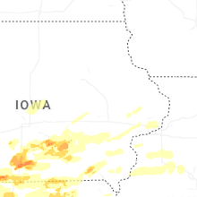
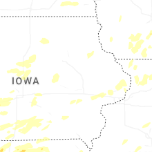
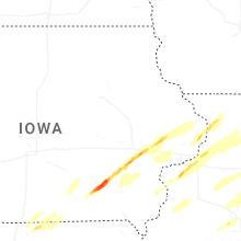
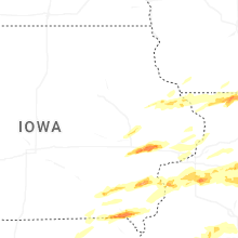

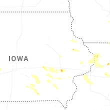
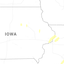


Connect with Interactive Hail Maps