

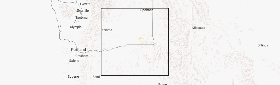
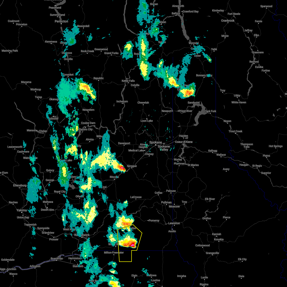
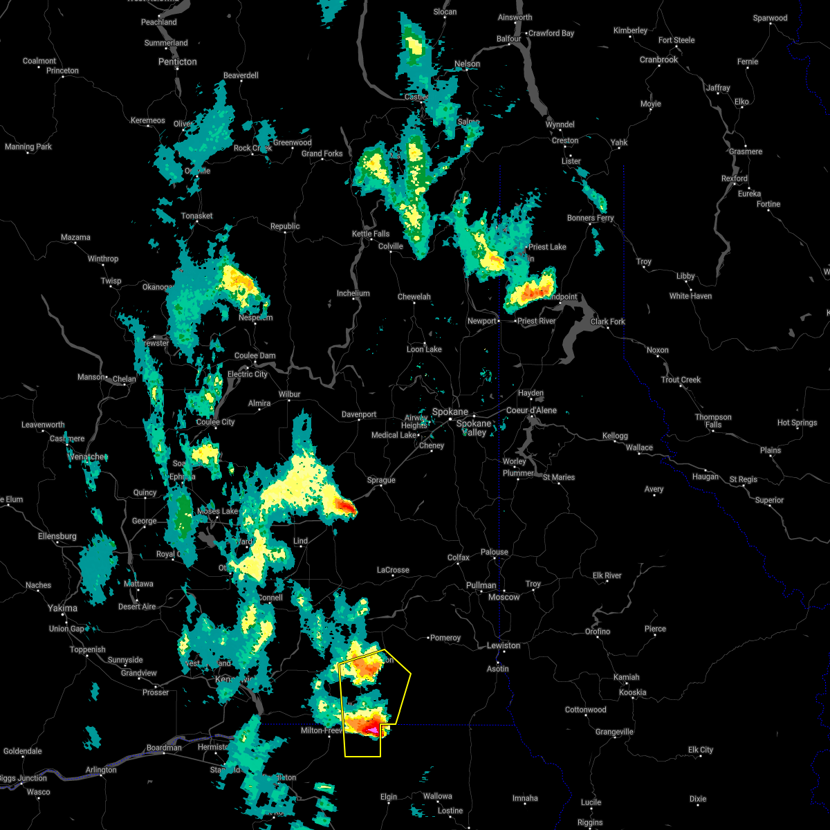
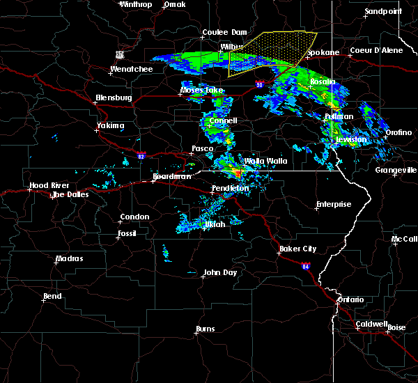
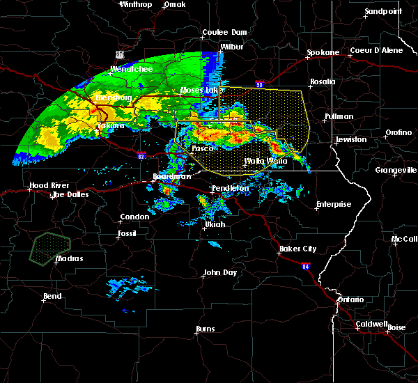
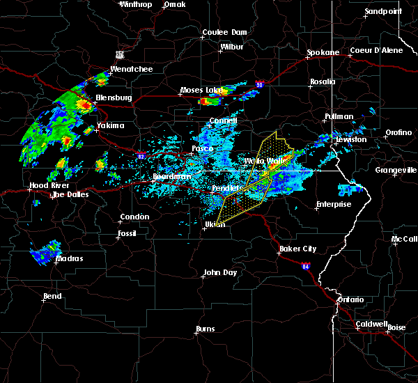
Hail Map for Dayton, WA
The Dayton, WA area has had 4 reports of on-the-ground hail by trained spotters, and has been under severe weather warnings 0 times during the past 12 months. Doppler radar has detected hail at or near Dayton, WA on 5 occasions.
| Name: | Dayton, WA |
| Where Located: | 24.4 miles NE of Walla Walla, WA |
| Map: | Google Map for Dayton, WA |
| Population: | 2526 |
| Housing Units: | 1200 |
| More Info: | Search Google for Dayton, WA |
5
The Top Recent Hail Date for Dayton, WA is Thursday, July 12, 2012 (1st out of 5)
Hail and Wind Damage Spotted near Dayton, WA
| Date / Time | Report Details |
|---|---|
| 6/15/2021 12:42 AM PDT |
 The severe thunderstorm warning for northeastern umatilla, southeastern walla walla and southern columbia counties will expire at 1245 am pdt, the storm which prompted the warning has moved out of the area. therefore, the warning will be allowed to expire. The severe thunderstorm warning for northeastern umatilla, southeastern walla walla and southern columbia counties will expire at 1245 am pdt, the storm which prompted the warning has moved out of the area. therefore, the warning will be allowed to expire.
|
| 6/15/2021 12:21 AM PDT |
 At 1220 am pdt, a severe thunderstorm was located near dixie, or 12 miles south of dayton, moving north at 45 mph (radar indicated). Hazards include 60 mph wind gusts and quarter size hail. Hail damage to vehicles is expected. expect wind damage to roofs, siding, and trees. Locations impacted include, walla walla, dayton, waitsburg, dixie, huntsville, ski bluewood and kooskooskie. At 1220 am pdt, a severe thunderstorm was located near dixie, or 12 miles south of dayton, moving north at 45 mph (radar indicated). Hazards include 60 mph wind gusts and quarter size hail. Hail damage to vehicles is expected. expect wind damage to roofs, siding, and trees. Locations impacted include, walla walla, dayton, waitsburg, dixie, huntsville, ski bluewood and kooskooskie.
|
| 6/15/2021 12:09 AM PDT |
 At 1209 am pdt, a severe thunderstorm was located 9 miles southeast of dixie, or 14 miles east of walla walla, moving north at 45 mph (radar indicated). Hazards include 60 mph wind gusts and quarter size hail. Hail damage to vehicles is expected. Expect wind damage to roofs, siding, and trees. At 1209 am pdt, a severe thunderstorm was located 9 miles southeast of dixie, or 14 miles east of walla walla, moving north at 45 mph (radar indicated). Hazards include 60 mph wind gusts and quarter size hail. Hail damage to vehicles is expected. Expect wind damage to roofs, siding, and trees.
|
| 5/30/2020 7:53 PM PDT |
 At 750 pm pdt, a severe thunderstorm was located near milton-freewater, or near walla walla, moving north at 35 mph (radar indicated). Hazards include 60 mph wind gusts and quarter size hail. Hail damage to vehicles is expected. Expect wind damage to roofs, siding, and trees. At 750 pm pdt, a severe thunderstorm was located near milton-freewater, or near walla walla, moving north at 35 mph (radar indicated). Hazards include 60 mph wind gusts and quarter size hail. Hail damage to vehicles is expected. Expect wind damage to roofs, siding, and trees.
|
| 5/30/2020 6:00 PM PDT | Reports of trees and power lines down in dayto in columbia county WA, 0.4 miles SE of Dayton, WA |
| 5/30/2020 5:57 PM PDT |
 At 555 pm pdt, severe thunderstorms were located along a line extending from 6 miles southeast of connell to near ski bluewood, moving northeast at 55 mph (radar indicated). Hazards include 70 mph wind gusts and ping pong ball size hail. People and animals outdoors will be injured. expect hail damage to roofs, siding, windows, and vehicles. expect considerable tree damage. wind damage is also likely to mobile homes, roofs, and outbuildings. Locations impacted include, connell, dayton, mesa, prescott, kahlotus, starbuck, huntsville, snake river, delaney, pleasant view, eltopia, turner, basin city, ayer, eureka, eastern hanford reservation and matthew. At 555 pm pdt, severe thunderstorms were located along a line extending from 6 miles southeast of connell to near ski bluewood, moving northeast at 55 mph (radar indicated). Hazards include 70 mph wind gusts and ping pong ball size hail. People and animals outdoors will be injured. expect hail damage to roofs, siding, windows, and vehicles. expect considerable tree damage. wind damage is also likely to mobile homes, roofs, and outbuildings. Locations impacted include, connell, dayton, mesa, prescott, kahlotus, starbuck, huntsville, snake river, delaney, pleasant view, eltopia, turner, basin city, ayer, eureka, eastern hanford reservation and matthew.
|
| 5/30/2020 5:32 PM PDT |
 At 531 pm pdt, severe thunderstorms were located along a line extending from near eltopia to 8 miles east of milton-freewater, moving northeast at 45 mph (radar indicated). Hazards include 70 mph wind gusts and ping pong ball size hail. People and animals outdoors will be injured. expect hail damage to roofs, siding, windows, and vehicles. expect considerable tree damage. wind damage is also likely to mobile homes, roofs, and outbuildings. Locations impacted include, kennewick, pasco, walla walla, connell, dayton, college place, waitsburg, mesa, prescott, kahlotus, starbuck, huntsville, snake river, pleasant view, touchet, ayer, dixie, umapine, wallula and delaney. At 531 pm pdt, severe thunderstorms were located along a line extending from near eltopia to 8 miles east of milton-freewater, moving northeast at 45 mph (radar indicated). Hazards include 70 mph wind gusts and ping pong ball size hail. People and animals outdoors will be injured. expect hail damage to roofs, siding, windows, and vehicles. expect considerable tree damage. wind damage is also likely to mobile homes, roofs, and outbuildings. Locations impacted include, kennewick, pasco, walla walla, connell, dayton, college place, waitsburg, mesa, prescott, kahlotus, starbuck, huntsville, snake river, pleasant view, touchet, ayer, dixie, umapine, wallula and delaney.
|
| 5/30/2020 5:10 PM PDT |
 At 508 pm pdt, severe thunderstorms were located along a line extending from island view to umatilla reservation, moving northeast at 55 mph (radar indicated). Hazards include 70 mph wind gusts and quarter size hail. Hail damage to vehicles is expected. expect considerable tree damage. Wind damage is also likely to mobile homes, roofs, and outbuildings. At 508 pm pdt, severe thunderstorms were located along a line extending from island view to umatilla reservation, moving northeast at 55 mph (radar indicated). Hazards include 70 mph wind gusts and quarter size hail. Hail damage to vehicles is expected. expect considerable tree damage. Wind damage is also likely to mobile homes, roofs, and outbuildings.
|
| 6/26/2017 4:28 PM PDT |
 At 428 pm pdt, a severe thunderstorm was located 7 miles southeast of huntsville, or 8 miles south of dayton, moving northeast at 30 mph (public). Hazards include 60 mph wind gusts. expect damage to roofs, siding, and trees At 428 pm pdt, a severe thunderstorm was located 7 miles southeast of huntsville, or 8 miles south of dayton, moving northeast at 30 mph (public). Hazards include 60 mph wind gusts. expect damage to roofs, siding, and trees
|
| 7/17/2016 5:11 PM PDT |
 At 510 pm pdt, doppler radar indicated a line of severe thunderstorms capable of producing half dollar size hail and damaging winds in excess of 60 mph. these storms were located along a line extending from ski bluewood to near bingham springs, and moving north at 45 mph. At 510 pm pdt, doppler radar indicated a line of severe thunderstorms capable of producing half dollar size hail and damaging winds in excess of 60 mph. these storms were located along a line extending from ski bluewood to near bingham springs, and moving north at 45 mph.
|
| 5/4/2016 8:09 PM PDT |
 At 805 pm pdt, trained weather spotters reported severe thunderstorms producing damaging winds in excess of 60 mph. these storms were located along a line extending from near plymouth to near walla walla, moving north at 30 mph. these winds will push into the tri- cities area around 830 pm. locations impacted include, kennewick, pasco, richland, walla walla, prosser, connell, dayton, west richland, grandview, college place, benton city, waitsburg, mesa, prescott, kahlotus, starbuck, turner, snake river, eltopia and garrett. At 805 pm pdt, trained weather spotters reported severe thunderstorms producing damaging winds in excess of 60 mph. these storms were located along a line extending from near plymouth to near walla walla, moving north at 30 mph. these winds will push into the tri- cities area around 830 pm. locations impacted include, kennewick, pasco, richland, walla walla, prosser, connell, dayton, west richland, grandview, college place, benton city, waitsburg, mesa, prescott, kahlotus, starbuck, turner, snake river, eltopia and garrett.
|
| 5/4/2016 7:46 PM PDT |
 At 741 pm pdt, trained weather spotters reported severe thunderstorms producing damaging winds in excess of 60 mph. these storms are located over northern umatilla and morrow counties. the winds will push across the washington border and the lower columbia basin and the foothills of washington over the next hour. locations impacted include, kennewick, pasco, richland, walla walla, hermiston, pendleton, prosser, connell, boardman, dayton, meacham, west richland, grandview, college place, milton-freewater, umatilla, benton city, stanfield, irrigon and pilot rock. At 741 pm pdt, trained weather spotters reported severe thunderstorms producing damaging winds in excess of 60 mph. these storms are located over northern umatilla and morrow counties. the winds will push across the washington border and the lower columbia basin and the foothills of washington over the next hour. locations impacted include, kennewick, pasco, richland, walla walla, hermiston, pendleton, prosser, connell, boardman, dayton, meacham, west richland, grandview, college place, milton-freewater, umatilla, benton city, stanfield, irrigon and pilot rock.
|
| 5/4/2016 7:20 PM PDT |
 At 719 pm pdt, the public reported a line of severe thunderstorms producing damaging winds in excess of 60 mph. these storms were located along a line extending from 9 miles northeast of ione to umatilla reservation, and moving north at 30 mph. At 719 pm pdt, the public reported a line of severe thunderstorms producing damaging winds in excess of 60 mph. these storms were located along a line extending from 9 miles northeast of ione to umatilla reservation, and moving north at 30 mph.
|
| 6/28/2015 10:32 PM PDT |
 At 1030 pm pdt, doppler radar indicated a severe thunderstorm capable of producing damaging winds in excess of 60 mph. this storm was located along a line from southern benton county to southern walla walla county, moving north at 45 mph. locations impacted include, kennewick, pasco, richland, walla walla, hermiston, pendleton, sunnyside, prosser, boardman, dayton, meacham, west richland, grandview, college place, milton-freewater, umatilla, benton city, mabton, stanfield and irrigon. At 1030 pm pdt, doppler radar indicated a severe thunderstorm capable of producing damaging winds in excess of 60 mph. this storm was located along a line from southern benton county to southern walla walla county, moving north at 45 mph. locations impacted include, kennewick, pasco, richland, walla walla, hermiston, pendleton, sunnyside, prosser, boardman, dayton, meacham, west richland, grandview, college place, milton-freewater, umatilla, benton city, mabton, stanfield and irrigon.
|
| 6/28/2015 9:51 PM PDT |
 At 949 pm pdt, doppler radar indicated a severe thunderstorm capable of producing damaging winds in excess of 60 mph. this storm was located 17 miles northwest of ukiah, or 18 miles east of heppner, and moving north at 40 mph. At 949 pm pdt, doppler radar indicated a severe thunderstorm capable of producing damaging winds in excess of 60 mph. this storm was located 17 miles northwest of ukiah, or 18 miles east of heppner, and moving north at 40 mph.
|
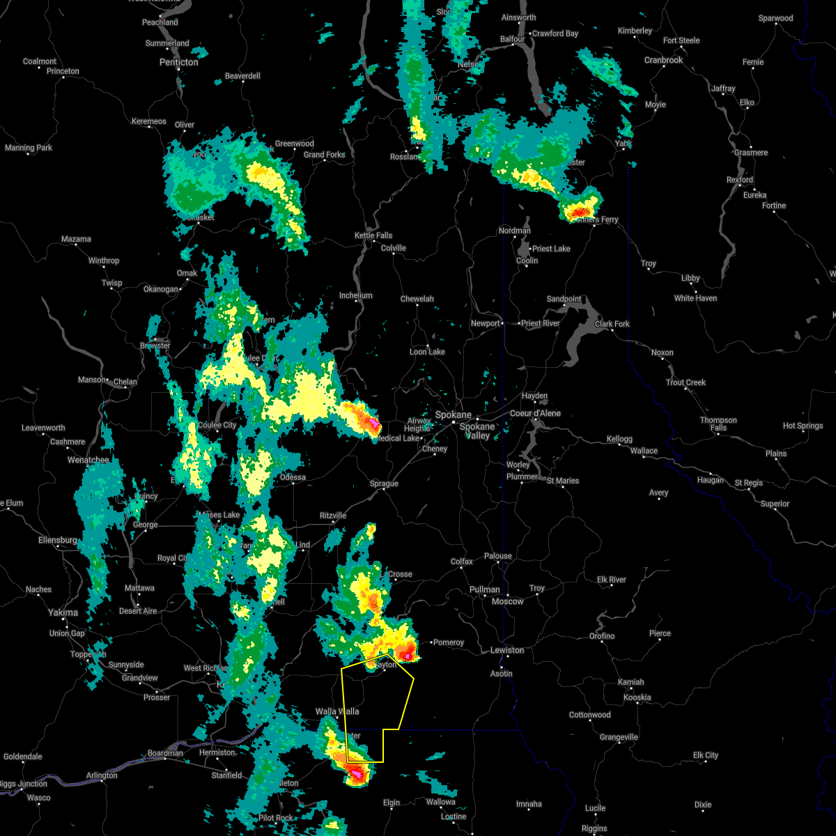
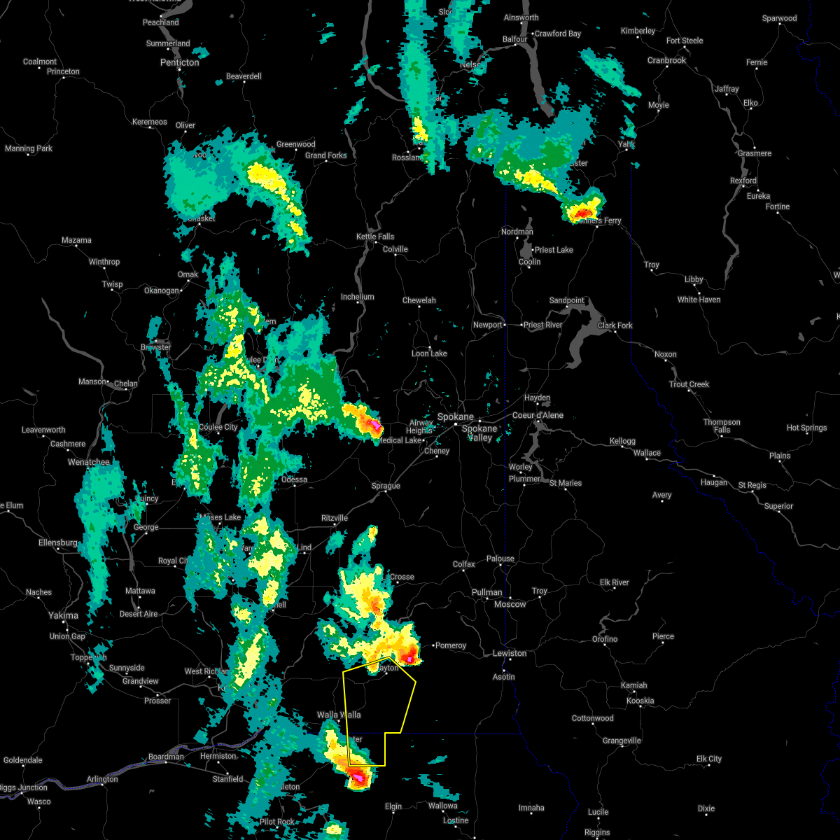
| 5/31/2015 8:26 PM PDT | At 820 pm pdt, doppler radar indicated a severe thunderstorm capable of producing quarter size hail and damaging winds in excess of 60 mph. this storm was located near ski bluewood, or 14 miles southeast of dayton, moving northeast at 45 mph. locations impacted include, walla walla, dayton, college place, milton-freewater, waitsburg, prescott, starbuck, turner, umapine, delaney, garrett, huntsville, spout springs, dixie, ski bluewood, touchet, tollgate, kooskooskie and lowden. |
| 5/31/2015 8:26 PM PDT | At 820 pm pdt, doppler radar indicated a severe thunderstorm capable of producing quarter size hail and damaging winds in excess of 60 mph. this storm was located near ski bluewood, or 14 miles southeast of dayton, moving northeast at 45 mph. locations impacted include, walla walla, dayton, college place, milton-freewater, waitsburg, prescott, starbuck, turner, umapine, delaney, garrett, huntsville, spout springs, dixie, ski bluewood, touchet, tollgate, kooskooskie and lowden. |
| 5/31/2015 7:55 PM PDT | At 753 pm pdt, doppler radar indicated a severe thunderstorm capable of producing quarter size hail and damaging winds in excess of 60 mph. this storm was also producing blowing dust, which was reducing visibility to near a quarter mile. this storm was located over milton-freewater, or near walla walla, and moving northeast at 45 mph. |
| 5/31/2015 7:55 PM PDT | At 753 pm pdt, doppler radar indicated a severe thunderstorm capable of producing quarter size hail and damaging winds in excess of 60 mph. this storm was also producing blowing dust, which was reducing visibility to near a quarter mile. this storm was located over milton-freewater, or near walla walla, and moving northeast at 45 mph. |
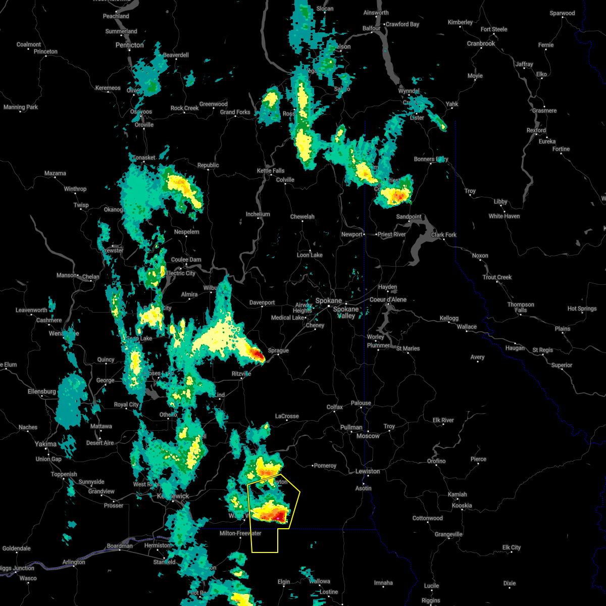
| 9/5/2013 6:14 PM PDT | Trees and powerlines down. 1/4 inch hail. wind estimate 45-50 mp in columbia county WA, 0.8 miles ESE of Dayton, WA |
| 9/5/2013 6:10 PM PDT | Trees and powerlines dow in columbia county WA, 0.4 miles SE of Dayton, WA |
| 9/5/2013 6:10 PM PDT | Trees and powerlines down winds 50 mph in columbia county WA, 8.8 miles SW of Dayton, WA |
| 8/11/2013 5:15 PM PDT | Quarter sized hail reported 20.1 miles NW of Dayton, WA |
| 7/20/2012 2:30 PM PDT | Ping Pong Ball sized hail reported 14.2 miles WNW of Dayton, WA, at camp wooten state park slightly smaller than golf ball sized hail was reported with heavy rain. the largest hail stones ranged from quarter sized to ping pong ball s |
| 7/12/2012 10:24 PM PDT | Half Dollar sized hail reported 3.6 miles NW of Dayton, WA, spotter posted photos on facebook of hail the size of half dollars. |
| 7/8/2012 10:00 PM PDT | Thunderstorm winds caused trees down on power lines and at least one home...wind gust estimated at 50 to 60 mph. el 1595 ft. co-2 in columbia county WA, 0.8 miles ESE of Dayton, WA |
| 7/7/2012 7:00 PM PDT | Park ranger at the last resort campground 10 miles north of camp wooten reported nickel size hail. also flooding occurred in trenches in the gravel road and parking lot in columbia county WA, 12.4 miles WNW of Dayton, WA |
| 6/23/2012 2:35 PM PDT | Half Dollar sized hail reported 1.2 miles ESE of Dayton, WA, path of storm 1/2 to 3/4 mile wide. hail damaged window covers on truck. |
Hail Maps for Dayton, WA


Connect with Interactive Hail Maps