

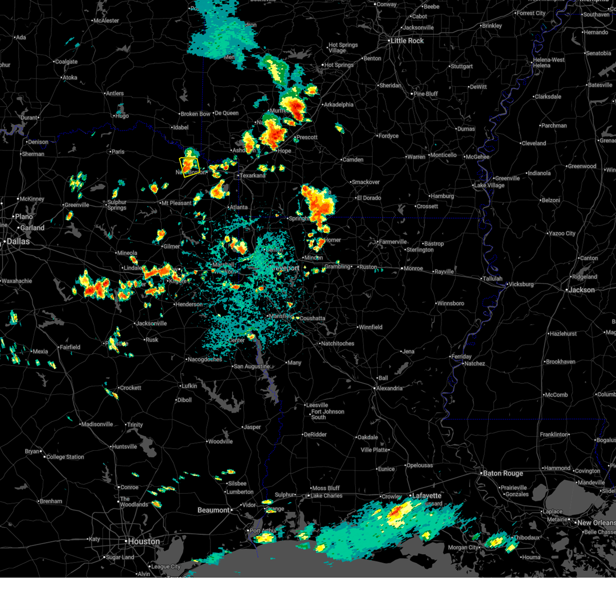
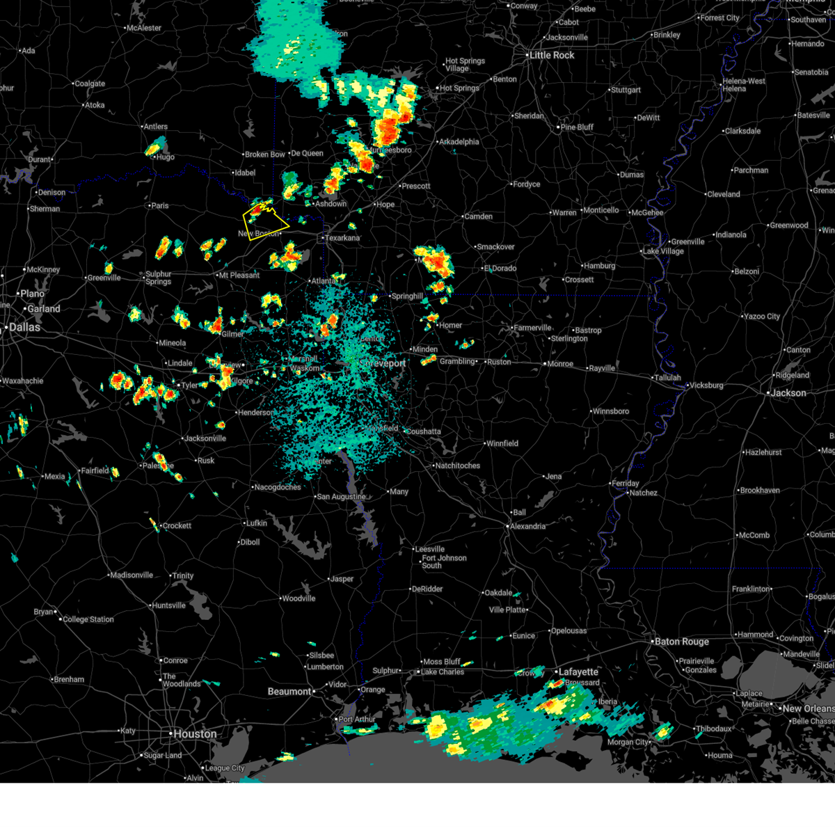
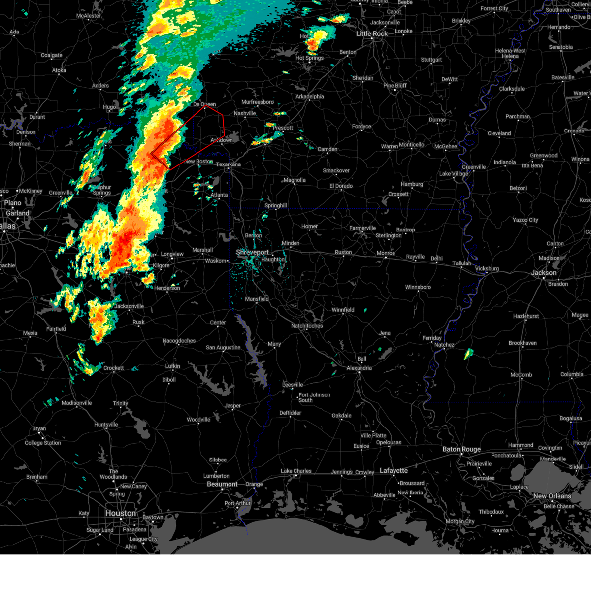
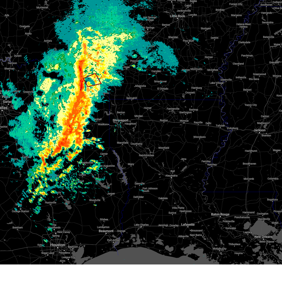
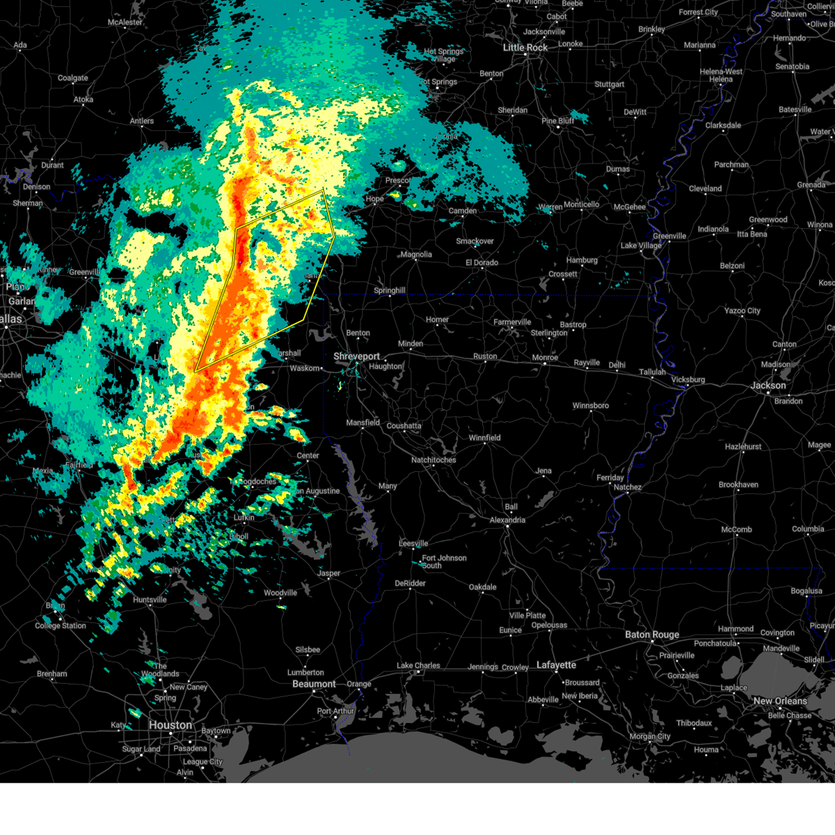
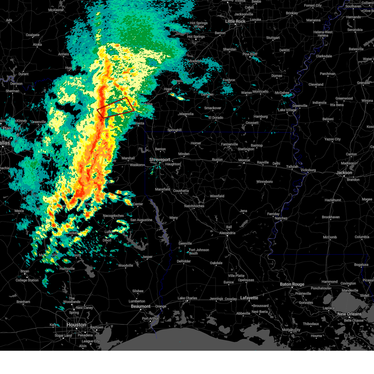
Hail Map for De Kalb, TX
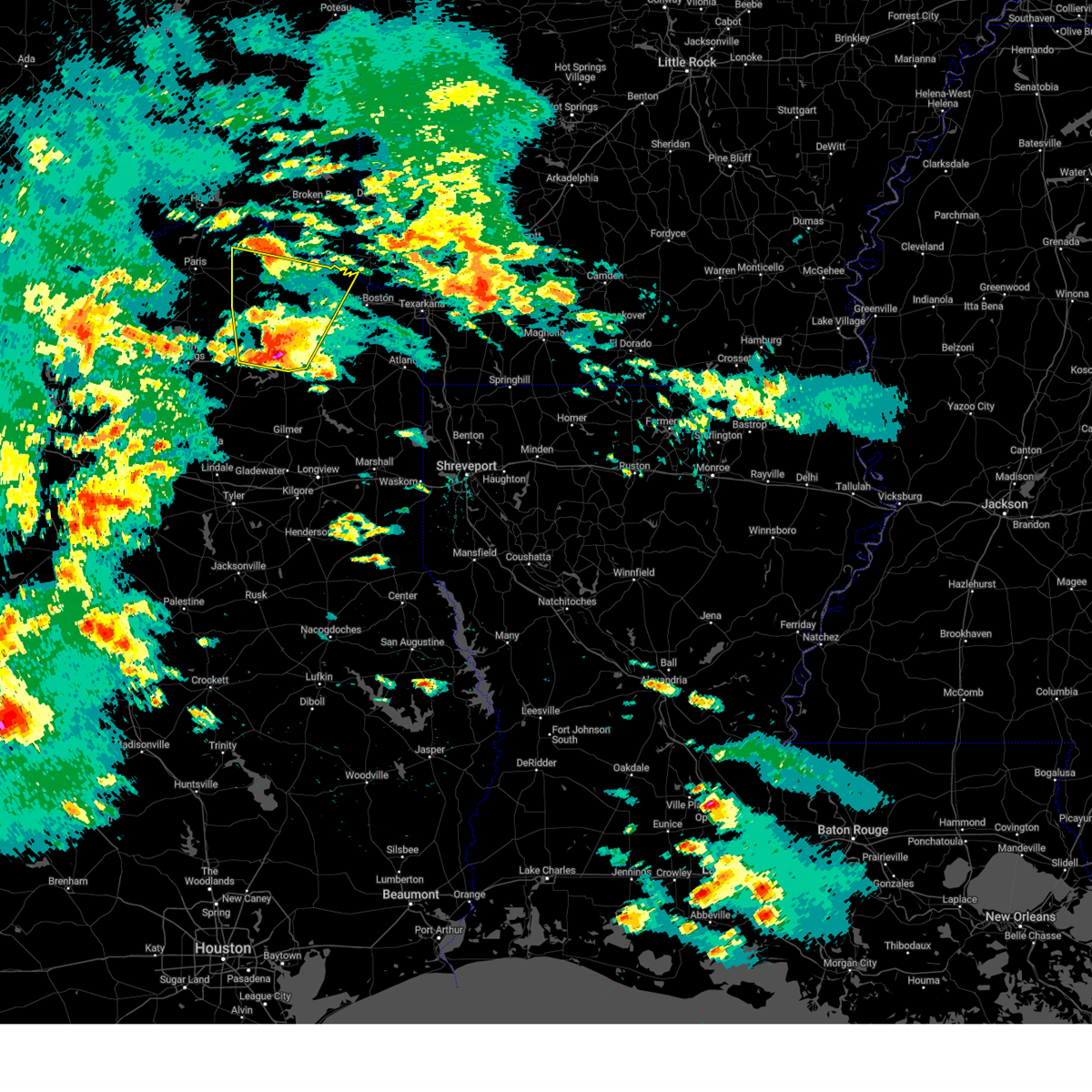
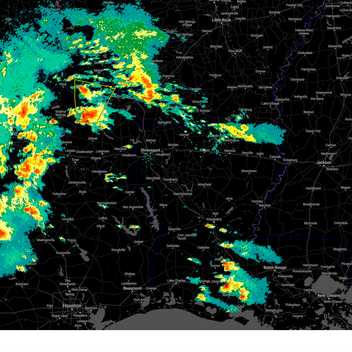
The De Kalb, TX area has had 8 reports of on-the-ground hail by trained spotters, and has been under severe weather warnings 16 times during the past 12 months. Doppler radar has detected hail at or near De Kalb, TX on 52 occasions, including 4 occasions during the past year.
| Name: | De Kalb, TX |
| Where Located: | 53.7 miles SW of Nashville, AR |
| Map: | Google Map for De Kalb, TX |
| Population: | 1699 |
| Housing Units: | 819 |
| More Info: | Search Google for De Kalb, TX |
1
The Top Recent Hail Date for De Kalb, TX is Friday, June 19, 2026 (16th out of 52)
Hail and Wind Damage Spotted near De Kalb, TX
| Date / Time | Report Details |
|---|---|
| 6/23/2026 8:01 PM CDT |
 the severe thunderstorm warning has been cancelled and is no longer in effect the severe thunderstorm warning has been cancelled and is no longer in effect
|
| 6/23/2026 8:01 PM CDT |
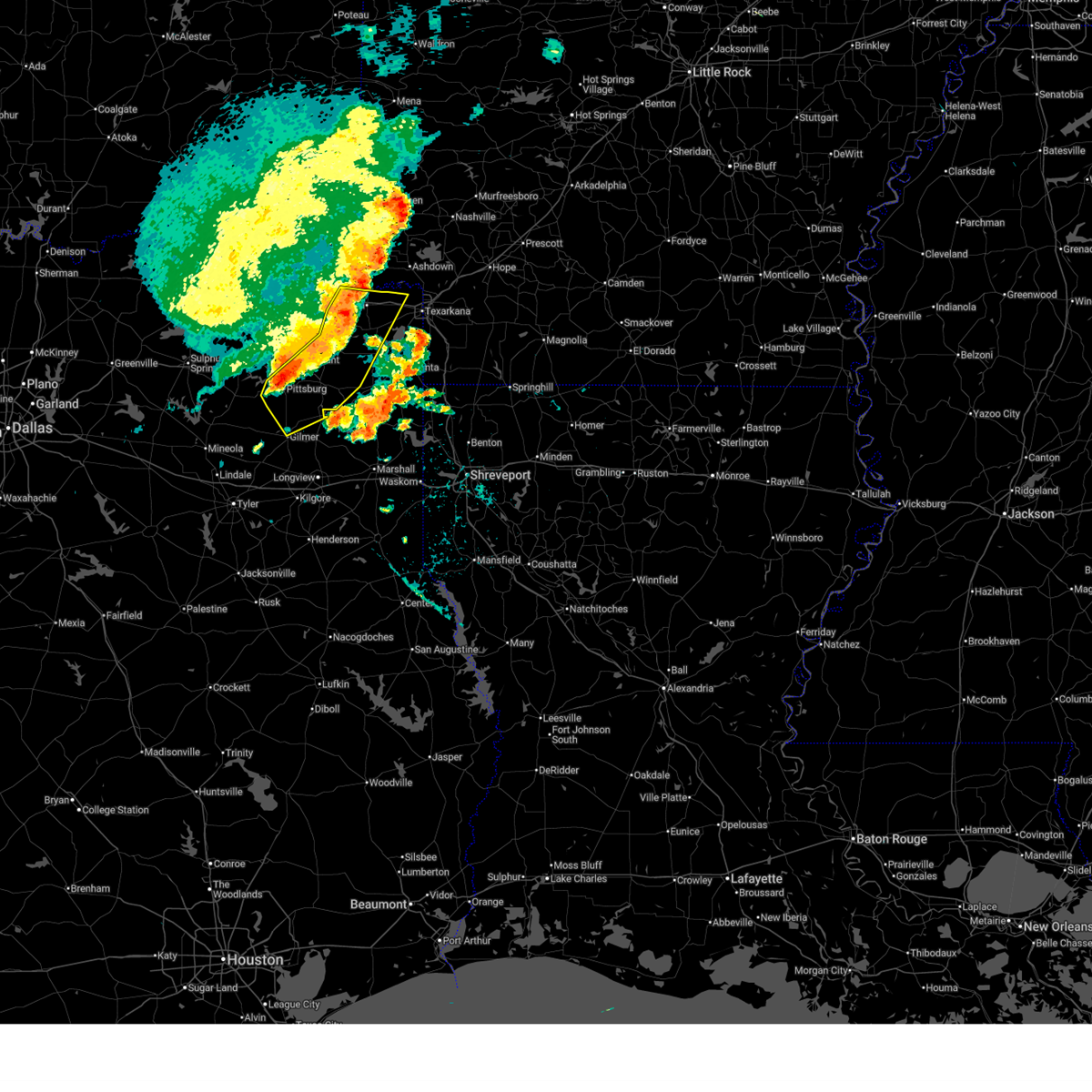
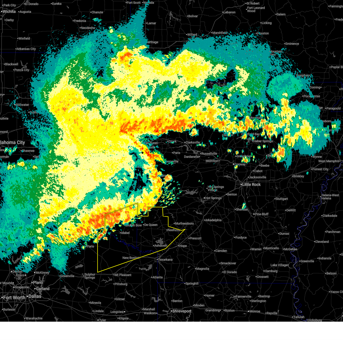
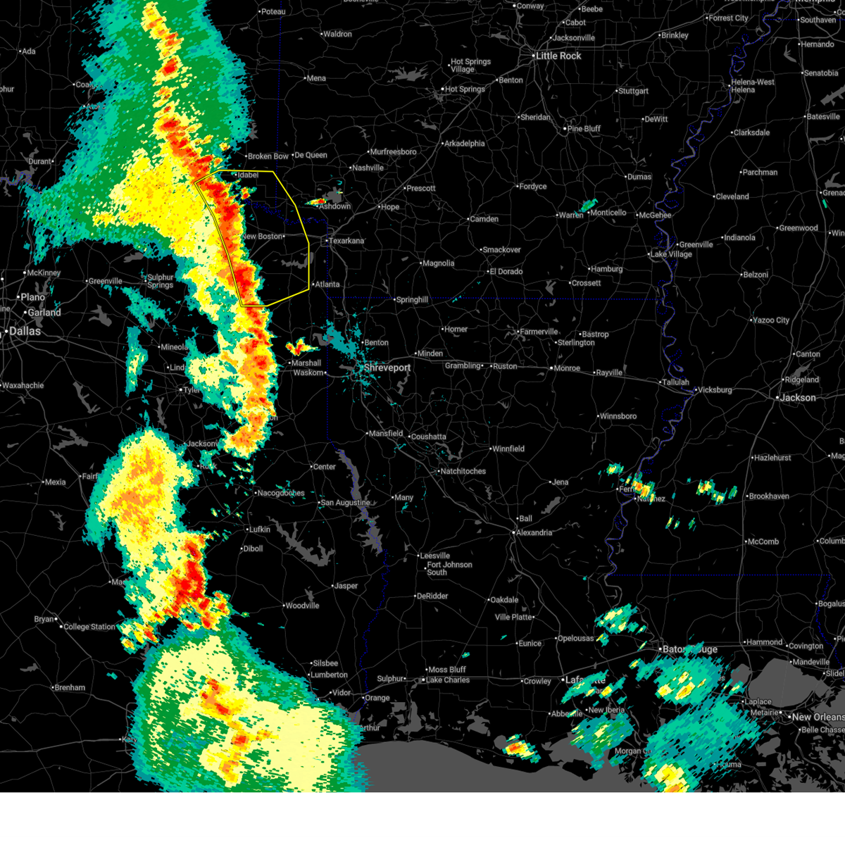
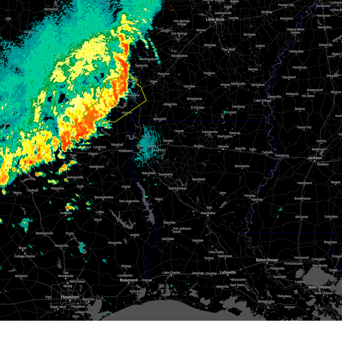
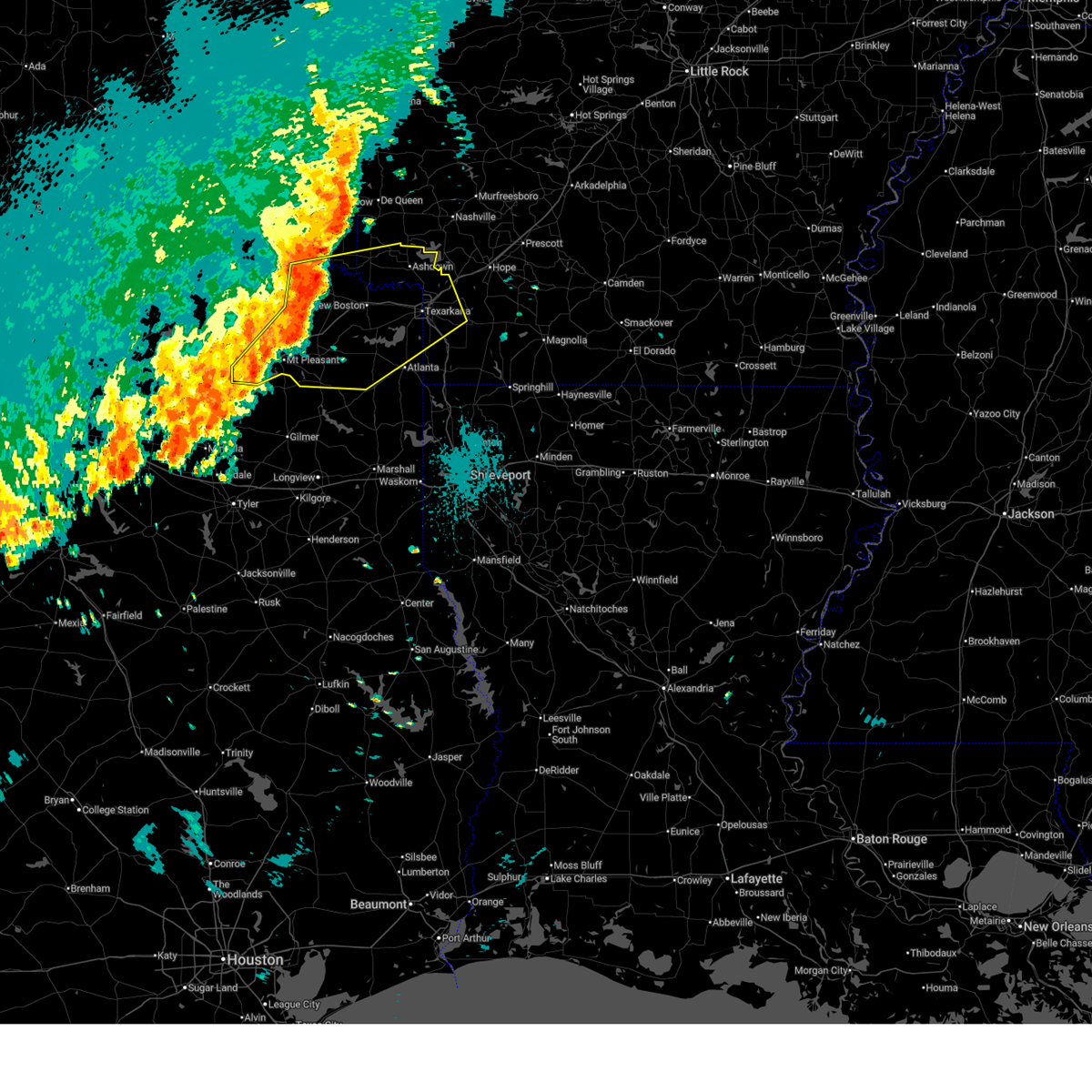
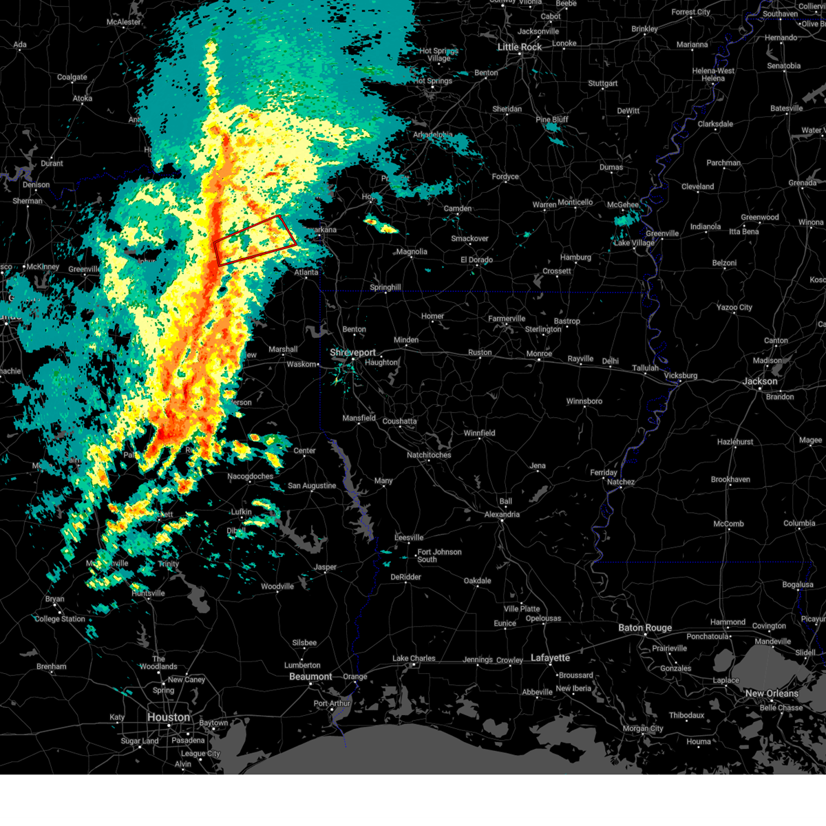
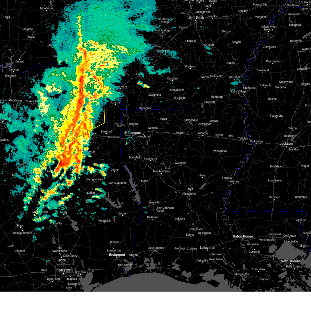
 At 801 pm cdt, severe thunderstorms were located along a line from near new boston to over pittsburg, moving southeast at 35 mph (radar indicated). Hazards include 70 mph wind gusts and half dollar size hail. the large hail threat is mainly concentrated near pittsburg in camp county. Hail damage to vehicles is expected. expect considerable tree damage. wind damage is also likely to mobile homes, roofs, and outbuildings. Locations impacted include, gilmer, new boston, pittsburg, leesburg, hooks, daingerfield, hughes springs, de kalb, lone star, naples, redwater, maud, omaha, red lick, rocky branch, us 259 and i 30 intersection, jenkins, cookville and cason. At 801 pm cdt, severe thunderstorms were located along a line from near new boston to over pittsburg, moving southeast at 35 mph (radar indicated). Hazards include 70 mph wind gusts and half dollar size hail. the large hail threat is mainly concentrated near pittsburg in camp county. Hail damage to vehicles is expected. expect considerable tree damage. wind damage is also likely to mobile homes, roofs, and outbuildings. Locations impacted include, gilmer, new boston, pittsburg, leesburg, hooks, daingerfield, hughes springs, de kalb, lone star, naples, redwater, maud, omaha, red lick, rocky branch, us 259 and i 30 intersection, jenkins, cookville and cason.
|
| 6/23/2026 7:33 PM CDT |
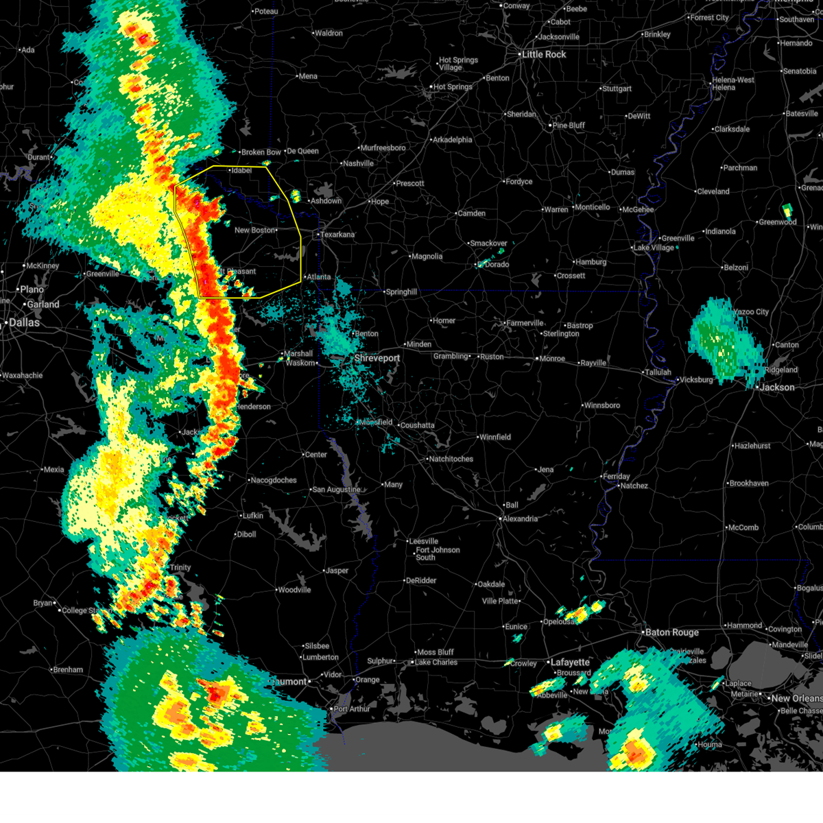
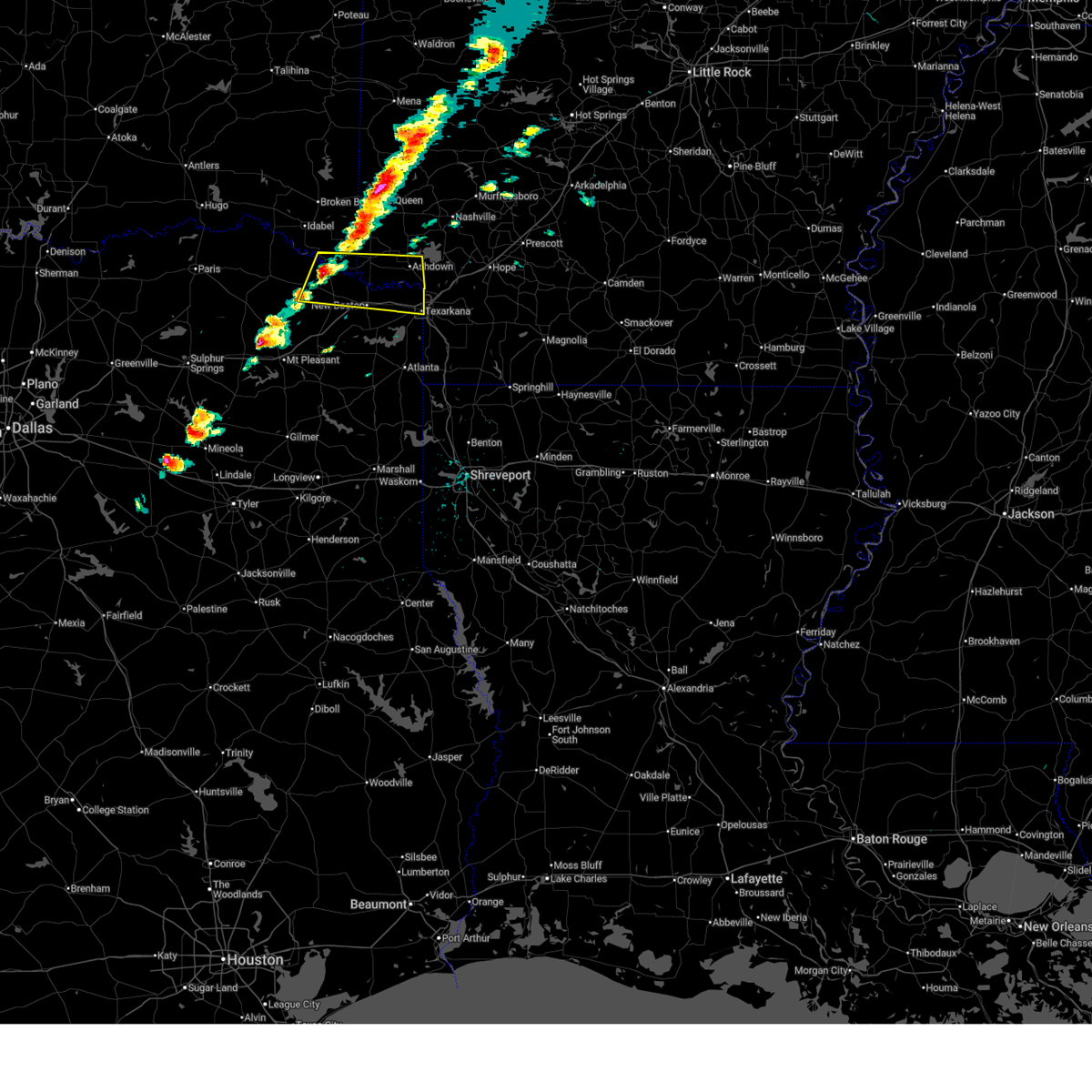
 Svrshv the national weather service in shreveport has issued a * severe thunderstorm warning for, bowie county in northeastern texas, camp county in northeastern texas, western cass county in northeastern texas, southeastern franklin county in northeastern texas, morris county in northeastern texas, southeastern red river county in northeastern texas, titus county in northeastern texas, northeastern upshur county in northeastern texas, * until 830 pm cdt. * at 733 pm cdt, severe thunderstorms were located along a line from 6 miles west of de kalb to 7 miles north of newsome, or along a line from 9 miles east of boxelder to 7 miles northwest of leesburg, moving southeast at 35 mph (radar indicated). Hazards include 70 mph wind gusts and small hail. Expect considerable tree damage. Damage is likely to mobile homes, roofs, and outbuildings. Svrshv the national weather service in shreveport has issued a * severe thunderstorm warning for, bowie county in northeastern texas, camp county in northeastern texas, western cass county in northeastern texas, southeastern franklin county in northeastern texas, morris county in northeastern texas, southeastern red river county in northeastern texas, titus county in northeastern texas, northeastern upshur county in northeastern texas, * until 830 pm cdt. * at 733 pm cdt, severe thunderstorms were located along a line from 6 miles west of de kalb to 7 miles north of newsome, or along a line from 9 miles east of boxelder to 7 miles northwest of leesburg, moving southeast at 35 mph (radar indicated). Hazards include 70 mph wind gusts and small hail. Expect considerable tree damage. Damage is likely to mobile homes, roofs, and outbuildings.
|
| 6/22/2026 6:24 AM CDT |
 At 624 am cdt, severe thunderstorms were located along a line from 13 miles northeast of corinth to 14 miles west of bagwell, or along a line from 19 miles northeast of nashville to 21 miles west of clarksville, moving southeast at 45 mph (emergency management reported. trees were downed across western and southern mccurtain county oklahoma from these storms). Hazards include 60 mph wind gusts. Expect damage to roofs, siding, and trees. Locations impacted include, de queen, ashdown, nashville, clarksville, mineral springs, dierks, horatio, foreman, boxelder, umpire, hagansport, idabel, broken bow, de kalb, bogata, lockesburg, wilton, tollette, winthrop and gillham. At 624 am cdt, severe thunderstorms were located along a line from 13 miles northeast of corinth to 14 miles west of bagwell, or along a line from 19 miles northeast of nashville to 21 miles west of clarksville, moving southeast at 45 mph (emergency management reported. trees were downed across western and southern mccurtain county oklahoma from these storms). Hazards include 60 mph wind gusts. Expect damage to roofs, siding, and trees. Locations impacted include, de queen, ashdown, nashville, clarksville, mineral springs, dierks, horatio, foreman, boxelder, umpire, hagansport, idabel, broken bow, de kalb, bogata, lockesburg, wilton, tollette, winthrop and gillham.
|
| 6/22/2026 5:46 AM CDT |
 Svrshv the national weather service in shreveport has issued a * severe thunderstorm warning for, northern hempstead county in southwestern arkansas, howard county in southwestern arkansas, little river county in southwestern arkansas, sevier county in southwestern arkansas, mccurtain county in southeastern oklahoma, northern bowie county in northeastern texas, northern franklin county in northeastern texas, red river county in northeastern texas, northern titus county in northeastern texas, * until 645 am cdt. * at 546 am cdt, severe thunderstorms were located along a line from 10 miles northeast of athens to 21 miles west of manchester, or along a line from 12 miles northeast of umpire to 30 miles northwest of clarksville, moving southeast at 45 mph. a 49 mph wind gust was just recorded from the hugo mesonet station in central choctaw county oklahoma. locally higher wind gusts are possible (radar indicated). Hazards include 60 mph wind gusts. expect damage to roofs, siding, and trees Svrshv the national weather service in shreveport has issued a * severe thunderstorm warning for, northern hempstead county in southwestern arkansas, howard county in southwestern arkansas, little river county in southwestern arkansas, sevier county in southwestern arkansas, mccurtain county in southeastern oklahoma, northern bowie county in northeastern texas, northern franklin county in northeastern texas, red river county in northeastern texas, northern titus county in northeastern texas, * until 645 am cdt. * at 546 am cdt, severe thunderstorms were located along a line from 10 miles northeast of athens to 21 miles west of manchester, or along a line from 12 miles northeast of umpire to 30 miles northwest of clarksville, moving southeast at 45 mph. a 49 mph wind gust was just recorded from the hugo mesonet station in central choctaw county oklahoma. locally higher wind gusts are possible (radar indicated). Hazards include 60 mph wind gusts. expect damage to roofs, siding, and trees
|
| 6/2/2026 1:22 PM CDT |
 At 122 pm cdt, a severe thunderstorm was located over de kalb, or 12 miles west of new boston, moving south at 15 mph (radar indicated). Hazards include 60 mph wind gusts and small hail. Expect damage to roofs, siding, and trees. Locations impacted include, de kalb. At 122 pm cdt, a severe thunderstorm was located over de kalb, or 12 miles west of new boston, moving south at 15 mph (radar indicated). Hazards include 60 mph wind gusts and small hail. Expect damage to roofs, siding, and trees. Locations impacted include, de kalb.
|
| 6/2/2026 12:53 PM CDT |
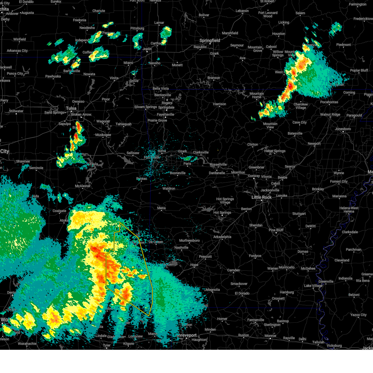
 Svrshv the national weather service in shreveport has issued a * severe thunderstorm warning for, northwestern bowie county in northeastern texas, * until 145 pm cdt. * at 1253 pm cdt, a severe thunderstorm was located 6 miles north of de kalb, or 15 miles southwest of foreman, moving southeast at 20 mph (radar indicated). Hazards include 60 mph wind gusts and quarter size hail. Hail damage to vehicles is expected. Expect wind damage to roofs, siding, and trees. Svrshv the national weather service in shreveport has issued a * severe thunderstorm warning for, northwestern bowie county in northeastern texas, * until 145 pm cdt. * at 1253 pm cdt, a severe thunderstorm was located 6 miles north of de kalb, or 15 miles southwest of foreman, moving southeast at 20 mph (radar indicated). Hazards include 60 mph wind gusts and quarter size hail. Hail damage to vehicles is expected. Expect wind damage to roofs, siding, and trees.
|
| 5/23/2026 7:12 AM CDT |
 The storms which prompted the warning have weakened below severe limits, and no longer pose an immediate threat to life or property. therefore, the warning will be allowed to expire. however, gusty winds are still possible with these thunderstorms. to report severe weather, contact your nearest law enforcement agency. they will send your report to the national weather service office. The storms which prompted the warning have weakened below severe limits, and no longer pose an immediate threat to life or property. therefore, the warning will be allowed to expire. however, gusty winds are still possible with these thunderstorms. to report severe weather, contact your nearest law enforcement agency. they will send your report to the national weather service office.
|
| 5/23/2026 6:51 AM CDT |
 the severe thunderstorm warning has been cancelled and is no longer in effect the severe thunderstorm warning has been cancelled and is no longer in effect
|
| 5/23/2026 6:51 AM CDT |
 At 651 am cdt, severe thunderstorms were located along a line from 12 miles south of idabel to 7 miles northeast of hughes springs, or along a line from 19 miles northeast of clarksville to 23 miles west of atlanta, moving east at 35 mph (radar indicated). Hazards include 60 mph wind gusts and quarter size hail. Hail damage to vehicles is expected. expect wind damage to roofs, siding, and trees. Locations impacted include, new boston, foreman, boxelder, idabel, hooks, daingerfield, hughes springs, de kalb, naples, redwater, maud, omaha, dalby springs, us 259 and i 30 intersection, arkinda, rocky branch, cookville and jenkins. At 651 am cdt, severe thunderstorms were located along a line from 12 miles south of idabel to 7 miles northeast of hughes springs, or along a line from 19 miles northeast of clarksville to 23 miles west of atlanta, moving east at 35 mph (radar indicated). Hazards include 60 mph wind gusts and quarter size hail. Hail damage to vehicles is expected. expect wind damage to roofs, siding, and trees. Locations impacted include, new boston, foreman, boxelder, idabel, hooks, daingerfield, hughes springs, de kalb, naples, redwater, maud, omaha, dalby springs, us 259 and i 30 intersection, arkinda, rocky branch, cookville and jenkins.
|
| 5/23/2026 6:14 AM CDT |
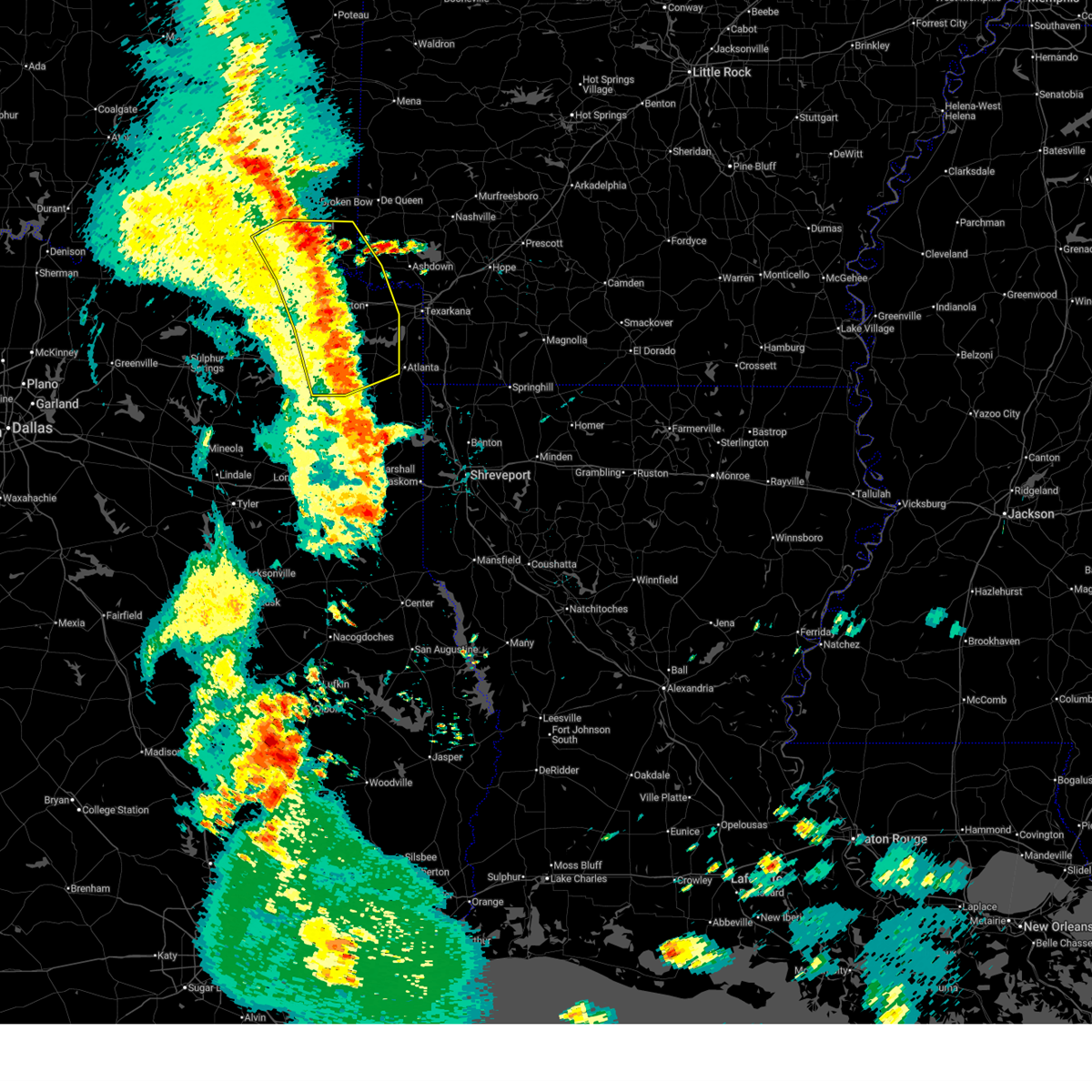
 Svrshv the national weather service in shreveport has issued a * severe thunderstorm warning for, southwestern little river county in southwestern arkansas, southern mccurtain county in southeastern oklahoma, bowie county in northeastern texas, central camp county in northeastern texas, western cass county in northeastern texas, northeastern franklin county in northeastern texas, morris county in northeastern texas, red river county in northeastern texas, titus county in northeastern texas, * until 715 am cdt. * at 614 am cdt, severe thunderstorms were located along a line from near bagwell to near pittsburg, or along a line from near clarksville to near pittsburg, moving east at 35 mph (radar indicated). Hazards include 60 mph wind gusts and quarter size hail. Hail damage to vehicles is expected. Expect wind damage to roofs, siding, and trees. Svrshv the national weather service in shreveport has issued a * severe thunderstorm warning for, southwestern little river county in southwestern arkansas, southern mccurtain county in southeastern oklahoma, bowie county in northeastern texas, central camp county in northeastern texas, western cass county in northeastern texas, northeastern franklin county in northeastern texas, morris county in northeastern texas, red river county in northeastern texas, titus county in northeastern texas, * until 715 am cdt. * at 614 am cdt, severe thunderstorms were located along a line from near bagwell to near pittsburg, or along a line from near clarksville to near pittsburg, moving east at 35 mph (radar indicated). Hazards include 60 mph wind gusts and quarter size hail. Hail damage to vehicles is expected. Expect wind damage to roofs, siding, and trees.
|
| 3/15/2026 4:20 PM CDT |
 At 420 pm cdt, a severe thunderstorm was located over richmond, or 8 miles southwest of ashdown, moving east at 45 mph (radar indicated). Hazards include 60 mph wind gusts and quarter size hail. Hail damage to vehicles is expected. expect wind damage to roofs, siding, and trees. Locations impacted include, texarkana, wake village, ashdown, new boston, nash, hooks, de kalb, red lick, ogden, richmond, leary, red bank, arden, pine prairie and wallace. At 420 pm cdt, a severe thunderstorm was located over richmond, or 8 miles southwest of ashdown, moving east at 45 mph (radar indicated). Hazards include 60 mph wind gusts and quarter size hail. Hail damage to vehicles is expected. expect wind damage to roofs, siding, and trees. Locations impacted include, texarkana, wake village, ashdown, new boston, nash, hooks, de kalb, red lick, ogden, richmond, leary, red bank, arden, pine prairie and wallace.
|
| 3/15/2026 4:20 PM CDT |
 the severe thunderstorm warning has been cancelled and is no longer in effect the severe thunderstorm warning has been cancelled and is no longer in effect
|
| 3/15/2026 4:00 PM CDT |
 At 400 pm cdt, a severe thunderstorm was located 9 miles southwest of foreman, moving east at 45 mph (radar indicated). Hazards include 60 mph wind gusts and half dollar size hail. Hail damage to vehicles is expected. expect wind damage to roofs, siding, and trees. Locations impacted include, texarkana, wake village, ashdown, new boston, foreman, nash, hooks, de kalb, red lick, wilton, ogden, richmond, leary, wallace, red bank, arden, pine prairie, almont and tom. At 400 pm cdt, a severe thunderstorm was located 9 miles southwest of foreman, moving east at 45 mph (radar indicated). Hazards include 60 mph wind gusts and half dollar size hail. Hail damage to vehicles is expected. expect wind damage to roofs, siding, and trees. Locations impacted include, texarkana, wake village, ashdown, new boston, foreman, nash, hooks, de kalb, red lick, wilton, ogden, richmond, leary, wallace, red bank, arden, pine prairie, almont and tom.
|
| 3/15/2026 4:00 PM CDT |
 the severe thunderstorm warning has been cancelled and is no longer in effect the severe thunderstorm warning has been cancelled and is no longer in effect
|
| 3/15/2026 3:50 PM CDT |
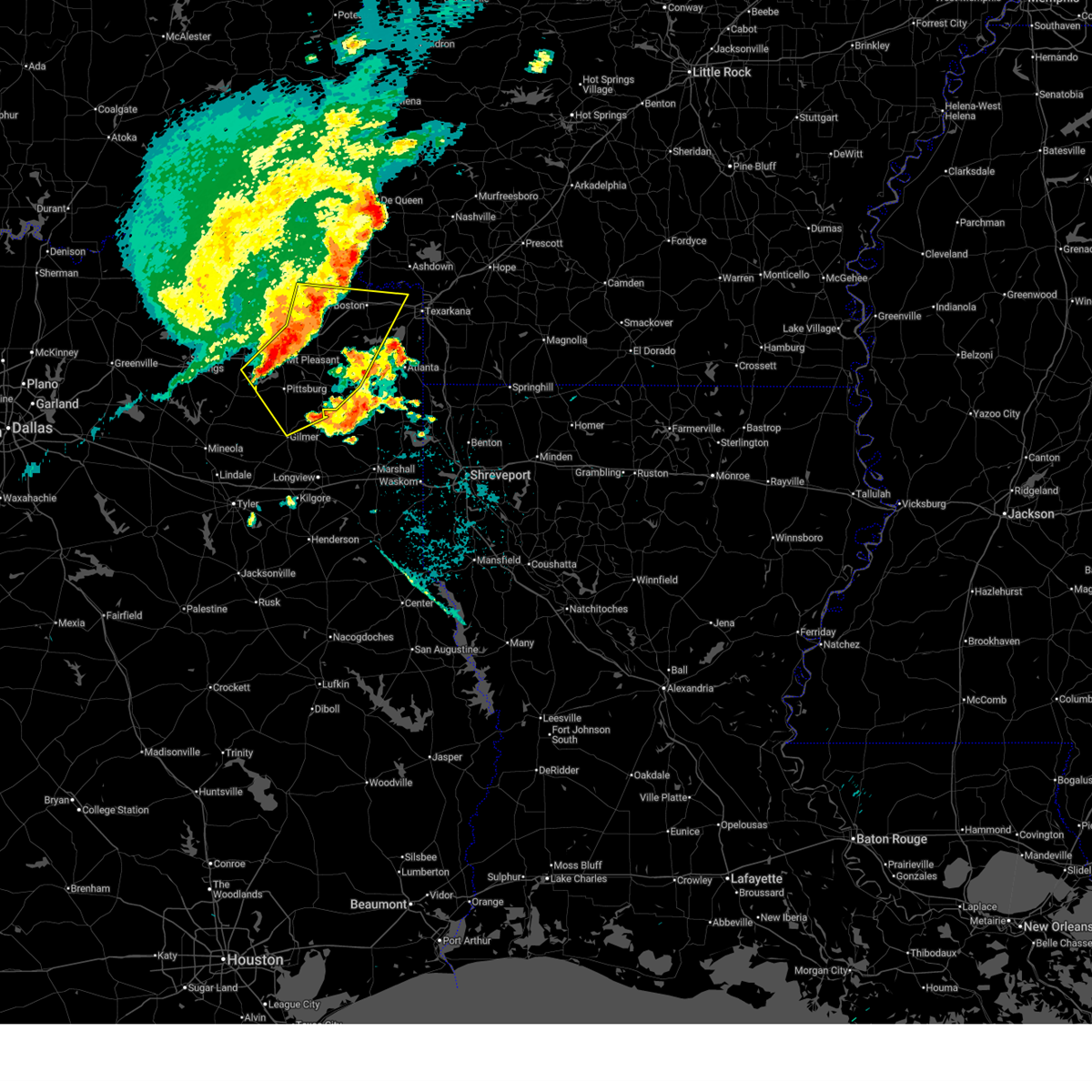
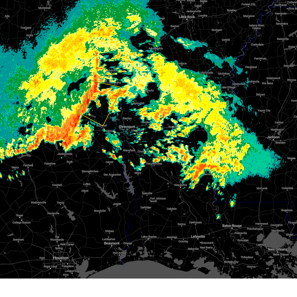
 Svrshv the national weather service in shreveport has issued a * severe thunderstorm warning for, southwestern little river county in southwestern arkansas, southeastern mccurtain county in southeastern oklahoma, central bowie county in northeastern texas, east central red river county in northeastern texas, * until 445 pm cdt. * at 350 pm cdt, a severe thunderstorm was located 8 miles north of de kalb, or 15 miles southwest of foreman, moving east at 45 mph (radar indicated). Hazards include 60 mph wind gusts and half dollar size hail. Hail damage to vehicles is expected. Expect wind damage to roofs, siding, and trees. Svrshv the national weather service in shreveport has issued a * severe thunderstorm warning for, southwestern little river county in southwestern arkansas, southeastern mccurtain county in southeastern oklahoma, central bowie county in northeastern texas, east central red river county in northeastern texas, * until 445 pm cdt. * at 350 pm cdt, a severe thunderstorm was located 8 miles north of de kalb, or 15 miles southwest of foreman, moving east at 45 mph (radar indicated). Hazards include 60 mph wind gusts and half dollar size hail. Hail damage to vehicles is expected. Expect wind damage to roofs, siding, and trees.
|
| 6/8/2025 11:11 PM CDT |
 Svrshv the national weather service in shreveport has issued a * severe thunderstorm warning for, central mccurtain county in southeastern oklahoma, western cass county in northeastern texas, northern franklin county in northeastern texas, western bowie county in northeastern texas, morris county in northeastern texas, titus county in northeastern texas, red river county in northeastern texas, * until 1230 am cdt. * at 1111 pm cdt, severe thunderstorms were located along a line extending from near raymond gary state park to near mount vernon, moving east at 50 mph (radar indicated). Hazards include 60 mph wind gusts and quarter size hail. Hail damage to vehicles is expected. Expect wind damage to roofs, siding, and trees. Svrshv the national weather service in shreveport has issued a * severe thunderstorm warning for, central mccurtain county in southeastern oklahoma, western cass county in northeastern texas, northern franklin county in northeastern texas, western bowie county in northeastern texas, morris county in northeastern texas, titus county in northeastern texas, red river county in northeastern texas, * until 1230 am cdt. * at 1111 pm cdt, severe thunderstorms were located along a line extending from near raymond gary state park to near mount vernon, moving east at 50 mph (radar indicated). Hazards include 60 mph wind gusts and quarter size hail. Hail damage to vehicles is expected. Expect wind damage to roofs, siding, and trees.
|
| 5/26/2025 5:33 AM CDT |
 Svrshv the national weather service in shreveport has issued a * severe thunderstorm warning for, west central miller county in southwestern arkansas, marion county in northeastern texas, cass county in northeastern texas, northwestern harrison county in northeastern texas, southern bowie county in northeastern texas, northeastern upshur county in northeastern texas, morris county in northeastern texas, southeastern camp county in northeastern texas, * until 630 am cdt. * at 532 am cdt, severe thunderstorms were located along a line extending from near new boston to near hughes springs to near ore city, moving southeast at 20 mph (radar indicated). Hazards include 60 mph wind gusts and penny size hail. expect damage to roofs, siding, and trees Svrshv the national weather service in shreveport has issued a * severe thunderstorm warning for, west central miller county in southwestern arkansas, marion county in northeastern texas, cass county in northeastern texas, northwestern harrison county in northeastern texas, southern bowie county in northeastern texas, northeastern upshur county in northeastern texas, morris county in northeastern texas, southeastern camp county in northeastern texas, * until 630 am cdt. * at 532 am cdt, severe thunderstorms were located along a line extending from near new boston to near hughes springs to near ore city, moving southeast at 20 mph (radar indicated). Hazards include 60 mph wind gusts and penny size hail. expect damage to roofs, siding, and trees
|
| 5/6/2025 12:05 PM CDT |
 At 1205 pm cdt, a severe thunderstorm was located 7 miles southeast of clarksville, moving north at 35 mph (radar indicated). Hazards include golf ball size hail and 60 mph wind gusts. People and animals outdoors will be injured. expect hail damage to roofs, siding, windows, and vehicles. expect wind damage to roofs, siding, and trees. Locations impacted include, clarksville, boxelder, hagansport, de kalb, bogata, wilkerson, bagwell, dalby springs, detroit, talco, avery, annona, cuthand, harts bluff, english, johntown, lydia, beaverdams and almont. At 1205 pm cdt, a severe thunderstorm was located 7 miles southeast of clarksville, moving north at 35 mph (radar indicated). Hazards include golf ball size hail and 60 mph wind gusts. People and animals outdoors will be injured. expect hail damage to roofs, siding, windows, and vehicles. expect wind damage to roofs, siding, and trees. Locations impacted include, clarksville, boxelder, hagansport, de kalb, bogata, wilkerson, bagwell, dalby springs, detroit, talco, avery, annona, cuthand, harts bluff, english, johntown, lydia, beaverdams and almont.
|
| 5/6/2025 11:40 AM CDT |
 At 1140 am cdt, a severe thunderstorm was located 6 miles west of wilkerson, or 11 miles east of hagansport, moving north at 35 mph (radar indicated). Hazards include golf ball size hail and 60 mph wind gusts. People and animals outdoors will be injured. expect hail damage to roofs, siding, windows, and vehicles. expect wind damage to roofs, siding, and trees. Locations impacted include, mount pleasant, clarksville, boxelder, hagansport, mount vernon, de kalb, bogata, wilkerson, dalby springs, us 259 and i 30 intersection, cookville, bagwell, detroit, winfield, talco, avery, annona, miller's cove, harts bluff and cuthand. At 1140 am cdt, a severe thunderstorm was located 6 miles west of wilkerson, or 11 miles east of hagansport, moving north at 35 mph (radar indicated). Hazards include golf ball size hail and 60 mph wind gusts. People and animals outdoors will be injured. expect hail damage to roofs, siding, windows, and vehicles. expect wind damage to roofs, siding, and trees. Locations impacted include, mount pleasant, clarksville, boxelder, hagansport, mount vernon, de kalb, bogata, wilkerson, dalby springs, us 259 and i 30 intersection, cookville, bagwell, detroit, winfield, talco, avery, annona, miller's cove, harts bluff and cuthand.
|
| 5/6/2025 11:40 AM CDT |
 the severe thunderstorm warning has been cancelled and is no longer in effect the severe thunderstorm warning has been cancelled and is no longer in effect
|
| 5/6/2025 11:29 AM CDT |
 Svrshv the national weather service in shreveport has issued a * severe thunderstorm warning for, northwestern bowie county in northeastern texas, northwestern camp county in northeastern texas, franklin county in northeastern texas, northwestern morris county in northeastern texas, red river county in northeastern texas, titus county in northeastern texas, * until 1215 pm cdt. * at 1129 am cdt, a severe thunderstorm was located 7 miles northwest of mount pleasant, moving north at 35 mph (radar indicated). Hazards include 60 mph wind gusts and quarter size hail. Hail damage to vehicles is expected. Expect wind damage to roofs, siding, and trees. Svrshv the national weather service in shreveport has issued a * severe thunderstorm warning for, northwestern bowie county in northeastern texas, northwestern camp county in northeastern texas, franklin county in northeastern texas, northwestern morris county in northeastern texas, red river county in northeastern texas, titus county in northeastern texas, * until 1215 pm cdt. * at 1129 am cdt, a severe thunderstorm was located 7 miles northwest of mount pleasant, moving north at 35 mph (radar indicated). Hazards include 60 mph wind gusts and quarter size hail. Hail damage to vehicles is expected. Expect wind damage to roofs, siding, and trees.
|
| 4/30/2025 2:26 PM CDT |
 the severe thunderstorm warning has been cancelled and is no longer in effect the severe thunderstorm warning has been cancelled and is no longer in effect
|
| 4/30/2025 2:26 PM CDT |
 At 226 pm cdt, severe thunderstorms were located along a line from near nashville to 8 miles southeast of maud, or along a line from near mineral springs to 10 miles northwest of atlanta, moving east at 55 mph (radar indicated). Hazards include 60 mph wind gusts and small hail. Expect damage to roofs, siding, and trees. Locations impacted include, texarkana, mount pleasant, atlanta, wake village, ashdown, new boston, foreman, nash, hooks, daingerfield, linden, hughes springs, de kalb, queen city, naples, redwater, maud, omaha and red lick. At 226 pm cdt, severe thunderstorms were located along a line from near nashville to 8 miles southeast of maud, or along a line from near mineral springs to 10 miles northwest of atlanta, moving east at 55 mph (radar indicated). Hazards include 60 mph wind gusts and small hail. Expect damage to roofs, siding, and trees. Locations impacted include, texarkana, mount pleasant, atlanta, wake village, ashdown, new boston, foreman, nash, hooks, daingerfield, linden, hughes springs, de kalb, queen city, naples, redwater, maud, omaha and red lick.
|
| 4/30/2025 1:39 PM CDT |
 Svrshv the national weather service in shreveport has issued a * severe thunderstorm warning for, little river county in southwestern arkansas, northern miller county in southwestern arkansas, southeastern mccurtain county in southeastern oklahoma, bowie county in northeastern texas, central cass county in northeastern texas, southern franklin county in northeastern texas, morris county in northeastern texas, southeastern red river county in northeastern texas, titus county in northeastern texas, * until 245 pm cdt. * at 139 pm cdt, severe thunderstorms were located along a line from 9 miles west of arkinda to near mount pleasant, or along a line from 15 miles northwest of foreman to near mount pleasant, moving east at 55 mph (radar indicated). Hazards include 60 mph wind gusts and small hail. expect damage to roofs, siding, and trees Svrshv the national weather service in shreveport has issued a * severe thunderstorm warning for, little river county in southwestern arkansas, northern miller county in southwestern arkansas, southeastern mccurtain county in southeastern oklahoma, bowie county in northeastern texas, central cass county in northeastern texas, southern franklin county in northeastern texas, morris county in northeastern texas, southeastern red river county in northeastern texas, titus county in northeastern texas, * until 245 pm cdt. * at 139 pm cdt, severe thunderstorms were located along a line from 9 miles west of arkinda to near mount pleasant, or along a line from 15 miles northwest of foreman to near mount pleasant, moving east at 55 mph (radar indicated). Hazards include 60 mph wind gusts and small hail. expect damage to roofs, siding, and trees
|
| 4/4/2025 4:35 PM CDT |
 Torshv the national weather service in shreveport has issued a * tornado warning for, northwestern little river county in southwestern arkansas, central sevier county in southwestern arkansas, southeastern mccurtain county in southeastern oklahoma, northwestern bowie county in northeastern texas, east central red river county in northeastern texas, * until 530 pm cdt. * at 434 pm cdt, a severe thunderstorm capable of producing a tornado was located near boxelder, moving northeast at 40 mph (radar indicated rotation). Hazards include tornado and half dollar size hail. Flying debris will be dangerous to those caught without shelter. mobile homes will be damaged or destroyed. damage to roofs, windows, and vehicles will occur. tree damage is likely. this dangerous storm will be near, arkinda around 510 pm cdt. winthrop around 520 pm cdt. Other locations impacted by this tornadic thunderstorm include bokhoma, almont, moon, cerrogordo, beaverdams, goodlake, oak grove, lydia, harris, and geneva. Torshv the national weather service in shreveport has issued a * tornado warning for, northwestern little river county in southwestern arkansas, central sevier county in southwestern arkansas, southeastern mccurtain county in southeastern oklahoma, northwestern bowie county in northeastern texas, east central red river county in northeastern texas, * until 530 pm cdt. * at 434 pm cdt, a severe thunderstorm capable of producing a tornado was located near boxelder, moving northeast at 40 mph (radar indicated rotation). Hazards include tornado and half dollar size hail. Flying debris will be dangerous to those caught without shelter. mobile homes will be damaged or destroyed. damage to roofs, windows, and vehicles will occur. tree damage is likely. this dangerous storm will be near, arkinda around 510 pm cdt. winthrop around 520 pm cdt. Other locations impacted by this tornadic thunderstorm include bokhoma, almont, moon, cerrogordo, beaverdams, goodlake, oak grove, lydia, harris, and geneva.
|
| 3/4/2025 8:03 AM CST |
 At 803 am cst, a severe thunderstorm capable of producing a tornado was located 7 miles southwest of new boston, moving east at 60 mph (radar indicated rotation). Hazards include tornado. Flying debris will be dangerous to those caught without shelter. mobile homes will be damaged or destroyed. damage to roofs, windows and vehicles will occur. tree damage is likely. Locations impacted include, new boston, de kalb, redwater and spring hill. At 803 am cst, a severe thunderstorm capable of producing a tornado was located 7 miles southwest of new boston, moving east at 60 mph (radar indicated rotation). Hazards include tornado. Flying debris will be dangerous to those caught without shelter. mobile homes will be damaged or destroyed. damage to roofs, windows and vehicles will occur. tree damage is likely. Locations impacted include, new boston, de kalb, redwater and spring hill.
|
| 3/4/2025 8:03 AM CST |
 the tornado warning has been cancelled and is no longer in effect the tornado warning has been cancelled and is no longer in effect
|
| 3/4/2025 8:00 AM CST | Reports of roofs taken off houses in de kalb. no specific locations give in bowie county TX, 0.4 miles SSW of De Kalb, TX |
| 3/4/2025 7:59 AM CST |
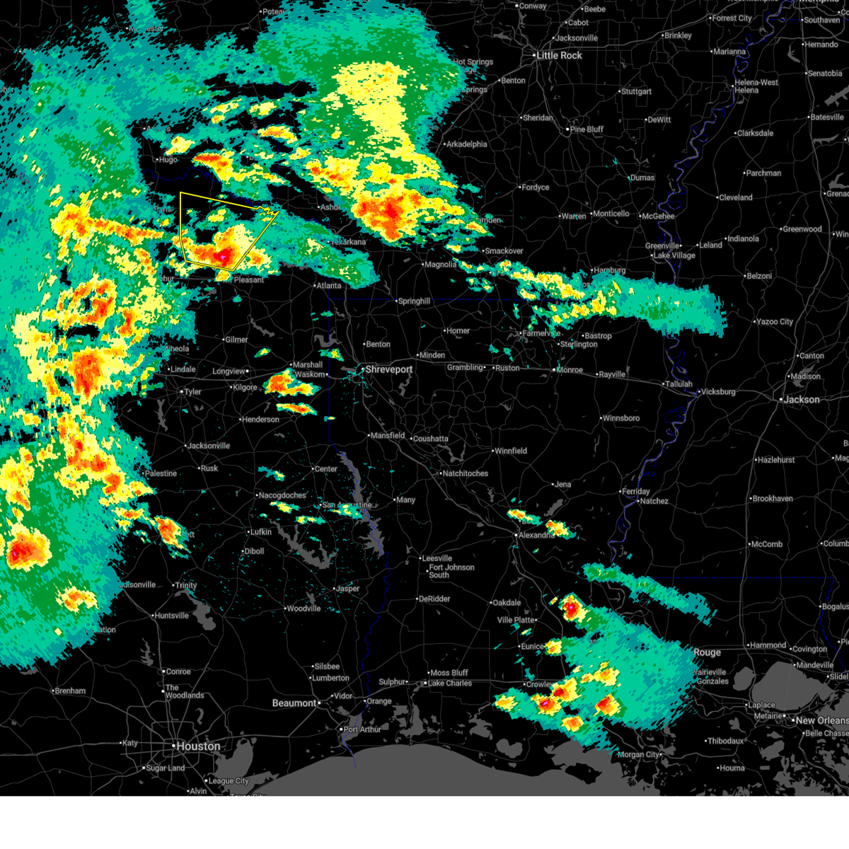
 Svrshv the national weather service in shreveport has issued a * severe thunderstorm warning for, southwestern little river county in southwestern arkansas, northwestern miller county in southwestern arkansas, bowie county in northeastern texas, eastern camp county in northeastern texas, cass county in northeastern texas, northwestern gregg county in northeastern texas, northwestern harrison county in northeastern texas, western marion county in northeastern texas, morris county in northeastern texas, southeastern red river county in northeastern texas, east central smith county in northeastern texas, southeastern titus county in northeastern texas, upshur county in northeastern texas, * until 845 am cst. * at 759 am cst, severe thunderstorms were located along a line from over de kalb to near gladewater, or along a line from 14 miles west of new boston to near gladewater, moving northeast at 60 mph (radar indicated). Hazards include 60 mph wind gusts and quarter size hail. Hail damage to vehicles is expected. Expect wind damage to roofs, siding, and trees. Svrshv the national weather service in shreveport has issued a * severe thunderstorm warning for, southwestern little river county in southwestern arkansas, northwestern miller county in southwestern arkansas, bowie county in northeastern texas, eastern camp county in northeastern texas, cass county in northeastern texas, northwestern gregg county in northeastern texas, northwestern harrison county in northeastern texas, western marion county in northeastern texas, morris county in northeastern texas, southeastern red river county in northeastern texas, east central smith county in northeastern texas, southeastern titus county in northeastern texas, upshur county in northeastern texas, * until 845 am cst. * at 759 am cst, severe thunderstorms were located along a line from over de kalb to near gladewater, or along a line from 14 miles west of new boston to near gladewater, moving northeast at 60 mph (radar indicated). Hazards include 60 mph wind gusts and quarter size hail. Hail damage to vehicles is expected. Expect wind damage to roofs, siding, and trees.
|
| 3/4/2025 7:46 AM CST |
 At 746 am cst, a severe thunderstorm capable of producing a tornado was located over dalby springs, or 12 miles southeast of boxelder, moving east at 70 mph (radar indicated rotation). Hazards include tornado. Flying debris will be dangerous to those caught without shelter. mobile homes will be damaged or destroyed. damage to roofs, windows and vehicles will occur. tree damage is likely. Locations impacted include, new boston, de kalb, redwater, dalby springs, us 259 and i 30 intersection, wilkerson and spring hill. At 746 am cst, a severe thunderstorm capable of producing a tornado was located over dalby springs, or 12 miles southeast of boxelder, moving east at 70 mph (radar indicated rotation). Hazards include tornado. Flying debris will be dangerous to those caught without shelter. mobile homes will be damaged or destroyed. damage to roofs, windows and vehicles will occur. tree damage is likely. Locations impacted include, new boston, de kalb, redwater, dalby springs, us 259 and i 30 intersection, wilkerson and spring hill.
|
| 3/4/2025 7:42 AM CST |
 Torshv the national weather service in shreveport has issued a * tornado warning for, southwestern bowie county in northeastern texas, northern morris county in northeastern texas, southeastern red river county in northeastern texas, northeastern titus county in northeastern texas, * until 815 am cst. * at 742 am cst, a tornado producing storm was located 5 miles northwest of us 259 and i 30 intersection, or 11 miles south of boxelder, moving east at 70 mph (radar confirmed tornado). Hazards include damaging tornado. Flying debris will be dangerous to those caught without shelter. mobile homes will be damaged or destroyed. damage to roofs, windows and vehicles will occur. Tree damage is likely. Torshv the national weather service in shreveport has issued a * tornado warning for, southwestern bowie county in northeastern texas, northern morris county in northeastern texas, southeastern red river county in northeastern texas, northeastern titus county in northeastern texas, * until 815 am cst. * at 742 am cst, a tornado producing storm was located 5 miles northwest of us 259 and i 30 intersection, or 11 miles south of boxelder, moving east at 70 mph (radar confirmed tornado). Hazards include damaging tornado. Flying debris will be dangerous to those caught without shelter. mobile homes will be damaged or destroyed. damage to roofs, windows and vehicles will occur. Tree damage is likely.
|
| 3/4/2025 7:42 AM CST |
 At 742 am cst, severe thunderstorms were located along a line from 8 miles west of arkinda to near cedar springs, or along a line from 13 miles west of foreman to 10 miles northeast of gilmer, moving northeast at 65 mph (radar indicated). Hazards include 60 mph wind gusts and small hail. Expect damage to roofs, siding, and trees. Locations impacted include, tyler, longview, mount pleasant, white oak, gladewater, gilmer, mineola, pittsburg, winnsboro, leesburg, lindale, daingerfield, hughes springs, de kalb, lone star, naples, big sandy, hawkins, ore city and omaha. At 742 am cst, severe thunderstorms were located along a line from 8 miles west of arkinda to near cedar springs, or along a line from 13 miles west of foreman to 10 miles northeast of gilmer, moving northeast at 65 mph (radar indicated). Hazards include 60 mph wind gusts and small hail. Expect damage to roofs, siding, and trees. Locations impacted include, tyler, longview, mount pleasant, white oak, gladewater, gilmer, mineola, pittsburg, winnsboro, leesburg, lindale, daingerfield, hughes springs, de kalb, lone star, naples, big sandy, hawkins, ore city and omaha.
|
| 3/4/2025 7:12 AM CST |
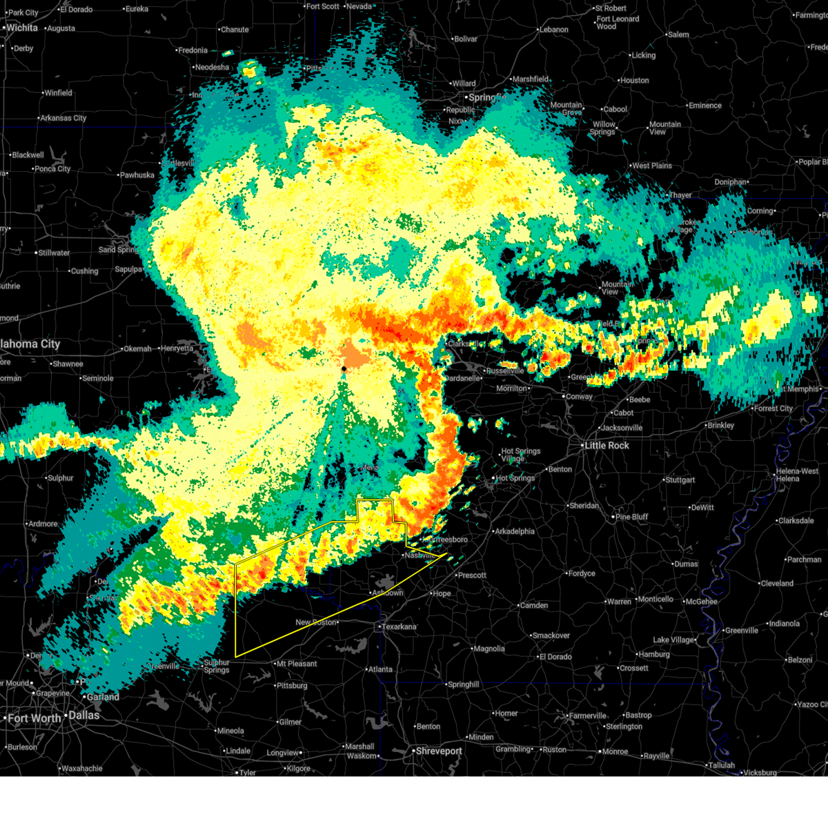
 Svrshv the national weather service in shreveport has issued a * severe thunderstorm warning for, western bowie county in northeastern texas, camp county in northeastern texas, western cass county in northeastern texas, franklin county in northeastern texas, northwestern gregg county in northeastern texas, northwestern harrison county in northeastern texas, western marion county in northeastern texas, morris county in northeastern texas, southeastern red river county in northeastern texas, central smith county in northeastern texas, titus county in northeastern texas, upshur county in northeastern texas, wood county in northeastern texas, * until 800 am cst. * at 712 am cst, severe thunderstorms were located along a line from 8 miles northwest of wilkerson to 7 miles south of hawkins, or along a line from 9 miles west of boxelder to 13 miles northeast of tyler, moving northeast at 65 mph (radar indicated). Hazards include 60 mph wind gusts and quarter size hail. Hail damage to vehicles is expected. Expect wind damage to roofs, siding, and trees. Svrshv the national weather service in shreveport has issued a * severe thunderstorm warning for, western bowie county in northeastern texas, camp county in northeastern texas, western cass county in northeastern texas, franklin county in northeastern texas, northwestern gregg county in northeastern texas, northwestern harrison county in northeastern texas, western marion county in northeastern texas, morris county in northeastern texas, southeastern red river county in northeastern texas, central smith county in northeastern texas, titus county in northeastern texas, upshur county in northeastern texas, wood county in northeastern texas, * until 800 am cst. * at 712 am cst, severe thunderstorms were located along a line from 8 miles northwest of wilkerson to 7 miles south of hawkins, or along a line from 9 miles west of boxelder to 13 miles northeast of tyler, moving northeast at 65 mph (radar indicated). Hazards include 60 mph wind gusts and quarter size hail. Hail damage to vehicles is expected. Expect wind damage to roofs, siding, and trees.
|
| 6/26/2024 11:58 AM CDT |
 At 1156 am cdt, severe thunderstorms were located along a line extending from near nash to 7 miles northeast of mount vernon, moving south at 55 mph (radar indicated). Hazards include 70 mph wind gusts. Expect considerable tree damage. damage is likely to mobile homes, roofs, and outbuildings. Locations impacted include, texarkana, atlanta, wake village, ashdown, new boston, clarksville, foreman, boxelder, nash, hooks, daingerfield, linden, hughes springs, de kalb, lone star, queen city, naples, redwater, maud, and omaha. At 1156 am cdt, severe thunderstorms were located along a line extending from near nash to 7 miles northeast of mount vernon, moving south at 55 mph (radar indicated). Hazards include 70 mph wind gusts. Expect considerable tree damage. damage is likely to mobile homes, roofs, and outbuildings. Locations impacted include, texarkana, atlanta, wake village, ashdown, new boston, clarksville, foreman, boxelder, nash, hooks, daingerfield, linden, hughes springs, de kalb, lone star, queen city, naples, redwater, maud, and omaha.
|
| 6/26/2024 11:45 AM CDT |
 Svrshv the national weather service in shreveport has issued a * severe thunderstorm warning for, little river county in southwestern arkansas, southwestern miller county in southwestern arkansas, southeastern mccurtain county in southeastern oklahoma, cass county in northeastern texas, northeastern franklin county in northeastern texas, bowie county in northeastern texas, morris county in northeastern texas, titus county in northeastern texas, red river county in northeastern texas, * until 1230 pm cdt. * at 1145 am cdt, severe thunderstorms were located along a line extending from near red lick to 6 miles east of hagansport, moving south at 55 mph (radar indicated). Hazards include 60 mph wind gusts. expect damage to roofs, siding, and trees Svrshv the national weather service in shreveport has issued a * severe thunderstorm warning for, little river county in southwestern arkansas, southwestern miller county in southwestern arkansas, southeastern mccurtain county in southeastern oklahoma, cass county in northeastern texas, northeastern franklin county in northeastern texas, bowie county in northeastern texas, morris county in northeastern texas, titus county in northeastern texas, red river county in northeastern texas, * until 1230 pm cdt. * at 1145 am cdt, severe thunderstorms were located along a line extending from near red lick to 6 miles east of hagansport, moving south at 55 mph (radar indicated). Hazards include 60 mph wind gusts. expect damage to roofs, siding, and trees
|
| 6/26/2024 11:04 AM CDT |
 Svrshv the national weather service in shreveport has issued a * severe thunderstorm warning for, western little river county in southwestern arkansas, western sevier county in southwestern arkansas, mccurtain county in southeastern oklahoma, northwestern cass county in northeastern texas, northeastern franklin county in northeastern texas, bowie county in northeastern texas, northern morris county in northeastern texas, titus county in northeastern texas, red river county in northeastern texas, * until 1145 am cdt. * at 1104 am cdt, a severe thunderstorm was located near idabel, or 18 miles northeast of clarksville, moving south at 55 mph (radar indicated). Hazards include 60 mph wind gusts. expect damage to roofs, siding, and trees Svrshv the national weather service in shreveport has issued a * severe thunderstorm warning for, western little river county in southwestern arkansas, western sevier county in southwestern arkansas, mccurtain county in southeastern oklahoma, northwestern cass county in northeastern texas, northeastern franklin county in northeastern texas, bowie county in northeastern texas, northern morris county in northeastern texas, titus county in northeastern texas, red river county in northeastern texas, * until 1145 am cdt. * at 1104 am cdt, a severe thunderstorm was located near idabel, or 18 miles northeast of clarksville, moving south at 55 mph (radar indicated). Hazards include 60 mph wind gusts. expect damage to roofs, siding, and trees
|
| 6/2/2024 7:42 PM CDT |
 the severe thunderstorm warning has been cancelled and is no longer in effect the severe thunderstorm warning has been cancelled and is no longer in effect
|
| 6/2/2024 7:42 PM CDT |
 At 741 pm cdt, severe thunderstorms were located along a line extending from 10 miles southeast of broken bow to near new boston to near cason, moving east at 40 mph (radar indicated). Hazards include 60 mph wind gusts and nickel size hail. Expect damage to roofs, siding, and trees. Locations impacted include, new boston, pittsburg, foreman, daingerfield, de kalb, naples, omaha, cason, us 259 and i 30 intersection, arkinda, cookville, rocky branch, dalby springs, haworth, rocky mound, moon, cerrogordo, spring hill, beaverdams, and goodlake. At 741 pm cdt, severe thunderstorms were located along a line extending from 10 miles southeast of broken bow to near new boston to near cason, moving east at 40 mph (radar indicated). Hazards include 60 mph wind gusts and nickel size hail. Expect damage to roofs, siding, and trees. Locations impacted include, new boston, pittsburg, foreman, daingerfield, de kalb, naples, omaha, cason, us 259 and i 30 intersection, arkinda, cookville, rocky branch, dalby springs, haworth, rocky mound, moon, cerrogordo, spring hill, beaverdams, and goodlake.
|
| 6/2/2024 7:27 PM CDT |
 At 726 pm cdt, severe thunderstorms were located along a line extending from near idabel to de kalb to near leesburg, moving east at 40 mph (radar indicated). Hazards include 60 mph wind gusts and nickel size hail. Expect damage to roofs, siding, and trees. Locations impacted include, mount pleasant, new boston, pittsburg, winnsboro, foreman, leesburg, boxelder, idabel, daingerfield, de kalb, naples, omaha, cason, us 259 and i 30 intersection, arkinda, cookville, scroggins, rocky branch, wilkerson, and newsome. At 726 pm cdt, severe thunderstorms were located along a line extending from near idabel to de kalb to near leesburg, moving east at 40 mph (radar indicated). Hazards include 60 mph wind gusts and nickel size hail. Expect damage to roofs, siding, and trees. Locations impacted include, mount pleasant, new boston, pittsburg, winnsboro, foreman, leesburg, boxelder, idabel, daingerfield, de kalb, naples, omaha, cason, us 259 and i 30 intersection, arkinda, cookville, scroggins, rocky branch, wilkerson, and newsome.
|
| 6/2/2024 7:11 PM CDT |
 Svrshv the national weather service in shreveport has issued a * severe thunderstorm warning for, western little river county in southwestern arkansas, southern mccurtain county in southeastern oklahoma, northwestern cass county in northeastern texas, franklin county in northeastern texas, northeastern wood county in northeastern texas, western bowie county in northeastern texas, morris county in northeastern texas, titus county in northeastern texas, camp county in northeastern texas, eastern red river county in northeastern texas, * until 800 pm cdt. * at 711 pm cdt, severe thunderstorms were located along a line extending from near idabel to 7 miles west of de kalb to near purley, moving east at 40 mph (radar indicated). Hazards include 60 mph wind gusts and nickel size hail. expect damage to roofs, siding, and trees Svrshv the national weather service in shreveport has issued a * severe thunderstorm warning for, western little river county in southwestern arkansas, southern mccurtain county in southeastern oklahoma, northwestern cass county in northeastern texas, franklin county in northeastern texas, northeastern wood county in northeastern texas, western bowie county in northeastern texas, morris county in northeastern texas, titus county in northeastern texas, camp county in northeastern texas, eastern red river county in northeastern texas, * until 800 pm cdt. * at 711 pm cdt, severe thunderstorms were located along a line extending from near idabel to 7 miles west of de kalb to near purley, moving east at 40 mph (radar indicated). Hazards include 60 mph wind gusts and nickel size hail. expect damage to roofs, siding, and trees
|
| 6/2/2024 6:37 PM CDT |
 Svrshv the national weather service in shreveport has issued a * severe thunderstorm warning for, southern mccurtain county in southeastern oklahoma, northern franklin county in northeastern texas, northwestern bowie county in northeastern texas, northwestern morris county in northeastern texas, northern titus county in northeastern texas, red river county in northeastern texas, * until 715 pm cdt. * at 636 pm cdt, severe thunderstorms were located along a line extending from near raymond gary state park to clarksville to 10 miles east of cooper lake state park, moving east at 40 mph (radar indicated). Hazards include 60 mph wind gusts and nickel size hail. expect damage to roofs, siding, and trees Svrshv the national weather service in shreveport has issued a * severe thunderstorm warning for, southern mccurtain county in southeastern oklahoma, northern franklin county in northeastern texas, northwestern bowie county in northeastern texas, northwestern morris county in northeastern texas, northern titus county in northeastern texas, red river county in northeastern texas, * until 715 pm cdt. * at 636 pm cdt, severe thunderstorms were located along a line extending from near raymond gary state park to clarksville to 10 miles east of cooper lake state park, moving east at 40 mph (radar indicated). Hazards include 60 mph wind gusts and nickel size hail. expect damage to roofs, siding, and trees
|
| 5/30/2024 3:12 PM CDT |
 the severe thunderstorm warning has been cancelled and is no longer in effect the severe thunderstorm warning has been cancelled and is no longer in effect
|
| 5/30/2024 3:12 PM CDT |
 At 312 pm cdt, a severe thunderstorm was located 7 miles southwest of foreman, moving east at 35 mph (radar indicated). Hazards include 60 mph wind gusts and nickel size hail. Expect damage to roofs, siding, and trees. Locations impacted include, ashdown, new boston, foreman, hooks, de kalb, wilton, arkinda, richmond, bokhoma, almont, moon, beaverdams, goodlake, wallace, tom, arden, red bank, america, and pine prairie. At 312 pm cdt, a severe thunderstorm was located 7 miles southwest of foreman, moving east at 35 mph (radar indicated). Hazards include 60 mph wind gusts and nickel size hail. Expect damage to roofs, siding, and trees. Locations impacted include, ashdown, new boston, foreman, hooks, de kalb, wilton, arkinda, richmond, bokhoma, almont, moon, beaverdams, goodlake, wallace, tom, arden, red bank, america, and pine prairie.
|
| 5/30/2024 3:02 PM CDT |
 Svrshv the national weather service in shreveport has issued a * severe thunderstorm warning for, southwestern little river county in southwestern arkansas, southeastern mccurtain county in southeastern oklahoma, northwestern bowie county in northeastern texas, east central red river county in northeastern texas, * until 345 pm cdt. * at 302 pm cdt, a severe thunderstorm was located 9 miles north of de kalb, or 12 miles southwest of foreman, moving east at 35 mph (radar indicated). Hazards include 60 mph wind gusts and nickel size hail. expect damage to roofs, siding, and trees Svrshv the national weather service in shreveport has issued a * severe thunderstorm warning for, southwestern little river county in southwestern arkansas, southeastern mccurtain county in southeastern oklahoma, northwestern bowie county in northeastern texas, east central red river county in northeastern texas, * until 345 pm cdt. * at 302 pm cdt, a severe thunderstorm was located 9 miles north of de kalb, or 12 miles southwest of foreman, moving east at 35 mph (radar indicated). Hazards include 60 mph wind gusts and nickel size hail. expect damage to roofs, siding, and trees
|
| 5/24/2024 7:09 PM CDT |
 At 708 pm cdt, a severe thunderstorm was located 7 miles northwest of hooks, or 8 miles northeast of new boston, moving east at 30 mph. this is a destructive storm for new boston! (radar indicated). Hazards include baseball size hail and 60 mph wind gusts. People and animals outdoors will be severely injured. expect shattered windows, extensive damage to roofs, siding, and vehicles. Locations impacted include, texarkana, wake village, ashdown, new boston, nash, hooks, de kalb, red lick, ogden, mandeville, richmond, leary, almont, wallace, millwood, arden, red bank, and pine prairie. At 708 pm cdt, a severe thunderstorm was located 7 miles northwest of hooks, or 8 miles northeast of new boston, moving east at 30 mph. this is a destructive storm for new boston! (radar indicated). Hazards include baseball size hail and 60 mph wind gusts. People and animals outdoors will be severely injured. expect shattered windows, extensive damage to roofs, siding, and vehicles. Locations impacted include, texarkana, wake village, ashdown, new boston, nash, hooks, de kalb, red lick, ogden, mandeville, richmond, leary, almont, wallace, millwood, arden, red bank, and pine prairie.
|
| 5/24/2024 7:03 PM CDT |
 At 702 pm cdt, a severe thunderstorm was located 7 miles north of new boston, moving east at 30 mph (radar indicated). Hazards include golf ball size hail and 60 mph wind gusts. People and animals outdoors will be injured. expect hail damage to roofs, siding, windows, and vehicles. expect wind damage to roofs, siding, and trees. Locations impacted include, texarkana, wake village, ashdown, new boston, nash, hooks, de kalb, red lick, ogden, mandeville, richmond, leary, almont, wallace, millwood, arden, red bank, and pine prairie. At 702 pm cdt, a severe thunderstorm was located 7 miles north of new boston, moving east at 30 mph (radar indicated). Hazards include golf ball size hail and 60 mph wind gusts. People and animals outdoors will be injured. expect hail damage to roofs, siding, windows, and vehicles. expect wind damage to roofs, siding, and trees. Locations impacted include, texarkana, wake village, ashdown, new boston, nash, hooks, de kalb, red lick, ogden, mandeville, richmond, leary, almont, wallace, millwood, arden, red bank, and pine prairie.
|
| 5/24/2024 6:47 PM CDT |
 Svrshv the national weather service in shreveport has issued a * severe thunderstorm warning for, southern little river county in southwestern arkansas, northwestern miller county in southwestern arkansas, southeastern mccurtain county in southeastern oklahoma, central bowie county in northeastern texas, * until 730 pm cdt. * at 646 pm cdt, a severe thunderstorm was located near de kalb, or 10 miles northwest of new boston, moving east at 30 mph (radar indicated). Hazards include 60 mph wind gusts and quarter size hail. Hail damage to vehicles is expected. Expect wind damage to roofs, siding, and trees. Svrshv the national weather service in shreveport has issued a * severe thunderstorm warning for, southern little river county in southwestern arkansas, northwestern miller county in southwestern arkansas, southeastern mccurtain county in southeastern oklahoma, central bowie county in northeastern texas, * until 730 pm cdt. * at 646 pm cdt, a severe thunderstorm was located near de kalb, or 10 miles northwest of new boston, moving east at 30 mph (radar indicated). Hazards include 60 mph wind gusts and quarter size hail. Hail damage to vehicles is expected. Expect wind damage to roofs, siding, and trees.
|
| 5/24/2024 2:15 AM CDT |
 Svrshv the national weather service in shreveport has issued a * severe thunderstorm warning for, southwestern little river county in southwestern arkansas, southeastern mccurtain county in southeastern oklahoma, bowie county in northeastern texas, east central red river county in northeastern texas, * until 300 am cdt. * at 215 am cdt, a severe thunderstorm was located 14 miles south of idabel, or 14 miles northeast of clarksville, moving east at 50 mph (radar indicated). Hazards include 60 mph wind gusts and quarter size hail. Hail damage to vehicles is expected. Expect wind damage to roofs, siding, and trees. Svrshv the national weather service in shreveport has issued a * severe thunderstorm warning for, southwestern little river county in southwestern arkansas, southeastern mccurtain county in southeastern oklahoma, bowie county in northeastern texas, east central red river county in northeastern texas, * until 300 am cdt. * at 215 am cdt, a severe thunderstorm was located 14 miles south of idabel, or 14 miles northeast of clarksville, moving east at 50 mph (radar indicated). Hazards include 60 mph wind gusts and quarter size hail. Hail damage to vehicles is expected. Expect wind damage to roofs, siding, and trees.
|
| 5/9/2024 5:57 PM CDT |
 the severe thunderstorm warning has been cancelled and is no longer in effect the severe thunderstorm warning has been cancelled and is no longer in effect
|
| 5/9/2024 5:36 PM CDT |
 Svrshv the national weather service in shreveport has issued a * severe thunderstorm warning for, bowie county in northeastern texas, * until 630 pm cdt. * at 536 pm cdt, a severe thunderstorm was located near boxelder, moving east at 45 mph (radar indicated). Hazards include 60 mph wind gusts and quarter size hail. Hail damage to vehicles is expected. Expect wind damage to roofs, siding, and trees. Svrshv the national weather service in shreveport has issued a * severe thunderstorm warning for, bowie county in northeastern texas, * until 630 pm cdt. * at 536 pm cdt, a severe thunderstorm was located near boxelder, moving east at 45 mph (radar indicated). Hazards include 60 mph wind gusts and quarter size hail. Hail damage to vehicles is expected. Expect wind damage to roofs, siding, and trees.
|
| 5/8/2024 9:12 PM CDT |
 At 911 pm cdt, a severe thunderstorm was located 12 miles south of idabel, or 16 miles northeast of clarksville, moving east at 40 mph (radar indicated). Hazards include two inch hail and 70 mph wind gusts. People and animals outdoors will be injured. expect hail damage to roofs, siding, windows, and vehicles. expect considerable tree damage. wind damage is also likely to mobile homes, roofs, and outbuildings. Locations impacted include, idabel, de kalb, avery, annona, haworth, bokhoma, almont, moon, beaverdams, goodlake, harris, shinewell, english, tom, america, and bryarly. At 911 pm cdt, a severe thunderstorm was located 12 miles south of idabel, or 16 miles northeast of clarksville, moving east at 40 mph (radar indicated). Hazards include two inch hail and 70 mph wind gusts. People and animals outdoors will be injured. expect hail damage to roofs, siding, windows, and vehicles. expect considerable tree damage. wind damage is also likely to mobile homes, roofs, and outbuildings. Locations impacted include, idabel, de kalb, avery, annona, haworth, bokhoma, almont, moon, beaverdams, goodlake, harris, shinewell, english, tom, america, and bryarly.
|
| 5/8/2024 8:57 PM CDT |
 Svrshv the national weather service in shreveport has issued a * severe thunderstorm warning for, southern mccurtain county in southeastern oklahoma, northwestern bowie county in northeastern texas, central red river county in northeastern texas, * until 945 pm cdt. * at 857 pm cdt, a severe thunderstorm was located 10 miles east of manchester, or 12 miles north of clarksville, moving east at 40 mph (radar indicated). Hazards include golf ball size hail and 70 mph wind gusts. People and animals outdoors will be injured. expect hail damage to roofs, siding, windows, and vehicles. expect considerable tree damage. Wind damage is also likely to mobile homes, roofs, and outbuildings. Svrshv the national weather service in shreveport has issued a * severe thunderstorm warning for, southern mccurtain county in southeastern oklahoma, northwestern bowie county in northeastern texas, central red river county in northeastern texas, * until 945 pm cdt. * at 857 pm cdt, a severe thunderstorm was located 10 miles east of manchester, or 12 miles north of clarksville, moving east at 40 mph (radar indicated). Hazards include golf ball size hail and 70 mph wind gusts. People and animals outdoors will be injured. expect hail damage to roofs, siding, windows, and vehicles. expect considerable tree damage. Wind damage is also likely to mobile homes, roofs, and outbuildings.
|
| 4/26/2024 9:36 PM CDT |
 At 935 pm cdt, a severe thunderstorm was located over new boston, moving northeast at 35 mph (radar indicated). Hazards include 60 mph wind gusts and half dollar size hail. Hail damage to vehicles is expected. expect wind damage to roofs, siding, and trees. Locations impacted include, texarkana, ashdown, new boston, foreman, hooks, de kalb, red lick, wilton, ogden, richmond, leary, wallace, millwood, arden, red bank, pine prairie, and red bluff. At 935 pm cdt, a severe thunderstorm was located over new boston, moving northeast at 35 mph (radar indicated). Hazards include 60 mph wind gusts and half dollar size hail. Hail damage to vehicles is expected. expect wind damage to roofs, siding, and trees. Locations impacted include, texarkana, ashdown, new boston, foreman, hooks, de kalb, red lick, wilton, ogden, richmond, leary, wallace, millwood, arden, red bank, pine prairie, and red bluff.
|
| 4/26/2024 9:23 PM CDT |
 Svrshv the national weather service in shreveport has issued a * severe thunderstorm warning for, little river county in southwestern arkansas, northwestern miller county in southwestern arkansas, central bowie county in northeastern texas, * until 1030 pm cdt. * at 923 pm cdt, a severe thunderstorm was located near new boston, moving northeast at 35 mph (radar indicated). Hazards include 60 mph wind gusts and half dollar size hail. Hail damage to vehicles is expected. Expect wind damage to roofs, siding, and trees. Svrshv the national weather service in shreveport has issued a * severe thunderstorm warning for, little river county in southwestern arkansas, northwestern miller county in southwestern arkansas, central bowie county in northeastern texas, * until 1030 pm cdt. * at 923 pm cdt, a severe thunderstorm was located near new boston, moving northeast at 35 mph (radar indicated). Hazards include 60 mph wind gusts and half dollar size hail. Hail damage to vehicles is expected. Expect wind damage to roofs, siding, and trees.
|
| 4/26/2024 9:06 PM CDT |
 the severe thunderstorm warning has been cancelled and is no longer in effect the severe thunderstorm warning has been cancelled and is no longer in effect
|
| 4/26/2024 9:06 PM CDT |
 At 905 pm cdt, a severe thunderstorm was located near dalby springs, or 14 miles southwest of new boston, moving northeast at 35 mph (radar indicated). Hazards include ping pong ball size hail and 60 mph wind gusts. People and animals outdoors will be injured. expect hail damage to roofs, siding, windows, and vehicles. expect wind damage to roofs, siding, and trees. Locations impacted include, new boston, hooks, de kalb, dalby springs, us 259 and i 30 intersection, almont, and spring hill. At 905 pm cdt, a severe thunderstorm was located near dalby springs, or 14 miles southwest of new boston, moving northeast at 35 mph (radar indicated). Hazards include ping pong ball size hail and 60 mph wind gusts. People and animals outdoors will be injured. expect hail damage to roofs, siding, windows, and vehicles. expect wind damage to roofs, siding, and trees. Locations impacted include, new boston, hooks, de kalb, dalby springs, us 259 and i 30 intersection, almont, and spring hill.
|
| 4/26/2024 8:40 PM CDT |
 Svrshv the national weather service in shreveport has issued a * severe thunderstorm warning for, western bowie county in northeastern texas, northern morris county in northeastern texas, northeastern titus county in northeastern texas, southeastern red river county in northeastern texas, * until 930 pm cdt. * at 839 pm cdt, a severe thunderstorm was located near cookville, or 7 miles northeast of mount pleasant, moving northeast at 40 mph (radar indicated). Hazards include golf ball size hail and 60 mph wind gusts. People and animals outdoors will be injured. expect hail damage to roofs, siding, windows, and vehicles. Expect wind damage to roofs, siding, and trees. Svrshv the national weather service in shreveport has issued a * severe thunderstorm warning for, western bowie county in northeastern texas, northern morris county in northeastern texas, northeastern titus county in northeastern texas, southeastern red river county in northeastern texas, * until 930 pm cdt. * at 839 pm cdt, a severe thunderstorm was located near cookville, or 7 miles northeast of mount pleasant, moving northeast at 40 mph (radar indicated). Hazards include golf ball size hail and 60 mph wind gusts. People and animals outdoors will be injured. expect hail damage to roofs, siding, windows, and vehicles. Expect wind damage to roofs, siding, and trees.
|
| 9/24/2023 5:35 AM CDT |
 At 534 am cdt, severe thunderstorms were located along a line extending from wilton to near new boston to near dalby springs, moving southeast at 35 mph (radar indicated). Hazards include 60 mph wind gusts and penny size hail. expect damage to roofs, siding, and trees At 534 am cdt, severe thunderstorms were located along a line extending from wilton to near new boston to near dalby springs, moving southeast at 35 mph (radar indicated). Hazards include 60 mph wind gusts and penny size hail. expect damage to roofs, siding, and trees
|
| 9/24/2023 5:26 AM CDT | Numerous trees and powerlines downed across all of bowie county. reports of people trapped in their automobiles from all the downed tree in bowie county TX, 4.4 miles WNW of De Kalb, TX |
| 9/24/2023 5:10 AM CDT |
 At 510 am cdt, severe thunderstorms were located along a line extending from near winthrop to near foreman to 7 miles northwest of de kalb, moving southeast at 45 mph (radar indicated). Hazards include 60 mph wind gusts and penny size hail. expect damage to roofs, siding, and trees At 510 am cdt, severe thunderstorms were located along a line extending from near winthrop to near foreman to 7 miles northwest of de kalb, moving southeast at 45 mph (radar indicated). Hazards include 60 mph wind gusts and penny size hail. expect damage to roofs, siding, and trees
|
| 9/24/2023 4:38 AM CDT |
 At 438 am cdt, severe thunderstorms were located along a line extending from near lockesburg to near foreman to near de kalb, moving southeast at 30 mph (radar indicated). Hazards include 60 mph wind gusts and penny size hail. expect damage to roofs, siding, and trees At 438 am cdt, severe thunderstorms were located along a line extending from near lockesburg to near foreman to near de kalb, moving southeast at 30 mph (radar indicated). Hazards include 60 mph wind gusts and penny size hail. expect damage to roofs, siding, and trees
|
| 9/22/2023 9:28 AM CDT |
 At 928 am cdt, a severe thunderstorm was located 10 miles northeast of clarksville, moving southeast at 35 mph (radar indicated). Hazards include ping pong ball size hail and 60 mph wind gusts. People and animals outdoors will be injured. expect hail damage to roofs, siding, windows, and vehicles. Expect wind damage to roofs, siding, and trees. At 928 am cdt, a severe thunderstorm was located 10 miles northeast of clarksville, moving southeast at 35 mph (radar indicated). Hazards include ping pong ball size hail and 60 mph wind gusts. People and animals outdoors will be injured. expect hail damage to roofs, siding, windows, and vehicles. Expect wind damage to roofs, siding, and trees.
|
| 7/16/2023 1:12 PM CDT |
 At 111 pm cdt, severe thunderstorms were located along a line extending from 11 miles southeast of idabel to rocky branch to gladewater, moving east at 30 mph (radar indicated). Hazards include 60 mph wind gusts and quarter size hail. Hail damage to vehicles is expected. expect wind damage to roofs, siding, and trees. locations impacted include, longview, mount pleasant, kilgore, white oak, gladewater, gilmer, new boston, pittsburg, clarksville, foreman, leesburg, boxelder, idabel, hallsville, daingerfield, hughes springs, de kalb, lone star, naples and big sandy. hail threat, radar indicated max hail size, 1. 00 in wind threat, radar indicated max wind gust, 60 mph. At 111 pm cdt, severe thunderstorms were located along a line extending from 11 miles southeast of idabel to rocky branch to gladewater, moving east at 30 mph (radar indicated). Hazards include 60 mph wind gusts and quarter size hail. Hail damage to vehicles is expected. expect wind damage to roofs, siding, and trees. locations impacted include, longview, mount pleasant, kilgore, white oak, gladewater, gilmer, new boston, pittsburg, clarksville, foreman, leesburg, boxelder, idabel, hallsville, daingerfield, hughes springs, de kalb, lone star, naples and big sandy. hail threat, radar indicated max hail size, 1. 00 in wind threat, radar indicated max wind gust, 60 mph.
|
| 7/16/2023 1:09 PM CDT |
 At 108 pm cdt, severe thunderstorms were located along a line extending from 6 miles northwest of arkinda to 9 miles southwest of maud to longview, moving east at 45 mph (radar indicated). Hazards include 60 mph wind gusts and quarter size hail. Hail damage to vehicles is expected. Expect wind damage to roofs, siding, and trees. At 108 pm cdt, severe thunderstorms were located along a line extending from 6 miles northwest of arkinda to 9 miles southwest of maud to longview, moving east at 45 mph (radar indicated). Hazards include 60 mph wind gusts and quarter size hail. Hail damage to vehicles is expected. Expect wind damage to roofs, siding, and trees.
|
| 7/16/2023 12:34 PM CDT |
 At 1233 pm cdt, severe thunderstorms were located along a line extending from near manchester to near mount pleasant to near hawkins, moving east at 30 mph (radar indicated). Hazards include 60 mph wind gusts and quarter size hail. Hail damage to vehicles is expected. Expect wind damage to roofs, siding, and trees. At 1233 pm cdt, severe thunderstorms were located along a line extending from near manchester to near mount pleasant to near hawkins, moving east at 30 mph (radar indicated). Hazards include 60 mph wind gusts and quarter size hail. Hail damage to vehicles is expected. Expect wind damage to roofs, siding, and trees.
|
| 6/26/2023 5:19 AM CDT |
 At 519 am cdt, a severe thunderstorm was located 10 miles southeast of idabel, or 20 miles northeast of clarksville, moving southeast at 30 mph (radar indicated). Hazards include 60 mph wind gusts and half dollar size hail. Hail damage to vehicles is expected. Expect wind damage to roofs, siding, and trees. At 519 am cdt, a severe thunderstorm was located 10 miles southeast of idabel, or 20 miles northeast of clarksville, moving southeast at 30 mph (radar indicated). Hazards include 60 mph wind gusts and half dollar size hail. Hail damage to vehicles is expected. Expect wind damage to roofs, siding, and trees.
|
| 6/18/2023 7:18 AM CDT |
 At 718 am cdt, severe thunderstorms were located along a line extending from ashdown to hooks to 8 miles south of de kalb to dalby springs to near wilkerson, moving east at 70 mph (radar indicated). Hazards include 60 mph wind gusts and quarter size hail. Hail damage to vehicles is expected. expect wind damage to roofs, siding, and trees. locations impacted include, ashdown, new boston, foreman, hooks, de kalb, us 259 and i 30 intersection, dalby springs, richmond, leary, almont, spring hill, lydia, wallace, arden and red bank. hail threat, radar indicated max hail size, 1. 00 in wind threat, radar indicated max wind gust, 60 mph. At 718 am cdt, severe thunderstorms were located along a line extending from ashdown to hooks to 8 miles south of de kalb to dalby springs to near wilkerson, moving east at 70 mph (radar indicated). Hazards include 60 mph wind gusts and quarter size hail. Hail damage to vehicles is expected. expect wind damage to roofs, siding, and trees. locations impacted include, ashdown, new boston, foreman, hooks, de kalb, us 259 and i 30 intersection, dalby springs, richmond, leary, almont, spring hill, lydia, wallace, arden and red bank. hail threat, radar indicated max hail size, 1. 00 in wind threat, radar indicated max wind gust, 60 mph.
|
| 6/18/2023 6:51 AM CDT |
 At 651 am cdt, severe thunderstorms were located along a line extending from 8 miles west of arkinda to 10 miles northeast of boxelder to near clarksville to near bogata to 7 miles west of hagansport, moving east at 50 mph (radar indicated). Hazards include 60 mph wind gusts and quarter size hail. Hail damage to vehicles is expected. Expect wind damage to roofs, siding, and trees. At 651 am cdt, severe thunderstorms were located along a line extending from 8 miles west of arkinda to 10 miles northeast of boxelder to near clarksville to near bogata to 7 miles west of hagansport, moving east at 50 mph (radar indicated). Hazards include 60 mph wind gusts and quarter size hail. Hail damage to vehicles is expected. Expect wind damage to roofs, siding, and trees.
|
| 6/18/2023 4:41 AM CDT |
 At 440 am cdt, a severe thunderstorm was located over nash, or over wake village, moving east at 50 mph (radar indicated). Hazards include 60 mph wind gusts and half dollar size hail. Hail damage to vehicles is expected. expect wind damage to roofs, siding, and trees. locations impacted include, texarkana, atlanta, wake village, new boston, nash, hooks, de kalb, queen city, redwater, maud, red lick, fouke, ogden, mandeville, genoa, brightstar, richmond, leary, mount pleasant and bloomburg. hail threat, radar indicated max hail size, 1. 25 in wind threat, radar indicated max wind gust, 60 mph. At 440 am cdt, a severe thunderstorm was located over nash, or over wake village, moving east at 50 mph (radar indicated). Hazards include 60 mph wind gusts and half dollar size hail. Hail damage to vehicles is expected. expect wind damage to roofs, siding, and trees. locations impacted include, texarkana, atlanta, wake village, new boston, nash, hooks, de kalb, queen city, redwater, maud, red lick, fouke, ogden, mandeville, genoa, brightstar, richmond, leary, mount pleasant and bloomburg. hail threat, radar indicated max hail size, 1. 25 in wind threat, radar indicated max wind gust, 60 mph.
|
| 6/18/2023 4:13 AM CDT |
 At 412 am cdt, a severe thunderstorm was located near de kalb, or 8 miles west of new boston, moving east at 40 mph (radar indicated). Hazards include 60 mph wind gusts and half dollar size hail. Hail damage to vehicles is expected. Expect wind damage to roofs, siding, and trees. At 412 am cdt, a severe thunderstorm was located near de kalb, or 8 miles west of new boston, moving east at 40 mph (radar indicated). Hazards include 60 mph wind gusts and half dollar size hail. Hail damage to vehicles is expected. Expect wind damage to roofs, siding, and trees.
|
| 6/18/2023 3:35 AM CDT |
 At 335 am cdt, a severe thunderstorm was located near pattonville, or 13 miles west of clarksville, moving east at 40 mph (radar indicated). Hazards include 60 mph wind gusts and half dollar size hail. Hail damage to vehicles is expected. Expect wind damage to roofs, siding, and trees. At 335 am cdt, a severe thunderstorm was located near pattonville, or 13 miles west of clarksville, moving east at 40 mph (radar indicated). Hazards include 60 mph wind gusts and half dollar size hail. Hail damage to vehicles is expected. Expect wind damage to roofs, siding, and trees.
|
| 6/18/2023 12:23 AM CDT |
 At 1223 am cdt, severe thunderstorms were located along a line extending from whitesboro to 7 miles east of arthur city, moving east at 40 mph (radar indicated). Hazards include 70 mph wind gusts and nickel size hail. Expect considerable tree damage. damage is likely to mobile homes, roofs, and outbuildings. locations impacted include, de queen, clarksville, horatio, foreman, boxelder, idabel, broken bow, de kalb, bogata, gillham, arkinda, bagwell, manchester, wright city, valliant, detroit, deport, avery, millerton and annona. thunderstorm damage threat, considerable hail threat, radar indicated max hail size, 0. 88 in wind threat, radar indicated max wind gust, 70 mph. At 1223 am cdt, severe thunderstorms were located along a line extending from whitesboro to 7 miles east of arthur city, moving east at 40 mph (radar indicated). Hazards include 70 mph wind gusts and nickel size hail. Expect considerable tree damage. damage is likely to mobile homes, roofs, and outbuildings. locations impacted include, de queen, clarksville, horatio, foreman, boxelder, idabel, broken bow, de kalb, bogata, gillham, arkinda, bagwell, manchester, wright city, valliant, detroit, deport, avery, millerton and annona. thunderstorm damage threat, considerable hail threat, radar indicated max hail size, 0. 88 in wind threat, radar indicated max wind gust, 70 mph.
|
| 6/17/2023 11:59 PM CDT |
 At 1158 pm cdt, severe thunderstorms were located along a line extending from near tuskahoma to near sumner, moving east at 40 mph (radar indicated). Hazards include 60 mph wind gusts and nickel size hail. expect damage to roofs, siding, and trees At 1158 pm cdt, severe thunderstorms were located along a line extending from near tuskahoma to near sumner, moving east at 40 mph (radar indicated). Hazards include 60 mph wind gusts and nickel size hail. expect damage to roofs, siding, and trees
|
| 6/14/2023 12:19 PM CDT |
 At 1219 pm cdt, a severe thunderstorm was located near us 259 and i 30 intersection, or 15 miles southeast of boxelder, moving east at 50 mph (radar indicated). Hazards include golf ball size hail and 70 mph wind gusts. People and animals outdoors will be injured. expect hail damage to roofs, siding, windows, and vehicles. expect considerable tree damage. wind damage is also likely to mobile homes, roofs, and outbuildings. locations impacted include, new boston, hooks, de kalb, naples, maud, omaha, us 259 and i 30 intersection, dalby springs, douglassville, marietta, spring hill, lydia and bryans mill. thunderstorm damage threat, considerable hail threat, radar indicated max hail size, 1. 75 in wind threat, radar indicated max wind gust, 70 mph. At 1219 pm cdt, a severe thunderstorm was located near us 259 and i 30 intersection, or 15 miles southeast of boxelder, moving east at 50 mph (radar indicated). Hazards include golf ball size hail and 70 mph wind gusts. People and animals outdoors will be injured. expect hail damage to roofs, siding, windows, and vehicles. expect considerable tree damage. wind damage is also likely to mobile homes, roofs, and outbuildings. locations impacted include, new boston, hooks, de kalb, naples, maud, omaha, us 259 and i 30 intersection, dalby springs, douglassville, marietta, spring hill, lydia and bryans mill. thunderstorm damage threat, considerable hail threat, radar indicated max hail size, 1. 75 in wind threat, radar indicated max wind gust, 70 mph.
|
| 6/14/2023 12:05 PM CDT |
 At 1203 pm cdt, a severe thunderstorm was located over wilkerson, or near boxelder, moving east at 50 mph. this is a destructive storm for southeast red river, southwest bowie, northern titus, and northern morris counties (radar indicated). Hazards include 80 mph wind gusts and baseball size hail. Flying debris will be dangerous to those caught without shelter. mobile homes will be heavily damaged. expect considerable damage to roofs, windows, and vehicles. Extensive tree damage and power outages are likely. At 1203 pm cdt, a severe thunderstorm was located over wilkerson, or near boxelder, moving east at 50 mph. this is a destructive storm for southeast red river, southwest bowie, northern titus, and northern morris counties (radar indicated). Hazards include 80 mph wind gusts and baseball size hail. Flying debris will be dangerous to those caught without shelter. mobile homes will be heavily damaged. expect considerable damage to roofs, windows, and vehicles. Extensive tree damage and power outages are likely.
|
| 6/13/2023 5:44 PM CDT |
 At 544 pm cdt, a severe thunderstorm was located over hagansport, moving east at 40 mph (radar indicated). Hazards include half dollar size hail. damage to vehicles is expected At 544 pm cdt, a severe thunderstorm was located over hagansport, moving east at 40 mph (radar indicated). Hazards include half dollar size hail. damage to vehicles is expected
|
| 6/13/2023 1:57 PM CDT | Half Dollar sized hail reported 10 miles N of De Kalb, TX, report from mping: half dollar (1.25 in.). |
| 6/13/2023 1:48 PM CDT |
 At 147 pm cdt, a severe thunderstorm was located near de kalb, or 11 miles west of new boston, moving east at 60 mph (radar indicated). Hazards include 60 mph wind gusts and quarter size hail. Hail damage to vehicles is expected. expect wind damage to roofs, siding, and trees. locations impacted include, new boston, de kalb, maud, dalby springs and spring hill. hail threat, radar indicated max hail size, 1. 00 in wind threat, radar indicated max wind gust, 60 mph. At 147 pm cdt, a severe thunderstorm was located near de kalb, or 11 miles west of new boston, moving east at 60 mph (radar indicated). Hazards include 60 mph wind gusts and quarter size hail. Hail damage to vehicles is expected. expect wind damage to roofs, siding, and trees. locations impacted include, new boston, de kalb, maud, dalby springs and spring hill. hail threat, radar indicated max hail size, 1. 00 in wind threat, radar indicated max wind gust, 60 mph.
|
| 6/13/2023 1:24 PM CDT |
 At 124 pm cdt, a severe thunderstorm was located 7 miles west of boxelder, moving east at 60 mph (radar indicated). Hazards include 60 mph wind gusts and quarter size hail. Hail damage to vehicles is expected. Expect wind damage to roofs, siding, and trees. At 124 pm cdt, a severe thunderstorm was located 7 miles west of boxelder, moving east at 60 mph (radar indicated). Hazards include 60 mph wind gusts and quarter size hail. Hail damage to vehicles is expected. Expect wind damage to roofs, siding, and trees.
|
| 6/10/2023 11:22 AM CDT |
 At 1121 am cdt, severe thunderstorms were located along a line extending from near lockesburg to near new boston to near naples to near mount pleasant, moving southeast at 25 mph (radar indicated). Hazards include 60 mph wind gusts and quarter size hail. Hail damage to vehicles is expected. expect wind damage to roofs, siding, and trees. locations impacted include, texarkana, mount pleasant, wake village, ashdown, nashville, new boston, pittsburg, mineral springs, leesburg, boxelder, nash, hooks, mount vernon, daingerfield, de kalb, naples, redwater, maud, omaha and red lick. hail threat, radar indicated max hail size, 1. 00 in wind threat, radar indicated max wind gust, 60 mph. At 1121 am cdt, severe thunderstorms were located along a line extending from near lockesburg to near new boston to near naples to near mount pleasant, moving southeast at 25 mph (radar indicated). Hazards include 60 mph wind gusts and quarter size hail. Hail damage to vehicles is expected. expect wind damage to roofs, siding, and trees. locations impacted include, texarkana, mount pleasant, wake village, ashdown, nashville, new boston, pittsburg, mineral springs, leesburg, boxelder, nash, hooks, mount vernon, daingerfield, de kalb, naples, redwater, maud, omaha and red lick. hail threat, radar indicated max hail size, 1. 00 in wind threat, radar indicated max wind gust, 60 mph.
|
| 6/10/2023 10:45 AM CDT |
 At 1045 am cdt, severe thunderstorms were located along a line extending from near de queen to de kalb to near wilkerson to 6 miles southeast of hagansport, moving southeast at 25 mph (radar indicated). Hazards include 60 mph wind gusts and quarter size hail. Hail damage to vehicles is expected. Expect wind damage to roofs, siding, and trees. At 1045 am cdt, severe thunderstorms were located along a line extending from near de queen to de kalb to near wilkerson to 6 miles southeast of hagansport, moving southeast at 25 mph (radar indicated). Hazards include 60 mph wind gusts and quarter size hail. Hail damage to vehicles is expected. Expect wind damage to roofs, siding, and trees.
|
| 6/10/2023 10:25 AM CDT |
 At 1025 am cdt, severe thunderstorms were located along a line extending from 8 miles west of de queen to 10 miles northwest of de kalb to near bogata, moving east at 35 mph (radar indicated). Hazards include 60 mph wind gusts and quarter size hail. Hail damage to vehicles is expected. expect wind damage to roofs, siding, and trees. locations impacted include, de queen, clarksville, horatio, foreman, boxelder, idabel, broken bow, de kalb, bogata, lockesburg, winthrop, arkinda, bagwell, detroit, avery, annona, haworth, eagletown, moon and cerrogordo. hail threat, radar indicated max hail size, 1. 00 in wind threat, radar indicated max wind gust, 60 mph. At 1025 am cdt, severe thunderstorms were located along a line extending from 8 miles west of de queen to 10 miles northwest of de kalb to near bogata, moving east at 35 mph (radar indicated). Hazards include 60 mph wind gusts and quarter size hail. Hail damage to vehicles is expected. expect wind damage to roofs, siding, and trees. locations impacted include, de queen, clarksville, horatio, foreman, boxelder, idabel, broken bow, de kalb, bogata, lockesburg, winthrop, arkinda, bagwell, detroit, avery, annona, haworth, eagletown, moon and cerrogordo. hail threat, radar indicated max hail size, 1. 00 in wind threat, radar indicated max wind gust, 60 mph.
|
| 6/10/2023 9:51 AM CDT |
 At 950 am cdt, severe thunderstorms were located along a line extending from 6 miles northwest of broken bow to 6 miles north of clarksville to near pattonville, moving east at 35 mph (radar indicated). Hazards include 60 mph wind gusts and quarter size hail. Hail damage to vehicles is expected. Expect wind damage to roofs, siding, and trees. At 950 am cdt, severe thunderstorms were located along a line extending from 6 miles northwest of broken bow to 6 miles north of clarksville to near pattonville, moving east at 35 mph (radar indicated). Hazards include 60 mph wind gusts and quarter size hail. Hail damage to vehicles is expected. Expect wind damage to roofs, siding, and trees.
|
| 4/20/2023 6:15 PM CDT |
 At 614 pm cdt, severe thunderstorms were located along a line extending from 13 miles northwest of new boston to near de kalb to near dalby springs, moving east at 35 mph (radar indicated). Hazards include 70 mph wind gusts and quarter size hail. Hail damage to vehicles is expected. expect considerable tree damage. wind damage is also likely to mobile homes, roofs, and outbuildings. Locations impacted include, new boston, hooks, de kalb, maud, dalby springs, wallace, almont, arden, spring hill, beaverdams, red bank and goodlake. At 614 pm cdt, severe thunderstorms were located along a line extending from 13 miles northwest of new boston to near de kalb to near dalby springs, moving east at 35 mph (radar indicated). Hazards include 70 mph wind gusts and quarter size hail. Hail damage to vehicles is expected. expect considerable tree damage. wind damage is also likely to mobile homes, roofs, and outbuildings. Locations impacted include, new boston, hooks, de kalb, maud, dalby springs, wallace, almont, arden, spring hill, beaverdams, red bank and goodlake.
|
| 4/20/2023 6:10 PM CDT | Trees down across the roa in bowie county TX, 3.7 miles ESE of De Kalb, TX |
| 4/20/2023 5:54 PM CDT |
 At 554 pm cdt, severe thunderstorms were located along a line extending from 10 miles northwest of de kalb to near boxelder to near wilkerson, moving east at 35 mph (radar indicated). Hazards include 70 mph wind gusts and quarter size hail. Hail damage to vehicles is expected. expect considerable tree damage. Wind damage is also likely to mobile homes, roofs, and outbuildings. At 554 pm cdt, severe thunderstorms were located along a line extending from 10 miles northwest of de kalb to near boxelder to near wilkerson, moving east at 35 mph (radar indicated). Hazards include 70 mph wind gusts and quarter size hail. Hail damage to vehicles is expected. expect considerable tree damage. Wind damage is also likely to mobile homes, roofs, and outbuildings.
|
| 4/20/2023 5:48 PM CDT |
 At 548 pm cdt, severe thunderstorms were located along a line extending from 14 miles northwest of de kalb to near boxelder to near wilkerson, moving east at 35 mph (radar indicated). Hazards include 70 mph wind gusts and quarter size hail. Hail damage to vehicles is expected. expect considerable tree damage. wind damage is also likely to mobile homes, roofs, and outbuildings. Locations impacted include, mount pleasant, clarksville, boxelder, de kalb, naples, us 259 and i 30 intersection, wilkerson, dalby springs, avery, annona, almont, beaverdams, harts bluff, goodlake, lydia, english, tom and cuthand. At 548 pm cdt, severe thunderstorms were located along a line extending from 14 miles northwest of de kalb to near boxelder to near wilkerson, moving east at 35 mph (radar indicated). Hazards include 70 mph wind gusts and quarter size hail. Hail damage to vehicles is expected. expect considerable tree damage. wind damage is also likely to mobile homes, roofs, and outbuildings. Locations impacted include, mount pleasant, clarksville, boxelder, de kalb, naples, us 259 and i 30 intersection, wilkerson, dalby springs, avery, annona, almont, beaverdams, harts bluff, goodlake, lydia, english, tom and cuthand.
|
| 4/20/2023 5:17 PM CDT |
 At 516 pm cdt, severe thunderstorms were located along a line extending from near clarksville to near bogata to hagansport, moving east at 35 mph (radar indicated). Hazards include 60 mph wind gusts and quarter size hail. Hail damage to vehicles is expected. Expect wind damage to roofs, siding, and trees. At 516 pm cdt, severe thunderstorms were located along a line extending from near clarksville to near bogata to hagansport, moving east at 35 mph (radar indicated). Hazards include 60 mph wind gusts and quarter size hail. Hail damage to vehicles is expected. Expect wind damage to roofs, siding, and trees.
|
| 3/24/2023 2:04 PM CDT |
 At 204 pm cdt, a severe thunderstorm was located just south of de kalb, or 10 miles west of new boston, moving northeast at 65 mph (radar indicated). Hazards include 60 mph wind gusts and penny size hail. Expect damage to roofs, siding, and trees. locations impacted include, new boston, de kalb, dalby springs, us 259 and i 30 intersection, almont, beaverdams and lydia. hail threat, radar indicated max hail size, 0. 75 in wind threat, radar indicated max wind gust, 60 mph. At 204 pm cdt, a severe thunderstorm was located just south of de kalb, or 10 miles west of new boston, moving northeast at 65 mph (radar indicated). Hazards include 60 mph wind gusts and penny size hail. Expect damage to roofs, siding, and trees. locations impacted include, new boston, de kalb, dalby springs, us 259 and i 30 intersection, almont, beaverdams and lydia. hail threat, radar indicated max hail size, 0. 75 in wind threat, radar indicated max wind gust, 60 mph.
|
| 3/24/2023 1:34 PM CDT |
 At 133 pm cdt, a severe thunderstorm was located over mount pleasant, moving northeast at 65 mph (radar indicated). Hazards include 60 mph wind gusts and quarter size hail. Hail damage to vehicles is expected. Expect wind damage to roofs, siding, and trees. At 133 pm cdt, a severe thunderstorm was located over mount pleasant, moving northeast at 65 mph (radar indicated). Hazards include 60 mph wind gusts and quarter size hail. Hail damage to vehicles is expected. Expect wind damage to roofs, siding, and trees.
|
| 3/2/2023 9:31 PM CST |
 At 930 pm cst, severe thunderstorms were located along a line extending from 10 miles southeast of octavia to 12 miles northwest of de queen to 10 miles east of broken bow to 7 miles west of horatio to 6 miles southwest of foreman to 9 miles east of dalby springs, moving east at 45 mph (radar indicated). Hazards include 60 mph wind gusts and penny size hail. Expect damage to roofs, siding, and trees. Locations impacted include, de queen, new boston, horatio, foreman, broken bow, de kalb, winthrop, gillham, arkinda, dalby springs, haworth, eagletown, moon, cerrogordo, spring hill, smithville, hochatown, goodlake, watson and goodwater. At 930 pm cst, severe thunderstorms were located along a line extending from 10 miles southeast of octavia to 12 miles northwest of de queen to 10 miles east of broken bow to 7 miles west of horatio to 6 miles southwest of foreman to 9 miles east of dalby springs, moving east at 45 mph (radar indicated). Hazards include 60 mph wind gusts and penny size hail. Expect damage to roofs, siding, and trees. Locations impacted include, de queen, new boston, horatio, foreman, broken bow, de kalb, winthrop, gillham, arkinda, dalby springs, haworth, eagletown, moon, cerrogordo, spring hill, smithville, hochatown, goodlake, watson and goodwater.
|
| 3/2/2023 8:57 PM CST |
 At 857 pm cst, severe thunderstorms were located along a line extending from near octavia to 10 miles northwest of broken bow to 8 miles east of manchester to 7 miles northeast of clarksville to near wilkerson, moving east at 30 mph (radar indicated). Hazards include 60 mph wind gusts and quarter size hail. Hail damage to vehicles is expected. Expect wind damage to roofs, siding, and trees. At 857 pm cst, severe thunderstorms were located along a line extending from near octavia to 10 miles northwest of broken bow to 8 miles east of manchester to 7 miles northeast of clarksville to near wilkerson, moving east at 30 mph (radar indicated). Hazards include 60 mph wind gusts and quarter size hail. Hail damage to vehicles is expected. Expect wind damage to roofs, siding, and trees.
|
| 3/2/2023 8:33 PM CST |
 At 832 pm cst, severe thunderstorms were located along a line extending from 13 miles southeast of albion to 14 miles northeast of fort towson to 7 miles southeast of raymond gary state park to near manchester to near bogata to near hagansport, moving east at 30 mph (radar indicated). Hazards include 60 mph wind gusts and quarter size hail. Hail damage to vehicles is expected. expect wind damage to roofs, siding, and trees. Locations impacted include, clarksville, hagansport, boxelder, idabel, broken bow, de kalb, bogata, us 259 and i 30 intersection, dalby springs, wilkerson, bagwell, manchester, wright city, valliant, detroit, deport, talco, avery, millerton and annona. At 832 pm cst, severe thunderstorms were located along a line extending from 13 miles southeast of albion to 14 miles northeast of fort towson to 7 miles southeast of raymond gary state park to near manchester to near bogata to near hagansport, moving east at 30 mph (radar indicated). Hazards include 60 mph wind gusts and quarter size hail. Hail damage to vehicles is expected. expect wind damage to roofs, siding, and trees. Locations impacted include, clarksville, hagansport, boxelder, idabel, broken bow, de kalb, bogata, us 259 and i 30 intersection, dalby springs, wilkerson, bagwell, manchester, wright city, valliant, detroit, deport, talco, avery, millerton and annona.
|
| 3/2/2023 8:03 PM CST |
 At 803 pm cst, severe thunderstorms were located along a line extending from near nashoba to near hugo lake state park to near powderly to 10 miles northeast of big creek lake, moving east at 40 mph (radar indicated). Hazards include 60 mph wind gusts and quarter size hail. Hail damage to vehicles is expected. Expect wind damage to roofs, siding, and trees. At 803 pm cst, severe thunderstorms were located along a line extending from near nashoba to near hugo lake state park to near powderly to 10 miles northeast of big creek lake, moving east at 40 mph (radar indicated). Hazards include 60 mph wind gusts and quarter size hail. Hail damage to vehicles is expected. Expect wind damage to roofs, siding, and trees.
|
| 2/16/2023 3:31 AM CST |
 At 330 am cst, a severe thunderstorm was located over dalby springs, or 9 miles southeast of boxelder, moving northeast at 45 mph (radar indicated). Hazards include 60 mph wind gusts and quarter size hail. Hail damage to vehicles is expected. expect wind damage to roofs, siding, and trees. locations impacted include, new boston, de kalb, dalby springs, us 259 and i 30 intersection, lydia and almont. hail threat, radar indicated max hail size, 1. 00 in wind threat, radar indicated max wind gust, 60 mph. At 330 am cst, a severe thunderstorm was located over dalby springs, or 9 miles southeast of boxelder, moving northeast at 45 mph (radar indicated). Hazards include 60 mph wind gusts and quarter size hail. Hail damage to vehicles is expected. expect wind damage to roofs, siding, and trees. locations impacted include, new boston, de kalb, dalby springs, us 259 and i 30 intersection, lydia and almont. hail threat, radar indicated max hail size, 1. 00 in wind threat, radar indicated max wind gust, 60 mph.
|
| 2/16/2023 3:15 AM CST |
 At 315 am cst, a severe thunderstorm was located near wilkerson, or 9 miles north of mount pleasant, moving northeast at 40 mph (radar indicated). Hazards include 60 mph wind gusts and quarter size hail. Hail damage to vehicles is expected. Expect wind damage to roofs, siding, and trees. At 315 am cst, a severe thunderstorm was located near wilkerson, or 9 miles north of mount pleasant, moving northeast at 40 mph (radar indicated). Hazards include 60 mph wind gusts and quarter size hail. Hail damage to vehicles is expected. Expect wind damage to roofs, siding, and trees.
|
| 9/25/2022 4:30 PM CDT | Large limb and power lines dow in bowie county TX, 0.5 miles SE of De Kalb, TX |
| 9/25/2022 4:17 PM CDT |
 At 417 pm cdt, a severe thunderstorm was located near de kalb, or 14 miles northwest of new boston, moving south at 20 mph (radar indicated). Hazards include 60 mph wind gusts and nickel size hail. expect damage to roofs, siding, and trees At 417 pm cdt, a severe thunderstorm was located near de kalb, or 14 miles northwest of new boston, moving south at 20 mph (radar indicated). Hazards include 60 mph wind gusts and nickel size hail. expect damage to roofs, siding, and trees
|
| 6/5/2022 3:33 PM CDT |
 At 333 pm cdt, a severe thunderstorm was located 10 miles north of de kalb, or 12 miles west of foreman, moving southeast at 40 mph (radar indicated). Hazards include 60 mph wind gusts and quarter size hail. Hail damage to vehicles is expected. Expect wind damage to roofs, siding, and trees. At 333 pm cdt, a severe thunderstorm was located 10 miles north of de kalb, or 12 miles west of foreman, moving southeast at 40 mph (radar indicated). Hazards include 60 mph wind gusts and quarter size hail. Hail damage to vehicles is expected. Expect wind damage to roofs, siding, and trees.
|
| 4/13/2022 1:51 PM CDT |
 At 150 pm cdt, severe thunderstorms were located along a line extending from horatio to near de kalb, moving northeast at 50 mph (radar indicated). Hazards include 60 mph wind gusts and quarter size hail. Hail damage to vehicles is expected. expect wind damage to roofs, siding, and trees. locations impacted include, new boston, foreman, de kalb, winthrop, dalby springs, arkinda, wallace, almont, spring hill and lydia. hail threat, radar indicated max hail size, 1. 00 in wind threat, radar indicated max wind gust, 60 mph. At 150 pm cdt, severe thunderstorms were located along a line extending from horatio to near de kalb, moving northeast at 50 mph (radar indicated). Hazards include 60 mph wind gusts and quarter size hail. Hail damage to vehicles is expected. expect wind damage to roofs, siding, and trees. locations impacted include, new boston, foreman, de kalb, winthrop, dalby springs, arkinda, wallace, almont, spring hill and lydia. hail threat, radar indicated max hail size, 1. 00 in wind threat, radar indicated max wind gust, 60 mph.
|
| 4/13/2022 1:18 PM CDT |
 At 117 pm cdt, severe thunderstorms were located along a line extending from 9 miles south of idabel to wilkerson, moving northeast at 40 mph (radar indicated). Hazards include 60 mph wind gusts and quarter size hail. Hail damage to vehicles is expected. Expect wind damage to roofs, siding, and trees. At 117 pm cdt, severe thunderstorms were located along a line extending from 9 miles south of idabel to wilkerson, moving northeast at 40 mph (radar indicated). Hazards include 60 mph wind gusts and quarter size hail. Hail damage to vehicles is expected. Expect wind damage to roofs, siding, and trees.
|
| 4/13/2022 11:01 AM CDT |
 At 1101 am cdt, a severe thunderstorm was located near saratoga, or 9 miles east of ashdown, and is nearly stationary (radar indicated). Hazards include 60 mph wind gusts and nickel size hail. Expect damage to roofs, siding, and trees. Locations impacted include, texarkana, ashdown, new boston, foreman, hooks, de kalb, red lick, wilton, fulton, ogden, richmond, leary, mcnab, almont, wallace, millwood, arden, red bank, homan and pine prairie. At 1101 am cdt, a severe thunderstorm was located near saratoga, or 9 miles east of ashdown, and is nearly stationary (radar indicated). Hazards include 60 mph wind gusts and nickel size hail. Expect damage to roofs, siding, and trees. Locations impacted include, texarkana, ashdown, new boston, foreman, hooks, de kalb, red lick, wilton, fulton, ogden, richmond, leary, mcnab, almont, wallace, millwood, arden, red bank, homan and pine prairie.
|
| 4/13/2022 10:33 AM CDT |
 At 1032 am cdt, a severe thunderstorm was located near new boston, moving east at 40 mph (radar indicated). Hazards include 60 mph wind gusts and nickel size hail. expect damage to roofs, siding, and trees At 1032 am cdt, a severe thunderstorm was located near new boston, moving east at 40 mph (radar indicated). Hazards include 60 mph wind gusts and nickel size hail. expect damage to roofs, siding, and trees
|
| 4/13/2022 9:56 AM CDT |
 At 956 am cdt, a severe thunderstorm was located 7 miles west of wilkerson, or 8 miles east of hagansport, moving east at 40 mph (radar indicated). Hazards include 60 mph wind gusts and nickel size hail. expect damage to roofs, siding, and trees At 956 am cdt, a severe thunderstorm was located 7 miles west of wilkerson, or 8 miles east of hagansport, moving east at 40 mph (radar indicated). Hazards include 60 mph wind gusts and nickel size hail. expect damage to roofs, siding, and trees
|
| 4/5/2022 12:23 AM CDT |
 At 1222 am cdt, severe thunderstorms were located along a line extending from arkinda to near mount pleasant, moving east at 40 mph (radar indicated). Hazards include 60 mph wind gusts and quarter size hail. Hail damage to vehicles is expected. Expect wind damage to roofs, siding, and trees. At 1222 am cdt, severe thunderstorms were located along a line extending from arkinda to near mount pleasant, moving east at 40 mph (radar indicated). Hazards include 60 mph wind gusts and quarter size hail. Hail damage to vehicles is expected. Expect wind damage to roofs, siding, and trees.
|
| 4/4/2022 11:41 PM CDT |
 At 1141 pm cdt, severe thunderstorms were located along a line extending from 10 miles northeast of clarksville to near wilkerson to near purley, moving east at 35 mph (radar indicated). Hazards include 60 mph wind gusts and quarter size hail. Hail damage to vehicles is expected. Expect wind damage to roofs, siding, and trees. At 1141 pm cdt, severe thunderstorms were located along a line extending from 10 miles northeast of clarksville to near wilkerson to near purley, moving east at 35 mph (radar indicated). Hazards include 60 mph wind gusts and quarter size hail. Hail damage to vehicles is expected. Expect wind damage to roofs, siding, and trees.
|
| 3/30/2022 8:00 AM CDT |
 At 759 am cdt, severe thunderstorms were located along a line extending from 6 miles north of de kalb to near rocky branch, moving northeast at 60 mph (radar indicated). Hazards include 60 mph wind gusts. Expect damage to roofs, siding, and trees. Locations impacted include, new boston, foreman, daingerfield, de kalb, naples, rocky branch, marietta, wallace, almont, spring hill and bryans mill. At 759 am cdt, severe thunderstorms were located along a line extending from 6 miles north of de kalb to near rocky branch, moving northeast at 60 mph (radar indicated). Hazards include 60 mph wind gusts. Expect damage to roofs, siding, and trees. Locations impacted include, new boston, foreman, daingerfield, de kalb, naples, rocky branch, marietta, wallace, almont, spring hill and bryans mill.
|
| 3/30/2022 7:44 AM CDT |
 At 744 am cdt, severe thunderstorms were located along a line extending from near boxelder to near cason, moving northeast at 65 mph (radar indicated). Hazards include 60 mph wind gusts. expect damage to roofs, siding, and trees At 744 am cdt, severe thunderstorms were located along a line extending from near boxelder to near cason, moving northeast at 65 mph (radar indicated). Hazards include 60 mph wind gusts. expect damage to roofs, siding, and trees
|
| 3/21/2022 10:46 PM CDT |
 At 1045 pm cdt, severe thunderstorms were located along a line extending from near boxelder to near gilmer, moving northeast at 45 mph (radar indicated). Hazards include 60 mph wind gusts and penny size hail. Expect damage to roofs, siding, and trees. Locations impacted include, texarkana, gilmer, new boston, nash, hooks, daingerfield, linden, hughes springs, de kalb, lone star, naples, ore city, redwater, maud, omaha, red lick, cason, us 259 and i 30 intersection, cookville and rocky branch. At 1045 pm cdt, severe thunderstorms were located along a line extending from near boxelder to near gilmer, moving northeast at 45 mph (radar indicated). Hazards include 60 mph wind gusts and penny size hail. Expect damage to roofs, siding, and trees. Locations impacted include, texarkana, gilmer, new boston, nash, hooks, daingerfield, linden, hughes springs, de kalb, lone star, naples, ore city, redwater, maud, omaha, red lick, cason, us 259 and i 30 intersection, cookville and rocky branch.
|
| 3/21/2022 10:43 PM CDT |
 At 1043 pm cdt, severe thunderstorms were located along a line extending from near bard springs recreation area to near foreman, moving northeast at 60 mph (radar indicated). Hazards include 60 mph wind gusts and penny size hail. Expect damage to roofs, siding, and trees. Locations impacted include, de queen, ashdown, dierks, horatio, foreman, umpire, de kalb, lockesburg, wilton, winthrop, ben lomond, arkinda, center point, athens, richmond, avery, oak grove, silver ridge, moon and cerrogordo. At 1043 pm cdt, severe thunderstorms were located along a line extending from near bard springs recreation area to near foreman, moving northeast at 60 mph (radar indicated). Hazards include 60 mph wind gusts and penny size hail. Expect damage to roofs, siding, and trees. Locations impacted include, de queen, ashdown, dierks, horatio, foreman, umpire, de kalb, lockesburg, wilton, winthrop, ben lomond, arkinda, center point, athens, richmond, avery, oak grove, silver ridge, moon and cerrogordo.
|
| 3/21/2022 10:16 PM CDT |
 At 1015 pm cdt, severe thunderstorms were located along a line extending from near bogata to near hawkins, moving northeast at 45 mph (radar indicated). Hazards include 60 mph wind gusts and penny size hail. expect damage to roofs, siding, and trees At 1015 pm cdt, severe thunderstorms were located along a line extending from near bogata to near hawkins, moving northeast at 45 mph (radar indicated). Hazards include 60 mph wind gusts and penny size hail. expect damage to roofs, siding, and trees
|
| 3/21/2022 10:12 PM CDT |
 At 1011 pm cdt, severe thunderstorms were located along a line extending from 9 miles west of grannis to near boxelder, moving northeast at 60 mph (radar indicated). Hazards include 60 mph wind gusts and penny size hail. expect damage to roofs, siding, and trees At 1011 pm cdt, severe thunderstorms were located along a line extending from 9 miles west of grannis to near boxelder, moving northeast at 60 mph (radar indicated). Hazards include 60 mph wind gusts and penny size hail. expect damage to roofs, siding, and trees
|
| 3/21/2022 9:42 PM CDT |
 At 942 pm cdt, a severe thunderstorm was located near clarksville, moving northeast at 65 mph (radar indicated). Hazards include 60 mph wind gusts and penny size hail. expect damage to roofs, siding, and trees At 942 pm cdt, a severe thunderstorm was located near clarksville, moving northeast at 65 mph (radar indicated). Hazards include 60 mph wind gusts and penny size hail. expect damage to roofs, siding, and trees
|
| 10/11/2021 12:26 AM CDT |
 At 1225 am cdt, severe thunderstorms were located along a line extending from near broken bow to 14 miles north of boxelder to 7 miles northeast of mount vernon, moving east at 50 mph (radar indicated). Hazards include 60 mph wind gusts and quarter size hail. Hail damage to vehicles is expected. Expect wind damage to roofs, siding, and trees. At 1225 am cdt, severe thunderstorms were located along a line extending from near broken bow to 14 miles north of boxelder to 7 miles northeast of mount vernon, moving east at 50 mph (radar indicated). Hazards include 60 mph wind gusts and quarter size hail. Hail damage to vehicles is expected. Expect wind damage to roofs, siding, and trees.
|
| 10/10/2021 11:24 PM CDT |
 At 1123 pm cdt, severe thunderstorms were located along a line extending from near raymond gary state park to 7 miles southeast of paris to 6 miles northwest of sulphur springs, moving east at 45 mph (radar indicated). Hazards include 60 mph wind gusts and quarter size hail. Hail damage to vehicles is expected. Expect wind damage to roofs, siding, and trees. At 1123 pm cdt, severe thunderstorms were located along a line extending from near raymond gary state park to 7 miles southeast of paris to 6 miles northwest of sulphur springs, moving east at 45 mph (radar indicated). Hazards include 60 mph wind gusts and quarter size hail. Hail damage to vehicles is expected. Expect wind damage to roofs, siding, and trees.
|
| 5/18/2021 4:20 PM CDT | Tree down on church street and power lines dow in bowie county TX, 0.5 miles SE of De Kalb, TX |
| 5/4/2021 12:41 AM CDT |
 The severe thunderstorm warning for southwestern little river, central cass, bowie and central morris counties will expire at 1245 am cdt, the storms which prompted the warning have moved out of the area. therefore, the warning will be allowed to expire. however gusty winds are still possible with these thunderstorms. a severe thunderstorm watch remains in effect until 400 am cdt for southwestern arkansas, southeastern oklahoma, and northeastern texas. The severe thunderstorm warning for southwestern little river, central cass, bowie and central morris counties will expire at 1245 am cdt, the storms which prompted the warning have moved out of the area. therefore, the warning will be allowed to expire. however gusty winds are still possible with these thunderstorms. a severe thunderstorm watch remains in effect until 400 am cdt for southwestern arkansas, southeastern oklahoma, and northeastern texas.
|
| 5/4/2021 12:41 AM CDT |
 At 1218 am cdt, severe thunderstorms were located along a line extending from 9 miles northeast of de kalb to near new boston to 10 miles west of maud to near daingerfield, moving east northeast at 60 mph (radar indicated. trees have been downed across franklin and titus counties with these storms. in addition, a 60 mph wind gust was estimated in de kalb at 1210 am). Hazards include 70 mph wind gusts. Expect considerable tree damage. damage is likely to mobile homes, roofs, and outbuildings. Locations impacted include, texarkana, atlanta, wake village, ashdown, new boston, nash, hooks, daingerfield, linden, de kalb, queen city, naples, redwater, maud, omaha, red lick, bivins, us 259 and i 30 intersection, rocky branch and dalby springs. At 1218 am cdt, severe thunderstorms were located along a line extending from 9 miles northeast of de kalb to near new boston to 10 miles west of maud to near daingerfield, moving east northeast at 60 mph (radar indicated. trees have been downed across franklin and titus counties with these storms. in addition, a 60 mph wind gust was estimated in de kalb at 1210 am). Hazards include 70 mph wind gusts. Expect considerable tree damage. damage is likely to mobile homes, roofs, and outbuildings. Locations impacted include, texarkana, atlanta, wake village, ashdown, new boston, nash, hooks, daingerfield, linden, de kalb, queen city, naples, redwater, maud, omaha, red lick, bivins, us 259 and i 30 intersection, rocky branch and dalby springs.
|
| 5/4/2021 12:20 AM CDT |
 At 1218 am cdt, severe thunderstorms were located along a line extending from 9 miles northeast of de kalb to near new boston to 10 miles west of maud to near daingerfield, moving east northeast at 60 mph (radar indicated. trees have been downed across franklin and titus counties with these storms. in addition, a 60 mph wind gust was estimated in de kalb at 1210 am). Hazards include 70 mph wind gusts. Expect considerable tree damage. damage is likely to mobile homes, roofs, and outbuildings. Locations impacted include, texarkana, atlanta, wake village, ashdown, new boston, nash, hooks, daingerfield, linden, de kalb, queen city, naples, redwater, maud, omaha, red lick, bivins, us 259 and i 30 intersection, rocky branch and dalby springs. At 1218 am cdt, severe thunderstorms were located along a line extending from 9 miles northeast of de kalb to near new boston to 10 miles west of maud to near daingerfield, moving east northeast at 60 mph (radar indicated. trees have been downed across franklin and titus counties with these storms. in addition, a 60 mph wind gust was estimated in de kalb at 1210 am). Hazards include 70 mph wind gusts. Expect considerable tree damage. damage is likely to mobile homes, roofs, and outbuildings. Locations impacted include, texarkana, atlanta, wake village, ashdown, new boston, nash, hooks, daingerfield, linden, de kalb, queen city, naples, redwater, maud, omaha, red lick, bivins, us 259 and i 30 intersection, rocky branch and dalby springs.
|
| 5/4/2021 12:10 AM CDT | Storm damage reported in bowie county TX, 0.5 miles SE of De Kalb, TX |
| 5/4/2021 12:06 AM CDT | Trees down on fm 992 just southwest of de kal in bowie county TX, 1.4 miles NE of De Kalb, TX |
| 5/3/2021 11:44 PM CDT |
 At 1143 pm cdt, severe thunderstorms were located along a line extending from near clarksville to near mount pleasant to 6 miles southeast of leesburg, moving east at 55 mph (radar indicated. at 1140 pm, trees were downed across franklin county). Hazards include 70 mph wind gusts. Expect considerable tree damage. Damage is likely to mobile homes, roofs, and outbuildings. At 1143 pm cdt, severe thunderstorms were located along a line extending from near clarksville to near mount pleasant to 6 miles southeast of leesburg, moving east at 55 mph (radar indicated. at 1140 pm, trees were downed across franklin county). Hazards include 70 mph wind gusts. Expect considerable tree damage. Damage is likely to mobile homes, roofs, and outbuildings.
|
| 4/24/2021 1:06 AM CDT |
 At 106 am cdt, severe thunderstorms were located along a line extending from 13 miles southwest of octavia to near boxelder, moving east at 55 mph (radar indicated). Hazards include 60 mph wind gusts. expect damage to roofs, siding, and trees At 106 am cdt, severe thunderstorms were located along a line extending from 13 miles southwest of octavia to near boxelder, moving east at 55 mph (radar indicated). Hazards include 60 mph wind gusts. expect damage to roofs, siding, and trees
|
| 4/14/2021 5:16 AM CDT |
 At 516 am cdt, a severe thunderstorm was located near dalby springs, or 12 miles east of boxelder, moving northeast at 45 mph (radar indicated). Hazards include quarter size hail. Damage to vehicles is expected. Locations impacted include, new boston, de kalb, dalby springs, almont and red bank. At 516 am cdt, a severe thunderstorm was located near dalby springs, or 12 miles east of boxelder, moving northeast at 45 mph (radar indicated). Hazards include quarter size hail. Damage to vehicles is expected. Locations impacted include, new boston, de kalb, dalby springs, almont and red bank.
|
| 4/14/2021 4:54 AM CDT |
 At 454 am cdt, a severe thunderstorm was located near wilkerson, or 9 miles northeast of mount pleasant, moving northeast at 40 mph (radar indicated). Hazards include ping pong ball size hail. People and animals outdoors will be injured. Expect damage to roofs, siding, windows, and vehicles. At 454 am cdt, a severe thunderstorm was located near wilkerson, or 9 miles northeast of mount pleasant, moving northeast at 40 mph (radar indicated). Hazards include ping pong ball size hail. People and animals outdoors will be injured. Expect damage to roofs, siding, windows, and vehicles.
|
| 4/9/2021 11:12 PM CDT | Tree fell on home on hickory street. injuries unknown at this time. power lines down same locatio in bowie county TX, 0.5 miles SE of De Kalb, TX |
| 4/9/2021 11:10 PM CDT | Power lines reported down on hwy 44 west outside of de kal in bowie county TX, 3.7 miles ENE of De Kalb, TX |
| 4/9/2021 10:48 PM CDT |
 At 1047 pm cdt, severe thunderstorms were located along a line extending from 9 miles northeast of broken bow to near bogata, moving southeast at 50 mph. in addition, severe thunderstorms ahead of this line were located north of dekalb texas to southwest of horatio, moving east near 25 mph (radar indicated). Hazards include 60 mph wind gusts and half dollar size hail. Hail damage to vehicles is expected. Expect wind damage to roofs, siding, and trees. At 1047 pm cdt, severe thunderstorms were located along a line extending from 9 miles northeast of broken bow to near bogata, moving southeast at 50 mph. in addition, severe thunderstorms ahead of this line were located north of dekalb texas to southwest of horatio, moving east near 25 mph (radar indicated). Hazards include 60 mph wind gusts and half dollar size hail. Hail damage to vehicles is expected. Expect wind damage to roofs, siding, and trees.
|
| 4/9/2021 1:09 PM CDT |
 At 108 pm cdt, a severe thunderstorm was located near de kalb, or 7 miles west of new boston, moving northeast at 40 mph (radar indicated). Hazards include 60 mph wind gusts and quarter size hail. Hail damage to vehicles is expected. expect wind damage to roofs, siding, and trees. Locations impacted include, new boston, de kalb, almont and spring hill. At 108 pm cdt, a severe thunderstorm was located near de kalb, or 7 miles west of new boston, moving northeast at 40 mph (radar indicated). Hazards include 60 mph wind gusts and quarter size hail. Hail damage to vehicles is expected. expect wind damage to roofs, siding, and trees. Locations impacted include, new boston, de kalb, almont and spring hill.
|
| 4/9/2021 12:56 PM CDT | Ping Pong Ball sized hail reported 1.4 miles SE of De Kalb, TX, spotter network reports 1.50 hail 1 nw de kalb. |
| 4/9/2021 12:55 PM CDT | Half Dollar sized hail reported 1.4 miles SE of De Kalb, TX, 1.25 inch hail near de kalb... tx. |
| 4/9/2021 12:45 PM CDT |
 At 1245 pm cdt, a severe thunderstorm was located near dalby springs, or 9 miles southeast of boxelder, moving northeast at 40 mph (radar indicated). Hazards include 60 mph wind gusts and quarter size hail. Hail damage to vehicles is expected. Expect wind damage to roofs, siding, and trees. At 1245 pm cdt, a severe thunderstorm was located near dalby springs, or 9 miles southeast of boxelder, moving northeast at 40 mph (radar indicated). Hazards include 60 mph wind gusts and quarter size hail. Hail damage to vehicles is expected. Expect wind damage to roofs, siding, and trees.
|
| 4/9/2021 12:35 PM CDT |
 At 1235 pm cdt, a severe thunderstorm was located 7 miles east of dalby springs, or 11 miles southwest of new boston, moving east at 45 mph (radar indicated). Hazards include 60 mph wind gusts and half dollar size hail. Hail damage to vehicles is expected. expect wind damage to roofs, siding, and trees. Locations impacted include, de kalb, naples, dalby springs, us 259 and i 30 intersection, wilkerson, spring hill, harts bluff and lydia. At 1235 pm cdt, a severe thunderstorm was located 7 miles east of dalby springs, or 11 miles southwest of new boston, moving east at 45 mph (radar indicated). Hazards include 60 mph wind gusts and half dollar size hail. Hail damage to vehicles is expected. expect wind damage to roofs, siding, and trees. Locations impacted include, de kalb, naples, dalby springs, us 259 and i 30 intersection, wilkerson, spring hill, harts bluff and lydia.
|
| 4/9/2021 12:04 PM CDT |
 At 1204 pm cdt, a severe thunderstorm was located near wilkerson, or 9 miles north of mount pleasant, moving east at 45 mph (radar indicated). Hazards include 60 mph wind gusts and half dollar size hail. Hail damage to vehicles is expected. Expect wind damage to roofs, siding, and trees. At 1204 pm cdt, a severe thunderstorm was located near wilkerson, or 9 miles north of mount pleasant, moving east at 45 mph (radar indicated). Hazards include 60 mph wind gusts and half dollar size hail. Hail damage to vehicles is expected. Expect wind damage to roofs, siding, and trees.
|
| 3/31/2021 1:55 AM CDT |
 At 155 am cdt, a severe thunderstorm was located near dalby springs, or 13 miles southwest of new boston, moving east at 40 mph (radar indicated). Hazards include 60 mph wind gusts and quarter size hail. Hail damage to vehicles is expected. expect wind damage to roofs, siding, and trees. Locations impacted include, new boston, hooks, de kalb, redwater, maud, red lick, dalby springs, leary, douglassville, spring hill, red bank and bryans mill. At 155 am cdt, a severe thunderstorm was located near dalby springs, or 13 miles southwest of new boston, moving east at 40 mph (radar indicated). Hazards include 60 mph wind gusts and quarter size hail. Hail damage to vehicles is expected. expect wind damage to roofs, siding, and trees. Locations impacted include, new boston, hooks, de kalb, redwater, maud, red lick, dalby springs, leary, douglassville, spring hill, red bank and bryans mill.
|
| 3/31/2021 1:38 AM CDT |
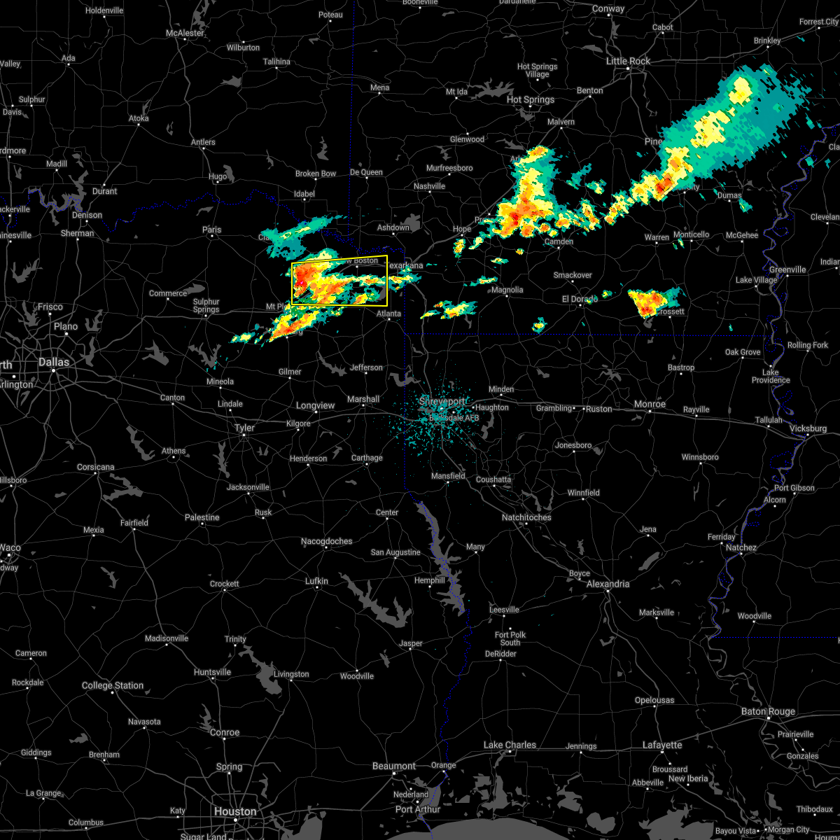 At 137 am cdt, a severe thunderstorm was located near us 259 and i 30 intersection, or 9 miles south of boxelder, moving east at 40 mph (radar indicated). Hazards include 60 mph wind gusts and quarter size hail. Hail damage to vehicles is expected. Expect wind damage to roofs, siding, and trees. At 137 am cdt, a severe thunderstorm was located near us 259 and i 30 intersection, or 9 miles south of boxelder, moving east at 40 mph (radar indicated). Hazards include 60 mph wind gusts and quarter size hail. Hail damage to vehicles is expected. Expect wind damage to roofs, siding, and trees.
|
| 3/17/2021 7:36 AM CDT |
 At 736 am cdt, severe thunderstorms were located along a line extending from near wilton to 6 miles east of naples, moving northeast at 55 mph (radar indicated). Hazards include 70 mph wind gusts and quarter size hail. Hail damage to vehicles is expected. expect considerable tree damage. Wind damage is also likely to mobile homes, roofs, and outbuildings. At 736 am cdt, severe thunderstorms were located along a line extending from near wilton to 6 miles east of naples, moving northeast at 55 mph (radar indicated). Hazards include 70 mph wind gusts and quarter size hail. Hail damage to vehicles is expected. expect considerable tree damage. Wind damage is also likely to mobile homes, roofs, and outbuildings.
|
| 3/17/2021 7:28 AM CDT | Tree in the south bound lane of us 259 at the intersection of cr 423 in bowie county TX, 6.4 miles NNE of De Kalb, TX |
| 2/25/2021 10:10 PM CST |
 At 1009 pm cst, a severe thunderstorm was located near de kalb, or 10 miles west of new boston, moving east at 55 mph (radar indicated). Hazards include 60 mph wind gusts and half dollar size hail. Hail damage to vehicles is expected. Expect wind damage to roofs, siding, and trees. At 1009 pm cst, a severe thunderstorm was located near de kalb, or 10 miles west of new boston, moving east at 55 mph (radar indicated). Hazards include 60 mph wind gusts and half dollar size hail. Hail damage to vehicles is expected. Expect wind damage to roofs, siding, and trees.
|
| 2/25/2021 10:05 PM CST |
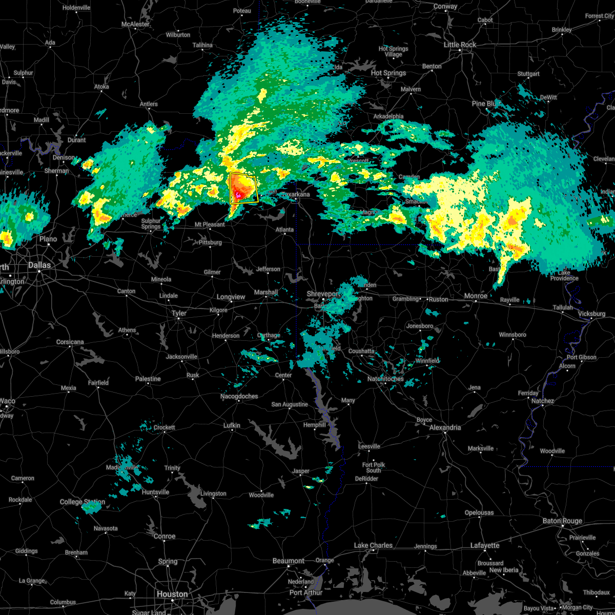 At 1005 pm cst, a severe thunderstorm was located near de kalb, or 13 miles east of boxelder, moving east at 65 mph (radar indicated). Hazards include 60 mph wind gusts and half dollar size hail. Hail damage to vehicles is expected. expect wind damage to roofs, siding, and trees. Locations impacted include, de kalb, beaverdams and almont. At 1005 pm cst, a severe thunderstorm was located near de kalb, or 13 miles east of boxelder, moving east at 65 mph (radar indicated). Hazards include 60 mph wind gusts and half dollar size hail. Hail damage to vehicles is expected. expect wind damage to roofs, siding, and trees. Locations impacted include, de kalb, beaverdams and almont.
|
| 2/25/2021 9:53 PM CST |
 At 952 pm cst, a severe thunderstorm was located over boxelder, moving east at 55 mph (law enforcement. at 939 pm cst, two inch diameter hail was reported by law enforcement in bogata). Hazards include two inch hail and 60 mph wind gusts. People and animals outdoors will be injured. expect hail damage to roofs, siding, windows, and vehicles. expect wind damage to roofs, siding, and trees. Locations impacted include, clarksville, boxelder, de kalb, avery, annona, english, almont, beaverdams, harts bluff, lydia and goodlake. At 952 pm cst, a severe thunderstorm was located over boxelder, moving east at 55 mph (law enforcement. at 939 pm cst, two inch diameter hail was reported by law enforcement in bogata). Hazards include two inch hail and 60 mph wind gusts. People and animals outdoors will be injured. expect hail damage to roofs, siding, windows, and vehicles. expect wind damage to roofs, siding, and trees. Locations impacted include, clarksville, boxelder, de kalb, avery, annona, english, almont, beaverdams, harts bluff, lydia and goodlake.
|
| 2/25/2021 9:45 PM CST |
 At 944 pm cst, a severe thunderstorm was located 9 miles south of clarksville, moving east at 55 mph (law enforcement. at 939 pm cst, two inch diameter hail was reported by law enforcment in bogata). Hazards include two inch hail and 60 mph wind gusts. People and animals outdoors will be injured. expect hail damage to roofs, siding, windows, and vehicles. expect wind damage to roofs, siding, and trees. Locations impacted include, clarksville, boxelder, de kalb, bogata, talco, avery, annona, almont, beaverdams, harts bluff, lydia, cuthand, english, johntown and goodlake. At 944 pm cst, a severe thunderstorm was located 9 miles south of clarksville, moving east at 55 mph (law enforcement. at 939 pm cst, two inch diameter hail was reported by law enforcment in bogata). Hazards include two inch hail and 60 mph wind gusts. People and animals outdoors will be injured. expect hail damage to roofs, siding, windows, and vehicles. expect wind damage to roofs, siding, and trees. Locations impacted include, clarksville, boxelder, de kalb, bogata, talco, avery, annona, almont, beaverdams, harts bluff, lydia, cuthand, english, johntown and goodlake.
|
| 2/25/2021 9:37 PM CST |
 At 937 pm cst, a severe thunderstorm was located over bogata, or 8 miles northeast of hagansport, moving east at 55 mph (radar indicated). Hazards include quarter size hail. damage to vehicles is expected At 937 pm cst, a severe thunderstorm was located over bogata, or 8 miles northeast of hagansport, moving east at 55 mph (radar indicated). Hazards include quarter size hail. damage to vehicles is expected
|
| 11/24/2020 10:45 PM CST |
 At 1045 pm cst, severe thunderstorms were located along a line extending from near idabel to 7 miles northwest of wilkerson, moving east at 50 mph (radar indicated). Hazards include 60 mph wind gusts. expect damage to roofs, siding, and trees At 1045 pm cst, severe thunderstorms were located along a line extending from near idabel to 7 miles northwest of wilkerson, moving east at 50 mph (radar indicated). Hazards include 60 mph wind gusts. expect damage to roofs, siding, and trees
|
| 11/24/2020 10:32 PM CST |
 At 1032 pm cst, severe thunderstorms were located along a line extending from 8 miles northwest of idabel to 6 miles northeast of clarksville to bogata, moving east at 60 mph (radar indicated). Hazards include 60 mph wind gusts and penny size hail. Expect damage to roofs, siding, and trees. Locations impacted include, clarksville, boxelder, idabel, de kalb, bogata, bagwell, manchester, avery, annona, haworth, moon, beaverdams, lydia, goodlake, redland, america, johntown, bokhoma, farmers hill and almont. At 1032 pm cst, severe thunderstorms were located along a line extending from 8 miles northwest of idabel to 6 miles northeast of clarksville to bogata, moving east at 60 mph (radar indicated). Hazards include 60 mph wind gusts and penny size hail. Expect damage to roofs, siding, and trees. Locations impacted include, clarksville, boxelder, idabel, de kalb, bogata, bagwell, manchester, avery, annona, haworth, moon, beaverdams, lydia, goodlake, redland, america, johntown, bokhoma, farmers hill and almont.
|
| 11/24/2020 10:02 PM CST |
 At 1002 pm cst, severe thunderstorms were located along a line extending from 11 miles south of sawyer to 6 miles west of deport to cooper lake park doctors creek, moving east at 55 mph (radar indicated). Hazards include 60 mph wind gusts and penny size hail. expect damage to roofs, siding, and trees At 1002 pm cst, severe thunderstorms were located along a line extending from 11 miles south of sawyer to 6 miles west of deport to cooper lake park doctors creek, moving east at 55 mph (radar indicated). Hazards include 60 mph wind gusts and penny size hail. expect damage to roofs, siding, and trees
|
| 5/24/2020 5:02 PM CDT |
 At 502 pm cdt, severe thunderstorms were located along a line extending from near bogata to 7 miles west of boxelder to 12 miles east of clarksville to near de kalb, moving north at 60 mph (radar indicated). Hazards include 60 mph wind gusts and nickel size hail. Expect damage to roofs, siding, and trees. Locations impacted include, clarksville, hagansport, boxelder, de kalb, bogata, wilkerson, bagwell, manchester, dalby springs, detroit, talco, avery, annona, beaverdams, harts bluff, lydia, negley, cuthand, woodland and english. At 502 pm cdt, severe thunderstorms were located along a line extending from near bogata to 7 miles west of boxelder to 12 miles east of clarksville to near de kalb, moving north at 60 mph (radar indicated). Hazards include 60 mph wind gusts and nickel size hail. Expect damage to roofs, siding, and trees. Locations impacted include, clarksville, hagansport, boxelder, de kalb, bogata, wilkerson, bagwell, manchester, dalby springs, detroit, talco, avery, annona, beaverdams, harts bluff, lydia, negley, cuthand, woodland and english.
|
| 5/24/2020 4:21 PM CDT |
 At 421 pm cdt, severe thunderstorms were located along a line extending from near scroggins to near pittsburg to near rocky branch, moving north at 45 mph (radar indicated. large hail and damaging winds have been reported throughout upshur county with these storms). Hazards include 60 mph wind gusts and quarter size hail. Hail damage to vehicles is expected. Expect wind damage to roofs, siding, and trees. At 421 pm cdt, severe thunderstorms were located along a line extending from near scroggins to near pittsburg to near rocky branch, moving north at 45 mph (radar indicated. large hail and damaging winds have been reported throughout upshur county with these storms). Hazards include 60 mph wind gusts and quarter size hail. Hail damage to vehicles is expected. Expect wind damage to roofs, siding, and trees.
|
| 5/8/2020 4:27 AM CDT |
 At 426 am cdt, severe thunderstorms were located along a line extending from 6 miles southwest of athens to near richmond to new boston to 6 miles east of dalby springs, moving southeast at 70 mph (radar indicated). Hazards include 60 mph wind gusts and quarter size hail. Hail damage to vehicles is expected. expect wind damage to roofs, siding, and trees. Locations impacted include, texarkana, de queen, atlanta, wake village, ashdown, nashville, new boston, mineral springs, dierks, horatio, foreman, umpire, nash, hooks, linden, de kalb, queen city, redwater, maud and red lick. At 426 am cdt, severe thunderstorms were located along a line extending from 6 miles southwest of athens to near richmond to new boston to 6 miles east of dalby springs, moving southeast at 70 mph (radar indicated). Hazards include 60 mph wind gusts and quarter size hail. Hail damage to vehicles is expected. expect wind damage to roofs, siding, and trees. Locations impacted include, texarkana, de queen, atlanta, wake village, ashdown, nashville, new boston, mineral springs, dierks, horatio, foreman, umpire, nash, hooks, linden, de kalb, queen city, redwater, maud and red lick.
|
| 5/8/2020 4:05 AM CDT |
 At 404 am cdt, severe thunderstorms were located along a line extending from 8 miles west of vandervoort to 11 miles west of arkinda to 8 miles northeast of boxelder, moving southeast at 70 mph (radar indicated). Hazards include 60 mph wind gusts and quarter size hail. Hail damage to vehicles is expected. Expect wind damage to roofs, siding, and trees. At 404 am cdt, severe thunderstorms were located along a line extending from 8 miles west of vandervoort to 11 miles west of arkinda to 8 miles northeast of boxelder, moving southeast at 70 mph (radar indicated). Hazards include 60 mph wind gusts and quarter size hail. Hail damage to vehicles is expected. Expect wind damage to roofs, siding, and trees.
|
| 4/28/2020 11:25 PM CDT | Report of large tree down on s. runnels s in bowie county TX, 0.5 miles NE of De Kalb, TX |
| 4/28/2020 11:25 PM CDT | Report of tree down on fm 2735 just north of de kal in bowie county TX, 1.1 miles SSE of De Kalb, TX |
| 4/28/2020 11:25 PM CDT |
 At 1124 pm cdt, severe thunderstorms were located along a line extending from near blevins to near hope to 6 miles southwest of fulton to near new boston to near boxelder to near bogata, moving south at 40 mph (radar indicated). Hazards include 70 mph wind gusts and quarter size hail. Hail damage to vehicles is expected. expect considerable tree damage. wind damage is also likely to mobile homes, roofs, and outbuildings. Locations impacted include, texarkana, wake village, ashdown, nashville, new boston, clarksville, mineral springs, foreman, boxelder, nash, hooks, de kalb, bogata, redwater, maud, red lick, wilton, blevins, tollette and fulton. At 1124 pm cdt, severe thunderstorms were located along a line extending from near blevins to near hope to 6 miles southwest of fulton to near new boston to near boxelder to near bogata, moving south at 40 mph (radar indicated). Hazards include 70 mph wind gusts and quarter size hail. Hail damage to vehicles is expected. expect considerable tree damage. wind damage is also likely to mobile homes, roofs, and outbuildings. Locations impacted include, texarkana, wake village, ashdown, nashville, new boston, clarksville, mineral springs, foreman, boxelder, nash, hooks, de kalb, bogata, redwater, maud, red lick, wilton, blevins, tollette and fulton.
|
| 4/28/2020 11:01 PM CDT |
 At 1100 pm cdt, severe thunderstorms were located along a line extending from near corinth to near ben lomond to near foreman to 12 miles south of idabel to near bagwell, moving southeast at 45 mph (radar indicated). Hazards include 70 mph wind gusts and quarter size hail. Hail damage to vehicles is expected. expect considerable tree damage. Wind damage is also likely to mobile homes, roofs, and outbuildings. At 1100 pm cdt, severe thunderstorms were located along a line extending from near corinth to near ben lomond to near foreman to 12 miles south of idabel to near bagwell, moving southeast at 45 mph (radar indicated). Hazards include 70 mph wind gusts and quarter size hail. Hail damage to vehicles is expected. expect considerable tree damage. Wind damage is also likely to mobile homes, roofs, and outbuildings.
|
| 4/28/2020 11:01 PM CDT |
 The national weather service in shreveport has issued a * severe thunderstorm warning for. little river county in southwestern arkansas. central hempstead county in southwestern arkansas. northwestern miller county in southwestern arkansas. Southeastern sevier county in southwestern arkansas. The national weather service in shreveport has issued a * severe thunderstorm warning for. little river county in southwestern arkansas. central hempstead county in southwestern arkansas. northwestern miller county in southwestern arkansas. Southeastern sevier county in southwestern arkansas.
|
| 4/28/2020 11:01 PM CDT |
 At 1100 pm cdt, severe thunderstorms were located along a line extending from near corinth to near ben lomond to near foreman to 12 miles south of idabel to near bagwell, moving southeast at 45 mph (radar indicated). Hazards include 70 mph wind gusts and quarter size hail. Hail damage to vehicles is expected. expect considerable tree damage. Wind damage is also likely to mobile homes, roofs, and outbuildings. At 1100 pm cdt, severe thunderstorms were located along a line extending from near corinth to near ben lomond to near foreman to 12 miles south of idabel to near bagwell, moving southeast at 45 mph (radar indicated). Hazards include 70 mph wind gusts and quarter size hail. Hail damage to vehicles is expected. expect considerable tree damage. Wind damage is also likely to mobile homes, roofs, and outbuildings.
|
| 4/12/2020 5:49 PM CDT |
 At 549 pm cdt, a severe thunderstorm was located near hooks, or near new boston, moving northeast at 40 mph (radar indicated). Hazards include 60 mph wind gusts and quarter size hail. Hail damage to vehicles is expected. Expect wind damage to roofs, siding, and trees. At 549 pm cdt, a severe thunderstorm was located near hooks, or near new boston, moving northeast at 40 mph (radar indicated). Hazards include 60 mph wind gusts and quarter size hail. Hail damage to vehicles is expected. Expect wind damage to roofs, siding, and trees.
|
| 4/12/2020 5:34 PM CDT |
 At 533 pm cdt, a severe thunderstorm was located near de kalb, or 9 miles west of new boston, moving northeast at 25 mph (radar indicated). Hazards include 60 mph wind gusts and half dollar size hail. Hail damage to vehicles is expected. expect wind damage to roofs, siding, and trees. Locations impacted include, new boston, boxelder, de kalb, maud, dalby springs, us 259 and i 30 intersection, spring hill, lydia and almont. At 533 pm cdt, a severe thunderstorm was located near de kalb, or 9 miles west of new boston, moving northeast at 25 mph (radar indicated). Hazards include 60 mph wind gusts and half dollar size hail. Hail damage to vehicles is expected. expect wind damage to roofs, siding, and trees. Locations impacted include, new boston, boxelder, de kalb, maud, dalby springs, us 259 and i 30 intersection, spring hill, lydia and almont.
|
| 4/12/2020 4:55 PM CDT |
 At 454 pm cdt, a severe thunderstorm was located near wilkerson, or 7 miles south of boxelder, moving northeast at 25 mph (radar indicated). Hazards include 60 mph wind gusts and half dollar size hail. Hail damage to vehicles is expected. Expect wind damage to roofs, siding, and trees. At 454 pm cdt, a severe thunderstorm was located near wilkerson, or 7 miles south of boxelder, moving northeast at 25 mph (radar indicated). Hazards include 60 mph wind gusts and half dollar size hail. Hail damage to vehicles is expected. Expect wind damage to roofs, siding, and trees.
|
| 10/21/2019 2:28 AM CDT |
 At 227 am cdt, severe thunderstorms were located along a line extending from 8 miles north of de kalb to near dalby springs to scroggins, moving southeast at 40 mph (radar indicated). Hazards include 60 mph wind gusts and quarter size hail. Hail damage to vehicles is expected. Expect wind damage to roofs, siding, and trees. At 227 am cdt, severe thunderstorms were located along a line extending from 8 miles north of de kalb to near dalby springs to scroggins, moving southeast at 40 mph (radar indicated). Hazards include 60 mph wind gusts and quarter size hail. Hail damage to vehicles is expected. Expect wind damage to roofs, siding, and trees.
|
| 10/21/2019 2:12 AM CDT |
 At 212 am cdt, severe thunderstorms were located along a line extending from 13 miles south of idabel to near boxelder to near purley, moving east at 50 mph (radar indicated). Hazards include 60 mph wind gusts and quarter size hail. Hail damage to vehicles is expected. expect wind damage to roofs, siding, and trees. Locations impacted include, mount pleasant, winnsboro, clarksville, hagansport, boxelder, mount vernon, de kalb, bogata, wilkerson, purley, scroggins, winfield, talco, avery, annona, miller`s cove, beaverdams, lydia, johntown and almont. At 212 am cdt, severe thunderstorms were located along a line extending from 13 miles south of idabel to near boxelder to near purley, moving east at 50 mph (radar indicated). Hazards include 60 mph wind gusts and quarter size hail. Hail damage to vehicles is expected. expect wind damage to roofs, siding, and trees. Locations impacted include, mount pleasant, winnsboro, clarksville, hagansport, boxelder, mount vernon, de kalb, bogata, wilkerson, purley, scroggins, winfield, talco, avery, annona, miller`s cove, beaverdams, lydia, johntown and almont.
|
| 10/21/2019 1:35 AM CDT |
 At 135 am cdt, severe thunderstorms were located along a line extending from 9 miles west of manchester to 7 miles southwest of deport to hawk cove, moving east at 50 mph (radar indicated). Hazards include 60 mph wind gusts and quarter size hail. Hail damage to vehicles is expected. Expect wind damage to roofs, siding, and trees. At 135 am cdt, severe thunderstorms were located along a line extending from 9 miles west of manchester to 7 miles southwest of deport to hawk cove, moving east at 50 mph (radar indicated). Hazards include 60 mph wind gusts and quarter size hail. Hail damage to vehicles is expected. Expect wind damage to roofs, siding, and trees.
|
| 10/20/2019 11:45 PM CDT |
 At 1144 pm cdt, severe thunderstorms were located along a line extending from 8 miles northwest of de queen to 8 miles west of horatio to 10 miles southwest of arkinda to 6 miles northwest of wilkerson, moving east at 45 mph (radar indicated). Hazards include 60 mph wind gusts. Expect damage to roofs, siding, and trees. Locations impacted include, de queen, clarksville, horatio, foreman, boxelder, de kalb, bogata, lockesburg, winthrop, arkinda, avery, annona, haworth, eagletown, moon, cerrogordo, beaverdams, lydia, goodlake and geneva. At 1144 pm cdt, severe thunderstorms were located along a line extending from 8 miles northwest of de queen to 8 miles west of horatio to 10 miles southwest of arkinda to 6 miles northwest of wilkerson, moving east at 45 mph (radar indicated). Hazards include 60 mph wind gusts. Expect damage to roofs, siding, and trees. Locations impacted include, de queen, clarksville, horatio, foreman, boxelder, de kalb, bogata, lockesburg, winthrop, arkinda, avery, annona, haworth, eagletown, moon, cerrogordo, beaverdams, lydia, goodlake and geneva.
|
| 10/20/2019 11:16 PM CDT |
 At 1116 pm cdt, severe thunderstorms were located along a line extending from near broken bow to near idabel to near clarksville to 10 miles west of hagansport, moving east at 45 mph (radar indicated. power lines were downed near valliant oklahoma with these storms, and a roof was removed off of a building). Hazards include 60 mph wind gusts. expect damage to roofs, siding, and trees At 1116 pm cdt, severe thunderstorms were located along a line extending from near broken bow to near idabel to near clarksville to 10 miles west of hagansport, moving east at 45 mph (radar indicated. power lines were downed near valliant oklahoma with these storms, and a roof was removed off of a building). Hazards include 60 mph wind gusts. expect damage to roofs, siding, and trees
|
| 6/3/2019 4:56 PM CDT |
 The severe thunderstorm warning for southwestern bowie county will expire at 500 pm cdt, the storms which prompted the warning have weakened below severe limits, and no longer poses an immediate threat to life or property. therefore, the warning will be allowed to expire. however gusty winds and heavy rain are still possible with these thunderstorms. The severe thunderstorm warning for southwestern bowie county will expire at 500 pm cdt, the storms which prompted the warning have weakened below severe limits, and no longer poses an immediate threat to life or property. therefore, the warning will be allowed to expire. however gusty winds and heavy rain are still possible with these thunderstorms.
|
| 6/3/2019 4:39 PM CDT |
 At 438 pm cdt, a severe thunderstorm was located near dalby springs, or 12 miles southwest of new boston, moving east at 25 mph (radar indicated). Hazards include 60 mph wind gusts and quarter size hail. Hail damage to vehicles is expected. expect wind damage to roofs, siding, and trees. Locations impacted include, new boston, de kalb, dalby springs and spring hill. At 438 pm cdt, a severe thunderstorm was located near dalby springs, or 12 miles southwest of new boston, moving east at 25 mph (radar indicated). Hazards include 60 mph wind gusts and quarter size hail. Hail damage to vehicles is expected. expect wind damage to roofs, siding, and trees. Locations impacted include, new boston, de kalb, dalby springs and spring hill.
|
| 6/3/2019 4:18 PM CDT |
 At 418 pm cdt, a severe thunderstorm was located over dalby springs, or 9 miles southeast of boxelder, moving east at 25 mph (radar indicated). Hazards include 60 mph wind gusts and quarter size hail. Hail damage to vehicles is expected. Expect wind damage to roofs, siding, and trees. At 418 pm cdt, a severe thunderstorm was located over dalby springs, or 9 miles southeast of boxelder, moving east at 25 mph (radar indicated). Hazards include 60 mph wind gusts and quarter size hail. Hail damage to vehicles is expected. Expect wind damage to roofs, siding, and trees.
|
| 5/29/2019 8:11 PM CDT |
 The tornado warning for southwestern bowie and southeastern red river counties will expire at 815 pm cdt, the storm which prompted the warning has weakened and no longer appears capable of producing a tornado. therefore, the warning will be allowed to expire. however, damaging winds and heavy rain are still possible with these thunderstorms. a 60 mph wind gust was just reported from these storms on the west side of dekalb at 805 pm. a tornado watch remains in effect until 100 am cdt for northeastern texas. remember, a severe thunderstorm warning still remains in effect for bowie county until 9 pm. The tornado warning for southwestern bowie and southeastern red river counties will expire at 815 pm cdt, the storm which prompted the warning has weakened and no longer appears capable of producing a tornado. therefore, the warning will be allowed to expire. however, damaging winds and heavy rain are still possible with these thunderstorms. a 60 mph wind gust was just reported from these storms on the west side of dekalb at 805 pm. a tornado watch remains in effect until 100 am cdt for northeastern texas. remember, a severe thunderstorm warning still remains in effect for bowie county until 9 pm.
|
| 5/29/2019 8:03 PM CDT | A tree was down on a power line at the intersection of west fannin street and south runnels street in dekal in bowie county TX, 0.5 miles SE of De Kalb, TX |
| 5/29/2019 8:02 PM CDT | Wind gust estimated at the intersection of highway 259 and highway 82 on the west side of dekal in bowie county TX, 1.8 miles SE of De Kalb, TX |
| 5/29/2019 8:02 PM CDT |
 At 802 pm cdt, severe thunderstorms were located along a line extending from 14 miles northwest of new boston to near de kalb to dalby springs, moving east at 30 mph (radar indicated). Hazards include 60 mph wind gusts. expect damage to roofs, siding, and trees At 802 pm cdt, severe thunderstorms were located along a line extending from 14 miles northwest of new boston to near de kalb to dalby springs, moving east at 30 mph (radar indicated). Hazards include 60 mph wind gusts. expect damage to roofs, siding, and trees
|
| 5/29/2019 7:52 PM CDT |
 At 752 pm cdt, a severe thunderstorm capable of producing a tornado was located near dalby springs, or along the red river, bowie county line near the lydia community, moving east at 35 mph. while the rotation has weakened in the last few minutes, it could strengthen once again and a tornado will be possible. if you live in or near dekalb, take cover immediately! (radar indicated rotation). Hazards include tornado. Flying debris will be dangerous to those caught without shelter. mobile homes will be damaged or destroyed. damage to roofs, windows, and vehicles will occur. Tree damage is likely. At 752 pm cdt, a severe thunderstorm capable of producing a tornado was located near dalby springs, or along the red river, bowie county line near the lydia community, moving east at 35 mph. while the rotation has weakened in the last few minutes, it could strengthen once again and a tornado will be possible. if you live in or near dekalb, take cover immediately! (radar indicated rotation). Hazards include tornado. Flying debris will be dangerous to those caught without shelter. mobile homes will be damaged or destroyed. damage to roofs, windows, and vehicles will occur. Tree damage is likely.
|
| 5/29/2019 7:35 PM CDT |
 At 735 pm cdt, a severe thunderstorm capable of producing a tornado was located over boxelder, moving east at 40 mph (radar indicated rotation). Hazards include tornado. Flying debris will be dangerous to those caught without shelter. mobile homes will be damaged or destroyed. damage to roofs, windows, and vehicles will occur. tree damage is likely. Other locations impacted by this tornadic thunderstorm include lydia, spring hill and harts bluff. At 735 pm cdt, a severe thunderstorm capable of producing a tornado was located over boxelder, moving east at 40 mph (radar indicated rotation). Hazards include tornado. Flying debris will be dangerous to those caught without shelter. mobile homes will be damaged or destroyed. damage to roofs, windows, and vehicles will occur. tree damage is likely. Other locations impacted by this tornadic thunderstorm include lydia, spring hill and harts bluff.
|
| 5/2/2019 12:15 AM CDT | Oak tree fell onto us hwy 82... blocking most of the highway. it was struck by an 18-wheeler; however... no injurie in bowie county TX, 4.3 miles W of De Kalb, TX |
| 5/1/2019 9:50 PM CDT |
 At 949 pm cdt, severe thunderstorms were located along a line extending from 10 miles east of broken bow to wilkerson, moving east at 25 mph (radar indicated). Hazards include half dollar size hail. damage to vehicles is expected At 949 pm cdt, severe thunderstorms were located along a line extending from 10 miles east of broken bow to wilkerson, moving east at 25 mph (radar indicated). Hazards include half dollar size hail. damage to vehicles is expected
|
| 3/14/2019 2:22 AM CDT |
 At 222 am cdt, severe thunderstorms were located along a line extending from near foreman to newsome, moving east at 35 mph (radar indicated). Hazards include 60 mph wind gusts and penny size hail. Expect damage to roofs, siding, and trees. Locations impacted include, mount pleasant, pittsburg, foreman, leesburg, de kalb, omaha, us 259 and i 30 intersection, arkinda, cookville, dalby springs, newsome, avery, rocky mound, almont, beaverdams, lydia, goodlake, monticello, roeder and wallace. At 222 am cdt, severe thunderstorms were located along a line extending from near foreman to newsome, moving east at 35 mph (radar indicated). Hazards include 60 mph wind gusts and penny size hail. Expect damage to roofs, siding, and trees. Locations impacted include, mount pleasant, pittsburg, foreman, leesburg, de kalb, omaha, us 259 and i 30 intersection, arkinda, cookville, dalby springs, newsome, avery, rocky mound, almont, beaverdams, lydia, goodlake, monticello, roeder and wallace.
|
| 3/14/2019 1:42 AM CDT |
 At 142 am cdt, severe thunderstorms were located along a line extending from 9 miles south of idabel to near como, moving east at 35 mph (radar indicated). Hazards include 60 mph wind gusts and penny size hail. expect damage to roofs, siding, and trees At 142 am cdt, severe thunderstorms were located along a line extending from 9 miles south of idabel to near como, moving east at 35 mph (radar indicated). Hazards include 60 mph wind gusts and penny size hail. expect damage to roofs, siding, and trees
|
| 3/9/2019 9:29 AM CST |
 At 929 am cst, severe thunderstorms were located along a line extending from 6 miles northwest of dalby springs to 6 miles south of newsome, moving east at 55 mph (radar indicated). Hazards include 60 mph wind gusts and quarter size hail. Hail damage to vehicles is expected. Expect wind damage to roofs, siding, and trees. At 929 am cst, severe thunderstorms were located along a line extending from 6 miles northwest of dalby springs to 6 miles south of newsome, moving east at 55 mph (radar indicated). Hazards include 60 mph wind gusts and quarter size hail. Hail damage to vehicles is expected. Expect wind damage to roofs, siding, and trees.
|
| 1/19/2019 12:00 AM CST |
 At 1159 pm cst, a severe thunderstorm was located over boxelder, moving northeast at 55 mph (radar indicated). Hazards include quarter size hail. damage to vehicles is expected At 1159 pm cst, a severe thunderstorm was located over boxelder, moving northeast at 55 mph (radar indicated). Hazards include quarter size hail. damage to vehicles is expected
|
| 12/1/2018 12:39 AM CST |
 At 1238 am cst, severe thunderstorms were located along a line extending from 6 miles southwest of foreman to 10 miles west of richmond to new boston to 8 miles west of maud to near naples to rocky branch, moving east at 45 mph (radar indicated). Hazards include 70 mph wind gusts and penny size hail. Expect considerable tree damage. Damage is likely to mobile homes, roofs, and outbuildings. At 1238 am cst, severe thunderstorms were located along a line extending from 6 miles southwest of foreman to 10 miles west of richmond to new boston to 8 miles west of maud to near naples to rocky branch, moving east at 45 mph (radar indicated). Hazards include 70 mph wind gusts and penny size hail. Expect considerable tree damage. Damage is likely to mobile homes, roofs, and outbuildings.
|
| 12/1/2018 12:25 AM CST |
 At 1224 am cst, severe thunderstorms were located along a line extending from 15 miles southwest of arkinda to near de kalb to 8 miles west of new boston to near us 259 and i 30 intersection to near omaha to near cason, moving east at 45 mph (radar indicated). Hazards include 70 mph wind gusts and penny size hail. Expect considerable tree damage. Damage is likely to mobile homes, roofs, and outbuildings. At 1224 am cst, severe thunderstorms were located along a line extending from 15 miles southwest of arkinda to near de kalb to 8 miles west of new boston to near us 259 and i 30 intersection to near omaha to near cason, moving east at 45 mph (radar indicated). Hazards include 70 mph wind gusts and penny size hail. Expect considerable tree damage. Damage is likely to mobile homes, roofs, and outbuildings.
|
| 12/1/2018 12:08 AM CST |
 At 1207 am cst, severe thunderstorms were located along a line extending from 9 miles east of clarksville to near boxelder to near dalby springs to near cookville to mount pleasant to near newsome, moving east at 45 mph (radar indicated). Hazards include 70 mph wind gusts and penny size hail. Expect considerable tree damage. Damage is likely to mobile homes, roofs, and outbuildings. At 1207 am cst, severe thunderstorms were located along a line extending from 9 miles east of clarksville to near boxelder to near dalby springs to near cookville to mount pleasant to near newsome, moving east at 45 mph (radar indicated). Hazards include 70 mph wind gusts and penny size hail. Expect considerable tree damage. Damage is likely to mobile homes, roofs, and outbuildings.
|
| 4/13/2018 5:51 PM CDT |
 At 551 pm cdt, a severe thunderstorm capable of producing a tornado was located over de kalb, or 12 miles west of new boston, moving northeast at 40 mph (radar indicated rotation). Hazards include tornado and quarter size hail. Flying debris will be dangerous to those caught without shelter. mobile homes will be damaged or destroyed. damage to roofs, windows, and vehicles will occur. tree damage is likely. this dangerous storm will be near, foreman and arkinda around 625 pm cdt. Other locations impacted by this tornadic thunderstorm include wallace, tom and almont. At 551 pm cdt, a severe thunderstorm capable of producing a tornado was located over de kalb, or 12 miles west of new boston, moving northeast at 40 mph (radar indicated rotation). Hazards include tornado and quarter size hail. Flying debris will be dangerous to those caught without shelter. mobile homes will be damaged or destroyed. damage to roofs, windows, and vehicles will occur. tree damage is likely. this dangerous storm will be near, foreman and arkinda around 625 pm cdt. Other locations impacted by this tornadic thunderstorm include wallace, tom and almont.
|
| 4/6/2018 4:17 PM CDT | Golf Ball sized hail reported 9.4 miles N of De Kalb, TX, at 4:17pm golf ball hail off exit 186 3 miles east of dalby springs. |
| 4/6/2018 4:01 PM CDT |
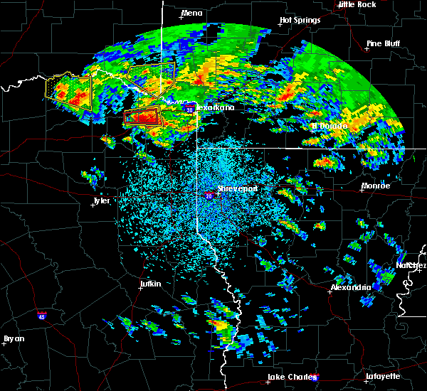 At 400 pm cdt, a severe thunderstorm was located over dalby springs, or 9 miles southeast of boxelder, moving east at 25 mph (radar indicated). Hazards include golf ball size hail and 60 mph wind gusts. People and animals outdoors will be injured. expect hail damage to roofs, siding, windows, and vehicles. expect wind damage to roofs, siding, and trees. locations impacted include, boxelder, de kalb, dalby springs, lydia and spring hill. A tornado watch remains in effect until 1100 pm cdt for northeastern texas. At 400 pm cdt, a severe thunderstorm was located over dalby springs, or 9 miles southeast of boxelder, moving east at 25 mph (radar indicated). Hazards include golf ball size hail and 60 mph wind gusts. People and animals outdoors will be injured. expect hail damage to roofs, siding, windows, and vehicles. expect wind damage to roofs, siding, and trees. locations impacted include, boxelder, de kalb, dalby springs, lydia and spring hill. A tornado watch remains in effect until 1100 pm cdt for northeastern texas.
|
| 4/6/2018 3:48 PM CDT |
 At 347 pm cdt, a severe thunderstorm was located over boxelder, moving east at 25 mph (radar indicated). Hazards include golf ball size hail and 60 mph wind gusts. People and animals outdoors will be injured. expect hail damage to roofs, siding, windows, and vehicles. expect wind damage to roofs, siding, and trees. locations impacted include, boxelder, de kalb, dalby springs, wilkerson, avery, spring hill, harts bluff, lydia and cuthand. A tornado watch remains in effect until 1100 pm cdt for northeastern texas. At 347 pm cdt, a severe thunderstorm was located over boxelder, moving east at 25 mph (radar indicated). Hazards include golf ball size hail and 60 mph wind gusts. People and animals outdoors will be injured. expect hail damage to roofs, siding, windows, and vehicles. expect wind damage to roofs, siding, and trees. locations impacted include, boxelder, de kalb, dalby springs, wilkerson, avery, spring hill, harts bluff, lydia and cuthand. A tornado watch remains in effect until 1100 pm cdt for northeastern texas.
|
| 4/6/2018 3:36 PM CDT |
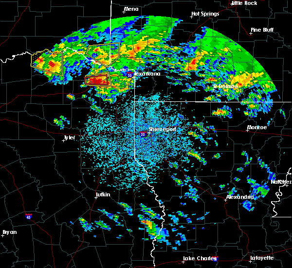 At 336 pm cdt, a severe thunderstorm was located near boxelder, moving east at 30 mph (radar indicated). Hazards include 60 mph wind gusts and quarter size hail. Hail damage to vehicles is expected. Expect wind damage to roofs, siding, and trees. At 336 pm cdt, a severe thunderstorm was located near boxelder, moving east at 30 mph (radar indicated). Hazards include 60 mph wind gusts and quarter size hail. Hail damage to vehicles is expected. Expect wind damage to roofs, siding, and trees.
|
| 4/6/2018 3:05 PM CDT |
 At 305 pm cdt, a severe thunderstorm was located near bogata, or 9 miles northeast of hagansport, moving east at 35 mph (radar indicated). Hazards include 60 mph wind gusts and quarter size hail. Hail damage to vehicles is expected. Expect wind damage to roofs, siding, and trees. At 305 pm cdt, a severe thunderstorm was located near bogata, or 9 miles northeast of hagansport, moving east at 35 mph (radar indicated). Hazards include 60 mph wind gusts and quarter size hail. Hail damage to vehicles is expected. Expect wind damage to roofs, siding, and trees.
|
| 1/21/2018 9:43 PM CST | Trees uprooted and power lines down on cr320 in bowie county TX, 1.4 miles WNW of De Kalb, TX |
| 1/21/2018 9:35 PM CST | Damage to home reported on fm990... unknown injuries or details at this tim in bowie county TX, 0.9 miles WNW of De Kalb, TX |
| 1/21/2018 9:34 PM CST |
 At 932 pm cst, a severe thunderstorm capable of producing a tornado was located over de kalb, or 11 miles west of new boston, and 4 miles southwest of de kalb, moving northeast at 45 mph. strong circulation with this storm (radar indicated rotation). Hazards include tornado and quarter size hail. Flying debris will be dangerous to those caught without shelter. mobile homes will be damaged or destroyed. damage to roofs, windows, and vehicles will occur. tree damage is likely. Locations impacted include, de kalb and almont. At 932 pm cst, a severe thunderstorm capable of producing a tornado was located over de kalb, or 11 miles west of new boston, and 4 miles southwest of de kalb, moving northeast at 45 mph. strong circulation with this storm (radar indicated rotation). Hazards include tornado and quarter size hail. Flying debris will be dangerous to those caught without shelter. mobile homes will be damaged or destroyed. damage to roofs, windows, and vehicles will occur. tree damage is likely. Locations impacted include, de kalb and almont.
|
| 1/21/2018 9:33 PM CST | Minor structural damage to homes east side of 259... on 44 just north of fm 4230... several chicken houses destroyed... trees and power poles damage in bowie county TX, 2.6 miles NNE of De Kalb, TX |
| 1/21/2018 9:33 PM CST | Em reports damage to 20 homes... roofs removed and or structurally damage in bowie county TX, 0.5 miles SE of De Kalb, TX |
| 1/21/2018 9:30 PM CST | Power lines down reported on us 259 in bowie county TX, 1.6 miles ESE of De Kalb, TX |
| 1/21/2018 9:17 PM CST |
 At 916 pm cst, a severe thunderstorm capable of producing a tornado was located near dalby springs, or 8 miles southeast of boxelder, moving northeast at 45 mph (radar indicated rotation). Hazards include tornado and quarter size hail. Flying debris will be dangerous to those caught without shelter. mobile homes will be damaged or destroyed. damage to roofs, windows, and vehicles will occur. Tree damage is likely. At 916 pm cst, a severe thunderstorm capable of producing a tornado was located near dalby springs, or 8 miles southeast of boxelder, moving northeast at 45 mph (radar indicated rotation). Hazards include tornado and quarter size hail. Flying debris will be dangerous to those caught without shelter. mobile homes will be damaged or destroyed. damage to roofs, windows, and vehicles will occur. Tree damage is likely.
|
| 7/3/2017 2:13 AM CDT |
 At 213 am cdt, a severe thunderstorm was located 8 miles north of new boston, moving east at 40 mph (radar indicated). Hazards include 60 mph wind gusts and penny size hail. Expect damage to roofs, siding, and trees. Locations impacted include, new boston, de kalb, avery, haworth, bokhoma, almont, moon, beaverdams, goodlake, harris, english, tom, america and bryarly. At 213 am cdt, a severe thunderstorm was located 8 miles north of new boston, moving east at 40 mph (radar indicated). Hazards include 60 mph wind gusts and penny size hail. Expect damage to roofs, siding, and trees. Locations impacted include, new boston, de kalb, avery, haworth, bokhoma, almont, moon, beaverdams, goodlake, harris, english, tom, america and bryarly.
|
| 7/3/2017 1:50 AM CDT |
 At 150 am cdt, a severe thunderstorm was located near clarksville, moving east at 35 mph (radar indicated). Hazards include 70 mph wind gusts and quarter size hail. Hail damage to vehicles is expected. expect considerable tree damage. Wind damage is also likely to mobile homes, roofs, and outbuildings. At 150 am cdt, a severe thunderstorm was located near clarksville, moving east at 35 mph (radar indicated). Hazards include 70 mph wind gusts and quarter size hail. Hail damage to vehicles is expected. expect considerable tree damage. Wind damage is also likely to mobile homes, roofs, and outbuildings.
|
| 4/26/2017 12:55 PM CDT |
 At 1253 pm cdt, a severe thunderstorm was located near wilkerson, or 9 miles north of mount pleasant, moving northeast at 55 mph. another severe thunderstorm was located just north of mount pleasant. this storm was moving northeast near 55 mph as well (radar indicated). Hazards include 60 mph wind gusts and quarter size hail. Hail damage to vehicles is expected. expect wind damage to roofs, siding, and trees. locations impacted include, mount pleasant, boxelder, de kalb, us 259 and i 30 intersection, wilkerson, dalby springs, winfield, talco, avery, annona, harts bluff, lydia and english. A tornado watch remains in effect until 500 pm cdt for northeastern texas. At 1253 pm cdt, a severe thunderstorm was located near wilkerson, or 9 miles north of mount pleasant, moving northeast at 55 mph. another severe thunderstorm was located just north of mount pleasant. this storm was moving northeast near 55 mph as well (radar indicated). Hazards include 60 mph wind gusts and quarter size hail. Hail damage to vehicles is expected. expect wind damage to roofs, siding, and trees. locations impacted include, mount pleasant, boxelder, de kalb, us 259 and i 30 intersection, wilkerson, dalby springs, winfield, talco, avery, annona, harts bluff, lydia and english. A tornado watch remains in effect until 500 pm cdt for northeastern texas.
|
| 4/26/2017 12:35 PM CDT |
 At 1234 pm cdt, a severe thunderstorm was located near purley, or 9 miles northwest of leesburg, moving northeast at 55 mph (radar indicated). Hazards include 60 mph wind gusts and quarter size hail. Hail damage to vehicles is expected. Expect wind damage to roofs, siding, and trees. At 1234 pm cdt, a severe thunderstorm was located near purley, or 9 miles northwest of leesburg, moving northeast at 55 mph (radar indicated). Hazards include 60 mph wind gusts and quarter size hail. Hail damage to vehicles is expected. Expect wind damage to roofs, siding, and trees.
|
| 4/4/2017 10:26 PM CDT |
 At 1025 pm cdt, a severe thunderstorm was located 13 miles southeast of idabel, or 18 miles west of foreman, moving northeast at 55 mph (radar indicated). Hazards include half dollar size hail. damage to vehicles is expected At 1025 pm cdt, a severe thunderstorm was located 13 miles southeast of idabel, or 18 miles west of foreman, moving northeast at 55 mph (radar indicated). Hazards include half dollar size hail. damage to vehicles is expected
|
| 3/29/2017 8:12 PM CDT |
 At 812 pm cdt, a severe thunderstorm was located near de kalb, or 10 miles west of new boston, moving east at 25 mph (radar indicated). Hazards include 60 mph wind gusts and quarter size hail. Hail damage to vehicles is expected. Expect wind damage to roofs, siding, and trees. At 812 pm cdt, a severe thunderstorm was located near de kalb, or 10 miles west of new boston, moving east at 25 mph (radar indicated). Hazards include 60 mph wind gusts and quarter size hail. Hail damage to vehicles is expected. Expect wind damage to roofs, siding, and trees.
|
| 3/27/2017 12:48 AM CDT |
 At 1248 am cdt, a severe thunderstorm was located over bogata, or near hagansport, moving northeast at 50 mph (radar indicated). Hazards include 60 mph wind gusts and quarter size hail. Hail damage to vehicles is expected. Expect wind damage to roofs, siding, and trees. At 1248 am cdt, a severe thunderstorm was located over bogata, or near hagansport, moving northeast at 50 mph (radar indicated). Hazards include 60 mph wind gusts and quarter size hail. Hail damage to vehicles is expected. Expect wind damage to roofs, siding, and trees.
|
| 7/23/2016 5:55 PM CDT | Power lines down along county road 450 in bowie county TX, 11.4 miles NNE of De Kalb, TX |
| 7/23/2016 5:45 PM CDT | Trees downed on power lines along hwy 259 in bowie county TX, 5 miles NNE of De Kalb, TX |
| 5/29/2016 7:44 PM CDT |
 At 743 pm cdt, a severe thunderstorm was located near boxelder, moving northeast at 15 mph (radar indicated). Hazards include 60 mph wind gusts and penny size hail. Expect damage to roofs. siding. and trees. Locations impacted include, boxelder, de kalb, dalby springs, wilkerson, avery, annona, cuthand, lydia, harts bluff and english. At 743 pm cdt, a severe thunderstorm was located near boxelder, moving northeast at 15 mph (radar indicated). Hazards include 60 mph wind gusts and penny size hail. Expect damage to roofs. siding. and trees. Locations impacted include, boxelder, de kalb, dalby springs, wilkerson, avery, annona, cuthand, lydia, harts bluff and english.
|
| 5/29/2016 7:25 PM CDT |
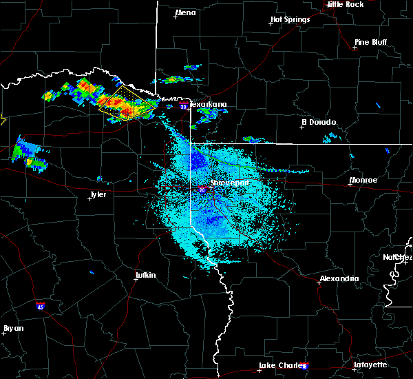 At 724 pm cdt, a severe thunderstorm was located near boxelder, moving northeast at 10 mph (radar indicated). Hazards include 60 mph wind gusts and half dollar size hail. Hail damage to vehicles is expected. expect wind damage to roofs, siding, and trees. Locations impacted include, boxelder, de kalb, dalby springs, wilkerson, avery, annona, cuthand, lydia, harts bluff and english. At 724 pm cdt, a severe thunderstorm was located near boxelder, moving northeast at 10 mph (radar indicated). Hazards include 60 mph wind gusts and half dollar size hail. Hail damage to vehicles is expected. expect wind damage to roofs, siding, and trees. Locations impacted include, boxelder, de kalb, dalby springs, wilkerson, avery, annona, cuthand, lydia, harts bluff and english.
|
| 5/29/2016 7:08 PM CDT |
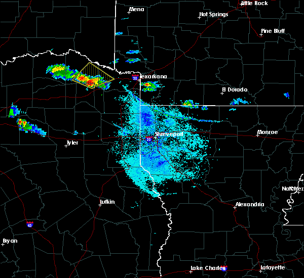 At 707 pm cdt, a severe thunderstorm was located near wilkerson, or near boxelder, moving northeast at 15 mph (radar indicated). Hazards include 60 mph wind gusts and half dollar size hail. Hail damage to vehicles is expected. Expect wind damage to roofs, siding, and trees. At 707 pm cdt, a severe thunderstorm was located near wilkerson, or near boxelder, moving northeast at 15 mph (radar indicated). Hazards include 60 mph wind gusts and half dollar size hail. Hail damage to vehicles is expected. Expect wind damage to roofs, siding, and trees.
|
| 5/9/2016 10:43 PM CDT |
 At 1042 pm cdt, a severe thunderstorm was located near de kalb, or 10 miles west of new boston, moving east at 35 mph (radar indicated). Hazards include 70 mph wind gusts and quarter size hail. Hail damage to vehicles is expected. expect considerable tree damage. Wind damage is also likely to mobile homes, roofs, and outbuildings. At 1042 pm cdt, a severe thunderstorm was located near de kalb, or 10 miles west of new boston, moving east at 35 mph (radar indicated). Hazards include 70 mph wind gusts and quarter size hail. Hail damage to vehicles is expected. expect considerable tree damage. Wind damage is also likely to mobile homes, roofs, and outbuildings.
|
| 5/9/2016 10:21 PM CDT | Storm damage reported in bowie county TX, 0.5 miles SE of De Kalb, TX |
| 5/9/2016 10:00 PM CDT | Golf Ball sized hail reported 1.4 miles SE of De Kalb, TX, golf ball size hail reported at us hwy 259 and us hwy 82 |
| 5/9/2016 9:51 PM CDT |
 At 951 pm cdt, a severe thunderstorm capable of producing a tornado was located 7 miles north of new boston, moving east at 25 mph (radar indicated rotation). Hazards include tornado. Flying debris will be dangerous to those caught without shelter. mobile homes will be damaged or destroyed. damage to roofs, windows, and vehicles will occur. tree damage is likely. this dangerous storm will be near, new boston around 955 pm cdt. hooks around 1015 pm cdt. Other locations impacted by this tornadic thunderstorm include red bank and leary. At 951 pm cdt, a severe thunderstorm capable of producing a tornado was located 7 miles north of new boston, moving east at 25 mph (radar indicated rotation). Hazards include tornado. Flying debris will be dangerous to those caught without shelter. mobile homes will be damaged or destroyed. damage to roofs, windows, and vehicles will occur. tree damage is likely. this dangerous storm will be near, new boston around 955 pm cdt. hooks around 1015 pm cdt. Other locations impacted by this tornadic thunderstorm include red bank and leary.
|
| 5/9/2016 9:49 PM CDT |
 At 948 pm cdt, severe thunderstorms were located along a line extending from near foreman to clarksville, moving southeast at 30 mph (radar indicated). Hazards include 60 mph wind gusts and quarter size hail. Hail damage to vehicles is expected. Expect wind damage to roofs, siding, and trees. At 948 pm cdt, severe thunderstorms were located along a line extending from near foreman to clarksville, moving southeast at 30 mph (radar indicated). Hazards include 60 mph wind gusts and quarter size hail. Hail damage to vehicles is expected. Expect wind damage to roofs, siding, and trees.
|
| 5/9/2016 9:30 PM CDT |
 At 929 pm cdt, a severe thunderstorm capable of producing a tornado was located over de kalb, or 12 miles northwest of new boston, moving east at 30 mph (radar indicated rotation). Hazards include tornado. Flying debris will be dangerous to those caught without shelter. mobile homes will be damaged or destroyed. damage to roofs, windows, and vehicles will occur. tree damage is likely. this dangerous storm will be near, new boston around 950 pm cdt. hooks around 1005 pm cdt. Other locations impacted by this tornadic thunderstorm include red bank and leary. At 929 pm cdt, a severe thunderstorm capable of producing a tornado was located over de kalb, or 12 miles northwest of new boston, moving east at 30 mph (radar indicated rotation). Hazards include tornado. Flying debris will be dangerous to those caught without shelter. mobile homes will be damaged or destroyed. damage to roofs, windows, and vehicles will occur. tree damage is likely. this dangerous storm will be near, new boston around 950 pm cdt. hooks around 1005 pm cdt. Other locations impacted by this tornadic thunderstorm include red bank and leary.
|
| 4/29/2016 1:59 AM CDT |
 At 159 am cdt, severe thunderstorms were located along a line extending from 6 miles west of dalby springs to near redwater, moving northeast at 30 mph (radar indicated). Hazards include 60 mph wind gusts and quarter size hail. Hail damage to vehicles is expected. expect wind damage to roofs, siding, and trees. Locations impacted include, texarkana, wake village, ashdown, new boston, foreman, boxelder, nash, hooks, de kalb, redwater, maud, red lick, ogden, dalby springs, richmond, wilkerson, leary, avery, annona and millwood. At 159 am cdt, severe thunderstorms were located along a line extending from 6 miles west of dalby springs to near redwater, moving northeast at 30 mph (radar indicated). Hazards include 60 mph wind gusts and quarter size hail. Hail damage to vehicles is expected. expect wind damage to roofs, siding, and trees. Locations impacted include, texarkana, wake village, ashdown, new boston, foreman, boxelder, nash, hooks, de kalb, redwater, maud, red lick, ogden, dalby springs, richmond, wilkerson, leary, avery, annona and millwood.
|
| 4/29/2016 1:36 AM CDT |
 At 133 am cdt, doppler radar was tracking two severe thunderstorms, one just north of mount pleasant and another one 7 miles south of maud, moving northeast at 30 mph (radar indicated). Hazards include 60 mph wind gusts and quarter size hail. Hail damage to vehicles is expected. Expect wind damage to roofs, siding, and trees. At 133 am cdt, doppler radar was tracking two severe thunderstorms, one just north of mount pleasant and another one 7 miles south of maud, moving northeast at 30 mph (radar indicated). Hazards include 60 mph wind gusts and quarter size hail. Hail damage to vehicles is expected. Expect wind damage to roofs, siding, and trees.
|
| 4/11/2016 10:51 AM CDT |
 At 1051 am cdt, a severe thunderstorm was located over dalby springs, or 8 miles southeast of boxelder, moving northeast at 55 mph (radar indicated). Hazards include 60 mph wind gusts and quarter size hail. Hail damage to vehicles is expected. Expect wind damage to roofs, siding, and trees. At 1051 am cdt, a severe thunderstorm was located over dalby springs, or 8 miles southeast of boxelder, moving northeast at 55 mph (radar indicated). Hazards include 60 mph wind gusts and quarter size hail. Hail damage to vehicles is expected. Expect wind damage to roofs, siding, and trees.
|
| 3/30/2016 5:36 PM CDT |
 At 534 pm cdt, a severe thunderstorm capable of producing a tornado was located over omaha, or 14 miles east of mount pleasant, moving east at 15 mph (radar indicated rotation). Hazards include tornado. Flying debris will be dangerous to those caught without shelter. mobile homes will be damaged or destroyed. damage to roofs, windows, and vehicles will occur. tree damage is likely. this dangerous storm will be near, naples around 545 pm cdt. Other locations impacted by this tornadic thunderstorm include lydia, bryans mill, spring hill, marietta, avery and beaverdams. At 534 pm cdt, a severe thunderstorm capable of producing a tornado was located over omaha, or 14 miles east of mount pleasant, moving east at 15 mph (radar indicated rotation). Hazards include tornado. Flying debris will be dangerous to those caught without shelter. mobile homes will be damaged or destroyed. damage to roofs, windows, and vehicles will occur. tree damage is likely. this dangerous storm will be near, naples around 545 pm cdt. Other locations impacted by this tornadic thunderstorm include lydia, bryans mill, spring hill, marietta, avery and beaverdams.
|
| 3/30/2016 4:57 PM CDT |
 At 455 pm cdt, a severe thunderstorm capable of producing a tornado was located near cason, or 7 miles southeast of mount pleasant, moving northeast at 35 mph (radar indicated rotation. multiple law enforcement and storm spotters indicated funnel clouds with this storm, including the city of pittsburg. dime size hail also reported in pittsburg). Hazards include tornado. Flying debris will be dangerous to those caught without shelter. mobile homes will be damaged or destroyed. damage to roofs, windows, and vehicles will occur. tree damage is likely. this dangerous storm will be near, cookville around 505 pm cdt. omaha around 510 pm cdt. naples and us 259 and i 30 intersection around 520 pm cdt. dalby springs around 530 pm cdt. de kalb around 545 pm cdt. Other locations impacted by this tornadic thunderstorm include roeder, holly springs, lydia, lafayette, harvard, bryans mill, spring hill, rocky mound, center point and marietta. At 455 pm cdt, a severe thunderstorm capable of producing a tornado was located near cason, or 7 miles southeast of mount pleasant, moving northeast at 35 mph (radar indicated rotation. multiple law enforcement and storm spotters indicated funnel clouds with this storm, including the city of pittsburg. dime size hail also reported in pittsburg). Hazards include tornado. Flying debris will be dangerous to those caught without shelter. mobile homes will be damaged or destroyed. damage to roofs, windows, and vehicles will occur. tree damage is likely. this dangerous storm will be near, cookville around 505 pm cdt. omaha around 510 pm cdt. naples and us 259 and i 30 intersection around 520 pm cdt. dalby springs around 530 pm cdt. de kalb around 545 pm cdt. Other locations impacted by this tornadic thunderstorm include roeder, holly springs, lydia, lafayette, harvard, bryans mill, spring hill, rocky mound, center point and marietta.
|
| 3/18/2016 12:34 PM CDT |
 At 1234 pm cdt, a severe thunderstorm was located near de kalb, or 9 miles northwest of new boston, moving east at 35 mph (radar indicated). Hazards include 60 mph wind gusts and quarter size hail. Hail damage to vehicles is expected. Expect wind damage to roofs, siding, and trees. At 1234 pm cdt, a severe thunderstorm was located near de kalb, or 9 miles northwest of new boston, moving east at 35 mph (radar indicated). Hazards include 60 mph wind gusts and quarter size hail. Hail damage to vehicles is expected. Expect wind damage to roofs, siding, and trees.
|
| 3/17/2016 9:58 AM CDT |
 At 957 am cdt, a confirmed tornado was located over de kalb, or 11 miles west of new boston, moving east at 50 mph (law enforcement confirmed tornado). Hazards include damaging tornado and quarter size hail. Flying debris will be dangerous to those caught without shelter. mobile homes will be damaged or destroyed. damage to roofs, windows, and vehicles will occur. tree damage is likely. this tornado will be near, new boston around 1015 am cdt. Other locations impacted by this tornadic thunderstorm include spring hill. At 957 am cdt, a confirmed tornado was located over de kalb, or 11 miles west of new boston, moving east at 50 mph (law enforcement confirmed tornado). Hazards include damaging tornado and quarter size hail. Flying debris will be dangerous to those caught without shelter. mobile homes will be damaged or destroyed. damage to roofs, windows, and vehicles will occur. tree damage is likely. this tornado will be near, new boston around 1015 am cdt. Other locations impacted by this tornadic thunderstorm include spring hill.
|
| 3/17/2016 9:51 AM CDT |
 At 950 am cdt, a confirmed tornado was located near de kalb, or 11 miles east of boxelder, moving east at 45 mph (law enforcement confirmed tornado). Hazards include damaging tornado. Flying debris will be dangerous to those caught without shelter. mobile homes will be damaged or destroyed. damage to roofs, windows, and vehicles will occur. tree damage is likely. this tornado will be near, de kalb around 955 am cdt. new boston around 1015 am cdt. Other locations impacted by this tornadic thunderstorm include lydia, spring hill and avery. At 950 am cdt, a confirmed tornado was located near de kalb, or 11 miles east of boxelder, moving east at 45 mph (law enforcement confirmed tornado). Hazards include damaging tornado. Flying debris will be dangerous to those caught without shelter. mobile homes will be damaged or destroyed. damage to roofs, windows, and vehicles will occur. tree damage is likely. this tornado will be near, de kalb around 955 am cdt. new boston around 1015 am cdt. Other locations impacted by this tornadic thunderstorm include lydia, spring hill and avery.
|
| 3/17/2016 9:50 AM CDT | Trees down reported on fm 2735 in bowie county TX, 2.4 miles S of De Kalb, TX |
| 3/17/2016 9:43 AM CDT |
 At 942 am cdt, a confirmed tornado was located near boxelder, moving east at 50 mph (weather spotters confirmed tornado). Hazards include damaging tornado. Flying debris will be dangerous to those caught without shelter. mobile homes will be damaged or destroyed. damage to roofs, windows, and vehicles will occur. tree damage is likely. the tornado will be near, de kalb around 955 am cdt. new boston around 1010 am cdt. Other locations impacted by this tornadic thunderstorm include lydia, spring hill, english, avery and annona. At 942 am cdt, a confirmed tornado was located near boxelder, moving east at 50 mph (weather spotters confirmed tornado). Hazards include damaging tornado. Flying debris will be dangerous to those caught without shelter. mobile homes will be damaged or destroyed. damage to roofs, windows, and vehicles will occur. tree damage is likely. the tornado will be near, de kalb around 955 am cdt. new boston around 1010 am cdt. Other locations impacted by this tornadic thunderstorm include lydia, spring hill, english, avery and annona.
|
| 12/27/2015 4:46 PM CST |
 At 445 pm cst, severe thunderstorms were located along a line extending from 9 miles north of de kalb to 11 miles southwest of maud, moving north at 45 mph (radar indicated). Hazards include 70 mph wind gusts. Expect considerable tree damage. Damage is likely to mobile homes, roofs, and outbuildings. At 445 pm cst, severe thunderstorms were located along a line extending from 9 miles north of de kalb to 11 miles southwest of maud, moving north at 45 mph (radar indicated). Hazards include 70 mph wind gusts. Expect considerable tree damage. Damage is likely to mobile homes, roofs, and outbuildings.
|
| 12/27/2015 4:17 PM CST |
 At 416 pm cst, severe thunderstorms were located along a line extending from 6 miles east of wilkerson to rocky branch to near cedar springs, moving northeast at 30 mph (radar indicated). Hazards include 60 mph wind gusts. Expect damage to roofs. siding. And trees. At 416 pm cst, severe thunderstorms were located along a line extending from 6 miles east of wilkerson to rocky branch to near cedar springs, moving northeast at 30 mph (radar indicated). Hazards include 60 mph wind gusts. Expect damage to roofs. siding. And trees.
|
| 12/27/2015 3:36 PM CST |
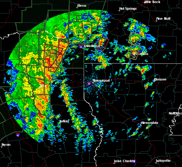 A tornado warning remains in effect until 400 pm cst for western bowie county. at 336 pm cst. a severe thunderstorm capable of producing a tornado was located over dalby springs. or 13 miles southeast of boxelder. moving north at 40 mph. hazard. Tornado. A tornado warning remains in effect until 400 pm cst for western bowie county. at 336 pm cst. a severe thunderstorm capable of producing a tornado was located over dalby springs. or 13 miles southeast of boxelder. moving north at 40 mph. hazard. Tornado.
|
| 12/27/2015 3:15 PM CST |
 At 314 pm cst, a severe thunderstorm capable of producing a tornado was located over omaha, or 11 miles east of mount pleasant, moving north at 40 mph (radar indicated rotation). Hazards include tornado. Flying debris will be dangerous to those caught without shelter. mobile homes will be damaged or destroyed. damage to roofs, windows, and vehicles will occur. tree damage is likely. this dangerous storm will be near, us 259 and i 30 intersection around 325 pm cst. dalby springs around 335 pm cst. de kalb around 350 pm cst. Other locations impacted by this tornadic thunderstorm include almont, lydia, avery and beaverdams. At 314 pm cst, a severe thunderstorm capable of producing a tornado was located over omaha, or 11 miles east of mount pleasant, moving north at 40 mph (radar indicated rotation). Hazards include tornado. Flying debris will be dangerous to those caught without shelter. mobile homes will be damaged or destroyed. damage to roofs, windows, and vehicles will occur. tree damage is likely. this dangerous storm will be near, us 259 and i 30 intersection around 325 pm cst. dalby springs around 335 pm cst. de kalb around 350 pm cst. Other locations impacted by this tornadic thunderstorm include almont, lydia, avery and beaverdams.
|
| 12/27/2015 3:09 PM CST | Trees and power lines down with roof damag in bowie county TX, 2.1 miles E of De Kalb, TX |
| 12/27/2015 3:02 PM CST |
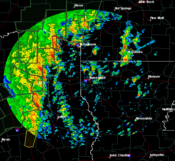 At 301 pm cst, a severe thunderstorm capable of producing a tornado was located near dalby springs, or 11 miles east of boxelder, moving northeast at 30 mph (radar indicated rotation). Hazards include tornado. Flying debris will be dangerous to those caught without shelter. mobile homes will be damaged or destroyed. damage to roofs, windows, and vehicles will occur. tree damage is likely. this dangerous storm will be near, de kalb around 315 pm cst. Other locations impacted by this tornadic thunderstorm include lydia, avery and beaverdams. At 301 pm cst, a severe thunderstorm capable of producing a tornado was located near dalby springs, or 11 miles east of boxelder, moving northeast at 30 mph (radar indicated rotation). Hazards include tornado. Flying debris will be dangerous to those caught without shelter. mobile homes will be damaged or destroyed. damage to roofs, windows, and vehicles will occur. tree damage is likely. this dangerous storm will be near, de kalb around 315 pm cst. Other locations impacted by this tornadic thunderstorm include lydia, avery and beaverdams.
|
| 12/27/2015 2:45 PM CST |
 At 245 pm cst, a severe thunderstorm capable of producing a tornado was located near us 259 and i 30 intersection, or 11 miles southeast of boxelder, moving north at 35 mph (radar indicated rotation). Hazards include tornado. Flying debris will be dangerous to those caught without shelter. mobile homes will be damaged or destroyed. damage to roofs, windows, and vehicles will occur. tree damage is likely. this dangerous storm will be near, dalby springs around 250 pm cst. de kalb around 310 pm cst. Other locations impacted by this tornadic thunderstorm include lydia, english, avery and beaverdams. At 245 pm cst, a severe thunderstorm capable of producing a tornado was located near us 259 and i 30 intersection, or 11 miles southeast of boxelder, moving north at 35 mph (radar indicated rotation). Hazards include tornado. Flying debris will be dangerous to those caught without shelter. mobile homes will be damaged or destroyed. damage to roofs, windows, and vehicles will occur. tree damage is likely. this dangerous storm will be near, dalby springs around 250 pm cst. de kalb around 310 pm cst. Other locations impacted by this tornadic thunderstorm include lydia, english, avery and beaverdams.
|
| 12/13/2015 2:01 AM CST |
 At 200 am cst, a severe thunderstorm was located near dalby springs, or near boxelder, moving northeast at 40 mph (radar indicated). Hazards include 60 mph wind gusts. Expect damage to roofs. siding. and trees. Locations impacted include, boxelder, de kalb, avery, lydia, almont and beaverdams. At 200 am cst, a severe thunderstorm was located near dalby springs, or near boxelder, moving northeast at 40 mph (radar indicated). Hazards include 60 mph wind gusts. Expect damage to roofs. siding. and trees. Locations impacted include, boxelder, de kalb, avery, lydia, almont and beaverdams.
|
| 12/13/2015 1:42 AM CST |
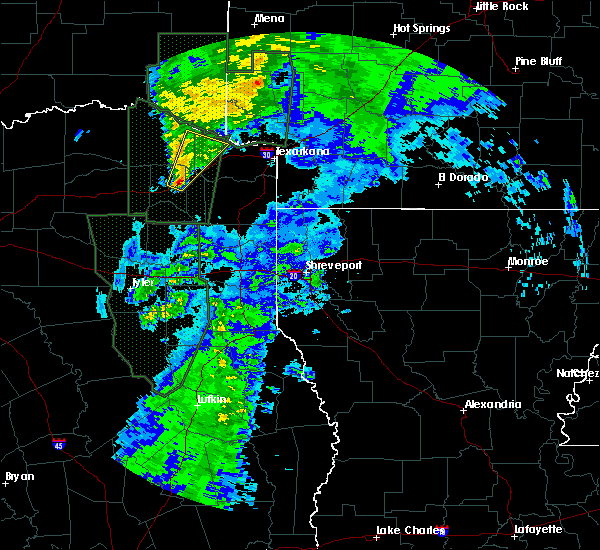 At 141 am cst, a severe thunderstorm was located near cookville, or 8 miles northeast of mount pleasant, moving northeast at 40 mph (radar indicated). Hazards include 60 mph wind gusts. Expect damage to roofs. siding. And trees. At 141 am cst, a severe thunderstorm was located near cookville, or 8 miles northeast of mount pleasant, moving northeast at 40 mph (radar indicated). Hazards include 60 mph wind gusts. Expect damage to roofs. siding. And trees.
|
| 6/21/2015 6:00 PM CDT |
 At 600 pm cdt, severe thunderstorms were located along a line extending from near winthrop to near foreman to near dalby springs, moving northeast at 30 mph (radar indicated). Hazards include 60 mph wind gusts. Expect damage to roofs. siding and trees. Locations impacted include, new boston, foreman, de kalb, winthrop, dalby springs, arkinda, avery, tom, wallace, america, lydia, almont, spring hill, goodlake and beaverdams. At 600 pm cdt, severe thunderstorms were located along a line extending from near winthrop to near foreman to near dalby springs, moving northeast at 30 mph (radar indicated). Hazards include 60 mph wind gusts. Expect damage to roofs. siding and trees. Locations impacted include, new boston, foreman, de kalb, winthrop, dalby springs, arkinda, avery, tom, wallace, america, lydia, almont, spring hill, goodlake and beaverdams.
|
| 6/21/2015 5:50 PM CDT |
 At 550 pm cdt, severe thunderstorms were located along a line extending from 6 miles west of broken bow to 7 miles northwest of arkinda to 6 miles west of de kalb, moving northeast at 25 mph (radar indicated). Hazards include 60 mph wind gusts. Expect damage to roofs. siding and trees. Locations impacted include, boxelder, idabel, broken bow, avery, haworth, garvin, cerrogordo, bokhoma, moon, oak hill, tom, holly creek, harris, shinewell, golden, goodwater, eagletown, america, almont and glover. At 550 pm cdt, severe thunderstorms were located along a line extending from 6 miles west of broken bow to 7 miles northwest of arkinda to 6 miles west of de kalb, moving northeast at 25 mph (radar indicated). Hazards include 60 mph wind gusts. Expect damage to roofs. siding and trees. Locations impacted include, boxelder, idabel, broken bow, avery, haworth, garvin, cerrogordo, bokhoma, moon, oak hill, tom, holly creek, harris, shinewell, golden, goodwater, eagletown, america, almont and glover.
|
| 6/21/2015 5:48 PM CDT |
 At 548 pm cdt, severe thunderstorms were located along a line extending from near arkinda to 10 miles north of de kalb to near dalby springs, moving northeast at 40 mph (radar indicated). Hazards include 60 mph wind gusts. Expect damage to roofs. siding and trees. Locations impacted include, new boston, foreman, de kalb, winthrop, us 259 and i 30 intersection, dalby springs, arkinda, avery, tom, wallace, america, lydia, almont, spring hill, goodlake and beaverdams. At 548 pm cdt, severe thunderstorms were located along a line extending from near arkinda to 10 miles north of de kalb to near dalby springs, moving northeast at 40 mph (radar indicated). Hazards include 60 mph wind gusts. Expect damage to roofs. siding and trees. Locations impacted include, new boston, foreman, de kalb, winthrop, us 259 and i 30 intersection, dalby springs, arkinda, avery, tom, wallace, america, lydia, almont, spring hill, goodlake and beaverdams.
|
| 6/21/2015 5:30 PM CDT |
 At 530 pm cdt, severe thunderstorms were located along a line extending from 9 miles northeast of manchester to 7 miles southeast of idabel to 6 miles east of boxelder, moving northeast at 25 mph (radar indicated). Hazards include 60 mph wind gusts. Expect damage to roofs. siding and trees. Locations impacted include, clarksville, boxelder, idabel, broken bow, wright city, avery, millerton, annona, haworth, garvin, negley, oak hill, holly creek, shinewell, golden, bryarly, eagletown, glover, goodlake and cerrogordo. At 530 pm cdt, severe thunderstorms were located along a line extending from 9 miles northeast of manchester to 7 miles southeast of idabel to 6 miles east of boxelder, moving northeast at 25 mph (radar indicated). Hazards include 60 mph wind gusts. Expect damage to roofs. siding and trees. Locations impacted include, clarksville, boxelder, idabel, broken bow, wright city, avery, millerton, annona, haworth, garvin, negley, oak hill, holly creek, shinewell, golden, bryarly, eagletown, glover, goodlake and cerrogordo.
|
| 6/21/2015 5:15 PM CDT |
 At 514 pm cdt, severe thunderstorms were located along a line extending from near boxelder to 7 miles northwest of dalby springs to 6 miles northwest of cookville to 6 miles southwest of mount pleasant, moving northeast at 35 mph (radar indicated). Hazards include 60 mph wind gusts. Expect damage to roofs. Siding and trees. At 514 pm cdt, severe thunderstorms were located along a line extending from near boxelder to 7 miles northwest of dalby springs to 6 miles northwest of cookville to 6 miles southwest of mount pleasant, moving northeast at 35 mph (radar indicated). Hazards include 60 mph wind gusts. Expect damage to roofs. Siding and trees.
|
| 6/21/2015 4:53 PM CDT |
 At 453 pm cdt, severe thunderstorms were located along a line extending from near bagwell to 7 miles northeast of clarksville to 7 miles northwest of de kalb, moving northeast at 20 mph (radar indicated). Hazards include 60 mph wind gusts. Expect damage to roofs. Siding and trees. At 453 pm cdt, severe thunderstorms were located along a line extending from near bagwell to 7 miles northeast of clarksville to 7 miles northwest of de kalb, moving northeast at 20 mph (radar indicated). Hazards include 60 mph wind gusts. Expect damage to roofs. Siding and trees.
|
| 5/25/2015 5:57 PM CDT | At 557 pm cdt, severe thunderstorms were located along a line extending from 8 miles northeast of de kalb to near naples to 6 miles west of lone star, moving east at 55 mph (radar indicated). Hazards include 60 mph wind gusts and quarter size hail. Hail damage to vehicles is expected. expect wind damage to roofs, siding and trees. locations impacted include, texarkana, atlanta, wake village, new boston, pittsburg, foreman, nash, hooks, daingerfield, linden, hughes springs, de kalb, lone star, queen city, naples, redwater, maud, omaha, red lick and cookville. A tornado watch remains in effect until 1000 pm cdt for southwestern arkansas, southeastern oklahoma and northeastern texas. |
| 5/25/2015 5:57 PM CDT | At 557 pm cdt, severe thunderstorms were located along a line extending from 8 miles northeast of de kalb to near naples to 6 miles west of lone star, moving east at 55 mph (radar indicated). Hazards include 60 mph wind gusts and quarter size hail. Hail damage to vehicles is expected. expect wind damage to roofs, siding and trees. locations impacted include, texarkana, atlanta, wake village, new boston, pittsburg, foreman, nash, hooks, daingerfield, linden, hughes springs, de kalb, lone star, queen city, naples, redwater, maud, omaha, red lick and cookville. A tornado watch remains in effect until 1000 pm cdt for southwestern arkansas, southeastern oklahoma and northeastern texas. |
| 5/25/2015 5:57 PM CDT | At 557 pm cdt, severe thunderstorms were located along a line extending from 8 miles northeast of de kalb to near naples to 6 miles west of lone star, moving east at 55 mph (radar indicated). Hazards include 60 mph wind gusts and quarter size hail. Hail damage to vehicles is expected. expect wind damage to roofs, siding and trees. locations impacted include, texarkana, atlanta, wake village, new boston, pittsburg, foreman, nash, hooks, daingerfield, linden, hughes springs, de kalb, lone star, queen city, naples, redwater, maud, omaha, red lick and cookville. A tornado watch remains in effect until 1000 pm cdt for southwestern arkansas, southeastern oklahoma and northeastern texas. |
| 5/25/2015 5:28 PM CDT | At 527 pm cdt, severe thunderstorms were located along a line extending from 6 miles southeast of clarksville to near mount pleasant to near leesburg, moving east at 60 mph (radar indicated). Hazards include 60 mph wind gusts and quarter size hail. Hail damage to vehicles is expected. Expect wind damage to roofs, siding and trees. |
| 5/25/2015 5:28 PM CDT | At 527 pm cdt, severe thunderstorms were located along a line extending from 6 miles southeast of clarksville to near mount pleasant to near leesburg, moving east at 60 mph (radar indicated). Hazards include 60 mph wind gusts and quarter size hail. Hail damage to vehicles is expected. Expect wind damage to roofs, siding and trees. |
| 5/25/2015 5:28 PM CDT | At 527 pm cdt, severe thunderstorms were located along a line extending from 6 miles southeast of clarksville to near mount pleasant to near leesburg, moving east at 60 mph (radar indicated). Hazards include 60 mph wind gusts and quarter size hail. Hail damage to vehicles is expected. Expect wind damage to roofs, siding and trees. |
| 5/25/2015 5:15 PM CDT | Numerous trees down in bowie county TX, 0.5 miles SE of De Kalb, TX |
| 5/25/2015 5:15 PM CDT | Quarter sized hail reported 0.5 miles SE of De Kalb, TX |
| 5/25/2015 4:46 PM CDT | At 446 pm cdt, severe thunderstorms were located along a line extending from 9 miles northeast of cooper to 9 miles southwest of como to near canton, moving east at 85 mph (radar indicated). Hazards include 60 mph wind gusts and quarter size hail. Hail damage to vehicles is expected. Expect wind damage to roofs, siding and trees. |
| 5/25/2015 4:46 PM CDT | At 446 pm cdt, severe thunderstorms were located along a line extending from 9 miles northeast of cooper to 9 miles southwest of como to near canton, moving east at 85 mph (radar indicated). Hazards include 60 mph wind gusts and quarter size hail. Hail damage to vehicles is expected. Expect wind damage to roofs, siding and trees. |
| 5/11/2015 12:53 AM CDT | At 1252 am cdt, severe thunderstorms were located along a line extending from near de kalb to near new boston to 6 miles southwest of maud to 10 miles east of naples to near hughes springs, moving east at 55 mph (radar indicated). Hazards include 60 mph wind gusts. Expect damage to roofs. Siding and trees. |
| 5/11/2015 12:53 AM CDT | At 1252 am cdt, severe thunderstorms were located along a line extending from near de kalb to near new boston to 6 miles southwest of maud to 10 miles east of naples to near hughes springs, moving east at 55 mph (radar indicated). Hazards include 60 mph wind gusts. Expect damage to roofs. Siding and trees. |
| 5/11/2015 12:53 AM CDT | At 1252 am cdt, severe thunderstorms were located along a line extending from near de kalb to near new boston to 6 miles southwest of maud to 10 miles east of naples to near hughes springs, moving east at 55 mph (radar indicated). Hazards include 60 mph wind gusts. Expect damage to roofs. Siding and trees. |
| 5/11/2015 12:49 AM CDT | At 1249 am cdt, severe thunderstorms were located along a line extending from de kalb to 8 miles west of maud to 8 miles east of naples to ore city, moving northeast at 45 mph (radar indicated). Hazards include 60 mph wind gusts. Expect damage to roofs. siding and trees. locations impacted include, gilmer, new boston, daingerfield, hughes springs, de kalb, lone star, naples, ore city, omaha, cedar springs, rocky branch, jenkins, cason, avinger, marietta, pritchett, bettie, holly springs, lafayette and bryans mill. a tornado watch remains in effect until 500 am cdt for northeastern texas. Possible. |
| 5/11/2015 12:07 AM CDT | At 1207 am cdt, severe thunderstorms were located along a line extending from near mount pleasant to near cason to gilmer, moving northeast at 40 mph (radar indicated). Hazards include 60 mph wind gusts. Expect damage to roofs. Siding and trees. |
| 5/9/2015 7:14 PM CDT | At 713 pm cdt, a severe thunderstorm was located 10 miles west of maud, or 12 miles southwest of new boston, moving north at 40 mph (radar indicated). Hazards include 60 mph wind gusts and quarter size hail. Hail damage to vehicles is expected. Expect wind damage to roofs, siding and trees. |
| 5/9/2015 7:14 PM CDT | At 713 pm cdt, a severe thunderstorm was located 10 miles west of maud, or 12 miles southwest of new boston, moving north at 40 mph (radar indicated). Hazards include 60 mph wind gusts and quarter size hail. Hail damage to vehicles is expected. Expect wind damage to roofs, siding and trees. |
| 5/9/2015 7:14 PM CDT | At 713 pm cdt, a severe thunderstorm was located 10 miles west of maud, or 12 miles southwest of new boston, moving north at 40 mph (radar indicated). Hazards include 60 mph wind gusts and quarter size hail. Hail damage to vehicles is expected. Expect wind damage to roofs, siding and trees. |
| 5/9/2015 6:12 PM CDT | At 611 pm cdt, a severe thunderstorm was located near clarksville, moving east at 30 mph (radar indicated). Hazards include 60 mph wind gusts and quarter size hail. Hail damage to vehicles is expected. Expect wind damage to roofs, siding and trees. |
| 5/9/2015 6:12 PM CDT | At 611 pm cdt, a severe thunderstorm was located near clarksville, moving east at 30 mph (radar indicated). Hazards include 60 mph wind gusts and quarter size hail. Hail damage to vehicles is expected. Expect wind damage to roofs, siding and trees. |
| 10/2/2014 6:25 PM CDT | Numerous trees down in bowie county TX, 10 miles N of De Kalb, TX |
| 4/3/2014 10:40 PM CDT | Trees down along fm1840 5 miles east of de kalb in bowie county TX, 4.8 miles W of De Kalb, TX |
| 4/3/2014 10:34 PM CDT | Quarter sized hail reported 0.5 miles SE of De Kalb, TX |
| 5/21/2013 5:07 PM CDT | Numerous trees down in bowie county TX, 0.5 miles SE of De Kalb, TX |
| 5/21/2013 5:05 PM CDT | Tree down across the road on mlk in de kalb in bowie county TX, 0.5 miles SE of De Kalb, TX |
| 3/30/2013 2:24 PM CDT | Power lines down on robinson rd in bowie county TX, 5.7 miles SW of De Kalb, TX |
| 3/30/2013 2:24 PM CDT | Powerlines down on robinson road near new boston in bowie county TX, 5.7 miles SW of De Kalb, TX |
| 12/19/2012 11:10 PM CST | Powelines reported down in tow in bowie county TX, 0.5 miles SE of De Kalb, TX |
| 4/3/2012 5:00 PM CDT | Numerous trees down reported downed along highway 25 in bowie county TX, 11.2 miles NNE of De Kalb, TX |
| 1/1/0001 12:00 AM | Tree down at fm 1840 and county road 4114 in bowie county TX, 0.5 miles SE of De Kalb, TX |
| 1/1/0001 12:00 AM | Golf Ball sized hail reported 0.5 miles SE of De Kalb, TX |
| 1/1/0001 12:00 AM | A roof was taken off a house off county road 4320. also reports of trees in the yard twisted off close to the groun in bowie county TX, 0.5 miles SE of De Kalb, TX |
| 1/1/0001 12:00 AM | Several trees downed. damage to one outbuilding on hwy 4 in bowie county TX, 0.5 miles SE of De Kalb, TX |
Hail Maps for De Kalb, TX
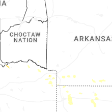
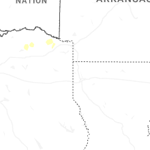
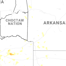
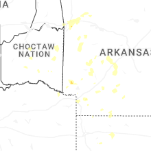


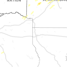


Connect with Interactive Hail Maps